

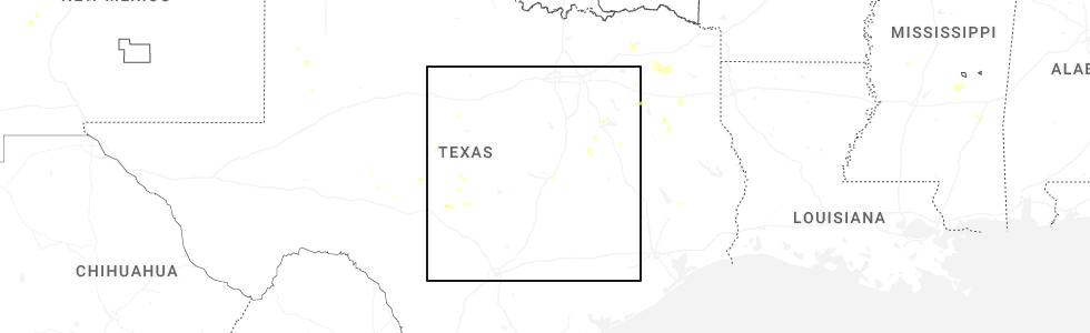
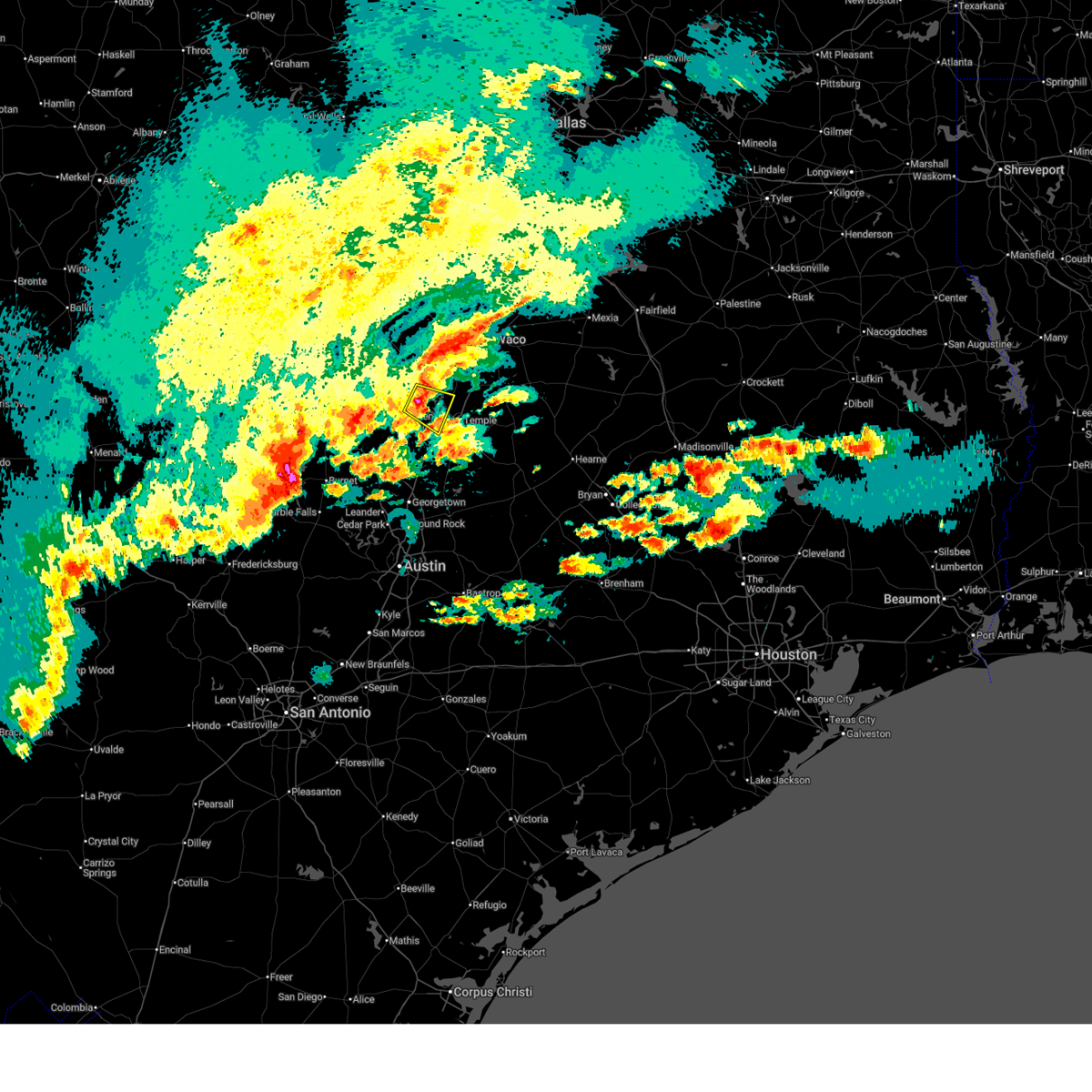
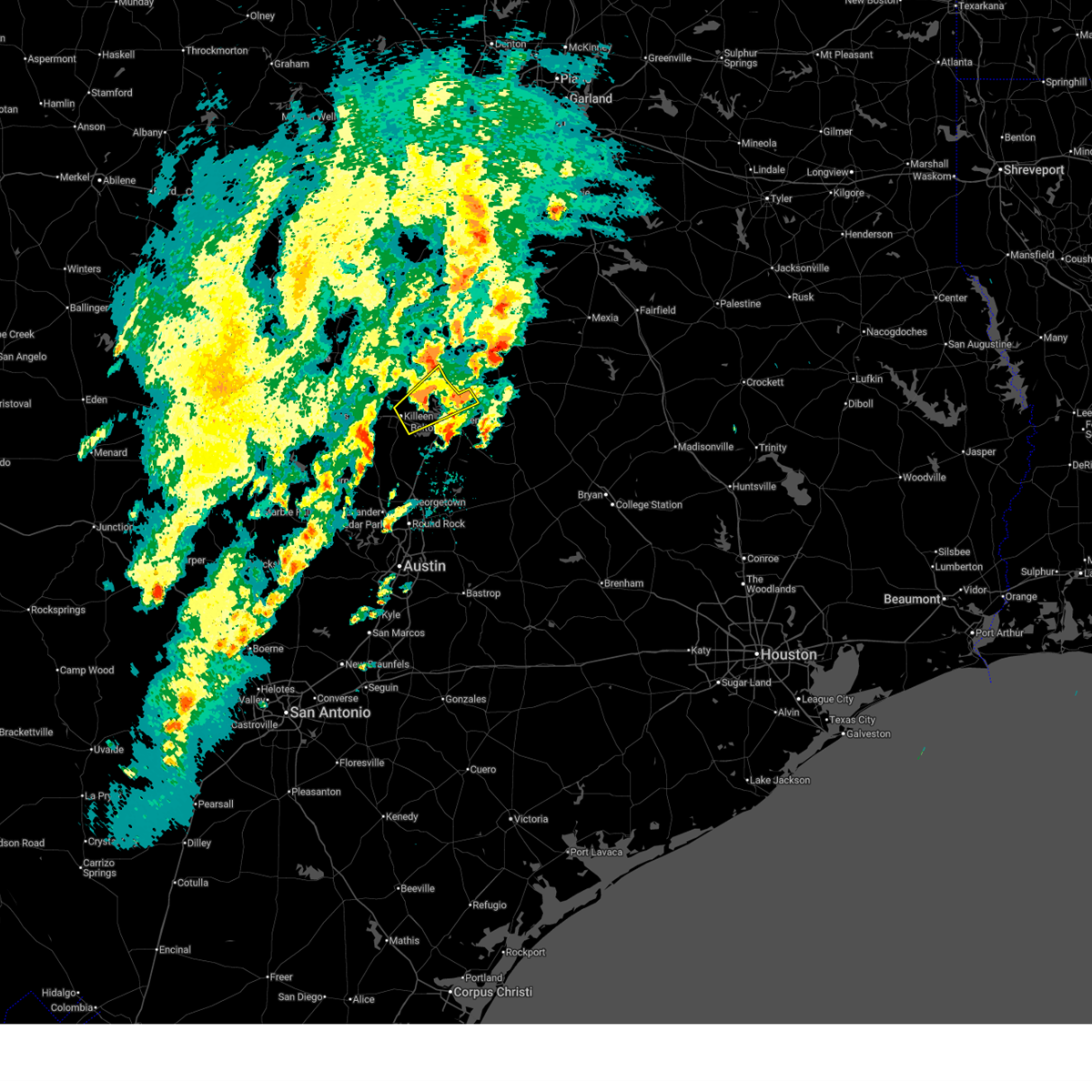
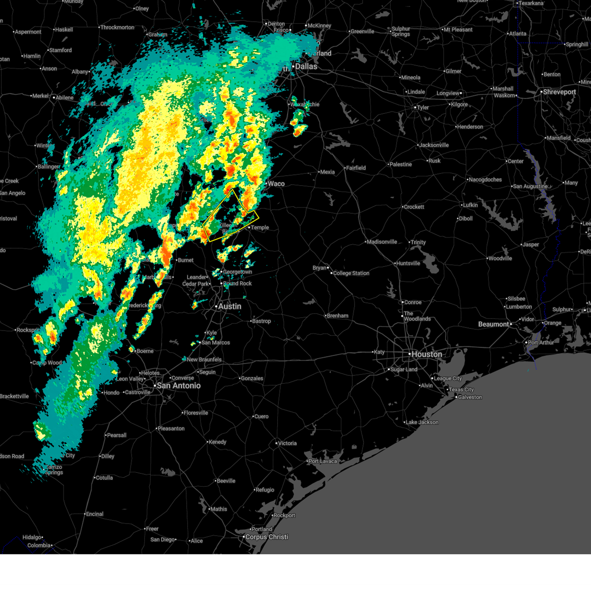
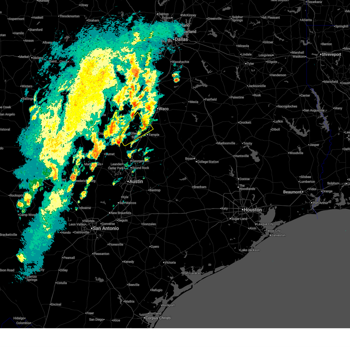
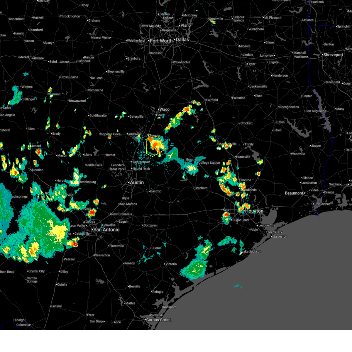
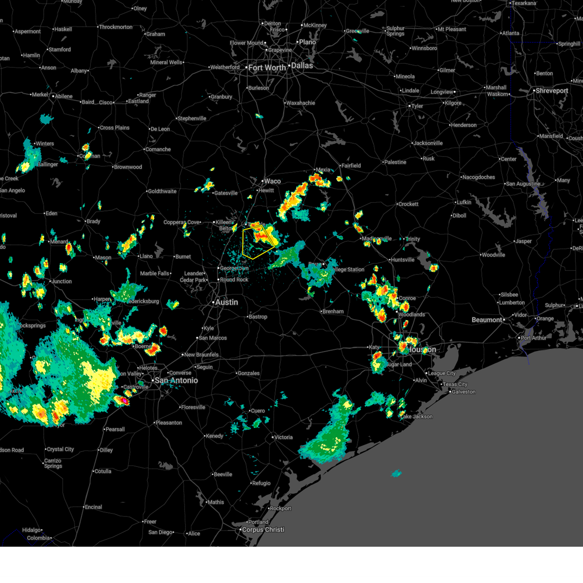
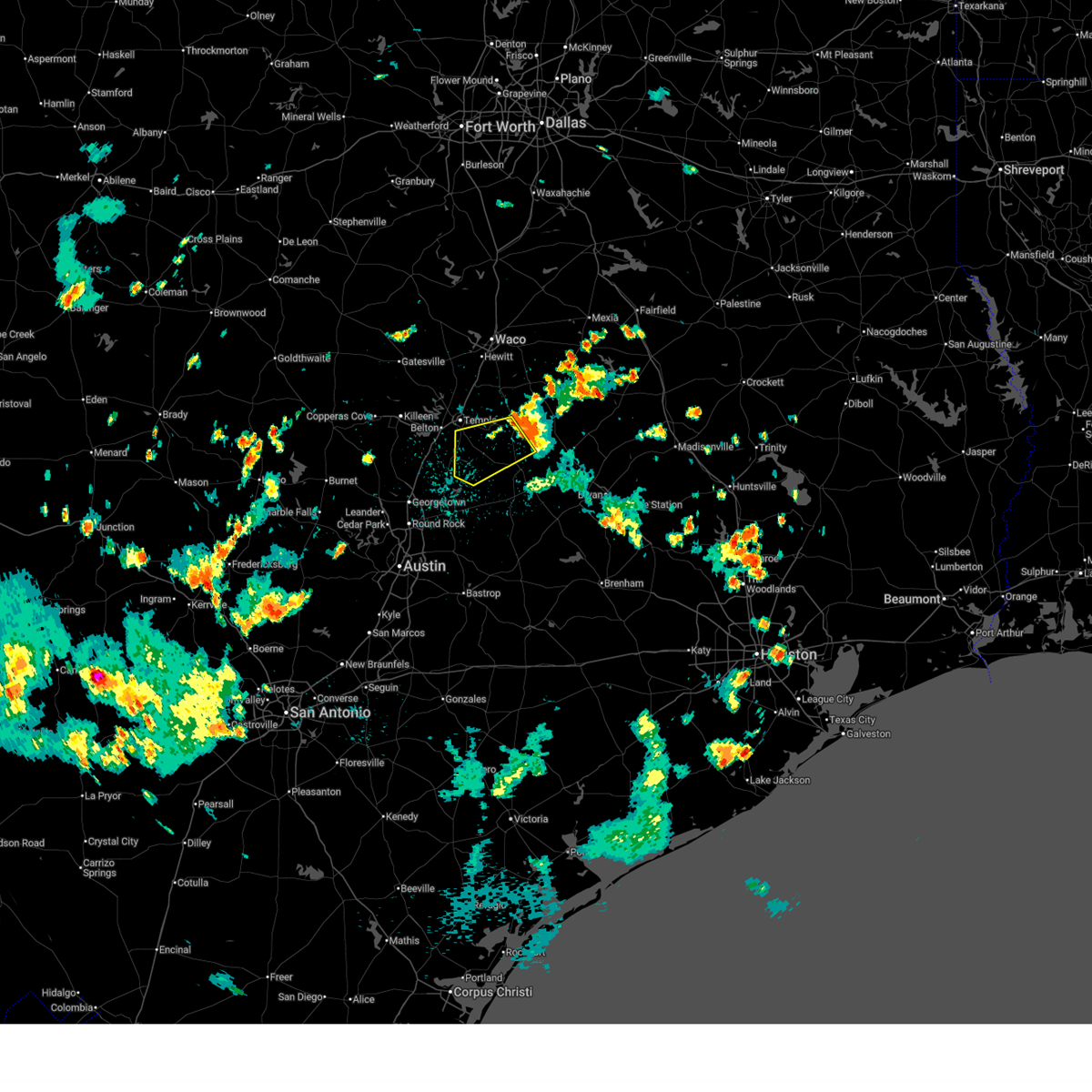
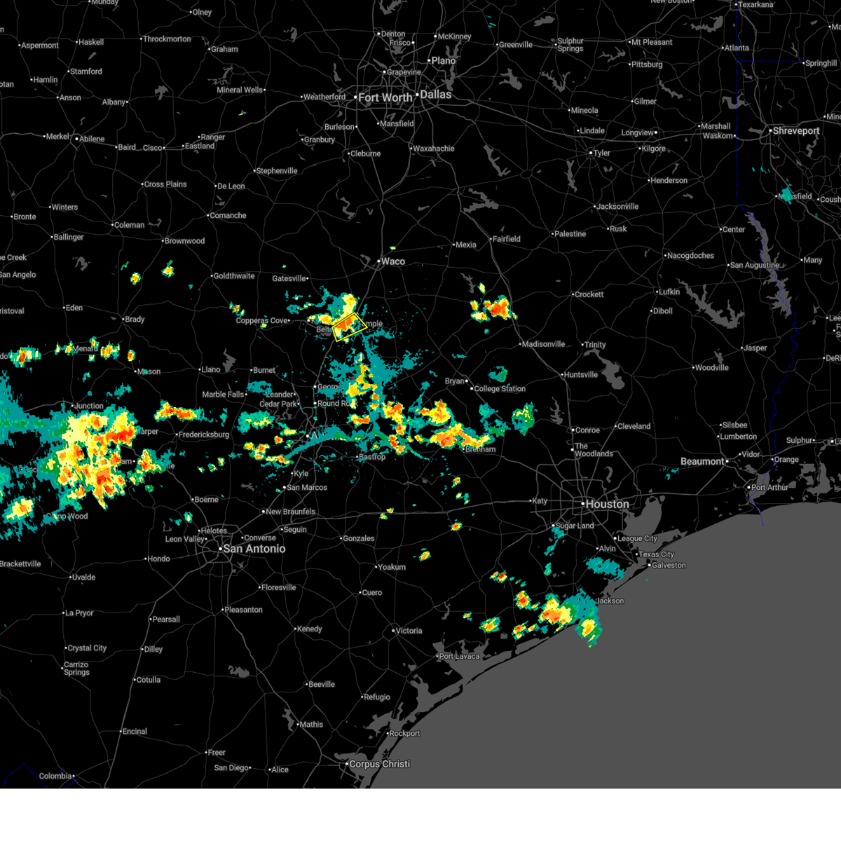
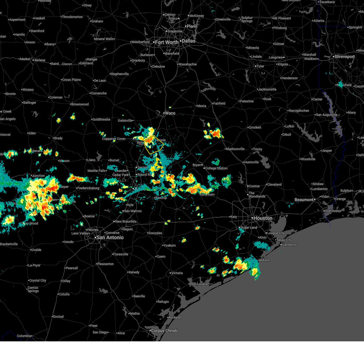
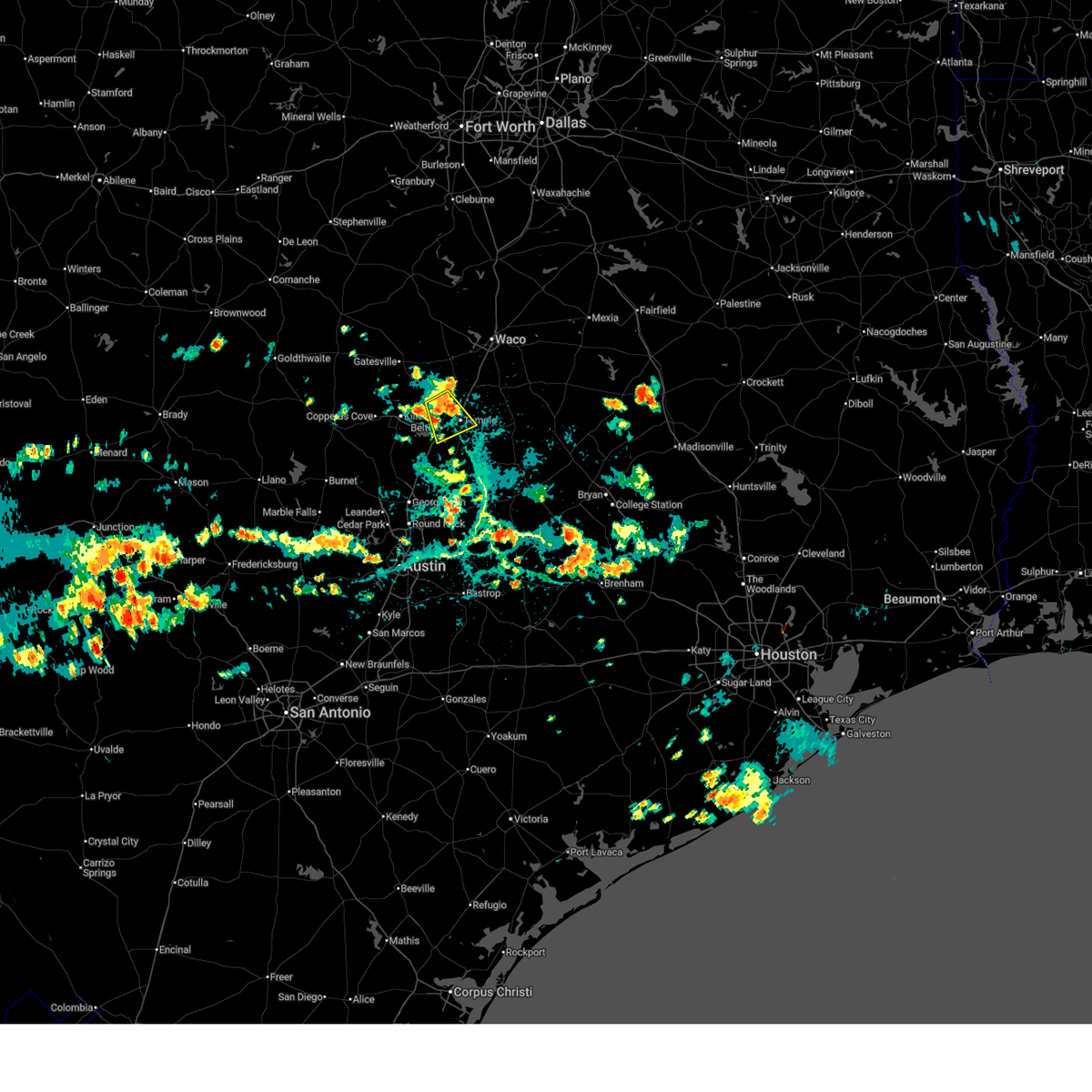
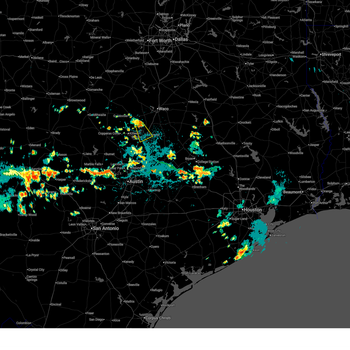
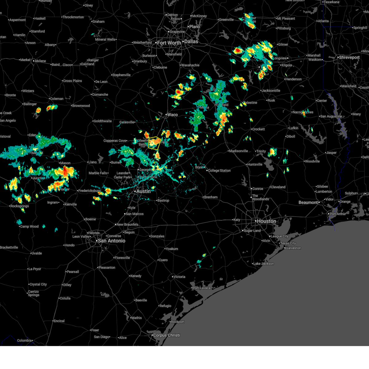
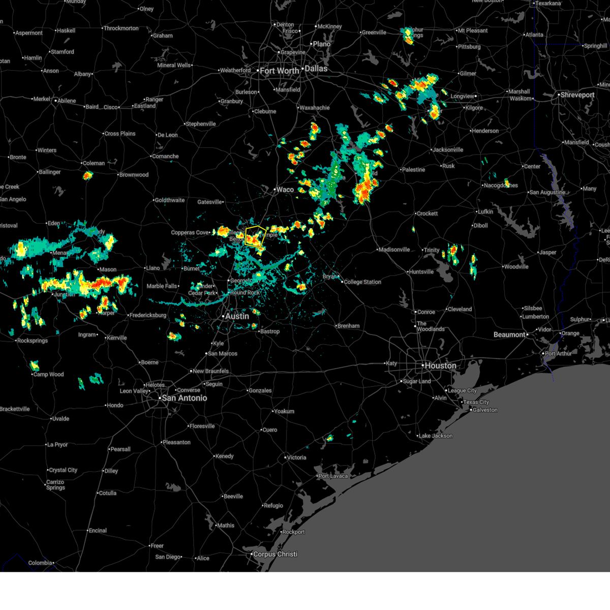
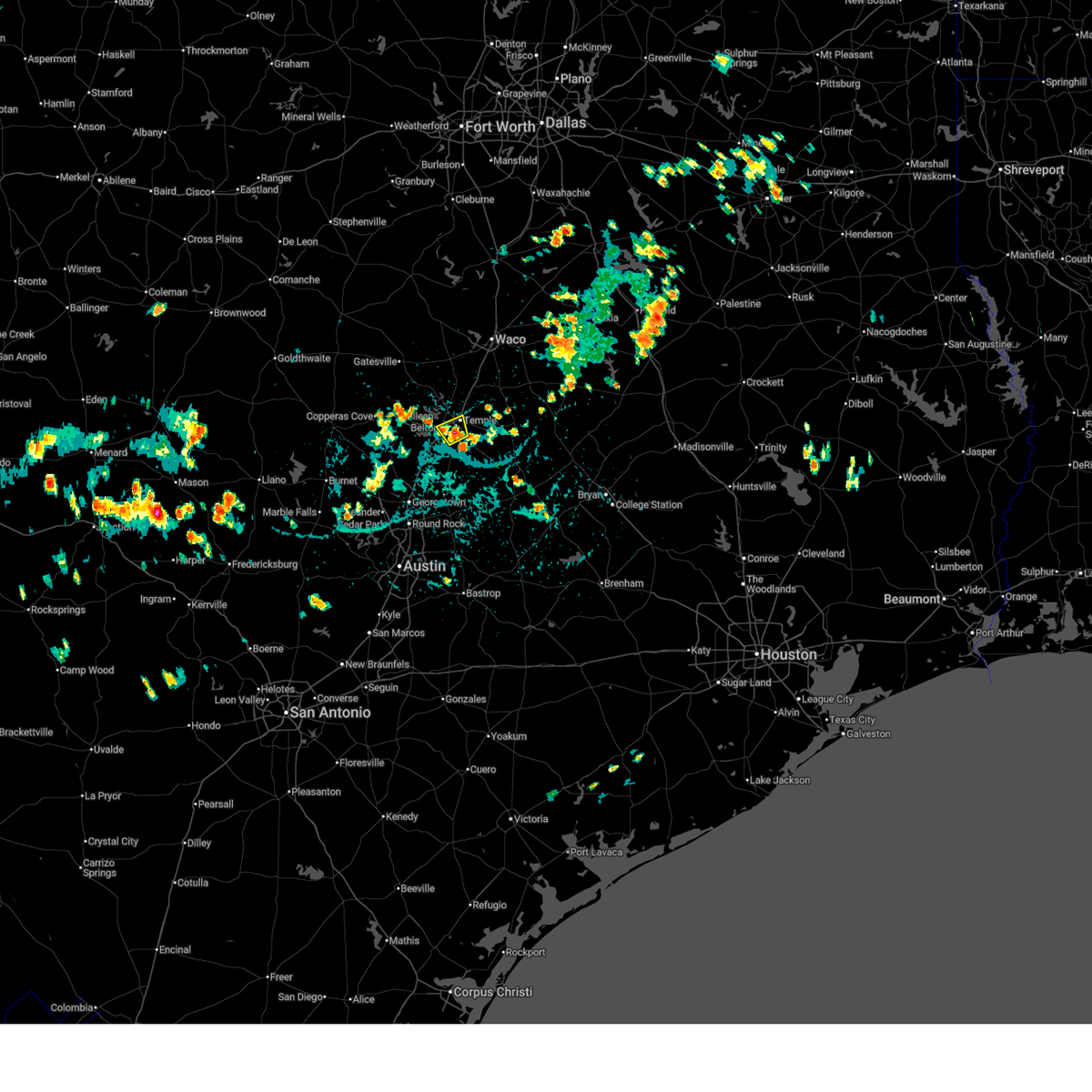
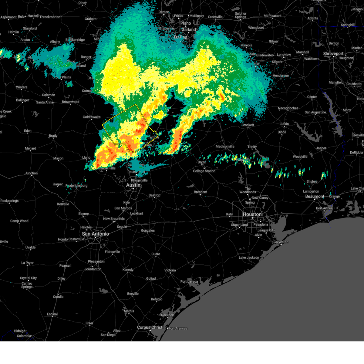
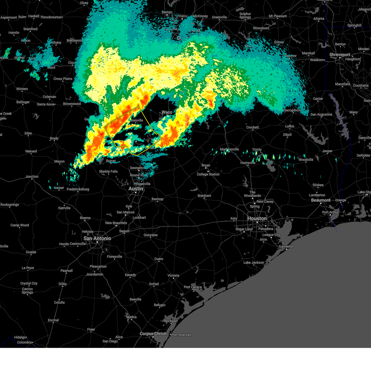
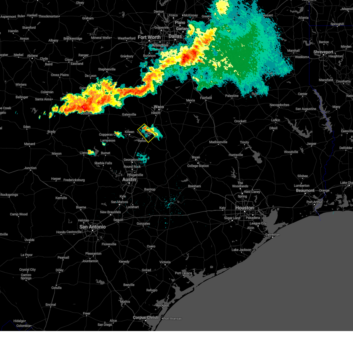
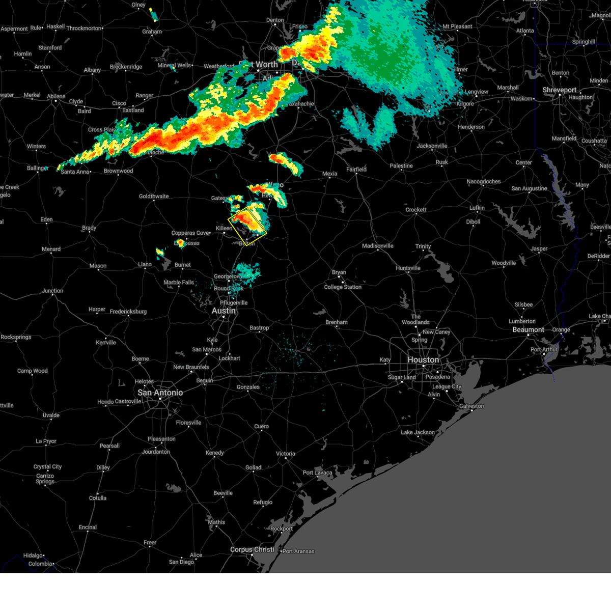
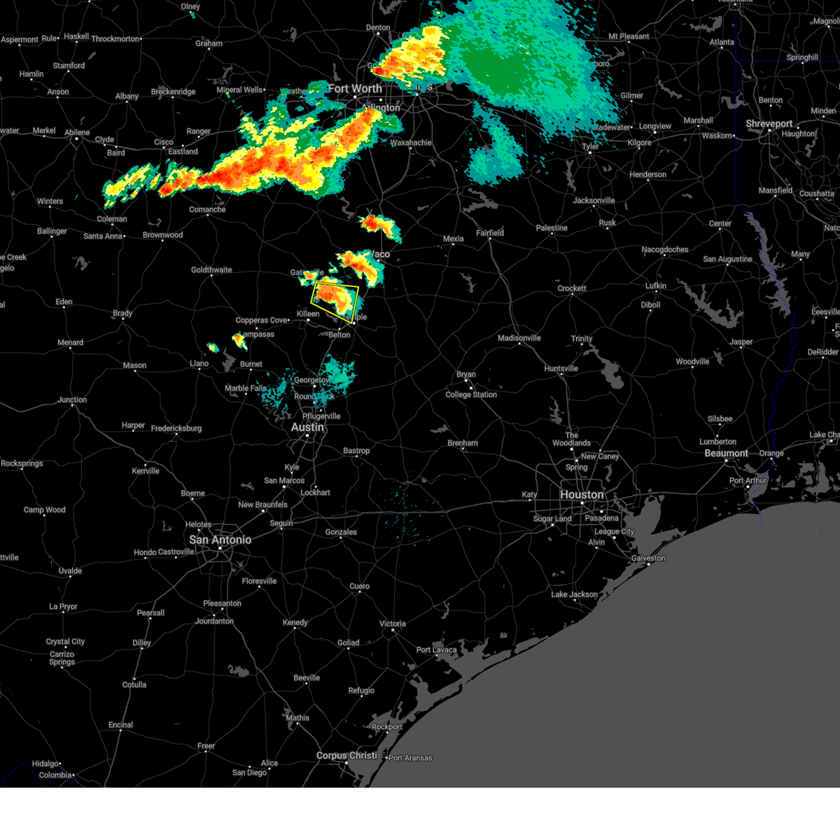
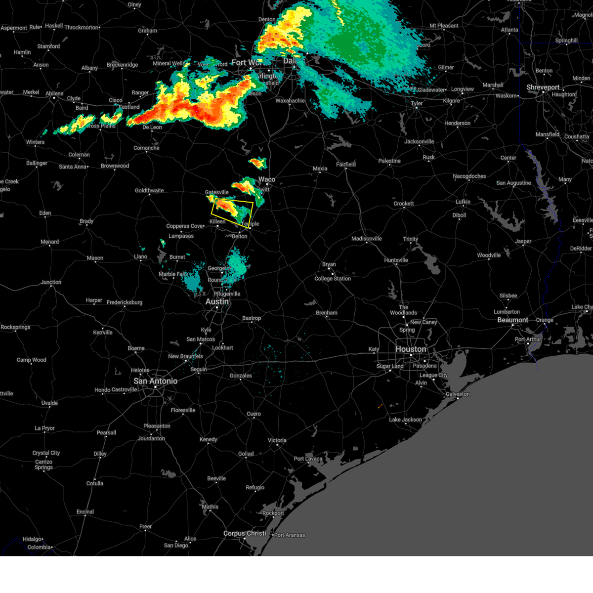
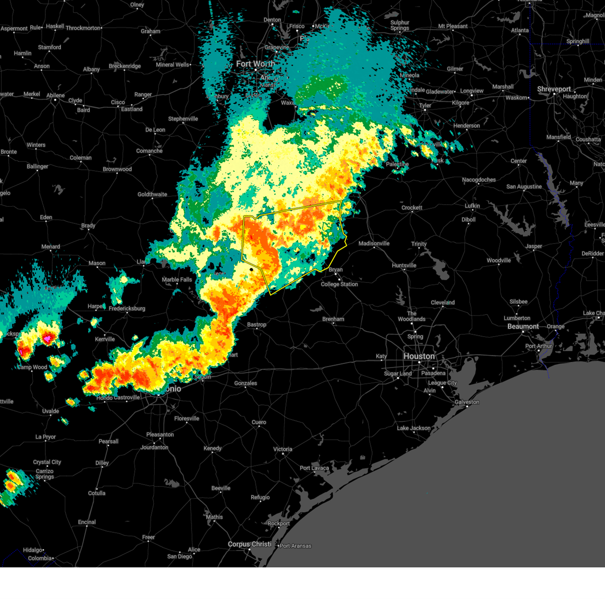
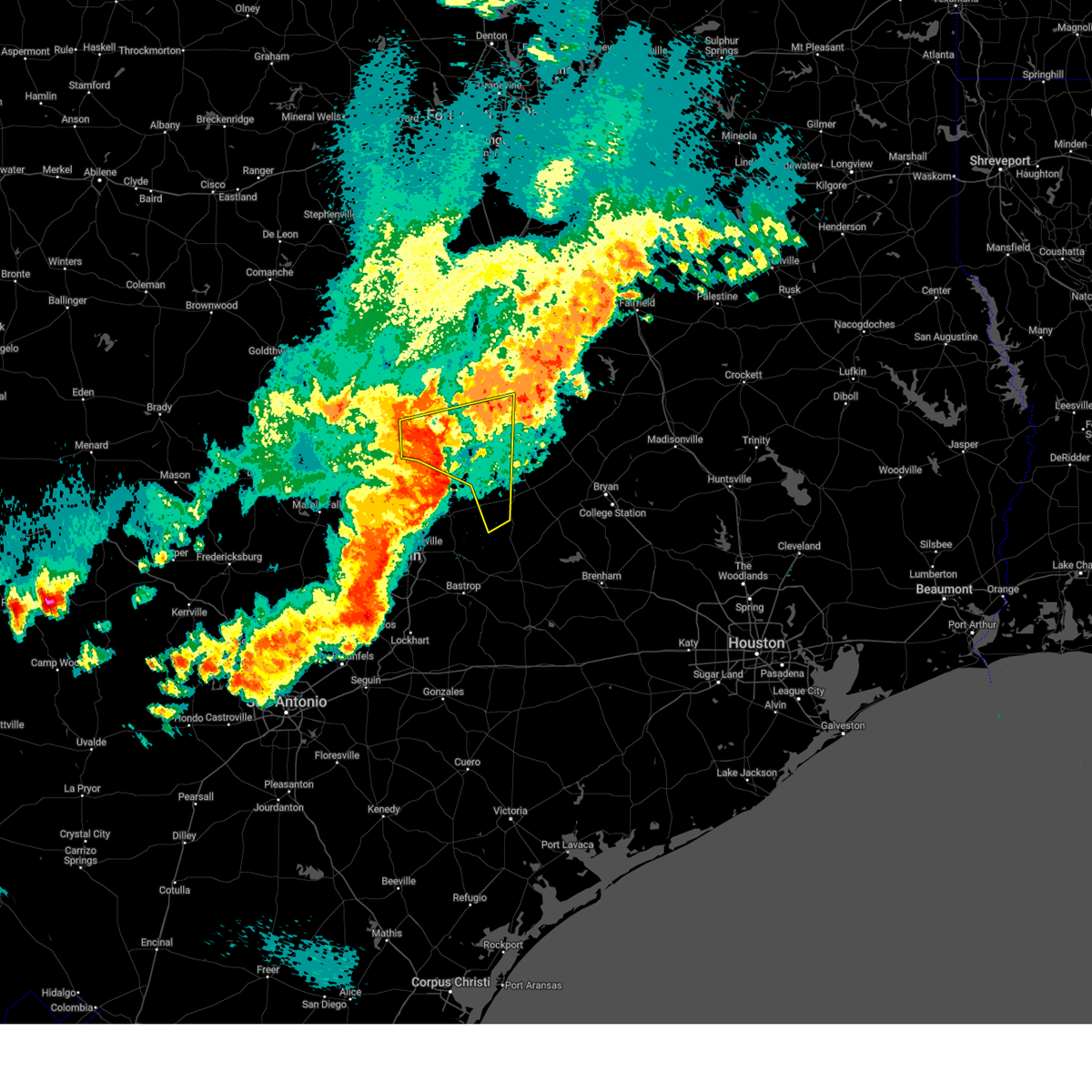
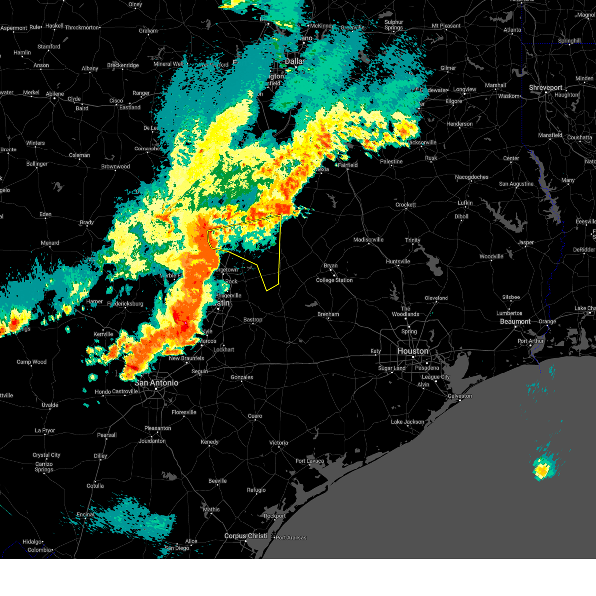
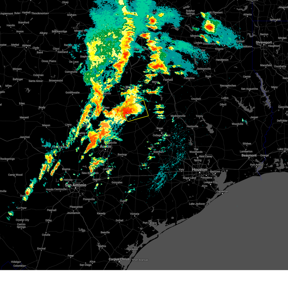
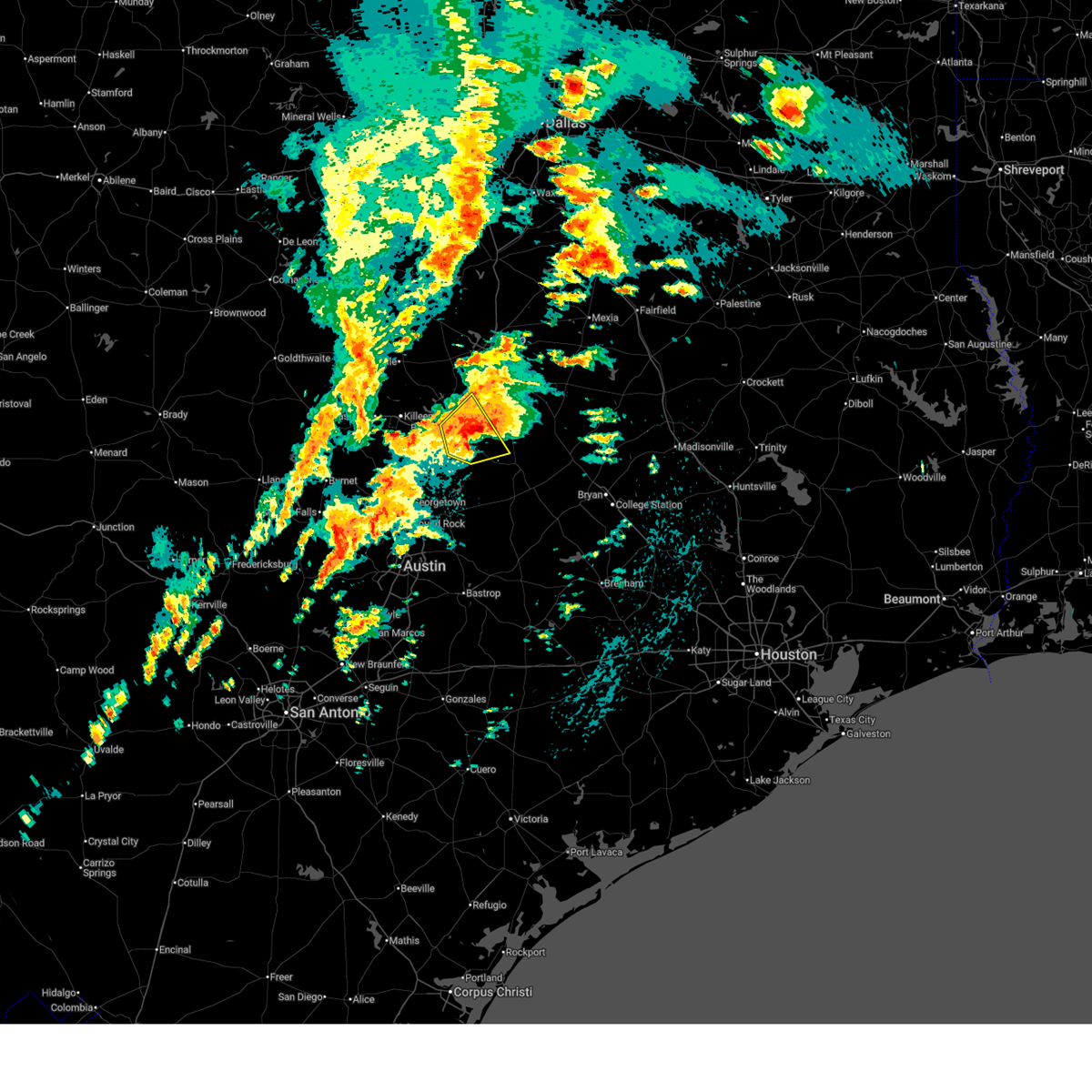
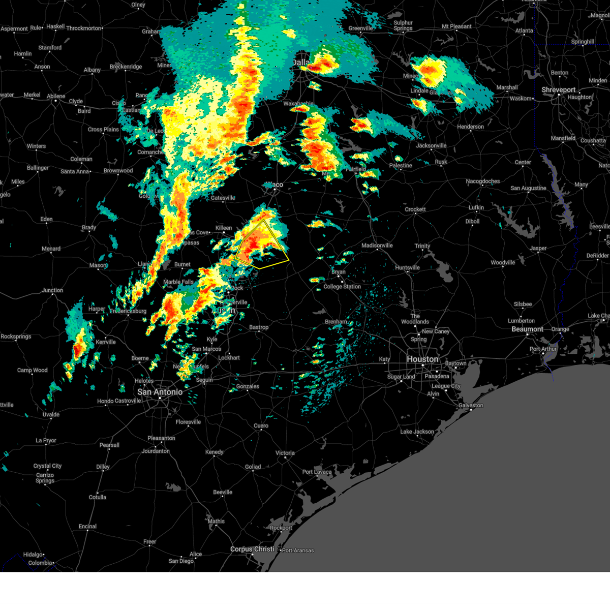
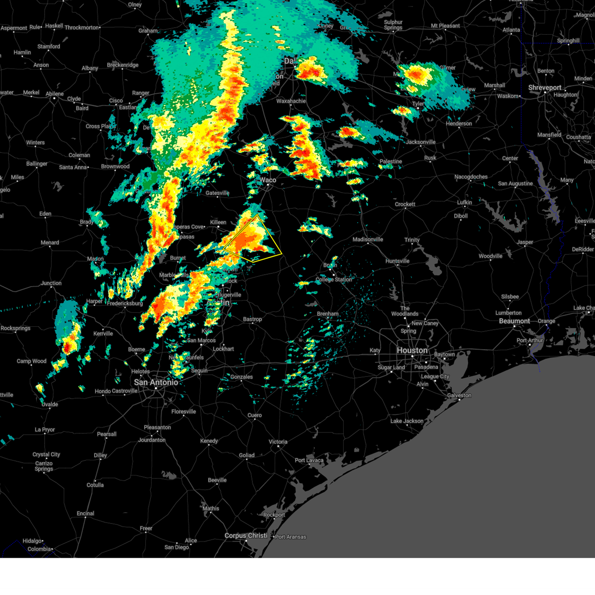
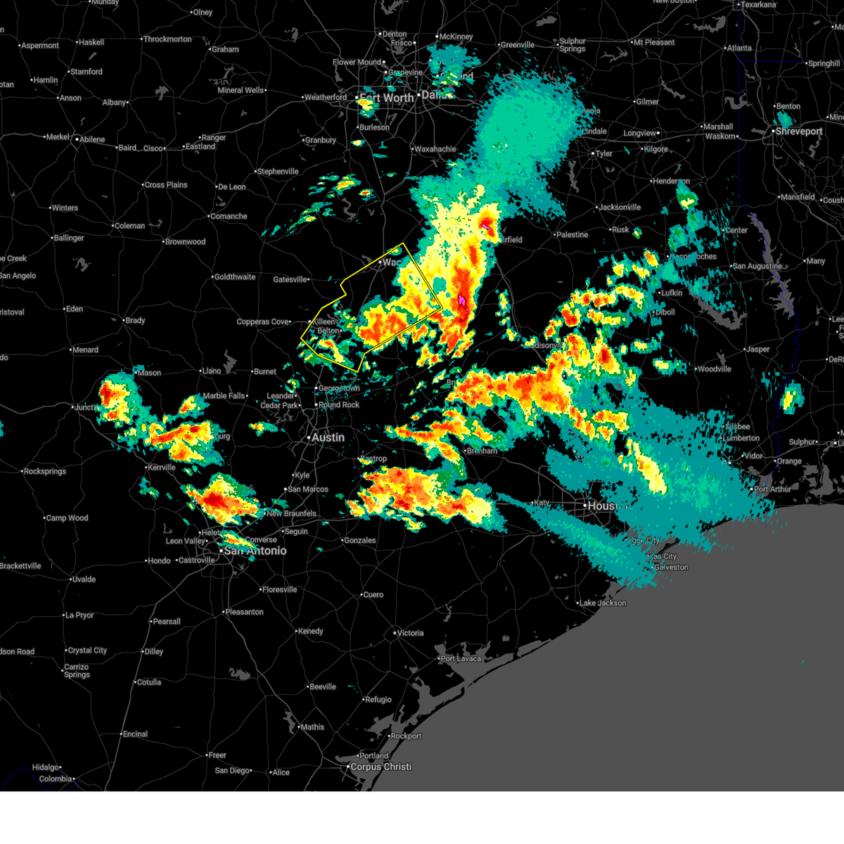
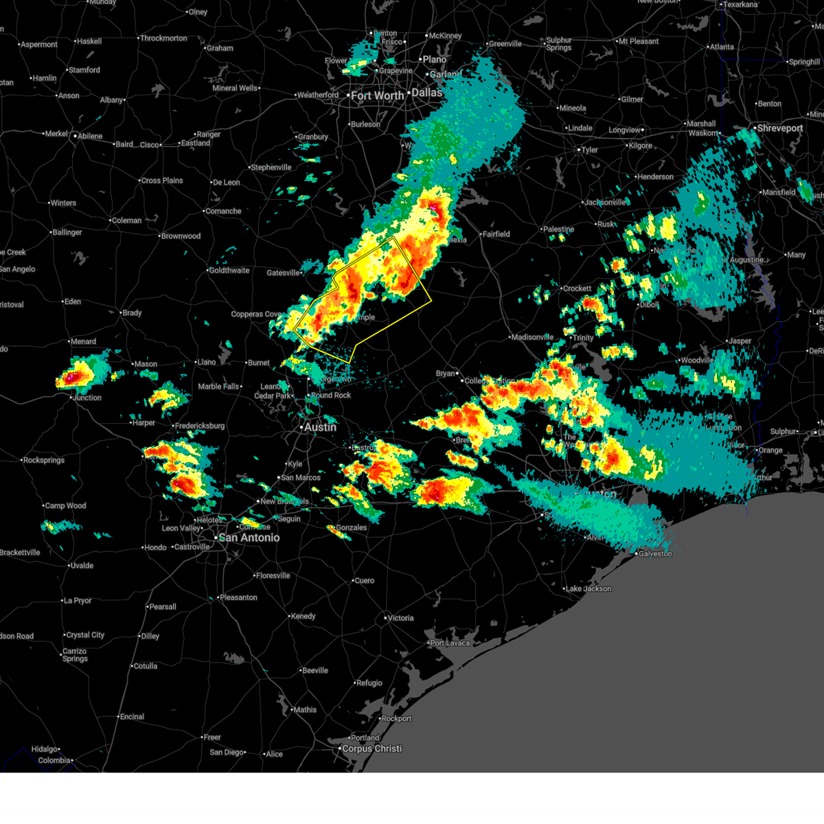
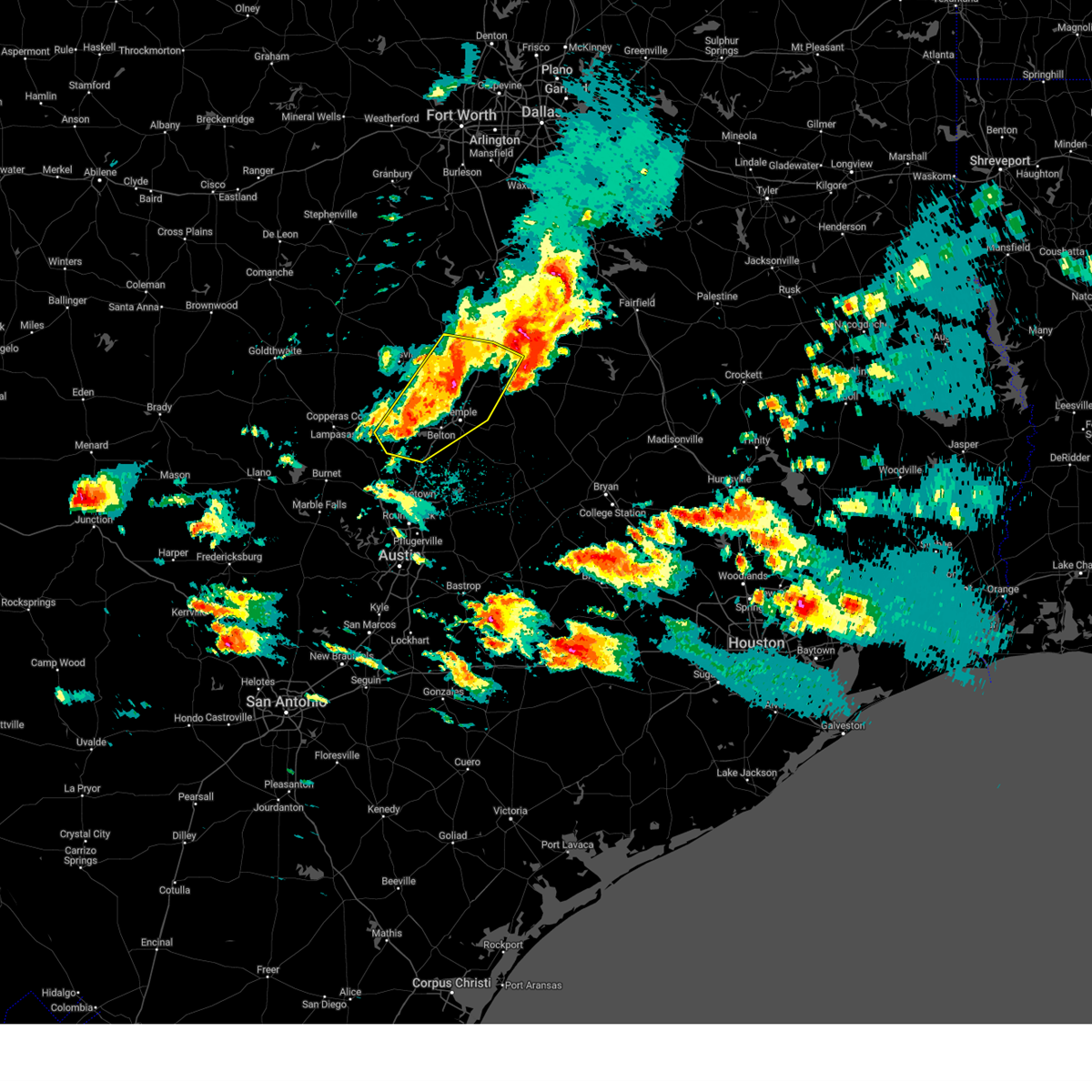
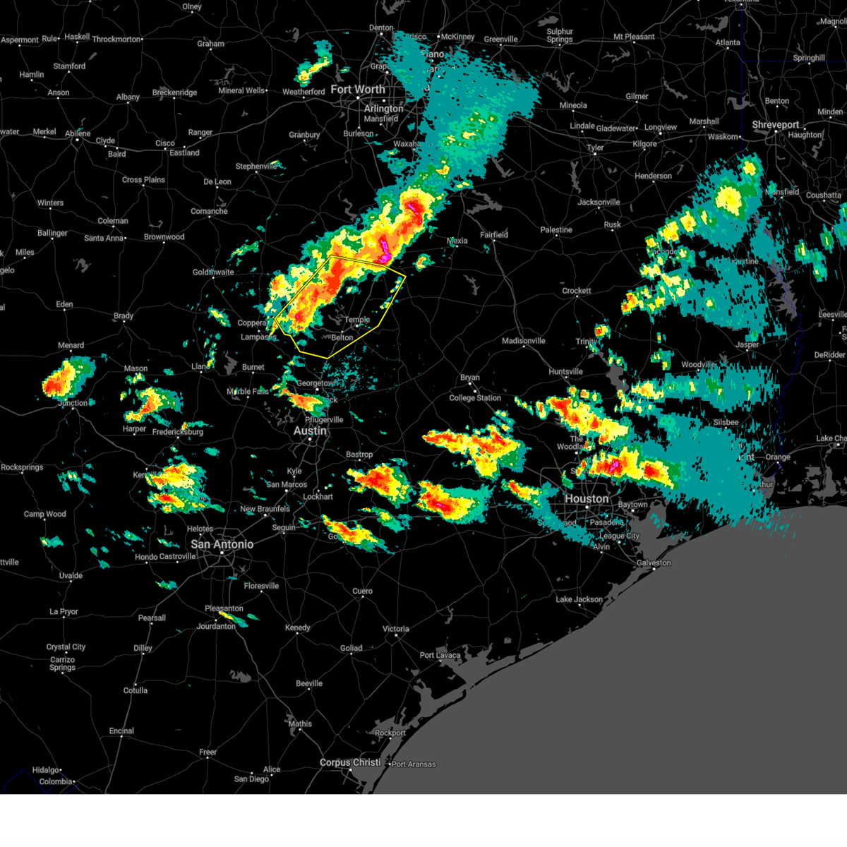
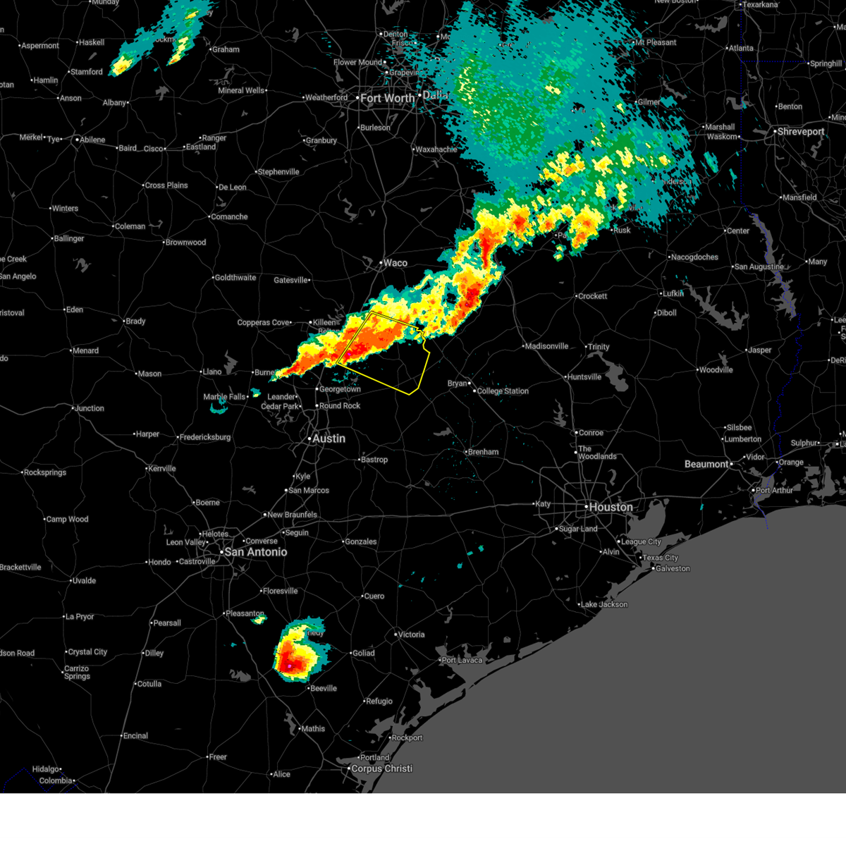
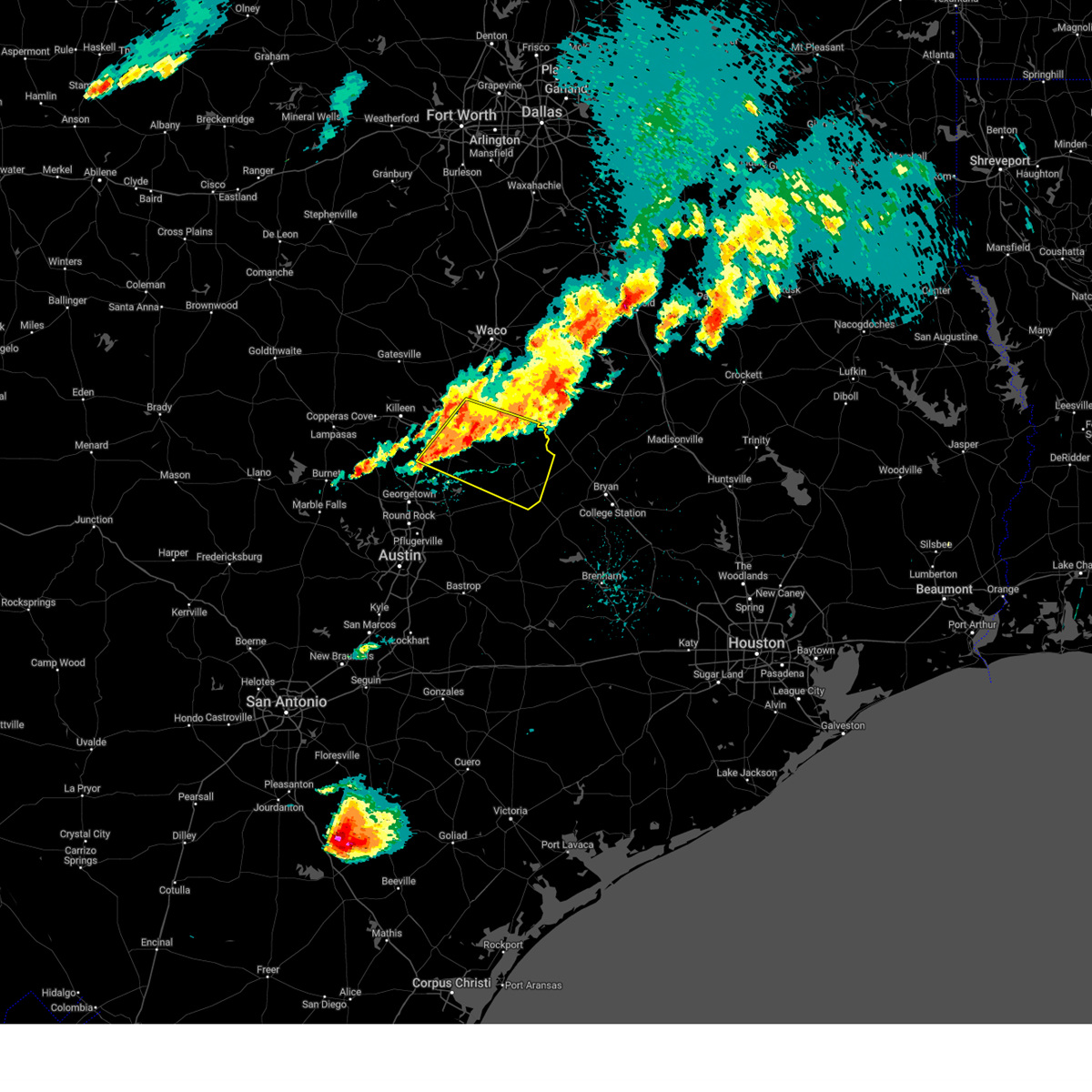
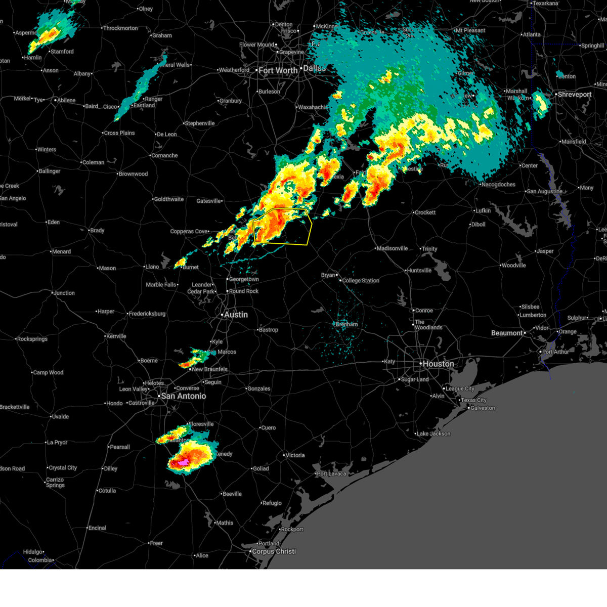
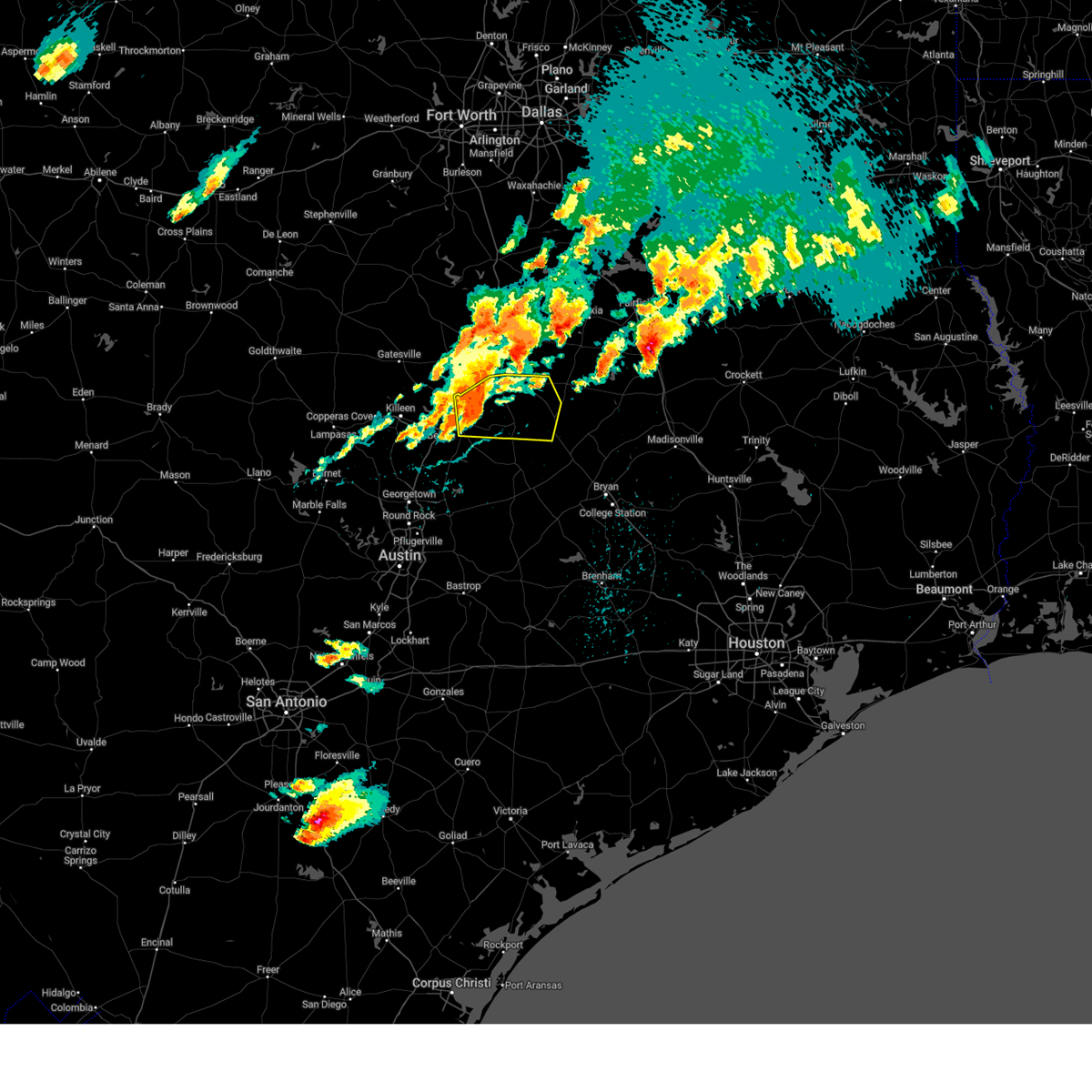
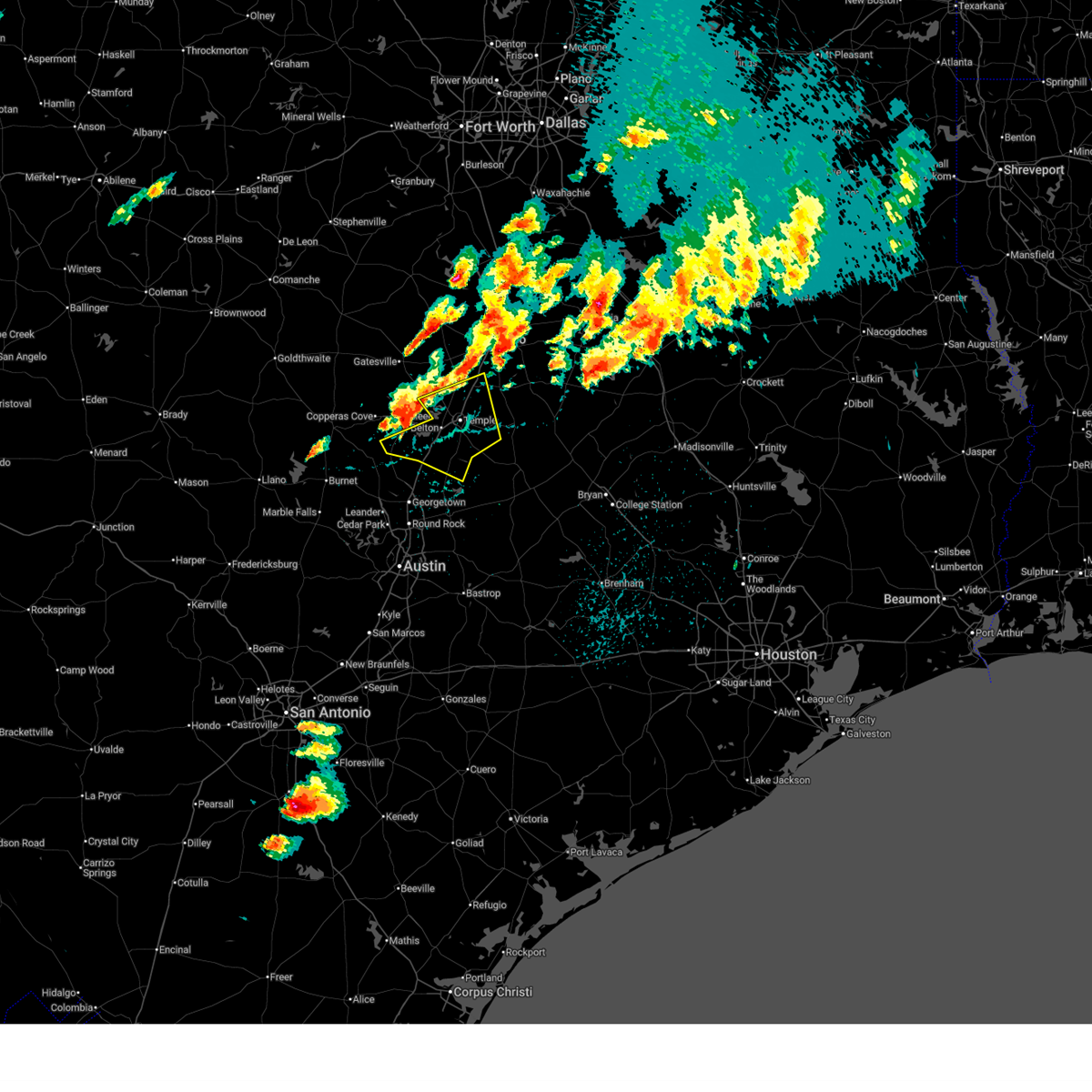
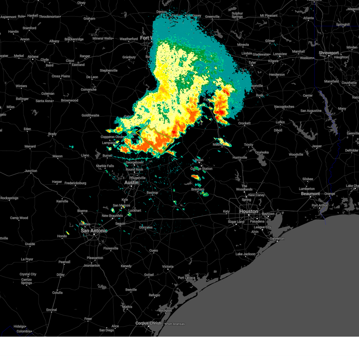
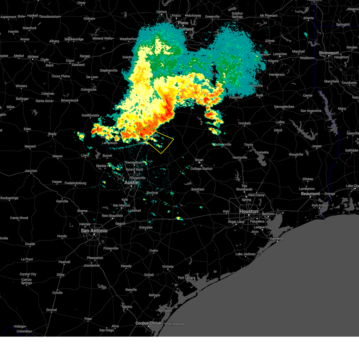
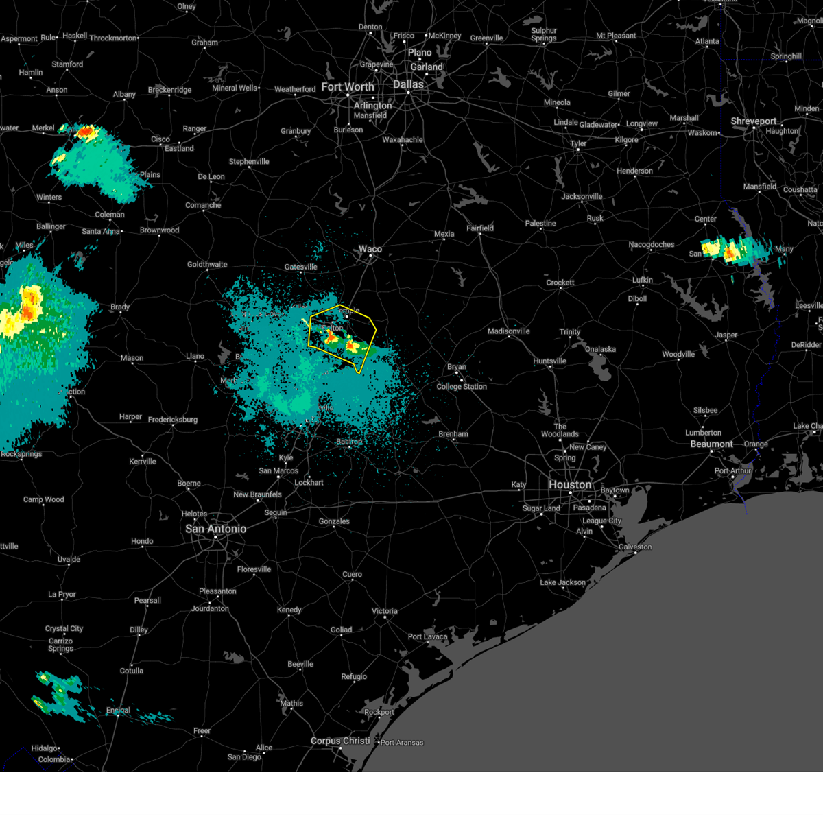
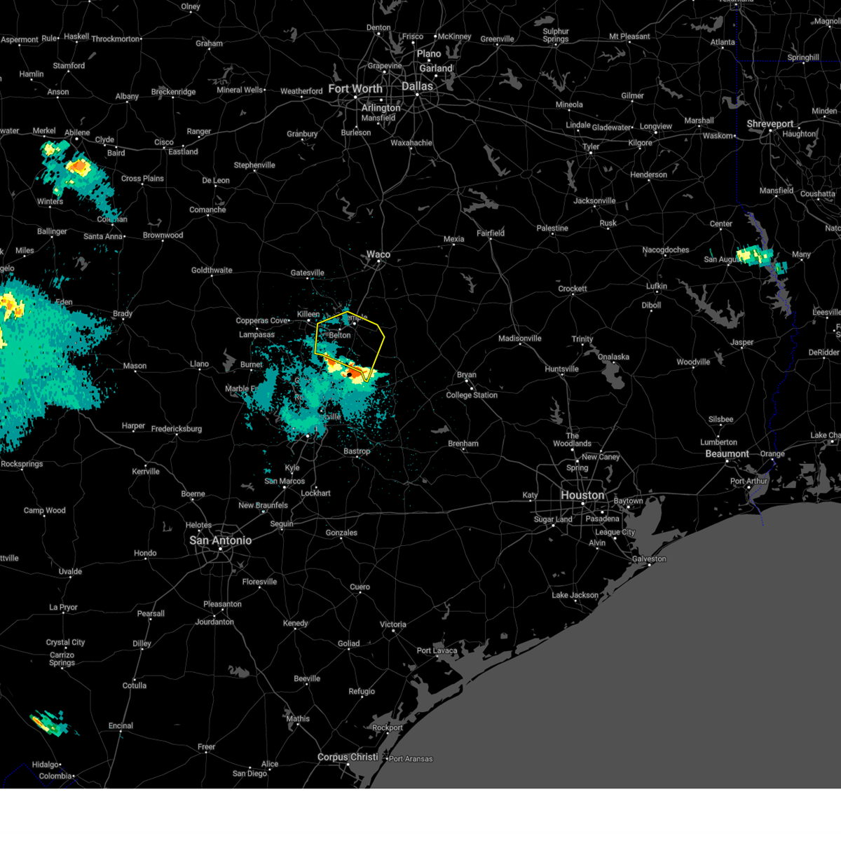
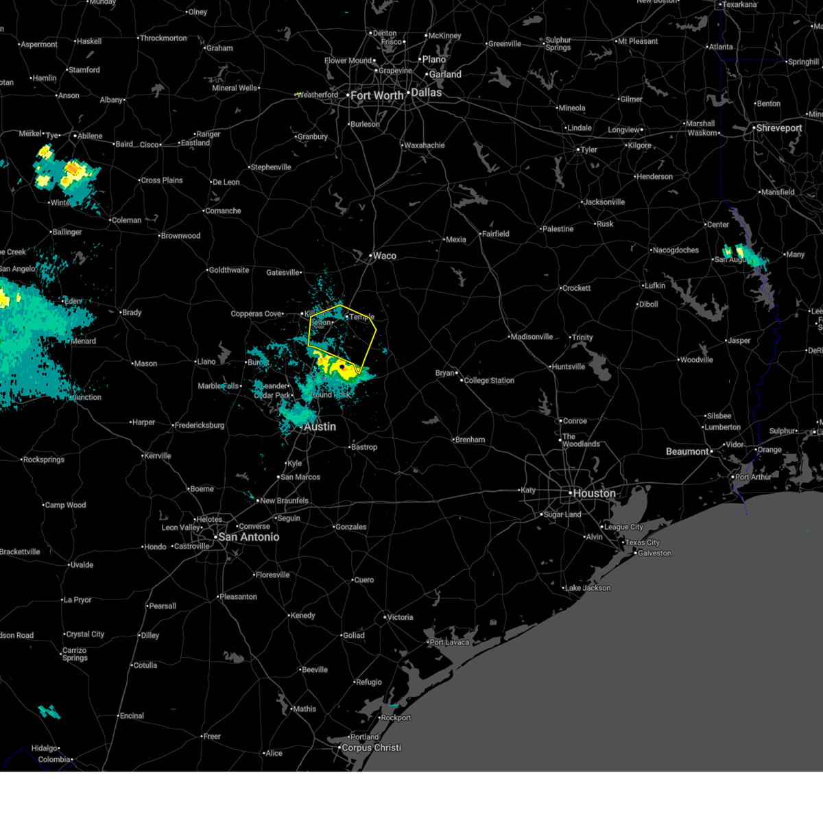
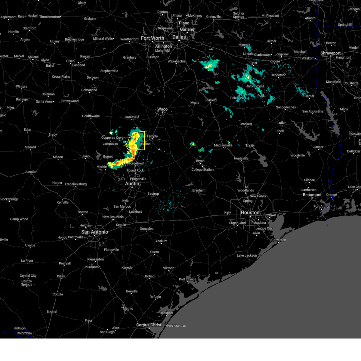
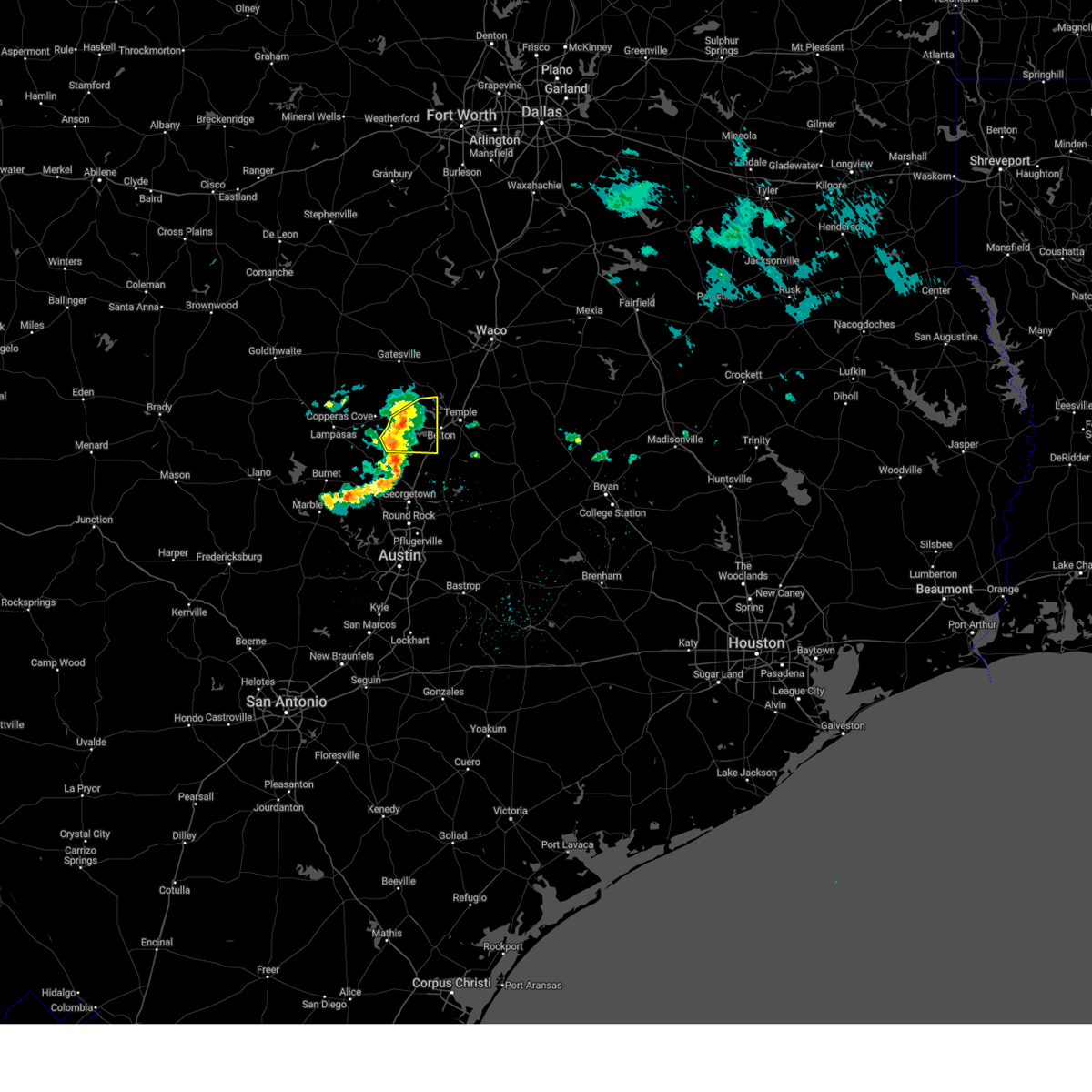
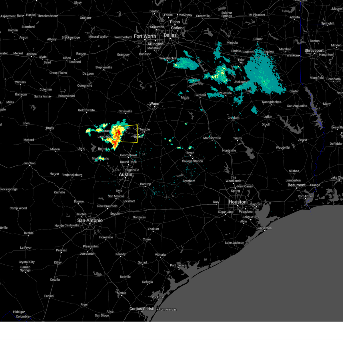
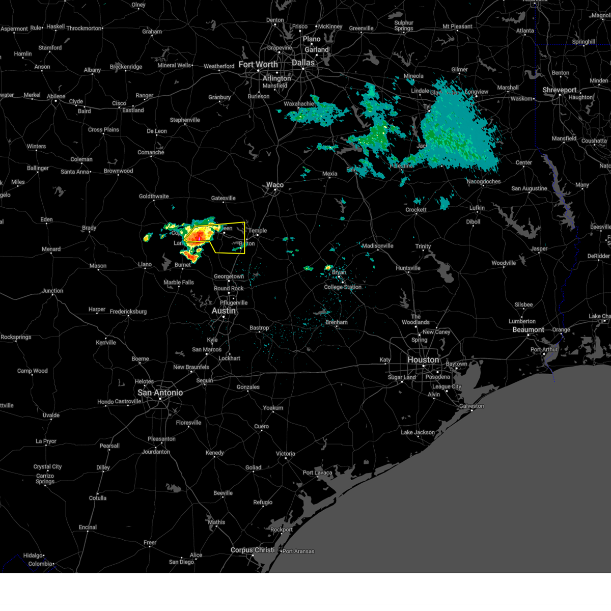
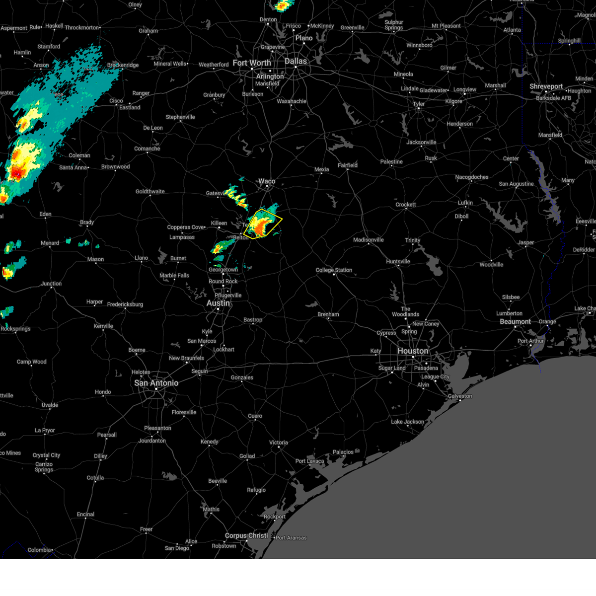
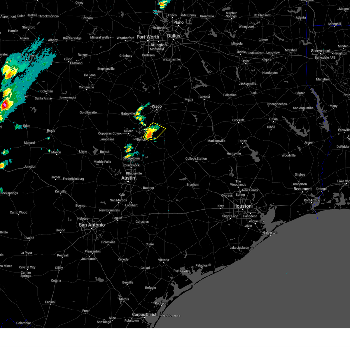
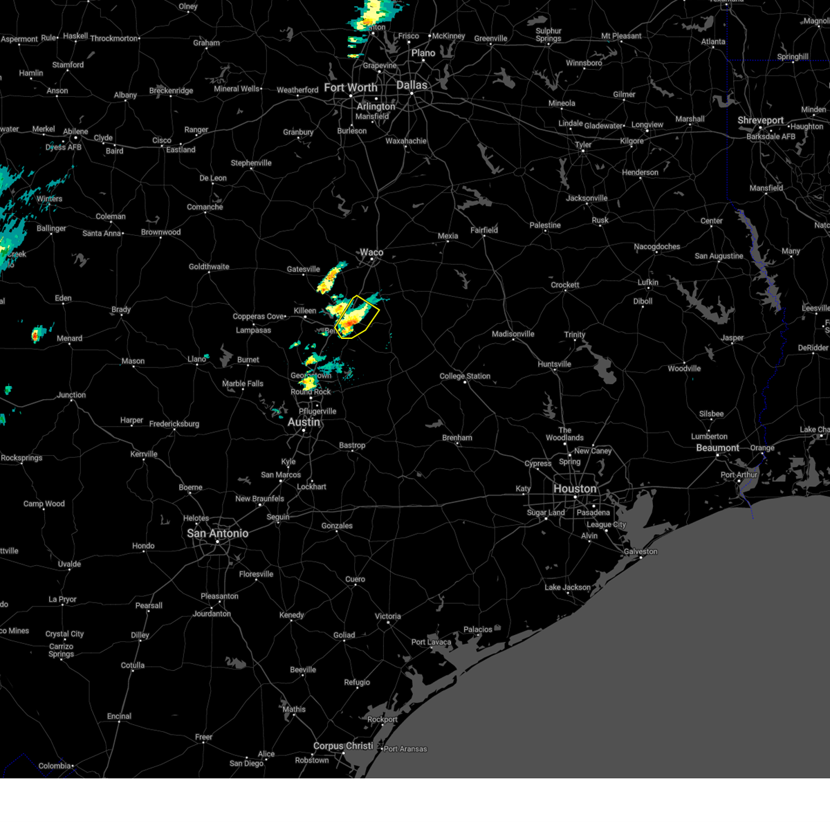
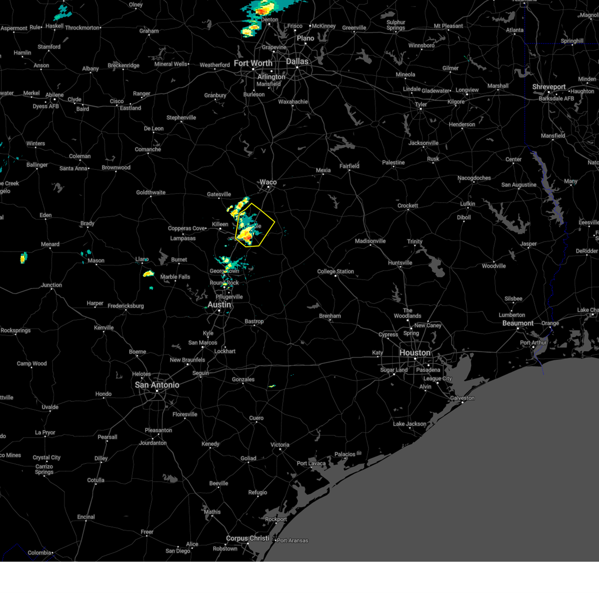
Hail Map for Temple, TX
The Temple, TX area has had 30 reports of on-the-ground hail by trained spotters, and has been under severe weather warnings 19 times during the past 12 months. Doppler radar has detected hail at or near Temple, TX on 101 occasions, including 4 occasions during the past year.
| Name: | Temple, TX |
| Where Located: | 19.7 miles E of Killeen, TX |
| Map: | Google Map for Temple, TX |
| Population: | 66102 |
| Housing Units: | 28422 |
| More Info: | Search Google for Temple, TX |
1
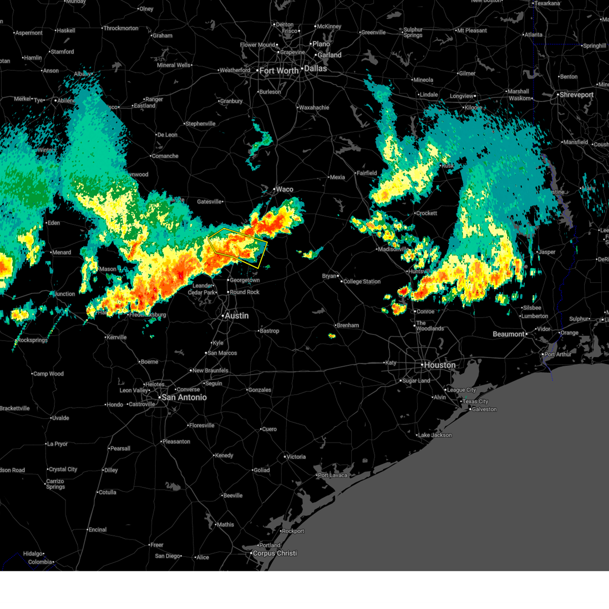
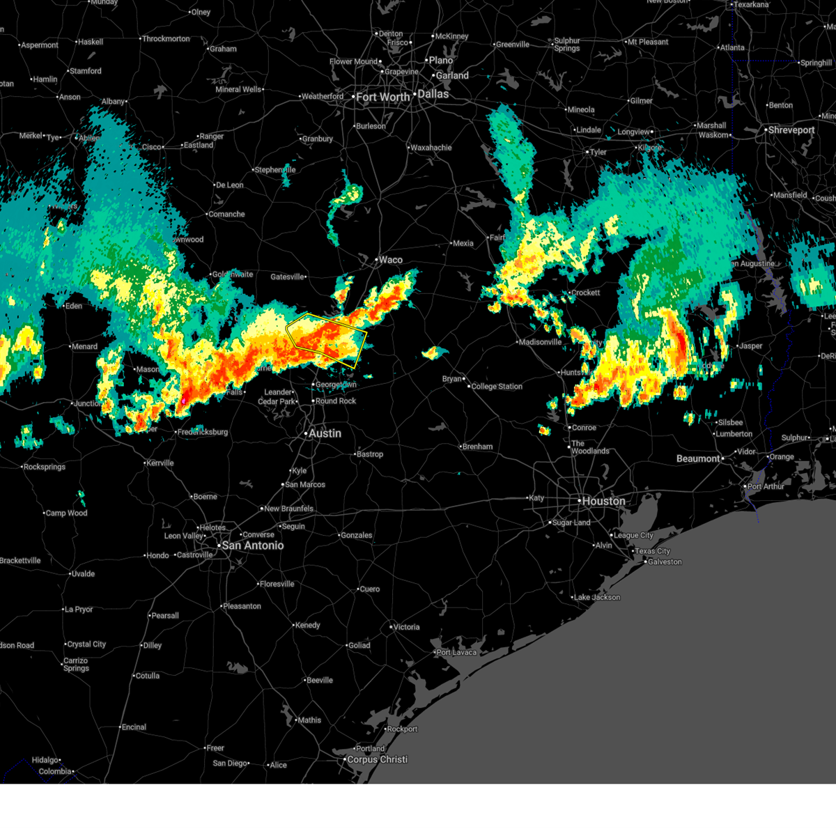
The Top Recent Hail Date for Temple, TX is Friday, August 1, 2025 (39th out of 101)
Hail and Wind Damage Spotted near Temple, TX
| Date / Time | Report Details |
|---|---|
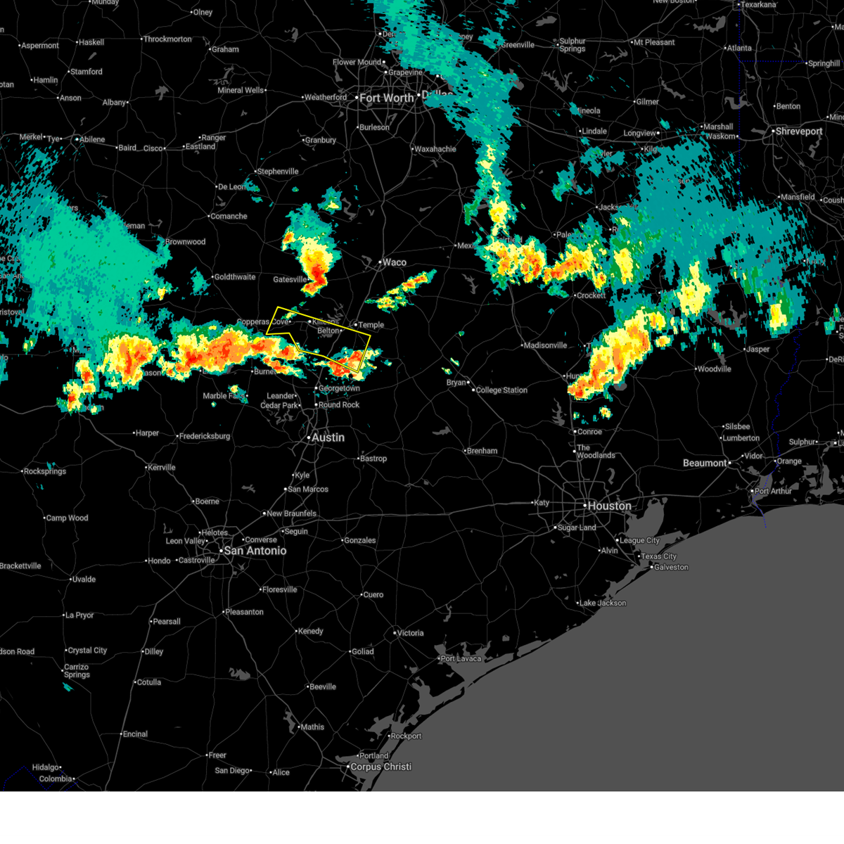
| 5/19/2026 8:08 PM CDT |
 The storms which prompted the warning have weakened below severe limits. therefore the warning will be allowed to expire. however gusty winds and heavy rain are still possible with these thunderstorms. a severe thunderstorm watch remains in effect until 100 am cdt for central texas. The storms which prompted the warning have weakened below severe limits. therefore the warning will be allowed to expire. however gusty winds and heavy rain are still possible with these thunderstorms. a severe thunderstorm watch remains in effect until 100 am cdt for central texas.
|
| 5/19/2026 7:52 PM CDT |
 At 752 pm cdt, severe thunderstorms were located along a line extending from near kempner to holland, moving northeast at 10 mph (radar indicated). Hazards include 60 mph wind gusts and quarter size hail. Hail damage to vehicles is expected. expect wind damage to roofs, siding, and trees. these severe storms will be near, killeen, copperas cove, salado, holland, and stillhouse hollow lake around 755 pm cdt. harker heights around 800 pm cdt. belton around 810 pm cdt. little river-academy around 815 pm cdt. Fort hood around 820 pm cdt. At 752 pm cdt, severe thunderstorms were located along a line extending from near kempner to holland, moving northeast at 10 mph (radar indicated). Hazards include 60 mph wind gusts and quarter size hail. Hail damage to vehicles is expected. expect wind damage to roofs, siding, and trees. these severe storms will be near, killeen, copperas cove, salado, holland, and stillhouse hollow lake around 755 pm cdt. harker heights around 800 pm cdt. belton around 810 pm cdt. little river-academy around 815 pm cdt. Fort hood around 820 pm cdt.
|
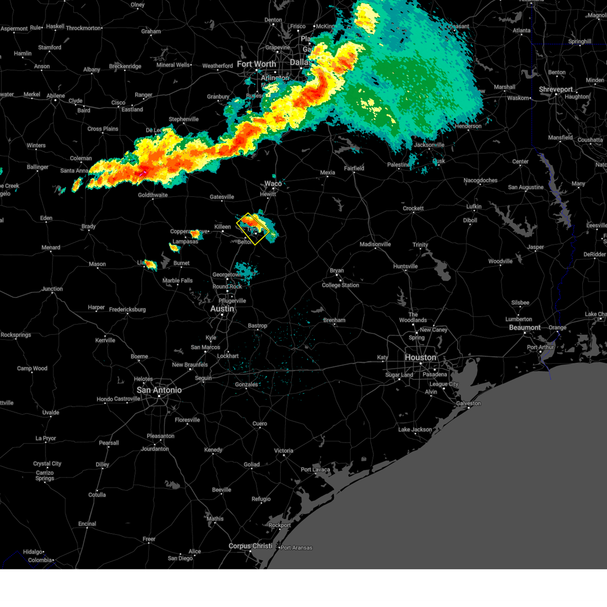
| 5/19/2026 7:04 PM CDT |
 Svrfwd the national weather service in fort worth has issued a * severe thunderstorm warning for, southwestern coryell county in central texas, southeastern lampasas county in central texas, bell county in central texas, * until 815 pm cdt. * at 703 pm cdt, severe thunderstorms were located along a line extending from near watson to bartlett, moving northeast at 10 mph (radar indicated). Hazards include 60 mph wind gusts and quarter size hail. Hail damage to vehicles is expected. expect wind damage to roofs, siding, and trees. severe thunderstorms will be near, holland around 710 pm cdt. salado around 715 pm cdt. stillhouse hollow lake around 735 pm cdt. kempner around 740 pm cdt. Other locations impacted by these severe thunderstorms include cedar valley, maxdale, topsey, heidenheimer, union grove, youngsport, ding dong, sparks, and prairie dell. Svrfwd the national weather service in fort worth has issued a * severe thunderstorm warning for, southwestern coryell county in central texas, southeastern lampasas county in central texas, bell county in central texas, * until 815 pm cdt. * at 703 pm cdt, severe thunderstorms were located along a line extending from near watson to bartlett, moving northeast at 10 mph (radar indicated). Hazards include 60 mph wind gusts and quarter size hail. Hail damage to vehicles is expected. expect wind damage to roofs, siding, and trees. severe thunderstorms will be near, holland around 710 pm cdt. salado around 715 pm cdt. stillhouse hollow lake around 735 pm cdt. kempner around 740 pm cdt. Other locations impacted by these severe thunderstorms include cedar valley, maxdale, topsey, heidenheimer, union grove, youngsport, ding dong, sparks, and prairie dell.
|
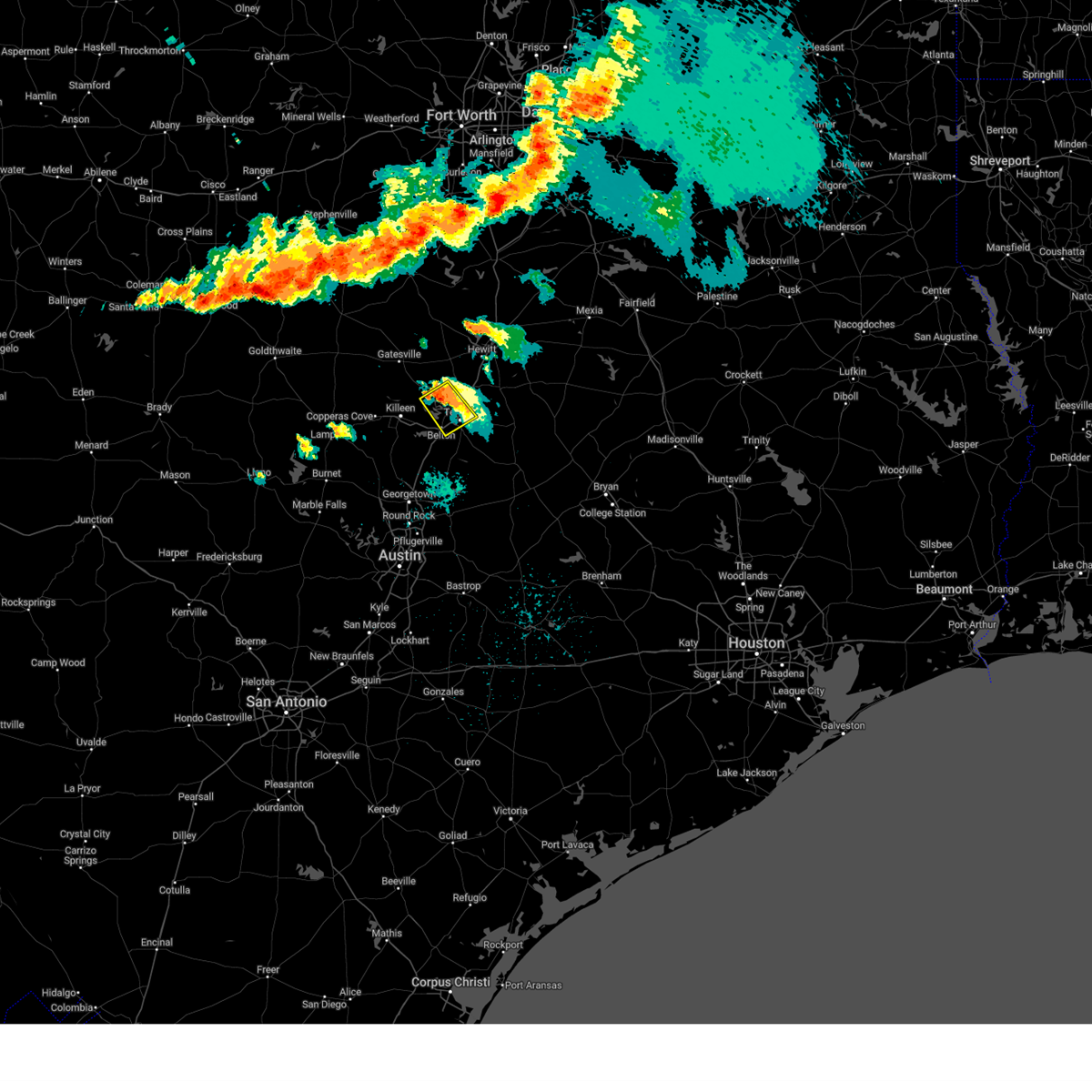
| 5/10/2026 8:33 PM CDT |
 Svrfwd the national weather service in fort worth has issued a * severe thunderstorm warning for, southeastern coryell county in central texas, north central bell county in central texas, * until 900 pm cdt. * at 833 pm cdt, a severe thunderstorm was located 8 miles north of nolanville, or 10 miles northeast of killeen, moving southeast at 20 mph (radar indicated). Hazards include quarter size hail. damage to vehicles is possible Svrfwd the national weather service in fort worth has issued a * severe thunderstorm warning for, southeastern coryell county in central texas, north central bell county in central texas, * until 900 pm cdt. * at 833 pm cdt, a severe thunderstorm was located 8 miles north of nolanville, or 10 miles northeast of killeen, moving southeast at 20 mph (radar indicated). Hazards include quarter size hail. damage to vehicles is possible
|
| 11/20/2025 4:38 PM CST |
 The storm which prompted the warning has weakened below severe limits. therefore the warning will be allowed to expire. however gusty winds are still possible with this thunderstorm. The storm which prompted the warning has weakened below severe limits. therefore the warning will be allowed to expire. however gusty winds are still possible with this thunderstorm.
|
| 11/20/2025 4:23 PM CST |
 At 422 pm cst, a severe thunderstorm was located near nolanville, or near harker heights, moving northeast at 35 mph (radar indicated). Hazards include 60 mph wind gusts and quarter size hail. Hail damage to vehicles is expected. expect wind damage to roofs, siding, and trees. this severe storm will be near, belton lake around 430 pm cst. morgan's point resort around 435 pm cst. Other locations impacted by this severe thunderstorm include pendleton, whitson, moffat, the grove, owl creek, meadow grove, woodland, white hall, and flat. At 422 pm cst, a severe thunderstorm was located near nolanville, or near harker heights, moving northeast at 35 mph (radar indicated). Hazards include 60 mph wind gusts and quarter size hail. Hail damage to vehicles is expected. expect wind damage to roofs, siding, and trees. this severe storm will be near, belton lake around 430 pm cst. morgan's point resort around 435 pm cst. Other locations impacted by this severe thunderstorm include pendleton, whitson, moffat, the grove, owl creek, meadow grove, woodland, white hall, and flat.
|
| 11/20/2025 4:04 PM CST |
 At 403 pm cst, a severe thunderstorm was located near killeen, moving northeast at 40 mph (radar indicated). Hazards include 60 mph wind gusts and quarter size hail. Hail damage to vehicles is expected. expect wind damage to roofs, siding, and trees. this severe storm will be near, killeen, harker heights, fort hood, and nolanville around 410 pm cst. belton lake around 420 pm cst. morgan's point resort around 430 pm cst. Other locations impacted by this severe thunderstorm include pendleton, whitson, moffat, oglesby, owl creek, leon junction, meadow grove, woodland, maxdale, and mound. At 403 pm cst, a severe thunderstorm was located near killeen, moving northeast at 40 mph (radar indicated). Hazards include 60 mph wind gusts and quarter size hail. Hail damage to vehicles is expected. expect wind damage to roofs, siding, and trees. this severe storm will be near, killeen, harker heights, fort hood, and nolanville around 410 pm cst. belton lake around 420 pm cst. morgan's point resort around 430 pm cst. Other locations impacted by this severe thunderstorm include pendleton, whitson, moffat, oglesby, owl creek, leon junction, meadow grove, woodland, maxdale, and mound.
|
| 11/20/2025 3:51 PM CST |
 Svrfwd the national weather service in fort worth has issued a * severe thunderstorm warning for, southeastern coryell county in central texas, central bell county in central texas, * until 445 pm cst. * at 351 pm cst, a severe thunderstorm was located near briggs, or 9 miles south of copperas cove, moving northeast at 40 mph (radar indicated). Hazards include 60 mph wind gusts and quarter size hail. Hail damage to vehicles is expected. expect wind damage to roofs, siding, and trees. this severe thunderstorm will be near, killeen and copperas cove around 355 pm cst. fort hood around 400 pm cst. harker heights around 405 pm cst. belton lake around 415 pm cst. mother neff state park around 435 pm cst. other locations impacted by this severe thunderstorm include pendleton, whitson, moffat, oglesby, owl creek, youngsport, leon junction, meadow grove, woodland, and maxdale. This includes interstate 35 between mile markers 304 and 312. Svrfwd the national weather service in fort worth has issued a * severe thunderstorm warning for, southeastern coryell county in central texas, central bell county in central texas, * until 445 pm cst. * at 351 pm cst, a severe thunderstorm was located near briggs, or 9 miles south of copperas cove, moving northeast at 40 mph (radar indicated). Hazards include 60 mph wind gusts and quarter size hail. Hail damage to vehicles is expected. expect wind damage to roofs, siding, and trees. this severe thunderstorm will be near, killeen and copperas cove around 355 pm cst. fort hood around 400 pm cst. harker heights around 405 pm cst. belton lake around 415 pm cst. mother neff state park around 435 pm cst. other locations impacted by this severe thunderstorm include pendleton, whitson, moffat, oglesby, owl creek, youngsport, leon junction, meadow grove, woodland, and maxdale. This includes interstate 35 between mile markers 304 and 312.
|
| 8/19/2025 4:44 PM CDT |
 The storms which prompted the warning have weakened below severe limits. therefore the warning will be allowed to expire. however gusty downburst winds near 50 mph are still possible with these thunderstorms. The storms which prompted the warning have weakened below severe limits. therefore the warning will be allowed to expire. however gusty downburst winds near 50 mph are still possible with these thunderstorms.
|
| 8/19/2025 4:22 PM CDT |
 the severe thunderstorm warning has been cancelled and is no longer in effect the severe thunderstorm warning has been cancelled and is no longer in effect
|
| 8/19/2025 4:22 PM CDT |
 At 420 pm cdt, a severe thunderstorm was located near buckholts, or 9 miles northwest of cameron, moving southwest at 20 mph (radar indicated). Hazards include 65 mph wind gusts. Expect damage to roofs, siding, and trees. this severe storm will be near, rogers around 430 pm cdt. Other locations impacted by this severe thunderstorm include cyclone, heidenheimer, yarrelton, pettibone, sparks, davilla, edgeworth, val verde, leedale, and airville. At 420 pm cdt, a severe thunderstorm was located near buckholts, or 9 miles northwest of cameron, moving southwest at 20 mph (radar indicated). Hazards include 65 mph wind gusts. Expect damage to roofs, siding, and trees. this severe storm will be near, rogers around 430 pm cdt. Other locations impacted by this severe thunderstorm include cyclone, heidenheimer, yarrelton, pettibone, sparks, davilla, edgeworth, val verde, leedale, and airville.
|
| 8/19/2025 4:00 PM CDT |
 Svrfwd the national weather service in fort worth has issued a * severe thunderstorm warning for, northwestern milam county in central texas, southeastern bell county in central texas, south central falls county in central texas, * until 445 pm cdt. * at 359 pm cdt, a severe thunderstorm was located near rosebud, or 8 miles north of cameron, moving southwest at 20 mph (radar indicated). Hazards include 65 mph wind gusts. Expect damage to roofs, siding, and trees. this severe thunderstorm will be near, buckholts around 420 pm cdt. rogers around 430 pm cdt. Other locations impacted by this severe thunderstorm include barclay, ben arnold, cyclone, heidenheimer, wilson, yarrelton, pettibone, sparks, davilla, and silver city. Svrfwd the national weather service in fort worth has issued a * severe thunderstorm warning for, northwestern milam county in central texas, southeastern bell county in central texas, south central falls county in central texas, * until 445 pm cdt. * at 359 pm cdt, a severe thunderstorm was located near rosebud, or 8 miles north of cameron, moving southwest at 20 mph (radar indicated). Hazards include 65 mph wind gusts. Expect damage to roofs, siding, and trees. this severe thunderstorm will be near, buckholts around 420 pm cdt. rogers around 430 pm cdt. Other locations impacted by this severe thunderstorm include barclay, ben arnold, cyclone, heidenheimer, wilson, yarrelton, pettibone, sparks, davilla, and silver city.
|
| 8/2/2025 3:22 PM CDT |
 At 321 pm cdt, a severe thunderstorm was located over little river-academy, or near temple, moving southeast at 15 mph (trained weather spotters. at 259 pm cdt, a 60 mph wind gust was reported 2 miles east of morgan's point resort). Hazards include 60 mph wind gusts and nickel size hail. Expect damage to roofs, siding, and trees. This severe thunderstorm will remain over mainly rural areas of central bell county. At 321 pm cdt, a severe thunderstorm was located over little river-academy, or near temple, moving southeast at 15 mph (trained weather spotters. at 259 pm cdt, a 60 mph wind gust was reported 2 miles east of morgan's point resort). Hazards include 60 mph wind gusts and nickel size hail. Expect damage to roofs, siding, and trees. This severe thunderstorm will remain over mainly rural areas of central bell county.
|
| 8/2/2025 3:21 PM CDT |
 Svrfwd the national weather service in fort worth has issued a * severe thunderstorm warning for, southeastern bell county in central texas, * until 345 pm cdt. * at 320 pm cdt, severe thunderstorms were located along a line extending from near troy to near little river-academy to near salado, moving southeast at 20 mph (trained weather spotters. at 259 pm cdt, a 60 mph wind gust was reported 2 miles east of morgan's point resort). Hazards include 60 mph wind gusts and nickel size hail. Expect damage to roofs, siding, and trees. severe thunderstorms will be near, temple, belton, and little river-academy around 325 pm cdt. rogers and holland around 335 pm cdt. other locations impacted by these severe thunderstorms include leedale, cyclone, heidenheimer, ratibor, seaton, sparks, red ranger, zabcikville, and oscar. This includes interstate 35 between mile markers 289 and 305. Svrfwd the national weather service in fort worth has issued a * severe thunderstorm warning for, southeastern bell county in central texas, * until 345 pm cdt. * at 320 pm cdt, severe thunderstorms were located along a line extending from near troy to near little river-academy to near salado, moving southeast at 20 mph (trained weather spotters. at 259 pm cdt, a 60 mph wind gust was reported 2 miles east of morgan's point resort). Hazards include 60 mph wind gusts and nickel size hail. Expect damage to roofs, siding, and trees. severe thunderstorms will be near, temple, belton, and little river-academy around 325 pm cdt. rogers and holland around 335 pm cdt. other locations impacted by these severe thunderstorms include leedale, cyclone, heidenheimer, ratibor, seaton, sparks, red ranger, zabcikville, and oscar. This includes interstate 35 between mile markers 289 and 305.
|
| 8/2/2025 3:06 PM CDT |
 At 305 pm cdt, a severe thunderstorm was located over temple, moving southeast at 20 mph (trained weather spotters. at 259 pm cdt, a 60 mph wind gust was reported 2 miles east of morgan's point resort). Hazards include 60 mph wind gusts and nickel size hail. Expect damage to roofs, siding, and trees. this severe storm will be near, temple around 310 pm cdt. Other locations impacted by this severe thunderstorm include pendleton, owl creek, moffat, woodland, and white hall. At 305 pm cdt, a severe thunderstorm was located over temple, moving southeast at 20 mph (trained weather spotters. at 259 pm cdt, a 60 mph wind gust was reported 2 miles east of morgan's point resort). Hazards include 60 mph wind gusts and nickel size hail. Expect damage to roofs, siding, and trees. this severe storm will be near, temple around 310 pm cdt. Other locations impacted by this severe thunderstorm include pendleton, owl creek, moffat, woodland, and white hall.
|
| 8/2/2025 2:40 PM CDT |
 Svrfwd the national weather service in fort worth has issued a * severe thunderstorm warning for, northeastern bell county in central texas, * until 330 pm cdt. * at 240 pm cdt, a severe thunderstorm was located over morgan's point resort, or 7 miles north of belton, moving southeast at 15 mph (radar indicated). Hazards include 60 mph wind gusts and nickel size hail. Expect damage to roofs, siding, and trees. this severe thunderstorm will be near, temple, belton, morgan's point resort, and belton lake around 245 pm cdt. other locations impacted by this severe thunderstorm include pendleton, moffat, owl creek, meadow grove, woodland, white hall, and the grove. This includes interstate 35 between mile markers 289 and 305. Svrfwd the national weather service in fort worth has issued a * severe thunderstorm warning for, northeastern bell county in central texas, * until 330 pm cdt. * at 240 pm cdt, a severe thunderstorm was located over morgan's point resort, or 7 miles north of belton, moving southeast at 15 mph (radar indicated). Hazards include 60 mph wind gusts and nickel size hail. Expect damage to roofs, siding, and trees. this severe thunderstorm will be near, temple, belton, morgan's point resort, and belton lake around 245 pm cdt. other locations impacted by this severe thunderstorm include pendleton, moffat, owl creek, meadow grove, woodland, white hall, and the grove. This includes interstate 35 between mile markers 289 and 305.
|
| 8/1/2025 5:29 PM CDT |
 The storm which prompted the warning has weakened below severe limits. therefore the warning will be allowed to expire. however gusty winds and heavy rain are still possible with this thunderstorm. The storm which prompted the warning has weakened below severe limits. therefore the warning will be allowed to expire. however gusty winds and heavy rain are still possible with this thunderstorm.
|
| 8/1/2025 5:05 PM CDT | Photo on x of a large tree branch snapped in north templ in bell county TX, 3.2 miles W of Temple, TX |
| 8/1/2025 5:05 PM CDT | Corrects previous tstm wnd dmg report from 2 ne temple. photo on x of a large tree branch snapped in north templ in bell county TX, 3.8 miles W of Temple, TX |
| 8/1/2025 4:57 PM CDT |
 Svrfwd the national weather service in fort worth has issued a * severe thunderstorm warning for, east central bell county in central texas, * until 530 pm cdt. * at 457 pm cdt, a severe thunderstorm was located over temple, moving north at 5 mph (radar indicated). Hazards include 60 mph wind gusts and nickel size hail. Expect damage to roofs, siding, and trees. this severe thunderstorm will be near, temple around 505 pm cdt. other locations impacted by this severe thunderstorm include heidenheimer and woodland. This includes interstate 35 between mile markers 291 and 306. Svrfwd the national weather service in fort worth has issued a * severe thunderstorm warning for, east central bell county in central texas, * until 530 pm cdt. * at 457 pm cdt, a severe thunderstorm was located over temple, moving north at 5 mph (radar indicated). Hazards include 60 mph wind gusts and nickel size hail. Expect damage to roofs, siding, and trees. this severe thunderstorm will be near, temple around 505 pm cdt. other locations impacted by this severe thunderstorm include heidenheimer and woodland. This includes interstate 35 between mile markers 291 and 306.
|
| 8/1/2025 4:50 PM CDT | Facebook report of tree down on s 31st st in templ in bell county TX, 3.4 miles NW of Temple, TX |
| 8/1/2025 4:50 PM CDT | Facebook report of several large tree branches down near the baylor hospital on s 31st st in templ in bell county TX, 3.8 miles NW of Temple, TX |
| 8/1/2025 4:37 PM CDT |
 Svrfwd the national weather service in fort worth has issued a * severe thunderstorm warning for, central bell county in central texas, * until 500 pm cdt. * at 436 pm cdt, a severe thunderstorm was located over little river-academy, or near temple, and is nearly stationary (radar indicated). Hazards include 60 mph wind gusts and quarter size hail. Hail damage to vehicles is expected. expect wind damage to roofs, siding, and trees. this severe thunderstorm will be near, temple around 440 pm cdt. other locations impacted by this severe thunderstorm include heidenheimer. This includes interstate 35 between mile markers 292 and 300. Svrfwd the national weather service in fort worth has issued a * severe thunderstorm warning for, central bell county in central texas, * until 500 pm cdt. * at 436 pm cdt, a severe thunderstorm was located over little river-academy, or near temple, and is nearly stationary (radar indicated). Hazards include 60 mph wind gusts and quarter size hail. Hail damage to vehicles is expected. expect wind damage to roofs, siding, and trees. this severe thunderstorm will be near, temple around 440 pm cdt. other locations impacted by this severe thunderstorm include heidenheimer. This includes interstate 35 between mile markers 292 and 300.
|
| 6/9/2025 4:03 AM CDT |
 the severe thunderstorm warning has been cancelled and is no longer in effect the severe thunderstorm warning has been cancelled and is no longer in effect
|
| 6/9/2025 3:37 AM CDT |
 Svrfwd the national weather service in fort worth has issued a * severe thunderstorm warning for, coryell county in central texas, eastern lampasas county in central texas, central bell county in central texas, * until 430 am cdt. * at 336 am cdt, severe thunderstorms were located along a line extending from 7 miles south of clifton to 9 miles west of gatesville to 11 miles north of lampasas, moving southeast at 50 mph (radar indicated). Hazards include 60 mph wind gusts and nickel size hail. expect damage to roofs, siding, and trees Svrfwd the national weather service in fort worth has issued a * severe thunderstorm warning for, coryell county in central texas, eastern lampasas county in central texas, central bell county in central texas, * until 430 am cdt. * at 336 am cdt, severe thunderstorms were located along a line extending from 7 miles south of clifton to 9 miles west of gatesville to 11 miles north of lampasas, moving southeast at 50 mph (radar indicated). Hazards include 60 mph wind gusts and nickel size hail. expect damage to roofs, siding, and trees
|
| 6/4/2025 12:31 AM CDT |
 the severe thunderstorm warning has been cancelled and is no longer in effect the severe thunderstorm warning has been cancelled and is no longer in effect
|
| 6/4/2025 12:10 AM CDT |
 Svrfwd the national weather service in fort worth has issued a * severe thunderstorm warning for, northeastern bell county in central texas, * until 115 am cdt. * at 1210 am cdt, a severe thunderstorm was located near morgan's point resort, moving southeast at 10 mph (radar indicated). Hazards include 60 mph wind gusts and quarter size hail. Hail damage to vehicles is expected. expect wind damage to roofs, siding, and trees. this severe thunderstorm will be near, temple around 1215 am cdt. troy around 1225 am cdt. other locations impacted by this severe thunderstorm include oenaville, pendleton, moffat, owl creek, meadow grove, woodland, oscar, white hall, heidenheimer, and ratibor. This includes interstate 35 between mile markers 295 and 308. Svrfwd the national weather service in fort worth has issued a * severe thunderstorm warning for, northeastern bell county in central texas, * until 115 am cdt. * at 1210 am cdt, a severe thunderstorm was located near morgan's point resort, moving southeast at 10 mph (radar indicated). Hazards include 60 mph wind gusts and quarter size hail. Hail damage to vehicles is expected. expect wind damage to roofs, siding, and trees. this severe thunderstorm will be near, temple around 1215 am cdt. troy around 1225 am cdt. other locations impacted by this severe thunderstorm include oenaville, pendleton, moffat, owl creek, meadow grove, woodland, oscar, white hall, heidenheimer, and ratibor. This includes interstate 35 between mile markers 295 and 308.
|
| 6/3/2025 11:44 PM CDT |
 the severe thunderstorm warning has been cancelled and is no longer in effect the severe thunderstorm warning has been cancelled and is no longer in effect
|
| 6/3/2025 11:44 PM CDT |
 At 1144 pm cdt, a severe thunderstorm was located near morgan's point resort, or 9 miles north of belton, moving southeast at 10 mph (radar indicated). Hazards include 60 mph wind gusts and quarter size hail. Hail damage to vehicles is expected. expect wind damage to roofs, siding, and trees. Locations impacted include, pendleton, belton lake, temple, moffat, belton, owl creek, morgan's point resort, troy, meadow grove, woodland, and white hall. At 1144 pm cdt, a severe thunderstorm was located near morgan's point resort, or 9 miles north of belton, moving southeast at 10 mph (radar indicated). Hazards include 60 mph wind gusts and quarter size hail. Hail damage to vehicles is expected. expect wind damage to roofs, siding, and trees. Locations impacted include, pendleton, belton lake, temple, moffat, belton, owl creek, morgan's point resort, troy, meadow grove, woodland, and white hall.
|
| 6/3/2025 11:12 PM CDT |
 Svrfwd the national weather service in fort worth has issued a * severe thunderstorm warning for, southeastern coryell county in central texas, northeastern bell county in central texas, * until 1215 am cdt. * at 1112 pm cdt, a severe thunderstorm was located near the grove, or 12 miles northeast of killeen, moving southeast at 10 mph (radar indicated). Hazards include 60 mph wind gusts and quarter size hail. Hail damage to vehicles is expected. Expect wind damage to roofs, siding, and trees. Svrfwd the national weather service in fort worth has issued a * severe thunderstorm warning for, southeastern coryell county in central texas, northeastern bell county in central texas, * until 1215 am cdt. * at 1112 pm cdt, a severe thunderstorm was located near the grove, or 12 miles northeast of killeen, moving southeast at 10 mph (radar indicated). Hazards include 60 mph wind gusts and quarter size hail. Hail damage to vehicles is expected. Expect wind damage to roofs, siding, and trees.
|
| 6/3/2025 10:43 PM CDT |
 At 1042 pm cdt, a severe thunderstorm was located 9 miles southeast of fort gates, or 12 miles southeast of gatesville, moving east at 15 mph (trained weather spotters. at 1025 pm cdt...quarter size hail was reported in flat with this storm). Hazards include 60 mph wind gusts and quarter size hail. Hail damage to vehicles is expected. expect wind damage to roofs, siding, and trees. Locations impacted include, pendleton, whitson, moffat, mother neff state park, owl creek, leon junction, meadow grove, moody, mound, flat, the grove, morgan's point resort, white hall, temple, and belton lake. At 1042 pm cdt, a severe thunderstorm was located 9 miles southeast of fort gates, or 12 miles southeast of gatesville, moving east at 15 mph (trained weather spotters. at 1025 pm cdt...quarter size hail was reported in flat with this storm). Hazards include 60 mph wind gusts and quarter size hail. Hail damage to vehicles is expected. expect wind damage to roofs, siding, and trees. Locations impacted include, pendleton, whitson, moffat, mother neff state park, owl creek, leon junction, meadow grove, moody, mound, flat, the grove, morgan's point resort, white hall, temple, and belton lake.
|
| 6/3/2025 10:20 PM CDT |
 Svrfwd the national weather service in fort worth has issued a * severe thunderstorm warning for, southwestern mclennan county in central texas, southeastern coryell county in central texas, north central bell county in central texas, * until 1115 pm cdt. * at 1020 pm cdt, a severe thunderstorm was located near flat, or 9 miles south of gatesville, moving east at 15 mph (radar indicated). Hazards include 60 mph wind gusts and quarter size hail. Hail damage to vehicles is expected. Expect wind damage to roofs, siding, and trees. Svrfwd the national weather service in fort worth has issued a * severe thunderstorm warning for, southwestern mclennan county in central texas, southeastern coryell county in central texas, north central bell county in central texas, * until 1115 pm cdt. * at 1020 pm cdt, a severe thunderstorm was located near flat, or 9 miles south of gatesville, moving east at 15 mph (radar indicated). Hazards include 60 mph wind gusts and quarter size hail. Hail damage to vehicles is expected. Expect wind damage to roofs, siding, and trees.
|
| 5/26/2025 9:26 PM CDT |
 Svrfwd the national weather service in fort worth has issued a * severe thunderstorm warning for, robertson county in central texas, milam county in central texas, eastern bell county in central texas, southeastern limestone county in central texas, falls county in central texas, * until 1015 pm cdt. * at 925 pm cdt, a severe thunderstorm was located near cameron, moving east at 55 mph (trained weather spotters). Hazards include 70 mph wind gusts and quarter size hail. Hail damage to vehicles is expected. expect considerable tree damage. wind damage is also likely to mobile homes, roofs, and outbuildings. this severe thunderstorm will be near, cameron around 930 pm cdt. calvert and hearne around 945 pm cdt. other locations impacted by this severe thunderstorm include barclay, moffat, sharp, yarrelton, hoyte, pettibone, reagan, new baden, davilla, and elevation. This includes interstate 35 between mile markers 290 and 313. Svrfwd the national weather service in fort worth has issued a * severe thunderstorm warning for, robertson county in central texas, milam county in central texas, eastern bell county in central texas, southeastern limestone county in central texas, falls county in central texas, * until 1015 pm cdt. * at 925 pm cdt, a severe thunderstorm was located near cameron, moving east at 55 mph (trained weather spotters). Hazards include 70 mph wind gusts and quarter size hail. Hail damage to vehicles is expected. expect considerable tree damage. wind damage is also likely to mobile homes, roofs, and outbuildings. this severe thunderstorm will be near, cameron around 930 pm cdt. calvert and hearne around 945 pm cdt. other locations impacted by this severe thunderstorm include barclay, moffat, sharp, yarrelton, hoyte, pettibone, reagan, new baden, davilla, and elevation. This includes interstate 35 between mile markers 290 and 313.
|
| 5/26/2025 9:02 PM CDT |
 At 901 pm cdt, a severe thunderstorm was located near holland, or 13 miles northeast of granger, moving east at 50 mph. this is a destructive storm for southern bell and milam counties (trained weather spotters). Hazards include 80 mph wind gusts and quarter size hail. Flying debris will be dangerous to those caught without shelter. mobile homes will be heavily damaged. expect considerable damage to roofs, windows, and vehicles. extensive tree damage and power outages are likely. this severe storm will be near, rogers around 905 pm cdt. buckholts around 910 pm cdt. cameron around 925 pm cdt. Other locations impacted by this severe thunderstorm include barclay, cedar valley, sharp, yarrelton, pettibone, prairie dell, davilla, woodland, oenaville, and terrys chapel. At 901 pm cdt, a severe thunderstorm was located near holland, or 13 miles northeast of granger, moving east at 50 mph. this is a destructive storm for southern bell and milam counties (trained weather spotters). Hazards include 80 mph wind gusts and quarter size hail. Flying debris will be dangerous to those caught without shelter. mobile homes will be heavily damaged. expect considerable damage to roofs, windows, and vehicles. extensive tree damage and power outages are likely. this severe storm will be near, rogers around 905 pm cdt. buckholts around 910 pm cdt. cameron around 925 pm cdt. Other locations impacted by this severe thunderstorm include barclay, cedar valley, sharp, yarrelton, pettibone, prairie dell, davilla, woodland, oenaville, and terrys chapel.
|
| 5/26/2025 8:38 PM CDT |
 Svrfwd the national weather service in fort worth has issued a * severe thunderstorm warning for, western milam county in central texas, bell county in central texas, southwestern falls county in central texas, * until 930 pm cdt. * at 836 pm cdt, a severe thunderstorm was located near stillhouse hollow lake, or near harker heights, moving east at 40 mph (radar indicated). Hazards include 70 mph wind gusts and quarter size hail. Hail damage to vehicles is expected. expect considerable tree damage. wind damage is also likely to mobile homes, roofs, and outbuildings. this severe thunderstorm will be near, stillhouse hollow lake, harker heights, and salado around 840 pm cdt. belton around 850 pm cdt. little river-academy around 855 pm cdt. rogers around 910 pm cdt. other locations impacted by this severe thunderstorm include barclay, cedar valley, sharp, yarrelton, pettibone, prairie dell, davilla, woodland, oenaville, and terrys chapel. This includes interstate 35 between mile markers 278 and 306. Svrfwd the national weather service in fort worth has issued a * severe thunderstorm warning for, western milam county in central texas, bell county in central texas, southwestern falls county in central texas, * until 930 pm cdt. * at 836 pm cdt, a severe thunderstorm was located near stillhouse hollow lake, or near harker heights, moving east at 40 mph (radar indicated). Hazards include 70 mph wind gusts and quarter size hail. Hail damage to vehicles is expected. expect considerable tree damage. wind damage is also likely to mobile homes, roofs, and outbuildings. this severe thunderstorm will be near, stillhouse hollow lake, harker heights, and salado around 840 pm cdt. belton around 850 pm cdt. little river-academy around 855 pm cdt. rogers around 910 pm cdt. other locations impacted by this severe thunderstorm include barclay, cedar valley, sharp, yarrelton, pettibone, prairie dell, davilla, woodland, oenaville, and terrys chapel. This includes interstate 35 between mile markers 278 and 306.
|
| 5/6/2025 10:48 AM CDT |
 Svrfwd the national weather service in fort worth has issued a * severe thunderstorm warning for, west central robertson county in central texas, northern milam county in central texas, east central bell county in central texas, southern falls county in central texas, * until 1145 am cdt. * at 1047 am cdt, a severe thunderstorm was located near rogers, or 13 miles southeast of temple, moving northeast at 30 mph (radar indicated). Hazards include 60 mph wind gusts and quarter size hail. Hail damage to vehicles is expected. expect wind damage to roofs, siding, and trees. this severe thunderstorm will be near, rosebud around 1105 am cdt. other locations impacted by this severe thunderstorm include barclay, ben arnold, baileyville, yarrelton, crossroads, reagan, oenaville, highbank, terrys chapel, and pleasant grove. This includes interstate 35 near mile marker 304. Svrfwd the national weather service in fort worth has issued a * severe thunderstorm warning for, west central robertson county in central texas, northern milam county in central texas, east central bell county in central texas, southern falls county in central texas, * until 1145 am cdt. * at 1047 am cdt, a severe thunderstorm was located near rogers, or 13 miles southeast of temple, moving northeast at 30 mph (radar indicated). Hazards include 60 mph wind gusts and quarter size hail. Hail damage to vehicles is expected. expect wind damage to roofs, siding, and trees. this severe thunderstorm will be near, rosebud around 1105 am cdt. other locations impacted by this severe thunderstorm include barclay, ben arnold, baileyville, yarrelton, crossroads, reagan, oenaville, highbank, terrys chapel, and pleasant grove. This includes interstate 35 near mile marker 304.
|
| 5/6/2025 10:42 AM CDT |
 At 1042 am cdt, a severe thunderstorm was located over rogers, or 11 miles southeast of temple, moving northeast at 35 mph (radar indicated). Hazards include 60 mph wind gusts and quarter size hail. Hail damage to vehicles is expected. expect wind damage to roofs, siding, and trees. This severe thunderstorm will remain over mainly rural areas of northwestern milam and eastern bell counties, including the following locations, cyclone, heidenheimer, yarrelton, sparks, oenaville, edgeworth, leedale, belfalls, ratibor, and airville. At 1042 am cdt, a severe thunderstorm was located over rogers, or 11 miles southeast of temple, moving northeast at 35 mph (radar indicated). Hazards include 60 mph wind gusts and quarter size hail. Hail damage to vehicles is expected. expect wind damage to roofs, siding, and trees. This severe thunderstorm will remain over mainly rural areas of northwestern milam and eastern bell counties, including the following locations, cyclone, heidenheimer, yarrelton, sparks, oenaville, edgeworth, leedale, belfalls, ratibor, and airville.
|
| 5/6/2025 10:23 AM CDT |
 At 1023 am cdt, a severe thunderstorm was located near holland, or 13 miles southeast of belton, moving northeast at 35 mph (radar indicated). Hazards include 60 mph wind gusts and quarter size hail. Hail damage to vehicles is expected. expect wind damage to roofs, siding, and trees. this severe storm will be near, little river-academy and rogers around 1030 am cdt. Other locations impacted by this severe thunderstorm include cyclone, heidenheimer, yarrelton, pettibone, sparks, prairie dell, davilla, oenaville, edgeworth, and val verde. At 1023 am cdt, a severe thunderstorm was located near holland, or 13 miles southeast of belton, moving northeast at 35 mph (radar indicated). Hazards include 60 mph wind gusts and quarter size hail. Hail damage to vehicles is expected. expect wind damage to roofs, siding, and trees. this severe storm will be near, little river-academy and rogers around 1030 am cdt. Other locations impacted by this severe thunderstorm include cyclone, heidenheimer, yarrelton, pettibone, sparks, prairie dell, davilla, oenaville, edgeworth, and val verde.
|
| 5/6/2025 10:12 AM CDT |
 Svrfwd the national weather service in fort worth has issued a * severe thunderstorm warning for, northwestern milam county in central texas, eastern bell county in central texas, * until 1100 am cdt. * at 1012 am cdt, a severe thunderstorm was located over holland, or 11 miles southeast of belton, moving northeast at 40 mph (radar indicated). Hazards include 60 mph wind gusts and quarter size hail. Hail damage to vehicles is expected. expect wind damage to roofs, siding, and trees. this severe thunderstorm will be near, little river-academy around 1015 am cdt. other locations impacted by this severe thunderstorm include cyclone, heidenheimer, yarrelton, pettibone, sparks, prairie dell, davilla, oenaville, edgeworth, and val verde. This includes interstate 35 between mile markers 277 and 308. Svrfwd the national weather service in fort worth has issued a * severe thunderstorm warning for, northwestern milam county in central texas, eastern bell county in central texas, * until 1100 am cdt. * at 1012 am cdt, a severe thunderstorm was located over holland, or 11 miles southeast of belton, moving northeast at 40 mph (radar indicated). Hazards include 60 mph wind gusts and quarter size hail. Hail damage to vehicles is expected. expect wind damage to roofs, siding, and trees. this severe thunderstorm will be near, little river-academy around 1015 am cdt. other locations impacted by this severe thunderstorm include cyclone, heidenheimer, yarrelton, pettibone, sparks, prairie dell, davilla, oenaville, edgeworth, and val verde. This includes interstate 35 between mile markers 277 and 308.
|
| 5/2/2025 4:12 PM CDT |
 the severe thunderstorm warning has been cancelled and is no longer in effect the severe thunderstorm warning has been cancelled and is no longer in effect
|
| 5/2/2025 3:30 PM CDT |
 Svrfwd the national weather service in fort worth has issued a * severe thunderstorm warning for, southern mclennan county in central texas, bell county in central texas, falls county in central texas, * until 430 pm cdt. * at 329 pm cdt, a line of severe thunderstorms was located from mart to salado, moving southeast at 30 mph (radar indicated). Hazards include 60 mph wind gusts and quarter size hail. Hail damage to vehicles is expected. expect wind damage to roofs, siding, and trees. this severe thunderstorm will be near, rosebud around 355 pm cdt. other locations impacted by this severe thunderstorm include barclay, cedar valley, moffat, mooreville, owl creek, reagan, prairie dell, asa, meadow grove, and woodland. This includes interstate 35 between mile markers 277 and 338. Svrfwd the national weather service in fort worth has issued a * severe thunderstorm warning for, southern mclennan county in central texas, bell county in central texas, falls county in central texas, * until 430 pm cdt. * at 329 pm cdt, a line of severe thunderstorms was located from mart to salado, moving southeast at 30 mph (radar indicated). Hazards include 60 mph wind gusts and quarter size hail. Hail damage to vehicles is expected. expect wind damage to roofs, siding, and trees. this severe thunderstorm will be near, rosebud around 355 pm cdt. other locations impacted by this severe thunderstorm include barclay, cedar valley, moffat, mooreville, owl creek, reagan, prairie dell, asa, meadow grove, and woodland. This includes interstate 35 between mile markers 277 and 338.
|
| 5/2/2025 3:19 PM CDT |
 At 318 pm cdt, a severe thunderstorm was located over moody, or 11 miles south of mcgregor, moving southeast at 30 mph (radar indicated). Hazards include 65 mph wind gusts and quarter size hail. Hail damage to vehicles is expected. expect wind damage to roofs, siding, and trees. this severe storm will be near, troy and bruceville-eddy around 325 pm cdt. Other locations impacted by this severe thunderstorm include cedar valley, whitson, moffat, willow grove, mooreville, oglesby, owl creek, prairie dell, asa, and meadow grove. At 318 pm cdt, a severe thunderstorm was located over moody, or 11 miles south of mcgregor, moving southeast at 30 mph (radar indicated). Hazards include 65 mph wind gusts and quarter size hail. Hail damage to vehicles is expected. expect wind damage to roofs, siding, and trees. this severe storm will be near, troy and bruceville-eddy around 325 pm cdt. Other locations impacted by this severe thunderstorm include cedar valley, whitson, moffat, willow grove, mooreville, oglesby, owl creek, prairie dell, asa, and meadow grove.
|
| 5/2/2025 3:19 PM CDT |
 the severe thunderstorm warning has been cancelled and is no longer in effect the severe thunderstorm warning has been cancelled and is no longer in effect
|
| 5/2/2025 2:58 PM CDT |
 Svrfwd the national weather service in fort worth has issued a * severe thunderstorm warning for, southern mclennan county in central texas, eastern coryell county in central texas, southeastern lampasas county in central texas, bell county in central texas, northwestern falls county in central texas, * until 330 pm cdt. * at 257 pm cdt, a severe thunderstorm was located near mother neff state park, or 7 miles southwest of mcgregor, moving southeast at 35 mph (radar indicated). Hazards include 65 mph wind gusts and quarter size hail. Hail damage to vehicles is expected. expect wind damage to roofs, siding, and trees. this severe thunderstorm will be near, mother neff state park and mcgregor around 305 pm cdt. moody around 310 pm cdt. bruceville-eddy around 315 pm cdt. lorena around 320 pm cdt. other locations impacted by this severe thunderstorm include cedar valley, whitson, moffat, willow grove, mooreville, oglesby, owl creek, prairie dell, asa, and meadow grove. This includes interstate 35 between mile markers 278 and 333. Svrfwd the national weather service in fort worth has issued a * severe thunderstorm warning for, southern mclennan county in central texas, eastern coryell county in central texas, southeastern lampasas county in central texas, bell county in central texas, northwestern falls county in central texas, * until 330 pm cdt. * at 257 pm cdt, a severe thunderstorm was located near mother neff state park, or 7 miles southwest of mcgregor, moving southeast at 35 mph (radar indicated). Hazards include 65 mph wind gusts and quarter size hail. Hail damage to vehicles is expected. expect wind damage to roofs, siding, and trees. this severe thunderstorm will be near, mother neff state park and mcgregor around 305 pm cdt. moody around 310 pm cdt. bruceville-eddy around 315 pm cdt. lorena around 320 pm cdt. other locations impacted by this severe thunderstorm include cedar valley, whitson, moffat, willow grove, mooreville, oglesby, owl creek, prairie dell, asa, and meadow grove. This includes interstate 35 between mile markers 278 and 333.
|
| 4/30/2025 8:24 PM CDT |
 At 823 pm cdt, a severe thunderstorm was located near buckholts, or 8 miles northwest of cameron, moving east at 20 mph (radar indicated). Hazards include 60 mph wind gusts and half dollar size hail. Hail damage to vehicles is expected. expect wind damage to roofs, siding, and trees. this severe storm will be near, cameron around 830 pm cdt. Other locations impacted by this severe thunderstorm include hanover, barclay, ben arnold, baileyville, sharp, yarrelton, hoyte, crossroads, pettibone, and davilla. At 823 pm cdt, a severe thunderstorm was located near buckholts, or 8 miles northwest of cameron, moving east at 20 mph (radar indicated). Hazards include 60 mph wind gusts and half dollar size hail. Hail damage to vehicles is expected. expect wind damage to roofs, siding, and trees. this severe storm will be near, cameron around 830 pm cdt. Other locations impacted by this severe thunderstorm include hanover, barclay, ben arnold, baileyville, sharp, yarrelton, hoyte, crossroads, pettibone, and davilla.
|
| 4/30/2025 7:51 PM CDT |
 Svrfwd the national weather service in fort worth has issued a * severe thunderstorm warning for, milam county in central texas, eastern bell county in central texas, southwestern falls county in central texas, * until 845 pm cdt. * at 750 pm cdt, a severe thunderstorm was located near little river-academy, or 9 miles southeast of temple, moving east at 20 mph (radar indicated). Hazards include ping pong ball size hail and 60 mph wind gusts. People and animals outdoors will be injured. expect hail damage to roofs, siding, windows, and vehicles. expect wind damage to roofs, siding, and trees. this severe thunderstorm will be near, rogers around 755 pm cdt. buckholts around 820 pm cdt. cameron around 835 pm cdt. other locations impacted by this severe thunderstorm include hanover, barclay, ben arnold, baileyville, sharp, yarrelton, hoyte, crossroads, pettibone, and prairie dell. This includes interstate 35 between mile markers 277 and 291, and between mile markers 293 and 308. Svrfwd the national weather service in fort worth has issued a * severe thunderstorm warning for, milam county in central texas, eastern bell county in central texas, southwestern falls county in central texas, * until 845 pm cdt. * at 750 pm cdt, a severe thunderstorm was located near little river-academy, or 9 miles southeast of temple, moving east at 20 mph (radar indicated). Hazards include ping pong ball size hail and 60 mph wind gusts. People and animals outdoors will be injured. expect hail damage to roofs, siding, windows, and vehicles. expect wind damage to roofs, siding, and trees. this severe thunderstorm will be near, rogers around 755 pm cdt. buckholts around 820 pm cdt. cameron around 835 pm cdt. other locations impacted by this severe thunderstorm include hanover, barclay, ben arnold, baileyville, sharp, yarrelton, hoyte, crossroads, pettibone, and prairie dell. This includes interstate 35 between mile markers 277 and 291, and between mile markers 293 and 308.
|
| 4/30/2025 7:19 PM CDT |
 At 718 pm cdt, a severe thunderstorm was located near lott, or 15 miles southwest of marlin, moving east at 30 mph (radar indicated). Hazards include 60 mph wind gusts and quarter size hail. Hail damage to vehicles is expected. expect wind damage to roofs, siding, and trees. this severe storm will be near, lott around 725 pm cdt. bremond around 805 pm cdt. Other locations impacted by this severe thunderstorm include barclay, baileyville, mooreville, reagan, oenaville, highbank, terrys chapel, pleasant grove, satin, and burlington. At 718 pm cdt, a severe thunderstorm was located near lott, or 15 miles southwest of marlin, moving east at 30 mph (radar indicated). Hazards include 60 mph wind gusts and quarter size hail. Hail damage to vehicles is expected. expect wind damage to roofs, siding, and trees. this severe storm will be near, lott around 725 pm cdt. bremond around 805 pm cdt. Other locations impacted by this severe thunderstorm include barclay, baileyville, mooreville, reagan, oenaville, highbank, terrys chapel, pleasant grove, satin, and burlington.
|
| 4/30/2025 6:58 PM CDT |
 Svrfwd the national weather service in fort worth has issued a * severe thunderstorm warning for, west central robertson county in central texas, northeastern milam county in central texas, northeastern bell county in central texas, falls county in central texas, * until 800 pm cdt. * at 658 pm cdt, a severe thunderstorm was located near troy, or near temple, moving east at 30 mph (radar indicated). Hazards include half dollar size hail. Damage to vehicles is possible. this severe thunderstorm will be near, lott around 720 pm cdt. other locations impacted by this severe thunderstorm include barclay, baileyville, mooreville, reagan, oenaville, highbank, terrys chapel, pleasant grove, satin, and burlington. This includes interstate 35 between mile markers 300 and 314. Svrfwd the national weather service in fort worth has issued a * severe thunderstorm warning for, west central robertson county in central texas, northeastern milam county in central texas, northeastern bell county in central texas, falls county in central texas, * until 800 pm cdt. * at 658 pm cdt, a severe thunderstorm was located near troy, or near temple, moving east at 30 mph (radar indicated). Hazards include half dollar size hail. Damage to vehicles is possible. this severe thunderstorm will be near, lott around 720 pm cdt. other locations impacted by this severe thunderstorm include barclay, baileyville, mooreville, reagan, oenaville, highbank, terrys chapel, pleasant grove, satin, and burlington. This includes interstate 35 between mile markers 300 and 314.
|
| 4/30/2025 6:18 PM CDT |
 Svrfwd the national weather service in fort worth has issued a * severe thunderstorm warning for, south central mclennan county in central texas, bell county in central texas, southwestern falls county in central texas, * until 700 pm cdt. * at 618 pm cdt, a severe thunderstorm was located over nolanville, or near harker heights, moving east at 40 mph (radar indicated). Hazards include golf ball size hail. People and animals outdoors will be injured. expect damage to roofs, siding, windows, and vehicles. this severe thunderstorm will be near, temple, belton, morgan's point resort, and belton lake around 625 pm cdt. troy around 640 pm cdt. other locations impacted by this severe thunderstorm include barclay, cedar valley, moffat, owl creek, prairie dell, woodland, oenaville, terrys chapel, leedale, and ratibor. This includes interstate 35 between mile markers 278 and 319. Svrfwd the national weather service in fort worth has issued a * severe thunderstorm warning for, south central mclennan county in central texas, bell county in central texas, southwestern falls county in central texas, * until 700 pm cdt. * at 618 pm cdt, a severe thunderstorm was located over nolanville, or near harker heights, moving east at 40 mph (radar indicated). Hazards include golf ball size hail. People and animals outdoors will be injured. expect damage to roofs, siding, windows, and vehicles. this severe thunderstorm will be near, temple, belton, morgan's point resort, and belton lake around 625 pm cdt. troy around 640 pm cdt. other locations impacted by this severe thunderstorm include barclay, cedar valley, moffat, owl creek, prairie dell, woodland, oenaville, terrys chapel, leedale, and ratibor. This includes interstate 35 between mile markers 278 and 319.
|
| 4/24/2025 3:29 PM CDT |
 The storm which prompted the warning has weakened below severe limits. therefore the warning will be allowed to expire. however small hail and gusty winds are still possible with this thunderstorm. a severe thunderstorm watch remains in effect until 800 pm cdt for central texas. The storm which prompted the warning has weakened below severe limits. therefore the warning will be allowed to expire. however small hail and gusty winds are still possible with this thunderstorm. a severe thunderstorm watch remains in effect until 800 pm cdt for central texas.
|
| 4/24/2025 2:37 PM CDT |
 Svrfwd the national weather service in fort worth has issued a * severe thunderstorm warning for, northwestern milam county in central texas, northeastern bell county in central texas, southwestern falls county in central texas, * until 330 pm cdt. * at 237 pm cdt, a severe thunderstorm was located over morgan's point resort, or 8 miles northwest of temple, moving east at 30 mph (radar indicated). Hazards include 60 mph wind gusts and quarter size hail. Hail damage to vehicles is expected. expect wind damage to roofs, siding, and trees. this severe thunderstorm will be near, temple and morgan's point resort around 240 pm cdt. troy around 245 pm cdt. other locations impacted by this severe thunderstorm include barclay, pendleton, moffat, cyclone, heidenheimer, wilson, yarrelton, owl creek, meadow grove, and woodland. This includes interstate 35 between mile markers 294 and 312. Svrfwd the national weather service in fort worth has issued a * severe thunderstorm warning for, northwestern milam county in central texas, northeastern bell county in central texas, southwestern falls county in central texas, * until 330 pm cdt. * at 237 pm cdt, a severe thunderstorm was located over morgan's point resort, or 8 miles northwest of temple, moving east at 30 mph (radar indicated). Hazards include 60 mph wind gusts and quarter size hail. Hail damage to vehicles is expected. expect wind damage to roofs, siding, and trees. this severe thunderstorm will be near, temple and morgan's point resort around 240 pm cdt. troy around 245 pm cdt. other locations impacted by this severe thunderstorm include barclay, pendleton, moffat, cyclone, heidenheimer, wilson, yarrelton, owl creek, meadow grove, and woodland. This includes interstate 35 between mile markers 294 and 312.
|
| 4/22/2025 9:51 PM CDT |
 The storm which prompted the warning has weakened below severe limits. therefore the warning will be allowed to expire. however small hail is still possible with this thunderstorm. The storm which prompted the warning has weakened below severe limits. therefore the warning will be allowed to expire. however small hail is still possible with this thunderstorm.
|
| 4/22/2025 9:27 PM CDT |
 At 927 pm cdt, a severe thunderstorm was located near holland, or 10 miles northeast of granger, moving north at 20 mph (radar indicated). Hazards include 60 mph wind gusts and quarter size hail. Hail damage to vehicles is expected. expect wind damage to roofs, siding, and trees. this severe storm will be near, rogers around 945 pm cdt. Other locations impacted by this severe thunderstorm include cyclone, heidenheimer, sparks, prairie dell, davilla, woodland, oenaville, edgeworth, val verde, and leedale. At 927 pm cdt, a severe thunderstorm was located near holland, or 10 miles northeast of granger, moving north at 20 mph (radar indicated). Hazards include 60 mph wind gusts and quarter size hail. Hail damage to vehicles is expected. expect wind damage to roofs, siding, and trees. this severe storm will be near, rogers around 945 pm cdt. Other locations impacted by this severe thunderstorm include cyclone, heidenheimer, sparks, prairie dell, davilla, woodland, oenaville, edgeworth, val verde, and leedale.
|
| 4/22/2025 9:15 PM CDT |
 Svrfwd the national weather service in fort worth has issued a * severe thunderstorm warning for, northwestern milam county in central texas, bell county in central texas, * until 1000 pm cdt. * at 915 pm cdt, a severe thunderstorm was located near granger dam, or 7 miles northeast of granger, moving north at 20 mph (radar indicated). Hazards include 60 mph wind gusts and quarter size hail. Hail damage to vehicles is expected. expect wind damage to roofs, siding, and trees. this severe thunderstorm will be near, rogers around 940 pm cdt. other locations impacted by this severe thunderstorm include cyclone, heidenheimer, sparks, prairie dell, davilla, woodland, oenaville, edgeworth, val verde, and leedale. This includes interstate 35 between mile markers 278 and 304. Svrfwd the national weather service in fort worth has issued a * severe thunderstorm warning for, northwestern milam county in central texas, bell county in central texas, * until 1000 pm cdt. * at 915 pm cdt, a severe thunderstorm was located near granger dam, or 7 miles northeast of granger, moving north at 20 mph (radar indicated). Hazards include 60 mph wind gusts and quarter size hail. Hail damage to vehicles is expected. expect wind damage to roofs, siding, and trees. this severe thunderstorm will be near, rogers around 940 pm cdt. other locations impacted by this severe thunderstorm include cyclone, heidenheimer, sparks, prairie dell, davilla, woodland, oenaville, edgeworth, val verde, and leedale. This includes interstate 35 between mile markers 278 and 304.
|
| 3/30/2025 10:25 AM CDT |
 the severe thunderstorm warning has been cancelled and is no longer in effect the severe thunderstorm warning has been cancelled and is no longer in effect
|
| 3/30/2025 10:21 AM CDT |
 At 1020 am cdt, a severe thunderstorm was located over harker heights, moving east at 40 mph (radar indicated). Hazards include quarter size hail. Damage to vehicles is possible. this severe storm will be near, stillhouse hollow lake, salado, belton, nolanville, and harker heights around 1025 am cdt. belton lake around 1030 am cdt. Other locations impacted by this severe thunderstorm include maxdale, union grove, owl creek, youngsport, ding dong, woodland, and moffat. At 1020 am cdt, a severe thunderstorm was located over harker heights, moving east at 40 mph (radar indicated). Hazards include quarter size hail. Damage to vehicles is possible. this severe storm will be near, stillhouse hollow lake, salado, belton, nolanville, and harker heights around 1025 am cdt. belton lake around 1030 am cdt. Other locations impacted by this severe thunderstorm include maxdale, union grove, owl creek, youngsport, ding dong, woodland, and moffat.
|
| 3/30/2025 10:21 AM CDT |
 the severe thunderstorm warning has been cancelled and is no longer in effect the severe thunderstorm warning has been cancelled and is no longer in effect
|
| 3/30/2025 10:07 AM CDT |
 At 1007 am cdt, a severe thunderstorm was located near killeen, moving east at 40 mph (radar indicated). Hazards include 60 mph wind gusts and quarter size hail. Hail damage to vehicles is expected. expect wind damage to roofs, siding, and trees. this severe storm will be near, stillhouse hollow lake, killeen, and harker heights around 1010 am cdt. nolanville around 1015 am cdt. belton around 1025 am cdt. belton lake around 1030 am cdt. Other locations impacted by this severe thunderstorm include maxdale, union grove, owl creek, youngsport, ding dong, woodland, and moffat. At 1007 am cdt, a severe thunderstorm was located near killeen, moving east at 40 mph (radar indicated). Hazards include 60 mph wind gusts and quarter size hail. Hail damage to vehicles is expected. expect wind damage to roofs, siding, and trees. this severe storm will be near, stillhouse hollow lake, killeen, and harker heights around 1010 am cdt. nolanville around 1015 am cdt. belton around 1025 am cdt. belton lake around 1030 am cdt. Other locations impacted by this severe thunderstorm include maxdale, union grove, owl creek, youngsport, ding dong, woodland, and moffat.
|
| 3/30/2025 10:07 AM CDT |
 the severe thunderstorm warning has been cancelled and is no longer in effect the severe thunderstorm warning has been cancelled and is no longer in effect
|
| 3/30/2025 9:54 AM CDT |
 Svrfwd the national weather service in fort worth has issued a * severe thunderstorm warning for, south central coryell county in central texas, southeastern lampasas county in central texas, northwestern bell county in central texas, * until 1045 am cdt. * at 953 am cdt, a severe thunderstorm was located over kempner, or near copperas cove, moving east at 40 mph (radar indicated). Hazards include 60 mph wind gusts and quarter size hail. Hail damage to vehicles is expected. expect wind damage to roofs, siding, and trees. this severe thunderstorm will be near, killeen, fort cavazos, and copperas cove around 1000 am cdt. harker heights around 1010 am cdt. stillhouse hollow lake and nolanville around 1015 am cdt. belton around 1025 am cdt. belton lake around 1030 am cdt. other locations impacted by this severe thunderstorm include maxdale, rumley, union grove, owl creek, youngsport, ding dong, woodland, and moffat. This includes interstate 35 between mile markers 282 and 289. Svrfwd the national weather service in fort worth has issued a * severe thunderstorm warning for, south central coryell county in central texas, southeastern lampasas county in central texas, northwestern bell county in central texas, * until 1045 am cdt. * at 953 am cdt, a severe thunderstorm was located over kempner, or near copperas cove, moving east at 40 mph (radar indicated). Hazards include 60 mph wind gusts and quarter size hail. Hail damage to vehicles is expected. expect wind damage to roofs, siding, and trees. this severe thunderstorm will be near, killeen, fort cavazos, and copperas cove around 1000 am cdt. harker heights around 1010 am cdt. stillhouse hollow lake and nolanville around 1015 am cdt. belton around 1025 am cdt. belton lake around 1030 am cdt. other locations impacted by this severe thunderstorm include maxdale, rumley, union grove, owl creek, youngsport, ding dong, woodland, and moffat. This includes interstate 35 between mile markers 282 and 289.
|
| 11/18/2024 8:58 AM CST | Fire department reported roof damage and sheet metal removed from buildings in north temple. in the same area... public reported damage to a hotel along i-3 in bell county TX, 2.1 miles WNW of Temple, TX |
| 11/7/2024 6:10 PM CST |
 the severe thunderstorm warning has been cancelled and is no longer in effect the severe thunderstorm warning has been cancelled and is no longer in effect
|
| 11/7/2024 5:52 PM CST |
 Svrfwd the national weather service in fort worth has issued a * severe thunderstorm warning for, northeastern bell county in central texas, southwestern falls county in central texas, * until 645 pm cst. * at 552 pm cst, a severe thunderstorm was located near temple, moving northeast at 10 mph (radar indicated). Hazards include 60 mph wind gusts and quarter size hail. Hail damage to vehicles is expected. expect wind damage to roofs, siding, and trees. this severe thunderstorm will be near, temple around 555 pm cst. other locations impacted by this severe thunderstorm include heidenheimer, oenaville, durango, cego, belfalls, ratibor, airville, seaton, zabcikville, and westphalia. This includes interstate 35 between mile markers 297 and 314. Svrfwd the national weather service in fort worth has issued a * severe thunderstorm warning for, northeastern bell county in central texas, southwestern falls county in central texas, * until 645 pm cst. * at 552 pm cst, a severe thunderstorm was located near temple, moving northeast at 10 mph (radar indicated). Hazards include 60 mph wind gusts and quarter size hail. Hail damage to vehicles is expected. expect wind damage to roofs, siding, and trees. this severe thunderstorm will be near, temple around 555 pm cst. other locations impacted by this severe thunderstorm include heidenheimer, oenaville, durango, cego, belfalls, ratibor, airville, seaton, zabcikville, and westphalia. This includes interstate 35 between mile markers 297 and 314.
|
| 11/7/2024 5:44 PM CST |
 The storm which prompted the warning has weakened below severe limits. therefore the warning will be allowed to expire. however small hail, gusty winds, and heavy rain are still possible with this thunderstorm. The storm which prompted the warning has weakened below severe limits. therefore the warning will be allowed to expire. however small hail, gusty winds, and heavy rain are still possible with this thunderstorm.
|
| 11/7/2024 5:09 PM CST |
 At 509 pm cst, a severe thunderstorm was located near temple, moving northeast at 15 mph (radar indicated). Hazards include 60 mph wind gusts and quarter size hail. Hail damage to vehicles is expected. expect wind damage to roofs, siding, and trees. this severe storm will be near, temple around 515 pm cst. Other locations impacted by this severe thunderstorm include oenaville, pendleton, belfalls, heidenheimer, ratibor, airville, seaton, oscar, westphalia, and zabcikville. At 509 pm cst, a severe thunderstorm was located near temple, moving northeast at 15 mph (radar indicated). Hazards include 60 mph wind gusts and quarter size hail. Hail damage to vehicles is expected. expect wind damage to roofs, siding, and trees. this severe storm will be near, temple around 515 pm cst. Other locations impacted by this severe thunderstorm include oenaville, pendleton, belfalls, heidenheimer, ratibor, airville, seaton, oscar, westphalia, and zabcikville.
|
| 11/7/2024 5:09 PM CST |
 the severe thunderstorm warning has been cancelled and is no longer in effect the severe thunderstorm warning has been cancelled and is no longer in effect
|
| 11/7/2024 4:38 PM CST |
 Svrfwd the national weather service in fort worth has issued a * severe thunderstorm warning for, south central mclennan county in central texas, northeastern bell county in central texas, west central falls county in central texas, * until 545 pm cst. * at 438 pm cst, a severe thunderstorm was located over little river-academy, or near temple, moving northeast at 20 mph (radar indicated). Hazards include 60 mph wind gusts and quarter size hail. Hail damage to vehicles is expected. expect wind damage to roofs, siding, and trees. this severe thunderstorm will be near, temple around 445 pm cst. troy around 505 pm cst. other locations impacted by this severe thunderstorm include pendleton, moffat, heidenheimer, meadow grove, woodland, oenaville, durango, cego, belfalls, and ratibor. This includes interstate 35 between mile markers 288 and 316. Svrfwd the national weather service in fort worth has issued a * severe thunderstorm warning for, south central mclennan county in central texas, northeastern bell county in central texas, west central falls county in central texas, * until 545 pm cst. * at 438 pm cst, a severe thunderstorm was located over little river-academy, or near temple, moving northeast at 20 mph (radar indicated). Hazards include 60 mph wind gusts and quarter size hail. Hail damage to vehicles is expected. expect wind damage to roofs, siding, and trees. this severe thunderstorm will be near, temple around 445 pm cst. troy around 505 pm cst. other locations impacted by this severe thunderstorm include pendleton, moffat, heidenheimer, meadow grove, woodland, oenaville, durango, cego, belfalls, and ratibor. This includes interstate 35 between mile markers 288 and 316.
|
| 5/31/2024 4:00 AM CDT |
 At 359 am cdt, severe thunderstorms were located along a line extending from 10 miles northeast of tradinghouse creek reservoir to 8 miles south of marlin to near salado, moving southeast at 55 mph (radar indicated). Hazards include 60 mph wind gusts and penny size hail. Expect damage to roofs, siding, and trees. these severe storms will be near, marlin, bartlett, mart, rosebud, rogers, and holland around 405 am cdt. bremond and buckholts around 410 am cdt. cameron, lake mexia, and fort parker state park around 415 am cdt. groesbeck, calvert, and twin oak reservoir around 420 am cdt. lake limestone around 425 am cdt. Other locations impacted by these severe thunderstorms include barclay, mooreville, sharp, yarrelton, pettibone, reagan, davilla, perry, highbank, and val verde. At 359 am cdt, severe thunderstorms were located along a line extending from 10 miles northeast of tradinghouse creek reservoir to 8 miles south of marlin to near salado, moving southeast at 55 mph (radar indicated). Hazards include 60 mph wind gusts and penny size hail. Expect damage to roofs, siding, and trees. these severe storms will be near, marlin, bartlett, mart, rosebud, rogers, and holland around 405 am cdt. bremond and buckholts around 410 am cdt. cameron, lake mexia, and fort parker state park around 415 am cdt. groesbeck, calvert, and twin oak reservoir around 420 am cdt. lake limestone around 425 am cdt. Other locations impacted by these severe thunderstorms include barclay, mooreville, sharp, yarrelton, pettibone, reagan, davilla, perry, highbank, and val verde.
|
| 5/31/2024 4:00 AM CDT |
 the severe thunderstorm warning has been cancelled and is no longer in effect the severe thunderstorm warning has been cancelled and is no longer in effect
|
| 5/31/2024 3:28 AM CDT |
 Svrfwd the national weather service in fort worth has issued a * severe thunderstorm warning for, mclennan county in central texas, northern robertson county in central texas, northern milam county in central texas, southeastern bosque county in central texas, bell county in central texas, limestone county in central texas, falls county in central texas, * until 430 am cdt. * at 327 am cdt, severe thunderstorms were located along a line extending from near laguna park to near mcgregor to fort cavazos, moving east at 60 mph (radar indicated). Hazards include 60 mph wind gusts and nickel size hail. Expect damage to roofs, siding, and trees. severe thunderstorms will be near, killeen, waco, temple, harker heights, belton, hewitt, robinson, bellmead, woodway, and lacy-lakeview around 335 am cdt. west, stillhouse hollow lake, and northcrest around 340 am cdt. riesel, hallsburg, tradinghouse creek reservoir, and lake creek lake around 345 am cdt. marlin, little river-academy, and lott around 350 am cdt. mart around 355 am cdt. rosebud around 400 am cdt. coolidge and lake mexia around 405 am cdt. groesbeck, bremond, and fort parker state park around 410 am cdt. other locations impacted by these severe thunderstorms include barclay, rock creek, moffat, mooreville, sharp, yarrelton, pettibone, reagan, davilla, and meadow grove. This includes interstate 35 between mile markers 278 and 354. Svrfwd the national weather service in fort worth has issued a * severe thunderstorm warning for, mclennan county in central texas, northern robertson county in central texas, northern milam county in central texas, southeastern bosque county in central texas, bell county in central texas, limestone county in central texas, falls county in central texas, * until 430 am cdt. * at 327 am cdt, severe thunderstorms were located along a line extending from near laguna park to near mcgregor to fort cavazos, moving east at 60 mph (radar indicated). Hazards include 60 mph wind gusts and nickel size hail. Expect damage to roofs, siding, and trees. severe thunderstorms will be near, killeen, waco, temple, harker heights, belton, hewitt, robinson, bellmead, woodway, and lacy-lakeview around 335 am cdt. west, stillhouse hollow lake, and northcrest around 340 am cdt. riesel, hallsburg, tradinghouse creek reservoir, and lake creek lake around 345 am cdt. marlin, little river-academy, and lott around 350 am cdt. mart around 355 am cdt. rosebud around 400 am cdt. coolidge and lake mexia around 405 am cdt. groesbeck, bremond, and fort parker state park around 410 am cdt. other locations impacted by these severe thunderstorms include barclay, rock creek, moffat, mooreville, sharp, yarrelton, pettibone, reagan, davilla, and meadow grove. This includes interstate 35 between mile markers 278 and 354.
|
| 5/31/2024 3:15 AM CDT |
 At 314 am cdt, severe thunderstorms were located along a line extending from 8 miles northeast of meridian to 6 miles northwest of mother neff state park to 7 miles northeast of lampasas, moving east- southeast at 50 mph (radar indicated). Hazards include 65 mph wind gusts and nickel size hail. Expect damage to roofs, siding, and trees. these severe storms will be near, killeen, copperas cove, mcgregor, fort cavazos, moody, laguna park, valley mills, kempner, crawford, and mother neff state park around 320 am cdt. waco, woodway, bruceville-eddy, and lake waco around 325 am cdt. temple, harker heights, hewitt, nolanville, morgan's point resort, lorena, and troy around 330 am cdt. belton and stillhouse hollow lake around 335 am cdt. salado around 340 am cdt. Other locations impacted by these severe thunderstorms include cedar valley, whitson, rock creek, moffat, willow grove, cedar shores, oglesby, owl creek, meadow grove, and woodland. At 314 am cdt, severe thunderstorms were located along a line extending from 8 miles northeast of meridian to 6 miles northwest of mother neff state park to 7 miles northeast of lampasas, moving east- southeast at 50 mph (radar indicated). Hazards include 65 mph wind gusts and nickel size hail. Expect damage to roofs, siding, and trees. these severe storms will be near, killeen, copperas cove, mcgregor, fort cavazos, moody, laguna park, valley mills, kempner, crawford, and mother neff state park around 320 am cdt. waco, woodway, bruceville-eddy, and lake waco around 325 am cdt. temple, harker heights, hewitt, nolanville, morgan's point resort, lorena, and troy around 330 am cdt. belton and stillhouse hollow lake around 335 am cdt. salado around 340 am cdt. Other locations impacted by these severe thunderstorms include cedar valley, whitson, rock creek, moffat, willow grove, cedar shores, oglesby, owl creek, meadow grove, and woodland.
|
| 5/31/2024 3:15 AM CDT |
 the severe thunderstorm warning has been cancelled and is no longer in effect the severe thunderstorm warning has been cancelled and is no longer in effect
|
| 5/31/2024 2:46 AM CDT |
 Svrfwd the national weather service in fort worth has issued a * severe thunderstorm warning for, eastern hamilton county in central texas, western mclennan county in central texas, coryell county in central texas, lampasas county in central texas, bosque county in central texas, bell county in central texas, southwestern hill county in central texas, southeastern mills county in central texas, * until 330 am cdt. * at 245 am cdt, severe thunderstorms were located along a line extending from 6 miles northeast of hico to near evant to 7 miles east of san saba, moving southeast at 50 mph (radar indicated). Hazards include 65 mph wind gusts and nickel size hail. Expect damage to roofs, siding, and trees. severe thunderstorms will be near, iredell around 250 am cdt. cranfills gap around 255 am cdt. gatesville, lampasas, meridian, and meridian state park around 300 am cdt. fort gates around 305 am cdt. copperas cove, clifton, fort cavazos, and kempner around 310 am cdt. killeen, valley mills, and belton lake around 315 am cdt. harker heights, mcgregor, laguna park, crawford, and mother neff state park around 320 am cdt. nolanville and morgan's point resort around 325 am cdt. other locations impacted by these severe thunderstorms include pancake, moline, whitson, rock creek, moffat, oglesby, adamsville, whiteway, levita, and meadow grove. This includes interstate 35 between mile markers 285 and 312, and between mile markers 315 and 321. Svrfwd the national weather service in fort worth has issued a * severe thunderstorm warning for, eastern hamilton county in central texas, western mclennan county in central texas, coryell county in central texas, lampasas county in central texas, bosque county in central texas, bell county in central texas, southwestern hill county in central texas, southeastern mills county in central texas, * until 330 am cdt. * at 245 am cdt, severe thunderstorms were located along a line extending from 6 miles northeast of hico to near evant to 7 miles east of san saba, moving southeast at 50 mph (radar indicated). Hazards include 65 mph wind gusts and nickel size hail. Expect damage to roofs, siding, and trees. severe thunderstorms will be near, iredell around 250 am cdt. cranfills gap around 255 am cdt. gatesville, lampasas, meridian, and meridian state park around 300 am cdt. fort gates around 305 am cdt. copperas cove, clifton, fort cavazos, and kempner around 310 am cdt. killeen, valley mills, and belton lake around 315 am cdt. harker heights, mcgregor, laguna park, crawford, and mother neff state park around 320 am cdt. nolanville and morgan's point resort around 325 am cdt. other locations impacted by these severe thunderstorms include pancake, moline, whitson, rock creek, moffat, oglesby, adamsville, whiteway, levita, and meadow grove. This includes interstate 35 between mile markers 285 and 312, and between mile markers 315 and 321.
|
| 5/26/2024 10:02 AM CDT |
 the severe thunderstorm warning has been cancelled and is no longer in effect the severe thunderstorm warning has been cancelled and is no longer in effect
|
| 5/26/2024 9:34 AM CDT |
 the severe thunderstorm warning has been cancelled and is no longer in effect the severe thunderstorm warning has been cancelled and is no longer in effect
|
| 5/26/2024 9:34 AM CDT |
 At 933 am cdt, severe thunderstorms were located along a line extending from near troy to near lott, moving east at 45 mph (radar indicated). Hazards include quarter size hail. Damage to vehicles is possible. These severe storms will be near, marlin and lott around 940 am cdt. At 933 am cdt, severe thunderstorms were located along a line extending from near troy to near lott, moving east at 45 mph (radar indicated). Hazards include quarter size hail. Damage to vehicles is possible. These severe storms will be near, marlin and lott around 940 am cdt.
|
| 5/26/2024 9:14 AM CDT |
 Svrfwd the national weather service in fort worth has issued a * severe thunderstorm warning for, southeastern mclennan county in central texas, northeastern bell county in central texas, falls county in central texas, * until 1015 am cdt. * at 913 am cdt, a severe thunderstorm was located over troy, moving east at 45 mph (radar indicated). Hazards include half dollar size hail. Damage to vehicles is possible. This severe thunderstorm will be near, lott around 925 am cdt. Svrfwd the national weather service in fort worth has issued a * severe thunderstorm warning for, southeastern mclennan county in central texas, northeastern bell county in central texas, falls county in central texas, * until 1015 am cdt. * at 913 am cdt, a severe thunderstorm was located over troy, moving east at 45 mph (radar indicated). Hazards include half dollar size hail. Damage to vehicles is possible. This severe thunderstorm will be near, lott around 925 am cdt.
|
| 5/26/2024 9:07 AM CDT |
 At 906 am cdt, severe thunderstorms were located along a line extending from lorena to near nolanville, moving east at 40 mph (radar indicated). Hazards include quarter size hail. Damage to vehicles is possible. These severe storms will be near, morgan's point resort, lorena, troy, bruceville-eddy, moody, and belton lake around 910 am cdt. At 906 am cdt, severe thunderstorms were located along a line extending from lorena to near nolanville, moving east at 40 mph (radar indicated). Hazards include quarter size hail. Damage to vehicles is possible. These severe storms will be near, morgan's point resort, lorena, troy, bruceville-eddy, moody, and belton lake around 910 am cdt.
|
| 5/26/2024 8:50 AM CDT |
 Svrfwd the national weather service in fort worth has issued a * severe thunderstorm warning for, southwestern mclennan county in central texas, northeastern bell county in central texas, west central falls county in central texas, * until 915 am cdt. * at 849 am cdt, a pair of severe thunderstorms were moving east at 45 mph. one storm was near mother neff state park and the other was near morgan's point resort (radar indicated). Hazards include 60 mph wind gusts and quarter size hail. Hail damage to vehicles is expected. expect wind damage to roofs, siding, and trees. severe thunderstorms will be near, bruceville-eddy, moody, and belton lake around 855 am cdt. troy around 900 am cdt. Lorena around 905 am cdt. Svrfwd the national weather service in fort worth has issued a * severe thunderstorm warning for, southwestern mclennan county in central texas, northeastern bell county in central texas, west central falls county in central texas, * until 915 am cdt. * at 849 am cdt, a pair of severe thunderstorms were moving east at 45 mph. one storm was near mother neff state park and the other was near morgan's point resort (radar indicated). Hazards include 60 mph wind gusts and quarter size hail. Hail damage to vehicles is expected. expect wind damage to roofs, siding, and trees. severe thunderstorms will be near, bruceville-eddy, moody, and belton lake around 855 am cdt. troy around 900 am cdt. Lorena around 905 am cdt.
|
| 5/23/2024 1:49 PM CDT |
 At 149 pm cdt, a severe thunderstorm was located near mcgregor, moving east at 45 mph (radar indicated). Hazards include 60 mph wind gusts and quarter size hail. Hail damage to vehicles is expected. expect wind damage to roofs, siding, and trees. This severe thunderstorm will remain over mainly rural areas of southwestern mclennan, east central coryell and north central bell counties, including the following locations, whitson, osage, oglesby, the grove, meadow grove, pendleton, and white hall. At 149 pm cdt, a severe thunderstorm was located near mcgregor, moving east at 45 mph (radar indicated). Hazards include 60 mph wind gusts and quarter size hail. Hail damage to vehicles is expected. expect wind damage to roofs, siding, and trees. This severe thunderstorm will remain over mainly rural areas of southwestern mclennan, east central coryell and north central bell counties, including the following locations, whitson, osage, oglesby, the grove, meadow grove, pendleton, and white hall.
|
| 5/23/2024 1:38 PM CDT |
 At 138 pm cdt, a severe thunderstorm was located near mother neff state park, or 10 miles west of mcgregor, moving east at 40 mph (radar indicated). Hazards include 60 mph wind gusts and quarter size hail. Hail damage to vehicles is expected. expect wind damage to roofs, siding, and trees. this severe storm will be near, mcgregor around 145 pm cdt. Other locations impacted by this severe thunderstorm include pendleton, whitson, coryell city, south mountain, oglesby, owl creek, leon junction, meadow grove, osage, and mound. At 138 pm cdt, a severe thunderstorm was located near mother neff state park, or 10 miles west of mcgregor, moving east at 40 mph (radar indicated). Hazards include 60 mph wind gusts and quarter size hail. Hail damage to vehicles is expected. expect wind damage to roofs, siding, and trees. this severe storm will be near, mcgregor around 145 pm cdt. Other locations impacted by this severe thunderstorm include pendleton, whitson, coryell city, south mountain, oglesby, owl creek, leon junction, meadow grove, osage, and mound.
|
| 5/23/2024 1:25 PM CDT |
 At 125 pm cdt, a severe thunderstorm was located over fort gates, or near gatesville, moving east at 35 mph (radar indicated). Hazards include 60 mph wind gusts and half dollar size hail. Hail damage to vehicles is expected. expect wind damage to roofs, siding, and trees. this severe storm will be near, mcgregor around 135 pm cdt. Other locations impacted by this severe thunderstorm include pendleton, whitson, coryell city, south mountain, oglesby, owl creek, leon junction, meadow grove, osage, and mound. At 125 pm cdt, a severe thunderstorm was located over fort gates, or near gatesville, moving east at 35 mph (radar indicated). Hazards include 60 mph wind gusts and half dollar size hail. Hail damage to vehicles is expected. expect wind damage to roofs, siding, and trees. this severe storm will be near, mcgregor around 135 pm cdt. Other locations impacted by this severe thunderstorm include pendleton, whitson, coryell city, south mountain, oglesby, owl creek, leon junction, meadow grove, osage, and mound.
|
| 5/23/2024 1:13 PM CDT |
 Svrfwd the national weather service in fort worth has issued a * severe thunderstorm warning for, southwestern mclennan county in central texas, central coryell county in central texas, north central bell county in central texas, * until 200 pm cdt. * at 112 pm cdt, a severe thunderstorm was located 7 miles southwest of gatesville, moving east at 40 mph (radar indicated). Hazards include ping pong ball size hail and 60 mph wind gusts. People and animals outdoors will be injured. expect hail damage to roofs, siding, windows, and vehicles. expect wind damage to roofs, siding, and trees. this severe thunderstorm will be near, gatesville and fort gates around 120 pm cdt. mcgregor around 140 pm cdt. Other locations impacted by this severe thunderstorm include pendleton, whitson, coryell city, south mountain, oglesby, purmela, owl creek, leon junction, arnett, and levita. Svrfwd the national weather service in fort worth has issued a * severe thunderstorm warning for, southwestern mclennan county in central texas, central coryell county in central texas, north central bell county in central texas, * until 200 pm cdt. * at 112 pm cdt, a severe thunderstorm was located 7 miles southwest of gatesville, moving east at 40 mph (radar indicated). Hazards include ping pong ball size hail and 60 mph wind gusts. People and animals outdoors will be injured. expect hail damage to roofs, siding, windows, and vehicles. expect wind damage to roofs, siding, and trees. this severe thunderstorm will be near, gatesville and fort gates around 120 pm cdt. mcgregor around 140 pm cdt. Other locations impacted by this severe thunderstorm include pendleton, whitson, coryell city, south mountain, oglesby, purmela, owl creek, leon junction, arnett, and levita.
|
| 5/23/2024 11:09 AM CDT |
 the severe thunderstorm warning has been cancelled and is no longer in effect the severe thunderstorm warning has been cancelled and is no longer in effect
|
| 5/23/2024 10:47 AM CDT |
 the severe thunderstorm warning has been cancelled and is no longer in effect the severe thunderstorm warning has been cancelled and is no longer in effect
|
| 5/23/2024 10:47 AM CDT |
 At 1047 am cdt, a severe thunderstorm was located near fort cavazos, moving east at 40 mph (radar indicated). Hazards include 60 mph wind gusts and quarter size hail. Hail damage to vehicles is expected. expect wind damage to roofs, siding, and trees. this severe storm will be near, fort cavazos around 1050 am cdt. belton lake around 1100 am cdt. morgan's point resort around 1110 am cdt. temple around 1115 am cdt. Other locations impacted by this severe thunderstorm include whitson, moffat, oglesby, owl creek, leon junction, meadow grove, woodland, topsey, mound, and flat. At 1047 am cdt, a severe thunderstorm was located near fort cavazos, moving east at 40 mph (radar indicated). Hazards include 60 mph wind gusts and quarter size hail. Hail damage to vehicles is expected. expect wind damage to roofs, siding, and trees. this severe storm will be near, fort cavazos around 1050 am cdt. belton lake around 1100 am cdt. morgan's point resort around 1110 am cdt. temple around 1115 am cdt. Other locations impacted by this severe thunderstorm include whitson, moffat, oglesby, owl creek, leon junction, meadow grove, woodland, topsey, mound, and flat.
|
| 5/23/2024 10:24 AM CDT |
 Svrfwd the national weather service in fort worth has issued a * severe thunderstorm warning for, southern coryell county in central texas, southeastern lampasas county in central texas, northwestern bell county in central texas, * until 1130 am cdt. * at 1024 am cdt, a severe thunderstorm was located 10 miles northeast of lampasas, moving east at 40 mph (radar indicated). Hazards include 60 mph wind gusts and quarter size hail. Hail damage to vehicles is expected. expect wind damage to roofs, siding, and trees. this severe thunderstorm will be near, copperas cove around 1035 am cdt. fort cavazos around 1045 am cdt. belton lake around 1100 am cdt. morgan's point resort around 1110 am cdt. temple around 1115 am cdt. other locations impacted by this severe thunderstorm include whitson, moffat, izoro, rumley, oglesby, owl creek, leon junction, meadow grove, woodland, and topsey. This includes interstate 35 between mile markers 296 and 297. Svrfwd the national weather service in fort worth has issued a * severe thunderstorm warning for, southern coryell county in central texas, southeastern lampasas county in central texas, northwestern bell county in central texas, * until 1130 am cdt. * at 1024 am cdt, a severe thunderstorm was located 10 miles northeast of lampasas, moving east at 40 mph (radar indicated). Hazards include 60 mph wind gusts and quarter size hail. Hail damage to vehicles is expected. expect wind damage to roofs, siding, and trees. this severe thunderstorm will be near, copperas cove around 1035 am cdt. fort cavazos around 1045 am cdt. belton lake around 1100 am cdt. morgan's point resort around 1110 am cdt. temple around 1115 am cdt. other locations impacted by this severe thunderstorm include whitson, moffat, izoro, rumley, oglesby, owl creek, leon junction, meadow grove, woodland, and topsey. This includes interstate 35 between mile markers 296 and 297.
|
| 5/22/2024 6:51 PM CDT |
 Svrfwd the national weather service in fort worth has issued a * severe thunderstorm warning for, milam county in central texas, eastern bell county in central texas, southwestern falls county in central texas, * until 745 pm cdt. * at 651 pm cdt, a severe thunderstorm was located 8 miles north of rogers, or 9 miles east of temple, moving southeast at 40 mph (radar indicated). Hazards include 70 mph wind gusts and half dollar size hail. Hail damage to vehicles is expected. expect considerable tree damage. wind damage is also likely to mobile homes, roofs, and outbuildings. this severe thunderstorm will remain over mainly rural areas of milam, eastern bell and southwestern falls counties, including the following locations, hanover, barclay, ben arnold, baileyville, sharp, yarrelton, hoyte, crossroads, pettibone, and davilla. This includes interstate 35 between mile markers 295 and 310. Svrfwd the national weather service in fort worth has issued a * severe thunderstorm warning for, milam county in central texas, eastern bell county in central texas, southwestern falls county in central texas, * until 745 pm cdt. * at 651 pm cdt, a severe thunderstorm was located 8 miles north of rogers, or 9 miles east of temple, moving southeast at 40 mph (radar indicated). Hazards include 70 mph wind gusts and half dollar size hail. Hail damage to vehicles is expected. expect considerable tree damage. wind damage is also likely to mobile homes, roofs, and outbuildings. this severe thunderstorm will remain over mainly rural areas of milam, eastern bell and southwestern falls counties, including the following locations, hanover, barclay, ben arnold, baileyville, sharp, yarrelton, hoyte, crossroads, pettibone, and davilla. This includes interstate 35 between mile markers 295 and 310.
|
| 5/22/2024 6:37 PM CDT | Ping Pong Ball sized hail reported 4 miles WSW of Temple, TX, report from mping: ping pong ball (1.50 in.). |
| 5/22/2024 6:35 PM CDT | Golf Ball sized hail reported 13 miles WNW of Temple, TX, destroyed mobile home... along with part of a roof off a home off highway 53 between zabcikville and seaton. time estimated. |
| 5/22/2024 6:35 PM CDT | Corrects previous hail report from 9 nne rogers. destroyed mobile home... along with part of a roof off a home off highway 53 between zabcikville and seaton. time estim in bell county TX, 13 miles WNW of Temple, TX |
| 5/22/2024 6:35 PM CDT | Damage to planes at ktpl airport in temple. one plane flipped over... another one blown into a ditch... other debris scattered abou in bell county TX, 2.3 miles SSE of Temple, TX |
| 5/22/2024 6:29 PM CDT | Social media video and images of damage to temple mall... including large windows blown out and damage to walls. time estimated via rada in bell county TX, 3.7 miles NNW of Temple, TX |
| 5/22/2024 6:28 PM CDT |
 Torfwd the national weather service in fort worth has issued a * tornado warning for, southeastern bell county in central texas, * until 700 pm cdt. * at 628 pm cdt, a severe thunderstorm capable of producing a tornado was located over temple, moving southeast at 40 mph (radar indicated rotation). Hazards include tornado and ping pong ball size hail. Flying debris will be dangerous to those caught without shelter. mobile homes will be damaged or destroyed. damage to roofs, windows, and vehicles will occur. tree damage is likely. this dangerous storm will be near, temple around 635 pm cdt. other locations impacted by this tornadic thunderstorm include edgeworth, leedale, cyclone, heidenheimer, ratibor, airville, seaton, sparks, zabcikville, and red ranger. This includes interstate 35 between mile markers 286 and 303. Torfwd the national weather service in fort worth has issued a * tornado warning for, southeastern bell county in central texas, * until 700 pm cdt. * at 628 pm cdt, a severe thunderstorm capable of producing a tornado was located over temple, moving southeast at 40 mph (radar indicated rotation). Hazards include tornado and ping pong ball size hail. Flying debris will be dangerous to those caught without shelter. mobile homes will be damaged or destroyed. damage to roofs, windows, and vehicles will occur. tree damage is likely. this dangerous storm will be near, temple around 635 pm cdt. other locations impacted by this tornadic thunderstorm include edgeworth, leedale, cyclone, heidenheimer, ratibor, airville, seaton, sparks, zabcikville, and red ranger. This includes interstate 35 between mile markers 286 and 303.
|
| 5/22/2024 6:25 PM CDT | Roof damage to homes and power poles snapped. time estimate in bell county TX, 2.7 miles E of Temple, TX |
| 5/22/2024 6:22 PM CDT |
 the severe thunderstorm warning has been cancelled and is no longer in effect the severe thunderstorm warning has been cancelled and is no longer in effect
|
| 5/22/2024 6:22 PM CDT |
 At 620 pm cdt, a severe thunderstorm was located over belton, moving southeast at 45 mph. this is a destructive storm for bell county! (radar indicated). Hazards include 80 mph wind gusts and ping pong ball size hail. Flying debris will be dangerous to those caught without shelter. mobile homes will be heavily damaged. expect considerable damage to roofs, windows, and vehicles. extensive tree damage and power outages are likely. this severe storm will be near, temple, belton, and little river-academy around 625 pm cdt. Other locations impacted by this severe thunderstorm include pendleton, cedar valley, whitson, moffat, heidenheimer, owl creek, youngsport, leon junction, sparks, and prairie dell. At 620 pm cdt, a severe thunderstorm was located over belton, moving southeast at 45 mph. this is a destructive storm for bell county! (radar indicated). Hazards include 80 mph wind gusts and ping pong ball size hail. Flying debris will be dangerous to those caught without shelter. mobile homes will be heavily damaged. expect considerable damage to roofs, windows, and vehicles. extensive tree damage and power outages are likely. this severe storm will be near, temple, belton, and little river-academy around 625 pm cdt. Other locations impacted by this severe thunderstorm include pendleton, cedar valley, whitson, moffat, heidenheimer, owl creek, youngsport, leon junction, sparks, and prairie dell.
|
| 5/22/2024 6:20 PM CDT | Social media photos. damage to several commercial buildings near w adams and hilliard rd. time estimate in bell county TX, 1.5 miles E of Temple, TX |
| 5/22/2024 6:02 PM CDT |
 Torfwd the national weather service in fort worth has issued a * tornado warning for, south central mclennan county in central texas, southeastern coryell county in central texas, northern bell county in central texas, * until 645 pm cdt. * at 601 pm cdt, a severe thunderstorm capable of producing a tornado was located 7 miles northeast of killeen, moving east at 50 mph (radar indicated rotation). Hazards include tornado and quarter size hail. Flying debris will be dangerous to those caught without shelter. mobile homes will be damaged or destroyed. damage to roofs, windows, and vehicles will occur. tree damage is likely. this dangerous storm will be near, belton lake around 605 pm cdt. morgan's point resort around 610 pm cdt. temple around 615 pm cdt. troy around 620 pm cdt. other locations impacted by this tornadic thunderstorm include oenaville, pendleton, whitson, moffat, the grove, ratibor, owl creek, meadow grove, woodland, and white hall. This includes interstate 35 between mile markers 299 and 312. Torfwd the national weather service in fort worth has issued a * tornado warning for, south central mclennan county in central texas, southeastern coryell county in central texas, northern bell county in central texas, * until 645 pm cdt. * at 601 pm cdt, a severe thunderstorm capable of producing a tornado was located 7 miles northeast of killeen, moving east at 50 mph (radar indicated rotation). Hazards include tornado and quarter size hail. Flying debris will be dangerous to those caught without shelter. mobile homes will be damaged or destroyed. damage to roofs, windows, and vehicles will occur. tree damage is likely. this dangerous storm will be near, belton lake around 605 pm cdt. morgan's point resort around 610 pm cdt. temple around 615 pm cdt. troy around 620 pm cdt. other locations impacted by this tornadic thunderstorm include oenaville, pendleton, whitson, moffat, the grove, ratibor, owl creek, meadow grove, woodland, and white hall. This includes interstate 35 between mile markers 299 and 312.
|
| 5/22/2024 5:53 PM CDT |
 Svrfwd the national weather service in fort worth has issued a * severe thunderstorm warning for, coryell county in central texas, southeastern lampasas county in central texas, bell county in central texas, * until 700 pm cdt. * at 553 pm cdt, a severe thunderstorm was located 11 miles southwest of fort gates, or 11 miles north of fort cavazos, moving southeast at 40 mph (radar indicated). Hazards include two inch hail and 70 mph wind gusts. People and animals outdoors will be injured. expect hail damage to roofs, siding, windows, and vehicles. expect considerable tree damage. wind damage is also likely to mobile homes, roofs, and outbuildings. this severe thunderstorm will be near, killeen, fort cavazos, and belton lake around 610 pm cdt. nolanville around 620 pm cdt. temple, belton, and morgan's point resort around 625 pm cdt. little river-academy around 640 pm cdt. other locations impacted by this severe thunderstorm include cedar valley, whitson, moffat, izoro, adamsville, owl creek, prairie dell, meadow grove, woodland, and oenaville. This includes interstate 35 between mile markers 277 and 308. Svrfwd the national weather service in fort worth has issued a * severe thunderstorm warning for, coryell county in central texas, southeastern lampasas county in central texas, bell county in central texas, * until 700 pm cdt. * at 553 pm cdt, a severe thunderstorm was located 11 miles southwest of fort gates, or 11 miles north of fort cavazos, moving southeast at 40 mph (radar indicated). Hazards include two inch hail and 70 mph wind gusts. People and animals outdoors will be injured. expect hail damage to roofs, siding, windows, and vehicles. expect considerable tree damage. wind damage is also likely to mobile homes, roofs, and outbuildings. this severe thunderstorm will be near, killeen, fort cavazos, and belton lake around 610 pm cdt. nolanville around 620 pm cdt. temple, belton, and morgan's point resort around 625 pm cdt. little river-academy around 640 pm cdt. other locations impacted by this severe thunderstorm include cedar valley, whitson, moffat, izoro, adamsville, owl creek, prairie dell, meadow grove, woodland, and oenaville. This includes interstate 35 between mile markers 277 and 308.
|
| 5/12/2024 9:35 AM CDT |
 The storm which prompted the warning has moved out of the area. therefore the warning will be allowed to expire. a severe thunderstorm watch remains in effect until 300 pm cdt for central texas. The storm which prompted the warning has moved out of the area. therefore the warning will be allowed to expire. a severe thunderstorm watch remains in effect until 300 pm cdt for central texas.
|
| 5/12/2024 9:30 AM CDT |
 At 929 am cdt, a severe thunderstorm was located 9 miles east of temple, moving east at 40 mph. this strom has a history of golf ball size hail (radar indicated). Hazards include golf ball size hail and 60 mph wind gusts. People and animals outdoors will be injured. expect hail damage to roofs, siding, windows, and vehicles. expect wind damage to roofs, siding, and trees. this severe storm will be near, rosebud around 940 am cdt. Other locations impacted by this severe thunderstorm include barclay, mooreville, reagan, oenaville, terrys chapel, highbank, pleasant grove, chilton, ratibor, and seaton. At 929 am cdt, a severe thunderstorm was located 9 miles east of temple, moving east at 40 mph. this strom has a history of golf ball size hail (radar indicated). Hazards include golf ball size hail and 60 mph wind gusts. People and animals outdoors will be injured. expect hail damage to roofs, siding, windows, and vehicles. expect wind damage to roofs, siding, and trees. this severe storm will be near, rosebud around 940 am cdt. Other locations impacted by this severe thunderstorm include barclay, mooreville, reagan, oenaville, terrys chapel, highbank, pleasant grove, chilton, ratibor, and seaton.
|
| 5/12/2024 9:27 AM CDT | Golf Ball sized hail reported 4 miles WSW of Temple, TX, delayed report - hail up to golf ball size reported in temple. |
| 5/12/2024 9:25 AM CDT |
 Svrfwd the national weather service in fort worth has issued a * severe thunderstorm warning for, northeastern bell county in central texas, southern falls county in central texas, * until 1015 am cdt. * at 924 am cdt, a severe thunderstorm was located near temple, moving east at 40 mph (radar indicated). Hazards include ping pong ball size hail and 60 mph wind gusts. People and animals outdoors will be injured. expect hail damage to roofs, siding, windows, and vehicles. expect wind damage to roofs, siding, and trees. this severe thunderstorm will be near, rosebud around 940 am cdt. other locations impacted by this severe thunderstorm include barclay, mooreville, reagan, oenaville, terrys chapel, highbank, pleasant grove, chilton, ratibor, and seaton. This includes interstate 35 between mile markers 302 and 314. Svrfwd the national weather service in fort worth has issued a * severe thunderstorm warning for, northeastern bell county in central texas, southern falls county in central texas, * until 1015 am cdt. * at 924 am cdt, a severe thunderstorm was located near temple, moving east at 40 mph (radar indicated). Hazards include ping pong ball size hail and 60 mph wind gusts. People and animals outdoors will be injured. expect hail damage to roofs, siding, windows, and vehicles. expect wind damage to roofs, siding, and trees. this severe thunderstorm will be near, rosebud around 940 am cdt. other locations impacted by this severe thunderstorm include barclay, mooreville, reagan, oenaville, terrys chapel, highbank, pleasant grove, chilton, ratibor, and seaton. This includes interstate 35 between mile markers 302 and 314.
|
| 5/12/2024 9:20 AM CDT | Hen Egg sized hail reported 4.3 miles NW of Temple, TX, photo of 2 inch hail in south temple - delayed report. |
| 5/12/2024 9:13 AM CDT |
 At 912 am cdt, a severe thunderstorm was located over belton, moving east at 35 mph (radar indicated). Hazards include 60 mph wind gusts and half dollar size hail. Hail damage to vehicles is expected. expect wind damage to roofs, siding, and trees. this severe storm will be near, temple around 915 am cdt. Other locations impacted by this severe thunderstorm include pendleton, moffat, heidenheimer, owl creek, meadow grove, woodland, oscar, and white hall. At 912 am cdt, a severe thunderstorm was located over belton, moving east at 35 mph (radar indicated). Hazards include 60 mph wind gusts and half dollar size hail. Hail damage to vehicles is expected. expect wind damage to roofs, siding, and trees. this severe storm will be near, temple around 915 am cdt. Other locations impacted by this severe thunderstorm include pendleton, moffat, heidenheimer, owl creek, meadow grove, woodland, oscar, and white hall.
|
| 5/12/2024 9:12 AM CDT | Wide swath of tree damage reported near tx317 and old waco rd including trees snapped and fencing blown dow in bell county TX, 3.1 miles ENE of Temple, TX |
| 5/12/2024 8:55 AM CDT |
 At 855 am cdt, a severe thunderstorm was located over nolanville, or near harker heights, moving east at 35 mph (radar indicated). Hazards include 60 mph wind gusts and half dollar size hail. Hail damage to vehicles is expected. expect wind damage to roofs, siding, and trees. this severe storm will be near, temple, belton, nolanville, stillhouse hollow lake, and belton lake around 900 am cdt. morgan's point resort around 905 am cdt. Other locations impacted by this severe thunderstorm include pendleton, moffat, heidenheimer, union grove, owl creek, meadow grove, woodland, oscar, and white hall. At 855 am cdt, a severe thunderstorm was located over nolanville, or near harker heights, moving east at 35 mph (radar indicated). Hazards include 60 mph wind gusts and half dollar size hail. Hail damage to vehicles is expected. expect wind damage to roofs, siding, and trees. this severe storm will be near, temple, belton, nolanville, stillhouse hollow lake, and belton lake around 900 am cdt. morgan's point resort around 905 am cdt. Other locations impacted by this severe thunderstorm include pendleton, moffat, heidenheimer, union grove, owl creek, meadow grove, woodland, oscar, and white hall.
|
| 5/12/2024 8:39 AM CDT |
 Svrfwd the national weather service in fort worth has issued a * severe thunderstorm warning for, central bell county in central texas, * until 945 am cdt. * at 838 am cdt, a severe thunderstorm was located near fort cavazos, moving east at 35 mph (radar indicated). Hazards include 60 mph wind gusts and half dollar size hail. Hail damage to vehicles is expected. expect wind damage to roofs, siding, and trees. this severe thunderstorm will be near, killeen, harker heights, and fort cavazos around 845 am cdt. nolanville around 850 am cdt. stillhouse hollow lake around 855 am cdt. belton and belton lake around 900 am cdt. temple around 905 am cdt. little river-academy around 925 am cdt. other locations impacted by this severe thunderstorm include pendleton, moffat, maxdale, heidenheimer, union grove, owl creek, meadow grove, woodland, oscar, and white hall. This includes interstate 35 between mile markers 288 and 304. Svrfwd the national weather service in fort worth has issued a * severe thunderstorm warning for, central bell county in central texas, * until 945 am cdt. * at 838 am cdt, a severe thunderstorm was located near fort cavazos, moving east at 35 mph (radar indicated). Hazards include 60 mph wind gusts and half dollar size hail. Hail damage to vehicles is expected. expect wind damage to roofs, siding, and trees. this severe thunderstorm will be near, killeen, harker heights, and fort cavazos around 845 am cdt. nolanville around 850 am cdt. stillhouse hollow lake around 855 am cdt. belton and belton lake around 900 am cdt. temple around 905 am cdt. little river-academy around 925 am cdt. other locations impacted by this severe thunderstorm include pendleton, moffat, maxdale, heidenheimer, union grove, owl creek, meadow grove, woodland, oscar, and white hall. This includes interstate 35 between mile markers 288 and 304.
|
| 5/12/2024 8:10 AM CDT |
 Svrfwd the national weather service in fort worth has issued a * severe thunderstorm warning for, northeastern bell county in central texas, falls county in central texas, * until 915 am cdt. * at 810 am cdt, a severe thunderstorm was located 8 miles southeast of troy, or 8 miles east of temple, moving east at 40 mph (radar indicated). Hazards include quarter size hail. Damage to vehicles is possible. this severe thunderstorm will be near, lott around 825 am cdt. Other locations impacted by this severe thunderstorm include wilderville, barclay, wilson, reagan, oenaville, terrys chapel, highbank, pleasant grove, durango, and travis. Svrfwd the national weather service in fort worth has issued a * severe thunderstorm warning for, northeastern bell county in central texas, falls county in central texas, * until 915 am cdt. * at 810 am cdt, a severe thunderstorm was located 8 miles southeast of troy, or 8 miles east of temple, moving east at 40 mph (radar indicated). Hazards include quarter size hail. Damage to vehicles is possible. this severe thunderstorm will be near, lott around 825 am cdt. Other locations impacted by this severe thunderstorm include wilderville, barclay, wilson, reagan, oenaville, terrys chapel, highbank, pleasant grove, durango, and travis.
|
| 5/9/2024 7:39 PM CDT |
 the severe thunderstorm warning has been cancelled and is no longer in effect the severe thunderstorm warning has been cancelled and is no longer in effect
|
| 5/9/2024 7:32 PM CDT |
 At 731 pm cdt, a severe thunderstorm was located 7 miles southwest of lott, or 14 miles east of temple, moving southeast at 30 mph (radar indicated). Hazards include 60 mph wind gusts and quarter size hail. Hail damage to vehicles is expected. expect wind damage to roofs, siding, and trees. this severe thunderstorm will remain over mainly rural areas of northeastern bell and west central falls counties, including the following locations, oenaville, pendleton, durango, cego, belfalls, mooreville, chilton, white hall, and tomlinson hill. Seek shelter inside from these storms. At 731 pm cdt, a severe thunderstorm was located 7 miles southwest of lott, or 14 miles east of temple, moving southeast at 30 mph (radar indicated). Hazards include 60 mph wind gusts and quarter size hail. Hail damage to vehicles is expected. expect wind damage to roofs, siding, and trees. this severe thunderstorm will remain over mainly rural areas of northeastern bell and west central falls counties, including the following locations, oenaville, pendleton, durango, cego, belfalls, mooreville, chilton, white hall, and tomlinson hill. Seek shelter inside from these storms.
|
| 5/9/2024 7:32 PM CDT |
 the severe thunderstorm warning has been cancelled and is no longer in effect the severe thunderstorm warning has been cancelled and is no longer in effect
|
| 5/9/2024 7:07 PM CDT |
 At 706 pm cdt, a severe thunderstorm was located over bruceville-eddy, or 13 miles northeast of temple, moving southeast at 35 mph (radar indicated). Hazards include 60 mph wind gusts and half dollar size hail. Hail damage to vehicles is expected. expect wind damage to roofs, siding, and trees. this severe storm will be near, troy around 710 pm cdt. Other locations impacted by this severe thunderstorm include pendleton, mooreville, asa, meadow grove, oenaville, perry, durango, downsville, satin, and cego. At 706 pm cdt, a severe thunderstorm was located over bruceville-eddy, or 13 miles northeast of temple, moving southeast at 35 mph (radar indicated). Hazards include 60 mph wind gusts and half dollar size hail. Hail damage to vehicles is expected. expect wind damage to roofs, siding, and trees. this severe storm will be near, troy around 710 pm cdt. Other locations impacted by this severe thunderstorm include pendleton, mooreville, asa, meadow grove, oenaville, perry, durango, downsville, satin, and cego.
|
| 5/9/2024 6:54 PM CDT |
 Svrfwd the national weather service in fort worth has issued a * severe thunderstorm warning for, southern mclennan county in central texas, northeastern bell county in central texas, northwestern falls county in central texas, * until 800 pm cdt. * at 654 pm cdt, a severe thunderstorm was located near moody, or near mcgregor, moving southeast at 30 mph (radar indicated). Hazards include 60 mph wind gusts and quarter size hail. Hail damage to vehicles is expected. expect wind damage to roofs, siding, and trees. this severe thunderstorm will be near, bruceville-eddy and moody around 700 pm cdt. troy around 715 pm cdt. other locations impacted by this severe thunderstorm include pendleton, mooreville, asa, meadow grove, spring valley, oenaville, perry, durango, downsville, and satin. This includes interstate 35 between mile markers 301 and 329. Svrfwd the national weather service in fort worth has issued a * severe thunderstorm warning for, southern mclennan county in central texas, northeastern bell county in central texas, northwestern falls county in central texas, * until 800 pm cdt. * at 654 pm cdt, a severe thunderstorm was located near moody, or near mcgregor, moving southeast at 30 mph (radar indicated). Hazards include 60 mph wind gusts and quarter size hail. Hail damage to vehicles is expected. expect wind damage to roofs, siding, and trees. this severe thunderstorm will be near, bruceville-eddy and moody around 700 pm cdt. troy around 715 pm cdt. other locations impacted by this severe thunderstorm include pendleton, mooreville, asa, meadow grove, spring valley, oenaville, perry, durango, downsville, and satin. This includes interstate 35 between mile markers 301 and 329.
|
| 5/8/2024 5:31 PM CDT |
 the severe thunderstorm warning has been cancelled and is no longer in effect the severe thunderstorm warning has been cancelled and is no longer in effect
|
| 5/8/2024 5:20 PM CDT |
 At 519 pm cdt, a severe thunderstorm was located 8 miles south of fort gates, or 11 miles northeast of fort cavazos, moving east at 30 mph (radar indicated). Hazards include 60 mph wind gusts and quarter size hail. Hail damage to vehicles is expected. expect wind damage to roofs, siding, and trees. Locations impacted include, temple, mcgregor, morgan's point resort, mother neff state park, belton lake, whitson, white hall, moffat, owl creek, leon junction, meadow grove, mound, flat, and the grove. At 519 pm cdt, a severe thunderstorm was located 8 miles south of fort gates, or 11 miles northeast of fort cavazos, moving east at 30 mph (radar indicated). Hazards include 60 mph wind gusts and quarter size hail. Hail damage to vehicles is expected. expect wind damage to roofs, siding, and trees. Locations impacted include, temple, mcgregor, morgan's point resort, mother neff state park, belton lake, whitson, white hall, moffat, owl creek, leon junction, meadow grove, mound, flat, and the grove.
|
| 5/8/2024 4:58 PM CDT |
 Svrfwd the national weather service in fort worth has issued a * severe thunderstorm warning for, central coryell county in central texas, north central bell county in central texas, * until 545 pm cdt. * at 457 pm cdt, a severe thunderstorm was located 10 miles southwest of fort gates, or 11 miles southwest of gatesville, moving east at 35 mph (radar indicated). Hazards include 60 mph wind gusts and half dollar size hail. Hail damage to vehicles is expected. Expect wind damage to roofs, siding, and trees. Svrfwd the national weather service in fort worth has issued a * severe thunderstorm warning for, central coryell county in central texas, north central bell county in central texas, * until 545 pm cdt. * at 457 pm cdt, a severe thunderstorm was located 10 miles southwest of fort gates, or 11 miles southwest of gatesville, moving east at 35 mph (radar indicated). Hazards include 60 mph wind gusts and half dollar size hail. Hail damage to vehicles is expected. Expect wind damage to roofs, siding, and trees.
|
| 5/3/2024 1:26 AM CDT |
 The storm which prompted the warning has weakened below severe limits. therefore the warning will be allowed to expire. however gusty winds and heavy rain are still possible with this thunderstorm. The storm which prompted the warning has weakened below severe limits. therefore the warning will be allowed to expire. however gusty winds and heavy rain are still possible with this thunderstorm.
|
| 5/3/2024 1:11 AM CDT |
 At 111 am cdt, a severe thunderstorm was located near lott, or near marlin, moving east at 30 mph (radar indicated). Hazards include 60 mph wind gusts. Expect damage to roofs, siding, and trees. this severe storm will be near, marlin around 115 am cdt. Other locations impacted by this severe thunderstorm include barclay, mooreville, oenaville, terrys chapel, pleasant grove, satin, chilton, ratibor, seaton, and zabcikville. At 111 am cdt, a severe thunderstorm was located near lott, or near marlin, moving east at 30 mph (radar indicated). Hazards include 60 mph wind gusts. Expect damage to roofs, siding, and trees. this severe storm will be near, marlin around 115 am cdt. Other locations impacted by this severe thunderstorm include barclay, mooreville, oenaville, terrys chapel, pleasant grove, satin, chilton, ratibor, seaton, and zabcikville.
|
| 5/3/2024 12:51 AM CDT |
 At 1251 am cdt, a severe thunderstorm was located near troy, or 9 miles northeast of temple, moving east at 35 mph (radar indicated). Hazards include 65 mph wind gusts and penny size hail. Expect damage to roofs, siding, and trees. this severe storm will be near, lott around 105 am cdt. rosebud around 115 am cdt. Other locations impacted by this severe thunderstorm include barclay, mooreville, oenaville, terrys chapel, pleasant grove, satin, chilton, ratibor, seaton, and zabcikville. At 1251 am cdt, a severe thunderstorm was located near troy, or 9 miles northeast of temple, moving east at 35 mph (radar indicated). Hazards include 65 mph wind gusts and penny size hail. Expect damage to roofs, siding, and trees. this severe storm will be near, lott around 105 am cdt. rosebud around 115 am cdt. Other locations impacted by this severe thunderstorm include barclay, mooreville, oenaville, terrys chapel, pleasant grove, satin, chilton, ratibor, seaton, and zabcikville.
|
| 5/3/2024 12:51 AM CDT |
 the severe thunderstorm warning has been cancelled and is no longer in effect the severe thunderstorm warning has been cancelled and is no longer in effect
|
| 5/3/2024 12:36 AM CDT |
 Svrfwd the national weather service in fort worth has issued a * severe thunderstorm warning for, southwestern mclennan county in central texas, east central coryell county in central texas, northeastern bell county in central texas, falls county in central texas, * until 130 am cdt. * at 1236 am cdt, a severe thunderstorm was located near troy, or near temple, moving east at 35 mph (radar indicated). Hazards include 65 mph wind gusts and quarter size hail. Hail damage to vehicles is expected. expect wind damage to roofs, siding, and trees. this severe thunderstorm will be near, temple and troy around 1240 am cdt. lott around 105 am cdt. rosebud around 115 am cdt. other locations impacted by this severe thunderstorm include barclay, whitson, moffat, mooreville, owl creek, meadow grove, woodland, oenaville, terrys chapel, and pleasant grove. This includes interstate 35 between mile markers 288 and 323. Svrfwd the national weather service in fort worth has issued a * severe thunderstorm warning for, southwestern mclennan county in central texas, east central coryell county in central texas, northeastern bell county in central texas, falls county in central texas, * until 130 am cdt. * at 1236 am cdt, a severe thunderstorm was located near troy, or near temple, moving east at 35 mph (radar indicated). Hazards include 65 mph wind gusts and quarter size hail. Hail damage to vehicles is expected. expect wind damage to roofs, siding, and trees. this severe thunderstorm will be near, temple and troy around 1240 am cdt. lott around 105 am cdt. rosebud around 115 am cdt. other locations impacted by this severe thunderstorm include barclay, whitson, moffat, mooreville, owl creek, meadow grove, woodland, oenaville, terrys chapel, and pleasant grove. This includes interstate 35 between mile markers 288 and 323.
|
| 5/3/2024 12:35 AM CDT | Ktpl awos measured 60 mph. 32041g52k in bell county TX, 2.3 miles SSE of Temple, TX |
| 4/28/2024 2:54 PM CDT |
 At 254 pm cdt, a severe thunderstorm was located over rosebud, or 14 miles north of cameron, moving northeast at 35 mph (radar indicated). Hazards include 65 mph wind gusts and half dollar size hail. Hail damage to vehicles is expected. expect wind damage to roofs, siding, and trees. This severe thunderstorm will remain over mainly rural areas of northwestern milam, northeastern bell and falls counties, including the following locations, barclay, ben arnold, baileyville, mooreville, yarrelton, reagan, oenaville, perry, terrys chapel, and highbank. At 254 pm cdt, a severe thunderstorm was located over rosebud, or 14 miles north of cameron, moving northeast at 35 mph (radar indicated). Hazards include 65 mph wind gusts and half dollar size hail. Hail damage to vehicles is expected. expect wind damage to roofs, siding, and trees. This severe thunderstorm will remain over mainly rural areas of northwestern milam, northeastern bell and falls counties, including the following locations, barclay, ben arnold, baileyville, mooreville, yarrelton, reagan, oenaville, perry, terrys chapel, and highbank.
|
| 4/28/2024 2:32 PM CDT |
 Svrfwd the national weather service in fort worth has issued a * severe thunderstorm warning for, northwestern milam county in central texas, northeastern bell county in central texas, falls county in central texas, * until 330 pm cdt. * at 232 pm cdt, a severe thunderstorm was located near rosebud, or 10 miles northwest of cameron, moving northeast at 40 mph (radar indicated). Hazards include 60 mph wind gusts and half dollar size hail. Hail damage to vehicles is expected. expect wind damage to roofs, siding, and trees. this severe thunderstorm will be near, rosebud around 235 pm cdt. Other locations impacted by this severe thunderstorm include barclay, ben arnold, baileyville, mooreville, yarrelton, pettibone, reagan, oenaville, perry, and terrys chapel. Svrfwd the national weather service in fort worth has issued a * severe thunderstorm warning for, northwestern milam county in central texas, northeastern bell county in central texas, falls county in central texas, * until 330 pm cdt. * at 232 pm cdt, a severe thunderstorm was located near rosebud, or 10 miles northwest of cameron, moving northeast at 40 mph (radar indicated). Hazards include 60 mph wind gusts and half dollar size hail. Hail damage to vehicles is expected. expect wind damage to roofs, siding, and trees. this severe thunderstorm will be near, rosebud around 235 pm cdt. Other locations impacted by this severe thunderstorm include barclay, ben arnold, baileyville, mooreville, yarrelton, pettibone, reagan, oenaville, perry, and terrys chapel.
|
| 4/9/2024 9:50 PM CDT |
 The storm which prompted the warning has weakened below severe limits. therefore the warning will be allowed to expire. however small hail and heavy rain are still possible with this thunderstorm. a severe thunderstorm watch remains in effect until 1100 pm cdt for central texas. The storm which prompted the warning has weakened below severe limits. therefore the warning will be allowed to expire. however small hail and heavy rain are still possible with this thunderstorm. a severe thunderstorm watch remains in effect until 1100 pm cdt for central texas.
|
| 4/9/2024 9:36 PM CDT |
 At 936 pm cdt, a severe thunderstorm was located 7 miles northeast of rogers, or 13 miles northwest of cameron, moving northeast at 20 mph (radar indicated). Hazards include 60 mph wind gusts and quarter size hail. Hail damage to vehicles is expected. expect wind damage to roofs, siding, and trees. this severe storm will be near, rosebud around 955 pm cdt. Other locations impacted by this severe thunderstorm include barclay, ben arnold, cyclone, wilson, yarrelton, edgeworth, terrys chapel, leedale, burlington, and airville. At 936 pm cdt, a severe thunderstorm was located 7 miles northeast of rogers, or 13 miles northwest of cameron, moving northeast at 20 mph (radar indicated). Hazards include 60 mph wind gusts and quarter size hail. Hail damage to vehicles is expected. expect wind damage to roofs, siding, and trees. this severe storm will be near, rosebud around 955 pm cdt. Other locations impacted by this severe thunderstorm include barclay, ben arnold, cyclone, wilson, yarrelton, edgeworth, terrys chapel, leedale, burlington, and airville.
|
| 4/9/2024 8:56 PM CDT |
 Svrfwd the national weather service in fort worth has issued a * severe thunderstorm warning for, northwestern milam county in central texas, southeastern bell county in central texas, southwestern falls county in central texas, * until 1000 pm cdt. * at 856 pm cdt, a severe thunderstorm was located near holland, or 12 miles southeast of belton, moving east at 20 mph (radar indicated). Hazards include golf ball size hail and 60 mph wind gusts. People and animals outdoors will be injured. expect hail damage to roofs, siding, windows, and vehicles. expect wind damage to roofs, siding, and trees. this severe thunderstorm will be near, little river-academy around 900 pm cdt. rogers around 905 pm cdt. buckholts around 925 pm cdt. Other locations impacted by this severe thunderstorm include barclay, ben arnold, cyclone, heidenheimer, wilson, sharp, yarrelton, pettibone, sparks, and davilla. Svrfwd the national weather service in fort worth has issued a * severe thunderstorm warning for, northwestern milam county in central texas, southeastern bell county in central texas, southwestern falls county in central texas, * until 1000 pm cdt. * at 856 pm cdt, a severe thunderstorm was located near holland, or 12 miles southeast of belton, moving east at 20 mph (radar indicated). Hazards include golf ball size hail and 60 mph wind gusts. People and animals outdoors will be injured. expect hail damage to roofs, siding, windows, and vehicles. expect wind damage to roofs, siding, and trees. this severe thunderstorm will be near, little river-academy around 900 pm cdt. rogers around 905 pm cdt. buckholts around 925 pm cdt. Other locations impacted by this severe thunderstorm include barclay, ben arnold, cyclone, heidenheimer, wilson, sharp, yarrelton, pettibone, sparks, and davilla.
|
| 4/9/2024 8:44 PM CDT |
 At 843 pm cdt, a severe thunderstorm was located near holland, or 9 miles south of belton, moving east at 15 mph (radar indicated). Hazards include tennis ball size hail and 65 mph wind gusts. People and animals outdoors will be injured. expect hail damage to roofs, siding, windows, and vehicles. expect wind damage to roofs, siding, and trees. this severe storm will be near, holland around 850 pm cdt. little river-academy around 855 pm cdt. rogers around 910 pm cdt. Other locations impacted by this severe thunderstorm include cyclone, heidenheimer, sharp, sparks, davilla, edgeworth, val verde, leedale, ratibor, and airville. At 843 pm cdt, a severe thunderstorm was located near holland, or 9 miles south of belton, moving east at 15 mph (radar indicated). Hazards include tennis ball size hail and 65 mph wind gusts. People and animals outdoors will be injured. expect hail damage to roofs, siding, windows, and vehicles. expect wind damage to roofs, siding, and trees. this severe storm will be near, holland around 850 pm cdt. little river-academy around 855 pm cdt. rogers around 910 pm cdt. Other locations impacted by this severe thunderstorm include cyclone, heidenheimer, sharp, sparks, davilla, edgeworth, val verde, leedale, ratibor, and airville.
|
| 4/9/2024 8:17 PM CDT |
 At 817 pm cdt, a severe thunderstorm was located over salado, or 10 miles southeast of harker heights, moving east at 20 mph (radar indicated). Hazards include tennis ball size hail and 70 mph wind gusts. People and animals outdoors will be injured. expect hail damage to roofs, siding, windows, and vehicles. expect considerable tree damage. wind damage is also likely to mobile homes, roofs, and outbuildings. this severe storm will be near, salado around 820 pm cdt. holland around 840 pm cdt. little river-academy around 850 pm cdt. Other locations impacted by this severe thunderstorm include cyclone, heidenheimer, sharp, sparks, prairie dell, davilla, edgeworth, val verde, leedale, and ratibor. At 817 pm cdt, a severe thunderstorm was located over salado, or 10 miles southeast of harker heights, moving east at 20 mph (radar indicated). Hazards include tennis ball size hail and 70 mph wind gusts. People and animals outdoors will be injured. expect hail damage to roofs, siding, windows, and vehicles. expect considerable tree damage. wind damage is also likely to mobile homes, roofs, and outbuildings. this severe storm will be near, salado around 820 pm cdt. holland around 840 pm cdt. little river-academy around 850 pm cdt. Other locations impacted by this severe thunderstorm include cyclone, heidenheimer, sharp, sparks, prairie dell, davilla, edgeworth, val verde, leedale, and ratibor.
|
| 4/9/2024 7:55 PM CDT |
 Svrfwd the national weather service in fort worth has issued a * severe thunderstorm warning for, northwestern milam county in central texas, southern bell county in central texas, * until 900 pm cdt. * at 754 pm cdt, a severe thunderstorm was located near stillhouse hollow lake, or 7 miles south of harker heights, moving east at 30 mph (radar indicated). Hazards include golf ball size hail and 60 mph wind gusts. People and animals outdoors will be injured. expect hail damage to roofs, siding, windows, and vehicles. expect wind damage to roofs, siding, and trees. this severe thunderstorm will be near, salado and stillhouse hollow lake around 800 pm cdt. little river-academy and holland around 820 pm cdt. rogers around 835 pm cdt. buckholts around 850 pm cdt. other locations impacted by this severe thunderstorm include cedar valley, cyclone, heidenheimer, sharp, youngsport, sparks, prairie dell, davilla, edgeworth, and val verde. This includes interstate 35 between mile markers 278 and 298. Svrfwd the national weather service in fort worth has issued a * severe thunderstorm warning for, northwestern milam county in central texas, southern bell county in central texas, * until 900 pm cdt. * at 754 pm cdt, a severe thunderstorm was located near stillhouse hollow lake, or 7 miles south of harker heights, moving east at 30 mph (radar indicated). Hazards include golf ball size hail and 60 mph wind gusts. People and animals outdoors will be injured. expect hail damage to roofs, siding, windows, and vehicles. expect wind damage to roofs, siding, and trees. this severe thunderstorm will be near, salado and stillhouse hollow lake around 800 pm cdt. little river-academy and holland around 820 pm cdt. rogers around 835 pm cdt. buckholts around 850 pm cdt. other locations impacted by this severe thunderstorm include cedar valley, cyclone, heidenheimer, sharp, youngsport, sparks, prairie dell, davilla, edgeworth, and val verde. This includes interstate 35 between mile markers 278 and 298.
|
| 4/9/2024 7:32 PM CDT |
 At 731 pm cdt, a severe thunderstorm was located 7 miles north of florence, or 11 miles southwest of harker heights, moving east at 30 mph. this is a destructive storm for southerstern portions of bell county (radar indicated). Hazards include baseball size hail and 60 mph wind gusts. People and animals outdoors will be severely injured. expect shattered windows, extensive damage to roofs, siding, and vehicles. this severe storm will be near, stillhouse hollow lake around 740 pm cdt. salado around 750 pm cdt. belton around 805 pm cdt. Other locations impacted by this severe thunderstorm include union grove, cedar valley, youngsport, ding dong, prairie dell, and maxdale. At 731 pm cdt, a severe thunderstorm was located 7 miles north of florence, or 11 miles southwest of harker heights, moving east at 30 mph. this is a destructive storm for southerstern portions of bell county (radar indicated). Hazards include baseball size hail and 60 mph wind gusts. People and animals outdoors will be severely injured. expect shattered windows, extensive damage to roofs, siding, and vehicles. this severe storm will be near, stillhouse hollow lake around 740 pm cdt. salado around 750 pm cdt. belton around 805 pm cdt. Other locations impacted by this severe thunderstorm include union grove, cedar valley, youngsport, ding dong, prairie dell, and maxdale.
|
| 4/9/2024 7:03 PM CDT |
 Svrfwd the national weather service in fort worth has issued a * severe thunderstorm warning for, southwestern bell county in central texas, * until 800 pm cdt. * at 702 pm cdt, a severe thunderstorm was located near watson, or 11 miles southwest of copperas cove, moving east at 35 mph (radar indicated). Hazards include ping pong ball size hail and 60 mph wind gusts. People and animals outdoors will be injured. expect hail damage to roofs, siding, windows, and vehicles. expect wind damage to roofs, siding, and trees. this severe thunderstorm will be near, killeen around 720 pm cdt. harker heights and stillhouse hollow lake around 730 pm cdt. salado around 735 pm cdt. belton around 745 pm cdt. other locations impacted by this severe thunderstorm include cedar valley, maxdale, union grove, youngsport, ding dong, prairie dell, and woodland. This includes interstate 35 between mile markers 278 and 294. Svrfwd the national weather service in fort worth has issued a * severe thunderstorm warning for, southwestern bell county in central texas, * until 800 pm cdt. * at 702 pm cdt, a severe thunderstorm was located near watson, or 11 miles southwest of copperas cove, moving east at 35 mph (radar indicated). Hazards include ping pong ball size hail and 60 mph wind gusts. People and animals outdoors will be injured. expect hail damage to roofs, siding, windows, and vehicles. expect wind damage to roofs, siding, and trees. this severe thunderstorm will be near, killeen around 720 pm cdt. harker heights and stillhouse hollow lake around 730 pm cdt. salado around 735 pm cdt. belton around 745 pm cdt. other locations impacted by this severe thunderstorm include cedar valley, maxdale, union grove, youngsport, ding dong, prairie dell, and woodland. This includes interstate 35 between mile markers 278 and 294.
|
| 4/9/2024 9:44 AM CDT |
 The storm which prompted the warning has weakened below severe limits. therefore the warning will be allowed to expire. however gusty winds are still possible with this thunderstorm. a tornado watch remains in effect until 500 pm cdt for central texas. The storm which prompted the warning has weakened below severe limits. therefore the warning will be allowed to expire. however gusty winds are still possible with this thunderstorm. a tornado watch remains in effect until 500 pm cdt for central texas.
|
| 4/9/2024 9:19 AM CDT |
 At 919 am cdt, a severe thunderstorm was located near morgan's point resort, or near temple, moving north at 45 mph (radar indicated). Hazards include 60 mph wind gusts. Expect damage to roofs, siding, and trees. this severe storm will be near, troy around 925 am cdt. Other locations impacted by this severe thunderstorm include pendleton, moffat, belfalls, union grove, owl creek, meadow grove, woodland, and white hall. At 919 am cdt, a severe thunderstorm was located near morgan's point resort, or near temple, moving north at 45 mph (radar indicated). Hazards include 60 mph wind gusts. Expect damage to roofs, siding, and trees. this severe storm will be near, troy around 925 am cdt. Other locations impacted by this severe thunderstorm include pendleton, moffat, belfalls, union grove, owl creek, meadow grove, woodland, and white hall.
|
| 4/9/2024 9:01 AM CDT |
 Svrfwd the national weather service in fort worth has issued a * severe thunderstorm warning for, central bell county in central texas, * until 945 am cdt. * at 900 am cdt, a severe thunderstorm was located near salado, or 7 miles south of belton, moving north at 45 mph (radar indicated). Hazards include 60 mph wind gusts. Expect damage to roofs, siding, and trees. this severe thunderstorm will be near, temple and belton around 905 am cdt. belton lake around 910 am cdt. morgan's point resort around 915 am cdt. troy around 920 am cdt. other locations impacted by this severe thunderstorm include pendleton, moffat, belfalls, union grove, owl creek, meadow grove, woodland, white hall, oenaville, and heidenheimer. This includes interstate 35 between mile markers 280 and 312. Svrfwd the national weather service in fort worth has issued a * severe thunderstorm warning for, central bell county in central texas, * until 945 am cdt. * at 900 am cdt, a severe thunderstorm was located near salado, or 7 miles south of belton, moving north at 45 mph (radar indicated). Hazards include 60 mph wind gusts. Expect damage to roofs, siding, and trees. this severe thunderstorm will be near, temple and belton around 905 am cdt. belton lake around 910 am cdt. morgan's point resort around 915 am cdt. troy around 920 am cdt. other locations impacted by this severe thunderstorm include pendleton, moffat, belfalls, union grove, owl creek, meadow grove, woodland, white hall, oenaville, and heidenheimer. This includes interstate 35 between mile markers 280 and 312.
|
| 9/24/2023 8:31 PM CDT |
 At 831 pm cdt, a severe thunderstorm was located near rogers, or 13 miles west of cameron, moving south at 25 mph (radar indicated). Hazards include 70 mph wind gusts and quarter size hail. Hail damage to vehicles is expected. expect considerable tree damage. wind damage is also likely to mobile homes, roofs, and outbuildings. locations impacted include, temple, belton, cameron, bartlett, little river-academy, rogers, holland, buckholts, sparks, wilson, yarrelton, silver city, leedale, edgeworth, barclay, ben arnold, pettibone, davilla, terrys chapel, and val verde. thunderstorm damage threat, considerable hail threat, radar indicated max hail size, 1. 00 in wind threat, radar indicated max wind gust, 70 mph. At 831 pm cdt, a severe thunderstorm was located near rogers, or 13 miles west of cameron, moving south at 25 mph (radar indicated). Hazards include 70 mph wind gusts and quarter size hail. Hail damage to vehicles is expected. expect considerable tree damage. wind damage is also likely to mobile homes, roofs, and outbuildings. locations impacted include, temple, belton, cameron, bartlett, little river-academy, rogers, holland, buckholts, sparks, wilson, yarrelton, silver city, leedale, edgeworth, barclay, ben arnold, pettibone, davilla, terrys chapel, and val verde. thunderstorm damage threat, considerable hail threat, radar indicated max hail size, 1. 00 in wind threat, radar indicated max wind gust, 70 mph.
|
| 9/24/2023 7:41 PM CDT |
 At 741 pm cdt, a severe thunderstorm was located near troy, or near temple, moving south at 25 mph (radar indicated). Hazards include 65 mph wind gusts and quarter size hail. Hail damage to vehicles is expected. Expect wind damage to roofs, siding, and trees. At 741 pm cdt, a severe thunderstorm was located near troy, or near temple, moving south at 25 mph (radar indicated). Hazards include 65 mph wind gusts and quarter size hail. Hail damage to vehicles is expected. Expect wind damage to roofs, siding, and trees.
|
| 9/24/2023 7:24 PM CDT |
 At 723 pm cdt, severe thunderstorms were located along a line extending from near lorena to troy, moving south at 25 mph (radar indicated). Hazards include 60 mph wind gusts and quarter size hail. Hail damage to vehicles is expected. expect wind damage to roofs, siding, and trees. locations impacted include, waco, temple, hewitt, robinson, woodway, marlin, mcgregor, beverly hills, lorena, troy, bruceville-eddy, moody, riesel, lott, golinda, lake creek lake, chilton, mooreville, asa, and oenaville. hail threat, radar indicated max hail size, 1. 00 in wind threat, radar indicated max wind gust, 60 mph. At 723 pm cdt, severe thunderstorms were located along a line extending from near lorena to troy, moving south at 25 mph (radar indicated). Hazards include 60 mph wind gusts and quarter size hail. Hail damage to vehicles is expected. expect wind damage to roofs, siding, and trees. locations impacted include, waco, temple, hewitt, robinson, woodway, marlin, mcgregor, beverly hills, lorena, troy, bruceville-eddy, moody, riesel, lott, golinda, lake creek lake, chilton, mooreville, asa, and oenaville. hail threat, radar indicated max hail size, 1. 00 in wind threat, radar indicated max wind gust, 60 mph.
|
| 9/24/2023 6:52 PM CDT |
 At 652 pm cdt, severe thunderstorms were located along a line extending from near woodway to near mother neff state park, moving southeast at 25 mph (radar indicated). Hazards include 60 mph wind gusts and quarter size hail. Hail damage to vehicles is expected. Expect wind damage to roofs, siding, and trees. At 652 pm cdt, severe thunderstorms were located along a line extending from near woodway to near mother neff state park, moving southeast at 25 mph (radar indicated). Hazards include 60 mph wind gusts and quarter size hail. Hail damage to vehicles is expected. Expect wind damage to roofs, siding, and trees.
|
| 9/16/2023 11:16 AM CDT |
 At 1115 am cdt, a severe thunderstorm was located near copperas cove, moving east at 30 mph (radar indicated). Hazards include 60 mph wind gusts. Expect damage to roofs, siding, and trees. locations impacted include, killeen, copperas cove, harker heights, belton, fort cavazos, nolanville, morgan`s point resort, salado, kempner, stillhouse hollow lake, belton lake, union grove, ding dong, maxdale, cedar valley, youngsport, and woodland. hail threat, radar indicated max hail size, <. 75 in wind threat, radar indicated max wind gust, 60 mph. At 1115 am cdt, a severe thunderstorm was located near copperas cove, moving east at 30 mph (radar indicated). Hazards include 60 mph wind gusts. Expect damage to roofs, siding, and trees. locations impacted include, killeen, copperas cove, harker heights, belton, fort cavazos, nolanville, morgan`s point resort, salado, kempner, stillhouse hollow lake, belton lake, union grove, ding dong, maxdale, cedar valley, youngsport, and woodland. hail threat, radar indicated max hail size, <. 75 in wind threat, radar indicated max wind gust, 60 mph.
|
| 9/16/2023 11:00 AM CDT |
 At 1100 am cdt, a severe thunderstorm was located over kempner, or near copperas cove, moving east at 35 mph (radar indicated). Hazards include 60 mph wind gusts. expect damage to roofs, siding, and trees At 1100 am cdt, a severe thunderstorm was located over kempner, or near copperas cove, moving east at 35 mph (radar indicated). Hazards include 60 mph wind gusts. expect damage to roofs, siding, and trees
|
| 6/16/2023 9:01 PM CDT |
 At 901 pm cdt, a severe thunderstorm was located near troy, or 10 miles north of temple, moving southeast at 15 mph (radar indicated). Hazards include ping pong ball size hail and 60 mph wind gusts. People and animals outdoors will be injured. expect hail damage to roofs, siding, windows, and vehicles. expect wind damage to roofs, siding, and trees. locations impacted include, temple, morgan`s point resort, troy, bruceville-eddy, moody, mother neff state park, belton lake, whitson, white hall, pendleton, moffat, owl creek, meadow grove, woodland, oenaville, durango, cego, belfalls, flat and the grove. hail threat, radar indicated max hail size, 1. 50 in wind threat, radar indicated max wind gust, 60 mph. At 901 pm cdt, a severe thunderstorm was located near troy, or 10 miles north of temple, moving southeast at 15 mph (radar indicated). Hazards include ping pong ball size hail and 60 mph wind gusts. People and animals outdoors will be injured. expect hail damage to roofs, siding, windows, and vehicles. expect wind damage to roofs, siding, and trees. locations impacted include, temple, morgan`s point resort, troy, bruceville-eddy, moody, mother neff state park, belton lake, whitson, white hall, pendleton, moffat, owl creek, meadow grove, woodland, oenaville, durango, cego, belfalls, flat and the grove. hail threat, radar indicated max hail size, 1. 50 in wind threat, radar indicated max wind gust, 60 mph.
|
| 6/16/2023 8:37 PM CDT |
 At 837 pm cdt, a severe thunderstorm was located over moody, or 12 miles south of mcgregor, moving south at 15 mph (radar indicated). Hazards include ping pong ball size hail and 60 mph wind gusts. People and animals outdoors will be injured. expect hail damage to roofs, siding, windows, and vehicles. Expect wind damage to roofs, siding, and trees. At 837 pm cdt, a severe thunderstorm was located over moody, or 12 miles south of mcgregor, moving south at 15 mph (radar indicated). Hazards include ping pong ball size hail and 60 mph wind gusts. People and animals outdoors will be injured. expect hail damage to roofs, siding, windows, and vehicles. Expect wind damage to roofs, siding, and trees.
|
| 6/16/2023 7:46 PM CDT |
 At 745 pm cdt, a severe thunderstorm was located near golinda, or 9 miles south of robinson, moving south at 25 mph (trained weather spotters). Hazards include golf ball size hail and 70 mph wind gusts. People and animals outdoors will be injured. expect hail damage to roofs, siding, windows, and vehicles. expect considerable tree damage. wind damage is also likely to mobile homes, roofs, and outbuildings. locations impacted include, waco, temple, hewitt, robinson, marlin, mart, little river-academy, lorena, troy, bruceville-eddy, rosebud, moody, rogers, riesel, lott, golinda, hallsburg, tradinghouse creek reservoir, lake creek lake and sparks. thunderstorm damage threat, considerable hail threat, observed max hail size, 1. 75 in wind threat, radar indicated max wind gust, 70 mph. At 745 pm cdt, a severe thunderstorm was located near golinda, or 9 miles south of robinson, moving south at 25 mph (trained weather spotters). Hazards include golf ball size hail and 70 mph wind gusts. People and animals outdoors will be injured. expect hail damage to roofs, siding, windows, and vehicles. expect considerable tree damage. wind damage is also likely to mobile homes, roofs, and outbuildings. locations impacted include, waco, temple, hewitt, robinson, marlin, mart, little river-academy, lorena, troy, bruceville-eddy, rosebud, moody, rogers, riesel, lott, golinda, hallsburg, tradinghouse creek reservoir, lake creek lake and sparks. thunderstorm damage threat, considerable hail threat, observed max hail size, 1. 75 in wind threat, radar indicated max wind gust, 70 mph.
|
| 6/16/2023 7:33 PM CDT |
 At 733 pm cdt, a severe thunderstorm was located over golinda, or near robinson, moving south at 25 mph (trained weather spotters). Hazards include ping pong ball size hail and 65 mph wind gusts. People and animals outdoors will be injured. expect hail damage to roofs, siding, windows, and vehicles. Expect wind damage to roofs, siding, and trees. At 733 pm cdt, a severe thunderstorm was located over golinda, or near robinson, moving south at 25 mph (trained weather spotters). Hazards include ping pong ball size hail and 65 mph wind gusts. People and animals outdoors will be injured. expect hail damage to roofs, siding, windows, and vehicles. Expect wind damage to roofs, siding, and trees.
|
| 6/10/2023 8:24 PM CDT |
 At 824 pm cdt, a severe thunderstorm was located over belton, moving southeast at 20 mph (radar indicated). Hazards include 60 mph wind gusts. Expect damage to roofs, siding, and trees. locations impacted include, temple, harker heights, belton, nolanville, morgan`s point resort, salado, little river-academy, troy, rogers, belton lake, stillhouse hollow lake, sparks, white hall, leedale, edgeworth, moffat, woodland, oenaville, ratibor and seaton. hail threat, radar indicated max hail size, <. 75 in wind threat, radar indicated max wind gust, 60 mph. At 824 pm cdt, a severe thunderstorm was located over belton, moving southeast at 20 mph (radar indicated). Hazards include 60 mph wind gusts. Expect damage to roofs, siding, and trees. locations impacted include, temple, harker heights, belton, nolanville, morgan`s point resort, salado, little river-academy, troy, rogers, belton lake, stillhouse hollow lake, sparks, white hall, leedale, edgeworth, moffat, woodland, oenaville, ratibor and seaton. hail threat, radar indicated max hail size, <. 75 in wind threat, radar indicated max wind gust, 60 mph.
|
| 6/10/2023 8:00 PM CDT |
 At 800 pm cdt, a severe thunderstorm was located over temple, moving southeast at 25 mph (radar indicated). Hazards include 60 mph wind gusts. Expect damage to roofs, siding, and trees. locations impacted include, killeen, temple, copperas cove, harker heights, belton, fort cavazos, nolanville, morgan`s point resort, bartlett, salado, little river-academy, troy, rogers, holland, belton lake, stillhouse hollow lake, sparks, union grove, ding dong and white hall. hail threat, radar indicated max hail size, <. 75 in wind threat, radar indicated max wind gust, 60 mph. At 800 pm cdt, a severe thunderstorm was located over temple, moving southeast at 25 mph (radar indicated). Hazards include 60 mph wind gusts. Expect damage to roofs, siding, and trees. locations impacted include, killeen, temple, copperas cove, harker heights, belton, fort cavazos, nolanville, morgan`s point resort, bartlett, salado, little river-academy, troy, rogers, holland, belton lake, stillhouse hollow lake, sparks, union grove, ding dong and white hall. hail threat, radar indicated max hail size, <. 75 in wind threat, radar indicated max wind gust, 60 mph.
|
| 6/10/2023 7:59 PM CDT |
 At 759 pm cdt, a severe thunderstorm was located near belton lake, or near belton, moving southeast at 20 mph (radar indicated). Hazards include 60 mph wind gusts. Expect damage to roofs, siding, and trees. locations impacted include, killeen, temple, copperas cove, harker heights, belton, fort cavazos, nolanville, morgan`s point resort, troy, belton lake, mother neff state park, stillhouse hollow lake, ding dong, whitson, white hall, maxdale, moffat, owl creek, meadow grove and woodland. hail threat, radar indicated max hail size, <. 75 in wind threat, radar indicated max wind gust, 60 mph. At 759 pm cdt, a severe thunderstorm was located near belton lake, or near belton, moving southeast at 20 mph (radar indicated). Hazards include 60 mph wind gusts. Expect damage to roofs, siding, and trees. locations impacted include, killeen, temple, copperas cove, harker heights, belton, fort cavazos, nolanville, morgan`s point resort, troy, belton lake, mother neff state park, stillhouse hollow lake, ding dong, whitson, white hall, maxdale, moffat, owl creek, meadow grove and woodland. hail threat, radar indicated max hail size, <. 75 in wind threat, radar indicated max wind gust, 60 mph.
|
| 6/10/2023 7:44 PM CDT |
 At 743 pm cdt, a severe thunderstorm was located near killeen, moving southeast at 25 mph. a 70 mph wind gust was measured near killeen in the last few minutes (radar indicated). Hazards include 70 mph wind gusts and quarter size hail. Hail damage to vehicles is expected. expect considerable tree damage. Wind damage is also likely to mobile homes, roofs, and outbuildings. At 743 pm cdt, a severe thunderstorm was located near killeen, moving southeast at 25 mph. a 70 mph wind gust was measured near killeen in the last few minutes (radar indicated). Hazards include 70 mph wind gusts and quarter size hail. Hail damage to vehicles is expected. expect considerable tree damage. Wind damage is also likely to mobile homes, roofs, and outbuildings.
|
| 6/10/2023 7:23 PM CDT |
 At 722 pm cdt, a severe thunderstorm was located 10 miles northeast of killeen, moving southeast at 30 mph (radar indicated). Hazards include 70 mph wind gusts and half dollar size hail. Hail damage to vehicles is expected. expect considerable tree damage. wind damage is also likely to mobile homes, roofs, and outbuildings. locations impacted include, killeen, temple, copperas cove, harker heights, belton, gatesville, mcgregor, fort cavazos, nolanville, morgan`s point resort, troy, belton lake, mother neff state park, fort gates, stillhouse hollow lake, oglesby, south mountain, ding dong, whitson and white hall. thunderstorm damage threat, considerable hail threat, radar indicated max hail size, 1. 25 in wind threat, radar indicated max wind gust, 70 mph. At 722 pm cdt, a severe thunderstorm was located 10 miles northeast of killeen, moving southeast at 30 mph (radar indicated). Hazards include 70 mph wind gusts and half dollar size hail. Hail damage to vehicles is expected. expect considerable tree damage. wind damage is also likely to mobile homes, roofs, and outbuildings. locations impacted include, killeen, temple, copperas cove, harker heights, belton, gatesville, mcgregor, fort cavazos, nolanville, morgan`s point resort, troy, belton lake, mother neff state park, fort gates, stillhouse hollow lake, oglesby, south mountain, ding dong, whitson and white hall. thunderstorm damage threat, considerable hail threat, radar indicated max hail size, 1. 25 in wind threat, radar indicated max wind gust, 70 mph.
|
| 6/10/2023 7:12 PM CDT |
 At 712 pm cdt, a severe thunderstorm was located near fort gates, or near gatesville, moving southeast at 20 mph (radar indicated). Hazards include ping pong ball size hail and 60 mph wind gusts. People and animals outdoors will be injured. expect hail damage to roofs, siding, windows, and vehicles. Expect wind damage to roofs, siding, and trees. At 712 pm cdt, a severe thunderstorm was located near fort gates, or near gatesville, moving southeast at 20 mph (radar indicated). Hazards include ping pong ball size hail and 60 mph wind gusts. People and animals outdoors will be injured. expect hail damage to roofs, siding, windows, and vehicles. Expect wind damage to roofs, siding, and trees.
|
| 6/8/2023 4:20 PM CDT |
 The severe thunderstorm warning for eastern bell county will expire at 430 pm cdt, the storm which prompted the warning has weakened below severe limits. therefore the warning will be allowed to expire. however gusty winds and heavy rain are still possible with this thunderstorm. The severe thunderstorm warning for eastern bell county will expire at 430 pm cdt, the storm which prompted the warning has weakened below severe limits. therefore the warning will be allowed to expire. however gusty winds and heavy rain are still possible with this thunderstorm.
|
| 6/8/2023 3:56 PM CDT |
 At 356 pm cdt, a severe thunderstorm was located near rogers, or 9 miles southeast of temple, moving southeast at 5 mph (radar indicated). Hazards include 60 mph wind gusts. Expect damage to roofs, siding, and trees. locations impacted include, temple, belton, salado, little river-academy, troy, rogers, holland, stillhouse hollow lake, sparks, leedale, edgeworth, cyclone, heidenheimer, oenaville, ratibor, airville, seaton, red ranger, zabcikville and oscar. hail threat, radar indicated max hail size, <. 75 in wind threat, radar indicated max wind gust, 60 mph. At 356 pm cdt, a severe thunderstorm was located near rogers, or 9 miles southeast of temple, moving southeast at 5 mph (radar indicated). Hazards include 60 mph wind gusts. Expect damage to roofs, siding, and trees. locations impacted include, temple, belton, salado, little river-academy, troy, rogers, holland, stillhouse hollow lake, sparks, leedale, edgeworth, cyclone, heidenheimer, oenaville, ratibor, airville, seaton, red ranger, zabcikville and oscar. hail threat, radar indicated max hail size, <. 75 in wind threat, radar indicated max wind gust, 60 mph.
|
| 6/8/2023 3:50 PM CDT | Quarter sized hail reported 3.7 miles NNW of Temple, TX, report of quarters to ping-pong sized hail near loop 363 and 31st... as well as south and east of that area. estimated time given in report. |
| 6/8/2023 3:45 PM CDT |
 At 345 pm cdt, a severe thunderstorm was located near rogers, or 8 miles southeast of temple, moving southeast at 5 mph (radar indicated). Hazards include 60 mph wind gusts and penny size hail. expect damage to roofs, siding, and trees At 345 pm cdt, a severe thunderstorm was located near rogers, or 8 miles southeast of temple, moving southeast at 5 mph (radar indicated). Hazards include 60 mph wind gusts and penny size hail. expect damage to roofs, siding, and trees
|
| 6/3/2023 9:27 PM CDT |
 At 926 pm cdt, a severe thunderstorm was located near bruceville- eddy, moving south at 15 mph (radar indicated). Hazards include 60 mph wind gusts and quarter size hail. Hail damage to vehicles is expected. expect wind damage to roofs, siding, and trees. locations impacted include, hewitt, lorena, troy, bruceville-eddy, moody, pendleton, cego, spring valley and mooreville. hail threat, radar indicated max hail size, 1. 00 in wind threat, radar indicated max wind gust, 60 mph. At 926 pm cdt, a severe thunderstorm was located near bruceville- eddy, moving south at 15 mph (radar indicated). Hazards include 60 mph wind gusts and quarter size hail. Hail damage to vehicles is expected. expect wind damage to roofs, siding, and trees. locations impacted include, hewitt, lorena, troy, bruceville-eddy, moody, pendleton, cego, spring valley and mooreville. hail threat, radar indicated max hail size, 1. 00 in wind threat, radar indicated max wind gust, 60 mph.
|
| 6/3/2023 8:57 PM CDT |
 At 857 pm cdt, a severe thunderstorm was located over mcgregor, moving south at 15 mph (radar indicated). Hazards include 60 mph wind gusts and quarter size hail. Hail damage to vehicles is expected. expect wind damage to roofs, siding, and trees. locations impacted include, waco, hewitt, woodway, mcgregor, lorena, troy, bruceville-eddy, moody, crawford, mother neff state park, lake waco, belton lake, oglesby, whitson, white hall, moffat, willow grove, owl creek, meadow grove and spring valley. hail threat, radar indicated max hail size, 1. 00 in wind threat, radar indicated max wind gust, 60 mph. At 857 pm cdt, a severe thunderstorm was located over mcgregor, moving south at 15 mph (radar indicated). Hazards include 60 mph wind gusts and quarter size hail. Hail damage to vehicles is expected. expect wind damage to roofs, siding, and trees. locations impacted include, waco, hewitt, woodway, mcgregor, lorena, troy, bruceville-eddy, moody, crawford, mother neff state park, lake waco, belton lake, oglesby, whitson, white hall, moffat, willow grove, owl creek, meadow grove and spring valley. hail threat, radar indicated max hail size, 1. 00 in wind threat, radar indicated max wind gust, 60 mph.
|
| 6/3/2023 8:46 PM CDT |
 At 846 pm cdt, a severe thunderstorm was located near mcgregor, moving south at 10 mph (radar indicated). Hazards include 60 mph wind gusts and quarter size hail. Hail damage to vehicles is expected. Expect wind damage to roofs, siding, and trees. At 846 pm cdt, a severe thunderstorm was located near mcgregor, moving south at 10 mph (radar indicated). Hazards include 60 mph wind gusts and quarter size hail. Hail damage to vehicles is expected. Expect wind damage to roofs, siding, and trees.
|
| 4/28/2023 4:36 PM CDT |
 At 436 pm cdt, severe thunderstorms were located along a line extending from 6 miles west of rosebud to near jarrell, moving southeast at 40 mph (trained weather spotters). Hazards include golf ball size hail and 60 mph wind gusts. People and animals outdoors will be injured. expect hail damage to roofs, siding, windows, and vehicles. expect wind damage to roofs, siding, and trees. locations impacted include, temple, rockdale, cameron, bartlett, salado, little river-academy, rosebud, thorndale, rogers, holland, lott, buckholts, alcoa lake, sparks, wilson, milano, yarrelton, crossroads, silver city and hoyte. thunderstorm damage threat, considerable hail threat, radar indicated max hail size, 1. 75 in wind threat, radar indicated max wind gust, 60 mph. At 436 pm cdt, severe thunderstorms were located along a line extending from 6 miles west of rosebud to near jarrell, moving southeast at 40 mph (trained weather spotters). Hazards include golf ball size hail and 60 mph wind gusts. People and animals outdoors will be injured. expect hail damage to roofs, siding, windows, and vehicles. expect wind damage to roofs, siding, and trees. locations impacted include, temple, rockdale, cameron, bartlett, salado, little river-academy, rosebud, thorndale, rogers, holland, lott, buckholts, alcoa lake, sparks, wilson, milano, yarrelton, crossroads, silver city and hoyte. thunderstorm damage threat, considerable hail threat, radar indicated max hail size, 1. 75 in wind threat, radar indicated max wind gust, 60 mph.
|
| 4/28/2023 4:31 PM CDT | Golf Ball sized hail reported 13.4 miles W of Temple, TX |
| 4/28/2023 4:22 PM CDT | Quarter sized hail reported 14.5 miles WNW of Temple, TX, report from mping: quarter (1.00 in.). |
| 4/28/2023 4:12 PM CDT |
 At 411 pm cdt, severe thunderstorms were located along a line extending from lott to near rogers to near jarrell, moving southeast at 55 mph (radar indicated). Hazards include 60 mph wind gusts and quarter size hail. Hail damage to vehicles is expected. Expect wind damage to roofs, siding, and trees. At 411 pm cdt, severe thunderstorms were located along a line extending from lott to near rogers to near jarrell, moving southeast at 55 mph (radar indicated). Hazards include 60 mph wind gusts and quarter size hail. Hail damage to vehicles is expected. Expect wind damage to roofs, siding, and trees.
|
| 4/28/2023 4:02 PM CDT |
 At 401 pm cdt, a severe thunderstorm was located over temple, moving east at 50 mph (trained weather spotters). Hazards include 60 mph wind gusts and quarter size hail. Hail damage to vehicles is expected. expect wind damage to roofs, siding, and trees. locations impacted include, killeen, temple, copperas cove, harker heights, belton, fort hood, nolanville, morgan`s point resort, salado, little river-academy, troy, belton lake, stillhouse hollow lake, union grove, ding dong, white hall, maxdale, cedar valley, moffat and owl creek. hail threat, radar indicated max hail size, 1. 00 in wind threat, radar indicated max wind gust, 60 mph. At 401 pm cdt, a severe thunderstorm was located over temple, moving east at 50 mph (trained weather spotters). Hazards include 60 mph wind gusts and quarter size hail. Hail damage to vehicles is expected. expect wind damage to roofs, siding, and trees. locations impacted include, killeen, temple, copperas cove, harker heights, belton, fort hood, nolanville, morgan`s point resort, salado, little river-academy, troy, belton lake, stillhouse hollow lake, union grove, ding dong, white hall, maxdale, cedar valley, moffat and owl creek. hail threat, radar indicated max hail size, 1. 00 in wind threat, radar indicated max wind gust, 60 mph.
|
| 4/28/2023 3:55 PM CDT | Trained spotter reported wind damage 4 miles wnw of temple. 5-6 inch tree branches broke in bell county TX, 1.7 miles ENE of Temple, TX |
| 4/28/2023 3:48 PM CDT |
 At 348 pm cdt, a severe thunderstorm was located near belton lake, or near belton, moving east at 50 mph (trained weather spotters). Hazards include 60 mph wind gusts and quarter size hail. Hail damage to vehicles is expected. expect wind damage to roofs, siding, and trees. locations impacted include, killeen, temple, copperas cove, harker heights, belton, fort hood, nolanville, morgan`s point resort, salado, little river-academy, troy, holland, belton lake, stillhouse hollow lake, sparks, union grove, ding dong, white hall, maxdale and cedar valley. hail threat, radar indicated max hail size, 1. 00 in wind threat, radar indicated max wind gust, 60 mph. At 348 pm cdt, a severe thunderstorm was located near belton lake, or near belton, moving east at 50 mph (trained weather spotters). Hazards include 60 mph wind gusts and quarter size hail. Hail damage to vehicles is expected. expect wind damage to roofs, siding, and trees. locations impacted include, killeen, temple, copperas cove, harker heights, belton, fort hood, nolanville, morgan`s point resort, salado, little river-academy, troy, holland, belton lake, stillhouse hollow lake, sparks, union grove, ding dong, white hall, maxdale and cedar valley. hail threat, radar indicated max hail size, 1. 00 in wind threat, radar indicated max wind gust, 60 mph.
|
| 4/28/2023 3:42 PM CDT |
 At 342 pm cdt, a severe thunderstorm capable of producing a tornado was located near morgan`s point resort, or 11 miles northwest of belton, moving southeast at 25 mph (radar indicated rotation). Hazards include tornado and half dollar size hail. Flying debris will be dangerous to those caught without shelter. mobile homes will be damaged or destroyed. damage to roofs, windows, and vehicles will occur. tree damage is likely. this dangerous storm will be near, belton lake around 345 pm cdt. belton and morgan`s point resort around 355 pm cdt. temple around 400 pm cdt. Other locations impacted by this tornadic thunderstorm include the grove, owl creek, moffat, woodland, white hall and meadow grove. At 342 pm cdt, a severe thunderstorm capable of producing a tornado was located near morgan`s point resort, or 11 miles northwest of belton, moving southeast at 25 mph (radar indicated rotation). Hazards include tornado and half dollar size hail. Flying debris will be dangerous to those caught without shelter. mobile homes will be damaged or destroyed. damage to roofs, windows, and vehicles will occur. tree damage is likely. this dangerous storm will be near, belton lake around 345 pm cdt. belton and morgan`s point resort around 355 pm cdt. temple around 400 pm cdt. Other locations impacted by this tornadic thunderstorm include the grove, owl creek, moffat, woodland, white hall and meadow grove.
|
| 4/28/2023 3:35 PM CDT |
 At 334 pm cdt, a severe thunderstorm was located over fort hood, moving east at 50 mph (trained weather spotters). Hazards include 60 mph wind gusts and quarter size hail. Hail damage to vehicles is expected. expect wind damage to roofs, siding, and trees. locations impacted include, killeen, temple, copperas cove, harker heights, belton, fort hood, nolanville, morgan`s point resort, salado, little river-academy, troy, holland, kempner, belton lake, stillhouse hollow lake, sparks, union grove, ding dong, white hall and maxdale. hail threat, observed max hail size, 1. 00 in wind threat, radar indicated max wind gust, 60 mph. At 334 pm cdt, a severe thunderstorm was located over fort hood, moving east at 50 mph (trained weather spotters). Hazards include 60 mph wind gusts and quarter size hail. Hail damage to vehicles is expected. expect wind damage to roofs, siding, and trees. locations impacted include, killeen, temple, copperas cove, harker heights, belton, fort hood, nolanville, morgan`s point resort, salado, little river-academy, troy, holland, kempner, belton lake, stillhouse hollow lake, sparks, union grove, ding dong, white hall and maxdale. hail threat, observed max hail size, 1. 00 in wind threat, radar indicated max wind gust, 60 mph.
|
| 4/28/2023 3:32 PM CDT |
 At 332 pm cdt, a severe thunderstorm capable of producing a tornado was located 10 miles southwest of mother neff state park, or 11 miles northeast of killeen, moving southeast at 30 mph (radar indicated rotation). Hazards include tornado and half dollar size hail. Flying debris will be dangerous to those caught without shelter. mobile homes will be damaged or destroyed. damage to roofs, windows, and vehicles will occur. tree damage is likely. this dangerous storm will be near, belton lake around 340 pm cdt. belton and morgan`s point resort around 355 pm cdt. temple around 400 pm cdt. Other locations impacted by this tornadic thunderstorm include moffat, mound, flat, the grove, owl creek, leon junction, woodland and white hall. At 332 pm cdt, a severe thunderstorm capable of producing a tornado was located 10 miles southwest of mother neff state park, or 11 miles northeast of killeen, moving southeast at 30 mph (radar indicated rotation). Hazards include tornado and half dollar size hail. Flying debris will be dangerous to those caught without shelter. mobile homes will be damaged or destroyed. damage to roofs, windows, and vehicles will occur. tree damage is likely. this dangerous storm will be near, belton lake around 340 pm cdt. belton and morgan`s point resort around 355 pm cdt. temple around 400 pm cdt. Other locations impacted by this tornadic thunderstorm include moffat, mound, flat, the grove, owl creek, leon junction, woodland and white hall.
|
| 4/28/2023 3:23 PM CDT |
 At 323 pm cdt, a severe thunderstorm capable of producing a tornado was located 9 miles south of fort gates, or 11 miles northeast of fort hood, moving southeast at 20 mph (radar indicated rotation). Hazards include tornado and half dollar size hail. Flying debris will be dangerous to those caught without shelter. mobile homes will be damaged or destroyed. damage to roofs, windows, and vehicles will occur. tree damage is likely. this dangerous storm will be near, belton lake around 350 pm cdt. belton and morgan`s point resort around 405 pm cdt. temple around 410 pm cdt. Other locations impacted by this tornadic thunderstorm include moffat, mound, flat, the grove, owl creek, leon junction, meadow grove, woodland and white hall. At 323 pm cdt, a severe thunderstorm capable of producing a tornado was located 9 miles south of fort gates, or 11 miles northeast of fort hood, moving southeast at 20 mph (radar indicated rotation). Hazards include tornado and half dollar size hail. Flying debris will be dangerous to those caught without shelter. mobile homes will be damaged or destroyed. damage to roofs, windows, and vehicles will occur. tree damage is likely. this dangerous storm will be near, belton lake around 350 pm cdt. belton and morgan`s point resort around 405 pm cdt. temple around 410 pm cdt. Other locations impacted by this tornadic thunderstorm include moffat, mound, flat, the grove, owl creek, leon junction, meadow grove, woodland and white hall.
|
| 4/28/2023 3:15 PM CDT |
 At 315 pm cdt, a severe thunderstorm was located near copperas cove, moving east at 50 mph (radar indicated). Hazards include 60 mph wind gusts and quarter size hail. Hail damage to vehicles is expected. Expect wind damage to roofs, siding, and trees. At 315 pm cdt, a severe thunderstorm was located near copperas cove, moving east at 50 mph (radar indicated). Hazards include 60 mph wind gusts and quarter size hail. Hail damage to vehicles is expected. Expect wind damage to roofs, siding, and trees.
|
| 4/28/2023 3:13 PM CDT |
 At 312 pm cdt, a severe thunderstorm capable of producing a tornado was located 7 miles south of fort gates, or 10 miles south of gatesville, moving southeast at 30 mph (radar indicated rotation). Hazards include tornado and golf ball size hail. Flying debris will be dangerous to those caught without shelter. mobile homes will be damaged or destroyed. damage to roofs, windows, and vehicles will occur. tree damage is likely. this dangerous storm will be near, morgan`s point resort around 350 pm cdt. temple and belton around 355 pm cdt. Other locations impacted by this tornadic thunderstorm include moffat, mound, flat, the grove, owl creek, leon junction, meadow grove, woodland and white hall. At 312 pm cdt, a severe thunderstorm capable of producing a tornado was located 7 miles south of fort gates, or 10 miles south of gatesville, moving southeast at 30 mph (radar indicated rotation). Hazards include tornado and golf ball size hail. Flying debris will be dangerous to those caught without shelter. mobile homes will be damaged or destroyed. damage to roofs, windows, and vehicles will occur. tree damage is likely. this dangerous storm will be near, morgan`s point resort around 350 pm cdt. temple and belton around 355 pm cdt. Other locations impacted by this tornadic thunderstorm include moffat, mound, flat, the grove, owl creek, leon junction, meadow grove, woodland and white hall.
|
| 4/26/2023 9:41 PM CDT |
 The severe thunderstorm warning for northwestern milam, eastern bell and southwestern falls counties will expire at 945 pm cdt, the storm which prompted the warning has weakened below severe limits. therefore the warning will be allowed to expire. however gusty winds and heavy rain are still possible with this thunderstorm. a tornado watch remains in effect until 1000 pm cdt for central texas. The severe thunderstorm warning for northwestern milam, eastern bell and southwestern falls counties will expire at 945 pm cdt, the storm which prompted the warning has weakened below severe limits. therefore the warning will be allowed to expire. however gusty winds and heavy rain are still possible with this thunderstorm. a tornado watch remains in effect until 1000 pm cdt for central texas.
|
| 4/26/2023 9:04 PM CDT |
 At 904 pm cdt, a cluster of severe thunderstorms was located 8 miles southeast of troy to near lott, moving east at 30 mph (radar indicated). Hazards include golf ball size hail and 60 mph wind gusts. People and animals outdoors will be injured. expect hail damage to roofs, siding, windows, and vehicles. expect wind damage to roofs, siding, and trees. locations impacted include, temple, cameron, little river-academy, troy, rosebud, rogers, lott, golinda, buckholts, chilton, wilson, yarrelton, silver city, jones prairie, leedale, edgeworth, barclay, ben arnold, baileyville and mooreville. thunderstorm damage threat, considerable hail threat, radar indicated max hail size, 1. 75 in wind threat, radar indicated max wind gust, 60 mph. At 904 pm cdt, a cluster of severe thunderstorms was located 8 miles southeast of troy to near lott, moving east at 30 mph (radar indicated). Hazards include golf ball size hail and 60 mph wind gusts. People and animals outdoors will be injured. expect hail damage to roofs, siding, windows, and vehicles. expect wind damage to roofs, siding, and trees. locations impacted include, temple, cameron, little river-academy, troy, rosebud, rogers, lott, golinda, buckholts, chilton, wilson, yarrelton, silver city, jones prairie, leedale, edgeworth, barclay, ben arnold, baileyville and mooreville. thunderstorm damage threat, considerable hail threat, radar indicated max hail size, 1. 75 in wind threat, radar indicated max wind gust, 60 mph.
|
| 4/26/2023 8:47 PM CDT | Golf Ball sized hail reported 4 miles WSW of Temple, TX, quarter to golf ball sized hail near i-35 at loop 363. |
| 4/26/2023 8:45 PM CDT |
 At 845 pm cdt, a severe thunderstorm was located near belton, moving southeast at 30 mph (radar indicated). Hazards include two inch hail and 60 mph wind gusts. People and animals outdoors will be injured. expect hail damage to roofs, siding, windows, and vehicles. Expect wind damage to roofs, siding, and trees. At 845 pm cdt, a severe thunderstorm was located near belton, moving southeast at 30 mph (radar indicated). Hazards include two inch hail and 60 mph wind gusts. People and animals outdoors will be injured. expect hail damage to roofs, siding, windows, and vehicles. Expect wind damage to roofs, siding, and trees.
|
| 4/26/2023 8:22 PM CDT |
 At 822 pm cdt, a severe thunderstorm was located 9 miles north of nolanville, or 9 miles northeast of killeen, moving southeast at 30 mph (radar indicated). Hazards include two inch hail and 60 mph wind gusts. People and animals outdoors will be injured. expect hail damage to roofs, siding, windows, and vehicles. expect wind damage to roofs, siding, and trees. locations impacted include, killeen, temple, copperas cove, harker heights, belton, fort hood, nolanville, morgan`s point resort, salado, belton lake, stillhouse hollow lake, mother neff state park, union grove, whitson, white hall, pendleton, moffat, owl creek, leon junction and meadow grove. thunderstorm damage threat, considerable hail threat, radar indicated max hail size, 2. 00 in wind threat, radar indicated max wind gust, 60 mph. At 822 pm cdt, a severe thunderstorm was located 9 miles north of nolanville, or 9 miles northeast of killeen, moving southeast at 30 mph (radar indicated). Hazards include two inch hail and 60 mph wind gusts. People and animals outdoors will be injured. expect hail damage to roofs, siding, windows, and vehicles. expect wind damage to roofs, siding, and trees. locations impacted include, killeen, temple, copperas cove, harker heights, belton, fort hood, nolanville, morgan`s point resort, salado, belton lake, stillhouse hollow lake, mother neff state park, union grove, whitson, white hall, pendleton, moffat, owl creek, leon junction and meadow grove. thunderstorm damage threat, considerable hail threat, radar indicated max hail size, 2. 00 in wind threat, radar indicated max wind gust, 60 mph.
|
| 4/26/2023 7:57 PM CDT |
 At 756 pm cdt, a severe thunderstorm was located 8 miles southwest of fort gates, or 10 miles south of gatesville, moving southeast at 30 mph. this is a destructive storm for southern coryell county and northern bell county (radar indicated). Hazards include baseball size hail and 60 mph wind gusts. People and animals outdoors will be severely injured. Expect shattered windows, extensive damage to roofs, siding, and vehicles. At 756 pm cdt, a severe thunderstorm was located 8 miles southwest of fort gates, or 10 miles south of gatesville, moving southeast at 30 mph. this is a destructive storm for southern coryell county and northern bell county (radar indicated). Hazards include baseball size hail and 60 mph wind gusts. People and animals outdoors will be severely injured. Expect shattered windows, extensive damage to roofs, siding, and vehicles.
|
| 4/20/2023 5:52 PM CDT |
 At 551 pm cdt, severe thunderstorms were located along a line extending from harker heights to belton to seaton, moving southeast at 15 mph (radar indicated). Hazards include ping pong ball size hail and 60 mph wind gusts. People and animals outdoors will be injured. expect damage to roofs, siding, windows, and vehicles. locations impacted include, killeen, temple, copperas cove, harker heights, belton, fort hood, nolanville, morgan`s point resort, bartlett, salado, little river-academy, troy, rogers, holland, kempner, buckholts, belton lake, stillhouse hollow lake, sparks and union grove. hail threat, observed max hail size, 1. 50 in wind threat, radar indicated max wind gust, 60 mph. At 551 pm cdt, severe thunderstorms were located along a line extending from harker heights to belton to seaton, moving southeast at 15 mph (radar indicated). Hazards include ping pong ball size hail and 60 mph wind gusts. People and animals outdoors will be injured. expect damage to roofs, siding, windows, and vehicles. locations impacted include, killeen, temple, copperas cove, harker heights, belton, fort hood, nolanville, morgan`s point resort, bartlett, salado, little river-academy, troy, rogers, holland, kempner, buckholts, belton lake, stillhouse hollow lake, sparks and union grove. hail threat, observed max hail size, 1. 50 in wind threat, radar indicated max wind gust, 60 mph.
|
| 4/20/2023 5:37 PM CDT |
 At 535 pm cdt, severe thunderstorms were located along a line extending from copperas cove to belton to seaton, moving southeast at 10 mph. at 530 pm cdt, ping pong ball size hail was reported with this storm at fort hood (radar indicated). Hazards include ping pong ball size hail and 60 mph wind gusts. People and animals outdoors will be injured. Expect damage to roofs, siding, windows, and vehicles. At 535 pm cdt, severe thunderstorms were located along a line extending from copperas cove to belton to seaton, moving southeast at 10 mph. at 530 pm cdt, ping pong ball size hail was reported with this storm at fort hood (radar indicated). Hazards include ping pong ball size hail and 60 mph wind gusts. People and animals outdoors will be injured. Expect damage to roofs, siding, windows, and vehicles.
|
| 4/20/2023 5:23 PM CDT |
 At 523 pm cdt, severe thunderstorms were located along a line extending from near temple to near nolanville to near copperas cove, moving southeast at 25 mph (radar indicated). Hazards include ping pong ball size hail and 60 mph wind gusts. People and animals outdoors will be injured. expect damage to roofs, siding, windows, and vehicles. locations impacted include, killeen, temple, copperas cove, harker heights, belton, fort hood, nolanville, morgan`s point resort, little river-academy, troy, kempner, belton lake, stillhouse hollow lake, mother neff state park, union grove, white hall, moffat, izoro, owl creek and meadow grove. hail threat, radar indicated max hail size, 1. 50 in wind threat, radar indicated max wind gust, 60 mph. At 523 pm cdt, severe thunderstorms were located along a line extending from near temple to near nolanville to near copperas cove, moving southeast at 25 mph (radar indicated). Hazards include ping pong ball size hail and 60 mph wind gusts. People and animals outdoors will be injured. expect damage to roofs, siding, windows, and vehicles. locations impacted include, killeen, temple, copperas cove, harker heights, belton, fort hood, nolanville, morgan`s point resort, little river-academy, troy, kempner, belton lake, stillhouse hollow lake, mother neff state park, union grove, white hall, moffat, izoro, owl creek and meadow grove. hail threat, radar indicated max hail size, 1. 50 in wind threat, radar indicated max wind gust, 60 mph.
|
| 4/20/2023 4:55 PM CDT |
 At 454 pm cdt, a severe thunderstorm capable of producing a tornado was located over troy, moving east at 20 mph (radar indicated rotation). Hazards include tornado. Flying debris will be dangerous to those caught without shelter. mobile homes will be damaged or destroyed. damage to roofs, windows, and vehicles will occur. tree damage is likely. this dangerous storm will be near, lott around 540 pm cdt. other locations impacted by this tornadic thunderstorm include pleasant grove, durango, satin, cego, travis, belfalls, mooreville, chilton, cedar springs and tomlinson hill. This includes interstate 35 between mile markers 305 and 314. At 454 pm cdt, a severe thunderstorm capable of producing a tornado was located over troy, moving east at 20 mph (radar indicated rotation). Hazards include tornado. Flying debris will be dangerous to those caught without shelter. mobile homes will be damaged or destroyed. damage to roofs, windows, and vehicles will occur. tree damage is likely. this dangerous storm will be near, lott around 540 pm cdt. other locations impacted by this tornadic thunderstorm include pleasant grove, durango, satin, cego, travis, belfalls, mooreville, chilton, cedar springs and tomlinson hill. This includes interstate 35 between mile markers 305 and 314.
|
| 4/20/2023 4:52 PM CDT |
 At 450 pm cdt, severe thunderstorms were located along a line extending from pidcoke to killeen to moody, moving southeast at 25 mph (radar indicated). Hazards include golf ball size hail and 60 mph wind gusts. People and animals outdoors will be injured. expect hail damage to roofs, siding, windows, and vehicles. Expect wind damage to roofs, siding, and trees. At 450 pm cdt, severe thunderstorms were located along a line extending from pidcoke to killeen to moody, moving southeast at 25 mph (radar indicated). Hazards include golf ball size hail and 60 mph wind gusts. People and animals outdoors will be injured. expect hail damage to roofs, siding, windows, and vehicles. Expect wind damage to roofs, siding, and trees.
|
| 4/2/2023 8:18 PM CDT |
 At 817 pm cdt, a severe thunderstorm was located over rogers, or 11 miles southeast of temple, moving southeast at 30 mph (radar indicated). Hazards include ping pong ball size hail and 60 mph wind gusts. People and animals outdoors will be injured. expect hail damage to roofs, siding, windows, and vehicles. expect wind damage to roofs, siding, and trees. Locations impacted include, temple, little river-academy, rogers, holland, buckholts, sparks, yarrelton, leedale, edgeworth, cyclone, heidenheimer, pettibone, davilla, val verde, seaton, red ranger, oscar and zabcikville. At 817 pm cdt, a severe thunderstorm was located over rogers, or 11 miles southeast of temple, moving southeast at 30 mph (radar indicated). Hazards include ping pong ball size hail and 60 mph wind gusts. People and animals outdoors will be injured. expect hail damage to roofs, siding, windows, and vehicles. expect wind damage to roofs, siding, and trees. Locations impacted include, temple, little river-academy, rogers, holland, buckholts, sparks, yarrelton, leedale, edgeworth, cyclone, heidenheimer, pettibone, davilla, val verde, seaton, red ranger, oscar and zabcikville.
|
| 4/2/2023 8:12 PM CDT | Quarter sized hail reported 9.7 miles NNW of Temple, TX, 1 inch hail report from little river-acade. |
| 4/2/2023 8:05 PM CDT | Golf Ball sized hail reported 3.8 miles NNE of Temple, TX, golf ball size hail near temple. |
| 4/2/2023 7:56 PM CDT |
 At 756 pm cdt, a severe thunderstorm was located over belton, moving southeast at 30 mph (radar indicated). Hazards include 70 mph wind gusts and ping pong ball size hail. People and animals outdoors will be injured. expect hail damage to roofs, siding, windows, and vehicles. expect considerable tree damage. Wind damage is also likely to mobile homes, roofs, and outbuildings. At 756 pm cdt, a severe thunderstorm was located over belton, moving southeast at 30 mph (radar indicated). Hazards include 70 mph wind gusts and ping pong ball size hail. People and animals outdoors will be injured. expect hail damage to roofs, siding, windows, and vehicles. expect considerable tree damage. Wind damage is also likely to mobile homes, roofs, and outbuildings.
|
| 4/2/2023 7:49 PM CDT |
 At 748 pm cdt, a severe thunderstorm capable of producing a tornado was located over stillhouse hollow lake, or near belton, moving southeast at 30 mph (radar indicated rotation). Hazards include tornado and half dollar size hail. Flying debris will be dangerous to those caught without shelter. mobile homes will be damaged or destroyed. damage to roofs, windows, and vehicles will occur. tree damage is likely. this dangerous storm will be near, belton and salado around 755 pm cdt. Other locations impacted by this tornadic thunderstorm include woodland and union grove. At 748 pm cdt, a severe thunderstorm capable of producing a tornado was located over stillhouse hollow lake, or near belton, moving southeast at 30 mph (radar indicated rotation). Hazards include tornado and half dollar size hail. Flying debris will be dangerous to those caught without shelter. mobile homes will be damaged or destroyed. damage to roofs, windows, and vehicles will occur. tree damage is likely. this dangerous storm will be near, belton and salado around 755 pm cdt. Other locations impacted by this tornadic thunderstorm include woodland and union grove.
|
| 4/2/2023 7:38 PM CDT |
 At 737 pm cdt, a severe thunderstorm was located near nolanville, or near harker heights, moving southeast at 25 mph (radar indicated). Hazards include 60 mph wind gusts and quarter size hail. Hail damage to vehicles is expected. expect wind damage to roofs, siding, and trees. locations impacted include, killeen, harker heights, belton, nolanville, morgan`s point resort, salado, stillhouse hollow lake, belton lake, union grove, woodland and moffat. hail threat, radar indicated max hail size, 1. 00 in wind threat, radar indicated max wind gust, 60 mph. At 737 pm cdt, a severe thunderstorm was located near nolanville, or near harker heights, moving southeast at 25 mph (radar indicated). Hazards include 60 mph wind gusts and quarter size hail. Hail damage to vehicles is expected. expect wind damage to roofs, siding, and trees. locations impacted include, killeen, harker heights, belton, nolanville, morgan`s point resort, salado, stillhouse hollow lake, belton lake, union grove, woodland and moffat. hail threat, radar indicated max hail size, 1. 00 in wind threat, radar indicated max wind gust, 60 mph.
|
| 4/2/2023 7:32 PM CDT |
 At 732 pm cdt, a severe thunderstorm capable of producing a tornado was located over killeen, moving southeast at 30 mph (radar indicated rotation). Hazards include tornado and half dollar size hail. Flying debris will be dangerous to those caught without shelter. mobile homes will be damaged or destroyed. damage to roofs, windows, and vehicles will occur. tree damage is likely. this dangerous storm will be near, harker heights around 735 pm cdt. nolanville around 740 pm cdt. stillhouse hollow lake around 745 pm cdt. belton and salado around 750 pm cdt. Other locations impacted by this tornadic thunderstorm include union grove and woodland. At 732 pm cdt, a severe thunderstorm capable of producing a tornado was located over killeen, moving southeast at 30 mph (radar indicated rotation). Hazards include tornado and half dollar size hail. Flying debris will be dangerous to those caught without shelter. mobile homes will be damaged or destroyed. damage to roofs, windows, and vehicles will occur. tree damage is likely. this dangerous storm will be near, harker heights around 735 pm cdt. nolanville around 740 pm cdt. stillhouse hollow lake around 745 pm cdt. belton and salado around 750 pm cdt. Other locations impacted by this tornadic thunderstorm include union grove and woodland.
|
| 4/2/2023 7:23 PM CDT |
 At 723 pm cdt, a severe thunderstorm was located near killeen, moving southeast at 30 mph (radar indicated). Hazards include 60 mph wind gusts and quarter size hail. Hail damage to vehicles is expected. expect wind damage to roofs, siding, and trees. locations impacted include, killeen, copperas cove, harker heights, belton, fort hood, nolanville, morgan`s point resort, salado, stillhouse hollow lake, belton lake, union grove, white hall, moffat, owl creek, woodland and flat. hail threat, radar indicated max hail size, 1. 00 in wind threat, radar indicated max wind gust, 60 mph. At 723 pm cdt, a severe thunderstorm was located near killeen, moving southeast at 30 mph (radar indicated). Hazards include 60 mph wind gusts and quarter size hail. Hail damage to vehicles is expected. expect wind damage to roofs, siding, and trees. locations impacted include, killeen, copperas cove, harker heights, belton, fort hood, nolanville, morgan`s point resort, salado, stillhouse hollow lake, belton lake, union grove, white hall, moffat, owl creek, woodland and flat. hail threat, radar indicated max hail size, 1. 00 in wind threat, radar indicated max wind gust, 60 mph.
|
| 4/2/2023 7:16 PM CDT |
 At 716 pm cdt, a severe thunderstorm capable of producing a tornado was located over fort hood, moving southeast at 30 mph (radar indicated rotation). Hazards include tornado and half dollar size hail. Flying debris will be dangerous to those caught without shelter. mobile homes will be damaged or destroyed. damage to roofs, windows, and vehicles will occur. tree damage is likely. this dangerous storm will be near, harker heights around 730 pm cdt. killeen and nolanville around 735 pm cdt. salado and stillhouse hollow lake around 745 pm cdt. belton around 750 pm cdt. other locations impacted by this tornadic thunderstorm include union grove and woodland. This includes interstate 35 between mile markers 282 and 295. At 716 pm cdt, a severe thunderstorm capable of producing a tornado was located over fort hood, moving southeast at 30 mph (radar indicated rotation). Hazards include tornado and half dollar size hail. Flying debris will be dangerous to those caught without shelter. mobile homes will be damaged or destroyed. damage to roofs, windows, and vehicles will occur. tree damage is likely. this dangerous storm will be near, harker heights around 730 pm cdt. killeen and nolanville around 735 pm cdt. salado and stillhouse hollow lake around 745 pm cdt. belton around 750 pm cdt. other locations impacted by this tornadic thunderstorm include union grove and woodland. This includes interstate 35 between mile markers 282 and 295.
|
| 4/2/2023 6:57 PM CDT |
 At 657 pm cdt, a severe thunderstorm was located 8 miles north of copperas cove, moving southeast at 25 mph (radar indicated). Hazards include 60 mph wind gusts and quarter size hail. Hail damage to vehicles is expected. Expect wind damage to roofs, siding, and trees. At 657 pm cdt, a severe thunderstorm was located 8 miles north of copperas cove, moving southeast at 25 mph (radar indicated). Hazards include 60 mph wind gusts and quarter size hail. Hail damage to vehicles is expected. Expect wind damage to roofs, siding, and trees.
|
| 3/16/2023 7:21 PM CDT |
 At 721 pm cdt, a severe thunderstorm was located near little river-academy, or near temple, moving east at 20 mph (radar indicated). Hazards include 60 mph wind gusts and quarter size hail. Hail damage to vehicles is expected. Expect wind damage to roofs, siding, and trees. At 721 pm cdt, a severe thunderstorm was located near little river-academy, or near temple, moving east at 20 mph (radar indicated). Hazards include 60 mph wind gusts and quarter size hail. Hail damage to vehicles is expected. Expect wind damage to roofs, siding, and trees.
|
| 3/16/2023 7:00 PM CDT |
 At 700 pm cdt, a severe thunderstorm was located near belton, moving east at 25 mph (radar indicated). Hazards include 60 mph wind gusts and quarter size hail. Hail damage to vehicles is expected. Expect wind damage to roofs, siding, and trees. At 700 pm cdt, a severe thunderstorm was located near belton, moving east at 25 mph (radar indicated). Hazards include 60 mph wind gusts and quarter size hail. Hail damage to vehicles is expected. Expect wind damage to roofs, siding, and trees.
|
| 3/16/2023 6:45 PM CDT |
 At 645 pm cdt, a severe thunderstorm was located near stillhouse hollow lake, or near belton, moving east at 30 mph (radar indicated). Hazards include 60 mph wind gusts and half dollar size hail. Hail damage to vehicles is expected. expect wind damage to roofs, siding, and trees. locations impacted include, killeen, temple, harker heights, belton, fort hood, nolanville, morgan`s point resort, salado, little river-academy, troy, holland, belton lake, stillhouse hollow lake, sparks, union grove, woodland, oenaville, ratibor, seaton and oscar. hail threat, radar indicated max hail size, 1. 25 in wind threat, radar indicated max wind gust, 60 mph. At 645 pm cdt, a severe thunderstorm was located near stillhouse hollow lake, or near belton, moving east at 30 mph (radar indicated). Hazards include 60 mph wind gusts and half dollar size hail. Hail damage to vehicles is expected. expect wind damage to roofs, siding, and trees. locations impacted include, killeen, temple, harker heights, belton, fort hood, nolanville, morgan`s point resort, salado, little river-academy, troy, holland, belton lake, stillhouse hollow lake, sparks, union grove, woodland, oenaville, ratibor, seaton and oscar. hail threat, radar indicated max hail size, 1. 25 in wind threat, radar indicated max wind gust, 60 mph.
|
| 3/16/2023 6:20 PM CDT |
 At 620 pm cdt, a severe thunderstorm was located near nolanville, or near harker heights, moving east at 40 mph (radar indicated). Hazards include 60 mph wind gusts and half dollar size hail. Hail damage to vehicles is expected. Expect wind damage to roofs, siding, and trees. At 620 pm cdt, a severe thunderstorm was located near nolanville, or near harker heights, moving east at 40 mph (radar indicated). Hazards include 60 mph wind gusts and half dollar size hail. Hail damage to vehicles is expected. Expect wind damage to roofs, siding, and trees.
|
| 3/2/2023 7:51 PM CST |
 The tornado warning for southwestern mclennan, east central coryell, northeastern bell and west central falls counties will expire at 800 pm cst, the rotation associated with the storm that prompted the tornado warning has weakened, and no longer appears capable of producing a tornado. therefore the tornado warning will be allowed to expire. a tornado watch remains in effect until 1000 pm cst for central texas. remember, a severe thunderstorm warning still remains in effect for mcclennan and bell counties. The tornado warning for southwestern mclennan, east central coryell, northeastern bell and west central falls counties will expire at 800 pm cst, the rotation associated with the storm that prompted the tornado warning has weakened, and no longer appears capable of producing a tornado. therefore the tornado warning will be allowed to expire. a tornado watch remains in effect until 1000 pm cst for central texas. remember, a severe thunderstorm warning still remains in effect for mcclennan and bell counties.
|
| 3/2/2023 7:26 PM CST |
 At 726 pm cst, a severe thunderstorm capable of producing a tornado was located 7 miles southwest of mother neff state park, or 12 miles north of belton, moving east at 45 mph (radar indicated rotation). Hazards include tornado. Flying debris will be dangerous to those caught without shelter. mobile homes will be damaged or destroyed. damage to roofs, windows, and vehicles will occur. tree damage is likely. this dangerous storm will be near, temple around 730 pm cst. mother neff state park around 735 pm cst. troy and moody around 740 pm cst. mcgregor around 745 pm cst. bruceville-eddy around 750 pm cst. lorena around 755 pm cst. other locations impacted by this tornadic thunderstorm include pendleton, whitson, moffat, owl creek, meadow grove, woodland, spring valley, durango, cego and flat. This includes interstate 35 between mile markers 305 and 321. At 726 pm cst, a severe thunderstorm capable of producing a tornado was located 7 miles southwest of mother neff state park, or 12 miles north of belton, moving east at 45 mph (radar indicated rotation). Hazards include tornado. Flying debris will be dangerous to those caught without shelter. mobile homes will be damaged or destroyed. damage to roofs, windows, and vehicles will occur. tree damage is likely. this dangerous storm will be near, temple around 730 pm cst. mother neff state park around 735 pm cst. troy and moody around 740 pm cst. mcgregor around 745 pm cst. bruceville-eddy around 750 pm cst. lorena around 755 pm cst. other locations impacted by this tornadic thunderstorm include pendleton, whitson, moffat, owl creek, meadow grove, woodland, spring valley, durango, cego and flat. This includes interstate 35 between mile markers 305 and 321.
|
| 3/2/2023 7:07 PM CST |
 At 706 pm cst, a severe thunderstorm capable of producing a tornado was located near fort hood, moving east at 45 mph (radar indicated rotation). Hazards include tornado. Flying debris will be dangerous to those caught without shelter. mobile homes will be damaged or destroyed. damage to roofs, windows, and vehicles will occur. tree damage is likely. this dangerous storm will be near, morgan`s point resort around 720 pm cst. belton lake and mother neff state park around 725 pm cst. mcgregor around 730 pm cst. other locations impacted by this tornadic thunderstorm include pendleton, whitson, moffat, oglesby, mound, flat, the grove, owl creek, leon junction and meadow grove. This includes interstate 35 between mile markers 307 and 309. At 706 pm cst, a severe thunderstorm capable of producing a tornado was located near fort hood, moving east at 45 mph (radar indicated rotation). Hazards include tornado. Flying debris will be dangerous to those caught without shelter. mobile homes will be damaged or destroyed. damage to roofs, windows, and vehicles will occur. tree damage is likely. this dangerous storm will be near, morgan`s point resort around 720 pm cst. belton lake and mother neff state park around 725 pm cst. mcgregor around 730 pm cst. other locations impacted by this tornadic thunderstorm include pendleton, whitson, moffat, oglesby, mound, flat, the grove, owl creek, leon junction and meadow grove. This includes interstate 35 between mile markers 307 and 309.
|
| 3/2/2023 6:50 PM CST |
 At 649 pm cst, severe thunderstorms were located along a line extending from 9 miles north of fort hood to near bertram, moving east at 45 mph (radar indicated). Hazards include 70 mph wind gusts and penny size hail. Expect considerable tree damage. Damage is likely to mobile homes, roofs, and outbuildings. At 649 pm cst, severe thunderstorms were located along a line extending from 9 miles north of fort hood to near bertram, moving east at 45 mph (radar indicated). Hazards include 70 mph wind gusts and penny size hail. Expect considerable tree damage. Damage is likely to mobile homes, roofs, and outbuildings.
|
| 11/11/2022 9:42 AM CST |
 At 941 am cst, a severe thunderstorm was located near little river academy and belton, moving east at 45 mph. this storm has a history of producing ping pong to golf ball size hail (trained weather spotters). Hazards include ping pong ball size hail. People and animals outdoors will be injured. expect damage to roofs, siding, windows, and vehicles. locations impacted include, temple, belton, salado, little river-academy, rogers, holland, buckholts, stillhouse hollow lake, sparks, yarrelton, leedale, edgeworth, cyclone, heidenheimer, pettibone, val verde, ratibor, airville, seaton and zabcikville. hail threat, radar indicated max hail size, 1. 50 in wind threat, radar indicated max wind gust, <50 mph. At 941 am cst, a severe thunderstorm was located near little river academy and belton, moving east at 45 mph. this storm has a history of producing ping pong to golf ball size hail (trained weather spotters). Hazards include ping pong ball size hail. People and animals outdoors will be injured. expect damage to roofs, siding, windows, and vehicles. locations impacted include, temple, belton, salado, little river-academy, rogers, holland, buckholts, stillhouse hollow lake, sparks, yarrelton, leedale, edgeworth, cyclone, heidenheimer, pettibone, val verde, ratibor, airville, seaton and zabcikville. hail threat, radar indicated max hail size, 1. 50 in wind threat, radar indicated max wind gust, <50 mph.
|
| 11/11/2022 9:29 AM CST |
 At 928 am cst, a severe thunderstorm was located over salado, or 8 miles southwest of belton, moving east at 50 mph. at 927 am, trained spotters reported golf ball size hail with this storm (trained weather spotters). Hazards include golf ball size hail. People and animals outdoors will be injured. expect damage to roofs, siding, windows, and vehicles. locations impacted include, temple, harker heights, belton, nolanville, bartlett, salado, little river-academy, rogers, holland, buckholts, stillhouse hollow lake, sparks, union grove, yarrelton, leedale, edgeworth, cedar valley, sharp, pettibone and prairie dell. thunderstorm damage threat, considerable hail threat, radar indicated max hail size, 1. 75 in wind threat, radar indicated max wind gust, <50 mph. At 928 am cst, a severe thunderstorm was located over salado, or 8 miles southwest of belton, moving east at 50 mph. at 927 am, trained spotters reported golf ball size hail with this storm (trained weather spotters). Hazards include golf ball size hail. People and animals outdoors will be injured. expect damage to roofs, siding, windows, and vehicles. locations impacted include, temple, harker heights, belton, nolanville, bartlett, salado, little river-academy, rogers, holland, buckholts, stillhouse hollow lake, sparks, union grove, yarrelton, leedale, edgeworth, cedar valley, sharp, pettibone and prairie dell. thunderstorm damage threat, considerable hail threat, radar indicated max hail size, 1. 75 in wind threat, radar indicated max wind gust, <50 mph.
|
| 11/11/2022 9:26 AM CST |
 At 925 am cst, a severe thunderstorm was located near stillhouse hollow lake, or 5 miles west of salado, moving east at 50 mph (radar indicated). Hazards include half dollar size hail. Damage to vehicles is possible. locations impacted include, killeen, temple, harker heights, belton, nolanville, bartlett, salado, little river-academy, rogers, holland, buckholts, stillhouse hollow lake, sparks, union grove, yarrelton, leedale, edgeworth, cedar valley, sharp and pettibone. hail threat, radar indicated max hail size, 1. 25 in wind threat, radar indicated max wind gust, <50 mph. At 925 am cst, a severe thunderstorm was located near stillhouse hollow lake, or 5 miles west of salado, moving east at 50 mph (radar indicated). Hazards include half dollar size hail. Damage to vehicles is possible. locations impacted include, killeen, temple, harker heights, belton, nolanville, bartlett, salado, little river-academy, rogers, holland, buckholts, stillhouse hollow lake, sparks, union grove, yarrelton, leedale, edgeworth, cedar valley, sharp and pettibone. hail threat, radar indicated max hail size, 1. 25 in wind threat, radar indicated max wind gust, <50 mph.
|
| 11/11/2022 9:12 AM CST |
 At 912 am cst, a severe thunderstorm was located 7 miles south of killeen, moving east at 50 mph (radar indicated). Hazards include half dollar size hail. damage to vehicles is possible At 912 am cst, a severe thunderstorm was located 7 miles south of killeen, moving east at 50 mph (radar indicated). Hazards include half dollar size hail. damage to vehicles is possible
|
| 10/24/2022 9:24 PM CDT |
 At 923 pm cdt, severe thunderstorms were located along a line extending from near marlin to rosebud to 9 miles south of buckholts, moving east at 45 mph (radar indicated). Hazards include ping pong ball size hail and 60 mph wind gusts. People and animals outdoors will be injured. expect hail damage to roofs, siding, windows, and vehicles. Expect wind damage to roofs, siding, and trees. At 923 pm cdt, severe thunderstorms were located along a line extending from near marlin to rosebud to 9 miles south of buckholts, moving east at 45 mph (radar indicated). Hazards include ping pong ball size hail and 60 mph wind gusts. People and animals outdoors will be injured. expect hail damage to roofs, siding, windows, and vehicles. Expect wind damage to roofs, siding, and trees.
|
| 10/24/2022 9:10 PM CDT | Several 4 inch tree limbs down in templ in bell county TX, 2.5 miles NW of Temple, TX |
| 10/24/2022 8:48 PM CDT | Asos measured wind gust at the temple airpor in bell county TX, 2.3 miles SSE of Temple, TX |
| 10/24/2022 8:46 PM CDT |
 At 845 pm cdt, a severe thunderstorm was located over belton lake, or near belton, moving east at 40 mph (radar indicated). Hazards include ping pong ball size hail and 60 mph wind gusts. People and animals outdoors will be injured. expect hail damage to roofs, siding, windows, and vehicles. Expect wind damage to roofs, siding, and trees. At 845 pm cdt, a severe thunderstorm was located over belton lake, or near belton, moving east at 40 mph (radar indicated). Hazards include ping pong ball size hail and 60 mph wind gusts. People and animals outdoors will be injured. expect hail damage to roofs, siding, windows, and vehicles. Expect wind damage to roofs, siding, and trees.
|
| 10/24/2022 8:36 PM CDT |
 At 835 pm cdt, a severe thunderstorm was located over nolanville, or near harker heights, moving east at 35 mph (trained weather spotters). Hazards include golf ball size hail and 60 mph wind gusts. People and animals outdoors will be injured. expect hail damage to roofs, siding, windows, and vehicles. expect wind damage to roofs, siding, and trees. locations impacted include, killeen, copperas cove, harker heights, belton, fort hood, nolanville, salado, stillhouse hollow lake, belton lake, union grove, maxdale, owl creek, woodland, the grove and moffat. thunderstorm damage threat, considerable hail threat, radar indicated max hail size, 1. 75 in wind threat, radar indicated max wind gust, 60 mph. At 835 pm cdt, a severe thunderstorm was located over nolanville, or near harker heights, moving east at 35 mph (trained weather spotters). Hazards include golf ball size hail and 60 mph wind gusts. People and animals outdoors will be injured. expect hail damage to roofs, siding, windows, and vehicles. expect wind damage to roofs, siding, and trees. locations impacted include, killeen, copperas cove, harker heights, belton, fort hood, nolanville, salado, stillhouse hollow lake, belton lake, union grove, maxdale, owl creek, woodland, the grove and moffat. thunderstorm damage threat, considerable hail threat, radar indicated max hail size, 1. 75 in wind threat, radar indicated max wind gust, 60 mph.
|
| 10/24/2022 8:20 PM CDT |
 At 819 pm cdt, a severe thunderstorm was located near fort hood, moving east at 40 mph (radar indicated). Hazards include 60 mph wind gusts and half dollar size hail. Hail damage to vehicles is expected. expect wind damage to roofs, siding, and trees. locations impacted include, killeen, copperas cove, harker heights, belton, fort hood, nolanville, salado, stillhouse hollow lake, belton lake, union grove, maxdale, owl creek, woodland, the grove and moffat. hail threat, radar indicated max hail size, 1. 25 in wind threat, radar indicated max wind gust, 60 mph. At 819 pm cdt, a severe thunderstorm was located near fort hood, moving east at 40 mph (radar indicated). Hazards include 60 mph wind gusts and half dollar size hail. Hail damage to vehicles is expected. expect wind damage to roofs, siding, and trees. locations impacted include, killeen, copperas cove, harker heights, belton, fort hood, nolanville, salado, stillhouse hollow lake, belton lake, union grove, maxdale, owl creek, woodland, the grove and moffat. hail threat, radar indicated max hail size, 1. 25 in wind threat, radar indicated max wind gust, 60 mph.
|
| 10/24/2022 7:55 PM CDT |
 At 754 pm cdt, a severe thunderstorm was located near kempner, or 7 miles east of lampasas, moving east at 35 mph (radar indicated). Hazards include 60 mph wind gusts and half dollar size hail. Hail damage to vehicles is expected. Expect wind damage to roofs, siding, and trees. At 754 pm cdt, a severe thunderstorm was located near kempner, or 7 miles east of lampasas, moving east at 35 mph (radar indicated). Hazards include 60 mph wind gusts and half dollar size hail. Hail damage to vehicles is expected. Expect wind damage to roofs, siding, and trees.
|
| 9/4/2022 7:27 PM CDT |
 The severe thunderstorm warning for south central mclennan, northeastern bell and southwestern falls counties will expire at 730 pm cdt, the storm which prompted the warning has weakened below severe limits, and has exited the warned area. therefore, the warning will be allowed to expire. however gusty winds are still possible with this thunderstorm. The severe thunderstorm warning for south central mclennan, northeastern bell and southwestern falls counties will expire at 730 pm cdt, the storm which prompted the warning has weakened below severe limits, and has exited the warned area. therefore, the warning will be allowed to expire. however gusty winds are still possible with this thunderstorm.
|
| 9/4/2022 6:53 PM CDT |
 At 653 pm cdt, a severe thunderstorm was located near lott, or 15 miles northeast of temple, moving south at 15 mph (radar indicated). Hazards include 60 mph wind gusts and penny size hail. Expect damage to roofs, siding, and trees. locations impacted include, temple, marlin, morgan`s point resort, lorena, troy, bruceville-eddy, rosebud, moody, lott and golinda. hail threat, radar indicated max hail size, 0. 75 in wind threat, radar indicated max wind gust, 60 mph. At 653 pm cdt, a severe thunderstorm was located near lott, or 15 miles northeast of temple, moving south at 15 mph (radar indicated). Hazards include 60 mph wind gusts and penny size hail. Expect damage to roofs, siding, and trees. locations impacted include, temple, marlin, morgan`s point resort, lorena, troy, bruceville-eddy, rosebud, moody, lott and golinda. hail threat, radar indicated max hail size, 0. 75 in wind threat, radar indicated max wind gust, 60 mph.
|
| 9/4/2022 6:32 PM CDT |
 At 631 pm cdt, a severe thunderstorm was located over lott, or 11 miles southwest of marlin, moving south at 15 mph (radar indicated). Hazards include 60 mph wind gusts and penny size hail. expect damage to roofs, siding, and trees At 631 pm cdt, a severe thunderstorm was located over lott, or 11 miles southwest of marlin, moving south at 15 mph (radar indicated). Hazards include 60 mph wind gusts and penny size hail. expect damage to roofs, siding, and trees
|
| 5/5/2022 3:42 PM CDT |
 At 341 pm cdt, a severe thunderstorm was located near troy, or 9 miles northeast of temple, moving northeast at 40 mph (radar indicated). Hazards include 60 mph wind gusts and quarter size hail. Hail damage to vehicles is expected. Expect wind damage to roofs, siding, and trees. At 341 pm cdt, a severe thunderstorm was located near troy, or 9 miles northeast of temple, moving northeast at 40 mph (radar indicated). Hazards include 60 mph wind gusts and quarter size hail. Hail damage to vehicles is expected. Expect wind damage to roofs, siding, and trees.
|
| 5/5/2022 1:51 PM CDT |
 The severe thunderstorm warning for bell county will expire at 200 pm cdt, the storm which prompted the warning has weakened below severe limits. therefore the warning will be allowed to expire. however gusty winds and heavy rain are still possible with this thunderstorm. a tornado watch remains in effect until 600 pm cdt for central texas. The severe thunderstorm warning for bell county will expire at 200 pm cdt, the storm which prompted the warning has weakened below severe limits. therefore the warning will be allowed to expire. however gusty winds and heavy rain are still possible with this thunderstorm. a tornado watch remains in effect until 600 pm cdt for central texas.
|
| 5/5/2022 12:58 PM CDT |
 At 1258 pm cdt, a severe thunderstorm was located 7 miles southwest of harker heights, moving east at 30 mph (radar indicated). Hazards include 60 mph wind gusts. expect damage to roofs, siding, and trees At 1258 pm cdt, a severe thunderstorm was located 7 miles southwest of harker heights, moving east at 30 mph (radar indicated). Hazards include 60 mph wind gusts. expect damage to roofs, siding, and trees
|
| 4/12/2022 8:07 PM CDT |
 At 807 pm cdt, a severe thunderstorm was located over temple, moving east at 30 mph (radar indicated). Hazards include ping pong ball size hail and 60 mph wind gusts. People and animals outdoors will be injured. expect hail damage to roofs, siding, windows, and vehicles. expect wind damage to roofs, siding, and trees. hail threat, radar indicated max hail size, 1. 50 in wind threat, radar indicated max wind gust, 60 mph. At 807 pm cdt, a severe thunderstorm was located over temple, moving east at 30 mph (radar indicated). Hazards include ping pong ball size hail and 60 mph wind gusts. People and animals outdoors will be injured. expect hail damage to roofs, siding, windows, and vehicles. expect wind damage to roofs, siding, and trees. hail threat, radar indicated max hail size, 1. 50 in wind threat, radar indicated max wind gust, 60 mph.
|
| 4/12/2022 7:51 PM CDT |
 At 751 pm cdt, a severe thunderstorm was located over belton, moving east at 25 mph (radar indicated). Hazards include 60 mph wind gusts and half dollar size hail. Hail damage to vehicles is expected. expect wind damage to roofs, siding, and trees. locations impacted include, temple, belton, morgan`s point resort, little river-academy and troy. hail threat, radar indicated max hail size, 1. 25 in wind threat, radar indicated max wind gust, 60 mph. At 751 pm cdt, a severe thunderstorm was located over belton, moving east at 25 mph (radar indicated). Hazards include 60 mph wind gusts and half dollar size hail. Hail damage to vehicles is expected. expect wind damage to roofs, siding, and trees. locations impacted include, temple, belton, morgan`s point resort, little river-academy and troy. hail threat, radar indicated max hail size, 1. 25 in wind threat, radar indicated max wind gust, 60 mph.
|
| 4/12/2022 7:50 PM CDT | Quarter sized hail reported 1.7 miles ENE of Temple, TX, report from mping: quarter (1.00 in.). |
| 4/12/2022 7:28 PM CDT |
 At 727 pm cdt, a severe thunderstorm was located over temple, moving east at 25 mph. another severe thunderstorm was located near killeen, moving east at 25 mph. torrential rainfall is also occurring with these storms and may lead to flash flooding (radar indicated). Hazards include golf ball size hail and 60 mph wind gusts. People and animals outdoors will be injured. expect hail damage to roofs, siding, windows, and vehicles. Expect wind damage to roofs, siding, and trees. At 727 pm cdt, a severe thunderstorm was located over temple, moving east at 25 mph. another severe thunderstorm was located near killeen, moving east at 25 mph. torrential rainfall is also occurring with these storms and may lead to flash flooding (radar indicated). Hazards include golf ball size hail and 60 mph wind gusts. People and animals outdoors will be injured. expect hail damage to roofs, siding, windows, and vehicles. Expect wind damage to roofs, siding, and trees.
|
| 4/12/2022 7:22 PM CDT |
 At 721 pm cdt, a severe thunderstorm capable of producing a tornado was located 7 miles north of rogers, or 10 miles east of temple, moving northeast at 25 mph (radar indicated rotation). Hazards include tornado and golf ball size hail. Flying debris will be dangerous to those caught without shelter. mobile homes will be damaged or destroyed. damage to roofs, windows, and vehicles will occur. tree damage is likely. This dangerous storm will be near, rosebud and lott around 755 pm cdt. At 721 pm cdt, a severe thunderstorm capable of producing a tornado was located 7 miles north of rogers, or 10 miles east of temple, moving northeast at 25 mph (radar indicated rotation). Hazards include tornado and golf ball size hail. Flying debris will be dangerous to those caught without shelter. mobile homes will be damaged or destroyed. damage to roofs, windows, and vehicles will occur. tree damage is likely. This dangerous storm will be near, rosebud and lott around 755 pm cdt.
|
| 4/12/2022 7:18 PM CDT |
 At 717 pm cdt, a cluster of severe thunderstorms was located from near killeen to belton to temple, moving east at 20 mph. torrential rainfall is also occurring with this storm and may result in flash flooding (radar indicated). Hazards include golf ball size hail and 60 mph wind gusts. People and animals outdoors will be injured. expect hail damage to roofs, siding, windows, and vehicles. expect wind damage to roofs, siding, and trees. locations impacted include, killeen, temple, harker heights, belton, fort hood, nolanville, morgan`s point resort, salado, little river-academy and troy. thunderstorm damage threat, considerable hail threat, radar indicated max hail size, 1. 75 in wind threat, radar indicated max wind gust, 60 mph. At 717 pm cdt, a cluster of severe thunderstorms was located from near killeen to belton to temple, moving east at 20 mph. torrential rainfall is also occurring with this storm and may result in flash flooding (radar indicated). Hazards include golf ball size hail and 60 mph wind gusts. People and animals outdoors will be injured. expect hail damage to roofs, siding, windows, and vehicles. expect wind damage to roofs, siding, and trees. locations impacted include, killeen, temple, harker heights, belton, fort hood, nolanville, morgan`s point resort, salado, little river-academy and troy. thunderstorm damage threat, considerable hail threat, radar indicated max hail size, 1. 75 in wind threat, radar indicated max wind gust, 60 mph.
|
| 4/12/2022 6:59 PM CDT |
 At 658 pm cdt, a cluster of severe thunderstorms was located from near killeen to temple, moving east at 25 mph (radar indicated). Hazards include golf ball size hail and 60 mph wind gusts. People and animals outdoors will be injured. expect hail damage to roofs, siding, windows, and vehicles. expect wind damage to roofs, siding, and trees. locations impacted include, killeen, temple, copperas cove, harker heights, belton, fort hood, nolanville, morgan`s point resort, salado, little river-academy, troy and rogers. thunderstorm damage threat, considerable hail threat, radar indicated max hail size, 1. 75 in wind threat, radar indicated max wind gust, 60 mph. At 658 pm cdt, a cluster of severe thunderstorms was located from near killeen to temple, moving east at 25 mph (radar indicated). Hazards include golf ball size hail and 60 mph wind gusts. People and animals outdoors will be injured. expect hail damage to roofs, siding, windows, and vehicles. expect wind damage to roofs, siding, and trees. locations impacted include, killeen, temple, copperas cove, harker heights, belton, fort hood, nolanville, morgan`s point resort, salado, little river-academy, troy and rogers. thunderstorm damage threat, considerable hail threat, radar indicated max hail size, 1. 75 in wind threat, radar indicated max wind gust, 60 mph.
|
| 4/12/2022 6:40 PM CDT |
 At 640 pm cdt, a cluster of severe thunderstorms was located across central bell county from killeen to temple , moving east at 25 mph (radar indicated). Hazards include ping pong ball size hail and 60 mph wind gusts. People and animals outdoors will be injured. expect hail damage to roofs, siding, windows, and vehicles. expect wind damage to roofs, siding, and trees. locations impacted include, killeen, temple, copperas cove, harker heights, belton, fort hood, nolanville, morgan`s point resort, salado, little river-academy, troy, rogers and holland. hail threat, radar indicated max hail size, 1. 50 in wind threat, radar indicated max wind gust, 60 mph. At 640 pm cdt, a cluster of severe thunderstorms was located across central bell county from killeen to temple , moving east at 25 mph (radar indicated). Hazards include ping pong ball size hail and 60 mph wind gusts. People and animals outdoors will be injured. expect hail damage to roofs, siding, windows, and vehicles. expect wind damage to roofs, siding, and trees. locations impacted include, killeen, temple, copperas cove, harker heights, belton, fort hood, nolanville, morgan`s point resort, salado, little river-academy, troy, rogers and holland. hail threat, radar indicated max hail size, 1. 50 in wind threat, radar indicated max wind gust, 60 mph.
|
| 4/12/2022 6:24 PM CDT |
 At 624 pm cdt, a severe thunderstorm was located near killeen, moving northeast at 30 mph. another severe thunderstorm was located near belton, moving northeast at 30 mph (radar indicated). Hazards include ping pong ball size hail and 60 mph wind gusts. People and animals outdoors will be injured. expect hail damage to roofs, siding, windows, and vehicles. expect wind damage to roofs, siding, and trees. locations impacted include, killeen, temple, copperas cove, harker heights, belton, fort hood, nolanville, morgan`s point resort, salado, little river-academy, troy, rogers and holland. hail threat, radar indicated max hail size, 1. 50 in wind threat, radar indicated max wind gust, 60 mph. At 624 pm cdt, a severe thunderstorm was located near killeen, moving northeast at 30 mph. another severe thunderstorm was located near belton, moving northeast at 30 mph (radar indicated). Hazards include ping pong ball size hail and 60 mph wind gusts. People and animals outdoors will be injured. expect hail damage to roofs, siding, windows, and vehicles. expect wind damage to roofs, siding, and trees. locations impacted include, killeen, temple, copperas cove, harker heights, belton, fort hood, nolanville, morgan`s point resort, salado, little river-academy, troy, rogers and holland. hail threat, radar indicated max hail size, 1. 50 in wind threat, radar indicated max wind gust, 60 mph.
|
| 4/12/2022 6:13 PM CDT |
 At 612 pm cdt, a severe thunderstorm was located near salado, or near belton, moving east at 20 mph. another severe storm is located near killeen (radar indicated). Hazards include 60 mph wind gusts and half dollar size hail. Hail damage to vehicles is expected. Expect wind damage to roofs, siding, and trees. At 612 pm cdt, a severe thunderstorm was located near salado, or near belton, moving east at 20 mph. another severe storm is located near killeen (radar indicated). Hazards include 60 mph wind gusts and half dollar size hail. Hail damage to vehicles is expected. Expect wind damage to roofs, siding, and trees.
|
| 4/12/2022 6:06 PM CDT |
 At 605 pm cdt, a tornado was located near harker heights, moving north at 30 mph. this tornado will cross fm 2484 west of salado. this is a particularly dangerous situation. take cover now! (radar indicated rotation). Hazards include damaging tornado. You are in a life-threatening situation. flying debris may be deadly to those caught without shelter. mobile homes will be destroyed. Considerable damage to homes, businesses, and vehicles is likely and complete destruction is possible. At 605 pm cdt, a tornado was located near harker heights, moving north at 30 mph. this tornado will cross fm 2484 west of salado. this is a particularly dangerous situation. take cover now! (radar indicated rotation). Hazards include damaging tornado. You are in a life-threatening situation. flying debris may be deadly to those caught without shelter. mobile homes will be destroyed. Considerable damage to homes, businesses, and vehicles is likely and complete destruction is possible.
|
| 4/12/2022 5:55 PM CDT |
 At 554 pm cdt, a confirmed large and extremely dangerous tornado was located near salado, moving east at 30 mph. this tornado will cross interstate 35 near salado and is headed toward salado. seek shelter now! this is a particularly dangerous situation. take cover now! (radar confirmed tornado). Hazards include damaging tornado. You are in a life-threatening situation. flying debris may be deadly to those caught without shelter. mobile homes will be destroyed. Considerable damage to homes, businesses, and vehicles is likely and complete destruction is possible. At 554 pm cdt, a confirmed large and extremely dangerous tornado was located near salado, moving east at 30 mph. this tornado will cross interstate 35 near salado and is headed toward salado. seek shelter now! this is a particularly dangerous situation. take cover now! (radar confirmed tornado). Hazards include damaging tornado. You are in a life-threatening situation. flying debris may be deadly to those caught without shelter. mobile homes will be destroyed. Considerable damage to homes, businesses, and vehicles is likely and complete destruction is possible.
|
| 4/12/2022 5:45 PM CDT |
 At 544 pm cdt, a confirmed large and extremely dangerous tornado was located 10 miles southwest of salado, moving east at 30 mph. this tornado will cross interstate 35 near salado. salado is in the path of this tornado! seek shelter now! this is a particularly dangerous situation. take cover now! (radar confirmed tornado). Hazards include damaging tornado. You are in a life-threatening situation. flying debris may be deadly to those caught without shelter. mobile homes will be destroyed. Considerable damage to homes, businesses, and vehicles is likely and complete destruction is possible. At 544 pm cdt, a confirmed large and extremely dangerous tornado was located 10 miles southwest of salado, moving east at 30 mph. this tornado will cross interstate 35 near salado. salado is in the path of this tornado! seek shelter now! this is a particularly dangerous situation. take cover now! (radar confirmed tornado). Hazards include damaging tornado. You are in a life-threatening situation. flying debris may be deadly to those caught without shelter. mobile homes will be destroyed. Considerable damage to homes, businesses, and vehicles is likely and complete destruction is possible.
|
| 4/12/2022 5:40 PM CDT |
 At 539 pm cdt, a confirmed tornado was located 5 miles northeast of florence, or 10 miles south of harker heights, moving east at 30 mph. this tornado will cross interstate 35 near salado soon (weather spotters confirmed tornado). Hazards include damaging tornado and golf ball size hail. Flying debris will be dangerous to those caught without shelter. mobile homes will be damaged or destroyed. damage to roofs, windows, and vehicles will occur. Tree damage is likely. At 539 pm cdt, a confirmed tornado was located 5 miles northeast of florence, or 10 miles south of harker heights, moving east at 30 mph. this tornado will cross interstate 35 near salado soon (weather spotters confirmed tornado). Hazards include damaging tornado and golf ball size hail. Flying debris will be dangerous to those caught without shelter. mobile homes will be damaged or destroyed. damage to roofs, windows, and vehicles will occur. Tree damage is likely.
|
| 4/12/2022 5:24 PM CDT |
 At 524 pm cdt, a severe thunderstorm capable of producing a tornado was located near florence, or 15 miles southwest of harker heights, moving east at 30 mph (radar indicated rotation). Hazards include tornado and golf ball size hail. Flying debris will be dangerous to those caught without shelter. mobile homes will be damaged or destroyed. damage to roofs, windows, and vehicles will occur. tree damage is likely. This includes interstate 35 between mile markers 277 and 291. At 524 pm cdt, a severe thunderstorm capable of producing a tornado was located near florence, or 15 miles southwest of harker heights, moving east at 30 mph (radar indicated rotation). Hazards include tornado and golf ball size hail. Flying debris will be dangerous to those caught without shelter. mobile homes will be damaged or destroyed. damage to roofs, windows, and vehicles will occur. tree damage is likely. This includes interstate 35 between mile markers 277 and 291.
|
| 4/12/2022 5:03 PM CDT |
 At 502 pm cdt, a severe thunderstorm was located 10 miles southeast of copperas cove, moving northeast at 35 mph (radar indicated). Hazards include 60 mph wind gusts and half dollar size hail. Hail damage to vehicles is expected. Expect wind damage to roofs, siding, and trees. At 502 pm cdt, a severe thunderstorm was located 10 miles southeast of copperas cove, moving northeast at 35 mph (radar indicated). Hazards include 60 mph wind gusts and half dollar size hail. Hail damage to vehicles is expected. Expect wind damage to roofs, siding, and trees.
|
| 3/21/2022 8:46 PM CDT |
 At 845 pm cdt, a severe thunderstorm was located 9 miles northeast of rogers, or 12 miles east of temple, moving northeast at 40 mph (radar indicated). Hazards include 60 mph wind gusts and quarter size hail. Hail damage to vehicles is expected. Expect wind damage to roofs, siding, and trees. At 845 pm cdt, a severe thunderstorm was located 9 miles northeast of rogers, or 12 miles east of temple, moving northeast at 40 mph (radar indicated). Hazards include 60 mph wind gusts and quarter size hail. Hail damage to vehicles is expected. Expect wind damage to roofs, siding, and trees.
|
| 3/21/2022 8:06 PM CDT |
 At 805 pm cdt, a severe thunderstorm was located near salado, or 11 miles south of belton, moving northeast at 40 mph (radar indicated). Hazards include 60 mph wind gusts and half dollar size hail. Hail damage to vehicles is expected. Expect wind damage to roofs, siding, and trees. At 805 pm cdt, a severe thunderstorm was located near salado, or 11 miles south of belton, moving northeast at 40 mph (radar indicated). Hazards include 60 mph wind gusts and half dollar size hail. Hail damage to vehicles is expected. Expect wind damage to roofs, siding, and trees.
|
| 3/21/2022 6:53 PM CDT |
 At 653 pm cdt, a severe thunderstorm with a history of producing a tornado was located over troy, or 7 miles northeast of temple, moving northeast at 40 mph (radar indicated rotation). Hazards include tornado and half dollar size hail. Flying debris will be dangerous to those caught without shelter. mobile homes will be damaged or destroyed. damage to roofs, windows, and vehicles will occur. tree damage is likely. this dangerous storm will be near, bruceville-eddy around 710 pm cdt. lorena around 715 pm cdt. hewitt and golinda around 720 pm cdt. robinson around 725 pm cdt. beverly hills around 730 pm cdt. riesel around 735 pm cdt. Hallsburg around 745 pm cdt. At 653 pm cdt, a severe thunderstorm with a history of producing a tornado was located over troy, or 7 miles northeast of temple, moving northeast at 40 mph (radar indicated rotation). Hazards include tornado and half dollar size hail. Flying debris will be dangerous to those caught without shelter. mobile homes will be damaged or destroyed. damage to roofs, windows, and vehicles will occur. tree damage is likely. this dangerous storm will be near, bruceville-eddy around 710 pm cdt. lorena around 715 pm cdt. hewitt and golinda around 720 pm cdt. robinson around 725 pm cdt. beverly hills around 730 pm cdt. riesel around 735 pm cdt. Hallsburg around 745 pm cdt.
|
| 3/21/2022 6:45 PM CDT |
 At 644 pm cdt, a severe thunderstorm with a history of producing a tornado was located over temple, moving northeast at 40 mph (radar indicated rotation). Hazards include tornado and half dollar size hail. Flying debris will be dangerous to those caught without shelter. mobile homes will be damaged or destroyed. damage to roofs, windows, and vehicles will occur. tree damage is likely. this dangerous storm will be near, troy around 655 pm cdt. bruceville-eddy around 710 pm cdt. lorena around 715 pm cdt. hewitt and golinda around 720 pm cdt. robinson around 725 pm cdt. beverly hills and riesel around 730 pm cdt. This includes interstate 35 between mile markers 294 and 333. At 644 pm cdt, a severe thunderstorm with a history of producing a tornado was located over temple, moving northeast at 40 mph (radar indicated rotation). Hazards include tornado and half dollar size hail. Flying debris will be dangerous to those caught without shelter. mobile homes will be damaged or destroyed. damage to roofs, windows, and vehicles will occur. tree damage is likely. this dangerous storm will be near, troy around 655 pm cdt. bruceville-eddy around 710 pm cdt. lorena around 715 pm cdt. hewitt and golinda around 720 pm cdt. robinson around 725 pm cdt. beverly hills and riesel around 730 pm cdt. This includes interstate 35 between mile markers 294 and 333.
|
| 3/21/2022 6:41 PM CDT |
 At 641 pm cdt, a severe thunderstorm with a history of producing a tornado was located near holland, or 11 miles northeast of granger, moving northeast at 40 mph (radar indicated rotation). Hazards include tornado and half dollar size hail. Flying debris will be dangerous to those caught without shelter. mobile homes will be damaged or destroyed. damage to roofs, windows, and vehicles will occur. tree damage is likely. this dangerous storm will be near, rogers around 655 pm cdt. Other locations impacted by this tornadic thunderstorm include buckholts. At 641 pm cdt, a severe thunderstorm with a history of producing a tornado was located near holland, or 11 miles northeast of granger, moving northeast at 40 mph (radar indicated rotation). Hazards include tornado and half dollar size hail. Flying debris will be dangerous to those caught without shelter. mobile homes will be damaged or destroyed. damage to roofs, windows, and vehicles will occur. tree damage is likely. this dangerous storm will be near, rogers around 655 pm cdt. Other locations impacted by this tornadic thunderstorm include buckholts.
|
| 3/21/2022 6:26 PM CDT |
 At 625 pm cdt, a confirmed large and extremely dangerous tornado was located over granger, moving northeast at 40 mph. this is a particularly dangerous situation. take cover now! (radar confirmed tornado). Hazards include damaging tornado. You are in a life-threatening situation. flying debris may be deadly to those caught without shelter. mobile homes will be destroyed. considerable damage to homes, businesses, and vehicles is likely and complete destruction is possible. the tornado will be near, bartlett around 635 pm cdt. holland around 640 pm cdt. rogers around 655 pm cdt. Other locations impacted by this tornadic thunderstorm include buckholts. At 625 pm cdt, a confirmed large and extremely dangerous tornado was located over granger, moving northeast at 40 mph. this is a particularly dangerous situation. take cover now! (radar confirmed tornado). Hazards include damaging tornado. You are in a life-threatening situation. flying debris may be deadly to those caught without shelter. mobile homes will be destroyed. considerable damage to homes, businesses, and vehicles is likely and complete destruction is possible. the tornado will be near, bartlett around 635 pm cdt. holland around 640 pm cdt. rogers around 655 pm cdt. Other locations impacted by this tornadic thunderstorm include buckholts.
|
| 3/21/2022 6:01 PM CDT |
 At 600 pm cdt, a confirmed tornado was located over jarrell, or 8 miles north of serenada, moving northeast at 30 mph (weather spotters confirmed tornado). Hazards include damaging tornado and half dollar size hail. Flying debris will be dangerous to those caught without shelter. mobile homes will be damaged or destroyed. damage to roofs, windows, and vehicles will occur. tree damage is likely. the tornado will be near, salado around 620 pm cdt. belton and little river-academy around 640 pm cdt. temple and morgan`s point resort around 645 pm cdt. This includes interstate 35 between mile markers 278 and 297. At 600 pm cdt, a confirmed tornado was located over jarrell, or 8 miles north of serenada, moving northeast at 30 mph (weather spotters confirmed tornado). Hazards include damaging tornado and half dollar size hail. Flying debris will be dangerous to those caught without shelter. mobile homes will be damaged or destroyed. damage to roofs, windows, and vehicles will occur. tree damage is likely. the tornado will be near, salado around 620 pm cdt. belton and little river-academy around 640 pm cdt. temple and morgan`s point resort around 645 pm cdt. This includes interstate 35 between mile markers 278 and 297.
|
| 5/28/2021 3:29 PM CDT |
 At 305 pm cdt, a severe thunderstorm was located near mother neff state park, or 12 miles southeast of gatesville, moving east at 30 mph (radar indicated). Hazards include 65 mph wind gusts and quarter size hail. Hail damage to vehicles is expected. expect wind damage to roofs, siding, and trees. Locations impacted include, temple, belton, gatesville, mcgregor, morgan`s point resort, troy, bruceville-eddy, moody, fort gates, mother neff state park, oglesby and south mountain. At 305 pm cdt, a severe thunderstorm was located near mother neff state park, or 12 miles southeast of gatesville, moving east at 30 mph (radar indicated). Hazards include 65 mph wind gusts and quarter size hail. Hail damage to vehicles is expected. expect wind damage to roofs, siding, and trees. Locations impacted include, temple, belton, gatesville, mcgregor, morgan`s point resort, troy, bruceville-eddy, moody, fort gates, mother neff state park, oglesby and south mountain.
|
| 5/28/2021 3:05 PM CDT |
 At 305 pm cdt, a severe thunderstorm was located near mother neff state park, or 12 miles southeast of gatesville, moving east at 30 mph (radar indicated). Hazards include 65 mph wind gusts and quarter size hail. Hail damage to vehicles is expected. expect wind damage to roofs, siding, and trees. Locations impacted include, temple, belton, gatesville, mcgregor, morgan`s point resort, troy, bruceville-eddy, moody, fort gates, mother neff state park, oglesby and south mountain. At 305 pm cdt, a severe thunderstorm was located near mother neff state park, or 12 miles southeast of gatesville, moving east at 30 mph (radar indicated). Hazards include 65 mph wind gusts and quarter size hail. Hail damage to vehicles is expected. expect wind damage to roofs, siding, and trees. Locations impacted include, temple, belton, gatesville, mcgregor, morgan`s point resort, troy, bruceville-eddy, moody, fort gates, mother neff state park, oglesby and south mountain.
|
| 5/28/2021 2:44 PM CDT |
 At 243 pm cdt, a severe thunderstorm was located near fort gates, or 8 miles south of gatesville, moving southeast at 25 mph (radar indicated....broadcast media reported quarter size hail near arnett around 2:30 p.m). Hazards include 65 mph wind gusts and quarter size hail. Hail damage to vehicles is expected. Expect wind damage to roofs, siding, and trees. At 243 pm cdt, a severe thunderstorm was located near fort gates, or 8 miles south of gatesville, moving southeast at 25 mph (radar indicated....broadcast media reported quarter size hail near arnett around 2:30 p.m). Hazards include 65 mph wind gusts and quarter size hail. Hail damage to vehicles is expected. Expect wind damage to roofs, siding, and trees.
|
| 5/3/2021 11:51 PM CDT | Quarter sized hail reported 2.5 miles NW of Temple, TX, social media report quarter size hail in temple. |
| 5/3/2021 11:01 PM CDT |
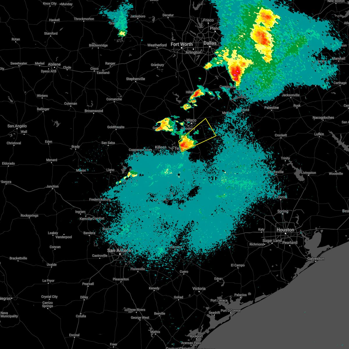 At 1101 pm cdt, a severe thunderstorm was located near troy, moving northeast at 30 mph. golf ball size hail was reported in troy with this storm (trained weather spotters). Hazards include ping pong ball size hail and 60 mph wind gusts. People and animals outdoors will be injured. expect hail damage to roofs, siding, windows, and vehicles. expect wind damage to roofs, siding, and trees. Locations impacted include, temple, robinson, marlin, mart, lorena, troy, bruceville-eddy, riesel, lott, golinda and hallsburg. At 1101 pm cdt, a severe thunderstorm was located near troy, moving northeast at 30 mph. golf ball size hail was reported in troy with this storm (trained weather spotters). Hazards include ping pong ball size hail and 60 mph wind gusts. People and animals outdoors will be injured. expect hail damage to roofs, siding, windows, and vehicles. expect wind damage to roofs, siding, and trees. Locations impacted include, temple, robinson, marlin, mart, lorena, troy, bruceville-eddy, riesel, lott, golinda and hallsburg.
|
| 5/3/2021 10:52 PM CDT | Golf Ball sized hail reported 5.6 miles SW of Temple, TX |
| 5/3/2021 10:51 PM CDT | Quarter sized hail reported 2.5 miles NW of Temple, TX, corrects the time from the previous hail report from temple. social media report quarter size hail in temple. |
| 5/3/2021 10:49 PM CDT |
 At 1049 pm cdt, a severe thunderstorm was located near troy, or near temple, moving northeast at 35 mph (radar indicated). Hazards include 60 mph wind gusts and quarter size hail. Hail damage to vehicles is expected. expect wind damage to roofs, siding, and trees. Locations impacted include, temple and morgan`s point resort. At 1049 pm cdt, a severe thunderstorm was located near troy, or near temple, moving northeast at 35 mph (radar indicated). Hazards include 60 mph wind gusts and quarter size hail. Hail damage to vehicles is expected. expect wind damage to roofs, siding, and trees. Locations impacted include, temple and morgan`s point resort.
|
| 5/3/2021 10:48 PM CDT |
 At 1048 pm cdt, a severe thunderstorm was located near troy, or near temple, moving northeast at 30 mph (radar indicated). Hazards include 60 mph wind gusts and quarter size hail. Hail damage to vehicles is expected. Expect wind damage to roofs, siding, and trees. At 1048 pm cdt, a severe thunderstorm was located near troy, or near temple, moving northeast at 30 mph (radar indicated). Hazards include 60 mph wind gusts and quarter size hail. Hail damage to vehicles is expected. Expect wind damage to roofs, siding, and trees.
|
| 5/3/2021 9:53 PM CDT |
 At 953 pm cdt, a severe thunderstorm was located near kempner, or near copperas cove, moving east at 25 mph (radar indicated). Hazards include 60 mph wind gusts and quarter size hail. Hail damage to vehicles is expected. Expect wind damage to roofs, siding, and trees. At 953 pm cdt, a severe thunderstorm was located near kempner, or near copperas cove, moving east at 25 mph (radar indicated). Hazards include 60 mph wind gusts and quarter size hail. Hail damage to vehicles is expected. Expect wind damage to roofs, siding, and trees.
|
| 4/8/2021 7:40 PM CDT |
 At 739 pm cdt, a severe thunderstorm was located near belfalls, lott, and chilton moving southeast at 30 mph. this storm has a history of producing 2 inch hail in mcgregor and wind damage in troy (trained weather spotters). Hazards include ping pong ball size hail and 65 mph wind gusts. People and animals outdoors will be injured. expect hail damage to roofs, siding, windows, and vehicles. expect wind damage to roofs, siding, and trees. Locations impacted include, temple, marlin, troy, rosebud, lott and golinda. At 739 pm cdt, a severe thunderstorm was located near belfalls, lott, and chilton moving southeast at 30 mph. this storm has a history of producing 2 inch hail in mcgregor and wind damage in troy (trained weather spotters). Hazards include ping pong ball size hail and 65 mph wind gusts. People and animals outdoors will be injured. expect hail damage to roofs, siding, windows, and vehicles. expect wind damage to roofs, siding, and trees. Locations impacted include, temple, marlin, troy, rosebud, lott and golinda.
|
| 4/8/2021 7:22 PM CDT |
 At 721 pm cdt, a severe thunderstorm was located near bruceville- eddy. another severe thunderstorm was located near moody. both storms are moving southeast at 20 mph. these storms have a history of producing 2 inch hail (trained weather spotters). Hazards include ping pong ball size hail and 60 mph wind gusts. People and animals outdoors will be injured. expect hail damage to roofs, siding, windows, and vehicles. expect wind damage to roofs, siding, and trees. Locations impacted include, temple, hewitt, robinson, marlin, lorena, troy, bruceville-eddy, rosebud, moody, lott and golinda. At 721 pm cdt, a severe thunderstorm was located near bruceville- eddy. another severe thunderstorm was located near moody. both storms are moving southeast at 20 mph. these storms have a history of producing 2 inch hail (trained weather spotters). Hazards include ping pong ball size hail and 60 mph wind gusts. People and animals outdoors will be injured. expect hail damage to roofs, siding, windows, and vehicles. expect wind damage to roofs, siding, and trees. Locations impacted include, temple, hewitt, robinson, marlin, lorena, troy, bruceville-eddy, rosebud, moody, lott and golinda.
|
| 4/8/2021 7:11 PM CDT |
 At 710 pm cdt, a severe thunderstorm was located near bruceville- eddy, moving southeast at 30 mph. 2 inch hail was reported earlier with this storm in mcgregor (trained weather spotters). Hazards include ping pong ball size hail and 60 mph wind gusts. People and animals outdoors will be injured. expect hail damage to roofs, siding, windows, and vehicles. Expect wind damage to roofs, siding, and trees. At 710 pm cdt, a severe thunderstorm was located near bruceville- eddy, moving southeast at 30 mph. 2 inch hail was reported earlier with this storm in mcgregor (trained weather spotters). Hazards include ping pong ball size hail and 60 mph wind gusts. People and animals outdoors will be injured. expect hail damage to roofs, siding, windows, and vehicles. Expect wind damage to roofs, siding, and trees.
|
| 3/17/2021 6:43 AM CDT |
 At 643 am cdt, a severe thunderstorm was located near florence, or 14 miles southwest of harker heights, moving northeast at 60 mph (radar indicated). Hazards include quarter size hail. damage to vehicles is possible At 643 am cdt, a severe thunderstorm was located near florence, or 14 miles southwest of harker heights, moving northeast at 60 mph (radar indicated). Hazards include quarter size hail. damage to vehicles is possible
|
| 5/27/2020 6:50 PM CDT |
 At 649 pm cdt, severe thunderstorms were located along a line extending from little river-academy to holland to jarrell, moving southeast at 35 mph (radar indicated). Hazards include 60 mph wind gusts and quarter size hail. Hail damage to vehicles is expected. Expect wind damage to roofs, siding, and trees. At 649 pm cdt, severe thunderstorms were located along a line extending from little river-academy to holland to jarrell, moving southeast at 35 mph (radar indicated). Hazards include 60 mph wind gusts and quarter size hail. Hail damage to vehicles is expected. Expect wind damage to roofs, siding, and trees.
|
| 5/27/2020 2:13 PM CDT |
 The severe thunderstorm warning for east central coryell, northeastern bell and southwestern falls counties will expire at 215 pm cdt, the storm which prompted the warning has moved out of the area. therefore the warning will be allowed to expire. a severe thunderstorm watch remains in effect until 900 pm cdt for central texas. to report severe weather, contact your nearest law enforcement agency. they will relay your report to the national weather service fort worth. The severe thunderstorm warning for east central coryell, northeastern bell and southwestern falls counties will expire at 215 pm cdt, the storm which prompted the warning has moved out of the area. therefore the warning will be allowed to expire. a severe thunderstorm watch remains in effect until 900 pm cdt for central texas. to report severe weather, contact your nearest law enforcement agency. they will relay your report to the national weather service fort worth.
|
| 5/27/2020 1:59 PM CDT |
 A severe thunderstorm warning remains in effect until 215 pm cdt for east central coryell. northeastern bell and southwestern falls counties. at 158 pm cdt, a severe thunderstorm was located near mother neff state park, moving southeast at 25 mph. These storms have a history of producing quarter to golf ball size hail. A severe thunderstorm warning remains in effect until 215 pm cdt for east central coryell. northeastern bell and southwestern falls counties. at 158 pm cdt, a severe thunderstorm was located near mother neff state park, moving southeast at 25 mph. These storms have a history of producing quarter to golf ball size hail.
|
| 5/27/2020 1:45 PM CDT | Photo of large canopy tree snapped received via social media. time estimated via rada in bell county TX, 0.2 miles W of Temple, TX |
| 5/27/2020 1:20 PM CDT |
 At 118 pm cdt, a severe thunderstorm was located over fort gates, or over gatesville, moving southeast at 25 mph. at 2:15, quarter size hail was reported in gatesville (trained weather spotters). Hazards include golf ball size hail and 60 mph wind gusts. People and animals outdoors will be injured. expect hail damage to roofs, siding, windows, and vehicles. Expect wind damage to roofs, siding, and trees. At 118 pm cdt, a severe thunderstorm was located over fort gates, or over gatesville, moving southeast at 25 mph. at 2:15, quarter size hail was reported in gatesville (trained weather spotters). Hazards include golf ball size hail and 60 mph wind gusts. People and animals outdoors will be injured. expect hail damage to roofs, siding, windows, and vehicles. Expect wind damage to roofs, siding, and trees.
|
| 5/24/2020 6:06 PM CDT |
 At 606 pm cdt, a severe thunderstorm was located near mother neff state park, or 11 miles south of mcgregor, moving east at 15 mph (trained weather spotters). Hazards include golf ball size hail and 60 mph wind gusts. People and animals outdoors will be injured. expect hail damage to roofs, siding, windows, and vehicles. expect wind damage to roofs, siding, and trees. Locations impacted include, mcgregor, lorena, troy, bruceville-eddy, moody and mother neff state park. At 606 pm cdt, a severe thunderstorm was located near mother neff state park, or 11 miles south of mcgregor, moving east at 15 mph (trained weather spotters). Hazards include golf ball size hail and 60 mph wind gusts. People and animals outdoors will be injured. expect hail damage to roofs, siding, windows, and vehicles. expect wind damage to roofs, siding, and trees. Locations impacted include, mcgregor, lorena, troy, bruceville-eddy, moody and mother neff state park.
|
| 5/24/2020 5:55 PM CDT |
 At 555 pm cdt, a severe thunderstorm was located over mother neff state park, or 12 miles southwest of mcgregor, moving east at 15 mph (radar indicated). Hazards include 60 mph wind gusts and quarter size hail. Hail damage to vehicles is expected. Expect wind damage to roofs, siding, and trees. At 555 pm cdt, a severe thunderstorm was located over mother neff state park, or 12 miles southwest of mcgregor, moving east at 15 mph (radar indicated). Hazards include 60 mph wind gusts and quarter size hail. Hail damage to vehicles is expected. Expect wind damage to roofs, siding, and trees.
|
| 5/24/2020 4:39 PM CDT |
 At 438 pm cdt, a severe thunderstorm was located near temple, moving east at 10 mph (radar indicated). Hazards include 60 mph wind gusts and quarter size hail. Hail damage to vehicles is expected. expect wind damage to roofs, siding, and trees. Locations impacted include, temple, little river-academy and troy. At 438 pm cdt, a severe thunderstorm was located near temple, moving east at 10 mph (radar indicated). Hazards include 60 mph wind gusts and quarter size hail. Hail damage to vehicles is expected. expect wind damage to roofs, siding, and trees. Locations impacted include, temple, little river-academy and troy.
|
| 5/24/2020 4:24 PM CDT | Quarter sized hail reported 4 miles NNW of Temple, TX, report relayed via mping. |
| 5/24/2020 4:24 PM CDT | Tennis Ball sized hail reported 5.2 miles NW of Temple, TX, picture of oblong hail (with measurement) from trained spotter on the south side of temple. time estimated via radar. |
| 5/24/2020 4:14 PM CDT |
 At 414 pm cdt, a severe thunderstorm was located over temple, moving east at 15 mph (radar indicated). Hazards include 60 mph wind gusts and quarter size hail. Hail damage to vehicles is expected. Expect wind damage to roofs, siding, and trees. At 414 pm cdt, a severe thunderstorm was located over temple, moving east at 15 mph (radar indicated). Hazards include 60 mph wind gusts and quarter size hail. Hail damage to vehicles is expected. Expect wind damage to roofs, siding, and trees.
|
| 4/29/2020 4:01 AM CDT |
 At 401 am cdt, severe thunderstorms were located along a line extending from near rogers to near salado to near copperas cove, moving southeast at 60 mph (law enforcement). Hazards include 65 mph wind gusts and half dollar size hail. Hail damage to vehicles is expected. expect wind damage to roofs, siding, and trees. Locations impacted include, killeen, temple, copperas cove, harker heights, belton, fort hood, nolanville, morgan`s point resort, bartlett, salado, little river-academy, troy, rogers, holland and mother neff state park. At 401 am cdt, severe thunderstorms were located along a line extending from near rogers to near salado to near copperas cove, moving southeast at 60 mph (law enforcement). Hazards include 65 mph wind gusts and half dollar size hail. Hail damage to vehicles is expected. expect wind damage to roofs, siding, and trees. Locations impacted include, killeen, temple, copperas cove, harker heights, belton, fort hood, nolanville, morgan`s point resort, bartlett, salado, little river-academy, troy, rogers, holland and mother neff state park.
|
| 4/29/2020 3:55 AM CDT |
 At 355 am cdt, severe thunderstorms were located along a line extending from salado to rovers to rosebud, moving southeast at 55 mph (radar indicated). Hazards include 65 mph wind gusts and half dollar size hail. Hail damage to vehicles is expected. Expect wind damage to roofs, siding, and trees. At 355 am cdt, severe thunderstorms were located along a line extending from salado to rovers to rosebud, moving southeast at 55 mph (radar indicated). Hazards include 65 mph wind gusts and half dollar size hail. Hail damage to vehicles is expected. Expect wind damage to roofs, siding, and trees.
|
| 4/29/2020 3:45 AM CDT |
 At 343 am cdt, severe thunderstorms were located along a line extending from temple to belton to fort hood, moving southeast at 60 mph. at 341 am cdt, 60 mph winds were observed at robert gray army airfield (law enforcement). Hazards include 65 mph wind gusts and half dollar size hail. Hail damage to vehicles is expected. expect wind damage to roofs, siding, and trees. Locations impacted include, killeen, temple, copperas cove, harker heights, belton, gatesville, mcgregor, fort hood, nolanville, morgan`s point resort, bartlett, salado, little river-academy, troy, rogers, holland, mother neff state park, fort gates, oglesby and south mountain. At 343 am cdt, severe thunderstorms were located along a line extending from temple to belton to fort hood, moving southeast at 60 mph. at 341 am cdt, 60 mph winds were observed at robert gray army airfield (law enforcement). Hazards include 65 mph wind gusts and half dollar size hail. Hail damage to vehicles is expected. expect wind damage to roofs, siding, and trees. Locations impacted include, killeen, temple, copperas cove, harker heights, belton, gatesville, mcgregor, fort hood, nolanville, morgan`s point resort, bartlett, salado, little river-academy, troy, rogers, holland, mother neff state park, fort gates, oglesby and south mountain.
|
| 4/29/2020 3:41 AM CDT |
 At 341 am cdt, severe thunderstorms were located along a line extending from near temple to near nolanville to near copperas cove, moving southeast at 60 mph (radar indicated). Hazards include 65 mph wind gusts and half dollar size hail. Hail damage to vehicles is expected. expect wind damage to roofs, siding, and trees. Locations impacted include, killeen, temple, copperas cove, harker heights, belton, gatesville, mcgregor, fort hood, nolanville, morgan`s point resort, bartlett, salado, little river-academy, troy, rogers, holland, mother neff state park, fort gates, oglesby and south mountain. At 341 am cdt, severe thunderstorms were located along a line extending from near temple to near nolanville to near copperas cove, moving southeast at 60 mph (radar indicated). Hazards include 65 mph wind gusts and half dollar size hail. Hail damage to vehicles is expected. expect wind damage to roofs, siding, and trees. Locations impacted include, killeen, temple, copperas cove, harker heights, belton, gatesville, mcgregor, fort hood, nolanville, morgan`s point resort, bartlett, salado, little river-academy, troy, rogers, holland, mother neff state park, fort gates, oglesby and south mountain.
|
| 4/29/2020 3:13 AM CDT |
 At 312 am cdt, severe thunderstorms were located along a line extending from evant to gatesville to mcgregor, moving southeast at 60 mph (radar indicated). Hazards include 65 mph wind gusts and half dollar size hail. Hail damage to vehicles is expected. Expect wind damage to roofs, siding, and trees. At 312 am cdt, severe thunderstorms were located along a line extending from evant to gatesville to mcgregor, moving southeast at 60 mph (radar indicated). Hazards include 65 mph wind gusts and half dollar size hail. Hail damage to vehicles is expected. Expect wind damage to roofs, siding, and trees.
|
| 4/9/2020 3:03 PM CDT |
 At 302 pm cdt, a severe thunderstorm was located near granger dam, or near granger, moving east at 40 mph (radar indicated). Hazards include 70 mph wind gusts and penny size hail. Expect considerable tree damage. Damage is likely to mobile homes, roofs, and outbuildings. At 302 pm cdt, a severe thunderstorm was located near granger dam, or near granger, moving east at 40 mph (radar indicated). Hazards include 70 mph wind gusts and penny size hail. Expect considerable tree damage. Damage is likely to mobile homes, roofs, and outbuildings.
|
| 4/9/2020 2:53 PM CDT |
 At 253 pm cdt, a severe thunderstorm was located over little river- academy, or near temple, moving east at 45 mph. strong winds will cross hwy 95 east of salado in the next few minutes (radar indicated). Hazards include 70 mph wind gusts and penny size hail. Expect considerable tree damage. damage is likely to mobile homes, roofs, and outbuildings. Locations impacted include, temple, harker heights, belton, nolanville, bartlett, salado, little river-academy and holland. At 253 pm cdt, a severe thunderstorm was located over little river- academy, or near temple, moving east at 45 mph. strong winds will cross hwy 95 east of salado in the next few minutes (radar indicated). Hazards include 70 mph wind gusts and penny size hail. Expect considerable tree damage. damage is likely to mobile homes, roofs, and outbuildings. Locations impacted include, temple, harker heights, belton, nolanville, bartlett, salado, little river-academy and holland.
|
| 4/9/2020 2:43 PM CDT |
 At 243 pm cdt, a severe thunderstorm was located near belton, moving east at 45 mph (radar indicated). Hazards include 60 mph wind gusts and penny size hail. Expect damage to roofs, siding, and trees. Locations impacted include, killeen, temple, harker heights, belton, nolanville, morgan`s point resort, bartlett, salado, little river-academy and holland. At 243 pm cdt, a severe thunderstorm was located near belton, moving east at 45 mph (radar indicated). Hazards include 60 mph wind gusts and penny size hail. Expect damage to roofs, siding, and trees. Locations impacted include, killeen, temple, harker heights, belton, nolanville, morgan`s point resort, bartlett, salado, little river-academy and holland.
|
| 4/9/2020 2:24 PM CDT |
 At 223 pm cdt, a severe thunderstorm was located near killeen, moving east at 50 mph (radar indicated). Hazards include 60 mph wind gusts and penny size hail. expect damage to roofs, siding, and trees At 223 pm cdt, a severe thunderstorm was located near killeen, moving east at 50 mph (radar indicated). Hazards include 60 mph wind gusts and penny size hail. expect damage to roofs, siding, and trees
|
| 6/19/2019 11:10 PM CDT |
 The severe thunderstorm warning for eastern bell, central limestone and falls counties will expire at 1115 pm cdt, the storms which prompted the warning have weakened below severe limits, and have exited the warned area. therefore the warning will be allowed to expire. however gusty winds of 40 to 50 mph are still possible with these thunderstorms. a tornado watch remains in effect until midnight cdt for central texas. a severe thunderstorm watch remains in effect until 600 am cdt for central texas. The severe thunderstorm warning for eastern bell, central limestone and falls counties will expire at 1115 pm cdt, the storms which prompted the warning have weakened below severe limits, and have exited the warned area. therefore the warning will be allowed to expire. however gusty winds of 40 to 50 mph are still possible with these thunderstorms. a tornado watch remains in effect until midnight cdt for central texas. a severe thunderstorm watch remains in effect until 600 am cdt for central texas.
|
| 6/19/2019 10:58 PM CDT |
 At 1057 pm cdt, severe thunderstorms were located along a line extending from thornton to bartlett, moving southeast at 45 mph (trained weather spotters). Hazards include 60 mph wind gusts. Expect damage to roofs, siding, and trees. locations impacted include, temple, belton, marlin, groesbeck, bartlett, salado, little river-academy, troy, rosebud, rogers, holland, lott, golinda, fort parker state park and thornton. A tornado watch remains in effect until midnight cdt for central texas. At 1057 pm cdt, severe thunderstorms were located along a line extending from thornton to bartlett, moving southeast at 45 mph (trained weather spotters). Hazards include 60 mph wind gusts. Expect damage to roofs, siding, and trees. locations impacted include, temple, belton, marlin, groesbeck, bartlett, salado, little river-academy, troy, rosebud, rogers, holland, lott, golinda, fort parker state park and thornton. A tornado watch remains in effect until midnight cdt for central texas.
|
| 6/19/2019 10:39 PM CDT |
 At 1038 pm cdt, severe thunderstorms were located along a line extending from killeen to mart, moving southeast at 30 mph (trained weather spotters). Hazards include 60 mph wind gusts. Expect damage to roofs, siding, and trees. locations impacted include, killeen, temple, copperas cove, harker heights, belton, marlin, groesbeck, fort hood, nolanville, morgan`s point resort, bartlett, mart, salado, little river-academy, troy, rosebud, rogers, holland, coolidge and lott. A tornado watch remains in effect until midnight cdt for central texas. At 1038 pm cdt, severe thunderstorms were located along a line extending from killeen to mart, moving southeast at 30 mph (trained weather spotters). Hazards include 60 mph wind gusts. Expect damage to roofs, siding, and trees. locations impacted include, killeen, temple, copperas cove, harker heights, belton, marlin, groesbeck, fort hood, nolanville, morgan`s point resort, bartlett, mart, salado, little river-academy, troy, rosebud, rogers, holland, coolidge and lott. A tornado watch remains in effect until midnight cdt for central texas.
|
| 6/19/2019 10:24 PM CDT |
 At 1022 pm cdt, severe thunderstorms were located along a line extending from near copperas cove to near malone, moving southeast at 40 mph (trained weather spotters). Hazards include 65 mph wind gusts. Expect damage to roofs, siding, and trees. locations impacted include, killeen, waco, temple, copperas cove, harker heights, belton, gatesville, hewitt, robinson, bellmead, woodway, lampasas, lacy-lakeview, marlin, mcgregor, groesbeck, fort hood, nolanville, morgan`s point resort and west. A tornado watch remains in effect until midnight cdt for central and north central texas. At 1022 pm cdt, severe thunderstorms were located along a line extending from near copperas cove to near malone, moving southeast at 40 mph (trained weather spotters). Hazards include 65 mph wind gusts. Expect damage to roofs, siding, and trees. locations impacted include, killeen, waco, temple, copperas cove, harker heights, belton, gatesville, hewitt, robinson, bellmead, woodway, lampasas, lacy-lakeview, marlin, mcgregor, groesbeck, fort hood, nolanville, morgan`s point resort and west. A tornado watch remains in effect until midnight cdt for central and north central texas.
|
| 6/19/2019 10:03 PM CDT |
 At 1003 pm cdt, severe thunderstorms were located along a line extending from near west to 13 miles north of lampasas, moving southeast at 30 mph (radar indicated). Hazards include 65 mph wind gusts. expect damage to roofs, siding, and trees At 1003 pm cdt, severe thunderstorms were located along a line extending from near west to 13 miles north of lampasas, moving southeast at 30 mph (radar indicated). Hazards include 65 mph wind gusts. expect damage to roofs, siding, and trees
|
| 6/16/2019 10:04 PM CDT |
 At 1000 pm cdt, a severe thunderstorm was located near kempner in lampasas county. another severe storm was near harker heights in bell county. both storms were moving east at 20 mph (radar indicated). Hazards include quarter size hail. Damage to vehicles is possible. Other storms in bell, coryell, and lampasas counties will be capable of small hail and gusty winds. At 1000 pm cdt, a severe thunderstorm was located near kempner in lampasas county. another severe storm was near harker heights in bell county. both storms were moving east at 20 mph (radar indicated). Hazards include quarter size hail. Damage to vehicles is possible. Other storms in bell, coryell, and lampasas counties will be capable of small hail and gusty winds.
|
| 6/16/2019 9:32 PM CDT |
 At 930 pm cdt, a severe thunderstorm was located near kempner, or 7 miles northwest of copperas cove, moving east at 15 mph (radar indicated). Hazards include 60 mph wind gusts and half dollar size hail. Hail damage to vehicles is expected. expect wind damage to roofs, siding, and trees. this severe thunderstorm will be near, kempner around 935 pm cdt. copperas cove around 950 pm cdt. fort hood around 1015 pm cdt. killeen, harker heights, and nolanville around 1030 pm cdt. Other storms in lampasas, coryell, and bell counties will also be capable of hail and gusty winds. At 930 pm cdt, a severe thunderstorm was located near kempner, or 7 miles northwest of copperas cove, moving east at 15 mph (radar indicated). Hazards include 60 mph wind gusts and half dollar size hail. Hail damage to vehicles is expected. expect wind damage to roofs, siding, and trees. this severe thunderstorm will be near, kempner around 935 pm cdt. copperas cove around 950 pm cdt. fort hood around 1015 pm cdt. killeen, harker heights, and nolanville around 1030 pm cdt. Other storms in lampasas, coryell, and bell counties will also be capable of hail and gusty winds.
|
| 6/16/2019 8:16 PM CDT |
 At 815 pm cdt, a severe thunderstorm was located near jarrell, or 13 miles northwest of granger, moving east at 20 mph (radar indicated). Hazards include 60 mph wind gusts and half dollar size hail. Hail damage to vehicles is expected. expect wind damage to roofs, siding, and trees. this severe thunderstorm will be near, bartlett around 835 pm cdt. holland around 840 pm cdt. little river-academy around 905 pm cdt. rogers around 915 pm cdt. this includes interstate 35 between mile markers 277 and 287. Spotters have reported quarter size hail along i-35 in southern bell county near the williamson county line. At 815 pm cdt, a severe thunderstorm was located near jarrell, or 13 miles northwest of granger, moving east at 20 mph (radar indicated). Hazards include 60 mph wind gusts and half dollar size hail. Hail damage to vehicles is expected. expect wind damage to roofs, siding, and trees. this severe thunderstorm will be near, bartlett around 835 pm cdt. holland around 840 pm cdt. little river-academy around 905 pm cdt. rogers around 915 pm cdt. this includes interstate 35 between mile markers 277 and 287. Spotters have reported quarter size hail along i-35 in southern bell county near the williamson county line.
|
| 6/16/2019 8:03 PM CDT |
 At 801 pm cdt, a severe thunderstorm was located near jarrell, or 10 miles south of harker heights, moving northeast at 20 mph (radar indicated). Hazards include 60 mph wind gusts and quarter size hail. Hail damage to vehicles is expected. expect wind damage to roofs, siding, and trees. this severe storm will be near, salado around 820 pm cdt. Belton and nolanville around 830 pm cdt. At 801 pm cdt, a severe thunderstorm was located near jarrell, or 10 miles south of harker heights, moving northeast at 20 mph (radar indicated). Hazards include 60 mph wind gusts and quarter size hail. Hail damage to vehicles is expected. expect wind damage to roofs, siding, and trees. this severe storm will be near, salado around 820 pm cdt. Belton and nolanville around 830 pm cdt.
|
| 6/16/2019 7:48 PM CDT | Quarter sized hail reported 2.1 miles NE of Temple, TX, quarter size hail between temple and belton |
| 6/16/2019 7:43 PM CDT |
 At 741 pm cdt, a severe thunderstorm was located near harker heights, moving east at 20 mph (radar indicated). Hazards include 60 mph wind gusts and quarter size hail. Hail damage to vehicles is expected. expect wind damage to roofs, siding, and trees. this severe storm will be near, nolanville around 745 pm cdt. salado around 750 pm cdt. Other storms along i-35 and i-14 in bell county will also be capable of producing dime to nickel size hail. At 741 pm cdt, a severe thunderstorm was located near harker heights, moving east at 20 mph (radar indicated). Hazards include 60 mph wind gusts and quarter size hail. Hail damage to vehicles is expected. expect wind damage to roofs, siding, and trees. this severe storm will be near, nolanville around 745 pm cdt. salado around 750 pm cdt. Other storms along i-35 and i-14 in bell county will also be capable of producing dime to nickel size hail.
|
| 6/16/2019 7:29 PM CDT |
 At 728 pm cdt, a severe thunderstorm was located 7 miles southwest of harker heights, moving northeast at 10 mph (radar indicated). Hazards include 60 mph wind gusts and half dollar size hail. Hail damage to vehicles is expected. expect wind damage to roofs, siding, and trees. this severe thunderstorm will be near, salado around 820 pm cdt. harker heights around 825 pm cdt. killeen, belton and nolanville around 830 pm cdt. This storm may impact interstate 35 between mile markers 284 and 312. At 728 pm cdt, a severe thunderstorm was located 7 miles southwest of harker heights, moving northeast at 10 mph (radar indicated). Hazards include 60 mph wind gusts and half dollar size hail. Hail damage to vehicles is expected. expect wind damage to roofs, siding, and trees. this severe thunderstorm will be near, salado around 820 pm cdt. harker heights around 825 pm cdt. killeen, belton and nolanville around 830 pm cdt. This storm may impact interstate 35 between mile markers 284 and 312.
|
| 6/9/2019 5:52 PM CDT |
 The national weather service in fort worth has issued a * severe thunderstorm warning for. southern bell county in central texas. until 615 pm cdt. At 552 pm cdt, severe thunderstorms were located along a line extending from 9 miles northeast of briggs to near salado, moving. The national weather service in fort worth has issued a * severe thunderstorm warning for. southern bell county in central texas. until 615 pm cdt. At 552 pm cdt, severe thunderstorms were located along a line extending from 9 miles northeast of briggs to near salado, moving.
|
| 5/18/2019 3:37 PM CDT |
 At 337 pm cdt, severe thunderstorms were located along a line extending from near mart to 6 miles southeast of temple, moving east at 20 mph (radar indicated). Hazards include 60 mph wind gusts and quarter size hail. Hail damage to vehicles is expected. Expect wind damage to roofs, siding, and trees. At 337 pm cdt, severe thunderstorms were located along a line extending from near mart to 6 miles southeast of temple, moving east at 20 mph (radar indicated). Hazards include 60 mph wind gusts and quarter size hail. Hail damage to vehicles is expected. Expect wind damage to roofs, siding, and trees.
|
| 5/18/2019 3:28 PM CDT |
 The severe thunderstorm warning for bell county will expire at 330 pm cdt, the storm which prompted the warning has weakened below severe limits, and no longer poses an immediate threat to life or property. therefore, the warning will be allowed to expire. however small hail is still possible with this thunderstorm. The severe thunderstorm warning for bell county will expire at 330 pm cdt, the storm which prompted the warning has weakened below severe limits, and no longer poses an immediate threat to life or property. therefore, the warning will be allowed to expire. however small hail is still possible with this thunderstorm.
|
| 5/18/2019 2:59 PM CDT |
 At 259 pm cdt, a severe thunderstorm was located near temple, moving northeast at 35 mph (radar indicated). Hazards include 60 mph wind gusts and quarter size hail. Hail damage to vehicles is expected. Expect wind damage to roofs, siding, and trees. At 259 pm cdt, a severe thunderstorm was located near temple, moving northeast at 35 mph (radar indicated). Hazards include 60 mph wind gusts and quarter size hail. Hail damage to vehicles is expected. Expect wind damage to roofs, siding, and trees.
|
| 5/18/2019 2:21 PM CDT |
 At 220 pm cdt, a severe thunderstorm was located near nolanville, or near harker heights, moving northeast at 25 mph (radar indicated). Hazards include 60 mph wind gusts and quarter size hail. Hail damage to vehicles is expected. expect wind damage to roofs, siding, and trees. locations impacted include, killeen, temple, harker heights, belton, mcgregor, fort hood, nolanville, morgan`s point resort, salado, troy, mother neff state park and oglesby. a tornado watch remains in effect until 500 pm cdt for central texas. A tornado watch also remains in effect until 800 pm cdt for central texas. At 220 pm cdt, a severe thunderstorm was located near nolanville, or near harker heights, moving northeast at 25 mph (radar indicated). Hazards include 60 mph wind gusts and quarter size hail. Hail damage to vehicles is expected. expect wind damage to roofs, siding, and trees. locations impacted include, killeen, temple, harker heights, belton, mcgregor, fort hood, nolanville, morgan`s point resort, salado, troy, mother neff state park and oglesby. a tornado watch remains in effect until 500 pm cdt for central texas. A tornado watch also remains in effect until 800 pm cdt for central texas.
|
| 5/18/2019 2:06 PM CDT |
 At 206 pm cdt, a severe thunderstorm was located over killeen, moving northeast at 25 mph (radar indicated). Hazards include 60 mph wind gusts and half dollar size hail. Hail damage to vehicles is expected. Expect wind damage to roofs, siding, and trees. At 206 pm cdt, a severe thunderstorm was located over killeen, moving northeast at 25 mph (radar indicated). Hazards include 60 mph wind gusts and half dollar size hail. Hail damage to vehicles is expected. Expect wind damage to roofs, siding, and trees.
|
| 5/8/2019 12:06 PM CDT |
 The severe thunderstorm warning for southeastern coryell and central bell counties will expire at 1215 pm cdt, the storms which prompted the warning have weakened below severe limits. therefore the warning will be allowed to expire. however gusty winds and heavy rain are still possible with these thunderstorms. a severe thunderstorm watch remains in effect until 100 pm cdt for central texas. The severe thunderstorm warning for southeastern coryell and central bell counties will expire at 1215 pm cdt, the storms which prompted the warning have weakened below severe limits. therefore the warning will be allowed to expire. however gusty winds and heavy rain are still possible with these thunderstorms. a severe thunderstorm watch remains in effect until 100 pm cdt for central texas.
|
| 5/8/2019 11:42 AM CDT |
 At 1141 am cdt, severe thunderstorms were located along a line extending from mother neff state park to salado, moving east at 35 mph (radar indicated). Hazards include 60 mph wind gusts. Expect damage to roofs, siding, and trees. Locations impacted include, killeen, temple, harker heights, belton, mcgregor, fort hood, nolanville, morgan`s point resort, salado, little river-academy, troy, mother neff state park, oglesby and south mountain. At 1141 am cdt, severe thunderstorms were located along a line extending from mother neff state park to salado, moving east at 35 mph (radar indicated). Hazards include 60 mph wind gusts. Expect damage to roofs, siding, and trees. Locations impacted include, killeen, temple, harker heights, belton, mcgregor, fort hood, nolanville, morgan`s point resort, salado, little river-academy, troy, mother neff state park, oglesby and south mountain.
|
| 5/8/2019 11:14 AM CDT |
 At 1114 am cdt, a severe thunderstorm was located near fort hood, moving east at 35 mph (radar indicated). Hazards include 60 mph wind gusts and penny size hail. expect damage to roofs, siding, and trees At 1114 am cdt, a severe thunderstorm was located near fort hood, moving east at 35 mph (radar indicated). Hazards include 60 mph wind gusts and penny size hail. expect damage to roofs, siding, and trees
|
| 4/18/2019 12:05 AM CDT |
 The severe thunderstorm warning for coryell and bell counties will expire at 1215 am cdt, the storms which prompted the warning have weakened below severe limits. therefore the warning will be allowed to expire. however gusty winds are still possible with these thunderstorms. a severe thunderstorm watch remains in effect until 200 am cdt for central texas. The severe thunderstorm warning for coryell and bell counties will expire at 1215 am cdt, the storms which prompted the warning have weakened below severe limits. therefore the warning will be allowed to expire. however gusty winds are still possible with these thunderstorms. a severe thunderstorm watch remains in effect until 200 am cdt for central texas.
|
| 4/17/2019 11:15 PM CDT |
 At 1114 pm cdt, severe thunderstorms were located along a line extending from evant to copperas cove, moving east at 35 mph (radar indicated). Hazards include 60 mph wind gusts. expect damage to roofs, siding, and trees At 1114 pm cdt, severe thunderstorms were located along a line extending from evant to copperas cove, moving east at 35 mph (radar indicated). Hazards include 60 mph wind gusts. expect damage to roofs, siding, and trees
|
| 4/13/2019 10:08 AM CDT |
 At 1008 am cdt, a severe thunderstorm was located over little river-academy, or 8 miles southeast of belton, moving north at 35 mph (radar indicated). Hazards include quarter size hail. damage to vehicles is possible At 1008 am cdt, a severe thunderstorm was located over little river-academy, or 8 miles southeast of belton, moving north at 35 mph (radar indicated). Hazards include quarter size hail. damage to vehicles is possible
|
| 4/13/2019 9:47 AM CDT |
 At 947 am cdt, a severe thunderstorm was located near troy, or 11 miles northeast of temple, moving north at 40 mph (radar indicated). Hazards include 60 mph wind gusts and quarter size hail. Hail damage to vehicles is expected. Expect wind damage to roofs, siding, and trees. At 947 am cdt, a severe thunderstorm was located near troy, or 11 miles northeast of temple, moving north at 40 mph (radar indicated). Hazards include 60 mph wind gusts and quarter size hail. Hail damage to vehicles is expected. Expect wind damage to roofs, siding, and trees.
|
| 4/7/2019 9:13 AM CDT |
 At 912 am cdt, a severe thunderstorm was located 7 miles southeast of rogers, or 8 miles west of cameron, moving north at 30 mph (radar indicated). Hazards include 60 mph wind gusts and quarter size hail. Hail damage to vehicles is expected. expect wind damage to roofs, siding, and trees. Locations impacted include, temple, cameron, little river-academy, rosebud, rogers, holland and buckholts. At 912 am cdt, a severe thunderstorm was located 7 miles southeast of rogers, or 8 miles west of cameron, moving north at 30 mph (radar indicated). Hazards include 60 mph wind gusts and quarter size hail. Hail damage to vehicles is expected. expect wind damage to roofs, siding, and trees. Locations impacted include, temple, cameron, little river-academy, rosebud, rogers, holland and buckholts.
|
| 4/7/2019 9:04 AM CDT |
 At 904 am cdt, a severe thunderstorm was located 10 miles southeast of rogers, or 10 miles west of cameron, moving north at 25 mph (radar indicated). Hazards include quarter size hail. damage to vehicles is possible At 904 am cdt, a severe thunderstorm was located 10 miles southeast of rogers, or 10 miles west of cameron, moving north at 25 mph (radar indicated). Hazards include quarter size hail. damage to vehicles is possible
|
| 4/13/2018 9:57 PM CDT |
 The severe thunderstorm warning for central bell county will expire at 1000 pm cdt, the storm which prompted the warning has weakened below severe limits. therefore the warning will be allowed to expire. The severe thunderstorm warning for central bell county will expire at 1000 pm cdt, the storm which prompted the warning has weakened below severe limits. therefore the warning will be allowed to expire.
|
| 4/13/2018 9:31 PM CDT |
 At 930 pm cdt, a severe thunderstorm was located over little river-academy, or 9 miles south of temple, moving east at 30 mph (trained weather spotters). Hazards include quarter size hail. Damage to vehicles is possible. Locations impacted include, temple, harker heights, belton, salado, little river-academy and holland. At 930 pm cdt, a severe thunderstorm was located over little river-academy, or 9 miles south of temple, moving east at 30 mph (trained weather spotters). Hazards include quarter size hail. Damage to vehicles is possible. Locations impacted include, temple, harker heights, belton, salado, little river-academy and holland.
|
| 4/13/2018 8:58 PM CDT |
 At 858 pm cdt, a severe thunderstorm was located near salado, or near harker heights, moving east at 35 mph (trained weather spotters reported quarter size hail near moffat). Hazards include quarter size hail. damage to vehicles is possible At 858 pm cdt, a severe thunderstorm was located near salado, or near harker heights, moving east at 35 mph (trained weather spotters reported quarter size hail near moffat). Hazards include quarter size hail. damage to vehicles is possible
|
| 4/6/2018 10:55 PM CDT |
 At 1039 pm cdt, severe thunderstorms were located along a line extending from 9 miles southwest of lott to near belton, moving east at 35 mph (radar indicated). Hazards include ping pong ball size hail and 60 mph wind gusts. People and animals outdoors will be injured. expect hail damage to roofs, siding, windows, and vehicles. expect wind damage to roofs, siding, and trees. Locations impacted include, temple, belton, cameron, salado, little river-academy, troy, rosebud, rogers, holland and buckholts. At 1039 pm cdt, severe thunderstorms were located along a line extending from 9 miles southwest of lott to near belton, moving east at 35 mph (radar indicated). Hazards include ping pong ball size hail and 60 mph wind gusts. People and animals outdoors will be injured. expect hail damage to roofs, siding, windows, and vehicles. expect wind damage to roofs, siding, and trees. Locations impacted include, temple, belton, cameron, salado, little river-academy, troy, rosebud, rogers, holland and buckholts.
|
| 4/6/2018 10:40 PM CDT |
 At 1039 pm cdt, severe thunderstorms were located along a line extending from 9 miles southwest of lott to near belton, moving east at 35 mph (radar indicated). Hazards include ping pong ball size hail and 60 mph wind gusts. People and animals outdoors will be injured. expect hail damage to roofs, siding, windows, and vehicles. expect wind damage to roofs, siding, and trees. Locations impacted include, temple, belton, cameron, salado, little river-academy, troy, rosebud, rogers, holland and buckholts. At 1039 pm cdt, severe thunderstorms were located along a line extending from 9 miles southwest of lott to near belton, moving east at 35 mph (radar indicated). Hazards include ping pong ball size hail and 60 mph wind gusts. People and animals outdoors will be injured. expect hail damage to roofs, siding, windows, and vehicles. expect wind damage to roofs, siding, and trees. Locations impacted include, temple, belton, cameron, salado, little river-academy, troy, rosebud, rogers, holland and buckholts.
|
| 4/6/2018 10:33 PM CDT |
 At 1033 pm cdt, severe thunderstorms were located along a line extending from 7 miles southeast of troy to near salado, moving southeast at 35 mph (radar indicated). Hazards include quarter size hail. damage to vehicles is possible At 1033 pm cdt, severe thunderstorms were located along a line extending from 7 miles southeast of troy to near salado, moving southeast at 35 mph (radar indicated). Hazards include quarter size hail. damage to vehicles is possible
|
| 4/6/2018 8:31 PM CDT |
 At 831 pm cdt, a severe thunderstorm was located near moody, or 10 miles north of temple, moving southeast at 35 mph (radar indicated). Hazards include 60 mph wind gusts and quarter size hail. Hail damage to vehicles is expected. expect wind damage to roofs, siding, and trees. Locations impacted include, temple, marlin, mcgregor, lorena, troy, bruceville-eddy, rosebud, moody, lott and golinda. At 831 pm cdt, a severe thunderstorm was located near moody, or 10 miles north of temple, moving southeast at 35 mph (radar indicated). Hazards include 60 mph wind gusts and quarter size hail. Hail damage to vehicles is expected. expect wind damage to roofs, siding, and trees. Locations impacted include, temple, marlin, mcgregor, lorena, troy, bruceville-eddy, rosebud, moody, lott and golinda.
|
| 4/6/2018 8:11 PM CDT |
 At 809 pm cdt, a severe thunderstorm was located near mother neff state park, or 11 miles southwest of mcgregor, moving southeast at 35 mph (radar indicated). Hazards include 60 mph wind gusts and quarter size hail. Hail damage to vehicles is expected. Expect wind damage to roofs, siding, and trees. At 809 pm cdt, a severe thunderstorm was located near mother neff state park, or 11 miles southwest of mcgregor, moving southeast at 35 mph (radar indicated). Hazards include 60 mph wind gusts and quarter size hail. Hail damage to vehicles is expected. Expect wind damage to roofs, siding, and trees.
|
| 4/6/2018 7:51 PM CDT |
 At 749 pm cdt, a severe thunderstorm was located just northeast of gatesville, moving southeast at 30 mph (radar indicated). Hazards include 60 mph wind gusts and quarter size hail. Hail damage to vehicles is expected. expect wind damage to roofs, siding, and trees. This severe storm will be near, mcgregor, moody and mother neff state park around 815 pm cdt. At 749 pm cdt, a severe thunderstorm was located just northeast of gatesville, moving southeast at 30 mph (radar indicated). Hazards include 60 mph wind gusts and quarter size hail. Hail damage to vehicles is expected. expect wind damage to roofs, siding, and trees. This severe storm will be near, mcgregor, moody and mother neff state park around 815 pm cdt.
|
| 4/6/2018 7:35 PM CDT |
 At 734 pm cdt, a severe thunderstorm was located near kempner, or near lampasas, moving southeast at 30 mph (radar indicated). Hazards include 60 mph wind gusts and quarter size hail. Hail damage to vehicles is expected. expect wind damage to roofs, siding, and trees. Locations impacted include, killeen, copperas cove, harker heights, gatesville, lampasas, mcgregor, fort hood, bruceville-eddy, moody, kempner, mother neff state park, fort gates, oglesby and south mountain. At 734 pm cdt, a severe thunderstorm was located near kempner, or near lampasas, moving southeast at 30 mph (radar indicated). Hazards include 60 mph wind gusts and quarter size hail. Hail damage to vehicles is expected. expect wind damage to roofs, siding, and trees. Locations impacted include, killeen, copperas cove, harker heights, gatesville, lampasas, mcgregor, fort hood, bruceville-eddy, moody, kempner, mother neff state park, fort gates, oglesby and south mountain.
|
| 4/6/2018 7:11 PM CDT |
 At 710 pm cdt, a severe thunderstorm was located 8 miles north of lampasas, moving east at 25 mph (radar indicated). Hazards include 60 mph wind gusts and quarter size hail. Hail damage to vehicles is expected. Expect wind damage to roofs, siding, and trees. At 710 pm cdt, a severe thunderstorm was located 8 miles north of lampasas, moving east at 25 mph (radar indicated). Hazards include 60 mph wind gusts and quarter size hail. Hail damage to vehicles is expected. Expect wind damage to roofs, siding, and trees.
|
| 4/3/2018 1:09 PM CDT | Quarter sized hail reported 3 miles WNW of Temple, TX, quarter size hail reported in temple. |
| 4/3/2018 1:02 PM CDT |
 At 101 pm cdt, a severe thunderstorm was located near troy, or 11 miles north of temple, moving east at 40 mph (radar indicated). Hazards include quarter size hail. Damage to vehicles is possible. Locations impacted include, killeen, temple, harker heights, belton, fort hood, nolanville, morgan`s point resort and troy. At 101 pm cdt, a severe thunderstorm was located near troy, or 11 miles north of temple, moving east at 40 mph (radar indicated). Hazards include quarter size hail. Damage to vehicles is possible. Locations impacted include, killeen, temple, harker heights, belton, fort hood, nolanville, morgan`s point resort and troy.
|
| 4/3/2018 12:59 PM CDT |
 At 1259 pm cdt, a severe thunderstorm was located near temple, moving east at 45 mph (radar indicated). Hazards include quarter size hail. damage to vehicles is possible At 1259 pm cdt, a severe thunderstorm was located near temple, moving east at 45 mph (radar indicated). Hazards include quarter size hail. damage to vehicles is possible
|
| 4/3/2018 12:49 PM CDT |
 At 1248 pm cdt, a severe thunderstorm was located near morgan`s point resort, or 8 miles northwest of temple, moving east at 40 mph (radar indicated). Hazards include 60 mph wind gusts and quarter size hail. Hail damage to vehicles is expected. expect wind damage to roofs, siding, and trees. Locations impacted include, killeen, temple, copperas cove, harker heights, belton, fort hood, nolanville, morgan`s point resort, troy and mother neff state park. At 1248 pm cdt, a severe thunderstorm was located near morgan`s point resort, or 8 miles northwest of temple, moving east at 40 mph (radar indicated). Hazards include 60 mph wind gusts and quarter size hail. Hail damage to vehicles is expected. expect wind damage to roofs, siding, and trees. Locations impacted include, killeen, temple, copperas cove, harker heights, belton, fort hood, nolanville, morgan`s point resort, troy and mother neff state park.
|
| 4/3/2018 12:36 PM CDT |
 At 1235 pm cdt, a severe thunderstorm was located 8 miles north of nolanville, or 9 miles northeast of killeen, moving northeast at 55 mph (radar indicated). Hazards include 60 mph wind gusts and quarter size hail. Hail damage to vehicles is expected. expect wind damage to roofs, siding, and trees. Locations impacted include, killeen, temple, copperas cove, harker heights, belton, mcgregor, fort hood, nolanville, morgan`s point resort, troy, mother neff state park and oglesby. At 1235 pm cdt, a severe thunderstorm was located 8 miles north of nolanville, or 9 miles northeast of killeen, moving northeast at 55 mph (radar indicated). Hazards include 60 mph wind gusts and quarter size hail. Hail damage to vehicles is expected. expect wind damage to roofs, siding, and trees. Locations impacted include, killeen, temple, copperas cove, harker heights, belton, mcgregor, fort hood, nolanville, morgan`s point resort, troy, mother neff state park and oglesby.
|
| 4/3/2018 12:17 PM CDT |
 At 1216 pm cdt, severe thunderstorms were located along a line extending from near moody to near lampasas, moving east at 40 mph (radar indicated). Hazards include 60 mph wind gusts and quarter size hail. Hail damage to vehicles is expected. Expect wind damage to roofs, siding, and trees. At 1216 pm cdt, severe thunderstorms were located along a line extending from near moody to near lampasas, moving east at 40 mph (radar indicated). Hazards include 60 mph wind gusts and quarter size hail. Hail damage to vehicles is expected. Expect wind damage to roofs, siding, and trees.
|
| 4/3/2018 11:30 AM CDT |
 At 1129 am cdt, severe thunderstorms were located along a line extending from 12 miles south of evant to kempner, moving northeast at 60 mph. another severe thunderstorm is located just northeast of fort hood, moving northeast at 55 mph (radar indicated). Hazards include 60 mph wind gusts and quarter size hail. Hail damage to vehicles is expected. Expect wind damage to roofs, siding, and trees. At 1129 am cdt, severe thunderstorms were located along a line extending from 12 miles south of evant to kempner, moving northeast at 60 mph. another severe thunderstorm is located just northeast of fort hood, moving northeast at 55 mph (radar indicated). Hazards include 60 mph wind gusts and quarter size hail. Hail damage to vehicles is expected. Expect wind damage to roofs, siding, and trees.
|
| 4/3/2018 10:32 AM CDT |
 At 1031 am cdt, a severe thunderstorm was located near copperas cove, moving northeast at 45 mph (law enforcement). Hazards include 60 mph wind gusts and quarter size hail. Hail damage to vehicles is expected. expect wind damage to roofs, siding, and trees. Locations impacted include, killeen, temple, copperas cove, harker heights, gatesville, mcgregor, fort hood, nolanville, morgan`s point resort, mother neff state park, fort gates, oglesby and south mountain. At 1031 am cdt, a severe thunderstorm was located near copperas cove, moving northeast at 45 mph (law enforcement). Hazards include 60 mph wind gusts and quarter size hail. Hail damage to vehicles is expected. expect wind damage to roofs, siding, and trees. Locations impacted include, killeen, temple, copperas cove, harker heights, gatesville, mcgregor, fort hood, nolanville, morgan`s point resort, mother neff state park, fort gates, oglesby and south mountain.
|
| 4/3/2018 10:10 AM CDT |
 At 1009 am cdt, severe thunderstorms were located from 6 miles northwest of lampasas to near kempner, moving northeast at 40 mph (radar indicated). Hazards include 60 mph wind gusts and quarter size hail. Hail damage to vehicles is expected. Expect wind damage to roofs, siding, and trees. At 1009 am cdt, severe thunderstorms were located from 6 miles northwest of lampasas to near kempner, moving northeast at 40 mph (radar indicated). Hazards include 60 mph wind gusts and quarter size hail. Hail damage to vehicles is expected. Expect wind damage to roofs, siding, and trees.
|
| 3/17/2018 4:56 PM CDT |
 At 455 pm cdt, a severe thunderstorm was located 7 miles southeast of fort gates, or 10 miles southeast of gatesville, moving east at 25 mph (radar indicated). Hazards include two inch hail and 70 mph wind gusts. People and animals outdoors will be injured. expect hail damage to roofs, siding, windows, and vehicles. expect considerable tree damage. Wind damage is also likely to mobile homes, roofs, and outbuildings. At 455 pm cdt, a severe thunderstorm was located 7 miles southeast of fort gates, or 10 miles southeast of gatesville, moving east at 25 mph (radar indicated). Hazards include two inch hail and 70 mph wind gusts. People and animals outdoors will be injured. expect hail damage to roofs, siding, windows, and vehicles. expect considerable tree damage. Wind damage is also likely to mobile homes, roofs, and outbuildings.
|
| 2/24/2018 6:02 PM CST |
 At 601 pm cst, a severe thunderstorm was located near troy, or 9 miles northeast of temple, moving east at 35 mph (radar indicated). Hazards include 60 mph wind gusts and quarter size hail. Hail damage to vehicles is expected. expect wind damage to roofs, siding, and trees. Locations impacted include, temple, troy and lott. At 601 pm cst, a severe thunderstorm was located near troy, or 9 miles northeast of temple, moving east at 35 mph (radar indicated). Hazards include 60 mph wind gusts and quarter size hail. Hail damage to vehicles is expected. expect wind damage to roofs, siding, and trees. Locations impacted include, temple, troy and lott.
|
| 2/24/2018 5:45 PM CST |
 At 545 pm cst, a severe thunderstorm was located over morgan`s point resort, or 7 miles northwest of temple, moving east at 30 mph (radar indicated). Hazards include 60 mph wind gusts and quarter size hail. Hail damage to vehicles is expected. Expect wind damage to roofs, siding, and trees. At 545 pm cst, a severe thunderstorm was located over morgan`s point resort, or 7 miles northwest of temple, moving east at 30 mph (radar indicated). Hazards include 60 mph wind gusts and quarter size hail. Hail damage to vehicles is expected. Expect wind damage to roofs, siding, and trees.
|
| 5/28/2017 7:55 PM CDT |
 At 754 pm cdt, a severe thunderstorm was located over temple, moving northeast at 25 mph (trained weather spotters). Hazards include 60 mph wind gusts and quarter size hail. Hail damage to vehicles is expected. Expect wind damage to roofs, siding, and trees. At 754 pm cdt, a severe thunderstorm was located over temple, moving northeast at 25 mph (trained weather spotters). Hazards include 60 mph wind gusts and quarter size hail. Hail damage to vehicles is expected. Expect wind damage to roofs, siding, and trees.
|
| 5/28/2017 7:54 PM CDT | Quarter sized hail reported 3 miles WNW of Temple, TX, quarter size hail reported on the north side of temple |
| 4/11/2017 5:38 AM CDT |
 At 538 am cdt, a severe thunderstorm capable of producing a tornado was located over little river-academy, or 7 miles southeast of belton, moving east at 20 mph (radar indicated rotation). Hazards include tornado and half dollar size hail. Flying debris will be dangerous to those caught without shelter. mobile homes will be damaged or destroyed. damage to roofs, windows, and vehicles will occur. Tree damage is likely. At 538 am cdt, a severe thunderstorm capable of producing a tornado was located over little river-academy, or 7 miles southeast of belton, moving east at 20 mph (radar indicated rotation). Hazards include tornado and half dollar size hail. Flying debris will be dangerous to those caught without shelter. mobile homes will be damaged or destroyed. damage to roofs, windows, and vehicles will occur. Tree damage is likely.
|
| 4/11/2017 5:34 AM CDT |
 At 534 am cdt, a severe thunderstorm was located over little river-academy, or near belton, moving east at 20 mph (radar indicated). Hazards include ping pong ball size hail and 60 mph wind gusts. People and animals outdoors will be injured. expect hail damage to roofs, siding, windows, and vehicles. expect wind damage to roofs, siding, and trees. This severe storm will be near, little river-academy around 545 am cdt. At 534 am cdt, a severe thunderstorm was located over little river-academy, or near belton, moving east at 20 mph (radar indicated). Hazards include ping pong ball size hail and 60 mph wind gusts. People and animals outdoors will be injured. expect hail damage to roofs, siding, windows, and vehicles. expect wind damage to roofs, siding, and trees. This severe storm will be near, little river-academy around 545 am cdt.
|
| 4/11/2017 5:20 AM CDT |
 At 520 am cdt, a severe thunderstorm capable of producing a tornado was located near salado, or near belton, moving east at 20 mph (radar indicated rotation). Hazards include tornado and ping pong ball size hail. Flying debris will be dangerous to those caught without shelter. mobile homes will be damaged or destroyed. damage to roofs, windows, and vehicles will occur. tree damage is likely. this dangerous storm will be near, little river-academy around 540 am cdt. This includes interstate 35 between mile markers 287 and 292. At 520 am cdt, a severe thunderstorm capable of producing a tornado was located near salado, or near belton, moving east at 20 mph (radar indicated rotation). Hazards include tornado and ping pong ball size hail. Flying debris will be dangerous to those caught without shelter. mobile homes will be damaged or destroyed. damage to roofs, windows, and vehicles will occur. tree damage is likely. this dangerous storm will be near, little river-academy around 540 am cdt. This includes interstate 35 between mile markers 287 and 292.
|
| 4/11/2017 5:12 AM CDT |
 At 512 am cdt, a severe thunderstorm was located near salado, or near belton, moving east at 15 mph (radar indicated). Hazards include ping pong ball size hail and 60 mph wind gusts. People and animals outdoors will be injured. expect hail damage to roofs, siding, windows, and vehicles. expect wind damage to roofs, siding, and trees. this severe storm will be near, belton around 515 am cdt. Little river-academy around 545 am cdt. At 512 am cdt, a severe thunderstorm was located near salado, or near belton, moving east at 15 mph (radar indicated). Hazards include ping pong ball size hail and 60 mph wind gusts. People and animals outdoors will be injured. expect hail damage to roofs, siding, windows, and vehicles. expect wind damage to roofs, siding, and trees. this severe storm will be near, belton around 515 am cdt. Little river-academy around 545 am cdt.
|
| 4/11/2017 4:56 AM CDT |
 At 456 am cdt, a severe thunderstorm was located near nolanville, or near harker heights, moving east at 15 mph (radar indicated). Hazards include golf ball size hail and 60 mph wind gusts. People and animals outdoors will be injured. expect hail damage to roofs, siding, windows, and vehicles. expect wind damage to roofs, siding, and trees. this severe storm will be near, salado around 500 am cdt. belton around 515 am cdt. Little river-academy around 545 am cdt. At 456 am cdt, a severe thunderstorm was located near nolanville, or near harker heights, moving east at 15 mph (radar indicated). Hazards include golf ball size hail and 60 mph wind gusts. People and animals outdoors will be injured. expect hail damage to roofs, siding, windows, and vehicles. expect wind damage to roofs, siding, and trees. this severe storm will be near, salado around 500 am cdt. belton around 515 am cdt. Little river-academy around 545 am cdt.
|
| 4/11/2017 4:44 AM CDT |
 At 443 am cdt, a severe thunderstorm was located over nolanville, or over harker heights, moving east at 15 mph (radar indicated). Hazards include ping pong ball size hail and 60 mph wind gusts. People and animals outdoors will be injured. expect hail damage to roofs, siding, windows, and vehicles. expect wind damage to roofs, siding, and trees. this severe thunderstorm will be near, salado around 450 am cdt. belton around 510 am cdt. little river-academy around 545 am cdt. This includes interstate 35 between mile markers 283 and 305. At 443 am cdt, a severe thunderstorm was located over nolanville, or over harker heights, moving east at 15 mph (radar indicated). Hazards include ping pong ball size hail and 60 mph wind gusts. People and animals outdoors will be injured. expect hail damage to roofs, siding, windows, and vehicles. expect wind damage to roofs, siding, and trees. this severe thunderstorm will be near, salado around 450 am cdt. belton around 510 am cdt. little river-academy around 545 am cdt. This includes interstate 35 between mile markers 283 and 305.
|
| 4/11/2017 4:36 AM CDT |
 At 436 am cdt, a severe thunderstorm was located over harker heights, moving east at 10 mph (radar indicated). Hazards include 60 mph wind gusts and quarter size hail. Hail damage to vehicles is expected. expect wind damage to roofs, siding, and trees. Locations impacted include, killeen, harker heights, belton, nolanville and salado. At 436 am cdt, a severe thunderstorm was located over harker heights, moving east at 10 mph (radar indicated). Hazards include 60 mph wind gusts and quarter size hail. Hail damage to vehicles is expected. expect wind damage to roofs, siding, and trees. Locations impacted include, killeen, harker heights, belton, nolanville and salado.
|
| 4/11/2017 4:08 AM CDT |
 At 408 am cdt, a severe thunderstorm was located near harker heights, moving east at 25 mph (radar indicated). Hazards include 60 mph wind gusts and quarter size hail. Hail damage to vehicles is expected. expect wind damage to roofs, siding, and trees. Locations impacted include, killeen, temple, harker heights, belton, nolanville and salado. At 408 am cdt, a severe thunderstorm was located near harker heights, moving east at 25 mph (radar indicated). Hazards include 60 mph wind gusts and quarter size hail. Hail damage to vehicles is expected. expect wind damage to roofs, siding, and trees. Locations impacted include, killeen, temple, harker heights, belton, nolanville and salado.
|
| 4/11/2017 3:49 AM CDT |
 At 349 am cdt, a severe thunderstorm was located near copperas cove, moving east at 20 mph (radar indicated). Hazards include 60 mph wind gusts and quarter size hail. Hail damage to vehicles is expected. Expect wind damage to roofs, siding, and trees. At 349 am cdt, a severe thunderstorm was located near copperas cove, moving east at 20 mph (radar indicated). Hazards include 60 mph wind gusts and quarter size hail. Hail damage to vehicles is expected. Expect wind damage to roofs, siding, and trees.
|
| 4/11/2017 12:09 AM CDT |
 The severe thunderstorm warning for northeastern bell county will expire at 1215 am cdt, the storm which prompted the warning has weakened below severe limits. therefore the warning will be allowed to expire. however small hail is still possible with this thunderstorm. a severe thunderstorm watch remains in effect until 700 am cdt for central texas. The severe thunderstorm warning for northeastern bell county will expire at 1215 am cdt, the storm which prompted the warning has weakened below severe limits. therefore the warning will be allowed to expire. however small hail is still possible with this thunderstorm. a severe thunderstorm watch remains in effect until 700 am cdt for central texas.
|
| 4/10/2017 11:58 PM CDT |
 At 1158 pm cdt, a severe thunderstorm was located over morgan`s point resort, or near belton, moving east at 10 mph (radar indicated). Hazards include 60 mph wind gusts. Expect damage to roofs, siding, and trees. Locations impacted include, temple, belton, nolanville, morgan`s point resort and troy. At 1158 pm cdt, a severe thunderstorm was located over morgan`s point resort, or near belton, moving east at 10 mph (radar indicated). Hazards include 60 mph wind gusts. Expect damage to roofs, siding, and trees. Locations impacted include, temple, belton, nolanville, morgan`s point resort and troy.
|
| 4/10/2017 11:44 PM CDT |
 At 1143 pm cdt, a severe thunderstorm was located near morgan`s point resort, or near belton, moving east at 10 mph (radar indicated). Hazards include 60 mph wind gusts and penny size hail. Expect damage to roofs, siding, and trees. Locations impacted include, killeen, temple, harker heights, belton, nolanville, morgan`s point resort, salado and troy. At 1143 pm cdt, a severe thunderstorm was located near morgan`s point resort, or near belton, moving east at 10 mph (radar indicated). Hazards include 60 mph wind gusts and penny size hail. Expect damage to roofs, siding, and trees. Locations impacted include, killeen, temple, harker heights, belton, nolanville, morgan`s point resort, salado and troy.
|
| 4/10/2017 11:21 PM CDT |
 At 1121 pm cdt, a severe thunderstorm was located near morgan`s point resort, or 8 miles northwest of belton, moving east at 25 mph (radar indicated). Hazards include 60 mph wind gusts and half dollar size hail. Hail damage to vehicles is expected. expect wind damage to roofs, siding, and trees. Locations impacted include, killeen, temple, morgan`s point resort and troy. At 1121 pm cdt, a severe thunderstorm was located near morgan`s point resort, or 8 miles northwest of belton, moving east at 25 mph (radar indicated). Hazards include 60 mph wind gusts and half dollar size hail. Hail damage to vehicles is expected. expect wind damage to roofs, siding, and trees. Locations impacted include, killeen, temple, morgan`s point resort and troy.
|
| 4/10/2017 11:15 PM CDT |
 At 1115 pm cdt, a severe thunderstorm was located near nolanville, or near harker heights, moving southeast at 10 mph (radar indicated). Hazards include 65 mph wind gusts and nickel size hail. expect damage to roofs, siding, and trees At 1115 pm cdt, a severe thunderstorm was located near nolanville, or near harker heights, moving southeast at 10 mph (radar indicated). Hazards include 65 mph wind gusts and nickel size hail. expect damage to roofs, siding, and trees
|
| 4/10/2017 10:43 PM CDT |
 At 1043 pm cdt, a severe thunderstorm was located 9 miles north of nolanville, or 9 miles northeast of killeen, moving east at 15 mph (radar indicated). Hazards include quarter size hail. damage to vehicles is possible At 1043 pm cdt, a severe thunderstorm was located 9 miles north of nolanville, or 9 miles northeast of killeen, moving east at 15 mph (radar indicated). Hazards include quarter size hail. damage to vehicles is possible
|
| 4/2/2017 10:56 AM CDT | The severe thunderstorm warning for western milam and bell counties will expire at 1100 am cdt, the storms which prompted the warning have moved out of the area. therefore the warning will be allowed to expire. a tornado watch remains in effect until 100 pm cdt for central texas. |
| 4/2/2017 10:35 AM CDT | Large tree limbs down in downtown temple. time estimated from rada in bell county TX, 3 miles WNW of Temple, TX |
| 4/2/2017 9:58 AM CDT | At 957 am cdt, severe thunderstorms were located along a line extending from near kempner to near elgin, moving northeast at 45 mph (radar indicated). Hazards include 65 mph wind gusts. expect damage to roofs, siding, and trees |
| 4/2/2017 6:43 AM CDT |
 At 643 am cdt, a severe thunderstorm was located near little river-academy, or near temple, moving north at 20 mph (radar indicated). Hazards include quarter size hail. Damage to vehicles is possible. this severe storm will be near, troy around 715 am cdt. A tornado watch remains in effect until 100 pm cdt for central texas. At 643 am cdt, a severe thunderstorm was located near little river-academy, or near temple, moving north at 20 mph (radar indicated). Hazards include quarter size hail. Damage to vehicles is possible. this severe storm will be near, troy around 715 am cdt. A tornado watch remains in effect until 100 pm cdt for central texas.
|
| 4/2/2017 6:23 AM CDT |
 At 623 am cdt, a severe thunderstorm was located near little river-academy, or 10 miles south of temple, moving north at 25 mph (radar indicated). Hazards include 60 mph wind gusts and quarter size hail. Hail damage to vehicles is expected. expect wind damage to roofs, siding, and trees. this severe storm will be near, temple around 700 am cdt. troy around 710 am cdt. A tornado watch remains in effect until 100 pm cdt for central texas. At 623 am cdt, a severe thunderstorm was located near little river-academy, or 10 miles south of temple, moving north at 25 mph (radar indicated). Hazards include 60 mph wind gusts and quarter size hail. Hail damage to vehicles is expected. expect wind damage to roofs, siding, and trees. this severe storm will be near, temple around 700 am cdt. troy around 710 am cdt. A tornado watch remains in effect until 100 pm cdt for central texas.
|
| 4/2/2017 6:10 AM CDT |
 At 610 am cdt, a severe thunderstorm was located near holland, or 12 miles northeast of granger, moving north at 30 mph (radar indicated). Hazards include 60 mph wind gusts and half dollar size hail. Hail damage to vehicles is expected. expect wind damage to roofs, siding, and trees. this severe thunderstorm will be near, rogers around 620 am cdt. little river-academy around 625 am cdt. temple around 650 am cdt. troy around 655 am cdt. this includes interstate 35 between mile markers 293 and 313. A tornado watch remains in effect until 100 pm cdt for central texas. At 610 am cdt, a severe thunderstorm was located near holland, or 12 miles northeast of granger, moving north at 30 mph (radar indicated). Hazards include 60 mph wind gusts and half dollar size hail. Hail damage to vehicles is expected. expect wind damage to roofs, siding, and trees. this severe thunderstorm will be near, rogers around 620 am cdt. little river-academy around 625 am cdt. temple around 650 am cdt. troy around 655 am cdt. this includes interstate 35 between mile markers 293 and 313. A tornado watch remains in effect until 100 pm cdt for central texas.
|
| 3/27/2017 12:13 AM CDT |
 At 1212 am cdt, severe thunderstorms were located along a line extending from 6 miles northeast of rosebud to 8 miles north of cameron to near little river-academy, moving southeast at 25 mph (radar indicated). Hazards include 60 mph wind gusts and quarter size hail. Hail damage to vehicles is expected. expect wind damage to roofs, siding, and trees. these severe storms will be near, rosebud around 1220 am cdt. cameron around 1225 am cdt. Other locations impacted by these severe thunderstorms include buckholts. At 1212 am cdt, severe thunderstorms were located along a line extending from 6 miles northeast of rosebud to 8 miles north of cameron to near little river-academy, moving southeast at 25 mph (radar indicated). Hazards include 60 mph wind gusts and quarter size hail. Hail damage to vehicles is expected. expect wind damage to roofs, siding, and trees. these severe storms will be near, rosebud around 1220 am cdt. cameron around 1225 am cdt. Other locations impacted by these severe thunderstorms include buckholts.
|
| 3/26/2017 11:29 PM CDT |
 At 1128 pm cdt, severe thunderstorms were located along a line extending from near bruceville-eddy to near temple to near nolanville, moving southeast at 20 mph (public report of quarter size hail in belton at 11:22 p.m). Hazards include 60 mph wind gusts and quarter size hail. Hail damage to vehicles is expected. Expect wind damage to roofs, siding, and trees. At 1128 pm cdt, severe thunderstorms were located along a line extending from near bruceville-eddy to near temple to near nolanville, moving southeast at 20 mph (public report of quarter size hail in belton at 11:22 p.m). Hazards include 60 mph wind gusts and quarter size hail. Hail damage to vehicles is expected. Expect wind damage to roofs, siding, and trees.
|
| 3/26/2017 11:28 PM CDT | Quarter sized hail reported 7.1 miles SE of Temple, TX |
| 3/26/2017 11:17 PM CDT |
 At 1116 pm cdt, a severe thunderstorm was located near nolanville, or near belton, moving southeast at 35 mph (radar indicated). Hazards include ping pong ball size hail and 60 mph wind gusts. People and animals outdoors will be injured. expect hail damage to roofs, siding, windows, and vehicles. expect wind damage to roofs, siding, and trees. Locations impacted include, killeen, temple, copperas cove, harker heights, belton, fort hood, nolanville and morgan`s point resort. At 1116 pm cdt, a severe thunderstorm was located near nolanville, or near belton, moving southeast at 35 mph (radar indicated). Hazards include ping pong ball size hail and 60 mph wind gusts. People and animals outdoors will be injured. expect hail damage to roofs, siding, windows, and vehicles. expect wind damage to roofs, siding, and trees. Locations impacted include, killeen, temple, copperas cove, harker heights, belton, fort hood, nolanville and morgan`s point resort.
|
| 3/26/2017 10:57 PM CDT |
 At 1056 pm cdt, a severe thunderstorm was located near killeen, moving east at 35 mph (radar indicated). Hazards include ping pong ball size hail and 60 mph wind gusts. People and animals outdoors will be injured. expect hail damage to roofs, siding, windows, and vehicles. expect wind damage to roofs, siding, and trees. Locations impacted include, killeen, temple, copperas cove, harker heights, belton, fort hood, nolanville and morgan`s point resort. At 1056 pm cdt, a severe thunderstorm was located near killeen, moving east at 35 mph (radar indicated). Hazards include ping pong ball size hail and 60 mph wind gusts. People and animals outdoors will be injured. expect hail damage to roofs, siding, windows, and vehicles. expect wind damage to roofs, siding, and trees. Locations impacted include, killeen, temple, copperas cove, harker heights, belton, fort hood, nolanville and morgan`s point resort.
|
| 3/26/2017 10:44 PM CDT |
 At 1044 pm cdt, a severe thunderstorm was located near fort hood, moving east at 40 mph (radar indicated). Hazards include 60 mph wind gusts and quarter size hail. Hail damage to vehicles is expected. Expect wind damage to roofs, siding, and trees. At 1044 pm cdt, a severe thunderstorm was located near fort hood, moving east at 40 mph (radar indicated). Hazards include 60 mph wind gusts and quarter size hail. Hail damage to vehicles is expected. Expect wind damage to roofs, siding, and trees.
|
| 3/26/2017 10:23 PM CDT |
 At 1022 pm cdt, a severe thunderstorm was located near mother neff state park, or 14 miles southwest of mcgregor, moving east at 30 mph (radar indicated). Hazards include 60 mph wind gusts and half dollar size hail. Hail damage to vehicles is expected. Expect wind damage to roofs, siding, and trees. At 1022 pm cdt, a severe thunderstorm was located near mother neff state park, or 14 miles southwest of mcgregor, moving east at 30 mph (radar indicated). Hazards include 60 mph wind gusts and half dollar size hail. Hail damage to vehicles is expected. Expect wind damage to roofs, siding, and trees.
|
| 1/2/2017 4:07 AM CST |
 At 406 am cst, severe thunderstorms were located along a line extending from near glen rose to 6 miles northeast of killeen, moving east at 45 mph (radar indicated). Hazards include 60 mph wind gusts. Expect damage to roofs, siding, and trees. Locations impacted include, killeen, waco, temple, copperas cove, harker heights, belton, gatesville, mcgregor, clifton, fort hood. At 406 am cst, severe thunderstorms were located along a line extending from near glen rose to 6 miles northeast of killeen, moving east at 45 mph (radar indicated). Hazards include 60 mph wind gusts. Expect damage to roofs, siding, and trees. Locations impacted include, killeen, waco, temple, copperas cove, harker heights, belton, gatesville, mcgregor, clifton, fort hood.
|
| 1/2/2017 3:34 AM CST |
 At 333 am cst, severe thunderstorms were located along a line extending from 7 miles east of dublin to near hamilton to 8 miles northwest of kempner, moving east at 50 mph (radar indicated. at 330 am...winds exceeding 70 mph were reported near hamilton). Hazards include 70 mph wind gusts and quarter size hail. Hail damage to vehicles is expected. expect considerable tree damage. wind damage is also likely to mobile homes, roofs, and outbuildings. severe thunderstorms will be near, cranfills gap around 350 am cst. meridian state park and fort gates around 400 am cst. clifton, meridian and dinosaur valley state park around 405 am cst. glen rose around 410 am cst. mother neff state park around 415 am cst. mcgregor and moody around 425 am cst. Other locations impacted by these severe thunderstorms include morgan, walnut springs, oglesby, south mountain and gholson. At 333 am cst, severe thunderstorms were located along a line extending from 7 miles east of dublin to near hamilton to 8 miles northwest of kempner, moving east at 50 mph (radar indicated. at 330 am...winds exceeding 70 mph were reported near hamilton). Hazards include 70 mph wind gusts and quarter size hail. Hail damage to vehicles is expected. expect considerable tree damage. wind damage is also likely to mobile homes, roofs, and outbuildings. severe thunderstorms will be near, cranfills gap around 350 am cst. meridian state park and fort gates around 400 am cst. clifton, meridian and dinosaur valley state park around 405 am cst. glen rose around 410 am cst. mother neff state park around 415 am cst. mcgregor and moody around 425 am cst. Other locations impacted by these severe thunderstorms include morgan, walnut springs, oglesby, south mountain and gholson.
|
| 4/29/2016 9:47 PM CDT | Golf Ball sized hail reported 1.4 miles W of Temple, TX, golfball size hail reported by amateur radio 1.5 miles northwest of temple |
| 4/29/2016 9:32 PM CDT |
 At 931 pm cdt, a severe thunderstorm was located over morgan`s point resort, or near belton, moving northeast at 35 mph (radar indicated). Hazards include golf ball size hail and 60 mph wind gusts. People and animals outdoors will be injured. expect hail damage to roofs, siding, windows, and vehicles. expect wind damage to roofs, siding, and trees. this severe storm will be near, temple around 935 pm cdt. troy around 950 pm cdt. A tornado watch remains in effect until 1000 pm cdt for central texas. At 931 pm cdt, a severe thunderstorm was located over morgan`s point resort, or near belton, moving northeast at 35 mph (radar indicated). Hazards include golf ball size hail and 60 mph wind gusts. People and animals outdoors will be injured. expect hail damage to roofs, siding, windows, and vehicles. expect wind damage to roofs, siding, and trees. this severe storm will be near, temple around 935 pm cdt. troy around 950 pm cdt. A tornado watch remains in effect until 1000 pm cdt for central texas.
|
| 4/29/2016 9:12 PM CDT |
 At 912 pm cdt, a severe thunderstorm was located over nolanville, or over harker heights, moving northeast at 35 mph (radar indicated). Hazards include 60 mph wind gusts and quarter size hail. Hail damage to vehicles is expected. expect wind damage to roofs, siding, and trees. this severe thunderstorm will be near, belton around 925 pm cdt. morgan`s point resort around 930 pm cdt. temple around 935 pm cdt. troy around 950 pm cdt. this includes interstate 35 between mile markers 279 and 312. A tornado watch remains in effect until 1000 pm cdt for central texas. At 912 pm cdt, a severe thunderstorm was located over nolanville, or over harker heights, moving northeast at 35 mph (radar indicated). Hazards include 60 mph wind gusts and quarter size hail. Hail damage to vehicles is expected. expect wind damage to roofs, siding, and trees. this severe thunderstorm will be near, belton around 925 pm cdt. morgan`s point resort around 930 pm cdt. temple around 935 pm cdt. troy around 950 pm cdt. this includes interstate 35 between mile markers 279 and 312. A tornado watch remains in effect until 1000 pm cdt for central texas.
|
| 4/28/2016 10:51 PM CDT |
 The severe thunderstorm warning for north central bell, southwestern mclennan and east central coryell counties will expire at 1100 pm cdt, the storm which prompted the warning has weakened below severe limits. therefore the warning will be allowed to expire. however, heavy rain and frequent lightning are still possible with this thunderstorm. The severe thunderstorm warning for north central bell, southwestern mclennan and east central coryell counties will expire at 1100 pm cdt, the storm which prompted the warning has weakened below severe limits. therefore the warning will be allowed to expire. however, heavy rain and frequent lightning are still possible with this thunderstorm.
|
| 4/28/2016 10:36 PM CDT |
 At 1035 pm cdt, a severe thunderstorm was located over mother neff state park, or 7 miles southwest of mcgregor, moving northeast at 25 mph (radar indicated). Hazards include quarter size hail. Damage to vehicles is possible. this severe storm will be near, mcgregor around 1045 pm cdt. Other locations impacted by this severe thunderstorm include oglesby. At 1035 pm cdt, a severe thunderstorm was located over mother neff state park, or 7 miles southwest of mcgregor, moving northeast at 25 mph (radar indicated). Hazards include quarter size hail. Damage to vehicles is possible. this severe storm will be near, mcgregor around 1045 pm cdt. Other locations impacted by this severe thunderstorm include oglesby.
|
| 4/28/2016 10:25 PM CDT |
 At 1024 pm cdt, a severe thunderstorm was located near mother neff state park, or 12 miles north of belton, moving north at 20 mph (radar indicated). Hazards include golf ball size hail. People and animals outdoors will be injured. expect damage to roofs, siding, windows, and vehicles. this severe storm will be near, mother neff state park around 1040 pm cdt. moody around 1045 pm cdt. mcgregor around 1055 pm cdt. Other locations impacted by this severe thunderstorm include oglesby and south mountain. At 1024 pm cdt, a severe thunderstorm was located near mother neff state park, or 12 miles north of belton, moving north at 20 mph (radar indicated). Hazards include golf ball size hail. People and animals outdoors will be injured. expect damage to roofs, siding, windows, and vehicles. this severe storm will be near, mother neff state park around 1040 pm cdt. moody around 1045 pm cdt. mcgregor around 1055 pm cdt. Other locations impacted by this severe thunderstorm include oglesby and south mountain.
|
| 4/28/2016 10:09 PM CDT |
 At 1008 pm cdt, a severe thunderstorm was located near morgan`s point resort, or 10 miles north of belton, moving north at 20 mph (radar indicated). Hazards include golf ball size hail. People and animals outdoors will be injured. expect damage to roofs, siding, windows, and vehicles. this severe storm will be near, mother neff state park around 1035 pm cdt. mcgregor around 1045 pm cdt. Other locations impacted by this severe thunderstorm include oglesby and south mountain. At 1008 pm cdt, a severe thunderstorm was located near morgan`s point resort, or 10 miles north of belton, moving north at 20 mph (radar indicated). Hazards include golf ball size hail. People and animals outdoors will be injured. expect damage to roofs, siding, windows, and vehicles. this severe storm will be near, mother neff state park around 1035 pm cdt. mcgregor around 1045 pm cdt. Other locations impacted by this severe thunderstorm include oglesby and south mountain.
|
| 4/28/2016 9:58 PM CDT |
 At 956 pm cdt, a severe thunderstorm was located 9 miles northwest of morgan`s point resort, or 11 miles northeast of killeen, moving north at 15 mph (radar indicated). Hazards include half dollar size hail. Damage to vehicles is possible. this severe thunderstorm will be near, mother neff state park around 1030 pm cdt. Other locations impacted by this severe thunderstorm include oglesby and south mountain. At 956 pm cdt, a severe thunderstorm was located 9 miles northwest of morgan`s point resort, or 11 miles northeast of killeen, moving north at 15 mph (radar indicated). Hazards include half dollar size hail. Damage to vehicles is possible. this severe thunderstorm will be near, mother neff state park around 1030 pm cdt. Other locations impacted by this severe thunderstorm include oglesby and south mountain.
|
| 4/28/2016 9:27 PM CDT |
 At 926 pm cdt, a severe thunderstorm was located over morgan`s point resort, or 7 miles north of belton, moving north at 25 mph (trained weather spotters). Hazards include golf ball size hail. People and animals outdoors will be injured. expect damage to roofs, siding, windows, and vehicles. this severe storm will be near, moody and mother neff state park around 955 pm cdt. mcgregor around 1000 pm cdt. Other locations impacted by this severe thunderstorm include oglesby. At 926 pm cdt, a severe thunderstorm was located over morgan`s point resort, or 7 miles north of belton, moving north at 25 mph (trained weather spotters). Hazards include golf ball size hail. People and animals outdoors will be injured. expect damage to roofs, siding, windows, and vehicles. this severe storm will be near, moody and mother neff state park around 955 pm cdt. mcgregor around 1000 pm cdt. Other locations impacted by this severe thunderstorm include oglesby.
|
| 4/28/2016 9:13 PM CDT |
 At 912 pm cdt, a severe thunderstorm was located near morgan`s point resort, or 11 miles north of belton, moving north at 20 mph (radar indicated). Hazards include golf ball size hail. People and animals outdoors will be injured. expect damage to roofs, siding, windows, and vehicles. this severe thunderstorm will be near, mother neff state park around 930 pm cdt. moody around 935 pm cdt. mcgregor around 945 pm cdt. other locations impacted by this severe thunderstorm include oglesby. This includes interstate 35 between mile markers 291 and 310. At 912 pm cdt, a severe thunderstorm was located near morgan`s point resort, or 11 miles north of belton, moving north at 20 mph (radar indicated). Hazards include golf ball size hail. People and animals outdoors will be injured. expect damage to roofs, siding, windows, and vehicles. this severe thunderstorm will be near, mother neff state park around 930 pm cdt. moody around 935 pm cdt. mcgregor around 945 pm cdt. other locations impacted by this severe thunderstorm include oglesby. This includes interstate 35 between mile markers 291 and 310.
|
| 4/28/2016 8:56 PM CDT |
 At 855 pm cdt, a severe thunderstorm was located over morgan`s point resort, or near belton, moving north at 20 mph (radar indicated). Hazards include golf ball size hail. People and animals outdoors will be injured. expect damage to roofs, siding, windows, and vehicles. This severe thunderstorm will remain over mainly rural areas of north central bell county. At 855 pm cdt, a severe thunderstorm was located over morgan`s point resort, or near belton, moving north at 20 mph (radar indicated). Hazards include golf ball size hail. People and animals outdoors will be injured. expect damage to roofs, siding, windows, and vehicles. This severe thunderstorm will remain over mainly rural areas of north central bell county.
|
| 4/28/2016 8:52 PM CDT | Hen Egg sized hail reported 5 miles NNE of Temple, TX, 2 inch size hail reported west of belton near stillhouse hollow lake. |
| 4/28/2016 8:36 PM CDT |
 At 836 pm cdt, a severe thunderstorm was located near belton, moving north at 20 mph (radar indicated). Hazards include golf ball size hail. People and animals outdoors will be injured. expect damage to roofs, siding, windows, and vehicles. this severe storm will be near, nolanville around 845 pm cdt. belton around 855 pm cdt. Temple and morgan`s point resort around 905 pm cdt. At 836 pm cdt, a severe thunderstorm was located near belton, moving north at 20 mph (radar indicated). Hazards include golf ball size hail. People and animals outdoors will be injured. expect damage to roofs, siding, windows, and vehicles. this severe storm will be near, nolanville around 845 pm cdt. belton around 855 pm cdt. Temple and morgan`s point resort around 905 pm cdt.
|
| 4/28/2016 8:29 PM CDT |
 At 829 pm cdt, a severe thunderstorm was located over salado, or near belton, moving north at 20 mph (radar indicated). Hazards include quarter size hail. Damage to vehicles is possible. this severe thunderstorm will be near, nolanville around 845 pm cdt. belton around 855 pm cdt. temple and morgan`s point resort around 905 pm cdt. This includes interstate 35 between mile markers 285 and 298. At 829 pm cdt, a severe thunderstorm was located over salado, or near belton, moving north at 20 mph (radar indicated). Hazards include quarter size hail. Damage to vehicles is possible. this severe thunderstorm will be near, nolanville around 845 pm cdt. belton around 855 pm cdt. temple and morgan`s point resort around 905 pm cdt. This includes interstate 35 between mile markers 285 and 298.
|
| 3/8/2016 10:11 AM CST |
 The severe thunderstorm warning for bell county will expire at 1015 am cst, the storms which prompted the warning have weakened below severe limits, and no longer pose an immediate threat to life or property. therefore the warning will be allowed to expire. however gusty winds and heavy rain are still possible with these thunderstorms with urban and small stream flooding possible across the county. a tornado watch remains in effect until 100 pm cst for central texas. The severe thunderstorm warning for bell county will expire at 1015 am cst, the storms which prompted the warning have weakened below severe limits, and no longer pose an immediate threat to life or property. therefore the warning will be allowed to expire. however gusty winds and heavy rain are still possible with these thunderstorms with urban and small stream flooding possible across the county. a tornado watch remains in effect until 100 pm cst for central texas.
|
| 3/8/2016 9:55 AM CST |
 At 954 am cst, severe thunderstorms were located along a line extending from 6 miles northwest of morgan`s point resort to near belton to near salado to near jarrell to near bartlett, moving east at 30 mph (radar indicated). Hazards include 60 mph wind gusts. Expect damage to roofs. siding. and trees. locations impacted include, killeen, temple, harker heights, belton, nolanville, morgan`s point resort, salado, little river-academy, troy, rogers and holland. this includes interstate 35 between mile markers 278 and 313. A tornado watch remains in effect until 100 pm cst for central texas. At 954 am cst, severe thunderstorms were located along a line extending from 6 miles northwest of morgan`s point resort to near belton to near salado to near jarrell to near bartlett, moving east at 30 mph (radar indicated). Hazards include 60 mph wind gusts. Expect damage to roofs. siding. and trees. locations impacted include, killeen, temple, harker heights, belton, nolanville, morgan`s point resort, salado, little river-academy, troy, rogers and holland. this includes interstate 35 between mile markers 278 and 313. A tornado watch remains in effect until 100 pm cst for central texas.
|
| 3/8/2016 9:43 AM CST |
 At 942 am cst, severe thunderstorms were located along a line extending from 7 miles southwest of mother neff state park to near morgan`s point resort to near nolanville to salado to near holland, moving northeast at 55 mph (radar indicated). Hazards include 60 mph wind gusts. Expect damage to roofs. siding. and trees. locations impacted include, killeen, temple, harker heights, belton, mcgregor, fort hood, nolanville, morgan`s point resort, salado, little river-academy, troy, rogers, holland and mother neff state park. this includes interstate 35 between mile markers 278 and 313 and highway 190 from killeen to belton. A tornado watch remains in effect until 100 pm cst for central texas. At 942 am cst, severe thunderstorms were located along a line extending from 7 miles southwest of mother neff state park to near morgan`s point resort to near nolanville to salado to near holland, moving northeast at 55 mph (radar indicated). Hazards include 60 mph wind gusts. Expect damage to roofs. siding. and trees. locations impacted include, killeen, temple, harker heights, belton, mcgregor, fort hood, nolanville, morgan`s point resort, salado, little river-academy, troy, rogers, holland and mother neff state park. this includes interstate 35 between mile markers 278 and 313 and highway 190 from killeen to belton. A tornado watch remains in effect until 100 pm cst for central texas.
|
| 3/8/2016 9:22 AM CST |
 At 922 am cst, severe thunderstorms were located along a line extending from near copperas cove to near killeen to florence to near serenada, moving northeast at 55 mph (radar indicated). Hazards include 60 mph wind gusts. Expect damage to roofs. siding. And trees. At 922 am cst, severe thunderstorms were located along a line extending from near copperas cove to near killeen to florence to near serenada, moving northeast at 55 mph (radar indicated). Hazards include 60 mph wind gusts. Expect damage to roofs. siding. And trees.
|
| 12/13/2015 1:57 AM CST | The severe thunderstorm warning for central bell and southeastern coryell counties will expire at 200 am cst, the storm which prompted the warning has weakened below severe limits, and no longer pose an immediate threat to life or property. therefore the warning will be allowed to expire. however gusty winds are still possible with this thunderstorm. |
| 12/13/2015 1:23 AM CST |
 At 122 am cst, a severe thunderstorm was located over fort hood, moving northeast at 60 mph (radar indicated). Hazards include 60 mph wind gusts. Expect damage to roofs. Siding and trees. At 122 am cst, a severe thunderstorm was located over fort hood, moving northeast at 60 mph (radar indicated). Hazards include 60 mph wind gusts. Expect damage to roofs. Siding and trees.
|
| 8/25/2015 1:40 PM CDT | Damage to pier 36 marina in cedar ridge park near lake belton in bell county TX, 1.4 miles W of Temple, TX |
| 5/25/2015 3:06 PM CDT | At 306 pm cdt, a severe thunderstorm capable of producing a tornado was located near salado, or 7 miles south of belton, moving northeast at 20 mph (radar indicated rotation). Hazards include tornado and quarter size hail. Flying debris will be dangerous to those caught without shelter. mobile homes will be damaged or destroyed. damage to roofs, windows and vehicles will occur. tree damage is likely. this dangerous storm will be near, little river-academy around 325 pm cdt. This includes interstate 35 between mile markers 285 and 304. |
| 5/25/2015 2:51 PM CDT | At 250 pm cdt, a severe thunderstorm capable of producing a tornado was located over salado, or 11 miles southwest of belton, moving northeast at 30 mph (radar indicated rotation). Hazards include tornado and quarter size hail. Flying debris will be dangerous to those caught without shelter. mobile homes will be damaged or destroyed. damage to roofs, windows and vehicles will occur. tree damage is likely. this dangerous storm will be near, salado and holland around 255 pm cdt. belton and little river-academy around 315 pm cdt. temple around 330 pm cdt. This includes interstate 35 between mile markers 278 and 304. |
| 5/25/2015 2:26 PM CDT | At 226 pm cdt, a severe thunderstorm capable of producing a tornado was located near temple, moving north at 15 mph (radar indicated rotation). Hazards include tornado and quarter size hail. Flying debris will be dangerous to those caught without shelter. mobile homes will be damaged or destroyed. damage to roofs, windows and vehicles will occur. tree damage is likely. this dangerous storm will be near, troy around 250 pm cdt. bruceville-eddy and moody around 300 pm cdt. This includes interstate 35 between mile markers 299 and 318. |
| 5/23/2015 11:00 PM CDT | At 1059 pm cdt, severe thunderstorms were located along a line extending from near killeen to temple to milano, moving northeast at 45 mph (radar indicated). Hazards include 60 mph wind gusts. Expect damage to roofs. siding and trees. locations impacted include, killeen, temple, copperas cove, harker heights, belton, rockdale, cameron, fort hood, nolanville, morgan`s point resort, salado, little river-academy, troy, rogers, buckholts and milano. A tornado watch remains in effect until 400 am cdt for central texas. |
| 5/23/2015 10:44 PM CDT | At 1044 pm cdt, severe thunderstorms were located along a line extending from near killeen to little river-academy to west of cameron to near rockdale, moving north at 45 mph. some low level rotation has been observed in this line of storms (radar indicated). Hazards include 60 mph wind gusts. Expect damage to roofs. siding and trees. locations impacted include, killeen, temple, copperas cove, harker heights, belton, rockdale, cameron, fort hood, nolanville, morgan`s point resort, salado, little river-academy, troy, thorndale, rogers, holland, buckholts and milano. A tornado watch remains in effect until 400 am cdt for central texas. |
| 5/23/2015 10:15 PM CDT | At 1013 pm cdt, severe thunderstorms were located along a line extending from near florence to granger to near fedor, moving northeast at 45 mph (radar indicated). Hazards include 65 mph wind gusts. Expect damage to roofs. Siding and trees. |
| 5/23/2015 4:00 PM CDT | At 359 pm cdt, a severe thunderstorm was located near moody, or 9 miles north of temple, moving north at 45 mph (radar indicated). Hazards include 60 mph wind gusts. Expect damage to roofs. Siding and trees. |
| 5/23/2015 3:55 PM CDT | Storm damage reported in bell county TX, 3 miles WNW of Temple, TX |
| 5/18/2015 7:20 PM CDT | At 719 pm cdt, a severe thunderstorm was located near troy, or 10 miles north of temple, moving northwest at 5 mph (radar indicated). Hazards include 60 mph wind gusts. Expect damage to roofs. siding and trees. locations impacted include, temple, hewitt, mcgregor, lorena, troy, bruceville-eddy, moody, golinda, mother neff state park and oglesby. this includes interstate 35 between mile markers 304 and 324. 75in. |
| 5/18/2015 6:57 PM CDT | At 656 pm cdt, a severe thunderstorm was located near troy, or 10 miles north of temple, moving northwest at 15 mph (radar indicated). Hazards include 60 mph wind gusts. Expect damage to roofs. Siding and trees. |
| 5/8/2015 5:48 PM CDT | At 547 pm cdt, a severe thunderstorm was located over holland, or 10 miles north of granger, moving east at 20 mph (radar indicated). Hazards include 60 mph wind gusts and quarter size hail. Hail damage to vehicles is expected. expect wind damage to roofs, siding and trees. locations impacted include, temple, salado, little river-academy, bartlett, rogers, holland and buckholts. this includes interstate 35 between mile markers 278 and 288. 1. 00in. |
| 5/8/2015 5:13 PM CDT | At 512 pm cdt, a severe thunderstorm was located near jarrell, or 8 miles north of serenada, moving east at 35 mph (radar indicated). Hazards include 60 mph wind gusts and quarter size hail. Hail damage to vehicles is expected. Expect wind damage to roofs, siding and trees. |
| 10/2/2014 8:50 PM CDT | 2 foot in diameter trees downed canyon creek and marlin road in bell county TX, 3 miles WNW of Temple, TX |
| 5/8/2014 8:49 PM CDT | Quarter sized hail reported 3 miles WNW of Temple, TX, near temple |
| 3/28/2014 3:42 PM CDT | Quarter sized hail reported 3 miles WNW of Temple, TX, at scott white hospital |
| 3/28/2014 3:42 PM CDT | At scott white hospital in bell county TX, 3 miles WNW of Temple, TX |
| 3/28/2014 3:28 PM CDT | Golf Ball sized hail reported 3 miles WNW of Temple, TX |
| 3/28/2014 3:26 PM CDT | Golf Ball sized hail reported 2.6 miles ENE of Temple, TX, hwy 190 and 1570 |
| 5/9/2013 2:39 PM CDT | Golf Ball sized hail reported 3 miles WNW of Temple, TX, ne side of temple |
| 5/9/2013 2:38 PM CDT | 72 mph measured wind gust sw of temple in bell county TX, 3 miles WNW of Temple, TX |
| 5/9/2013 2:34 PM CDT | Quarter sized hail reported 3 miles WNW of Temple, TX, on the east side of temple |
| 5/9/2013 2:18 PM CDT | Quarter sized hail reported 7.1 miles SE of Temple, TX, in moffat |
| 2/10/2013 6:11 AM CST | Telephone pole snapped in half. power lines dow in bell county TX, 3.1 miles NNW of Temple, TX |
| 2/10/2013 3:15 AM CST | 65 mph winds were estimated on the southwest side of temple near loop 363 and 57th s in bell county TX, 3 miles WNW of Temple, TX |
| 2/10/2013 3:15 AM CST | Telephone pole snapped in half. power lines dow in bell county TX, 3.1 miles NNW of Temple, TX |
| 6/12/2012 4:55 PM CDT | Trees blown down and a few outbuildings damaged near the intersection of sh53 and sh320 in bell county TX, 14.1 miles WNW of Temple, TX |
| 1/1/0001 12:00 AM | Ktpl in bell county TX, 2.3 miles SSE of Temple, TX |
| 1/1/0001 12:00 AM | Estimated 60 to 65 mph wind gusts in bell county TX, 3 miles WNW of Temple, TX |
| 1/1/0001 12:00 AM | Trees down and power flashes in temple in bell county TX, 3 miles WNW of Temple, TX |
| 1/1/0001 12:00 AM | In t in bell county TX, 3 miles WNW of Temple, TX |
| 1/1/0001 12:00 AM | Storm damage reported in bell county TX, 7.1 miles SE of Temple, TX |
| 1/1/0001 12:00 AM | Quarter sized hail reported 3 miles WNW of Temple, TX, quarter hail reported in south temple. |
Hail Maps for Temple, TX
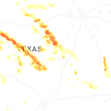
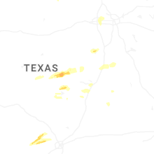
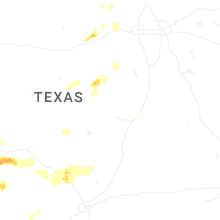


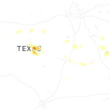

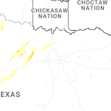


Connect with Interactive Hail Maps