

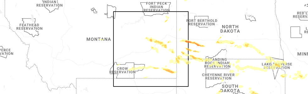
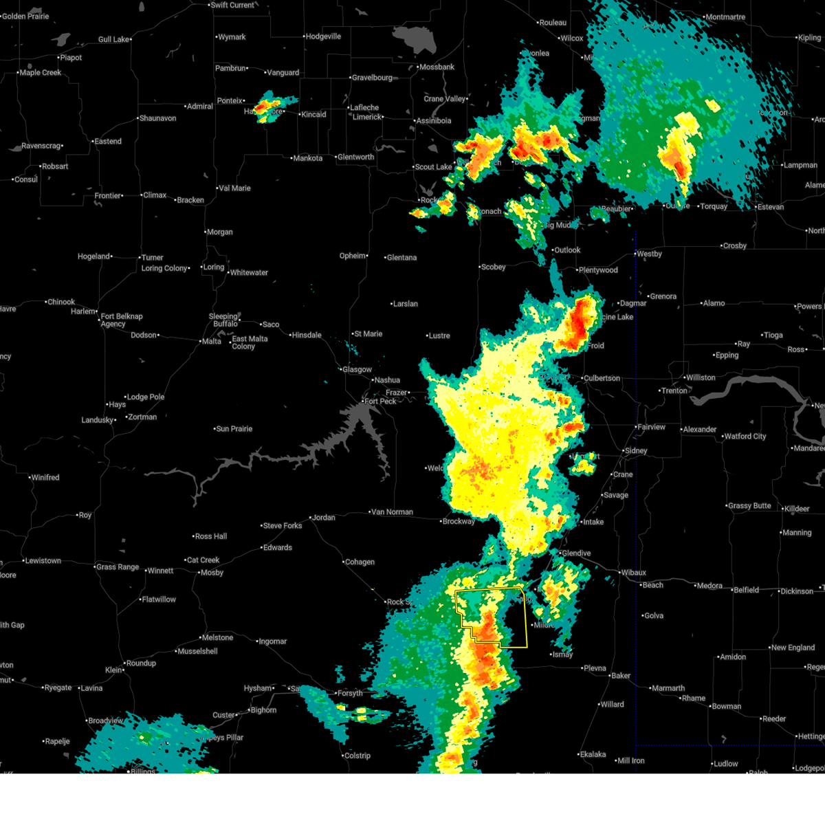
Hail Map for Terry, MT
The Terry, MT area has had 38 reports of on-the-ground hail by trained spotters, and has been under severe weather warnings 20 times during the past 12 months. Doppler radar has detected hail at or near Terry, MT on 38 occasions, including 5 occasions during the past year.
| Name: | Terry, MT |
| Where Located: | 36.8 miles NE of Miles City, MT |
| Map: | Google Map for Terry, MT |
| Population: | 605 |
| Housing Units: | 357 |
| More Info: | Search Google for Terry, MT |
5
The Top Recent Hail Date for Terry, MT is Sunday, July 20, 2025 (1st out of 38)
Hail and Wind Damage Spotted near Terry, MT
| Date / Time | Report Details |
|---|---|
| 7/3/2026 8:34 PM MDT |
 the severe thunderstorm warning has been cancelled and is no longer in effect the severe thunderstorm warning has been cancelled and is no longer in effect
|
| 7/3/2026 7:39 PM MDT |
 Svrggw the national weather service in glasgow has issued a * severe thunderstorm warning for, south central prairie county in northeastern montana, * until 845 pm mdt. * at 739 pm mdt, a severe thunderstorm was located near terry, moving east at 20 mph (radar indicated). Hazards include 60 mph wind gusts and quarter size hail. Hail damage to vehicles is expected. Expect wind damage to roofs, siding, and trees. Svrggw the national weather service in glasgow has issued a * severe thunderstorm warning for, south central prairie county in northeastern montana, * until 845 pm mdt. * at 739 pm mdt, a severe thunderstorm was located near terry, moving east at 20 mph (radar indicated). Hazards include 60 mph wind gusts and quarter size hail. Hail damage to vehicles is expected. Expect wind damage to roofs, siding, and trees.
|
| 7/2/2026 10:27 PM MDT |
 At 1027 pm mdt, severe thunderstorms were located along a line extending from 12 miles northwest of brockway to 7 miles northwest of fallon, moving east at 45 mph (radar indicated). Hazards include 60 mph wind gusts and quarter size hail. Hail damage to vehicles is expected. expect wind damage to roofs, siding, and trees. Locations impacted include, terry, fallon, brockway, mccloud, calypso, and watkins. At 1027 pm mdt, severe thunderstorms were located along a line extending from 12 miles northwest of brockway to 7 miles northwest of fallon, moving east at 45 mph (radar indicated). Hazards include 60 mph wind gusts and quarter size hail. Hail damage to vehicles is expected. expect wind damage to roofs, siding, and trees. Locations impacted include, terry, fallon, brockway, mccloud, calypso, and watkins.
|
| 7/2/2026 10:05 PM MDT |
 At 1005 pm mdt, severe thunderstorms were located along a line extending from 8 miles west of flowing wells rest area to 12 miles northwest of terry, moving east at 30 mph (radar indicated). Hazards include 60 mph wind gusts and half dollar size hail. Hail damage to vehicles is expected. expect wind damage to roofs, siding, and trees. Locations impacted include, terry, fallon, flowing wells rest area, brockway, calypso, watkins, van norman, and mccloud. At 1005 pm mdt, severe thunderstorms were located along a line extending from 8 miles west of flowing wells rest area to 12 miles northwest of terry, moving east at 30 mph (radar indicated). Hazards include 60 mph wind gusts and half dollar size hail. Hail damage to vehicles is expected. expect wind damage to roofs, siding, and trees. Locations impacted include, terry, fallon, flowing wells rest area, brockway, calypso, watkins, van norman, and mccloud.
|
| 7/2/2026 9:40 PM MDT |
 Svrggw the national weather service in glasgow has issued a * severe thunderstorm warning for, east central garfield county in northeastern montana, southwestern mccone county in northeastern montana, prairie county in northeastern montana, * until 1045 pm mdt. * at 940 pm mdt, severe thunderstorms were located along a line extending from 12 miles east of jordan to 24 miles west of terry, moving east at 30 mph (radar indicated). Hazards include 60 mph wind gusts and half dollar size hail. Hail damage to vehicles is expected. Expect wind damage to roofs, siding, and trees. Svrggw the national weather service in glasgow has issued a * severe thunderstorm warning for, east central garfield county in northeastern montana, southwestern mccone county in northeastern montana, prairie county in northeastern montana, * until 1045 pm mdt. * at 940 pm mdt, severe thunderstorms were located along a line extending from 12 miles east of jordan to 24 miles west of terry, moving east at 30 mph (radar indicated). Hazards include 60 mph wind gusts and half dollar size hail. Hail damage to vehicles is expected. Expect wind damage to roofs, siding, and trees.
|
| 8/7/2025 8:26 PM MDT |
 Svrggw the national weather service in glasgow has issued a * severe thunderstorm warning for, southwestern wibaux county in northeastern montana, southeastern garfield county in northeastern montana, southeastern mccone county in northeastern montana, prairie county in northeastern montana, southern dawson county in northeastern montana, * until 930 pm mdt. * at 826 pm mdt, a severe thunderstorm was located 19 miles west of terry, moving northeast at 60 mph (radar indicated). Hazards include 70 mph wind gusts and quarter size hail. Hail damage to vehicles is expected. expect considerable tree damage. Wind damage is also likely to mobile homes, roofs, and outbuildings. Svrggw the national weather service in glasgow has issued a * severe thunderstorm warning for, southwestern wibaux county in northeastern montana, southeastern garfield county in northeastern montana, southeastern mccone county in northeastern montana, prairie county in northeastern montana, southern dawson county in northeastern montana, * until 930 pm mdt. * at 826 pm mdt, a severe thunderstorm was located 19 miles west of terry, moving northeast at 60 mph (radar indicated). Hazards include 70 mph wind gusts and quarter size hail. Hail damage to vehicles is expected. expect considerable tree damage. Wind damage is also likely to mobile homes, roofs, and outbuildings.
|
| 7/28/2025 11:37 PM MDT |
 The severe thunderstorm which prompted the warning has weakened. therefore, the warning will be allowed to expire. The severe thunderstorm which prompted the warning has weakened. therefore, the warning will be allowed to expire.
|
| 7/28/2025 11:37 PM MDT |
 The severe thunderstorm which prompted the warning has weakened. therefore, the warning will be allowed to expire. The severe thunderstorm which prompted the warning has weakened. therefore, the warning will be allowed to expire.
|
| 7/28/2025 10:38 PM MDT |
 Svrggw the national weather service in glasgow has issued a * severe thunderstorm warning for, wibaux county in northeastern montana, southeastern mccone county in northeastern montana, eastern prairie county in northeastern montana, dawson county in northeastern montana, southeastern richland county in northeastern montana, * until 1145 pm mdt. * at 1037 pm mdt, a severe thunderstorm was located near lindsay, or 21 miles southeast of circle, moving east at 45 mph (radar indicated. spotter confirmed). Hazards include 70 mph wind gusts. Expect considerable tree damage. Damage is likely to mobile homes, roofs, and outbuildings. Svrggw the national weather service in glasgow has issued a * severe thunderstorm warning for, wibaux county in northeastern montana, southeastern mccone county in northeastern montana, eastern prairie county in northeastern montana, dawson county in northeastern montana, southeastern richland county in northeastern montana, * until 1145 pm mdt. * at 1037 pm mdt, a severe thunderstorm was located near lindsay, or 21 miles southeast of circle, moving east at 45 mph (radar indicated. spotter confirmed). Hazards include 70 mph wind gusts. Expect considerable tree damage. Damage is likely to mobile homes, roofs, and outbuildings.
|
| 7/28/2025 9:41 PM MDT |
 Svrggw the national weather service in glasgow has issued a * severe thunderstorm warning for, south central mccone county in northeastern montana, prairie county in northeastern montana, southwestern dawson county in northeastern montana, * until 1045 pm mdt. * at 941 pm mdt, a severe thunderstorm was located 19 miles west of terry, moving east at 35 mph (radar indicated). Hazards include 70 mph wind gusts. Expect considerable tree damage. Damage is likely to mobile homes, roofs, and outbuildings. Svrggw the national weather service in glasgow has issued a * severe thunderstorm warning for, south central mccone county in northeastern montana, prairie county in northeastern montana, southwestern dawson county in northeastern montana, * until 1045 pm mdt. * at 941 pm mdt, a severe thunderstorm was located 19 miles west of terry, moving east at 35 mph (radar indicated). Hazards include 70 mph wind gusts. Expect considerable tree damage. Damage is likely to mobile homes, roofs, and outbuildings.
|
| 7/28/2025 8:13 AM MDT |
 Svrggw the national weather service in glasgow has issued a * severe thunderstorm warning for, southwestern wibaux county in northeastern montana, southeastern prairie county in northeastern montana, south central dawson county in northeastern montana, * until 915 am mdt. * at 813 am mdt, a severe thunderstorm was located 10 miles south of terry, moving east at 40 mph (radar indicated). Hazards include 60 mph wind gusts and quarter size hail. Hail damage to vehicles is expected. Expect wind damage to roofs, siding, and trees. Svrggw the national weather service in glasgow has issued a * severe thunderstorm warning for, southwestern wibaux county in northeastern montana, southeastern prairie county in northeastern montana, south central dawson county in northeastern montana, * until 915 am mdt. * at 813 am mdt, a severe thunderstorm was located 10 miles south of terry, moving east at 40 mph (radar indicated). Hazards include 60 mph wind gusts and quarter size hail. Hail damage to vehicles is expected. Expect wind damage to roofs, siding, and trees.
|
| 7/26/2025 11:23 PM MDT |
 At 1121 pm mdt, severe thunderstorms were located along a line extending from 14 miles west of bredette to near bloomfield to 12 miles south of lindsay, moving east at 45 mph (radar indicated). Hazards include 60 mph wind gusts. Expect damage to roofs, siding, and trees. Locations impacted include, sidney, glendive, wolf point, poplar, culbertson, circle, terry, wibaux, fallon, fairview, brockton, bainville, froid, richey, savage, west glendive, brockway, intake, bloomfield, and lustre. At 1121 pm mdt, severe thunderstorms were located along a line extending from 14 miles west of bredette to near bloomfield to 12 miles south of lindsay, moving east at 45 mph (radar indicated). Hazards include 60 mph wind gusts. Expect damage to roofs, siding, and trees. Locations impacted include, sidney, glendive, wolf point, poplar, culbertson, circle, terry, wibaux, fallon, fairview, brockton, bainville, froid, richey, savage, west glendive, brockway, intake, bloomfield, and lustre.
|
| 7/26/2025 11:23 PM MDT |
 the severe thunderstorm warning has been cancelled and is no longer in effect the severe thunderstorm warning has been cancelled and is no longer in effect
|
| 7/26/2025 10:54 PM MDT |
 Svrggw the national weather service in glasgow has issued a * severe thunderstorm warning for, wibaux county in northeastern montana, southeastern garfield county in northeastern montana, roosevelt county in northeastern montana, east central valley county in northeastern montana, mccone county in northeastern montana, prairie county in northeastern montana, dawson county in northeastern montana, richland county in northeastern montana, * until 1215 am mdt. * at 1053 pm mdt, severe thunderstorms were located along a line extending from 7 miles northwest of lustre to 7 miles south of vida to 21 miles south of brockway, moving east at 40 mph (radar indicated). Hazards include 60 mph wind gusts. expect damage to roofs, siding, and trees Svrggw the national weather service in glasgow has issued a * severe thunderstorm warning for, wibaux county in northeastern montana, southeastern garfield county in northeastern montana, roosevelt county in northeastern montana, east central valley county in northeastern montana, mccone county in northeastern montana, prairie county in northeastern montana, dawson county in northeastern montana, richland county in northeastern montana, * until 1215 am mdt. * at 1053 pm mdt, severe thunderstorms were located along a line extending from 7 miles northwest of lustre to 7 miles south of vida to 21 miles south of brockway, moving east at 40 mph (radar indicated). Hazards include 60 mph wind gusts. expect damage to roofs, siding, and trees
|
| 7/25/2025 5:36 PM MDT | Golf Ball sized hail reported 17.8 miles NNW of Terry, MT, rainfall 0.10 or less (estimated). |
| 7/25/2025 5:10 PM MDT | Quarter sized hail reported 4.8 miles N of Terry, MT, 5 miles s of terry. hail started at 5:10... storm pretty well passed by 5:30. 0.17 of rain... smaller hail. still lightly raining. |
| 7/21/2025 7:47 PM MDT |
 The storm which prompted the warning has weakened below severe limits, and no longer poses an immediate threat to life or property. therefore, the warning has been allowed to expire. however, heavy rain is still possible with this thunderstorm. a severe thunderstorm watch remains in effect until 1100 pm mdt for northeastern montana. The storm which prompted the warning has weakened below severe limits, and no longer poses an immediate threat to life or property. therefore, the warning has been allowed to expire. however, heavy rain is still possible with this thunderstorm. a severe thunderstorm watch remains in effect until 1100 pm mdt for northeastern montana.
|
| 7/21/2025 6:48 PM MDT |
 Svrggw the national weather service in glasgow has issued a * severe thunderstorm warning for, prairie county in northeastern montana, southwestern dawson county in northeastern montana, * until 745 pm mdt. * at 647 pm mdt, a severe thunderstorm was located 18 miles west of terry, moving northeast at 30 mph (radar indicated). Hazards include 60 mph wind gusts and quarter size hail. Hail damage to vehicles is expected. Expect wind damage to roofs, siding, and trees. Svrggw the national weather service in glasgow has issued a * severe thunderstorm warning for, prairie county in northeastern montana, southwestern dawson county in northeastern montana, * until 745 pm mdt. * at 647 pm mdt, a severe thunderstorm was located 18 miles west of terry, moving northeast at 30 mph (radar indicated). Hazards include 60 mph wind gusts and quarter size hail. Hail damage to vehicles is expected. Expect wind damage to roofs, siding, and trees.
|
| 7/20/2025 6:45 PM MDT | Ping Pong Ball sized hail reported 3 miles ENE of Terry, MT, report from mping: ping pong ball (1.50 in.). |
| 7/20/2025 6:24 PM MDT | Quarter sized hail reported 0.6 miles W of Terry, MT, report from mping: quarter (1.00 in.). |
| 7/20/2025 6:20 PM MDT | Quarter sized hail reported 0.2 miles W of Terry, MT, lots of rain with hail up to quarter size. |
| 7/20/2025 6:10 PM MDT |
 Svrggw the national weather service in glasgow has issued a * severe thunderstorm warning for, southwestern wibaux county in northeastern montana, southeastern prairie county in northeastern montana, * until 715 pm mdt. * at 610 pm mdt, a severe thunderstorm was located over terry, moving east at 35 mph. this is a destructive storm for terry (radar indicated). Hazards include baseball size hail and 60 mph wind gusts. People and animals outdoors will be severely injured. Expect shattered windows, extensive damage to roofs, siding, and vehicles. Svrggw the national weather service in glasgow has issued a * severe thunderstorm warning for, southwestern wibaux county in northeastern montana, southeastern prairie county in northeastern montana, * until 715 pm mdt. * at 610 pm mdt, a severe thunderstorm was located over terry, moving east at 35 mph. this is a destructive storm for terry (radar indicated). Hazards include baseball size hail and 60 mph wind gusts. People and animals outdoors will be severely injured. Expect shattered windows, extensive damage to roofs, siding, and vehicles.
|
| 7/20/2025 5:42 PM MDT |
 At 542 pm mdt, a severe thunderstorm was located 19 miles west of terry, moving east at 20 mph (radar indicated). Hazards include 60 mph wind gusts and quarter size hail. Hail damage to vehicles is expected. expect wind damage to roofs, siding, and trees. Locations impacted include, terry, zero, mccloud, and calypso. At 542 pm mdt, a severe thunderstorm was located 19 miles west of terry, moving east at 20 mph (radar indicated). Hazards include 60 mph wind gusts and quarter size hail. Hail damage to vehicles is expected. expect wind damage to roofs, siding, and trees. Locations impacted include, terry, zero, mccloud, and calypso.
|
| 7/20/2025 5:22 PM MDT |
 Svrggw the national weather service in glasgow has issued a * severe thunderstorm warning for, southwestern prairie county in northeastern montana, * until 615 pm mdt. * at 521 pm mdt, a severe thunderstorm was located 24 miles east of hillside, or 27 miles west of terry, moving east at 20 mph (radar indicated). Hazards include ping pong ball size hail and 60 mph wind gusts. People and animals outdoors will be injured. expect hail damage to roofs, siding, windows, and vehicles. Expect wind damage to roofs, siding, and trees. Svrggw the national weather service in glasgow has issued a * severe thunderstorm warning for, southwestern prairie county in northeastern montana, * until 615 pm mdt. * at 521 pm mdt, a severe thunderstorm was located 24 miles east of hillside, or 27 miles west of terry, moving east at 20 mph (radar indicated). Hazards include ping pong ball size hail and 60 mph wind gusts. People and animals outdoors will be injured. expect hail damage to roofs, siding, windows, and vehicles. Expect wind damage to roofs, siding, and trees.
|
| 7/19/2025 7:00 PM MDT | Emergency management reported branches down from multiple trees across town... a main power line down causing power outage in terry. damage to a tin roof at ball fiel in prairie county MT, 0.2 miles W of Terry, MT |
| 7/19/2025 6:44 PM MDT |
 Svrggw the national weather service in glasgow has issued a * severe thunderstorm warning for, southwestern wibaux county in northeastern montana, southeastern prairie county in northeastern montana, south central dawson county in northeastern montana, * until 745 pm mdt. * at 644 pm mdt, a severe thunderstorm was located over fallon, or 8 miles east of terry, moving southeast at 40 mph (radar indicated). Hazards include two inch hail. People and animals outdoors will be injured. Expect damage to roofs, siding, windows, and vehicles. Svrggw the national weather service in glasgow has issued a * severe thunderstorm warning for, southwestern wibaux county in northeastern montana, southeastern prairie county in northeastern montana, south central dawson county in northeastern montana, * until 745 pm mdt. * at 644 pm mdt, a severe thunderstorm was located over fallon, or 8 miles east of terry, moving southeast at 40 mph (radar indicated). Hazards include two inch hail. People and animals outdoors will be injured. Expect damage to roofs, siding, windows, and vehicles.
|
| 7/19/2025 6:42 PM MDT | Winds estimated to be in excess of 60 mph based on social media video post and tree limb damag in prairie county MT, 0.2 miles W of Terry, MT |
| 7/19/2025 6:30 PM MDT | Blm terry statio in prairie county MT, 4.3 miles SW of Terry, MT |
| 7/9/2025 9:08 PM MDT | Big sheep mountain... mt (raws - ggw) minor heat burst... 2:12 in prairie county MT, 28.8 miles SE of Terry, MT |
| 6/25/2025 3:55 PM MDT |
 Svrggw the national weather service in glasgow has issued a * severe thunderstorm warning for, southeastern prairie county in northeastern montana, south central dawson county in northeastern montana, * until 500 pm mdt. * at 355 pm mdt, a severe thunderstorm was located near fallon, or 9 miles east of terry, moving east at 20 mph (radar indicated). Hazards include 60 mph wind gusts and quarter size hail. Hail damage to vehicles is expected. Expect wind damage to roofs, siding, and trees. Svrggw the national weather service in glasgow has issued a * severe thunderstorm warning for, southeastern prairie county in northeastern montana, south central dawson county in northeastern montana, * until 500 pm mdt. * at 355 pm mdt, a severe thunderstorm was located near fallon, or 9 miles east of terry, moving east at 20 mph (radar indicated). Hazards include 60 mph wind gusts and quarter size hail. Hail damage to vehicles is expected. Expect wind damage to roofs, siding, and trees.
|
| 6/20/2025 4:52 PM MDT |
 The storms which prompted the warning have weakened below severe limits, and have exited the warned area. therefore, the warning will be allowed to expire. however, small hail is still possible with these thunderstorms. a severe thunderstorm watch remains in effect until 900 pm mdt for northeastern montana. to report severe weather, contact your nearest law enforcement agency. they will relay your report to the national weather service glasgow. The storms which prompted the warning have weakened below severe limits, and have exited the warned area. therefore, the warning will be allowed to expire. however, small hail is still possible with these thunderstorms. a severe thunderstorm watch remains in effect until 900 pm mdt for northeastern montana. to report severe weather, contact your nearest law enforcement agency. they will relay your report to the national weather service glasgow.
|
| 6/20/2025 4:29 PM MDT |
 At 429 pm mdt, severe thunderstorms were located along a line extending from 12 miles south of lindsay to 7 miles northeast of fallon to 13 miles east of terry, moving northeast at 45 mph (radar indicated). Hazards include 60 mph wind gusts and quarter size hail. Hail damage to vehicles is expected. expect wind damage to roofs, siding, and trees. Locations impacted include, glendive, terry, fallon, west glendive, hoyt, mildred, forest park, and marsh. At 429 pm mdt, severe thunderstorms were located along a line extending from 12 miles south of lindsay to 7 miles northeast of fallon to 13 miles east of terry, moving northeast at 45 mph (radar indicated). Hazards include 60 mph wind gusts and quarter size hail. Hail damage to vehicles is expected. expect wind damage to roofs, siding, and trees. Locations impacted include, glendive, terry, fallon, west glendive, hoyt, mildred, forest park, and marsh.
|
| 6/20/2025 3:59 PM MDT |
 Svrggw the national weather service in glasgow has issued a * severe thunderstorm warning for, prairie county in northeastern montana, southwestern dawson county in northeastern montana, * until 500 pm mdt. * at 358 pm mdt, severe thunderstorms were located along a line extending from 19 miles west of fallon to near terry, moving northeast at 40 mph (radar indicated). Hazards include 60 mph wind gusts and quarter size hail. Hail damage to vehicles is expected. Expect wind damage to roofs, siding, and trees. Svrggw the national weather service in glasgow has issued a * severe thunderstorm warning for, prairie county in northeastern montana, southwestern dawson county in northeastern montana, * until 500 pm mdt. * at 358 pm mdt, severe thunderstorms were located along a line extending from 19 miles west of fallon to near terry, moving northeast at 40 mph (radar indicated). Hazards include 60 mph wind gusts and quarter size hail. Hail damage to vehicles is expected. Expect wind damage to roofs, siding, and trees.
|
| 6/15/2025 10:54 PM MDT |
 The storm which prompted the warning has weakened below severe limits, and no longer poses an immediate threat to life or property. therefore, the warning will be allowed to expire. however, gusty winds and heavy rain are still possible with this thunderstorm. a severe thunderstorm watch remains in effect until 100 am mdt for northeastern montana. The storm which prompted the warning has weakened below severe limits, and no longer poses an immediate threat to life or property. therefore, the warning will be allowed to expire. however, gusty winds and heavy rain are still possible with this thunderstorm. a severe thunderstorm watch remains in effect until 100 am mdt for northeastern montana.
|
| 6/15/2025 10:32 PM MDT |
 At 1032 pm mdt, a severe thunderstorm was located 21 miles northwest of terry, moving east at 30 mph (radar indicated). Hazards include 60 mph wind gusts. Expect damage to roofs, siding, and trees. Locations impacted include, zero, mccloud, calypso, crow rock, and terry. At 1032 pm mdt, a severe thunderstorm was located 21 miles northwest of terry, moving east at 30 mph (radar indicated). Hazards include 60 mph wind gusts. Expect damage to roofs, siding, and trees. Locations impacted include, zero, mccloud, calypso, crow rock, and terry.
|
| 6/15/2025 10:32 PM MDT |
 the severe thunderstorm warning has been cancelled and is no longer in effect the severe thunderstorm warning has been cancelled and is no longer in effect
|
| 6/15/2025 9:57 PM MDT |
 Svrggw the national weather service in glasgow has issued a * severe thunderstorm warning for, southeastern garfield county in northeastern montana, western prairie county in northeastern montana, * until 1100 pm mdt. * at 957 pm mdt, a severe thunderstorm was located 13 miles east of hillside, or 36 miles north of miles city, moving east at 30 mph (radar indicated). Hazards include 60 mph wind gusts. expect damage to roofs, siding, and trees Svrggw the national weather service in glasgow has issued a * severe thunderstorm warning for, southeastern garfield county in northeastern montana, western prairie county in northeastern montana, * until 1100 pm mdt. * at 957 pm mdt, a severe thunderstorm was located 13 miles east of hillside, or 36 miles north of miles city, moving east at 30 mph (radar indicated). Hazards include 60 mph wind gusts. expect damage to roofs, siding, and trees
|
| 6/15/2025 9:21 PM MDT |
 The storm which prompted the warning has weakened below severe limits, and no longer poses an immediate threat to life or property. therefore, the warning will be allowed to expire. a severe thunderstorm watch remains in effect until 1100 pm mdt for northeastern montana. The storm which prompted the warning has weakened below severe limits, and no longer poses an immediate threat to life or property. therefore, the warning will be allowed to expire. a severe thunderstorm watch remains in effect until 1100 pm mdt for northeastern montana.
|
| 6/15/2025 8:58 PM MDT |
 At 857 pm mdt, a severe thunderstorm was located 13 miles south of terry, moving east at 35 mph (radar indicated). Hazards include 60 mph wind gusts. Expect damage to roofs, siding, and trees. Locations impacted include, zero, calypso, fallon, and terry. At 857 pm mdt, a severe thunderstorm was located 13 miles south of terry, moving east at 35 mph (radar indicated). Hazards include 60 mph wind gusts. Expect damage to roofs, siding, and trees. Locations impacted include, zero, calypso, fallon, and terry.
|
| 6/15/2025 8:28 PM MDT |
 Svrggw the national weather service in glasgow has issued a * severe thunderstorm warning for, south central prairie county in northeastern montana, * until 930 pm mdt. * at 828 pm mdt, a severe thunderstorm was located 11 miles northeast of miles city, moving east at 35 mph (radar indicated). Hazards include 60 mph wind gusts and quarter size hail. Hail damage to vehicles is expected. Expect wind damage to roofs, siding, and trees. Svrggw the national weather service in glasgow has issued a * severe thunderstorm warning for, south central prairie county in northeastern montana, * until 930 pm mdt. * at 828 pm mdt, a severe thunderstorm was located 11 miles northeast of miles city, moving east at 35 mph (radar indicated). Hazards include 60 mph wind gusts and quarter size hail. Hail damage to vehicles is expected. Expect wind damage to roofs, siding, and trees.
|
| 5/11/2025 7:53 PM MDT |
 The storm which prompted the warning has weakened below severe limits, and no longer poses an immediate threat to life or property. therefore, the warning will be allowed to expire. however, gusty winds are still possible with this thunderstorm. a severe thunderstorm watch remains in effect until 1100 pm mdt for northeastern montana. The storm which prompted the warning has weakened below severe limits, and no longer poses an immediate threat to life or property. therefore, the warning will be allowed to expire. however, gusty winds are still possible with this thunderstorm. a severe thunderstorm watch remains in effect until 1100 pm mdt for northeastern montana.
|
| 5/11/2025 7:28 PM MDT |
 At 728 pm mdt, a severe thunderstorm was located near terry, moving north at 20 mph (radar indicated). Hazards include 60 mph wind gusts and penny size hail. Expect damage to roofs, siding, and trees. Locations impacted include, hoyt, mildred, zero, calypso, fallon, terry, marsh, and mccloud. At 728 pm mdt, a severe thunderstorm was located near terry, moving north at 20 mph (radar indicated). Hazards include 60 mph wind gusts and penny size hail. Expect damage to roofs, siding, and trees. Locations impacted include, hoyt, mildred, zero, calypso, fallon, terry, marsh, and mccloud.
|
| 5/11/2025 6:58 PM MDT |
 Svrggw the national weather service in glasgow has issued a * severe thunderstorm warning for, southwestern wibaux county in northeastern montana, prairie county in northeastern montana, southeastern dawson county in northeastern montana, * until 800 pm mdt. * at 658 pm mdt, a severe thunderstorm was located 17 miles south of terry, moving north at 25 mph (radar indicated). Hazards include 60 mph wind gusts and quarter size hail. Hail damage to vehicles is expected. Expect wind damage to roofs, siding, and trees. Svrggw the national weather service in glasgow has issued a * severe thunderstorm warning for, southwestern wibaux county in northeastern montana, prairie county in northeastern montana, southeastern dawson county in northeastern montana, * until 800 pm mdt. * at 658 pm mdt, a severe thunderstorm was located 17 miles south of terry, moving north at 25 mph (radar indicated). Hazards include 60 mph wind gusts and quarter size hail. Hail damage to vehicles is expected. Expect wind damage to roofs, siding, and trees.
|
| 8/21/2024 8:49 PM MDT |
 At 848 pm mdt, a severe thunderstorm was located near glendive, moving east at 25 mph (radar indicated). Hazards include 60 mph wind gusts and quarter size hail. Hail damage to vehicles is expected. expect wind damage to roofs, siding, and trees. Locations impacted include, glendive, terry, fallon, west glendive, hoyt, mildred, forest park, stipek, and marsh. At 848 pm mdt, a severe thunderstorm was located near glendive, moving east at 25 mph (radar indicated). Hazards include 60 mph wind gusts and quarter size hail. Hail damage to vehicles is expected. expect wind damage to roofs, siding, and trees. Locations impacted include, glendive, terry, fallon, west glendive, hoyt, mildred, forest park, stipek, and marsh.
|
| 8/21/2024 8:25 PM MDT |
 Svrggw the national weather service in glasgow has issued a * severe thunderstorm warning for, southwestern wibaux county in northeastern montana, eastern prairie county in northeastern montana, southern dawson county in northeastern montana, * until 930 pm mdt. * at 825 pm mdt, a severe thunderstorm was located 12 miles northeast of fallon, or 15 miles southwest of glendive, moving east at 25 mph (radar indicated). Hazards include 70 mph wind gusts and half dollar size hail. Hail damage to vehicles is expected. expect considerable tree damage. Wind damage is also likely to mobile homes, roofs, and outbuildings. Svrggw the national weather service in glasgow has issued a * severe thunderstorm warning for, southwestern wibaux county in northeastern montana, eastern prairie county in northeastern montana, southern dawson county in northeastern montana, * until 930 pm mdt. * at 825 pm mdt, a severe thunderstorm was located 12 miles northeast of fallon, or 15 miles southwest of glendive, moving east at 25 mph (radar indicated). Hazards include 70 mph wind gusts and half dollar size hail. Hail damage to vehicles is expected. expect considerable tree damage. Wind damage is also likely to mobile homes, roofs, and outbuildings.
|
| 8/21/2024 8:05 PM MDT |
 Svrggw the national weather service in glasgow has issued a * severe thunderstorm warning for, southeastern prairie county in northeastern montana, * until 830 pm mdt. * at 805 pm mdt, severe thunderstorms were located along a line extending from near fallon to 20 miles southeast of terry, moving east at 30 mph (radar indicated). Hazards include 60 mph wind gusts and quarter size hail. Hail damage to vehicles is expected. Expect wind damage to roofs, siding, and trees. Svrggw the national weather service in glasgow has issued a * severe thunderstorm warning for, southeastern prairie county in northeastern montana, * until 830 pm mdt. * at 805 pm mdt, severe thunderstorms were located along a line extending from near fallon to 20 miles southeast of terry, moving east at 30 mph (radar indicated). Hazards include 60 mph wind gusts and quarter size hail. Hail damage to vehicles is expected. Expect wind damage to roofs, siding, and trees.
|
| 6/27/2024 4:51 PM MDT |
 The storm which prompted the warning has moved out of the area. therefore, the warning will be allowed to expire. however, gusty winds and heavy rain are still possible with this thunderstorm. a severe thunderstorm watch remains in effect until 800 pm mdt for northeastern montana. The storm which prompted the warning has moved out of the area. therefore, the warning will be allowed to expire. however, gusty winds and heavy rain are still possible with this thunderstorm. a severe thunderstorm watch remains in effect until 800 pm mdt for northeastern montana.
|
| 6/27/2024 4:39 PM MDT |
 Svrggw the national weather service in glasgow has issued a * severe thunderstorm warning for, central prairie county in northeastern montana, southern dawson county in northeastern montana, * until 545 pm mdt. * at 439 pm mdt, a severe thunderstorm was located near terry, moving northeast at 25 mph (radar indicated). Hazards include 60 mph wind gusts and half dollar size hail. Hail damage to vehicles is expected. Expect wind damage to roofs, siding, and trees. Svrggw the national weather service in glasgow has issued a * severe thunderstorm warning for, central prairie county in northeastern montana, southern dawson county in northeastern montana, * until 545 pm mdt. * at 439 pm mdt, a severe thunderstorm was located near terry, moving northeast at 25 mph (radar indicated). Hazards include 60 mph wind gusts and half dollar size hail. Hail damage to vehicles is expected. Expect wind damage to roofs, siding, and trees.
|
| 6/27/2024 4:30 PM MDT | Measured at the blm terry mesonet sit in prairie county MT, 4.3 miles SW of Terry, MT |
| 6/27/2024 4:28 PM MDT |
 At 428 pm mdt, a severe thunderstorm was located 7 miles northwest of terry, moving east at 40 mph (radar indicated). Hazards include 70 mph wind gusts and ping pong ball size hail. People and animals outdoors will be injured. expect hail damage to roofs, siding, windows, and vehicles. expect considerable tree damage. wind damage is also likely to mobile homes, roofs, and outbuildings. Locations impacted include, terry, zero, mccloud, and calypso. At 428 pm mdt, a severe thunderstorm was located 7 miles northwest of terry, moving east at 40 mph (radar indicated). Hazards include 70 mph wind gusts and ping pong ball size hail. People and animals outdoors will be injured. expect hail damage to roofs, siding, windows, and vehicles. expect considerable tree damage. wind damage is also likely to mobile homes, roofs, and outbuildings. Locations impacted include, terry, zero, mccloud, and calypso.
|
| 6/27/2024 4:10 PM MDT | Prairie county des estimated gusts of 60 mph initially. behind the initial rain... heavy rain and 30-40 mph wind gust in prairie county MT, 1.3 miles WSW of Terry, MT |
| 6/27/2024 4:10 PM MDT | Report via facebook. estimated a minimum of 60 mph gust in prairie county MT, 0.9 miles NW of Terry, MT |
| 6/27/2024 3:55 PM MDT |
 Svrggw the national weather service in glasgow has issued a * severe thunderstorm warning for, central prairie county in northeastern montana, southwestern dawson county in northeastern montana, * until 500 pm mdt. * at 353 pm mdt, a severe thunderstorm was located 22 miles north of miles city, moving east at 40 mph (radar indicated). Hazards include 70 mph wind gusts and ping pong ball size hail. People and animals outdoors will be injured. expect hail damage to roofs, siding, windows, and vehicles. expect considerable tree damage. Wind damage is also likely to mobile homes, roofs, and outbuildings. Svrggw the national weather service in glasgow has issued a * severe thunderstorm warning for, central prairie county in northeastern montana, southwestern dawson county in northeastern montana, * until 500 pm mdt. * at 353 pm mdt, a severe thunderstorm was located 22 miles north of miles city, moving east at 40 mph (radar indicated). Hazards include 70 mph wind gusts and ping pong ball size hail. People and animals outdoors will be injured. expect hail damage to roofs, siding, windows, and vehicles. expect considerable tree damage. Wind damage is also likely to mobile homes, roofs, and outbuildings.
|
| 8/30/2023 7:30 PM MDT | Mesonet station mtm29 3.9 ne terry (mt-meso in prairie county MT, 4.3 miles SW of Terry, MT |
| 8/30/2023 6:33 PM MDT |
 At 632 pm mdt, severe thunderstorms were located along a line extending from 9 miles north of rock creek rec area to 17 miles east of hillside, moving east at 45 mph (radar indicated). Hazards include 60 mph wind gusts. expect damage to roofs, siding, and trees At 632 pm mdt, severe thunderstorms were located along a line extending from 9 miles north of rock creek rec area to 17 miles east of hillside, moving east at 45 mph (radar indicated). Hazards include 60 mph wind gusts. expect damage to roofs, siding, and trees
|
| 6/20/2023 1:11 AM MDT |
 At 111 am mdt, a severe thunderstorm was located 19 miles north of miles city, moving northeast at 55 mph (radar indicated). Hazards include 60 mph wind gusts and half dollar size hail. Hail damage to vehicles is expected. Expect wind damage to roofs, siding, and trees. At 111 am mdt, a severe thunderstorm was located 19 miles north of miles city, moving northeast at 55 mph (radar indicated). Hazards include 60 mph wind gusts and half dollar size hail. Hail damage to vehicles is expected. Expect wind damage to roofs, siding, and trees.
|
| 6/4/2023 5:21 PM MDT |
 At 520 pm mdt, severe thunderstorms were located along a line extending from near east fairview to 17 miles southwest of terry, moving northwest at 25 mph (trained weather spotter reported an estimated wind gust of 60 mph at 5:20 pm). Hazards include 60 mph wind gusts and penny size hail. expect damage to roofs, siding, and trees At 520 pm mdt, severe thunderstorms were located along a line extending from near east fairview to 17 miles southwest of terry, moving northwest at 25 mph (trained weather spotter reported an estimated wind gust of 60 mph at 5:20 pm). Hazards include 60 mph wind gusts and penny size hail. expect damage to roofs, siding, and trees
|
| 7/10/2022 12:24 AM MDT |
 At 1222 am mdt, severe thunderstorms were located along a line extending from 13 miles east of fallon to 27 miles west of baker, moving east at 70 mph (radar indicated). Hazards include 70 mph wind gusts and half dollar size hail. Hail damage to vehicles is expected. expect considerable tree damage. Wind damage is also likely to mobile homes, roofs, and outbuildings. At 1222 am mdt, severe thunderstorms were located along a line extending from 13 miles east of fallon to 27 miles west of baker, moving east at 70 mph (radar indicated). Hazards include 70 mph wind gusts and half dollar size hail. Hail damage to vehicles is expected. expect considerable tree damage. Wind damage is also likely to mobile homes, roofs, and outbuildings.
|
| 7/9/2022 11:55 PM MDT | Relayed via faceboo in prairie county MT, 27 miles SE of Terry, MT |
| 7/9/2022 11:55 PM MDT | Quarter sized hail reported 0.9 miles NW of Terry, MT, relayed via facebook. |
| 7/9/2022 11:48 PM MDT |
 At 1148 pm mdt, severe thunderstorms were located along a line extending from 13 miles southwest of richey to 12 miles south of terry, moving east at 60 mph (radar indicated). Hazards include 70 mph wind gusts and half dollar size hail. Hail damage to vehicles is expected. expect considerable tree damage. wind damage is also likely to mobile homes, roofs, and outbuildings. locations impacted include, sidney, glendive, terry, wibaux, fallon, fairview, richey, savage, west glendive, intake, bloomfield, lambert, carlyle, lindsay, east fairview, enid, wooley, crane, mildred and calypso. thunderstorm damage threat, considerable hail threat, radar indicated max hail size, 1. 25 in wind threat, radar indicated max wind gust, 70 mph. At 1148 pm mdt, severe thunderstorms were located along a line extending from 13 miles southwest of richey to 12 miles south of terry, moving east at 60 mph (radar indicated). Hazards include 70 mph wind gusts and half dollar size hail. Hail damage to vehicles is expected. expect considerable tree damage. wind damage is also likely to mobile homes, roofs, and outbuildings. locations impacted include, sidney, glendive, terry, wibaux, fallon, fairview, richey, savage, west glendive, intake, bloomfield, lambert, carlyle, lindsay, east fairview, enid, wooley, crane, mildred and calypso. thunderstorm damage threat, considerable hail threat, radar indicated max hail size, 1. 25 in wind threat, radar indicated max wind gust, 70 mph.
|
| 7/9/2022 11:43 PM MDT | Quarter sized hail reported 7.3 miles NE of Terry, MT, reported by storm spotter. |
| 7/9/2022 11:43 PM MDT | Estimated by storm spotte in prairie county MT, 7.3 miles NE of Terry, MT |
| 7/9/2022 11:27 PM MDT |
 At 1126 pm mdt, severe thunderstorms were located along a line extending from 10 miles northwest of circle to 15 miles north of miles city, moving east at 60 mph (radar indicated). Hazards include 70 mph wind gusts and half dollar size hail. Hail damage to vehicles is expected. expect considerable tree damage. Wind damage is also likely to mobile homes, roofs, and outbuildings. At 1126 pm mdt, severe thunderstorms were located along a line extending from 10 miles northwest of circle to 15 miles north of miles city, moving east at 60 mph (radar indicated). Hazards include 70 mph wind gusts and half dollar size hail. Hail damage to vehicles is expected. expect considerable tree damage. Wind damage is also likely to mobile homes, roofs, and outbuildings.
|
| 7/9/2022 10:30 PM MDT |
 At 1030 pm mdt, severe thunderstorms were located along a line extending from 11 miles southwest of vida to 14 miles west of terry, moving east at 60 mph (radar indicated). Hazards include 70 mph wind gusts and half dollar size hail. Hail damage to vehicles is expected. expect considerable tree damage. Wind damage is also likely to mobile homes, roofs, and outbuildings. At 1030 pm mdt, severe thunderstorms were located along a line extending from 11 miles southwest of vida to 14 miles west of terry, moving east at 60 mph (radar indicated). Hazards include 70 mph wind gusts and half dollar size hail. Hail damage to vehicles is expected. expect considerable tree damage. Wind damage is also likely to mobile homes, roofs, and outbuildings.
|
| 7/6/2022 9:34 PM MDT |
 At 934 pm mdt, a severe thunderstorm was located 15 miles northwest of terry, moving east at 5 mph (radar indicated). Hazards include 60 mph wind gusts and quarter size hail. Hail damage to vehicles is expected. Expect wind damage to roofs, siding, and trees. At 934 pm mdt, a severe thunderstorm was located 15 miles northwest of terry, moving east at 5 mph (radar indicated). Hazards include 60 mph wind gusts and quarter size hail. Hail damage to vehicles is expected. Expect wind damage to roofs, siding, and trees.
|
| 7/6/2022 8:29 PM MDT |
 At 829 pm mdt, a severe thunderstorm was located 10 miles northwest of fallon, or 13 miles north of terry, moving southwest at 15 mph (radar indicated). Hazards include ping pong ball size hail and 60 mph wind gusts. People and animals outdoors will be injured. expect hail damage to roofs, siding, windows, and vehicles. Expect wind damage to roofs, siding, and trees. At 829 pm mdt, a severe thunderstorm was located 10 miles northwest of fallon, or 13 miles north of terry, moving southwest at 15 mph (radar indicated). Hazards include ping pong ball size hail and 60 mph wind gusts. People and animals outdoors will be injured. expect hail damage to roofs, siding, windows, and vehicles. Expect wind damage to roofs, siding, and trees.
|
| 7/5/2022 8:50 PM MDT | Quarter sized hail reported 23.6 miles SSE of Terry, MT |
| 7/5/2022 8:50 PM MDT | Storm damage reported in prairie county MT, 23.6 miles SSE of Terry, MT |
| 7/3/2022 7:26 PM MDT |
 At 726 pm mdt, severe thunderstorms were located along a line extending from near richey to 7 miles south of bloomfield to 16 miles southeast of fallon, moving east at 30 mph (radar indicated). Hazards include 70 mph wind gusts and half dollar size hail. Hail damage to vehicles is expected. expect considerable tree damage. wind damage is also likely to mobile homes, roofs, and outbuildings. Locations impacted include, sidney, glendive, terry, wibaux, fallon, richey, savage, west glendive, intake, bloomfield, lambert, carlyle, lindsay, enid, wooley, crane, mildred, midway, hoyt and saint phillip. At 726 pm mdt, severe thunderstorms were located along a line extending from near richey to 7 miles south of bloomfield to 16 miles southeast of fallon, moving east at 30 mph (radar indicated). Hazards include 70 mph wind gusts and half dollar size hail. Hail damage to vehicles is expected. expect considerable tree damage. wind damage is also likely to mobile homes, roofs, and outbuildings. Locations impacted include, sidney, glendive, terry, wibaux, fallon, richey, savage, west glendive, intake, bloomfield, lambert, carlyle, lindsay, enid, wooley, crane, mildred, midway, hoyt and saint phillip.
|
| 7/3/2022 7:03 PM MDT | Quarter sized hail reported 0.7 miles SSW of Terry, MT, reported via facebook. |
| 7/3/2022 7:03 PM MDT | Half Dollar sized hail reported 0.7 miles SSW of Terry, MT, report relayed via facebook. |
| 7/3/2022 7:01 PM MDT |
 At 701 pm mdt, severe thunderstorms were located along a line extending from near vida to 6 miles northeast of lindsay to 13 miles west of west glendive, moving northeast at 45 mph (radar indicated). Hazards include 60 mph wind gusts and quarter size hail. Hail damage to vehicles is expected. Expect wind damage to roofs, siding, and trees. At 701 pm mdt, severe thunderstorms were located along a line extending from near vida to 6 miles northeast of lindsay to 13 miles west of west glendive, moving northeast at 45 mph (radar indicated). Hazards include 60 mph wind gusts and quarter size hail. Hail damage to vehicles is expected. Expect wind damage to roofs, siding, and trees.
|
| 7/3/2022 6:58 PM MDT | Storm damage reported in prairie county MT, 19.3 miles SSE of Terry, MT |
| 7/3/2022 6:20 PM MDT | Also reported pea-sized hai in prairie county MT, 39.4 miles ESE of Terry, MT |
| 7/2/2022 4:47 PM MDT | Quarter sized hail reported 18.8 miles S of Terry, MT, boards taken off of fence. |
| 7/2/2022 4:20 PM MDT | Quarter sized hail reported 23.6 miles SSE of Terry, MT, small branches broken off of trees. |
| 6/10/2021 8:08 PM MDT | Mesonet station lcfm8 mccloud 13wnw/big sheep mt in prairie county MT, 28.4 miles SE of Terry, MT |
| 6/10/2021 8:00 PM MDT | Hen Egg sized hail reported 19.4 miles SE of Terry, MT |
| 6/10/2021 7:55 PM MDT | Tea Cup sized hail reported 25.6 miles ESE of Terry, MT, 3 inch hail and torrential rainfall. |
| 6/10/2021 7:55 PM MDT | Ash trees broken about halfway up. apple trees and an 80-year-old spruce tree blown dow in prairie county MT, 25.6 miles ESE of Terry, MT |
| 6/8/2021 8:20 PM MDT |
 At 819 pm mdt, severe thunderstorms were located along a line extending from 10 miles southeast of frazer to near vida to 8 miles north of brockway to 12 miles north of miles city, moving east at 70 mph (radar indicated). Hazards include 60 mph wind gusts and quarter size hail. Hail damage to vehicles is expected. Expect wind damage to roofs, siding, and trees. At 819 pm mdt, severe thunderstorms were located along a line extending from 10 miles southeast of frazer to near vida to 8 miles north of brockway to 12 miles north of miles city, moving east at 70 mph (radar indicated). Hazards include 60 mph wind gusts and quarter size hail. Hail damage to vehicles is expected. Expect wind damage to roofs, siding, and trees.
|
| 6/5/2021 7:08 PM MDT | Mesonet station lcfm8 mccloud 13wnw/big sheep mt in prairie county MT, 28.4 miles SE of Terry, MT |
| 8/20/2020 11:35 PM MDT |
 The severe thunderstorm warning for western wibaux, southeastern daniels, roosevelt, southwestern sheridan, prairie, dawson and richland counties will expire at 1145 pm mdt, the storms which prompted the warning have weakened below severe limits, and no longer pose an immediate threat to life or property. therefore, the warning will be allowed to expire. however gusty winds are still possible with these thunderstorms. The severe thunderstorm warning for western wibaux, southeastern daniels, roosevelt, southwestern sheridan, prairie, dawson and richland counties will expire at 1145 pm mdt, the storms which prompted the warning have weakened below severe limits, and no longer pose an immediate threat to life or property. therefore, the warning will be allowed to expire. however gusty winds are still possible with these thunderstorms.
|
| 8/20/2020 11:23 PM MDT |
 At 1122 pm mdt, severe thunderstorms were located along a line extending from 12 miles south of redstone to 10 miles northwest of culbertson to 9 miles south of lambert to 24 miles south of fallon, moving east at 45 mph (radar indicated). Hazards include 60 mph wind gusts. Expect damage to roofs, siding, and trees. Locations impacted include, glendive, poplar, culbertson, terry, fallon, brockton, medicine lake, froid, richey, savage, west glendive, intake, bloomfield, lambert, bredette, lindsay, enid, crane, mildred and mccabe. At 1122 pm mdt, severe thunderstorms were located along a line extending from 12 miles south of redstone to 10 miles northwest of culbertson to 9 miles south of lambert to 24 miles south of fallon, moving east at 45 mph (radar indicated). Hazards include 60 mph wind gusts. Expect damage to roofs, siding, and trees. Locations impacted include, glendive, poplar, culbertson, terry, fallon, brockton, medicine lake, froid, richey, savage, west glendive, intake, bloomfield, lambert, bredette, lindsay, enid, crane, mildred and mccabe.
|
| 8/20/2020 11:05 PM MDT |
 At 1104 pm mdt, severe thunderstorms were located along a line extending from 9 miles north of bredette to 6 miles north of brockton to 10 miles north of bloomfield to 20 miles south of terry, moving east at 45 mph (radar indicated). Hazards include 60 mph wind gusts. Expect damage to roofs, siding, and trees. Locations impacted include, glendive, wolf point, poplar, culbertson, circle, terry, fallon, brockton, medicine lake, froid, richey, savage, west glendive, brockway, intake, bloomfield, lambert, bredette, vida and lindsay. At 1104 pm mdt, severe thunderstorms were located along a line extending from 9 miles north of bredette to 6 miles north of brockton to 10 miles north of bloomfield to 20 miles south of terry, moving east at 45 mph (radar indicated). Hazards include 60 mph wind gusts. Expect damage to roofs, siding, and trees. Locations impacted include, glendive, wolf point, poplar, culbertson, circle, terry, fallon, brockton, medicine lake, froid, richey, savage, west glendive, brockway, intake, bloomfield, lambert, bredette, vida and lindsay.
|
| 8/20/2020 10:43 PM MDT |
 At 1039 pm mdt, severe thunderstorms were located along a line extending from 11 miles southeast of peerless to 11 miles northwest of poplar to 8 miles southwest of richey to 15 miles northeast of miles city, moving east at 45 mph (radar indicated). Hazards include 60 mph wind gusts. expect damage to roofs, siding, and trees At 1039 pm mdt, severe thunderstorms were located along a line extending from 11 miles southeast of peerless to 11 miles northwest of poplar to 8 miles southwest of richey to 15 miles northeast of miles city, moving east at 45 mph (radar indicated). Hazards include 60 mph wind gusts. expect damage to roofs, siding, and trees
|
| 8/20/2020 10:23 PM MDT |
 At 1022 pm mdt, severe thunderstorms were located along a line extending from 11 miles southwest of peerless to 11 miles north of wolf point to 11 miles northeast of circle to 14 miles north of miles city, moving east at 40 mph (radar indicated). Hazards include 60 mph wind gusts. Expect damage to roofs, siding, and trees. locations impacted include, wolf point, poplar, circle, terry, nashua, fort peck, richey, brockway, hillside, flowing wells rest area, st. Marie, lustre, frazer, vida, nelson creek rec area, lindsay, rock creek rec area, park grove, van norman and volt. At 1022 pm mdt, severe thunderstorms were located along a line extending from 11 miles southwest of peerless to 11 miles north of wolf point to 11 miles northeast of circle to 14 miles north of miles city, moving east at 40 mph (radar indicated). Hazards include 60 mph wind gusts. Expect damage to roofs, siding, and trees. locations impacted include, wolf point, poplar, circle, terry, nashua, fort peck, richey, brockway, hillside, flowing wells rest area, st. Marie, lustre, frazer, vida, nelson creek rec area, lindsay, rock creek rec area, park grove, van norman and volt.
|
| 8/20/2020 9:43 PM MDT |
 At 942 pm mdt, severe thunderstorms were located along a line extending from 14 miles north of st. marie to 13 miles northeast of nashua to 8 miles east of nelson creek rec area to 13 miles south of hillside, moving east at 50 mph (radar indicated). Hazards include 70 mph wind gusts. Expect considerable tree damage. Damage is likely to mobile homes, roofs, and outbuildings. At 942 pm mdt, severe thunderstorms were located along a line extending from 14 miles north of st. marie to 13 miles northeast of nashua to 8 miles east of nelson creek rec area to 13 miles south of hillside, moving east at 50 mph (radar indicated). Hazards include 70 mph wind gusts. Expect considerable tree damage. Damage is likely to mobile homes, roofs, and outbuildings.
|
| 7/7/2020 7:24 PM MDT |
 At 724 pm mdt, severe thunderstorms were located along a line extending from 9 miles southwest of froid to 12 miles northwest of lambert to 14 miles northwest of terry, moving east at 55 mph (radar indicated). Hazards include 70 mph wind gusts. Expect considerable tree damage. Damage is likely to mobile homes, roofs, and outbuildings. At 724 pm mdt, severe thunderstorms were located along a line extending from 9 miles southwest of froid to 12 miles northwest of lambert to 14 miles northwest of terry, moving east at 55 mph (radar indicated). Hazards include 70 mph wind gusts. Expect considerable tree damage. Damage is likely to mobile homes, roofs, and outbuildings.
|
| 7/7/2020 7:18 PM MDT |
 At 717 pm mdt, a severe thunderstorm was located 17 miles northwest of terry, moving east at 65 mph (radar indicated). Hazards include 60 mph wind gusts. Expect damage to roofs, siding, and trees. Locations impacted include, terry, wibaux, fallon, carlyle, hoyt, hodges, calypso, marsh, saint phillip, mccloud and yates. At 717 pm mdt, a severe thunderstorm was located 17 miles northwest of terry, moving east at 65 mph (radar indicated). Hazards include 60 mph wind gusts. Expect damage to roofs, siding, and trees. Locations impacted include, terry, wibaux, fallon, carlyle, hoyt, hodges, calypso, marsh, saint phillip, mccloud and yates.
|
| 7/7/2020 6:40 PM MDT |
 At 639 pm mdt, a severe thunderstorm was located near hillside, or 34 miles southeast of jordan, moving east at 70 mph (radar indicated). Hazards include 70 mph wind gusts and quarter size hail. Hail damage to vehicles is expected. expect considerable tree damage. Wind damage is also likely to mobile homes, roofs, and outbuildings. At 639 pm mdt, a severe thunderstorm was located near hillside, or 34 miles southeast of jordan, moving east at 70 mph (radar indicated). Hazards include 70 mph wind gusts and quarter size hail. Hail damage to vehicles is expected. expect considerable tree damage. Wind damage is also likely to mobile homes, roofs, and outbuildings.
|
| 5/31/2020 5:52 PM MDT |
 At 551 pm mdt, a severe thunderstorm was located 14 miles south of terry, moving northeast at 40 mph (radar indicated). Hazards include 60 mph wind gusts and quarter size hail. Hail damage to vehicles is expected. expect wind damage to roofs, siding, and trees. this storm has a history of wind up to 60 miles per hour. Locations impacted include, terry, fallon and mildred. At 551 pm mdt, a severe thunderstorm was located 14 miles south of terry, moving northeast at 40 mph (radar indicated). Hazards include 60 mph wind gusts and quarter size hail. Hail damage to vehicles is expected. expect wind damage to roofs, siding, and trees. this storm has a history of wind up to 60 miles per hour. Locations impacted include, terry, fallon and mildred.
|
| 5/31/2020 5:23 PM MDT |
 At 522 pm mdt, a severe thunderstorm was located 12 miles east of miles city, moving northeast at 40 mph (radar indicated). Hazards include 60 mph wind gusts and quarter size hail. Hail damage to vehicles is expected along i-94. Expect wind damage to roofs, siding, and trees. At 522 pm mdt, a severe thunderstorm was located 12 miles east of miles city, moving northeast at 40 mph (radar indicated). Hazards include 60 mph wind gusts and quarter size hail. Hail damage to vehicles is expected along i-94. Expect wind damage to roofs, siding, and trees.
|
| 5/20/2020 9:29 PM MDT | Storm damage reported in prairie county MT, 28.4 miles SE of Terry, MT |
| 5/20/2020 7:58 PM MDT | Corrects previous tstm wnd gst report from 13 nw mccloud. corrected time and wind spee in prairie county MT, 28.4 miles SE of Terry, MT |
| 5/20/2020 7:55 PM MDT |
 At 754 pm mdt, severe thunderstorms were located along a line extending from 6 miles northwest of hillside to 24 miles west of terry, moving north at 60 mph. these are very dangerous storms (measured on a mesonet station). Hazards include 80 mph wind gusts and quarter size hail. Flying debris will be dangerous to those caught without shelter. mobile homes will be heavily damaged. expect considerable damage to roofs, windows, and vehicles. extensive tree damage and power outages are likely. Locations impacted include, circle, terry, flowing wells rest area, cohagen, brockway, hillside, zero, calypso, crow rock, watkins, van norman and mccloud. At 754 pm mdt, severe thunderstorms were located along a line extending from 6 miles northwest of hillside to 24 miles west of terry, moving north at 60 mph. these are very dangerous storms (measured on a mesonet station). Hazards include 80 mph wind gusts and quarter size hail. Flying debris will be dangerous to those caught without shelter. mobile homes will be heavily damaged. expect considerable damage to roofs, windows, and vehicles. extensive tree damage and power outages are likely. Locations impacted include, circle, terry, flowing wells rest area, cohagen, brockway, hillside, zero, calypso, crow rock, watkins, van norman and mccloud.
|
| 5/20/2020 7:50 PM MDT | Blew well house ove in prairie county MT, 25.6 miles ESE of Terry, MT |
| 5/20/2020 7:28 PM MDT |
 At 728 pm mdt, severe thunderstorms were located along a line extending from 21 miles south of hillside to 7 miles northeast of miles city, moving north at 60 mph (radar indicated). Hazards include 70 mph wind gusts and quarter size hail. Hail damage to vehicles is expected. expect considerable tree damage. Wind damage is also likely to mobile homes, roofs, and outbuildings. At 728 pm mdt, severe thunderstorms were located along a line extending from 21 miles south of hillside to 7 miles northeast of miles city, moving north at 60 mph (radar indicated). Hazards include 70 mph wind gusts and quarter size hail. Hail damage to vehicles is expected. expect considerable tree damage. Wind damage is also likely to mobile homes, roofs, and outbuildings.
|
| 5/20/2020 7:18 PM MDT | Quarter sized hail reported 25.6 miles ESE of Terry, MT |
| 8/11/2019 10:41 PM MDT |
 The severe thunderstorm warning for eastern prairie and southwestern dawson counties will expire at 1045 pm mdt, the storms which prompted the warning have moved out of the area. therefore, the warning will be allowed to expire. however, gusty winds are still possible with these thunderstorms. a severe thunderstorm watch remains in effect until 100 am mdt for northeastern montana. The severe thunderstorm warning for eastern prairie and southwestern dawson counties will expire at 1045 pm mdt, the storms which prompted the warning have moved out of the area. therefore, the warning will be allowed to expire. however, gusty winds are still possible with these thunderstorms. a severe thunderstorm watch remains in effect until 100 am mdt for northeastern montana.
|
| 8/11/2019 10:18 PM MDT |
 At 1017 pm mdt, severe thunderstorms were located along a line extending from 9 miles northwest of lindsay to 16 miles southwest of terry, moving east at 45 mph (radar indicated). Hazards include 60 mph wind gusts. Expect damage to roofs, siding, and trees. Locations impacted include, terry, fallon, lindsay, bloomfield, west glendive, hoyt, mildred, zero, calypso and marsh. At 1017 pm mdt, severe thunderstorms were located along a line extending from 9 miles northwest of lindsay to 16 miles southwest of terry, moving east at 45 mph (radar indicated). Hazards include 60 mph wind gusts. Expect damage to roofs, siding, and trees. Locations impacted include, terry, fallon, lindsay, bloomfield, west glendive, hoyt, mildred, zero, calypso and marsh.
|
| 8/11/2019 9:49 PM MDT |
 The national weather service in glasgow has issued a * severe thunderstorm warning for. southeastern mccone county in northeastern montana. prairie county in northeastern montana. southwestern dawson county in northeastern montana. Until 1045 pm mdt. The national weather service in glasgow has issued a * severe thunderstorm warning for. southeastern mccone county in northeastern montana. prairie county in northeastern montana. southwestern dawson county in northeastern montana. Until 1045 pm mdt.
|
| 7/30/2019 6:45 PM MDT | Half Dollar sized hail reported 1.1 miles W of Terry, MT, slightly larger than quarter sized hail. very low visibility associated with storm. extensive damage in terry and within 2 miles of terry. |
| 7/30/2019 6:45 PM MDT | Tree down on house in terry. from social medi in prairie county MT, 0.2 miles W of Terry, MT |
| 7/30/2019 6:45 PM MDT | Greater than 60 mph. semi truck jack knifed on the interstate possibly due to rainfall reducing visibility... flooding... or gusty winds. structural damage reported. ga in prairie county MT, 0.7 miles NNW of Terry, MT |
| 7/30/2019 6:37 PM MDT |
 At 636 pm mdt, a severe thunderstorm was located over terry, moving southeast at 20 mph (radar indicated). Hazards include 60 mph wind gusts and quarter size hail. Hail damage to vehicles is expected. Expect wind damage to roofs, siding, and trees. At 636 pm mdt, a severe thunderstorm was located over terry, moving southeast at 20 mph (radar indicated). Hazards include 60 mph wind gusts and quarter size hail. Hail damage to vehicles is expected. Expect wind damage to roofs, siding, and trees.
|
| 7/30/2019 6:35 PM MDT | Large tree limb downed from estimated 60 mph win in prairie county MT, 0.2 miles W of Terry, MT |
| 7/30/2019 6:11 PM MDT |
 At 610 pm mdt, a severe thunderstorm was located 13 miles north of terry, moving east at 25 mph (radar indicated). Hazards include quarter size hail. Damage to vehicles is expected. Locations impacted include, terry and fallon. At 610 pm mdt, a severe thunderstorm was located 13 miles north of terry, moving east at 25 mph (radar indicated). Hazards include quarter size hail. Damage to vehicles is expected. Locations impacted include, terry and fallon.
|
| 7/30/2019 5:43 PM MDT |
 At 543 pm mdt, a severe thunderstorm was located 20 miles northwest of terry, moving east at 25 mph (radar indicated). Hazards include 60 mph wind gusts and quarter size hail. Hail damage to vehicles is expected. Expect wind damage to roofs, siding, and trees. At 543 pm mdt, a severe thunderstorm was located 20 miles northwest of terry, moving east at 25 mph (radar indicated). Hazards include 60 mph wind gusts and quarter size hail. Hail damage to vehicles is expected. Expect wind damage to roofs, siding, and trees.
|
| 7/14/2019 9:54 PM MDT |
 At 954 pm mdt, a severe thunderstorm was located 18 miles northwest of terry, moving east at 50 mph (radar indicated). Hazards include 60 mph wind gusts. expect damage to roofs, siding, and trees At 954 pm mdt, a severe thunderstorm was located 18 miles northwest of terry, moving east at 50 mph (radar indicated). Hazards include 60 mph wind gusts. expect damage to roofs, siding, and trees
|
| 7/14/2019 9:42 PM MDT | Storm damage reported in prairie county MT, 20.2 miles SE of Terry, MT |
| 7/7/2019 8:26 PM MDT | Quarter sized hail reported 19.3 miles SSE of Terry, MT, 44 mph wind gust measured on davis wind station. |
| 7/7/2019 8:11 PM MDT | Estimated 60 mph winds with a few pieces of hail to quarter siz in prairie county MT, 15.6 miles ESE of Terry, MT |
| 7/7/2019 8:10 PM MDT | Wind breaks thrown and tree branches broke. winds estimated at 60 mp in prairie county MT, 26.5 miles ESE of Terry, MT |
| 7/7/2019 7:55 PM MDT | Storm damage reported in prairie county MT, 31.3 miles SSE of Terry, MT |
| 8/3/2018 7:44 PM MDT | Damaged powerline started a grass fir in prairie county MT, 0.2 miles W of Terry, MT |
| 8/3/2018 7:40 PM MDT |
 At 740 pm mdt, a gust front was located across western prairie county moving northeast at 50 mph (radar indicated). Hazards include 60 mph wind gusts. Expect damage to roofs, siding, and trees. Locations impacted include, glendive, terry, fallon, west glendive, intake, lindsay, hoyt, zero, mildred, calypso, forest park, stipek and marsh. At 740 pm mdt, a gust front was located across western prairie county moving northeast at 50 mph (radar indicated). Hazards include 60 mph wind gusts. Expect damage to roofs, siding, and trees. Locations impacted include, glendive, terry, fallon, west glendive, intake, lindsay, hoyt, zero, mildred, calypso, forest park, stipek and marsh.
|
| 8/3/2018 7:23 PM MDT |
 At 721 pm mdt, a gust front with little to no precipitation was located just east of miles city north to western prairie county, moving east northeast at 50 mph (radar indicated). Hazards include 70 mph wind gusts. Expect considerable tree damage. Damage is likely to mobile homes, roofs, and outbuildings. At 721 pm mdt, a gust front with little to no precipitation was located just east of miles city north to western prairie county, moving east northeast at 50 mph (radar indicated). Hazards include 70 mph wind gusts. Expect considerable tree damage. Damage is likely to mobile homes, roofs, and outbuildings.
|
| 7/2/2018 11:04 PM MDT | Quarter sized hail reported 19.8 miles NW of Terry, MT, winds up to 40mph as well. |
| 6/28/2018 8:12 PM MDT |
 At 812 pm mdt, severe thunderstorms were located along a line extending from 9 miles west of west glendive to near fallon, moving east at 30 mph (radar indicated). Hazards include 70 mph wind gusts and quarter size hail. Hail damage to vehicles is expected. expect considerable tree damage. wind damage is also likely to mobile homes, roofs, and outbuildings. locations impacted include, glendive, terry, fallon, west glendive, hoyt, mildred, zero, calypso, forest park and marsh. A tornado watch remains in effect until 1100 pm mdt for northeastern montana. At 812 pm mdt, severe thunderstorms were located along a line extending from 9 miles west of west glendive to near fallon, moving east at 30 mph (radar indicated). Hazards include 70 mph wind gusts and quarter size hail. Hail damage to vehicles is expected. expect considerable tree damage. wind damage is also likely to mobile homes, roofs, and outbuildings. locations impacted include, glendive, terry, fallon, west glendive, hoyt, mildred, zero, calypso, forest park and marsh. A tornado watch remains in effect until 1100 pm mdt for northeastern montana.
|
| 6/28/2018 7:33 PM MDT |
 At 733 pm mdt, severe thunderstorms were located along a line extending from 9 miles southwest of lindsay to 12 miles west of terry, moving east at 30 mph (radar indicated). Hazards include 70 mph wind gusts and quarter size hail. Hail damage to vehicles is expected. expect considerable tree damage. Wind damage is also likely to mobile homes, roofs, and outbuildings. At 733 pm mdt, severe thunderstorms were located along a line extending from 9 miles southwest of lindsay to 12 miles west of terry, moving east at 30 mph (radar indicated). Hazards include 70 mph wind gusts and quarter size hail. Hail damage to vehicles is expected. expect considerable tree damage. Wind damage is also likely to mobile homes, roofs, and outbuildings.
|
| 6/7/2018 8:28 PM MDT |
 At 827 pm mdt, severe thunderstorms were located along a line extending from near richey to 18 miles west of terry, moving southeast at 15 mph (radar indicated). Hazards include 60 mph wind gusts and quarter size hail. Hail damage to vehicles is expected. expect wind damage to roofs, siding, and trees. Locations impacted include, terry, fallon, richey, bloomfield, lindsay, hoyt, mildred, zero, calypso, marsh and mccloud. At 827 pm mdt, severe thunderstorms were located along a line extending from near richey to 18 miles west of terry, moving southeast at 15 mph (radar indicated). Hazards include 60 mph wind gusts and quarter size hail. Hail damage to vehicles is expected. expect wind damage to roofs, siding, and trees. Locations impacted include, terry, fallon, richey, bloomfield, lindsay, hoyt, mildred, zero, calypso, marsh and mccloud.
|
| 6/7/2018 8:05 PM MDT |
 At 805 pm mdt, severe thunderstorms were located along a line extending from near richey to 22 miles west of terry, moving southeast at 10 mph (radar indicated). Hazards include 60 mph wind gusts and quarter size hail. Hail damage to vehicles is expected. Expect wind damage to roofs, siding, and trees. At 805 pm mdt, severe thunderstorms were located along a line extending from near richey to 22 miles west of terry, moving southeast at 10 mph (radar indicated). Hazards include 60 mph wind gusts and quarter size hail. Hail damage to vehicles is expected. Expect wind damage to roofs, siding, and trees.
|
| 6/7/2018 7:54 PM MDT |
 At 753 pm mdt, severe thunderstorms were located along a line extending from 6 miles northwest of richey to 17 miles southwest of terry, and are nearly stationary (trained weather spotters). Hazards include ping pong ball size hail and 60 mph wind gusts. People and animals outdoors will be injured. expect hail damage to roofs, siding, windows, and vehicles. expect wind damage to roofs, siding, and trees. Locations impacted include, terry, fallon, richey, bloomfield, lindsay, zero, calypso, enid and mccloud. At 753 pm mdt, severe thunderstorms were located along a line extending from 6 miles northwest of richey to 17 miles southwest of terry, and are nearly stationary (trained weather spotters). Hazards include ping pong ball size hail and 60 mph wind gusts. People and animals outdoors will be injured. expect hail damage to roofs, siding, windows, and vehicles. expect wind damage to roofs, siding, and trees. Locations impacted include, terry, fallon, richey, bloomfield, lindsay, zero, calypso, enid and mccloud.
|
| 6/7/2018 7:23 PM MDT | Tennis Ball sized hail reported 6.5 miles NE of Terry, MT |
| 6/7/2018 7:12 PM MDT |
 At 711 pm mdt, severe thunderstorms were located along a line extending from 7 miles northwest of richey to 17 miles northeast of miles city, and are nearly stationary (radar indicated). Hazards include 60 mph wind gusts and quarter size hail. Hail damage to vehicles is expected. Expect wind damage to roofs, siding, and trees. At 711 pm mdt, severe thunderstorms were located along a line extending from 7 miles northwest of richey to 17 miles northeast of miles city, and are nearly stationary (radar indicated). Hazards include 60 mph wind gusts and quarter size hail. Hail damage to vehicles is expected. Expect wind damage to roofs, siding, and trees.
|
| 6/7/2018 6:48 PM MDT |
 At 647 pm mdt, a severe thunderstorm was located near terry, moving northeast at 15 mph (radar indicated). Hazards include 60 mph wind gusts and quarter size hail. Hail damage to vehicles is expected. expect wind damage to roofs, siding, and trees. Locations impacted include, terry, zero, mccloud and calypso. At 647 pm mdt, a severe thunderstorm was located near terry, moving northeast at 15 mph (radar indicated). Hazards include 60 mph wind gusts and quarter size hail. Hail damage to vehicles is expected. expect wind damage to roofs, siding, and trees. Locations impacted include, terry, zero, mccloud and calypso.
|
| 6/7/2018 6:19 PM MDT |
 At 619 pm mdt, a severe thunderstorm was located 12 miles southwest of terry, moving northeast at 10 mph (radar indicated). Hazards include 60 mph wind gusts and quarter size hail. Hail damage to vehicles is expected. Expect wind damage to roofs, siding, and trees. At 619 pm mdt, a severe thunderstorm was located 12 miles southwest of terry, moving northeast at 10 mph (radar indicated). Hazards include 60 mph wind gusts and quarter size hail. Hail damage to vehicles is expected. Expect wind damage to roofs, siding, and trees.
|
| 6/1/2018 2:10 PM MDT | Spotter reported 50-60 mph winds. trees severely leaning in the wind. pea to nickel size hail as wel in prairie county MT, 23.6 miles SSE of Terry, MT |
| 6/1/2018 1:52 PM MDT | Measured on the big sheep raws. time was radar estimate in prairie county MT, 28.7 miles SE of Terry, MT |
| 6/1/2018 1:40 PM MDT | Quarter sized hail reported 26.5 miles ESE of Terry, MT, quarter size hail and 40 mph winds. |
| 5/23/2018 7:10 PM MDT | Golf Ball sized hail reported 19.7 miles NNW of Terry, MT |
| 5/23/2018 6:35 PM MDT | Quarter sized hail reported 19.3 miles SSE of Terry, MT |
| 4/29/2018 5:45 PM MDT |
 At 519 pm mdt, a severe thunderstorm was located 9 miles south of terry, moving northeast at 30 mph (radar indicated). Hazards include 60 mph wind gusts and quarter size hail. Hail damage to vehicles is expected. Expect wind damage to roofs, siding, and trees. At 519 pm mdt, a severe thunderstorm was located 9 miles south of terry, moving northeast at 30 mph (radar indicated). Hazards include 60 mph wind gusts and quarter size hail. Hail damage to vehicles is expected. Expect wind damage to roofs, siding, and trees.
|
| 4/29/2018 5:20 PM MDT |
 At 519 pm mdt, a severe thunderstorm was located 9 miles south of terry, moving northeast at 30 mph (radar indicated). Hazards include 60 mph wind gusts and quarter size hail. Hail damage to vehicles is expected. Expect wind damage to roofs, siding, and trees. At 519 pm mdt, a severe thunderstorm was located 9 miles south of terry, moving northeast at 30 mph (radar indicated). Hazards include 60 mph wind gusts and quarter size hail. Hail damage to vehicles is expected. Expect wind damage to roofs, siding, and trees.
|
| 8/12/2017 3:05 PM MDT |
 At 304 pm mdt, a severe thunderstorm was located near terry, moving southeast at 30 mph (radar indicated). Hazards include 60 mph wind gusts and quarter size hail. Hail damage to vehicles is expected. Expect wind damage to roofs, siding, and trees. At 304 pm mdt, a severe thunderstorm was located near terry, moving southeast at 30 mph (radar indicated). Hazards include 60 mph wind gusts and quarter size hail. Hail damage to vehicles is expected. Expect wind damage to roofs, siding, and trees.
|
| 8/2/2016 8:48 PM MDT | Hen Egg sized hail reported 16.7 miles SE of Terry, MT, hailed for 20 minutes the ground is white. |
| 7/6/2016 2:22 PM MDT |
 At 221 pm mdt, a severe thunderstorm was located near terry, moving northeast at 25 mph (radar indicated). Hazards include 60 mph wind gusts and quarter size hail. Hail damage to vehicles is expected. Expect wind damage to roofs, siding, and trees. At 221 pm mdt, a severe thunderstorm was located near terry, moving northeast at 25 mph (radar indicated). Hazards include 60 mph wind gusts and quarter size hail. Hail damage to vehicles is expected. Expect wind damage to roofs, siding, and trees.
|
| 6/24/2016 7:09 PM MDT | Storm damage reported in prairie county MT, 20.2 miles SE of Terry, MT |
| 6/13/2016 5:57 PM MDT | The severe thunderstorm warning for south central prairie county will expire at 600 pm mdt, the storm which prompted the warning has weakened below severe limits, and no longer pose an immediate threat to life or property. therefore the warning will be allowed to expire. a severe thunderstorm watch remains in effect until 1100 pm mdt for northeastern montana. |
| 6/13/2016 5:40 PM MDT |
 At 539 pm mdt, a severe thunderstorm was located 8 miles southeast of terry, moving east at 50 mph (radar indicated). Hazards include quarter size hail. Damage to vehicles is expected. Locations impacted include, terry. At 539 pm mdt, a severe thunderstorm was located 8 miles southeast of terry, moving east at 50 mph (radar indicated). Hazards include quarter size hail. Damage to vehicles is expected. Locations impacted include, terry.
|
| 6/13/2016 5:07 PM MDT |
 At 506 pm mdt, a severe thunderstorm was located 15 miles southwest of terry, moving east at 15 mph (radar indicated). Hazards include quarter size hail. damage to vehicles is expected At 506 pm mdt, a severe thunderstorm was located 15 miles southwest of terry, moving east at 15 mph (radar indicated). Hazards include quarter size hail. damage to vehicles is expected
|
| 6/11/2016 6:57 PM MDT | The severe thunderstorm warning for central prairie and southwestern dawson counties will expire at 700 pm mdt, the storm which prompted the warning has weakened below severe limits, and no longer pose an immediate threat to life or property. therefore the warning will be allowed to expire. however small hail and gusty winds are still possible with this thunderstorm. a severe thunderstorm watch remains in effect until 1000 pm mdt for northeastern montana. |
| 6/11/2016 6:34 PM MDT |
 At 634 pm mdt, a severe thunderstorm was located 14 miles east of fallon, or 15 miles south of glendive, moving northeast at 50 mph (radar indicated). Hazards include 60 mph wind gusts and quarter size hail. Hail damage to vehicles is expected. expect wind damage to roofs, siding, and trees. Locations impacted include, terry, fallon, mccloud, marsh, mildred, calypso and hoyt. At 634 pm mdt, a severe thunderstorm was located 14 miles east of fallon, or 15 miles south of glendive, moving northeast at 50 mph (radar indicated). Hazards include 60 mph wind gusts and quarter size hail. Hail damage to vehicles is expected. expect wind damage to roofs, siding, and trees. Locations impacted include, terry, fallon, mccloud, marsh, mildred, calypso and hoyt.
|
| 6/11/2016 6:10 PM MDT | Golf Ball sized hail reported 17.7 miles NE of Terry, MT, brief period of golf ball size hail... then quarter size hail. also winds gusting an estimated 50 mph. |
| 6/11/2016 6:10 PM MDT | Golf Ball sized hail reported 14.3 miles NE of Terry, MT, storm chaser reported golf ball size hail and 50 mph winds. |
| 6/11/2016 5:54 PM MDT |
 At 554 pm mdt, a severe thunderstorm was located 23 miles south of terry, moving northeast at 50 mph (radar indicated). Hazards include 60 mph wind gusts and quarter size hail. Hail damage to vehicles is expected. Expect wind damage to roofs, siding, and trees. At 554 pm mdt, a severe thunderstorm was located 23 miles south of terry, moving northeast at 50 mph (radar indicated). Hazards include 60 mph wind gusts and quarter size hail. Hail damage to vehicles is expected. Expect wind damage to roofs, siding, and trees.
|
| 6/9/2016 9:05 PM MDT |
 At 904 pm mdt, a severe thunderstorm was located over west glendive, or over glendive, moving east at 70 mph (trained weather spotters). Hazards include 70 mph wind gusts. Expect considerable tree damage. damage is likely to mobile homes, roofs, and outbuildings. Locations impacted include, glendive, terry, fallon, west glendive, intake, lindsay, stipek, forest park, zero, calypso, mccloud, hodges, marsh, mildred and hoyt. At 904 pm mdt, a severe thunderstorm was located over west glendive, or over glendive, moving east at 70 mph (trained weather spotters). Hazards include 70 mph wind gusts. Expect considerable tree damage. damage is likely to mobile homes, roofs, and outbuildings. Locations impacted include, glendive, terry, fallon, west glendive, intake, lindsay, stipek, forest park, zero, calypso, mccloud, hodges, marsh, mildred and hoyt.
|
| 6/9/2016 8:43 PM MDT | Storm damage reported in prairie county MT, 19.3 miles SSE of Terry, MT |
| 6/9/2016 8:41 PM MDT |
 At 840 pm mdt, a severe thunderstorm was located 15 miles north of terry, moving east at 70 mph (trained weather spotters). Hazards include 70 mph wind gusts and quarter size hail. Hail damage to vehicles is expected. expect considerable tree damage. Wind damage is also likely to mobile homes, roofs, and outbuildings. At 840 pm mdt, a severe thunderstorm was located 15 miles north of terry, moving east at 70 mph (trained weather spotters). Hazards include 70 mph wind gusts and quarter size hail. Hail damage to vehicles is expected. expect considerable tree damage. Wind damage is also likely to mobile homes, roofs, and outbuildings.
|
| 6/9/2016 8:25 PM MDT | Storm damage reported in prairie county MT, 30.1 miles SE of Terry, MT |
| 8/12/2015 6:37 PM MDT |
 The severe thunderstorm warning for southern mccone, prairie and southwestern dawson counties will expire at 645 pm mdt, the storm which prompted the warning has weakened below severe limits, and no longer pose an immediate threat to life or property. therefore the warning will be allowed to expire. however gusty and frequent lightning winds are still possible with this thunderstorm. The severe thunderstorm warning for southern mccone, prairie and southwestern dawson counties will expire at 645 pm mdt, the storm which prompted the warning has weakened below severe limits, and no longer pose an immediate threat to life or property. therefore the warning will be allowed to expire. however gusty and frequent lightning winds are still possible with this thunderstorm.
|
| 8/12/2015 6:17 PM MDT |
 At 616 pm mdt, a severe thunderstorm was located 7 miles southeast of terry, moving northeast at 40 mph (radar indicated). Hazards include 60 mph wind gusts and quarter size hail. Hail damage to vehicles is expected. expect wind damage to roofs, siding and trees. Locations impacted include, terry, fallon, mildred, marsh, mccloud, calypso and zero. At 616 pm mdt, a severe thunderstorm was located 7 miles southeast of terry, moving northeast at 40 mph (radar indicated). Hazards include 60 mph wind gusts and quarter size hail. Hail damage to vehicles is expected. expect wind damage to roofs, siding and trees. Locations impacted include, terry, fallon, mildred, marsh, mccloud, calypso and zero.
|
| 8/12/2015 5:51 PM MDT |
 At 550 pm mdt, a severe thunderstorm was located 16 miles southwest of terry, moving northeast at 40 mph (radar indicated). Hazards include 60 mph wind gusts and quarter size hail. Hail damage to vehicles is expected. Expect wind damage to roofs, siding and trees. At 550 pm mdt, a severe thunderstorm was located 16 miles southwest of terry, moving northeast at 40 mph (radar indicated). Hazards include 60 mph wind gusts and quarter size hail. Hail damage to vehicles is expected. Expect wind damage to roofs, siding and trees.
|
| 7/27/2015 8:49 PM MDT |
 At 848 pm mdt, severe thunderstorms were located along a line extending from 13 miles south of brockway to 13 miles southeast of glendive, and moving northeast at 40 mph (radar indicated). Hazards include 60 mph wind gusts. Expect damage to roofs. siding and trees. severe thunderstorms will be near, glendive around 900 pm mdt. lindsay around 905 pm mdt. intake around 910 pm mdt. Other locations in the warning include forest park and stipek. At 848 pm mdt, severe thunderstorms were located along a line extending from 13 miles south of brockway to 13 miles southeast of glendive, and moving northeast at 40 mph (radar indicated). Hazards include 60 mph wind gusts. Expect damage to roofs. siding and trees. severe thunderstorms will be near, glendive around 900 pm mdt. lindsay around 905 pm mdt. intake around 910 pm mdt. Other locations in the warning include forest park and stipek.
|
| 7/27/2015 8:16 PM MDT |
 At 810 pm mdt, severe thunderstorms were located along a line extending from 20 miles east of hillside to 28 miles southeast of fallon, and moving northeast at 25 mph (radar indicated). Hazards include 60 mph wind gusts. Expect damage to roofs. siding and trees. severe thunderstorms will be near, terry around 825 pm mdt. fallon around 840 pm mdt. Other locations in the warning include calypso, mildred, mccloud, marsh and hoyt. At 810 pm mdt, severe thunderstorms were located along a line extending from 20 miles east of hillside to 28 miles southeast of fallon, and moving northeast at 25 mph (radar indicated). Hazards include 60 mph wind gusts. Expect damage to roofs. siding and trees. severe thunderstorms will be near, terry around 825 pm mdt. fallon around 840 pm mdt. Other locations in the warning include calypso, mildred, mccloud, marsh and hoyt.
|
| 7/27/2015 6:09 PM MDT |
 At 608 pm mdt, severe thunderstorms were located along a line extending from 24 miles east of hillside to 12 miles southeast of terry, and moving north at 30 mph (radar indicated). Hazards include quarter size hail. Damage to crops and plants is expected. some damage to vehicles is possible. severe thunderstorms will be near, terry around 620 pm mdt. fallon around 635 pm mdt. lindsay and brockway around 715 pm mdt. Other locations in the warning include calypso, mccloud, marsh and hoyt. At 608 pm mdt, severe thunderstorms were located along a line extending from 24 miles east of hillside to 12 miles southeast of terry, and moving north at 30 mph (radar indicated). Hazards include quarter size hail. Damage to crops and plants is expected. some damage to vehicles is possible. severe thunderstorms will be near, terry around 620 pm mdt. fallon around 635 pm mdt. lindsay and brockway around 715 pm mdt. Other locations in the warning include calypso, mccloud, marsh and hoyt.
|
| 7/4/2015 3:01 PM MDT |
 At 259 pm mdt, a severe thunderstorm was located near fallon, and moving southeast at 40 mph (radar indicated). Hazards include 70 mph wind gusts and quarter size hail. Hail damage to crops and plants is expected. some damage to vehicles is possible. expect considerable tree damage. wind damage is also likely to mobile homes, roofs and outbuildings. The severe thunderstorm will affect mainly rural areas of eastern prairie, extreme west central wibaux and southern dawson counties, including the following locations, marsh. At 259 pm mdt, a severe thunderstorm was located near fallon, and moving southeast at 40 mph (radar indicated). Hazards include 70 mph wind gusts and quarter size hail. Hail damage to crops and plants is expected. some damage to vehicles is possible. expect considerable tree damage. wind damage is also likely to mobile homes, roofs and outbuildings. The severe thunderstorm will affect mainly rural areas of eastern prairie, extreme west central wibaux and southern dawson counties, including the following locations, marsh.
|
| 7/4/2015 2:35 PM MDT |
 At 232 pm mdt, a severe thunderstorm was located 12 miles north of terry, and moving southeast at 40 mph (radar indicated). Hazards include 70 mph wind gusts and quarter size hail. Hail damage to crops and plants is expected. some damage to vehicles is possible. expect considerable tree damage. wind damage is also likely to mobile homes, roofs and outbuildings. the severe thunderstorm will be near, fallon around 255 pm mdt. Other locations in the warning include marsh. At 232 pm mdt, a severe thunderstorm was located 12 miles north of terry, and moving southeast at 40 mph (radar indicated). Hazards include 70 mph wind gusts and quarter size hail. Hail damage to crops and plants is expected. some damage to vehicles is possible. expect considerable tree damage. wind damage is also likely to mobile homes, roofs and outbuildings. the severe thunderstorm will be near, fallon around 255 pm mdt. Other locations in the warning include marsh.
|
| 6/21/2015 3:35 PM MDT | Tennis Ball sized hail reported 19.7 miles NNW of Terry, MT, estimated tennis ball sized hail 2 1/2 inches. |
| 6/21/2015 3:18 PM MDT |
 At 313 pm mdt, a severe thunderstorm was located 5 miles north of terry, and moving east at 30 mph (radar indicated). Hazards include half dollar size hail. Damage to vehicles is expected. the severe thunderstorm will be near, fallon around 330 pm mdt. Other locations in the warning include marsh and hoyt. At 313 pm mdt, a severe thunderstorm was located 5 miles north of terry, and moving east at 30 mph (radar indicated). Hazards include half dollar size hail. Damage to vehicles is expected. the severe thunderstorm will be near, fallon around 330 pm mdt. Other locations in the warning include marsh and hoyt.
|
| 6/19/2015 4:08 PM MDT |
 At 406 pm mdt, a severe thunderstorm was located 17 miles southeast of terry, and moving east at 30 mph (radar indicated). Hazards include 60 mph wind gusts and quarter size hail. Hail damage to crops and plants is expected. some damage to vehicles is possible. expect wind damage to roofs, siding and trees. The severe thunderstorm will affect mainly rural areas of southern prairie county. At 406 pm mdt, a severe thunderstorm was located 17 miles southeast of terry, and moving east at 30 mph (radar indicated). Hazards include 60 mph wind gusts and quarter size hail. Hail damage to crops and plants is expected. some damage to vehicles is possible. expect wind damage to roofs, siding and trees. The severe thunderstorm will affect mainly rural areas of southern prairie county.
|
| 6/19/2015 3:50 PM MDT | Hail from dime to nickel size in prairie county MT, 13.8 miles N of Terry, MT |
| 6/19/2015 3:20 PM MDT |
 At 319 pm mdt, a severe thunderstorm was located 12 miles southwest of terry, and moving east at 30 mph (radar indicated). Hazards include 60 mph wind gusts and quarter size hail. Hail damage to crops and plants is expected. some damage to vehicles is possible. expect wind damage to roofs, siding and trees. the severe thunderstorm will be near, terry around 340 pm mdt. Other locations in the warning include calypso and mildred. At 319 pm mdt, a severe thunderstorm was located 12 miles southwest of terry, and moving east at 30 mph (radar indicated). Hazards include 60 mph wind gusts and quarter size hail. Hail damage to crops and plants is expected. some damage to vehicles is possible. expect wind damage to roofs, siding and trees. the severe thunderstorm will be near, terry around 340 pm mdt. Other locations in the warning include calypso and mildred.
|
| 8/3/2014 8:40 PM MDT | Half Dollar sized hail reported 20.1 miles SSE of Terry, MT |
| 6/17/2014 9:38 PM MDT | Golf Ball sized hail reported 19.7 miles NNW of Terry, MT |
| 8/28/2013 8:47 PM MDT | Quarter sized hail reported 8.3 miles N of Terry, MT, hail estimated to quarter size. |
| 8/28/2013 8:30 PM MDT | Dispatch called to report a house that has extensive wind and hail damage to windows...siding...and tree branche in prairie county MT, 12.8 miles NNW of Terry, MT |
| 8/28/2013 7:59 PM MDT | Half Dollar sized hail reported 8.3 miles N of Terry, MT, hail estimated 1 1/4 inch. |
| 7/24/2013 8:58 PM MDT | Quarter sized hail reported 25.6 miles ESE of Terry, MT, quarter sized hail. heavy rain. wind speed ~30 - 40 mph. |
| 7/8/2013 6:30 PM MDT | Person injured when blown off porc in prairie county MT, 0.2 miles W of Terry, MT |
| 7/8/2013 6:30 PM MDT | Roofs are off of houses in fallon. power lines are down in fallon and terr in prairie county MT, 0.2 miles W of Terry, MT |
| 7/8/2013 6:20 PM MDT | The drive-in screen only has a 3 foot section left standing. roof damage to tin structures. road signs riped of their pole in prairie county MT, 0.2 miles W of Terry, MT |
| 7/8/2013 6:00 PM MDT | Quarter sized hail reported 7.6 miles N of Terry, MT, with wind gust to 45 mph. |
| 7/8/2013 5:07 PM MDT | Quarter sized hail reported 20.1 miles SSE of Terry, MT, lots of rain mixed with a few hail stones. |
| 7/8/2013 4:55 PM MDT | Storm damage reported in prairie county MT, 19.3 miles SSE of Terry, MT |
| 7/8/2013 4:55 PM MDT | Quarter sized hail reported 19.3 miles SSE of Terry, MT |
| 6/25/2012 6:26 PM MDT | Golf Ball sized hail reported 4.2 miles WNW of Terry, MT |
| 1/1/0001 12:00 AM | Possible brief tornado toughdown. relayed by prairie county dispatc in prairie county MT, 0.7 miles NNW of Terry, MT |
| 1/1/0001 12:00 AM | Storm damage reported in prairie county MT, 19.4 miles SE of Terry, MT |
| 1/1/0001 12:00 AM | Half Dollar sized hail reported 39 miles ESE of Terry, MT |
| 1/1/0001 12:00 AM | Quarter sized hail reported 19.4 miles SSE of Terry, MT, hail fell for about 7 minutes. size varied from dime to quarter. heavy rain is currently falling. |
| 1/1/0001 12:00 AM | Golf Ball sized hail reported 0.2 miles W of Terry, MT |
| 1/1/0001 12:00 AM | Prairie county des reports 8 miles south of terry thunderstorm wind damage to a shed and horse traile in prairie county MT, 7.6 miles N of Terry, MT |
Hail Maps for Terry, MT
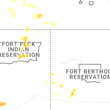
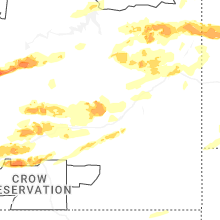
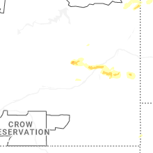
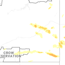
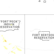
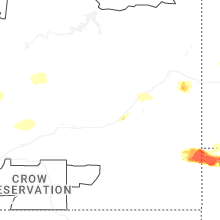


Connect with Interactive Hail Maps