

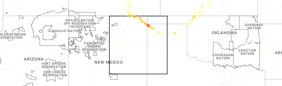
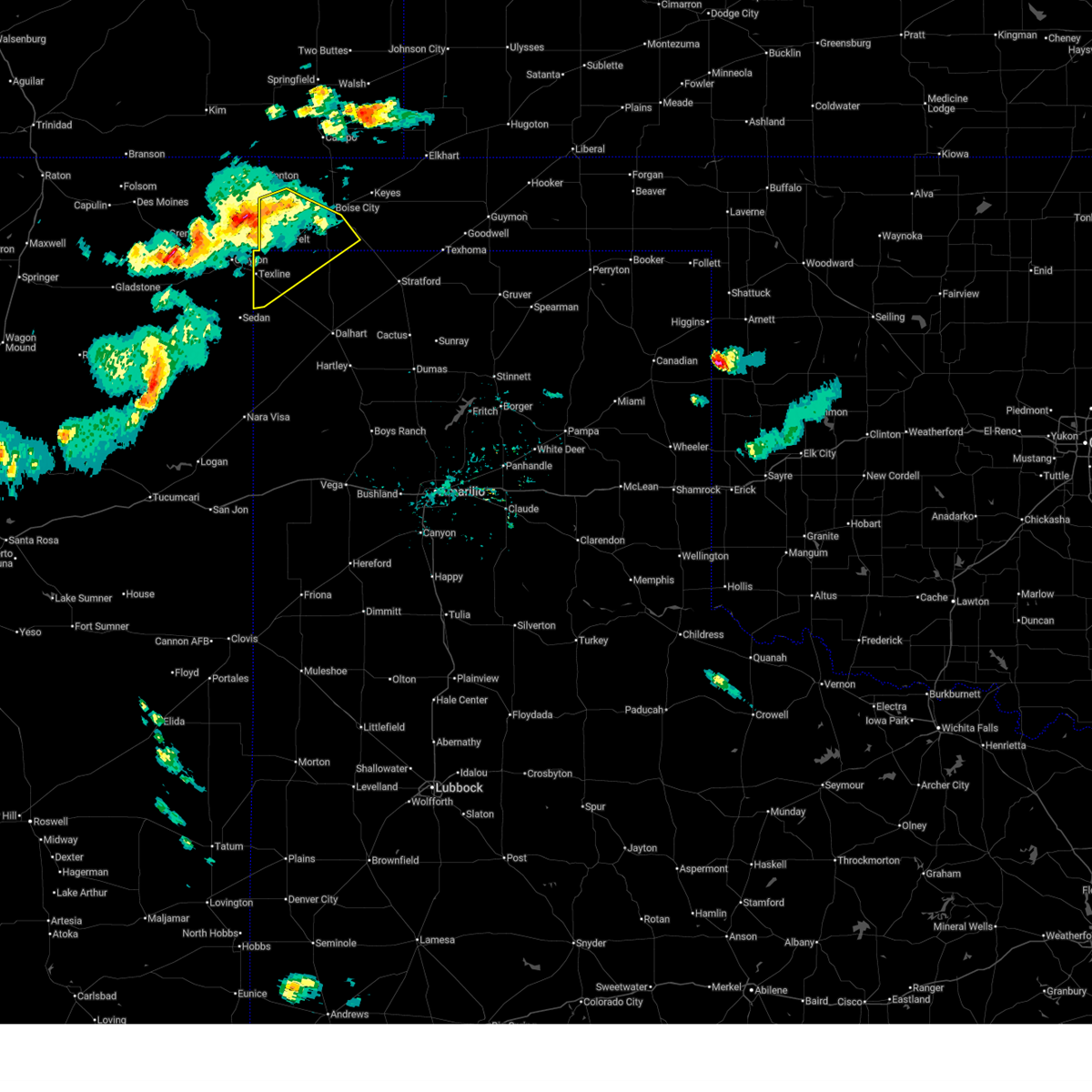
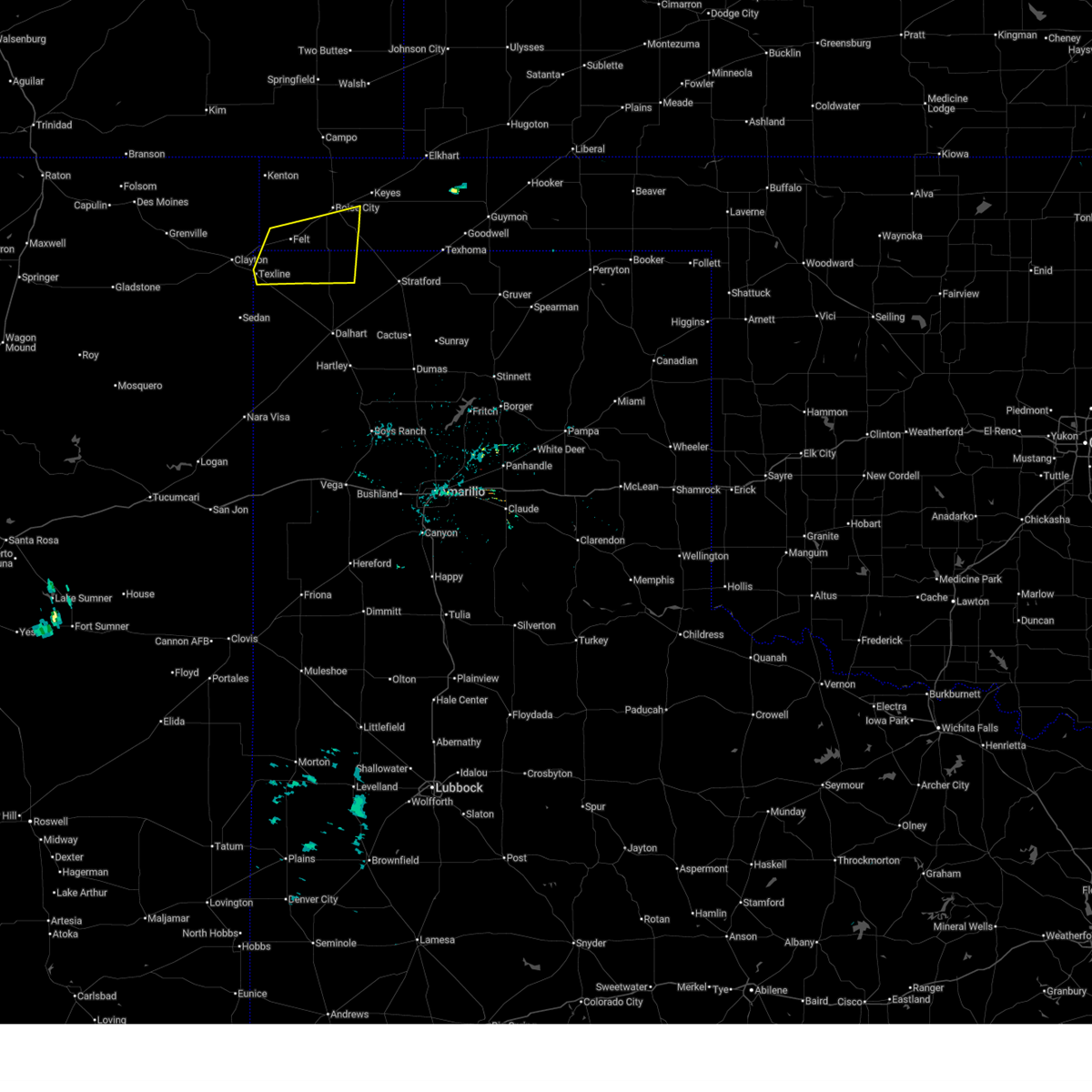
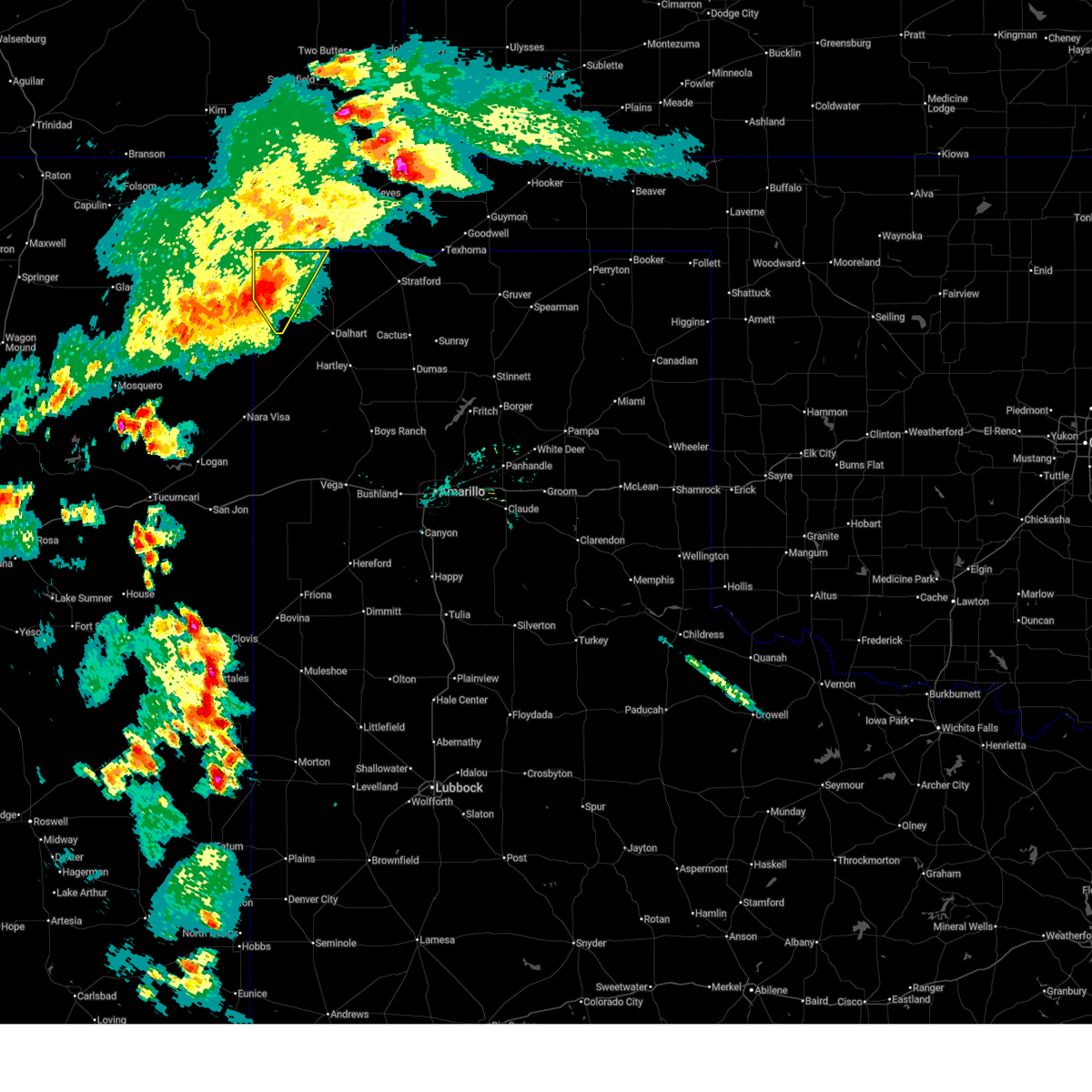
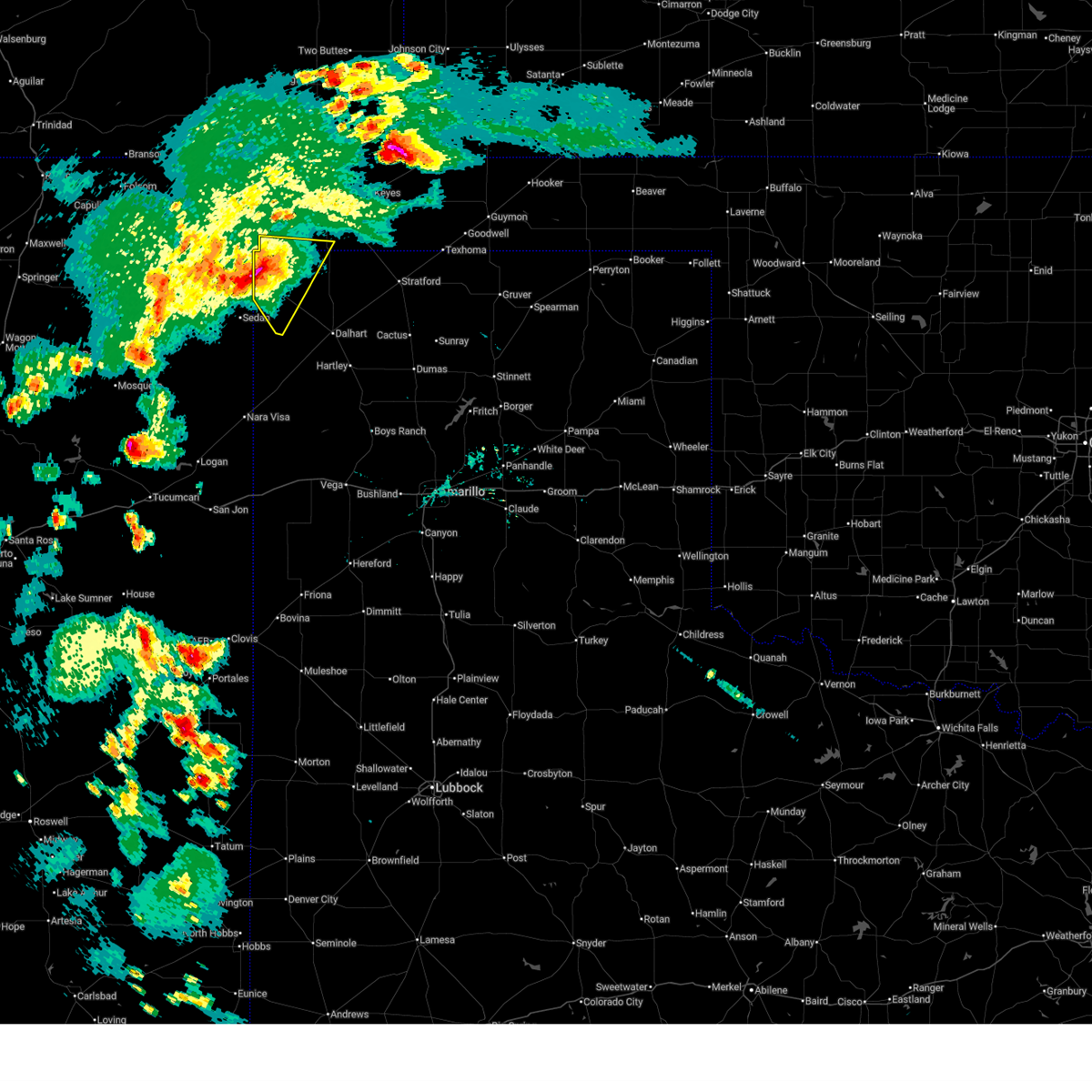
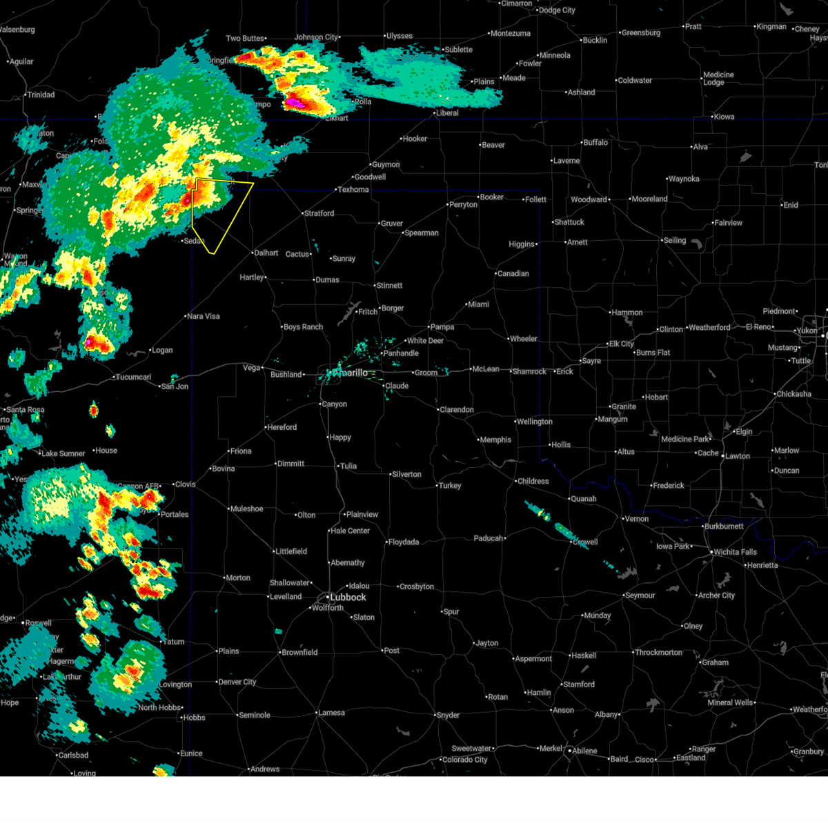
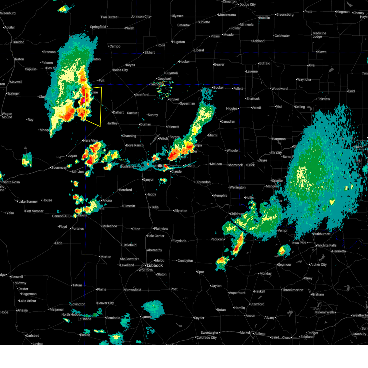
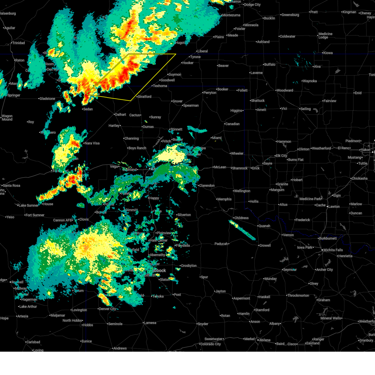
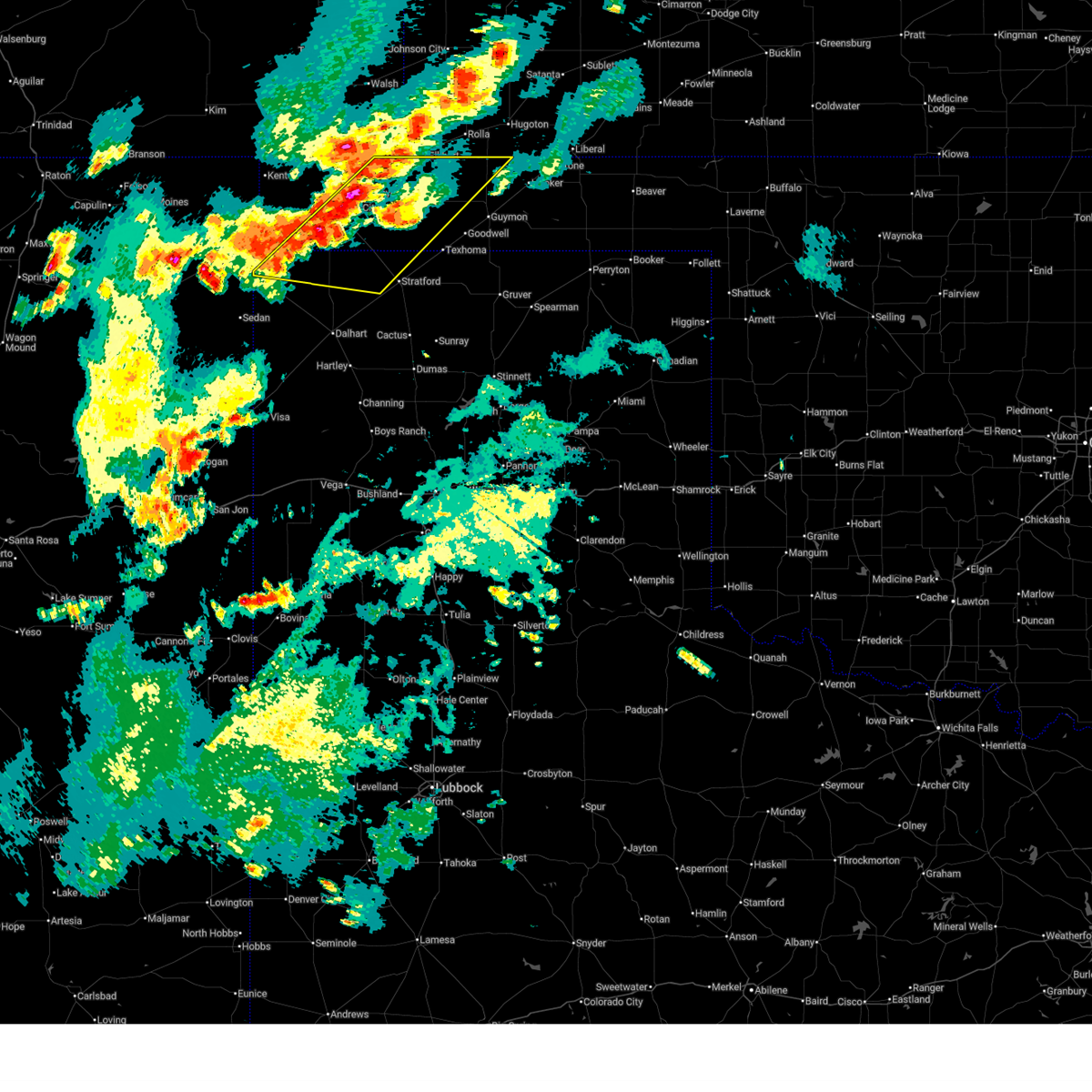
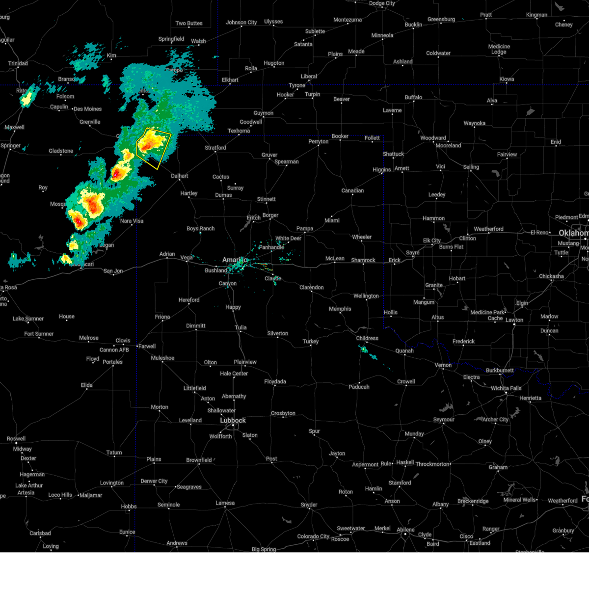
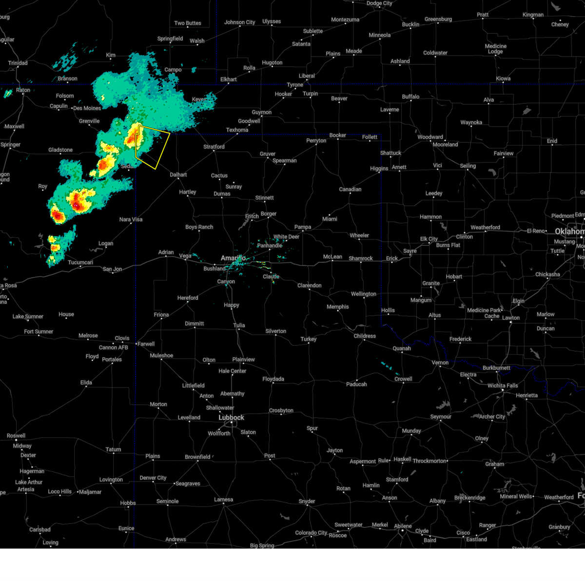
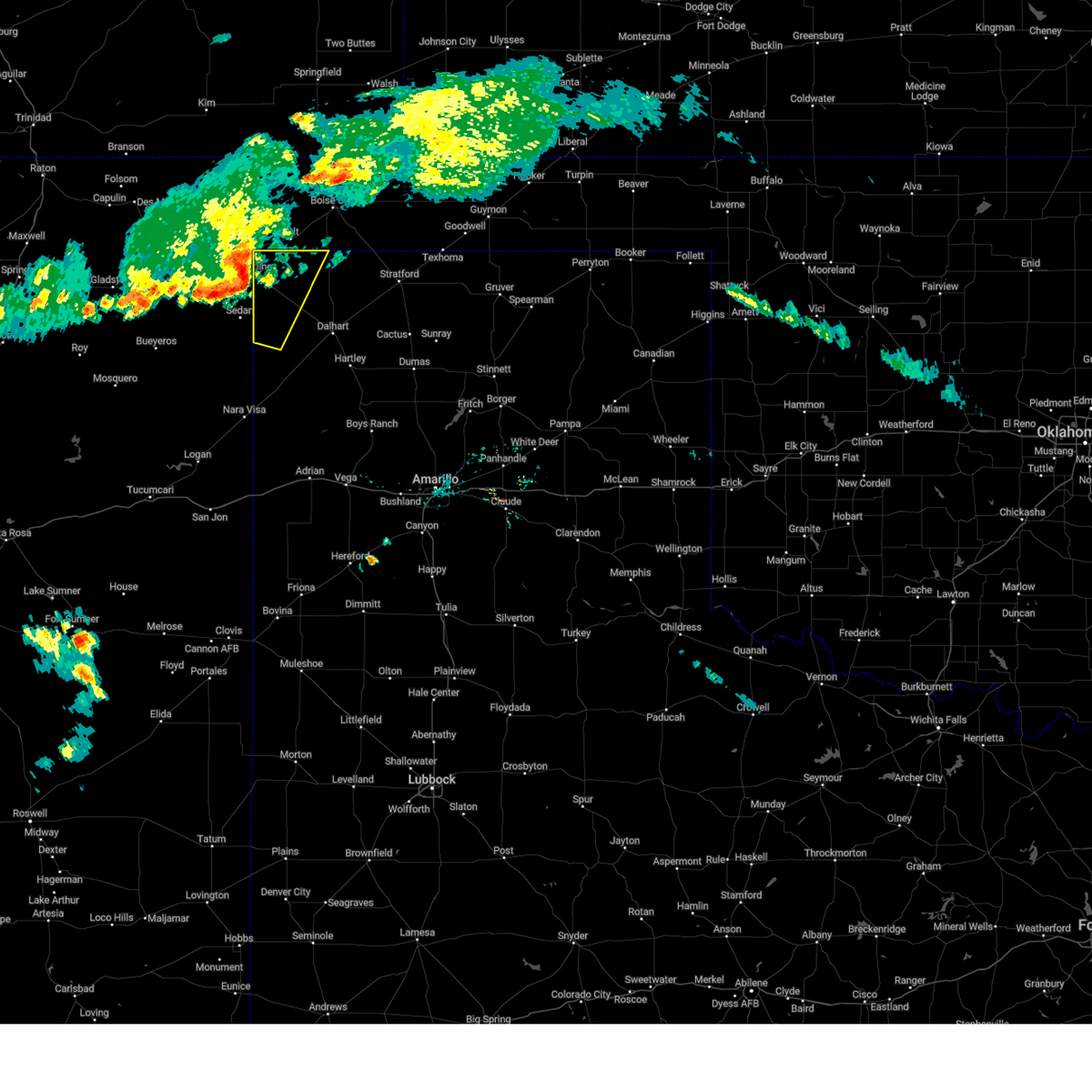
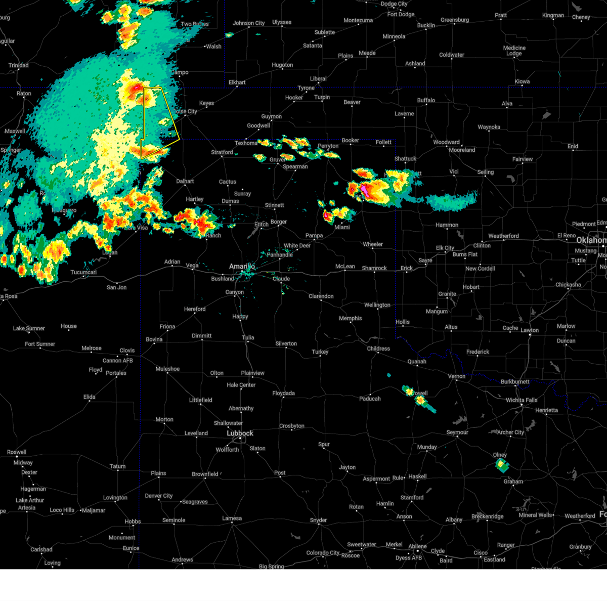
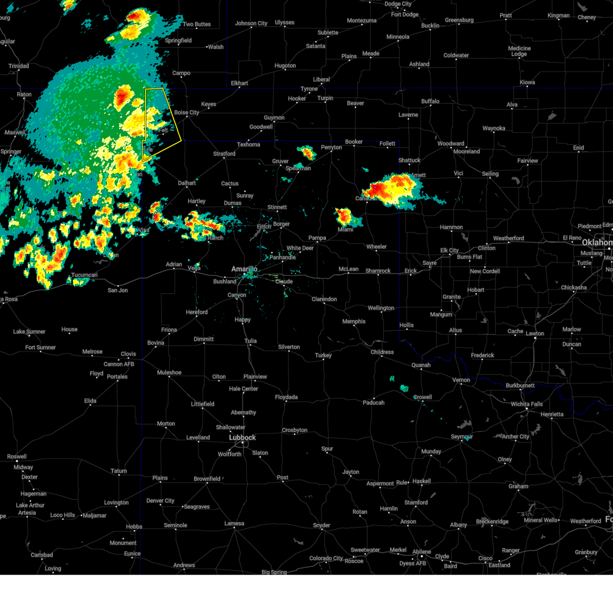
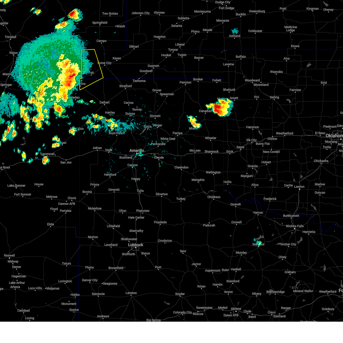
Hail Map for Texline, TX
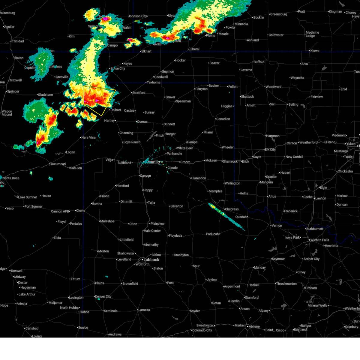
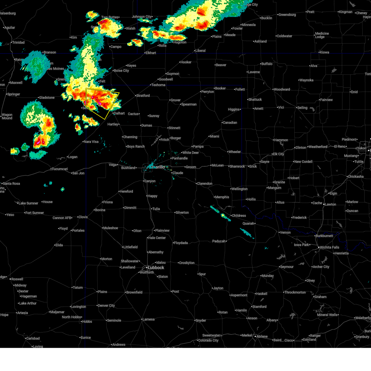
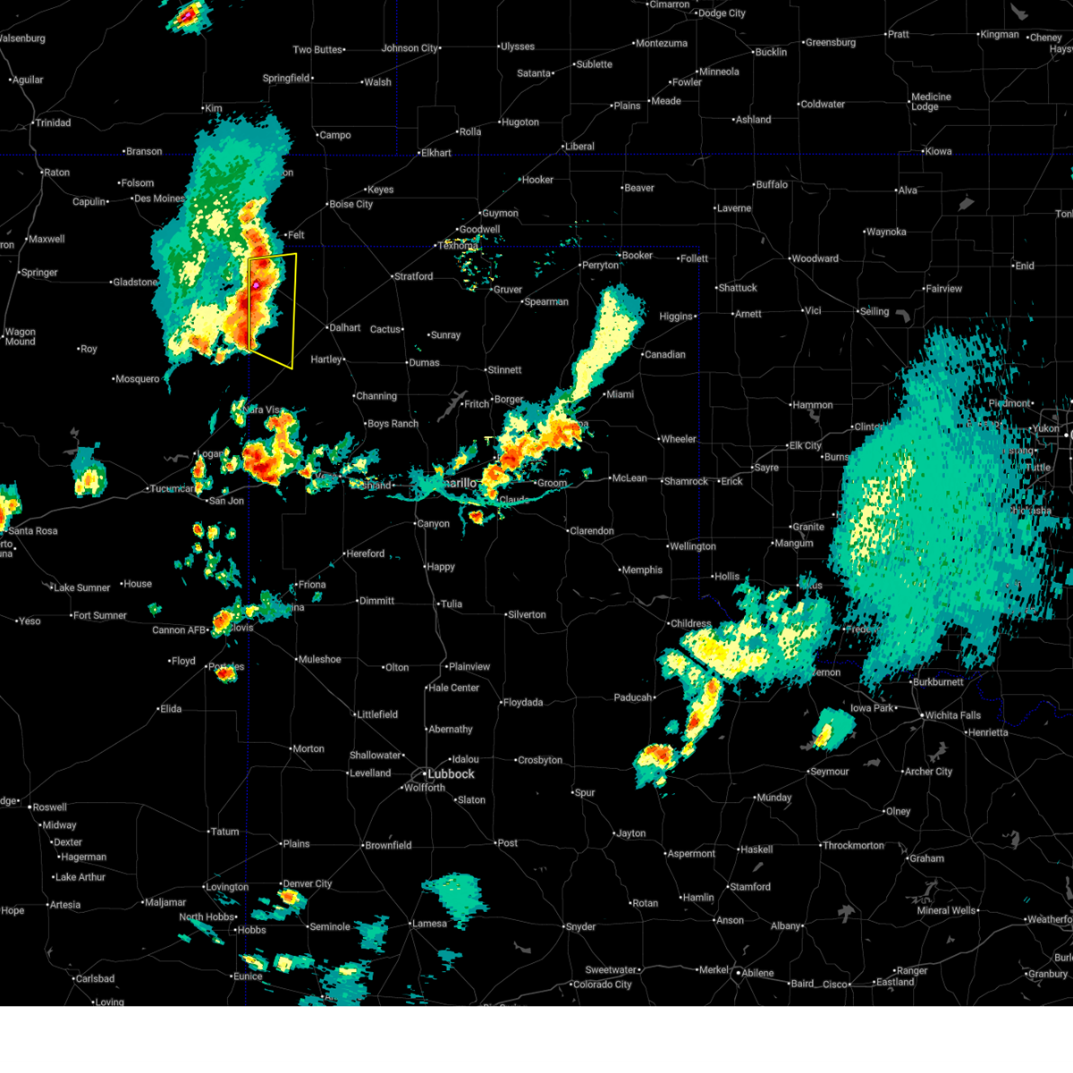
The Texline, TX area has had 25 reports of on-the-ground hail by trained spotters, and has been under severe weather warnings 21 times during the past 12 months. Doppler radar has detected hail at or near Texline, TX on 62 occasions, including 6 occasions during the past year.
| Name: | Texline, TX |
| Where Located: | 91.5 miles NNE of Tucumcari, NM |
| Map: | Google Map for Texline, TX |
| Population: | 507 |
| Housing Units: | 222 |
| More Info: | Search Google for Texline, TX |
5
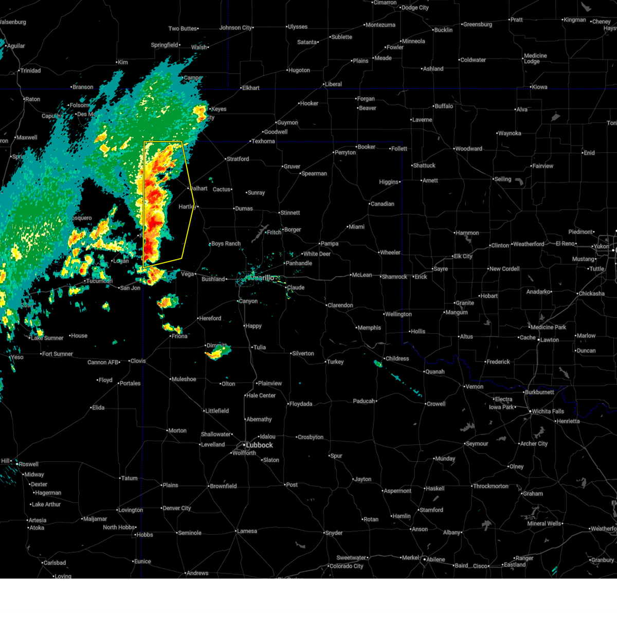
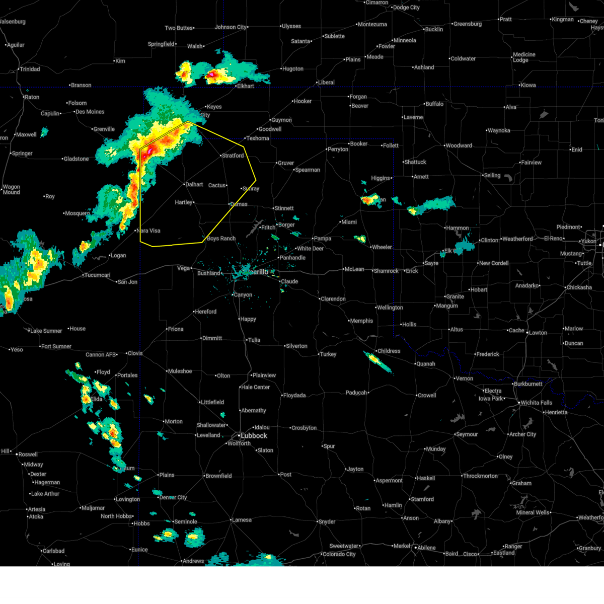
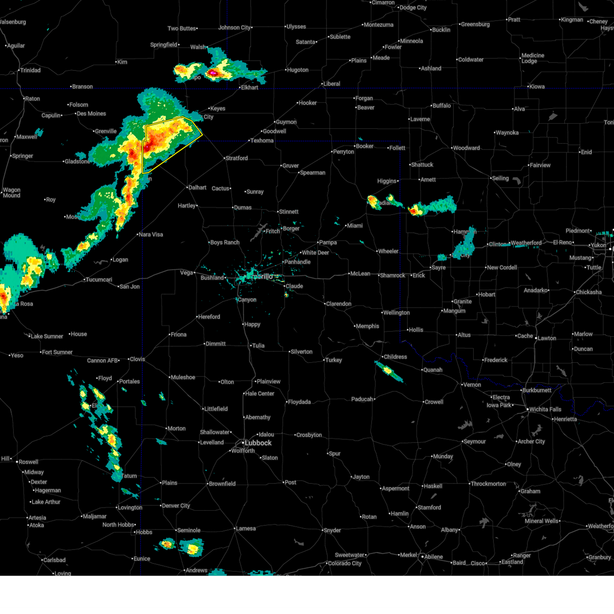
The Top Recent Hail Date for Texline, TX is Wednesday, September 17, 2025 (1st out of 62)
Hail and Wind Damage Spotted near Texline, TX
| Date / Time | Report Details |
|---|---|
| 6/2/2026 4:13 PM CDT |
 Svrama the national weather service in amarillo has issued a * severe thunderstorm warning for, northwestern oldham county in the panhandle of texas, western dallam county in the panhandle of texas, hartley county in the panhandle of texas, * until 515 pm cdt. * at 412 pm cdt, severe thunderstorms were located along a line extending from 7 miles southeast of texline to 5 miles northeast of romero to 12 miles north of glenrio, moving northeast at 20 mph (radar indicated). Hazards include 60 mph wind gusts and penny size hail. minor damage to roofs, siding, and trees is possible Svrama the national weather service in amarillo has issued a * severe thunderstorm warning for, northwestern oldham county in the panhandle of texas, western dallam county in the panhandle of texas, hartley county in the panhandle of texas, * until 515 pm cdt. * at 412 pm cdt, severe thunderstorms were located along a line extending from 7 miles southeast of texline to 5 miles northeast of romero to 12 miles north of glenrio, moving northeast at 20 mph (radar indicated). Hazards include 60 mph wind gusts and penny size hail. minor damage to roofs, siding, and trees is possible
|
| 5/23/2026 5:35 PM CDT |
 Svrama the national weather service in amarillo has issued a * severe thunderstorm warning for, southeastern cimarron county in the panhandle of oklahoma, northern oldham county in the panhandle of texas, sherman county in the panhandle of texas, dallam county in the panhandle of texas, northwestern moore county in the panhandle of texas, hartley county in the panhandle of texas, * until 630 pm cdt. * at 535 pm cdt, severe thunderstorms were located along a line extending from 15 miles southeast of boise city to 7 miles northwest of ware to 6 miles northwest of romero to 4 miles southwest of nara visa, moving southeast at 35 mph (radar indicated). Hazards include 60 mph wind gusts and quarter size hail. Minor damage to roofs, siding, and trees is possible. Hail damage to vehicles is expected. Svrama the national weather service in amarillo has issued a * severe thunderstorm warning for, southeastern cimarron county in the panhandle of oklahoma, northern oldham county in the panhandle of texas, sherman county in the panhandle of texas, dallam county in the panhandle of texas, northwestern moore county in the panhandle of texas, hartley county in the panhandle of texas, * until 630 pm cdt. * at 535 pm cdt, severe thunderstorms were located along a line extending from 15 miles southeast of boise city to 7 miles northwest of ware to 6 miles northwest of romero to 4 miles southwest of nara visa, moving southeast at 35 mph (radar indicated). Hazards include 60 mph wind gusts and quarter size hail. Minor damage to roofs, siding, and trees is possible. Hail damage to vehicles is expected.
|
| 5/23/2026 5:17 PM CDT |
 At 516 pm cdt, severe thunderstorms were located along a line extending from 8 miles southwest of boise city to 4 miles northeast of texline to 8 miles south of clayton, moving east at 30 mph (radar indicated). Hazards include 60 mph wind gusts and quarter size hail. Minor damage to roofs, siding, and trees is possible. hail damage to vehicles is expected. Locations impacted include, texline and felt. At 516 pm cdt, severe thunderstorms were located along a line extending from 8 miles southwest of boise city to 4 miles northeast of texline to 8 miles south of clayton, moving east at 30 mph (radar indicated). Hazards include 60 mph wind gusts and quarter size hail. Minor damage to roofs, siding, and trees is possible. hail damage to vehicles is expected. Locations impacted include, texline and felt.
|
| 5/23/2026 4:39 PM CDT |
 Svrama the national weather service in amarillo has issued a * severe thunderstorm warning for, southwestern cimarron county in the panhandle of oklahoma, northwestern dallam county in the panhandle of texas, * until 545 pm cdt. * at 438 pm cdt, severe thunderstorms were located along a line extending from 6 miles east of wheeless to 4 miles west of clayton to 13 miles southwest of mount dora, moving southeast at 20 mph (radar indicated). Hazards include 60 mph wind gusts and quarter size hail. Minor damage to roofs, siding, and trees is possible. Hail damage to vehicles is expected. Svrama the national weather service in amarillo has issued a * severe thunderstorm warning for, southwestern cimarron county in the panhandle of oklahoma, northwestern dallam county in the panhandle of texas, * until 545 pm cdt. * at 438 pm cdt, severe thunderstorms were located along a line extending from 6 miles east of wheeless to 4 miles west of clayton to 13 miles southwest of mount dora, moving southeast at 20 mph (radar indicated). Hazards include 60 mph wind gusts and quarter size hail. Minor damage to roofs, siding, and trees is possible. Hail damage to vehicles is expected.
|
| 5/14/2026 4:47 PM CDT |
 Svrama the national weather service in amarillo has issued a * severe thunderstorm warning for, southwestern cimarron county in the panhandle of oklahoma, northern dallam county in the panhandle of texas, * until 545 pm cdt. * at 447 pm cdt, a severe thunderstorm was located over felt, or 20 miles southwest of boise city, moving east at 30 mph (radar indicated). Hazards include 70 mph wind gusts. Expect some tree damage. Damage is likely to mobile homes, roofs, and outbuildings. Svrama the national weather service in amarillo has issued a * severe thunderstorm warning for, southwestern cimarron county in the panhandle of oklahoma, northern dallam county in the panhandle of texas, * until 545 pm cdt. * at 447 pm cdt, a severe thunderstorm was located over felt, or 20 miles southwest of boise city, moving east at 30 mph (radar indicated). Hazards include 70 mph wind gusts. Expect some tree damage. Damage is likely to mobile homes, roofs, and outbuildings.
|
| 9/17/2025 8:11 PM CDT | At 811 pm cdt, a severe thunderstorm was located 12 miles east of texline, or 21 miles east of clayton, moving southeast at 20 mph (radar indicated). Hazards include two inch hail and 70 mph wind gusts. Expect some tree damage. damage is likely to mobile homes, roofs, and outbuildings. people and animals outdoors will be injured. expect hail damage to roofs, siding, windows, and vehicles. Locations impacted include, texline and ware. |
| 9/17/2025 7:55 PM CDT | the severe thunderstorm warning has been cancelled and is no longer in effect |
| 9/17/2025 7:55 PM CDT | At 753 pm cdt, automated weather equipment reported a severe thunderstorm was located 5 miles southeast of texline, or 15 miles southeast of clayton, moving southeast at 25 mph. this is a destructive storm for highway 87 between texline and ware (automated weather equipment). Hazards include baseball size hail and 70 mph wind gusts. People and animals outdoors will be severely injured. expect shattered windows, extensive damage to roofs, siding, and vehicles. Locations impacted include, texline and ware. |
| 9/17/2025 7:52 PM CDT | Tennis Ball sized hail reported 1.8 miles NW of Texline, TX, report from mping: tennis ball (2.50 in). |
| 9/17/2025 7:50 PM CDT | 71 mph wind gust occurred followed by a 65 mph and 60 mph gust; observation through west texas mesone in dallam county TX, 2.3 miles S of Texline, TX |
| 9/17/2025 7:47 PM CDT | Hen Egg sized hail reported 0.9 miles WNW of Texline, TX, report from mping: hen egg (2.25 in). |
| 9/17/2025 7:45 PM CDT | Hen Egg sized hail reported 0.4 miles ESE of Texline, TX, report from mping: hen egg (2.25 in). |
| 9/17/2025 7:44 PM CDT | At 744 pm cdt, a severe thunderstorm was located over texline, or 10 miles southeast of clayton, moving southeast at 25 mph (radar indicated). Hazards include tennis ball size hail and 70 mph wind gusts. Expect some tree damage. damage is likely to mobile homes, roofs, and outbuildings. people and animals outdoors will be injured. expect hail damage to roofs, siding, windows, and vehicles. Locations impacted include, texline, ware, and felt. |
| 9/17/2025 7:24 PM CDT | Svrama the national weather service in amarillo has issued a * severe thunderstorm warning for, southwestern cimarron county in the panhandle of oklahoma, western dallam county in the panhandle of texas, northwestern hartley county in the panhandle of texas, * until 830 pm cdt. * at 724 pm cdt, a severe thunderstorm was located over clayton, moving southeast at 25 mph (radar indicated). Hazards include golf ball size hail and 70 mph wind gusts. Expect some tree damage. damage is likely to mobile homes, roofs, and outbuildings. people and animals outdoors will be injured. Expect hail damage to roofs, siding, windows, and vehicles. |
| 8/29/2025 7:13 PM CDT |
 The storm which prompted the warning has weakened below severe limits, and no longer poses an immediate threat to life or property. therefore, the warning will be allowed to expire. however, gusty winds and heavy rain are still possible with this thunderstorm. a severe thunderstorm watch remains in effect until 1100 pm cdt for the panhandle of oklahoma, and the panhandle of texas. The storm which prompted the warning has weakened below severe limits, and no longer poses an immediate threat to life or property. therefore, the warning will be allowed to expire. however, gusty winds and heavy rain are still possible with this thunderstorm. a severe thunderstorm watch remains in effect until 1100 pm cdt for the panhandle of oklahoma, and the panhandle of texas.
|
| 8/29/2025 6:58 PM CDT |
 At 656 pm cdt, a severe thunderstorm was located 8 miles northwest of ware, or 22 miles northwest of dalhart, moving southeast at 20 mph (radar indicated). Hazards include 60 mph wind gusts and penny size hail. Minor damage to roofs, siding, and trees is possible. Locations impacted include, texline. At 656 pm cdt, a severe thunderstorm was located 8 miles northwest of ware, or 22 miles northwest of dalhart, moving southeast at 20 mph (radar indicated). Hazards include 60 mph wind gusts and penny size hail. Minor damage to roofs, siding, and trees is possible. Locations impacted include, texline.
|
| 8/29/2025 6:58 PM CDT |
 the severe thunderstorm warning has been cancelled and is no longer in effect the severe thunderstorm warning has been cancelled and is no longer in effect
|
| 8/29/2025 6:25 PM CDT |
 At 624 pm cdt, automated weather equipment reported a severe thunderstorm was located over texline, or 12 miles southeast of clayton, moving southeast at 20 mph (automated weather equipment in texline measured a 71 mph gust at 614 pm). Hazards include 70 mph wind gusts and quarter size hail. Expect some tree damage. damage is likely to mobile homes, roofs, and outbuildings. hail damage to vehicles is expected. Locations impacted include, texline. At 624 pm cdt, automated weather equipment reported a severe thunderstorm was located over texline, or 12 miles southeast of clayton, moving southeast at 20 mph (automated weather equipment in texline measured a 71 mph gust at 614 pm). Hazards include 70 mph wind gusts and quarter size hail. Expect some tree damage. damage is likely to mobile homes, roofs, and outbuildings. hail damage to vehicles is expected. Locations impacted include, texline.
|
| 8/29/2025 6:14 PM CDT | First severe wind gust occurred at 6:13 pm and last severe wind gust occurred at 6:15 p in dallam county TX, 2.3 miles S of Texline, TX |
| 8/29/2025 6:08 PM CDT |
 Svrama the national weather service in amarillo has issued a * severe thunderstorm warning for, southwestern cimarron county in the panhandle of oklahoma, western dallam county in the panhandle of texas, * until 715 pm cdt. * at 608 pm cdt, a severe thunderstorm was located over texline, or 7 miles southeast of clayton, moving southeast at 20 mph (radar indicated). Hazards include 60 mph wind gusts and quarter size hail. Minor damage to roofs, siding, and trees is possible. Hail damage to vehicles is expected. Svrama the national weather service in amarillo has issued a * severe thunderstorm warning for, southwestern cimarron county in the panhandle of oklahoma, western dallam county in the panhandle of texas, * until 715 pm cdt. * at 608 pm cdt, a severe thunderstorm was located over texline, or 7 miles southeast of clayton, moving southeast at 20 mph (radar indicated). Hazards include 60 mph wind gusts and quarter size hail. Minor damage to roofs, siding, and trees is possible. Hail damage to vehicles is expected.
|
| 7/5/2025 7:18 PM CDT |
 At 717 pm cdt, a severe thunderstorm was located 4 miles northwest of ware, or 18 miles northwest of dalhart, moving southeast at 5 mph (radar indicated). Hazards include golf ball size hail and 70 mph wind gusts. Expect some tree damage. damage is likely to mobile homes, roofs, and outbuildings. people and animals outdoors will be injured. expect hail damage to roofs, siding, windows, and vehicles. Locations impacted include, texline and ware. At 717 pm cdt, a severe thunderstorm was located 4 miles northwest of ware, or 18 miles northwest of dalhart, moving southeast at 5 mph (radar indicated). Hazards include golf ball size hail and 70 mph wind gusts. Expect some tree damage. damage is likely to mobile homes, roofs, and outbuildings. people and animals outdoors will be injured. expect hail damage to roofs, siding, windows, and vehicles. Locations impacted include, texline and ware.
|
| 7/5/2025 7:04 PM CDT |
 Svrama the national weather service in amarillo has issued a * severe thunderstorm warning for, western dallam county in the panhandle of texas, north central hartley county in the panhandle of texas, * until 800 pm cdt. * at 703 pm cdt, a severe thunderstorm was located 6 miles northwest of ware, or 20 miles northwest of dalhart, moving southeast at 5 mph (radar indicated). Hazards include 60 mph wind gusts and quarter size hail. Minor damage to roofs, siding, and trees is possible. Hail damage to vehicles is expected. Svrama the national weather service in amarillo has issued a * severe thunderstorm warning for, western dallam county in the panhandle of texas, north central hartley county in the panhandle of texas, * until 800 pm cdt. * at 703 pm cdt, a severe thunderstorm was located 6 miles northwest of ware, or 20 miles northwest of dalhart, moving southeast at 5 mph (radar indicated). Hazards include 60 mph wind gusts and quarter size hail. Minor damage to roofs, siding, and trees is possible. Hail damage to vehicles is expected.
|
| 6/26/2025 7:13 PM CDT |
 At 713 pm cdt, severe thunderstorms were located along a line extending from 6 miles northeast of texline to 10 miles northeast of amistad, moving east at 10 mph (radar indicated). Hazards include 60 mph wind gusts and penny size hail. Minor damage to roofs, siding, and trees is possible. Locations impacted include, texline. At 713 pm cdt, severe thunderstorms were located along a line extending from 6 miles northeast of texline to 10 miles northeast of amistad, moving east at 10 mph (radar indicated). Hazards include 60 mph wind gusts and penny size hail. Minor damage to roofs, siding, and trees is possible. Locations impacted include, texline.
|
| 6/26/2025 6:57 PM CDT |
 Svrama the national weather service in amarillo has issued a * severe thunderstorm warning for, western dallam county in the panhandle of texas, northwestern hartley county in the panhandle of texas, * until 800 pm cdt. * at 657 pm cdt, severe thunderstorms were located along a line extending from 4 miles northeast of texline to 7 miles northeast of amistad, moving east at 10 mph (radar indicated). Hazards include 60 mph wind gusts and quarter size hail. Minor damage to roofs, siding, and trees is possible. Hail damage to vehicles is expected. Svrama the national weather service in amarillo has issued a * severe thunderstorm warning for, western dallam county in the panhandle of texas, northwestern hartley county in the panhandle of texas, * until 800 pm cdt. * at 657 pm cdt, severe thunderstorms were located along a line extending from 4 miles northeast of texline to 7 miles northeast of amistad, moving east at 10 mph (radar indicated). Hazards include 60 mph wind gusts and quarter size hail. Minor damage to roofs, siding, and trees is possible. Hail damage to vehicles is expected.
|
| 6/23/2025 8:51 PM CDT |
 The storms which prompted the warning have weakened below severe limits, and no longer pose an immediate threat to life or property. therefore, the warning will be allowed to expire. however, gusty winds and heavy rain are still possible with these thunderstorms. The storms which prompted the warning have weakened below severe limits, and no longer pose an immediate threat to life or property. therefore, the warning will be allowed to expire. however, gusty winds and heavy rain are still possible with these thunderstorms.
|
| 6/23/2025 7:59 PM CDT |
 Svrama the national weather service in amarillo has issued a * severe thunderstorm warning for, western texas county in the panhandle of oklahoma, eastern cimarron county in the panhandle of oklahoma, northwestern sherman county in the panhandle of texas, northern dallam county in the panhandle of texas, * until 900 pm cdt. * at 759 pm cdt, severe thunderstorms were located along a line extending from 12 miles north of keyes to 7 miles east of texline, moving east at 35 mph (radar indicated). Hazards include 60 mph wind gusts and nickel size hail. minor damage to roofs, siding, and trees is possible Svrama the national weather service in amarillo has issued a * severe thunderstorm warning for, western texas county in the panhandle of oklahoma, eastern cimarron county in the panhandle of oklahoma, northwestern sherman county in the panhandle of texas, northern dallam county in the panhandle of texas, * until 900 pm cdt. * at 759 pm cdt, severe thunderstorms were located along a line extending from 12 miles north of keyes to 7 miles east of texline, moving east at 35 mph (radar indicated). Hazards include 60 mph wind gusts and nickel size hail. minor damage to roofs, siding, and trees is possible
|
| 6/8/2025 3:52 PM CDT | Golf Ball sized hail reported 10.1 miles WNW of Texline, TX |
| 5/1/2025 6:04 PM CDT |
 At 603 pm cdt, a severe thunderstorm was located 4 miles east of texline, or 14 miles southeast of clayton, moving southeast at 20 mph (radar indicated). Hazards include 60 mph wind gusts and nickel size hail. Minor damage to roofs, siding, and trees is possible. Locations impacted include, texline. At 603 pm cdt, a severe thunderstorm was located 4 miles east of texline, or 14 miles southeast of clayton, moving southeast at 20 mph (radar indicated). Hazards include 60 mph wind gusts and nickel size hail. Minor damage to roofs, siding, and trees is possible. Locations impacted include, texline.
|
| 5/1/2025 5:38 PM CDT |
 Svrama the national weather service in amarillo has issued a * severe thunderstorm warning for, southwestern cimarron county in the panhandle of oklahoma, western dallam county in the panhandle of texas, * until 630 pm cdt. * at 538 pm cdt, a severe thunderstorm was located 4 miles northwest of texline, or 5 miles east of clayton, moving southeast at 20 mph (automated weather equipment). Hazards include 70 mph wind gusts and nickel size hail. Expect some tree damage. Damage is likely to mobile homes, roofs, and outbuildings. Svrama the national weather service in amarillo has issued a * severe thunderstorm warning for, southwestern cimarron county in the panhandle of oklahoma, western dallam county in the panhandle of texas, * until 630 pm cdt. * at 538 pm cdt, a severe thunderstorm was located 4 miles northwest of texline, or 5 miles east of clayton, moving southeast at 20 mph (automated weather equipment). Hazards include 70 mph wind gusts and nickel size hail. Expect some tree damage. Damage is likely to mobile homes, roofs, and outbuildings.
|
| 9/17/2024 5:31 PM CDT | Storm damage reported in dallam county TX, 2.3 miles S of Texline, TX |
| 8/29/2024 5:08 PM CDT |
 Svrama the national weather service in amarillo has issued a * severe thunderstorm warning for, cimarron county in the panhandle of oklahoma, western dallam county in the panhandle of texas, * until 615 pm cdt. * at 508 pm cdt, severe thunderstorms were located along a line extending from 5 miles north of boise city to 6 miles east of felt to 3 miles southwest of texline, moving southeast at 15 mph (radar indicated). Hazards include 60 mph wind gusts and penny size hail. minor damage to roofs, siding, and trees is possible Svrama the national weather service in amarillo has issued a * severe thunderstorm warning for, cimarron county in the panhandle of oklahoma, western dallam county in the panhandle of texas, * until 615 pm cdt. * at 508 pm cdt, severe thunderstorms were located along a line extending from 5 miles north of boise city to 6 miles east of felt to 3 miles southwest of texline, moving southeast at 15 mph (radar indicated). Hazards include 60 mph wind gusts and penny size hail. minor damage to roofs, siding, and trees is possible
|
| 8/16/2024 8:47 PM CDT | Storm damage reported in dallam county TX, 2.3 miles S of Texline, TX |
| 8/9/2024 8:27 PM CDT |
 The storms which prompted the warning have moved out of the area. therefore, the warning will be allowed to expire. The storms which prompted the warning have moved out of the area. therefore, the warning will be allowed to expire.
|
| 8/9/2024 8:00 PM CDT |
 At 759 pm cdt, severe thunderstorms were located along a line extending from 10 miles south of felt to 7 miles east of sedan, moving east at 30 mph (radar indicated). Hazards include 60 mph wind gusts and penny size hail. Minor damage to roofs, siding, and trees is possible. Locations impacted include, texline. At 759 pm cdt, severe thunderstorms were located along a line extending from 10 miles south of felt to 7 miles east of sedan, moving east at 30 mph (radar indicated). Hazards include 60 mph wind gusts and penny size hail. Minor damage to roofs, siding, and trees is possible. Locations impacted include, texline.
|
| 8/9/2024 7:33 PM CDT |
 Svrama the national weather service in amarillo has issued a * severe thunderstorm warning for, western dallam county in the panhandle of texas, northwestern hartley county in the panhandle of texas, * until 830 pm cdt. * at 729 pm cdt, severe thunderstorms were located along a line extending from 8 miles north of texline to 6 miles northwest of sedan, moving east at 25 mph (radar indicated). Hazards include 60 mph wind gusts and penny size hail. minor damage to roofs, siding, and trees is possible Svrama the national weather service in amarillo has issued a * severe thunderstorm warning for, western dallam county in the panhandle of texas, northwestern hartley county in the panhandle of texas, * until 830 pm cdt. * at 729 pm cdt, severe thunderstorms were located along a line extending from 8 miles north of texline to 6 miles northwest of sedan, moving east at 25 mph (radar indicated). Hazards include 60 mph wind gusts and penny size hail. minor damage to roofs, siding, and trees is possible
|
| 8/1/2024 6:32 PM CDT | Storm damage reported in dallam county TX, 2.3 miles S of Texline, TX |
| 8/1/2024 6:11 PM CDT |
 The storms which prompted the warning have weakened below severe limits, and no longer pose an immediate threat to life or property. therefore, the warning will be allowed to expire. however, gusty winds are still possible with these thunderstorms. The storms which prompted the warning have weakened below severe limits, and no longer pose an immediate threat to life or property. therefore, the warning will be allowed to expire. however, gusty winds are still possible with these thunderstorms.
|
| 8/1/2024 5:46 PM CDT |
 At 546 pm cdt, severe thunderstorms were located along a line extending from near kenton to near felt, moving northeast at 25 mph (radar indicated). Hazards include 60 mph wind gusts and penny size hail. Minor damage to roofs, siding, and trees is possible. Locations impacted include, texline, kenton, wheeless, black mesa park, and felt. At 546 pm cdt, severe thunderstorms were located along a line extending from near kenton to near felt, moving northeast at 25 mph (radar indicated). Hazards include 60 mph wind gusts and penny size hail. Minor damage to roofs, siding, and trees is possible. Locations impacted include, texline, kenton, wheeless, black mesa park, and felt.
|
| 8/1/2024 5:10 PM CDT |
 Svrama the national weather service in amarillo has issued a * severe thunderstorm warning for, western cimarron county in the panhandle of oklahoma, northwestern dallam county in the panhandle of texas, * until 615 pm cdt. * at 510 pm cdt, severe thunderstorms were located along a line extending from 8 miles north of seneca to 7 miles north of texline, moving northeast at 25 mph (radar indicated). Hazards include 70 mph wind gusts and quarter size hail. Expect some tree damage. damage is likely to mobile homes, roofs, and outbuildings. Hail damage to vehicles is expected. Svrama the national weather service in amarillo has issued a * severe thunderstorm warning for, western cimarron county in the panhandle of oklahoma, northwestern dallam county in the panhandle of texas, * until 615 pm cdt. * at 510 pm cdt, severe thunderstorms were located along a line extending from 8 miles north of seneca to 7 miles north of texline, moving northeast at 25 mph (radar indicated). Hazards include 70 mph wind gusts and quarter size hail. Expect some tree damage. damage is likely to mobile homes, roofs, and outbuildings. Hail damage to vehicles is expected.
|
| 6/14/2024 6:32 PM CDT |
 At 631 pm cdt, a severe thunderstorm was located 12 miles east of black mesa park, or 12 miles northwest of boise city, moving northeast at 40 mph (radar indicated). Hazards include 60 mph wind gusts and nickel size hail. Minor damage to roofs, siding, and trees is possible. Locations impacted include, boise city, keyes, kenton, wheeless, black mesa park, felt, and sturgis. At 631 pm cdt, a severe thunderstorm was located 12 miles east of black mesa park, or 12 miles northwest of boise city, moving northeast at 40 mph (radar indicated). Hazards include 60 mph wind gusts and nickel size hail. Minor damage to roofs, siding, and trees is possible. Locations impacted include, boise city, keyes, kenton, wheeless, black mesa park, felt, and sturgis.
|
| 6/14/2024 6:22 PM CDT |
 At 622 pm cdt, a severe thunderstorm was located 10 miles west of boise city, moving northeast at 55 mph (radar indicated). Hazards include 60 mph wind gusts and nickel size hail. Minor damage to roofs, siding, and trees is possible. Locations impacted include, boise city, keyes, kenton, wheeless, black mesa park, felt, and sturgis. At 622 pm cdt, a severe thunderstorm was located 10 miles west of boise city, moving northeast at 55 mph (radar indicated). Hazards include 60 mph wind gusts and nickel size hail. Minor damage to roofs, siding, and trees is possible. Locations impacted include, boise city, keyes, kenton, wheeless, black mesa park, felt, and sturgis.
|
| 6/14/2024 5:59 PM CDT |
 Svrama the national weather service in amarillo has issued a * severe thunderstorm warning for, northwestern texas county in the panhandle of oklahoma, cimarron county in the panhandle of oklahoma, northwestern dallam county in the panhandle of texas, * until 730 pm cdt. * at 558 pm cdt, a severe thunderstorm was located 7 miles northeast of texline, or 13 miles east of clayton, moving north at 45 mph (radar indicated). Hazards include 60 mph wind gusts and nickel size hail. minor damage to roofs, siding, and trees is possible Svrama the national weather service in amarillo has issued a * severe thunderstorm warning for, northwestern texas county in the panhandle of oklahoma, cimarron county in the panhandle of oklahoma, northwestern dallam county in the panhandle of texas, * until 730 pm cdt. * at 558 pm cdt, a severe thunderstorm was located 7 miles northeast of texline, or 13 miles east of clayton, moving north at 45 mph (radar indicated). Hazards include 60 mph wind gusts and nickel size hail. minor damage to roofs, siding, and trees is possible
|
| 6/14/2024 5:49 PM CDT | First wind gust at 549 pm was 60 mph. max wind gust of 61 mph occurred at 551 pm. wind gust persisted for 6 minutes from 549 through 555 p in dallam county TX, 2.3 miles S of Texline, TX |
| 6/14/2024 5:47 PM CDT | Video on social media shows a grain silo destroyed and laying across the south bound lane of highway 8 in dallam county TX, 10.9 miles NW of Texline, TX |
| 6/14/2024 2:47 PM MDT |
 At 247 pm mdt, severe thunderstorms were located along a line extending from near des moines to 19 miles northwest of ute lake state park, moving northeast at 30 mph (radar indicated). Hazards include 60 mph wind gusts and penny size hail. Expect damage to roofs, siding, and trees. Locations impacted include, clayton, des moines, mosquero, amistad, nara visa, folsom, grenville, bueyeros, hayden, and clayton lake state park. At 247 pm mdt, severe thunderstorms were located along a line extending from near des moines to 19 miles northwest of ute lake state park, moving northeast at 30 mph (radar indicated). Hazards include 60 mph wind gusts and penny size hail. Expect damage to roofs, siding, and trees. Locations impacted include, clayton, des moines, mosquero, amistad, nara visa, folsom, grenville, bueyeros, hayden, and clayton lake state park.
|
| 6/14/2024 1:57 PM MDT |
 Svrabq the national weather service in albuquerque has issued a * severe thunderstorm warning for, northeastern san miguel county in northeastern new mexico, harding county in northeastern new mexico, northeastern quay county in east central new mexico, union county in northeastern new mexico, eastern colfax county in northeastern new mexico, * until 300 pm mdt. * at 156 pm mdt, severe thunderstorms were located along a line extending from near folsom to 9 miles southeast of mosquero, moving east at 30 mph (radar indicated). Hazards include 60 mph wind gusts and quarter size hail. Hail damage to vehicles is expected. Expect wind damage to roofs, siding, and trees. Svrabq the national weather service in albuquerque has issued a * severe thunderstorm warning for, northeastern san miguel county in northeastern new mexico, harding county in northeastern new mexico, northeastern quay county in east central new mexico, union county in northeastern new mexico, eastern colfax county in northeastern new mexico, * until 300 pm mdt. * at 156 pm mdt, severe thunderstorms were located along a line extending from near folsom to 9 miles southeast of mosquero, moving east at 30 mph (radar indicated). Hazards include 60 mph wind gusts and quarter size hail. Hail damage to vehicles is expected. Expect wind damage to roofs, siding, and trees.
|
| 6/7/2024 6:23 PM CDT |
 The storms which prompted the warning have weakened below severe limits, and no longer pose an immediate threat to life or property. therefore, the warning will be allowed to expire. however, gusty winds are still possible with these thunderstorms. a severe thunderstorm watch remains in effect until 1000 pm cdt for the panhandle of oklahoma, and the panhandle of texas. The storms which prompted the warning have weakened below severe limits, and no longer pose an immediate threat to life or property. therefore, the warning will be allowed to expire. however, gusty winds are still possible with these thunderstorms. a severe thunderstorm watch remains in effect until 1000 pm cdt for the panhandle of oklahoma, and the panhandle of texas.
|
| 6/7/2024 6:04 PM CDT |
 At 603 pm cdt, severe thunderstorms were located along a line extending from 7 miles northeast of felt to 11 miles west of ware, moving east at 45 mph (radar indicated). Hazards include 70 mph wind gusts and penny size hail. Expect some tree damage. damage is likely to mobile homes, roofs, and outbuildings. Locations impacted include, boise city, texline, wheeless, ware, black mesa park, and felt. At 603 pm cdt, severe thunderstorms were located along a line extending from 7 miles northeast of felt to 11 miles west of ware, moving east at 45 mph (radar indicated). Hazards include 70 mph wind gusts and penny size hail. Expect some tree damage. damage is likely to mobile homes, roofs, and outbuildings. Locations impacted include, boise city, texline, wheeless, ware, black mesa park, and felt.
|
| 6/7/2024 5:32 PM CDT |
 Svrama the national weather service in amarillo has issued a * severe thunderstorm warning for, southwestern cimarron county in the panhandle of oklahoma, western dallam county in the panhandle of texas, northwestern hartley county in the panhandle of texas, * until 630 pm cdt. * at 531 pm cdt, severe thunderstorms were located along a line extending from seneca to 13 miles west of sedan, moving east at 30 mph (radar indicated). Hazards include 70 mph wind gusts and penny size hail. Expect some tree damage. Damage is likely to mobile homes, roofs, and outbuildings. Svrama the national weather service in amarillo has issued a * severe thunderstorm warning for, southwestern cimarron county in the panhandle of oklahoma, western dallam county in the panhandle of texas, northwestern hartley county in the panhandle of texas, * until 630 pm cdt. * at 531 pm cdt, severe thunderstorms were located along a line extending from seneca to 13 miles west of sedan, moving east at 30 mph (radar indicated). Hazards include 70 mph wind gusts and penny size hail. Expect some tree damage. Damage is likely to mobile homes, roofs, and outbuildings.
|
| 6/7/2024 5:28 PM CDT | The mesonet showed gusts of 58-60mph several times from 5:37pm through 5:50p in dallam county TX, 3 miles S of Texline, TX |
| 5/31/2024 7:04 PM CDT |
 Svrama the national weather service in amarillo has issued a * severe thunderstorm warning for, western texas county in the panhandle of oklahoma, cimarron county in the panhandle of oklahoma, northwestern sherman county in the panhandle of texas, dallam county in the panhandle of texas, * until 800 pm cdt. * at 704 pm cdt, severe thunderstorms were located along a line extending from 11 miles southwest of stonington to boise city to 4 miles east of sedan, moving east at 35 mph (radar indicated). Hazards include 60 mph wind gusts. minor damage to roofs, siding, and trees is possible Svrama the national weather service in amarillo has issued a * severe thunderstorm warning for, western texas county in the panhandle of oklahoma, cimarron county in the panhandle of oklahoma, northwestern sherman county in the panhandle of texas, dallam county in the panhandle of texas, * until 800 pm cdt. * at 704 pm cdt, severe thunderstorms were located along a line extending from 11 miles southwest of stonington to boise city to 4 miles east of sedan, moving east at 35 mph (radar indicated). Hazards include 60 mph wind gusts. minor damage to roofs, siding, and trees is possible
|
| 5/30/2024 2:52 PM CDT |
 At 252 pm cdt, severe thunderstorms were located along a line extending from 13 miles south of campo to 3 miles northwest of felt to 3 miles north of clayton, moving southeast at 15 mph (radar indicated). Hazards include 60 mph wind gusts and half dollar size hail. Minor damage to roofs, siding, and trees is possible. hail damage to vehicles is expected. Locations impacted include, boise city, texline, wheeless, and felt. At 252 pm cdt, severe thunderstorms were located along a line extending from 13 miles south of campo to 3 miles northwest of felt to 3 miles north of clayton, moving southeast at 15 mph (radar indicated). Hazards include 60 mph wind gusts and half dollar size hail. Minor damage to roofs, siding, and trees is possible. hail damage to vehicles is expected. Locations impacted include, boise city, texline, wheeless, and felt.
|
| 5/30/2024 2:26 PM CDT |
 Svrama the national weather service in amarillo has issued a * severe thunderstorm warning for, cimarron county in the panhandle of oklahoma, northwestern dallam county in the panhandle of texas, * until 330 pm cdt. * at 226 pm cdt, severe thunderstorms were located along a line extending from 8 miles southwest of campo to 5 miles south of wheeless to 5 miles northeast of clayton, moving southeast at 20 mph (radar indicated). Hazards include ping pong ball size hail and 60 mph wind gusts. Minor damage to roofs, siding, and trees is possible. people and animals outdoors will be injured. Expect hail damage to roofs, siding, windows, and vehicles. Svrama the national weather service in amarillo has issued a * severe thunderstorm warning for, cimarron county in the panhandle of oklahoma, northwestern dallam county in the panhandle of texas, * until 330 pm cdt. * at 226 pm cdt, severe thunderstorms were located along a line extending from 8 miles southwest of campo to 5 miles south of wheeless to 5 miles northeast of clayton, moving southeast at 20 mph (radar indicated). Hazards include ping pong ball size hail and 60 mph wind gusts. Minor damage to roofs, siding, and trees is possible. people and animals outdoors will be injured. Expect hail damage to roofs, siding, windows, and vehicles.
|
| 5/28/2024 6:26 PM CDT |
 The storm which prompted the warning has weakened below severe limits, and no longer poses an immediate threat to life or property. therefore, the warning will be allowed to expire. a severe thunderstorm watch remains in effect until 1000 pm cdt for the panhandle of texas. The storm which prompted the warning has weakened below severe limits, and no longer poses an immediate threat to life or property. therefore, the warning will be allowed to expire. a severe thunderstorm watch remains in effect until 1000 pm cdt for the panhandle of texas.
|
| 5/28/2024 6:11 PM CDT |
 At 611 pm cdt, a severe thunderstorm was located 9 miles southeast of sedan, or 15 miles northeast of amistad, moving east at 15 mph (trained weather spotters). Hazards include 60 mph wind gusts and half dollar size hail. Minor damage to roofs, siding, and trees is possible. hail damage to vehicles is expected. Locations impacted include, texline and ware. At 611 pm cdt, a severe thunderstorm was located 9 miles southeast of sedan, or 15 miles northeast of amistad, moving east at 15 mph (trained weather spotters). Hazards include 60 mph wind gusts and half dollar size hail. Minor damage to roofs, siding, and trees is possible. hail damage to vehicles is expected. Locations impacted include, texline and ware.
|
| 5/28/2024 5:45 PM CDT |
 At 543 pm cdt, a severe thunderstorm was located 12 miles east of sedan, or 21 miles southeast of clayton, moving east at 30 mph. this is a destructive storm for rural areas of western dallam county, south of texline and west of ware (trained weather spotters). Hazards include baseball size hail and 70 mph wind gusts. People and animals outdoors will be severely injured. expect shattered windows, extensive damage to roofs, siding, and vehicles. Locations impacted include, texline and ware. At 543 pm cdt, a severe thunderstorm was located 12 miles east of sedan, or 21 miles southeast of clayton, moving east at 30 mph. this is a destructive storm for rural areas of western dallam county, south of texline and west of ware (trained weather spotters). Hazards include baseball size hail and 70 mph wind gusts. People and animals outdoors will be severely injured. expect shattered windows, extensive damage to roofs, siding, and vehicles. Locations impacted include, texline and ware.
|
| 5/28/2024 5:35 PM CDT | Baseball sized hail reported 3.9 miles N of Texline, TX |
| 5/28/2024 5:27 PM CDT | Quarter sized hail reported 0.3 miles SW of Texline, TX |
| 5/28/2024 5:27 PM CDT |
 Svrama the national weather service in amarillo has issued a * severe thunderstorm warning for, western dallam county in the panhandle of texas, northwestern hartley county in the panhandle of texas, * until 630 pm cdt. * at 527 pm cdt, a severe thunderstorm was located 8 miles northeast of sedan, or 15 miles southeast of clayton, moving east at 30 mph (radar indicated). Hazards include golf ball size hail and 70 mph wind gusts. Expect some tree damage. damage is likely to mobile homes, roofs, and outbuildings. people and animals outdoors will be injured. Expect hail damage to roofs, siding, windows, and vehicles. Svrama the national weather service in amarillo has issued a * severe thunderstorm warning for, western dallam county in the panhandle of texas, northwestern hartley county in the panhandle of texas, * until 630 pm cdt. * at 527 pm cdt, a severe thunderstorm was located 8 miles northeast of sedan, or 15 miles southeast of clayton, moving east at 30 mph (radar indicated). Hazards include golf ball size hail and 70 mph wind gusts. Expect some tree damage. damage is likely to mobile homes, roofs, and outbuildings. people and animals outdoors will be injured. Expect hail damage to roofs, siding, windows, and vehicles.
|
| 5/15/2024 4:08 PM CDT |
 At 408 pm cdt, a severe thunderstorm was located 5 miles east of texline, or 14 miles southeast of clayton, moving east at 30 mph (radar indicated). Hazards include ping pong ball size hail and 60 mph wind gusts. Minor damage to roofs, siding, and trees is possible. people and animals outdoors will be injured. expect hail damage to roofs, siding, windows, and vehicles. Locations impacted include, texline and ware. At 408 pm cdt, a severe thunderstorm was located 5 miles east of texline, or 14 miles southeast of clayton, moving east at 30 mph (radar indicated). Hazards include ping pong ball size hail and 60 mph wind gusts. Minor damage to roofs, siding, and trees is possible. people and animals outdoors will be injured. expect hail damage to roofs, siding, windows, and vehicles. Locations impacted include, texline and ware.
|
| 5/15/2024 3:54 PM CDT | Quarter sized hail reported 0.3 miles SW of Texline, TX, public report... time estimated on radar. |
| 5/15/2024 3:36 PM CDT |
 Svrama the national weather service in amarillo has issued a * severe thunderstorm warning for, western dallam county in the panhandle of texas, * until 430 pm cdt. * at 336 pm cdt, a severe thunderstorm was located near clayton, moving southeast at 30 mph (radar indicated). Hazards include golf ball size hail and 60 mph wind gusts. Minor damage to roofs, siding, and trees is possible. people and animals outdoors will be injured. Expect hail damage to roofs, siding, windows, and vehicles. Svrama the national weather service in amarillo has issued a * severe thunderstorm warning for, western dallam county in the panhandle of texas, * until 430 pm cdt. * at 336 pm cdt, a severe thunderstorm was located near clayton, moving southeast at 30 mph (radar indicated). Hazards include golf ball size hail and 60 mph wind gusts. Minor damage to roofs, siding, and trees is possible. people and animals outdoors will be injured. Expect hail damage to roofs, siding, windows, and vehicles.
|
| 10/2/2023 8:18 PM CDT |
 At 818 pm cdt, a severe thunderstorm was located 8 miles south of griggs, or 9 miles north of stratford, moving northeast at 30 mph (radar indicated). Hazards include 60 mph wind gusts and penny size hail. Minor damage to roofs, siding, and trees is possible. locations impacted include, stratford, boise city, texline, keyes, eva, kenton, wheeless, black mesa park, felt, conlen, griggs, and sturgis. hail threat, radar indicated max hail size, 0. 75in wind threat, radar indicated max wind gust, 60 mph. At 818 pm cdt, a severe thunderstorm was located 8 miles south of griggs, or 9 miles north of stratford, moving northeast at 30 mph (radar indicated). Hazards include 60 mph wind gusts and penny size hail. Minor damage to roofs, siding, and trees is possible. locations impacted include, stratford, boise city, texline, keyes, eva, kenton, wheeless, black mesa park, felt, conlen, griggs, and sturgis. hail threat, radar indicated max hail size, 0. 75in wind threat, radar indicated max wind gust, 60 mph.
|
| 10/2/2023 8:03 PM CDT |
 At 803 pm cdt, severe thunderstorms were located along a line extending from 5 miles north of texline to 8 miles southeast of conlen, moving north at 50 mph (radar indicated). Hazards include 60 mph wind gusts and penny size hail. Minor damage to roofs, siding, and trees is possible. locations impacted include, stratford, boise city, texline, keyes, eva, kenton, wheeless, black mesa park, felt, conlen, griggs, and sturgis. hail threat, radar indicated max hail size, 0. 75in wind threat, radar indicated max wind gust, 60 mph. At 803 pm cdt, severe thunderstorms were located along a line extending from 5 miles north of texline to 8 miles southeast of conlen, moving north at 50 mph (radar indicated). Hazards include 60 mph wind gusts and penny size hail. Minor damage to roofs, siding, and trees is possible. locations impacted include, stratford, boise city, texline, keyes, eva, kenton, wheeless, black mesa park, felt, conlen, griggs, and sturgis. hail threat, radar indicated max hail size, 0. 75in wind threat, radar indicated max wind gust, 60 mph.
|
| 10/2/2023 7:55 PM CDT |
 At 755 pm cdt, severe thunderstorms were located along a line extending from texline to 12 miles south of conlen, moving north at 50 mph (radar indicated). Hazards include 60 mph wind gusts and penny size hail. Minor damage to roofs, siding, and trees is possible. locations impacted include, dalhart, stratford, boise city, texline, keyes, kenton, wheeless, black mesa park, felt, griggs, eva, ware, conlen, and sturgis. hail threat, radar indicated max hail size, 0. 75in wind threat, radar indicated max wind gust, 60 mph. At 755 pm cdt, severe thunderstorms were located along a line extending from texline to 12 miles south of conlen, moving north at 50 mph (radar indicated). Hazards include 60 mph wind gusts and penny size hail. Minor damage to roofs, siding, and trees is possible. locations impacted include, dalhart, stratford, boise city, texline, keyes, kenton, wheeless, black mesa park, felt, griggs, eva, ware, conlen, and sturgis. hail threat, radar indicated max hail size, 0. 75in wind threat, radar indicated max wind gust, 60 mph.
|
| 10/2/2023 7:41 PM CDT |
 At 741 pm cdt, severe thunderstorms were located along a line extending from 6 miles south of texline to 8 miles northeast of hartley, moving north at 50 mph (radar indicated). Hazards include 60 mph wind gusts and penny size hail. minor damage to roofs, siding, and trees is possible At 741 pm cdt, severe thunderstorms were located along a line extending from 6 miles south of texline to 8 miles northeast of hartley, moving north at 50 mph (radar indicated). Hazards include 60 mph wind gusts and penny size hail. minor damage to roofs, siding, and trees is possible
|
| 9/9/2023 9:28 PM CDT |
 At 928 pm cdt, a severe thunderstorm was located 4 miles southwest of felt, or 19 miles east of clayton, moving south at 15 mph (radar indicated). Hazards include 60 mph wind gusts and quarter size hail. Minor damage to roofs, siding, and trees is possible. hail damage to vehicles is expected. locations impacted include, felt. hail threat, radar indicated max hail size, 1. 00in wind threat, radar indicated max wind gust, 60 mph. At 928 pm cdt, a severe thunderstorm was located 4 miles southwest of felt, or 19 miles east of clayton, moving south at 15 mph (radar indicated). Hazards include 60 mph wind gusts and quarter size hail. Minor damage to roofs, siding, and trees is possible. hail damage to vehicles is expected. locations impacted include, felt. hail threat, radar indicated max hail size, 1. 00in wind threat, radar indicated max wind gust, 60 mph.
|
| 9/9/2023 8:50 PM CDT |
 At 850 pm cdt, a severe thunderstorm was located 6 miles north of felt, or 16 miles west of boise city, moving south at 15 mph (radar indicated). Hazards include ping pong ball size hail and 60 mph wind gusts. Minor damage to roofs, siding, and trees is possible. people and animals outdoors will be injured. Expect hail damage to roofs, siding, windows, and vehicles. At 850 pm cdt, a severe thunderstorm was located 6 miles north of felt, or 16 miles west of boise city, moving south at 15 mph (radar indicated). Hazards include ping pong ball size hail and 60 mph wind gusts. Minor damage to roofs, siding, and trees is possible. people and animals outdoors will be injured. Expect hail damage to roofs, siding, windows, and vehicles.
|
| 8/12/2023 5:07 PM CDT |
 The severe thunderstorm warning for northern dallam county will expire at 515 pm cdt, the storm which prompted the warning has weakened below severe limits, and has exited the warned area. therefore, the warning will be allowed to expire. however gusty winds are still possible with this thunderstorm. a severe thunderstorm watch remains in effect until 1000 pm cdt for the panhandle of oklahoma, and the panhandle of texas. The severe thunderstorm warning for northern dallam county will expire at 515 pm cdt, the storm which prompted the warning has weakened below severe limits, and has exited the warned area. therefore, the warning will be allowed to expire. however gusty winds are still possible with this thunderstorm. a severe thunderstorm watch remains in effect until 1000 pm cdt for the panhandle of oklahoma, and the panhandle of texas.
|
| 8/12/2023 4:52 PM CDT |
 At 452 pm cdt, a severe thunderstorm was located 10 miles southeast of felt, or 21 miles southwest of boise city, moving northeast at 30 mph (radar indicated). Hazards include 60 mph wind gusts. Minor damage to roofs, siding, and trees is possible. locations impacted include, texline. hail threat, radar indicated max hail size, <. 75 in wind threat, radar indicated max wind gust, 60 mph. At 452 pm cdt, a severe thunderstorm was located 10 miles southeast of felt, or 21 miles southwest of boise city, moving northeast at 30 mph (radar indicated). Hazards include 60 mph wind gusts. Minor damage to roofs, siding, and trees is possible. locations impacted include, texline. hail threat, radar indicated max hail size, <. 75 in wind threat, radar indicated max wind gust, 60 mph.
|
| 8/12/2023 4:37 PM CDT |
 At 437 pm cdt, a severe thunderstorm was located 11 miles north of ware, or 23 miles northwest of dalhart, moving north at 35 mph (radar indicated). Hazards include 60 mph wind gusts and half dollar size hail. Minor damage to roofs, siding, and trees is possible. hail damage to vehicles is expected. locations impacted include, texline and ware. hail threat, radar indicated max hail size, 1. 25 in wind threat, radar indicated max wind gust, 60 mph. At 437 pm cdt, a severe thunderstorm was located 11 miles north of ware, or 23 miles northwest of dalhart, moving north at 35 mph (radar indicated). Hazards include 60 mph wind gusts and half dollar size hail. Minor damage to roofs, siding, and trees is possible. hail damage to vehicles is expected. locations impacted include, texline and ware. hail threat, radar indicated max hail size, 1. 25 in wind threat, radar indicated max wind gust, 60 mph.
|
| 8/12/2023 4:21 PM CDT |
 At 421 pm cdt, a severe thunderstorm was located 5 miles southwest of ware, or 16 miles west of dalhart, moving northeast at 25 mph (radar indicated). Hazards include 60 mph wind gusts and quarter size hail. Minor damage to roofs, siding, and trees is possible. Hail damage to vehicles is expected. At 421 pm cdt, a severe thunderstorm was located 5 miles southwest of ware, or 16 miles west of dalhart, moving northeast at 25 mph (radar indicated). Hazards include 60 mph wind gusts and quarter size hail. Minor damage to roofs, siding, and trees is possible. Hail damage to vehicles is expected.
|
| 8/3/2023 7:58 PM CDT |
 At 757 pm cdt, a severe thunderstorm was located 9 miles northwest of ware, or 22 miles southeast of clayton, moving east at 15 mph (radar indicated). Hazards include 60 mph wind gusts and nickel size hail. Minor damage to roofs, siding, and trees is possible. this severe thunderstorm will remain over mainly rural areas of western dallam county. hail threat, radar indicated max hail size, 0. 88in wind threat, radar indicated max wind gust, 60 mph. At 757 pm cdt, a severe thunderstorm was located 9 miles northwest of ware, or 22 miles southeast of clayton, moving east at 15 mph (radar indicated). Hazards include 60 mph wind gusts and nickel size hail. Minor damage to roofs, siding, and trees is possible. this severe thunderstorm will remain over mainly rural areas of western dallam county. hail threat, radar indicated max hail size, 0. 88in wind threat, radar indicated max wind gust, 60 mph.
|
| 8/3/2023 7:50 PM CDT |
 At 749 pm cdt, a severe thunderstorm was located 10 miles northwest of ware, or 20 miles southeast of clayton, moving east at 25 mph (radar indicated). Hazards include 60 mph wind gusts and nickel size hail. Minor damage to roofs, siding, and trees is possible. locations impacted include, texline. hail threat, radar indicated max hail size, 0. 88in wind threat, radar indicated max wind gust, 60 mph. At 749 pm cdt, a severe thunderstorm was located 10 miles northwest of ware, or 20 miles southeast of clayton, moving east at 25 mph (radar indicated). Hazards include 60 mph wind gusts and nickel size hail. Minor damage to roofs, siding, and trees is possible. locations impacted include, texline. hail threat, radar indicated max hail size, 0. 88in wind threat, radar indicated max wind gust, 60 mph.
|
| 8/3/2023 7:32 PM CDT |
 At 731 pm cdt, a severe thunderstorm was located 6 miles south of texline, or 13 miles southeast of clayton, moving east at 25 mph (radar indicated). Hazards include 60 mph wind gusts and quarter size hail. Minor damage to roofs, siding, and trees is possible. hail damage to vehicles is expected. locations impacted include, texline. hail threat, radar indicated max hail size, 1. 00in wind threat, radar indicated max wind gust, 60 mph. At 731 pm cdt, a severe thunderstorm was located 6 miles south of texline, or 13 miles southeast of clayton, moving east at 25 mph (radar indicated). Hazards include 60 mph wind gusts and quarter size hail. Minor damage to roofs, siding, and trees is possible. hail damage to vehicles is expected. locations impacted include, texline. hail threat, radar indicated max hail size, 1. 00in wind threat, radar indicated max wind gust, 60 mph.
|
| 8/3/2023 7:15 PM CDT |
 At 715 pm cdt, a severe thunderstorm was located 9 miles north of sedan, or 11 miles south of clayton, moving east at 20 mph (radar indicated). Hazards include 60 mph wind gusts and half dollar size hail. Minor damage to roofs, siding, and trees is possible. Hail damage to vehicles is expected. At 715 pm cdt, a severe thunderstorm was located 9 miles north of sedan, or 11 miles south of clayton, moving east at 20 mph (radar indicated). Hazards include 60 mph wind gusts and half dollar size hail. Minor damage to roofs, siding, and trees is possible. Hail damage to vehicles is expected.
|
| 1/1/0001 12:00 AM | Observed by west texas mesone in dallam county TX, 2.3 miles S of Texline, TX |
| 7/14/2023 12:58 AM CDT |
 At 1257 am cdt, a severe thunderstorm was located 7 miles north of texline, or 8 miles east of clayton, moving southeast at 30 mph (radar indicated). Hazards include 60 mph wind gusts and quarter size hail. Minor damage to roofs, siding, and trees is possible. Hail damage to vehicles is expected. At 1257 am cdt, a severe thunderstorm was located 7 miles north of texline, or 8 miles east of clayton, moving southeast at 30 mph (radar indicated). Hazards include 60 mph wind gusts and quarter size hail. Minor damage to roofs, siding, and trees is possible. Hail damage to vehicles is expected.
|
| 7/13/2023 9:28 PM CDT |
 The tornado warning for west central dallam county will expire at 930 pm cdt, the tornado threat has diminished and the tornado warning has been cancelled. however, large hail and damaging winds remain likely and a severe thunderstorm warning remains in effect for the area. a severe thunderstorm watch remains in effect until 1100 pm cdt for the panhandle of texas. The tornado warning for west central dallam county will expire at 930 pm cdt, the tornado threat has diminished and the tornado warning has been cancelled. however, large hail and damaging winds remain likely and a severe thunderstorm warning remains in effect for the area. a severe thunderstorm watch remains in effect until 1100 pm cdt for the panhandle of texas.
|
| 7/13/2023 9:12 PM CDT |
 At 912 pm cdt, a severe thunderstorm capable of producing a tornado was located 7 miles south of texline, or 16 miles southeast of clayton, moving south at 25 mph (weather spotters reported a rotating wall cloud). Hazards include tornado and baseball size hail. Flying debris will be dangerous to those caught without shelter. mobile homes will be damaged or destroyed. damage to roofs, windows, and vehicles will occur. tree damage is likely. Locations impacted include, texline. At 912 pm cdt, a severe thunderstorm capable of producing a tornado was located 7 miles south of texline, or 16 miles southeast of clayton, moving south at 25 mph (weather spotters reported a rotating wall cloud). Hazards include tornado and baseball size hail. Flying debris will be dangerous to those caught without shelter. mobile homes will be damaged or destroyed. damage to roofs, windows, and vehicles will occur. tree damage is likely. Locations impacted include, texline.
|
| 7/13/2023 9:01 PM CDT |
 At 901 pm cdt, a severe thunderstorm capable of producing a tornado was located over texline, or 12 miles southeast of clayton, moving south at 25 mph (weather spotters reported a rotating wall cloud). Hazards include tornado and baseball size hail. Flying debris will be dangerous to those caught without shelter. mobile homes will be damaged or destroyed. damage to roofs, windows, and vehicles will occur. tree damage is likely. Locations impacted include, texline. At 901 pm cdt, a severe thunderstorm capable of producing a tornado was located over texline, or 12 miles southeast of clayton, moving south at 25 mph (weather spotters reported a rotating wall cloud). Hazards include tornado and baseball size hail. Flying debris will be dangerous to those caught without shelter. mobile homes will be damaged or destroyed. damage to roofs, windows, and vehicles will occur. tree damage is likely. Locations impacted include, texline.
|
| 7/13/2023 8:57 PM CDT | Baseball sized hail reported 0.3 miles SW of Texline, TX, report from texline fire department chief of golf ball size hail with a few baseballs mixed in. time estimated by radar. |
| 7/13/2023 8:55 PM CDT |
 At 855 pm cdt, a severe thunderstorm capable of producing a tornado was located over texline, or 11 miles southeast of clayton, moving south at 25 mph (weather spotters reported a rotating wall cloud). Hazards include tornado and golf ball size hail. Flying debris will be dangerous to those caught without shelter. mobile homes will be damaged or destroyed. damage to roofs, windows, and vehicles will occur. tree damage is likely. Locations impacted include, texline. At 855 pm cdt, a severe thunderstorm capable of producing a tornado was located over texline, or 11 miles southeast of clayton, moving south at 25 mph (weather spotters reported a rotating wall cloud). Hazards include tornado and golf ball size hail. Flying debris will be dangerous to those caught without shelter. mobile homes will be damaged or destroyed. damage to roofs, windows, and vehicles will occur. tree damage is likely. Locations impacted include, texline.
|
| 1/1/0001 12:00 AM | Observed by west texas mesone in dallam county TX, 2.3 miles S of Texline, TX |
| 7/13/2023 8:45 PM CDT |
 At 845 pm cdt, a severe thunderstorm capable of producing a tornado was located near texline, or 8 miles east of clayton, moving south at 25 mph (radar indicated rotation). Hazards include tornado and golf ball size hail. Flying debris will be dangerous to those caught without shelter. mobile homes will be damaged or destroyed. damage to roofs, windows, and vehicles will occur. Tree damage is likely. At 845 pm cdt, a severe thunderstorm capable of producing a tornado was located near texline, or 8 miles east of clayton, moving south at 25 mph (radar indicated rotation). Hazards include tornado and golf ball size hail. Flying debris will be dangerous to those caught without shelter. mobile homes will be damaged or destroyed. damage to roofs, windows, and vehicles will occur. Tree damage is likely.
|
| 7/13/2023 8:37 PM CDT |
 At 837 pm cdt, a severe thunderstorm was located 8 miles north of texline, or 9 miles east of clayton, moving south at 20 mph (radar indicated). Hazards include ping pong ball size hail and 60 mph wind gusts. Minor damage to roofs, siding, and trees is possible. people and animals outdoors will be injured. expect hail damage to roofs, siding, windows, and vehicles. Locations impacted include, texline and felt. At 837 pm cdt, a severe thunderstorm was located 8 miles north of texline, or 9 miles east of clayton, moving south at 20 mph (radar indicated). Hazards include ping pong ball size hail and 60 mph wind gusts. Minor damage to roofs, siding, and trees is possible. people and animals outdoors will be injured. expect hail damage to roofs, siding, windows, and vehicles. Locations impacted include, texline and felt.
|
| 7/13/2023 8:32 PM CDT |
 At 831 pm cdt, a severe thunderstorm was located 8 miles north of texline, or 11 miles east of clayton, moving south at 15 mph (radar indicated). Hazards include 60 mph wind gusts and quarter size hail. Minor damage to roofs, siding, and trees is possible. hail damage to vehicles is expected. Locations impacted include, texline and felt. At 831 pm cdt, a severe thunderstorm was located 8 miles north of texline, or 11 miles east of clayton, moving south at 15 mph (radar indicated). Hazards include 60 mph wind gusts and quarter size hail. Minor damage to roofs, siding, and trees is possible. hail damage to vehicles is expected. Locations impacted include, texline and felt.
|
| 7/13/2023 8:04 PM CDT |
 At 804 pm cdt, a severe thunderstorm was located 8 miles east of seneca, or 13 miles northeast of clayton, moving south at 15 mph (radar indicated). Hazards include 60 mph wind gusts and quarter size hail. Minor damage to roofs, siding, and trees is possible. Hail damage to vehicles is expected. At 804 pm cdt, a severe thunderstorm was located 8 miles east of seneca, or 13 miles northeast of clayton, moving south at 15 mph (radar indicated). Hazards include 60 mph wind gusts and quarter size hail. Minor damage to roofs, siding, and trees is possible. Hail damage to vehicles is expected.
|
| 7/10/2023 7:36 PM CDT |
 At 736 pm cdt, severe thunderstorms were located along a line extending from 7 miles south of boise city to 13 miles southeast of felt, moving east at 30 mph (radar indicated). Hazards include 60 mph wind gusts and quarter size hail. Minor damage to roofs, siding, and trees is possible. hail damage to vehicles is expected. locations impacted include, boise city, texline, ware and felt. hail threat, radar indicated max hail size, 1. 00in wind threat, radar indicated max wind gust, 60 mph. At 736 pm cdt, severe thunderstorms were located along a line extending from 7 miles south of boise city to 13 miles southeast of felt, moving east at 30 mph (radar indicated). Hazards include 60 mph wind gusts and quarter size hail. Minor damage to roofs, siding, and trees is possible. hail damage to vehicles is expected. locations impacted include, boise city, texline, ware and felt. hail threat, radar indicated max hail size, 1. 00in wind threat, radar indicated max wind gust, 60 mph.
|
| 7/10/2023 7:25 PM CDT |
 At 724 pm cdt, severe thunderstorms were located along a line extending from 5 miles south of boise city to 8 miles northeast of texline, moving southeast at 20 mph (radar indicated). Hazards include 60 mph wind gusts and quarter size hail. Minor damage to roofs, siding, and trees is possible. hail damage to vehicles is expected. locations impacted include, boise city, texline, ware and felt. hail threat, radar indicated max hail size, 1. 00in wind threat, radar indicated max wind gust, 60 mph. At 724 pm cdt, severe thunderstorms were located along a line extending from 5 miles south of boise city to 8 miles northeast of texline, moving southeast at 20 mph (radar indicated). Hazards include 60 mph wind gusts and quarter size hail. Minor damage to roofs, siding, and trees is possible. hail damage to vehicles is expected. locations impacted include, boise city, texline, ware and felt. hail threat, radar indicated max hail size, 1. 00in wind threat, radar indicated max wind gust, 60 mph.
|
| 7/10/2023 7:09 PM CDT |
 At 709 pm cdt, severe thunderstorms were located along a line extending from 6 miles southwest of boise city to 7 miles northeast of texline, moving southeast at 25 mph (radar indicated). Hazards include ping pong ball size hail and 60 mph wind gusts. Minor damage to roofs, siding, and trees is possible. people and animals outdoors will be injured. expect hail damage to roofs, siding, windows, and vehicles. locations impacted include, boise city, texline, ware and felt. hail threat, radar indicated max hail size, 1. 50 in wind threat, radar indicated max wind gust, 60 mph. At 709 pm cdt, severe thunderstorms were located along a line extending from 6 miles southwest of boise city to 7 miles northeast of texline, moving southeast at 25 mph (radar indicated). Hazards include ping pong ball size hail and 60 mph wind gusts. Minor damage to roofs, siding, and trees is possible. people and animals outdoors will be injured. expect hail damage to roofs, siding, windows, and vehicles. locations impacted include, boise city, texline, ware and felt. hail threat, radar indicated max hail size, 1. 50 in wind threat, radar indicated max wind gust, 60 mph.
|
| 7/10/2023 6:59 PM CDT |
 At 659 pm cdt, severe thunderstorms were located along a line extending from 10 miles east of wheeless to 8 miles north of texline, moving southeast at 20 mph (radar indicated). Hazards include 60 mph wind gusts and quarter size hail. Minor damage to roofs, siding, and trees is possible. Hail damage to vehicles is expected. At 659 pm cdt, severe thunderstorms were located along a line extending from 10 miles east of wheeless to 8 miles north of texline, moving southeast at 20 mph (radar indicated). Hazards include 60 mph wind gusts and quarter size hail. Minor damage to roofs, siding, and trees is possible. Hail damage to vehicles is expected.
|
| 7/7/2023 4:14 PM CDT |
 At 414 pm cdt, a severe thunderstorm was located over clayton, moving southeast at 30 mph (radar indicated). Hazards include ping pong ball size hail and 60 mph wind gusts. Minor damage to roofs, siding, and trees is possible. people and animals outdoors will be injured. Expect hail damage to roofs, siding, windows, and vehicles. At 414 pm cdt, a severe thunderstorm was located over clayton, moving southeast at 30 mph (radar indicated). Hazards include ping pong ball size hail and 60 mph wind gusts. Minor damage to roofs, siding, and trees is possible. people and animals outdoors will be injured. Expect hail damage to roofs, siding, windows, and vehicles.
|
| 7/2/2023 5:11 PM CDT |
 The severe thunderstorm warning for west central sherman and dallam counties will expire at 515 pm cdt, the storms which prompted the warning have moved out of the area. therefore, the warning will be allowed to expire. however a new warning is set to take its place with gusty winds still possible with these thunderstorms. a severe thunderstorm watch remains in effect until 800 pm cdt for the panhandle of oklahoma, and the panhandle of texas. The severe thunderstorm warning for west central sherman and dallam counties will expire at 515 pm cdt, the storms which prompted the warning have moved out of the area. therefore, the warning will be allowed to expire. however a new warning is set to take its place with gusty winds still possible with these thunderstorms. a severe thunderstorm watch remains in effect until 800 pm cdt for the panhandle of oklahoma, and the panhandle of texas.
|
| 7/2/2023 4:54 PM CDT |
 At 453 pm cdt, severe thunderstorms were located along a line extending from 9 miles northwest of conlen to 5 miles northwest of ware to 5 miles south of sedan, moving southeast at 35 mph (radar indicated). Hazards include 60 mph wind gusts. Minor damage to roofs, siding, and trees is possible. locations impacted include, stratford, texline, ware and conlen. hail threat, radar indicated max hail size, <. 75 in wind threat, radar indicated max wind gust, 60 mph. At 453 pm cdt, severe thunderstorms were located along a line extending from 9 miles northwest of conlen to 5 miles northwest of ware to 5 miles south of sedan, moving southeast at 35 mph (radar indicated). Hazards include 60 mph wind gusts. Minor damage to roofs, siding, and trees is possible. locations impacted include, stratford, texline, ware and conlen. hail threat, radar indicated max hail size, <. 75 in wind threat, radar indicated max wind gust, 60 mph.
|
| 7/2/2023 4:32 PM CDT |
 At 431 pm cdt, automated weather equipment reported severe thunderstorms were located along a line extending from 18 miles south of boise city to 8 miles east of texline to 5 miles northwest of sedan, moving southeast at 35 mph (automated weather equipment at texline reported a 58 mph wind gust). Hazards include 60 mph wind gusts and quarter size hail. Minor damage to roofs, siding, and trees is possible. hail damage to vehicles is expected. locations impacted include, stratford, boise city, texline, wheeless, ware, felt and conlen. hail threat, radar indicated max hail size, 1. 00in wind threat, observed max wind gust, 60 mph. At 431 pm cdt, automated weather equipment reported severe thunderstorms were located along a line extending from 18 miles south of boise city to 8 miles east of texline to 5 miles northwest of sedan, moving southeast at 35 mph (automated weather equipment at texline reported a 58 mph wind gust). Hazards include 60 mph wind gusts and quarter size hail. Minor damage to roofs, siding, and trees is possible. hail damage to vehicles is expected. locations impacted include, stratford, boise city, texline, wheeless, ware, felt and conlen. hail threat, radar indicated max hail size, 1. 00in wind threat, observed max wind gust, 60 mph.
|
| 7/2/2023 4:27 PM CDT | Storm damage reported in dallam county TX, 2.3 miles S of Texline, TX |
| 7/2/2023 4:08 PM CDT |
 At 407 pm cdt, severe thunderstorms were located along a line extending from 7 miles south of boise city to 9 miles southeast of seneca to 10 miles southwest of clayton, moving southeast at 35 mph (radar indicated). Hazards include 60 mph wind gusts and quarter size hail. Minor damage to roofs, siding, and trees is possible. Hail damage to vehicles is expected. At 407 pm cdt, severe thunderstorms were located along a line extending from 7 miles south of boise city to 9 miles southeast of seneca to 10 miles southwest of clayton, moving southeast at 35 mph (radar indicated). Hazards include 60 mph wind gusts and quarter size hail. Minor damage to roofs, siding, and trees is possible. Hail damage to vehicles is expected.
|
| 6/28/2023 8:45 PM CDT |
 At 845 pm cdt, severe thunderstorms were located along a line extending from near felt to 7 miles west of cactus, moving northeast at 35 mph (radar indicated). Hazards include 70 mph wind gusts. Expect some tree damage. damage is likely to mobile homes, roofs, and outbuildings. locations impacted include, dalhart, stratford, boise city, cactus, texline, ware, felt and conlen. thunderstorm damage threat, considerable hail threat, radar indicated max hail size, <. 75 in wind threat, radar indicated max wind gust, 70 mph. At 845 pm cdt, severe thunderstorms were located along a line extending from near felt to 7 miles west of cactus, moving northeast at 35 mph (radar indicated). Hazards include 70 mph wind gusts. Expect some tree damage. damage is likely to mobile homes, roofs, and outbuildings. locations impacted include, dalhart, stratford, boise city, cactus, texline, ware, felt and conlen. thunderstorm damage threat, considerable hail threat, radar indicated max hail size, <. 75 in wind threat, radar indicated max wind gust, 70 mph.
|
| 6/28/2023 8:19 PM CDT |
 At 819 pm cdt, severe thunderstorms were located along a line extending from 4 miles east of texline to 5 miles east of hartley, moving northeast at 35 mph (radar indicated). Hazards include 70 mph wind gusts. Expect some tree damage. Damage is likely to mobile homes, roofs, and outbuildings. At 819 pm cdt, severe thunderstorms were located along a line extending from 4 miles east of texline to 5 miles east of hartley, moving northeast at 35 mph (radar indicated). Hazards include 70 mph wind gusts. Expect some tree damage. Damage is likely to mobile homes, roofs, and outbuildings.
|
| 6/28/2023 8:07 PM CDT | Severe gusts occurred from 759 pm cdt through 809 pm cdt with a peak gust of 70 mph at 807 pm cd in dallam county TX, 2.3 miles S of Texline, TX |
| 6/23/2023 4:56 AM CDT |
 At 455 am cdt, severe thunderstorms were located along a line extending from 4 miles north of amistad to 8 miles north of romero to 14 miles southwest of channing, moving northeast at 25 mph (radar indicated). Hazards include half dollar size hail. damage to vehicles is expected At 455 am cdt, severe thunderstorms were located along a line extending from 4 miles north of amistad to 8 miles north of romero to 14 miles southwest of channing, moving northeast at 25 mph (radar indicated). Hazards include half dollar size hail. damage to vehicles is expected
|
| 6/17/2023 5:42 PM CDT |
 The severe thunderstorm warning for western cimarron and northern dallam counties will expire at 545 pm cdt, the storm which prompted the warning has weakened below severe limits, and no longer poses an immediate threat to life or property. therefore, the warning will be allowed to expire. however small hail, gusty winds and heavy rain are still possible with this thunderstorm. a tornado watch remains in effect until 1100 pm cdt for the panhandle of oklahoma. The severe thunderstorm warning for western cimarron and northern dallam counties will expire at 545 pm cdt, the storm which prompted the warning has weakened below severe limits, and no longer poses an immediate threat to life or property. therefore, the warning will be allowed to expire. however small hail, gusty winds and heavy rain are still possible with this thunderstorm. a tornado watch remains in effect until 1100 pm cdt for the panhandle of oklahoma.
|
| 6/17/2023 4:48 PM CDT |
 At 448 pm cdt, a severe thunderstorm was located 12 miles northwest of seneca, or 22 miles north of clayton, moving east at 40 mph (radar indicated). Hazards include ping pong ball size hail and 60 mph wind gusts. Minor damage to roofs, siding, and trees is possible. people and animals outdoors will be injured. Expect hail damage to roofs, siding, windows, and vehicles. At 448 pm cdt, a severe thunderstorm was located 12 miles northwest of seneca, or 22 miles north of clayton, moving east at 40 mph (radar indicated). Hazards include ping pong ball size hail and 60 mph wind gusts. Minor damage to roofs, siding, and trees is possible. people and animals outdoors will be injured. Expect hail damage to roofs, siding, windows, and vehicles.
|
| 6/12/2023 4:23 AM CDT |
 At 422 am cdt, a severe thunderstorm was located 7 miles east of texline, or 16 miles east of clayton, moving east at 35 mph (public. at 409 am cdt, quarter size hail was reported in clayton). Hazards include ping pong ball size hail and 60 mph wind gusts. Minor damage to roofs, siding, and trees is possible. people and animals outdoors will be injured. expect hail damage to roofs, siding, windows, and vehicles. locations impacted include, texline, felt and conlen. hail threat, observed max hail size, 1. 50 in wind threat, radar indicated max wind gust, 60 mph. At 422 am cdt, a severe thunderstorm was located 7 miles east of texline, or 16 miles east of clayton, moving east at 35 mph (public. at 409 am cdt, quarter size hail was reported in clayton). Hazards include ping pong ball size hail and 60 mph wind gusts. Minor damage to roofs, siding, and trees is possible. people and animals outdoors will be injured. expect hail damage to roofs, siding, windows, and vehicles. locations impacted include, texline, felt and conlen. hail threat, observed max hail size, 1. 50 in wind threat, radar indicated max wind gust, 60 mph.
|
| 6/12/2023 4:04 AM CDT |
 At 403 am cdt, a severe thunderstorm was located 4 miles east of clayton, moving east at 35 mph (radar indicated). Hazards include two inch hail and 60 mph wind gusts. Minor damage to roofs, siding, and trees is possible. people and animals outdoors will be injured. Expect hail damage to roofs, siding, windows, and vehicles. At 403 am cdt, a severe thunderstorm was located 4 miles east of clayton, moving east at 35 mph (radar indicated). Hazards include two inch hail and 60 mph wind gusts. Minor damage to roofs, siding, and trees is possible. people and animals outdoors will be injured. Expect hail damage to roofs, siding, windows, and vehicles.
|
| 6/12/2023 2:26 AM CDT |
 At 226 am cdt, a severe thunderstorm was located 10 miles southwest of ware, or 19 miles west of dalhart, moving east at 40 mph (radar indicated). Hazards include golf ball size hail and 70 mph wind gusts. Expect some tree damage. damage is likely to mobile homes, roofs, and outbuildings. people and animals outdoors will be injured. expect hail damage to roofs, siding, windows, and vehicles. locations impacted include, dalhart, hartley, ware and conlen. thunderstorm damage threat, considerable hail threat, radar indicated max hail size, 1. 75 in wind threat, radar indicated max wind gust, 70 mph. At 226 am cdt, a severe thunderstorm was located 10 miles southwest of ware, or 19 miles west of dalhart, moving east at 40 mph (radar indicated). Hazards include golf ball size hail and 70 mph wind gusts. Expect some tree damage. damage is likely to mobile homes, roofs, and outbuildings. people and animals outdoors will be injured. expect hail damage to roofs, siding, windows, and vehicles. locations impacted include, dalhart, hartley, ware and conlen. thunderstorm damage threat, considerable hail threat, radar indicated max hail size, 1. 75 in wind threat, radar indicated max wind gust, 70 mph.
|
| 6/12/2023 2:19 AM CDT |
 At 219 am cdt, a severe thunderstorm was located 10 miles east of sedan, or 18 miles northeast of amistad, moving east at 25 mph (radar indicated). Hazards include golf ball size hail and 70 mph wind gusts. Expect some tree damage. damage is likely to mobile homes, roofs, and outbuildings. people and animals outdoors will be injured. expect hail damage to roofs, siding, windows, and vehicles. locations impacted include, dalhart, hartley, texline, ware and conlen. thunderstorm damage threat, considerable hail threat, radar indicated max hail size, 1. 75 in wind threat, radar indicated max wind gust, 70 mph. At 219 am cdt, a severe thunderstorm was located 10 miles east of sedan, or 18 miles northeast of amistad, moving east at 25 mph (radar indicated). Hazards include golf ball size hail and 70 mph wind gusts. Expect some tree damage. damage is likely to mobile homes, roofs, and outbuildings. people and animals outdoors will be injured. expect hail damage to roofs, siding, windows, and vehicles. locations impacted include, dalhart, hartley, texline, ware and conlen. thunderstorm damage threat, considerable hail threat, radar indicated max hail size, 1. 75 in wind threat, radar indicated max wind gust, 70 mph.
|
| 6/12/2023 2:02 AM CDT |
 At 202 am cdt, a severe thunderstorm was located 5 miles east of sedan, or 17 miles north of amistad, moving east at 40 mph (radar indicated). Hazards include tennis ball size hail and 70 mph wind gusts. Expect some tree damage. damage is likely to mobile homes, roofs, and outbuildings. people and animals outdoors will be injured. expect hail damage to roofs, siding, windows, and vehicles. locations impacted include, dalhart, hartley, texline, ware and conlen. thunderstorm damage threat, considerable hail threat, radar indicated max hail size, 2. 50 in wind threat, radar indicated max wind gust, 70 mph. At 202 am cdt, a severe thunderstorm was located 5 miles east of sedan, or 17 miles north of amistad, moving east at 40 mph (radar indicated). Hazards include tennis ball size hail and 70 mph wind gusts. Expect some tree damage. damage is likely to mobile homes, roofs, and outbuildings. people and animals outdoors will be injured. expect hail damage to roofs, siding, windows, and vehicles. locations impacted include, dalhart, hartley, texline, ware and conlen. thunderstorm damage threat, considerable hail threat, radar indicated max hail size, 2. 50 in wind threat, radar indicated max wind gust, 70 mph.
|
| 6/12/2023 1:44 AM CDT |
 At 144 am cdt, a severe thunderstorm was located 7 miles northwest of sedan, or 16 miles south of clayton, moving east at 40 mph (radar indicated). Hazards include tennis ball size hail and 70 mph wind gusts. Expect some tree damage. damage is likely to mobile homes, roofs, and outbuildings. people and animals outdoors will be injured. Expect hail damage to roofs, siding, windows, and vehicles. At 144 am cdt, a severe thunderstorm was located 7 miles northwest of sedan, or 16 miles south of clayton, moving east at 40 mph (radar indicated). Hazards include tennis ball size hail and 70 mph wind gusts. Expect some tree damage. damage is likely to mobile homes, roofs, and outbuildings. people and animals outdoors will be injured. Expect hail damage to roofs, siding, windows, and vehicles.
|
| 5/24/2023 7:52 PM CDT |
 The severe thunderstorm warning for northwestern dallam county will expire at 800 pm cdt, the storm which prompted the warning has weakened below severe limits, and no longer poses an immediate threat to life or property. therefore, the warning will be allowed to expire. a severe thunderstorm watch remains in effect until 1000 pm cdt for the panhandle of texas. The severe thunderstorm warning for northwestern dallam county will expire at 800 pm cdt, the storm which prompted the warning has weakened below severe limits, and no longer poses an immediate threat to life or property. therefore, the warning will be allowed to expire. a severe thunderstorm watch remains in effect until 1000 pm cdt for the panhandle of texas.
|
| 5/24/2023 7:40 PM CDT |
 At 738 pm cdt, a severe thunderstorm was located 5 miles south of texline, or 13 miles southeast of clayton, moving east at 10 mph (radar indicated). Hazards include 60 mph wind gusts and quarter size hail. Minor damage to roofs, siding, and trees is possible. hail damage to vehicles is expected. locations impacted include, texline. hail threat, radar indicated max hail size, 1. 00in wind threat, radar indicated max wind gust, 60 mph. At 738 pm cdt, a severe thunderstorm was located 5 miles south of texline, or 13 miles southeast of clayton, moving east at 10 mph (radar indicated). Hazards include 60 mph wind gusts and quarter size hail. Minor damage to roofs, siding, and trees is possible. hail damage to vehicles is expected. locations impacted include, texline. hail threat, radar indicated max hail size, 1. 00in wind threat, radar indicated max wind gust, 60 mph.
|
| 5/24/2023 7:22 PM CDT |
 At 722 pm cdt, a severe thunderstorm was located 6 miles south of texline, or 12 miles southeast of clayton, moving east at 10 mph (radar indicated). Hazards include ping pong ball size hail and 60 mph wind gusts. Minor damage to roofs, siding, and trees is possible. people and animals outdoors will be injured. Expect hail damage to roofs, siding, windows, and vehicles. At 722 pm cdt, a severe thunderstorm was located 6 miles south of texline, or 12 miles southeast of clayton, moving east at 10 mph (radar indicated). Hazards include ping pong ball size hail and 60 mph wind gusts. Minor damage to roofs, siding, and trees is possible. people and animals outdoors will be injured. Expect hail damage to roofs, siding, windows, and vehicles.
|
| 5/24/2023 5:55 PM MDT | Golf Ball sized hail reported 15.6 miles NE of Texline, TX |
| 5/10/2023 7:23 PM CDT |
 At 721 pm cdt, severe thunderstorms were located from 6 miles northeast of sedan to 2 miles west of kenton, moving northeast at 50 mph (radar indicated). Hazards include 60 mph wind gusts and penny size hail. Minor damage to roofs, siding, and trees is possible. Blowing dust may reduce visibilities. At 721 pm cdt, severe thunderstorms were located from 6 miles northeast of sedan to 2 miles west of kenton, moving northeast at 50 mph (radar indicated). Hazards include 60 mph wind gusts and penny size hail. Minor damage to roofs, siding, and trees is possible. Blowing dust may reduce visibilities.
|
| 5/10/2023 7:14 PM CDT | Storm damage reported in dallam county TX, 2.3 miles S of Texline, TX |
| 5/10/2023 5:05 PM MDT | Mesonet station sedn5 seda in union county NM, 16.7 miles NNE of Texline, TX |
| 7/28/2022 9:25 PM CDT |
 At 924 pm cdt, a severe thunderstorm was located 8 miles northeast of texline, or 14 miles east of clayton, moving north at 15 mph (radar indicated). Hazards include 60 mph wind gusts and penny size hail. Minor damage to roofs, siding, and trees is possible. locations impacted include, texline, kenton, wheeless, black mesa park and felt. hail threat, radar indicated max hail size, 0. 75in wind threat, radar indicated max wind gust, 60 mph. At 924 pm cdt, a severe thunderstorm was located 8 miles northeast of texline, or 14 miles east of clayton, moving north at 15 mph (radar indicated). Hazards include 60 mph wind gusts and penny size hail. Minor damage to roofs, siding, and trees is possible. locations impacted include, texline, kenton, wheeless, black mesa park and felt. hail threat, radar indicated max hail size, 0. 75in wind threat, radar indicated max wind gust, 60 mph.
|
| 7/28/2022 9:06 PM CDT |
 At 906 pm cdt, a severe thunderstorm was located 5 miles east of texline, or 14 miles east of clayton, moving north at 15 mph (radar indicated). Hazards include 60 mph wind gusts and nickel size hail. Minor damage to roofs, siding, and trees is possible. locations impacted include, texline, kenton, wheeless, black mesa park and felt. hail threat, radar indicated max hail size, 0. 88in wind threat, radar indicated max wind gust, 60 mph. At 906 pm cdt, a severe thunderstorm was located 5 miles east of texline, or 14 miles east of clayton, moving north at 15 mph (radar indicated). Hazards include 60 mph wind gusts and nickel size hail. Minor damage to roofs, siding, and trees is possible. locations impacted include, texline, kenton, wheeless, black mesa park and felt. hail threat, radar indicated max hail size, 0. 88in wind threat, radar indicated max wind gust, 60 mph.
|
| 7/28/2022 8:56 PM CDT |
 At 856 pm cdt, a severe thunderstorm was located 5 miles east of texline, or 15 miles southeast of clayton, moving north at 15 mph (radar indicated). Hazards include 60 mph wind gusts and quarter size hail. Minor damage to roofs, siding, and trees is possible. Hail damage to vehicles is expected. At 856 pm cdt, a severe thunderstorm was located 5 miles east of texline, or 15 miles southeast of clayton, moving north at 15 mph (radar indicated). Hazards include 60 mph wind gusts and quarter size hail. Minor damage to roofs, siding, and trees is possible. Hail damage to vehicles is expected.
|
| 7/19/2022 10:01 PM CDT | West texas mesonet site texline 2 in dallam county TX, 2.3 miles S of Texline, TX |
| 5/23/2022 6:50 PM CDT |
 At 650 pm cdt, a severe thunderstorm was located 4 miles northeast of texline, or 12 miles east of clayton, moving east at 25 mph (radar indicated). Hazards include 60 mph wind gusts and quarter size hail. Minor damage to roofs, siding, and trees is possible. hail damage to vehicles is expected. accumulating hail is occurring and covering the roads which will lead to dangerous driving conditions. locations impacted include, texline and felt. hail threat, radar indicated max hail size, 1. 00in wind threat, radar indicated max wind gust, 60 mph. At 650 pm cdt, a severe thunderstorm was located 4 miles northeast of texline, or 12 miles east of clayton, moving east at 25 mph (radar indicated). Hazards include 60 mph wind gusts and quarter size hail. Minor damage to roofs, siding, and trees is possible. hail damage to vehicles is expected. accumulating hail is occurring and covering the roads which will lead to dangerous driving conditions. locations impacted include, texline and felt. hail threat, radar indicated max hail size, 1. 00in wind threat, radar indicated max wind gust, 60 mph.
|
| 5/23/2022 6:27 PM CDT |
 At 627 pm cdt, a severe thunderstorm was located over clayton, moving east at 25 mph (radar indicated). Hazards include 60 mph wind gusts and quarter size hail. Minor damage to roofs, siding, and trees is possible. Hail damage to vehicles is expected. At 627 pm cdt, a severe thunderstorm was located over clayton, moving east at 25 mph (radar indicated). Hazards include 60 mph wind gusts and quarter size hail. Minor damage to roofs, siding, and trees is possible. Hail damage to vehicles is expected.
|
| 5/1/2022 7:34 PM CDT |
 At 734 pm cdt, a severe thunderstorm was located 6 miles northeast of texline, or 13 miles east of clayton, moving northeast at 35 mph (radar indicated). Hazards include 60 mph wind gusts and quarter size hail. Minor damage to roofs, siding, and trees is possible. Hail damage to vehicles is expected. At 734 pm cdt, a severe thunderstorm was located 6 miles northeast of texline, or 13 miles east of clayton, moving northeast at 35 mph (radar indicated). Hazards include 60 mph wind gusts and quarter size hail. Minor damage to roofs, siding, and trees is possible. Hail damage to vehicles is expected.
|
| 7/31/2021 7:16 PM CDT |
 At 715 pm cdt, a severe thunderstorm was located 7 miles east of texline, or 17 miles southeast of clayton, moving west at 15 mph (radar indicated). Hazards include 60 mph wind gusts and quarter size hail. Minor damage to roofs, siding, and trees is possible. hail damage to vehicles is expected. Locations impacted include, texline. At 715 pm cdt, a severe thunderstorm was located 7 miles east of texline, or 17 miles southeast of clayton, moving west at 15 mph (radar indicated). Hazards include 60 mph wind gusts and quarter size hail. Minor damage to roofs, siding, and trees is possible. hail damage to vehicles is expected. Locations impacted include, texline.
|
| 7/31/2021 7:08 PM CDT |
 At 708 pm cdt, a severe thunderstorm was located 9 miles east of texline, or 19 miles east of clayton, moving west at 15 mph (radar indicated). Hazards include 60 mph wind gusts and half dollar size hail. Minor damage to roofs, siding, and trees is possible. Hail damage to vehicles is expected. At 708 pm cdt, a severe thunderstorm was located 9 miles east of texline, or 19 miles east of clayton, moving west at 15 mph (radar indicated). Hazards include 60 mph wind gusts and half dollar size hail. Minor damage to roofs, siding, and trees is possible. Hail damage to vehicles is expected.
|
| 7/6/2021 5:07 PM CDT |
 At 506 pm cdt, a severe thunderstorm was located near texline, or 8 miles east of clayton, moving southwest at 15 mph (radar indicated). Hazards include 70 mph wind gusts and half dollar size hail. Expect some tree damage. damage is likely to mobile homes, roofs, and outbuildings. hail damage to vehicles is expected. Locations impacted include, texline. At 506 pm cdt, a severe thunderstorm was located near texline, or 8 miles east of clayton, moving southwest at 15 mph (radar indicated). Hazards include 70 mph wind gusts and half dollar size hail. Expect some tree damage. damage is likely to mobile homes, roofs, and outbuildings. hail damage to vehicles is expected. Locations impacted include, texline.
|
| 7/6/2021 4:50 PM CDT |
 At 450 pm cdt, a severe thunderstorm was located 6 miles north of texline, or 10 miles east of clayton, moving southwest at 15 mph (radar indicated). Hazards include 70 mph wind gusts and half dollar size hail. Expect some tree damage. damage is likely to mobile homes, roofs, and outbuildings. Hail damage to vehicles is expected. At 450 pm cdt, a severe thunderstorm was located 6 miles north of texline, or 10 miles east of clayton, moving southwest at 15 mph (radar indicated). Hazards include 70 mph wind gusts and half dollar size hail. Expect some tree damage. damage is likely to mobile homes, roofs, and outbuildings. Hail damage to vehicles is expected.
|
| 7/4/2021 9:40 PM CDT |
 At 939 pm cdt, severe thunderstorms were located along a line extending from 4 miles north of dalhart to 6 miles northwest of ware to 3 miles northwest of seneca, moving south at 35 mph (radar indicated). Hazards include 60 mph wind gusts and quarter size hail. Minor damage to roofs, siding, and trees is possible. hail damage to vehicles is expected. Locations impacted include, dalhart, texline, ware and conlen. At 939 pm cdt, severe thunderstorms were located along a line extending from 4 miles north of dalhart to 6 miles northwest of ware to 3 miles northwest of seneca, moving south at 35 mph (radar indicated). Hazards include 60 mph wind gusts and quarter size hail. Minor damage to roofs, siding, and trees is possible. hail damage to vehicles is expected. Locations impacted include, dalhart, texline, ware and conlen.
|
| 7/4/2021 9:00 PM CDT |
 At 859 pm cdt, severe thunderstorms were located along a line extending from 18 miles northwest of conlen to 3 miles southeast of felt to 8 miles northwest of kenton, moving south at 35 mph (radar indicated). Hazards include 60 mph wind gusts and quarter size hail. Minor damage to roofs, siding, and trees is possible. Hail damage to vehicles is expected. At 859 pm cdt, severe thunderstorms were located along a line extending from 18 miles northwest of conlen to 3 miles southeast of felt to 8 miles northwest of kenton, moving south at 35 mph (radar indicated). Hazards include 60 mph wind gusts and quarter size hail. Minor damage to roofs, siding, and trees is possible. Hail damage to vehicles is expected.
|
| 7/4/2021 7:33 PM CDT |
 At 732 pm cdt, a severe thunderstorm was located 7 miles north of ware, or 20 miles northwest of dalhart, moving southeast at 30 mph (radar indicated). Hazards include 60 mph wind gusts and half dollar size hail. Minor damage to roofs, siding, and trees is possible. hail damage to vehicles is expected. Locations impacted include, dalhart, texline, ware and conlen. At 732 pm cdt, a severe thunderstorm was located 7 miles north of ware, or 20 miles northwest of dalhart, moving southeast at 30 mph (radar indicated). Hazards include 60 mph wind gusts and half dollar size hail. Minor damage to roofs, siding, and trees is possible. hail damage to vehicles is expected. Locations impacted include, dalhart, texline, ware and conlen.
|
| 7/4/2021 7:14 PM CDT |
 At 713 pm cdt, a severe thunderstorm was located 8 miles east of texline, or 18 miles east of clayton, moving southeast at 25 mph (radar indicated). Hazards include 60 mph wind gusts and half dollar size hail. Minor damage to roofs, siding, and trees is possible. hail damage to vehicles is expected. Locations impacted include, dalhart, texline, ware and conlen. At 713 pm cdt, a severe thunderstorm was located 8 miles east of texline, or 18 miles east of clayton, moving southeast at 25 mph (radar indicated). Hazards include 60 mph wind gusts and half dollar size hail. Minor damage to roofs, siding, and trees is possible. hail damage to vehicles is expected. Locations impacted include, dalhart, texline, ware and conlen.
|
| 7/4/2021 6:59 PM CDT |
 The national weather service in amarillo has issued a * severe thunderstorm warning for. dallam county in the panhandle of texas. until 830 pm cdt. At 658 pm cdt, a severe thunderstorm was located 5 miles northeast of texline, or 12 miles east of clayton, moving southeast at 20. The national weather service in amarillo has issued a * severe thunderstorm warning for. dallam county in the panhandle of texas. until 830 pm cdt. At 658 pm cdt, a severe thunderstorm was located 5 miles northeast of texline, or 12 miles east of clayton, moving southeast at 20.
|
| 6/12/2021 11:39 PM CDT |
 At 1139 pm cdt, a severe thunderstorm was located near conlen, or 14 miles southwest of stratford, moving southeast at 30 mph (radar indicated). Hazards include 70 mph wind gusts and quarter size hail. Expect some tree damage. damage is likely to mobile homes, roofs, and outbuildings. hail damage to vehicles is expected. Locations impacted include, dalhart, stratford, hartley, cactus, texline, ware, felt, conlen, griggs and texhoma. At 1139 pm cdt, a severe thunderstorm was located near conlen, or 14 miles southwest of stratford, moving southeast at 30 mph (radar indicated). Hazards include 70 mph wind gusts and quarter size hail. Expect some tree damage. damage is likely to mobile homes, roofs, and outbuildings. hail damage to vehicles is expected. Locations impacted include, dalhart, stratford, hartley, cactus, texline, ware, felt, conlen, griggs and texhoma.
|
| 6/12/2021 11:27 PM CDT |
 At 1127 pm cdt, a severe thunderstorm was located near conlen, or 13 miles west of stratford, moving southeast at 30 mph. this is a very dangerous storm (radar indicated). Hazards include 80 mph wind gusts and quarter size hail. Flying debris will be dangerous to those caught without shelter. mobile homes will be heavily damaged. expect considerable damage to roofs, windows, and vehicles. tree damage and power outages are likely. hail damage to vehicles is expected. Locations impacted include, dalhart, stratford, hartley, cactus, texline, ware, felt, conlen, griggs and texhoma. At 1127 pm cdt, a severe thunderstorm was located near conlen, or 13 miles west of stratford, moving southeast at 30 mph. this is a very dangerous storm (radar indicated). Hazards include 80 mph wind gusts and quarter size hail. Flying debris will be dangerous to those caught without shelter. mobile homes will be heavily damaged. expect considerable damage to roofs, windows, and vehicles. tree damage and power outages are likely. hail damage to vehicles is expected. Locations impacted include, dalhart, stratford, hartley, cactus, texline, ware, felt, conlen, griggs and texhoma.
|
| 6/12/2021 11:01 PM CDT |
 At 1101 pm cdt, a severe thunderstorm was located 17 miles northwest of conlen, or 20 miles west of stratford, moving southeast at 30 mph (radar indicated). Hazards include 70 mph wind gusts and penny size hail. Expect some tree damage. Damage is likely to mobile homes, roofs, and outbuildings. At 1101 pm cdt, a severe thunderstorm was located 17 miles northwest of conlen, or 20 miles west of stratford, moving southeast at 30 mph (radar indicated). Hazards include 70 mph wind gusts and penny size hail. Expect some tree damage. Damage is likely to mobile homes, roofs, and outbuildings.
|
| 5/17/2021 7:25 PM CDT |
 At 725 pm cdt, severe thunderstorms were located along a line extending from 10 miles southeast of seneca to near dalhart, moving northeast at 45 mph (radar indicated). Hazards include 60 mph wind gusts and quarter size hail. Minor damage to roofs, siding, and trees is possible. hail damage to vehicles is expected. Locations impacted include, dalhart, stratford, cactus, texline, ware, felt, conlen and griggs. At 725 pm cdt, severe thunderstorms were located along a line extending from 10 miles southeast of seneca to near dalhart, moving northeast at 45 mph (radar indicated). Hazards include 60 mph wind gusts and quarter size hail. Minor damage to roofs, siding, and trees is possible. hail damage to vehicles is expected. Locations impacted include, dalhart, stratford, cactus, texline, ware, felt, conlen and griggs.
|
| 5/17/2021 7:15 PM CDT |
 At 715 pm cdt, severe thunderstorms were located along a line extending from 8 miles north of texline to 6 miles southwest of dalhart, moving northeast at 45 mph (radar indicated). Hazards include golf ball size hail and 60 mph wind gusts. Minor damage to roofs, siding, and trees is possible. people and animals outdoors will be injured. Expect hail damage to roofs, siding, windows, and vehicles. At 715 pm cdt, severe thunderstorms were located along a line extending from 8 miles north of texline to 6 miles southwest of dalhart, moving northeast at 45 mph (radar indicated). Hazards include golf ball size hail and 60 mph wind gusts. Minor damage to roofs, siding, and trees is possible. people and animals outdoors will be injured. Expect hail damage to roofs, siding, windows, and vehicles.
|
| 5/15/2021 7:58 PM CDT |
 The severe thunderstorm warning for western cimarron and northwestern dallam counties will expire at 800 pm cdt, the storms which prompted the warning have weakened below severe limits, and no longer pose an immediate threat to life or property. therefore, the warning will be allowed to expire. however gusty winds are still possible with these thunderstorms. a severe thunderstorm watch remains in effect until 1100 pm cdt for the panhandle of oklahoma, and the panhandle of texas. The severe thunderstorm warning for western cimarron and northwestern dallam counties will expire at 800 pm cdt, the storms which prompted the warning have weakened below severe limits, and no longer pose an immediate threat to life or property. therefore, the warning will be allowed to expire. however gusty winds are still possible with these thunderstorms. a severe thunderstorm watch remains in effect until 1100 pm cdt for the panhandle of oklahoma, and the panhandle of texas.
|
| 5/15/2021 7:32 PM CDT |
 At 732 pm cdt, severe thunderstorms were located along a line extending from 11 miles north of boise city to 7 miles east of felt to 9 miles northwest of ware, moving east at 30 mph (radar indicated). Hazards include 60 mph wind gusts and quarter size hail. Minor damage to roofs, siding, and trees is possible. hail damage to vehicles is expected. Locations impacted include, boise city, texline, wheeless and felt. At 732 pm cdt, severe thunderstorms were located along a line extending from 11 miles north of boise city to 7 miles east of felt to 9 miles northwest of ware, moving east at 30 mph (radar indicated). Hazards include 60 mph wind gusts and quarter size hail. Minor damage to roofs, siding, and trees is possible. hail damage to vehicles is expected. Locations impacted include, boise city, texline, wheeless and felt.
|
| 5/15/2021 6:57 PM CDT |
 At 657 pm cdt, severe thunderstorms were located along a line extending from 7 miles east of black mesa park to 7 miles east of seneca to 5 miles southeast of clayton, moving northeast at 30 mph (radar indicated). Hazards include 70 mph wind gusts and half dollar size hail. Expect some tree damage. damage is likely to mobile homes, roofs, and outbuildings. Hail damage to vehicles is expected. At 657 pm cdt, severe thunderstorms were located along a line extending from 7 miles east of black mesa park to 7 miles east of seneca to 5 miles southeast of clayton, moving northeast at 30 mph (radar indicated). Hazards include 70 mph wind gusts and half dollar size hail. Expect some tree damage. damage is likely to mobile homes, roofs, and outbuildings. Hail damage to vehicles is expected.
|
| 7/13/2020 6:14 PM CDT |
 At 614 pm cdt, severe thunderstorms were located along a line extending from 9 miles south of campo to 7 miles southeast of felt to 3 miles northwest of ware, moving east at 20 mph (radar indicated). Hazards include 60 mph wind gusts. Minor damage to roofs, siding, and trees is possible. Locations impacted include, boise city, keyes, wheeless, ware and felt. At 614 pm cdt, severe thunderstorms were located along a line extending from 9 miles south of campo to 7 miles southeast of felt to 3 miles northwest of ware, moving east at 20 mph (radar indicated). Hazards include 60 mph wind gusts. Minor damage to roofs, siding, and trees is possible. Locations impacted include, boise city, keyes, wheeless, ware and felt.
|
| 7/13/2020 5:39 PM CDT |
 At 539 pm cdt, severe thunderstorms were located along a line extending from 9 miles northeast of kenton to 7 miles west of felt to 8 miles northeast of sedan, moving east at 20 mph (radar indicated). Hazards include 60 mph wind gusts. minor damage to roofs, siding, and trees is possible At 539 pm cdt, severe thunderstorms were located along a line extending from 9 miles northeast of kenton to 7 miles west of felt to 8 miles northeast of sedan, moving east at 20 mph (radar indicated). Hazards include 60 mph wind gusts. minor damage to roofs, siding, and trees is possible
|
| 7/4/2020 9:38 PM CDT |
 At 936 pm cdt, severe thunderstorms were located along a line extending from 7 miles east of wheeless to 5 miles southwest of glenrio, moving east at 30 mph (radar indicated). Hazards include 60 mph wind gusts. minor damage to roofs, siding, and trees is possible At 936 pm cdt, severe thunderstorms were located along a line extending from 7 miles east of wheeless to 5 miles southwest of glenrio, moving east at 30 mph (radar indicated). Hazards include 60 mph wind gusts. minor damage to roofs, siding, and trees is possible
|
| 5/15/2020 8:24 PM CDT |
 The severe thunderstorm warning for southwestern cimarron, western dallam and northwestern hartley counties will expire at 830 pm cdt, the storms which prompted the warning have weakened below severe limits, and no longer pose an immediate threat to life or property. therefore, the warning will be allowed to expire. however gusty winds are still possible with these thunderstorms. The severe thunderstorm warning for southwestern cimarron, western dallam and northwestern hartley counties will expire at 830 pm cdt, the storms which prompted the warning have weakened below severe limits, and no longer pose an immediate threat to life or property. therefore, the warning will be allowed to expire. however gusty winds are still possible with these thunderstorms.
|
| 5/15/2020 7:53 PM CDT |
 At 752 pm cdt, severe thunderstorms were located along a line extending from 3 miles north of texline to 9 miles northeast of sedan to 4 miles northeast of amistad, moving east at 15 mph (public reported quarter size hail in texline). Hazards include quarter size hail. Damage to vehicles is expected. Locations impacted include, texline, ware and felt. At 752 pm cdt, severe thunderstorms were located along a line extending from 3 miles north of texline to 9 miles northeast of sedan to 4 miles northeast of amistad, moving east at 15 mph (public reported quarter size hail in texline). Hazards include quarter size hail. Damage to vehicles is expected. Locations impacted include, texline, ware and felt.
|
| 5/15/2020 7:43 PM CDT | Quarter sized hail reported 0.5 miles NNW of Texline, TX, lot of half inch size hail and a few hail stones up to the size of a quarter. |
| 5/15/2020 7:35 PM CDT |
 At 734 pm cdt, severe thunderstorms were located along a line extending from 4 miles east of clayton to 8 miles southwest of texline to 6 miles northeast of hayden, moving east at 10 mph (radar indicated). Hazards include ping pong ball size hail and 60 mph wind gusts. Minor damage to roofs, siding, and trees is possible. people and animals outdoors will be injured. Expect hail damage to roofs, siding, windows, and vehicles. At 734 pm cdt, severe thunderstorms were located along a line extending from 4 miles east of clayton to 8 miles southwest of texline to 6 miles northeast of hayden, moving east at 10 mph (radar indicated). Hazards include ping pong ball size hail and 60 mph wind gusts. Minor damage to roofs, siding, and trees is possible. people and animals outdoors will be injured. Expect hail damage to roofs, siding, windows, and vehicles.
|
| 8/30/2019 9:04 PM CDT |
 At 904 pm cdt, a severe thunderstorm was located 5 miles east of texline, or 15 miles east of clayton, moving southwest at 10 mph (radar indicated). Hazards include 60 mph wind gusts and quarter size hail. Minor damage to roofs, siding, and trees is possible. hail damage to vehicles is expected. Locations impacted include, texline. At 904 pm cdt, a severe thunderstorm was located 5 miles east of texline, or 15 miles east of clayton, moving southwest at 10 mph (radar indicated). Hazards include 60 mph wind gusts and quarter size hail. Minor damage to roofs, siding, and trees is possible. hail damage to vehicles is expected. Locations impacted include, texline.
|
| 8/30/2019 8:47 PM CDT |
 At 847 pm cdt, a severe thunderstorm was located 6 miles east of texline, or 15 miles east of clayton, moving southwest at 5 mph (radar indicated). Hazards include ping pong ball size hail and 60 mph wind gusts. Minor damage to roofs, siding, and trees is possible. people and animals outdoors will be injured. expect hail damage to roofs, siding, windows, and vehicles. Locations impacted include, texline. At 847 pm cdt, a severe thunderstorm was located 6 miles east of texline, or 15 miles east of clayton, moving southwest at 5 mph (radar indicated). Hazards include ping pong ball size hail and 60 mph wind gusts. Minor damage to roofs, siding, and trees is possible. people and animals outdoors will be injured. expect hail damage to roofs, siding, windows, and vehicles. Locations impacted include, texline.
|
| 8/30/2019 8:29 PM CDT |
 At 829 pm cdt, a severe thunderstorm was located 7 miles east of texline, or 16 miles east of clayton, moving southwest at 10 mph (radar indicated). Hazards include 60 mph wind gusts and quarter size hail. Minor damage to roofs, siding, and trees is possible. Hail damage to vehicles is expected. At 829 pm cdt, a severe thunderstorm was located 7 miles east of texline, or 16 miles east of clayton, moving southwest at 10 mph (radar indicated). Hazards include 60 mph wind gusts and quarter size hail. Minor damage to roofs, siding, and trees is possible. Hail damage to vehicles is expected.
|
| 8/2/2019 5:24 PM CDT |
 The severe thunderstorm warning for northwestern dallam county will expire at 530 pm cdt, the severe thunderstorm which prompted the warning has weakened. therefore, the warning will be allowed to expire. however, gusty winds are still possible with this thunderstorm. The severe thunderstorm warning for northwestern dallam county will expire at 530 pm cdt, the severe thunderstorm which prompted the warning has weakened. therefore, the warning will be allowed to expire. however, gusty winds are still possible with this thunderstorm.
|
| 8/2/2019 5:16 PM CDT |
 At 516 pm cdt, a severe thunderstorm was located 4 miles west of texline, or 7 miles southeast of clayton, moving southeast at 15 mph (radar indicated). Hazards include 60 mph wind gusts. Minor damage to roofs, siding, and trees is possible. Locations impacted include, texline. At 516 pm cdt, a severe thunderstorm was located 4 miles west of texline, or 7 miles southeast of clayton, moving southeast at 15 mph (radar indicated). Hazards include 60 mph wind gusts. Minor damage to roofs, siding, and trees is possible. Locations impacted include, texline.
|
| 8/2/2019 4:54 PM CDT |
 At 454 pm cdt, a severe thunderstorm was located near clayton, moving southeast at 15 mph (radar indicated). Hazards include 60 mph wind gusts. minor damage to roofs, siding, and trees is possible At 454 pm cdt, a severe thunderstorm was located near clayton, moving southeast at 15 mph (radar indicated). Hazards include 60 mph wind gusts. minor damage to roofs, siding, and trees is possible
|
| 7/10/2019 8:31 PM CDT |
 The national weather service in amarillo has issued a * severe thunderstorm warning for. western dallam county in the panhandle of texas. until 930 pm cdt. At 830 pm cdt, a severe thunderstorm was located over texline, or 12 miles southeast of clayton, moving west at 10 mph. The national weather service in amarillo has issued a * severe thunderstorm warning for. western dallam county in the panhandle of texas. until 930 pm cdt. At 830 pm cdt, a severe thunderstorm was located over texline, or 12 miles southeast of clayton, moving west at 10 mph.
|
| 7/10/2019 8:30 PM CDT | Quarter sized hail reported 0.3 miles SW of Texline, TX, spotter reported quarter sized hail in texline. |
| 6/26/2019 6:30 PM CDT |
 At 630 pm cdt, a severe thunderstorm was located 8 miles south of felt, or 21 miles east of clayton, moving east at 40 mph (radar indicated). Hazards include 60 mph wind gusts and nickel size hail. Minor damage to roofs, siding, and trees is possible. Locations impacted include, texline, ware and felt. At 630 pm cdt, a severe thunderstorm was located 8 miles south of felt, or 21 miles east of clayton, moving east at 40 mph (radar indicated). Hazards include 60 mph wind gusts and nickel size hail. Minor damage to roofs, siding, and trees is possible. Locations impacted include, texline, ware and felt.
|
| 6/26/2019 6:09 PM CDT |
 At 609 pm cdt, a severe thunderstorm was located 8 miles northwest of ware, or 22 miles northwest of dalhart, moving northeast at 15 mph (radar indicated). Hazards include 70 mph wind gusts and quarter size hail. Expect some tree damage. damage is likely to mobile homes, roofs, and outbuildings. Hail damage to vehicles is expected. At 609 pm cdt, a severe thunderstorm was located 8 miles northwest of ware, or 22 miles northwest of dalhart, moving northeast at 15 mph (radar indicated). Hazards include 70 mph wind gusts and quarter size hail. Expect some tree damage. damage is likely to mobile homes, roofs, and outbuildings. Hail damage to vehicles is expected.
|
| 6/18/2019 9:11 PM CDT |
 The severe thunderstorm warning for cimarron and northwestern dallam counties will expire at 915 pm cdt, the storms which prompted the warning have weakened below severe limits, and no longer pose an immediate threat to life or property. therefore, the warning will be allowed to expire. however up to nickel size hail, gusty winds up to 55 mph, and heavy rain are still possible with these thunderstorms. a significant weather advisory is now in effect for western texas and cimarron counties until 1000 pm cdt as a result. a severe thunderstorm watch remains in effect until 1100 pm cdt for the panhandle of oklahoma, and the panhandle of texas. The severe thunderstorm warning for cimarron and northwestern dallam counties will expire at 915 pm cdt, the storms which prompted the warning have weakened below severe limits, and no longer pose an immediate threat to life or property. therefore, the warning will be allowed to expire. however up to nickel size hail, gusty winds up to 55 mph, and heavy rain are still possible with these thunderstorms. a significant weather advisory is now in effect for western texas and cimarron counties until 1000 pm cdt as a result. a severe thunderstorm watch remains in effect until 1100 pm cdt for the panhandle of oklahoma, and the panhandle of texas.
|
| 6/18/2019 8:46 PM CDT |
 At 846 pm cdt, severe thunderstorms were located along a line extending from 7 miles north of boise city to 3 miles south of wheeless to 7 miles southeast of seneca, moving southeast at 25 mph (radar indicated). Hazards include 60 mph wind gusts and quarter size hail. Minor damage to roofs, siding, and trees is possible. hail damage to vehicles is expected. Locations impacted include, boise city, texline, kenton, wheeless, black mesa park and felt. At 846 pm cdt, severe thunderstorms were located along a line extending from 7 miles north of boise city to 3 miles south of wheeless to 7 miles southeast of seneca, moving southeast at 25 mph (radar indicated). Hazards include 60 mph wind gusts and quarter size hail. Minor damage to roofs, siding, and trees is possible. hail damage to vehicles is expected. Locations impacted include, boise city, texline, kenton, wheeless, black mesa park and felt.
|
| 6/18/2019 8:27 PM CDT |
 At 827 pm cdt, severe thunderstorms were located along a line extending from near black mesa park to 9 miles west of wheeless to 5 miles southwest of seneca, moving east at 25 mph (radar indicated). Hazards include 60 mph wind gusts and quarter size hail. Minor damage to roofs, siding, and trees is possible. Hail damage to vehicles is expected. At 827 pm cdt, severe thunderstorms were located along a line extending from near black mesa park to 9 miles west of wheeless to 5 miles southwest of seneca, moving east at 25 mph (radar indicated). Hazards include 60 mph wind gusts and quarter size hail. Minor damage to roofs, siding, and trees is possible. Hail damage to vehicles is expected.
|
| 6/13/2019 9:15 PM CDT |
 At 915 pm cdt, a severe thunderstorm was located over texline, or 8 miles southeast of clayton, moving southeast at 30 mph (trained weather spotters. at 857 pm cdt, trained spotters reported quarter size hail 1 mile west northwest of clayton new mexico). Hazards include 60 mph wind gusts and quarter size hail. Minor damage to roofs, siding, and trees is possible. Hail damage to vehicles is expected. At 915 pm cdt, a severe thunderstorm was located over texline, or 8 miles southeast of clayton, moving southeast at 30 mph (trained weather spotters. at 857 pm cdt, trained spotters reported quarter size hail 1 mile west northwest of clayton new mexico). Hazards include 60 mph wind gusts and quarter size hail. Minor damage to roofs, siding, and trees is possible. Hail damage to vehicles is expected.
|
| 6/1/2019 3:05 PM CDT | Baseball sized hail reported 13 miles NW of Texline, TX |
| 6/1/2019 2:39 PM CDT |
 At 239 pm cdt, a severe thunderstorm was located 7 miles southeast of texline, or 17 miles southeast of clayton, moving southeast at 10 mph (radar indicated). Hazards include tennis ball size hail and 60 mph wind gusts. Minor damage to roofs, siding, and trees is possible. people and animals outdoors will be injured. expect hail damage to roofs, siding, windows, and vehicles. Locations impacted include, texline. At 239 pm cdt, a severe thunderstorm was located 7 miles southeast of texline, or 17 miles southeast of clayton, moving southeast at 10 mph (radar indicated). Hazards include tennis ball size hail and 60 mph wind gusts. Minor damage to roofs, siding, and trees is possible. people and animals outdoors will be injured. expect hail damage to roofs, siding, windows, and vehicles. Locations impacted include, texline.
|
| 6/1/2019 2:38 PM CDT |
 At 237 pm cdt, a severe thunderstorm was located 6 miles east of texline, or 16 miles southeast of clayton, moving southeast at 10 mph (radar indicated). Hazards include tennis ball size hail and 60 mph wind gusts. Minor damage to roofs, siding, and trees is possible. people and animals outdoors will be injured. Expect hail damage to roofs, siding, windows, and vehicles. At 237 pm cdt, a severe thunderstorm was located 6 miles east of texline, or 16 miles southeast of clayton, moving southeast at 10 mph (radar indicated). Hazards include tennis ball size hail and 60 mph wind gusts. Minor damage to roofs, siding, and trees is possible. people and animals outdoors will be injured. Expect hail damage to roofs, siding, windows, and vehicles.
|
| 6/1/2019 2:28 PM CDT |
 At 228 pm cdt, a severe thunderstorm was located 6 miles southeast of texline, or 16 miles southeast of clayton, moving southeast at 15 mph (radar indicated). Hazards include two inch hail and 60 mph wind gusts. Minor damage to roofs, siding, and trees is possible. people and animals outdoors will be injured. expect hail damage to roofs, siding, windows, and vehicles. Locations impacted include, texline. At 228 pm cdt, a severe thunderstorm was located 6 miles southeast of texline, or 16 miles southeast of clayton, moving southeast at 15 mph (radar indicated). Hazards include two inch hail and 60 mph wind gusts. Minor damage to roofs, siding, and trees is possible. people and animals outdoors will be injured. expect hail damage to roofs, siding, windows, and vehicles. Locations impacted include, texline.
|
| 6/1/2019 2:03 PM CDT |
 At 203 pm cdt, a severe thunderstorm was located 6 miles northeast of texline, or 14 miles east of clayton, moving southeast at 10 mph (radar indicated). Hazards include two inch hail and 60 mph wind gusts. Minor damage to roofs, siding, and trees is possible. people and animals outdoors will be injured. expect hail damage to roofs, siding, windows, and vehicles. Locations impacted include, texline. At 203 pm cdt, a severe thunderstorm was located 6 miles northeast of texline, or 14 miles east of clayton, moving southeast at 10 mph (radar indicated). Hazards include two inch hail and 60 mph wind gusts. Minor damage to roofs, siding, and trees is possible. people and animals outdoors will be injured. expect hail damage to roofs, siding, windows, and vehicles. Locations impacted include, texline.
|
| 6/1/2019 2:03 PM CDT |
 At 144 pm cdt, a severe thunderstorm was located 6 miles northeast of texline, or 12 miles east of clayton, moving southeast at 10 mph (radar indicated). Hazards include ping pong ball size hail and 60 mph wind gusts. Minor damage to roofs, siding, and trees is possible. people and animals outdoors will be injured. Expect hail damage to roofs, siding, windows, and vehicles. At 144 pm cdt, a severe thunderstorm was located 6 miles northeast of texline, or 12 miles east of clayton, moving southeast at 10 mph (radar indicated). Hazards include ping pong ball size hail and 60 mph wind gusts. Minor damage to roofs, siding, and trees is possible. people and animals outdoors will be injured. Expect hail damage to roofs, siding, windows, and vehicles.
|
| 6/1/2019 1:44 PM CDT |
 At 144 pm cdt, a severe thunderstorm was located 6 miles northeast of texline, or 12 miles east of clayton, moving southeast at 10 mph (radar indicated). Hazards include ping pong ball size hail and 60 mph wind gusts. Minor damage to roofs, siding, and trees is possible. people and animals outdoors will be injured. Expect hail damage to roofs, siding, windows, and vehicles. At 144 pm cdt, a severe thunderstorm was located 6 miles northeast of texline, or 12 miles east of clayton, moving southeast at 10 mph (radar indicated). Hazards include ping pong ball size hail and 60 mph wind gusts. Minor damage to roofs, siding, and trees is possible. people and animals outdoors will be injured. Expect hail damage to roofs, siding, windows, and vehicles.
|
| 5/25/2019 3:49 PM CDT |
 The national weather service in amarillo has issued a * severe thunderstorm warning for. cimarron county in the panhandle of oklahoma. northwestern dallam county in the panhandle of texas. until 500 pm cdt. At 349 pm cdt, a severe thunderstorm was located 6 miles southeast. The national weather service in amarillo has issued a * severe thunderstorm warning for. cimarron county in the panhandle of oklahoma. northwestern dallam county in the panhandle of texas. until 500 pm cdt. At 349 pm cdt, a severe thunderstorm was located 6 miles southeast.
|
| 5/25/2019 3:49 PM CDT |
 At 349 pm cdt, a severe thunderstorm was located 6 miles southeast of texline, or 16 miles southeast of clayton, moving northeast at 50 mph (radar indicated). Hazards include 60 mph wind gusts and quarter size hail. Minor damage to roofs, siding, and trees is possible. Hail damage to vehicles is expected. At 349 pm cdt, a severe thunderstorm was located 6 miles southeast of texline, or 16 miles southeast of clayton, moving northeast at 50 mph (radar indicated). Hazards include 60 mph wind gusts and quarter size hail. Minor damage to roofs, siding, and trees is possible. Hail damage to vehicles is expected.
|
| 5/23/2019 8:10 AM CDT |
 At 810 am cdt, a severe thunderstorm was located 7 miles east of ware, or 11 miles north of dalhart, moving northeast at 50 mph (radar indicated). Hazards include quarter size hail. Damage to vehicles is expected. Locations impacted include, texline and ware. At 810 am cdt, a severe thunderstorm was located 7 miles east of ware, or 11 miles north of dalhart, moving northeast at 50 mph (radar indicated). Hazards include quarter size hail. Damage to vehicles is expected. Locations impacted include, texline and ware.
|
| 5/23/2019 7:40 AM CDT |
 The national weather service in amarillo has issued a * severe thunderstorm warning for. dallam county in the panhandle of texas. western hartley county in the panhandle of texas. until 830 am cdt. At 740 am cdt, a severe thunderstorm was located 16 miles north of. The national weather service in amarillo has issued a * severe thunderstorm warning for. dallam county in the panhandle of texas. western hartley county in the panhandle of texas. until 830 am cdt. At 740 am cdt, a severe thunderstorm was located 16 miles north of.
|
| 8/21/2018 9:08 PM CDT |
 At 908 pm cdt, severe thunderstorms were located along a line extending from 6 miles northwest of guymon to near griggs to 6 miles northeast of texline, moving east at 35 mph (radar indicated). Hazards include 70 mph wind gusts and half dollar size hail. Expect some tree damage. damage is likely to mobile homes, roofs, and outbuildings. hail damage to vehicles is expected. Locations impacted include, guymon, stratford, boise city, goodwell, texline, optima, keyes, hardesty, wheeless, hough, felt, griggs, eva, texhoma and sturgis. At 908 pm cdt, severe thunderstorms were located along a line extending from 6 miles northwest of guymon to near griggs to 6 miles northeast of texline, moving east at 35 mph (radar indicated). Hazards include 70 mph wind gusts and half dollar size hail. Expect some tree damage. damage is likely to mobile homes, roofs, and outbuildings. hail damage to vehicles is expected. Locations impacted include, guymon, stratford, boise city, goodwell, texline, optima, keyes, hardesty, wheeless, hough, felt, griggs, eva, texhoma and sturgis.
|
| 8/21/2018 8:42 PM CDT |
 At 842 pm cdt, severe thunderstorms were located along a line extending from 4 miles east of eva to 11 miles southeast of boise city to 3 miles north of clayton, moving east at 35 mph (radar indicated). Hazards include 60 mph wind gusts and half dollar size hail. Minor damage to roofs, siding, and trees is possible. Hail damage to vehicles is expected. At 842 pm cdt, severe thunderstorms were located along a line extending from 4 miles east of eva to 11 miles southeast of boise city to 3 miles north of clayton, moving east at 35 mph (radar indicated). Hazards include 60 mph wind gusts and half dollar size hail. Minor damage to roofs, siding, and trees is possible. Hail damage to vehicles is expected.
|
| 6/24/2018 10:33 PM CDT |
 At 1031 pm cdt, severe thunderstorms were located along a line extending from 14 miles south of boise city to 5 miles northwest of ware, moving southeast at 45 mph. trained spotters reported ping pong ball size hail 1 mile east of boise city at 10:28 pm cdt (radar indicated). Hazards include ping pong ball size hail and 60 mph wind gusts. Minor damage to roofs, siding, and trees is possible. people and animals outdoors will be injured. expect hail damage to roofs, siding, windows, and vehicles. Locations impacted include, boise city, texline, ware and felt. At 1031 pm cdt, severe thunderstorms were located along a line extending from 14 miles south of boise city to 5 miles northwest of ware, moving southeast at 45 mph. trained spotters reported ping pong ball size hail 1 mile east of boise city at 10:28 pm cdt (radar indicated). Hazards include ping pong ball size hail and 60 mph wind gusts. Minor damage to roofs, siding, and trees is possible. people and animals outdoors will be injured. expect hail damage to roofs, siding, windows, and vehicles. Locations impacted include, boise city, texline, ware and felt.
|
| 6/24/2018 9:49 PM CDT |
 The national weather service in amarillo has issued a * severe thunderstorm warning for. cimarron county in the panhandle of oklahoma. western dallam county in the panhandle of texas. Until 1045 pm cdt * at 949 pm cdt, severe thunderstorms were located along a line. The national weather service in amarillo has issued a * severe thunderstorm warning for. cimarron county in the panhandle of oklahoma. western dallam county in the panhandle of texas. Until 1045 pm cdt * at 949 pm cdt, severe thunderstorms were located along a line.
|
| 6/24/2018 9:49 PM CDT |
 At 949 pm cdt, severe thunderstorms were located along a line extending from 9 miles southwest of kenton to 5 miles west of clayton lake state park, moving southeast at 45 mph (radar indicated). Hazards include 60 mph wind gusts and quarter size hail. Minor damage to roofs, siding, and trees is possible. Hail damage to vehicles is expected. At 949 pm cdt, severe thunderstorms were located along a line extending from 9 miles southwest of kenton to 5 miles west of clayton lake state park, moving southeast at 45 mph (radar indicated). Hazards include 60 mph wind gusts and quarter size hail. Minor damage to roofs, siding, and trees is possible. Hail damage to vehicles is expected.
|
| 6/12/2018 8:48 PM CDT |
 At 847 pm cdt, severe thunderstorms were located along a line extending from 5 miles southwest of felt to 9 miles south of ware to 6 miles north of romero, moving northeast at 30 mph (radar indicated). Hazards include 60 mph wind gusts and quarter size hail. Minor damage to roofs, siding, and trees is possible. Hail damage to vehicles is expected. At 847 pm cdt, severe thunderstorms were located along a line extending from 5 miles southwest of felt to 9 miles south of ware to 6 miles north of romero, moving northeast at 30 mph (radar indicated). Hazards include 60 mph wind gusts and quarter size hail. Minor damage to roofs, siding, and trees is possible. Hail damage to vehicles is expected.
|
| 5/30/2018 6:25 PM CDT |
 At 625 pm cdt, a severe thunderstorm was located 11 miles southeast of felt, or 19 miles south of boise city, moving east at 75 mph (radar indicated). Hazards include 60 mph wind gusts and quarter size hail. Minor damage to roofs, siding, and trees is possible. Hail damage to vehicles is expected. At 625 pm cdt, a severe thunderstorm was located 11 miles southeast of felt, or 19 miles south of boise city, moving east at 75 mph (radar indicated). Hazards include 60 mph wind gusts and quarter size hail. Minor damage to roofs, siding, and trees is possible. Hail damage to vehicles is expected.
|
| 5/19/2018 7:33 PM CDT |
 At 733 pm cdt, a severe thunderstorm was located 10 miles north of texline, or 12 miles northeast of clayton, moving east at 25 mph (radar indicated). Hazards include 60 mph wind gusts and half dollar size hail. Minor damage to roofs, siding, and trees is possible. Hail damage to vehicles is expected. At 733 pm cdt, a severe thunderstorm was located 10 miles north of texline, or 12 miles northeast of clayton, moving east at 25 mph (radar indicated). Hazards include 60 mph wind gusts and half dollar size hail. Minor damage to roofs, siding, and trees is possible. Hail damage to vehicles is expected.
|
| 5/19/2018 7:33 PM CDT |
 The national weather service in amarillo has issued a * severe thunderstorm warning for. southwestern cimarron county in the panhandle of oklahoma. northwestern dallam county in the panhandle of texas. Until 830 pm cdt * at 733 pm cdt, a severe thunderstorm was located 10 miles north of. The national weather service in amarillo has issued a * severe thunderstorm warning for. southwestern cimarron county in the panhandle of oklahoma. northwestern dallam county in the panhandle of texas. Until 830 pm cdt * at 733 pm cdt, a severe thunderstorm was located 10 miles north of.
|
| 8/13/2017 4:53 PM MDT | Golf Ball sized hail reported 16.7 miles NNE of Texline, TX |
| 8/13/2017 4:46 PM MDT | Half Dollar sized hail reported 16.7 miles NNE of Texline, TX, one window broken in house. |
| 8/13/2017 5:39 PM CDT |
 At 539 pm cdt, a severe thunderstorm was located 7 miles east of texline, or 17 miles southeast of clayton, moving southeast at 25 mph (radar indicated). Hazards include 60 mph wind gusts and penny size hail. Minor damage to roofs, siding, and trees is possible. Locations impacted include, texline. At 539 pm cdt, a severe thunderstorm was located 7 miles east of texline, or 17 miles southeast of clayton, moving southeast at 25 mph (radar indicated). Hazards include 60 mph wind gusts and penny size hail. Minor damage to roofs, siding, and trees is possible. Locations impacted include, texline.
|
| 8/13/2017 5:30 PM CDT |
 At 529 pm cdt, a severe thunderstorm was located 5 miles east of texline, or 14 miles east of clayton, moving southeast at 25 mph (radar indicated). Hazards include 60 mph wind gusts and penny size hail. Minor damage to roofs, siding, and trees is possible. Locations impacted include, texline. At 529 pm cdt, a severe thunderstorm was located 5 miles east of texline, or 14 miles east of clayton, moving southeast at 25 mph (radar indicated). Hazards include 60 mph wind gusts and penny size hail. Minor damage to roofs, siding, and trees is possible. Locations impacted include, texline.
|
| 8/13/2017 5:26 PM CDT | Storm damage reported in dallam county TX, 6.1 miles NW of Texline, TX |
| 8/13/2017 5:05 PM CDT |
 At 505 pm cdt, a severe thunderstorm was located 10 miles southeast of seneca, or 10 miles northeast of clayton, moving southeast at 20 mph (trained weather spotters). Hazards include 60 mph wind gusts and penny size hail. minor damage to roofs, siding, and trees is possible At 505 pm cdt, a severe thunderstorm was located 10 miles southeast of seneca, or 10 miles northeast of clayton, moving southeast at 20 mph (trained weather spotters). Hazards include 60 mph wind gusts and penny size hail. minor damage to roofs, siding, and trees is possible
|
| 7/2/2017 6:21 PM CDT |
 At 601 pm cdt, a severe thunderstorm was located 10 miles southeast of texline, or 19 miles southeast of clayton, moving east northeast at 20 mph (radar indicated). Hazards include 60 mph wind gusts and quarter size hail. Minor damage to roofs, siding, and trees is possible. Hail damage to vehicles is expected. At 601 pm cdt, a severe thunderstorm was located 10 miles southeast of texline, or 19 miles southeast of clayton, moving east northeast at 20 mph (radar indicated). Hazards include 60 mph wind gusts and quarter size hail. Minor damage to roofs, siding, and trees is possible. Hail damage to vehicles is expected.
|
| 7/2/2017 6:02 PM CDT |
 At 601 pm cdt, a severe thunderstorm was located 10 miles southeast of texline, or 19 miles southeast of clayton, moving east northeast at 20 mph (radar indicated). Hazards include 60 mph wind gusts and quarter size hail. Minor damage to roofs, siding, and trees is possible. Hail damage to vehicles is expected. At 601 pm cdt, a severe thunderstorm was located 10 miles southeast of texline, or 19 miles southeast of clayton, moving east northeast at 20 mph (radar indicated). Hazards include 60 mph wind gusts and quarter size hail. Minor damage to roofs, siding, and trees is possible. Hail damage to vehicles is expected.
|
| 6/30/2017 6:25 PM MDT | Storm damage reported in union county NM, 16.7 miles NNE of Texline, TX |
| 6/21/2017 4:16 PM CDT |
 At 416 pm cdt, a severe thunderstorm was located 7 miles southeast of texline, or 17 miles southeast of clayton, moving east at 20 mph (radar indicated). Hazards include 60 mph wind gusts and quarter size hail. Minor damage to roofs, siding, and trees is possible. hail damage to vehicles is expected. Locations impacted include, texline. At 416 pm cdt, a severe thunderstorm was located 7 miles southeast of texline, or 17 miles southeast of clayton, moving east at 20 mph (radar indicated). Hazards include 60 mph wind gusts and quarter size hail. Minor damage to roofs, siding, and trees is possible. hail damage to vehicles is expected. Locations impacted include, texline.
|
| 6/21/2017 4:00 PM CDT | Quarter sized hail reported 0.3 miles SW of Texline, TX |
| 6/21/2017 3:57 PM CDT |
 At 357 pm cdt, a severe thunderstorm was located near texline, or 12 miles southeast of clayton, moving east at 20 mph (radar indicated). Hazards include ping pong ball size hail and 60 mph wind gusts. Minor damage to roofs, siding, and trees is possible. people and animals outdoors will be injured. expect hail damage to roofs, siding, windows, and vehicles. Locations impacted include, texline. At 357 pm cdt, a severe thunderstorm was located near texline, or 12 miles southeast of clayton, moving east at 20 mph (radar indicated). Hazards include ping pong ball size hail and 60 mph wind gusts. Minor damage to roofs, siding, and trees is possible. people and animals outdoors will be injured. expect hail damage to roofs, siding, windows, and vehicles. Locations impacted include, texline.
|
| 6/21/2017 3:44 PM CDT |
 At 344 pm cdt, a severe thunderstorm was located near texline, or 8 miles southeast of clayton, moving east at 20 mph (radar indicated). Hazards include 60 mph wind gusts and quarter size hail. Minor damage to roofs, siding, and trees is possible. Hail damage to vehicles is expected. At 344 pm cdt, a severe thunderstorm was located near texline, or 8 miles southeast of clayton, moving east at 20 mph (radar indicated). Hazards include 60 mph wind gusts and quarter size hail. Minor damage to roofs, siding, and trees is possible. Hail damage to vehicles is expected.
|
| 5/9/2017 8:10 PM CDT |
 At 810 pm cdt, severe thunderstorms were located along a line extending from 14 miles northwest of seneca to 4 miles southeast of clayton lake state park to 7 miles northwest of sedan, moving northeast at 40 mph (radar indicated). Hazards include 60 mph wind gusts and half dollar size hail. Minor damage to roofs, siding, and trees is possible. Hail damage to vehicles is expected. At 810 pm cdt, severe thunderstorms were located along a line extending from 14 miles northwest of seneca to 4 miles southeast of clayton lake state park to 7 miles northwest of sedan, moving northeast at 40 mph (radar indicated). Hazards include 60 mph wind gusts and half dollar size hail. Minor damage to roofs, siding, and trees is possible. Hail damage to vehicles is expected.
|
| 9/17/2016 7:44 PM CDT |
 At 743 pm cdt, a severe thunderstorm was located 6 miles east of ware, or 7 miles northwest of dalhart, moving east at 20 mph. another severe thunderstorm was located 5 miles southeast of texline, moving east at 20 mph (radar indicated). Hazards include 60 mph wind gusts and half dollar size hail. Minor damage to roofs. siding. and trees is possible. hail damage to vehicles is expected. hail may accumulate on roadways causing hazardous travel. Locations impacted include, dalhart, texline, conlen and ware. At 743 pm cdt, a severe thunderstorm was located 6 miles east of ware, or 7 miles northwest of dalhart, moving east at 20 mph. another severe thunderstorm was located 5 miles southeast of texline, moving east at 20 mph (radar indicated). Hazards include 60 mph wind gusts and half dollar size hail. Minor damage to roofs. siding. and trees is possible. hail damage to vehicles is expected. hail may accumulate on roadways causing hazardous travel. Locations impacted include, dalhart, texline, conlen and ware.
|
| 9/17/2016 7:33 PM CDT |
 At 732 pm cdt, a severe thunderstorm was located 4 miles east of ware, or 10 miles northwest of dalhart, moving east at 25 mph. another severe thunderstorm was located near texline, moving east at 25 mph (radar indicated). Hazards include 60 mph wind gusts and half dollar size hail. Minor damage to roofs. siding. and trees is possible. hail damage to vehicles is expected. hail may accumulate on roadways causing hazardous travel. Locations impacted include, dalhart, texline, conlen and ware. At 732 pm cdt, a severe thunderstorm was located 4 miles east of ware, or 10 miles northwest of dalhart, moving east at 25 mph. another severe thunderstorm was located near texline, moving east at 25 mph (radar indicated). Hazards include 60 mph wind gusts and half dollar size hail. Minor damage to roofs. siding. and trees is possible. hail damage to vehicles is expected. hail may accumulate on roadways causing hazardous travel. Locations impacted include, dalhart, texline, conlen and ware.
|
| 9/17/2016 7:32 PM CDT | Quarter sized hail reported 0.3 miles SW of Texline, TX |
| 9/17/2016 7:24 PM CDT |
 At 723 pm cdt, a severe thunderstorm was located over ware, or 14 miles northwest of dalhart, moving east at 25 mph. another severe thunderstorms was located 5 miles west of texline, moving east at 25 mph (radar indicated). Hazards include 60 mph wind gusts and half dollar size hail. Minor damage to roofs. siding. and trees is possible. hail damage to vehicles is expected. hail may accumulate on roadways causing hazardous travel. Locations impacted include, dalhart, texline, conlen and ware. At 723 pm cdt, a severe thunderstorm was located over ware, or 14 miles northwest of dalhart, moving east at 25 mph. another severe thunderstorms was located 5 miles west of texline, moving east at 25 mph (radar indicated). Hazards include 60 mph wind gusts and half dollar size hail. Minor damage to roofs. siding. and trees is possible. hail damage to vehicles is expected. hail may accumulate on roadways causing hazardous travel. Locations impacted include, dalhart, texline, conlen and ware.
|
| 9/17/2016 7:09 PM CDT |
 At 709 pm cdt, a severe thunderstorm was located 5 miles northwest of ware, or 19 miles northwest of dalhart, moving east at 25 mph (radar indicated). Hazards include ping pong ball size hail and 60 mph wind gusts. Minor damage to roofs. siding. and trees is possible. people and animals outdoors will be injured. expect hail damage to roofs, siding, windows, and vehicles. Locations impacted include, dalhart, hartley, texline, conlen and ware. At 709 pm cdt, a severe thunderstorm was located 5 miles northwest of ware, or 19 miles northwest of dalhart, moving east at 25 mph (radar indicated). Hazards include ping pong ball size hail and 60 mph wind gusts. Minor damage to roofs. siding. and trees is possible. people and animals outdoors will be injured. expect hail damage to roofs, siding, windows, and vehicles. Locations impacted include, dalhart, hartley, texline, conlen and ware.
|
| 9/17/2016 6:55 PM CDT | Quarter sized hail reported 4.9 miles NW of Texline, TX, pea to quarter size hail covering the ground with heavy rain for 20 minutes south-southeast of texline. |
| 9/17/2016 6:53 PM CDT |
 At 653 pm cdt, a severe thunderstorm was located 10 miles southeast of texline, or 20 miles southeast of clayton, moving east at 25 mph (radar indicated). Hazards include ping pong ball size hail and 60 mph wind gusts. Minor damage to roofs. siding. and trees is possible. people and animals outdoors will be injured. Expect hail damage to roofs, siding, windows, and vehicles. At 653 pm cdt, a severe thunderstorm was located 10 miles southeast of texline, or 20 miles southeast of clayton, moving east at 25 mph (radar indicated). Hazards include ping pong ball size hail and 60 mph wind gusts. Minor damage to roofs. siding. and trees is possible. people and animals outdoors will be injured. Expect hail damage to roofs, siding, windows, and vehicles.
|
| 6/13/2016 6:31 PM CDT |
 At 631 pm cdt, a severe thunderstorm was located 5 miles northeast of ware, or 13 miles northwest of dalhart, moving northeast at 20 mph (radar indicated). Hazards include ping pong ball size hail and 60 mph wind gusts. Minor damage to roofs. siding. and trees is possible. people and animals outdoors will be injured. Expect hail damage to roofs, siding, windows, and vehicles. At 631 pm cdt, a severe thunderstorm was located 5 miles northeast of ware, or 13 miles northwest of dalhart, moving northeast at 20 mph (radar indicated). Hazards include ping pong ball size hail and 60 mph wind gusts. Minor damage to roofs. siding. and trees is possible. people and animals outdoors will be injured. Expect hail damage to roofs, siding, windows, and vehicles.
|
| 5/16/2016 5:04 PM CDT |
 At 503 pm cdt, severe thunderstorms were located along a line extending from 7 miles southwest of boise city to 7 miles south of clayton, moving east at 25 mph (radar indicated). Hazards include 70 mph wind gusts and ping pong ball size hail. Expect some tree damage. damage is likely to mobile homes. roofs, and outbuildings. people and animals outdoors will be injured. expect hail damage to roofs, siding, windows, and vehicles. Locations impacted include, boise city, texline, felt and ware. At 503 pm cdt, severe thunderstorms were located along a line extending from 7 miles southwest of boise city to 7 miles south of clayton, moving east at 25 mph (radar indicated). Hazards include 70 mph wind gusts and ping pong ball size hail. Expect some tree damage. damage is likely to mobile homes. roofs, and outbuildings. people and animals outdoors will be injured. expect hail damage to roofs, siding, windows, and vehicles. Locations impacted include, boise city, texline, felt and ware.
|
| 5/16/2016 4:57 PM CDT |
 At 457 pm cdt, a severe thunderstorm was located over felt, or 16 miles southwest of boise city, moving southeast at 20 mph (radar indicated). Hazards include 70 mph wind gusts and quarter size hail. Expect some tree damage. damage is likely to mobile homes, roofs, and outbuildings. Hail damage to vehicles is expected. At 457 pm cdt, a severe thunderstorm was located over felt, or 16 miles southwest of boise city, moving southeast at 20 mph (radar indicated). Hazards include 70 mph wind gusts and quarter size hail. Expect some tree damage. damage is likely to mobile homes, roofs, and outbuildings. Hail damage to vehicles is expected.
|
| 4/15/2016 8:30 PM CDT | Golf Ball sized hail reported 7.4 miles NW of Texline, TX, hail to the size of golf balls fell south of texline. |
| 4/15/2016 8:17 PM CDT |
 At 816 pm cdt, a severe thunderstorm was located over texline, or 12 miles southeast of clayton, moving east at 20 mph (trained weather spotters). Hazards include 60 mph wind gusts and quarter size hail. Minor damage to roofs. siding. and trees is possible. Hail damage to vehicles is expected. At 816 pm cdt, a severe thunderstorm was located over texline, or 12 miles southeast of clayton, moving east at 20 mph (trained weather spotters). Hazards include 60 mph wind gusts and quarter size hail. Minor damage to roofs. siding. and trees is possible. Hail damage to vehicles is expected.
|
| 4/15/2016 8:15 PM CDT | Quarter sized hail reported 0.3 miles SW of Texline, TX |
| 11/16/2015 12:15 PM CST | Quarter sized hail reported 10.1 miles N of Texline, TX, a mix of nickel and quarter size hail was reported. |
| 5/28/2015 5:28 PM MDT | Quarter sized hail reported 16.7 miles NNE of Texline, TX |
| 5/28/2015 6:28 PM CDT | The severe thunderstorm warning for northwestern hartley, dallam and cimarron counties will expire at 630 pm cdt, the line of storms which prompted the warning has weakened below severe limits, and no longer poses an immediate threat to life or property. additional strong thunderstorms are still possible, and a severe thunderstorm watch remains in effect until 9 pm cdt. |
| 5/28/2015 6:28 PM CDT | The severe thunderstorm warning for northwestern hartley, dallam and cimarron counties will expire at 630 pm cdt, the line of storms which prompted the warning has weakened below severe limits, and no longer poses an immediate threat to life or property. additional strong thunderstorms are still possible, and a severe thunderstorm watch remains in effect until 9 pm cdt. |
| 5/28/2015 6:10 PM CDT | At 607 pm cdt, severe thunderstorms were located along a line extending from 12 miles southwest of elkhart to 11 miles west of conlen to 9 miles east of sedan, and moving east at 20 mph. the strongest storm within this line was located 11 miles west of ware (radar indicated). Hazards include ping pong ball size hail and 60 mph wind gusts. People and animals outdoors will be injured. expect hail damage to roofs, siding, windows and vehicles. Minor wind damage to roofs, siding and trees is possible. |
| 5/28/2015 6:10 PM CDT | At 607 pm cdt, severe thunderstorms were located along a line extending from 12 miles southwest of elkhart to 11 miles west of conlen to 9 miles east of sedan, and moving east at 20 mph. the strongest storm within this line was located 11 miles west of ware (radar indicated). Hazards include ping pong ball size hail and 60 mph wind gusts. People and animals outdoors will be injured. expect hail damage to roofs, siding, windows and vehicles. Minor wind damage to roofs, siding and trees is possible. |
| 5/28/2015 5:05 PM MDT | Golf Ball sized hail reported 16.1 miles NNE of Texline, TX |
| 5/28/2015 4:55 PM MDT | Hen Egg sized hail reported 17 miles NNE of Texline, TX, hen egg size hail from 455 to 505pm. |
| 5/28/2015 5:50 PM CDT | At 549 pm cdt, severe thunderstorms were located along a line extending from 9 miles west of elkhart to 13 miles southeast of boise city to 8 miles northeast of ware to 10 miles southeast of sedan, and moving east at 20 mph (radar indicated). Hazards include ping pong ball size hail and 60 mph wind gusts. People and animals outdoors will be injured. expect hail damage to roofs, siding, windows and vehicles. Minor wind damage to roofs, siding and trees is possible. |
| 5/28/2015 5:50 PM CDT | At 549 pm cdt, severe thunderstorms were located along a line extending from 9 miles west of elkhart to 13 miles southeast of boise city to 8 miles northeast of ware to 10 miles southeast of sedan, and moving east at 20 mph (radar indicated). Hazards include ping pong ball size hail and 60 mph wind gusts. People and animals outdoors will be injured. expect hail damage to roofs, siding, windows and vehicles. Minor wind damage to roofs, siding and trees is possible. |
| 5/28/2015 5:26 PM CDT | At 524 pm cdt, severe thunderstorms were located along a line extending from 17 miles north of boise city to 13 miles southeast of felt to 7 miles southeast of sedan, and moving east at 20 mph (radar indicated). Hazards include 60 mph wind gusts and half dollar size hail. Hail damage to vehicles is expected. Minor wind damage to roofs, siding and trees is possible. |
| 5/28/2015 5:26 PM CDT | At 524 pm cdt, severe thunderstorms were located along a line extending from 17 miles north of boise city to 13 miles southeast of felt to 7 miles southeast of sedan, and moving east at 20 mph (radar indicated). Hazards include 60 mph wind gusts and half dollar size hail. Hail damage to vehicles is expected. Minor wind damage to roofs, siding and trees is possible. |
| 5/28/2015 5:10 PM CDT | At 508 pm cdt, severe thunderstorms were located along a line extending from 18 miles north of boise city to 6 miles southeast of felt to sedan, and moving east at 15 mph (radar indicated). Hazards include golf ball size hail and 60 mph wind gusts. People and animals outdoors will be injured. expect hail damage to roofs, siding, windows and vehicles. Minor wind damage to roofs, siding and trees is possible. |
| 5/28/2015 5:10 PM CDT | At 508 pm cdt, severe thunderstorms were located along a line extending from 18 miles north of boise city to 6 miles southeast of felt to sedan, and moving east at 15 mph (radar indicated). Hazards include golf ball size hail and 60 mph wind gusts. People and animals outdoors will be injured. expect hail damage to roofs, siding, windows and vehicles. Minor wind damage to roofs, siding and trees is possible. |
| 5/28/2015 4:43 PM CDT | At 439 pm cdt, severe thunderstorms were located along a line extending from 15 miles northeast of black mesa park to felt to 6 miles south of texline, and moving east at 15 mph (radar indicated). Hazards include golf ball size hail and 60 mph wind gusts. People and animals outdoors will be injured. expect hail damage to roofs, siding, windows and vehicles. Minor wind damage to roofs, siding and trees is possible. |
| 5/28/2015 4:43 PM CDT | At 439 pm cdt, severe thunderstorms were located along a line extending from 15 miles northeast of black mesa park to felt to 6 miles south of texline, and moving east at 15 mph (radar indicated). Hazards include golf ball size hail and 60 mph wind gusts. People and animals outdoors will be injured. expect hail damage to roofs, siding, windows and vehicles. Minor wind damage to roofs, siding and trees is possible. |
| 5/28/2015 4:26 PM CDT | At 424 pm cdt, severe thunderstorms were located along a line extending from 17 miles north of boise city to felt to 7 miles south of texline, and moving east at 15 mph (radar indicated). Hazards include golf ball size hail and 60 mph wind gusts. People and animals outdoors will be injured. expect hail damage to roofs, siding, windows and vehicles. Minor wind damage to roofs, siding and trees is possible. |
| 5/28/2015 4:26 PM CDT | At 424 pm cdt, severe thunderstorms were located along a line extending from 17 miles north of boise city to felt to 7 miles south of texline, and moving east at 15 mph (radar indicated). Hazards include golf ball size hail and 60 mph wind gusts. People and animals outdoors will be injured. expect hail damage to roofs, siding, windows and vehicles. Minor wind damage to roofs, siding and trees is possible. |
| 4/22/2015 5:58 PM CDT | At 556 pm cdt, severe thunderstorms were located along a line extending from 7 miles southwest of boise city to 6 miles southeast of texline, and moving east at 20 mph (radar indicated). Hazards include 60 mph wind gusts and quarter size hail. Hail damage to vehicles is expected. Minor wind damage to roofs, siding and trees is possible. |
| 4/22/2015 5:58 PM CDT | At 556 pm cdt, severe thunderstorms were located along a line extending from 7 miles southwest of boise city to 6 miles southeast of texline, and moving east at 20 mph (radar indicated). Hazards include 60 mph wind gusts and quarter size hail. Hail damage to vehicles is expected. Minor wind damage to roofs, siding and trees is possible. |
| 4/22/2015 5:40 PM CDT | At 537 pm cdt, a severe thunderstorm was located near texline, and moving northeast at 15 mph (radar indicated). Hazards include 60 mph wind gusts and quarter size hail. Hail damage to vehicles is expected. Minor wind damage to roofs, siding and trees is possible. |
| 4/22/2015 5:40 PM CDT | At 537 pm cdt, a severe thunderstorm was located near texline, and moving northeast at 15 mph (radar indicated). Hazards include 60 mph wind gusts and quarter size hail. Hail damage to vehicles is expected. Minor wind damage to roofs, siding and trees is possible. |
| 9/29/2014 5:45 PM MDT | Storm damage reported in union county NM, 16.7 miles NNE of Texline, TX |
| 7/14/2014 4:24 PM MDT | Quarter sized hail reported 17.4 miles NNE of Texline, TX |
| 7/14/2014 4:29 PM CDT | Pea to marble size hail was also fallin in dallam county TX, 0.3 miles SW of Texline, TX |
| 8/7/2013 6:30 PM CDT | Storm damage reported in dallam county TX, 0.3 miles SW of Texline, TX |
| 6/18/2013 9:43 PM MDT | Quarter sized hail reported 16.7 miles NNE of Texline, TX |
| 1/1/0001 12:00 AM | Storm damage reported in union county NM, 16.7 miles NNE of Texline, TX |
Hail Maps for Texline, TX
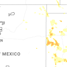
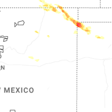
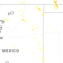
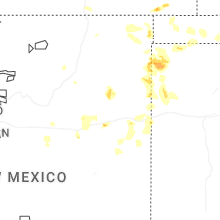
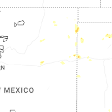
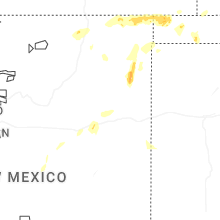


Connect with Interactive Hail Maps