

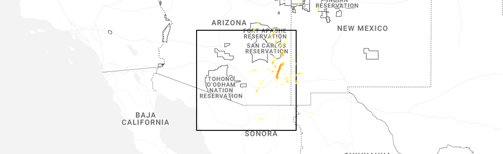
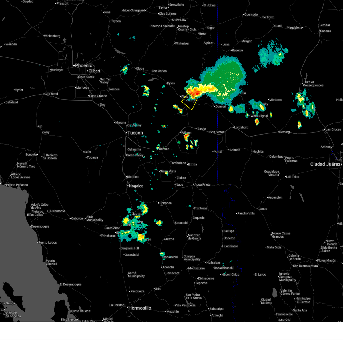
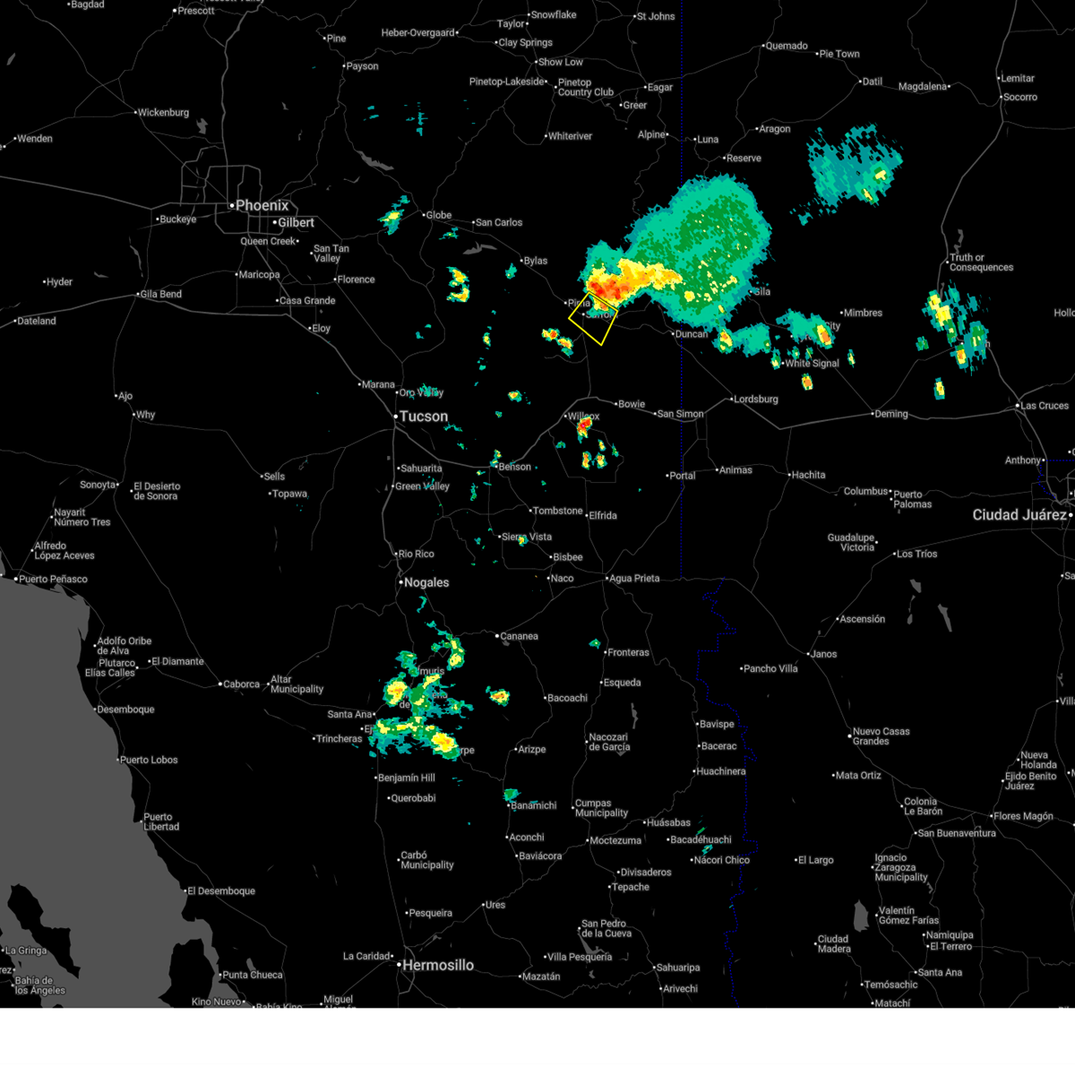
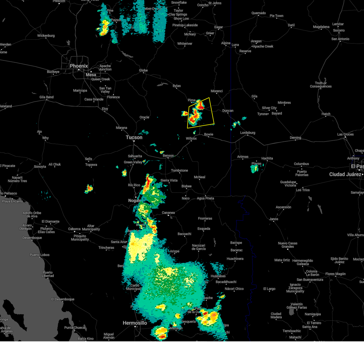
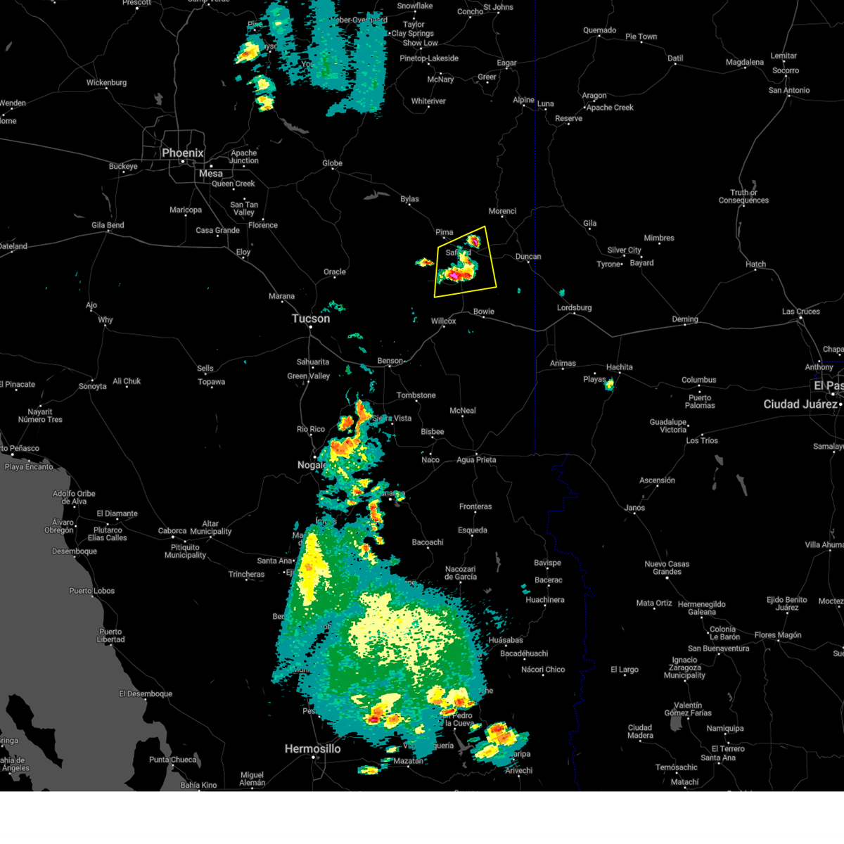
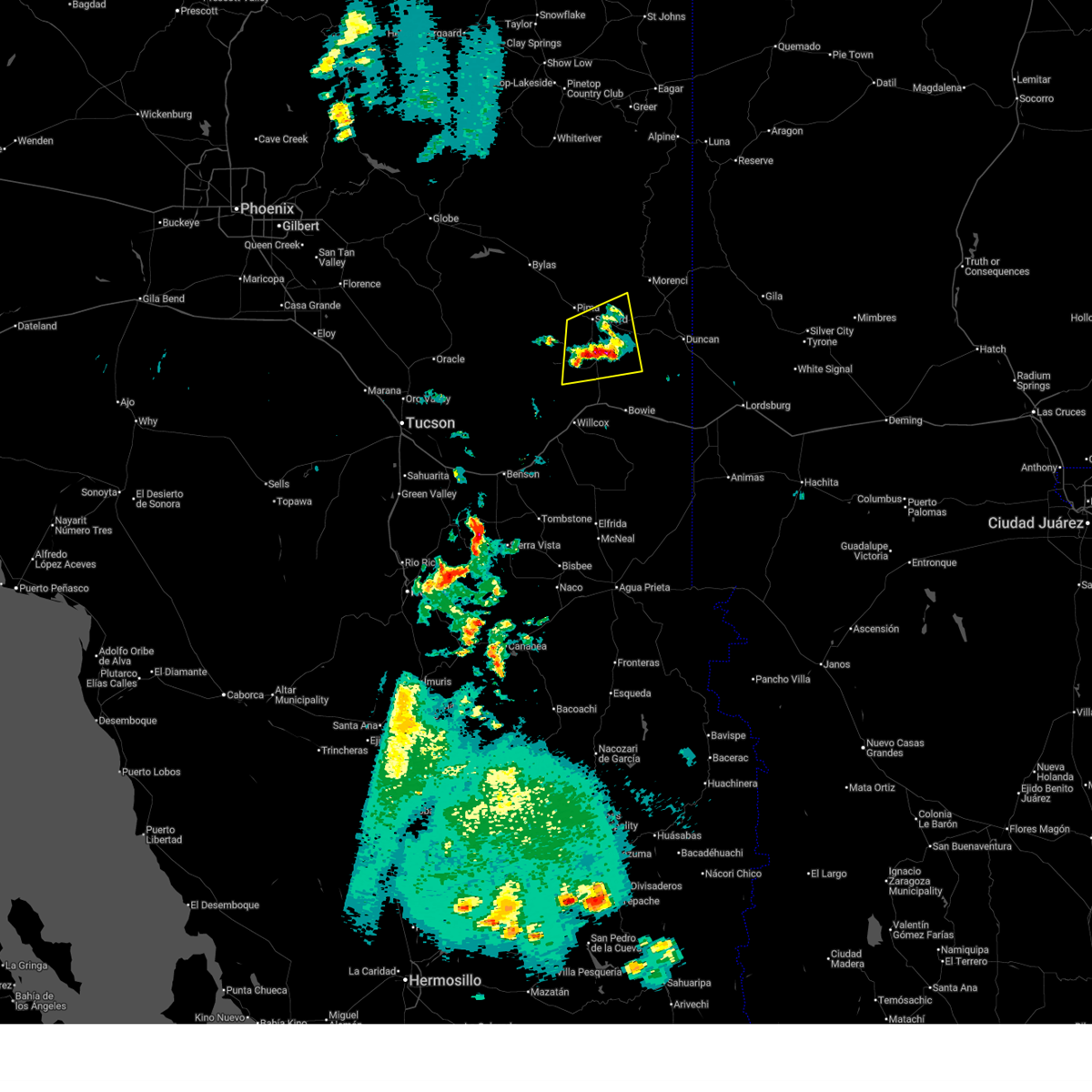
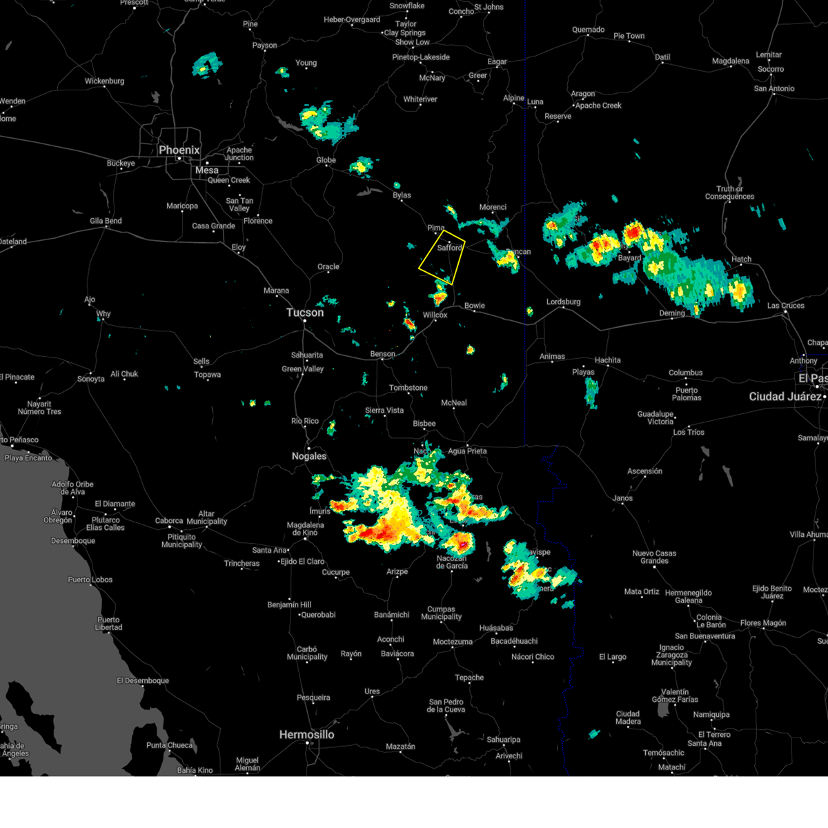
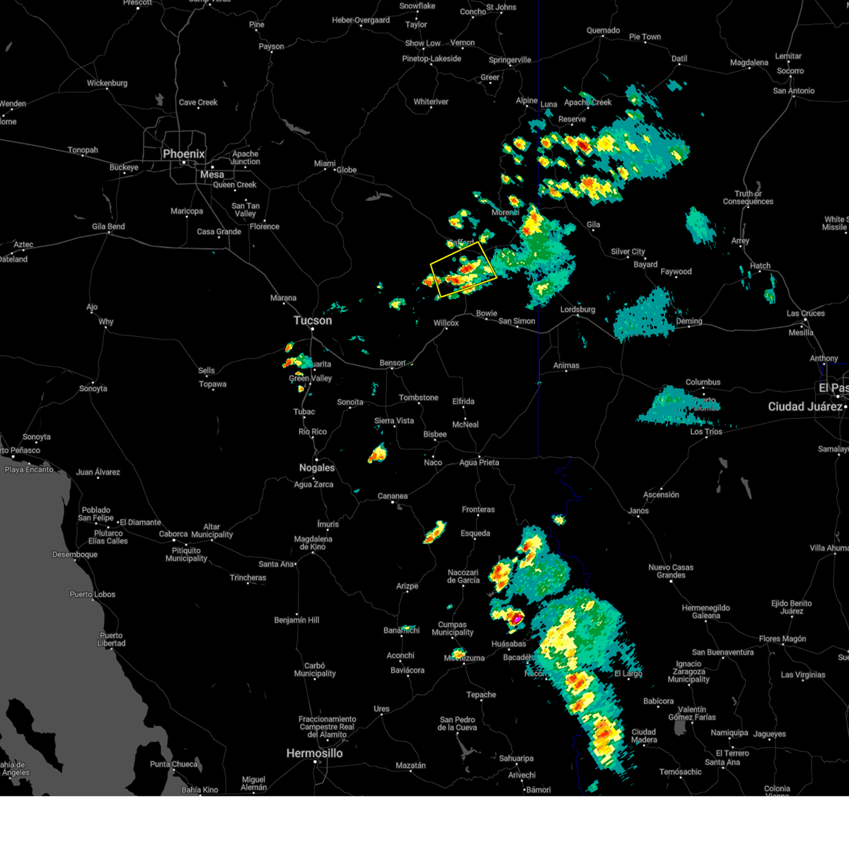
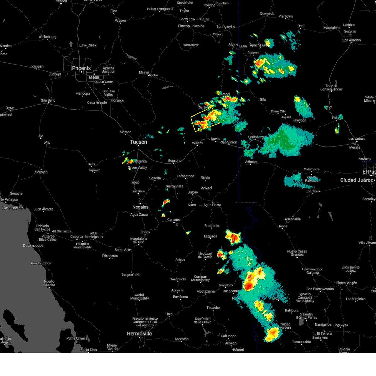
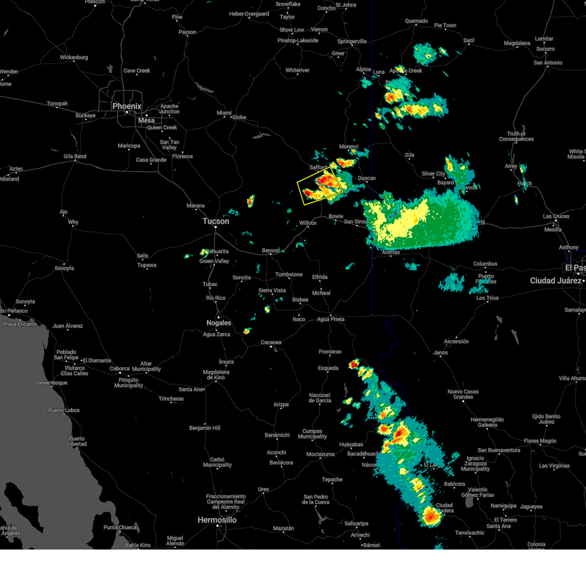
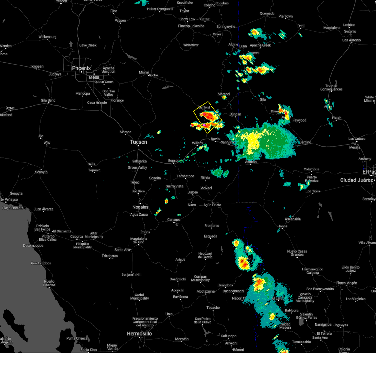
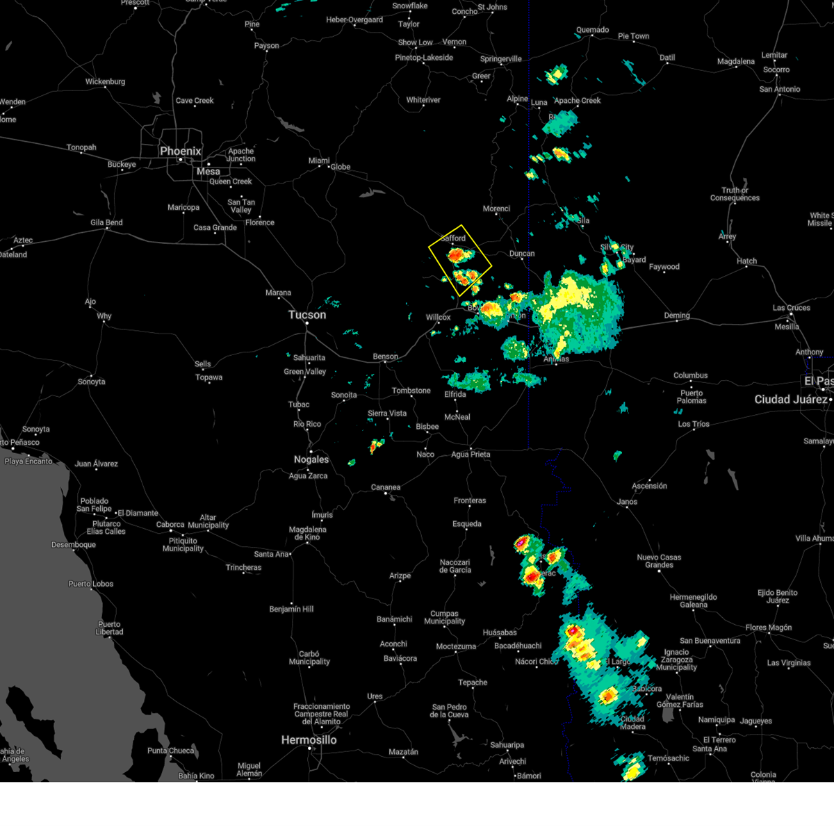
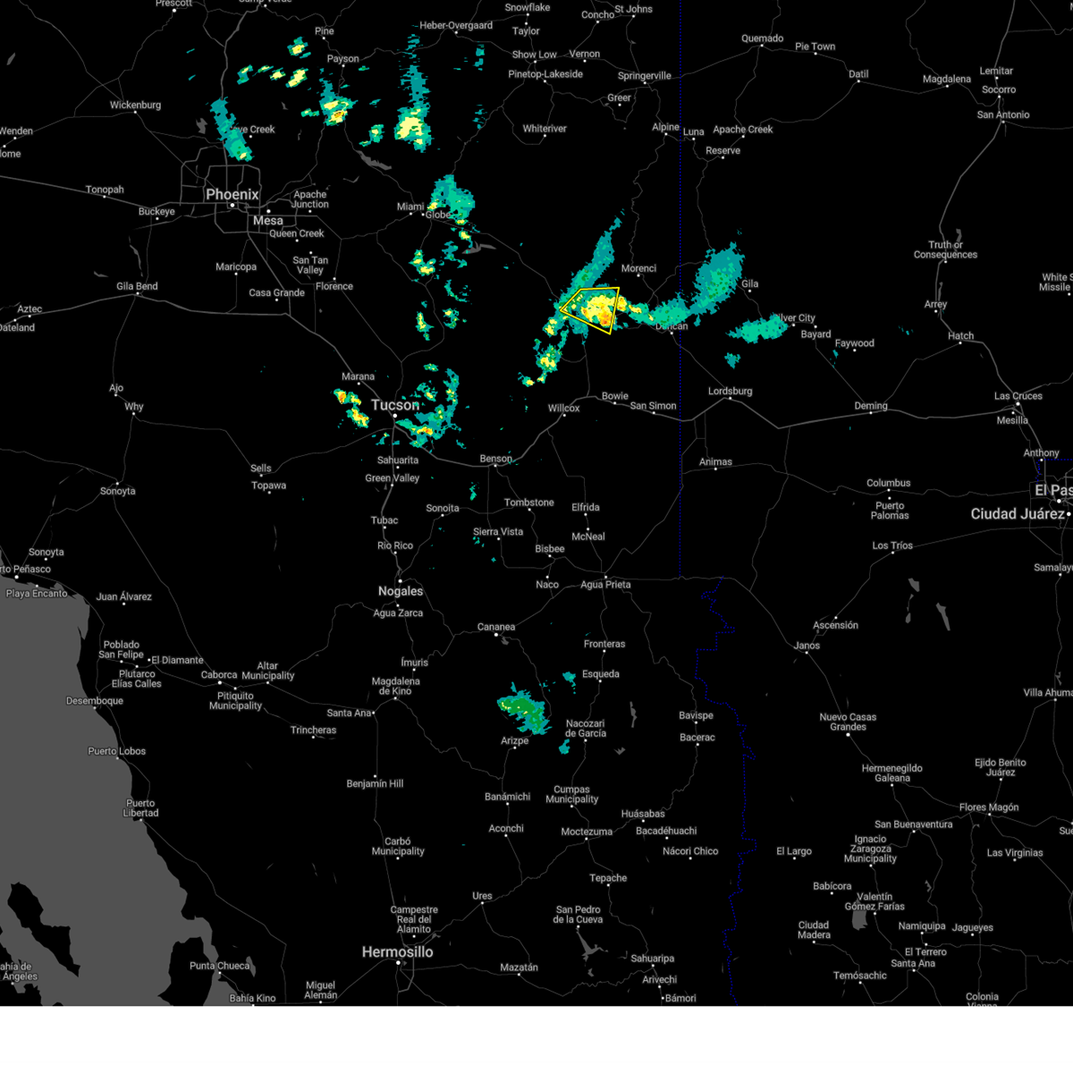
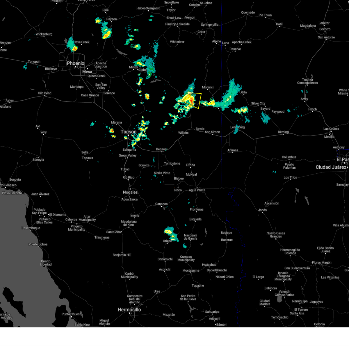
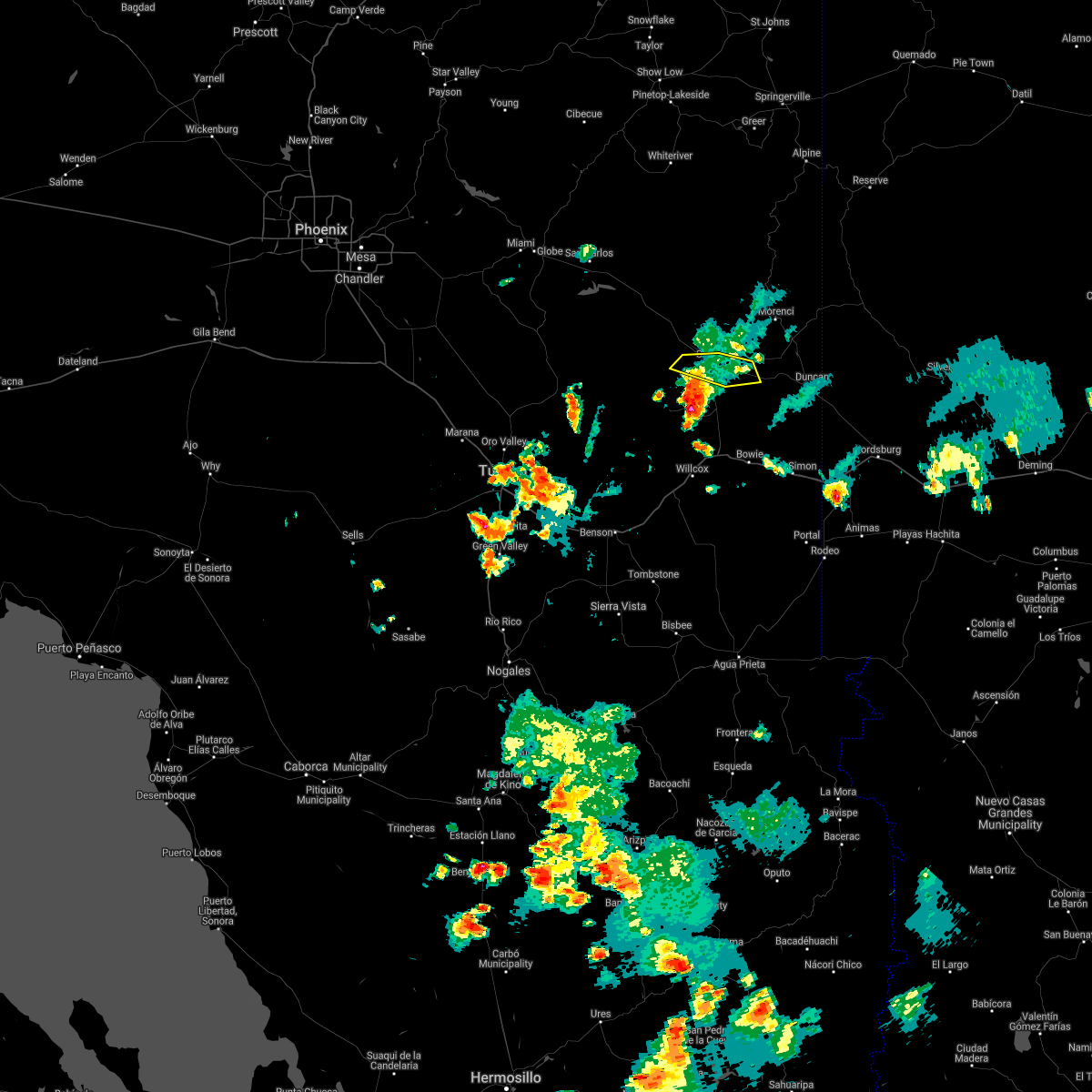
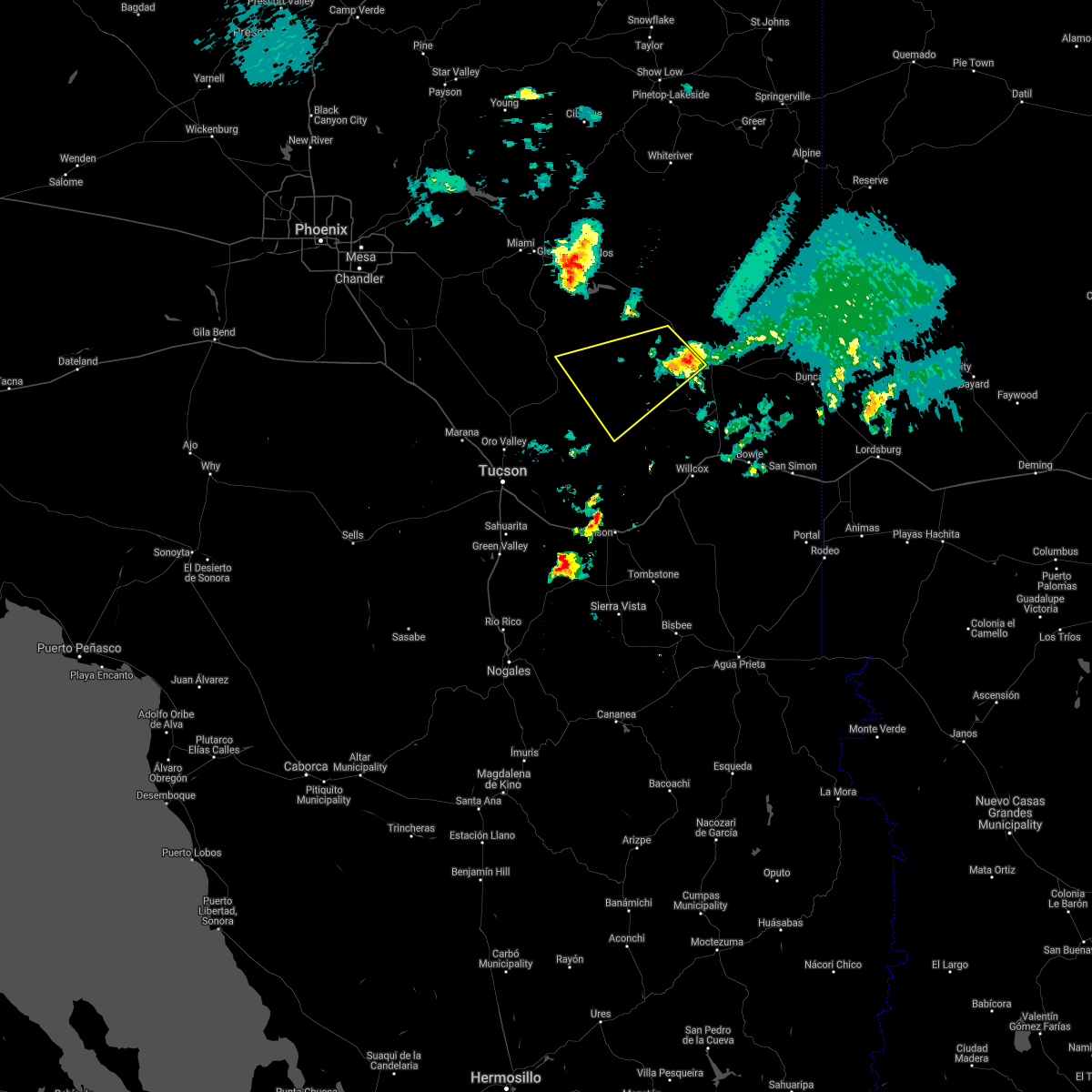
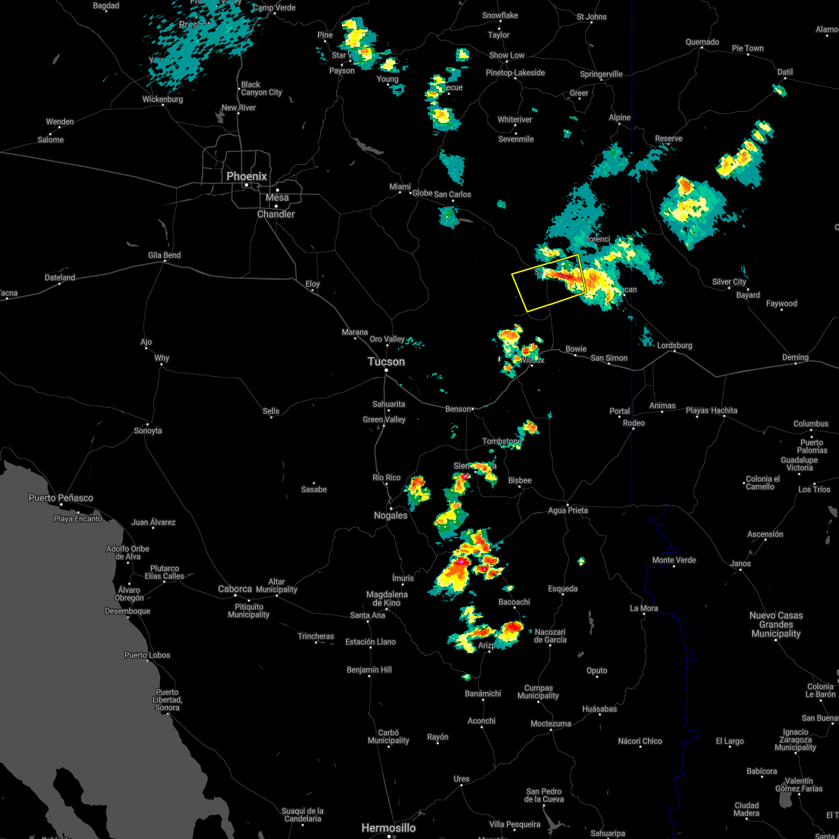
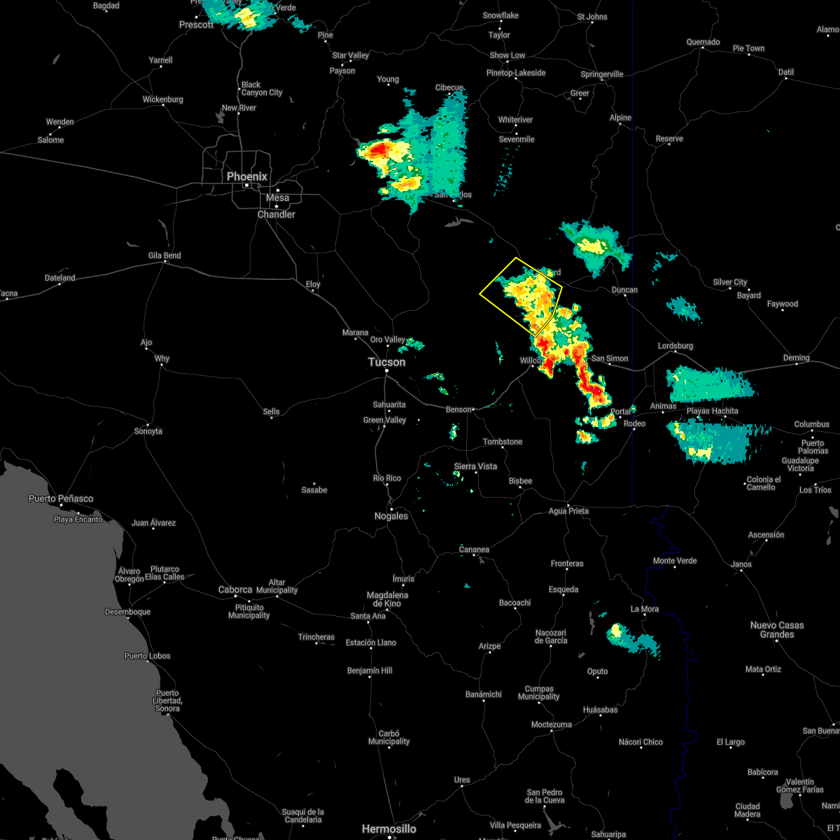
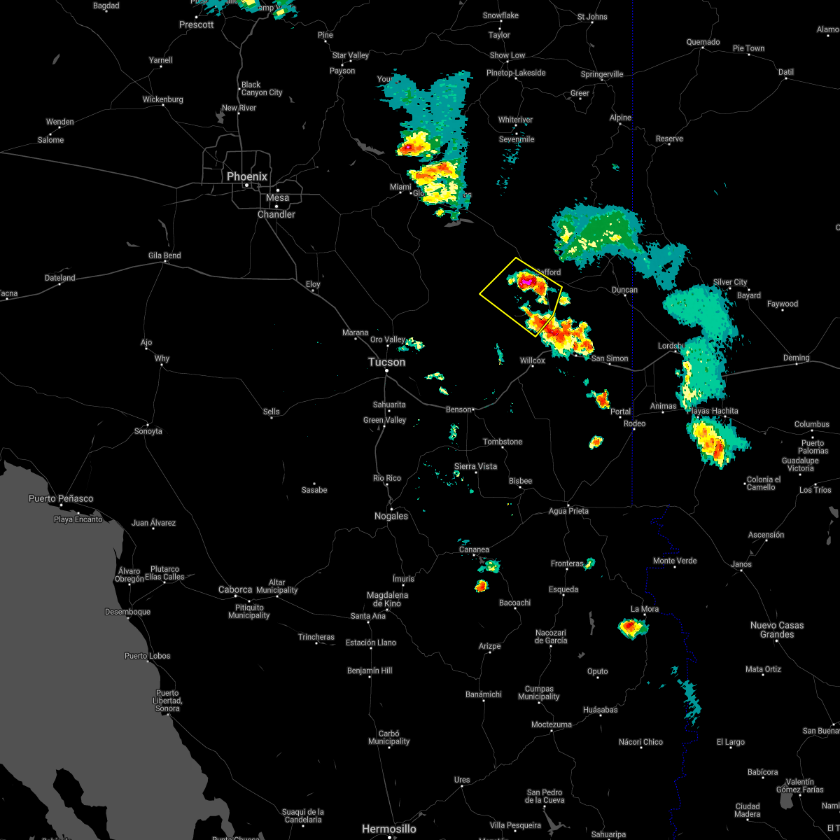
Hail Map for Thatcher, AZ
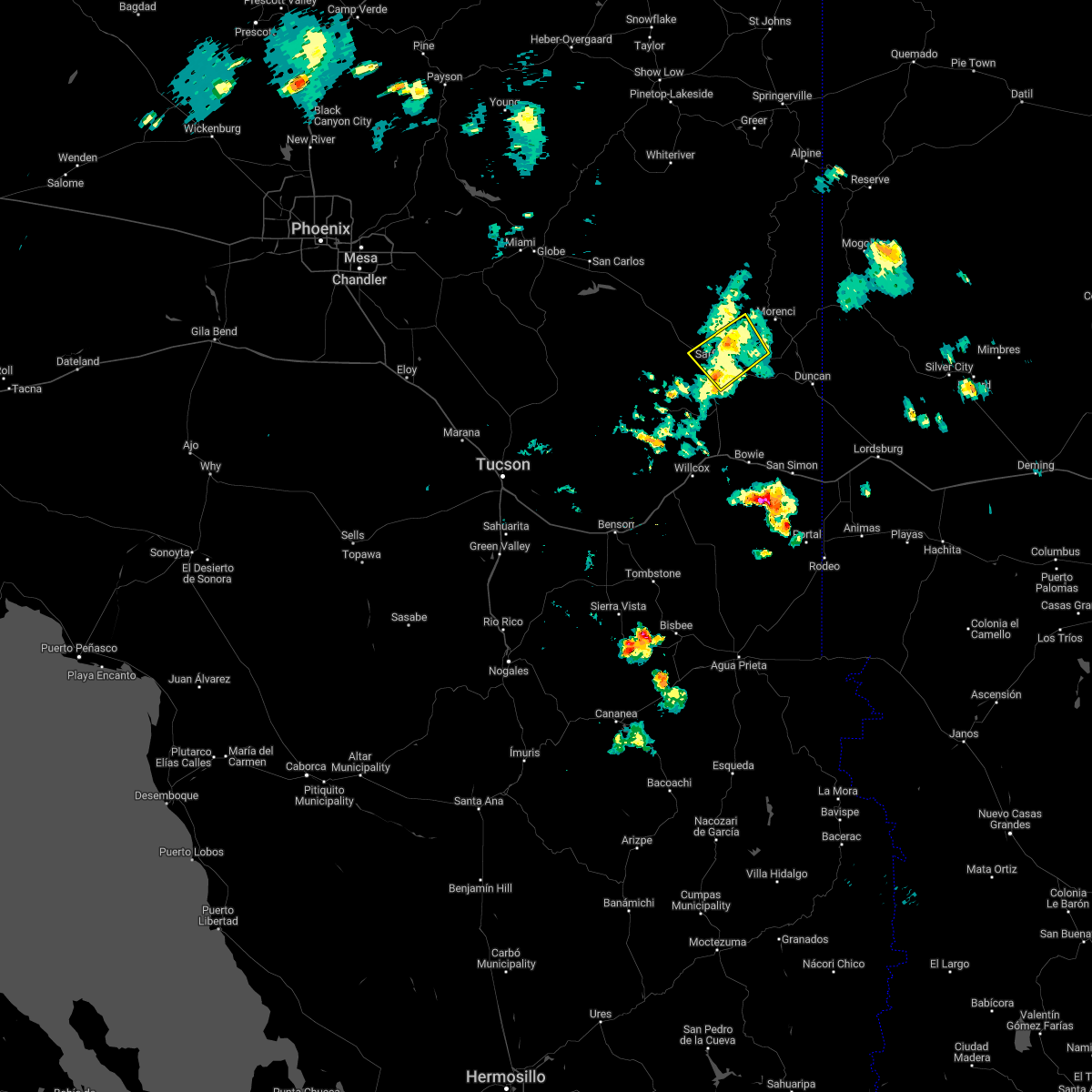
The Thatcher, AZ area has had 0 reports of on-the-ground hail by trained spotters, and has been under severe weather warnings 20 times during the past 12 months. Doppler radar has detected hail at or near Thatcher, AZ on 24 occasions, including 2 occasions during the past year.
| Name: | Thatcher, AZ |
| Where Located: | 82.2 miles ENE of Tucson, AZ |
| Map: | Google Map for Thatcher, AZ |
| Population: | 4865 |
| Housing Units: | 1840 |
| More Info: | Search Google for Thatcher, AZ |
1
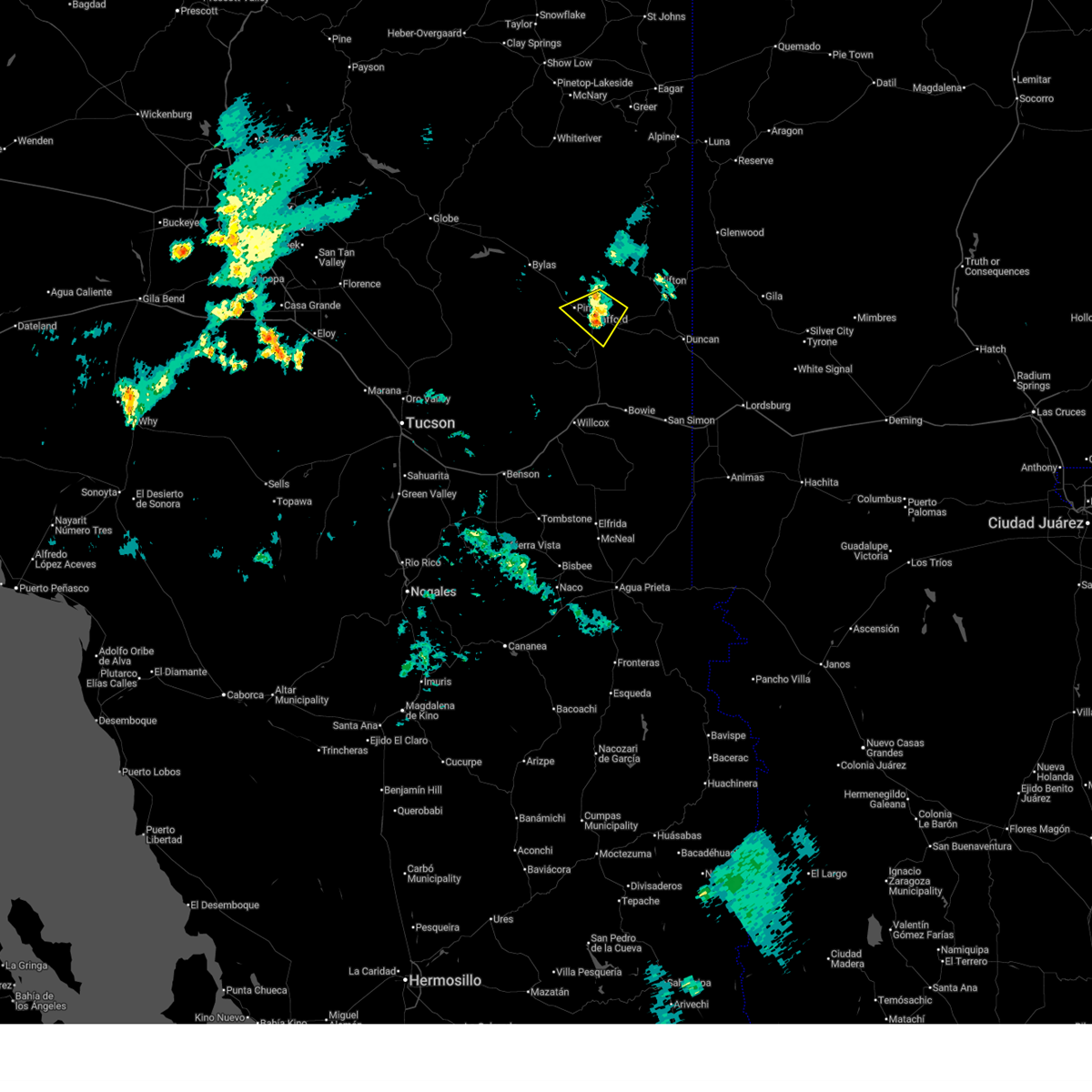
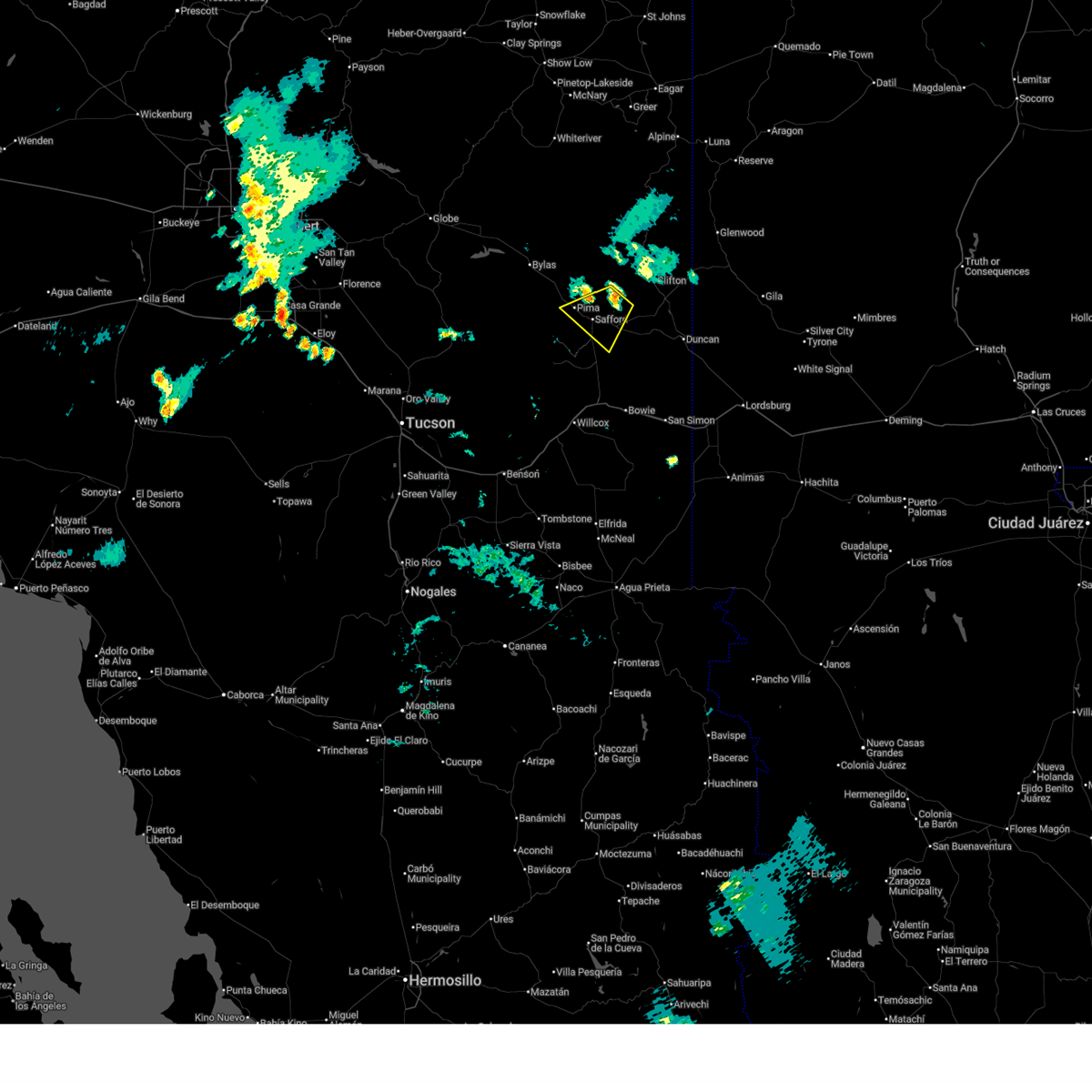
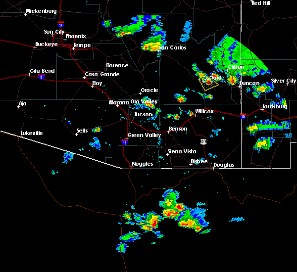
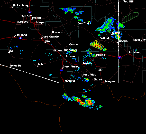
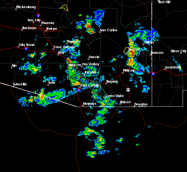
The Top Recent Hail Date for Thatcher, AZ is Friday, September 12, 2025 (5th out of 24)
Hail and Wind Damage Spotted near Thatcher, AZ
| Date / Time | Report Details |
|---|---|
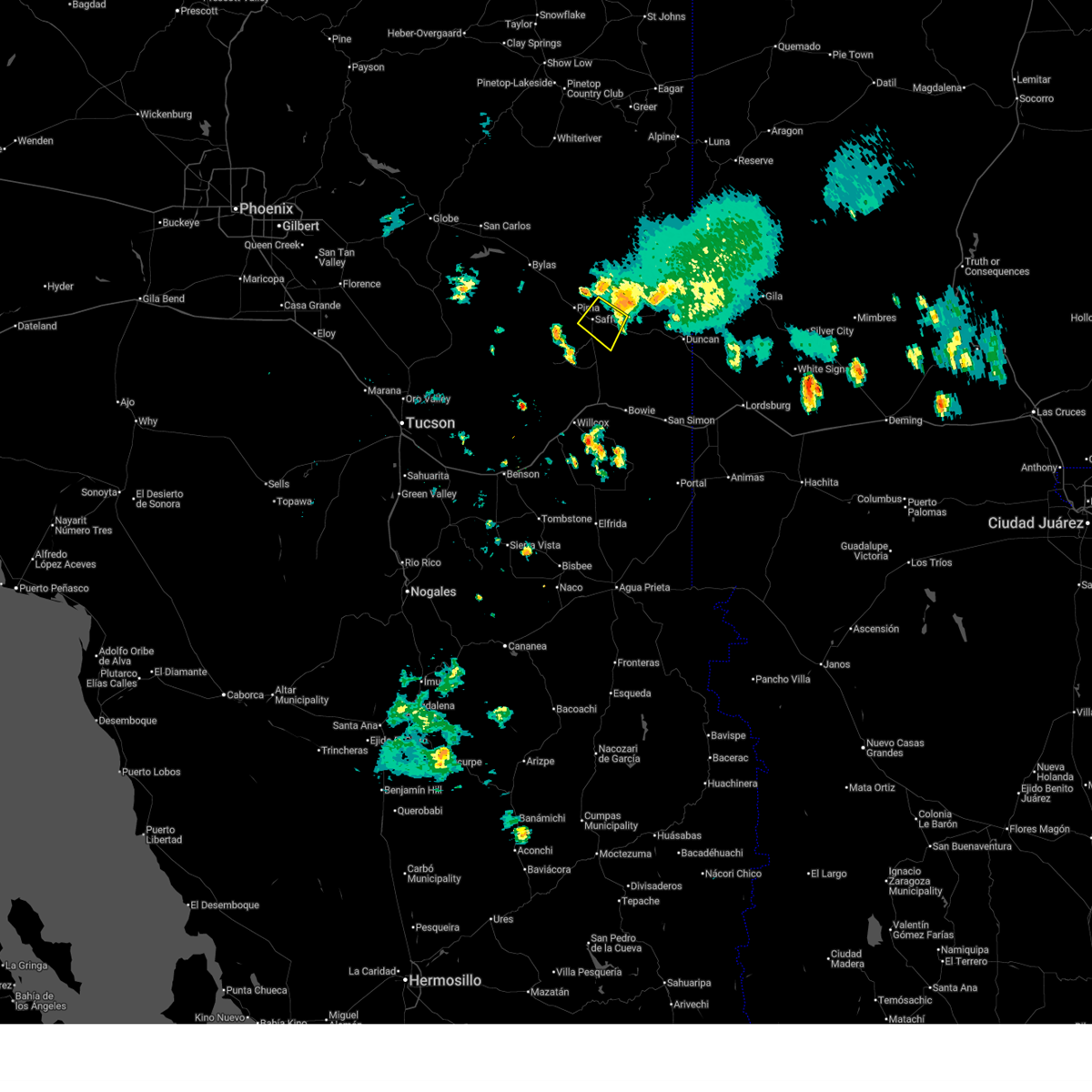
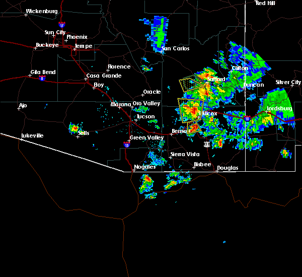
| 10/11/2025 7:36 PM MST | The storm which prompted the warning has moved out of the area. therefore, the warning will be allowed to expire. |
| 10/11/2025 7:24 PM MST | At 724 pm mst, a severe thunderstorm was located near thatcher, moving northeast at 25 mph (radar indicated). Hazards include 60 mph wind gusts. Expect damage to roofs, siding, and trees. locations impacted include, safford, thatcher, roper lake state park, pima, central, frye mesa dam, mount graham and swift trail junction. this includes the following highways, route 191 between mile markers 113 and 120. Route 70 between mile markers 329 and 339. |
| 10/11/2025 6:53 PM MST | Svrtwc the national weather service in tucson has issued a * severe thunderstorm warning for, south central graham county in southeastern arizona, * until 745 pm mst. * at 653 pm mst, a severe thunderstorm was located 16 miles southwest of thatcher, moving northeast at 25 mph (radar indicated). Hazards include 60 mph wind gusts. expect damage to roofs, siding, and trees |
| 9/12/2025 11:36 PM MST | The storm which prompted the warning has moved out of the area. therefore, the warning will be allowed to expire. |
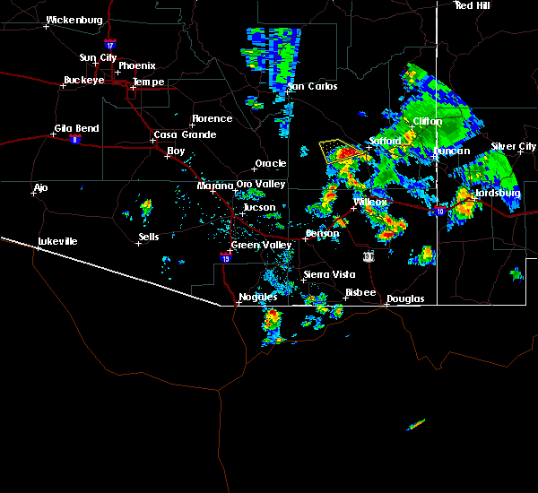
| 9/12/2025 11:14 PM MST | At 1114 pm mst, a severe thunderstorm was located 14 miles north of thatcher, moving north at 45 mph (radar indicated). Hazards include 60 mph wind gusts and quarter size hail. Hail damage to vehicles is expected. expect wind damage to roofs, siding, and trees. locations impacted include, safford, thatcher, solomon, san jose, safford regional airport, pima and central. this includes the following highways, route 191 between mile markers 131 and 152. route 75 between mile markers 392 and 393. Route 70 between mile markers 310 and 333, and near mile marker 337, and between mile markers 339 and 358. |
| 9/12/2025 10:55 PM MST | Svrtwc the national weather service in tucson has issued a * severe thunderstorm warning for, central graham county in southeastern arizona, west central greenlee county in southeastern arizona, * until 1145 pm mst. * at 1055 pm mst, a severe thunderstorm was located near thatcher, moving northeast at 25 mph (radar indicated). Hazards include 60 mph wind gusts and quarter size hail. Hail damage to vehicles is expected. Expect wind damage to roofs, siding, and trees. |
| 9/12/2025 10:16 PM MST | At 1016 pm mst, a severe thunderstorm was located 22 miles southwest of roper lake state park, moving northeast at 40 mph (radar indicated). Hazards include 60 mph wind gusts and quarter size hail. Hail damage to vehicles is expected. expect wind damage to roofs, siding, and trees. locations impacted include, bonita, fort grant, mount graham and frye mesa dam. this includes the following highways, route 191 between mile markers 94 and 108. Route 266 between mile markers 105 and 126. |
| 9/12/2025 9:57 PM MST | Svrtwc the national weather service in tucson has issued a * severe thunderstorm warning for, north central cochise county in southeastern arizona, southwestern graham county in southeastern arizona, * until 1045 pm mst. * at 957 pm mst, a severe thunderstorm was located 20 miles northwest of willcox, moving northeast at 40 mph (radar indicated). Hazards include 60 mph wind gusts and quarter size hail. Hail damage to vehicles is expected. Expect wind damage to roofs, siding, and trees. |
| 9/12/2025 8:51 PM MST | The storm which prompted the warning has moved out of the area. therefore, the warning will be allowed to expire. |
| 9/12/2025 8:29 PM MST | At 829 pm mst, a severe thunderstorm was located near san jose, moving northeast at 35 mph (radar indicated). Hazards include 60 mph wind gusts and quarter size hail. Hail damage to vehicles is expected. expect wind damage to roofs, siding, and trees. locations impacted include, safford, thatcher, solomon, san jose, safford regional airport, roper lake state park and swift trail junction. this includes the following highways, route 191 between mile markers 114 and 153. route 75 between mile markers 386 and 393. Route 70 between mile markers 336 and 370. |
| 9/12/2025 8:17 PM MST | Svrtwc the national weather service in tucson has issued a * severe thunderstorm warning for, southeastern graham county in southeastern arizona, central greenlee county in southeastern arizona, * until 900 pm mst. * at 817 pm mst, a severe thunderstorm was located near roper lake state park, moving northeast at 35 mph (radar indicated). Hazards include 60 mph wind gusts and quarter size hail. Hail damage to vehicles is expected. expect wind damage to roofs, siding, and trees. this severe thunderstorm will be near, roper lake state park around 820 pm mst. safford around 825 pm mst. san jose, solomon and safford regional airport around 830 pm mst. other locations impacted by the severe thunderstorm include swift trail junction. this includes the following highways, route 191 between mile markers 106 and 153. route 75 between mile markers 386 and 393. Route 70 between mile markers 336 and 370. |
| 9/12/2025 1:11 PM MST | the severe thunderstorm warning has been cancelled and is no longer in effect |
| 9/12/2025 12:40 PM MST | Svrtwc the national weather service in tucson has issued a * severe thunderstorm warning for, southwestern graham county in southeastern arizona, * until 145 pm mst. * at 1240 pm mst, a severe thunderstorm was located 21 miles west of thatcher, moving northeast at 20 mph (radar indicated). Hazards include 60 mph wind gusts and quarter size hail. Hail damage to vehicles is expected. Expect wind damage to roofs, siding, and trees. |
| 9/1/2025 7:10 PM MST |
 The storm which prompted the warning has weakened below severe limits, and no longer poses an immediate threat to life or property. therefore, the warning will be allowed to expire. The storm which prompted the warning has weakened below severe limits, and no longer poses an immediate threat to life or property. therefore, the warning will be allowed to expire.
|
| 9/1/2025 6:50 PM MST |
 At 650 pm mst, a severe thunderstorm was located near safford regional airport, moving southwest at 15 mph (radar indicated). Hazards include 60 mph wind gusts and quarter size hail. Hail damage to vehicles is expected. expect wind damage to roofs, siding, and trees. locations impacted include, safford, thatcher, solomon, san jose, safford regional airport, roper lake state park, pima, central and swift trail junction. this includes the following highways, route 191 between mile markers 115 and 120. Route 70 between mile markers 328 and 349. At 650 pm mst, a severe thunderstorm was located near safford regional airport, moving southwest at 15 mph (radar indicated). Hazards include 60 mph wind gusts and quarter size hail. Hail damage to vehicles is expected. expect wind damage to roofs, siding, and trees. locations impacted include, safford, thatcher, solomon, san jose, safford regional airport, roper lake state park, pima, central and swift trail junction. this includes the following highways, route 191 between mile markers 115 and 120. Route 70 between mile markers 328 and 349.
|
| 9/1/2025 6:31 PM MST |
 Svrtwc the national weather service in tucson has issued a * severe thunderstorm warning for, south central graham county in southeastern arizona, * until 715 pm mst. * at 631 pm mst, a severe thunderstorm was located near safford regional airport, moving southwest at 15 mph (radar indicated). Hazards include 60 mph wind gusts and quarter size hail. Hail damage to vehicles is expected. Expect wind damage to roofs, siding, and trees. Svrtwc the national weather service in tucson has issued a * severe thunderstorm warning for, south central graham county in southeastern arizona, * until 715 pm mst. * at 631 pm mst, a severe thunderstorm was located near safford regional airport, moving southwest at 15 mph (radar indicated). Hazards include 60 mph wind gusts and quarter size hail. Hail damage to vehicles is expected. Expect wind damage to roofs, siding, and trees.
|
| 6/30/2025 4:43 PM MST |
 The storm which prompted the warning has weakened below severe limits, and no longer poses an immediate threat to life or property. therefore, the warning will be allowed to expire. however, gusty winds are still possible with this thunderstorm. this severe thunderstorm produced a wind gust at the safford airport of 66 mph at 4:14 pm mst. The storm which prompted the warning has weakened below severe limits, and no longer poses an immediate threat to life or property. therefore, the warning will be allowed to expire. however, gusty winds are still possible with this thunderstorm. this severe thunderstorm produced a wind gust at the safford airport of 66 mph at 4:14 pm mst.
|
| 6/30/2025 4:25 PM MST |
 At 421 pm mst, a severe thunderstorm was located over solomon, moving southwest at 10 mph. a 66 mph gust was recorded at safford airport at 4:14 pm (radar indicated). Hazards include 60 mph wind gusts. Expect damage to roofs, siding, and trees. locations impacted include, safford, thatcher, solomon, san jose, safford regional airport, roper lake state park and swift trail junction. this includes the following highways, route 191 between mile markers 115 and 133. Route 70 between mile markers 336 and 351. At 421 pm mst, a severe thunderstorm was located over solomon, moving southwest at 10 mph. a 66 mph gust was recorded at safford airport at 4:14 pm (radar indicated). Hazards include 60 mph wind gusts. Expect damage to roofs, siding, and trees. locations impacted include, safford, thatcher, solomon, san jose, safford regional airport, roper lake state park and swift trail junction. this includes the following highways, route 191 between mile markers 115 and 133. Route 70 between mile markers 336 and 351.
|
| 6/30/2025 4:21 PM MST |
 At 421 pm mst, a severe thunderstorm was located over solomon, moving southwest at 10 mph. a 57 mph gust was recorded at safford airport at 4:14 pm (radar indicated). Hazards include 60 mph wind gusts. Expect damage to roofs, siding, and trees. locations impacted include, safford, thatcher, solomon, san jose, safford regional airport, roper lake state park and swift trail junction. this includes the following highways, route 191 between mile markers 115 and 133. Route 70 between mile markers 336 and 351. At 421 pm mst, a severe thunderstorm was located over solomon, moving southwest at 10 mph. a 57 mph gust was recorded at safford airport at 4:14 pm (radar indicated). Hazards include 60 mph wind gusts. Expect damage to roofs, siding, and trees. locations impacted include, safford, thatcher, solomon, san jose, safford regional airport, roper lake state park and swift trail junction. this includes the following highways, route 191 between mile markers 115 and 133. Route 70 between mile markers 336 and 351.
|
| 6/30/2025 3:58 PM MST |
 Svrtwc the national weather service in tucson has issued a * severe thunderstorm warning for, south central graham county in southeastern arizona, * until 445 pm mst. * at 358 pm mst, a severe thunderstorm was located over safford regional airport, moving southwest at 10 mph (radar indicated). Hazards include 60 mph wind gusts. expect damage to roofs, siding, and trees Svrtwc the national weather service in tucson has issued a * severe thunderstorm warning for, south central graham county in southeastern arizona, * until 445 pm mst. * at 358 pm mst, a severe thunderstorm was located over safford regional airport, moving southwest at 10 mph (radar indicated). Hazards include 60 mph wind gusts. expect damage to roofs, siding, and trees
|
| 7/22/2024 7:52 PM MST |
 The storms which prompted the warning have weakened below severe limits. therefore, the warning will be allowed to expire. however, gusty winds are still possible with these thunderstorms. The storms which prompted the warning have weakened below severe limits. therefore, the warning will be allowed to expire. however, gusty winds are still possible with these thunderstorms.
|
| 7/22/2024 7:20 PM MST |
 Svrtwc the national weather service in tucson has issued a * severe thunderstorm warning for, central graham county in southeastern arizona, west central greenlee county in southeastern arizona, * until 800 pm mst. * at 720 pm mst, severe thunderstorms were located along a line extending from near fort thomas to near safford airport to 10 miles northeast of san jose, moving southwest at 20 mph (radar indicated). Hazards include 60 mph wind gusts. expect damage to roofs, siding, and trees Svrtwc the national weather service in tucson has issued a * severe thunderstorm warning for, central graham county in southeastern arizona, west central greenlee county in southeastern arizona, * until 800 pm mst. * at 720 pm mst, severe thunderstorms were located along a line extending from near fort thomas to near safford airport to 10 miles northeast of san jose, moving southwest at 20 mph (radar indicated). Hazards include 60 mph wind gusts. expect damage to roofs, siding, and trees
|
| 7/21/2024 3:10 PM MST |
 The storms which prompted the warning across portions of the gila river valley have weakened below severe limits, and have exited the warned area. therefore, the warning will be allowed to expire. however, gusty winds are still possible with these thunderstorms. The storms which prompted the warning across portions of the gila river valley have weakened below severe limits, and have exited the warned area. therefore, the warning will be allowed to expire. however, gusty winds are still possible with these thunderstorms.
|
| 7/21/2024 2:54 PM MST |
 At 253 pm mst, severe thunderstorms were located along a line extending from 25 miles northwest of thatcher to 6 miles east of san jose, moving south at 20 mph (radar indicated). Hazards include 60 mph wind gusts and penny size hail. Expect damage to roofs, siding, and trees. locations impacted include, safford, thatcher, solomon, san jose, roper lake state park, safford regional airport, pima, central, fort thomas, and swift trail junction. this includes the following highways, route 70 between mile markers 293 and 359. Route 191 between mile markers 115 and 140. At 253 pm mst, severe thunderstorms were located along a line extending from 25 miles northwest of thatcher to 6 miles east of san jose, moving south at 20 mph (radar indicated). Hazards include 60 mph wind gusts and penny size hail. Expect damage to roofs, siding, and trees. locations impacted include, safford, thatcher, solomon, san jose, roper lake state park, safford regional airport, pima, central, fort thomas, and swift trail junction. this includes the following highways, route 70 between mile markers 293 and 359. Route 191 between mile markers 115 and 140.
|
| 7/21/2024 2:12 PM MST |
 Svrtwc the national weather service in tucson has issued a * severe thunderstorm warning for, central graham county in southeastern arizona, southwestern greenlee county in southeastern arizona, * until 315 pm mst. * at 210 pm mst, severe thunderstorms were located along a line extending from 18 miles southwest of west poker mountain to 7 miles west of morenci, moving south at 15 to 20 mph (radar indicated). Hazards include 60 mph wind gusts and penny size hail. expect damage to roofs, siding, and trees Svrtwc the national weather service in tucson has issued a * severe thunderstorm warning for, central graham county in southeastern arizona, southwestern greenlee county in southeastern arizona, * until 315 pm mst. * at 210 pm mst, severe thunderstorms were located along a line extending from 18 miles southwest of west poker mountain to 7 miles west of morenci, moving south at 15 to 20 mph (radar indicated). Hazards include 60 mph wind gusts and penny size hail. expect damage to roofs, siding, and trees
|
| 7/19/2024 3:05 PM MST |
 The storm which prompted the warning has weakened below severe limits, and no longer poses an immediate threat to life or property. therefore, the warning will be allowed to expire. however, gusty winds are still possible with this thunderstorm. The storm which prompted the warning has weakened below severe limits, and no longer poses an immediate threat to life or property. therefore, the warning will be allowed to expire. however, gusty winds are still possible with this thunderstorm.
|
| 7/19/2024 2:35 PM MST |
 At 234 pm mst, a severe thunderstorm was located 20 miles north of thatcher, or 21 miles north of safford, moving southwest at 15 mph (radar indicated). Hazards include 60 mph wind gusts and quarter size hail. Hail damage to vehicles is expected. expect wind damage to roofs, siding, and trees. locations impacted include, safford, thatcher, solomon, safford regional airport, pima, bylas, central, and fort thomas. This includes route 70 between mile markers 295 and 312, and between mile markers 339 and 345. At 234 pm mst, a severe thunderstorm was located 20 miles north of thatcher, or 21 miles north of safford, moving southwest at 15 mph (radar indicated). Hazards include 60 mph wind gusts and quarter size hail. Hail damage to vehicles is expected. expect wind damage to roofs, siding, and trees. locations impacted include, safford, thatcher, solomon, safford regional airport, pima, bylas, central, and fort thomas. This includes route 70 between mile markers 295 and 312, and between mile markers 339 and 345.
|
| 7/19/2024 2:18 PM MST |
 Svrtwc the national weather service in tucson has issued a * severe thunderstorm warning for, central graham county in southeastern arizona, west central greenlee county in southeastern arizona, * until 315 pm mst. * at 217 pm mst, a severe thunderstorm was located 23 miles south of west poker mountain, or 25 miles north of safford, moving southwest at 15 mph (radar indicated). Hazards include 60 mph wind gusts and quarter size hail. Hail damage to vehicles is expected. Expect wind damage to roofs, siding, and trees. Svrtwc the national weather service in tucson has issued a * severe thunderstorm warning for, central graham county in southeastern arizona, west central greenlee county in southeastern arizona, * until 315 pm mst. * at 217 pm mst, a severe thunderstorm was located 23 miles south of west poker mountain, or 25 miles north of safford, moving southwest at 15 mph (radar indicated). Hazards include 60 mph wind gusts and quarter size hail. Hail damage to vehicles is expected. Expect wind damage to roofs, siding, and trees.
|
| 7/15/2024 8:23 PM MST |
 The storm which prompted the warning northwest of safford has weakened below severe limits. therefore, the warning will be allowed to expire. however, gusty winds are still possible with this thunderstorm. The storm which prompted the warning northwest of safford has weakened below severe limits. therefore, the warning will be allowed to expire. however, gusty winds are still possible with this thunderstorm.
|
| 7/15/2024 7:52 PM MST |
 The storm which prompted the warning has moved out of the area. therefore, the warning will be allowed to expire. remember, a severe thunderstorm warning still remains in effect for south central graham county until 8:30 pm mst. The storm which prompted the warning has moved out of the area. therefore, the warning will be allowed to expire. remember, a severe thunderstorm warning still remains in effect for south central graham county until 8:30 pm mst.
|
| 7/15/2024 7:51 PM MST |
 Svrtwc the national weather service in tucson has issued a * severe thunderstorm warning for, central graham county in southeastern arizona, * until 830 pm mst. * at 751 pm mst, a severe thunderstorm was located 7 miles north of thatcher, or 7 miles northwest of safford, moving northwest at 10 mph (radar indicated). Hazards include 60 mph wind gusts and penny size hail. expect damage to roofs, siding, and trees Svrtwc the national weather service in tucson has issued a * severe thunderstorm warning for, central graham county in southeastern arizona, * until 830 pm mst. * at 751 pm mst, a severe thunderstorm was located 7 miles north of thatcher, or 7 miles northwest of safford, moving northwest at 10 mph (radar indicated). Hazards include 60 mph wind gusts and penny size hail. expect damage to roofs, siding, and trees
|
| 7/15/2024 7:29 PM MST |
 At 729 pm mst, a severe thunderstorm was located over thatcher and near safford, moving west at 15 mph (radar indicated). Hazards include 60 mph wind gusts and quarter size hail. Hail damage to vehicles is expected. expect wind damage to roofs, siding, and trees. locations impacted include, safford, thatcher, solomon, san jose, roper lake state park, safford regional airport, pima, central, swift trail junction, mount graham, and frye mesa dam. this includes the following highways, route 70 between mile markers 326 and 351. Route 191 between mile markers 113 and 132. At 729 pm mst, a severe thunderstorm was located over thatcher and near safford, moving west at 15 mph (radar indicated). Hazards include 60 mph wind gusts and quarter size hail. Hail damage to vehicles is expected. expect wind damage to roofs, siding, and trees. locations impacted include, safford, thatcher, solomon, san jose, roper lake state park, safford regional airport, pima, central, swift trail junction, mount graham, and frye mesa dam. this includes the following highways, route 70 between mile markers 326 and 351. Route 191 between mile markers 113 and 132.
|
| 7/15/2024 7:09 PM MST |
 The storm which prompted the warning has moved out of the area. therefore, the warning will be allowed to expire. remember, a severe thunderstorm warning still remains in effect for southeastern graham county until 8:00 pm mst. The storm which prompted the warning has moved out of the area. therefore, the warning will be allowed to expire. remember, a severe thunderstorm warning still remains in effect for southeastern graham county until 8:00 pm mst.
|
| 7/15/2024 7:07 PM MST |
 Svrtwc the national weather service in tucson has issued a * severe thunderstorm warning for, south central graham county in southeastern arizona, * until 800 pm mst. * at 707 pm mst, a severe thunderstorm was located over solomon and safford, moving west at 15 mph (radar indicated). Hazards include 60 mph wind gusts and quarter size hail. Hail damage to vehicles is expected. Expect wind damage to roofs, siding, and trees. Svrtwc the national weather service in tucson has issued a * severe thunderstorm warning for, south central graham county in southeastern arizona, * until 800 pm mst. * at 707 pm mst, a severe thunderstorm was located over solomon and safford, moving west at 15 mph (radar indicated). Hazards include 60 mph wind gusts and quarter size hail. Hail damage to vehicles is expected. Expect wind damage to roofs, siding, and trees.
|
| 7/15/2024 6:43 PM MST |
 At 643 pm mst, a severe thunderstorm was located 7 miles south of roper lake state park, or 13 miles south of safford, moving west at 20 mph (radar indicated). Hazards include 60 mph wind gusts and quarter size hail. Hail damage to vehicles is expected. expect wind damage to roofs, siding, and trees. locations impacted include, safford, thatcher, solomon, san jose, roper lake state park, safford regional airport, central, swift trail junction, mount graham, and frye mesa dam. this includes the following highways, route 70 between mile markers 334 and 356. route 191 between mile markers 98 and 137. Route 266 between mile markers 105 and 119. At 643 pm mst, a severe thunderstorm was located 7 miles south of roper lake state park, or 13 miles south of safford, moving west at 20 mph (radar indicated). Hazards include 60 mph wind gusts and quarter size hail. Hail damage to vehicles is expected. expect wind damage to roofs, siding, and trees. locations impacted include, safford, thatcher, solomon, san jose, roper lake state park, safford regional airport, central, swift trail junction, mount graham, and frye mesa dam. this includes the following highways, route 70 between mile markers 334 and 356. route 191 between mile markers 98 and 137. Route 266 between mile markers 105 and 119.
|
| 7/15/2024 6:29 PM MST |
 Svrtwc the national weather service in tucson has issued a * severe thunderstorm warning for, southeastern graham county in southeastern arizona, * until 715 pm mst. * at 629 pm mst, a severe thunderstorm was located 7 miles southeast of roper lake state park, or 12 miles south of safford, moving west at 20 mph (radar indicated). Hazards include 60 mph wind gusts and quarter size hail. Hail damage to vehicles is expected. Expect wind damage to roofs, siding, and trees. Svrtwc the national weather service in tucson has issued a * severe thunderstorm warning for, southeastern graham county in southeastern arizona, * until 715 pm mst. * at 629 pm mst, a severe thunderstorm was located 7 miles southeast of roper lake state park, or 12 miles south of safford, moving west at 20 mph (radar indicated). Hazards include 60 mph wind gusts and quarter size hail. Hail damage to vehicles is expected. Expect wind damage to roofs, siding, and trees.
|
| 7/9/2024 4:16 PM MST |
 the severe thunderstorm warning has been cancelled and is no longer in effect the severe thunderstorm warning has been cancelled and is no longer in effect
|
| 7/9/2024 4:10 PM MST |
 Svrtwc the national weather service in tucson has issued a * severe thunderstorm warning for, south central graham county in southeastern arizona, * until 500 pm mst. * at 409 pm mst, a severe thunderstorm was located over safford, moving southwest at 15 mph (radar indicated). Hazards include 70 mph wind gusts. Expect considerable tree damage. Damage is likely to mobile homes, roofs, and outbuildings. Svrtwc the national weather service in tucson has issued a * severe thunderstorm warning for, south central graham county in southeastern arizona, * until 500 pm mst. * at 409 pm mst, a severe thunderstorm was located over safford, moving southwest at 15 mph (radar indicated). Hazards include 70 mph wind gusts. Expect considerable tree damage. Damage is likely to mobile homes, roofs, and outbuildings.
|
| 6/20/2024 9:55 PM MST |
 The storm which prompted the warning has weakened below severe limits, and no longer poses an immediate threat to life or property. therefore, the warning will be allowed to expire. however, gusty winds and brief heavy rain are still possible with this storm through 1015 pm. The storm which prompted the warning has weakened below severe limits, and no longer poses an immediate threat to life or property. therefore, the warning will be allowed to expire. however, gusty winds and brief heavy rain are still possible with this storm through 1015 pm.
|
| 6/20/2024 9:37 PM MST |
 Svrtwc the national weather service in tucson has issued a * severe thunderstorm warning for, central graham county in southeastern arizona, * until 1000 pm mst. * at 937 pm mst, a severe thunderstorm was located near thatcher, or near safford, moving north at 15 mph (radar indicated). Hazards include 60 mph wind gusts. expect damage to roofs, siding, and trees Svrtwc the national weather service in tucson has issued a * severe thunderstorm warning for, central graham county in southeastern arizona, * until 1000 pm mst. * at 937 pm mst, a severe thunderstorm was located near thatcher, or near safford, moving north at 15 mph (radar indicated). Hazards include 60 mph wind gusts. expect damage to roofs, siding, and trees
|
| 8/7/2023 4:43 PM MST |
 The severe thunderstorm warning for south central graham county will expire at 445 pm mst, the storm which prompted the warning has weakened below severe limits, and no longer poses an immediate threat to life or property. therefore, the warning will be allowed to expire. however heavy rain is still possible with this thunderstorm and a flash flood warning is in effect until 730 pm mst. The severe thunderstorm warning for south central graham county will expire at 445 pm mst, the storm which prompted the warning has weakened below severe limits, and no longer poses an immediate threat to life or property. therefore, the warning will be allowed to expire. however heavy rain is still possible with this thunderstorm and a flash flood warning is in effect until 730 pm mst.
|
| 8/7/2023 4:19 PM MST |
 At 418 pm mst, a severe thunderstorm was located near roper lake state park, or 8 miles southeast of safford, moving east at 5 mph (radar indicated). Hazards include 60 mph wind gusts and quarter size hail. Hail damage to vehicles is expected. expect wind damage to roofs, siding, and trees. locations impacted include, safford, solomon, roper lake state park, safford regional airport, swift trail junction, mount graham and frye mesa dam. hail threat, radar indicated max hail size, 1. 00 in wind threat, radar indicated max wind gust, 60 mph. At 418 pm mst, a severe thunderstorm was located near roper lake state park, or 8 miles southeast of safford, moving east at 5 mph (radar indicated). Hazards include 60 mph wind gusts and quarter size hail. Hail damage to vehicles is expected. expect wind damage to roofs, siding, and trees. locations impacted include, safford, solomon, roper lake state park, safford regional airport, swift trail junction, mount graham and frye mesa dam. hail threat, radar indicated max hail size, 1. 00 in wind threat, radar indicated max wind gust, 60 mph.
|
| 8/7/2023 3:57 PM MST |
 At 357 pm mst, a severe thunderstorm was located over roper lake state park, or 7 miles south of safford, moving east at 5 mph (radar indicated). Hazards include 60 mph wind gusts and quarter size hail. Hail damage to vehicles is expected. Expect wind damage to roofs, siding, and trees. At 357 pm mst, a severe thunderstorm was located over roper lake state park, or 7 miles south of safford, moving east at 5 mph (radar indicated). Hazards include 60 mph wind gusts and quarter size hail. Hail damage to vehicles is expected. Expect wind damage to roofs, siding, and trees.
|
| 8/7/2023 3:31 PM MST |
 At 331 pm mst, a severe thunderstorm was located over roper lake state park, or near safford, moving east at 10 mph (radar indicated). Hazards include 60 mph wind gusts and quarter size hail. Hail damage to vehicles is expected. expect wind damage to roofs, siding, and trees. locations impacted include, safford, thatcher, solomon, roper lake state park, safford regional airport, central, swift trail junction and frye mesa dam. hail threat, radar indicated max hail size, 1. 00 in wind threat, radar indicated max wind gust, 60 mph. At 331 pm mst, a severe thunderstorm was located over roper lake state park, or near safford, moving east at 10 mph (radar indicated). Hazards include 60 mph wind gusts and quarter size hail. Hail damage to vehicles is expected. expect wind damage to roofs, siding, and trees. locations impacted include, safford, thatcher, solomon, roper lake state park, safford regional airport, central, swift trail junction and frye mesa dam. hail threat, radar indicated max hail size, 1. 00 in wind threat, radar indicated max wind gust, 60 mph.
|
| 8/7/2023 3:09 PM MST |
 At 309 pm mst, a severe thunderstorm was located over roper lake state park, or near safford, moving northeast at 10 mph (radar indicated). Hazards include 60 mph wind gusts and quarter size hail. Hail damage to vehicles is expected. Expect wind damage to roofs, siding, and trees. At 309 pm mst, a severe thunderstorm was located over roper lake state park, or near safford, moving northeast at 10 mph (radar indicated). Hazards include 60 mph wind gusts and quarter size hail. Hail damage to vehicles is expected. Expect wind damage to roofs, siding, and trees.
|
| 5/17/2023 6:41 PM MST |
 The severe thunderstorm warning for central graham county will expire at 645 pm mst, the storm which prompted the warning has weakened below severe limits, and no longer poses an immediate threat to life or property. therefore, the warning will be allowed to expire. however gusty winds to 35 mph are still possible with this thunderstorm. The severe thunderstorm warning for central graham county will expire at 645 pm mst, the storm which prompted the warning has weakened below severe limits, and no longer poses an immediate threat to life or property. therefore, the warning will be allowed to expire. however gusty winds to 35 mph are still possible with this thunderstorm.
|
| 5/17/2023 6:10 PM MST |
 At 610 pm mst, a severe thunderstorm was located over safford regional airport, or near safford, moving east at 15 mph (radar indicated). Hazards include 60 mph wind gusts. expect damage to roofs, siding, and trees At 610 pm mst, a severe thunderstorm was located over safford regional airport, or near safford, moving east at 15 mph (radar indicated). Hazards include 60 mph wind gusts. expect damage to roofs, siding, and trees
|
| 5/17/2023 6:04 PM MST |
 At 604 pm mst, a severe thunderstorm was located near safford regional airport, or near safford, moving east at 15 mph (radar indicated). Hazards include 60 mph wind gusts and penny size hail. Expect damage to roofs, siding, and trees. locations impacted include, pima and central. hail threat, radar indicated max hail size, 0. 75 in wind threat, radar indicated max wind gust, 60 mph. At 604 pm mst, a severe thunderstorm was located near safford regional airport, or near safford, moving east at 15 mph (radar indicated). Hazards include 60 mph wind gusts and penny size hail. Expect damage to roofs, siding, and trees. locations impacted include, pima and central. hail threat, radar indicated max hail size, 0. 75 in wind threat, radar indicated max wind gust, 60 mph.
|
| 5/17/2023 5:38 PM MST |
 At 538 pm mst, a severe thunderstorm was located near thatcher, or 8 miles northwest of safford, moving northeast at 15 mph (radar indicated). Hazards include 60 mph wind gusts and penny size hail. expect damage to roofs, siding, and trees At 538 pm mst, a severe thunderstorm was located near thatcher, or 8 miles northwest of safford, moving northeast at 15 mph (radar indicated). Hazards include 60 mph wind gusts and penny size hail. expect damage to roofs, siding, and trees
|
| 8/7/2022 5:28 PM MST |
 The severe thunderstorm warning for central graham county will expire at 530 pm mst, the storm which prompted the warning has weakened below severe limits, and no longer poses an immediate threat to life or property. therefore, the warning will be allowed to expire. however gusty winds and heavy rain are still possible with this thunderstorm. to report severe weather, contact your nearest law enforcement agency. they will relay your report to the national weather service tucson. The severe thunderstorm warning for central graham county will expire at 530 pm mst, the storm which prompted the warning has weakened below severe limits, and no longer poses an immediate threat to life or property. therefore, the warning will be allowed to expire. however gusty winds and heavy rain are still possible with this thunderstorm. to report severe weather, contact your nearest law enforcement agency. they will relay your report to the national weather service tucson.
|
| 8/7/2022 5:13 PM MST |
 At 513 pm mst, a severe thunderstorm was located near safford regional airport, or 7 miles northeast of safford, moving west at 20 mph (radar indicated). Hazards include 60 mph wind gusts and penny size hail. Expect damage to roofs, siding, and trees. locations impacted include, safford, thatcher, solomon, roper lake state park, safford regional airport, pima, central and swift trail junction. hail threat, radar indicated max hail size, 0. 75 in wind threat, radar indicated max wind gust, 60 mph. At 513 pm mst, a severe thunderstorm was located near safford regional airport, or 7 miles northeast of safford, moving west at 20 mph (radar indicated). Hazards include 60 mph wind gusts and penny size hail. Expect damage to roofs, siding, and trees. locations impacted include, safford, thatcher, solomon, roper lake state park, safford regional airport, pima, central and swift trail junction. hail threat, radar indicated max hail size, 0. 75 in wind threat, radar indicated max wind gust, 60 mph.
|
| 8/7/2022 4:50 PM MST |
 At 450 pm mst, a severe thunderstorm was located 8 miles northeast of safford regional airport, or 12 miles northeast of safford, moving southwest at 20 mph (radar indicated). Hazards include 60 mph wind gusts and quarter size hail. Hail damage to vehicles is expected. expect wind damage to roofs, siding, and trees. locations impacted include, safford, thatcher, solomon, roper lake state park, safford regional airport, pima, central and swift trail junction. hail threat, radar indicated max hail size, 1. 00 in wind threat, radar indicated max wind gust, 60 mph. At 450 pm mst, a severe thunderstorm was located 8 miles northeast of safford regional airport, or 12 miles northeast of safford, moving southwest at 20 mph (radar indicated). Hazards include 60 mph wind gusts and quarter size hail. Hail damage to vehicles is expected. expect wind damage to roofs, siding, and trees. locations impacted include, safford, thatcher, solomon, roper lake state park, safford regional airport, pima, central and swift trail junction. hail threat, radar indicated max hail size, 1. 00 in wind threat, radar indicated max wind gust, 60 mph.
|
| 8/7/2022 4:45 PM MST |
 At 445 pm mst, a severe thunderstorm was located 10 miles northeast of safford regional airport, or 14 miles southwest of clifton, moving southwest at 20 mph (radar indicated). Hazards include 60 mph wind gusts and quarter size hail. Hail damage to vehicles is expected. Expect wind damage to roofs, siding, and trees. At 445 pm mst, a severe thunderstorm was located 10 miles northeast of safford regional airport, or 14 miles southwest of clifton, moving southwest at 20 mph (radar indicated). Hazards include 60 mph wind gusts and quarter size hail. Hail damage to vehicles is expected. Expect wind damage to roofs, siding, and trees.
|
| 8/4/2022 1:22 AM MST |
 The severe thunderstorm warning for central graham county will expire at 130 am mst, the storms which prompted the warning have weakened below severe limits, and no longer pose an immediate threat to life or property. therefore, the warning will be allowed to expire. however gusty winds and heavy rain are still possible with these thunderstorms. The severe thunderstorm warning for central graham county will expire at 130 am mst, the storms which prompted the warning have weakened below severe limits, and no longer pose an immediate threat to life or property. therefore, the warning will be allowed to expire. however gusty winds and heavy rain are still possible with these thunderstorms.
|
| 8/4/2022 12:50 AM MST |
 At 1249 am mst, severe thunderstorms were located along a line extending from 12 miles north of safford regional airport to 6 miles east of solomon, moving west at 10 mph (radar indicated). Hazards include 60 mph wind gusts and quarter size hail. Hail damage to vehicles is expected. Expect wind damage to roofs, siding, and trees. At 1249 am mst, severe thunderstorms were located along a line extending from 12 miles north of safford regional airport to 6 miles east of solomon, moving west at 10 mph (radar indicated). Hazards include 60 mph wind gusts and quarter size hail. Hail damage to vehicles is expected. Expect wind damage to roofs, siding, and trees.
|
| 8/2/2022 3:39 PM MST |
 The severe thunderstorm warning for east central graham and west central greenlee counties will expire at 345 pm mst, the storm which prompted the warning has weakened below severe limits, and no longer poses an immediate threat to life or property. therefore, the warning will be allowed to expire. The severe thunderstorm warning for east central graham and west central greenlee counties will expire at 345 pm mst, the storm which prompted the warning has weakened below severe limits, and no longer poses an immediate threat to life or property. therefore, the warning will be allowed to expire.
|
| 8/2/2022 3:22 PM MST |
 At 322 pm mst, a severe thunderstorm was located 9 miles southwest of morenci, or 10 miles southwest of clifton, moving south at 10 mph (radar indicated). Hazards include 60 mph wind gusts and quarter size hail. Hail damage to vehicles is expected. expect wind damage to roofs, siding, and trees. locations impacted include, safford, thatcher, solomon and safford regional airport. hail threat, radar indicated max hail size, 1. 00 in wind threat, radar indicated max wind gust, 60 mph. At 322 pm mst, a severe thunderstorm was located 9 miles southwest of morenci, or 10 miles southwest of clifton, moving south at 10 mph (radar indicated). Hazards include 60 mph wind gusts and quarter size hail. Hail damage to vehicles is expected. expect wind damage to roofs, siding, and trees. locations impacted include, safford, thatcher, solomon and safford regional airport. hail threat, radar indicated max hail size, 1. 00 in wind threat, radar indicated max wind gust, 60 mph.
|
| 8/2/2022 3:06 PM MST |
 At 306 pm mst, a severe thunderstorm was located 9 miles southwest of morenci, or 10 miles southwest of clifton, moving southwest at 15 mph (radar indicated). Hazards include 60 mph wind gusts and quarter size hail. Hail damage to vehicles is expected. Expect wind damage to roofs, siding, and trees. At 306 pm mst, a severe thunderstorm was located 9 miles southwest of morenci, or 10 miles southwest of clifton, moving southwest at 15 mph (radar indicated). Hazards include 60 mph wind gusts and quarter size hail. Hail damage to vehicles is expected. Expect wind damage to roofs, siding, and trees.
|
| 9/5/2021 4:20 PM MST |
 The severe thunderstorm warning for central graham county will expire at 430 pm mst, the storm which prompted the warning has moved out of the area. therefore, the warning will be allowed to expire. however gusty winds and heavy rain are still possible with this thunderstorm. to report severe weather, contact your nearest law enforcement agency. they will relay your report to the national weather service tucson. The severe thunderstorm warning for central graham county will expire at 430 pm mst, the storm which prompted the warning has moved out of the area. therefore, the warning will be allowed to expire. however gusty winds and heavy rain are still possible with this thunderstorm. to report severe weather, contact your nearest law enforcement agency. they will relay your report to the national weather service tucson.
|
| 9/5/2021 4:15 PM MST | Widespread damage across the safford area. roof damage... structure damage... numerous trees snapped or uprooted... numerous powerlines down... and other damage. times in graham county AZ, 1.8 miles SW of Thatcher, AZ |
| 9/5/2021 4:03 PM MST |
 At 401 pm mst, a severe thunderstorm was located over roper lake state park, or near safford, moving southwest at 10 mph (radar indicated. at 348 pm, a wind gust to 68 mph was reported at safford airport. other gusts near 60 mph were also reported around the area). Hazards include 70 mph wind gusts and quarter size hail. Hail damage to vehicles is expected. expect considerable tree damage. wind damage is also likely to mobile homes, roofs, and outbuildings. locations impacted include, safford, thatcher, solomon, roper lake state park, safford regional airport, central and swift trail junction. thunderstorm damage threat, considerable hail threat, observed max hail size, 1. 00 in wind threat, radar indicated max wind gust, 70 mph. At 401 pm mst, a severe thunderstorm was located over roper lake state park, or near safford, moving southwest at 10 mph (radar indicated. at 348 pm, a wind gust to 68 mph was reported at safford airport. other gusts near 60 mph were also reported around the area). Hazards include 70 mph wind gusts and quarter size hail. Hail damage to vehicles is expected. expect considerable tree damage. wind damage is also likely to mobile homes, roofs, and outbuildings. locations impacted include, safford, thatcher, solomon, roper lake state park, safford regional airport, central and swift trail junction. thunderstorm damage threat, considerable hail threat, observed max hail size, 1. 00 in wind threat, radar indicated max wind gust, 70 mph.
|
| 9/5/2021 3:47 PM MST |
 At 347 pm mst, a severe thunderstorm was located over safford regional airport, or near safford, moving south at 10 mph (radar indicated). Hazards include 70 mph wind gusts and ping pong ball size hail. People and animals outdoors will be injured. expect hail damage to roofs, siding, windows, and vehicles. expect considerable tree damage. wind damage is also likely to mobile homes, roofs, and outbuildings. locations impacted include, safford, thatcher, solomon, roper lake state park, safford regional airport, pima, central and swift trail junction. thunderstorm damage threat, considerable hail threat, observed max hail size, 1. 50 in wind threat, radar indicated max wind gust, 70 mph. At 347 pm mst, a severe thunderstorm was located over safford regional airport, or near safford, moving south at 10 mph (radar indicated). Hazards include 70 mph wind gusts and ping pong ball size hail. People and animals outdoors will be injured. expect hail damage to roofs, siding, windows, and vehicles. expect considerable tree damage. wind damage is also likely to mobile homes, roofs, and outbuildings. locations impacted include, safford, thatcher, solomon, roper lake state park, safford regional airport, pima, central and swift trail junction. thunderstorm damage threat, considerable hail threat, observed max hail size, 1. 50 in wind threat, radar indicated max wind gust, 70 mph.
|
| 9/5/2021 3:36 PM MST |
 At 335 pm mst, a severe thunderstorm was located near safford regional airport, or 7 miles northeast of safford. another severe thunderstorm is developing over safford. both storms are moving southwest at 15 mph (radar indicated). Hazards include 70 mph wind gusts and quarter size hail. Hail damage to vehicles is expected. expect considerable tree damage. wind damage is also likely to mobile homes, roofs, and outbuildings. locations impacted include, safford, thatcher, solomon, roper lake state park, safford regional airport, pima, central and swift trail junction. thunderstorm damage threat, considerable hail threat, radar indicated max hail size, 1. 00 in wind threat, radar indicated max wind gust, 70 mph. At 335 pm mst, a severe thunderstorm was located near safford regional airport, or 7 miles northeast of safford. another severe thunderstorm is developing over safford. both storms are moving southwest at 15 mph (radar indicated). Hazards include 70 mph wind gusts and quarter size hail. Hail damage to vehicles is expected. expect considerable tree damage. wind damage is also likely to mobile homes, roofs, and outbuildings. locations impacted include, safford, thatcher, solomon, roper lake state park, safford regional airport, pima, central and swift trail junction. thunderstorm damage threat, considerable hail threat, radar indicated max hail size, 1. 00 in wind threat, radar indicated max wind gust, 70 mph.
|
| 9/5/2021 3:24 PM MST |
 At 324 pm mst, a severe thunderstorm was located 8 miles northeast of safford regional airport, or 11 miles northeast of safford, moving south at 10 mph (radar indicated). Hazards include 60 mph wind gusts and quarter size hail. Hail damage to vehicles is expected. Expect wind damage to roofs, siding, and trees. At 324 pm mst, a severe thunderstorm was located 8 miles northeast of safford regional airport, or 11 miles northeast of safford, moving south at 10 mph (radar indicated). Hazards include 60 mph wind gusts and quarter size hail. Hail damage to vehicles is expected. Expect wind damage to roofs, siding, and trees.
|
| 7/16/2021 2:23 PM MST |
 At 222 pm mst, a severe thunderstorm was located 8 miles north of safford regional airport, or 10 miles northeast of safford, moving south at 20 mph (radar indicated). Hazards include 60 mph wind gusts. Expect damage to roofs, siding, and trees. locations impacted include, safford, clifton, thatcher, solomon, morenci, roper lake state park, safford regional airport, pima, central, fort thomas, three way, swift trail junction and guthrie. this includes the following highways, route 70 between mile markers 300 and 370. route 75 between mile markers 397 and 398. route 78 between mile markers 155 and 156. Route 191 between mile markers 113 and 175. At 222 pm mst, a severe thunderstorm was located 8 miles north of safford regional airport, or 10 miles northeast of safford, moving south at 20 mph (radar indicated). Hazards include 60 mph wind gusts. Expect damage to roofs, siding, and trees. locations impacted include, safford, clifton, thatcher, solomon, morenci, roper lake state park, safford regional airport, pima, central, fort thomas, three way, swift trail junction and guthrie. this includes the following highways, route 70 between mile markers 300 and 370. route 75 between mile markers 397 and 398. route 78 between mile markers 155 and 156. Route 191 between mile markers 113 and 175.
|
| 7/16/2021 2:03 PM MST |
 At 201 pm mst, a group of severe thunderstorms was indicated north of a solomon to safford to fort thomas line. these storms are moving to the moving south at 25 mph (radar indicated). Hazards include 60 mph wind gusts. expect damage to roofs, siding, and trees At 201 pm mst, a group of severe thunderstorms was indicated north of a solomon to safford to fort thomas line. these storms are moving to the moving south at 25 mph (radar indicated). Hazards include 60 mph wind gusts. expect damage to roofs, siding, and trees
|
| 7/15/2021 3:57 PM MST |
 At 355 pm mst, another severe thunderstorm has developed in the vicinity of pima and safford, moving south at 10 mph (radar indicated). Hazards include 60 mph wind gusts and small hail. expect damage to roofs, siding, and trees At 355 pm mst, another severe thunderstorm has developed in the vicinity of pima and safford, moving south at 10 mph (radar indicated). Hazards include 60 mph wind gusts and small hail. expect damage to roofs, siding, and trees
|
| 7/15/2021 3:15 PM MST |
 At 314 pm mst, a severe thunderstorm was located in the vicinity of safford regional airport, or near safford, moving south at 25 mph (weather station). Hazards include 60 mph wind gusts. a wind gust to 59 mph at the safford regional airport. expect damage to roofs, siding, and trees At 314 pm mst, a severe thunderstorm was located in the vicinity of safford regional airport, or near safford, moving south at 25 mph (weather station). Hazards include 60 mph wind gusts. a wind gust to 59 mph at the safford regional airport. expect damage to roofs, siding, and trees
|
| 7/12/2021 7:53 PM MST |
 At 752 pm mst, a severe thunderstorm was located 19 miles east of mammoth, moving southwest at 25 mph (radar indicated). Hazards include 60 mph wind gusts and penny size hail. Expect damage to roofs, siding, and trees. locations impacted include, thatcher, aravaipa canyon wilderness, pima and klondyke. This includes route 70 between mile markers 312 and 328. At 752 pm mst, a severe thunderstorm was located 19 miles east of mammoth, moving southwest at 25 mph (radar indicated). Hazards include 60 mph wind gusts and penny size hail. Expect damage to roofs, siding, and trees. locations impacted include, thatcher, aravaipa canyon wilderness, pima and klondyke. This includes route 70 between mile markers 312 and 328.
|
| 7/12/2021 7:28 PM MST |
 At 727 pm mst, a severe thunderstorm was located 25 miles west of safford, moving southwest at 25 mph (radar indicated). Hazards include 60 mph wind gusts and quarter size hail. Hail damage to vehicles is expected. Expect wind damage to roofs, siding, and trees. At 727 pm mst, a severe thunderstorm was located 25 miles west of safford, moving southwest at 25 mph (radar indicated). Hazards include 60 mph wind gusts and quarter size hail. Hail damage to vehicles is expected. Expect wind damage to roofs, siding, and trees.
|
| 7/10/2021 5:33 PM MST |
 At 532 pm mst, a severe thunderstorm was located 9 miles north of willcox, moving south at 15 mph (radar indicated). Hazards include 60 mph wind gusts and quarter size hail. Hail damage to vehicles is expected. expect wind damage to roofs, siding, and trees. locations impacted include, safford, thatcher, roper lake state park, swift trail junction, fort grant, mount graham, bonita and frye mesa dam. this includes the following highways, route 191 between mile markers 99 and 118. Route 266 between mile markers 105 and 126. At 532 pm mst, a severe thunderstorm was located 9 miles north of willcox, moving south at 15 mph (radar indicated). Hazards include 60 mph wind gusts and quarter size hail. Hail damage to vehicles is expected. expect wind damage to roofs, siding, and trees. locations impacted include, safford, thatcher, roper lake state park, swift trail junction, fort grant, mount graham, bonita and frye mesa dam. this includes the following highways, route 191 between mile markers 99 and 118. Route 266 between mile markers 105 and 126.
|
| 7/10/2021 5:14 PM MST |
 At 514 pm mst, a severe thunderstorm was located near roper lake state park, or 10 miles south of safford, moving southwest at 15 mph (radar indicated). Hazards include 60 mph wind gusts and quarter size hail. Hail damage to vehicles is expected. Expect wind damage to roofs, siding, and trees. At 514 pm mst, a severe thunderstorm was located near roper lake state park, or 10 miles south of safford, moving southwest at 15 mph (radar indicated). Hazards include 60 mph wind gusts and quarter size hail. Hail damage to vehicles is expected. Expect wind damage to roofs, siding, and trees.
|
| 7/10/2021 4:55 PM MST |
 At 455 pm mst, a severe thunderstorm was located over safford, moving west at 20 mph (radar indicated). Hazards include 60 mph wind gusts and quarter size hail. Hail damage to vehicles is expected. expect wind damage to roofs, siding, and trees. locations impacted include, safford, thatcher, solomon, roper lake state park, safford regional airport, pima, central, swift trail junction, mount graham and frye mesa dam. this includes the following highways, route 70 between mile markers 331 and 357. Route 191 between mile markers 109 and 138. At 455 pm mst, a severe thunderstorm was located over safford, moving west at 20 mph (radar indicated). Hazards include 60 mph wind gusts and quarter size hail. Hail damage to vehicles is expected. expect wind damage to roofs, siding, and trees. locations impacted include, safford, thatcher, solomon, roper lake state park, safford regional airport, pima, central, swift trail junction, mount graham and frye mesa dam. this includes the following highways, route 70 between mile markers 331 and 357. Route 191 between mile markers 109 and 138.
|
| 7/10/2021 4:32 PM MST |
 At 431 pm mst, a severe thunderstorm was located over safford regional airport, or near safford, moving west at 20 mph (radar indicated). Hazards include 60 mph wind gusts and quarter size hail. Hail damage to vehicles is expected. Expect wind damage to roofs, siding, and trees. At 431 pm mst, a severe thunderstorm was located over safford regional airport, or near safford, moving west at 20 mph (radar indicated). Hazards include 60 mph wind gusts and quarter size hail. Hail damage to vehicles is expected. Expect wind damage to roofs, siding, and trees.
|
| 6/28/2021 3:37 PM MST |
 At 336 pm mst, a severe thunderstorm was located near and west of safford regional airport, moving southwest at 15 mph (radar indicated). Hazards include 60 mph wind gusts and penny size hail. expect damage to roofs, siding, and trees At 336 pm mst, a severe thunderstorm was located near and west of safford regional airport, moving southwest at 15 mph (radar indicated). Hazards include 60 mph wind gusts and penny size hail. expect damage to roofs, siding, and trees
|
| 8/22/2020 7:07 PM MST |
 The severe thunderstorm warning for southwestern graham county will expire at 715 pm mst, the storm which prompted the warning has weakened below severe limits, and no longer poses an immediate threat to life or property. therefore, the warning will be allowed to expire. however gusty winds and heavy rain are still possible with this thunderstorm. The severe thunderstorm warning for southwestern graham county will expire at 715 pm mst, the storm which prompted the warning has weakened below severe limits, and no longer poses an immediate threat to life or property. therefore, the warning will be allowed to expire. however gusty winds and heavy rain are still possible with this thunderstorm.
|
| 8/22/2020 6:45 PM MST |
 At 645 pm mst, a severe thunderstorm was located 13 miles southwest of thatcher, or 15 miles west of safford, moving southwest at 15 mph (radar indicated). Hazards include 60 mph wind gusts and quarter size hail. Hail damage to vehicles is expected. expect wind damage to roofs, siding, and trees. locations impacted include, safford, thatcher, roper lake state park, pima, central, swift trail junction, fort grant, mount graham, bonita and frye mesa dam. this includes the following highways, route 70 between mile markers 314 and 342. route 191 between mile markers 104 and 120. Route 266 between mile markers 105 and 126. At 645 pm mst, a severe thunderstorm was located 13 miles southwest of thatcher, or 15 miles west of safford, moving southwest at 15 mph (radar indicated). Hazards include 60 mph wind gusts and quarter size hail. Hail damage to vehicles is expected. expect wind damage to roofs, siding, and trees. locations impacted include, safford, thatcher, roper lake state park, pima, central, swift trail junction, fort grant, mount graham, bonita and frye mesa dam. this includes the following highways, route 70 between mile markers 314 and 342. route 191 between mile markers 104 and 120. Route 266 between mile markers 105 and 126.
|
| 8/22/2020 6:21 PM MST |
 At 621 pm mst, a severe thunderstorm was located 8 miles west of thatcher, or 11 miles west of safford, moving southwest at 15 mph (radar indicated). Hazards include 60 mph wind gusts and quarter size hail. Hail damage to vehicles is expected. Expect wind damage to roofs, siding, and trees. At 621 pm mst, a severe thunderstorm was located 8 miles west of thatcher, or 11 miles west of safford, moving southwest at 15 mph (radar indicated). Hazards include 60 mph wind gusts and quarter size hail. Hail damage to vehicles is expected. Expect wind damage to roofs, siding, and trees.
|
| 8/17/2020 6:10 PM MST |
 The severe thunderstorm warning for central graham and west central greenlee counties will expire at 615 pm mst, the storm which prompted the warning has weakened below severe limits, and no longer poses an immediate threat to life or property. therefore, the warning will be allowed to expire. however gusty winds in excess of 45 mph are still possible in the fort thomas and safford areas. The severe thunderstorm warning for central graham and west central greenlee counties will expire at 615 pm mst, the storm which prompted the warning has weakened below severe limits, and no longer poses an immediate threat to life or property. therefore, the warning will be allowed to expire. however gusty winds in excess of 45 mph are still possible in the fort thomas and safford areas.
|
| 8/17/2020 5:29 PM MST |
 At 529 pm mst, a severe thunderstorm was located 7 miles west of morenci, or 9 miles west of clifton, moving southwest at 25 mph (radar indicated). Hazards include 60 mph wind gusts and nickel size hail. expect damage to roofs, siding, and trees At 529 pm mst, a severe thunderstorm was located 7 miles west of morenci, or 9 miles west of clifton, moving southwest at 25 mph (radar indicated). Hazards include 60 mph wind gusts and nickel size hail. expect damage to roofs, siding, and trees
|
| 8/1/2020 6:38 PM MST |
 The severe thunderstorm warning for southwestern graham county will expire at 645 pm mst, the storm which prompted the warning has weakened below severe limits, and no longer poses an immediate threat to life or property. therefore, the warning will be allowed to expire. however strong thunderstorms will continue to impact the area near safford with heavy rain, strong gusty winds and small hail. The severe thunderstorm warning for southwestern graham county will expire at 645 pm mst, the storm which prompted the warning has weakened below severe limits, and no longer poses an immediate threat to life or property. therefore, the warning will be allowed to expire. however strong thunderstorms will continue to impact the area near safford with heavy rain, strong gusty winds and small hail.
|
| 8/1/2020 6:02 PM MST |
 At 601 pm mst, a severe thunderstorm was located 15 miles west of safford over the northwest portions of the pinaleno mountains, and is nearly stationary (radar indicated). Hazards include 60 mph wind gusts and quarter size hail. Hail damage to vehicles is expected. Expect wind damage to roofs, siding, and trees. At 601 pm mst, a severe thunderstorm was located 15 miles west of safford over the northwest portions of the pinaleno mountains, and is nearly stationary (radar indicated). Hazards include 60 mph wind gusts and quarter size hail. Hail damage to vehicles is expected. Expect wind damage to roofs, siding, and trees.
|
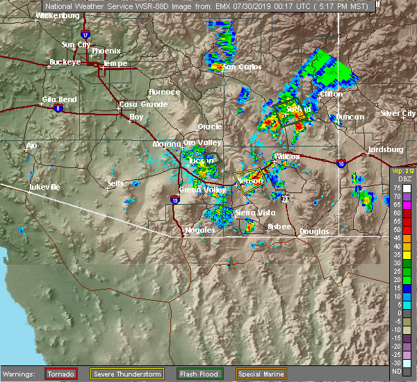
| 7/29/2019 5:57 PM MST |
 The severe thunderstorm warning for south central graham county will expire at 600 pm mst, the storm which prompted the warning near mt. graham has weakened below severe limits, and no longer poses an immediate threat to life or property. therefore, the warning will be allowed to expire. The severe thunderstorm warning for south central graham county will expire at 600 pm mst, the storm which prompted the warning near mt. graham has weakened below severe limits, and no longer poses an immediate threat to life or property. therefore, the warning will be allowed to expire.
|
| 7/29/2019 5:47 PM MST |
 At 546 pm mst, a severe thunderstorm was located near mt. graham or 16 miles southwest of safford, moving southwest at 10 mph (radar indicated). Hazards include 60 mph wind gusts. Expect damage to roofs, siding, and trees. Locations impacted include, safford, thatcher, solomon, roper lake state park, safford regional airport, pima, central, swift trail junction, mount graham and frye mesa dam. At 546 pm mst, a severe thunderstorm was located near mt. graham or 16 miles southwest of safford, moving southwest at 10 mph (radar indicated). Hazards include 60 mph wind gusts. Expect damage to roofs, siding, and trees. Locations impacted include, safford, thatcher, solomon, roper lake state park, safford regional airport, pima, central, swift trail junction, mount graham and frye mesa dam.
|
| 7/29/2019 5:17 PM MST |
 At 514 pm mst, a severe thunderstorm was located near the intersection of highways 191 and u.s. highway 70 to the east of safford and near mt. graham. storms are moving southwest at 10 mph (radar indicated). Hazards include 60 mph wind gusts. expect damage to roofs, siding, and trees At 514 pm mst, a severe thunderstorm was located near the intersection of highways 191 and u.s. highway 70 to the east of safford and near mt. graham. storms are moving southwest at 10 mph (radar indicated). Hazards include 60 mph wind gusts. expect damage to roofs, siding, and trees
|
| 7/29/2019 5:07 PM MST |
 At 504 pm mst, a line of severe thunderstorms were located over the northern portions of safford, extending to the intersection of highways 191 and 70 to the east of safford. additional strong thunderstorms are developing near mt. graham. storms are moving southwest at 10 mph (radar indicated). Hazards include 60 mph wind gusts. Expect damage to roofs, siding, and trees. locations impacted include, safford, thatcher, solomon, roper lake state park, safford regional airport, pima, central and swift trail junction. this includes the following highways, route 70 between mile markers 328 and 357. Route 191 between mile markers 106 and 136. At 504 pm mst, a line of severe thunderstorms were located over the northern portions of safford, extending to the intersection of highways 191 and 70 to the east of safford. additional strong thunderstorms are developing near mt. graham. storms are moving southwest at 10 mph (radar indicated). Hazards include 60 mph wind gusts. Expect damage to roofs, siding, and trees. locations impacted include, safford, thatcher, solomon, roper lake state park, safford regional airport, pima, central and swift trail junction. this includes the following highways, route 70 between mile markers 328 and 357. Route 191 between mile markers 106 and 136.
|
| 7/29/2019 4:46 PM MST |
 At 446 pm mst, a severe thunderstorm was located over safford regional airport, or near safford, moving southwest at 10 mph (radar indicated). Hazards include 60 mph wind gusts. expect damage to roofs, siding, and trees At 446 pm mst, a severe thunderstorm was located over safford regional airport, or near safford, moving southwest at 10 mph (radar indicated). Hazards include 60 mph wind gusts. expect damage to roofs, siding, and trees
|
| 8/14/2018 6:53 PM MST |
 The severe thunderstorm warning for central graham county will expire at 700 pm mst, the storms which prompted the warning have weakened below severe limits, and no longer pose an immediate threat to life or property. therefore, the warning will be allowed to expire. however small hail, gusty winds and heavy rain are still possible with these thunderstorms. The severe thunderstorm warning for central graham county will expire at 700 pm mst, the storms which prompted the warning have weakened below severe limits, and no longer pose an immediate threat to life or property. therefore, the warning will be allowed to expire. however small hail, gusty winds and heavy rain are still possible with these thunderstorms.
|
| 8/14/2018 6:25 PM MST |
 At 624 pm mst, severe thunderstorms were located along a line extending from near safford to 3 miles east of fort thomas, moving southwest at 10 mph (radar indicated). Hazards include 60 mph wind gusts and quarter size hail. Hail damage to vehicles is expected. expect wind damage to roofs, siding, and trees. locations impacted include, safford, thatcher, pima, solomon, fort thomas and swift trail junction. this includes the following highways, route 70 between mile markers 301 and 352. Route 191 between mile markers 115 and 134. At 624 pm mst, severe thunderstorms were located along a line extending from near safford to 3 miles east of fort thomas, moving southwest at 10 mph (radar indicated). Hazards include 60 mph wind gusts and quarter size hail. Hail damage to vehicles is expected. expect wind damage to roofs, siding, and trees. locations impacted include, safford, thatcher, pima, solomon, fort thomas and swift trail junction. this includes the following highways, route 70 between mile markers 301 and 352. Route 191 between mile markers 115 and 134.
|
| 8/14/2018 6:11 PM MST |
 At 609 pm mst, severe thunderstorms were located along a line extending from 6 miles east of safford to 10 miles southwest of bylas, and are nearly stationary (radar indicated). Hazards include 60 mph wind gusts and quarter size hail. Hail damage to vehicles is expected. Expect wind damage to roofs, siding, and trees. At 609 pm mst, severe thunderstorms were located along a line extending from 6 miles east of safford to 10 miles southwest of bylas, and are nearly stationary (radar indicated). Hazards include 60 mph wind gusts and quarter size hail. Hail damage to vehicles is expected. Expect wind damage to roofs, siding, and trees.
|
| 8/14/2018 5:45 PM MST |
 At 545 pm mst, a severe thunderstorm was located near safford, moving southeast at 5 mph (radar indicated). Hazards include 60 mph wind gusts and quarter size hail. Hail damage to vehicles is expected. Expect wind damage to roofs, siding, and trees. At 545 pm mst, a severe thunderstorm was located near safford, moving southeast at 5 mph (radar indicated). Hazards include 60 mph wind gusts and quarter size hail. Hail damage to vehicles is expected. Expect wind damage to roofs, siding, and trees.
|
| 7/19/2018 4:48 PM MST |
 At 447 pm mst, a severe thunderstorm was located 15 miles south of safford, moving northwest at 5 mph (radar indicated). Hazards include 60 mph wind gusts and quarter size hail. Hail damage to vehicles is expected. expect wind damage to roofs, siding, and trees. locations impacted include, swift trail junction, mount graham, fort grant, frye mesa dam and junction of highways 191 and 266. this includes the following highways, route 191 between mile markers 98 and 113. Route 266 between mile markers 105 and 119, and near mile marker 126. At 447 pm mst, a severe thunderstorm was located 15 miles south of safford, moving northwest at 5 mph (radar indicated). Hazards include 60 mph wind gusts and quarter size hail. Hail damage to vehicles is expected. expect wind damage to roofs, siding, and trees. locations impacted include, swift trail junction, mount graham, fort grant, frye mesa dam and junction of highways 191 and 266. this includes the following highways, route 191 between mile markers 98 and 113. Route 266 between mile markers 105 and 119, and near mile marker 126.
|
| 7/19/2018 4:24 PM MST |
 At 423 pm mst, a severe thunderstorm was located 16 miles south of safford, moving northwest at 5 mph (radar indicated). Hazards include 60 mph wind gusts and quarter size hail. Hail damage to vehicles is expected. Expect wind damage to roofs, siding, and trees. At 423 pm mst, a severe thunderstorm was located 16 miles south of safford, moving northwest at 5 mph (radar indicated). Hazards include 60 mph wind gusts and quarter size hail. Hail damage to vehicles is expected. Expect wind damage to roofs, siding, and trees.
|
| 7/29/2017 8:40 PM MST |
 The severe thunderstorm warning for central graham county will expire at 845 pm mst, the storm which prompted the warning has weakened below severe limits, and no longer poses an immediate threat to life or property. therefore the warning will be allowed to expire. however heavy rain is still possible with this thunderstorm. The severe thunderstorm warning for central graham county will expire at 845 pm mst, the storm which prompted the warning has weakened below severe limits, and no longer poses an immediate threat to life or property. therefore the warning will be allowed to expire. however heavy rain is still possible with this thunderstorm.
|
| 7/29/2017 8:27 PM MST |
 At 826 pm mst, a severe thunderstorm was located 7 miles west of safford, and is nearly stationary (radar indicated). Hazards include 60 mph wind gusts. Expect damage to roofs, siding, and trees. Locations impacted include, thatcher and pima. At 826 pm mst, a severe thunderstorm was located 7 miles west of safford, and is nearly stationary (radar indicated). Hazards include 60 mph wind gusts. Expect damage to roofs, siding, and trees. Locations impacted include, thatcher and pima.
|
| 7/29/2017 8:14 PM MST |
 At 814 pm mst, a severe thunderstorm was located near safford, and is nearly stationary (radar indicated). Hazards include 60 mph wind gusts. expect damage to roofs, siding, and trees At 814 pm mst, a severe thunderstorm was located near safford, and is nearly stationary (radar indicated). Hazards include 60 mph wind gusts. expect damage to roofs, siding, and trees
|
| 7/23/2017 4:47 PM MST |
 At 447 pm mst, a severe thunderstorm was near safford, moving west at 20 mph. this storm produced a wind gust to 67 mph at the safford airport at 417 pm (radar indicated). Hazards include wind gusts up to 65 mph, heavy rain and penny size hail. Expect damage to roofs, siding, and trees. Locations impacted include, safford, thatcher and solomon. At 447 pm mst, a severe thunderstorm was near safford, moving west at 20 mph. this storm produced a wind gust to 67 mph at the safford airport at 417 pm (radar indicated). Hazards include wind gusts up to 65 mph, heavy rain and penny size hail. Expect damage to roofs, siding, and trees. Locations impacted include, safford, thatcher and solomon.
|
| 7/23/2017 4:18 PM MST |
 At 417 pm mst, a severe thunderstorm was located near safford, moving west at 20 mph (radar indicated). Hazards include 60 mph wind gusts, penny size hail and heavy rain. expect damage to roofs, siding, and trees At 417 pm mst, a severe thunderstorm was located near safford, moving west at 20 mph (radar indicated). Hazards include 60 mph wind gusts, penny size hail and heavy rain. expect damage to roofs, siding, and trees
|
| 7/17/2017 3:40 PM MST |
 At 339 pm mst, a severe thunderstorm was located near safford, moving northwest at 20 mph (radar indicated). Hazards include 60 mph wind gusts. expect damage to roofs, siding, and trees At 339 pm mst, a severe thunderstorm was located near safford, moving northwest at 20 mph (radar indicated). Hazards include 60 mph wind gusts. expect damage to roofs, siding, and trees
|
| 11/4/2016 12:27 PM MST |
 The severe thunderstorm warning for central graham county will expire at 1230 pm mst, the storm which prompted the warning west and northwest of safford has weakened below severe limits, and no longer poses a threat. therefore the warning will be allowed to expire. The severe thunderstorm warning for central graham county will expire at 1230 pm mst, the storm which prompted the warning west and northwest of safford has weakened below severe limits, and no longer poses a threat. therefore the warning will be allowed to expire.
|
| 11/4/2016 11:58 AM MST |
 At 1156 am mst, doppler radar continued to indicate a severe thunderstorm capable of producing large hail up to ping pong ball size and damaging winds in excess of 60 mph. this storm was located just northwest of safford near pima, moving north at 10 to 15 mph. this warning is an extension of the previous warning over the same area. At 1156 am mst, doppler radar continued to indicate a severe thunderstorm capable of producing large hail up to ping pong ball size and damaging winds in excess of 60 mph. this storm was located just northwest of safford near pima, moving north at 10 to 15 mph. this warning is an extension of the previous warning over the same area.
|
| 11/4/2016 11:45 AM MST |
 At 1144 am mst, doppler radar indicated a severe thunderstorm capable of producing large hail up to ping pong ball size and damaging winds in excess of 60 mph. this storm was located near safford, moving north at 10 mph. locations impacted include, safford, thatcher, pima. At 1144 am mst, doppler radar indicated a severe thunderstorm capable of producing large hail up to ping pong ball size and damaging winds in excess of 60 mph. this storm was located near safford, moving north at 10 mph. locations impacted include, safford, thatcher, pima.
|
| 11/4/2016 11:29 AM MST |
 At 1128 am mst, doppler radar indicated a severe thunderstorm capable of producing quarter size hail and damaging winds in excess of 60 mph. this storm was located near safford and thatcher, and moving north at 15 mph. At 1128 am mst, doppler radar indicated a severe thunderstorm capable of producing quarter size hail and damaging winds in excess of 60 mph. this storm was located near safford and thatcher, and moving north at 15 mph.
|
| 10/8/2016 11:57 PM MST |
 The severe thunderstorm warning for central graham county will expire at midnight mst, the storm which prompted the warning has weakened below severe limits, and no longer poses an immediate threat to life or property. therefore the warning will be allowed to expire. however small hail and heavy rain are still possible with this thunderstorm. The severe thunderstorm warning for central graham county will expire at midnight mst, the storm which prompted the warning has weakened below severe limits, and no longer poses an immediate threat to life or property. therefore the warning will be allowed to expire. however small hail and heavy rain are still possible with this thunderstorm.
|
| 10/8/2016 11:37 PM MST |
 At 1136 pm mst, doppler radar indicated a severe thunderstorm capable of producing half dollar size hail and damaging winds in excess of 60 mph. this storm was located near solomon, or 5 miles east of safford moving east at 10 mph. locations impacted include, safford, thatcher, solomon and swift trail junction. At 1136 pm mst, doppler radar indicated a severe thunderstorm capable of producing half dollar size hail and damaging winds in excess of 60 mph. this storm was located near solomon, or 5 miles east of safford moving east at 10 mph. locations impacted include, safford, thatcher, solomon and swift trail junction.
|
| 10/8/2016 11:24 PM MST |
 At 1121 pm mst, doppler radar indicated a severe thunderstorm capable of producing half dollar size hail and damaging winds in excess of 60 mph. this storm was located over safford, and moving northeast at 5 mph. the strongest portion of this storm was located near the intersection of solomon road and barney lane. this warning extendeds the severe thunderstorm warning for the same location. At 1121 pm mst, doppler radar indicated a severe thunderstorm capable of producing half dollar size hail and damaging winds in excess of 60 mph. this storm was located over safford, and moving northeast at 5 mph. the strongest portion of this storm was located near the intersection of solomon road and barney lane. this warning extendeds the severe thunderstorm warning for the same location.
|
| 10/8/2016 11:06 PM MST |
 At 1103 pm mst, doppler radar indicated a severe thunderstorm capable of producing quarter size hail and damaging winds in excess of 60 mph. this storm was located over safford, moving northeast at 5 mph. the strongest portion of this storm is near and west of the intersection of solomon road and highway 191. locations impacted include, safford, thatcher, frye mesa dam, solomon and swift trail junction. At 1103 pm mst, doppler radar indicated a severe thunderstorm capable of producing quarter size hail and damaging winds in excess of 60 mph. this storm was located over safford, moving northeast at 5 mph. the strongest portion of this storm is near and west of the intersection of solomon road and highway 191. locations impacted include, safford, thatcher, frye mesa dam, solomon and swift trail junction.
|
| 10/8/2016 10:46 PM MST |
 At 1046 pm mst, doppler radar indicated a severe thunderstorm capable of producing quarter size hail and damaging winds in excess of 60 mph. this storm was located over safford, and moving northeast at 5 mph. At 1046 pm mst, doppler radar indicated a severe thunderstorm capable of producing quarter size hail and damaging winds in excess of 60 mph. this storm was located over safford, and moving northeast at 5 mph.
|
| 8/13/2016 4:38 PM MST |
 The severe thunderstorm warning for south central graham county will expire at 445 pm mst, the storm which prompted the warning has weakened below severe limits, and no longer poses an immediate threat to life or property. therefore the warning will be allowed to expire. however gusty winds are still possible with this thunderstorm. The severe thunderstorm warning for south central graham county will expire at 445 pm mst, the storm which prompted the warning has weakened below severe limits, and no longer poses an immediate threat to life or property. therefore the warning will be allowed to expire. however gusty winds are still possible with this thunderstorm.
|
| 8/13/2016 4:20 PM MST |
 At 420 pm mst, doppler radar indicated a severe thunderstorm capable of producing damaging winds in excess of 60 mph. this storm was located near safford, moving southwest at 20 mph. locations impacted include, safford, thatcher, pima, fort thomas, solomon, swift trail junction and frye mesa dam. At 420 pm mst, doppler radar indicated a severe thunderstorm capable of producing damaging winds in excess of 60 mph. this storm was located near safford, moving southwest at 20 mph. locations impacted include, safford, thatcher, pima, fort thomas, solomon, swift trail junction and frye mesa dam.
|
| 8/13/2016 4:01 PM MST |
 At 401 pm mst, doppler radar indicated a severe thunderstorm capable of producing damaging winds in excess of 60 mph. this storm was located near safford, and moving southwest at 20 mph. At 401 pm mst, doppler radar indicated a severe thunderstorm capable of producing damaging winds in excess of 60 mph. this storm was located near safford, and moving southwest at 20 mph.
|
| 7/27/2016 3:34 PM MST |
 At 334 pm mst, doppler radar indicated a severe thunderstorm capable of producing quarter size hail and damaging winds in excess of 60 mph. this storm was located 25 miles northwest of safford, and moving southwest at 25 mph. At 334 pm mst, doppler radar indicated a severe thunderstorm capable of producing quarter size hail and damaging winds in excess of 60 mph. this storm was located 25 miles northwest of safford, and moving southwest at 25 mph.
|
| 7/27/2016 2:40 PM MST |
 At 239 pm mst, doppler radar indicated a severe thunderstorm capable of producing damaging winds in excess of 60 mph. this storm was located near safford, moving southwest at 25 mph. locations impacted include, safford, thatcher, pima, solomon and swift trail junction. At 239 pm mst, doppler radar indicated a severe thunderstorm capable of producing damaging winds in excess of 60 mph. this storm was located near safford, moving southwest at 25 mph. locations impacted include, safford, thatcher, pima, solomon and swift trail junction.
|
| 7/27/2016 2:13 PM MST |
 At 213 pm mst, doppler radar indicated a severe thunderstorm capable of producing damaging winds in excess of 60 mph. this storm was located 13 miles west of morenci, or 13 miles northeast of safford, and moving southwest at 25 mph. At 213 pm mst, doppler radar indicated a severe thunderstorm capable of producing damaging winds in excess of 60 mph. this storm was located 13 miles west of morenci, or 13 miles northeast of safford, and moving southwest at 25 mph.
|
| 10/21/2015 2:16 AM MST |
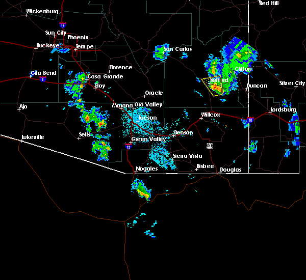 At 215 am mst, doppler radar indicated a severe thunderstorm capable of producing quarter size hail and damaging winds in excess of 60 mph. this storm was located south of solomon, moving north at 30 mph. locations impacted include, safford, thatcher, pima, solomon and swift trail junction. At 215 am mst, doppler radar indicated a severe thunderstorm capable of producing quarter size hail and damaging winds in excess of 60 mph. this storm was located south of solomon, moving north at 30 mph. locations impacted include, safford, thatcher, pima, solomon and swift trail junction.
|
| 10/21/2015 2:00 AM MST |
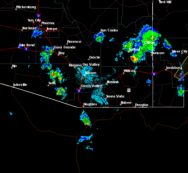 At 158 am mst, doppler radar indicated a severe thunderstorm capable of producing quarter size hail and wind gusts up to 60 mph. this storm was located near junction of highways 191 and 266, and moving north at 30 mph. At 158 am mst, doppler radar indicated a severe thunderstorm capable of producing quarter size hail and wind gusts up to 60 mph. this storm was located near junction of highways 191 and 266, and moving north at 30 mph.
|
| 8/25/2015 4:45 PM MST |
 At 445 pm mst, doppler radar indicated a severe thunderstorm capable of producing damaging winds in excess of 60 mph. this storm was located over pima, and moving north at 15 mph. At 445 pm mst, doppler radar indicated a severe thunderstorm capable of producing damaging winds in excess of 60 mph. this storm was located over pima, and moving north at 15 mph.
|
| 8/11/2015 6:42 PM MST | The severe thunderstorm warning for central graham county will expire at 645 pm mst, the storm which prompted the warning has weakened below severe limits, and no longer poses an immediate threat to life or property. therefore the warning will be allowed to expire. |
| 8/11/2015 5:59 PM MST |
 At 558 pm mst, doppler radar indicated a severe thunderstorm capable of producing damaging winds in excess of 60 mph. this storm was located just southeast of safford, and moving northwest at 15 mph. At 558 pm mst, doppler radar indicated a severe thunderstorm capable of producing damaging winds in excess of 60 mph. this storm was located just southeast of safford, and moving northwest at 15 mph.
|
| 8/11/2015 5:50 PM MST |
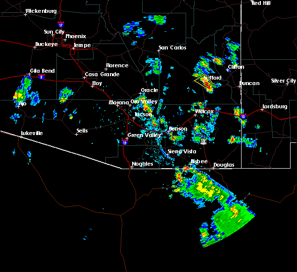 At 550 pm mst, doppler radar indicated a severe thunderstorm capable of producing damaging winds in excess of 60 mph. this storm was located over safford, moving northwest at 15 mph. locations impacted include, safford, thatcher and solomon. At 550 pm mst, doppler radar indicated a severe thunderstorm capable of producing damaging winds in excess of 60 mph. this storm was located over safford, moving northwest at 15 mph. locations impacted include, safford, thatcher and solomon.
|
| 8/11/2015 5:32 PM MST |
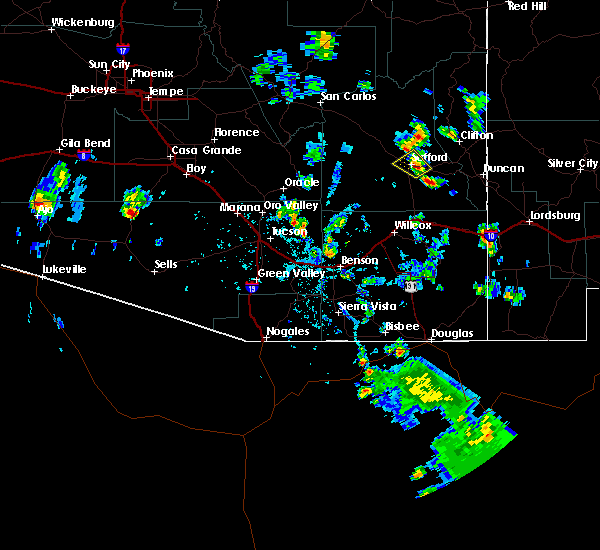 At 531 pm mst, doppler radar indicated a severe thunderstorm capable of producing damaging winds in excess of 60 mph. this storm was located over solomon, and moving northwest at 15 mph. At 531 pm mst, doppler radar indicated a severe thunderstorm capable of producing damaging winds in excess of 60 mph. this storm was located over solomon, and moving northwest at 15 mph.
|
| 7/12/2015 2:59 PM MST |
 At 257 pm mst, doppler radar indicated a severe thunderstorm capable of producing quarter size hail and damaging winds in excess of 60 mph. this storm was located near and over mount graham, moving north at 15 mph. additional strong stroms to the northwest of this storm are developing and may become severe by 315 pm mst. locations impacted include, frye mesa dam, mount graham, fort grant and swift trail junction. At 257 pm mst, doppler radar indicated a severe thunderstorm capable of producing quarter size hail and damaging winds in excess of 60 mph. this storm was located near and over mount graham, moving north at 15 mph. additional strong stroms to the northwest of this storm are developing and may become severe by 315 pm mst. locations impacted include, frye mesa dam, mount graham, fort grant and swift trail junction.
|
| 7/12/2015 2:28 PM MST |
 At 227 pm mst, doppler radar indicated a severe thunderstorm capable of producing quarter size hail and destructive winds in excess of 70 mph. this storm was located over fort grant, and moving north at 15 mph. At 227 pm mst, doppler radar indicated a severe thunderstorm capable of producing quarter size hail and destructive winds in excess of 70 mph. this storm was located over fort grant, and moving north at 15 mph.
|
| 6/24/2015 3:46 PM MST |
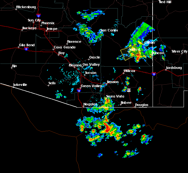 At 345 pm mst, doppler radar indicated a severe thunderstorm capable of producing damaging winds in excess of 60 mph. this storm was located over solomon, moving southwest at 30 mph. locations impacted include, safford, thatcher, pima, frye mesa dam, solomon and swift trail junction. At 345 pm mst, doppler radar indicated a severe thunderstorm capable of producing damaging winds in excess of 60 mph. this storm was located over solomon, moving southwest at 30 mph. locations impacted include, safford, thatcher, pima, frye mesa dam, solomon and swift trail junction.
|
| 6/24/2015 3:27 PM MST |
 At 327 pm mst, doppler radar indicated a severe thunderstorm capable of producing damaging winds in excess of 60 mph. this storm was located near solomon, and moving west at 30 mph. At 327 pm mst, doppler radar indicated a severe thunderstorm capable of producing damaging winds in excess of 60 mph. this storm was located near solomon, and moving west at 30 mph.
|
Hail Maps for Thatcher, AZ
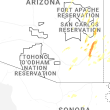


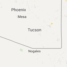


Connect with Interactive Hail Maps