

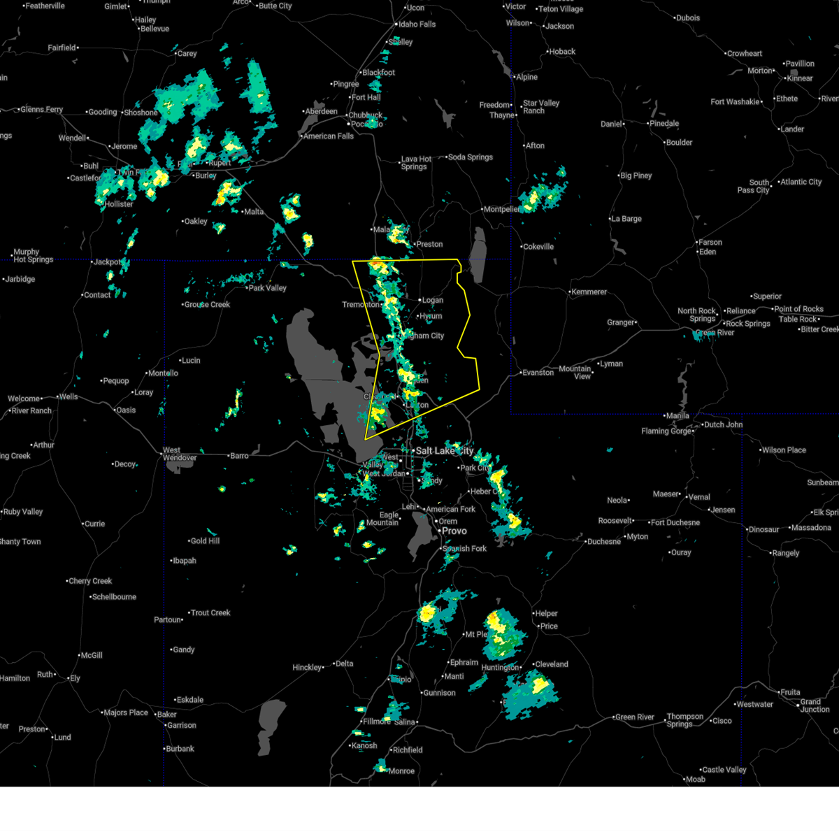
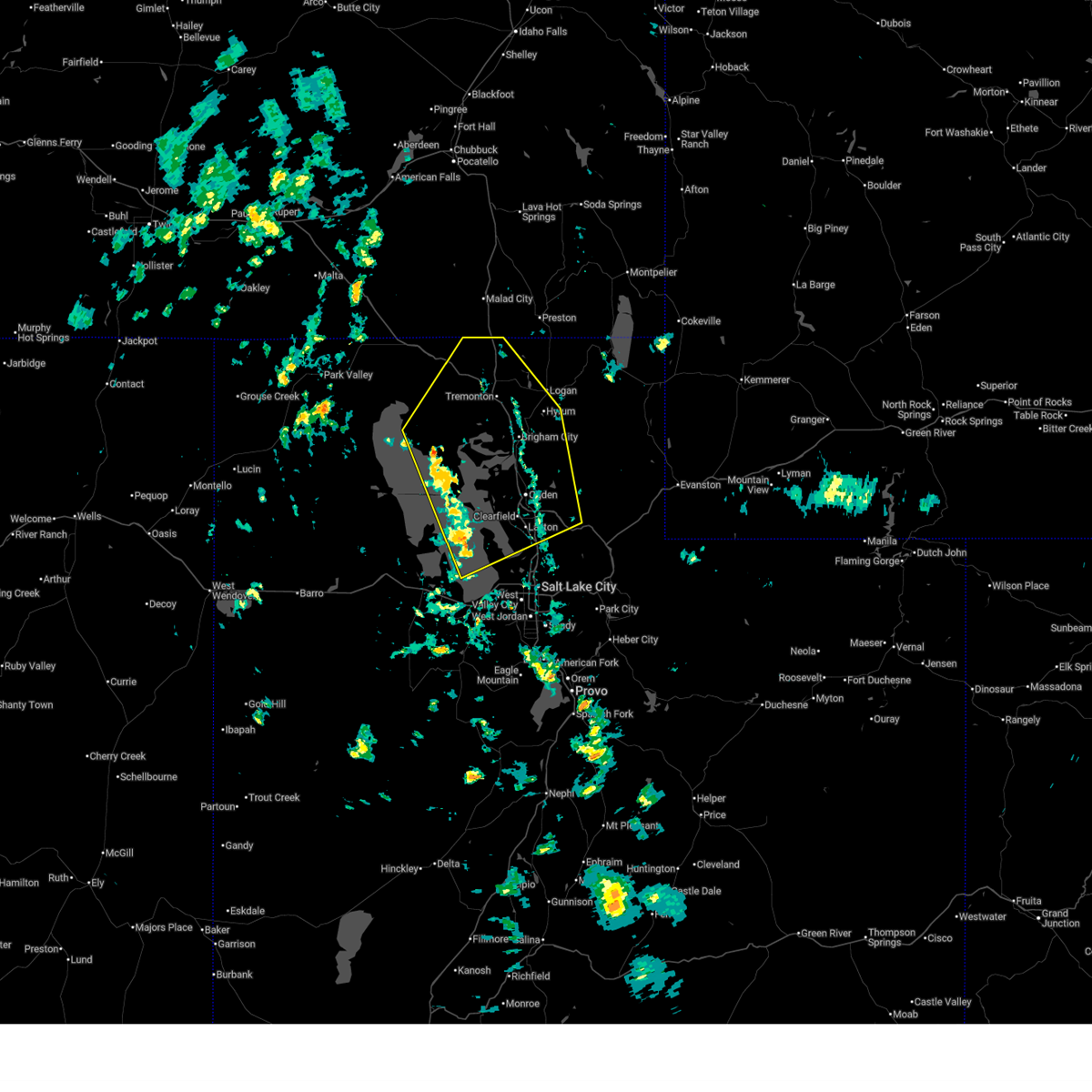
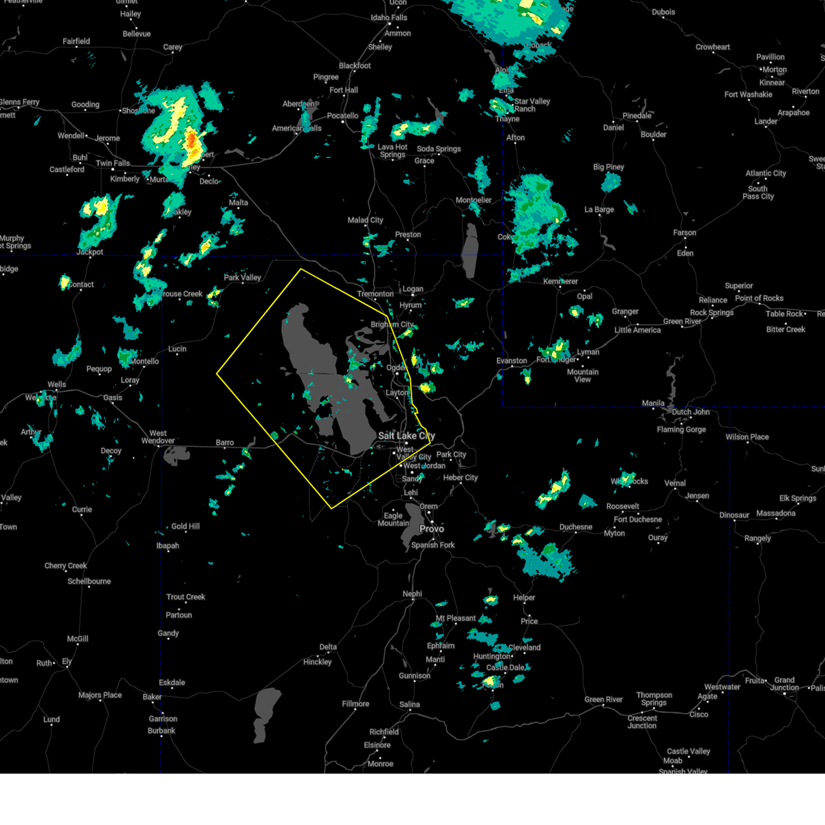
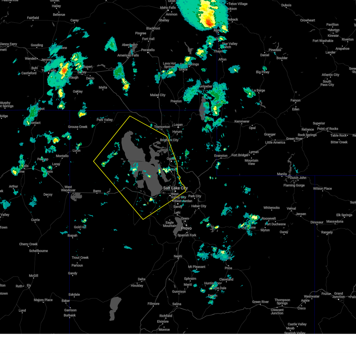
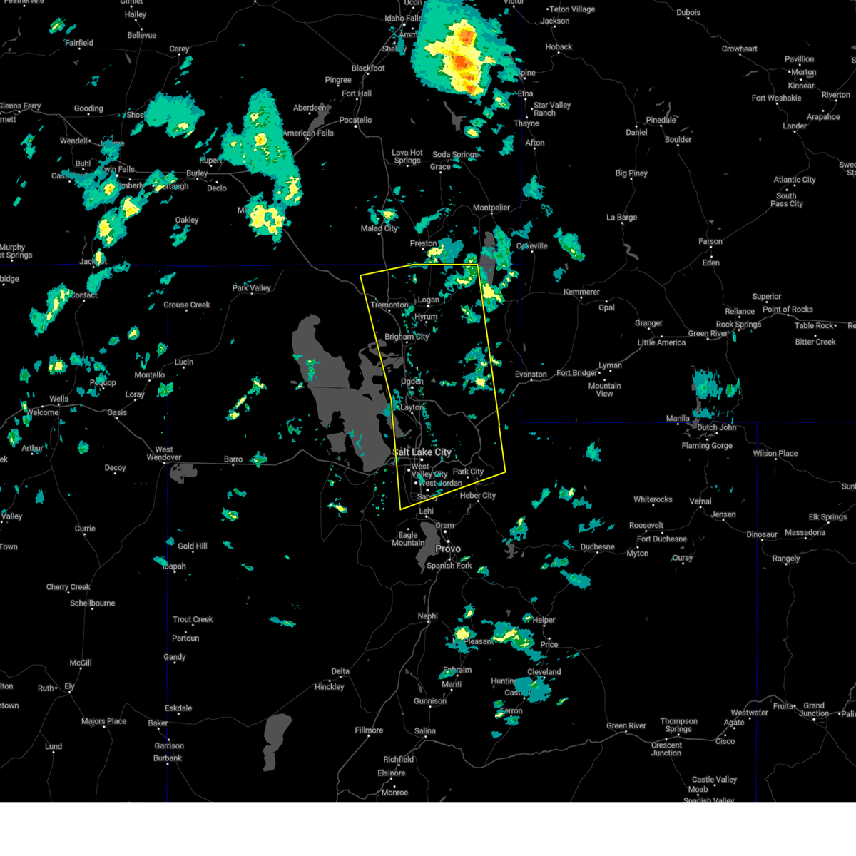
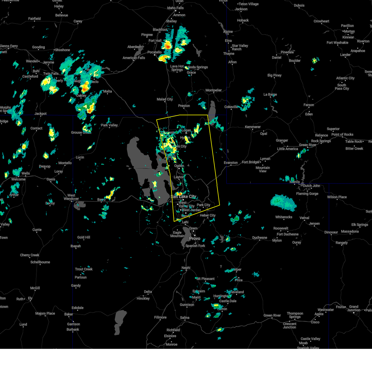
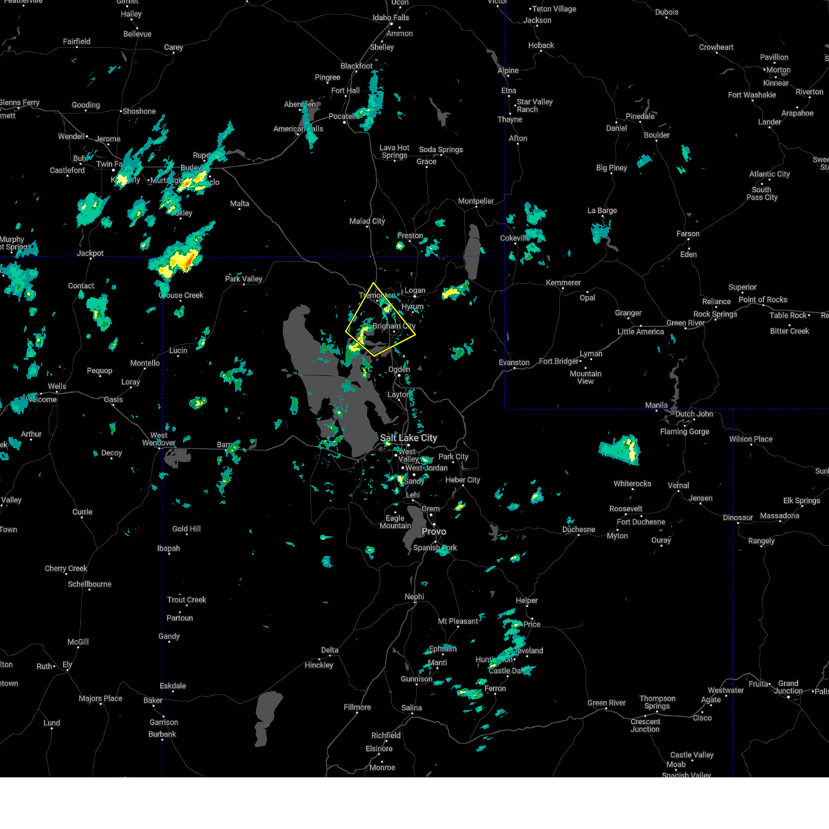
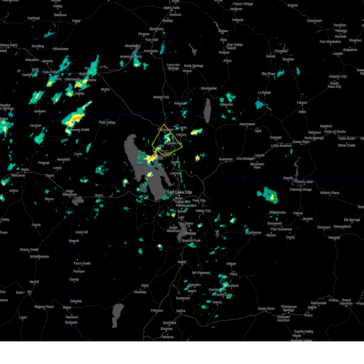
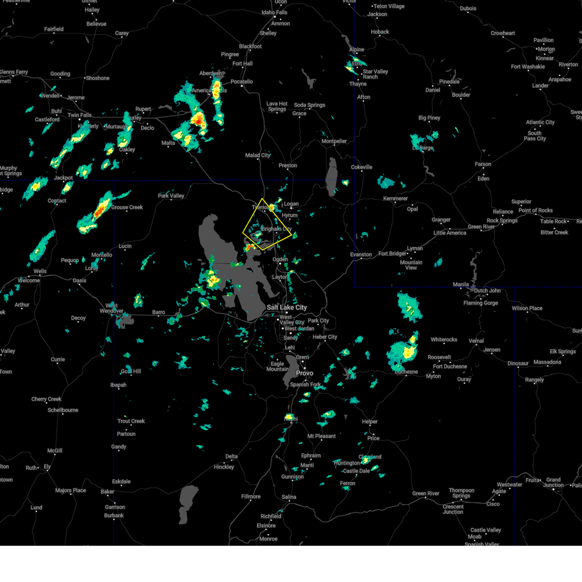
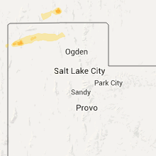
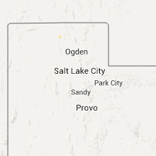
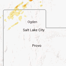
Hail Map for Thatcher, UT
The Thatcher, UT area has had 0 reports of on-the-ground hail by trained spotters, and has been under severe weather warnings 2 times during the past 12 months. Doppler radar has detected hail at or near Thatcher, UT on 17 occasions.
| Name: | Thatcher, UT |
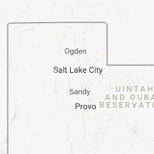
| Where Located: | 67.2 miles NNW of Salt Lake City, UT |
| Map: | Google Map for Thatcher, UT |
| Population: | 789 |
| Housing Units: | 230 |
| More Info: | Search Google for Thatcher, UT |
5
The Top Recent Hail Date for Thatcher, UT is Tuesday, August 2, 2022 (1st out of 17)
Hail and Wind Damage Spotted near Thatcher, UT
| Date / Time | Report Details |
|---|---|
| 5/13/2026 3:44 PM MDT |
 Svrslc the national weather service in salt lake city has issued a * severe thunderstorm warning for, weber county in northern utah, cache county in northern utah, northeastern box elder county in northern utah, eastern davis county in northern utah, central morgan county in northern utah, * until 430 pm mdt. * at 343 pm mdt, elevated thunderstorms with a history of producing gusty and erratic outflow winds in excess to 70 mph were located along a line extending from near plymouth to near ogden, moving northeast at 50 mph (radar indicated). Hazards include 70 mph wind gusts. Expect considerable tree damage. Damage is likely to mobile homes, roofs, and outbuildings. Svrslc the national weather service in salt lake city has issued a * severe thunderstorm warning for, weber county in northern utah, cache county in northern utah, northeastern box elder county in northern utah, eastern davis county in northern utah, central morgan county in northern utah, * until 430 pm mdt. * at 343 pm mdt, elevated thunderstorms with a history of producing gusty and erratic outflow winds in excess to 70 mph were located along a line extending from near plymouth to near ogden, moving northeast at 50 mph (radar indicated). Hazards include 70 mph wind gusts. Expect considerable tree damage. Damage is likely to mobile homes, roofs, and outbuildings.
|
| 5/13/2026 3:04 PM MDT |
 Svrslc the national weather service in salt lake city has issued a * severe thunderstorm warning for, weber county in northern utah, western cache county in northern utah, eastern box elder county in northern utah, davis county in northern utah, west central morgan county in northern utah, northeastern tooele county in northern utah, * until 345 pm mdt. * at 302 pm mdt, elevated thunderstorms with a history of producing gusty and erratic outflow winds in excess of 60 mph were located along a line extending from 15 miles east of great salt lake north of the causeway to 7 miles east of great salt lake south of the causeway, moving northeast at 45 mph (radar indicated). Hazards include 60 mph wind gusts. expect damage to roofs, siding, and trees Svrslc the national weather service in salt lake city has issued a * severe thunderstorm warning for, weber county in northern utah, western cache county in northern utah, eastern box elder county in northern utah, davis county in northern utah, west central morgan county in northern utah, northeastern tooele county in northern utah, * until 345 pm mdt. * at 302 pm mdt, elevated thunderstorms with a history of producing gusty and erratic outflow winds in excess of 60 mph were located along a line extending from 15 miles east of great salt lake north of the causeway to 7 miles east of great salt lake south of the causeway, moving northeast at 45 mph (radar indicated). Hazards include 60 mph wind gusts. expect damage to roofs, siding, and trees
|
| 5/11/2025 3:45 PM MDT |
 At 344 pm mdt, severe thunderstorms were located along a line extending from 9 miles south of snowville to near east canyon state park, moving east at 45 mph (radar indicated). Hazards include 70 mph wind gusts. Expect considerable tree damage. damage is likely to mobile homes, roofs, and outbuildings. Locations impacted include, salt lake city, west valley city, ogden, layton, murray, bountiful, tooele, farmington, brigham city, grantsville, hill air force base, west jordan, taylorsville, roy, clearfield, kaysville, syracuse, south salt lake, clinton, and north ogden. At 344 pm mdt, severe thunderstorms were located along a line extending from 9 miles south of snowville to near east canyon state park, moving east at 45 mph (radar indicated). Hazards include 70 mph wind gusts. Expect considerable tree damage. damage is likely to mobile homes, roofs, and outbuildings. Locations impacted include, salt lake city, west valley city, ogden, layton, murray, bountiful, tooele, farmington, brigham city, grantsville, hill air force base, west jordan, taylorsville, roy, clearfield, kaysville, syracuse, south salt lake, clinton, and north ogden.
|
| 5/11/2025 3:14 PM MDT |
 Svrslc the national weather service in salt lake city has issued a * severe thunderstorm warning for, western weber county in northern utah, central box elder county in northern utah, northern salt lake county in northern utah, davis county in northern utah, west central morgan county in northern utah, northeastern tooele county in northern utah, * until 400 pm mdt. * at 311 pm mdt, severe thunderstorms were located along a line extending from 20 miles northwest of great salt lake north of the causeway to salt lake valley, moving northeast at 40 mph. widespread gusts in excess of 60 mph have been observed, including isolated gusts up to 75 mph (radar indicated). Hazards include 70 mph wind gusts. Expect considerable tree damage. Damage is likely to mobile homes, roofs, and outbuildings. Svrslc the national weather service in salt lake city has issued a * severe thunderstorm warning for, western weber county in northern utah, central box elder county in northern utah, northern salt lake county in northern utah, davis county in northern utah, west central morgan county in northern utah, northeastern tooele county in northern utah, * until 400 pm mdt. * at 311 pm mdt, severe thunderstorms were located along a line extending from 20 miles northwest of great salt lake north of the causeway to salt lake valley, moving northeast at 40 mph. widespread gusts in excess of 60 mph have been observed, including isolated gusts up to 75 mph (radar indicated). Hazards include 70 mph wind gusts. Expect considerable tree damage. Damage is likely to mobile homes, roofs, and outbuildings.
|
| 5/11/2025 2:46 PM MDT |
 The storms which prompted the warning have moved out of the area. therefore, the warning has been allowed to expire. a severe thunderstorm watch remains in effect until 800 pm mdt for northern utah. The storms which prompted the warning have moved out of the area. therefore, the warning has been allowed to expire. a severe thunderstorm watch remains in effect until 800 pm mdt for northern utah.
|
| 5/11/2025 2:00 PM MDT |
 Svrslc the national weather service in salt lake city has issued a * severe thunderstorm warning for, weber county in northern utah, cache county in northern utah, northeastern box elder county in northern utah, western rich county in northern utah, northwestern wasatch county in northern utah, salt lake county in northern utah, eastern davis county in northern utah, morgan county in northern utah, western summit county in northern utah, northwestern utah county in northern utah, * until 245 pm mdt. * at 159 pm mdt, severe thunderstorms were located along a line extending from near riverside to near bluffdale, moving northeast at 40 mph. gusts up to 70 mph have been observed (radar indicated). Hazards include 70 mph wind gusts. Expect considerable tree damage. Damage is likely to mobile homes, roofs, and outbuildings. Svrslc the national weather service in salt lake city has issued a * severe thunderstorm warning for, weber county in northern utah, cache county in northern utah, northeastern box elder county in northern utah, western rich county in northern utah, northwestern wasatch county in northern utah, salt lake county in northern utah, eastern davis county in northern utah, morgan county in northern utah, western summit county in northern utah, northwestern utah county in northern utah, * until 245 pm mdt. * at 159 pm mdt, severe thunderstorms were located along a line extending from near riverside to near bluffdale, moving northeast at 40 mph. gusts up to 70 mph have been observed (radar indicated). Hazards include 70 mph wind gusts. Expect considerable tree damage. Damage is likely to mobile homes, roofs, and outbuildings.
|
| 5/11/2025 1:41 PM MDT |
 The storm which prompted the warning has moved out of the area. therefore, the warning will be allowed to expire. however gusty winds are still possible with this thunderstorm. a severe thunderstorm watch remains in effect until 800 pm mdt for northern utah. remember, a severe thunderstorm warning still remains in effect for box elder county. The storm which prompted the warning has moved out of the area. therefore, the warning will be allowed to expire. however gusty winds are still possible with this thunderstorm. a severe thunderstorm watch remains in effect until 800 pm mdt for northern utah. remember, a severe thunderstorm warning still remains in effect for box elder county.
|
| 5/11/2025 1:29 PM MDT |
 At 129 pm mdt, a severe thunderstorm was located near wellsville, or 8 miles southwest of logan, moving northeast at 45 mph (radar indicated). Hazards include 60 mph wind gusts. Expect damage to roofs, siding, and trees. Locations impacted include, brigham city, tremonton, perry, wellsville, willard, bear river city, mantua, corinne, riverside, garland, honeyville, elwood, deweyville, penrose, bothwell, mantua reservoir, and bear river. At 129 pm mdt, a severe thunderstorm was located near wellsville, or 8 miles southwest of logan, moving northeast at 45 mph (radar indicated). Hazards include 60 mph wind gusts. Expect damage to roofs, siding, and trees. Locations impacted include, brigham city, tremonton, perry, wellsville, willard, bear river city, mantua, corinne, riverside, garland, honeyville, elwood, deweyville, penrose, bothwell, mantua reservoir, and bear river.
|
| 5/11/2025 1:09 PM MDT |
 Svrslc the national weather service in salt lake city has issued a * severe thunderstorm warning for, southwestern cache county in northern utah, east central box elder county in northern utah, * until 145 pm mdt. * at 107 pm mdt, a severe thunderstorm was located near corinne, or 9 miles west of brigham city, moving northeast at 45 mph. gusts to 65 mph have been observed with this storm (radar indicated). Hazards include 65 mph wind gusts. expect damage to roofs, siding, and trees Svrslc the national weather service in salt lake city has issued a * severe thunderstorm warning for, southwestern cache county in northern utah, east central box elder county in northern utah, * until 145 pm mdt. * at 107 pm mdt, a severe thunderstorm was located near corinne, or 9 miles west of brigham city, moving northeast at 45 mph. gusts to 65 mph have been observed with this storm (radar indicated). Hazards include 65 mph wind gusts. expect damage to roofs, siding, and trees
|
| 3/2/2024 12:10 PM MST |
 The storms which prompted the warning have moved out of the area. therefore, the warning will be allowed to expire. remember, a severe thunderstorm warning still remains in effect for portions of cache, rich, and weber counties. The storms which prompted the warning have moved out of the area. therefore, the warning will be allowed to expire. remember, a severe thunderstorm warning still remains in effect for portions of cache, rich, and weber counties.
|
| 3/2/2024 11:53 AM MST |
 At 1153 am mst, severe thunderstorms were located along a line extending from 6 miles east of howell to 6 miles west of corinne to 6 miles north of great salt lake south of the causeway, moving northeast at 45 mph (radar indicated). Hazards include 60 mph wind gusts. Expect damage to roofs, siding, and trees. locations impacted include, brigham city, tremonton, cache, hooper, perry, willard, marriott-slaterville, bear river city, corinne, plymouth, howell, great salt lake south of the causeway, riverside, south willard, peter, west point, plain city, garland, honeyville, and elwood. this includes the following highways, interstate 15 between mile markers 355 and 395. Interstate 84 between mile markers 27 and 42. At 1153 am mst, severe thunderstorms were located along a line extending from 6 miles east of howell to 6 miles west of corinne to 6 miles north of great salt lake south of the causeway, moving northeast at 45 mph (radar indicated). Hazards include 60 mph wind gusts. Expect damage to roofs, siding, and trees. locations impacted include, brigham city, tremonton, cache, hooper, perry, willard, marriott-slaterville, bear river city, corinne, plymouth, howell, great salt lake south of the causeway, riverside, south willard, peter, west point, plain city, garland, honeyville, and elwood. this includes the following highways, interstate 15 between mile markers 355 and 395. Interstate 84 between mile markers 27 and 42.
|
| 3/2/2024 11:30 AM MST |
 Svrslc the national weather service in salt lake city has issued a * severe thunderstorm warning for, southwestern weber county in northern utah, eastern box elder county in northern utah, northwestern davis county in northern utah, north central tooele county in northern utah, * until 1215 pm mst. * at 1128 am mst, severe thunderstorms were located along a line extending from 9 miles southwest of howell to 13 miles east of great salt lake north of the causeway to 14 miles west of great salt lake south of the causeway, moving northeast at 45 mph (mesonet reported. 1119 am mst marsh upr site reported sustained winds of 52 mph gusting to 73 mph). Hazards include 70 mph wind gusts. Expect considerable tree damage. Damage is likely to mobile homes, roofs, and outbuildings. Svrslc the national weather service in salt lake city has issued a * severe thunderstorm warning for, southwestern weber county in northern utah, eastern box elder county in northern utah, northwestern davis county in northern utah, north central tooele county in northern utah, * until 1215 pm mst. * at 1128 am mst, severe thunderstorms were located along a line extending from 9 miles southwest of howell to 13 miles east of great salt lake north of the causeway to 14 miles west of great salt lake south of the causeway, moving northeast at 45 mph (mesonet reported. 1119 am mst marsh upr site reported sustained winds of 52 mph gusting to 73 mph). Hazards include 70 mph wind gusts. Expect considerable tree damage. Damage is likely to mobile homes, roofs, and outbuildings.
|
| 9/3/2023 5:26 PM MDT |
 The severe thunderstorm warning for eastern box elder county will expire at 530 pm mdt, the storms which prompted the warning have weakened below severe limits, and no longer pose an immediate threat to life or property. therefore, the warning will be allowed to expire. a severe thunderstorm watch remains in effect until 900 pm mdt for northern utah. The severe thunderstorm warning for eastern box elder county will expire at 530 pm mdt, the storms which prompted the warning have weakened below severe limits, and no longer pose an immediate threat to life or property. therefore, the warning will be allowed to expire. a severe thunderstorm watch remains in effect until 900 pm mdt for northern utah.
|
| 9/3/2023 5:10 PM MDT |
 At 510 pm mdt, severe thunderstorms were located along a line extending from 24 miles southwest of howell to 9 miles east of great salt lake north of the causeway, moving northeast at 40 mph (radar indicated). Hazards include 60 mph wind gusts and quarter size hail. Hail damage to vehicles is expected. expect wind damage to roofs, siding, and trees. locations impacted include, brigham city, perry, willard, corinne, howell, great salt lake north of the causeway, promontory, penrose and golden spike historic site. this includes interstate 15 between mile markers 358 and 365. hail threat, radar indicated max hail size, 1. 00 in wind threat, observed max wind gust, 60 mph. At 510 pm mdt, severe thunderstorms were located along a line extending from 24 miles southwest of howell to 9 miles east of great salt lake north of the causeway, moving northeast at 40 mph (radar indicated). Hazards include 60 mph wind gusts and quarter size hail. Hail damage to vehicles is expected. expect wind damage to roofs, siding, and trees. locations impacted include, brigham city, perry, willard, corinne, howell, great salt lake north of the causeway, promontory, penrose and golden spike historic site. this includes interstate 15 between mile markers 358 and 365. hail threat, radar indicated max hail size, 1. 00 in wind threat, observed max wind gust, 60 mph.
|
| 9/3/2023 4:45 PM MDT |
 At 445 pm mdt, severe thunderstorms were located along a line extending from 26 miles southeast of park valley to 7 miles south of great salt lake north of the causeway, moving northeast at 40 mph (radar indicated). Hazards include 60 mph wind gusts and quarter size hail. Hail damage to vehicles is expected. Expect wind damage to roofs, siding, and trees. At 445 pm mdt, severe thunderstorms were located along a line extending from 26 miles southeast of park valley to 7 miles south of great salt lake north of the causeway, moving northeast at 40 mph (radar indicated). Hazards include 60 mph wind gusts and quarter size hail. Hail damage to vehicles is expected. Expect wind damage to roofs, siding, and trees.
|
| 8/2/2023 5:23 PM MDT |
 The severe thunderstorm warning for southwestern weber, southeastern box elder, northwestern davis and northeastern tooele counties will expire at 530 pm mdt, the storm which prompted the warning has weakened below severe limits, and no longer poses an immediate threat to life or property. therefore, the warning will be allowed to expire. The severe thunderstorm warning for southwestern weber, southeastern box elder, northwestern davis and northeastern tooele counties will expire at 530 pm mdt, the storm which prompted the warning has weakened below severe limits, and no longer poses an immediate threat to life or property. therefore, the warning will be allowed to expire.
|
| 8/2/2023 5:05 PM MDT |
 At 505 pm mdt, a severe thunderstorm was located near great salt lake south of the causeway, or 26 miles west of hill air force base, moving north at 25 mph (radar indicated). Hazards include 60 mph wind gusts. Expect damage to roofs, siding, and trees. locations impacted include, great salt lake south of the causeway, great salt lake north of the causeway, hat island, promontory, lakeside, gunnison island, golden spike historic site and antelope island state park. hail threat, radar indicated max hail size, <. 75 in wind threat, radar indicated max wind gust, 60 mph. At 505 pm mdt, a severe thunderstorm was located near great salt lake south of the causeway, or 26 miles west of hill air force base, moving north at 25 mph (radar indicated). Hazards include 60 mph wind gusts. Expect damage to roofs, siding, and trees. locations impacted include, great salt lake south of the causeway, great salt lake north of the causeway, hat island, promontory, lakeside, gunnison island, golden spike historic site and antelope island state park. hail threat, radar indicated max hail size, <. 75 in wind threat, radar indicated max wind gust, 60 mph.
|
| 8/2/2023 4:45 PM MDT |
 At 444 pm mdt, severe thunderstorms were located along a line extending from 18 miles west of great salt lake south of the causeway to 9 miles west of syracuse, moving northwest at 40 mph (radar indicated). Hazards include 70 mph wind gusts. Expect considerable tree damage. Damage is likely to mobile homes, roofs, and outbuildings. At 444 pm mdt, severe thunderstorms were located along a line extending from 18 miles west of great salt lake south of the causeway to 9 miles west of syracuse, moving northwest at 40 mph (radar indicated). Hazards include 70 mph wind gusts. Expect considerable tree damage. Damage is likely to mobile homes, roofs, and outbuildings.
|
| 8/2/2022 6:20 PM MDT |
 At 619 pm mdt, a severe thunderstorm was located near corinne, or 9 miles southwest of tremonton, moving southeast at 25 mph (radar indicated). Hazards include 60 mph wind gusts and quarter size hail. Hail damage to vehicles is expected. expect wind damage to roofs, siding, and trees. locations impacted include, brigham city, tremonton, perry, willard, bear river city, corinne, honeyville, elwood, deweyville, bear river and penrose. this includes the following highways, interstate 15 between mile markers 364 and 380. interstate 84 between mile markers 41 and 42. hail threat, radar indicated max hail size, 1. 00 in wind threat, radar indicated max wind gust, 60 mph. At 619 pm mdt, a severe thunderstorm was located near corinne, or 9 miles southwest of tremonton, moving southeast at 25 mph (radar indicated). Hazards include 60 mph wind gusts and quarter size hail. Hail damage to vehicles is expected. expect wind damage to roofs, siding, and trees. locations impacted include, brigham city, tremonton, perry, willard, bear river city, corinne, honeyville, elwood, deweyville, bear river and penrose. this includes the following highways, interstate 15 between mile markers 364 and 380. interstate 84 between mile markers 41 and 42. hail threat, radar indicated max hail size, 1. 00 in wind threat, radar indicated max wind gust, 60 mph.
|
| 8/2/2022 6:07 PM MDT |
 At 606 pm mdt, a severe thunderstorm was located 10 miles west of bear river city, or 11 miles southwest of tremonton, moving southeast at 25 mph (radar indicated). Hazards include 60 mph wind gusts and quarter size hail. Hail damage to vehicles is expected. Expect wind damage to roofs, siding, and trees. At 606 pm mdt, a severe thunderstorm was located 10 miles west of bear river city, or 11 miles southwest of tremonton, moving southeast at 25 mph (radar indicated). Hazards include 60 mph wind gusts and quarter size hail. Hail damage to vehicles is expected. Expect wind damage to roofs, siding, and trees.
|
| 7/13/2022 5:16 PM MDT |
 The severe thunderstorm warning for southwestern weber, southeastern box elder, northwestern davis and northeastern tooele counties has expired, the storms which prompted the warning have weakened below severe limits, and have exited the warned area. therefore, the warning has been allowed to expire. The severe thunderstorm warning for southwestern weber, southeastern box elder, northwestern davis and northeastern tooele counties has expired, the storms which prompted the warning have weakened below severe limits, and have exited the warned area. therefore, the warning has been allowed to expire.
|
| 7/13/2022 4:52 PM MDT |
 At 451 pm mdt, severe thunderstorms were located along a line extending from 14 miles southwest of howell to 15 miles west of hooper to near great salt lake south of the causeway, moving northeast at 35 mph (radar indicated). Hazards include 70 mph wind gusts. Expect considerable tree damage. damage is likely to mobile homes, roofs, and outbuildings. locations impacted include, roy, syracuse, clinton, hooper, marriott-slaterville, howell, great salt lake north of the causeway, great salt lake south of the causeway, south willard, west haven, west point, farr west, plain city, hat island, promontory, west warren, penrose, warren, west weber and thatcher. thunderstorm damage threat, considerable hail threat, radar indicated max hail size, <. 75 in wind threat, radar indicated max wind gust, 70 mph. At 451 pm mdt, severe thunderstorms were located along a line extending from 14 miles southwest of howell to 15 miles west of hooper to near great salt lake south of the causeway, moving northeast at 35 mph (radar indicated). Hazards include 70 mph wind gusts. Expect considerable tree damage. damage is likely to mobile homes, roofs, and outbuildings. locations impacted include, roy, syracuse, clinton, hooper, marriott-slaterville, howell, great salt lake north of the causeway, great salt lake south of the causeway, south willard, west haven, west point, farr west, plain city, hat island, promontory, west warren, penrose, warren, west weber and thatcher. thunderstorm damage threat, considerable hail threat, radar indicated max hail size, <. 75 in wind threat, radar indicated max wind gust, 70 mph.
|
| 7/13/2022 4:24 PM MDT |
 At 423 pm mdt, severe thunderstorms were located along a line extending from 12 miles northwest of great salt lake north of the causeway to 17 miles northwest of great salt lake south of the causeway to 12 miles north of delle, moving northeast at 35 mph (radar indicated). Hazards include 60 mph wind gusts. expect damage to roofs, siding, and trees At 423 pm mdt, severe thunderstorms were located along a line extending from 12 miles northwest of great salt lake north of the causeway to 17 miles northwest of great salt lake south of the causeway to 12 miles north of delle, moving northeast at 35 mph (radar indicated). Hazards include 60 mph wind gusts. expect damage to roofs, siding, and trees
|
| 6/19/2022 4:13 PM MDT |
 The severe thunderstorm warning for southwestern weber, southeastern box elder and northwestern davis counties will expire at 415 pm mdt, the storm which prompted the warning has weakened below severe limits, and no longer poses an immediate threat to life or property. therefore, the warning will be allowed to expire. however gusty winds of 50 to 58 mph are still expected through 5pm mdt. The severe thunderstorm warning for southwestern weber, southeastern box elder and northwestern davis counties will expire at 415 pm mdt, the storm which prompted the warning has weakened below severe limits, and no longer poses an immediate threat to life or property. therefore, the warning will be allowed to expire. however gusty winds of 50 to 58 mph are still expected through 5pm mdt.
|
| 6/19/2022 3:58 PM MDT |
 At 357 pm mdt, a severe thunderstorm was located near hyrum, or 10 miles east of brigham city, moving east northeast at 45 mph (radar indicated). Hazards include 70 mph wind gusts. Expect considerable tree damage. Damage is likely to mobile homes, roofs, and outbuildings. At 357 pm mdt, a severe thunderstorm was located near hyrum, or 10 miles east of brigham city, moving east northeast at 45 mph (radar indicated). Hazards include 70 mph wind gusts. Expect considerable tree damage. Damage is likely to mobile homes, roofs, and outbuildings.
|
| 6/19/2022 3:42 PM MDT |
 At 341 pm mdt, a severe thunderstorm was located over perry, or over brigham city, moving east northeast at 40 mph (radar indicated and mesonet confirmed). Hazards include 70 mph wind gusts. Expect considerable tree damage. damage is likely to mobile homes, roofs, and outbuildings. locations impacted include, ogden, brigham city, tremonton, roy, clinton, north ogden, south ogden, washington terrace, riverdale, hooper, perry, willard, marriott-slaterville, bear river city, corinne, weber state university, south willard, great salt lake south of the causeway, west haven and pleasant view. this includes the following highways, interstate 15 between mile markers 339 and 380. interstate 84 between mile markers 42 and 82. thunderstorm damage threat, considerable hail threat, radar indicated max hail size, <. 75 in wind threat, radar indicated max wind gust, 70 mph. At 341 pm mdt, a severe thunderstorm was located over perry, or over brigham city, moving east northeast at 40 mph (radar indicated and mesonet confirmed). Hazards include 70 mph wind gusts. Expect considerable tree damage. damage is likely to mobile homes, roofs, and outbuildings. locations impacted include, ogden, brigham city, tremonton, roy, clinton, north ogden, south ogden, washington terrace, riverdale, hooper, perry, willard, marriott-slaterville, bear river city, corinne, weber state university, south willard, great salt lake south of the causeway, west haven and pleasant view. this includes the following highways, interstate 15 between mile markers 339 and 380. interstate 84 between mile markers 42 and 82. thunderstorm damage threat, considerable hail threat, radar indicated max hail size, <. 75 in wind threat, radar indicated max wind gust, 70 mph.
|
| 6/19/2022 3:25 PM MDT |
 At 324 pm mdt, a severe thunderstorm was located 9 miles west of willard, or 13 miles southwest of brigham city, moving east at 40 mph (radar indicated and mesonet confirmed). Hazards include 70 mph wind gusts. Expect considerable tree damage. Damage is likely to mobile homes, roofs, and outbuildings. At 324 pm mdt, a severe thunderstorm was located 9 miles west of willard, or 13 miles southwest of brigham city, moving east at 40 mph (radar indicated and mesonet confirmed). Hazards include 70 mph wind gusts. Expect considerable tree damage. Damage is likely to mobile homes, roofs, and outbuildings.
|
| 9/10/2021 6:30 PM MDT |
 At 629 pm mdt, strong outflow winds associated with thunderstorms were located along a line extending from 12 miles south of howell to 8 miles northwest of hooper, moving northeast at 35 mph (radar indicated). Hazards include 60 mph wind gusts. Expect damage to roofs, siding, and trees. locations impacted include, brigham city, tremonton, perry, willard, bear river city, corinne, plymouth, south willard, riverside, pleasant view, farr west, plain city, garland, honeyville, elwood, fielding, deweyville, collinston, penrose and bothwell. this includes the following highways, interstate 15 between mile markers 351 and 391. interstate 84 between mile markers 34 and 42. hail threat, radar indicated max hail size, <. 75 in wind threat, radar indicated max wind gust, 60 mph. At 629 pm mdt, strong outflow winds associated with thunderstorms were located along a line extending from 12 miles south of howell to 8 miles northwest of hooper, moving northeast at 35 mph (radar indicated). Hazards include 60 mph wind gusts. Expect damage to roofs, siding, and trees. locations impacted include, brigham city, tremonton, perry, willard, bear river city, corinne, plymouth, south willard, riverside, pleasant view, farr west, plain city, garland, honeyville, elwood, fielding, deweyville, collinston, penrose and bothwell. this includes the following highways, interstate 15 between mile markers 351 and 391. interstate 84 between mile markers 34 and 42. hail threat, radar indicated max hail size, <. 75 in wind threat, radar indicated max wind gust, 60 mph.
|
| 9/10/2021 6:06 PM MDT |
 At 604 pm mdt, strong outflow winds associated with strong thunderstorms were located along a line extending from 10 miles east of great salt lake north of the causeway to 10 miles north of great salt lake south of the causeway, moving northeast at 35 mph (radar indicated). Hazards include 60 mph wind gusts. expect damage to roofs, siding, and trees At 604 pm mdt, strong outflow winds associated with strong thunderstorms were located along a line extending from 10 miles east of great salt lake north of the causeway to 10 miles north of great salt lake south of the causeway, moving northeast at 35 mph (radar indicated). Hazards include 60 mph wind gusts. expect damage to roofs, siding, and trees
|
| 8/21/2021 6:19 PM MDT |
 At 618 pm mdt, a severe thunderstorm was located near smithfield, or 8 miles northeast of logan, moving east at 50 mph (radar indicated). Hazards include 60 mph wind gusts. Expect damage to roofs, siding, and trees. locations impacted include, logan, tremonton, cache, smithfield, hyrum, wellsville, lewiston, bear river city, clarkston, trenton, plymouth, howell, utah state university, benson, peter, riverside, north logan, providence, nibley and hyde park. this includes the following highways, interstate 15 between mile markers 371 and 394. interstate 84 between mile markers 23 and 42. us route 89 between mile markers 459 and 490. hail threat, radar indicated max hail size, <. 75 in wind threat, radar indicated max wind gust, 60 mph. At 618 pm mdt, a severe thunderstorm was located near smithfield, or 8 miles northeast of logan, moving east at 50 mph (radar indicated). Hazards include 60 mph wind gusts. Expect damage to roofs, siding, and trees. locations impacted include, logan, tremonton, cache, smithfield, hyrum, wellsville, lewiston, bear river city, clarkston, trenton, plymouth, howell, utah state university, benson, peter, riverside, north logan, providence, nibley and hyde park. this includes the following highways, interstate 15 between mile markers 371 and 394. interstate 84 between mile markers 23 and 42. us route 89 between mile markers 459 and 490. hail threat, radar indicated max hail size, <. 75 in wind threat, radar indicated max wind gust, 60 mph.
|
| 8/21/2021 5:52 PM MDT |
 At 552 pm mdt, a severe thunderstorm was located over tremonton, moving northeast at 50 mph (radar indicated). Hazards include 60 mph wind gusts. expect damage to roofs, siding, and trees At 552 pm mdt, a severe thunderstorm was located over tremonton, moving northeast at 50 mph (radar indicated). Hazards include 60 mph wind gusts. expect damage to roofs, siding, and trees
|
| 7/28/2021 4:02 PM MDT |
 At 401 pm mdt, a severe thunderstorm was located 7 miles east of howell, or 10 miles northwest of tremonton, and is nearly stationary (radar indicated). Hazards include ping pong ball size hail and 60 mph wind gusts. People and animals outdoors will be injured. expect hail damage to roofs, siding, windows, and vehicles. expect wind damage to roofs, siding, and trees. locations impacted include, tremonton, riverside, garland, bothwell and thatcher. this includes the following highways, interstate 15 between mile markers 381 and 386. Interstate 84 between mile markers 29 and 41. At 401 pm mdt, a severe thunderstorm was located 7 miles east of howell, or 10 miles northwest of tremonton, and is nearly stationary (radar indicated). Hazards include ping pong ball size hail and 60 mph wind gusts. People and animals outdoors will be injured. expect hail damage to roofs, siding, windows, and vehicles. expect wind damage to roofs, siding, and trees. locations impacted include, tremonton, riverside, garland, bothwell and thatcher. this includes the following highways, interstate 15 between mile markers 381 and 386. Interstate 84 between mile markers 29 and 41.
|
| 7/28/2021 3:50 PM MDT |
 At 349 pm mdt, a severe thunderstorm was located 7 miles east of howell, or 9 miles northwest of tremonton, and is nearly stationary (radar indicated). Hazards include ping pong ball size hail and 60 mph wind gusts. People and animals outdoors will be injured. expect hail damage to roofs, siding, windows, and vehicles. Expect wind damage to roofs, siding, and trees. At 349 pm mdt, a severe thunderstorm was located 7 miles east of howell, or 9 miles northwest of tremonton, and is nearly stationary (radar indicated). Hazards include ping pong ball size hail and 60 mph wind gusts. People and animals outdoors will be injured. expect hail damage to roofs, siding, windows, and vehicles. Expect wind damage to roofs, siding, and trees.
|
| 6/27/2020 10:07 PM MDT |
 At 1005 pm mdt, severe thunderstorms were located along a line extending from 9 miles north of howell to near great salt lake north of the causeway, moving east at 35 mph. wind gusts in excess of 70 mph have been reported from sensors on the great salt lake (radar indicated). Hazards include 70 mph wind gusts. Expect considerable damage to mobile homes, roofs, and outbuildings. locations impacted include, tremonton, bear river city, corinne, howell, great salt lake north of the causeway, garland, elwood, promontory, penrose, bothwell, gunnison island, thatcher and golden spike historic site. this includes the following highways, interstate 15 between mile markers 377 and 389. Interstate 84 between mile markers 16 and 42. At 1005 pm mdt, severe thunderstorms were located along a line extending from 9 miles north of howell to near great salt lake north of the causeway, moving east at 35 mph. wind gusts in excess of 70 mph have been reported from sensors on the great salt lake (radar indicated). Hazards include 70 mph wind gusts. Expect considerable damage to mobile homes, roofs, and outbuildings. locations impacted include, tremonton, bear river city, corinne, howell, great salt lake north of the causeway, garland, elwood, promontory, penrose, bothwell, gunnison island, thatcher and golden spike historic site. this includes the following highways, interstate 15 between mile markers 377 and 389. Interstate 84 between mile markers 16 and 42.
|
| 6/27/2020 9:52 PM MDT |
 At 950 pm mdt, severe thunderstorms were located along a line extending from 8 miles southeast of snowville to great salt lake north of the causeway, moving east at 35 mph (radar indicated). Hazards include 70 mph wind gusts. expect damage to roofs, siding, and trees At 950 pm mdt, severe thunderstorms were located along a line extending from 8 miles southeast of snowville to great salt lake north of the causeway, moving east at 35 mph (radar indicated). Hazards include 70 mph wind gusts. expect damage to roofs, siding, and trees
|
| 5/30/2020 4:38 PM MDT |
 The severe thunderstorm warning for northeastern box elder county will expire at 445 pm mdt, the storm which prompted the warning has weakened below severe limits, and no longer poses an immediate threat to life or property. therefore, the warning will be allowed to expire. however gusty winds are still possible with this thunderstorm. The severe thunderstorm warning for northeastern box elder county will expire at 445 pm mdt, the storm which prompted the warning has weakened below severe limits, and no longer poses an immediate threat to life or property. therefore, the warning will be allowed to expire. however gusty winds are still possible with this thunderstorm.
|
| 5/30/2020 4:14 PM MDT |
 At 413 pm mdt, a severe thunderstorm was located near bear river city, or near tremonton, moving north at 30 mph (radar indicated). Hazards include 60 mph wind gusts. Expect damage to roofs, siding, and trees. locations impacted include, brigham city, tremonton, bear river city, corinne, plymouth, howell, riverside, garland, honeyville, elwood, fielding, deweyville, portage, washakie, penrose, bothwell, bear river and thatcher. this includes the following highways, interstate 15 between mile markers 366 and 400. Interstate 84 between mile markers 12 and 42. At 413 pm mdt, a severe thunderstorm was located near bear river city, or near tremonton, moving north at 30 mph (radar indicated). Hazards include 60 mph wind gusts. Expect damage to roofs, siding, and trees. locations impacted include, brigham city, tremonton, bear river city, corinne, plymouth, howell, riverside, garland, honeyville, elwood, fielding, deweyville, portage, washakie, penrose, bothwell, bear river and thatcher. this includes the following highways, interstate 15 between mile markers 366 and 400. Interstate 84 between mile markers 12 and 42.
|
| 5/30/2020 3:44 PM MDT |
 At 342 pm mdt, a severe thunderstorm was located near south willard, or 11 miles southwest of brigham city, moving north at 30 mph (radar indicated). Hazards include 70 mph wind gusts. Expect considerable tree damage. Damage is likely to mobile homes, roofs, and outbuildings. At 342 pm mdt, a severe thunderstorm was located near south willard, or 11 miles southwest of brigham city, moving north at 30 mph (radar indicated). Hazards include 70 mph wind gusts. Expect considerable tree damage. Damage is likely to mobile homes, roofs, and outbuildings.
|
| 6/6/2019 5:30 PM MDT |
 At 530 pm mdt, severe thunderstorms were located along a line extending from 9 miles northwest of plymouth to north salt lake, moving east at 45 mph (radar indicated). Hazards include 60 mph wind gusts. expect damage to roofs, siding, and trees At 530 pm mdt, severe thunderstorms were located along a line extending from 9 miles northwest of plymouth to north salt lake, moving east at 45 mph (radar indicated). Hazards include 60 mph wind gusts. expect damage to roofs, siding, and trees
|
| 6/6/2019 5:18 PM MDT |
 At 518 pm mdt, severe thunderstorms were located along a line extending from 11 miles northwest of plymouth to near south weber, moving northeast at 50 mph (radar indicated). Hazards include 60 mph wind gusts. Expect damage to roofs, siding, and trees. Locations impacted include, ogden, layton, farmington, brigham city, tremonton, roy, clearfield, kaysville, syracuse, clinton, north ogden, south ogden, centerville, washington terrace, riverdale, hooper, south weber, perry, wellsville and willard. At 518 pm mdt, severe thunderstorms were located along a line extending from 11 miles northwest of plymouth to near south weber, moving northeast at 50 mph (radar indicated). Hazards include 60 mph wind gusts. Expect damage to roofs, siding, and trees. Locations impacted include, ogden, layton, farmington, brigham city, tremonton, roy, clearfield, kaysville, syracuse, clinton, north ogden, south ogden, centerville, washington terrace, riverdale, hooper, south weber, perry, wellsville and willard.
|
| 6/6/2019 4:49 PM MDT |
 At 448 pm mdt, severe thunderstorms were located along a line extending from 12 miles west of howell to 11 miles northwest of magna, moving northeast at 50 mph (radar indicated). Hazards include 60 mph wind gusts and quarter size hail. Hail damage to vehicles is expected. Expect wind damage to roofs, siding, and trees. At 448 pm mdt, severe thunderstorms were located along a line extending from 12 miles west of howell to 11 miles northwest of magna, moving northeast at 50 mph (radar indicated). Hazards include 60 mph wind gusts and quarter size hail. Hail damage to vehicles is expected. Expect wind damage to roofs, siding, and trees.
|
| 5/6/2017 3:28 PM MDT |
 At 325 pm mdt, doppler radar indicated a severe thunderstorm capable of producing damaging winds in excess of 60 mph. this storm was located 7 miles west of bear river city, or 8 miles southwest of tremonton, and moving north at 40 mph. At 325 pm mdt, doppler radar indicated a severe thunderstorm capable of producing damaging winds in excess of 60 mph. this storm was located 7 miles west of bear river city, or 8 miles southwest of tremonton, and moving north at 40 mph.
|
| 9/22/2016 3:54 PM MDT |
 At 353 pm mdt, doppler radar indicated a line of severe thunderstorms capable of producing destructive winds in excess of 70 mph. these storms were located along a line extending from 7 miles east of howell to roy, and moving northeast at 35 mph. penny size hail may also accompany the damaging winds. * this line of storms has a history of producing wind gusts up to 75 mph. At 353 pm mdt, doppler radar indicated a line of severe thunderstorms capable of producing destructive winds in excess of 70 mph. these storms were located along a line extending from 7 miles east of howell to roy, and moving northeast at 35 mph. penny size hail may also accompany the damaging winds. * this line of storms has a history of producing wind gusts up to 75 mph.
|
| 6/13/2016 5:59 PM MDT |
 At 557 pm mdt, doppler radar indicated a line of severe thunderstorms capable of producing quarter size hail and damaging winds in excess of 60 mph. these storms were located along a line extending from 15 miles southwest of howell to 17 miles southwest of hooper, moving northeast at 30 mph. locations impacted include, syracuse, hooper, howell, west point, west warren, hat island, golden spike historic site, bothwell, promontory, penrose, antelope island state park and thatcher. At 557 pm mdt, doppler radar indicated a line of severe thunderstorms capable of producing quarter size hail and damaging winds in excess of 60 mph. these storms were located along a line extending from 15 miles southwest of howell to 17 miles southwest of hooper, moving northeast at 30 mph. locations impacted include, syracuse, hooper, howell, west point, west warren, hat island, golden spike historic site, bothwell, promontory, penrose, antelope island state park and thatcher.
|
| 6/13/2016 5:45 PM MDT |
 At 544 pm mdt, doppler radar indicated a line of severe thunderstorms capable of producing quarter size hail and damaging winds in excess of 60 mph. these storms were located along a line extending from 16 miles southwest of howell to 18 miles northeast of delle, and moving northeast at 30 mph. most of the large hail and damaging winds will impact the great salt lake. At 544 pm mdt, doppler radar indicated a line of severe thunderstorms capable of producing quarter size hail and damaging winds in excess of 60 mph. these storms were located along a line extending from 16 miles southwest of howell to 18 miles northeast of delle, and moving northeast at 30 mph. most of the large hail and damaging winds will impact the great salt lake.
|
| 5/6/2016 4:59 PM MDT |
 At 459 pm mdt, doppler radar indicated a line of severe thunderstorms capable of producing damaging winds in excess of 60 mph. these storms stretched from near howell to near garland and were moving north at 35 mph. this line of storms has a history of producing damaging winds!. At 459 pm mdt, doppler radar indicated a line of severe thunderstorms capable of producing damaging winds in excess of 60 mph. these storms stretched from near howell to near garland and were moving north at 35 mph. this line of storms has a history of producing damaging winds!.
|
| 5/6/2016 4:52 PM MDT |
 At 452 pm mdt, doppler radar indicated a line of severe thunderstorms capable of producing damaging winds in excess of 60 mph. these storms stretched from near promontory point to near tremonton and were moving north at 35 mph. penny size hail may also accompany the damaging winds. these storms have a history of producing winds in excess of 60 mph! locations impacted include, tremonton, cache, bear river city, corinne, clarkston, plymouth, howell, riverside, garland, honeyville, elwood, fielding, deweyville, bear river, bothwell, penrose, thatcher, golden spike historic site, collinston and promontory. At 452 pm mdt, doppler radar indicated a line of severe thunderstorms capable of producing damaging winds in excess of 60 mph. these storms stretched from near promontory point to near tremonton and were moving north at 35 mph. penny size hail may also accompany the damaging winds. these storms have a history of producing winds in excess of 60 mph! locations impacted include, tremonton, cache, bear river city, corinne, clarkston, plymouth, howell, riverside, garland, honeyville, elwood, fielding, deweyville, bear river, bothwell, penrose, thatcher, golden spike historic site, collinston and promontory.
|
| 5/6/2016 4:32 PM MDT |
 At 430 pm mdt, doppler radar indicated a line of severe thunderstorms capable of producing damaging winds in excess of 60 mph and quarter size hail. these storms were located along a line extending from 19 miles southwest of bear river city to near corinne, and moving north at 35 mph. this line of storms has a history of producing winds in excess of 60 mph!. At 430 pm mdt, doppler radar indicated a line of severe thunderstorms capable of producing damaging winds in excess of 60 mph and quarter size hail. these storms were located along a line extending from 19 miles southwest of bear river city to near corinne, and moving north at 35 mph. this line of storms has a history of producing winds in excess of 60 mph!.
|
| 5/6/2016 4:05 PM MDT |
 At 405 pm mdt, doppler radar indicated a line of severe thunderstorms capable of producing quarter size hail and damaging winds in excess of 60 mph. these storms were located along a line extending from 15 miles west of hooper to near marriott-slaterville, and moving north at 35 mph. At 405 pm mdt, doppler radar indicated a line of severe thunderstorms capable of producing quarter size hail and damaging winds in excess of 60 mph. these storms were located along a line extending from 15 miles west of hooper to near marriott-slaterville, and moving north at 35 mph.
|
| 8/7/2015 7:25 PM MDT |
 At 724 pm mdt, doppler radar indicated a line of severe thunderstorms capable of producing destructive winds in excess of 70 mph. these storms were located along a line extending from near south willard to north salt lake, moving east at 30 mph. at 716 mph farmington gusted to 65 mph. locations impacted include, ogden, layton, bountiful, tooele, farmington, brigham city, tremonton, cache, roy, clearfield, kaysville, syracuse, clinton, north ogden, south ogden, north salt lake, centerville, woods cross, washington terrace and stansbury park. At 724 pm mdt, doppler radar indicated a line of severe thunderstorms capable of producing destructive winds in excess of 70 mph. these storms were located along a line extending from near south willard to north salt lake, moving east at 30 mph. at 716 mph farmington gusted to 65 mph. locations impacted include, ogden, layton, bountiful, tooele, farmington, brigham city, tremonton, cache, roy, clearfield, kaysville, syracuse, clinton, north ogden, south ogden, north salt lake, centerville, woods cross, washington terrace and stansbury park.
|
| 8/7/2015 6:54 PM MDT |
 At 652 pm mdt, doppler radar indicated a line of severe thunderstorms capable of producing destructive winds in excess of 70 mph. these storms were located over the central portion of the great salt lake, moving northeast at 45 mph. these storms have recently produced winds in the 60 to 75 mph range as well as copious lightning and brief heavy rainfall. locations impacted include, ogden, layton, bountiful, tooele, farmington, brigham city, grantsville, tremonton, cache, roy, clearfield, kaysville, syracuse, clinton, north ogden, south ogden, north salt lake, centerville, woods cross and washington terrace. At 652 pm mdt, doppler radar indicated a line of severe thunderstorms capable of producing destructive winds in excess of 70 mph. these storms were located over the central portion of the great salt lake, moving northeast at 45 mph. these storms have recently produced winds in the 60 to 75 mph range as well as copious lightning and brief heavy rainfall. locations impacted include, ogden, layton, bountiful, tooele, farmington, brigham city, grantsville, tremonton, cache, roy, clearfield, kaysville, syracuse, clinton, north ogden, south ogden, north salt lake, centerville, woods cross and washington terrace.
|
| 8/7/2015 6:15 PM MDT |
 At 613 pm mdt, doppler radar indicated a line of severe thunderstorms capable of producing quarter size hail and destructive winds in excess of 70 mph. these storms were located over the great salt lake, nearing grantsville, and dugway , and moving northeast at 40 mph. At 613 pm mdt, doppler radar indicated a line of severe thunderstorms capable of producing quarter size hail and destructive winds in excess of 70 mph. these storms were located over the great salt lake, nearing grantsville, and dugway , and moving northeast at 40 mph.
|
| 8/6/2015 5:20 PM MDT | Barn destroyed. time estimated in box elder county UT, 4 miles SW of Thatcher, UT |
| 8/5/2015 5:19 PM MDT |
 At 517 pm mdt, doppler radar indicated a severe thunderstorm capable of producing quarter size hail and damaging winds in excess of 60 mph. this storm was just east of howell, or 11 miles northwest of tremonton, moving east at 40 mph. this storm is expected to impact interstate 15 between honeyville and the utah/idaho border. this storm has also consistently exhibited rotation through its lifetime. locations impacted include, plymouth, riverside, peter, garland, elwood, fielding, deweyville, portage, bothwell, washakie, thatcher and collinston. At 517 pm mdt, doppler radar indicated a severe thunderstorm capable of producing quarter size hail and damaging winds in excess of 60 mph. this storm was just east of howell, or 11 miles northwest of tremonton, moving east at 40 mph. this storm is expected to impact interstate 15 between honeyville and the utah/idaho border. this storm has also consistently exhibited rotation through its lifetime. locations impacted include, plymouth, riverside, peter, garland, elwood, fielding, deweyville, portage, bothwell, washakie, thatcher and collinston.
|
| 8/5/2015 4:59 PM MDT |
 At 459 pm mdt, doppler radar indicated a severe thunderstorm capable of producing quarter size hail and damaging winds in excess of 60 mph. this storm was located near howell, or 18 miles southeast of snowville, and moving east at 45 mph. this storm is expected to impact interstate 84 near howell, as well as interstate 15 between honeyville and the utah/idaho border. this storm has also consistently exhibited rotation through its lifetime. At 459 pm mdt, doppler radar indicated a severe thunderstorm capable of producing quarter size hail and damaging winds in excess of 60 mph. this storm was located near howell, or 18 miles southeast of snowville, and moving east at 45 mph. this storm is expected to impact interstate 84 near howell, as well as interstate 15 between honeyville and the utah/idaho border. this storm has also consistently exhibited rotation through its lifetime.
|
| 6/3/2015 8:47 PM MDT | At 847 pm mdt, doppler radar indicated a severe thunderstorm capable of producing destructive winds in excess of 70 mph. this storm was located over cache, or 13 miles northwest of logan, and moving northeast at 35 mph. |
| 6/3/2015 8:21 PM MDT | At 820 pm mdt, doppler radar indicated a severe thunderstorm capable of producing damaging winds in excess of 60 mph. this storm was located 7 miles northwest of tremonton, moving northeast at 30 mph. penny size hail may also accompany the damaging winds. locations impacted include, tremonton, plymouth, howell, riverside, garland, honeyville, elwood, fielding, deweyville, bothwell, penrose, washakie, thatcher and collinston. |
| 6/3/2015 8:11 PM MDT | At 811 pm mdt, doppler radar indicated a line of severe thunderstorms capable of producing damaging winds in excess of 60 mph. these storms were located along a line extending from 8 miles southeast of juniper to 6 miles west of bear river city, and moving north at 25 mph. penny size hail may also accompany the damaging winds. |
| 6/3/2015 7:54 PM MDT | At 754 pm mdt, doppler radar indicated a line of severe thunderstorms capable of producing quarter size hail and damaging winds in excess of 60 mph. these storms were located along a line extending from 8 miles southeast of juniper to 11 miles south of howell, moving northeast at 30 mph. locations impacted include, tremonton, snowville, howell, riverside, garland, fielding, thatcher, golden spike historic site, bothwell, penrose, promontory and curlew junction. |
| 6/3/2015 7:43 PM MDT | At 743 pm mdt, doppler radar indicated a line of severe thunderstorms capable of producing quarter size hail and damaging winds in excess of 60 mph. these storms were located along a line extending from 9 miles south of juniper to 15 miles southwest of howell, and moving northeast at 40 mph. |
Hail Maps for Thatcher, UT


Connect with Interactive Hail Maps