

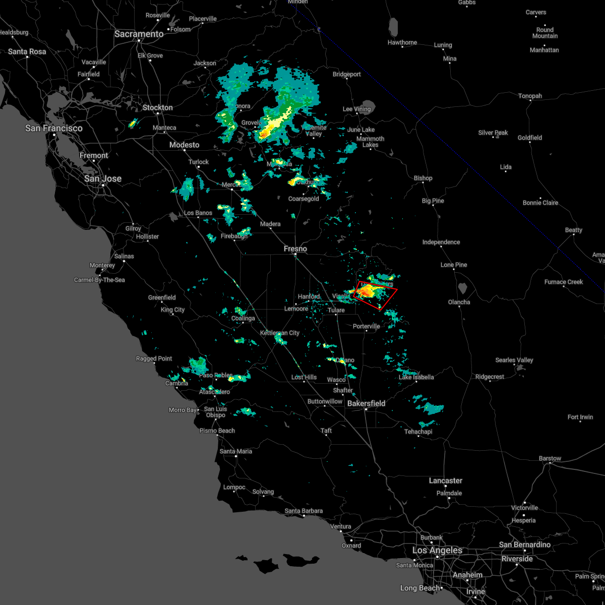
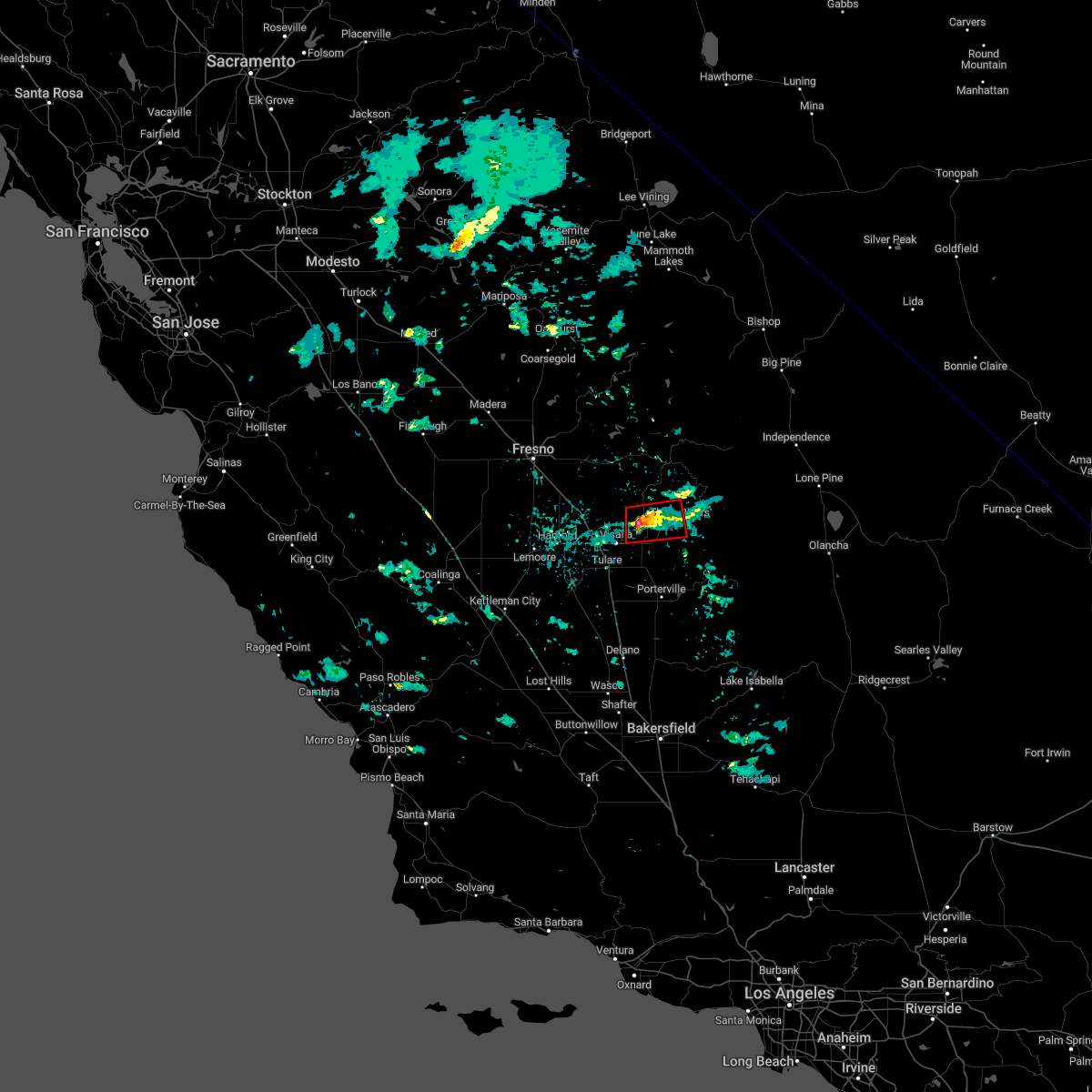
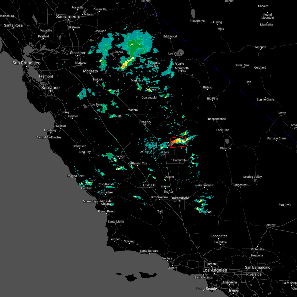
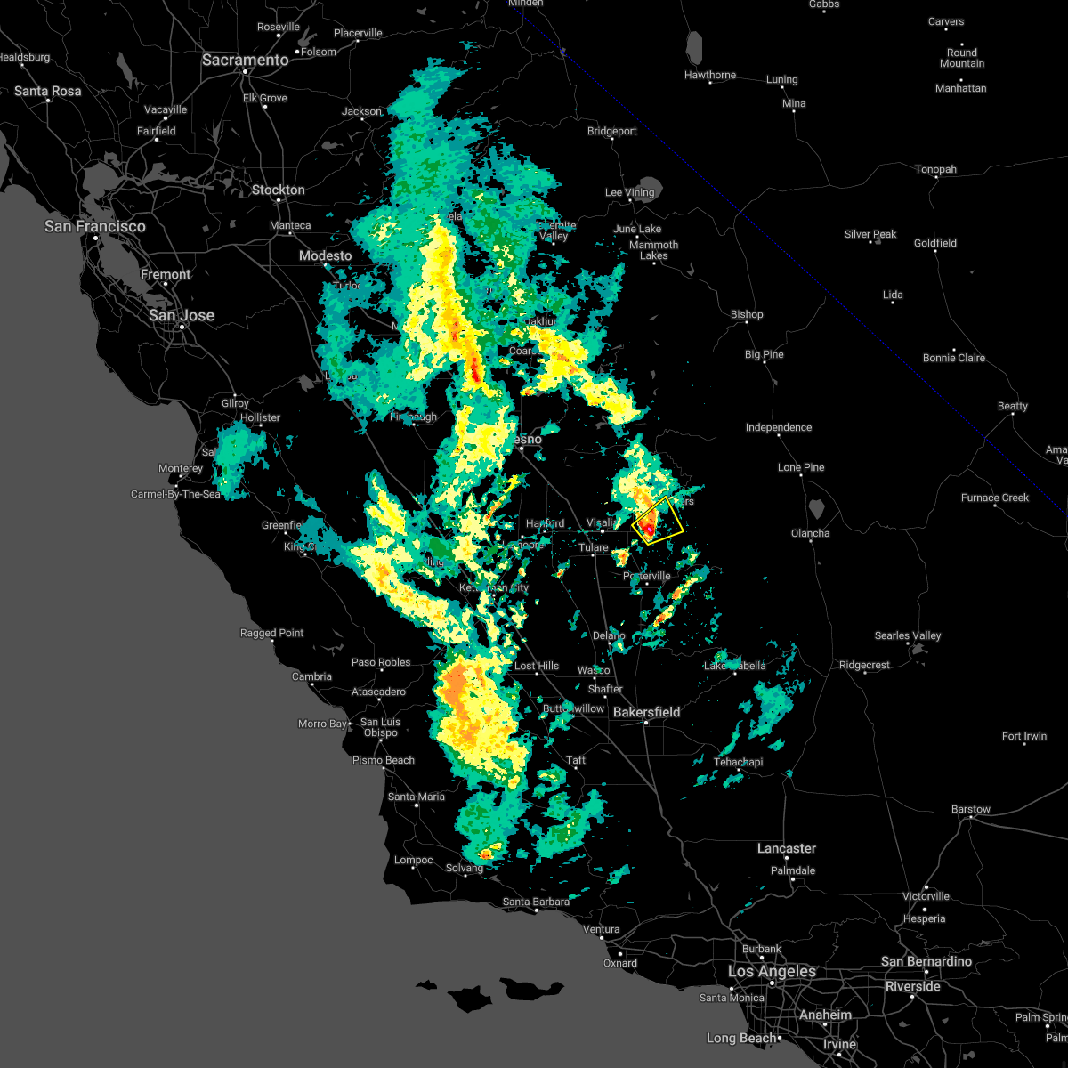
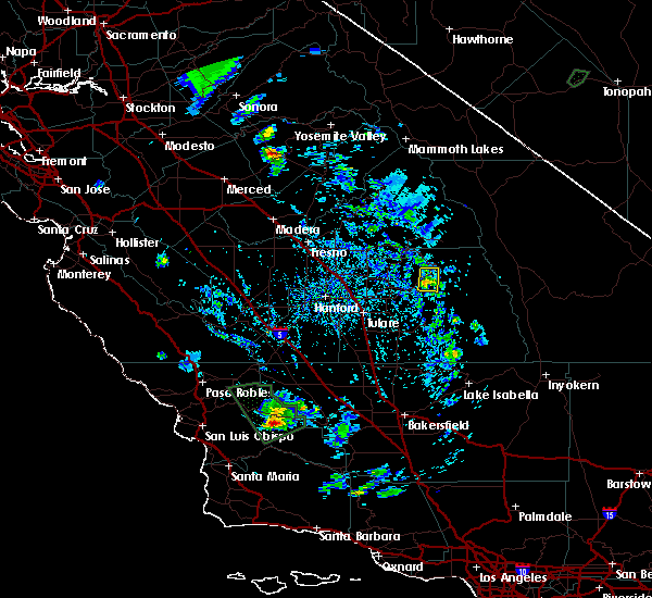
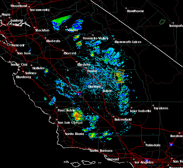
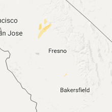
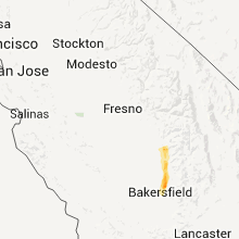
Hail Map for Three Rivers, CA
The Three Rivers, CA area has had 0 reports of on-the-ground hail by trained spotters, and has been under severe weather warnings 0 times during the past 12 months. Doppler radar has detected hail at or near Three Rivers, CA on 3 occasions.
| Name: | Three Rivers, CA |
| Where Located: | 56.6 miles ESE of Fresno, CA |
| Map: | Google Map for Three Rivers, CA |
| Population: | 2182 |
| Housing Units: | 1312 |
| More Info: | Search Google for Three Rivers, CA |
5
The Top Recent Hail Date for Three Rivers, CA is Friday, May 31, 2019 (1st out of 3)

Hail and Wind Damage Spotted near Three Rivers, CA
| Date / Time | Report Details |
|---|---|
| 1/10/2023 5:15 PM PST |
 At 515 pm pst, a severe thunderstorm capable of producing a tornado was located near three rivers, or 20 miles east of visalia, moving east at 20 mph (weather spotters reported funnel cloud). Hazards include tornado. Flying debris will be dangerous to those caught without shelter. mobile homes will be damaged or destroyed. damage to roofs, windows, and vehicles will occur. tree damage is likely. This tornadic thunderstorm will remain over mainly rural areas of central tulare county, including the following locations, lemon cove, lindcove, case mountain and south fork campground. At 515 pm pst, a severe thunderstorm capable of producing a tornado was located near three rivers, or 20 miles east of visalia, moving east at 20 mph (weather spotters reported funnel cloud). Hazards include tornado. Flying debris will be dangerous to those caught without shelter. mobile homes will be damaged or destroyed. damage to roofs, windows, and vehicles will occur. tree damage is likely. This tornadic thunderstorm will remain over mainly rural areas of central tulare county, including the following locations, lemon cove, lindcove, case mountain and south fork campground.
|
| 1/10/2023 5:01 PM PST |
 At 500 pm pst, a severe thunderstorm capable of producing a tornado was located over woodlake, or 14 miles northeast of visalia, moving east at 15 mph (weather spotters reported a funnel cloud). Hazards include tornado. Flying debris will be dangerous to those caught without shelter. mobile homes will be damaged or destroyed. damage to roofs, windows, and vehicles will occur. tree damage is likely. this dangerous storm will be near, three rivers around 530 pm pst. Other locations impacted by this tornadic thunderstorm include lemon cove and lindcove. At 500 pm pst, a severe thunderstorm capable of producing a tornado was located over woodlake, or 14 miles northeast of visalia, moving east at 15 mph (weather spotters reported a funnel cloud). Hazards include tornado. Flying debris will be dangerous to those caught without shelter. mobile homes will be damaged or destroyed. damage to roofs, windows, and vehicles will occur. tree damage is likely. this dangerous storm will be near, three rivers around 530 pm pst. Other locations impacted by this tornadic thunderstorm include lemon cove and lindcove.
|
| 1/10/2023 4:49 PM PST |
 At 448 pm pst, a severe thunderstorm capable of producing a tornado was located near woodlake, or 11 miles northeast of visalia, moving east at 15 mph (radar indicated rotation). Hazards include tornado. Flying debris will be dangerous to those caught without shelter. mobile homes will be damaged or destroyed. damage to roofs, windows, and vehicles will occur. tree damage is likely. this dangerous storm will be near, woodlake around 500 pm pst. Other locations impacted by this tornadic thunderstorm include lemon cove and lindcove. At 448 pm pst, a severe thunderstorm capable of producing a tornado was located near woodlake, or 11 miles northeast of visalia, moving east at 15 mph (radar indicated rotation). Hazards include tornado. Flying debris will be dangerous to those caught without shelter. mobile homes will be damaged or destroyed. damage to roofs, windows, and vehicles will occur. tree damage is likely. this dangerous storm will be near, woodlake around 500 pm pst. Other locations impacted by this tornadic thunderstorm include lemon cove and lindcove.
|
| 1/5/2023 2:13 PM PST |
 At 212 pm pst, a severe thunderstorm was located about 7 miles southwest of three rivers, or around 19 miles east of visalia, moving to the northeast near 30 mph (radar indicated). Hazards include quarter size hail. Damage to vehicles is expected. locations impacted include, three rivers, lemon cove and lindcove. hail threat, radar indicated max hail size, 1. 00 in wind threat, radar indicated max wind gust, <50 mph. At 212 pm pst, a severe thunderstorm was located about 7 miles southwest of three rivers, or around 19 miles east of visalia, moving to the northeast near 30 mph (radar indicated). Hazards include quarter size hail. Damage to vehicles is expected. locations impacted include, three rivers, lemon cove and lindcove. hail threat, radar indicated max hail size, 1. 00 in wind threat, radar indicated max wind gust, <50 mph.
|
| 1/5/2023 2:00 PM PST |
 At 159 pm pst, a severe thunderstorm was located near exeter, or about 14 miles east of visalia, moving to the northeast at around 25 mph (radar indicated). Hazards include quarter size hail. damage to vehicles is expected At 159 pm pst, a severe thunderstorm was located near exeter, or about 14 miles east of visalia, moving to the northeast at around 25 mph (radar indicated). Hazards include quarter size hail. damage to vehicles is expected
|
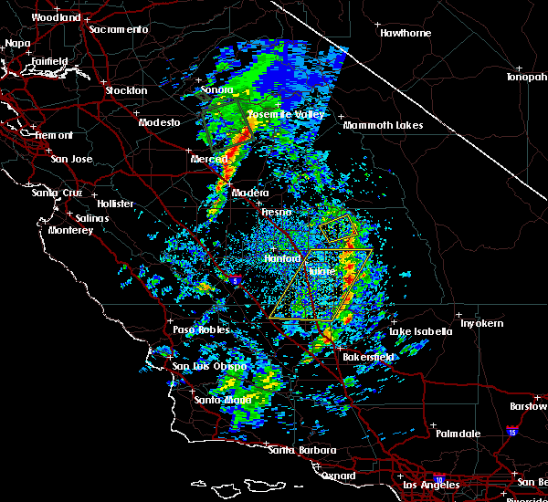
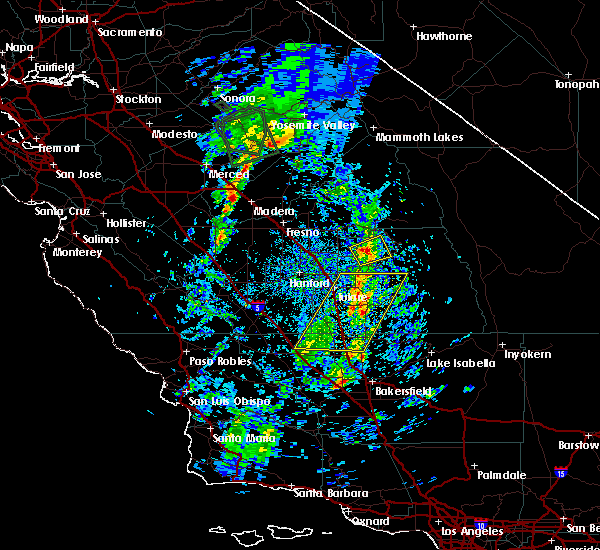
| 5/31/2019 5:50 PM PDT |
 At 550 pm pdt, a severe thunderstorm was located near three rivers, or 29 miles east of visalia, moving north at 15 mph (radar indicated). Hazards include 60 mph wind gusts and quarter size hail. Hail damage to vehicles is expected. expect wind damage to roofs, siding, and trees. Locations impacted include, three rivers, case mountain and giant forest. At 550 pm pdt, a severe thunderstorm was located near three rivers, or 29 miles east of visalia, moving north at 15 mph (radar indicated). Hazards include 60 mph wind gusts and quarter size hail. Hail damage to vehicles is expected. expect wind damage to roofs, siding, and trees. Locations impacted include, three rivers, case mountain and giant forest.
|
| 5/31/2019 5:26 PM PDT |
 At 526 pm pdt, a severe thunderstorm was located near three rivers, or 28 miles northeast of porterville, moving north at 15 mph (radar indicated). Hazards include 60 mph wind gusts and quarter size hail. Hail damage to vehicles is expected. Expect wind damage to roofs, siding, and trees. At 526 pm pdt, a severe thunderstorm was located near three rivers, or 28 miles northeast of porterville, moving north at 15 mph (radar indicated). Hazards include 60 mph wind gusts and quarter size hail. Hail damage to vehicles is expected. Expect wind damage to roofs, siding, and trees.
|
| 3/22/2018 4:56 PM PDT |
 The severe thunderstorm warning for north central tulare county will expire at 500 pm pdt, the severe thunderstorm which prompted the warning has weakened. therefore, the warning will be allowed to expire. The severe thunderstorm warning for north central tulare county will expire at 500 pm pdt, the severe thunderstorm which prompted the warning has weakened. therefore, the warning will be allowed to expire.
|
| 3/22/2018 4:31 PM PDT |
 At 430 pm pdt, a severe thunderstorm was located near shadequarter mtn, moving northeast at 20 mph (radar indicated). Hazards include 60 mph wind gusts and quarter size hail. Hail damage to vehicles is expected. Expect wind damage to roofs, siding, and trees. At 430 pm pdt, a severe thunderstorm was located near shadequarter mtn, moving northeast at 20 mph (radar indicated). Hazards include 60 mph wind gusts and quarter size hail. Hail damage to vehicles is expected. Expect wind damage to roofs, siding, and trees.
|
| 7/18/2015 4:15 PM PDT | Public report of roof damage along with trees and power lines downed. hwy 198 & old three rivers road in tulare county CA, 3.7 miles E of Three Rivers, CA |
Hail Maps for Three Rivers, CA
Connect with Interactive Hail Maps