

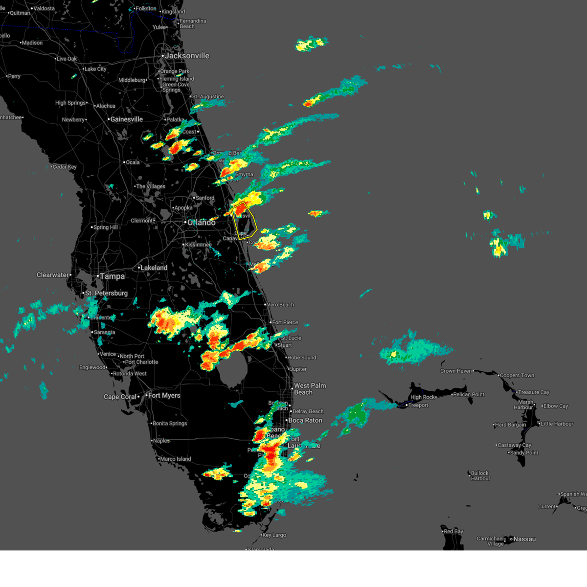
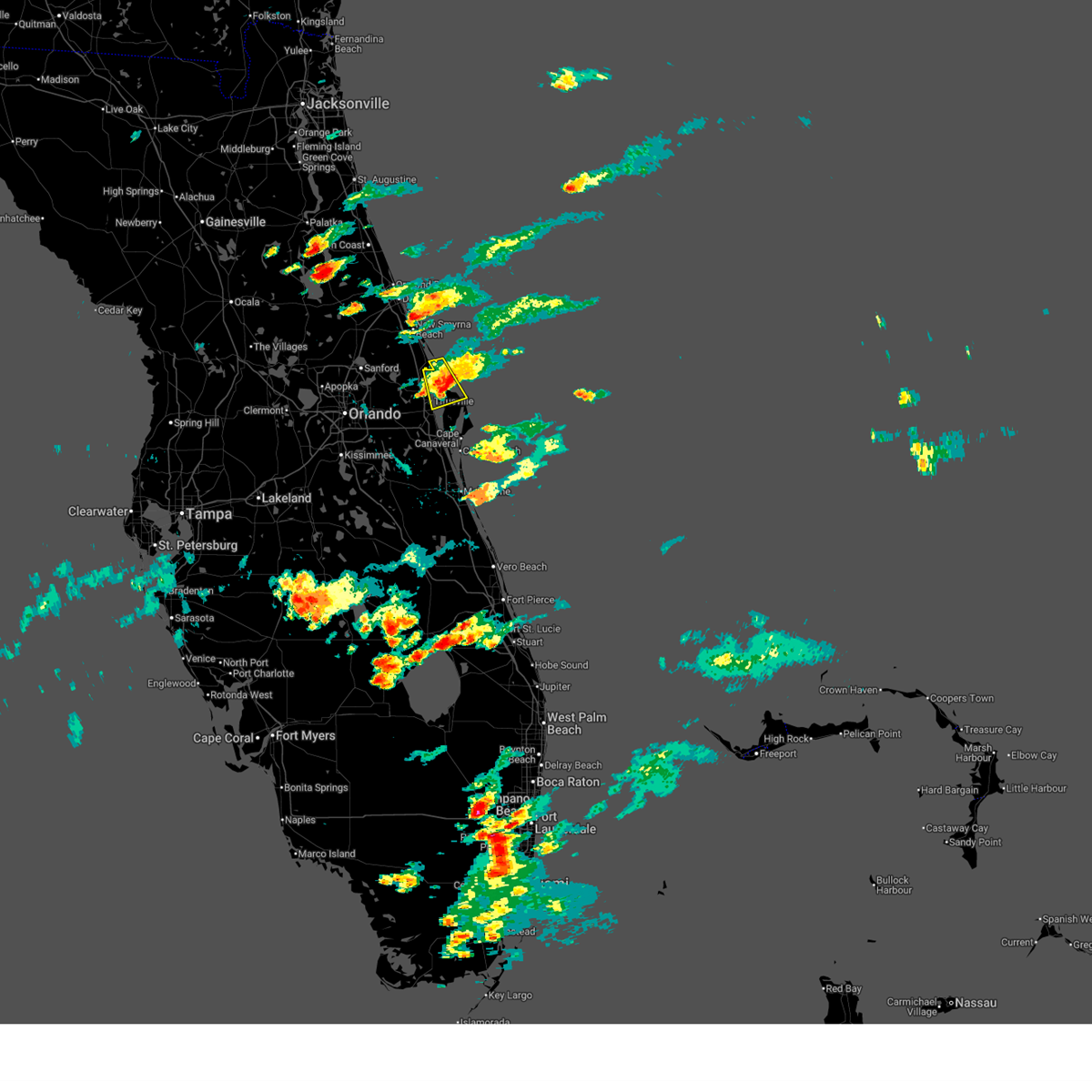
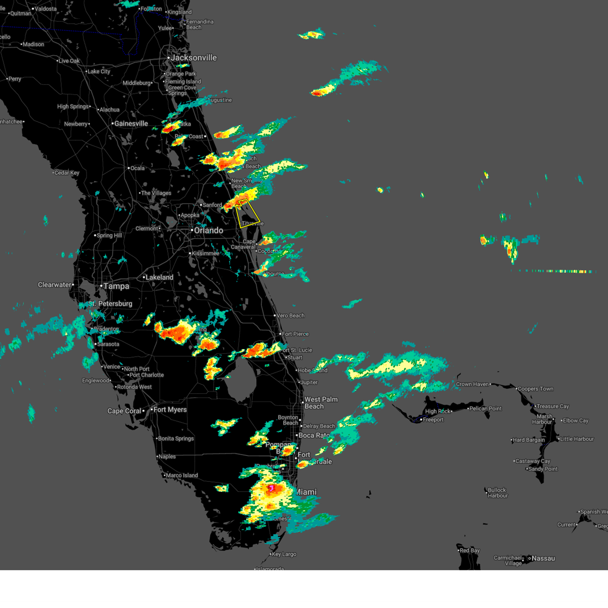
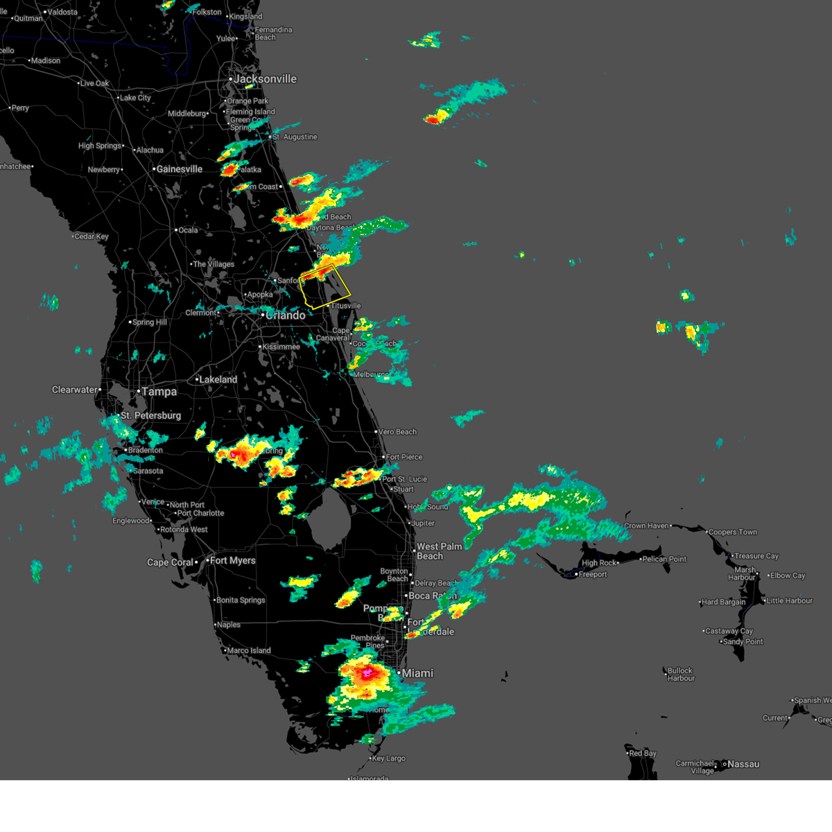
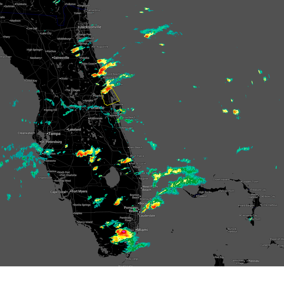
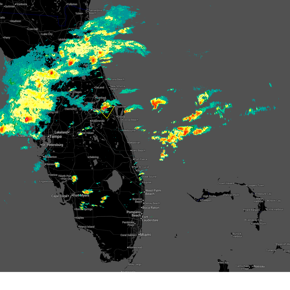
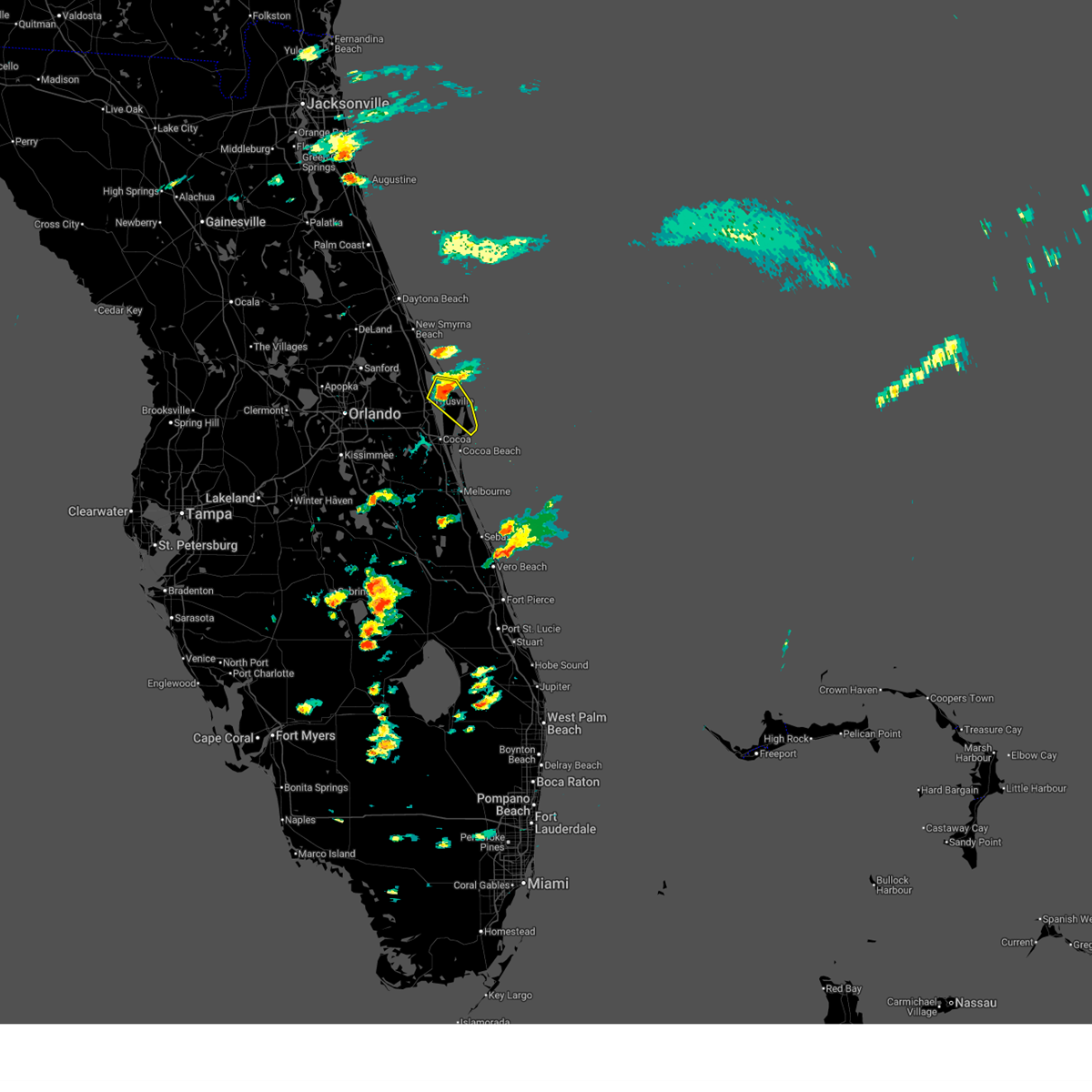
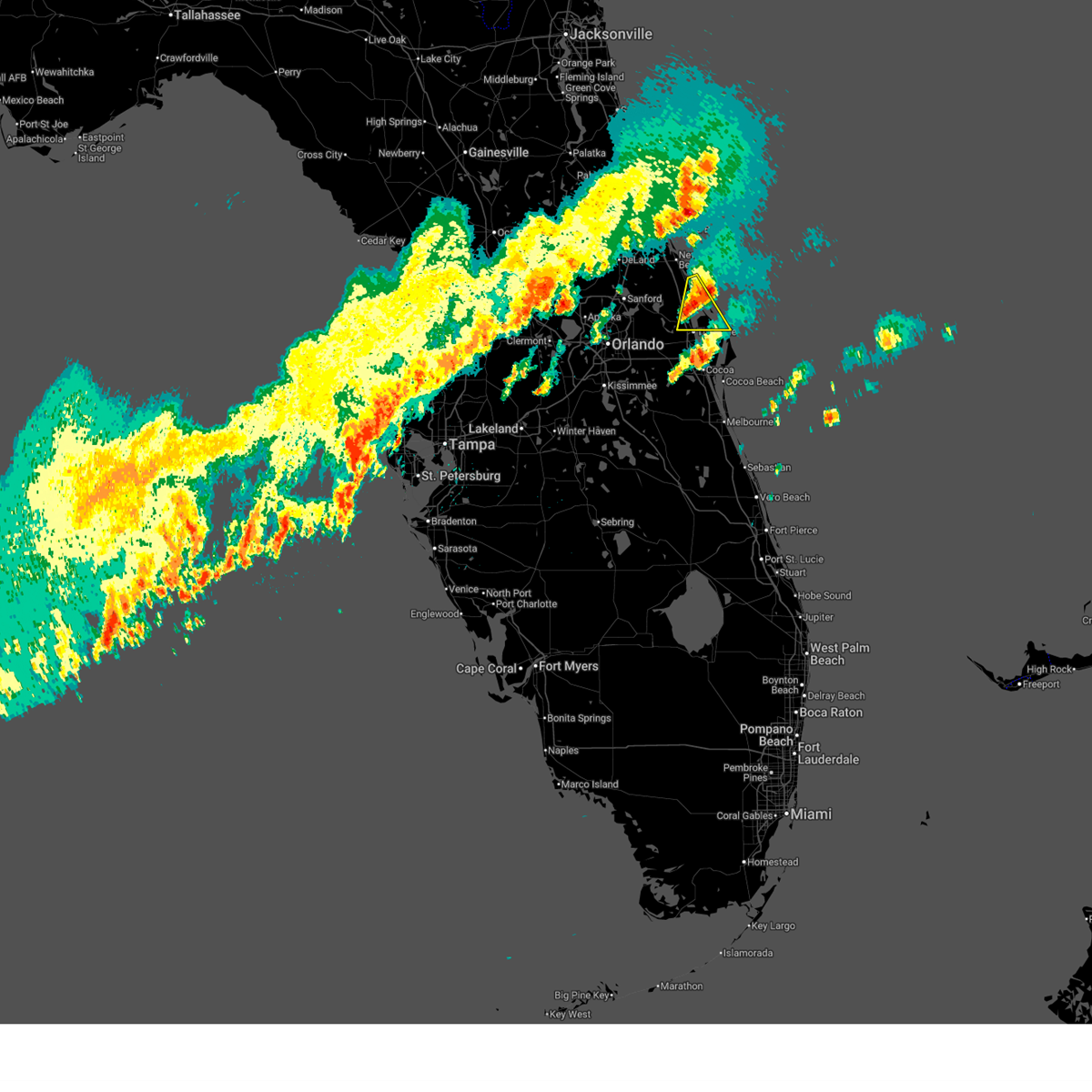
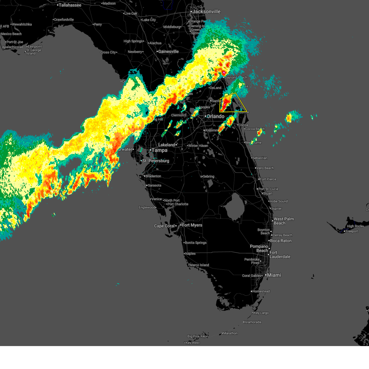
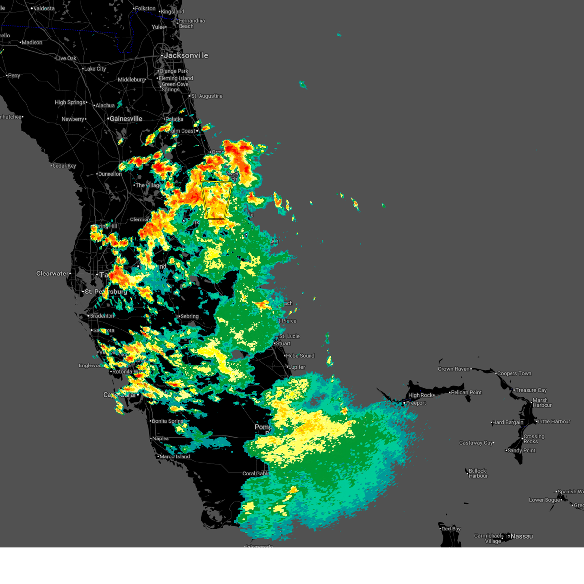
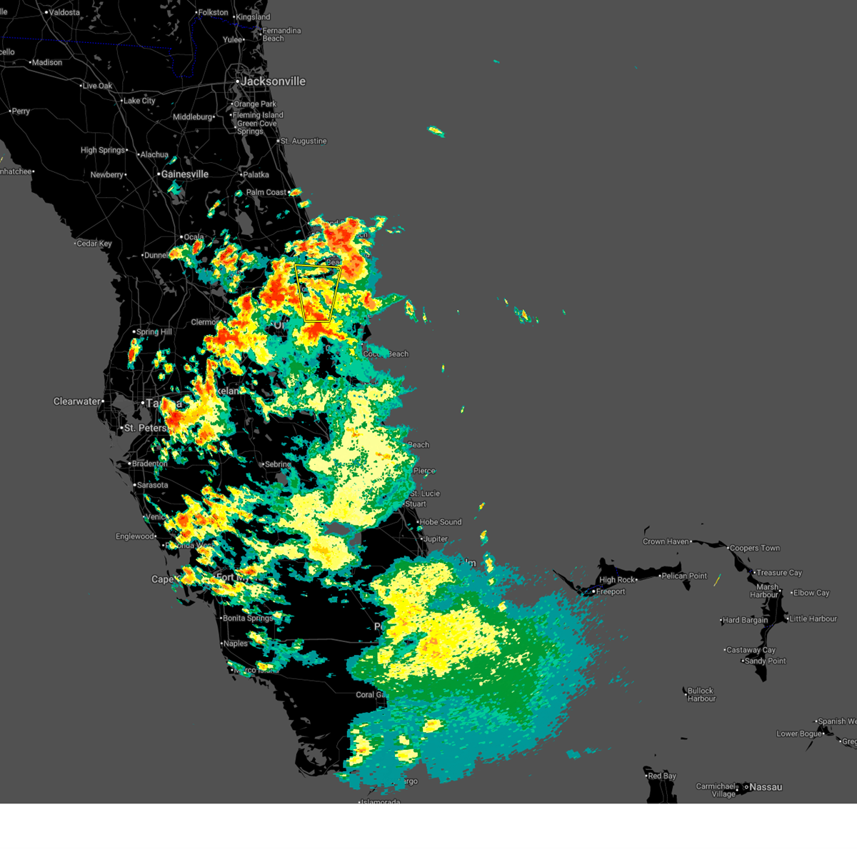
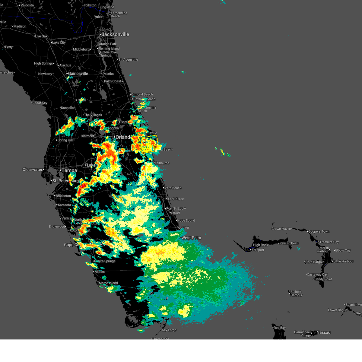
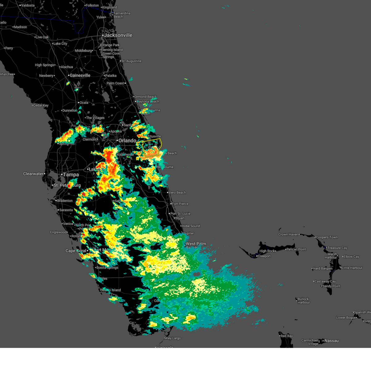
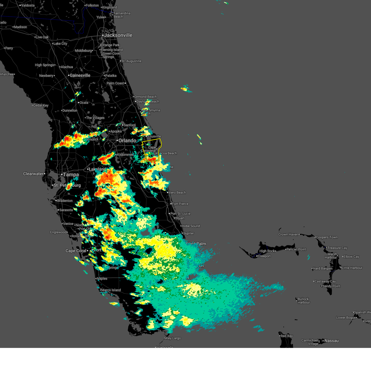
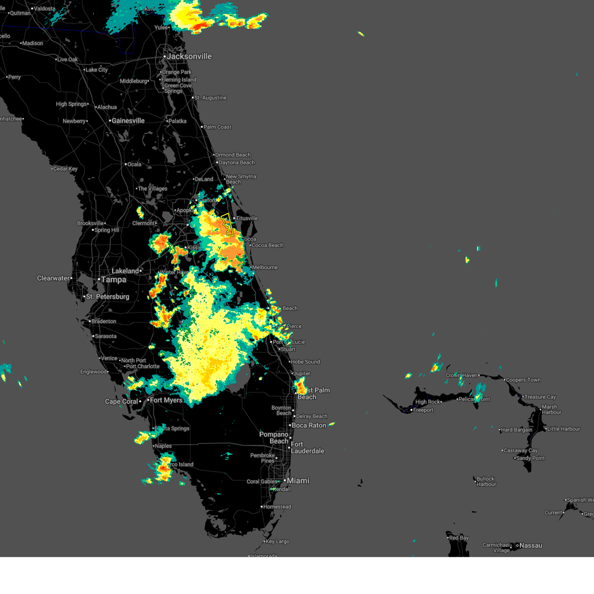
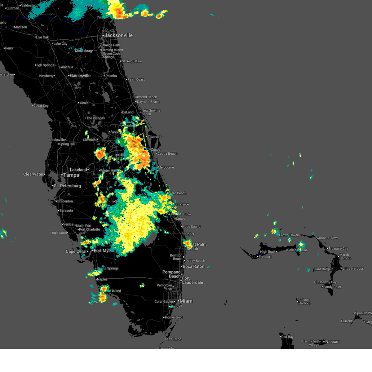
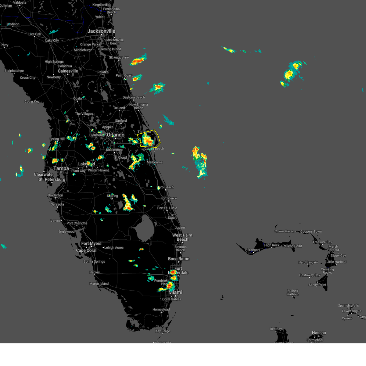
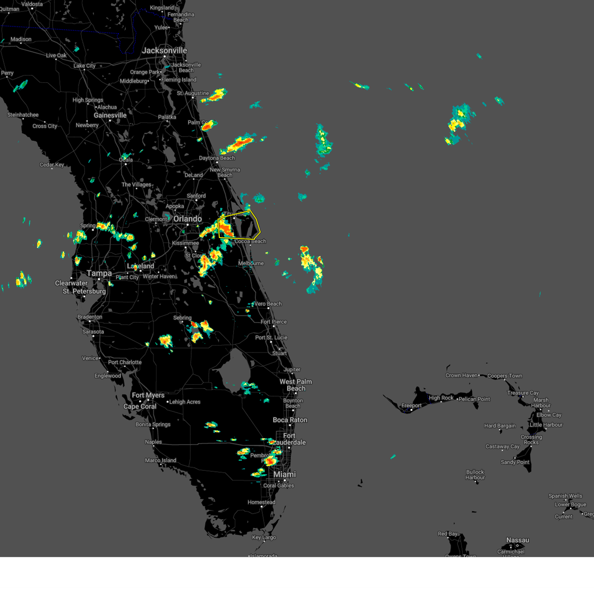
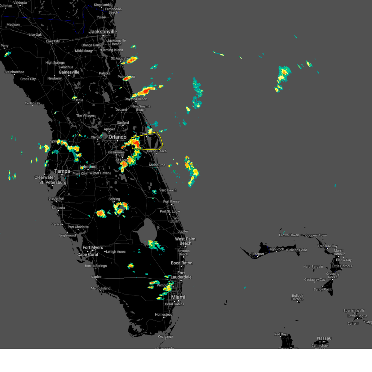
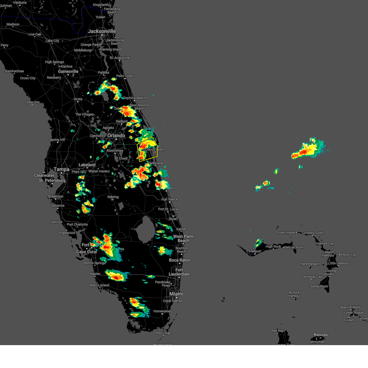
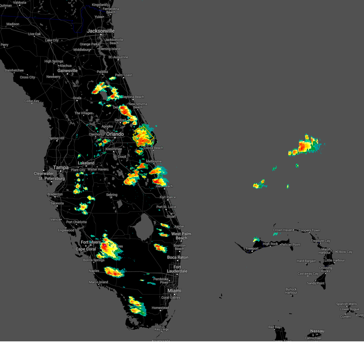
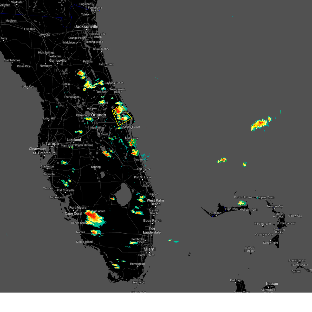
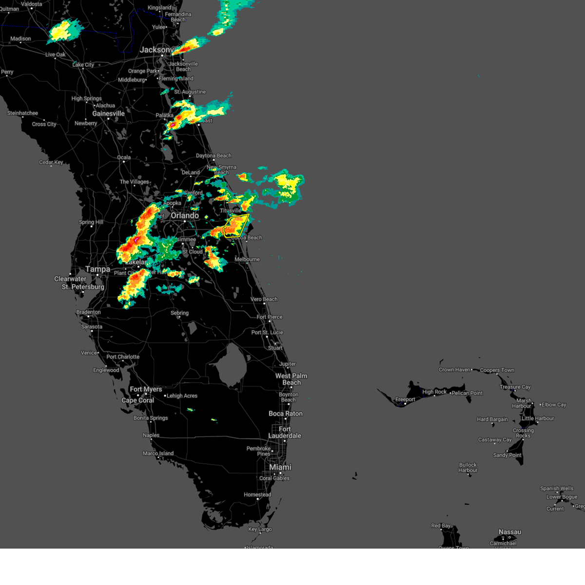
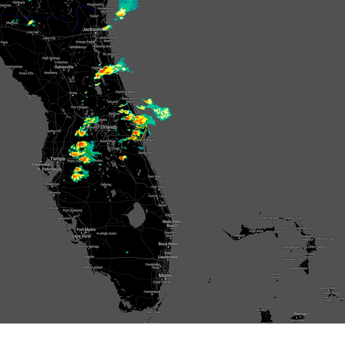
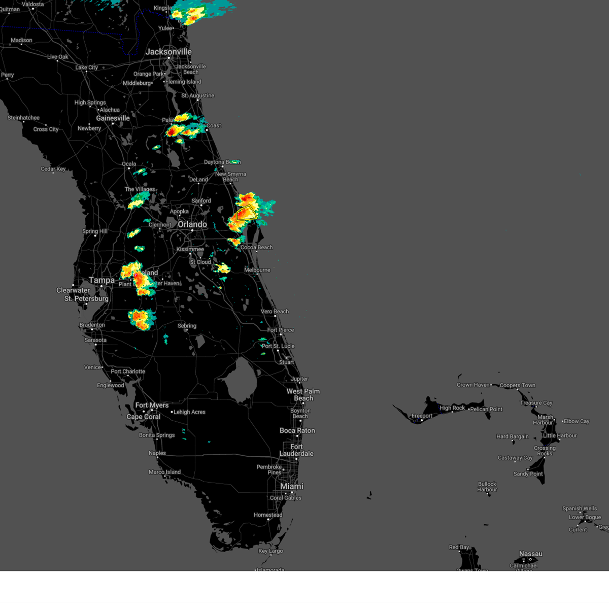
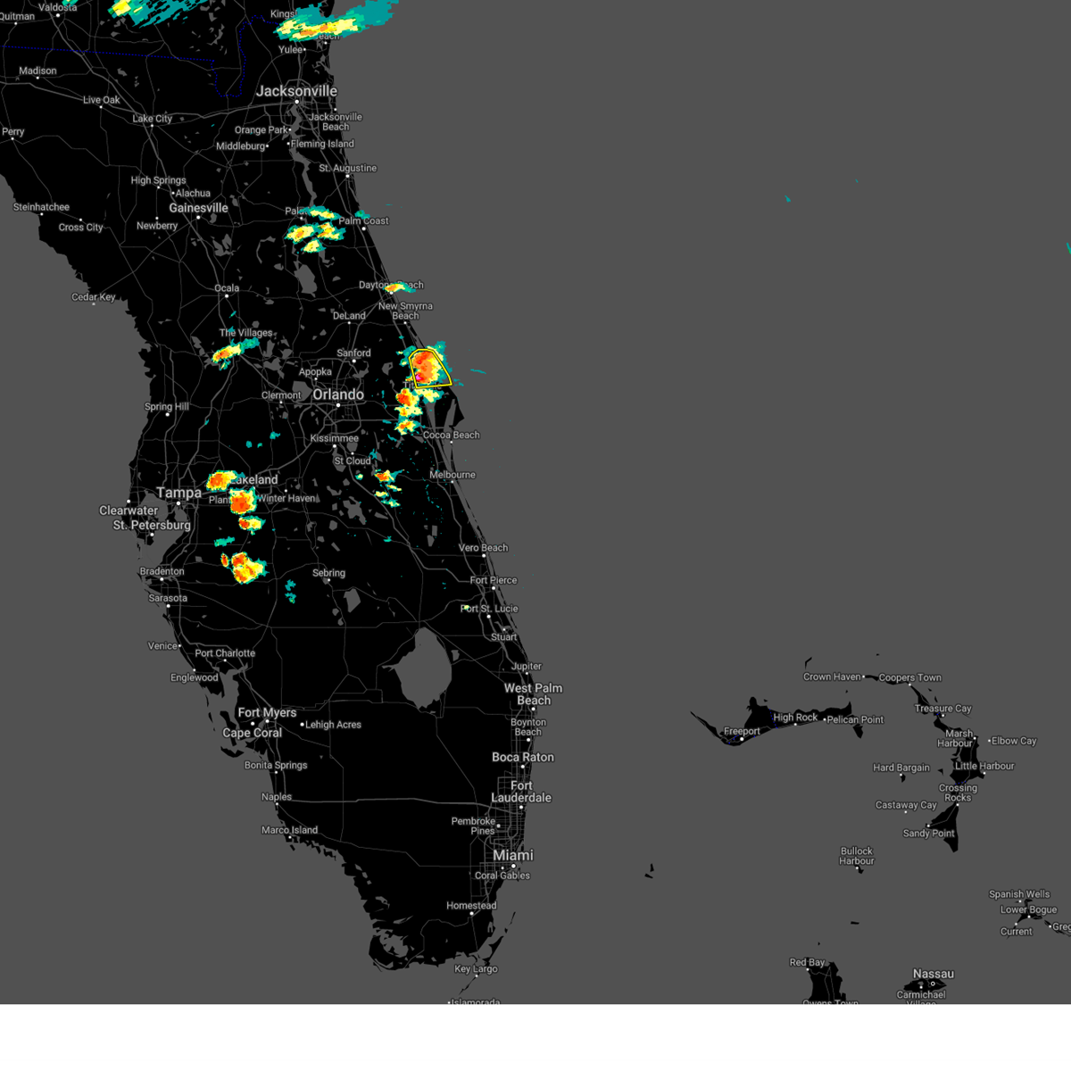
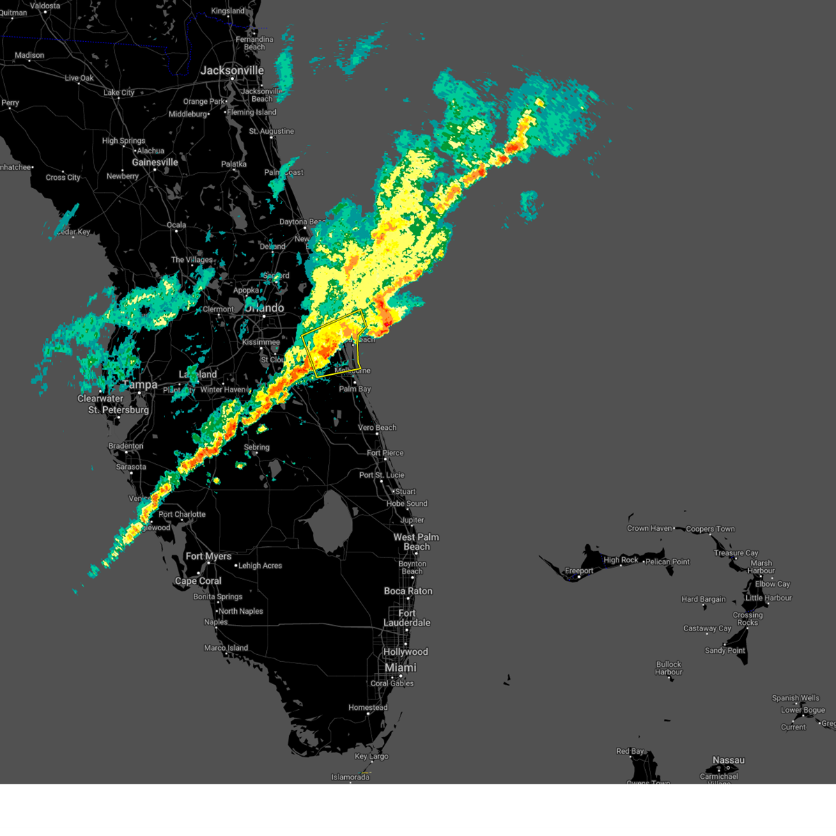
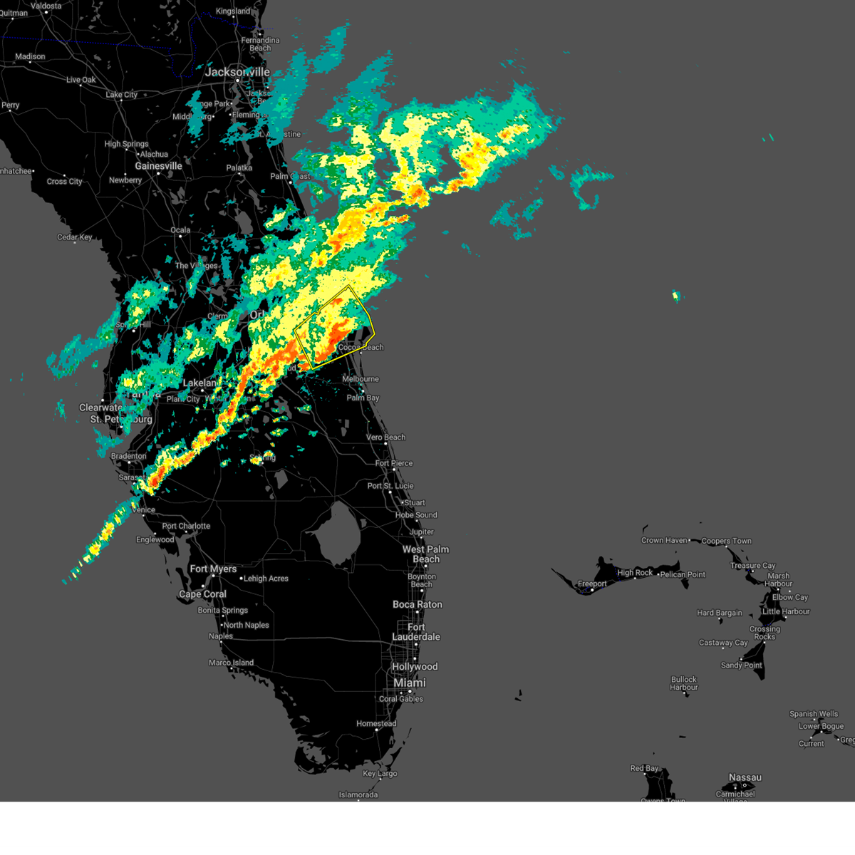
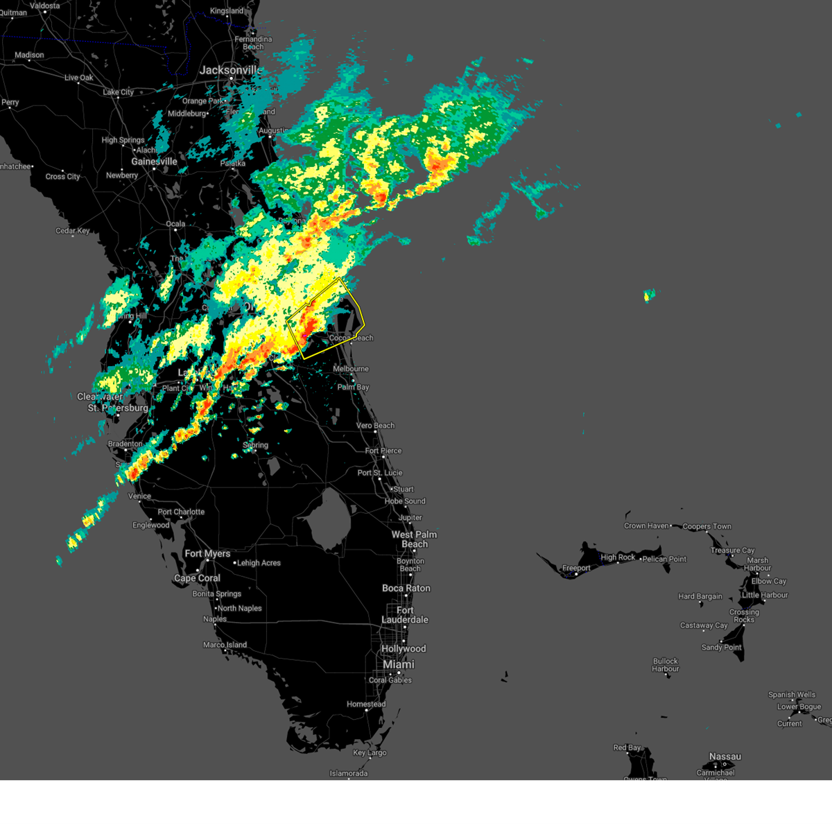
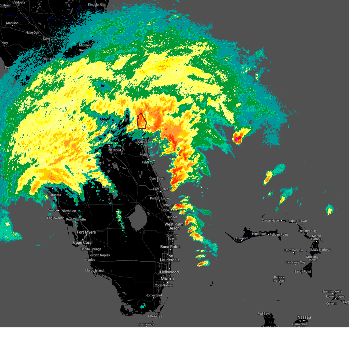
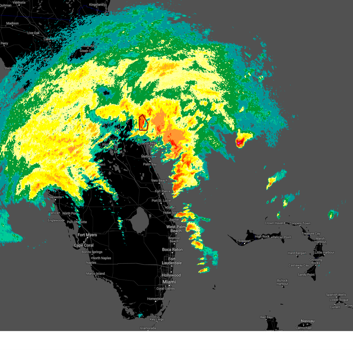
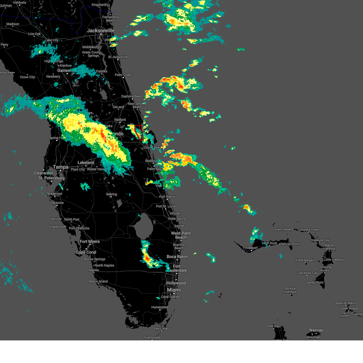
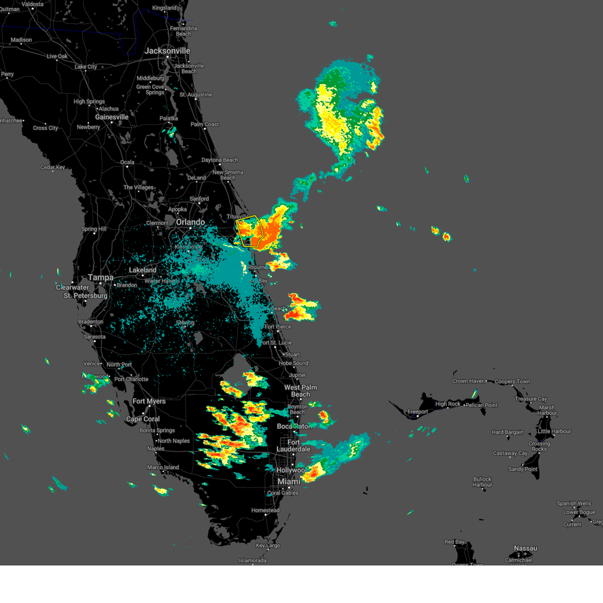
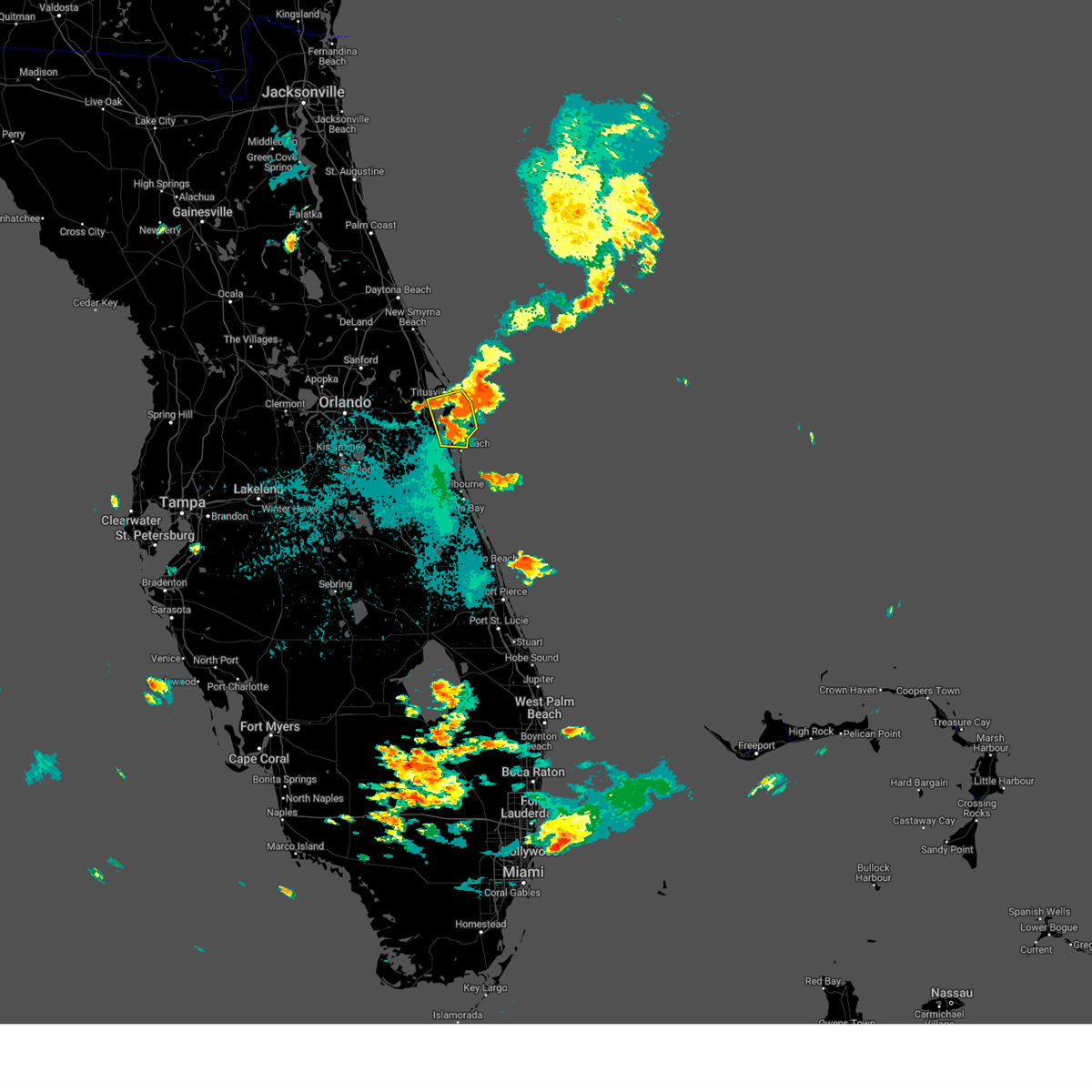
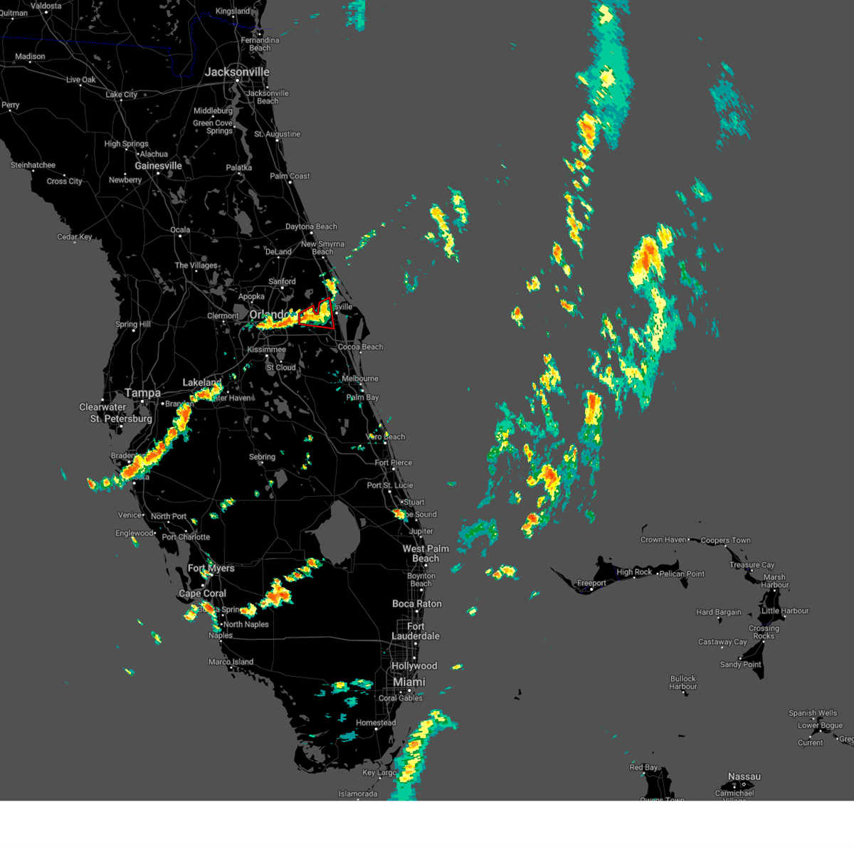
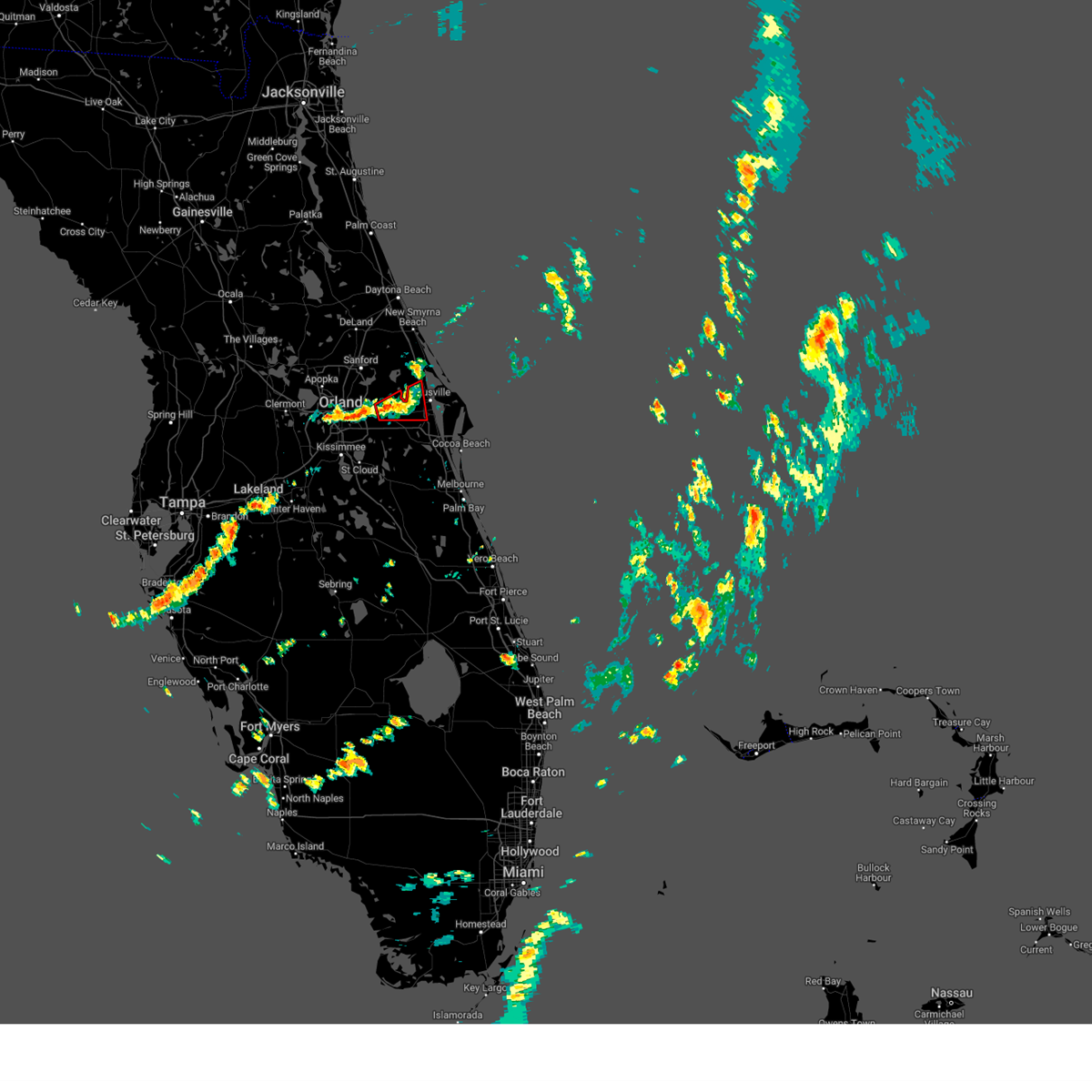
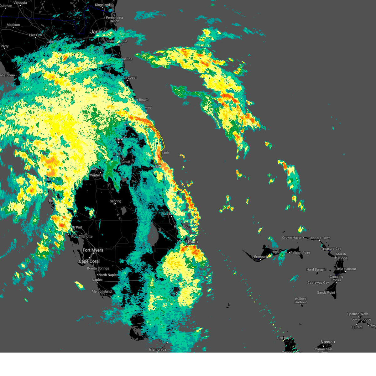
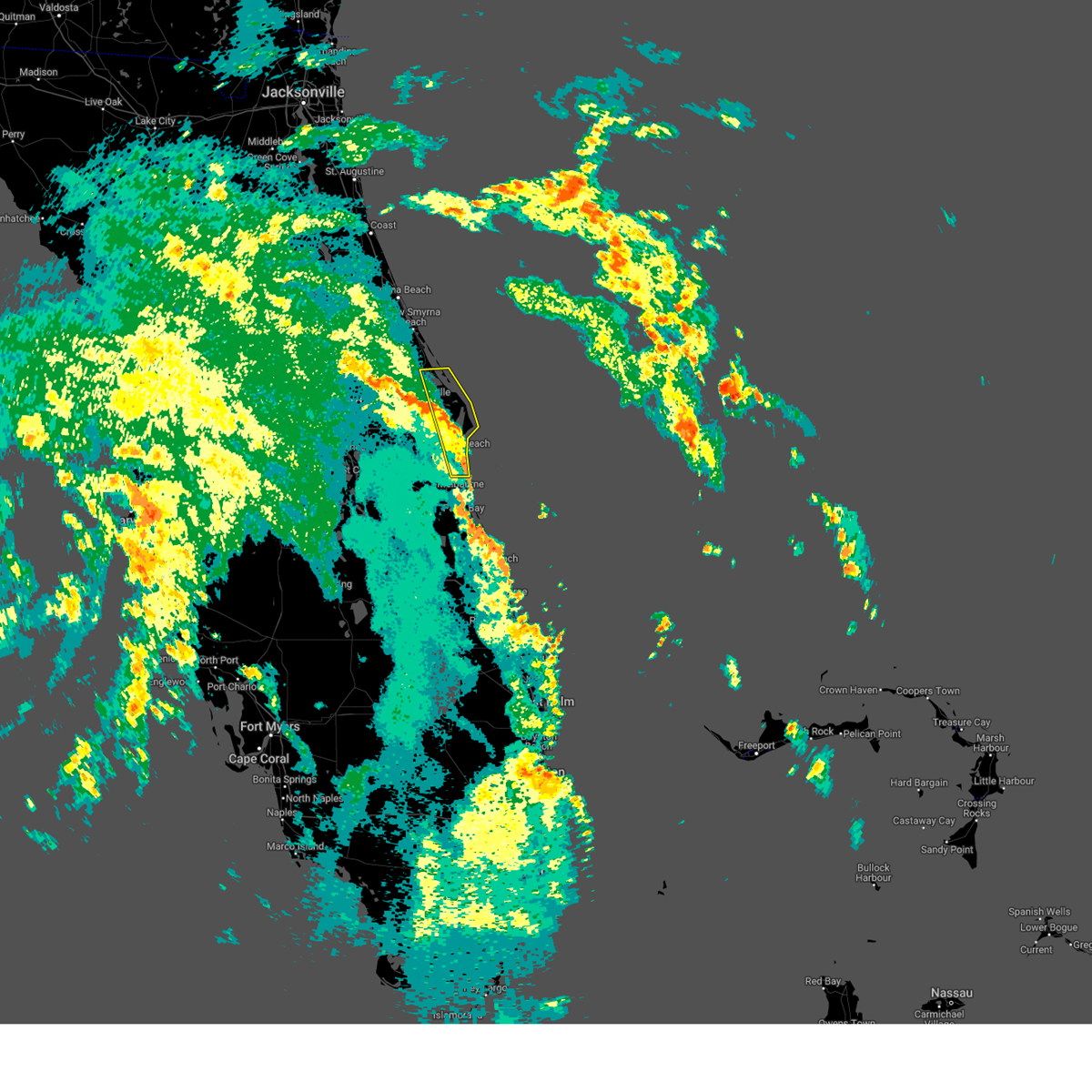
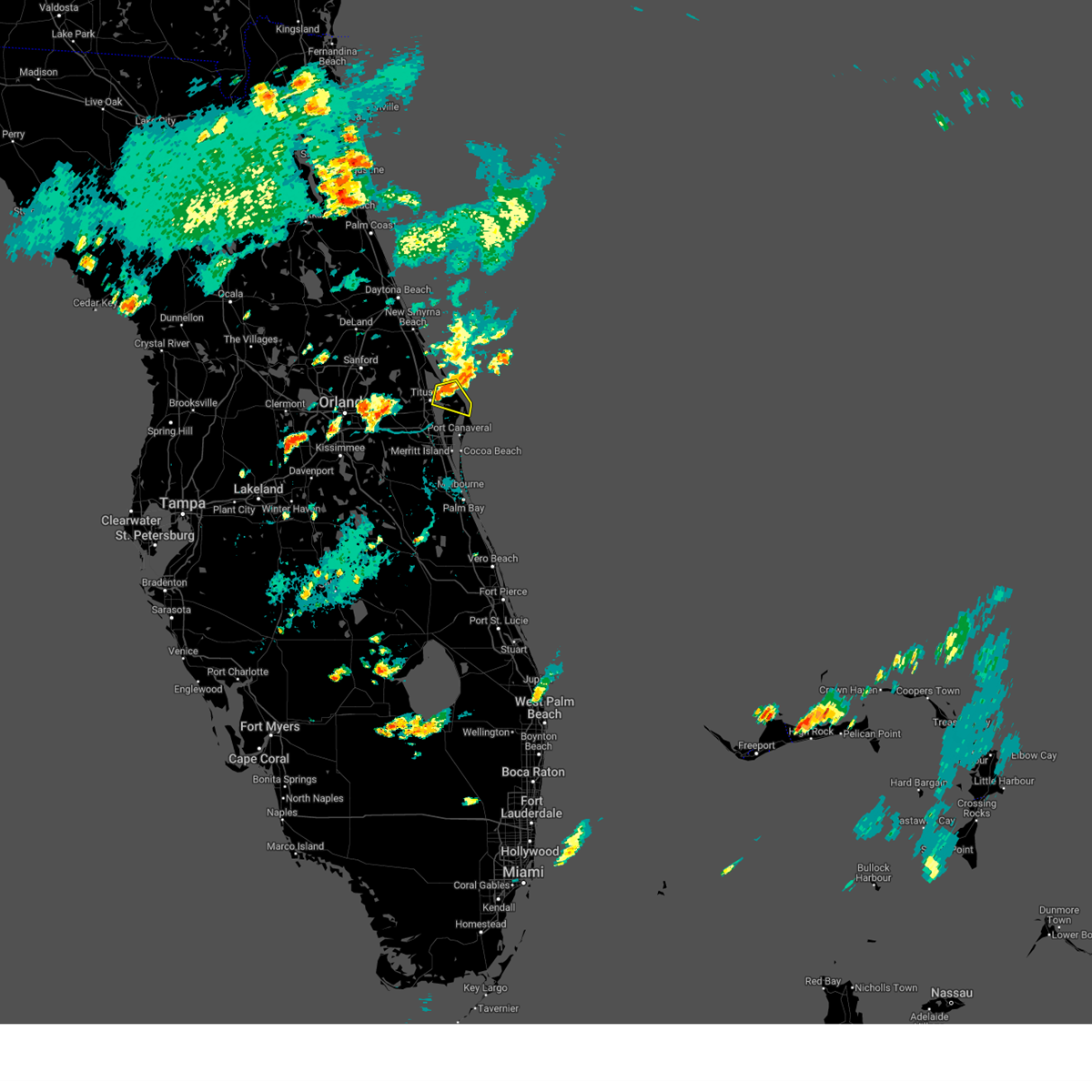
Hail Map for Titusville, FL
The Titusville, FL area has had 4 reports of on-the-ground hail by trained spotters, and has been under severe weather warnings 23 times during the past 12 months. Doppler radar has detected hail at or near Titusville, FL on 96 occasions, including 4 occasions during the past year.
| Name: | Titusville, FL |
| Where Located: | 33.4 miles E of Orlando, FL |
| Map: | Google Map for Titusville, FL |
| Population: | 43761 |
| Housing Units: | 22729 |
| More Info: | Search Google for Titusville, FL |
1
The Top Recent Hail Date for Titusville, FL is Tuesday, May 12, 2026 (23rd out of 96)

Hail and Wind Damage Spotted near Titusville, FL
| Date / Time | Report Details |
|---|---|
| 6/2/2026 6:36 PM EDT |
 Svrmlb the national weather service in melbourne has issued a * severe thunderstorm warning for, northeastern brevard county in east central florida, * until 715 pm edt. * at 636 pm edt, a severe thunderstorm was located over merritt island wildlife refuge, or near playalinda beach, moving south at 25 mph (radar indicated). Hazards include 60 mph wind gusts and penny size hail. expect damage to roofs, siding, and trees Svrmlb the national weather service in melbourne has issued a * severe thunderstorm warning for, northeastern brevard county in east central florida, * until 715 pm edt. * at 636 pm edt, a severe thunderstorm was located over merritt island wildlife refuge, or near playalinda beach, moving south at 25 mph (radar indicated). Hazards include 60 mph wind gusts and penny size hail. expect damage to roofs, siding, and trees
|
| 6/2/2026 6:29 PM EDT |
 At 629 pm edt, a severe thunderstorm was located over klondike beach, or near playalinda beach, moving southeast at 25 mph (radar indicated). Hazards include 60 mph wind gusts and penny size hail. Expect damage to roofs, siding, and trees. Locations impacted include, titusville, haulover canal, playalinda beach, mims, and merritt island wildlife refuge. At 629 pm edt, a severe thunderstorm was located over klondike beach, or near playalinda beach, moving southeast at 25 mph (radar indicated). Hazards include 60 mph wind gusts and penny size hail. Expect damage to roofs, siding, and trees. Locations impacted include, titusville, haulover canal, playalinda beach, mims, and merritt island wildlife refuge.
|
| 6/2/2026 6:11 PM EDT |
 Svrmlb the national weather service in melbourne has issued a * severe thunderstorm warning for, northeast brevard county in east central florida, * until 645 pm edt. * at 610 pm edt, a severe thunderstorm was located near haulover canal, moving southeast at 25 mph (radar indicated). Hazards include 60 mph wind gusts and penny size hail. expect damage to roofs, siding, and trees Svrmlb the national weather service in melbourne has issued a * severe thunderstorm warning for, northeast brevard county in east central florida, * until 645 pm edt. * at 610 pm edt, a severe thunderstorm was located near haulover canal, moving southeast at 25 mph (radar indicated). Hazards include 60 mph wind gusts and penny size hail. expect damage to roofs, siding, and trees
|
| 6/2/2026 6:02 PM EDT |
 At 601 pm edt, a severe thunderstorm was located near scottsmoor, moving southeast at 25 mph. another potential severe thunderstorm was located over maytown (radar indicated). Hazards include 60 mph wind gusts and penny size hail. Expect damage to roofs, siding, and trees. Locations impacted include, titusville, oak hill, haulover canal, mims, and scottsmoor. At 601 pm edt, a severe thunderstorm was located near scottsmoor, moving southeast at 25 mph. another potential severe thunderstorm was located over maytown (radar indicated). Hazards include 60 mph wind gusts and penny size hail. Expect damage to roofs, siding, and trees. Locations impacted include, titusville, oak hill, haulover canal, mims, and scottsmoor.
|
| 6/2/2026 5:41 PM EDT |
 Svrmlb the national weather service in melbourne has issued a * severe thunderstorm warning for, northwestern brevard county in east central florida, southeastern volusia county in east central florida, * until 615 pm edt. * at 541 pm edt, a severe thunderstorm was located near maytown, or near oak hill, moving south at 20 mph (radar indicated). Hazards include 60 mph wind gusts and penny size hail. expect damage to roofs, siding, and trees Svrmlb the national weather service in melbourne has issued a * severe thunderstorm warning for, northwestern brevard county in east central florida, southeastern volusia county in east central florida, * until 615 pm edt. * at 541 pm edt, a severe thunderstorm was located near maytown, or near oak hill, moving south at 20 mph (radar indicated). Hazards include 60 mph wind gusts and penny size hail. expect damage to roofs, siding, and trees
|
| 5/12/2026 2:01 PM EDT |
 At 201 pm edt, a severe thunderstorm was located over port saint john, moving southeast at 15 mph (radar indicated). Hazards include 60 mph wind gusts and quarter size hail. Hail damage to vehicles is expected. expect wind damage to roofs, siding, and trees. Locations impacted include, titusville, port saint john, titusville airport, sharpes, and bellwood. At 201 pm edt, a severe thunderstorm was located over port saint john, moving southeast at 15 mph (radar indicated). Hazards include 60 mph wind gusts and quarter size hail. Hail damage to vehicles is expected. expect wind damage to roofs, siding, and trees. Locations impacted include, titusville, port saint john, titusville airport, sharpes, and bellwood.
|
| 5/12/2026 1:48 PM EDT |
 At 147 pm edt, a severe thunderstorm was located near titusville airport, moving east at 15 mph (radar indicated). Hazards include 60 mph wind gusts and quarter size hail. Hail damage to vehicles is expected. expect wind damage to roofs, siding, and trees. Locations impacted include, titusville, port saint john, titusville airport, sharpes, and canaveral groves. At 147 pm edt, a severe thunderstorm was located near titusville airport, moving east at 15 mph (radar indicated). Hazards include 60 mph wind gusts and quarter size hail. Hail damage to vehicles is expected. expect wind damage to roofs, siding, and trees. Locations impacted include, titusville, port saint john, titusville airport, sharpes, and canaveral groves.
|
| 5/12/2026 1:27 PM EDT |
 Svrmlb the national weather service in melbourne has issued a * severe thunderstorm warning for, northwestern brevard county in east central florida, southeastern orange county in east central florida, * until 215 pm edt. * at 126 pm edt, a severe thunderstorm was located over christmas, moving southeast at 15 mph (radar indicated). Hazards include 60 mph wind gusts and quarter size hail. Hail damage to vehicles is expected. Expect wind damage to roofs, siding, and trees. Svrmlb the national weather service in melbourne has issued a * severe thunderstorm warning for, northwestern brevard county in east central florida, southeastern orange county in east central florida, * until 215 pm edt. * at 126 pm edt, a severe thunderstorm was located over christmas, moving southeast at 15 mph (radar indicated). Hazards include 60 mph wind gusts and quarter size hail. Hail damage to vehicles is expected. Expect wind damage to roofs, siding, and trees.
|
| 5/12/2026 1:21 PM EDT |
 At 120 pm edt, a severe thunderstorm was located over christmas, moving southeast at 15 mph (radar indicated). Hazards include 60 mph wind gusts and quarter size hail. Hail damage to vehicles is expected. expect wind damage to roofs, siding, and trees. Locations impacted include, titusville, wedgefield, and christmas. At 120 pm edt, a severe thunderstorm was located over christmas, moving southeast at 15 mph (radar indicated). Hazards include 60 mph wind gusts and quarter size hail. Hail damage to vehicles is expected. expect wind damage to roofs, siding, and trees. Locations impacted include, titusville, wedgefield, and christmas.
|
| 5/12/2026 12:56 PM EDT |
 Svrmlb the national weather service in melbourne has issued a * severe thunderstorm warning for, southeastern seminole county in east central florida, northwestern brevard county in east central florida, southeastern orange county in east central florida, * until 130 pm edt. * at 1256 pm edt, a severe thunderstorm was located near christmas, moving southeast at 15 mph (radar indicated). Hazards include 60 mph wind gusts and quarter size hail. Hail damage to vehicles is expected. Expect wind damage to roofs, siding, and trees. Svrmlb the national weather service in melbourne has issued a * severe thunderstorm warning for, southeastern seminole county in east central florida, northwestern brevard county in east central florida, southeastern orange county in east central florida, * until 130 pm edt. * at 1256 pm edt, a severe thunderstorm was located near christmas, moving southeast at 15 mph (radar indicated). Hazards include 60 mph wind gusts and quarter size hail. Hail damage to vehicles is expected. Expect wind damage to roofs, siding, and trees.
|
| 5/10/2026 6:15 PM EDT | Ussf wind sensor on tower 110 measured a peak wind gust of 67mph/58kt from the northwest at 6:15 pm. sensor elevation is 12 fee in brevard county FL, 14.6 miles W of Titusville, FL |
| 5/10/2026 5:55 PM EDT | Ussf wind sensor on tower 513 measured a peak wind gust of 63mph/55kt from the north at 5:55 pm. earlier... a gust to 47mph/41kt occurred at 5:45 pm. sensor elevation i in brevard county FL, 8.5 miles WSW of Titusville, FL |
| 5/10/2026 5:50 PM EDT | Titusville... nasa shuttle landing facility (ktts) measured a peak wind gust of 58mph/50kt from the north at 5:50 pm. earlier... a gust to 43mph/37kt occurred at 5:47 p in brevard county FL, 7.1 miles WSW of Titusville, FL |
| 5/10/2026 5:42 PM EDT |
 Svrmlb the national weather service in melbourne has issued a * severe thunderstorm warning for, northeastern brevard county in east central florida, * until 615 pm edt. * at 541 pm edt, a severe thunderstorm was located over merritt island wildlife refuge, or near playalinda beach, moving east at 20 mph (radar indicated). Hazards include 60 mph wind gusts and half dollar size hail. Hail damage to vehicles is expected. Expect wind damage to roofs, siding, and trees. Svrmlb the national weather service in melbourne has issued a * severe thunderstorm warning for, northeastern brevard county in east central florida, * until 615 pm edt. * at 541 pm edt, a severe thunderstorm was located over merritt island wildlife refuge, or near playalinda beach, moving east at 20 mph (radar indicated). Hazards include 60 mph wind gusts and half dollar size hail. Hail damage to vehicles is expected. Expect wind damage to roofs, siding, and trees.
|
| 5/2/2026 2:36 PM EDT |
 At 236 pm edt, a severe thunderstorm was located over scottsmoor, moving east at 30 mph (radar indicated). Hazards include 60 mph wind gusts and quarter size hail. Hail damage to vehicles is expected. expect wind damage to roofs, siding, and trees. Locations impacted include, titusville, oak hill, mims, playalinda beach, and scottsmoor. At 236 pm edt, a severe thunderstorm was located over scottsmoor, moving east at 30 mph (radar indicated). Hazards include 60 mph wind gusts and quarter size hail. Hail damage to vehicles is expected. expect wind damage to roofs, siding, and trees. Locations impacted include, titusville, oak hill, mims, playalinda beach, and scottsmoor.
|
| 5/2/2026 2:20 PM EDT |
 Svrmlb the national weather service in melbourne has issued a * severe thunderstorm warning for, southeastern seminole county in east central florida, northwestern brevard county in east central florida, southeastern volusia county in east central florida, * until 300 pm edt. * at 220 pm edt, a severe thunderstorm was located near maytown, or near scottsmoor, moving east at 30 mph (radar indicated). Hazards include 60 mph wind gusts and quarter size hail. Hail damage to vehicles is expected. Expect wind damage to roofs, siding, and trees. Svrmlb the national weather service in melbourne has issued a * severe thunderstorm warning for, southeastern seminole county in east central florida, northwestern brevard county in east central florida, southeastern volusia county in east central florida, * until 300 pm edt. * at 220 pm edt, a severe thunderstorm was located near maytown, or near scottsmoor, moving east at 30 mph (radar indicated). Hazards include 60 mph wind gusts and quarter size hail. Hail damage to vehicles is expected. Expect wind damage to roofs, siding, and trees.
|
| 3/15/2026 6:04 PM EDT |
 the severe thunderstorm warning has been cancelled and is no longer in effect the severe thunderstorm warning has been cancelled and is no longer in effect
|
| 3/15/2026 5:41 PM EDT |
 Svrmlb the national weather service in melbourne has issued a * severe thunderstorm warning for, eastern seminole county in east central florida, northwestern brevard county in east central florida, east central orange county in east central florida, southeastern volusia county in east central florida, * until 615 pm edt. * at 541 pm edt, a severe thunderstorm was located 7 miles east of chuluota, moving north at 45 mph (radar indicated). Hazards include 60 mph wind gusts. expect damage to roofs, siding, and trees Svrmlb the national weather service in melbourne has issued a * severe thunderstorm warning for, eastern seminole county in east central florida, northwestern brevard county in east central florida, east central orange county in east central florida, southeastern volusia county in east central florida, * until 615 pm edt. * at 541 pm edt, a severe thunderstorm was located 7 miles east of chuluota, moving north at 45 mph (radar indicated). Hazards include 60 mph wind gusts. expect damage to roofs, siding, and trees
|
| 3/15/2026 4:51 PM EDT |
 The storm which prompted the warning has weakened below severe limits, and no longer poses an immediate threat to life or property. therefore, the warning will be allowed to expire. however gusty winds are still possible with this thunderstorm. The storm which prompted the warning has weakened below severe limits, and no longer poses an immediate threat to life or property. therefore, the warning will be allowed to expire. however gusty winds are still possible with this thunderstorm.
|
| 3/15/2026 4:32 PM EDT |
 At 432 pm edt, a severe thunderstorm was located over cocoa, moving north at 30 mph (radar indicated). Hazards include 60 mph wind gusts. Expect damage to roofs, siding, and trees. Locations impacted include, titusville, rockledge, cocoa, cocoa beach, and cape canaveral. At 432 pm edt, a severe thunderstorm was located over cocoa, moving north at 30 mph (radar indicated). Hazards include 60 mph wind gusts. Expect damage to roofs, siding, and trees. Locations impacted include, titusville, rockledge, cocoa, cocoa beach, and cape canaveral.
|
| 3/15/2026 4:13 PM EDT |
 Svrmlb the national weather service in melbourne has issued a * severe thunderstorm warning for, central brevard county in east central florida, * until 500 pm edt. * at 413 pm edt, a severe thunderstorm was located over viera, or near merritt island, moving north at 30 mph (radar indicated). Hazards include 60 mph wind gusts and penny size hail. expect damage to roofs, siding, and trees Svrmlb the national weather service in melbourne has issued a * severe thunderstorm warning for, central brevard county in east central florida, * until 500 pm edt. * at 413 pm edt, a severe thunderstorm was located over viera, or near merritt island, moving north at 30 mph (radar indicated). Hazards include 60 mph wind gusts and penny size hail. expect damage to roofs, siding, and trees
|
| 10/27/2025 5:37 PM EDT | The storm which prompted the warning has weakened below severe limits, and no longer poses an immediate threat to life or property. therefore, the warning will be allowed to expire. |
| 10/27/2025 5:19 PM EDT | Svrmlb the national weather service in melbourne has issued a * severe thunderstorm warning for, northwestern brevard county in east central florida, southeastern orange county in east central florida, * until 545 pm edt. * at 518 pm edt, a severe thunderstorm was located over wedgefield, moving east at 25 mph (radar indicated). Hazards include 60 mph wind gusts. expect damage to roofs, siding, and trees |
| 10/26/2025 8:35 PM EDT | Ussf wind sensor on tower 100 measured a peak wind gust of 60mph/52kt from the north at 8:35 pm. earlier... a gust to 51mph/44kt occurred at 8:30 pm. sensor elevation i in amz552 county FL, 5.2 miles NW of Titusville, FL |
| 8/4/2025 8:50 PM EDT |
 At 849 pm edt, a severe thunderstorm was located near christmas, moving east at 10 mph (radar indicated). Hazards include 60 mph wind gusts. Expect damage to roofs, siding, and trees. This severe thunderstorm will remain over mainly rural areas of northwestern brevard county. At 849 pm edt, a severe thunderstorm was located near christmas, moving east at 10 mph (radar indicated). Hazards include 60 mph wind gusts. Expect damage to roofs, siding, and trees. This severe thunderstorm will remain over mainly rural areas of northwestern brevard county.
|
| 8/4/2025 8:50 PM EDT |
 the severe thunderstorm warning has been cancelled and is no longer in effect the severe thunderstorm warning has been cancelled and is no longer in effect
|
| 8/4/2025 8:35 PM EDT |
 Svrmlb the national weather service in melbourne has issued a * severe thunderstorm warning for, northwestern brevard county in east central florida, east central orange county in east central florida, * until 900 pm edt. * at 835 pm edt, a severe thunderstorm was located over christmas, moving east at 10 mph (radar indicated). Hazards include 60 mph wind gusts. expect damage to roofs, siding, and trees Svrmlb the national weather service in melbourne has issued a * severe thunderstorm warning for, northwestern brevard county in east central florida, east central orange county in east central florida, * until 900 pm edt. * at 835 pm edt, a severe thunderstorm was located over christmas, moving east at 10 mph (radar indicated). Hazards include 60 mph wind gusts. expect damage to roofs, siding, and trees
|
| 5/30/2025 5:03 PM EDT |
 the severe thunderstorm warning has been cancelled and is no longer in effect the severe thunderstorm warning has been cancelled and is no longer in effect
|
| 5/30/2025 4:56 PM EDT |
 the severe thunderstorm warning has been cancelled and is no longer in effect the severe thunderstorm warning has been cancelled and is no longer in effect
|
| 5/30/2025 4:56 PM EDT |
 At 455 pm edt, a severe thunderstorm was located over titusville airport, moving east at 35 mph (radar indicated). Hazards include 60 mph wind gusts. Expect damage to roofs, siding, and trees. Locations impacted include, titusville, cocoa, cape canaveral, port saint john, and titusville airport. At 455 pm edt, a severe thunderstorm was located over titusville airport, moving east at 35 mph (radar indicated). Hazards include 60 mph wind gusts. Expect damage to roofs, siding, and trees. Locations impacted include, titusville, cocoa, cape canaveral, port saint john, and titusville airport.
|
| 5/30/2025 4:49 PM EDT |
 At 449 pm edt, a severe thunderstorm was located near titusville airport, moving east at 35 mph (radar indicated). Hazards include 60 mph wind gusts. Expect damage to roofs, siding, and trees. Locations impacted include, titusville, cocoa, cape canaveral, port saint john, and christmas. At 449 pm edt, a severe thunderstorm was located near titusville airport, moving east at 35 mph (radar indicated). Hazards include 60 mph wind gusts. Expect damage to roofs, siding, and trees. Locations impacted include, titusville, cocoa, cape canaveral, port saint john, and christmas.
|
| 5/30/2025 4:35 PM EDT |
 Svrmlb the national weather service in melbourne has issued a * severe thunderstorm warning for, northern brevard county in east central florida, southeastern orange county in east central florida, * until 515 pm edt. * at 435 pm edt, a severe thunderstorm was located over christmas, moving east at 35 mph (radar indicated). Hazards include 60 mph wind gusts. expect damage to roofs, siding, and trees Svrmlb the national weather service in melbourne has issued a * severe thunderstorm warning for, northern brevard county in east central florida, southeastern orange county in east central florida, * until 515 pm edt. * at 435 pm edt, a severe thunderstorm was located over christmas, moving east at 35 mph (radar indicated). Hazards include 60 mph wind gusts. expect damage to roofs, siding, and trees
|
| 5/24/2025 3:45 PM EDT |
 Svrmlb the national weather service in melbourne has issued a * severe thunderstorm warning for, central brevard county in east central florida, southeastern orange county in east central florida, northeastern osceola county in east central florida, * until 430 pm edt. * at 345 pm edt, a severe thunderstorm was located over canaveral groves, or near lone cabbage fish camp, and is nearly stationary (radar indicated). Hazards include 60 mph wind gusts and quarter size hail. Hail damage to vehicles is expected. Expect wind damage to roofs, siding, and trees. Svrmlb the national weather service in melbourne has issued a * severe thunderstorm warning for, central brevard county in east central florida, southeastern orange county in east central florida, northeastern osceola county in east central florida, * until 430 pm edt. * at 345 pm edt, a severe thunderstorm was located over canaveral groves, or near lone cabbage fish camp, and is nearly stationary (radar indicated). Hazards include 60 mph wind gusts and quarter size hail. Hail damage to vehicles is expected. Expect wind damage to roofs, siding, and trees.
|
| 5/24/2025 3:35 PM EDT |
 the severe thunderstorm warning has been cancelled and is no longer in effect the severe thunderstorm warning has been cancelled and is no longer in effect
|
| 5/24/2025 3:35 PM EDT |
 At 335 pm edt, a severe thunderstorm was located over titusville airport, moving southeast at 20 mph (radar indicated). Hazards include ping pong ball size hail and 60 mph wind gusts. People and animals outdoors will be injured. expect hail damage to roofs, siding, windows, and vehicles. expect wind damage to roofs, siding, and trees. Locations impacted include, titusville, port saint john, mims, titusville airport, and christmas. At 335 pm edt, a severe thunderstorm was located over titusville airport, moving southeast at 20 mph (radar indicated). Hazards include ping pong ball size hail and 60 mph wind gusts. People and animals outdoors will be injured. expect hail damage to roofs, siding, windows, and vehicles. expect wind damage to roofs, siding, and trees. Locations impacted include, titusville, port saint john, mims, titusville airport, and christmas.
|
| 5/24/2025 3:08 PM EDT |
 Svrmlb the national weather service in melbourne has issued a * severe thunderstorm warning for, southeastern seminole county in east central florida, northwestern brevard county in east central florida, east central orange county in east central florida, * until 400 pm edt. * at 308 pm edt, a severe thunderstorm was located near mims, moving southeast at 20 mph (radar indicated). Hazards include ping pong ball size hail and 60 mph wind gusts. People and animals outdoors will be injured. expect hail damage to roofs, siding, windows, and vehicles. Expect wind damage to roofs, siding, and trees. Svrmlb the national weather service in melbourne has issued a * severe thunderstorm warning for, southeastern seminole county in east central florida, northwestern brevard county in east central florida, east central orange county in east central florida, * until 400 pm edt. * at 308 pm edt, a severe thunderstorm was located near mims, moving southeast at 20 mph (radar indicated). Hazards include ping pong ball size hail and 60 mph wind gusts. People and animals outdoors will be injured. expect hail damage to roofs, siding, windows, and vehicles. Expect wind damage to roofs, siding, and trees.
|
| 5/9/2025 6:14 PM EDT |
 the severe thunderstorm warning has been cancelled and is no longer in effect the severe thunderstorm warning has been cancelled and is no longer in effect
|
| 5/9/2025 5:45 PM EDT |
 Svrmlb the national weather service in melbourne has issued a * severe thunderstorm warning for, northwestern brevard county in east central florida, * until 630 pm edt. * at 544 pm edt, severe thunderstorms were located along a line extending from titusville airport to near port saint john to near lone cabbage fish camp, moving northeast at 15 mph (radar indicated). Hazards include 60 mph wind gusts and quarter size hail. Hail damage to vehicles is expected. Expect wind damage to roofs, siding, and trees. Svrmlb the national weather service in melbourne has issued a * severe thunderstorm warning for, northwestern brevard county in east central florida, * until 630 pm edt. * at 544 pm edt, severe thunderstorms were located along a line extending from titusville airport to near port saint john to near lone cabbage fish camp, moving northeast at 15 mph (radar indicated). Hazards include 60 mph wind gusts and quarter size hail. Hail damage to vehicles is expected. Expect wind damage to roofs, siding, and trees.
|
| 5/9/2025 5:08 PM EDT |
 the severe thunderstorm warning has been cancelled and is no longer in effect the severe thunderstorm warning has been cancelled and is no longer in effect
|
| 5/9/2025 5:08 PM EDT |
 At 506 pm edt, a severe thunderstorm was located over klondike beach, or near haulover canal, moving east at 15 mph (radar indicated). Hazards include 60 mph wind gusts and quarter size hail. Hail damage to vehicles is expected. expect wind damage to roofs, siding, and trees. Locations impacted include, haulover canal, mims, and klondike beach. At 506 pm edt, a severe thunderstorm was located over klondike beach, or near haulover canal, moving east at 15 mph (radar indicated). Hazards include 60 mph wind gusts and quarter size hail. Hail damage to vehicles is expected. expect wind damage to roofs, siding, and trees. Locations impacted include, haulover canal, mims, and klondike beach.
|
| 5/9/2025 4:42 PM EDT |
 Svrmlb the national weather service in melbourne has issued a * severe thunderstorm warning for, north central brevard county in east central florida, southeastern volusia county in east central florida, * until 515 pm edt. * at 441 pm edt, a severe thunderstorm was located over haulover canal, moving east at 15 mph (radar indicated). Hazards include 60 mph wind gusts and quarter size hail. Hail damage to vehicles is expected. Expect wind damage to roofs, siding, and trees. Svrmlb the national weather service in melbourne has issued a * severe thunderstorm warning for, north central brevard county in east central florida, southeastern volusia county in east central florida, * until 515 pm edt. * at 441 pm edt, a severe thunderstorm was located over haulover canal, moving east at 15 mph (radar indicated). Hazards include 60 mph wind gusts and quarter size hail. Hail damage to vehicles is expected. Expect wind damage to roofs, siding, and trees.
|
| 3/31/2025 7:45 PM EDT |
 the severe thunderstorm warning has been cancelled and is no longer in effect the severe thunderstorm warning has been cancelled and is no longer in effect
|
| 3/31/2025 7:27 PM EDT |
 the severe thunderstorm warning has been cancelled and is no longer in effect the severe thunderstorm warning has been cancelled and is no longer in effect
|
| 3/31/2025 7:27 PM EDT |
 At 727 pm edt, a severe thunderstorm was located over haulover canal, moving northeast at 25 mph (radar indicated). Hazards include 60 mph wind gusts and quarter size hail. Hail damage to vehicles is expected. expect wind damage to roofs, siding, and trees. Locations impacted include, turnbull, haulover canal, lagrange, mims, and aurantia. At 727 pm edt, a severe thunderstorm was located over haulover canal, moving northeast at 25 mph (radar indicated). Hazards include 60 mph wind gusts and quarter size hail. Hail damage to vehicles is expected. expect wind damage to roofs, siding, and trees. Locations impacted include, turnbull, haulover canal, lagrange, mims, and aurantia.
|
| 3/31/2025 7:14 PM EDT |
 Svrmlb the national weather service in melbourne has issued a * severe thunderstorm warning for, northwestern brevard county in east central florida, southeastern volusia county in east central florida, * until 800 pm edt. * at 714 pm edt, a severe thunderstorm was located over mims, moving northeast at 25 mph (radar indicated). Hazards include 60 mph wind gusts and quarter size hail. Hail damage to vehicles is expected. Expect wind damage to roofs, siding, and trees. Svrmlb the national weather service in melbourne has issued a * severe thunderstorm warning for, northwestern brevard county in east central florida, southeastern volusia county in east central florida, * until 800 pm edt. * at 714 pm edt, a severe thunderstorm was located over mims, moving northeast at 25 mph (radar indicated). Hazards include 60 mph wind gusts and quarter size hail. Hail damage to vehicles is expected. Expect wind damage to roofs, siding, and trees.
|
| 1/19/2025 2:00 PM EST |
 Svrmlb the national weather service in melbourne has issued a * severe thunderstorm warning for, central brevard county in east central florida, southeastern orange county in east central florida, northeastern osceola county in east central florida, * until 245 pm est. * at 200 pm est, a severe thunderstorm was located near viera, or near rockledge, moving east at 35 mph (radar indicated). Hazards include 60 mph wind gusts and penny size hail. expect damage to roofs, siding, and trees Svrmlb the national weather service in melbourne has issued a * severe thunderstorm warning for, central brevard county in east central florida, southeastern orange county in east central florida, northeastern osceola county in east central florida, * until 245 pm est. * at 200 pm est, a severe thunderstorm was located near viera, or near rockledge, moving east at 35 mph (radar indicated). Hazards include 60 mph wind gusts and penny size hail. expect damage to roofs, siding, and trees
|
| 1/19/2025 1:25 PM EST |
 At 125 pm est, a severe thunderstorm was located over sharpes, moving northeast at 50 mph (radar indicated). Hazards include 60 mph wind gusts and nickel size hail. Expect damage to roofs, siding, and trees. Locations impacted include, titusville, rockledge, cocoa, cocoa beach, and cape canaveral. At 125 pm est, a severe thunderstorm was located over sharpes, moving northeast at 50 mph (radar indicated). Hazards include 60 mph wind gusts and nickel size hail. Expect damage to roofs, siding, and trees. Locations impacted include, titusville, rockledge, cocoa, cocoa beach, and cape canaveral.
|
| 1/19/2025 1:07 PM EST |
 Svrmlb the national weather service in melbourne has issued a * severe thunderstorm warning for, northern brevard county in east central florida, southeastern orange county in east central florida, northeastern osceola county in east central florida, * until 145 pm est. * at 107 pm est, a severe thunderstorm was located 7 miles west of lone cabbage fish camp, moving northeast at 50 mph (radar indicated). Hazards include 60 mph wind gusts and nickel size hail. expect damage to roofs, siding, and trees Svrmlb the national weather service in melbourne has issued a * severe thunderstorm warning for, northern brevard county in east central florida, southeastern orange county in east central florida, northeastern osceola county in east central florida, * until 145 pm est. * at 107 pm est, a severe thunderstorm was located 7 miles west of lone cabbage fish camp, moving northeast at 50 mph (radar indicated). Hazards include 60 mph wind gusts and nickel size hail. expect damage to roofs, siding, and trees
|
| 10/10/2024 6:55 AM EDT | Ussf wind sensor on tower 3132 measured a wind gust of 92mph/80kt from the north on october 10 at 6:55 am et. sensor elevation is 54 fee in brevard county FL, 10.8 miles WSW of Titusville, FL |
| 10/10/2024 6:50 AM EDT | Ussf wind sensor on tower 412 measured a wind gust of 87mph/76kt from the north on october 10 at 6:50 am et. sensor elevation is 54 fee in brevard county FL, 9.9 miles W of Titusville, FL |
| 10/10/2024 6:40 AM EDT | Ussf wind sensor on tower 714 measured a wind gust of 92mph/80kt from the north on october 10 at 6:40 am et. sensor elevation is 54 fee in brevard county FL, 6.2 miles SW of Titusville, FL |
| 10/10/2024 6:40 AM EDT | Ussf wind sensor on tower 511 measured a wind gust of 77mph/67kt from the north on october 10 at 6:40 am et. sensor elevation is 30 fee in brevard county FL, 9.2 miles W of Titusville, FL |
| 10/10/2024 1:30 AM EDT | The ksc1102 tower reported a wind gust of 68mph/59kt from s in brevard county FL, 14.6 miles W of Titusville, FL |
| 10/10/2024 1:05 AM EDT | Ksc3132 tower reported a wind gust of 69mph/60 kt from the eas in brevard county FL, 10.8 miles WSW of Titusville, FL |
| 10/9/2024 6:59 PM EDT |
 the tornado warning has been cancelled and is no longer in effect the tornado warning has been cancelled and is no longer in effect
|
| 10/9/2024 6:49 PM EDT |
 Tormlb the national weather service in melbourne has issued a * tornado warning for, north central brevard county in east central florida, * until 715 pm edt. * at 649 pm edt, a severe thunderstorm capable of producing a tornado was located over merritt island wildlife refuge, or near playalinda beach, moving north at 20 mph (radar indicated rotation). Hazards include tornado. Flying debris will be dangerous to those caught without shelter. mobile homes will be damaged or destroyed. damage to roofs, windows, and vehicles will occur. tree damage is likely. this dangerous storm will be near, haulover canal, merritt island wildlife refuge, and klondike beach around 650 pm edt. Other locations impacted by this tornadic thunderstorm include shiloh. Tormlb the national weather service in melbourne has issued a * tornado warning for, north central brevard county in east central florida, * until 715 pm edt. * at 649 pm edt, a severe thunderstorm capable of producing a tornado was located over merritt island wildlife refuge, or near playalinda beach, moving north at 20 mph (radar indicated rotation). Hazards include tornado. Flying debris will be dangerous to those caught without shelter. mobile homes will be damaged or destroyed. damage to roofs, windows, and vehicles will occur. tree damage is likely. this dangerous storm will be near, haulover canal, merritt island wildlife refuge, and klondike beach around 650 pm edt. Other locations impacted by this tornadic thunderstorm include shiloh.
|
| 10/9/2024 6:25 PM EDT | Ussf wind sensor on tower 110 measured a wind gust of 64mph/56kt from the east on october 9 at 6:25 pm et. sensor elevation is 54 fee in brevard county FL, 14.6 miles W of Titusville, FL |
| 10/9/2024 5:51 PM EDT |
 Tormlb the national weather service in melbourne has issued a * tornado warning for, central brevard county in east central florida, * until 615 pm edt. * at 551 pm edt, a severe thunderstorm capable of producing a tornado was located over cocoa beach, moving northwest at 40 mph (radar indicated rotation). Hazards include tornado. Flying debris will be dangerous to those caught without shelter. mobile homes will be damaged or destroyed. damage to roofs, windows, and vehicles will occur. tree damage is likely. this dangerous storm will be near, rockledge, cocoa, and cocoa beach around 600 pm edt. port saint john and canaveral groves around 610 pm edt. Other locations impacted by this tornadic thunderstorm include bellwood. Tormlb the national weather service in melbourne has issued a * tornado warning for, central brevard county in east central florida, * until 615 pm edt. * at 551 pm edt, a severe thunderstorm capable of producing a tornado was located over cocoa beach, moving northwest at 40 mph (radar indicated rotation). Hazards include tornado. Flying debris will be dangerous to those caught without shelter. mobile homes will be damaged or destroyed. damage to roofs, windows, and vehicles will occur. tree damage is likely. this dangerous storm will be near, rockledge, cocoa, and cocoa beach around 600 pm edt. port saint john and canaveral groves around 610 pm edt. Other locations impacted by this tornadic thunderstorm include bellwood.
|
| 9/26/2024 10:40 AM EDT |
 The storm which prompted the warning has moved out of the area. therefore, the warning will be allowed to expire. a tornado watch remains in effect until 800 pm edt for east central florida. remember, a tornado warning still remains in effect for northern brevard and southern volusia counties. The storm which prompted the warning has moved out of the area. therefore, the warning will be allowed to expire. a tornado watch remains in effect until 800 pm edt for east central florida. remember, a tornado warning still remains in effect for northern brevard and southern volusia counties.
|
| 9/26/2024 10:24 AM EDT |
 At 1023 am edt, a severe thunderstorm capable of producing a tornado was located near mims, moving north at 35 mph (radar indicated rotation). Hazards include tornado. Flying debris will be dangerous to those caught without shelter. mobile homes will be damaged or destroyed. damage to roofs, windows, and vehicles will occur. tree damage is likely. this dangerous storm will be near, mims around 1030 am edt. Other locations impacted by this tornadic thunderstorm include turnbull. At 1023 am edt, a severe thunderstorm capable of producing a tornado was located near mims, moving north at 35 mph (radar indicated rotation). Hazards include tornado. Flying debris will be dangerous to those caught without shelter. mobile homes will be damaged or destroyed. damage to roofs, windows, and vehicles will occur. tree damage is likely. this dangerous storm will be near, mims around 1030 am edt. Other locations impacted by this tornadic thunderstorm include turnbull.
|
| 9/26/2024 10:12 AM EDT |
 Tormlb the national weather service in melbourne has issued a * tornado warning for, northwestern brevard county in east central florida, * until 1045 am edt. * at 1012 am edt, a severe thunderstorm capable of producing a tornado was located near titusville, moving north at 30 mph (radar indicated rotation). Hazards include tornado. Flying debris will be dangerous to those caught without shelter. mobile homes will be damaged or destroyed. damage to roofs, windows, and vehicles will occur. tree damage is likely. this dangerous storm will be near, titusville and mims around 1020 am edt. Other locations impacted by this tornadic thunderstorm include turnbull. Tormlb the national weather service in melbourne has issued a * tornado warning for, northwestern brevard county in east central florida, * until 1045 am edt. * at 1012 am edt, a severe thunderstorm capable of producing a tornado was located near titusville, moving north at 30 mph (radar indicated rotation). Hazards include tornado. Flying debris will be dangerous to those caught without shelter. mobile homes will be damaged or destroyed. damage to roofs, windows, and vehicles will occur. tree damage is likely. this dangerous storm will be near, titusville and mims around 1020 am edt. Other locations impacted by this tornadic thunderstorm include turnbull.
|
| 9/18/2024 9:22 PM EDT |
 The storm which prompted the warning has weakened below severe limits, and has exited the warned area. therefore, the warning will be allowed to expire. The storm which prompted the warning has weakened below severe limits, and has exited the warned area. therefore, the warning will be allowed to expire.
|
| 9/18/2024 8:57 PM EDT |
 Svrmlb the national weather service in melbourne has issued a * severe thunderstorm warning for, northeastern brevard county in east central florida, * until 930 pm edt. * at 857 pm edt, a severe thunderstorm was located near sharpes, moving northeast at 5 mph (radar indicated). Hazards include 60 mph wind gusts and penny size hail. expect damage to roofs, siding, and trees Svrmlb the national weather service in melbourne has issued a * severe thunderstorm warning for, northeastern brevard county in east central florida, * until 930 pm edt. * at 857 pm edt, a severe thunderstorm was located near sharpes, moving northeast at 5 mph (radar indicated). Hazards include 60 mph wind gusts and penny size hail. expect damage to roofs, siding, and trees
|
| 8/20/2024 2:15 PM EDT | Ussf wind sensor on tower 110 measured a wind gust of 58mph/50kt from the west on august 20 at 2:15 pm et. sensor elevation is 54 fee in brevard county FL, 14.6 miles W of Titusville, FL |
| 8/6/2024 6:59 AM EDT |
 The tornadic thunderstorm which prompted the warning has weakened. therefore, the warning will be allowed to expire. The tornadic thunderstorm which prompted the warning has weakened. therefore, the warning will be allowed to expire.
|
| 8/6/2024 6:53 AM EDT |
 At 653 am edt, a severe thunderstorm capable of producing a tornado was located over bithlo, moving northeast at 30 mph (radar indicated rotation). Hazards include tornado. Flying debris will be dangerous to those caught without shelter. mobile homes will be damaged or destroyed. damage to roofs, windows, and vehicles will occur. tree damage is likely. This dangerous storm will be near, christmas around 700 am edt. At 653 am edt, a severe thunderstorm capable of producing a tornado was located over bithlo, moving northeast at 30 mph (radar indicated rotation). Hazards include tornado. Flying debris will be dangerous to those caught without shelter. mobile homes will be damaged or destroyed. damage to roofs, windows, and vehicles will occur. tree damage is likely. This dangerous storm will be near, christmas around 700 am edt.
|
| 8/6/2024 6:48 AM EDT |
 At 648 am edt, a severe thunderstorm capable of producing a tornado was located over bithlo, moving east at 35 mph (radar indicated rotation). Hazards include tornado. Flying debris will be dangerous to those caught without shelter. mobile homes will be damaged or destroyed. damage to roofs, windows, and vehicles will occur. tree damage is likely. This dangerous storm will be near, wedgefield, bithlo, and christmas around 650 am edt. At 648 am edt, a severe thunderstorm capable of producing a tornado was located over bithlo, moving east at 35 mph (radar indicated rotation). Hazards include tornado. Flying debris will be dangerous to those caught without shelter. mobile homes will be damaged or destroyed. damage to roofs, windows, and vehicles will occur. tree damage is likely. This dangerous storm will be near, wedgefield, bithlo, and christmas around 650 am edt.
|
| 8/6/2024 6:44 AM EDT |
 Tormlb the national weather service in melbourne has issued a * tornado warning for, southeastern seminole county in east central florida, northwestern brevard county in east central florida, east central orange county in east central florida, * until 700 am edt. * at 644 am edt, a severe thunderstorm capable of producing a tornado was located over bithlo, moving east at 35 mph (radar indicated rotation). Hazards include tornado. Flying debris will be dangerous to those caught without shelter. mobile homes will be damaged or destroyed. damage to roofs, windows, and vehicles will occur. tree damage is likely. This dangerous storm will be near, wedgefield, bithlo, and christmas around 650 am edt. Tormlb the national weather service in melbourne has issued a * tornado warning for, southeastern seminole county in east central florida, northwestern brevard county in east central florida, east central orange county in east central florida, * until 700 am edt. * at 644 am edt, a severe thunderstorm capable of producing a tornado was located over bithlo, moving east at 35 mph (radar indicated rotation). Hazards include tornado. Flying debris will be dangerous to those caught without shelter. mobile homes will be damaged or destroyed. damage to roofs, windows, and vehicles will occur. tree damage is likely. This dangerous storm will be near, wedgefield, bithlo, and christmas around 650 am edt.
|
| 8/4/2024 7:27 PM EDT |
 At 727 pm edt, a severe thunderstorm was located over jetty park, or over port canaveral, moving north at 30 mph (radar indicated). Hazards include 60 mph wind gusts. Expect damage to roofs, siding, and trees. Locations impacted include, melbourne, titusville, rockledge, cocoa, and cocoa beach. At 727 pm edt, a severe thunderstorm was located over jetty park, or over port canaveral, moving north at 30 mph (radar indicated). Hazards include 60 mph wind gusts. Expect damage to roofs, siding, and trees. Locations impacted include, melbourne, titusville, rockledge, cocoa, and cocoa beach.
|
| 8/4/2024 7:02 PM EDT |
 Svrmlb the national weather service in melbourne has issued a * severe thunderstorm warning for, northeastern brevard county in east central florida, * until 745 pm edt. * at 702 pm edt, a severe thunderstorm was located over south patrick shores, or over satellite beach, moving north at 30 mph (radar indicated). Hazards include 60 mph wind gusts. expect damage to roofs, siding, and trees Svrmlb the national weather service in melbourne has issued a * severe thunderstorm warning for, northeastern brevard county in east central florida, * until 745 pm edt. * at 702 pm edt, a severe thunderstorm was located over south patrick shores, or over satellite beach, moving north at 30 mph (radar indicated). Hazards include 60 mph wind gusts. expect damage to roofs, siding, and trees
|
| 7/9/2024 3:15 PM EDT | Public reports a tree down near the intersection of hopkins ave and court s in brevard county FL, 1.9 miles W of Titusville, FL |
| 7/9/2024 3:10 PM EDT | Public reports portions of vinyl fence damage in brevard county FL, 0.4 miles S of Titusville, FL |
| 5/25/2024 4:03 PM EDT |
 Svrmlb the national weather service in melbourne has issued a * severe thunderstorm warning for, west central brevard county in east central florida, * until 445 pm edt. * at 402 pm edt, a severe thunderstorm was located over titusville airport, moving southeast at 10 mph (radar indicated). Hazards include 60 mph wind gusts and quarter size hail. Hail damage to vehicles is expected. Expect wind damage to roofs, siding, and trees. Svrmlb the national weather service in melbourne has issued a * severe thunderstorm warning for, west central brevard county in east central florida, * until 445 pm edt. * at 402 pm edt, a severe thunderstorm was located over titusville airport, moving southeast at 10 mph (radar indicated). Hazards include 60 mph wind gusts and quarter size hail. Hail damage to vehicles is expected. Expect wind damage to roofs, siding, and trees.
|
| 4/3/2024 4:55 PM EDT | Ussf tower 1102 measured a wind gust of 70 mph/61 kt from the west-southwes in brevard county FL, 14.6 miles W of Titusville, FL |
| 4/3/2024 4:50 PM EDT | Ussf tower 211 measured a wind gust of 58 mph/50 kt from the southwes in brevard county FL, 12.9 miles W of Titusville, FL |
| 2/4/2024 9:04 PM EST |
 At 902 pm est, severe thunderstorms were located along a line extending from klondike beach to titusville airport to near viera, moving northeast at 40 mph (radar indicated). Hazards include 60 mph wind gusts and quarter size hail. Hail damage to vehicles is expected. expect wind damage to roofs, siding, and trees. locations impacted include, melbourne, titusville, rockledge, cocoa, and cocoa beach. hail threat, radar indicated max hail size, 1. 00 in wind threat, radar indicated max wind gust, 60 mph. At 902 pm est, severe thunderstorms were located along a line extending from klondike beach to titusville airport to near viera, moving northeast at 40 mph (radar indicated). Hazards include 60 mph wind gusts and quarter size hail. Hail damage to vehicles is expected. expect wind damage to roofs, siding, and trees. locations impacted include, melbourne, titusville, rockledge, cocoa, and cocoa beach. hail threat, radar indicated max hail size, 1. 00 in wind threat, radar indicated max wind gust, 60 mph.
|
| 2/4/2024 8:44 PM EST |
 At 844 pm est, severe thunderstorms were located along a line extending from near mims to near canaveral groves to 7 miles east of holopaw, moving northeast at 40 mph (radar indicated). Hazards include 60 mph wind gusts and quarter size hail. Hail damage to vehicles is expected. Expect wind damage to roofs, siding, and trees. At 844 pm est, severe thunderstorms were located along a line extending from near mims to near canaveral groves to 7 miles east of holopaw, moving northeast at 40 mph (radar indicated). Hazards include 60 mph wind gusts and quarter size hail. Hail damage to vehicles is expected. Expect wind damage to roofs, siding, and trees.
|
| 2/4/2024 8:04 PM EST |
 At 803 pm est, a severe thunderstorm was located over university of central florida, moving northeast at 35 mph (radar indicated). Hazards include 60 mph wind gusts and quarter size hail. Hail damage to vehicles is expected. Expect wind damage to roofs, siding, and trees. At 803 pm est, a severe thunderstorm was located over university of central florida, moving northeast at 35 mph (radar indicated). Hazards include 60 mph wind gusts and quarter size hail. Hail damage to vehicles is expected. Expect wind damage to roofs, siding, and trees.
|
| 1/9/2024 6:48 PM EST |
 A severe thunderstorm warning remains in effect until 715 pm est for northwestern brevard and southeastern orange counties. at 648 pm est, severe thunderstorms were located along a line extending from 19 miles northeast of bethune beach to 10 miles east of apollo beach to near mims, moving northeast at 65 mph. hazard. 60 mph wind gusts. A severe thunderstorm warning remains in effect until 715 pm est for northwestern brevard and southeastern orange counties. at 648 pm est, severe thunderstorms were located along a line extending from 19 miles northeast of bethune beach to 10 miles east of apollo beach to near mims, moving northeast at 65 mph. hazard. 60 mph wind gusts.
|
| 1/9/2024 6:31 PM EST |
 A tornado warning remains in effect until 645 pm est for northwestern brevard. southeastern orange and southeastern volusia counties. At 631 pm est, severe thunderstorms capable of producing tornadoes were located along a line extending from oak hill to near mims to near wedgefield, moving northeast at 50 mph. A tornado warning remains in effect until 645 pm est for northwestern brevard. southeastern orange and southeastern volusia counties. At 631 pm est, severe thunderstorms capable of producing tornadoes were located along a line extending from oak hill to near mims to near wedgefield, moving northeast at 50 mph.
|
| 1/9/2024 6:24 PM EST |
 The national weather service in melbourne has issued a * severe thunderstorm warning for. southeastern seminole county in east central florida. northwestern brevard county in east central florida. southeastern orange county in east central florida. Southeastern volusia county in east central florida. The national weather service in melbourne has issued a * severe thunderstorm warning for. southeastern seminole county in east central florida. northwestern brevard county in east central florida. southeastern orange county in east central florida. Southeastern volusia county in east central florida.
|
| 1/9/2024 6:18 PM EST |
 At 617 pm est, severe thunderstorms capable of producing tornadoes were located along a line extending from near osteen to bithlo to lake hart, moving northeast at 70 mph (radar indicated rotation). Hazards include tornado. Flying debris will be dangerous to those caught without shelter. mobile homes will be damaged or destroyed. damage to roofs, windows, and vehicles will occur. tree damage is likely. these dangerous storms will be near, orlando, oviedo, and new smyrna beach around 620 pm est. titusville, oak hill, and scottsmoor around 630 pm est. merritt island wildlife refuge and klondike beach around 640 pm est. playalinda beach around 650 pm est. Other locations impacted by these tornadic storms include turnbull. At 617 pm est, severe thunderstorms capable of producing tornadoes were located along a line extending from near osteen to bithlo to lake hart, moving northeast at 70 mph (radar indicated rotation). Hazards include tornado. Flying debris will be dangerous to those caught without shelter. mobile homes will be damaged or destroyed. damage to roofs, windows, and vehicles will occur. tree damage is likely. these dangerous storms will be near, orlando, oviedo, and new smyrna beach around 620 pm est. titusville, oak hill, and scottsmoor around 630 pm est. merritt island wildlife refuge and klondike beach around 640 pm est. playalinda beach around 650 pm est. Other locations impacted by these tornadic storms include turnbull.
|
| 1/9/2024 6:08 PM EST |
 At 607 pm est, a severe thunderstorm capable of producing a tornado was located over oviedo, moving northeast at 75 mph (radar indicated rotation). Hazards include tornado. Flying debris will be dangerous to those caught without shelter. mobile homes will be damaged or destroyed. damage to roofs, windows, and vehicles will occur. tree damage is likely. this dangerous storm will be near, oviedo, winter springs, and bithlo around 610 pm est. scottsmoor and mims around 620 pm est. haulover canal around 630 pm est. Other locations impacted by this tornadic thunderstorm include turnbull. At 607 pm est, a severe thunderstorm capable of producing a tornado was located over oviedo, moving northeast at 75 mph (radar indicated rotation). Hazards include tornado. Flying debris will be dangerous to those caught without shelter. mobile homes will be damaged or destroyed. damage to roofs, windows, and vehicles will occur. tree damage is likely. this dangerous storm will be near, oviedo, winter springs, and bithlo around 610 pm est. scottsmoor and mims around 620 pm est. haulover canal around 630 pm est. Other locations impacted by this tornadic thunderstorm include turnbull.
|
| 9/8/2023 12:26 PM EDT |
 At 1226 pm edt, a severe thunderstorm was located near titusville, moving northeast at 15 mph (radar indicated). Hazards include 60 mph wind gusts and penny size hail. Expect damage to roofs, siding, and trees. Locations impacted include, titusville, wedgefield, christmas, titusville airport, and mims. At 1226 pm edt, a severe thunderstorm was located near titusville, moving northeast at 15 mph (radar indicated). Hazards include 60 mph wind gusts and penny size hail. Expect damage to roofs, siding, and trees. Locations impacted include, titusville, wedgefield, christmas, titusville airport, and mims.
|
| 9/8/2023 12:14 PM EDT |
 At 1214 pm edt, a severe thunderstorm was located near christmas, moving east at 20 mph (radar indicated). Hazards include 60 mph wind gusts and quarter size hail. Hail damage to vehicles is expected. Expect wind damage to roofs, siding, and trees. At 1214 pm edt, a severe thunderstorm was located near christmas, moving east at 20 mph (radar indicated). Hazards include 60 mph wind gusts and quarter size hail. Hail damage to vehicles is expected. Expect wind damage to roofs, siding, and trees.
|
| 8/15/2023 7:57 PM EDT |
 At 757 pm edt, a severe thunderstorm was located near titusville airport, moving northeast at 15 mph (radar indicated). Hazards include 60 mph wind gusts. Expect damage to roofs, siding, and trees. locations impacted include, titusville, sharpes, port saint john, mims, and titusville airport. hail threat, radar indicated max hail size, <. 75 in wind threat, radar indicated max wind gust, 60 mph. At 757 pm edt, a severe thunderstorm was located near titusville airport, moving northeast at 15 mph (radar indicated). Hazards include 60 mph wind gusts. Expect damage to roofs, siding, and trees. locations impacted include, titusville, sharpes, port saint john, mims, and titusville airport. hail threat, radar indicated max hail size, <. 75 in wind threat, radar indicated max wind gust, 60 mph.
|
| 8/15/2023 7:39 PM EDT |
 At 739 pm edt, a severe thunderstorm was located near christmas, moving northeast at 15 mph (radar indicated). Hazards include 60 mph wind gusts. expect damage to roofs, siding, and trees At 739 pm edt, a severe thunderstorm was located near christmas, moving northeast at 15 mph (radar indicated). Hazards include 60 mph wind gusts. expect damage to roofs, siding, and trees
|
| 7/31/2023 4:48 PM EDT |
 At 448 pm edt, severe thunderstorms were located along a line extending from titusville to palm bay moving east at 25 mph (radar indicated). Hazards include 60 mph wind gusts. Expect damage to roofs, siding, and trees. locations impacted include, palm bay, melbourne, titusville, rockledge, and cocoa. hail threat, radar indicated max hail size, <. 75 in wind threat, radar indicated max wind gust, 60 mph. At 448 pm edt, severe thunderstorms were located along a line extending from titusville to palm bay moving east at 25 mph (radar indicated). Hazards include 60 mph wind gusts. Expect damage to roofs, siding, and trees. locations impacted include, palm bay, melbourne, titusville, rockledge, and cocoa. hail threat, radar indicated max hail size, <. 75 in wind threat, radar indicated max wind gust, 60 mph.
|
| 7/31/2023 4:23 PM EDT |
 At 422 pm edt, severe thunderstorms were located along a line extending from titusville to near camp holly fish camp, moving east at 30 mph (radar indicated). Hazards include 60 mph wind gusts. expect damage to roofs, siding, and trees At 422 pm edt, severe thunderstorms were located along a line extending from titusville to near camp holly fish camp, moving east at 30 mph (radar indicated). Hazards include 60 mph wind gusts. expect damage to roofs, siding, and trees
|
| 7/12/2023 4:20 PM EDT | Ussf wind tower 714 measured a thunderstorm wind gust of 56kts/64mph from the west-southwes in brevard county FL, 6.2 miles SW of Titusville, FL |
| 7/5/2023 4:06 PM EDT |
 At 404 pm edt, strong to severe thunderstorms were located along a line extending from near titusville to near harmony, moving southeast at 10 mph. the strongest cells are over eastern orange county (radar indicated). Hazards include 60 mph wind gusts and penny size hail. Expect damage to roofs, siding, and trees. locations impacted include, orlando, titusville, oviedo, wedgefield and avalon park. hail threat, radar indicated max hail size, 0. 75 in wind threat, radar indicated max wind gust, 60 mph. At 404 pm edt, strong to severe thunderstorms were located along a line extending from near titusville to near harmony, moving southeast at 10 mph. the strongest cells are over eastern orange county (radar indicated). Hazards include 60 mph wind gusts and penny size hail. Expect damage to roofs, siding, and trees. locations impacted include, orlando, titusville, oviedo, wedgefield and avalon park. hail threat, radar indicated max hail size, 0. 75 in wind threat, radar indicated max wind gust, 60 mph.
|
| 7/5/2023 3:56 PM EDT |
 At 355 pm edt, severe thunderstorms were located along a line extending from 7 miles west of mims to near lake hart, moving southeast at 25 mph (radar indicated). Hazards include 60 mph wind gusts. expect damage to roofs, siding, and trees At 355 pm edt, severe thunderstorms were located along a line extending from 7 miles west of mims to near lake hart, moving southeast at 25 mph (radar indicated). Hazards include 60 mph wind gusts. expect damage to roofs, siding, and trees
|
| 6/22/2023 4:16 PM EDT |
 At 415 pm edt, a severe thunderstorm was located over port canaveral, moving northeast at 40 mph (radar indicated). Hazards include 60 mph wind gusts. Expect damage to roofs, siding, and trees. locations impacted include, titusville, rockledge, cocoa, cocoa beach and cape canaveral. hail threat, radar indicated max hail size, <. 75 in wind threat, radar indicated max wind gust, 60 mph. At 415 pm edt, a severe thunderstorm was located over port canaveral, moving northeast at 40 mph (radar indicated). Hazards include 60 mph wind gusts. Expect damage to roofs, siding, and trees. locations impacted include, titusville, rockledge, cocoa, cocoa beach and cape canaveral. hail threat, radar indicated max hail size, <. 75 in wind threat, radar indicated max wind gust, 60 mph.
|
| 6/22/2023 3:52 PM EDT |
 The severe thunderstorm warning for seminole, northwestern brevard, southeastern orange and south central volusia counties will expire at 400 pm edt, the storm which prompted the warning has moved out of the area. therefore, the warning will be allowed to expire. however heavy rain is still possible with this thunderstorm. remember, a severe thunderstorm warning still remains in effect for extreme northern brevard and southern volusia counties until 415 pm. The severe thunderstorm warning for seminole, northwestern brevard, southeastern orange and south central volusia counties will expire at 400 pm edt, the storm which prompted the warning has moved out of the area. therefore, the warning will be allowed to expire. however heavy rain is still possible with this thunderstorm. remember, a severe thunderstorm warning still remains in effect for extreme northern brevard and southern volusia counties until 415 pm.
|
| 6/22/2023 3:51 PM EDT |
 At 351 pm edt, a severe thunderstorm was located near lone cabbage fish camp, moving northeast at 40 mph (radar indicated). Hazards include 60 mph wind gusts. expect damage to roofs, siding, and trees At 351 pm edt, a severe thunderstorm was located near lone cabbage fish camp, moving northeast at 40 mph (radar indicated). Hazards include 60 mph wind gusts. expect damage to roofs, siding, and trees
|
| 6/22/2023 3:31 PM EDT |
 At 331 pm edt, a severe thunderstorm was located near maytown, or near oak hill, moving northeast at 30 mph (radar indicated). Hazards include 60 mph wind gusts. expect damage to roofs, siding, and trees At 331 pm edt, a severe thunderstorm was located near maytown, or near oak hill, moving northeast at 30 mph (radar indicated). Hazards include 60 mph wind gusts. expect damage to roofs, siding, and trees
|
| 6/22/2023 3:30 PM EDT |
 At 330 pm edt, a severe thunderstorm was located near harmony, or near holopaw, moving northeast at 35 mph (radar indicated). Hazards include 60 mph wind gusts. expect damage to roofs, siding, and trees At 330 pm edt, a severe thunderstorm was located near harmony, or near holopaw, moving northeast at 35 mph (radar indicated). Hazards include 60 mph wind gusts. expect damage to roofs, siding, and trees
|
| 6/22/2023 3:19 PM EDT |
 At 319 pm edt, a severe thunderstorm was located over chuluota, moving northeast at 35 mph. the storm earlier produced a gust of 58 mph at orlando executive airport (radar indicated). Hazards include 60 mph wind gusts. Expect damage to roofs, siding, and trees. locations impacted include, deltona, sanford, altamonte springs, oviedo and winter springs. hail threat, radar indicated max hail size, <. 75 in wind threat, observed max wind gust, 60 mph. At 319 pm edt, a severe thunderstorm was located over chuluota, moving northeast at 35 mph. the storm earlier produced a gust of 58 mph at orlando executive airport (radar indicated). Hazards include 60 mph wind gusts. Expect damage to roofs, siding, and trees. locations impacted include, deltona, sanford, altamonte springs, oviedo and winter springs. hail threat, radar indicated max hail size, <. 75 in wind threat, observed max wind gust, 60 mph.
|
| 6/22/2023 3:09 PM EDT |
 At 309 pm edt, a severe thunderstorm was located over union park, or over university of central florida, moving northeast at 35 mph (radar indicated). Hazards include 60 mph wind gusts. expect damage to roofs, siding, and trees At 309 pm edt, a severe thunderstorm was located over union park, or over university of central florida, moving northeast at 35 mph (radar indicated). Hazards include 60 mph wind gusts. expect damage to roofs, siding, and trees
|
| 6/20/2023 1:51 PM EDT |
 The severe thunderstorm warning for northern brevard and east central volusia counties will expire at 200 pm edt, the storms which prompted the warning have moved out of the area. therefore, the warning will be allowed to expire. however gusty winds are still possible with these thunderstorms. The severe thunderstorm warning for northern brevard and east central volusia counties will expire at 200 pm edt, the storms which prompted the warning have moved out of the area. therefore, the warning will be allowed to expire. however gusty winds are still possible with these thunderstorms.
|
| 6/20/2023 1:41 PM EDT |
 At 140 pm edt, severe thunderstorms were located along a line extending from near apollo beach to merritt island wildlife refuge to near cape canaveral, moving east at 40 mph (radar indicated). Hazards include 60 mph wind gusts. Expect damage to roofs, siding, and trees. locations impacted include, titusville, rockledge, cocoa, cocoa beach and cape canaveral. hail threat, radar indicated max hail size, <. 75 in wind threat, radar indicated max wind gust, 60 mph. At 140 pm edt, severe thunderstorms were located along a line extending from near apollo beach to merritt island wildlife refuge to near cape canaveral, moving east at 40 mph (radar indicated). Hazards include 60 mph wind gusts. Expect damage to roofs, siding, and trees. locations impacted include, titusville, rockledge, cocoa, cocoa beach and cape canaveral. hail threat, radar indicated max hail size, <. 75 in wind threat, radar indicated max wind gust, 60 mph.
|
| 6/20/2023 1:16 PM EDT |
 At 113 pm edt, severe thunderstorms were located along a line extending from maytown to near christmas to near lone cabbage fish camp, moving east at 40 mph (radar indicated). Hazards include 60 mph wind gusts. expect damage to roofs, siding, and trees At 113 pm edt, severe thunderstorms were located along a line extending from maytown to near christmas to near lone cabbage fish camp, moving east at 40 mph (radar indicated). Hazards include 60 mph wind gusts. expect damage to roofs, siding, and trees
|
| 6/19/2023 9:40 PM EDT | Ussf wind tower 211 measured a wind gust of 62 mph/54 kt from out of the wes in brevard county FL, 12.9 miles W of Titusville, FL |
| 6/19/2023 9:40 PM EDT | Ussf wind tower 3132 measured a 62 mph/54 kt wind gust from out of the wes in brevard county FL, 10.8 miles WSW of Titusville, FL |
| 6/19/2023 9:19 PM EDT |
 At 917 pm edt, severe thunderstorms were located along a line extending from near apollo beach to near titusville airport to just east of wedgefield, moving east at 25 mph (radar indicated). Hazards include 70 mph wind gusts and quarter size hail. Hail damage to vehicles is expected. expect considerable tree damage. wind damage is also likely to mobile homes, roofs, and outbuildings. Locations impacted include, titusville, wedgefield, oak hill, port saint john and christmas. At 917 pm edt, severe thunderstorms were located along a line extending from near apollo beach to near titusville airport to just east of wedgefield, moving east at 25 mph (radar indicated). Hazards include 70 mph wind gusts and quarter size hail. Hail damage to vehicles is expected. expect considerable tree damage. wind damage is also likely to mobile homes, roofs, and outbuildings. Locations impacted include, titusville, wedgefield, oak hill, port saint john and christmas.
|
| 6/19/2023 9:03 PM EDT |
 At 902 pm edt, severe thunderstorms were located along a line extending from near oak hill to near christmas, moving east at 30 mph (radar indicated). Hazards include 60 mph wind gusts and quarter size hail. Hail damage to vehicles is expected. Expect wind damage to roofs, siding, and trees. At 902 pm edt, severe thunderstorms were located along a line extending from near oak hill to near christmas, moving east at 30 mph (radar indicated). Hazards include 60 mph wind gusts and quarter size hail. Hail damage to vehicles is expected. Expect wind damage to roofs, siding, and trees.
|
| 6/19/2023 8:58 PM EDT |
 At 857 pm edt, severe thunderstorms were located along a line extending from avalon park to near christmas to 8 miles southeast of geneva, moving east at 20 mph (radar indicated). Hazards include 60 mph wind gusts and quarter size hail. Hail damage to vehicles is expected. expect wind damage to roofs, siding, and trees. Locations impacted include, orlando, titusville, oviedo, wedgefield and avalon park. At 857 pm edt, severe thunderstorms were located along a line extending from avalon park to near christmas to 8 miles southeast of geneva, moving east at 20 mph (radar indicated). Hazards include 60 mph wind gusts and quarter size hail. Hail damage to vehicles is expected. expect wind damage to roofs, siding, and trees. Locations impacted include, orlando, titusville, oviedo, wedgefield and avalon park.
|
| 6/19/2023 8:44 PM EDT |
 At 844 pm edt, severe thunderstorms were located along a line extending from near avalon park to bithlo to near geneva, moving east at 20 mph (radar indicated). Hazards include 60 mph wind gusts and penny size hail. expect damage to roofs, siding, and trees At 844 pm edt, severe thunderstorms were located along a line extending from near avalon park to bithlo to near geneva, moving east at 20 mph (radar indicated). Hazards include 60 mph wind gusts and penny size hail. expect damage to roofs, siding, and trees
|
| 6/17/2023 11:55 AM EDT | (delayed report) peak gust 59 mph at kennedy space center (jscnasa) tower 509 (elevation 54 feet in brevard county FL, 9.9 miles W of Titusville, FL |
| 6/16/2023 3:38 PM EDT |
 At 337 pm edt, a severe thunderstorm was located near wedgefield, moving east at 45 mph (radar indicated). Hazards include 60 mph wind gusts. expect damage to roofs, siding, and trees At 337 pm edt, a severe thunderstorm was located near wedgefield, moving east at 45 mph (radar indicated). Hazards include 60 mph wind gusts. expect damage to roofs, siding, and trees
|
| 6/9/2023 6:23 PM EDT |
 At 622 pm edt, a severe thunderstorm was located over merritt island wildlife refuge, moving east at 15 mph (radar indicated). Hazards include 60 mph wind gusts and penny size hail. expect damage to roofs, siding, and trees At 622 pm edt, a severe thunderstorm was located over merritt island wildlife refuge, moving east at 15 mph (radar indicated). Hazards include 60 mph wind gusts and penny size hail. expect damage to roofs, siding, and trees
|
| 5/17/2023 6:23 PM EDT |
 At 622 pm edt, a severe thunderstorm was located near sharpes, moving east at 10 mph (radar indicated). Hazards include 60 mph wind gusts. expect damage to roofs, siding, and trees At 622 pm edt, a severe thunderstorm was located near sharpes, moving east at 10 mph (radar indicated). Hazards include 60 mph wind gusts. expect damage to roofs, siding, and trees
|
| 4/30/2023 7:55 AM EDT |
 The severe thunderstorm warning for northern brevard, southeastern orange and northeastern osceola counties will expire at 800 am edt, the storm which prompted the warning has weakened below severe limits, and has exited the warned area. therefore, the warning will be allowed to expire. a tornado watch remains in effect until 200 pm edt for east central florida. The severe thunderstorm warning for northern brevard, southeastern orange and northeastern osceola counties will expire at 800 am edt, the storm which prompted the warning has weakened below severe limits, and has exited the warned area. therefore, the warning will be allowed to expire. a tornado watch remains in effect until 200 pm edt for east central florida.
|
| 4/30/2023 7:39 AM EDT |
 At 738 am edt, a severe thunderstorm was located near port canaveral, moving northeast at 65 mph (radar indicated). Hazards include 60 mph wind gusts and penny size hail. Expect damage to roofs, siding, and trees. Locations impacted include, melbourne, titusville, rockledge, cocoa and cocoa beach. At 738 am edt, a severe thunderstorm was located near port canaveral, moving northeast at 65 mph (radar indicated). Hazards include 60 mph wind gusts and penny size hail. Expect damage to roofs, siding, and trees. Locations impacted include, melbourne, titusville, rockledge, cocoa and cocoa beach.
|
| 4/30/2023 7:31 AM EDT |
 At 730 am edt, a severe thunderstorm capable of producing a tornado was located over rockledge, moving northeast at 60 mph (radar indicated rotation). Hazards include tornado. Flying debris will be dangerous to those caught without shelter. mobile homes will be damaged or destroyed. damage to roofs, windows, and vehicles will occur. tree damage is likely. this dangerous storm will be near, cape canaveral, port canaveral and jetty park around 740 am edt. Other locations impacted by this tornadic thunderstorm include canaveral acres. At 730 am edt, a severe thunderstorm capable of producing a tornado was located over rockledge, moving northeast at 60 mph (radar indicated rotation). Hazards include tornado. Flying debris will be dangerous to those caught without shelter. mobile homes will be damaged or destroyed. damage to roofs, windows, and vehicles will occur. tree damage is likely. this dangerous storm will be near, cape canaveral, port canaveral and jetty park around 740 am edt. Other locations impacted by this tornadic thunderstorm include canaveral acres.
|
| 4/30/2023 7:11 AM EDT |
 At 711 am edt, a severe thunderstorm was located near holopaw, moving northeast at 65 mph (radar indicated). Hazards include 60 mph wind gusts and penny size hail. expect damage to roofs, siding, and trees At 711 am edt, a severe thunderstorm was located near holopaw, moving northeast at 65 mph (radar indicated). Hazards include 60 mph wind gusts and penny size hail. expect damage to roofs, siding, and trees
|
| 4/29/2023 4:45 PM EDT |
 At 445 pm edt, a severe thunderstorm was located over wedgefield, moving northeast at 35 mph (radar indicated). Hazards include 60 mph wind gusts and nickel size hail. expect damage to roofs, siding, and trees At 445 pm edt, a severe thunderstorm was located over wedgefield, moving northeast at 35 mph (radar indicated). Hazards include 60 mph wind gusts and nickel size hail. expect damage to roofs, siding, and trees
|
| 4/29/2023 4:21 PM EDT |
 At 421 pm edt, a severe thunderstorm was located near titusville airport, moving north at 30 mph (radar indicated). Hazards include two inch hail and 60 mph wind gusts. People and animals outdoors will be injured. expect hail damage to roofs, siding, windows, and vehicles. expect wind damage to roofs, siding, and trees. Locations impacted include, titusville, port saint john, mims, titusville airport and playalinda beach. At 421 pm edt, a severe thunderstorm was located near titusville airport, moving north at 30 mph (radar indicated). Hazards include two inch hail and 60 mph wind gusts. People and animals outdoors will be injured. expect hail damage to roofs, siding, windows, and vehicles. expect wind damage to roofs, siding, and trees. Locations impacted include, titusville, port saint john, mims, titusville airport and playalinda beach.
|
| 4/29/2023 4:15 PM EDT | Ussf wind tower 1007 measured a thunderstorm wind gust of 52kts/60mph from the south-southwes in brevard county FL, 5.2 miles NW of Titusville, FL |
| 4/29/2023 4:10 PM EDT |
 At 410 pm edt, a severe thunderstorm was located over sharpes, moving north at 25 mph (radar indicated). Hazards include ping pong ball size hail and 60 mph wind gusts. People and animals outdoors will be injured. expect hail damage to roofs, siding, windows, and vehicles. Expect wind damage to roofs, siding, and trees. At 410 pm edt, a severe thunderstorm was located over sharpes, moving north at 25 mph (radar indicated). Hazards include ping pong ball size hail and 60 mph wind gusts. People and animals outdoors will be injured. expect hail damage to roofs, siding, windows, and vehicles. Expect wind damage to roofs, siding, and trees.
|
| 4/29/2023 3:58 PM EDT |
 At 358 pm edt, a severe thunderstorm was located over cocoa, moving northeast at 25 mph (radar indicated). Hazards include 60 mph wind gusts and quarter size hail. Hail damage to vehicles is expected. expect wind damage to roofs, siding, and trees. Locations impacted include, melbourne, titusville, rockledge, cocoa and cocoa beach. At 358 pm edt, a severe thunderstorm was located over cocoa, moving northeast at 25 mph (radar indicated). Hazards include 60 mph wind gusts and quarter size hail. Hail damage to vehicles is expected. expect wind damage to roofs, siding, and trees. Locations impacted include, melbourne, titusville, rockledge, cocoa and cocoa beach.
|
| 4/29/2023 3:37 PM EDT |
 At 337 pm edt, a severe thunderstorm was located 7 miles west of viera, or 8 miles southwest of rockledge, moving northeast at 35 mph (radar indicated). Hazards include 60 mph wind gusts and quarter size hail. Hail damage to vehicles is expected. Expect wind damage to roofs, siding, and trees. At 337 pm edt, a severe thunderstorm was located 7 miles west of viera, or 8 miles southwest of rockledge, moving northeast at 35 mph (radar indicated). Hazards include 60 mph wind gusts and quarter size hail. Hail damage to vehicles is expected. Expect wind damage to roofs, siding, and trees.
|
| 4/27/2023 7:10 PM EDT | Usaf tower ksc-0311 measures wind gust of 52kt/60mph from nw in brevard county FL, 11.6 miles W of Titusville, FL |
| 4/27/2023 6:56 PM EDT |
 At 655 pm edt, a severe thunderstorm capable of producing a tornado was located near titusville airport, and is nearly stationary (radar indicated rotation). Hazards include tornado and quarter size hail. Flying debris will be dangerous to those caught without shelter. mobile homes will be damaged or destroyed. damage to roofs, windows, and vehicles will occur. tree damage is likely. This tornadic thunderstorm will remain over mainly rural areas of north central brevard county. At 655 pm edt, a severe thunderstorm capable of producing a tornado was located near titusville airport, and is nearly stationary (radar indicated rotation). Hazards include tornado and quarter size hail. Flying debris will be dangerous to those caught without shelter. mobile homes will be damaged or destroyed. damage to roofs, windows, and vehicles will occur. tree damage is likely. This tornadic thunderstorm will remain over mainly rural areas of north central brevard county.
|
| 4/27/2023 6:40 PM EDT |
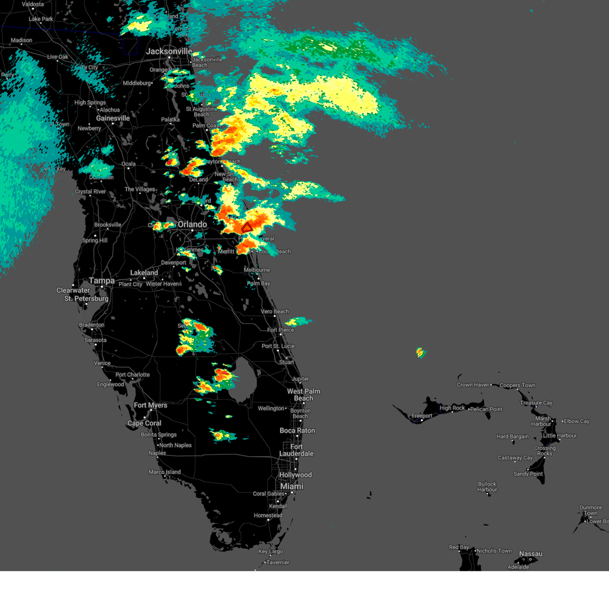 At 640 pm edt, a severe thunderstorm capable of producing a tornado was located near titusville airport, and is nearly stationary (radar indicated rotation). Hazards include tornado and quarter size hail. Flying debris will be dangerous to those caught without shelter. mobile homes will be damaged or destroyed. damage to roofs, windows, and vehicles will occur. tree damage is likely. This tornadic thunderstorm will remain over mainly rural areas of north central brevard county. At 640 pm edt, a severe thunderstorm capable of producing a tornado was located near titusville airport, and is nearly stationary (radar indicated rotation). Hazards include tornado and quarter size hail. Flying debris will be dangerous to those caught without shelter. mobile homes will be damaged or destroyed. damage to roofs, windows, and vehicles will occur. tree damage is likely. This tornadic thunderstorm will remain over mainly rural areas of north central brevard county.
|
| 4/27/2023 6:30 PM EDT |
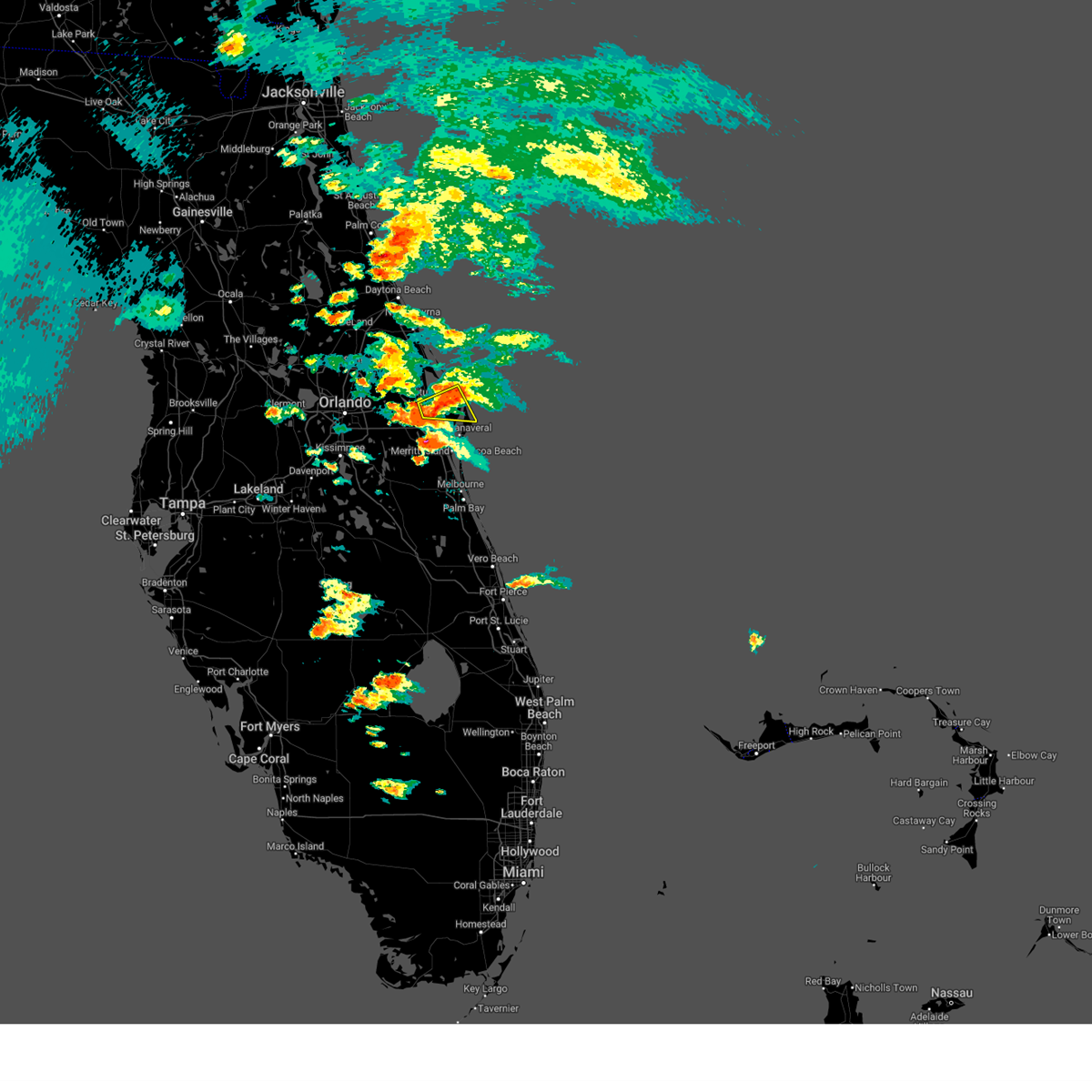 At 629 pm edt, a severe thunderstorm was located near merritt island wildlife refuge, or near titusville, moving east at 15 mph (radar indicated). Hazards include 60 mph wind gusts and quarter size hail. Hail damage to vehicles is expected. expect wind damage to roofs, siding, and trees. Locations impacted include, titusville, playalinda beach, titusville airport and merritt island wildlife refuge. At 629 pm edt, a severe thunderstorm was located near merritt island wildlife refuge, or near titusville, moving east at 15 mph (radar indicated). Hazards include 60 mph wind gusts and quarter size hail. Hail damage to vehicles is expected. expect wind damage to roofs, siding, and trees. Locations impacted include, titusville, playalinda beach, titusville airport and merritt island wildlife refuge.
|
| 4/27/2023 6:04 PM EDT |
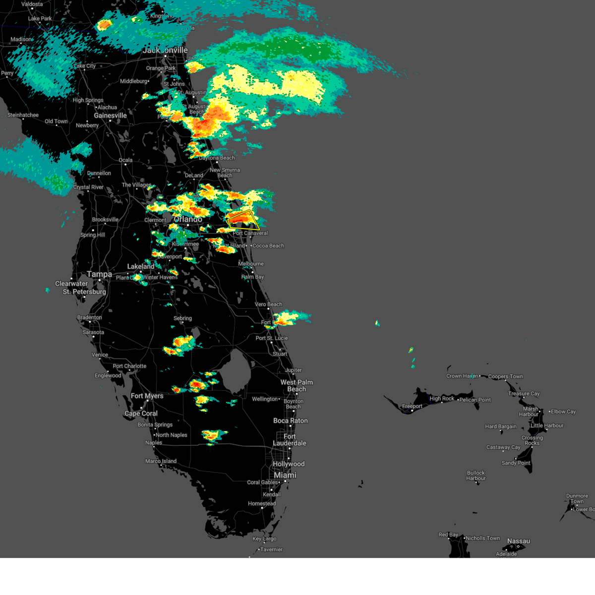 At 604 pm edt, a severe thunderstorm was located over titusville, moving east at 15 mph (radar indicated). Hazards include 60 mph wind gusts and quarter size hail. Hail damage to vehicles is expected. Expect wind damage to roofs, siding, and trees. At 604 pm edt, a severe thunderstorm was located over titusville, moving east at 15 mph (radar indicated). Hazards include 60 mph wind gusts and quarter size hail. Hail damage to vehicles is expected. Expect wind damage to roofs, siding, and trees.
|
| 4/26/2023 6:23 PM EDT |
 The severe thunderstorm warning for west central brevard and southeastern orange counties will expire at 630 pm edt, the storm which prompted the warning has weakened below severe limits, and no longer poses an immediate threat to life or property. therefore, the warning will be allowed to expire. however heavy rain is still possible with this thunderstorm. a severe thunderstorm watch remains in effect until 900 pm edt for east central florida. The severe thunderstorm warning for west central brevard and southeastern orange counties will expire at 630 pm edt, the storm which prompted the warning has weakened below severe limits, and no longer poses an immediate threat to life or property. therefore, the warning will be allowed to expire. however heavy rain is still possible with this thunderstorm. a severe thunderstorm watch remains in effect until 900 pm edt for east central florida.
|
| 4/26/2023 6:09 PM EDT |
 At 608 pm edt, a severe thunderstorm was located over canaveral groves, or near lone cabbage fish camp, moving southeast at 20 mph (trained weather spotters. at 604 pm trained weather spotters reported pea-sized hail near canaveral groves). Hazards include 60 mph wind gusts and quarter size hail. Hail damage to vehicles is expected. expect wind damage to roofs, siding, and trees. locations impacted include, rockledge, cocoa, cocoa beach, sharpes and lone cabbage fish camp. hail threat, observed max hail size, 1. 00 in wind threat, radar indicated max wind gust, 60 mph. At 608 pm edt, a severe thunderstorm was located over canaveral groves, or near lone cabbage fish camp, moving southeast at 20 mph (trained weather spotters. at 604 pm trained weather spotters reported pea-sized hail near canaveral groves). Hazards include 60 mph wind gusts and quarter size hail. Hail damage to vehicles is expected. expect wind damage to roofs, siding, and trees. locations impacted include, rockledge, cocoa, cocoa beach, sharpes and lone cabbage fish camp. hail threat, observed max hail size, 1. 00 in wind threat, radar indicated max wind gust, 60 mph.
|
| 4/26/2023 5:52 PM EDT |
 At 551 pm edt, a severe thunderstorm was located near canaveral groves, or near lone cabbage fish camp, moving southeast at 20 mph (radar indicated). Hazards include 60 mph wind gusts and half dollar size hail. Hail damage to vehicles is expected. Expect wind damage to roofs, siding, and trees. At 551 pm edt, a severe thunderstorm was located near canaveral groves, or near lone cabbage fish camp, moving southeast at 20 mph (radar indicated). Hazards include 60 mph wind gusts and half dollar size hail. Hail damage to vehicles is expected. Expect wind damage to roofs, siding, and trees.
|
| 4/26/2023 5:42 PM EDT |
 At 539 pm edt, a severe thunderstorm was located near christmas, moving southeast at 20 mph (trained weather spotters. at 526 pm a trained weather spotter reported 1 inch hail, downed tree limbs, and damaged road signs were reported 2 miles north of christmas). Hazards include 60 mph wind gusts and quarter size hail. Hail damage to vehicles is expected. expect wind damage to roofs, siding, and trees. Locations impacted include, titusville, wedgefield and christmas. At 539 pm edt, a severe thunderstorm was located near christmas, moving southeast at 20 mph (trained weather spotters. at 526 pm a trained weather spotter reported 1 inch hail, downed tree limbs, and damaged road signs were reported 2 miles north of christmas). Hazards include 60 mph wind gusts and quarter size hail. Hail damage to vehicles is expected. expect wind damage to roofs, siding, and trees. Locations impacted include, titusville, wedgefield and christmas.
|
| 4/26/2023 5:23 PM EDT |
 At 523 pm edt, a severe thunderstorm was located near christmas, moving southeast at 20 mph (radar indicated). Hazards include 60 mph wind gusts and quarter size hail. Hail damage to vehicles is expected. expect wind damage to roofs, siding, and trees. Locations impacted include, titusville, wedgefield, christmas, titusville airport and port saint john. At 523 pm edt, a severe thunderstorm was located near christmas, moving southeast at 20 mph (radar indicated). Hazards include 60 mph wind gusts and quarter size hail. Hail damage to vehicles is expected. expect wind damage to roofs, siding, and trees. Locations impacted include, titusville, wedgefield, christmas, titusville airport and port saint john.
|
| 4/26/2023 5:17 PM EDT |
 At 516 pm edt, a severe thunderstorm was located near christmas, moving southeast at 20 mph (radar indicated). Hazards include 60 mph wind gusts and quarter size hail. Hail damage to vehicles is expected. Expect wind damage to roofs, siding, and trees. At 516 pm edt, a severe thunderstorm was located near christmas, moving southeast at 20 mph (radar indicated). Hazards include 60 mph wind gusts and quarter size hail. Hail damage to vehicles is expected. Expect wind damage to roofs, siding, and trees.
|
| 4/24/2023 6:28 PM EDT |
 The severe thunderstorm warning for north central brevard county will expire at 630 pm edt, the storm which prompted the warning has weakened below severe limits, and no longer poses an immediate threat to life or property. therefore, the warning will be allowed to expire. however gusty winds and heavy rain are still possible with this thunderstorm. a severe thunderstorm watch remains in effect until 800 pm edt for east central florida. The severe thunderstorm warning for north central brevard county will expire at 630 pm edt, the storm which prompted the warning has weakened below severe limits, and no longer poses an immediate threat to life or property. therefore, the warning will be allowed to expire. however gusty winds and heavy rain are still possible with this thunderstorm. a severe thunderstorm watch remains in effect until 800 pm edt for east central florida.
|
| 4/24/2023 6:05 PM EDT |
 At 604 pm edt, a severe thunderstorm was located over merritt island wildlife refuge, or near playalinda beach, moving north at 15 mph (radar indicated). Hazards include 60 mph wind gusts and penny size hail. expect damage to roofs, siding, and trees At 604 pm edt, a severe thunderstorm was located over merritt island wildlife refuge, or near playalinda beach, moving north at 15 mph (radar indicated). Hazards include 60 mph wind gusts and penny size hail. expect damage to roofs, siding, and trees
|
| 4/24/2023 2:43 PM EDT |
 The severe thunderstorm warning for west central brevard county will expire at 245 pm edt, the storm which prompted the warning has weakened below severe limits, and no longer poses an immediate threat to life or property. therefore, the warning will be allowed to expire. however small hail, gusty winds and heavy rain are still possible with this thunderstorm. a severe thunderstorm watch remains in effect until 800 pm edt for east central florida. The severe thunderstorm warning for west central brevard county will expire at 245 pm edt, the storm which prompted the warning has weakened below severe limits, and no longer poses an immediate threat to life or property. therefore, the warning will be allowed to expire. however small hail, gusty winds and heavy rain are still possible with this thunderstorm. a severe thunderstorm watch remains in effect until 800 pm edt for east central florida.
|
| 4/24/2023 2:37 PM EDT |
 At 236 pm edt, a severe thunderstorm was located over canaveral groves, or near sharpes, and is nearly stationary (radar indicated). Hazards include 60 mph wind gusts and quarter size hail. Hail damage to vehicles is expected. expect wind damage to roofs, siding, and trees. Locations impacted include, cocoa, sharpes, port saint john, canaveral groves and canaveral acres. At 236 pm edt, a severe thunderstorm was located over canaveral groves, or near sharpes, and is nearly stationary (radar indicated). Hazards include 60 mph wind gusts and quarter size hail. Hail damage to vehicles is expected. expect wind damage to roofs, siding, and trees. Locations impacted include, cocoa, sharpes, port saint john, canaveral groves and canaveral acres.
|
| 4/24/2023 2:26 PM EDT |
 At 226 pm edt, a severe thunderstorm was located over canaveral groves, or near port saint john, moving southeast at 5 mph (radar indicated). Hazards include 60 mph wind gusts and quarter size hail. Hail damage to vehicles is expected. expect wind damage to roofs, siding, and trees. Locations impacted include, cocoa, sharpes, port saint john, canaveral groves and canaveral acres. At 226 pm edt, a severe thunderstorm was located over canaveral groves, or near port saint john, moving southeast at 5 mph (radar indicated). Hazards include 60 mph wind gusts and quarter size hail. Hail damage to vehicles is expected. expect wind damage to roofs, siding, and trees. Locations impacted include, cocoa, sharpes, port saint john, canaveral groves and canaveral acres.
|
| 4/24/2023 2:13 PM EDT |
 At 212 pm edt, a severe thunderstorm was located near canaveral groves, or near port saint john, moving southeast at 5 mph (radar indicated). Hazards include 60 mph wind gusts and quarter size hail. Hail damage to vehicles is expected. Expect wind damage to roofs, siding, and trees. At 212 pm edt, a severe thunderstorm was located near canaveral groves, or near port saint john, moving southeast at 5 mph (radar indicated). Hazards include 60 mph wind gusts and quarter size hail. Hail damage to vehicles is expected. Expect wind damage to roofs, siding, and trees.
|
| 9/10/2022 5:25 PM EDT | Ussf tower 311 measured a 54 kt/62 mph thunderstorm wind gust from the wes in brevard county FL, 11.6 miles W of Titusville, FL |
| 9/10/2022 5:19 PM EDT | The nasa shuttle landing facility awos measured a wind gust of 50 kt/58 mph from the south-southwes in brevard county FL, 9.2 miles W of Titusville, FL |
| 7/19/2022 4:17 PM EDT |
 At 417 pm edt, a severe thunderstorm was located over scottsmoor, moving northeast at 25 mph (radar indicated). Hazards include 60 mph wind gusts and penny size hail. Expect damage to roofs, siding, and trees. locations impacted include, titusville, new smyrna beach, edgewater, oak hill and mims. hail threat, radar indicated max hail size, 0. 75 in wind threat, radar indicated max wind gust, 60 mph. At 417 pm edt, a severe thunderstorm was located over scottsmoor, moving northeast at 25 mph (radar indicated). Hazards include 60 mph wind gusts and penny size hail. Expect damage to roofs, siding, and trees. locations impacted include, titusville, new smyrna beach, edgewater, oak hill and mims. hail threat, radar indicated max hail size, 0. 75 in wind threat, radar indicated max wind gust, 60 mph.
|
| 7/19/2022 4:01 PM EDT |
 At 401 pm edt, a severe thunderstorm was located 8 miles south of maytown, or 8 miles southeast of geneva, moving northeast at 30 mph (radar indicated). Hazards include 60 mph wind gusts and penny size hail. expect damage to roofs, siding, and trees At 401 pm edt, a severe thunderstorm was located 8 miles south of maytown, or 8 miles southeast of geneva, moving northeast at 30 mph (radar indicated). Hazards include 60 mph wind gusts and penny size hail. expect damage to roofs, siding, and trees
|
| 6/23/2022 7:57 PM EDT |
 The severe thunderstorm warning for northern brevard county will expire at 800 pm edt, the storm which prompted the warning has weakened below severe limits, and has exited the warned area. therefore, the warning will be allowed to expire. however gusty winds and heavy rain are still possible with this thunderstorm. The severe thunderstorm warning for northern brevard county will expire at 800 pm edt, the storm which prompted the warning has weakened below severe limits, and has exited the warned area. therefore, the warning will be allowed to expire. however gusty winds and heavy rain are still possible with this thunderstorm.
|
| 6/23/2022 7:36 PM EDT |
 At 735 pm edt, a severe thunderstorm was located over mims, moving east at 10 mph (radar indicated). Hazards include 60 mph wind gusts and quarter size hail. Hail damage to vehicles is expected. expect wind damage to roofs, siding, and trees. Locations impacted include, titusville, haulover canal, mims, scottsmoor and klondike beach. At 735 pm edt, a severe thunderstorm was located over mims, moving east at 10 mph (radar indicated). Hazards include 60 mph wind gusts and quarter size hail. Hail damage to vehicles is expected. expect wind damage to roofs, siding, and trees. Locations impacted include, titusville, haulover canal, mims, scottsmoor and klondike beach.
|
| 6/23/2022 7:13 PM EDT |
 At 712 pm edt, a severe thunderstorm was located near oak hill, moving south at 15 mph (radar indicated). Hazards include 60 mph wind gusts and penny size hail. expect damage to roofs, siding, and trees At 712 pm edt, a severe thunderstorm was located near oak hill, moving south at 15 mph (radar indicated). Hazards include 60 mph wind gusts and penny size hail. expect damage to roofs, siding, and trees
|
| 6/18/2022 4:15 PM EDT | Ussf tower 714 at ksc reported a 64mph/56kt wind gust from the wnw in brevard county FL, 6.2 miles SW of Titusville, FL |
| 6/6/2022 5:41 PM EDT |
 At 540 pm edt, a severe thunderstorm was located near kennedy space center, or near playalinda beach, moving east at 15 mph. numerous wind gust of 55 to 60 mph have been observed across merritt island from kennedy space center to the tip of the cape (radar indicated). Hazards include 60 mph wind gusts. Expect damage to roofs, siding, and trees. locations impacted include, cocoa, cocoa beach, cape canaveral, port canaveral and playalinda beach. hail threat, radar indicated max hail size, <. 75 in wind threat, radar indicated max wind gust, 60 mph. At 540 pm edt, a severe thunderstorm was located near kennedy space center, or near playalinda beach, moving east at 15 mph. numerous wind gust of 55 to 60 mph have been observed across merritt island from kennedy space center to the tip of the cape (radar indicated). Hazards include 60 mph wind gusts. Expect damage to roofs, siding, and trees. locations impacted include, cocoa, cocoa beach, cape canaveral, port canaveral and playalinda beach. hail threat, radar indicated max hail size, <. 75 in wind threat, radar indicated max wind gust, 60 mph.
|
| 6/6/2022 5:16 PM EDT |
 At 515 pm edt, a severe thunderstorm was located from over kennedy space center to port saint john, moving east at 15 mph (radar indicated). Hazards include 60 mph wind gusts. expect damage to roofs, siding, and trees At 515 pm edt, a severe thunderstorm was located from over kennedy space center to port saint john, moving east at 15 mph (radar indicated). Hazards include 60 mph wind gusts. expect damage to roofs, siding, and trees
|
| 6/6/2022 5:10 PM EDT | Ussf wind tower 412 measured a peak wind gust of 51kt/59mph from the n in brevard county FL, 9.9 miles W of Titusville, FL |
| 6/6/2022 5:00 PM EDT | Ussf wind tower 415 measured a peak wind gust of 51kt/59mph from the nn in brevard county FL, 9.5 miles WSW of Titusville, FL |
| 6/6/2022 4:49 PM EDT |
 At 449 pm edt, a severe thunderstorm was located near merritt island wildlife refuge, or near playalinda beach, moving east at 15 mph (radar indicated). Hazards include 60 mph wind gusts and nickel size hail. Expect damage to roofs, siding, and trees. locations impacted include, titusville, haulover canal, playalinda beach, mims and kennedy space center. hail threat, radar indicated max hail size, 0. 88 in wind threat, observed max wind gust, 60 mph. At 449 pm edt, a severe thunderstorm was located near merritt island wildlife refuge, or near playalinda beach, moving east at 15 mph (radar indicated). Hazards include 60 mph wind gusts and nickel size hail. Expect damage to roofs, siding, and trees. locations impacted include, titusville, haulover canal, playalinda beach, mims and kennedy space center. hail threat, radar indicated max hail size, 0. 88 in wind threat, observed max wind gust, 60 mph.
|
| 6/6/2022 4:27 PM EDT |
 At 427 pm edt, a severe thunderstorm was located near mims, moving east at 5 mph. at 424 pm, a 59 mph wind gust was observed in titusville along the indian river (radar indicated). Hazards include 60 mph wind gusts and nickel size hail. expect damage to roofs, siding, and trees At 427 pm edt, a severe thunderstorm was located near mims, moving east at 5 mph. at 424 pm, a 59 mph wind gust was observed in titusville along the indian river (radar indicated). Hazards include 60 mph wind gusts and nickel size hail. expect damage to roofs, siding, and trees
|
| 6/6/2022 4:24 PM EDT | Weatherflow xpar at parrish park in titusville measured a peak wind gust of 51kt/59mph from the nn in amz552 county FL, 3.4 miles SSW of Titusville, FL |
| 4/7/2022 1:40 PM EDT | Usaf tower ksc-1102 measures wind gust of 52kt/60mph in brevard county FL, 14.6 miles W of Titusville, FL |
| 3/18/2022 10:15 PM EDT |
 At 1015 pm edt, a severe thunderstorm was located near haulover canal, moving northeast at 30 mph (radar indicated). Hazards include 60 mph wind gusts. Expect damage to roofs, siding, and trees. locations impacted include, titusville, oak hill, haulover canal, mims and playalinda beach. hail threat, radar indicated max hail size, <. 75 in wind threat, radar indicated max wind gust, 60 mph. At 1015 pm edt, a severe thunderstorm was located near haulover canal, moving northeast at 30 mph (radar indicated). Hazards include 60 mph wind gusts. Expect damage to roofs, siding, and trees. locations impacted include, titusville, oak hill, haulover canal, mims and playalinda beach. hail threat, radar indicated max hail size, <. 75 in wind threat, radar indicated max wind gust, 60 mph.
|
| 3/18/2022 10:05 PM EDT |
 At 1005 pm edt, a severe thunderstorm was located over mims, moving northeast at 30 mph (radar indicated). Hazards include 60 mph wind gusts. expect damage to roofs, siding, and trees At 1005 pm edt, a severe thunderstorm was located over mims, moving northeast at 30 mph (radar indicated). Hazards include 60 mph wind gusts. expect damage to roofs, siding, and trees
|
| 3/16/2022 12:03 AM EDT |
 At 1202 am edt, a severe thunderstorm capable of producing a tornado was located over christmas, moving northeast at 15 mph (radar indicated rotation). Hazards include tornado. Flying debris will be dangerous to those caught without shelter. mobile homes will be damaged or destroyed. damage to roofs, windows, and vehicles will occur. tree damage is likely. This tornadic thunderstorm will remain over mainly rural areas of northwestern brevard and east central orange counties. At 1202 am edt, a severe thunderstorm capable of producing a tornado was located over christmas, moving northeast at 15 mph (radar indicated rotation). Hazards include tornado. Flying debris will be dangerous to those caught without shelter. mobile homes will be damaged or destroyed. damage to roofs, windows, and vehicles will occur. tree damage is likely. This tornadic thunderstorm will remain over mainly rural areas of northwestern brevard and east central orange counties.
|
| 3/12/2022 10:58 AM EST |
 The severe thunderstorm warning for southeastern seminole, northwestern brevard, southeastern orange and southeastern volusia counties will expire at 1100 am est, the storms which prompted the warning have weakened below severe limits, and no longer pose an immediate threat to life or property. therefore, the warning will be allowed to expire. however small hail, gusty winds and heavy rain are still possible with these thunderstorms. a tornado watch remains in effect until 1100 am est for east central florida. The severe thunderstorm warning for southeastern seminole, northwestern brevard, southeastern orange and southeastern volusia counties will expire at 1100 am est, the storms which prompted the warning have weakened below severe limits, and no longer pose an immediate threat to life or property. therefore, the warning will be allowed to expire. however small hail, gusty winds and heavy rain are still possible with these thunderstorms. a tornado watch remains in effect until 1100 am est for east central florida.
|
| 3/12/2022 10:43 AM EST |
 At 1043 am est, severe thunderstorms were located along a line extending from 15 miles east of apollo beach to near lake nona, moving northeast at 95 mph (radar indicated). Hazards include 60 mph wind gusts and penny size hail. Expect damage to roofs, siding, and trees. Locations impacted include, orlando, titusville, oviedo, wedgefield and oak hill. At 1043 am est, severe thunderstorms were located along a line extending from 15 miles east of apollo beach to near lake nona, moving northeast at 95 mph (radar indicated). Hazards include 60 mph wind gusts and penny size hail. Expect damage to roofs, siding, and trees. Locations impacted include, orlando, titusville, oviedo, wedgefield and oak hill.
|
| 3/12/2022 10:15 AM EST |
 At 1015 am est, severe thunderstorms were located along a line extending from near bethune beach to maytown to near champions gate, moving east at 60 mph (radar indicated). Hazards include 60 mph wind gusts and penny size hail. expect damage to roofs, siding, and trees At 1015 am est, severe thunderstorms were located along a line extending from near bethune beach to maytown to near champions gate, moving east at 60 mph (radar indicated). Hazards include 60 mph wind gusts and penny size hail. expect damage to roofs, siding, and trees
|
| 3/12/2022 9:49 AM EST |
 At 948 am est, severe thunderstorms were located along a line extending from near ormond beach to altamonte springs to near lake louisa, moving east at 35 mph (radar indicated). Hazards include 60 mph wind gusts and penny size hail. Expect damage to roofs, siding, and trees. Locations impacted include, orlando, deltona, daytona beach, port orange and sanford. At 948 am est, severe thunderstorms were located along a line extending from near ormond beach to altamonte springs to near lake louisa, moving east at 35 mph (radar indicated). Hazards include 60 mph wind gusts and penny size hail. Expect damage to roofs, siding, and trees. Locations impacted include, orlando, deltona, daytona beach, port orange and sanford.
|
| 3/12/2022 9:30 AM EST |
 At 930 am est, severe thunderstorms were located along a line extending from 6 miles northeast of ormond-by-the-sea to near ocoee to 9 miles southwest of lake louisa, moving east at 60 mph (radar indicated). Hazards include 60 mph wind gusts and penny size hail. expect damage to roofs, siding, and trees At 930 am est, severe thunderstorms were located along a line extending from 6 miles northeast of ormond-by-the-sea to near ocoee to 9 miles southwest of lake louisa, moving east at 60 mph (radar indicated). Hazards include 60 mph wind gusts and penny size hail. expect damage to roofs, siding, and trees
|
| 9/7/2021 6:00 PM EDT |
 At 543 pm edt, a severe thunderstorm was located near canaveral groves, or near lone cabbage fish camp, moving south at 15 mph (radar indicated). Hazards include 60 mph wind gusts and quarter size hail. Hail damage to vehicles is expected. Expect wind damage to roofs, siding, and trees. At 543 pm edt, a severe thunderstorm was located near canaveral groves, or near lone cabbage fish camp, moving south at 15 mph (radar indicated). Hazards include 60 mph wind gusts and quarter size hail. Hail damage to vehicles is expected. Expect wind damage to roofs, siding, and trees.
|
| 9/7/2021 5:43 PM EDT |
 At 543 pm edt, a severe thunderstorm was located near canaveral groves, or near lone cabbage fish camp, moving south at 15 mph (radar indicated). Hazards include 60 mph wind gusts and quarter size hail. Hail damage to vehicles is expected. Expect wind damage to roofs, siding, and trees. At 543 pm edt, a severe thunderstorm was located near canaveral groves, or near lone cabbage fish camp, moving south at 15 mph (radar indicated). Hazards include 60 mph wind gusts and quarter size hail. Hail damage to vehicles is expected. Expect wind damage to roofs, siding, and trees.
|
| 9/2/2021 7:03 PM EDT | Awos at ktts nasa shuttle landing facility reported a 58mph/50kt wind gust from the w in brevard county FL, 8.3 miles WSW of Titusville, FL |
| 8/2/2021 3:14 PM EDT |
 At 313 pm edt, a severe thunderstorm was located near lone cabbage fish camp, moving east at 20 mph (radar indicated). Hazards include 60 mph wind gusts. expect damage to roofs, siding, and trees At 313 pm edt, a severe thunderstorm was located near lone cabbage fish camp, moving east at 20 mph (radar indicated). Hazards include 60 mph wind gusts. expect damage to roofs, siding, and trees
|
| 6/13/2021 3:13 PM EDT |
 The severe thunderstorm warning for central brevard county will expire at 315 pm edt, the storm which prompted the warning has weakened below severe limits, and has exited the warned area. therefore, the warning will be allowed to expire. however heavy rain is still possible with this thunderstorm. The severe thunderstorm warning for central brevard county will expire at 315 pm edt, the storm which prompted the warning has weakened below severe limits, and has exited the warned area. therefore, the warning will be allowed to expire. however heavy rain is still possible with this thunderstorm.
|
| 6/13/2021 2:35 PM EDT |
 At 234 pm edt, a severe thunderstorm was located over rockledge, moving east at 20 mph (radar indicated). Hazards include 60 mph wind gusts. expect damage to roofs, siding, and trees At 234 pm edt, a severe thunderstorm was located over rockledge, moving east at 20 mph (radar indicated). Hazards include 60 mph wind gusts. expect damage to roofs, siding, and trees
|
| 5/5/2021 7:45 PM EDT | Us space force network tower 412 measured a thunderstorm wind gust out of 280/50 knot in brevard county FL, 9.9 miles W of Titusville, FL |
| 5/5/2021 7:42 PM EDT | Measured thunderstorm wind gust at the nasa landing strip out of 320/55 knot in brevard county FL, 8.9 miles WSW of Titusville, FL |
| 2/15/2021 6:46 PM EST |
 At 645 pm est, a severe thunderstorm was located over chuluota, moving northeast at 40 mph (radar indicated). Hazards include 60 mph wind gusts. Expect damage to roofs, siding, and trees. Locations impacted include, titusville, oviedo, new smyrna beach, oak hill and chuluota. At 645 pm est, a severe thunderstorm was located over chuluota, moving northeast at 40 mph (radar indicated). Hazards include 60 mph wind gusts. Expect damage to roofs, siding, and trees. Locations impacted include, titusville, oviedo, new smyrna beach, oak hill and chuluota.
|
| 2/15/2021 6:31 PM EST |
 At 630 pm est, a severe thunderstorm was located over avalon park, moving northeast at 40 mph (radar indicated). Hazards include 60 mph wind gusts. expect damage to roofs, siding, and trees At 630 pm est, a severe thunderstorm was located over avalon park, moving northeast at 40 mph (radar indicated). Hazards include 60 mph wind gusts. expect damage to roofs, siding, and trees
|
| 8/18/2020 4:35 PM EDT | Gust to 61 mph/53 kt from the sw at usaf wind tower 31 in brevard county FL, 11.6 miles W of Titusville, FL |
| 7/6/2020 5:09 PM EDT |
 At 508 pm edt, a severe thunderstorm was located near kennedy space center, or 7 miles north of port canaveral, moving east at 30 mph (radar indicated). Hazards include 60 mph wind gusts. Expect damage to roofs, siding, and trees. Locations impacted include, titusville, cocoa, cocoa beach, cape canaveral and merritt island. At 508 pm edt, a severe thunderstorm was located near kennedy space center, or 7 miles north of port canaveral, moving east at 30 mph (radar indicated). Hazards include 60 mph wind gusts. Expect damage to roofs, siding, and trees. Locations impacted include, titusville, cocoa, cocoa beach, cape canaveral and merritt island.
|
| 7/6/2020 4:44 PM EDT |
 At 444 pm edt, a severe thunderstorm was located over sharpes, moving northeast at 30 mph (radar indicated). Hazards include 60 mph wind gusts. expect damage to roofs, siding, and trees At 444 pm edt, a severe thunderstorm was located over sharpes, moving northeast at 30 mph (radar indicated). Hazards include 60 mph wind gusts. expect damage to roofs, siding, and trees
|
| 7/4/2020 5:39 PM EDT |
 At 521 pm edt, a severe thunderstorm was located over cape canaveral, moving east at 25 mph (radar indicated). Hazards include 60 mph wind gusts. expect damage to roofs, siding, and trees At 521 pm edt, a severe thunderstorm was located over cape canaveral, moving east at 25 mph (radar indicated). Hazards include 60 mph wind gusts. expect damage to roofs, siding, and trees
|
| 7/4/2020 5:22 PM EDT |
 At 521 pm edt, a severe thunderstorm was located over cape canaveral, moving east at 25 mph (radar indicated). Hazards include 60 mph wind gusts. expect damage to roofs, siding, and trees At 521 pm edt, a severe thunderstorm was located over cape canaveral, moving east at 25 mph (radar indicated). Hazards include 60 mph wind gusts. expect damage to roofs, siding, and trees
|
| 6/25/2020 3:15 PM EDT | Usaf wind tower 1007 measured a wind gust of 59 mph/51 kt from the ss in brevard county FL, 5.2 miles NW of Titusville, FL |
| 6/25/2020 2:34 PM EDT |
 At 234 pm edt, a severe thunderstorm was located over space coast airport, and is nearly stationary (radar indicated). Hazards include 60 mph wind gusts and quarter size hail. Hail damage to vehicles is expected. Expect wind damage to roofs, siding, and trees. At 234 pm edt, a severe thunderstorm was located over space coast airport, and is nearly stationary (radar indicated). Hazards include 60 mph wind gusts and quarter size hail. Hail damage to vehicles is expected. Expect wind damage to roofs, siding, and trees.
|
| 4/24/2020 7:50 AM EDT |
 The severe thunderstorm warning for northwestern brevard county will expire at 800 am edt, the storm which prompted the warning has moved out of the area. therefore, the warning will be allowed to expire. however gusty winds and heavy rain are still possible with this thunderstorm. a tornado watch remains in effect until 1100 am edt for east central florida. to report severe weather, contact your nearest law enforcement agency. they will relay your report to the national weather service melbourne. The severe thunderstorm warning for northwestern brevard county will expire at 800 am edt, the storm which prompted the warning has moved out of the area. therefore, the warning will be allowed to expire. however gusty winds and heavy rain are still possible with this thunderstorm. a tornado watch remains in effect until 1100 am edt for east central florida. to report severe weather, contact your nearest law enforcement agency. they will relay your report to the national weather service melbourne.
|
| 4/24/2020 7:29 AM EDT |
 At 729 am edt, a severe thunderstorm was located over scottsmoor, moving northeast at 35 mph (radar indicated). Hazards include 60 mph wind gusts. expect damage to roofs, siding, and trees At 729 am edt, a severe thunderstorm was located over scottsmoor, moving northeast at 35 mph (radar indicated). Hazards include 60 mph wind gusts. expect damage to roofs, siding, and trees
|
| 4/24/2020 7:29 AM EDT |
 At 724 am edt, severe thunderstorms were located along a line extending from playalinda beach to near merritt island to 9 miles northwest of camp holly fish camp to near holopaw, moving northeast at 50 mph. several wind gusts up to around 60 mph have been reported around cape canaveral (radar indicated). Hazards include 65 mph wind gusts. Expect damage to roofs, siding, and trees. These severe storms will be near, cape canaveral, playalinda beach, cocoa beach, and rockledge through 740 am edt. At 724 am edt, severe thunderstorms were located along a line extending from playalinda beach to near merritt island to 9 miles northwest of camp holly fish camp to near holopaw, moving northeast at 50 mph. several wind gusts up to around 60 mph have been reported around cape canaveral (radar indicated). Hazards include 65 mph wind gusts. Expect damage to roofs, siding, and trees. These severe storms will be near, cape canaveral, playalinda beach, cocoa beach, and rockledge through 740 am edt.
|
| 4/24/2020 7:15 AM EDT | Usaf tower ksc-1007 measures wind gust of 53kt/61mph from sw in brevard county FL, 5.2 miles NW of Titusville, FL |
| 4/24/2020 7:07 AM EDT |
 At 707 am edt, severe thunderstorms were located along a line extending from space coast airport to near lone cabbage fish camp to near holopaw to 8 miles northeast of lake kissimmee, moving northeast at 50 mph (radar indicated). Hazards include 60 mph wind gusts. expect damage to roofs, siding, and trees At 707 am edt, severe thunderstorms were located along a line extending from space coast airport to near lone cabbage fish camp to near holopaw to 8 miles northeast of lake kissimmee, moving northeast at 50 mph (radar indicated). Hazards include 60 mph wind gusts. expect damage to roofs, siding, and trees
|
| 4/20/2020 12:40 PM EDT |
 The tornado warning for northeastern brevard county will expire at 1245 pm edt, the tornadic thunderstorm which prompted the warning has moved out of the warned area. therefore, the warning will be allowed to expire. a severe thunderstorm watch remains in effect until 300 pm edt for east central florida. The tornado warning for northeastern brevard county will expire at 1245 pm edt, the tornadic thunderstorm which prompted the warning has moved out of the warned area. therefore, the warning will be allowed to expire. a severe thunderstorm watch remains in effect until 300 pm edt for east central florida.
|
| 4/20/2020 12:14 PM EDT |
 At 1214 pm edt, a severe thunderstorm capable of producing a tornado was located over titusville, moving east at 35 mph (radar indicated rotation). Hazards include tornado. Flying debris will be dangerous to those caught without shelter. mobile homes will be damaged or destroyed. damage to roofs, windows, and vehicles will occur. tree damage is likely. this dangerous storm will be near, kennedy space center around 1230 pm edt. Other locations impacted by this tornadic thunderstorm include lagrange. At 1214 pm edt, a severe thunderstorm capable of producing a tornado was located over titusville, moving east at 35 mph (radar indicated rotation). Hazards include tornado. Flying debris will be dangerous to those caught without shelter. mobile homes will be damaged or destroyed. damage to roofs, windows, and vehicles will occur. tree damage is likely. this dangerous storm will be near, kennedy space center around 1230 pm edt. Other locations impacted by this tornadic thunderstorm include lagrange.
|
| 4/20/2020 12:06 PM EDT |
 At 1205 pm edt, a confirmed tornado was located near maytown, or 7 miles west of scottsmoor, moving east at 40 to 45 mph (radar confirmed tornado). Hazards include damaging tornado. Flying debris will be dangerous to those caught without shelter. mobile homes will be damaged or destroyed. damage to roofs, windows, and vehicles will occur. tree damage is likely. this tornado will be near, mims and scottsmoor around 1220 pm edt. Other locations impacted by this tornadic thunderstorm include turnbull. At 1205 pm edt, a confirmed tornado was located near maytown, or 7 miles west of scottsmoor, moving east at 40 to 45 mph (radar confirmed tornado). Hazards include damaging tornado. Flying debris will be dangerous to those caught without shelter. mobile homes will be damaged or destroyed. damage to roofs, windows, and vehicles will occur. tree damage is likely. this tornado will be near, mims and scottsmoor around 1220 pm edt. Other locations impacted by this tornadic thunderstorm include turnbull.
|
| 4/20/2020 11:59 AM EDT |
 The national weather service in melbourne has issued a * tornado warning for. north central brevard county in east central florida. until 1230 pm edt. At 1159 am edt, a severe thunderstorm capable of producing a tornado was located near lagrange, moving east at 40 mph. The national weather service in melbourne has issued a * tornado warning for. north central brevard county in east central florida. until 1230 pm edt. At 1159 am edt, a severe thunderstorm capable of producing a tornado was located near lagrange, moving east at 40 mph.
|
| 4/20/2020 11:48 AM EDT |
 At 1147 am edt, a tornado producing storm was located over lake jessup, moving east at 40 mph (radar confirmed tornado). Hazards include damaging tornado. Flying debris will be dangerous to those caught without shelter. mobile homes will be damaged or destroyed. damage to roofs, windows, and vehicles will occur. tree damage is likely. this tornadic storm will be near, geneva around 1150 am edt. maytown around 1210 pm edt. scottsmoor and mims around 1220 pm edt. Other locations impacted by this tornadic thunderstorm include lake harney. At 1147 am edt, a tornado producing storm was located over lake jessup, moving east at 40 mph (radar confirmed tornado). Hazards include damaging tornado. Flying debris will be dangerous to those caught without shelter. mobile homes will be damaged or destroyed. damage to roofs, windows, and vehicles will occur. tree damage is likely. this tornadic storm will be near, geneva around 1150 am edt. maytown around 1210 pm edt. scottsmoor and mims around 1220 pm edt. Other locations impacted by this tornadic thunderstorm include lake harney.
|
| 4/20/2020 11:44 AM EDT |
 At 1144 am edt, a severe thunderstorm was located near geneva, moving east at 45 to 50 mph (radar indicated). Hazards include 60 mph wind gusts and nickel size hail. expect damage to roofs, siding, and trees At 1144 am edt, a severe thunderstorm was located near geneva, moving east at 45 to 50 mph (radar indicated). Hazards include 60 mph wind gusts and nickel size hail. expect damage to roofs, siding, and trees
|
| 2/7/2020 1:20 AM EST | Usaf wind tower 714 measured a peak wind gust of 64mph or 56knots from the wes in brevard county FL, 6.2 miles SW of Titusville, FL |
| 2/7/2020 1:15 AM EST |
 At 113 am est, strong to severe thunderstorms were located along a line extending from haulover canal to near camp holly fish camp, moving east at 40 mph (radar indicated). Hazards include 60 mph wind gusts. Expect damage to roofs, siding, and trees. Locations impacted include, palm bay, melbourne, titusville, rockledge and cocoa. At 113 am est, strong to severe thunderstorms were located along a line extending from haulover canal to near camp holly fish camp, moving east at 40 mph (radar indicated). Hazards include 60 mph wind gusts. Expect damage to roofs, siding, and trees. Locations impacted include, palm bay, melbourne, titusville, rockledge and cocoa.
|
| 2/7/2020 1:11 AM EST | Weatherflow site xpar at titusville measured a peak wind gust of 62mph or 55knots from the wes in amz552 county FL, 3.4 miles SSW of Titusville, FL |
| 2/7/2020 12:54 AM EST |
 At 1253 am est, strong to severe thunderstorms were located along a line extending from edgewater to christmas and lake kissimmee, moving east at 40 mph (radar indicated). Hazards include 60 mph wind gusts. expect damage to roofs, siding, and trees At 1253 am est, strong to severe thunderstorms were located along a line extending from edgewater to christmas and lake kissimmee, moving east at 40 mph (radar indicated). Hazards include 60 mph wind gusts. expect damage to roofs, siding, and trees
|
| 2/7/2020 12:07 AM EST |
 At 1206 am est, severe thunderstorms were located along a line extending from 10 miles east of daytona beach shores to near lone cabbage fish camp, moving east at 50 mph (radar indicated). Hazards include 60 mph wind gusts. expect damage to roofs, siding, and trees At 1206 am est, severe thunderstorms were located along a line extending from 10 miles east of daytona beach shores to near lone cabbage fish camp, moving east at 50 mph (radar indicated). Hazards include 60 mph wind gusts. expect damage to roofs, siding, and trees
|
| 8/5/2019 5:26 PM EDT |
 At 526 pm edt, a severe thunderstorm was located over merritt island wildlife refuge, or near titusville, and is nearly stationary (radar indicated). Hazards include 60 mph wind gusts and penny size hail. Expect damage to roofs, siding, and trees. Locations impacted include, titusville, space coast airport, mims, kennedy space center and merritt island wildlife refuge. At 526 pm edt, a severe thunderstorm was located over merritt island wildlife refuge, or near titusville, and is nearly stationary (radar indicated). Hazards include 60 mph wind gusts and penny size hail. Expect damage to roofs, siding, and trees. Locations impacted include, titusville, space coast airport, mims, kennedy space center and merritt island wildlife refuge.
|
| 8/5/2019 5:11 PM EDT | Power lines reported down at carnegie st and cornwall dr... as well as maple pl and vernon ave in titusville between 511-530p in brevard county FL, 3.2 miles S of Titusville, FL |
| 8/5/2019 5:03 PM EDT |
 At 503 pm edt, a severe thunderstorm was located over merritt island wildlife refuge, or near titusville, and is nearly stationary (radar indicated). Hazards include 60 mph wind gusts and penny size hail. expect damage to roofs, siding, and trees At 503 pm edt, a severe thunderstorm was located over merritt island wildlife refuge, or near titusville, and is nearly stationary (radar indicated). Hazards include 60 mph wind gusts and penny size hail. expect damage to roofs, siding, and trees
|
| 6/23/2019 3:30 PM EDT |
 At 329 pm edt, a severe thunderstorm was located near port saint john, moving south at 15 mph. this storm is moving across interstate 95 south of state road 407 (radar indicated). Hazards include 60 mph wind gusts and nickel size hail. Expect damage to roofs, siding, and trees. Locations impacted include, titusville, rockledge, cocoa, cocoa beach and merritt island. At 329 pm edt, a severe thunderstorm was located near port saint john, moving south at 15 mph. this storm is moving across interstate 95 south of state road 407 (radar indicated). Hazards include 60 mph wind gusts and nickel size hail. Expect damage to roofs, siding, and trees. Locations impacted include, titusville, rockledge, cocoa, cocoa beach and merritt island.
|
| 6/23/2019 3:19 PM EDT |
 At 318 pm edt, a severe thunderstorm was located west of the space coast airport, moving south at 15 mph (radar indicated). Hazards include 60 mph wind gusts and nickel size hail. expect damage to roofs, siding, and trees At 318 pm edt, a severe thunderstorm was located west of the space coast airport, moving south at 15 mph (radar indicated). Hazards include 60 mph wind gusts and nickel size hail. expect damage to roofs, siding, and trees
|
| 6/19/2019 4:36 PM EDT |
 A severe thunderstorm warning remains in effect until 500 pm edt for northern brevard and northeastern osceola counties. at 436 pm edt, a severe thunderstorm was located over sharpes, moving east at 30 mph. hazard. 60 mph wind gusts. source. Radar indicated. A severe thunderstorm warning remains in effect until 500 pm edt for northern brevard and northeastern osceola counties. at 436 pm edt, a severe thunderstorm was located over sharpes, moving east at 30 mph. hazard. 60 mph wind gusts. source. Radar indicated.
|
| 6/19/2019 4:07 PM EDT |
 At 407 pm edt, a severe thunderstorm was located 7 miles west of lone cabbage fish camp, moving east at 35 mph (radar indicated). Hazards include 60 mph wind gusts. Expect damage to roofs, siding, and trees. Locations impacted include, orlando, titusville, rockledge, cocoa and cocoa beach. At 407 pm edt, a severe thunderstorm was located 7 miles west of lone cabbage fish camp, moving east at 35 mph (radar indicated). Hazards include 60 mph wind gusts. Expect damage to roofs, siding, and trees. Locations impacted include, orlando, titusville, rockledge, cocoa and cocoa beach.
|
| 6/19/2019 3:53 PM EDT |
 At 353 pm edt, a severe thunderstorm was located near narcoossee, moving east at 30 mph (radar indicated). Hazards include 60 mph wind gusts. expect damage to roofs, siding, and trees At 353 pm edt, a severe thunderstorm was located near narcoossee, moving east at 30 mph (radar indicated). Hazards include 60 mph wind gusts. expect damage to roofs, siding, and trees
|
| 6/12/2019 3:09 PM EDT |
 At 308 pm edt, severe thunderstorms were located along a line extending from 6 miles northwest of port canaveral to near west melbourne, moving northeast at 30 mph (radar indicated). Hazards include 70 mph wind gusts and nickel size hail. Expect considerable tree damage. damage is likely to mobile homes, roofs, and outbuildings. Locations impacted include, palm bay, melbourne, rockledge, cocoa and cocoa beach. At 308 pm edt, severe thunderstorms were located along a line extending from 6 miles northwest of port canaveral to near west melbourne, moving northeast at 30 mph (radar indicated). Hazards include 70 mph wind gusts and nickel size hail. Expect considerable tree damage. damage is likely to mobile homes, roofs, and outbuildings. Locations impacted include, palm bay, melbourne, rockledge, cocoa and cocoa beach.
|
| 6/12/2019 3:01 PM EDT |
 At 300 pm edt, severe thunderstorms were located along a line extending from 6 miles northeast of sharpes to near camp holly fish camp, moving northeast at 30 mph (radar indicated). Hazards include 70 mph wind gusts and nickel size hail. Expect considerable tree damage. damage is likely to mobile homes, roofs, and outbuildings. Locations impacted include, palm bay, palm shores, melbourne, rockledge, cocoa and cocoa beach. At 300 pm edt, severe thunderstorms were located along a line extending from 6 miles northeast of sharpes to near camp holly fish camp, moving northeast at 30 mph (radar indicated). Hazards include 70 mph wind gusts and nickel size hail. Expect considerable tree damage. damage is likely to mobile homes, roofs, and outbuildings. Locations impacted include, palm bay, palm shores, melbourne, rockledge, cocoa and cocoa beach.
|
| 6/12/2019 2:43 PM EDT |
 At 243 pm edt, a line of severe thunderstorms from near lone cabbage fish camp to deer park was moving northeast at 30 mph (radar indicated). Hazards include 60 mph wind gusts and nickel size hail. expect damage to roofs, siding, and trees At 243 pm edt, a line of severe thunderstorms from near lone cabbage fish camp to deer park was moving northeast at 30 mph (radar indicated). Hazards include 60 mph wind gusts and nickel size hail. expect damage to roofs, siding, and trees
|
| 6/10/2019 3:56 PM EDT |
 At 338 pm edt, severe thunderstorms were located along a line extending from maytown to near canaveral groves, moving northeast at 25 mph (radar indicated). Hazards include 60 mph wind gusts. expect damage to roofs, siding, and trees At 338 pm edt, severe thunderstorms were located along a line extending from maytown to near canaveral groves, moving northeast at 25 mph (radar indicated). Hazards include 60 mph wind gusts. expect damage to roofs, siding, and trees
|
| 6/10/2019 3:39 PM EDT |
 At 338 pm edt, severe thunderstorms were located along a line extending from maytown to near canaveral groves, moving northeast at 25 mph (radar indicated). Hazards include 60 mph wind gusts. expect damage to roofs, siding, and trees At 338 pm edt, severe thunderstorms were located along a line extending from maytown to near canaveral groves, moving northeast at 25 mph (radar indicated). Hazards include 60 mph wind gusts. expect damage to roofs, siding, and trees
|
| 5/5/2019 3:23 PM EDT |
 At 323 pm edt, a severe thunderstorm was located over titusville, moving northeast at 40 mph (radar indicated). Hazards include 60 mph wind gusts. expect damage to roofs, siding, and trees At 323 pm edt, a severe thunderstorm was located over titusville, moving northeast at 40 mph (radar indicated). Hazards include 60 mph wind gusts. expect damage to roofs, siding, and trees
|
| 5/5/2019 3:01 PM EDT |
 At 300 pm edt, a severe thunderstorm was located over merritt island wildlife refuge, or near playalinda beach, moving northeast at 35 mph. a wind gust of 68 mph was observed near kennedy space center (radar indicated). Hazards include 70 mph wind gusts. Expect considerable tree damage. damage is likely to mobile homes, roofs, and outbuildings. Locations impacted include, titusville, port saint john, mims, titusville airport and playalinda beach. At 300 pm edt, a severe thunderstorm was located over merritt island wildlife refuge, or near playalinda beach, moving northeast at 35 mph. a wind gust of 68 mph was observed near kennedy space center (radar indicated). Hazards include 70 mph wind gusts. Expect considerable tree damage. damage is likely to mobile homes, roofs, and outbuildings. Locations impacted include, titusville, port saint john, mims, titusville airport and playalinda beach.
|
| 5/5/2019 2:50 PM EDT | Trained spotter estimated winds of 60-70 mph in titsuville near olmstead dr and us-1. time estimated from rada in brevard county FL, 2.1 miles WNW of Titusville, FL |
| 5/5/2019 2:50 PM EDT |
 At 250 pm edt, a severe thunderstorm was located over haulover canal, moving northeast at 45 mph (radar indicated). Hazards include 60 mph wind gusts and quarter size hail. Hail damage to vehicles is expected. expect wind damage to roofs, siding, and trees. Locations impacted include, titusville, port saint john, mims, titusville airport and playalinda beach. At 250 pm edt, a severe thunderstorm was located over haulover canal, moving northeast at 45 mph (radar indicated). Hazards include 60 mph wind gusts and quarter size hail. Hail damage to vehicles is expected. expect wind damage to roofs, siding, and trees. Locations impacted include, titusville, port saint john, mims, titusville airport and playalinda beach.
|
| 5/5/2019 2:39 PM EDT |
 At 239 pm edt, a severe thunderstorm was located over titusville, moving northeast at 45 mph (radar indicated). Hazards include 60 mph wind gusts and quarter size hail. Hail damage to vehicles is expected. Expect wind damage to roofs, siding, and trees. At 239 pm edt, a severe thunderstorm was located over titusville, moving northeast at 45 mph (radar indicated). Hazards include 60 mph wind gusts and quarter size hail. Hail damage to vehicles is expected. Expect wind damage to roofs, siding, and trees.
|
| 4/19/2019 4:12 PM EDT |
 At 410 pm edt, a severe thunderstorm was located near geneva, or over lake harney, moving northeast at 50 mph (radar indicated). Hazards include 60 mph wind gusts. expect damage to roofs, siding, and trees At 410 pm edt, a severe thunderstorm was located near geneva, or over lake harney, moving northeast at 50 mph (radar indicated). Hazards include 60 mph wind gusts. expect damage to roofs, siding, and trees
|
| 3/27/2019 9:13 AM EDT |
 At 913 am edt, a severe thunderstorm was located 7 miles northwest of canaveral groves, or 7 miles southeast of christmas, moving southeast at 15 mph (radar indicated). Hazards include quarter size hail. damage to vehicles is expected At 913 am edt, a severe thunderstorm was located 7 miles northwest of canaveral groves, or 7 miles southeast of christmas, moving southeast at 15 mph (radar indicated). Hazards include quarter size hail. damage to vehicles is expected
|
| 3/27/2019 8:21 AM EDT |
 At 821 am edt, a severe thunderstorm was located near canaveral groves, moving southeast at 5 mph (radar indicated). Hazards include quarter size hail. damage to vehicles is expected At 821 am edt, a severe thunderstorm was located near canaveral groves, moving southeast at 5 mph (radar indicated). Hazards include quarter size hail. damage to vehicles is expected
|
| 12/20/2018 2:25 PM EST | Usaf wind tower 1007 measured a peak wind gust of 50kt/58mph from the west-southwes in brevard county FL, 5.2 miles NW of Titusville, FL |
| 12/20/2018 2:25 PM EST |
 At 225 pm est, a severe thunderstorm was located near titusville airport, moving northeast at 45 mph (radar indicated). Hazards include 60 mph wind gusts. expect damage to roofs, siding, and trees At 225 pm est, a severe thunderstorm was located near titusville airport, moving northeast at 45 mph (radar indicated). Hazards include 60 mph wind gusts. expect damage to roofs, siding, and trees
|
| 12/20/2018 2:20 PM EST | Usaf tower ksc-1007 measured wind gust of 50kt/58mph from wsw in brevard county FL, 5.2 miles NW of Titusville, FL |
| 12/20/2018 12:57 PM EST |
 At 1256 pm est, severe thunderstorms were located along a line extending from sea world to near lake wales, moving northeast at 50 mph (radar indicated). Hazards include 70 mph wind gusts. Expect considerable tree damage. Damage is likely to mobile homes, roofs, and outbuildings. At 1256 pm est, severe thunderstorms were located along a line extending from sea world to near lake wales, moving northeast at 50 mph (radar indicated). Hazards include 70 mph wind gusts. Expect considerable tree damage. Damage is likely to mobile homes, roofs, and outbuildings.
|
| 12/20/2018 12:33 PM EST |
 At 1233 pm est, severe thunderstorms were located along a line extending from near bethune beach to near scottsmoor to christmas, moving northeast at 55 mph (radar indicated). Hazards include 70 mph wind gusts. Expect considerable tree damage. Damage is likely to mobile homes, roofs, and outbuildings. At 1233 pm est, severe thunderstorms were located along a line extending from near bethune beach to near scottsmoor to christmas, moving northeast at 55 mph (radar indicated). Hazards include 70 mph wind gusts. Expect considerable tree damage. Damage is likely to mobile homes, roofs, and outbuildings.
|
| 12/20/2018 12:24 PM EST |
 The severe thunderstorm warning for southeastern seminole, northern brevard, southeastern orange, southeastern volusia and northern osceola counties will expire at 1230 pm est, the storms which prompted the warning will be moving offshore, and will no longer pose an immediate threat to life or property. therefore, the warning will be allowed to expireas scheduled for now. a tornado watch remains in effect until 400 pm est for east central florida. The severe thunderstorm warning for southeastern seminole, northern brevard, southeastern orange, southeastern volusia and northern osceola counties will expire at 1230 pm est, the storms which prompted the warning will be moving offshore, and will no longer pose an immediate threat to life or property. therefore, the warning will be allowed to expireas scheduled for now. a tornado watch remains in effect until 400 pm est for east central florida.
|
| 12/20/2018 11:35 AM EST |
 At 1133 am est, severe thunderstorms were located along a line extending from near geneva to 7 miles southeast of poinciana, moving northeast at 40 mph (radar indicated). Hazards include 70 mph wind gusts. Expect considerable tree damage. Damage is likely to mobile homes, roofs, and outbuildings. At 1133 am est, severe thunderstorms were located along a line extending from near geneva to 7 miles southeast of poinciana, moving northeast at 40 mph (radar indicated). Hazards include 70 mph wind gusts. Expect considerable tree damage. Damage is likely to mobile homes, roofs, and outbuildings.
|
| 11/2/2018 5:57 PM EDT |
 At 556 pm edt, a line of strong to severe thunderstorms was located from daytona beach to apollo beach, to titusville, to cocoa beach, moving northeast at 45 mph (radar indicated). Hazards include 60 mph wind gusts. Expect damage to roofs, siding, and trees. Locations impacted include, daytona beach, port orange, titusville, ormond beach and rockledge. At 556 pm edt, a line of strong to severe thunderstorms was located from daytona beach to apollo beach, to titusville, to cocoa beach, moving northeast at 45 mph (radar indicated). Hazards include 60 mph wind gusts. Expect damage to roofs, siding, and trees. Locations impacted include, daytona beach, port orange, titusville, ormond beach and rockledge.
|
| 11/2/2018 5:45 PM EDT |
 At 543 pm edt, a line of severe thunderstorm was located from deland to mims, to cocoa, moving northeast at 45 mph (radar indicated). Hazards include 60 mph wind gusts. Expect damage to roofs, siding, and trees. Locations impacted include, deltona, daytona beach, ormond beach, mims, titusville, port saint john, and cocoa. At 543 pm edt, a line of severe thunderstorm was located from deland to mims, to cocoa, moving northeast at 45 mph (radar indicated). Hazards include 60 mph wind gusts. Expect damage to roofs, siding, and trees. Locations impacted include, deltona, daytona beach, ormond beach, mims, titusville, port saint john, and cocoa.
|
| 11/2/2018 5:33 PM EDT |
 At 533 pm edt, a line of severe thunderstorms was located from deland, to deltona, to east of sanford, to christmas, to northeastern osceola county, moving northeast at 45 mph (radar indicated). Hazards include 60 mph wind gusts. expect damage to roofs, siding, and trees At 533 pm edt, a line of severe thunderstorms was located from deland, to deltona, to east of sanford, to christmas, to northeastern osceola county, moving northeast at 45 mph (radar indicated). Hazards include 60 mph wind gusts. expect damage to roofs, siding, and trees
|
| 8/9/2018 6:00 PM EDT | Usaf wind tower 0714 measured peak gust of 50 knots or 58 mph from the southwes in brevard county FL, 5.2 miles WSW of Titusville, FL |
| 6/27/2018 4:43 PM EDT |
 At 442 pm edt, a severe thunderstorm was located over port saint john, moving southeast at 15 mph (radar indicated). Hazards include 60 mph wind gusts. Expect damage to roofs, siding, and trees. Locations impacted include, titusville, rockledge, cocoa, cocoa beach and merritt island. At 442 pm edt, a severe thunderstorm was located over port saint john, moving southeast at 15 mph (radar indicated). Hazards include 60 mph wind gusts. Expect damage to roofs, siding, and trees. Locations impacted include, titusville, rockledge, cocoa, cocoa beach and merritt island.
|
| 6/27/2018 4:24 PM EDT |
 At 424 pm edt, a severe thunderstorm was located over titusville airport, moving southeast at 15 mph (radar indicated). Hazards include 60 mph wind gusts and nickel size hail. expect damage to roofs, siding, and trees At 424 pm edt, a severe thunderstorm was located over titusville airport, moving southeast at 15 mph (radar indicated). Hazards include 60 mph wind gusts and nickel size hail. expect damage to roofs, siding, and trees
|
| 6/14/2018 8:10 PM EDT |
 The severe thunderstorm warning for central brevard. southeastern orange and northeastern osceola counties will expire at 815 pm edt. the storm which prompted the warning has weakened below severe limits, and no longer poses an immediate threat to life or property. therefore, the warning will be allowed to expire. However gusty winds and heavy rain are still possible with this thunderstorm. The severe thunderstorm warning for central brevard. southeastern orange and northeastern osceola counties will expire at 815 pm edt. the storm which prompted the warning has weakened below severe limits, and no longer poses an immediate threat to life or property. therefore, the warning will be allowed to expire. However gusty winds and heavy rain are still possible with this thunderstorm.
|
| 6/14/2018 7:46 PM EDT |
 At 745 pm edt, a severe thunderstorm was located over sharpes, moving east at 15 mph. the strongest part of this storm is moving over canaveral groves, cocoa, and rockledge, this storm will continue east across the intracoastal waters (radar indicated). Hazards include 60 mph wind gusts and quarter size hail. Hail damage to vehicles is expected. expect wind damage to roofs, siding, and trees. Locations impacted include, titusville, rockledge, cocoa, cocoa beach and cape canaveral. At 745 pm edt, a severe thunderstorm was located over sharpes, moving east at 15 mph. the strongest part of this storm is moving over canaveral groves, cocoa, and rockledge, this storm will continue east across the intracoastal waters (radar indicated). Hazards include 60 mph wind gusts and quarter size hail. Hail damage to vehicles is expected. expect wind damage to roofs, siding, and trees. Locations impacted include, titusville, rockledge, cocoa, cocoa beach and cape canaveral.
|
| 6/14/2018 7:21 PM EDT |
 The national weather service in melbourne has issued a * severe thunderstorm warning for. central brevard county in florida. southeastern orange county in east central florida. northeastern osceola county in east central florida. Until 815 pm edt. The national weather service in melbourne has issued a * severe thunderstorm warning for. central brevard county in florida. southeastern orange county in east central florida. northeastern osceola county in east central florida. Until 815 pm edt.
|
| 6/8/2018 7:09 PM EDT |
 The severe thunderstorm warning for north-central brevard county will expire at 715 pm edt, the storms which prompted the warning have moved out of the area. therefore, the warning will be allowed to expire. however gusty winds and heavy rain are still possible with these thunderstorms as they push off the coast where a special marine warning continues. The severe thunderstorm warning for north-central brevard county will expire at 715 pm edt, the storms which prompted the warning have moved out of the area. therefore, the warning will be allowed to expire. however gusty winds and heavy rain are still possible with these thunderstorms as they push off the coast where a special marine warning continues.
|
| 6/8/2018 6:50 PM EDT | Us air force wind tower 311 measured a peak wind gust of 51 knots from the west-southwes in brevard county FL, 11.6 miles W of Titusville, FL |
| 6/8/2018 6:50 PM EDT | Us air force wind tower 211 measured a peak wind gust of 56 knots from the west-southwes in brevard county FL, 12.9 miles W of Titusville, FL |
| 6/8/2018 6:41 PM EDT |
 At 641 pm edt, severe thunderstorms were located along a line extending from merritt island wildlife refuge to 9 miles northeast of port canaveral to viera, moving east at 20 mph (radar indicated). Hazards include 60 mph wind gusts. expect damage to roofs, siding, and trees At 641 pm edt, severe thunderstorms were located along a line extending from merritt island wildlife refuge to 9 miles northeast of port canaveral to viera, moving east at 20 mph (radar indicated). Hazards include 60 mph wind gusts. expect damage to roofs, siding, and trees
|
| 6/8/2018 6:30 PM EDT | Us air force wind tower 509 measured a peak wind gust of 51 knots from the west-southwes in brevard county FL, 9.9 miles W of Titusville, FL |
| 6/8/2018 6:15 PM EDT |
 At 615 pm edt, a severe thunderstorm was located over sharpes, moving east at 15 mph (radar indicated). Hazards include 60 mph wind gusts and penny size hail. expect damage to roofs, siding, and trees At 615 pm edt, a severe thunderstorm was located over sharpes, moving east at 15 mph (radar indicated). Hazards include 60 mph wind gusts and penny size hail. expect damage to roofs, siding, and trees
|
| 6/7/2018 4:30 PM EDT | Us air force wind tower 1007 measured a peak wind gust of 55 knots / 63 mp in brevard county FL, 5.2 miles NW of Titusville, FL |
| 6/6/2018 11:46 AM EDT |
 At 1145 am edt, a severe thunderstorm was located 7 miles north of port canaveral, moving east at 20 mph (radar indicated). Hazards include 60 mph wind gusts. expect damage to roofs, siding, and trees At 1145 am edt, a severe thunderstorm was located 7 miles north of port canaveral, moving east at 20 mph (radar indicated). Hazards include 60 mph wind gusts. expect damage to roofs, siding, and trees
|
| 6/4/2018 3:57 PM EDT | Three small planes flipped at titusville airport. report relayed from airport personnel at space coast regional airpor in brevard county FL, 5.4 miles NNW of Titusville, FL |
| 6/4/2018 3:47 PM EDT |
 At 346 pm edt, national weather service meteorologists were tracking a severe thunderstorm located over merritt island wildlife refuge, moving southeast at 20 mph (radar indicated). Hazards include 60 mph wind gusts and quarter size hail. Hail damage to vehicles is expected. Expect wind damage to roofs, siding, and trees. At 346 pm edt, national weather service meteorologists were tracking a severe thunderstorm located over merritt island wildlife refuge, moving southeast at 20 mph (radar indicated). Hazards include 60 mph wind gusts and quarter size hail. Hail damage to vehicles is expected. Expect wind damage to roofs, siding, and trees.
|
| 4/15/2018 4:10 PM EDT | Usaf tower ksc1007 measured wind gust of 58kt/67mph from s in brevard county FL, 5.2 miles NW of Titusville, FL |
| 3/20/2018 4:26 PM EDT |
 The severe thunderstorm warning for northeastern brevard county will expire at 430 pm edt, the storm which prompted the warning has pushed off the coast near port canaveral and into the nearshore atlantic waters. therefore the warning for central brevard county will be allowed to expire. however gusty winds and heavy rain are still possible with this thunderstorm. a tornado watch remains in effect until 700 pm edt for florida. The severe thunderstorm warning for northeastern brevard county will expire at 430 pm edt, the storm which prompted the warning has pushed off the coast near port canaveral and into the nearshore atlantic waters. therefore the warning for central brevard county will be allowed to expire. however gusty winds and heavy rain are still possible with this thunderstorm. a tornado watch remains in effect until 700 pm edt for florida.
|
| 3/20/2018 4:16 PM EDT |
 At 413 pm edt, a severe thunderstorm was located over central brevard county over merritt island, port canaveral, and cape canaveral moving east at 45 mph. hail up to the size of half dollars was recently reported in merritt island (surface observations and trained weather spotters). Hazards include 70 mph wind gusts and half dollar size hail. Expect hail and wind damage to roofs, siding, and trees. locations impacted include, merritt island, port canaveral, and cape canaveral. A tornado watch remains in effect until 700 pm edt for florida. At 413 pm edt, a severe thunderstorm was located over central brevard county over merritt island, port canaveral, and cape canaveral moving east at 45 mph. hail up to the size of half dollars was recently reported in merritt island (surface observations and trained weather spotters). Hazards include 70 mph wind gusts and half dollar size hail. Expect hail and wind damage to roofs, siding, and trees. locations impacted include, merritt island, port canaveral, and cape canaveral. A tornado watch remains in effect until 700 pm edt for florida.
|
| 3/20/2018 4:01 PM EDT |
 At 359 pm edt, a cluster of severe thunderstorms was located over central brevard county, moving east at 45 mph. hail up to the size of quarters was recently reported by a trained storm spotter in canaveral groves (radar indicated). Hazards include 70 mph wind gusts and quarter size hail. Hail damage to vehicles is expected. expect wind damage to roofs, siding, and trees. locations impacted include, titusville, rockledge, cocoa, cocoa beach and cape canaveral. A tornado watch remains in effect until 700 pm edt for east central florida. At 359 pm edt, a cluster of severe thunderstorms was located over central brevard county, moving east at 45 mph. hail up to the size of quarters was recently reported by a trained storm spotter in canaveral groves (radar indicated). Hazards include 70 mph wind gusts and quarter size hail. Hail damage to vehicles is expected. expect wind damage to roofs, siding, and trees. locations impacted include, titusville, rockledge, cocoa, cocoa beach and cape canaveral. A tornado watch remains in effect until 700 pm edt for east central florida.
|
| 3/20/2018 3:54 PM EDT | Quarter sized hail reported 1.8 miles NNW of Titusville, FL, quarter size hail. |
| 3/20/2018 3:45 PM EDT | Usaf wind tower 714 had gust to 48 knots from n in brevard county FL, 6.2 miles SW of Titusville, FL |
| 3/20/2018 3:42 PM EDT |
 At 341 pm edt, a severe thunderstorm was located near titusville airport, moving east at 45 mph (radar indicated). Hazards include 60 mph wind gusts and quarter size hail. Hail damage to vehicles is expected. Expect wind damage to roofs, siding, and trees. At 341 pm edt, a severe thunderstorm was located near titusville airport, moving east at 45 mph (radar indicated). Hazards include 60 mph wind gusts and quarter size hail. Hail damage to vehicles is expected. Expect wind damage to roofs, siding, and trees.
|
| 9/10/2017 10:21 PM EDT |
 At 1020 pm edt, a severe thunderstorm capable of producing a tornado was located over cape canaveral, moving northwest at 90 mph (radar indicated rotation). Hazards include tornado. Flying debris will be dangerous to those caught without shelter. mobile homes will be damaged or destroyed. damage to roofs, windows, and vehicles will occur. Tree damage is likely. At 1020 pm edt, a severe thunderstorm capable of producing a tornado was located over cape canaveral, moving northwest at 90 mph (radar indicated rotation). Hazards include tornado. Flying debris will be dangerous to those caught without shelter. mobile homes will be damaged or destroyed. damage to roofs, windows, and vehicles will occur. Tree damage is likely.
|
| 9/10/2017 9:45 PM EDT |
 At 944 pm edt, a severe thunderstorm capable of producing a tornado was located over cape canaveral, moving northwest at 80 mph (radar indicated rotation). Hazards include tornado. Flying debris will be dangerous to those caught without shelter. mobile homes will be damaged or destroyed. damage to roofs, windows, and vehicles will occur. Tree damage is likely. At 944 pm edt, a severe thunderstorm capable of producing a tornado was located over cape canaveral, moving northwest at 80 mph (radar indicated rotation). Hazards include tornado. Flying debris will be dangerous to those caught without shelter. mobile homes will be damaged or destroyed. damage to roofs, windows, and vehicles will occur. Tree damage is likely.
|
| 9/10/2017 6:58 PM EDT |
 At 657 pm edt, a severe thunderstorm capable of producing a tornado was located 7 miles east of playalinda beach, moving west at 55 mph. an additional storm near scottsmoor was also moving west to northwest, capable of producing a tornado (radar indicated rotation). Hazards include tornado. Flying debris will be dangerous to those caught without shelter. mobile homes will be damaged or destroyed. damage to roofs, windows, and vehicles will occur. Tree damage is likely. At 657 pm edt, a severe thunderstorm capable of producing a tornado was located 7 miles east of playalinda beach, moving west at 55 mph. an additional storm near scottsmoor was also moving west to northwest, capable of producing a tornado (radar indicated rotation). Hazards include tornado. Flying debris will be dangerous to those caught without shelter. mobile homes will be damaged or destroyed. damage to roofs, windows, and vehicles will occur. Tree damage is likely.
|
| 9/10/2017 5:12 PM EDT |
 At 511 pm edt, a severe thunderstorm capable of producing a tornado was located 11 miles northeast of port canaveral, moving northwest at 50 mph (radar indicated rotation). Hazards include tornado. Flying debris will be dangerous to those caught without shelter. mobile homes will be damaged or destroyed. damage to roofs, windows, and vehicles will occur. Tree damage is likely. At 511 pm edt, a severe thunderstorm capable of producing a tornado was located 11 miles northeast of port canaveral, moving northwest at 50 mph (radar indicated rotation). Hazards include tornado. Flying debris will be dangerous to those caught without shelter. mobile homes will be damaged or destroyed. damage to roofs, windows, and vehicles will occur. Tree damage is likely.
|
| 9/10/2017 4:47 PM EDT |
 At 446 pm edt, a severe thunderstorm capable of producing a tornado was located 10 miles south of playalinda beach, moving northwest at 30 mph (radar indicated rotation). Hazards include tornado. Flying debris will be dangerous to those caught without shelter. mobile homes will be damaged or destroyed. damage to roofs, windows, and vehicles will occur. tree damage is likely. Locations impacted include, kennedy space center and merritt island wildlife refuge. At 446 pm edt, a severe thunderstorm capable of producing a tornado was located 10 miles south of playalinda beach, moving northwest at 30 mph (radar indicated rotation). Hazards include tornado. Flying debris will be dangerous to those caught without shelter. mobile homes will be damaged or destroyed. damage to roofs, windows, and vehicles will occur. tree damage is likely. Locations impacted include, kennedy space center and merritt island wildlife refuge.
|
| 9/10/2017 4:42 PM EDT |
 At 441 pm edt, a severe thunderstorm capable of producing a tornado was located near mims, moving west at 50 mph (radar indicated rotation). Hazards include tornado. Flying debris will be dangerous to those caught without shelter. mobile homes will be damaged or destroyed. damage to roofs, windows, and vehicles will occur. Tree damage is likely. At 441 pm edt, a severe thunderstorm capable of producing a tornado was located near mims, moving west at 50 mph (radar indicated rotation). Hazards include tornado. Flying debris will be dangerous to those caught without shelter. mobile homes will be damaged or destroyed. damage to roofs, windows, and vehicles will occur. Tree damage is likely.
|
| 9/10/2017 4:09 PM EDT |
 At 409 pm edt, a severe thunderstorm capable of producing a tornado was located 9 miles north of port canaveral, moving northwest at 25 to 30 mph (radar indicated rotation). Hazards include tornado. Flying debris will be dangerous to those caught without shelter. mobile homes will be damaged or destroyed. damage to roofs, windows, and vehicles will occur. Tree damage is likely. At 409 pm edt, a severe thunderstorm capable of producing a tornado was located 9 miles north of port canaveral, moving northwest at 25 to 30 mph (radar indicated rotation). Hazards include tornado. Flying debris will be dangerous to those caught without shelter. mobile homes will be damaged or destroyed. damage to roofs, windows, and vehicles will occur. Tree damage is likely.
|
| 9/10/2017 3:38 PM EDT |
 The tornado warning for central brevard county will expire at 345 pm edt, the storm which prompted the warning has weakened below severe limits, and no longer appears capable of producing a tornado. therefore the warning will be allowed to expire. however strong winds and heavy rain are still expected as hurricane irma lifts north. a tornado watch remains in effect until midnight edt for east central florida. The tornado warning for central brevard county will expire at 345 pm edt, the storm which prompted the warning has weakened below severe limits, and no longer appears capable of producing a tornado. therefore the warning will be allowed to expire. however strong winds and heavy rain are still expected as hurricane irma lifts north. a tornado watch remains in effect until midnight edt for east central florida.
|
| 9/10/2017 3:15 PM EDT |
 At 314 pm edt, a severe thunderstorm capable of producing a tornado was located over patrick air force base, moving northwest at 40 mph (radar indicated rotation). Hazards include tornado. Flying debris will be dangerous to those caught without shelter. mobile homes will be damaged or destroyed. damage to roofs, windows, and vehicles will occur. tree damage is likely. this dangerous storm will be near, viera around 320 pm edt. rockledge and cocoa around 330 pm edt. lone cabbage fish camp and canaveral groves around 340 pm edt. Other locations impacted by this tornadic thunderstorm include pineda. At 314 pm edt, a severe thunderstorm capable of producing a tornado was located over patrick air force base, moving northwest at 40 mph (radar indicated rotation). Hazards include tornado. Flying debris will be dangerous to those caught without shelter. mobile homes will be damaged or destroyed. damage to roofs, windows, and vehicles will occur. tree damage is likely. this dangerous storm will be near, viera around 320 pm edt. rockledge and cocoa around 330 pm edt. lone cabbage fish camp and canaveral groves around 340 pm edt. Other locations impacted by this tornadic thunderstorm include pineda.
|
| 9/10/2017 2:59 PM EDT |
 At 257 pm edt, a severe thunderstorm capable of producing a tornado was located near port canaveral, moving west at 35 mph. another tornadic waterspout was 12 miles southeast of patrick air force base, moving northwest at 40 mph (radar indicated rotation). Hazards include tornado. Flying debris will be dangerous to those caught without shelter. mobile homes will be damaged or destroyed. damage to roofs, windows, and vehicles will occur. tree damage is likely. This tornadic thunderstorm will remain over mainly rural areas of brevard county, including the following locations: eau gallie. At 257 pm edt, a severe thunderstorm capable of producing a tornado was located near port canaveral, moving west at 35 mph. another tornadic waterspout was 12 miles southeast of patrick air force base, moving northwest at 40 mph (radar indicated rotation). Hazards include tornado. Flying debris will be dangerous to those caught without shelter. mobile homes will be damaged or destroyed. damage to roofs, windows, and vehicles will occur. tree damage is likely. This tornadic thunderstorm will remain over mainly rural areas of brevard county, including the following locations: eau gallie.
|
| 9/10/2017 2:37 PM EDT |
 At 236 pm edt, a severe thunderstorm capable of producing a tornado was located 8 miles east of port canaveral, moving northwest at 40 mph. additional rotating cells offshore central and southern brevard will race onshore and will be capable of producing a tornado (radar indicated rotation). Hazards include tornado. Flying debris will be dangerous to those caught without shelter. mobile homes will be damaged or destroyed. damage to roofs, windows, and vehicles will occur. tree damage is likely. This dangerous storm will be near, titusville around 310 pm edt. At 236 pm edt, a severe thunderstorm capable of producing a tornado was located 8 miles east of port canaveral, moving northwest at 40 mph. additional rotating cells offshore central and southern brevard will race onshore and will be capable of producing a tornado (radar indicated rotation). Hazards include tornado. Flying debris will be dangerous to those caught without shelter. mobile homes will be damaged or destroyed. damage to roofs, windows, and vehicles will occur. tree damage is likely. This dangerous storm will be near, titusville around 310 pm edt.
|
| 6/27/2017 1:24 PM EDT |
 The severe thunderstorm warning for northwestern brevard and southeastern orange counties will expire at 530 pm edt, the storms which prompted the warning have been weakening, with the strongest storms over south central and southeast orange county, and spreading into north central and northeast osceola county. therefore the warning will be allowed to expire. however heavy rain and frequent lightning will continue with these thunderstorms. The severe thunderstorm warning for northwestern brevard and southeastern orange counties will expire at 530 pm edt, the storms which prompted the warning have been weakening, with the strongest storms over south central and southeast orange county, and spreading into north central and northeast osceola county. therefore the warning will be allowed to expire. however heavy rain and frequent lightning will continue with these thunderstorms.
|
| 6/27/2017 12:41 PM EDT |
 At 441 pm edt, severe thunderstorms were located along a line extending from near titusville airport to near canaveral groves to near wedgefield, moving southeast at 10 mph (radar indicated). Hazards include 60 mph wind gusts and quarter size hail. Hail damage to vehicles is expected. expect wind damage to roofs, siding, and trees. Locations impacted include, titusville, wedgefield, port saint john, titusville airport and sharpes. At 441 pm edt, severe thunderstorms were located along a line extending from near titusville airport to near canaveral groves to near wedgefield, moving southeast at 10 mph (radar indicated). Hazards include 60 mph wind gusts and quarter size hail. Hail damage to vehicles is expected. expect wind damage to roofs, siding, and trees. Locations impacted include, titusville, wedgefield, port saint john, titusville airport and sharpes.
|
| 6/27/2017 12:37 PM EDT |
 At 437 pm edt, a severe thunderstorm was located near canaveral groves, or near port saint john, moving southeast at 10 mph (radar indicated). Hazards include 60 mph wind gusts. expect damage to roofs, siding, and trees At 437 pm edt, a severe thunderstorm was located near canaveral groves, or near port saint john, moving southeast at 10 mph (radar indicated). Hazards include 60 mph wind gusts. expect damage to roofs, siding, and trees
|
| 5/24/2017 5:11 PM EDT |
 At 508 pm edt, national weather service meteorologists were tracking severe thunderstorms from titusville to melbourne, moving northeast at 55 mph. these storms will continue to move northeast at around 50 mph (radar indicated). Hazards include 60 mph wind gusts. Expect damage to roofs, siding, and trees. Locations impacted include, melbourne, titusville, rockledge and cocoa. At 508 pm edt, national weather service meteorologists were tracking severe thunderstorms from titusville to melbourne, moving northeast at 55 mph. these storms will continue to move northeast at around 50 mph (radar indicated). Hazards include 60 mph wind gusts. Expect damage to roofs, siding, and trees. Locations impacted include, melbourne, titusville, rockledge and cocoa.
|
| 5/24/2017 4:55 PM EDT |
 At 454 pm edt, national weather service meteorologists were tracking severe thunderstorms over eastern osceola and extreme southeastern orange counties, moving northeast at 55 mph. another severe thunderstorm was located over palm bay moving north at 55 mph (radar indicated). Hazards include 60 mph wind gusts. expect damage to roofs, siding, and trees At 454 pm edt, national weather service meteorologists were tracking severe thunderstorms over eastern osceola and extreme southeastern orange counties, moving northeast at 55 mph. another severe thunderstorm was located over palm bay moving north at 55 mph (radar indicated). Hazards include 60 mph wind gusts. expect damage to roofs, siding, and trees
|
| 4/4/2017 4:21 PM EDT |
 The severe thunderstorm warning for northern brevard county will expire at 430 pm edt, the storm which prompted the warning has weakened below severe limits, and no longer poses an immediate threat to life or property. therefore the warning will be allowed to expire. however small hail, gusty winds and heavy rain are still possible with this thunderstorm. The severe thunderstorm warning for northern brevard county will expire at 430 pm edt, the storm which prompted the warning has weakened below severe limits, and no longer poses an immediate threat to life or property. therefore the warning will be allowed to expire. however small hail, gusty winds and heavy rain are still possible with this thunderstorm.
|
| 4/4/2017 3:41 PM EDT |
 At 340 pm edt, a severe thunderstorm was located near titusville and lagrange, moving east-southeast at 20 mph (radar indicated). Hazards include 60 mph wind gusts and quarter size hail. Hail damage to vehicles is expected. Expect wind damage to roofs, siding, and trees. At 340 pm edt, a severe thunderstorm was located near titusville and lagrange, moving east-southeast at 20 mph (radar indicated). Hazards include 60 mph wind gusts and quarter size hail. Hail damage to vehicles is expected. Expect wind damage to roofs, siding, and trees.
|
| 4/4/2017 2:49 PM EDT |
 At 247 pm edt, a severe thunderstorm was located over lake jessup, moving east at 15 to 20 mph. this storm continues to exhibit mid level rotation (radar indicated). Hazards include 60 mph wind gusts and quarter size hail. Hail damage to vehicles is expected. Expect wind damage to roofs, siding, and trees. At 247 pm edt, a severe thunderstorm was located over lake jessup, moving east at 15 to 20 mph. this storm continues to exhibit mid level rotation (radar indicated). Hazards include 60 mph wind gusts and quarter size hail. Hail damage to vehicles is expected. Expect wind damage to roofs, siding, and trees.
|
| 1/22/2017 8:55 PM EST |
 At 852 pm est, strong to severe thunderstorms were located over north brevard county near titusville, moving northeast at 55 mph (radar indicated). Hazards include 60 mph wind gusts and penny size hail. Expect damage to roofs, siding, and trees. locations impacted include, titusville, cocoa, cocoa beach, cape canaveral and wedgefield. A tornado watch remains in effect until 1000 pm est for east central florida. At 852 pm est, strong to severe thunderstorms were located over north brevard county near titusville, moving northeast at 55 mph (radar indicated). Hazards include 60 mph wind gusts and penny size hail. Expect damage to roofs, siding, and trees. locations impacted include, titusville, cocoa, cocoa beach, cape canaveral and wedgefield. A tornado watch remains in effect until 1000 pm est for east central florida.
|
| 1/22/2017 8:29 PM EST |
 At 828 pm est, severe thunderstorms were located near port orange, wedgefield, and mims, moving northeast at 55 mph (radar indicated). Hazards include 60 mph wind gusts and nickel size hail. expect damage to roofs, siding, and trees At 828 pm est, severe thunderstorms were located near port orange, wedgefield, and mims, moving northeast at 55 mph (radar indicated). Hazards include 60 mph wind gusts and nickel size hail. expect damage to roofs, siding, and trees
|
| 1/22/2017 8:10 PM EST |
 At 807 pm est, severe thunderstorms still capable of producing a tornado were located over bithlo and just north of the orlando international airport, moving northeast at 55 mph (radar indicated rotation). Hazards include tornado and quarter size hail. Flying debris will be dangerous to those caught without shelter. mobile homes will be damaged or destroyed. damage to roofs, windows, and vehicles will occur. tree damage is likely. these dangerous storms will be near, scottsmoor around 820 pm est, then haulover canal and mims around 830 pm est. Other locations impacted by these tornadic thunderstorms include edgewood. At 807 pm est, severe thunderstorms still capable of producing a tornado were located over bithlo and just north of the orlando international airport, moving northeast at 55 mph (radar indicated rotation). Hazards include tornado and quarter size hail. Flying debris will be dangerous to those caught without shelter. mobile homes will be damaged or destroyed. damage to roofs, windows, and vehicles will occur. tree damage is likely. these dangerous storms will be near, scottsmoor around 820 pm est, then haulover canal and mims around 830 pm est. Other locations impacted by these tornadic thunderstorms include edgewood.
|
| 1/22/2017 7:51 PM EST |
 At 750 pm est, a severe thunderstorm capable of producing a tornado was located over conway, moving northeast at 55 mph (radar indicated rotation). Hazards include tornado and quarter size hail. Flying debris will be dangerous to those caught without shelter. mobile homes will be damaged or destroyed. damage to roofs, windows, and vehicles will occur. tree damage is likely. this dangerous storm will be near, wedgefield around 800 pm est. bithlo and chuluota around 810 pm est. haulover canal and mims around 830 pm est. Other locations impacted by this tornadic thunderstorm include edgewood. At 750 pm est, a severe thunderstorm capable of producing a tornado was located over conway, moving northeast at 55 mph (radar indicated rotation). Hazards include tornado and quarter size hail. Flying debris will be dangerous to those caught without shelter. mobile homes will be damaged or destroyed. damage to roofs, windows, and vehicles will occur. tree damage is likely. this dangerous storm will be near, wedgefield around 800 pm est. bithlo and chuluota around 810 pm est. haulover canal and mims around 830 pm est. Other locations impacted by this tornadic thunderstorm include edgewood.
|
| 9/1/2016 4:56 PM EDT | Usaf tower ksc-1007 measured wind gust 53kt/61mph from ssw in amz552 county FL, 5.2 miles NW of Titusville, FL |
| 9/1/2016 4:52 PM EDT |
 At 452 pm edt, severe thunderstorms were located along a line extending from 7 miles southeast of geneva to 7 miles east of cocoa beach, moving north at 40 mph (radar indicated). Hazards include 60 mph wind gusts. Expect damage to roofs. siding. And trees. At 452 pm edt, severe thunderstorms were located along a line extending from 7 miles southeast of geneva to 7 miles east of cocoa beach, moving north at 40 mph (radar indicated). Hazards include 60 mph wind gusts. Expect damage to roofs. siding. And trees.
|
| 7/3/2016 10:13 PM EDT | Usaf wind tower 0313 recorded a peak wind gust of 59 mph as a strong microbust likely occurred within a thunderstor in brevard county FL, 10.8 miles WSW of Titusville, FL |
| 7/3/2016 3:15 PM EDT | Usaf wind tower 0313 recorded a peak wind gust of 59 mph as a strong microbust likely occurred within a thunderstor in brevard county FL, 10.8 miles WSW of Titusville, FL |
| 6/18/2016 4:25 PM EDT |
 At 424 pm edt, a severe thunderstorm was located over mims, moving southeast at 10 mph (radar indicated). Hazards include 60 mph wind gusts and quarter size hail. Hail damage to vehicles is expected. expect wind damage to roofs, siding, and trees. Locations impacted include, titusville, haulover canal, playalinda beach, port saint john and titusville airport. At 424 pm edt, a severe thunderstorm was located over mims, moving southeast at 10 mph (radar indicated). Hazards include 60 mph wind gusts and quarter size hail. Hail damage to vehicles is expected. expect wind damage to roofs, siding, and trees. Locations impacted include, titusville, haulover canal, playalinda beach, port saint john and titusville airport.
|
| 6/18/2016 4:09 PM EDT |
 At 409 pm edt, a severe thunderstorm was located over mims, moving southeast at 15 to 20 mph (radar indicated). Hazards include 60 mph wind gusts and quarter size hail. Hail damage to vehicles is expected. Expect wind damage to roofs, siding, and trees. At 409 pm edt, a severe thunderstorm was located over mims, moving southeast at 15 to 20 mph (radar indicated). Hazards include 60 mph wind gusts and quarter size hail. Hail damage to vehicles is expected. Expect wind damage to roofs, siding, and trees.
|
| 6/17/2016 12:55 PM EDT | Usaf tower ksc-1007 in brevard county FL, 5.2 miles NW of Titusville, FL |
| 3/25/2016 3:53 PM EDT |
 The severe thunderstorm warning for southeastern orange, northeastern osceola and northern brevard counties will expire at 400 pm edt, the storms which prompted the warning have weakened below severe limits, and no longer pose an immediate threat to life or property. therefore the warning will be allowed to expire. however gusty winds are still possible with these thunderstorms. The severe thunderstorm warning for southeastern orange, northeastern osceola and northern brevard counties will expire at 400 pm edt, the storms which prompted the warning have weakened below severe limits, and no longer pose an immediate threat to life or property. therefore the warning will be allowed to expire. however gusty winds are still possible with these thunderstorms.
|
| 3/25/2016 3:29 PM EDT |
 At 329 pm edt, severe thunderstorms were located along a line extending from 6 miles south of maytown to 6 miles west of titusville to near christmas, moving northeast at 60 mph (radar indicated). Hazards include 60 mph wind gusts and penny size hail. Expect damage to roofs. siding. and trees. Locations impacted include, titusville, cocoa, wedgefield, playalinda beach and christmas. At 329 pm edt, severe thunderstorms were located along a line extending from 6 miles south of maytown to 6 miles west of titusville to near christmas, moving northeast at 60 mph (radar indicated). Hazards include 60 mph wind gusts and penny size hail. Expect damage to roofs. siding. and trees. Locations impacted include, titusville, cocoa, wedgefield, playalinda beach and christmas.
|
| 3/25/2016 2:57 PM EDT |
 At 256 pm edt, severe thunderstorms were located along a line extending from doctor phillips to near kissimmee to near campbell, moving northeast at 60 mph (radar indicated). Hazards include 60 mph wind gusts and penny size hail. Expect damage to roofs. siding. And trees. At 256 pm edt, severe thunderstorms were located along a line extending from doctor phillips to near kissimmee to near campbell, moving northeast at 60 mph (radar indicated). Hazards include 60 mph wind gusts and penny size hail. Expect damage to roofs. siding. And trees.
|
| 2/16/2016 4:22 AM EST |
 At 421 am est, a severe thunderstorm capable of producing a tornado was located over lone cabbage fish camp, moving northeast at 30 mph (radar indicated rotation). Hazards include tornado. Flying debris will be dangerous to those caught without shelter. mobile homes will be damaged or destroyed. damage to roofs, windows, and vehicles will occur. tree damage is likely. this dangerous storm will be near, rockledge and cocoa around 430 am est. merritt island and sharpes around 440 am est. cape canaveral around 450 am est. Other locations impacted by this tornadic thunderstorm include canaveral acres. At 421 am est, a severe thunderstorm capable of producing a tornado was located over lone cabbage fish camp, moving northeast at 30 mph (radar indicated rotation). Hazards include tornado. Flying debris will be dangerous to those caught without shelter. mobile homes will be damaged or destroyed. damage to roofs, windows, and vehicles will occur. tree damage is likely. this dangerous storm will be near, rockledge and cocoa around 430 am est. merritt island and sharpes around 440 am est. cape canaveral around 450 am est. Other locations impacted by this tornadic thunderstorm include canaveral acres.
|
| 1/17/2016 6:27 AM EST | The severe thunderstorm warning for northern brevard county will expire at 630 am est, the storm which prompted the warning has moved out of the area. therefore the warning will be allowed to expire. a tornado watch remains in effect until 800 am est for central florida. |
| 1/17/2016 6:20 AM EST |
 At 619 am est, a severe thunderstorm was located 9 miles northeast of port canaveral, moving east at 40 mph (radar indicated). Hazards include 60 mph wind gusts. Expect damage to roofs. siding and trees. locations impacted include, titusville, rockledge, cocoa, cocoa beach and cape canaveral. A tornado watch remains in effect until 800 am est for much of east central florida. At 619 am est, a severe thunderstorm was located 9 miles northeast of port canaveral, moving east at 40 mph (radar indicated). Hazards include 60 mph wind gusts. Expect damage to roofs. siding and trees. locations impacted include, titusville, rockledge, cocoa, cocoa beach and cape canaveral. A tornado watch remains in effect until 800 am est for much of east central florida.
|
| 1/17/2016 5:57 AM EST |
 At 556 am est, a severe thunderstorm was located over sharpes, moving east at 40 mph (radar indicated). Hazards include 60 mph wind gusts. Expect damage to roofs. siding and trees. locations impacted include, titusville, rockledge, cocoa, cocoa beach and cape canaveral. A tornado watch remains in effect until 800 am est for east central florida. At 556 am est, a severe thunderstorm was located over sharpes, moving east at 40 mph (radar indicated). Hazards include 60 mph wind gusts. Expect damage to roofs. siding and trees. locations impacted include, titusville, rockledge, cocoa, cocoa beach and cape canaveral. A tornado watch remains in effect until 800 am est for east central florida.
|
| 1/17/2016 5:40 AM EST |
 At 538 am est, a severe thunderstorm was located near lone cabbage fish camp, moving east at 50 mph (radar indicated). Hazards include 60 mph wind gusts. Expect damage to roofs. Siding and trees. At 538 am est, a severe thunderstorm was located near lone cabbage fish camp, moving east at 50 mph (radar indicated). Hazards include 60 mph wind gusts. Expect damage to roofs. Siding and trees.
|
| 1/17/2016 4:46 AM EST |
 At 446 am est, a severe thunderstorm was located 8 miles south of playalinda beach, moving northeast at 60 mph (radar indicated). Hazards include 60 mph wind gusts. Expect damage to roofs. siding and trees. locations impacted include, titusville, rockledge, cocoa, cocoa beach and cape canaveral. A tornado watch remains in effect until 800 am est for central florida. At 446 am est, a severe thunderstorm was located 8 miles south of playalinda beach, moving northeast at 60 mph (radar indicated). Hazards include 60 mph wind gusts. Expect damage to roofs. siding and trees. locations impacted include, titusville, rockledge, cocoa, cocoa beach and cape canaveral. A tornado watch remains in effect until 800 am est for central florida.
|
| 1/17/2016 4:30 AM EST |
 At 430 am est, a severe thunderstorm was located near viera, or near rockledge, moving northeast at 60 mph (radar indicated). Hazards include 60 mph wind gusts. Expect damage to roofs. Siding and trees. At 430 am est, a severe thunderstorm was located near viera, or near rockledge, moving northeast at 60 mph (radar indicated). Hazards include 60 mph wind gusts. Expect damage to roofs. Siding and trees.
|
| 1/15/2016 11:49 AM EST |
 At 1148 am est, a severe thunderstorm was located 6 miles west of titusville airport, moving east at 50 mph (radar indicated). Hazards include 60 mph wind gusts. Expect damage to roofs. Siding and trees. At 1148 am est, a severe thunderstorm was located 6 miles west of titusville airport, moving east at 50 mph (radar indicated). Hazards include 60 mph wind gusts. Expect damage to roofs. Siding and trees.
|
| 7/15/2015 3:53 PM EDT |
 The severe thunderstorm warning for east central brevard county will expire at 400 pm edt, the storm which prompted the warning has weakened below severe limits and exited the warned area moving offshore. therefore the warning will be allowed to expire. The severe thunderstorm warning for east central brevard county will expire at 400 pm edt, the storm which prompted the warning has weakened below severe limits and exited the warned area moving offshore. therefore the warning will be allowed to expire.
|
| 7/15/2015 3:46 PM EDT |
 At 343 pm edt, doppler radar still indicated a severe thunderstorm capable of producing damaging winds in excess of 60 mph. this storm was located near port canaveral moving offshore. movement was east at 5 to 10 mph. the storm will soon weaken as it transitions seaward. At 343 pm edt, doppler radar still indicated a severe thunderstorm capable of producing damaging winds in excess of 60 mph. this storm was located near port canaveral moving offshore. movement was east at 5 to 10 mph. the storm will soon weaken as it transitions seaward.
|
| 7/15/2015 3:24 PM EDT |
 At 319 pm edt, doppler radar still indicated several severe thunderstorms capable of producing damaging winds in excess of 60 mph near cocoa, merritt island, and cape canaveral, moving east at 10 mph. strong to severe wind gusts will impact parts of interstate 95, route 1, and a1a in northern brevard county as the storms move toward the coast and offshore. other locations impacted include, titusville, rockledge, cocoa beach. At 319 pm edt, doppler radar still indicated several severe thunderstorms capable of producing damaging winds in excess of 60 mph near cocoa, merritt island, and cape canaveral, moving east at 10 mph. strong to severe wind gusts will impact parts of interstate 95, route 1, and a1a in northern brevard county as the storms move toward the coast and offshore. other locations impacted include, titusville, rockledge, cocoa beach.
|
| 7/15/2015 3:14 PM EDT |
 At 312 pm edt, doppler radar indicated severe thunderstorms capable of producing damaging winds in excess of 60 mph developing over brevard county while still others were moving into the county from the west. the most notable storm was forming cocoa, and moving east at 10 mph. At 312 pm edt, doppler radar indicated severe thunderstorms capable of producing damaging winds in excess of 60 mph developing over brevard county while still others were moving into the county from the west. the most notable storm was forming cocoa, and moving east at 10 mph.
|
| 6/10/2015 3:20 PM EDT |
 At 319 pm edt, doppler radar indicated a line of severe thunderstorms capable of producing damaging winds in excess of 60 mph. these storms were located along a line extending from near scottsmoor to 9 miles southwest of lone cabbage fish camp, and moving east at 25 mph. At 319 pm edt, doppler radar indicated a line of severe thunderstorms capable of producing damaging winds in excess of 60 mph. these storms were located along a line extending from near scottsmoor to 9 miles southwest of lone cabbage fish camp, and moving east at 25 mph.
|
| 5/21/2015 4:55 PM EDT | At 454 pm edt, doppler radar indicated a severe thunderstorm capable of producing quarter size hail and damaging winds in excess of 60 mph. this storm was located over maytown, or 7 miles northwest of scottsmoor, moving southeast at 20 mph. locations impacted include, maytown, oak hill, scottsmoor and mims. |
| 5/21/2015 4:45 PM EDT | At 445 pm edt, doppler radar indicated a severe thunderstorm capable of producing quarter size hail and damaging winds in excess of 60 mph. this storm was located near maytown, or 8 miles northeast of geneva, and moving southeast at 15 mph. |
| 4/20/2015 3:42 PM EDT | At 305 pm edt, doppler radar indicated a severe thunderstorm capable of producing quarter size hail. this storm was located over sharpes, and moving northeast at 30 mph. |
| 4/20/2015 3:06 PM EDT | At 305 pm edt, doppler radar indicated a severe thunderstorm capable of producing quarter size hail. this storm was located over sharpes, and moving northeast at 30 mph. |
| 4/19/2015 6:40 PM EDT | At 638 pm edt, strong to severe storms were located from just east of titusville and port saint john to playalinda beach and north merritt island, moving northeast at 35 mph. |
| 4/19/2015 6:13 PM EDT | At 610 pm edt, doppler radar continue to indicate a severe thunderstorm capable of producing quarter size hail and damaging winds in excess of 60 mph. this storm was located near haulover canal, moving northeast at 45 mph. an additional strong storm was also moving across southeastern orange county. locations impacted include, titusville, oak hill, mims..scottsmoor, shiloh, apollo beach and haulover canal. |
| 4/19/2015 5:54 PM EDT | At 553 pm edt, doppler radar indicated a severe thunderstorm capable of producing quarter size hail and damaging winds in excess of 60 mph. this storm was located near christmas, and moving northeast at 45 mph. |
| 9/22/2014 3:00 PM EDT | Usaf tower 1012 located near the intersection of south street and lane anevue in titusville recorded a 53 knot/61 mph wind gust out of the northwes in brevard county FL, 1.9 miles SSW of Titusville, FL |
| 7/6/2014 4:00 PM EDT | Wftv channel 9 relayed report of several homes with roof and carport damage near intersections of parrish rd and old dixie highway... and parrish rd. and oklahome street in brevard county FL, 0.7 miles WSW of Titusville, FL |
| 4/15/2014 3:40 PM EDT | Wind gust to 56 kt from wsw from usaf tower 211 at 54 f in brevard county FL, 12.9 miles W of Titusville, FL |
| 4/15/2014 3:40 PM EDT | Usaf tower 311 recorded a 51-knot wind gust out of the west at 340 pm local. instrument height of 54 fee in brevard county FL, 11.6 miles W of Titusville, FL |
| 4/15/2014 3:35 PM EDT | Usaf tower 1007 reported a 56 knt gust from wn in amz552 county FL, 5.2 miles NW of Titusville, FL |
| 6/20/2013 3:40 PM EDT | Usaf 30 ft tower number 1007 measured gust of 55 kt/63 mph. located in intracoastal near nasa causewa in amz552 county FL, 5.2 miles NW of Titusville, FL |
| 3/24/2013 3:10 PM EDT | Weatherflow site xpar measured a wind gust to 52 kt/60 mp in amz552 county FL, 3.4 miles SSW of Titusville, FL |
| 3/24/2013 3:10 PM EDT | Quarter size hail fell for four mi in brevard county FL, 1.7 miles N of Titusville, FL |
| 3/24/2013 3:07 PM EDT | Brevard emergency manager reported one plane flipped over at ktix - titusville airpor in brevard county FL, 5.4 miles NNW of Titusville, FL |
| 3/24/2013 3:05 PM EDT | Space coast regional airport ktix recorded a wind gust of 55 kt/63 mph in brevard county FL, 5.4 miles NNW of Titusville, FL |
| 8/28/2012 3:44 PM EDT | Usaf 54 ft wind tower number 714 measured a thunderstorm wind gust of 57 kt/66 mp in brevard county FL, 6.2 miles SW of Titusville, FL |
| 8/21/2012 3:05 PM EDT | Usaf tower 511 30 feet in brevard county FL, 9.2 miles W of Titusville, FL |
| 8/21/2012 2:59 PM EDT | Ktts at the kennedy space center landing facility measured a 59 kt/68 mph thunderstorm wind gus in brevard county FL, 9.2 miles W of Titusville, FL |
| 7/18/2012 6:55 PM EDT | U.s. air force wind tower 512 recorded a 50kt/58mph thunderstorm wind gust at 30 fee in brevard county FL, 8.9 miles WSW of Titusville, FL |
| 6/5/2012 2:41 PM EDT | Usaf tower 511 at 35 in brevard county FL, 9.2 miles W of Titusville, FL |
| 5/28/2012 2:55 PM EDT | Usaf 230 ft wind tower number 41 at ksc measured 51kt/59 mph wind gus in brevard county FL, 15.2 miles W of Titusville, FL |
| 5/17/2012 6:55 PM EDT | Half Dollar sized hail reported 1.8 miles NNE of Titusville, FL |
| 5/15/2012 7:30 PM EDT | 60 mph gust measure from home weather station. also had penny sized hail at tim in brevard county FL, 2.3 miles N of Titusville, FL |
| 5/15/2012 7:20 PM EDT | Usaf 54 ft wind tower number 1102 measured wind gust of 52 kt/60 mph in brevard county FL, 14.6 miles W of Titusville, FL |
| 5/15/2012 7:15 PM EDT | Tree blown down at intersection of westwood drive and bryn mawr drive. briefly blocked the roa in brevard county FL, 3.9 miles S of Titusville, FL |
| 1/1/0001 12:00 AM | Usaf 54 ft wind tower number 311 measured a 55 kt/63 mph wind gus in brevard county FL, 11.6 miles W of Titusville, FL |
| 1/1/0001 12:00 AM | Usaf 54 ft tower number 1007 measured at 50 kt/58 mph wind gus in amz552 county FL, 5.2 miles NW of Titusville, FL |
| 1/1/0001 12:00 AM | A 55kt/63mph thunderstorm wind gust was measured at ksc pad 39a at 60 f in brevard county FL, 13.5 miles W of Titusville, FL |
| 1/1/0001 12:00 AM | Ktix awos measured a 50 kt/58 mph wind gus in brevard county FL, 0.7 miles WSW of Titusville, FL |
| 1/1/0001 12:00 AM | Ksc 54 foot tower number 1605 measured 58 kt/67 mph wind gus in brevard county FL, 6.5 miles NNE of Titusville, FL |
| 1/1/0001 12:00 AM | Ksc 54 foot wind tower number 412 measured 55 kt/63 mph wind gus in brevard county FL, 9.9 miles W of Titusville, FL |
| 1/1/0001 12:00 AM | Ksc 54 foot wind tower number 512 measured 63 kt/73 mph wind gus in brevard county FL, 8.9 miles WSW of Titusville, FL |
| 1/1/0001 12:00 AM | Ksc 54 foot wind tower number 513 measured 50 kt/58 mph wind gus in brevard county FL, 8.5 miles WSW of Titusville, FL |
| 1/1/0001 12:00 AM | Ktts at nasa shuttle landing facility measured 65 kt/75 mph wind gus in brevard county FL, 7.1 miles WSW of Titusville, FL |
| 4/28/2011 6:55 PM EDT | Golf Ball sized hail reported 0.7 miles WSW of Titusville, FL, estimated golf ball sized hail. |
| 3/30/2011 5:15 PM EDT | Quarter sized hail reported 0.7 miles WSW of Titusville, FL, report of quarter sized hail on the a1a bridge. |
| 1/1/0001 12:00 AM | Tractor trailer overturned on i-95 at mm 21 in brevard county FL, 0.7 miles WSW of Titusville, FL |
| 1/1/0001 12:00 AM | Tractor trailer overturned on i-95 at mm 22 in brevard county FL, 0.7 miles WSW of Titusville, FL |
| 1/1/0001 12:00 AM | 2-3 trees down on i-95 south of garden s in brevard county FL, 0.7 miles WSW of Titusville, FL |
| 1/1/0001 12:00 AM | News 13 reported carport thrown into power lines near tomoka ave. time estimated from rada in brevard county FL, 0.3 miles N of Titusville, FL |
Hail Maps for Titusville, FL
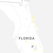
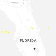
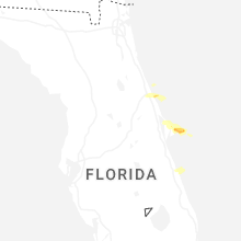


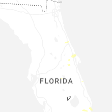
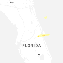


Connect with Interactive Hail Maps