

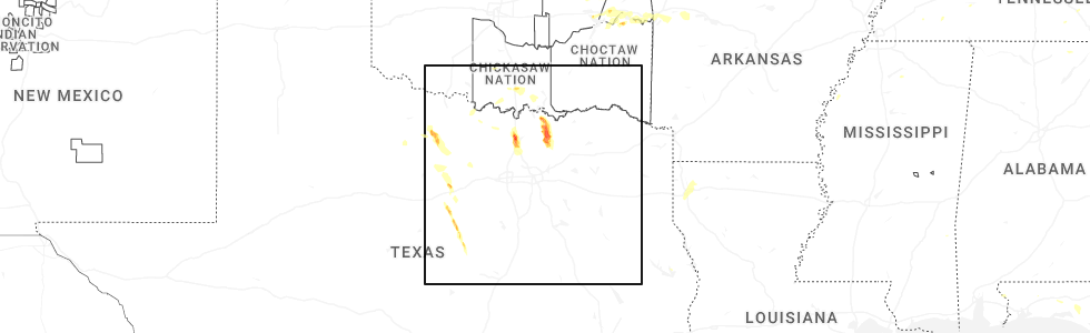
Hail Map for Tom Bean, TX
The Tom Bean, TX area has had 7 reports of on-the-ground hail by trained spotters, and has been under severe weather warnings 23 times during the past 12 months. Doppler radar has detected hail at or near Tom Bean, TX on 69 occasions, including 2 occasions during the past year.
| Name: | Tom Bean, TX |
| Where Located: | 54 miles NNE of Dallas, TX |
| Map: | Google Map for Tom Bean, TX |
| Population: | 1045 |
| Housing Units: | 415 |
| More Info: | Search Google for Tom Bean, TX |
2
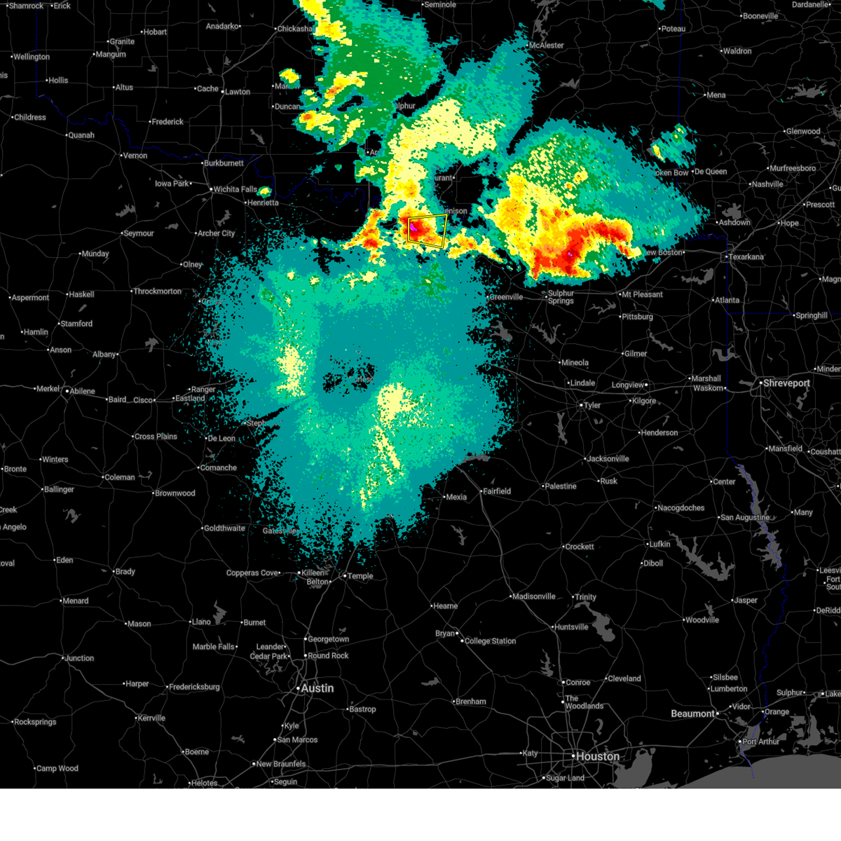
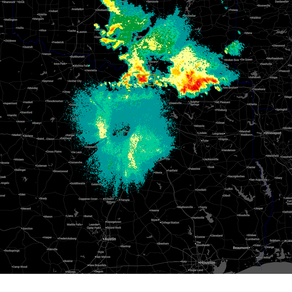
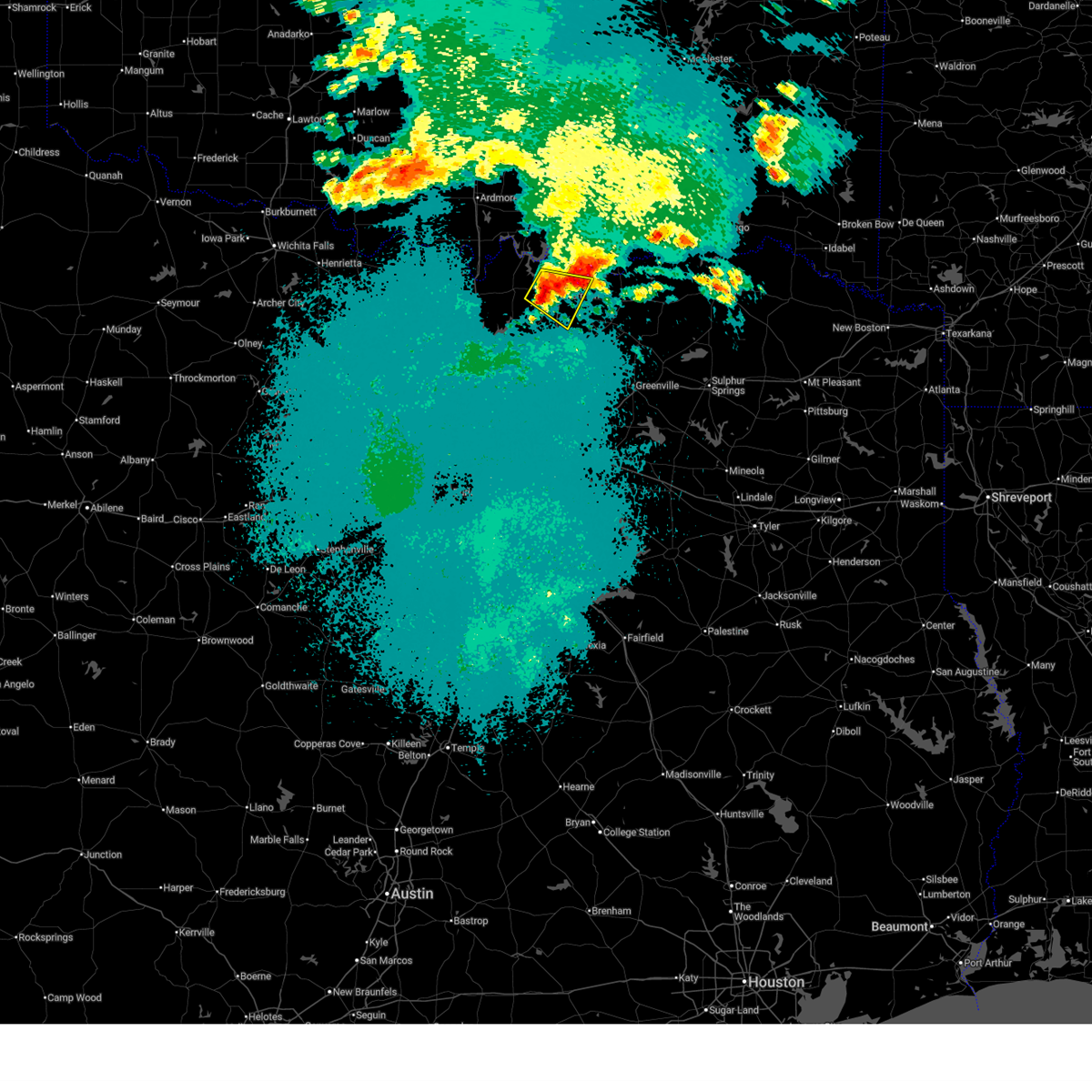
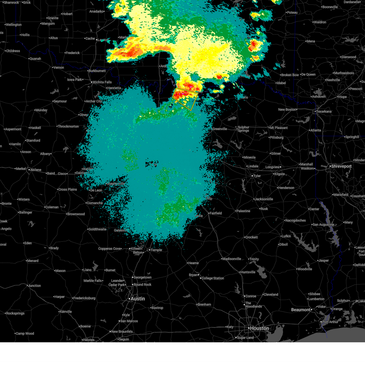
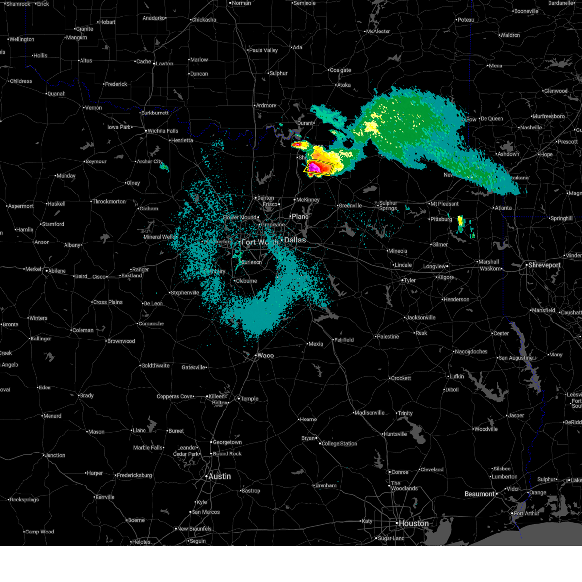
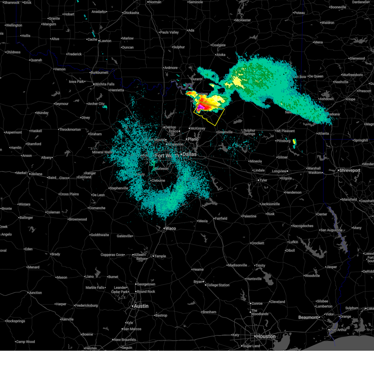
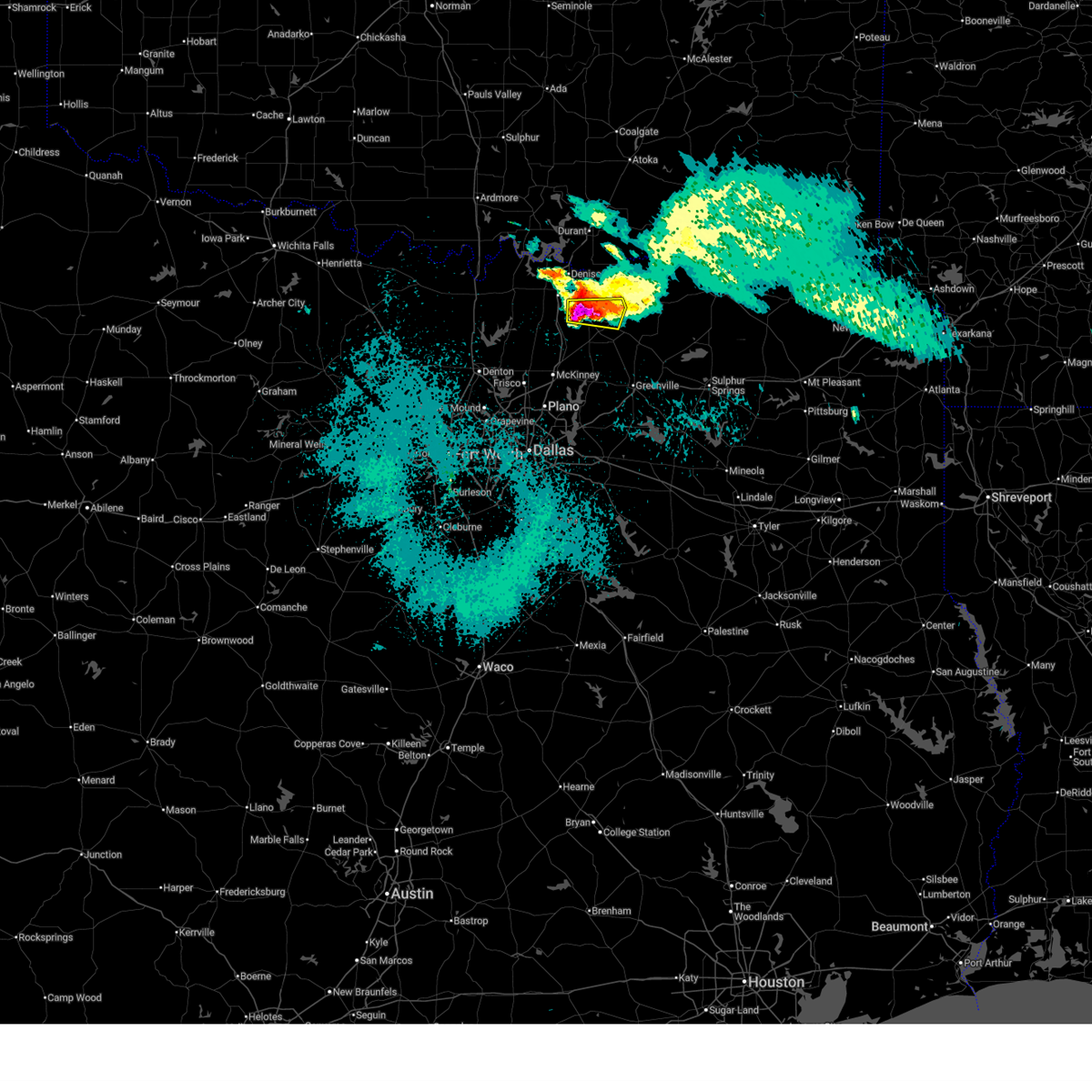
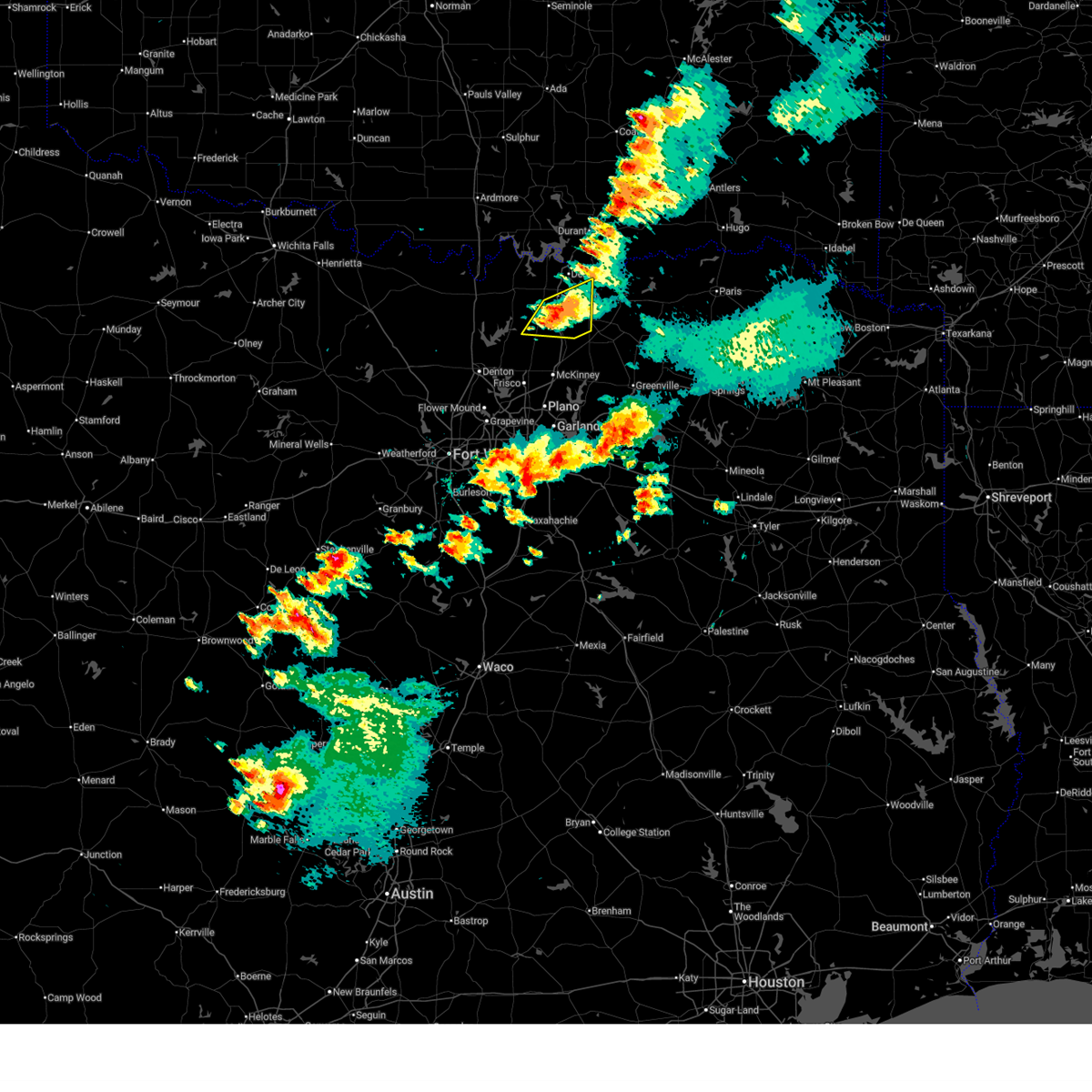
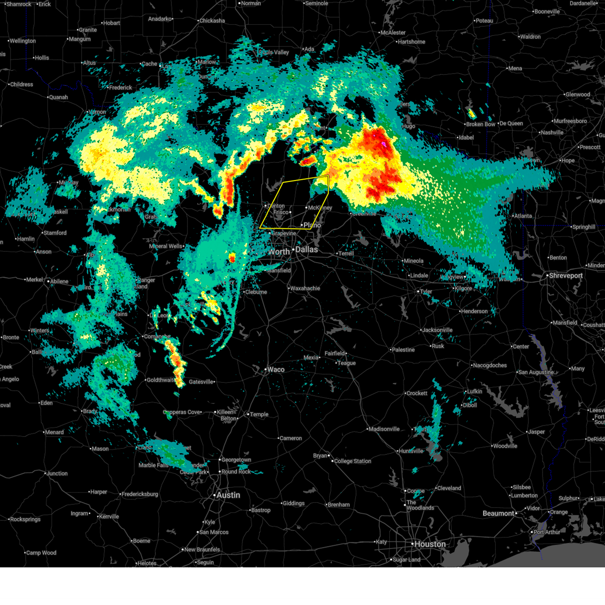
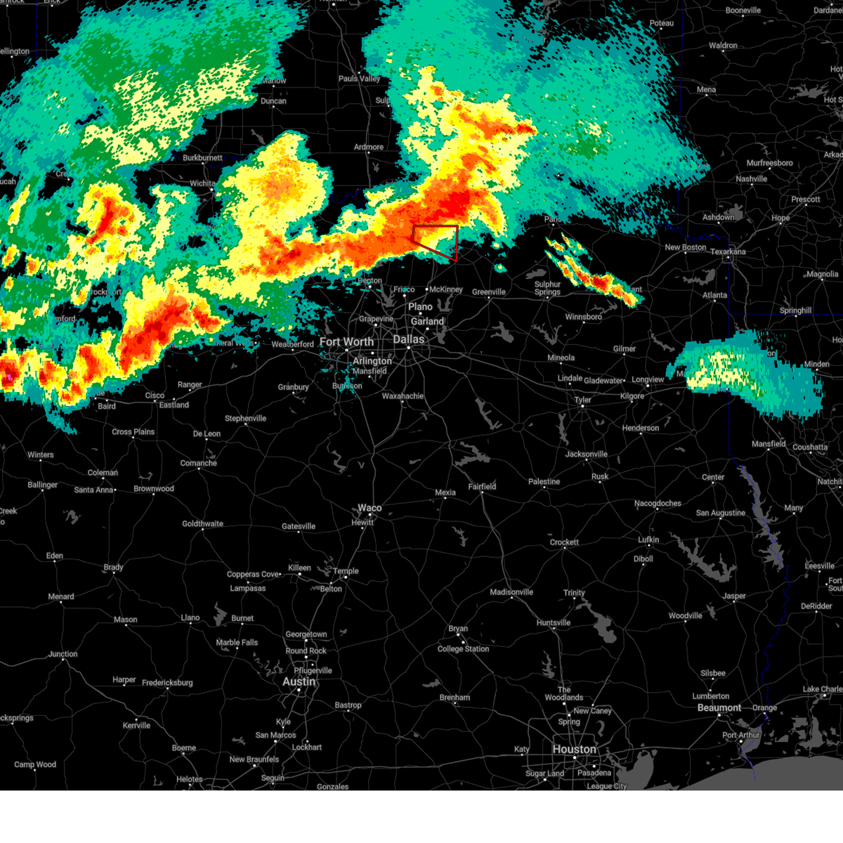
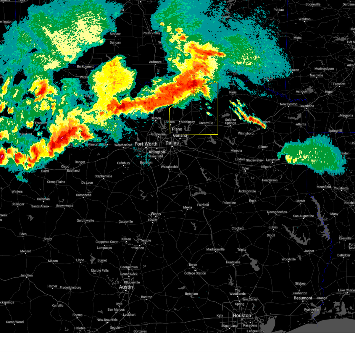
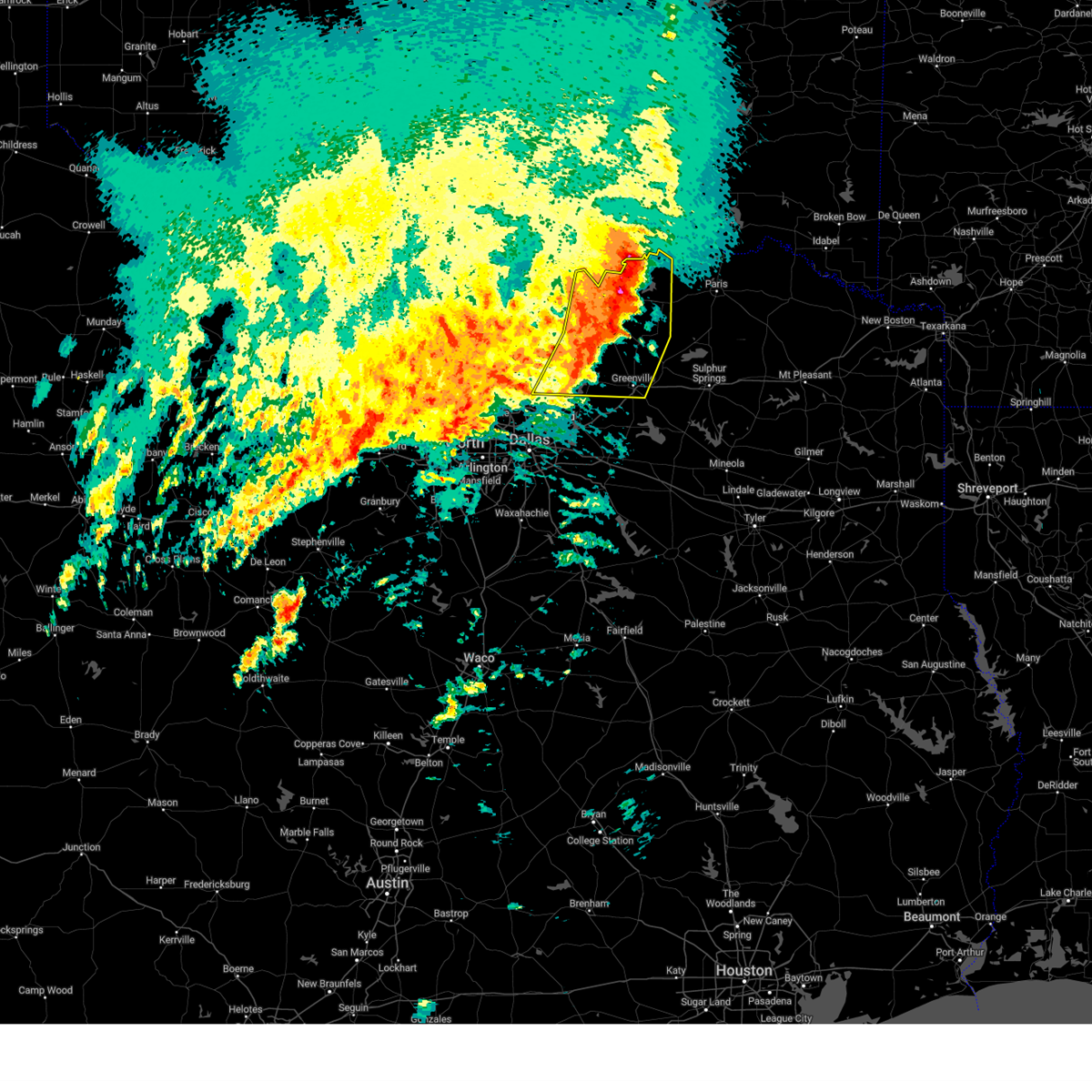
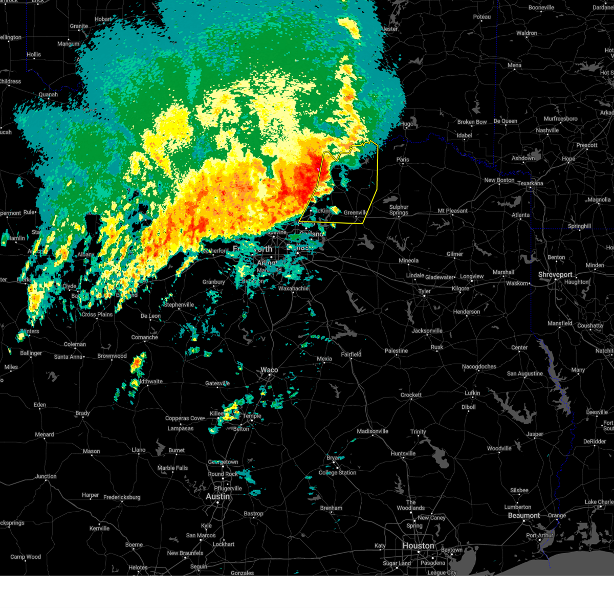
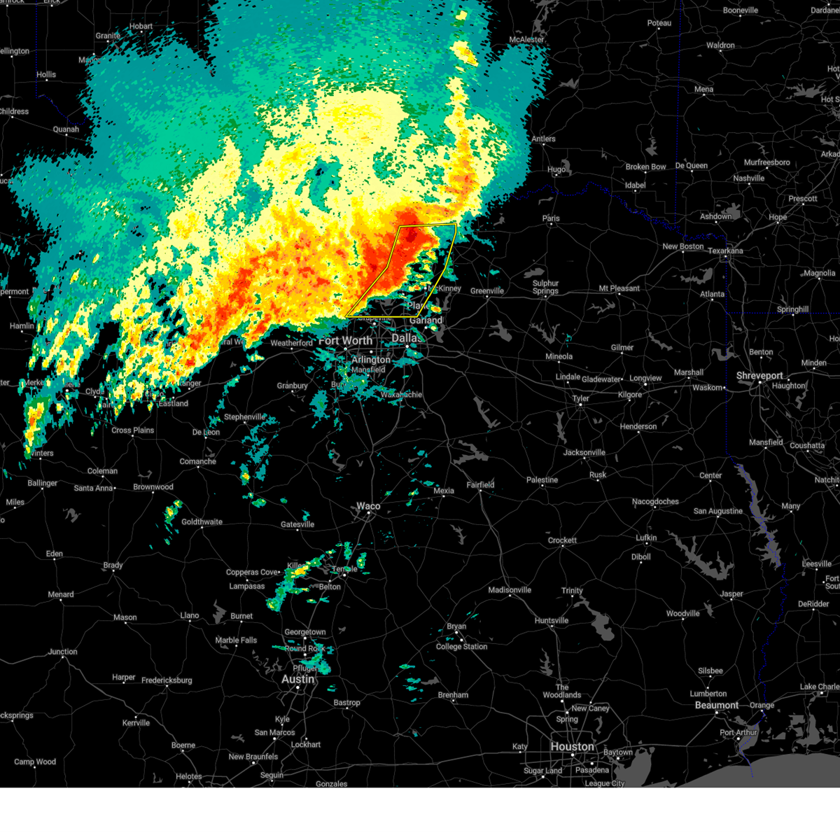
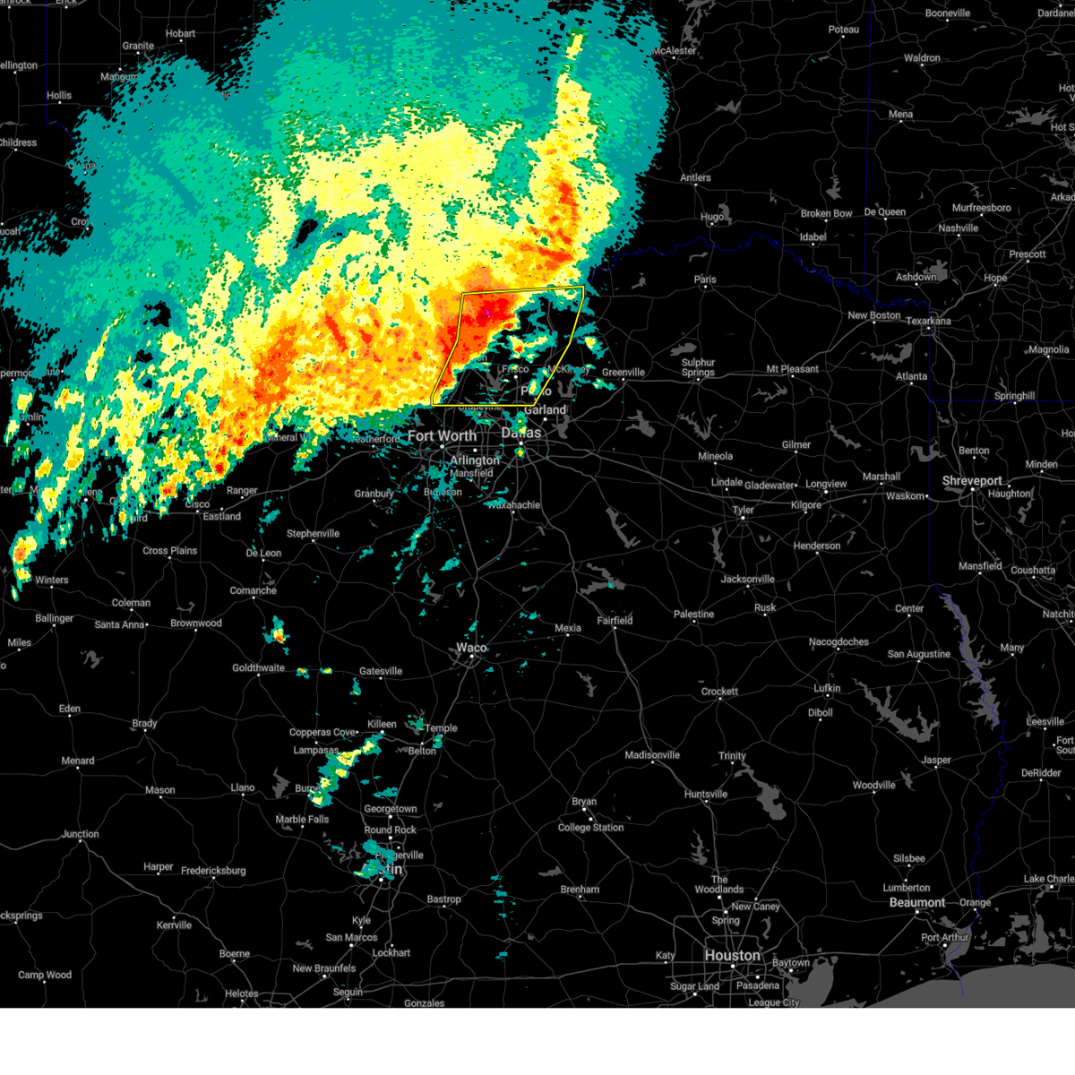
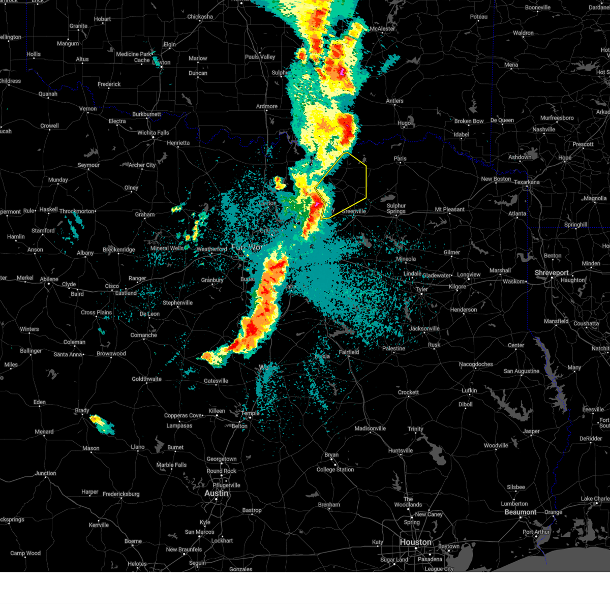
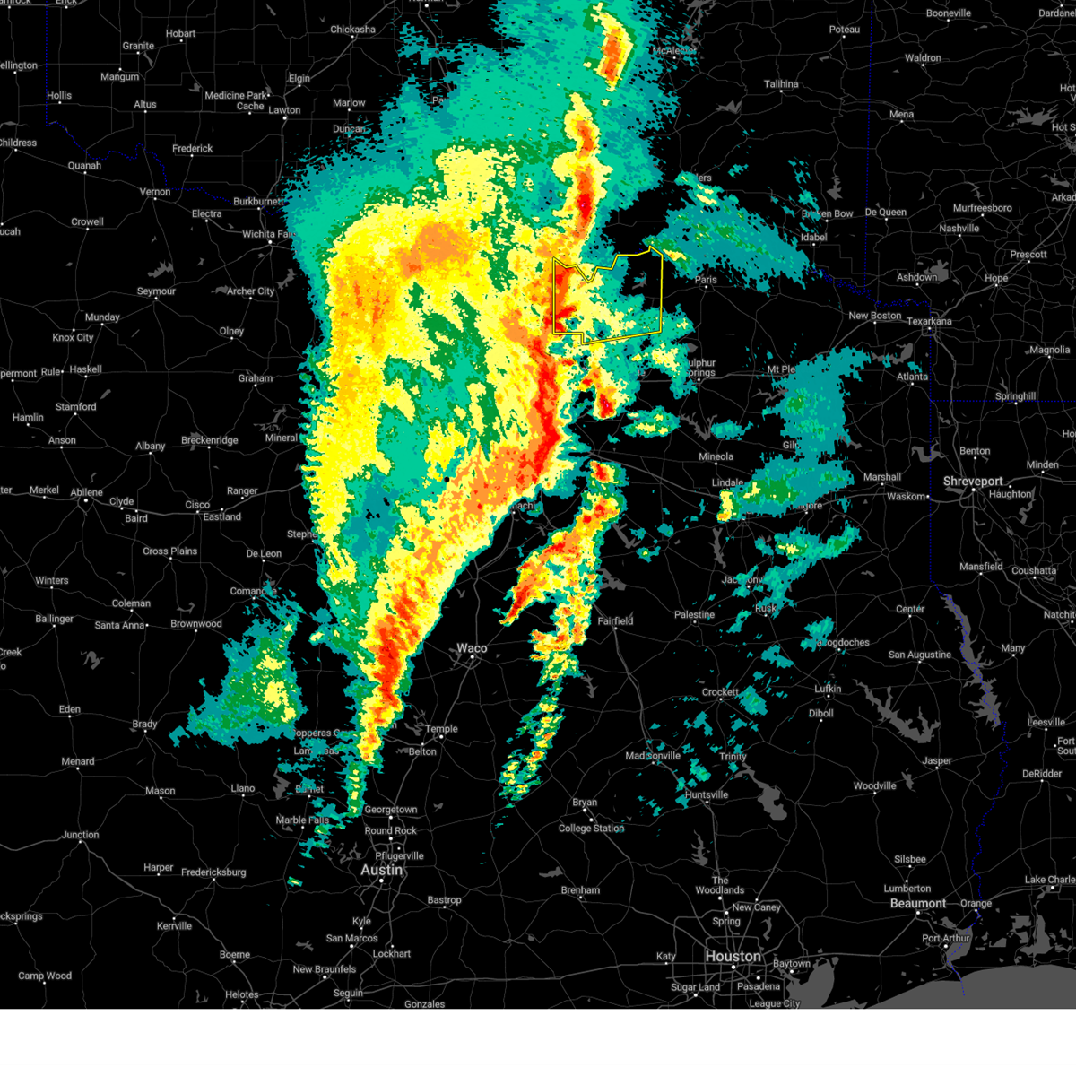
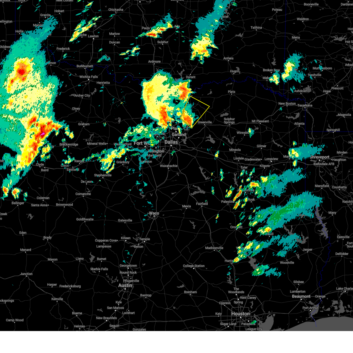
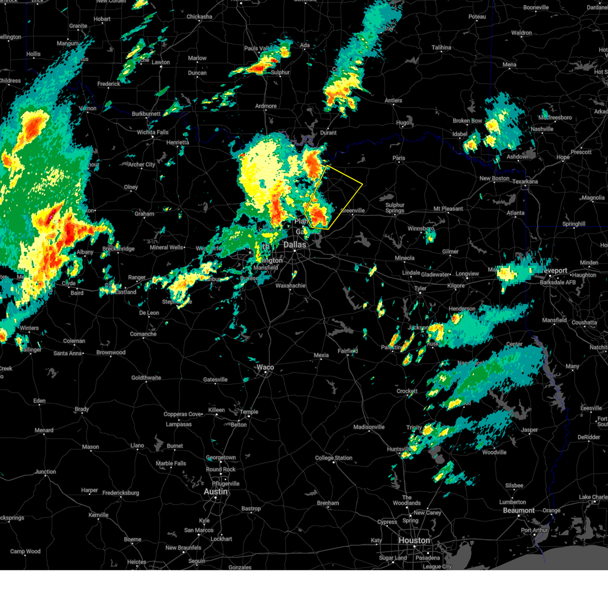
The Top Recent Hail Date for Tom Bean, TX is Sunday, September 21, 2025 (11th out of 69)
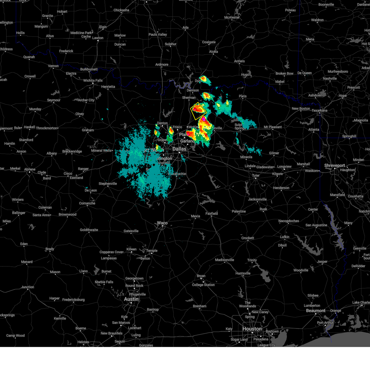
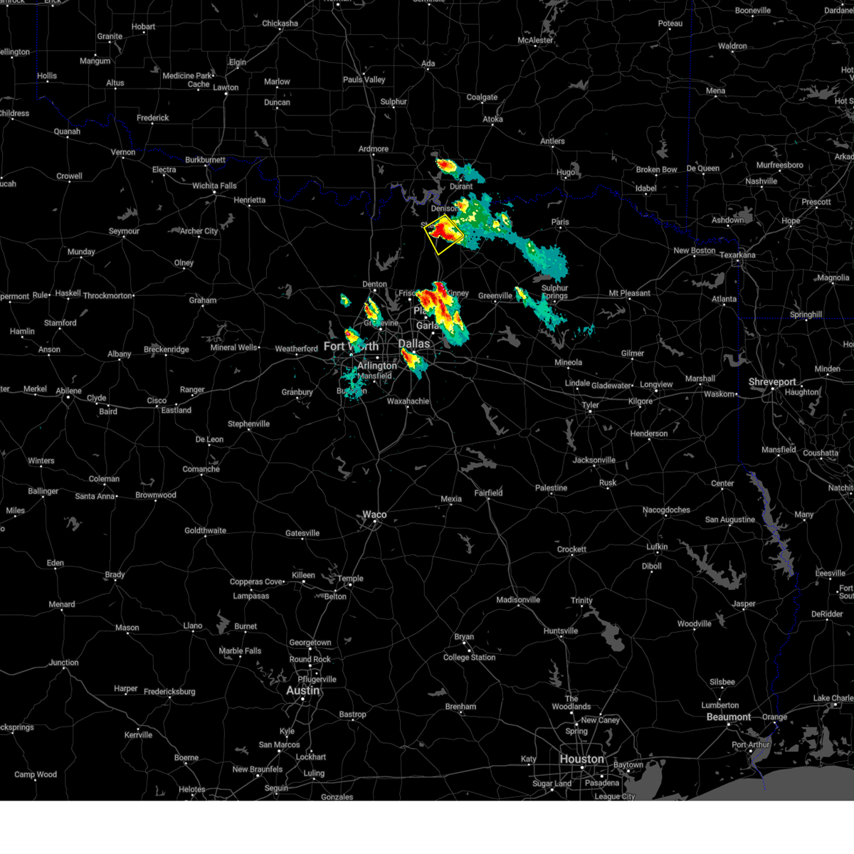
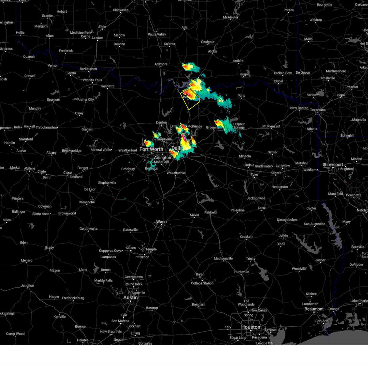
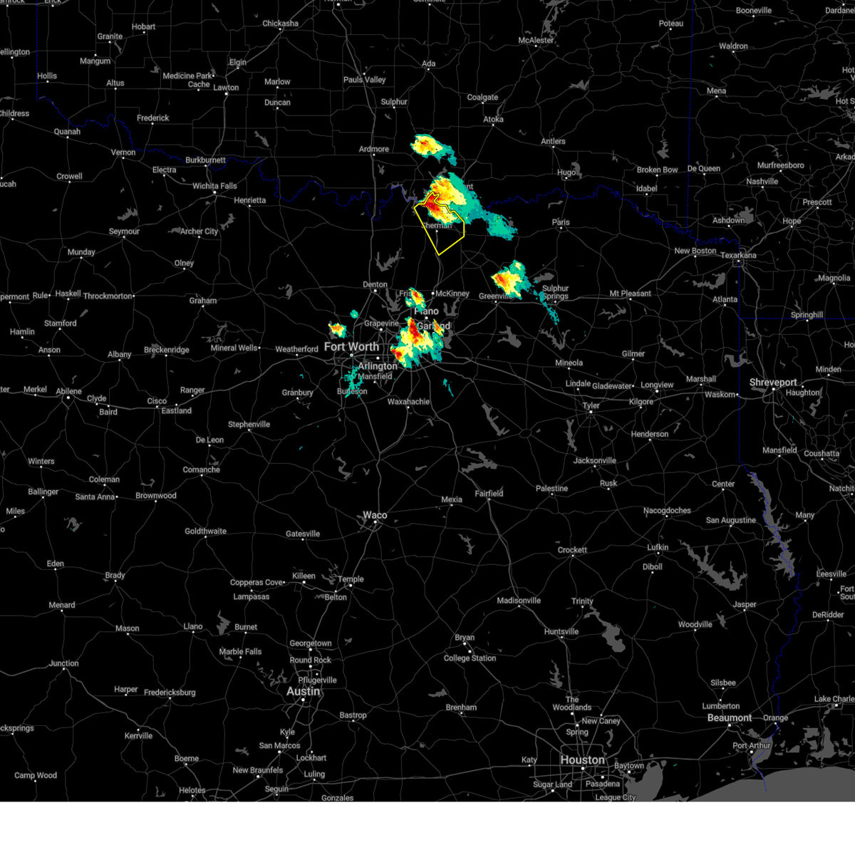
Hail and Wind Damage Spotted near Tom Bean, TX
| Date / Time | Report Details |
|---|---|
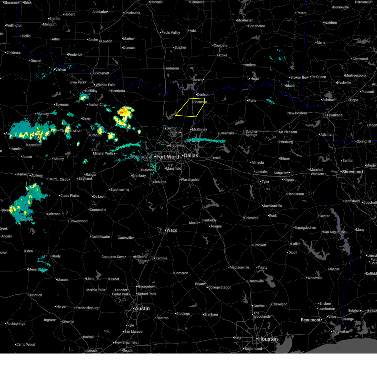
| 5/10/2026 3:04 AM CDT |
 At 304 am cdt, a severe thunderstorm was located near sherman, moving east at 15 mph (radar indicated). Hazards include 60 mph wind gusts and half dollar size hail. Hail damage to vehicles is expected. expect wind damage to roofs, siding, and trees. this severe storm will be near, sherman around 310 am cdt. Other locations impacted by this severe thunderstorm include white mound, boddie, luella, southmayd, and ida. At 304 am cdt, a severe thunderstorm was located near sherman, moving east at 15 mph (radar indicated). Hazards include 60 mph wind gusts and half dollar size hail. Hail damage to vehicles is expected. expect wind damage to roofs, siding, and trees. this severe storm will be near, sherman around 310 am cdt. Other locations impacted by this severe thunderstorm include white mound, boddie, luella, southmayd, and ida.
|
| 5/10/2026 2:48 AM CDT |
 Svrfwd the national weather service in fort worth has issued a * severe thunderstorm warning for, central grayson county in north central texas, * until 345 am cdt. * at 248 am cdt, a severe thunderstorm was located 7 miles northwest of dorchester, or 8 miles west of sherman, moving east at 15 mph (radar indicated). Hazards include 60 mph wind gusts and quarter size hail. Hail damage to vehicles is expected. expect wind damage to roofs, siding, and trees. this severe thunderstorm will be near, sherman and dorchester around 255 am cdt. Other locations impacted by this severe thunderstorm include boddie, luella, southmayd, ida, white mound, sadler, and ethel. Svrfwd the national weather service in fort worth has issued a * severe thunderstorm warning for, central grayson county in north central texas, * until 345 am cdt. * at 248 am cdt, a severe thunderstorm was located 7 miles northwest of dorchester, or 8 miles west of sherman, moving east at 15 mph (radar indicated). Hazards include 60 mph wind gusts and quarter size hail. Hail damage to vehicles is expected. expect wind damage to roofs, siding, and trees. this severe thunderstorm will be near, sherman and dorchester around 255 am cdt. Other locations impacted by this severe thunderstorm include boddie, luella, southmayd, ida, white mound, sadler, and ethel.
|
| 5/10/2026 1:05 AM CDT |
 At 105 am cdt, a severe thunderstorm was located west of sherman, moving southeast at 25 mph (radar indicated). Hazards include 60 mph wind gusts and quarter size hail. Hail damage to vehicles is expected. expect wind damage to roofs, siding, and trees. this severe storm will be near, sherman around 110 am cdt. tom bean around 125 am cdt. Other locations impacted by this severe thunderstorm include white mound, boddie, luella, southmayd, and ida. At 105 am cdt, a severe thunderstorm was located west of sherman, moving southeast at 25 mph (radar indicated). Hazards include 60 mph wind gusts and quarter size hail. Hail damage to vehicles is expected. expect wind damage to roofs, siding, and trees. this severe storm will be near, sherman around 110 am cdt. tom bean around 125 am cdt. Other locations impacted by this severe thunderstorm include white mound, boddie, luella, southmayd, and ida.
|
| 5/10/2026 12:49 AM CDT |
 Svrfwd the national weather service in fort worth has issued a * severe thunderstorm warning for, central grayson county in north central texas, * until 130 am cdt. * at 1249 am cdt, a severe thunderstorm was located near whitesboro, moving southeast at 30 mph (radar indicated). Hazards include 60 mph wind gusts and quarter size hail. Hail damage to vehicles is expected. expect wind damage to roofs, siding, and trees. this severe thunderstorm will be near, sherman around 1255 am cdt. Other locations impacted by this severe thunderstorm include boddie, luella, southmayd, ida, white mound, sadler, and locust. Svrfwd the national weather service in fort worth has issued a * severe thunderstorm warning for, central grayson county in north central texas, * until 130 am cdt. * at 1249 am cdt, a severe thunderstorm was located near whitesboro, moving southeast at 30 mph (radar indicated). Hazards include 60 mph wind gusts and quarter size hail. Hail damage to vehicles is expected. expect wind damage to roofs, siding, and trees. this severe thunderstorm will be near, sherman around 1255 am cdt. Other locations impacted by this severe thunderstorm include boddie, luella, southmayd, ida, white mound, sadler, and locust.
|
| 4/26/2026 6:28 AM CDT |
 At 628 am cdt, a severe thunderstorm was located over whitewright, or 13 miles southwest of bonham, moving southeast at 30 mph (radar indicated). Hazards include tennis ball size hail and 60 mph wind gusts. People and animals outdoors will be injured. expect hail damage to roofs, siding, windows, and vehicles. expect wind damage to roofs, siding, and trees. Locations impacted include, bonham, whitewright, bells, tom bean, savoy, ector, randolph, ely, and white mound. At 628 am cdt, a severe thunderstorm was located over whitewright, or 13 miles southwest of bonham, moving southeast at 30 mph (radar indicated). Hazards include tennis ball size hail and 60 mph wind gusts. People and animals outdoors will be injured. expect hail damage to roofs, siding, windows, and vehicles. expect wind damage to roofs, siding, and trees. Locations impacted include, bonham, whitewright, bells, tom bean, savoy, ector, randolph, ely, and white mound.
|
| 4/26/2026 6:25 AM CDT |
 Svrfwd the national weather service in fort worth has issued a * severe thunderstorm warning for, northwestern hunt county in north central texas, southeastern grayson county in north central texas, southern fannin county in north central texas, * until 730 am cdt. * at 625 am cdt, a severe thunderstorm was located over whitewright, or 13 miles southeast of sherman, moving southeast at 25 mph (radar indicated). Hazards include tennis ball size hail and 60 mph wind gusts. People and animals outdoors will be injured. expect hail damage to roofs, siding, windows, and vehicles. Expect wind damage to roofs, siding, and trees. Svrfwd the national weather service in fort worth has issued a * severe thunderstorm warning for, northwestern hunt county in north central texas, southeastern grayson county in north central texas, southern fannin county in north central texas, * until 730 am cdt. * at 625 am cdt, a severe thunderstorm was located over whitewright, or 13 miles southeast of sherman, moving southeast at 25 mph (radar indicated). Hazards include tennis ball size hail and 60 mph wind gusts. People and animals outdoors will be injured. expect hail damage to roofs, siding, windows, and vehicles. Expect wind damage to roofs, siding, and trees.
|
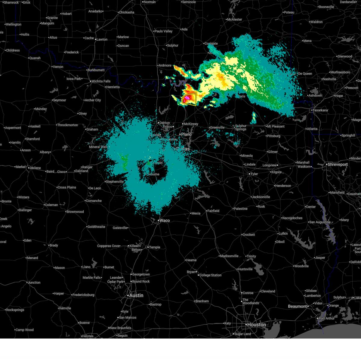
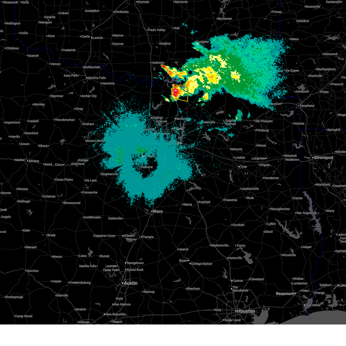
| 4/26/2026 6:21 AM CDT | Ping Pong Ball sized hail reported 0.3 miles WSW of Tom Bean, TX, ping pong ball size hail in tom bean. |
| 4/26/2026 6:20 AM CDT |
 At 619 am cdt, a severe thunderstorm was located over tom bean, or 10 miles southeast of sherman, moving east at 20 mph (radar indicated). Hazards include tennis ball size hail and 60 mph wind gusts. People and animals outdoors will be injured. expect hail damage to roofs, siding, windows, and vehicles. expect wind damage to roofs, siding, and trees. Locations impacted include, bonham, whitewright, bells, tom bean, savoy, ector, randolph, ely, luella, ida, and white mound. At 619 am cdt, a severe thunderstorm was located over tom bean, or 10 miles southeast of sherman, moving east at 20 mph (radar indicated). Hazards include tennis ball size hail and 60 mph wind gusts. People and animals outdoors will be injured. expect hail damage to roofs, siding, windows, and vehicles. expect wind damage to roofs, siding, and trees. Locations impacted include, bonham, whitewright, bells, tom bean, savoy, ector, randolph, ely, luella, ida, and white mound.
|
| 4/26/2026 6:03 AM CDT |
 At 603 am cdt, a severe thunderstorm was located near tom bean, or near sherman, moving east at 30 mph (radar indicated). Hazards include ping pong ball size hail and 60 mph wind gusts. People and animals outdoors will be injured. expect hail damage to roofs, siding, windows, and vehicles. expect wind damage to roofs, siding, and trees. Locations impacted include, sherman, whitewright, bells, tom bean, savoy, valley lake, boddie, luella, ida, and ambrose. At 603 am cdt, a severe thunderstorm was located near tom bean, or near sherman, moving east at 30 mph (radar indicated). Hazards include ping pong ball size hail and 60 mph wind gusts. People and animals outdoors will be injured. expect hail damage to roofs, siding, windows, and vehicles. expect wind damage to roofs, siding, and trees. Locations impacted include, sherman, whitewright, bells, tom bean, savoy, valley lake, boddie, luella, ida, and ambrose.
|
| 4/26/2026 5:52 AM CDT |
 At 552 am cdt, a severe thunderstorm was located near sherman, moving east at 30 mph (radar indicated). Hazards include ping pong ball size hail and 60 mph wind gusts. People and animals outdoors will be injured. expect hail damage to roofs, siding, windows, and vehicles. expect wind damage to roofs, siding, and trees. Locations impacted include, sherman, denison, whitewright, bells, tom bean, savoy, knollwood, valley lake, boddie, ida, carpenters bluff, ambrose, and luella. At 552 am cdt, a severe thunderstorm was located near sherman, moving east at 30 mph (radar indicated). Hazards include ping pong ball size hail and 60 mph wind gusts. People and animals outdoors will be injured. expect hail damage to roofs, siding, windows, and vehicles. expect wind damage to roofs, siding, and trees. Locations impacted include, sherman, denison, whitewright, bells, tom bean, savoy, knollwood, valley lake, boddie, ida, carpenters bluff, ambrose, and luella.
|
| 4/26/2026 5:45 AM CDT |
 Svrfwd the national weather service in fort worth has issued a * severe thunderstorm warning for, east central grayson county in north central texas, * until 615 am cdt. * at 544 am cdt, a severe thunderstorm was located over knollwood, or near sherman, moving east at 30 mph (radar indicated). Hazards include 60 mph wind gusts and quarter size hail. Hail damage to vehicles is expected. Expect wind damage to roofs, siding, and trees. Svrfwd the national weather service in fort worth has issued a * severe thunderstorm warning for, east central grayson county in north central texas, * until 615 am cdt. * at 544 am cdt, a severe thunderstorm was located over knollwood, or near sherman, moving east at 30 mph (radar indicated). Hazards include 60 mph wind gusts and quarter size hail. Hail damage to vehicles is expected. Expect wind damage to roofs, siding, and trees.
|
| 3/10/2026 10:13 PM CDT |
 The storms which prompted the warning have weakened below severe limits. therefore the warning will be allowed to expire. however gusty winds and heavy rain are still possible with these thunderstorms. a tornado watch remains in effect until 1100 pm cdt for north central texas. a severe thunderstorm watch remains in effect until 200 am cdt for north central texas. The storms which prompted the warning have weakened below severe limits. therefore the warning will be allowed to expire. however gusty winds and heavy rain are still possible with these thunderstorms. a tornado watch remains in effect until 1100 pm cdt for north central texas. a severe thunderstorm watch remains in effect until 200 am cdt for north central texas.
|
| 3/10/2026 9:37 PM CDT |
 Svrfwd the national weather service in fort worth has issued a * severe thunderstorm warning for, rockwall county in north central texas, collin county in north central texas, northern dallas county in north central texas, northeastern cooke county in north central texas, grayson county in north central texas, * until 1015 pm cdt. * at 936 pm cdt, severe thunderstorms were located along a line extending from near gainesville to grapevine, moving northeast at 55 mph (radar indicated). Hazards include 60 mph wind gusts. Expect damage to roofs, siding, and trees. severe thunderstorms will be near, irving, carrollton, grapevine, coppell, whitesboro, callisburg, lake kiowa, and dfw intl airport around 940 pm cdt. collinsville around 945 pm cdt. dallas, plano, frisco, addison, prosper, celina, lake texoma, and southeastern lake texoma around 950 pm cdt. mckinney, allen, pottsboro, gunter, and dorchester around 955 pm cdt. sherman around 1000 pm cdt. Other locations impacted by these severe thunderstorms include westminster, cannon, preston, tioga, frognot, ida, sadler, elmont, mountain creek lake, and locust. Svrfwd the national weather service in fort worth has issued a * severe thunderstorm warning for, rockwall county in north central texas, collin county in north central texas, northern dallas county in north central texas, northeastern cooke county in north central texas, grayson county in north central texas, * until 1015 pm cdt. * at 936 pm cdt, severe thunderstorms were located along a line extending from near gainesville to grapevine, moving northeast at 55 mph (radar indicated). Hazards include 60 mph wind gusts. Expect damage to roofs, siding, and trees. severe thunderstorms will be near, irving, carrollton, grapevine, coppell, whitesboro, callisburg, lake kiowa, and dfw intl airport around 940 pm cdt. collinsville around 945 pm cdt. dallas, plano, frisco, addison, prosper, celina, lake texoma, and southeastern lake texoma around 950 pm cdt. mckinney, allen, pottsboro, gunter, and dorchester around 955 pm cdt. sherman around 1000 pm cdt. Other locations impacted by these severe thunderstorms include westminster, cannon, preston, tioga, frognot, ida, sadler, elmont, mountain creek lake, and locust.
|
| 3/4/2026 7:07 PM CST |
 the severe thunderstorm warning has been cancelled and is no longer in effect the severe thunderstorm warning has been cancelled and is no longer in effect
|
| 3/4/2026 6:55 PM CST |
 At 655 pm cst, a severe thunderstorm was located over howe, or 7 miles south of sherman, moving east at 20 mph (radar indicated). Hazards include 60 mph wind gusts and quarter size hail. Hail damage to vehicles is expected. expect wind damage to roofs, siding, and trees. this severe storm will be near, sherman and howe around 700 pm cst. tom bean around 705 pm cst. whitewright and bells around 730 pm cst. valley lake around 740 pm cst. Other locations impacted by this severe thunderstorm include cannon, boddie, luella, ida, white mound, ambrose, farmington, elmont, and pilot grove. At 655 pm cst, a severe thunderstorm was located over howe, or 7 miles south of sherman, moving east at 20 mph (radar indicated). Hazards include 60 mph wind gusts and quarter size hail. Hail damage to vehicles is expected. expect wind damage to roofs, siding, and trees. this severe storm will be near, sherman and howe around 700 pm cst. tom bean around 705 pm cst. whitewright and bells around 730 pm cst. valley lake around 740 pm cst. Other locations impacted by this severe thunderstorm include cannon, boddie, luella, ida, white mound, ambrose, farmington, elmont, and pilot grove.
|
| 3/4/2026 6:38 PM CST |
 Svrfwd the national weather service in fort worth has issued a * severe thunderstorm warning for, southern grayson county in north central texas, * until 730 pm cst. * at 638 pm cst, a severe thunderstorm was located over dorchester, or 10 miles southwest of sherman, moving northeast at 25 mph (radar indicated). Hazards include 60 mph wind gusts and quarter size hail. Hail damage to vehicles is expected. expect wind damage to roofs, siding, and trees. this severe thunderstorm will be near, sherman, howe, and dorchester around 645 pm cst. tom bean around 655 pm cst. bells around 710 pm cst. valley lake around 715 pm cst. Other locations impacted by this severe thunderstorm include cannon, boddie, luella, southmayd, ida, white mound, ambrose, farmington, elmont, and pilot grove. Svrfwd the national weather service in fort worth has issued a * severe thunderstorm warning for, southern grayson county in north central texas, * until 730 pm cst. * at 638 pm cst, a severe thunderstorm was located over dorchester, or 10 miles southwest of sherman, moving northeast at 25 mph (radar indicated). Hazards include 60 mph wind gusts and quarter size hail. Hail damage to vehicles is expected. expect wind damage to roofs, siding, and trees. this severe thunderstorm will be near, sherman, howe, and dorchester around 645 pm cst. tom bean around 655 pm cst. bells around 710 pm cst. valley lake around 715 pm cst. Other locations impacted by this severe thunderstorm include cannon, boddie, luella, southmayd, ida, white mound, ambrose, farmington, elmont, and pilot grove.
|
| 9/21/2025 6:12 PM CDT | At 612 pm cdt, a severe thunderstorm was located over anna, or 13 miles northeast of mckinney, moving south at 30 mph (radar indicated). Hazards include ping pong ball size hail and 60 mph wind gusts. People and animals outdoors will be injured. expect hail damage to roofs, siding, windows, and vehicles. expect wind damage to roofs, siding, and trees. this severe storm will be near, anna and melissa around 615 pm cdt. princeton around 625 pm cdt. farmersville around 635 pm cdt. wylie around 645 pm cdt. other locations impacted by this severe thunderstorm include westminster, cannon, frognot, st. Paul, elmont, clinton, nobility, pilot grove, altoga, and branch. |
| 9/21/2025 5:51 PM CDT | Svrfwd the national weather service in fort worth has issued a * severe thunderstorm warning for, northwestern hunt county in north central texas, eastern collin county in north central texas, southeastern grayson county in north central texas, southwestern fannin county in north central texas, * until 645 pm cdt. * at 551 pm cdt, a severe thunderstorm was located near tom bean, or 11 miles southeast of sherman, moving southeast at 30 mph (radar indicated). Hazards include golf ball size hail and 65 mph wind gusts. People and animals outdoors will be injured. expect hail damage to roofs, siding, windows, and vehicles. expect wind damage to roofs, siding, and trees. this severe thunderstorm will be near, van alstyne around 555 pm cdt. anna around 600 pm cdt. farmersville around 620 pm cdt. princeton around 630 pm cdt. other locations impacted by this severe thunderstorm include westminster, cannon, frognot, ida, st. paul, elmont, clinton, nobility, pilot grove, and ely. This includes interstate 30 between mile markers 90 and 91. |
| 9/21/2025 5:18 PM CDT | At 517 pm cdt, a severe thunderstorm was located near knollwood, or near sherman, moving southeast at 30 mph (radar indicated). Hazards include two inch hail and 65 mph wind gusts. People and animals outdoors will be injured. expect hail damage to roofs, siding, windows, and vehicles. expect wind damage to roofs, siding, and trees. this severe storm will be near, bells and tom bean around 530 pm cdt. whitewright and savoy around 540 pm cdt. trenton and randolph around 555 pm cdt. Other locations impacted by this severe thunderstorm include boddie, ely, luella, ida, white mound, carpenters bluff, ambrose, and pilot grove. |
| 9/21/2025 5:05 PM CDT | Svrfwd the national weather service in fort worth has issued a * severe thunderstorm warning for, eastern grayson county in north central texas, west central fannin county in north central texas, * until 600 pm cdt. * at 505 pm cdt, a severe thunderstorm was located over knollwood, or near sherman, moving southeast at 25 mph (radar indicated). Hazards include 60 mph wind gusts and half dollar size hail. Hail damage to vehicles is expected. expect wind damage to roofs, siding, and trees. this severe thunderstorm will be near, sherman, denison, and knollwood around 510 pm cdt. bells around 525 pm cdt. valley lake around 530 pm cdt. savoy around 535 pm cdt. whitewright around 540 pm cdt. ector around 550 pm cdt. Other locations impacted by this severe thunderstorm include boddie, ely, luella, ida, white mound, carpenters bluff, ambrose, and pilot grove. |
| 9/5/2025 11:06 PM CDT |
 the severe thunderstorm warning has been cancelled and is no longer in effect the severe thunderstorm warning has been cancelled and is no longer in effect
|
| 9/5/2025 10:51 PM CDT |
 At 1050 pm cdt, severe thunderstorms were located along a line extending from near van alstyne to near carrollton, moving east at 30 mph (radar indicated). Hazards include 60 mph wind gusts and nickel size hail. Expect damage to roofs, siding, and trees. Locations impacted include, plano, garland, mckinney, carrollton, frisco, richardson, lewisville, allen, wylie, coppell, the colony, sachse, addison, lake lewisville, little elm, murphy, prosper, anna, fairview, and princeton. At 1050 pm cdt, severe thunderstorms were located along a line extending from near van alstyne to near carrollton, moving east at 30 mph (radar indicated). Hazards include 60 mph wind gusts and nickel size hail. Expect damage to roofs, siding, and trees. Locations impacted include, plano, garland, mckinney, carrollton, frisco, richardson, lewisville, allen, wylie, coppell, the colony, sachse, addison, lake lewisville, little elm, murphy, prosper, anna, fairview, and princeton.
|
| 9/5/2025 10:29 PM CDT |
 Svrfwd the national weather service in fort worth has issued a * severe thunderstorm warning for, eastern denton county in north central texas, collin county in north central texas, southern grayson county in north central texas, * until 1130 pm cdt. * at 1029 pm cdt, severe thunderstorms were located along a line extending from near pilot point to near flower mound, moving east at 20 mph (radar indicated). Hazards include 60 mph wind gusts and quarter size hail. Hail damage to vehicles is expected. expect wind damage to roofs, siding, and trees. severe thunderstorms will be near, frisco, lewisville, flower mound, coppell, the colony, highland village, lake dallas, lake lewisville, little elm, and prosper around 1035 pm cdt. carrollton, gunter, and hebron around 1040 pm cdt. plano around 1050 pm cdt. north dallas and mckinney around 1055 pm cdt. addison and van alstyne around 1100 pm cdt. allen around 1105 pm cdt. anna and melissa around 1110 pm cdt. richardson around 1115 pm cdt. other locations impacted by these severe thunderstorms include westminster, cannon, oak point, elmont, pilot grove, providence village, altoga, weston, lewisville lake, and lincoln park. This includes interstate 35e between mile markers 446 and 461. Svrfwd the national weather service in fort worth has issued a * severe thunderstorm warning for, eastern denton county in north central texas, collin county in north central texas, southern grayson county in north central texas, * until 1130 pm cdt. * at 1029 pm cdt, severe thunderstorms were located along a line extending from near pilot point to near flower mound, moving east at 20 mph (radar indicated). Hazards include 60 mph wind gusts and quarter size hail. Hail damage to vehicles is expected. expect wind damage to roofs, siding, and trees. severe thunderstorms will be near, frisco, lewisville, flower mound, coppell, the colony, highland village, lake dallas, lake lewisville, little elm, and prosper around 1035 pm cdt. carrollton, gunter, and hebron around 1040 pm cdt. plano around 1050 pm cdt. north dallas and mckinney around 1055 pm cdt. addison and van alstyne around 1100 pm cdt. allen around 1105 pm cdt. anna and melissa around 1110 pm cdt. richardson around 1115 pm cdt. other locations impacted by these severe thunderstorms include westminster, cannon, oak point, elmont, pilot grove, providence village, altoga, weston, lewisville lake, and lincoln park. This includes interstate 35e between mile markers 446 and 461.
|
| 9/5/2025 7:20 PM CDT |
 Svrfwd the national weather service in fort worth has issued a * severe thunderstorm warning for, southern grayson county in north central texas, * until 800 pm cdt. * at 720 pm cdt, a severe thunderstorm was located over gunter, or 14 miles southwest of sherman, moving northeast at 35 mph (radar indicated). Hazards include 65 mph wind gusts and quarter size hail. Hail damage to vehicles is expected. expect wind damage to roofs, siding, and trees. this severe thunderstorm will be near, howe, gunter, and dorchester around 725 pm cdt. sherman and van alstyne around 730 pm cdt. bells around 750 pm cdt. Other locations impacted by this severe thunderstorm include boddie, luella, southmayd, ida, white mound, ambrose, farmington, elmont, and lake ray roberts. Svrfwd the national weather service in fort worth has issued a * severe thunderstorm warning for, southern grayson county in north central texas, * until 800 pm cdt. * at 720 pm cdt, a severe thunderstorm was located over gunter, or 14 miles southwest of sherman, moving northeast at 35 mph (radar indicated). Hazards include 65 mph wind gusts and quarter size hail. Hail damage to vehicles is expected. expect wind damage to roofs, siding, and trees. this severe thunderstorm will be near, howe, gunter, and dorchester around 725 pm cdt. sherman and van alstyne around 730 pm cdt. bells around 750 pm cdt. Other locations impacted by this severe thunderstorm include boddie, luella, southmayd, ida, white mound, ambrose, farmington, elmont, and lake ray roberts.
|
| 6/8/2025 10:06 PM CDT |
 The circulation which prompted the tornado warning has weakened below severe limits, and has exited the warned area. therefore, the warning will be allowed to expire. a severe thunderstorm warning still remains in effect until 1030 pm. a severe thunderstorm watch remains in effect until 400 am cdt for north central texas. The circulation which prompted the tornado warning has weakened below severe limits, and has exited the warned area. therefore, the warning will be allowed to expire. a severe thunderstorm warning still remains in effect until 1030 pm. a severe thunderstorm watch remains in effect until 400 am cdt for north central texas.
|
| 6/8/2025 9:55 PM CDT |
 At 955 pm cdt, a severe thunderstorm capable of producing a tornado was located over tom bean, or 9 miles southeast of sherman, moving east at 40 mph (radar indicated rotation). Hazards include tornado. Flying debris will be dangerous to those caught without shelter. mobile homes will be damaged or destroyed. damage to roofs, windows, and vehicles will occur. tree damage is likely. this dangerous storm will be near, whitewright around 1000 pm cdt. Other locations impacted by this tornadic thunderstorm include white mound, luella, pilot grove, and ida. At 955 pm cdt, a severe thunderstorm capable of producing a tornado was located over tom bean, or 9 miles southeast of sherman, moving east at 40 mph (radar indicated rotation). Hazards include tornado. Flying debris will be dangerous to those caught without shelter. mobile homes will be damaged or destroyed. damage to roofs, windows, and vehicles will occur. tree damage is likely. this dangerous storm will be near, whitewright around 1000 pm cdt. Other locations impacted by this tornadic thunderstorm include white mound, luella, pilot grove, and ida.
|
| 6/8/2025 9:39 PM CDT |
 Torfwd the national weather service in fort worth has issued a * tornado warning for, southeastern grayson county in north central texas, * until 1015 pm cdt. * at 938 pm cdt, a severe thunderstorm capable of producing a tornado was located near dorchester, or near sherman, moving east at 40 mph (radar indicated rotation). Hazards include tornado. Flying debris will be dangerous to those caught without shelter. mobile homes will be damaged or destroyed. damage to roofs, windows, and vehicles will occur. tree damage is likely. this dangerous storm will be near, sherman, dorchester, and howe around 945 pm cdt. tom bean around 950 pm cdt. whitewright around 1000 pm cdt. Other locations impacted by this tornadic thunderstorm include cannon, boddie, luella, southmayd, ida, white mound, and pilot grove. Torfwd the national weather service in fort worth has issued a * tornado warning for, southeastern grayson county in north central texas, * until 1015 pm cdt. * at 938 pm cdt, a severe thunderstorm capable of producing a tornado was located near dorchester, or near sherman, moving east at 40 mph (radar indicated rotation). Hazards include tornado. Flying debris will be dangerous to those caught without shelter. mobile homes will be damaged or destroyed. damage to roofs, windows, and vehicles will occur. tree damage is likely. this dangerous storm will be near, sherman, dorchester, and howe around 945 pm cdt. tom bean around 950 pm cdt. whitewright around 1000 pm cdt. Other locations impacted by this tornadic thunderstorm include cannon, boddie, luella, southmayd, ida, white mound, and pilot grove.
|
| 6/8/2025 9:35 PM CDT |
 Svrfwd the national weather service in fort worth has issued a * severe thunderstorm warning for, hunt county in north central texas, collin county in north central texas, southeastern grayson county in north central texas, fannin county in north central texas, * until 1030 pm cdt. * at 934 pm cdt, a severe thunderstorm was located near dorchester, or 10 miles southwest of sherman, moving southeast at 50 mph (radar indicated). Hazards include 70 mph wind gusts and nickel size hail. Expect considerable tree damage. damage is likely to mobile homes, roofs, and outbuildings. this severe thunderstorm will be near, van alstyne, howe, and gunter around 940 pm cdt. anna around 945 pm cdt. farmersville around 1000 pm cdt. merit around 1005 pm cdt. greenville and greenville city lakes around 1015 pm cdt. Other locations impacted by this severe thunderstorm include westminster, neylandville, ida, nobility, ely, white mound, floyd, gober, new hope, and lamasco. Svrfwd the national weather service in fort worth has issued a * severe thunderstorm warning for, hunt county in north central texas, collin county in north central texas, southeastern grayson county in north central texas, fannin county in north central texas, * until 1030 pm cdt. * at 934 pm cdt, a severe thunderstorm was located near dorchester, or 10 miles southwest of sherman, moving southeast at 50 mph (radar indicated). Hazards include 70 mph wind gusts and nickel size hail. Expect considerable tree damage. damage is likely to mobile homes, roofs, and outbuildings. this severe thunderstorm will be near, van alstyne, howe, and gunter around 940 pm cdt. anna around 945 pm cdt. farmersville around 1000 pm cdt. merit around 1005 pm cdt. greenville and greenville city lakes around 1015 pm cdt. Other locations impacted by this severe thunderstorm include westminster, neylandville, ida, nobility, ely, white mound, floyd, gober, new hope, and lamasco.
|
| 6/8/2025 8:53 PM CDT |
 Svrfwd the national weather service in fort worth has issued a * severe thunderstorm warning for, southeastern cooke county in north central texas, grayson county in north central texas, * until 1000 pm cdt. * at 853 pm cdt, severe thunderstorms were located along a line extending from near madill to near hubert h moss lake, moving southeast at 40 mph (radar indicated). Hazards include 65 mph wind gusts and quarter size hail. Hail damage to vehicles is expected. expect wind damage to roofs, siding, and trees. severe thunderstorms will be near, lake texoma, gainesville, and lake texoma around 900 pm cdt. callisburg around 905 pm cdt. pottsboro around 910 pm cdt. lake kiowa, eisenhower state park, and whitesboro around 915 pm cdt. randell lake, collinsville, and denison around 920 pm cdt. sherman and knollwood around 925 pm cdt. dorchester around 930 pm cdt. howe, gunter, and bells around 940 pm cdt. other locations impacted by these severe thunderstorms include cannon, preston, tioga, ida, sadler, elmont, locust, pilot grove, luella, and white mound. This includes interstate 35 between mile markers 499 and 503. Svrfwd the national weather service in fort worth has issued a * severe thunderstorm warning for, southeastern cooke county in north central texas, grayson county in north central texas, * until 1000 pm cdt. * at 853 pm cdt, severe thunderstorms were located along a line extending from near madill to near hubert h moss lake, moving southeast at 40 mph (radar indicated). Hazards include 65 mph wind gusts and quarter size hail. Hail damage to vehicles is expected. expect wind damage to roofs, siding, and trees. severe thunderstorms will be near, lake texoma, gainesville, and lake texoma around 900 pm cdt. callisburg around 905 pm cdt. pottsboro around 910 pm cdt. lake kiowa, eisenhower state park, and whitesboro around 915 pm cdt. randell lake, collinsville, and denison around 920 pm cdt. sherman and knollwood around 925 pm cdt. dorchester around 930 pm cdt. howe, gunter, and bells around 940 pm cdt. other locations impacted by these severe thunderstorms include cannon, preston, tioga, ida, sadler, elmont, locust, pilot grove, luella, and white mound. This includes interstate 35 between mile markers 499 and 503.
|
| 6/8/2025 12:16 AM CDT |
 Svrfwd the national weather service in fort worth has issued a * severe thunderstorm warning for, northwestern hunt county in north central texas, northeastern collin county in north central texas, southeastern grayson county in north central texas, southwestern fannin county in north central texas, * until 115 am cdt. * at 1216 am cdt, a severe thunderstorm was located over tom bean, or 9 miles southeast of sherman, moving southeast at 25 mph (radar indicated). Hazards include 60 mph wind gusts and half dollar size hail. Hail damage to vehicles is expected. Expect wind damage to roofs, siding, and trees. Svrfwd the national weather service in fort worth has issued a * severe thunderstorm warning for, northwestern hunt county in north central texas, northeastern collin county in north central texas, southeastern grayson county in north central texas, southwestern fannin county in north central texas, * until 115 am cdt. * at 1216 am cdt, a severe thunderstorm was located over tom bean, or 9 miles southeast of sherman, moving southeast at 25 mph (radar indicated). Hazards include 60 mph wind gusts and half dollar size hail. Hail damage to vehicles is expected. Expect wind damage to roofs, siding, and trees.
|
| 4/30/2025 10:29 AM CDT |
 the severe thunderstorm warning has been cancelled and is no longer in effect the severe thunderstorm warning has been cancelled and is no longer in effect
|
| 4/30/2025 10:03 AM CDT |
 Svrfwd the national weather service in fort worth has issued a * severe thunderstorm warning for, northern hunt county in north central texas, central collin county in north central texas, southeastern grayson county in north central texas, fannin county in north central texas, * until 1100 am cdt. * at 1002 am cdt, severe thunderstorms were located along a line extending from kemp to near trenton to near fairview, moving east at 30 mph (radar indicated). Hazards include 65 mph wind gusts and penny size hail. expect damage to roofs, siding, and trees Svrfwd the national weather service in fort worth has issued a * severe thunderstorm warning for, northern hunt county in north central texas, central collin county in north central texas, southeastern grayson county in north central texas, fannin county in north central texas, * until 1100 am cdt. * at 1002 am cdt, severe thunderstorms were located along a line extending from kemp to near trenton to near fairview, moving east at 30 mph (radar indicated). Hazards include 65 mph wind gusts and penny size hail. expect damage to roofs, siding, and trees
|
| 4/30/2025 9:56 AM CDT |
 the severe thunderstorm warning has been cancelled and is no longer in effect the severe thunderstorm warning has been cancelled and is no longer in effect
|
| 4/30/2025 9:56 AM CDT |
 At 956 am cdt, severe thunderstorms were located along a line extending from near denison to near anna to frisco, moving east at 30 mph (radar indicated). Hazards include 65 mph wind gusts and nickel size hail. Expect damage to roofs, siding, and trees. Locations impacted include, cannon, ida, elmont, gunter, fairview, melissa, mckinney, weston, luella, howe, white mound, sherman, prosper, new hope, dorchester, anna, bells, boddie, celina, and southmayd. At 956 am cdt, severe thunderstorms were located along a line extending from near denison to near anna to frisco, moving east at 30 mph (radar indicated). Hazards include 65 mph wind gusts and nickel size hail. Expect damage to roofs, siding, and trees. Locations impacted include, cannon, ida, elmont, gunter, fairview, melissa, mckinney, weston, luella, howe, white mound, sherman, prosper, new hope, dorchester, anna, bells, boddie, celina, and southmayd.
|
| 4/30/2025 9:44 AM CDT |
 the severe thunderstorm warning has been cancelled and is no longer in effect the severe thunderstorm warning has been cancelled and is no longer in effect
|
| 4/30/2025 9:44 AM CDT |
 At 943 am cdt, severe thunderstorms were located along a line extending from near knollwood to near celina to near flower mound, moving east at 25 mph (radar indicated). Hazards include 65 mph wind gusts and nickel size hail. Expect damage to roofs, siding, and trees. Locations impacted include, tioga, ida, fairview, melissa, mckinney, cross roads, lewisville lake, hickory creek, howe, white mound, prosper, flower mound, new hope, corinth, southmayd, oak point, allen, double oak, hackberry, and highland village. At 943 am cdt, severe thunderstorms were located along a line extending from near knollwood to near celina to near flower mound, moving east at 25 mph (radar indicated). Hazards include 65 mph wind gusts and nickel size hail. Expect damage to roofs, siding, and trees. Locations impacted include, tioga, ida, fairview, melissa, mckinney, cross roads, lewisville lake, hickory creek, howe, white mound, prosper, flower mound, new hope, corinth, southmayd, oak point, allen, double oak, hackberry, and highland village.
|
| 4/30/2025 9:20 AM CDT |
 Svrfwd the national weather service in fort worth has issued a * severe thunderstorm warning for, denton county in north central texas, western collin county in north central texas, southeastern cooke county in north central texas, southern grayson county in north central texas, * until 1015 am cdt. * at 920 am cdt, severe thunderstorms were located along a line extending from near whitesboro to ray roberts park isle du bois to near justin, moving east at 25 mph (radar indicated). Hazards include 60 mph wind gusts and nickel size hail. expect damage to roofs, siding, and trees Svrfwd the national weather service in fort worth has issued a * severe thunderstorm warning for, denton county in north central texas, western collin county in north central texas, southeastern cooke county in north central texas, southern grayson county in north central texas, * until 1015 am cdt. * at 920 am cdt, severe thunderstorms were located along a line extending from near whitesboro to ray roberts park isle du bois to near justin, moving east at 25 mph (radar indicated). Hazards include 60 mph wind gusts and nickel size hail. expect damage to roofs, siding, and trees
|
| 3/30/2025 12:02 AM CDT |
 Svrfwd the national weather service in fort worth has issued a * severe thunderstorm warning for, northwestern hunt county in north central texas, northeastern collin county in north central texas, southeastern grayson county in north central texas, fannin county in north central texas, * until 100 am cdt. * at 1201 am cdt, severe thunderstorms were located along a line extending from near anna to 9 miles northwest of merit to wylie, moving northeast at 40 mph (public. at 1148 pm cdt, a 61 mph wind gust was reported at the mckinney airport). Hazards include 60 mph wind gusts and quarter size hail. Hail damage to vehicles is expected. expect wind damage to roofs, siding, and trees. severe thunderstorms will be near, princeton, whitewright, farmersville, and trenton around 1205 am cdt. leonard around 1210 am cdt. merit and randolph around 1215 am cdt. ector around 1220 am cdt. bonham state park, celeste, and bonham around 1225 am cdt. lake bonham around 1230 am cdt. dodd city around 1235 am cdt. wolfe city around 1240 am cdt. Other locations impacted by these severe thunderstorms include ridings, westminster, cannon, frognot, boyd, kingston, cotton center, nobility, pilot grove, and sowells bluff. Svrfwd the national weather service in fort worth has issued a * severe thunderstorm warning for, northwestern hunt county in north central texas, northeastern collin county in north central texas, southeastern grayson county in north central texas, fannin county in north central texas, * until 100 am cdt. * at 1201 am cdt, severe thunderstorms were located along a line extending from near anna to 9 miles northwest of merit to wylie, moving northeast at 40 mph (public. at 1148 pm cdt, a 61 mph wind gust was reported at the mckinney airport). Hazards include 60 mph wind gusts and quarter size hail. Hail damage to vehicles is expected. expect wind damage to roofs, siding, and trees. severe thunderstorms will be near, princeton, whitewright, farmersville, and trenton around 1205 am cdt. leonard around 1210 am cdt. merit and randolph around 1215 am cdt. ector around 1220 am cdt. bonham state park, celeste, and bonham around 1225 am cdt. lake bonham around 1230 am cdt. dodd city around 1235 am cdt. wolfe city around 1240 am cdt. Other locations impacted by these severe thunderstorms include ridings, westminster, cannon, frognot, boyd, kingston, cotton center, nobility, pilot grove, and sowells bluff.
|
| 3/25/2025 11:09 PM CDT |
 At 1108 pm cdt, a severe thunderstorm was located near bells, or just east of sherman, moving east at 30 mph (emergency management. numerous reports of hail up to ping pong ball size were reported in sherman with this storm). Hazards include half dollar size hail. Damage to vehicles is possible. this severe storm will be near, valley lake, savoy, and bells around 1115 pm cdt. ravenna around 1130 pm cdt. bonham around 1135 pm cdt. Other locations impacted by this severe thunderstorm include carpenters bluff, ambrose, boddie, luella, and ida. At 1108 pm cdt, a severe thunderstorm was located near bells, or just east of sherman, moving east at 30 mph (emergency management. numerous reports of hail up to ping pong ball size were reported in sherman with this storm). Hazards include half dollar size hail. Damage to vehicles is possible. this severe storm will be near, valley lake, savoy, and bells around 1115 pm cdt. ravenna around 1130 pm cdt. bonham around 1135 pm cdt. Other locations impacted by this severe thunderstorm include carpenters bluff, ambrose, boddie, luella, and ida.
|
| 3/25/2025 10:58 PM CDT |
 At 1058 pm cdt, a severe thunderstorm was located over sherman, moving east at 30 mph (emergency management). Hazards include half dollar size hail. Damage to vehicles is possible. this severe storm will be near, bells around 1105 pm cdt. valley lake around 1110 pm cdt. savoy around 1115 pm cdt. Other locations impacted by this severe thunderstorm include boddie, luella, ida, carpenters bluff, ambrose, and southmayd. At 1058 pm cdt, a severe thunderstorm was located over sherman, moving east at 30 mph (emergency management). Hazards include half dollar size hail. Damage to vehicles is possible. this severe storm will be near, bells around 1105 pm cdt. valley lake around 1110 pm cdt. savoy around 1115 pm cdt. Other locations impacted by this severe thunderstorm include boddie, luella, ida, carpenters bluff, ambrose, and southmayd.
|
| 3/25/2025 10:56 PM CDT |
 Svrfwd the national weather service in fort worth has issued a * severe thunderstorm warning for, southeastern grayson county in north central texas, west central fannin county in north central texas, * until 1130 pm cdt. * at 1056 pm cdt, a severe thunderstorm was located over sherman, moving east at 35 mph (radar indicated). Hazards include quarter size hail. Damage to vehicles is possible. this severe thunderstorm will be near, sherman around 1100 pm cdt. bells around 1105 pm cdt. valley lake around 1110 pm cdt. savoy around 1115 pm cdt. Other locations impacted by this severe thunderstorm include boddie, luella, ida, carpenters bluff, ambrose, and southmayd. Svrfwd the national weather service in fort worth has issued a * severe thunderstorm warning for, southeastern grayson county in north central texas, west central fannin county in north central texas, * until 1130 pm cdt. * at 1056 pm cdt, a severe thunderstorm was located over sherman, moving east at 35 mph (radar indicated). Hazards include quarter size hail. Damage to vehicles is possible. this severe thunderstorm will be near, sherman around 1100 pm cdt. bells around 1105 pm cdt. valley lake around 1110 pm cdt. savoy around 1115 pm cdt. Other locations impacted by this severe thunderstorm include boddie, luella, ida, carpenters bluff, ambrose, and southmayd.
|
| 3/25/2025 8:58 PM CDT |
 At 857 pm cdt, a severe thunderstorm was located near tom bean, or 14 miles southeast of sherman, moving southeast at 25 mph (radar indicated). Hazards include ping pong ball size hail and 60 mph wind gusts. People and animals outdoors will be injured. expect hail damage to roofs, siding, windows, and vehicles. expect wind damage to roofs, siding, and trees. Locations impacted include, westminster, cannon, tom bean, whitewright, white mound, trenton, nobility, and pilot grove. At 857 pm cdt, a severe thunderstorm was located near tom bean, or 14 miles southeast of sherman, moving southeast at 25 mph (radar indicated). Hazards include ping pong ball size hail and 60 mph wind gusts. People and animals outdoors will be injured. expect hail damage to roofs, siding, windows, and vehicles. expect wind damage to roofs, siding, and trees. Locations impacted include, westminster, cannon, tom bean, whitewright, white mound, trenton, nobility, and pilot grove.
|
| 3/25/2025 8:42 PM CDT | Golf Ball sized hail reported 0.3 miles WSW of Tom Bean, TX, golf ball sized hail reported 1 mile north of tom bean. |
| 3/25/2025 8:34 PM CDT |
 Svrfwd the national weather service in fort worth has issued a * severe thunderstorm warning for, north central collin county in north central texas, southeastern grayson county in north central texas, southwestern fannin county in north central texas, * until 915 pm cdt. * at 833 pm cdt, a severe thunderstorm was located near sherman, moving southeast at 25 mph (radar indicated). Hazards include golf ball size hail and 60 mph wind gusts. People and animals outdoors will be injured. expect hail damage to roofs, siding, windows, and vehicles. Expect wind damage to roofs, siding, and trees. Svrfwd the national weather service in fort worth has issued a * severe thunderstorm warning for, north central collin county in north central texas, southeastern grayson county in north central texas, southwestern fannin county in north central texas, * until 915 pm cdt. * at 833 pm cdt, a severe thunderstorm was located near sherman, moving southeast at 25 mph (radar indicated). Hazards include golf ball size hail and 60 mph wind gusts. People and animals outdoors will be injured. expect hail damage to roofs, siding, windows, and vehicles. Expect wind damage to roofs, siding, and trees.
|
| 3/25/2025 8:28 PM CDT |
 At 828 pm cdt, a severe thunderstorm was located near sherman, moving southeast at 25 mph (radar indicated). Hazards include golf ball size hail and 60 mph wind gusts. People and animals outdoors will be injured. expect hail damage to roofs, siding, windows, and vehicles. expect wind damage to roofs, siding, and trees. Locations impacted include, bells, boddie, luella, ida, howe, sherman, knollwood, white mound, savoy, denison, tom bean, and southmayd. At 828 pm cdt, a severe thunderstorm was located near sherman, moving southeast at 25 mph (radar indicated). Hazards include golf ball size hail and 60 mph wind gusts. People and animals outdoors will be injured. expect hail damage to roofs, siding, windows, and vehicles. expect wind damage to roofs, siding, and trees. Locations impacted include, bells, boddie, luella, ida, howe, sherman, knollwood, white mound, savoy, denison, tom bean, and southmayd.
|
| 3/25/2025 8:11 PM CDT |
 At 811 pm cdt, a severe thunderstorm was located over knollwood, or near sherman, moving southeast at 25 mph (radar indicated). Hazards include golf ball size hail and 60 mph wind gusts. People and animals outdoors will be injured. expect hail damage to roofs, siding, windows, and vehicles. expect wind damage to roofs, siding, and trees. Locations impacted include, bells, boddie, ida, randell lake, knollwood, pottsboro, luella, denison, howe, sherman, white mound, valley lake, savoy, tom bean, and southmayd. At 811 pm cdt, a severe thunderstorm was located over knollwood, or near sherman, moving southeast at 25 mph (radar indicated). Hazards include golf ball size hail and 60 mph wind gusts. People and animals outdoors will be injured. expect hail damage to roofs, siding, windows, and vehicles. expect wind damage to roofs, siding, and trees. Locations impacted include, bells, boddie, ida, randell lake, knollwood, pottsboro, luella, denison, howe, sherman, white mound, valley lake, savoy, tom bean, and southmayd.
|
| 3/25/2025 7:55 PM CDT |
 Svrfwd the national weather service in fort worth has issued a * severe thunderstorm warning for, eastern grayson county in north central texas, * until 845 pm cdt. * at 755 pm cdt, a severe thunderstorm was located over eisenhower state park, or 12 miles north of sherman, moving southeast at 25 mph (radar indicated). Hazards include 60 mph wind gusts and half dollar size hail. Hail damage to vehicles is expected. Expect wind damage to roofs, siding, and trees. Svrfwd the national weather service in fort worth has issued a * severe thunderstorm warning for, eastern grayson county in north central texas, * until 845 pm cdt. * at 755 pm cdt, a severe thunderstorm was located over eisenhower state park, or 12 miles north of sherman, moving southeast at 25 mph (radar indicated). Hazards include 60 mph wind gusts and half dollar size hail. Hail damage to vehicles is expected. Expect wind damage to roofs, siding, and trees.
|
| 3/4/2025 5:53 AM CST |
 At 552 am cst, severe thunderstorms were located along a line extending from near bells to near tom bean, with another storm moving into the whitewright area, moving east at 60 mph (radar indicated). Hazards include 70 mph wind gusts and quarter size hail. Hail damage to vehicles is expected. expect considerable tree damage. wind damage is also likely to mobile homes, roofs, and outbuildings. these severe storms will be near, valley lake, whitewright, savoy, and bells around 555 am cst. randolph, ector, bonham, and ravenna around 600 am cst. bonham state park and lake bonham around 605 am cst. dodd city around 610 am cst. coffee mill lake around 615 am cst. honey grove and crockett lake around 620 am cst. Other locations impacted by these severe thunderstorms include cannon, telephone, ida, cotton center, nobility, duplex, pilot grove, sowells bluff, bug tussle, and ely. At 552 am cst, severe thunderstorms were located along a line extending from near bells to near tom bean, with another storm moving into the whitewright area, moving east at 60 mph (radar indicated). Hazards include 70 mph wind gusts and quarter size hail. Hail damage to vehicles is expected. expect considerable tree damage. wind damage is also likely to mobile homes, roofs, and outbuildings. these severe storms will be near, valley lake, whitewright, savoy, and bells around 555 am cst. randolph, ector, bonham, and ravenna around 600 am cst. bonham state park and lake bonham around 605 am cst. dodd city around 610 am cst. coffee mill lake around 615 am cst. honey grove and crockett lake around 620 am cst. Other locations impacted by these severe thunderstorms include cannon, telephone, ida, cotton center, nobility, duplex, pilot grove, sowells bluff, bug tussle, and ely.
|
| 3/4/2025 5:41 AM CST |
 Svrfwd the national weather service in fort worth has issued a * severe thunderstorm warning for, eastern grayson county in north central texas, fannin county in north central texas, * until 630 am cst. * at 541 am cst, severe thunderstorms were located along a line extending from randell lake to sherman to van alstyne, moving east at 60 mph (radar indicated). Hazards include 60 mph wind gusts and quarter size hail. Hail damage to vehicles is expected. expect wind damage to roofs, siding, and trees. severe thunderstorms will be near, sherman, whitewright, van alstyne, bells, tom bean, and denison around 545 am cst. valley lake, trenton, and savoy around 550 am cst. randolph, ector, leonard, and ravenna around 555 am cst. bonham and lake bonham around 600 am cst. bonham state park and dodd city around 605 am cst. coffee mill lake around 610 am cst. honey grove and crockett lake around 615 am cst. Other locations impacted by these severe thunderstorms include cannon, preston, telephone, ida, elmont, cotton center, nobility, duplex, pilot grove, and sowells bluff. Svrfwd the national weather service in fort worth has issued a * severe thunderstorm warning for, eastern grayson county in north central texas, fannin county in north central texas, * until 630 am cst. * at 541 am cst, severe thunderstorms were located along a line extending from randell lake to sherman to van alstyne, moving east at 60 mph (radar indicated). Hazards include 60 mph wind gusts and quarter size hail. Hail damage to vehicles is expected. expect wind damage to roofs, siding, and trees. severe thunderstorms will be near, sherman, whitewright, van alstyne, bells, tom bean, and denison around 545 am cst. valley lake, trenton, and savoy around 550 am cst. randolph, ector, leonard, and ravenna around 555 am cst. bonham and lake bonham around 600 am cst. bonham state park and dodd city around 605 am cst. coffee mill lake around 610 am cst. honey grove and crockett lake around 615 am cst. Other locations impacted by these severe thunderstorms include cannon, preston, telephone, ida, elmont, cotton center, nobility, duplex, pilot grove, and sowells bluff.
|
| 11/4/2024 3:13 PM CST |
 Svrfwd the national weather service in fort worth has issued a * severe thunderstorm warning for, northwestern hunt county in north central texas, eastern collin county in north central texas, southeastern grayson county in north central texas, southwestern fannin county in north central texas, * until 400 pm cst. * at 313 pm cst, a severe thunderstorm was located over wylie, moving northeast at 45 mph (radar indicated). Hazards include 60 mph wind gusts and quarter size hail. Hail damage to vehicles is expected. expect wind damage to roofs, siding, and trees. this severe thunderstorm will be near, princeton, farmersville, and lowry crossing around 320 pm cst. merit around 335 pm cst. leonard around 340 pm cst. other locations impacted by this severe thunderstorm include westminster, cannon, frognot, st. Paul, kingston, nobility, pilot grove, altoga, branch, and blue ridge. Svrfwd the national weather service in fort worth has issued a * severe thunderstorm warning for, northwestern hunt county in north central texas, eastern collin county in north central texas, southeastern grayson county in north central texas, southwestern fannin county in north central texas, * until 400 pm cst. * at 313 pm cst, a severe thunderstorm was located over wylie, moving northeast at 45 mph (radar indicated). Hazards include 60 mph wind gusts and quarter size hail. Hail damage to vehicles is expected. expect wind damage to roofs, siding, and trees. this severe thunderstorm will be near, princeton, farmersville, and lowry crossing around 320 pm cst. merit around 335 pm cst. leonard around 340 pm cst. other locations impacted by this severe thunderstorm include westminster, cannon, frognot, st. Paul, kingston, nobility, pilot grove, altoga, branch, and blue ridge.
|
| 11/3/2024 12:57 PM CST |
 the severe thunderstorm warning has been cancelled and is no longer in effect the severe thunderstorm warning has been cancelled and is no longer in effect
|
| 11/3/2024 12:39 PM CST |
 At 1239 pm cst, a severe thunderstorm was located 7 miles northwest of farmersville, or 14 miles east of mckinney, moving northeast at 45 mph (radar indicated). Hazards include 60 mph wind gusts and penny size hail. Expect damage to roofs, siding, and trees. this severe storm will be near, leonard and trenton around 1250 pm cst. randolph around 1255 pm cst. Other locations impacted by this severe thunderstorm include westminster, cannon, altoga, ely, frognot, blue ridge, gober, bailey, nobility, and pilot grove. At 1239 pm cst, a severe thunderstorm was located 7 miles northwest of farmersville, or 14 miles east of mckinney, moving northeast at 45 mph (radar indicated). Hazards include 60 mph wind gusts and penny size hail. Expect damage to roofs, siding, and trees. this severe storm will be near, leonard and trenton around 1250 pm cst. randolph around 1255 pm cst. Other locations impacted by this severe thunderstorm include westminster, cannon, altoga, ely, frognot, blue ridge, gober, bailey, nobility, and pilot grove.
|
| 11/3/2024 12:28 PM CST |
 Svrfwd the national weather service in fort worth has issued a * severe thunderstorm warning for, northwestern hunt county in north central texas, eastern collin county in north central texas, southeastern grayson county in north central texas, southwestern fannin county in north central texas, * until 115 pm cst. * at 1228 pm cst, a severe thunderstorm was located near princeton, or 7 miles north of wylie, moving northeast at 45 mph (radar indicated). Hazards include 60 mph wind gusts and penny size hail. Expect damage to roofs, siding, and trees. this severe thunderstorm will be near, farmersville around 1235 pm cst. leonard and trenton around 1250 pm cst. randolph around 1255 pm cst. other locations impacted by this severe thunderstorm include westminster, cannon, frognot, st. Paul, kingston, nobility, pilot grove, altoga, ely, and branch. Svrfwd the national weather service in fort worth has issued a * severe thunderstorm warning for, northwestern hunt county in north central texas, eastern collin county in north central texas, southeastern grayson county in north central texas, southwestern fannin county in north central texas, * until 115 pm cst. * at 1228 pm cst, a severe thunderstorm was located near princeton, or 7 miles north of wylie, moving northeast at 45 mph (radar indicated). Hazards include 60 mph wind gusts and penny size hail. Expect damage to roofs, siding, and trees. this severe thunderstorm will be near, farmersville around 1235 pm cst. leonard and trenton around 1250 pm cst. randolph around 1255 pm cst. other locations impacted by this severe thunderstorm include westminster, cannon, frognot, st. Paul, kingston, nobility, pilot grove, altoga, ely, and branch.
|
| 9/25/2024 2:16 AM CDT |
 At 216 am cdt, a severe thunderstorm was located over gunter, or 15 miles southwest of sherman, moving south at 30 mph (radar indicated). Hazards include 65 mph wind gusts and penny size hail. Expect damage to roofs, siding, and trees. this severe storm will be near, celina around 220 am cdt. mckinney around 230 am cdt. prosper around 235 am cdt. Other locations impacted by this severe thunderstorm include westminster, ethel, cannon, altoga, weston, tioga, white mound, blue ridge, farmington, and elmont. At 216 am cdt, a severe thunderstorm was located over gunter, or 15 miles southwest of sherman, moving south at 30 mph (radar indicated). Hazards include 65 mph wind gusts and penny size hail. Expect damage to roofs, siding, and trees. this severe storm will be near, celina around 220 am cdt. mckinney around 230 am cdt. prosper around 235 am cdt. Other locations impacted by this severe thunderstorm include westminster, ethel, cannon, altoga, weston, tioga, white mound, blue ridge, farmington, and elmont.
|
| 9/25/2024 1:51 AM CDT |
 Svrfwd the national weather service in fort worth has issued a * severe thunderstorm warning for, northeastern denton county in north central texas, northern collin county in north central texas, southern grayson county in north central texas, * until 245 am cdt. * at 151 am cdt, a severe thunderstorm was located near collinsville, or 5 miles southeast of whitesboro, moving south at 30 mph (radar indicated). Hazards include 60 mph wind gusts and half dollar size hail. Hail damage to vehicles is expected. expect wind damage to roofs, siding, and trees. this severe thunderstorm will be near, dorchester around 155 am cdt. gunter around 200 am cdt. celina around 210 am cdt. mckinney and prosper around 230 am cdt. Other locations impacted by this severe thunderstorm include westminster, ethel, cannon, tioga, southmayd, elmont, altoga, weston, luella, and white mound. Svrfwd the national weather service in fort worth has issued a * severe thunderstorm warning for, northeastern denton county in north central texas, northern collin county in north central texas, southern grayson county in north central texas, * until 245 am cdt. * at 151 am cdt, a severe thunderstorm was located near collinsville, or 5 miles southeast of whitesboro, moving south at 30 mph (radar indicated). Hazards include 60 mph wind gusts and half dollar size hail. Hail damage to vehicles is expected. expect wind damage to roofs, siding, and trees. this severe thunderstorm will be near, dorchester around 155 am cdt. gunter around 200 am cdt. celina around 210 am cdt. mckinney and prosper around 230 am cdt. Other locations impacted by this severe thunderstorm include westminster, ethel, cannon, tioga, southmayd, elmont, altoga, weston, luella, and white mound.
|
| 6/26/2024 7:59 PM CDT |
 At 759 pm cdt, a severe thunderstorm was located over pottsboro, or 12 miles north of sherman, moving southwest at 25 mph (radar indicated). Hazards include 65 mph wind gusts and half dollar size hail. Hail damage to vehicles is expected. expect wind damage to roofs, siding, and trees. this severe storm will be near, pottsboro and lake texoma around 805 pm cdt. Other locations impacted by this severe thunderstorm include boddie, preston, luella, southmayd, ida, carpenters bluff, locust, and sherwood shores. At 759 pm cdt, a severe thunderstorm was located over pottsboro, or 12 miles north of sherman, moving southwest at 25 mph (radar indicated). Hazards include 65 mph wind gusts and half dollar size hail. Hail damage to vehicles is expected. expect wind damage to roofs, siding, and trees. this severe storm will be near, pottsboro and lake texoma around 805 pm cdt. Other locations impacted by this severe thunderstorm include boddie, preston, luella, southmayd, ida, carpenters bluff, locust, and sherwood shores.
|
| 6/26/2024 7:37 PM CDT |
 Svrfwd the national weather service in fort worth has issued a * severe thunderstorm warning for, central grayson county in north central texas, * until 830 pm cdt. * at 736 pm cdt, a severe thunderstorm was located near cartwright, or approaching lake texoma, moving south at 20 mph (radar indicated). Hazards include 60 mph wind gusts and quarter size hail. Hail damage to vehicles is expected. expect wind damage to roofs, siding, and trees. this severe thunderstorm will be near, southeastern lake texoma and lake texoma around 740 pm cdt. denison, randell lake, and eisenhower state park around 750 pm cdt. pottsboro around 805 pm cdt. sherman and knollwood around 815 pm cdt. Other locations impacted by this severe thunderstorm include boddie, preston, luella, southmayd, ida, carpenters bluff, locust, and sherwood shores. Svrfwd the national weather service in fort worth has issued a * severe thunderstorm warning for, central grayson county in north central texas, * until 830 pm cdt. * at 736 pm cdt, a severe thunderstorm was located near cartwright, or approaching lake texoma, moving south at 20 mph (radar indicated). Hazards include 60 mph wind gusts and quarter size hail. Hail damage to vehicles is expected. expect wind damage to roofs, siding, and trees. this severe thunderstorm will be near, southeastern lake texoma and lake texoma around 740 pm cdt. denison, randell lake, and eisenhower state park around 750 pm cdt. pottsboro around 805 pm cdt. sherman and knollwood around 815 pm cdt. Other locations impacted by this severe thunderstorm include boddie, preston, luella, southmayd, ida, carpenters bluff, locust, and sherwood shores.
|
| 5/25/2024 11:42 PM CDT |
 At 1141 pm cdt, a severe thunderstorm was located near tom bean, or 13 miles southeast of sherman, moving east at 45 mph (radar indicated). Hazards include golf ball size hail and 65 mph wind gusts. People and animals outdoors will be injured. expect hail damage to roofs, siding, windows, and vehicles. expect wind damage to roofs, siding, and trees. this severe storm will be near, whitewright around 1145 pm cdt. Other locations impacted by this severe thunderstorm include cannon, luella, ida, white mound, farmington, elmont, and pilot grove. At 1141 pm cdt, a severe thunderstorm was located near tom bean, or 13 miles southeast of sherman, moving east at 45 mph (radar indicated). Hazards include golf ball size hail and 65 mph wind gusts. People and animals outdoors will be injured. expect hail damage to roofs, siding, windows, and vehicles. expect wind damage to roofs, siding, and trees. this severe storm will be near, whitewright around 1145 pm cdt. Other locations impacted by this severe thunderstorm include cannon, luella, ida, white mound, farmington, elmont, and pilot grove.
|
| 5/25/2024 11:31 PM CDT |
 the tornado warning has been cancelled and is no longer in effect the tornado warning has been cancelled and is no longer in effect
|
| 5/25/2024 11:31 PM CDT |
 At 1130 pm cdt, a confirmed tornado was located near celina, or 9 miles north of mckinney, moving east at 40 mph. weston is in the path of this tornado. this is a particularly dangerous situation. take cover now! (radar confirmed tornado). Hazards include damaging tornado. You are in a life-threatening situation. flying debris may be deadly to those caught without shelter. mobile homes will be destroyed. considerable damage to homes, businesses, and vehicles is likely and complete destruction is possible. the tornado will be near, mckinney, anna, and melissa around 1135 pm cdt. Other locations impacted by this tornadic thunderstorm include cannon, elmont, weston, altoga, and westminster. At 1130 pm cdt, a confirmed tornado was located near celina, or 9 miles north of mckinney, moving east at 40 mph. weston is in the path of this tornado. this is a particularly dangerous situation. take cover now! (radar confirmed tornado). Hazards include damaging tornado. You are in a life-threatening situation. flying debris may be deadly to those caught without shelter. mobile homes will be destroyed. considerable damage to homes, businesses, and vehicles is likely and complete destruction is possible. the tornado will be near, mckinney, anna, and melissa around 1135 pm cdt. Other locations impacted by this tornadic thunderstorm include cannon, elmont, weston, altoga, and westminster.
|
| 5/25/2024 11:24 PM CDT |
 the severe thunderstorm warning has been cancelled and is no longer in effect the severe thunderstorm warning has been cancelled and is no longer in effect
|
| 5/25/2024 11:24 PM CDT |
 At 1124 pm cdt, a severe thunderstorm was located near howe, or 11 miles south of sherman, moving east at 50 mph (radar indicated). Hazards include golf ball size hail and 65 mph wind gusts. People and animals outdoors will be injured. expect hail damage to roofs, siding, windows, and vehicles. expect wind damage to roofs, siding, and trees. this severe storm will be near, van alstyne around 1130 pm cdt. whitewright around 1135 pm cdt. Other locations impacted by this severe thunderstorm include dixie, ethel, cannon, boddie, tioga, southmayd, ida, carpenters bluff, ambrose, and sadler. At 1124 pm cdt, a severe thunderstorm was located near howe, or 11 miles south of sherman, moving east at 50 mph (radar indicated). Hazards include golf ball size hail and 65 mph wind gusts. People and animals outdoors will be injured. expect hail damage to roofs, siding, windows, and vehicles. expect wind damage to roofs, siding, and trees. this severe storm will be near, van alstyne around 1130 pm cdt. whitewright around 1135 pm cdt. Other locations impacted by this severe thunderstorm include dixie, ethel, cannon, boddie, tioga, southmayd, ida, carpenters bluff, ambrose, and sadler.
|
| 5/25/2024 11:23 PM CDT |
 At 1122 pm cdt, a confirmed large and extremely dangerous tornado was located near celina, or 14 miles northwest of mckinney, moving east at 35 mph. weston is in the path of this tornado. this is a particularly dangerous situation. take cover now! (radar confirmed tornado). Hazards include damaging tornado. You are in a life-threatening situation. flying debris may be deadly to those caught without shelter. mobile homes will be destroyed. considerable damage to homes, businesses, and vehicles is likely and complete destruction is possible. the tornado will be near, celina and gunter around 1125 pm cdt. anna and melissa around 1135 pm cdt. van alstyne around 1140 pm cdt. Other locations impacted by this tornadic thunderstorm include cannon, weston, tioga, white mound, farmington, elmont, lake ray roberts, altoga, and westminster. At 1122 pm cdt, a confirmed large and extremely dangerous tornado was located near celina, or 14 miles northwest of mckinney, moving east at 35 mph. weston is in the path of this tornado. this is a particularly dangerous situation. take cover now! (radar confirmed tornado). Hazards include damaging tornado. You are in a life-threatening situation. flying debris may be deadly to those caught without shelter. mobile homes will be destroyed. considerable damage to homes, businesses, and vehicles is likely and complete destruction is possible. the tornado will be near, celina and gunter around 1125 pm cdt. anna and melissa around 1135 pm cdt. van alstyne around 1140 pm cdt. Other locations impacted by this tornadic thunderstorm include cannon, weston, tioga, white mound, farmington, elmont, lake ray roberts, altoga, and westminster.
|
| 5/25/2024 11:06 PM CDT |
 At 1104 pm cdt, a confirmed tornado was located over ray roberts park isle du bois, or 10 miles east of sanger, moving east at 20 mph. pilot point is in the direct path of this tornado. this is a particularly dangerous situation. take cover now! (radar confirmed tornado). Hazards include damaging tornado. You are in a life-threatening situation. flying debris may be deadly to those caught without shelter. mobile homes will be destroyed. considerable damage to homes, businesses, and vehicles is likely and complete destruction is possible. the tornado will be near, pilot point, aubrey, and ray roberts park isle du bois around 1110 pm cdt. Other locations impacted by this tornadic thunderstorm include lake ray roberts, cannon, weston, tioga, white mound, farmington, elmont, altoga, and westminster. At 1104 pm cdt, a confirmed tornado was located over ray roberts park isle du bois, or 10 miles east of sanger, moving east at 20 mph. pilot point is in the direct path of this tornado. this is a particularly dangerous situation. take cover now! (radar confirmed tornado). Hazards include damaging tornado. You are in a life-threatening situation. flying debris may be deadly to those caught without shelter. mobile homes will be destroyed. considerable damage to homes, businesses, and vehicles is likely and complete destruction is possible. the tornado will be near, pilot point, aubrey, and ray roberts park isle du bois around 1110 pm cdt. Other locations impacted by this tornadic thunderstorm include lake ray roberts, cannon, weston, tioga, white mound, farmington, elmont, altoga, and westminster.
|
| 5/25/2024 11:00 PM CDT |
 Torfwd the national weather service in fort worth has issued a * tornado warning for, northeastern denton county in north central texas, northwestern collin county in north central texas, southeastern cooke county in north central texas, southern grayson county in north central texas, * until 1145 pm cdt. * at 1100 pm cdt, a confirmed tornado was located over ray roberts park johnson branch, or 9 miles northeast of sanger, moving east at 30 mph. this is a particularly dangerous situation. take cover now! (radar confirmed tornado). Hazards include damaging tornado. You are in a life-threatening situation. flying debris may be deadly to those caught without shelter. mobile homes will be destroyed. considerable damage to homes, businesses, and vehicles is likely and complete destruction is possible. the tornado will be near, pilot point and ray roberts park isle du bois around 1105 pm cdt. celina around 1115 pm cdt. gunter around 1125 pm cdt. Other locations impacted by this tornadic thunderstorm include lake ray roberts, cannon, weston, tioga, white mound, farmington, elmont, altoga, and westminster. Torfwd the national weather service in fort worth has issued a * tornado warning for, northeastern denton county in north central texas, northwestern collin county in north central texas, southeastern cooke county in north central texas, southern grayson county in north central texas, * until 1145 pm cdt. * at 1100 pm cdt, a confirmed tornado was located over ray roberts park johnson branch, or 9 miles northeast of sanger, moving east at 30 mph. this is a particularly dangerous situation. take cover now! (radar confirmed tornado). Hazards include damaging tornado. You are in a life-threatening situation. flying debris may be deadly to those caught without shelter. mobile homes will be destroyed. considerable damage to homes, businesses, and vehicles is likely and complete destruction is possible. the tornado will be near, pilot point and ray roberts park isle du bois around 1105 pm cdt. celina around 1115 pm cdt. gunter around 1125 pm cdt. Other locations impacted by this tornadic thunderstorm include lake ray roberts, cannon, weston, tioga, white mound, farmington, elmont, altoga, and westminster.
|
| 5/25/2024 10:56 PM CDT |
 Svrfwd the national weather service in fort worth has issued a * severe thunderstorm warning for, southeastern cooke county in north central texas, grayson county in north central texas, * until midnight cdt. * at 1055 pm cdt, a severe thunderstorm was located near lake kiowa, or 9 miles south of whitesboro, moving east at 40 mph (radar indicated). Hazards include golf ball size hail and 65 mph wind gusts. People and animals outdoors will be injured. expect hail damage to roofs, siding, windows, and vehicles. expect wind damage to roofs, siding, and trees. this severe thunderstorm will be near, collinsville around 1100 pm cdt. gunter and dorchester around 1110 pm cdt. sherman and howe around 1115 pm cdt. van alstyne around 1120 pm cdt. tom bean around 1130 pm cdt. whitewright around 1135 pm cdt. other locations impacted by this severe thunderstorm include dixie, ethel, cannon, boddie, tioga, southmayd, road runner, ida, valley view, and carpenters bluff. This includes interstate 35 between mile markers 483 and 503. Svrfwd the national weather service in fort worth has issued a * severe thunderstorm warning for, southeastern cooke county in north central texas, grayson county in north central texas, * until midnight cdt. * at 1055 pm cdt, a severe thunderstorm was located near lake kiowa, or 9 miles south of whitesboro, moving east at 40 mph (radar indicated). Hazards include golf ball size hail and 65 mph wind gusts. People and animals outdoors will be injured. expect hail damage to roofs, siding, windows, and vehicles. expect wind damage to roofs, siding, and trees. this severe thunderstorm will be near, collinsville around 1100 pm cdt. gunter and dorchester around 1110 pm cdt. sherman and howe around 1115 pm cdt. van alstyne around 1120 pm cdt. tom bean around 1130 pm cdt. whitewright around 1135 pm cdt. other locations impacted by this severe thunderstorm include dixie, ethel, cannon, boddie, tioga, southmayd, road runner, ida, valley view, and carpenters bluff. This includes interstate 35 between mile markers 483 and 503.
|
| 5/24/2024 12:24 AM CDT |
 At 1224 am cdt, a severe thunderstorm was located over leonard, or 12 miles south of bonham, moving southeast at 35 mph (radar indicated). Hazards include two inch hail and 60 mph wind gusts. People and animals outdoors will be injured. expect hail damage to roofs, siding, windows, and vehicles. expect wind damage to roofs, siding, and trees. Locations impacted include, leonard, whitewright, tom bean, trenton, randolph, ladonia, bailey, pecan gap, cannon, cotton center, nobility, pilot grove, dial, bug tussle, ely, and gober. At 1224 am cdt, a severe thunderstorm was located over leonard, or 12 miles south of bonham, moving southeast at 35 mph (radar indicated). Hazards include two inch hail and 60 mph wind gusts. People and animals outdoors will be injured. expect hail damage to roofs, siding, windows, and vehicles. expect wind damage to roofs, siding, and trees. Locations impacted include, leonard, whitewright, tom bean, trenton, randolph, ladonia, bailey, pecan gap, cannon, cotton center, nobility, pilot grove, dial, bug tussle, ely, and gober.
|
| 5/24/2024 12:11 AM CDT |
 Svrfwd the national weather service in fort worth has issued a * severe thunderstorm warning for, northern hunt county in north central texas, northeastern collin county in north central texas, southeastern grayson county in north central texas, southern fannin county in north central texas, * until 100 am cdt. * at 1211 am cdt, a severe thunderstorm was located near trenton, or 11 miles southwest of bonham, moving southeast at 40 mph (radar indicated). Hazards include two inch hail and 60 mph wind gusts. People and animals outdoors will be injured. expect hail damage to roofs, siding, windows, and vehicles. Expect wind damage to roofs, siding, and trees. Svrfwd the national weather service in fort worth has issued a * severe thunderstorm warning for, northern hunt county in north central texas, northeastern collin county in north central texas, southeastern grayson county in north central texas, southern fannin county in north central texas, * until 100 am cdt. * at 1211 am cdt, a severe thunderstorm was located near trenton, or 11 miles southwest of bonham, moving southeast at 40 mph (radar indicated). Hazards include two inch hail and 60 mph wind gusts. People and animals outdoors will be injured. expect hail damage to roofs, siding, windows, and vehicles. Expect wind damage to roofs, siding, and trees.
|
| 5/24/2024 12:08 AM CDT |
 At 1207 am cdt, a severe thunderstorm was located near whitewright, or 9 miles southwest of bonham, moving east at 35 mph (radar indicated). Hazards include two inch hail and 60 mph wind gusts. People and animals outdoors will be injured. expect hail damage to roofs, siding, windows, and vehicles. expect wind damage to roofs, siding, and trees. Locations impacted include, bonham, leonard, honey grove, whitewright, bells, tom bean, savoy, ector, trenton, dodd city, bonham state park, valley lake, randolph, lake bonham, ladonia, bailey, pecan gap, windom, cannon, and ida. At 1207 am cdt, a severe thunderstorm was located near whitewright, or 9 miles southwest of bonham, moving east at 35 mph (radar indicated). Hazards include two inch hail and 60 mph wind gusts. People and animals outdoors will be injured. expect hail damage to roofs, siding, windows, and vehicles. expect wind damage to roofs, siding, and trees. Locations impacted include, bonham, leonard, honey grove, whitewright, bells, tom bean, savoy, ector, trenton, dodd city, bonham state park, valley lake, randolph, lake bonham, ladonia, bailey, pecan gap, windom, cannon, and ida.
|
| 5/23/2024 11:51 PM CDT |
 Svrfwd the national weather service in fort worth has issued a * severe thunderstorm warning for, southeastern grayson county in north central texas, fannin county in north central texas, * until 100 am cdt. * at 1151 pm cdt, a severe thunderstorm was located over tom bean, or 9 miles southeast of sherman, moving east at 20 mph (radar indicated). Hazards include two inch hail and 60 mph wind gusts. People and animals outdoors will be injured. expect hail damage to roofs, siding, windows, and vehicles. expect wind damage to roofs, siding, and trees. this severe thunderstorm will be near, whitewright, bells, and savoy around 1155 pm cdt. ector around 1210 am cdt. bonham around 1215 am cdt. randolph around 1220 am cdt. bonham state park around 1225 am cdt. dodd city around 1235 am cdt. Other locations impacted by this severe thunderstorm include cannon, telephone, ida, cotton center, nobility, pilot grove, sowells bluff, bug tussle, ely, and luella. Svrfwd the national weather service in fort worth has issued a * severe thunderstorm warning for, southeastern grayson county in north central texas, fannin county in north central texas, * until 100 am cdt. * at 1151 pm cdt, a severe thunderstorm was located over tom bean, or 9 miles southeast of sherman, moving east at 20 mph (radar indicated). Hazards include two inch hail and 60 mph wind gusts. People and animals outdoors will be injured. expect hail damage to roofs, siding, windows, and vehicles. expect wind damage to roofs, siding, and trees. this severe thunderstorm will be near, whitewright, bells, and savoy around 1155 pm cdt. ector around 1210 am cdt. bonham around 1215 am cdt. randolph around 1220 am cdt. bonham state park around 1225 am cdt. dodd city around 1235 am cdt. Other locations impacted by this severe thunderstorm include cannon, telephone, ida, cotton center, nobility, pilot grove, sowells bluff, bug tussle, ely, and luella.
|
| 5/23/2024 11:45 PM CDT |
 At 1145 pm cdt, a severe thunderstorm was located over sherman, moving east at 20 mph (radar indicated). Hazards include two inch hail and 60 mph wind gusts. People and animals outdoors will be injured. expect hail damage to roofs, siding, windows, and vehicles. expect wind damage to roofs, siding, and trees. Locations impacted include, sherman, denison, howe, pottsboro, bells, tom bean, savoy, knollwood, dorchester, randell lake, eisenhower state park, valley lake, lake texoma, southmayd, boddie, ida, carpenters bluff, ambrose, luella, and white mound. At 1145 pm cdt, a severe thunderstorm was located over sherman, moving east at 20 mph (radar indicated). Hazards include two inch hail and 60 mph wind gusts. People and animals outdoors will be injured. expect hail damage to roofs, siding, windows, and vehicles. expect wind damage to roofs, siding, and trees. Locations impacted include, sherman, denison, howe, pottsboro, bells, tom bean, savoy, knollwood, dorchester, randell lake, eisenhower state park, valley lake, lake texoma, southmayd, boddie, ida, carpenters bluff, ambrose, luella, and white mound.
|
| 5/23/2024 11:39 PM CDT |
 At 1138 pm cdt, a severe thunderstorm was located over sherman, moving east at 15 mph (radar indicated). Hazards include ping pong ball size hail and 60 mph wind gusts. People and animals outdoors will be injured. expect damage to roofs, siding, windows, and vehicles. Locations impacted include, sherman, denison, howe, pottsboro, bells, tom bean, savoy, knollwood, dorchester, randell lake, eisenhower state park, valley lake, lake texoma, southmayd, boddie, ida, carpenters bluff, ambrose, luella, and white mound. At 1138 pm cdt, a severe thunderstorm was located over sherman, moving east at 15 mph (radar indicated). Hazards include ping pong ball size hail and 60 mph wind gusts. People and animals outdoors will be injured. expect damage to roofs, siding, windows, and vehicles. Locations impacted include, sherman, denison, howe, pottsboro, bells, tom bean, savoy, knollwood, dorchester, randell lake, eisenhower state park, valley lake, lake texoma, southmayd, boddie, ida, carpenters bluff, ambrose, luella, and white mound.
|
| 5/23/2024 11:24 PM CDT |
 At 1123 pm cdt, severe thunderstorms were located along a line extending from whitesboro to luella, moving northeast at 20 mph (radar indicated). Hazards include 60 mph wind gusts and quarter size hail. Hail damage to vehicles is expected. expect wind damage to roofs, siding, and trees. these severe storms will be near, sherman, pottsboro, bells, savoy, knollwood, southeastern lake texoma, and lake texoma around 1130 pm cdt. denison and valley lake around 1135 pm cdt. randell lake around 1150 pm cdt. eisenhower state park around 1155 pm cdt. Other locations impacted by these severe thunderstorms include dixie, boddie, preston, southmayd, ida, carpenters bluff, ambrose, sadler, locust, and gordonville. At 1123 pm cdt, severe thunderstorms were located along a line extending from whitesboro to luella, moving northeast at 20 mph (radar indicated). Hazards include 60 mph wind gusts and quarter size hail. Hail damage to vehicles is expected. expect wind damage to roofs, siding, and trees. these severe storms will be near, sherman, pottsboro, bells, savoy, knollwood, southeastern lake texoma, and lake texoma around 1130 pm cdt. denison and valley lake around 1135 pm cdt. randell lake around 1150 pm cdt. eisenhower state park around 1155 pm cdt. Other locations impacted by these severe thunderstorms include dixie, boddie, preston, southmayd, ida, carpenters bluff, ambrose, sadler, locust, and gordonville.
|
| 5/23/2024 11:24 PM CDT |
 the severe thunderstorm warning has been cancelled and is no longer in effect the severe thunderstorm warning has been cancelled and is no longer in effect
|
| 5/23/2024 10:54 PM CDT |
 Svrfwd the national weather service in fort worth has issued a * severe thunderstorm warning for, northeastern cooke county in north central texas, grayson county in north central texas, * until midnight cdt. * at 1054 pm cdt, severe thunderstorms were located along a line extending from near callisburg to near howe, moving northeast at 25 mph (radar indicated). Hazards include ping pong ball size hail and 60 mph wind gusts. People and animals outdoors will be injured. expect hail damage to roofs, siding, windows, and vehicles. expect wind damage to roofs, siding, and trees. severe thunderstorms will be near, sherman, southern lake texoma, and lake texoma around 1100 pm cdt. knollwood around 1105 pm cdt. denison and pottsboro around 1110 pm cdt. bells around 1115 pm cdt. randell lake around 1120 pm cdt. eisenhower state park around 1125 pm cdt. Other locations impacted by these severe thunderstorms include dixie, boddie, preston, southmayd, ida, carpenters bluff, sturgeon, ambrose, sadler, and locust. Svrfwd the national weather service in fort worth has issued a * severe thunderstorm warning for, northeastern cooke county in north central texas, grayson county in north central texas, * until midnight cdt. * at 1054 pm cdt, severe thunderstorms were located along a line extending from near callisburg to near howe, moving northeast at 25 mph (radar indicated). Hazards include ping pong ball size hail and 60 mph wind gusts. People and animals outdoors will be injured. expect hail damage to roofs, siding, windows, and vehicles. expect wind damage to roofs, siding, and trees. severe thunderstorms will be near, sherman, southern lake texoma, and lake texoma around 1100 pm cdt. knollwood around 1105 pm cdt. denison and pottsboro around 1110 pm cdt. bells around 1115 pm cdt. randell lake around 1120 pm cdt. eisenhower state park around 1125 pm cdt. Other locations impacted by these severe thunderstorms include dixie, boddie, preston, southmayd, ida, carpenters bluff, sturgeon, ambrose, sadler, and locust.
|
| 5/22/2024 1:32 PM CDT |
 At 131 pm cdt, a severe thunderstorm was located near melissa, or 9 miles north of mckinney, moving northeast at 25 mph (radar indicated). Hazards include 60 mph wind gusts and quarter size hail. Hail damage to vehicles is expected. expect wind damage to roofs, siding, and trees. this severe storm will be near, anna, melissa, and van alstyne around 135 pm cdt. whitewright and trenton around 200 pm cdt. randolph around 220 pm cdt. ector around 225 pm cdt. Other locations impacted by this severe thunderstorm include westminster, cannon, ida, elmont, cotton center, nobility, pilot grove, sowells bluff, bug tussle, and ely. At 131 pm cdt, a severe thunderstorm was located near melissa, or 9 miles north of mckinney, moving northeast at 25 mph (radar indicated). Hazards include 60 mph wind gusts and quarter size hail. Hail damage to vehicles is expected. expect wind damage to roofs, siding, and trees. this severe storm will be near, anna, melissa, and van alstyne around 135 pm cdt. whitewright and trenton around 200 pm cdt. randolph around 220 pm cdt. ector around 225 pm cdt. Other locations impacted by this severe thunderstorm include westminster, cannon, ida, elmont, cotton center, nobility, pilot grove, sowells bluff, bug tussle, and ely.
|
| 5/22/2024 12:58 PM CDT |
 Svrfwd the national weather service in fort worth has issued a * severe thunderstorm warning for, northern collin county in north central texas, southeastern grayson county in north central texas, fannin county in north central texas, * until 200 pm cdt. * at 1258 pm cdt, a severe thunderstorm was located near gunter, or 13 miles north of mckinney, moving northeast at 40 mph (radar indicated). Hazards include 60 mph wind gusts and quarter size hail. Hail damage to vehicles is expected. expect wind damage to roofs, siding, and trees. this severe thunderstorm will be near, van alstyne and howe around 105 pm cdt. tom bean around 115 pm cdt. whitewright around 120 pm cdt. savoy around 125 pm cdt. ector around 130 pm cdt. bonham around 135 pm cdt. lake bonham around 140 pm cdt. Other locations impacted by this severe thunderstorm include westminster, cannon, ida, elmont, cotton center, nobility, duplex, pilot grove, sowells bluff, and bug tussle. Svrfwd the national weather service in fort worth has issued a * severe thunderstorm warning for, northern collin county in north central texas, southeastern grayson county in north central texas, fannin county in north central texas, * until 200 pm cdt. * at 1258 pm cdt, a severe thunderstorm was located near gunter, or 13 miles north of mckinney, moving northeast at 40 mph (radar indicated). Hazards include 60 mph wind gusts and quarter size hail. Hail damage to vehicles is expected. expect wind damage to roofs, siding, and trees. this severe thunderstorm will be near, van alstyne and howe around 105 pm cdt. tom bean around 115 pm cdt. whitewright around 120 pm cdt. savoy around 125 pm cdt. ector around 130 pm cdt. bonham around 135 pm cdt. lake bonham around 140 pm cdt. Other locations impacted by this severe thunderstorm include westminster, cannon, ida, elmont, cotton center, nobility, duplex, pilot grove, sowells bluff, and bug tussle.
|
| 5/9/2024 5:29 PM CDT |
 At 529 pm cdt, a severe thunderstorm was located over sherman, moving east at 40 mph. golf ball size hail is being reported with this storm on the south side of sherman (trained weather spotters). Hazards include golf ball size hail. People and animals outdoors will be injured. expect damage to roofs, siding, windows, and vehicles. this severe storm will be near, bells around 535 pm cdt. savoy and valley lake around 540 pm cdt. Other locations impacted by this severe thunderstorm include boddie, luella, southmayd, ida, white mound, carpenters bluff, ambrose, and ethel. At 529 pm cdt, a severe thunderstorm was located over sherman, moving east at 40 mph. golf ball size hail is being reported with this storm on the south side of sherman (trained weather spotters). Hazards include golf ball size hail. People and animals outdoors will be injured. expect damage to roofs, siding, windows, and vehicles. this severe storm will be near, bells around 535 pm cdt. savoy and valley lake around 540 pm cdt. Other locations impacted by this severe thunderstorm include boddie, luella, southmayd, ida, white mound, carpenters bluff, ambrose, and ethel.
|
| 5/9/2024 5:25 PM CDT |
 At 525 pm cdt, a severe thunderstorm was located over sherman, moving east at 40 mph (radar indicated). Hazards include quarter size hail. Damage to vehicles is possible. this severe storm will be near, bells around 530 pm cdt. savoy and valley lake around 535 pm cdt. Other locations impacted by this severe thunderstorm include boddie, luella, southmayd, ida, white mound, carpenters bluff, ambrose, and ethel. At 525 pm cdt, a severe thunderstorm was located over sherman, moving east at 40 mph (radar indicated). Hazards include quarter size hail. Damage to vehicles is possible. this severe storm will be near, bells around 530 pm cdt. savoy and valley lake around 535 pm cdt. Other locations impacted by this severe thunderstorm include boddie, luella, southmayd, ida, white mound, carpenters bluff, ambrose, and ethel.
|
| 5/9/2024 5:10 PM CDT |
 At 510 pm cdt, a severe thunderstorm was located near dorchester, or 7 miles west of sherman, moving east at 45 mph (radar indicated). Hazards include half dollar size hail. Damage to vehicles is possible. this severe storm will be near, sherman and dorchester around 515 pm cdt. howe around 520 pm cdt. bells around 530 pm cdt. savoy and valley lake around 535 pm cdt. Other locations impacted by this severe thunderstorm include dixie, ethel, boddie, preston, southmayd, ida, carpenters bluff, ambrose, sadler, and locust. At 510 pm cdt, a severe thunderstorm was located near dorchester, or 7 miles west of sherman, moving east at 45 mph (radar indicated). Hazards include half dollar size hail. Damage to vehicles is possible. this severe storm will be near, sherman and dorchester around 515 pm cdt. howe around 520 pm cdt. bells around 530 pm cdt. savoy and valley lake around 535 pm cdt. Other locations impacted by this severe thunderstorm include dixie, ethel, boddie, preston, southmayd, ida, carpenters bluff, ambrose, sadler, and locust.
|
| 5/9/2024 5:10 PM CDT |
 the severe thunderstorm warning has been cancelled and is no longer in effect the severe thunderstorm warning has been cancelled and is no longer in effect
|
| 5/9/2024 5:08 PM CDT |
 At 508 pm cdt, a severe thunderstorm was located near dorchester, or 9 miles west of sherman, moving east at 40 mph (radar indicated). Hazards include half dollar size hail. Damage to vehicles is possible. this severe storm will be near, sherman, howe, and dorchester around 515 pm cdt. bells and tom bean around 530 pm cdt. savoy and valley lake around 535 pm cdt. Other locations impacted by this severe thunderstorm include dixie, ethel, boddie, preston, southmayd, ida, carpenters bluff, sturgeon, ambrose, and sadler. At 508 pm cdt, a severe thunderstorm was located near dorchester, or 9 miles west of sherman, moving east at 40 mph (radar indicated). Hazards include half dollar size hail. Damage to vehicles is possible. this severe storm will be near, sherman, howe, and dorchester around 515 pm cdt. bells and tom bean around 530 pm cdt. savoy and valley lake around 535 pm cdt. Other locations impacted by this severe thunderstorm include dixie, ethel, boddie, preston, southmayd, ida, carpenters bluff, sturgeon, ambrose, and sadler.
|
| 5/9/2024 4:42 PM CDT |
 Svrfwd the national weather service in fort worth has issued a * severe thunderstorm warning for, southeastern cooke county in north central texas, grayson county in north central texas, * until 545 pm cdt. * at 442 pm cdt, a severe thunderstorm was located near lake kiowa, or near gainesville, moving east at 45 mph (radar indicated). Hazards include half dollar size hail. Damage to vehicles is possible. this severe thunderstorm will be near, lake kiowa around 445 pm cdt. whitesboro and collinsville around 450 pm cdt. sherman and dorchester around 505 pm cdt. knollwood around 515 pm cdt. bells around 525 pm cdt. valley lake around 530 pm cdt. savoy around 535 pm cdt. Other locations impacted by this severe thunderstorm include dixie, ethel, boddie, preston, southmayd, ida, carpenters bluff, sturgeon, ambrose, and sadler. Svrfwd the national weather service in fort worth has issued a * severe thunderstorm warning for, southeastern cooke county in north central texas, grayson county in north central texas, * until 545 pm cdt. * at 442 pm cdt, a severe thunderstorm was located near lake kiowa, or near gainesville, moving east at 45 mph (radar indicated). Hazards include half dollar size hail. Damage to vehicles is possible. this severe thunderstorm will be near, lake kiowa around 445 pm cdt. whitesboro and collinsville around 450 pm cdt. sherman and dorchester around 505 pm cdt. knollwood around 515 pm cdt. bells around 525 pm cdt. valley lake around 530 pm cdt. savoy around 535 pm cdt. Other locations impacted by this severe thunderstorm include dixie, ethel, boddie, preston, southmayd, ida, carpenters bluff, sturgeon, ambrose, and sadler.
|
| 5/9/2024 4:25 PM CDT |
 Svrfwd the national weather service in fort worth has issued a * severe thunderstorm warning for, southeastern grayson county in north central texas, fannin county in north central texas, * until 530 pm cdt. * at 424 pm cdt, a severe thunderstorm was located near sherman, moving east at 40 mph. golf ball size hail is ocurring with this storm (trained weather spotters). Hazards include golf ball size hail and 60 mph wind gusts. People and animals outdoors will be injured. expect damage to roofs, siding, windows, and vehicles. this severe thunderstorm will be near, bells, savoy, and valley lake around 430 pm cdt. ravenna around 445 pm cdt. bonham and lake bonham around 450 pm cdt. coffee mill lake around 505 pm cdt. crockett lake around 510 pm cdt. Other locations impacted by this severe thunderstorm include telephone, ida, cotton center, duplex, sowells bluff, bug tussle, ely, luella, white mound, and lamasco. Svrfwd the national weather service in fort worth has issued a * severe thunderstorm warning for, southeastern grayson county in north central texas, fannin county in north central texas, * until 530 pm cdt. * at 424 pm cdt, a severe thunderstorm was located near sherman, moving east at 40 mph. golf ball size hail is ocurring with this storm (trained weather spotters). Hazards include golf ball size hail and 60 mph wind gusts. People and animals outdoors will be injured. expect damage to roofs, siding, windows, and vehicles. this severe thunderstorm will be near, bells, savoy, and valley lake around 430 pm cdt. ravenna around 445 pm cdt. bonham and lake bonham around 450 pm cdt. coffee mill lake around 505 pm cdt. crockett lake around 510 pm cdt. Other locations impacted by this severe thunderstorm include telephone, ida, cotton center, duplex, sowells bluff, bug tussle, ely, luella, white mound, and lamasco.
|
| 5/9/2024 4:16 PM CDT |
 At 416 pm cdt, a severe thunderstorm was located over sherman, moving east at 30 mph. two inch hail is being reported with this storm (trained weather spotters). Hazards include two inch hail and 60 mph wind gusts. People and animals outdoors will be injured. expect damage to roofs, siding, windows, and vehicles. this severe storm will be near, sherman around 420 pm cdt. bells and valley lake around 435 pm cdt. Other locations impacted by this severe thunderstorm include boddie, luella, southmayd, ida, white mound, ambrose, and carpenters bluff. At 416 pm cdt, a severe thunderstorm was located over sherman, moving east at 30 mph. two inch hail is being reported with this storm (trained weather spotters). Hazards include two inch hail and 60 mph wind gusts. People and animals outdoors will be injured. expect damage to roofs, siding, windows, and vehicles. this severe storm will be near, sherman around 420 pm cdt. bells and valley lake around 435 pm cdt. Other locations impacted by this severe thunderstorm include boddie, luella, southmayd, ida, white mound, ambrose, and carpenters bluff.
|
| 5/9/2024 4:03 PM CDT |
 At 400 pm cdt, a severe thunderstorm was located near southmayd, moving east at 35 mph (radar indicated). Hazards include ping pong ball size hail and 60 mph wind gusts. People and animals outdoors will be injured. expect damage to roofs, siding, windows, and vehicles. this severe storm will be near, sherman and dorchester around 405 pm cdt. bells around 430 pm cdt. valley lake around 435 pm cdt. Other locations impacted by this severe thunderstorm include ethel, boddie, luella, southmayd, ida, white mound, ambrose, sadler, carpenters bluff, and dixie. At 400 pm cdt, a severe thunderstorm was located near southmayd, moving east at 35 mph (radar indicated). Hazards include ping pong ball size hail and 60 mph wind gusts. People and animals outdoors will be injured. expect damage to roofs, siding, windows, and vehicles. this severe storm will be near, sherman and dorchester around 405 pm cdt. bells around 430 pm cdt. valley lake around 435 pm cdt. Other locations impacted by this severe thunderstorm include ethel, boddie, luella, southmayd, ida, white mound, ambrose, sadler, carpenters bluff, and dixie.
|
| 5/9/2024 4:03 PM CDT |
 the severe thunderstorm warning has been cancelled and is no longer in effect the severe thunderstorm warning has been cancelled and is no longer in effect
|
| 5/9/2024 3:37 PM CDT |
 Svrfwd the national weather service in fort worth has issued a * severe thunderstorm warning for, eastern cooke county in north central texas, grayson county in north central texas, * until 430 pm cdt. * at 336 pm cdt, a severe thunderstorm was located over lake kiowa, or 7 miles southeast of gainesville, moving east at 30 mph (radar indicated). Hazards include ping pong ball size hail and 60 mph wind gusts. People and animals outdoors will be injured. expect hail damage to roofs, siding, windows, and vehicles. expect wind damage to roofs, siding, and trees. this severe thunderstorm will be near, lake kiowa around 340 pm cdt. whitesboro and collinsville around 345 pm cdt. sherman around 405 pm cdt. knollwood around 415 pm cdt. Other locations impacted by this severe thunderstorm include dixie, ethel, boddie, southmayd, ida, ambrose, sadler, luella, white mound, and woodbine. Svrfwd the national weather service in fort worth has issued a * severe thunderstorm warning for, eastern cooke county in north central texas, grayson county in north central texas, * until 430 pm cdt. * at 336 pm cdt, a severe thunderstorm was located over lake kiowa, or 7 miles southeast of gainesville, moving east at 30 mph (radar indicated). Hazards include ping pong ball size hail and 60 mph wind gusts. People and animals outdoors will be injured. expect hail damage to roofs, siding, windows, and vehicles. expect wind damage to roofs, siding, and trees. this severe thunderstorm will be near, lake kiowa around 340 pm cdt. whitesboro and collinsville around 345 pm cdt. sherman around 405 pm cdt. knollwood around 415 pm cdt. Other locations impacted by this severe thunderstorm include dixie, ethel, boddie, southmayd, ida, ambrose, sadler, luella, white mound, and woodbine.
|
| 5/9/2024 3:18 PM CDT |
 the severe thunderstorm warning has been cancelled and is no longer in effect the severe thunderstorm warning has been cancelled and is no longer in effect
|
| 5/9/2024 3:18 PM CDT |
 At 318 pm cdt, a severe thunderstorm was located over tom bean, or 9 miles southeast of sherman, moving east at 40 mph (radar indicated). Hazards include 60 mph wind gusts and half dollar size hail. Hail damage to vehicles is expected. expect wind damage to roofs, siding, and trees. this severe storm will be near, whitewright and tom bean around 325 pm cdt. Other locations impacted by this severe thunderstorm include cannon, boddie, luella, ida, white mound, ambrose, and pilot grove. At 318 pm cdt, a severe thunderstorm was located over tom bean, or 9 miles southeast of sherman, moving east at 40 mph (radar indicated). Hazards include 60 mph wind gusts and half dollar size hail. Hail damage to vehicles is expected. expect wind damage to roofs, siding, and trees. this severe storm will be near, whitewright and tom bean around 325 pm cdt. Other locations impacted by this severe thunderstorm include cannon, boddie, luella, ida, white mound, ambrose, and pilot grove.
|
| 5/9/2024 3:02 PM CDT |
 At 301 pm cdt, a severe thunderstorm was located over dorchester, or 10 miles southwest of sherman, moving east at 45 mph (radar indicated). Hazards include 60 mph wind gusts and half dollar size hail. Hail damage to vehicles is expected. expect wind damage to roofs, siding, and trees. this severe storm will be near, sherman, howe, and dorchester around 305 pm cdt. tom bean around 310 pm cdt. whitewright and bells around 320 pm cdt. valley lake around 325 pm cdt. Other locations impacted by this severe thunderstorm include westminster, ethel, cannon, boddie, luella, ida, white mound, ambrose, farmington, and elmont. At 301 pm cdt, a severe thunderstorm was located over dorchester, or 10 miles southwest of sherman, moving east at 45 mph (radar indicated). Hazards include 60 mph wind gusts and half dollar size hail. Hail damage to vehicles is expected. expect wind damage to roofs, siding, and trees. this severe storm will be near, sherman, howe, and dorchester around 305 pm cdt. tom bean around 310 pm cdt. whitewright and bells around 320 pm cdt. valley lake around 325 pm cdt. Other locations impacted by this severe thunderstorm include westminster, ethel, cannon, boddie, luella, ida, white mound, ambrose, farmington, and elmont.
|
| 5/9/2024 3:02 PM CDT |
 the severe thunderstorm warning has been cancelled and is no longer in effect the severe thunderstorm warning has been cancelled and is no longer in effect
|
| 5/9/2024 2:37 PM CDT |
 Svrfwd the national weather service in fort worth has issued a * severe thunderstorm warning for, northeastern denton county in north central texas, northwestern collin county in north central texas, southern grayson county in north central texas, * until 345 pm cdt. * at 237 pm cdt, a severe thunderstorm was located over pilot point, or 13 miles east of sanger, moving east at 40 mph (radar indicated). Hazards include golf ball size hail and 60 mph wind gusts. People and animals outdoors will be injured. expect hail damage to roofs, siding, windows, and vehicles. expect wind damage to roofs, siding, and trees. this severe thunderstorm will be near, celina around 245 pm cdt. gunter around 250 pm cdt. van alstyne around 300 pm cdt. howe around 305 pm cdt. whitewright around 320 pm cdt. Other locations impacted by this severe thunderstorm include westminster, ethel, cannon, boddie, tioga, ida, ambrose, elmont, pilot grove, and luella. Svrfwd the national weather service in fort worth has issued a * severe thunderstorm warning for, northeastern denton county in north central texas, northwestern collin county in north central texas, southern grayson county in north central texas, * until 345 pm cdt. * at 237 pm cdt, a severe thunderstorm was located over pilot point, or 13 miles east of sanger, moving east at 40 mph (radar indicated). Hazards include golf ball size hail and 60 mph wind gusts. People and animals outdoors will be injured. expect hail damage to roofs, siding, windows, and vehicles. expect wind damage to roofs, siding, and trees. this severe thunderstorm will be near, celina around 245 pm cdt. gunter around 250 pm cdt. van alstyne around 300 pm cdt. howe around 305 pm cdt. whitewright around 320 pm cdt. Other locations impacted by this severe thunderstorm include westminster, ethel, cannon, boddie, tioga, ida, ambrose, elmont, pilot grove, and luella.
|
| 3/14/2024 8:39 PM CDT |
 At 838 pm cdt, a severe thunderstorm was located over trenton, or 12 miles southwest of bonham, moving northeast at 30 mph (public). Hazards include 60 mph wind gusts and half dollar size hail. Hail damage to vehicles is expected. expect wind damage to roofs, siding, and trees. Locations impacted include, bonham, anna, melissa, leonard, whitewright, bells, tom bean, savoy, ector, trenton, dodd city, ravenna, bonham state park, lake bonham, valley lake, randolph, boyd, bailey, westminster, and cannon. At 838 pm cdt, a severe thunderstorm was located over trenton, or 12 miles southwest of bonham, moving northeast at 30 mph (public). Hazards include 60 mph wind gusts and half dollar size hail. Hail damage to vehicles is expected. expect wind damage to roofs, siding, and trees. Locations impacted include, bonham, anna, melissa, leonard, whitewright, bells, tom bean, savoy, ector, trenton, dodd city, ravenna, bonham state park, lake bonham, valley lake, randolph, boyd, bailey, westminster, and cannon.
|
| 3/14/2024 8:10 PM CDT |
 Svrfwd the national weather service in fort worth has issued a * severe thunderstorm warning for, northern collin county in north central texas, southern grayson county in north central texas, fannin county in north central texas, * until 915 pm cdt. * at 809 pm cdt, a cluster of severe thunderstorms was located near dorchester, or 10 miles southwest of sherman, moving northeast at 35 mph (radar indicated). Hazards include 60 mph wind gusts and half dollar size hail. Hail damage to vehicles is expected. Expect wind damage to roofs, siding, and trees. Svrfwd the national weather service in fort worth has issued a * severe thunderstorm warning for, northern collin county in north central texas, southern grayson county in north central texas, fannin county in north central texas, * until 915 pm cdt. * at 809 pm cdt, a cluster of severe thunderstorms was located near dorchester, or 10 miles southwest of sherman, moving northeast at 35 mph (radar indicated). Hazards include 60 mph wind gusts and half dollar size hail. Hail damage to vehicles is expected. Expect wind damage to roofs, siding, and trees.
|
| 3/14/2024 7:52 PM CDT |
 The rotation associated with the storm that prompted the tornado warning has weakened, and no longer appears capable of producing a tornado. therefore the tornado warning will be allowed to expire. however, hail and strong wind gusts are still possible with this thunderstorm. a severe thunderstorm warning remains in effect for northern collin county and southern grayson county. a severe thunderstorm watch remains in effect until midnight cdt for north central texas. The rotation associated with the storm that prompted the tornado warning has weakened, and no longer appears capable of producing a tornado. therefore the tornado warning will be allowed to expire. however, hail and strong wind gusts are still possible with this thunderstorm. a severe thunderstorm warning remains in effect for northern collin county and southern grayson county. a severe thunderstorm watch remains in effect until midnight cdt for north central texas.
|
| 3/14/2024 7:39 PM CDT |
 At 738 pm cdt, a severe thunderstorm capable of producing a tornado was located over van alstyne, or 14 miles north of mckinney, moving northeast at 30 mph (radar indicated rotation). Hazards include tornado and quarter size hail. Flying debris will be dangerous to those caught without shelter. mobile homes will be damaged or destroyed. damage to roofs, windows, and vehicles will occur. tree damage is likely. this dangerous storm will be near, tom bean around 750 pm cdt. whitewright around 800 pm cdt. Other locations impacted by this tornadic thunderstorm include white mound, cannon, elmont, pilot grove, weston, and westminster. At 738 pm cdt, a severe thunderstorm capable of producing a tornado was located over van alstyne, or 14 miles north of mckinney, moving northeast at 30 mph (radar indicated rotation). Hazards include tornado and quarter size hail. Flying debris will be dangerous to those caught without shelter. mobile homes will be damaged or destroyed. damage to roofs, windows, and vehicles will occur. tree damage is likely. this dangerous storm will be near, tom bean around 750 pm cdt. whitewright around 800 pm cdt. Other locations impacted by this tornadic thunderstorm include white mound, cannon, elmont, pilot grove, weston, and westminster.
|
| 3/14/2024 7:32 PM CDT |
 At 731 pm cdt, a severe thunderstorm was located near anna, or 10 miles north of mckinney, moving northeast at 25 mph (radar indicated). Hazards include 70 mph wind gusts and half dollar size hail. Hail damage to vehicles is expected. expect considerable tree damage. wind damage is also likely to mobile homes, roofs, and outbuildings. this severe storm will be near, anna, melissa, and van alstyne around 735 pm cdt. whitewright and trenton around 800 pm cdt. Other locations impacted by this severe thunderstorm include westminster, cannon, ely, weston, frognot, white mound, blue ridge, farmington, elmont, and nobility. At 731 pm cdt, a severe thunderstorm was located near anna, or 10 miles north of mckinney, moving northeast at 25 mph (radar indicated). Hazards include 70 mph wind gusts and half dollar size hail. Hail damage to vehicles is expected. expect considerable tree damage. wind damage is also likely to mobile homes, roofs, and outbuildings. this severe storm will be near, anna, melissa, and van alstyne around 735 pm cdt. whitewright and trenton around 800 pm cdt. Other locations impacted by this severe thunderstorm include westminster, cannon, ely, weston, frognot, white mound, blue ridge, farmington, elmont, and nobility.
|
| 3/14/2024 7:22 PM CDT |
 Torfwd the national weather service in fort worth has issued a * tornado warning for, northern collin county in north central texas, southeastern grayson county in north central texas, * until 800 pm cdt. * at 722 pm cdt, a severe thunderstorm capable of producing a tornado was located near melissa, or 8 miles north of mckinney, moving northeast at 25 mph (radar indicated rotation). Hazards include tornado and half dollar size hail. Flying debris will be dangerous to those caught without shelter. mobile homes will be damaged or destroyed. damage to roofs, windows, and vehicles will occur. tree damage is likely. this dangerous storm will be near, anna, melissa, and van alstyne around 730 pm cdt. Other locations impacted by this tornadic thunderstorm include white mound, westminster, cannon, elmont, weston, and pilot grove. Torfwd the national weather service in fort worth has issued a * tornado warning for, northern collin county in north central texas, southeastern grayson county in north central texas, * until 800 pm cdt. * at 722 pm cdt, a severe thunderstorm capable of producing a tornado was located near melissa, or 8 miles north of mckinney, moving northeast at 25 mph (radar indicated rotation). Hazards include tornado and half dollar size hail. Flying debris will be dangerous to those caught without shelter. mobile homes will be damaged or destroyed. damage to roofs, windows, and vehicles will occur. tree damage is likely. this dangerous storm will be near, anna, melissa, and van alstyne around 730 pm cdt. Other locations impacted by this tornadic thunderstorm include white mound, westminster, cannon, elmont, weston, and pilot grove.
|
| 3/14/2024 7:21 PM CDT |
 At 720 pm cdt, a severe thunderstorm was located near celina, or 7 miles north of mckinney, moving northeast at 25 mph (radar indicated). Hazards include 70 mph wind gusts and half dollar size hail. Hail damage to vehicles is expected. expect considerable tree damage. wind damage is also likely to mobile homes, roofs, and outbuildings. this severe storm will be near, mckinney around 725 pm cdt. anna and melissa around 730 pm cdt. van alstyne around 735 pm cdt. whitewright and trenton around 800 pm cdt. Other locations impacted by this severe thunderstorm include westminster, cannon, frognot, elmont, nobility, pilot grove, altoga, ely, weston, and white mound. At 720 pm cdt, a severe thunderstorm was located near celina, or 7 miles north of mckinney, moving northeast at 25 mph (radar indicated). Hazards include 70 mph wind gusts and half dollar size hail. Hail damage to vehicles is expected. expect considerable tree damage. wind damage is also likely to mobile homes, roofs, and outbuildings. this severe storm will be near, mckinney around 725 pm cdt. anna and melissa around 730 pm cdt. van alstyne around 735 pm cdt. whitewright and trenton around 800 pm cdt. Other locations impacted by this severe thunderstorm include westminster, cannon, frognot, elmont, nobility, pilot grove, altoga, ely, weston, and white mound.
|
| 3/14/2024 7:11 PM CDT |
 Svrfwd the national weather service in fort worth has issued a * severe thunderstorm warning for, northern collin county in north central texas, southeastern grayson county in north central texas, southwestern fannin county in north central texas, * until 815 pm cdt. * at 709 pm cdt, a severe thunderstorm was located over prosper, or 8 miles northwest of mckinney, moving northeast at 25 mph (radar indicated). Hazards include golf ball size hail and 60 mph wind gusts. People and animals outdoors will be injured. expect hail damage to roofs, siding, windows, and vehicles. expect wind damage to roofs, siding, and trees. this severe thunderstorm will be near, mckinney, prosper, and celina around 715 pm cdt. anna and melissa around 730 pm cdt. van alstyne around 735 pm cdt. trenton around 800 pm cdt. whitewright around 805 pm cdt. Other locations impacted by this severe thunderstorm include westminster, cannon, frognot, elmont, nobility, pilot grove, altoga, ely, weston, and white mound. Svrfwd the national weather service in fort worth has issued a * severe thunderstorm warning for, northern collin county in north central texas, southeastern grayson county in north central texas, southwestern fannin county in north central texas, * until 815 pm cdt. * at 709 pm cdt, a severe thunderstorm was located over prosper, or 8 miles northwest of mckinney, moving northeast at 25 mph (radar indicated). Hazards include golf ball size hail and 60 mph wind gusts. People and animals outdoors will be injured. expect hail damage to roofs, siding, windows, and vehicles. expect wind damage to roofs, siding, and trees. this severe thunderstorm will be near, mckinney, prosper, and celina around 715 pm cdt. anna and melissa around 730 pm cdt. van alstyne around 735 pm cdt. trenton around 800 pm cdt. whitewright around 805 pm cdt. Other locations impacted by this severe thunderstorm include westminster, cannon, frognot, elmont, nobility, pilot grove, altoga, ely, weston, and white mound.
|
| 9/21/2023 6:20 PM CDT |
 The severe thunderstorm warning for southeastern grayson county will expire at 630 pm cdt, the storm which prompted the warning has weakened below severe limits. therefore the warning will be allowed to expire. however small hail, gusty winds and heavy rain are still possible with this thunderstorm. The severe thunderstorm warning for southeastern grayson county will expire at 630 pm cdt, the storm which prompted the warning has weakened below severe limits. therefore the warning will be allowed to expire. however small hail, gusty winds and heavy rain are still possible with this thunderstorm.
|
| 9/21/2023 6:14 PM CDT |
 At 614 pm cdt, a severe thunderstorm was located near dorchester, or near sherman, moving southeast at 15 mph (radar indicated). Hazards include 60 mph wind gusts and nickel size hail. Expect damage to roofs, siding, and trees. locations impacted include, sherman, howe, gunter, tom bean, knollwood, dorchester, southmayd, boddie, luella, ida, and white mound. hail threat, radar indicated max hail size, 0. 88 in wind threat, radar indicated max wind gust, 60 mph. At 614 pm cdt, a severe thunderstorm was located near dorchester, or near sherman, moving southeast at 15 mph (radar indicated). Hazards include 60 mph wind gusts and nickel size hail. Expect damage to roofs, siding, and trees. locations impacted include, sherman, howe, gunter, tom bean, knollwood, dorchester, southmayd, boddie, luella, ida, and white mound. hail threat, radar indicated max hail size, 0. 88 in wind threat, radar indicated max wind gust, 60 mph.
|
| 9/21/2023 5:55 PM CDT |
 At 555 pm cdt, a severe thunderstorm was located near sherman, moving northeast at 10 mph (radar indicated). Hazards include 60 mph wind gusts and quarter size hail. Hail damage to vehicles is expected. Expect wind damage to roofs, siding, and trees. At 555 pm cdt, a severe thunderstorm was located near sherman, moving northeast at 10 mph (radar indicated). Hazards include 60 mph wind gusts and quarter size hail. Hail damage to vehicles is expected. Expect wind damage to roofs, siding, and trees.
|
| 6/23/2023 4:31 PM CDT |
 At 430 pm cdt, a severe thunderstorm was located over gunter, or 14 miles southwest of sherman, moving southeast at 20 mph (radar indicated). Hazards include ping pong ball size hail and 65 mph wind gusts. People and animals outdoors will be injured. expect hail damage to roofs, siding, windows, and vehicles. expect wind damage to roofs, siding, and trees. locations impacted include, sherman, van alstyne, howe, collinsville, whitewright, gunter, tom bean, dorchester, tioga, ethel, cannon, ida, elmont, pilot grove, luella, white mound, farmington and lake ray roberts. hail threat, radar indicated max hail size, 1. 50 in wind threat, radar indicated max wind gust, 65 mph. At 430 pm cdt, a severe thunderstorm was located over gunter, or 14 miles southwest of sherman, moving southeast at 20 mph (radar indicated). Hazards include ping pong ball size hail and 65 mph wind gusts. People and animals outdoors will be injured. expect hail damage to roofs, siding, windows, and vehicles. expect wind damage to roofs, siding, and trees. locations impacted include, sherman, van alstyne, howe, collinsville, whitewright, gunter, tom bean, dorchester, tioga, ethel, cannon, ida, elmont, pilot grove, luella, white mound, farmington and lake ray roberts. hail threat, radar indicated max hail size, 1. 50 in wind threat, radar indicated max wind gust, 65 mph.
|
| 6/23/2023 4:15 PM CDT |
 At 414 pm cdt, a severe thunderstorm was located near dorchester, or 11 miles southwest of sherman, moving southeast at 50 mph (radar indicated). Hazards include golf ball size hail and 65 mph wind gusts. People and animals outdoors will be injured. expect hail damage to roofs, siding, windows, and vehicles. expect wind damage to roofs, siding, and trees. locations impacted include, sherman, whitesboro, denison, van alstyne, howe, collinsville, whitewright, gunter, bells, tom bean, knollwood, dorchester, valley lake, lake texoma, southmayd, tioga, sadler, cannon, ida and elmont. thunderstorm damage threat, considerable hail threat, radar indicated max hail size, 1. 75 in wind threat, observed max wind gust, 65 mph. At 414 pm cdt, a severe thunderstorm was located near dorchester, or 11 miles southwest of sherman, moving southeast at 50 mph (radar indicated). Hazards include golf ball size hail and 65 mph wind gusts. People and animals outdoors will be injured. expect hail damage to roofs, siding, windows, and vehicles. expect wind damage to roofs, siding, and trees. locations impacted include, sherman, whitesboro, denison, van alstyne, howe, collinsville, whitewright, gunter, bells, tom bean, knollwood, dorchester, valley lake, lake texoma, southmayd, tioga, sadler, cannon, ida and elmont. thunderstorm damage threat, considerable hail threat, radar indicated max hail size, 1. 75 in wind threat, observed max wind gust, 65 mph.
|
| 6/23/2023 4:08 PM CDT |
 At 408 pm cdt, a severe thunderstorm was located over whitesboro, moving southeast at 20 mph (radar indicated). Hazards include ping pong ball size hail and 65 mph wind gusts. People and animals outdoors will be injured. expect hail damage to roofs, siding, windows, and vehicles. expect wind damage to roofs, siding, and trees. locations impacted include, sherman, whitesboro, denison, van alstyne, howe, pottsboro, collinsville, whitewright, gunter, bells, tom bean, knollwood, dorchester, randell lake, lake kiowa, eisenhower state park, valley lake, lake texoma, preston and southmayd. hail threat, radar indicated max hail size, 1. 50 in wind threat, observed max wind gust, 65 mph. At 408 pm cdt, a severe thunderstorm was located over whitesboro, moving southeast at 20 mph (radar indicated). Hazards include ping pong ball size hail and 65 mph wind gusts. People and animals outdoors will be injured. expect hail damage to roofs, siding, windows, and vehicles. expect wind damage to roofs, siding, and trees. locations impacted include, sherman, whitesboro, denison, van alstyne, howe, pottsboro, collinsville, whitewright, gunter, bells, tom bean, knollwood, dorchester, randell lake, lake kiowa, eisenhower state park, valley lake, lake texoma, preston and southmayd. hail threat, radar indicated max hail size, 1. 50 in wind threat, observed max wind gust, 65 mph.
|
| 6/23/2023 4:04 PM CDT |
 At 404 pm cdt, a severe thunderstorm was located over whitesboro, moving southeast at 20 mph (radar indicated). Hazards include 65 mph wind gusts and quarter size hail. Hail damage to vehicles is expected. expect wind damage to roofs, siding, and trees. locations impacted include, sherman, whitesboro, denison, van alstyne, howe, pottsboro, collinsville, whitewright, gunter, bells, tom bean, knollwood, dorchester, randell lake, lake kiowa, eisenhower state park, valley lake, lake texoma, preston and southmayd. hail threat, radar indicated max hail size, 1. 00 in wind threat, radar indicated max wind gust, 65 mph. At 404 pm cdt, a severe thunderstorm was located over whitesboro, moving southeast at 20 mph (radar indicated). Hazards include 65 mph wind gusts and quarter size hail. Hail damage to vehicles is expected. expect wind damage to roofs, siding, and trees. locations impacted include, sherman, whitesboro, denison, van alstyne, howe, pottsboro, collinsville, whitewright, gunter, bells, tom bean, knollwood, dorchester, randell lake, lake kiowa, eisenhower state park, valley lake, lake texoma, preston and southmayd. hail threat, radar indicated max hail size, 1. 00 in wind threat, radar indicated max wind gust, 65 mph.
|
| 6/23/2023 3:52 PM CDT |
 At 352 pm cdt, a severe thunderstorm was located over whitesboro, moving southeast at 20 mph (radar indicated). Hazards include 60 mph wind gusts and quarter size hail. Hail damage to vehicles is expected. Expect wind damage to roofs, siding, and trees. At 352 pm cdt, a severe thunderstorm was located over whitesboro, moving southeast at 20 mph (radar indicated). Hazards include 60 mph wind gusts and quarter size hail. Hail damage to vehicles is expected. Expect wind damage to roofs, siding, and trees.
|
| 6/16/2023 2:20 AM CDT |
 At 218 am cdt, severe thunderstorms were located along a line extending from near anna to ladonia, moving southeast at 50 mph. at 215 am, quarter size hail was reported with this storm (radar indicated). Hazards include quarter size hail. Damage to vehicles is possible. locations impacted include, commerce, van alstyne, leonard, whitewright, wolfe city, tom bean, celeste, campbell, trenton, randolph, bonham state park, ladonia, bailey, pecan gap, neylandville, westminster, cannon, frognot, kingston and cotton center. hail threat, observed max hail size, 1. 00 in wind threat, radar indicated max wind gust, <50 mph. At 218 am cdt, severe thunderstorms were located along a line extending from near anna to ladonia, moving southeast at 50 mph. at 215 am, quarter size hail was reported with this storm (radar indicated). Hazards include quarter size hail. Damage to vehicles is possible. locations impacted include, commerce, van alstyne, leonard, whitewright, wolfe city, tom bean, celeste, campbell, trenton, randolph, bonham state park, ladonia, bailey, pecan gap, neylandville, westminster, cannon, frognot, kingston and cotton center. hail threat, observed max hail size, 1. 00 in wind threat, radar indicated max wind gust, <50 mph.
|
| 6/16/2023 2:06 AM CDT |
 At 205 am cdt, a severe thunderstorm was located near tom bean, moving southeast at 45 mph (radar indicated). Hazards include quarter size hail. Damage to vehicles is possible. locations impacted include, whitewright, bells, tom bean and valley lake. hail threat, radar indicated max hail size, 1. 00 in wind threat, radar indicated max wind gust, <50 mph. At 205 am cdt, a severe thunderstorm was located near tom bean, moving southeast at 45 mph (radar indicated). Hazards include quarter size hail. Damage to vehicles is possible. locations impacted include, whitewright, bells, tom bean and valley lake. hail threat, radar indicated max hail size, 1. 00 in wind threat, radar indicated max wind gust, <50 mph.
|
| 6/16/2023 2:00 AM CDT |
 At 200 am cdt, severe thunderstorms were located along a line extending from near savoy to van alstyne, moving southeast at 45 mph (radar indicated). Hazards include quarter size hail. damage to vehicles is possible At 200 am cdt, severe thunderstorms were located along a line extending from near savoy to van alstyne, moving southeast at 45 mph (radar indicated). Hazards include quarter size hail. damage to vehicles is possible
|
| 6/16/2023 1:38 AM CDT |
 At 137 am cdt, a severe thunderstorm was located over knollwood, or near sherman, moving east at 45 mph (radar indicated). Hazards include half dollar size hail. Damage to vehicles is possible. locations impacted include, sherman, denison, howe, pottsboro, whitewright, bells, tom bean, knollwood, dorchester, randell lake, eisenhower state park, valley lake, southmayd, boddie, ida, carpenters bluff, ambrose, luella and white mound. hail threat, radar indicated max hail size, 1. 25 in wind threat, radar indicated max wind gust, <50 mph. At 137 am cdt, a severe thunderstorm was located over knollwood, or near sherman, moving east at 45 mph (radar indicated). Hazards include half dollar size hail. Damage to vehicles is possible. locations impacted include, sherman, denison, howe, pottsboro, whitewright, bells, tom bean, knollwood, dorchester, randell lake, eisenhower state park, valley lake, southmayd, boddie, ida, carpenters bluff, ambrose, luella and white mound. hail threat, radar indicated max hail size, 1. 25 in wind threat, radar indicated max wind gust, <50 mph.
|
| 6/16/2023 1:23 AM CDT |
 At 123 am cdt, a severe thunderstorm was located over gordonville, moving east at 45 mph (radar indicated). Hazards include golf ball size hail. People and animals outdoors will be injured. expect damage to roofs, siding, windows, and vehicles. locations impacted include, sherman, whitesboro, denison, howe, pottsboro, whitewright, bells, tom bean, knollwood, dorchester, randell lake, eisenhower state park, valley lake, lake texoma, preston, southmayd, sadler, ida, locust and luella. thunderstorm damage threat, considerable hail threat, radar indicated max hail size, 1. 75 in wind threat, radar indicated max wind gust, <50 mph. At 123 am cdt, a severe thunderstorm was located over gordonville, moving east at 45 mph (radar indicated). Hazards include golf ball size hail. People and animals outdoors will be injured. expect damage to roofs, siding, windows, and vehicles. locations impacted include, sherman, whitesboro, denison, howe, pottsboro, whitewright, bells, tom bean, knollwood, dorchester, randell lake, eisenhower state park, valley lake, lake texoma, preston, southmayd, sadler, ida, locust and luella. thunderstorm damage threat, considerable hail threat, radar indicated max hail size, 1. 75 in wind threat, radar indicated max wind gust, <50 mph.
|
| 6/16/2023 1:14 AM CDT |
 At 113 am cdt, a severe thunderstorm was located near dexter, or 5 miles west of gordonville, moving southeast at 45 mph (radar indicated). Hazards include golf ball size hail. People and animals outdoors will be injured. expect damage to roofs, siding, windows, and vehicles. locations impacted include, sherman, whitesboro, denison, howe, pottsboro, whitewright, bells, tom bean, callisburg, knollwood, dorchester, randell lake, eisenhower state park, valley lake, lake texoma, preston, southmayd, sadler, walnut bend and ida. thunderstorm damage threat, considerable hail threat, radar indicated max hail size, 1. 75 in wind threat, radar indicated max wind gust, <50 mph. At 113 am cdt, a severe thunderstorm was located near dexter, or 5 miles west of gordonville, moving southeast at 45 mph (radar indicated). Hazards include golf ball size hail. People and animals outdoors will be injured. expect damage to roofs, siding, windows, and vehicles. locations impacted include, sherman, whitesboro, denison, howe, pottsboro, whitewright, bells, tom bean, callisburg, knollwood, dorchester, randell lake, eisenhower state park, valley lake, lake texoma, preston, southmayd, sadler, walnut bend and ida. thunderstorm damage threat, considerable hail threat, radar indicated max hail size, 1. 75 in wind threat, radar indicated max wind gust, <50 mph.
|
| 6/16/2023 1:02 AM CDT |
 At 102 am cdt, a severe thunderstorm was located near marietta, moving east at 40 mph (radar indicated). Hazards include ping pong ball size hail. People and animals outdoors will be injured. Expect damage to roofs, siding, windows, and vehicles. At 102 am cdt, a severe thunderstorm was located near marietta, moving east at 40 mph (radar indicated). Hazards include ping pong ball size hail. People and animals outdoors will be injured. Expect damage to roofs, siding, windows, and vehicles.
|
| 6/16/2023 12:04 AM CDT |
 At 1204 am cdt, a severe thunderstorm was located over southmayd, moving east at 40 mph (radar indicated). Hazards include 60 mph wind gusts and quarter size hail. Hail damage to vehicles is expected. expect wind damage to roofs, siding, and trees. locations impacted include, sherman, whitesboro, denison, howe, pottsboro, collinsville, whitewright, bells, tom bean, knollwood, dorchester, randell lake, eisenhower state park, valley lake, lake texoma, southmayd, sadler, ida, locust and pilot grove. hail threat, radar indicated max hail size, 1. 00 in wind threat, radar indicated max wind gust, 60 mph. At 1204 am cdt, a severe thunderstorm was located over southmayd, moving east at 40 mph (radar indicated). Hazards include 60 mph wind gusts and quarter size hail. Hail damage to vehicles is expected. expect wind damage to roofs, siding, and trees. locations impacted include, sherman, whitesboro, denison, howe, pottsboro, collinsville, whitewright, bells, tom bean, knollwood, dorchester, randell lake, eisenhower state park, valley lake, lake texoma, southmayd, sadler, ida, locust and pilot grove. hail threat, radar indicated max hail size, 1. 00 in wind threat, radar indicated max wind gust, 60 mph.
|
| 6/15/2023 11:49 PM CDT |
 At 1148 pm cdt, a severe thunderstorm was located over whitesboro, moving east at 35 mph (radar indicated). Hazards include 60 mph wind gusts and quarter size hail. Hail damage to vehicles is expected. Expect wind damage to roofs, siding, and trees. At 1148 pm cdt, a severe thunderstorm was located over whitesboro, moving east at 35 mph (radar indicated). Hazards include 60 mph wind gusts and quarter size hail. Hail damage to vehicles is expected. Expect wind damage to roofs, siding, and trees.
|
| 6/15/2023 11:10 PM CDT |
 At 1109 pm cdt, a severe thunderstorm was located near van alstyne, or 12 miles north of mckinney, moving east-southeast at 45 mph (radar indicated). Hazards include 60 mph wind gusts and half dollar size hail. Hail damage to vehicles is expected. expect wind damage to roofs, siding, and trees. locations impacted include, mckinney, sherman, anna, princeton, melissa, farmersville, van alstyne, howe, leonard, whitewright, gunter, tom bean, trenton, dorchester, merit, randolph, blue ridge, nevada, new hope and weston. hail threat, radar indicated max hail size, 1. 25 in wind threat, radar indicated max wind gust, 60 mph. At 1109 pm cdt, a severe thunderstorm was located near van alstyne, or 12 miles north of mckinney, moving east-southeast at 45 mph (radar indicated). Hazards include 60 mph wind gusts and half dollar size hail. Hail damage to vehicles is expected. expect wind damage to roofs, siding, and trees. locations impacted include, mckinney, sherman, anna, princeton, melissa, farmersville, van alstyne, howe, leonard, whitewright, gunter, tom bean, trenton, dorchester, merit, randolph, blue ridge, nevada, new hope and weston. hail threat, radar indicated max hail size, 1. 25 in wind threat, radar indicated max wind gust, 60 mph.
|
| 6/15/2023 11:04 PM CDT |
 At 1104 pm cdt, a severe thunderstorm was located near whitesboro, moving east at 55 mph (radar indicated). Hazards include 65 mph wind gusts and half dollar size hail. Hail damage to vehicles is expected. expect wind damage to roofs, siding, and trees. locations impacted include, sherman, gainesville, whitesboro, denison, pottsboro, whitewright, bells, tom bean, savoy, callisburg, knollwood, dorchester, randell lake, eisenhower state park, valley lake, hubert h moss lake, lake texoma, preston, southmayd and sadler. hail threat, radar indicated max hail size, 1. 25 in wind threat, radar indicated max wind gust, 65 mph. At 1104 pm cdt, a severe thunderstorm was located near whitesboro, moving east at 55 mph (radar indicated). Hazards include 65 mph wind gusts and half dollar size hail. Hail damage to vehicles is expected. expect wind damage to roofs, siding, and trees. locations impacted include, sherman, gainesville, whitesboro, denison, pottsboro, whitewright, bells, tom bean, savoy, callisburg, knollwood, dorchester, randell lake, eisenhower state park, valley lake, hubert h moss lake, lake texoma, preston, southmayd and sadler. hail threat, radar indicated max hail size, 1. 25 in wind threat, radar indicated max wind gust, 65 mph.
|
| 6/15/2023 10:58 PM CDT |
 At 1057 pm cdt, a severe thunderstorm was located near gunter, moving southeast at 30 mph (radar indicated). Hazards include golf ball size hail and 60 mph wind gusts. People and animals outdoors will be injured. expect hail damage to roofs, siding, windows, and vehicles. Expect wind damage to roofs, siding, and trees. At 1057 pm cdt, a severe thunderstorm was located near gunter, moving southeast at 30 mph (radar indicated). Hazards include golf ball size hail and 60 mph wind gusts. People and animals outdoors will be injured. expect hail damage to roofs, siding, windows, and vehicles. Expect wind damage to roofs, siding, and trees.
|
| 6/15/2023 10:51 PM CDT |
 At 1051 pm cdt, a severe thunderstorm was located near thackerville, moving east at 50 mph (radar indicated). Hazards include 60 mph wind gusts and half dollar size hail. Hail damage to vehicles is expected. Expect wind damage to roofs, siding, and trees. At 1051 pm cdt, a severe thunderstorm was located near thackerville, moving east at 50 mph (radar indicated). Hazards include 60 mph wind gusts and half dollar size hail. Hail damage to vehicles is expected. Expect wind damage to roofs, siding, and trees.
|
| 6/15/2023 9:53 PM CDT |
 At 952 pm cdt, severe thunderstorms were located along a line extending from bells to near melissa, moving southeast at 30 mph. at 950 pm cdt, golf ball size hail was reported in van alstyne (radar indicated). Hazards include golf ball size hail and 70 mph wind gusts. People and animals outdoors will be injured. expect hail damage to roofs, siding, windows, and vehicles. expect considerable tree damage. wind damage is also likely to mobile homes, roofs, and outbuildings. locations impacted include, sherman, bonham, denison, anna, celina, melissa, van alstyne, howe, leonard, whitewright, gunter, bells, tom bean, savoy, ector, trenton, dodd city, knollwood, ravenna and dorchester. thunderstorm damage threat, considerable hail threat, observed max hail size, 1. 75 in wind threat, radar indicated max wind gust, 70 mph. At 952 pm cdt, severe thunderstorms were located along a line extending from bells to near melissa, moving southeast at 30 mph. at 950 pm cdt, golf ball size hail was reported in van alstyne (radar indicated). Hazards include golf ball size hail and 70 mph wind gusts. People and animals outdoors will be injured. expect hail damage to roofs, siding, windows, and vehicles. expect considerable tree damage. wind damage is also likely to mobile homes, roofs, and outbuildings. locations impacted include, sherman, bonham, denison, anna, celina, melissa, van alstyne, howe, leonard, whitewright, gunter, bells, tom bean, savoy, ector, trenton, dodd city, knollwood, ravenna and dorchester. thunderstorm damage threat, considerable hail threat, observed max hail size, 1. 75 in wind threat, radar indicated max wind gust, 70 mph.
|
| 6/15/2023 9:45 PM CDT |
 At 945 pm cdt, a severe thunderstorm capable of producing a tornado was located over melissa, moving southeast at 30 mph (radar indicated rotation). Hazards include tornado and half dollar size hail. Flying debris will be dangerous to those caught without shelter. mobile homes will be damaged or destroyed. damage to roofs, windows, and vehicles will occur. Tree damage is likely. At 945 pm cdt, a severe thunderstorm capable of producing a tornado was located over melissa, moving southeast at 30 mph (radar indicated rotation). Hazards include tornado and half dollar size hail. Flying debris will be dangerous to those caught without shelter. mobile homes will be damaged or destroyed. damage to roofs, windows, and vehicles will occur. Tree damage is likely.
|
| 6/15/2023 9:28 PM CDT |
 At 928 pm cdt, a severe thunderstorm capable of producing a tornado was located near van alstyne, or 12 miles south of sherman, moving southeast at 25 mph (radar indicated rotation). Hazards include tornado and half dollar size hail. Flying debris will be dangerous to those caught without shelter. mobile homes will be damaged or destroyed. damage to roofs, windows, and vehicles will occur. tree damage is likely. Other locations impacted by this tornadic thunderstorm include westminster, cannon, altoga, weston, frognot, blue ridge, farmington, elmont, nobility and pilot grove. At 928 pm cdt, a severe thunderstorm capable of producing a tornado was located near van alstyne, or 12 miles south of sherman, moving southeast at 25 mph (radar indicated rotation). Hazards include tornado and half dollar size hail. Flying debris will be dangerous to those caught without shelter. mobile homes will be damaged or destroyed. damage to roofs, windows, and vehicles will occur. tree damage is likely. Other locations impacted by this tornadic thunderstorm include westminster, cannon, altoga, weston, frognot, blue ridge, farmington, elmont, nobility and pilot grove.
|
| 6/15/2023 9:28 PM CDT |
 At 927 pm cdt, severe thunderstorms were located along a line extending from near bells to near sherman, moving east at 25 mph (radar indicated). Hazards include 70 mph wind gusts and half dollar size hail. Hail damage to vehicles is expected. expect considerable tree damage. Wind damage is also likely to mobile homes, roofs, and outbuildings. At 927 pm cdt, severe thunderstorms were located along a line extending from near bells to near sherman, moving east at 25 mph (radar indicated). Hazards include 70 mph wind gusts and half dollar size hail. Hail damage to vehicles is expected. expect considerable tree damage. Wind damage is also likely to mobile homes, roofs, and outbuildings.
|
| 6/15/2023 9:09 PM CDT |
 At 909 pm cdt, severe thunderstorms capable of producing tornadoes were located along a line extending from near dorchester to near howe, moving east at 40 mph (radar indicated rotation). Hazards include tornado and half dollar size hail. Flying debris will be dangerous to those caught without shelter. mobile homes will be damaged or destroyed. damage to roofs, windows, and vehicles will occur. tree damage is likely. These tornadic storms will remain over mainly rural areas of southern grayson county, including the following locations, ethel, cannon, luella, southmayd, white mound, sadler, farmington and elmont. At 909 pm cdt, severe thunderstorms capable of producing tornadoes were located along a line extending from near dorchester to near howe, moving east at 40 mph (radar indicated rotation). Hazards include tornado and half dollar size hail. Flying debris will be dangerous to those caught without shelter. mobile homes will be damaged or destroyed. damage to roofs, windows, and vehicles will occur. tree damage is likely. These tornadic storms will remain over mainly rural areas of southern grayson county, including the following locations, ethel, cannon, luella, southmayd, white mound, sadler, farmington and elmont.
|
| 6/15/2023 8:48 PM CDT |
 At 848 pm cdt, two severe thunderstorms capable of producing a tornado were located near whitesboro to near dorchester, moving southeast at 35 mph (radar indicated rotation). Hazards include tornado and half dollar size hail. Flying debris will be dangerous to those caught without shelter. mobile homes will be damaged or destroyed. damage to roofs, windows, and vehicles will occur. tree damage is likely. these dangerous storms will be near, dorchester around 855 pm cdt. howe around 900 pm cdt. gunter around 915 pm cdt. van alstyne around 930 pm cdt. Other locations impacted by these tornadic storms include dixie, ethel, cannon, luella, southmayd, white mound, woodbine, sadler, farmington and elmont. At 848 pm cdt, two severe thunderstorms capable of producing a tornado were located near whitesboro to near dorchester, moving southeast at 35 mph (radar indicated rotation). Hazards include tornado and half dollar size hail. Flying debris will be dangerous to those caught without shelter. mobile homes will be damaged or destroyed. damage to roofs, windows, and vehicles will occur. tree damage is likely. these dangerous storms will be near, dorchester around 855 pm cdt. howe around 900 pm cdt. gunter around 915 pm cdt. van alstyne around 930 pm cdt. Other locations impacted by these tornadic storms include dixie, ethel, cannon, luella, southmayd, white mound, woodbine, sadler, farmington and elmont.
|
| 6/15/2023 8:29 PM CDT |
 At 828 pm cdt, a severe thunderstorm was located near whitesboro, moving east at 45 mph (radar indicated). Hazards include 65 mph wind gusts and half dollar size hail. Hail damage to vehicles is expected. Expect wind damage to roofs, siding, and trees. At 828 pm cdt, a severe thunderstorm was located near whitesboro, moving east at 45 mph (radar indicated). Hazards include 65 mph wind gusts and half dollar size hail. Hail damage to vehicles is expected. Expect wind damage to roofs, siding, and trees.
|
| 6/13/2023 7:17 AM CDT |
 At 717 am cdt, a severe thunderstorm was located near tom bean, or near sherman, moving east at 40 mph (radar indicated). Hazards include quarter size hail. damage to vehicles is possible At 717 am cdt, a severe thunderstorm was located near tom bean, or near sherman, moving east at 40 mph (radar indicated). Hazards include quarter size hail. damage to vehicles is possible
|
| 5/19/2023 3:00 PM CDT |
 At 300 pm cdt, a severe thunderstorm was located near savoy, or 11 miles west of bonham, moving east at 20 mph (radar indicated). Hazards include ping pong ball size hail and 60 mph wind gusts. People and animals outdoors will be injured. expect hail damage to roofs, siding, windows, and vehicles. expect wind damage to roofs, siding, and trees. locations impacted include, whitewright, bells, savoy, valley lake and ely. hail threat, radar indicated max hail size, 1. 50 in wind threat, radar indicated max wind gust, 60 mph. At 300 pm cdt, a severe thunderstorm was located near savoy, or 11 miles west of bonham, moving east at 20 mph (radar indicated). Hazards include ping pong ball size hail and 60 mph wind gusts. People and animals outdoors will be injured. expect hail damage to roofs, siding, windows, and vehicles. expect wind damage to roofs, siding, and trees. locations impacted include, whitewright, bells, savoy, valley lake and ely. hail threat, radar indicated max hail size, 1. 50 in wind threat, radar indicated max wind gust, 60 mph.
|
| 5/19/2023 2:47 PM CDT |
 At 246 pm cdt, a severe thunderstorm was located over tom bean, or 10 miles southeast of sherman, moving east at 20 mph (radar indicated). Hazards include ping pong ball size hail and 60 mph wind gusts. People and animals outdoors will be injured. expect hail damage to roofs, siding, windows, and vehicles. expect wind damage to roofs, siding, and trees. locations impacted include, whitewright, bells, tom bean, savoy, valley lake, ely, luella, ida, white mound and cannon. hail threat, radar indicated max hail size, 1. 50 in wind threat, radar indicated max wind gust, 60 mph. At 246 pm cdt, a severe thunderstorm was located over tom bean, or 10 miles southeast of sherman, moving east at 20 mph (radar indicated). Hazards include ping pong ball size hail and 60 mph wind gusts. People and animals outdoors will be injured. expect hail damage to roofs, siding, windows, and vehicles. expect wind damage to roofs, siding, and trees. locations impacted include, whitewright, bells, tom bean, savoy, valley lake, ely, luella, ida, white mound and cannon. hail threat, radar indicated max hail size, 1. 50 in wind threat, radar indicated max wind gust, 60 mph.
|
| 5/19/2023 2:42 PM CDT |
 At 242 pm cdt, a severe thunderstorm was located over tom bean, or 9 miles southeast of sherman, moving east at 20 mph (radar indicated). Hazards include 60 mph wind gusts and quarter size hail. Hail damage to vehicles is expected. Expect wind damage to roofs, siding, and trees. At 242 pm cdt, a severe thunderstorm was located over tom bean, or 9 miles southeast of sherman, moving east at 20 mph (radar indicated). Hazards include 60 mph wind gusts and quarter size hail. Hail damage to vehicles is expected. Expect wind damage to roofs, siding, and trees.
|
| 5/19/2023 1:56 PM CDT |
 At 156 pm cdt, a severe thunderstorm was located over whitewright, or 14 miles southwest of bonham, moving east at 30 mph (radar indicated). Hazards include 60 mph wind gusts and quarter size hail. Hail damage to vehicles is expected. expect wind damage to roofs, siding, and trees. locations impacted include, bonham, whitewright, tom bean, savoy, ector, randolph, boyd, ely and ida. hail threat, radar indicated max hail size, 1. 00 in wind threat, radar indicated max wind gust, 60 mph. At 156 pm cdt, a severe thunderstorm was located over whitewright, or 14 miles southwest of bonham, moving east at 30 mph (radar indicated). Hazards include 60 mph wind gusts and quarter size hail. Hail damage to vehicles is expected. expect wind damage to roofs, siding, and trees. locations impacted include, bonham, whitewright, tom bean, savoy, ector, randolph, boyd, ely and ida. hail threat, radar indicated max hail size, 1. 00 in wind threat, radar indicated max wind gust, 60 mph.
|
| 5/19/2023 1:46 PM CDT |
 At 146 pm cdt, a severe thunderstorm was located over tom bean, or 11 miles southeast of sherman, moving east at 30 mph (radar indicated). Hazards include 60 mph wind gusts and half dollar size hail. Hail damage to vehicles is expected. Expect wind damage to roofs, siding, and trees. At 146 pm cdt, a severe thunderstorm was located over tom bean, or 11 miles southeast of sherman, moving east at 30 mph (radar indicated). Hazards include 60 mph wind gusts and half dollar size hail. Hail damage to vehicles is expected. Expect wind damage to roofs, siding, and trees.
|
| 5/4/2023 9:36 PM CDT |
 At 935 pm cdt, a severe thunderstorm was located near valley lake, or 12 miles northeast of sherman, moving east at 40 mph (radar indicated). Hazards include 60 mph wind gusts and quarter size hail. Hail damage to vehicles is expected. expect wind damage to roofs, siding, and trees. locations impacted include, sherman, bonham, denison, whitewright, bells, tom bean, savoy, ector, trenton, ravenna, valley lake, randolph, randell lake, boyd, ridings, boddie, ida, carpenters bluff, ambrose and sowells bluff. hail threat, radar indicated max hail size, 1. 00 in wind threat, radar indicated max wind gust, 60 mph. At 935 pm cdt, a severe thunderstorm was located near valley lake, or 12 miles northeast of sherman, moving east at 40 mph (radar indicated). Hazards include 60 mph wind gusts and quarter size hail. Hail damage to vehicles is expected. expect wind damage to roofs, siding, and trees. locations impacted include, sherman, bonham, denison, whitewright, bells, tom bean, savoy, ector, trenton, ravenna, valley lake, randolph, randell lake, boyd, ridings, boddie, ida, carpenters bluff, ambrose and sowells bluff. hail threat, radar indicated max hail size, 1. 00 in wind threat, radar indicated max wind gust, 60 mph.
|
| 5/4/2023 9:13 PM CDT |
 At 913 pm cdt, a severe thunderstorm was located near knollwood, or near sherman, moving east at 40 mph (radar indicated). Hazards include 60 mph wind gusts and quarter size hail. Hail damage to vehicles is expected. Expect wind damage to roofs, siding, and trees. At 913 pm cdt, a severe thunderstorm was located near knollwood, or near sherman, moving east at 40 mph (radar indicated). Hazards include 60 mph wind gusts and quarter size hail. Hail damage to vehicles is expected. Expect wind damage to roofs, siding, and trees.
|
| 4/2/2023 6:56 PM CDT |
 At 656 pm cdt, a severe thunderstorm was located near ray roberts park isle du bois, or near sanger, moving east at 30 mph (radar indicated). Hazards include 60 mph wind gusts and quarter size hail. Hail damage to vehicles is expected. expect wind damage to roofs, siding, and trees. locations impacted include, mckinney, frisco, denton, allen, sherman, sanger, whitesboro, prosper, anna, celina, melissa, pilot point, van alstyne, howe, aubrey, krugerville, collinsville, whitewright, cross roads and gunter. hail threat, radar indicated max hail size, 1. 00 in wind threat, radar indicated max wind gust, 60 mph. At 656 pm cdt, a severe thunderstorm was located near ray roberts park isle du bois, or near sanger, moving east at 30 mph (radar indicated). Hazards include 60 mph wind gusts and quarter size hail. Hail damage to vehicles is expected. expect wind damage to roofs, siding, and trees. locations impacted include, mckinney, frisco, denton, allen, sherman, sanger, whitesboro, prosper, anna, celina, melissa, pilot point, van alstyne, howe, aubrey, krugerville, collinsville, whitewright, cross roads and gunter. hail threat, radar indicated max hail size, 1. 00 in wind threat, radar indicated max wind gust, 60 mph.
|
| 4/2/2023 6:43 PM CDT |
 At 642 pm cdt, a severe thunderstorm was located over sanger, moving east at 30 mph (radar indicated). Hazards include 60 mph wind gusts and quarter size hail. Hail damage to vehicles is expected. Expect wind damage to roofs, siding, and trees. At 642 pm cdt, a severe thunderstorm was located over sanger, moving east at 30 mph (radar indicated). Hazards include 60 mph wind gusts and quarter size hail. Hail damage to vehicles is expected. Expect wind damage to roofs, siding, and trees.
|
| 4/2/2023 5:42 PM CDT |
 At 542 pm cdt, a severe thunderstorm was located near lake kiowa, or near whitesboro, moving east at 45 mph (radar indicated). Hazards include 60 mph wind gusts and quarter size hail. Hail damage to vehicles is expected. Expect wind damage to roofs, siding, and trees. At 542 pm cdt, a severe thunderstorm was located near lake kiowa, or near whitesboro, moving east at 45 mph (radar indicated). Hazards include 60 mph wind gusts and quarter size hail. Hail damage to vehicles is expected. Expect wind damage to roofs, siding, and trees.
|
| 4/2/2023 4:55 PM CDT |
 The severe thunderstorm warning for southern grayson county will expire at 500 pm cdt, the storm which prompted the warning has moved out of the area. therefore the warning will be allowed to expire. however small hail is still possible with this thunderstorm. a tornado watch remains in effect until 1100 pm cdt for north central texas. The severe thunderstorm warning for southern grayson county will expire at 500 pm cdt, the storm which prompted the warning has moved out of the area. therefore the warning will be allowed to expire. however small hail is still possible with this thunderstorm. a tornado watch remains in effect until 1100 pm cdt for north central texas.
|
| 4/2/2023 4:25 PM CDT |
 At 425 pm cdt, a severe thunderstorm was located near dorchester, or near sherman, moving northeast at 55 mph (radar indicated). Hazards include 60 mph wind gusts and quarter size hail. Hail damage to vehicles is expected. expect wind damage to roofs, siding, and trees. locations impacted include, sherman, denison, howe, bells, tom bean, knollwood, dorchester, randell lake, valley lake, southmayd, boddie, ida, carpenters bluff, ambrose, luella, white mound and farmington. hail threat, radar indicated max hail size, 1. 00 in wind threat, radar indicated max wind gust, 60 mph. At 425 pm cdt, a severe thunderstorm was located near dorchester, or near sherman, moving northeast at 55 mph (radar indicated). Hazards include 60 mph wind gusts and quarter size hail. Hail damage to vehicles is expected. expect wind damage to roofs, siding, and trees. locations impacted include, sherman, denison, howe, bells, tom bean, knollwood, dorchester, randell lake, valley lake, southmayd, boddie, ida, carpenters bluff, ambrose, luella, white mound and farmington. hail threat, radar indicated max hail size, 1. 00 in wind threat, radar indicated max wind gust, 60 mph.
|
| 4/2/2023 4:17 PM CDT |
 At 417 pm cdt, a severe thunderstorm was located over dorchester, or 10 miles southwest of sherman, moving northeast at 55 mph (radar indicated). Hazards include 60 mph wind gusts and quarter size hail. Hail damage to vehicles is expected. expect wind damage to roofs, siding, and trees. locations impacted include, sherman, denison, howe, gunter, bells, tom bean, knollwood, dorchester, randell lake, valley lake, southmayd, ethel, boddie, ida, carpenters bluff, ambrose, luella, white mound and farmington. hail threat, radar indicated max hail size, 1. 00 in wind threat, radar indicated max wind gust, 60 mph. At 417 pm cdt, a severe thunderstorm was located over dorchester, or 10 miles southwest of sherman, moving northeast at 55 mph (radar indicated). Hazards include 60 mph wind gusts and quarter size hail. Hail damage to vehicles is expected. expect wind damage to roofs, siding, and trees. locations impacted include, sherman, denison, howe, gunter, bells, tom bean, knollwood, dorchester, randell lake, valley lake, southmayd, ethel, boddie, ida, carpenters bluff, ambrose, luella, white mound and farmington. hail threat, radar indicated max hail size, 1. 00 in wind threat, radar indicated max wind gust, 60 mph.
|
| 4/2/2023 4:08 PM CDT |
 At 408 pm cdt, a severe thunderstorm was located near pilot point, or 14 miles south of whitesboro, moving northeast at 55 mph (radar indicated). Hazards include 60 mph wind gusts and quarter size hail. Hail damage to vehicles is expected. Expect wind damage to roofs, siding, and trees. At 408 pm cdt, a severe thunderstorm was located near pilot point, or 14 miles south of whitesboro, moving northeast at 55 mph (radar indicated). Hazards include 60 mph wind gusts and quarter size hail. Hail damage to vehicles is expected. Expect wind damage to roofs, siding, and trees.
|
| 3/24/2023 7:05 AM CDT |
 At 704 am cdt, a severe thunderstorm was located over whitewright, or 11 miles west of bonham, moving northeast at 45 mph (radar indicated). Hazards include 60 mph wind gusts. Expect damage to roofs, siding, and trees. Locations impacted include, bonham, howe, leonard, whitewright, bells, tom bean, savoy, ector, trenton, dodd city, ravenna, bonham state park, lake bonham, valley lake, randolph, boyd, bailey, windom, ida and cotton center. At 704 am cdt, a severe thunderstorm was located over whitewright, or 11 miles west of bonham, moving northeast at 45 mph (radar indicated). Hazards include 60 mph wind gusts. Expect damage to roofs, siding, and trees. Locations impacted include, bonham, howe, leonard, whitewright, bells, tom bean, savoy, ector, trenton, dodd city, ravenna, bonham state park, lake bonham, valley lake, randolph, boyd, bailey, windom, ida and cotton center.
|
| 3/24/2023 6:54 AM CDT |
 At 654 am cdt, a severe thunderstorm was located over tom bean, or 11 miles southeast of sherman, moving northeast at 55 mph (radar indicated). Hazards include 60 mph wind gusts. Expect damage to roofs, siding, and trees. Locations impacted include, bonham, anna, van alstyne, howe, leonard, whitewright, bells, tom bean, savoy, ector, trenton, dodd city, ravenna, bonham state park, lake bonham, valley lake, randolph, boyd, blue ridge and weston. At 654 am cdt, a severe thunderstorm was located over tom bean, or 11 miles southeast of sherman, moving northeast at 55 mph (radar indicated). Hazards include 60 mph wind gusts. Expect damage to roofs, siding, and trees. Locations impacted include, bonham, anna, van alstyne, howe, leonard, whitewright, bells, tom bean, savoy, ector, trenton, dodd city, ravenna, bonham state park, lake bonham, valley lake, randolph, boyd, blue ridge and weston.
|
| 3/24/2023 6:32 AM CDT |
 At 631 am cdt, a severe thunderstorm was located near mckinney, moving northeast at 45 mph (radar indicated). Hazards include 60 mph wind gusts. expect damage to roofs, siding, and trees At 631 am cdt, a severe thunderstorm was located near mckinney, moving northeast at 45 mph (radar indicated). Hazards include 60 mph wind gusts. expect damage to roofs, siding, and trees
|
| 3/16/2023 5:38 PM CDT |
 The severe thunderstorm warning for southeastern cooke and grayson counties will expire at 545 pm cdt, the storms which prompted the warning have weakened below severe limits. therefore the warning will be allowed to expire. however small hail and gusty winds are still possible with these thunderstorms. a tornado watch remains in effect until 800 pm cdt for north central texas. The severe thunderstorm warning for southeastern cooke and grayson counties will expire at 545 pm cdt, the storms which prompted the warning have weakened below severe limits. therefore the warning will be allowed to expire. however small hail and gusty winds are still possible with these thunderstorms. a tornado watch remains in effect until 800 pm cdt for north central texas.
|
| 3/16/2023 5:27 PM CDT |
 At 527 pm cdt, severe thunderstorms were located along a line extending from lake texoma to 8 miles east of whitesboro to near pilot point, moving east at 50 mph (radar indicated). Hazards include 60 mph wind gusts and quarter size hail. Hail damage to vehicles is expected. expect wind damage to roofs, siding, and trees. locations impacted include, sherman, whitesboro, denison, van alstyne, howe, pottsboro, collinsville, gunter, knollwood, dorchester, randell lake, lake kiowa, eisenhower state park, ray roberts park johnson branch, lake texoma, preston, southmayd, tioga, road runner and valley view. hail threat, radar indicated max hail size, 1. 00 in wind threat, radar indicated max wind gust, 60 mph. At 527 pm cdt, severe thunderstorms were located along a line extending from lake texoma to 8 miles east of whitesboro to near pilot point, moving east at 50 mph (radar indicated). Hazards include 60 mph wind gusts and quarter size hail. Hail damage to vehicles is expected. expect wind damage to roofs, siding, and trees. locations impacted include, sherman, whitesboro, denison, van alstyne, howe, pottsboro, collinsville, gunter, knollwood, dorchester, randell lake, lake kiowa, eisenhower state park, ray roberts park johnson branch, lake texoma, preston, southmayd, tioga, road runner and valley view. hail threat, radar indicated max hail size, 1. 00 in wind threat, radar indicated max wind gust, 60 mph.
|
| 3/9/2023 1:57 AM CST |
 At 157 am cst, a severe thunderstorm was located over whitewright, or 13 miles west of bonham, moving east at 25 mph (radar indicated). Hazards include quarter size hail. Damage to vehicles is possible. locations impacted include, sherman, bonham, van alstyne, howe, whitewright, bells, tom bean, savoy, ector, trenton, ravenna, dorchester, valley lake, randolph, boyd, cannon, ida, elmont, pilot grove and ely. hail threat, radar indicated max hail size, 1. 00 in wind threat, radar indicated max wind gust, <50 mph. At 157 am cst, a severe thunderstorm was located over whitewright, or 13 miles west of bonham, moving east at 25 mph (radar indicated). Hazards include quarter size hail. Damage to vehicles is possible. locations impacted include, sherman, bonham, van alstyne, howe, whitewright, bells, tom bean, savoy, ector, trenton, ravenna, dorchester, valley lake, randolph, boyd, cannon, ida, elmont, pilot grove and ely. hail threat, radar indicated max hail size, 1. 00 in wind threat, radar indicated max wind gust, <50 mph.
|
| 3/9/2023 1:39 AM CST |
 At 138 am cst, a severe thunderstorm was located over gunter. another severe thunderstorm was located over tom bean. both storms are moving east at 35 mph (radar indicated). Hazards include quarter size hail. damage to vehicles is possible At 138 am cst, a severe thunderstorm was located over gunter. another severe thunderstorm was located over tom bean. both storms are moving east at 35 mph (radar indicated). Hazards include quarter size hail. damage to vehicles is possible
|
| 3/2/2023 6:52 PM CST |
 At 651 pm cst, a severe thunderstorm was located over tom bean, or 9 miles southeast of sherman, moving east at 35 mph (radar indicated). Hazards include 65 mph wind gusts and penny size hail. Expect damage to roofs, siding, and trees. locations impacted include, sherman, denison, van alstyne, howe, whitewright, bells, tom bean, knollwood, valley lake, cannon, boddie, ida, ambrose, pilot grove, luella and white mound. hail threat, radar indicated max hail size, 0. 75 in wind threat, radar indicated max wind gust, 65 mph. At 651 pm cst, a severe thunderstorm was located over tom bean, or 9 miles southeast of sherman, moving east at 35 mph (radar indicated). Hazards include 65 mph wind gusts and penny size hail. Expect damage to roofs, siding, and trees. locations impacted include, sherman, denison, van alstyne, howe, whitewright, bells, tom bean, knollwood, valley lake, cannon, boddie, ida, ambrose, pilot grove, luella and white mound. hail threat, radar indicated max hail size, 0. 75 in wind threat, radar indicated max wind gust, 65 mph.
|
| 3/2/2023 6:29 PM CST |
 At 629 pm cst, a severe thunderstorm was located over gunter, or 12 miles southwest of sherman, moving east at 35 mph (radar indicated). Hazards include 60 mph wind gusts and quarter size hail. Hail damage to vehicles is expected. Expect wind damage to roofs, siding, and trees. At 629 pm cst, a severe thunderstorm was located over gunter, or 12 miles southwest of sherman, moving east at 35 mph (radar indicated). Hazards include 60 mph wind gusts and quarter size hail. Hail damage to vehicles is expected. Expect wind damage to roofs, siding, and trees.
|
| 3/2/2023 4:22 PM CST |
 The severe thunderstorm warning for southeastern grayson county will expire at 430 pm cst, the storm which prompted the warning has moved out of the area. therefore the warning will be allowed to expire. a tornado watch remains in effect until 1000 pm cst for north central texas. The severe thunderstorm warning for southeastern grayson county will expire at 430 pm cst, the storm which prompted the warning has moved out of the area. therefore the warning will be allowed to expire. a tornado watch remains in effect until 1000 pm cst for north central texas.
|
| 3/2/2023 4:05 PM CST |
 At 404 pm cst, a severe thunderstorm was located near bells, or 8 miles east of sherman, moving east at 50 mph (radar indicated). Hazards include two inch hail and 60 mph wind gusts. People and animals outdoors will be injured. expect hail damage to roofs, siding, windows, and vehicles. Expect wind damage to roofs, siding, and trees. At 404 pm cst, a severe thunderstorm was located near bells, or 8 miles east of sherman, moving east at 50 mph (radar indicated). Hazards include two inch hail and 60 mph wind gusts. People and animals outdoors will be injured. expect hail damage to roofs, siding, windows, and vehicles. Expect wind damage to roofs, siding, and trees.
|
| 3/2/2023 3:59 PM CST |
 At 358 pm cst, a severe thunderstorm was located near sherman, moving east at 55 mph (radar indicated. heavy ping pong sized hail was reported in sherman at 357 pm). Hazards include ping pong ball size hail and 60 mph wind gusts. People and animals outdoors will be injured. expect hail damage to roofs, siding, windows, and vehicles. expect wind damage to roofs, siding, and trees. locations impacted include, sherman, denison, howe, pottsboro, whitewright, bells, tom bean, knollwood, dorchester, valley lake, southmayd, boddie, ida, ambrose, luella, white mound and carpenters bluff. hail threat, observed max hail size, 1. 50 in wind threat, radar indicated max wind gust, 60 mph. At 358 pm cst, a severe thunderstorm was located near sherman, moving east at 55 mph (radar indicated. heavy ping pong sized hail was reported in sherman at 357 pm). Hazards include ping pong ball size hail and 60 mph wind gusts. People and animals outdoors will be injured. expect hail damage to roofs, siding, windows, and vehicles. expect wind damage to roofs, siding, and trees. locations impacted include, sherman, denison, howe, pottsboro, whitewright, bells, tom bean, knollwood, dorchester, valley lake, southmayd, boddie, ida, ambrose, luella, white mound and carpenters bluff. hail threat, observed max hail size, 1. 50 in wind threat, radar indicated max wind gust, 60 mph.
|
| 3/2/2023 3:47 PM CST |
 At 347 pm cst, a severe thunderstorm was located over dorchester, or near sherman, moving east at 45 mph (radar indicated). Hazards include golf ball size hail and 60 mph wind gusts. People and animals outdoors will be injured. expect hail damage to roofs, siding, windows, and vehicles. expect wind damage to roofs, siding, and trees. locations impacted include, sherman, whitesboro, denison, howe, pottsboro, collinsville, whitewright, bells, tom bean, knollwood, dorchester, valley lake, lake texoma, southmayd, sadler, ethel, boddie, ida, ambrose and luella. thunderstorm damage threat, considerable hail threat, radar indicated max hail size, 1. 75 in wind threat, radar indicated max wind gust, 60 mph. At 347 pm cst, a severe thunderstorm was located over dorchester, or near sherman, moving east at 45 mph (radar indicated). Hazards include golf ball size hail and 60 mph wind gusts. People and animals outdoors will be injured. expect hail damage to roofs, siding, windows, and vehicles. expect wind damage to roofs, siding, and trees. locations impacted include, sherman, whitesboro, denison, howe, pottsboro, collinsville, whitewright, bells, tom bean, knollwood, dorchester, valley lake, lake texoma, southmayd, sadler, ethel, boddie, ida, ambrose and luella. thunderstorm damage threat, considerable hail threat, radar indicated max hail size, 1. 75 in wind threat, radar indicated max wind gust, 60 mph.
|
| 3/2/2023 3:33 PM CST |
 At 333 pm cst, a severe thunderstorm was located near collinsville, or 11 miles south of whitesboro, moving east at 50 mph (radar indicated). Hazards include ping pong ball size hail and 60 mph wind gusts. People and animals outdoors will be injured. expect hail damage to roofs, siding, windows, and vehicles. Expect wind damage to roofs, siding, and trees. At 333 pm cst, a severe thunderstorm was located near collinsville, or 11 miles south of whitesboro, moving east at 50 mph (radar indicated). Hazards include ping pong ball size hail and 60 mph wind gusts. People and animals outdoors will be injured. expect hail damage to roofs, siding, windows, and vehicles. Expect wind damage to roofs, siding, and trees.
|
| 11/4/2022 5:03 PM CDT |
 At 502 pm cdt, severe thunderstorms were located along a line extending from near savoy to near lowry crossing to near dallas, moving northeast at 55 mph (radar indicated). Hazards include 60 mph wind gusts and quarter size hail. Hail damage to vehicles is expected. expect wind damage to roofs, siding, and trees. locations impacted include, dallas, plano, garland, grand prairie, mesquite, mckinney, richardson, allen, rowlett, desoto, cedar hill, wylie, duncanville, rockwall, lancaster, farmers branch, balch springs, university park, sachse and seagoville. hail threat, radar indicated max hail size, 1. 00 in wind threat, radar indicated max wind gust, 60 mph. At 502 pm cdt, severe thunderstorms were located along a line extending from near savoy to near lowry crossing to near dallas, moving northeast at 55 mph (radar indicated). Hazards include 60 mph wind gusts and quarter size hail. Hail damage to vehicles is expected. expect wind damage to roofs, siding, and trees. locations impacted include, dallas, plano, garland, grand prairie, mesquite, mckinney, richardson, allen, rowlett, desoto, cedar hill, wylie, duncanville, rockwall, lancaster, farmers branch, balch springs, university park, sachse and seagoville. hail threat, radar indicated max hail size, 1. 00 in wind threat, radar indicated max wind gust, 60 mph.
|
| 11/4/2022 4:29 PM CDT |
 At 428 pm cdt, severe thunderstorms were located along a line extending from near bells to allen to grand prairie, moving northeast at 50 mph (radar indicated). Hazards include 60 mph wind gusts and quarter size hail. Hail damage to vehicles is expected. Expect wind damage to roofs, siding, and trees. At 428 pm cdt, severe thunderstorms were located along a line extending from near bells to allen to grand prairie, moving northeast at 50 mph (radar indicated). Hazards include 60 mph wind gusts and quarter size hail. Hail damage to vehicles is expected. Expect wind damage to roofs, siding, and trees.
|
| 11/4/2022 2:47 PM CDT |
 At 247 pm cdt, severe thunderstorms were located along a line extending from near tom bean to near wylie, moving northeast at 50 mph (radar indicated). Hazards include 60 mph wind gusts and quarter size hail. Hail damage to vehicles is expected. Expect wind damage to roofs, siding, and trees. At 247 pm cdt, severe thunderstorms were located along a line extending from near tom bean to near wylie, moving northeast at 50 mph (radar indicated). Hazards include 60 mph wind gusts and quarter size hail. Hail damage to vehicles is expected. Expect wind damage to roofs, siding, and trees.
|
| 11/4/2022 1:05 PM CDT |
 At 104 pm cdt, severe thunderstorms were located along a line extending from lake texoma to near pilot point, moving northeast at 35 mph (radar indicated). Hazards include 60 mph wind gusts and quarter size hail. Hail damage to vehicles is expected. Expect wind damage to roofs, siding, and trees. At 104 pm cdt, severe thunderstorms were located along a line extending from lake texoma to near pilot point, moving northeast at 35 mph (radar indicated). Hazards include 60 mph wind gusts and quarter size hail. Hail damage to vehicles is expected. Expect wind damage to roofs, siding, and trees.
|
| 5/15/2022 10:14 PM CDT |
 At 1013 pm cdt, severe thunderstorms were located along a line extending from 7 miles northwest of greenville to fairview, moving south at 60 mph (radar indicated). Hazards include 60 mph wind gusts and quarter size hail. Hail damage to vehicles is expected. expect wind damage to roofs, siding, and trees. locations impacted include, plano, mckinney, carrollton, frisco, denton, richardson, lewisville, allen, flower mound, wylie, coppell, sherman, the colony, greenville, sachse, corinth, highland village, commerce, lake dallas and lake lewisville. hail threat, radar indicated max hail size, 1. 00 in wind threat, radar indicated max wind gust, 60 mph. At 1013 pm cdt, severe thunderstorms were located along a line extending from 7 miles northwest of greenville to fairview, moving south at 60 mph (radar indicated). Hazards include 60 mph wind gusts and quarter size hail. Hail damage to vehicles is expected. expect wind damage to roofs, siding, and trees. locations impacted include, plano, mckinney, carrollton, frisco, denton, richardson, lewisville, allen, flower mound, wylie, coppell, sherman, the colony, greenville, sachse, corinth, highland village, commerce, lake dallas and lake lewisville. hail threat, radar indicated max hail size, 1. 00 in wind threat, radar indicated max wind gust, 60 mph.
|
| 5/15/2022 9:30 PM CDT |
 At 929 pm cdt, severe thunderstorms were located along a line extending from near honey grove to collinsville, moving south at 40 mph (radar indicated). Hazards include 70 mph wind gusts and ping pong ball size hail. People and animals outdoors will be injured. expect hail damage to roofs, siding, windows, and vehicles. expect considerable tree damage. Wind damage is also likely to mobile homes, roofs, and outbuildings. At 929 pm cdt, severe thunderstorms were located along a line extending from near honey grove to collinsville, moving south at 40 mph (radar indicated). Hazards include 70 mph wind gusts and ping pong ball size hail. People and animals outdoors will be injured. expect hail damage to roofs, siding, windows, and vehicles. expect considerable tree damage. Wind damage is also likely to mobile homes, roofs, and outbuildings.
|
| 3/21/2022 7:51 PM CDT |
 The severe thunderstorm warning for hunt, collin, southeastern grayson and fannin counties will expire at 800 pm cdt, the storms which prompted the warning have weakened below severe limits. therefore the warning will be allowed to expire. however small hail, gusty winds and heavy rain are still possible with these thunderstorms. a tornado watch remains in effect until 1000 pm cdt for north central texas. The severe thunderstorm warning for hunt, collin, southeastern grayson and fannin counties will expire at 800 pm cdt, the storms which prompted the warning have weakened below severe limits. therefore the warning will be allowed to expire. however small hail, gusty winds and heavy rain are still possible with these thunderstorms. a tornado watch remains in effect until 1000 pm cdt for north central texas.
|
| 3/21/2022 7:17 PM CDT |
 At 715 pm cdt, a cluster of severe thunderstorms were located from near mckinney to bonham, moving northeast at 55 mph (radar indicated). Hazards include 60 mph wind gusts and quarter size hail. Hail damage to vehicles is expected. Expect wind damage to roofs, siding, and trees. At 715 pm cdt, a cluster of severe thunderstorms were located from near mckinney to bonham, moving northeast at 55 mph (radar indicated). Hazards include 60 mph wind gusts and quarter size hail. Hail damage to vehicles is expected. Expect wind damage to roofs, siding, and trees.
|
| 3/21/2022 6:07 PM CDT |
 At 606 pm cdt, severe thunderstorms were located along a line extending from near willis to near pilot point, moving east at 45 mph (radar indicated). Hazards include 60 mph wind gusts and nickel size hail. expect damage to roofs, siding, and trees At 606 pm cdt, severe thunderstorms were located along a line extending from near willis to near pilot point, moving east at 45 mph (radar indicated). Hazards include 60 mph wind gusts and nickel size hail. expect damage to roofs, siding, and trees
|
| 3/14/2022 7:10 PM CDT |
 The severe thunderstorm warning for northern collin, southeastern grayson and fannin counties will expire at 715 pm cdt, the storm which prompted the warning has weakened below severe limits. therefore the warning will be allowed to expire. however small hail and gusty winds are still possible with this thunderstorm. a severe thunderstorm watch remains in effect until 1000 pm cdt for north central texas. The severe thunderstorm warning for northern collin, southeastern grayson and fannin counties will expire at 715 pm cdt, the storm which prompted the warning has weakened below severe limits. therefore the warning will be allowed to expire. however small hail and gusty winds are still possible with this thunderstorm. a severe thunderstorm watch remains in effect until 1000 pm cdt for north central texas.
|
| 3/14/2022 6:33 PM CDT | Quarter sized hail reported 0.3 miles WSW of Tom Bean, TX, 1 inch size near tom bean. |
| 3/14/2022 6:04 PM CDT | At 603 pm cdt, a cluster of severe thunderstorms is located from north of mckinney to near whiteright, moving northeast at 30 mph (radar indicated). Hazards include 60 mph wind gusts and half dollar size hail. Hail damage to vehicles is expected. Expect wind damage to roofs, siding, and trees. |
| 10/27/2021 4:08 AM CDT |
 The severe thunderstorm warning for collin and grayson counties will expire at 415 am cdt, the storms which prompted the warning have weakened below severe limits. therefore the warning will be allowed to expire. however gusty winds are still possible with these thunderstorms. a severe thunderstorm watch remains in effect until 800 am cdt for north central texas. The severe thunderstorm warning for collin and grayson counties will expire at 415 am cdt, the storms which prompted the warning have weakened below severe limits. therefore the warning will be allowed to expire. however gusty winds are still possible with these thunderstorms. a severe thunderstorm watch remains in effect until 800 am cdt for north central texas.
|
| 10/27/2021 3:48 AM CDT |
 At 348 am cdt, severe thunderstorms were located along a line extending from 7 miles northeast of whitesboro to near farmersville, moving northeast at 45 mph (radar indicated). Hazards include 60 mph wind gusts. Expect damage to roofs, siding, and trees. locations impacted include, plano, mckinney, allen, wylie, sherman, denison, whitesboro, prosper, anna, fairview, princeton, celina, lucas, parker, farmersville, van alstyne, howe, pottsboro, lowry crossing and whitewright. hail threat, radar indicated max hail size, <. 75 in wind threat, radar indicated max wind gust, 60 mph. At 348 am cdt, severe thunderstorms were located along a line extending from 7 miles northeast of whitesboro to near farmersville, moving northeast at 45 mph (radar indicated). Hazards include 60 mph wind gusts. Expect damage to roofs, siding, and trees. locations impacted include, plano, mckinney, allen, wylie, sherman, denison, whitesboro, prosper, anna, fairview, princeton, celina, lucas, parker, farmersville, van alstyne, howe, pottsboro, lowry crossing and whitewright. hail threat, radar indicated max hail size, <. 75 in wind threat, radar indicated max wind gust, 60 mph.
|
| 10/27/2021 3:29 AM CDT |
 At 329 am cdt, severe thunderstorms were located along a line extending from near lake kiowa to near lowry crossing, moving northeast at 40 mph (radar indicated). Hazards include 60 mph wind gusts. Expect damage to roofs, siding, and trees. locations impacted include, plano, mckinney, frisco, richardson, allen, wylie, sherman, denison, sachse, whitesboro, murphy, prosper, royse city, anna, fairview, princeton, celina, lucas, parker and farmersville. hail threat, radar indicated max hail size, <. 75 in wind threat, radar indicated max wind gust, 60 mph. At 329 am cdt, severe thunderstorms were located along a line extending from near lake kiowa to near lowry crossing, moving northeast at 40 mph (radar indicated). Hazards include 60 mph wind gusts. Expect damage to roofs, siding, and trees. locations impacted include, plano, mckinney, frisco, richardson, allen, wylie, sherman, denison, sachse, whitesboro, murphy, prosper, royse city, anna, fairview, princeton, celina, lucas, parker and farmersville. hail threat, radar indicated max hail size, <. 75 in wind threat, radar indicated max wind gust, 60 mph.
|
| 10/27/2021 3:18 AM CDT |
 At 318 am cdt, severe thunderstorms were located along a line extending from lake kiowa to near lucas, moving northeast at 55 mph (radar indicated). Hazards include 60 mph wind gusts. expect damage to roofs, siding, and trees At 318 am cdt, severe thunderstorms were located along a line extending from lake kiowa to near lucas, moving northeast at 55 mph (radar indicated). Hazards include 60 mph wind gusts. expect damage to roofs, siding, and trees
|
| 10/10/2021 10:16 PM CDT |
 At 1015 pm cdt, severe thunderstorms were located along a line extending from near utica to farmersville to near lancaster, moving east at 45 mph (radar indicated). Hazards include 60 mph wind gusts and penny size hail. Expect damage to roofs, siding, and trees. locations impacted include, dallas, plano, garland, irving, grand prairie, mesquite, mckinney, carrollton, frisco, richardson, allen, rowlett, desoto, cedar hill, wylie, duncanville, rockwall, lancaster, farmers branch and greenville. hail threat, radar indicated max hail size, 0. 75 in wind threat, radar indicated max wind gust, 60 mph. At 1015 pm cdt, severe thunderstorms were located along a line extending from near utica to farmersville to near lancaster, moving east at 45 mph (radar indicated). Hazards include 60 mph wind gusts and penny size hail. Expect damage to roofs, siding, and trees. locations impacted include, dallas, plano, garland, irving, grand prairie, mesquite, mckinney, carrollton, frisco, richardson, allen, rowlett, desoto, cedar hill, wylie, duncanville, rockwall, lancaster, farmers branch and greenville. hail threat, radar indicated max hail size, 0. 75 in wind threat, radar indicated max wind gust, 60 mph.
|
| 10/10/2021 9:40 PM CDT |
 At 938 pm cdt, severe thunderstorms were located along a line extending from near pottsboro to frisco to rendon, moving east at 40 mph (radar indicated and observations. at 9:35 pm cdt, a wind gust to 70 mph was measured at dallas/fort worth international airport). Hazards include 60 mph wind gusts and penny size hail. expect damage to roofs, siding, and trees At 938 pm cdt, severe thunderstorms were located along a line extending from near pottsboro to frisco to rendon, moving east at 40 mph (radar indicated and observations. at 9:35 pm cdt, a wind gust to 70 mph was measured at dallas/fort worth international airport). Hazards include 60 mph wind gusts and penny size hail. expect damage to roofs, siding, and trees
|
| 10/10/2021 9:33 PM CDT |
 At 933 pm cdt, severe thunderstorms were located along a line extending from near willis to lewisville to burleson, moving east at 45 mph (radar indicated). Hazards include 60 mph wind gusts and quarter size hail. Hail damage to vehicles is expected. expect wind damage to roofs, siding, and trees. locations impacted include, dallas, fort worth, arlington, plano, garland, irving, grand prairie, mesquite, mckinney, carrollton, frisco, denton, richardson, lewisville, allen, flower mound, mansfield, rowlett, euless and desoto. hail threat, radar indicated max hail size, 1. 00 in wind threat, radar indicated max wind gust, 60 mph. At 933 pm cdt, severe thunderstorms were located along a line extending from near willis to lewisville to burleson, moving east at 45 mph (radar indicated). Hazards include 60 mph wind gusts and quarter size hail. Hail damage to vehicles is expected. expect wind damage to roofs, siding, and trees. locations impacted include, dallas, fort worth, arlington, plano, garland, irving, grand prairie, mesquite, mckinney, carrollton, frisco, denton, richardson, lewisville, allen, flower mound, mansfield, rowlett, euless and desoto. hail threat, radar indicated max hail size, 1. 00 in wind threat, radar indicated max wind gust, 60 mph.
|
| 10/10/2021 8:50 PM CDT |
 At 850 pm cdt, severe thunderstorms were located along a line extending from 8 miles south of burneyville to aurora to oak trail shores, moving east at 50 mph (radar indicated). Hazards include 60 mph wind gusts and quarter size hail. Hail damage to vehicles is expected. Expect wind damage to roofs, siding, and trees. At 850 pm cdt, severe thunderstorms were located along a line extending from 8 miles south of burneyville to aurora to oak trail shores, moving east at 50 mph (radar indicated). Hazards include 60 mph wind gusts and quarter size hail. Hail damage to vehicles is expected. Expect wind damage to roofs, siding, and trees.
|
| 5/16/2021 8:07 PM CDT |
 At 806 pm cdt, a severe thunderstorm was located near knollwood, or near sherman, moving east at 35 mph (radar indicated). Hazards include 60 mph wind gusts and penny size hail. Expect damage to roofs, siding, and trees. Locations impacted include, sherman, denison, whitewright, bells, tom bean, knollwood and luella. At 806 pm cdt, a severe thunderstorm was located near knollwood, or near sherman, moving east at 35 mph (radar indicated). Hazards include 60 mph wind gusts and penny size hail. Expect damage to roofs, siding, and trees. Locations impacted include, sherman, denison, whitewright, bells, tom bean, knollwood and luella.
|
| 5/16/2021 7:34 PM CDT |
 At 734 pm cdt, a severe thunderstorm was located 7 miles northeast of whitesboro, moving east at 35 mph (radar indicated). Hazards include 60 mph wind gusts and penny size hail. expect damage to roofs, siding, and trees At 734 pm cdt, a severe thunderstorm was located 7 miles northeast of whitesboro, moving east at 35 mph (radar indicated). Hazards include 60 mph wind gusts and penny size hail. expect damage to roofs, siding, and trees
|
| 5/10/2021 6:53 PM CDT |
 At 652 pm cdt, a severe thunderstorm was located over tom bean, or 7 miles southeast of sherman, moving northeast at 45 mph (radar indicated). Hazards include golf ball size hail. People and animals outdoors will be injured. expect damage to roofs, siding, windows, and vehicles. This severe storm will be near, bells around 705 pm cdt. At 652 pm cdt, a severe thunderstorm was located over tom bean, or 7 miles southeast of sherman, moving northeast at 45 mph (radar indicated). Hazards include golf ball size hail. People and animals outdoors will be injured. expect damage to roofs, siding, windows, and vehicles. This severe storm will be near, bells around 705 pm cdt.
|
| 5/10/2021 6:45 PM CDT |
 At 645 pm cdt, a severe thunderstorm was located over howe, or 8 miles south of sherman, moving east at 40 mph (radar indicated). Hazards include half dollar size hail. Damage to vehicles is possible. this severe thunderstorm will be near, tom bean around 700 pm cdt. whitewright around 705 pm cdt. Bells around 710 pm cdt. At 645 pm cdt, a severe thunderstorm was located over howe, or 8 miles south of sherman, moving east at 40 mph (radar indicated). Hazards include half dollar size hail. Damage to vehicles is possible. this severe thunderstorm will be near, tom bean around 700 pm cdt. whitewright around 705 pm cdt. Bells around 710 pm cdt.
|
| 5/10/2021 10:33 AM CDT |
 At 1031 am cdt, a severe thunderstorm was located over whitewright, or 11 miles southeast of sherman, while another severe thunderstorm was 3 miles south of pottsbor. both storms were moving southeast at 30 mph (emergency management). Hazards include up to quarter size hail. Damage to vehicles is possible. Locations impacted include, sherman, bonham, howe, leonard, honey grove, whitewright, wolfe city, bells, tom bean, savoy, celeste, ector, dodd city, bailey, knollwood, ravenna, dorchester, bonham state park, southmayd and trenton. At 1031 am cdt, a severe thunderstorm was located over whitewright, or 11 miles southeast of sherman, while another severe thunderstorm was 3 miles south of pottsbor. both storms were moving southeast at 30 mph (emergency management). Hazards include up to quarter size hail. Damage to vehicles is possible. Locations impacted include, sherman, bonham, howe, leonard, honey grove, whitewright, wolfe city, bells, tom bean, savoy, celeste, ector, dodd city, bailey, knollwood, ravenna, dorchester, bonham state park, southmayd and trenton.
|
| 5/10/2021 10:08 AM CDT |
 At 1006 am cdt, a severe thunderstorm was located near sherman, moving southeast at 50 mph (emergency management. at 1004 am, emergency management reported ping pong ball size hail near sadler). Hazards include ping pong ball size hail and 60 mph wind gusts. People and animals outdoors will be injured. expect hail damage to roofs, siding, windows, and vehicles. Expect wind damage to roofs, siding, and trees. At 1006 am cdt, a severe thunderstorm was located near sherman, moving southeast at 50 mph (emergency management. at 1004 am, emergency management reported ping pong ball size hail near sadler). Hazards include ping pong ball size hail and 60 mph wind gusts. People and animals outdoors will be injured. expect hail damage to roofs, siding, windows, and vehicles. Expect wind damage to roofs, siding, and trees.
|
| 5/10/2021 9:38 AM CDT |
 At 937 am cdt, a severe thunderstorm was located near callisburg, or 10 miles northeast of gainesville, moving east at 40 mph (emergency management. at 935 am, emergency management reported quarter size hail in thackerville). Hazards include ping pong ball size hail and 60 mph wind gusts. People and animals outdoors will be injured. expect hail damage to roofs, siding, windows, and vehicles. expect wind damage to roofs, siding, and trees. Locations impacted include, sherman, denison, whitesboro, howe, pottsboro, tom bean, callisburg, knollwood, dorchester, southern lake texoma, eisenhower state park, southmayd, sadler and luella. At 937 am cdt, a severe thunderstorm was located near callisburg, or 10 miles northeast of gainesville, moving east at 40 mph (emergency management. at 935 am, emergency management reported quarter size hail in thackerville). Hazards include ping pong ball size hail and 60 mph wind gusts. People and animals outdoors will be injured. expect hail damage to roofs, siding, windows, and vehicles. expect wind damage to roofs, siding, and trees. Locations impacted include, sherman, denison, whitesboro, howe, pottsboro, tom bean, callisburg, knollwood, dorchester, southern lake texoma, eisenhower state park, southmayd, sadler and luella.
|
| 5/10/2021 9:18 AM CDT |
 At 917 am cdt, a severe thunderstorm was located near thackerville, or 12 miles southwest of marietta, moving east at 40 mph (radar indicated). Hazards include 60 mph wind gusts and quarter size hail. Hail damage to vehicles is expected. Expect wind damage to roofs, siding, and trees. At 917 am cdt, a severe thunderstorm was located near thackerville, or 12 miles southwest of marietta, moving east at 40 mph (radar indicated). Hazards include 60 mph wind gusts and quarter size hail. Hail damage to vehicles is expected. Expect wind damage to roofs, siding, and trees.
|
| 5/3/2021 9:52 PM CDT |
 At 951 pm cdt, a severe thunderstorm was located near howe, or near sherman, moving northeast at 25 mph. ping pong ball size hail has been reported in howe and sherman (radar indicated). Hazards include ping pong ball size hail. People and animals outdoors will be injured. expect damage to roofs, siding, windows, and vehicles. locations impacted include, sherman, van alstyne, howe, bells, tom bean, savoy, dorchester and luella. A tornado watch remains in effect until 1100 pm cdt for north central texas. At 951 pm cdt, a severe thunderstorm was located near howe, or near sherman, moving northeast at 25 mph. ping pong ball size hail has been reported in howe and sherman (radar indicated). Hazards include ping pong ball size hail. People and animals outdoors will be injured. expect damage to roofs, siding, windows, and vehicles. locations impacted include, sherman, van alstyne, howe, bells, tom bean, savoy, dorchester and luella. A tornado watch remains in effect until 1100 pm cdt for north central texas.
|
| 5/3/2021 9:46 PM CDT |
 At 946 pm cdt, a severe thunderstorm was located over howe, or near sherman, moving east at 40 mph (radar indicated). Hazards include half dollar size hail. Damage to vehicles is possible. locations impacted include, sherman, van alstyne, howe, bells, tom bean, savoy, dorchester and luella. A tornado watch remains in effect until 1100 pm cdt for north central texas. At 946 pm cdt, a severe thunderstorm was located over howe, or near sherman, moving east at 40 mph (radar indicated). Hazards include half dollar size hail. Damage to vehicles is possible. locations impacted include, sherman, van alstyne, howe, bells, tom bean, savoy, dorchester and luella. A tornado watch remains in effect until 1100 pm cdt for north central texas.
|
| 5/3/2021 9:36 PM CDT |
 At 936 pm cdt, a severe thunderstorm was located near howe, or 10 miles south of sherman, moving northeast at 25 mph (radar indicated). Hazards include half dollar size hail. damage to vehicles is possible At 936 pm cdt, a severe thunderstorm was located near howe, or 10 miles south of sherman, moving northeast at 25 mph (radar indicated). Hazards include half dollar size hail. damage to vehicles is possible
|
| 5/3/2021 8:27 PM CDT |
 The severe thunderstorm warning for northwestern hunt, northeastern collin, southeastern grayson and fannin counties will expire at 830 pm cdt, the storm which prompted the warning has weakened below severe limits. therefore the warning will be allowed to expire. however gusty winds are still possible with this thunderstorm. a tornado watch remains in effect until 1100 pm cdt for north central texas. The severe thunderstorm warning for northwestern hunt, northeastern collin, southeastern grayson and fannin counties will expire at 830 pm cdt, the storm which prompted the warning has weakened below severe limits. therefore the warning will be allowed to expire. however gusty winds are still possible with this thunderstorm. a tornado watch remains in effect until 1100 pm cdt for north central texas.
|
| 5/3/2021 8:13 PM CDT |
 At 813 pm cdt, severe thunderstorms were located along a line extending from callisburg to near van alstyne, moving north at 40 mph (radar indicated). Hazards include 60 mph wind gusts and half dollar size hail. Hail damage to vehicles is expected. expect wind damage to roofs, siding, and trees. locations impacted include, sherman, denison, gainesville, whitesboro, anna, van alstyne, howe, pottsboro, collinsville, whitewright, gunter, bells, tom bean, savoy, callisburg, knollwood, dorchester, lake kiowa, eisenhower state park and southern lake texoma. A tornado watch remains in effect until 1100 pm cdt for north central texas. At 813 pm cdt, severe thunderstorms were located along a line extending from callisburg to near van alstyne, moving north at 40 mph (radar indicated). Hazards include 60 mph wind gusts and half dollar size hail. Hail damage to vehicles is expected. expect wind damage to roofs, siding, and trees. locations impacted include, sherman, denison, gainesville, whitesboro, anna, van alstyne, howe, pottsboro, collinsville, whitewright, gunter, bells, tom bean, savoy, callisburg, knollwood, dorchester, lake kiowa, eisenhower state park and southern lake texoma. A tornado watch remains in effect until 1100 pm cdt for north central texas.
|
| 5/3/2021 7:48 PM CDT |
 At 747 pm cdt, a severe thunderstorm was located near whitewright, moving northeast at 55 mph (radar indicated). Hazards include 65 mph wind gusts and quarter size hail. Hail damage to vehicles is expected. Expect wind damage to roofs, siding, and trees. At 747 pm cdt, a severe thunderstorm was located near whitewright, moving northeast at 55 mph (radar indicated). Hazards include 65 mph wind gusts and quarter size hail. Hail damage to vehicles is expected. Expect wind damage to roofs, siding, and trees.
|
| 5/3/2021 7:29 PM CDT |
 At 729 pm cdt, a cluster of severe thunderstorms were located over celina, or 12 miles northwest of mckinney, moving northeast at 20 mph (radar indicated). Hazards include 60 mph wind gusts and half dollar size hail. Hail damage to vehicles is expected. Expect wind damage to roofs, siding, and trees. At 729 pm cdt, a cluster of severe thunderstorms were located over celina, or 12 miles northwest of mckinney, moving northeast at 20 mph (radar indicated). Hazards include 60 mph wind gusts and half dollar size hail. Hail damage to vehicles is expected. Expect wind damage to roofs, siding, and trees.
|
| 4/9/2021 9:53 PM CDT |
 At 953 pm cdt, severe thunderstorms were located along a line extending from near ravenna to near van alstyne, moving southeast at 30 mph (radar indicated). Hazards include 60 mph wind gusts. Expect damage to roofs, siding, and trees. Locations impacted include, sherman, van alstyne, howe, whitewright, bells, tom bean, dorchester and luella. At 953 pm cdt, severe thunderstorms were located along a line extending from near ravenna to near van alstyne, moving southeast at 30 mph (radar indicated). Hazards include 60 mph wind gusts. Expect damage to roofs, siding, and trees. Locations impacted include, sherman, van alstyne, howe, whitewright, bells, tom bean, dorchester and luella.
|
| 4/9/2021 9:38 PM CDT |
 At 938 pm cdt, severe thunderstorms were located along a line extending from near kemp to near gunter, moving southeast at 35 mph (radar indicated). Hazards include 60 mph wind gusts. Expect damage to roofs, siding, and trees. Locations impacted include, sherman, denison, van alstyne, howe, pottsboro, whitewright, gunter, bells, tom bean, knollwood, dorchester, eisenhower state park, southeastern lake texoma, southmayd and luella. At 938 pm cdt, severe thunderstorms were located along a line extending from near kemp to near gunter, moving southeast at 35 mph (radar indicated). Hazards include 60 mph wind gusts. Expect damage to roofs, siding, and trees. Locations impacted include, sherman, denison, van alstyne, howe, pottsboro, whitewright, gunter, bells, tom bean, knollwood, dorchester, eisenhower state park, southeastern lake texoma, southmayd and luella.
|
| 4/9/2021 9:21 PM CDT |
 At 920 pm cdt, severe thunderstorms were located along a line extending from near whitesboro to colbert, moving southeast at 40 mph (radar indicated). Hazards include 60 mph wind gusts and penny size hail. Expect damage to roofs, siding, and trees. Locations impacted include, sherman, denison, whitesboro, van alstyne, howe, pottsboro, whitewright, gunter, bells, tom bean, knollwood, dorchester, eisenhower state park, southeastern lake texoma, southmayd, sadler and luella. At 920 pm cdt, severe thunderstorms were located along a line extending from near whitesboro to colbert, moving southeast at 40 mph (radar indicated). Hazards include 60 mph wind gusts and penny size hail. Expect damage to roofs, siding, and trees. Locations impacted include, sherman, denison, whitesboro, van alstyne, howe, pottsboro, whitewright, gunter, bells, tom bean, knollwood, dorchester, eisenhower state park, southeastern lake texoma, southmayd, sadler and luella.
|
| 4/9/2021 8:55 PM CDT |
 At 854 pm cdt, severe thunderstorms were located along a line extending from near wapanucka to near thackerville, moving southeast at 30 mph (radar indicated). Hazards include 65 mph wind gusts and nickel size hail. expect damage to roofs, siding, and trees At 854 pm cdt, severe thunderstorms were located along a line extending from near wapanucka to near thackerville, moving southeast at 30 mph (radar indicated). Hazards include 65 mph wind gusts and nickel size hail. expect damage to roofs, siding, and trees
|
| 3/24/2021 10:48 PM CDT |
 At 1048 pm cdt, a severe thunderstorm was located over mckinney, moving northeast at 30 mph (radar indicated). Hazards include 60 mph wind gusts and quarter size hail. Hail damage to vehicles is expected. expect wind damage to roofs, siding, and trees. locations impacted include, mckinney, frisco, allen, prosper, anna, fairview, princeton, celina, van alstyne, lowry crossing, whitewright, bells, tom bean, savoy, melissa, blue ridge, new hope, weston and westminster. A tornado watch remains in effect until 400 am cdt for north central texas. At 1048 pm cdt, a severe thunderstorm was located over mckinney, moving northeast at 30 mph (radar indicated). Hazards include 60 mph wind gusts and quarter size hail. Hail damage to vehicles is expected. expect wind damage to roofs, siding, and trees. locations impacted include, mckinney, frisco, allen, prosper, anna, fairview, princeton, celina, van alstyne, lowry crossing, whitewright, bells, tom bean, savoy, melissa, blue ridge, new hope, weston and westminster. A tornado watch remains in effect until 400 am cdt for north central texas.
|
| 3/24/2021 10:23 PM CDT |
 At 1023 pm cdt, a severe thunderstorm was located over frisco, moving northeast at 25 mph (radar indicated). Hazards include 60 mph wind gusts and quarter size hail. Hail damage to vehicles is expected. Expect wind damage to roofs, siding, and trees. At 1023 pm cdt, a severe thunderstorm was located over frisco, moving northeast at 25 mph (radar indicated). Hazards include 60 mph wind gusts and quarter size hail. Hail damage to vehicles is expected. Expect wind damage to roofs, siding, and trees.
|
| 11/24/2020 8:52 PM CST |
 At 852 pm cst, severe thunderstorms were located along a line extending from near whitewright to near hebron, moving east at 50 mph (radar indicated). Hazards include 60 mph wind gusts. expect damage to roofs, siding, and trees At 852 pm cst, severe thunderstorms were located along a line extending from near whitewright to near hebron, moving east at 50 mph (radar indicated). Hazards include 60 mph wind gusts. expect damage to roofs, siding, and trees
|
| 8/29/2020 9:24 PM CDT |
 At 924 pm cdt, a severe thunderstorm was located over gunter, or 11 miles southwest of sherman, moving east at 5 mph (radar indicated). Hazards include 65 mph wind gusts and penny size hail. Expect damage to roofs, siding, and trees. Locations impacted include, sherman, van alstyne, howe, whitewright, gunter, tom bean, dorchester and luella. At 924 pm cdt, a severe thunderstorm was located over gunter, or 11 miles southwest of sherman, moving east at 5 mph (radar indicated). Hazards include 65 mph wind gusts and penny size hail. Expect damage to roofs, siding, and trees. Locations impacted include, sherman, van alstyne, howe, whitewright, gunter, tom bean, dorchester and luella.
|
| 8/29/2020 9:02 PM CDT |
 At 901 pm cdt, a severe thunderstorm was located over dorchester, or 9 miles southwest of sherman, moving east at 10 mph (radar indicated). Hazards include 60 mph wind gusts and penny size hail. expect damage to roofs, siding, and trees At 901 pm cdt, a severe thunderstorm was located over dorchester, or 9 miles southwest of sherman, moving east at 10 mph (radar indicated). Hazards include 60 mph wind gusts and penny size hail. expect damage to roofs, siding, and trees
|
| 8/16/2020 7:23 PM CDT |
 At 723 pm cdt, a severe thunderstorm was located near whitewright, or 9 miles southwest of bonham, moving east at 20 mph (radar indicated). Hazards include 60 mph wind gusts and nickel size hail. expect damage to roofs, siding, and trees At 723 pm cdt, a severe thunderstorm was located near whitewright, or 9 miles southwest of bonham, moving east at 20 mph (radar indicated). Hazards include 60 mph wind gusts and nickel size hail. expect damage to roofs, siding, and trees
|
| 8/16/2020 7:13 PM CDT |
 At 713 pm cdt, severe thunderstorms were located along a line extending from near sherman to near plano, moving south at 20 mph (radar indicated). Hazards include 60 mph wind gusts and quarter size hail. Hail damage to vehicles is expected. expect wind damage to roofs, siding, and trees. Locations impacted include, plano, mckinney, carrollton, frisco, denton, richardson, lewisville, allen, flower mound, wylie, coppell, sherman, the colony, southlake, sachse, corinth, highland village, addison, lake dallas and lake lewisville. At 713 pm cdt, severe thunderstorms were located along a line extending from near sherman to near plano, moving south at 20 mph (radar indicated). Hazards include 60 mph wind gusts and quarter size hail. Hail damage to vehicles is expected. expect wind damage to roofs, siding, and trees. Locations impacted include, plano, mckinney, carrollton, frisco, denton, richardson, lewisville, allen, flower mound, wylie, coppell, sherman, the colony, southlake, sachse, corinth, highland village, addison, lake dallas and lake lewisville.
|
| 8/16/2020 6:51 PM CDT |
 At 650 pm cdt, severe thunderstorms were located along a line extending from near collinsville to near farmersville, moving southeast at 20 mph (radar indicated). Hazards include 60 mph wind gusts and quarter size hail. Hail damage to vehicles is expected. expect wind damage to roofs, siding, and trees. Locations impacted include, plano, mckinney, carrollton, frisco, denton, richardson, lewisville, allen, flower mound, wylie, coppell, sherman, the colony, southlake, sachse, corinth, highland village, addison, lake dallas and whitesboro. At 650 pm cdt, severe thunderstorms were located along a line extending from near collinsville to near farmersville, moving southeast at 20 mph (radar indicated). Hazards include 60 mph wind gusts and quarter size hail. Hail damage to vehicles is expected. expect wind damage to roofs, siding, and trees. Locations impacted include, plano, mckinney, carrollton, frisco, denton, richardson, lewisville, allen, flower mound, wylie, coppell, sherman, the colony, southlake, sachse, corinth, highland village, addison, lake dallas and whitesboro.
|
| 8/16/2020 6:30 PM CDT |
 At 629 pm cdt, severe thunderstorms were located along a line extending from whitesboro to near princeton, moving southeast at 20 mph (radar indicated). Hazards include 60 mph wind gusts and quarter size hail. Hail damage to vehicles is expected. Expect wind damage to roofs, siding, and trees. At 629 pm cdt, severe thunderstorms were located along a line extending from whitesboro to near princeton, moving southeast at 20 mph (radar indicated). Hazards include 60 mph wind gusts and quarter size hail. Hail damage to vehicles is expected. Expect wind damage to roofs, siding, and trees.
|
| 7/30/2020 10:09 PM CDT |
 At 1008 pm cdt, a severe thunderstorm was located over bells, or 12 miles southeast of denison, moving east at 50 mph (radar indicated. at 9:55 p.m., a wind gust to 61 mph was measured at the sherman/denison airport). Hazards include 65 mph wind gusts and penny size hail. expect damage to roofs, siding, and trees At 1008 pm cdt, a severe thunderstorm was located over bells, or 12 miles southeast of denison, moving east at 50 mph (radar indicated. at 9:55 p.m., a wind gust to 61 mph was measured at the sherman/denison airport). Hazards include 65 mph wind gusts and penny size hail. expect damage to roofs, siding, and trees
|
| 5/23/2020 1:25 AM CDT |
 The severe thunderstorm warning for cooke and grayson counties will expire at 130 am cdt, the storm which prompted the warning has weakened below severe limits, and has exited the warned area. therefore, the warning will be allowed to expire. however heavy rain is still possible with this thunderstorm. a severe thunderstorm watch remains in effect until 200 am cdt for north central texas. The severe thunderstorm warning for cooke and grayson counties will expire at 130 am cdt, the storm which prompted the warning has weakened below severe limits, and has exited the warned area. therefore, the warning will be allowed to expire. however heavy rain is still possible with this thunderstorm. a severe thunderstorm watch remains in effect until 200 am cdt for north central texas.
|
| 5/23/2020 12:10 AM CDT |
 At 1209 am cdt, a line of severe thunderstorms was located 7 miles south of lindsay, or 8 miles southwest of gainesville, moving east at 25 mph (radar indicated). Hazards include 60 mph wind gusts and quarter size hail. Hail damage to vehicles is expected. Expect wind damage to roofs, siding, and trees. At 1209 am cdt, a line of severe thunderstorms was located 7 miles south of lindsay, or 8 miles southwest of gainesville, moving east at 25 mph (radar indicated). Hazards include 60 mph wind gusts and quarter size hail. Hail damage to vehicles is expected. Expect wind damage to roofs, siding, and trees.
|
| 5/22/2020 11:47 PM CDT |
 At 1146 pm cdt, a severe thunderstorm was located over sherman, moving east at 40 mph (emergency management reported wind damage near whitesboro. gusts of 55 mph have been measured with this storm). Hazards include 60 mph wind gusts and penny size hail. Expect damage to roofs, siding, and trees. Locations impacted include, sherman, denison, gainesville, whitesboro, van alstyne, howe, pottsboro, collinsville, whitewright, muenster, gunter, bells, tom bean, lindsay, callisburg, knollwood, dorchester, lake kiowa, ray roberts park johnson branch and eisenhower state park. At 1146 pm cdt, a severe thunderstorm was located over sherman, moving east at 40 mph (emergency management reported wind damage near whitesboro. gusts of 55 mph have been measured with this storm). Hazards include 60 mph wind gusts and penny size hail. Expect damage to roofs, siding, and trees. Locations impacted include, sherman, denison, gainesville, whitesboro, van alstyne, howe, pottsboro, collinsville, whitewright, muenster, gunter, bells, tom bean, lindsay, callisburg, knollwood, dorchester, lake kiowa, ray roberts park johnson branch and eisenhower state park.
|
| 5/22/2020 11:17 PM CDT |
 At 1116 pm cdt, a severe thunderstorm was located near lake kiowa, or near whitesboro, moving east at 45 mph (radar indicated). Hazards include 60 mph wind gusts and quarter size hail. Hail damage to vehicles is expected. Expect wind damage to roofs, siding, and trees. At 1116 pm cdt, a severe thunderstorm was located near lake kiowa, or near whitesboro, moving east at 45 mph (radar indicated). Hazards include 60 mph wind gusts and quarter size hail. Hail damage to vehicles is expected. Expect wind damage to roofs, siding, and trees.
|
| 5/8/2020 4:45 AM CDT |
 At 444 am cdt, severe thunderstorms were located along a line extending from 8 miles northwest of cooper to near leonard to gunter, moving southeast at 35 mph (radar indicated). Hazards include 60 mph wind gusts and quarter size hail. Hail damage to vehicles is expected. expect wind damage to roofs, siding, and trees. Locations impacted include, mckinney, frisco, denton, sherman, greenville, paris, sulphur springs, bonham, commerce, prosper, anna, princeton, celina, pilot point, farmersville, van alstyne, howe, aubrey, leonard and cooper. At 444 am cdt, severe thunderstorms were located along a line extending from 8 miles northwest of cooper to near leonard to gunter, moving southeast at 35 mph (radar indicated). Hazards include 60 mph wind gusts and quarter size hail. Hail damage to vehicles is expected. expect wind damage to roofs, siding, and trees. Locations impacted include, mckinney, frisco, denton, sherman, greenville, paris, sulphur springs, bonham, commerce, prosper, anna, princeton, celina, pilot point, farmersville, van alstyne, howe, aubrey, leonard and cooper.
|
| 5/8/2020 4:08 AM CDT |
 At 407 am cdt, severe thunderstorms were located along a line extending from near blossom to 7 miles north of dodd city to 6 miles west of knollwood to lindsay, moving southeast at 30 mph (radar indicated). Hazards include 60 mph wind gusts and quarter size hail. Hail damage to vehicles is expected. Expect wind damage to roofs, siding, and trees. At 407 am cdt, severe thunderstorms were located along a line extending from near blossom to 7 miles north of dodd city to 6 miles west of knollwood to lindsay, moving southeast at 30 mph (radar indicated). Hazards include 60 mph wind gusts and quarter size hail. Hail damage to vehicles is expected. Expect wind damage to roofs, siding, and trees.
|
| 5/8/2020 3:46 AM CDT |
 At 345 am cdt, severe thunderstorms were located along a line extending from near hendrix to near callisburg to near muenster, moving southeast at 40 mph (radar indicated). Hazards include ping pong ball size hail and 60 mph wind gusts. People and animals outdoors will be injured. expect hail damage to roofs, siding, windows, and vehicles. expect wind damage to roofs, siding, and trees. Locations impacted include, sherman, denison, gainesville, whitesboro, van alstyne, howe, pottsboro, collinsville, whitewright, muenster, gunter, bells, tom bean, lindsay, callisburg, knollwood, dorchester, lake kiowa, eisenhower state park and ray roberts park johnson branch. At 345 am cdt, severe thunderstorms were located along a line extending from near hendrix to near callisburg to near muenster, moving southeast at 40 mph (radar indicated). Hazards include ping pong ball size hail and 60 mph wind gusts. People and animals outdoors will be injured. expect hail damage to roofs, siding, windows, and vehicles. expect wind damage to roofs, siding, and trees. Locations impacted include, sherman, denison, gainesville, whitesboro, van alstyne, howe, pottsboro, collinsville, whitewright, muenster, gunter, bells, tom bean, lindsay, callisburg, knollwood, dorchester, lake kiowa, eisenhower state park and ray roberts park johnson branch.
|
| 5/8/2020 3:16 AM CDT |
 At 316 am cdt, severe thunderstorms were located along a line extending from near woodville to near marietta to 7 miles southeast of oscar, moving southeast at 40 mph (radar indicated). Hazards include 60 mph wind gusts and quarter size hail. Hail damage to vehicles is expected. Expect wind damage to roofs, siding, and trees. At 316 am cdt, severe thunderstorms were located along a line extending from near woodville to near marietta to 7 miles southeast of oscar, moving southeast at 40 mph (radar indicated). Hazards include 60 mph wind gusts and quarter size hail. Hail damage to vehicles is expected. Expect wind damage to roofs, siding, and trees.
|
| 4/28/2020 11:18 PM CDT |
 At 1118 pm cdt, severe thunderstorms were located along a line extending from deport to near celina, moving south at 40 mph (radar indicated). Hazards include 60 mph wind gusts and quarter size hail. Hail damage to vehicles is expected. expect wind damage to roofs, siding, and trees. Locations impacted include, paris, bonham, van alstyne, leonard, honey grove, whitewright, blossom, tom bean, ector, deport, dodd city, bailey, bonham state park, roxton, trenton, ladonia, pecan gap, windom, toco and sun valley. At 1118 pm cdt, severe thunderstorms were located along a line extending from deport to near celina, moving south at 40 mph (radar indicated). Hazards include 60 mph wind gusts and quarter size hail. Hail damage to vehicles is expected. expect wind damage to roofs, siding, and trees. Locations impacted include, paris, bonham, van alstyne, leonard, honey grove, whitewright, blossom, tom bean, ector, deport, dodd city, bailey, bonham state park, roxton, trenton, ladonia, pecan gap, windom, toco and sun valley.
|
| 4/28/2020 10:32 PM CDT |
 At 1031 pm cdt, severe thunderstorms were located along a line extending from sawyer to lake texoma, moving south at 40 mph (radar indicated). Hazards include 60 mph wind gusts and quarter size hail. Hail damage to vehicles is expected. Expect wind damage to roofs, siding, and trees. At 1031 pm cdt, severe thunderstorms were located along a line extending from sawyer to lake texoma, moving south at 40 mph (radar indicated). Hazards include 60 mph wind gusts and quarter size hail. Hail damage to vehicles is expected. Expect wind damage to roofs, siding, and trees.
|
| 3/19/2020 12:57 AM CDT |
 The severe thunderstorm warning for southeastern grayson county will expire at 100 am cdt, the storm which prompted the warning has weakened below severe limits. therefore the warning will be allowed to expire. gusty winds and heavy rainfall are still possible with this thunderstorm. The severe thunderstorm warning for southeastern grayson county will expire at 100 am cdt, the storm which prompted the warning has weakened below severe limits. therefore the warning will be allowed to expire. gusty winds and heavy rainfall are still possible with this thunderstorm.
|
| 3/19/2020 12:50 AM CDT |
 At 1249 am cdt, a severe thunderstorm was located near sherman, moving northeast at 45 mph (radar indicated). Hazards include 60 mph wind gusts. Expect damage to roofs, siding, and trees. Locations impacted include, sherman, van alstyne, howe, tom bean, dorchester and luella. At 1249 am cdt, a severe thunderstorm was located near sherman, moving northeast at 45 mph (radar indicated). Hazards include 60 mph wind gusts. Expect damage to roofs, siding, and trees. Locations impacted include, sherman, van alstyne, howe, tom bean, dorchester and luella.
|
| 3/19/2020 12:36 AM CDT |
 At 1235 am cdt, a severe thunderstorm was located over dorchester, or 5 miles south of sherman, moving northeast at 50 mph (radar indicated). Hazards include 60 mph wind gusts. Expect damage to roofs, siding, and trees. Locations impacted include, sherman, anna, celina, van alstyne, howe, gunter, tom bean, dorchester, southmayd, weston, luella and westminster. At 1235 am cdt, a severe thunderstorm was located over dorchester, or 5 miles south of sherman, moving northeast at 50 mph (radar indicated). Hazards include 60 mph wind gusts. Expect damage to roofs, siding, and trees. Locations impacted include, sherman, anna, celina, van alstyne, howe, gunter, tom bean, dorchester, southmayd, weston, luella and westminster.
|
| 3/19/2020 12:20 AM CDT |
 At 1220 am cdt, a severe thunderstorm was located near gunter, or 15 miles south of whitesboro, moving northeast at 50 mph (radar indicated). Hazards include 65 mph wind gusts. expect damage to roofs, siding, and trees At 1220 am cdt, a severe thunderstorm was located near gunter, or 15 miles south of whitesboro, moving northeast at 50 mph (radar indicated). Hazards include 65 mph wind gusts. expect damage to roofs, siding, and trees
|
| 11/30/2019 5:37 AM CST |
 At 537 am cst, a severe thunderstorm was located near hendrix, or near denison, moving northeast at 45 mph (law enforcement). Hazards include quarter size hail. Damage to vehicles is possible. Locations impacted include, sherman, denison, bells, tom bean, savoy, knollwood, ravenna and luella. At 537 am cst, a severe thunderstorm was located near hendrix, or near denison, moving northeast at 45 mph (law enforcement). Hazards include quarter size hail. Damage to vehicles is possible. Locations impacted include, sherman, denison, bells, tom bean, savoy, knollwood, ravenna and luella.
|
| 11/30/2019 5:23 AM CST |
 At 523 am cst, a severe thunderstorm was located over sherman, moving northeast at 40 mph (radar indicated). Hazards include 60 mph wind gusts and quarter size hail. Hail damage to vehicles is expected. Expect wind damage to roofs, siding, and trees. At 523 am cst, a severe thunderstorm was located over sherman, moving northeast at 40 mph (radar indicated). Hazards include 60 mph wind gusts and quarter size hail. Hail damage to vehicles is expected. Expect wind damage to roofs, siding, and trees.
|
| 10/21/2019 12:24 AM CDT |
 At 1224 am cdt, a line of severe thunderstorms extends from the red river north of bells to celina, moving east at 50 mph (radar indicated). Hazards include 65 mph wind gusts. Expect damage to roofs, siding, and trees. locations impacted include, sherman, bonham, anna, celina, van alstyne, howe, leonard, honey grove, whitewright, gunter, bells, tom bean, savoy, ector, dodd city, bailey, ravenna, dorchester, bonham state park and trenton. A tornado watch remains in effect until 200 am cdt for north central texas. At 1224 am cdt, a line of severe thunderstorms extends from the red river north of bells to celina, moving east at 50 mph (radar indicated). Hazards include 65 mph wind gusts. Expect damage to roofs, siding, and trees. locations impacted include, sherman, bonham, anna, celina, van alstyne, howe, leonard, honey grove, whitewright, gunter, bells, tom bean, savoy, ector, dodd city, bailey, ravenna, dorchester, bonham state park and trenton. A tornado watch remains in effect until 200 am cdt for north central texas.
|
| 10/21/2019 12:03 AM CDT |
 At 1202 am cdt, a line of severe thunderstorms extend from near denison to celina, moving east at 50 mph (radar indicated). Hazards include 65 mph wind gusts. expect damage to roofs, siding, and trees At 1202 am cdt, a line of severe thunderstorms extend from near denison to celina, moving east at 50 mph (radar indicated). Hazards include 65 mph wind gusts. expect damage to roofs, siding, and trees
|
| 10/15/2019 5:24 PM CDT |
 At 524 pm cdt, a severe thunderstorm was located near pottsboro, or 9 miles east of whitesboro, moving southeast at 20 mph (radar indicated). Hazards include 60 mph wind gusts and quarter size hail. Hail damage to vehicles is expected. expect wind damage to roofs, siding, and trees. Locations impacted include, sherman, denison, whitesboro, pottsboro, whitewright, bells, tom bean, savoy, knollwood, eisenhower state park, southeastern lake texoma, southmayd, sadler and luella. At 524 pm cdt, a severe thunderstorm was located near pottsboro, or 9 miles east of whitesboro, moving southeast at 20 mph (radar indicated). Hazards include 60 mph wind gusts and quarter size hail. Hail damage to vehicles is expected. expect wind damage to roofs, siding, and trees. Locations impacted include, sherman, denison, whitesboro, pottsboro, whitewright, bells, tom bean, savoy, knollwood, eisenhower state park, southeastern lake texoma, southmayd, sadler and luella.
|
| 10/15/2019 5:05 PM CDT |
 The national weather service in fort worth has issued a * severe thunderstorm warning for. central grayson county in north central texas. until 600 pm cdt. At 504 pm cdt, a severe thunderstorm was located near whitesboro, moving southeast at 15 mph. The national weather service in fort worth has issued a * severe thunderstorm warning for. central grayson county in north central texas. until 600 pm cdt. At 504 pm cdt, a severe thunderstorm was located near whitesboro, moving southeast at 15 mph.
|
| 6/22/2019 4:20 PM CDT |
 At 419 pm cdt, a severe thunderstorm was located near tom bean, or near sherman, moving north at 30 mph (radar indicated). Hazards include 60 mph wind gusts and quarter size hail. Hail damage to vehicles is expected. expect wind damage to roofs, siding, and trees. Locations impacted include, whitewright, bells, tom bean, savoy and luella. At 419 pm cdt, a severe thunderstorm was located near tom bean, or near sherman, moving north at 30 mph (radar indicated). Hazards include 60 mph wind gusts and quarter size hail. Hail damage to vehicles is expected. expect wind damage to roofs, siding, and trees. Locations impacted include, whitewright, bells, tom bean, savoy and luella.
|
| 6/22/2019 4:02 PM CDT |
 At 402 pm cdt, a severe thunderstorm was located over van alstyne, or 13 miles south of sherman, moving north at 30 mph (radar indicated). Hazards include 60 mph wind gusts and quarter size hail. Hail damage to vehicles is expected. Expect wind damage to roofs, siding, and trees. At 402 pm cdt, a severe thunderstorm was located over van alstyne, or 13 miles south of sherman, moving north at 30 mph (radar indicated). Hazards include 60 mph wind gusts and quarter size hail. Hail damage to vehicles is expected. Expect wind damage to roofs, siding, and trees.
|
| 6/19/2019 5:21 PM CDT |
 The severe thunderstorm warning for northeastern collin and southeastern grayson counties will expire at 530 pm cdt, the storm which prompted the warning has moved out of the area. therefore the warning will be allowed to expire. a tornado watch remains in effect until midnight cdt for north central texas. The severe thunderstorm warning for northeastern collin and southeastern grayson counties will expire at 530 pm cdt, the storm which prompted the warning has moved out of the area. therefore the warning will be allowed to expire. a tornado watch remains in effect until midnight cdt for north central texas.
|
| 6/19/2019 5:06 PM CDT |
 At 505 pm cdt, severe thunderstorms were located from near whitewright to near farmersville, moving northeast at 25 mph (radar indicated). Hazards include 60 mph wind gusts and quarter size hail. Hail damage to vehicles is expected. expect wind damage to roofs, siding, and trees. locations impacted include, anna, farmersville, van alstyne, howe, whitewright, tom bean, blue ridge and westminster. A tornado watch remains in effect until midnight cdt for north central texas. At 505 pm cdt, severe thunderstorms were located from near whitewright to near farmersville, moving northeast at 25 mph (radar indicated). Hazards include 60 mph wind gusts and quarter size hail. Hail damage to vehicles is expected. expect wind damage to roofs, siding, and trees. locations impacted include, anna, farmersville, van alstyne, howe, whitewright, tom bean, blue ridge and westminster. A tornado watch remains in effect until midnight cdt for north central texas.
|
| 6/19/2019 4:53 PM CDT |
 At 451 pm cdt, severe thunderstorms were located from near farmersville to near van alstyne, moving northeast at 25 mph (radar indicated). Hazards include 60 mph wind gusts and quarter size hail. Hail damage to vehicles is expected. expect wind damage to roofs, siding, and trees. locations impacted include, mckinney, anna, princeton, farmersville, van alstyne, howe, lowry crossing, whitewright, tom bean, melissa, blue ridge, new hope, weston and westminster. A tornado watch remains in effect until midnight cdt for north central texas. At 451 pm cdt, severe thunderstorms were located from near farmersville to near van alstyne, moving northeast at 25 mph (radar indicated). Hazards include 60 mph wind gusts and quarter size hail. Hail damage to vehicles is expected. expect wind damage to roofs, siding, and trees. locations impacted include, mckinney, anna, princeton, farmersville, van alstyne, howe, lowry crossing, whitewright, tom bean, melissa, blue ridge, new hope, weston and westminster. A tornado watch remains in effect until midnight cdt for north central texas.
|
| 6/19/2019 4:28 PM CDT |
 At 427 pm cdt, a severe thunderstorm was located near anna, or 7 miles north of mckinney, moving northeast at 15 mph (radar indicated). Hazards include 60 mph wind gusts and quarter size hail. Hail damage to vehicles is expected. Expect wind damage to roofs, siding, and trees. At 427 pm cdt, a severe thunderstorm was located near anna, or 7 miles north of mckinney, moving northeast at 15 mph (radar indicated). Hazards include 60 mph wind gusts and quarter size hail. Hail damage to vehicles is expected. Expect wind damage to roofs, siding, and trees.
|
| 6/9/2019 12:51 PM CDT |
 The severe thunderstorm warning for southern cooke and grayson counties will expire at 100 pm cdt, the storms which prompted the warning have moved out of the area. therefore the warning will be allowed to expire. however gusty winds and heavy rain are still possible with these thunderstorms. a severe thunderstorm watch remains in effect until 700 pm cdt for north central texas. The severe thunderstorm warning for southern cooke and grayson counties will expire at 100 pm cdt, the storms which prompted the warning have moved out of the area. therefore the warning will be allowed to expire. however gusty winds and heavy rain are still possible with these thunderstorms. a severe thunderstorm watch remains in effect until 700 pm cdt for north central texas.
|
| 6/9/2019 12:33 PM CDT |
 At 1233 pm cdt, severe thunderstorms were located along a line extending from near sherman to near lake kiowa to 9 miles south of muenster, moving southeast at 35 mph (radar indicated). Hazards include 60 mph wind gusts and quarter size hail. Hail damage to vehicles is expected. expect wind damage to roofs, siding, and trees. Locations impacted include, sherman, denison, gainesville, whitesboro, van alstyne, howe, pottsboro, collinsville, whitewright, muenster, gunter, bells, tom bean, lindsay, knollwood, dorchester, lake kiowa, eisenhower state park, southeastern lake texoma and southmayd. At 1233 pm cdt, severe thunderstorms were located along a line extending from near sherman to near lake kiowa to 9 miles south of muenster, moving southeast at 35 mph (radar indicated). Hazards include 60 mph wind gusts and quarter size hail. Hail damage to vehicles is expected. expect wind damage to roofs, siding, and trees. Locations impacted include, sherman, denison, gainesville, whitesboro, van alstyne, howe, pottsboro, collinsville, whitewright, muenster, gunter, bells, tom bean, lindsay, knollwood, dorchester, lake kiowa, eisenhower state park, southeastern lake texoma and southmayd.
|
| 6/9/2019 11:58 AM CDT |
 At 1157 am cdt, severe thunderstorms were located along a line extending from near willis to thackerville to 6 miles southwest of leon, moving southeast at 35 mph (radar indicated. a wind gust to 63 mph was recently reported in burneyville, oklahoma). Hazards include 60 mph wind gusts and quarter size hail. Hail damage to vehicles is expected. Expect wind damage to roofs, siding, and trees. At 1157 am cdt, severe thunderstorms were located along a line extending from near willis to thackerville to 6 miles southwest of leon, moving southeast at 35 mph (radar indicated. a wind gust to 63 mph was recently reported in burneyville, oklahoma). Hazards include 60 mph wind gusts and quarter size hail. Hail damage to vehicles is expected. Expect wind damage to roofs, siding, and trees.
|
| 5/1/2019 6:18 PM CDT |
 At 617 pm cdt, severe thunderstorms were located along a line extending from near pottsboro to 7 miles northwest of ray roberts park johnson branch, moving east at 45 mph (trained weather spotters). Hazards include 60 mph wind gusts and nickel size hail. Expect damage to roofs, siding, and trees. Locations impacted include, sherman, denison, gainesville, whitesboro, howe, pottsboro, collinsville, whitewright, bells, tom bean, lindsay, savoy, callisburg, knollwood, dorchester, lake kiowa, southern lake texoma, eisenhower state park, southmayd and tioga. At 617 pm cdt, severe thunderstorms were located along a line extending from near pottsboro to 7 miles northwest of ray roberts park johnson branch, moving east at 45 mph (trained weather spotters). Hazards include 60 mph wind gusts and nickel size hail. Expect damage to roofs, siding, and trees. Locations impacted include, sherman, denison, gainesville, whitesboro, howe, pottsboro, collinsville, whitewright, bells, tom bean, lindsay, savoy, callisburg, knollwood, dorchester, lake kiowa, southern lake texoma, eisenhower state park, southmayd and tioga.
|
| 5/1/2019 6:02 PM CDT |
 At 601 pm cdt, a severe thunderstorm was located over gainesville, moving east at 45 mph. a wind gust of 73 mph was reported in lindsay by emergency management (emergency management). Hazards include 70 mph wind gusts and nickel size hail. Expect considerable tree damage. Damage is likely to mobile homes, roofs, and outbuildings. At 601 pm cdt, a severe thunderstorm was located over gainesville, moving east at 45 mph. a wind gust of 73 mph was reported in lindsay by emergency management (emergency management). Hazards include 70 mph wind gusts and nickel size hail. Expect considerable tree damage. Damage is likely to mobile homes, roofs, and outbuildings.
|
| 3/24/2019 6:02 PM CDT |
 At 602 pm cdt, a severe thunderstorm was located over tom bean, or 10 miles southeast of sherman, moving east at 15 mph (radar indicated). Hazards include 60 mph wind gusts and quarter size hail. Hail damage to vehicles is expected. expect wind damage to roofs, siding, and trees. this severe storm will be near, whitewright around 615 pm cdt. Savoy around 620 pm cdt. At 602 pm cdt, a severe thunderstorm was located over tom bean, or 10 miles southeast of sherman, moving east at 15 mph (radar indicated). Hazards include 60 mph wind gusts and quarter size hail. Hail damage to vehicles is expected. expect wind damage to roofs, siding, and trees. this severe storm will be near, whitewright around 615 pm cdt. Savoy around 620 pm cdt.
|
| 3/24/2019 5:43 PM CDT |
 At 543 pm cdt, a severe thunderstorm was located near tom bean, or near sherman, moving east at 20 mph (radar indicated). Hazards include 60 mph wind gusts and quarter size hail. Hail damage to vehicles is expected. expect wind damage to roofs, siding, and trees. this severe storm will be near, tom bean around 550 pm cdt. whitewright and bells around 605 pm cdt. savoy around 610 pm cdt. Other locations impacted by this severe thunderstorm include luella. At 543 pm cdt, a severe thunderstorm was located near tom bean, or near sherman, moving east at 20 mph (radar indicated). Hazards include 60 mph wind gusts and quarter size hail. Hail damage to vehicles is expected. expect wind damage to roofs, siding, and trees. this severe storm will be near, tom bean around 550 pm cdt. whitewright and bells around 605 pm cdt. savoy around 610 pm cdt. Other locations impacted by this severe thunderstorm include luella.
|
| 3/24/2019 5:30 PM CDT |
 At 529 pm cdt, a severe thunderstorm was located near howe, or near sherman, moving east at 20 mph (radar indicated). Hazards include 60 mph wind gusts and half dollar size hail. Hail damage to vehicles is expected. expect wind damage to roofs, siding, and trees. this severe thunderstorm will be near, tom bean around 550 pm cdt. whitewright around 605 pm cdt. bells around 610 pm cdt. savoy around 615 pm cdt. Other locations impacted by this severe thunderstorm include luella and southmayd. At 529 pm cdt, a severe thunderstorm was located near howe, or near sherman, moving east at 20 mph (radar indicated). Hazards include 60 mph wind gusts and half dollar size hail. Hail damage to vehicles is expected. expect wind damage to roofs, siding, and trees. this severe thunderstorm will be near, tom bean around 550 pm cdt. whitewright around 605 pm cdt. bells around 610 pm cdt. savoy around 615 pm cdt. Other locations impacted by this severe thunderstorm include luella and southmayd.
|
| 3/13/2019 5:31 AM CDT |
 At 530 am cdt, severe thunderstorms were located along a line extending from near colbert to wylie, moving east at 45 mph (radar indicated). Hazards include 65 mph wind gusts. Expect damage to roofs, siding, and trees. Locations impacted include, plano, mckinney, richardson, allen, wylie, sherman, denison, sachse, murphy, royse city, anna, fairview, princeton, lucas, parker, farmersville, van alstyne, howe, pottsboro and lowry crossing. At 530 am cdt, severe thunderstorms were located along a line extending from near colbert to wylie, moving east at 45 mph (radar indicated). Hazards include 65 mph wind gusts. Expect damage to roofs, siding, and trees. Locations impacted include, plano, mckinney, richardson, allen, wylie, sherman, denison, sachse, murphy, royse city, anna, fairview, princeton, lucas, parker, farmersville, van alstyne, howe, pottsboro and lowry crossing.
|
| 3/13/2019 5:07 AM CDT |
 At 506 am cdt, severe thunderstorms were located along a line extending from near whitesboro to south plano, moving east at 45 mph. the strongest winds with this line of storms should move across southern collin county (radar indicated). Hazards include 70 mph wind gusts. Expect considerable tree damage. damage is likely to mobile homes, roofs, and outbuildings. Locations impacted include, plano, mckinney, frisco, richardson, allen, wylie, sherman, denison, sachse, whitesboro, murphy, prosper, royse city, anna, fairview, princeton, celina, lucas, parker and farmersville. At 506 am cdt, severe thunderstorms were located along a line extending from near whitesboro to south plano, moving east at 45 mph. the strongest winds with this line of storms should move across southern collin county (radar indicated). Hazards include 70 mph wind gusts. Expect considerable tree damage. damage is likely to mobile homes, roofs, and outbuildings. Locations impacted include, plano, mckinney, frisco, richardson, allen, wylie, sherman, denison, sachse, whitesboro, murphy, prosper, royse city, anna, fairview, princeton, celina, lucas, parker and farmersville.
|
| 3/13/2019 5:00 AM CDT |
 At 459 am cdt, severe thunderstorms were located along a line extending from lake texoma to hebron, moving east at 45 mph (radar indicated). Hazards include 65 mph wind gusts. expect damage to roofs, siding, and trees At 459 am cdt, severe thunderstorms were located along a line extending from lake texoma to hebron, moving east at 45 mph (radar indicated). Hazards include 65 mph wind gusts. expect damage to roofs, siding, and trees
|
| 3/9/2019 4:52 AM CST |
 The severe thunderstorm warning for east central wise, northwestern denton, southeastern cooke and grayson counties will expire at 500 am cst, the storm which prompted the warning has weakened below severe limits. therefore the warning will be allowed to expire. however heavy rain is still possible with this thunderstorm. a severe thunderstorm watch remains in effect until 1100 am cst for north central texas. The severe thunderstorm warning for east central wise, northwestern denton, southeastern cooke and grayson counties will expire at 500 am cst, the storm which prompted the warning has weakened below severe limits. therefore the warning will be allowed to expire. however heavy rain is still possible with this thunderstorm. a severe thunderstorm watch remains in effect until 1100 am cst for north central texas.
|
| 3/9/2019 4:17 AM CST |
 At 415 am cst, a severe thunderstorm was located near krum, or 8 miles west of denton, moving northeast at 65 mph (radar indicated). Hazards include quarter size hail. damage to vehicles is possible At 415 am cst, a severe thunderstorm was located near krum, or 8 miles west of denton, moving northeast at 65 mph (radar indicated). Hazards include quarter size hail. damage to vehicles is possible
|
| 2/7/2019 4:54 AM CST |
 At 453 am cst, severe thunderstorms were located along a line extending from savoy to near princeton to near university park, moving northeast at 60 mph (radar indicated). Hazards include 60 mph wind gusts and quarter size hail. Hail damage to vehicles is expected. expect wind damage to roofs, siding, and trees. the greatest hail threat exists across portions of northeastern dallas county from richardson to garland. Locations impacted include, dallas, plano, garland, irving, grand prairie, mesquite, mckinney, richardson, allen, rowlett, wylie, rockwall, farmers branch, greenville, balch springs, university park, sachse, seagoville, addison and bonham. At 453 am cst, severe thunderstorms were located along a line extending from savoy to near princeton to near university park, moving northeast at 60 mph (radar indicated). Hazards include 60 mph wind gusts and quarter size hail. Hail damage to vehicles is expected. expect wind damage to roofs, siding, and trees. the greatest hail threat exists across portions of northeastern dallas county from richardson to garland. Locations impacted include, dallas, plano, garland, irving, grand prairie, mesquite, mckinney, richardson, allen, rowlett, wylie, rockwall, farmers branch, greenville, balch springs, university park, sachse, seagoville, addison and bonham.
|
| 2/7/2019 4:46 AM CST |
 At 445 am cst, severe thunderstorms were located along a line extending from near anna to plano to near cockrell hill, moving east at 40 mph (radar indicated). Hazards include 60 mph wind gusts and nickel size hail. expect damage to roofs, siding, and trees At 445 am cst, severe thunderstorms were located along a line extending from near anna to plano to near cockrell hill, moving east at 40 mph (radar indicated). Hazards include 60 mph wind gusts and nickel size hail. expect damage to roofs, siding, and trees
|
| 11/30/2018 9:38 PM CST |
 At 937 pm cst, a severe thunderstorm was located near van alstyne, or 12 miles north of mckinney, moving northeast at 40 mph (radar indicated). Hazards include quarter size hail. Damage to vehicles is possible. locations impacted include, mckinney, sherman, prosper, anna, celina, van alstyne, howe, whitewright, gunter, bells, tom bean, savoy, dorchester, melissa, blue ridge, weston, westminster and luella. A tornado watch remains in effect until midnight cst for north central texas. At 937 pm cst, a severe thunderstorm was located near van alstyne, or 12 miles north of mckinney, moving northeast at 40 mph (radar indicated). Hazards include quarter size hail. Damage to vehicles is possible. locations impacted include, mckinney, sherman, prosper, anna, celina, van alstyne, howe, whitewright, gunter, bells, tom bean, savoy, dorchester, melissa, blue ridge, weston, westminster and luella. A tornado watch remains in effect until midnight cst for north central texas.
|
| 11/30/2018 9:20 PM CST |
 At 920 pm cst, a severe thunderstorm was located near celina, or 14 miles northwest of mckinney, moving northeast at 40 mph (radar indicated). Hazards include quarter size hail. damage to vehicles is possible At 920 pm cst, a severe thunderstorm was located near celina, or 14 miles northwest of mckinney, moving northeast at 40 mph (radar indicated). Hazards include quarter size hail. damage to vehicles is possible
|
| 6/7/2018 4:41 PM CDT |
 At 357 pm cdt, a severe thunderstorm was located near kemp, or 12 miles northwest of bonham, moving south at 15 mph (radar indicated). Hazards include 65 mph wind gusts and quarter size hail. Hail damage to vehicles is expected. Expect wind damage to roofs, siding, and trees. At 357 pm cdt, a severe thunderstorm was located near kemp, or 12 miles northwest of bonham, moving south at 15 mph (radar indicated). Hazards include 65 mph wind gusts and quarter size hail. Hail damage to vehicles is expected. Expect wind damage to roofs, siding, and trees.
|
| 6/7/2018 3:57 PM CDT |
 At 357 pm cdt, a severe thunderstorm was located near kemp, or 12 miles northwest of bonham, moving south at 15 mph (radar indicated). Hazards include 65 mph wind gusts and quarter size hail. Hail damage to vehicles is expected. Expect wind damage to roofs, siding, and trees. At 357 pm cdt, a severe thunderstorm was located near kemp, or 12 miles northwest of bonham, moving south at 15 mph (radar indicated). Hazards include 65 mph wind gusts and quarter size hail. Hail damage to vehicles is expected. Expect wind damage to roofs, siding, and trees.
|
| 5/25/2018 12:03 PM CDT |
 At 1203 pm cdt, severe thunderstorms were located along a line extending from 9 miles southeast of bennington to sherman, moving southeast at 30 mph (radar indicated). Hazards include 60 mph wind gusts and quarter size hail. Hail damage to vehicles is expected. Expect wind damage to roofs, siding, and trees. At 1203 pm cdt, severe thunderstorms were located along a line extending from 9 miles southeast of bennington to sherman, moving southeast at 30 mph (radar indicated). Hazards include 60 mph wind gusts and quarter size hail. Hail damage to vehicles is expected. Expect wind damage to roofs, siding, and trees.
|
| 4/13/2018 5:35 PM CDT |
 At 534 pm cdt, a severe thunderstorm was located near ector, or 7 miles west of bonham, moving northeast at 30 mph (trained weather spotters). Hazards include golf ball size hail and 60 mph wind gusts. People and animals outdoors will be injured. expect hail damage to roofs, siding, windows, and vehicles. expect wind damage to roofs, siding, and trees. locations impacted include, mckinney, bonham, prosper, anna, celina, van alstyne, howe, whitewright, gunter, bells, tom bean, savoy, ector, dodd city, ravenna, bonham state park, melissa, trenton, weston and westminster. A tornado watch remains in effect until 1000 pm cdt for north central texas. At 534 pm cdt, a severe thunderstorm was located near ector, or 7 miles west of bonham, moving northeast at 30 mph (trained weather spotters). Hazards include golf ball size hail and 60 mph wind gusts. People and animals outdoors will be injured. expect hail damage to roofs, siding, windows, and vehicles. expect wind damage to roofs, siding, and trees. locations impacted include, mckinney, bonham, prosper, anna, celina, van alstyne, howe, whitewright, gunter, bells, tom bean, savoy, ector, dodd city, ravenna, bonham state park, melissa, trenton, weston and westminster. A tornado watch remains in effect until 1000 pm cdt for north central texas.
|
| 4/13/2018 5:16 PM CDT | Half Dollar sized hail reported 0.3 miles WSW of Tom Bean, TX |
| 4/13/2018 5:16 PM CDT | Golf Ball sized hail reported 0.3 miles WSW of Tom Bean, TX |
| 4/13/2018 5:06 PM CDT | Quarter sized hail reported 0.3 miles WSW of Tom Bean, TX |
| 4/13/2018 4:54 PM CDT |
 At 454 pm cdt, a severe thunderstorm was located over dorchester, or 8 miles southwest of sherman, moving northeast at 40 mph (radar indicated). Hazards include golf ball size hail and 60 mph wind gusts. People and animals outdoors will be injured. expect hail damage to roofs, siding, windows, and vehicles. Expect wind damage to roofs, siding, and trees. At 454 pm cdt, a severe thunderstorm was located over dorchester, or 8 miles southwest of sherman, moving northeast at 40 mph (radar indicated). Hazards include golf ball size hail and 60 mph wind gusts. People and animals outdoors will be injured. expect hail damage to roofs, siding, windows, and vehicles. Expect wind damage to roofs, siding, and trees.
|
| 4/6/2018 6:01 PM CDT |
 At 600 pm cdt, there were two severe thunderstorms in the warned area. one was near tom bean, and the other was near bonham. the storms were moving east at 35 mph (radar indicated). Hazards include 60 mph wind gusts and quarter size hail. Hail damage to vehicles is expected. expect wind damage to roofs, siding, and trees. Locations impacted include, bonham, whitewright, bells, tom bean, savoy, ector, dodd city and ravenna. At 600 pm cdt, there were two severe thunderstorms in the warned area. one was near tom bean, and the other was near bonham. the storms were moving east at 35 mph (radar indicated). Hazards include 60 mph wind gusts and quarter size hail. Hail damage to vehicles is expected. expect wind damage to roofs, siding, and trees. Locations impacted include, bonham, whitewright, bells, tom bean, savoy, ector, dodd city and ravenna.
|
| 4/6/2018 5:33 PM CDT |
 At 531 pm cdt, a severe thunderstorm was located between sherman and denison, moving east at 35 mph (radar indicated). Hazards include 60 mph wind gusts and half dollar size hail. Hail damage to vehicles is expected. expect wind damage to roofs, siding, and trees. this severe storm will be near, bells around 545 pm cdt. savoy around 550 pm cdt. ector and ravenna around 600 pm cdt. bonham around 605 pm cdt. dodd city around 615 pm cdt. Golf ball hail occurred with this storm near pottsboro and north texas regional airport, but the hail size is likely closer to half dollars now. At 531 pm cdt, a severe thunderstorm was located between sherman and denison, moving east at 35 mph (radar indicated). Hazards include 60 mph wind gusts and half dollar size hail. Hail damage to vehicles is expected. expect wind damage to roofs, siding, and trees. this severe storm will be near, bells around 545 pm cdt. savoy around 550 pm cdt. ector and ravenna around 600 pm cdt. bonham around 605 pm cdt. dodd city around 615 pm cdt. Golf ball hail occurred with this storm near pottsboro and north texas regional airport, but the hail size is likely closer to half dollars now.
|
| 4/6/2018 5:12 PM CDT |
 At 511 pm cdt, a severe thunderstorm was located over sherman, moving east at 35 mph (radar indicated). Hazards include 60 mph wind gusts and quarter size hail. Hail damage to vehicles is expected. Expect wind damage to roofs, siding, and trees. At 511 pm cdt, a severe thunderstorm was located over sherman, moving east at 35 mph (radar indicated). Hazards include 60 mph wind gusts and quarter size hail. Hail damage to vehicles is expected. Expect wind damage to roofs, siding, and trees.
|
| 8/12/2017 4:52 PM CDT |
 At 452 pm cdt, a severe thunderstorm was located near anna, or 16 miles northeast of mckinney, moving east at 15 mph (radar indicated). Hazards include 65 mph wind gusts and half dollar size hail. Hail damage to vehicles is expected. expect wind damage to roofs, siding, and trees. this severe storm will be near, whitewright around 510 pm cdt. leonard, celeste and bailey around 545 pm cdt. Other locations impacted by this severe thunderstorm include melissa, westminster, blue ridge and trenton. At 452 pm cdt, a severe thunderstorm was located near anna, or 16 miles northeast of mckinney, moving east at 15 mph (radar indicated). Hazards include 65 mph wind gusts and half dollar size hail. Hail damage to vehicles is expected. expect wind damage to roofs, siding, and trees. this severe storm will be near, whitewright around 510 pm cdt. leonard, celeste and bailey around 545 pm cdt. Other locations impacted by this severe thunderstorm include melissa, westminster, blue ridge and trenton.
|
| 8/12/2017 4:46 PM CDT |
 At 446 pm cdt, a severe thunderstorm was located near anna, or 16 miles northeast of mckinney, moving east at 15 mph (radar indicated). Hazards include 60 mph wind gusts and nickel size hail. Expect damage to roofs, siding, and trees. this severe thunderstorm will be near, whitewright around 510 pm cdt. leonard and bailey around 545 pm cdt. Other locations impacted by this severe thunderstorm include melissa, westminster, blue ridge and trenton. At 446 pm cdt, a severe thunderstorm was located near anna, or 16 miles northeast of mckinney, moving east at 15 mph (radar indicated). Hazards include 60 mph wind gusts and nickel size hail. Expect damage to roofs, siding, and trees. this severe thunderstorm will be near, whitewright around 510 pm cdt. leonard and bailey around 545 pm cdt. Other locations impacted by this severe thunderstorm include melissa, westminster, blue ridge and trenton.
|
| 7/23/2017 8:51 PM CDT |
 At 850 pm cdt, severe thunderstorms were located along a line extending from near manchester to 9 miles southeast of honey grove to near bonham state park to gunter, moving south at 40 mph (radar indicated). Hazards include 65 mph wind gusts and penny size hail. Expect damage to roofs, siding, and trees. Locations impacted include, paris, van alstyne, howe, leonard, whitewright, gunter, blossom, tom bean, deport, bailey, dorchester, roxton, trenton, ladonia, pecan gap and sun valley. At 850 pm cdt, severe thunderstorms were located along a line extending from near manchester to 9 miles southeast of honey grove to near bonham state park to gunter, moving south at 40 mph (radar indicated). Hazards include 65 mph wind gusts and penny size hail. Expect damage to roofs, siding, and trees. Locations impacted include, paris, van alstyne, howe, leonard, whitewright, gunter, blossom, tom bean, deport, bailey, dorchester, roxton, trenton, ladonia, pecan gap and sun valley.
|
| 7/23/2017 8:17 PM CDT |
 At 816 pm cdt, severe thunderstorms were located along a line extending from near raymond gary state park to near dorchester, moving south at 40 mph (radar indicated). Hazards include 60 mph wind gusts and hail to penny size. expect damage to roofs, siding, and trees At 816 pm cdt, severe thunderstorms were located along a line extending from near raymond gary state park to near dorchester, moving south at 40 mph (radar indicated). Hazards include 60 mph wind gusts and hail to penny size. expect damage to roofs, siding, and trees
|
| 6/30/2017 10:56 PM CDT |
 At 1056 pm cdt, a severe thunderstorm was located near lake kiowa, or 7 miles west of whitesboro, moving east at 30 mph (radar indicated). Hazards include 60 mph wind gusts. Expect damage to roofs, siding, and trees. Locations impacted include, sherman, denison, gainesville, whitesboro, van alstyne, howe, pottsboro, collinsville, whitewright, gunter, bells, tom bean, lindsay, callisburg, knollwood, dorchester, lake kiowa, southern lake texoma, eisenhower state park and ray roberts park johnson branch. At 1056 pm cdt, a severe thunderstorm was located near lake kiowa, or 7 miles west of whitesboro, moving east at 30 mph (radar indicated). Hazards include 60 mph wind gusts. Expect damage to roofs, siding, and trees. Locations impacted include, sherman, denison, gainesville, whitesboro, van alstyne, howe, pottsboro, collinsville, whitewright, gunter, bells, tom bean, lindsay, callisburg, knollwood, dorchester, lake kiowa, southern lake texoma, eisenhower state park and ray roberts park johnson branch.
|
| 6/30/2017 10:36 PM CDT |
 At 1035 pm cdt, a severe thunderstorm was located northwest of whitesboro, moving east at 45 mph. strong outflow winds near 60 mph are occurring well ahead of the thunderstorms (radar indicated). Hazards include 60 mph wind gusts. Expect damage to roofs, siding, and trees. Locations impacted include, sherman, denison, gainesville, whitesboro, van alstyne, howe, pottsboro, collinsville, whitewright, muenster, gunter, bells, tom bean, lindsay, callisburg, knollwood, dorchester, lake kiowa, southern lake texoma and eisenhower state park. At 1035 pm cdt, a severe thunderstorm was located northwest of whitesboro, moving east at 45 mph. strong outflow winds near 60 mph are occurring well ahead of the thunderstorms (radar indicated). Hazards include 60 mph wind gusts. Expect damage to roofs, siding, and trees. Locations impacted include, sherman, denison, gainesville, whitesboro, van alstyne, howe, pottsboro, collinsville, whitewright, muenster, gunter, bells, tom bean, lindsay, callisburg, knollwood, dorchester, lake kiowa, southern lake texoma and eisenhower state park.
|
| 6/30/2017 10:22 PM CDT |
 At 1021 pm cdt, a severe thunderstorm was located near gainesville, moving east at 45 mph. outflow winds near 60 mph can be expected ahead of the line of storms (radar indicated). Hazards include 60 mph wind gusts. expect damage to roofs, siding, and trees At 1021 pm cdt, a severe thunderstorm was located near gainesville, moving east at 45 mph. outflow winds near 60 mph can be expected ahead of the line of storms (radar indicated). Hazards include 60 mph wind gusts. expect damage to roofs, siding, and trees
|
| 4/21/2017 9:46 PM CDT |
 At 946 pm cdt, a severe thunderstorm was located over gunter, or 14 miles southwest of sherman, moving east at 35 mph (radar indicated). Hazards include quarter size hail. Damage to vehicles is possible. this severe storm will be near, dorchester around 955 pm cdt. van alstyne around 1005 pm cdt. whitewright around 1015 pm cdt. other locations impacted by this severe thunderstorm include luella. A tornado watch remains in effect until 100 am cdt for north central texas. At 946 pm cdt, a severe thunderstorm was located over gunter, or 14 miles southwest of sherman, moving east at 35 mph (radar indicated). Hazards include quarter size hail. Damage to vehicles is possible. this severe storm will be near, dorchester around 955 pm cdt. van alstyne around 1005 pm cdt. whitewright around 1015 pm cdt. other locations impacted by this severe thunderstorm include luella. A tornado watch remains in effect until 100 am cdt for north central texas.
|
| 4/21/2017 9:16 PM CDT |
 At 915 pm cdt, a severe thunderstorm was located near lake kiowa, or 10 miles southeast of gainesville, moving east at 35 mph (radar indicated). Hazards include half dollar size hail. Damage to vehicles is possible. this severe thunderstorm will be near, collinsville around 930 pm cdt. gunter around 945 pm cdt. van alstyne around 1000 pm cdt. whitewright around 1015 pm cdt. other locations impacted by this severe thunderstorm include tioga, luella and southmayd. A tornado watch remains in effect until 100 am cdt for north central texas. At 915 pm cdt, a severe thunderstorm was located near lake kiowa, or 10 miles southeast of gainesville, moving east at 35 mph (radar indicated). Hazards include half dollar size hail. Damage to vehicles is possible. this severe thunderstorm will be near, collinsville around 930 pm cdt. gunter around 945 pm cdt. van alstyne around 1000 pm cdt. whitewright around 1015 pm cdt. other locations impacted by this severe thunderstorm include tioga, luella and southmayd. A tornado watch remains in effect until 100 am cdt for north central texas.
|
| 4/11/2017 1:30 AM CDT |
 At 129 am cdt, a severe thunderstorm was located over van alstyne, or 14 miles south of sherman, moving northeast at 25 mph (radar indicated). Hazards include quarter size hail. Damage to vehicles is possible. Locations impacted include, sherman, van alstyne, howe, whitewright, gunter, bells, tom bean and luella. At 129 am cdt, a severe thunderstorm was located over van alstyne, or 14 miles south of sherman, moving northeast at 25 mph (radar indicated). Hazards include quarter size hail. Damage to vehicles is possible. Locations impacted include, sherman, van alstyne, howe, whitewright, gunter, bells, tom bean and luella.
|
| 4/11/2017 12:59 AM CDT |
 At 1259 am cdt, a severe thunderstorm was located near anna, or 9 miles north of mckinney, moving northeast at 40 mph (radar indicated). Hazards include quarter size hail. damage to vehicles is possible At 1259 am cdt, a severe thunderstorm was located near anna, or 9 miles north of mckinney, moving northeast at 40 mph (radar indicated). Hazards include quarter size hail. damage to vehicles is possible
|
| 3/29/2017 3:40 AM CDT |
 The severe thunderstorm warning for northeastern cooke and grayson counties will expire at 345 am cdt, the storms which prompted the warning have moved out of the area. therefore the warning will be allowed to expire. a severe thunderstorm watch remains in effect until 400 am cdt for north central texas. The severe thunderstorm warning for northeastern cooke and grayson counties will expire at 345 am cdt, the storms which prompted the warning have moved out of the area. therefore the warning will be allowed to expire. a severe thunderstorm watch remains in effect until 400 am cdt for north central texas.
|
| 3/29/2017 3:29 AM CDT |
 At 329 am cdt, severe thunderstorms were located along a line extending from lake texoma to dorchester, moving east at 40 mph (radar indicated). Hazards include 60 mph wind gusts. Expect damage to roofs, siding, and trees. Locations impacted include, sherman, denison, whitesboro, van alstyne, howe, pottsboro, whitewright, bells, tom bean, knollwood, dorchester, eisenhower state park, southern lake texoma, southmayd, sadler and luella. At 329 am cdt, severe thunderstorms were located along a line extending from lake texoma to dorchester, moving east at 40 mph (radar indicated). Hazards include 60 mph wind gusts. Expect damage to roofs, siding, and trees. Locations impacted include, sherman, denison, whitesboro, van alstyne, howe, pottsboro, whitewright, bells, tom bean, knollwood, dorchester, eisenhower state park, southern lake texoma, southmayd, sadler and luella.
|
| 3/29/2017 3:11 AM CDT |
 At 311 am cdt, severe thunderstorms were located along a line extending from near thackerville to near pilot point, moving east at 40 mph (radar indicated). Hazards include 60 mph wind gusts and penny size hail. Expect damage to roofs, siding, and trees. Locations impacted include, sherman, denison, gainesville, whitesboro, van alstyne, howe, pottsboro, collinsville, whitewright, gunter, bells, tom bean, lindsay, callisburg, knollwood, dorchester, lake kiowa, eisenhower state park, southern lake texoma and southmayd. At 311 am cdt, severe thunderstorms were located along a line extending from near thackerville to near pilot point, moving east at 40 mph (radar indicated). Hazards include 60 mph wind gusts and penny size hail. Expect damage to roofs, siding, and trees. Locations impacted include, sherman, denison, gainesville, whitesboro, van alstyne, howe, pottsboro, collinsville, whitewright, gunter, bells, tom bean, lindsay, callisburg, knollwood, dorchester, lake kiowa, eisenhower state park, southern lake texoma and southmayd.
|
| 3/29/2017 2:47 AM CDT |
 At 247 am cdt, severe thunderstorms were located along a line extending from 8 miles southeast of leon to sanger, moving east at 40 mph (radar indicated). Hazards include 60 mph wind gusts and nickel size hail. Expect damage to roofs, siding, and trees. severe thunderstorms will be near, ray roberts park johnson branch around 300 am cdt. collinsville around 315 am cdt. gunter around 325 am cdt. van alstyne, howe and dorchester around 335 am cdt. tom bean around 345 am cdt. other locations impacted by these severe thunderstorms include sadler, tioga, luella, southmayd and valley view. This includes interstate 35 between mile markers 483 and 503. At 247 am cdt, severe thunderstorms were located along a line extending from 8 miles southeast of leon to sanger, moving east at 40 mph (radar indicated). Hazards include 60 mph wind gusts and nickel size hail. Expect damage to roofs, siding, and trees. severe thunderstorms will be near, ray roberts park johnson branch around 300 am cdt. collinsville around 315 am cdt. gunter around 325 am cdt. van alstyne, howe and dorchester around 335 am cdt. tom bean around 345 am cdt. other locations impacted by these severe thunderstorms include sadler, tioga, luella, southmayd and valley view. This includes interstate 35 between mile markers 483 and 503.
|
| 3/26/2017 10:14 PM CDT |
 At 1014 pm cdt, a severe thunderstorm was located near howe, or near sherman, moving east at 35 mph (radar indicated). Hazards include 60 mph wind gusts and quarter size hail. Hail damage to vehicles is expected. expect wind damage to roofs, siding, and trees. this severe thunderstorm will be near, whitewright around 1025 pm cdt. bells and savoy around 1030 pm cdt. ector around 1040 pm cdt. bonham and ravenna around 1045 pm cdt. other locations impacted by this severe thunderstorm include luella. A tornado watch remains in effect until 1100 pm cdt for north central texas. At 1014 pm cdt, a severe thunderstorm was located near howe, or near sherman, moving east at 35 mph (radar indicated). Hazards include 60 mph wind gusts and quarter size hail. Hail damage to vehicles is expected. expect wind damage to roofs, siding, and trees. this severe thunderstorm will be near, whitewright around 1025 pm cdt. bells and savoy around 1030 pm cdt. ector around 1040 pm cdt. bonham and ravenna around 1045 pm cdt. other locations impacted by this severe thunderstorm include luella. A tornado watch remains in effect until 1100 pm cdt for north central texas.
|
| 3/26/2017 8:59 PM CDT |
 At 858 pm cdt, a severe thunderstorm was located over pilot point, or 11 miles east of sanger, moving northeast at 30 mph (radar indicated). Hazards include 60 mph wind gusts and half dollar size hail. Hail damage to vehicles is expected. expect wind damage to roofs, siding, and trees. this severe thunderstorm will be near, gunter around 925 pm cdt. van alstyne and dorchester around 940 pm cdt. howe around 945 pm cdt. tom bean around 955 pm cdt. bells and savoy around 1010 pm cdt. other locations impacted by this severe thunderstorm include tioga, luella and southmayd. A tornado watch remains in effect until 1100 pm cdt for north central texas. At 858 pm cdt, a severe thunderstorm was located over pilot point, or 11 miles east of sanger, moving northeast at 30 mph (radar indicated). Hazards include 60 mph wind gusts and half dollar size hail. Hail damage to vehicles is expected. expect wind damage to roofs, siding, and trees. this severe thunderstorm will be near, gunter around 925 pm cdt. van alstyne and dorchester around 940 pm cdt. howe around 945 pm cdt. tom bean around 955 pm cdt. bells and savoy around 1010 pm cdt. other locations impacted by this severe thunderstorm include tioga, luella and southmayd. A tornado watch remains in effect until 1100 pm cdt for north central texas.
|
| 7/9/2016 2:54 PM CDT |
 The severe thunderstorm warning for grayson county will expire at 300 pm cdt, the storm which prompted the warning has weakened below severe limits and exited the warned area. therefore the warning will be allowed to expire. however, gusty winds and heavy rain are still possible with this thunderstorm. The severe thunderstorm warning for grayson county will expire at 300 pm cdt, the storm which prompted the warning has weakened below severe limits and exited the warned area. therefore the warning will be allowed to expire. however, gusty winds and heavy rain are still possible with this thunderstorm.
|
| 7/9/2016 2:27 PM CDT |
 At 226 pm cdt, a severe thunderstorm was located over sherman, moving south at 15 mph (radar indicated). Hazards include 60 mph wind gusts. Expect damage to roofs. siding. and trees. this severe storm will be near, dorchester around 240 pm cdt. howe around 245 pm cdt. tom bean around 255 pm cdt. Other locations impacted by this severe thunderstorm include luella and southmayd. At 226 pm cdt, a severe thunderstorm was located over sherman, moving south at 15 mph (radar indicated). Hazards include 60 mph wind gusts. Expect damage to roofs. siding. and trees. this severe storm will be near, dorchester around 240 pm cdt. howe around 245 pm cdt. tom bean around 255 pm cdt. Other locations impacted by this severe thunderstorm include luella and southmayd.
|
| 7/9/2016 1:57 PM CDT |
 At 157 pm cdt, a severe thunderstorm was located over denison, moving south at 15 mph (radar indicated). Hazards include 60 mph wind gusts. Expect damage to roofs. siding. and trees. this severe thunderstorm will be near, sherman around 205 pm cdt. knollwood around 210 pm cdt. bells around 245 pm cdt. howe around 250 pm cdt. whitewright and tom bean around 300 pm cdt. Other locations impacted by this severe thunderstorm include luella and southmayd. At 157 pm cdt, a severe thunderstorm was located over denison, moving south at 15 mph (radar indicated). Hazards include 60 mph wind gusts. Expect damage to roofs. siding. and trees. this severe thunderstorm will be near, sherman around 205 pm cdt. knollwood around 210 pm cdt. bells around 245 pm cdt. howe around 250 pm cdt. whitewright and tom bean around 300 pm cdt. Other locations impacted by this severe thunderstorm include luella and southmayd.
|
| 5/29/2016 8:58 PM CDT | The severe thunderstorm warning for southeastern grayson and southwestern fannin counties will expire at 900 pm cdt, the severe thunderstorm which prompted the warning has weakened. therefore the warning will be allowed to expire. |
| 5/29/2016 8:16 PM CDT |
 At 815 pm cdt, a severe thunderstorm was located over whitewright, or 13 miles southeast of sherman, moving northeast at 20 mph (radar indicated). Hazards include 60 mph wind gusts and half dollar size hail. Hail damage to vehicles is expected. expect wind damage to roofs, siding, and trees. this severe storm will be near, bells and savoy around 835 pm cdt. ector around 845 pm cdt. bonham and ravenna around 900 pm cdt. Other locations impacted by this severe thunderstorm include trenton and windom. At 815 pm cdt, a severe thunderstorm was located over whitewright, or 13 miles southeast of sherman, moving northeast at 20 mph (radar indicated). Hazards include 60 mph wind gusts and half dollar size hail. Hail damage to vehicles is expected. expect wind damage to roofs, siding, and trees. this severe storm will be near, bells and savoy around 835 pm cdt. ector around 845 pm cdt. bonham and ravenna around 900 pm cdt. Other locations impacted by this severe thunderstorm include trenton and windom.
|
| 5/29/2016 8:02 PM CDT |
 At 801 pm cdt, a severe thunderstorm was located near whitewright, or 17 miles southeast of sherman, moving northeast at 20 mph (radar indicated). Hazards include golf ball size hail and 65 mph wind gusts. People and animals outdoors will be injured. expect hail damage to roofs, siding, windows, and vehicles. expect wind damage to roofs, siding, and trees. this severe thunderstorm will be near, whitewright around 810 pm cdt. savoy around 835 pm cdt. ector around 845 pm cdt. bonham state park around 850 pm cdt. bonham, dodd city and ravenna around 900 pm cdt. Other locations impacted by this severe thunderstorm include trenton and windom. At 801 pm cdt, a severe thunderstorm was located near whitewright, or 17 miles southeast of sherman, moving northeast at 20 mph (radar indicated). Hazards include golf ball size hail and 65 mph wind gusts. People and animals outdoors will be injured. expect hail damage to roofs, siding, windows, and vehicles. expect wind damage to roofs, siding, and trees. this severe thunderstorm will be near, whitewright around 810 pm cdt. savoy around 835 pm cdt. ector around 845 pm cdt. bonham state park around 850 pm cdt. bonham, dodd city and ravenna around 900 pm cdt. Other locations impacted by this severe thunderstorm include trenton and windom.
|
| 4/29/2016 5:03 PM CDT |
 At 502 pm cdt, a severe thunderstorm capable of producing a tornado was located near tom bean, or 7 miles southeast of sherman, moving northeast at 15 mph (weather spotters reported a funnel cloud). Hazards include tornado and quarter size hail. Flying debris will be dangerous to those caught without shelter. mobile homes will be damaged or destroyed. damage to roofs, windows, and vehicles will occur. tree damage is likely. this dangerous storm will be near, bells around 515 pm cdt. Other locations impacted by this tornadic thunderstorm include luella and southmayd. At 502 pm cdt, a severe thunderstorm capable of producing a tornado was located near tom bean, or 7 miles southeast of sherman, moving northeast at 15 mph (weather spotters reported a funnel cloud). Hazards include tornado and quarter size hail. Flying debris will be dangerous to those caught without shelter. mobile homes will be damaged or destroyed. damage to roofs, windows, and vehicles will occur. tree damage is likely. this dangerous storm will be near, bells around 515 pm cdt. Other locations impacted by this tornadic thunderstorm include luella and southmayd.
|
| 4/29/2016 4:43 PM CDT |
 At 442 pm cdt, a severe thunderstorm capable of producing a tornado was located over sherman, moving north at 20 mph (weather spotters reported funnel cloud east of the sherman airport). Hazards include tornado and quarter size hail. Flying debris will be dangerous to those caught without shelter. mobile homes will be damaged or destroyed. damage to roofs, windows, and vehicles will occur. tree damage is likely. this dangerous storm will be near, knollwood around 500 pm cdt. denison and eisenhower state park around 515 pm cdt. Other locations impacted by this tornadic thunderstorm include luella and southmayd. At 442 pm cdt, a severe thunderstorm capable of producing a tornado was located over sherman, moving north at 20 mph (weather spotters reported funnel cloud east of the sherman airport). Hazards include tornado and quarter size hail. Flying debris will be dangerous to those caught without shelter. mobile homes will be damaged or destroyed. damage to roofs, windows, and vehicles will occur. tree damage is likely. this dangerous storm will be near, knollwood around 500 pm cdt. denison and eisenhower state park around 515 pm cdt. Other locations impacted by this tornadic thunderstorm include luella and southmayd.
|
| 4/29/2016 4:10 PM CDT |
 At 410 pm cdt, a severe thunderstorm was located near knollwood, or near sherman, moving northeast at 30 mph (radar indicated). Hazards include 60 mph wind gusts and quarter size hail. Hail damage to vehicles is expected. expect wind damage to roofs, siding, and trees. this severe thunderstorm will be near, knollwood around 420 pm cdt. denison and pottsboro around 430 pm cdt. eisenhower state park around 435 pm cdt. other locations impacted by this severe thunderstorm include luella and southmayd. A tornado watch remains in effect until 1000 pm cdt for north central texas. At 410 pm cdt, a severe thunderstorm was located near knollwood, or near sherman, moving northeast at 30 mph (radar indicated). Hazards include 60 mph wind gusts and quarter size hail. Hail damage to vehicles is expected. expect wind damage to roofs, siding, and trees. this severe thunderstorm will be near, knollwood around 420 pm cdt. denison and pottsboro around 430 pm cdt. eisenhower state park around 435 pm cdt. other locations impacted by this severe thunderstorm include luella and southmayd. A tornado watch remains in effect until 1000 pm cdt for north central texas.
|
| 4/29/2016 2:20 PM CDT |
 At 220 pm cdt, a severe thunderstorm was located near tom bean, or 13 miles southeast of sherman, moving northeast at 35 mph (radar indicated). Hazards include 60 mph wind gusts and half dollar size hail. Hail damage to vehicles is expected. expect wind damage to roofs, siding, and trees. this severe thunderstorm will be near, whitewright around 225 pm cdt. bells, savoy and ector around 240 pm cdt. ravenna around 250 pm cdt. other locations impacted by this severe thunderstorm include luella and trenton. A tornado watch remains in effect until 1000 pm cdt for north central texas. At 220 pm cdt, a severe thunderstorm was located near tom bean, or 13 miles southeast of sherman, moving northeast at 35 mph (radar indicated). Hazards include 60 mph wind gusts and half dollar size hail. Hail damage to vehicles is expected. expect wind damage to roofs, siding, and trees. this severe thunderstorm will be near, whitewright around 225 pm cdt. bells, savoy and ector around 240 pm cdt. ravenna around 250 pm cdt. other locations impacted by this severe thunderstorm include luella and trenton. A tornado watch remains in effect until 1000 pm cdt for north central texas.
|
| 4/26/2016 10:21 PM CDT |
 At 1020 pm cdt, severe thunderstorms were located along a line extending from near nida to near achille to near bells, moving northeast at 45 mph. a tornado was reported near bells earlier (radar indicated). Hazards include 70 mph wind gusts and nickel size hail. Expect considerable tree damage. damage is likely to mobile homes, roofs, and outbuildings. these severe thunderstorms will remain over mainly rural areas of eastern grayson county, including the following locations: luella. A tornado watch remains in effect until midnight cdt for north central texas. At 1020 pm cdt, severe thunderstorms were located along a line extending from near nida to near achille to near bells, moving northeast at 45 mph. a tornado was reported near bells earlier (radar indicated). Hazards include 70 mph wind gusts and nickel size hail. Expect considerable tree damage. damage is likely to mobile homes, roofs, and outbuildings. these severe thunderstorms will remain over mainly rural areas of eastern grayson county, including the following locations: luella. A tornado watch remains in effect until midnight cdt for north central texas.
|
| 4/26/2016 10:10 PM CDT |
 At 1010 pm cdt, a severe thunderstorm capable of producing a tornado was located over knollwood, or near denison, moving northeast at 55 mph (radar indicated rotation. this storm has a history of producing a tornado near howe). Hazards include tornado and quarter size hail. Flying debris will be dangerous to those caught without shelter. mobile homes will be damaged or destroyed. damage to roofs, windows, and vehicles will occur. tree damage is likely. this dangerous storm will be near, denison and eisenhower state park around 1015 pm cdt. Other locations impacted by this tornadic thunderstorm include bells and luella. At 1010 pm cdt, a severe thunderstorm capable of producing a tornado was located over knollwood, or near denison, moving northeast at 55 mph (radar indicated rotation. this storm has a history of producing a tornado near howe). Hazards include tornado and quarter size hail. Flying debris will be dangerous to those caught without shelter. mobile homes will be damaged or destroyed. damage to roofs, windows, and vehicles will occur. tree damage is likely. this dangerous storm will be near, denison and eisenhower state park around 1015 pm cdt. Other locations impacted by this tornadic thunderstorm include bells and luella.
|
| 4/26/2016 10:05 PM CDT |
 At 1004 pm cdt, a confirmed tornado was located between sherman and howe, moving northeast at 55 mph (weather spotters confirmed tornado). Hazards include damaging tornado and quarter size hail. Flying debris will be dangerous to those caught without shelter. mobile homes will be damaged or destroyed. damage to roofs, windows, and vehicles will occur. tree damage is likely. This tornado will be near, southeast sherman and luella at 1010 pm cdt. At 1004 pm cdt, a confirmed tornado was located between sherman and howe, moving northeast at 55 mph (weather spotters confirmed tornado). Hazards include damaging tornado and quarter size hail. Flying debris will be dangerous to those caught without shelter. mobile homes will be damaged or destroyed. damage to roofs, windows, and vehicles will occur. tree damage is likely. This tornado will be near, southeast sherman and luella at 1010 pm cdt.
|
| 4/26/2016 9:58 PM CDT |
 At 958 pm cdt, a severe thunderstorm capable of producing a tornado was located over dorchester, or near sherman, moving northeast at 50 mph (radar indicated rotation). Hazards include tornado. Flying debris will be dangerous to those caught without shelter. mobile homes will be damaged or destroyed. damage to roofs, windows, and vehicles will occur. tree damage is likely. this dangerous storm will be near, tom bean around 1005 pm cdt. sherman and knollwood around 1010 pm cdt. denison and bells around 1015 pm cdt. Other locations impacted by this tornadic thunderstorm include luella and southmayd. At 958 pm cdt, a severe thunderstorm capable of producing a tornado was located over dorchester, or near sherman, moving northeast at 50 mph (radar indicated rotation). Hazards include tornado. Flying debris will be dangerous to those caught without shelter. mobile homes will be damaged or destroyed. damage to roofs, windows, and vehicles will occur. tree damage is likely. this dangerous storm will be near, tom bean around 1005 pm cdt. sherman and knollwood around 1010 pm cdt. denison and bells around 1015 pm cdt. Other locations impacted by this tornadic thunderstorm include luella and southmayd.
|
| 4/26/2016 9:48 PM CDT |
 At 947 pm cdt, severe thunderstorms were located along a line extending from lake texoma to near knollwood to near van alstyne, moving east at 30 mph (radar indicated. significant wind damage was reported in whitesboro with this storm). Hazards include 65 mph wind gusts and nickel size hail. Expect damage to roofs. siding. and trees. these severe storms will be near, sherman and van alstyne around 950 pm cdt. howe and knollwood around 955 pm cdt. denison and pottsboro around 1000 pm cdt. tom bean around 1005 pm cdt. eisenhower state park around 1010 pm cdt. whitewright around 1015 pm cdt. bells around 1020 pm cdt. other locations impacted by these severe thunderstorms include luella, sadler, southmayd and tioga. A tornado watch remains in effect until midnight cdt for north central texas. At 947 pm cdt, severe thunderstorms were located along a line extending from lake texoma to near knollwood to near van alstyne, moving east at 30 mph (radar indicated. significant wind damage was reported in whitesboro with this storm). Hazards include 65 mph wind gusts and nickel size hail. Expect damage to roofs. siding. and trees. these severe storms will be near, sherman and van alstyne around 950 pm cdt. howe and knollwood around 955 pm cdt. denison and pottsboro around 1000 pm cdt. tom bean around 1005 pm cdt. eisenhower state park around 1010 pm cdt. whitewright around 1015 pm cdt. bells around 1020 pm cdt. other locations impacted by these severe thunderstorms include luella, sadler, southmayd and tioga. A tornado watch remains in effect until midnight cdt for north central texas.
|
| 4/26/2016 9:33 PM CDT |
 At 932 pm cdt, a cluster of severe thunderstorms were located across eastern cooke and western grayson counties, moving northeast at 45 mph (radar indicated). Hazards include 60 mph wind gusts and nickel size hail. Expect damage to roofs. siding. and trees. this severe thunderstorm will be near, sherman and knollwood around 950 pm cdt. denison, pottsboro and eisenhower state park around 955 pm cdt. other locations impacted by this severe thunderstorm include luella, sadler, valley view, southmayd and tioga. A tornado watch remains in effect until midnight cdt for north central texas. At 932 pm cdt, a cluster of severe thunderstorms were located across eastern cooke and western grayson counties, moving northeast at 45 mph (radar indicated). Hazards include 60 mph wind gusts and nickel size hail. Expect damage to roofs. siding. and trees. this severe thunderstorm will be near, sherman and knollwood around 950 pm cdt. denison, pottsboro and eisenhower state park around 955 pm cdt. other locations impacted by this severe thunderstorm include luella, sadler, valley view, southmayd and tioga. A tornado watch remains in effect until midnight cdt for north central texas.
|
| 3/17/2016 9:43 AM CDT |
 At 941 am cdt, a severe thunderstorm was located near pilot point, or 14 miles south of whitesboro, moving east at 40 mph. in addition, other storms producing hail were located near knollwood and near howe and tom bean. these storms were also moving northeast and east respectively (radar indicated). Hazards include golf ball size hail. People and animals outdoors will be injured. Expect damage to roofs, siding, windows, and vehicles. At 941 am cdt, a severe thunderstorm was located near pilot point, or 14 miles south of whitesboro, moving east at 40 mph. in addition, other storms producing hail were located near knollwood and near howe and tom bean. these storms were also moving northeast and east respectively (radar indicated). Hazards include golf ball size hail. People and animals outdoors will be injured. Expect damage to roofs, siding, windows, and vehicles.
|
| 3/17/2016 9:19 AM CDT |
 At 918 am cdt, a severe thunderstorm was located over howe, or near sherman, moving east at 30 mph (radar indicated). Hazards include ping pong ball size hail and 60 mph wind gusts. People and animals outdoors will be injured. expect hail damage to roofs, siding, windows, and vehicles. Expect wind damage to roofs, siding, and trees. At 918 am cdt, a severe thunderstorm was located over howe, or near sherman, moving east at 30 mph (radar indicated). Hazards include ping pong ball size hail and 60 mph wind gusts. People and animals outdoors will be injured. expect hail damage to roofs, siding, windows, and vehicles. Expect wind damage to roofs, siding, and trees.
|
| 3/8/2016 9:38 AM CST |
 At 938 am cst, a severe thunderstorm was located near tom bean, or near sherman, moving northeast at 45 mph (radar indicated). Hazards include 60 mph wind gusts and penny size hail. Expect damage to roofs. siding. and trees. this severe storm will be near, bells around 950 am cst. Other locations impacted by this severe thunderstorm include luella, southmayd and sadler. At 938 am cst, a severe thunderstorm was located near tom bean, or near sherman, moving northeast at 45 mph (radar indicated). Hazards include 60 mph wind gusts and penny size hail. Expect damage to roofs. siding. and trees. this severe storm will be near, bells around 950 am cst. Other locations impacted by this severe thunderstorm include luella, southmayd and sadler.
|
| 3/8/2016 9:12 AM CST |
 At 912 am cst, a severe thunderstorm was located over whitesboro, moving northeast at 50 mph (radar indicated). Hazards include 60 mph wind gusts and penny size hail. Expect damage to roofs. siding. and trees. this severe thunderstorm will be near, sherman around 925 am cst. pottsboro around 930 am cst. denison and eisenhower state park around 935 am cst. Other locations impacted by this severe thunderstorm include luella, sadler, southmayd and tioga. At 912 am cst, a severe thunderstorm was located over whitesboro, moving northeast at 50 mph (radar indicated). Hazards include 60 mph wind gusts and penny size hail. Expect damage to roofs. siding. and trees. this severe thunderstorm will be near, sherman around 925 am cst. pottsboro around 930 am cst. denison and eisenhower state park around 935 am cst. Other locations impacted by this severe thunderstorm include luella, sadler, southmayd and tioga.
|
| 11/17/2015 4:26 AM CST |
 At 426 am cst, a severe thunderstorm was located near tom bean, or near sherman, moving east at 35 mph (radar indicated). Hazards include 60 mph wind gusts. Expect damage to roofs. Siding and trees. At 426 am cst, a severe thunderstorm was located near tom bean, or near sherman, moving east at 35 mph (radar indicated). Hazards include 60 mph wind gusts. Expect damage to roofs. Siding and trees.
|
| 11/17/2015 3:59 AM CST |
 At 359 am cst, a severe thunderstorm was located near whitesboro, moving east at 30 mph (radar indicated). Hazards include 60 mph wind gusts. Expect damage to roofs. siding and trees. locations impacted include, sherman, denison, whitesboro, van alstyne, howe, pottsboro, collinsville, whitewright, gunter, bells, tom bean, knollwood, dorchester, eisenhower state park, southern lake texoma, southmayd, tioga, sadler and luella. A tornado watch remains in effect until 600 am cst for north central texas. At 359 am cst, a severe thunderstorm was located near whitesboro, moving east at 30 mph (radar indicated). Hazards include 60 mph wind gusts. Expect damage to roofs. siding and trees. locations impacted include, sherman, denison, whitesboro, van alstyne, howe, pottsboro, collinsville, whitewright, gunter, bells, tom bean, knollwood, dorchester, eisenhower state park, southern lake texoma, southmayd, tioga, sadler and luella. A tornado watch remains in effect until 600 am cst for north central texas.
|
| 11/17/2015 3:42 AM CST |
 At 341 am cst, a severe thunderstorm was located over lake kiowa, or 7 miles southwest of whitesboro, moving east at 25 mph (emergency manager). Hazards include 60 mph wind gusts. Expect damage to roofs. siding and trees. cooke county emergency management reports that several large trees have been downed near gainesville. some mobile homes have been moved off of their foundation as well. locations impacted include, sherman, denison, gainesville, whitesboro, van alstyne, howe, pottsboro, collinsville, whitewright, gunter, bells, tom bean, callisburg, knollwood, dorchester, lake kiowa, eisenhower state park, southern lake texoma, southmayd and tioga. A tornado watch remains in effect until 600 am cst for north central texas. At 341 am cst, a severe thunderstorm was located over lake kiowa, or 7 miles southwest of whitesboro, moving east at 25 mph (emergency manager). Hazards include 60 mph wind gusts. Expect damage to roofs. siding and trees. cooke county emergency management reports that several large trees have been downed near gainesville. some mobile homes have been moved off of their foundation as well. locations impacted include, sherman, denison, gainesville, whitesboro, van alstyne, howe, pottsboro, collinsville, whitewright, gunter, bells, tom bean, callisburg, knollwood, dorchester, lake kiowa, eisenhower state park, southern lake texoma, southmayd and tioga. A tornado watch remains in effect until 600 am cst for north central texas.
|
| 11/17/2015 3:28 AM CST |
 At 328 am cst, a severe thunderstorm was located near gainesville, moving east at 35 mph (emergency management). Hazards include 60 mph wind gusts. Expect damage to roofs. Siding and trees. At 328 am cst, a severe thunderstorm was located near gainesville, moving east at 35 mph (emergency management). Hazards include 60 mph wind gusts. Expect damage to roofs. Siding and trees.
|
| 11/5/2015 6:31 PM CST |
 At 630 pm cst, a severe thunderstorm was located near van alstyne, or 11 miles north of mckinney, moving east at 60 mph (radar indicated). Hazards include 60 mph wind gusts and quarter size hail. Hail damage to vehicles is expected. expect wind damage to roofs, siding and trees. locations impacted include, mckinney, frisco, prosper, anna, celina, van alstyne, howe, whitewright, gunter, bells, tom bean, savoy, dorchester, melissa, blue ridge, new hope, weston and westminster. A tornado watch remains in effect until 800 pm cst for north central texas. At 630 pm cst, a severe thunderstorm was located near van alstyne, or 11 miles north of mckinney, moving east at 60 mph (radar indicated). Hazards include 60 mph wind gusts and quarter size hail. Hail damage to vehicles is expected. expect wind damage to roofs, siding and trees. locations impacted include, mckinney, frisco, prosper, anna, celina, van alstyne, howe, whitewright, gunter, bells, tom bean, savoy, dorchester, melissa, blue ridge, new hope, weston and westminster. A tornado watch remains in effect until 800 pm cst for north central texas.
|
| 11/5/2015 6:09 PM CST |
 At 608 pm cst, a severe thunderstorm was located over krugerville, or 9 miles northeast of denton, moving east at 60 mph (radar indicated). Hazards include 60 mph wind gusts and quarter size hail. Hail damage to vehicles is expected. Expect wind damage to roofs, siding and trees. At 608 pm cst, a severe thunderstorm was located over krugerville, or 9 miles northeast of denton, moving east at 60 mph (radar indicated). Hazards include 60 mph wind gusts and quarter size hail. Hail damage to vehicles is expected. Expect wind damage to roofs, siding and trees.
|
| 11/5/2015 5:54 PM CST |
 At 553 pm cst, a severe thunderstorm was located over knollwood, or near sherman, moving northeast at 45 mph (radar indicated). Hazards include 60 mph wind gusts and quarter size hail. Hail damage to vehicles is expected. expect wind damage to roofs, siding and trees. locations impacted include, sherman, denison, sanger, whitesboro, pilot point, van alstyne, howe, pottsboro, collinsville, whitewright, gunter, bells, tom bean, knollwood, dorchester, eisenhower state park, ray roberts park johnson branch, ray roberts park isle du bois, southern lake texoma and southmayd. this includes the following interstates, interstate 35 between mile markers 477 and 482. interstate 30 between mile markers 477 and 482. A tornado watch remains in effect until 800 pm cst for north central texas. At 553 pm cst, a severe thunderstorm was located over knollwood, or near sherman, moving northeast at 45 mph (radar indicated). Hazards include 60 mph wind gusts and quarter size hail. Hail damage to vehicles is expected. expect wind damage to roofs, siding and trees. locations impacted include, sherman, denison, sanger, whitesboro, pilot point, van alstyne, howe, pottsboro, collinsville, whitewright, gunter, bells, tom bean, knollwood, dorchester, eisenhower state park, ray roberts park johnson branch, ray roberts park isle du bois, southern lake texoma and southmayd. this includes the following interstates, interstate 35 between mile markers 477 and 482. interstate 30 between mile markers 477 and 482. A tornado watch remains in effect until 800 pm cst for north central texas.
|
| 11/5/2015 4:59 PM CST |
 At 459 pm cst, a severe thunderstorm was located near sanger, moving northeast at 45 mph (radar indicated). Hazards include 60 mph wind gusts and quarter size hail. Hail damage to vehicles is expected. Expect wind damage to roofs, siding and trees. At 459 pm cst, a severe thunderstorm was located near sanger, moving northeast at 45 mph (radar indicated). Hazards include 60 mph wind gusts and quarter size hail. Hail damage to vehicles is expected. Expect wind damage to roofs, siding and trees.
|
| 5/25/2015 1:57 PM CDT | At 156 pm cdt, a severe thunderstorm was located over dorchester, or 9 miles south of sherman, moving north at 35 mph (radar indicated). Hazards include ping pong ball size hail and 60 mph wind gusts. People and animals outdoors will be injured. expect hail damage to roofs, siding, windows and vehicles. Expect wind damage to roofs, siding and trees. |
| 5/18/2015 4:26 PM CDT | The severe thunderstorm warning for east central grayson county will expire at 430 pm cdt, the storm which prompted the warning has weakened below severe limits, and no longer poses an immediate threat to life or property. therefore the warning will be allowed to expire. however gusty winds and heavy rain are still possible with this thunderstorm. |
| 5/18/2015 4:08 PM CDT | At 407 pm cdt, a severe thunderstorm was located near bells, 7 miles northeast of sherman, moving southeast at 15 mph (radar indicated). Hazards include 60 mph wind gusts and nickel size hail. Expect damage to roofs. siding and trees. locations impacted include, sherman, denison, pottsboro, whitewright, bells, tom bean, savoy, knollwood, eisenhower state park and luella. 0. 88in. |
| 5/18/2015 3:45 PM CDT | At 344 pm cdt, a severe thunderstorm was located over knollwood, near denison, moving southeast at 15 mph (radar indicated). Hazards include 60 mph wind gusts and nickel size hail. Expect damage to roofs. Siding and trees. |
| 5/10/2015 4:21 PM CDT | The tornado warning for southeastern grayson county will expire at 430 pm cdt, the storm which prompted the warning has moved out of the area. therefore the warning will be allowed to expire. a tornado watch remains in effect until 900 pm cdt for north central texas. |
| 5/10/2015 3:38 PM CDT | At 337 pm cdt, a severe thunderstorm capable of producing a tornado was located over howe, or near sherman, moving northeast at 15 mph. sherman may be impacted by this tornado (radar indicated rotation). Hazards include tornado. Flying debris will be dangerous to those caught without shelter. mobile homes will be damaged or destroyed. damage to roofs, windows and vehicles will occur. tree damage is likely. this dangerous storm will be near, tom bean around 355 pm cdt. knollwood around 415 pm cdt. bells around 430 pm cdt. other locations impacted by this tornadic thunderstorm include luella and southmayd. Radar indicated. |
| 5/10/2015 3:26 PM CDT | At 325 pm cdt, a severe thunderstorm was located near tom bean, or near sherman, moving northeast at 40 mph. in addition, a tornado warning remains in effect for the southeast portions of grayson county (radar indicated). Hazards include 60 mph wind gusts and quarter size hail. Hail damage to vehicles is expected. expect wind damage to roofs, siding and trees. locations impacted include, sherman, whitesboro, van alstyne, howe, collinsville, whitewright, gunter, bells, tom bean, dorchester, southmayd, tioga, sadler and luella. a tornado watch remains in effect until 900 pm cdt for north central texas. Possible. |
| 5/10/2015 3:22 PM CDT | At 321 pm cdt, a confirmed tornado was located over gunter, or 12 miles southwest of sherman, moving northeast at 40 mph (weather spotters confirmed tornado). Hazards include damaging tornado. Flying debris will be dangerous to those caught without shelter. mobile homes will be damaged or destroyed. damage to roofs, windows and vehicles will occur. tree damage is likely. this tornado will be near, van alstyne and dorchester around 330 pm cdt. howe around 335 pm cdt. tom bean around 340 pm cdt. other locations impacted by this tornadic thunderstorm include luella. Observed. |
| 5/10/2015 3:15 PM CDT | At 314 pm cdt, a severe thunderstorm capable of producing a tornado was located near gunter, or 13 miles south of sherman, moving northeast at 55 mph (radar indicated rotation). Hazards include tornado. Flying debris will be dangerous to those caught without shelter. mobile homes will be damaged or destroyed. damage to roofs, windows and vehicles will occur. tree damage is likely. this dangerous storm will be near, van alstyne and howe around 320 pm cdt. whitewright and tom bean around 330 pm cdt. bells around 335 pm cdt. savoy around 340 pm cdt. other locations impacted by this tornadic thunderstorm include luella. Radar indicated. |
| 5/10/2015 2:49 PM CDT | At 248 pm cdt, a severe thunderstorm was located near pilot point, or 14 miles north of frisco, moving northeast at 40 mph (radar indicated). Hazards include 60 mph wind gusts and half dollar size hail. Hail damage to vehicles is expected. Expect wind damage to roofs, siding and trees. |
| 5/7/2015 10:33 PM CDT | At 1032 pm cdt, a severe thunderstorm was located over anna, or 13 miles northeast of mckinney, moving northeast at 50 mph (radar indicated). Hazards include 60 mph wind gusts. Expect damage to roofs. Siding and trees. |
| 5/7/2015 9:48 PM CDT | At 948 pm cdt, a severe thunderstorm was located over shady shores, or near lake dallas, moving east at 35 mph (radar indicated). Hazards include 60 mph wind gusts and quarter size hail. Hail damage to vehicles is expected. Expect wind damage to roofs, siding and trees. |
| 5/7/2015 8:23 PM CDT | At 823 pm cdt, a severe thunderstorm was located 7 miles northeast of whitesboro, moving east at 40 mph (radar indicated). Hazards include 60 mph wind gusts and half dollar size hail. Hail damage to vehicles is expected. Expect wind damage to roofs, siding and trees. |
| 3/31/2013 7:25 AM CDT | Quarter sized hail reported 0.3 miles WSW of Tom Bean, TX |
Hail Maps for Tom Bean, TX
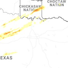
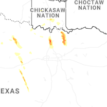
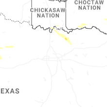
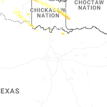


Connect with Interactive Hail Maps