

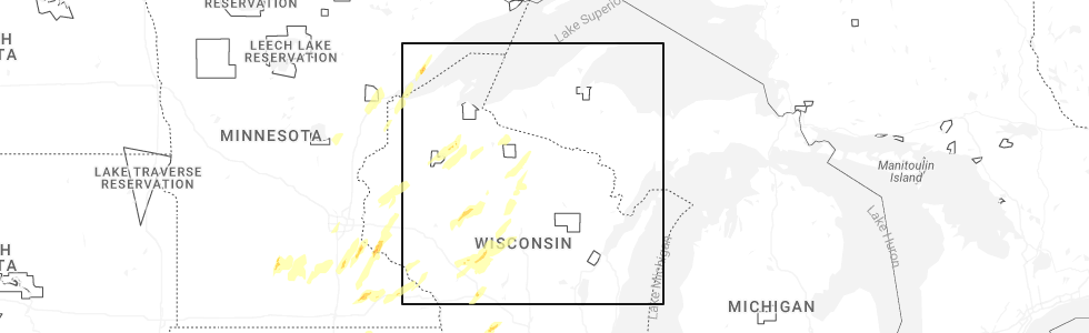
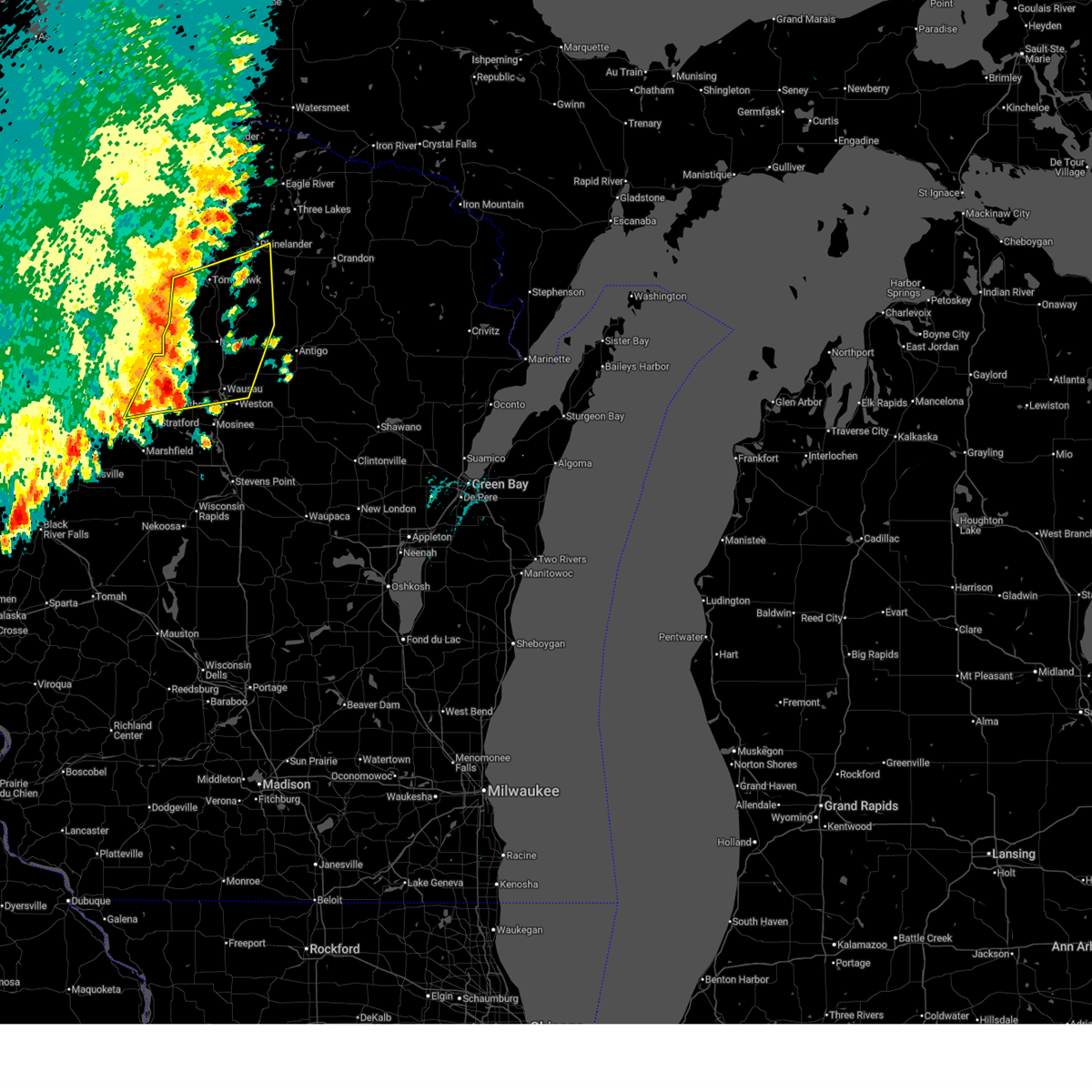
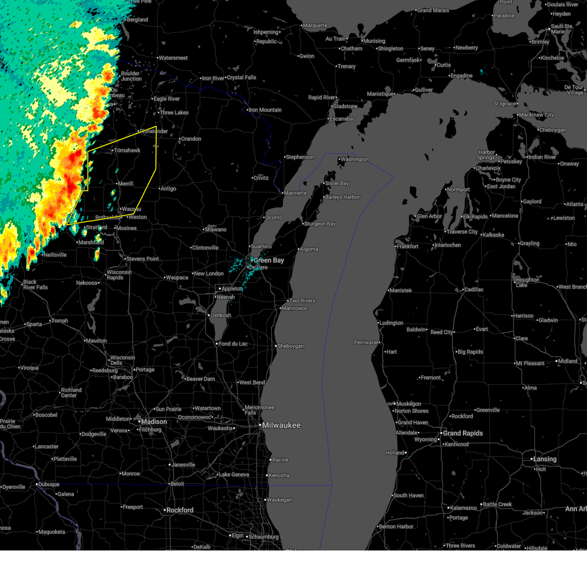
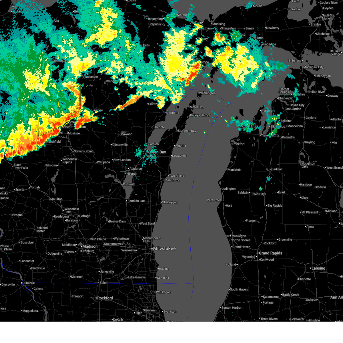
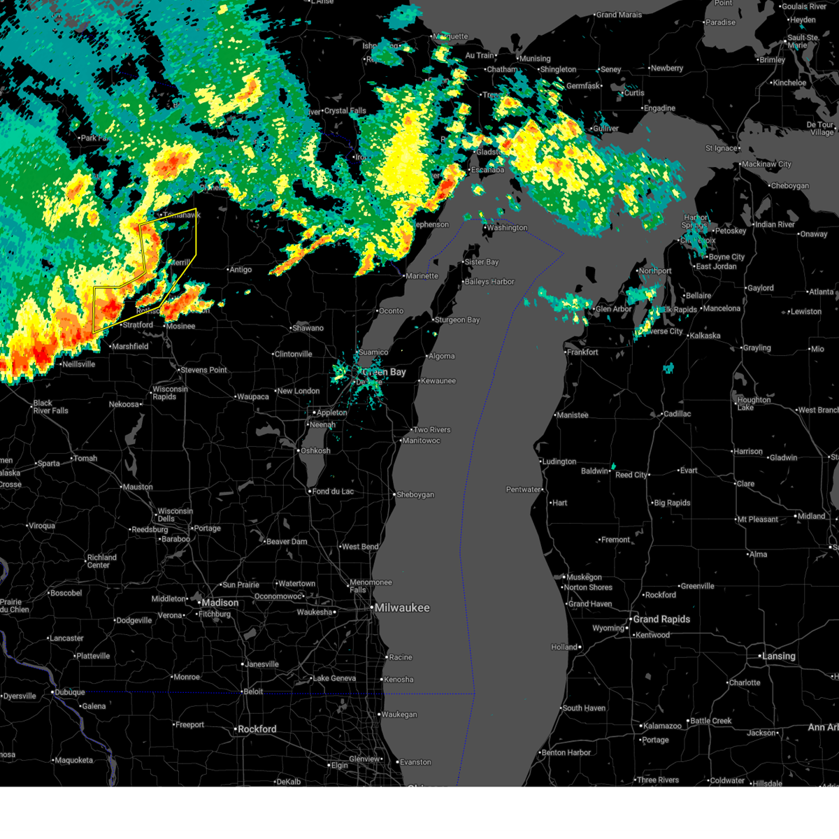
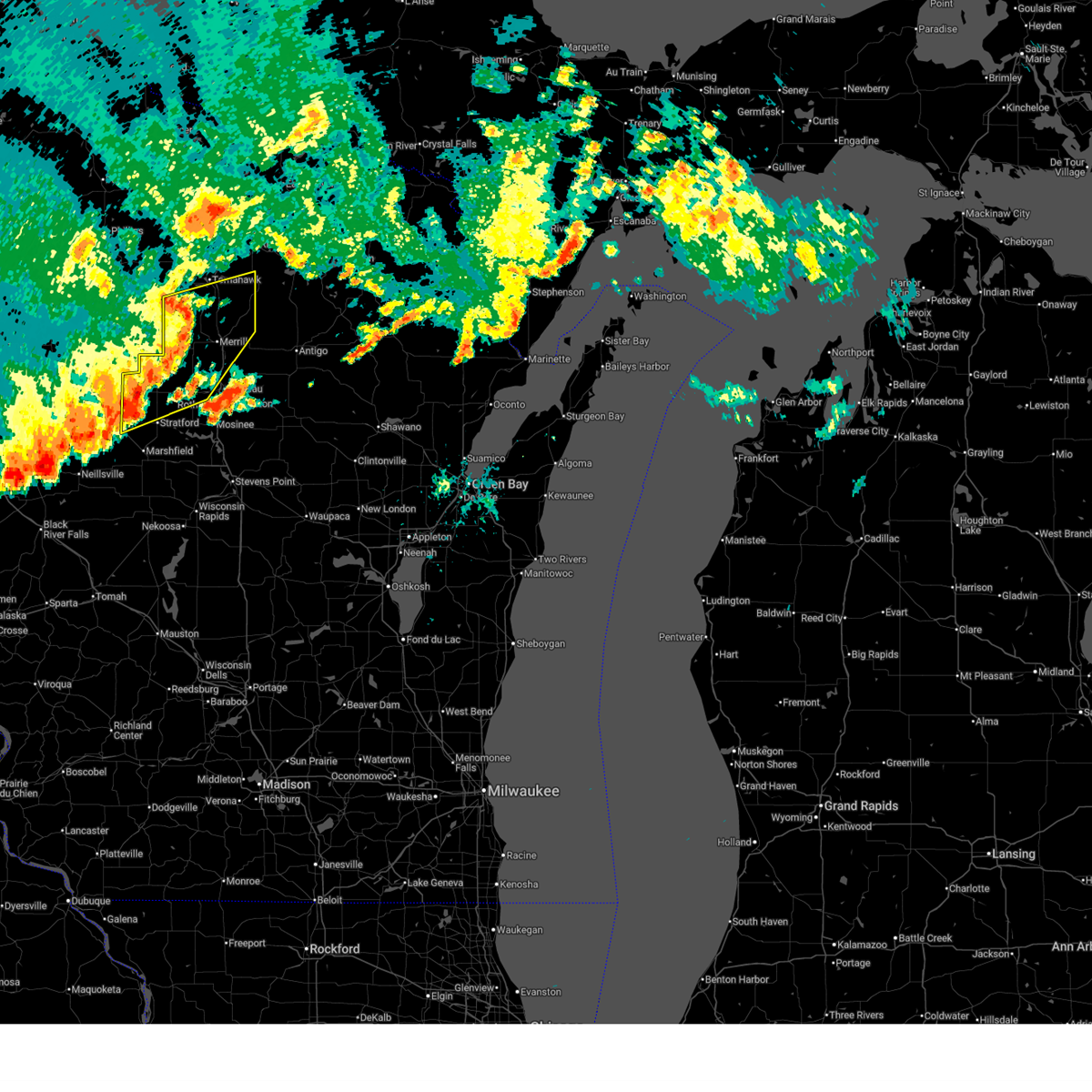
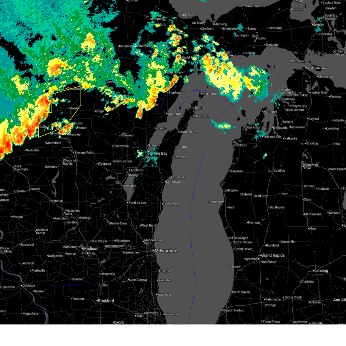
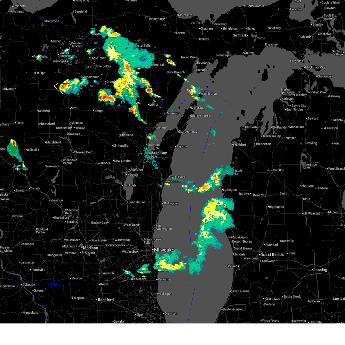
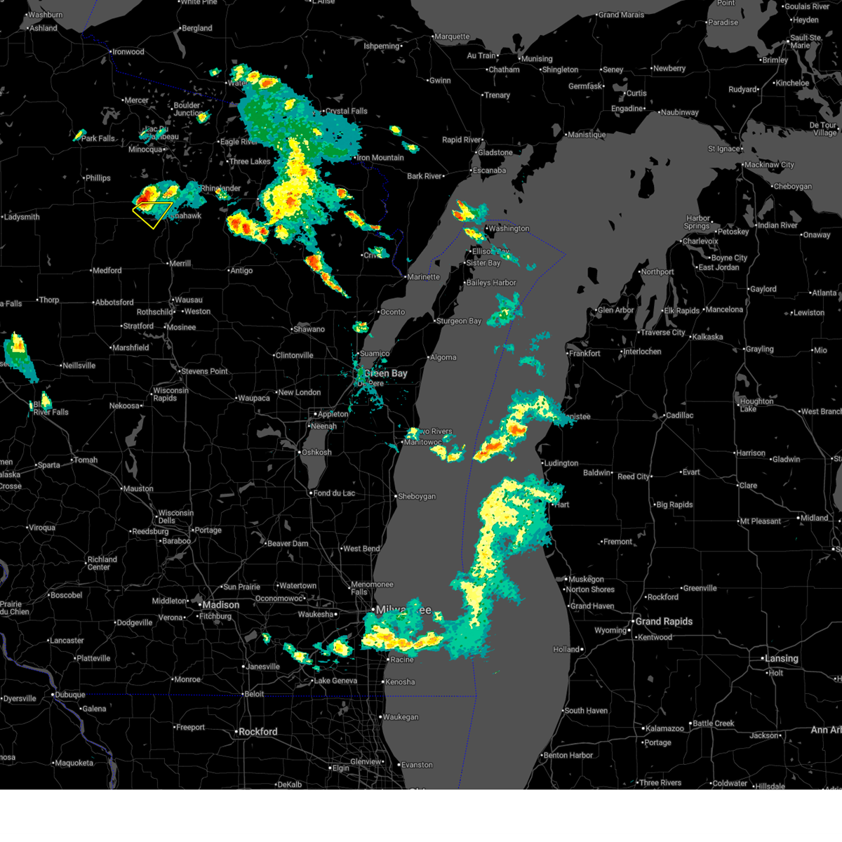
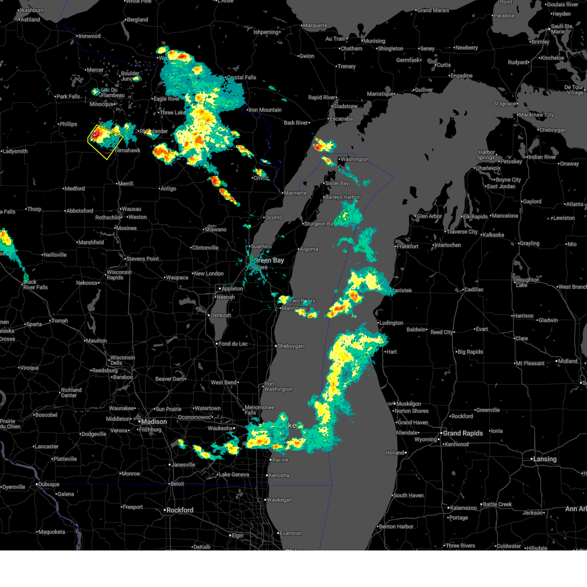
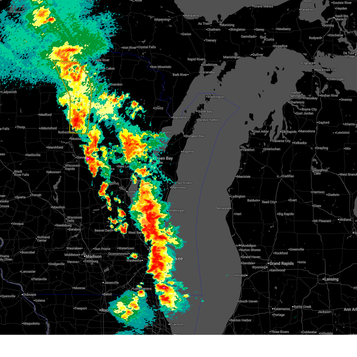
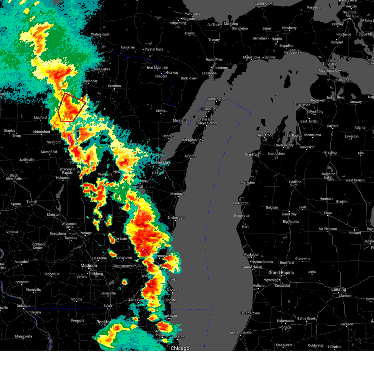
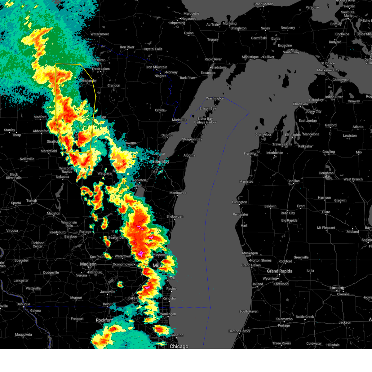
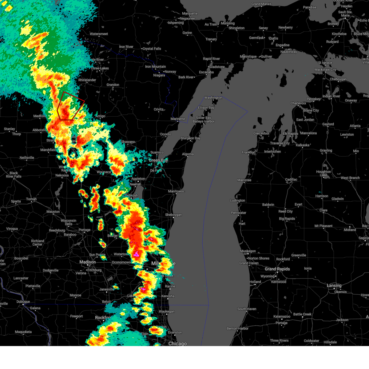
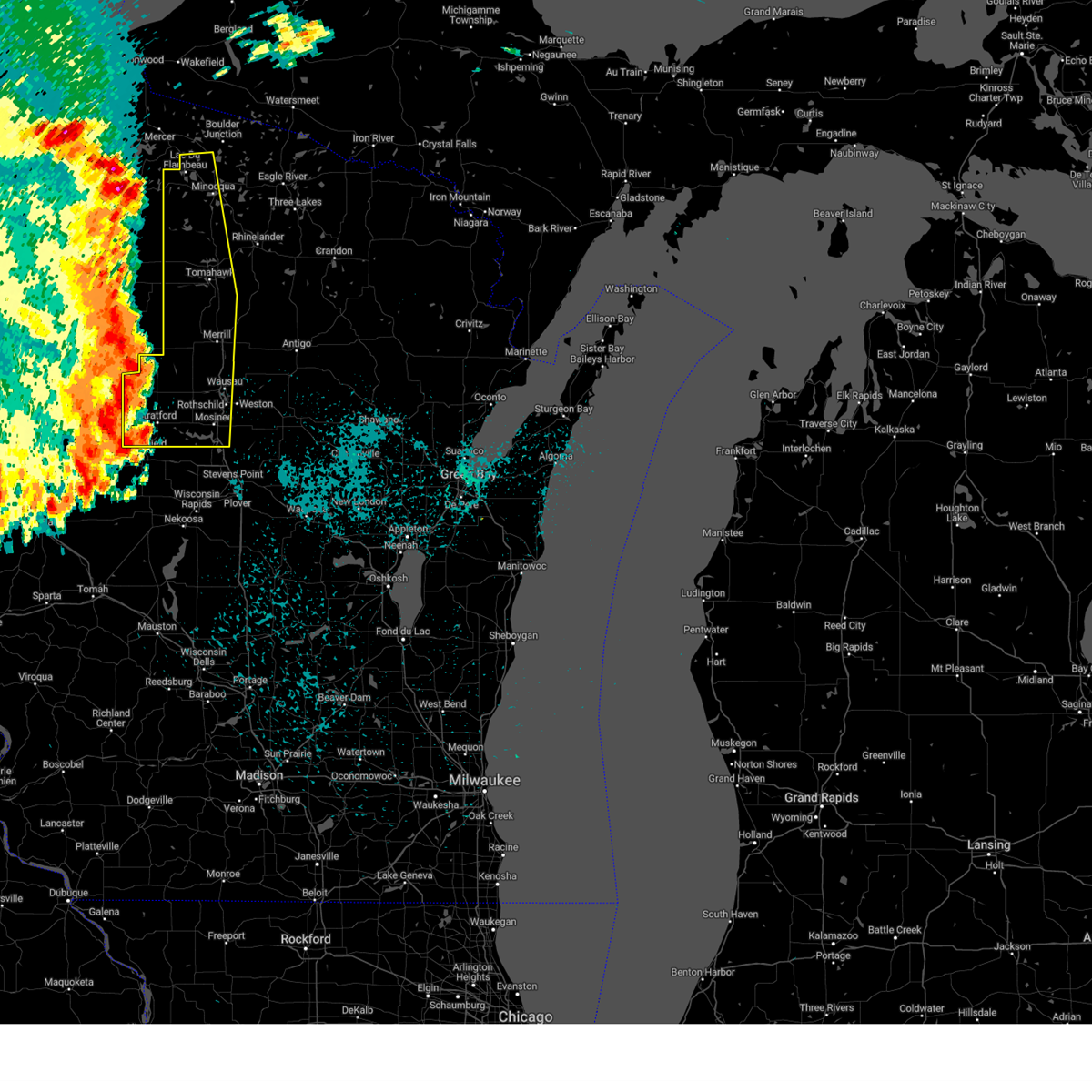
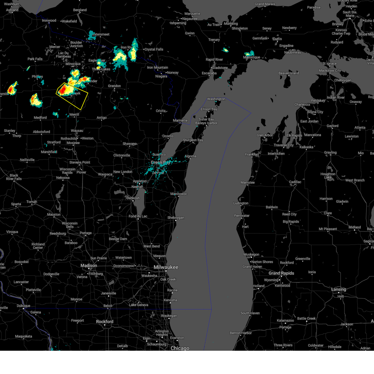
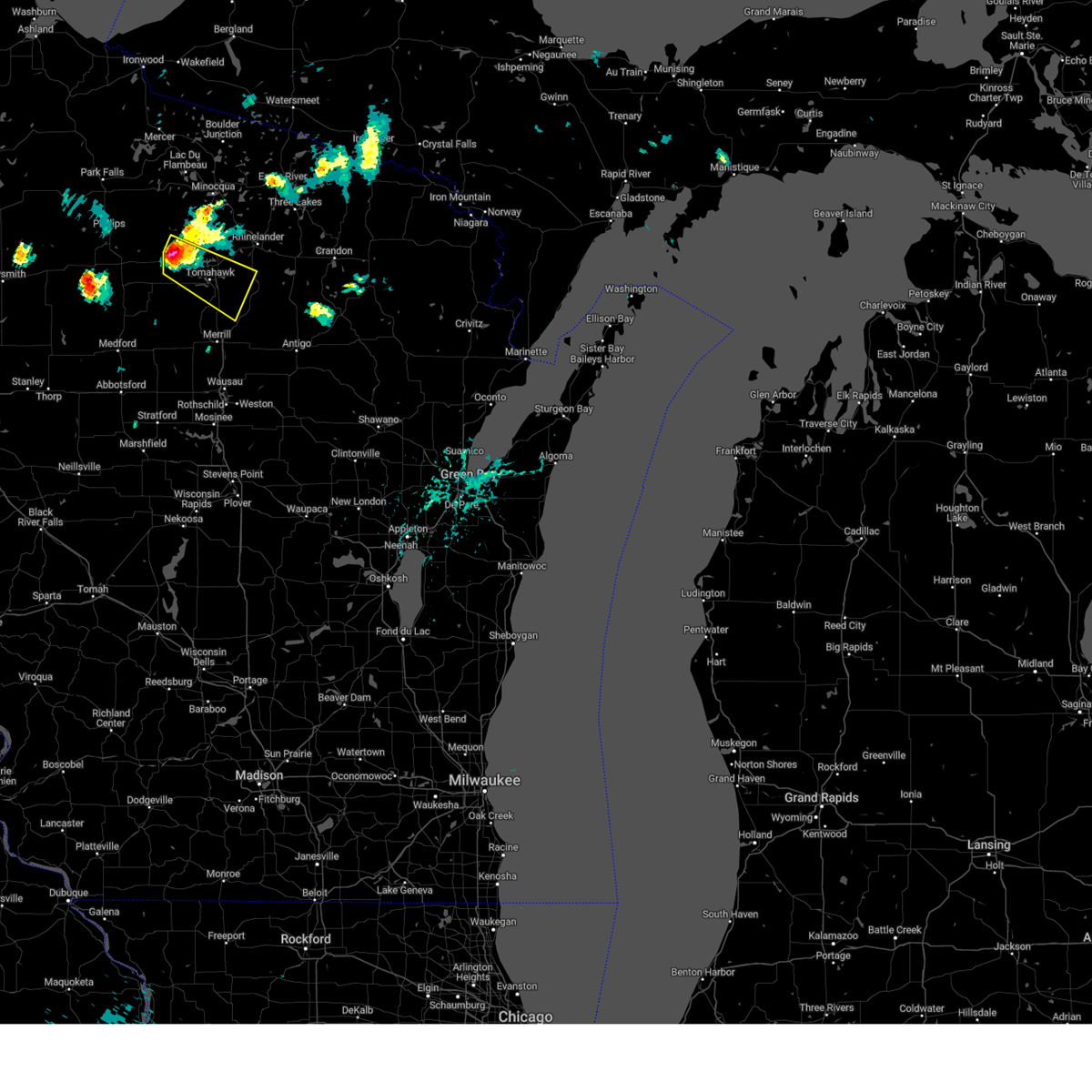
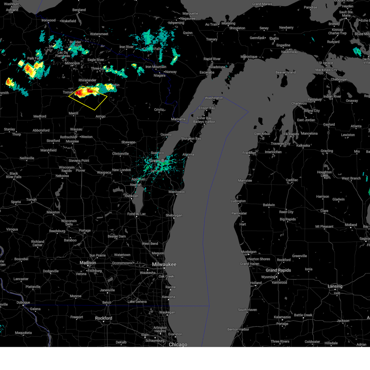
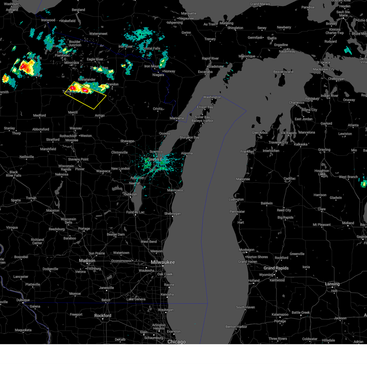
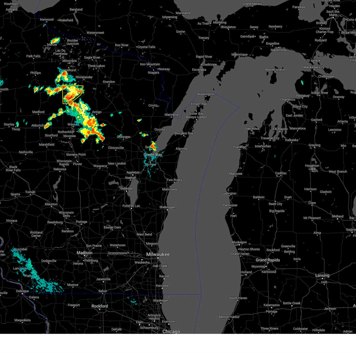
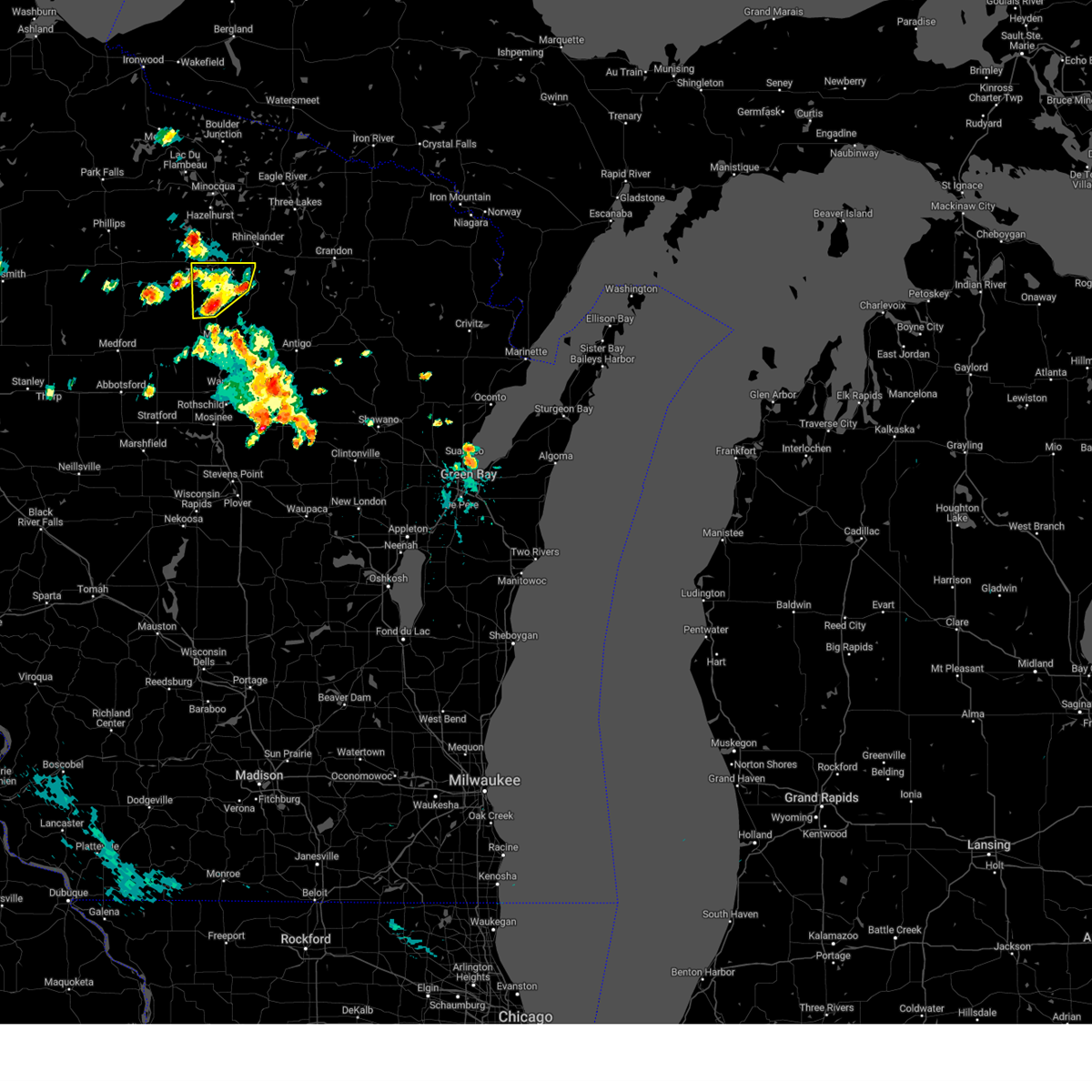
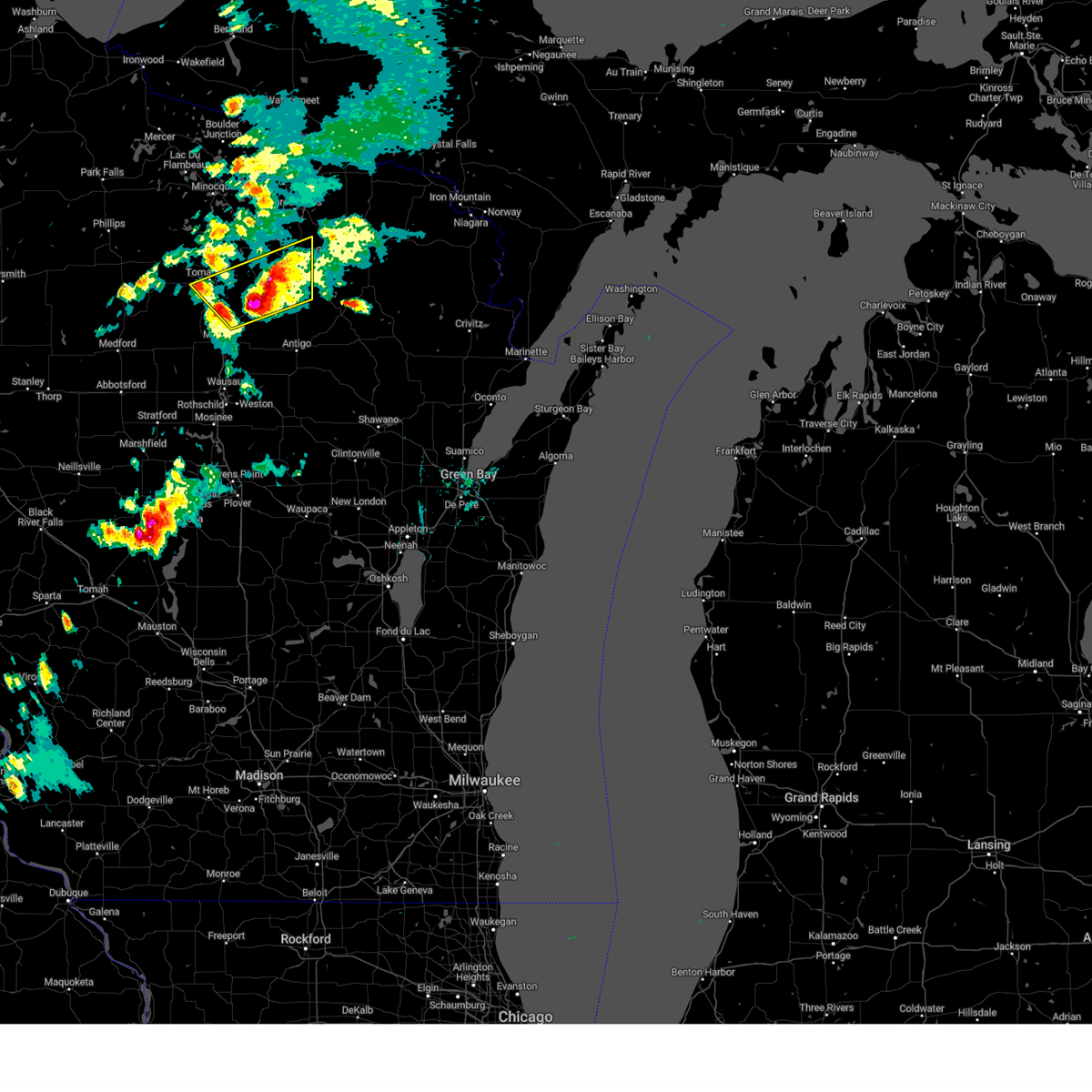
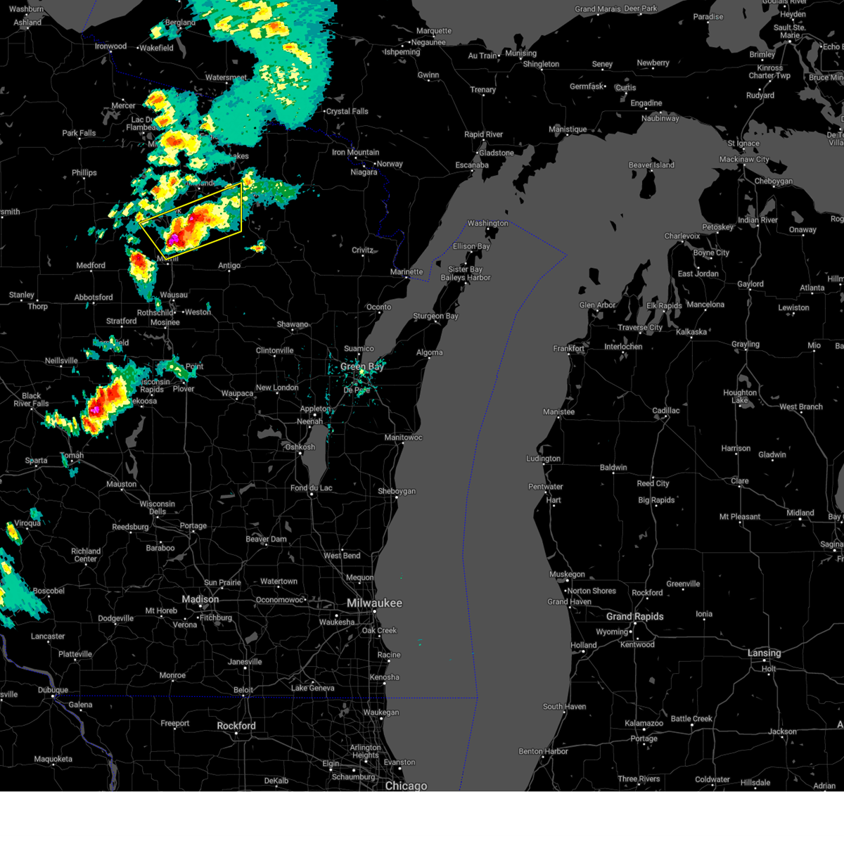
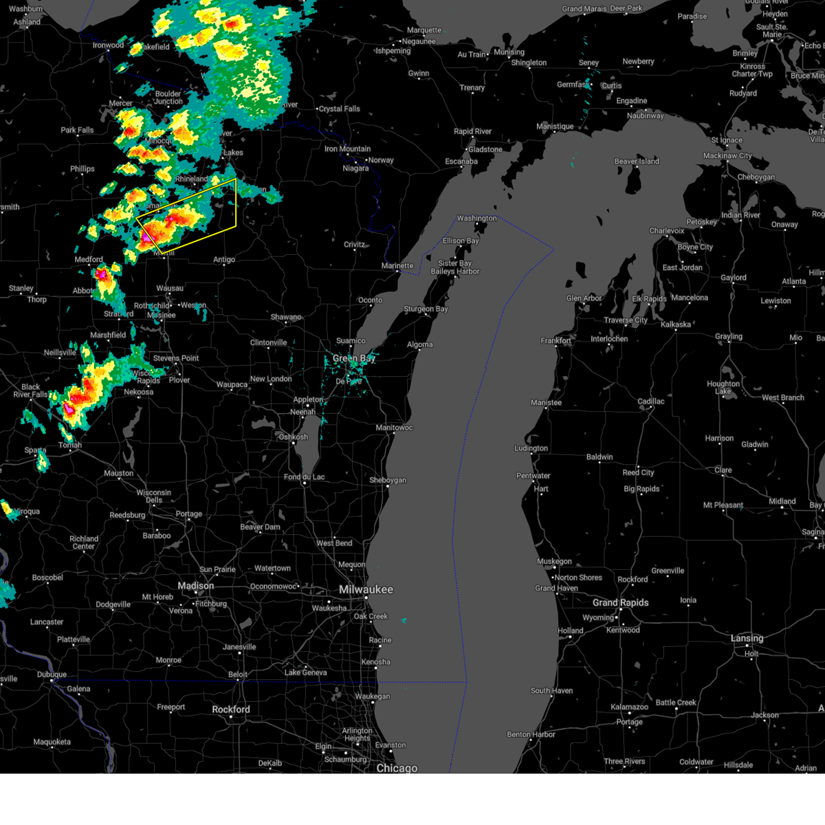
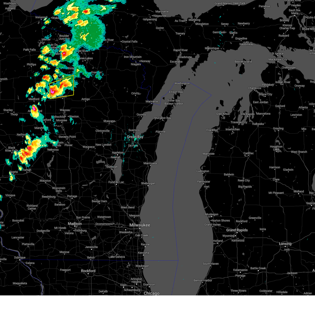
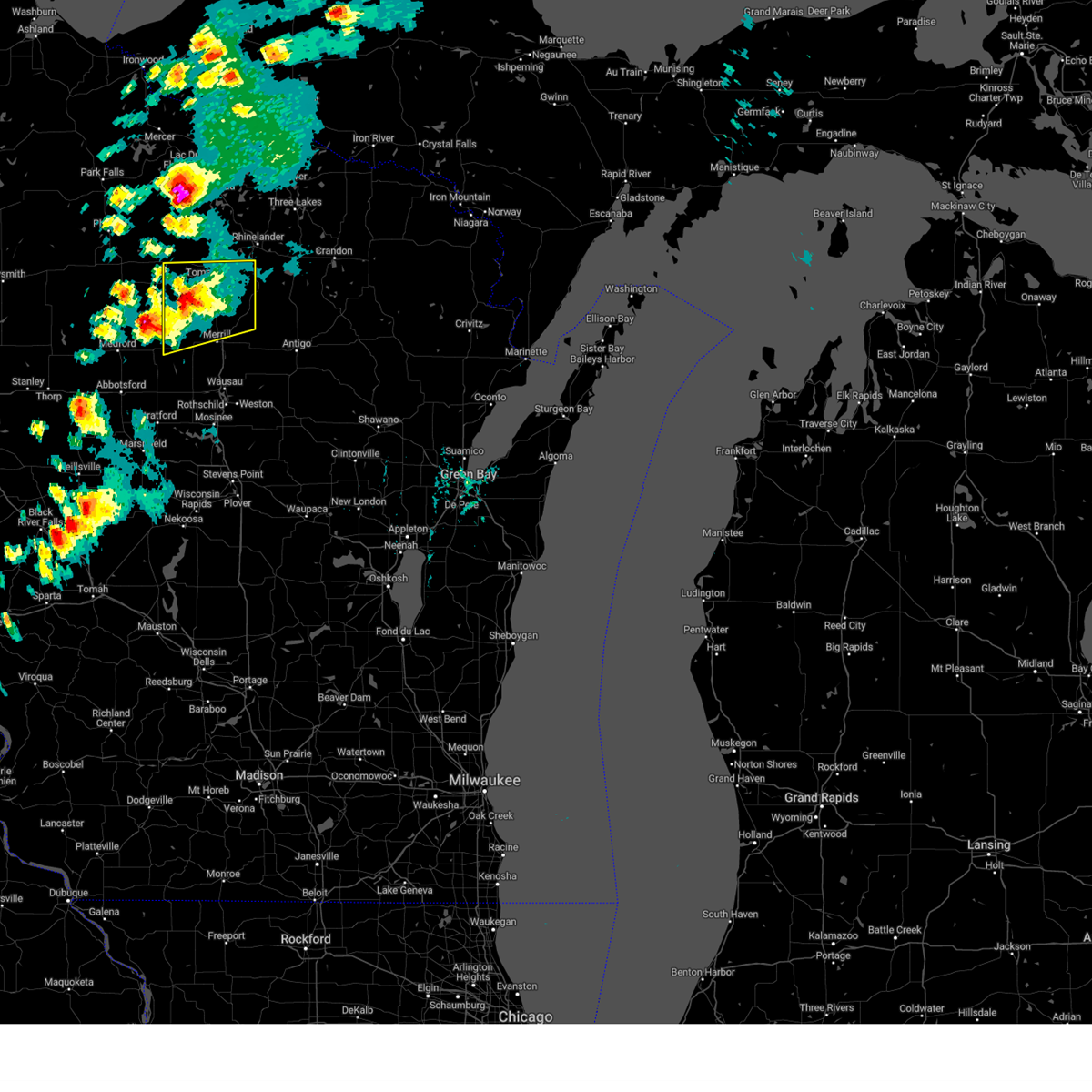
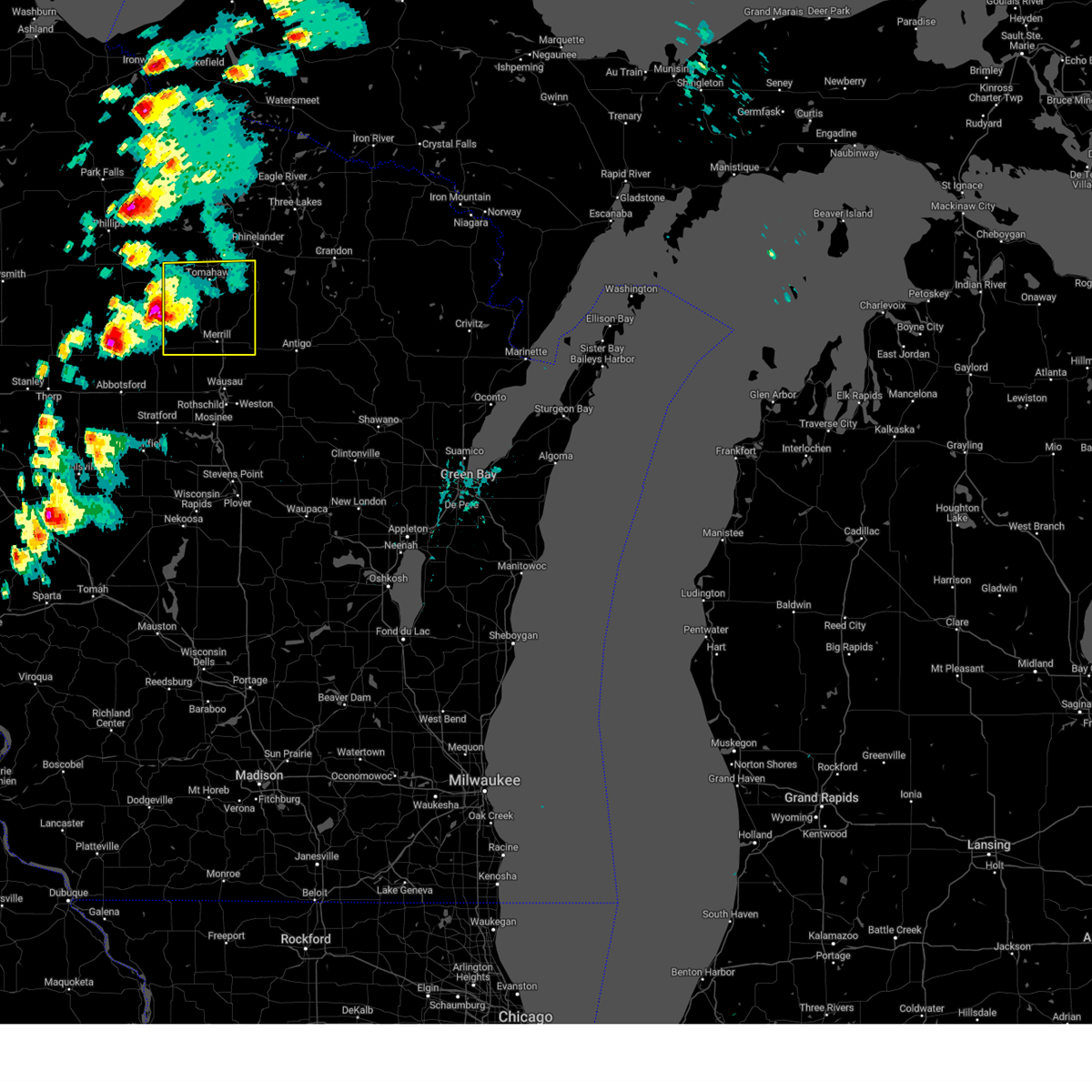
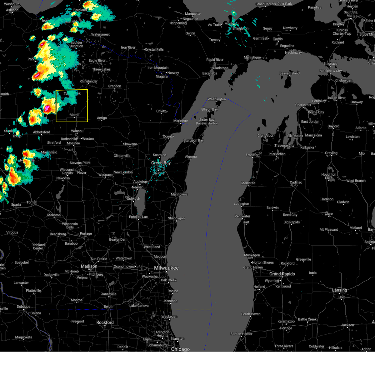
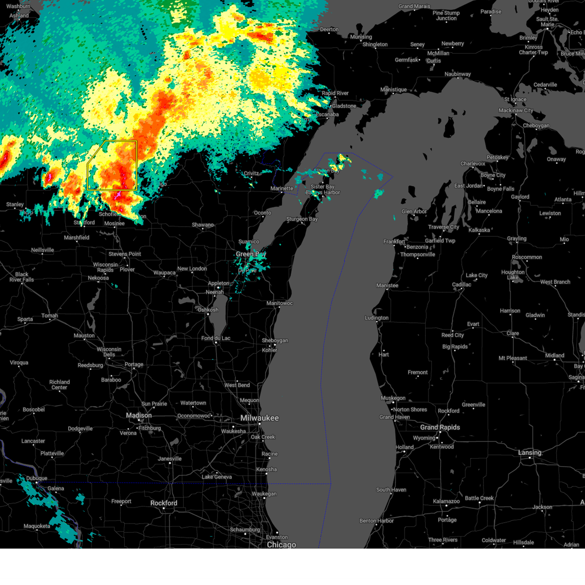
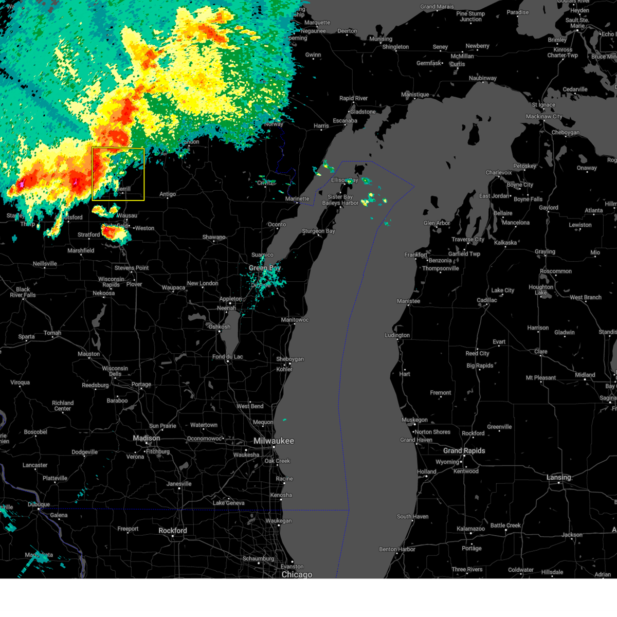
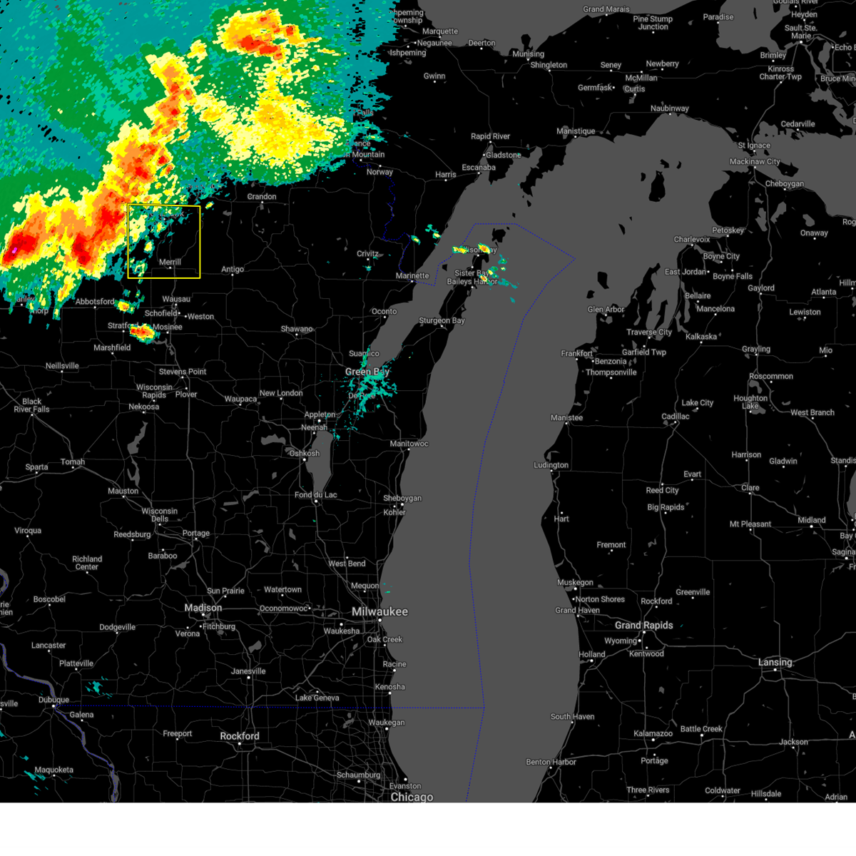
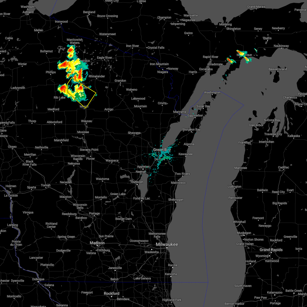
Hail Map for Tomahawk, WI
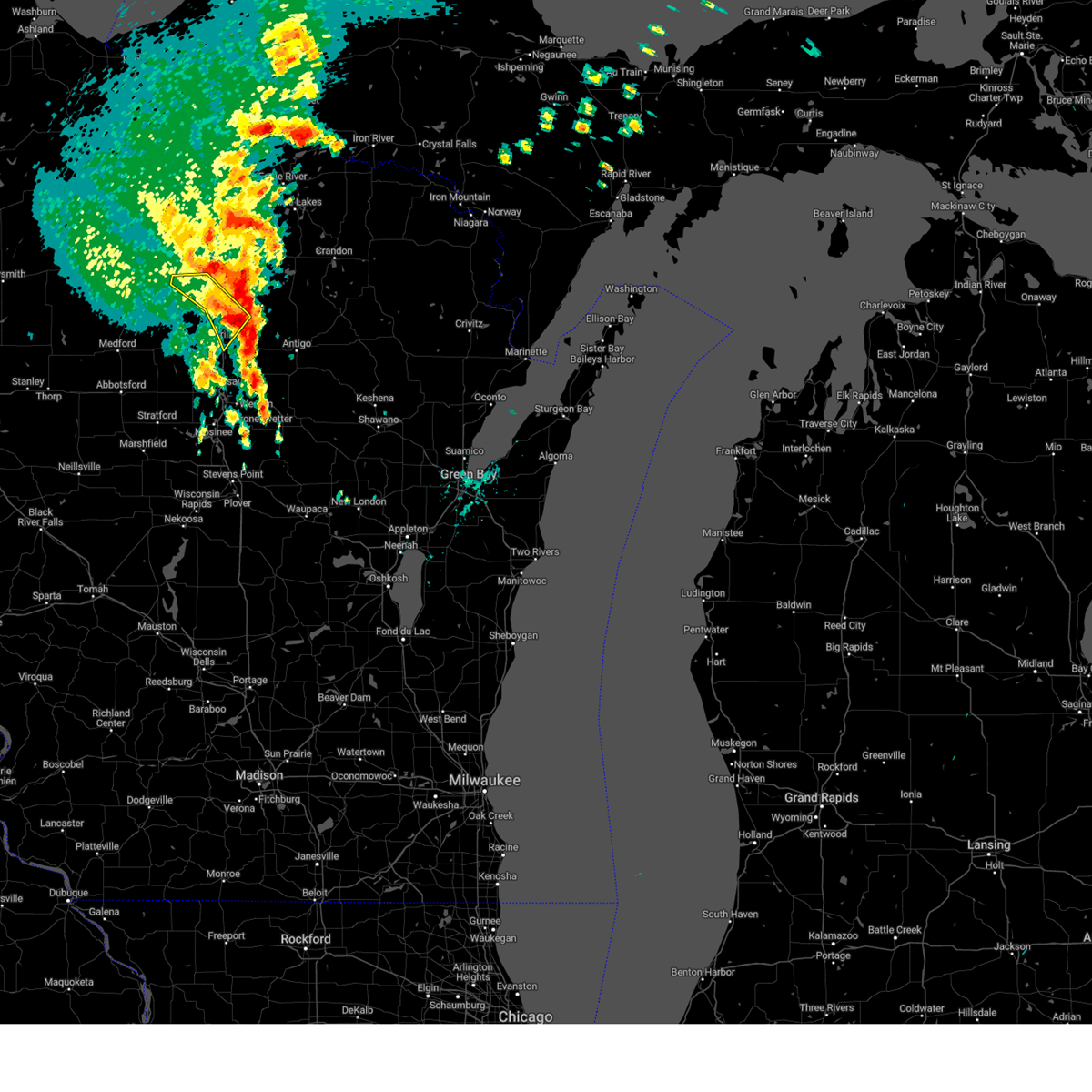
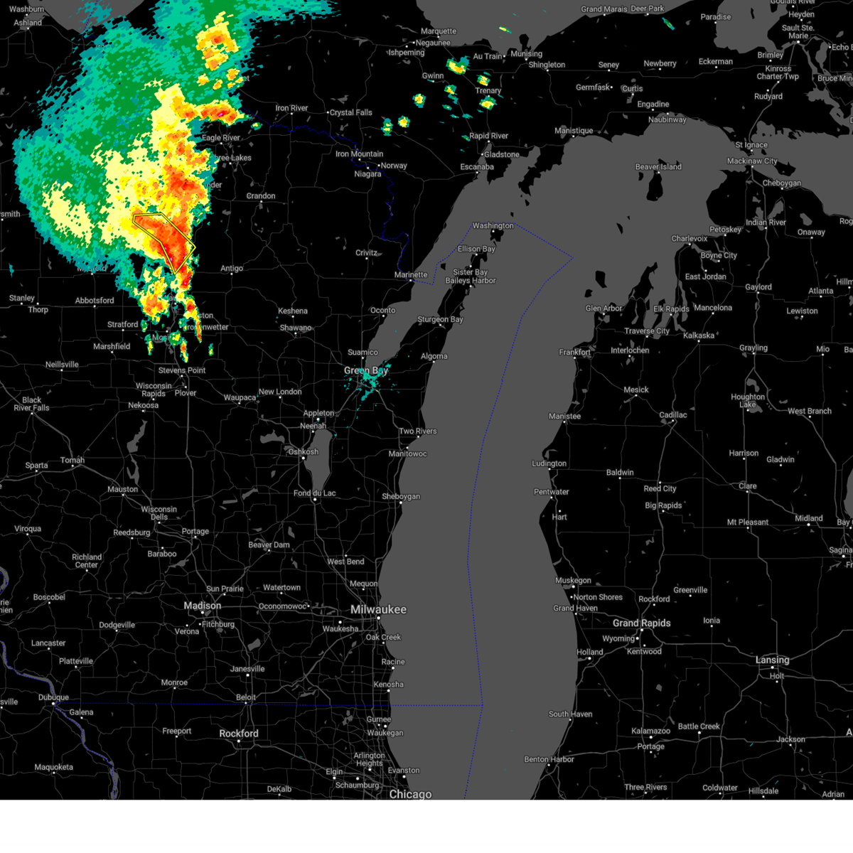
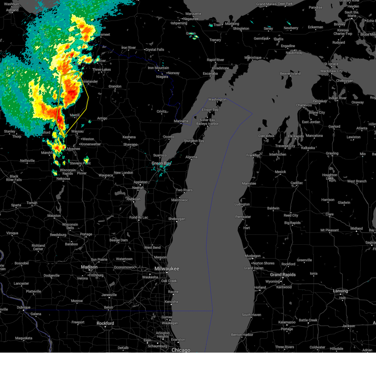
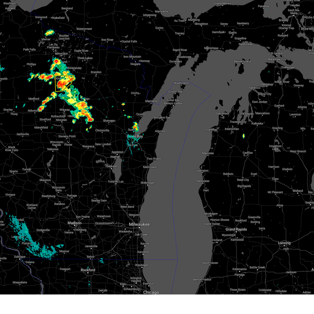
The Tomahawk, WI area has had 11 reports of on-the-ground hail by trained spotters, and has been under severe weather warnings 10 times during the past 12 months. Doppler radar has detected hail at or near Tomahawk, WI on 41 occasions, including 1 occasion during the past year.
| Name: | Tomahawk, WI |
| Where Located: | 19.2 miles SW of Rhinelander, WI |
| Map: | Google Map for Tomahawk, WI |
| Population: | 3397 |
| Housing Units: | 1742 |
| More Info: | Search Google for Tomahawk, WI |
1
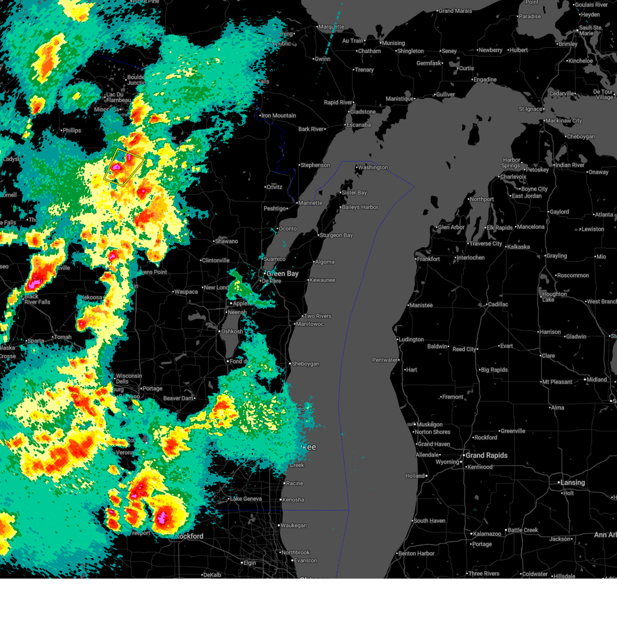
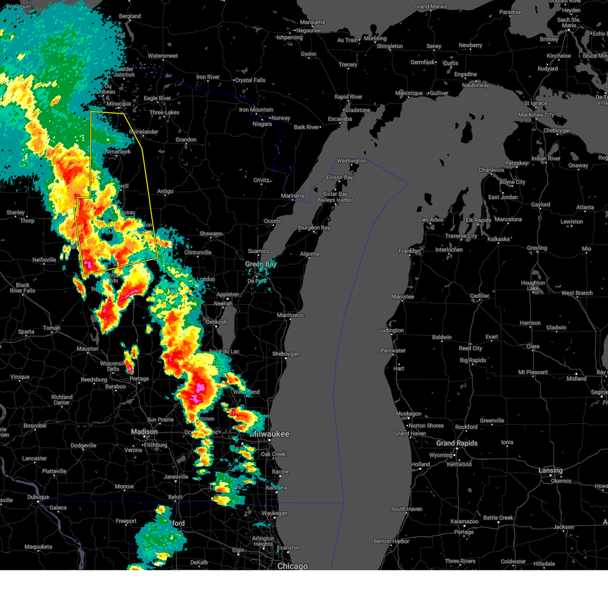
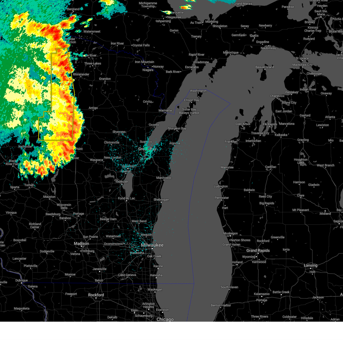
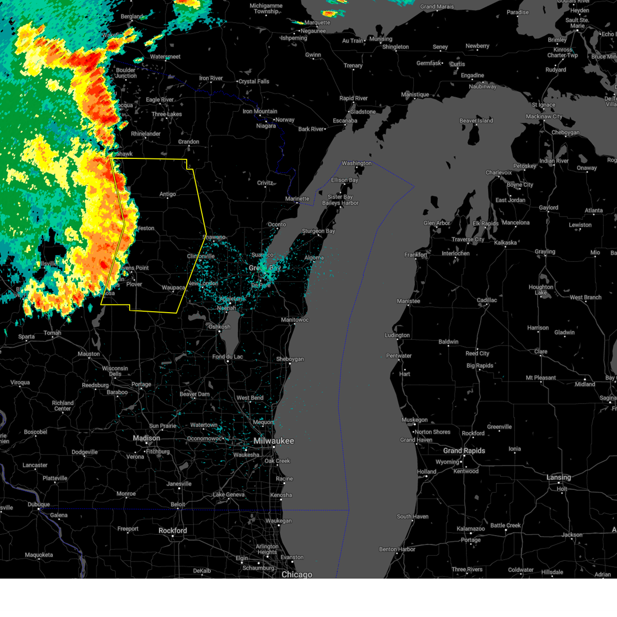
The Top Recent Hail Date for Tomahawk, WI is Friday, April 17, 2026 (8th out of 41)
Hail and Wind Damage Spotted near Tomahawk, WI
| Date / Time | Report Details |
|---|---|
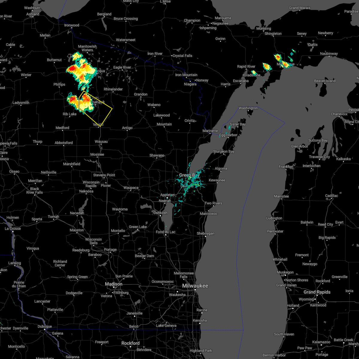
| 4/17/2026 5:01 PM CDT |
 At 501 pm cdt, a severe thunderstorm was located over gilbert, or 19 miles southwest of rhinelander, moving northeast at 45 mph (radar indicated). Hazards include 60 mph wind gusts and quarter size hail. Hail damage to vehicles is expected. expect wind damage to roofs, siding, and trees. this severe storm will be near, tomahawk around 505 pm cdt. harrison around 510 pm cdt. Other locations impacted by this severe thunderstorm include otter lake campground and heafford junction. At 501 pm cdt, a severe thunderstorm was located over gilbert, or 19 miles southwest of rhinelander, moving northeast at 45 mph (radar indicated). Hazards include 60 mph wind gusts and quarter size hail. Hail damage to vehicles is expected. expect wind damage to roofs, siding, and trees. this severe storm will be near, tomahawk around 505 pm cdt. harrison around 510 pm cdt. Other locations impacted by this severe thunderstorm include otter lake campground and heafford junction.
|
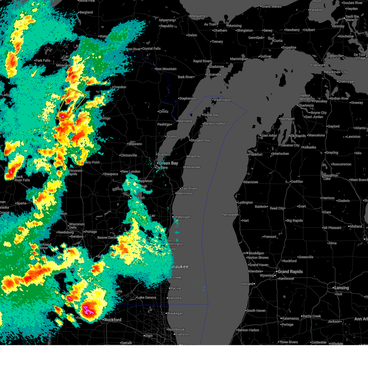
| 4/17/2026 4:53 PM CDT |
 At 453 pm cdt, a severe thunderstorm was located over birch trails girl scout camp, or 25 miles southwest of rhinelander, moving northeast at 45 mph (radar indicated). Hazards include 60 mph wind gusts and quarter size hail. Hail damage to vehicles is expected. expect wind damage to roofs, siding, and trees. this severe storm will be near, tomahawk and gilbert around 500 pm cdt. harrison around 510 pm cdt. Other locations impacted by this severe thunderstorm include otter lake campground, otis, heafford junction, bradley, and irma. At 453 pm cdt, a severe thunderstorm was located over birch trails girl scout camp, or 25 miles southwest of rhinelander, moving northeast at 45 mph (radar indicated). Hazards include 60 mph wind gusts and quarter size hail. Hail damage to vehicles is expected. expect wind damage to roofs, siding, and trees. this severe storm will be near, tomahawk and gilbert around 500 pm cdt. harrison around 510 pm cdt. Other locations impacted by this severe thunderstorm include otter lake campground, otis, heafford junction, bradley, and irma.
|
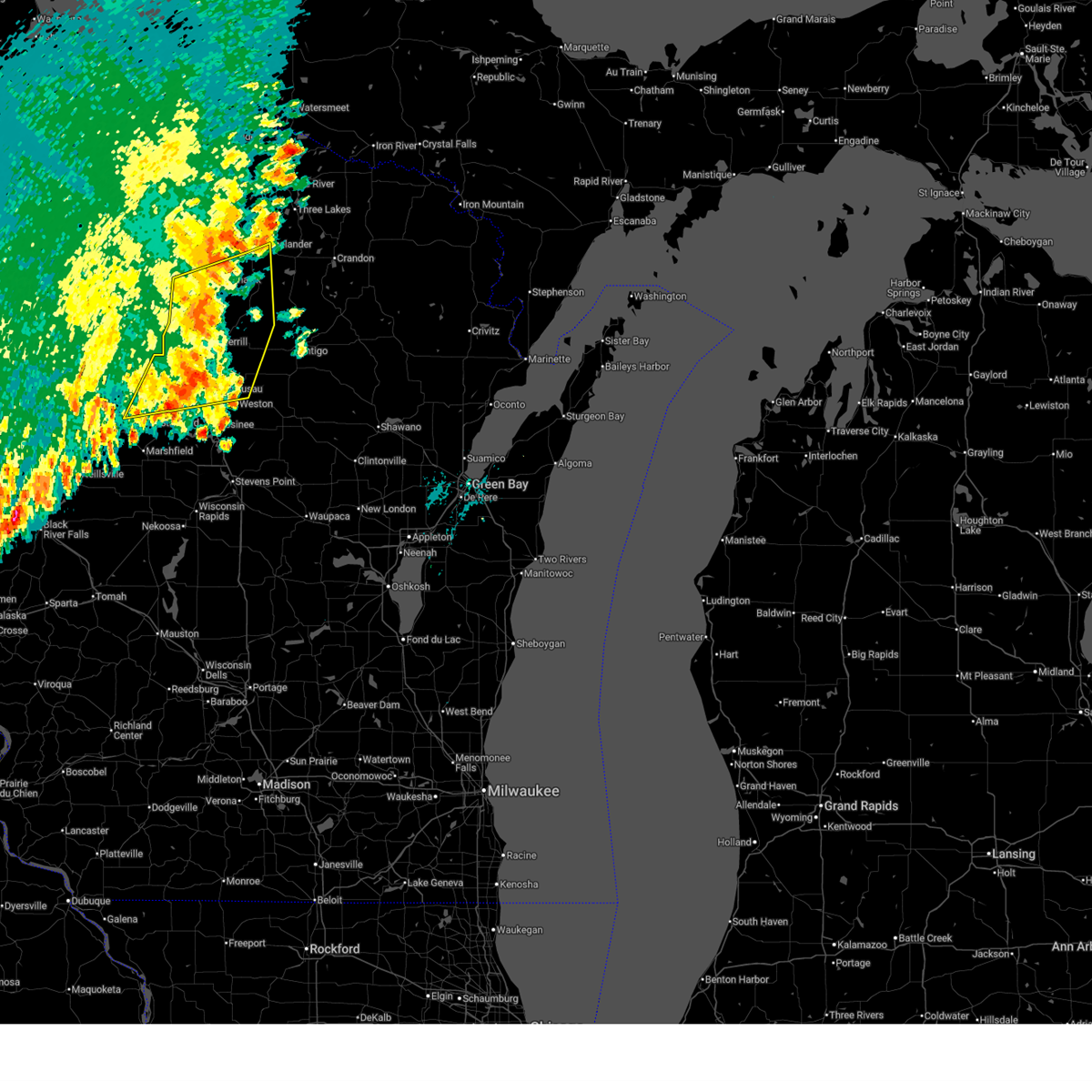
| 4/17/2026 4:36 PM CDT |
 Svrgrb the national weather service in green bay has issued a * severe thunderstorm warning for, central lincoln county in north central wisconsin, * until 515 pm cdt. * at 435 pm cdt, a severe thunderstorm was located 7 miles west of council grounds state park, or 18 miles northwest of wausau, moving northeast at 45 mph (radar indicated). Hazards include 60 mph wind gusts and quarter size hail. Hail damage to vehicles is expected. expect wind damage to roofs, siding, and trees. this severe thunderstorm will be near, birch trails girl scout camp around 445 pm cdt. tomahawk and gilbert around 500 pm cdt. harrison around 510 pm cdt. Other locations impacted by this severe thunderstorm include bill cross rapids wildlife area, otter lake campground, otis, heafford junction, bradley, and irma. Svrgrb the national weather service in green bay has issued a * severe thunderstorm warning for, central lincoln county in north central wisconsin, * until 515 pm cdt. * at 435 pm cdt, a severe thunderstorm was located 7 miles west of council grounds state park, or 18 miles northwest of wausau, moving northeast at 45 mph (radar indicated). Hazards include 60 mph wind gusts and quarter size hail. Hail damage to vehicles is expected. expect wind damage to roofs, siding, and trees. this severe thunderstorm will be near, birch trails girl scout camp around 445 pm cdt. tomahawk and gilbert around 500 pm cdt. harrison around 510 pm cdt. Other locations impacted by this severe thunderstorm include bill cross rapids wildlife area, otter lake campground, otis, heafford junction, bradley, and irma.
|
| 8/9/2025 8:11 AM CDT |
 The storms which prompted the warning have weakened below severe limits, and no longer pose an immediate threat to life or property. therefore, the warning will be allowed to expire. The storms which prompted the warning have weakened below severe limits, and no longer pose an immediate threat to life or property. therefore, the warning will be allowed to expire.
|
| 8/9/2025 7:52 AM CDT |
 At 751 am cdt, severe thunderstorms were located along a line extending from near tomahawk to near council grounds state park to 13 miles west of rib mountain, moving east at 30 mph (radar indicated). Hazards include 60 mph wind gusts and quarter size hail. Hail damage to vehicles is expected. expect wind damage to roofs, siding, and trees. these severe storms will be near, merrill, tomahawk, council grounds state park, gilbert, and birch trails girl scout camp around 755 am cdt. wausau around 800 am cdt. rib mountain around 805 am cdt. harrison and dutch corners around 810 am cdt. weston around 815 am cdt. parrish around 820 am cdt. Other locations impacted by these severe thunderstorms include edgar, ackley wildlife area, bradley, dudley, little chicago, march rapids, hamburg, otis, bavaria, and rib falls. At 751 am cdt, severe thunderstorms were located along a line extending from near tomahawk to near council grounds state park to 13 miles west of rib mountain, moving east at 30 mph (radar indicated). Hazards include 60 mph wind gusts and quarter size hail. Hail damage to vehicles is expected. expect wind damage to roofs, siding, and trees. these severe storms will be near, merrill, tomahawk, council grounds state park, gilbert, and birch trails girl scout camp around 755 am cdt. wausau around 800 am cdt. rib mountain around 805 am cdt. harrison and dutch corners around 810 am cdt. weston around 815 am cdt. parrish around 820 am cdt. Other locations impacted by these severe thunderstorms include edgar, ackley wildlife area, bradley, dudley, little chicago, march rapids, hamburg, otis, bavaria, and rib falls.
|
| 8/9/2025 7:33 AM CDT |
 Svrgrb the national weather service in green bay has issued a * severe thunderstorm warning for, lincoln county in north central wisconsin, northern marathon county in central wisconsin, southeastern oneida county in north central wisconsin, northwestern langlade county in north central wisconsin, * until 815 am cdt. * at 733 am cdt, severe thunderstorms were located along a line extending from 6 miles southeast of spirit to 10 miles south of new wood wildlife area to 6 miles east of abbotsford, moving east at 40 mph (radar indicated). Hazards include 60 mph wind gusts and quarter size hail. Hail damage to vehicles is expected. expect wind damage to roofs, siding, and trees. severe thunderstorms will be near, new wood wildlife area around 740 am cdt. merrill and tomahawk around 745 am cdt. council grounds state park, gilbert, and birch trails girl scout camp around 750 am cdt. wausau and dutch corners around 800 am cdt. harrison around 805 am cdt. Other locations impacted by these severe thunderstorms include edgar, ackley wildlife area, bradley, dudley, kelly lynn bog natural area, little chicago, march rapids, ormsby, hamburg, and otis. Svrgrb the national weather service in green bay has issued a * severe thunderstorm warning for, lincoln county in north central wisconsin, northern marathon county in central wisconsin, southeastern oneida county in north central wisconsin, northwestern langlade county in north central wisconsin, * until 815 am cdt. * at 733 am cdt, severe thunderstorms were located along a line extending from 6 miles southeast of spirit to 10 miles south of new wood wildlife area to 6 miles east of abbotsford, moving east at 40 mph (radar indicated). Hazards include 60 mph wind gusts and quarter size hail. Hail damage to vehicles is expected. expect wind damage to roofs, siding, and trees. severe thunderstorms will be near, new wood wildlife area around 740 am cdt. merrill and tomahawk around 745 am cdt. council grounds state park, gilbert, and birch trails girl scout camp around 750 am cdt. wausau and dutch corners around 800 am cdt. harrison around 805 am cdt. Other locations impacted by these severe thunderstorms include edgar, ackley wildlife area, bradley, dudley, kelly lynn bog natural area, little chicago, march rapids, ormsby, hamburg, and otis.
|
| 7/23/2025 4:14 PM CDT |
 The storms which prompted the warning have weakened below severe limits, and no longer pose an immediate threat to life or property. therefore, the warning will be allowed to expire. however, gusty winds from 40 to 50 mph are still possible with these thunderstorms. The storms which prompted the warning have weakened below severe limits, and no longer pose an immediate threat to life or property. therefore, the warning will be allowed to expire. however, gusty winds from 40 to 50 mph are still possible with these thunderstorms.
|
| 7/23/2025 4:00 PM CDT |
 At 400 pm cdt, severe thunderstorms were located along a line extending from near gilbert to near dutch corners to 13 miles northeast of marshfield, moving northeast at 60 mph (radar indicated). Hazards include 60 mph wind gusts. Expect damage to roofs, siding, and trees. these severe storms will be near, wausau, merrill, harrison, and dutch corners around 405 pm cdt. Other locations impacted by these severe thunderstorms include edgar, cherokee, dudley, little chicago, march rapids, hamburg, poniatowski, otis, rib falls, and fenwood. At 400 pm cdt, severe thunderstorms were located along a line extending from near gilbert to near dutch corners to 13 miles northeast of marshfield, moving northeast at 60 mph (radar indicated). Hazards include 60 mph wind gusts. Expect damage to roofs, siding, and trees. these severe storms will be near, wausau, merrill, harrison, and dutch corners around 405 pm cdt. Other locations impacted by these severe thunderstorms include edgar, cherokee, dudley, little chicago, march rapids, hamburg, poniatowski, otis, rib falls, and fenwood.
|
| 7/23/2025 3:50 PM CDT |
 At 350 pm cdt, severe thunderstorms were located along a line extending from 6 miles southwest of gilbert to near council grounds state park to 6 miles northeast of spencer, moving east at 60 mph (radar indicated). Hazards include 60 mph wind gusts. Expect damage to roofs, siding, and trees. these severe storms will be near, merrill, tomahawk, council grounds state park, gilbert, and birch trails girl scout camp around 355 pm cdt. wausau and dutch corners around 400 pm cdt. harrison around 405 pm cdt. Other locations impacted by these severe thunderstorms include edgar, cherokee, dudley, little chicago, march rapids, hamburg, poniatowski, otis, athens, and rib falls. At 350 pm cdt, severe thunderstorms were located along a line extending from 6 miles southwest of gilbert to near council grounds state park to 6 miles northeast of spencer, moving east at 60 mph (radar indicated). Hazards include 60 mph wind gusts. Expect damage to roofs, siding, and trees. these severe storms will be near, merrill, tomahawk, council grounds state park, gilbert, and birch trails girl scout camp around 355 pm cdt. wausau and dutch corners around 400 pm cdt. harrison around 405 pm cdt. Other locations impacted by these severe thunderstorms include edgar, cherokee, dudley, little chicago, march rapids, hamburg, poniatowski, otis, athens, and rib falls.
|
| 7/23/2025 3:37 PM CDT |
 Svrgrb the national weather service in green bay has issued a * severe thunderstorm warning for, lincoln county in north central wisconsin, northwestern marathon county in central wisconsin, * until 415 pm cdt. * at 337 pm cdt, severe thunderstorms were located along a line extending from near rib lake to 11 miles east of medford to 6 miles southwest of colby, moving east at 50 mph (radar indicated). Hazards include 60 mph wind gusts. Expect damage to roofs, siding, and trees. severe thunderstorms will be near, abbotsford and new wood wildlife area around 340 pm cdt. merrill, tomahawk, council grounds state park, gilbert, and birch trails girl scout camp around 355 pm cdt. harrison and dutch corners around 405 pm cdt. wausau around 410 pm cdt. Other locations impacted by these severe thunderstorms include edgar, cherokee, dudley, little chicago, march rapids, hamburg, poniatowski, otis, athens, and rib falls. Svrgrb the national weather service in green bay has issued a * severe thunderstorm warning for, lincoln county in north central wisconsin, northwestern marathon county in central wisconsin, * until 415 pm cdt. * at 337 pm cdt, severe thunderstorms were located along a line extending from near rib lake to 11 miles east of medford to 6 miles southwest of colby, moving east at 50 mph (radar indicated). Hazards include 60 mph wind gusts. Expect damage to roofs, siding, and trees. severe thunderstorms will be near, abbotsford and new wood wildlife area around 340 pm cdt. merrill, tomahawk, council grounds state park, gilbert, and birch trails girl scout camp around 355 pm cdt. harrison and dutch corners around 405 pm cdt. wausau around 410 pm cdt. Other locations impacted by these severe thunderstorms include edgar, cherokee, dudley, little chicago, march rapids, hamburg, poniatowski, otis, athens, and rib falls.
|
| 6/19/2025 4:42 PM CDT |
 The storm which prompted the warning has weakened below severe limits, and no longer poses an immediate threat to life or property. therefore, the warning will be allowed to expire. however, small hail is still possible with this thunderstorm. The storm which prompted the warning has weakened below severe limits, and no longer poses an immediate threat to life or property. therefore, the warning will be allowed to expire. however, small hail is still possible with this thunderstorm.
|
| 6/19/2025 4:33 PM CDT |
 At 432 pm cdt, a severe thunderstorm was located near tomahawk, or 19 miles west of rhinelander, moving southeast at 30 mph (radar indicated). Hazards include quarter size hail. Damage to vehicles is expected. this severe storm will be near, tomahawk around 435 pm cdt. Other locations impacted by this severe thunderstorm include bradley and heafford junction. At 432 pm cdt, a severe thunderstorm was located near tomahawk, or 19 miles west of rhinelander, moving southeast at 30 mph (radar indicated). Hazards include quarter size hail. Damage to vehicles is expected. this severe storm will be near, tomahawk around 435 pm cdt. Other locations impacted by this severe thunderstorm include bradley and heafford junction.
|
| 6/19/2025 4:33 PM CDT |
 the severe thunderstorm warning has been cancelled and is no longer in effect the severe thunderstorm warning has been cancelled and is no longer in effect
|
| 6/19/2025 4:28 PM CDT | Quarter sized hail reported 9.2 miles ESE of Tomahawk, WI, located near west bay drive and honey road in tripoli. |
| 6/19/2025 4:20 PM CDT |
 Svrgrb the national weather service in green bay has issued a * severe thunderstorm warning for, northwestern lincoln county in north central wisconsin, southwestern oneida county in north central wisconsin, * until 445 pm cdt. * at 420 pm cdt, a severe thunderstorm was located near tripoli, or 22 miles west of rhinelander, moving southeast at 25 mph (radar indicated). Hazards include quarter size hail. Damage to vehicles is expected. this severe thunderstorm will be near, tomahawk around 430 pm cdt. Other locations impacted by this severe thunderstorm include mccord, gobler lake natural area, heafford junction, bradley, and lower tomahawk river natural area. Svrgrb the national weather service in green bay has issued a * severe thunderstorm warning for, northwestern lincoln county in north central wisconsin, southwestern oneida county in north central wisconsin, * until 445 pm cdt. * at 420 pm cdt, a severe thunderstorm was located near tripoli, or 22 miles west of rhinelander, moving southeast at 25 mph (radar indicated). Hazards include quarter size hail. Damage to vehicles is expected. this severe thunderstorm will be near, tomahawk around 430 pm cdt. Other locations impacted by this severe thunderstorm include mccord, gobler lake natural area, heafford junction, bradley, and lower tomahawk river natural area.
|
| 5/15/2025 6:54 PM CDT |
 At 654 pm cdt, severe thunderstorms were located along a line extending from 7 miles northeast of squirrel lake to near harrison to wausau, moving northeast at 25 mph (radar indicated). Hazards include 60 mph wind gusts and penny size hail. Expect damage to roofs, siding, and trees. Locations impacted include, wausau, rhinelander, weston, merrill, rib mountain, tomahawk, newbold, harrison, woodboro, parrish, gilbert, dutch corners, squirrel lake, crystal lake scout reservation, rainbow flowage, willow reservoir, rothschild, minocqua, bradley, and schofield. At 654 pm cdt, severe thunderstorms were located along a line extending from 7 miles northeast of squirrel lake to near harrison to wausau, moving northeast at 25 mph (radar indicated). Hazards include 60 mph wind gusts and penny size hail. Expect damage to roofs, siding, and trees. Locations impacted include, wausau, rhinelander, weston, merrill, rib mountain, tomahawk, newbold, harrison, woodboro, parrish, gilbert, dutch corners, squirrel lake, crystal lake scout reservation, rainbow flowage, willow reservoir, rothschild, minocqua, bradley, and schofield.
|
| 5/15/2025 6:34 PM CDT |
 the tornado warning has been cancelled and is no longer in effect the tornado warning has been cancelled and is no longer in effect
|
| 5/15/2025 6:20 PM CDT |
 Svrgrb the national weather service in green bay has issued a * severe thunderstorm warning for, lincoln county in north central wisconsin, central marathon county in central wisconsin, oneida county in north central wisconsin, northwestern langlade county in north central wisconsin, * until 715 pm cdt. * at 620 pm cdt, severe thunderstorms were located along a line extending from near willow lake to near council grounds state park to 6 miles west of mosinee, moving northeast at 30 mph (radar indicated). Hazards include 70 mph wind gusts and quarter size hail. Hail damage to vehicles is expected. expect considerable tree damage. Wind damage is also likely to mobile homes, roofs, and outbuildings. Svrgrb the national weather service in green bay has issued a * severe thunderstorm warning for, lincoln county in north central wisconsin, central marathon county in central wisconsin, oneida county in north central wisconsin, northwestern langlade county in north central wisconsin, * until 715 pm cdt. * at 620 pm cdt, severe thunderstorms were located along a line extending from near willow lake to near council grounds state park to 6 miles west of mosinee, moving northeast at 30 mph (radar indicated). Hazards include 70 mph wind gusts and quarter size hail. Hail damage to vehicles is expected. expect considerable tree damage. Wind damage is also likely to mobile homes, roofs, and outbuildings.
|
| 5/15/2025 6:17 PM CDT |
 Torgrb the national weather service in green bay has issued a * tornado warning for, central lincoln county in north central wisconsin, * until 700 pm cdt. * at 616 pm cdt, severe thunderstorms capable of producing both tornadoes and extensive straight line wind damage were located near council grounds state park, or 19 miles northwest of wausau, moving northeast at 30 mph (radar indicated rotation). Hazards include tornado. Flying debris will be dangerous to those caught without shelter. mobile homes will be damaged or destroyed. damage to roofs, windows, and vehicles will occur. Tree damage is likely. Torgrb the national weather service in green bay has issued a * tornado warning for, central lincoln county in north central wisconsin, * until 700 pm cdt. * at 616 pm cdt, severe thunderstorms capable of producing both tornadoes and extensive straight line wind damage were located near council grounds state park, or 19 miles northwest of wausau, moving northeast at 30 mph (radar indicated rotation). Hazards include tornado. Flying debris will be dangerous to those caught without shelter. mobile homes will be damaged or destroyed. damage to roofs, windows, and vehicles will occur. Tree damage is likely.
|
| 5/15/2025 5:51 PM CDT |
 Svrgrb the national weather service in green bay has issued a * severe thunderstorm warning for, northeastern wood county in central wisconsin, northern portage county in central wisconsin, lincoln county in north central wisconsin, marathon county in central wisconsin, western oneida county in north central wisconsin, west central langlade county in north central wisconsin, * until 630 pm cdt. * at 551 pm cdt, severe thunderstorms were located along a line extending from near ogema to 15 miles east of dorchester to 10 miles southeast of marshfield, moving northeast at 45 mph (radar indicated). Hazards include 60 mph wind gusts and quarter size hail. Hail damage to vehicles is expected. Expect wind damage to roofs, siding, and trees. Svrgrb the national weather service in green bay has issued a * severe thunderstorm warning for, northeastern wood county in central wisconsin, northern portage county in central wisconsin, lincoln county in north central wisconsin, marathon county in central wisconsin, western oneida county in north central wisconsin, west central langlade county in north central wisconsin, * until 630 pm cdt. * at 551 pm cdt, severe thunderstorms were located along a line extending from near ogema to 15 miles east of dorchester to 10 miles southeast of marshfield, moving northeast at 45 mph (radar indicated). Hazards include 60 mph wind gusts and quarter size hail. Hail damage to vehicles is expected. Expect wind damage to roofs, siding, and trees.
|
| 8/26/2024 11:15 PM CDT |
 The storms which prompted the warning have moved out of the area. therefore, the warning will be allowed to expire. however, heavy rain is still possible with these thunderstorms. a severe thunderstorm watch remains in effect until 400 am cdt for central and north central wisconsin. to report severe weather, contact your nearest law enforcement agency. they will relay your report to the national weather service green bay. remember, a severe thunderstorm warning still remains in effect for other portions of oneida, vilas, lincoln and marathon counties until 1215 am cdt. The storms which prompted the warning have moved out of the area. therefore, the warning will be allowed to expire. however, heavy rain is still possible with these thunderstorms. a severe thunderstorm watch remains in effect until 400 am cdt for central and north central wisconsin. to report severe weather, contact your nearest law enforcement agency. they will relay your report to the national weather service green bay. remember, a severe thunderstorm warning still remains in effect for other portions of oneida, vilas, lincoln and marathon counties until 1215 am cdt.
|
| 8/26/2024 11:08 PM CDT |
 Svrgrb the national weather service in green bay has issued a * severe thunderstorm warning for, southeastern wood county in central wisconsin, portage county in central wisconsin, eastern lincoln county in north central wisconsin, eastern marathon county in central wisconsin, western menominee county in northeastern wisconsin, northern waushara county in central wisconsin, waupaca county in northeastern wisconsin, langlade county in north central wisconsin, western shawano county in northeastern wisconsin, * until 1215 am cdt. * at 1108 pm cdt, severe thunderstorms were located along a line extending from near gilbert to near weston to lake wazeecha, moving east at 45 mph (radar indicated). Hazards include 60 mph wind gusts. expect damage to roofs, siding, and trees Svrgrb the national weather service in green bay has issued a * severe thunderstorm warning for, southeastern wood county in central wisconsin, portage county in central wisconsin, eastern lincoln county in north central wisconsin, eastern marathon county in central wisconsin, western menominee county in northeastern wisconsin, northern waushara county in central wisconsin, waupaca county in northeastern wisconsin, langlade county in north central wisconsin, western shawano county in northeastern wisconsin, * until 1215 am cdt. * at 1108 pm cdt, severe thunderstorms were located along a line extending from near gilbert to near weston to lake wazeecha, moving east at 45 mph (radar indicated). Hazards include 60 mph wind gusts. expect damage to roofs, siding, and trees
|
| 8/26/2024 10:32 PM CDT |
 At 1032 pm cdt, severe thunderstorms were located along a line extending from near fifield to 14 miles east of medford to near spencer, moving east at 45 mph. the strongest wind gusts will beginning to enter into southern lincoln and western marathon counties (radar indicated). Hazards include 60 mph wind gusts and penny size hail. Expect damage to roofs, siding, and trees. Locations impacted include, wausau, marshfield, weston, merrill, rib mountain, mosinee, lac du flambeau, tomahawk, abbotsford, and spencer. At 1032 pm cdt, severe thunderstorms were located along a line extending from near fifield to 14 miles east of medford to near spencer, moving east at 45 mph. the strongest wind gusts will beginning to enter into southern lincoln and western marathon counties (radar indicated). Hazards include 60 mph wind gusts and penny size hail. Expect damage to roofs, siding, and trees. Locations impacted include, wausau, marshfield, weston, merrill, rib mountain, mosinee, lac du flambeau, tomahawk, abbotsford, and spencer.
|
| 8/26/2024 10:00 PM CDT |
 Svrgrb the national weather service in green bay has issued a * severe thunderstorm warning for, lincoln county in north central wisconsin, southwestern vilas county in north central wisconsin, marathon county in central wisconsin, western oneida county in north central wisconsin, * until 1115 pm cdt. * at 959 pm cdt, severe thunderstorms were located along a line extending from 14 miles east of winter to 9 miles east of jump river to near greenwood, moving east at 40 mph (radar indicated). Hazards include 70 mph wind gusts and penny size hail. Expect considerable tree damage. Damage is likely to mobile homes, roofs, and outbuildings. Svrgrb the national weather service in green bay has issued a * severe thunderstorm warning for, lincoln county in north central wisconsin, southwestern vilas county in north central wisconsin, marathon county in central wisconsin, western oneida county in north central wisconsin, * until 1115 pm cdt. * at 959 pm cdt, severe thunderstorms were located along a line extending from 14 miles east of winter to 9 miles east of jump river to near greenwood, moving east at 40 mph (radar indicated). Hazards include 70 mph wind gusts and penny size hail. Expect considerable tree damage. Damage is likely to mobile homes, roofs, and outbuildings.
|
| 7/30/2024 6:09 PM CDT |
 the severe thunderstorm warning has been cancelled and is no longer in effect the severe thunderstorm warning has been cancelled and is no longer in effect
|
| 7/30/2024 6:01 PM CDT |
 the severe thunderstorm warning has been cancelled and is no longer in effect the severe thunderstorm warning has been cancelled and is no longer in effect
|
| 7/30/2024 6:01 PM CDT |
 At 559 pm cdt, a severe thunderstorm was located 2 miles west of tomahawk, or 22 miles southwest of rhinelander, moving southeast at 30 mph (radar indicated). Hazards include 60 mph wind gusts and quarter size hail. Hail damage to vehicles is expected. expect wind damage to roofs, siding, and trees. Locations impacted include, tomahawk, gilbert, otter lake campground, and irma. At 559 pm cdt, a severe thunderstorm was located 2 miles west of tomahawk, or 22 miles southwest of rhinelander, moving southeast at 30 mph (radar indicated). Hazards include 60 mph wind gusts and quarter size hail. Hail damage to vehicles is expected. expect wind damage to roofs, siding, and trees. Locations impacted include, tomahawk, gilbert, otter lake campground, and irma.
|
| 7/30/2024 5:50 PM CDT |
 At 549 pm cdt, a severe thunderstorm was located 3 miles east of tripoli, or 22 miles southwest of rhinelander, moving southeast at 25 mph (radar indicated). Hazards include 60 mph wind gusts and quarter size hail. Hail damage to vehicles is expected. expect wind damage to roofs, siding, and trees. Locations impacted include, tomahawk, harrison, tripoli, gilbert, bradley, mccord, otter lake campground, heafford junction, jeffris, and gobler lake natural area. At 549 pm cdt, a severe thunderstorm was located 3 miles east of tripoli, or 22 miles southwest of rhinelander, moving southeast at 25 mph (radar indicated). Hazards include 60 mph wind gusts and quarter size hail. Hail damage to vehicles is expected. expect wind damage to roofs, siding, and trees. Locations impacted include, tomahawk, harrison, tripoli, gilbert, bradley, mccord, otter lake campground, heafford junction, jeffris, and gobler lake natural area.
|
| 7/30/2024 5:38 PM CDT |
 Svrgrb the national weather service in green bay has issued a * severe thunderstorm warning for, northern lincoln county in north central wisconsin, southwestern oneida county in north central wisconsin, * until 645 pm cdt. * at 537 pm cdt, a severe thunderstorm was located over tripoli, or 25 miles west of rhinelander, moving southeast at 25 mph (radar indicated). Hazards include 60 mph wind gusts and quarter size hail. Hail damage to vehicles is expected. Expect wind damage to roofs, siding, and trees. Svrgrb the national weather service in green bay has issued a * severe thunderstorm warning for, northern lincoln county in north central wisconsin, southwestern oneida county in north central wisconsin, * until 645 pm cdt. * at 537 pm cdt, a severe thunderstorm was located over tripoli, or 25 miles west of rhinelander, moving southeast at 25 mph (radar indicated). Hazards include 60 mph wind gusts and quarter size hail. Hail damage to vehicles is expected. Expect wind damage to roofs, siding, and trees.
|
| 7/30/2024 4:16 PM CDT |
 At 414 pm cdt, a severe thunderstorm was located near harrison, or 14 miles southwest of rhinelander, moving southeast at 25 mph. another strong storm was located 8 miles southeast of rhinelander (radar indicated. at 409 pm, a spotter reported three- quarter inch hail 3 miles west of harrison). Hazards include 60 mph wind gusts and quarter size hail. Hail damage to vehicles is expected. expect wind damage to roofs, siding, and trees. Locations impacted include, tomahawk, harrison, parrish, gilbert, elcho, enterprise, summit lake, dudley, kelly lynn bog natural area, and post lake. At 414 pm cdt, a severe thunderstorm was located near harrison, or 14 miles southwest of rhinelander, moving southeast at 25 mph. another strong storm was located 8 miles southeast of rhinelander (radar indicated. at 409 pm, a spotter reported three- quarter inch hail 3 miles west of harrison). Hazards include 60 mph wind gusts and quarter size hail. Hail damage to vehicles is expected. expect wind damage to roofs, siding, and trees. Locations impacted include, tomahawk, harrison, parrish, gilbert, elcho, enterprise, summit lake, dudley, kelly lynn bog natural area, and post lake.
|
| 7/30/2024 4:15 PM CDT | Quarter sized hail reported 9.1 miles W of Tomahawk, WI, report from mping: quarter (1.00 in.). |
| 7/30/2024 4:00 PM CDT |
 Svrgrb the national weather service in green bay has issued a * severe thunderstorm warning for, northeastern lincoln county in north central wisconsin, south central oneida county in north central wisconsin, northwestern langlade county in north central wisconsin, * until 445 pm cdt. * at 400 pm cdt, a severe thunderstorm was located near harrison, or 9 miles south of rhinelander, moving southeast at 15 mph. another severe storm was located 5 miles northeast of tomahawk (radar indicated). Hazards include 60 mph wind gusts and quarter size hail. Hail damage to vehicles is expected. Expect wind damage to roofs, siding, and trees. Svrgrb the national weather service in green bay has issued a * severe thunderstorm warning for, northeastern lincoln county in north central wisconsin, south central oneida county in north central wisconsin, northwestern langlade county in north central wisconsin, * until 445 pm cdt. * at 400 pm cdt, a severe thunderstorm was located near harrison, or 9 miles south of rhinelander, moving southeast at 15 mph. another severe storm was located 5 miles northeast of tomahawk (radar indicated). Hazards include 60 mph wind gusts and quarter size hail. Hail damage to vehicles is expected. Expect wind damage to roofs, siding, and trees.
|
| 6/17/2024 9:55 AM CDT |
 The storms which prompted the warning have moved out of the area. therefore, the warning will be allowed to expire. a severe thunderstorm remains in effect for eastern lincoln county until 1045 am cdt. a severe thunderstorm watch remains in effect until 400 pm cdt for north central wisconsin. The storms which prompted the warning have moved out of the area. therefore, the warning will be allowed to expire. a severe thunderstorm remains in effect for eastern lincoln county until 1045 am cdt. a severe thunderstorm watch remains in effect until 400 pm cdt for north central wisconsin.
|
| 6/17/2024 9:53 AM CDT |
 Svrgrb the national weather service in green bay has issued a * severe thunderstorm warning for, eastern lincoln county in north central wisconsin, southwestern forest county in northeastern wisconsin, oneida county in north central wisconsin, langlade county in north central wisconsin, * until 1045 am cdt. * at 953 am cdt, severe thunderstorms were located along a line extending from near tomahawk to near harrison to 6 miles southwest of parrish to 9 miles southeast of dutch corners, moving northeast at 50 mph (radar indicated). Hazards include 60 mph wind gusts and quarter size hail. Hail damage to vehicles is expected. Expect wind damage to roofs, siding, and trees. Svrgrb the national weather service in green bay has issued a * severe thunderstorm warning for, eastern lincoln county in north central wisconsin, southwestern forest county in northeastern wisconsin, oneida county in north central wisconsin, langlade county in north central wisconsin, * until 1045 am cdt. * at 953 am cdt, severe thunderstorms were located along a line extending from near tomahawk to near harrison to 6 miles southwest of parrish to 9 miles southeast of dutch corners, moving northeast at 50 mph (radar indicated). Hazards include 60 mph wind gusts and quarter size hail. Hail damage to vehicles is expected. Expect wind damage to roofs, siding, and trees.
|
| 6/17/2024 9:43 AM CDT |
 At 943 am cdt, severe thunderstorms were located along a line extending from 7 miles southeast of tripoli to near birch trails girl scout camp to near merrill to 7 miles south of dutch corners, moving east at 35 mph (radar indicated). Hazards include 60 mph wind gusts and quarter size hail. Hail damage to vehicles is expected. expect wind damage to roofs, siding, and trees. these severe storms will be near, tomahawk, dutch corners, and gilbert around 950 am cdt. Other locations impacted by these severe thunderstorms include spirit falls, otis, gleason, bloomville, and irma. At 943 am cdt, severe thunderstorms were located along a line extending from 7 miles southeast of tripoli to near birch trails girl scout camp to near merrill to 7 miles south of dutch corners, moving east at 35 mph (radar indicated). Hazards include 60 mph wind gusts and quarter size hail. Hail damage to vehicles is expected. expect wind damage to roofs, siding, and trees. these severe storms will be near, tomahawk, dutch corners, and gilbert around 950 am cdt. Other locations impacted by these severe thunderstorms include spirit falls, otis, gleason, bloomville, and irma.
|
| 6/17/2024 9:43 AM CDT |
 the severe thunderstorm warning has been cancelled and is no longer in effect the severe thunderstorm warning has been cancelled and is no longer in effect
|
| 6/17/2024 9:30 AM CDT | Trees down. the time of this report is an estimate based on rada in lincoln county WI, 11.4 miles W of Tomahawk, WI |
| 6/17/2024 9:27 AM CDT |
 At 926 am cdt, severe thunderstorms were located along a line extending from near willow reservoir to near harrison to near gilbert to 10 miles west of council grounds state park to 14 miles southwest of merrill, moving northeast at 35 mph. a wind gust of 60 mph was measured at the tomahawk airport in tomahawk (radar indicated). Hazards include 60 mph wind gusts and quarter size hail. Hail damage to vehicles is expected. expect wind damage to roofs, siding, and trees. Locations impacted include, merrill, tomahawk, harrison, woodboro, gilbert, council grounds state park, dutch corners, birch trails girl scout camp, willow reservoir, and new wood wildlife area. At 926 am cdt, severe thunderstorms were located along a line extending from near willow reservoir to near harrison to near gilbert to 10 miles west of council grounds state park to 14 miles southwest of merrill, moving northeast at 35 mph. a wind gust of 60 mph was measured at the tomahawk airport in tomahawk (radar indicated). Hazards include 60 mph wind gusts and quarter size hail. Hail damage to vehicles is expected. expect wind damage to roofs, siding, and trees. Locations impacted include, merrill, tomahawk, harrison, woodboro, gilbert, council grounds state park, dutch corners, birch trails girl scout camp, willow reservoir, and new wood wildlife area.
|
| 6/17/2024 9:16 AM CDT |
 At 915 am cdt, severe thunderstorms were located along a line extending from near willow reservoir to gilbert to 8 miles southwest of new wood wildlife area to 12 miles east of dorchester, moving east at 35 mph (radar indicated). Hazards include 60 mph wind gusts and quarter size hail. Hail damage to vehicles is expected. expect wind damage to roofs, siding, and trees. Locations impacted include, merrill, tomahawk, harrison, woodboro, gilbert, council grounds state park, tripoli, dutch corners, birch trails girl scout camp, and willow lake. At 915 am cdt, severe thunderstorms were located along a line extending from near willow reservoir to gilbert to 8 miles southwest of new wood wildlife area to 12 miles east of dorchester, moving east at 35 mph (radar indicated). Hazards include 60 mph wind gusts and quarter size hail. Hail damage to vehicles is expected. expect wind damage to roofs, siding, and trees. Locations impacted include, merrill, tomahawk, harrison, woodboro, gilbert, council grounds state park, tripoli, dutch corners, birch trails girl scout camp, and willow lake.
|
| 6/17/2024 9:15 AM CDT | Awos station ktkv tomahawk airpor in lincoln county WI, 4.2 miles E of Tomahawk, WI |
| 6/17/2024 9:15 AM CDT | Trees down. time of this report is an estimat in lincoln county WI, 1.2 miles N of Tomahawk, WI |
| 6/17/2024 9:01 AM CDT |
 Svrgrb the national weather service in green bay has issued a * severe thunderstorm warning for, lincoln county in north central wisconsin, northwestern marathon county in central wisconsin, western oneida county in north central wisconsin, * until 1000 am cdt. * at 901 am cdt, severe thunderstorms were located along a line extending from 8 miles southwest of willow lake to 6 miles north of new wood wildlife area to 10 miles southeast of rib lake to abbotsford, moving east at 30 mph (radar indicated). Hazards include 60 mph wind gusts and quarter size hail. Hail damage to vehicles is expected. Expect wind damage to roofs, siding, and trees. Svrgrb the national weather service in green bay has issued a * severe thunderstorm warning for, lincoln county in north central wisconsin, northwestern marathon county in central wisconsin, western oneida county in north central wisconsin, * until 1000 am cdt. * at 901 am cdt, severe thunderstorms were located along a line extending from 8 miles southwest of willow lake to 6 miles north of new wood wildlife area to 10 miles southeast of rib lake to abbotsford, moving east at 30 mph (radar indicated). Hazards include 60 mph wind gusts and quarter size hail. Hail damage to vehicles is expected. Expect wind damage to roofs, siding, and trees.
|
| 6/5/2024 5:27 PM CDT |
 The storms which prompted the warning have weakened below severe limits, and no longer pose an immediate threat to life or property. therefore, the warning will be allowed to expire. however, gusty winds are still possible with these thunderstorms. The storms which prompted the warning have weakened below severe limits, and no longer pose an immediate threat to life or property. therefore, the warning will be allowed to expire. however, gusty winds are still possible with these thunderstorms.
|
| 6/5/2024 5:25 PM CDT | Trees down. time estimated by rada in lincoln county WI, 10.9 miles W of Tomahawk, WI |
| 6/5/2024 5:15 PM CDT | Corrects previous tstm wnd dmg report from tomahawk. several trees dow in lincoln county WI, 1.2 miles N of Tomahawk, WI |
| 6/5/2024 5:15 PM CDT | Three trees uprooted. lots of trees down near the school. flipped she in lincoln county WI, 1.2 miles WSW of Tomahawk, WI |
| 6/5/2024 4:49 PM CDT |
 Svrgrb the national weather service in green bay has issued a * severe thunderstorm warning for, lincoln county in north central wisconsin, southwestern oneida county in north central wisconsin, * until 530 pm cdt. * at 448 pm cdt, severe thunderstorms were located along a line extending from near prentice to near chelsea, moving east at 45 mph (radar indicated). Hazards include 60 mph wind gusts and penny size hail. Expect damage to roofs, siding, and trees. severe thunderstorms will be near, tripoli around 455 pm cdt. tomahawk and new wood wildlife area around 510 pm cdt. gilbert around 515 pm cdt. Other locations impacted by these severe thunderstorms include mc naughton, heafford junction, bradley, lower tomahawk river natural area, harshaw, crescent corner, otis, clifford, mccord, and otter lake campground. Svrgrb the national weather service in green bay has issued a * severe thunderstorm warning for, lincoln county in north central wisconsin, southwestern oneida county in north central wisconsin, * until 530 pm cdt. * at 448 pm cdt, severe thunderstorms were located along a line extending from near prentice to near chelsea, moving east at 45 mph (radar indicated). Hazards include 60 mph wind gusts and penny size hail. Expect damage to roofs, siding, and trees. severe thunderstorms will be near, tripoli around 455 pm cdt. tomahawk and new wood wildlife area around 510 pm cdt. gilbert around 515 pm cdt. Other locations impacted by these severe thunderstorms include mc naughton, heafford junction, bradley, lower tomahawk river natural area, harshaw, crescent corner, otis, clifford, mccord, and otter lake campground.
|
| 6/4/2024 3:07 PM CDT |
 the severe thunderstorm warning has been cancelled and is no longer in effect the severe thunderstorm warning has been cancelled and is no longer in effect
|
| 6/4/2024 2:58 PM CDT |
 At 258 pm cdt, a severe thunderstorm was located over gilbert, or 18 miles southwest of rhinelander, moving northeast at 15 mph (radar indicated). Hazards include 60 mph wind gusts and penny size hail. Expect damage to roofs, siding, and trees. Locations impacted include, tomahawk, harrison, gilbert, bradley, otter lake campground, heafford junction, and irma. At 258 pm cdt, a severe thunderstorm was located over gilbert, or 18 miles southwest of rhinelander, moving northeast at 15 mph (radar indicated). Hazards include 60 mph wind gusts and penny size hail. Expect damage to roofs, siding, and trees. Locations impacted include, tomahawk, harrison, gilbert, bradley, otter lake campground, heafford junction, and irma.
|
| 6/4/2024 2:48 PM CDT |
 Svrgrb the national weather service in green bay has issued a * severe thunderstorm warning for, northeastern lincoln county in north central wisconsin, * until 330 pm cdt. * at 248 pm cdt, a severe thunderstorm was located near gilbert, or 21 miles southwest of rhinelander, moving northeast at 15 mph (radar indicated). Hazards include 60 mph wind gusts and quarter size hail. Hail damage to vehicles is expected. Expect wind damage to roofs, siding, and trees. Svrgrb the national weather service in green bay has issued a * severe thunderstorm warning for, northeastern lincoln county in north central wisconsin, * until 330 pm cdt. * at 248 pm cdt, a severe thunderstorm was located near gilbert, or 21 miles southwest of rhinelander, moving northeast at 15 mph (radar indicated). Hazards include 60 mph wind gusts and quarter size hail. Hail damage to vehicles is expected. Expect wind damage to roofs, siding, and trees.
|
| 5/21/2024 8:32 PM CDT |
 At 831 pm cdt, severe thunderstorms were located along a line extending from willow lake to near harrison to near antigo, moving northeast at 60 mph (radar indicated). Hazards include 70 mph wind gusts. Expect considerable tree damage. damage is likely to mobile homes, roofs, and outbuildings. Locations impacted include, antigo, rhinelander, crandon, tomahawk, newbold, harrison, woodboro, white lake, parrish, and pearson. At 831 pm cdt, severe thunderstorms were located along a line extending from willow lake to near harrison to near antigo, moving northeast at 60 mph (radar indicated). Hazards include 70 mph wind gusts. Expect considerable tree damage. damage is likely to mobile homes, roofs, and outbuildings. Locations impacted include, antigo, rhinelander, crandon, tomahawk, newbold, harrison, woodboro, white lake, parrish, and pearson.
|
| 5/21/2024 8:24 PM CDT |
 Svrgrb the national weather service in green bay has issued a * severe thunderstorm warning for, lincoln county in north central wisconsin, southwestern forest county in northeastern wisconsin, oneida county in north central wisconsin, langlade county in north central wisconsin, * until 915 pm cdt. * at 823 pm cdt, a severe squall line capable of producing both tornadoes and extensive straight line wind damage was located along a line extending from 6 miles southwest of willow lake to 7 miles north of dutch corners to 10 miles northeast of wausau, moving northeast at 65 mph (radar indicated). Hazards include 70 mph wind gusts. Expect considerable tree damage. Damage is likely to mobile homes, roofs, and outbuildings. Svrgrb the national weather service in green bay has issued a * severe thunderstorm warning for, lincoln county in north central wisconsin, southwestern forest county in northeastern wisconsin, oneida county in north central wisconsin, langlade county in north central wisconsin, * until 915 pm cdt. * at 823 pm cdt, a severe squall line capable of producing both tornadoes and extensive straight line wind damage was located along a line extending from 6 miles southwest of willow lake to 7 miles north of dutch corners to 10 miles northeast of wausau, moving northeast at 65 mph (radar indicated). Hazards include 70 mph wind gusts. Expect considerable tree damage. Damage is likely to mobile homes, roofs, and outbuildings.
|
| 5/21/2024 8:18 PM CDT |
 At 817 pm cdt, a severe squall line capable of producing both tornadoes and extensive straight line wind damage was located along a line extending from near birch trails girl scout camp to near dutch corners to 8 miles east of merrill to 10 miles northeast of wausau, moving northeast at 70 mph (radar indicated rotation). Hazards include tornado. Flying debris will be dangerous to those caught without shelter. mobile homes will be damaged or destroyed. damage to roofs, windows, and vehicles will occur. tree damage is likely. these dangerous storms will be near, tomahawk and gilbert around 825 pm cdt. harrison and parrish around 830 pm cdt. Other locations impacted by these tornadic storms include ackley wildlife area, dudley, kempster, ormsby, otis, bavaria, deerbrook, otter lake campground, hogarty, and jeffris. At 817 pm cdt, a severe squall line capable of producing both tornadoes and extensive straight line wind damage was located along a line extending from near birch trails girl scout camp to near dutch corners to 8 miles east of merrill to 10 miles northeast of wausau, moving northeast at 70 mph (radar indicated rotation). Hazards include tornado. Flying debris will be dangerous to those caught without shelter. mobile homes will be damaged or destroyed. damage to roofs, windows, and vehicles will occur. tree damage is likely. these dangerous storms will be near, tomahawk and gilbert around 825 pm cdt. harrison and parrish around 830 pm cdt. Other locations impacted by these tornadic storms include ackley wildlife area, dudley, kempster, ormsby, otis, bavaria, deerbrook, otter lake campground, hogarty, and jeffris.
|
| 5/21/2024 8:11 PM CDT |
 At 810 pm cdt, a severe squall line capable of producing both tornadoes and extensive straight line wind damage was located along a line extending from near new wood wildlife area to merrill to near wausau, moving northeast at 70 mph (radar indicated rotation). Hazards include tornado. Flying debris will be dangerous to those caught without shelter. mobile homes will be damaged or destroyed. damage to roofs, windows, and vehicles will occur. tree damage is likely. these dangerous storms will be near, merrill, dutch corners, and birch trails girl scout camp around 815 pm cdt. tomahawk and gilbert around 820 pm cdt. harrison and parrish around 825 pm cdt. veterans memorial county park around 835 pm cdt. Other locations impacted by these tornadic storms include ackley wildlife area, dudley, kempster, ormsby, otis, bavaria, deerbrook, camp phillips scout camp, otter lake campground, and hogarty. At 810 pm cdt, a severe squall line capable of producing both tornadoes and extensive straight line wind damage was located along a line extending from near new wood wildlife area to merrill to near wausau, moving northeast at 70 mph (radar indicated rotation). Hazards include tornado. Flying debris will be dangerous to those caught without shelter. mobile homes will be damaged or destroyed. damage to roofs, windows, and vehicles will occur. tree damage is likely. these dangerous storms will be near, merrill, dutch corners, and birch trails girl scout camp around 815 pm cdt. tomahawk and gilbert around 820 pm cdt. harrison and parrish around 825 pm cdt. veterans memorial county park around 835 pm cdt. Other locations impacted by these tornadic storms include ackley wildlife area, dudley, kempster, ormsby, otis, bavaria, deerbrook, camp phillips scout camp, otter lake campground, and hogarty.
|
| 5/21/2024 8:07 PM CDT |
 At 807 pm cdt, a severe squall line capable of producing both tornadoes and extensive straight line wind damage was located along a line extending from 7 miles southwest of new wood wildlife area to 7 miles south of council grounds state park to near rib mountain, moving northeast at 60 mph (radar indicated rotation). Hazards include tornado. Flying debris will be dangerous to those caught without shelter. mobile homes will be damaged or destroyed. damage to roofs, windows, and vehicles will occur. tree damage is likely. these dangerous storms will be near, wausau, weston, merrill, rib mountain, new wood wildlife area, and council grounds state park around 810 pm cdt. birch trails girl scout camp around 815 pm cdt. dutch corners around 820 pm cdt. gilbert around 825 pm cdt. Other locations impacted by these tornadic storms include ackley wildlife area, dudley, kempster, little chicago, ormsby, hamburg, otis, bavaria, deerbrook, and camp phillips scout camp. At 807 pm cdt, a severe squall line capable of producing both tornadoes and extensive straight line wind damage was located along a line extending from 7 miles southwest of new wood wildlife area to 7 miles south of council grounds state park to near rib mountain, moving northeast at 60 mph (radar indicated rotation). Hazards include tornado. Flying debris will be dangerous to those caught without shelter. mobile homes will be damaged or destroyed. damage to roofs, windows, and vehicles will occur. tree damage is likely. these dangerous storms will be near, wausau, weston, merrill, rib mountain, new wood wildlife area, and council grounds state park around 810 pm cdt. birch trails girl scout camp around 815 pm cdt. dutch corners around 820 pm cdt. gilbert around 825 pm cdt. Other locations impacted by these tornadic storms include ackley wildlife area, dudley, kempster, little chicago, ormsby, hamburg, otis, bavaria, deerbrook, and camp phillips scout camp.
|
| 5/21/2024 8:00 PM CDT |
 Torgrb the national weather service in green bay has issued a * tornado warning for, lincoln county in north central wisconsin, eastern marathon county in central wisconsin, western langlade county in north central wisconsin, * until 830 pm cdt. * at 800 pm cdt, severe thunderstorms capable of producing both tornadoes and extensive straight line wind damage were located along a line extending from 10 miles southeast of rib lake to 11 miles west of wausau to 6 miles southwest of rib mountain, moving northeast at 70 mph (radar indicated rotation). Hazards include tornado. Flying debris will be dangerous to those caught without shelter. mobile homes will be damaged or destroyed. damage to roofs, windows, and vehicles will occur. tree damage is likely. these dangerous storms will be near, wausau, weston, merrill, and rib mountain around 805 pm cdt. new wood wildlife area and council grounds state park around 810 pm cdt. dutch corners and birch trails girl scout camp around 815 pm cdt. Other locations impacted by these tornadic storms include ackley wildlife area, dudley, kempster, little chicago, ormsby, hamburg, otis, bavaria, rib falls, and deerbrook. Torgrb the national weather service in green bay has issued a * tornado warning for, lincoln county in north central wisconsin, eastern marathon county in central wisconsin, western langlade county in north central wisconsin, * until 830 pm cdt. * at 800 pm cdt, severe thunderstorms capable of producing both tornadoes and extensive straight line wind damage were located along a line extending from 10 miles southeast of rib lake to 11 miles west of wausau to 6 miles southwest of rib mountain, moving northeast at 70 mph (radar indicated rotation). Hazards include tornado. Flying debris will be dangerous to those caught without shelter. mobile homes will be damaged or destroyed. damage to roofs, windows, and vehicles will occur. tree damage is likely. these dangerous storms will be near, wausau, weston, merrill, and rib mountain around 805 pm cdt. new wood wildlife area and council grounds state park around 810 pm cdt. dutch corners and birch trails girl scout camp around 815 pm cdt. Other locations impacted by these tornadic storms include ackley wildlife area, dudley, kempster, little chicago, ormsby, hamburg, otis, bavaria, rib falls, and deerbrook.
|
| 5/18/2024 6:16 PM CDT |
 At 615 pm cdt, a severe thunderstorm was located over parrish, or 17 miles south of rhinelander, moving east at 40 mph (radar indicated). Hazards include 60 mph wind gusts and half dollar size hail. Hail damage to vehicles is expected. expect wind damage to roofs, siding, and trees. This severe thunderstorm will remain over mainly rural areas of northeastern lincoln, southeastern oneida and northwestern langlade counties, including the following locations, summit lake, dudley, kelly lynn bog natural area, post lake, pelican lake, bavaria, lennox, otter lake campground, gleason, and jeffris. At 615 pm cdt, a severe thunderstorm was located over parrish, or 17 miles south of rhinelander, moving east at 40 mph (radar indicated). Hazards include 60 mph wind gusts and half dollar size hail. Hail damage to vehicles is expected. expect wind damage to roofs, siding, and trees. This severe thunderstorm will remain over mainly rural areas of northeastern lincoln, southeastern oneida and northwestern langlade counties, including the following locations, summit lake, dudley, kelly lynn bog natural area, post lake, pelican lake, bavaria, lennox, otter lake campground, gleason, and jeffris.
|
| 5/18/2024 5:56 PM CDT |
 At 555 pm cdt, a severe thunderstorm was located 7 miles southeast of gilbert, or 20 miles south of rhinelander, moving northeast at 40 mph. a second strong thunderstorm was located near the town of harrison (radar indicated). Hazards include golf ball size hail and 60 mph wind gusts. People and animals outdoors will be injured. expect hail damage to roofs, siding, windows, and vehicles. expect wind damage to roofs, siding, and trees. this severe storm will be near, parrish around 605 pm cdt. Other locations impacted by this severe thunderstorm include summit lake, dudley, kelly lynn bog natural area, post lake, pelican lake, otis, bavaria, lennox, otter lake campground, and gleason. At 555 pm cdt, a severe thunderstorm was located 7 miles southeast of gilbert, or 20 miles south of rhinelander, moving northeast at 40 mph. a second strong thunderstorm was located near the town of harrison (radar indicated). Hazards include golf ball size hail and 60 mph wind gusts. People and animals outdoors will be injured. expect hail damage to roofs, siding, windows, and vehicles. expect wind damage to roofs, siding, and trees. this severe storm will be near, parrish around 605 pm cdt. Other locations impacted by this severe thunderstorm include summit lake, dudley, kelly lynn bog natural area, post lake, pelican lake, otis, bavaria, lennox, otter lake campground, and gleason.
|
| 5/18/2024 5:55 PM CDT | Quarter sized hail reported 10.1 miles NNW of Tomahawk, WI, wsaw-tv relayed report of 1 inch hail in irma. |
| 5/18/2024 5:41 PM CDT |
 Svrgrb the national weather service in green bay has issued a * severe thunderstorm warning for, northeastern lincoln county in north central wisconsin, southeastern oneida county in north central wisconsin, northwestern langlade county in north central wisconsin, * until 630 pm cdt. * at 540 pm cdt, a severe thunderstorm was located over birch trails girl scout camp, or 24 miles north of wausau, moving northeast at 45 mph (radar indicated). Hazards include ping pong ball size hail and 60 mph wind gusts. People and animals outdoors will be injured. expect hail damage to roofs, siding, windows, and vehicles. Expect wind damage to roofs, siding, and trees. Svrgrb the national weather service in green bay has issued a * severe thunderstorm warning for, northeastern lincoln county in north central wisconsin, southeastern oneida county in north central wisconsin, northwestern langlade county in north central wisconsin, * until 630 pm cdt. * at 540 pm cdt, a severe thunderstorm was located over birch trails girl scout camp, or 24 miles north of wausau, moving northeast at 45 mph (radar indicated). Hazards include ping pong ball size hail and 60 mph wind gusts. People and animals outdoors will be injured. expect hail damage to roofs, siding, windows, and vehicles. Expect wind damage to roofs, siding, and trees.
|
| 5/18/2024 5:31 PM CDT |
 At 530 pm cdt, a severe thunderstorm was located near birch trails girl scout camp, or 25 miles north of wausau, moving east at 35 mph. a second strong thunderstorm was located 15 miles south of tomahawk (radar indicated). Hazards include 60 mph wind gusts and quarter size hail. Hail damage to vehicles is expected. expect wind damage to roofs, siding, and trees. Locations impacted include, tomahawk, harrison, birch trails girl scout camp, gilbert, dutch corners, new wood wildlife area, dudley, otis, otter lake campground, and gleason. At 530 pm cdt, a severe thunderstorm was located near birch trails girl scout camp, or 25 miles north of wausau, moving east at 35 mph. a second strong thunderstorm was located 15 miles south of tomahawk (radar indicated). Hazards include 60 mph wind gusts and quarter size hail. Hail damage to vehicles is expected. expect wind damage to roofs, siding, and trees. Locations impacted include, tomahawk, harrison, birch trails girl scout camp, gilbert, dutch corners, new wood wildlife area, dudley, otis, otter lake campground, and gleason.
|
| 5/18/2024 5:12 PM CDT |
 At 510 pm cdt, a severe thunderstorm was located 7 miles southwest of gilbert, or 26 miles southwest of rhinelander, moving east at 30 mph. a second very strong thunderstorm was located 10 miles southeast of rib lake and will move into southwest lincoln county by 530 pm (radar indicated). Hazards include 60 mph wind gusts and quarter size hail. Hail damage to vehicles is expected. expect wind damage to roofs, siding, and trees. Locations impacted include, merrill, tomahawk, harrison, birch trails girl scout camp, gilbert, council grounds state park, tripoli, dutch corners, new wood wildlife area, and bradley. At 510 pm cdt, a severe thunderstorm was located 7 miles southwest of gilbert, or 26 miles southwest of rhinelander, moving east at 30 mph. a second very strong thunderstorm was located 10 miles southeast of rib lake and will move into southwest lincoln county by 530 pm (radar indicated). Hazards include 60 mph wind gusts and quarter size hail. Hail damage to vehicles is expected. expect wind damage to roofs, siding, and trees. Locations impacted include, merrill, tomahawk, harrison, birch trails girl scout camp, gilbert, council grounds state park, tripoli, dutch corners, new wood wildlife area, and bradley.
|
| 5/18/2024 4:51 PM CDT |
 At 449 pm cdt, a severe thunderstorm was located near new wood wildlife area, or 21 miles northeast of medford, moving east at 30 mph. a second strong thunderstorm was located near medford and will move into southwest lincoln county within the hour and may become severe (radar indicated). Hazards include 60 mph wind gusts and quarter size hail. Hail damage to vehicles is expected. expect wind damage to roofs, siding, and trees. Locations impacted include, merrill, tomahawk, harrison, birch trails girl scout camp, gilbert, council grounds state park, tripoli, dutch corners, new wood wildlife area, and bradley. At 449 pm cdt, a severe thunderstorm was located near new wood wildlife area, or 21 miles northeast of medford, moving east at 30 mph. a second strong thunderstorm was located near medford and will move into southwest lincoln county within the hour and may become severe (radar indicated). Hazards include 60 mph wind gusts and quarter size hail. Hail damage to vehicles is expected. expect wind damage to roofs, siding, and trees. Locations impacted include, merrill, tomahawk, harrison, birch trails girl scout camp, gilbert, council grounds state park, tripoli, dutch corners, new wood wildlife area, and bradley.
|
| 5/18/2024 4:35 PM CDT |
 Svrgrb the national weather service in green bay has issued a * severe thunderstorm warning for, lincoln county in north central wisconsin, * until 545 pm cdt. * at 434 pm cdt, a severe thunderstorm was located over rib lake, or 15 miles northeast of medford, moving east at 30 mph (radar indicated). Hazards include 60 mph wind gusts and quarter size hail. Hail damage to vehicles is expected. Expect wind damage to roofs, siding, and trees. Svrgrb the national weather service in green bay has issued a * severe thunderstorm warning for, lincoln county in north central wisconsin, * until 545 pm cdt. * at 434 pm cdt, a severe thunderstorm was located over rib lake, or 15 miles northeast of medford, moving east at 30 mph (radar indicated). Hazards include 60 mph wind gusts and quarter size hail. Hail damage to vehicles is expected. Expect wind damage to roofs, siding, and trees.
|
| 7/27/2023 7:22 PM CDT |
 The severe thunderstorm warning for lincoln county will expire at 730 pm cdt, the original warning will be allowed to expire. however, a new severe thunderstorm warning has been issued for southeastern lincoln county until 800 pm cdt. a severe thunderstorm watch remains in effect until 1100 pm cdt for central and north central wisconsin. The severe thunderstorm warning for lincoln county will expire at 730 pm cdt, the original warning will be allowed to expire. however, a new severe thunderstorm warning has been issued for southeastern lincoln county until 800 pm cdt. a severe thunderstorm watch remains in effect until 1100 pm cdt for central and north central wisconsin.
|
| 7/27/2023 7:05 PM CDT |
 At 705 pm cdt, severe thunderstorms were located along a line extending from near gilbert to near council grounds state park, moving east at 50 mph (radar indicated). Hazards include 60 mph wind gusts and quarter size hail. Hail damage to vehicles is expected. expect wind damage to roofs, siding, and trees. these severe storms will be near, harrison around 710 pm cdt. other locations impacted by these severe thunderstorms include otter lake campground, gleason, heafford junction, bradley, dudley, bill cross rapids wildlife area, otis, bloomville, doering and irma. hail threat, radar indicated max hail size, 1. 00 in wind threat, radar indicated max wind gust, 60 mph. At 705 pm cdt, severe thunderstorms were located along a line extending from near gilbert to near council grounds state park, moving east at 50 mph (radar indicated). Hazards include 60 mph wind gusts and quarter size hail. Hail damage to vehicles is expected. expect wind damage to roofs, siding, and trees. these severe storms will be near, harrison around 710 pm cdt. other locations impacted by these severe thunderstorms include otter lake campground, gleason, heafford junction, bradley, dudley, bill cross rapids wildlife area, otis, bloomville, doering and irma. hail threat, radar indicated max hail size, 1. 00 in wind threat, radar indicated max wind gust, 60 mph.
|
| 7/27/2023 6:49 PM CDT |
 At 649 pm cdt, severe thunderstorms were located along a line extending from 7 miles southeast of tripoli to 9 miles southeast of rib lake, moving east at 45 mph (radar indicated). Hazards include 60 mph wind gusts and quarter size hail. Hail damage to vehicles is expected. expect wind damage to roofs, siding, and trees. these severe storms will be near, tomahawk, gilbert and new wood wildlife area around 700 pm cdt. merrill, harrison, council grounds state park and birch trails girl scout camp around 715 pm cdt. dutch corners around 725 pm cdt. other locations impacted by these severe thunderstorms include heafford junction, bradley, dudley, otis, mccord, otter lake campground, gleason, spirit falls, bill cross rapids wildlife area and bloomville. hail threat, radar indicated max hail size, 1. 00 in wind threat, radar indicated max wind gust, 60 mph. At 649 pm cdt, severe thunderstorms were located along a line extending from 7 miles southeast of tripoli to 9 miles southeast of rib lake, moving east at 45 mph (radar indicated). Hazards include 60 mph wind gusts and quarter size hail. Hail damage to vehicles is expected. expect wind damage to roofs, siding, and trees. these severe storms will be near, tomahawk, gilbert and new wood wildlife area around 700 pm cdt. merrill, harrison, council grounds state park and birch trails girl scout camp around 715 pm cdt. dutch corners around 725 pm cdt. other locations impacted by these severe thunderstorms include heafford junction, bradley, dudley, otis, mccord, otter lake campground, gleason, spirit falls, bill cross rapids wildlife area and bloomville. hail threat, radar indicated max hail size, 1. 00 in wind threat, radar indicated max wind gust, 60 mph.
|
| 7/27/2023 6:35 PM CDT |
 At 635 pm cdt, severe thunderstorms were located along a line extending from near spirit to near medford, moving east at 45 mph (radar indicated). Hazards include 60 mph wind gusts and quarter size hail. Hail damage to vehicles is expected. expect wind damage to roofs, siding, and trees. severe thunderstorms will be near, tripoli around 640 pm cdt. tomahawk around 655 pm cdt. gilbert and new wood wildlife area around 700 pm cdt. harrison around 710 pm cdt. merrill and council grounds state park around 715 pm cdt. dutch corners around 725 pm cdt. other locations impacted by these severe thunderstorms include heafford junction, bradley, dudley, otis, mccord, otter lake campground, gleason, spirit falls, bill cross rapids wildlife area and bloomville. hail threat, radar indicated max hail size, 1. 00 in wind threat, radar indicated max wind gust, 60 mph. At 635 pm cdt, severe thunderstorms were located along a line extending from near spirit to near medford, moving east at 45 mph (radar indicated). Hazards include 60 mph wind gusts and quarter size hail. Hail damage to vehicles is expected. expect wind damage to roofs, siding, and trees. severe thunderstorms will be near, tripoli around 640 pm cdt. tomahawk around 655 pm cdt. gilbert and new wood wildlife area around 700 pm cdt. harrison around 710 pm cdt. merrill and council grounds state park around 715 pm cdt. dutch corners around 725 pm cdt. other locations impacted by these severe thunderstorms include heafford junction, bradley, dudley, otis, mccord, otter lake campground, gleason, spirit falls, bill cross rapids wildlife area and bloomville. hail threat, radar indicated max hail size, 1. 00 in wind threat, radar indicated max wind gust, 60 mph.
|
| 8/2/2022 11:30 PM CDT |
 At 1129 pm cdt, severe thunderstorms were located along a line extending from 6 miles east of crystal lake scout reservation to 8 miles north of parrish to dutch corners to 10 miles southwest of council grounds state park, moving east at 45 mph (radar indicated). Hazards include 60 mph wind gusts and penny size hail. Expect damage to roofs, siding, and trees. locations impacted include, wausau, antigo, rhinelander, merrill, rib mountain, tomahawk, harrison, parrish, gilbert and council grounds state park. hail threat, radar indicated max hail size, 0. 75 in wind threat, radar indicated max wind gust, 60 mph. At 1129 pm cdt, severe thunderstorms were located along a line extending from 6 miles east of crystal lake scout reservation to 8 miles north of parrish to dutch corners to 10 miles southwest of council grounds state park, moving east at 45 mph (radar indicated). Hazards include 60 mph wind gusts and penny size hail. Expect damage to roofs, siding, and trees. locations impacted include, wausau, antigo, rhinelander, merrill, rib mountain, tomahawk, harrison, parrish, gilbert and council grounds state park. hail threat, radar indicated max hail size, 0. 75 in wind threat, radar indicated max wind gust, 60 mph.
|
| 8/2/2022 11:13 PM CDT |
 At 1113 pm cdt, severe thunderstorms were located along a line extending from near rainbow flowage to woodboro to near birch trails girl scout camp to 11 miles southwest of new wood wildlife area, moving southeast at 45 mph (radar indicated). Hazards include 70 mph wind gusts and penny size hail. Expect considerable tree damage. damage is likely to mobile homes, roofs, and outbuildings. severe thunderstorms will be near, rhinelander, merrill and harrison around 1120 pm cdt. dutch corners around 1125 pm cdt. parrish around 1130 pm cdt. Other locations in the path of these severe thunderstorms include wausau, rib mountain, veterans memorial county park and antigo. At 1113 pm cdt, severe thunderstorms were located along a line extending from near rainbow flowage to woodboro to near birch trails girl scout camp to 11 miles southwest of new wood wildlife area, moving southeast at 45 mph (radar indicated). Hazards include 70 mph wind gusts and penny size hail. Expect considerable tree damage. damage is likely to mobile homes, roofs, and outbuildings. severe thunderstorms will be near, rhinelander, merrill and harrison around 1120 pm cdt. dutch corners around 1125 pm cdt. parrish around 1130 pm cdt. Other locations in the path of these severe thunderstorms include wausau, rib mountain, veterans memorial county park and antigo.
|
| 8/2/2022 11:11 PM CDT | 1 tree down in tomahawk in lincoln county WI, 1.2 miles N of Tomahawk, WI |
| 8/2/2022 11:03 PM CDT |
 At 1103 pm cdt, severe thunderstorms were located along a line extending from near newbold to near birch trails girl scout camp to 8 miles southwest of new wood wildlife area, moving southeast at 55 mph (radar indicated). Hazards include 70 mph wind gusts and penny size hail. Expect considerable tree damage. damage is likely to mobile homes, roofs, and outbuildings. Locations impacted include, rhinelander, merrill, tomahawk, newbold, harrison, woodboro, gilbert, council grounds state park, tripoli and dutch corners. At 1103 pm cdt, severe thunderstorms were located along a line extending from near newbold to near birch trails girl scout camp to 8 miles southwest of new wood wildlife area, moving southeast at 55 mph (radar indicated). Hazards include 70 mph wind gusts and penny size hail. Expect considerable tree damage. damage is likely to mobile homes, roofs, and outbuildings. Locations impacted include, rhinelander, merrill, tomahawk, newbold, harrison, woodboro, gilbert, council grounds state park, tripoli and dutch corners.
|
| 8/2/2022 10:56 PM CDT |
 At 1055 pm cdt, severe thunderstorms were located along a line extending from 6 miles west of newbold to near gilbert to 6 miles southeast of rib lake, moving southeast at 55 mph (radar indicated). Hazards include 70 mph wind gusts and penny size hail. Expect considerable tree damage. damage is likely to mobile homes, roofs, and outbuildings. locations impacted include, rhinelander, merrill, tomahawk, newbold, harrison, woodboro, gilbert, council grounds state park, tripoli and dutch corners. thunderstorm damage threat, considerable hail threat, radar indicated max hail size, 0. 75 in wind threat, radar indicated max wind gust, 70 mph. At 1055 pm cdt, severe thunderstorms were located along a line extending from 6 miles west of newbold to near gilbert to 6 miles southeast of rib lake, moving southeast at 55 mph (radar indicated). Hazards include 70 mph wind gusts and penny size hail. Expect considerable tree damage. damage is likely to mobile homes, roofs, and outbuildings. locations impacted include, rhinelander, merrill, tomahawk, newbold, harrison, woodboro, gilbert, council grounds state park, tripoli and dutch corners. thunderstorm damage threat, considerable hail threat, radar indicated max hail size, 0. 75 in wind threat, radar indicated max wind gust, 70 mph.
|
| 8/2/2022 10:45 PM CDT |
 At 1044 pm cdt, severe thunderstorms were located along a line extending from near willow reservoir to 6 miles east of spirit to chelsea, moving southeast at 55 mph (radar indicated). Hazards include 70 mph wind gusts and nickel size hail. Expect considerable tree damage. damage is likely to mobile homes, roofs, and outbuildings. locations impacted include, rhinelander, merrill, tomahawk, newbold, harrison, woodboro, gilbert, council grounds state park, tripoli and dutch corners. thunderstorm damage threat, considerable hail threat, radar indicated max hail size, 0. 88 in wind threat, radar indicated max wind gust, 70 mph. At 1044 pm cdt, severe thunderstorms were located along a line extending from near willow reservoir to 6 miles east of spirit to chelsea, moving southeast at 55 mph (radar indicated). Hazards include 70 mph wind gusts and nickel size hail. Expect considerable tree damage. damage is likely to mobile homes, roofs, and outbuildings. locations impacted include, rhinelander, merrill, tomahawk, newbold, harrison, woodboro, gilbert, council grounds state park, tripoli and dutch corners. thunderstorm damage threat, considerable hail threat, radar indicated max hail size, 0. 88 in wind threat, radar indicated max wind gust, 70 mph.
|
| 8/2/2022 10:30 PM CDT |
 At 1029 pm cdt, severe thunderstorms were located along a line extending from 7 miles north of willow lake to near prentice to 11 miles south of catawba, moving southeast at 55 mph (radar indicated). Hazards include 70 mph wind gusts and nickel size hail. Expect considerable tree damage. Damage is likely to mobile homes, roofs, and outbuildings. At 1029 pm cdt, severe thunderstorms were located along a line extending from 7 miles north of willow lake to near prentice to 11 miles south of catawba, moving southeast at 55 mph (radar indicated). Hazards include 70 mph wind gusts and nickel size hail. Expect considerable tree damage. Damage is likely to mobile homes, roofs, and outbuildings.
|
| 7/18/2022 2:57 PM CDT |
 At 257 pm cdt, a severe thunderstorm was located over tomahawk, or 19 miles southwest of rhinelander, moving southeast at 30 mph (radar indicated). Hazards include 60 mph wind gusts and quarter size hail. Hail damage to vehicles is expected. expect wind damage to roofs, siding, and trees. locations impacted include, tomahawk, birch trails girl scout camp, tripoli, gilbert, bradley, mccord, otter lake campground, heafford junction, spirit falls and otis. hail threat, radar indicated max hail size, 1. 00 in wind threat, radar indicated max wind gust, 60 mph. At 257 pm cdt, a severe thunderstorm was located over tomahawk, or 19 miles southwest of rhinelander, moving southeast at 30 mph (radar indicated). Hazards include 60 mph wind gusts and quarter size hail. Hail damage to vehicles is expected. expect wind damage to roofs, siding, and trees. locations impacted include, tomahawk, birch trails girl scout camp, tripoli, gilbert, bradley, mccord, otter lake campground, heafford junction, spirit falls and otis. hail threat, radar indicated max hail size, 1. 00 in wind threat, radar indicated max wind gust, 60 mph.
|
| 7/18/2022 2:42 PM CDT |
 At 241 pm cdt, a severe thunderstorm was located near tripoli, or 24 miles west of rhinelander, moving southeast at 30 mph (radar indicated). Hazards include 60 mph wind gusts and quarter size hail. Hail damage to vehicles is expected. Expect wind damage to roofs, siding, and trees. At 241 pm cdt, a severe thunderstorm was located near tripoli, or 24 miles west of rhinelander, moving southeast at 30 mph (radar indicated). Hazards include 60 mph wind gusts and quarter size hail. Hail damage to vehicles is expected. Expect wind damage to roofs, siding, and trees.
|
| 8/11/2021 12:50 PM CDT | 1 small tree down at hwy j and hwy h in lincoln county WI, 11.5 miles NW of Tomahawk, WI |
| 8/11/2021 12:35 PM CDT | Trees down on power lines in and around the irma area and south on highway 51. street flooding near county e and just nort of highway 6 in lincoln county WI, 10.1 miles NNW of Tomahawk, WI |
| 8/11/2021 12:31 PM CDT |
 At 1231 pm cdt, severe thunderstorms were located along a line extending from near birch trails girl scout camp to near council grounds state park to 12 miles south of new wood wildlife area, moving east at 35 mph (radar indicated). Hazards include 60 mph wind gusts and quarter size hail. Hail damage to vehicles is expected. expect wind damage to roofs, siding, and trees. these severe storms will be near, merrill, council grounds state park, birch trails girl scout camp and gilbert around 1235 pm cdt. Other locations in the path of these severe thunderstorms include dutch corners. At 1231 pm cdt, severe thunderstorms were located along a line extending from near birch trails girl scout camp to near council grounds state park to 12 miles south of new wood wildlife area, moving east at 35 mph (radar indicated). Hazards include 60 mph wind gusts and quarter size hail. Hail damage to vehicles is expected. expect wind damage to roofs, siding, and trees. these severe storms will be near, merrill, council grounds state park, birch trails girl scout camp and gilbert around 1235 pm cdt. Other locations in the path of these severe thunderstorms include dutch corners.
|
| 8/11/2021 12:18 PM CDT |
 At 1218 pm cdt, severe thunderstorms were located along a line extending from near new wood wildlife area to 10 miles southeast of rib lake to near medford, moving east at 35 mph (radar indicated). Hazards include 60 mph wind gusts and quarter size hail. Hail damage to vehicles is expected. expect wind damage to roofs, siding, and trees. severe thunderstorms will be near, new wood wildlife area around 1225 pm cdt. gilbert and birch trails girl scout camp around 1235 pm cdt. other locations in the path of these severe thunderstorms include merrill, harrison, dutch corners and council grounds state park. hail threat, radar indicated max hail size, 1. 00 in wind threat, radar indicated max wind gust, 60 mph. At 1218 pm cdt, severe thunderstorms were located along a line extending from near new wood wildlife area to 10 miles southeast of rib lake to near medford, moving east at 35 mph (radar indicated). Hazards include 60 mph wind gusts and quarter size hail. Hail damage to vehicles is expected. expect wind damage to roofs, siding, and trees. severe thunderstorms will be near, new wood wildlife area around 1225 pm cdt. gilbert and birch trails girl scout camp around 1235 pm cdt. other locations in the path of these severe thunderstorms include merrill, harrison, dutch corners and council grounds state park. hail threat, radar indicated max hail size, 1. 00 in wind threat, radar indicated max wind gust, 60 mph.
|
| 7/28/2021 8:38 PM CDT |
 The severe thunderstorm warning for lincoln and langlade counties will expire at 845 pm cdt, a new severe thunderstorm warning has been issued for southern lincoln and western langlade counties until 930 pm. The severe thunderstorm warning for lincoln and langlade counties will expire at 845 pm cdt, a new severe thunderstorm warning has been issued for southern lincoln and western langlade counties until 930 pm.
|
| 7/28/2021 8:25 PM CDT |
 At 824 pm cdt, severe thunderstorms were located along a line extending from near veterans memorial county park to near dutch corners to new wood wildlife area, moving southeast at 40 mph (trained weather spotters. at 807 pm wind damage was reported in tomahawk). Hazards include 70 mph wind gusts and quarter size hail. Hail damage to vehicles is expected. expect considerable tree damage. wind damage is also likely to mobile homes, roofs, and outbuildings. these severe storms will be near, veterans memorial county park and pearson around 830 pm cdt. Other locations in the path of these severe thunderstorms include merrill and council grounds state park. At 824 pm cdt, severe thunderstorms were located along a line extending from near veterans memorial county park to near dutch corners to new wood wildlife area, moving southeast at 40 mph (trained weather spotters. at 807 pm wind damage was reported in tomahawk). Hazards include 70 mph wind gusts and quarter size hail. Hail damage to vehicles is expected. expect considerable tree damage. wind damage is also likely to mobile homes, roofs, and outbuildings. these severe storms will be near, veterans memorial county park and pearson around 830 pm cdt. Other locations in the path of these severe thunderstorms include merrill and council grounds state park.
|
| 7/28/2021 8:23 PM CDT | Multiple trees and powerlines down in city...via social medi in lincoln county WI, 10.1 miles NNW of Tomahawk, WI |
| 7/28/2021 8:19 PM CDT |
 At 819 pm cdt, severe thunderstorms were located along a line extending from 9 miles north of veterans memorial county park to parrish to near new wood wildlife area, moving southeast at 60 mph (radar indicated). Hazards include 60 mph wind gusts and quarter size hail. Hail damage to vehicles is expected. expect wind damage to roofs, siding, and trees. these severe storms will be near, veterans memorial county park around 825 pm cdt. Other locations in the path of these severe thunderstorms include pearson, ma ka ja wan scout reservation, dutch corners, antigo, white lake and gardner dam scout camp. At 819 pm cdt, severe thunderstorms were located along a line extending from 9 miles north of veterans memorial county park to parrish to near new wood wildlife area, moving southeast at 60 mph (radar indicated). Hazards include 60 mph wind gusts and quarter size hail. Hail damage to vehicles is expected. expect wind damage to roofs, siding, and trees. these severe storms will be near, veterans memorial county park around 825 pm cdt. Other locations in the path of these severe thunderstorms include pearson, ma ka ja wan scout reservation, dutch corners, antigo, white lake and gardner dam scout camp.
|
| 7/28/2021 8:09 PM CDT |
 At 809 pm cdt, severe thunderstorms were located along a line extending from 10 miles southeast of rhinelander to harrison to near new wood wildlife area, moving southeast at 60 mph (radar indicated). Hazards include 60 mph wind gusts and quarter size hail. Hail damage to vehicles is expected. expect wind damage to roofs, siding, and trees. these severe storms will be near, parrish around 815 pm cdt. Other locations in the path of these severe thunderstorms include merrill, council grounds state park, veterans memorial county park, pearson, ma ka ja wan scout reservation, dutch corners, antigo, white lake and gardner dam scout camp. At 809 pm cdt, severe thunderstorms were located along a line extending from 10 miles southeast of rhinelander to harrison to near new wood wildlife area, moving southeast at 60 mph (radar indicated). Hazards include 60 mph wind gusts and quarter size hail. Hail damage to vehicles is expected. expect wind damage to roofs, siding, and trees. these severe storms will be near, parrish around 815 pm cdt. Other locations in the path of these severe thunderstorms include merrill, council grounds state park, veterans memorial county park, pearson, ma ka ja wan scout reservation, dutch corners, antigo, white lake and gardner dam scout camp.
|
| 7/28/2021 8:07 PM CDT | Multiple trees and powerlines down in city in lincoln county WI, 1.2 miles N of Tomahawk, WI |
| 7/28/2021 8:00 PM CDT |
 At 759 pm cdt, severe thunderstorms were located along a line extending from rhinelander to near woodboro to spirit, moving southeast at 60 mph (radar indicated). Hazards include 60 mph wind gusts and quarter size hail. Hail damage to vehicles is expected. expect wind damage to roofs, siding, and trees. these severe storms will be near, harrison around 810 pm cdt. Other locations in the path of these severe thunderstorms include parrish, new wood wildlife area, birch trails girl scout camp, merrill, pearson, council grounds state park, veterans memorial county park, ma ka ja wan scout reservation, dutch corners, antigo, white lake and gardner dam scout camp. At 759 pm cdt, severe thunderstorms were located along a line extending from rhinelander to near woodboro to spirit, moving southeast at 60 mph (radar indicated). Hazards include 60 mph wind gusts and quarter size hail. Hail damage to vehicles is expected. expect wind damage to roofs, siding, and trees. these severe storms will be near, harrison around 810 pm cdt. Other locations in the path of these severe thunderstorms include parrish, new wood wildlife area, birch trails girl scout camp, merrill, pearson, council grounds state park, veterans memorial county park, ma ka ja wan scout reservation, dutch corners, antigo, white lake and gardner dam scout camp.
|
| 7/28/2021 7:52 PM CDT |
 At 752 pm cdt, severe thunderstorms were located along a line extending from newbold to 8 miles west of woodboro to near spirit, moving southeast at 60 mph (radar indicated). Hazards include 60 mph wind gusts and quarter size hail. Hail damage to vehicles is expected. expect wind damage to roofs, siding, and trees. severe thunderstorms will be near, tomahawk around 800 pm cdt. harrison around 805 pm cdt. new wood wildlife area around 810 pm cdt. Other locations in the path of these severe thunderstorms include parrish, birch trails girl scout camp, merrill, council grounds state park, pearson, ma ka ja wan scout reservation, veterans memorial county park, dutch corners and antigo. At 752 pm cdt, severe thunderstorms were located along a line extending from newbold to 8 miles west of woodboro to near spirit, moving southeast at 60 mph (radar indicated). Hazards include 60 mph wind gusts and quarter size hail. Hail damage to vehicles is expected. expect wind damage to roofs, siding, and trees. severe thunderstorms will be near, tomahawk around 800 pm cdt. harrison around 805 pm cdt. new wood wildlife area around 810 pm cdt. Other locations in the path of these severe thunderstorms include parrish, birch trails girl scout camp, merrill, council grounds state park, pearson, ma ka ja wan scout reservation, veterans memorial county park, dutch corners and antigo.
|
| 7/26/2021 11:22 PM CDT |
 The severe thunderstorm warning for lincoln and central oneida counties will expire at 1130 pm cdt, the storm which prompted the warning has moved out of the area. therefore, the warning will be allowed to expire. however gusty winds are still possible with this thunderstorm. The severe thunderstorm warning for lincoln and central oneida counties will expire at 1130 pm cdt, the storm which prompted the warning has moved out of the area. therefore, the warning will be allowed to expire. however gusty winds are still possible with this thunderstorm.
|
| 7/26/2021 11:01 PM CDT |
 At 1100 pm cdt, a severe thunderstorm was located over harrison, or 12 miles south of rhinelander, moving southeast at 45 mph (radar indicated). Hazards include 60 mph wind gusts and nickel size hail. Expect damage to roofs, siding, and trees. This severe thunderstorm will remain over mainly rural areas of lincoln and central oneida counties, including the following locations, mc naughton, heafford junction, bradley, dudley, lower tomahawk river natural area, harshaw, crescent corner, otis, mccord and otter lake campground. At 1100 pm cdt, a severe thunderstorm was located over harrison, or 12 miles south of rhinelander, moving southeast at 45 mph (radar indicated). Hazards include 60 mph wind gusts and nickel size hail. Expect damage to roofs, siding, and trees. This severe thunderstorm will remain over mainly rural areas of lincoln and central oneida counties, including the following locations, mc naughton, heafford junction, bradley, dudley, lower tomahawk river natural area, harshaw, crescent corner, otis, mccord and otter lake campground.
|
| 7/26/2021 10:45 PM CDT |
 At 1044 pm cdt, a severe thunderstorm was located near willow reservoir, or 19 miles west of rhinelander, moving southeast at 35 mph (radar indicated). Hazards include 60 mph wind gusts and nickel size hail. Expect damage to roofs, siding, and trees. this severe thunderstorm will be near, tomahawk around 1100 pm cdt. Other locations in the path of this severe thunderstorm include woodboro, rhinelander and harrison. At 1044 pm cdt, a severe thunderstorm was located near willow reservoir, or 19 miles west of rhinelander, moving southeast at 35 mph (radar indicated). Hazards include 60 mph wind gusts and nickel size hail. Expect damage to roofs, siding, and trees. this severe thunderstorm will be near, tomahawk around 1100 pm cdt. Other locations in the path of this severe thunderstorm include woodboro, rhinelander and harrison.
|
| 6/13/2021 10:09 PM CDT | One tree down. time estimated by radar in lincoln county WI, 11.4 miles W of Tomahawk, WI |
| 6/10/2021 6:56 PM CDT |
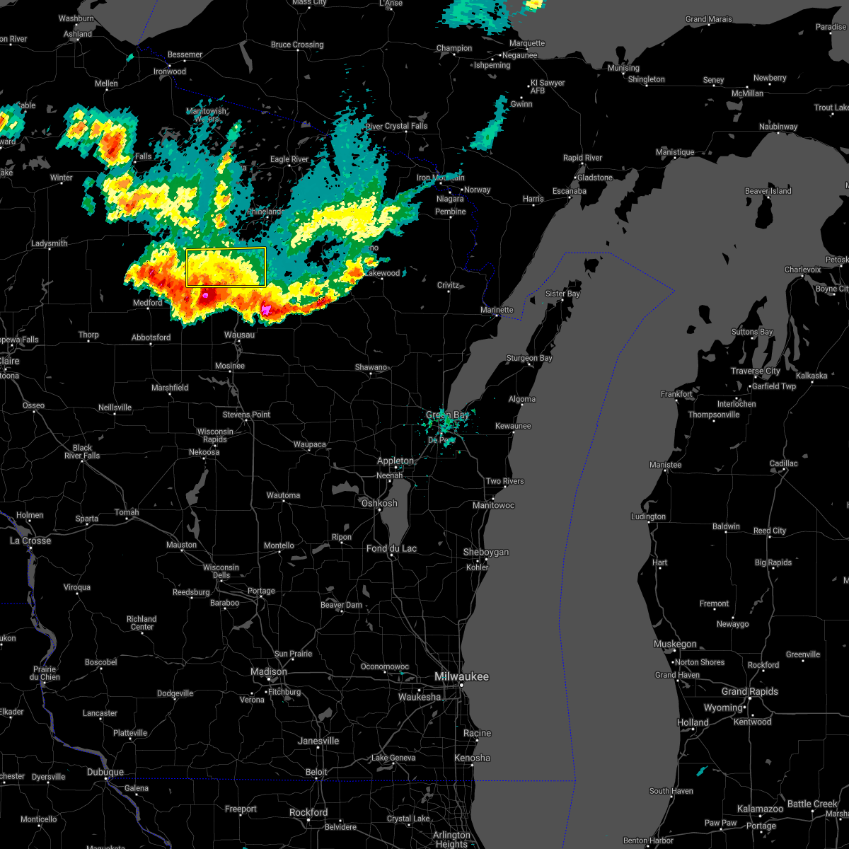 The severe thunderstorm warning for central lincoln county will expire at 700 pm cdt, the severe thunderstorm warning for central lincoln county will be allowed to expire. however, a severe thunderstorm warning remains in effect for central and southern lincoln county until 730 pm. The severe thunderstorm warning for central lincoln county will expire at 700 pm cdt, the severe thunderstorm warning for central lincoln county will be allowed to expire. however, a severe thunderstorm warning remains in effect for central and southern lincoln county until 730 pm.
|
| 6/10/2021 6:41 PM CDT |
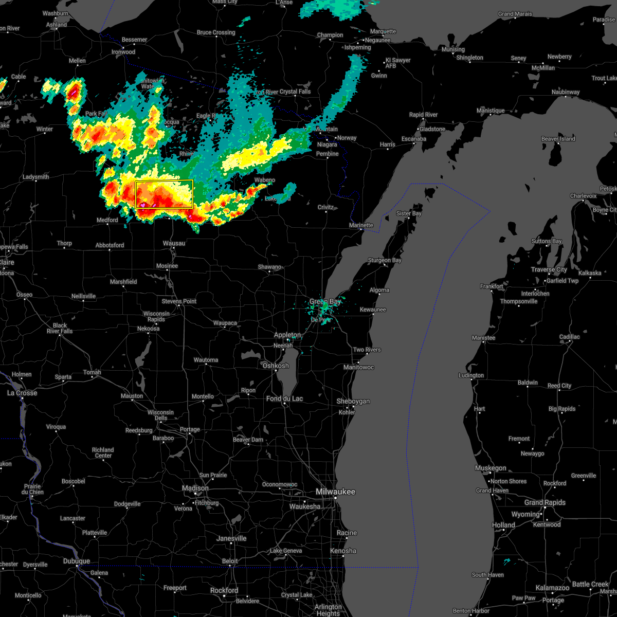 At 641 pm cdt, severe thunderstorms were located along a line extending from 7 miles southeast of dutch corners to near birch trails girl scout camp to 6 miles southwest of new wood wildlife area, and are nearly stationary (radar indicated). Hazards include 60 mph wind gusts and penny size hail. Expect damage to roofs, siding, and trees. Locations impacted include, tomahawk, birch trails girl scout camp, gilbert, new wood wildlife area, otter lake campground, gleason, dudley, spirit falls, bill cross rapids wildlife area and otis. At 641 pm cdt, severe thunderstorms were located along a line extending from 7 miles southeast of dutch corners to near birch trails girl scout camp to 6 miles southwest of new wood wildlife area, and are nearly stationary (radar indicated). Hazards include 60 mph wind gusts and penny size hail. Expect damage to roofs, siding, and trees. Locations impacted include, tomahawk, birch trails girl scout camp, gilbert, new wood wildlife area, otter lake campground, gleason, dudley, spirit falls, bill cross rapids wildlife area and otis.
|
| 6/10/2021 6:30 PM CDT | Small branches down. report via social medi in lincoln county WI, 9.4 miles NNW of Tomahawk, WI |
| 6/10/2021 6:18 PM CDT |
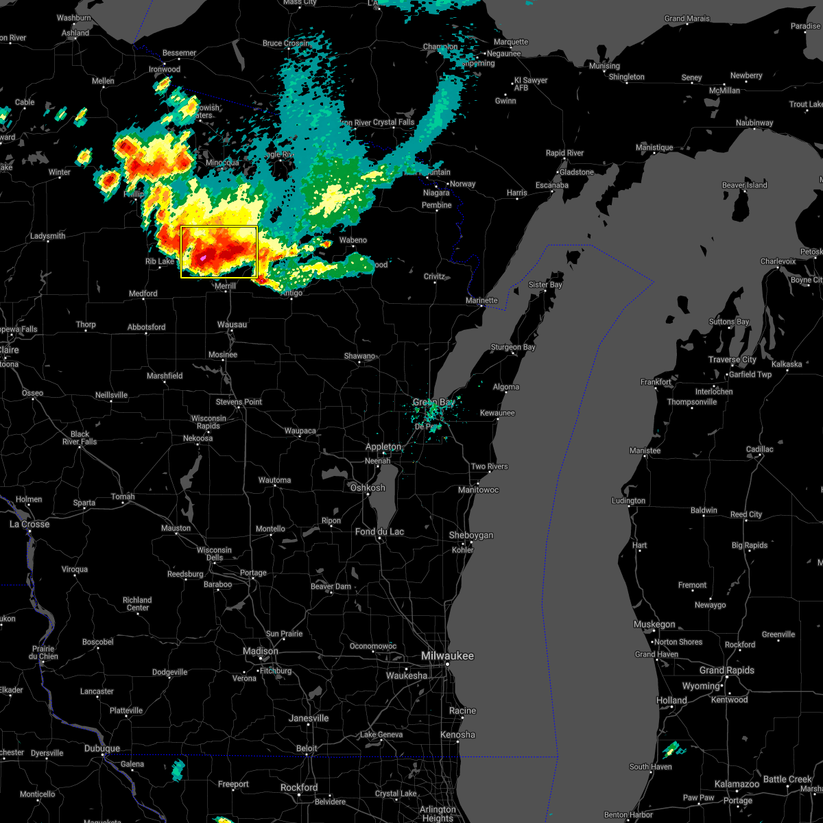 At 618 pm cdt, a severe thunderstorm was located near gilbert, or 17 miles southwest of rhinelander, moving southeast at 5 mph (law enforcement. at 616 pm wind damage was reported in tomahawk). Hazards include 60 mph wind gusts and nickel size hail. Expect damage to roofs, siding, and trees. Locations impacted include, tomahawk, harrison, birch trails girl scout camp, gilbert, tripoli, new wood wildlife area, bradley, heafford junction, dudley and otis. At 618 pm cdt, a severe thunderstorm was located near gilbert, or 17 miles southwest of rhinelander, moving southeast at 5 mph (law enforcement. at 616 pm wind damage was reported in tomahawk). Hazards include 60 mph wind gusts and nickel size hail. Expect damage to roofs, siding, and trees. Locations impacted include, tomahawk, harrison, birch trails girl scout camp, gilbert, tripoli, new wood wildlife area, bradley, heafford junction, dudley and otis.
|
| 6/10/2021 6:16 PM CDT | Trees down in tomahaw in lincoln county WI, 1.2 miles N of Tomahawk, WI |
| 6/10/2021 6:03 PM CDT | Trees down in tomahawk. time estimated by rada in lincoln county WI, 1.2 miles N of Tomahawk, WI |
| 6/10/2021 6:00 PM CDT |
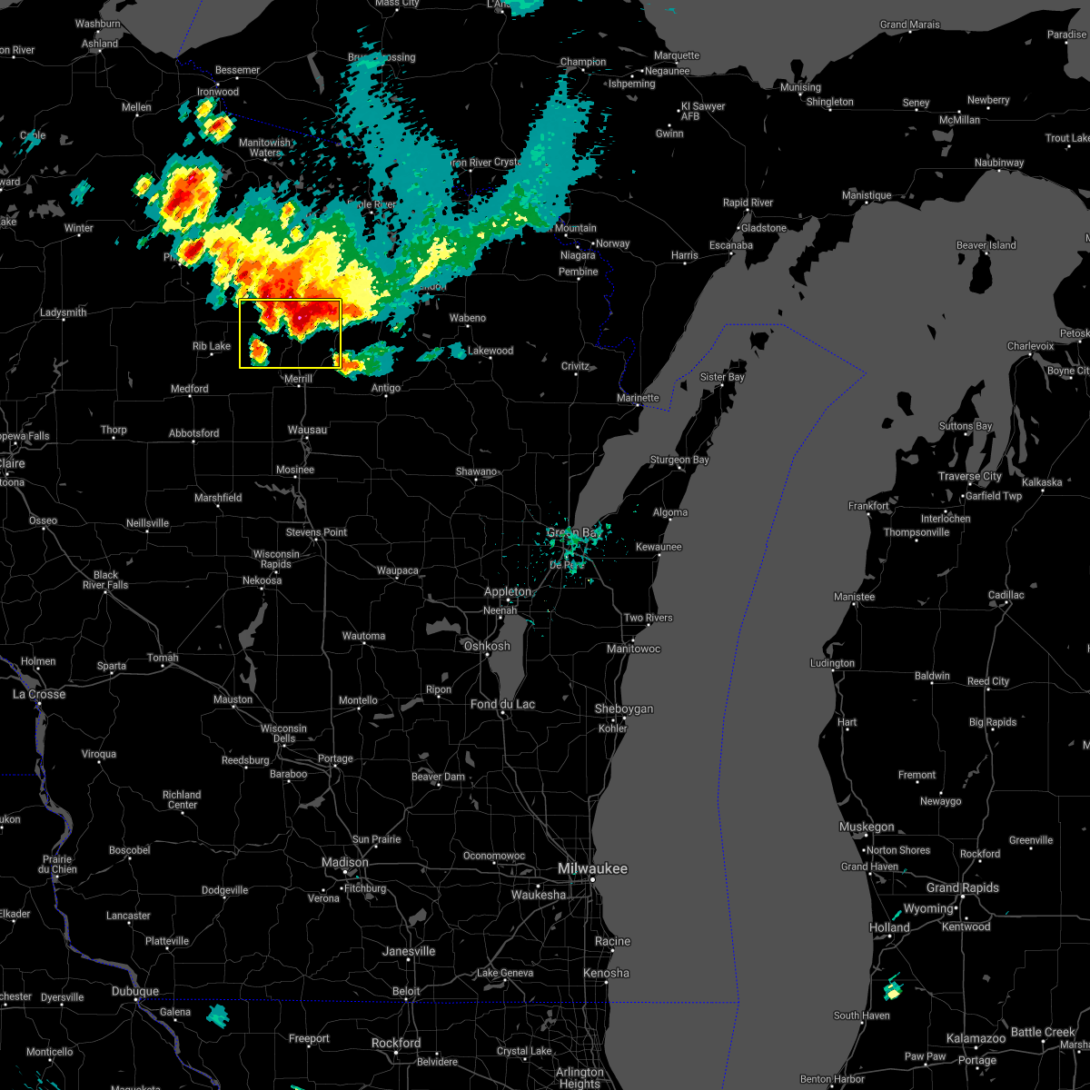 At 600 pm cdt, a severe thunderstorm was located near gilbert, or 18 miles southwest of rhinelander, moving southeast at 5 mph (radar indicated). Hazards include 60 mph wind gusts and nickel size hail. expect damage to roofs, siding, and trees At 600 pm cdt, a severe thunderstorm was located near gilbert, or 18 miles southwest of rhinelander, moving southeast at 5 mph (radar indicated). Hazards include 60 mph wind gusts and nickel size hail. expect damage to roofs, siding, and trees
|
| 6/10/2021 5:50 PM CDT | Multiple trees across the roads just east of tripoli... highway 8 and willow rd. pictures sent via social media. time estimated via rada in oneida county WI, 13.7 miles ESE of Tomahawk, WI |
| 6/10/2021 5:47 PM CDT | Trees over power lines. time estimated by rada in lincoln county WI, 3.8 miles SSE of Tomahawk, WI |
| 5/31/2021 5:43 PM CDT |
 The severe thunderstorm warning for northern lincoln and central oneida counties will expire at 545 pm cdt, the storms which prompted the warning have weakened below severe limits, and no longer pose an immediate threat to life or property. therefore, the warning will be allowed to expire. however hail up to penny sized and heavy rain are still possible with these thunderstorms. to report severe weather, contact your nearest law enforcement agency. they will relay your report to the national weather service green bay. The severe thunderstorm warning for northern lincoln and central oneida counties will expire at 545 pm cdt, the storms which prompted the warning have weakened below severe limits, and no longer pose an immediate threat to life or property. therefore, the warning will be allowed to expire. however hail up to penny sized and heavy rain are still possible with these thunderstorms. to report severe weather, contact your nearest law enforcement agency. they will relay your report to the national weather service green bay.
|
| 5/31/2021 5:28 PM CDT |
 At 527 pm cdt, severe thunderstorms were located along a line extending from near willow reservoir to 6 miles northwest of tomahawk to 8 miles southeast of tripoli, moving east at 25 mph. other storms were located west of harrison and jeffris (radar indicated). Hazards include quarter size hail. Damage to vehicles is expected. Locations impacted include, tomahawk, gilbert, newbold, woodboro, rhinelander and harrison. At 527 pm cdt, severe thunderstorms were located along a line extending from near willow reservoir to 6 miles northwest of tomahawk to 8 miles southeast of tripoli, moving east at 25 mph. other storms were located west of harrison and jeffris (radar indicated). Hazards include quarter size hail. Damage to vehicles is expected. Locations impacted include, tomahawk, gilbert, newbold, woodboro, rhinelander and harrison.
|
| 5/31/2021 5:12 PM CDT |
 At 511 pm cdt, a severe thunderstorm was located near tripoli, or 23 miles west of rhinelander, moving east at 35 mph. another storm was located just northeast of harrison (radar indicated). Hazards include quarter size hail. Damage to vehicles is expected. this severe storm will be near, willow reservoir around 515 pm cdt. Other locations in the path of this severe thunderstorm include tomahawk, woodboro, rhinelander and harrison. At 511 pm cdt, a severe thunderstorm was located near tripoli, or 23 miles west of rhinelander, moving east at 35 mph. another storm was located just northeast of harrison (radar indicated). Hazards include quarter size hail. Damage to vehicles is expected. this severe storm will be near, willow reservoir around 515 pm cdt. Other locations in the path of this severe thunderstorm include tomahawk, woodboro, rhinelander and harrison.
|
| 5/31/2021 5:00 PM CDT |
 At 500 pm cdt, a severe thunderstorm was located near willow lake, or 26 miles southeast of park falls, moving east at 35 mph (radar indicated). Hazards include quarter size hail. Damage to vehicles is expected. this severe thunderstorm will be near, tripoli around 510 pm cdt. willow reservoir around 515 pm cdt. Other locations in the path of this severe thunderstorm include tomahawk, woodboro, rhinelander and harrison. At 500 pm cdt, a severe thunderstorm was located near willow lake, or 26 miles southeast of park falls, moving east at 35 mph (radar indicated). Hazards include quarter size hail. Damage to vehicles is expected. this severe thunderstorm will be near, tripoli around 510 pm cdt. willow reservoir around 515 pm cdt. Other locations in the path of this severe thunderstorm include tomahawk, woodboro, rhinelander and harrison.
|
| 5/25/2021 6:12 PM CDT |
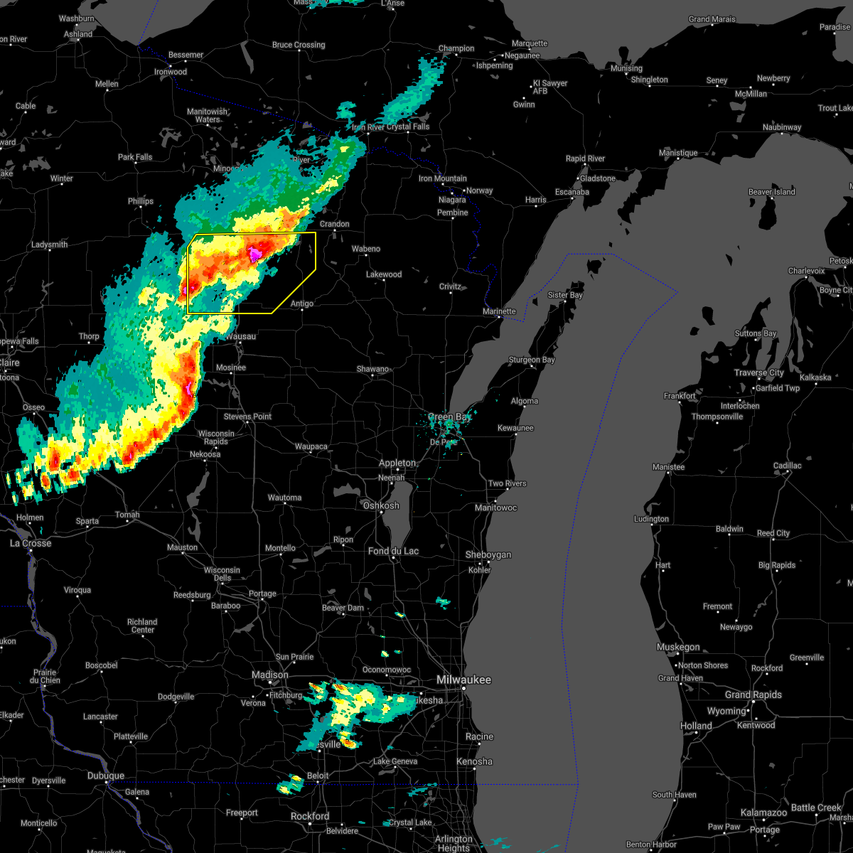 At 612 pm cdt, severe thunderstorms were located along a line extending from 11 miles southeast of rhinelander to parrish to 11 miles south of new wood wildlife area, moving east at 40 mph (radar indicated). Hazards include 60 mph wind gusts and half dollar size hail. Hail damage to vehicles is expected. expect wind damage to roofs, siding, and trees. Locations impacted include, parrish, merrill, council grounds state park, veterans memorial county park and dutch corners. At 612 pm cdt, severe thunderstorms were located along a line extending from 11 miles southeast of rhinelander to parrish to 11 miles south of new wood wildlife area, moving east at 40 mph (radar indicated). Hazards include 60 mph wind gusts and half dollar size hail. Hail damage to vehicles is expected. expect wind damage to roofs, siding, and trees. Locations impacted include, parrish, merrill, council grounds state park, veterans memorial county park and dutch corners.
|
| 5/25/2021 5:57 PM CDT |
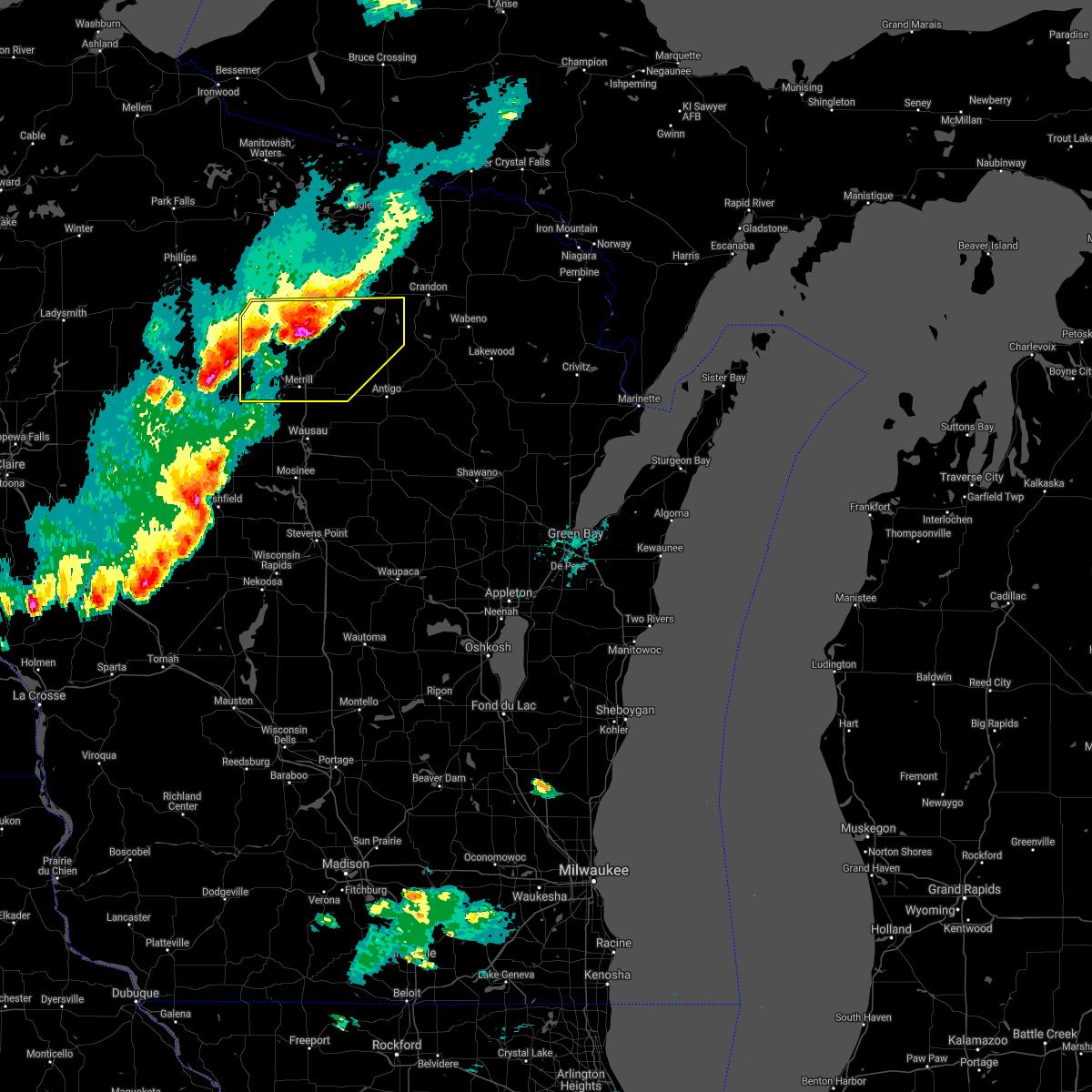 At 557 pm cdt, severe thunderstorms were located along a line extending from near harrison to near gilbert to near medford, moving east at 40 mph (radar indicated). Hazards include 60 mph wind gusts. Expect damage to roofs, siding, and trees. severe thunderstorms will be near, harrison around 605 pm cdt. parrish around 615 pm cdt. Other locations in the path of these severe thunderstorms include council grounds state park, merrill, veterans memorial county park and dutch corners. At 557 pm cdt, severe thunderstorms were located along a line extending from near harrison to near gilbert to near medford, moving east at 40 mph (radar indicated). Hazards include 60 mph wind gusts. Expect damage to roofs, siding, and trees. severe thunderstorms will be near, harrison around 605 pm cdt. parrish around 615 pm cdt. Other locations in the path of these severe thunderstorms include council grounds state park, merrill, veterans memorial county park and dutch corners.
|
| 5/25/2021 5:53 PM CDT | Quarter sized hail reported 1.2 miles N of Tomahawk, WI, via social media. |
| 5/25/2021 5:51 PM CDT | Ping Pong Ball sized hail reported 4.8 miles NNE of Tomahawk, WI |
| 5/25/2021 5:43 PM CDT |
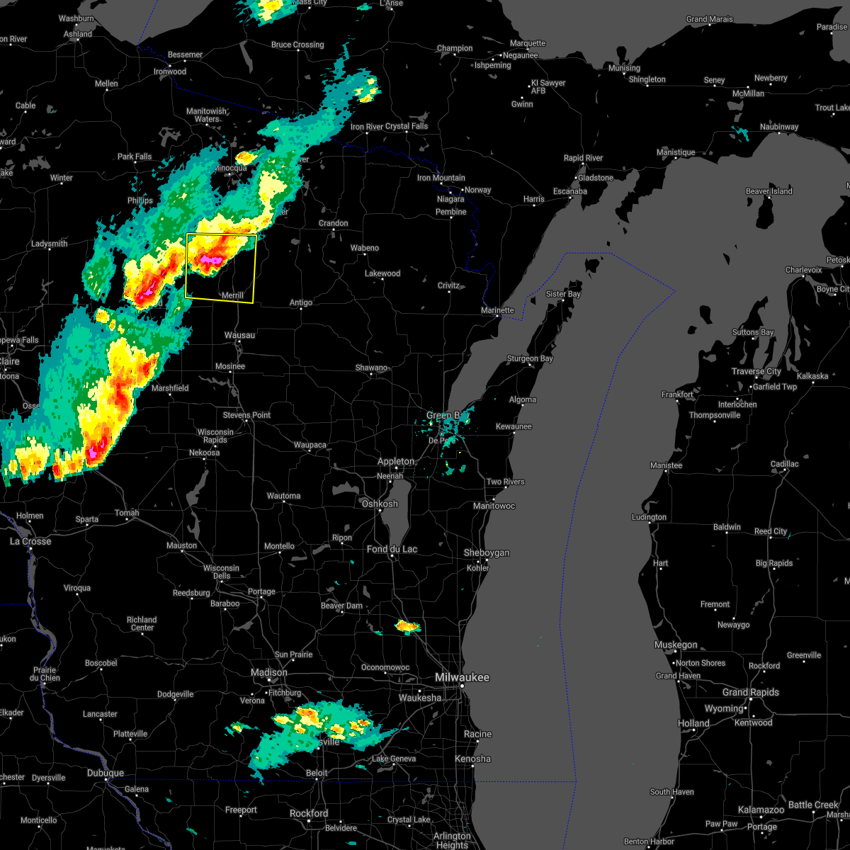 At 543 pm cdt, a severe thunderstorm was located near new wood wildlife area, or 27 miles southwest of rhinelander, moving east at 45 mph (radar indicated). Hazards include 60 mph wind gusts and half dollar size hail. Hail damage to vehicles is expected. expect wind damage to roofs, siding, and trees. this severe storm will be near, gilbert and birch trails girl scout camp around 550 pm cdt. Other locations impacted by this severe thunderstorm include otter lake campground, heafford junction, bradley, spirit falls, bill cross rapids wildlife area, otis, bloomville and irma. At 543 pm cdt, a severe thunderstorm was located near new wood wildlife area, or 27 miles southwest of rhinelander, moving east at 45 mph (radar indicated). Hazards include 60 mph wind gusts and half dollar size hail. Hail damage to vehicles is expected. expect wind damage to roofs, siding, and trees. this severe storm will be near, gilbert and birch trails girl scout camp around 550 pm cdt. Other locations impacted by this severe thunderstorm include otter lake campground, heafford junction, bradley, spirit falls, bill cross rapids wildlife area, otis, bloomville and irma.
|
| 5/25/2021 5:23 PM CDT |
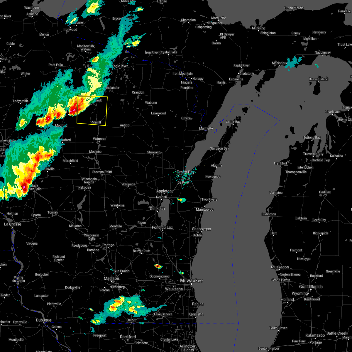 At 523 pm cdt, a severe thunderstorm was located near spirit, or 21 miles northeast of medford, moving east at 40 mph (radar indicated). Hazards include ping pong ball size hail and 60 mph wind gusts. People and animals outdoors will be injured. expect hail damage to roofs, siding, windows, and vehicles. expect wind damage to roofs, siding, and trees. this severe storm will be near, new wood wildlife area around 535 pm cdt. gilbert and birch trails girl scout camp around 550 pm cdt. Other locations impacted by this severe thunderstorm include mccord, otter lake campground, heafford junction, gleason, bradley, spirit falls, bill cross rapids wildlife area, otis, bloomville and irma. At 523 pm cdt, a severe thunderstorm was located near spirit, or 21 miles northeast of medford, moving east at 40 mph (radar indicated). Hazards include ping pong ball size hail and 60 mph wind gusts. People and animals outdoors will be injured. expect hail damage to roofs, siding, windows, and vehicles. expect wind damage to roofs, siding, and trees. this severe storm will be near, new wood wildlife area around 535 pm cdt. gilbert and birch trails girl scout camp around 550 pm cdt. Other locations impacted by this severe thunderstorm include mccord, otter lake campground, heafford junction, gleason, bradley, spirit falls, bill cross rapids wildlife area, otis, bloomville and irma.
|
| 5/25/2021 5:08 PM CDT |
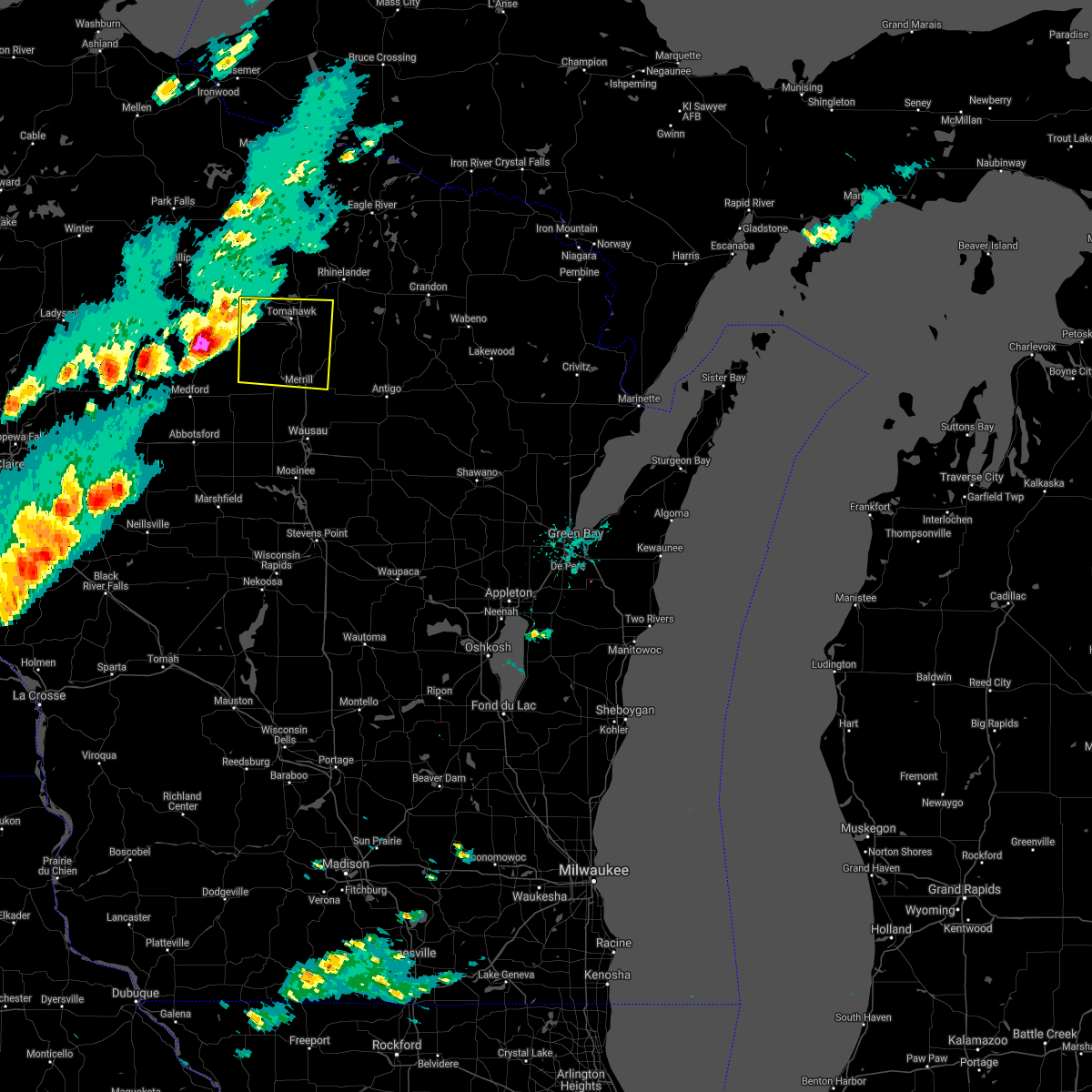 At 508 pm cdt, a severe thunderstorm was located over rib lake, or 16 miles northeast of medford, moving east at 40 mph (radar indicated). Hazards include ping pong ball size hail and 60 mph wind gusts. People and animals outdoors will be injured. expect hail damage to roofs, siding, windows, and vehicles. expect wind damage to roofs, siding, and trees. this severe storm will be near, new wood wildlife area around 530 pm cdt. gilbert and birch trails girl scout camp around 545 pm cdt. harrison around 600 pm cdt. Other locations impacted by this severe thunderstorm include mccord, otter lake campground, heafford junction, gleason, bradley, spirit falls, bill cross rapids wildlife area, otis, bloomville and irma. At 508 pm cdt, a severe thunderstorm was located over rib lake, or 16 miles northeast of medford, moving east at 40 mph (radar indicated). Hazards include ping pong ball size hail and 60 mph wind gusts. People and animals outdoors will be injured. expect hail damage to roofs, siding, windows, and vehicles. expect wind damage to roofs, siding, and trees. this severe storm will be near, new wood wildlife area around 530 pm cdt. gilbert and birch trails girl scout camp around 545 pm cdt. harrison around 600 pm cdt. Other locations impacted by this severe thunderstorm include mccord, otter lake campground, heafford junction, gleason, bradley, spirit falls, bill cross rapids wildlife area, otis, bloomville and irma.
|
| 5/25/2021 4:53 PM CDT |
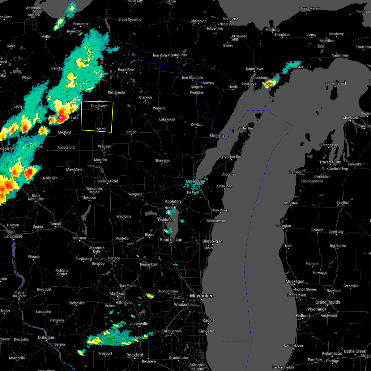 At 453 pm cdt, a severe thunderstorm was located near westboro, or 15 miles north of medford, moving east at 45 mph (radar indicated). Hazards include 60 mph wind gusts and half dollar size hail. Hail damage to vehicles is expected. expect wind damage to roofs, siding, and trees. this severe thunderstorm will be near, new wood wildlife area around 520 pm cdt. birch trails girl scout camp around 535 pm cdt. gilbert around 540 pm cdt. harrison around 550 pm cdt. Other locations impacted by this severe thunderstorm include mccord, otter lake campground, heafford junction, gleason, bradley, spirit falls, bill cross rapids wildlife area, otis, bloomville and irma. At 453 pm cdt, a severe thunderstorm was located near westboro, or 15 miles north of medford, moving east at 45 mph (radar indicated). Hazards include 60 mph wind gusts and half dollar size hail. Hail damage to vehicles is expected. expect wind damage to roofs, siding, and trees. this severe thunderstorm will be near, new wood wildlife area around 520 pm cdt. birch trails girl scout camp around 535 pm cdt. gilbert around 540 pm cdt. harrison around 550 pm cdt. Other locations impacted by this severe thunderstorm include mccord, otter lake campground, heafford junction, gleason, bradley, spirit falls, bill cross rapids wildlife area, otis, bloomville and irma.
|
| 7/19/2020 1:22 AM CDT |
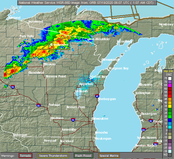 At 122 am cdt, a severe thunderstorm was located near gilbert, or 22 miles southwest of rhinelander, moving east at 50 mph (radar indicated). Hazards include 60 mph wind gusts and penny size hail. expect damage to roofs, siding, and trees At 122 am cdt, a severe thunderstorm was located near gilbert, or 22 miles southwest of rhinelander, moving east at 50 mph (radar indicated). Hazards include 60 mph wind gusts and penny size hail. expect damage to roofs, siding, and trees
|
| 5/25/2020 2:59 PM CDT | One tree down blocking the highway near j and j in lincoln county WI, 9.4 miles N of Tomahawk, WI |
| 9/24/2019 10:31 PM CDT |
 At 1030 pm cdt, severe thunderstorms were located along a line extending from near gilbert to 6 miles northeast of dutch corners to 11 miles west of antigo, moving northeast at 30 mph (radar indicated). Hazards include 60 mph wind gusts. Expect damage to roofs, siding, and trees. severe thunderstorms will be near, antigo and parrish around 1045 pm cdt. harrison around 1050 pm cdt. rhinelander and veterans memorial county park around 1110 pm cdt. pearson and ma ka ja wan scout reservation around 1115 pm cdt. other locations impacted by these severe thunderstorms include summit lake, dudley, kelly lynn bog natural area, post lake, kempster, neva, ormsby, crescent corner, pelican lake and peters marsh wildlife area. A tornado watch remains in effect until midnight cdt for north central and northeastern wisconsin. At 1030 pm cdt, severe thunderstorms were located along a line extending from near gilbert to 6 miles northeast of dutch corners to 11 miles west of antigo, moving northeast at 30 mph (radar indicated). Hazards include 60 mph wind gusts. Expect damage to roofs, siding, and trees. severe thunderstorms will be near, antigo and parrish around 1045 pm cdt. harrison around 1050 pm cdt. rhinelander and veterans memorial county park around 1110 pm cdt. pearson and ma ka ja wan scout reservation around 1115 pm cdt. other locations impacted by these severe thunderstorms include summit lake, dudley, kelly lynn bog natural area, post lake, kempster, neva, ormsby, crescent corner, pelican lake and peters marsh wildlife area. A tornado watch remains in effect until midnight cdt for north central and northeastern wisconsin.
|
| 8/5/2019 1:16 PM CDT |
 At 115 pm cdt, severe thunderstorms were located along a line extending from 6 miles southwest of phelps to 10 miles southwest of headwaters wilderness to near harrison, moving east at 45 mph (radar indicated). Hazards include 60 mph wind gusts. Expect damage to roofs, siding, and trees. Locations impacted include, rhinelander, crandon, eagle river, tomahawk, phelps, woodboro, popple river, headwaters wilderness, kentuck lake campground and north otter creek natural area. At 115 pm cdt, severe thunderstorms were located along a line extending from 6 miles southwest of phelps to 10 miles southwest of headwaters wilderness to near harrison, moving east at 45 mph (radar indicated). Hazards include 60 mph wind gusts. Expect damage to roofs, siding, and trees. Locations impacted include, rhinelander, crandon, eagle river, tomahawk, phelps, woodboro, popple river, headwaters wilderness, kentuck lake campground and north otter creek natural area.
|
| 8/5/2019 1:02 PM CDT |
 At 102 pm cdt, severe thunderstorms were located along a line extending from 9 miles north of rainbow flowage to near crystal lake scout reservation to near tomahawk, moving east at 40 mph (radar indicated). Hazards include 60 mph wind gusts. expect damage to roofs, siding, and trees At 102 pm cdt, severe thunderstorms were located along a line extending from 9 miles north of rainbow flowage to near crystal lake scout reservation to near tomahawk, moving east at 40 mph (radar indicated). Hazards include 60 mph wind gusts. expect damage to roofs, siding, and trees
|
| 7/19/2019 8:05 PM CDT |
 At 805 pm cdt, severe thunderstorms were located along a line extending from 9 miles east of crystal lake scout reservation to 9 miles west of crandon to 8 miles east of dutch corners, moving east at 65 mph. these are very dangerous storms (radar indicated). Hazards include 80 mph wind gusts and ping pong ball size hail. Flying debris will be dangerous to those caught without shelter. mobile homes will be heavily damaged. expect considerable damage to roofs, windows, and vehicles. extensive tree damage and power outages are likely. Locations impacted include, rhinelander, crandon, tomahawk, harrison, woodboro, parrish, gilbert, veterans memorial county park, elcho and nashville. At 805 pm cdt, severe thunderstorms were located along a line extending from 9 miles east of crystal lake scout reservation to 9 miles west of crandon to 8 miles east of dutch corners, moving east at 65 mph. these are very dangerous storms (radar indicated). Hazards include 80 mph wind gusts and ping pong ball size hail. Flying debris will be dangerous to those caught without shelter. mobile homes will be heavily damaged. expect considerable damage to roofs, windows, and vehicles. extensive tree damage and power outages are likely. Locations impacted include, rhinelander, crandon, tomahawk, harrison, woodboro, parrish, gilbert, veterans memorial county park, elcho and nashville.
|
| 7/19/2019 7:55 PM CDT |
 A severe thunderstorm warning remains in effect until 830 pm cdt for southwestern forest. northern lincoln. oneida and northwestern langlade counties. At 755 pm cdt, severe thunderstorms were located along a line extending from near crystal lake scout reservation to 6 miles east of rhinelander to near dutch corners, moving east at 65 mph. A severe thunderstorm warning remains in effect until 830 pm cdt for southwestern forest. northern lincoln. oneida and northwestern langlade counties. At 755 pm cdt, severe thunderstorms were located along a line extending from near crystal lake scout reservation to 6 miles east of rhinelander to near dutch corners, moving east at 65 mph.
|
| 7/19/2019 7:37 PM CDT |
 At 736 pm cdt, severe thunderstorms were located along a line extending from 6 miles northwest of rainbow flowage to near willow reservoir to 6 miles east of spirit, moving east at 60 mph. another severe storm with large hail was located ahead of this line, near rhinelander (radar indicated). Hazards include 70 mph wind gusts and ping pong ball size hail. People and animals outdoors will be injured. expect hail damage to roofs, siding, windows, and vehicles. expect considerable tree damage. wind damage is also likely to mobile homes, roofs, and outbuildings. Locations impacted include, rhinelander, crandon, tomahawk, newbold, harrison, woodboro, parrish, squirrel lake, crystal lake scout reservation and willow lake. At 736 pm cdt, severe thunderstorms were located along a line extending from 6 miles northwest of rainbow flowage to near willow reservoir to 6 miles east of spirit, moving east at 60 mph. another severe storm with large hail was located ahead of this line, near rhinelander (radar indicated). Hazards include 70 mph wind gusts and ping pong ball size hail. People and animals outdoors will be injured. expect hail damage to roofs, siding, windows, and vehicles. expect considerable tree damage. wind damage is also likely to mobile homes, roofs, and outbuildings. Locations impacted include, rhinelander, crandon, tomahawk, newbold, harrison, woodboro, parrish, squirrel lake, crystal lake scout reservation and willow lake.
|
| 7/19/2019 7:25 PM CDT |
 At 724 pm cdt, severe thunderstorms were located along a line extending from squirrel lake to near willow lake to near ogema, moving east at 65 mph (radar indicated). Hazards include 70 mph wind gusts and ping pong ball size hail. People and animals outdoors will be injured. expect hail damage to roofs, siding, windows, and vehicles. expect considerable tree damage. Wind damage is also likely to mobile homes, roofs, and outbuildings. At 724 pm cdt, severe thunderstorms were located along a line extending from squirrel lake to near willow lake to near ogema, moving east at 65 mph (radar indicated). Hazards include 70 mph wind gusts and ping pong ball size hail. People and animals outdoors will be injured. expect hail damage to roofs, siding, windows, and vehicles. expect considerable tree damage. Wind damage is also likely to mobile homes, roofs, and outbuildings.
|
| 7/19/2019 7:18 PM CDT |
 At 717 pm cdt, a severe thunderstorm was located near woodboro, or 10 miles west of rhinelander, moving east at 35 mph (radar indicated). Hazards include 60 mph wind gusts and quarter size hail. Hail damage to vehicles is expected. expect wind damage to roofs, siding, and trees. Locations impacted include, rhinelander, tomahawk, harrison, woodboro, gilbert, tripoli, bradley, heafford junction, lower tomahawk river natural area and crescent corner. At 717 pm cdt, a severe thunderstorm was located near woodboro, or 10 miles west of rhinelander, moving east at 35 mph (radar indicated). Hazards include 60 mph wind gusts and quarter size hail. Hail damage to vehicles is expected. expect wind damage to roofs, siding, and trees. Locations impacted include, rhinelander, tomahawk, harrison, woodboro, gilbert, tripoli, bradley, heafford junction, lower tomahawk river natural area and crescent corner.
|
| 7/19/2019 7:03 PM CDT |
 At 702 pm cdt, a severe thunderstorm was located 7 miles north of tomahawk, or 16 miles west of rhinelander, moving east at 50 mph (radar indicated). Hazards include ping pong ball size hail and 60 mph wind gusts. People and animals outdoors will be injured. expect hail damage to roofs, siding, windows, and vehicles. expect wind damage to roofs, siding, and trees. Locations impacted include, rhinelander, tomahawk, harrison, woodboro, gilbert, tripoli, bradley, heafford junction, lower tomahawk river natural area and crescent corner. At 702 pm cdt, a severe thunderstorm was located 7 miles north of tomahawk, or 16 miles west of rhinelander, moving east at 50 mph (radar indicated). Hazards include ping pong ball size hail and 60 mph wind gusts. People and animals outdoors will be injured. expect hail damage to roofs, siding, windows, and vehicles. expect wind damage to roofs, siding, and trees. Locations impacted include, rhinelander, tomahawk, harrison, woodboro, gilbert, tripoli, bradley, heafford junction, lower tomahawk river natural area and crescent corner.
|
| 7/19/2019 6:49 PM CDT |
 At 649 pm cdt, a severe thunderstorm was located over tripoli, or 28 miles west of rhinelander, moving east at 35 mph (radar indicated). Hazards include ping pong ball size hail and 60 mph wind gusts. People and animals outdoors will be injured. expect hail damage to roofs, siding, windows, and vehicles. expect wind damage to roofs, siding, and trees. Locations impacted include, rhinelander, tomahawk, harrison, woodboro, gilbert, tripoli, bradley, heafford junction, dudley and lower tomahawk river natural area. At 649 pm cdt, a severe thunderstorm was located over tripoli, or 28 miles west of rhinelander, moving east at 35 mph (radar indicated). Hazards include ping pong ball size hail and 60 mph wind gusts. People and animals outdoors will be injured. expect hail damage to roofs, siding, windows, and vehicles. expect wind damage to roofs, siding, and trees. Locations impacted include, rhinelander, tomahawk, harrison, woodboro, gilbert, tripoli, bradley, heafford junction, dudley and lower tomahawk river natural area.
|
| 7/19/2019 6:38 PM CDT |
 At 638 pm cdt, a severe thunderstorm was located near tripoli, or 27 miles southeast of park falls, moving east at 30 mph (radar indicated). Hazards include ping pong ball size hail and 60 mph wind gusts. People and animals outdoors will be injured. expect hail damage to roofs, siding, windows, and vehicles. expect wind damage to roofs, siding, and trees. Locations impacted include, rhinelander, tomahawk, harrison, woodboro, gilbert, tripoli, bradley, heafford junction, dudley and lower tomahawk river natural area. At 638 pm cdt, a severe thunderstorm was located near tripoli, or 27 miles southeast of park falls, moving east at 30 mph (radar indicated). Hazards include ping pong ball size hail and 60 mph wind gusts. People and animals outdoors will be injured. expect hail damage to roofs, siding, windows, and vehicles. expect wind damage to roofs, siding, and trees. Locations impacted include, rhinelander, tomahawk, harrison, woodboro, gilbert, tripoli, bradley, heafford junction, dudley and lower tomahawk river natural area.
|
| 7/19/2019 6:18 PM CDT |
 At 617 pm cdt, a severe thunderstorm was located near prentice, or 26 miles south of park falls, moving east at 35 mph (radar indicated). Hazards include 70 mph wind gusts and ping pong ball size hail. People and animals outdoors will be injured. expect hail damage to roofs, siding, windows, and vehicles. expect considerable tree damage. Wind damage is also likely to mobile homes, roofs, and outbuildings. At 617 pm cdt, a severe thunderstorm was located near prentice, or 26 miles south of park falls, moving east at 35 mph (radar indicated). Hazards include 70 mph wind gusts and ping pong ball size hail. People and animals outdoors will be injured. expect hail damage to roofs, siding, windows, and vehicles. expect considerable tree damage. Wind damage is also likely to mobile homes, roofs, and outbuildings.
|
| 10/3/2018 3:50 PM CDT |
 At 349 pm cdt, a severe thunderstorm was located near willow reservoir, or 22 miles west of rhinelander, moving east at 50 mph (trained weather spotters). Hazards include golf ball size hail and 70 mph wind gusts. People and animals outdoors will be injured. expect hail damage to roofs, siding, windows, and vehicles. expect considerable tree damage. wind damage is also likely to mobile homes, roofs, and outbuildings. This severe thunderstorm will remain over mainly rural areas of northern lincoln and oneida counties, including the following locations, mc naughton, gagen, heafford junction, bradley, harshaw, starks, hazelhurst, pelican lake, clearwater lake and lennox. At 349 pm cdt, a severe thunderstorm was located near willow reservoir, or 22 miles west of rhinelander, moving east at 50 mph (trained weather spotters). Hazards include golf ball size hail and 70 mph wind gusts. People and animals outdoors will be injured. expect hail damage to roofs, siding, windows, and vehicles. expect considerable tree damage. wind damage is also likely to mobile homes, roofs, and outbuildings. This severe thunderstorm will remain over mainly rural areas of northern lincoln and oneida counties, including the following locations, mc naughton, gagen, heafford junction, bradley, harshaw, starks, hazelhurst, pelican lake, clearwater lake and lennox.
|
| 10/3/2018 3:36 PM CDT |
 At 333 pm cdt, a severe thunderstorm was located near tripoli, or 28 miles southeast of park falls, moving east at 45 mph (trained weather spotters). Hazards include 70 mph wind gusts and ping pong ball size hail. People and animals outdoors will be injured. expect hail damage to roofs, siding, windows, and vehicles. expect considerable tree damage. wind damage is also likely to mobile homes, roofs, and outbuildings. Locations impacted include, rhinelander, tomahawk, woodboro, tripoli, willow reservoir, bradley, three lakes, sugar camp, hazelhurst and lake tomahawk. At 333 pm cdt, a severe thunderstorm was located near tripoli, or 28 miles southeast of park falls, moving east at 45 mph (trained weather spotters). Hazards include 70 mph wind gusts and ping pong ball size hail. People and animals outdoors will be injured. expect hail damage to roofs, siding, windows, and vehicles. expect considerable tree damage. wind damage is also likely to mobile homes, roofs, and outbuildings. Locations impacted include, rhinelander, tomahawk, woodboro, tripoli, willow reservoir, bradley, three lakes, sugar camp, hazelhurst and lake tomahawk.
|
| 10/3/2018 3:21 PM CDT |
 At 320 pm cdt, a severe thunderstorm was located near prentice, or 25 miles south of park falls, moving east at 70 mph (radar indicated). Hazards include 70 mph wind gusts and quarter size hail. Hail damage to vehicles is expected. expect considerable tree damage. Wind damage is also likely to mobile homes, roofs, and outbuildings. At 320 pm cdt, a severe thunderstorm was located near prentice, or 25 miles south of park falls, moving east at 70 mph (radar indicated). Hazards include 70 mph wind gusts and quarter size hail. Hail damage to vehicles is expected. expect considerable tree damage. Wind damage is also likely to mobile homes, roofs, and outbuildings.
|
| 8/27/2018 8:44 PM CDT | Trees and powerlines down. time estimated by radar. delayed repor in lincoln county WI, 11.4 miles W of Tomahawk, WI |
| 8/5/2018 5:40 PM CDT | Report of numerous downed trees around interchange of hwy 51 and hwy in oneida county WI, 7.2 miles SSW of Tomahawk, WI |
| 8/3/2018 1:52 PM CDT |
 At 152 pm cdt, a severe thunderstorm was located near new wood wildlife area, or 23 miles northeast of medford, moving southeast at 30 mph (radar indicated). Hazards include 60 mph wind gusts and quarter size hail. Hail damage to vehicles is expected. expect wind damage to roofs, siding, and trees. this severe storm will be near, new wood wildlife area around 155 pm cdt. merrill and council grounds state park around 225 pm cdt. Other locations impacted by this severe thunderstorm include spirit falls, bill cross rapids wildlife area, otis and irma. At 152 pm cdt, a severe thunderstorm was located near new wood wildlife area, or 23 miles northeast of medford, moving southeast at 30 mph (radar indicated). Hazards include 60 mph wind gusts and quarter size hail. Hail damage to vehicles is expected. expect wind damage to roofs, siding, and trees. this severe storm will be near, new wood wildlife area around 155 pm cdt. merrill and council grounds state park around 225 pm cdt. Other locations impacted by this severe thunderstorm include spirit falls, bill cross rapids wildlife area, otis and irma.
|
| 8/3/2018 1:40 PM CDT |
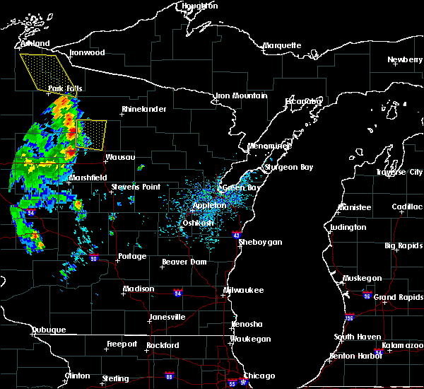 At 140 pm cdt, a severe thunderstorm was located near spirit, or 25 miles northeast of medford, moving east at 30 mph (radar indicated). Hazards include 60 mph wind gusts and quarter size hail. Hail damage to vehicles is expected. expect wind damage to roofs, siding, and trees. this severe storm will be near, new wood wildlife area around 150 pm cdt. Other locations impacted by this severe thunderstorm include mccord, heafford junction, bradley, spirit falls, bill cross rapids wildlife area, otis and irma. At 140 pm cdt, a severe thunderstorm was located near spirit, or 25 miles northeast of medford, moving east at 30 mph (radar indicated). Hazards include 60 mph wind gusts and quarter size hail. Hail damage to vehicles is expected. expect wind damage to roofs, siding, and trees. this severe storm will be near, new wood wildlife area around 150 pm cdt. Other locations impacted by this severe thunderstorm include mccord, heafford junction, bradley, spirit falls, bill cross rapids wildlife area, otis and irma.
|
| 8/3/2018 1:27 PM CDT |
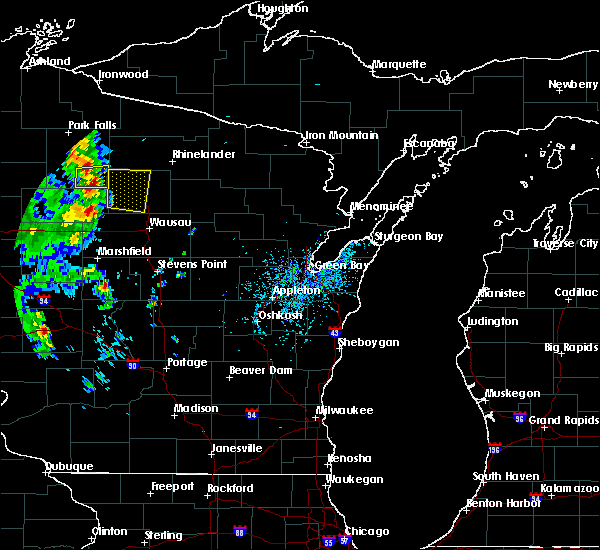 At 126 pm cdt, a severe thunderstorm was located near spirit, or 19 miles north of medford, moving east at 30 mph (radar indicated). Hazards include 60 mph wind gusts and quarter size hail. Hail damage to vehicles is expected. expect wind damage to roofs, siding, and trees. this severe thunderstorm will be near, new wood wildlife area around 150 pm cdt. Other locations impacted by this severe thunderstorm include mccord, heafford junction, bradley, spirit falls, bill cross rapids wildlife area, otis and irma. At 126 pm cdt, a severe thunderstorm was located near spirit, or 19 miles north of medford, moving east at 30 mph (radar indicated). Hazards include 60 mph wind gusts and quarter size hail. Hail damage to vehicles is expected. expect wind damage to roofs, siding, and trees. this severe thunderstorm will be near, new wood wildlife area around 150 pm cdt. Other locations impacted by this severe thunderstorm include mccord, heafford junction, bradley, spirit falls, bill cross rapids wildlife area, otis and irma.
|
| 7/12/2018 8:55 PM CDT |
 At 855 pm cdt, severe thunderstorms were located along a line extending from near tripoli to 10 miles east of abbotsford to 8 miles northeast of shortville to near cataract, moving east at 35 mph (radar indicated). Hazards include 60 mph wind gusts. Expect damage to roofs, siding, and trees. these severe storms will be near, tripoli around 900 pm cdt. tomahawk around 915 pm cdt. wausau around 925 pm cdt. other locations impacted by these severe thunderstorms include edgar, north wood county park, bradley, little chicago, auburndale, march rapids, hamburg, otis, hewitt and rib falls. People at farm technology days near marshfield should seek safe shelter immediately!. At 855 pm cdt, severe thunderstorms were located along a line extending from near tripoli to 10 miles east of abbotsford to 8 miles northeast of shortville to near cataract, moving east at 35 mph (radar indicated). Hazards include 60 mph wind gusts. Expect damage to roofs, siding, and trees. these severe storms will be near, tripoli around 900 pm cdt. tomahawk around 915 pm cdt. wausau around 925 pm cdt. other locations impacted by these severe thunderstorms include edgar, north wood county park, bradley, little chicago, auburndale, march rapids, hamburg, otis, hewitt and rib falls. People at farm technology days near marshfield should seek safe shelter immediately!.
|
| 7/12/2018 8:42 PM CDT |
 At 842 pm cdt, severe thunderstorms were located along a line extending from near spirit to near dorchester to near neillsville to 8 miles northeast of north bend, moving east at 45 mph (radar indicated). Hazards include 60 mph wind gusts. Expect damage to roofs, siding, and trees. these severe storms will be near, abbotsford around 845 pm cdt. tripoli around 850 pm cdt. marshfield and tomahawk around 905 pm cdt. wausau around 920 pm cdt. other locations impacted by these severe thunderstorms include edgar, north wood county park, bradley, little chicago, auburndale, march rapids, hamburg, otis, hewitt and rib falls. People at farm technology days near marshfield should seek safe shelter immediately!. At 842 pm cdt, severe thunderstorms were located along a line extending from near spirit to near dorchester to near neillsville to 8 miles northeast of north bend, moving east at 45 mph (radar indicated). Hazards include 60 mph wind gusts. Expect damage to roofs, siding, and trees. these severe storms will be near, abbotsford around 845 pm cdt. tripoli around 850 pm cdt. marshfield and tomahawk around 905 pm cdt. wausau around 920 pm cdt. other locations impacted by these severe thunderstorms include edgar, north wood county park, bradley, little chicago, auburndale, march rapids, hamburg, otis, hewitt and rib falls. People at farm technology days near marshfield should seek safe shelter immediately!.
|
| 7/12/2018 8:23 PM CDT |
 At 822 pm cdt, severe thunderstorms were located along a line extending from near ogema to near owen to near humbird to 7 miles northeast of galesville, moving east at 40 mph (radar indicated). Hazards include 60 mph wind gusts and penny size hail. Expect damage to roofs, siding, and trees. severe thunderstorms will be near, abbotsford around 840 pm cdt. tripoli around 850 pm cdt. marshfield and tomahawk around 905 pm cdt. wausau around 920 pm cdt. other locations impacted by these severe thunderstorms include edgar, north wood county park, bradley, little chicago, auburndale, march rapids, hamburg, otis, hewitt and rib falls. People at farm technology days near marshfield should seek safe shelter immediately!. At 822 pm cdt, severe thunderstorms were located along a line extending from near ogema to near owen to near humbird to 7 miles northeast of galesville, moving east at 40 mph (radar indicated). Hazards include 60 mph wind gusts and penny size hail. Expect damage to roofs, siding, and trees. severe thunderstorms will be near, abbotsford around 840 pm cdt. tripoli around 850 pm cdt. marshfield and tomahawk around 905 pm cdt. wausau around 920 pm cdt. other locations impacted by these severe thunderstorms include edgar, north wood county park, bradley, little chicago, auburndale, march rapids, hamburg, otis, hewitt and rib falls. People at farm technology days near marshfield should seek safe shelter immediately!.
|
| 9/22/2017 11:34 AM CDT |
 At 1133 am cdt, severe thunderstorms were located along a line extending from land o lakes to near tripoli, moving east at 45 mph (radar indicated). Hazards include 60 mph wind gusts and quarter size hail. Hail damage to vehicles is expected. expect wind damage to roofs, siding, and trees. Locations impacted include, lac du flambeau, tomahawk, boulder junction, squirrel lake, tripoli, willow reservoir, minocqua, arbor vitae, bradley and woodruff. At 1133 am cdt, severe thunderstorms were located along a line extending from land o lakes to near tripoli, moving east at 45 mph (radar indicated). Hazards include 60 mph wind gusts and quarter size hail. Hail damage to vehicles is expected. expect wind damage to roofs, siding, and trees. Locations impacted include, lac du flambeau, tomahawk, boulder junction, squirrel lake, tripoli, willow reservoir, minocqua, arbor vitae, bradley and woodruff.
|
| 9/22/2017 11:18 AM CDT |
 At 1118 am cdt, severe thunderstorms were located along a line extending from near winchester to prentice, moving east at 45 mph (radar indicated). Hazards include 60 mph wind gusts and half dollar size hail. Hail damage to vehicles is expected. expect wind damage to roofs, siding, and trees. Locations impacted include, lac du flambeau, tomahawk, boulder junction, winchester, tripoli, squirrel lake, willow reservoir, minocqua, arbor vitae and bradley. At 1118 am cdt, severe thunderstorms were located along a line extending from near winchester to prentice, moving east at 45 mph (radar indicated). Hazards include 60 mph wind gusts and half dollar size hail. Hail damage to vehicles is expected. expect wind damage to roofs, siding, and trees. Locations impacted include, lac du flambeau, tomahawk, boulder junction, winchester, tripoli, squirrel lake, willow reservoir, minocqua, arbor vitae and bradley.
|
| 9/22/2017 11:05 AM CDT |
 At 1104 am cdt, severe thunderstorms were located along a line extending from near mercer to 6 miles south of catawba, moving east at 45 mph (radar indicated). Hazards include 60 mph wind gusts and half dollar size hail. Hail damage to vehicles is expected. Expect wind damage to roofs, siding, and trees. At 1104 am cdt, severe thunderstorms were located along a line extending from near mercer to 6 miles south of catawba, moving east at 45 mph (radar indicated). Hazards include 60 mph wind gusts and half dollar size hail. Hail damage to vehicles is expected. Expect wind damage to roofs, siding, and trees.
|
| 6/11/2017 8:49 PM CDT |
 At 848 pm cdt, severe thunderstorms were located along a line extending from 6 miles northwest of woodboro to near council grounds state park to 13 miles west of rib mountain to near colby, moving east at 50 mph (radar indicated). Hazards include 70 mph wind gusts and penny size hail. Expect considerable tree damage. damage is likely to mobile homes, roofs, and outbuildings. these severe storms will be near, merrill around 855 pm cdt. wausau around 900 pm cdt. rib mountain around 905 pm cdt. weston around 910 pm cdt. Other locations impacted by these severe thunderstorms include edgar, bradley, dudley, little chicago, hamburg, otis, rib falls, fenwood, colby and jeffris. At 848 pm cdt, severe thunderstorms were located along a line extending from 6 miles northwest of woodboro to near council grounds state park to 13 miles west of rib mountain to near colby, moving east at 50 mph (radar indicated). Hazards include 70 mph wind gusts and penny size hail. Expect considerable tree damage. damage is likely to mobile homes, roofs, and outbuildings. these severe storms will be near, merrill around 855 pm cdt. wausau around 900 pm cdt. rib mountain around 905 pm cdt. weston around 910 pm cdt. Other locations impacted by these severe thunderstorms include edgar, bradley, dudley, little chicago, hamburg, otis, rib falls, fenwood, colby and jeffris.
|
| 6/11/2017 8:39 PM CDT |
 At 839 pm cdt, severe thunderstorms were located along a line extending from 7 miles southeast of willow reservoir to 12 miles southwest of council grounds state park to 12 miles east of abbotsford to near spencer, moving east at 55 mph (radar indicated). Hazards include 70 mph wind gusts and penny size hail. Expect considerable tree damage. damage is likely to mobile homes, roofs, and outbuildings. these severe storms will be near, merrill and council grounds state park around 850 pm cdt. wausau and rib mountain around 900 pm cdt. weston around 905 pm cdt. Other locations impacted by these severe thunderstorms include edgar, bradley, dudley, little chicago, hamburg, otis, rib falls, fenwood, colby and jeffris. At 839 pm cdt, severe thunderstorms were located along a line extending from 7 miles southeast of willow reservoir to 12 miles southwest of council grounds state park to 12 miles east of abbotsford to near spencer, moving east at 55 mph (radar indicated). Hazards include 70 mph wind gusts and penny size hail. Expect considerable tree damage. damage is likely to mobile homes, roofs, and outbuildings. these severe storms will be near, merrill and council grounds state park around 850 pm cdt. wausau and rib mountain around 900 pm cdt. weston around 905 pm cdt. Other locations impacted by these severe thunderstorms include edgar, bradley, dudley, little chicago, hamburg, otis, rib falls, fenwood, colby and jeffris.
|
| 6/11/2017 8:26 PM CDT |
 At 826 pm cdt, severe thunderstorms were located along a line extending from near tripoli to colby, moving east at 55 mph (radar indicated). Hazards include 60 mph wind gusts and penny size hail. Expect damage to roofs, siding, and trees. these severe storms will be near, tomahawk around 835 pm cdt. wausau around 855 pm cdt. rib mountain around 900 pm cdt. weston around 905 pm cdt. Other locations impacted by these severe thunderstorms include edgar, bradley, dudley, little chicago, hamburg, otis, rib falls, fenwood, colby and jeffris. At 826 pm cdt, severe thunderstorms were located along a line extending from near tripoli to colby, moving east at 55 mph (radar indicated). Hazards include 60 mph wind gusts and penny size hail. Expect damage to roofs, siding, and trees. these severe storms will be near, tomahawk around 835 pm cdt. wausau around 855 pm cdt. rib mountain around 900 pm cdt. weston around 905 pm cdt. Other locations impacted by these severe thunderstorms include edgar, bradley, dudley, little chicago, hamburg, otis, rib falls, fenwood, colby and jeffris.
|
| 6/11/2017 8:13 PM CDT |
 At 812 pm cdt, severe thunderstorms were located along a line extending from 6 miles north of spirit to near owen, moving east at 55 mph (radar indicated). Hazards include 60 mph wind gusts and penny size hail. Expect damage to roofs, siding, and trees. severe thunderstorms will be near, tripoli around 820 pm cdt. abbotsford around 825 pm cdt. tomahawk around 835 pm cdt. wausau around 855 pm cdt. rib mountain around 900 pm cdt. weston around 905 pm cdt. Other locations impacted by these severe thunderstorms include edgar, bradley, dudley, little chicago, hamburg, otis, rib falls, fenwood, colby and jeffris. At 812 pm cdt, severe thunderstorms were located along a line extending from 6 miles north of spirit to near owen, moving east at 55 mph (radar indicated). Hazards include 60 mph wind gusts and penny size hail. Expect damage to roofs, siding, and trees. severe thunderstorms will be near, tripoli around 820 pm cdt. abbotsford around 825 pm cdt. tomahawk around 835 pm cdt. wausau around 855 pm cdt. rib mountain around 900 pm cdt. weston around 905 pm cdt. Other locations impacted by these severe thunderstorms include edgar, bradley, dudley, little chicago, hamburg, otis, rib falls, fenwood, colby and jeffris.
|
| 6/11/2017 12:11 PM CDT |
 At 1209 pm cdt, severe thunderstorms were located along a line extending from near boulder junction to near rhinelander to 6 miles east of parrish to 9 miles east of merrill to 6 miles west of mosinee, moving east at 55 mph. the strongest winds are expected in southwest langlade and northeast marathon counties. rotation was evident in far southeast lincoln county, so a brief tornado is possible in western langlade county (radar indicated). Hazards include 70 mph wind gusts and quarter size hail. Hail damage to vehicles is expected. expect considerable tree damage. wind damage is also likely to mobile homes, roofs, and outbuildings. Locations impacted include, wausau, antigo, rhinelander, crandon, eagle river, weston, merrill, rib mountain, mosinee and lac du flambeau. At 1209 pm cdt, severe thunderstorms were located along a line extending from near boulder junction to near rhinelander to 6 miles east of parrish to 9 miles east of merrill to 6 miles west of mosinee, moving east at 55 mph. the strongest winds are expected in southwest langlade and northeast marathon counties. rotation was evident in far southeast lincoln county, so a brief tornado is possible in western langlade county (radar indicated). Hazards include 70 mph wind gusts and quarter size hail. Hail damage to vehicles is expected. expect considerable tree damage. wind damage is also likely to mobile homes, roofs, and outbuildings. Locations impacted include, wausau, antigo, rhinelander, crandon, eagle river, weston, merrill, rib mountain, mosinee and lac du flambeau.
|
| 6/11/2017 11:59 AM CDT |
 At 1159 am cdt, severe thunderstorms were located along a line extending from 8 miles east of squirrel lake to woodboro to parrish to 13 miles northeast of merrill to 7 miles west of rib mountain, moving east at 60 mph (radar indicated). Hazards include 70 mph wind gusts and quarter size hail. Hail damage to vehicles is expected. expect considerable tree damage. wind damage is also likely to mobile homes, roofs, and outbuildings. Locations impacted include, wausau, rhinelander, marshfield, weston, merrill, rib mountain, mosinee, tomahawk, abbotsford and spencer. At 1159 am cdt, severe thunderstorms were located along a line extending from 8 miles east of squirrel lake to woodboro to parrish to 13 miles northeast of merrill to 7 miles west of rib mountain, moving east at 60 mph (radar indicated). Hazards include 70 mph wind gusts and quarter size hail. Hail damage to vehicles is expected. expect considerable tree damage. wind damage is also likely to mobile homes, roofs, and outbuildings. Locations impacted include, wausau, rhinelander, marshfield, weston, merrill, rib mountain, mosinee, tomahawk, abbotsford and spencer.
|
| 6/11/2017 11:59 AM CDT |
 At 1158 am cdt, severe thunderstorms were located along a line extending from near lac du flambeau to 6 miles northwest of woodboro to near parrish to 9 miles northeast of marshfield, moving east at 55 mph (radar indicated). Hazards include 70 mph wind gusts and quarter size hail. Hail damage to vehicles is expected. expect considerable tree damage. Wind damage is also likely to mobile homes, roofs, and outbuildings. At 1158 am cdt, severe thunderstorms were located along a line extending from near lac du flambeau to 6 miles northwest of woodboro to near parrish to 9 miles northeast of marshfield, moving east at 55 mph (radar indicated). Hazards include 70 mph wind gusts and quarter size hail. Hail damage to vehicles is expected. expect considerable tree damage. Wind damage is also likely to mobile homes, roofs, and outbuildings.
|
| 6/11/2017 11:48 AM CDT |
 At 1146 am cdt, severe thunderstorms were located along a line extending from 6 miles southwest of squirrel lake to 8 miles east of tripoli to near tomahawk to near council grounds state park to 10 miles east of colby, moving east at 60 mph. estimated wind gusts to 60 mph were reported 5 miles east of colby at 1140 am cdt. radar still showed rotation headed toward the tomahawk area (radar indicated). Hazards include 70 mph wind gusts and quarter size hail. Hail damage to vehicles is expected. expect considerable tree damage. wind damage is also likely to mobile homes, roofs, and outbuildings. Locations impacted include, wausau, rhinelander, marshfield, weston, merrill, rib mountain, mosinee, tomahawk, abbotsford and spencer. At 1146 am cdt, severe thunderstorms were located along a line extending from 6 miles southwest of squirrel lake to 8 miles east of tripoli to near tomahawk to near council grounds state park to 10 miles east of colby, moving east at 60 mph. estimated wind gusts to 60 mph were reported 5 miles east of colby at 1140 am cdt. radar still showed rotation headed toward the tomahawk area (radar indicated). Hazards include 70 mph wind gusts and quarter size hail. Hail damage to vehicles is expected. expect considerable tree damage. wind damage is also likely to mobile homes, roofs, and outbuildings. Locations impacted include, wausau, rhinelander, marshfield, weston, merrill, rib mountain, mosinee, tomahawk, abbotsford and spencer.
|
| 6/11/2017 11:38 AM CDT |
 At 1135 am cdt, severe thunderstorms were located along a line extending from 10 miles northeast of phillips to tripoli to near new wood wildlife area to 11 miles west of council grounds state park to near colby, moving east at 60 mph. radar indicated rotation in northeast taylor county, headed toward the tomahawk vicinity (radar indicated). Hazards include 70 mph wind gusts and quarter size hail. Hail damage to vehicles is expected. expect considerable tree damage. wind damage is also likely to mobile homes, roofs, and outbuildings. Locations impacted include, wausau, rhinelander, marshfield, weston, merrill, rib mountain, mosinee, tomahawk, abbotsford and spencer. At 1135 am cdt, severe thunderstorms were located along a line extending from 10 miles northeast of phillips to tripoli to near new wood wildlife area to 11 miles west of council grounds state park to near colby, moving east at 60 mph. radar indicated rotation in northeast taylor county, headed toward the tomahawk vicinity (radar indicated). Hazards include 70 mph wind gusts and quarter size hail. Hail damage to vehicles is expected. expect considerable tree damage. wind damage is also likely to mobile homes, roofs, and outbuildings. Locations impacted include, wausau, rhinelander, marshfield, weston, merrill, rib mountain, mosinee, tomahawk, abbotsford and spencer.
|
| 6/11/2017 11:24 AM CDT |
 At 1120 am cdt, severe thunderstorms were located along a line extending from 6 miles southwest of fifield to near prentice to 6 miles southeast of chelsea to near greenwood, moving east at 55 mph. radar indicated rotation in southwest price and northern taylor counties, and headed toward lincoln county, so there is potential for brief tornadoes (radar indicated). Hazards include 70 mph wind gusts and ping pong ball size hail. People and animals outdoors will be injured. expect hail damage to roofs, siding, windows, and vehicles. expect considerable tree damage. wind damage is also likely to mobile homes, roofs, and outbuildings. Locations impacted include, wausau, rhinelander, marshfield, weston, merrill, rib mountain, mosinee, tomahawk, abbotsford and spencer. At 1120 am cdt, severe thunderstorms were located along a line extending from 6 miles southwest of fifield to near prentice to 6 miles southeast of chelsea to near greenwood, moving east at 55 mph. radar indicated rotation in southwest price and northern taylor counties, and headed toward lincoln county, so there is potential for brief tornadoes (radar indicated). Hazards include 70 mph wind gusts and ping pong ball size hail. People and animals outdoors will be injured. expect hail damage to roofs, siding, windows, and vehicles. expect considerable tree damage. wind damage is also likely to mobile homes, roofs, and outbuildings. Locations impacted include, wausau, rhinelander, marshfield, weston, merrill, rib mountain, mosinee, tomahawk, abbotsford and spencer.
|
| 6/11/2017 11:08 AM CDT |
 At 1107 am cdt, severe thunderstorms were located along a line extending from 6 miles east of winter to near catawba to 7 miles northwest of medford to near augusta, moving east at 55 mph (radar indicated). Hazards include 70 mph wind gusts and ping pong ball size hail. People and animals outdoors will be injured. expect hail damage to roofs, siding, windows, and vehicles. expect considerable tree damage. wind damage is also likely to mobile homes, roofs, and outbuildings. severe thunderstorms will be near, tripoli and new wood wildlife area around 1135 am cdt. merrill and council grounds state park around 1145 am cdt. marshfield, tomahawk and spencer around 1150 am cdt. woodboro and willow reservoir around 1200 pm cdt. rhinelander around 1205 pm cdt. mosinee around 1215 pm cdt. Other locations impacted by these severe thunderstorms include edgar, big eau pleine county park, bradley, dudley, moon, little chicago, harshaw, march rapids, hazelhurst and hamburg. At 1107 am cdt, severe thunderstorms were located along a line extending from 6 miles east of winter to near catawba to 7 miles northwest of medford to near augusta, moving east at 55 mph (radar indicated). Hazards include 70 mph wind gusts and ping pong ball size hail. People and animals outdoors will be injured. expect hail damage to roofs, siding, windows, and vehicles. expect considerable tree damage. wind damage is also likely to mobile homes, roofs, and outbuildings. severe thunderstorms will be near, tripoli and new wood wildlife area around 1135 am cdt. merrill and council grounds state park around 1145 am cdt. marshfield, tomahawk and spencer around 1150 am cdt. woodboro and willow reservoir around 1200 pm cdt. rhinelander around 1205 pm cdt. mosinee around 1215 pm cdt. Other locations impacted by these severe thunderstorms include edgar, big eau pleine county park, bradley, dudley, moon, little chicago, harshaw, march rapids, hazelhurst and hamburg.
|
| 5/17/2017 7:44 PM CDT |
 At 743 pm cdt, severe thunderstorms were located along a line extending from 8 miles west of parrish to 10 miles southwest of antigo, moving northeast at 65 mph (radar indicated). Hazards include 60 mph wind gusts and quarter size hail. Hail damage to vehicles is expected. Expect wind damage to roofs, siding, and trees. At 743 pm cdt, severe thunderstorms were located along a line extending from 8 miles west of parrish to 10 miles southwest of antigo, moving northeast at 65 mph (radar indicated). Hazards include 60 mph wind gusts and quarter size hail. Hail damage to vehicles is expected. Expect wind damage to roofs, siding, and trees.
|
| 5/17/2017 7:39 PM CDT |
 At 738 pm cdt, severe thunderstorms were located along a line extending from 6 miles northeast of new wood wildlife area to near merrill to 11 miles east of council grounds state park to 10 miles northeast of wausau, moving northeast at 65 mph (radar indicated). Hazards include 60 mph wind gusts and quarter size hail. Hail damage to vehicles is expected. expect wind damage to roofs, siding, and trees. locations impacted include, wausau, weston, merrill, rib mountain, mosinee, tomahawk, council grounds state park, rothschild, bradley and schofield. A tornado watch remains in effect until 1100 pm cdt for central, north central and northeastern wisconsin. At 738 pm cdt, severe thunderstorms were located along a line extending from 6 miles northeast of new wood wildlife area to near merrill to 11 miles east of council grounds state park to 10 miles northeast of wausau, moving northeast at 65 mph (radar indicated). Hazards include 60 mph wind gusts and quarter size hail. Hail damage to vehicles is expected. expect wind damage to roofs, siding, and trees. locations impacted include, wausau, weston, merrill, rib mountain, mosinee, tomahawk, council grounds state park, rothschild, bradley and schofield. A tornado watch remains in effect until 1100 pm cdt for central, north central and northeastern wisconsin.
|
| 5/17/2017 7:36 PM CDT | Trees down at highway 51 and county in lincoln county WI, 10.9 miles NNW of Tomahawk, WI |
| 5/17/2017 7:13 PM CDT |
 At 713 pm cdt, severe thunderstorms were located along a line extending from 9 miles southwest of new wood wildlife area to 11 miles southwest of council grounds state park to near mosinee, moving northeast at 50 mph (radar indicated). Hazards include 60 mph wind gusts and quarter size hail. Hail damage to vehicles is expected. Expect wind damage to roofs, siding, and trees. At 713 pm cdt, severe thunderstorms were located along a line extending from 9 miles southwest of new wood wildlife area to 11 miles southwest of council grounds state park to near mosinee, moving northeast at 50 mph (radar indicated). Hazards include 60 mph wind gusts and quarter size hail. Hail damage to vehicles is expected. Expect wind damage to roofs, siding, and trees.
|
| 5/17/2017 3:08 PM CDT | A couple of trees down in oneida county WI, 11.4 miles SSE of Tomahawk, WI |
| 5/17/2017 2:46 PM CDT |
 At 245 pm cdt, severe thunderstorms were located along a line extending from near tomahawk to 11 miles west of parrish to 6 miles east of merrill to 7 miles northeast of wausau to near rib mountain, moving northeast at 55 mph (radar indicated). Hazards include 60 mph wind gusts and penny size hail. Expect damage to roofs, siding, and trees. Locations impacted include, wausau, weston, merrill, rib mountain, tomahawk, council grounds state park, rothschild, schofield, evergreen and brokaw. At 245 pm cdt, severe thunderstorms were located along a line extending from near tomahawk to 11 miles west of parrish to 6 miles east of merrill to 7 miles northeast of wausau to near rib mountain, moving northeast at 55 mph (radar indicated). Hazards include 60 mph wind gusts and penny size hail. Expect damage to roofs, siding, and trees. Locations impacted include, wausau, weston, merrill, rib mountain, tomahawk, council grounds state park, rothschild, schofield, evergreen and brokaw.
|
| 5/17/2017 2:35 PM CDT |
 At 234 pm cdt, severe thunderstorms were located along a line extending from near new wood wildlife area to near council grounds state park to 6 miles north of wausau to near mosinee, moving northeast at 65 mph (radar indicated). Hazards include 70 mph wind gusts and penny size hail. Expect considerable tree damage. damage is likely to mobile homes, roofs, and outbuildings. Locations impacted include, wausau, weston, merrill, rib mountain, mosinee, tomahawk, council grounds state park, new wood wildlife area, rothschild and schofield. At 234 pm cdt, severe thunderstorms were located along a line extending from near new wood wildlife area to near council grounds state park to 6 miles north of wausau to near mosinee, moving northeast at 65 mph (radar indicated). Hazards include 70 mph wind gusts and penny size hail. Expect considerable tree damage. damage is likely to mobile homes, roofs, and outbuildings. Locations impacted include, wausau, weston, merrill, rib mountain, mosinee, tomahawk, council grounds state park, new wood wildlife area, rothschild and schofield.
|
| 5/17/2017 2:23 PM CDT |
 At 223 pm cdt, severe thunderstorms were located along a line extending from 6 miles southwest of new wood wildlife area to 8 miles southwest of council grounds state park to near rib mountain to 6 miles southwest of mosinee, moving northeast at 60 mph (radar indicated). Hazards include 60 mph wind gusts and penny size hail. expect damage to roofs, siding, and trees At 223 pm cdt, severe thunderstorms were located along a line extending from 6 miles southwest of new wood wildlife area to 8 miles southwest of council grounds state park to near rib mountain to 6 miles southwest of mosinee, moving northeast at 60 mph (radar indicated). Hazards include 60 mph wind gusts and penny size hail. expect damage to roofs, siding, and trees
|
| 5/16/2017 8:22 PM CDT |
 At 822 pm cdt, a severe thunderstorm capable of producing a tornado was located 7 miles southeast of tomahawk, or 17 miles southwest of rhinelander, moving east at 45 mph (radar indicated rotation). Hazards include tornado and golf ball size hail. Flying debris will be dangerous to those caught without shelter. mobile homes will be damaged or destroyed. damage to roofs, windows, and vehicles will occur. tree damage is likely. this dangerous storm will be near, parrish around 835 pm cdt. pearson around 900 pm cdt. Other locations impacted by this tornadic thunderstorm include bryant, summit lake, heafford junction, ackley wildlife area, bradley, dudley, post lake, polar, kempster and neva. At 822 pm cdt, a severe thunderstorm capable of producing a tornado was located 7 miles southeast of tomahawk, or 17 miles southwest of rhinelander, moving east at 45 mph (radar indicated rotation). Hazards include tornado and golf ball size hail. Flying debris will be dangerous to those caught without shelter. mobile homes will be damaged or destroyed. damage to roofs, windows, and vehicles will occur. tree damage is likely. this dangerous storm will be near, parrish around 835 pm cdt. pearson around 900 pm cdt. Other locations impacted by this tornadic thunderstorm include bryant, summit lake, heafford junction, ackley wildlife area, bradley, dudley, post lake, polar, kempster and neva.
|
| 5/16/2017 8:20 PM CDT | A couple trees down near hwy 5 in lincoln county WI, 10.1 miles NNW of Tomahawk, WI |
| 5/16/2017 8:19 PM CDT | Tree down on highway 51 southbound. south of tomahawk near irma. time estimated by rada in lincoln county WI, 10.1 miles NNW of Tomahawk, WI |
| 5/16/2017 8:12 PM CDT |
 At 812 pm cdt, a severe thunderstorm capable of producing a tornado was located near tomahawk, or 23 miles southwest of rhinelander, moving east at 45 mph (radar indicated rotation). Hazards include tornado and quarter size hail. Flying debris will be dangerous to those caught without shelter. mobile homes will be damaged or destroyed. damage to roofs, windows, and vehicles will occur. tree damage is likely. this tornadic thunderstorm will move across irma, bloomville and gleason. In addition, straight wind gusts to around 70 mph are also posible with this storm. At 812 pm cdt, a severe thunderstorm capable of producing a tornado was located near tomahawk, or 23 miles southwest of rhinelander, moving east at 45 mph (radar indicated rotation). Hazards include tornado and quarter size hail. Flying debris will be dangerous to those caught without shelter. mobile homes will be damaged or destroyed. damage to roofs, windows, and vehicles will occur. tree damage is likely. this tornadic thunderstorm will move across irma, bloomville and gleason. In addition, straight wind gusts to around 70 mph are also posible with this storm.
|
| 5/16/2017 8:01 PM CDT |
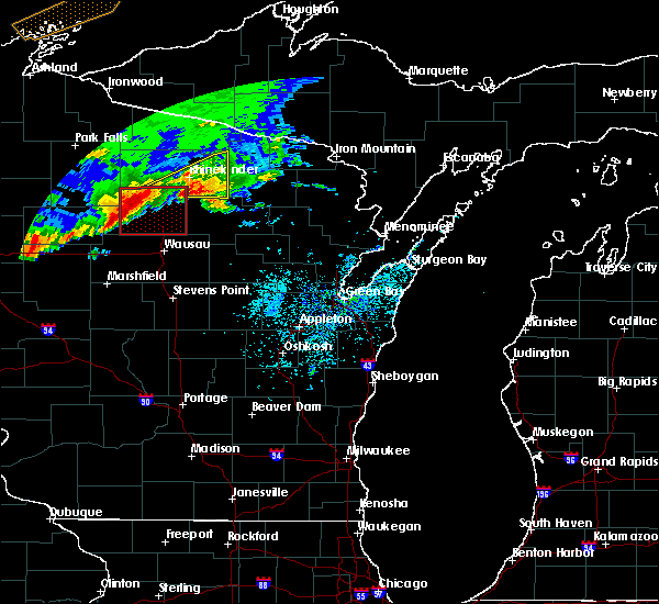 At 800 pm cdt, a severe thunderstorm capable of producing a tornado was located 7 miles north of new wood wildlife area, or 27 miles southwest of rhinelander, moving east at 40 mph (radar indicated rotation). Hazards include tornado and half dollar size hail. Flying debris will be dangerous to those caught without shelter. mobile homes will be damaged or destroyed. damage to roofs, windows, and vehicles will occur. tree damage is likely. Locations impacted include, council grounds state park, new wood wildlife area, irma, bradley, heafford junction, dudley, otis and gleason. At 800 pm cdt, a severe thunderstorm capable of producing a tornado was located 7 miles north of new wood wildlife area, or 27 miles southwest of rhinelander, moving east at 40 mph (radar indicated rotation). Hazards include tornado and half dollar size hail. Flying debris will be dangerous to those caught without shelter. mobile homes will be damaged or destroyed. damage to roofs, windows, and vehicles will occur. tree damage is likely. Locations impacted include, council grounds state park, new wood wildlife area, irma, bradley, heafford junction, dudley, otis and gleason.
|
| 5/16/2017 7:43 PM CDT |
 At 743 pm cdt, a severe thunderstorm capable of producing a tornado was located near spirit, or 22 miles northeast of medford, moving east at 35 mph (radar indicated rotation). Hazards include tornado and golf ball size hail. Flying debris will be dangerous to those caught without shelter. mobile homes will be damaged or destroyed. damage to roofs, windows, and vehicles will occur. tree damage is likely. this dangerous storm will be near, new wood wildlife area around 800 pm cdt. Other locations impacted by this tornadic thunderstorm include heafford junction, gleason, bradley, dudley, spirit falls, bill cross rapids wildlife area, otis, bloomville, doering and irma. At 743 pm cdt, a severe thunderstorm capable of producing a tornado was located near spirit, or 22 miles northeast of medford, moving east at 35 mph (radar indicated rotation). Hazards include tornado and golf ball size hail. Flying debris will be dangerous to those caught without shelter. mobile homes will be damaged or destroyed. damage to roofs, windows, and vehicles will occur. tree damage is likely. this dangerous storm will be near, new wood wildlife area around 800 pm cdt. Other locations impacted by this tornadic thunderstorm include heafford junction, gleason, bradley, dudley, spirit falls, bill cross rapids wildlife area, otis, bloomville, doering and irma.
|
| 5/16/2017 7:41 PM CDT |
 At 740 pm cdt, a severe thunderstorm was located near spirit, or 24 miles northeast of medford, moving east at 45 mph (radar indicated). Hazards include 60 mph wind gusts and half dollar size hail. Hail damage to vehicles is expected. expect wind damage to roofs, siding, and trees. locations impacted include, merrill, tomahawk, council grounds state park, tripoli, new wood wildlife area, bradley, heafford junction, dudley, otis and mccord. A tornado watch remains in effect until 1000 pm cdt for central and north central wisconsin. At 740 pm cdt, a severe thunderstorm was located near spirit, or 24 miles northeast of medford, moving east at 45 mph (radar indicated). Hazards include 60 mph wind gusts and half dollar size hail. Hail damage to vehicles is expected. expect wind damage to roofs, siding, and trees. locations impacted include, merrill, tomahawk, council grounds state park, tripoli, new wood wildlife area, bradley, heafford junction, dudley, otis and mccord. A tornado watch remains in effect until 1000 pm cdt for central and north central wisconsin.
|
| 5/16/2017 7:22 PM CDT |
 At 722 pm cdt, a severe thunderstorm was located 7 miles south of woodboro, or 11 miles southwest of rhinelander, moving northeast at 40 mph (radar indicated). Hazards include 60 mph wind gusts and half dollar size hail. Hail damage to vehicles is expected. expect wind damage to roofs, siding, and trees. locations impacted include, merrill, tomahawk, council grounds state park, tripoli, new wood wildlife area, bradley, heafford junction, dudley, otis and mccord. another severe thunderstorm was located near prentice in price county. this storm will be capable of producing ping pong size hail near tripoli and spirit falls. A tornado watch remains in effect until 1000 pm cdt for central and north central wisconsin. At 722 pm cdt, a severe thunderstorm was located 7 miles south of woodboro, or 11 miles southwest of rhinelander, moving northeast at 40 mph (radar indicated). Hazards include 60 mph wind gusts and half dollar size hail. Hail damage to vehicles is expected. expect wind damage to roofs, siding, and trees. locations impacted include, merrill, tomahawk, council grounds state park, tripoli, new wood wildlife area, bradley, heafford junction, dudley, otis and mccord. another severe thunderstorm was located near prentice in price county. this storm will be capable of producing ping pong size hail near tripoli and spirit falls. A tornado watch remains in effect until 1000 pm cdt for central and north central wisconsin.
|
| 5/16/2017 7:09 PM CDT |
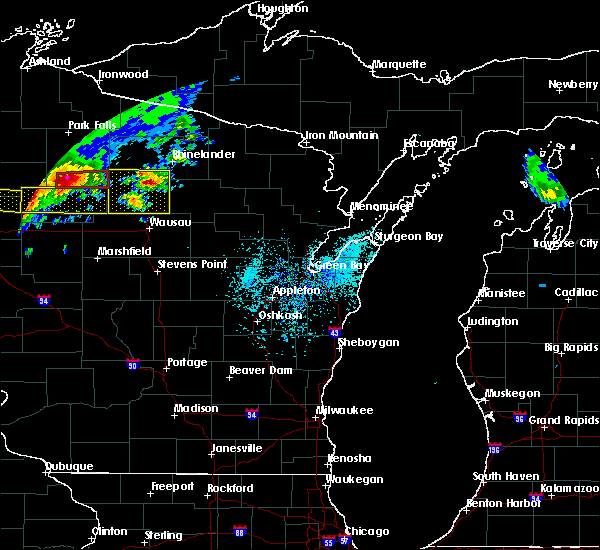 At 708 pm cdt, a severe thunderstorm was located near tomahawk, or 18 miles southwest of rhinelander, moving northeast at 40 mph (radar indicated). Hazards include 60 mph wind gusts and quarter size hail. Hail damage to vehicles is expected. Expect wind damage to roofs, siding, and trees. At 708 pm cdt, a severe thunderstorm was located near tomahawk, or 18 miles southwest of rhinelander, moving northeast at 40 mph (radar indicated). Hazards include 60 mph wind gusts and quarter size hail. Hail damage to vehicles is expected. Expect wind damage to roofs, siding, and trees.
|
| 4/10/2017 12:44 AM CDT |
 At 1243 am cdt, severe thunderstorms were located along a line extending from near new wood wildlife area to 13 miles west of mosinee, moving northeast at 50 mph (radar indicated). Hazards include 60 mph wind gusts and quarter size hail. Hail damage to vehicles is expected. expect wind damage to roofs, siding, and trees. these severe storms will be near, tomahawk around 100 am cdt. merrill and council grounds state park around 115 am cdt. Other locations impacted by these severe thunderstorms include mccord, heafford junction, gleason, bradley, dudley, jeffris, spirit falls, bill cross rapids wildlife area, otis and bloomville. At 1243 am cdt, severe thunderstorms were located along a line extending from near new wood wildlife area to 13 miles west of mosinee, moving northeast at 50 mph (radar indicated). Hazards include 60 mph wind gusts and quarter size hail. Hail damage to vehicles is expected. expect wind damage to roofs, siding, and trees. these severe storms will be near, tomahawk around 100 am cdt. merrill and council grounds state park around 115 am cdt. Other locations impacted by these severe thunderstorms include mccord, heafford junction, gleason, bradley, dudley, jeffris, spirit falls, bill cross rapids wildlife area, otis and bloomville.
|
| 4/10/2017 12:27 AM CDT |
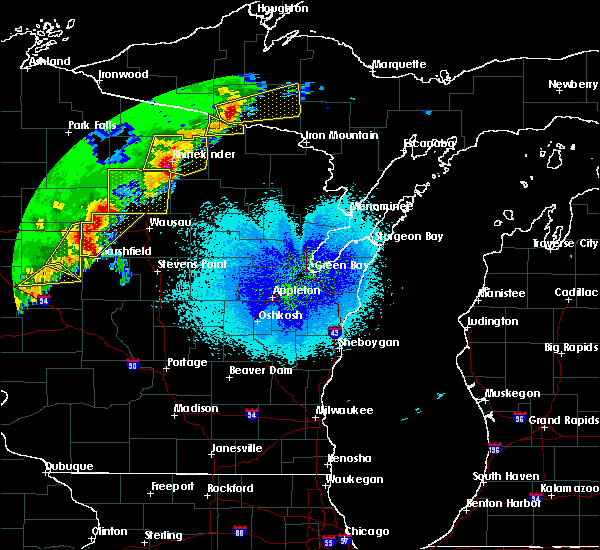 At 1227 am cdt, severe thunderstorms were located along a line extending from 11 miles south of new wood wildlife area to near spencer, moving northeast at 60 mph (radar indicated). Hazards include 60 mph wind gusts and half dollar size hail. Hail damage to vehicles is expected. expect wind damage to roofs, siding, and trees. severe thunderstorms will be near, new wood wildlife area around 1240 am cdt. tomahawk around 1255 am cdt. council grounds state park around 110 am cdt. merrill around 115 am cdt. Other locations impacted by these severe thunderstorms include mccord, heafford junction, gleason, bradley, dudley, jeffris, spirit falls, bill cross rapids wildlife area, otis and bloomville. At 1227 am cdt, severe thunderstorms were located along a line extending from 11 miles south of new wood wildlife area to near spencer, moving northeast at 60 mph (radar indicated). Hazards include 60 mph wind gusts and half dollar size hail. Hail damage to vehicles is expected. expect wind damage to roofs, siding, and trees. severe thunderstorms will be near, new wood wildlife area around 1240 am cdt. tomahawk around 1255 am cdt. council grounds state park around 110 am cdt. merrill around 115 am cdt. Other locations impacted by these severe thunderstorms include mccord, heafford junction, gleason, bradley, dudley, jeffris, spirit falls, bill cross rapids wildlife area, otis and bloomville.
|
| 4/10/2017 12:17 AM CDT |
 At 1215 am cdt, a severe thunderstorm was located near woodboro, or 10 miles southwest of rhinelander, moving northeast at 55 mph (radar indicated). Hazards include ping pong ball size hail and 60 mph wind gusts. People and animals outdoors will be injured. expect hail damage to roofs, siding, windows, and vehicles. expect wind damage to roofs, siding, and trees. this severe storm will be near, rhinelander around 1225 am cdt. other locations impacted by this severe thunderstorm include mc naughton, mccord, heafford junction, bradley, jeffris, goodnow, harshaw, spirit falls, bill cross rapids wildlife area and irma. strong to severe thunderstorms were also moving into western marathon county. Additional warnings maybe needed for oneida and lincoln counties. At 1215 am cdt, a severe thunderstorm was located near woodboro, or 10 miles southwest of rhinelander, moving northeast at 55 mph (radar indicated). Hazards include ping pong ball size hail and 60 mph wind gusts. People and animals outdoors will be injured. expect hail damage to roofs, siding, windows, and vehicles. expect wind damage to roofs, siding, and trees. this severe storm will be near, rhinelander around 1225 am cdt. other locations impacted by this severe thunderstorm include mc naughton, mccord, heafford junction, bradley, jeffris, goodnow, harshaw, spirit falls, bill cross rapids wildlife area and irma. strong to severe thunderstorms were also moving into western marathon county. Additional warnings maybe needed for oneida and lincoln counties.
|
| 4/9/2017 11:55 PM CDT |
 At 1154 pm cdt, a severe thunderstorm was located 8 miles north of new wood wildlife area, or 27 miles southwest of rhinelander, moving northeast at 55 mph (radar indicated). Hazards include golf ball size hail and 60 mph wind gusts. People and animals outdoors will be injured. expect hail damage to roofs, siding, windows, and vehicles. expect wind damage to roofs, siding, and trees. this severe storm will be near, tomahawk around 1205 am cdt. woodboro around 1220 am cdt. rhinelander around 1225 am cdt. Other locations impacted by this severe thunderstorm include mc naughton, heafford junction, bradley, harshaw, hazelhurst, mccord, jeffris, goodnow, spirit falls and bill cross rapids wildlife area. At 1154 pm cdt, a severe thunderstorm was located 8 miles north of new wood wildlife area, or 27 miles southwest of rhinelander, moving northeast at 55 mph (radar indicated). Hazards include golf ball size hail and 60 mph wind gusts. People and animals outdoors will be injured. expect hail damage to roofs, siding, windows, and vehicles. expect wind damage to roofs, siding, and trees. this severe storm will be near, tomahawk around 1205 am cdt. woodboro around 1220 am cdt. rhinelander around 1225 am cdt. Other locations impacted by this severe thunderstorm include mc naughton, heafford junction, bradley, harshaw, hazelhurst, mccord, jeffris, goodnow, spirit falls and bill cross rapids wildlife area.
|
| 4/9/2017 11:48 PM CDT |
 At 1147 pm cdt, a severe thunderstorm was located near new wood wildlife area, or 24 miles northeast of medford, moving northeast at 55 mph (radar indicated). Hazards include ping pong ball size hail and 60 mph wind gusts. People and animals outdoors will be injured. expect hail damage to roofs, siding, windows, and vehicles. expect wind damage to roofs, siding, and trees. this severe storm will be near, tomahawk around 1205 am cdt. woodboro around 1215 am cdt. rhinelander around 1220 am cdt. Other locations impacted by this severe thunderstorm include mc naughton, heafford junction, bradley, harshaw, hazelhurst, mccord, jeffris, goodnow, spirit falls and bill cross rapids wildlife area. At 1147 pm cdt, a severe thunderstorm was located near new wood wildlife area, or 24 miles northeast of medford, moving northeast at 55 mph (radar indicated). Hazards include ping pong ball size hail and 60 mph wind gusts. People and animals outdoors will be injured. expect hail damage to roofs, siding, windows, and vehicles. expect wind damage to roofs, siding, and trees. this severe storm will be near, tomahawk around 1205 am cdt. woodboro around 1215 am cdt. rhinelander around 1220 am cdt. Other locations impacted by this severe thunderstorm include mc naughton, heafford junction, bradley, harshaw, hazelhurst, mccord, jeffris, goodnow, spirit falls and bill cross rapids wildlife area.
|
| 4/9/2017 11:35 PM CDT |
 At 1134 pm cdt, a severe thunderstorm was located over rib lake, or 14 miles northeast of medford, moving northeast at 55 mph (radar indicated). Hazards include ping pong ball size hail and 60 mph wind gusts. People and animals outdoors will be injured. expect hail damage to roofs, siding, windows, and vehicles. expect wind damage to roofs, siding, and trees. this severe thunderstorm will be near, new wood wildlife area around 1145 pm cdt. tomahawk around 1205 am cdt. woodboro around 1215 am cdt. rhinelander around 1220 am cdt. Other locations impacted by this severe thunderstorm include mc naughton, heafford junction, bradley, harshaw, hazelhurst, mccord, jeffris, goodnow, spirit falls and bill cross rapids wildlife area. At 1134 pm cdt, a severe thunderstorm was located over rib lake, or 14 miles northeast of medford, moving northeast at 55 mph (radar indicated). Hazards include ping pong ball size hail and 60 mph wind gusts. People and animals outdoors will be injured. expect hail damage to roofs, siding, windows, and vehicles. expect wind damage to roofs, siding, and trees. this severe thunderstorm will be near, new wood wildlife area around 1145 pm cdt. tomahawk around 1205 am cdt. woodboro around 1215 am cdt. rhinelander around 1220 am cdt. Other locations impacted by this severe thunderstorm include mc naughton, heafford junction, bradley, harshaw, hazelhurst, mccord, jeffris, goodnow, spirit falls and bill cross rapids wildlife area.
|
| 4/9/2017 6:30 PM CDT | Quarter sized hail reported 7.1 miles S of Tomahawk, WI |
| 4/9/2017 6:06 PM CDT | Quarter sized hail reported 13.9 miles ESE of Tomahawk, WI |
| 8/16/2016 5:45 PM CDT |
 At 545 pm cdt, a severe thunderstorm was located near tripoli, or 28 miles southwest of rhinelander, moving southeast at 15 mph (radar indicated). Hazards include 60 mph wind gusts and quarter size hail. Hail damage to vehicles is expected. expect wind damage to roofs, siding, and trees. Locations impacted include, tomahawk, bradley, heafford junction, spirit falls and irma. At 545 pm cdt, a severe thunderstorm was located near tripoli, or 28 miles southwest of rhinelander, moving southeast at 15 mph (radar indicated). Hazards include 60 mph wind gusts and quarter size hail. Hail damage to vehicles is expected. expect wind damage to roofs, siding, and trees. Locations impacted include, tomahawk, bradley, heafford junction, spirit falls and irma.
|
| 8/16/2016 5:30 PM CDT |
 At 530 pm cdt, a severe thunderstorm was located near tripoli, or 29 miles west of rhinelander, moving southeast at 15 mph (radar indicated). Hazards include 60 mph wind gusts and quarter size hail. Hail damage to vehicles is expected. Expect wind damage to roofs, siding, and trees. At 530 pm cdt, a severe thunderstorm was located near tripoli, or 29 miles west of rhinelander, moving southeast at 15 mph (radar indicated). Hazards include 60 mph wind gusts and quarter size hail. Hail damage to vehicles is expected. Expect wind damage to roofs, siding, and trees.
|
| 7/21/2016 8:15 AM CDT | Tree damage... some 12 inch trees... winds gusts estimated at 50-60 mp in oneida county WI, 7.1 miles S of Tomahawk, WI |
| 7/21/2016 6:43 AM CDT |
 At 643 am cdt, severe thunderstorms were located along a line extending from near council grounds state park to 14 miles west of rib mountain, moving east at 45 mph (radar indicated). Hazards include 70 mph wind gusts and nickel size hail. Expect considerable tree damage. damage is likely to mobile homes, roofs, and outbuildings. severe thunderstorms will be near, merrill and council grounds state park around 650 am cdt. wausau around 655 am cdt. rib mountain around 700 am cdt. mosinee around 705 am cdt. weston around 710 am cdt. Other locations impacted by these severe thunderstorms include jeffris, athens, peplin, big eau pleine county park, rib falls, hamburg, fenwood, spirit falls, stratford and irma. At 643 am cdt, severe thunderstorms were located along a line extending from near council grounds state park to 14 miles west of rib mountain, moving east at 45 mph (radar indicated). Hazards include 70 mph wind gusts and nickel size hail. Expect considerable tree damage. damage is likely to mobile homes, roofs, and outbuildings. severe thunderstorms will be near, merrill and council grounds state park around 650 am cdt. wausau around 655 am cdt. rib mountain around 700 am cdt. mosinee around 705 am cdt. weston around 710 am cdt. Other locations impacted by these severe thunderstorms include jeffris, athens, peplin, big eau pleine county park, rib falls, hamburg, fenwood, spirit falls, stratford and irma.
|
| 7/12/2016 2:30 AM CDT | Several large trees down and numerous smaller tree limbs broken of in oneida county WI, 7.1 miles S of Tomahawk, WI |
| 6/10/2016 5:12 PM CDT |
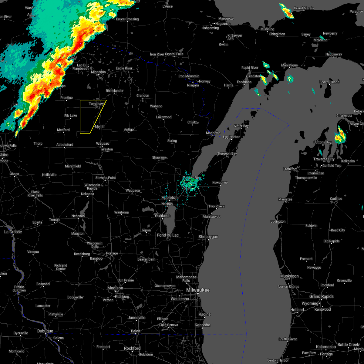 The severe thunderstorm warning for western lincoln county will expire at 515 pm cdt, the storms which prompted the warning have moved out of the area. therefore the warning will be allowed to expire. a tornado watch remains in effect until 900 pm cdt for north central wisconsin. remember, a severe thunderstorm warning still remains in effect for southeastern lincoln county. The severe thunderstorm warning for western lincoln county will expire at 515 pm cdt, the storms which prompted the warning have moved out of the area. therefore the warning will be allowed to expire. a tornado watch remains in effect until 900 pm cdt for north central wisconsin. remember, a severe thunderstorm warning still remains in effect for southeastern lincoln county.
|
| 6/10/2016 5:00 PM CDT |
 At 459 pm cdt, severe thunderstorms were located along a line extending from 8 miles northeast of parrish to near council grounds state park, moving east at 50 mph (radar indicated). Hazards include 70 mph wind gusts and penny size hail. Expect considerable tree damage. damage is likely to mobile homes, roofs, and outbuildings. these severe storms will be near, antigo around 530 pm cdt. other locations impacted by these severe thunderstorms include jeffris, bryant, ormsby, kempster, elcho, doering, irma, bill cross rapids wildlife area, post lake and dudley. A tornado watch remains in effect until 900 pm cdt for north central wisconsin. At 459 pm cdt, severe thunderstorms were located along a line extending from 8 miles northeast of parrish to near council grounds state park, moving east at 50 mph (radar indicated). Hazards include 70 mph wind gusts and penny size hail. Expect considerable tree damage. damage is likely to mobile homes, roofs, and outbuildings. these severe storms will be near, antigo around 530 pm cdt. other locations impacted by these severe thunderstorms include jeffris, bryant, ormsby, kempster, elcho, doering, irma, bill cross rapids wildlife area, post lake and dudley. A tornado watch remains in effect until 900 pm cdt for north central wisconsin.
|
| 6/10/2016 4:50 PM CDT |
 At 448 pm cdt, severe thunderstorms were located along a line extending from near woodboro to near new wood wildlife area, moving east at 50 mph (radar indicated). Hazards include 70 mph wind gusts and quarter size hail. Hail damage to vehicles is expected. expect considerable tree damage. wind damage is also likely to mobile homes, roofs, and outbuildings. severe thunderstorms will be near, pearson around 540 pm cdt. other locations impacted by these severe thunderstorms include heafford junction, jeffris, bryant, ormsby, kempster, elcho, doering, irma, bill cross rapids wildlife area and post lake. A tornado watch remains in effect until 900 pm cdt for north central wisconsin. At 448 pm cdt, severe thunderstorms were located along a line extending from near woodboro to near new wood wildlife area, moving east at 50 mph (radar indicated). Hazards include 70 mph wind gusts and quarter size hail. Hail damage to vehicles is expected. expect considerable tree damage. wind damage is also likely to mobile homes, roofs, and outbuildings. severe thunderstorms will be near, pearson around 540 pm cdt. other locations impacted by these severe thunderstorms include heafford junction, jeffris, bryant, ormsby, kempster, elcho, doering, irma, bill cross rapids wildlife area and post lake. A tornado watch remains in effect until 900 pm cdt for north central wisconsin.
|
| 6/10/2016 4:30 PM CDT | A couple trees on power line in lincoln county WI, 13.9 miles ESE of Tomahawk, WI |
| 6/10/2016 4:26 PM CDT |
 At 424 pm cdt, doppler radar indicated a line of severe thunderstorms located along a line extending from near tripoli to chelsea, moving east at 35 mph (radar indicated). Hazards include 60 mph wind gusts and quarter size hail. Hail damage to vehicles is expected. expect wind damage to roofs, siding, and trees. these severe storms will be near, tripoli around 430 pm cdt. tomahawk around 455 pm cdt. new wood wildlife area around 500 pm cdt. other locations impacted by these severe thunderstorms include heafford junction, bill cross rapids wildlife area, bradley and spirit falls. A tornado watch remains in effect until 900 pm cdt for north central wisconsin. At 424 pm cdt, doppler radar indicated a line of severe thunderstorms located along a line extending from near tripoli to chelsea, moving east at 35 mph (radar indicated). Hazards include 60 mph wind gusts and quarter size hail. Hail damage to vehicles is expected. expect wind damage to roofs, siding, and trees. these severe storms will be near, tripoli around 430 pm cdt. tomahawk around 455 pm cdt. new wood wildlife area around 500 pm cdt. other locations impacted by these severe thunderstorms include heafford junction, bill cross rapids wildlife area, bradley and spirit falls. A tornado watch remains in effect until 900 pm cdt for north central wisconsin.
|
| 6/10/2016 4:16 PM CDT |
 At 415 pm cdt, doppler radar indicated a line of severe thunderstorms located along a line extending from 6 miles northwest of tripoli to near chelsea, moving east at 35 mph (radar indicated). Hazards include 60 mph wind gusts. Expect damage to roofs. siding. and trees. severe thunderstorms will be near, tripoli around 425 pm cdt. tomahawk around 455 pm cdt. new wood wildlife area around 500 pm cdt. other locations impacted by these severe thunderstorms include heafford junction, bill cross rapids wildlife area, bradley and spirit falls. A tornado watch remains in effect until 900 pm cdt for north central wisconsin. At 415 pm cdt, doppler radar indicated a line of severe thunderstorms located along a line extending from 6 miles northwest of tripoli to near chelsea, moving east at 35 mph (radar indicated). Hazards include 60 mph wind gusts. Expect damage to roofs. siding. and trees. severe thunderstorms will be near, tripoli around 425 pm cdt. tomahawk around 455 pm cdt. new wood wildlife area around 500 pm cdt. other locations impacted by these severe thunderstorms include heafford junction, bill cross rapids wildlife area, bradley and spirit falls. A tornado watch remains in effect until 900 pm cdt for north central wisconsin.
|
| 8/2/2015 12:11 PM CDT |
 At 1209 pm cdt, a severe thunderstorm was located 9 miles north of tomahawk, or 16 miles west of rhinelander, moving east at 35 mph. quarter size hail was reported in newbold at 1206 pm cdt (radar indicated). Hazards include 60 mph wind gusts and half dollar size hail. Hail damage to vehicles is expected. expect wind damage to roofs, siding and trees. this severe storm will be near, woodboro around 1220 pm cdt. Other locations impacted by this severe thunderstorm include harshaw, goodnow, mc naughton, mccord, heafford junction and bradley. At 1209 pm cdt, a severe thunderstorm was located 9 miles north of tomahawk, or 16 miles west of rhinelander, moving east at 35 mph. quarter size hail was reported in newbold at 1206 pm cdt (radar indicated). Hazards include 60 mph wind gusts and half dollar size hail. Hail damage to vehicles is expected. expect wind damage to roofs, siding and trees. this severe storm will be near, woodboro around 1220 pm cdt. Other locations impacted by this severe thunderstorm include harshaw, goodnow, mc naughton, mccord, heafford junction and bradley.
|
| 8/2/2015 12:05 PM CDT |
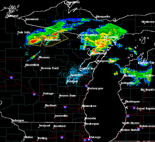 At 1204 pm cdt, a severe thunderstorm was located near willow reservoir, or 18 miles west of rhinelander, moving east at 30 mph (radar indicated). Hazards include 60 mph wind gusts and half dollar size hail. Hail damage to vehicles is expected. expect wind damage to roofs, siding and trees. this severe storm will be near, woodboro around 1220 pm cdt. Other locations impacted by this severe thunderstorm include harshaw, goodnow, mc naughton, mccord, heafford junction and bradley. At 1204 pm cdt, a severe thunderstorm was located near willow reservoir, or 18 miles west of rhinelander, moving east at 30 mph (radar indicated). Hazards include 60 mph wind gusts and half dollar size hail. Hail damage to vehicles is expected. expect wind damage to roofs, siding and trees. this severe storm will be near, woodboro around 1220 pm cdt. Other locations impacted by this severe thunderstorm include harshaw, goodnow, mc naughton, mccord, heafford junction and bradley.
|
| 8/2/2015 11:58 AM CDT |
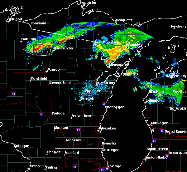 At 1157 am cdt, a severe thunderstorm was located near willow reservoir, or 24 miles west of rhinelander, and is nearly stationary (radar indicated). Hazards include golf ball size hail and 60 mph wind gusts. People and animals outdoors will be injured. expect hail damage to roofs, siding, windows and vehicles. expect wind damage to roofs, siding and trees. this severe storm will be near, woodboro around 1220 pm cdt. Other locations impacted by this severe thunderstorm include harshaw, mc naughton, mccord, hazelhurst, heafford junction, bradley, lake tomahawk and goodnow. At 1157 am cdt, a severe thunderstorm was located near willow reservoir, or 24 miles west of rhinelander, and is nearly stationary (radar indicated). Hazards include golf ball size hail and 60 mph wind gusts. People and animals outdoors will be injured. expect hail damage to roofs, siding, windows and vehicles. expect wind damage to roofs, siding and trees. this severe storm will be near, woodboro around 1220 pm cdt. Other locations impacted by this severe thunderstorm include harshaw, mc naughton, mccord, hazelhurst, heafford junction, bradley, lake tomahawk and goodnow.
|
| 8/2/2015 11:50 AM CDT |
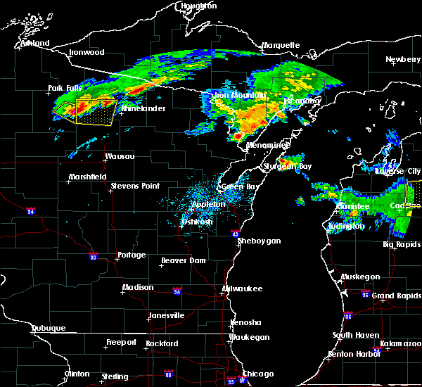 At 1150 am cdt, a severe thunderstorm was located 7 miles west of willow reservoir, or 26 miles southeast of park falls, and is nearly stationary (radar indicated). Hazards include golf ball size hail and 60 mph wind gusts. People and animals outdoors will be injured. expect hail damage to roofs, siding, windows and vehicles. expect wind damage to roofs, siding and trees. this severe storm will be near, willow reservoir around 1200 pm cdt. woodboro around 1215 pm cdt. Other locations impacted by this severe thunderstorm include harshaw, mc naughton, mccord, hazelhurst, heafford junction, bradley, lake tomahawk and goodnow. At 1150 am cdt, a severe thunderstorm was located 7 miles west of willow reservoir, or 26 miles southeast of park falls, and is nearly stationary (radar indicated). Hazards include golf ball size hail and 60 mph wind gusts. People and animals outdoors will be injured. expect hail damage to roofs, siding, windows and vehicles. expect wind damage to roofs, siding and trees. this severe storm will be near, willow reservoir around 1200 pm cdt. woodboro around 1215 pm cdt. Other locations impacted by this severe thunderstorm include harshaw, mc naughton, mccord, hazelhurst, heafford junction, bradley, lake tomahawk and goodnow.
|
| 8/2/2015 11:43 AM CDT |
 At 1142 am cdt, a severe thunderstorm was located 10 miles north of brantwood, or 22 miles southeast of park falls, moving east at 50 mph (radar indicated). Hazards include golf ball size hail and 60 mph wind gusts. People and animals outdoors will be injured. expect hail damage to roofs, siding, windows and vehicles. expect wind damage to roofs, siding and trees. this severe thunderstorm will be near, willow reservoir around 1155 am cdt. woodboro around 1215 pm cdt. Other locations impacted by this severe thunderstorm include harshaw, mc naughton, mccord, hazelhurst, heafford junction, bradley, lake tomahawk and goodnow. At 1142 am cdt, a severe thunderstorm was located 10 miles north of brantwood, or 22 miles southeast of park falls, moving east at 50 mph (radar indicated). Hazards include golf ball size hail and 60 mph wind gusts. People and animals outdoors will be injured. expect hail damage to roofs, siding, windows and vehicles. expect wind damage to roofs, siding and trees. this severe thunderstorm will be near, willow reservoir around 1155 am cdt. woodboro around 1215 pm cdt. Other locations impacted by this severe thunderstorm include harshaw, mc naughton, mccord, hazelhurst, heafford junction, bradley, lake tomahawk and goodnow.
|
| 9/4/2014 10:20 AM CDT | Quarter sized hail reported 9.9 miles WSW of Tomahawk, WI, at least 1 inch diameter hail in town of harrison. time estimated. report from social media. |
| 9/4/2014 10:01 AM CDT | Quarter sized hail reported 7.1 miles S of Tomahawk, WI |
| 8/29/2013 9:20 PM CDT | Tree down in lincoln county WI, 13.9 miles ESE of Tomahawk, WI |
| 6/26/2013 5:07 PM CDT | Trees down on power line and house. relayed from sheriff. time estimate in lincoln county WI, 1.2 miles N of Tomahawk, WI |
| 6/26/2013 4:56 PM CDT | Quarter sized hail reported 1.2 miles N of Tomahawk, WI |
| 9/19/2012 6:37 PM CDT | Several trees in lincoln county WI, 3 miles ENE of Tomahawk, WI |
| 6/18/2012 2:20 PM CDT | Quarter sized hail reported 10.9 miles NNW of Tomahawk, WI, time estimated |
| 5/20/2012 2:15 PM CDT | Trees down along highway 8 in lincoln county WI, 13.9 miles ESE of Tomahawk, WI |
| 1/1/0001 12:00 AM | Sporadic power outages and house fire reported in tomahaw in lincoln county WI, 1.2 miles N of Tomahawk, WI |
| 1/1/0001 12:00 AM | 10 inch live tree down in lincoln county WI, 1.2 miles N of Tomahawk, WI |
| 1/1/0001 12:00 AM | Trees and power lines down in lincoln county WI, 3.8 miles SSE of Tomahawk, WI |
| 1/1/0001 12:00 AM | Trees and power lines down in lincoln county WI, 1.2 miles N of Tomahawk, WI |
Hail Maps for Tomahawk, WI
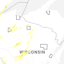


Connect with Interactive Hail Maps