

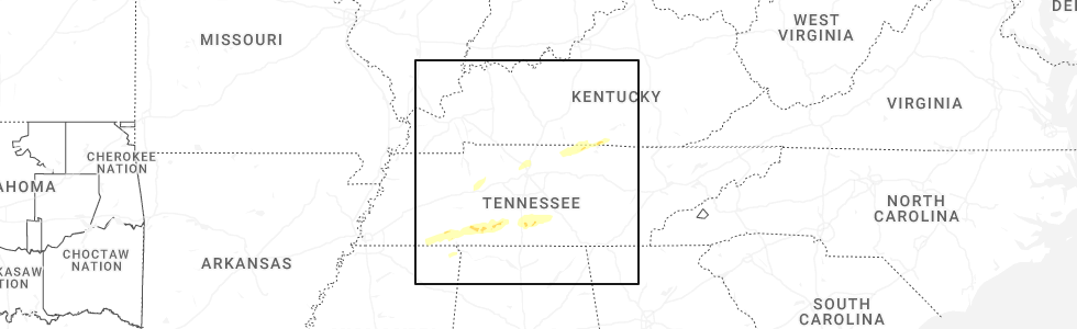
Hail Map for Tompkinsville, KY
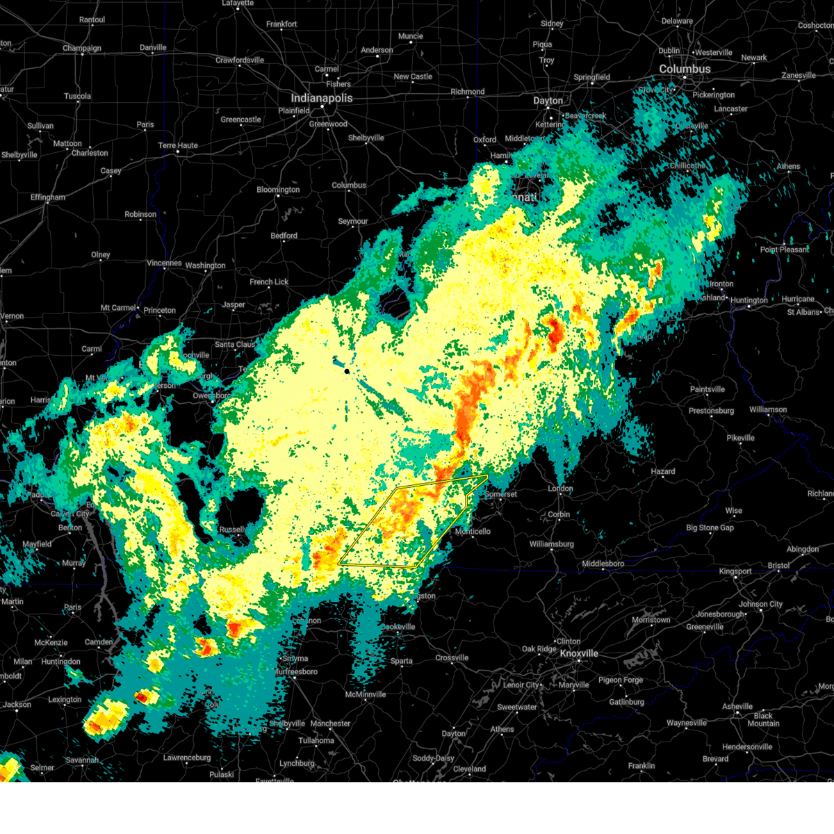
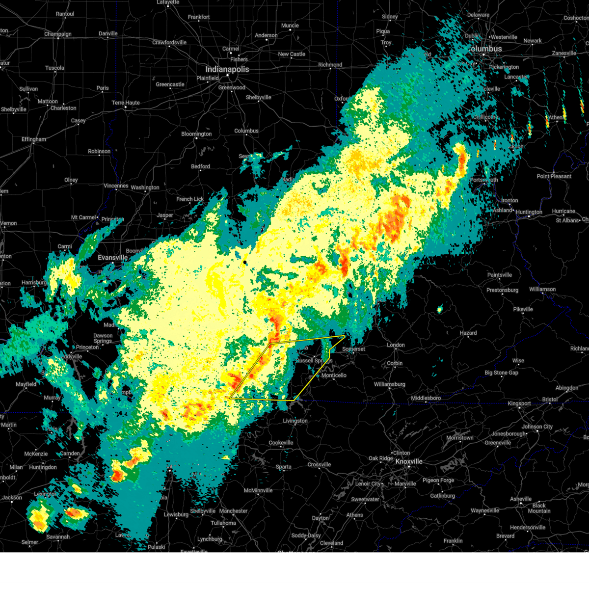
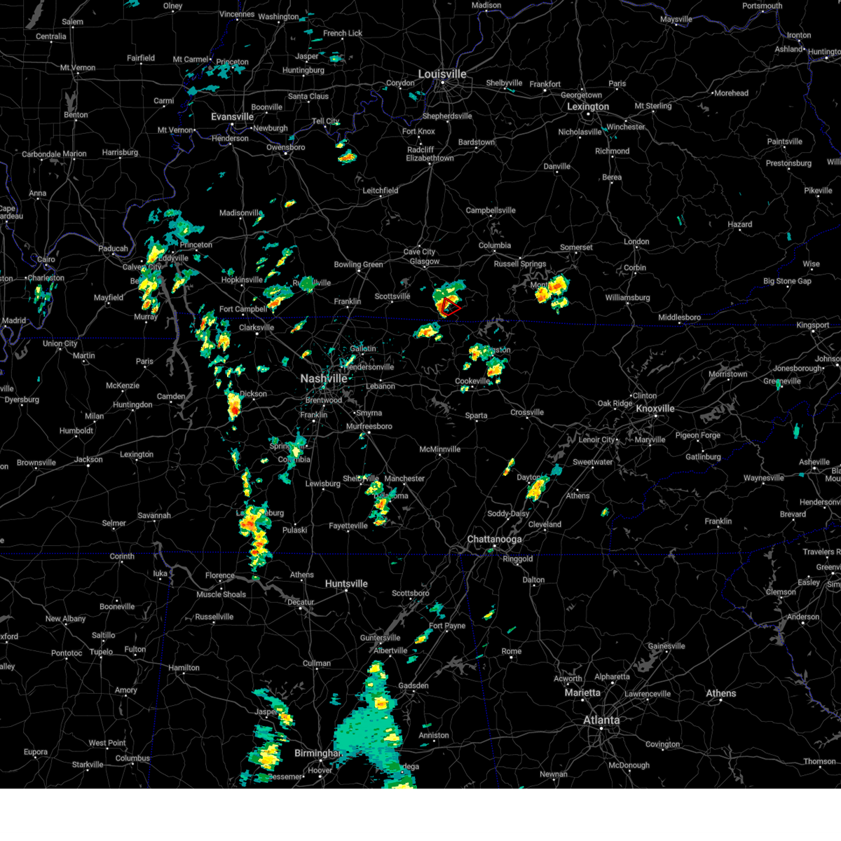
The Tompkinsville, KY area has had 8 reports of on-the-ground hail by trained spotters, and has been under severe weather warnings 8 times during the past 12 months. Doppler radar has detected hail at or near Tompkinsville, KY on 63 occasions, including 1 occasion during the past year.
| Name: | Tompkinsville, KY |
| Where Located: | 70.6 miles ENE of Nashville, TN |
| Map: | Google Map for Tompkinsville, KY |
| Population: | 2402 |
| Housing Units: | 1202 |
| More Info: | Search Google for Tompkinsville, KY |
1
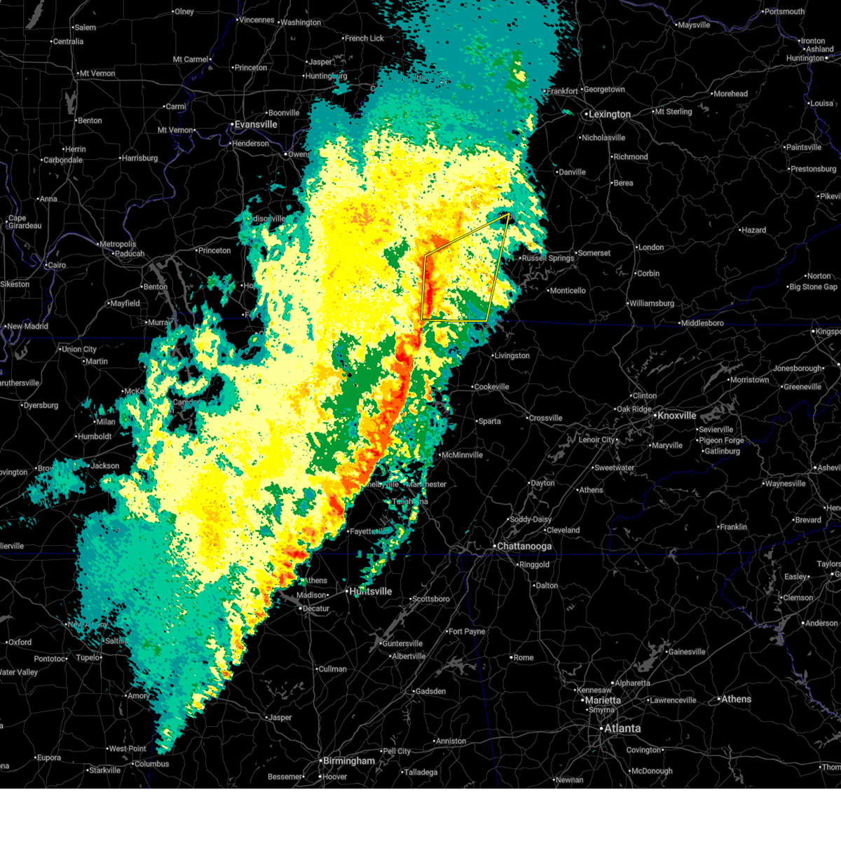
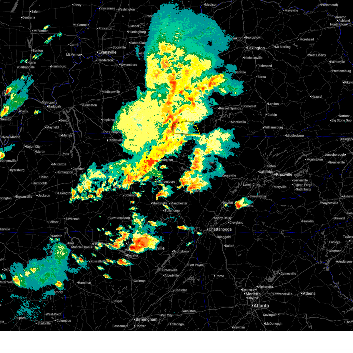
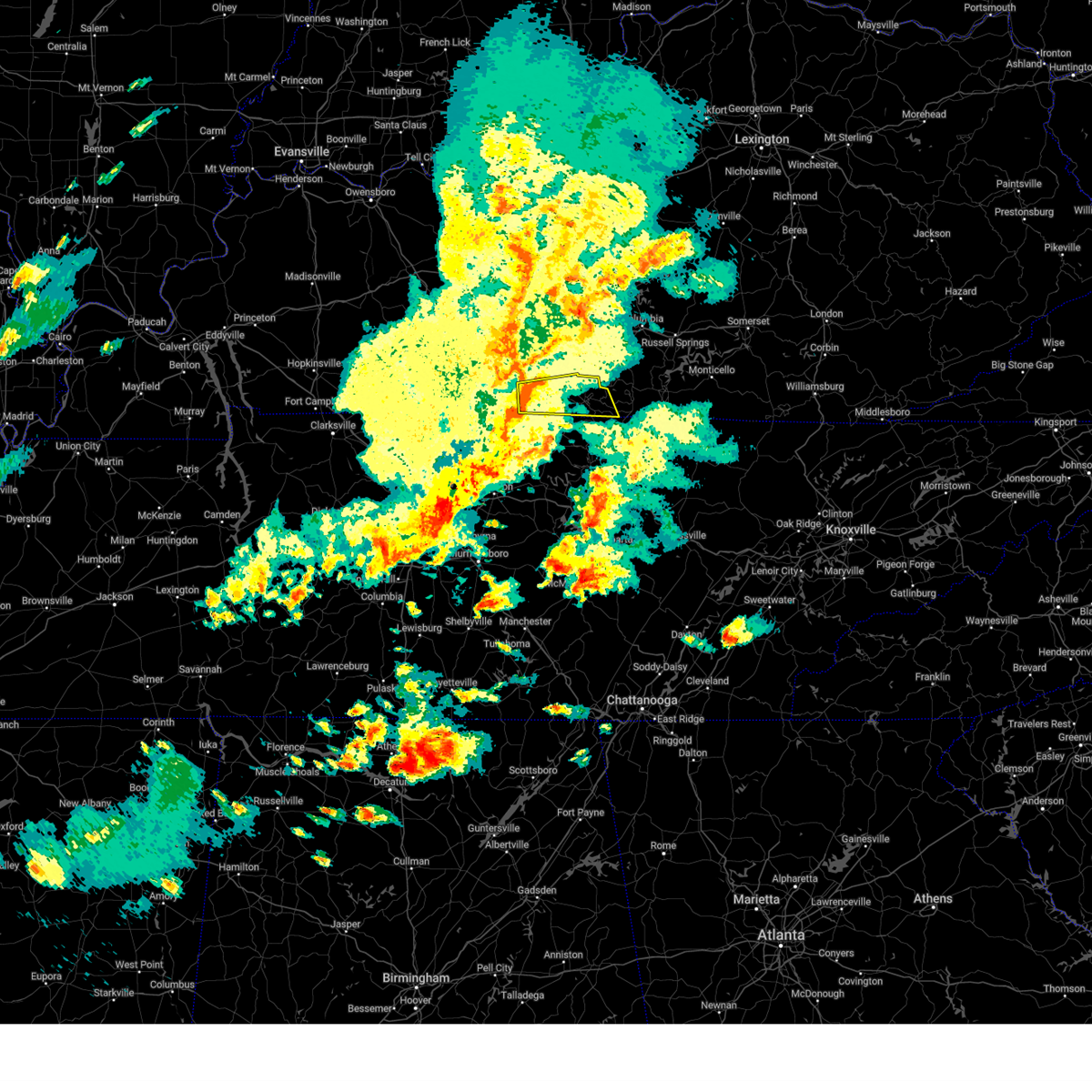
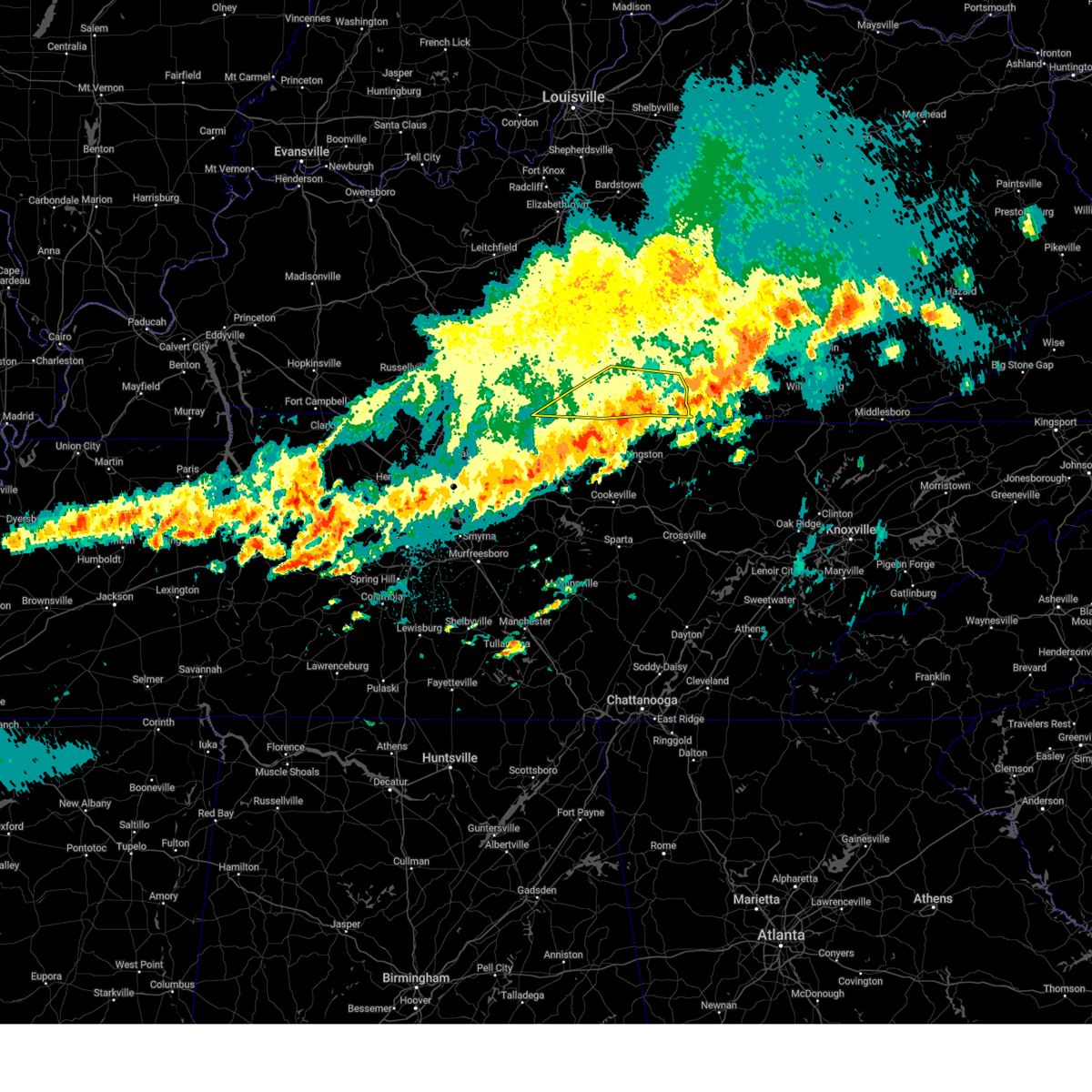
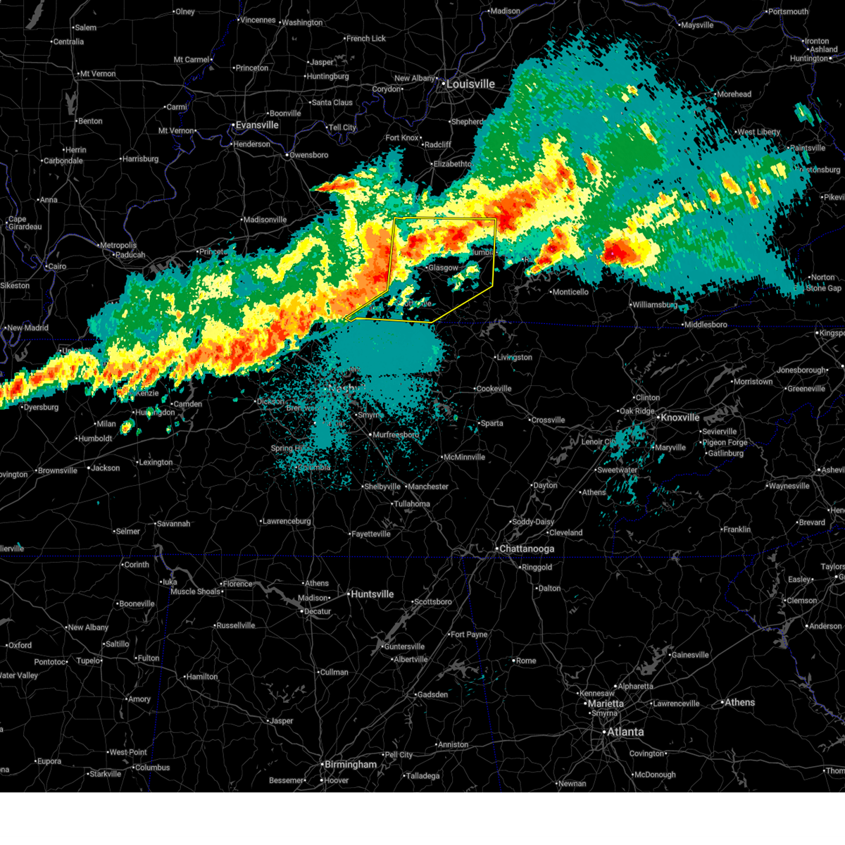
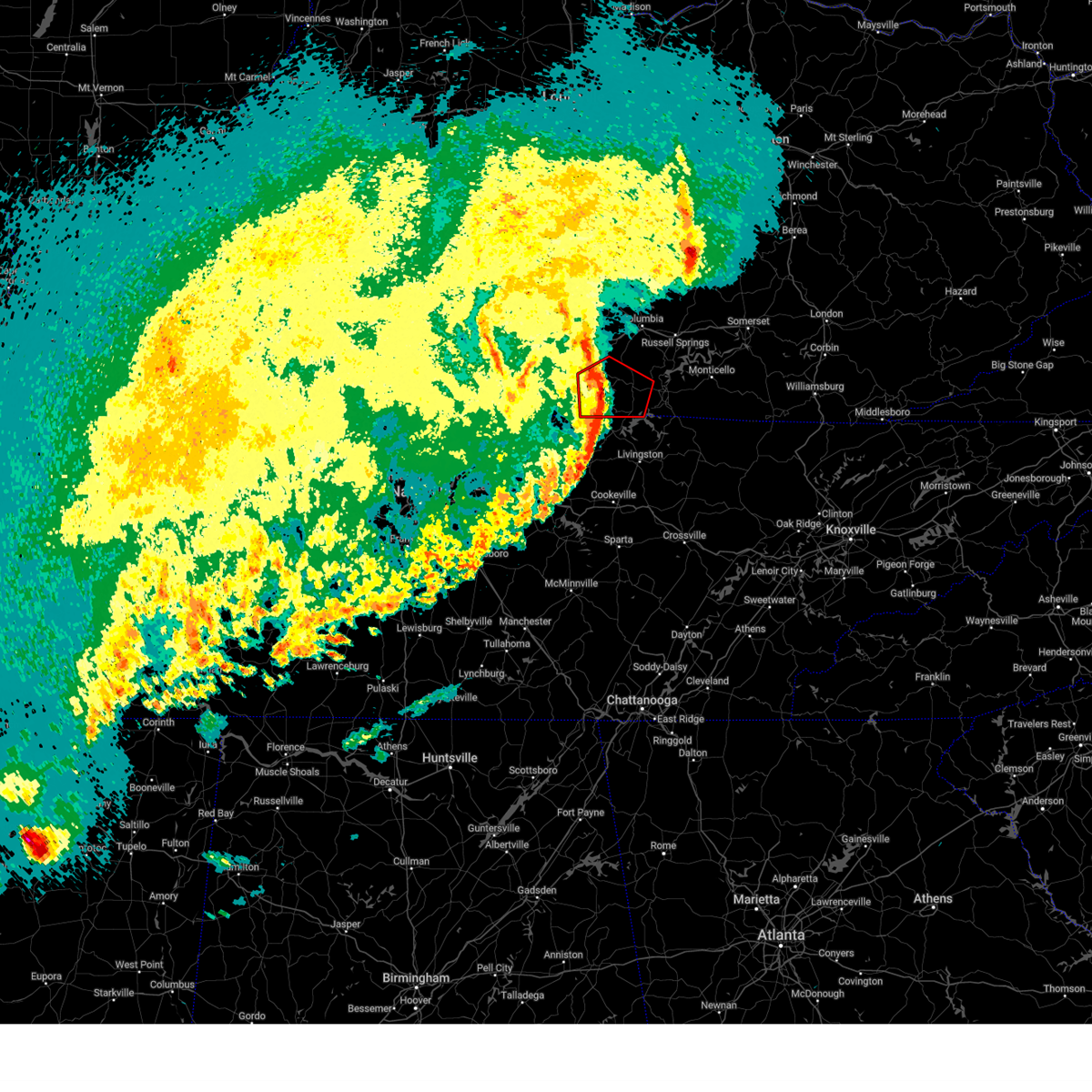
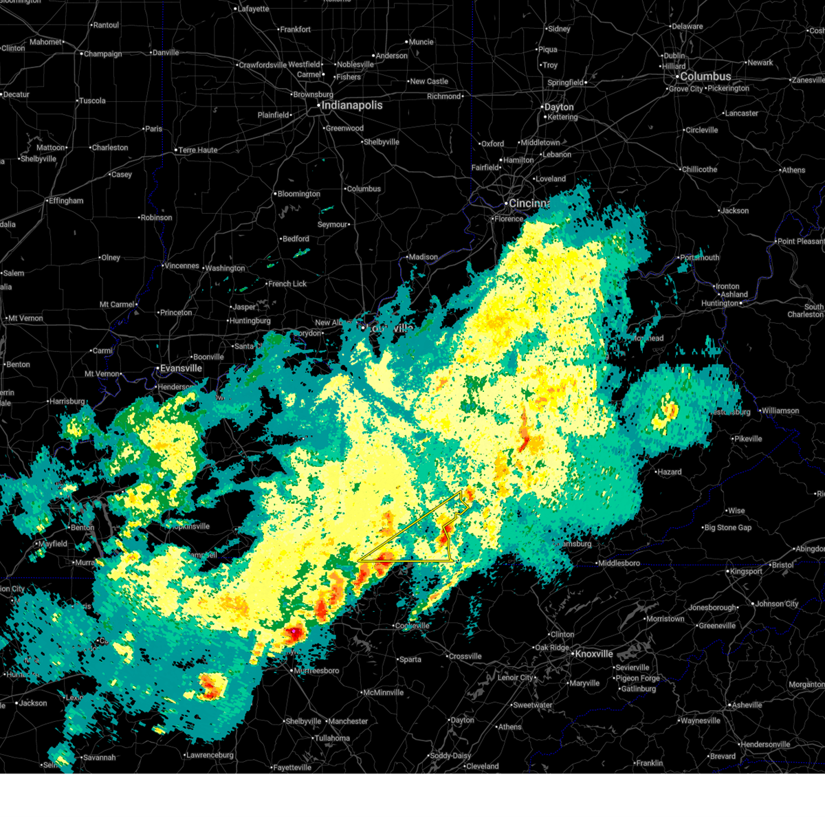
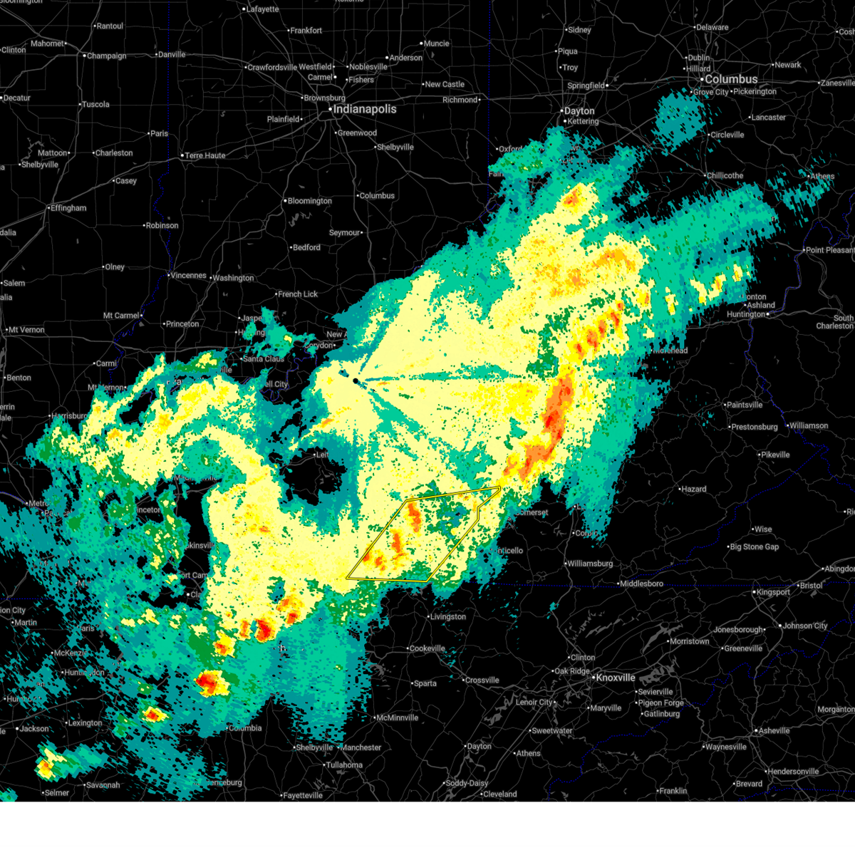
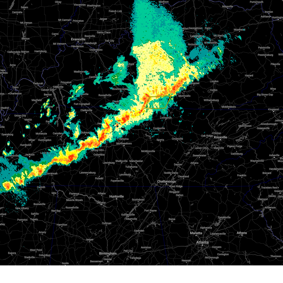
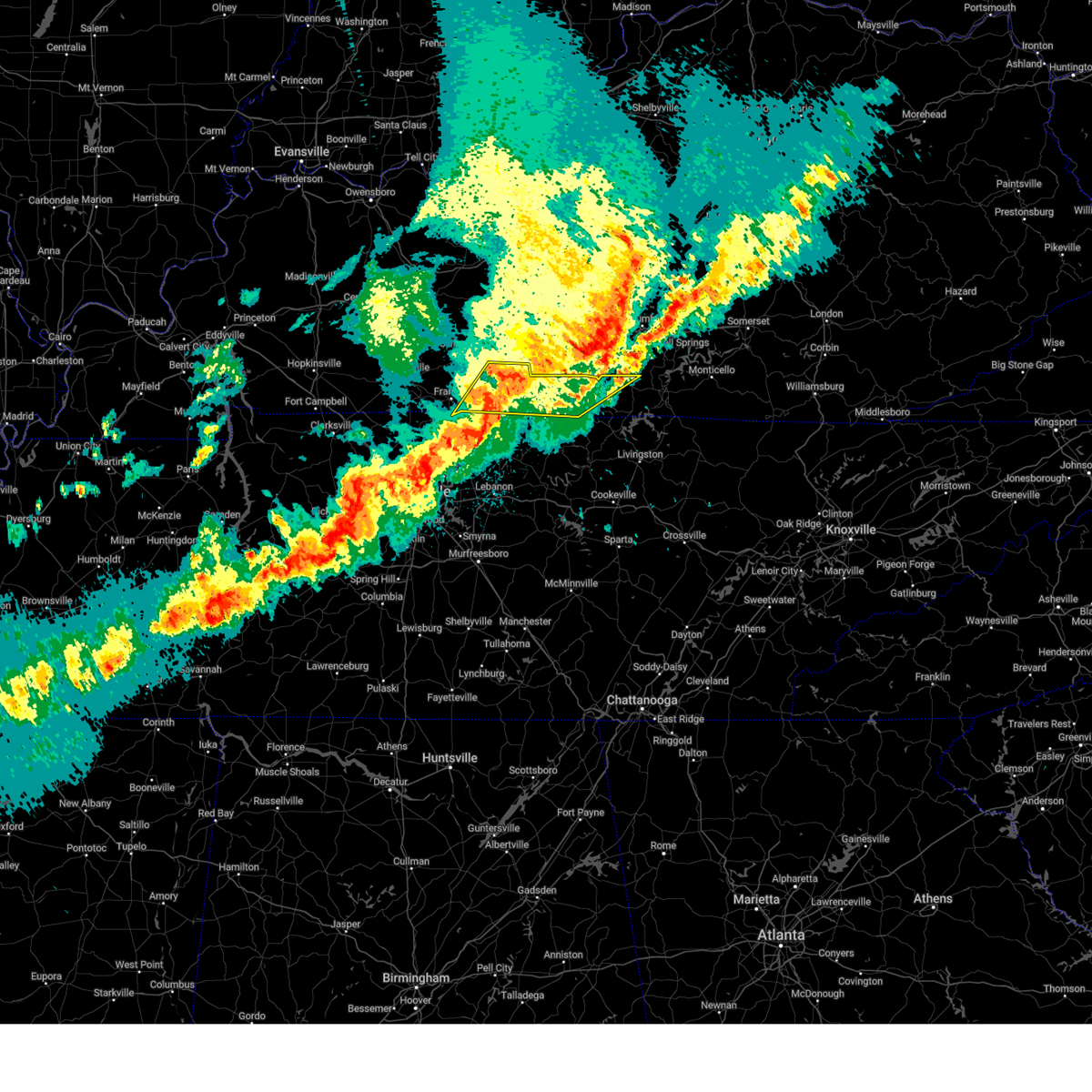
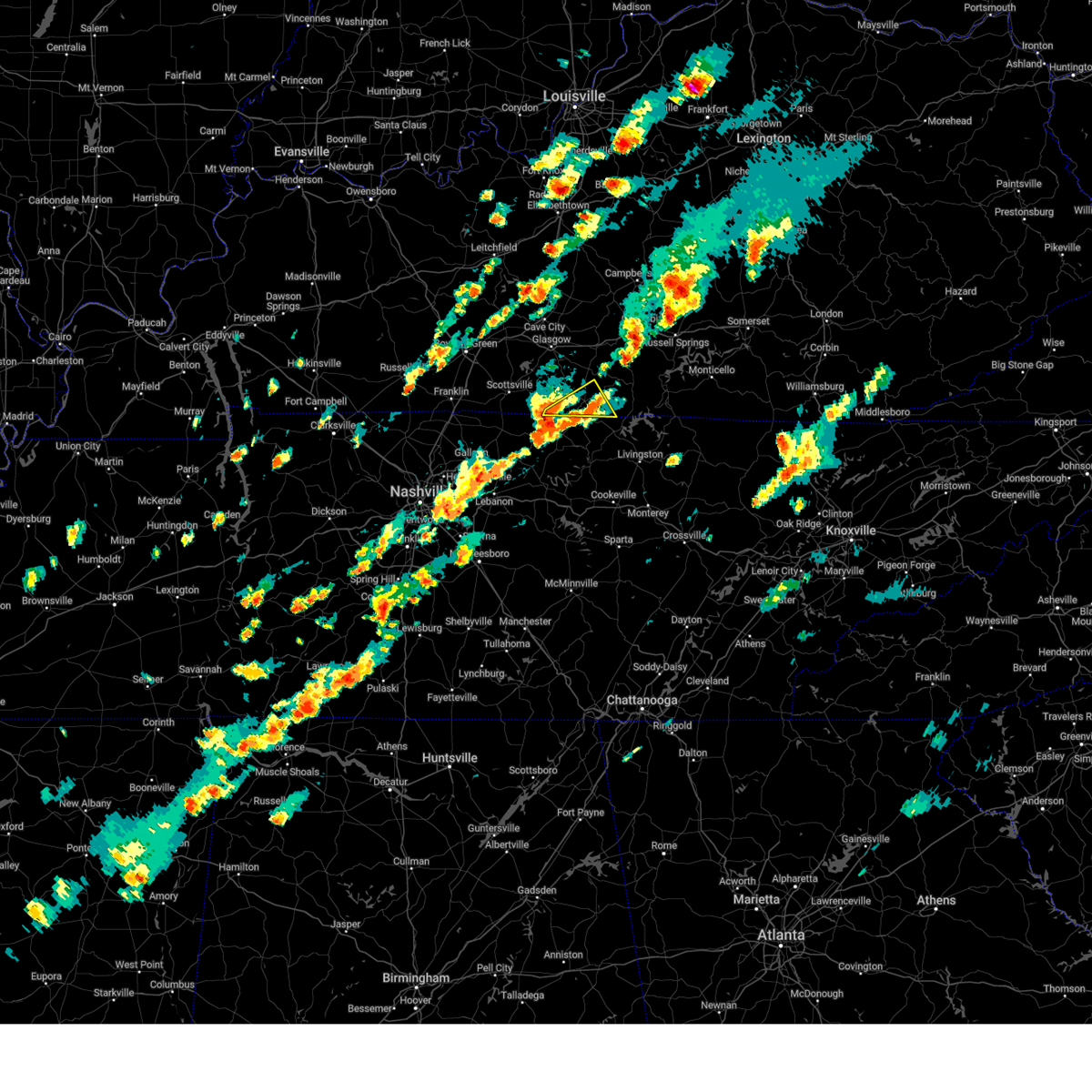
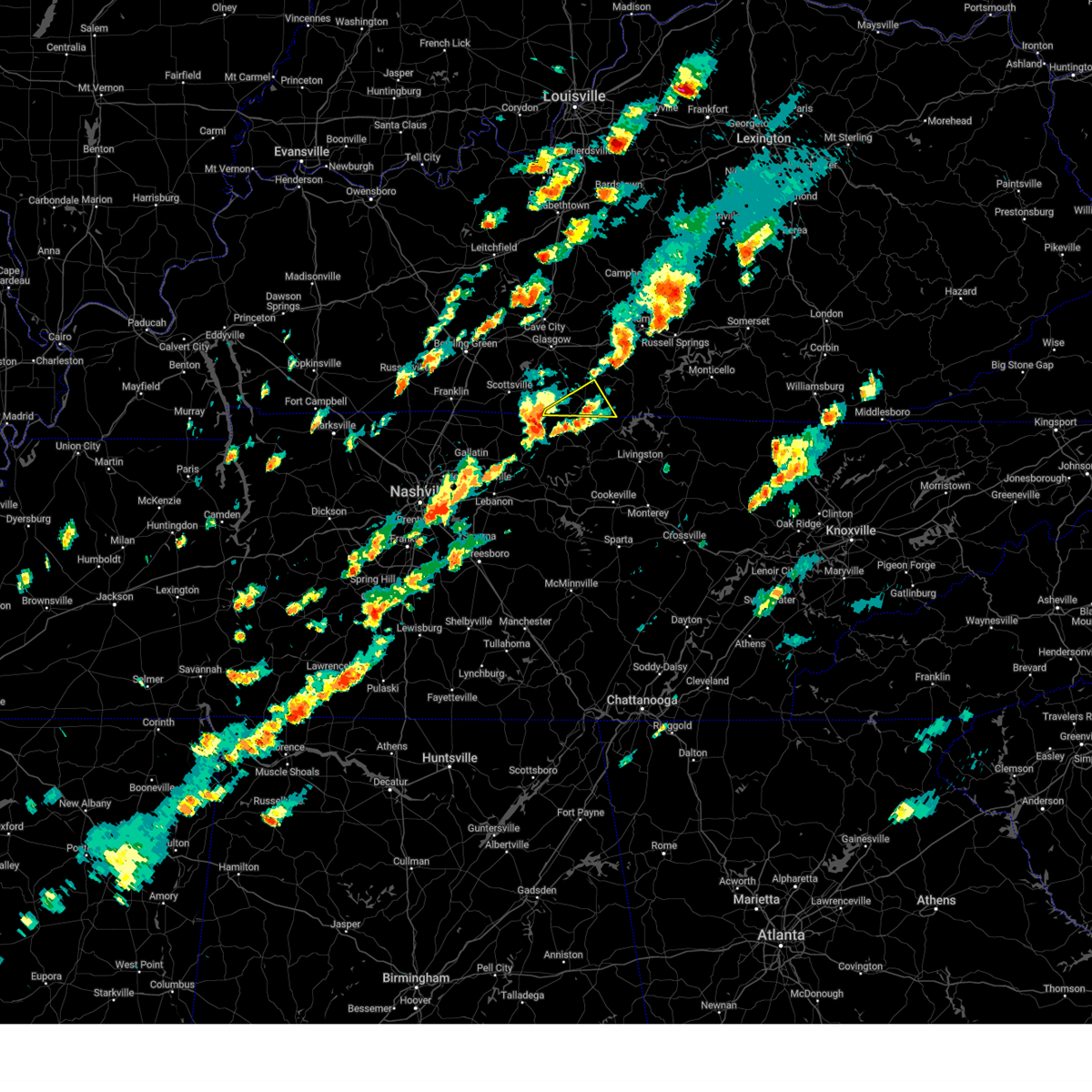
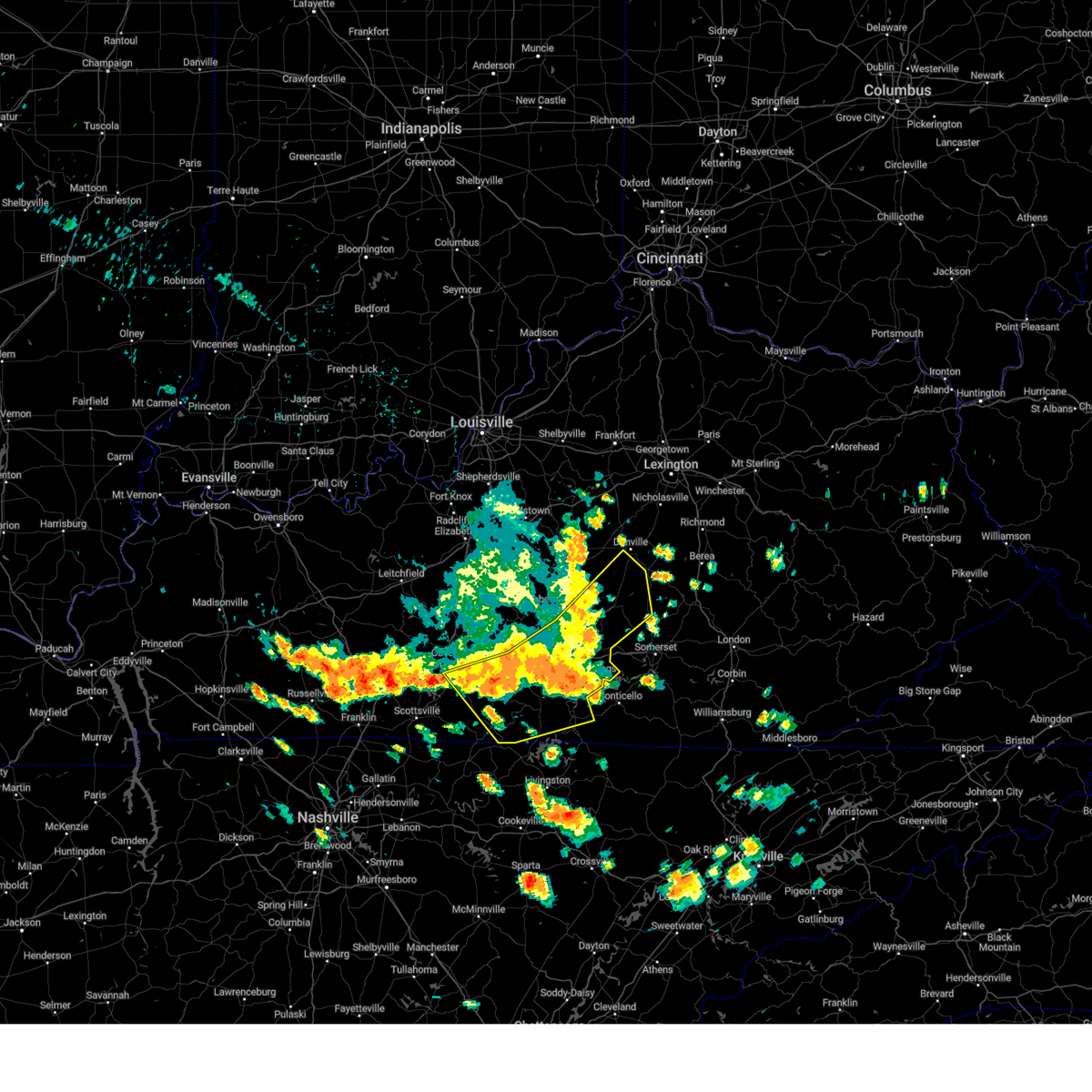
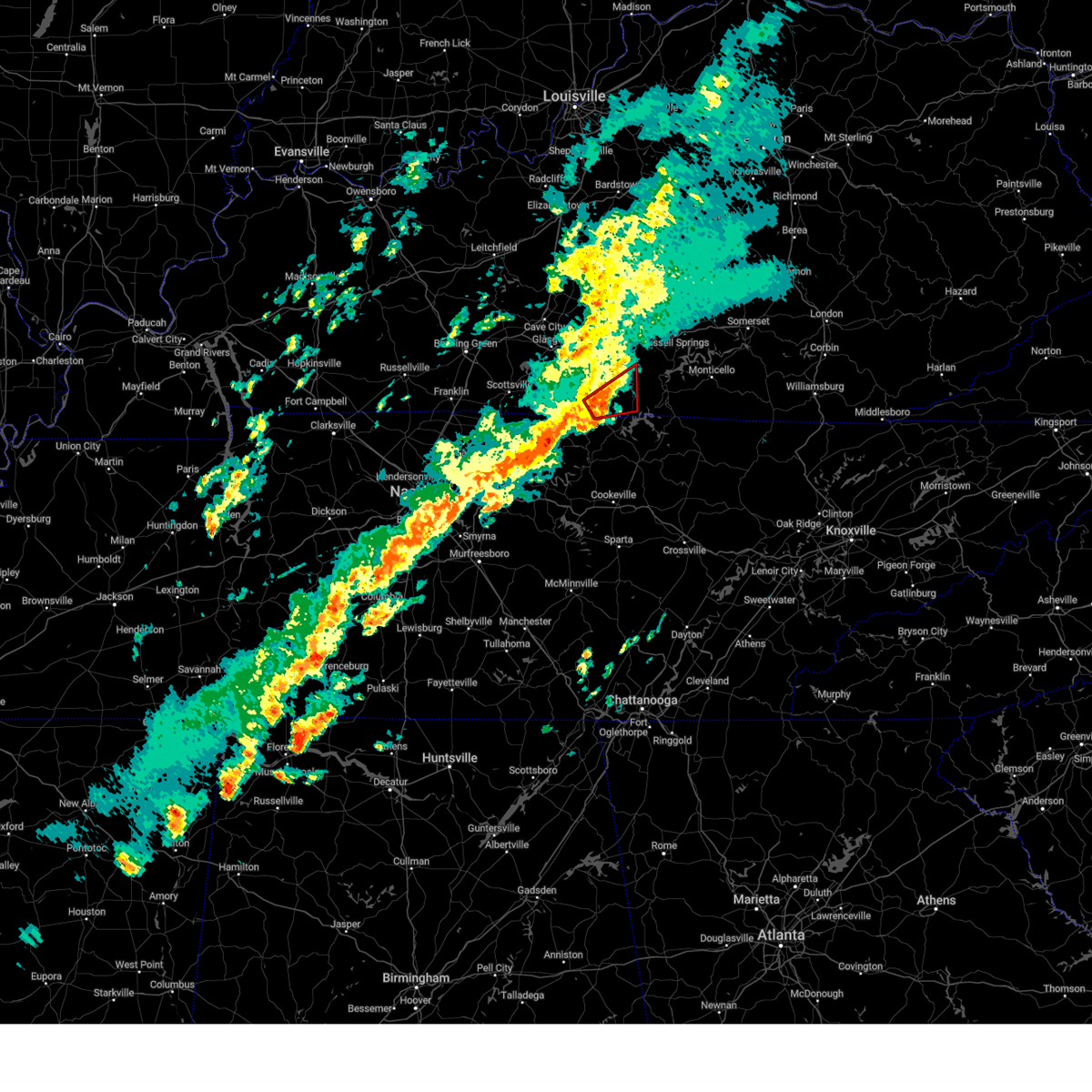
The Top Recent Hail Date for Tompkinsville, KY is Wednesday, March 11, 2026 (20th out of 63)
Hail and Wind Damage Spotted near Tompkinsville, KY
| Date / Time | Report Details |
|---|---|
| 4/4/2026 6:00 PM CDT |
 The storm which prompted the warning has moved out of the area. therefore, the warning has been allowed to expire. remember, a severe thunderstorm warning still remains in effect for northern cumberland and extreme northeastern clinton county until 630 pm cdt. The storm which prompted the warning has moved out of the area. therefore, the warning has been allowed to expire. remember, a severe thunderstorm warning still remains in effect for northern cumberland and extreme northeastern clinton county until 630 pm cdt.
|
| 4/4/2026 5:37 PM CDT |
 Svrlmk the national weather service in louisville has issued a * severe thunderstorm warning for, southwestern clinton county in south central kentucky, monroe county in south central kentucky, cumberland county in south central kentucky, * until 600 pm cdt. * at 536 pm cdt, a severe thunderstorm was located near tompkinsville, moving northeast at 55 mph (radar indicated). Hazards include 60 mph wind gusts. expect damage to roofs, siding, and trees Svrlmk the national weather service in louisville has issued a * severe thunderstorm warning for, southwestern clinton county in south central kentucky, monroe county in south central kentucky, cumberland county in south central kentucky, * until 600 pm cdt. * at 536 pm cdt, a severe thunderstorm was located near tompkinsville, moving northeast at 55 mph (radar indicated). Hazards include 60 mph wind gusts. expect damage to roofs, siding, and trees
|
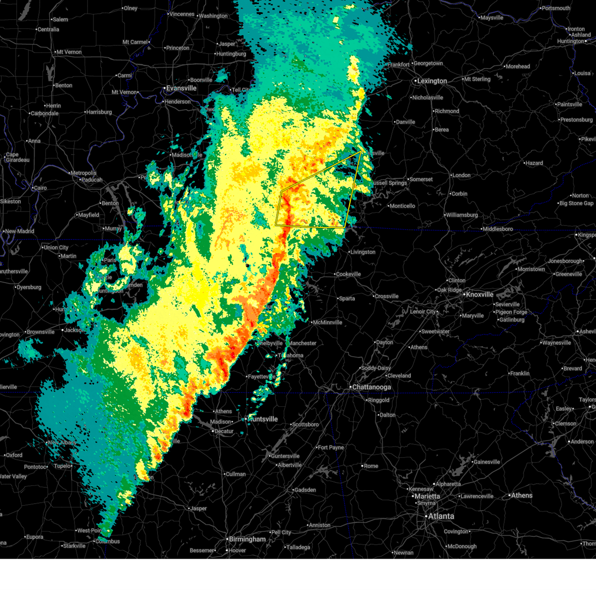
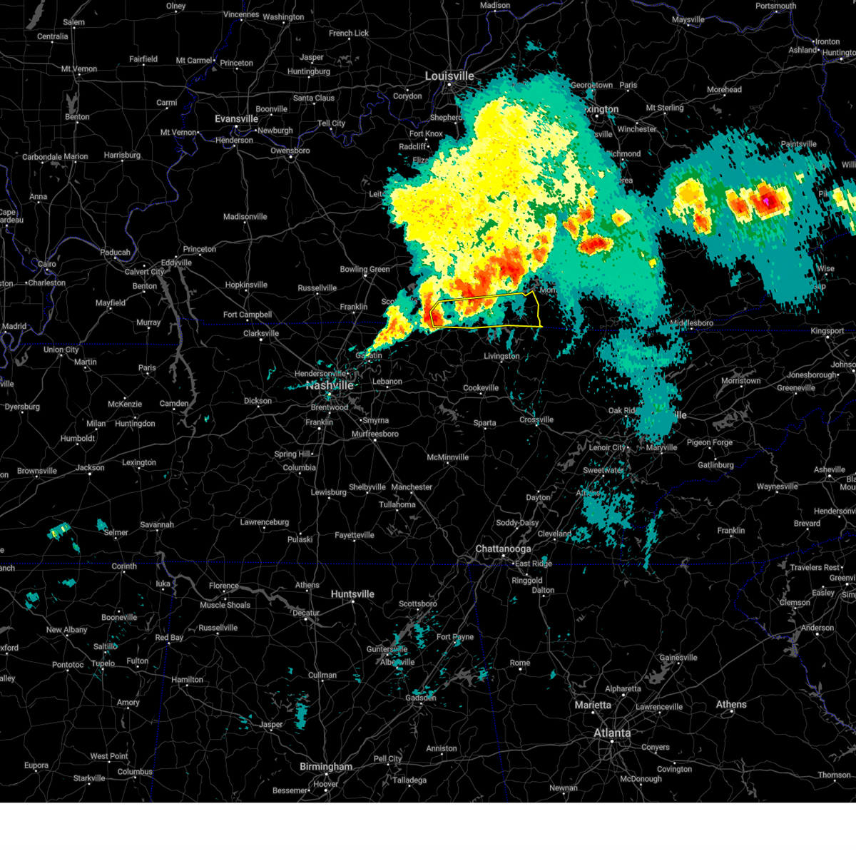
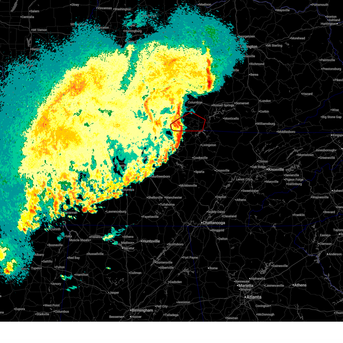
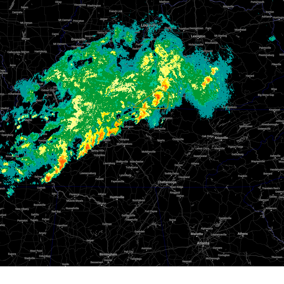
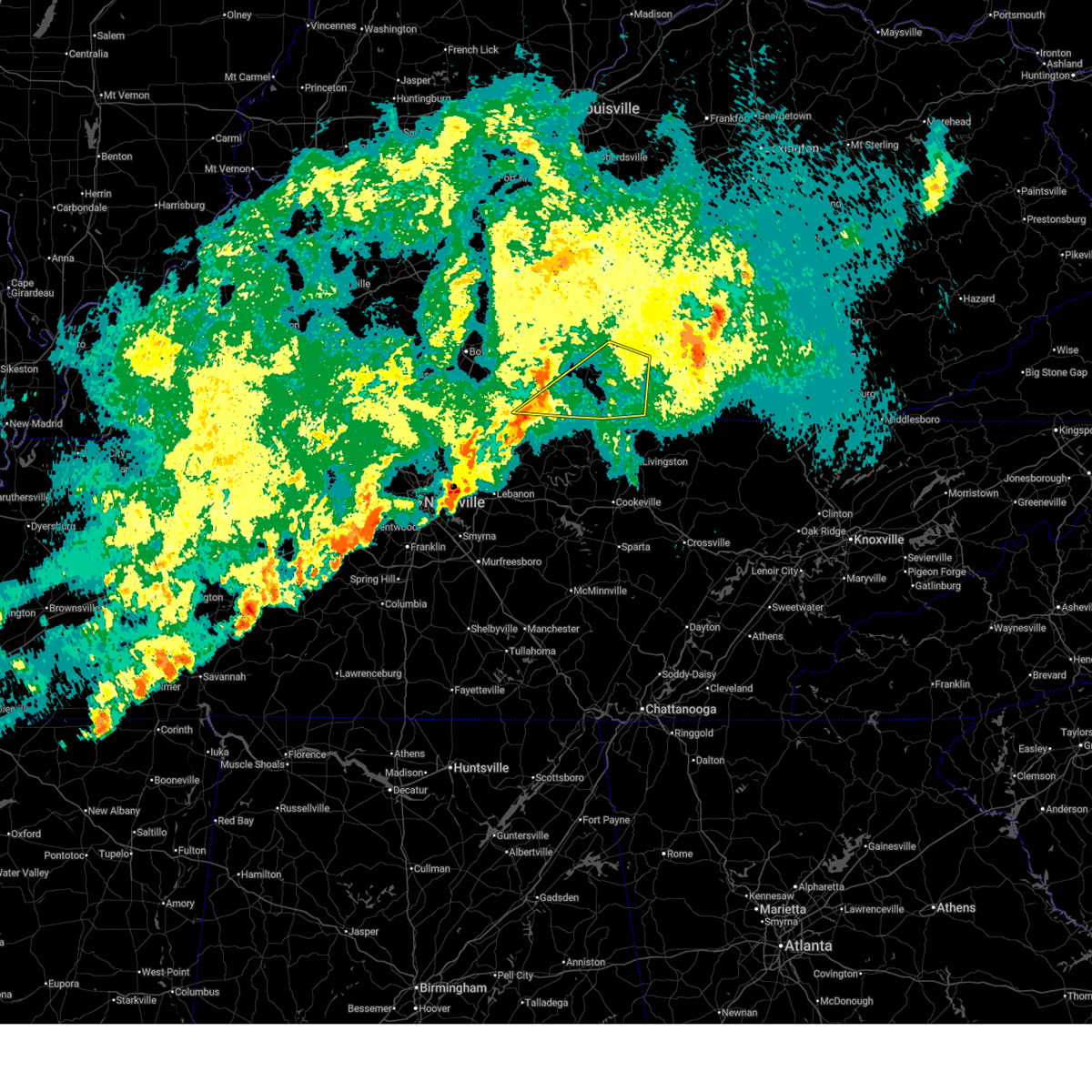
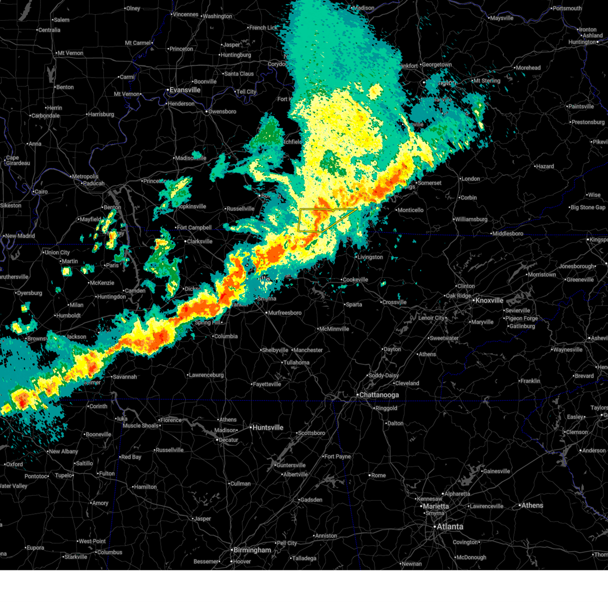
| 3/16/2026 12:00 AM CDT |
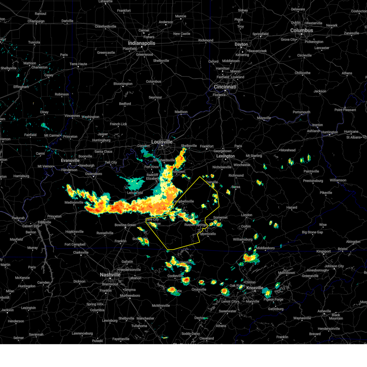
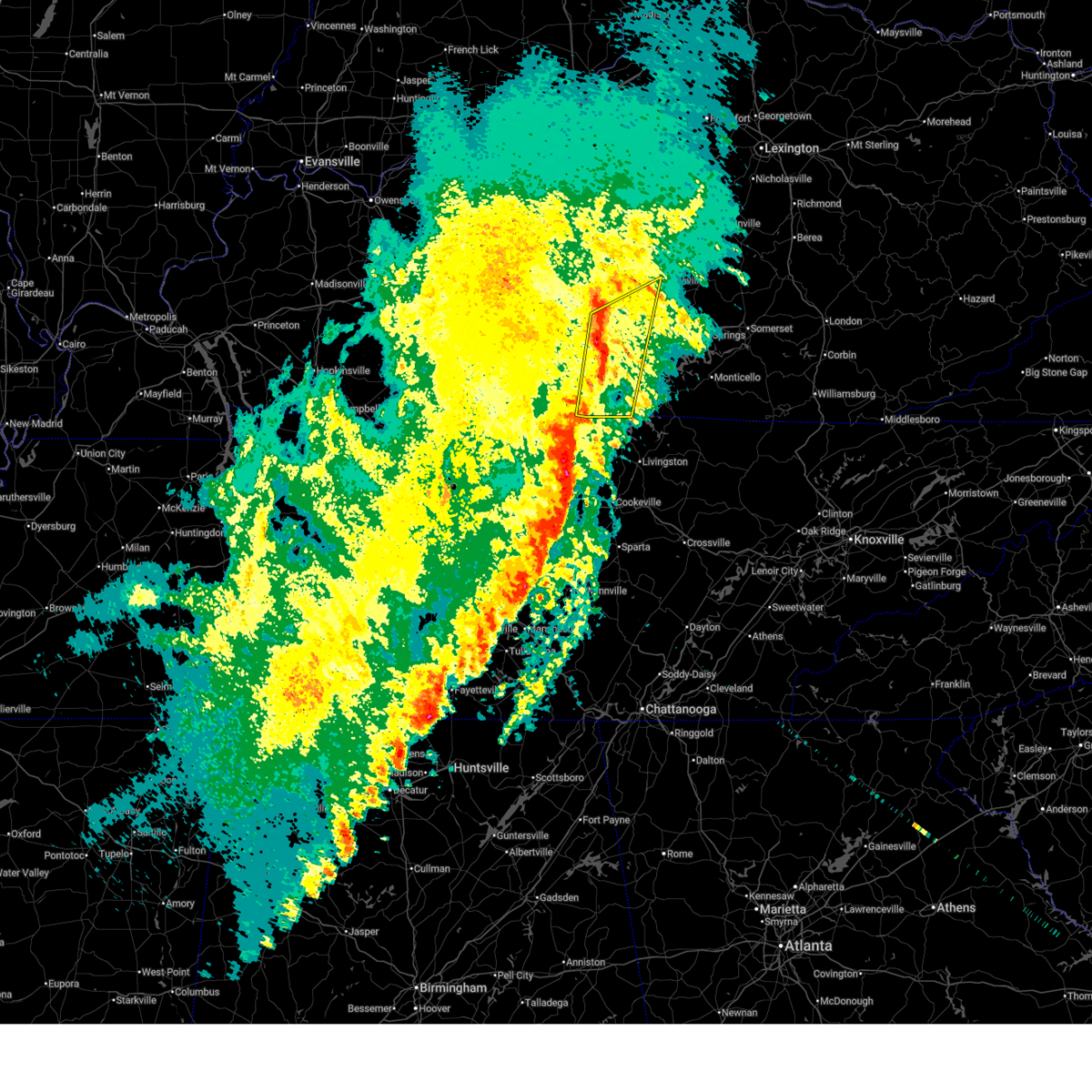 At 100 am edt/1200 am cdt/, severe thunderstorms were located along a line extending from near campbellsville to 7 miles southeast of edmonton, moving northeast at 85 mph (radar indicated). Hazards include 70 mph wind gusts. Expect considerable tree damage. damage is likely to mobile homes, roofs, and outbuildings. Locations impacted include, columbia, tompkinsville, edmonton, burkesville, leslie, pickett, littrell, curtis, absher, and node. At 100 am edt/1200 am cdt/, severe thunderstorms were located along a line extending from near campbellsville to 7 miles southeast of edmonton, moving northeast at 85 mph (radar indicated). Hazards include 70 mph wind gusts. Expect considerable tree damage. damage is likely to mobile homes, roofs, and outbuildings. Locations impacted include, columbia, tompkinsville, edmonton, burkesville, leslie, pickett, littrell, curtis, absher, and node.
|
| 3/16/2026 12:00 AM CDT |
 the severe thunderstorm warning has been cancelled and is no longer in effect the severe thunderstorm warning has been cancelled and is no longer in effect
|
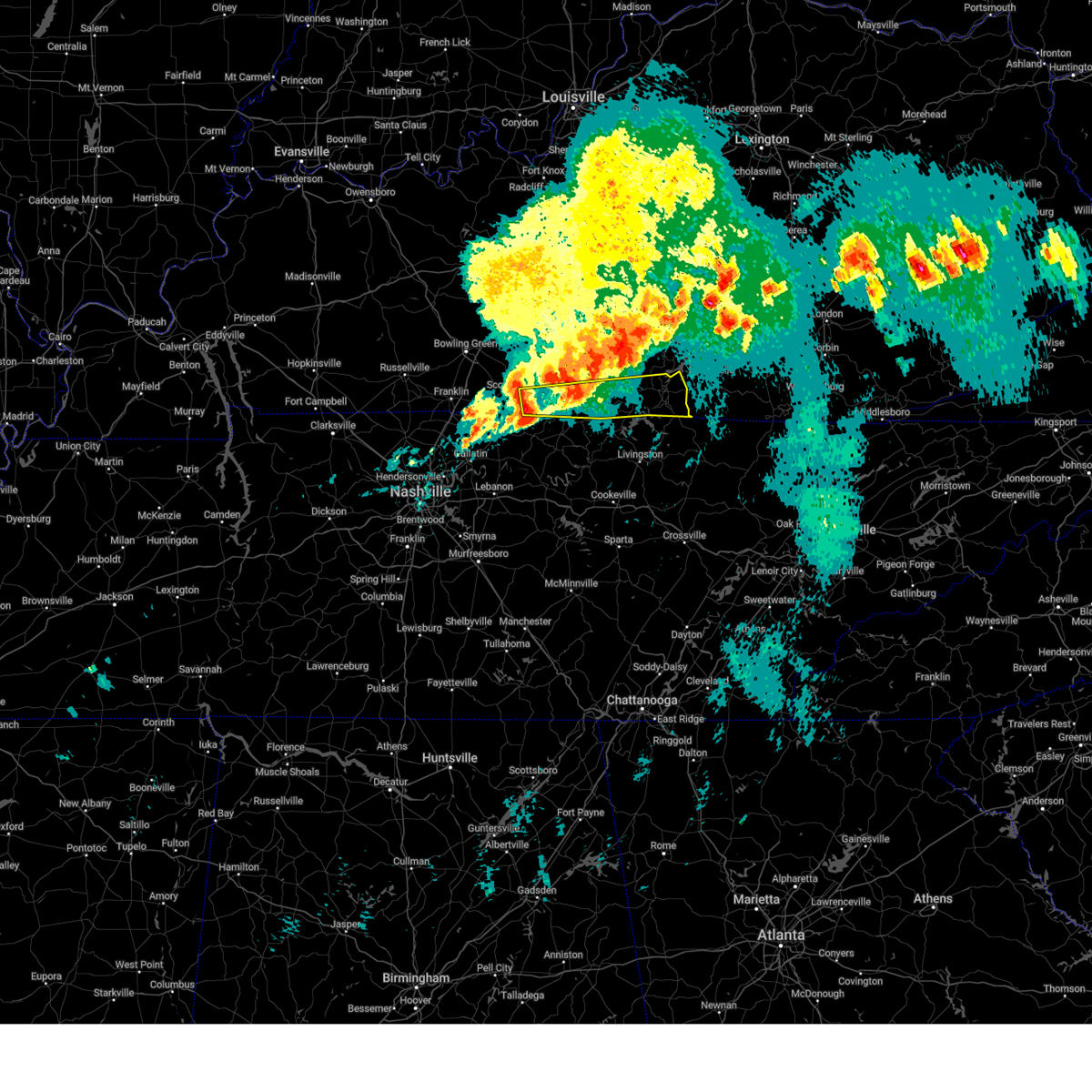
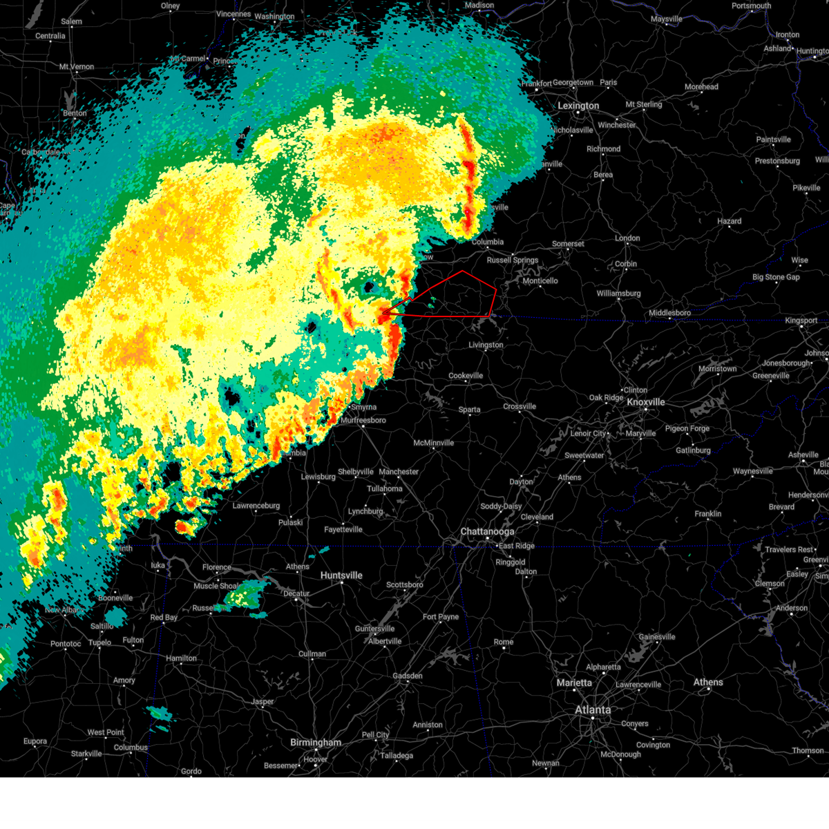
| 3/15/2026 11:43 PM CDT |
 At 1243 am edt/1143 pm cdt/, severe thunderstorms were located along a line extending from near three springs to 8 miles west of tompkinsville, moving northeast at 85 mph (radar indicated). Hazards include 60 mph wind gusts. Expect damage to roofs, siding, and trees. Locations impacted include, glasgow, columbia, tompkinsville, edmonton, burkesville, leslie, gamaliel, pickett, absher, and node. At 1243 am edt/1143 pm cdt/, severe thunderstorms were located along a line extending from near three springs to 8 miles west of tompkinsville, moving northeast at 85 mph (radar indicated). Hazards include 60 mph wind gusts. Expect damage to roofs, siding, and trees. Locations impacted include, glasgow, columbia, tompkinsville, edmonton, burkesville, leslie, gamaliel, pickett, absher, and node.
|
| 3/15/2026 11:43 PM CDT |
 the severe thunderstorm warning has been cancelled and is no longer in effect the severe thunderstorm warning has been cancelled and is no longer in effect
|
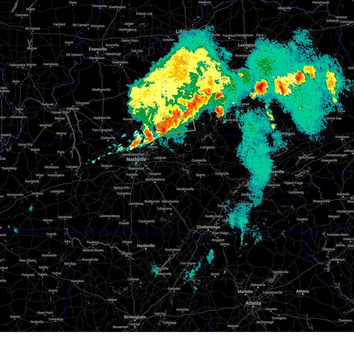
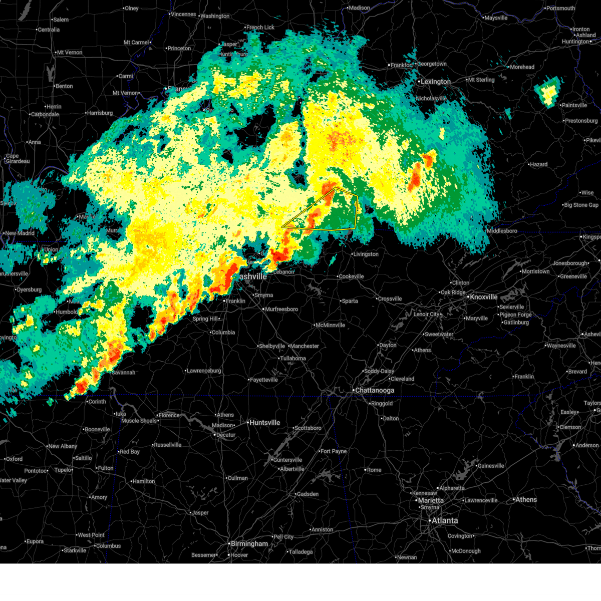
| 3/15/2026 11:26 PM CDT |
 Svrlmk the national weather service in louisville has issued a * severe thunderstorm warning for, southern green county in central kentucky, monroe county in south central kentucky, southeastern taylor county in central kentucky, eastern allen county in south central kentucky, cumberland county in south central kentucky, barren county in south central kentucky, western adair county in south central kentucky, metcalfe county in south central kentucky, * until 115 am edt/1215 am cdt/. * at 1226 am edt/1126 pm cdt/, severe thunderstorms were located along a line extending from 6 miles southwest of glasgow to near lafayette, moving northeast at 85 mph (radar indicated). Hazards include 60 mph wind gusts. expect damage to roofs, siding, and trees Svrlmk the national weather service in louisville has issued a * severe thunderstorm warning for, southern green county in central kentucky, monroe county in south central kentucky, southeastern taylor county in central kentucky, eastern allen county in south central kentucky, cumberland county in south central kentucky, barren county in south central kentucky, western adair county in south central kentucky, metcalfe county in south central kentucky, * until 115 am edt/1215 am cdt/. * at 1226 am edt/1126 pm cdt/, severe thunderstorms were located along a line extending from 6 miles southwest of glasgow to near lafayette, moving northeast at 85 mph (radar indicated). Hazards include 60 mph wind gusts. expect damage to roofs, siding, and trees
|
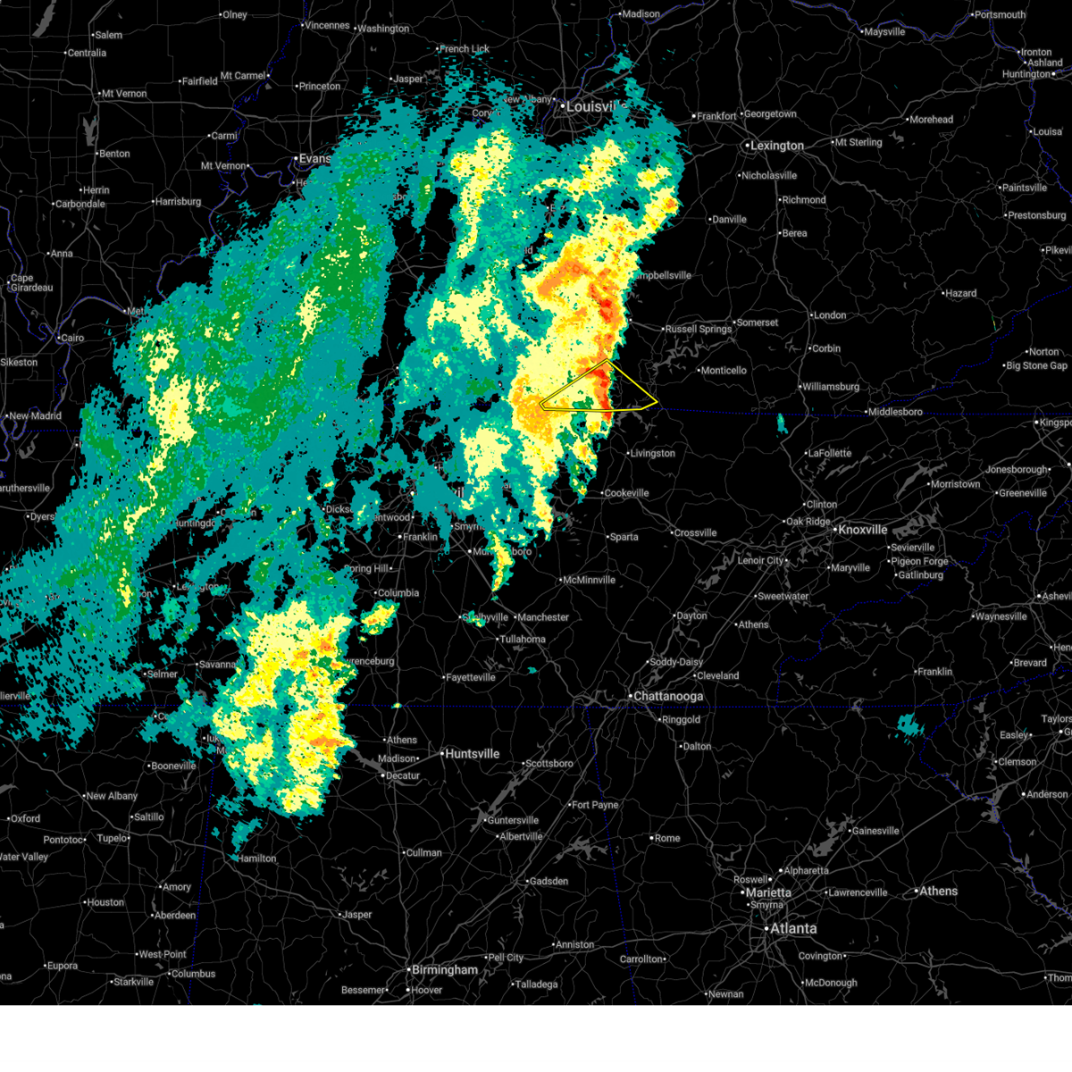
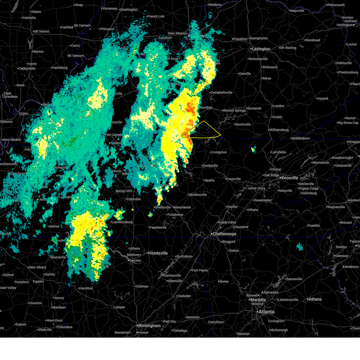
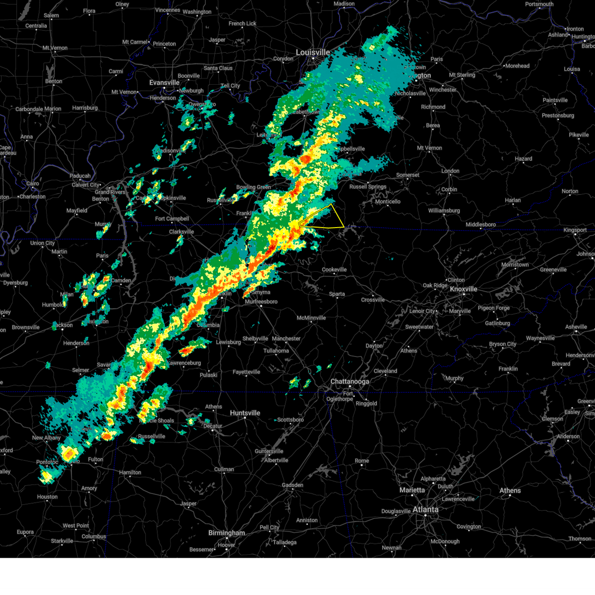
| 3/11/2026 3:05 PM CDT |
 Svrlmk the national weather service in louisville has issued a * severe thunderstorm warning for, southeastern monroe county in south central kentucky, cumberland county in south central kentucky, * until 345 pm cdt. * at 305 pm cdt, a severe thunderstorm was located near red boiling springs, moving east at 55 mph (radar indicated). Hazards include 60 mph wind gusts and quarter size hail. Hail damage to vehicles is expected. Expect wind damage to roofs, siding, and trees. Svrlmk the national weather service in louisville has issued a * severe thunderstorm warning for, southeastern monroe county in south central kentucky, cumberland county in south central kentucky, * until 345 pm cdt. * at 305 pm cdt, a severe thunderstorm was located near red boiling springs, moving east at 55 mph (radar indicated). Hazards include 60 mph wind gusts and quarter size hail. Hail damage to vehicles is expected. Expect wind damage to roofs, siding, and trees.
|
| 9/5/2025 7:15 PM CDT | Many trees down on west end of clay county. time estimated from rada in clay county TN, 8.5 miles N of Tompkinsville, KY |
| 5/20/2025 7:03 PM CDT |
 the severe thunderstorm warning has been cancelled and is no longer in effect the severe thunderstorm warning has been cancelled and is no longer in effect
|
| 5/20/2025 6:41 PM CDT |
 At 641 pm cdt, a severe thunderstorm was located 12 miles north of red boiling springs, or 13 miles northeast of lafayette, moving east at 50 mph (radar indicated). Hazards include 60 mph wind gusts. Expect damage to roofs, siding, and trees. Locations impacted include, tompkinsville, gamaliel, fountain run, meshack, gum tree, blythe, harlan crossroads, lamb, flippin, raydure, emberton, jeffrey, persimmon, forkton, freetown, sulphur lick, tracy, vernon, mud lick, and otia. At 641 pm cdt, a severe thunderstorm was located 12 miles north of red boiling springs, or 13 miles northeast of lafayette, moving east at 50 mph (radar indicated). Hazards include 60 mph wind gusts. Expect damage to roofs, siding, and trees. Locations impacted include, tompkinsville, gamaliel, fountain run, meshack, gum tree, blythe, harlan crossroads, lamb, flippin, raydure, emberton, jeffrey, persimmon, forkton, freetown, sulphur lick, tracy, vernon, mud lick, and otia.
|
| 5/20/2025 6:33 PM CDT |
 Svrlmk the national weather service in louisville has issued a * severe thunderstorm warning for, monroe county in south central kentucky, southeastern allen county in south central kentucky, southeastern barren county in south central kentucky, * until 715 pm cdt. * at 633 pm cdt, a severe thunderstorm was located 8 miles southeast of scottsville, or 11 miles north of lafayette, moving east at 50 mph (radar indicated). Hazards include 60 mph wind gusts. expect damage to roofs, siding, and trees Svrlmk the national weather service in louisville has issued a * severe thunderstorm warning for, monroe county in south central kentucky, southeastern allen county in south central kentucky, southeastern barren county in south central kentucky, * until 715 pm cdt. * at 633 pm cdt, a severe thunderstorm was located 8 miles southeast of scottsville, or 11 miles north of lafayette, moving east at 50 mph (radar indicated). Hazards include 60 mph wind gusts. expect damage to roofs, siding, and trees
|
| 5/20/2025 12:00 PM CDT |
 At 1200 pm cdt, a severe thunderstorm was located near tompkinsville, or 17 miles northwest of celina, moving northeast at 40 mph (radar indicated). Hazards include 60 mph wind gusts and nickel size hail. Expect damage to roofs, siding, and trees. Locations impacted include, tompkinsville, leslie, waterview, meshack, persimmon, cyclone, forkton, sulphur lick, willow shade, grider, dubre, rockbridge, grandview, arat, and cloyds landing. At 1200 pm cdt, a severe thunderstorm was located near tompkinsville, or 17 miles northwest of celina, moving northeast at 40 mph (radar indicated). Hazards include 60 mph wind gusts and nickel size hail. Expect damage to roofs, siding, and trees. Locations impacted include, tompkinsville, leslie, waterview, meshack, persimmon, cyclone, forkton, sulphur lick, willow shade, grider, dubre, rockbridge, grandview, arat, and cloyds landing.
|
| 5/20/2025 11:45 AM CDT |
 Svrlmk the national weather service in louisville has issued a * severe thunderstorm warning for, central monroe county in south central kentucky, northwestern cumberland county in south central kentucky, southeastern metcalfe county in south central kentucky, * until 1230 pm cdt. * at 1145 am cdt, a severe thunderstorm was located near tompkinsville, or 16 miles northeast of lafayette, moving northeast at 40 mph (radar indicated). Hazards include 60 mph wind gusts and nickel size hail. expect damage to roofs, siding, and trees Svrlmk the national weather service in louisville has issued a * severe thunderstorm warning for, central monroe county in south central kentucky, northwestern cumberland county in south central kentucky, southeastern metcalfe county in south central kentucky, * until 1230 pm cdt. * at 1145 am cdt, a severe thunderstorm was located near tompkinsville, or 16 miles northeast of lafayette, moving northeast at 40 mph (radar indicated). Hazards include 60 mph wind gusts and nickel size hail. expect damage to roofs, siding, and trees
|
| 5/16/2025 11:42 PM CDT |
 The storms which prompted the warning have moved out of the area. therefore, the warning will be allowed to expire. however, heavy rain is still possible with these thunderstorms. a tornado watch remains in effect until 200 am cdt for south central kentucky. to report severe weather, contact your nearest law enforcement agency. they will relay your report to the national weather service louisville. The storms which prompted the warning have moved out of the area. therefore, the warning will be allowed to expire. however, heavy rain is still possible with these thunderstorms. a tornado watch remains in effect until 200 am cdt for south central kentucky. to report severe weather, contact your nearest law enforcement agency. they will relay your report to the national weather service louisville.
|
| 5/16/2025 11:14 PM CDT |
 The storms which prompted the warning have moved out of the area. therefore, the warning will be allowed to expire. however, gusty winds are still possible with these thunderstorms. a tornado watch remains in effect until 300 am edt/200 am cdt/ for south central and central kentucky. to report severe weather, contact your nearest law enforcement agency. they will relay your report to the national weather service louisville. The storms which prompted the warning have moved out of the area. therefore, the warning will be allowed to expire. however, gusty winds are still possible with these thunderstorms. a tornado watch remains in effect until 300 am edt/200 am cdt/ for south central and central kentucky. to report severe weather, contact your nearest law enforcement agency. they will relay your report to the national weather service louisville.
|
| 5/16/2025 10:58 PM CDT |
 Svrlmk the national weather service in louisville has issued a * severe thunderstorm warning for, clinton county in south central kentucky, monroe county in south central kentucky, southwestern russell county in south central kentucky, southeastern allen county in south central kentucky, cumberland county in south central kentucky, southeastern metcalfe county in south central kentucky, * until 1145 pm cdt. * at 1058 pm cdt, severe thunderstorms were located along a line extending from 7 miles northwest of burkesville to 7 miles northeast of lafayette, moving east at 60 mph (radar indicated). Hazards include 70 mph wind gusts and penny size hail. Expect considerable tree damage. Damage is likely to mobile homes, roofs, and outbuildings. Svrlmk the national weather service in louisville has issued a * severe thunderstorm warning for, clinton county in south central kentucky, monroe county in south central kentucky, southwestern russell county in south central kentucky, southeastern allen county in south central kentucky, cumberland county in south central kentucky, southeastern metcalfe county in south central kentucky, * until 1145 pm cdt. * at 1058 pm cdt, severe thunderstorms were located along a line extending from 7 miles northwest of burkesville to 7 miles northeast of lafayette, moving east at 60 mph (radar indicated). Hazards include 70 mph wind gusts and penny size hail. Expect considerable tree damage. Damage is likely to mobile homes, roofs, and outbuildings.
|
| 5/16/2025 10:56 PM CDT |
 At 1156 pm edt/1056 pm cdt/, severe thunderstorms were located along a line extending from 7 miles northeast of three springs to 8 miles south of edmonton to 9 miles north of lafayette, moving east at 60 mph (radar indicated). Hazards include 70 mph wind gusts. Expect considerable tree damage. damage is likely to mobile homes, roofs, and outbuildings. Locations impacted include, campbellsville, scottsville, tompkinsville, greensburg, edmonton, fountain run, pickett, black jack, node, and bliss. At 1156 pm edt/1056 pm cdt/, severe thunderstorms were located along a line extending from 7 miles northeast of three springs to 8 miles south of edmonton to 9 miles north of lafayette, moving east at 60 mph (radar indicated). Hazards include 70 mph wind gusts. Expect considerable tree damage. damage is likely to mobile homes, roofs, and outbuildings. Locations impacted include, campbellsville, scottsville, tompkinsville, greensburg, edmonton, fountain run, pickett, black jack, node, and bliss.
|
| 5/16/2025 10:56 PM CDT |
 the severe thunderstorm warning has been cancelled and is no longer in effect the severe thunderstorm warning has been cancelled and is no longer in effect
|
| 5/16/2025 10:26 PM CDT |
 Svrlmk the national weather service in louisville has issued a * severe thunderstorm warning for, green county in central kentucky, northwestern monroe county in south central kentucky, southeastern simpson county in south central kentucky, hart county in central kentucky, south central taylor county in central kentucky, allen county in south central kentucky, east central warren county in south central kentucky, northwestern cumberland county in south central kentucky, barren county in south central kentucky, southwestern adair county in south central kentucky, metcalfe county in south central kentucky, eastern edmonson county in south central kentucky, * until 1215 am edt/1115 pm cdt/. * at 1125 pm edt/1025 pm cdt/, severe thunderstorms were located along a line extending from near brownsville to 7 miles north of scottsville to near portland, moving east at 60 mph (radar indicated). Hazards include 70 mph wind gusts. Expect considerable tree damage. Damage is likely to mobile homes, roofs, and outbuildings. Svrlmk the national weather service in louisville has issued a * severe thunderstorm warning for, green county in central kentucky, northwestern monroe county in south central kentucky, southeastern simpson county in south central kentucky, hart county in central kentucky, south central taylor county in central kentucky, allen county in south central kentucky, east central warren county in south central kentucky, northwestern cumberland county in south central kentucky, barren county in south central kentucky, southwestern adair county in south central kentucky, metcalfe county in south central kentucky, eastern edmonson county in south central kentucky, * until 1215 am edt/1115 pm cdt/. * at 1125 pm edt/1025 pm cdt/, severe thunderstorms were located along a line extending from near brownsville to 7 miles north of scottsville to near portland, moving east at 60 mph (radar indicated). Hazards include 70 mph wind gusts. Expect considerable tree damage. Damage is likely to mobile homes, roofs, and outbuildings.
|
| 5/16/2025 11:24 AM CDT |
 At 1124 am cdt, a severe thunderstorm was located over tompkinsville, moving east at 75 mph (radar indicated). Hazards include 60 mph wind gusts and quarter size hail. Hail damage to vehicles is expected. expect wind damage to roofs, siding, and trees. Locations impacted include, tompkinsville, albany, burkesville, leslie, gamaliel, littrell, desda, cartwright, snow, and savage. At 1124 am cdt, a severe thunderstorm was located over tompkinsville, moving east at 75 mph (radar indicated). Hazards include 60 mph wind gusts and quarter size hail. Hail damage to vehicles is expected. expect wind damage to roofs, siding, and trees. Locations impacted include, tompkinsville, albany, burkesville, leslie, gamaliel, littrell, desda, cartwright, snow, and savage.
|
| 5/16/2025 11:24 AM CDT |
 the severe thunderstorm warning has been cancelled and is no longer in effect the severe thunderstorm warning has been cancelled and is no longer in effect
|
| 5/16/2025 11:14 AM CDT |
 Svrlmk the national weather service in louisville has issued a * severe thunderstorm warning for, clinton county in south central kentucky, monroe county in south central kentucky, southeastern allen county in south central kentucky, cumberland county in south central kentucky, south central barren county in south central kentucky, * until noon cdt. * at 1113 am cdt, a severe thunderstorm was located 8 miles north of red boiling springs, moving east at 70 mph (radar indicated). Hazards include 60 mph wind gusts and quarter size hail. Hail damage to vehicles is expected. Expect wind damage to roofs, siding, and trees. Svrlmk the national weather service in louisville has issued a * severe thunderstorm warning for, clinton county in south central kentucky, monroe county in south central kentucky, southeastern allen county in south central kentucky, cumberland county in south central kentucky, south central barren county in south central kentucky, * until noon cdt. * at 1113 am cdt, a severe thunderstorm was located 8 miles north of red boiling springs, moving east at 70 mph (radar indicated). Hazards include 60 mph wind gusts and quarter size hail. Hail damage to vehicles is expected. Expect wind damage to roofs, siding, and trees.
|
| 5/16/2025 10:53 AM CDT |
 Svrlmk the national weather service in louisville has issued a * severe thunderstorm warning for, central monroe county in south central kentucky, allen county in south central kentucky, southern barren county in south central kentucky, southwestern metcalfe county in south central kentucky, * until 1115 am cdt. * at 1053 am cdt, a severe thunderstorm was located over scottsville, moving east at 65 mph (radar indicated). Hazards include 60 mph wind gusts and quarter size hail. Hail damage to vehicles is expected. Expect wind damage to roofs, siding, and trees. Svrlmk the national weather service in louisville has issued a * severe thunderstorm warning for, central monroe county in south central kentucky, allen county in south central kentucky, southern barren county in south central kentucky, southwestern metcalfe county in south central kentucky, * until 1115 am cdt. * at 1053 am cdt, a severe thunderstorm was located over scottsville, moving east at 65 mph (radar indicated). Hazards include 60 mph wind gusts and quarter size hail. Hail damage to vehicles is expected. Expect wind damage to roofs, siding, and trees.
|
| 4/5/2025 6:15 PM CDT |
 At 614 pm cdt, a severe thunderstorm capable of producing a tornado was located 8 miles northeast of tompkinsville, moving northeast at 55 mph (radar indicated rotation). Hazards include tornado and quarter size hail. Flying debris will be dangerous to those caught without shelter. mobile homes will be damaged or destroyed. damage to roofs, windows, and vehicles will occur. tree damage is likely. this dangerous storm will be near, burkesville around 620 pm cdt. Other locations impacted by this tornadic thunderstorm include littrell, meshack, modoc, blythe, harlan crossroads, ellington, willow shade, grider, peytonsburg, and raydure. At 614 pm cdt, a severe thunderstorm capable of producing a tornado was located 8 miles northeast of tompkinsville, moving northeast at 55 mph (radar indicated rotation). Hazards include tornado and quarter size hail. Flying debris will be dangerous to those caught without shelter. mobile homes will be damaged or destroyed. damage to roofs, windows, and vehicles will occur. tree damage is likely. this dangerous storm will be near, burkesville around 620 pm cdt. Other locations impacted by this tornadic thunderstorm include littrell, meshack, modoc, blythe, harlan crossroads, ellington, willow shade, grider, peytonsburg, and raydure.
|
| 4/5/2025 6:04 PM CDT |
 the tornado warning has been cancelled and is no longer in effect the tornado warning has been cancelled and is no longer in effect
|
| 4/5/2025 6:04 PM CDT |
 At 603 pm cdt, a severe thunderstorm capable of producing a tornado was located over tompkinsville, moving northeast at 60 mph (radar indicated rotation). Hazards include tornado and quarter size hail. Flying debris will be dangerous to those caught without shelter. mobile homes will be damaged or destroyed. damage to roofs, windows, and vehicles will occur. tree damage is likely. this dangerous storm will be near, burkesville around 620 pm cdt. Other locations impacted by this tornadic thunderstorm include littrell, meshack, modoc, gum tree, blythe, harlan crossroads, ellington, willow shade, gamaliel, and grider. At 603 pm cdt, a severe thunderstorm capable of producing a tornado was located over tompkinsville, moving northeast at 60 mph (radar indicated rotation). Hazards include tornado and quarter size hail. Flying debris will be dangerous to those caught without shelter. mobile homes will be damaged or destroyed. damage to roofs, windows, and vehicles will occur. tree damage is likely. this dangerous storm will be near, burkesville around 620 pm cdt. Other locations impacted by this tornadic thunderstorm include littrell, meshack, modoc, gum tree, blythe, harlan crossroads, ellington, willow shade, gamaliel, and grider.
|
| 4/5/2025 5:45 PM CDT |
 Torlmk the national weather service in louisville has issued a * tornado warning for, monroe county in south central kentucky, southeastern allen county in south central kentucky, cumberland county in south central kentucky, southeastern metcalfe county in south central kentucky, * until 630 pm cdt. * at 544 pm cdt, a severe thunderstorm capable of producing a tornado was located near lafayette, moving northeast at 65 mph (radar indicated rotation). Hazards include tornado. Flying debris will be dangerous to those caught without shelter. mobile homes will be damaged or destroyed. damage to roofs, windows, and vehicles will occur. tree damage is likely. this dangerous storm will be near, tompkinsville around 555 pm cdt. burkesville around 615 pm cdt. Other locations impacted by this tornadic thunderstorm include littrell, gum tree, blythe, harlan crossroads, ellington, grider, peytonsburg, raydure, emberton, and fountain run. Torlmk the national weather service in louisville has issued a * tornado warning for, monroe county in south central kentucky, southeastern allen county in south central kentucky, cumberland county in south central kentucky, southeastern metcalfe county in south central kentucky, * until 630 pm cdt. * at 544 pm cdt, a severe thunderstorm capable of producing a tornado was located near lafayette, moving northeast at 65 mph (radar indicated rotation). Hazards include tornado. Flying debris will be dangerous to those caught without shelter. mobile homes will be damaged or destroyed. damage to roofs, windows, and vehicles will occur. tree damage is likely. this dangerous storm will be near, tompkinsville around 555 pm cdt. burkesville around 615 pm cdt. Other locations impacted by this tornadic thunderstorm include littrell, gum tree, blythe, harlan crossroads, ellington, grider, peytonsburg, raydure, emberton, and fountain run.
|
| 4/5/2025 5:26 PM CDT |
 Svrlmk the national weather service in louisville has issued a * severe thunderstorm warning for, western monroe county in south central kentucky, southeastern allen county in south central kentucky, southern barren county in south central kentucky, southwestern metcalfe county in south central kentucky, * until 600 pm cdt. * at 526 pm cdt, a severe thunderstorm was located near scottsville, moving east at 50 mph (radar indicated). Hazards include 60 mph wind gusts and quarter size hail. Hail damage to vehicles is expected. Expect wind damage to roofs, siding, and trees. Svrlmk the national weather service in louisville has issued a * severe thunderstorm warning for, western monroe county in south central kentucky, southeastern allen county in south central kentucky, southern barren county in south central kentucky, southwestern metcalfe county in south central kentucky, * until 600 pm cdt. * at 526 pm cdt, a severe thunderstorm was located near scottsville, moving east at 50 mph (radar indicated). Hazards include 60 mph wind gusts and quarter size hail. Hail damage to vehicles is expected. Expect wind damage to roofs, siding, and trees.
|
| 4/3/2025 6:11 AM EDT |
 Svrlmk the national weather service in louisville has issued a * severe thunderstorm warning for, clinton county in south central kentucky, southeastern monroe county in south central kentucky, russell county in south central kentucky, cumberland county in south central kentucky, * until 545 am cdt. * at 510 am cdt, a severe thunderstorm was located near celina, moving northeast at 55 mph (radar indicated). Hazards include 60 mph wind gusts. expect damage to roofs, siding, and trees Svrlmk the national weather service in louisville has issued a * severe thunderstorm warning for, clinton county in south central kentucky, southeastern monroe county in south central kentucky, russell county in south central kentucky, cumberland county in south central kentucky, * until 545 am cdt. * at 510 am cdt, a severe thunderstorm was located near celina, moving northeast at 55 mph (radar indicated). Hazards include 60 mph wind gusts. expect damage to roofs, siding, and trees
|
| 4/3/2025 4:02 AM CDT |
 The storm which prompted the warning has weakened below severe limits, and no longer poses an immediate threat to life or property. therefore, the warning has been allowed to expire. however, gusty winds and heavy rain are still possible with this thunderstorm. a tornado watch remains in effect until 600 am cdt for south central kentucky. to report severe weather, contact your nearest law enforcement agency. they will relay your report to the national weather service louisville. The storm which prompted the warning has weakened below severe limits, and no longer poses an immediate threat to life or property. therefore, the warning has been allowed to expire. however, gusty winds and heavy rain are still possible with this thunderstorm. a tornado watch remains in effect until 600 am cdt for south central kentucky. to report severe weather, contact your nearest law enforcement agency. they will relay your report to the national weather service louisville.
|
| 4/3/2025 3:43 AM CDT |
 At 342 am cdt, a severe thunderstorm was located near tompkinsville, moving northeast at 60 mph (radar indicated). Hazards include 70 mph wind gusts and penny size hail. Expect considerable tree damage. damage is likely to mobile homes, roofs, and outbuildings. Locations impacted include, tompkinsville, edmonton, burkesville, leslie, gamaliel, fountain run, littrell, curtis, gum tree, and blythe. At 342 am cdt, a severe thunderstorm was located near tompkinsville, moving northeast at 60 mph (radar indicated). Hazards include 70 mph wind gusts and penny size hail. Expect considerable tree damage. damage is likely to mobile homes, roofs, and outbuildings. Locations impacted include, tompkinsville, edmonton, burkesville, leslie, gamaliel, fountain run, littrell, curtis, gum tree, and blythe.
|
| 4/3/2025 3:20 AM CDT |
 Svrlmk the national weather service in louisville has issued a * severe thunderstorm warning for, monroe county in south central kentucky, southeastern allen county in south central kentucky, cumberland county in south central kentucky, southeastern barren county in south central kentucky, southwestern adair county in south central kentucky, southern metcalfe county in south central kentucky, * until 400 am cdt. * at 320 am cdt, a severe thunderstorm was located near lafayette, moving northeast at 60 mph (radar indicated). Hazards include 60 mph wind gusts and nickel size hail. expect damage to roofs, siding, and trees Svrlmk the national weather service in louisville has issued a * severe thunderstorm warning for, monroe county in south central kentucky, southeastern allen county in south central kentucky, cumberland county in south central kentucky, southeastern barren county in south central kentucky, southwestern adair county in south central kentucky, southern metcalfe county in south central kentucky, * until 400 am cdt. * at 320 am cdt, a severe thunderstorm was located near lafayette, moving northeast at 60 mph (radar indicated). Hazards include 60 mph wind gusts and nickel size hail. expect damage to roofs, siding, and trees
|
| 4/3/2025 2:32 AM CDT |
 The storms which prompted the warning have weakened below severe limits, and no longer pose an immediate threat to life or property. therefore, the warning has been allowed to expire. however, gusty winds and heavy rain are still possible with these thunderstorms. a tornado watch remains in effect until 700 am edt/600 am cdt/ for south central and central kentucky. to report severe weather, contact your nearest law enforcement agency. they will relay your report to the national weather service louisville. The storms which prompted the warning have weakened below severe limits, and no longer pose an immediate threat to life or property. therefore, the warning has been allowed to expire. however, gusty winds and heavy rain are still possible with these thunderstorms. a tornado watch remains in effect until 700 am edt/600 am cdt/ for south central and central kentucky. to report severe weather, contact your nearest law enforcement agency. they will relay your report to the national weather service louisville.
|
| 4/3/2025 2:03 AM CDT |
 At 302 am edt/202 am cdt/, severe thunderstorms were located along a line extending from 9 miles north of jamestown to 8 miles east of tompkinsville, moving east at 60 mph (radar indicated). Hazards include 60 mph wind gusts. Expect damage to roofs, siding, and trees. Locations impacted include, columbia, tompkinsville, jamestown, edmonton, burkesville, leslie, russell springs, gamaliel, pickett, and desda. At 302 am edt/202 am cdt/, severe thunderstorms were located along a line extending from 9 miles north of jamestown to 8 miles east of tompkinsville, moving east at 60 mph (radar indicated). Hazards include 60 mph wind gusts. Expect damage to roofs, siding, and trees. Locations impacted include, columbia, tompkinsville, jamestown, edmonton, burkesville, leslie, russell springs, gamaliel, pickett, and desda.
|
| 4/3/2025 1:29 AM CDT |
 Svrlmk the national weather service in louisville has issued a * severe thunderstorm warning for, northwestern clinton county in south central kentucky, southern green county in central kentucky, monroe county in south central kentucky, russell county in south central kentucky, southeastern allen county in south central kentucky, cumberland county in south central kentucky, southeastern barren county in south central kentucky, southeastern casey county in central kentucky, adair county in south central kentucky, metcalfe county in south central kentucky, * until 330 am edt/230 am cdt/. * at 229 am edt/129 am cdt/, severe thunderstorms were located along a line extending from near glasgow to near westmoreland, moving east at 50 mph (radar indicated). Hazards include 60 mph wind gusts. expect damage to roofs, siding, and trees Svrlmk the national weather service in louisville has issued a * severe thunderstorm warning for, northwestern clinton county in south central kentucky, southern green county in central kentucky, monroe county in south central kentucky, russell county in south central kentucky, southeastern allen county in south central kentucky, cumberland county in south central kentucky, southeastern barren county in south central kentucky, southeastern casey county in central kentucky, adair county in south central kentucky, metcalfe county in south central kentucky, * until 330 am edt/230 am cdt/. * at 229 am edt/129 am cdt/, severe thunderstorms were located along a line extending from near glasgow to near westmoreland, moving east at 50 mph (radar indicated). Hazards include 60 mph wind gusts. expect damage to roofs, siding, and trees
|
| 3/30/2025 11:30 PM CDT |
 The storms which prompted the warning have moved out of the area. therefore, the warning has been allowed to expire. another warning has been issued downstream. a tornado watch remains in effect until 300 am cdt for south central kentucky. The storms which prompted the warning have moved out of the area. therefore, the warning has been allowed to expire. another warning has been issued downstream. a tornado watch remains in effect until 300 am cdt for south central kentucky.
|
| 3/30/2025 11:29 PM CDT |
 Svrlmk the national weather service in louisville has issued a * severe thunderstorm warning for, northwestern clinton county in south central kentucky, monroe county in south central kentucky, cumberland county in south central kentucky, south central metcalfe county in south central kentucky, * until midnight cdt. * at 1129 pm cdt, severe thunderstorms were located along a line extending from 9 miles north of tompkinsville to near red boiling springs, moving east at 50 mph (radar indicated). Hazards include 60 mph wind gusts. expect damage to roofs, siding, and trees Svrlmk the national weather service in louisville has issued a * severe thunderstorm warning for, northwestern clinton county in south central kentucky, monroe county in south central kentucky, cumberland county in south central kentucky, south central metcalfe county in south central kentucky, * until midnight cdt. * at 1129 pm cdt, severe thunderstorms were located along a line extending from 9 miles north of tompkinsville to near red boiling springs, moving east at 50 mph (radar indicated). Hazards include 60 mph wind gusts. expect damage to roofs, siding, and trees
|
| 3/30/2025 10:50 PM CDT |
 Svrlmk the national weather service in louisville has issued a * severe thunderstorm warning for, monroe county in south central kentucky, southeastern simpson county in south central kentucky, allen county in south central kentucky, southeastern warren county in south central kentucky, west central cumberland county in south central kentucky, southern barren county in south central kentucky, * until 1130 pm cdt. * at 1049 pm cdt, severe thunderstorms were located along a line extending from 11 miles southwest of glasgow to near portland, moving east at 55 mph (radar indicated). Hazards include 60 mph wind gusts. expect damage to roofs, siding, and trees Svrlmk the national weather service in louisville has issued a * severe thunderstorm warning for, monroe county in south central kentucky, southeastern simpson county in south central kentucky, allen county in south central kentucky, southeastern warren county in south central kentucky, west central cumberland county in south central kentucky, southern barren county in south central kentucky, * until 1130 pm cdt. * at 1049 pm cdt, severe thunderstorms were located along a line extending from 11 miles southwest of glasgow to near portland, moving east at 55 mph (radar indicated). Hazards include 60 mph wind gusts. expect damage to roofs, siding, and trees
|
| 9/24/2024 3:43 PM CDT |
 The storm which prompted the warning has moved out of the area. therefore, the warning will be allowed to expire. however, gusty winds and heavy rain are still possible with this thunderstorm. a severe thunderstorm watch remains in effect until 700 pm cdt for south central kentucky. to report severe weather, contact your nearest law enforcement agency. they will relay your report to the national weather service louisville. remember, a severe thunderstorm warning still remains in effect for eastern monroe county until 415 pm cdt. The storm which prompted the warning has moved out of the area. therefore, the warning will be allowed to expire. however, gusty winds and heavy rain are still possible with this thunderstorm. a severe thunderstorm watch remains in effect until 700 pm cdt for south central kentucky. to report severe weather, contact your nearest law enforcement agency. they will relay your report to the national weather service louisville. remember, a severe thunderstorm warning still remains in effect for eastern monroe county until 415 pm cdt.
|
| 9/24/2024 3:29 PM CDT |
 At 329 pm cdt, a severe thunderstorm was located over tompkinsville, moving east at 40 mph (radar indicated). Hazards include 60 mph wind gusts and quarter size hail. Hail damage to vehicles is expected. expect wind damage to roofs, siding, and trees. Locations impacted include, tompkinsville, gamaliel, persimmon, forkton, blythe, harlan crossroads, otia, freetown, grandview, and hestand. At 329 pm cdt, a severe thunderstorm was located over tompkinsville, moving east at 40 mph (radar indicated). Hazards include 60 mph wind gusts and quarter size hail. Hail damage to vehicles is expected. expect wind damage to roofs, siding, and trees. Locations impacted include, tompkinsville, gamaliel, persimmon, forkton, blythe, harlan crossroads, otia, freetown, grandview, and hestand.
|
| 9/24/2024 3:15 PM CDT |
 At 314 pm cdt, a severe thunderstorm was located near red boiling springs, moving northeast at 40 mph (radar indicated). Hazards include 60 mph wind gusts and quarter size hail. Hail damage to vehicles is expected. expect wind damage to roofs, siding, and trees. Locations impacted include, tompkinsville, gamaliel, persimmon, forkton, gum tree, blythe, harlan crossroads, freetown, vernon, and emberton. At 314 pm cdt, a severe thunderstorm was located near red boiling springs, moving northeast at 40 mph (radar indicated). Hazards include 60 mph wind gusts and quarter size hail. Hail damage to vehicles is expected. expect wind damage to roofs, siding, and trees. Locations impacted include, tompkinsville, gamaliel, persimmon, forkton, gum tree, blythe, harlan crossroads, freetown, vernon, and emberton.
|
| 9/24/2024 3:08 PM CDT |
 Svrlmk the national weather service in louisville has issued a * severe thunderstorm warning for, southeastern monroe county in south central kentucky, * until 345 pm cdt. * at 307 pm cdt, a severe thunderstorm was located near lafayette, moving northeast at 40 mph (radar indicated). Hazards include 60 mph wind gusts and quarter size hail. Hail damage to vehicles is expected. Expect wind damage to roofs, siding, and trees. Svrlmk the national weather service in louisville has issued a * severe thunderstorm warning for, southeastern monroe county in south central kentucky, * until 345 pm cdt. * at 307 pm cdt, a severe thunderstorm was located near lafayette, moving northeast at 40 mph (radar indicated). Hazards include 60 mph wind gusts and quarter size hail. Hail damage to vehicles is expected. Expect wind damage to roofs, siding, and trees.
|
| 7/30/2024 2:58 PM CDT |
 The storms which prompted the warning have moved out of the area. therefore, the warning will be allowed to expire. a severe thunderstorm watch remains in effect until 800 pm cdt for south central kentucky. to report severe weather, contact your nearest law enforcement agency. they will relay your report to the national weather service louisville. The storms which prompted the warning have moved out of the area. therefore, the warning will be allowed to expire. a severe thunderstorm watch remains in effect until 800 pm cdt for south central kentucky. to report severe weather, contact your nearest law enforcement agency. they will relay your report to the national weather service louisville.
|
| 7/30/2024 2:24 PM CDT |
 Svrlmk the national weather service in louisville has issued a * severe thunderstorm warning for, clinton county in south central kentucky, monroe county in south central kentucky, cumberland county in south central kentucky, * until 300 pm cdt. * at 223 pm cdt, severe thunderstorms were located along a line extending from parnell to 7 miles east of burkesville to 10 miles northwest of tompkinsville, moving south at 25 mph (radar indicated). Hazards include 60 mph wind gusts. expect damage to roofs, siding, and trees Svrlmk the national weather service in louisville has issued a * severe thunderstorm warning for, clinton county in south central kentucky, monroe county in south central kentucky, cumberland county in south central kentucky, * until 300 pm cdt. * at 223 pm cdt, severe thunderstorms were located along a line extending from parnell to 7 miles east of burkesville to 10 miles northwest of tompkinsville, moving south at 25 mph (radar indicated). Hazards include 60 mph wind gusts. expect damage to roofs, siding, and trees
|
| 7/30/2024 2:14 PM CDT |
 the severe thunderstorm warning has been cancelled and is no longer in effect the severe thunderstorm warning has been cancelled and is no longer in effect
|
| 7/30/2024 2:14 PM CDT |
 At 314 pm edt/214 pm cdt/, a severe thunderstorm was located 11 miles southwest of liberty, moving southeast at 35 mph (radar indicated). Hazards include 60 mph wind gusts and penny size hail. Expect damage to roofs, siding, and trees. Locations impacted include, liberty, danville, glasgow, columbia, stanford, tompkinsville, albany, jamestown, edmonton, and burkesville. At 314 pm edt/214 pm cdt/, a severe thunderstorm was located 11 miles southwest of liberty, moving southeast at 35 mph (radar indicated). Hazards include 60 mph wind gusts and penny size hail. Expect damage to roofs, siding, and trees. Locations impacted include, liberty, danville, glasgow, columbia, stanford, tompkinsville, albany, jamestown, edmonton, and burkesville.
|
| 7/30/2024 1:33 PM CDT |
 Svrlmk the national weather service in louisville has issued a * severe thunderstorm warning for, southeastern marion county in central kentucky, russell county in south central kentucky, taylor county in central kentucky, casey county in central kentucky, adair county in south central kentucky, western lincoln county in central kentucky, southwestern mercer county in central kentucky, central clinton county in south central kentucky, southern green county in central kentucky, central monroe county in south central kentucky, southeastern washington county in central kentucky, boyle county in central kentucky, cumberland county in south central kentucky, eastern barren county in south central kentucky, metcalfe county in south central kentucky, * until 330 pm edt/230 pm cdt/. * at 231 pm edt/131 pm cdt/, severe thunderstorms were located along a line extending from near bardstown to 11 miles northwest of campbellsville to 7 miles west of greensburg to 10 miles east of brownsville, moving southeast at 50 mph (radar indicated). Hazards include 60 mph wind gusts and penny size hail. expect damage to roofs, siding, and trees Svrlmk the national weather service in louisville has issued a * severe thunderstorm warning for, southeastern marion county in central kentucky, russell county in south central kentucky, taylor county in central kentucky, casey county in central kentucky, adair county in south central kentucky, western lincoln county in central kentucky, southwestern mercer county in central kentucky, central clinton county in south central kentucky, southern green county in central kentucky, central monroe county in south central kentucky, southeastern washington county in central kentucky, boyle county in central kentucky, cumberland county in south central kentucky, eastern barren county in south central kentucky, metcalfe county in south central kentucky, * until 330 pm edt/230 pm cdt/. * at 231 pm edt/131 pm cdt/, severe thunderstorms were located along a line extending from near bardstown to 11 miles northwest of campbellsville to 7 miles west of greensburg to 10 miles east of brownsville, moving southeast at 50 mph (radar indicated). Hazards include 60 mph wind gusts and penny size hail. expect damage to roofs, siding, and trees
|
| 7/9/2024 1:27 PM CDT |
 Torlmk the national weather service in louisville has issued a * tornado warning for, northeastern monroe county in south central kentucky, northwestern cumberland county in south central kentucky, southeastern metcalfe county in south central kentucky, * until 215 pm cdt. * at 127 pm cdt, a severe thunderstorm capable of producing a tornado was located over tompkinsville, moving northeast at 25 mph (radar indicated rotation). Hazards include tornado. Flying debris will be dangerous to those caught without shelter. mobile homes will be damaged or destroyed. damage to roofs, windows, and vehicles will occur. tree damage is likely. This tornadic thunderstorm will remain over mainly rural areas of northeastern monroe, northwestern cumberland and southeastern metcalfe counties, including the following locations, dubre, waterview, persimmon, curtis, rockbridge, willow shade, grandview, and grider. Torlmk the national weather service in louisville has issued a * tornado warning for, northeastern monroe county in south central kentucky, northwestern cumberland county in south central kentucky, southeastern metcalfe county in south central kentucky, * until 215 pm cdt. * at 127 pm cdt, a severe thunderstorm capable of producing a tornado was located over tompkinsville, moving northeast at 25 mph (radar indicated rotation). Hazards include tornado. Flying debris will be dangerous to those caught without shelter. mobile homes will be damaged or destroyed. damage to roofs, windows, and vehicles will occur. tree damage is likely. This tornadic thunderstorm will remain over mainly rural areas of northeastern monroe, northwestern cumberland and southeastern metcalfe counties, including the following locations, dubre, waterview, persimmon, curtis, rockbridge, willow shade, grandview, and grider.
|
| 7/9/2024 1:19 PM CDT |
 At 118 pm cdt, a severe thunderstorm capable of producing a tornado was located over tompkinsville, moving northeast at 25 mph (radar indicated rotation). Hazards include tornado. Flying debris will be dangerous to those caught without shelter. mobile homes will be damaged or destroyed. damage to roofs, windows, and vehicles will occur. tree damage is likely. at 115 pm cdt a trained spotter reported seeing a wall cloud associated with this warned storm. this dangerous storm will be near, tompkinsville around 125 pm cdt. Other locations impacted by this tornadic thunderstorm include forkton and grandview. At 118 pm cdt, a severe thunderstorm capable of producing a tornado was located over tompkinsville, moving northeast at 25 mph (radar indicated rotation). Hazards include tornado. Flying debris will be dangerous to those caught without shelter. mobile homes will be damaged or destroyed. damage to roofs, windows, and vehicles will occur. tree damage is likely. at 115 pm cdt a trained spotter reported seeing a wall cloud associated with this warned storm. this dangerous storm will be near, tompkinsville around 125 pm cdt. Other locations impacted by this tornadic thunderstorm include forkton and grandview.
|
| 7/9/2024 1:03 PM CDT |
 Torlmk the national weather service in louisville has issued a * tornado warning for, southwestern monroe county in south central kentucky, * until 130 pm cdt. * at 102 pm cdt, a severe thunderstorm capable of producing a tornado was located 7 miles southwest of tompkinsville, moving northeast at 25 mph (radar indicated rotation). Hazards include tornado. Flying debris will be dangerous to those caught without shelter. mobile homes will be damaged or destroyed. damage to roofs, windows, and vehicles will occur. tree damage is likely. this dangerous storm will be near, tompkinsville around 110 pm cdt. Other locations impacted by this tornadic thunderstorm include emberton, mud lick, forkton, gum tree, harlan crossroads, otia, freetown, gamaliel, grandview, and hestand. Torlmk the national weather service in louisville has issued a * tornado warning for, southwestern monroe county in south central kentucky, * until 130 pm cdt. * at 102 pm cdt, a severe thunderstorm capable of producing a tornado was located 7 miles southwest of tompkinsville, moving northeast at 25 mph (radar indicated rotation). Hazards include tornado. Flying debris will be dangerous to those caught without shelter. mobile homes will be damaged or destroyed. damage to roofs, windows, and vehicles will occur. tree damage is likely. this dangerous storm will be near, tompkinsville around 110 pm cdt. Other locations impacted by this tornadic thunderstorm include emberton, mud lick, forkton, gum tree, harlan crossroads, otia, freetown, gamaliel, grandview, and hestand.
|
| 6/26/2024 6:44 PM CDT | Report of tree down on jack hunt r in monroe county KY, 11.7 miles ESE of Tompkinsville, KY |
| 6/26/2024 6:20 PM CDT |
 Svrlmk the national weather service in louisville has issued a * severe thunderstorm warning for, monroe county in south central kentucky, central allen county in south central kentucky, west central cumberland county in south central kentucky, barren county in south central kentucky, southwestern metcalfe county in south central kentucky, * until 700 pm cdt. * at 620 pm cdt, severe thunderstorms were located along a line extending from 7 miles west of scottsville to near red boiling springs, moving northeast at 40 mph (radar indicated). Hazards include 60 mph wind gusts. expect damage to roofs, siding, and trees Svrlmk the national weather service in louisville has issued a * severe thunderstorm warning for, monroe county in south central kentucky, central allen county in south central kentucky, west central cumberland county in south central kentucky, barren county in south central kentucky, southwestern metcalfe county in south central kentucky, * until 700 pm cdt. * at 620 pm cdt, severe thunderstorms were located along a line extending from 7 miles west of scottsville to near red boiling springs, moving northeast at 40 mph (radar indicated). Hazards include 60 mph wind gusts. expect damage to roofs, siding, and trees
|
| 5/26/2024 11:07 PM CDT |
 Svrlmk the national weather service in louisville has issued a * severe thunderstorm warning for, green county in central kentucky, monroe county in south central kentucky, southeastern hart county in central kentucky, south central taylor county in central kentucky, southeastern allen county in south central kentucky, cumberland county in south central kentucky, eastern barren county in south central kentucky, adair county in south central kentucky, metcalfe county in south central kentucky, * until 1245 am edt/1145 pm cdt/. * at 1207 am edt/1107 pm cdt/, severe thunderstorms were located along a line extending from 12 miles northwest of greensburg to 7 miles north of lafayette, moving east at 55 mph (radar indicated). Hazards include 60 mph wind gusts and quarter size hail. Hail damage to vehicles is expected. Expect wind damage to roofs, siding, and trees. Svrlmk the national weather service in louisville has issued a * severe thunderstorm warning for, green county in central kentucky, monroe county in south central kentucky, southeastern hart county in central kentucky, south central taylor county in central kentucky, southeastern allen county in south central kentucky, cumberland county in south central kentucky, eastern barren county in south central kentucky, adair county in south central kentucky, metcalfe county in south central kentucky, * until 1245 am edt/1145 pm cdt/. * at 1207 am edt/1107 pm cdt/, severe thunderstorms were located along a line extending from 12 miles northwest of greensburg to 7 miles north of lafayette, moving east at 55 mph (radar indicated). Hazards include 60 mph wind gusts and quarter size hail. Hail damage to vehicles is expected. Expect wind damage to roofs, siding, and trees.
|
| 5/26/2024 11:00 AM CDT | Trees down in the city and all over the count in monroe county KY, 0.5 miles S of Tompkinsville, KY |
| 5/26/2024 10:44 AM CDT | Power lines down on hwy 52 in mos in clay county TN, 7 miles NNW of Tompkinsville, KY |
| 5/26/2024 10:43 AM CDT |
 Svrlmk the national weather service in louisville has issued a * severe thunderstorm warning for, clinton county in south central kentucky, monroe county in south central kentucky, russell county in south central kentucky, cumberland county in south central kentucky, east central barren county in south central kentucky, southwestern adair county in south central kentucky, southern metcalfe county in south central kentucky, * until 1130 am cdt. * at 1042 am cdt, severe thunderstorms were located along a line extending from 7 miles east of glasgow to 6 miles north of red boiling springs, moving east at 60 mph (radar indicated). Hazards include 60 mph wind gusts. expect damage to roofs, siding, and trees Svrlmk the national weather service in louisville has issued a * severe thunderstorm warning for, clinton county in south central kentucky, monroe county in south central kentucky, russell county in south central kentucky, cumberland county in south central kentucky, east central barren county in south central kentucky, southwestern adair county in south central kentucky, southern metcalfe county in south central kentucky, * until 1130 am cdt. * at 1042 am cdt, severe thunderstorms were located along a line extending from 7 miles east of glasgow to 6 miles north of red boiling springs, moving east at 60 mph (radar indicated). Hazards include 60 mph wind gusts. expect damage to roofs, siding, and trees
|
| 5/22/2024 1:00 PM CDT | Several large trees were downed on highway 163... along with power lines. time estimated from rada in monroe county KY, 5.4 miles NW of Tompkinsville, KY |
| 5/8/2024 5:58 PM CDT |
 The storm which prompted the warning has weakened below severe limits, and no longer poses an immediate threat to life or property. therefore, the warning will be allowed to expire. however, small hail, gusty winds and heavy rain are still possible with this thunderstorm. a tornado watch remains in effect until 900 pm cdt for south central kentucky. The storm which prompted the warning has weakened below severe limits, and no longer poses an immediate threat to life or property. therefore, the warning will be allowed to expire. however, small hail, gusty winds and heavy rain are still possible with this thunderstorm. a tornado watch remains in effect until 900 pm cdt for south central kentucky.
|
| 5/8/2024 5:37 PM CDT |
 The storm which prompted the warning has moved out of the area. therefore, the warning will be allowed to expire. however, heavy rain is still possible with this thunderstorm. a tornado watch remains in effect until 900 pm cdt for south central kentucky. remember, a severe thunderstorm warning still remains in effect for monroe county. The storm which prompted the warning has moved out of the area. therefore, the warning will be allowed to expire. however, heavy rain is still possible with this thunderstorm. a tornado watch remains in effect until 900 pm cdt for south central kentucky. remember, a severe thunderstorm warning still remains in effect for monroe county.
|
| 5/8/2024 5:36 PM CDT |
 Svrlmk the national weather service in louisville has issued a * severe thunderstorm warning for, central monroe county in south central kentucky, western cumberland county in south central kentucky, southeastern metcalfe county in south central kentucky, * until 600 pm cdt. * at 536 pm cdt, a severe thunderstorm was located over tompkinsville, moving northeast at 45 mph (radar indicated). Hazards include 60 mph wind gusts. expect damage to roofs, siding, and trees Svrlmk the national weather service in louisville has issued a * severe thunderstorm warning for, central monroe county in south central kentucky, western cumberland county in south central kentucky, southeastern metcalfe county in south central kentucky, * until 600 pm cdt. * at 536 pm cdt, a severe thunderstorm was located over tompkinsville, moving northeast at 45 mph (radar indicated). Hazards include 60 mph wind gusts. expect damage to roofs, siding, and trees
|
| 5/8/2024 5:11 PM CDT |
 Svrlmk the national weather service in louisville has issued a * severe thunderstorm warning for, monroe county in south central kentucky, * until 545 pm cdt. * at 511 pm cdt, a severe thunderstorm was located 11 miles west of tompkinsville, moving east at 30 mph (radar indicated). Hazards include 60 mph wind gusts and quarter size hail. Hail damage to vehicles is expected. Expect wind damage to roofs, siding, and trees. Svrlmk the national weather service in louisville has issued a * severe thunderstorm warning for, monroe county in south central kentucky, * until 545 pm cdt. * at 511 pm cdt, a severe thunderstorm was located 11 miles west of tompkinsville, moving east at 30 mph (radar indicated). Hazards include 60 mph wind gusts and quarter size hail. Hail damage to vehicles is expected. Expect wind damage to roofs, siding, and trees.
|
| 4/2/2024 7:18 PM CDT |
 Svrlmk the national weather service in louisville has issued a * severe thunderstorm warning for, west central clinton county in south central kentucky, monroe county in south central kentucky, cumberland county in south central kentucky, south central adair county in south central kentucky, * until 745 pm cdt. * at 718 pm cdt, a severe thunderstorm was located 8 miles west of tompkinsville, moving northeast at 55 mph (radar indicated). Hazards include 60 mph wind gusts and quarter size hail. Hail damage to vehicles is expected. Expect wind damage to roofs, siding, and trees. Svrlmk the national weather service in louisville has issued a * severe thunderstorm warning for, west central clinton county in south central kentucky, monroe county in south central kentucky, cumberland county in south central kentucky, south central adair county in south central kentucky, * until 745 pm cdt. * at 718 pm cdt, a severe thunderstorm was located 8 miles west of tompkinsville, moving northeast at 55 mph (radar indicated). Hazards include 60 mph wind gusts and quarter size hail. Hail damage to vehicles is expected. Expect wind damage to roofs, siding, and trees.
|
| 3/6/2024 10:06 AM EST |
 Torlmk the national weather service in louisville has issued a * this is a test message. tornado warning for, meade county in central kentucky, larue county in central kentucky, jessamine county in central kentucky, nicholas county in central kentucky, adair county in south central kentucky, bourbon county in central kentucky, warren county in south central kentucky, cumberland county in south central kentucky, henry county in central kentucky, russell county in south central kentucky, taylor county in central kentucky, jefferson county in central kentucky, hardin county in central kentucky, spencer county in central kentucky, scott county in central kentucky, hancock county in central kentucky, trimble county in central kentucky, monroe county in south central kentucky, metcalfe county in south central kentucky, shelby county in central kentucky, logan county in south central kentucky, nelson county in central kentucky, anderson county in central kentucky, clark county in central kentucky, marion county in central kentucky, simpson county in south central kentucky, grayson county in central kentucky, casey county in central kentucky, franklin county in central kentucky, edmonson county in south central kentucky, lincoln county in central kentucky, woodford county in central kentucky, butler county in south central kentucky, madison county in central kentucky, barren county in south central kentucky, ohio county in central kentucky, oldham county in central kentucky, garrard county in central kentucky, hart county in central kentucky, bullitt county in central kentucky, harrison county in central kentucky, mercer county in central kentucky, clinton county in south central kentucky, green county in central kentucky, allen county in south central kentucky, washington county in central kentucky, boyle county in central kentucky, breckinridge county in central kentucky, fayette county in central kentucky, * this is a test message. until 1030 am est/930 am cst/. * this is a test message. Torlmk the national weather service in louisville has issued a * this is a test message. tornado warning for, meade county in central kentucky, larue county in central kentucky, jessamine county in central kentucky, nicholas county in central kentucky, adair county in south central kentucky, bourbon county in central kentucky, warren county in south central kentucky, cumberland county in south central kentucky, henry county in central kentucky, russell county in south central kentucky, taylor county in central kentucky, jefferson county in central kentucky, hardin county in central kentucky, spencer county in central kentucky, scott county in central kentucky, hancock county in central kentucky, trimble county in central kentucky, monroe county in south central kentucky, metcalfe county in south central kentucky, shelby county in central kentucky, logan county in south central kentucky, nelson county in central kentucky, anderson county in central kentucky, clark county in central kentucky, marion county in central kentucky, simpson county in south central kentucky, grayson county in central kentucky, casey county in central kentucky, franklin county in central kentucky, edmonson county in south central kentucky, lincoln county in central kentucky, woodford county in central kentucky, butler county in south central kentucky, madison county in central kentucky, barren county in south central kentucky, ohio county in central kentucky, oldham county in central kentucky, garrard county in central kentucky, hart county in central kentucky, bullitt county in central kentucky, harrison county in central kentucky, mercer county in central kentucky, clinton county in south central kentucky, green county in central kentucky, allen county in south central kentucky, washington county in central kentucky, boyle county in central kentucky, breckinridge county in central kentucky, fayette county in central kentucky, * this is a test message. until 1030 am est/930 am cst/. * this is a test message.
|
| 12/9/2023 6:22 PM CST |
 At 621 pm cst, a severe thunderstorm was located 8 miles northeast of tompkinsville, moving northeast at 50 mph (radar indicated). Hazards include 70 mph wind gusts. Expect considerable tree damage. damage is likely to mobile homes, roofs, and outbuildings. Locations impacted include, tompkinsville, meshack, forkton, blythe, vernon, peytonsburg, stalcup, raydure, judio and otia. At 621 pm cst, a severe thunderstorm was located 8 miles northeast of tompkinsville, moving northeast at 50 mph (radar indicated). Hazards include 70 mph wind gusts. Expect considerable tree damage. damage is likely to mobile homes, roofs, and outbuildings. Locations impacted include, tompkinsville, meshack, forkton, blythe, vernon, peytonsburg, stalcup, raydure, judio and otia.
|
| 12/9/2023 6:20 PM CST |
 At 620 pm cst, a severe thunderstorm capable of producing a tornado was located 7 miles east of tompkinsville, moving east at 45 mph (radar indicated rotation). Hazards include tornado. Flying debris will be dangerous to those caught without shelter. mobile homes will be damaged or destroyed. damage to roofs, windows, and vehicles will occur. tree damage is likely. Locations impacted include, tompkinsville, burkesville, leslie, littrell, waterview, meshack, blythe, ellington, bow and grider. At 620 pm cst, a severe thunderstorm capable of producing a tornado was located 7 miles east of tompkinsville, moving east at 45 mph (radar indicated rotation). Hazards include tornado. Flying debris will be dangerous to those caught without shelter. mobile homes will be damaged or destroyed. damage to roofs, windows, and vehicles will occur. tree damage is likely. Locations impacted include, tompkinsville, burkesville, leslie, littrell, waterview, meshack, blythe, ellington, bow and grider.
|
| 12/9/2023 6:06 PM CST |
 At 606 pm cst, a severe thunderstorm capable of producing a tornado was located near tompkinsville, moving northeast at 45 mph (radar indicated rotation). Hazards include tornado. Flying debris will be dangerous to those caught without shelter. mobile homes will be damaged or destroyed. damage to roofs, windows, and vehicles will occur. Tree damage is likely. At 606 pm cst, a severe thunderstorm capable of producing a tornado was located near tompkinsville, moving northeast at 45 mph (radar indicated rotation). Hazards include tornado. Flying debris will be dangerous to those caught without shelter. mobile homes will be damaged or destroyed. damage to roofs, windows, and vehicles will occur. Tree damage is likely.
|
| 12/9/2023 5:57 PM CST |
 At 556 pm cst, a severe thunderstorm was located near red boiling springs, moving northeast at 50 mph (radar indicated). Hazards include 70 mph wind gusts. Expect considerable tree damage. Damage is likely to mobile homes, roofs, and outbuildings. At 556 pm cst, a severe thunderstorm was located near red boiling springs, moving northeast at 50 mph (radar indicated). Hazards include 70 mph wind gusts. Expect considerable tree damage. Damage is likely to mobile homes, roofs, and outbuildings.
|
| 6/30/2023 6:48 PM CDT |
 At 647 pm cdt, severe thunderstorms were located along a line extending from 6 miles northwest of scottsville to near tompkinsville, moving southeast at 20 mph (radar indicated). Hazards include golf ball size hail and 60 mph wind gusts. this line of storms has a history of damaging winds and large hail. People and animals outdoors will be injured. expect hail damage to roofs, siding, windows, and vehicles. expect wind damage to roofs, siding, and trees. locations impacted include, scottsville, tompkinsville, gamaliel, fountain run, allen springs, oak forest, gum tree, west fork, maynard, and harlan crossroads. thunderstorm damage threat, considerable hail threat, radar indicated max hail size, 1. 75 in wind threat, radar indicated max wind gust, 60 mph. At 647 pm cdt, severe thunderstorms were located along a line extending from 6 miles northwest of scottsville to near tompkinsville, moving southeast at 20 mph (radar indicated). Hazards include golf ball size hail and 60 mph wind gusts. this line of storms has a history of damaging winds and large hail. People and animals outdoors will be injured. expect hail damage to roofs, siding, windows, and vehicles. expect wind damage to roofs, siding, and trees. locations impacted include, scottsville, tompkinsville, gamaliel, fountain run, allen springs, oak forest, gum tree, west fork, maynard, and harlan crossroads. thunderstorm damage threat, considerable hail threat, radar indicated max hail size, 1. 75 in wind threat, radar indicated max wind gust, 60 mph.
|
| 6/30/2023 6:32 PM CDT |
 At 630 pm cdt, severe thunderstorms were located along a line extending from 7 miles southeast of three springs to 6 miles northwest of tompkinsville, moving southeast at 20 mph (radar indicated). Hazards include 60 mph wind gusts and half dollar size hail. Hail damage to vehicles is expected. Expect wind damage to roofs, siding, and trees. At 630 pm cdt, severe thunderstorms were located along a line extending from 7 miles southeast of three springs to 6 miles northwest of tompkinsville, moving southeast at 20 mph (radar indicated). Hazards include 60 mph wind gusts and half dollar size hail. Hail damage to vehicles is expected. Expect wind damage to roofs, siding, and trees.
|
| 6/26/2023 1:23 AM CDT |
 The severe thunderstorm warning for southeastern monroe county will expire at 130 am cdt, the storm which prompted the warning has weakened below severe limits, and has exited the warned area. therefore, the warning will be allowed to expire. a severe thunderstorm watch remains in effect until 300 am cdt for south central kentucky. The severe thunderstorm warning for southeastern monroe county will expire at 130 am cdt, the storm which prompted the warning has weakened below severe limits, and has exited the warned area. therefore, the warning will be allowed to expire. a severe thunderstorm watch remains in effect until 300 am cdt for south central kentucky.
|
| 6/26/2023 1:16 AM CDT |
 At 115 am cdt, a severe thunderstorm was located near tompkinsville, moving east at 40 mph (radar indicated). Hazards include 60 mph wind gusts. Expect damage to roofs, siding, and trees. locations impacted include, tompkinsville, gamaliel, meshack, raydure, forkton, blythe, harlan crossroads, otia, freetown and grandview. hail threat, radar indicated max hail size, <. 75 in wind threat, radar indicated max wind gust, 60 mph. At 115 am cdt, a severe thunderstorm was located near tompkinsville, moving east at 40 mph (radar indicated). Hazards include 60 mph wind gusts. Expect damage to roofs, siding, and trees. locations impacted include, tompkinsville, gamaliel, meshack, raydure, forkton, blythe, harlan crossroads, otia, freetown and grandview. hail threat, radar indicated max hail size, <. 75 in wind threat, radar indicated max wind gust, 60 mph.
|
| 6/26/2023 12:44 AM CDT |
 At 1243 am cdt, a severe thunderstorm was located near scottsville, moving east at 40 mph (radar indicated). Hazards include 60 mph wind gusts and quarter size hail. Hail damage to vehicles is expected. Expect wind damage to roofs, siding, and trees. At 1243 am cdt, a severe thunderstorm was located near scottsville, moving east at 40 mph (radar indicated). Hazards include 60 mph wind gusts and quarter size hail. Hail damage to vehicles is expected. Expect wind damage to roofs, siding, and trees.
|
| 6/26/2023 12:12 AM CDT |
 At 1212 am cdt, a severe thunderstorm was located 9 miles south of burkesville, moving southeast at 35 mph (radar indicated). Hazards include 60 mph wind gusts and quarter size hail. Hail damage to vehicles is expected. Expect wind damage to roofs, siding, and trees. At 1212 am cdt, a severe thunderstorm was located 9 miles south of burkesville, moving southeast at 35 mph (radar indicated). Hazards include 60 mph wind gusts and quarter size hail. Hail damage to vehicles is expected. Expect wind damage to roofs, siding, and trees.
|
| 6/25/2023 11:58 PM CDT |
 At 1158 pm cdt, a severe thunderstorm was located 10 miles west of tompkinsville, moving southeast at 60 mph (radar indicated). Hazards include 60 mph wind gusts and quarter size hail. Hail damage to vehicles is expected. Expect wind damage to roofs, siding, and trees. At 1158 pm cdt, a severe thunderstorm was located 10 miles west of tompkinsville, moving southeast at 60 mph (radar indicated). Hazards include 60 mph wind gusts and quarter size hail. Hail damage to vehicles is expected. Expect wind damage to roofs, siding, and trees.
|
| 6/25/2023 11:41 PM CDT |
 At 1141 pm cdt, severe thunderstorms were located along a line extending from 6 miles southwest of burkesville to 8 miles northeast of scottsville, moving south at 30 mph (radar indicated). Hazards include 60 mph wind gusts and quarter size hail. Hail damage to vehicles is expected. expect wind damage to roofs, siding, and trees. Locations impacted include, glasgow, tompkinsville, gamaliel, fountain run, red cross, gum tree, harlan crossroads, lecta, haywood and austin. At 1141 pm cdt, severe thunderstorms were located along a line extending from 6 miles southwest of burkesville to 8 miles northeast of scottsville, moving south at 30 mph (radar indicated). Hazards include 60 mph wind gusts and quarter size hail. Hail damage to vehicles is expected. expect wind damage to roofs, siding, and trees. Locations impacted include, glasgow, tompkinsville, gamaliel, fountain run, red cross, gum tree, harlan crossroads, lecta, haywood and austin.
|
| 6/25/2023 11:40 PM CDT |
 At 1139 pm cdt, severe thunderstorms were located along a line extending from 10 miles west of burkesville to sunnybrook, moving southeast at 40 mph (radar indicated). Hazards include 60 mph wind gusts and quarter size hail. Hail damage to vehicles is expected. Expect wind damage to roofs, siding, and trees. At 1139 pm cdt, severe thunderstorms were located along a line extending from 10 miles west of burkesville to sunnybrook, moving southeast at 40 mph (radar indicated). Hazards include 60 mph wind gusts and quarter size hail. Hail damage to vehicles is expected. Expect wind damage to roofs, siding, and trees.
|
| 6/25/2023 11:14 PM CDT |
 At 1114 pm cdt, severe thunderstorms were located along a line extending from 8 miles southeast of edmonton to 12 miles east of plum springs, moving south at 30 mph (radar indicated). Hazards include 60 mph wind gusts and quarter size hail. Hail damage to vehicles is expected. Expect wind damage to roofs, siding, and trees. At 1114 pm cdt, severe thunderstorms were located along a line extending from 8 miles southeast of edmonton to 12 miles east of plum springs, moving south at 30 mph (radar indicated). Hazards include 60 mph wind gusts and quarter size hail. Hail damage to vehicles is expected. Expect wind damage to roofs, siding, and trees.
|
| 4/5/2023 6:01 PM EDT |
 At 601 pm edt/501 pm cdt/, severe thunderstorms were located along a line extending from near lawrenceburg to 12 miles north of red boiling springs, moving east at 40 mph (radar indicated). Hazards include 60 mph wind gusts. Expect damage to roofs, siding, and trees. locations impacted include, lawrenceburg, tompkinsville, versailles and burkesville. hail threat, radar indicated max hail size, <. 75 in wind threat, radar indicated max wind gust, 60 mph. At 601 pm edt/501 pm cdt/, severe thunderstorms were located along a line extending from near lawrenceburg to 12 miles north of red boiling springs, moving east at 40 mph (radar indicated). Hazards include 60 mph wind gusts. Expect damage to roofs, siding, and trees. locations impacted include, lawrenceburg, tompkinsville, versailles and burkesville. hail threat, radar indicated max hail size, <. 75 in wind threat, radar indicated max wind gust, 60 mph.
|
| 4/5/2023 5:38 PM EDT |
 At 538 pm edt/438 pm cdt/, severe thunderstorms were located along a line extending from 8 miles southeast of taylorsville to 9 miles north of lafayette, moving east at 60 mph (radar indicated). Hazards include 60 mph wind gusts. Expect damage to roofs, siding, and trees. severe thunderstorms will be near, tompkinsville around 455 pm cdt. lawrenceburg around 555 pm edt. other locations in the path of these severe thunderstorms include versailles and burkesville. hail threat, radar indicated max hail size, <. 75 in wind threat, radar indicated max wind gust, 60 mph. At 538 pm edt/438 pm cdt/, severe thunderstorms were located along a line extending from 8 miles southeast of taylorsville to 9 miles north of lafayette, moving east at 60 mph (radar indicated). Hazards include 60 mph wind gusts. Expect damage to roofs, siding, and trees. severe thunderstorms will be near, tompkinsville around 455 pm cdt. lawrenceburg around 555 pm edt. other locations in the path of these severe thunderstorms include versailles and burkesville. hail threat, radar indicated max hail size, <. 75 in wind threat, radar indicated max wind gust, 60 mph.
|
| 3/3/2023 12:29 PM CST |
 At 129 pm est/1229 pm cst/, severe thunderstorms were located along a line extending from near glasgow to 12 miles northeast of lafayette to near red boiling springs, moving northeast at 65 mph (radar indicated). Hazards include 70 mph wind gusts. Expect considerable tree damage. damage is likely to mobile homes, roofs, and outbuildings. severe thunderstorms will be near, glasgow around 1235 pm cst. tompkinsville and three springs around 1245 pm cst. Other locations in the path of these severe thunderstorms include edmonton. At 129 pm est/1229 pm cst/, severe thunderstorms were located along a line extending from near glasgow to 12 miles northeast of lafayette to near red boiling springs, moving northeast at 65 mph (radar indicated). Hazards include 70 mph wind gusts. Expect considerable tree damage. damage is likely to mobile homes, roofs, and outbuildings. severe thunderstorms will be near, glasgow around 1235 pm cst. tompkinsville and three springs around 1245 pm cst. Other locations in the path of these severe thunderstorms include edmonton.
|
| 2/16/2023 12:35 AM CST |
 The severe thunderstorm warning for monroe, northwestern cumberland and southeastern metcalfe counties will expire at 1245 am cst, the storm which prompted the warning has weakened below severe limits, and no longer poses an immediate threat to life or property. therefore, the warning will be allowed to expire. to report severe weather, contact your nearest law enforcement agency. they will relay your report to the national weather service louisville. The severe thunderstorm warning for monroe, northwestern cumberland and southeastern metcalfe counties will expire at 1245 am cst, the storm which prompted the warning has weakened below severe limits, and no longer poses an immediate threat to life or property. therefore, the warning will be allowed to expire. to report severe weather, contact your nearest law enforcement agency. they will relay your report to the national weather service louisville.
|
| 2/16/2023 12:17 AM CST |
 At 1216 am cst, a severe thunderstorm was located near tompkinsville, moving northeast at 50 mph (radar indicated). Hazards include quarter size hail. Damage to vehicles is expected. this severe thunderstorm will be near, tompkinsville around 1225 am cst. hail threat, radar indicated max hail size, 1. 00 in wind threat, radar indicated max wind gust, <50 mph. At 1216 am cst, a severe thunderstorm was located near tompkinsville, moving northeast at 50 mph (radar indicated). Hazards include quarter size hail. Damage to vehicles is expected. this severe thunderstorm will be near, tompkinsville around 1225 am cst. hail threat, radar indicated max hail size, 1. 00 in wind threat, radar indicated max wind gust, <50 mph.
|
| 7/21/2022 2:36 AM CDT |
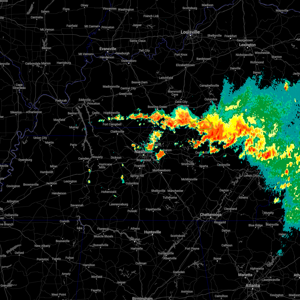 The severe thunderstorm warning for southeastern monroe and southern cumberland counties will expire at 245 am cdt, the storm which prompted the warning has moved out of the area. therefore, the warning will be allowed to expire. The severe thunderstorm warning for southeastern monroe and southern cumberland counties will expire at 245 am cdt, the storm which prompted the warning has moved out of the area. therefore, the warning will be allowed to expire.
|
| 7/21/2022 2:25 AM CDT |
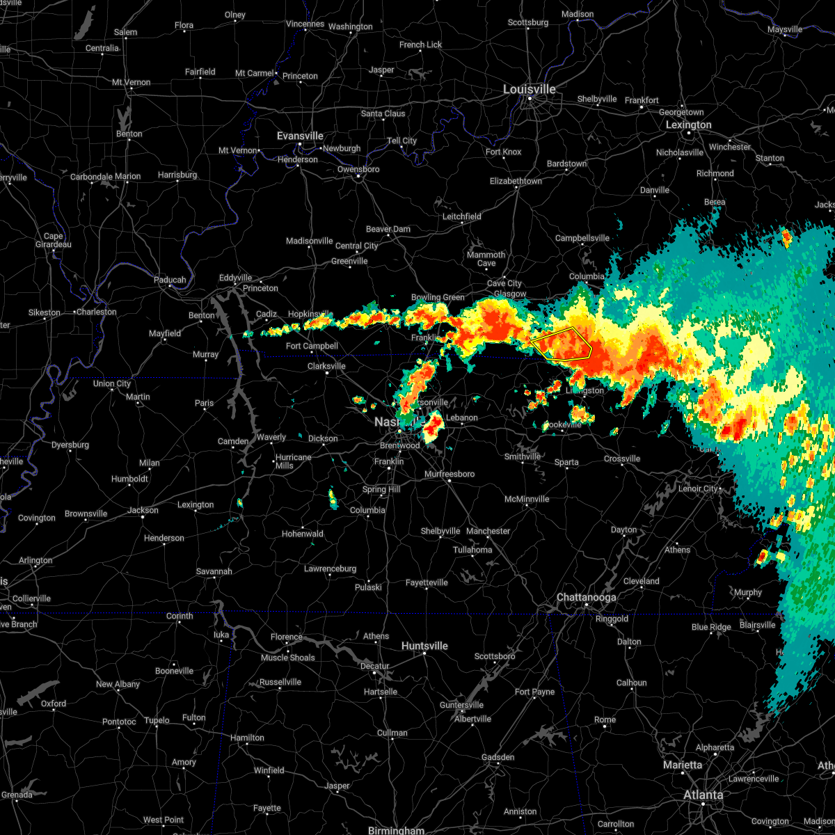 At 225 am cdt, a severe thunderstorm was located 8 miles north of celina, moving southeast at 35 mph (radar indicated). Hazards include 60 mph wind gusts. Expect damage to roofs, siding, and trees. locations impacted include, tompkinsville, burkesville, leslie, littrell, meshack, blythe, ellington, grider, vernon and peytonsburg. hail threat, radar indicated max hail size, <. 75 in wind threat, radar indicated max wind gust, 60 mph. At 225 am cdt, a severe thunderstorm was located 8 miles north of celina, moving southeast at 35 mph (radar indicated). Hazards include 60 mph wind gusts. Expect damage to roofs, siding, and trees. locations impacted include, tompkinsville, burkesville, leslie, littrell, meshack, blythe, ellington, grider, vernon and peytonsburg. hail threat, radar indicated max hail size, <. 75 in wind threat, radar indicated max wind gust, 60 mph.
|
| 7/21/2022 2:11 AM CDT |
 At 210 am cdt, a severe thunderstorm was located 7 miles northeast of tompkinsville, moving southeast at 35 mph (radar indicated). Hazards include 60 mph wind gusts and penny size hail. Expect damage to roofs, siding, and trees. this severe thunderstorm will remain over mainly rural areas of monroe and southwestern cumberland counties, including the following locations, littrell, meshack, blythe, harlan crossroads, ellington, grider, peytonsburg, raydure, boles and arat. hail threat, radar indicated max hail size, 0. 75 in wind threat, radar indicated max wind gust, 60 mph. At 210 am cdt, a severe thunderstorm was located 7 miles northeast of tompkinsville, moving southeast at 35 mph (radar indicated). Hazards include 60 mph wind gusts and penny size hail. Expect damage to roofs, siding, and trees. this severe thunderstorm will remain over mainly rural areas of monroe and southwestern cumberland counties, including the following locations, littrell, meshack, blythe, harlan crossroads, ellington, grider, peytonsburg, raydure, boles and arat. hail threat, radar indicated max hail size, 0. 75 in wind threat, radar indicated max wind gust, 60 mph.
|
| 7/21/2022 1:53 AM CDT |
 At 152 am cdt, a severe thunderstorm was located 8 miles southwest of edmonton, moving southeast at 35 mph (radar indicated). Hazards include 60 mph wind gusts and penny size hail. Expect damage to roofs, siding, and trees. this severe thunderstorm will be near, tompkinsville around 205 am cdt. hail threat, radar indicated max hail size, 0. 75 in wind threat, radar indicated max wind gust, 60 mph. At 152 am cdt, a severe thunderstorm was located 8 miles southwest of edmonton, moving southeast at 35 mph (radar indicated). Hazards include 60 mph wind gusts and penny size hail. Expect damage to roofs, siding, and trees. this severe thunderstorm will be near, tompkinsville around 205 am cdt. hail threat, radar indicated max hail size, 0. 75 in wind threat, radar indicated max wind gust, 60 mph.
|
| 7/12/2022 3:58 PM CDT |
 At 358 pm cdt, a severe thunderstorm was located near tompkinsville, moving southeast at 25 mph (radar indicated). Hazards include 60 mph wind gusts and quarter size hail. Hail damage to vehicles is expected. expect wind damage to roofs, siding, and trees. locations impacted include, tompkinsville, gamaliel, fountain run, dry fork, persimmon, bugtussle, forkton, gum tree, freetown and sulphur lick. hail threat, radar indicated max hail size, 1. 00 in wind threat, radar indicated max wind gust, 60 mph. At 358 pm cdt, a severe thunderstorm was located near tompkinsville, moving southeast at 25 mph (radar indicated). Hazards include 60 mph wind gusts and quarter size hail. Hail damage to vehicles is expected. expect wind damage to roofs, siding, and trees. locations impacted include, tompkinsville, gamaliel, fountain run, dry fork, persimmon, bugtussle, forkton, gum tree, freetown and sulphur lick. hail threat, radar indicated max hail size, 1. 00 in wind threat, radar indicated max wind gust, 60 mph.
|
| 7/12/2022 3:43 PM CDT |
 At 343 pm cdt, a severe thunderstorm was located 11 miles northwest of tompkinsville, moving southeast at 25 mph (radar indicated). Hazards include 60 mph wind gusts and penny size hail. expect damage to roofs, siding, and trees At 343 pm cdt, a severe thunderstorm was located 11 miles northwest of tompkinsville, moving southeast at 25 mph (radar indicated). Hazards include 60 mph wind gusts and penny size hail. expect damage to roofs, siding, and trees
|
| 7/8/2022 1:40 PM CDT |
 The severe thunderstorm warning for western monroe, southeastern allen and southeastern barren counties will expire at 145 pm cdt, the storm which prompted the warning has weakened below severe limits, and no longer poses an immediate threat to life or property. therefore, the warning will be allowed to expire. however gusty winds are still possible with this thunderstorm. The severe thunderstorm warning for western monroe, southeastern allen and southeastern barren counties will expire at 145 pm cdt, the storm which prompted the warning has weakened below severe limits, and no longer poses an immediate threat to life or property. therefore, the warning will be allowed to expire. however gusty winds are still possible with this thunderstorm.
|
| 7/8/2022 1:31 PM CDT |
 At 131 pm cdt, a severe thunderstorm was located 12 miles west of tompkinsville, moving east at 15 mph (radar indicated). Hazards include 60 mph wind gusts. Expect damage to roofs, siding, and trees. locations impacted include, tompkinsville, gamaliel, fountain run, oak forest, gum tree, maynard, austin, lamb, flippin and emberton. hail threat, radar indicated max hail size, <. 75 in wind threat, radar indicated max wind gust, 60 mph. At 131 pm cdt, a severe thunderstorm was located 12 miles west of tompkinsville, moving east at 15 mph (radar indicated). Hazards include 60 mph wind gusts. Expect damage to roofs, siding, and trees. locations impacted include, tompkinsville, gamaliel, fountain run, oak forest, gum tree, maynard, austin, lamb, flippin and emberton. hail threat, radar indicated max hail size, <. 75 in wind threat, radar indicated max wind gust, 60 mph.
|
| 7/8/2022 1:19 PM CDT |
 At 119 pm cdt, a severe thunderstorm was located 12 miles east of scottsville, moving east at 15 mph (radar indicated). Hazards include 60 mph wind gusts. Expect damage to roofs, siding, and trees. this severe thunderstorm will remain over mainly rural areas of western monroe, southern allen and southeastern barren counties, including the following locations, oak forest, gum tree, maynard, gamaliel, austin, lamb, alonzo, flippin, emberton and new roe. hail threat, radar indicated max hail size, <. 75 in wind threat, radar indicated max wind gust, 60 mph. At 119 pm cdt, a severe thunderstorm was located 12 miles east of scottsville, moving east at 15 mph (radar indicated). Hazards include 60 mph wind gusts. Expect damage to roofs, siding, and trees. this severe thunderstorm will remain over mainly rural areas of western monroe, southern allen and southeastern barren counties, including the following locations, oak forest, gum tree, maynard, gamaliel, austin, lamb, alonzo, flippin, emberton and new roe. hail threat, radar indicated max hail size, <. 75 in wind threat, radar indicated max wind gust, 60 mph.
|
| 7/7/2022 2:42 PM CDT |
 The severe thunderstorm warning for monroe, western cumberland and southern metcalfe counties will expire at 245 pm cdt, the storm which prompted the warning has weakened below severe limits, and no longer poses an immediate threat to life or property. therefore, the warning will be allowed to expire. however gusty winds and heavy rain are still possible with this thunderstorm. The severe thunderstorm warning for monroe, western cumberland and southern metcalfe counties will expire at 245 pm cdt, the storm which prompted the warning has weakened below severe limits, and no longer poses an immediate threat to life or property. therefore, the warning will be allowed to expire. however gusty winds and heavy rain are still possible with this thunderstorm.
|
| 7/7/2022 2:20 PM CDT | Power lines reported down on the west side of tompkinsville. time estimated from rada in monroe county KY, 0.7 miles SE of Tompkinsville, KY |
| 7/7/2022 2:19 PM CDT |
 At 219 pm cdt, a severe thunderstorm was located 7 miles north of tompkinsville, moving east at 20 mph (radar indicated). Hazards include 60 mph wind gusts and quarter size hail. Hail damage to vehicles is expected. expect wind damage to roofs, siding, and trees. this severe thunderstorm will remain over mainly rural areas of monroe, western cumberland and southern metcalfe counties, including the following locations, littrell, meshack, blythe, harlan crossroads, ellington, willow shade, grider, peytonsburg, raydure and arat. hail threat, radar indicated max hail size, 1. 00 in wind threat, radar indicated max wind gust, 60 mph. At 219 pm cdt, a severe thunderstorm was located 7 miles north of tompkinsville, moving east at 20 mph (radar indicated). Hazards include 60 mph wind gusts and quarter size hail. Hail damage to vehicles is expected. expect wind damage to roofs, siding, and trees. this severe thunderstorm will remain over mainly rural areas of monroe, western cumberland and southern metcalfe counties, including the following locations, littrell, meshack, blythe, harlan crossroads, ellington, willow shade, grider, peytonsburg, raydure and arat. hail threat, radar indicated max hail size, 1. 00 in wind threat, radar indicated max wind gust, 60 mph.
|
| 6/26/2022 3:10 PM CDT |
 The severe thunderstorm warning for southeastern monroe county will expire at 315 pm cdt, the storm which prompted the warning has weakened below severe limits, and no longer poses an immediate threat to life or property. therefore, the warning will be allowed to expire. however gusty winds and heavy rain are still possible with this thunderstorm. to report severe weather, contact your nearest law enforcement agency. they will relay your report to the national weather service louisville. The severe thunderstorm warning for southeastern monroe county will expire at 315 pm cdt, the storm which prompted the warning has weakened below severe limits, and no longer poses an immediate threat to life or property. therefore, the warning will be allowed to expire. however gusty winds and heavy rain are still possible with this thunderstorm. to report severe weather, contact your nearest law enforcement agency. they will relay your report to the national weather service louisville.
|
| 6/26/2022 2:51 PM CDT |
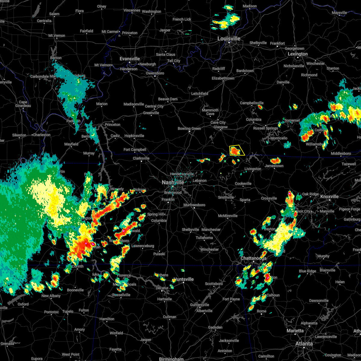 At 251 pm cdt, a severe thunderstorm was located over tompkinsville, moving east at 20 mph (radar indicated). Hazards include 60 mph wind gusts and quarter size hail. Hail damage to vehicles is expected. expect wind damage to roofs, siding, and trees. this severe thunderstorm will remain over mainly rural areas of southeastern monroe county, including the following locations, forkton, blythe, harlan crossroads, otia, grandview, hestand and vernon. hail threat, radar indicated max hail size, 1. 00 in wind threat, radar indicated max wind gust, 60 mph. At 251 pm cdt, a severe thunderstorm was located over tompkinsville, moving east at 20 mph (radar indicated). Hazards include 60 mph wind gusts and quarter size hail. Hail damage to vehicles is expected. expect wind damage to roofs, siding, and trees. this severe thunderstorm will remain over mainly rural areas of southeastern monroe county, including the following locations, forkton, blythe, harlan crossroads, otia, grandview, hestand and vernon. hail threat, radar indicated max hail size, 1. 00 in wind threat, radar indicated max wind gust, 60 mph.
|
| 6/26/2022 2:45 PM CDT | Downed tree fell onto truck damaging the camper. this occurred on sunset avenue in tompkinsvill in monroe county KY, 0.7 miles SE of Tompkinsville, KY |
| 6/26/2022 2:31 PM CDT |
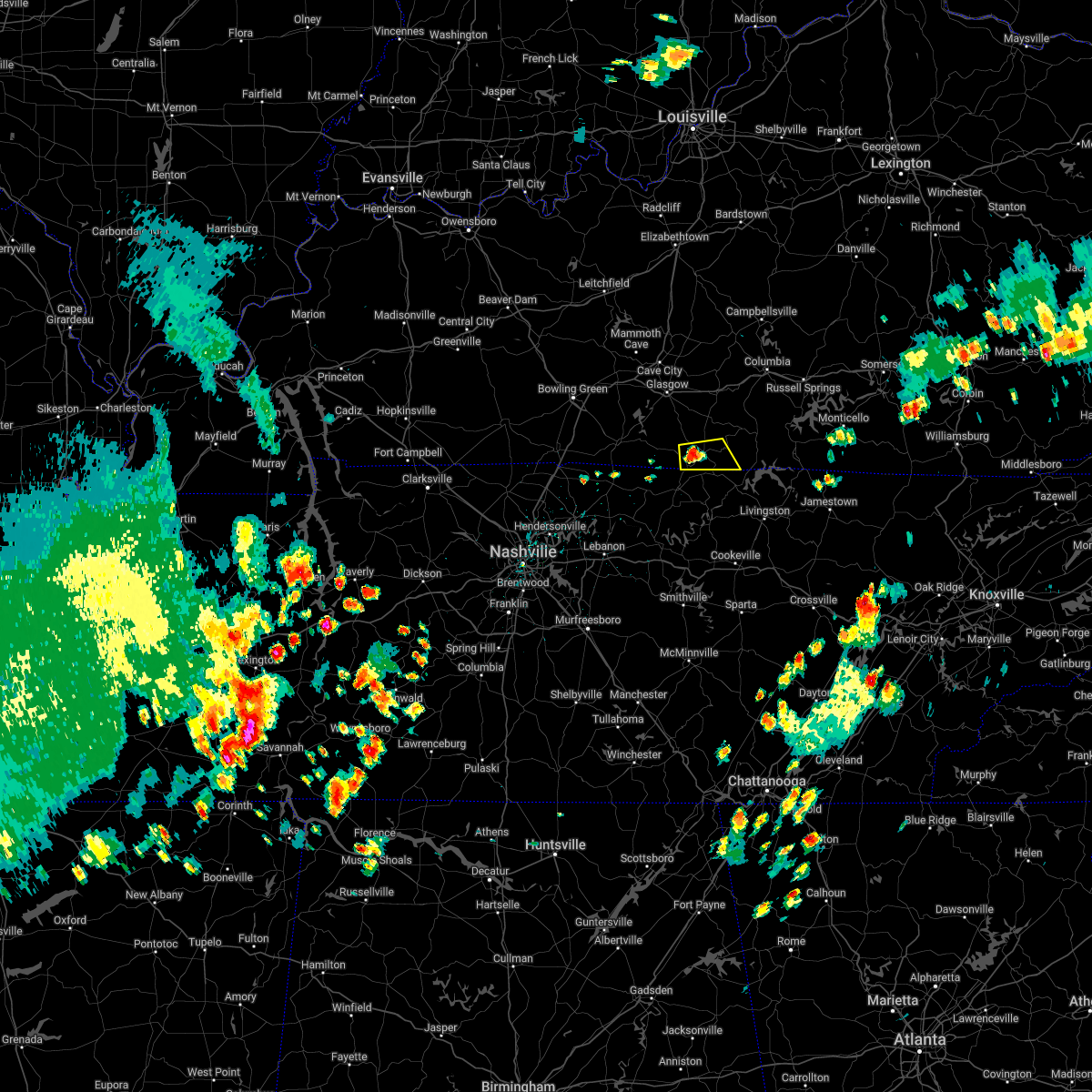 At 231 pm cdt, a severe thunderstorm was located near tompkinsville, moving east at 20 mph (radar indicated). Hazards include 60 mph wind gusts and quarter size hail. Hail damage to vehicles is expected. expect wind damage to roofs, siding, and trees. this severe thunderstorm will be near, tompkinsville around 240 pm cdt. hail threat, radar indicated max hail size, 1. 00 in wind threat, radar indicated max wind gust, 60 mph. At 231 pm cdt, a severe thunderstorm was located near tompkinsville, moving east at 20 mph (radar indicated). Hazards include 60 mph wind gusts and quarter size hail. Hail damage to vehicles is expected. expect wind damage to roofs, siding, and trees. this severe thunderstorm will be near, tompkinsville around 240 pm cdt. hail threat, radar indicated max hail size, 1. 00 in wind threat, radar indicated max wind gust, 60 mph.
|
| 2/22/2022 9:52 AM CST |
 At 952 am cst, severe thunderstorms were located along a line extending from 6 miles west of edmonton to 7 miles north of lafayette, moving east at 60 mph (radar indicated). Hazards include 60 mph wind gusts. Expect damage to roofs, siding, and trees. severe thunderstorms will be near, edmonton around 1000 am cst. Other locations in the path of these severe thunderstorms include tompkinsville. At 952 am cst, severe thunderstorms were located along a line extending from 6 miles west of edmonton to 7 miles north of lafayette, moving east at 60 mph (radar indicated). Hazards include 60 mph wind gusts. Expect damage to roofs, siding, and trees. severe thunderstorms will be near, edmonton around 1000 am cst. Other locations in the path of these severe thunderstorms include tompkinsville.
|
| 2/17/2022 5:12 PM CST | Trees down on gamaliel road between gamaliel and tompkinsvill in monroe county KY, 2.7 miles NE of Tompkinsville, KY |
| 1/1/2022 1:37 PM CST |
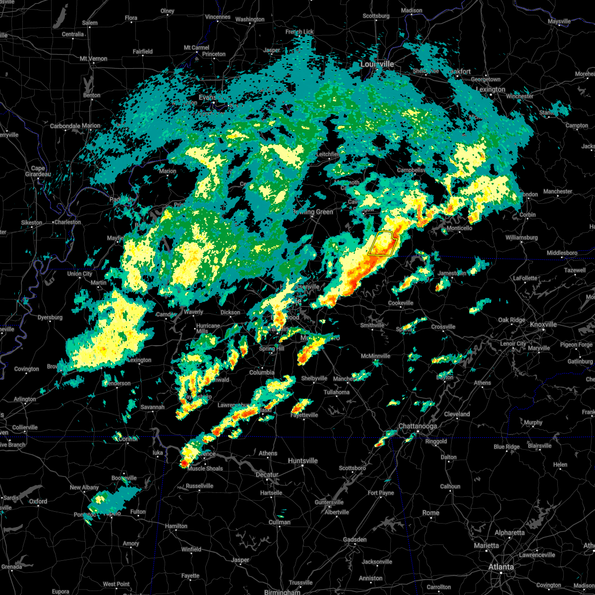 The severe thunderstorm warning for central monroe county will expire at 145 pm cst, the storm which prompted the warning has moved out of the area. therefore, the warning will be allowed to expire. a tornado watch remains in effect until 600 pm cst for south central kentucky. remember, a severe thunderstorm warning still remains in effect for portions of eastern monroe county. The severe thunderstorm warning for central monroe county will expire at 145 pm cst, the storm which prompted the warning has moved out of the area. therefore, the warning will be allowed to expire. a tornado watch remains in effect until 600 pm cst for south central kentucky. remember, a severe thunderstorm warning still remains in effect for portions of eastern monroe county.
|
| 1/1/2022 1:34 PM CST |
 At 134 pm cst, severe thunderstorms were located along a line extending from 10 miles south of edmonton to near tompkinsville, moving east at 60 mph (radar indicated). Hazards include 70 mph wind gusts. Expect considerable tree damage. Damage is likely to mobile homes, roofs, and outbuildings. At 134 pm cst, severe thunderstorms were located along a line extending from 10 miles south of edmonton to near tompkinsville, moving east at 60 mph (radar indicated). Hazards include 70 mph wind gusts. Expect considerable tree damage. Damage is likely to mobile homes, roofs, and outbuildings.
|
| 1/1/2022 1:27 PM CST |
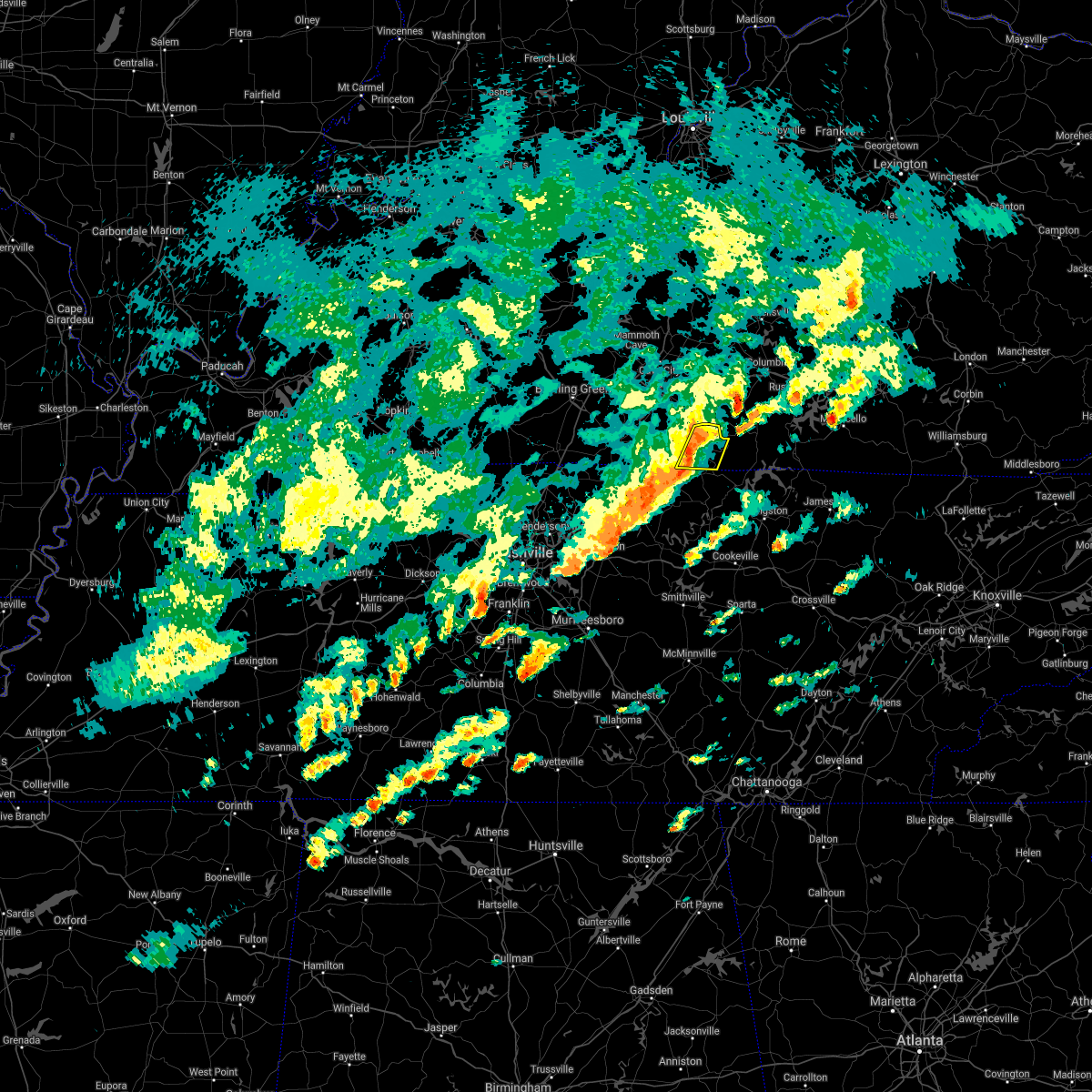 At 127 pm cst, a severe thunderstorm was located near tompkinsville, moving east at 60 mph (radar indicated). Hazards include 70 mph wind gusts. Expect considerable tree damage. damage is likely to mobile homes, roofs, and outbuildings. This severe thunderstorm will remain over mainly rural areas of central monroe county, including the following locations, emberton, persimmon, mud lick, cyclone, forkton, harlan crossroads, freetown, rockbridge, sulphur lick and gamaliel. At 127 pm cst, a severe thunderstorm was located near tompkinsville, moving east at 60 mph (radar indicated). Hazards include 70 mph wind gusts. Expect considerable tree damage. damage is likely to mobile homes, roofs, and outbuildings. This severe thunderstorm will remain over mainly rural areas of central monroe county, including the following locations, emberton, persimmon, mud lick, cyclone, forkton, harlan crossroads, freetown, rockbridge, sulphur lick and gamaliel.
|
| 1/1/2022 1:19 PM CST |
 At 118 pm cst, a severe thunderstorm was located near tompkinsville, moving east at 60 mph (radar indicated). Hazards include 70 mph wind gusts. Expect considerable tree damage. damage is likely to mobile homes, roofs, and outbuildings. this severe storm will be near, tompkinsville around 125 pm cst. Other locations impacted by this severe thunderstorm include persimmon, cyclone, forkton, gum tree, harlan crossroads, freetown, sulphur lick, gamaliel, lamb and flippin. At 118 pm cst, a severe thunderstorm was located near tompkinsville, moving east at 60 mph (radar indicated). Hazards include 70 mph wind gusts. Expect considerable tree damage. damage is likely to mobile homes, roofs, and outbuildings. this severe storm will be near, tompkinsville around 125 pm cst. Other locations impacted by this severe thunderstorm include persimmon, cyclone, forkton, gum tree, harlan crossroads, freetown, sulphur lick, gamaliel, lamb and flippin.
|
| 1/1/2022 1:11 PM CST | Delayed report. monroe county dispatch reported trees and power lines down. time estimated from rada in monroe county KY, 2.7 miles E of Tompkinsville, KY |
| 1/1/2022 1:08 PM CST |
 At 108 pm cst, a severe thunderstorm was located 9 miles north of lafayette, moving east at 60 mph (radar indicated). Hazards include 60 mph wind gusts. Expect damage to roofs, siding, and trees. This severe thunderstorm will be near, tompkinsville around 125 pm cst. At 108 pm cst, a severe thunderstorm was located 9 miles north of lafayette, moving east at 60 mph (radar indicated). Hazards include 60 mph wind gusts. Expect damage to roofs, siding, and trees. This severe thunderstorm will be near, tompkinsville around 125 pm cst.
|
| 12/11/2021 3:47 AM CST |
 At 447 am est/347 am cst/, severe thunderstorms were located along a line extending from 14 miles east of leitchfield to 8 miles northwest of westmoreland, moving east at 50 mph (radar indicated). Hazards include 60 mph wind gusts. Expect damage to roofs, siding, and trees. these severe thunderstorms will remain over mainly rural areas of larue, southwestern marion, hart, northwestern taylor, southeastern grayson, south central hardin, eastern edmonson, green, monroe, allen, southeastern warren, barren and metcalfe counties, including the following locations, logsdon valley, node, broad ford, haywood, austin, settle, new roe, lone star, pascal and oil city. hail threat, radar indicated max hail size, <. 75 in wind threat, radar indicated max wind gust, 60 mph. At 447 am est/347 am cst/, severe thunderstorms were located along a line extending from 14 miles east of leitchfield to 8 miles northwest of westmoreland, moving east at 50 mph (radar indicated). Hazards include 60 mph wind gusts. Expect damage to roofs, siding, and trees. these severe thunderstorms will remain over mainly rural areas of larue, southwestern marion, hart, northwestern taylor, southeastern grayson, south central hardin, eastern edmonson, green, monroe, allen, southeastern warren, barren and metcalfe counties, including the following locations, logsdon valley, node, broad ford, haywood, austin, settle, new roe, lone star, pascal and oil city. hail threat, radar indicated max hail size, <. 75 in wind threat, radar indicated max wind gust, 60 mph.
|
| 5/4/2021 12:50 AM CDT |
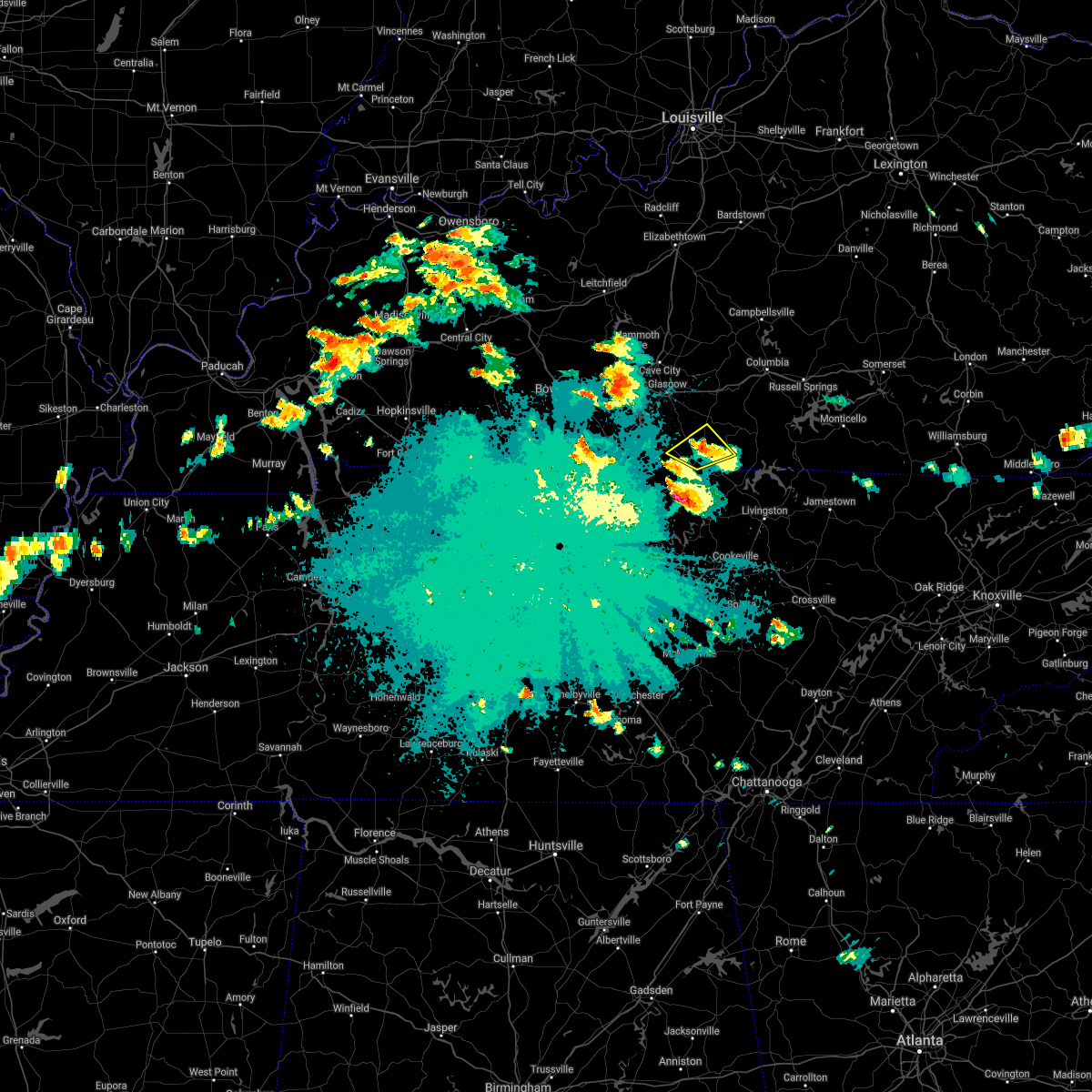 The severe thunderstorm warning for central monroe county will expire at 100 am cdt, the storm which prompted the warning has weakened below severe limits, and no longer poses an immediate threat to life or property. therefore, the warning will be allowed to expire. however heavy rain is still possible with this thunderstorm. The severe thunderstorm warning for central monroe county will expire at 100 am cdt, the storm which prompted the warning has weakened below severe limits, and no longer poses an immediate threat to life or property. therefore, the warning will be allowed to expire. however heavy rain is still possible with this thunderstorm.
|
| 5/4/2021 12:40 AM CDT |
 At 1239 am cdt, a severe thunderstorm was located near tompkinsville, moving northeast at 45 mph (radar indicated). Hazards include 60 mph wind gusts and quarter size hail. Hail damage to vehicles is expected. expect wind damage to roofs, siding, and trees. Locations impacted include, tompkinsville, meshack, persimmon, forkton, gum tree, blythe, harlan crossroads, freetown, flippin and emberton. At 1239 am cdt, a severe thunderstorm was located near tompkinsville, moving northeast at 45 mph (radar indicated). Hazards include 60 mph wind gusts and quarter size hail. Hail damage to vehicles is expected. expect wind damage to roofs, siding, and trees. Locations impacted include, tompkinsville, meshack, persimmon, forkton, gum tree, blythe, harlan crossroads, freetown, flippin and emberton.
|
| 5/4/2021 12:26 AM CDT |
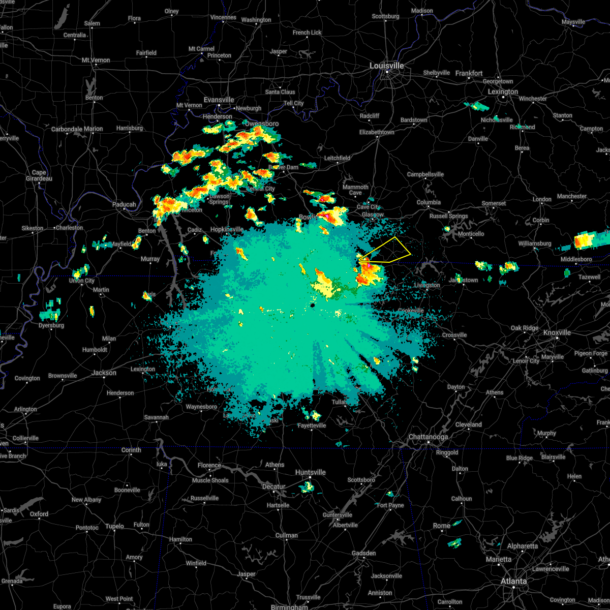 At 1226 am cdt, a severe thunderstorm was located 8 miles northwest of red boiling springs, moving northeast at 45 mph (radar indicated). Hazards include 60 mph wind gusts and quarter size hail. Hail damage to vehicles is expected. Expect wind damage to roofs, siding, and trees. At 1226 am cdt, a severe thunderstorm was located 8 miles northwest of red boiling springs, moving northeast at 45 mph (radar indicated). Hazards include 60 mph wind gusts and quarter size hail. Hail damage to vehicles is expected. Expect wind damage to roofs, siding, and trees.
|
| 5/3/2021 8:12 AM CDT |
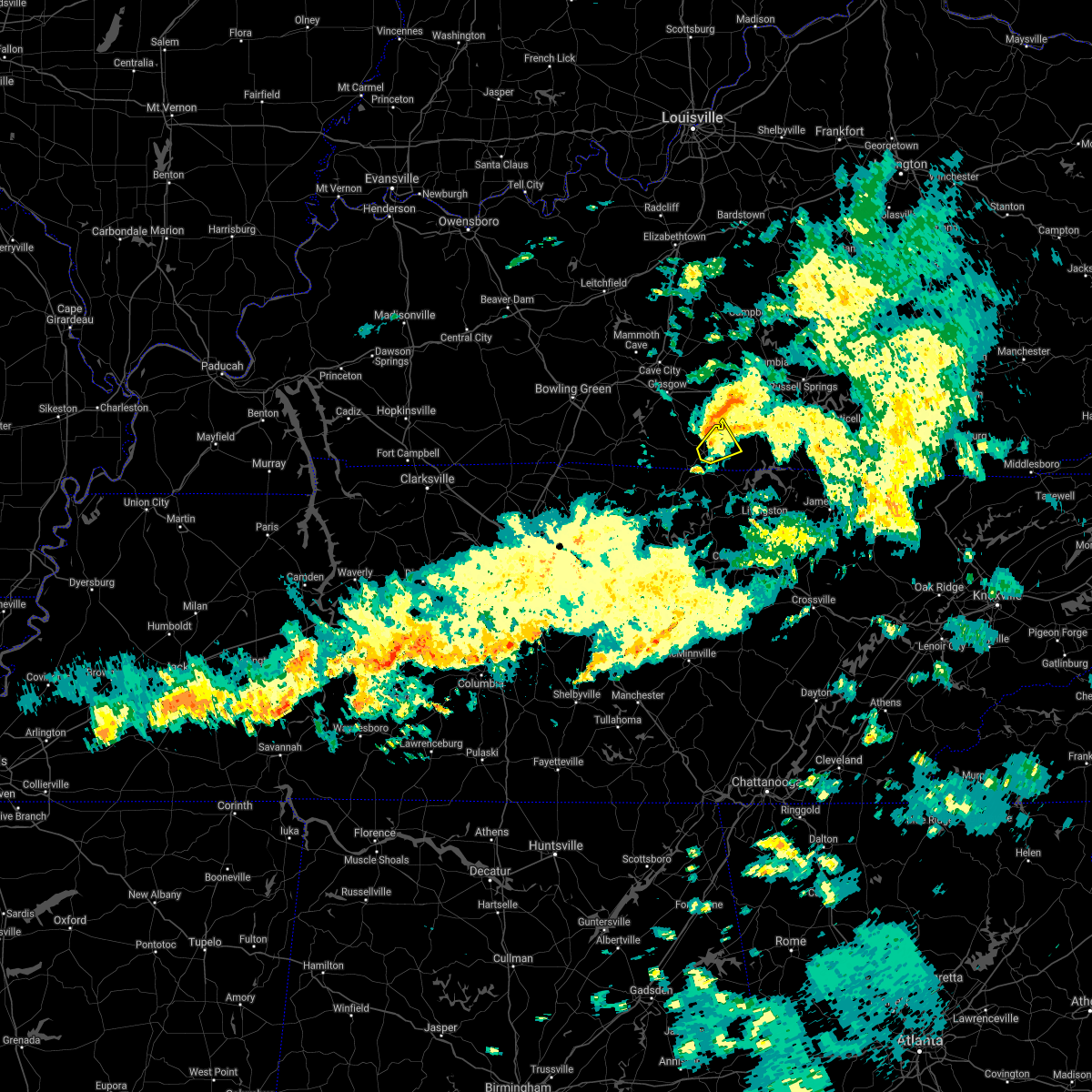 At 812 am cdt, a severe thunderstorm was located near tompkinsville, moving northeast at 45 mph (radar indicated). Hazards include 60 mph wind gusts. Expect damage to roofs, siding, and trees. Locations impacted include, tompkinsville, otia, meshack, grandview and persimmon. At 812 am cdt, a severe thunderstorm was located near tompkinsville, moving northeast at 45 mph (radar indicated). Hazards include 60 mph wind gusts. Expect damage to roofs, siding, and trees. Locations impacted include, tompkinsville, otia, meshack, grandview and persimmon.
|
| 5/3/2021 8:09 AM CDT | Multiple reports of numerous trees down as well as structural damage in tompkinsville along with power outages. local media reports possible tornad in monroe county KY, 2.5 miles SW of Tompkinsville, KY |
| 5/3/2021 8:00 AM CDT |
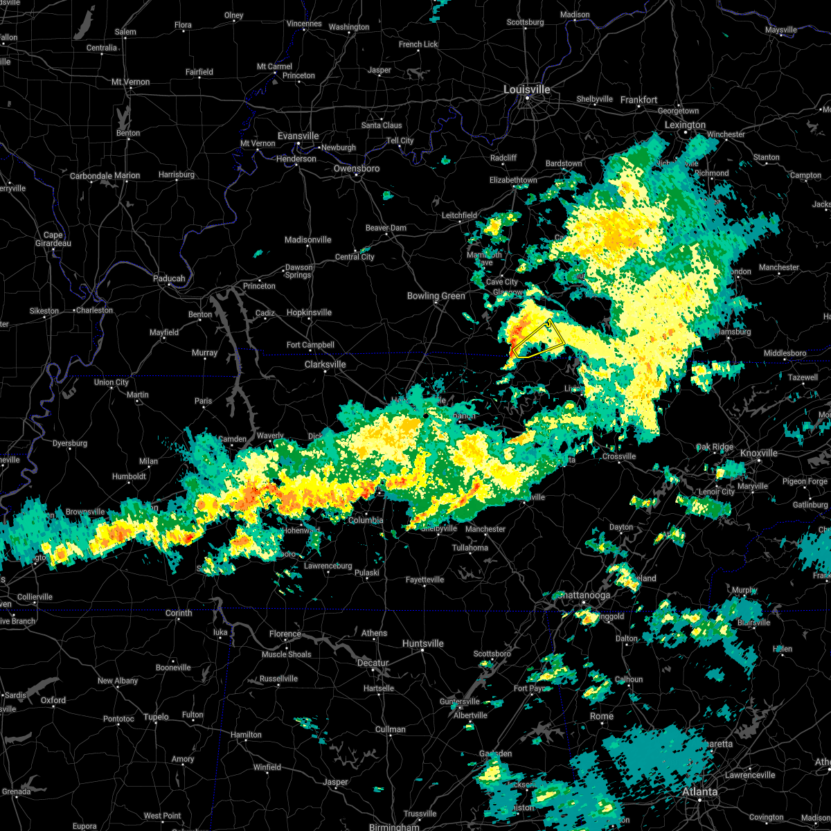 At 800 am cdt, a severe thunderstorm was located near tompkinsville, moving northeast at 45 mph (radar indicated). Hazards include 60 mph wind gusts. expect damage to roofs, siding, and trees At 800 am cdt, a severe thunderstorm was located near tompkinsville, moving northeast at 45 mph (radar indicated). Hazards include 60 mph wind gusts. expect damage to roofs, siding, and trees
|
| 2/28/2021 7:57 PM CST |
 At 756 pm cst, severe thunderstorms were from 6 miles northwest of burkesville to 8 miles north of celina to near red boiling springs, moving east at 65 mph (radar indicated). Hazards include 60 mph wind gusts. Expect damage to roofs, siding, and trees. Locations impacted include, tompkinsville, burkesville, leslie, gamaliel, littrell, meshack, modoc, blythe, harlan crossroads, and ellington. At 756 pm cst, severe thunderstorms were from 6 miles northwest of burkesville to 8 miles north of celina to near red boiling springs, moving east at 65 mph (radar indicated). Hazards include 60 mph wind gusts. Expect damage to roofs, siding, and trees. Locations impacted include, tompkinsville, burkesville, leslie, gamaliel, littrell, meshack, modoc, blythe, harlan crossroads, and ellington.
|
| 2/28/2021 7:44 PM CST | One tree dow in monroe county KY, 1.2 miles S of Tompkinsville, KY |
| 2/28/2021 7:37 PM CST |
 At 737 pm cst, a severe thunderstorm was located 10 miles north of red boiling springs, moving east at 45 mph (radar indicated). Hazards include 60 mph wind gusts. expect damage to roofs, siding, and trees At 737 pm cst, a severe thunderstorm was located 10 miles north of red boiling springs, moving east at 45 mph (radar indicated). Hazards include 60 mph wind gusts. expect damage to roofs, siding, and trees
|
| 1/25/2021 1:40 PM CST | Tree down near browns ford boat ram in monroe county KY, 12.8 miles ESE of Tompkinsville, KY |
| 6/28/2020 11:57 AM CDT |
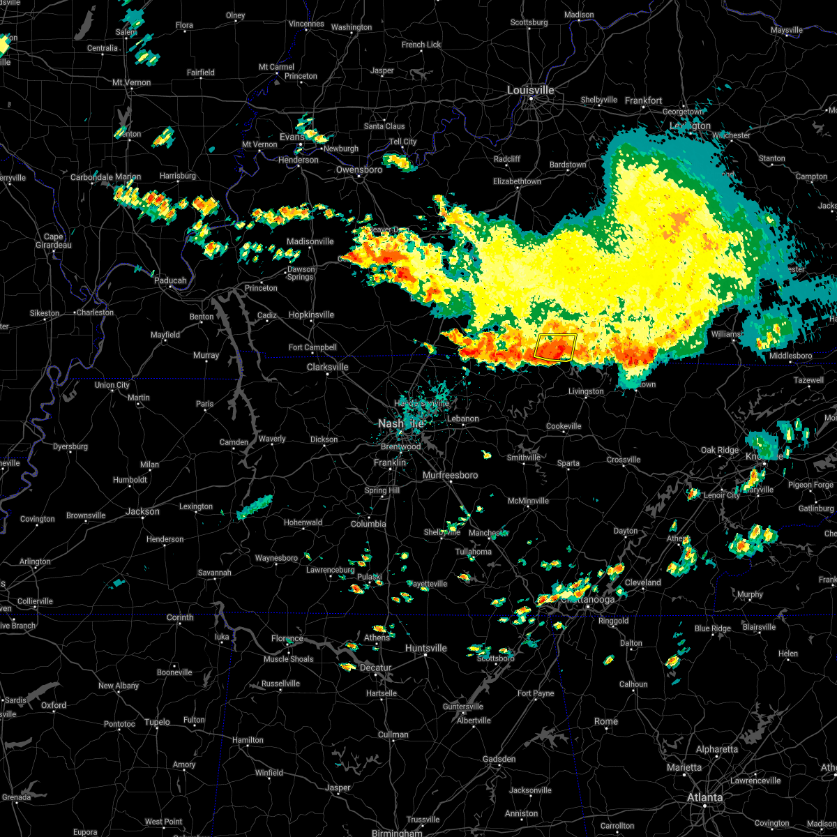 The severe thunderstorm warning for southeastern monroe and southwestern cumberland counties will expire at noon cdt, the storm which prompted the warning has weakened slightly. however gusty winds to 50 mph and very heavy rain will still occur with this thunderstorm. The severe thunderstorm warning for southeastern monroe and southwestern cumberland counties will expire at noon cdt, the storm which prompted the warning has weakened slightly. however gusty winds to 50 mph and very heavy rain will still occur with this thunderstorm.
|
| 6/28/2020 11:27 AM CDT |
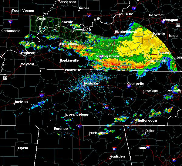 At 1127 am cdt, a severe thunderstorm was located over tompkinsville, moving east at 25 mph (radar indicated). Hazards include 60 mph wind gusts and penny size hail. expect damage to roofs, siding, and trees At 1127 am cdt, a severe thunderstorm was located over tompkinsville, moving east at 25 mph (radar indicated). Hazards include 60 mph wind gusts and penny size hail. expect damage to roofs, siding, and trees
|
| 4/13/2020 4:05 AM CDT |
 At 404 am cdt, a severe thunderstorm was located over tompkinsville, moving northeast at 60 mph (radar indicated). Hazards include 60 mph wind gusts. expect damage to roofs, siding, and trees At 404 am cdt, a severe thunderstorm was located over tompkinsville, moving northeast at 60 mph (radar indicated). Hazards include 60 mph wind gusts. expect damage to roofs, siding, and trees
|
| 1/11/2020 11:01 AM CST | Broadcast media relayed a public picture of severe roof damage to a home near tompkinsvill in monroe county KY, 0.5 miles S of Tompkinsville, KY |
| 8/13/2019 3:49 PM CDT |
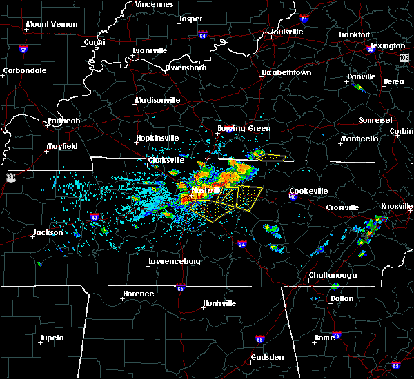 At 349 pm cdt, a severe thunderstorm was located near gamaliel, moving east at 30 mph (radar indicated). Hazards include 60 mph wind gusts and quarter size hail. Hail damage to vehicles is expected. expect wind damage to roofs, siding, and trees. Locations impacted include, tompkinsville, gamaliel, harlan crossroads, freetown and hestand. At 349 pm cdt, a severe thunderstorm was located near gamaliel, moving east at 30 mph (radar indicated). Hazards include 60 mph wind gusts and quarter size hail. Hail damage to vehicles is expected. expect wind damage to roofs, siding, and trees. Locations impacted include, tompkinsville, gamaliel, harlan crossroads, freetown and hestand.
|
| 8/13/2019 3:33 PM CDT |
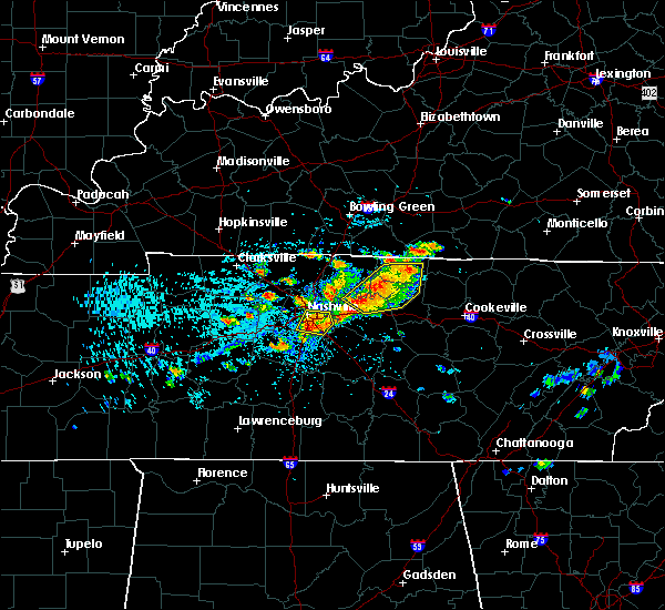 At 333 pm cdt, a severe thunderstorm was located 10 miles north of red boiling springs, moving east at 30 mph (radar indicated). Hazards include 60 mph wind gusts and quarter size hail. Hail damage to vehicles is expected. Expect wind damage to roofs, siding, and trees. At 333 pm cdt, a severe thunderstorm was located 10 miles north of red boiling springs, moving east at 30 mph (radar indicated). Hazards include 60 mph wind gusts and quarter size hail. Hail damage to vehicles is expected. Expect wind damage to roofs, siding, and trees.
|
| 6/21/2019 8:30 PM CDT | Multiple reports of trees and power lines down. time is estimated based off rada in monroe county KY, 0.5 miles S of Tompkinsville, KY |
| 6/21/2019 8:24 PM CDT |
 At 824 pm cdt, a severe thunderstorm was located 7 miles west of tompkinsville, moving east at 45 mph (radar indicated). Hazards include 60 mph wind gusts. expect damage to roofs, siding, and trees At 824 pm cdt, a severe thunderstorm was located 7 miles west of tompkinsville, moving east at 45 mph (radar indicated). Hazards include 60 mph wind gusts. expect damage to roofs, siding, and trees
|
| 6/21/2019 8:21 PM CDT |
 At 821 pm cdt, a severe thunderstorm was located 12 miles west of tompkinsville, moving east at 45 mph (radar indicated). Hazards include 60 mph wind gusts. Expect damage to roofs, siding, and trees. Locations impacted include, tompkinsville, gamaliel, fountain run, persimmon, bugtussle, forkton, gum tree, harlan crossroads, freetown and sulphur lick. At 821 pm cdt, a severe thunderstorm was located 12 miles west of tompkinsville, moving east at 45 mph (radar indicated). Hazards include 60 mph wind gusts. Expect damage to roofs, siding, and trees. Locations impacted include, tompkinsville, gamaliel, fountain run, persimmon, bugtussle, forkton, gum tree, harlan crossroads, freetown and sulphur lick.
|
| 6/21/2019 8:17 PM CDT |
 A severe thunderstorm warning remains in effect until 830 pm cdt for monroe. southeastern allen and southeastern barren counties. at 816 pm cdt, a severe thunderstorm was located 12 miles east of scottsville, moving east at 40 mph. hazard. 60 mph wind gusts. source. Radar indicated. A severe thunderstorm warning remains in effect until 830 pm cdt for monroe. southeastern allen and southeastern barren counties. at 816 pm cdt, a severe thunderstorm was located 12 miles east of scottsville, moving east at 40 mph. hazard. 60 mph wind gusts. source. Radar indicated.
|
| 6/21/2019 7:58 PM CDT |
 At 758 pm cdt, a severe thunderstorm was located near scottsville, moving east at 45 mph (radar indicated). Hazards include 70 mph wind gusts. Expect considerable tree damage. Damage is likely to mobile homes, roofs, and outbuildings. At 758 pm cdt, a severe thunderstorm was located near scottsville, moving east at 45 mph (radar indicated). Hazards include 70 mph wind gusts. Expect considerable tree damage. Damage is likely to mobile homes, roofs, and outbuildings.
|
| 3/9/2019 7:19 PM CDT |
 At 618 pm cst, a severe thunderstorm was located 12 miles east of scottsville, moving northeast at 75 mph (radar indicated). Hazards include 60 mph wind gusts. expect damage to roofs, siding, and trees At 618 pm cst, a severe thunderstorm was located 12 miles east of scottsville, moving northeast at 75 mph (radar indicated). Hazards include 60 mph wind gusts. expect damage to roofs, siding, and trees
|
| 7/20/2018 7:44 PM CDT |
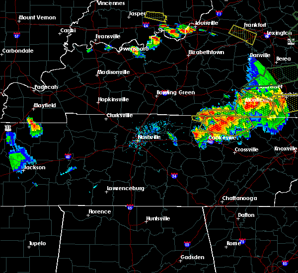 At 743 pm cdt, severe thunderstorms were located along a line extending from 8 miles southwest of burkesville to 6 miles southeast of tompkinsville, moving east at 40 mph (radar indicated). Hazards include 60 mph wind gusts and quarter size hail. Hail damage to vehicles is expected. Expect wind damage to roofs, siding, and trees. At 743 pm cdt, severe thunderstorms were located along a line extending from 8 miles southwest of burkesville to 6 miles southeast of tompkinsville, moving east at 40 mph (radar indicated). Hazards include 60 mph wind gusts and quarter size hail. Hail damage to vehicles is expected. Expect wind damage to roofs, siding, and trees.
|
| 7/20/2018 7:38 PM CDT |
 At 737 pm cdt, a severe thunderstorm was located near tompkinsville, moving east at 30 mph (radar indicated). Hazards include 60 mph wind gusts and quarter size hail. Hail damage to vehicles is expected. expect wind damage to roofs, siding, and trees. locations impacted include, tompkinsville, harlan crossroads and hestand. A tornado watch remains in effect until 200 am cdt for south central kentucky. At 737 pm cdt, a severe thunderstorm was located near tompkinsville, moving east at 30 mph (radar indicated). Hazards include 60 mph wind gusts and quarter size hail. Hail damage to vehicles is expected. expect wind damage to roofs, siding, and trees. locations impacted include, tompkinsville, harlan crossroads and hestand. A tornado watch remains in effect until 200 am cdt for south central kentucky.
|
| 7/20/2018 7:24 PM CDT |
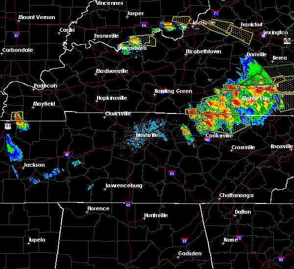 At 723 pm cdt, a severe thunderstorm was located near tompkinsville, moving east at 30 mph (radar indicated). Hazards include 60 mph wind gusts and half dollar size hail. Hail damage to vehicles is expected. Expect wind damage to roofs, siding, and trees. At 723 pm cdt, a severe thunderstorm was located near tompkinsville, moving east at 30 mph (radar indicated). Hazards include 60 mph wind gusts and half dollar size hail. Hail damage to vehicles is expected. Expect wind damage to roofs, siding, and trees.
|
| 7/20/2018 7:00 PM CDT | Quarter sized hail reported 0.5 miles S of Tompkinsville, KY, reported at tompkinsville. |
| 7/20/2018 6:59 PM CDT |
 The national weather service in louisville has issued a * severe thunderstorm warning for. clinton county in south central kentucky. southwestern russell county in south central kentucky. eastern monroe county in south central kentucky. Cumberland county in south central kentucky. The national weather service in louisville has issued a * severe thunderstorm warning for. clinton county in south central kentucky. southwestern russell county in south central kentucky. eastern monroe county in south central kentucky. Cumberland county in south central kentucky.
|
| 7/20/2018 6:54 PM CDT | Grapefruit sized hail reported 0.5 miles S of Tompkinsville, KY, verified photo on twitter. time estimated from radar. |
| 7/20/2018 6:29 PM CDT |
 At 629 pm cdt, a severe thunderstorm was located 9 miles northwest of tompkinsville, moving east at 30 mph (radar indicated). Hazards include 60 mph wind gusts and half dollar size hail. Hail damage to vehicles is expected. Expect wind damage to roofs, siding, and trees. At 629 pm cdt, a severe thunderstorm was located 9 miles northwest of tompkinsville, moving east at 30 mph (radar indicated). Hazards include 60 mph wind gusts and half dollar size hail. Hail damage to vehicles is expected. Expect wind damage to roofs, siding, and trees.
|
| 7/20/2018 5:59 PM CDT | Quarter sized hail reported 6.7 miles S of Tompkinsville, KY |
| 7/20/2018 5:52 PM CDT |
 At 551 pm cdt, a severe thunderstorm was located near tompkinsville, moving east at 30 mph (radar indicated). Hazards include 60 mph wind gusts and half dollar size hail. Hail damage to vehicles is expected. Expect wind damage to roofs, siding, and trees. At 551 pm cdt, a severe thunderstorm was located near tompkinsville, moving east at 30 mph (radar indicated). Hazards include 60 mph wind gusts and half dollar size hail. Hail damage to vehicles is expected. Expect wind damage to roofs, siding, and trees.
|
| 6/27/2018 5:41 PM CDT |
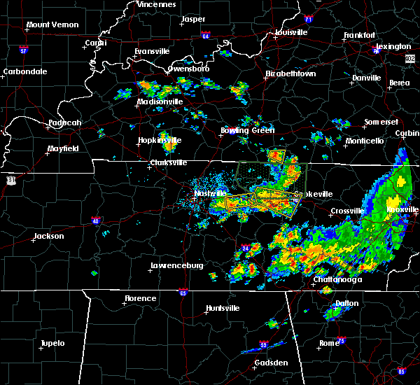 At 539 pm cdt, a severe thunderstorm was located near tompkinsville, moving east at 25 mph (radar indicated). Hazards include 60 mph wind gusts. Expect damage to roofs, siding, and trees. Locations impacted include, tompkinsville, emberton, mud lick, forkton, gum tree, harlan crossroads, rockbridge and grandview. At 539 pm cdt, a severe thunderstorm was located near tompkinsville, moving east at 25 mph (radar indicated). Hazards include 60 mph wind gusts. Expect damage to roofs, siding, and trees. Locations impacted include, tompkinsville, emberton, mud lick, forkton, gum tree, harlan crossroads, rockbridge and grandview.
|
| 6/27/2018 5:23 PM CDT |
 The national weather service in louisville has issued a * severe thunderstorm warning for. central monroe county in south central kentucky. southern barren county in south central kentucky. Until 600 pm cdt * at 523 pm cdt, a severe thunderstorm was located 12 miles west of. The national weather service in louisville has issued a * severe thunderstorm warning for. central monroe county in south central kentucky. southern barren county in south central kentucky. Until 600 pm cdt * at 523 pm cdt, a severe thunderstorm was located 12 miles west of.
|
| 6/27/2018 2:19 PM CDT |
 At 219 pm cdt, severe thunderstorms were located along a line extending from near red boiling springs to 6 miles southwest of burkesville, moving east at 40 mph (radar indicated). Hazards include 60 mph wind gusts. Expect damage to roofs, siding, and trees. Locations impacted include, tompkinsville, gamaliel, fountain run, littrell, meshack, gum tree, blythe, harlan crossroads, peytonsburg and flippin. At 219 pm cdt, severe thunderstorms were located along a line extending from near red boiling springs to 6 miles southwest of burkesville, moving east at 40 mph (radar indicated). Hazards include 60 mph wind gusts. Expect damage to roofs, siding, and trees. Locations impacted include, tompkinsville, gamaliel, fountain run, littrell, meshack, gum tree, blythe, harlan crossroads, peytonsburg and flippin.
|
| 6/27/2018 2:18 PM CDT | Two or three trees down blocking center point roa in monroe county KY, 3.4 miles WSW of Tompkinsville, KY |
| 6/27/2018 1:53 PM CDT |
 At 152 pm cdt, severe thunderstorms were located along a line extending from 8 miles east of scottsville to 8 miles southwest of edmonton, moving southeast at 40 mph (radar indicated). Hazards include 60 mph wind gusts. expect damage to roofs, siding, and trees At 152 pm cdt, severe thunderstorms were located along a line extending from 8 miles east of scottsville to 8 miles southwest of edmonton, moving southeast at 40 mph (radar indicated). Hazards include 60 mph wind gusts. expect damage to roofs, siding, and trees
|
| 6/26/2018 2:09 PM CDT |
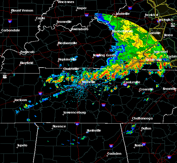 At 208 pm cdt, severe thunderstorms were located along a line extending from 7 miles west of burkesville to 7 miles southwest of tompkinsville, moving east at 25 mph (radar indicated). Hazards include 60 mph wind gusts. Expect damage to roofs, siding, and trees. Locations impacted include, tompkinsville, burkesville, leslie, gamaliel, littrell, desda, meshack, modoc, blythe and harlan crossroads. At 208 pm cdt, severe thunderstorms were located along a line extending from 7 miles west of burkesville to 7 miles southwest of tompkinsville, moving east at 25 mph (radar indicated). Hazards include 60 mph wind gusts. Expect damage to roofs, siding, and trees. Locations impacted include, tompkinsville, burkesville, leslie, gamaliel, littrell, desda, meshack, modoc, blythe and harlan crossroads.
|
| 6/26/2018 1:48 PM CDT |
 At 148 pm cdt, severe thunderstorms were located along a line extending from 8 miles north of tompkinsville to near red boiling springs, moving east at 25 mph (radar indicated). Hazards include 60 mph wind gusts. Expect damage to roofs, siding, and trees. Locations impacted include, tompkinsville, burkesville, leslie, gamaliel, fountain run, littrell, desda, gum tree, blythe and harlan crossroads. At 148 pm cdt, severe thunderstorms were located along a line extending from 8 miles north of tompkinsville to near red boiling springs, moving east at 25 mph (radar indicated). Hazards include 60 mph wind gusts. Expect damage to roofs, siding, and trees. Locations impacted include, tompkinsville, burkesville, leslie, gamaliel, fountain run, littrell, desda, gum tree, blythe and harlan crossroads.
|
| 6/26/2018 1:40 PM CDT |
 At 140 pm cdt, severe thunderstorms were located along a line extending from 8 miles north of tompkinsville to 7 miles northeast of lafayette, moving east at 25 mph (radar indicated). Hazards include 60 mph wind gusts. expect damage to roofs, siding, and trees At 140 pm cdt, severe thunderstorms were located along a line extending from 8 miles north of tompkinsville to 7 miles northeast of lafayette, moving east at 25 mph (radar indicated). Hazards include 60 mph wind gusts. expect damage to roofs, siding, and trees
|
| 5/31/2018 4:47 PM CDT |
 At 447 pm cdt, severe thunderstorms were located along a line extending from near cabell to 11 miles east of scottsville, moving east at 25 mph (radar indicated). Hazards include 60 mph wind gusts and quarter size hail. Hail damage to vehicles is expected. expect wind damage to roofs, siding, and trees. Locations impacted include, tompkinsville, albany, jamestown, burkesville, leslie, gamaliel, fountain run, littrell, desda and cartwright. At 447 pm cdt, severe thunderstorms were located along a line extending from near cabell to 11 miles east of scottsville, moving east at 25 mph (radar indicated). Hazards include 60 mph wind gusts and quarter size hail. Hail damage to vehicles is expected. expect wind damage to roofs, siding, and trees. Locations impacted include, tompkinsville, albany, jamestown, burkesville, leslie, gamaliel, fountain run, littrell, desda and cartwright.
|
| 5/31/2018 4:33 PM CDT |
 At 431 pm cdt, severe thunderstorms were located along a line extending from 7 miles southwest of jamestown to near lamb, moving southeast at 25 mph (radar indicated). Hazards include 60 mph wind gusts and quarter size hail. Hail damage to vehicles is expected. expect wind damage to roofs, siding, and trees. Locations impacted include, tompkinsville, albany, jamestown, burkesville, leslie, gamaliel, fountain run, littrell, desda and cartwright. At 431 pm cdt, severe thunderstorms were located along a line extending from 7 miles southwest of jamestown to near lamb, moving southeast at 25 mph (radar indicated). Hazards include 60 mph wind gusts and quarter size hail. Hail damage to vehicles is expected. expect wind damage to roofs, siding, and trees. Locations impacted include, tompkinsville, albany, jamestown, burkesville, leslie, gamaliel, fountain run, littrell, desda and cartwright.
|
| 5/31/2018 4:18 PM CDT |
 At 418 pm cdt, severe thunderstorms were located along a line extending from 8 miles west of jamestown to 6 miles north of red boiling springs, moving southeast at 25 mph (radar indicated). Hazards include 60 mph wind gusts and quarter size hail. Hail damage to vehicles is expected. Expect wind damage to roofs, siding, and trees. At 418 pm cdt, severe thunderstorms were located along a line extending from 8 miles west of jamestown to 6 miles north of red boiling springs, moving southeast at 25 mph (radar indicated). Hazards include 60 mph wind gusts and quarter size hail. Hail damage to vehicles is expected. Expect wind damage to roofs, siding, and trees.
|
| 4/3/2018 10:10 PM CDT |
 At 1009 pm cdt, a severe thunderstorm was located near tompkinsville, moving east at 70 mph (radar indicated). Hazards include 60 mph wind gusts. Expect damage to roofs, siding, and trees. locations impacted include, tompkinsville, edmonton, gamaliel, eighty eight, meshack, curtis, gum tree, blythe, harlan crossroads and willow shade. A tornado watch remains in effect until midnight cdt for south central kentucky. At 1009 pm cdt, a severe thunderstorm was located near tompkinsville, moving east at 70 mph (radar indicated). Hazards include 60 mph wind gusts. Expect damage to roofs, siding, and trees. locations impacted include, tompkinsville, edmonton, gamaliel, eighty eight, meshack, curtis, gum tree, blythe, harlan crossroads and willow shade. A tornado watch remains in effect until midnight cdt for south central kentucky.
|
| 4/3/2018 9:57 PM CDT |
 At 956 pm cdt, a severe thunderstorm was located 10 miles east of scottsville, moving east at 70 mph (radar indicated). Hazards include 60 mph wind gusts. expect damage to roofs, siding, and trees At 956 pm cdt, a severe thunderstorm was located 10 miles east of scottsville, moving east at 70 mph (radar indicated). Hazards include 60 mph wind gusts. expect damage to roofs, siding, and trees
|
| 2/24/2018 10:49 PM CST |
 At 1048 pm cst, a severe thunderstorm was located 8 miles south of edmonton, moving east at 55 mph (radar indicated). Hazards include 60 mph wind gusts. Expect damage to roofs, siding, and trees. locations impacted include, tompkinsville, leslie, waterview, persimmon, curtis, cyclone, forkton, ellington, sulphur lick and goodluck. A tornado watch remains in effect until 200 am cst for south central kentucky. At 1048 pm cst, a severe thunderstorm was located 8 miles south of edmonton, moving east at 55 mph (radar indicated). Hazards include 60 mph wind gusts. Expect damage to roofs, siding, and trees. locations impacted include, tompkinsville, leslie, waterview, persimmon, curtis, cyclone, forkton, ellington, sulphur lick and goodluck. A tornado watch remains in effect until 200 am cst for south central kentucky.
|
| 2/24/2018 10:33 PM CST |
 At 1033 pm cst, a severe thunderstorm was located 10 miles northwest of tompkinsville, moving east at 55 mph (radar indicated). Hazards include 60 mph wind gusts. Expect damage to roofs, siding, and trees. locations impacted include, tompkinsville, edmonton, leslie, fountain run, eighty eight, meshack, curtis, gum tree, haywood and ellington. A tornado watch remains in effect until 200 am cst for south central kentucky. At 1033 pm cst, a severe thunderstorm was located 10 miles northwest of tompkinsville, moving east at 55 mph (radar indicated). Hazards include 60 mph wind gusts. Expect damage to roofs, siding, and trees. locations impacted include, tompkinsville, edmonton, leslie, fountain run, eighty eight, meshack, curtis, gum tree, haywood and ellington. A tornado watch remains in effect until 200 am cst for south central kentucky.
|
| 2/24/2018 10:15 PM CST |
 At 1014 pm cst, a severe thunderstorm was located near scottsville, moving east at 50 mph (radar indicated). Hazards include 60 mph wind gusts. expect damage to roofs, siding, and trees At 1014 pm cst, a severe thunderstorm was located near scottsville, moving east at 50 mph (radar indicated). Hazards include 60 mph wind gusts. expect damage to roofs, siding, and trees
|
| 11/18/2017 5:19 PM CST |
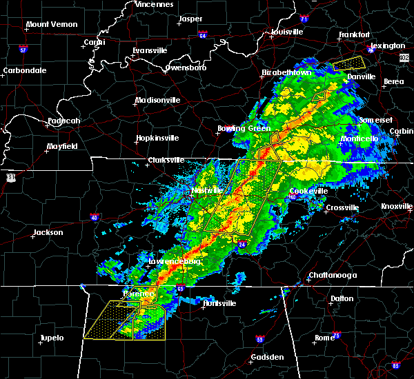 At 519 pm cst, a severe thunderstorm was located 8 miles west of tompkinsville, moving east at 55 mph (radar indicated). Hazards include 60 mph wind gusts and penny size hail. Expect damage to roofs, siding, and trees. Locations impacted include, tompkinsville, gamaliel, forkton, gum tree, harlan crossroads, freetown, sulphur lick, lamb, flippin and emberton. At 519 pm cst, a severe thunderstorm was located 8 miles west of tompkinsville, moving east at 55 mph (radar indicated). Hazards include 60 mph wind gusts and penny size hail. Expect damage to roofs, siding, and trees. Locations impacted include, tompkinsville, gamaliel, forkton, gum tree, harlan crossroads, freetown, sulphur lick, lamb, flippin and emberton.
|
| 11/18/2017 5:12 PM CST |
 At 512 pm cst, a severe thunderstorm was located 10 miles north of lafayette, moving east at 50 mph (radar indicated). Hazards include 60 mph wind gusts and penny size hail. expect damage to roofs, siding, and trees At 512 pm cst, a severe thunderstorm was located 10 miles north of lafayette, moving east at 50 mph (radar indicated). Hazards include 60 mph wind gusts and penny size hail. expect damage to roofs, siding, and trees
|
| 6/23/2017 3:33 PM CDT |
 At 332 pm cdt, a severe thunderstorm was located near tompkinsville, moving northeast at 45 mph (radar indicated). Hazards include 60 mph wind gusts. expect damage to roofs, siding, and trees At 332 pm cdt, a severe thunderstorm was located near tompkinsville, moving northeast at 45 mph (radar indicated). Hazards include 60 mph wind gusts. expect damage to roofs, siding, and trees
|
| 5/24/2017 12:50 PM CDT |
 At 1249 pm cdt, a severe thunderstorm was located 7 miles north of celina, moving northeast at 30 mph (radar indicated). Hazards include 60 mph wind gusts and half dollar size hail. Hail damage to vehicles is expected. expect wind damage to roofs, siding, and trees. locations impacted include, tompkinsville, burkesville, leslie, littrell, meshack, modoc, blythe, ellington, grider and peytonsburg. A tornado watch remains in effect until 700 pm cdt for south central kentucky. At 1249 pm cdt, a severe thunderstorm was located 7 miles north of celina, moving northeast at 30 mph (radar indicated). Hazards include 60 mph wind gusts and half dollar size hail. Hail damage to vehicles is expected. expect wind damage to roofs, siding, and trees. locations impacted include, tompkinsville, burkesville, leslie, littrell, meshack, modoc, blythe, ellington, grider and peytonsburg. A tornado watch remains in effect until 700 pm cdt for south central kentucky.
|
| 5/24/2017 12:40 PM CDT |
 At 1240 pm cdt, a severe thunderstorm was located near celina, moving northeast at 30 mph (radar indicated). Hazards include 60 mph wind gusts and quarter size hail. Hail damage to vehicles is expected. Expect wind damage to roofs, siding, and trees. At 1240 pm cdt, a severe thunderstorm was located near celina, moving northeast at 30 mph (radar indicated). Hazards include 60 mph wind gusts and quarter size hail. Hail damage to vehicles is expected. Expect wind damage to roofs, siding, and trees.
|
| 4/30/2017 5:19 PM CDT |
 At 519 pm cdt, severe thunderstorms were located along a line extending from 9 miles northeast of tompkinsville to near celina, moving northeast at 40 mph (radar indicated). Hazards include 60 mph wind gusts. expect damage to roofs, siding, and trees At 519 pm cdt, severe thunderstorms were located along a line extending from 9 miles northeast of tompkinsville to near celina, moving northeast at 40 mph (radar indicated). Hazards include 60 mph wind gusts. expect damage to roofs, siding, and trees
|
| 4/30/2017 5:18 PM CDT | One small tree dow in monroe county KY, 7.3 miles SSW of Tompkinsville, KY |
| 4/30/2017 5:14 PM CDT | Couple of small trees dow in monroe county KY, 3.2 miles NW of Tompkinsville, KY |
| 4/5/2017 5:34 PM CDT |
 At 532 pm cdt, a severe thunderstorm was located near burkesville, moving northeast at 60 mph. there is a series of storms in the area and recently one at 518 pm cdt damaged a building in the small community of waterview near marrowbone (radar indicated). Hazards include 60 mph wind gusts and half dollar size hail. Hail damage to vehicles is expected. expect wind damage to roofs, siding, and trees. locations impacted include, columbia, tompkinsville, burkesville, leslie, gamaliel, littrell, desda, cundiff, blythe and harlan crossroads. A tornado watch remains in effect until 900 pm cdt for south central kentucky. At 532 pm cdt, a severe thunderstorm was located near burkesville, moving northeast at 60 mph. there is a series of storms in the area and recently one at 518 pm cdt damaged a building in the small community of waterview near marrowbone (radar indicated). Hazards include 60 mph wind gusts and half dollar size hail. Hail damage to vehicles is expected. expect wind damage to roofs, siding, and trees. locations impacted include, columbia, tompkinsville, burkesville, leslie, gamaliel, littrell, desda, cundiff, blythe and harlan crossroads. A tornado watch remains in effect until 900 pm cdt for south central kentucky.
|
| 4/5/2017 5:01 PM CDT |
 At 500 pm cdt, a severe thunderstorm was located near tompkinsville, moving northeast at 55 mph (radar indicated). Hazards include 60 mph wind gusts and half dollar size hail. Hail damage to vehicles is expected. Expect wind damage to roofs, siding, and trees. At 500 pm cdt, a severe thunderstorm was located near tompkinsville, moving northeast at 55 mph (radar indicated). Hazards include 60 mph wind gusts and half dollar size hail. Hail damage to vehicles is expected. Expect wind damage to roofs, siding, and trees.
|
| 3/1/2017 8:03 AM CST |
 At 902 am est/802 am cst/, severe thunderstorms were located along a line extending from 6 miles east of campbellsville to near glasgow to 11 miles northwest of red boiling springs, moving west at 50 mph (radar indicated). Hazards include 70 mph wind gusts. Expect considerable tree damage. damage is likely to mobile homes, roofs, and outbuildings. locations impacted include, columbia, tompkinsville, albany, jamestown, edmonton, burkesville, leslie, russell springs, gamaliel and desda. A tornado watch remains in effect until 1100 am est/1000 am cst/ for south central and central kentucky. At 902 am est/802 am cst/, severe thunderstorms were located along a line extending from 6 miles east of campbellsville to near glasgow to 11 miles northwest of red boiling springs, moving west at 50 mph (radar indicated). Hazards include 70 mph wind gusts. Expect considerable tree damage. damage is likely to mobile homes, roofs, and outbuildings. locations impacted include, columbia, tompkinsville, albany, jamestown, edmonton, burkesville, leslie, russell springs, gamaliel and desda. A tornado watch remains in effect until 1100 am est/1000 am cst/ for south central and central kentucky.
|
| 3/1/2017 8:00 AM CST | Several trees and power lines dow in monroe county KY, 6.8 miles S of Tompkinsville, KY |
| 3/1/2017 7:57 AM CST |
 At 856 am est/756 am cst/, severe thunderstorms were located along a line extending from near greensburg to near glasgow to near westmoreland, moving west at 50 mph (radar indicated). Hazards include 70 mph wind gusts. Expect considerable tree damage. damage is likely to mobile homes, roofs, and outbuildings. locations impacted include, columbia, tompkinsville, albany, jamestown, edmonton, burkesville, leslie, russell springs, gamaliel and fountain run. A tornado watch remains in effect until 1100 am est/1000 am cst/ for south central and central kentucky. At 856 am est/756 am cst/, severe thunderstorms were located along a line extending from near greensburg to near glasgow to near westmoreland, moving west at 50 mph (radar indicated). Hazards include 70 mph wind gusts. Expect considerable tree damage. damage is likely to mobile homes, roofs, and outbuildings. locations impacted include, columbia, tompkinsville, albany, jamestown, edmonton, burkesville, leslie, russell springs, gamaliel and fountain run. A tornado watch remains in effect until 1100 am est/1000 am cst/ for south central and central kentucky.
|
| 3/1/2017 7:39 AM CST |
 At 838 am est/738 am cst/, severe thunderstorms were located along a line extending from 6 miles east of campbellsville to near glasgow to 8 miles northeast of westmoreland, moving east southeast at 45 mph (radar indicated). Hazards include 60 mph wind gusts. expect damage to roofs, siding, and trees At 838 am est/738 am cst/, severe thunderstorms were located along a line extending from 6 miles east of campbellsville to near glasgow to 8 miles northeast of westmoreland, moving east southeast at 45 mph (radar indicated). Hazards include 60 mph wind gusts. expect damage to roofs, siding, and trees
|
| 3/1/2017 7:33 AM CST |
 At 833 am est/733 am cst/, severe thunderstorms were located along a line extending from 7 miles east of campbellsville to 7 miles northwest of glasgow to near westmoreland, moving east at 50 mph (radar indicated). Hazards include 60 mph wind gusts. Expect damage to roofs, siding, and trees. locations impacted include, glasgow, campbellsville, columbia, scottsville, tompkinsville, greensburg, edmonton, leslie, gamaliel and fountain run. a tornado watch remains in effect until 900 am est/800 am cst/ for central kentucky. A tornado watch also remains in effect until 1100 am est/1000 am cst/ for south central and central kentucky. At 833 am est/733 am cst/, severe thunderstorms were located along a line extending from 7 miles east of campbellsville to 7 miles northwest of glasgow to near westmoreland, moving east at 50 mph (radar indicated). Hazards include 60 mph wind gusts. Expect damage to roofs, siding, and trees. locations impacted include, glasgow, campbellsville, columbia, scottsville, tompkinsville, greensburg, edmonton, leslie, gamaliel and fountain run. a tornado watch remains in effect until 900 am est/800 am cst/ for central kentucky. A tornado watch also remains in effect until 1100 am est/1000 am cst/ for south central and central kentucky.
|
| 3/1/2017 7:09 AM CST |
 At 808 am est/708 am cst/, severe thunderstorms were located along a line extending from near campbellsville to near plum springs to 6 miles north of cross plains, moving east at 50 mph (radar indicated). Hazards include 60 mph wind gusts. expect damage to roofs, siding, and trees At 808 am est/708 am cst/, severe thunderstorms were located along a line extending from near campbellsville to near plum springs to 6 miles north of cross plains, moving east at 50 mph (radar indicated). Hazards include 60 mph wind gusts. expect damage to roofs, siding, and trees
|
| 7/8/2016 2:40 PM CDT | Half Dollar sized hail reported 3.2 miles NW of Tompkinsville, KY, reported at celina road... tompkinsville... ky. |
| 7/8/2016 2:36 PM CDT |
 At 235 pm cdt, a severe thunderstorm was located near tompkinsville, moving southeast at 30 mph (radar indicated). Hazards include golf ball size hail and 60 mph wind gusts. People and animals outdoors will be injured. expect hail damage to roofs, siding, windows, and vehicles. expect wind damage to roofs, siding, and trees. Locations impacted include, tompkinsville, ashlock, littrell, vernon, frogue, harlan crossroads, peytonsburg, boles, blythe and hestand. At 235 pm cdt, a severe thunderstorm was located near tompkinsville, moving southeast at 30 mph (radar indicated). Hazards include golf ball size hail and 60 mph wind gusts. People and animals outdoors will be injured. expect hail damage to roofs, siding, windows, and vehicles. expect wind damage to roofs, siding, and trees. Locations impacted include, tompkinsville, ashlock, littrell, vernon, frogue, harlan crossroads, peytonsburg, boles, blythe and hestand.
|
| 7/8/2016 2:33 PM CDT |
 At 232 pm cdt, a severe thunderstorm was located 7 miles southeast of tompkinsville, moving east at 35 mph (radar indicated). Hazards include golf ball size hail and 60 mph wind gusts. People and animals outdoors will be injured. expect hail damage to roofs, siding, windows, and vehicles. expect wind damage to roofs, siding, and trees. Locations impacted include, tompkinsville, gamaliel, ashlock, littrell, freetown, peytonsburg, blythe, otia, vernon and frogue. At 232 pm cdt, a severe thunderstorm was located 7 miles southeast of tompkinsville, moving east at 35 mph (radar indicated). Hazards include golf ball size hail and 60 mph wind gusts. People and animals outdoors will be injured. expect hail damage to roofs, siding, windows, and vehicles. expect wind damage to roofs, siding, and trees. Locations impacted include, tompkinsville, gamaliel, ashlock, littrell, freetown, peytonsburg, blythe, otia, vernon and frogue.
|
| 7/8/2016 2:27 PM CDT |
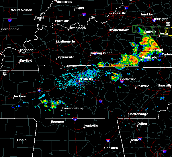 At 226 pm cdt, a severe thunderstorm was located near tompkinsville, moving southeast at 35 mph (radar indicated). Hazards include 60 mph wind gusts and quarter size hail. Hail damage to vehicles is expected. expect wind damage to roofs, siding, and trees. Locations impacted include, tompkinsville, gamaliel, ashlock, littrell, freetown, peytonsburg, blythe, otia, vernon and frogue. At 226 pm cdt, a severe thunderstorm was located near tompkinsville, moving southeast at 35 mph (radar indicated). Hazards include 60 mph wind gusts and quarter size hail. Hail damage to vehicles is expected. expect wind damage to roofs, siding, and trees. Locations impacted include, tompkinsville, gamaliel, ashlock, littrell, freetown, peytonsburg, blythe, otia, vernon and frogue.
|
| 7/7/2016 3:30 PM CDT | Trees and power lines down county wide. in monroe county KY, 0.5 miles S of Tompkinsville, KY |
| 7/7/2016 3:21 PM CDT |
 At 321 pm cdt, severe thunderstorms were located along and behind a line extending from near glasgow to 12 miles northwest of red boiling springs to near lafayette, moving east at 50 mph (radar indicated). Hazards include 70 mph wind gusts. Expect considerable tree damage. Damage is likely to mobile homes, roofs, and outbuildings. At 321 pm cdt, severe thunderstorms were located along and behind a line extending from near glasgow to 12 miles northwest of red boiling springs to near lafayette, moving east at 50 mph (radar indicated). Hazards include 70 mph wind gusts. Expect considerable tree damage. Damage is likely to mobile homes, roofs, and outbuildings.
|
| 7/6/2016 4:33 PM CDT |
 At 432 pm cdt, severe thunderstorms were located along a line extending from 7 miles southwest of jamestown to near lafayette, moving southeast at 40 mph (radar indicated). Hazards include 60 mph wind gusts and penny size hail. Expect damage to roofs. siding. and trees. Locations impacted include, tompkinsville, albany, jamestown, burkesville, leslie, gamaliel, aaron, freetown, ellington and wolf river dock. At 432 pm cdt, severe thunderstorms were located along a line extending from 7 miles southwest of jamestown to near lafayette, moving southeast at 40 mph (radar indicated). Hazards include 60 mph wind gusts and penny size hail. Expect damage to roofs. siding. and trees. Locations impacted include, tompkinsville, albany, jamestown, burkesville, leslie, gamaliel, aaron, freetown, ellington and wolf river dock.
|
| 7/6/2016 4:14 PM CDT |
 At 413 pm cdt, severe thunderstorms were located along a line extending from 6 miles south of columbia to near scottsville, moving southeast at 40 mph (radar indicated). Hazards include 60 mph wind gusts and penny size hail. Expect damage to roofs. siding. And trees. At 413 pm cdt, severe thunderstorms were located along a line extending from 6 miles south of columbia to near scottsville, moving southeast at 40 mph (radar indicated). Hazards include 60 mph wind gusts and penny size hail. Expect damage to roofs. siding. And trees.
|
| 7/6/2016 4:13 PM CDT |
 The severe thunderstorm warning for monroe and southwestern cumberland counties will expire at 415 pm cdt. the severe thunderstorm which prompted the warning has !** weakened. moved out of the warned area, but a new line of severe thunderstorms is approaching. Therefore, a new severe thunderstorm warning will be issued. The severe thunderstorm warning for monroe and southwestern cumberland counties will expire at 415 pm cdt. the severe thunderstorm which prompted the warning has !** weakened. moved out of the warned area, but a new line of severe thunderstorms is approaching. Therefore, a new severe thunderstorm warning will be issued.
|
| 7/6/2016 3:41 PM CDT |
 At 341 pm cdt, a severe thunderstorm was located 7 miles northeast of red boiling springs, moving east at 40 mph (radar indicated). Hazards include 60 mph wind gusts. Expect damage to roofs. siding. And trees. At 341 pm cdt, a severe thunderstorm was located 7 miles northeast of red boiling springs, moving east at 40 mph (radar indicated). Hazards include 60 mph wind gusts. Expect damage to roofs. siding. And trees.
|
| 6/4/2016 11:36 AM CDT |
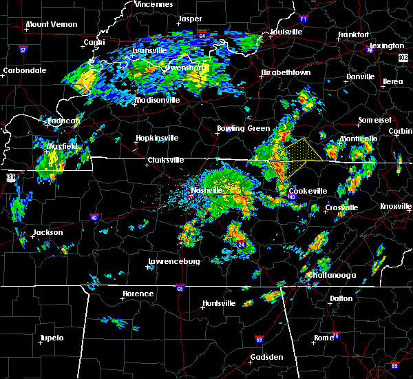 At 1135 am cdt, a severe thunderstorm was located near celina, moving east at 35 mph (radar indicated). Hazards include 60 mph wind gusts. Expect damage to roofs. siding. And trees. At 1135 am cdt, a severe thunderstorm was located near celina, moving east at 35 mph (radar indicated). Hazards include 60 mph wind gusts. Expect damage to roofs. siding. And trees.
|
| 6/4/2016 11:35 AM CDT | Tree reportedly blown down on copas road in clay county TN, 8.8 miles NNW of Tompkinsville, KY |
| 5/12/2016 2:58 PM CDT |
 At 258 pm cdt, a severe thunderstorm was located 8 miles east of red boiling springs, moving northeast at 35 mph (radar indicated). Hazards include 60 mph wind gusts. Expect damage to roofs. siding. And trees. At 258 pm cdt, a severe thunderstorm was located 8 miles east of red boiling springs, moving northeast at 35 mph (radar indicated). Hazards include 60 mph wind gusts. Expect damage to roofs. siding. And trees.
|
| 4/6/2016 6:28 PM CDT |
 At 627 pm cdt, a severe thunderstorm was located 8 miles south of edmonton, moving northeast at 55 mph (trained weather spotters reported small limbs down just east of freetown). Hazards include 60 mph wind gusts. Expect damage to roofs. siding. and trees. Locations impacted include, tompkinsville, edmonton, leslie, ashlock, cedar flats, ellington, cloyds landing, willow shade, rockbridge and goodluck. At 627 pm cdt, a severe thunderstorm was located 8 miles south of edmonton, moving northeast at 55 mph (trained weather spotters reported small limbs down just east of freetown). Hazards include 60 mph wind gusts. Expect damage to roofs. siding. and trees. Locations impacted include, tompkinsville, edmonton, leslie, ashlock, cedar flats, ellington, cloyds landing, willow shade, rockbridge and goodluck.
|
| 4/6/2016 6:18 PM CDT | Small tree limbs dow in monroe county KY, 3.6 miles NE of Tompkinsville, KY |
| 4/6/2016 6:11 PM CDT |
 At 610 pm cdt, a severe thunderstorm was located 8 miles northwest of tompkinsville, moving northeast at 55 mph (radar indicated). Hazards include 60 mph wind gusts. Expect damage to roofs. siding. And trees. At 610 pm cdt, a severe thunderstorm was located 8 miles northwest of tompkinsville, moving northeast at 55 mph (radar indicated). Hazards include 60 mph wind gusts. Expect damage to roofs. siding. And trees.
|
| 7/14/2015 2:01 PM CDT |
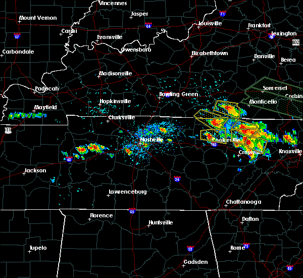 The severe thunderstorm warning for south central cumberland and eastern monroe counties will expire at 310 pm edt/210 pm cdt/, the storm which prompted the warning has moved out of the warned area. to report severe weather, contact your nearest law enforcement agency. they will relay your report to the national weather service in louisville. The severe thunderstorm warning for south central cumberland and eastern monroe counties will expire at 310 pm edt/210 pm cdt/, the storm which prompted the warning has moved out of the warned area. to report severe weather, contact your nearest law enforcement agency. they will relay your report to the national weather service in louisville.
|
| 7/14/2015 1:39 PM CDT |
 At 136 pm cdt, a severe thunderstorm was located near tompkinsville, and moving southeast at 20 mph. a recent report of baseball sized hail in tompkinsville just came into our office. take shelter immediately. this is a very dangerous storm (radar indicated). Hazards include baseball size hail and 60 mph wind gusts. People and animals outdoors will be severely injured. expect shattered windows, extensive damage to roofs, siding and vehicles. Locations impacted include, boles, hestand, otia, blythe, judio, vernon, raydure, ashlock and peytonsburg. At 136 pm cdt, a severe thunderstorm was located near tompkinsville, and moving southeast at 20 mph. a recent report of baseball sized hail in tompkinsville just came into our office. take shelter immediately. this is a very dangerous storm (radar indicated). Hazards include baseball size hail and 60 mph wind gusts. People and animals outdoors will be severely injured. expect shattered windows, extensive damage to roofs, siding and vehicles. Locations impacted include, boles, hestand, otia, blythe, judio, vernon, raydure, ashlock and peytonsburg.
|
| 7/14/2015 1:38 PM CDT | Baseball sized hail reported 0.5 miles S of Tompkinsville, KY |
| 7/14/2015 1:37 PM CDT | Golf Ball sized hail reported 0.5 miles S of Tompkinsville, KY, also reported high winds and heavy rain. |
| 7/14/2015 1:37 PM CDT |
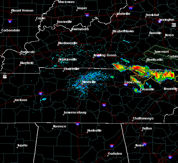 At 136 pm cdt, a severe thunderstorm was located near tompkinsville, and moving southeast at 20 mph. golfball sized hail was currently falling in tompkinsville (radar indicated). Hazards include golf ball size hail and 60 mph wind gusts. People and animals outdoors will be injured. expect hail damage to roofs, siding, windows and vehicles. expect wind damage to roofs, siding and trees. Locations impacted include, boles, hestand, otia, blythe, judio, vernon, raydure, ashlock and peytonsburg. At 136 pm cdt, a severe thunderstorm was located near tompkinsville, and moving southeast at 20 mph. golfball sized hail was currently falling in tompkinsville (radar indicated). Hazards include golf ball size hail and 60 mph wind gusts. People and animals outdoors will be injured. expect hail damage to roofs, siding, windows and vehicles. expect wind damage to roofs, siding and trees. Locations impacted include, boles, hestand, otia, blythe, judio, vernon, raydure, ashlock and peytonsburg.
|
| 7/14/2015 1:27 PM CDT |
 At 125 pm cdt, a severe thunderstorm was located near tompkinsville, and moving southeast at 25 mph (radar indicated). Hazards include 60 mph wind gusts and half dollar size hail. Hail damage to vehicles is expected. Expect wind damage to roofs, siding and trees. At 125 pm cdt, a severe thunderstorm was located near tompkinsville, and moving southeast at 25 mph (radar indicated). Hazards include 60 mph wind gusts and half dollar size hail. Hail damage to vehicles is expected. Expect wind damage to roofs, siding and trees.
|
| 7/14/2015 1:17 PM CDT |
 At 116 pm cdt, a severe thunderstorm was located near tompkinsville, and moving southeast at 30 mph (radar indicated). Hazards include 60 mph wind gusts and quarter size hail. Hail damage to vehicles is expected. expect wind damage to roofs, siding and trees. Locations impacted include, tompkinsville, grandview and harlan crossroads. At 116 pm cdt, a severe thunderstorm was located near tompkinsville, and moving southeast at 30 mph (radar indicated). Hazards include 60 mph wind gusts and quarter size hail. Hail damage to vehicles is expected. expect wind damage to roofs, siding and trees. Locations impacted include, tompkinsville, grandview and harlan crossroads.
|
| 7/14/2015 12:57 PM CDT |
 At 1255 pm cdt, a severe thunderstorm was located 13 miles west of tompkinsville, and moving southeast at 30 mph (radar indicated). Hazards include 60 mph wind gusts and quarter size hail. Hail damage to vehicles is expected. Expect wind damage to roofs, siding and trees. At 1255 pm cdt, a severe thunderstorm was located 13 miles west of tompkinsville, and moving southeast at 30 mph (radar indicated). Hazards include 60 mph wind gusts and quarter size hail. Hail damage to vehicles is expected. Expect wind damage to roofs, siding and trees.
|
| 7/2/2015 6:01 PM CDT |
 At 558 pm cdt, a severe thunderstorm was located 5 miles west of tompkinsville, and moving southeast at 15 mph (radar indicated). Hazards include 60 mph wind gusts and quarter size hail. Hail damage to vehicles is expected. expect wind damage to roofs, siding and trees. Locations impacted include, tompkinsville, freetown, grandview, gamaliel, harlan crossroads, hestand, otia, blythe, vernon and raydure. At 558 pm cdt, a severe thunderstorm was located 5 miles west of tompkinsville, and moving southeast at 15 mph (radar indicated). Hazards include 60 mph wind gusts and quarter size hail. Hail damage to vehicles is expected. expect wind damage to roofs, siding and trees. Locations impacted include, tompkinsville, freetown, grandview, gamaliel, harlan crossroads, hestand, otia, blythe, vernon and raydure.
|
| 7/2/2015 5:46 PM CDT |
 At 543 pm cdt, a severe thunderstorm was located 7 miles northwest of tompkinsville, and moving southeast at 15 mph (radar indicated). Hazards include 60 mph wind gusts. Expect damage to roofs. Siding and trees. At 543 pm cdt, a severe thunderstorm was located 7 miles northwest of tompkinsville, and moving southeast at 15 mph (radar indicated). Hazards include 60 mph wind gusts. Expect damage to roofs. Siding and trees.
|
| 6/30/2015 12:06 PM CDT |
 At 1204 pm cdt, a severe thunderstorm was located 8 miles west of burkesville, and moving east at 30 mph (radar indicated). Hazards include 60 mph wind gusts and nickel size hail. Expect damage to roofs. siding and trees. Locations impacted include, burkesville, cloyds landing, waterview, judio, arat, leslie, stalcup, grider, ellington, littrell, tanbark, bakerton, kettle, bow, amandaville, claywell, modoc, frogue, green grove and hegira. At 1204 pm cdt, a severe thunderstorm was located 8 miles west of burkesville, and moving east at 30 mph (radar indicated). Hazards include 60 mph wind gusts and nickel size hail. Expect damage to roofs. siding and trees. Locations impacted include, burkesville, cloyds landing, waterview, judio, arat, leslie, stalcup, grider, ellington, littrell, tanbark, bakerton, kettle, bow, amandaville, claywell, modoc, frogue, green grove and hegira.
|
| 6/30/2015 11:42 AM CDT |
 At 1141 am cdt, a severe thunderstorm was located 8 miles north of tompkinsville, and moving east at 30 mph (radar indicated). Hazards include 60 mph wind gusts and quarter size hail. Hail damage to vehicles is expected. Expect wind damage to roofs, siding and trees. At 1141 am cdt, a severe thunderstorm was located 8 miles north of tompkinsville, and moving east at 30 mph (radar indicated). Hazards include 60 mph wind gusts and quarter size hail. Hail damage to vehicles is expected. Expect wind damage to roofs, siding and trees.
|
| 4/20/2015 2:36 AM CDT | At 234 am cdt, a severe thunderstorm was located 11 miles northeast of tompkinsville, and moving northeast at 55 mph (radar indicated). Hazards include 60 mph wind gusts and penny size hail. Expect damage to roofs. siding and trees. locations impacted include, leslie, waterview, grider, cofer and bakerton. 0. 75in. |
| 4/20/2015 2:22 AM CDT | At 220 am cdt, a severe thunderstorm was located 5 miles west of tompkinsville, and moving northeast at 55 mph (radar indicated). Hazards include 60 mph wind gusts and penny size hail. Expect damage to roofs. Siding and trees. |
| 4/10/2015 3:54 AM CDT | A severe thunderstorm warning remains in effect for clinton. cumberland. southern casey. southeastern adair. russell. southeastern monroe and south central lincoln counties until 430 am cdt/530 am edt/. at 451 am edt/351 am cdt/. Severe thunderstorms were located along a line extending from liberty to 6 miles northwest of jamestown to 9. |
| 4/10/2015 3:33 AM CDT | A severe thunderstorm warning remains in effect for northwestern cumberland. west central casey. adair. south central taylor. eastern monroe and southeastern metcalfe counties until 400 am cdt/500 am edt/. at 430 am edt/330 am cdt/. Severe thunderstorms were located along a line extending from 8 miles east of campbellsville to columbia to 8. |
| 4/10/2015 3:29 AM CDT | The national weather service in louisville has issued a * severe thunderstorm warning for. southeastern adair county in south central kentucky. southern casey county in south central kentucky. clinton county in south central kentucky. Cumberland county in south central kentucky. |
| 4/10/2015 3:14 AM CDT | The national weather service in louisville has issued a * severe thunderstorm warning for. adair county in south central kentucky. west central casey county in south central kentucky. northwestern cumberland county in south central kentucky. Southeastern green county in south central kentucky. |
| 12/21/2013 10:35 PM CST | A few trees down in the western part of the county near mos in clay county TN, 8.1 miles NNW of Tompkinsville, KY |
| 9/1/2012 5:10 PM CDT | Power line down on county house roa in monroe county KY, 3.9 miles E of Tompkinsville, KY |
| 7/19/2012 9:15 PM CDT | A tree fell across flippin lamb road east of flippi in monroe county KY, 5.8 miles ESE of Tompkinsville, KY |
| 7/19/2012 9:04 PM CDT | Two trees fell across monroe county. one fell across celine road north of tompkinsvill in monroe county KY, 6.7 miles S of Tompkinsville, KY |
| 7/8/2012 7:17 PM CDT | A downburst from a thunderstorm south of monroe county travelled north. several trees fell across roads in and around tompkinsvill in monroe county KY, 0.5 miles S of Tompkinsville, KY |
| 7/8/2012 7:00 PM CDT | Trees were downed on mccormick ridge road and baptist ridge road in the union hill communit in clay county TN, 9.9 miles N of Tompkinsville, KY |
| 7/8/2012 5:14 PM CDT | The monroe county judge reported a house damaged by winds along state highway 63 west of tompkinsvill in monroe county KY, 3.3 miles E of Tompkinsville, KY |
| 7/2/2012 5:25 PM CDT | Trees down on highway 16 in monroe county KY, 4.9 miles NW of Tompkinsville, KY |
| 1/1/0001 12:00 AM | Two trees down on hwy 10 in monroe county KY, 1.8 miles ENE of Tompkinsville, KY |
| 1/1/0001 12:00 AM | Trees down near centerpoint roa in monroe county KY, 0.5 miles S of Tompkinsville, KY |
| 1/1/0001 12:00 AM | Quarter sized hail reported 0.5 miles S of Tompkinsville, KY, spotter reports pea to quarter sized hail |
| 1/1/0001 12:00 AM | Ping Pong Ball sized hail reported 0.5 miles S of Tompkinsville, KY, spotter reports hail just under golf ball size |
Hail Maps for Tompkinsville, KY
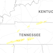


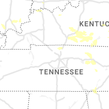


Connect with Interactive Hail Maps