

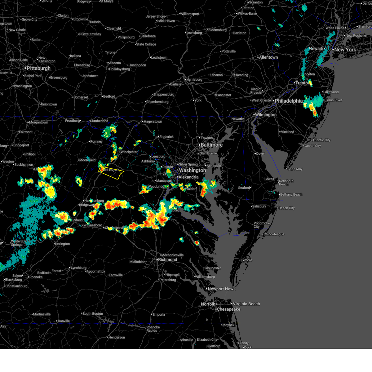
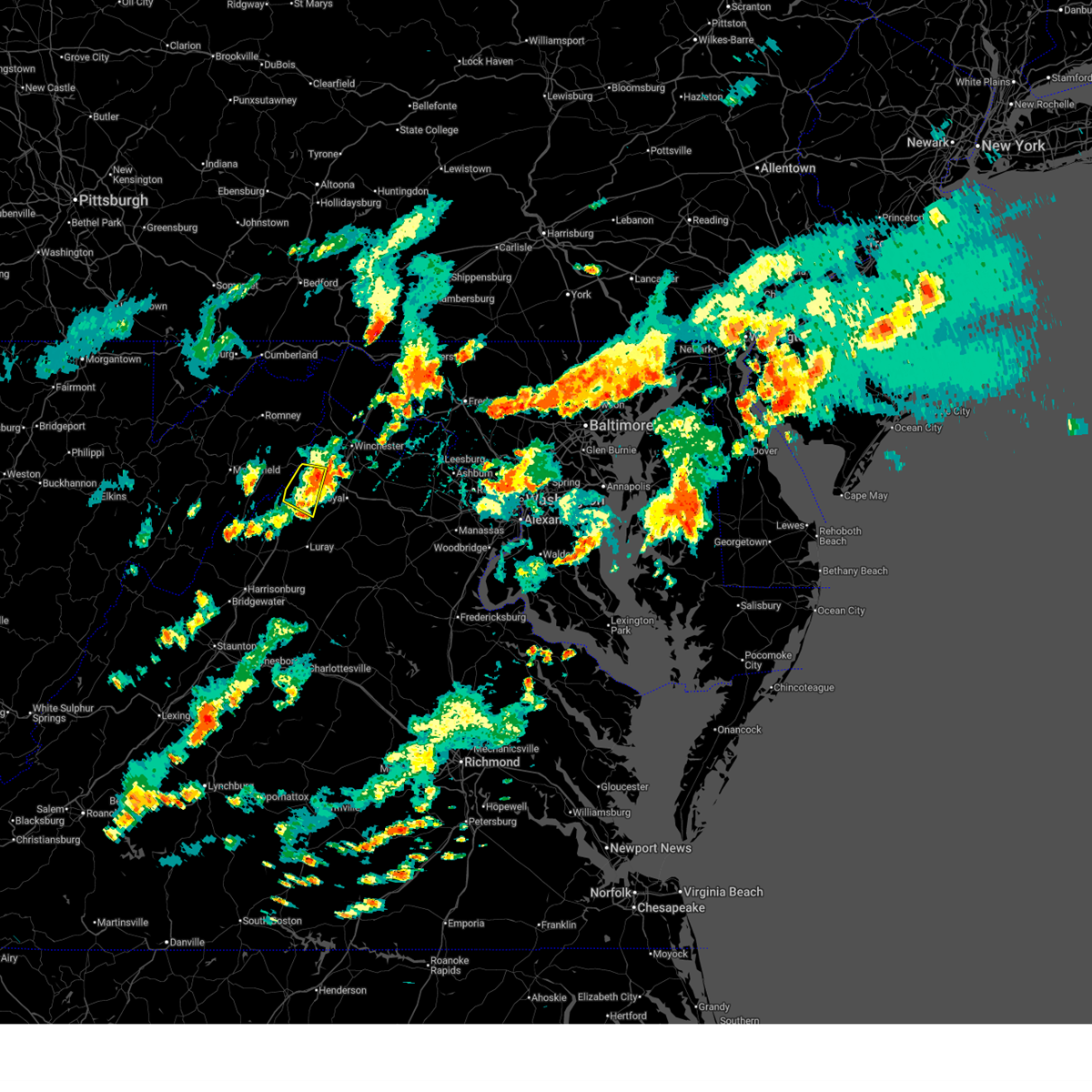
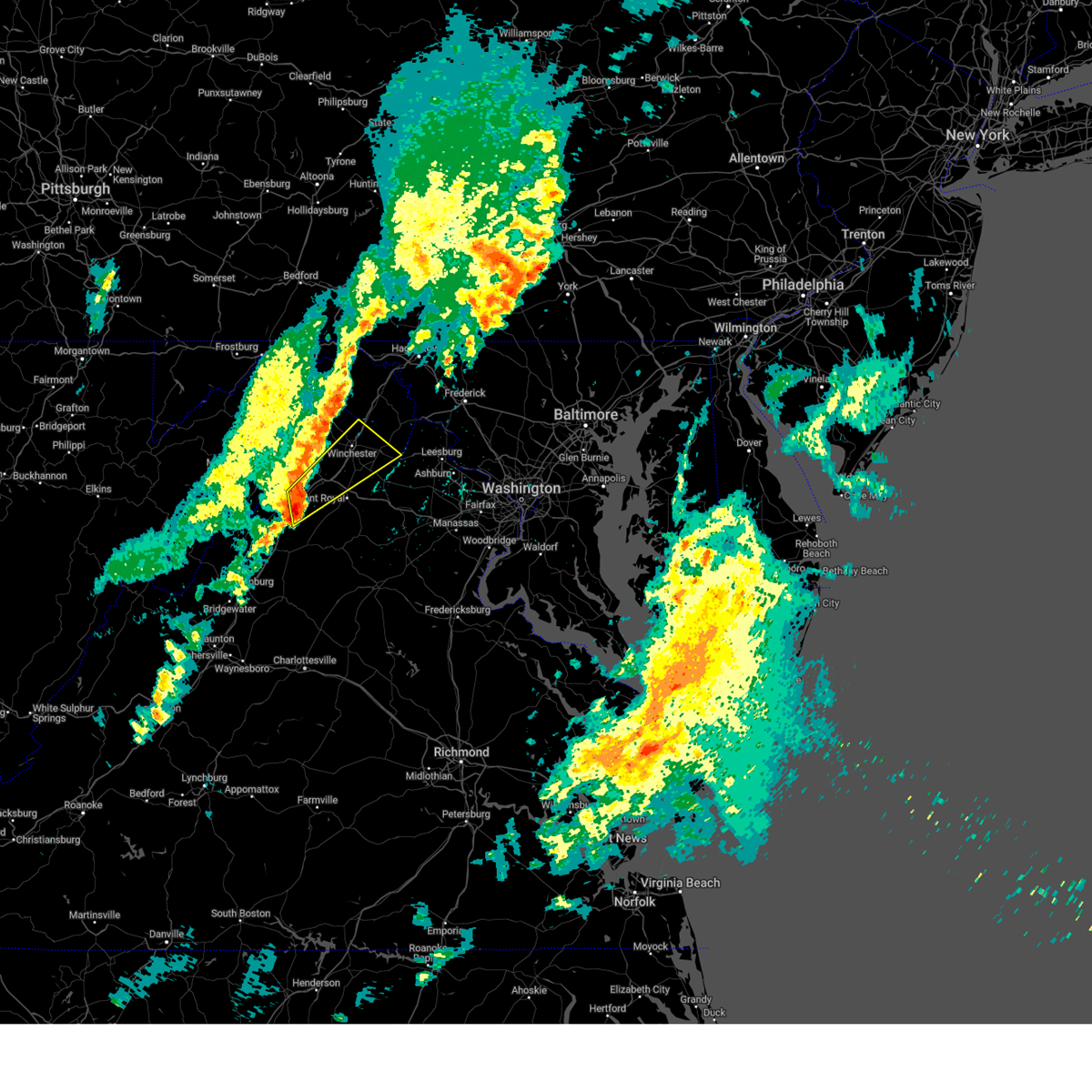
Hail Map for Toms Brook, VA
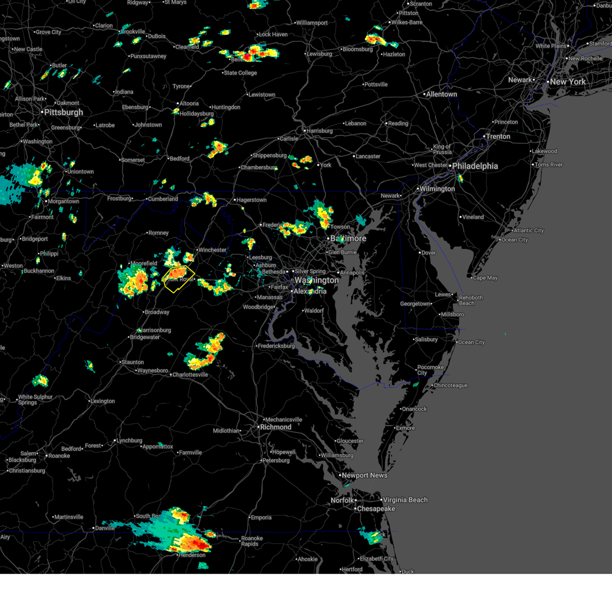
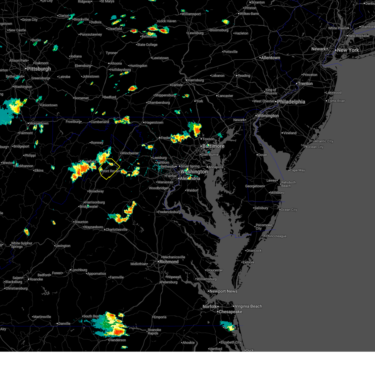
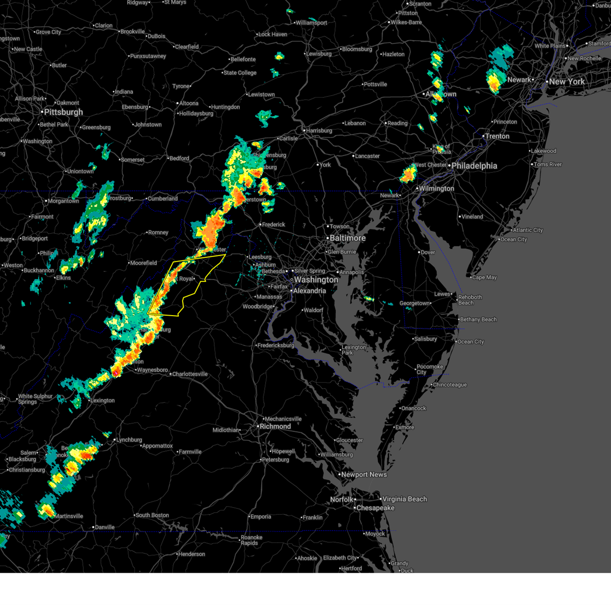
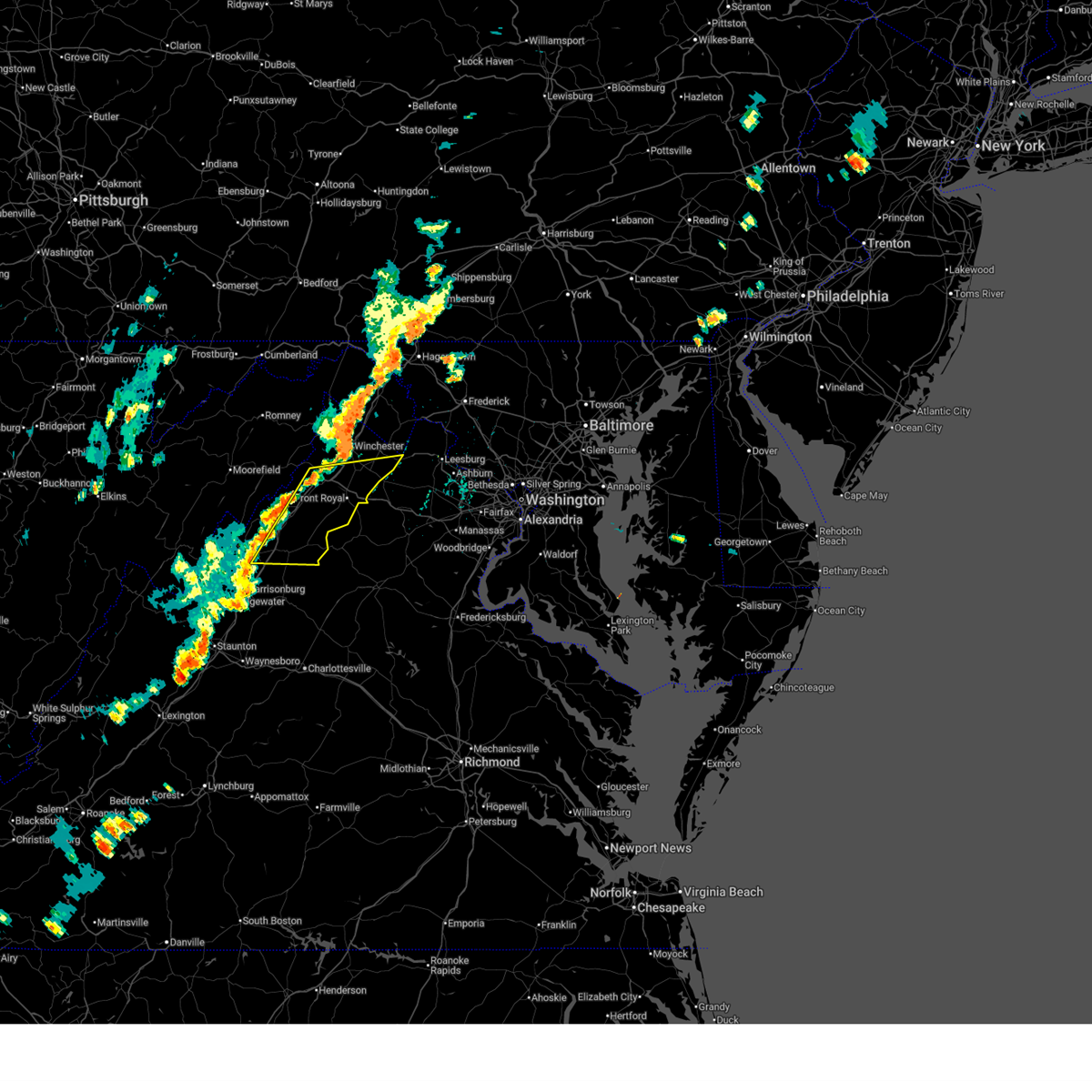
The Toms Brook, VA area has had 0 reports of on-the-ground hail by trained spotters, and has been under severe weather warnings 8 times during the past 12 months. Doppler radar has detected hail at or near Toms Brook, VA on 29 occasions.
| Name: | Toms Brook, VA |
| Where Located: | 75.7 miles E of Elkins, WV |
| Map: | Google Map for Toms Brook, VA |
| Population: | 258 |
| Housing Units: | 111 |
| More Info: | Search Google for Toms Brook, VA |
3
The Top Recent Hail Date for Toms Brook, VA is Sunday, March 16, 2025 (2nd out of 29)

Hail and Wind Damage Spotted near Toms Brook, VA
| Date / Time | Report Details |
|---|---|
| 6/12/2026 5:35 PM EDT |
 Svrlwx the national weather service in sterling virginia has issued a * severe thunderstorm warning for, east central shenandoah county in northwestern virginia, southern warren county in northwestern virginia, northeastern page county in northwestern virginia, * until 615 pm edt. * at 535 pm edt, a severe thunderstorm was located over woodstock, moving east at 30 mph (radar indicated). Hazards include 60 mph wind gusts and quarter size hail. Damaging winds will cause some trees and large branches to fall. this could injure those outdoors, as well as damage homes and vehicles. roadways may become blocked by downed trees. localized power outages are possible. Unsecured light objects may become projectiles. Svrlwx the national weather service in sterling virginia has issued a * severe thunderstorm warning for, east central shenandoah county in northwestern virginia, southern warren county in northwestern virginia, northeastern page county in northwestern virginia, * until 615 pm edt. * at 535 pm edt, a severe thunderstorm was located over woodstock, moving east at 30 mph (radar indicated). Hazards include 60 mph wind gusts and quarter size hail. Damaging winds will cause some trees and large branches to fall. this could injure those outdoors, as well as damage homes and vehicles. roadways may become blocked by downed trees. localized power outages are possible. Unsecured light objects may become projectiles.
|
| 6/11/2026 6:42 PM EDT |
 Svrlwx the national weather service in sterling virginia has issued a * severe thunderstorm warning for, northern madison county in northwestern virginia, eastern shenandoah county in northwestern virginia, south central frederick county in northwestern virginia, east central rockingham county in western virginia, warren county in northwestern virginia, southwestern clarke county in northwestern virginia, page county in northwestern virginia, rappahannock county in northwestern virginia, northern greene county in central virginia, fauquier county in northern virginia, culpeper county in northern virginia, * until 730 pm edt. * at 642 pm edt, severe thunderstorms were located along a line extending from near strasburg to near stanley, moving east at 45 mph (radar indicated). Hazards include 60 mph wind gusts. Damaging winds will cause some trees and large branches to fall. this could injure those outdoors, as well as damage homes and vehicles. roadways may become blocked by downed trees. localized power outages are possible. Unsecured light objects may become projectiles. Svrlwx the national weather service in sterling virginia has issued a * severe thunderstorm warning for, northern madison county in northwestern virginia, eastern shenandoah county in northwestern virginia, south central frederick county in northwestern virginia, east central rockingham county in western virginia, warren county in northwestern virginia, southwestern clarke county in northwestern virginia, page county in northwestern virginia, rappahannock county in northwestern virginia, northern greene county in central virginia, fauquier county in northern virginia, culpeper county in northern virginia, * until 730 pm edt. * at 642 pm edt, severe thunderstorms were located along a line extending from near strasburg to near stanley, moving east at 45 mph (radar indicated). Hazards include 60 mph wind gusts. Damaging winds will cause some trees and large branches to fall. this could injure those outdoors, as well as damage homes and vehicles. roadways may become blocked by downed trees. localized power outages are possible. Unsecured light objects may become projectiles.
|
| 6/11/2026 6:33 PM EDT |
 At 632 pm edt, severe thunderstorms were located along a line extending from near hancock to near star tannery to near timberville, moving east at 30 mph (radar indicated). Hazards include 60 mph wind gusts. Damaging winds will cause some trees and large branches to fall. this could injure those outdoors, as well as damage homes and vehicles. roadways may become blocked by downed trees. localized power outages are possible. unsecured light objects may become projectiles. Locations impacted include, winchester, martinsburg, strasburg, woodstock, hancock, millwood pike, luray, broadway, inwood, timberville, wilson-conococheague, williamsport, mount jackson, stephens city, stanley, berkeley springs, star tannery, basye-bryce mountain, berkeley, and maugansville. At 632 pm edt, severe thunderstorms were located along a line extending from near hancock to near star tannery to near timberville, moving east at 30 mph (radar indicated). Hazards include 60 mph wind gusts. Damaging winds will cause some trees and large branches to fall. this could injure those outdoors, as well as damage homes and vehicles. roadways may become blocked by downed trees. localized power outages are possible. unsecured light objects may become projectiles. Locations impacted include, winchester, martinsburg, strasburg, woodstock, hancock, millwood pike, luray, broadway, inwood, timberville, wilson-conococheague, williamsport, mount jackson, stephens city, stanley, berkeley springs, star tannery, basye-bryce mountain, berkeley, and maugansville.
|
| 6/11/2026 6:15 PM EDT |
 Svrlwx the national weather service in sterling virginia has issued a * severe thunderstorm warning for, northwestern washington county in north central maryland, northeastern allegany county in western maryland, shenandoah county in northwestern virginia, frederick county in northwestern virginia, northern rockingham county in western virginia, western warren county in northwestern virginia, northern page county in northwestern virginia, the city of winchester in northwestern virginia, morgan county in the panhandle of west virginia, central hardy county in eastern west virginia, berkeley county in the panhandle of west virginia, hampshire county in eastern west virginia, * until 645 pm edt. * at 615 pm edt, severe thunderstorms were located along a line extending from near barnes gap to near wardensville to 6 miles northwest of broadway, moving east at 35 mph (radar indicated). Hazards include 60 mph wind gusts. Damaging winds will cause some trees and large branches to fall. this could injure those outdoors, as well as damage homes and vehicles. roadways may become blocked by downed trees. localized power outages are possible. Unsecured light objects may become projectiles. Svrlwx the national weather service in sterling virginia has issued a * severe thunderstorm warning for, northwestern washington county in north central maryland, northeastern allegany county in western maryland, shenandoah county in northwestern virginia, frederick county in northwestern virginia, northern rockingham county in western virginia, western warren county in northwestern virginia, northern page county in northwestern virginia, the city of winchester in northwestern virginia, morgan county in the panhandle of west virginia, central hardy county in eastern west virginia, berkeley county in the panhandle of west virginia, hampshire county in eastern west virginia, * until 645 pm edt. * at 615 pm edt, severe thunderstorms were located along a line extending from near barnes gap to near wardensville to 6 miles northwest of broadway, moving east at 35 mph (radar indicated). Hazards include 60 mph wind gusts. Damaging winds will cause some trees and large branches to fall. this could injure those outdoors, as well as damage homes and vehicles. roadways may become blocked by downed trees. localized power outages are possible. Unsecured light objects may become projectiles.
|
| 7/31/2025 4:22 PM EDT |
 The storms which prompted the warning have moved out of the area. therefore, the warning will be allowed to expire. however, heavy rain is still possible with these thunderstorms. a severe thunderstorm watch remains in effect until 800 pm edt for northwestern virginia, and eastern west virginia. remember, a severe thunderstorm warning still remains in effect for northeastern shenandoah county until 445 pm edt. The storms which prompted the warning have moved out of the area. therefore, the warning will be allowed to expire. however, heavy rain is still possible with these thunderstorms. a severe thunderstorm watch remains in effect until 800 pm edt for northwestern virginia, and eastern west virginia. remember, a severe thunderstorm warning still remains in effect for northeastern shenandoah county until 445 pm edt.
|
| 7/31/2025 4:05 PM EDT |
 At 404 pm edt, severe thunderstorms were located along a line extending from near star tannery to near woodstock to near mount jackson, moving southeast at 20 mph (radar indicated). Hazards include 60 mph wind gusts. Damaging winds will cause some trees and large branches to fall. this could injure those outdoors, as well as damage homes and vehicles. roadways may become blocked by downed trees. localized power outages are possible. unsecured light objects may become projectiles. Locations impacted include, strasburg, woodstock, star tannery, maurertown, toms brook, gravel springs, alonzaville, fishers hill, and clary. At 404 pm edt, severe thunderstorms were located along a line extending from near star tannery to near woodstock to near mount jackson, moving southeast at 20 mph (radar indicated). Hazards include 60 mph wind gusts. Damaging winds will cause some trees and large branches to fall. this could injure those outdoors, as well as damage homes and vehicles. roadways may become blocked by downed trees. localized power outages are possible. unsecured light objects may become projectiles. Locations impacted include, strasburg, woodstock, star tannery, maurertown, toms brook, gravel springs, alonzaville, fishers hill, and clary.
|
| 7/31/2025 4:05 PM EDT |
 the severe thunderstorm warning has been cancelled and is no longer in effect the severe thunderstorm warning has been cancelled and is no longer in effect
|
| 7/31/2025 3:54 PM EDT |
 Svrlwx the national weather service in sterling virginia has issued a * severe thunderstorm warning for, shenandoah county in northwestern virginia, southwestern frederick county in northwestern virginia, central page county in northwestern virginia, east central hardy county in eastern west virginia, * until 430 pm edt. * at 354 pm edt, severe thunderstorms were located along a line extending from near wardensville to 6 miles northwest of woodstock to near basye-bryce mountain, moving southeast at 20 mph (radar indicated). Hazards include 60 mph wind gusts. Damaging winds will cause some trees and large branches to fall. this could injure those outdoors, as well as damage homes and vehicles. roadways may become blocked by downed trees. localized power outages are possible. Unsecured light objects may become projectiles. Svrlwx the national weather service in sterling virginia has issued a * severe thunderstorm warning for, shenandoah county in northwestern virginia, southwestern frederick county in northwestern virginia, central page county in northwestern virginia, east central hardy county in eastern west virginia, * until 430 pm edt. * at 354 pm edt, severe thunderstorms were located along a line extending from near wardensville to 6 miles northwest of woodstock to near basye-bryce mountain, moving southeast at 20 mph (radar indicated). Hazards include 60 mph wind gusts. Damaging winds will cause some trees and large branches to fall. this could injure those outdoors, as well as damage homes and vehicles. roadways may become blocked by downed trees. localized power outages are possible. Unsecured light objects may become projectiles.
|
| 6/25/2025 2:21 PM EDT |
 At 221 pm edt, severe thunderstorms were located along a line extending from strasburg to woodstock, moving southeast at 10 mph (radar indicated). Hazards include 60 mph wind gusts. Damaging winds will cause some trees and large branches to fall. this could injure those outdoors, as well as damage homes and vehicles. roadways may become blocked by downed trees. localized power outages are possible. unsecured light objects may become projectiles. Locations impacted include, strasburg, woodstock, maurertown, toms brook, saint davids church, fort valley, seven fountains, dilbeck, fishers hill, and buckton. At 221 pm edt, severe thunderstorms were located along a line extending from strasburg to woodstock, moving southeast at 10 mph (radar indicated). Hazards include 60 mph wind gusts. Damaging winds will cause some trees and large branches to fall. this could injure those outdoors, as well as damage homes and vehicles. roadways may become blocked by downed trees. localized power outages are possible. unsecured light objects may become projectiles. Locations impacted include, strasburg, woodstock, maurertown, toms brook, saint davids church, fort valley, seven fountains, dilbeck, fishers hill, and buckton.
|
| 6/25/2025 2:10 PM EDT |
 At 210 pm edt, severe thunderstorms were located along a line extending from strasburg to near woodstock, moving southeast at 10 mph (radar indicated). Hazards include 60 mph wind gusts. Damaging winds will cause some trees and large branches to fall. this could injure those outdoors, as well as damage homes and vehicles. roadways may become blocked by downed trees. localized power outages are possible. unsecured light objects may become projectiles. Locations impacted include, strasburg, woodstock, middletown, maurertown, toms brook, fort valley, seven fountains, dilbeck, alonzaville, reliance, saint davids church, fishers hill, clary, and buckton. At 210 pm edt, severe thunderstorms were located along a line extending from strasburg to near woodstock, moving southeast at 10 mph (radar indicated). Hazards include 60 mph wind gusts. Damaging winds will cause some trees and large branches to fall. this could injure those outdoors, as well as damage homes and vehicles. roadways may become blocked by downed trees. localized power outages are possible. unsecured light objects may become projectiles. Locations impacted include, strasburg, woodstock, middletown, maurertown, toms brook, fort valley, seven fountains, dilbeck, alonzaville, reliance, saint davids church, fishers hill, clary, and buckton.
|
| 6/25/2025 1:57 PM EDT |
 Svrlwx the national weather service in sterling virginia has issued a * severe thunderstorm warning for, northeastern shenandoah county in northwestern virginia, southwestern frederick county in northwestern virginia, northwestern warren county in northwestern virginia, * until 230 pm edt. * at 157 pm edt, severe thunderstorms were located along a line extending from near strasburg to near woodstock, moving southeast at 10 mph (radar indicated). Hazards include 60 mph wind gusts. Damaging winds will cause some trees and large branches to fall. this could injure those outdoors, as well as damage homes and vehicles. roadways may become blocked by downed trees. localized power outages are possible. Unsecured light objects may become projectiles. Svrlwx the national weather service in sterling virginia has issued a * severe thunderstorm warning for, northeastern shenandoah county in northwestern virginia, southwestern frederick county in northwestern virginia, northwestern warren county in northwestern virginia, * until 230 pm edt. * at 157 pm edt, severe thunderstorms were located along a line extending from near strasburg to near woodstock, moving southeast at 10 mph (radar indicated). Hazards include 60 mph wind gusts. Damaging winds will cause some trees and large branches to fall. this could injure those outdoors, as well as damage homes and vehicles. roadways may become blocked by downed trees. localized power outages are possible. Unsecured light objects may become projectiles.
|
| 6/19/2025 2:34 PM EDT |
 At 234 pm edt, severe thunderstorms were located along a line extending from 6 miles east of woodstock to near massanutten, moving east at 25 mph (radar indicated). Hazards include 60 mph wind gusts. Damaging winds will cause some trees and large branches to fall. this could injure those outdoors, as well as damage homes and vehicles. roadways may become blocked by downed trees. localized power outages are possible. unsecured light objects may become projectiles. Locations impacted include, front royal, strasburg, woodstock, luray, mount jackson, stephens city, stanley, linden, new market, middletown, edinburg, chester gap, maurertown, boyce, toms brook, alma, shenandoah caverns, seven fountains, ida, and quicksburg. At 234 pm edt, severe thunderstorms were located along a line extending from 6 miles east of woodstock to near massanutten, moving east at 25 mph (radar indicated). Hazards include 60 mph wind gusts. Damaging winds will cause some trees and large branches to fall. this could injure those outdoors, as well as damage homes and vehicles. roadways may become blocked by downed trees. localized power outages are possible. unsecured light objects may become projectiles. Locations impacted include, front royal, strasburg, woodstock, luray, mount jackson, stephens city, stanley, linden, new market, middletown, edinburg, chester gap, maurertown, boyce, toms brook, alma, shenandoah caverns, seven fountains, ida, and quicksburg.
|
| 6/19/2025 2:24 PM EDT | Tree down near old valley pike and toll house rd in shenandoah county VA, 0.7 miles NE of Toms Brook, VA |
| 6/19/2025 2:15 PM EDT |
 Svrlwx the national weather service in sterling virginia has issued a * severe thunderstorm warning for, shenandoah county in northwestern virginia, southeastern frederick county in northwestern virginia, east central rockingham county in western virginia, warren county in northwestern virginia, southern clarke county in northwestern virginia, page county in northwestern virginia, south central jefferson county in the panhandle of west virginia, * until 245 pm edt. * at 215 pm edt, severe thunderstorms were located along a line extending from near woodstock to dale enterprise, moving east at 25 mph (radar indicated). Hazards include 60 mph wind gusts. Damaging winds will cause some trees and large branches to fall. this could injure those outdoors, as well as damage homes and vehicles. roadways may become blocked by downed trees. localized power outages are possible. Unsecured light objects may become projectiles. Svrlwx the national weather service in sterling virginia has issued a * severe thunderstorm warning for, shenandoah county in northwestern virginia, southeastern frederick county in northwestern virginia, east central rockingham county in western virginia, warren county in northwestern virginia, southern clarke county in northwestern virginia, page county in northwestern virginia, south central jefferson county in the panhandle of west virginia, * until 245 pm edt. * at 215 pm edt, severe thunderstorms were located along a line extending from near woodstock to dale enterprise, moving east at 25 mph (radar indicated). Hazards include 60 mph wind gusts. Damaging winds will cause some trees and large branches to fall. this could injure those outdoors, as well as damage homes and vehicles. roadways may become blocked by downed trees. localized power outages are possible. Unsecured light objects may become projectiles.
|
| 3/16/2025 7:51 PM EDT |
 Svrlwx the national weather service in sterling virginia has issued a * severe thunderstorm warning for, northeastern shenandoah county in northwestern virginia, southeastern frederick county in northwestern virginia, northwestern warren county in northwestern virginia, clarke county in northwestern virginia, the city of winchester in northwestern virginia, * until 815 pm edt. * at 751 pm edt, severe thunderstorms were located along a line extending from near star tannery to near strasburg to near woodstock, moving northeast at 65 mph (radar indicated). Hazards include 60 mph wind gusts. Damaging winds will cause some trees and large branches to fall. this could injure those outdoors, as well as damage homes and vehicles. roadways may become blocked by downed trees. localized power outages are possible. Unsecured light objects may become projectiles. Svrlwx the national weather service in sterling virginia has issued a * severe thunderstorm warning for, northeastern shenandoah county in northwestern virginia, southeastern frederick county in northwestern virginia, northwestern warren county in northwestern virginia, clarke county in northwestern virginia, the city of winchester in northwestern virginia, * until 815 pm edt. * at 751 pm edt, severe thunderstorms were located along a line extending from near star tannery to near strasburg to near woodstock, moving northeast at 65 mph (radar indicated). Hazards include 60 mph wind gusts. Damaging winds will cause some trees and large branches to fall. this could injure those outdoors, as well as damage homes and vehicles. roadways may become blocked by downed trees. localized power outages are possible. Unsecured light objects may become projectiles.
|
| 3/16/2025 6:43 PM EDT |
 the severe thunderstorm warning has been cancelled and is no longer in effect the severe thunderstorm warning has been cancelled and is no longer in effect
|
| 3/16/2025 6:43 PM EDT |
 At 643 pm edt, severe thunderstorms were located along a line extending from near greenwood to near woodstock, moving northeast at 50 mph (radar indicated). Hazards include 60 mph wind gusts and quarter size hail. Damaging winds will cause some trees and large branches to fall. this could injure those outdoors, as well as damage homes and vehicles. roadways may become blocked by downed trees. localized power outages are possible. unsecured light objects may become projectiles. Locations impacted include, johnsons mill, cedar grove, clear brook, oakland, strasburg, stephenson, cross junction, cedar hill, jones springs, millwood pike, albin, unger, gore, new hope, clary, glengary, greenwood, shanghai, gerrardstown, and high view manor. At 643 pm edt, severe thunderstorms were located along a line extending from near greenwood to near woodstock, moving northeast at 50 mph (radar indicated). Hazards include 60 mph wind gusts and quarter size hail. Damaging winds will cause some trees and large branches to fall. this could injure those outdoors, as well as damage homes and vehicles. roadways may become blocked by downed trees. localized power outages are possible. unsecured light objects may become projectiles. Locations impacted include, johnsons mill, cedar grove, clear brook, oakland, strasburg, stephenson, cross junction, cedar hill, jones springs, millwood pike, albin, unger, gore, new hope, clary, glengary, greenwood, shanghai, gerrardstown, and high view manor.
|
| 3/16/2025 6:29 PM EDT |
 Svrlwx the national weather service in sterling virginia has issued a * severe thunderstorm warning for, northeastern shenandoah county in northwestern virginia, frederick county in northwestern virginia, the city of winchester in northwestern virginia, central morgan county in the panhandle of west virginia, east central hardy county in eastern west virginia, western berkeley county in the panhandle of west virginia, southeastern hampshire county in eastern west virginia, * until 715 pm edt. * at 629 pm edt, severe thunderstorms were located along a line extending from 14 miles north of star tannery to near mount jackson, moving northeast at 50 mph (radar indicated). Hazards include 60 mph wind gusts and quarter size hail. Damaging winds will cause some trees and large branches to fall. this could injure those outdoors, as well as damage homes and vehicles. roadways may become blocked by downed trees. localized power outages are possible. Unsecured light objects may become projectiles. Svrlwx the national weather service in sterling virginia has issued a * severe thunderstorm warning for, northeastern shenandoah county in northwestern virginia, frederick county in northwestern virginia, the city of winchester in northwestern virginia, central morgan county in the panhandle of west virginia, east central hardy county in eastern west virginia, western berkeley county in the panhandle of west virginia, southeastern hampshire county in eastern west virginia, * until 715 pm edt. * at 629 pm edt, severe thunderstorms were located along a line extending from 14 miles north of star tannery to near mount jackson, moving northeast at 50 mph (radar indicated). Hazards include 60 mph wind gusts and quarter size hail. Damaging winds will cause some trees and large branches to fall. this could injure those outdoors, as well as damage homes and vehicles. roadways may become blocked by downed trees. localized power outages are possible. Unsecured light objects may become projectiles.
|
| 7/25/2024 12:39 PM EDT |
 the severe thunderstorm warning has been cancelled and is no longer in effect the severe thunderstorm warning has been cancelled and is no longer in effect
|
| 7/25/2024 12:25 PM EDT |
 Svrlwx the national weather service in sterling virginia has issued a * severe thunderstorm warning for, central shenandoah county in northwestern virginia, * until 100 pm edt. * at 1224 pm edt, a severe thunderstorm was located near woodstock, moving southeast at 15 mph (radar indicated). Hazards include 60 mph wind gusts and quarter size hail. Damaging winds will cause some trees and large branches to fall. this could injure those outdoors, as well as damage homes and vehicles. roadways may become blocked by downed trees. localized power outages are possible. Unsecured light objects may become projectiles. Svrlwx the national weather service in sterling virginia has issued a * severe thunderstorm warning for, central shenandoah county in northwestern virginia, * until 100 pm edt. * at 1224 pm edt, a severe thunderstorm was located near woodstock, moving southeast at 15 mph (radar indicated). Hazards include 60 mph wind gusts and quarter size hail. Damaging winds will cause some trees and large branches to fall. this could injure those outdoors, as well as damage homes and vehicles. roadways may become blocked by downed trees. localized power outages are possible. Unsecured light objects may become projectiles.
|
| 7/17/2024 3:17 PM EDT |
 the severe thunderstorm warning has been cancelled and is no longer in effect the severe thunderstorm warning has been cancelled and is no longer in effect
|
| 7/17/2024 3:03 PM EDT |
 the severe thunderstorm warning has been cancelled and is no longer in effect the severe thunderstorm warning has been cancelled and is no longer in effect
|
| 7/17/2024 3:03 PM EDT |
 At 303 pm edt, a severe thunderstorm was located over mount jackson, or 13 miles southwest of woodstock, moving east at 30 mph (radar indicated). Hazards include 60 mph wind gusts and quarter size hail. Damaging winds will cause some trees and large branches to fall. this could injure those outdoors, as well as damage homes and vehicles. roadways may become blocked by downed trees. localized power outages are possible. unsecured light objects may become projectiles. Locations impacted include, woodstock, mount jackson, basye-bryce mountain, new market, basye, edinburg, maurertown, orkney springs, kings crossing, shenandoah caverns, harmony, alonzaville, quicksburg, saint davids church, hawkinstown, forestville, mount clifton, and jerome. At 303 pm edt, a severe thunderstorm was located over mount jackson, or 13 miles southwest of woodstock, moving east at 30 mph (radar indicated). Hazards include 60 mph wind gusts and quarter size hail. Damaging winds will cause some trees and large branches to fall. this could injure those outdoors, as well as damage homes and vehicles. roadways may become blocked by downed trees. localized power outages are possible. unsecured light objects may become projectiles. Locations impacted include, woodstock, mount jackson, basye-bryce mountain, new market, basye, edinburg, maurertown, orkney springs, kings crossing, shenandoah caverns, harmony, alonzaville, quicksburg, saint davids church, hawkinstown, forestville, mount clifton, and jerome.
|
| 6/26/2024 8:10 PM EDT |
 Svrlwx the national weather service in sterling virginia has issued a * severe thunderstorm warning for, northeastern shenandoah county in northwestern virginia, southern frederick county in northwestern virginia, warren county in northwestern virginia, southwestern clarke county in northwestern virginia, northeastern page county in northwestern virginia, north central rappahannock county in northwestern virginia, northwestern fauquier county in northern virginia, the city of winchester in northwestern virginia, east central hardy county in eastern west virginia, southeastern hampshire county in eastern west virginia, * until 845 pm edt. * at 810 pm edt, severe thunderstorms were located along a line extending from near wardensville to 7 miles south of strasburg to 7 miles north of luray, moving east at 55 mph (radar indicated). Hazards include 60 mph wind gusts. Damaging winds will cause some trees and large branches to fall. this could injure those outdoors, as well as damage homes and vehicles. roadways may become blocked by downed trees. localized power outages are possible. Unsecured light objects may become projectiles. Svrlwx the national weather service in sterling virginia has issued a * severe thunderstorm warning for, northeastern shenandoah county in northwestern virginia, southern frederick county in northwestern virginia, warren county in northwestern virginia, southwestern clarke county in northwestern virginia, northeastern page county in northwestern virginia, north central rappahannock county in northwestern virginia, northwestern fauquier county in northern virginia, the city of winchester in northwestern virginia, east central hardy county in eastern west virginia, southeastern hampshire county in eastern west virginia, * until 845 pm edt. * at 810 pm edt, severe thunderstorms were located along a line extending from near wardensville to 7 miles south of strasburg to 7 miles north of luray, moving east at 55 mph (radar indicated). Hazards include 60 mph wind gusts. Damaging winds will cause some trees and large branches to fall. this could injure those outdoors, as well as damage homes and vehicles. roadways may become blocked by downed trees. localized power outages are possible. Unsecured light objects may become projectiles.
|
| 5/26/2024 9:05 PM EDT |
 Svrlwx the national weather service in sterling virginia has issued a * severe thunderstorm warning for, northwestern washington county in north central maryland, northeastern allegany county in western maryland, southwestern stafford county in northern virginia, southwestern loudoun county in northern virginia, northeastern shenandoah county in northwestern virginia, frederick county in northwestern virginia, orange county in central virginia, the city of fredericksburg in central virginia, rappahannock county in northwestern virginia, central fauquier county in northern virginia, culpeper county in northern virginia, central madison county in northwestern virginia, warren county in northwestern virginia, western clarke county in northwestern virginia, northeastern page county in northwestern virginia, the city of winchester in northwestern virginia, spotsylvania county in central virginia, west central jefferson county in the panhandle of west virginia, morgan county in the panhandle of west virginia, northeastern mineral county in eastern west virginia, northeastern hardy county in eastern west virginia, western berkeley county in the panhandle of west virginia, hampshire county in eastern west virginia, * until 1000 pm edt. * at 905 pm edt, severe thunderstorms were located along a line extending from near la vale to 6 miles south of romney to 6 miles north of basye-bryce mountain to near mount jackson to 6 miles north of boswells tavern, moving east at 35 mph (radar indicated). Hazards include 60 mph wind gusts. Damaging winds will cause some trees and large branches to fall. this could injure those outdoors, as well as damage homes and vehicles. roadways may become blocked by downed trees. localized power outages are possible. Unsecured light objects may become projectiles. Svrlwx the national weather service in sterling virginia has issued a * severe thunderstorm warning for, northwestern washington county in north central maryland, northeastern allegany county in western maryland, southwestern stafford county in northern virginia, southwestern loudoun county in northern virginia, northeastern shenandoah county in northwestern virginia, frederick county in northwestern virginia, orange county in central virginia, the city of fredericksburg in central virginia, rappahannock county in northwestern virginia, central fauquier county in northern virginia, culpeper county in northern virginia, central madison county in northwestern virginia, warren county in northwestern virginia, western clarke county in northwestern virginia, northeastern page county in northwestern virginia, the city of winchester in northwestern virginia, spotsylvania county in central virginia, west central jefferson county in the panhandle of west virginia, morgan county in the panhandle of west virginia, northeastern mineral county in eastern west virginia, northeastern hardy county in eastern west virginia, western berkeley county in the panhandle of west virginia, hampshire county in eastern west virginia, * until 1000 pm edt. * at 905 pm edt, severe thunderstorms were located along a line extending from near la vale to 6 miles south of romney to 6 miles north of basye-bryce mountain to near mount jackson to 6 miles north of boswells tavern, moving east at 35 mph (radar indicated). Hazards include 60 mph wind gusts. Damaging winds will cause some trees and large branches to fall. this could injure those outdoors, as well as damage homes and vehicles. roadways may become blocked by downed trees. localized power outages are possible. Unsecured light objects may become projectiles.
|
| 5/23/2024 4:35 PM EDT |
 Svrlwx the national weather service in sterling virginia has issued a * severe thunderstorm warning for, northeastern shenandoah county in northwestern virginia, southwestern frederick county in northwestern virginia, northwestern warren county in northwestern virginia, * until 515 pm edt. * at 435 pm edt, a severe thunderstorm was located near strasburg, moving northeast at 15 mph (radar indicated). Hazards include quarter size hail. some hail damage to agriculture is expected Svrlwx the national weather service in sterling virginia has issued a * severe thunderstorm warning for, northeastern shenandoah county in northwestern virginia, southwestern frederick county in northwestern virginia, northwestern warren county in northwestern virginia, * until 515 pm edt. * at 435 pm edt, a severe thunderstorm was located near strasburg, moving northeast at 15 mph (radar indicated). Hazards include quarter size hail. some hail damage to agriculture is expected
|
| 9/8/2023 5:21 PM EDT |
 The severe thunderstorm warning for northeastern shenandoah, southwestern frederick and northwestern warren counties in northwestern virginia will expire at 530 pm edt, the storm which prompted the warning has weakened below severe limits, and no longer poses an immediate threat to life or property. therefore, the warning will be allowed to expire. however, small hail, gusty winds and heavy rain are still possible with this thunderstorm. a severe thunderstorm watch remains in effect until 1100 pm edt for northwestern virginia. to report severe weather, contact your nearest law enforcement agency. they will relay your report to the national weather service sterling virginia. The severe thunderstorm warning for northeastern shenandoah, southwestern frederick and northwestern warren counties in northwestern virginia will expire at 530 pm edt, the storm which prompted the warning has weakened below severe limits, and no longer poses an immediate threat to life or property. therefore, the warning will be allowed to expire. however, small hail, gusty winds and heavy rain are still possible with this thunderstorm. a severe thunderstorm watch remains in effect until 1100 pm edt for northwestern virginia. to report severe weather, contact your nearest law enforcement agency. they will relay your report to the national weather service sterling virginia.
|
| 9/8/2023 5:10 PM EDT |
 At 510 pm edt, a severe thunderstorm was located near strasburg, moving northeast at 15 mph (radar indicated). Hazards include 60 mph wind gusts and quarter size hail. Damaging winds will cause some trees and large branches to fall. this could injure those outdoors, as well as damage homes and vehicles. roadways may become blocked by downed trees. localized power outages are possible. unsecured light objects may become projectiles. locations impacted include, strasburg, maurertown, toms brook, fort valley, fishers hill, and clary. hail threat, radar indicated max hail size, 1. 00 in wind threat, radar indicated max wind gust, 60 mph. At 510 pm edt, a severe thunderstorm was located near strasburg, moving northeast at 15 mph (radar indicated). Hazards include 60 mph wind gusts and quarter size hail. Damaging winds will cause some trees and large branches to fall. this could injure those outdoors, as well as damage homes and vehicles. roadways may become blocked by downed trees. localized power outages are possible. unsecured light objects may become projectiles. locations impacted include, strasburg, maurertown, toms brook, fort valley, fishers hill, and clary. hail threat, radar indicated max hail size, 1. 00 in wind threat, radar indicated max wind gust, 60 mph.
|
| 9/8/2023 4:58 PM EDT |
 At 458 pm edt, a severe thunderstorm was located near woodstock, moving northeast at 15 mph (radar indicated). Hazards include 60 mph wind gusts and quarter size hail. Damaging winds will cause some trees and large branches to fall. this could injure those outdoors, as well as damage homes and vehicles. roadways may become blocked by downed trees. localized power outages are possible. Unsecured light objects may become projectiles. At 458 pm edt, a severe thunderstorm was located near woodstock, moving northeast at 15 mph (radar indicated). Hazards include 60 mph wind gusts and quarter size hail. Damaging winds will cause some trees and large branches to fall. this could injure those outdoors, as well as damage homes and vehicles. roadways may become blocked by downed trees. localized power outages are possible. Unsecured light objects may become projectiles.
|
| 9/8/2023 4:50 PM EDT |
 At 450 pm edt, a severe thunderstorm was located near woodstock, moving east at 15 mph (trained weather spotter reported quarter size hail in alonzaville). Hazards include 60 mph wind gusts and quarter size hail. Damaging winds will cause some trees and large branches to fall. this could injure those outdoors, as well as damage homes and vehicles. roadways may become blocked by downed trees. localized power outages are possible. unsecured light objects may become projectiles. locations impacted include, woodstock, maurertown, toms brook, and alonzaville. hail threat, observed max hail size, 1. 00 in wind threat, radar indicated max wind gust, 60 mph. At 450 pm edt, a severe thunderstorm was located near woodstock, moving east at 15 mph (trained weather spotter reported quarter size hail in alonzaville). Hazards include 60 mph wind gusts and quarter size hail. Damaging winds will cause some trees and large branches to fall. this could injure those outdoors, as well as damage homes and vehicles. roadways may become blocked by downed trees. localized power outages are possible. unsecured light objects may become projectiles. locations impacted include, woodstock, maurertown, toms brook, and alonzaville. hail threat, observed max hail size, 1. 00 in wind threat, radar indicated max wind gust, 60 mph.
|
| 9/8/2023 4:44 PM EDT |
 At 444 pm edt, a severe thunderstorm was located over woodstock, moving northeast at 15 mph (radar indicated). Hazards include 60 mph wind gusts and quarter size hail. Damaging winds will cause some trees and large branches to fall. this could injure those outdoors, as well as damage homes and vehicles. roadways may become blocked by downed trees. localized power outages are possible. unsecured light objects may become projectiles. locations impacted include, woodstock, maurertown, toms brook, and alonzaville. hail threat, radar indicated max hail size, 1. 00 in wind threat, radar indicated max wind gust, 60 mph. At 444 pm edt, a severe thunderstorm was located over woodstock, moving northeast at 15 mph (radar indicated). Hazards include 60 mph wind gusts and quarter size hail. Damaging winds will cause some trees and large branches to fall. this could injure those outdoors, as well as damage homes and vehicles. roadways may become blocked by downed trees. localized power outages are possible. unsecured light objects may become projectiles. locations impacted include, woodstock, maurertown, toms brook, and alonzaville. hail threat, radar indicated max hail size, 1. 00 in wind threat, radar indicated max wind gust, 60 mph.
|
| 9/8/2023 4:37 PM EDT |
 At 437 pm edt, a severe thunderstorm was located over woodstock, moving east at 15 mph (radar indicated). Hazards include 60 mph wind gusts and half dollar size hail. Damaging winds will cause some trees and large branches to fall. this could injure those outdoors, as well as damage homes and vehicles. roadways may become blocked by downed trees. localized power outages are possible. unsecured light objects may become projectiles. locations impacted include, woodstock, maurertown, toms brook, alonzaville, seven fountains, and harmony. hail threat, radar indicated max hail size, 1. 25 in wind threat, radar indicated max wind gust, 60 mph. At 437 pm edt, a severe thunderstorm was located over woodstock, moving east at 15 mph (radar indicated). Hazards include 60 mph wind gusts and half dollar size hail. Damaging winds will cause some trees and large branches to fall. this could injure those outdoors, as well as damage homes and vehicles. roadways may become blocked by downed trees. localized power outages are possible. unsecured light objects may become projectiles. locations impacted include, woodstock, maurertown, toms brook, alonzaville, seven fountains, and harmony. hail threat, radar indicated max hail size, 1. 25 in wind threat, radar indicated max wind gust, 60 mph.
|
| 9/8/2023 4:32 PM EDT |
 At 432 pm edt, a severe thunderstorm was located over woodstock, moving east at 15 mph (radar indicated). Hazards include 60 mph wind gusts and half dollar size hail. Damaging winds will cause some trees and large branches to fall. this could injure those outdoors, as well as damage homes and vehicles. roadways may become blocked by downed trees. localized power outages are possible. Unsecured light objects may become projectiles. At 432 pm edt, a severe thunderstorm was located over woodstock, moving east at 15 mph (radar indicated). Hazards include 60 mph wind gusts and half dollar size hail. Damaging winds will cause some trees and large branches to fall. this could injure those outdoors, as well as damage homes and vehicles. roadways may become blocked by downed trees. localized power outages are possible. Unsecured light objects may become projectiles.
|
| 7/28/2023 6:25 PM EDT |
 At 625 pm edt, a severe thunderstorm was located near woodstock, moving east at 20 mph (radar indicated). Hazards include 60 mph wind gusts and penny size hail. Damaging winds will cause some trees and large branches to fall. this could injure those outdoors, as well as damage homes and vehicles. roadways may become blocked by downed trees. localized power outages are possible. unsecured light objects may become projectiles. locations impacted include, strasburg, woodstock, edinburg, maurertown, toms brook, fort valley, kings crossing, seven fountains, dilbeck, harmony, alonzaville, karo, saint davids church, bentonville, fishers hill and browntown. hail threat, radar indicated max hail size, 0. 75 in wind threat, radar indicated max wind gust, 60 mph. At 625 pm edt, a severe thunderstorm was located near woodstock, moving east at 20 mph (radar indicated). Hazards include 60 mph wind gusts and penny size hail. Damaging winds will cause some trees and large branches to fall. this could injure those outdoors, as well as damage homes and vehicles. roadways may become blocked by downed trees. localized power outages are possible. unsecured light objects may become projectiles. locations impacted include, strasburg, woodstock, edinburg, maurertown, toms brook, fort valley, kings crossing, seven fountains, dilbeck, harmony, alonzaville, karo, saint davids church, bentonville, fishers hill and browntown. hail threat, radar indicated max hail size, 0. 75 in wind threat, radar indicated max wind gust, 60 mph.
|
| 7/28/2023 6:14 PM EDT |
 At 614 pm edt, a severe thunderstorm was located over woodstock, moving east at 20 mph (radar indicated). Hazards include 60 mph wind gusts and quarter size hail. Damaging winds will cause some trees and large branches to fall. this could injure those outdoors, as well as damage homes and vehicles. roadways may become blocked by downed trees. localized power outages are possible. unsecured light objects may become projectiles. locations impacted include, strasburg, woodstock, mount jackson, edinburg, maurertown, toms brook, fort valley, seven fountains, dilbeck, harmony, alonzaville, karo, saint davids church, hawkinstown, bentonville, fishers hill, browntown and clary. hail threat, radar indicated max hail size, 1. 00 in wind threat, radar indicated max wind gust, 60 mph. At 614 pm edt, a severe thunderstorm was located over woodstock, moving east at 20 mph (radar indicated). Hazards include 60 mph wind gusts and quarter size hail. Damaging winds will cause some trees and large branches to fall. this could injure those outdoors, as well as damage homes and vehicles. roadways may become blocked by downed trees. localized power outages are possible. unsecured light objects may become projectiles. locations impacted include, strasburg, woodstock, mount jackson, edinburg, maurertown, toms brook, fort valley, seven fountains, dilbeck, harmony, alonzaville, karo, saint davids church, hawkinstown, bentonville, fishers hill, browntown and clary. hail threat, radar indicated max hail size, 1. 00 in wind threat, radar indicated max wind gust, 60 mph.
|
| 7/28/2023 5:57 PM EDT |
 At 557 pm edt, a severe thunderstorm was located over woodstock, moving east at 20 mph (radar indicated). Hazards include 60 mph wind gusts and quarter size hail. Damaging winds will cause some trees and large branches to fall. this could injure those outdoors, as well as damage homes and vehicles. roadways may become blocked by downed trees. localized power outages are possible. Unsecured light objects may become projectiles. At 557 pm edt, a severe thunderstorm was located over woodstock, moving east at 20 mph (radar indicated). Hazards include 60 mph wind gusts and quarter size hail. Damaging winds will cause some trees and large branches to fall. this could injure those outdoors, as well as damage homes and vehicles. roadways may become blocked by downed trees. localized power outages are possible. Unsecured light objects may become projectiles.
|
| 7/1/2023 4:45 PM EDT |
 At 444 pm edt, severe thunderstorms were located along a line extending from near fort ashby to near strasburg, moving northeast at 30 mph (radar indicated). Hazards include 60 mph wind gusts and quarter size hail. Damaging winds will cause some trees and large branches to fall. this could injure those outdoors, as well as damage homes and vehicles. roadways may become blocked by downed trees. localized power outages are possible. unsecured light objects may become projectiles. locations impacted include, woodstock, romney, wardensville, star tannery, maurertown, springfield, capon bridge, toms brook, yellow spring, high view, shanks, alonzaville, points, delray, baker, kirby, wapocomo, capon springs, mccauley and augusta. hail threat, radar indicated max hail size, 1. 00 in wind threat, radar indicated max wind gust, 60 mph. At 444 pm edt, severe thunderstorms were located along a line extending from near fort ashby to near strasburg, moving northeast at 30 mph (radar indicated). Hazards include 60 mph wind gusts and quarter size hail. Damaging winds will cause some trees and large branches to fall. this could injure those outdoors, as well as damage homes and vehicles. roadways may become blocked by downed trees. localized power outages are possible. unsecured light objects may become projectiles. locations impacted include, woodstock, romney, wardensville, star tannery, maurertown, springfield, capon bridge, toms brook, yellow spring, high view, shanks, alonzaville, points, delray, baker, kirby, wapocomo, capon springs, mccauley and augusta. hail threat, radar indicated max hail size, 1. 00 in wind threat, radar indicated max wind gust, 60 mph.
|
| 7/1/2023 4:26 PM EDT |
 At 426 pm edt, severe thunderstorms were located along a line extending from near romney to woodstock, moving northeast at 25 mph (radar indicated). Hazards include 60 mph wind gusts and quarter size hail. Damaging winds will cause some trees and large branches to fall. this could injure those outdoors, as well as damage homes and vehicles. roadways may become blocked by downed trees. localized power outages are possible. Unsecured light objects may become projectiles. At 426 pm edt, severe thunderstorms were located along a line extending from near romney to woodstock, moving northeast at 25 mph (radar indicated). Hazards include 60 mph wind gusts and quarter size hail. Damaging winds will cause some trees and large branches to fall. this could injure those outdoors, as well as damage homes and vehicles. roadways may become blocked by downed trees. localized power outages are possible. Unsecured light objects may become projectiles.
|
| 11/30/2022 1:53 PM EST |
 The severe thunderstorm warning for north central washington county in north central maryland, shenandoah, frederick, northwestern warren and northwestern clarke counties in northwestern virginia, northwestern jefferson and central morgan counties in the panhandle of west virginia, southeastern hardy county in eastern west virginia, berkeley county in the panhandle of west virginia and southeastern hampshire counties in eastern west virginia and the city of winchester will expire at 200 pm est, the storms which prompted the warning have moved out of the area. therefore, the warning will be allowed to expire. however gusty winds are still possible with these thunderstorms. The severe thunderstorm warning for north central washington county in north central maryland, shenandoah, frederick, northwestern warren and northwestern clarke counties in northwestern virginia, northwestern jefferson and central morgan counties in the panhandle of west virginia, southeastern hardy county in eastern west virginia, berkeley county in the panhandle of west virginia and southeastern hampshire counties in eastern west virginia and the city of winchester will expire at 200 pm est, the storms which prompted the warning have moved out of the area. therefore, the warning will be allowed to expire. however gusty winds are still possible with these thunderstorms.
|
| 11/30/2022 1:15 PM EST |
 At 115 pm est, severe thunderstorms were located along a line extending from 7 miles southeast of berkeley springs to near star tannery to near mathias, moving east at 45 mph (radar indicated). Hazards include 60 mph wind gusts. Damaging winds will cause some trees and large branches to fall. this could injure those outdoors, as well as damage homes and vehicles. roadways may become blocked by downed trees. localized power outages are possible. Unsecured light objects may become projectiles. At 115 pm est, severe thunderstorms were located along a line extending from 7 miles southeast of berkeley springs to near star tannery to near mathias, moving east at 45 mph (radar indicated). Hazards include 60 mph wind gusts. Damaging winds will cause some trees and large branches to fall. this could injure those outdoors, as well as damage homes and vehicles. roadways may become blocked by downed trees. localized power outages are possible. Unsecured light objects may become projectiles.
|
| 9/25/2022 1:16 PM EDT |
 At 115 pm edt, severe thunderstorms were located along a line extending from 13 miles southeast of romney to near wardensville, moving east at 60 mph (radar indicated). Hazards include 60 mph wind gusts and quarter size hail. Damaging winds will cause some trees and large branches to fall. this could injure those outdoors, as well as damage homes and vehicles. roadways may become blocked by downed trees. localized power outages are possible. unsecured light objects may become projectiles. locations impacted include, winchester, strasburg, millwood pike, stephens city, wardensville, star tannery, middletown, capon bridge, toms brook, yellow spring, high view, cedar grove, clear brook, stephenson, cross junction, cedar hill, nineveh, albin, gore and clary. hail threat, radar indicated max hail size, 1. 00 in wind threat, radar indicated max wind gust, 60 mph. At 115 pm edt, severe thunderstorms were located along a line extending from 13 miles southeast of romney to near wardensville, moving east at 60 mph (radar indicated). Hazards include 60 mph wind gusts and quarter size hail. Damaging winds will cause some trees and large branches to fall. this could injure those outdoors, as well as damage homes and vehicles. roadways may become blocked by downed trees. localized power outages are possible. unsecured light objects may become projectiles. locations impacted include, winchester, strasburg, millwood pike, stephens city, wardensville, star tannery, middletown, capon bridge, toms brook, yellow spring, high view, cedar grove, clear brook, stephenson, cross junction, cedar hill, nineveh, albin, gore and clary. hail threat, radar indicated max hail size, 1. 00 in wind threat, radar indicated max wind gust, 60 mph.
|
| 9/25/2022 1:05 PM EDT |
 At 105 pm edt, severe thunderstorms were located along a line extending from 7 miles southeast of romney to 8 miles northeast of mathias, moving east at 60 mph (radar indicated). Hazards include 60 mph wind gusts and quarter size hail. Damaging winds will cause some trees and large branches to fall. this could injure those outdoors, as well as damage homes and vehicles. roadways may become blocked by downed trees. localized power outages are possible. Unsecured light objects may become projectiles. At 105 pm edt, severe thunderstorms were located along a line extending from 7 miles southeast of romney to 8 miles northeast of mathias, moving east at 60 mph (radar indicated). Hazards include 60 mph wind gusts and quarter size hail. Damaging winds will cause some trees and large branches to fall. this could injure those outdoors, as well as damage homes and vehicles. roadways may become blocked by downed trees. localized power outages are possible. Unsecured light objects may become projectiles.
|
| 7/18/2022 3:02 PM EDT |
 At 302 pm edt, a severe thunderstorm was located near strasburg, moving northeast at 35 mph (radar indicated). Hazards include 60 mph wind gusts. Damaging winds will cause some trees and large branches to fall. this could injure those outdoors, as well as damage homes and vehicles. roadways may become blocked by downed trees. localized power outages are possible. Unsecured light objects may become projectiles. At 302 pm edt, a severe thunderstorm was located near strasburg, moving northeast at 35 mph (radar indicated). Hazards include 60 mph wind gusts. Damaging winds will cause some trees and large branches to fall. this could injure those outdoors, as well as damage homes and vehicles. roadways may become blocked by downed trees. localized power outages are possible. Unsecured light objects may become projectiles.
|
| 7/12/2022 4:24 PM EDT |
 At 423 pm edt, a severe thunderstorm was located over front royal, moving east at 55 mph (radar indicated). Hazards include 70 mph wind gusts and quarter size hail. Damaging winds will cause some trees and large branches to fall. this could injure those outdoors, as well as damage homes and vehicles. roadways may become blocked by downed trees. localized power outages are possible. unsecured light objects may become projectiles. locations impacted include, front royal, strasburg, woodstock, linden, chester gap, maurertown, toms brook, fort valley, arco, seven fountains, dilbeck, harmony, alonzaville, riverton, karo, glen echo, bentonville, fishers hill, browntown and buckton. thunderstorm damage threat, considerable hail threat, radar indicated max hail size, 1. 00 in wind threat, radar indicated max wind gust, 70 mph. At 423 pm edt, a severe thunderstorm was located over front royal, moving east at 55 mph (radar indicated). Hazards include 70 mph wind gusts and quarter size hail. Damaging winds will cause some trees and large branches to fall. this could injure those outdoors, as well as damage homes and vehicles. roadways may become blocked by downed trees. localized power outages are possible. unsecured light objects may become projectiles. locations impacted include, front royal, strasburg, woodstock, linden, chester gap, maurertown, toms brook, fort valley, arco, seven fountains, dilbeck, harmony, alonzaville, riverton, karo, glen echo, bentonville, fishers hill, browntown and buckton. thunderstorm damage threat, considerable hail threat, radar indicated max hail size, 1. 00 in wind threat, radar indicated max wind gust, 70 mph.
|
| 7/12/2022 4:22 PM EDT | Tree down in the 3100 block of river view d in shenandoah county VA, 2.2 miles WNW of Toms Brook, VA |
| 7/12/2022 4:04 PM EDT |
 At 403 pm edt, a severe thunderstorm was located near wardensville, or 8 miles north of woodstock, moving east at 55 mph (radar indicated). Hazards include two inch hail and 70 mph wind gusts. Expect wind damage to trees and power lines. hail is large enough to dent and damage vehicles. some hail damage to roofs, siding, and windows is possible. locations impacted include, front royal, strasburg, woodstock, linden, chester gap, maurertown, toms brook, fort valley, arco, seven fountains, dilbeck, harmony, alonzaville, riverton, karo, glen echo, bentonville, fishers hill, browntown and buckton. thunderstorm damage threat, considerable hail threat, radar indicated max hail size, 2. 00 in wind threat, radar indicated max wind gust, 70 mph. At 403 pm edt, a severe thunderstorm was located near wardensville, or 8 miles north of woodstock, moving east at 55 mph (radar indicated). Hazards include two inch hail and 70 mph wind gusts. Expect wind damage to trees and power lines. hail is large enough to dent and damage vehicles. some hail damage to roofs, siding, and windows is possible. locations impacted include, front royal, strasburg, woodstock, linden, chester gap, maurertown, toms brook, fort valley, arco, seven fountains, dilbeck, harmony, alonzaville, riverton, karo, glen echo, bentonville, fishers hill, browntown and buckton. thunderstorm damage threat, considerable hail threat, radar indicated max hail size, 2. 00 in wind threat, radar indicated max wind gust, 70 mph.
|
| 7/12/2022 3:59 PM EDT |
 At 359 pm edt, a severe thunderstorm was located near wardensville, or 9 miles northwest of woodstock, moving east at 55 mph (radar indicated). Hazards include 60 mph wind gusts and quarter size hail. Damaging winds will cause some trees and large branches to fall. this could injure those outdoors, as well as damage homes and vehicles. roadways may become blocked by downed trees. localized power outages are possible. Unsecured light objects may become projectiles. At 359 pm edt, a severe thunderstorm was located near wardensville, or 9 miles northwest of woodstock, moving east at 55 mph (radar indicated). Hazards include 60 mph wind gusts and quarter size hail. Damaging winds will cause some trees and large branches to fall. this could injure those outdoors, as well as damage homes and vehicles. roadways may become blocked by downed trees. localized power outages are possible. Unsecured light objects may become projectiles.
|
| 7/1/2022 7:49 PM EDT |
 At 749 pm edt, a severe thunderstorm was located over woodstock, moving northeast at 20 mph (radar indicated). Hazards include 60 mph wind gusts and quarter size hail. Damaging winds will cause some trees and large branches to fall. this could injure those outdoors, as well as damage homes and vehicles. roadways may become blocked by downed trees. localized power outages are possible. Unsecured light objects may become projectiles. At 749 pm edt, a severe thunderstorm was located over woodstock, moving northeast at 20 mph (radar indicated). Hazards include 60 mph wind gusts and quarter size hail. Damaging winds will cause some trees and large branches to fall. this could injure those outdoors, as well as damage homes and vehicles. roadways may become blocked by downed trees. localized power outages are possible. Unsecured light objects may become projectiles.
|
| 8/11/2021 3:19 PM EDT |
 At 319 pm edt, a severe thunderstorm was located near woodstock, moving east at 20 mph (radar indicated). Hazards include 60 mph wind gusts. Damaging winds will cause some trees and large branches to fall. this could injure those outdoors, as well as damage homes and vehicles. roadways may become blocked by downed trees. localized power outages are possible. Unsecured light objects may become projectiles. At 319 pm edt, a severe thunderstorm was located near woodstock, moving east at 20 mph (radar indicated). Hazards include 60 mph wind gusts. Damaging winds will cause some trees and large branches to fall. this could injure those outdoors, as well as damage homes and vehicles. roadways may become blocked by downed trees. localized power outages are possible. Unsecured light objects may become projectiles.
|
| 8/11/2021 2:07 PM EDT |
 At 207 pm edt, a severe thunderstorm was located 7 miles southwest of star tannery, or 7 miles west of strasburg, moving east at 10 mph (radar indicated). Hazards include 60 mph wind gusts. Damaging winds will cause some trees and large branches to fall. this could injure those outdoors, as well as damage homes and vehicles. roadways may become blocked by downed trees. localized power outages are possible. unsecured light objects may become projectiles. locations impacted include, strasburg, stephens city, middletown, toms brook, fort valley, fishers hill, reliance, clary and buckton. hail threat, radar indicated max hail size, <. 75 in wind threat, radar indicated max wind gust, 60 mph. At 207 pm edt, a severe thunderstorm was located 7 miles southwest of star tannery, or 7 miles west of strasburg, moving east at 10 mph (radar indicated). Hazards include 60 mph wind gusts. Damaging winds will cause some trees and large branches to fall. this could injure those outdoors, as well as damage homes and vehicles. roadways may become blocked by downed trees. localized power outages are possible. unsecured light objects may become projectiles. locations impacted include, strasburg, stephens city, middletown, toms brook, fort valley, fishers hill, reliance, clary and buckton. hail threat, radar indicated max hail size, <. 75 in wind threat, radar indicated max wind gust, 60 mph.
|
| 8/11/2021 1:59 PM EDT |
 At 159 pm edt, a severe thunderstorm was located 7 miles southeast of wardensville, or 7 miles north of woodstock, moving east at 10 mph (radar indicated). Hazards include 60 mph wind gusts. Damaging winds will cause some trees and large branches to fall. this could injure those outdoors, as well as damage homes and vehicles. roadways may become blocked by downed trees. localized power outages are possible. Unsecured light objects may become projectiles. At 159 pm edt, a severe thunderstorm was located 7 miles southeast of wardensville, or 7 miles north of woodstock, moving east at 10 mph (radar indicated). Hazards include 60 mph wind gusts. Damaging winds will cause some trees and large branches to fall. this could injure those outdoors, as well as damage homes and vehicles. roadways may become blocked by downed trees. localized power outages are possible. Unsecured light objects may become projectiles.
|
| 6/21/2021 4:21 PM EDT |
 The severe thunderstorm warning for east central shenandoah, western warren and northeastern page counties will expire at 430 pm edt, the severe thunderstorm which prompted the warning has moved out of the warned area. therefore, the warning will be allowed to expire. a severe thunderstorm watch remains in effect until 1000 pm edt for northwestern virginia. to report severe weather, contact your nearest law enforcement agency. they will relay your report to the national weather service sterling virginia. remember, a severe thunderstorm warning still remains in effect for portions of page and warren counties. The severe thunderstorm warning for east central shenandoah, western warren and northeastern page counties will expire at 430 pm edt, the severe thunderstorm which prompted the warning has moved out of the warned area. therefore, the warning will be allowed to expire. a severe thunderstorm watch remains in effect until 1000 pm edt for northwestern virginia. to report severe weather, contact your nearest law enforcement agency. they will relay your report to the national weather service sterling virginia. remember, a severe thunderstorm warning still remains in effect for portions of page and warren counties.
|
| 6/21/2021 3:56 PM EDT |
 At 356 pm edt, a severe thunderstorm was located near woodstock, moving east at 25 mph (radar indicated). Hazards include 60 mph wind gusts. Damaging winds will cause some trees and large branches to fall. this could injure those outdoors, as well as damage homes and vehicles. roadways may become blocked by downed trees. localized power outages are possible. unsecured light objects may become projectiles. Locations impacted include, strasburg, woodstock, edinburg, maurertown, toms brook, fort valley, saint davids church, bentonville, seven fountains, dilbeck, fishers hill and karo. At 356 pm edt, a severe thunderstorm was located near woodstock, moving east at 25 mph (radar indicated). Hazards include 60 mph wind gusts. Damaging winds will cause some trees and large branches to fall. this could injure those outdoors, as well as damage homes and vehicles. roadways may become blocked by downed trees. localized power outages are possible. unsecured light objects may become projectiles. Locations impacted include, strasburg, woodstock, edinburg, maurertown, toms brook, fort valley, saint davids church, bentonville, seven fountains, dilbeck, fishers hill and karo.
|
| 6/21/2021 3:38 PM EDT |
 At 338 pm edt, a severe thunderstorm was located near woodstock, moving east at 25 mph (radar indicated). Hazards include 60 mph wind gusts. Damaging winds will cause some trees and large branches to fall. this could injure those outdoors, as well as damage homes and vehicles. roadways may become blocked by downed trees. localized power outages are possible. Unsecured light objects may become projectiles. At 338 pm edt, a severe thunderstorm was located near woodstock, moving east at 25 mph (radar indicated). Hazards include 60 mph wind gusts. Damaging winds will cause some trees and large branches to fall. this could injure those outdoors, as well as damage homes and vehicles. roadways may become blocked by downed trees. localized power outages are possible. Unsecured light objects may become projectiles.
|
| 5/26/2021 2:54 PM EDT |
 At 254 pm edt, severe thunderstorms were located along a line extending from near stephens city to near strasburg, moving east at 15 mph (radar indicated). Hazards include 60 mph wind gusts. Damaging winds will cause some trees and large branches to fall. this could injure those outdoors, as well as damage homes and vehicles. roadways may become blocked by downed trees. localized power outages are possible. unsecured light objects may become projectiles. Locations impacted include, winchester, front royal, strasburg, millwood pike, stephens city, star tannery, middletown, maurertown, toms brook, riverton, karo, nineveh, clary, fort valley, gravel springs, greenwood, high view manor, dilbeck, wilde acres and reliance. At 254 pm edt, severe thunderstorms were located along a line extending from near stephens city to near strasburg, moving east at 15 mph (radar indicated). Hazards include 60 mph wind gusts. Damaging winds will cause some trees and large branches to fall. this could injure those outdoors, as well as damage homes and vehicles. roadways may become blocked by downed trees. localized power outages are possible. unsecured light objects may become projectiles. Locations impacted include, winchester, front royal, strasburg, millwood pike, stephens city, star tannery, middletown, maurertown, toms brook, riverton, karo, nineveh, clary, fort valley, gravel springs, greenwood, high view manor, dilbeck, wilde acres and reliance.
|
| 5/26/2021 2:48 PM EDT |
 At 248 pm edt, severe thunderstorms were located along a line extending from 6 miles northeast of star tannery to near strasburg, moving east at 15 mph (radar indicated). Hazards include 60 mph wind gusts. Damaging winds will cause some trees and large branches to fall. this could injure those outdoors, as well as damage homes and vehicles. roadways may become blocked by downed trees. localized power outages are possible. Unsecured light objects may become projectiles. At 248 pm edt, severe thunderstorms were located along a line extending from 6 miles northeast of star tannery to near strasburg, moving east at 15 mph (radar indicated). Hazards include 60 mph wind gusts. Damaging winds will cause some trees and large branches to fall. this could injure those outdoors, as well as damage homes and vehicles. roadways may become blocked by downed trees. localized power outages are possible. Unsecured light objects may become projectiles.
|
| 11/15/2020 5:27 PM EST |
 At 526 pm est, severe thunderstorms were located along a line extending from near strasburg to 6 miles northeast of woodstock to near basye-bryce mountain, moving southeast at 25 mph (radar indicated). Hazards include 60 mph wind gusts. Damaging winds will cause some trees and large branches to fall. this could injure those outdoors, as well as damage homes and vehicles. roadways may become blocked by downed trees. localized power outages are possible. unsecured light objects may become projectiles. Locations impacted include, front royal, strasburg, woodstock, luray, mount jackson, stephens city, basye-bryce mountain, star tannery, new market, middletown, basye, edinburg, chester gap, maurertown, toms brook, alma, honeyville, shenandoah caverns, seven fountains and alonzaville. At 526 pm est, severe thunderstorms were located along a line extending from near strasburg to 6 miles northeast of woodstock to near basye-bryce mountain, moving southeast at 25 mph (radar indicated). Hazards include 60 mph wind gusts. Damaging winds will cause some trees and large branches to fall. this could injure those outdoors, as well as damage homes and vehicles. roadways may become blocked by downed trees. localized power outages are possible. unsecured light objects may become projectiles. Locations impacted include, front royal, strasburg, woodstock, luray, mount jackson, stephens city, basye-bryce mountain, star tannery, new market, middletown, basye, edinburg, chester gap, maurertown, toms brook, alma, honeyville, shenandoah caverns, seven fountains and alonzaville.
|
| 11/15/2020 5:00 PM EST |
 At 459 pm est, severe thunderstorms were located along a line extending from near star tannery to wardensville to 10 miles northeast of mathias, moving east at 25 mph (radar indicated). Hazards include 60 mph wind gusts. Damaging winds will cause some trees and large branches to fall. this could injure those outdoors, as well as damage homes and vehicles. roadways may become blocked by downed trees. localized power outages are possible. Unsecured light objects may become projectiles. At 459 pm est, severe thunderstorms were located along a line extending from near star tannery to wardensville to 10 miles northeast of mathias, moving east at 25 mph (radar indicated). Hazards include 60 mph wind gusts. Damaging winds will cause some trees and large branches to fall. this could injure those outdoors, as well as damage homes and vehicles. roadways may become blocked by downed trees. localized power outages are possible. Unsecured light objects may become projectiles.
|
| 6/22/2020 2:45 PM EDT |
 At 245 pm edt, a severe thunderstorm was located near wardensville, or 9 miles north of woodstock, moving northeast at 20 mph (radar indicated). Hazards include 60 mph wind gusts and quarter size hail. Damaging winds will cause some trees and large branches to fall. this could injure those outdoors, as well as damage homes and vehicles. roadways may become blocked by downed trees. localized power outages are possible. unsecured light objects may become projectiles. Locations impacted include, strasburg, wardensville, star tannery, middletown, maurertown, toms brook, gravel springs, yellow spring, wilde acres, alonzaville, perry, fishers hill, clary, capon springs and lehew. At 245 pm edt, a severe thunderstorm was located near wardensville, or 9 miles north of woodstock, moving northeast at 20 mph (radar indicated). Hazards include 60 mph wind gusts and quarter size hail. Damaging winds will cause some trees and large branches to fall. this could injure those outdoors, as well as damage homes and vehicles. roadways may become blocked by downed trees. localized power outages are possible. unsecured light objects may become projectiles. Locations impacted include, strasburg, wardensville, star tannery, middletown, maurertown, toms brook, gravel springs, yellow spring, wilde acres, alonzaville, perry, fishers hill, clary, capon springs and lehew.
|
| 6/22/2020 2:30 PM EDT |
 At 229 pm edt, a severe thunderstorm was located 8 miles southwest of wardensville, or 9 miles northwest of woodstock, moving northeast at 20 mph (radar indicated). Hazards include 60 mph wind gusts and quarter size hail. Damaging winds will cause some trees and large branches to fall. this could injure those outdoors, as well as damage homes and vehicles. roadways may become blocked by downed trees. localized power outages are possible. Unsecured light objects may become projectiles. At 229 pm edt, a severe thunderstorm was located 8 miles southwest of wardensville, or 9 miles northwest of woodstock, moving northeast at 20 mph (radar indicated). Hazards include 60 mph wind gusts and quarter size hail. Damaging winds will cause some trees and large branches to fall. this could injure those outdoors, as well as damage homes and vehicles. roadways may become blocked by downed trees. localized power outages are possible. Unsecured light objects may become projectiles.
|
| 5/29/2020 9:10 PM EDT |
 At 910 pm edt, a severe thunderstorm was located over woodstock, moving northeast at 40 mph (radar indicated). Hazards include quarter size hail. Some hail damage to agriculture is expected. Locations impacted include, woodstock, mount jackson, edinburg, maurertown, toms brook, saint davids church, hawkinstown, seven fountains, dilbeck, harmony and alonzaville. At 910 pm edt, a severe thunderstorm was located over woodstock, moving northeast at 40 mph (radar indicated). Hazards include quarter size hail. Some hail damage to agriculture is expected. Locations impacted include, woodstock, mount jackson, edinburg, maurertown, toms brook, saint davids church, hawkinstown, seven fountains, dilbeck, harmony and alonzaville.
|
| 5/29/2020 8:52 PM EDT |
 At 852 pm edt, a severe thunderstorm was located near basye-bryce mountain, or 9 miles west of woodstock, moving northeast at 40 mph (radar indicated). Hazards include quarter size hail. some hail damage to agriculture is expected At 852 pm edt, a severe thunderstorm was located near basye-bryce mountain, or 9 miles west of woodstock, moving northeast at 40 mph (radar indicated). Hazards include quarter size hail. some hail damage to agriculture is expected
|
| 3/3/2020 10:47 PM EST |
 At 1047 pm est, severe thunderstorms were located along a line extending from near wardensville to 7 miles south of rough run, moving southeast at 45 mph (trained weather spotters). Hazards include 60 mph wind gusts. Damaging winds will cause some trees and large branches to fall. this could injure those outdoors, as well as damage homes and vehicles. roadways may become blocked by downed trees. localized power outages are possible. unsecured light objects may become projectiles. Locations impacted include, winchester, front royal, strasburg, woodstock, millwood pike, berryville, broadway, timberville, mount jackson, stephens city, wardensville, basye-bryce mountain, mathias, star tannery, new market, middletown, basye, edinburg, maurertown and boyce. At 1047 pm est, severe thunderstorms were located along a line extending from near wardensville to 7 miles south of rough run, moving southeast at 45 mph (trained weather spotters). Hazards include 60 mph wind gusts. Damaging winds will cause some trees and large branches to fall. this could injure those outdoors, as well as damage homes and vehicles. roadways may become blocked by downed trees. localized power outages are possible. unsecured light objects may become projectiles. Locations impacted include, winchester, front royal, strasburg, woodstock, millwood pike, berryville, broadway, timberville, mount jackson, stephens city, wardensville, basye-bryce mountain, mathias, star tannery, new market, middletown, basye, edinburg, maurertown and boyce.
|
| 3/3/2020 10:28 PM EST |
 At 1028 pm est, severe thunderstorms were located along a line extending from 11 miles southwest of romney to 6 miles north of upper tract, moving southeast at 45 mph (trained weather spotters). Hazards include 60 mph wind gusts. Damaging winds will cause some trees and large branches to fall. this could injure those outdoors, as well as damage homes and vehicles. roadways may become blocked by downed trees. localized power outages are possible. Unsecured light objects may become projectiles. At 1028 pm est, severe thunderstorms were located along a line extending from 11 miles southwest of romney to 6 miles north of upper tract, moving southeast at 45 mph (trained weather spotters). Hazards include 60 mph wind gusts. Damaging winds will cause some trees and large branches to fall. this could injure those outdoors, as well as damage homes and vehicles. roadways may become blocked by downed trees. localized power outages are possible. Unsecured light objects may become projectiles.
|
| 9/11/2019 3:26 PM EDT |
 The national weather service in sterling virginia has issued a * severe thunderstorm warning for. east central shenandoah county in northwestern virginia. southwestern warren county in northwestern virginia. northeastern page county in northwestern virginia. Northwestern rappahannock county in northwestern virginia. The national weather service in sterling virginia has issued a * severe thunderstorm warning for. east central shenandoah county in northwestern virginia. southwestern warren county in northwestern virginia. northeastern page county in northwestern virginia. Northwestern rappahannock county in northwestern virginia.
|
| 9/11/2019 3:08 PM EDT |
 At 247 pm edt, a severe thunderstorm was located near woodstock, moving east at 10 mph (radar indicated). Hazards include 60 mph wind gusts and quarter size hail. Damaging winds will cause some trees and large branches to fall. this could injure those outdoors, as well as damage homes and vehicles. roadways may become blocked by downed trees. localized power outages are possible. Unsecured light objects may become projectiles. At 247 pm edt, a severe thunderstorm was located near woodstock, moving east at 10 mph (radar indicated). Hazards include 60 mph wind gusts and quarter size hail. Damaging winds will cause some trees and large branches to fall. this could injure those outdoors, as well as damage homes and vehicles. roadways may become blocked by downed trees. localized power outages are possible. Unsecured light objects may become projectiles.
|
| 9/11/2019 2:47 PM EDT |
 At 247 pm edt, a severe thunderstorm was located near woodstock, moving east at 10 mph (radar indicated). Hazards include 60 mph wind gusts and quarter size hail. Damaging winds will cause some trees and large branches to fall. this could injure those outdoors, as well as damage homes and vehicles. roadways may become blocked by downed trees. localized power outages are possible. Unsecured light objects may become projectiles. At 247 pm edt, a severe thunderstorm was located near woodstock, moving east at 10 mph (radar indicated). Hazards include 60 mph wind gusts and quarter size hail. Damaging winds will cause some trees and large branches to fall. this could injure those outdoors, as well as damage homes and vehicles. roadways may become blocked by downed trees. localized power outages are possible. Unsecured light objects may become projectiles.
|
| 8/20/2019 4:51 PM EDT |
 At 450 pm edt, severe thunderstorms were located along a line extending from near strasburg to 8 miles east of woodstock, moving east at 20 mph (radar indicated). Hazards include 60 mph wind gusts. Damaging winds will cause some trees and large branches to fall. this could injure those outdoors, as well as damage homes and vehicles. roadways may become blocked by downed trees. localized power outages are possible. unsecured light objects may become projectiles. Locations impacted include, front royal, strasburg, middletown, maurertown, toms brook, fort valley, seven fountains, dilbeck, riverton, reliance, karo, glen echo, bentonville, nineveh, fishers hill, browntown, cedarville, clary, buckton and riverside. At 450 pm edt, severe thunderstorms were located along a line extending from near strasburg to 8 miles east of woodstock, moving east at 20 mph (radar indicated). Hazards include 60 mph wind gusts. Damaging winds will cause some trees and large branches to fall. this could injure those outdoors, as well as damage homes and vehicles. roadways may become blocked by downed trees. localized power outages are possible. unsecured light objects may become projectiles. Locations impacted include, front royal, strasburg, middletown, maurertown, toms brook, fort valley, seven fountains, dilbeck, riverton, reliance, karo, glen echo, bentonville, nineveh, fishers hill, browntown, cedarville, clary, buckton and riverside.
|
| 8/20/2019 4:16 PM EDT |
 The national weather service in sterling virginia has issued a * severe thunderstorm warning for. northeastern shenandoah county in northwestern virginia. southwestern frederick county in northwestern virginia. western warren county in northwestern virginia. Until 515 pm edt. The national weather service in sterling virginia has issued a * severe thunderstorm warning for. northeastern shenandoah county in northwestern virginia. southwestern frederick county in northwestern virginia. western warren county in northwestern virginia. Until 515 pm edt.
|
| 8/18/2019 6:39 PM EDT |
 The national weather service in sterling virginia has issued a * severe thunderstorm warning for. northeastern shenandoah county in northwestern virginia. western warren county in northwestern virginia. east central hardy county in eastern west virginia. Until 730 pm edt. The national weather service in sterling virginia has issued a * severe thunderstorm warning for. northeastern shenandoah county in northwestern virginia. western warren county in northwestern virginia. east central hardy county in eastern west virginia. Until 730 pm edt.
|
| 8/18/2019 6:39 PM EDT |
 At 638 pm edt, a severe thunderstorm was located near woodstock, moving east at 25 mph (radar indicated). Hazards include 60 mph wind gusts and quarter size hail. Damaging winds will cause some trees and large branches to fall. this could injure those outdoors, as well as damage homes and vehicles. roadways may become blocked by downed trees. localized power outages are possible. Unsecured light objects may become projectiles. At 638 pm edt, a severe thunderstorm was located near woodstock, moving east at 25 mph (radar indicated). Hazards include 60 mph wind gusts and quarter size hail. Damaging winds will cause some trees and large branches to fall. this could injure those outdoors, as well as damage homes and vehicles. roadways may become blocked by downed trees. localized power outages are possible. Unsecured light objects may become projectiles.
|
| 7/21/2019 6:27 PM EDT |
 The severe thunderstorm warning for east central shenandoah and west central warren counties will expire at 630 pm edt, the storm which prompted the warning has moved out of the area. therefore, the warning will be allowed to expire. The severe thunderstorm warning for east central shenandoah and west central warren counties will expire at 630 pm edt, the storm which prompted the warning has moved out of the area. therefore, the warning will be allowed to expire.
|
| 7/21/2019 6:17 PM EDT |
 At 617 pm edt, a severe thunderstorm was located over woodstock, and is nearly stationary (radar indicated). Hazards include 60 mph wind gusts and quarter size hail. Damaging winds will cause some trees and large branches to fall. this could injure those outdoors, as well as damage homes and vehicles. roadways may become blocked by downed trees. localized power outages are possible. unsecured light objects may become projectiles. Locations impacted include, woodstock, maurertown, toms brook, fort valley, seven fountains and dilbeck. At 617 pm edt, a severe thunderstorm was located over woodstock, and is nearly stationary (radar indicated). Hazards include 60 mph wind gusts and quarter size hail. Damaging winds will cause some trees and large branches to fall. this could injure those outdoors, as well as damage homes and vehicles. roadways may become blocked by downed trees. localized power outages are possible. unsecured light objects may become projectiles. Locations impacted include, woodstock, maurertown, toms brook, fort valley, seven fountains and dilbeck.
|
| 7/21/2019 5:44 PM EDT |
 At 544 pm edt, a severe thunderstorm was located near strasburg, and is nearly stationary (radar indicated). Hazards include 60 mph wind gusts and quarter size hail. Damaging winds will cause some trees and large branches to fall. this could injure those outdoors, as well as damage homes and vehicles. roadways may become blocked by downed trees. localized power outages are possible. Unsecured light objects may become projectiles. At 544 pm edt, a severe thunderstorm was located near strasburg, and is nearly stationary (radar indicated). Hazards include 60 mph wind gusts and quarter size hail. Damaging winds will cause some trees and large branches to fall. this could injure those outdoors, as well as damage homes and vehicles. roadways may become blocked by downed trees. localized power outages are possible. Unsecured light objects may become projectiles.
|
| 6/28/2019 4:59 PM EDT |
 At 459 pm edt, severe thunderstorms were located along a line extending from near strasburg to near mount jackson, moving southeast at 10 mph (radar indicated). Hazards include 60 mph wind gusts. Damaging winds will cause some trees and large branches to fall. this could injure those outdoors, as well as damage homes and vehicles. roadways may become blocked by downed trees. localized power outages are possible. Unsecured light objects may become projectiles. At 459 pm edt, severe thunderstorms were located along a line extending from near strasburg to near mount jackson, moving southeast at 10 mph (radar indicated). Hazards include 60 mph wind gusts. Damaging winds will cause some trees and large branches to fall. this could injure those outdoors, as well as damage homes and vehicles. roadways may become blocked by downed trees. localized power outages are possible. Unsecured light objects may become projectiles.
|
| 5/25/2019 5:40 PM EDT | Tree down on roberts roa in shenandoah county VA, 0.6 miles WSW of Toms Brook, VA |
| 5/25/2019 5:40 PM EDT |
 At 539 pm edt, severe thunderstorms were located along a line extending from 6 miles northwest of stephens city to 7 miles north of woodstock, moving east at 25 mph (radar indicated). Hazards include 60 mph wind gusts and quarter size hail. Damaging winds will cause some trees and large branches to fall. this could injure those outdoors, as well as damage homes and vehicles. roadways may become blocked by downed trees. localized power outages are possible. unsecured light objects may become projectiles. Locations impacted include, strasburg, middletown, maurertown, toms brook, fort valley, dilbeck, fishers hill, reliance, clary and buckton. At 539 pm edt, severe thunderstorms were located along a line extending from 6 miles northwest of stephens city to 7 miles north of woodstock, moving east at 25 mph (radar indicated). Hazards include 60 mph wind gusts and quarter size hail. Damaging winds will cause some trees and large branches to fall. this could injure those outdoors, as well as damage homes and vehicles. roadways may become blocked by downed trees. localized power outages are possible. unsecured light objects may become projectiles. Locations impacted include, strasburg, middletown, maurertown, toms brook, fort valley, dilbeck, fishers hill, reliance, clary and buckton.
|
| 5/25/2019 5:34 PM EDT |
 At 533 pm edt, severe thunderstorms were located along a line extending from near star tannery to 6 miles southeast of wardensville, moving east at 25 mph (radar indicated). Hazards include 60 mph wind gusts and quarter size hail. Damaging winds will cause some trees and large branches to fall. this could injure those outdoors, as well as damage homes and vehicles. roadways may become blocked by downed trees. localized power outages are possible. unsecured light objects may become projectiles. Locations impacted include, strasburg, stephens city, star tannery, middletown, maurertown, toms brook, fort valley, gravel springs, dilbeck, reliance, fishers hill, clary and buckton. At 533 pm edt, severe thunderstorms were located along a line extending from near star tannery to 6 miles southeast of wardensville, moving east at 25 mph (radar indicated). Hazards include 60 mph wind gusts and quarter size hail. Damaging winds will cause some trees and large branches to fall. this could injure those outdoors, as well as damage homes and vehicles. roadways may become blocked by downed trees. localized power outages are possible. unsecured light objects may become projectiles. Locations impacted include, strasburg, stephens city, star tannery, middletown, maurertown, toms brook, fort valley, gravel springs, dilbeck, reliance, fishers hill, clary and buckton.
|
| 5/25/2019 5:21 PM EDT |
 At 521 pm edt, severe thunderstorms were located along a line extending from near star tannery to near wardensville, moving east at 25 mph (radar indicated). Hazards include 60 mph wind gusts and quarter size hail. Damaging winds will cause some trees and large branches to fall. this could injure those outdoors, as well as damage homes and vehicles. roadways may become blocked by downed trees. localized power outages are possible. Unsecured light objects may become projectiles. At 521 pm edt, severe thunderstorms were located along a line extending from near star tannery to near wardensville, moving east at 25 mph (radar indicated). Hazards include 60 mph wind gusts and quarter size hail. Damaging winds will cause some trees and large branches to fall. this could injure those outdoors, as well as damage homes and vehicles. roadways may become blocked by downed trees. localized power outages are possible. Unsecured light objects may become projectiles.
|
| 8/21/2018 8:14 PM EDT |
 At 814 pm edt, a severe thunderstorm was located over strasburg, moving east at 25 mph (radar indicated). Hazards include 60 mph wind gusts. Damaging winds will cause some trees and large branches to fall. this could injure those outdoors, as well as damage homes and vehicles. roadways may become blocked by downed trees. localized power outages are possible. unsecured light objects may become projectiles. Locations impacted include, front royal, strasburg, woodstock, stephens city, middletown, maurertown, toms brook, fort valley, seven fountains, dilbeck, riverton, reliance, karo, nineveh, fishers hill, cedarville, clary, buckton and riverside. At 814 pm edt, a severe thunderstorm was located over strasburg, moving east at 25 mph (radar indicated). Hazards include 60 mph wind gusts. Damaging winds will cause some trees and large branches to fall. this could injure those outdoors, as well as damage homes and vehicles. roadways may become blocked by downed trees. localized power outages are possible. unsecured light objects may become projectiles. Locations impacted include, front royal, strasburg, woodstock, stephens city, middletown, maurertown, toms brook, fort valley, seven fountains, dilbeck, riverton, reliance, karo, nineveh, fishers hill, cedarville, clary, buckton and riverside.
|
| 8/21/2018 7:58 PM EDT |
 The national weather service in sterling virginia has issued a * severe thunderstorm warning for. northeastern shenandoah county in northwestern virginia. south central frederick county in northwestern virginia. central warren county in northwestern virginia. Eastern hardy county in eastern west virginia. The national weather service in sterling virginia has issued a * severe thunderstorm warning for. northeastern shenandoah county in northwestern virginia. south central frederick county in northwestern virginia. central warren county in northwestern virginia. Eastern hardy county in eastern west virginia.
|
| 8/21/2018 7:58 PM EDT |
 At 758 pm edt, a severe thunderstorm was located near woodstock, moving east at 25 mph (radar indicated). Hazards include 60 mph wind gusts. Damaging winds will cause some trees and large branches to fall. this could injure those outdoors, as well as damage homes and vehicles. roadways may become blocked by downed trees. localized power outages are possible. Unsecured light objects may become projectiles. At 758 pm edt, a severe thunderstorm was located near woodstock, moving east at 25 mph (radar indicated). Hazards include 60 mph wind gusts. Damaging winds will cause some trees and large branches to fall. this could injure those outdoors, as well as damage homes and vehicles. roadways may become blocked by downed trees. localized power outages are possible. Unsecured light objects may become projectiles.
|
| 8/17/2018 3:06 PM EDT |
 At 306 pm edt, severe thunderstorms were located along a line extending from 6 miles southwest of star tannery to 7 miles east of basye-bryce mountain, moving east at 20 mph (radar indicated). Hazards include 60 mph wind gusts. Damaging winds will cause some trees and large branches to fall. this could injure those outdoors, as well as damage homes and vehicles. roadways may become blocked by downed trees. localized power outages are possible. unsecured light objects may become projectiles. Locations impacted include, strasburg, woodstock, maurertown, toms brook, saint davids church, seven fountains, dilbeck, harmony, alonzaville, fishers hill and fort valley. At 306 pm edt, severe thunderstorms were located along a line extending from 6 miles southwest of star tannery to 7 miles east of basye-bryce mountain, moving east at 20 mph (radar indicated). Hazards include 60 mph wind gusts. Damaging winds will cause some trees and large branches to fall. this could injure those outdoors, as well as damage homes and vehicles. roadways may become blocked by downed trees. localized power outages are possible. unsecured light objects may become projectiles. Locations impacted include, strasburg, woodstock, maurertown, toms brook, saint davids church, seven fountains, dilbeck, harmony, alonzaville, fishers hill and fort valley.
|
| 8/17/2018 2:53 PM EDT |
 At 253 pm edt, severe thunderstorms were located along a line extending from near wardensville to near basye-bryce mountain, moving east at 20 mph (radar indicated). Hazards include 60 mph wind gusts. Damaging winds will cause some trees and large branches to fall. this could injure those outdoors, as well as damage homes and vehicles. roadways may become blocked by downed trees. localized power outages are possible. Unsecured light objects may become projectiles. At 253 pm edt, severe thunderstorms were located along a line extending from near wardensville to near basye-bryce mountain, moving east at 20 mph (radar indicated). Hazards include 60 mph wind gusts. Damaging winds will cause some trees and large branches to fall. this could injure those outdoors, as well as damage homes and vehicles. roadways may become blocked by downed trees. localized power outages are possible. Unsecured light objects may become projectiles.
|
| 8/6/2018 2:43 PM EDT |
 The severe thunderstorm warning for northeastern shenandoah county will expire at 245 pm edt, the storm which prompted the warning has weakened below severe limits, and have exited the warned area. therefore the warning will be allowed to expire. to report severe weather, contact your nearest law enforcement agency. they will relay your report to the national weather service sterling virginia. The severe thunderstorm warning for northeastern shenandoah county will expire at 245 pm edt, the storm which prompted the warning has weakened below severe limits, and have exited the warned area. therefore the warning will be allowed to expire. to report severe weather, contact your nearest law enforcement agency. they will relay your report to the national weather service sterling virginia.
|
| 8/6/2018 2:20 PM EDT |
 At 220 pm edt, a severe thunderstorm was located 7 miles north of woodstock, and is nearly stationary (radar indicated). Hazards include 60 mph wind gusts and quarter size hail. Damaging winds will cause some trees and large branches to fall. this could injure those outdoors, as well as damage homes and vehicles. roadways may become blocked by downed trees. localized power outages are possible. unsecured light objects may become projectiles. Locations impacted include, strasburg, maurertown, toms brook, fishers hill and clary. At 220 pm edt, a severe thunderstorm was located 7 miles north of woodstock, and is nearly stationary (radar indicated). Hazards include 60 mph wind gusts and quarter size hail. Damaging winds will cause some trees and large branches to fall. this could injure those outdoors, as well as damage homes and vehicles. roadways may become blocked by downed trees. localized power outages are possible. unsecured light objects may become projectiles. Locations impacted include, strasburg, maurertown, toms brook, fishers hill and clary.
|
| 8/6/2018 1:57 PM EDT |
 At 156 pm edt, a severe thunderstorm was located 7 miles north of woodstock, and is nearly stationary (radar indicated). Hazards include 60 mph wind gusts and quarter size hail. Damaging winds will cause some trees and large branches to fall. this could injure those outdoors, as well as damage homes and vehicles. roadways may become blocked by downed trees. localized power outages are possible. Unsecured light objects may become projectiles. At 156 pm edt, a severe thunderstorm was located 7 miles north of woodstock, and is nearly stationary (radar indicated). Hazards include 60 mph wind gusts and quarter size hail. Damaging winds will cause some trees and large branches to fall. this could injure those outdoors, as well as damage homes and vehicles. roadways may become blocked by downed trees. localized power outages are possible. Unsecured light objects may become projectiles.
|
| 5/14/2018 5:56 PM EDT |
 The severe thunderstorm warning for southeastern washington and western frederick counties in north central maryland, southeastern shenandoah, southeastern frederick, warren, clarke and northern page counties in northwestern virginia, jefferson and southeastern berkeley counties in the panhandle of west virginia and the city of winchester will expire at 600 pm edt, the storms which prompted the warning have moved out of the area. therefore the warning will be allowed to expire. a severe thunderstorm watch remains in effect until 900 pm edt for north central maryland, northwestern virginia, and the panhandle of west virginia. The severe thunderstorm warning for southeastern washington and western frederick counties in north central maryland, southeastern shenandoah, southeastern frederick, warren, clarke and northern page counties in northwestern virginia, jefferson and southeastern berkeley counties in the panhandle of west virginia and the city of winchester will expire at 600 pm edt, the storms which prompted the warning have moved out of the area. therefore the warning will be allowed to expire. a severe thunderstorm watch remains in effect until 900 pm edt for north central maryland, northwestern virginia, and the panhandle of west virginia.
|
| 5/14/2018 5:39 PM EDT |
 At 539 pm edt, severe thunderstorms were located along a line extending from near brunswick to near stanley, moving southeast at 20 mph (radar indicated). Hazards include 60 mph wind gusts and quarter size hail. Damaging winds will cause some trees and large branches to fall. this could injure those outdoors, as well as damage homes and vehicles. roadways may become blocked by downed trees. localized power outages are possible. unsecured light objects may become projectiles. Locations impacted include, winchester, front royal, strasburg, charles town, woodstock, shepherdstown, millwood pike, luray, ranson, berryville, mount jackson, stephens city, stanley, harpers ferry, corporation of ranson, kearneysville, new market, middletown, keedysville and bolivar. At 539 pm edt, severe thunderstorms were located along a line extending from near brunswick to near stanley, moving southeast at 20 mph (radar indicated). Hazards include 60 mph wind gusts and quarter size hail. Damaging winds will cause some trees and large branches to fall. this could injure those outdoors, as well as damage homes and vehicles. roadways may become blocked by downed trees. localized power outages are possible. unsecured light objects may become projectiles. Locations impacted include, winchester, front royal, strasburg, charles town, woodstock, shepherdstown, millwood pike, luray, ranson, berryville, mount jackson, stephens city, stanley, harpers ferry, corporation of ranson, kearneysville, new market, middletown, keedysville and bolivar.
|
| 5/14/2018 5:22 PM EDT |
 At 521 pm edt, severe thunderstorms were located along a line extending from near shepherdstown to near mount jackson, moving southeast at 20 mph (radar indicated. at 521 pm, golfball sized hail was reported in kearneysville). Hazards include two inch hail and 70 mph wind gusts. Expect wind damage to trees and power lines. hail is large enough to dent and damage vehicles. some hail damage to roofs, siding, and windows is possible. Locations impacted include, winchester, front royal, strasburg, charles town, woodstock, shepherdstown, millwood pike, luray, ranson, berryville, mount jackson, stephens city, stanley, harpers ferry, corporation of ranson, kearneysville, new market, middletown, keedysville and bolivar. At 521 pm edt, severe thunderstorms were located along a line extending from near shepherdstown to near mount jackson, moving southeast at 20 mph (radar indicated. at 521 pm, golfball sized hail was reported in kearneysville). Hazards include two inch hail and 70 mph wind gusts. Expect wind damage to trees and power lines. hail is large enough to dent and damage vehicles. some hail damage to roofs, siding, and windows is possible. Locations impacted include, winchester, front royal, strasburg, charles town, woodstock, shepherdstown, millwood pike, luray, ranson, berryville, mount jackson, stephens city, stanley, harpers ferry, corporation of ranson, kearneysville, new market, middletown, keedysville and bolivar.
|
| 5/14/2018 5:13 PM EDT |
 At 513 pm edt, severe thunderstorms were located along a line extending from shepherdstown to near mount jackson, moving southeast at 20 mph (radar indicated). Hazards include 60 mph wind gusts and quarter size hail. Damaging winds will cause some trees and large branches to fall. this could injure those outdoors, as well as damage homes and vehicles. roadways may become blocked by downed trees. localized power outages are possible. Unsecured light objects may become projectiles. At 513 pm edt, severe thunderstorms were located along a line extending from shepherdstown to near mount jackson, moving southeast at 20 mph (radar indicated). Hazards include 60 mph wind gusts and quarter size hail. Damaging winds will cause some trees and large branches to fall. this could injure those outdoors, as well as damage homes and vehicles. roadways may become blocked by downed trees. localized power outages are possible. Unsecured light objects may become projectiles.
|
| 8/11/2017 4:22 PM EDT |
 At 421 pm edt, a severe thunderstorm was located over woodstock, moving east at 20 mph (radar indicated). Hazards include 60 mph wind gusts. Damaging winds will cause some trees and large branches to fall. this could injure those outdoors, as well as damage homes and vehicles. roadways may become blocked by downed trees. localized power outages are possible. unsecured light objects may become projectiles. Locations impacted include, woodstock, mount jackson, edinburg, maurertown, toms brook, saint davids church, hawkinstown, kings crossing, seven fountains, harmony and alonzaville. At 421 pm edt, a severe thunderstorm was located over woodstock, moving east at 20 mph (radar indicated). Hazards include 60 mph wind gusts. Damaging winds will cause some trees and large branches to fall. this could injure those outdoors, as well as damage homes and vehicles. roadways may become blocked by downed trees. localized power outages are possible. unsecured light objects may become projectiles. Locations impacted include, woodstock, mount jackson, edinburg, maurertown, toms brook, saint davids church, hawkinstown, kings crossing, seven fountains, harmony and alonzaville.
|
| 8/11/2017 4:01 PM EDT |
 At 401 pm edt, a severe thunderstorm was located near woodstock, moving east at 20 mph (radar indicated). Hazards include 60 mph wind gusts and quarter size hail. Damaging winds will cause some trees and large branches to fall. this could injure those outdoors, as well as damage homes and vehicles. roadways may become blocked by downed trees. localized power outages are possible. Unsecured light objects may become projectiles. At 401 pm edt, a severe thunderstorm was located near woodstock, moving east at 20 mph (radar indicated). Hazards include 60 mph wind gusts and quarter size hail. Damaging winds will cause some trees and large branches to fall. this could injure those outdoors, as well as damage homes and vehicles. roadways may become blocked by downed trees. localized power outages are possible. Unsecured light objects may become projectiles.
|
| 5/18/2017 6:10 PM EDT |
 At 610 pm edt, a severe thunderstorm was located over strasburg, moving east at 25 mph (radar indicated). Hazards include 60 mph wind gusts and quarter size hail. Damaging winds will cause some trees and large branches to fall. this could injure those outdoors, as well as damage homes and vehicles. roadways may become blocked by downed trees. localized power outages are possible. Unsecured light objects may become projectiles. At 610 pm edt, a severe thunderstorm was located over strasburg, moving east at 25 mph (radar indicated). Hazards include 60 mph wind gusts and quarter size hail. Damaging winds will cause some trees and large branches to fall. this could injure those outdoors, as well as damage homes and vehicles. roadways may become blocked by downed trees. localized power outages are possible. Unsecured light objects may become projectiles.
|
| 3/1/2017 12:16 PM EST |
 At 1215 pm est, severe thunderstorms were located along a line extending from woodstock to near stuarts draft, moving east at 50 mph (radar indicated). Hazards include 60 mph wind gusts. Damaging winds will cause some trees and large branches to fall. this could injure those outdoors, as well as damage homes and vehicles. roadways may become blocked by downed trees. localized power outages are possible. unsecured light objects may become projectiles. Locations impacted include, harrisonburg, staunton, waynesboro, front royal, strasburg, woodstock, stuarts draft, bridgewater, crozet, luray, broadway, grottoes, timberville, shenandoah, massanutten, crimora, mount jackson, stanley, sherando and wintergreen. At 1215 pm est, severe thunderstorms were located along a line extending from woodstock to near stuarts draft, moving east at 50 mph (radar indicated). Hazards include 60 mph wind gusts. Damaging winds will cause some trees and large branches to fall. this could injure those outdoors, as well as damage homes and vehicles. roadways may become blocked by downed trees. localized power outages are possible. unsecured light objects may become projectiles. Locations impacted include, harrisonburg, staunton, waynesboro, front royal, strasburg, woodstock, stuarts draft, bridgewater, crozet, luray, broadway, grottoes, timberville, shenandoah, massanutten, crimora, mount jackson, stanley, sherando and wintergreen.
|
| 3/1/2017 12:08 PM EST |
 At 1208 pm est, severe thunderstorms were located along a line extending from near mathias to near bells valley, moving east at 50 mph (radar indicated). Hazards include 60 mph wind gusts. Damaging winds will cause some trees and large branches to fall. this could injure those outdoors, as well as damage homes and vehicles. roadways may become blocked by downed trees. localized power outages are possible. unsecured light objects may become projectiles. Locations impacted include, harrisonburg, staunton, waynesboro, front royal, strasburg, woodstock, stuarts draft, bridgewater, crozet, luray, broadway, grottoes, timberville, shenandoah, massanutten, crimora, mount jackson, stanley, sherando and wintergreen. At 1208 pm est, severe thunderstorms were located along a line extending from near mathias to near bells valley, moving east at 50 mph (radar indicated). Hazards include 60 mph wind gusts. Damaging winds will cause some trees and large branches to fall. this could injure those outdoors, as well as damage homes and vehicles. roadways may become blocked by downed trees. localized power outages are possible. unsecured light objects may become projectiles. Locations impacted include, harrisonburg, staunton, waynesboro, front royal, strasburg, woodstock, stuarts draft, bridgewater, crozet, luray, broadway, grottoes, timberville, shenandoah, massanutten, crimora, mount jackson, stanley, sherando and wintergreen.
|
| 3/1/2017 11:56 AM EST |
 At 1156 am est, severe thunderstorms were located along a line extending from near rough run to near yost, moving east at 50 mph (radar indicated). Hazards include 60 mph wind gusts. Damaging winds will cause some trees and large branches to fall. this could injure those outdoors, as well as damage homes and vehicles. roadways may become blocked by downed trees. localized power outages are possible. Unsecured light objects may become projectiles. At 1156 am est, severe thunderstorms were located along a line extending from near rough run to near yost, moving east at 50 mph (radar indicated). Hazards include 60 mph wind gusts. Damaging winds will cause some trees and large branches to fall. this could injure those outdoors, as well as damage homes and vehicles. roadways may become blocked by downed trees. localized power outages are possible. Unsecured light objects may become projectiles.
|
| 2/12/2017 10:40 PM EST |
 The severe thunderstorm warning for eastern washington county in north central maryland, northwestern montgomery county in central maryland, frederick and northwestern carroll counties in north central maryland, northern loudoun county in northern virginia, northeastern shenandoah and frederick counties in northwestern virginia, northwestern fauquier county in northern virginia, northern warren and clarke counties in northwestern virginia, jefferson county in the panhandle of west virginia, northeastern hardy county in eastern west virginia, southern berkeley county in the panhandle of west virginia and southern hampshire counties in eastern west virginia and the city of winchester will expire at 1045 pm est, the storms which prompted the warning have moved out of the area. therefore the warning will be allowed to expire. to report severe weather, contact your nearest law enforcement agency. they will relay your report to the national weather service sterling virginia. The severe thunderstorm warning for eastern washington county in north central maryland, northwestern montgomery county in central maryland, frederick and northwestern carroll counties in north central maryland, northern loudoun county in northern virginia, northeastern shenandoah and frederick counties in northwestern virginia, northwestern fauquier county in northern virginia, northern warren and clarke counties in northwestern virginia, jefferson county in the panhandle of west virginia, northeastern hardy county in eastern west virginia, southern berkeley county in the panhandle of west virginia and southern hampshire counties in eastern west virginia and the city of winchester will expire at 1045 pm est, the storms which prompted the warning have moved out of the area. therefore the warning will be allowed to expire. to report severe weather, contact your nearest law enforcement agency. they will relay your report to the national weather service sterling virginia.
|
| 2/12/2017 10:22 PM EST |
 At 1020 pm est, severe thunderstorms were located along a line extending from near taneytown to near corporation of ranson to wardensville, moving southeast at 50 mph (radar indicated). Hazards include 60 mph wind gusts. Damaging winds will cause some trees and large branches to fall. this could injure those outdoors, as well as damage homes and vehicles. roadways may become blocked by downed trees. localized power outages are possible. unsecured light objects may become projectiles. locations impacted include, frederick, leesburg, hagerstown, winchester, westminster, martinsburg, lansdowne, strasburg, thurmont, charles town, poolesville, emmitsburg, shepherdstown, harry grove stadium, millwood pike, ballenger creek, mount airy, purcellville, robinwood and taneytown. There have been numerous reports of downed trees across berkeley county. At 1020 pm est, severe thunderstorms were located along a line extending from near taneytown to near corporation of ranson to wardensville, moving southeast at 50 mph (radar indicated). Hazards include 60 mph wind gusts. Damaging winds will cause some trees and large branches to fall. this could injure those outdoors, as well as damage homes and vehicles. roadways may become blocked by downed trees. localized power outages are possible. unsecured light objects may become projectiles. locations impacted include, frederick, leesburg, hagerstown, winchester, westminster, martinsburg, lansdowne, strasburg, thurmont, charles town, poolesville, emmitsburg, shepherdstown, harry grove stadium, millwood pike, ballenger creek, mount airy, purcellville, robinwood and taneytown. There have been numerous reports of downed trees across berkeley county.
|
| 2/12/2017 10:01 PM EST |
 At 1001 pm est, severe thunderstorms were located along a line extending from hagerstown to near inwood to 6 miles south of romney, moving southeast at 45 mph (radar indicated). Hazards include 60 mph wind gusts. Damaging winds will cause some trees and large branches to fall. this could injure those outdoors, as well as damage homes and vehicles. roadways may become blocked by downed trees. localized power outages are possible. Unsecured light objects may become projectiles. At 1001 pm est, severe thunderstorms were located along a line extending from hagerstown to near inwood to 6 miles south of romney, moving southeast at 45 mph (radar indicated). Hazards include 60 mph wind gusts. Damaging winds will cause some trees and large branches to fall. this could injure those outdoors, as well as damage homes and vehicles. roadways may become blocked by downed trees. localized power outages are possible. Unsecured light objects may become projectiles.
|
| 8/15/2016 3:28 PM EDT |
 At 328 pm edt, a severe thunderstorm was located near woodstock, moving east at 20 mph (radar indicated). Hazards include 60 mph wind gusts and quarter size hail. Damaging winds will cause some trees and large branches to fall. this could injure those outdoors, as well as damage homes and vehicles. roadways may become blocked by downed trees. localized power outages are possible. unsecured light objects may become projectiles. Locations impacted include, front royal, strasburg, middletown, chester gap, maurertown, toms brook, glen echo, riverside, karo, riverton, buckton, bentonville, seven fountains, clary, arco, dilbeck, fishers hill, fort valley and reliance. At 328 pm edt, a severe thunderstorm was located near woodstock, moving east at 20 mph (radar indicated). Hazards include 60 mph wind gusts and quarter size hail. Damaging winds will cause some trees and large branches to fall. this could injure those outdoors, as well as damage homes and vehicles. roadways may become blocked by downed trees. localized power outages are possible. unsecured light objects may become projectiles. Locations impacted include, front royal, strasburg, middletown, chester gap, maurertown, toms brook, glen echo, riverside, karo, riverton, buckton, bentonville, seven fountains, clary, arco, dilbeck, fishers hill, fort valley and reliance.
|
| 8/15/2016 3:13 PM EDT |
 At 313 pm edt, a severe thunderstorm was located over woodstock, moving east at 15 mph (radar indicated). Hazards include 60 mph wind gusts and quarter size hail. Damaging winds will cause some trees and large branches to fall. this could injure those outdoors, as well as damage homes and vehicles. roadways may become blocked by downed trees. localized power outages are possible. Unsecured light objects may become projectiles. At 313 pm edt, a severe thunderstorm was located over woodstock, moving east at 15 mph (radar indicated). Hazards include 60 mph wind gusts and quarter size hail. Damaging winds will cause some trees and large branches to fall. this could injure those outdoors, as well as damage homes and vehicles. roadways may become blocked by downed trees. localized power outages are possible. Unsecured light objects may become projectiles.
|
| 7/25/2016 4:07 PM EDT |
 The severe thunderstorm warning for southwestern warren and east central shenandoah counties will expire at 415 pm edt, the storm which prompted the warning has weakened below severe limits, and no longer poses an immediate threat to life or property. therefore the warning will be allowed to expire. however gusty winds are still possible with this thunderstorm. a severe thunderstorm watch remains in effect until 1000 pm edt for northwestern virginia. to report severe weather, contact your nearest law enforcement agency. they will relay your report to the national weather service sterling virginia. The severe thunderstorm warning for southwestern warren and east central shenandoah counties will expire at 415 pm edt, the storm which prompted the warning has weakened below severe limits, and no longer poses an immediate threat to life or property. therefore the warning will be allowed to expire. however gusty winds are still possible with this thunderstorm. a severe thunderstorm watch remains in effect until 1000 pm edt for northwestern virginia. to report severe weather, contact your nearest law enforcement agency. they will relay your report to the national weather service sterling virginia.
|
| 7/25/2016 4:02 PM EDT |
 At 401 pm edt, a severe thunderstorm was located 10 miles northeast of mount jackson, or 13 miles southwest of strasburg, moving east at 15 mph (radar indicated). Hazards include 60 mph wind gusts. Damaging winds will cause some trees and large branches to fall. this could injure those outdoors, as well as damage homes and vehicles. roadways may become blocked by downed trees. localized power outages are possible. unsecured light objects may become projectiles. Locations impacted include, strasburg, woodstock, maurertown, toms brook, alonzaville, seven fountains, harmony and dilbeck. At 401 pm edt, a severe thunderstorm was located 10 miles northeast of mount jackson, or 13 miles southwest of strasburg, moving east at 15 mph (radar indicated). Hazards include 60 mph wind gusts. Damaging winds will cause some trees and large branches to fall. this could injure those outdoors, as well as damage homes and vehicles. roadways may become blocked by downed trees. localized power outages are possible. unsecured light objects may become projectiles. Locations impacted include, strasburg, woodstock, maurertown, toms brook, alonzaville, seven fountains, harmony and dilbeck.
|
| 7/25/2016 3:43 PM EDT |
 At 342 pm edt, a severe thunderstorm was located 7 miles north of mount jackson, or 17 miles southwest of strasburg, moving east at 15 mph (radar indicated). Hazards include 60 mph wind gusts. Damaging winds will cause some trees and large branches to fall. this could injure those outdoors, as well as damage homes and vehicles. roadways may become blocked by downed trees. localized power outages are possible. unsecured light objects may become projectiles. Locations impacted include, strasburg, woodstock, edinburg, maurertown, toms brook, alonzaville, seven fountains, compton, harmony, saint davids church and dilbeck. At 342 pm edt, a severe thunderstorm was located 7 miles north of mount jackson, or 17 miles southwest of strasburg, moving east at 15 mph (radar indicated). Hazards include 60 mph wind gusts. Damaging winds will cause some trees and large branches to fall. this could injure those outdoors, as well as damage homes and vehicles. roadways may become blocked by downed trees. localized power outages are possible. unsecured light objects may become projectiles. Locations impacted include, strasburg, woodstock, edinburg, maurertown, toms brook, alonzaville, seven fountains, compton, harmony, saint davids church and dilbeck.
|
| 7/25/2016 3:33 PM EDT |
 At 333 pm edt, a severe thunderstorm was located near basye-bryce mountain, or 19 miles southwest of strasburg, moving east at 15 mph (radar indicated). Hazards include 60 mph wind gusts. Damaging winds will cause some trees and large branches to fall. this could injure those outdoors, as well as damage homes and vehicles. roadways may become blocked by downed trees. localized power outages are possible. Unsecured light objects may become projectiles. At 333 pm edt, a severe thunderstorm was located near basye-bryce mountain, or 19 miles southwest of strasburg, moving east at 15 mph (radar indicated). Hazards include 60 mph wind gusts. Damaging winds will cause some trees and large branches to fall. this could injure those outdoors, as well as damage homes and vehicles. roadways may become blocked by downed trees. localized power outages are possible. Unsecured light objects may become projectiles.
|
| 7/18/2016 2:31 PM EDT |
 At 231 pm edt, severe thunderstorms were located along a line extending from near strasburg to 7 miles southwest of broadway, moving east at 30 mph (radar indicated). Hazards include 60 mph wind gusts. Damaging winds will cause some trees and large branches to fall. this could injure those outdoors, as well as damage homes and vehicles. roadways may become blocked by downed trees. localized power outages are possible. Unsecured light objects may become projectiles. At 231 pm edt, severe thunderstorms were located along a line extending from near strasburg to 7 miles southwest of broadway, moving east at 30 mph (radar indicated). Hazards include 60 mph wind gusts. Damaging winds will cause some trees and large branches to fall. this could injure those outdoors, as well as damage homes and vehicles. roadways may become blocked by downed trees. localized power outages are possible. Unsecured light objects may become projectiles.
|
| 6/16/2016 7:24 PM EDT |
 At 724 pm edt, severe thunderstorms were located along a line extending from near greenwood to near winchester to 6 miles southwest of star tannery, moving east at 45 mph (radar indicated). Hazards include 60 mph wind gusts and quarter size hail. Damaging winds will cause some trees and large branches to fall. this could injure those outdoors, as well as damage homes and vehicles. roadways may become blocked by downed trees. localized power outages are possible. unsecured light objects may become projectiles. Locations impacted include, winchester, martinsburg, front royal, strasburg, charles town, millwood pike, ranson, berryville, inwood, stephens city, star tannery, kearneysville, corporation of ranson, middletown, maurertown, shenandoah junction, boyce, middleway, toms brook and gainesboro. At 724 pm edt, severe thunderstorms were located along a line extending from near greenwood to near winchester to 6 miles southwest of star tannery, moving east at 45 mph (radar indicated). Hazards include 60 mph wind gusts and quarter size hail. Damaging winds will cause some trees and large branches to fall. this could injure those outdoors, as well as damage homes and vehicles. roadways may become blocked by downed trees. localized power outages are possible. unsecured light objects may become projectiles. Locations impacted include, winchester, martinsburg, front royal, strasburg, charles town, millwood pike, ranson, berryville, inwood, stephens city, star tannery, kearneysville, corporation of ranson, middletown, maurertown, shenandoah junction, boyce, middleway, toms brook and gainesboro.
|
| 6/16/2016 7:22 PM EDT |
 At 722 pm edt, severe thunderstorms were located along a line extending from 7 miles southeast of wardensville to near broadway to 12 miles west of staunton, moving east at 45 mph (radar indicated). Hazards include 60 mph wind gusts and quarter size hail. Damaging winds will cause some trees and large branches to fall. this could injure those outdoors, as well as damage homes and vehicles. roadways may become blocked by downed trees. localized power outages are possible. unsecured light objects may become projectiles. Locations impacted include, harrisonburg, staunton, waynesboro, stuarts draft, bridgewater, luray, broadway, grottoes, timberville, shenandoah, massanutten, crimora, mount jackson, stanley, dale enterprise, big meadows, basye-bryce mountain, fishersville, woodstock and verona. At 722 pm edt, severe thunderstorms were located along a line extending from 7 miles southeast of wardensville to near broadway to 12 miles west of staunton, moving east at 45 mph (radar indicated). Hazards include 60 mph wind gusts and quarter size hail. Damaging winds will cause some trees and large branches to fall. this could injure those outdoors, as well as damage homes and vehicles. roadways may become blocked by downed trees. localized power outages are possible. unsecured light objects may become projectiles. Locations impacted include, harrisonburg, staunton, waynesboro, stuarts draft, bridgewater, luray, broadway, grottoes, timberville, shenandoah, massanutten, crimora, mount jackson, stanley, dale enterprise, big meadows, basye-bryce mountain, fishersville, woodstock and verona.
|
| 6/16/2016 6:59 PM EDT |
 At 659 pm edt, severe thunderstorms were located along a line extending from paw paw to 11 miles southeast of romney to 6 miles northwest of wardensville, moving east at 45 mph (radar indicated). Hazards include 60 mph wind gusts and quarter size hail. Damaging winds will cause some trees and large branches to fall. this could injure those outdoors, as well as damage homes and vehicles. roadways may become blocked by downed trees. localized power outages are possible. Unsecured light objects may become projectiles. At 659 pm edt, severe thunderstorms were located along a line extending from paw paw to 11 miles southeast of romney to 6 miles northwest of wardensville, moving east at 45 mph (radar indicated). Hazards include 60 mph wind gusts and quarter size hail. Damaging winds will cause some trees and large branches to fall. this could injure those outdoors, as well as damage homes and vehicles. roadways may become blocked by downed trees. localized power outages are possible. Unsecured light objects may become projectiles.
|
| 6/16/2016 6:55 PM EDT |
 At 654 pm edt, severe thunderstorms were located along a line extending from 6 miles east of moorefield to near brandywine to 6 miles northeast of burnsville, moving east at 45 mph (radar indicated). Hazards include 60 mph wind gusts and quarter size hail. Damaging winds will cause some trees and large branches to fall. this could injure those outdoors, as well as damage homes and vehicles. roadways may become blocked by downed trees. localized power outages are possible. Unsecured light objects may become projectiles. At 654 pm edt, severe thunderstorms were located along a line extending from 6 miles east of moorefield to near brandywine to 6 miles northeast of burnsville, moving east at 45 mph (radar indicated). Hazards include 60 mph wind gusts and quarter size hail. Damaging winds will cause some trees and large branches to fall. this could injure those outdoors, as well as damage homes and vehicles. roadways may become blocked by downed trees. localized power outages are possible. Unsecured light objects may become projectiles.
|
| 6/8/2015 6:05 PM EDT | At 605 pm edt, doppler radar indicated a severe thunderstorm capable of producing damaging winds in excess of 60 mph. this storm was located near strasburg, moving east at 40 mph. locations impacted include, front royal, strasburg, stephens city, woodstock, boyce, toms brook, nineveh, white post, howellsville, riverton, maurertown, buckton, alonzaville, millwood, middletown, clary, armel, cedarville, fishers hill and fort valley. a tornado watch remains in effect until 800 pm edt for northwestern virginia. |
| 6/8/2015 5:51 PM EDT | At 550 pm edt, doppler radar indicated a severe thunderstorm capable of producing damaging winds in excess of 60 mph. this storm was located 9 miles south of wardensville, or 13 miles west of strasburg, and moving east at 55 mph. |
| 6/8/2015 5:51 PM EDT | At 550 pm edt, doppler radar indicated a severe thunderstorm capable of producing damaging winds in excess of 60 mph. this storm was located 9 miles south of wardensville, or 13 miles west of strasburg, and moving east at 55 mph. |
| 6/1/2015 4:54 PM EDT | At 454 pm edt, doppler radar indicated a severe thunderstorm capable of producing large hail up to ping pong ball size and destructive winds in excess of 70 mph. this storm was located near strasburg, moving east at 20 mph. locations impacted include, strasburg, woodstock, toms brook, dilbeck, fishers hill, maurertown and clary. |
| 6/1/2015 4:41 PM EDT | At 440 pm edt, doppler radar indicated a severe thunderstorm capable of producing quarter size hail and damaging winds in excess of 60 mph. this storm was located 11 miles southwest of strasburg, and moving northeast at 20 mph. |
| 6/13/2013 2:24 PM EDT | Widespread tree damage in shenandoah county VA, 0.2 miles S of Toms Brook, VA |
Hail Maps for Toms Brook, VA


Connect with Interactive Hail Maps