

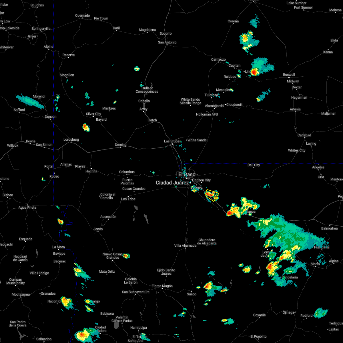
Hail Map for Tornillo, TX
The Tornillo, TX area has had 3 reports of on-the-ground hail by trained spotters, and has been under severe weather warnings 0 times during the past 12 months. Doppler radar has detected hail at or near Tornillo, TX on 20 occasions, including 3 occasions during the past year.
| Name: | Tornillo, TX |
| Where Located: | 31.8 miles SE of El Paso, TX |
| Map: | Google Map for Tornillo, TX |
| Population: | 1568 |
| Housing Units: | 443 |
| More Info: | Search Google for Tornillo, TX |
0
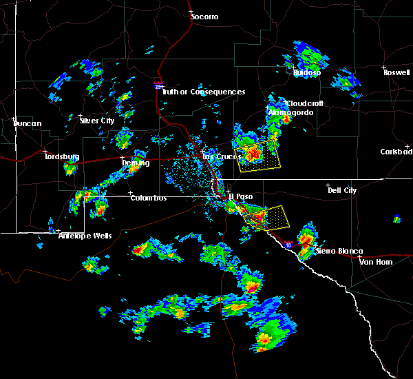
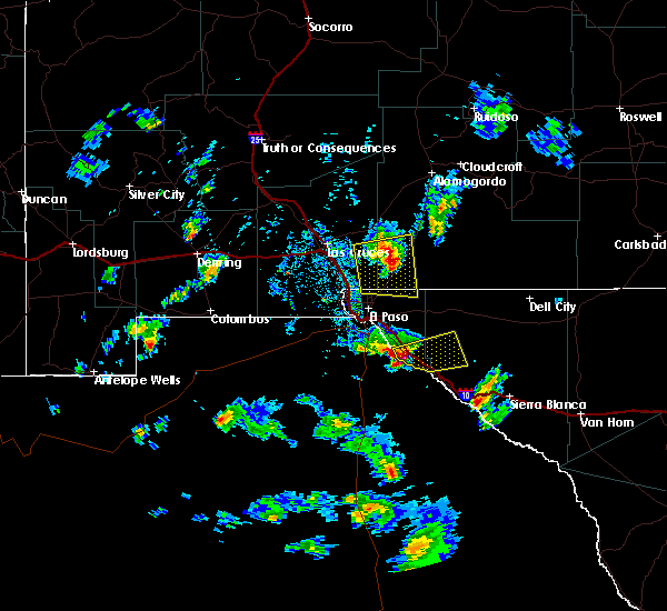
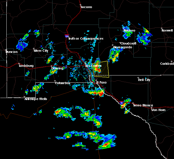
The Top Recent Hail Date for Tornillo, TX is Tuesday, September 26, 2023 (20th out of 20)

Hail and Wind Damage Spotted near Tornillo, TX
| Date / Time | Report Details |
|---|---|
| 8/29/2022 4:40 PM MDT |
 At 439 pm mdt, a severe thunderstorm was located 5 miles northeast of tornillo, moving southeast at 10 mph (radar indicated). Hazards include 65 mph wind gusts and quarter size hail. Hail damage to vehicles is expected. Expect wind damage to roofs, siding, and trees. At 439 pm mdt, a severe thunderstorm was located 5 miles northeast of tornillo, moving southeast at 10 mph (radar indicated). Hazards include 65 mph wind gusts and quarter size hail. Hail damage to vehicles is expected. Expect wind damage to roofs, siding, and trees.
|
| 7/11/2021 8:55 PM MDT |
 The severe thunderstorm warning for south central dona ana and el paso counties will expire at 900 pm mdt, the storms which prompted the warning have weakened below severe limits, and have exited the warned area. therefore, the warning will be allowed to expire. however gusty winds are still possible with these thunderstorms. a severe thunderstorm watch remains in effect until 1000 pm mdt for south central new mexico, and western texas. The severe thunderstorm warning for south central dona ana and el paso counties will expire at 900 pm mdt, the storms which prompted the warning have weakened below severe limits, and have exited the warned area. therefore, the warning will be allowed to expire. however gusty winds are still possible with these thunderstorms. a severe thunderstorm watch remains in effect until 1000 pm mdt for south central new mexico, and western texas.
|
| 7/11/2021 8:35 PM MDT |
 At 835 pm mdt, severe thunderstorms were located along a line extending from 7 miles north of far east el paso to 3 miles east of west el paso to 6 miles west of santa teresa, moving southeast at 25 mph (radar indicated). Hazards include 60 mph wind gusts. Expect damage to roofs, siding, and trees. locations impacted include, west el paso, east el paso, central el paso, northeast el paso, far east el paso, mission valley, tornillo, fabens, clint, horizon city, santa teresa, anthony, sunland park, indian cliffs ranch, canutillo, san elizario, vinton, westway, fort bliss and socorro. This includes interstate 10 in texas between mile markers 1 and 56. At 835 pm mdt, severe thunderstorms were located along a line extending from 7 miles north of far east el paso to 3 miles east of west el paso to 6 miles west of santa teresa, moving southeast at 25 mph (radar indicated). Hazards include 60 mph wind gusts. Expect damage to roofs, siding, and trees. locations impacted include, west el paso, east el paso, central el paso, northeast el paso, far east el paso, mission valley, tornillo, fabens, clint, horizon city, santa teresa, anthony, sunland park, indian cliffs ranch, canutillo, san elizario, vinton, westway, fort bliss and socorro. This includes interstate 10 in texas between mile markers 1 and 56.
|
| 7/11/2021 8:11 PM MDT |
 At 811 pm mdt, severe thunderstorms were located along a line extending from 3 miles northeast of northeast el paso to canutillo to 8 miles southeast of afton, moving southeast at 55 mph (radar indicated). Hazards include 70 mph wind gusts and ping pong ball size hail. People and animals outdoors will be injured. expect hail damage to roofs, siding, windows, and vehicles. expect considerable tree damage. Wind damage is also likely to mobile homes, roofs, and outbuildings. At 811 pm mdt, severe thunderstorms were located along a line extending from 3 miles northeast of northeast el paso to canutillo to 8 miles southeast of afton, moving southeast at 55 mph (radar indicated). Hazards include 70 mph wind gusts and ping pong ball size hail. People and animals outdoors will be injured. expect hail damage to roofs, siding, windows, and vehicles. expect considerable tree damage. Wind damage is also likely to mobile homes, roofs, and outbuildings.
|
| 6/4/2019 2:57 PM MDT |
 At 257 pm mdt, a severe thunderstorm was located 4 miles southwest of tornillo, moving north at 25 mph (radar indicated). Hazards include 60 mph wind gusts and half dollar size hail. Hail damage to vehicles is expected. Expect wind damage to roofs, siding, and trees. At 257 pm mdt, a severe thunderstorm was located 4 miles southwest of tornillo, moving north at 25 mph (radar indicated). Hazards include 60 mph wind gusts and half dollar size hail. Hail damage to vehicles is expected. Expect wind damage to roofs, siding, and trees.
|
| 4/22/2019 4:59 PM MDT |
 At 456 pm mdt, severe thunderstorms with strong possibly damaging winds were moving into the vicinity of el paso texas and surrounding locations (radar indicated). Hazards include 60 mph wind gusts. expect damage to roofs, siding, and trees At 456 pm mdt, severe thunderstorms with strong possibly damaging winds were moving into the vicinity of el paso texas and surrounding locations (radar indicated). Hazards include 60 mph wind gusts. expect damage to roofs, siding, and trees
|
| 6/3/2018 4:48 PM MDT |
 At 447 pm mdt, severe thunderstorms were moving into the warned area moving northeast at 35 mph (radar indicated). Hazards include 70 mph wind gusts and quarter size hail. Hail damage to vehicles is expected. expect considerable tree damage. Wind damage is also likely to mobile homes, roofs, and outbuildings. At 447 pm mdt, severe thunderstorms were moving into the warned area moving northeast at 35 mph (radar indicated). Hazards include 70 mph wind gusts and quarter size hail. Hail damage to vehicles is expected. expect considerable tree damage. Wind damage is also likely to mobile homes, roofs, and outbuildings.
|
| 6/3/2018 4:44 PM MDT |
 At 443 pm mdt, severe thunderstorms were approaching the area moving northeast at 35 mph (radar indicated). Hazards include 70 mph wind gusts and quarter size hail. Hail damage to vehicles is expected. expect considerable tree damage. Wind damage is also likely to mobile homes, roofs, and outbuildings. At 443 pm mdt, severe thunderstorms were approaching the area moving northeast at 35 mph (radar indicated). Hazards include 70 mph wind gusts and quarter size hail. Hail damage to vehicles is expected. expect considerable tree damage. Wind damage is also likely to mobile homes, roofs, and outbuildings.
|
| 10/7/2015 3:54 PM MDT |
 At 353 pm mdt, a severe thunderstorm was located 5 miles southeast of indian cliffs ranch, or 9 miles east of fabens, moving east at 30 mph (radar indicated). Hazards include golf ball size hail and 60 mph wind gusts. People and animals outdoors will be injured. expect hail damage to roofs, siding, windows and vehicles. Expect wind damage to roofs, siding and trees. At 353 pm mdt, a severe thunderstorm was located 5 miles southeast of indian cliffs ranch, or 9 miles east of fabens, moving east at 30 mph (radar indicated). Hazards include golf ball size hail and 60 mph wind gusts. People and animals outdoors will be injured. expect hail damage to roofs, siding, windows and vehicles. Expect wind damage to roofs, siding and trees.
|
| 10/7/2015 3:37 PM MDT |
 At 337 pm mdt, a severe thunderstorm was located near tornillo, or 6 miles east of fabens, moving east at 35 mph (radar indicated). Hazards include golf ball size hail and 60 mph wind gusts. People and animals outdoors will be injured. expect hail damage to roofs, siding, windows and vehicles. expect wind damage to roofs, siding and trees. Locations impacted include, fabens, tornillo, indian cliffs ranch. At 337 pm mdt, a severe thunderstorm was located near tornillo, or 6 miles east of fabens, moving east at 35 mph (radar indicated). Hazards include golf ball size hail and 60 mph wind gusts. People and animals outdoors will be injured. expect hail damage to roofs, siding, windows and vehicles. expect wind damage to roofs, siding and trees. Locations impacted include, fabens, tornillo, indian cliffs ranch.
|
| 10/7/2015 3:19 PM MDT |
 At 318 pm mdt, a severe thunderstorm was located 6 miles southwest of fabens, moving east at 35 mph (radar indicated). Hazards include golf ball size hail and 60 mph wind gusts. People and animals outdoors will be injured. expect hail damage to roofs, siding, windows and vehicles. Expect wind damage to roofs, siding and trees. At 318 pm mdt, a severe thunderstorm was located 6 miles southwest of fabens, moving east at 35 mph (radar indicated). Hazards include golf ball size hail and 60 mph wind gusts. People and animals outdoors will be injured. expect hail damage to roofs, siding, windows and vehicles. Expect wind damage to roofs, siding and trees.
|
| 10/5/2015 8:11 PM MDT |
 The severe thunderstorm warning for southeastern el paso county will expire at 815 pm mdt, the storm which prompted the warning has weakened below severe limits and exited the warned area. therefore the warning will be allowed to expire. The severe thunderstorm warning for southeastern el paso county will expire at 815 pm mdt, the storm which prompted the warning has weakened below severe limits and exited the warned area. therefore the warning will be allowed to expire.
|
| 10/5/2015 8:10 PM MDT |
 The tornado warning for southeastern el paso county will expire at 815 pm mdt, the storm which prompted the warning has weakened below severe limits and exited the warned area. therefore the warning will be allowed to expire. remember, a severe thunderstorm warning still remains in effect for western hudspeth county. The tornado warning for southeastern el paso county will expire at 815 pm mdt, the storm which prompted the warning has weakened below severe limits and exited the warned area. therefore the warning will be allowed to expire. remember, a severe thunderstorm warning still remains in effect for western hudspeth county.
|
| 10/5/2015 7:28 PM MDT |
 At 728 pm mdt, a severe thunderstorm capable of producing a tornado was located near tornillo, or near fabens, moving east at 20 mph (radar indicated rotation). Hazards include tornado and hail up to three inches in diameter. Flying debris will be dangerous to those caught without shelter. mobile homes will be damaged or destroyed. damage to roofs, windows and vehicles will occur. tree damage is likely. This dangerous storm will be near, tornillo around 735 pm mdt. At 728 pm mdt, a severe thunderstorm capable of producing a tornado was located near tornillo, or near fabens, moving east at 20 mph (radar indicated rotation). Hazards include tornado and hail up to three inches in diameter. Flying debris will be dangerous to those caught without shelter. mobile homes will be damaged or destroyed. damage to roofs, windows and vehicles will occur. tree damage is likely. This dangerous storm will be near, tornillo around 735 pm mdt.
|
| 10/5/2015 7:02 PM MDT |
 At 701 pm mdt, a severe thunderstorm was located 7 miles south of san elizario, or 8 miles west of fabens, moving east at 20 mph (radar indicated). Hazards include two inch hail and 70 mph wind gusts. People and animals outdoors will be injured. expect hail damage to roofs, siding, windows and vehicles. expect considerable tree damage. Wind damage is also likely to mobile homes, roofs and outbuildings. At 701 pm mdt, a severe thunderstorm was located 7 miles south of san elizario, or 8 miles west of fabens, moving east at 20 mph (radar indicated). Hazards include two inch hail and 70 mph wind gusts. People and animals outdoors will be injured. expect hail damage to roofs, siding, windows and vehicles. expect considerable tree damage. Wind damage is also likely to mobile homes, roofs and outbuildings.
|
| 7/7/2015 7:03 PM MDT |
 At 702 pm mdt, a severe thunderstorm was located near indian cliffs ranch, or 7 miles east of fabens, moving southeast at 20 mph (radar indicated). Hazards include 60 mph wind gusts and quarter size hail. Hail damage to vehicles is expected. Expect wind damage to roofs, siding and trees. At 702 pm mdt, a severe thunderstorm was located near indian cliffs ranch, or 7 miles east of fabens, moving southeast at 20 mph (radar indicated). Hazards include 60 mph wind gusts and quarter size hail. Hail damage to vehicles is expected. Expect wind damage to roofs, siding and trees.
|
| 4/19/2014 2:45 PM MDT | Golf Ball sized hail reported 6 miles WNW of Tornillo, TX, delayed report from trucker via twitter. exact location estimated but was on i-10 eastbound between tornillo and ep-hudspeth county line. |
| 4/19/2014 2:40 PM MDT | Quarter sized hail reported 5.9 miles WNW of Tornillo, TX, time estimated. |
| 6/2/2013 5:24 PM MDT | Quarter sized hail reported 3.6 miles NW of Tornillo, TX, mostly nickle-sized hail with quarter sized mixed in. |
Hail Maps for Tornillo, TX


Connect with Interactive Hail Maps