

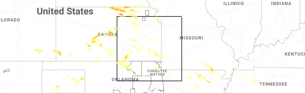
Hail Map for Toronto, KS
The Toronto, KS area has had 10 reports of on-the-ground hail by trained spotters, and has been under severe weather warnings 16 times during the past 12 months. Doppler radar has detected hail at or near Toronto, KS on 102 occasions, including 4 occasions during the past year.
| Name: | Toronto, KS |
| Where Located: | 28.4 miles WNW of Chanute, KS |
| Map: | Google Map for Toronto, KS |
| Population: | 281 |
| Housing Units: | 234 |
| More Info: | Search Google for Toronto, KS |
1
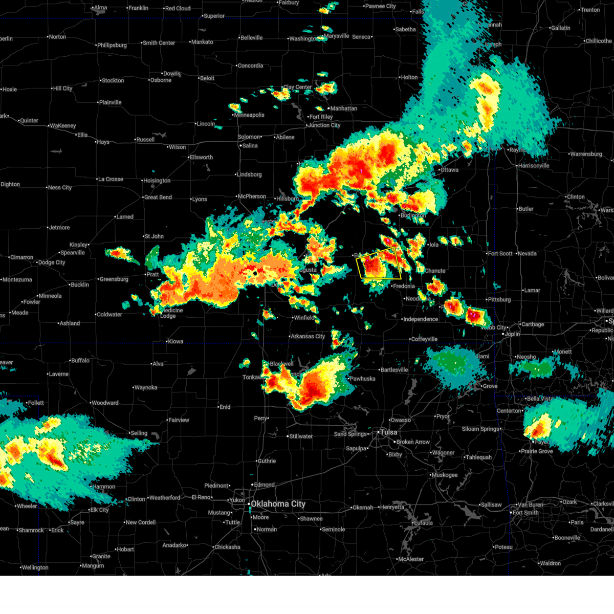
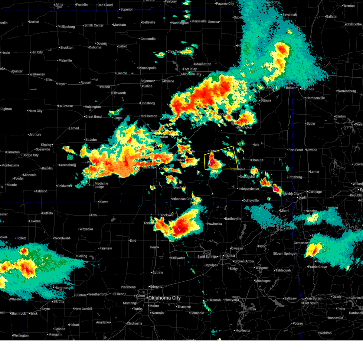
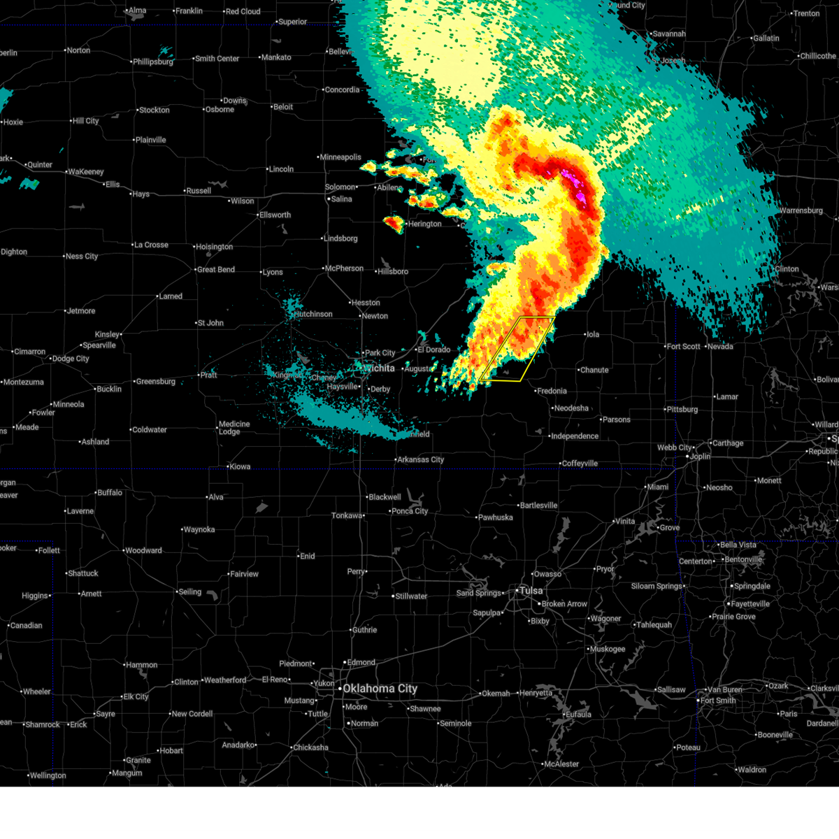
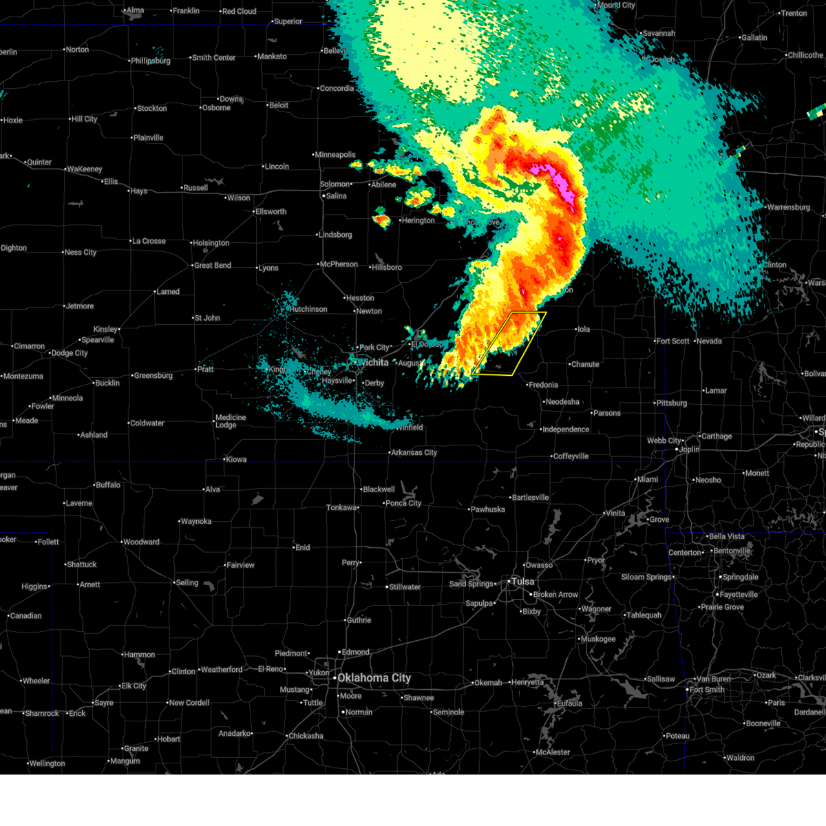
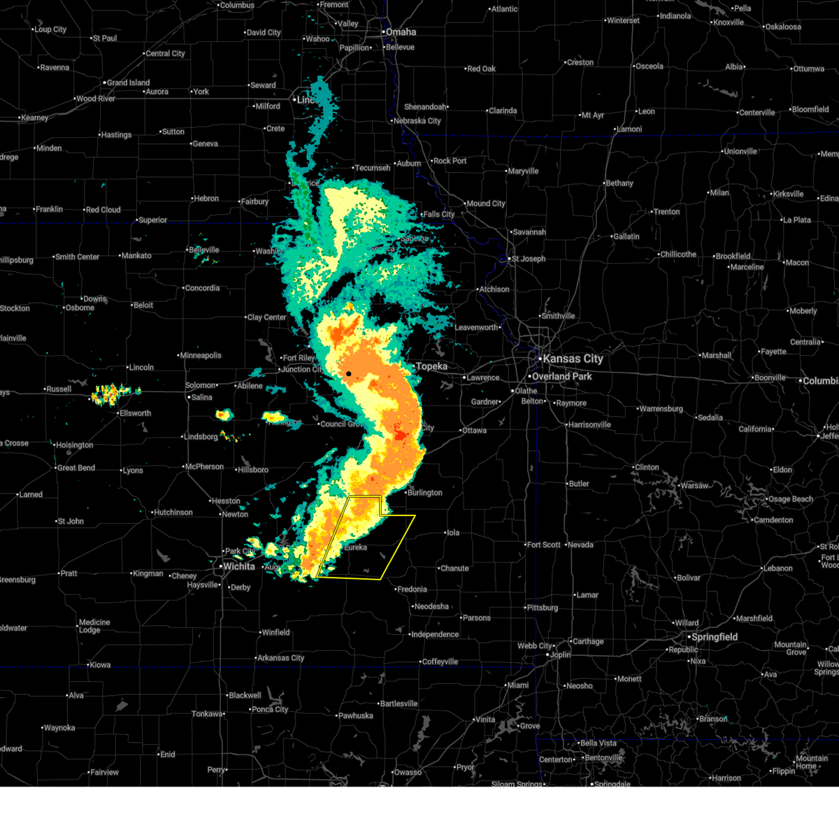
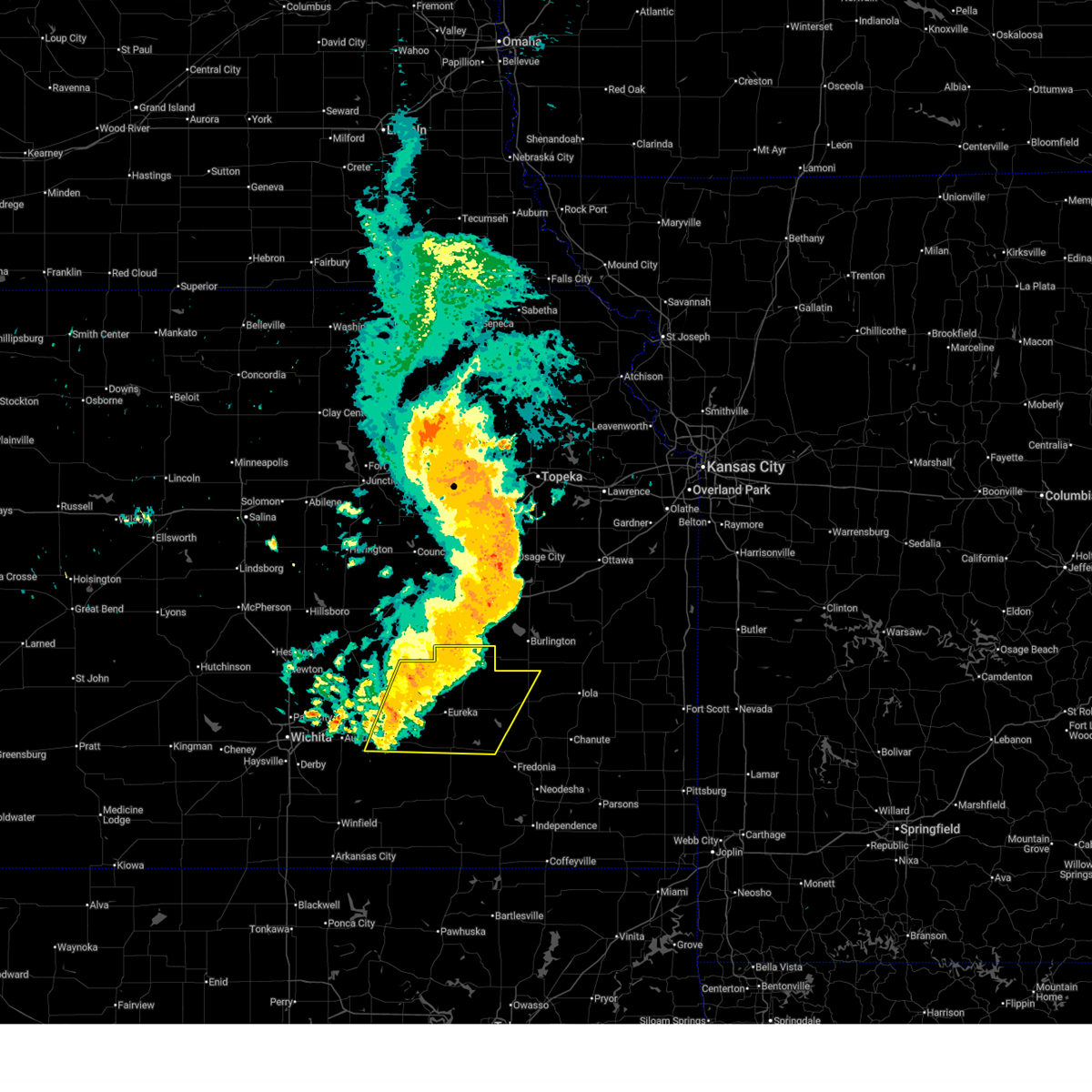
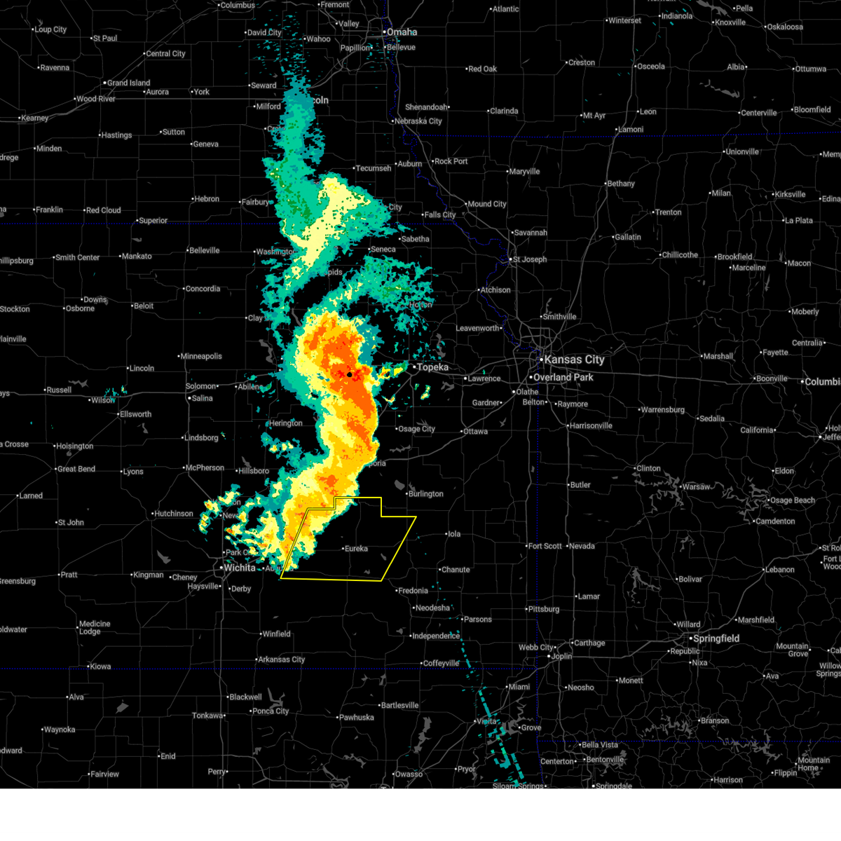
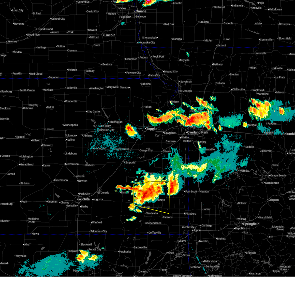
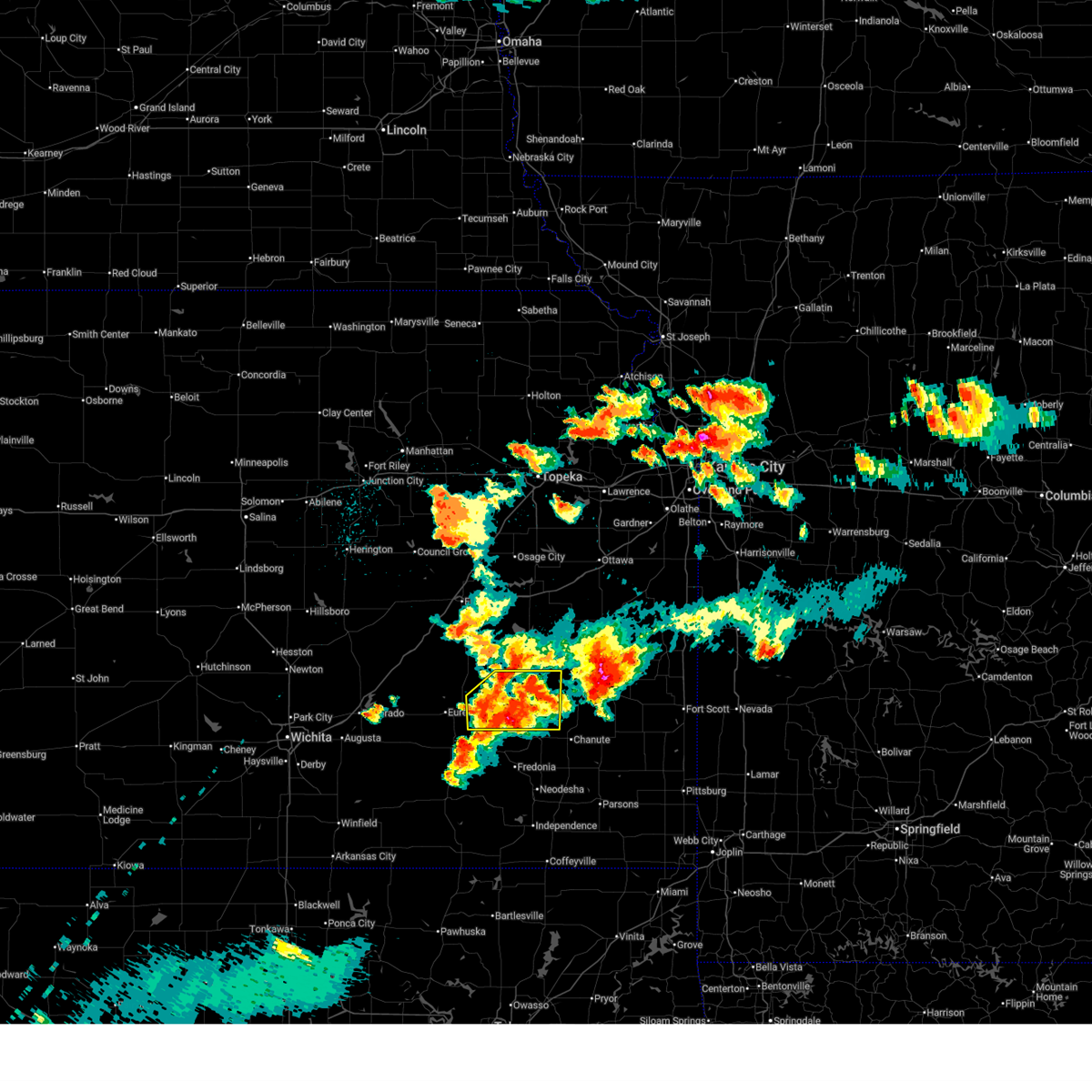
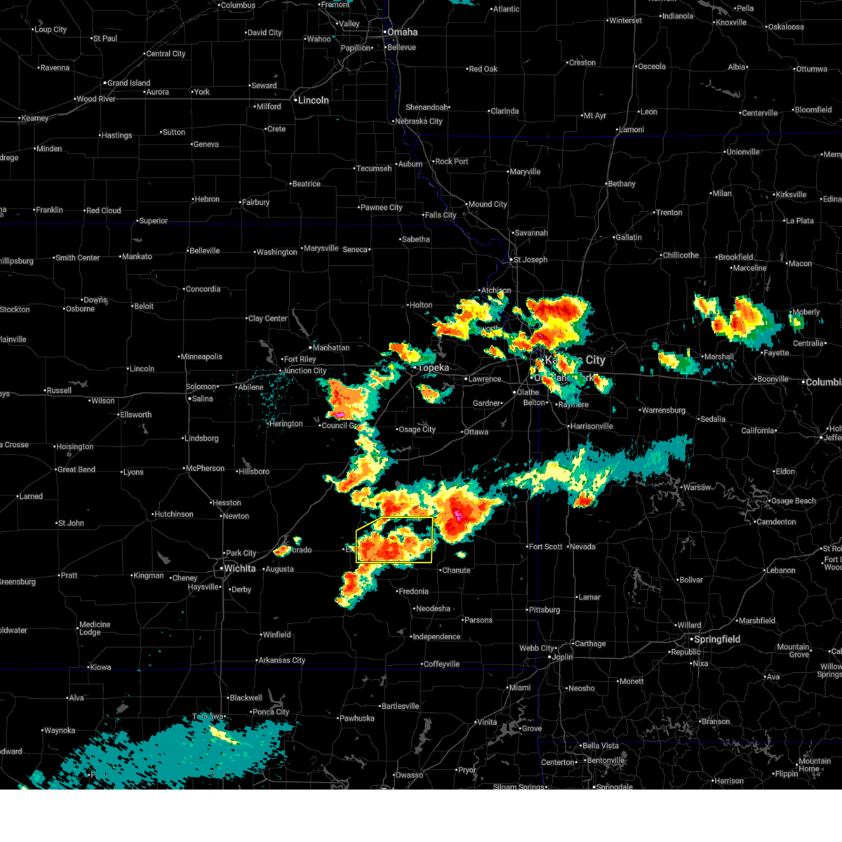
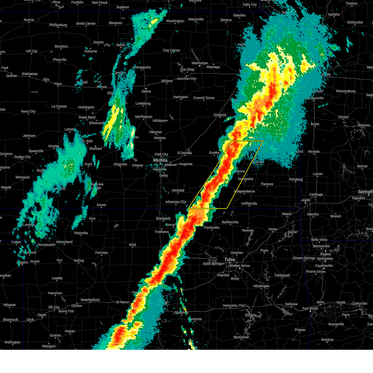
The Top Recent Hail Date for Toronto, KS is Saturday, June 13, 2026 (30th out of 102)
Hail and Wind Damage Spotted near Toronto, KS
| Date / Time | Report Details |
|---|---|
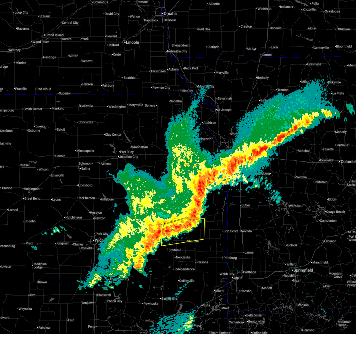
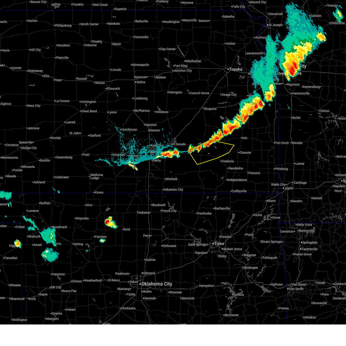
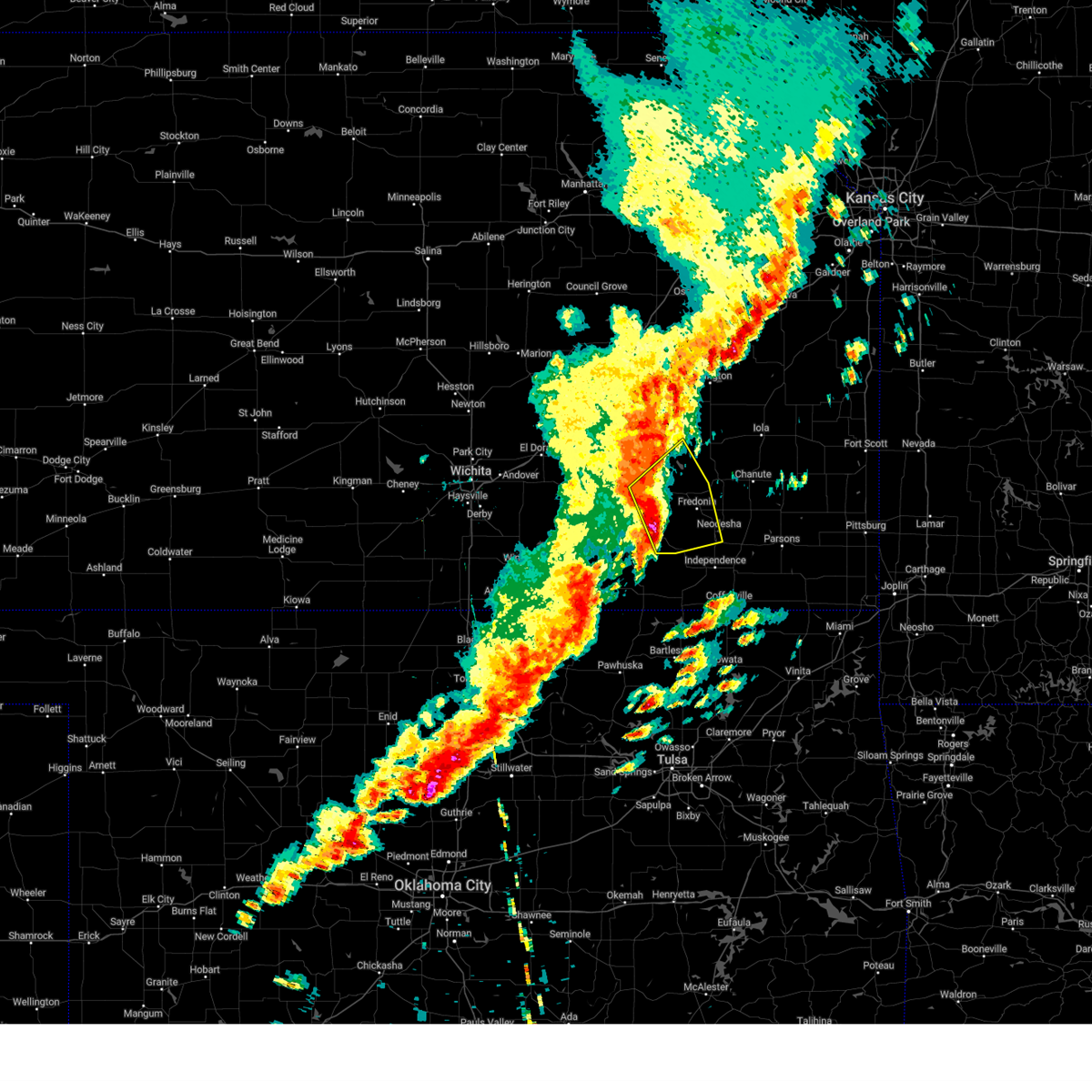
| 6/13/2026 10:11 PM CDT |
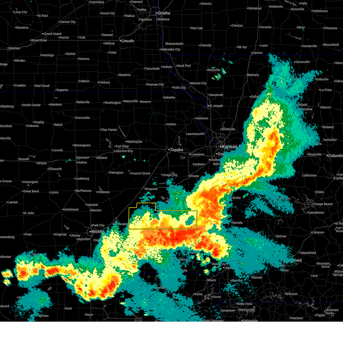 The storms which prompted the warning have moved out of the area. therefore, the warning will be allowed to expire. however, gusty winds and heavy rain are still possible with these thunderstorms. a severe thunderstorm watch remains in effect until midnight cdt for south central and southeastern kansas. The storms which prompted the warning have moved out of the area. therefore, the warning will be allowed to expire. however, gusty winds and heavy rain are still possible with these thunderstorms. a severe thunderstorm watch remains in effect until midnight cdt for south central and southeastern kansas.
|
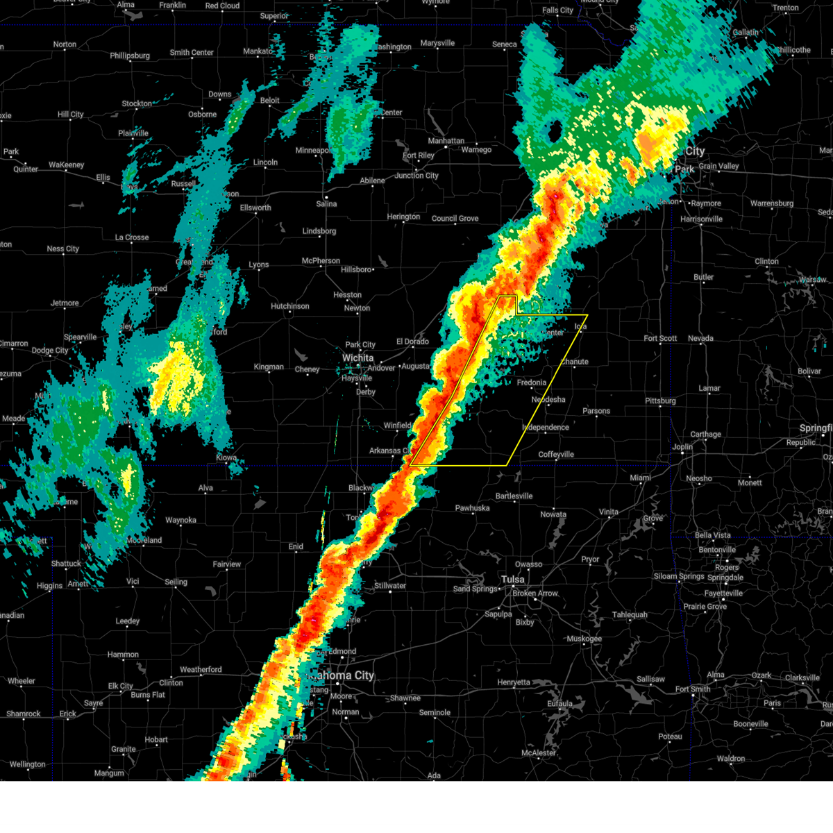
| 6/13/2026 9:45 PM CDT | Multiple power lines down throughout town and no powe in woodson county KS, 0.1 miles SSE of Toronto, KS |
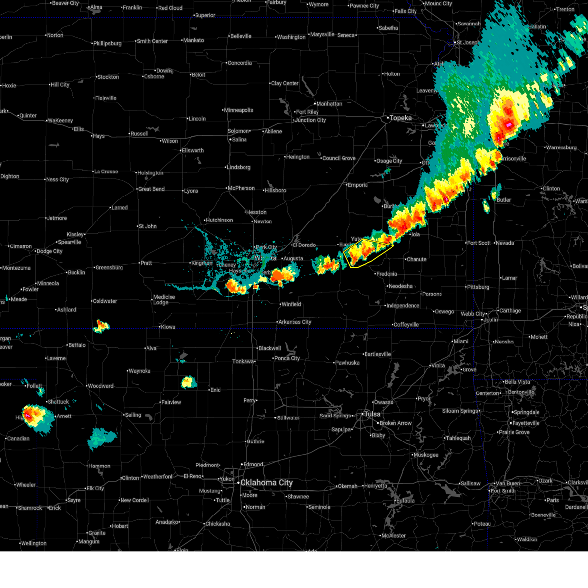
| 6/13/2026 9:29 PM CDT |
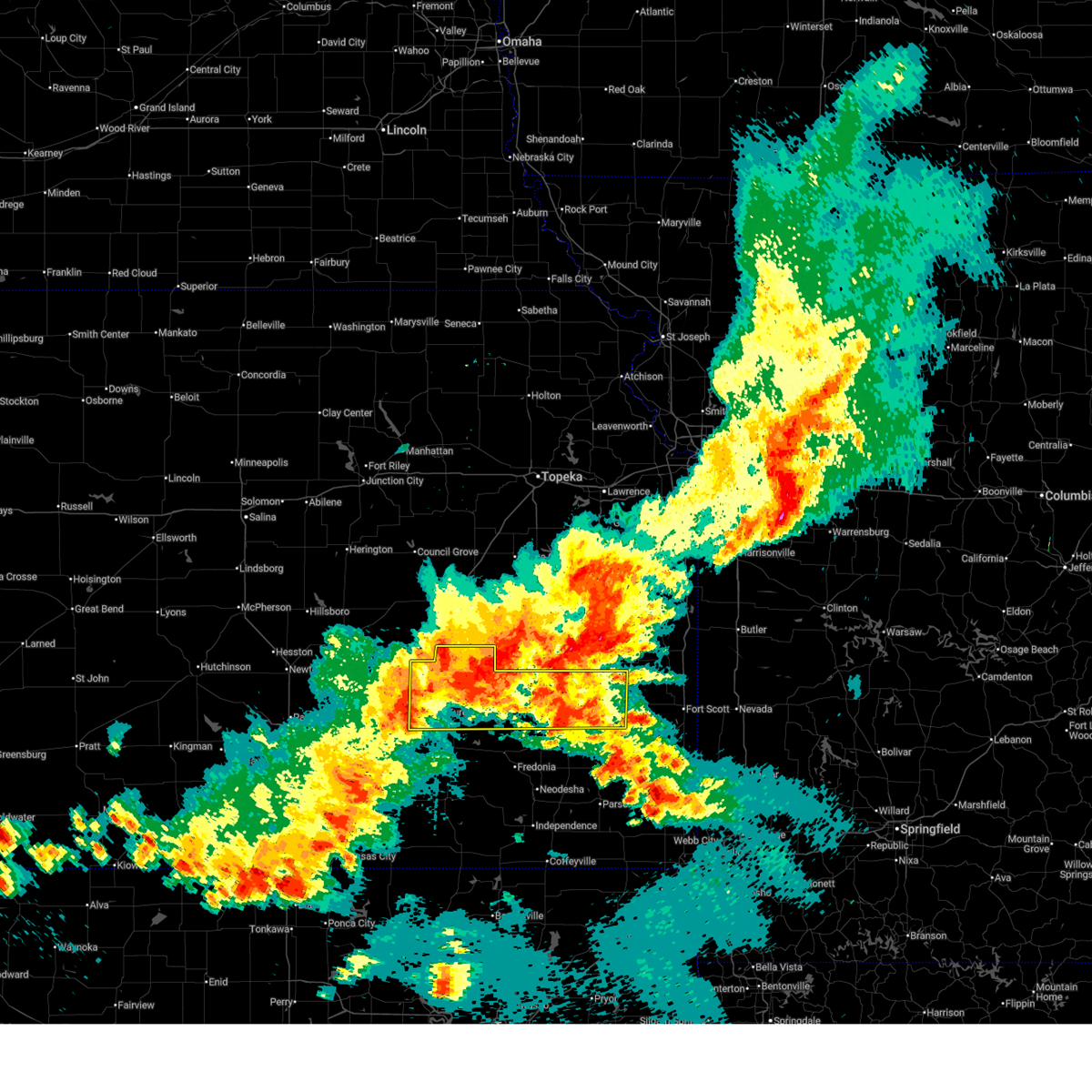 At 928 pm cdt, severe thunderstorms were located along a line extending from 6 miles south of garnett to 8 miles northwest of yates center to 10 miles west of eureka, moving southeast at 55 mph (radar indicated. this storm has a history of producing winds up to around 65 mph). Hazards include 60 mph wind gusts. Expect damage to roofs, siding, and trees. Locations impacted include, iola, eureka, humboldt, yates center, madison, la harpe, gas, moran, toronto, hamilton, neosho falls, savonburg, elsmore, virgil, mildred, bassett, eureka city lake, thrall, eureka airport, and rose. At 928 pm cdt, severe thunderstorms were located along a line extending from 6 miles south of garnett to 8 miles northwest of yates center to 10 miles west of eureka, moving southeast at 55 mph (radar indicated. this storm has a history of producing winds up to around 65 mph). Hazards include 60 mph wind gusts. Expect damage to roofs, siding, and trees. Locations impacted include, iola, eureka, humboldt, yates center, madison, la harpe, gas, moran, toronto, hamilton, neosho falls, savonburg, elsmore, virgil, mildred, bassett, eureka city lake, thrall, eureka airport, and rose.
|
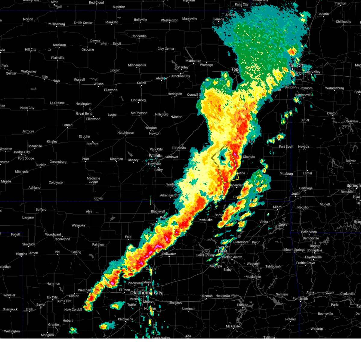
| 6/13/2026 9:14 PM CDT |
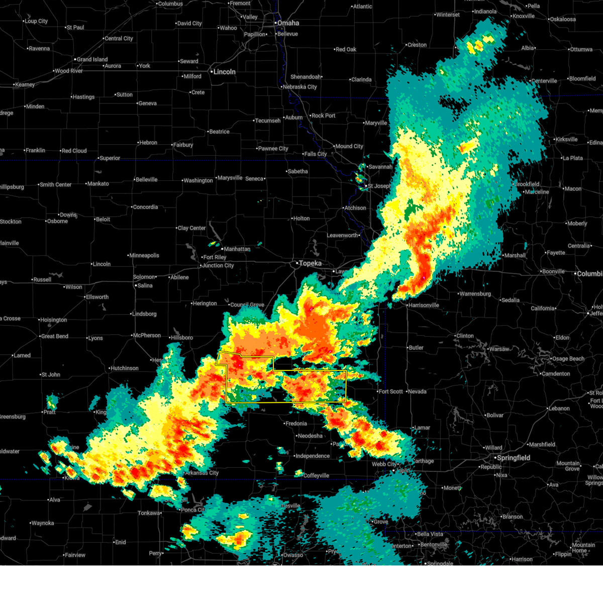 Svrict the national weather service in wichita has issued a * severe thunderstorm warning for, southeastern chase county in east central kansas, woodson county in southeastern kansas, greenwood county in southeastern kansas, allen county in southeastern kansas, * until 1015 pm cdt. * at 914 pm cdt, severe thunderstorms were located along a line extending from near harris to 6 miles northwest of gridley to 18 miles northwest of eureka, moving southeast at 50 mph (radar indicated). Hazards include 60 mph wind gusts and quarter size hail. Hail damage to vehicles is expected. Expect wind damage to roofs, siding, and trees. Svrict the national weather service in wichita has issued a * severe thunderstorm warning for, southeastern chase county in east central kansas, woodson county in southeastern kansas, greenwood county in southeastern kansas, allen county in southeastern kansas, * until 1015 pm cdt. * at 914 pm cdt, severe thunderstorms were located along a line extending from near harris to 6 miles northwest of gridley to 18 miles northwest of eureka, moving southeast at 50 mph (radar indicated). Hazards include 60 mph wind gusts and quarter size hail. Hail damage to vehicles is expected. Expect wind damage to roofs, siding, and trees.
|
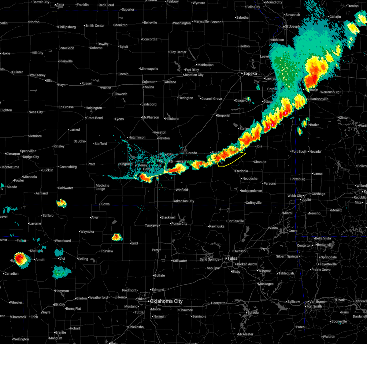
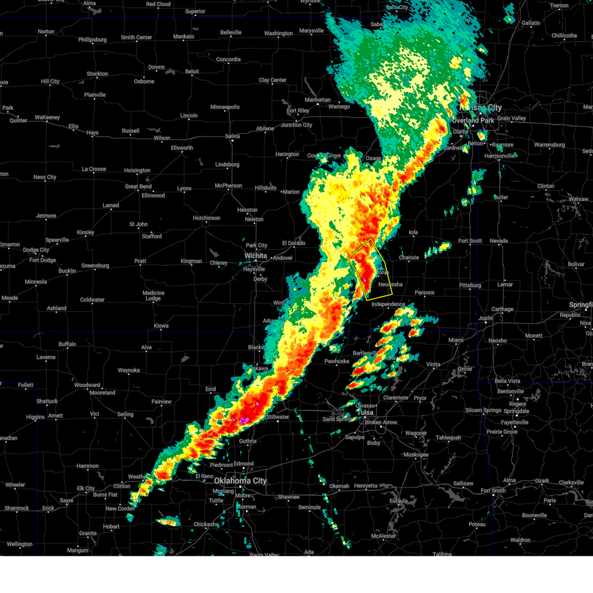
| 6/13/2026 8:35 PM CDT |
 At 834 pm cdt, a severe thunderstorm was located 6 miles southwest of toronto, or 14 miles east of eureka, moving northeast at 55 mph (radar indicated). Hazards include 60 mph wind gusts and quarter size hail. Hail damage to vehicles is expected. expect wind damage to roofs, siding, and trees. Locations impacted include, toronto, fall river, benedict, climax, coyville, fall river lake, batesville, cross timbers state park, toronto lake, and fall river state park. At 834 pm cdt, a severe thunderstorm was located 6 miles southwest of toronto, or 14 miles east of eureka, moving northeast at 55 mph (radar indicated). Hazards include 60 mph wind gusts and quarter size hail. Hail damage to vehicles is expected. expect wind damage to roofs, siding, and trees. Locations impacted include, toronto, fall river, benedict, climax, coyville, fall river lake, batesville, cross timbers state park, toronto lake, and fall river state park.
|
| 6/13/2026 8:22 PM CDT |
 Svrict the national weather service in wichita has issued a * severe thunderstorm warning for, northeastern elk county in southeastern kansas, northwestern wilson county in southeastern kansas, southwestern woodson county in southeastern kansas, southeastern greenwood county in southeastern kansas, * until 915 pm cdt. * at 822 pm cdt, a severe thunderstorm was located over severy, or 11 miles north of howard, moving east at 35 mph (radar indicated). Hazards include 60 mph wind gusts and quarter size hail. Hail damage to vehicles is expected. Expect wind damage to roofs, siding, and trees. Svrict the national weather service in wichita has issued a * severe thunderstorm warning for, northeastern elk county in southeastern kansas, northwestern wilson county in southeastern kansas, southwestern woodson county in southeastern kansas, southeastern greenwood county in southeastern kansas, * until 915 pm cdt. * at 822 pm cdt, a severe thunderstorm was located over severy, or 11 miles north of howard, moving east at 35 mph (radar indicated). Hazards include 60 mph wind gusts and quarter size hail. Hail damage to vehicles is expected. Expect wind damage to roofs, siding, and trees.
|
| 6/9/2026 12:22 AM CDT |
 The storms which prompted the warning have weakened below severe limits, and no longer pose an immediate threat to life or property. therefore, the warning will be allowed to expire. however, gusty winds and heavy rain are still possible with these thunderstorms. a severe thunderstorm watch remains in effect until 100 am cdt for southeastern kansas. The storms which prompted the warning have weakened below severe limits, and no longer pose an immediate threat to life or property. therefore, the warning will be allowed to expire. however, gusty winds and heavy rain are still possible with these thunderstorms. a severe thunderstorm watch remains in effect until 100 am cdt for southeastern kansas.
|
| 6/9/2026 12:12 AM CDT |
 At 1212 am cdt, severe thunderstorms were located along a line extending from near le roy to near yates center to near severy, moving southeast at 45 mph (radar indicated). Hazards include 60 mph wind gusts. Expect damage to roofs, siding, and trees. Locations impacted include, toronto, severy, fall river, climax, virgil, coyville, fall river lake, batesville, cross timbers state park, toronto lake, and fall river state park. At 1212 am cdt, severe thunderstorms were located along a line extending from near le roy to near yates center to near severy, moving southeast at 45 mph (radar indicated). Hazards include 60 mph wind gusts. Expect damage to roofs, siding, and trees. Locations impacted include, toronto, severy, fall river, climax, virgil, coyville, fall river lake, batesville, cross timbers state park, toronto lake, and fall river state park.
|
| 6/9/2026 12:00 AM CDT |
 At 1159 pm cdt, severe thunderstorms were located along a line extending from near gridley to 10 miles northwest of yates center to 5 miles west of severy, moving southeast at 40 mph (radar indicated). Hazards include 60 mph wind gusts. Expect damage to roofs, siding, and trees. Locations impacted include, eureka, madison, toronto, hamilton, severy, fall river, climax, virgil, coyville, eureka city lake, eureka airport, batesville, toronto lake, fall river state park, fall river lake, cross timbers state park, and piedmont. At 1159 pm cdt, severe thunderstorms were located along a line extending from near gridley to 10 miles northwest of yates center to 5 miles west of severy, moving southeast at 40 mph (radar indicated). Hazards include 60 mph wind gusts. Expect damage to roofs, siding, and trees. Locations impacted include, eureka, madison, toronto, hamilton, severy, fall river, climax, virgil, coyville, eureka city lake, eureka airport, batesville, toronto lake, fall river state park, fall river lake, cross timbers state park, and piedmont.
|
| 6/8/2026 11:46 PM CDT |
 At 1146 pm cdt, severe thunderstorms were located along a line extending from 6 miles south of hartford to 6 miles northeast of hamilton to 8 miles east of latham, moving southeast at 45 mph (radar indicated). Hazards include 60 mph wind gusts. Expect damage to roofs, siding, and trees. locations impacted include, eureka, leon, madison, toronto, hamilton, severy, fall river, rosalia, climax, virgil, coyville, eureka city lake, thrall, eureka airport, batesville, toronto lake, fall river state park, beaumont, fall river lake, and cross timbers state park. This includes interstate 35 near mile marker 96. At 1146 pm cdt, severe thunderstorms were located along a line extending from 6 miles south of hartford to 6 miles northeast of hamilton to 8 miles east of latham, moving southeast at 45 mph (radar indicated). Hazards include 60 mph wind gusts. Expect damage to roofs, siding, and trees. locations impacted include, eureka, leon, madison, toronto, hamilton, severy, fall river, rosalia, climax, virgil, coyville, eureka city lake, thrall, eureka airport, batesville, toronto lake, fall river state park, beaumont, fall river lake, and cross timbers state park. This includes interstate 35 near mile marker 96.
|
| 6/8/2026 11:36 PM CDT |
 At 1135 pm cdt, severe thunderstorms were located along a line extending from near olpe to near madison to 5 miles north of latham, moving southeast at 45 mph (radar indicated). Hazards include 60 mph wind gusts. Expect damage to roofs, siding, and trees. locations impacted include, eureka, leon, madison, toronto, hamilton, severy, fall river, rosalia, climax, virgil, coyville, eureka city lake, thrall, eureka airport, batesville, toronto lake, fall river state park, beaumont, fall river lake, and cross timbers state park. This includes interstate 35 near mile marker 96. At 1135 pm cdt, severe thunderstorms were located along a line extending from near olpe to near madison to 5 miles north of latham, moving southeast at 45 mph (radar indicated). Hazards include 60 mph wind gusts. Expect damage to roofs, siding, and trees. locations impacted include, eureka, leon, madison, toronto, hamilton, severy, fall river, rosalia, climax, virgil, coyville, eureka city lake, thrall, eureka airport, batesville, toronto lake, fall river state park, beaumont, fall river lake, and cross timbers state park. This includes interstate 35 near mile marker 96.
|
| 6/1/2026 1:30 AM CDT |
 Svrict the national weather service in wichita has issued a * severe thunderstorm warning for, northern wilson county in southeastern kansas, neosho county in southeastern kansas, woodson county in southeastern kansas, allen county in southeastern kansas, * until 230 am cdt. * at 130 am cdt, a severe thunderstorm was located 8 miles northeast of buffalo, or 8 miles southeast of yates center, moving east at 35 mph (radar indicated). Hazards include 60 mph wind gusts and quarter size hail. Hail damage to vehicles is expected. Expect wind damage to roofs, siding, and trees. Svrict the national weather service in wichita has issued a * severe thunderstorm warning for, northern wilson county in southeastern kansas, neosho county in southeastern kansas, woodson county in southeastern kansas, allen county in southeastern kansas, * until 230 am cdt. * at 130 am cdt, a severe thunderstorm was located 8 miles northeast of buffalo, or 8 miles southeast of yates center, moving east at 35 mph (radar indicated). Hazards include 60 mph wind gusts and quarter size hail. Hail damage to vehicles is expected. Expect wind damage to roofs, siding, and trees.
|
| 6/1/2026 12:58 AM CDT |
 At 1257 am cdt, a severe thunderstorm was located near toronto, or 9 miles southwest of yates center, moving east at 35 mph (radar indicated). Hazards include 60 mph wind gusts and quarter size hail. Hail damage to vehicles is expected. expect wind damage to roofs, siding, and trees. Locations impacted include, yates center, toronto, neosho falls, virgil, batesville, cross timbers state park, toronto lake, rose, and piqua. At 1257 am cdt, a severe thunderstorm was located near toronto, or 9 miles southwest of yates center, moving east at 35 mph (radar indicated). Hazards include 60 mph wind gusts and quarter size hail. Hail damage to vehicles is expected. expect wind damage to roofs, siding, and trees. Locations impacted include, yates center, toronto, neosho falls, virgil, batesville, cross timbers state park, toronto lake, rose, and piqua.
|
| 6/1/2026 12:46 AM CDT |
 Svrict the national weather service in wichita has issued a * severe thunderstorm warning for, woodson county in southeastern kansas, southeastern greenwood county in southeastern kansas, * until 145 am cdt. * at 1246 am cdt, a severe thunderstorm was located 7 miles west of toronto, or 10 miles east of eureka, moving east at 30 mph (radar indicated). Hazards include 60 mph wind gusts and quarter size hail. Hail damage to vehicles is expected. Expect wind damage to roofs, siding, and trees. Svrict the national weather service in wichita has issued a * severe thunderstorm warning for, woodson county in southeastern kansas, southeastern greenwood county in southeastern kansas, * until 145 am cdt. * at 1246 am cdt, a severe thunderstorm was located 7 miles west of toronto, or 10 miles east of eureka, moving east at 30 mph (radar indicated). Hazards include 60 mph wind gusts and quarter size hail. Hail damage to vehicles is expected. Expect wind damage to roofs, siding, and trees.
|
| 5/19/2026 12:21 AM CDT |
 Svrict the national weather service in wichita has issued a * severe thunderstorm warning for, northeastern elk county in southeastern kansas, wilson county in southeastern kansas, neosho county in southeastern kansas, woodson county in southeastern kansas, southeastern greenwood county in southeastern kansas, allen county in southeastern kansas, * until 145 am cdt. * at 1221 am cdt, severe thunderstorms were located along a line extending from near toronto to near fall river to 6 miles east of howard, moving east at 35 mph (radar indicated). Hazards include 60 mph wind gusts and quarter size hail. Hail damage to vehicles is expected. Expect wind damage to roofs, siding, and trees. Svrict the national weather service in wichita has issued a * severe thunderstorm warning for, northeastern elk county in southeastern kansas, wilson county in southeastern kansas, neosho county in southeastern kansas, woodson county in southeastern kansas, southeastern greenwood county in southeastern kansas, allen county in southeastern kansas, * until 145 am cdt. * at 1221 am cdt, severe thunderstorms were located along a line extending from near toronto to near fall river to 6 miles east of howard, moving east at 35 mph (radar indicated). Hazards include 60 mph wind gusts and quarter size hail. Hail damage to vehicles is expected. Expect wind damage to roofs, siding, and trees.
|
| 3/10/2026 11:13 PM CDT |
 the severe thunderstorm warning has been cancelled and is no longer in effect the severe thunderstorm warning has been cancelled and is no longer in effect
|
| 3/10/2026 10:47 PM CDT |
 Svrict the national weather service in wichita has issued a * severe thunderstorm warning for, northern wilson county in southeastern kansas, northern neosho county in southeastern kansas, woodson county in southeastern kansas, allen county in southeastern kansas, * until 1145 pm cdt. * at 1047 pm cdt, a severe thunderstorm was located over toronto, or 12 miles southwest of yates center, moving east at 55 mph (radar indicated). Hazards include 60 mph wind gusts. expect damage to roofs, siding, and trees Svrict the national weather service in wichita has issued a * severe thunderstorm warning for, northern wilson county in southeastern kansas, northern neosho county in southeastern kansas, woodson county in southeastern kansas, allen county in southeastern kansas, * until 1145 pm cdt. * at 1047 pm cdt, a severe thunderstorm was located over toronto, or 12 miles southwest of yates center, moving east at 55 mph (radar indicated). Hazards include 60 mph wind gusts. expect damage to roofs, siding, and trees
|
| 7/11/2025 8:09 PM CDT |
 The storms which prompted the warning have weakened below severe limits, and no longer pose an immediate threat to life or property. therefore, the warning will be allowed to expire. however, small hail and gusty winds are still possible with these thunderstorms. to report severe weather, contact your nearest law enforcement agency. they will relay your report to the national weather service wichita. The storms which prompted the warning have weakened below severe limits, and no longer pose an immediate threat to life or property. therefore, the warning will be allowed to expire. however, small hail and gusty winds are still possible with these thunderstorms. to report severe weather, contact your nearest law enforcement agency. they will relay your report to the national weather service wichita.
|
| 7/11/2025 8:01 PM CDT |
 At 801 pm cdt, severe thunderstorms were located along a line extending from near toronto to 14 miles northeast of severy to 7 miles northwest of fall river, moving southeast at 30 mph (radar indicated). Hazards include 60 mph wind gusts and penny size hail. Expect damage to roofs, siding, and trees. Locations impacted include, toronto, fall river, coyville, fall river lake, batesville, cross timbers state park, toronto lake, rose, and fall river state park. At 801 pm cdt, severe thunderstorms were located along a line extending from near toronto to 14 miles northeast of severy to 7 miles northwest of fall river, moving southeast at 30 mph (radar indicated). Hazards include 60 mph wind gusts and penny size hail. Expect damage to roofs, siding, and trees. Locations impacted include, toronto, fall river, coyville, fall river lake, batesville, cross timbers state park, toronto lake, rose, and fall river state park.
|
| 7/11/2025 8:01 PM CDT |
 the severe thunderstorm warning has been cancelled and is no longer in effect the severe thunderstorm warning has been cancelled and is no longer in effect
|
| 7/11/2025 7:50 PM CDT |
 At 750 pm cdt, severe thunderstorms were located along a line extending from near toronto to 9 miles north of fall river to 5 miles north of severy, moving east at 30 mph (radar indicated). Hazards include 60 mph wind gusts and quarter size hail. Hail damage to vehicles is expected. expect wind damage to roofs, siding, and trees. Locations impacted include, toronto, buffalo, fall river, climax, coyville, fall river lake, batesville, cross timbers state park, toronto lake, rose, and fall river state park. At 750 pm cdt, severe thunderstorms were located along a line extending from near toronto to 9 miles north of fall river to 5 miles north of severy, moving east at 30 mph (radar indicated). Hazards include 60 mph wind gusts and quarter size hail. Hail damage to vehicles is expected. expect wind damage to roofs, siding, and trees. Locations impacted include, toronto, buffalo, fall river, climax, coyville, fall river lake, batesville, cross timbers state park, toronto lake, rose, and fall river state park.
|
| 7/11/2025 7:29 PM CDT |
 Svrict the national weather service in wichita has issued a * severe thunderstorm warning for, northeastern elk county in southeastern kansas, northwestern wilson county in southeastern kansas, southern woodson county in southeastern kansas, southern greenwood county in southeastern kansas, * until 815 pm cdt. * at 729 pm cdt, severe thunderstorms were located along a line extending from 5 miles northwest of toronto to 6 miles south of eureka to 11 miles northeast of latham, moving southeast at 30 mph (radar indicated). Hazards include 60 mph wind gusts and quarter size hail. Hail damage to vehicles is expected. Expect wind damage to roofs, siding, and trees. Svrict the national weather service in wichita has issued a * severe thunderstorm warning for, northeastern elk county in southeastern kansas, northwestern wilson county in southeastern kansas, southern woodson county in southeastern kansas, southern greenwood county in southeastern kansas, * until 815 pm cdt. * at 729 pm cdt, severe thunderstorms were located along a line extending from 5 miles northwest of toronto to 6 miles south of eureka to 11 miles northeast of latham, moving southeast at 30 mph (radar indicated). Hazards include 60 mph wind gusts and quarter size hail. Hail damage to vehicles is expected. Expect wind damage to roofs, siding, and trees.
|
| 4/2/2025 4:55 AM CDT |
 At 454 am cdt, severe thunderstorms were located along a line extending from near burlington to 8 miles south of fall river to 7 miles northwest of elgin, moving east at 55 mph (radar indicated). Hazards include 60 mph wind gusts and quarter size hail. Hail damage to vehicles is expected. expect wind damage to roofs, siding, and trees. Locations impacted include, severy, moline, buxton, benedict, rose, elk falls, howard, fall river, grenola, elgin, piqua, chautauqua, sedan, buffalo, fredonia, toronto lake, batesville, coyville, niotaze, and new albany. At 454 am cdt, severe thunderstorms were located along a line extending from near burlington to 8 miles south of fall river to 7 miles northwest of elgin, moving east at 55 mph (radar indicated). Hazards include 60 mph wind gusts and quarter size hail. Hail damage to vehicles is expected. expect wind damage to roofs, siding, and trees. Locations impacted include, severy, moline, buxton, benedict, rose, elk falls, howard, fall river, grenola, elgin, piqua, chautauqua, sedan, buffalo, fredonia, toronto lake, batesville, coyville, niotaze, and new albany.
|
| 4/2/2025 4:31 AM CDT |
 Svrict the national weather service in wichita has issued a * severe thunderstorm warning for, elk county in southeastern kansas, wilson county in southeastern kansas, southeastern cowley county in south central kansas, northwestern montgomery county in southeastern kansas, chautauqua county in southeastern kansas, woodson county in southeastern kansas, eastern greenwood county in southeastern kansas, northwestern allen county in southeastern kansas, * until 515 am cdt. * at 430 am cdt, severe thunderstorms were located along a line extending from near madison to 5 miles northwest of howard to 5 miles southeast of dexter, moving northeast at 60 mph (radar indicated). Hazards include 60 mph wind gusts and quarter size hail. Hail damage to vehicles is expected. Expect wind damage to roofs, siding, and trees. Svrict the national weather service in wichita has issued a * severe thunderstorm warning for, elk county in southeastern kansas, wilson county in southeastern kansas, southeastern cowley county in south central kansas, northwestern montgomery county in southeastern kansas, chautauqua county in southeastern kansas, woodson county in southeastern kansas, eastern greenwood county in southeastern kansas, northwestern allen county in southeastern kansas, * until 515 am cdt. * at 430 am cdt, severe thunderstorms were located along a line extending from near madison to 5 miles northwest of howard to 5 miles southeast of dexter, moving northeast at 60 mph (radar indicated). Hazards include 60 mph wind gusts and quarter size hail. Hail damage to vehicles is expected. Expect wind damage to roofs, siding, and trees.
|
| 4/2/2025 4:29 AM CDT |
 Svrict the national weather service in wichita has issued a * severe thunderstorm warning for, elk county in southeastern kansas, wilson county in southeastern kansas, southeastern cowley county in south central kansas, northwestern montgomery county in southeastern kansas, chautauqua county in southeastern kansas, woodson county in southeastern kansas, eastern greenwood county in southeastern kansas, northwestern allen county in southeastern kansas, * until 515 am cdt. * at 428 am cdt, severe thunderstorms were located along a line extending from near madison to 5 miles northwest of howard to 5 miles southeast of dexter, moving northeast at 110 mph (radar indicated). Hazards include 60 mph wind gusts and quarter size hail. Hail damage to vehicles is expected. Expect wind damage to roofs, siding, and trees. Svrict the national weather service in wichita has issued a * severe thunderstorm warning for, elk county in southeastern kansas, wilson county in southeastern kansas, southeastern cowley county in south central kansas, northwestern montgomery county in southeastern kansas, chautauqua county in southeastern kansas, woodson county in southeastern kansas, eastern greenwood county in southeastern kansas, northwestern allen county in southeastern kansas, * until 515 am cdt. * at 428 am cdt, severe thunderstorms were located along a line extending from near madison to 5 miles northwest of howard to 5 miles southeast of dexter, moving northeast at 110 mph (radar indicated). Hazards include 60 mph wind gusts and quarter size hail. Hail damage to vehicles is expected. Expect wind damage to roofs, siding, and trees.
|
| 10/30/2024 7:41 PM CDT |
 The storms which prompted the warning have moved out of the area. therefore, the warning will be allowed to expire. a tornado watch remains in effect until 1000 pm cdt for southeastern kansas. The storms which prompted the warning have moved out of the area. therefore, the warning will be allowed to expire. a tornado watch remains in effect until 1000 pm cdt for southeastern kansas.
|
| 10/30/2024 7:30 PM CDT | 60 mph winds on the south side of toronto lake relayed via emergency managemen in woodson county KS, 4.6 miles NNW of Toronto, KS |
| 10/30/2024 7:21 PM CDT |
 At 721 pm cdt, severe thunderstorms were located along a line extending from 7 miles southwest of toronto to 5 miles southeast of fall river to 9 miles southwest of fredonia, moving northeast at 45 mph (trained weather spotters). Hazards include 70 mph wind gusts and quarter size hail. Hail damage to vehicles is expected. expect considerable tree damage. wind damage is also likely to mobile homes, roofs, and outbuildings. Locations impacted include, neodesha, fredonia, toronto, fall river, benedict, new albany, coyville, buxton, batesville, toronto lake, fall river state park, fall river lake, and cross timbers state park. At 721 pm cdt, severe thunderstorms were located along a line extending from 7 miles southwest of toronto to 5 miles southeast of fall river to 9 miles southwest of fredonia, moving northeast at 45 mph (trained weather spotters). Hazards include 70 mph wind gusts and quarter size hail. Hail damage to vehicles is expected. expect considerable tree damage. wind damage is also likely to mobile homes, roofs, and outbuildings. Locations impacted include, neodesha, fredonia, toronto, fall river, benedict, new albany, coyville, buxton, batesville, toronto lake, fall river state park, fall river lake, and cross timbers state park.
|
| 10/30/2024 7:11 PM CDT |
 At 710 pm cdt, severe thunderstorms were located along a line extending from 5 miles northwest of fall river to 12 miles east of howard to near longton, moving northeast at 45 mph (trained weather spotters 60 mph wind gusts 1 mile north of longton at 705 pm). Hazards include 70 mph wind gusts and quarter size hail. Hail damage to vehicles is expected. expect considerable tree damage. wind damage is also likely to mobile homes, roofs, and outbuildings. Locations impacted include, neodesha, fredonia, longton, toronto, severy, fall river, benedict, new albany, coyville, buxton, batesville, toronto lake, fall river state park, fall river lake, and cross timbers state park. At 710 pm cdt, severe thunderstorms were located along a line extending from 5 miles northwest of fall river to 12 miles east of howard to near longton, moving northeast at 45 mph (trained weather spotters 60 mph wind gusts 1 mile north of longton at 705 pm). Hazards include 70 mph wind gusts and quarter size hail. Hail damage to vehicles is expected. expect considerable tree damage. wind damage is also likely to mobile homes, roofs, and outbuildings. Locations impacted include, neodesha, fredonia, longton, toronto, severy, fall river, benedict, new albany, coyville, buxton, batesville, toronto lake, fall river state park, fall river lake, and cross timbers state park.
|
| 10/30/2024 7:03 PM CDT |
 At 702 pm cdt, severe thunderstorms were located along a line extending from near severy to near howard to near elk falls, moving northeast at 45 mph (trained weather spotters reported 60 mph winds at 650 pm). Hazards include 70 mph wind gusts and quarter size hail. Hail damage to vehicles is expected. expect considerable tree damage. wind damage is also likely to mobile homes, roofs, and outbuildings. Locations impacted include, neodesha, fredonia, longton, toronto, severy, fall river, benedict, new albany, coyville, buxton, batesville, toronto lake, fall river state park, fall river lake, and cross timbers state park. At 702 pm cdt, severe thunderstorms were located along a line extending from near severy to near howard to near elk falls, moving northeast at 45 mph (trained weather spotters reported 60 mph winds at 650 pm). Hazards include 70 mph wind gusts and quarter size hail. Hail damage to vehicles is expected. expect considerable tree damage. wind damage is also likely to mobile homes, roofs, and outbuildings. Locations impacted include, neodesha, fredonia, longton, toronto, severy, fall river, benedict, new albany, coyville, buxton, batesville, toronto lake, fall river state park, fall river lake, and cross timbers state park.
|
| 10/30/2024 6:52 PM CDT |
 Svrict the national weather service in wichita has issued a * severe thunderstorm warning for, eastern elk county in southeastern kansas, western wilson county in southeastern kansas, northwestern montgomery county in southeastern kansas, southwestern woodson county in southeastern kansas, southeastern greenwood county in southeastern kansas, * until 745 pm cdt. * at 651 pm cdt, severe thunderstorms were located along a line extending from 6 miles northwest of howard to near moline to 8 miles southwest of elk falls, moving northeast at 45 mph (radar indicated). Hazards include 70 mph wind gusts and quarter size hail. Hail damage to vehicles is expected. expect considerable tree damage. Wind damage is also likely to mobile homes, roofs, and outbuildings. Svrict the national weather service in wichita has issued a * severe thunderstorm warning for, eastern elk county in southeastern kansas, western wilson county in southeastern kansas, northwestern montgomery county in southeastern kansas, southwestern woodson county in southeastern kansas, southeastern greenwood county in southeastern kansas, * until 745 pm cdt. * at 651 pm cdt, severe thunderstorms were located along a line extending from 6 miles northwest of howard to near moline to 8 miles southwest of elk falls, moving northeast at 45 mph (radar indicated). Hazards include 70 mph wind gusts and quarter size hail. Hail damage to vehicles is expected. expect considerable tree damage. Wind damage is also likely to mobile homes, roofs, and outbuildings.
|
| 6/26/2024 4:54 AM CDT |
 At 453 am cdt, severe thunderstorms were located along a line extending from walnut to near erie to near fall river, moving south- southeast at 55 mph (radar indicated). Hazards include 60 mph wind gusts. Expect damage to roofs, siding, and trees. locations impacted include, chanute, iola, eureka, neodesha, fredonia, humboldt, yates center, erie, st. Paul, la harpe, gas, moran, thayer, altoona, toronto, buffalo, fall river, neosho falls, galesburg, and savonburg. At 453 am cdt, severe thunderstorms were located along a line extending from walnut to near erie to near fall river, moving south- southeast at 55 mph (radar indicated). Hazards include 60 mph wind gusts. Expect damage to roofs, siding, and trees. locations impacted include, chanute, iola, eureka, neodesha, fredonia, humboldt, yates center, erie, st. Paul, la harpe, gas, moran, thayer, altoona, toronto, buffalo, fall river, neosho falls, galesburg, and savonburg.
|
| 6/26/2024 4:29 AM CDT |
 At 427 am cdt, severe thunderstorms were located along a line extending from near kincaid to gas to hamilton, moving southeast at 75 mph. in some areas to the west of yates center and altoona, the damaging winds may occur well out ahead of the thunderstorm and rain (radar indicated). Hazards include 70 mph wind gusts. Expect considerable tree damage. damage is likely to mobile homes, roofs, and outbuildings. locations impacted include, chanute, iola, eureka, neodesha, fredonia, humboldt, yates center, erie, madison, st. Paul, la harpe, gas, moran, thayer, altoona, toronto, hamilton, buffalo, fall river, and neosho falls. At 427 am cdt, severe thunderstorms were located along a line extending from near kincaid to gas to hamilton, moving southeast at 75 mph. in some areas to the west of yates center and altoona, the damaging winds may occur well out ahead of the thunderstorm and rain (radar indicated). Hazards include 70 mph wind gusts. Expect considerable tree damage. damage is likely to mobile homes, roofs, and outbuildings. locations impacted include, chanute, iola, eureka, neodesha, fredonia, humboldt, yates center, erie, madison, st. Paul, la harpe, gas, moran, thayer, altoona, toronto, hamilton, buffalo, fall river, and neosho falls.
|
| 6/26/2024 4:11 AM CDT |
 Svrict the national weather service in wichita has issued a * severe thunderstorm warning for, wilson county in southeastern kansas, neosho county in southeastern kansas, woodson county in southeastern kansas, eastern greenwood county in southeastern kansas, allen county in southeastern kansas, * until 515 am cdt. * at 408 am cdt, severe thunderstorms were located along a line extending from near garnett to near westphalia to 5 miles west of olpe, moving southeast at 80 mph. in some areas to the west of yates center and fredonia, the damaging winds may occur well out ahead of the thunderstorm and rain (radar indicated). Hazards include 70 mph wind gusts. Expect considerable tree damage. Damage is likely to mobile homes, roofs, and outbuildings. Svrict the national weather service in wichita has issued a * severe thunderstorm warning for, wilson county in southeastern kansas, neosho county in southeastern kansas, woodson county in southeastern kansas, eastern greenwood county in southeastern kansas, allen county in southeastern kansas, * until 515 am cdt. * at 408 am cdt, severe thunderstorms were located along a line extending from near garnett to near westphalia to 5 miles west of olpe, moving southeast at 80 mph. in some areas to the west of yates center and fredonia, the damaging winds may occur well out ahead of the thunderstorm and rain (radar indicated). Hazards include 70 mph wind gusts. Expect considerable tree damage. Damage is likely to mobile homes, roofs, and outbuildings.
|
| 6/8/2024 1:28 AM CDT |
 At 128 am cdt, a severe thunderstorm was located near neosho falls, or 6 miles northwest of iola, moving southeast at 40 mph (radar indicated). Hazards include 60 mph wind gusts. Expect damage to roofs, siding, and trees. Locations impacted include, iola, humboldt, yates center, la harpe, gas, moran, toronto, neosho falls, savonburg, elsmore, mildred, bassett, batesville, toronto lake, petrolia, rose, cross timbers state park, iola airport, and piqua. At 128 am cdt, a severe thunderstorm was located near neosho falls, or 6 miles northwest of iola, moving southeast at 40 mph (radar indicated). Hazards include 60 mph wind gusts. Expect damage to roofs, siding, and trees. Locations impacted include, iola, humboldt, yates center, la harpe, gas, moran, toronto, neosho falls, savonburg, elsmore, mildred, bassett, batesville, toronto lake, petrolia, rose, cross timbers state park, iola airport, and piqua.
|
| 6/8/2024 1:16 AM CDT |
 Svrict the national weather service in wichita has issued a * severe thunderstorm warning for, woodson county in southeastern kansas, allen county in southeastern kansas, * until 215 am cdt. * at 115 am cdt, a severe thunderstorm was located near colony, or 9 miles north of iola, moving southeast at 45 mph (radar indicated). Hazards include 60 mph wind gusts and penny size hail. expect damage to roofs, siding, and trees Svrict the national weather service in wichita has issued a * severe thunderstorm warning for, woodson county in southeastern kansas, allen county in southeastern kansas, * until 215 am cdt. * at 115 am cdt, a severe thunderstorm was located near colony, or 9 miles north of iola, moving southeast at 45 mph (radar indicated). Hazards include 60 mph wind gusts and penny size hail. expect damage to roofs, siding, and trees
|
| 5/19/2024 9:37 PM CDT |
 At 936 pm cdt, severe thunderstorms were located along a line extending from 6 miles northwest of westphalia to near neosho falls to 8 miles northeast of fall river, moving east at 65 mph (radar indicated). Hazards include 60 mph wind gusts and quarter size hail. Hail damage to vehicles is expected. expect wind damage to roofs, siding, and trees. locations impacted include, chanute, iola, fredonia, humboldt, yates center, erie, st. Paul, la harpe, gas, moran, altoona, toronto, buffalo, neosho falls, savonburg, elsmore, benedict, stark, new albany, and earlton. At 936 pm cdt, severe thunderstorms were located along a line extending from 6 miles northwest of westphalia to near neosho falls to 8 miles northeast of fall river, moving east at 65 mph (radar indicated). Hazards include 60 mph wind gusts and quarter size hail. Hail damage to vehicles is expected. expect wind damage to roofs, siding, and trees. locations impacted include, chanute, iola, fredonia, humboldt, yates center, erie, st. Paul, la harpe, gas, moran, altoona, toronto, buffalo, neosho falls, savonburg, elsmore, benedict, stark, new albany, and earlton.
|
| 5/19/2024 9:11 PM CDT |
 Svrict the national weather service in wichita has issued a * severe thunderstorm warning for, wilson county in southeastern kansas, neosho county in southeastern kansas, woodson county in southeastern kansas, allen county in southeastern kansas, * until 1015 pm cdt. * at 911 pm cdt, severe thunderstorms were located along a line extending from near neosho rapids to 6 miles west of gridley to near eureka, moving east at 50 mph (radar indicated). Hazards include 60 mph wind gusts and quarter size hail. Hail damage to vehicles is expected. Expect wind damage to roofs, siding, and trees. Svrict the national weather service in wichita has issued a * severe thunderstorm warning for, wilson county in southeastern kansas, neosho county in southeastern kansas, woodson county in southeastern kansas, allen county in southeastern kansas, * until 1015 pm cdt. * at 911 pm cdt, severe thunderstorms were located along a line extending from near neosho rapids to 6 miles west of gridley to near eureka, moving east at 50 mph (radar indicated). Hazards include 60 mph wind gusts and quarter size hail. Hail damage to vehicles is expected. Expect wind damage to roofs, siding, and trees.
|
| 5/6/2024 9:55 PM CDT |
 At 954 pm cdt, a severe thunderstorm was located near yates center, moving north at 50 mph (radar indicated). Hazards include 70 mph wind gusts and penny size hail. Expect considerable tree damage. damage is likely to mobile homes, roofs, and outbuildings. Locations impacted include, iola, fredonia, humboldt, yates center, altoona, toronto, buffalo, neosho falls, benedict, new albany, coyville, bassett, batesville, toronto lake, petrolia, rose, cross timbers state park, and piqua. At 954 pm cdt, a severe thunderstorm was located near yates center, moving north at 50 mph (radar indicated). Hazards include 70 mph wind gusts and penny size hail. Expect considerable tree damage. damage is likely to mobile homes, roofs, and outbuildings. Locations impacted include, iola, fredonia, humboldt, yates center, altoona, toronto, buffalo, neosho falls, benedict, new albany, coyville, bassett, batesville, toronto lake, petrolia, rose, cross timbers state park, and piqua.
|
| 5/6/2024 9:42 PM CDT |
 The storms which prompted the warning have moved out of the area. therefore, the warning will be allowed to expire. however, small hail, gusty winds and heavy rain are still possible with these thunderstorms. a tornado watch remains in effect until 1100 pm cdt for southeastern kansas. The storms which prompted the warning have moved out of the area. therefore, the warning will be allowed to expire. however, small hail, gusty winds and heavy rain are still possible with these thunderstorms. a tornado watch remains in effect until 1100 pm cdt for southeastern kansas.
|
| 5/6/2024 9:27 PM CDT |
 Svrict the national weather service in wichita has issued a * severe thunderstorm warning for, wilson county in southeastern kansas, woodson county in southeastern kansas, western allen county in southeastern kansas, * until 1030 pm cdt. * at 926 pm cdt, a severe thunderstorm was located near toronto, or 8 miles west of yates center, moving northeast at 40 mph. this is a destructive storm for buffalo and yates center (radar indicated). Hazards include 80 mph wind gusts and penny size hail. Flying debris will be dangerous to those caught without shelter. mobile homes will be heavily damaged. expect considerable damage to roofs, windows, and vehicles. Extensive tree damage and power outages are likely. Svrict the national weather service in wichita has issued a * severe thunderstorm warning for, wilson county in southeastern kansas, woodson county in southeastern kansas, western allen county in southeastern kansas, * until 1030 pm cdt. * at 926 pm cdt, a severe thunderstorm was located near toronto, or 8 miles west of yates center, moving northeast at 40 mph. this is a destructive storm for buffalo and yates center (radar indicated). Hazards include 80 mph wind gusts and penny size hail. Flying debris will be dangerous to those caught without shelter. mobile homes will be heavily damaged. expect considerable damage to roofs, windows, and vehicles. Extensive tree damage and power outages are likely.
|
| 5/6/2024 9:13 PM CDT |
 At 913 pm cdt, severe thunderstorms were located along a line extending from 6 miles south of gridley to 8 miles southwest of fall river, moving east at 35 mph (radar indicated). Hazards include 70 mph wind gusts and penny size hail. Expect considerable tree damage. damage is likely to mobile homes, roofs, and outbuildings. Locations impacted include, madison, toronto, hamilton, severy, fall river, climax, virgil, new albany, coyville, batesville, toronto lake, fall river state park, fall river lake, and cross timbers state park. At 913 pm cdt, severe thunderstorms were located along a line extending from 6 miles south of gridley to 8 miles southwest of fall river, moving east at 35 mph (radar indicated). Hazards include 70 mph wind gusts and penny size hail. Expect considerable tree damage. damage is likely to mobile homes, roofs, and outbuildings. Locations impacted include, madison, toronto, hamilton, severy, fall river, climax, virgil, new albany, coyville, batesville, toronto lake, fall river state park, fall river lake, and cross timbers state park.
|
| 5/6/2024 8:46 PM CDT |
 Svrict the national weather service in wichita has issued a * severe thunderstorm warning for, northern elk county in southeastern kansas, northwestern wilson county in southeastern kansas, western woodson county in southeastern kansas, greenwood county in southeastern kansas, * until 945 pm cdt. * at 846 pm cdt, a severe thunderstorm was located 7 miles northwest of howard, moving north at 40 mph (radar indicated). Hazards include 60 mph wind gusts and quarter size hail. Hail damage to vehicles is expected. Expect wind damage to roofs, siding, and trees. Svrict the national weather service in wichita has issued a * severe thunderstorm warning for, northern elk county in southeastern kansas, northwestern wilson county in southeastern kansas, western woodson county in southeastern kansas, greenwood county in southeastern kansas, * until 945 pm cdt. * at 846 pm cdt, a severe thunderstorm was located 7 miles northwest of howard, moving north at 40 mph (radar indicated). Hazards include 60 mph wind gusts and quarter size hail. Hail damage to vehicles is expected. Expect wind damage to roofs, siding, and trees.
|
| 4/27/2024 5:43 PM CDT |
 Svrict the national weather service in wichita has issued a * severe thunderstorm warning for, wilson county in southeastern kansas, woodson county in southeastern kansas, * until 645 pm cdt. * at 543 pm cdt, severe thunderstorms were located along a line extending from near toronto to 8 miles northwest of buffalo to near fredonia, moving northeast at 30 mph (radar indicated). Hazards include 60 mph wind gusts and quarter size hail. Hail damage to vehicles is expected. Expect wind damage to roofs, siding, and trees. Svrict the national weather service in wichita has issued a * severe thunderstorm warning for, wilson county in southeastern kansas, woodson county in southeastern kansas, * until 645 pm cdt. * at 543 pm cdt, severe thunderstorms were located along a line extending from near toronto to 8 miles northwest of buffalo to near fredonia, moving northeast at 30 mph (radar indicated). Hazards include 60 mph wind gusts and quarter size hail. Hail damage to vehicles is expected. Expect wind damage to roofs, siding, and trees.
|
| 4/27/2024 5:31 PM CDT | Quarter sized hail reported 1.7 miles NE of Toronto, KS, quarter sized hail and 55 mph winds reported. |
| 4/27/2024 5:13 PM CDT |
 At 512 pm cdt, a severe thunderstorm capable of producing a tornado was located over fall river, or 13 miles northwest of fredonia, moving northeast at 25 mph (radar indicated rotation). Hazards include tornado and quarter size hail. Flying debris will be dangerous to those caught without shelter. mobile homes will be damaged or destroyed. damage to roofs, windows, and vehicles will occur. tree damage is likely. this dangerous storm will be near, toronto around 535 pm cdt. Other locations impacted by this tornadic thunderstorm include coyville, fall river lake, fall river state park, batesville, cross timbers state park, and toronto lake. At 512 pm cdt, a severe thunderstorm capable of producing a tornado was located over fall river, or 13 miles northwest of fredonia, moving northeast at 25 mph (radar indicated rotation). Hazards include tornado and quarter size hail. Flying debris will be dangerous to those caught without shelter. mobile homes will be damaged or destroyed. damage to roofs, windows, and vehicles will occur. tree damage is likely. this dangerous storm will be near, toronto around 535 pm cdt. Other locations impacted by this tornadic thunderstorm include coyville, fall river lake, fall river state park, batesville, cross timbers state park, and toronto lake.
|
| 4/27/2024 4:57 PM CDT |
 Torict the national weather service in wichita has issued a * tornado warning for, northwestern wilson county in southeastern kansas, southwestern woodson county in southeastern kansas, southeastern greenwood county in southeastern kansas, * until 545 pm cdt. * at 457 pm cdt, a confirmed tornado was located near fall river, or 10 miles northeast of howard, moving northeast at 30 mph (weather spotters confirmed tornado). Hazards include damaging tornado and quarter size hail. Flying debris will be dangerous to those caught without shelter. mobile homes will be damaged or destroyed. damage to roofs, windows, and vehicles will occur. tree damage is likely. the tornado will be near, fall river around 505 pm cdt. toronto around 525 pm cdt. Other locations impacted by this tornadic thunderstorm include coyville, fall river lake, fall river state park, batesville, cross timbers state park, and toronto lake. Torict the national weather service in wichita has issued a * tornado warning for, northwestern wilson county in southeastern kansas, southwestern woodson county in southeastern kansas, southeastern greenwood county in southeastern kansas, * until 545 pm cdt. * at 457 pm cdt, a confirmed tornado was located near fall river, or 10 miles northeast of howard, moving northeast at 30 mph (weather spotters confirmed tornado). Hazards include damaging tornado and quarter size hail. Flying debris will be dangerous to those caught without shelter. mobile homes will be damaged or destroyed. damage to roofs, windows, and vehicles will occur. tree damage is likely. the tornado will be near, fall river around 505 pm cdt. toronto around 525 pm cdt. Other locations impacted by this tornadic thunderstorm include coyville, fall river lake, fall river state park, batesville, cross timbers state park, and toronto lake.
|
| 4/26/2024 3:22 PM CDT |
 Torict the national weather service in wichita has issued a * tornado warning for, northwestern wilson county in southeastern kansas, southwestern woodson county in southeastern kansas, southeastern greenwood county in southeastern kansas, * until 400 pm cdt. * at 322 pm cdt, a severe thunderstorm capable of producing a tornado was located 6 miles northeast of fall river, or 12 miles northwest of fredonia, moving northeast at 35 mph (radar indicated rotation). Hazards include tornado and ping pong ball size hail. Flying debris will be dangerous to those caught without shelter. mobile homes will be damaged or destroyed. damage to roofs, windows, and vehicles will occur. tree damage is likely. this dangerous storm will be near, yates center around 345 pm cdt. Other locations impacted by this tornadic thunderstorm include coyville, rose, batesville, cross timbers state park, toronto lake, and fall river state park. Torict the national weather service in wichita has issued a * tornado warning for, northwestern wilson county in southeastern kansas, southwestern woodson county in southeastern kansas, southeastern greenwood county in southeastern kansas, * until 400 pm cdt. * at 322 pm cdt, a severe thunderstorm capable of producing a tornado was located 6 miles northeast of fall river, or 12 miles northwest of fredonia, moving northeast at 35 mph (radar indicated rotation). Hazards include tornado and ping pong ball size hail. Flying debris will be dangerous to those caught without shelter. mobile homes will be damaged or destroyed. damage to roofs, windows, and vehicles will occur. tree damage is likely. this dangerous storm will be near, yates center around 345 pm cdt. Other locations impacted by this tornadic thunderstorm include coyville, rose, batesville, cross timbers state park, toronto lake, and fall river state park.
|
| 4/26/2024 2:38 PM CDT |
 Svrict the national weather service in wichita has issued a * severe thunderstorm warning for, northern elk county in southeastern kansas, northwestern wilson county in southeastern kansas, southwestern woodson county in southeastern kansas, southeastern greenwood county in southeastern kansas, * until 330 pm cdt. * at 236 pm cdt, a severe thunderstorm was located 6 miles west of howard, moving northeast at 40 mph (radar indicated). Hazards include ping pong ball size hail and 60 mph wind gusts. People and animals outdoors will be injured. expect hail damage to roofs, siding, windows, and vehicles. Expect wind damage to roofs, siding, and trees. Svrict the national weather service in wichita has issued a * severe thunderstorm warning for, northern elk county in southeastern kansas, northwestern wilson county in southeastern kansas, southwestern woodson county in southeastern kansas, southeastern greenwood county in southeastern kansas, * until 330 pm cdt. * at 236 pm cdt, a severe thunderstorm was located 6 miles west of howard, moving northeast at 40 mph (radar indicated). Hazards include ping pong ball size hail and 60 mph wind gusts. People and animals outdoors will be injured. expect hail damage to roofs, siding, windows, and vehicles. Expect wind damage to roofs, siding, and trees.
|
| 3/14/2024 2:13 AM CDT |
 the severe thunderstorm warning has been cancelled and is no longer in effect the severe thunderstorm warning has been cancelled and is no longer in effect
|
| 3/14/2024 2:13 AM CDT |
 At 212 am cdt, a severe thunderstorm was located over yates center, moving northeast at 65 mph (radar indicated). Hazards include 70 mph wind gusts. Expect considerable tree damage. damage is likely to mobile homes, roofs, and outbuildings. Locations impacted include, yates center, toronto, buffalo, coyville, batesville, cross timbers state park, toronto lake, rose, and piqua. At 212 am cdt, a severe thunderstorm was located over yates center, moving northeast at 65 mph (radar indicated). Hazards include 70 mph wind gusts. Expect considerable tree damage. damage is likely to mobile homes, roofs, and outbuildings. Locations impacted include, yates center, toronto, buffalo, coyville, batesville, cross timbers state park, toronto lake, rose, and piqua.
|
| 3/14/2024 2:02 AM CDT |
 At 202 am cdt, a severe thunderstorm was located over toronto, or 12 miles southwest of yates center, moving northeast at 60 mph (radar indicated). Hazards include 70 mph wind gusts. Expect considerable tree damage. damage is likely to mobile homes, roofs, and outbuildings. Locations impacted include, yates center, toronto, buffalo, coyville, fall river lake, batesville, cross timbers state park, toronto lake, rose, piqua, and fall river state park. At 202 am cdt, a severe thunderstorm was located over toronto, or 12 miles southwest of yates center, moving northeast at 60 mph (radar indicated). Hazards include 70 mph wind gusts. Expect considerable tree damage. damage is likely to mobile homes, roofs, and outbuildings. Locations impacted include, yates center, toronto, buffalo, coyville, fall river lake, batesville, cross timbers state park, toronto lake, rose, piqua, and fall river state park.
|
| 3/14/2024 1:55 AM CDT |
 Svrict the national weather service in wichita has issued a * severe thunderstorm warning for, northern wilson county in southeastern kansas, southern woodson county in southeastern kansas, southeastern greenwood county in southeastern kansas, * until 245 am cdt. * at 155 am cdt, a severe thunderstorm was located 6 miles southwest of toronto, or 13 miles east of eureka, moving northeast at 60 mph (radar indicated). Hazards include 60 mph wind gusts. expect damage to roofs, siding, and trees Svrict the national weather service in wichita has issued a * severe thunderstorm warning for, northern wilson county in southeastern kansas, southern woodson county in southeastern kansas, southeastern greenwood county in southeastern kansas, * until 245 am cdt. * at 155 am cdt, a severe thunderstorm was located 6 miles southwest of toronto, or 13 miles east of eureka, moving northeast at 60 mph (radar indicated). Hazards include 60 mph wind gusts. expect damage to roofs, siding, and trees
|
| 3/14/2024 1:22 AM CDT |
 Svrict the national weather service in wichita has issued a * severe thunderstorm warning for, western woodson county in southeastern kansas, east central greenwood county in southeastern kansas, * until 145 am cdt. * at 121 am cdt, a severe thunderstorm was located over eureka, moving east at 45 mph (a 60 mph wind gust was reported in eureka). Hazards include 60 mph wind gusts and nickel size hail. expect damage to roofs, siding, and trees Svrict the national weather service in wichita has issued a * severe thunderstorm warning for, western woodson county in southeastern kansas, east central greenwood county in southeastern kansas, * until 145 am cdt. * at 121 am cdt, a severe thunderstorm was located over eureka, moving east at 45 mph (a 60 mph wind gust was reported in eureka). Hazards include 60 mph wind gusts and nickel size hail. expect damage to roofs, siding, and trees
|
| 8/13/2023 7:46 PM CDT |
 At 746 pm cdt, a severe thunderstorm was located over buffalo, or 11 miles south of yates center, moving east at 35 mph (radar indicated). Hazards include 60 mph wind gusts and quarter size hail. Hail damage to vehicles is expected. Expect wind damage to roofs, siding, and trees. At 746 pm cdt, a severe thunderstorm was located over buffalo, or 11 miles south of yates center, moving east at 35 mph (radar indicated). Hazards include 60 mph wind gusts and quarter size hail. Hail damage to vehicles is expected. Expect wind damage to roofs, siding, and trees.
|
| 8/6/2023 12:56 AM CDT |
 At 1255 am cdt, severe thunderstorms were located along a line extending from near yates center to 6 miles southwest of fredonia to 6 miles east of dexter, moving east-southeast at 60 mph (radar indicated). Hazards include 60 mph wind gusts and penny size hail. Expect damage to roofs, siding, and trees. locations impacted include, independence, neodesha, fredonia, yates center, sedan, howard, cedar vale, altoona, moline, longton, elk city, toronto, dexter, severy, buffalo, grenola, fall river, peru, chautauqua and elk falls. hail threat, radar indicated max hail size, 0. 75 in wind threat, radar indicated max wind gust, 60 mph. At 1255 am cdt, severe thunderstorms were located along a line extending from near yates center to 6 miles southwest of fredonia to 6 miles east of dexter, moving east-southeast at 60 mph (radar indicated). Hazards include 60 mph wind gusts and penny size hail. Expect damage to roofs, siding, and trees. locations impacted include, independence, neodesha, fredonia, yates center, sedan, howard, cedar vale, altoona, moline, longton, elk city, toronto, dexter, severy, buffalo, grenola, fall river, peru, chautauqua and elk falls. hail threat, radar indicated max hail size, 0. 75 in wind threat, radar indicated max wind gust, 60 mph.
|
| 8/6/2023 12:34 AM CDT |
 At 1233 am cdt, severe thunderstorms were located along a line extending from 7 miles southeast of hamilton to near severy to burden, moving east at 70 mph (radar indicated). Hazards include 70 mph wind gusts and nickel size hail. Expect considerable tree damage. Damage is likely to mobile homes, roofs, and outbuildings. At 1233 am cdt, severe thunderstorms were located along a line extending from 7 miles southeast of hamilton to near severy to burden, moving east at 70 mph (radar indicated). Hazards include 70 mph wind gusts and nickel size hail. Expect considerable tree damage. Damage is likely to mobile homes, roofs, and outbuildings.
|
| 7/14/2023 5:14 PM CDT |
 At 513 pm cdt, severe thunderstorms were located along a line extending from near neosho falls to 8 miles east of yates center to 5 miles north of fredonia, moving east at 60 mph (radar indicated). Hazards include 70 mph wind gusts. Expect considerable tree damage. damage is likely to mobile homes, roofs, and outbuildings. locations impacted include, chanute, iola, humboldt, yates center, la harpe, gas, moran, toronto, buffalo, neosho falls, savonburg, elsmore, benedict, stark, earlton, coyville, mildred, bassett, rose and piqua. thunderstorm damage threat, considerable hail threat, radar indicated max hail size, <. 75 in wind threat, radar indicated max wind gust, 70 mph. At 513 pm cdt, severe thunderstorms were located along a line extending from near neosho falls to 8 miles east of yates center to 5 miles north of fredonia, moving east at 60 mph (radar indicated). Hazards include 70 mph wind gusts. Expect considerable tree damage. damage is likely to mobile homes, roofs, and outbuildings. locations impacted include, chanute, iola, humboldt, yates center, la harpe, gas, moran, toronto, buffalo, neosho falls, savonburg, elsmore, benedict, stark, earlton, coyville, mildred, bassett, rose and piqua. thunderstorm damage threat, considerable hail threat, radar indicated max hail size, <. 75 in wind threat, radar indicated max wind gust, 70 mph.
|
| 7/14/2023 4:56 PM CDT |
 At 455 pm cdt, severe thunderstorms were located along a line extending from 5 miles northwest of gridley to 8 miles northwest of yates center to near severy, moving east at 70 mph. these are destructive storms for yates center and surrounding towns (radar indicated). Hazards include 80 mph wind gusts. Flying debris will be dangerous to those caught without shelter. mobile homes will be heavily damaged. expect considerable damage to roofs, windows, and vehicles. Extensive tree damage and power outages are likely. At 455 pm cdt, severe thunderstorms were located along a line extending from 5 miles northwest of gridley to 8 miles northwest of yates center to near severy, moving east at 70 mph. these are destructive storms for yates center and surrounding towns (radar indicated). Hazards include 80 mph wind gusts. Flying debris will be dangerous to those caught without shelter. mobile homes will be heavily damaged. expect considerable damage to roofs, windows, and vehicles. Extensive tree damage and power outages are likely.
|
| 7/13/2023 1:53 AM CDT |
 At 153 am cdt, severe thunderstorms were located along a line extending from 5 miles southeast of buffalo to erie to near mccune, moving southeast at 30 mph (radar indicated). Hazards include 60 mph wind gusts and quarter size hail. Hail damage to vehicles is expected. expect wind damage to roofs, siding, and trees. locations impacted include, chanute, yates center, erie, st. paul, thayer, toronto, buffalo, galesburg, benedict, stark, earlton, lake parsons, toronto lake, batesville, petrolia, rose, chanute airport, cross timbers state park and south mound. hail threat, radar indicated max hail size, 1. 00 in wind threat, observed max wind gust, 60 mph. At 153 am cdt, severe thunderstorms were located along a line extending from 5 miles southeast of buffalo to erie to near mccune, moving southeast at 30 mph (radar indicated). Hazards include 60 mph wind gusts and quarter size hail. Hail damage to vehicles is expected. expect wind damage to roofs, siding, and trees. locations impacted include, chanute, yates center, erie, st. paul, thayer, toronto, buffalo, galesburg, benedict, stark, earlton, lake parsons, toronto lake, batesville, petrolia, rose, chanute airport, cross timbers state park and south mound. hail threat, radar indicated max hail size, 1. 00 in wind threat, observed max wind gust, 60 mph.
|
| 7/13/2023 12:54 AM CDT |
 At 1253 am cdt, severe thunderstorms were located along a line extending from 6 miles northwest of toronto to near buffalo to 5 miles west of erie, moving southeast at 30 mph (radar indicated). Hazards include 60 mph wind gusts and quarter size hail. Hail damage to vehicles is expected. Expect wind damage to roofs, siding, and trees. At 1253 am cdt, severe thunderstorms were located along a line extending from 6 miles northwest of toronto to near buffalo to 5 miles west of erie, moving southeast at 30 mph (radar indicated). Hazards include 60 mph wind gusts and quarter size hail. Hail damage to vehicles is expected. Expect wind damage to roofs, siding, and trees.
|
| 7/5/2023 1:23 AM CDT |
 The severe thunderstorm warning for northern wilson, northern neosho, woodson, greenwood and allen counties will expire at 130 am cdt, the storms which prompted the warning have weakened below severe limits, and no longer pose an immediate threat to life or property. therefore, the warning will be allowed to expire. however gusty winds and heavy rain are still possible with these thunderstorms. a severe thunderstorm watch remains in effect until 500 am cdt for southeastern kansas. The severe thunderstorm warning for northern wilson, northern neosho, woodson, greenwood and allen counties will expire at 130 am cdt, the storms which prompted the warning have weakened below severe limits, and no longer pose an immediate threat to life or property. therefore, the warning will be allowed to expire. however gusty winds and heavy rain are still possible with these thunderstorms. a severe thunderstorm watch remains in effect until 500 am cdt for southeastern kansas.
|
| 7/5/2023 12:56 AM CDT |
 At 1255 am cdt, severe thunderstorms were located along a line extending from 8 miles southeast of garnett to 5 miles east of yates center to 12 miles west of eureka, moving southeast at 35 mph (radar indicated). Hazards include 50 to 60 mph wind gusts. Expect damage to roofs, siding, and trees. locations impacted include, chanute, iola, eureka, humboldt, yates center, madison, la harpe, gas, moran, toronto, hamilton, severy, buffalo, fall river, neosho falls, savonburg, elsmore, benedict, climax and stark. hail threat, radar indicated max hail size, <. 75 in wind threat, radar indicated max wind gust, 60 mph. At 1255 am cdt, severe thunderstorms were located along a line extending from 8 miles southeast of garnett to 5 miles east of yates center to 12 miles west of eureka, moving southeast at 35 mph (radar indicated). Hazards include 50 to 60 mph wind gusts. Expect damage to roofs, siding, and trees. locations impacted include, chanute, iola, eureka, humboldt, yates center, madison, la harpe, gas, moran, toronto, hamilton, severy, buffalo, fall river, neosho falls, savonburg, elsmore, benedict, climax and stark. hail threat, radar indicated max hail size, <. 75 in wind threat, radar indicated max wind gust, 60 mph.
|
| 7/5/2023 12:27 AM CDT |
 At 1227 am cdt, severe thunderstorms were located along a line extending from near garnett to 5 miles southeast of gridley to 13 miles northwest of eureka, moving southeast at 35 mph (radar indicated). Hazards include 60 mph wind gusts. expect damage to roofs, siding, and trees At 1227 am cdt, severe thunderstorms were located along a line extending from near garnett to 5 miles southeast of gridley to 13 miles northwest of eureka, moving southeast at 35 mph (radar indicated). Hazards include 60 mph wind gusts. expect damage to roofs, siding, and trees
|
| 5/9/2023 5:34 PM CDT |
 At 533 pm cdt, severe thunderstorms were located along a line extending from 7 miles west of humboldt to near howard, moving southeast at 25 mph. damaging winds are possible far beyond the area of precipitation, and along the leading gust front (radar indicated). Hazards include 60 mph wind gusts and penny size hail. Expect damage to roofs, siding, and trees. locations impacted include, chanute, iola, fredonia, humboldt, yates center, howard, la harpe, gas, moran, altoona, moline, longton, toronto, severy, buffalo, grenola, fall river, neosho falls, elk falls and benedict. hail threat, radar indicated max hail size, 0. 75 in wind threat, radar indicated max wind gust, 60 mph. At 533 pm cdt, severe thunderstorms were located along a line extending from 7 miles west of humboldt to near howard, moving southeast at 25 mph. damaging winds are possible far beyond the area of precipitation, and along the leading gust front (radar indicated). Hazards include 60 mph wind gusts and penny size hail. Expect damage to roofs, siding, and trees. locations impacted include, chanute, iola, fredonia, humboldt, yates center, howard, la harpe, gas, moran, altoona, moline, longton, toronto, severy, buffalo, grenola, fall river, neosho falls, elk falls and benedict. hail threat, radar indicated max hail size, 0. 75 in wind threat, radar indicated max wind gust, 60 mph.
|
| 5/9/2023 5:07 PM CDT |
 At 507 pm cdt, severe thunderstorms were located along a line extending from 7 miles north of yates center to 9 miles northeast of latham, moving southeast at 20 mph (radar indicated). Hazards include 70 mph wind gusts and penny size hail. Expect considerable tree damage. damage is likely to mobile homes, roofs, and outbuildings. locations impacted include, chanute, iola, eureka, fredonia, humboldt, yates center, howard, la harpe, gas, moran, altoona, moline, longton, toronto, hamilton, severy, buffalo, grenola, fall river and neosho falls. thunderstorm damage threat, considerable hail threat, radar indicated max hail size, 0. 75 in wind threat, observed max wind gust, 70 mph. At 507 pm cdt, severe thunderstorms were located along a line extending from 7 miles north of yates center to 9 miles northeast of latham, moving southeast at 20 mph (radar indicated). Hazards include 70 mph wind gusts and penny size hail. Expect considerable tree damage. damage is likely to mobile homes, roofs, and outbuildings. locations impacted include, chanute, iola, eureka, fredonia, humboldt, yates center, howard, la harpe, gas, moran, altoona, moline, longton, toronto, hamilton, severy, buffalo, grenola, fall river and neosho falls. thunderstorm damage threat, considerable hail threat, radar indicated max hail size, 0. 75 in wind threat, observed max wind gust, 70 mph.
|
| 5/9/2023 4:42 PM CDT |
 At 441 pm cdt, a severe thunderstorm was located near hamilton, or 7 miles northeast of eureka, moving southeast at 30 mph. 70 mph winds are occurring well ahead of the precipitation area, along the leading gust front (radar indicated). Hazards include 70 mph wind gusts and quarter size hail. Hail damage to vehicles is expected. expect considerable tree damage. Wind damage is also likely to mobile homes, roofs, and outbuildings. At 441 pm cdt, a severe thunderstorm was located near hamilton, or 7 miles northeast of eureka, moving southeast at 30 mph. 70 mph winds are occurring well ahead of the precipitation area, along the leading gust front (radar indicated). Hazards include 70 mph wind gusts and quarter size hail. Hail damage to vehicles is expected. expect considerable tree damage. Wind damage is also likely to mobile homes, roofs, and outbuildings.
|
| 4/19/2023 11:30 PM CDT |
 At 1129 pm cdt, a severe thunderstorm was located over howard, moving northeast at 50 mph (radar indicated). Hazards include 60 mph wind gusts and quarter size hail. Hail damage to vehicles is expected. Expect wind damage to roofs, siding, and trees. At 1129 pm cdt, a severe thunderstorm was located over howard, moving northeast at 50 mph (radar indicated). Hazards include 60 mph wind gusts and quarter size hail. Hail damage to vehicles is expected. Expect wind damage to roofs, siding, and trees.
|
| 4/4/2023 11:53 PM CDT |
 At 1153 pm cdt, severe thunderstorms were located along a line extending from near toronto to 7 miles northeast of fall river, moving northeast at 55 mph (radar indicated). Hazards include 70 mph wind gusts and half dollar size hail. Hail damage to vehicles is expected. expect considerable tree damage. wind damage is also likely to mobile homes, roofs, and outbuildings. locations impacted include, fredonia, yates center, toronto, buffalo, fall river, benedict, new albany, coyville, toronto lake, batesville, rose, cross timbers state park and fall river state park. thunderstorm damage threat, considerable hail threat, radar indicated max hail size, 1. 25 in wind threat, radar indicated max wind gust, 70 mph. At 1153 pm cdt, severe thunderstorms were located along a line extending from near toronto to 7 miles northeast of fall river, moving northeast at 55 mph (radar indicated). Hazards include 70 mph wind gusts and half dollar size hail. Hail damage to vehicles is expected. expect considerable tree damage. wind damage is also likely to mobile homes, roofs, and outbuildings. locations impacted include, fredonia, yates center, toronto, buffalo, fall river, benedict, new albany, coyville, toronto lake, batesville, rose, cross timbers state park and fall river state park. thunderstorm damage threat, considerable hail threat, radar indicated max hail size, 1. 25 in wind threat, radar indicated max wind gust, 70 mph.
|
| 4/4/2023 11:52 PM CDT | Quarter sized hail reported 2.1 miles W of Toronto, KS |
| 4/4/2023 11:42 PM CDT |
 At 1142 pm cdt, severe thunderstorms were located along a line extending from 5 miles west of toronto to fall river, moving northeast at 60 mph (radar indicated). Hazards include 60 mph wind gusts and quarter size hail. Hail damage to vehicles is expected. expect wind damage to roofs, siding, and trees. locations impacted include, fredonia, yates center, toronto, buffalo, fall river, benedict, new albany, coyville, toronto lake, batesville, rose, fall river state park, fall river lake and cross timbers state park. hail threat, radar indicated max hail size, 1. 00 in wind threat, radar indicated max wind gust, 60 mph. At 1142 pm cdt, severe thunderstorms were located along a line extending from 5 miles west of toronto to fall river, moving northeast at 60 mph (radar indicated). Hazards include 60 mph wind gusts and quarter size hail. Hail damage to vehicles is expected. expect wind damage to roofs, siding, and trees. locations impacted include, fredonia, yates center, toronto, buffalo, fall river, benedict, new albany, coyville, toronto lake, batesville, rose, fall river state park, fall river lake and cross timbers state park. hail threat, radar indicated max hail size, 1. 00 in wind threat, radar indicated max wind gust, 60 mph.
|
| 4/4/2023 11:26 PM CDT |
 At 1125 pm cdt, severe thunderstorms were located along a line extending from 6 miles south of eureka to near howard, moving northeast at 55 mph (radar indicated). Hazards include 60 mph wind gusts and quarter size hail. Hail damage to vehicles is expected. Expect wind damage to roofs, siding, and trees. At 1125 pm cdt, severe thunderstorms were located along a line extending from 6 miles south of eureka to near howard, moving northeast at 55 mph (radar indicated). Hazards include 60 mph wind gusts and quarter size hail. Hail damage to vehicles is expected. Expect wind damage to roofs, siding, and trees.
|
| 2/26/2023 11:47 PM CST |
 At 1146 pm cst, severe thunderstorms were located along a line extending from 6 miles west of neosho falls to near buffalo to 7 miles northeast of sedan, moving northeast at 70 mph (radar indicated). Hazards include 60 mph wind gusts. Expect damage to roofs, siding, and trees. locations impacted include, coffeyville, independence, neodesha, fredonia, cherryvale, caney, yates center, sedan, dearing, altoona, longton, elk city, toronto, buffalo, tyro, fall river, neosho falls, peru, liberty and chautauqua. hail threat, radar indicated max hail size, <. 75 in wind threat, radar indicated max wind gust, 60 mph. At 1146 pm cst, severe thunderstorms were located along a line extending from 6 miles west of neosho falls to near buffalo to 7 miles northeast of sedan, moving northeast at 70 mph (radar indicated). Hazards include 60 mph wind gusts. Expect damage to roofs, siding, and trees. locations impacted include, coffeyville, independence, neodesha, fredonia, cherryvale, caney, yates center, sedan, dearing, altoona, longton, elk city, toronto, buffalo, tyro, fall river, neosho falls, peru, liberty and chautauqua. hail threat, radar indicated max hail size, <. 75 in wind threat, radar indicated max wind gust, 60 mph.
|
| 2/26/2023 11:02 PM CST |
 At 1102 pm cst, severe thunderstorms were located along a line extending from 10 miles northwest of eureka to near howard to near cedar vale, moving northeast at 65 mph (radar indicated). Hazards include 60 mph wind gusts. expect damage to roofs, siding, and trees At 1102 pm cst, severe thunderstorms were located along a line extending from 10 miles northwest of eureka to near howard to near cedar vale, moving northeast at 65 mph (radar indicated). Hazards include 60 mph wind gusts. expect damage to roofs, siding, and trees
|
| 6/25/2022 11:17 PM CDT |
 At 1116 pm cdt, a severe thunderstorm was located near fall river, or 15 miles southeast of eureka, moving east at 15 mph (radar indicated). Hazards include 60 mph wind gusts and quarter size hail. Hail damage to vehicles is expected. Expect wind damage to roofs, siding, and trees. At 1116 pm cdt, a severe thunderstorm was located near fall river, or 15 miles southeast of eureka, moving east at 15 mph (radar indicated). Hazards include 60 mph wind gusts and quarter size hail. Hail damage to vehicles is expected. Expect wind damage to roofs, siding, and trees.
|
| 6/15/2022 11:09 PM CDT |
 At 1108 pm cdt, a severe thunderstorm was located 6 miles north of toronto, or 12 miles west of yates center, moving southeast at 20 mph (radar indicated). Hazards include 60 mph wind gusts and quarter size hail. Hail damage to vehicles is expected. Expect wind damage to roofs, siding, and trees. At 1108 pm cdt, a severe thunderstorm was located 6 miles north of toronto, or 12 miles west of yates center, moving southeast at 20 mph (radar indicated). Hazards include 60 mph wind gusts and quarter size hail. Hail damage to vehicles is expected. Expect wind damage to roofs, siding, and trees.
|
| 5/15/2022 2:13 PM CDT |
 At 212 pm cdt, a severe thunderstorm was located near toronto, or 11 miles southwest of yates center, moving southeast at 40 mph (trained weather spotters have reported one inch hail in hamilton). Hazards include quarter size hail. damage to vehicles is expected At 212 pm cdt, a severe thunderstorm was located near toronto, or 11 miles southwest of yates center, moving southeast at 40 mph (trained weather spotters have reported one inch hail in hamilton). Hazards include quarter size hail. damage to vehicles is expected
|
| 5/15/2022 2:11 PM CDT |
 At 211 pm cdt, a severe thunderstorm was located 7 miles southeast of toronto, or 10 miles southwest of yates center, moving southeast at 40 mph (radar indicated). Hazards include quarter size hail. Damage to vehicles is expected. locations impacted include, toronto, cross timbers state park, toronto lake and batesville. hail threat, radar indicated max hail size, 1. 00 in wind threat, radar indicated max wind gust, <50 mph. At 211 pm cdt, a severe thunderstorm was located 7 miles southeast of toronto, or 10 miles southwest of yates center, moving southeast at 40 mph (radar indicated). Hazards include quarter size hail. Damage to vehicles is expected. locations impacted include, toronto, cross timbers state park, toronto lake and batesville. hail threat, radar indicated max hail size, 1. 00 in wind threat, radar indicated max wind gust, <50 mph.
|
| 5/15/2022 1:55 PM CDT |
 At 155 pm cdt, a severe thunderstorm was located near toronto, or 13 miles west of yates center, moving southeast at 40 mph (radar indicated). Hazards include quarter size hail. Damage to vehicles is expected. locations impacted include, toronto, virgil, cross timbers state park, toronto lake, batesville and fall river lake. hail threat, radar indicated max hail size, 1. 00 in wind threat, radar indicated max wind gust, <50 mph. At 155 pm cdt, a severe thunderstorm was located near toronto, or 13 miles west of yates center, moving southeast at 40 mph (radar indicated). Hazards include quarter size hail. Damage to vehicles is expected. locations impacted include, toronto, virgil, cross timbers state park, toronto lake, batesville and fall river lake. hail threat, radar indicated max hail size, 1. 00 in wind threat, radar indicated max wind gust, <50 mph.
|
| 5/15/2022 1:36 PM CDT |
 At 136 pm cdt, a severe thunderstorm was located over hamilton, or 10 miles south of madison, moving southeast at 40 mph (radar indicated). Hazards include quarter size hail. damage to vehicles is expected At 136 pm cdt, a severe thunderstorm was located over hamilton, or 10 miles south of madison, moving southeast at 40 mph (radar indicated). Hazards include quarter size hail. damage to vehicles is expected
|
| 4/29/2022 10:34 PM CDT |
 At 1032 pm cdt, a severe thunderstorm was located 9 miles north of toronto, or 9 miles northwest of yates center, moving east at 45 mph (radar indicated). Hazards include 60 mph wind gusts and quarter size hail. Hail damage to vehicles is expected. Expect wind damage to roofs, siding, and trees. At 1032 pm cdt, a severe thunderstorm was located 9 miles north of toronto, or 9 miles northwest of yates center, moving east at 45 mph (radar indicated). Hazards include 60 mph wind gusts and quarter size hail. Hail damage to vehicles is expected. Expect wind damage to roofs, siding, and trees.
|
| 6/25/2021 9:53 PM CDT |
 At 953 pm cdt, a severe thunderstorm was located near toronto, or 8 miles southwest of yates center, moving northeast at 40 mph (radar indicated). Hazards include 60 mph wind gusts and penny size hail. Expect damage to roofs, siding, and trees. Locations impacted include, buffalo and yates center. At 953 pm cdt, a severe thunderstorm was located near toronto, or 8 miles southwest of yates center, moving northeast at 40 mph (radar indicated). Hazards include 60 mph wind gusts and penny size hail. Expect damage to roofs, siding, and trees. Locations impacted include, buffalo and yates center.
|
| 6/25/2021 9:27 PM CDT |
 At 927 pm cdt, a severe thunderstorm was located near severy, or 12 miles southeast of eureka, moving northeast at 40 mph (radar indicated). Hazards include 60 mph wind gusts and penny size hail. Expect damage to roofs, siding, and trees. this severe thunderstorm will be near, fall river around 935 pm cdt. Other locations in the path of this severe thunderstorm include toronto, buffalo and yates center. At 927 pm cdt, a severe thunderstorm was located near severy, or 12 miles southeast of eureka, moving northeast at 40 mph (radar indicated). Hazards include 60 mph wind gusts and penny size hail. Expect damage to roofs, siding, and trees. this severe thunderstorm will be near, fall river around 935 pm cdt. Other locations in the path of this severe thunderstorm include toronto, buffalo and yates center.
|
| 5/27/2021 1:54 AM CDT |
 At 154 am cdt, a severe thunderstorm was located 7 miles south of toronto, or 12 miles northwest of fredonia, moving northeast at 40 mph (radar indicated). Hazards include 60 mph wind gusts and penny size hail. Expect damage to roofs, siding, and trees. this severe thunderstorm will be near, buffalo around 210 am cdt. Other locations in the path of this severe thunderstorm include yates center. At 154 am cdt, a severe thunderstorm was located 7 miles south of toronto, or 12 miles northwest of fredonia, moving northeast at 40 mph (radar indicated). Hazards include 60 mph wind gusts and penny size hail. Expect damage to roofs, siding, and trees. this severe thunderstorm will be near, buffalo around 210 am cdt. Other locations in the path of this severe thunderstorm include yates center.
|
| 5/15/2021 11:47 PM CDT |
 At 1146 pm cdt, a severe thunderstorm was located 6 miles south of toronto, or 13 miles northwest of fredonia, moving northeast at 20 mph (radar indicated). Hazards include quarter size hail. Damage to vehicles is expected. Locations impacted include, yates center, toronto, buffalo, coyville, cross timbers state park, toronto lake, batesville and rose. At 1146 pm cdt, a severe thunderstorm was located 6 miles south of toronto, or 13 miles northwest of fredonia, moving northeast at 20 mph (radar indicated). Hazards include quarter size hail. Damage to vehicles is expected. Locations impacted include, yates center, toronto, buffalo, coyville, cross timbers state park, toronto lake, batesville and rose.
|
| 5/15/2021 11:38 PM CDT |
 At 1138 pm cdt, a severe thunderstorm was located near fall river, or 12 miles northwest of fredonia, moving northeast at 20 mph (radar indicated). Hazards include 60 mph wind gusts and quarter size hail. Hail damage to vehicles is expected. Expect wind damage to roofs, siding, and trees. At 1138 pm cdt, a severe thunderstorm was located near fall river, or 12 miles northwest of fredonia, moving northeast at 20 mph (radar indicated). Hazards include 60 mph wind gusts and quarter size hail. Hail damage to vehicles is expected. Expect wind damage to roofs, siding, and trees.
|
| 3/10/2021 9:25 PM CST |
 At 925 pm cst, a severe thunderstorm was located over fall river, or 15 miles northwest of fredonia, moving east at 35 mph (radar indicated). Hazards include 60 mph wind gusts and half dollar size hail. Hail damage to vehicles is expected. Expect wind damage to roofs, siding, and trees. At 925 pm cst, a severe thunderstorm was located over fall river, or 15 miles northwest of fredonia, moving east at 35 mph (radar indicated). Hazards include 60 mph wind gusts and half dollar size hail. Hail damage to vehicles is expected. Expect wind damage to roofs, siding, and trees.
|
| 5/15/2020 1:01 AM CDT |
 At 101 am cdt, a severe thunderstorm was located 6 miles northwest of humboldt, moving east at 25 mph (radar indicated). Hazards include 60 mph wind gusts and quarter size hail. Hail damage to vehicles is expected. expect wind damage to roofs, siding, and trees. Locations impacted include, iola, humboldt, yates center, la harpe, gas, moran, toronto, neosho falls, savonburg, elsmore, mildred, bassett, toronto lake, batesville, petrolia, rose, cross timbers state park, iola airport and piqua. At 101 am cdt, a severe thunderstorm was located 6 miles northwest of humboldt, moving east at 25 mph (radar indicated). Hazards include 60 mph wind gusts and quarter size hail. Hail damage to vehicles is expected. expect wind damage to roofs, siding, and trees. Locations impacted include, iola, humboldt, yates center, la harpe, gas, moran, toronto, neosho falls, savonburg, elsmore, mildred, bassett, toronto lake, batesville, petrolia, rose, cross timbers state park, iola airport and piqua.
|
| 5/15/2020 12:31 AM CDT |
 At 1231 am cdt, severe thunderstorms were located along a line extending from lone elm to near neosho falls to 5 miles northeast of toronto, moving east at 35 mph (radar indicated). Hazards include 60 mph wind gusts and penny size hail. expect damage to roofs, siding, and trees At 1231 am cdt, severe thunderstorms were located along a line extending from lone elm to near neosho falls to 5 miles northeast of toronto, moving east at 35 mph (radar indicated). Hazards include 60 mph wind gusts and penny size hail. expect damage to roofs, siding, and trees
|
| 5/3/2020 7:45 AM CDT |
 At 745 am cdt, severe thunderstorms were located along a line extending from near le roy to near yates center to toronto, moving east at 50 mph (radar indicated). Hazards include ping pong ball size hail and 60 mph wind gusts. People and animals outdoors will be injured. expect hail damage to roofs, siding, windows, and vehicles. expect wind damage to roofs, siding, and trees. Locations impacted include, iola, fredonia, humboldt, yates center, la harpe, gas, toronto, buffalo, neosho falls, benedict, new albany, coyville, mildred, bassett, buxton, toronto lake, batesville, rose, cross timbers state park and iola airport. At 745 am cdt, severe thunderstorms were located along a line extending from near le roy to near yates center to toronto, moving east at 50 mph (radar indicated). Hazards include ping pong ball size hail and 60 mph wind gusts. People and animals outdoors will be injured. expect hail damage to roofs, siding, windows, and vehicles. expect wind damage to roofs, siding, and trees. Locations impacted include, iola, fredonia, humboldt, yates center, la harpe, gas, toronto, buffalo, neosho falls, benedict, new albany, coyville, mildred, bassett, buxton, toronto lake, batesville, rose, cross timbers state park and iola airport.
|
| 5/3/2020 7:37 AM CDT | Delayed report...many trees down west of yates center just inside the woodson county line. em also reports damage to several outbuildings and metal structures between 7 in woodson county KS, 5.9 miles SSW of Toronto, KS |
| 5/3/2020 7:30 AM CDT |
 At 729 am cdt, severe thunderstorms were located along a line extending from near gridley to 8 miles southeast of eureka to 6 miles southeast of latham, moving east at 40 mph (radar indicated). Hazards include 60 mph wind gusts and half dollar size hail. Hail damage to vehicles is expected. Expect wind damage to roofs, siding, and trees. At 729 am cdt, severe thunderstorms were located along a line extending from near gridley to 8 miles southeast of eureka to 6 miles southeast of latham, moving east at 40 mph (radar indicated). Hazards include 60 mph wind gusts and half dollar size hail. Hail damage to vehicles is expected. Expect wind damage to roofs, siding, and trees.
|
| 8/30/2019 2:36 AM CDT |
 The severe thunderstorm warning for northern wilson and woodson counties will expire at 245 am cdt, the storms which prompted the warning have moved out of the area. therefore, the warning will be allowed to expire. a severe thunderstorm watch remains in effect until 300 am cdt for southeastern kansas. The severe thunderstorm warning for northern wilson and woodson counties will expire at 245 am cdt, the storms which prompted the warning have moved out of the area. therefore, the warning will be allowed to expire. a severe thunderstorm watch remains in effect until 300 am cdt for southeastern kansas.
|
| 8/30/2019 2:18 AM CDT |
 At 217 am cdt, severe thunderstorms were located along a line extending from le roy to 6 miles southwest of neosho falls to 6 miles southwest of buffalo, moving east at 40 mph (radar indicated). Hazards include 60 mph wind gusts and nickel size hail. Expect damage to roofs, siding, and trees. Locations impacted include, yates center, toronto, buffalo, neosho falls, benedict, coyville, cross timbers state park, toronto lake, batesville, rose and piqua. At 217 am cdt, severe thunderstorms were located along a line extending from le roy to 6 miles southwest of neosho falls to 6 miles southwest of buffalo, moving east at 40 mph (radar indicated). Hazards include 60 mph wind gusts and nickel size hail. Expect damage to roofs, siding, and trees. Locations impacted include, yates center, toronto, buffalo, neosho falls, benedict, coyville, cross timbers state park, toronto lake, batesville, rose and piqua.
|
| 8/30/2019 1:43 AM CDT |
 At 142 am cdt, severe thunderstorms were located along a line extending from near hartford to 5 miles east of madison to near eureka, moving southeast at 40 mph (radar indicated). Hazards include 60 mph wind gusts and nickel size hail. expect damage to roofs, siding, and trees At 142 am cdt, severe thunderstorms were located along a line extending from near hartford to 5 miles east of madison to near eureka, moving southeast at 40 mph (radar indicated). Hazards include 60 mph wind gusts and nickel size hail. expect damage to roofs, siding, and trees
|
| 8/16/2019 12:33 AM CDT |
 At 1233 am cdt, severe thunderstorms were located along a line extending from 5 miles southeast of blue mound to 7 miles southwest of le roy, moving southeast at 65 mph (trained weather spotters). Hazards include 70 mph wind gusts and half dollar size hail. Hail damage to vehicles is expected. expect considerable tree damage. Wind damage is also likely to mobile homes, roofs, and outbuildings. At 1233 am cdt, severe thunderstorms were located along a line extending from 5 miles southeast of blue mound to 7 miles southwest of le roy, moving southeast at 65 mph (trained weather spotters). Hazards include 70 mph wind gusts and half dollar size hail. Hail damage to vehicles is expected. expect considerable tree damage. Wind damage is also likely to mobile homes, roofs, and outbuildings.
|
| 8/7/2019 9:44 PM CDT |
 At 943 pm cdt, a severe thunderstorm was located 6 miles north of toronto, or 12 miles west of yates center, moving east at 25 mph (radar indicated). Hazards include 60 mph wind gusts and quarter size hail. Hail damage to vehicles is expected. expect wind damage to roofs, siding, and trees. Locations impacted include, toronto and virgil. At 943 pm cdt, a severe thunderstorm was located 6 miles north of toronto, or 12 miles west of yates center, moving east at 25 mph (radar indicated). Hazards include 60 mph wind gusts and quarter size hail. Hail damage to vehicles is expected. expect wind damage to roofs, siding, and trees. Locations impacted include, toronto and virgil.
|
| 8/7/2019 9:39 PM CDT |
 At 937 pm cdt, a severe thunderstorm was located 7 miles northwest of toronto, or 14 miles west of yates center, moving southeast at 35 mph (radar indicated). Hazards include 60 mph winds and quarter size hail. Hail damage to vehicles is expected. expect wind damage to roofs, siding, and trees. Locations impacted include, toronto, hamilton, virgil and thrall. At 937 pm cdt, a severe thunderstorm was located 7 miles northwest of toronto, or 14 miles west of yates center, moving southeast at 35 mph (radar indicated). Hazards include 60 mph winds and quarter size hail. Hail damage to vehicles is expected. expect wind damage to roofs, siding, and trees. Locations impacted include, toronto, hamilton, virgil and thrall.
|
| 8/7/2019 9:24 PM CDT |
 At 922 pm cdt, a severe thunderstorm was located near toronto, or 9 miles southwest of yates center, moving southeast at 35 mph (radar indicated). Hazards include 60 mph wind gusts and quarter size hail. Hail damage to vehicles is expected. expect wind damage to roofs, siding, and trees. Locations impacted include, toronto, hamilton, virgil and thrall. At 922 pm cdt, a severe thunderstorm was located near toronto, or 9 miles southwest of yates center, moving southeast at 35 mph (radar indicated). Hazards include 60 mph wind gusts and quarter size hail. Hail damage to vehicles is expected. expect wind damage to roofs, siding, and trees. Locations impacted include, toronto, hamilton, virgil and thrall.
|
| 8/7/2019 9:07 PM CDT |
 At 853 pm cdt, a severe thunderstorm was located near hamilton, or 9 miles southwest of madison, moving east at 15 mph (radar indicated). Hazards include 70 mph wind gusts and ping pong ball size hail. People and animals outdoors will be injured. expect hail damage to roofs, siding, windows, and vehicles. expect considerable tree damage. Wind damage is also likely to mobile homes, roofs, and outbuildings. At 853 pm cdt, a severe thunderstorm was located near hamilton, or 9 miles southwest of madison, moving east at 15 mph (radar indicated). Hazards include 70 mph wind gusts and ping pong ball size hail. People and animals outdoors will be injured. expect hail damage to roofs, siding, windows, and vehicles. expect considerable tree damage. Wind damage is also likely to mobile homes, roofs, and outbuildings.
|
| 8/7/2019 8:54 PM CDT |
 At 853 pm cdt, a severe thunderstorm was located near hamilton, or 9 miles southwest of madison, moving east at 15 mph (radar indicated). Hazards include 70 mph wind gusts and ping pong ball size hail. People and animals outdoors will be injured. expect hail damage to roofs, siding, windows, and vehicles. expect considerable tree damage. Wind damage is also likely to mobile homes, roofs, and outbuildings. At 853 pm cdt, a severe thunderstorm was located near hamilton, or 9 miles southwest of madison, moving east at 15 mph (radar indicated). Hazards include 70 mph wind gusts and ping pong ball size hail. People and animals outdoors will be injured. expect hail damage to roofs, siding, windows, and vehicles. expect considerable tree damage. Wind damage is also likely to mobile homes, roofs, and outbuildings.
|
| 6/23/2019 6:50 AM CDT |
 At 649 am cdt, severe thunderstorms were located along a line extending from 8 miles southwest of le roy to 5 miles south of fredonia to near caney, moving east at 45 mph (radar indicated). Hazards include 60 mph wind gusts. Expect damage to roofs, siding, and trees. Locations impacted include, coffeyville, independence, neodesha, fredonia, cherryvale, caney, yates center, dearing, altoona, elk city, toronto, buffalo, tyro, neosho falls, peru, liberty, havana, bolton, sycamore and niotaze. At 649 am cdt, severe thunderstorms were located along a line extending from 8 miles southwest of le roy to 5 miles south of fredonia to near caney, moving east at 45 mph (radar indicated). Hazards include 60 mph wind gusts. Expect damage to roofs, siding, and trees. Locations impacted include, coffeyville, independence, neodesha, fredonia, cherryvale, caney, yates center, dearing, altoona, elk city, toronto, buffalo, tyro, neosho falls, peru, liberty, havana, bolton, sycamore and niotaze.
|
| 6/23/2019 6:33 AM CDT |
 At 633 am cdt, severe thunderstorms were located along a line extending from 7 miles southwest of gridley to 6 miles northeast of longton to chautauqua, moving east at 45 mph (radar indicated). Hazards include 60 mph wind gusts. Expect damage to roofs, siding, and trees. Locations impacted include, coffeyville, independence, neodesha, fredonia, cherryvale, caney, yates center, sedan, madison, dearing, altoona, longton, elk city, toronto, hamilton, severy, buffalo, tyro, fall river and neosho falls. At 633 am cdt, severe thunderstorms were located along a line extending from 7 miles southwest of gridley to 6 miles northeast of longton to chautauqua, moving east at 45 mph (radar indicated). Hazards include 60 mph wind gusts. Expect damage to roofs, siding, and trees. Locations impacted include, coffeyville, independence, neodesha, fredonia, cherryvale, caney, yates center, sedan, madison, dearing, altoona, longton, elk city, toronto, hamilton, severy, buffalo, tyro, fall river and neosho falls.
|
| 6/23/2019 6:07 AM CDT |
 At 607 am cdt, severe thunderstorms were located along a line extending from 11 miles west of hamilton to near howard to 6 miles southeast of cedar vale, moving east at 45 mph (radar indicated). Hazards include 60 mph wind gusts and penny size hail. expect damage to roofs, siding, and trees At 607 am cdt, severe thunderstorms were located along a line extending from 11 miles west of hamilton to near howard to 6 miles southeast of cedar vale, moving east at 45 mph (radar indicated). Hazards include 60 mph wind gusts and penny size hail. expect damage to roofs, siding, and trees
|
| 5/27/2019 3:36 AM CDT |
 The severe thunderstorm warning for northwestern wilson, western woodson and greenwood counties will expire at 345 am cdt, the storms which prompted the warning have moved out of the area. therefore, the warning will be allowed to expire. however gusty winds are still possible with these thunderstorms. a severe thunderstorm watch remains in effect until 500 am cdt for southeastern and east central kansas. a severe thunderstorm watch also remains in effect until 800 am cdt for southeastern kansas. The severe thunderstorm warning for northwestern wilson, western woodson and greenwood counties will expire at 345 am cdt, the storms which prompted the warning have moved out of the area. therefore, the warning will be allowed to expire. however gusty winds are still possible with these thunderstorms. a severe thunderstorm watch remains in effect until 500 am cdt for southeastern and east central kansas. a severe thunderstorm watch also remains in effect until 800 am cdt for southeastern kansas.
|
| 5/27/2019 3:20 AM CDT |
 At 320 am cdt, severe thunderstorms were located along a line extending from 5 miles northeast of madison to 7 miles southeast of hamilton to near howard, moving east at 40 mph (radar indicated). Hazards include 60 mph wind gusts and penny size hail. Expect damage to roofs, siding, and trees. Locations impacted include, eureka, yates center, madison, toronto, hamilton, severy, fall river, benedict, climax, virgil, coyville, eureka city lake, thrall, eureka airport, toronto lake, batesville, fall river state park, fall river lake, cross timbers state park and piedmont. At 320 am cdt, severe thunderstorms were located along a line extending from 5 miles northeast of madison to 7 miles southeast of hamilton to near howard, moving east at 40 mph (radar indicated). Hazards include 60 mph wind gusts and penny size hail. Expect damage to roofs, siding, and trees. Locations impacted include, eureka, yates center, madison, toronto, hamilton, severy, fall river, benedict, climax, virgil, coyville, eureka city lake, thrall, eureka airport, toronto lake, batesville, fall river state park, fall river lake, cross timbers state park and piedmont.
|
| 5/27/2019 3:12 AM CDT |
 At 312 am cdt, severe thunderstorms were located along a line extending from near olpe to 6 miles south of hamilton to 5 miles northwest of howard, moving east at 40 mph (radar indicated). Hazards include 60 mph wind gusts and penny size hail. Expect damage to roofs, siding, and trees. Locations impacted include, eureka, fredonia, yates center, madison, howard, toronto, hamilton, severy, fall river, benedict, climax, virgil, new albany, coyville, eureka city lake, buxton, thrall, eureka airport, toronto lake and batesville. At 312 am cdt, severe thunderstorms were located along a line extending from near olpe to 6 miles south of hamilton to 5 miles northwest of howard, moving east at 40 mph (radar indicated). Hazards include 60 mph wind gusts and penny size hail. Expect damage to roofs, siding, and trees. Locations impacted include, eureka, fredonia, yates center, madison, howard, toronto, hamilton, severy, fall river, benedict, climax, virgil, new albany, coyville, eureka city lake, buxton, thrall, eureka airport, toronto lake and batesville.
|
| 5/27/2019 2:36 AM CDT |
 At 236 am cdt, severe thunderstorms were located along a line extending from 12 miles south of cottonwood falls to 14 miles east of el dorado to near atlanta, moving east at 40 mph (radar indicated). Hazards include 60 mph wind gusts and penny size hail. expect damage to roofs, siding, and trees At 236 am cdt, severe thunderstorms were located along a line extending from 12 miles south of cottonwood falls to 14 miles east of el dorado to near atlanta, moving east at 40 mph (radar indicated). Hazards include 60 mph wind gusts and penny size hail. expect damage to roofs, siding, and trees
|
| 5/24/2019 7:20 PM CDT |
 At 720 pm cdt, severe thunderstorms were located along a line extending from 10 miles south of gridley to 5 miles west of severy, moving east at 65 mph (radar indicated). Hazards include 70 mph wind gusts and nickel size hail. Expect considerable tree damage. damage is likely to mobile homes, roofs, and outbuildings. Locations impacted include, eureka, madison, toronto, hamilton, severy, latham, rosalia, climax, virgil, eureka city lake, thrall, eureka airport, batesville, beaumont, piedmont and toronto lake. At 720 pm cdt, severe thunderstorms were located along a line extending from 10 miles south of gridley to 5 miles west of severy, moving east at 65 mph (radar indicated). Hazards include 70 mph wind gusts and nickel size hail. Expect considerable tree damage. damage is likely to mobile homes, roofs, and outbuildings. Locations impacted include, eureka, madison, toronto, hamilton, severy, latham, rosalia, climax, virgil, eureka city lake, thrall, eureka airport, batesville, beaumont, piedmont and toronto lake.
|
| 5/24/2019 6:50 PM CDT |
 At 649 pm cdt, severe thunderstorms were located along a line extending from near hamilton to 5 miles north of latham, moving east at 35 mph (radar indicated). Hazards include 70 mph wind gusts and nickel size hail. Expect considerable tree damage. damage is likely to mobile homes, roofs, and outbuildings. Locations impacted include, el dorado, eureka, leon, madison, toronto, hamilton, severy, latham, rosalia, cassoday, climax, virgil, matfield green, eureka city lake, el dorado state park, thrall, eureka airport, batesville, el dorado airport and beaumont. At 649 pm cdt, severe thunderstorms were located along a line extending from near hamilton to 5 miles north of latham, moving east at 35 mph (radar indicated). Hazards include 70 mph wind gusts and nickel size hail. Expect considerable tree damage. damage is likely to mobile homes, roofs, and outbuildings. Locations impacted include, el dorado, eureka, leon, madison, toronto, hamilton, severy, latham, rosalia, cassoday, climax, virgil, matfield green, eureka city lake, el dorado state park, thrall, eureka airport, batesville, el dorado airport and beaumont.
|
| 5/24/2019 6:43 PM CDT |
 At 643 pm cdt, severe thunderstorms were located along a line extending from hamilton to 6 miles south of leon, moving northeast at 40 mph (radar indicated). Hazards include 60 mph wind gusts and nickel size hail. expect damage to roofs, siding, and trees At 643 pm cdt, severe thunderstorms were located along a line extending from hamilton to 6 miles south of leon, moving northeast at 40 mph (radar indicated). Hazards include 60 mph wind gusts and nickel size hail. expect damage to roofs, siding, and trees
|
| 5/6/2019 10:26 PM CDT |
 At 1026 pm cdt, a severe thunderstorm was located near toronto, or 13 miles east of eureka, moving east at 30 mph (public. this storm has a history of producing quarter size hail). Hazards include 60 mph wind gusts and quarter size hail. Hail damage to vehicles is expected. Expect wind damage to roofs, siding, and trees. At 1026 pm cdt, a severe thunderstorm was located near toronto, or 13 miles east of eureka, moving east at 30 mph (public. this storm has a history of producing quarter size hail). Hazards include 60 mph wind gusts and quarter size hail. Hail damage to vehicles is expected. Expect wind damage to roofs, siding, and trees.
|
| 5/6/2019 10:09 PM CDT |
 At 933 pm cdt, a severe thunderstorm was located near fall river, or 15 miles southeast of eureka, moving northeast at 20 mph (radar indicated). Hazards include 60 mph wind gusts and half dollar size hail. Hail damage to vehicles is expected. Expect wind damage to roofs, siding, and trees. At 933 pm cdt, a severe thunderstorm was located near fall river, or 15 miles southeast of eureka, moving northeast at 20 mph (radar indicated). Hazards include 60 mph wind gusts and half dollar size hail. Hail damage to vehicles is expected. Expect wind damage to roofs, siding, and trees.
|
| 5/6/2019 9:33 PM CDT |
 At 933 pm cdt, a severe thunderstorm was located near fall river, or 15 miles southeast of eureka, moving northeast at 20 mph (radar indicated). Hazards include 60 mph wind gusts and half dollar size hail. Hail damage to vehicles is expected. Expect wind damage to roofs, siding, and trees. At 933 pm cdt, a severe thunderstorm was located near fall river, or 15 miles southeast of eureka, moving northeast at 20 mph (radar indicated). Hazards include 60 mph wind gusts and half dollar size hail. Hail damage to vehicles is expected. Expect wind damage to roofs, siding, and trees.
|
| 4/29/2019 3:54 AM CDT |
 The severe thunderstorm warning for woodson county will expire at 400 am cdt, the storms which prompted the warning have moved out of the area. therefore, the warning will be allowed to expire. a severe thunderstorm watch remains in effect until 600 am cdt for southeastern kansas. The severe thunderstorm warning for woodson county will expire at 400 am cdt, the storms which prompted the warning have moved out of the area. therefore, the warning will be allowed to expire. a severe thunderstorm watch remains in effect until 600 am cdt for southeastern kansas.
|
| 4/29/2019 3:42 AM CDT |
 At 342 am cdt, severe thunderstorms were located along a line extending from colony to iola to buffalo, moving southeast at 55 mph (radar indicated). Hazards include 60 mph wind gusts and nickel size hail. Expect damage to roofs, siding, and trees. Locations impacted include, yates center, toronto, neosho falls, cross timbers state park, toronto lake, batesville, rose and piqua. At 342 am cdt, severe thunderstorms were located along a line extending from colony to iola to buffalo, moving southeast at 55 mph (radar indicated). Hazards include 60 mph wind gusts and nickel size hail. Expect damage to roofs, siding, and trees. Locations impacted include, yates center, toronto, neosho falls, cross timbers state park, toronto lake, batesville, rose and piqua.
|
| 4/29/2019 3:29 AM CDT |
 At 328 am cdt, severe thunderstorms were located along a line extending from 5 miles northeast of le roy to near neosho falls to near yates center, moving east at 70 mph (radar indicated). Hazards include 70 mph wind gusts and quarter size hail. Hail damage to vehicles is expected. expect considerable tree damage. wind damage is also likely to mobile homes, roofs, and outbuildings. Locations impacted include, yates center, toronto, neosho falls, cross timbers state park, toronto lake, batesville, rose and piqua. At 328 am cdt, severe thunderstorms were located along a line extending from 5 miles northeast of le roy to near neosho falls to near yates center, moving east at 70 mph (radar indicated). Hazards include 70 mph wind gusts and quarter size hail. Hail damage to vehicles is expected. expect considerable tree damage. wind damage is also likely to mobile homes, roofs, and outbuildings. Locations impacted include, yates center, toronto, neosho falls, cross timbers state park, toronto lake, batesville, rose and piqua.
|
| 4/29/2019 3:15 AM CDT |
 At 315 am cdt, severe thunderstorms were located along a line extending from near john redmond reservoir to near gridley to 8 miles southeast of hamilton, moving east at 70 mph (radar indicated). Hazards include 60 mph wind gusts and quarter size hail. Hail damage to vehicles is expected. Expect wind damage to roofs, siding, and trees. At 315 am cdt, severe thunderstorms were located along a line extending from near john redmond reservoir to near gridley to 8 miles southeast of hamilton, moving east at 70 mph (radar indicated). Hazards include 60 mph wind gusts and quarter size hail. Hail damage to vehicles is expected. Expect wind damage to roofs, siding, and trees.
|
| 8/10/2018 5:43 PM CDT |
 The severe thunderstorm warning for woodson and southeastern greenwood counties will expire at 545 pm cdt. the storm which prompted the warning has weakened below severe limits, and no longer poses an immediate threat to life or property. therefore, the warning will be allowed to expire. However small hail and gusty winds are still possible with this thunderstorm. The severe thunderstorm warning for woodson and southeastern greenwood counties will expire at 545 pm cdt. the storm which prompted the warning has weakened below severe limits, and no longer poses an immediate threat to life or property. therefore, the warning will be allowed to expire. However small hail and gusty winds are still possible with this thunderstorm.
|
| 8/10/2018 5:21 PM CDT |
 At 504 pm cdt, a severe thunderstorm was located 6 miles west of yates center, and is nearly stationary (radar indicated). Hazards include 60 mph wind gusts and half dollar size hail. Hail damage to vehicles is expected. expect wind damage to roofs, siding, and trees. Locations impacted include, yates center, toronto, virgil, cross timbers state park, toronto lake, batesville and rose. At 504 pm cdt, a severe thunderstorm was located 6 miles west of yates center, and is nearly stationary (radar indicated). Hazards include 60 mph wind gusts and half dollar size hail. Hail damage to vehicles is expected. expect wind damage to roofs, siding, and trees. Locations impacted include, yates center, toronto, virgil, cross timbers state park, toronto lake, batesville and rose.
|
| 8/10/2018 5:04 PM CDT |
 At 504 pm cdt, a severe thunderstorm was located 6 miles west of yates center, and is nearly stationary (radar indicated). Hazards include 60 mph wind gusts and half dollar size hail. Hail damage to vehicles is expected. expect wind damage to roofs, siding, and trees. Locations impacted include, yates center, toronto, virgil, cross timbers state park, toronto lake, batesville and rose. At 504 pm cdt, a severe thunderstorm was located 6 miles west of yates center, and is nearly stationary (radar indicated). Hazards include 60 mph wind gusts and half dollar size hail. Hail damage to vehicles is expected. expect wind damage to roofs, siding, and trees. Locations impacted include, yates center, toronto, virgil, cross timbers state park, toronto lake, batesville and rose.
|
| 8/10/2018 4:43 PM CDT |
 At 443 pm cdt, a severe thunderstorm was located 8 miles west of yates center, moving southwest at 10 mph (radar indicated). Hazards include 60 mph wind gusts and penny size hail. expect damage to roofs, siding, and trees At 443 pm cdt, a severe thunderstorm was located 8 miles west of yates center, moving southwest at 10 mph (radar indicated). Hazards include 60 mph wind gusts and penny size hail. expect damage to roofs, siding, and trees
|
| 8/9/2018 4:29 PM CDT |
 At 428 pm cdt, a severe thunderstorm was located 6 miles south of yates center, moving southeast at 25 mph (radar indicated). Hazards include 70 mph wind gusts and penny size hail. Expect considerable tree damage. damage is likely to mobile homes, roofs, and outbuildings. Locations impacted include, chanute, humboldt, yates center, altoona, toronto, buffalo, benedict, coyville, toronto lake, batesville, petrolia, rose, chanute airport and cross timbers state park. At 428 pm cdt, a severe thunderstorm was located 6 miles south of yates center, moving southeast at 25 mph (radar indicated). Hazards include 70 mph wind gusts and penny size hail. Expect considerable tree damage. damage is likely to mobile homes, roofs, and outbuildings. Locations impacted include, chanute, humboldt, yates center, altoona, toronto, buffalo, benedict, coyville, toronto lake, batesville, petrolia, rose, chanute airport and cross timbers state park.
|
| 8/9/2018 4:18 PM CDT |
 At 417 pm cdt, a severe thunderstorm was located near yates center, moving southeast at 25 mph (radar indicated). Hazards include 70 mph wind gusts and quarter size hail. Hail damage to vehicles is expected. expect considerable tree damage. Wind damage is also likely to mobile homes, roofs, and outbuildings. At 417 pm cdt, a severe thunderstorm was located near yates center, moving southeast at 25 mph (radar indicated). Hazards include 70 mph wind gusts and quarter size hail. Hail damage to vehicles is expected. expect considerable tree damage. Wind damage is also likely to mobile homes, roofs, and outbuildings.
|
| 7/19/2018 4:17 PM CDT |
 At 417 pm cdt, a severe thunderstorm was located over neosho falls, or 8 miles northwest of iola, moving southeast at 30 mph (radar indicated). Hazards include 60 mph wind gusts and half dollar size hail. Hail damage to vehicles is expected. Expect wind damage to roofs, siding, and trees. At 417 pm cdt, a severe thunderstorm was located over neosho falls, or 8 miles northwest of iola, moving southeast at 30 mph (radar indicated). Hazards include 60 mph wind gusts and half dollar size hail. Hail damage to vehicles is expected. Expect wind damage to roofs, siding, and trees.
|
| 6/26/2018 10:26 PM CDT |
 The severe thunderstorm warning for northwestern wilson and southwestern woodson counties will expire at 1030 pm cdt, the storm which prompted the warning has moved out of the area. therefore, the warning will be allowed to expire. The severe thunderstorm warning for northwestern wilson and southwestern woodson counties will expire at 1030 pm cdt, the storm which prompted the warning has moved out of the area. therefore, the warning will be allowed to expire.
|
| 6/26/2018 9:52 PM CDT |
 At 952 pm cdt, a severe thunderstorm was located near toronto, or 9 miles southwest of yates center, moving southeast at 15 mph (radar indicated). Hazards include 60 mph wind gusts and quarter size hail. Hail damage to vehicles is expected. Expect wind damage to roofs, siding, and trees. At 952 pm cdt, a severe thunderstorm was located near toronto, or 9 miles southwest of yates center, moving southeast at 15 mph (radar indicated). Hazards include 60 mph wind gusts and quarter size hail. Hail damage to vehicles is expected. Expect wind damage to roofs, siding, and trees.
|
| 6/26/2018 9:23 PM CDT |
 At 922 pm cdt, a severe thunderstorm was located near buffalo, or 10 miles south of yates center, moving southeast at 25 mph (radar indicated). Hazards include 60 mph wind gusts and quarter size hail. Hail damage to vehicles is expected. expect wind damage to roofs, siding, and trees. Locations impacted include, toronto, buffalo, coyville, cross timbers state park, toronto lake and batesville. At 922 pm cdt, a severe thunderstorm was located near buffalo, or 10 miles south of yates center, moving southeast at 25 mph (radar indicated). Hazards include 60 mph wind gusts and quarter size hail. Hail damage to vehicles is expected. expect wind damage to roofs, siding, and trees. Locations impacted include, toronto, buffalo, coyville, cross timbers state park, toronto lake and batesville.
|
| 6/26/2018 9:05 PM CDT |
 At 905 pm cdt, a severe thunderstorm was located near toronto, or 10 miles southwest of yates center, moving southeast at 10 mph (radar indicated). Hazards include 60 mph wind gusts and quarter size hail. Hail damage to vehicles is expected. Expect wind damage to roofs, siding, and trees. At 905 pm cdt, a severe thunderstorm was located near toronto, or 10 miles southwest of yates center, moving southeast at 10 mph (radar indicated). Hazards include 60 mph wind gusts and quarter size hail. Hail damage to vehicles is expected. Expect wind damage to roofs, siding, and trees.
|
| 6/2/2018 6:50 AM CDT |
 At 635 am cdt, a severe thunderstorm was located 8 miles northwest of humboldt, moving southeast at 25 mph (radar indicated). Hazards include 60 mph wind gusts. Expect damage to roofs, siding, and trees. Locations impacted include, iola, eureka, humboldt, yates center, la harpe, gas, moran, toronto, hamilton, neosho falls, savonburg, elsmore, climax, virgil, mildred, bassett, eureka city lake, eureka airport, rose and piqua. At 635 am cdt, a severe thunderstorm was located 8 miles northwest of humboldt, moving southeast at 25 mph (radar indicated). Hazards include 60 mph wind gusts. Expect damage to roofs, siding, and trees. Locations impacted include, iola, eureka, humboldt, yates center, la harpe, gas, moran, toronto, hamilton, neosho falls, savonburg, elsmore, climax, virgil, mildred, bassett, eureka city lake, eureka airport, rose and piqua.
|
| 6/2/2018 6:35 AM CDT |
 At 635 am cdt, a severe thunderstorm was located 8 miles northwest of humboldt, moving southeast at 25 mph (radar indicated). Hazards include 60 mph wind gusts. Expect damage to roofs, siding, and trees. Locations impacted include, iola, eureka, humboldt, yates center, la harpe, gas, moran, toronto, hamilton, neosho falls, savonburg, elsmore, climax, virgil, mildred, bassett, eureka city lake, eureka airport, rose and piqua. At 635 am cdt, a severe thunderstorm was located 8 miles northwest of humboldt, moving southeast at 25 mph (radar indicated). Hazards include 60 mph wind gusts. Expect damage to roofs, siding, and trees. Locations impacted include, iola, eureka, humboldt, yates center, la harpe, gas, moran, toronto, hamilton, neosho falls, savonburg, elsmore, climax, virgil, mildred, bassett, eureka city lake, eureka airport, rose and piqua.
|
| 6/2/2018 6:03 AM CDT |
 At 602 am cdt, a severe thunderstorm was located 6 miles northwest of yates center, moving south at 30 mph (radar indicated). Hazards include 60 mph wind gusts. expect damage to roofs, siding, and trees At 602 am cdt, a severe thunderstorm was located 6 miles northwest of yates center, moving south at 30 mph (radar indicated). Hazards include 60 mph wind gusts. expect damage to roofs, siding, and trees
|
| 6/2/2018 6:03 AM CDT |
 The national weather service in wichita has issued a * severe thunderstorm warning for. woodson county in southeastern kansas. greenwood county in southeastern kansas. allen county in southeastern kansas. Until 700 am cdt. The national weather service in wichita has issued a * severe thunderstorm warning for. woodson county in southeastern kansas. greenwood county in southeastern kansas. allen county in southeastern kansas. Until 700 am cdt.
|
| 5/29/2018 11:57 PM CDT |
 The severe thunderstorm warning for wilson, northern labette, neosho, montgomery, woodson and allen counties will expire at midnight cdt, the storm which prompted the warning has weakened below severe limits, and no longer poses an immediate threat to life or property. therefore the warning will be allowed to expire. however gusty winds are still possible with this thunderstorm. The severe thunderstorm warning for wilson, northern labette, neosho, montgomery, woodson and allen counties will expire at midnight cdt, the storm which prompted the warning has weakened below severe limits, and no longer poses an immediate threat to life or property. therefore the warning will be allowed to expire. however gusty winds are still possible with this thunderstorm.
|
| 5/29/2018 11:02 PM CDT |
 At 1102 pm cdt, a severe thunderstorm was located over fredonia, moving east at 40 mph (radar indicated). Hazards include 60 mph wind gusts and penny size hail. expect damage to roofs, siding, and trees At 1102 pm cdt, a severe thunderstorm was located over fredonia, moving east at 40 mph (radar indicated). Hazards include 60 mph wind gusts and penny size hail. expect damage to roofs, siding, and trees
|
| 5/14/2018 10:23 PM CDT |
 The severe thunderstorm warning for elk, northern wilson, northeastern cowley, butler, woodson, greenwood and allen counties will expire at 1030 pm cdt, the storms which prompted the warning have weakened below severe limits, and have exited the warned area. therefore the warning will be allowed to expire. however small hail, gusty winds and heavy rain are still possible with these thunderstorms. a severe thunderstorm watch remains in effect until midnight cdt for south central and southeastern kansas. remember, a severe thunderstorm warning still remains in effect for southeast elk, central and southeast wilson, central and eastern cowley, and southeast allen counties. The severe thunderstorm warning for elk, northern wilson, northeastern cowley, butler, woodson, greenwood and allen counties will expire at 1030 pm cdt, the storms which prompted the warning have weakened below severe limits, and have exited the warned area. therefore the warning will be allowed to expire. however small hail, gusty winds and heavy rain are still possible with these thunderstorms. a severe thunderstorm watch remains in effect until midnight cdt for south central and southeastern kansas. remember, a severe thunderstorm warning still remains in effect for southeast elk, central and southeast wilson, central and eastern cowley, and southeast allen counties.
|
| 5/14/2018 9:28 PM CDT |
 At 927 pm cdt, severe thunderstorms were located along a line extending from near humboldt to 9 miles east of latham, moving east at 35 mph (radar indicated). Hazards include 70 mph wind gusts and ping pong ball size hail. People and animals outdoors will be injured. expect hail damage to roofs, siding, windows, and vehicles. expect considerable tree damage. Wind damage is also likely to mobile homes, roofs, and outbuildings. At 927 pm cdt, severe thunderstorms were located along a line extending from near humboldt to 9 miles east of latham, moving east at 35 mph (radar indicated). Hazards include 70 mph wind gusts and ping pong ball size hail. People and animals outdoors will be injured. expect hail damage to roofs, siding, windows, and vehicles. expect considerable tree damage. Wind damage is also likely to mobile homes, roofs, and outbuildings.
|
| 5/14/2018 9:13 PM CDT |
 At 911 pm cdt, severe thunderstorms were located along a line extending from 5 miles north of yates center to near leon, moving southeast at 35 mph (radar indicated). Hazards include ping pong ball size hail and 60 mph wind gusts. People and animals outdoors will be injured. expect hail damage to roofs, siding, windows, and vehicles. Expect wind damage to roofs, siding, and trees. At 911 pm cdt, severe thunderstorms were located along a line extending from 5 miles north of yates center to near leon, moving southeast at 35 mph (radar indicated). Hazards include ping pong ball size hail and 60 mph wind gusts. People and animals outdoors will be injured. expect hail damage to roofs, siding, windows, and vehicles. Expect wind damage to roofs, siding, and trees.
|
| 5/14/2018 8:52 PM CDT |
 At 852 pm cdt, a severe thunderstorm was located 7 miles west of eureka, moving southeast at 35 mph (radar indicated). Hazards include ping pong ball size hail and 60 mph wind gusts. People and animals outdoors will be injured. expect hail damage to roofs, siding, windows, and vehicles. Expect wind damage to roofs, siding, and trees. At 852 pm cdt, a severe thunderstorm was located 7 miles west of eureka, moving southeast at 35 mph (radar indicated). Hazards include ping pong ball size hail and 60 mph wind gusts. People and animals outdoors will be injured. expect hail damage to roofs, siding, windows, and vehicles. Expect wind damage to roofs, siding, and trees.
|
| 5/14/2018 6:20 PM CDT |
 At 619 pm cdt, a severe thunderstorm was located near yates center, moving northeast at 30 mph (radar indicated). Hazards include 60 mph wind gusts and half dollar size hail. Hail damage to vehicles is expected. Expect wind damage to roofs, siding, and trees. At 619 pm cdt, a severe thunderstorm was located near yates center, moving northeast at 30 mph (radar indicated). Hazards include 60 mph wind gusts and half dollar size hail. Hail damage to vehicles is expected. Expect wind damage to roofs, siding, and trees.
|
| 10/14/2017 6:35 PM CDT | 70-80 mph estimated in woodson county KS, 2.1 miles W of Toronto, KS |
| 10/14/2017 6:22 PM CDT |
 At 621 pm cdt, a severe thunderstorm was located 8 miles northeast of severy, or 11 miles southeast of eureka, moving northeast at 50 mph (trained weather spotters). Hazards include 70 mph wind gusts and nickel size hail. Expect considerable tree damage. damage is likely to mobile homes, roofs, and outbuildings. Locations impacted include, eureka, toronto, severy, fall river, climax, coyville, fall river lake, cross timbers state park, toronto lake, batesville, piedmont and fall river state park. At 621 pm cdt, a severe thunderstorm was located 8 miles northeast of severy, or 11 miles southeast of eureka, moving northeast at 50 mph (trained weather spotters). Hazards include 70 mph wind gusts and nickel size hail. Expect considerable tree damage. damage is likely to mobile homes, roofs, and outbuildings. Locations impacted include, eureka, toronto, severy, fall river, climax, coyville, fall river lake, cross timbers state park, toronto lake, batesville, piedmont and fall river state park.
|
| 10/14/2017 5:52 PM CDT |
 At 552 pm cdt, a severe thunderstorm was located near latham, or 13 miles southeast of leon, moving northeast at 45 mph (radar indicated). Hazards include 70 mph wind gusts and quarter size hail. Hail damage to vehicles is expected. expect considerable tree damage. Wind damage is also likely to mobile homes, roofs, and outbuildings. At 552 pm cdt, a severe thunderstorm was located near latham, or 13 miles southeast of leon, moving northeast at 45 mph (radar indicated). Hazards include 70 mph wind gusts and quarter size hail. Hail damage to vehicles is expected. expect considerable tree damage. Wind damage is also likely to mobile homes, roofs, and outbuildings.
|
| 9/16/2017 3:31 PM CDT |
 At 330 pm cdt, severe thunderstorms were located along a line extending from 5 miles north of toronto to 5 miles northwest of fredonia to near elk city, moving east at 30 mph (radar indicated). Hazards include 60 mph wind gusts and nickel size hail. Expect damage to roofs, siding, and trees. Locations impacted include, neodesha, fredonia, yates center, altoona, toronto, buffalo, sycamore, benedict, new albany, coyville, buxton, toronto lake, batesville, rose, cross timbers state park and piqua. At 330 pm cdt, severe thunderstorms were located along a line extending from 5 miles north of toronto to 5 miles northwest of fredonia to near elk city, moving east at 30 mph (radar indicated). Hazards include 60 mph wind gusts and nickel size hail. Expect damage to roofs, siding, and trees. Locations impacted include, neodesha, fredonia, yates center, altoona, toronto, buffalo, sycamore, benedict, new albany, coyville, buxton, toronto lake, batesville, rose, cross timbers state park and piqua.
|
| 9/16/2017 3:10 PM CDT |
 At 309 pm cdt, severe thunderstorms were located along a line extending from 7 miles northwest of toronto to fall river to near longton, moving east at 30 mph (radar indicated). Hazards include 60 mph wind gusts and nickel size hail. expect damage to roofs, siding, and trees At 309 pm cdt, severe thunderstorms were located along a line extending from 7 miles northwest of toronto to fall river to near longton, moving east at 30 mph (radar indicated). Hazards include 60 mph wind gusts and nickel size hail. expect damage to roofs, siding, and trees
|
| 8/16/2017 5:33 PM CDT |
 At 532 pm cdt, severe thunderstorms were located along a line extending from neosho falls, to 7 miles west of humboldt, to fredonia, moving east at 30 mph (radar indicated). Hazards include 60 mph wind gusts and penny size hail. Expect damage to roofs, siding, and trees. Locations impacted include, neodesha, fredonia, yates center, altoona, toronto, buffalo, neosho falls, benedict, new albany, coyville, buxton, toronto lake, batesville, rose, cross timbers state park and piqua. At 532 pm cdt, severe thunderstorms were located along a line extending from neosho falls, to 7 miles west of humboldt, to fredonia, moving east at 30 mph (radar indicated). Hazards include 60 mph wind gusts and penny size hail. Expect damage to roofs, siding, and trees. Locations impacted include, neodesha, fredonia, yates center, altoona, toronto, buffalo, neosho falls, benedict, new albany, coyville, buxton, toronto lake, batesville, rose, cross timbers state park and piqua.
|
| 8/16/2017 5:16 PM CDT |
 At 516 pm cdt, severe thunderstorms were located along a line extending from 7 miles southwest of le roy, to 5 miles south of yates center, to fredonia, moving east at 45 mph (radar indicated). Hazards include 60 mph wind gusts and penny size hail. Expect damage to roofs, siding, and trees. Locations impacted include, neodesha, fredonia, yates center, altoona, toronto, buffalo, neosho falls, benedict, new albany, coyville, buxton, toronto lake, batesville, rose, cross timbers state park and piqua. At 516 pm cdt, severe thunderstorms were located along a line extending from 7 miles southwest of le roy, to 5 miles south of yates center, to fredonia, moving east at 45 mph (radar indicated). Hazards include 60 mph wind gusts and penny size hail. Expect damage to roofs, siding, and trees. Locations impacted include, neodesha, fredonia, yates center, altoona, toronto, buffalo, neosho falls, benedict, new albany, coyville, buxton, toronto lake, batesville, rose, cross timbers state park and piqua.
|
| 8/16/2017 5:04 PM CDT |
 At 504 pm cdt, severe thunderstorms were located along a line extending from 5 miles southwest of gridley to near toronto to 7 miles southwest of fredonia, moving east at 35 mph (radar indicated). Hazards include 60 mph wind gusts and nickel size hail. expect damage to roofs, siding, and trees At 504 pm cdt, severe thunderstorms were located along a line extending from 5 miles southwest of gridley to near toronto to 7 miles southwest of fredonia, moving east at 35 mph (radar indicated). Hazards include 60 mph wind gusts and nickel size hail. expect damage to roofs, siding, and trees
|
| 6/17/2017 10:57 PM CDT |
 The severe thunderstorm warning for northwestern wilson. southern woodson and southeastern greenwood counties will expire at 1100 pm cdt. the storms which prompted the warning have moved out of the area. therefore the warning will be allowed to expire. However gusty winds are still possible with these thunderstorms. The severe thunderstorm warning for northwestern wilson. southern woodson and southeastern greenwood counties will expire at 1100 pm cdt. the storms which prompted the warning have moved out of the area. therefore the warning will be allowed to expire. However gusty winds are still possible with these thunderstorms.
|
| 6/17/2017 10:39 PM CDT |
 At 1039 pm cdt, severe thunderstorms were located along a line extending from 7 miles south of neosho falls to near buffalo to near fall river, moving southeast at 35 mph (radar indicated). Hazards include 70 mph wind gusts and nickel size hail. Expect considerable tree damage. damage is likely to mobile homes, roofs, and outbuildings. Locations impacted include, yates center, toronto, buffalo, fall river, coyville, cross timbers state park, toronto lake, batesville, rose, piqua, fall river lake and fall river state park. At 1039 pm cdt, severe thunderstorms were located along a line extending from 7 miles south of neosho falls to near buffalo to near fall river, moving southeast at 35 mph (radar indicated). Hazards include 70 mph wind gusts and nickel size hail. Expect considerable tree damage. damage is likely to mobile homes, roofs, and outbuildings. Locations impacted include, yates center, toronto, buffalo, fall river, coyville, cross timbers state park, toronto lake, batesville, rose, piqua, fall river lake and fall river state park.
|
| 6/17/2017 10:11 PM CDT | High winds at 70 mph reported along highway 54 and highway 105. along with marble size hai in woodson county KS, 0.1 miles SSE of Toronto, KS |
| 6/17/2017 10:07 PM CDT |
 At 1006 pm cdt, severe thunderstorms were located along a line extending from near yates center to near toronto to 7 miles northwest of fall river, moving southeast at 40 mph (radar indicated). Hazards include 70 mph wind gusts and quarter size hail. Hail damage to vehicles is expected. expect considerable tree damage. wind damage is also likely to mobile homes, roofs, and outbuildings. Locations impacted include, yates center, toronto, hamilton, buffalo, fall river, neosho falls, virgil, coyville, toronto lake, batesville, rose, cross timbers state park, piqua, fall river state park and fall river lake. At 1006 pm cdt, severe thunderstorms were located along a line extending from near yates center to near toronto to 7 miles northwest of fall river, moving southeast at 40 mph (radar indicated). Hazards include 70 mph wind gusts and quarter size hail. Hail damage to vehicles is expected. expect considerable tree damage. wind damage is also likely to mobile homes, roofs, and outbuildings. Locations impacted include, yates center, toronto, hamilton, buffalo, fall river, neosho falls, virgil, coyville, toronto lake, batesville, rose, cross timbers state park, piqua, fall river state park and fall river lake.
|
| 6/17/2017 9:45 PM CDT |
 At 945 pm cdt, severe thunderstorms were located along a line extending from near westphalia to 8 miles east of eureka, moving southeast at 35 mph (radar indicated). Hazards include 60 mph wind gusts and quarter size hail. Hail damage to vehicles is expected. expect wind damage to roofs, siding, and trees. Locations impacted include, iola, humboldt, yates center, la harpe, gas, moran, toronto, hamilton, buffalo, fall river, neosho falls, savonburg, elsmore, virgil, coyville, mildred, bassett, rose, piqua and toronto lake. At 945 pm cdt, severe thunderstorms were located along a line extending from near westphalia to 8 miles east of eureka, moving southeast at 35 mph (radar indicated). Hazards include 60 mph wind gusts and quarter size hail. Hail damage to vehicles is expected. expect wind damage to roofs, siding, and trees. Locations impacted include, iola, humboldt, yates center, la harpe, gas, moran, toronto, hamilton, buffalo, fall river, neosho falls, savonburg, elsmore, virgil, coyville, mildred, bassett, rose, piqua and toronto lake.
|
| 6/17/2017 9:38 PM CDT |
 At 938 pm cdt, severe thunderstorms were located along a line extending from near harris to near hamilton, moving southeast at 30 mph (radar indicated). Hazards include 60 to 70 mph wind gusts and quarter size hail. Hail damage to vehicles is expected. expect considerable tree damage. Wind damage is also likely to mobile homes, roofs, and outbuildings. At 938 pm cdt, severe thunderstorms were located along a line extending from near harris to near hamilton, moving southeast at 30 mph (radar indicated). Hazards include 60 to 70 mph wind gusts and quarter size hail. Hail damage to vehicles is expected. expect considerable tree damage. Wind damage is also likely to mobile homes, roofs, and outbuildings.
|
| 5/18/2017 9:01 PM CDT |
 A severe thunderstorm warning remains in effect until 930 pm cdt for western woodson county. at 901 pm cdt, severe thunderstorms were located along a line extending from 6 miles southwest of le roy to near toronto, moving northeast at 55 mph. hazard. 60 mph wind gusts. A severe thunderstorm warning remains in effect until 930 pm cdt for western woodson county. at 901 pm cdt, severe thunderstorms were located along a line extending from 6 miles southwest of le roy to near toronto, moving northeast at 55 mph. hazard. 60 mph wind gusts.
|
| 5/18/2017 8:49 PM CDT |
 At 848 pm cdt, severe thunderstorms were located along a line extending from 8 miles southwest of le roy to 7 miles south of fall river, moving northeast at 35 mph (radar indicated). Hazards include 60 mph wind gusts. Expect damage to roofs, siding, and trees. locations impacted include, fredonia, yates center, howard, toronto, severy, fall river, new albany, coyville, buxton, toronto lake, batesville, fall river state park, fall river lake and cross timbers state park. A tornado watch remains in effect until 1100 pm cdt for southeastern kansas. At 848 pm cdt, severe thunderstorms were located along a line extending from 8 miles southwest of le roy to 7 miles south of fall river, moving northeast at 35 mph (radar indicated). Hazards include 60 mph wind gusts. Expect damage to roofs, siding, and trees. locations impacted include, fredonia, yates center, howard, toronto, severy, fall river, new albany, coyville, buxton, toronto lake, batesville, fall river state park, fall river lake and cross timbers state park. A tornado watch remains in effect until 1100 pm cdt for southeastern kansas.
|
| 5/18/2017 8:30 PM CDT |
 At 829 pm cdt, severe thunderstorms were located along a line extending from 8 miles northwest of toronto to near elk falls, moving northeast at 65 mph (radar indicated). Hazards include 60 mph wind gusts. expect damage to roofs, siding, and trees At 829 pm cdt, severe thunderstorms were located along a line extending from 8 miles northwest of toronto to near elk falls, moving northeast at 65 mph (radar indicated). Hazards include 60 mph wind gusts. expect damage to roofs, siding, and trees
|
| 4/4/2017 8:09 PM CDT |
 At 806 pm cdt, severe thunderstorms were located along a line extending from near buffalo to 5 miles south of chanute to near galesburg, moving east at 45 mph. these are very dangerous thunderstorms! (radar indicated). Hazards include winds around 80 mph and penny size hail. Flying debris will be dangerous to those caught without shelter. mobile homes will be heavily damaged. expect considerable damage to roofs, windows, and vehicles. extensive tree damage and power outages are likely. locations impacted include, independence, chanute, iola, neodesha, fredonia, humboldt, yates center, erie, st. Paul, la harpe, gas, moran, thayer, altoona, toronto, buffalo, fall river, neosho falls, galesburg and sycamore. At 806 pm cdt, severe thunderstorms were located along a line extending from near buffalo to 5 miles south of chanute to near galesburg, moving east at 45 mph. these are very dangerous thunderstorms! (radar indicated). Hazards include winds around 80 mph and penny size hail. Flying debris will be dangerous to those caught without shelter. mobile homes will be heavily damaged. expect considerable damage to roofs, windows, and vehicles. extensive tree damage and power outages are likely. locations impacted include, independence, chanute, iola, neodesha, fredonia, humboldt, yates center, erie, st. Paul, la harpe, gas, moran, thayer, altoona, toronto, buffalo, fall river, neosho falls, galesburg and sycamore.
|
| 4/4/2017 8:03 PM CDT |
 At 803 pm cdt, severe thunderstorms were located along a line extending from 5 miles southwest of yates center to near chanute to near thayer, moving northeast at 55 mph (radar indicated). Hazards include 70 mph wind gusts and nickel size hail. Expect considerable tree damage. damage is likely to mobile homes, roofs, and outbuildings. locations impacted include, chanute, iola, neodesha, fredonia, humboldt, yates center, erie, st. Paul, la harpe, gas, moran, thayer, altoona, toronto, buffalo, neosho falls, galesburg, savonburg, elsmore and benedict. At 803 pm cdt, severe thunderstorms were located along a line extending from 5 miles southwest of yates center to near chanute to near thayer, moving northeast at 55 mph (radar indicated). Hazards include 70 mph wind gusts and nickel size hail. Expect considerable tree damage. damage is likely to mobile homes, roofs, and outbuildings. locations impacted include, chanute, iola, neodesha, fredonia, humboldt, yates center, erie, st. Paul, la harpe, gas, moran, thayer, altoona, toronto, buffalo, neosho falls, galesburg, savonburg, elsmore and benedict.
|
| 4/4/2017 7:43 PM CDT |
 At 741 pm cdt, severe thunderstorms were located along a line extending from near fall river to near fredonia to 5 miles north of independence, moving northeast at 50 mph (radar indicated). Hazards include 70 mph wind gusts and nickel size hail. Expect considerable tree damage. Damage is likely to mobile homes, roofs, and outbuildings. At 741 pm cdt, severe thunderstorms were located along a line extending from near fall river to near fredonia to 5 miles north of independence, moving northeast at 50 mph (radar indicated). Hazards include 70 mph wind gusts and nickel size hail. Expect considerable tree damage. Damage is likely to mobile homes, roofs, and outbuildings.
|
| 3/6/2017 7:58 PM CST |
 At 757 pm cst, severe thunderstorms were located along a line extending from near le roy to 7 miles northeast of severy, moving east at 55 mph (radar indicated). Hazards include 60 mph wind gusts and quarter size hail. Hail damage to vehicles is expected. expect wind damage to roofs, siding, and trees. locations impacted include, fredonia, yates center, toronto, severy, buffalo, fall river, neosho falls, benedict, new albany, coyville, toronto lake, batesville, rose, fall river state park, fall river lake, cross timbers state park and piqua. A tornado watch remains in effect until 300 am cst for southeastern kansas. At 757 pm cst, severe thunderstorms were located along a line extending from near le roy to 7 miles northeast of severy, moving east at 55 mph (radar indicated). Hazards include 60 mph wind gusts and quarter size hail. Hail damage to vehicles is expected. expect wind damage to roofs, siding, and trees. locations impacted include, fredonia, yates center, toronto, severy, buffalo, fall river, neosho falls, benedict, new albany, coyville, toronto lake, batesville, rose, fall river state park, fall river lake, cross timbers state park and piqua. A tornado watch remains in effect until 300 am cst for southeastern kansas.
|
| 3/6/2017 7:46 PM CST |
 At 746 pm cst, severe thunderstorms were located along a line extending from near gridley to near severy, moving east at 55 mph (radar indicated). Hazards include 60 mph wind gusts and quarter size hail. Hail damage to vehicles is expected. expect wind damage to roofs, siding, and trees. locations impacted include, fredonia, yates center, toronto, severy, buffalo, fall river, neosho falls, benedict, climax, virgil, new albany, coyville, toronto lake, batesville, rose, fall river state park, fall river lake, cross timbers state park, piedmont and piqua. A tornado watch remains in effect until 300 am cst for southeastern kansas. At 746 pm cst, severe thunderstorms were located along a line extending from near gridley to near severy, moving east at 55 mph (radar indicated). Hazards include 60 mph wind gusts and quarter size hail. Hail damage to vehicles is expected. expect wind damage to roofs, siding, and trees. locations impacted include, fredonia, yates center, toronto, severy, buffalo, fall river, neosho falls, benedict, climax, virgil, new albany, coyville, toronto lake, batesville, rose, fall river state park, fall river lake, cross timbers state park, piedmont and piqua. A tornado watch remains in effect until 300 am cst for southeastern kansas.
|
| 3/6/2017 7:29 PM CST |
 At 729 pm cst, severe thunderstorms were located along a line extending from 7 miles northeast of hamilton to 5 miles northeast of latham, moving east at 55 mph (radar indicated). Hazards include 70 mph wind gusts and quarter size hail. Hail damage to vehicles is expected. expect considerable tree damage. Wind damage is also likely to mobile homes, roofs, and outbuildings. At 729 pm cst, severe thunderstorms were located along a line extending from 7 miles northeast of hamilton to 5 miles northeast of latham, moving east at 55 mph (radar indicated). Hazards include 70 mph wind gusts and quarter size hail. Hail damage to vehicles is expected. expect considerable tree damage. Wind damage is also likely to mobile homes, roofs, and outbuildings.
|
| 10/6/2016 5:40 PM CDT |
 At 540 pm cdt, a severe thunderstorm was located 6 miles northwest of humboldt, moving northeast at 40 mph (radar indicated). Hazards include ping pong ball size hail and 60 mph wind gusts. People and animals outdoors will be injured. expect hail damage to roofs, siding, windows, and vehicles. expect wind damage to roofs, siding, and trees. locations impacted include, eureka, yates center, toronto, severy, buffalo, fall river, neosho falls, climax, virgil, coyville, fall river state park, fall river lake, toronto lake, cross timbers state park, batesville, piqua and rose. A tornado watch remains in effect until 900 pm cdt for southeastern kansas. At 540 pm cdt, a severe thunderstorm was located 6 miles northwest of humboldt, moving northeast at 40 mph (radar indicated). Hazards include ping pong ball size hail and 60 mph wind gusts. People and animals outdoors will be injured. expect hail damage to roofs, siding, windows, and vehicles. expect wind damage to roofs, siding, and trees. locations impacted include, eureka, yates center, toronto, severy, buffalo, fall river, neosho falls, climax, virgil, coyville, fall river state park, fall river lake, toronto lake, cross timbers state park, batesville, piqua and rose. A tornado watch remains in effect until 900 pm cdt for southeastern kansas.
|
| 10/6/2016 5:24 PM CDT |
 At 523 pm cdt, a severe thunderstorm was located 7 miles northwest of fall river, or 13 miles southeast of eureka, moving northeast at 45 mph (radar indicated). Hazards include 60 mph wind gusts and quarter size hail. Hail damage to vehicles is expected. Expect wind damage to roofs, siding, and trees. At 523 pm cdt, a severe thunderstorm was located 7 miles northwest of fall river, or 13 miles southeast of eureka, moving northeast at 45 mph (radar indicated). Hazards include 60 mph wind gusts and quarter size hail. Hail damage to vehicles is expected. Expect wind damage to roofs, siding, and trees.
|
| 7/7/2016 10:50 PM CDT |
 At 1049 pm cdt, a confirmed but brief tornado was reported 2 miles west of coyville, moving southeast at 25 mph (weather spotters confirmed tornado). Hazards include damaging tornado and half dollar size hail. Flying debris will be dangerous to those caught without shelter. mobile homes will be damaged or destroyed. damage to roofs, windows, and vehicles will occur. tree damage is likely. this tornado will be near, fredonia around 1115 pm cdt. Other locations impacted by this tornadic thunderstorm include toronto lake, cross timbers state park, fall river state park, benedict, batesville, fall river lake, climax, coyville and new albany. At 1049 pm cdt, a confirmed but brief tornado was reported 2 miles west of coyville, moving southeast at 25 mph (weather spotters confirmed tornado). Hazards include damaging tornado and half dollar size hail. Flying debris will be dangerous to those caught without shelter. mobile homes will be damaged or destroyed. damage to roofs, windows, and vehicles will occur. tree damage is likely. this tornado will be near, fredonia around 1115 pm cdt. Other locations impacted by this tornadic thunderstorm include toronto lake, cross timbers state park, fall river state park, benedict, batesville, fall river lake, climax, coyville and new albany.
|
| 7/7/2016 10:27 PM CDT |
 At 1027 pm cdt, a severe thunderstorm capable of producing a tornado was located 7 miles southwest of toronto, or 12 miles southeast of eureka, moving southeast at 30 mph (radar indicated rotation). Hazards include tornado and ping pong ball size hail. Flying debris will be dangerous to those caught without shelter. mobile homes will be damaged or destroyed. damage to roofs, windows, and vehicles will occur. tree damage is likely. this dangerous storm will be near, fall river around 1055 pm cdt. fredonia around 1115 pm cdt. other locations impacted by this tornadic thunderstorm include toronto lake, cross timbers state park, fall river state park, benedict, batesville, fall river lake, climax, coyville and new albany. At 1027 pm cdt, a severe thunderstorm capable of producing a tornado was located 7 miles southwest of toronto, or 12 miles southeast of eureka, moving southeast at 30 mph (radar indicated rotation). Hazards include tornado and ping pong ball size hail. Flying debris will be dangerous to those caught without shelter. mobile homes will be damaged or destroyed. damage to roofs, windows, and vehicles will occur. tree damage is likely. this dangerous storm will be near, fall river around 1055 pm cdt. fredonia around 1115 pm cdt. other locations impacted by this tornadic thunderstorm include toronto lake, cross timbers state park, fall river state park, benedict, batesville, fall river lake, climax, coyville and new albany.
|
| 7/2/2016 5:45 PM CDT |
 At 545 pm cdt, a severe thunderstorm was located 6 miles southeast of toronto, or 13 miles southwest of yates center, moving east at 25 mph (radar indicated). Hazards include 60 mph wind gusts and quarter size hail. Hail damage to vehicles is expected. Expect wind damage to roofs, siding, and trees. At 545 pm cdt, a severe thunderstorm was located 6 miles southeast of toronto, or 13 miles southwest of yates center, moving east at 25 mph (radar indicated). Hazards include 60 mph wind gusts and quarter size hail. Hail damage to vehicles is expected. Expect wind damage to roofs, siding, and trees.
|
| 5/13/2016 6:06 PM CDT | Public report of approximately 4 inch diameter tree limbs down. time based on rada in woodson county KS, 2.1 miles W of Toronto, KS |
| 5/13/2016 6:05 PM CDT | Power lines downed by strong winds in greenwood county KS, 8.9 miles E of Toronto, KS |
| 5/13/2016 6:04 PM CDT |
 At 604 pm cdt, severe thunderstorms were located along a line extending from yates center to 7 miles northeast of severy, moving southeast at 45 mph (radar indicated). Hazards include 60 mph wind gusts and quarter size hail. Hail damage to vehicles is expected. Expect wind damage to roofs, siding, and trees. At 604 pm cdt, severe thunderstorms were located along a line extending from yates center to 7 miles northeast of severy, moving southeast at 45 mph (radar indicated). Hazards include 60 mph wind gusts and quarter size hail. Hail damage to vehicles is expected. Expect wind damage to roofs, siding, and trees.
|
| 5/13/2016 5:52 PM CDT | 22 power poles snapped...time estimated based on radar in greenwood county KS, 8.9 miles E of Toronto, KS |
| 5/9/2016 8:26 PM CDT | Quarter sized hail reported 0.1 miles SSE of Toronto, KS, report relayed via nwschat |
| 9/10/2015 10:18 PM CDT |
 At 1017 pm cdt, severe thunderstorms were located along a line extending from neosho falls to hamilton, moving southeast at 40 mph (radar indicated). Hazards include 70 mph wind gusts and quarter size hail. Hail damage to vehicles is expected. expect considerable tree damage. wind damage is also likely to mobile homes, roofs and outbuildings. Locations impacted include, iola, eureka, humboldt, yates center, madison, la harpe, gas, moran, toronto, hamilton, neosho falls, savonburg, piqua, elsmore, virgil, mildred, bassett, iola airport, batesville and cross timbers state park. At 1017 pm cdt, severe thunderstorms were located along a line extending from neosho falls to hamilton, moving southeast at 40 mph (radar indicated). Hazards include 70 mph wind gusts and quarter size hail. Hail damage to vehicles is expected. expect considerable tree damage. wind damage is also likely to mobile homes, roofs and outbuildings. Locations impacted include, iola, eureka, humboldt, yates center, madison, la harpe, gas, moran, toronto, hamilton, neosho falls, savonburg, piqua, elsmore, virgil, mildred, bassett, iola airport, batesville and cross timbers state park.
|
| 9/10/2015 10:00 PM CDT |
 At 1000 pm cdt, a severe thunderstorm was located 7 miles southeast of madison, moving east at 40 mph (radar indicated). Hazards include 70 mph wind gusts and half dollar size hail. Hail damage to vehicles is expected. expect considerable tree damage. Wind damage is also likely to mobile homes, roofs and outbuildings. At 1000 pm cdt, a severe thunderstorm was located 7 miles southeast of madison, moving east at 40 mph (radar indicated). Hazards include 70 mph wind gusts and half dollar size hail. Hail damage to vehicles is expected. expect considerable tree damage. Wind damage is also likely to mobile homes, roofs and outbuildings.
|
| 7/14/2015 7:59 AM CDT |
 At 759 am cdt, a severe thunderstorm was located 6 miles northwest of yates center, moving east at 40 mph (radar indicated). Hazards include 60 mph wind gusts and quarter size hail. Hail damage to vehicles is expected. expect wind damage to roofs, siding and trees. Locations impacted include, yates center, toronto, neosho falls, virgil, toronto lake, cross timbers state park, batesville, piqua and rose. At 759 am cdt, a severe thunderstorm was located 6 miles northwest of yates center, moving east at 40 mph (radar indicated). Hazards include 60 mph wind gusts and quarter size hail. Hail damage to vehicles is expected. expect wind damage to roofs, siding and trees. Locations impacted include, yates center, toronto, neosho falls, virgil, toronto lake, cross timbers state park, batesville, piqua and rose.
|
| 7/14/2015 7:52 AM CDT |
 At 750 am cdt, a severe thunderstorm was located 8 miles north of toronto, or 12 miles west of yates center, moving east at 40 mph. this replaces the previous warning for impacted area (radar indicated). Hazards include 60 mph wind gusts and quarter size hail. Hail damage to vehicles is expected. Expect wind damage to roofs, siding and trees. At 750 am cdt, a severe thunderstorm was located 8 miles north of toronto, or 12 miles west of yates center, moving east at 40 mph. this replaces the previous warning for impacted area (radar indicated). Hazards include 60 mph wind gusts and quarter size hail. Hail damage to vehicles is expected. Expect wind damage to roofs, siding and trees.
|
| 4/8/2015 3:31 PM CDT | A severe thunderstorm warning remains in effect until 400 pm cdt for woodson and allen counties. at 331 pm cdt. a severe thunderstorm was located 6 miles southwest of neosho falls. or 8 miles northeast of yates center. moving northeast at 40 mph. hazard. Half dollar size hail and 60 mph wind gusts. |
| 4/8/2015 3:18 PM CDT | The national weather service in wichita has issued a * severe thunderstorm warning for. woodson county in southeastern kansas. allen county in southeastern kansas. until 400 pm cdt * at 318 pm cdt. A severe thunderstorm was located near yates. |
| 4/3/2015 1:30 AM CDT | A severe thunderstorm warning remains in effect until 200 am cdt for eastern greenwood. montgomery. eastern chautauqua. woodson. wilson and eastern elk counties. at 128 am cdt. severe thunderstorms were located along a line extending from near toronto to near longton to 7 miles southwest of elk city. moving east at 60 mph. The most dangerous part of this. |
| 4/3/2015 1:20 AM CDT | A severe thunderstorm warning remains in effect until 200 am cdt for greenwood. montgomery. eastern chautauqua. woodson. wilson and elk counties. at 120 am cdt. severe thunderstorms were located along a line extending from 7 miles south of hamilton to near howard to 7 miles south of elk falls. Moving east at 55 mph. |
| 4/3/2015 1:13 AM CDT | A severe thunderstorm warning remains in effect until 200 am cdt for greenwood. montgomery. chautauqua. woodson. wilson and elk counties. at 112 am cdt. severe thunderstorms were located along a line extending from 6 miles north of eureka to 6 miles northwest of howard to moline. Moving east at 60 mph. |
| 4/3/2015 12:56 AM CDT | The national weather service in wichita has issued a * severe thunderstorm warning for. greenwood county in southeastern kansas. montgomery county in southeastern kansas. chautauqua county in southeastern kansas. Woodson county in southeastern kansas. |
| 4/2/2015 5:00 AM CDT | A severe thunderstorm warning remains in effect until 530 am cdt for woodson county. at 459 am cdt. a severe thunderstorm was located over yates center. moving northeast at 55 mph. hazard. quarter size hail and 60 mph wind gusts. source. Radar indicated. |
| 4/2/2015 4:40 AM CDT | The national weather service in wichita has issued a * severe thunderstorm warning for. east central greenwood county in southeastern kansas. woodson county in southeastern kansas. until 530 am cdt * at 440 am cdt. a severe thunderstorm was located over toronto. Or. |
| 4/13/2014 3:34 PM CDT | Storm damage reported in woodson county KS, 2.1 miles W of Toronto, KS |
| 4/2/2014 9:48 PM CDT | Quarter sized hail reported 7.5 miles ESE of Toronto, KS, us54 in the town of neal |
| 4/2/2014 9:37 PM CDT | Quarter sized hail reported 0.1 miles SSE of Toronto, KS, time estimated from radar |
| 4/2/2014 3:03 AM CDT | Quarter sized hail reported 0.1 miles SSE of Toronto, KS, the hail occurred briefly. |
| 4/7/2013 4:09 PM CDT | Quarter sized hail reported 0.1 miles SSE of Toronto, KS |
| 1/1/0001 12:00 AM | Law enforcement estimates 60 mph winds with pea to marble sized hai in woodson county KS, 0.1 miles SSE of Toronto, KS |
| 1/1/0001 12:00 AM | 50 to 60 mph wind gust in woodson county KS, 2.2 miles SW of Toronto, KS |
| 1/1/0001 12:00 AM | Quarter sized hail reported 5 miles SSW of Toronto, KS |
| 1/1/0001 12:00 AM | Quarter sized hail reported 0.1 miles SSE of Toronto, KS |
| 1/1/0001 12:00 AM | Golf Ball sized hail reported 0.1 miles SSE of Toronto, KS |
Hail Maps for Toronto, KS
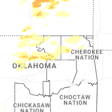
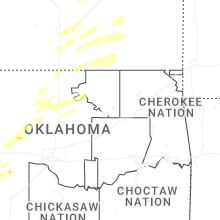
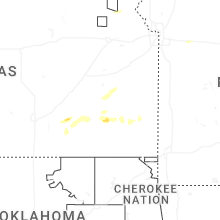
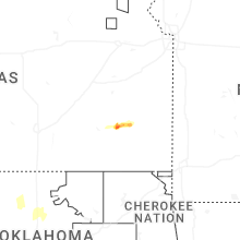
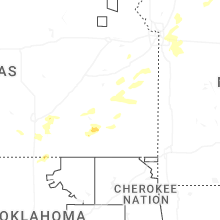
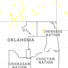
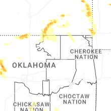
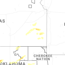


Connect with Interactive Hail Maps