

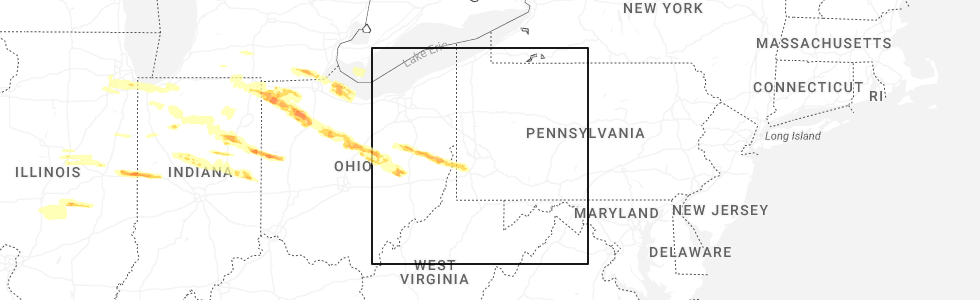
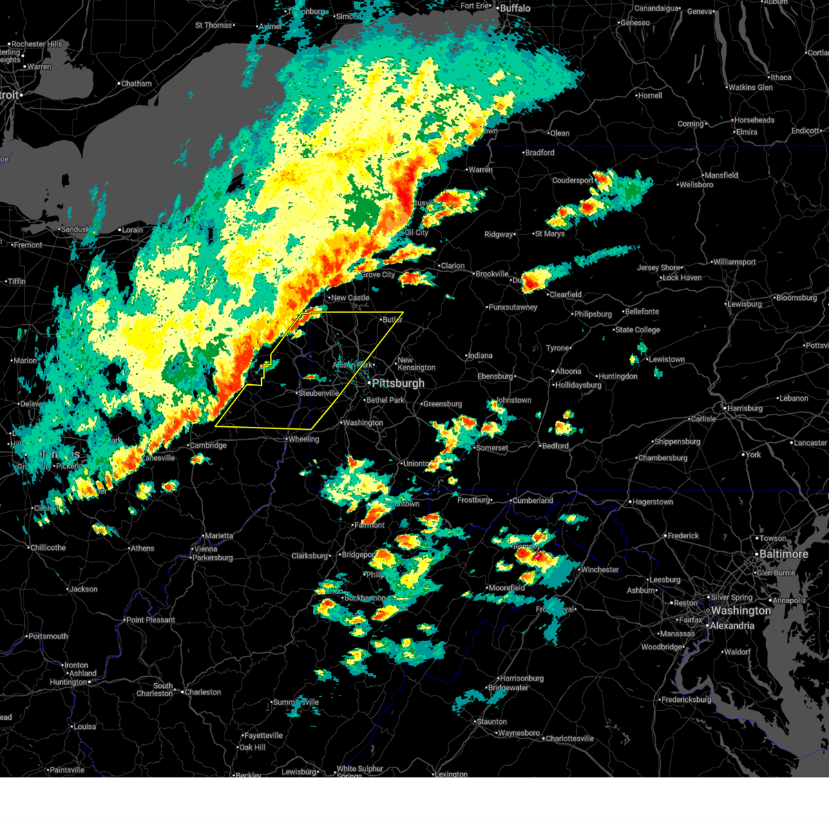
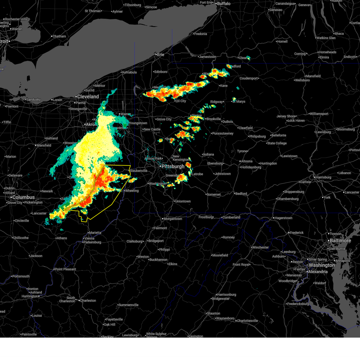
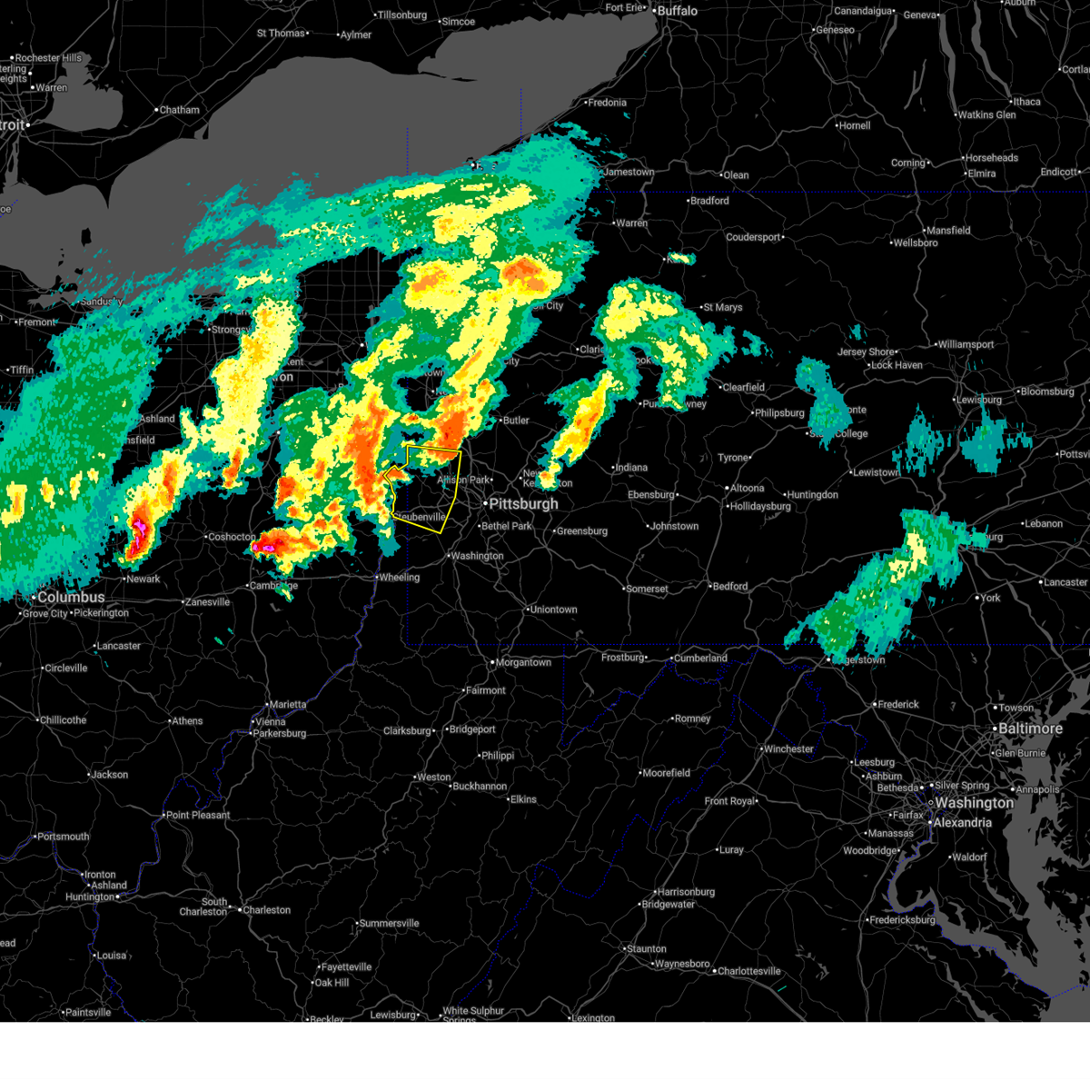
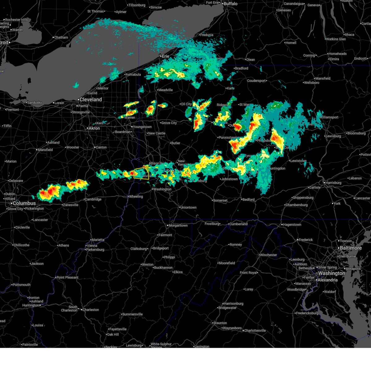
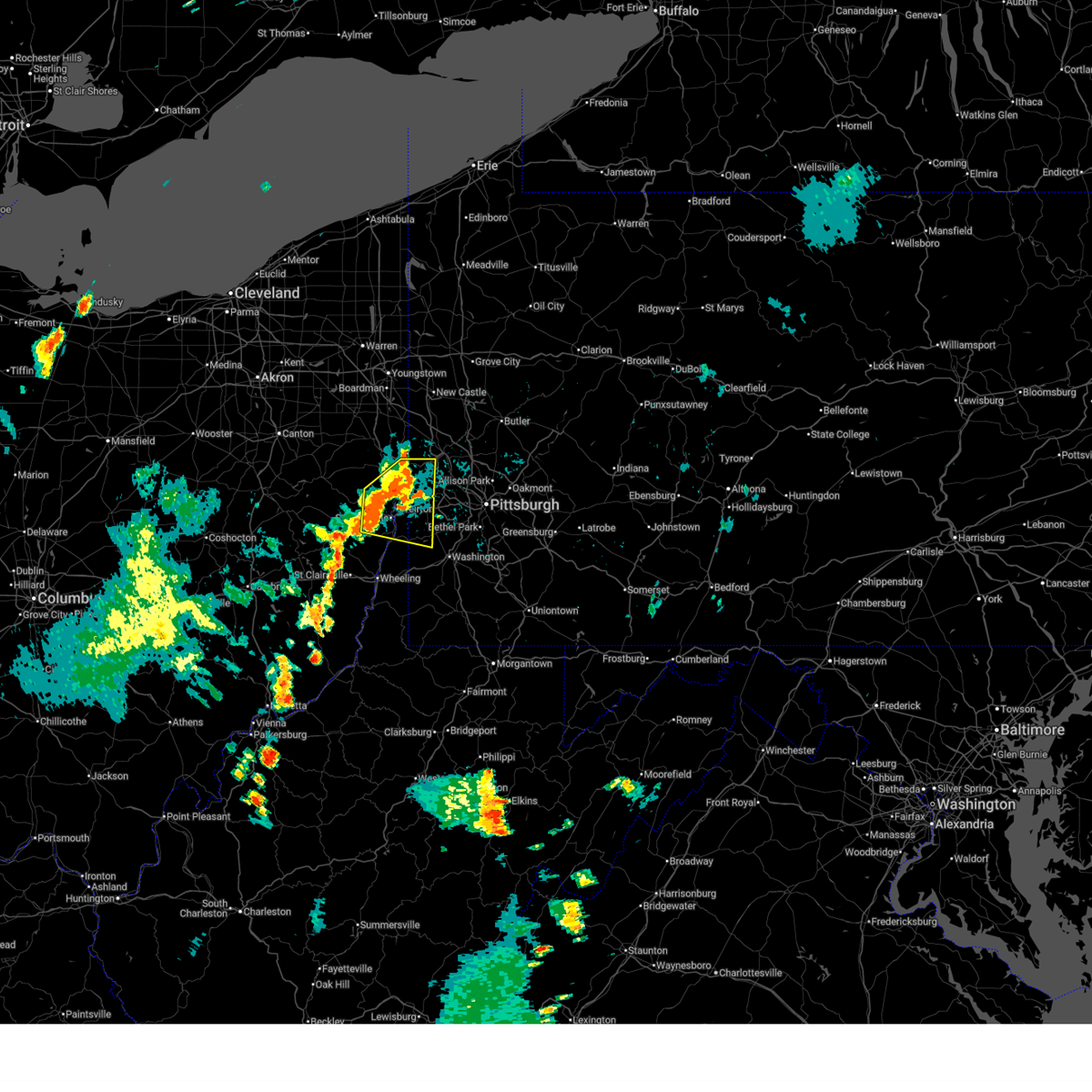
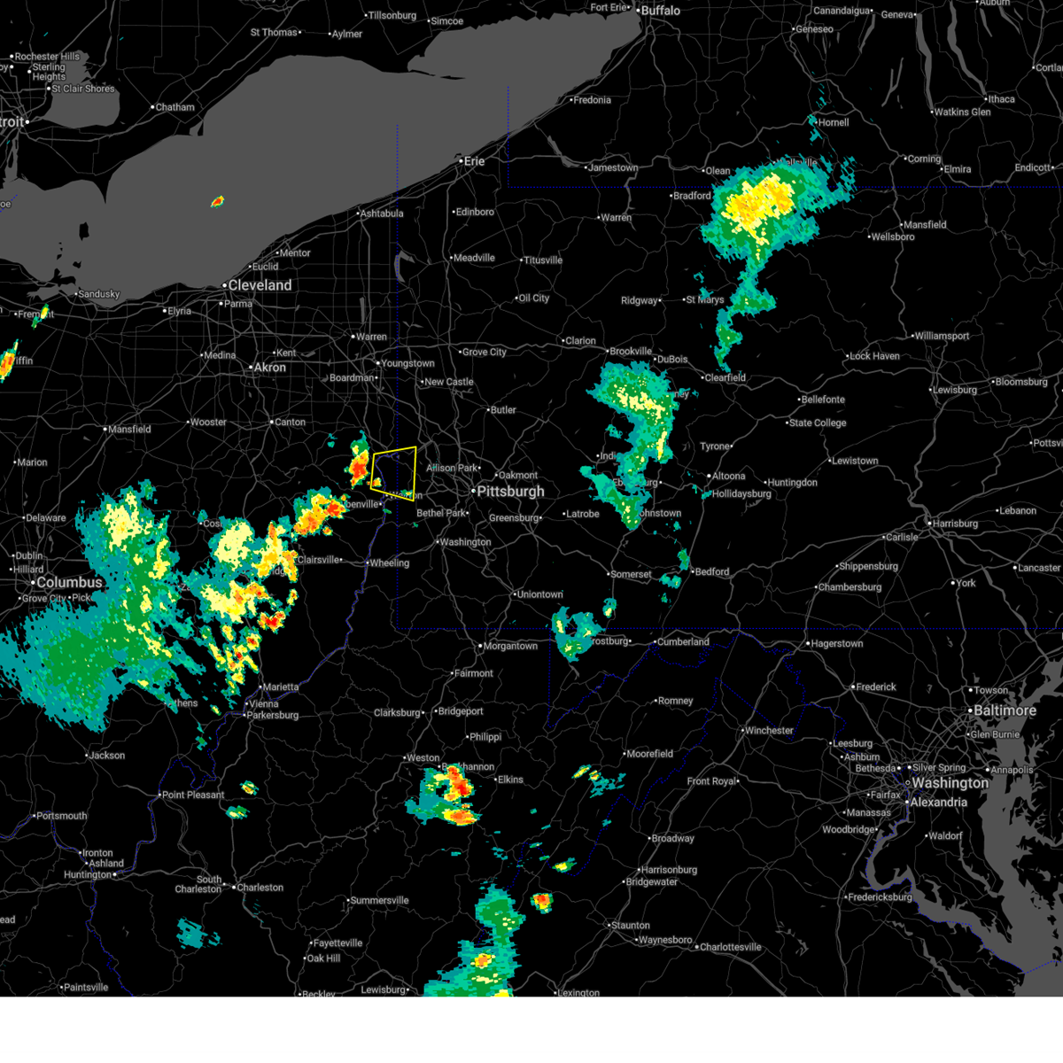
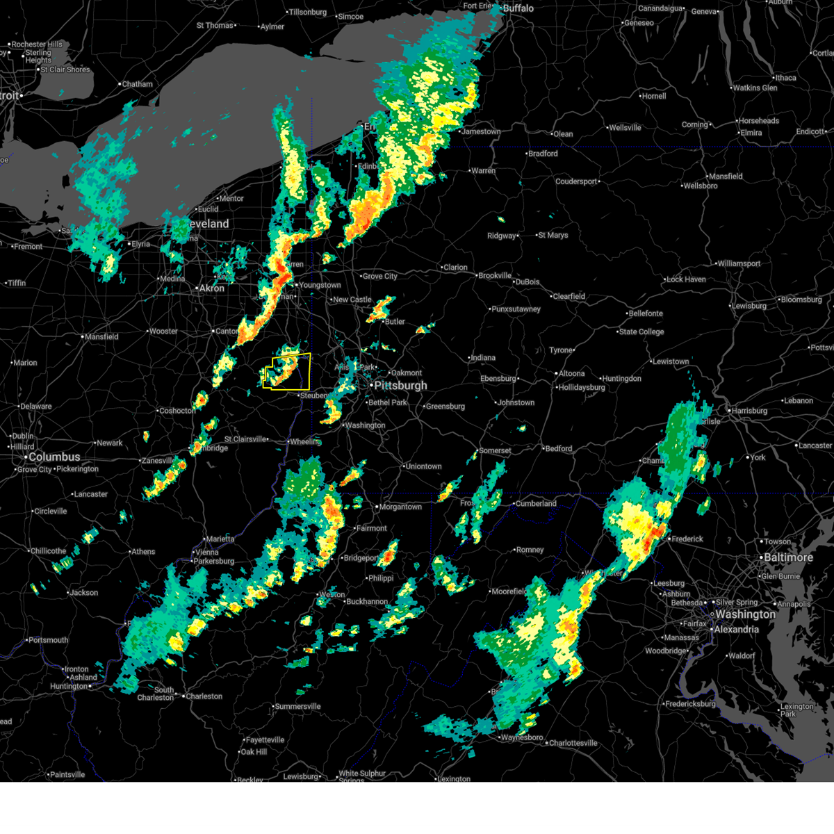
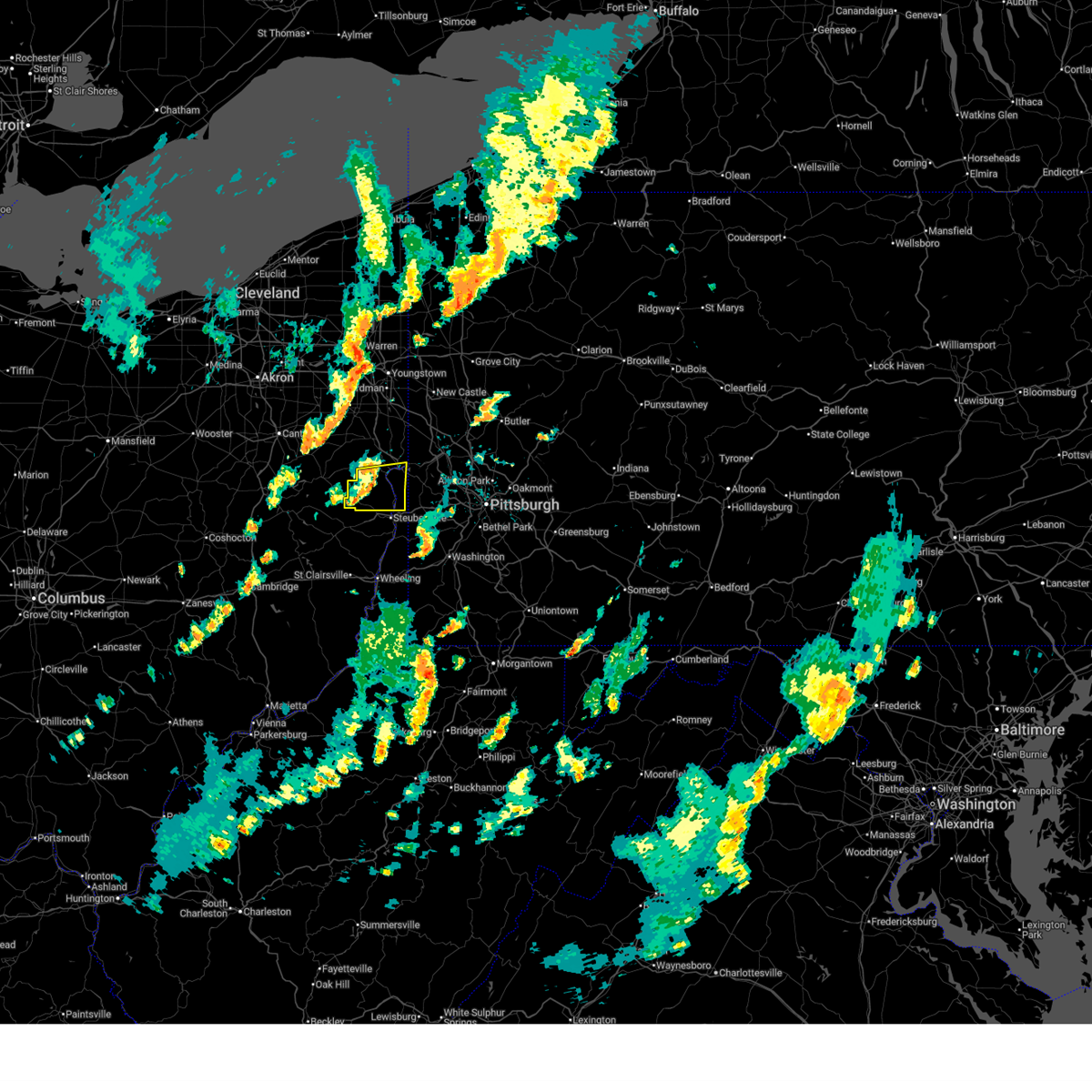
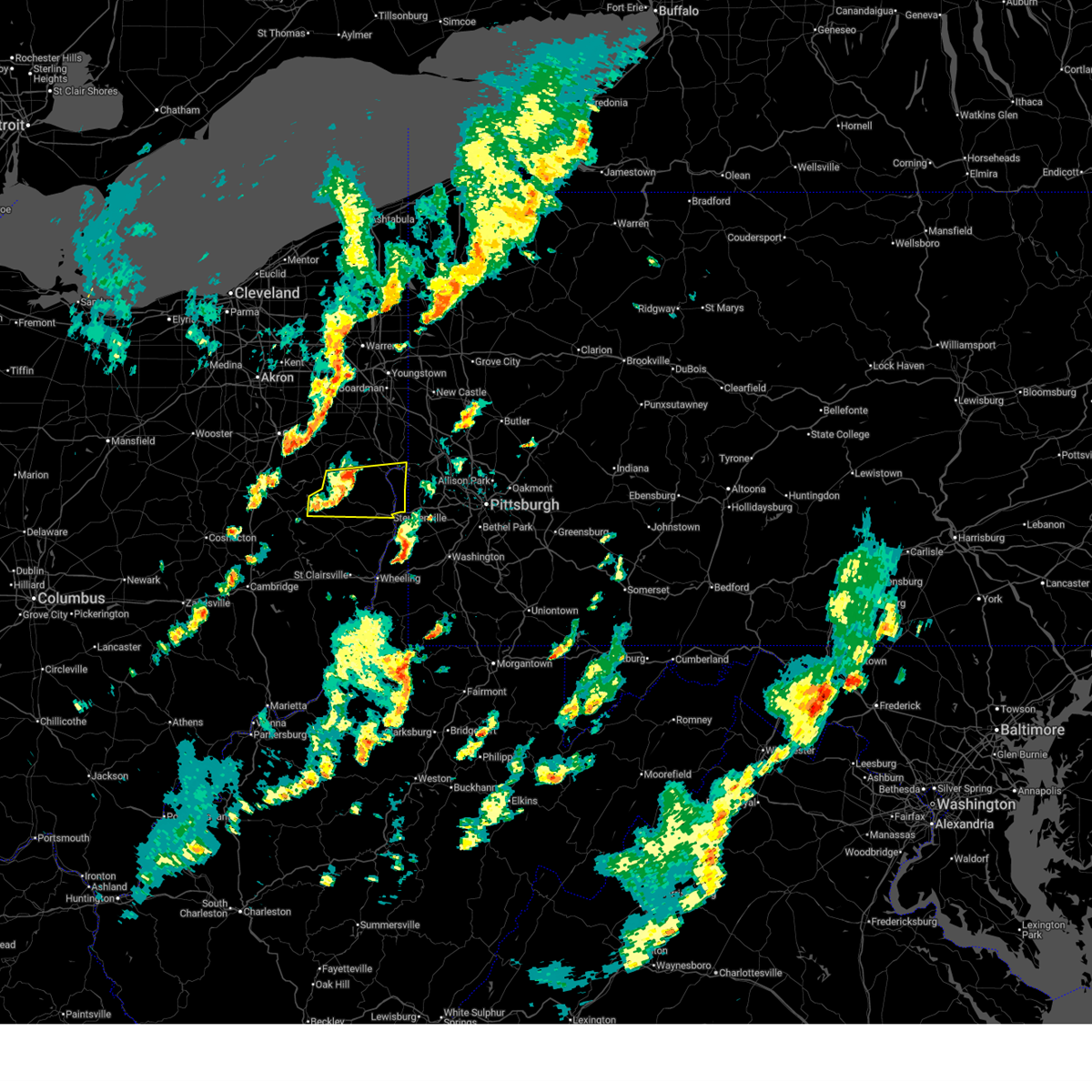
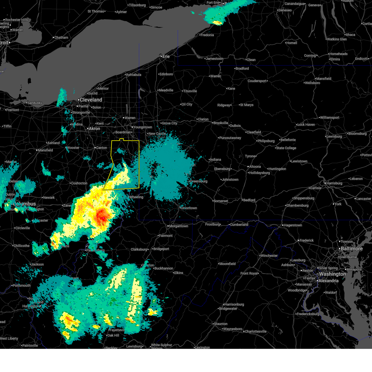
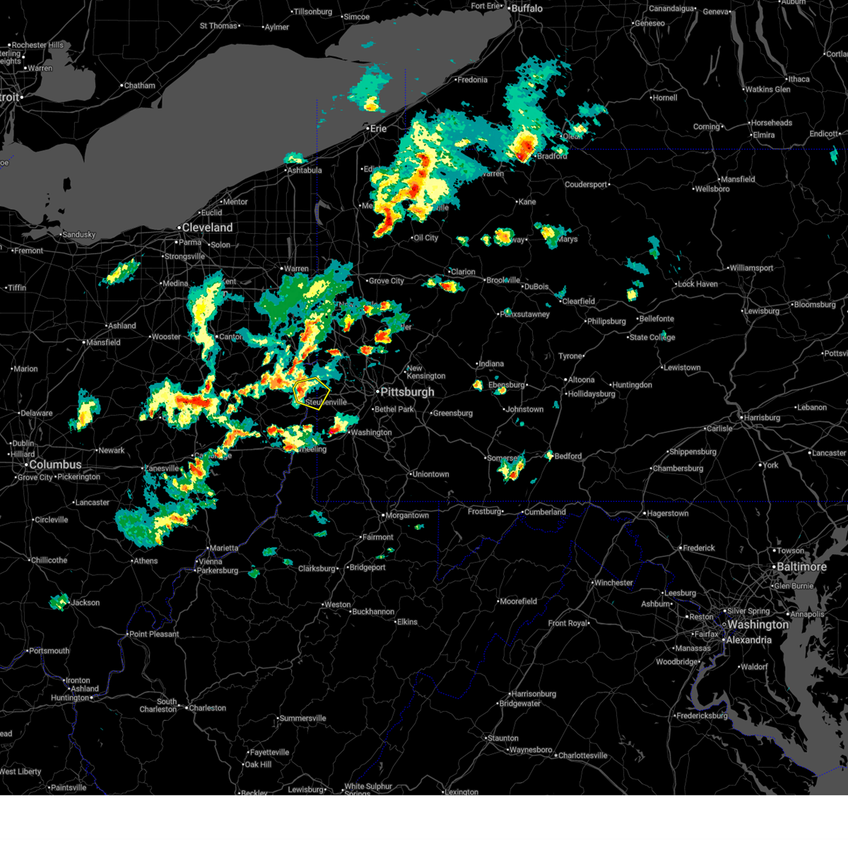
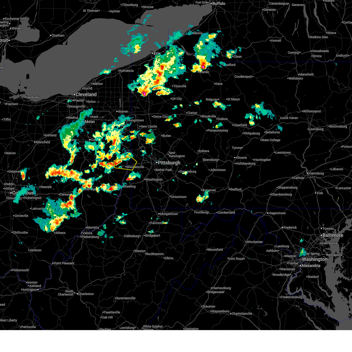
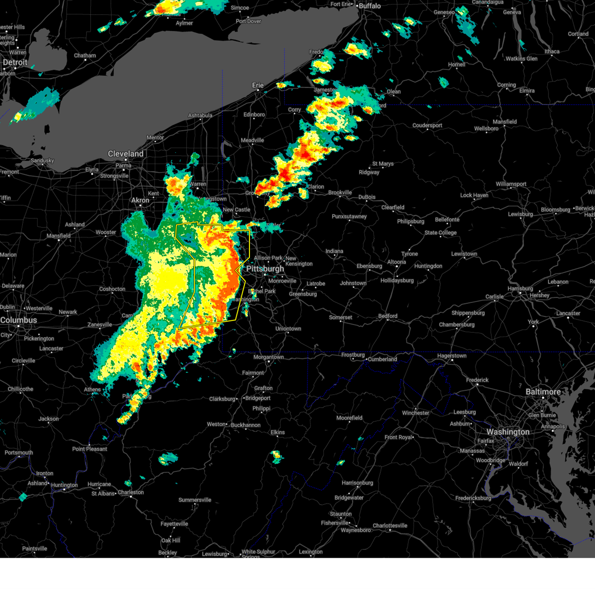
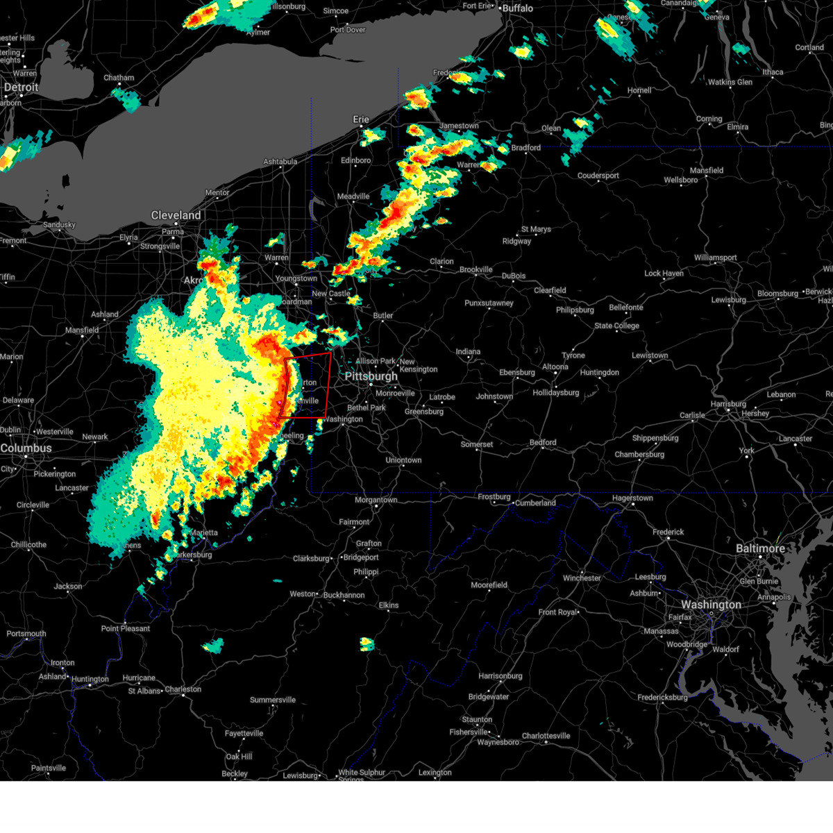
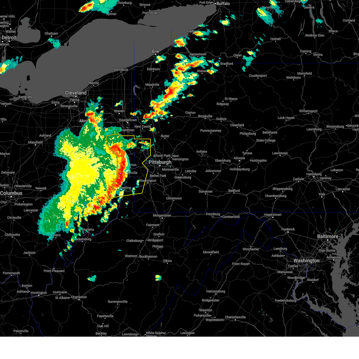
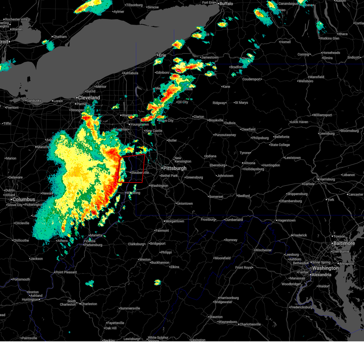
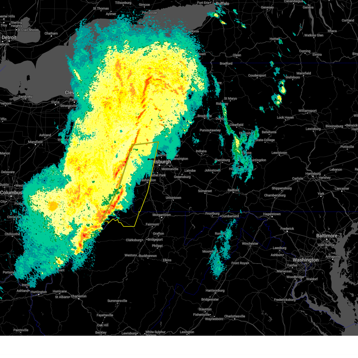
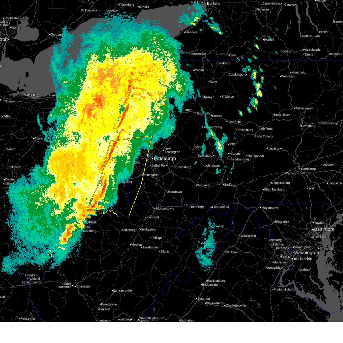
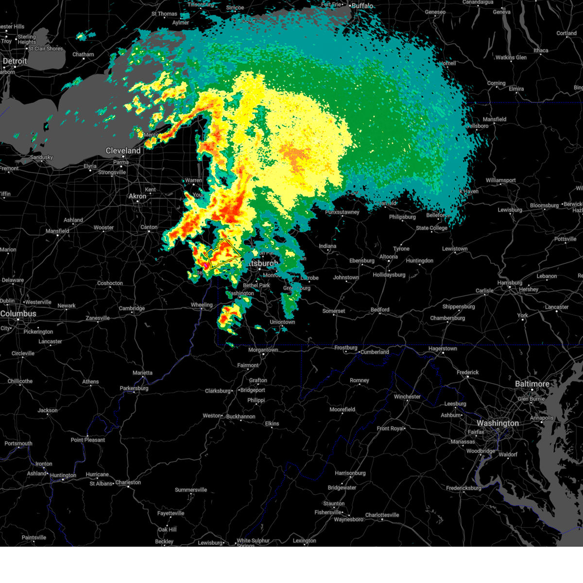
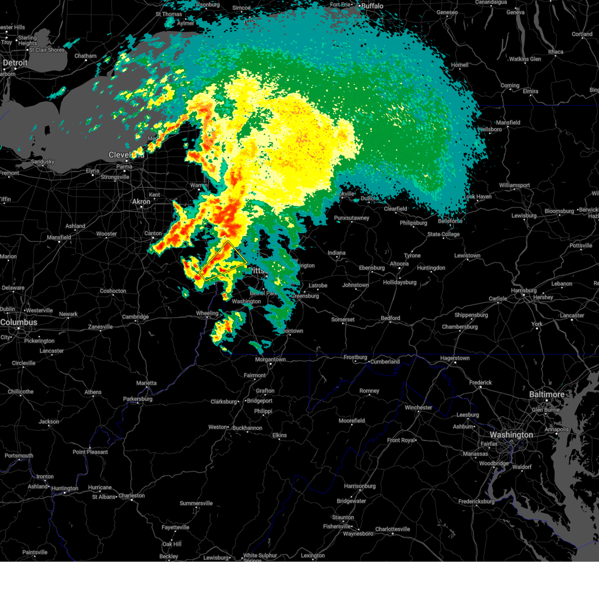
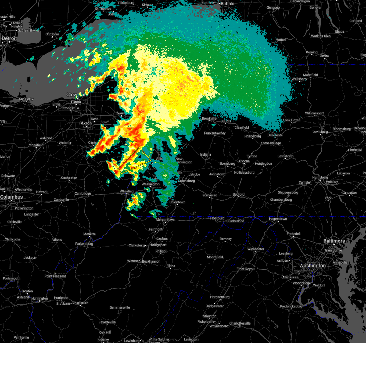
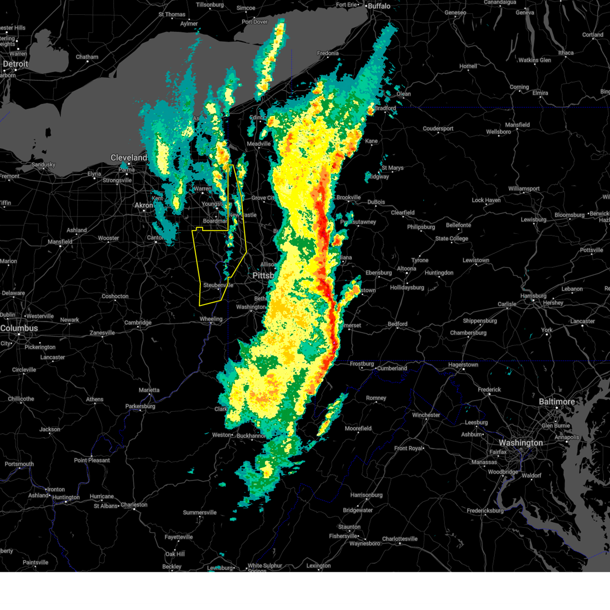
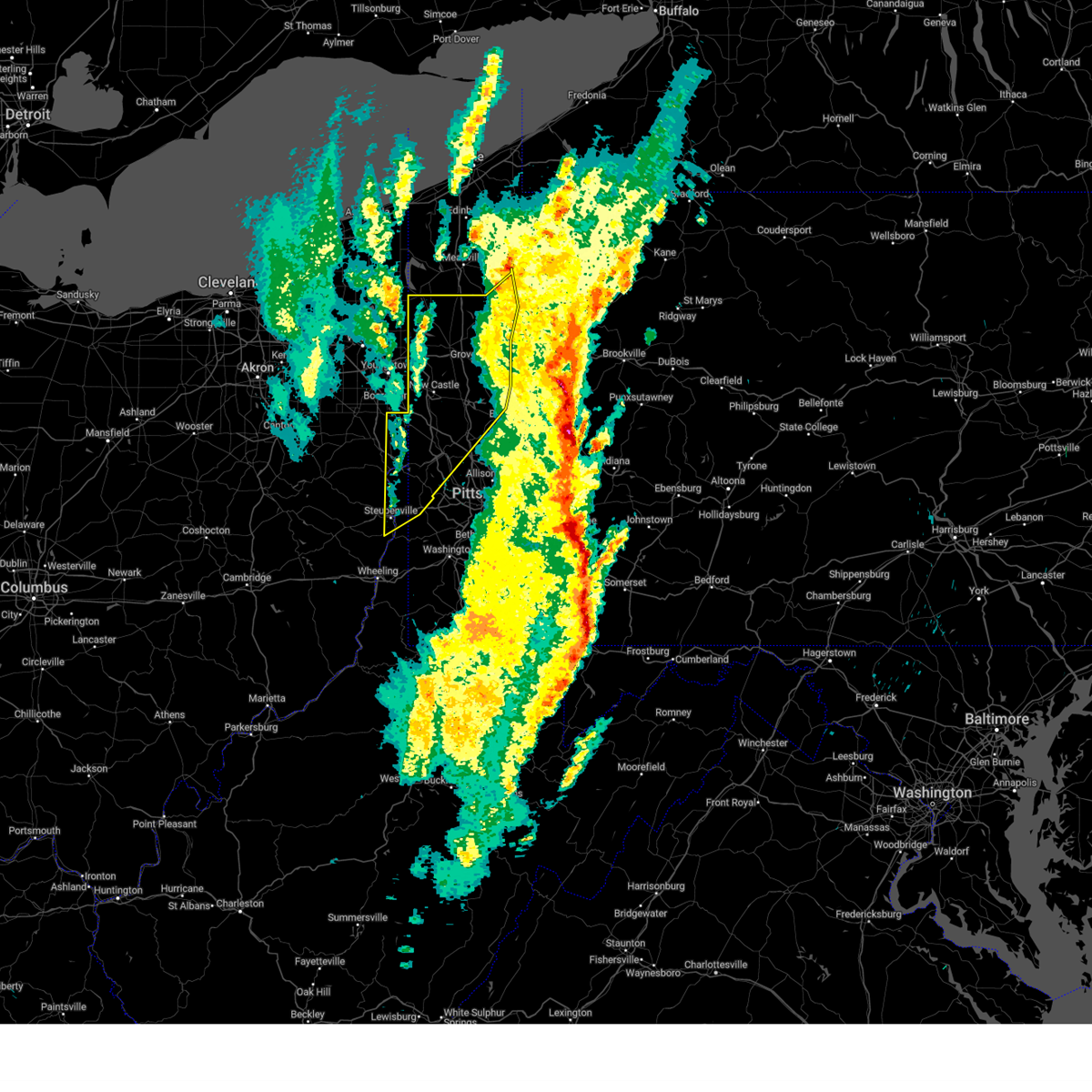
Hail Map for Toronto, WV
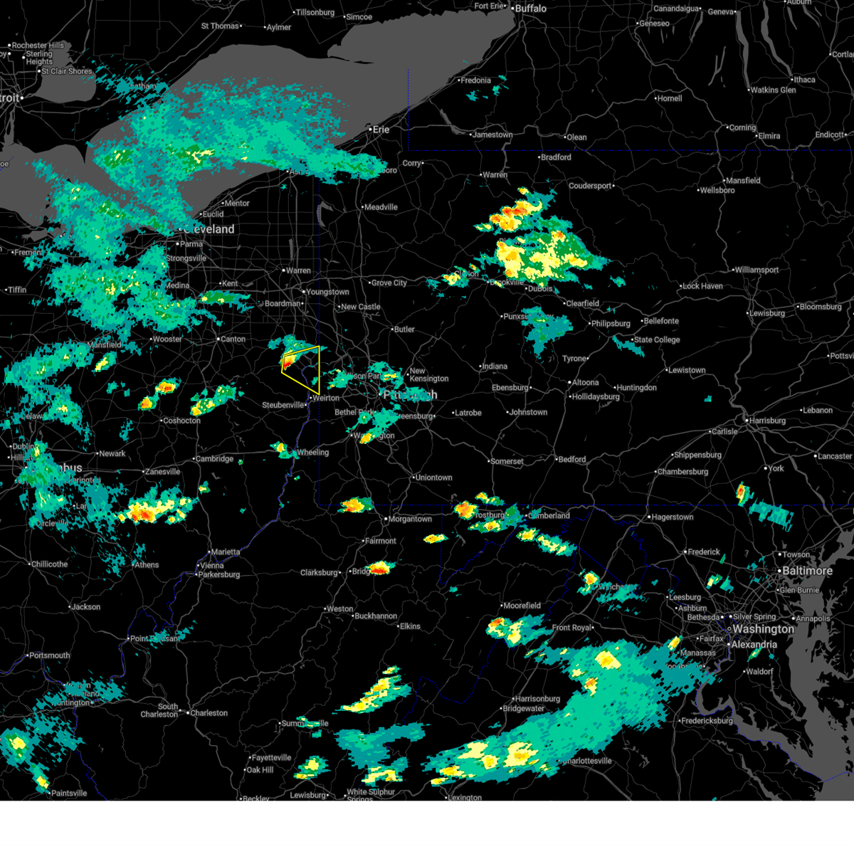
The Toronto, WV area has had 3 reports of on-the-ground hail by trained spotters, and has been under severe weather warnings 21 times during the past 12 months. Doppler radar has detected hail at or near Toronto, WV on 44 occasions, including 2 occasions during the past year.
| Name: | Toronto, WV |
| Where Located: | 32.4 miles W of Pittsburgh, PA |
| Map: | Google Map for Toronto, WV |
| Population: | 5091 |
| Housing Units: | 2516 |
| More Info: | Search Google for Toronto, WV |
0
The Top Recent Hail Date for Toronto, WV is Thursday, March 26, 2026 (21st out of 44)
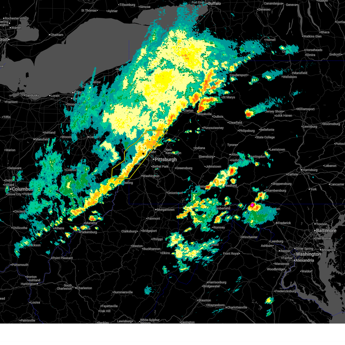
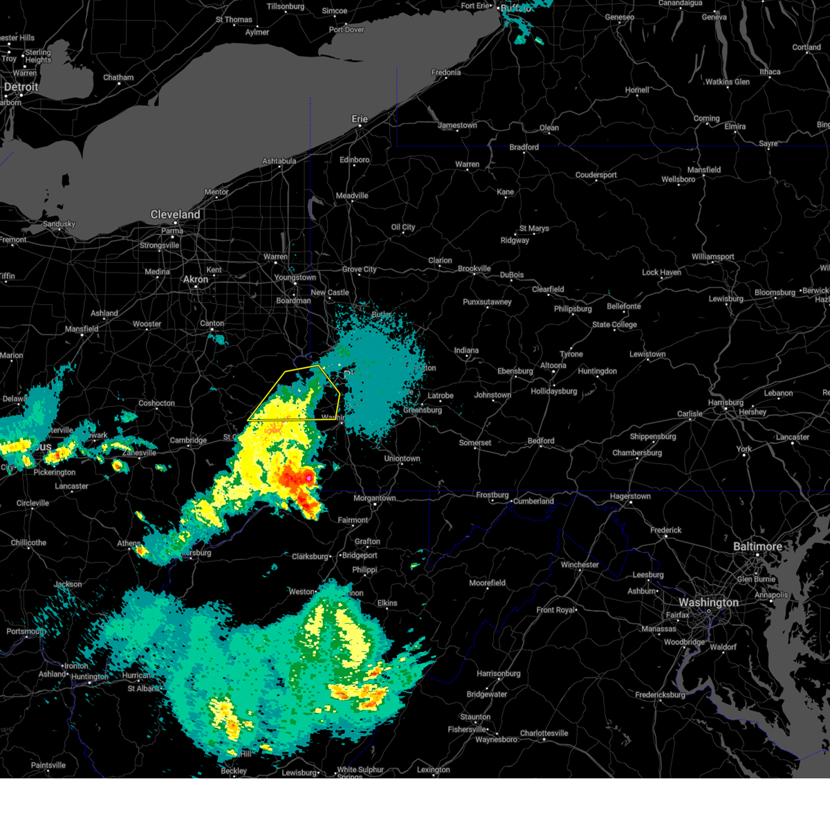
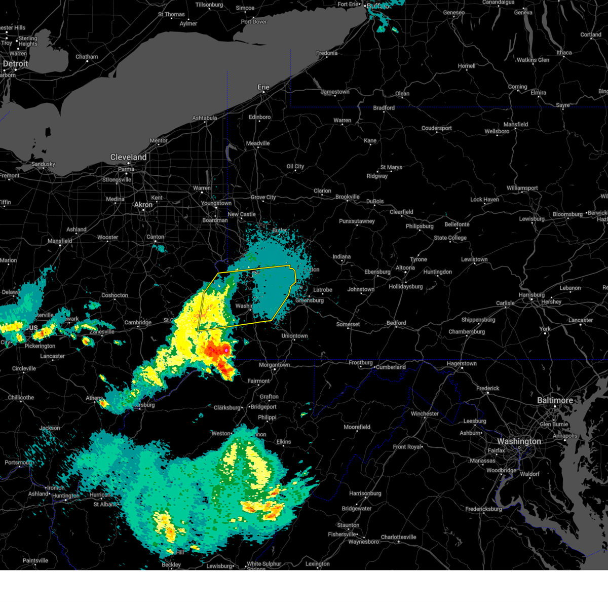
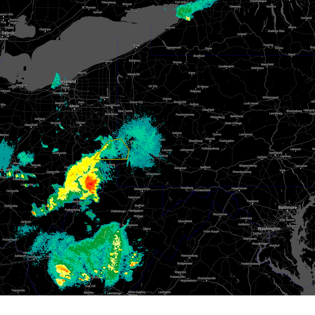
Hail and Wind Damage Spotted near Toronto, WV
| Date / Time | Report Details |
|---|---|
| 6/14/2026 6:06 PM EDT |
 The severe thunderstorm warning that was previously in effect has been reissued for belmont, butler, brooke, ohio, beaver, allegheny, and washington counties and is in effect until 700 pm edt. please refer to that bulletin for the latest severe weather information. to report severe weather, contact your nearest law enforcement agency. they will send your report to the national weather service office. a severe thunderstorm watch remains in effect until 900 pm edt for portions of east central ohio, pennsylvania, and the northern panhandle of west virginia. a tornado watch remains in effect until 1000 pm edt for portions of southwest and west central pennsylvania. The severe thunderstorm warning that was previously in effect has been reissued for belmont, butler, brooke, ohio, beaver, allegheny, and washington counties and is in effect until 700 pm edt. please refer to that bulletin for the latest severe weather information. to report severe weather, contact your nearest law enforcement agency. they will send your report to the national weather service office. a severe thunderstorm watch remains in effect until 900 pm edt for portions of east central ohio, pennsylvania, and the northern panhandle of west virginia. a tornado watch remains in effect until 1000 pm edt for portions of southwest and west central pennsylvania.
|
| 6/14/2026 5:58 PM EDT |
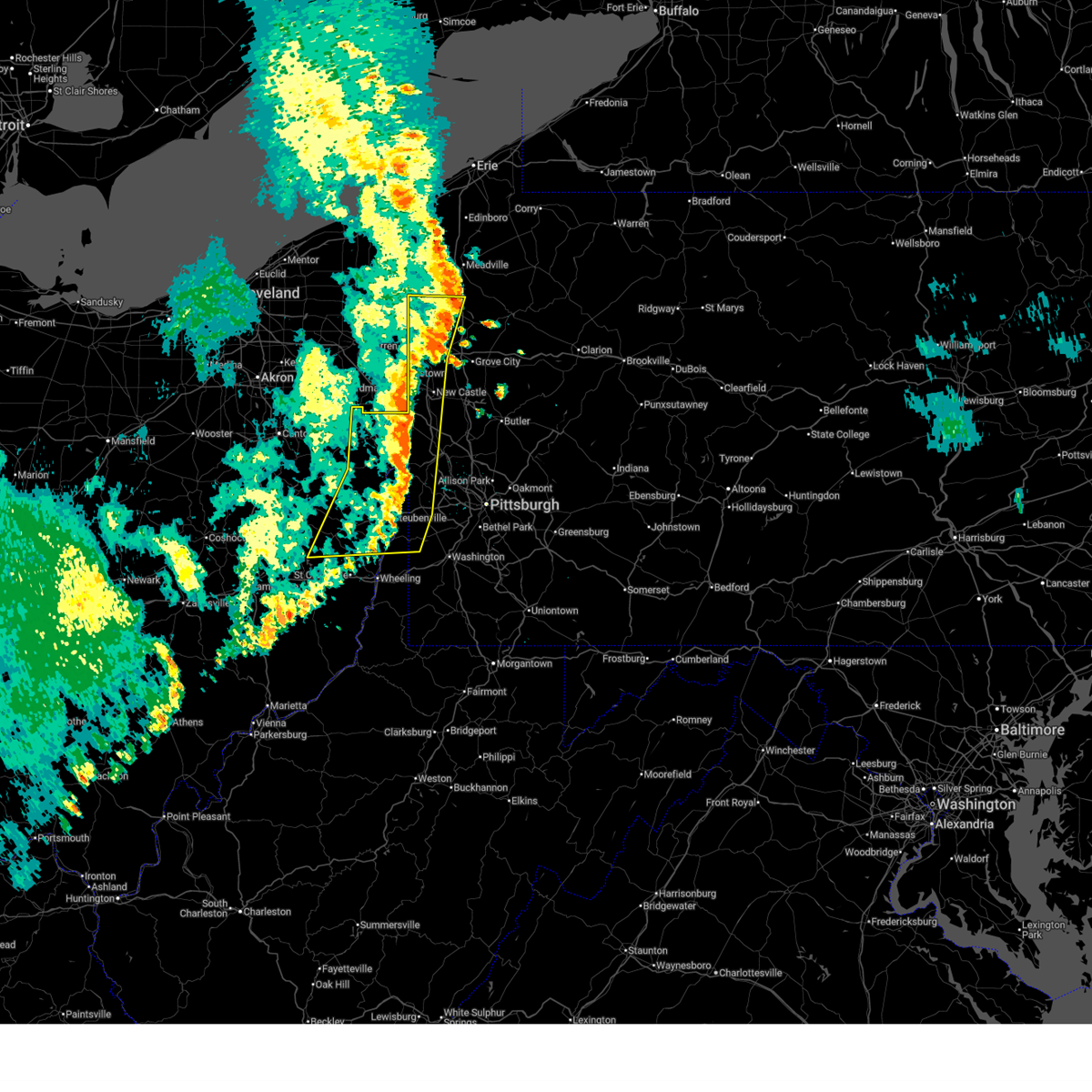
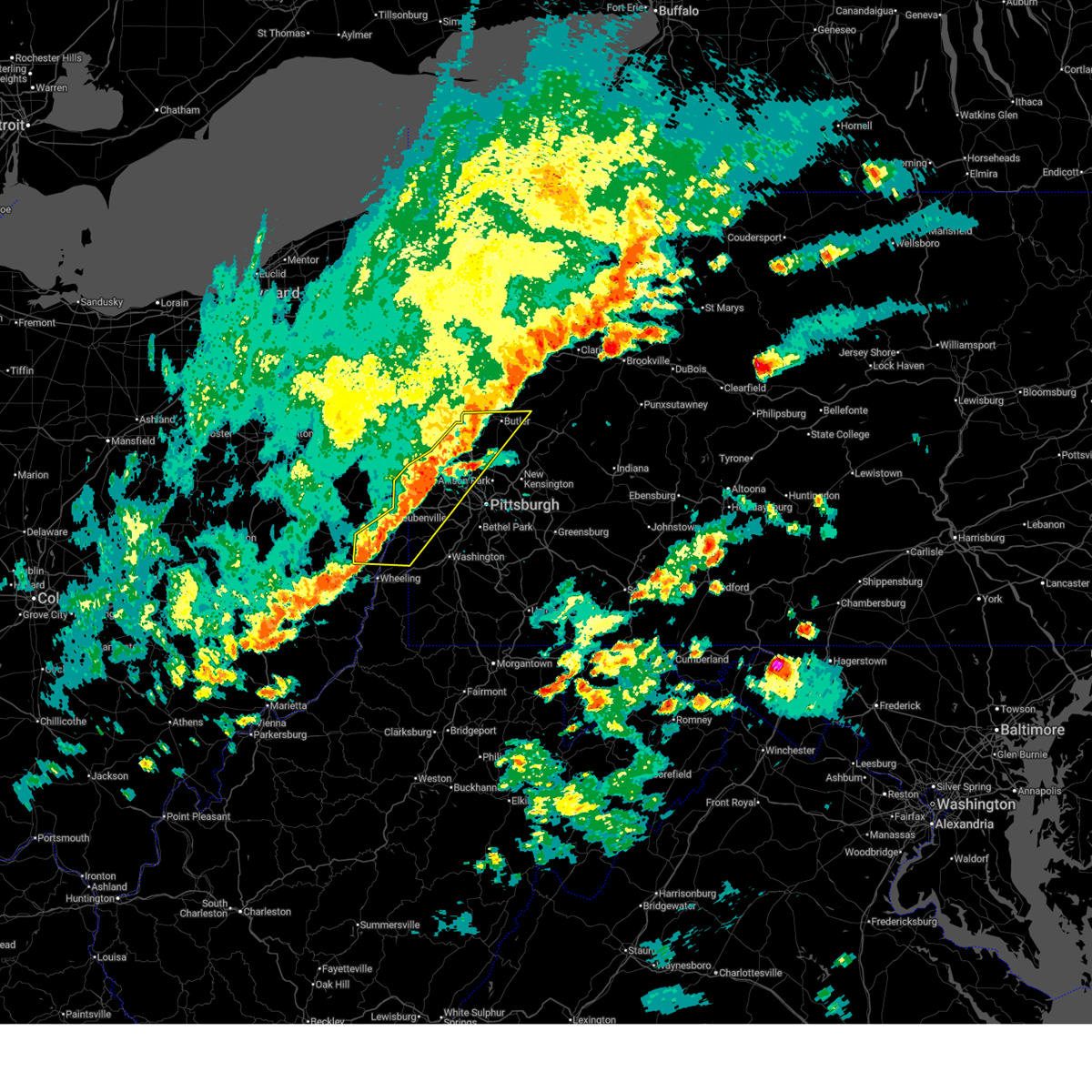 At 558 pm edt, severe thunderstorms were located along a line from over shanor-northvue to 7 miles northeast of caldwell, or along a line from near butler to 7 miles northeast of caldwell, moving east at 45 mph (radar indicated). Hazards include 60 mph wind gusts and small hail. Expect damage to roofs, siding, and trees. Locations impacted include, mccandless township, cranberry, moon township, weirton, steubenville, butler, franklin park, aliquippa, beaver falls, monaca, wellsburg, west liberty, avella, clearview, robinson township, economy, ambridge and wexford. At 558 pm edt, severe thunderstorms were located along a line from over shanor-northvue to 7 miles northeast of caldwell, or along a line from near butler to 7 miles northeast of caldwell, moving east at 45 mph (radar indicated). Hazards include 60 mph wind gusts and small hail. Expect damage to roofs, siding, and trees. Locations impacted include, mccandless township, cranberry, moon township, weirton, steubenville, butler, franklin park, aliquippa, beaver falls, monaca, wellsburg, west liberty, avella, clearview, robinson township, economy, ambridge and wexford.
|
| 6/14/2026 5:48 PM EDT |
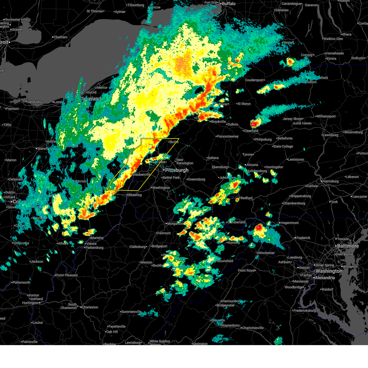 At 548 pm edt, severe thunderstorms were located along a line from 9 miles north of zelienople to 6 miles north of caldwell, or along a line from 11 miles west of butler to 6 miles north of caldwell, moving east at 45 mph (radar indicated). Hazards include 60 mph wind gusts and small hail. Expect damage to roofs, siding, and trees. Locations impacted include, mccandless township, cranberry, moon township, weirton, steubenville, butler, franklin park, east liverpool, aliquippa, beaver falls, monaca, wellsville, cadiz, wellsburg, west liberty, avella, clearview, robinson township and economy. At 548 pm edt, severe thunderstorms were located along a line from 9 miles north of zelienople to 6 miles north of caldwell, or along a line from 11 miles west of butler to 6 miles north of caldwell, moving east at 45 mph (radar indicated). Hazards include 60 mph wind gusts and small hail. Expect damage to roofs, siding, and trees. Locations impacted include, mccandless township, cranberry, moon township, weirton, steubenville, butler, franklin park, east liverpool, aliquippa, beaver falls, monaca, wellsville, cadiz, wellsburg, west liberty, avella, clearview, robinson township and economy.
|
| 6/14/2026 5:18 PM EDT |
 Svrpbz the national weather service in pittsburgh has issued a * severe thunderstorm warning for, northern belmont county in east central ohio, eastern columbiana county in east central ohio, northeastern guernsey county in east central ohio, harrison county in east central ohio, jefferson oh county in east central ohio, northwestern allegheny county in southwestern pennsylvania, northwestern washington county in southwestern pennsylvania, southern butler county in west central pennsylvania, beaver county in western pennsylvania, southern lawrence county in western pennsylvania, brooke county in northern west virginia, hancock county in northern west virginia, ohio county in northern west virginia, * until 615 pm edt. * at 518 pm edt, severe thunderstorms were located along a line from 7 miles north of east palestine to near south zanesville, or along a line from 7 miles north of east palestine to 7 miles south of zanesville, moving east at 45 mph (radar indicated). Hazards include 60 mph wind gusts and small hail. expect damage to roofs, siding, and trees Svrpbz the national weather service in pittsburgh has issued a * severe thunderstorm warning for, northern belmont county in east central ohio, eastern columbiana county in east central ohio, northeastern guernsey county in east central ohio, harrison county in east central ohio, jefferson oh county in east central ohio, northwestern allegheny county in southwestern pennsylvania, northwestern washington county in southwestern pennsylvania, southern butler county in west central pennsylvania, beaver county in western pennsylvania, southern lawrence county in western pennsylvania, brooke county in northern west virginia, hancock county in northern west virginia, ohio county in northern west virginia, * until 615 pm edt. * at 518 pm edt, severe thunderstorms were located along a line from 7 miles north of east palestine to near south zanesville, or along a line from 7 miles north of east palestine to 7 miles south of zanesville, moving east at 45 mph (radar indicated). Hazards include 60 mph wind gusts and small hail. expect damage to roofs, siding, and trees
|
| 6/11/2026 3:52 PM EDT |
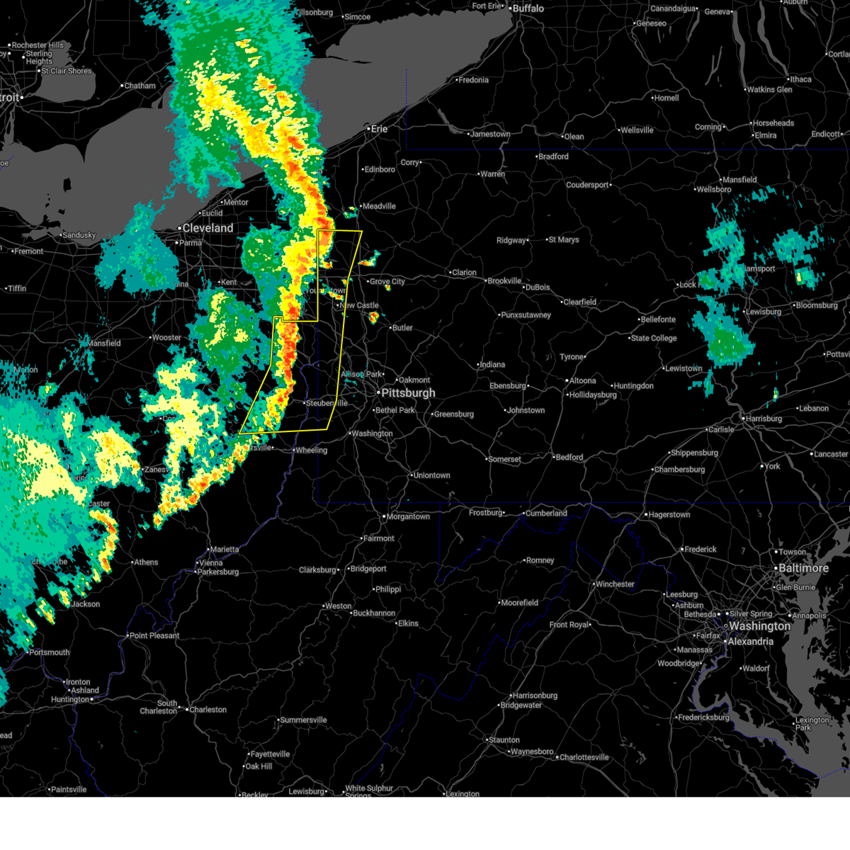
 At 352 pm edt, severe thunderstorms were located along a line from over follansbee to 7 miles southwest of barnesville, or along a line from over steubenville to 7 miles southwest of barnesville, moving east at 50 mph (radar indicated). Hazards include 60 mph wind gusts. Expect damage to roofs, siding, and trees. locations impacted include, wheeling, weirton, steubenville, moundsville, martins ferry, st. Clairsville, bellaire, barnesville, cadiz, warwood, wellsburg, bethlehem, west liberty, triadelphia, avella, clearview, valley grove, toronto, wintersville and shadyside. At 352 pm edt, severe thunderstorms were located along a line from over follansbee to 7 miles southwest of barnesville, or along a line from over steubenville to 7 miles southwest of barnesville, moving east at 50 mph (radar indicated). Hazards include 60 mph wind gusts. Expect damage to roofs, siding, and trees. locations impacted include, wheeling, weirton, steubenville, moundsville, martins ferry, st. Clairsville, bellaire, barnesville, cadiz, warwood, wellsburg, bethlehem, west liberty, triadelphia, avella, clearview, valley grove, toronto, wintersville and shadyside.
|
| 6/11/2026 3:36 PM EDT |
 Svrpbz the national weather service in pittsburgh has issued a * severe thunderstorm warning for, belmont county in east central ohio, central guernsey county in east central ohio, harrison county in east central ohio, jefferson oh county in east central ohio, northern monroe county in east central ohio, eastern muskingum county in east central ohio, northern noble county in east central ohio, southwestern allegheny county in southwestern pennsylvania, northwestern washington county in southwestern pennsylvania, brooke county in northern west virginia, hancock county in northern west virginia, marshall county in northern west virginia, ohio county in northern west virginia, * until 415 pm edt. * at 336 pm edt, severe thunderstorms were located along a line from 9 miles west of wintersville to 5 miles southeast of byesville, or along a line from 10 miles northeast of cadiz to 10 miles southeast of cambridge, moving east at 50 mph (radar indicated). Hazards include 60 mph wind gusts. expect damage to roofs, siding, and trees Svrpbz the national weather service in pittsburgh has issued a * severe thunderstorm warning for, belmont county in east central ohio, central guernsey county in east central ohio, harrison county in east central ohio, jefferson oh county in east central ohio, northern monroe county in east central ohio, eastern muskingum county in east central ohio, northern noble county in east central ohio, southwestern allegheny county in southwestern pennsylvania, northwestern washington county in southwestern pennsylvania, brooke county in northern west virginia, hancock county in northern west virginia, marshall county in northern west virginia, ohio county in northern west virginia, * until 415 pm edt. * at 336 pm edt, severe thunderstorms were located along a line from 9 miles west of wintersville to 5 miles southeast of byesville, or along a line from 10 miles northeast of cadiz to 10 miles southeast of cambridge, moving east at 50 mph (radar indicated). Hazards include 60 mph wind gusts. expect damage to roofs, siding, and trees
|
| 6/11/2026 2:33 PM EDT |
 Svrpbz the national weather service in pittsburgh has issued a * severe thunderstorm warning for, northern belmont county in east central ohio, southeastern columbiana county in east central ohio, southeastern harrison county in east central ohio, southern jefferson oh county in east central ohio, northwestern allegheny county in southwestern pennsylvania, northwestern washington county in southwestern pennsylvania, southwestern butler county in west central pennsylvania, beaver county in western pennsylvania, southern lawrence county in western pennsylvania, brooke county in northern west virginia, hancock county in northern west virginia, ohio county in northern west virginia, * until 315 pm edt. * at 233 pm edt, severe thunderstorms were located along a line from 6 miles west of beaver falls to 7 miles north of st. clairsville, moving east at 40 mph (radar indicated). Hazards include 60 mph wind gusts and small hail. expect damage to roofs, siding, and trees Svrpbz the national weather service in pittsburgh has issued a * severe thunderstorm warning for, northern belmont county in east central ohio, southeastern columbiana county in east central ohio, southeastern harrison county in east central ohio, southern jefferson oh county in east central ohio, northwestern allegheny county in southwestern pennsylvania, northwestern washington county in southwestern pennsylvania, southwestern butler county in west central pennsylvania, beaver county in western pennsylvania, southern lawrence county in western pennsylvania, brooke county in northern west virginia, hancock county in northern west virginia, ohio county in northern west virginia, * until 315 pm edt. * at 233 pm edt, severe thunderstorms were located along a line from 6 miles west of beaver falls to 7 miles north of st. clairsville, moving east at 40 mph (radar indicated). Hazards include 60 mph wind gusts and small hail. expect damage to roofs, siding, and trees
|
| 6/11/2026 2:30 PM EDT | Large tree down on a trailer. time estimated via rada in jefferson county OH, 0 miles WSW of Toronto, WV |
| 6/6/2026 1:39 PM EDT |
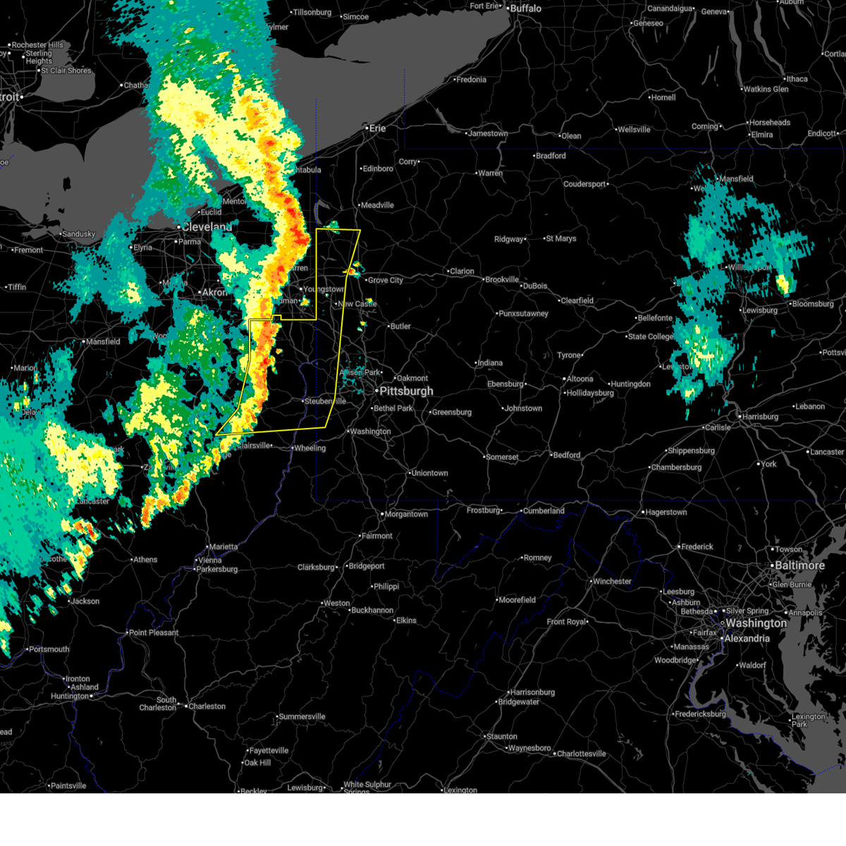
 At 139 pm edt, severe thunderstorms were located along a line from near cadiz to 16 miles southwest of caldwell, moving east at 50 mph (law enforcement reported uprooted trees and power poles down across muskingum county). Hazards include 70 mph wind gusts and quarter size hail. Hail damage to vehicles is expected. expect considerable tree damage. wind damage is also likely to mobile homes, roofs, and outbuildings. locations impacted include, steubenville, st. Clairsville, barnesville, cadiz, wellsburg, caldwell, freeport, toronto, wintersville, mingo junction, dudley, bethesda, hopedale, flushing, smithfield and scio. At 139 pm edt, severe thunderstorms were located along a line from near cadiz to 16 miles southwest of caldwell, moving east at 50 mph (law enforcement reported uprooted trees and power poles down across muskingum county). Hazards include 70 mph wind gusts and quarter size hail. Hail damage to vehicles is expected. expect considerable tree damage. wind damage is also likely to mobile homes, roofs, and outbuildings. locations impacted include, steubenville, st. Clairsville, barnesville, cadiz, wellsburg, caldwell, freeport, toronto, wintersville, mingo junction, dudley, bethesda, hopedale, flushing, smithfield and scio.
|
| 6/6/2026 1:28 PM EDT |
 At 128 pm edt, severe thunderstorms were located along a line from 7 miles northwest of cadiz to 16 miles south of south zanesville, or along a line from 7 miles northwest of cadiz to 20 miles south of zanesville, moving east at 50 mph (law enforcement reported uprooted trees and power poles down across muskingum county). Hazards include 70 mph wind gusts and quarter size hail. Hail damage to vehicles is expected. expect considerable tree damage. wind damage is also likely to mobile homes, roofs, and outbuildings. locations impacted include, steubenville, cambridge, uhrichsville, st. Clairsville, barnesville, cadiz, wellsburg, caldwell, freeport, toronto, wintersville, mingo junction, dennison, new concord, byesville and dudley. At 128 pm edt, severe thunderstorms were located along a line from 7 miles northwest of cadiz to 16 miles south of south zanesville, or along a line from 7 miles northwest of cadiz to 20 miles south of zanesville, moving east at 50 mph (law enforcement reported uprooted trees and power poles down across muskingum county). Hazards include 70 mph wind gusts and quarter size hail. Hail damage to vehicles is expected. expect considerable tree damage. wind damage is also likely to mobile homes, roofs, and outbuildings. locations impacted include, steubenville, cambridge, uhrichsville, st. Clairsville, barnesville, cadiz, wellsburg, caldwell, freeport, toronto, wintersville, mingo junction, dennison, new concord, byesville and dudley.
|
| 6/6/2026 1:04 PM EDT |
 Svrpbz the national weather service in pittsburgh has issued a * severe thunderstorm warning for, belmont county in east central ohio, south central carroll county in east central ohio, guernsey county in east central ohio, harrison county in east central ohio, jefferson oh county in east central ohio, northwestern monroe county in east central ohio, southeastern muskingum county in east central ohio, noble county in east central ohio, southeastern tuscarawas county in east central ohio, * until 200 pm edt. * at 104 pm edt, severe thunderstorms were located along a line from near uhrichsville to 19 miles southwest of south zanesville, or along a line from near uhrichsville to 21 miles southwest of zanesville, moving east at 50 mph (law enforcement reported damage across muskingum county). Hazards include 60 mph wind gusts and quarter size hail. Hail damage to vehicles is expected. Expect wind damage to roofs, siding, and trees. Svrpbz the national weather service in pittsburgh has issued a * severe thunderstorm warning for, belmont county in east central ohio, south central carroll county in east central ohio, guernsey county in east central ohio, harrison county in east central ohio, jefferson oh county in east central ohio, northwestern monroe county in east central ohio, southeastern muskingum county in east central ohio, noble county in east central ohio, southeastern tuscarawas county in east central ohio, * until 200 pm edt. * at 104 pm edt, severe thunderstorms were located along a line from near uhrichsville to 19 miles southwest of south zanesville, or along a line from near uhrichsville to 21 miles southwest of zanesville, moving east at 50 mph (law enforcement reported damage across muskingum county). Hazards include 60 mph wind gusts and quarter size hail. Hail damage to vehicles is expected. Expect wind damage to roofs, siding, and trees.
|
| 3/22/2026 10:15 PM EDT |
 The storms which prompted the warning have weakened below severe limits, and no longer pose an immediate threat to life or property. therefore, the warning has been allowed to expire. however, gusty winds are still possible with these thunderstorms. to report severe weather, contact your nearest law enforcement agency. they will send your report to the national weather service office. a severe thunderstorm watch remains in effect until 1200 am edt for portions of pennsylvania and the northern panhandle of west virginia. The storms which prompted the warning have weakened below severe limits, and no longer pose an immediate threat to life or property. therefore, the warning has been allowed to expire. however, gusty winds are still possible with these thunderstorms. to report severe weather, contact your nearest law enforcement agency. they will send your report to the national weather service office. a severe thunderstorm watch remains in effect until 1200 am edt for portions of pennsylvania and the northern panhandle of west virginia.
|
| 3/22/2026 10:02 PM EDT |
 the severe thunderstorm warning has been cancelled and is no longer in effect the severe thunderstorm warning has been cancelled and is no longer in effect
|
| 3/22/2026 10:02 PM EDT |
 At 1002 pm edt, severe thunderstorms were located along a line from over industry to near weirton, or along a line from 8 miles west of monaca to near weirton, moving east at 65 mph (radar indicated). Hazards include 60 mph wind gusts. Expect damage to roofs, siding, and trees. Locations impacted include, moon township, weirton, aliquippa, monaca, economy, ambridge, toronto, beaver, baden, sewickley, rochester, ohioville, harmony township, midland, chester and imperial. At 1002 pm edt, severe thunderstorms were located along a line from over industry to near weirton, or along a line from 8 miles west of monaca to near weirton, moving east at 65 mph (radar indicated). Hazards include 60 mph wind gusts. Expect damage to roofs, siding, and trees. Locations impacted include, moon township, weirton, aliquippa, monaca, economy, ambridge, toronto, beaver, baden, sewickley, rochester, ohioville, harmony township, midland, chester and imperial.
|
| 3/22/2026 9:51 PM EDT |
 Svrpbz the national weather service in pittsburgh has issued a * severe thunderstorm warning for, southeastern columbiana county in east central ohio, northern jefferson oh county in east central ohio, northwestern allegheny county in southwestern pennsylvania, northwestern washington county in southwestern pennsylvania, southern beaver county in western pennsylvania, brooke county in northern west virginia, hancock county in northern west virginia, * until 1015 pm edt. * at 951 pm edt, severe thunderstorms were located along a line from 6 miles northwest of calcutta to near wintersville, or along a line from 8 miles northwest of east liverpool to 8 miles northwest of steubenville, moving east at 65 mph (radar indicated). Hazards include 60 mph wind gusts. expect damage to roofs, siding, and trees Svrpbz the national weather service in pittsburgh has issued a * severe thunderstorm warning for, southeastern columbiana county in east central ohio, northern jefferson oh county in east central ohio, northwestern allegheny county in southwestern pennsylvania, northwestern washington county in southwestern pennsylvania, southern beaver county in western pennsylvania, brooke county in northern west virginia, hancock county in northern west virginia, * until 1015 pm edt. * at 951 pm edt, severe thunderstorms were located along a line from 6 miles northwest of calcutta to near wintersville, or along a line from 8 miles northwest of east liverpool to 8 miles northwest of steubenville, moving east at 65 mph (radar indicated). Hazards include 60 mph wind gusts. expect damage to roofs, siding, and trees
|
| 3/22/2026 6:37 PM EDT |
 Svrpbz the national weather service in pittsburgh has issued a * severe thunderstorm warning for, southeastern columbiana county in east central ohio, northeastern jefferson oh county in east central ohio, northwestern allegheny county in southwestern pennsylvania, southwestern butler county in west central pennsylvania, beaver county in western pennsylvania, hancock county in northern west virginia, * until 715 pm edt. * at 637 pm edt, a severe thunderstorm was located near wellsville, moving east at 55 mph (radar indicated). Hazards include quarter size hail. damage to vehicles is expected Svrpbz the national weather service in pittsburgh has issued a * severe thunderstorm warning for, southeastern columbiana county in east central ohio, northeastern jefferson oh county in east central ohio, northwestern allegheny county in southwestern pennsylvania, southwestern butler county in west central pennsylvania, beaver county in western pennsylvania, hancock county in northern west virginia, * until 715 pm edt. * at 637 pm edt, a severe thunderstorm was located near wellsville, moving east at 55 mph (radar indicated). Hazards include quarter size hail. damage to vehicles is expected
|
| 3/22/2026 5:57 PM EDT |
 The storm which prompted the warning has weakened below severe limits, and has exited the warned area. therefore, the warning will be allowed to expire. to report severe weather, contact your nearest law enforcement agency. they will send your report to the national weather service office. a severe thunderstorm watch remains in effect until 1000 pm edt for portions of pennsylvania and the northern panhandle of west virginia. The storm which prompted the warning has weakened below severe limits, and has exited the warned area. therefore, the warning will be allowed to expire. to report severe weather, contact your nearest law enforcement agency. they will send your report to the national weather service office. a severe thunderstorm watch remains in effect until 1000 pm edt for portions of pennsylvania and the northern panhandle of west virginia.
|
| 3/22/2026 5:46 PM EDT |
 At 546 pm edt, a severe thunderstorm was located over weirton, moving east at 50 mph (radar indicated). Hazards include quarter size hail. Damage to vehicles is expected. Locations impacted include, weirton, follansbee, burgettstown, frankfort springs, langeloth, slovan, colliers, atlasburg, raccoon creek state park, sun valley, hanover township and east steubenville. At 546 pm edt, a severe thunderstorm was located over weirton, moving east at 50 mph (radar indicated). Hazards include quarter size hail. Damage to vehicles is expected. Locations impacted include, weirton, follansbee, burgettstown, frankfort springs, langeloth, slovan, colliers, atlasburg, raccoon creek state park, sun valley, hanover township and east steubenville.
|
| 3/22/2026 5:46 PM EDT |
 the severe thunderstorm warning has been cancelled and is no longer in effect the severe thunderstorm warning has been cancelled and is no longer in effect
|
| 3/22/2026 5:32 PM EDT |
 At 532 pm edt, a severe thunderstorm was located near wintersville, or 6 miles northwest of steubenville, moving east at 50 mph (radar indicated). Hazards include quarter size hail. Damage to vehicles is expected. Locations impacted include, weirton, steubenville, toronto, wintersville, mingo junction, follansbee, hooverson heights, new cumberland, burgettstown, richmond, new manchester, empire, stratton, bloomingdale, frankfort springs, brentwood, sun valley, colliers and east steubenville. At 532 pm edt, a severe thunderstorm was located near wintersville, or 6 miles northwest of steubenville, moving east at 50 mph (radar indicated). Hazards include quarter size hail. Damage to vehicles is expected. Locations impacted include, weirton, steubenville, toronto, wintersville, mingo junction, follansbee, hooverson heights, new cumberland, burgettstown, richmond, new manchester, empire, stratton, bloomingdale, frankfort springs, brentwood, sun valley, colliers and east steubenville.
|
| 3/22/2026 5:32 PM EDT |
 the severe thunderstorm warning has been cancelled and is no longer in effect the severe thunderstorm warning has been cancelled and is no longer in effect
|
| 3/22/2026 5:18 PM EDT |
 Svrpbz the national weather service in pittsburgh has issued a * severe thunderstorm warning for, southeastern carroll county in east central ohio, northeastern harrison county in east central ohio, central jefferson oh county in east central ohio, northwestern washington county in southwestern pennsylvania, southwestern beaver county in western pennsylvania, brooke county in northern west virginia, hancock county in northern west virginia, * until 600 pm edt. * at 518 pm edt, a severe thunderstorm was located 11 miles north of cadiz, moving east at 50 mph (radar indicated). Hazards include quarter size hail. damage to vehicles is expected Svrpbz the national weather service in pittsburgh has issued a * severe thunderstorm warning for, southeastern carroll county in east central ohio, northeastern harrison county in east central ohio, central jefferson oh county in east central ohio, northwestern washington county in southwestern pennsylvania, southwestern beaver county in western pennsylvania, brooke county in northern west virginia, hancock county in northern west virginia, * until 600 pm edt. * at 518 pm edt, a severe thunderstorm was located 11 miles north of cadiz, moving east at 50 mph (radar indicated). Hazards include quarter size hail. damage to vehicles is expected
|
| 6/27/2025 9:54 PM EDT |
 The storm which prompted the warning has weakened below severe limits, and no longer poses an immediate threat to life or property. therefore, the warning will be allowed to expire. however, gusty winds and heavy rain are still possible with this thunderstorm. The storm which prompted the warning has weakened below severe limits, and no longer poses an immediate threat to life or property. therefore, the warning will be allowed to expire. however, gusty winds and heavy rain are still possible with this thunderstorm.
|
| 6/27/2025 9:24 PM EDT |
 Svrpbz the national weather service in pittsburgh has issued a * severe thunderstorm warning for, southeastern columbiana county in east central ohio, northeastern jefferson oh county in east central ohio, northwestern washington county in southwestern pennsylvania, southwestern beaver county in western pennsylvania, brooke county in northern west virginia, hancock county in northern west virginia, * until 1000 pm edt. * at 924 pm edt, a severe thunderstorm was located over steubenville, moving east at 25 mph (radar indicated). Hazards include 60 mph wind gusts. expect damage to roofs, siding, and trees Svrpbz the national weather service in pittsburgh has issued a * severe thunderstorm warning for, southeastern columbiana county in east central ohio, northeastern jefferson oh county in east central ohio, northwestern washington county in southwestern pennsylvania, southwestern beaver county in western pennsylvania, brooke county in northern west virginia, hancock county in northern west virginia, * until 1000 pm edt. * at 924 pm edt, a severe thunderstorm was located over steubenville, moving east at 25 mph (radar indicated). Hazards include 60 mph wind gusts. expect damage to roofs, siding, and trees
|
| 6/27/2025 9:24 PM EDT |
 The severe thunderstorm warning that was previously in effect has been reissued for columbiana, hancock, beaver, jefferson oh, and washington counties and is in effect until 1000 pm edt. please refer to that bulletin for the latest severe weather information. The severe thunderstorm warning that was previously in effect has been reissued for columbiana, hancock, beaver, jefferson oh, and washington counties and is in effect until 1000 pm edt. please refer to that bulletin for the latest severe weather information.
|
| 6/27/2025 8:49 PM EDT |
 Svrpbz the national weather service in pittsburgh has issued a * severe thunderstorm warning for, southeastern columbiana county in east central ohio, northeastern jefferson oh county in east central ohio, northwestern washington county in southwestern pennsylvania, southwestern beaver county in western pennsylvania, hancock county in northern west virginia, * until 930 pm edt. * at 849 pm edt, a severe thunderstorm was located near new cumberland, or 5 miles south of wellsville, moving east at 20 mph (radar indicated). Hazards include 60 mph wind gusts. expect damage to roofs, siding, and trees Svrpbz the national weather service in pittsburgh has issued a * severe thunderstorm warning for, southeastern columbiana county in east central ohio, northeastern jefferson oh county in east central ohio, northwestern washington county in southwestern pennsylvania, southwestern beaver county in western pennsylvania, hancock county in northern west virginia, * until 930 pm edt. * at 849 pm edt, a severe thunderstorm was located near new cumberland, or 5 miles south of wellsville, moving east at 20 mph (radar indicated). Hazards include 60 mph wind gusts. expect damage to roofs, siding, and trees
|
| 6/19/2025 2:58 PM EDT |
 The storm which prompted the warning has weakened below severe limits, and no longer poses an immediate threat to life or property. therefore, the warning will be allowed to expire. however, gusty winds are still possible with this thunderstorm. to report severe weather, contact your nearest law enforcement agency. they will send your report to the national weather service office. The storm which prompted the warning has weakened below severe limits, and no longer poses an immediate threat to life or property. therefore, the warning will be allowed to expire. however, gusty winds are still possible with this thunderstorm. to report severe weather, contact your nearest law enforcement agency. they will send your report to the national weather service office.
|
| 6/19/2025 2:52 PM EDT |
 At 252 pm edt, a severe thunderstorm was located over wellsville, moving east at 45 mph (radar indicated). Hazards include 60 mph wind gusts. Expect damage to roofs, siding, and trees. Locations impacted include, weirton, east liverpool, wellsville, toronto, chester, new cumberland, salineville, newell, bergholz, amsterdam, richmond, irondale, new manchester, empire, stratton, hammondsville, tomlinson run state park, sun valley and la croft. At 252 pm edt, a severe thunderstorm was located over wellsville, moving east at 45 mph (radar indicated). Hazards include 60 mph wind gusts. Expect damage to roofs, siding, and trees. Locations impacted include, weirton, east liverpool, wellsville, toronto, chester, new cumberland, salineville, newell, bergholz, amsterdam, richmond, irondale, new manchester, empire, stratton, hammondsville, tomlinson run state park, sun valley and la croft.
|
| 6/19/2025 2:52 PM EDT |
 the severe thunderstorm warning has been cancelled and is no longer in effect the severe thunderstorm warning has been cancelled and is no longer in effect
|
| 6/19/2025 2:40 PM EDT |
 At 240 pm edt, a severe thunderstorm was located 10 miles west of wellsville, moving east at 45 mph (radar indicated). Hazards include 60 mph wind gusts. Expect damage to roofs, siding, and trees. Locations impacted include, weirton, steubenville, east liverpool, wellsville, toronto, wintersville, chester, new cumberland, salineville, newell, scio, bergholz, amsterdam, richmond, bowerston, irondale, new manchester, empire, stratton and hammondsville. At 240 pm edt, a severe thunderstorm was located 10 miles west of wellsville, moving east at 45 mph (radar indicated). Hazards include 60 mph wind gusts. Expect damage to roofs, siding, and trees. Locations impacted include, weirton, steubenville, east liverpool, wellsville, toronto, wintersville, chester, new cumberland, salineville, newell, scio, bergholz, amsterdam, richmond, bowerston, irondale, new manchester, empire, stratton and hammondsville.
|
| 6/19/2025 2:29 PM EDT |
 At 229 pm edt, a severe thunderstorm was located 5 miles southeast of carrollton, moving east at 45 mph (radar indicated). Hazards include 60 mph wind gusts. Expect damage to roofs, siding, and trees. Locations impacted include, weirton, steubenville, east liverpool, wellsville, carrollton, toronto, wintersville, chester, new cumberland, salineville, newell, scio, jewett, bergholz, amsterdam, richmond, bowerston, irondale, dellroy and sherrodsville. At 229 pm edt, a severe thunderstorm was located 5 miles southeast of carrollton, moving east at 45 mph (radar indicated). Hazards include 60 mph wind gusts. Expect damage to roofs, siding, and trees. Locations impacted include, weirton, steubenville, east liverpool, wellsville, carrollton, toronto, wintersville, chester, new cumberland, salineville, newell, scio, jewett, bergholz, amsterdam, richmond, bowerston, irondale, dellroy and sherrodsville.
|
| 6/19/2025 2:29 PM EDT |
 the severe thunderstorm warning has been cancelled and is no longer in effect the severe thunderstorm warning has been cancelled and is no longer in effect
|
| 6/19/2025 2:15 PM EDT |
 Svrpbz the national weather service in pittsburgh has issued a * severe thunderstorm warning for, carroll county in east central ohio, southeastern columbiana county in east central ohio, northern harrison county in east central ohio, northern jefferson oh county in east central ohio, northeastern tuscarawas county in east central ohio, hancock county in northern west virginia, * until 300 pm edt. * at 215 pm edt, a severe thunderstorm was located 8 miles southwest of carrollton, moving east at 45 mph (radar indicated). Hazards include 60 mph wind gusts. expect damage to roofs, siding, and trees Svrpbz the national weather service in pittsburgh has issued a * severe thunderstorm warning for, carroll county in east central ohio, southeastern columbiana county in east central ohio, northern harrison county in east central ohio, northern jefferson oh county in east central ohio, northeastern tuscarawas county in east central ohio, hancock county in northern west virginia, * until 300 pm edt. * at 215 pm edt, a severe thunderstorm was located 8 miles southwest of carrollton, moving east at 45 mph (radar indicated). Hazards include 60 mph wind gusts. expect damage to roofs, siding, and trees
|
| 6/18/2025 11:00 PM EDT |
 The storms which prompted the warning have moved out of the area. a new severe thunderstorm warning has been issued for a portion of the area to the east. a severe thunderstorm watch remains in effect until 300 am edt for portions of east central ohio, pennsylvania, and the northern panhandle of west virginia. The storms which prompted the warning have moved out of the area. a new severe thunderstorm warning has been issued for a portion of the area to the east. a severe thunderstorm watch remains in effect until 300 am edt for portions of east central ohio, pennsylvania, and the northern panhandle of west virginia.
|
| 6/18/2025 10:54 PM EDT |
 Svrpbz the national weather service in pittsburgh has issued a * severe thunderstorm warning for, eastern columbiana county in east central ohio, eastern jefferson oh county in east central ohio, western forest county in northwestern pennsylvania, mercer county in northwestern pennsylvania, venango county in northwestern pennsylvania, allegheny county in southwestern pennsylvania, northern washington county in southwestern pennsylvania, northwestern westmoreland county in southwestern pennsylvania, western armstrong county in west central pennsylvania, butler county in west central pennsylvania, clarion county in west central pennsylvania, beaver county in western pennsylvania, lawrence county in western pennsylvania, brooke county in northern west virginia, hancock county in northern west virginia, * until midnight edt. * at 1054 pm edt, severe thunderstorms were located along a line from 11 miles northeast of greenville to near west liberty, or along a line from 18 miles west of franklin to near west liberty, moving east at 45 mph (law enforcement reported trees were reported down with this line of storms). Hazards include 60 mph wind gusts. expect damage to roofs, siding, and trees Svrpbz the national weather service in pittsburgh has issued a * severe thunderstorm warning for, eastern columbiana county in east central ohio, eastern jefferson oh county in east central ohio, western forest county in northwestern pennsylvania, mercer county in northwestern pennsylvania, venango county in northwestern pennsylvania, allegheny county in southwestern pennsylvania, northern washington county in southwestern pennsylvania, northwestern westmoreland county in southwestern pennsylvania, western armstrong county in west central pennsylvania, butler county in west central pennsylvania, clarion county in west central pennsylvania, beaver county in western pennsylvania, lawrence county in western pennsylvania, brooke county in northern west virginia, hancock county in northern west virginia, * until midnight edt. * at 1054 pm edt, severe thunderstorms were located along a line from 11 miles northeast of greenville to near west liberty, or along a line from 18 miles west of franklin to near west liberty, moving east at 45 mph (law enforcement reported trees were reported down with this line of storms). Hazards include 60 mph wind gusts. expect damage to roofs, siding, and trees
|
| 6/18/2025 10:42 PM EDT |
 At 1042 pm edt, severe thunderstorms were located along a line from 12 miles north of greenville to 8 miles east of cadiz, or along a line from 23 miles north of sharpsville to 8 miles east of cadiz, moving east at 45 mph (law enforcement reported). Hazards include 70 mph wind gusts. Expect considerable tree damage. damage is likely to mobile homes, roofs, and outbuildings. locations impacted include, new castle, weirton, steubenville, hermitage, sharon, salem, east liverpool, beaver falls, columbiana, east palestine, sharpsville, wellsville, cadiz, wellsburg, avella, ellwood city, new brighton, greenville, farrell and toronto. Trees and power lines have been reported down with this line of storms. At 1042 pm edt, severe thunderstorms were located along a line from 12 miles north of greenville to 8 miles east of cadiz, or along a line from 23 miles north of sharpsville to 8 miles east of cadiz, moving east at 45 mph (law enforcement reported). Hazards include 70 mph wind gusts. Expect considerable tree damage. damage is likely to mobile homes, roofs, and outbuildings. locations impacted include, new castle, weirton, steubenville, hermitage, sharon, salem, east liverpool, beaver falls, columbiana, east palestine, sharpsville, wellsville, cadiz, wellsburg, avella, ellwood city, new brighton, greenville, farrell and toronto. Trees and power lines have been reported down with this line of storms.
|
| 6/18/2025 10:42 PM EDT |
 the severe thunderstorm warning has been cancelled and is no longer in effect the severe thunderstorm warning has been cancelled and is no longer in effect
|
| 6/18/2025 10:28 PM EDT |
 the severe thunderstorm warning has been cancelled and is no longer in effect the severe thunderstorm warning has been cancelled and is no longer in effect
|
| 6/18/2025 10:28 PM EDT |
 At 1028 pm edt, severe thunderstorms were located along a line from 14 miles northwest of greenville to over cadiz, or along a line from 21 miles north of sharpsville to over cadiz, moving east at 45 mph (radar indicated). Hazards include 70 mph wind gusts. Expect considerable tree damage. damage is likely to mobile homes, roofs, and outbuildings. locations impacted include, new castle, weirton, steubenville, hermitage, sharon, salem, east liverpool, beaver falls, columbiana, east palestine, sharpsville, wellsville, cadiz, carrollton, wellsburg, avella, freeport, ellwood city, new brighton and greenville. Trees were reported down throughout tuscarawas county in ohio. At 1028 pm edt, severe thunderstorms were located along a line from 14 miles northwest of greenville to over cadiz, or along a line from 21 miles north of sharpsville to over cadiz, moving east at 45 mph (radar indicated). Hazards include 70 mph wind gusts. Expect considerable tree damage. damage is likely to mobile homes, roofs, and outbuildings. locations impacted include, new castle, weirton, steubenville, hermitage, sharon, salem, east liverpool, beaver falls, columbiana, east palestine, sharpsville, wellsville, cadiz, carrollton, wellsburg, avella, freeport, ellwood city, new brighton and greenville. Trees were reported down throughout tuscarawas county in ohio.
|
| 6/18/2025 10:15 PM EDT |
 At 1015 pm edt, severe thunderstorms were located along a line from 23 miles northwest of sharpsville to near freeport, moving east at 45 mph (radar indicated). Hazards include 70 mph wind gusts. Expect considerable tree damage. damage is likely to mobile homes, roofs, and outbuildings. Locations impacted include, new castle, weirton, steubenville, hermitage, sharon, salem, east liverpool, beaver falls, columbiana, east palestine, sharpsville, wellsville, cadiz, carrollton, wellsburg, avella, freeport, ellwood city, new brighton and greenville. At 1015 pm edt, severe thunderstorms were located along a line from 23 miles northwest of sharpsville to near freeport, moving east at 45 mph (radar indicated). Hazards include 70 mph wind gusts. Expect considerable tree damage. damage is likely to mobile homes, roofs, and outbuildings. Locations impacted include, new castle, weirton, steubenville, hermitage, sharon, salem, east liverpool, beaver falls, columbiana, east palestine, sharpsville, wellsville, cadiz, carrollton, wellsburg, avella, freeport, ellwood city, new brighton and greenville.
|
| 6/18/2025 10:01 PM EDT |
 Svrpbz the national weather service in pittsburgh has issued a * severe thunderstorm warning for, northwestern belmont county in east central ohio, carroll county in east central ohio, columbiana county in east central ohio, northeastern guernsey county in east central ohio, harrison county in east central ohio, jefferson oh county in east central ohio, eastern tuscarawas county in east central ohio, western mercer county in northwestern pennsylvania, northwestern washington county in southwestern pennsylvania, western beaver county in western pennsylvania, lawrence county in western pennsylvania, brooke county in northern west virginia, hancock county in northern west virginia, * until 1100 pm edt. * at 1001 pm edt, severe thunderstorms were located along a line from 30 miles northwest of sharon to 8 miles west of freeport, or along a line from 29 miles northwest of sharpsville to 8 miles west of freeport, moving east at 45 mph (radar indicated). Hazards include 70 mph wind gusts. Expect considerable tree damage. Damage is likely to mobile homes, roofs, and outbuildings. Svrpbz the national weather service in pittsburgh has issued a * severe thunderstorm warning for, northwestern belmont county in east central ohio, carroll county in east central ohio, columbiana county in east central ohio, northeastern guernsey county in east central ohio, harrison county in east central ohio, jefferson oh county in east central ohio, eastern tuscarawas county in east central ohio, western mercer county in northwestern pennsylvania, northwestern washington county in southwestern pennsylvania, western beaver county in western pennsylvania, lawrence county in western pennsylvania, brooke county in northern west virginia, hancock county in northern west virginia, * until 1100 pm edt. * at 1001 pm edt, severe thunderstorms were located along a line from 30 miles northwest of sharon to 8 miles west of freeport, or along a line from 29 miles northwest of sharpsville to 8 miles west of freeport, moving east at 45 mph (radar indicated). Hazards include 70 mph wind gusts. Expect considerable tree damage. Damage is likely to mobile homes, roofs, and outbuildings.
|
| 6/13/2025 6:54 PM EDT |
 Svrpbz the national weather service in pittsburgh has issued a * severe thunderstorm warning for, southeastern columbiana county in east central ohio, northeastern jefferson oh county in east central ohio, hancock county in northern west virginia, * until 745 pm edt. * at 654 pm edt, a severe thunderstorm was located 6 miles west of wellsville, moving east at 15 mph (radar indicated). Hazards include 60 mph wind gusts and small hail. expect damage to roofs, siding, and trees Svrpbz the national weather service in pittsburgh has issued a * severe thunderstorm warning for, southeastern columbiana county in east central ohio, northeastern jefferson oh county in east central ohio, hancock county in northern west virginia, * until 745 pm edt. * at 654 pm edt, a severe thunderstorm was located 6 miles west of wellsville, moving east at 15 mph (radar indicated). Hazards include 60 mph wind gusts and small hail. expect damage to roofs, siding, and trees
|
| 5/17/2025 12:44 AM EDT |
 The severe thunderstorm warning that was previously in effect has been reissued for jefferson oh, washington, beaver, brooke, and hancock counties and is in effect until 130 am edt. please refer to that bulletin for the latest severe weather information. a severe thunderstorm watch remains in effect until 400 am edt saturday for portions of east central ohio, southwest pennsylvania, and the northern panhandle of west virginia. The severe thunderstorm warning that was previously in effect has been reissued for jefferson oh, washington, beaver, brooke, and hancock counties and is in effect until 130 am edt. please refer to that bulletin for the latest severe weather information. a severe thunderstorm watch remains in effect until 400 am edt saturday for portions of east central ohio, southwest pennsylvania, and the northern panhandle of west virginia.
|
| 5/17/2025 12:42 AM EDT |
 Svrpbz the national weather service in pittsburgh has issued a * severe thunderstorm warning for, northeastern belmont county in east central ohio, southeastern jefferson oh county in east central ohio, allegheny county in southwestern pennsylvania, washington county in southwestern pennsylvania, southwestern beaver county in western pennsylvania, brooke county in northern west virginia, hancock county in northern west virginia, marshall county in northern west virginia, ohio county in northern west virginia, * until 130 am edt. * at 1242 am edt, severe thunderstorms were located along a line from 7 miles south of shippingport to over bellaire, or along a line from 9 miles southeast of east liverpool to over bellaire, moving east at 50 mph (radar indicated). Hazards include 60 mph wind gusts. expect damage to roofs, siding, and trees Svrpbz the national weather service in pittsburgh has issued a * severe thunderstorm warning for, northeastern belmont county in east central ohio, southeastern jefferson oh county in east central ohio, allegheny county in southwestern pennsylvania, washington county in southwestern pennsylvania, southwestern beaver county in western pennsylvania, brooke county in northern west virginia, hancock county in northern west virginia, marshall county in northern west virginia, ohio county in northern west virginia, * until 130 am edt. * at 1242 am edt, severe thunderstorms were located along a line from 7 miles south of shippingport to over bellaire, or along a line from 9 miles southeast of east liverpool to over bellaire, moving east at 50 mph (radar indicated). Hazards include 60 mph wind gusts. expect damage to roofs, siding, and trees
|
| 5/17/2025 12:16 AM EDT |
 Svrpbz the national weather service in pittsburgh has issued a * severe thunderstorm warning for, southeastern harrison county in east central ohio, jefferson oh county in east central ohio, northwestern washington county in southwestern pennsylvania, southwestern beaver county in western pennsylvania, brooke county in northern west virginia, hancock county in northern west virginia, * until 1245 am edt. * at 1216 am edt, a severe thunderstorm was located near wintersville, or 7 miles west of steubenville, moving east at 50 mph (radar indicated). Hazards include 60 mph wind gusts. expect damage to roofs, siding, and trees Svrpbz the national weather service in pittsburgh has issued a * severe thunderstorm warning for, southeastern harrison county in east central ohio, jefferson oh county in east central ohio, northwestern washington county in southwestern pennsylvania, southwestern beaver county in western pennsylvania, brooke county in northern west virginia, hancock county in northern west virginia, * until 1245 am edt. * at 1216 am edt, a severe thunderstorm was located near wintersville, or 7 miles west of steubenville, moving east at 50 mph (radar indicated). Hazards include 60 mph wind gusts. expect damage to roofs, siding, and trees
|
| 5/17/2025 12:11 AM EDT |
 the severe thunderstorm warning has been cancelled and is no longer in effect the severe thunderstorm warning has been cancelled and is no longer in effect
|
| 5/17/2025 12:05 AM EDT |
 At 1205 am edt, severe thunderstorms were located along a line from over lisbon to 7 miles south of st. clairsville, or along a line from 11 miles southwest of columbiana to 7 miles south of st. clairsville, moving east at 40 mph (radar indicated). Hazards include 60 mph wind gusts. Expect damage to roofs, siding, and trees. Locations impacted include, weirton, steubenville, salem, east liverpool, columbiana, east palestine, wellsville, cadiz, wellsburg, toronto, calcutta, wintersville, mingo junction, follansbee, lisbon, hooverson heights, chester, leetonia, new waterford and new cumberland. At 1205 am edt, severe thunderstorms were located along a line from over lisbon to 7 miles south of st. clairsville, or along a line from 11 miles southwest of columbiana to 7 miles south of st. clairsville, moving east at 40 mph (radar indicated). Hazards include 60 mph wind gusts. Expect damage to roofs, siding, and trees. Locations impacted include, weirton, steubenville, salem, east liverpool, columbiana, east palestine, wellsville, cadiz, wellsburg, toronto, calcutta, wintersville, mingo junction, follansbee, lisbon, hooverson heights, chester, leetonia, new waterford and new cumberland.
|
| 5/16/2025 11:43 PM EDT |
 Svrpbz the national weather service in pittsburgh has issued a * severe thunderstorm warning for, carroll county in east central ohio, columbiana county in east central ohio, harrison county in east central ohio, jefferson oh county in east central ohio, brooke county in northern west virginia, hancock county in northern west virginia, * until 1230 am edt. * at 1143 pm edt, severe thunderstorms were located along a line from 11 miles northwest of salem to 10 miles southwest of cadiz, or along a line from 11 miles northwest of salem to 10 miles west of st. clairsville, moving east at 40 mph (radar indicated). Hazards include 60 mph wind gusts. expect damage to roofs, siding, and trees Svrpbz the national weather service in pittsburgh has issued a * severe thunderstorm warning for, carroll county in east central ohio, columbiana county in east central ohio, harrison county in east central ohio, jefferson oh county in east central ohio, brooke county in northern west virginia, hancock county in northern west virginia, * until 1230 am edt. * at 1143 pm edt, severe thunderstorms were located along a line from 11 miles northwest of salem to 10 miles southwest of cadiz, or along a line from 11 miles northwest of salem to 10 miles west of st. clairsville, moving east at 40 mph (radar indicated). Hazards include 60 mph wind gusts. expect damage to roofs, siding, and trees
|
| 5/2/2025 4:59 PM EDT |
 the severe thunderstorm warning has been cancelled and is no longer in effect the severe thunderstorm warning has been cancelled and is no longer in effect
|
| 5/2/2025 4:59 PM EDT |
 At 459 pm edt, a severe thunderstorm was located near weirton, moving east at 35 mph (radar indicated). Hazards include 60 mph wind gusts and small hail. Expect damage to roofs, siding, and trees. Locations impacted include, weirton, steubenville, toronto, follansbee, new cumberland, sun valley, colliers and east steubenville. At 459 pm edt, a severe thunderstorm was located near weirton, moving east at 35 mph (radar indicated). Hazards include 60 mph wind gusts and small hail. Expect damage to roofs, siding, and trees. Locations impacted include, weirton, steubenville, toronto, follansbee, new cumberland, sun valley, colliers and east steubenville.
|
| 5/2/2025 4:49 PM EDT |
 At 449 pm edt, a severe thunderstorm was located over toronto, or near weirton, moving east at 25 mph (radar indicated). Hazards include 60 mph wind gusts and small hail. Expect damage to roofs, siding, and trees. Locations impacted include, weirton, steubenville, toronto, wintersville, follansbee, new cumberland, empire, sun valley, colliers and east steubenville. At 449 pm edt, a severe thunderstorm was located over toronto, or near weirton, moving east at 25 mph (radar indicated). Hazards include 60 mph wind gusts and small hail. Expect damage to roofs, siding, and trees. Locations impacted include, weirton, steubenville, toronto, wintersville, follansbee, new cumberland, empire, sun valley, colliers and east steubenville.
|
| 5/2/2025 4:25 PM EDT |
 Svrpbz the national weather service in pittsburgh has issued a * severe thunderstorm warning for, central jefferson oh county in east central ohio, northwestern washington county in southwestern pennsylvania, southwestern beaver county in western pennsylvania, brooke county in northern west virginia, hancock county in northern west virginia, * until 515 pm edt. * at 425 pm edt, a severe thunderstorm was located 8 miles west of wintersville, or 11 miles west of steubenville, moving east at 25 mph (radar indicated). Hazards include quarter size hail. damage to vehicles is expected Svrpbz the national weather service in pittsburgh has issued a * severe thunderstorm warning for, central jefferson oh county in east central ohio, northwestern washington county in southwestern pennsylvania, southwestern beaver county in western pennsylvania, brooke county in northern west virginia, hancock county in northern west virginia, * until 515 pm edt. * at 425 pm edt, a severe thunderstorm was located 8 miles west of wintersville, or 11 miles west of steubenville, moving east at 25 mph (radar indicated). Hazards include quarter size hail. damage to vehicles is expected
|
| 4/29/2025 4:56 PM EDT |
 The storms which prompted the warning have moved out of the area. therefore, the warning will be allowed to expire. however, gusty winds are still possible with these thunderstorms. a severe thunderstorm watch remains in effect until 700 pm edt for east central ohio, and northern west virginia. a severe thunderstorm watch also remains in effect until 1000 pm edt for western and southwestern pennsylvania. remember, a severe thunderstorm warning still remains in effect for beaver and washington counties. The storms which prompted the warning have moved out of the area. therefore, the warning will be allowed to expire. however, gusty winds are still possible with these thunderstorms. a severe thunderstorm watch remains in effect until 700 pm edt for east central ohio, and northern west virginia. a severe thunderstorm watch also remains in effect until 1000 pm edt for western and southwestern pennsylvania. remember, a severe thunderstorm warning still remains in effect for beaver and washington counties.
|
| 4/29/2025 4:39 PM EDT | Trees dow in jefferson county OH, 1.2 miles SE of Toronto, WV |
| 4/29/2025 4:39 PM EDT |
 At 439 pm edt, severe thunderstorms capable of producing both tornadoes and extensive straight line wind damage were located along a line from over wellsville to near tiltonsville, or along a line from over wellsville to near wellsburg, moving east at 65 mph (radar indicated rotation). Hazards include tornado. Flying debris will be dangerous to those caught without shelter. mobile homes will be damaged or destroyed. damage to roofs, windows and vehicles will occur. tree damage is likely. Locations impacted include, weirton, steubenville, east liverpool, wellsville, wellsburg, avella, toronto, wintersville, ohioville, mingo junction, follansbee, midland, hooverson heights, chester, industry, new cumberland, shippingport, burgettstown, smithfield and newell. At 439 pm edt, severe thunderstorms capable of producing both tornadoes and extensive straight line wind damage were located along a line from over wellsville to near tiltonsville, or along a line from over wellsville to near wellsburg, moving east at 65 mph (radar indicated rotation). Hazards include tornado. Flying debris will be dangerous to those caught without shelter. mobile homes will be damaged or destroyed. damage to roofs, windows and vehicles will occur. tree damage is likely. Locations impacted include, weirton, steubenville, east liverpool, wellsville, wellsburg, avella, toronto, wintersville, ohioville, mingo junction, follansbee, midland, hooverson heights, chester, industry, new cumberland, shippingport, burgettstown, smithfield and newell.
|
| 4/29/2025 4:37 PM EDT |
 At 437 pm edt, severe thunderstorms were located along a line extending from near lisbon to near wellsville to near wintersville to st. clairsville, moving east at 70 mph. these are destructive storms for hancock and brooke counties (radar indicated). Hazards include 80 mph wind gusts. Extensive tree damage and widespread power outages. mobile homes will be heavily damaged. expect considerable damage to roofs, windows and vehicles. locations impacted include, wheeling, weirton, steubenville, salem, east liverpool, aliquippa, beaver falls, martins ferry, columbiana, monaca, st. Clairsville, east palestine, bellaire, wellsville, warwood, wellsburg, bethlehem, west liberty, triadelphia, and avella. At 437 pm edt, severe thunderstorms were located along a line extending from near lisbon to near wellsville to near wintersville to st. clairsville, moving east at 70 mph. these are destructive storms for hancock and brooke counties (radar indicated). Hazards include 80 mph wind gusts. Extensive tree damage and widespread power outages. mobile homes will be heavily damaged. expect considerable damage to roofs, windows and vehicles. locations impacted include, wheeling, weirton, steubenville, salem, east liverpool, aliquippa, beaver falls, martins ferry, columbiana, monaca, st. Clairsville, east palestine, bellaire, wellsville, warwood, wellsburg, bethlehem, west liberty, triadelphia, and avella.
|
| 4/29/2025 4:37 PM EDT |
 the severe thunderstorm warning has been cancelled and is no longer in effect the severe thunderstorm warning has been cancelled and is no longer in effect
|
| 4/29/2025 4:35 PM EDT |
 At 435 pm edt, severe thunderstorms capable of producing both tornadoes and extensive straight line wind damage were located along a line from 6 miles southwest of wellsville to 5 miles northwest of tiltonsville, or along a line from 6 miles southwest of wellsville to 8 miles northwest of clearview, moving east at 65 mph (radar indicated rotation). Hazards include tornado. Flying debris will be dangerous to those caught without shelter. mobile homes will be damaged or destroyed. damage to roofs, windows and vehicles will occur. tree damage is likely. Locations impacted include, weirton, steubenville, east liverpool, wellsville, wellsburg, avella, toronto, wintersville, ohioville, mingo junction, follansbee, midland, hooverson heights, chester, industry, new cumberland, shippingport, burgettstown, salineville and smithfield. At 435 pm edt, severe thunderstorms capable of producing both tornadoes and extensive straight line wind damage were located along a line from 6 miles southwest of wellsville to 5 miles northwest of tiltonsville, or along a line from 6 miles southwest of wellsville to 8 miles northwest of clearview, moving east at 65 mph (radar indicated rotation). Hazards include tornado. Flying debris will be dangerous to those caught without shelter. mobile homes will be damaged or destroyed. damage to roofs, windows and vehicles will occur. tree damage is likely. Locations impacted include, weirton, steubenville, east liverpool, wellsville, wellsburg, avella, toronto, wintersville, ohioville, mingo junction, follansbee, midland, hooverson heights, chester, industry, new cumberland, shippingport, burgettstown, salineville and smithfield.
|
| 4/29/2025 4:35 PM EDT |
 the tornado warning has been cancelled and is no longer in effect the tornado warning has been cancelled and is no longer in effect
|
| 4/29/2025 4:28 PM EDT |
 Torpbz the national weather service in pittsburgh has issued a * tornado warning for, southeastern carroll county in east central ohio, southeastern columbiana county in east central ohio, eastern harrison county in east central ohio, jefferson oh county in east central ohio, northwestern washington county in southwestern pennsylvania, southwestern beaver county in western pennsylvania, brooke county in northern west virginia, hancock county in northern west virginia, * until 500 pm edt. * at 428 pm edt, severe thunderstorms capable of producing both tornadoes and extensive straight line wind damage were located along a line from 13 miles northwest of wintersville to near cadiz, or along a line from 12 miles southeast of carrollton to near cadiz, moving east at 50 mph (radar indicated rotation). Hazards include tornado. Flying debris will be dangerous to those caught without shelter. mobile homes will be damaged or destroyed. damage to roofs, windows and vehicles will occur. Tree damage is likely. Torpbz the national weather service in pittsburgh has issued a * tornado warning for, southeastern carroll county in east central ohio, southeastern columbiana county in east central ohio, eastern harrison county in east central ohio, jefferson oh county in east central ohio, northwestern washington county in southwestern pennsylvania, southwestern beaver county in western pennsylvania, brooke county in northern west virginia, hancock county in northern west virginia, * until 500 pm edt. * at 428 pm edt, severe thunderstorms capable of producing both tornadoes and extensive straight line wind damage were located along a line from 13 miles northwest of wintersville to near cadiz, or along a line from 12 miles southeast of carrollton to near cadiz, moving east at 50 mph (radar indicated rotation). Hazards include tornado. Flying debris will be dangerous to those caught without shelter. mobile homes will be damaged or destroyed. damage to roofs, windows and vehicles will occur. Tree damage is likely.
|
| 4/29/2025 4:25 PM EDT |
 At 424 pm edt, severe thunderstorms were located along a line extending from minerva to 6 miles east of carrollton to cadiz to near barnesville, moving east at 70 mph. these are destructive storms for jefferson county (radar indicated). Hazards include 80 mph wind gusts. Extensive tree damage and widespread power outages. mobile homes will be heavily damaged. expect considerable damage to roofs, windows and vehicles. locations impacted include, wheeling, weirton, steubenville, salem, east liverpool, aliquippa, beaver falls, martins ferry, columbiana, monaca, st. Clairsville, east palestine, bellaire, barnesville, wellsville, cadiz, carrollton, warwood, wellsburg, and bethlehem. At 424 pm edt, severe thunderstorms were located along a line extending from minerva to 6 miles east of carrollton to cadiz to near barnesville, moving east at 70 mph. these are destructive storms for jefferson county (radar indicated). Hazards include 80 mph wind gusts. Extensive tree damage and widespread power outages. mobile homes will be heavily damaged. expect considerable damage to roofs, windows and vehicles. locations impacted include, wheeling, weirton, steubenville, salem, east liverpool, aliquippa, beaver falls, martins ferry, columbiana, monaca, st. Clairsville, east palestine, bellaire, barnesville, wellsville, cadiz, carrollton, warwood, wellsburg, and bethlehem.
|
| 4/29/2025 4:25 PM EDT |
 the severe thunderstorm warning has been cancelled and is no longer in effect the severe thunderstorm warning has been cancelled and is no longer in effect
|
| 4/29/2025 4:16 PM EDT |
 Svrpbz the national weather service in pittsburgh has issued a * severe thunderstorm warning for, east central guernsey county in east central ohio, carroll county in east central ohio, northeastern tuscarawas county in east central ohio, northeastern noble county in east central ohio, harrison county in east central ohio, jefferson county in east central ohio, columbiana county in east central ohio, belmont county in east central ohio, beaver county in western pennsylvania, west central allegheny county in southwestern pennsylvania, western washington county in southwestern pennsylvania, southwestern lawrence county in western pennsylvania, ohio county in northern west virginia, marshall county in northern west virginia, brooke county in northern west virginia, hancock county in northern west virginia, * until 500 pm edt. * at 416 pm edt, severe thunderstorms were located along a line extending from waynesburg to near carrollton to 6 miles east of freeport to near barnesville, moving east at 75 mph. these are destructive storms for jefferson county (radar indicated). Hazards include 80 mph wind gusts. Extensive tree damage and widespread power outages. mobile homes will be heavily damaged. Expect considerable damage to roofs, windows and vehicles. Svrpbz the national weather service in pittsburgh has issued a * severe thunderstorm warning for, east central guernsey county in east central ohio, carroll county in east central ohio, northeastern tuscarawas county in east central ohio, northeastern noble county in east central ohio, harrison county in east central ohio, jefferson county in east central ohio, columbiana county in east central ohio, belmont county in east central ohio, beaver county in western pennsylvania, west central allegheny county in southwestern pennsylvania, western washington county in southwestern pennsylvania, southwestern lawrence county in western pennsylvania, ohio county in northern west virginia, marshall county in northern west virginia, brooke county in northern west virginia, hancock county in northern west virginia, * until 500 pm edt. * at 416 pm edt, severe thunderstorms were located along a line extending from waynesburg to near carrollton to 6 miles east of freeport to near barnesville, moving east at 75 mph. these are destructive storms for jefferson county (radar indicated). Hazards include 80 mph wind gusts. Extensive tree damage and widespread power outages. mobile homes will be heavily damaged. Expect considerable damage to roofs, windows and vehicles.
|
| 4/3/2025 4:03 AM EDT |
 At 403 am edt, severe thunderstorms were located along a line from over east liverpool to 12 miles south of woodsfield, moving east at 55 mph (radar indicated). Hazards include 60 mph wind gusts. Expect damage to roofs, siding, and trees. Locations impacted include, wheeling, cranberry, moon township, weirton, steubenville, washington, franklin park, east liverpool, aliquippa, moundsville, canonsburg, beaver falls, martins ferry, monaca, new martinsville, bellaire, warwood, wellsburg, bethlehem and west liberty. At 403 am edt, severe thunderstorms were located along a line from over east liverpool to 12 miles south of woodsfield, moving east at 55 mph (radar indicated). Hazards include 60 mph wind gusts. Expect damage to roofs, siding, and trees. Locations impacted include, wheeling, cranberry, moon township, weirton, steubenville, washington, franklin park, east liverpool, aliquippa, moundsville, canonsburg, beaver falls, martins ferry, monaca, new martinsville, bellaire, warwood, wellsburg, bethlehem and west liberty.
|
| 4/3/2025 4:03 AM EDT |
 the severe thunderstorm warning has been cancelled and is no longer in effect the severe thunderstorm warning has been cancelled and is no longer in effect
|
| 4/3/2025 3:50 AM EDT |
 Svrpbz the national weather service in pittsburgh has issued a * severe thunderstorm warning for, belmont county in east central ohio, southeastern carroll county in east central ohio, southeastern columbiana county in east central ohio, eastern harrison county in east central ohio, jefferson oh county in east central ohio, monroe county in east central ohio, southeastern noble county in east central ohio, northwestern allegheny county in southwestern pennsylvania, western greene county in southwestern pennsylvania, washington county in southwestern pennsylvania, southwestern butler county in west central pennsylvania, beaver county in western pennsylvania, brooke county in northern west virginia, hancock county in northern west virginia, west central marion county in northern west virginia, marshall county in northern west virginia, ohio county in northern west virginia, wetzel county in northern west virginia, * until 430 am edt. * at 350 am edt, severe thunderstorms were located along a line from 9 miles south of lisbon to 16 miles southwest of woodsfield, or along a line from 8 miles west of wellsville to 16 miles southwest of woodsfield, moving east at 55 mph (radar indicated). Hazards include 60 mph wind gusts. expect damage to roofs, siding, and trees Svrpbz the national weather service in pittsburgh has issued a * severe thunderstorm warning for, belmont county in east central ohio, southeastern carroll county in east central ohio, southeastern columbiana county in east central ohio, eastern harrison county in east central ohio, jefferson oh county in east central ohio, monroe county in east central ohio, southeastern noble county in east central ohio, northwestern allegheny county in southwestern pennsylvania, western greene county in southwestern pennsylvania, washington county in southwestern pennsylvania, southwestern butler county in west central pennsylvania, beaver county in western pennsylvania, brooke county in northern west virginia, hancock county in northern west virginia, west central marion county in northern west virginia, marshall county in northern west virginia, ohio county in northern west virginia, wetzel county in northern west virginia, * until 430 am edt. * at 350 am edt, severe thunderstorms were located along a line from 9 miles south of lisbon to 16 miles southwest of woodsfield, or along a line from 8 miles west of wellsville to 16 miles southwest of woodsfield, moving east at 55 mph (radar indicated). Hazards include 60 mph wind gusts. expect damage to roofs, siding, and trees
|
| 4/2/2025 1:50 PM EDT |
 the severe thunderstorm warning has been cancelled and is no longer in effect the severe thunderstorm warning has been cancelled and is no longer in effect
|
| 4/2/2025 1:50 PM EDT |
 At 150 pm edt, a severe thunderstorm was located near chester, or 6 miles south of east liverpool, moving northeast at 70 mph (radar indicated). Hazards include 60 mph wind gusts and half dollar size hail. Hail damage to vehicles is expected. expect wind damage to roofs, siding, and trees. Locations impacted include, weirton, east liverpool, aliquippa, wellsville, toronto, calcutta, ohioville, midland, chester, industry, new cumberland, shippingport, newell, south heights, new manchester, empire, stratton, georgetown, hookstown and glasgow. At 150 pm edt, a severe thunderstorm was located near chester, or 6 miles south of east liverpool, moving northeast at 70 mph (radar indicated). Hazards include 60 mph wind gusts and half dollar size hail. Hail damage to vehicles is expected. expect wind damage to roofs, siding, and trees. Locations impacted include, weirton, east liverpool, aliquippa, wellsville, toronto, calcutta, ohioville, midland, chester, industry, new cumberland, shippingport, newell, south heights, new manchester, empire, stratton, georgetown, hookstown and glasgow.
|
| 4/2/2025 1:42 PM EDT |
 At 142 pm edt, a severe thunderstorm was located 6 miles west of new cumberland, or 9 miles south of wellsville, moving northeast at 70 mph (radar indicated). Hazards include 60 mph wind gusts and half dollar size hail. Hail damage to vehicles is expected. expect wind damage to roofs, siding, and trees. Locations impacted include, weirton, east liverpool, aliquippa, wellsville, toronto, calcutta, ohioville, midland, chester, industry, new cumberland, shippingport, newell, richmond, south heights, irondale, new manchester, empire, stratton and georgetown. At 142 pm edt, a severe thunderstorm was located 6 miles west of new cumberland, or 9 miles south of wellsville, moving northeast at 70 mph (radar indicated). Hazards include 60 mph wind gusts and half dollar size hail. Hail damage to vehicles is expected. expect wind damage to roofs, siding, and trees. Locations impacted include, weirton, east liverpool, aliquippa, wellsville, toronto, calcutta, ohioville, midland, chester, industry, new cumberland, shippingport, newell, richmond, south heights, irondale, new manchester, empire, stratton and georgetown.
|
| 4/2/2025 1:36 PM EDT |
 Svrpbz the national weather service in pittsburgh has issued a * severe thunderstorm warning for, southeastern columbiana county in east central ohio, northern jefferson oh county in east central ohio, southwestern beaver county in western pennsylvania, hancock county in northern west virginia, * until 200 pm edt. * at 136 pm edt, a severe thunderstorm was located 8 miles northwest of wintersville, or 10 miles northwest of steubenville, moving northeast at 70 mph (radar indicated). Hazards include 60 mph wind gusts and quarter size hail. Hail damage to vehicles is expected. Expect wind damage to roofs, siding, and trees. Svrpbz the national weather service in pittsburgh has issued a * severe thunderstorm warning for, southeastern columbiana county in east central ohio, northern jefferson oh county in east central ohio, southwestern beaver county in western pennsylvania, hancock county in northern west virginia, * until 200 pm edt. * at 136 pm edt, a severe thunderstorm was located 8 miles northwest of wintersville, or 10 miles northwest of steubenville, moving northeast at 70 mph (radar indicated). Hazards include 60 mph wind gusts and quarter size hail. Hail damage to vehicles is expected. Expect wind damage to roofs, siding, and trees.
|
| 3/16/2025 1:22 PM EDT |
 The severe thunderstorm warning that was previously in effect has been reissued for hancock, lawrence, brooke, beaver, mercer, columbiana, and jefferson oh counties and is in effect until 200 pm edt. please refer to that bulletin for the latest severe weather information. a tornado watch remains in effect until 400 pm edt for portions of east central ohio, pennsylvania, and the northern panhandle of west virginia. The severe thunderstorm warning that was previously in effect has been reissued for hancock, lawrence, brooke, beaver, mercer, columbiana, and jefferson oh counties and is in effect until 200 pm edt. please refer to that bulletin for the latest severe weather information. a tornado watch remains in effect until 400 pm edt for portions of east central ohio, pennsylvania, and the northern panhandle of west virginia.
|
| 3/16/2025 1:13 PM EDT |
 Svrpbz the national weather service in pittsburgh has issued a * severe thunderstorm warning for, eastern columbiana county in east central ohio, northeastern jefferson oh county in east central ohio, mercer county in northwestern pennsylvania, western venango county in northwestern pennsylvania, northwestern washington county in southwestern pennsylvania, western butler county in west central pennsylvania, beaver county in western pennsylvania, lawrence county in western pennsylvania, brooke county in northern west virginia, hancock county in northern west virginia, * until 200 pm edt. * at 113 pm edt, severe thunderstorms were located along a line from 21 miles north of greenville to over east liverpool, or along a line from 30 miles north of sharpsville to over east liverpool, moving northeast at 65 mph (radar indicated). Hazards include 70 mph wind gusts. Expect considerable tree damage. Damage is likely to mobile homes, roofs, and outbuildings. Svrpbz the national weather service in pittsburgh has issued a * severe thunderstorm warning for, eastern columbiana county in east central ohio, northeastern jefferson oh county in east central ohio, mercer county in northwestern pennsylvania, western venango county in northwestern pennsylvania, northwestern washington county in southwestern pennsylvania, western butler county in west central pennsylvania, beaver county in western pennsylvania, lawrence county in western pennsylvania, brooke county in northern west virginia, hancock county in northern west virginia, * until 200 pm edt. * at 113 pm edt, severe thunderstorms were located along a line from 21 miles north of greenville to over east liverpool, or along a line from 30 miles north of sharpsville to over east liverpool, moving northeast at 65 mph (radar indicated). Hazards include 70 mph wind gusts. Expect considerable tree damage. Damage is likely to mobile homes, roofs, and outbuildings.
|
| 3/16/2025 1:06 PM EDT |
 the severe thunderstorm warning has been cancelled and is no longer in effect the severe thunderstorm warning has been cancelled and is no longer in effect
|
| 3/16/2025 1:06 PM EDT |
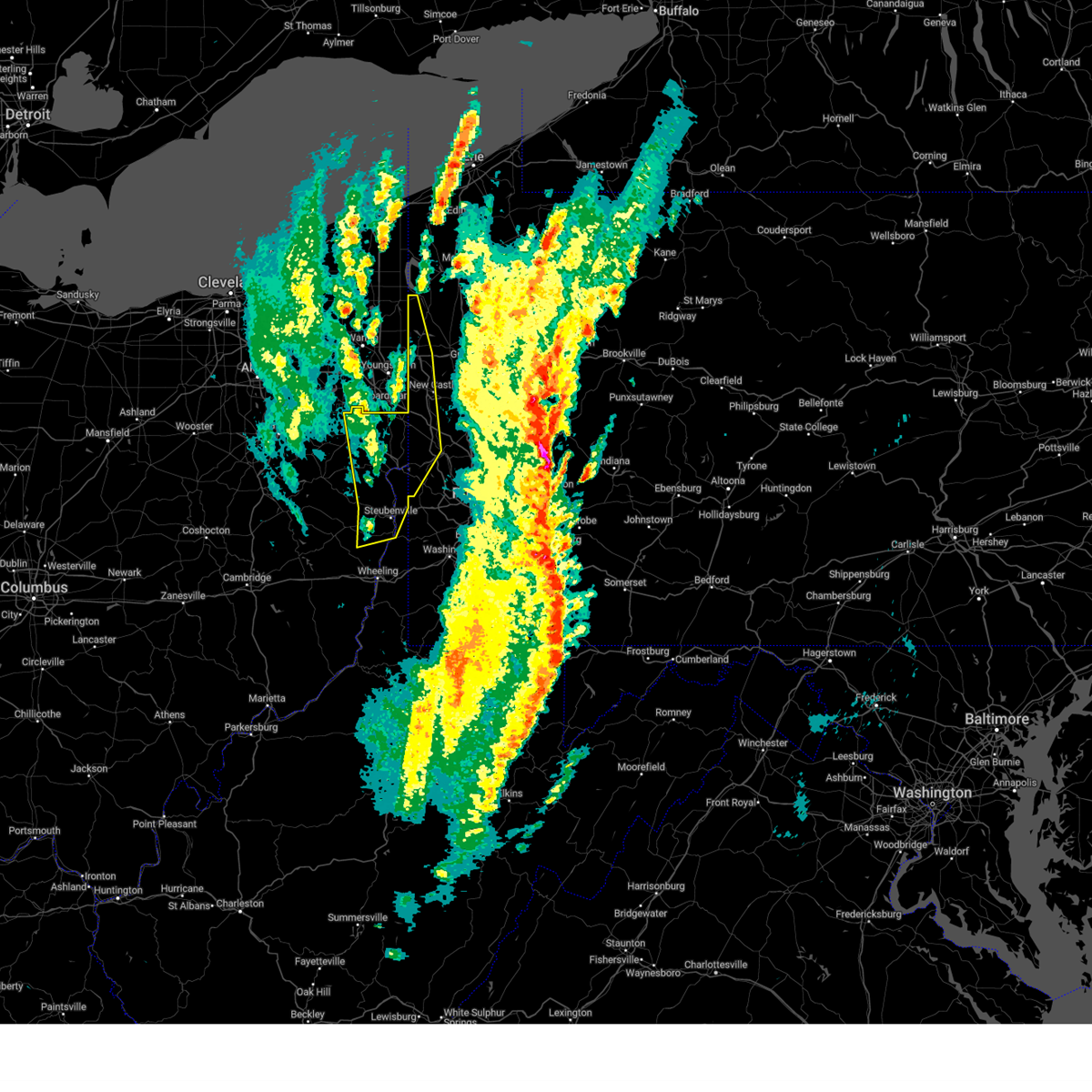 At 106 pm edt, severe thunderstorms were located along a line from 24 miles northwest of sharon to over wintersville, or along a line from 24 miles northwest of sharpsville to 6 miles west of steubenville, moving northeast at 65 mph (radar indicated). Hazards include 70 mph wind gusts. Expect considerable tree damage. damage is likely to mobile homes, roofs, and outbuildings. Locations impacted include, new castle, weirton, steubenville, hermitage, sharon, salem, east liverpool, beaver falls, columbiana, east palestine, sharpsville, wellsville, wellsburg, new brighton, farrell, toronto, beaver, calcutta, wintersville and ohioville. At 106 pm edt, severe thunderstorms were located along a line from 24 miles northwest of sharon to over wintersville, or along a line from 24 miles northwest of sharpsville to 6 miles west of steubenville, moving northeast at 65 mph (radar indicated). Hazards include 70 mph wind gusts. Expect considerable tree damage. damage is likely to mobile homes, roofs, and outbuildings. Locations impacted include, new castle, weirton, steubenville, hermitage, sharon, salem, east liverpool, beaver falls, columbiana, east palestine, sharpsville, wellsville, wellsburg, new brighton, farrell, toronto, beaver, calcutta, wintersville and ohioville.
|
| 3/16/2025 12:51 PM EDT |
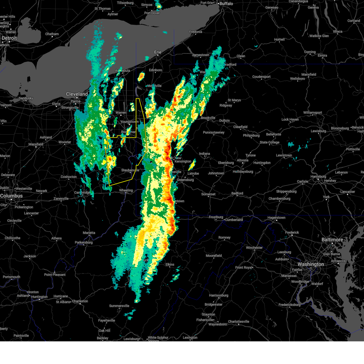 Svrpbz the national weather service in pittsburgh has issued a * severe thunderstorm warning for, eastern carroll county in east central ohio, columbiana county in east central ohio, eastern harrison county in east central ohio, jefferson oh county in east central ohio, western mercer county in northwestern pennsylvania, western beaver county in western pennsylvania, western lawrence county in western pennsylvania, brooke county in northern west virginia, hancock county in northern west virginia, * until 130 pm edt. * at 1251 pm edt, severe thunderstorms were located along a line from 28 miles northwest of salem to near cadiz, moving northeast at 65 mph (radar indicated). Hazards include 60 mph wind gusts. expect damage to roofs, siding, and trees Svrpbz the national weather service in pittsburgh has issued a * severe thunderstorm warning for, eastern carroll county in east central ohio, columbiana county in east central ohio, eastern harrison county in east central ohio, jefferson oh county in east central ohio, western mercer county in northwestern pennsylvania, western beaver county in western pennsylvania, western lawrence county in western pennsylvania, brooke county in northern west virginia, hancock county in northern west virginia, * until 130 pm edt. * at 1251 pm edt, severe thunderstorms were located along a line from 28 miles northwest of salem to near cadiz, moving northeast at 65 mph (radar indicated). Hazards include 60 mph wind gusts. expect damage to roofs, siding, and trees
|
| 3/16/2025 12:36 PM EDT |
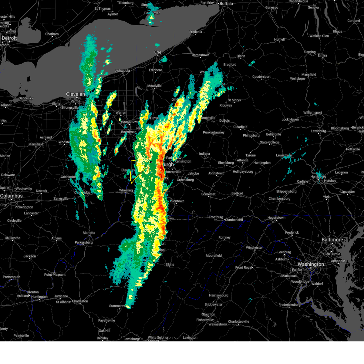 The storm which prompted the warning has moved out of the area. therefore, the warning will be allowed to expire. to report severe weather, contact your nearest law enforcement agency. they will send your report to the national weather service office. a tornado watch remains in effect until 400 pm edt for portions of east central ohio, southwest pennsylvania, and the northern panhandle of west virginia. The storm which prompted the warning has moved out of the area. therefore, the warning will be allowed to expire. to report severe weather, contact your nearest law enforcement agency. they will send your report to the national weather service office. a tornado watch remains in effect until 400 pm edt for portions of east central ohio, southwest pennsylvania, and the northern panhandle of west virginia.
|
| 3/16/2025 12:20 PM EDT |
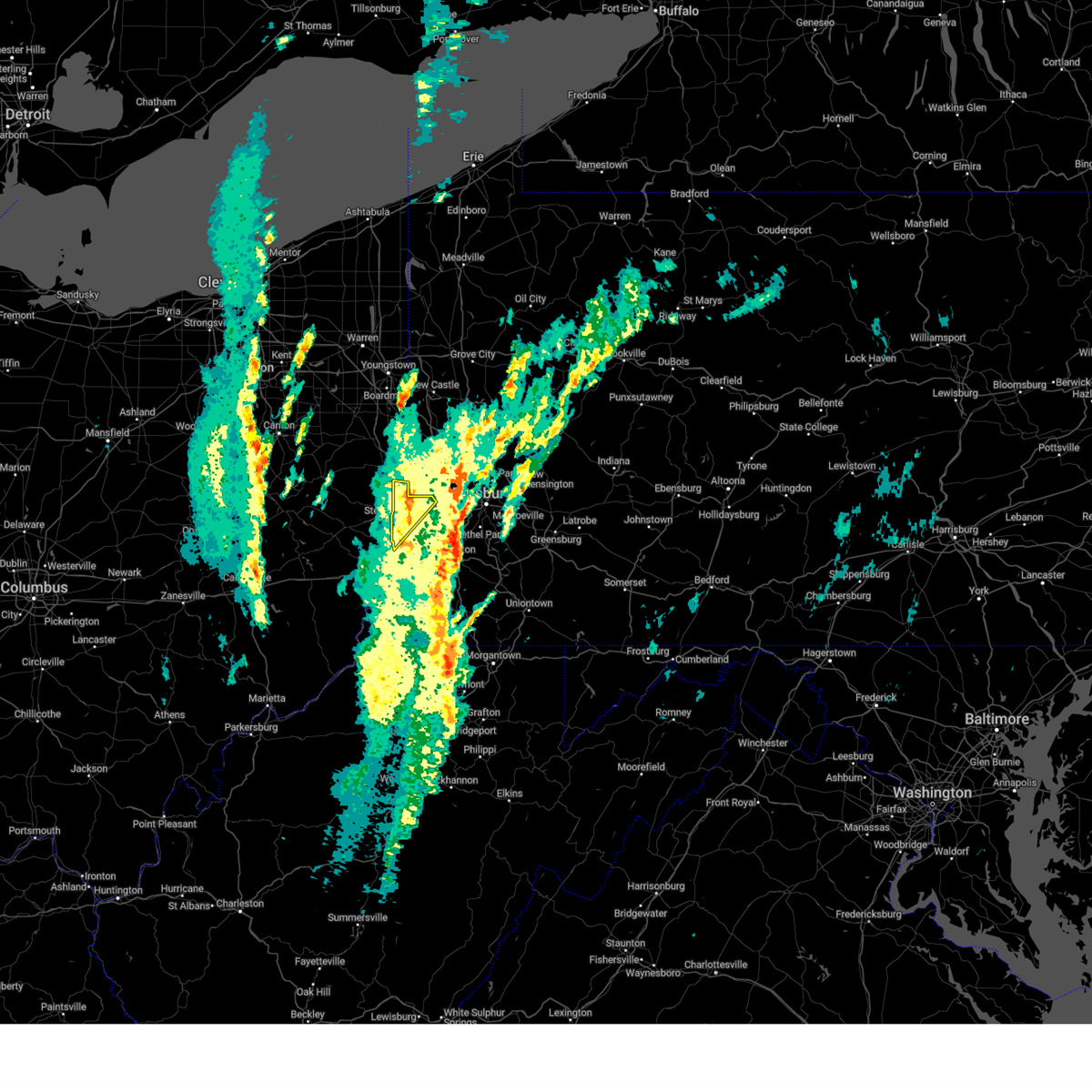 At 1220 pm edt, a severe thunderstorm was located 7 miles northeast of weirton, moving northeast at 50 mph (radar indicated). Hazards include 60 mph wind gusts. Expect damage to roofs, siding, and trees. Locations impacted include, weirton, steubenville, wellsburg, toronto, mingo junction, follansbee, hooverson heights, new cumberland, franklin, brilliant, new manchester, empire, frankfort springs, colliers, sun valley, east steubenville, rockdale, langeloth, tomlinson run state park and hanover township. At 1220 pm edt, a severe thunderstorm was located 7 miles northeast of weirton, moving northeast at 50 mph (radar indicated). Hazards include 60 mph wind gusts. Expect damage to roofs, siding, and trees. Locations impacted include, weirton, steubenville, wellsburg, toronto, mingo junction, follansbee, hooverson heights, new cumberland, franklin, brilliant, new manchester, empire, frankfort springs, colliers, sun valley, east steubenville, rockdale, langeloth, tomlinson run state park and hanover township.
|
| 3/16/2025 12:09 PM EDT |
 the severe thunderstorm warning has been cancelled and is no longer in effect the severe thunderstorm warning has been cancelled and is no longer in effect
|
| 3/16/2025 12:09 PM EDT |
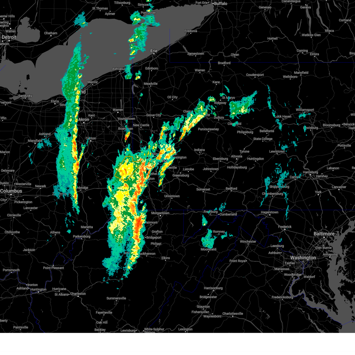 At 1209 pm edt, a severe thunderstorm was located over weirton, moving northeast at 50 mph (radar indicated). Hazards include 60 mph wind gusts. Expect damage to roofs, siding, and trees. Locations impacted include, weirton, steubenville, wellsburg, toronto, wintersville, mingo junction, follansbee, hooverson heights, new cumberland, smithfield, franklin, beech bottom, brilliant, windsor heights, rayland, new manchester, empire, stratton, new alexandria and bloomingdale. At 1209 pm edt, a severe thunderstorm was located over weirton, moving northeast at 50 mph (radar indicated). Hazards include 60 mph wind gusts. Expect damage to roofs, siding, and trees. Locations impacted include, weirton, steubenville, wellsburg, toronto, wintersville, mingo junction, follansbee, hooverson heights, new cumberland, smithfield, franklin, beech bottom, brilliant, windsor heights, rayland, new manchester, empire, stratton, new alexandria and bloomingdale.
|
| 3/16/2025 11:54 AM EDT |
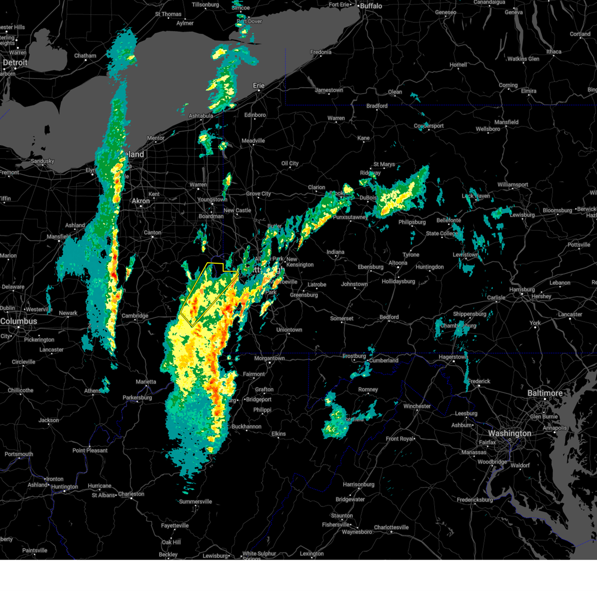 Svrpbz the national weather service in pittsburgh has issued a * severe thunderstorm warning for, northeastern belmont county in east central ohio, southeastern harrison county in east central ohio, jefferson oh county in east central ohio, northwestern washington county in southwestern pennsylvania, brooke county in northern west virginia, hancock county in northern west virginia, ohio county in northern west virginia, * until 1245 pm edt. * at 1154 am edt, a severe thunderstorm was located 7 miles northwest of tiltonsville, or 9 miles northwest of clearview, moving northeast at 65 mph (radar indicated). Hazards include 60 mph wind gusts and small hail. expect damage to roofs, siding, and trees Svrpbz the national weather service in pittsburgh has issued a * severe thunderstorm warning for, northeastern belmont county in east central ohio, southeastern harrison county in east central ohio, jefferson oh county in east central ohio, northwestern washington county in southwestern pennsylvania, brooke county in northern west virginia, hancock county in northern west virginia, ohio county in northern west virginia, * until 1245 pm edt. * at 1154 am edt, a severe thunderstorm was located 7 miles northwest of tiltonsville, or 9 miles northwest of clearview, moving northeast at 65 mph (radar indicated). Hazards include 60 mph wind gusts and small hail. expect damage to roofs, siding, and trees
|
| 2/27/2025 9:15 PM EST |
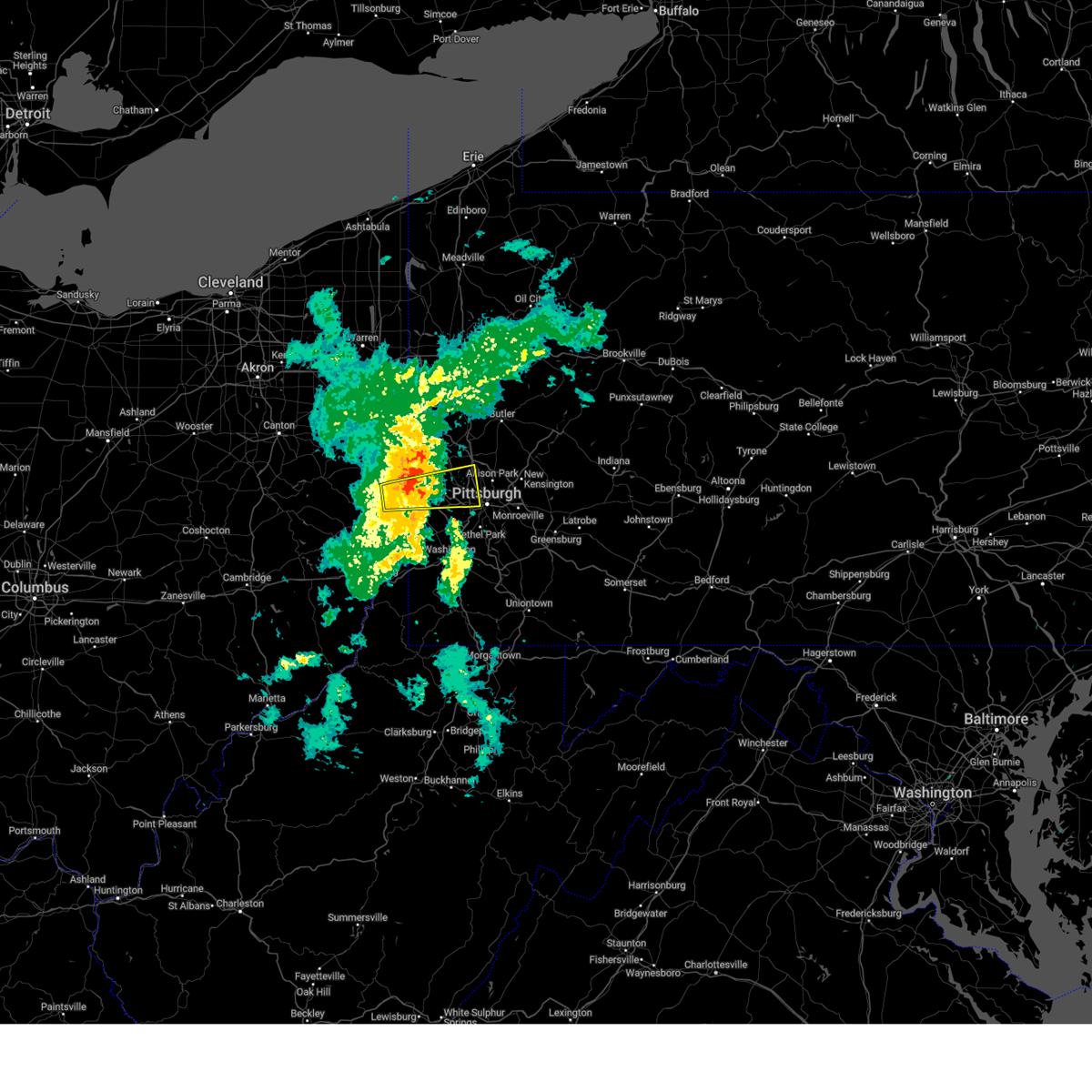 the severe thunderstorm warning has been cancelled and is no longer in effect the severe thunderstorm warning has been cancelled and is no longer in effect
|
| 2/27/2025 9:02 PM EST |
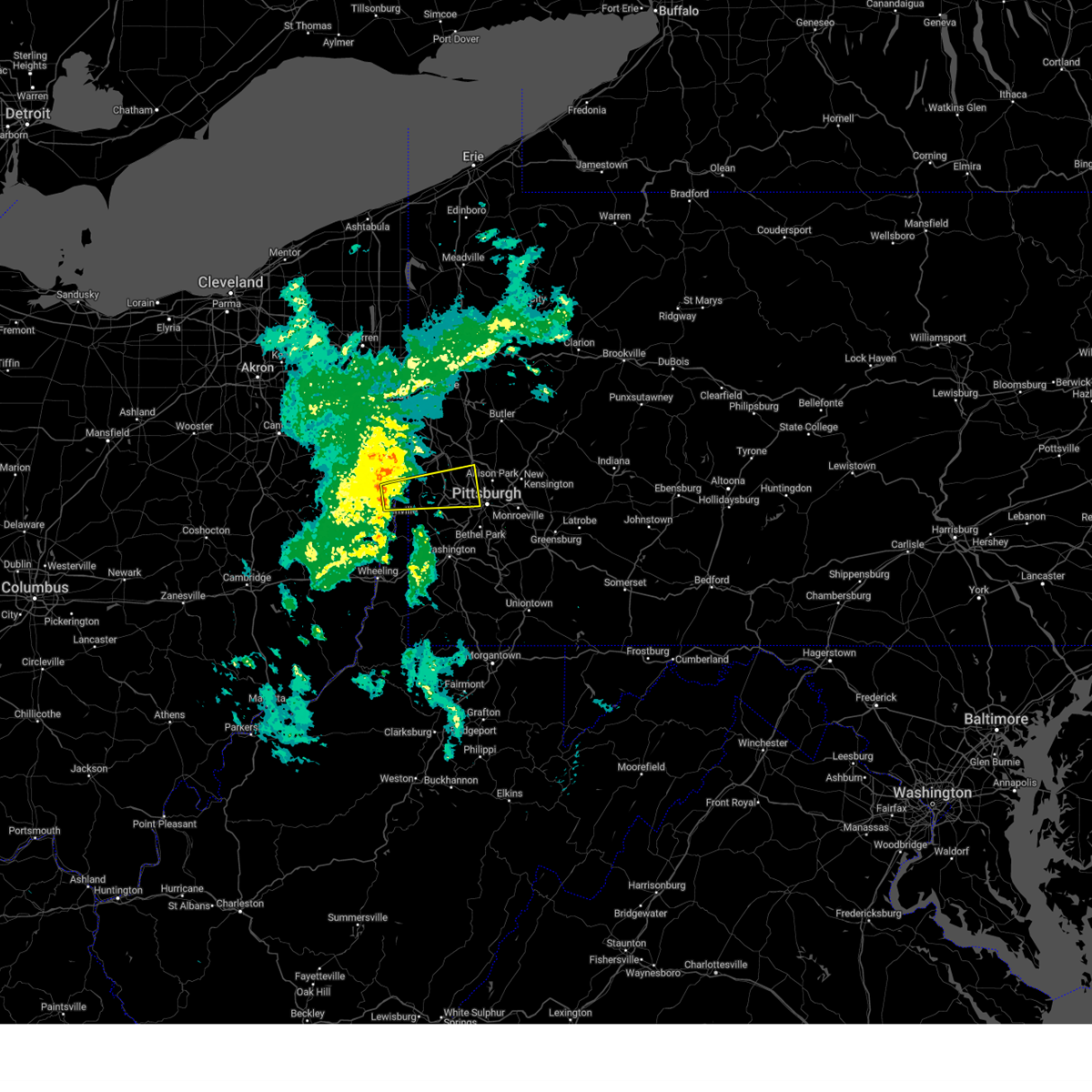 At 902 pm est, a severe thunderstorm was located 6 miles northeast of weirton, moving east at 50 mph (radar indicated). Hazards include quarter size hail and 45 to 50 mph wind. Damage to vehicles is expected. Locations impacted include, pittsburgh, ross township, mccandless township, moon township, weirton, franklin park, aliquippa, robinson township, economy, bellevue, kennedy township, ambridge, stowe township, mckees rocks, crafton, coraopolis, toronto, avalon, sewickley and ingram. At 902 pm est, a severe thunderstorm was located 6 miles northeast of weirton, moving east at 50 mph (radar indicated). Hazards include quarter size hail and 45 to 50 mph wind. Damage to vehicles is expected. Locations impacted include, pittsburgh, ross township, mccandless township, moon township, weirton, franklin park, aliquippa, robinson township, economy, bellevue, kennedy township, ambridge, stowe township, mckees rocks, crafton, coraopolis, toronto, avalon, sewickley and ingram.
|
| 2/27/2025 8:50 PM EST |
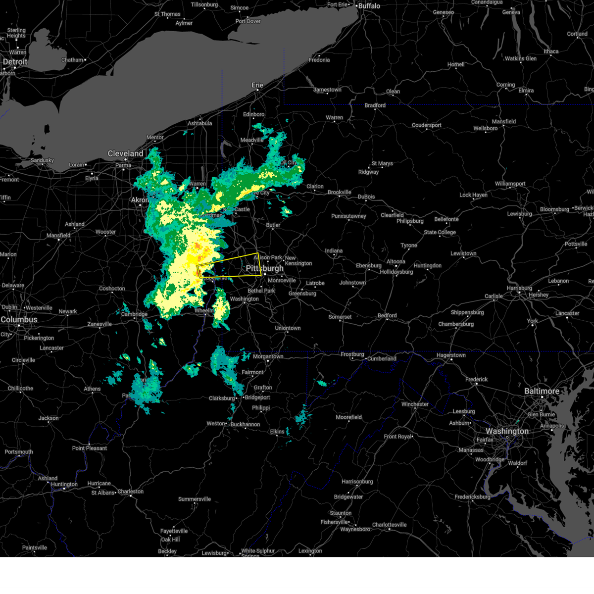 Svrpbz the national weather service in pittsburgh has issued a * severe thunderstorm warning for, northeastern jefferson oh county in east central ohio, northwestern allegheny county in southwestern pennsylvania, northwestern washington county in southwestern pennsylvania, southern beaver county in western pennsylvania, hancock county in northern west virginia, * until 930 pm est. * at 850 pm est, a severe thunderstorm was located 6 miles north of wintersville, or 8 miles northwest of steubenville, moving east at 50 mph (radar indicated). Hazards include quarter size hail and 45 to 50 mph wind. damage to vehicles is expected Svrpbz the national weather service in pittsburgh has issued a * severe thunderstorm warning for, northeastern jefferson oh county in east central ohio, northwestern allegheny county in southwestern pennsylvania, northwestern washington county in southwestern pennsylvania, southern beaver county in western pennsylvania, hancock county in northern west virginia, * until 930 pm est. * at 850 pm est, a severe thunderstorm was located 6 miles north of wintersville, or 8 miles northwest of steubenville, moving east at 50 mph (radar indicated). Hazards include quarter size hail and 45 to 50 mph wind. damage to vehicles is expected
|
| 9/6/2024 7:20 PM EDT |
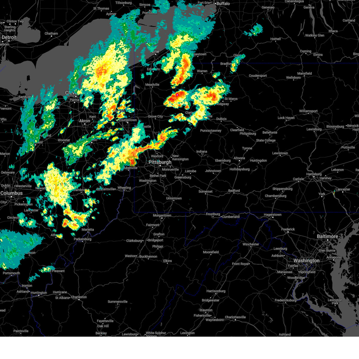 The storm which prompted the warning has weakened below severe limits, and has exited the warned area. therefore, the warning will be allowed to expire. The storm which prompted the warning has weakened below severe limits, and has exited the warned area. therefore, the warning will be allowed to expire.
|
| 9/6/2024 7:16 PM EDT |
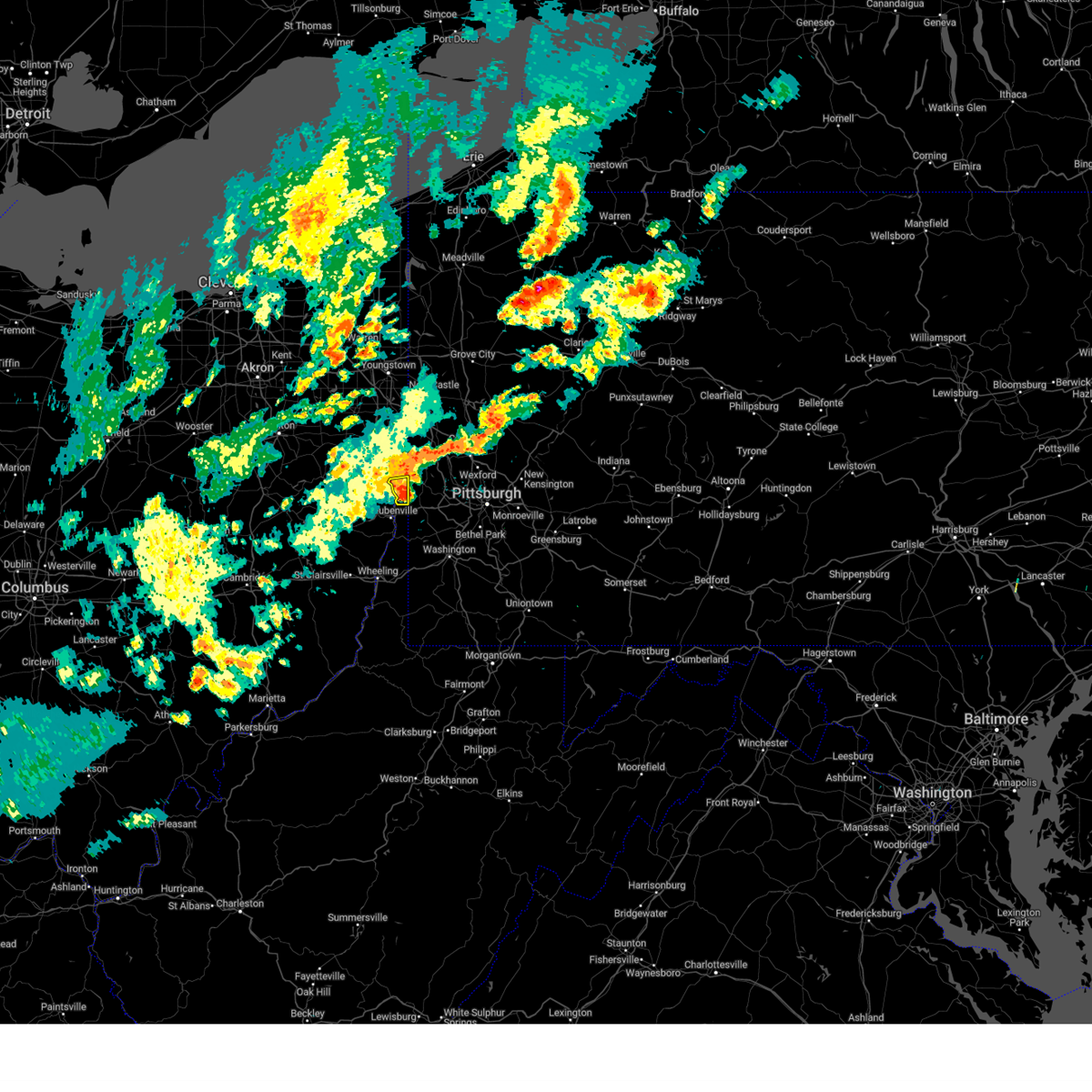 At 716 pm edt, a severe thunderstorm was located near new cumberland, or 7 miles north of weirton, moving east at 30 mph (radar indicated). Hazards include 60 mph wind gusts. Expect damage to roofs, siding, and trees. Locations impacted include, weirton, toronto, new cumberland, new manchester, empire, stratton, tomlinson run state park and sun valley. At 716 pm edt, a severe thunderstorm was located near new cumberland, or 7 miles north of weirton, moving east at 30 mph (radar indicated). Hazards include 60 mph wind gusts. Expect damage to roofs, siding, and trees. Locations impacted include, weirton, toronto, new cumberland, new manchester, empire, stratton, tomlinson run state park and sun valley.
|
| 9/6/2024 7:16 PM EDT |
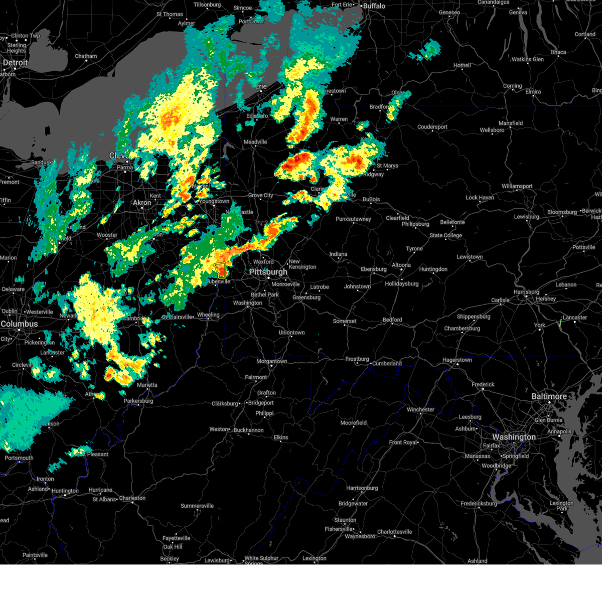 the severe thunderstorm warning has been cancelled and is no longer in effect the severe thunderstorm warning has been cancelled and is no longer in effect
|
| 9/6/2024 7:10 PM EDT |
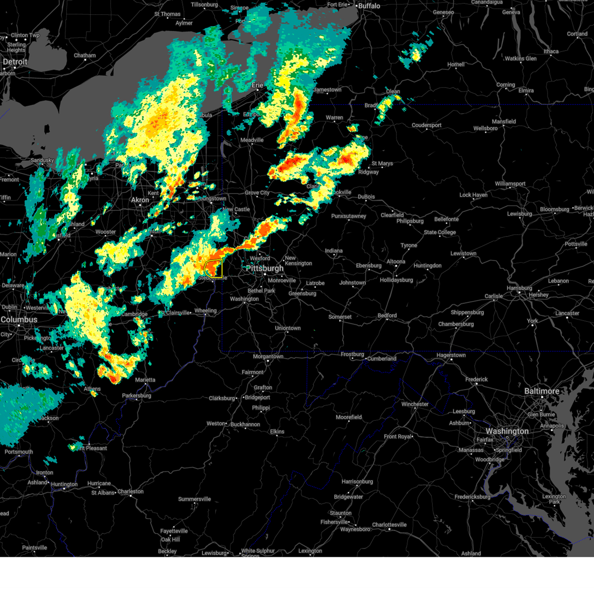 the severe thunderstorm warning has been cancelled and is no longer in effect the severe thunderstorm warning has been cancelled and is no longer in effect
|
| 9/6/2024 7:10 PM EDT |
 At 710 pm edt, a severe thunderstorm was located over new cumberland, or 7 miles south of wellsville, moving east at 25 mph (radar indicated). Hazards include 60 mph wind gusts. Expect damage to roofs, siding, and trees. Locations impacted include, weirton, toronto, new cumberland, new manchester, empire, stratton, hammondsville, tomlinson run state park and sun valley. At 710 pm edt, a severe thunderstorm was located over new cumberland, or 7 miles south of wellsville, moving east at 25 mph (radar indicated). Hazards include 60 mph wind gusts. Expect damage to roofs, siding, and trees. Locations impacted include, weirton, toronto, new cumberland, new manchester, empire, stratton, hammondsville, tomlinson run state park and sun valley.
|
| 9/6/2024 6:57 PM EDT |
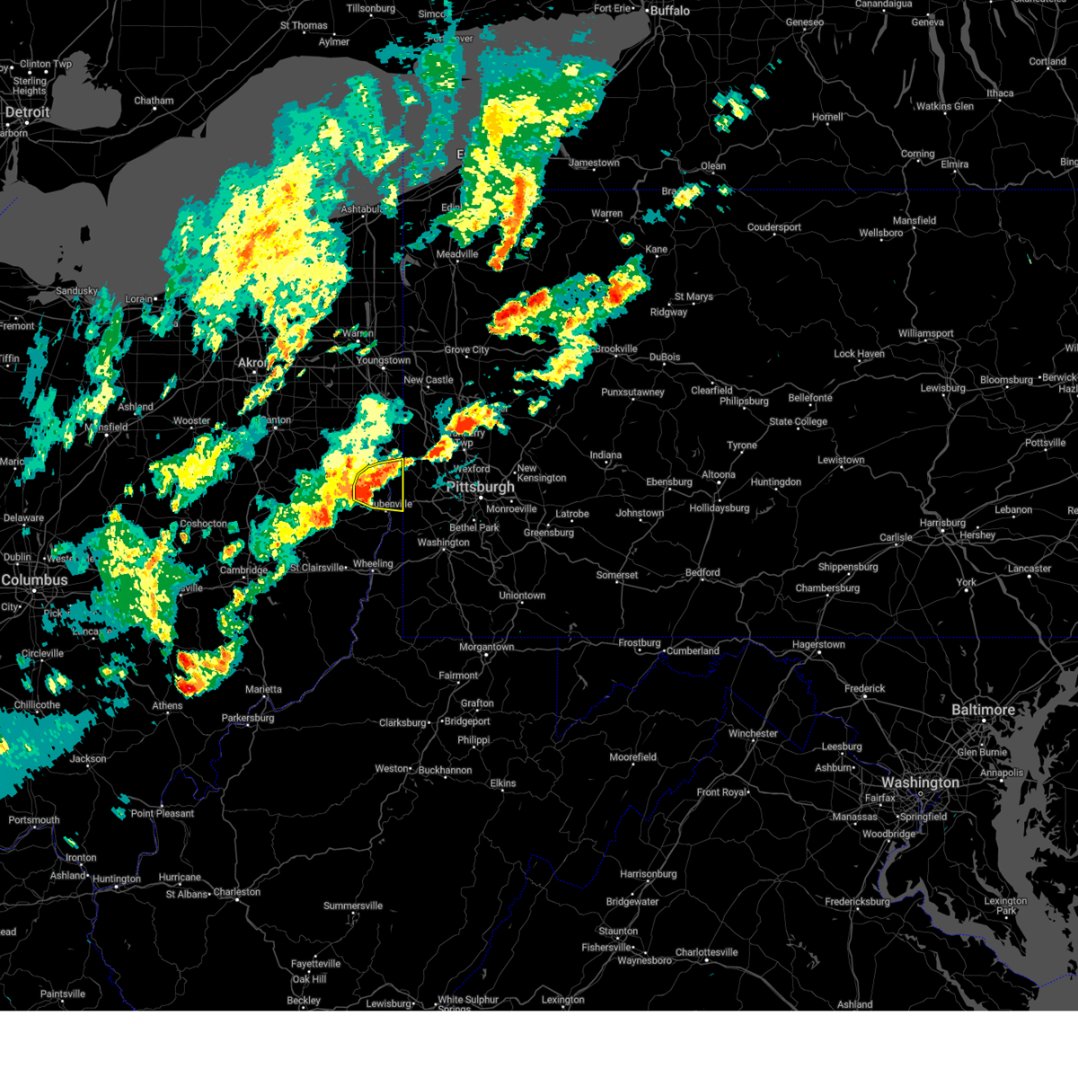 At 657 pm edt, a severe thunderstorm was located 7 miles north of wintersville, or 9 miles northwest of steubenville, moving east at 25 mph (radar indicated). Hazards include 60 mph wind gusts and small hail. Expect damage to roofs, siding, and trees. Locations impacted include, weirton, steubenville, east liverpool, wellsville, toronto, wintersville, chester, new cumberland, newell, richmond, irondale, new manchester, empire, stratton, hammondsville, tomlinson run state park and sun valley. At 657 pm edt, a severe thunderstorm was located 7 miles north of wintersville, or 9 miles northwest of steubenville, moving east at 25 mph (radar indicated). Hazards include 60 mph wind gusts and small hail. Expect damage to roofs, siding, and trees. Locations impacted include, weirton, steubenville, east liverpool, wellsville, toronto, wintersville, chester, new cumberland, newell, richmond, irondale, new manchester, empire, stratton, hammondsville, tomlinson run state park and sun valley.
|
| 9/6/2024 6:46 PM EDT |
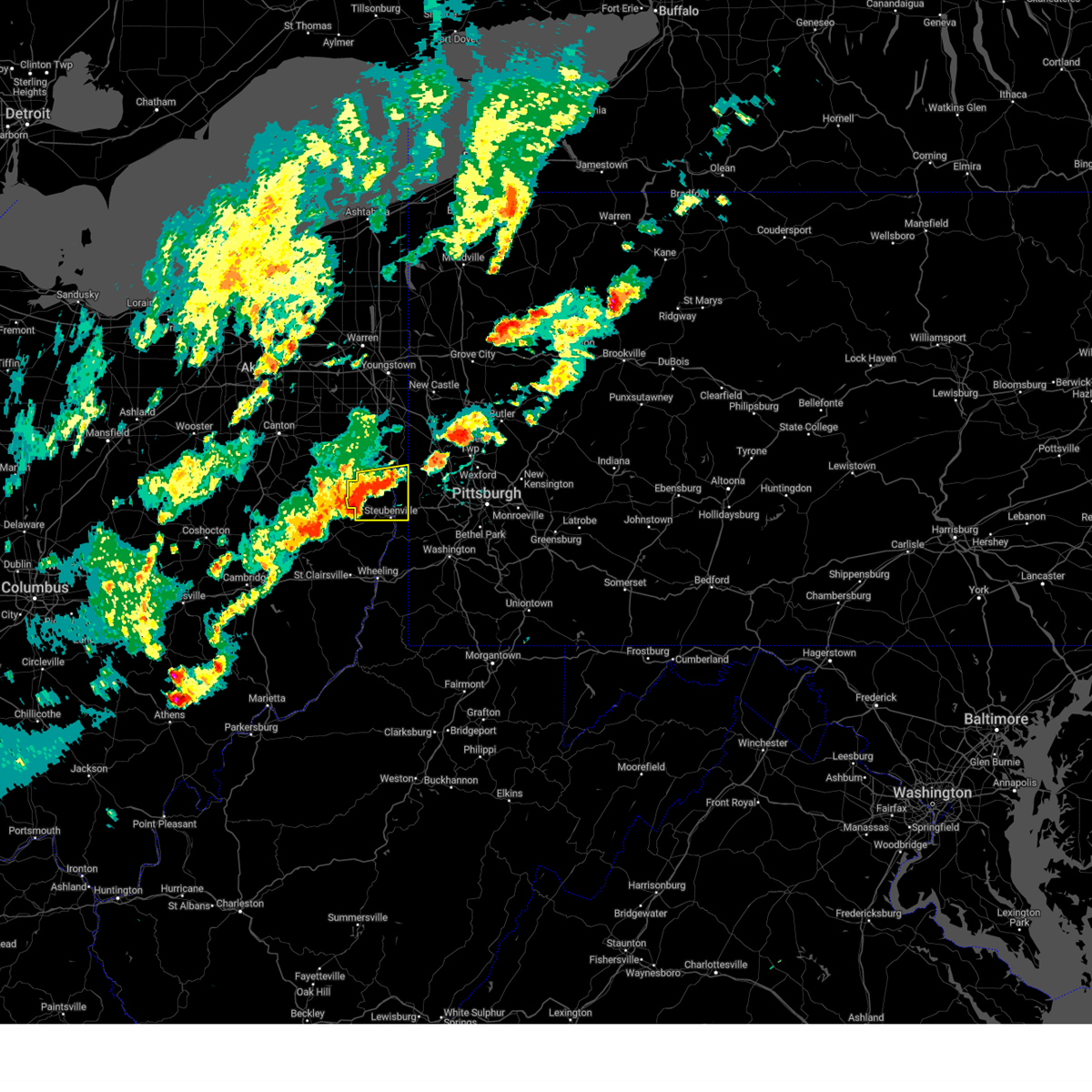 Svrpbz the national weather service in pittsburgh has issued a * severe thunderstorm warning for, southeastern columbiana county in east central ohio, northern jefferson oh county in east central ohio, brooke county in northern west virginia, hancock county in northern west virginia, * until 730 pm edt. * at 646 pm edt, a severe thunderstorm was located 9 miles northwest of wintersville, or 12 miles northwest of steubenville, moving east at 25 mph (radar indicated). Hazards include 60 mph wind gusts and small hail. expect damage to roofs, siding, and trees Svrpbz the national weather service in pittsburgh has issued a * severe thunderstorm warning for, southeastern columbiana county in east central ohio, northern jefferson oh county in east central ohio, brooke county in northern west virginia, hancock county in northern west virginia, * until 730 pm edt. * at 646 pm edt, a severe thunderstorm was located 9 miles northwest of wintersville, or 12 miles northwest of steubenville, moving east at 25 mph (radar indicated). Hazards include 60 mph wind gusts and small hail. expect damage to roofs, siding, and trees
|
| 8/17/2024 6:01 PM EDT |
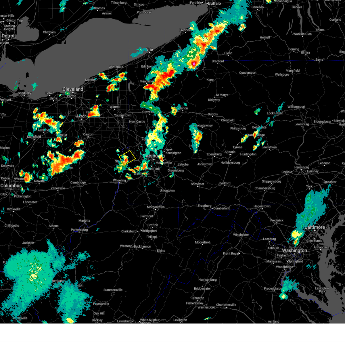 The storm which prompted the warning has weakened below severe limits, and no longer poses an immediate threat to life or property. therefore, the warning has been allowed to expire. to report severe weather, contact your nearest law enforcement agency. they will send your report to the national weather service office. The storm which prompted the warning has weakened below severe limits, and no longer poses an immediate threat to life or property. therefore, the warning has been allowed to expire. to report severe weather, contact your nearest law enforcement agency. they will send your report to the national weather service office.
|
| 8/17/2024 5:50 PM EDT |
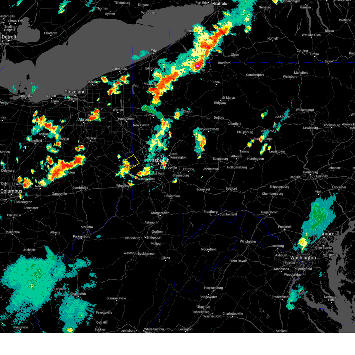 At 550 pm edt, a severe thunderstorm was located over toronto, or 5 miles north of weirton, moving northeast at 40 mph (radar indicated). Hazards include 60 mph wind gusts. Expect damage to roofs, siding, and trees. Locations impacted include, weirton, steubenville, toronto, mingo junction, follansbee, new cumberland, new manchester, empire, stratton, frankfort springs, sun valley, tomlinson run state park, east steubenville and raccoon creek state park. At 550 pm edt, a severe thunderstorm was located over toronto, or 5 miles north of weirton, moving northeast at 40 mph (radar indicated). Hazards include 60 mph wind gusts. Expect damage to roofs, siding, and trees. Locations impacted include, weirton, steubenville, toronto, mingo junction, follansbee, new cumberland, new manchester, empire, stratton, frankfort springs, sun valley, tomlinson run state park, east steubenville and raccoon creek state park.
|
| 8/17/2024 5:38 PM EDT |
 the severe thunderstorm warning has been cancelled and is no longer in effect the severe thunderstorm warning has been cancelled and is no longer in effect
|
| 8/17/2024 5:38 PM EDT |
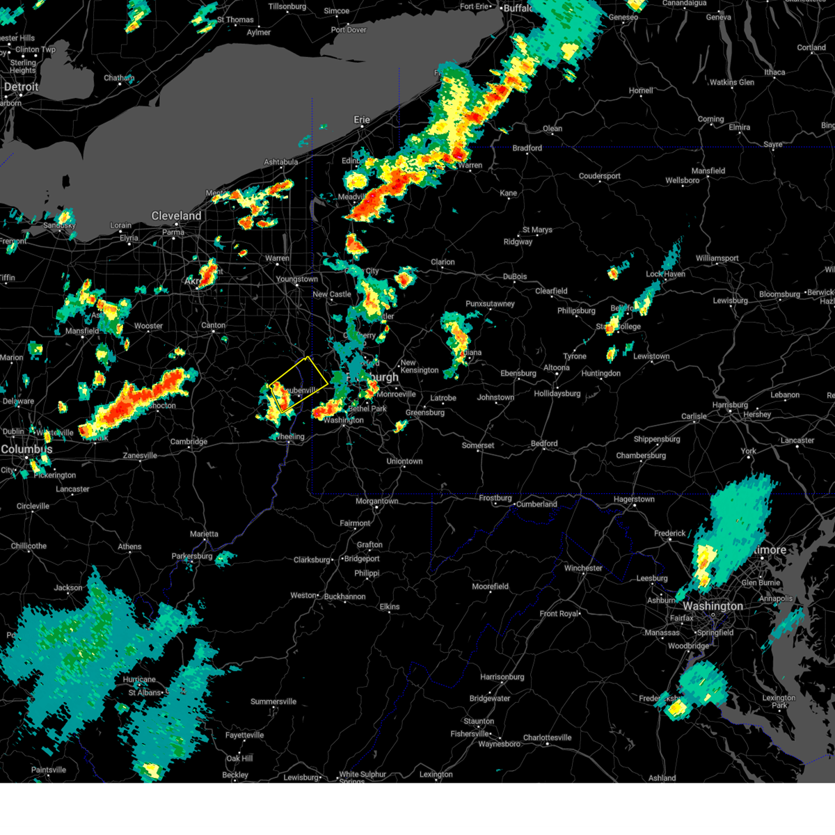 At 538 pm edt, a severe thunderstorm was located over wintersville, or near steubenville, moving northeast at 40 mph (radar indicated). Hazards include 60 mph wind gusts. Expect damage to roofs, siding, and trees. Locations impacted include, weirton, steubenville, east liverpool, toronto, wintersville, mingo junction, follansbee, chester, new cumberland, smithfield, newell, richmond, new manchester, empire, stratton, bloomingdale, frankfort springs, brentwood, unionport and sun valley. At 538 pm edt, a severe thunderstorm was located over wintersville, or near steubenville, moving northeast at 40 mph (radar indicated). Hazards include 60 mph wind gusts. Expect damage to roofs, siding, and trees. Locations impacted include, weirton, steubenville, east liverpool, toronto, wintersville, mingo junction, follansbee, chester, new cumberland, smithfield, newell, richmond, new manchester, empire, stratton, bloomingdale, frankfort springs, brentwood, unionport and sun valley.
|
| 8/17/2024 5:22 PM EDT |
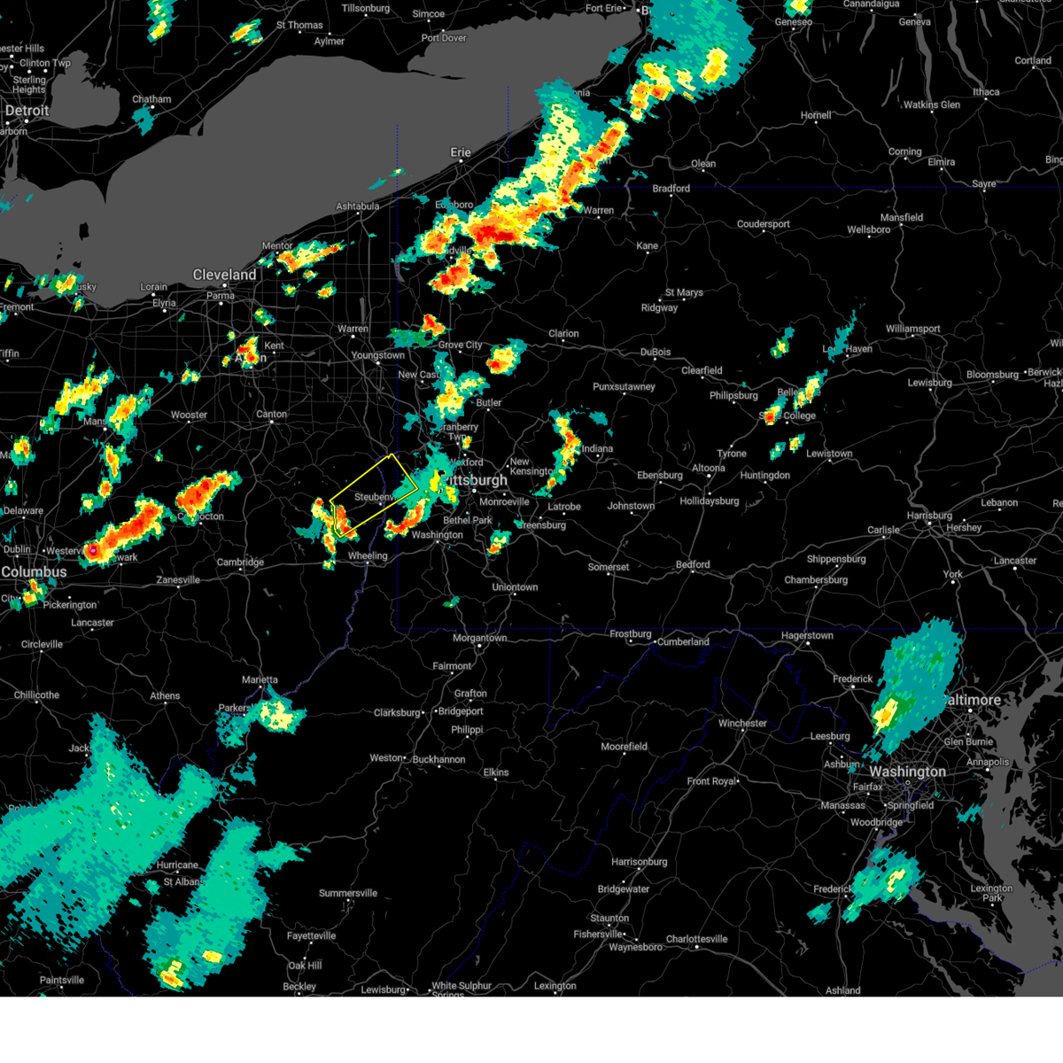 At 522 pm edt, a severe thunderstorm was located 8 miles west of wintersville, or 9 miles northeast of cadiz, moving northeast at 40 mph (radar indicated). Hazards include 60 mph wind gusts. Expect damage to roofs, siding, and trees. Locations impacted include, weirton, steubenville, east liverpool, toronto, wintersville, mingo junction, follansbee, chester, new cumberland, hopedale, smithfield, newell, adena, richmond, new manchester, empire, stratton, bloomingdale, frankfort springs and brentwood. At 522 pm edt, a severe thunderstorm was located 8 miles west of wintersville, or 9 miles northeast of cadiz, moving northeast at 40 mph (radar indicated). Hazards include 60 mph wind gusts. Expect damage to roofs, siding, and trees. Locations impacted include, weirton, steubenville, east liverpool, toronto, wintersville, mingo junction, follansbee, chester, new cumberland, hopedale, smithfield, newell, adena, richmond, new manchester, empire, stratton, bloomingdale, frankfort springs and brentwood.
|
| 8/17/2024 5:10 PM EDT |
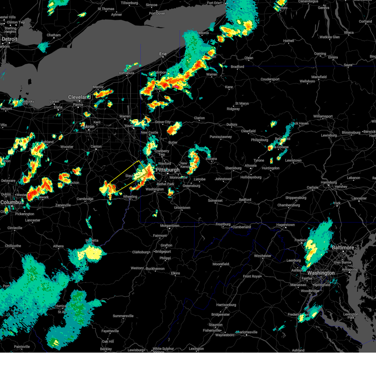 Svrpbz the national weather service in pittsburgh has issued a * severe thunderstorm warning for, eastern harrison county in east central ohio, central jefferson oh county in east central ohio, northwestern washington county in southwestern pennsylvania, southwestern beaver county in western pennsylvania, brooke county in northern west virginia, hancock county in northern west virginia, * until 600 pm edt. * at 510 pm edt, a severe thunderstorm was located over cadiz, moving northeast at 40 mph (radar indicated). Hazards include 60 mph wind gusts. expect damage to roofs, siding, and trees Svrpbz the national weather service in pittsburgh has issued a * severe thunderstorm warning for, eastern harrison county in east central ohio, central jefferson oh county in east central ohio, northwestern washington county in southwestern pennsylvania, southwestern beaver county in western pennsylvania, brooke county in northern west virginia, hancock county in northern west virginia, * until 600 pm edt. * at 510 pm edt, a severe thunderstorm was located over cadiz, moving northeast at 40 mph (radar indicated). Hazards include 60 mph wind gusts. expect damage to roofs, siding, and trees
|
| 8/17/2024 4:40 PM EDT |
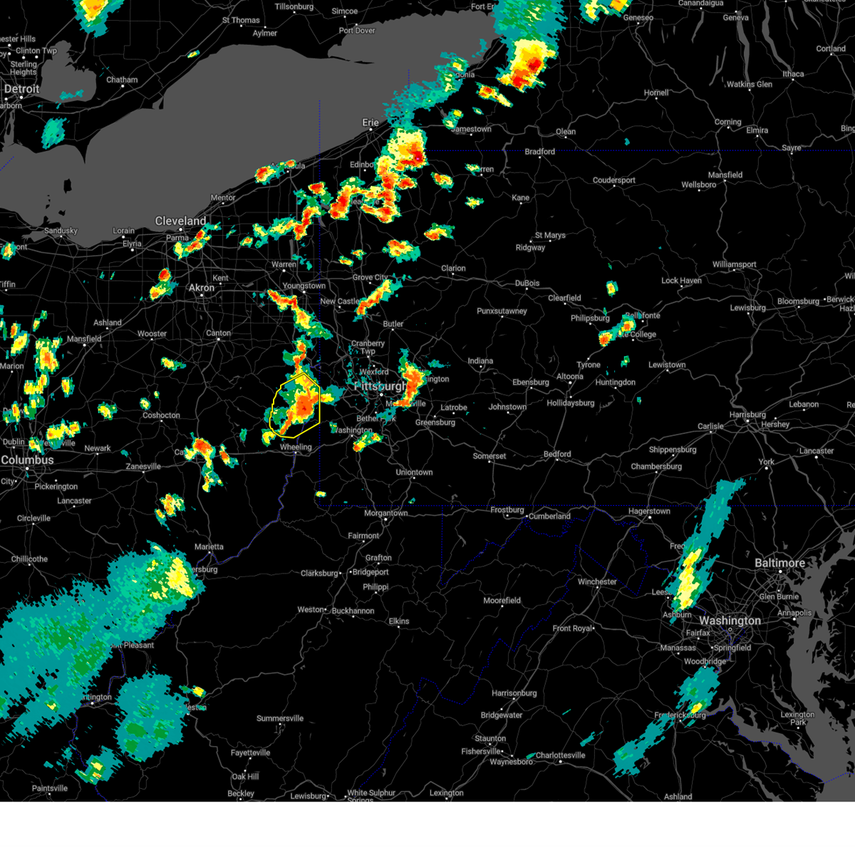 The severe thunderstorm warning that was previously in effect has been reissued for jefferson oh, hancock, and brooke counties and is in effect until 530 pm edt. please refer to that bulletin for the latest severe weather information. to report severe weather, contact your nearest law enforcement agency. they will send your report to the national weather service office. The severe thunderstorm warning that was previously in effect has been reissued for jefferson oh, hancock, and brooke counties and is in effect until 530 pm edt. please refer to that bulletin for the latest severe weather information. to report severe weather, contact your nearest law enforcement agency. they will send your report to the national weather service office.
|
| 8/17/2024 4:39 PM EDT |
 Svrpbz the national weather service in pittsburgh has issued a * severe thunderstorm warning for, east central jefferson oh county in east central ohio, northwestern allegheny county in southwestern pennsylvania, northwestern washington county in southwestern pennsylvania, south central beaver county in western pennsylvania, brooke county in northern west virginia, hancock county in northern west virginia, * until 530 pm edt. * at 439 pm edt, a severe thunderstorm was located over follansbee, or near weirton, moving east at 40 mph (radar indicated). Hazards include 60 mph wind gusts and quarter size hail. Hail damage to vehicles is expected. Expect wind damage to roofs, siding, and trees. Svrpbz the national weather service in pittsburgh has issued a * severe thunderstorm warning for, east central jefferson oh county in east central ohio, northwestern allegheny county in southwestern pennsylvania, northwestern washington county in southwestern pennsylvania, south central beaver county in western pennsylvania, brooke county in northern west virginia, hancock county in northern west virginia, * until 530 pm edt. * at 439 pm edt, a severe thunderstorm was located over follansbee, or near weirton, moving east at 40 mph (radar indicated). Hazards include 60 mph wind gusts and quarter size hail. Hail damage to vehicles is expected. Expect wind damage to roofs, siding, and trees.
|
| 8/17/2024 4:24 PM EDT |
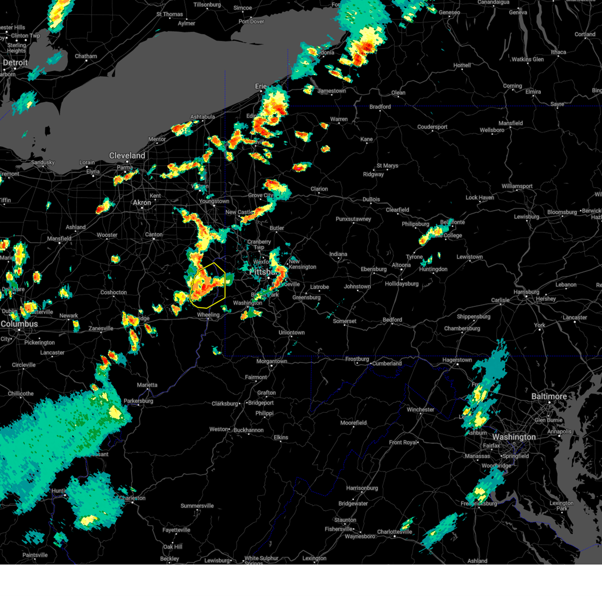 At 424 pm edt, a severe thunderstorm was located near wintersville, or 8 miles west of steubenville, moving northeast at 40 mph (radar indicated). Hazards include 60 mph wind gusts and quarter size hail. Hail damage to vehicles is expected. expect wind damage to roofs, siding, and trees. Locations impacted include, weirton, steubenville, wellsburg, toronto, wintersville, mingo junction, follansbee, hooverson heights, tiltonsville, new cumberland, hopedale, smithfield, adena, franklin, dillonvale, beech bottom, brilliant, richmond, mount pleasant and windsor heights. At 424 pm edt, a severe thunderstorm was located near wintersville, or 8 miles west of steubenville, moving northeast at 40 mph (radar indicated). Hazards include 60 mph wind gusts and quarter size hail. Hail damage to vehicles is expected. expect wind damage to roofs, siding, and trees. Locations impacted include, weirton, steubenville, wellsburg, toronto, wintersville, mingo junction, follansbee, hooverson heights, tiltonsville, new cumberland, hopedale, smithfield, adena, franklin, dillonvale, beech bottom, brilliant, richmond, mount pleasant and windsor heights.
|
| 8/17/2024 4:24 PM EDT |
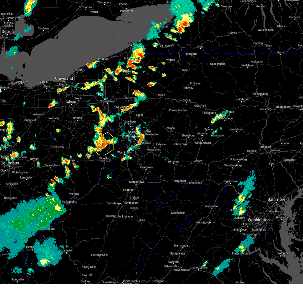 the severe thunderstorm warning has been cancelled and is no longer in effect the severe thunderstorm warning has been cancelled and is no longer in effect
|
| 8/17/2024 4:08 PM EDT |
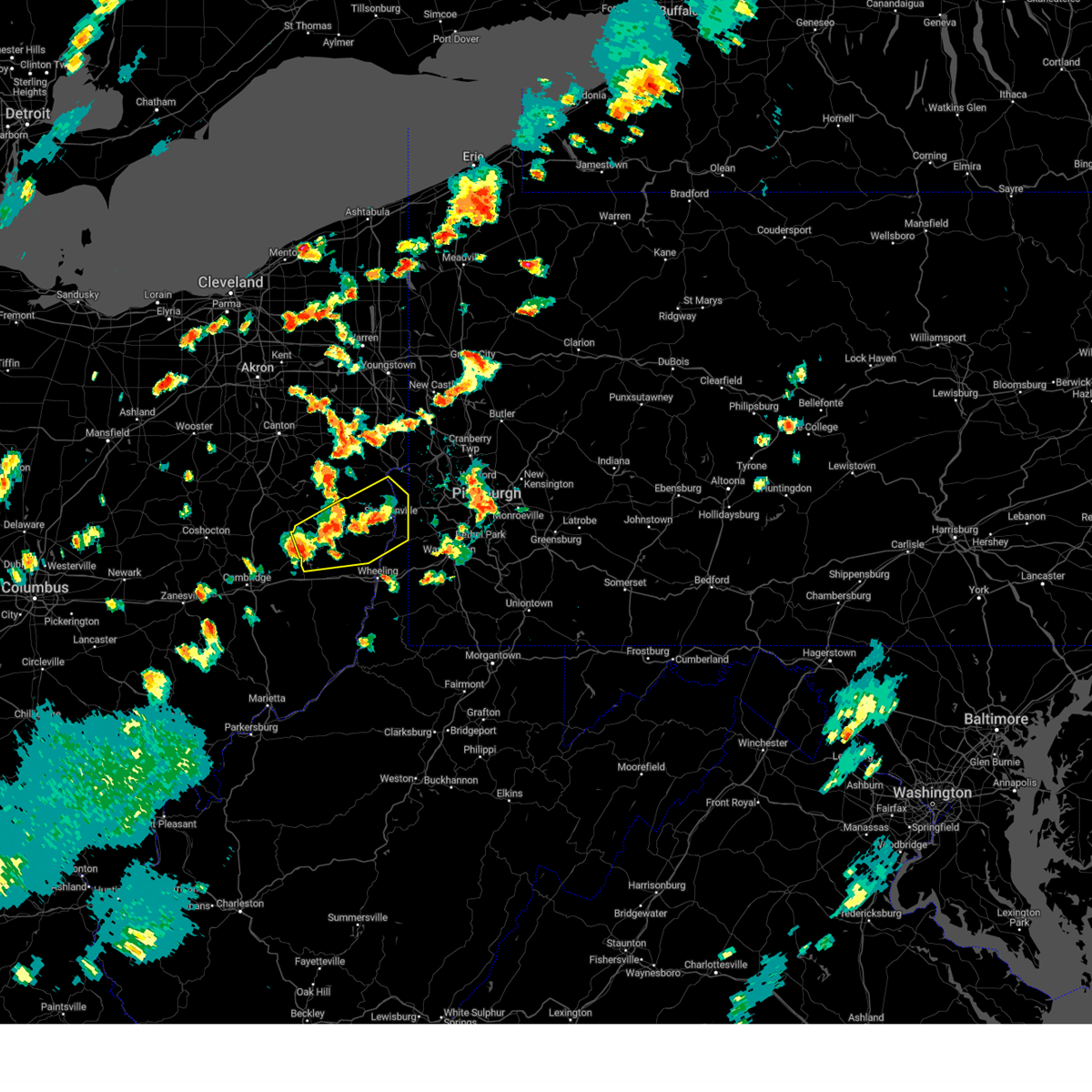 At 408 pm edt, a severe thunderstorm was located 5 miles north of cadiz, moving northeast at 40 mph (radar indicated). Hazards include 60 mph wind gusts and quarter size hail. Hail damage to vehicles is expected. expect wind damage to roofs, siding, and trees. Locations impacted include, weirton, steubenville, cadiz, wellsburg, freeport, toronto, wintersville, mingo junction, follansbee, hooverson heights, tiltonsville, new cumberland, hopedale, flushing, smithfield, scio, adena, franklin, jewett and dillonvale. At 408 pm edt, a severe thunderstorm was located 5 miles north of cadiz, moving northeast at 40 mph (radar indicated). Hazards include 60 mph wind gusts and quarter size hail. Hail damage to vehicles is expected. expect wind damage to roofs, siding, and trees. Locations impacted include, weirton, steubenville, cadiz, wellsburg, freeport, toronto, wintersville, mingo junction, follansbee, hooverson heights, tiltonsville, new cumberland, hopedale, flushing, smithfield, scio, adena, franklin, jewett and dillonvale.
|
| 8/17/2024 4:01 PM EDT |
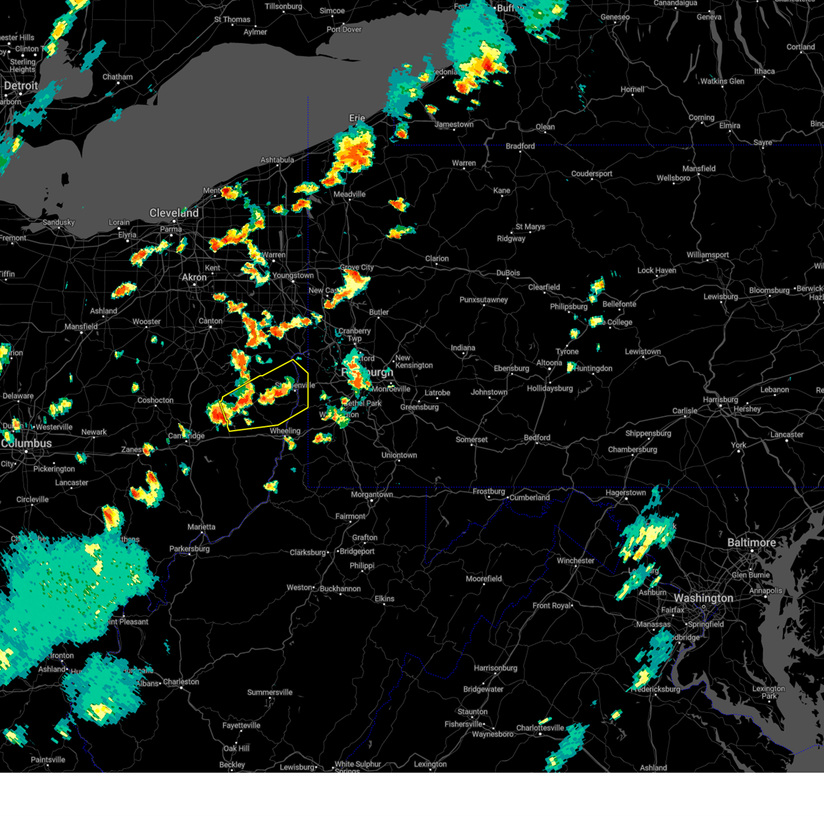 Svrpbz the national weather service in pittsburgh has issued a * severe thunderstorm warning for, northwestern belmont county in east central ohio, south central carroll county in east central ohio, harrison county in east central ohio, jefferson oh county in east central ohio, brooke county in northern west virginia, hancock county in northern west virginia, * until 445 pm edt. * at 401 pm edt, a severe thunderstorm was located near cadiz, moving northeast at 40 mph (radar indicated). Hazards include 60 mph wind gusts. expect damage to roofs, siding, and trees Svrpbz the national weather service in pittsburgh has issued a * severe thunderstorm warning for, northwestern belmont county in east central ohio, south central carroll county in east central ohio, harrison county in east central ohio, jefferson oh county in east central ohio, brooke county in northern west virginia, hancock county in northern west virginia, * until 445 pm edt. * at 401 pm edt, a severe thunderstorm was located near cadiz, moving northeast at 40 mph (radar indicated). Hazards include 60 mph wind gusts. expect damage to roofs, siding, and trees
|
| 8/17/2024 3:11 PM EDT |
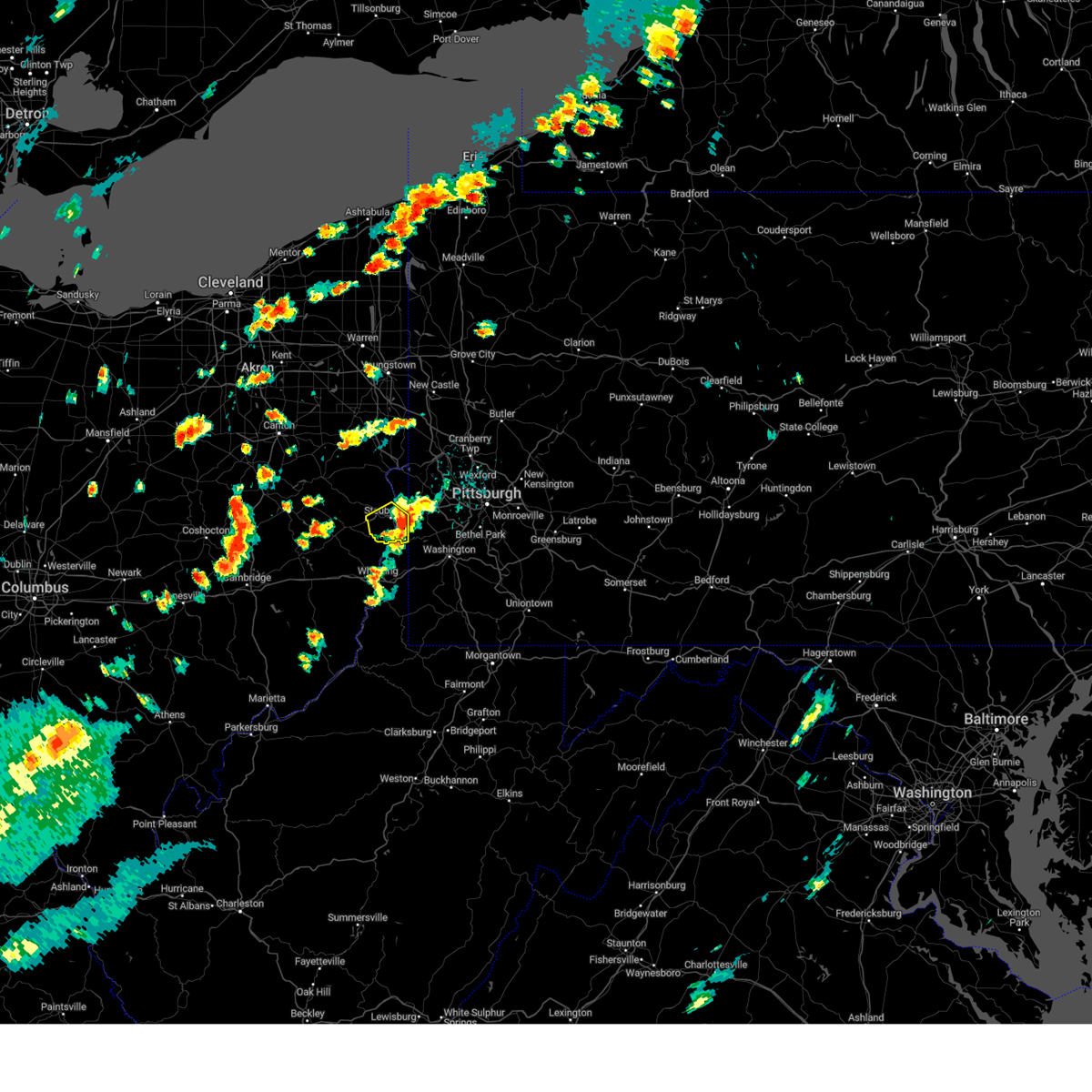 The severe thunderstorm warning that was previously in effect has been reissued for hancock and brooke counties and is in effect until 400 pm edt. please refer to that bulletin for the latest severe weather information. to report severe weather, contact your nearest law enforcement agency. they will send your report to the national weather service office. The severe thunderstorm warning that was previously in effect has been reissued for hancock and brooke counties and is in effect until 400 pm edt. please refer to that bulletin for the latest severe weather information. to report severe weather, contact your nearest law enforcement agency. they will send your report to the national weather service office.
|
| 8/17/2024 2:58 PM EDT |
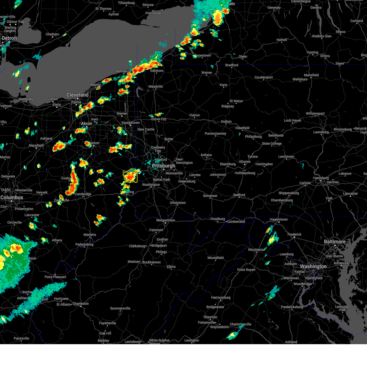 At 258 pm edt, a severe thunderstorm was located over steubenville, moving northeast at 25 mph (radar indicated). Hazards include 60 mph wind gusts and small hail. Expect damage to roofs, siding, and trees. Locations impacted include, weirton, steubenville, wellsburg, toronto, wintersville, mingo junction, follansbee, hooverson heights, franklin, beech bottom, brilliant, new alexandria, brentwood, east steubenville, rockdale and colliers. At 258 pm edt, a severe thunderstorm was located over steubenville, moving northeast at 25 mph (radar indicated). Hazards include 60 mph wind gusts and small hail. Expect damage to roofs, siding, and trees. Locations impacted include, weirton, steubenville, wellsburg, toronto, wintersville, mingo junction, follansbee, hooverson heights, franklin, beech bottom, brilliant, new alexandria, brentwood, east steubenville, rockdale and colliers.
|
| 8/17/2024 2:43 PM EDT |
 At 243 pm edt, a severe thunderstorm was located 6 miles southwest of wintersville, or 8 miles southwest of steubenville, moving northeast at 25 mph (radar indicated). Hazards include 60 mph wind gusts and small hail. Expect damage to roofs, siding, and trees. Locations impacted include, weirton, steubenville, wellsburg, toronto, wintersville, mingo junction, follansbee, hooverson heights, smithfield, franklin, dillonvale, beech bottom, brilliant, new alexandria, bloomingdale, brentwood, newell, unionport, east steubenville and rockdale. At 243 pm edt, a severe thunderstorm was located 6 miles southwest of wintersville, or 8 miles southwest of steubenville, moving northeast at 25 mph (radar indicated). Hazards include 60 mph wind gusts and small hail. Expect damage to roofs, siding, and trees. Locations impacted include, weirton, steubenville, wellsburg, toronto, wintersville, mingo junction, follansbee, hooverson heights, smithfield, franklin, dillonvale, beech bottom, brilliant, new alexandria, bloomingdale, brentwood, newell, unionport, east steubenville and rockdale.
|
| 8/17/2024 2:43 PM EDT |
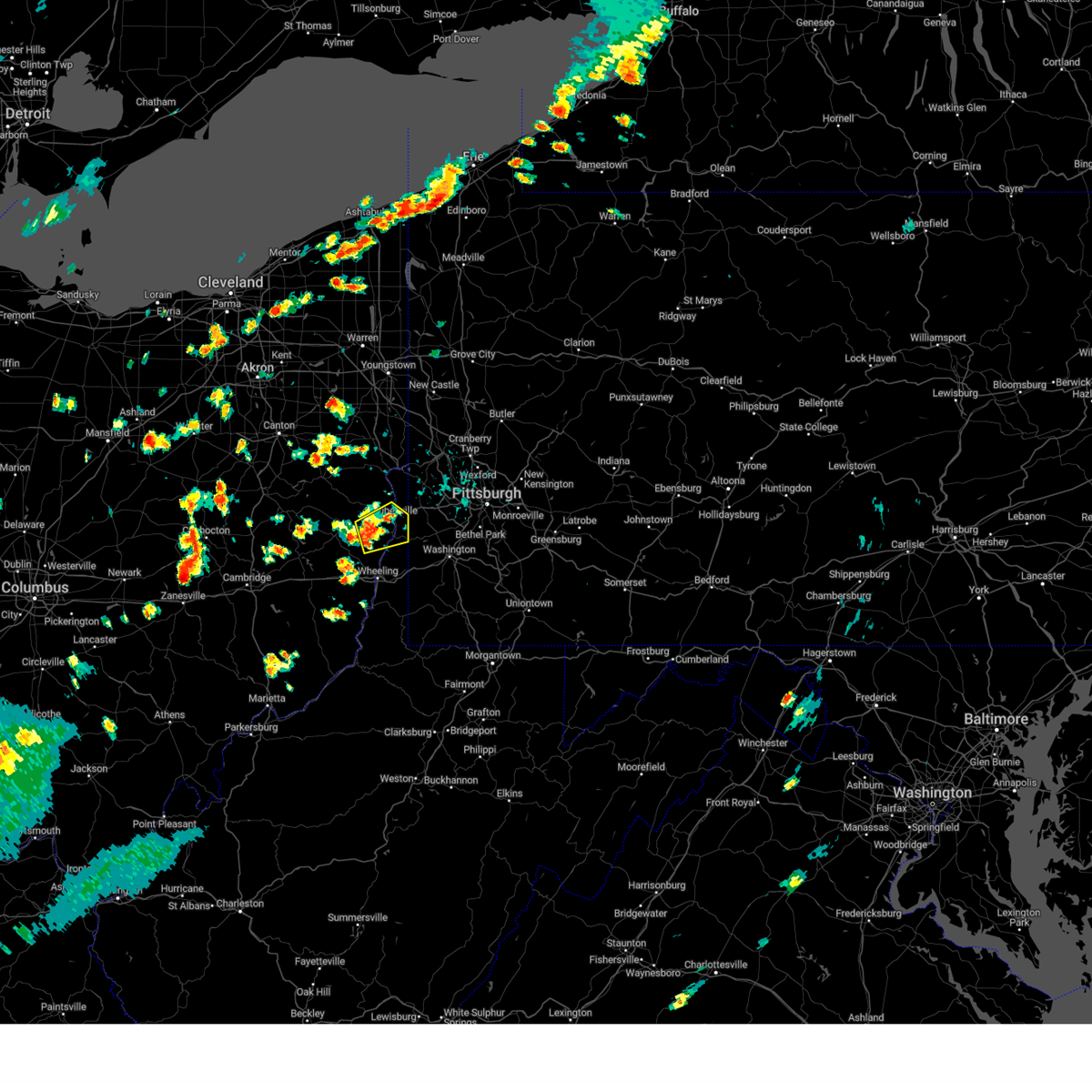 the severe thunderstorm warning has been cancelled and is no longer in effect the severe thunderstorm warning has been cancelled and is no longer in effect
|
| 8/17/2024 2:24 PM EDT |
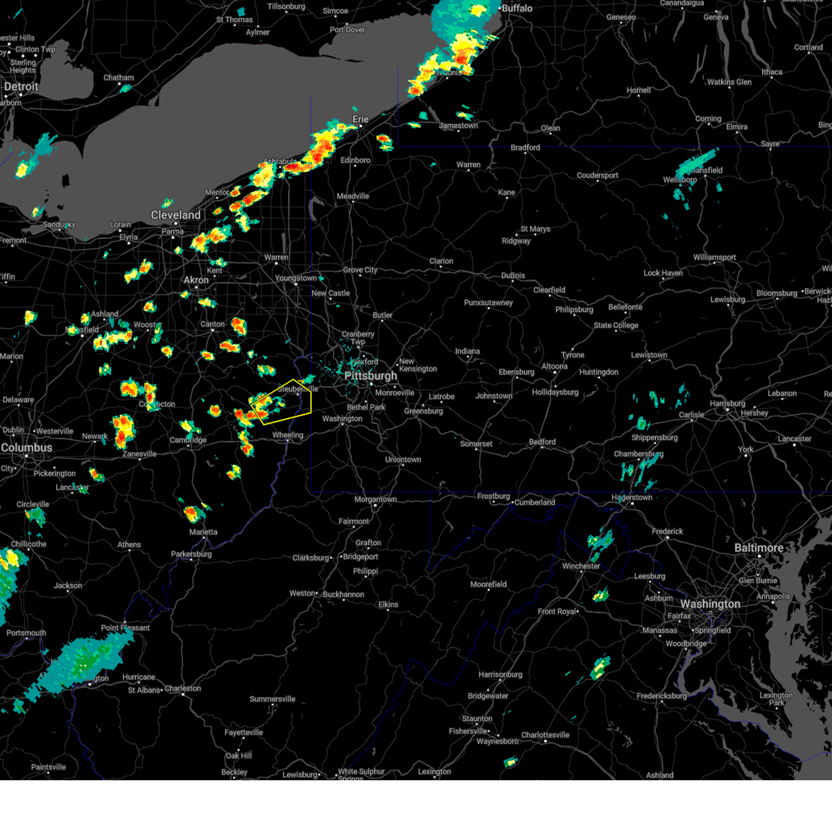 Svrpbz the national weather service in pittsburgh has issued a * severe thunderstorm warning for, southeastern harrison county in east central ohio, southern jefferson oh county in east central ohio, brooke county in northern west virginia, hancock county in northern west virginia, * until 315 pm edt. * at 224 pm edt, a severe thunderstorm was located near cadiz, moving northeast at 25 mph (radar indicated). Hazards include 60 mph wind gusts and small hail. expect damage to roofs, siding, and trees Svrpbz the national weather service in pittsburgh has issued a * severe thunderstorm warning for, southeastern harrison county in east central ohio, southern jefferson oh county in east central ohio, brooke county in northern west virginia, hancock county in northern west virginia, * until 315 pm edt. * at 224 pm edt, a severe thunderstorm was located near cadiz, moving northeast at 25 mph (radar indicated). Hazards include 60 mph wind gusts and small hail. expect damage to roofs, siding, and trees
|
| 8/6/2024 6:41 PM EDT |
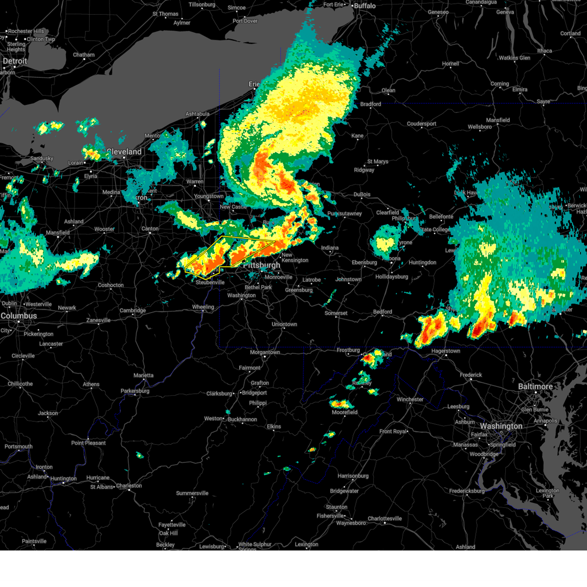 At 641 pm edt, severe thunderstorms were located along a line extending from near new brighton to toronto to 6 miles northeast of freeport, moving east at 35 mph (radar indicated). Hazards include 60 mph wind gusts. Expect damage to trees and power lines, resulting in some power outages. Locations impacted include, cranberry, weirton, steubenville, franklin park, east liverpool, aliquippa, beaver falls, monaca, wellsville, economy, ambridge, wexford, new brighton, toronto, beaver, calcutta, baden, wintersville, rochester, and ohioville. At 641 pm edt, severe thunderstorms were located along a line extending from near new brighton to toronto to 6 miles northeast of freeport, moving east at 35 mph (radar indicated). Hazards include 60 mph wind gusts. Expect damage to trees and power lines, resulting in some power outages. Locations impacted include, cranberry, weirton, steubenville, franklin park, east liverpool, aliquippa, beaver falls, monaca, wellsville, economy, ambridge, wexford, new brighton, toronto, beaver, calcutta, baden, wintersville, rochester, and ohioville.
|
| 8/6/2024 6:41 PM EDT |
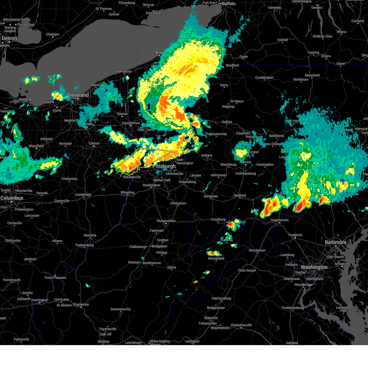 the severe thunderstorm warning has been cancelled and is no longer in effect the severe thunderstorm warning has been cancelled and is no longer in effect
|
| 8/6/2024 6:14 PM EDT |
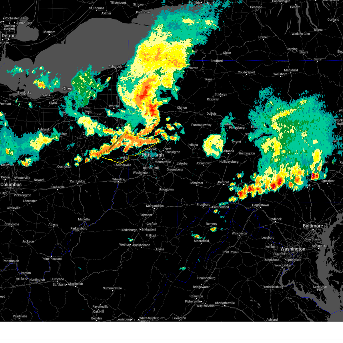 Svrpbz the national weather service in pittsburgh has issued a * severe thunderstorm warning for, northern jefferson county in east central ohio, southeastern columbiana county in east central ohio, southeastern carroll county in east central ohio, beaver county in western pennsylvania, southwestern butler county in west central pennsylvania, northwestern allegheny county in southwestern pennsylvania, hancock county in northern west virginia, * until 700 pm edt. * at 614 pm edt, severe thunderstorms were located along a line extending from near east palestine to 10 miles west of wellsville to near uhrichsville, moving southeast at 35 mph (radar indicated). Hazards include 60 mph wind gusts. expect damage to trees and power lines, resulting in some power outages Svrpbz the national weather service in pittsburgh has issued a * severe thunderstorm warning for, northern jefferson county in east central ohio, southeastern columbiana county in east central ohio, southeastern carroll county in east central ohio, beaver county in western pennsylvania, southwestern butler county in west central pennsylvania, northwestern allegheny county in southwestern pennsylvania, hancock county in northern west virginia, * until 700 pm edt. * at 614 pm edt, severe thunderstorms were located along a line extending from near east palestine to 10 miles west of wellsville to near uhrichsville, moving southeast at 35 mph (radar indicated). Hazards include 60 mph wind gusts. expect damage to trees and power lines, resulting in some power outages
|
| 6/17/2024 7:42 PM EDT |
 The storm which prompted the warning has weakened below severe limits, and no longer poses an immediate threat to life or property. therefore, the warning will be allowed to expire. however, heavy rain is still possible with this thunderstorm. to report severe weather, contact your nearest law enforcement agency. they will relay your report to the national weather service pittsburgh. The storm which prompted the warning has weakened below severe limits, and no longer poses an immediate threat to life or property. therefore, the warning will be allowed to expire. however, heavy rain is still possible with this thunderstorm. to report severe weather, contact your nearest law enforcement agency. they will relay your report to the national weather service pittsburgh.
|
| 6/17/2024 7:21 PM EDT |
 At 721 pm edt, a severe thunderstorm was located over mingo junction, or near steubenville, moving northeast at 20 mph (radar indicated). Hazards include 60 mph wind gusts and quarter size hail. Minor hail damage to vehicles is possible. expect wind damage to trees and power lines, resulting in some power outages. Locations impacted include, weirton, steubenville, wellsburg, avella, toronto, wintersville, mingo junction, follansbee, hooverson heights, new cumberland, burgettstown, franklin, hickory, beech bottom, brilliant, richmond, new manchester, empire, stratton, and new alexandria. At 721 pm edt, a severe thunderstorm was located over mingo junction, or near steubenville, moving northeast at 20 mph (radar indicated). Hazards include 60 mph wind gusts and quarter size hail. Minor hail damage to vehicles is possible. expect wind damage to trees and power lines, resulting in some power outages. Locations impacted include, weirton, steubenville, wellsburg, avella, toronto, wintersville, mingo junction, follansbee, hooverson heights, new cumberland, burgettstown, franklin, hickory, beech bottom, brilliant, richmond, new manchester, empire, stratton, and new alexandria.
|
| 6/17/2024 7:04 PM EDT |
 Svrpbz the national weather service in pittsburgh has issued a * severe thunderstorm warning for, southern jefferson county in east central ohio, southwestern beaver county in western pennsylvania, northwestern washington county in southwestern pennsylvania, brooke county in northern west virginia, hancock county in northern west virginia, * until 745 pm edt. * at 704 pm edt, a severe thunderstorm was located near wintersville, or 7 miles west of wellsburg, moving northeast at 20 mph (radar indicated). Hazards include 60 mph wind gusts and quarter size hail. Minor hail damage to vehicles is possible. Expect wind damage to trees and power lines, resulting in some power outages. Svrpbz the national weather service in pittsburgh has issued a * severe thunderstorm warning for, southern jefferson county in east central ohio, southwestern beaver county in western pennsylvania, northwestern washington county in southwestern pennsylvania, brooke county in northern west virginia, hancock county in northern west virginia, * until 745 pm edt. * at 704 pm edt, a severe thunderstorm was located near wintersville, or 7 miles west of wellsburg, moving northeast at 20 mph (radar indicated). Hazards include 60 mph wind gusts and quarter size hail. Minor hail damage to vehicles is possible. Expect wind damage to trees and power lines, resulting in some power outages.
|
| 6/17/2024 5:10 PM EDT |
 At 509 pm edt, severe thunderstorms were located along a line extending from 9 miles west of kittanning to near gibsonia to 6 miles east of weirton, moving east at 35 mph (law enforcement and the public reported widespread wind damage across the warned area). Hazards include 70 mph wind gusts and quarter size hail. Minor hail damage to vehicles is possible. trees snapped and uprooted. power outages can be expected. locations impacted include, pittsburgh, penn hills, mount lebanon, bethel park, ross township, mccandless township, cranberry, moon township, weirton, butler, franklin park, aliquippa, vandergrift, kittanning, shaler township, plum, north side pittsburgh, baldwin, upper st. Clair, and hampton township. At 509 pm edt, severe thunderstorms were located along a line extending from 9 miles west of kittanning to near gibsonia to 6 miles east of weirton, moving east at 35 mph (law enforcement and the public reported widespread wind damage across the warned area). Hazards include 70 mph wind gusts and quarter size hail. Minor hail damage to vehicles is possible. trees snapped and uprooted. power outages can be expected. locations impacted include, pittsburgh, penn hills, mount lebanon, bethel park, ross township, mccandless township, cranberry, moon township, weirton, butler, franklin park, aliquippa, vandergrift, kittanning, shaler township, plum, north side pittsburgh, baldwin, upper st. Clair, and hampton township.
|
| 6/17/2024 5:00 PM EDT |
 At 459 pm edt, severe thunderstorms were located along a line extending from near butler to gibsonia to weirton, moving east at 35 mph (law enforcement and the public are reporting widespread wind damage across the warned area). Hazards include 70 mph wind gusts and quarter size hail. Minor hail damage to vehicles is possible. trees snapped and uprooted. power outages can be expected. locations impacted include, pittsburgh, penn hills, mount lebanon, bethel park, ross township, mccandless township, cranberry, moon township, weirton, butler, franklin park, aliquippa, vandergrift, kittanning, shaler township, plum, north side pittsburgh, baldwin, upper st. Clair, and hampton township. At 459 pm edt, severe thunderstorms were located along a line extending from near butler to gibsonia to weirton, moving east at 35 mph (law enforcement and the public are reporting widespread wind damage across the warned area). Hazards include 70 mph wind gusts and quarter size hail. Minor hail damage to vehicles is possible. trees snapped and uprooted. power outages can be expected. locations impacted include, pittsburgh, penn hills, mount lebanon, bethel park, ross township, mccandless township, cranberry, moon township, weirton, butler, franklin park, aliquippa, vandergrift, kittanning, shaler township, plum, north side pittsburgh, baldwin, upper st. Clair, and hampton township.
|
| 6/17/2024 4:51 PM EDT |
 At 450 pm edt, severe thunderstorms were located along a line extending from shanor-northvue to seven fields to near toronto, moving east at 35 mph (law enforcement reported widespread trees and wires down across beaver county). Hazards include 60 mph wind gusts and quarter size hail. Minor hail damage to vehicles is possible. expect wind damage to trees and power lines, resulting in some power outages. locations impacted include, pittsburgh, penn hills, mount lebanon, bethel park, ross township, mccandless township, cranberry, moon township, weirton, butler, franklin park, aliquippa, vandergrift, kittanning, shaler township, plum, north side pittsburgh, baldwin, upper st. Clair, and hampton township. At 450 pm edt, severe thunderstorms were located along a line extending from shanor-northvue to seven fields to near toronto, moving east at 35 mph (law enforcement reported widespread trees and wires down across beaver county). Hazards include 60 mph wind gusts and quarter size hail. Minor hail damage to vehicles is possible. expect wind damage to trees and power lines, resulting in some power outages. locations impacted include, pittsburgh, penn hills, mount lebanon, bethel park, ross township, mccandless township, cranberry, moon township, weirton, butler, franklin park, aliquippa, vandergrift, kittanning, shaler township, plum, north side pittsburgh, baldwin, upper st. Clair, and hampton township.
|
| 6/17/2024 4:46 PM EDT |
 The storm which prompted the warning has moved out of the area. therefore, the warning has been allowed to expire. to report severe weather, contact your nearest law enforcement agency. they will relay your report to the national weather service pittsburgh. remember, a severe thunderstorm warning still remains in effect for jefferson, hancock, beaver, and brooke counties until 5:30 pm edt. The storm which prompted the warning has moved out of the area. therefore, the warning has been allowed to expire. to report severe weather, contact your nearest law enforcement agency. they will relay your report to the national weather service pittsburgh. remember, a severe thunderstorm warning still remains in effect for jefferson, hancock, beaver, and brooke counties until 5:30 pm edt.
|
| 6/17/2024 4:44 PM EDT |
 Svrpbz the national weather service in pittsburgh has issued a * severe thunderstorm warning for, east central jefferson county in east central ohio, southern beaver county in western pennsylvania, northwestern washington county in southwestern pennsylvania, southern butler county in west central pennsylvania, allegheny county in southwestern pennsylvania, northwestern westmoreland county in southwestern pennsylvania, southwestern armstrong county in west central pennsylvania, brooke county in northern west virginia, hancock county in northern west virginia, * until 530 pm edt. * at 444 pm edt, severe thunderstorms were located along a line extending from near shanor-northvue to cranberry to near wintersville, moving east at 35 mph (radar indicated). Hazards include 60 mph wind gusts and quarter size hail. Minor hail damage to vehicles is possible. Expect wind damage to trees and power lines, resulting in some power outages. Svrpbz the national weather service in pittsburgh has issued a * severe thunderstorm warning for, east central jefferson county in east central ohio, southern beaver county in western pennsylvania, northwestern washington county in southwestern pennsylvania, southern butler county in west central pennsylvania, allegheny county in southwestern pennsylvania, northwestern westmoreland county in southwestern pennsylvania, southwestern armstrong county in west central pennsylvania, brooke county in northern west virginia, hancock county in northern west virginia, * until 530 pm edt. * at 444 pm edt, severe thunderstorms were located along a line extending from near shanor-northvue to cranberry to near wintersville, moving east at 35 mph (radar indicated). Hazards include 60 mph wind gusts and quarter size hail. Minor hail damage to vehicles is possible. Expect wind damage to trees and power lines, resulting in some power outages.
|
| 6/17/2024 4:35 PM EDT |
 At 435 pm edt, a severe thunderstorm was located over new cumberland, or near wellsville, moving east at 20 mph (radar indicated). Hazards include 60 mph wind gusts. Expect damage to trees and power lines, resulting in some power outages. Locations impacted include, weirton, steubenville, east liverpool, wellsville, toronto, midland, chester, industry, new cumberland, shippingport, newell, richmond, irondale, new manchester, empire, stratton, georgetown, hookstown, hammondsville, and tomlinson run state park. At 435 pm edt, a severe thunderstorm was located over new cumberland, or near wellsville, moving east at 20 mph (radar indicated). Hazards include 60 mph wind gusts. Expect damage to trees and power lines, resulting in some power outages. Locations impacted include, weirton, steubenville, east liverpool, wellsville, toronto, midland, chester, industry, new cumberland, shippingport, newell, richmond, irondale, new manchester, empire, stratton, georgetown, hookstown, hammondsville, and tomlinson run state park.
|
| 6/17/2024 4:22 PM EDT |
 the severe thunderstorm warning has been cancelled and is no longer in effect the severe thunderstorm warning has been cancelled and is no longer in effect
|
| 6/17/2024 4:22 PM EDT |
 At 422 pm edt, a severe thunderstorm was located near new cumberland, or near wellsville, moving east at 30 mph (radar indicated). Hazards include 60 mph wind gusts. Expect damage to trees and power lines, resulting in some power outages. Locations impacted include, weirton, steubenville, east liverpool, wellsville, toronto, wintersville, follansbee, midland, chester, industry, new cumberland, shippingport, salineville, newell, bergholz, amsterdam, richmond, irondale, new manchester, and empire. At 422 pm edt, a severe thunderstorm was located near new cumberland, or near wellsville, moving east at 30 mph (radar indicated). Hazards include 60 mph wind gusts. Expect damage to trees and power lines, resulting in some power outages. Locations impacted include, weirton, steubenville, east liverpool, wellsville, toronto, wintersville, follansbee, midland, chester, industry, new cumberland, shippingport, salineville, newell, bergholz, amsterdam, richmond, irondale, new manchester, and empire.
|
| 6/17/2024 3:59 PM EDT |
 Svrpbz the national weather service in pittsburgh has issued a * severe thunderstorm warning for, northern jefferson county in east central ohio, southeastern columbiana county in east central ohio, southeastern carroll county in east central ohio, southwestern beaver county in western pennsylvania, northwestern washington county in southwestern pennsylvania, brooke county in northern west virginia, hancock county in northern west virginia, * until 445 pm edt. * at 359 pm edt, a severe thunderstorm was located 10 miles east of carrollton, moving east at 30 mph (radar indicated). Hazards include 60 mph wind gusts and quarter size hail. Minor hail damage to vehicles is possible. Expect wind damage to trees and power lines, resulting in some power outages. Svrpbz the national weather service in pittsburgh has issued a * severe thunderstorm warning for, northern jefferson county in east central ohio, southeastern columbiana county in east central ohio, southeastern carroll county in east central ohio, southwestern beaver county in western pennsylvania, northwestern washington county in southwestern pennsylvania, brooke county in northern west virginia, hancock county in northern west virginia, * until 445 pm edt. * at 359 pm edt, a severe thunderstorm was located 10 miles east of carrollton, moving east at 30 mph (radar indicated). Hazards include 60 mph wind gusts and quarter size hail. Minor hail damage to vehicles is possible. Expect wind damage to trees and power lines, resulting in some power outages.
|
| 5/26/2024 7:23 PM EDT |
 the severe thunderstorm warning has been cancelled and is no longer in effect the severe thunderstorm warning has been cancelled and is no longer in effect
|
| 5/26/2024 7:23 PM EDT |
 At 723 pm edt, severe thunderstorms were located along a line extending from near toronto to 7 miles west of mcdonald to near wolfdale, moving north at 50 mph (radar indicated). Hazards include 60 mph wind gusts. Expect damage to trees and power lines, resulting in some power outages. Locations impacted include, moon township, weirton, steubenville, washington, east liverpool, aliquippa, canonsburg, beaver falls, columbiana, monaca, east palestine, wellsville, cecil-bishop, economy, ellwood city, ambridge, new brighton, coraopolis, toronto, and beaver. At 723 pm edt, severe thunderstorms were located along a line extending from near toronto to 7 miles west of mcdonald to near wolfdale, moving north at 50 mph (radar indicated). Hazards include 60 mph wind gusts. Expect damage to trees and power lines, resulting in some power outages. Locations impacted include, moon township, weirton, steubenville, washington, east liverpool, aliquippa, canonsburg, beaver falls, columbiana, monaca, east palestine, wellsville, cecil-bishop, economy, ellwood city, ambridge, new brighton, coraopolis, toronto, and beaver.
|
| 5/26/2024 7:12 PM EDT |
 the severe thunderstorm warning has been cancelled and is no longer in effect the severe thunderstorm warning has been cancelled and is no longer in effect
|
| 5/26/2024 7:12 PM EDT |
 At 711 pm edt, severe thunderstorms were located along a line extending from near wintersville to avella to 11 miles southeast of valley grove, moving north at 75 mph (radar indicated). Hazards include 60 mph wind gusts. Expect damage to trees and power lines, resulting in some power outages. Locations impacted include, moon township, weirton, steubenville, washington, east liverpool, aliquippa, canonsburg, beaver falls, columbiana, monaca, east palestine, wellsville, wellsburg, avella, cecil-bishop, economy, ellwood city, ambridge, new brighton, and coraopolis. At 711 pm edt, severe thunderstorms were located along a line extending from near wintersville to avella to 11 miles southeast of valley grove, moving north at 75 mph (radar indicated). Hazards include 60 mph wind gusts. Expect damage to trees and power lines, resulting in some power outages. Locations impacted include, moon township, weirton, steubenville, washington, east liverpool, aliquippa, canonsburg, beaver falls, columbiana, monaca, east palestine, wellsville, wellsburg, avella, cecil-bishop, economy, ellwood city, ambridge, new brighton, and coraopolis.
|
| 5/26/2024 6:58 PM EDT |
 Svrpbz the national weather service in pittsburgh has issued a * severe thunderstorm warning for, jefferson county in east central ohio, eastern columbiana county in east central ohio, northeastern belmont county in east central ohio, beaver county in western pennsylvania, washington county in southwestern pennsylvania, northwestern allegheny county in southwestern pennsylvania, western greene county in southwestern pennsylvania, ohio county in northern west virginia, brooke county in northern west virginia, hancock county in northern west virginia, * until 745 pm edt. * at 658 pm edt, severe thunderstorms were located along a line extending from near martins ferry to near valley grove to 6 miles east of cameron, moving north at 75 mph (radar indicated). Hazards include 60 mph wind gusts. expect damage to trees and power lines, resulting in some power outages Svrpbz the national weather service in pittsburgh has issued a * severe thunderstorm warning for, jefferson county in east central ohio, eastern columbiana county in east central ohio, northeastern belmont county in east central ohio, beaver county in western pennsylvania, washington county in southwestern pennsylvania, northwestern allegheny county in southwestern pennsylvania, western greene county in southwestern pennsylvania, ohio county in northern west virginia, brooke county in northern west virginia, hancock county in northern west virginia, * until 745 pm edt. * at 658 pm edt, severe thunderstorms were located along a line extending from near martins ferry to near valley grove to 6 miles east of cameron, moving north at 75 mph (radar indicated). Hazards include 60 mph wind gusts. expect damage to trees and power lines, resulting in some power outages
|
| 5/11/2024 5:38 PM EDT |
 The storm which prompted the warning has weakened below severe limits, and has exited the warned area. therefore, the warning will be allowed to expire. however, small hail and heavy rain are still possible with this thunderstorm. The storm which prompted the warning has weakened below severe limits, and has exited the warned area. therefore, the warning will be allowed to expire. however, small hail and heavy rain are still possible with this thunderstorm.
|
| 5/11/2024 5:31 PM EDT |
 At 531 pm edt, a severe thunderstorm was located near moon township, moving east at 35 mph (radar indicated). Hazards include ping pong ball size hail and 60 mph wind gusts. People and animals outdoors will be injured. expect hail damage to roofs, siding, windows, and vehicles. expect wind damage to trees and power lines, resulting in some power outages. Locations impacted include, moon township, weirton, east liverpool, aliquippa, economy, ambridge, toronto, baden, sewickley, ohioville, harmony township, midland, chester, imperial, industry, sturgeon-noblestown, leetsdale, new cumberland, shippingport, and conway. At 531 pm edt, a severe thunderstorm was located near moon township, moving east at 35 mph (radar indicated). Hazards include ping pong ball size hail and 60 mph wind gusts. People and animals outdoors will be injured. expect hail damage to roofs, siding, windows, and vehicles. expect wind damage to trees and power lines, resulting in some power outages. Locations impacted include, moon township, weirton, east liverpool, aliquippa, economy, ambridge, toronto, baden, sewickley, ohioville, harmony township, midland, chester, imperial, industry, sturgeon-noblestown, leetsdale, new cumberland, shippingport, and conway.
|
| 5/11/2024 5:10 PM EDT |
 At 510 pm edt, a severe thunderstorm was located over new cumberland, or 7 miles southeast of wellsville, moving east at 35 mph (radar indicated). Hazards include ping pong ball size hail and 60 mph wind gusts. People and animals outdoors will be injured. expect hail damage to roofs, siding, windows, and vehicles. expect wind damage to trees and power lines, resulting in some power outages. Locations impacted include, moon township, weirton, east liverpool, aliquippa, economy, ambridge, toronto, baden, sewickley, ohioville, harmony township, midland, chester, imperial, industry, sturgeon-noblestown, leetsdale, new cumberland, shippingport, and conway. At 510 pm edt, a severe thunderstorm was located over new cumberland, or 7 miles southeast of wellsville, moving east at 35 mph (radar indicated). Hazards include ping pong ball size hail and 60 mph wind gusts. People and animals outdoors will be injured. expect hail damage to roofs, siding, windows, and vehicles. expect wind damage to trees and power lines, resulting in some power outages. Locations impacted include, moon township, weirton, east liverpool, aliquippa, economy, ambridge, toronto, baden, sewickley, ohioville, harmony township, midland, chester, imperial, industry, sturgeon-noblestown, leetsdale, new cumberland, shippingport, and conway.
|
| 5/11/2024 5:03 PM EDT |
 At 503 pm edt, a severe thunderstorm was located over new cumberland, or near wellsville, moving east at 35 mph (radar indicated). Hazards include ping pong ball size hail and 60 mph wind gusts. People and animals outdoors will be injured. expect hail damage to roofs, siding, windows, and vehicles. expect wind damage to trees and power lines, resulting in some power outages. Locations impacted include, moon township, weirton, east liverpool, aliquippa, wellsville, economy, ambridge, toronto, baden, sewickley, ohioville, harmony township, midland, chester, imperial, industry, sturgeon-noblestown, leetsdale, new cumberland, and shippingport. At 503 pm edt, a severe thunderstorm was located over new cumberland, or near wellsville, moving east at 35 mph (radar indicated). Hazards include ping pong ball size hail and 60 mph wind gusts. People and animals outdoors will be injured. expect hail damage to roofs, siding, windows, and vehicles. expect wind damage to trees and power lines, resulting in some power outages. Locations impacted include, moon township, weirton, east liverpool, aliquippa, wellsville, economy, ambridge, toronto, baden, sewickley, ohioville, harmony township, midland, chester, imperial, industry, sturgeon-noblestown, leetsdale, new cumberland, and shippingport.
|
| 5/11/2024 4:55 PM EDT |
 Svrpbz the national weather service in pittsburgh has issued a * severe thunderstorm warning for, northeastern jefferson county in east central ohio, southern beaver county in western pennsylvania, northwestern washington county in southwestern pennsylvania, northwestern allegheny county in southwestern pennsylvania, hancock county in northern west virginia, * until 545 pm edt. * at 455 pm edt, a severe thunderstorm was located 7 miles southwest of wellsville, moving east at 35 mph (radar indicated). Hazards include 60 mph wind gusts and half dollar size hail. Minor hail damage to vehicles is possible. Expect wind damage to trees and power lines, resulting in some power outages. Svrpbz the national weather service in pittsburgh has issued a * severe thunderstorm warning for, northeastern jefferson county in east central ohio, southern beaver county in western pennsylvania, northwestern washington county in southwestern pennsylvania, northwestern allegheny county in southwestern pennsylvania, hancock county in northern west virginia, * until 545 pm edt. * at 455 pm edt, a severe thunderstorm was located 7 miles southwest of wellsville, moving east at 35 mph (radar indicated). Hazards include 60 mph wind gusts and half dollar size hail. Minor hail damage to vehicles is possible. Expect wind damage to trees and power lines, resulting in some power outages.
|
| 5/8/2024 1:16 AM EDT |
 At 115 am edt, a confirmed large and extremely dangerous tornado was located near new cumberland, or near east liverpool, moving east at 45 mph. this is a particularly dangerous situation. take cover now! (law enforcement confirmed tornado). Hazards include damaging tornado. You are in a life-threatening situation. flying debris may be deadly to those caught without shelter. mobile homes will be destroyed. considerable damage to homes, businesses, and vehicles is likely and complete destruction is possible. This tornadic thunderstorm will remain over mainly rural areas of northeastern jefferson, southeastern columbiana, southwestern beaver, northwestern washington, west central allegheny and hancock counties, including the following locations, hookstown, stratton, tomlinson run state park, hanover township, empire, frankfort springs, raccoon creek state park, burgettstown, new manchester, and newell. At 115 am edt, a confirmed large and extremely dangerous tornado was located near new cumberland, or near east liverpool, moving east at 45 mph. this is a particularly dangerous situation. take cover now! (law enforcement confirmed tornado). Hazards include damaging tornado. You are in a life-threatening situation. flying debris may be deadly to those caught without shelter. mobile homes will be destroyed. considerable damage to homes, businesses, and vehicles is likely and complete destruction is possible. This tornadic thunderstorm will remain over mainly rural areas of northeastern jefferson, southeastern columbiana, southwestern beaver, northwestern washington, west central allegheny and hancock counties, including the following locations, hookstown, stratton, tomlinson run state park, hanover township, empire, frankfort springs, raccoon creek state park, burgettstown, new manchester, and newell.
|
| 5/8/2024 1:07 AM EDT |
 At 107 am edt, a confirmed tornado was located near wellsville, moving east at 45 mph (law enforcement confirmed tornado). Hazards include damaging tornado. Flying debris will be dangerous to those caught without shelter. mobile homes will be damaged or destroyed. damage to roofs, windows, and vehicles will occur. tree damage is likely. this tornado will be near, wellsville and new cumberland around 110 am edt. Other locations impacted by this tornadic thunderstorm include newell, stratton, empire, frankfort springs, new manchester, hammondsville, hookstown, tomlinson run state park, hanover township, and raccoon creek state park. At 107 am edt, a confirmed tornado was located near wellsville, moving east at 45 mph (law enforcement confirmed tornado). Hazards include damaging tornado. Flying debris will be dangerous to those caught without shelter. mobile homes will be damaged or destroyed. damage to roofs, windows, and vehicles will occur. tree damage is likely. this tornado will be near, wellsville and new cumberland around 110 am edt. Other locations impacted by this tornadic thunderstorm include newell, stratton, empire, frankfort springs, new manchester, hammondsville, hookstown, tomlinson run state park, hanover township, and raccoon creek state park.
|
| 5/8/2024 1:02 AM EDT |
 At 101 am edt, a severe thunderstorm capable of producing a tornado was located near wellsville, moving east at 40 mph (radar indicated rotation). Hazards include tornado. Flying debris will be dangerous to those caught without shelter. mobile homes will be damaged or destroyed. damage to roofs, windows, and vehicles will occur. tree damage is likely. this dangerous storm will be near, wellsville and new cumberland around 105 am edt. chester around 110 am edt. Other locations impacted by this tornadic thunderstorm include newell, stratton, slovan, empire, frankfort springs, new manchester, hammondsville, hookstown, tomlinson run state park, and hanover township. At 101 am edt, a severe thunderstorm capable of producing a tornado was located near wellsville, moving east at 40 mph (radar indicated rotation). Hazards include tornado. Flying debris will be dangerous to those caught without shelter. mobile homes will be damaged or destroyed. damage to roofs, windows, and vehicles will occur. tree damage is likely. this dangerous storm will be near, wellsville and new cumberland around 105 am edt. chester around 110 am edt. Other locations impacted by this tornadic thunderstorm include newell, stratton, slovan, empire, frankfort springs, new manchester, hammondsville, hookstown, tomlinson run state park, and hanover township.
|
| 5/8/2024 1:02 AM EDT |
 the tornado warning has been cancelled and is no longer in effect the tornado warning has been cancelled and is no longer in effect
|
| 5/8/2024 12:55 AM EDT |
 Torpbz the national weather service in pittsburgh has issued a * tornado warning for, northern jefferson county in east central ohio, southeastern columbiana county in east central ohio, southwestern beaver county in western pennsylvania, northwestern washington county in southwestern pennsylvania, west central allegheny county in southwestern pennsylvania, brooke county in northern west virginia, hancock county in northern west virginia, * until 130 am edt. * at 1254 am edt, a severe thunderstorm capable of producing a tornado was located 7 miles west of wellsville, moving east at 45 mph (radar indicated rotation). Hazards include tornado. Flying debris will be dangerous to those caught without shelter. mobile homes will be damaged or destroyed. damage to roofs, windows, and vehicles will occur. tree damage is likely. this dangerous storm will be near, wellsville and new cumberland around 100 am edt. toronto around 110 am edt. Other locations impacted by this tornadic thunderstorm include newell, stratton, slovan, empire, frankfort springs, new manchester, hammondsville, hookstown, tomlinson run state park, and hanover township. Torpbz the national weather service in pittsburgh has issued a * tornado warning for, northern jefferson county in east central ohio, southeastern columbiana county in east central ohio, southwestern beaver county in western pennsylvania, northwestern washington county in southwestern pennsylvania, west central allegheny county in southwestern pennsylvania, brooke county in northern west virginia, hancock county in northern west virginia, * until 130 am edt. * at 1254 am edt, a severe thunderstorm capable of producing a tornado was located 7 miles west of wellsville, moving east at 45 mph (radar indicated rotation). Hazards include tornado. Flying debris will be dangerous to those caught without shelter. mobile homes will be damaged or destroyed. damage to roofs, windows, and vehicles will occur. tree damage is likely. this dangerous storm will be near, wellsville and new cumberland around 100 am edt. toronto around 110 am edt. Other locations impacted by this tornadic thunderstorm include newell, stratton, slovan, empire, frankfort springs, new manchester, hammondsville, hookstown, tomlinson run state park, and hanover township.
|
| 4/17/2024 7:14 PM EDT |
 At 713 pm edt, severe thunderstorms were located along a line extending from 6 miles southwest of new castle to near chester to near wintersville, moving east at 45 mph (law enforcement). Hazards include 70 mph wind gusts. Trees snapped and uprooted. power outages can be expected. locations impacted include, pittsburgh, penn hills, mount lebanon, bethel park, ross township, mccandless township, monroeville, cranberry, moon township, new castle, mcmurray, weirton, mckeesport, steubenville, butler, franklin park, east liverpool, aliquippa, canonsburg, and beaver falls. These storms have a history of damaging wind with trees down. At 713 pm edt, severe thunderstorms were located along a line extending from 6 miles southwest of new castle to near chester to near wintersville, moving east at 45 mph (law enforcement). Hazards include 70 mph wind gusts. Trees snapped and uprooted. power outages can be expected. locations impacted include, pittsburgh, penn hills, mount lebanon, bethel park, ross township, mccandless township, monroeville, cranberry, moon township, new castle, mcmurray, weirton, mckeesport, steubenville, butler, franklin park, east liverpool, aliquippa, canonsburg, and beaver falls. These storms have a history of damaging wind with trees down.
|
| 4/17/2024 7:10 PM EDT |
 At 710 pm edt, severe thunderstorms were located along a line extending from 7 miles northeast of east palestine to near chester to near wintersville, moving east at 45 mph (radar indicated). Hazards include 70 mph wind gusts. Trees snapped and uprooted. power outages can be expected. Locations impacted include, pittsburgh, penn hills, mount lebanon, bethel park, ross township, mccandless township, monroeville, cranberry, moon township, new castle, mcmurray, weirton, mckeesport, steubenville, butler, franklin park, east liverpool, aliquippa, canonsburg, and beaver falls. At 710 pm edt, severe thunderstorms were located along a line extending from 7 miles northeast of east palestine to near chester to near wintersville, moving east at 45 mph (radar indicated). Hazards include 70 mph wind gusts. Trees snapped and uprooted. power outages can be expected. Locations impacted include, pittsburgh, penn hills, mount lebanon, bethel park, ross township, mccandless township, monroeville, cranberry, moon township, new castle, mcmurray, weirton, mckeesport, steubenville, butler, franklin park, east liverpool, aliquippa, canonsburg, and beaver falls.
|
| 4/17/2024 7:03 PM EDT | Report and photo of large tree down on titanium way. time estimated based on rada in jefferson county OH, 0 miles WSW of Toronto, WV |
| 4/17/2024 6:53 PM EDT |
 Svrpbz the national weather service in pittsburgh has issued a * severe thunderstorm warning for, northeastern harrison county in east central ohio, jefferson county in east central ohio, eastern columbiana county in east central ohio, beaver county in western pennsylvania, butler county in west central pennsylvania, allegheny county in southwestern pennsylvania, west central armstrong county in west central pennsylvania, southwestern clarion county in west central pennsylvania, northern washington county in southwestern pennsylvania, southern lawrence county in western pennsylvania, northwestern westmoreland county in southwestern pennsylvania, brooke county in northern west virginia, hancock county in northern west virginia, * until 800 pm edt. * at 653 pm edt, severe thunderstorms were located along a line extending from columbiana to near wellsville to near cadiz, moving east at 50 mph (radar indicated). Hazards include 70 mph wind gusts. Trees snapped and uprooted. Power outages can be expected. Svrpbz the national weather service in pittsburgh has issued a * severe thunderstorm warning for, northeastern harrison county in east central ohio, jefferson county in east central ohio, eastern columbiana county in east central ohio, beaver county in western pennsylvania, butler county in west central pennsylvania, allegheny county in southwestern pennsylvania, west central armstrong county in west central pennsylvania, southwestern clarion county in west central pennsylvania, northern washington county in southwestern pennsylvania, southern lawrence county in western pennsylvania, northwestern westmoreland county in southwestern pennsylvania, brooke county in northern west virginia, hancock county in northern west virginia, * until 800 pm edt. * at 653 pm edt, severe thunderstorms were located along a line extending from columbiana to near wellsville to near cadiz, moving east at 50 mph (radar indicated). Hazards include 70 mph wind gusts. Trees snapped and uprooted. Power outages can be expected.
|
| 4/14/2024 11:31 PM EDT |
 the severe thunderstorm warning has been cancelled and is no longer in effect the severe thunderstorm warning has been cancelled and is no longer in effect
|
| 4/14/2024 11:19 PM EDT |
 At 1118 pm edt, a severe thunderstorm was located over new cumberland, or 7 miles south of wellsville, moving southeast at 45 mph (radar indicated). Hazards include 60 mph wind gusts and quarter size hail. Minor hail damage to vehicles is possible. expect wind damage to trees and power lines, resulting in some power outages. Locations impacted include, weirton, wellsville, toronto, mcdonald, new cumberland, burgettstown, salineville, bergholz, hickory, irondale, new manchester, empire, stratton, summitville, frankfort springs, hammondsville, mechanicstown, slovan, hanover township, and colliers. At 1118 pm edt, a severe thunderstorm was located over new cumberland, or 7 miles south of wellsville, moving southeast at 45 mph (radar indicated). Hazards include 60 mph wind gusts and quarter size hail. Minor hail damage to vehicles is possible. expect wind damage to trees and power lines, resulting in some power outages. Locations impacted include, weirton, wellsville, toronto, mcdonald, new cumberland, burgettstown, salineville, bergholz, hickory, irondale, new manchester, empire, stratton, summitville, frankfort springs, hammondsville, mechanicstown, slovan, hanover township, and colliers.
|
| 4/14/2024 10:57 PM EDT |
 Svrpbz the national weather service in pittsburgh has issued a * severe thunderstorm warning for, northern jefferson county in east central ohio, south central columbiana county in east central ohio, east central carroll county in east central ohio, southwestern beaver county in western pennsylvania, northwestern washington county in southwestern pennsylvania, brooke county in northern west virginia, hancock county in northern west virginia, * until 1145 pm edt. * at 1057 pm edt, a severe thunderstorm was located 10 miles east of carrollton, moving southeast at 45 mph (radar indicated). Hazards include 60 mph wind gusts and quarter size hail. Minor hail damage to vehicles is possible. Expect wind damage to trees and power lines, resulting in some power outages. Svrpbz the national weather service in pittsburgh has issued a * severe thunderstorm warning for, northern jefferson county in east central ohio, south central columbiana county in east central ohio, east central carroll county in east central ohio, southwestern beaver county in western pennsylvania, northwestern washington county in southwestern pennsylvania, brooke county in northern west virginia, hancock county in northern west virginia, * until 1145 pm edt. * at 1057 pm edt, a severe thunderstorm was located 10 miles east of carrollton, moving southeast at 45 mph (radar indicated). Hazards include 60 mph wind gusts and quarter size hail. Minor hail damage to vehicles is possible. Expect wind damage to trees and power lines, resulting in some power outages.
|
| 2/28/2024 7:43 AM EST |
 The storm which prompted the warning has weakened below severe limits, and has exited the warned area. therefore, the warning will be allowed to expire. however, small hail and gusty winds are still possible with this thunderstorm. The storm which prompted the warning has weakened below severe limits, and has exited the warned area. therefore, the warning will be allowed to expire. however, small hail and gusty winds are still possible with this thunderstorm.
|
| 2/28/2024 7:38 AM EST |
 At 737 am est, a severe thunderstorm was located over mingo junction, or over wellsburg, moving east at 60 mph (radar indicated). Hazards include 60 mph wind gusts and quarter size hail. Minor hail damage to vehicles is possible. expect wind damage to trees and power lines, resulting in some power outages. Locations impacted include, weirton, steubenville, martins ferry, warwood, wellsburg, west liberty, clearview, wintersville, mingo junction, follansbee, hooverson heights, tiltonsville, yorkville, bethany, smithfield, franklin, dillonvale, beech bottom, brilliant, and mount pleasant. At 737 am est, a severe thunderstorm was located over mingo junction, or over wellsburg, moving east at 60 mph (radar indicated). Hazards include 60 mph wind gusts and quarter size hail. Minor hail damage to vehicles is possible. expect wind damage to trees and power lines, resulting in some power outages. Locations impacted include, weirton, steubenville, martins ferry, warwood, wellsburg, west liberty, clearview, wintersville, mingo junction, follansbee, hooverson heights, tiltonsville, yorkville, bethany, smithfield, franklin, dillonvale, beech bottom, brilliant, and mount pleasant.
|
| 2/28/2024 7:29 AM EST |
 At 729 am est, a severe thunderstorm was located near wintersville, or 8 miles southwest of steubenville, moving east at 60 mph (radar indicated). Hazards include 60 mph wind gusts and quarter size hail. Minor hail damage to vehicles is possible. expect wind damage to trees and power lines, resulting in some power outages. Locations impacted include, weirton, steubenville, martins ferry, warwood, wellsburg, west liberty, clearview, toronto, wintersville, mingo junction, follansbee, hooverson heights, tiltonsville, yorkville, bethany, hopedale, smithfield, adena, franklin, and dillonvale. At 729 am est, a severe thunderstorm was located near wintersville, or 8 miles southwest of steubenville, moving east at 60 mph (radar indicated). Hazards include 60 mph wind gusts and quarter size hail. Minor hail damage to vehicles is possible. expect wind damage to trees and power lines, resulting in some power outages. Locations impacted include, weirton, steubenville, martins ferry, warwood, wellsburg, west liberty, clearview, toronto, wintersville, mingo junction, follansbee, hooverson heights, tiltonsville, yorkville, bethany, hopedale, smithfield, adena, franklin, and dillonvale.
|
| 2/28/2024 7:16 AM EST |
 Svrpbz the national weather service in pittsburgh has issued a * severe thunderstorm warning for, harrison county in east central ohio, southern jefferson county in east central ohio, northern belmont county in east central ohio, ohio county in northern west virginia, brooke county in northern west virginia, hancock county in northern west virginia, * until 745 am est. * at 716 am est, a severe thunderstorm was located near cadiz, moving east at 60 mph (radar indicated). Hazards include 60 mph wind gusts and quarter size hail. Minor hail damage to vehicles is possible. Expect wind damage to trees and power lines, resulting in some power outages. Svrpbz the national weather service in pittsburgh has issued a * severe thunderstorm warning for, harrison county in east central ohio, southern jefferson county in east central ohio, northern belmont county in east central ohio, ohio county in northern west virginia, brooke county in northern west virginia, hancock county in northern west virginia, * until 745 am est. * at 716 am est, a severe thunderstorm was located near cadiz, moving east at 60 mph (radar indicated). Hazards include 60 mph wind gusts and quarter size hail. Minor hail damage to vehicles is possible. Expect wind damage to trees and power lines, resulting in some power outages.
|
| 8/25/2023 1:28 AM EDT |
 At 128 am edt, severe thunderstorms were located along a line extending from zelienople to near chester to 9 miles southeast of carrollton, moving southeast at 55 mph (radar indicated). Hazards include 60 mph wind gusts. Expect damage to trees and power lines, resulting in some power outages. locations impacted include, ross township, mccandless township, cranberry, moon township, weirton, steubenville, franklin park, east liverpool, aliquippa, beaver falls, monaca, wellsville, carrollton, hampton township, robinson township, economy, ellwood city, ambridge, wexford, and new brighton. hail threat, radar indicated max hail size, <. 75 in wind threat, radar indicated max wind gust, 60 mph. At 128 am edt, severe thunderstorms were located along a line extending from zelienople to near chester to 9 miles southeast of carrollton, moving southeast at 55 mph (radar indicated). Hazards include 60 mph wind gusts. Expect damage to trees and power lines, resulting in some power outages. locations impacted include, ross township, mccandless township, cranberry, moon township, weirton, steubenville, franklin park, east liverpool, aliquippa, beaver falls, monaca, wellsville, carrollton, hampton township, robinson township, economy, ellwood city, ambridge, wexford, and new brighton. hail threat, radar indicated max hail size, <. 75 in wind threat, radar indicated max wind gust, 60 mph.
|
| 8/25/2023 1:07 AM EDT |
 At 107 am edt, severe thunderstorms were located along a line extending from 6 miles northeast of east palestine to 6 miles southwest of lisbon to near waynesburg, moving southeast at 55 mph (radar indicated). Hazards include 60 mph wind gusts. Expect damage to trees and power lines, resulting in some power outages. locations impacted include, ross township, mccandless township, cranberry, moon township, new castle, weirton, steubenville, franklin park, east liverpool, aliquippa, beaver falls, columbiana, monaca, east palestine, wellsville, carrollton, hampton township, robinson township, economy, and ellwood city. hail threat, radar indicated max hail size, <. 75 in wind threat, radar indicated max wind gust, 60 mph. At 107 am edt, severe thunderstorms were located along a line extending from 6 miles northeast of east palestine to 6 miles southwest of lisbon to near waynesburg, moving southeast at 55 mph (radar indicated). Hazards include 60 mph wind gusts. Expect damage to trees and power lines, resulting in some power outages. locations impacted include, ross township, mccandless township, cranberry, moon township, new castle, weirton, steubenville, franklin park, east liverpool, aliquippa, beaver falls, columbiana, monaca, east palestine, wellsville, carrollton, hampton township, robinson township, economy, and ellwood city. hail threat, radar indicated max hail size, <. 75 in wind threat, radar indicated max wind gust, 60 mph.
|
| 8/25/2023 12:52 AM EDT |
 At 1251 am edt, severe thunderstorms were located along a line extending from boardman to 6 miles north of minerva to massillon, moving southeast at 55 mph (radar indicated). Hazards include 60 mph wind gusts. expect damage to trees and power lines, resulting in some power outages At 1251 am edt, severe thunderstorms were located along a line extending from boardman to 6 miles north of minerva to massillon, moving southeast at 55 mph (radar indicated). Hazards include 60 mph wind gusts. expect damage to trees and power lines, resulting in some power outages
|
| 8/12/2023 7:31 PM EDT |
 At 731 pm edt, severe thunderstorms were located along a line extending from near ohioville to 6 miles west of new cumberland to 8 miles east of dennison, moving east at 45 mph (radar indicated). Hazards include 60 mph wind gusts and quarter size hail. Minor hail damage to vehicles is possible. expect wind damage to trees and power lines, resulting in some power outages. locations impacted include, new philadelphia, east liverpool, uhrichsville, wellsville, freeport, toronto, calcutta, newcomerstown, ohioville, dennison, midland, chester, industry, new cumberland, salineville, gnadenhutten, tuscarawas, newell, scio, and midvale. hail threat, radar indicated max hail size, 1. 00 in wind threat, radar indicated max wind gust, 60 mph. At 731 pm edt, severe thunderstorms were located along a line extending from near ohioville to 6 miles west of new cumberland to 8 miles east of dennison, moving east at 45 mph (radar indicated). Hazards include 60 mph wind gusts and quarter size hail. Minor hail damage to vehicles is possible. expect wind damage to trees and power lines, resulting in some power outages. locations impacted include, new philadelphia, east liverpool, uhrichsville, wellsville, freeport, toronto, calcutta, newcomerstown, ohioville, dennison, midland, chester, industry, new cumberland, salineville, gnadenhutten, tuscarawas, newell, scio, and midvale. hail threat, radar indicated max hail size, 1. 00 in wind threat, radar indicated max wind gust, 60 mph.
|
| 8/12/2023 7:00 PM EDT |
 At 700 pm edt, severe thunderstorms were located along a line extending from 7 miles northeast of minerva to near carrollton to 7 miles southeast of farmerstown, moving east at 45 mph (radar indicated). Hazards include 60 mph wind gusts and quarter size hail. Minor hail damage to vehicles is possible. Expect wind damage to trees and power lines, resulting in some power outages. At 700 pm edt, severe thunderstorms were located along a line extending from 7 miles northeast of minerva to near carrollton to 7 miles southeast of farmerstown, moving east at 45 mph (radar indicated). Hazards include 60 mph wind gusts and quarter size hail. Minor hail damage to vehicles is possible. Expect wind damage to trees and power lines, resulting in some power outages.
|
| 8/12/2023 6:24 PM EDT |
 At 624 pm edt, a severe thunderstorm was located near weirton, moving east at 30 mph (radar indicated). Hazards include 60 mph wind gusts. expect damage to trees and power lines, resulting in some power outages At 624 pm edt, a severe thunderstorm was located near weirton, moving east at 30 mph (radar indicated). Hazards include 60 mph wind gusts. expect damage to trees and power lines, resulting in some power outages
|
| 7/2/2023 8:21 PM EDT |
 The severe thunderstorm warning for northeastern jefferson, southwestern beaver, northwestern washington, brooke and hancock counties will expire at 830 pm edt, the storm which prompted the warning has weakened below severe limits, and no longer poses an immediate threat to life or property. therefore, the warning will be allowed to expire. however, gusty winds and heavy rain are still possible with this thunderstorm. The severe thunderstorm warning for northeastern jefferson, southwestern beaver, northwestern washington, brooke and hancock counties will expire at 830 pm edt, the storm which prompted the warning has weakened below severe limits, and no longer poses an immediate threat to life or property. therefore, the warning will be allowed to expire. however, gusty winds and heavy rain are still possible with this thunderstorm.
|
| 7/2/2023 8:07 PM EDT |
 At 807 pm edt, a severe thunderstorm was located over weirton, moving east at 30 mph (radar indicated). Hazards include 60 mph wind gusts. Expect damage to trees and power lines, resulting in some power outages. locations impacted include, weirton, steubenville, toronto, wintersville, mingo junction, follansbee, hooverson heights, new cumberland, burgettstown, new manchester, empire, stratton, frankfort springs, brentwood, rockdale, colliers, sun valley, langeloth, east steubenville, and raccoon creek state park. hail threat, radar indicated max hail size, <. 75 in wind threat, radar indicated max wind gust, 60 mph. At 807 pm edt, a severe thunderstorm was located over weirton, moving east at 30 mph (radar indicated). Hazards include 60 mph wind gusts. Expect damage to trees and power lines, resulting in some power outages. locations impacted include, weirton, steubenville, toronto, wintersville, mingo junction, follansbee, hooverson heights, new cumberland, burgettstown, new manchester, empire, stratton, frankfort springs, brentwood, rockdale, colliers, sun valley, langeloth, east steubenville, and raccoon creek state park. hail threat, radar indicated max hail size, <. 75 in wind threat, radar indicated max wind gust, 60 mph.
|
| 7/2/2023 8:00 PM EDT | Report of trees down in area. time estimated based on rada in jefferson county OH, 0 miles WSW of Toronto, WV |
| 7/2/2023 7:56 PM EDT |
 At 756 pm edt, a severe thunderstorm was located over toronto, or near weirton, moving east at 30 mph (radar indicated). Hazards include 60 mph wind gusts. expect damage to trees and power lines, resulting in some power outages At 756 pm edt, a severe thunderstorm was located over toronto, or near weirton, moving east at 30 mph (radar indicated). Hazards include 60 mph wind gusts. expect damage to trees and power lines, resulting in some power outages
|
| 4/5/2023 7:33 PM EDT |
 At 733 pm edt, a severe thunderstorm was located over new brighton, or near beaver falls, moving northeast at 65 mph (radar indicated). Hazards include 60 mph wind gusts. Expect damage to trees and power lines, resulting in some power outages. locations impacted include, weirton, steubenville, salem, east liverpool, columbiana, east palestine, wellsville, toronto, calcutta, wintersville, ohioville, and lisbon. hail threat, radar indicated max hail size, <. 75 in wind threat, observed max wind gust, 60 mph. At 733 pm edt, a severe thunderstorm was located over new brighton, or near beaver falls, moving northeast at 65 mph (radar indicated). Hazards include 60 mph wind gusts. Expect damage to trees and power lines, resulting in some power outages. locations impacted include, weirton, steubenville, salem, east liverpool, columbiana, east palestine, wellsville, toronto, calcutta, wintersville, ohioville, and lisbon. hail threat, radar indicated max hail size, <. 75 in wind threat, observed max wind gust, 60 mph.
|
| 4/5/2023 7:26 PM EDT |
 At 726 pm edt, a severe thunderstorm was located over midland, or near east liverpool, moving northeast at 65 mph (radar indicated). Hazards include 60 mph wind gusts. Expect damage to trees and power lines, resulting in some power outages. locations impacted include, weirton, steubenville, salem, east liverpool, columbiana, east palestine, wellsville, cadiz, toronto, calcutta, wintersville, and minerva. hail threat, radar indicated max hail size, <. 75 in wind threat, observed max wind gust, 60 mph. At 726 pm edt, a severe thunderstorm was located over midland, or near east liverpool, moving northeast at 65 mph (radar indicated). Hazards include 60 mph wind gusts. Expect damage to trees and power lines, resulting in some power outages. locations impacted include, weirton, steubenville, salem, east liverpool, columbiana, east palestine, wellsville, cadiz, toronto, calcutta, wintersville, and minerva. hail threat, radar indicated max hail size, <. 75 in wind threat, observed max wind gust, 60 mph.
|
| 4/5/2023 7:19 PM EDT |
 At 719 pm edt, a severe thunderstorm was located over wellsville, moving northeast at 65 mph (radar indicated). Hazards include 60 mph wind gusts. Expect damage to trees and power lines, resulting in some power outages. locations impacted include, weirton, steubenville, salem, east liverpool, columbiana, east palestine, wellsville, cadiz, carrollton, toronto, calcutta, and wintersville. hail threat, radar indicated max hail size, <. 75 in wind threat, observed max wind gust, 60 mph. At 719 pm edt, a severe thunderstorm was located over wellsville, moving northeast at 65 mph (radar indicated). Hazards include 60 mph wind gusts. Expect damage to trees and power lines, resulting in some power outages. locations impacted include, weirton, steubenville, salem, east liverpool, columbiana, east palestine, wellsville, cadiz, carrollton, toronto, calcutta, and wintersville. hail threat, radar indicated max hail size, <. 75 in wind threat, observed max wind gust, 60 mph.
|
| 4/5/2023 7:10 PM EDT |
 At 710 pm edt, a severe thunderstorm was located 9 miles southwest of wellsville, moving northeast at 65 mph (radar indicated). Hazards include 60 mph wind gusts. Expect damage to trees and power lines, resulting in some power outages. locations impacted include, weirton, steubenville, salem, east liverpool, columbiana, east palestine, wellsville, cadiz, carrollton, freeport, toronto, and calcutta. hail threat, radar indicated max hail size, <. 75 in wind threat, observed max wind gust, 60 mph. At 710 pm edt, a severe thunderstorm was located 9 miles southwest of wellsville, moving northeast at 65 mph (radar indicated). Hazards include 60 mph wind gusts. Expect damage to trees and power lines, resulting in some power outages. locations impacted include, weirton, steubenville, salem, east liverpool, columbiana, east palestine, wellsville, cadiz, carrollton, freeport, toronto, and calcutta. hail threat, radar indicated max hail size, <. 75 in wind threat, observed max wind gust, 60 mph.
|
| 4/5/2023 7:04 PM EDT |
 At 704 pm edt, a severe thunderstorm was located 10 miles southeast of carrollton, moving northeast at 65 mph (radar indicated). Hazards include 60 mph wind gusts. Expect damage to trees and power lines, resulting in some power outages. locations impacted include, weirton, steubenville, new philadelphia, salem, east liverpool, columbiana, uhrichsville, east palestine, wellsville, cadiz, carrollton, and freeport. hail threat, radar indicated max hail size, <. 75 in wind threat, observed max wind gust, 60 mph. At 704 pm edt, a severe thunderstorm was located 10 miles southeast of carrollton, moving northeast at 65 mph (radar indicated). Hazards include 60 mph wind gusts. Expect damage to trees and power lines, resulting in some power outages. locations impacted include, weirton, steubenville, new philadelphia, salem, east liverpool, columbiana, uhrichsville, east palestine, wellsville, cadiz, carrollton, and freeport. hail threat, radar indicated max hail size, <. 75 in wind threat, observed max wind gust, 60 mph.
|
| 4/5/2023 6:54 PM EDT |
 At 653 pm edt, a severe thunderstorm was located 9 miles east of dennison, or 10 miles east of uhrichsville, moving northeast at 65 mph (radar indicated). Hazards include 60 mph wind gusts. expect damage to trees and power lines, resulting in some power outages At 653 pm edt, a severe thunderstorm was located 9 miles east of dennison, or 10 miles east of uhrichsville, moving northeast at 65 mph (radar indicated). Hazards include 60 mph wind gusts. expect damage to trees and power lines, resulting in some power outages
|
| 4/1/2023 1:20 PM EDT |
 At 119 pm edt, severe thunderstorms were located along a line extending from near orwell to near wintersville, moving northeast at 65 mph (radar indicated). Hazards include 60 mph wind gusts. Expect damage to trees and power lines, resulting in some power outages. locations impacted include, cranberry, new castle, weirton, steubenville, hermitage, sharon, salem, east liverpool, aliquippa, beaver falls, columbiana, and monaca. hail threat, radar indicated max hail size, <. 75 in wind threat, radar indicated max wind gust, 60 mph. At 119 pm edt, severe thunderstorms were located along a line extending from near orwell to near wintersville, moving northeast at 65 mph (radar indicated). Hazards include 60 mph wind gusts. Expect damage to trees and power lines, resulting in some power outages. locations impacted include, cranberry, new castle, weirton, steubenville, hermitage, sharon, salem, east liverpool, aliquippa, beaver falls, columbiana, and monaca. hail threat, radar indicated max hail size, <. 75 in wind threat, radar indicated max wind gust, 60 mph.
|
| 4/1/2023 12:57 PM EDT |
 At 1256 pm edt, severe thunderstorms were located along a line extending from 6 miles south of burton to 6 miles west of cadiz, moving northeast at 65 mph (radar indicated). Hazards include 60 mph wind gusts. expect damage to trees and power lines, resulting in some power outages At 1256 pm edt, severe thunderstorms were located along a line extending from 6 miles south of burton to 6 miles west of cadiz, moving northeast at 65 mph (radar indicated). Hazards include 60 mph wind gusts. expect damage to trees and power lines, resulting in some power outages
|
| 8/4/2022 5:13 PM EDT |
 At 513 pm edt, a severe thunderstorm was located near new cumberland, or near wellsville, moving east at 30 mph (radar indicated). Hazards include 60 mph wind gusts. expect damage to trees and power lines, resulting in some power outages At 513 pm edt, a severe thunderstorm was located near new cumberland, or near wellsville, moving east at 30 mph (radar indicated). Hazards include 60 mph wind gusts. expect damage to trees and power lines, resulting in some power outages
|
| 7/23/2022 2:11 PM EDT |
 At 211 pm edt, a severe thunderstorm was located near wellsburg, moving east at 45 mph (radar indicated). Hazards include 60 mph wind gusts and quarter size hail. Minor hail damage to vehicles is possible. expect wind damage to trees and power lines, resulting in some power outages. locations impacted include, wheeling, moon township, weirton, steubenville, washington, east liverpool, martins ferry, st. clairsville, bellaire, wellsville, warwood, and wellsburg. hail threat, radar indicated max hail size, 1. 00 in wind threat, observed max wind gust, 60 mph. At 211 pm edt, a severe thunderstorm was located near wellsburg, moving east at 45 mph (radar indicated). Hazards include 60 mph wind gusts and quarter size hail. Minor hail damage to vehicles is possible. expect wind damage to trees and power lines, resulting in some power outages. locations impacted include, wheeling, moon township, weirton, steubenville, washington, east liverpool, martins ferry, st. clairsville, bellaire, wellsville, warwood, and wellsburg. hail threat, radar indicated max hail size, 1. 00 in wind threat, observed max wind gust, 60 mph.
|
| 7/23/2022 1:50 PM EDT |
 At 150 pm edt, a severe thunderstorm was located 7 miles east of cadiz, moving east at 45 mph (radar indicated). Hazards include 60 mph wind gusts and quarter size hail. Minor hail damage to vehicles is possible. Expect wind damage to trees and power lines, resulting in some power outages. At 150 pm edt, a severe thunderstorm was located 7 miles east of cadiz, moving east at 45 mph (radar indicated). Hazards include 60 mph wind gusts and quarter size hail. Minor hail damage to vehicles is possible. Expect wind damage to trees and power lines, resulting in some power outages.
|
| 6/22/2022 5:35 PM EDT |
 At 535 pm edt, a severe thunderstorm was located 8 miles northeast of weirton, moving southeast at 25 mph (radar indicated). Hazards include 60 mph wind gusts. Expect damage to trees and power lines, resulting in some power outages. locations impacted include, weirton, toronto, imperial, new cumberland, burgettstown, frankfort springs, atlasburg, slovan, hanover township, colliers, raccoon creek state park, and sun valley. hail threat, radar indicated max hail size, <. 75 in wind threat, radar indicated max wind gust, 60 mph. At 535 pm edt, a severe thunderstorm was located 8 miles northeast of weirton, moving southeast at 25 mph (radar indicated). Hazards include 60 mph wind gusts. Expect damage to trees and power lines, resulting in some power outages. locations impacted include, weirton, toronto, imperial, new cumberland, burgettstown, frankfort springs, atlasburg, slovan, hanover township, colliers, raccoon creek state park, and sun valley. hail threat, radar indicated max hail size, <. 75 in wind threat, radar indicated max wind gust, 60 mph.
|
| 6/22/2022 5:25 PM EDT |
 The severe thunderstorm warning for northeastern harrison, central jefferson, southeastern carroll, northwestern washington, brooke and hancock counties will expire at 530 pm edt, the storm which prompted the warning has weakened below severe limits. therefore, the warning will be allowed to expire. however gusty winds are still possible with this thunderstorm. a severe thunderstorm watch remains in effect until 1000 pm edt for east central ohio, southwestern pennsylvania, and northern west virginia. The severe thunderstorm warning for northeastern harrison, central jefferson, southeastern carroll, northwestern washington, brooke and hancock counties will expire at 530 pm edt, the storm which prompted the warning has weakened below severe limits. therefore, the warning will be allowed to expire. however gusty winds are still possible with this thunderstorm. a severe thunderstorm watch remains in effect until 1000 pm edt for east central ohio, southwestern pennsylvania, and northern west virginia.
|
| 6/22/2022 5:22 PM EDT |
 At 521 pm edt, severe thunderstorms centered near wintersville, or near steubenville, are moving southeast at 30 mph (radar indicated). Hazards include 60 mph wind gusts. Expect damage to trees and power lines, resulting in some power outages. locations impacted include, weirton, steubenville, wellsburg, toronto, wintersville, mingo junction, follansbee, hooverson heights, new cumberland, smithfield, franklin, and brilliant. hail threat, radar indicated max hail size, <. 75 in wind threat, radar indicated max wind gust, 60 mph. At 521 pm edt, severe thunderstorms centered near wintersville, or near steubenville, are moving southeast at 30 mph (radar indicated). Hazards include 60 mph wind gusts. Expect damage to trees and power lines, resulting in some power outages. locations impacted include, weirton, steubenville, wellsburg, toronto, wintersville, mingo junction, follansbee, hooverson heights, new cumberland, smithfield, franklin, and brilliant. hail threat, radar indicated max hail size, <. 75 in wind threat, radar indicated max wind gust, 60 mph.
|
| 6/22/2022 5:20 PM EDT |
 At 519 pm edt, a severe thunderstorm was located near new cumberland, or 7 miles north of weirton, moving southeast at 25 mph (radar indicated). Hazards include 60 mph wind gusts. Expect damage to trees and power lines, resulting in some power outages. locations impacted include, weirton, toronto, imperial, new cumberland, burgettstown, new manchester, empire, stratton, frankfort springs, atlasburg, slovan, and tomlinson run state park. hail threat, radar indicated max hail size, <. 75 in wind threat, radar indicated max wind gust, 60 mph. At 519 pm edt, a severe thunderstorm was located near new cumberland, or 7 miles north of weirton, moving southeast at 25 mph (radar indicated). Hazards include 60 mph wind gusts. Expect damage to trees and power lines, resulting in some power outages. locations impacted include, weirton, toronto, imperial, new cumberland, burgettstown, new manchester, empire, stratton, frankfort springs, atlasburg, slovan, and tomlinson run state park. hail threat, radar indicated max hail size, <. 75 in wind threat, radar indicated max wind gust, 60 mph.
|
| 6/22/2022 5:15 PM EDT |
 At 515 pm edt, a severe thunderstorm was located 7 miles northwest of wintersville, or 10 miles northwest of steubenville, moving southeast at 30 mph (radar indicated). Hazards include 60 mph wind gusts. Expect damage to trees and power lines, resulting in some power outages. locations impacted include, weirton, steubenville, wellsburg, toronto, wintersville, mingo junction, follansbee, hooverson heights, new cumberland, smithfield, franklin, and bergholz. hail threat, radar indicated max hail size, <. 75 in wind threat, radar indicated max wind gust, 60 mph. At 515 pm edt, a severe thunderstorm was located 7 miles northwest of wintersville, or 10 miles northwest of steubenville, moving southeast at 30 mph (radar indicated). Hazards include 60 mph wind gusts. Expect damage to trees and power lines, resulting in some power outages. locations impacted include, weirton, steubenville, wellsburg, toronto, wintersville, mingo junction, follansbee, hooverson heights, new cumberland, smithfield, franklin, and bergholz. hail threat, radar indicated max hail size, <. 75 in wind threat, radar indicated max wind gust, 60 mph.
|
| 6/22/2022 5:14 PM EDT |
 At 513 pm edt, a severe thunderstorm was located over new cumberland, or near wellsville, moving southeast at 25 mph (radar indicated). Hazards include 60 mph wind gusts. expect damage to trees and power lines, resulting in some power outages At 513 pm edt, a severe thunderstorm was located over new cumberland, or near wellsville, moving southeast at 25 mph (radar indicated). Hazards include 60 mph wind gusts. expect damage to trees and power lines, resulting in some power outages
|
| 6/22/2022 5:05 PM EDT |
 At 505 pm edt, a severe thunderstorm was located 11 miles southeast of carrollton, moving southeast at 30 mph (radar indicated). Hazards include 60 mph wind gusts. expect damage to trees and power lines, resulting in some power outages At 505 pm edt, a severe thunderstorm was located 11 miles southeast of carrollton, moving southeast at 30 mph (radar indicated). Hazards include 60 mph wind gusts. expect damage to trees and power lines, resulting in some power outages
|
| 6/16/2022 4:42 PM EDT |
 At 441 pm edt, a severe thunderstorm was located 8 miles north of cadiz, moving southeast at 30 mph (radar indicated). Hazards include ping pong ball size hail and 60 mph wind gusts. People and animals outdoors will be injured. expect hail damage to roofs, siding, windows, and vehicles. expect wind damage to trees and power lines, resulting in some power outages. locations impacted include, weirton, steubenville, cadiz, wellsburg, west liberty, clearview, valley grove, toronto, wintersville, mingo junction, follansbee, and hooverson heights. hail threat, radar indicated max hail size, 1. 50 in wind threat, radar indicated max wind gust, 60 mph. At 441 pm edt, a severe thunderstorm was located 8 miles north of cadiz, moving southeast at 30 mph (radar indicated). Hazards include ping pong ball size hail and 60 mph wind gusts. People and animals outdoors will be injured. expect hail damage to roofs, siding, windows, and vehicles. expect wind damage to trees and power lines, resulting in some power outages. locations impacted include, weirton, steubenville, cadiz, wellsburg, west liberty, clearview, valley grove, toronto, wintersville, mingo junction, follansbee, and hooverson heights. hail threat, radar indicated max hail size, 1. 50 in wind threat, radar indicated max wind gust, 60 mph.
|
| 6/16/2022 4:20 PM EDT |
 At 420 pm edt, a severe thunderstorm was located 9 miles south of carrollton, moving southeast at 30 mph (radar indicated). Hazards include golf ball size hail and 60 mph wind gusts. People and animals outdoors will be injured. expect hail damage to roofs, siding, windows, and vehicles. Expect wind damage to trees and power lines, resulting in some power outages. At 420 pm edt, a severe thunderstorm was located 9 miles south of carrollton, moving southeast at 30 mph (radar indicated). Hazards include golf ball size hail and 60 mph wind gusts. People and animals outdoors will be injured. expect hail damage to roofs, siding, windows, and vehicles. Expect wind damage to trees and power lines, resulting in some power outages.
|
| 6/14/2022 1:37 AM EDT |
 The severe thunderstorm warning for southwestern beaver, western washington, ohio, brooke and hancock counties will expire at 145 am edt, the storms which prompted the warning have weakened below severe limits, and have exited the warned area. therefore, the warning will be allowed to expire. however gusty winds are still possible with these thunderstorms. a severe thunderstorm watch remains in effect until 300 am edt for east central ohio. a severe thunderstorm watch also remains in effect until 600 am edt for western and southwestern pennsylvania, and northern west virginia. The severe thunderstorm warning for southwestern beaver, western washington, ohio, brooke and hancock counties will expire at 145 am edt, the storms which prompted the warning have weakened below severe limits, and have exited the warned area. therefore, the warning will be allowed to expire. however gusty winds are still possible with these thunderstorms. a severe thunderstorm watch remains in effect until 300 am edt for east central ohio. a severe thunderstorm watch also remains in effect until 600 am edt for western and southwestern pennsylvania, and northern west virginia.
|
| 6/14/2022 1:31 AM EDT |
 At 130 am edt, severe thunderstorms were located along a line extending from near new cumberland to near weirton to near wolfdale to 10 miles southwest of waynesburg, moving east at 45 mph (radar indicated). Hazards include 60 mph wind gusts and nickel size hail. Expect damage to trees and power lines, resulting in some power outages. locations impacted include, weirton, steubenville, wellsburg, avella, valley grove, toronto, mingo junction, follansbee, wolfdale, hooverson heights, burgettstown, and bethany. hail threat, radar indicated max hail size, 0. 88 in wind threat, radar indicated max wind gust, 60 mph. At 130 am edt, severe thunderstorms were located along a line extending from near new cumberland to near weirton to near wolfdale to 10 miles southwest of waynesburg, moving east at 45 mph (radar indicated). Hazards include 60 mph wind gusts and nickel size hail. Expect damage to trees and power lines, resulting in some power outages. locations impacted include, weirton, steubenville, wellsburg, avella, valley grove, toronto, mingo junction, follansbee, wolfdale, hooverson heights, burgettstown, and bethany. hail threat, radar indicated max hail size, 0. 88 in wind threat, radar indicated max wind gust, 60 mph.
|
| 6/14/2022 1:17 AM EDT |
 At 116 am edt, severe thunderstorms were located along a line extending from 8 miles southeast of carrollton to near wintersville to wellsburg to cameron, moving east at 55 mph (radar indicated). Hazards include 70 mph wind gusts and quarter size hail. Minor hail damage to vehicles is possible. trees snapped and uprooted. power outages can be expected. locations impacted include, wheeling, weirton, steubenville, moundsville, martins ferry, st. clairsville, bellaire, warwood, wellsburg, bethlehem, west liberty, and triadelphia. thunderstorm damage threat, considerable hail threat, radar indicated max hail size, 1. 00 in wind threat, radar indicated max wind gust, 70 mph. At 116 am edt, severe thunderstorms were located along a line extending from 8 miles southeast of carrollton to near wintersville to wellsburg to cameron, moving east at 55 mph (radar indicated). Hazards include 70 mph wind gusts and quarter size hail. Minor hail damage to vehicles is possible. trees snapped and uprooted. power outages can be expected. locations impacted include, wheeling, weirton, steubenville, moundsville, martins ferry, st. clairsville, bellaire, warwood, wellsburg, bethlehem, west liberty, and triadelphia. thunderstorm damage threat, considerable hail threat, radar indicated max hail size, 1. 00 in wind threat, radar indicated max wind gust, 70 mph.
|
| 6/14/2022 1:02 AM EDT |
 At 101 am edt, severe thunderstorms were located along a line extending from 9 miles southeast of carrollton to 6 miles southwest of wintersville to st. clairsville, moving east at 70 mph (radar indicated). Hazards include 70 mph wind gusts and quarter size hail. Minor hail damage to vehicles is possible. trees snapped and uprooted. Power outages can be expected. At 101 am edt, severe thunderstorms were located along a line extending from 9 miles southeast of carrollton to 6 miles southwest of wintersville to st. clairsville, moving east at 70 mph (radar indicated). Hazards include 70 mph wind gusts and quarter size hail. Minor hail damage to vehicles is possible. trees snapped and uprooted. Power outages can be expected.
|
| 6/1/2022 5:53 PM EDT |
 At 552 pm edt, a severe thunderstorm was located 11 miles east of carrollton, moving east at 25 mph (radar indicated). Hazards include 60 mph wind gusts and quarter size hail. Minor hail damage to vehicles is possible. Expect wind damage to trees and power lines, resulting in some power outages. At 552 pm edt, a severe thunderstorm was located 11 miles east of carrollton, moving east at 25 mph (radar indicated). Hazards include 60 mph wind gusts and quarter size hail. Minor hail damage to vehicles is possible. Expect wind damage to trees and power lines, resulting in some power outages.
|
| 5/3/2022 7:38 PM EDT |
 The severe thunderstorm warning for northeastern jefferson, southeastern columbiana, southwestern beaver and hancock counties will expire at 745 pm edt, the storms which prompted the warning have weakened below severe limits or have exited the warned area. therefore, the warning will be allowed to expire. however, gusty winds and heavy rain are still possible with these thunderstorms. a tornado watch remains in effect until 900 pm edt for east central ohio, western pennsylvania, and northern west virginia. The severe thunderstorm warning for northeastern jefferson, southeastern columbiana, southwestern beaver and hancock counties will expire at 745 pm edt, the storms which prompted the warning have weakened below severe limits or have exited the warned area. therefore, the warning will be allowed to expire. however, gusty winds and heavy rain are still possible with these thunderstorms. a tornado watch remains in effect until 900 pm edt for east central ohio, western pennsylvania, and northern west virginia.
|
| 5/3/2022 7:24 PM EDT |
 At 724 pm edt, severe thunderstorms were located along a line extending from near wellsville to near weirton, moving northeast at 70 mph (radar indicated). Hazards include 60 mph wind gusts. Expect damage to trees and power lines, resulting in some power outages. locations impacted include, weirton, steubenville, east liverpool, wellsville, new brighton, toronto, beaver, calcutta, wintersville, ohioville, midland, and chester. hail threat, radar indicated max hail size, <. 75 in wind threat, radar indicated max wind gust, 60 mph. At 724 pm edt, severe thunderstorms were located along a line extending from near wellsville to near weirton, moving northeast at 70 mph (radar indicated). Hazards include 60 mph wind gusts. Expect damage to trees and power lines, resulting in some power outages. locations impacted include, weirton, steubenville, east liverpool, wellsville, new brighton, toronto, beaver, calcutta, wintersville, ohioville, midland, and chester. hail threat, radar indicated max hail size, <. 75 in wind threat, radar indicated max wind gust, 60 mph.
|
| 5/3/2022 7:15 PM EDT |
 At 715 pm edt, severe thunderstorms were located along a line extending from 9 miles west of wellsville to near wintersville, moving northeast at 70 mph (radar indicated). Hazards include 60 mph wind gusts. expect damage to trees and power lines, resulting in some power outages At 715 pm edt, severe thunderstorms were located along a line extending from 9 miles west of wellsville to near wintersville, moving northeast at 70 mph (radar indicated). Hazards include 60 mph wind gusts. expect damage to trees and power lines, resulting in some power outages
|
| 5/3/2022 7:04 PM EDT |
 At 703 pm edt, severe thunderstorms were located along a line extending from 7 miles southwest of carrollton to near woodsfield, moving northeast at 65 mph (radar indicated). Hazards include 60 mph wind gusts. Expect damage to trees and power lines, resulting in some power outages. locations impacted include, wheeling, weirton, steubenville, moundsville, martins ferry, uhrichsville, st. clairsville, bellaire, barnesville, wellsville, cadiz, and carrollton. hail threat, radar indicated max hail size, <. 75 in wind threat, radar indicated max wind gust, 60 mph. At 703 pm edt, severe thunderstorms were located along a line extending from 7 miles southwest of carrollton to near woodsfield, moving northeast at 65 mph (radar indicated). Hazards include 60 mph wind gusts. Expect damage to trees and power lines, resulting in some power outages. locations impacted include, wheeling, weirton, steubenville, moundsville, martins ferry, uhrichsville, st. clairsville, bellaire, barnesville, wellsville, cadiz, and carrollton. hail threat, radar indicated max hail size, <. 75 in wind threat, radar indicated max wind gust, 60 mph.
|
| 5/3/2022 6:48 PM EDT |
 At 647 pm edt, severe thunderstorms were located along a line extending from near uhrichsville to 6 miles east of caldwell, moving northeast at 55 mph (radar indicated). Hazards include 60 mph wind gusts. Expect damage to trees and power lines, resulting in some power outages. locations impacted include, wheeling, weirton, steubenville, new philadelphia, moundsville, martins ferry, uhrichsville, st. clairsville, bellaire, barnesville, wellsville, and cadiz. hail threat, radar indicated max hail size, <. 75 in wind threat, radar indicated max wind gust, 60 mph. At 647 pm edt, severe thunderstorms were located along a line extending from near uhrichsville to 6 miles east of caldwell, moving northeast at 55 mph (radar indicated). Hazards include 60 mph wind gusts. Expect damage to trees and power lines, resulting in some power outages. locations impacted include, wheeling, weirton, steubenville, new philadelphia, moundsville, martins ferry, uhrichsville, st. clairsville, bellaire, barnesville, wellsville, and cadiz. hail threat, radar indicated max hail size, <. 75 in wind threat, radar indicated max wind gust, 60 mph.
|
| 5/3/2022 6:36 PM EDT |
 At 635 pm edt, severe thunderstorms were located along a line extending from near west lafayette to near caldwell, moving northeast at 65 mph (radar indicated). Hazards include 60 mph wind gusts and quarter size hail. Minor hail damage to vehicles is possible. Expect wind damage to trees and power lines, resulting in some power outages. At 635 pm edt, severe thunderstorms were located along a line extending from near west lafayette to near caldwell, moving northeast at 65 mph (radar indicated). Hazards include 60 mph wind gusts and quarter size hail. Minor hail damage to vehicles is possible. Expect wind damage to trees and power lines, resulting in some power outages.
|
| 5/3/2022 5:35 PM EDT |
 At 534 pm edt, a line of severe thunderstorms was located near avella, moving northeast at 50 mph (radar indicated). Hazards include 60 mph wind gusts. expect damage to trees and power lines, resulting in some power outages At 534 pm edt, a line of severe thunderstorms was located near avella, moving northeast at 50 mph (radar indicated). Hazards include 60 mph wind gusts. expect damage to trees and power lines, resulting in some power outages
|
| 10/16/2021 5:47 AM EDT |
 At 546 am edt, a severe thunderstorm was located over new cumberland, or near wellsville, moving northeast at 35 mph (radar indicated). Hazards include 60 mph wind gusts. expect damage to trees and power lines, resulting in some power outages At 546 am edt, a severe thunderstorm was located over new cumberland, or near wellsville, moving northeast at 35 mph (radar indicated). Hazards include 60 mph wind gusts. expect damage to trees and power lines, resulting in some power outages
|
| 10/16/2021 5:09 AM EDT |
 At 508 am edt, a severe thunderstorm was located near cadiz, moving northeast at 35 mph (radar indicated). Hazards include 60 mph wind gusts. Expect damage to trees and power lines, resulting in some power outages. locations impacted include, weirton, steubenville, wellsville, cadiz, toronto, wintersville, new cumberland, hopedale, newell, jewett, amsterdam, and richmond. hail threat, radar indicated max hail size, <. 75 in wind threat, radar indicated max wind gust, 60 mph. At 508 am edt, a severe thunderstorm was located near cadiz, moving northeast at 35 mph (radar indicated). Hazards include 60 mph wind gusts. Expect damage to trees and power lines, resulting in some power outages. locations impacted include, weirton, steubenville, wellsville, cadiz, toronto, wintersville, new cumberland, hopedale, newell, jewett, amsterdam, and richmond. hail threat, radar indicated max hail size, <. 75 in wind threat, radar indicated max wind gust, 60 mph.
|
| 10/16/2021 4:52 AM EDT |
 At 451 am edt, a severe thunderstorm was located near cadiz, moving northeast at 35 mph (radar indicated). Hazards include 60 mph wind gusts. expect damage to trees and power lines, resulting in some power outages At 451 am edt, a severe thunderstorm was located near cadiz, moving northeast at 35 mph (radar indicated). Hazards include 60 mph wind gusts. expect damage to trees and power lines, resulting in some power outages
|
| 8/12/2021 8:39 PM EDT |
 At 839 pm edt, a severe thunderstorm was located near wellsburg, moving northeast at 30 mph (radar indicated). Hazards include 60 mph wind gusts. expect damage to trees and power lines, resulting in some power outages At 839 pm edt, a severe thunderstorm was located near wellsburg, moving northeast at 30 mph (radar indicated). Hazards include 60 mph wind gusts. expect damage to trees and power lines, resulting in some power outages
|
| 8/11/2021 12:25 PM EDT |
 At 1225 pm edt, a severe thunderstorm was located over aliquippa, moving southeast at 40 mph (emergency management). Hazards include 60 mph wind gusts. expect damage to trees and power lines, resulting in some power outages At 1225 pm edt, a severe thunderstorm was located over aliquippa, moving southeast at 40 mph (emergency management). Hazards include 60 mph wind gusts. expect damage to trees and power lines, resulting in some power outages
|
| 7/29/2021 5:44 PM EDT |
 At 544 pm edt, a severe thunderstorm was located over wintersville, or near steubenville, moving southeast at 30 mph (radar). Hazards include wind gusts to 60 mph. Expect damage to trees and power lines, resulting in some power outages. Locations impacted include, weirton, steubenville, toronto, wintersville, mingo junction, follansbee, hooverson heights, new cumberland, smithfield, bergholz, richmond, new alexandria,. At 544 pm edt, a severe thunderstorm was located over wintersville, or near steubenville, moving southeast at 30 mph (radar). Hazards include wind gusts to 60 mph. Expect damage to trees and power lines, resulting in some power outages. Locations impacted include, weirton, steubenville, toronto, wintersville, mingo junction, follansbee, hooverson heights, new cumberland, smithfield, bergholz, richmond, new alexandria,.
|
| 7/29/2021 5:28 PM EDT |
 At 527 pm edt, a severe thunderstorm was located 10 miles northwest of wintersville, or 12 miles southwest of wellsville, moving southeast at 25 mph (radar). Hazards include wind gusts to 60 mph. expect damage to trees and power lines, resulting in some power outages At 527 pm edt, a severe thunderstorm was located 10 miles northwest of wintersville, or 12 miles southwest of wellsville, moving southeast at 25 mph (radar). Hazards include wind gusts to 60 mph. expect damage to trees and power lines, resulting in some power outages
|
| 7/7/2021 4:55 PM EDT |
 The severe thunderstorm warning for eastern jefferson, southeastern columbiana, brooke and hancock counties will expire at 500 pm edt, the storm which prompted the warning has weakened below severe limits, and no longer poses an immediate threat to life or property. therefore, the warning will be allowed to expire. however gusty winds are still possible with this thunderstorm. a severe thunderstorm watch remains in effect until 1100 pm edt for east central ohio, and northern west virginia. The severe thunderstorm warning for eastern jefferson, southeastern columbiana, brooke and hancock counties will expire at 500 pm edt, the storm which prompted the warning has weakened below severe limits, and no longer poses an immediate threat to life or property. therefore, the warning will be allowed to expire. however gusty winds are still possible with this thunderstorm. a severe thunderstorm watch remains in effect until 1100 pm edt for east central ohio, and northern west virginia.
|
| 7/7/2021 4:50 PM EDT |
 At 450 pm edt, a severe thunderstorm was located near wintersville, or near steubenville, moving northeast at 15 mph (radar). Hazards include wind gusts to 60 mph. Expect damage to trees and power lines, resulting in some power outages. Locations impacted include, remaining weirton, steubenville, wellsville, toronto, wintersville, mingo junction, follansbee, new cumberland, smithfield, richmond, irondale, new manchester,. At 450 pm edt, a severe thunderstorm was located near wintersville, or near steubenville, moving northeast at 15 mph (radar). Hazards include wind gusts to 60 mph. Expect damage to trees and power lines, resulting in some power outages. Locations impacted include, remaining weirton, steubenville, wellsville, toronto, wintersville, mingo junction, follansbee, new cumberland, smithfield, richmond, irondale, new manchester,.
|
| 7/7/2021 4:39 PM EDT |
 At 439 pm edt, a severe thunderstorm was located over wintersville, or near steubenville, moving northeast at 15 mph (radar). Hazards include wind gusts to 60 mph. Expect damage to trees and power lines, resulting in some power outages. Locations impacted include, weirton, steubenville, wellsville, toronto, wintersville, mingo junction, follansbee, new cumberland, smithfield, richmond, irondale, new manchester,. At 439 pm edt, a severe thunderstorm was located over wintersville, or near steubenville, moving northeast at 15 mph (radar). Hazards include wind gusts to 60 mph. Expect damage to trees and power lines, resulting in some power outages. Locations impacted include, weirton, steubenville, wellsville, toronto, wintersville, mingo junction, follansbee, new cumberland, smithfield, richmond, irondale, new manchester,.
|
| 7/7/2021 4:26 PM EDT |
 At 426 pm edt, a severe thunderstorm was located near wintersville, or near steubenville, moving northeast at 15 mph (radar). Hazards include wind gusts to 60 mph. Expect damage to trees and power lines, resulting in some power outages. Locations impacted include, weirton, steubenville, wellsville, toronto, wintersville, mingo junction, follansbee, new cumberland, smithfield, richmond, irondale, new manchester,. At 426 pm edt, a severe thunderstorm was located near wintersville, or near steubenville, moving northeast at 15 mph (radar). Hazards include wind gusts to 60 mph. Expect damage to trees and power lines, resulting in some power outages. Locations impacted include, weirton, steubenville, wellsville, toronto, wintersville, mingo junction, follansbee, new cumberland, smithfield, richmond, irondale, new manchester,.
|
| 7/7/2021 4:16 PM EDT |
 At 416 pm edt, a severe thunderstorm was located near wintersville, or 8 miles west of steubenville, moving northeast at 15 mph (radar). Hazards include wind gusts to 60 mph. expect damage to trees and power lines, resulting in some power outages At 416 pm edt, a severe thunderstorm was located near wintersville, or 8 miles west of steubenville, moving northeast at 15 mph (radar). Hazards include wind gusts to 60 mph. expect damage to trees and power lines, resulting in some power outages
|
| 7/7/2021 4:13 PM EDT |
 The severe thunderstorm warning for northeastern jefferson and hancock counties will expire at 415 pm edt, the storm which prompted the warning has weakened below severe limits, and has exited the warned area. therefore, the warning will be allowed to expire. however gusty winds are still possible with this thunderstorm. a severe thunderstorm watch remains in effect until 1100 pm edt for northern west virginia. The severe thunderstorm warning for northeastern jefferson and hancock counties will expire at 415 pm edt, the storm which prompted the warning has weakened below severe limits, and has exited the warned area. therefore, the warning will be allowed to expire. however gusty winds are still possible with this thunderstorm. a severe thunderstorm watch remains in effect until 1100 pm edt for northern west virginia.
|
| 7/7/2021 4:06 PM EDT |
 At 406 pm edt, a severe thunderstorm was located near wintersville, or 7 miles northwest of steubenville, and is nearly stationary (radar). Hazards include wind gusts to 60 mph. Expect damage to trees and power lines, resulting in some power outages. Locations impacted include, weirton, steubenville, toronto, wintersville, new cumberland, richmond, empire, stratton, sun valley,. At 406 pm edt, a severe thunderstorm was located near wintersville, or 7 miles northwest of steubenville, and is nearly stationary (radar). Hazards include wind gusts to 60 mph. Expect damage to trees and power lines, resulting in some power outages. Locations impacted include, weirton, steubenville, toronto, wintersville, new cumberland, richmond, empire, stratton, sun valley,.
|
| 7/7/2021 3:48 PM EDT |
 At 347 pm edt, a severe thunderstorm was located near wintersville, or 7 miles northwest of steubenville, and is nearly stationary (radar). Hazards include wind gusts to 60 mph. Expect damage to trees and power lines, resulting in some power outages. Locations impacted include, weirton, steubenville, toronto, wintersville, new cumberland, richmond, empire, stratton, sun valley,. At 347 pm edt, a severe thunderstorm was located near wintersville, or 7 miles northwest of steubenville, and is nearly stationary (radar). Hazards include wind gusts to 60 mph. Expect damage to trees and power lines, resulting in some power outages. Locations impacted include, weirton, steubenville, toronto, wintersville, new cumberland, richmond, empire, stratton, sun valley,.
|
| 7/7/2021 3:42 PM EDT |
 At 341 pm edt, a severe thunderstorm was located near wintersville, or 7 miles west of steubenville, and is nearly stationary (radar). Hazards include wind gusts to 60 mph. expect damage to trees and power lines, resulting in some power outages At 341 pm edt, a severe thunderstorm was located near wintersville, or 7 miles west of steubenville, and is nearly stationary (radar). Hazards include wind gusts to 60 mph. expect damage to trees and power lines, resulting in some power outages
|
| 7/7/2021 3:26 PM EDT |
 The severe thunderstorm warning for east central jefferson and hancock counties will expire at 330 pm edt, the storm which prompted the warning has weakened below severe limits, and has exited the warned area. therefore, the warning will be allowed to expire. however gusty winds are still possible with this thunderstorm. The severe thunderstorm warning for east central jefferson and hancock counties will expire at 330 pm edt, the storm which prompted the warning has weakened below severe limits, and has exited the warned area. therefore, the warning will be allowed to expire. however gusty winds are still possible with this thunderstorm.
|
| 7/7/2021 3:23 PM EDT |
 At 323 pm edt, a severe thunderstorm was located over toronto, or near weirton, moving northeast at 20 mph (radar). Hazards include wind gusts to 60 mph. Expect damage to trees and power lines, resulting in some power outages. Locations impacted include, weirton, toronto, new cumberland, empire, stratton,. At 323 pm edt, a severe thunderstorm was located over toronto, or near weirton, moving northeast at 20 mph (radar). Hazards include wind gusts to 60 mph. Expect damage to trees and power lines, resulting in some power outages. Locations impacted include, weirton, toronto, new cumberland, empire, stratton,.
|
| 7/7/2021 3:04 PM EDT |
 At 303 pm edt, a severe thunderstorm was located over wintersville, or near steubenville, moving northeast at 20 mph (radar). Hazards include wind gusts to 60 mph. Expect damage to trees and power lines, resulting in some power outages. Locations impacted include, weirton, steubenville, toronto, wintersville, new cumberland, empire, stratton, sun valley,. At 303 pm edt, a severe thunderstorm was located over wintersville, or near steubenville, moving northeast at 20 mph (radar). Hazards include wind gusts to 60 mph. Expect damage to trees and power lines, resulting in some power outages. Locations impacted include, weirton, steubenville, toronto, wintersville, new cumberland, empire, stratton, sun valley,.
|
| 7/7/2021 2:58 PM EDT |
 At 258 pm edt, a severe thunderstorm was located over wintersville, or near steubenville, moving northeast at 20 mph (radar). Hazards include wind gusts to 60 mph. expect damage to trees and power lines, resulting in some power outages At 258 pm edt, a severe thunderstorm was located over wintersville, or near steubenville, moving northeast at 20 mph (radar). Hazards include wind gusts to 60 mph. expect damage to trees and power lines, resulting in some power outages
|
| 6/30/2021 2:26 PM EDT |
 At 225 pm edt, a severe thunderstorm was located over wellsburg, moving east at 40 mph (radar). Hazards include wind gusts to 60 mph. expect damage to trees and power lines, resulting in some power outages At 225 pm edt, a severe thunderstorm was located over wellsburg, moving east at 40 mph (radar). Hazards include wind gusts to 60 mph. expect damage to trees and power lines, resulting in some power outages
|
| 6/21/2021 3:17 PM EDT |
 At 316 pm edt, severe thunderstorms were located along a line extending from near new cumberland to near weirton to near wellsburg, moving east at 45 mph (radar). Hazards include wind gusts to 60 mph. Expect damage to trees and power lines, resulting in some power outages. locations impacted include, weirton, steubenville, wellsburg, west liberty, avella, robinson township, cecil-bishop, kennedy township, toronto, wintersville, mingo junction, follansbee, this includes the following highways, interstate 79 in pennsylvania between mile markers 60 and 62. Interstate 376 in pennsylvania between mile markers 52 and 63. At 316 pm edt, severe thunderstorms were located along a line extending from near new cumberland to near weirton to near wellsburg, moving east at 45 mph (radar). Hazards include wind gusts to 60 mph. Expect damage to trees and power lines, resulting in some power outages. locations impacted include, weirton, steubenville, wellsburg, west liberty, avella, robinson township, cecil-bishop, kennedy township, toronto, wintersville, mingo junction, follansbee, this includes the following highways, interstate 79 in pennsylvania between mile markers 60 and 62. Interstate 376 in pennsylvania between mile markers 52 and 63.
|
| 6/21/2021 3:00 PM EDT |
 At 300 pm edt, severe thunderstorms were located along a line extending from near new cumberland to wintersville to 6 miles east of cadiz, moving east at 40 mph (radar). Hazards include wind gusts to 60 mph. expect damage to trees and power lines, resulting in some power outages At 300 pm edt, severe thunderstorms were located along a line extending from near new cumberland to wintersville to 6 miles east of cadiz, moving east at 40 mph (radar). Hazards include wind gusts to 60 mph. expect damage to trees and power lines, resulting in some power outages
|
| 6/21/2021 2:50 PM EDT |
 At 250 pm edt, severe thunderstorms were located along a line extending from near evans city to near mcgovern, moving southeast at 60 mph (radar). Hazards include wind gusts to 60 mph. Expect damage to trees and power lines, resulting in some power outages. locations impacted include, pittsburgh, ross township, mccandless township, cranberry, moon township, franklin park, aliquippa, monaca, shaler township, hampton township, robinson township, economy, this includes the following highways, pennsylvania turnpike between mile markers 17 and 39. interstate 79 in pennsylvania between mile markers 60 and 95. Interstate 376 in pennsylvania between mile markers 38 and 62. At 250 pm edt, severe thunderstorms were located along a line extending from near evans city to near mcgovern, moving southeast at 60 mph (radar). Hazards include wind gusts to 60 mph. Expect damage to trees and power lines, resulting in some power outages. locations impacted include, pittsburgh, ross township, mccandless township, cranberry, moon township, franklin park, aliquippa, monaca, shaler township, hampton township, robinson township, economy, this includes the following highways, pennsylvania turnpike between mile markers 17 and 39. interstate 79 in pennsylvania between mile markers 60 and 95. Interstate 376 in pennsylvania between mile markers 38 and 62.
|
| 6/21/2021 2:37 PM EDT |
 At 237 pm edt, severe thunderstorms were located along a line extending from near zelienople to 6 miles east of weirton, moving southeast at 55 mph (radar). Hazards include wind gusts to 60 mph. expect damage to trees and power lines, resulting in some power outages At 237 pm edt, severe thunderstorms were located along a line extending from near zelienople to 6 miles east of weirton, moving southeast at 55 mph (radar). Hazards include wind gusts to 60 mph. expect damage to trees and power lines, resulting in some power outages
|
| 5/26/2021 4:37 PM EDT |
 The severe thunderstorm warning for northeastern harrison, central jefferson, southwestern beaver, northwestern washington, brooke and hancock counties will expire at 445 pm edt, the storm which prompted the warning has weakened below severe limits, and no longer poses an immediate threat to life or property. therefore, the warning will be allowed to expire. however gusty winds are still possible with this thunderstorm. a severe thunderstorm watch remains in effect until 800 pm edt for east central ohio, western and southwestern pennsylvania, and northern west virginia. The severe thunderstorm warning for northeastern harrison, central jefferson, southwestern beaver, northwestern washington, brooke and hancock counties will expire at 445 pm edt, the storm which prompted the warning has weakened below severe limits, and no longer poses an immediate threat to life or property. therefore, the warning will be allowed to expire. however gusty winds are still possible with this thunderstorm. a severe thunderstorm watch remains in effect until 800 pm edt for east central ohio, western and southwestern pennsylvania, and northern west virginia.
|
| 5/26/2021 4:23 PM EDT |
 At 422 pm edt, a cluster of showers with gusty wind was centered near wintersville, or 7 miles southwest of steubenville, moving northeast at 50 mph (radar). Hazards include wind gusts to 60 mph. expect damage to trees and power lines, resulting in some power outages At 422 pm edt, a cluster of showers with gusty wind was centered near wintersville, or 7 miles southwest of steubenville, moving northeast at 50 mph (radar). Hazards include wind gusts to 60 mph. expect damage to trees and power lines, resulting in some power outages
|
| 11/15/2020 2:43 PM EST |
 The severe thunderstorm warning for northeastern monroe, eastern jefferson, southeastern columbiana, eastern belmont, beaver, southwestern butler, northwestern allegheny, western greene, washington, ohio, northern wetzel, marshall, brooke, northwestern monongalia and hancock counties will expire at 245 pm est, the storms which prompted the warning have moved out of the area. therefore, the warning will be allowed to expire. however gusty winds are still possible with these thunderstorms. a severe thunderstorm watch remains in effect until 400 pm est for east central ohio, western and west central pennsylvania, and northern west virginia. a severe thunderstorm watch also remains in effect until 600 pm est for southwestern pennsylvania, and northern west virginia. remember, a severe thunderstorm warning still remains in effect for allegheny, greene, washington counties until 330 pm est. The severe thunderstorm warning for northeastern monroe, eastern jefferson, southeastern columbiana, eastern belmont, beaver, southwestern butler, northwestern allegheny, western greene, washington, ohio, northern wetzel, marshall, brooke, northwestern monongalia and hancock counties will expire at 245 pm est, the storms which prompted the warning have moved out of the area. therefore, the warning will be allowed to expire. however gusty winds are still possible with these thunderstorms. a severe thunderstorm watch remains in effect until 400 pm est for east central ohio, western and west central pennsylvania, and northern west virginia. a severe thunderstorm watch also remains in effect until 600 pm est for southwestern pennsylvania, and northern west virginia. remember, a severe thunderstorm warning still remains in effect for allegheny, greene, washington counties until 330 pm est.
|
| 11/15/2020 2:30 PM EST |
 At 230 pm est, severe thunderstorms were located along a line extending from rochester to near hundred, moving east at 45 mph (radar). Hazards include wind gusts to 60 mph. Expect damage to trees and power lines, resulting in some power outages. locations impacted include, pittsburgh, ross township, wheeling, mccandless township, cranberry, moon township, weirton, steubenville, washington, franklin park, east liverpool, aliquippa, this includes the following highways, interstate 70 in ohio between mile markers 219 and 225. interstate 70 in west virginia between mile markers 0 and 14. interstate 70 in pennsylvania between mile markers 0 and 24. pennsylvania turnpike between mile markers 20 and 33. interstate 79 in pennsylvania between mile markers 21 and 84. Interstate 376 in pennsylvania between mile markers 32 and 64. At 230 pm est, severe thunderstorms were located along a line extending from rochester to near hundred, moving east at 45 mph (radar). Hazards include wind gusts to 60 mph. Expect damage to trees and power lines, resulting in some power outages. locations impacted include, pittsburgh, ross township, wheeling, mccandless township, cranberry, moon township, weirton, steubenville, washington, franklin park, east liverpool, aliquippa, this includes the following highways, interstate 70 in ohio between mile markers 219 and 225. interstate 70 in west virginia between mile markers 0 and 14. interstate 70 in pennsylvania between mile markers 0 and 24. pennsylvania turnpike between mile markers 20 and 33. interstate 79 in pennsylvania between mile markers 21 and 84. Interstate 376 in pennsylvania between mile markers 32 and 64.
|
| 11/15/2020 2:06 PM EST |
 At 205 pm est, severe thunderstorms were located along a line extending from near calcutta to near new martinsville, moving east at 45 mph (trained weather spotters). Hazards include wind gusts to 70 mph. Trees snapped and uprooted. Power outages can be expected. At 205 pm est, severe thunderstorms were located along a line extending from near calcutta to near new martinsville, moving east at 45 mph (trained weather spotters). Hazards include wind gusts to 70 mph. Trees snapped and uprooted. Power outages can be expected.
|
| 8/27/2020 6:57 PM EDT |
 The severe thunderstorm warning for northeastern harrison, northern jefferson, southwestern columbiana, central carroll, northwestern washington, southwestern beaver, northeastern brooke and southern hancock counties will expire at 700 pm edt, the storms which prompted the warning have weakened below severe limits, and no longer pose an immediate threat to life or property. therefore, the warning will be allowed to expire. however gusty winds and heavy rain are still possible with these thunderstorms. a severe thunderstorm watch remains in effect until midnight edt for western and southwestern pennsylvania. The severe thunderstorm warning for northeastern harrison, northern jefferson, southwestern columbiana, central carroll, northwestern washington, southwestern beaver, northeastern brooke and southern hancock counties will expire at 700 pm edt, the storms which prompted the warning have weakened below severe limits, and no longer pose an immediate threat to life or property. therefore, the warning will be allowed to expire. however gusty winds and heavy rain are still possible with these thunderstorms. a severe thunderstorm watch remains in effect until midnight edt for western and southwestern pennsylvania.
|
| 8/27/2020 6:52 PM EDT |
 At 651 pm edt, severe thunderstorms were located along a line extending from near toronto to weirton to near wintersville, moving southeast at 40 mph (radar). Hazards include wind gusts to 60 mph. Expect damage to trees and power lines, resulting in some power outages. Locations impacted include, weirton, steubenville, carrollton, toronto, wintersville, mingo junction, follansbee, hooverson heights, new cumberland, augusta, burgettstown, malvern,. At 651 pm edt, severe thunderstorms were located along a line extending from near toronto to weirton to near wintersville, moving southeast at 40 mph (radar). Hazards include wind gusts to 60 mph. Expect damage to trees and power lines, resulting in some power outages. Locations impacted include, weirton, steubenville, carrollton, toronto, wintersville, mingo junction, follansbee, hooverson heights, new cumberland, augusta, burgettstown, malvern,.
|
| 8/27/2020 6:11 PM EDT |
 At 610 pm edt, severe thunderstorms were located along a line extending from 8 miles southwest of lisbon to 8 miles northeast of carrollton to near minerva, moving southeast at 40 mph (radar). Hazards include wind gusts to 60 mph. expect damage to trees and power lines, resulting in some power outages At 610 pm edt, severe thunderstorms were located along a line extending from 8 miles southwest of lisbon to 8 miles northeast of carrollton to near minerva, moving southeast at 40 mph (radar). Hazards include wind gusts to 60 mph. expect damage to trees and power lines, resulting in some power outages
|
| 7/10/2020 5:34 PM EDT |
 At 534 pm edt, a severe thunderstorm was located over toronto, or near weirton, moving northeast at 45 mph (radar). Hazards include wind gusts to 60 mph. Expect damage to trees and power lines, resulting in some power outages. Locations impacted include, weirton, steubenville, wellsburg, toronto, wintersville, mingo junction, follansbee, hooverson heights, chester, new cumberland, newell, brilliant,. At 534 pm edt, a severe thunderstorm was located over toronto, or near weirton, moving northeast at 45 mph (radar). Hazards include wind gusts to 60 mph. Expect damage to trees and power lines, resulting in some power outages. Locations impacted include, weirton, steubenville, wellsburg, toronto, wintersville, mingo junction, follansbee, hooverson heights, chester, new cumberland, newell, brilliant,.
|
| 7/10/2020 5:07 PM EDT |
 At 506 pm edt, a severe thunderstorm was located 8 miles east of cadiz, moving northeast at 40 mph (radar). Hazards include wind gusts to 60 mph. expect damage to trees and power lines, resulting in some power outages At 506 pm edt, a severe thunderstorm was located 8 miles east of cadiz, moving northeast at 40 mph (radar). Hazards include wind gusts to 60 mph. expect damage to trees and power lines, resulting in some power outages
|
| 6/10/2020 9:23 PM EDT |
 At 923 pm edt, severe thunderstorms were located along a line extending from near salem to near calcutta to hooverson heights, moving northeast at 55 mph (radar). Hazards include wind gusts to 60 mph and quarter-size hail. Minor hail damage to vehicles is possible. Expect wind damage to trees and power lines, resulting in some power outages. At 923 pm edt, severe thunderstorms were located along a line extending from near salem to near calcutta to hooverson heights, moving northeast at 55 mph (radar). Hazards include wind gusts to 60 mph and quarter-size hail. Minor hail damage to vehicles is possible. Expect wind damage to trees and power lines, resulting in some power outages.
|
| 6/4/2020 4:19 PM EDT |
 At 417 pm edt, severe thunderstorms were located along a line extending from near campbell to near east palestine to near shippingport to near wellsburg, moving east at 25 mph (radar). Hazards include wind gusts to 60 mph. Expect damage to trees and power lines, resulting in some power outages. locations impacted include, pittsburgh, penn hills, mount lebanon, bethel park, ross township, mccandless township, monroeville, cranberry, moon township, new castle, mcmurray, weirton, this includes the following highways, interstate 70 in pennsylvania between mile markers 14 and 33. pennsylvania turnpike between mile markers 1 and 56. interstate 79 in pennsylvania between mile markers 32 and 103. Interstate 376 in pennsylvania between mile markers 31 and 84. At 417 pm edt, severe thunderstorms were located along a line extending from near campbell to near east palestine to near shippingport to near wellsburg, moving east at 25 mph (radar). Hazards include wind gusts to 60 mph. Expect damage to trees and power lines, resulting in some power outages. locations impacted include, pittsburgh, penn hills, mount lebanon, bethel park, ross township, mccandless township, monroeville, cranberry, moon township, new castle, mcmurray, weirton, this includes the following highways, interstate 70 in pennsylvania between mile markers 14 and 33. pennsylvania turnpike between mile markers 1 and 56. interstate 79 in pennsylvania between mile markers 32 and 103. Interstate 376 in pennsylvania between mile markers 31 and 84.
|
| 6/4/2020 4:03 PM EDT |
 At 402 pm edt, severe thunderstorms were located along a line extending from near boardman to near east palestine to near midland to 6 miles north of tiltonsville, moving east at 45 mph (radar). Hazards include wind gusts to 60 mph. expect damage to trees and power lines, resulting in some power outages At 402 pm edt, severe thunderstorms were located along a line extending from near boardman to near east palestine to near midland to 6 miles north of tiltonsville, moving east at 45 mph (radar). Hazards include wind gusts to 60 mph. expect damage to trees and power lines, resulting in some power outages
|
| 6/4/2020 3:57 PM EDT |
 The severe thunderstorm warning for northeastern harrison, jefferson, columbiana, eastern carroll, southwestern beaver, southwestern lawrence, northeastern brooke and hancock counties will expire at 400 pm edt, the storms which prompted the warning have weakened below severe limits, and have exited the warned area. therefore, the warning will be allowed to expire. however gusty winds are still possible with these thunderstorms. a severe thunderstorm watch remains in effect until 800 pm edt for east central ohio, western pennsylvania, and northern west virginia. The severe thunderstorm warning for northeastern harrison, jefferson, columbiana, eastern carroll, southwestern beaver, southwestern lawrence, northeastern brooke and hancock counties will expire at 400 pm edt, the storms which prompted the warning have weakened below severe limits, and have exited the warned area. therefore, the warning will be allowed to expire. however gusty winds are still possible with these thunderstorms. a severe thunderstorm watch remains in effect until 800 pm edt for east central ohio, western pennsylvania, and northern west virginia.
|
| 6/4/2020 3:33 PM EDT |
 At 333 pm edt, severe thunderstorms were located along a line extending from near lordstown to 7 miles southeast of cadiz, moving east at 45 mph (radar). Hazards include wind gusts to 60 mph. Expect damage to trees and power lines, resulting in some power outages. Locations impacted include, weirton, steubenville, salem, east liverpool, columbiana, east palestine, wellsville, toronto, calcutta, wintersville, mingo junction, follansbee,. At 333 pm edt, severe thunderstorms were located along a line extending from near lordstown to 7 miles southeast of cadiz, moving east at 45 mph (radar). Hazards include wind gusts to 60 mph. Expect damage to trees and power lines, resulting in some power outages. Locations impacted include, weirton, steubenville, salem, east liverpool, columbiana, east palestine, wellsville, toronto, calcutta, wintersville, mingo junction, follansbee,.
|
| 6/4/2020 3:05 PM EDT |
 At 305 pm edt, severe thunderstorms were located along a line extending from 6 miles south of ravenna to near freeport, moving east at 45 mph (radar). Hazards include wind gusts to 60 mph. expect damage to trees and power lines, resulting in some power outages At 305 pm edt, severe thunderstorms were located along a line extending from 6 miles south of ravenna to near freeport, moving east at 45 mph (radar). Hazards include wind gusts to 60 mph. expect damage to trees and power lines, resulting in some power outages
|
| 5/29/2020 4:34 PM EDT |
 At 433 pm edt, a severe thunderstorm was located over midland, or near east liverpool, moving northeast at 50 mph (radar). Hazards include wind gusts to 60 mph. Expect damage to trees and power lines, resulting in some power outages. Locations impacted include, weirton, east liverpool, toronto, ohioville, midland, chester, industry, new cumberland, shippingport, newell, south heights, new manchester, this includes interstate 376 in pennsylvania between mile markers 46 and 48. At 433 pm edt, a severe thunderstorm was located over midland, or near east liverpool, moving northeast at 50 mph (radar). Hazards include wind gusts to 60 mph. Expect damage to trees and power lines, resulting in some power outages. Locations impacted include, weirton, east liverpool, toronto, ohioville, midland, chester, industry, new cumberland, shippingport, newell, south heights, new manchester, this includes interstate 376 in pennsylvania between mile markers 46 and 48.
|
| 5/29/2020 4:23 PM EDT |
 At 422 pm edt, a severe thunderstorm was located over new cumberland, or near wellsville, moving northeast at 50 mph (radar). Hazards include wind gusts to 60 mph. expect damage to trees and power lines, resulting in some power outages At 422 pm edt, a severe thunderstorm was located over new cumberland, or near wellsville, moving northeast at 50 mph (radar). Hazards include wind gusts to 60 mph. expect damage to trees and power lines, resulting in some power outages
|
| 5/29/2020 4:00 PM EDT |
 At 359 pm edt, a severe thunderstorm was located near new cumberland, or near east liverpool, moving northeast at 30 mph (radar). Hazards include wind gusts to 60 mph. expect damage to trees and power lines, resulting in some power outages At 359 pm edt, a severe thunderstorm was located near new cumberland, or near east liverpool, moving northeast at 30 mph (radar). Hazards include wind gusts to 60 mph. expect damage to trees and power lines, resulting in some power outages
|
| 4/8/2020 1:16 AM EDT |
 At 116 am edt, severe thunderstorms were located along a line extending from near lower burrell to west liberty, moving southeast at 80 mph (radar). Hazards include wind gusts to 60 mph and quarter-size hail. Minor hail damage to vehicles is possible. expect wind damage to trees and power lines, resulting in some power outages. locations impacted include, ross township, mccandless township, moon township, weirton, steubenville, franklin park, aliquippa, cadiz, wellsburg, shaler township, hampton township, robinson township, this includes the following highways, pennsylvania turnpike between mile markers 37 and 43. interstate 79 in pennsylvania between mile markers 64 and 73. Interstate 376 in pennsylvania between mile markers 47 and 58. At 116 am edt, severe thunderstorms were located along a line extending from near lower burrell to west liberty, moving southeast at 80 mph (radar). Hazards include wind gusts to 60 mph and quarter-size hail. Minor hail damage to vehicles is possible. expect wind damage to trees and power lines, resulting in some power outages. locations impacted include, ross township, mccandless township, moon township, weirton, steubenville, franklin park, aliquippa, cadiz, wellsburg, shaler township, hampton township, robinson township, this includes the following highways, pennsylvania turnpike between mile markers 37 and 43. interstate 79 in pennsylvania between mile markers 64 and 73. Interstate 376 in pennsylvania between mile markers 47 and 58.
|
| 4/8/2020 12:47 AM EDT |
 At 1246 am edt, severe thunderstorms were located along a line extending from near ellwood city to 9 miles southwest of carrollton, moving southeast at 80 mph (radar). Hazards include wind gusts to 60 mph and quarter-size hail. Minor hail damage to vehicles is possible. Expect wind damage to trees and power lines, resulting in some power outages. At 1246 am edt, severe thunderstorms were located along a line extending from near ellwood city to 9 miles southwest of carrollton, moving southeast at 80 mph (radar). Hazards include wind gusts to 60 mph and quarter-size hail. Minor hail damage to vehicles is possible. Expect wind damage to trees and power lines, resulting in some power outages.
|
| 3/28/2020 3:50 PM EDT |
 At 349 pm edt, a severe thunderstorm capable of producing a tornado was located over steubenville, moving east at 40 mph (radar indicated rotation). Hazards include tornado and ping pong ball-size hail. Flying debris will be dangerous to those caught without shelter. mobile homes will be damaged or destroyed. damage to roofs, windows, and vehicles will occur. tree damage is likely. this dangerous storm will be near, avella around 400 pm edt. other locations impacted by this tornadic thunderstorm include atlasburg, slovan, brentwood, frankfort springs, rockdale, hanover township, colliers, sun valley, midway and langeloth. This includes interstate 376 in pennsylvania between mile markers 53 and 55. At 349 pm edt, a severe thunderstorm capable of producing a tornado was located over steubenville, moving east at 40 mph (radar indicated rotation). Hazards include tornado and ping pong ball-size hail. Flying debris will be dangerous to those caught without shelter. mobile homes will be damaged or destroyed. damage to roofs, windows, and vehicles will occur. tree damage is likely. this dangerous storm will be near, avella around 400 pm edt. other locations impacted by this tornadic thunderstorm include atlasburg, slovan, brentwood, frankfort springs, rockdale, hanover township, colliers, sun valley, midway and langeloth. This includes interstate 376 in pennsylvania between mile markers 53 and 55.
|
| 3/28/2020 3:40 PM EDT |
 At 340 pm edt, a severe thunderstorm capable of producing a tornado was located over wintersville, or near steubenville, moving east at 40 mph (radar indicated rotation). Hazards include tornado and ping pong ball size hail. Flying debris will be dangerous to those caught without shelter. mobile homes will be damaged or destroyed. damage to roofs, windows, and vehicles will occur. tree damage is likely. this dangerous storm will be near, steubenville around 345 pm edt. weirton, wellsburg, toronto, mingo junction and follansbee around 350 pm edt. hooverson heights around 355 pm edt. avella around 400 pm edt. imperial around 415 pm edt. Other locations impacted by this tornadic thunderstorm include atlasburg, slovan, brentwood, frankfort springs, rockdale, hanover township, colliers, sun valley, midway and langeloth. At 340 pm edt, a severe thunderstorm capable of producing a tornado was located over wintersville, or near steubenville, moving east at 40 mph (radar indicated rotation). Hazards include tornado and ping pong ball size hail. Flying debris will be dangerous to those caught without shelter. mobile homes will be damaged or destroyed. damage to roofs, windows, and vehicles will occur. tree damage is likely. this dangerous storm will be near, steubenville around 345 pm edt. weirton, wellsburg, toronto, mingo junction and follansbee around 350 pm edt. hooverson heights around 355 pm edt. avella around 400 pm edt. imperial around 415 pm edt. Other locations impacted by this tornadic thunderstorm include atlasburg, slovan, brentwood, frankfort springs, rockdale, hanover township, colliers, sun valley, midway and langeloth.
|
| 3/28/2020 3:30 PM EDT |
 At 330 pm edt, a severe thunderstorm was located 7 miles northwest of wintersville, or 10 miles northwest of steubenville, moving east at 40 mph (radar). Hazards include wind gusts to 60 mph and quarter-size hail. Minor hail damage to vehicles is possible. expect wind damage to trees and power lines, resulting in some power outages. Locations impacted include, weirton, steubenville, wellsburg, toronto, wintersville, mingo junction, follansbee, hooverson heights, new cumberland, burgettstown, hopedale, jewett,. At 330 pm edt, a severe thunderstorm was located 7 miles northwest of wintersville, or 10 miles northwest of steubenville, moving east at 40 mph (radar). Hazards include wind gusts to 60 mph and quarter-size hail. Minor hail damage to vehicles is possible. expect wind damage to trees and power lines, resulting in some power outages. Locations impacted include, weirton, steubenville, wellsburg, toronto, wintersville, mingo junction, follansbee, hooverson heights, new cumberland, burgettstown, hopedale, jewett,.
|
| 3/28/2020 3:18 PM EDT |
 At 318 pm edt, a severe thunderstorm was located 10 miles north of cadiz, moving east at 40 mph (radar). Hazards include wind gusts to 60 mph and quarter-size hail. Minor hail damage to vehicles is possible. Expect wind damage to trees and power lines, resulting in some power outages. At 318 pm edt, a severe thunderstorm was located 10 miles north of cadiz, moving east at 40 mph (radar). Hazards include wind gusts to 60 mph and quarter-size hail. Minor hail damage to vehicles is possible. Expect wind damage to trees and power lines, resulting in some power outages.
|
| 9/28/2019 6:42 PM EDT |
 At 642 pm edt, a severe thunderstorm was located near freeport, moving east at 25 mph (radar). Hazards include wind gusts to 60 mph and quarter-size hail. Minor hail damage to vehicles is possible. Expect wind damage to trees and power lines, resulting in some power outages. At 642 pm edt, a severe thunderstorm was located near freeport, moving east at 25 mph (radar). Hazards include wind gusts to 60 mph and quarter-size hail. Minor hail damage to vehicles is possible. Expect wind damage to trees and power lines, resulting in some power outages.
|
| 7/11/2019 5:05 PM EDT | Half Dollar sized hail reported 0.7 miles N of Toronto, WV |
| 7/6/2019 4:01 PM EDT |
 At 401 pm edt, a severe thunderstorm was located near new cumberland, or near wellsville, moving east at 40 mph (radar). Hazards include wind gusts to 60 mph. expect damage to trees and power lines, resulting in some power outages At 401 pm edt, a severe thunderstorm was located near new cumberland, or near wellsville, moving east at 40 mph (radar). Hazards include wind gusts to 60 mph. expect damage to trees and power lines, resulting in some power outages
|
| 7/2/2019 7:41 PM EDT |
 At 714 pm edt, a severe thunderstorm was located near new cumberland, or near wellsville, moving southeast at 15 mph (radar). Hazards include wind gusts to 60 mph and quarter-size hail. Minor hail damage to vehicles is possible. Expect wind damage to trees and power lines, resulting in some power outages. At 714 pm edt, a severe thunderstorm was located near new cumberland, or near wellsville, moving southeast at 15 mph (radar). Hazards include wind gusts to 60 mph and quarter-size hail. Minor hail damage to vehicles is possible. Expect wind damage to trees and power lines, resulting in some power outages.
|
| 7/2/2019 7:41 PM EDT |
 At 741 pm edt, a severe thunderstorm was located near weirton, moving southeast at 25 mph (radar). Hazards include wind gusts to 60 mph and quarter-size hail. Minor hail damage to vehicles is possible. expect wind damage to trees and power lines, resulting in some power outages. Locations impacted include, weirton, steubenville, toronto, follansbee, hooverson heights, new cumberland, new manchester, empire, frankfort springs, colliers, sun valley, east steubenville,. At 741 pm edt, a severe thunderstorm was located near weirton, moving southeast at 25 mph (radar). Hazards include wind gusts to 60 mph and quarter-size hail. Minor hail damage to vehicles is possible. expect wind damage to trees and power lines, resulting in some power outages. Locations impacted include, weirton, steubenville, toronto, follansbee, hooverson heights, new cumberland, new manchester, empire, frankfort springs, colliers, sun valley, east steubenville,.
|
| 7/2/2019 7:41 PM EDT |
 At 714 pm edt, a severe thunderstorm was located near new cumberland, or near wellsville, moving southeast at 15 mph (radar). Hazards include wind gusts to 60 mph and quarter-size hail. Minor hail damage to vehicles is possible. Expect wind damage to trees and power lines, resulting in some power outages. At 714 pm edt, a severe thunderstorm was located near new cumberland, or near wellsville, moving southeast at 15 mph (radar). Hazards include wind gusts to 60 mph and quarter-size hail. Minor hail damage to vehicles is possible. Expect wind damage to trees and power lines, resulting in some power outages.
|
| 7/2/2019 7:14 PM EDT |
 At 714 pm edt, a severe thunderstorm was located near new cumberland, or near wellsville, moving southeast at 15 mph (radar). Hazards include wind gusts to 60 mph and quarter-size hail. Minor hail damage to vehicles is possible. Expect wind damage to trees and power lines, resulting in some power outages. At 714 pm edt, a severe thunderstorm was located near new cumberland, or near wellsville, moving southeast at 15 mph (radar). Hazards include wind gusts to 60 mph and quarter-size hail. Minor hail damage to vehicles is possible. Expect wind damage to trees and power lines, resulting in some power outages.
|
| 7/2/2019 6:34 PM EDT |
 At 634 pm edt, a severe thunderstorm was located near wellsville, moving southeast at 20 mph (radar). Hazards include wind gusts to 60 mph and quarter-size hail. Minor hail damage to vehicles is possible. expect wind damage to trees and power lines, resulting in some power outages. Locations impacted include, weirton, steubenville, wellsville, toronto, follansbee, hooverson heights, new cumberland, irondale, new manchester, empire, stratton, frankfort springs,. At 634 pm edt, a severe thunderstorm was located near wellsville, moving southeast at 20 mph (radar). Hazards include wind gusts to 60 mph and quarter-size hail. Minor hail damage to vehicles is possible. expect wind damage to trees and power lines, resulting in some power outages. Locations impacted include, weirton, steubenville, wellsville, toronto, follansbee, hooverson heights, new cumberland, irondale, new manchester, empire, stratton, frankfort springs,.
|
| 7/2/2019 6:24 PM EDT |
 At 623 pm edt, a severe thunderstorm was located near wellsville, moving southeast at 20 mph (radar). Hazards include wind gusts to 60 mph and quarter-size hail. Minor hail damage to vehicles is possible. Expect wind damage to trees and power lines, resulting in some power outages. At 623 pm edt, a severe thunderstorm was located near wellsville, moving southeast at 20 mph (radar). Hazards include wind gusts to 60 mph and quarter-size hail. Minor hail damage to vehicles is possible. Expect wind damage to trees and power lines, resulting in some power outages.
|
| 7/2/2019 6:24 PM EDT |
 The national weather service in pittsburgh has issued a * severe thunderstorm warning for. northeastern jefferson county in east central ohio. southern columbiana county in east central ohio. northwestern washington county in southwestern pennsylvania. Southwestern beaver county in western pennsylvania. The national weather service in pittsburgh has issued a * severe thunderstorm warning for. northeastern jefferson county in east central ohio. southern columbiana county in east central ohio. northwestern washington county in southwestern pennsylvania. Southwestern beaver county in western pennsylvania.
|
| 6/24/2019 6:25 PM EDT |
 At 625 pm edt, severe thunderstorms were located along a line extending from near wellsville to avella, moving east at 50 mph (radar). Hazards include wind gusts to 60 mph. expect damage to trees and power lines, resulting in some power outages At 625 pm edt, severe thunderstorms were located along a line extending from near wellsville to avella, moving east at 50 mph (radar). Hazards include wind gusts to 60 mph. expect damage to trees and power lines, resulting in some power outages
|
| 6/24/2019 5:51 PM EDT |
 At 551 pm edt, severe thunderstorms were located along a line extending from near waynesburg to near powhatan point, moving northeast at 45 mph (radar). Hazards include wind gusts to 60 mph. expect damage to trees and power lines, resulting in some power outages At 551 pm edt, severe thunderstorms were located along a line extending from near waynesburg to near powhatan point, moving northeast at 45 mph (radar). Hazards include wind gusts to 60 mph. expect damage to trees and power lines, resulting in some power outages
|
| 5/29/2019 2:30 PM EDT |
 At 230 pm edt, severe thunderstorms were located along a line extending from ross township to near imperial, moving east at 40 mph (radar). Hazards include wind gusts to 60 mph. Expect damage to trees and power lines, resulting in some power outages. locations impacted include, pittsburgh, penn hills, mount lebanon, ross township, mccandless township, monroeville, moon township, franklin park, shaler township, plum, west mifflin, north side pittsburgh, this includes the following highways, pennsylvania turnpike between mile markers 48 and 58. interstate 79 in pennsylvania between mile markers 58 and 69. Interstate 376 in pennsylvania between mile markers 47 and 84. At 230 pm edt, severe thunderstorms were located along a line extending from ross township to near imperial, moving east at 40 mph (radar). Hazards include wind gusts to 60 mph. Expect damage to trees and power lines, resulting in some power outages. locations impacted include, pittsburgh, penn hills, mount lebanon, ross township, mccandless township, monroeville, moon township, franklin park, shaler township, plum, west mifflin, north side pittsburgh, this includes the following highways, pennsylvania turnpike between mile markers 48 and 58. interstate 79 in pennsylvania between mile markers 58 and 69. Interstate 376 in pennsylvania between mile markers 47 and 84.
|
| 5/29/2019 2:05 PM EDT |
 At 205 pm edt, severe thunderstorms were located along a line extending from near chester to near new cumberland to near toronto, moving east at 40 mph (radar). Hazards include wind gusts to 60 mph. expect damage to trees and power lines, resulting in some power outages At 205 pm edt, severe thunderstorms were located along a line extending from near chester to near new cumberland to near toronto, moving east at 40 mph (radar). Hazards include wind gusts to 60 mph. expect damage to trees and power lines, resulting in some power outages
|
| 5/25/2019 7:16 PM EDT |
 At 716 pm edt, severe thunderstorms were located along a line extending from near beaver falls to 7 miles northwest of wintersville, moving east at 50 mph (radar). Hazards include wind gusts to 60 mph and quarter-size hail. Minor hail damage to vehicles is possible. expect wind damage to trees and power lines, resulting in some power outages. locations impacted include, cranberry, moon township, weirton, steubenville, butler, franklin park, east liverpool, aliquippa, beaver falls, monaca, east palestine, wellsville, this includes the following highways, pennsylvania turnpike between mile markers 9 and 32. interstate 79 in pennsylvania between mile markers 74 and 91. Interstate 376 in pennsylvania between mile markers 31 and 55. At 716 pm edt, severe thunderstorms were located along a line extending from near beaver falls to 7 miles northwest of wintersville, moving east at 50 mph (radar). Hazards include wind gusts to 60 mph and quarter-size hail. Minor hail damage to vehicles is possible. expect wind damage to trees and power lines, resulting in some power outages. locations impacted include, cranberry, moon township, weirton, steubenville, butler, franklin park, east liverpool, aliquippa, beaver falls, monaca, east palestine, wellsville, this includes the following highways, pennsylvania turnpike between mile markers 9 and 32. interstate 79 in pennsylvania between mile markers 74 and 91. Interstate 376 in pennsylvania between mile markers 31 and 55.
|
| 5/25/2019 6:55 PM EDT |
 At 654 pm edt, severe thunderstorms were located along a line extending from near lisbon to 8 miles south of carrollton, moving east at 50 mph (radar). Hazards include wind gusts to 60 mph and quarter-size hail. Minor hail damage to vehicles is possible. Expect wind damage to trees and power lines, resulting in some power outages. At 654 pm edt, severe thunderstorms were located along a line extending from near lisbon to 8 miles south of carrollton, moving east at 50 mph (radar). Hazards include wind gusts to 60 mph and quarter-size hail. Minor hail damage to vehicles is possible. Expect wind damage to trees and power lines, resulting in some power outages.
|
| 5/18/2019 7:00 PM EDT |
 At 700 pm edt, a severe thunderstorm was located over weirton, moving northeast at 30 mph (radar). Hazards include wind gusts to 60 mph. Expect damage to trees and power lines, resulting in some power outages. Locations impacted include, weirton, steubenville, toronto, wintersville, mingo junction, follansbee, hooverson heights, new cumberland, burgettstown, rockdale, colliers, sun valley,. At 700 pm edt, a severe thunderstorm was located over weirton, moving northeast at 30 mph (radar). Hazards include wind gusts to 60 mph. Expect damage to trees and power lines, resulting in some power outages. Locations impacted include, weirton, steubenville, toronto, wintersville, mingo junction, follansbee, hooverson heights, new cumberland, burgettstown, rockdale, colliers, sun valley,.
|
| 5/18/2019 6:53 PM EDT |
 At 653 pm edt, a severe thunderstorm was located over steubenville, moving northeast at 30 mph (radar). Hazards include wind gusts to 60 mph. Expect damage to trees and power lines, resulting in some power outages. Locations impacted include, weirton, steubenville, toronto, wintersville, mingo junction, follansbee, hooverson heights, new cumberland, burgettstown, empire, new alexandria, brentwood,. At 653 pm edt, a severe thunderstorm was located over steubenville, moving northeast at 30 mph (radar). Hazards include wind gusts to 60 mph. Expect damage to trees and power lines, resulting in some power outages. Locations impacted include, weirton, steubenville, toronto, wintersville, mingo junction, follansbee, hooverson heights, new cumberland, burgettstown, empire, new alexandria, brentwood,.
|
| 5/18/2019 6:44 PM EDT |
 At 644 pm edt, a severe thunderstorm was located near wintersville, or near steubenville, moving northeast at 30 mph (radar). Hazards include wind gusts to 60 mph. expect damage to trees and power lines, resulting in some power outages At 644 pm edt, a severe thunderstorm was located near wintersville, or near steubenville, moving northeast at 30 mph (radar). Hazards include wind gusts to 60 mph. expect damage to trees and power lines, resulting in some power outages
|
| 4/14/2019 7:15 PM EDT |
 At 715 pm edt, severe thunderstorms were located along a line extending from east liverpool to near wintersville, moving northeast at 70 mph (radar). Hazards include wind gusts to 60 mph. expect damage to trees and power lines, resulting in some power outages At 715 pm edt, severe thunderstorms were located along a line extending from east liverpool to near wintersville, moving northeast at 70 mph (radar). Hazards include wind gusts to 60 mph. expect damage to trees and power lines, resulting in some power outages
|
| 10/2/2018 2:45 PM EDT |
 At 244 pm edt, a severe thunderstorm was located over weirton, moving east at 25 mph (radar). Hazards include wind gusts to 60 mph. expect damage to trees and power lines, resulting in some power outages At 244 pm edt, a severe thunderstorm was located over weirton, moving east at 25 mph (radar). Hazards include wind gusts to 60 mph. expect damage to trees and power lines, resulting in some power outages
|
| 9/21/2018 7:03 PM EDT |
 A severe thunderstorm warning remains in effect until 715 pm edt for northern jefferson. southeastern columbiana. eastern carroll. northwestern washington. western beaver. southwestern lawrence and hancock counties. At 702 pm edt, a line of thunderstorms was located over calcutta, or over east liverpool, moving southeast at 25 mph. A severe thunderstorm warning remains in effect until 715 pm edt for northern jefferson. southeastern columbiana. eastern carroll. northwestern washington. western beaver. southwestern lawrence and hancock counties. At 702 pm edt, a line of thunderstorms was located over calcutta, or over east liverpool, moving southeast at 25 mph.
|
| 9/21/2018 7:03 PM EDT |
 At 702 pm edt, a line of thunderstorms was located over calcutta, or over east liverpool, moving southeast at 25 mph (radar). Hazards include wind gusts to 60 mph. Expect damage to trees and power lines, resulting in some power outages. Locations impacted include, weirton, east liverpool, beaver falls, wellsville, ellwood city, toronto, calcutta, ohioville, midland, chester, industry, new cumberland, this includes pennsylvania turnpike between mile markers 5 and 14. At 702 pm edt, a line of thunderstorms was located over calcutta, or over east liverpool, moving southeast at 25 mph (radar). Hazards include wind gusts to 60 mph. Expect damage to trees and power lines, resulting in some power outages. Locations impacted include, weirton, east liverpool, beaver falls, wellsville, ellwood city, toronto, calcutta, ohioville, midland, chester, industry, new cumberland, this includes pennsylvania turnpike between mile markers 5 and 14.
|
| 9/21/2018 6:36 PM EDT |
 At 636 pm edt, a line of severe thunderstorms was located over lisbon, or 8 miles south of columbiana, moving east at 45 mph (radar). Hazards include wind gusts to 60 mph. expect damage to trees and power lines, resulting in some power outages At 636 pm edt, a line of severe thunderstorms was located over lisbon, or 8 miles south of columbiana, moving east at 45 mph (radar). Hazards include wind gusts to 60 mph. expect damage to trees and power lines, resulting in some power outages
|
| 9/21/2018 6:36 PM EDT |
 The national weather service in pittsburgh has issued a * severe thunderstorm warning for. northern jefferson county in east central ohio. columbiana county in east central ohio. eastern carroll county in east central ohio. Northwestern washington county in southwestern pennsylvania. The national weather service in pittsburgh has issued a * severe thunderstorm warning for. northern jefferson county in east central ohio. columbiana county in east central ohio. eastern carroll county in east central ohio. Northwestern washington county in southwestern pennsylvania.
|
| 9/21/2018 6:36 PM EDT |
 At 636 pm edt, a line of severe thunderstorms was located over lisbon, or 8 miles south of columbiana, moving east at 45 mph (radar). Hazards include wind gusts to 60 mph. expect damage to trees and power lines, resulting in some power outages At 636 pm edt, a line of severe thunderstorms was located over lisbon, or 8 miles south of columbiana, moving east at 45 mph (radar). Hazards include wind gusts to 60 mph. expect damage to trees and power lines, resulting in some power outages
|
| 8/13/2018 3:53 PM EDT |
 At 353 pm edt, severe thunderstorms were located along a line extending from near chester to 6 miles east of new cumberland, moving southwest at 35 mph (radar). Hazards include wind gusts to 60 mph and quarter-size hail. Hail damage to vehicles. damage to trees and power lines. Locations impacted include, weirton, toronto, new cumberland, new manchester, tomlinson run state park, sun valley, raccoon creek state park,. At 353 pm edt, severe thunderstorms were located along a line extending from near chester to 6 miles east of new cumberland, moving southwest at 35 mph (radar). Hazards include wind gusts to 60 mph and quarter-size hail. Hail damage to vehicles. damage to trees and power lines. Locations impacted include, weirton, toronto, new cumberland, new manchester, tomlinson run state park, sun valley, raccoon creek state park,.
|
| 8/13/2018 3:53 PM EDT |
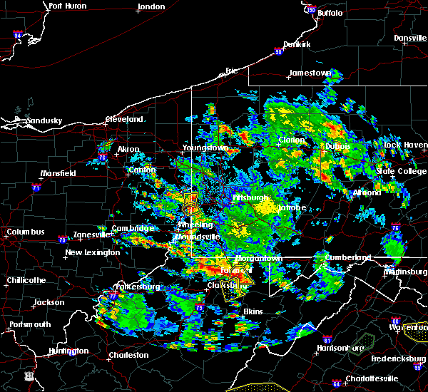 At 353 pm edt, severe thunderstorms were located along a line extending from near chester to 6 miles east of new cumberland, moving southwest at 35 mph (radar). Hazards include wind gusts to 60 mph and quarter-size hail. Hail damage to vehicles. damage to trees and power lines. Locations impacted include, weirton, toronto, new cumberland, new manchester, tomlinson run state park, sun valley, raccoon creek state park,. At 353 pm edt, severe thunderstorms were located along a line extending from near chester to 6 miles east of new cumberland, moving southwest at 35 mph (radar). Hazards include wind gusts to 60 mph and quarter-size hail. Hail damage to vehicles. damage to trees and power lines. Locations impacted include, weirton, toronto, new cumberland, new manchester, tomlinson run state park, sun valley, raccoon creek state park,.
|
| 8/13/2018 3:43 PM EDT | Several trees uprooted and part of a roof blown off a hous in jefferson county OH, 0 miles WSW of Toronto, WV |
| 8/13/2018 3:33 PM EDT |
 At 333 pm edt, severe thunderstorms were located along a line extending from near new cumberland to toronto, moving southeast at 10 mph (radar). Hazards include wind gusts to 60 mph and quarter-size hail. Hail damage to vehicles. Damage to trees and power lines. At 333 pm edt, severe thunderstorms were located along a line extending from near new cumberland to toronto, moving southeast at 10 mph (radar). Hazards include wind gusts to 60 mph and quarter-size hail. Hail damage to vehicles. Damage to trees and power lines.
|
| 8/13/2018 3:33 PM EDT |
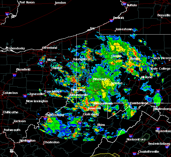 At 333 pm edt, severe thunderstorms were located along a line extending from near new cumberland to toronto, moving southeast at 10 mph (radar). Hazards include wind gusts to 60 mph and quarter-size hail. Hail damage to vehicles. Damage to trees and power lines. At 333 pm edt, severe thunderstorms were located along a line extending from near new cumberland to toronto, moving southeast at 10 mph (radar). Hazards include wind gusts to 60 mph and quarter-size hail. Hail damage to vehicles. Damage to trees and power lines.
|
| 7/5/2018 4:06 PM EDT |
 At 352 pm edt, severe thunderstorms were located along a line extending from near chester to near new cumberland to toronto, moving southeast at 15 mph (radar). Hazards include wind gusts to 60 mph. Expect damage to trees and power lines, resulting in some power outages. Locations impacted include, weirton, toronto, new cumberland, new manchester, empire, stratton, frankfort springs, tomlinson run state park, hanover township, raccoon creek state park, sun valley,. At 352 pm edt, severe thunderstorms were located along a line extending from near chester to near new cumberland to toronto, moving southeast at 15 mph (radar). Hazards include wind gusts to 60 mph. Expect damage to trees and power lines, resulting in some power outages. Locations impacted include, weirton, toronto, new cumberland, new manchester, empire, stratton, frankfort springs, tomlinson run state park, hanover township, raccoon creek state park, sun valley,.
|
| 7/5/2018 4:06 PM EDT |
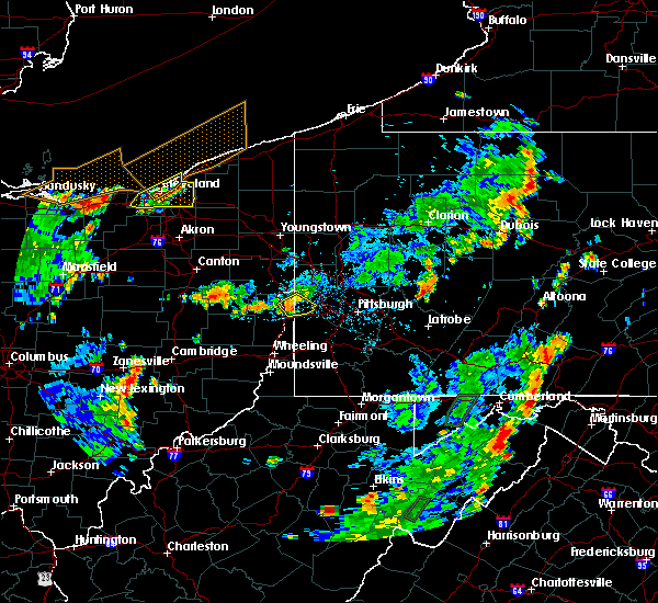 The severe thunderstorm warning for northeastern jefferson, northwestern washington, southwestern beaver and southeastern hancock counties will expire at 415 pm edt, the storms that prompted the warning have weakened below severe limits and no longer pose an immediate threat to life and property. therefore, the warning will be allowed to expire. however gusty winds and heavy rain are still possible with these thunderstorms. The severe thunderstorm warning for northeastern jefferson, northwestern washington, southwestern beaver and southeastern hancock counties will expire at 415 pm edt, the storms that prompted the warning have weakened below severe limits and no longer pose an immediate threat to life and property. therefore, the warning will be allowed to expire. however gusty winds and heavy rain are still possible with these thunderstorms.
|
| 7/5/2018 3:52 PM EDT |
 At 352 pm edt, severe thunderstorms were located along a line extending from near chester to near new cumberland to toronto, moving southeast at 15 mph (radar). Hazards include wind gusts to 60 mph. Expect damage to trees and power lines, resulting in some power outages. Locations impacted include, weirton, toronto, new cumberland, new manchester, empire, stratton, frankfort springs, tomlinson run state park, hanover township, raccoon creek state park, sun valley,. At 352 pm edt, severe thunderstorms were located along a line extending from near chester to near new cumberland to toronto, moving southeast at 15 mph (radar). Hazards include wind gusts to 60 mph. Expect damage to trees and power lines, resulting in some power outages. Locations impacted include, weirton, toronto, new cumberland, new manchester, empire, stratton, frankfort springs, tomlinson run state park, hanover township, raccoon creek state park, sun valley,.
|
| 7/5/2018 3:34 PM EDT |
 At 333 pm edt, severe thunderstorms were located along a line extending from chester to near wellsville to near new cumberland, moving southeast at 15 mph (radar). Hazards include wind gusts to 60 mph. expect damage to trees and power lines, resulting in some power outages At 333 pm edt, severe thunderstorms were located along a line extending from chester to near wellsville to near new cumberland, moving southeast at 15 mph (radar). Hazards include wind gusts to 60 mph. expect damage to trees and power lines, resulting in some power outages
|
| 6/13/2018 7:00 PM EDT |
 At 659 pm edt, a severe thunderstorm was located over toronto, or near weirton, moving east at 35 mph (radar). Hazards include wind gusts to 60 mph and quarter-size hail. Minor hail damage to vehicles is possible. Expect wind damage to trees and power lines, resulting in some power outages. At 659 pm edt, a severe thunderstorm was located over toronto, or near weirton, moving east at 35 mph (radar). Hazards include wind gusts to 60 mph and quarter-size hail. Minor hail damage to vehicles is possible. Expect wind damage to trees and power lines, resulting in some power outages.
|
| 5/22/2018 7:06 PM EDT |
 At 706 pm edt, severe thunderstorms were located along a line extending from weirton to near mingo junction, moving east at 35 mph (radar). Hazards include wind gusts to 60 mph and quarter-size hail. Hail damage to vehicles. damage to trees and power lines. Locations impacted include, steubenville, toronto, wintersville, brentwood,. At 706 pm edt, severe thunderstorms were located along a line extending from weirton to near mingo junction, moving east at 35 mph (radar). Hazards include wind gusts to 60 mph and quarter-size hail. Hail damage to vehicles. damage to trees and power lines. Locations impacted include, steubenville, toronto, wintersville, brentwood,.
|
| 5/22/2018 7:02 PM EDT |
 At 702 pm edt, severe thunderstorms were located along a line extending from toronto to near wintersville, moving east at 40 mph (radar). Hazards include wind gusts to 60 mph and quarter-size hail. Hail damage to vehicles. damage to trees and power lines. Locations impacted include, steubenville, toronto, wintersville, new alexandria, brentwood,. At 702 pm edt, severe thunderstorms were located along a line extending from toronto to near wintersville, moving east at 40 mph (radar). Hazards include wind gusts to 60 mph and quarter-size hail. Hail damage to vehicles. damage to trees and power lines. Locations impacted include, steubenville, toronto, wintersville, new alexandria, brentwood,.
|
| 5/22/2018 7:01 PM EDT |
 At 701 pm edt, a severe thunderstorm was located near toronto, or near weirton, moving southeast at 20 mph (radar). Hazards include wind gusts to 60 mph and quarter-size hail. Hail damage to vehicles. Damage to trees and power lines. At 701 pm edt, a severe thunderstorm was located near toronto, or near weirton, moving southeast at 20 mph (radar). Hazards include wind gusts to 60 mph and quarter-size hail. Hail damage to vehicles. Damage to trees and power lines.
|
| 5/22/2018 6:29 PM EDT |
 At 607 pm edt, severe thunderstorms were located along a line extending from near wellsville to 10 miles northwest of new cumberland, moving southeast at 30 mph (radar). Hazards include wind gusts to 60 mph. damage to trees and power lines At 607 pm edt, severe thunderstorms were located along a line extending from near wellsville to 10 miles northwest of new cumberland, moving southeast at 30 mph (radar). Hazards include wind gusts to 60 mph. damage to trees and power lines
|
| 5/22/2018 6:29 PM EDT |
 At 628 pm edt, severe thunderstorms were located along a line extending from near chester to near new cumberland to 7 miles northwest of toronto, moving southeast at 30 mph. this is a dangerous storm likely producing damaging wind south of chester west virginia (radar). Hazards include wind gusts to 70 mph and quarter-size hail. Hail damage to vehicles. trees snapped and uprooted. power outages. Locations impacted include, weirton, steubenville, east liverpool, wellsville, wellsburg, toronto, mingo junction, follansbee, hooverson heights, chester, new cumberland, salineville,. At 628 pm edt, severe thunderstorms were located along a line extending from near chester to near new cumberland to 7 miles northwest of toronto, moving southeast at 30 mph. this is a dangerous storm likely producing damaging wind south of chester west virginia (radar). Hazards include wind gusts to 70 mph and quarter-size hail. Hail damage to vehicles. trees snapped and uprooted. power outages. Locations impacted include, weirton, steubenville, east liverpool, wellsville, wellsburg, toronto, mingo junction, follansbee, hooverson heights, chester, new cumberland, salineville,.
|
| 5/22/2018 6:27 PM EDT |
 At 626 pm edt, severe thunderstorms were located along a line extending from 6 miles south of carrollton to 9 miles northwest of cadiz, moving east at 35 mph (radar). Hazards include wind gusts to 60 mph and quarter-size hail. Hail damage to vehicles. Damage to trees and power lines. At 626 pm edt, severe thunderstorms were located along a line extending from 6 miles south of carrollton to 9 miles northwest of cadiz, moving east at 35 mph (radar). Hazards include wind gusts to 60 mph and quarter-size hail. Hail damage to vehicles. Damage to trees and power lines.
|
| 5/22/2018 6:07 PM EDT |
 At 607 pm edt, severe thunderstorms were located along a line extending from near wellsville to 10 miles northwest of new cumberland, moving southeast at 30 mph (radar). Hazards include wind gusts to 60 mph. damage to trees and power lines At 607 pm edt, severe thunderstorms were located along a line extending from near wellsville to 10 miles northwest of new cumberland, moving southeast at 30 mph (radar). Hazards include wind gusts to 60 mph. damage to trees and power lines
|
| 11/5/2017 9:22 PM EST |
 The severe thunderstorm warning for jefferson and south central columbiana counties will expire at 930 pm est, the storms that prompted the warning have weakened below severe limits and no longer pose an immediate threat to life and property. therefore, the warning will be allowed to expire. a severe thunderstorm watch remains in effect until 1100 pm est for east central ohio, and northern west virginia. The severe thunderstorm warning for jefferson and south central columbiana counties will expire at 930 pm est, the storms that prompted the warning have weakened below severe limits and no longer pose an immediate threat to life and property. therefore, the warning will be allowed to expire. a severe thunderstorm watch remains in effect until 1100 pm est for east central ohio, and northern west virginia.
|
| 11/5/2017 9:17 PM EST |
 A severe thunderstorm warning remains in effect until 930 pm est for jefferson and south central columbiana counties. At 917 pm est, severe thunderstorms were located along a line extending from 9 miles northwest of wintersville to 6 miles northwest of tiltonsville to 10 miles west of powhatan point, moving east at 45 mph. A severe thunderstorm warning remains in effect until 930 pm est for jefferson and south central columbiana counties. At 917 pm est, severe thunderstorms were located along a line extending from 9 miles northwest of wintersville to 6 miles northwest of tiltonsville to 10 miles west of powhatan point, moving east at 45 mph.
|
| 11/5/2017 8:57 PM EST |
 At 856 pm est, severe thunderstorms were located along a line extending from near carrollton to near cadiz to near barnesville, moving east at 45 mph (radar). Hazards include 60 mph wind gusts. Expect damage to trees and power lines, resulting in some power outages. locations impacted include, wheeling, weirton, steubenville, martins ferry, st. clairsville, bellaire, barnesville, cadiz, carrollton, wellsburg, freeport, toronto, this includes the following highways, interstate 70 in ohio between mile markers 186 and 225. Interstate 70 in west virginia near mile marker 0. At 856 pm est, severe thunderstorms were located along a line extending from near carrollton to near cadiz to near barnesville, moving east at 45 mph (radar). Hazards include 60 mph wind gusts. Expect damage to trees and power lines, resulting in some power outages. locations impacted include, wheeling, weirton, steubenville, martins ferry, st. clairsville, bellaire, barnesville, cadiz, carrollton, wellsburg, freeport, toronto, this includes the following highways, interstate 70 in ohio between mile markers 186 and 225. Interstate 70 in west virginia near mile marker 0.
|
| 11/5/2017 8:28 PM EST |
 At 828 pm est, severe thunderstorms were located along a line extending from near strasburg to 7 miles west of uhrichsville to near cambridge, moving east at 45 mph (radar). Hazards include 60 mph wind gusts. expect damage to trees and power lines, resulting in some power outages At 828 pm est, severe thunderstorms were located along a line extending from near strasburg to 7 miles west of uhrichsville to near cambridge, moving east at 45 mph (radar). Hazards include 60 mph wind gusts. expect damage to trees and power lines, resulting in some power outages
|
| 11/5/2017 7:19 PM EST |
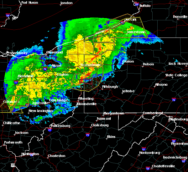 At 719 pm est, severe thunderstorms were located along a line extending from new castle northwest to near east palestine to wellsville, moving east at 50 mph (radar). Hazards include 60 mph wind gusts. Expect damage to trees and power lines, resulting in some power outages. locations impacted include, mccandless township, cranberry, moon township, new castle, weirton, franklin park, east liverpool, aliquippa, beaver falls, monaca, east palestine, wellsville, this includes the following highways, pennsylvania turnpike between mile markers 1 and 32. interstate 79 in pennsylvania between mile markers 39 and 81. Parkway north between mile markers 12 and 13. At 719 pm est, severe thunderstorms were located along a line extending from new castle northwest to near east palestine to wellsville, moving east at 50 mph (radar). Hazards include 60 mph wind gusts. Expect damage to trees and power lines, resulting in some power outages. locations impacted include, mccandless township, cranberry, moon township, new castle, weirton, franklin park, east liverpool, aliquippa, beaver falls, monaca, east palestine, wellsville, this includes the following highways, pennsylvania turnpike between mile markers 1 and 32. interstate 79 in pennsylvania between mile markers 39 and 81. Parkway north between mile markers 12 and 13.
|
| 11/5/2017 7:55 PM EDT |
 At 654 pm est, severe thunderstorms were located along a line extending from near boardman to near lisbon to near carrollton, moving east at 50 mph (radar). Hazards include 60 mph wind gusts. expect damage to trees and power lines, resulting in some power outages At 654 pm est, severe thunderstorms were located along a line extending from near boardman to near lisbon to near carrollton, moving east at 50 mph (radar). Hazards include 60 mph wind gusts. expect damage to trees and power lines, resulting in some power outages
|
| 7/3/2017 6:22 PM EDT |
 At 622 pm edt, a severe thunderstorm was located near toronto, or near weirton, moving southeast at 20 mph (radar). Hazards include 60 mph wind gusts. Expect damage to trees and power lines, resulting in some power outages. Locations impacted include, weirton, steubenville, wellsburg, avella, toronto, wintersville, mingo junction, follansbee, hooverson heights, new cumberland, burgettstown, bethany,. At 622 pm edt, a severe thunderstorm was located near toronto, or near weirton, moving southeast at 20 mph (radar). Hazards include 60 mph wind gusts. Expect damage to trees and power lines, resulting in some power outages. Locations impacted include, weirton, steubenville, wellsburg, avella, toronto, wintersville, mingo junction, follansbee, hooverson heights, new cumberland, burgettstown, bethany,.
|
| 7/3/2017 6:01 PM EDT |
 The national weather service in pittsburgh has issued a * severe thunderstorm warning for. northeastern harrison county in east central ohio. jefferson county in east central ohio. northwestern washington county in southwestern pennsylvania. Brooke county in northern west virginia. The national weather service in pittsburgh has issued a * severe thunderstorm warning for. northeastern harrison county in east central ohio. jefferson county in east central ohio. northwestern washington county in southwestern pennsylvania. Brooke county in northern west virginia.
|
| 7/3/2017 6:01 PM EDT |
 At 601 pm edt, a severe thunderstorm was located 8 miles west of new cumberland, or 9 miles southwest of wellsville, moving southeast at 25 mph (radar). Hazards include 60 mph wind gusts. expect damage to trees and power lines, resulting in some power outages At 601 pm edt, a severe thunderstorm was located 8 miles west of new cumberland, or 9 miles southwest of wellsville, moving southeast at 25 mph (radar). Hazards include 60 mph wind gusts. expect damage to trees and power lines, resulting in some power outages
|
| 7/3/2017 6:01 PM EDT |
 The national weather service in pittsburgh has issued a * severe thunderstorm warning for. northeastern harrison county in east central ohio. jefferson county in east central ohio. northwestern washington county in southwestern pennsylvania. Brooke county in northern west virginia. The national weather service in pittsburgh has issued a * severe thunderstorm warning for. northeastern harrison county in east central ohio. jefferson county in east central ohio. northwestern washington county in southwestern pennsylvania. Brooke county in northern west virginia.
|
| 6/18/2017 4:14 PM EDT |
 At 414 pm edt, a severe thunderstorm was located over wintersville, or over steubenville, moving northeast at 45 mph (radar). Hazards include 60 mph wind gusts. expect damage to trees and power lines, resulting in some power outages At 414 pm edt, a severe thunderstorm was located over wintersville, or over steubenville, moving northeast at 45 mph (radar). Hazards include 60 mph wind gusts. expect damage to trees and power lines, resulting in some power outages
|
| 5/31/2017 3:30 PM EDT |
 At 330 pm edt, severe thunderstorms were located along a line extending from midland to near wintersville, moving east at 40 mph (radar). Hazards include 60 mph wind gusts and quarter-size hail. Minor hail damage to vehicles is possible. expect wind damage to trees and power lines, resulting in some power outages. Locations impacted include, weirton, steubenville, east liverpool, aliquippa, monaca, wellsville, economy, toronto, beaver, calcutta, wintersville, rochester,. At 330 pm edt, severe thunderstorms were located along a line extending from midland to near wintersville, moving east at 40 mph (radar). Hazards include 60 mph wind gusts and quarter-size hail. Minor hail damage to vehicles is possible. expect wind damage to trees and power lines, resulting in some power outages. Locations impacted include, weirton, steubenville, east liverpool, aliquippa, monaca, wellsville, economy, toronto, beaver, calcutta, wintersville, rochester,.
|
| 5/31/2017 3:16 PM EDT |
 At 316 pm edt, severe thunderstorms were located along a line extending from calcutta to 9 miles north of cadiz, moving east at 25 mph (radar). Hazards include 60 mph wind gusts and quarter-size hail. Minor hail damage to vehicles is possible. expect wind damage to trees and power lines, resulting in some power outages. Locations impacted include, weirton, steubenville, east liverpool, aliquippa, monaca, wellsville, economy, toronto, beaver, calcutta, wintersville, rochester,. At 316 pm edt, severe thunderstorms were located along a line extending from calcutta to 9 miles north of cadiz, moving east at 25 mph (radar). Hazards include 60 mph wind gusts and quarter-size hail. Minor hail damage to vehicles is possible. expect wind damage to trees and power lines, resulting in some power outages. Locations impacted include, weirton, steubenville, east liverpool, aliquippa, monaca, wellsville, economy, toronto, beaver, calcutta, wintersville, rochester,.
|
| 5/31/2017 3:16 PM EDT |
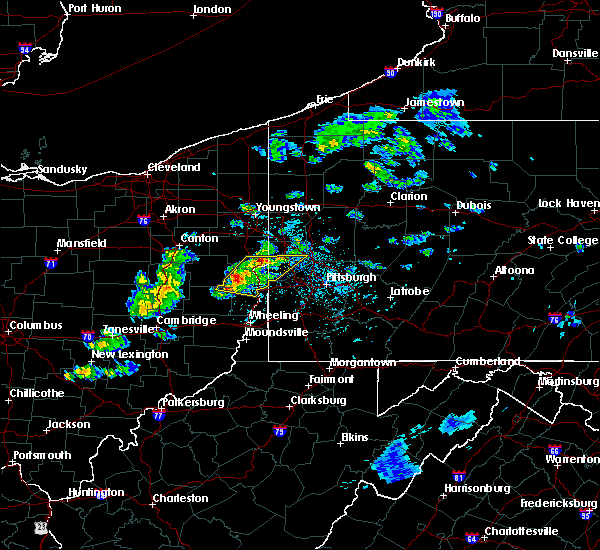 At 316 pm edt, severe thunderstorms were located along a line extending from calcutta to 9 miles north of cadiz, moving east at 25 mph (radar). Hazards include 60 mph wind gusts and quarter-size hail. Minor hail damage to vehicles is possible. expect wind damage to trees and power lines, resulting in some power outages. Locations impacted include, weirton, steubenville, east liverpool, aliquippa, monaca, wellsville, economy, toronto, beaver, calcutta, wintersville, rochester,. At 316 pm edt, severe thunderstorms were located along a line extending from calcutta to 9 miles north of cadiz, moving east at 25 mph (radar). Hazards include 60 mph wind gusts and quarter-size hail. Minor hail damage to vehicles is possible. expect wind damage to trees and power lines, resulting in some power outages. Locations impacted include, weirton, steubenville, east liverpool, aliquippa, monaca, wellsville, economy, toronto, beaver, calcutta, wintersville, rochester,.
|
| 5/31/2017 2:58 PM EDT |
 The national weather service in pittsburgh has issued a * severe thunderstorm warning for. northeastern harrison county in east central ohio. jefferson county in east central ohio. southeastern columbiana county in east central ohio. Southeastern carroll county in east central ohio. The national weather service in pittsburgh has issued a * severe thunderstorm warning for. northeastern harrison county in east central ohio. jefferson county in east central ohio. southeastern columbiana county in east central ohio. Southeastern carroll county in east central ohio.
|
| 5/31/2017 2:58 PM EDT |
 At 258 pm edt, severe thunderstorms were located along a line extending from 8 miles southwest of lisbon to 6 miles south of carrollton, moving east at 25 mph (radar). Hazards include 60 mph wind gusts and quarter-size hail. Minor hail damage to vehicles is possible. Expect wind damage to trees and power lines, resulting in some power outages. At 258 pm edt, severe thunderstorms were located along a line extending from 8 miles southwest of lisbon to 6 miles south of carrollton, moving east at 25 mph (radar). Hazards include 60 mph wind gusts and quarter-size hail. Minor hail damage to vehicles is possible. Expect wind damage to trees and power lines, resulting in some power outages.
|
| 5/31/2017 2:58 PM EDT |
 The national weather service in pittsburgh has issued a * severe thunderstorm warning for. northeastern harrison county in east central ohio. jefferson county in east central ohio. southeastern columbiana county in east central ohio. Southeastern carroll county in east central ohio. The national weather service in pittsburgh has issued a * severe thunderstorm warning for. northeastern harrison county in east central ohio. jefferson county in east central ohio. southeastern columbiana county in east central ohio. Southeastern carroll county in east central ohio.
|
| 5/18/2017 4:07 PM EDT |
 At 407 pm edt, a severe thunderstorm was located near weirton, moving northeast at 40 mph (radar). Hazards include 60 mph wind gusts and quarter-size hail. Minor hail damage to vehicles is possible. Expect wind damage to trees and power lines, resulting in some power outages. At 407 pm edt, a severe thunderstorm was located near weirton, moving northeast at 40 mph (radar). Hazards include 60 mph wind gusts and quarter-size hail. Minor hail damage to vehicles is possible. Expect wind damage to trees and power lines, resulting in some power outages.
|
| 5/1/2017 1:44 PM EDT |
 At 143 pm edt, severe thunderstorms were located along a line extending from 8 miles south of lisbon to wintersville to near martins ferry, moving northeast at 60 mph (radar). Hazards include 70 mph wind gusts. Trees snapped and uprooted. power outages can be expected. locations impacted include, wheeling, weirton, steubenville, moundsville, martins ferry, st. clairsville, bellaire, wellsville, warwood, wellsburg, bethlehem, west liberty, this includes the following highways, interstate 70 in ohio between mile markers 217 and 225. interstate 70 in west virginia between mile markers 0 and 14. interstate 70 in pennsylvania between mile markers 0 and 10. A tornado watch remains in effect until 700 pm edt for east central ohio, western and southwestern pennsylvania, and northern west virginia. At 143 pm edt, severe thunderstorms were located along a line extending from 8 miles south of lisbon to wintersville to near martins ferry, moving northeast at 60 mph (radar). Hazards include 70 mph wind gusts. Trees snapped and uprooted. power outages can be expected. locations impacted include, wheeling, weirton, steubenville, moundsville, martins ferry, st. clairsville, bellaire, wellsville, warwood, wellsburg, bethlehem, west liberty, this includes the following highways, interstate 70 in ohio between mile markers 217 and 225. interstate 70 in west virginia between mile markers 0 and 14. interstate 70 in pennsylvania between mile markers 0 and 10. A tornado watch remains in effect until 700 pm edt for east central ohio, western and southwestern pennsylvania, and northern west virginia.
|
| 5/1/2017 1:22 PM EDT |
 At 121 pm edt, severe thunderstorms were located along a line extending from 7 miles south of carrollton to 7 miles south of cadiz to 8 miles southeast of barnesville, moving northeast at 60 mph (radar). Hazards include 70 mph wind gusts. Trees snapped and uprooted. Power outages can be expected. At 121 pm edt, severe thunderstorms were located along a line extending from 7 miles south of carrollton to 7 miles south of cadiz to 8 miles southeast of barnesville, moving northeast at 60 mph (radar). Hazards include 70 mph wind gusts. Trees snapped and uprooted. Power outages can be expected.
|
| 4/27/2017 7:56 PM EDT |
 At 755 pm edt, a severe thunderstorm was located over mingo junction, or near wellsburg, moving northeast at 45 mph (radar). Hazards include 60 mph wind gusts and half dollar-size hail. Hail damage to vehicles is expected. expect wind damage to trees and power lines, resulting in some power outages. Locations impacted include, weirton, steubenville, wellsburg, avella, toronto, wintersville, mingo junction, follansbee, hooverson heights, burgettstown, smithfield, franklin,. At 755 pm edt, a severe thunderstorm was located over mingo junction, or near wellsburg, moving northeast at 45 mph (radar). Hazards include 60 mph wind gusts and half dollar-size hail. Hail damage to vehicles is expected. expect wind damage to trees and power lines, resulting in some power outages. Locations impacted include, weirton, steubenville, wellsburg, avella, toronto, wintersville, mingo junction, follansbee, hooverson heights, burgettstown, smithfield, franklin,.
|
| 4/27/2017 7:41 PM EDT |
 At 740 pm edt, a severe thunderstorm was located 8 miles northwest of tiltonsville, or 9 miles southeast of cadiz, moving northeast at 50 mph (radar). Hazards include 60 mph wind gusts and quarter-size hail. Hail damage to vehicles is expected. Expect wind damage to trees and power lines, resulting in some power outages. At 740 pm edt, a severe thunderstorm was located 8 miles northwest of tiltonsville, or 9 miles southeast of cadiz, moving northeast at 50 mph (radar). Hazards include 60 mph wind gusts and quarter-size hail. Hail damage to vehicles is expected. Expect wind damage to trees and power lines, resulting in some power outages.
|
| 2/12/2017 7:02 PM EST |
 At 701 pm est, severe thunderstorms were located along a line extending from near meridian to near toronto, moving east at 50 mph (radar). Hazards include 60 mph wind gusts. expect damage to trees and power lines, resulting in some power outages At 701 pm est, severe thunderstorms were located along a line extending from near meridian to near toronto, moving east at 50 mph (radar). Hazards include 60 mph wind gusts. expect damage to trees and power lines, resulting in some power outages
|
| 1/12/2017 2:51 PM EST |
 At 250 pm est, a severe thunderstorm was located 8 miles west of wellsville, moving east at 60 mph (radar indicated). Hazards include 60 mph wind gusts. Expect damage to trees and power lines, resulting in some power outages. locations impacted include, east liverpool, wellsville, toronto, calcutta, chester, new cumberland, salineville, newell, bergholz, amsterdam, irondale and new manchester. Please report severe weather by calling 412-262- 1988, posting to the nws pittsburgh facebook page, or using twitter @nwspittsburgh. At 250 pm est, a severe thunderstorm was located 8 miles west of wellsville, moving east at 60 mph (radar indicated). Hazards include 60 mph wind gusts. Expect damage to trees and power lines, resulting in some power outages. locations impacted include, east liverpool, wellsville, toronto, calcutta, chester, new cumberland, salineville, newell, bergholz, amsterdam, irondale and new manchester. Please report severe weather by calling 412-262- 1988, posting to the nws pittsburgh facebook page, or using twitter @nwspittsburgh.
|
| 1/12/2017 2:29 PM EST |
 At 229 pm est, a severe thunderstorm was located near waynesburg, or near carrollton, moving east at 60 mph (radar indicated). Hazards include 60 mph wind gusts. Expect damage to trees and power lines, resulting in some power outages. locations impacted include, east liverpool, wellsville, carrollton, toronto, calcutta, chester, new cumberland, augusta, salineville, malvern, newell and mineral city. Please report severe weather by calling 412-262- 1988, posting to the nws pittsburgh facebook page, or using twitter @nwspittsburgh. At 229 pm est, a severe thunderstorm was located near waynesburg, or near carrollton, moving east at 60 mph (radar indicated). Hazards include 60 mph wind gusts. Expect damage to trees and power lines, resulting in some power outages. locations impacted include, east liverpool, wellsville, carrollton, toronto, calcutta, chester, new cumberland, augusta, salineville, malvern, newell and mineral city. Please report severe weather by calling 412-262- 1988, posting to the nws pittsburgh facebook page, or using twitter @nwspittsburgh.
|
| 1/12/2017 2:14 PM EST |
 At 213 pm est, a severe thunderstorm was located over strasburg, or near dover, moving east at 55 mph (radar indicated). Hazards include 60 mph wind gusts. expect damage to trees and power lines, resulting in some power outages At 213 pm est, a severe thunderstorm was located over strasburg, or near dover, moving east at 55 mph (radar indicated). Hazards include 60 mph wind gusts. expect damage to trees and power lines, resulting in some power outages
|
| 9/7/2016 3:31 PM EDT |
 At 330 pm edt, a severe thunderstorm was located 7 miles northwest of wintersville, or 10 miles northwest of steubenville, moving southeast at 25 mph (radar indicated). Hazards include 60 mph wind gusts. Expect damage to trees and power lines. resulting in some power outages. locations impacted include, weirton, steubenville, toronto, wintersville, mingo junction, follansbee, hopedale, smithfield, richmond, new alexandria, bloomingdale, unionport, brentwood and east steubenville. Please report severe weather by calling 4 1 2, 2 6 2, 1 9 8 8, posting to the nws pittsburgh facebook page, or using twitter @nwspittsburgh. At 330 pm edt, a severe thunderstorm was located 7 miles northwest of wintersville, or 10 miles northwest of steubenville, moving southeast at 25 mph (radar indicated). Hazards include 60 mph wind gusts. Expect damage to trees and power lines. resulting in some power outages. locations impacted include, weirton, steubenville, toronto, wintersville, mingo junction, follansbee, hopedale, smithfield, richmond, new alexandria, bloomingdale, unionport, brentwood and east steubenville. Please report severe weather by calling 4 1 2, 2 6 2, 1 9 8 8, posting to the nws pittsburgh facebook page, or using twitter @nwspittsburgh.
|
| 9/7/2016 3:11 PM EDT |
 At 311 pm edt, a severe thunderstorm was located 9 miles southeast of carrollton, moving southeast at 25 mph (radar indicated). Hazards include 60 mph wind gusts. Expect damage to trees and power lines. Resulting in some power outages. At 311 pm edt, a severe thunderstorm was located 9 miles southeast of carrollton, moving southeast at 25 mph (radar indicated). Hazards include 60 mph wind gusts. Expect damage to trees and power lines. Resulting in some power outages.
|
| 7/25/2016 2:52 PM EDT |
 At 252 pm edt, a severe thunderstorm was located 7 miles northwest of wintersville, or 10 miles northwest of steubenville, moving east at 25 mph (radar indicated). Hazards include 60 mph wind gusts. Expect damage to trees and power lines. resulting in some power outages. locations impacted include, weirton, steubenville, wellsburg, toronto, wintersville, mingo junction, follansbee, hooverson heights, brilliant, richmond, new alexandria, brentwood, sun valley, east steubenville and rockdale. Please report severe weather by calling 4 1 2, 2 6 2, 1 9 8 8, posting to the nws pittsburgh facebook page, or using twitter @nwspittsburgh. At 252 pm edt, a severe thunderstorm was located 7 miles northwest of wintersville, or 10 miles northwest of steubenville, moving east at 25 mph (radar indicated). Hazards include 60 mph wind gusts. Expect damage to trees and power lines. resulting in some power outages. locations impacted include, weirton, steubenville, wellsburg, toronto, wintersville, mingo junction, follansbee, hooverson heights, brilliant, richmond, new alexandria, brentwood, sun valley, east steubenville and rockdale. Please report severe weather by calling 4 1 2, 2 6 2, 1 9 8 8, posting to the nws pittsburgh facebook page, or using twitter @nwspittsburgh.
|
| 7/25/2016 2:29 PM EDT |
 At 228 pm edt, a severe thunderstorm was located 7 miles southeast of carrollton, moving east at 30 mph (radar indicated). Hazards include 60 mph wind gusts. Expect damage to trees and power lines. Resulting in some power outages. At 228 pm edt, a severe thunderstorm was located 7 miles southeast of carrollton, moving east at 30 mph (radar indicated). Hazards include 60 mph wind gusts. Expect damage to trees and power lines. Resulting in some power outages.
|
| 7/24/2016 3:58 PM EDT | The severe thunderstorm warning for southwestern beaver and northeastern hancock counties will expire at 400 pm edt, the storm which prompted the warning has moved out of the area. therefore, the warning will be allowed to expire. |
| 7/24/2016 3:58 PM EDT | The severe thunderstorm warning for southwestern beaver and northeastern hancock counties will expire at 400 pm edt, the storm which prompted the warning has moved out of the area. therefore, the warning will be allowed to expire. |
| 7/24/2016 3:52 PM EDT |
 At 351 pm edt, a severe thunderstorm was located near chester, or near east liverpool, moving east at 30 mph (radar indicated). Hazards include 60 mph wind gusts. Expect damage to trees and power lines. resulting in some power outages. locations impacted include, east liverpool, toronto, ohioville, chester, new cumberland, new manchester, georgetown, glasgow and tomlinson run state park. Please report severe weather by calling 4 1 2, 2 6 2, 1 9 8 8, posting to the nws pittsburgh facebook page, or using twitter @nwspittsburgh. At 351 pm edt, a severe thunderstorm was located near chester, or near east liverpool, moving east at 30 mph (radar indicated). Hazards include 60 mph wind gusts. Expect damage to trees and power lines. resulting in some power outages. locations impacted include, east liverpool, toronto, ohioville, chester, new cumberland, new manchester, georgetown, glasgow and tomlinson run state park. Please report severe weather by calling 4 1 2, 2 6 2, 1 9 8 8, posting to the nws pittsburgh facebook page, or using twitter @nwspittsburgh.
|
| 7/24/2016 3:42 PM EDT |
 At 342 pm edt, a severe thunderstorm was located over wellsville, moving east at 30 mph (radar indicated). Hazards include 60 mph wind gusts. Expect damage to trees and power lines. resulting in some power outages. locations impacted include, east liverpool, wellsville, toronto, ohioville, chester, new cumberland, newell, irondale, new manchester, empire, stratton, georgetown, hammondsville, glasgow, tomlinson run state park and la croft. Please report severe weather by calling 4 1 2, 2 6 2, 1 9 8 8, posting to the nws pittsburgh facebook page, or using twitter @nwspittsburgh. At 342 pm edt, a severe thunderstorm was located over wellsville, moving east at 30 mph (radar indicated). Hazards include 60 mph wind gusts. Expect damage to trees and power lines. resulting in some power outages. locations impacted include, east liverpool, wellsville, toronto, ohioville, chester, new cumberland, newell, irondale, new manchester, empire, stratton, georgetown, hammondsville, glasgow, tomlinson run state park and la croft. Please report severe weather by calling 4 1 2, 2 6 2, 1 9 8 8, posting to the nws pittsburgh facebook page, or using twitter @nwspittsburgh.
|
| 7/24/2016 3:30 PM EDT |
 At 330 pm edt, a severe thunderstorm was located near wellsville, moving east at 30 mph (radar indicated). Hazards include 60 mph wind gusts. Expect damage to trees and power lines. resulting in some power outages. locations impacted include, east liverpool, wellsville, toronto, calcutta, ohioville, chester, new cumberland, salineville, newell, irondale, new manchester, empire, stratton, georgetown, hammondsville, glasgow, glenmoor, tomlinson run state park and la croft. Please report severe weather by calling 4 1 2, 2 6 2, 1 9 8 8, posting to the nws pittsburgh facebook page, or using twitter @nwspittsburgh. At 330 pm edt, a severe thunderstorm was located near wellsville, moving east at 30 mph (radar indicated). Hazards include 60 mph wind gusts. Expect damage to trees and power lines. resulting in some power outages. locations impacted include, east liverpool, wellsville, toronto, calcutta, ohioville, chester, new cumberland, salineville, newell, irondale, new manchester, empire, stratton, georgetown, hammondsville, glasgow, glenmoor, tomlinson run state park and la croft. Please report severe weather by calling 4 1 2, 2 6 2, 1 9 8 8, posting to the nws pittsburgh facebook page, or using twitter @nwspittsburgh.
|
| 7/24/2016 3:13 PM EDT |
 At 313 pm edt, a severe thunderstorm was located 10 miles northeast of carrollton, moving east at 30 mph (radar indicated). Hazards include 60 mph wind gusts. Expect damage to trees and power lines. Resulting in some power outages. At 313 pm edt, a severe thunderstorm was located 10 miles northeast of carrollton, moving east at 30 mph (radar indicated). Hazards include 60 mph wind gusts. Expect damage to trees and power lines. Resulting in some power outages.
|
| 6/16/2016 9:05 AM EDT |
 At 905 am edt, severe thunderstorms were located along a line extending from 8 miles west of lisbon to 8 miles east of minerva to carrollton, moving east at 40 mph (radar indicated). Hazards include 60 mph wind gusts and nickel size hail. Expect damage to trees and power lines. resulting in some power outages. locations impacted include, steubenville, east liverpool, wellsville, carrollton, toronto, calcutta, wintersville, lisbon, chester, new cumberland, salineville, newell, bergholz, amsterdam, richmond, hanoverton, irondale, dellroy, new manchester and empire. Please report severe weather by calling 4 1 2, 2 6 2, 1 9 8 8, posting to the nws pittsburgh facebook page, or using twitter @nwspittsburgh. At 905 am edt, severe thunderstorms were located along a line extending from 8 miles west of lisbon to 8 miles east of minerva to carrollton, moving east at 40 mph (radar indicated). Hazards include 60 mph wind gusts and nickel size hail. Expect damage to trees and power lines. resulting in some power outages. locations impacted include, steubenville, east liverpool, wellsville, carrollton, toronto, calcutta, wintersville, lisbon, chester, new cumberland, salineville, newell, bergholz, amsterdam, richmond, hanoverton, irondale, dellroy, new manchester and empire. Please report severe weather by calling 4 1 2, 2 6 2, 1 9 8 8, posting to the nws pittsburgh facebook page, or using twitter @nwspittsburgh.
|
| 6/16/2016 8:40 AM EDT |
 At 840 am edt, severe thunderstorms were located along a line extending from near louisville to near waynesburg to near east sparta, moving east at 40 mph (radar indicated). Hazards include 60 mph wind gusts and nickel size hail. Expect damage to trees and power lines. Resulting in some power outages. At 840 am edt, severe thunderstorms were located along a line extending from near louisville to near waynesburg to near east sparta, moving east at 40 mph (radar indicated). Hazards include 60 mph wind gusts and nickel size hail. Expect damage to trees and power lines. Resulting in some power outages.
|
| 5/2/2016 3:31 AM EDT |
 At 331 am edt, a severe thunderstorm was located near new cumberland, or 7 miles northwest of weirton, moving east at 35 mph (radar indicated). Hazards include 60 mph wind gusts and quarter size hail. Hail damage to vehicles is expected. expect wind damage to trees and power lines, resulting in some power outages. locations impacted include, weirton, steubenville, east liverpool, wellsville, toronto, wintersville, follansbee, midland, chester, industry, new cumberland, shippingport, newell, richmond, irondale, new manchester, empire, stratton, hookstown and frankfort springs. Please report severe weather by calling 4 1 2, 2 6 2, 1 9 8 8, posting to the nws pittsburgh facebook page, or using twitter @nwspittsburgh. At 331 am edt, a severe thunderstorm was located near new cumberland, or 7 miles northwest of weirton, moving east at 35 mph (radar indicated). Hazards include 60 mph wind gusts and quarter size hail. Hail damage to vehicles is expected. expect wind damage to trees and power lines, resulting in some power outages. locations impacted include, weirton, steubenville, east liverpool, wellsville, toronto, wintersville, follansbee, midland, chester, industry, new cumberland, shippingport, newell, richmond, irondale, new manchester, empire, stratton, hookstown and frankfort springs. Please report severe weather by calling 4 1 2, 2 6 2, 1 9 8 8, posting to the nws pittsburgh facebook page, or using twitter @nwspittsburgh.
|
| 5/2/2016 3:14 AM EDT |
 At 314 am edt, a severe thunderstorm was located 11 miles northwest of wintersville, or 12 miles southeast of carrollton, moving east at 35 mph (radar indicated). Hazards include 60 mph wind gusts and quarter size hail. Hail damage to vehicles is expected. Expect wind damage to trees and power lines, resulting in some power outages. At 314 am edt, a severe thunderstorm was located 11 miles northwest of wintersville, or 12 miles southeast of carrollton, moving east at 35 mph (radar indicated). Hazards include 60 mph wind gusts and quarter size hail. Hail damage to vehicles is expected. Expect wind damage to trees and power lines, resulting in some power outages.
|
| 8/3/2015 7:07 PM EDT |
 At 707 pm edt, a severe thunderstorm was located over new cumberland, or near weirton, moving east at 30 mph (radar indicated). Hazards include 60 mph wind gusts and quarter size hail. Hail damage to vehicles is expected. Expect wind damage to trees and some power outages. At 707 pm edt, a severe thunderstorm was located over new cumberland, or near weirton, moving east at 30 mph (radar indicated). Hazards include 60 mph wind gusts and quarter size hail. Hail damage to vehicles is expected. Expect wind damage to trees and some power outages.
|
| 8/3/2015 4:57 PM EDT |
 At 456 pm edt, a severe thunderstorm was located over toronto, or over weirton, moving east at 35 mph (trained weather spotters). Hazards include 60 mph wind gusts and quarter size hail. Hail damage to vehicles is expected. Expect wind damage to trees and some power outages. At 456 pm edt, a severe thunderstorm was located over toronto, or over weirton, moving east at 35 mph (trained weather spotters). Hazards include 60 mph wind gusts and quarter size hail. Hail damage to vehicles is expected. Expect wind damage to trees and some power outages.
|
| 8/3/2015 4:55 PM EDT | Quarter sized hail reported 0.6 miles W of Toronto, WV |
| 8/3/2015 4:34 PM EDT |
 At 433 pm edt, a severe thunderstorm was located 11 miles southwest of wellsville, moving east at 35 mph (radar indicated). Hazards include 60 mph wind gusts and quarter size hail. Hail damage to vehicles is expected. expect wind damage to trees and some power outages. Locations impacted include, weirton, steubenville, east liverpool, wellsville, toronto, wintersville, mingo junction, follansbee, hooverson heights, chester, new cumberland, salineville, newell, bergholz, amsterdam, richmond, irondale, new manchester, empire and stratton. At 433 pm edt, a severe thunderstorm was located 11 miles southwest of wellsville, moving east at 35 mph (radar indicated). Hazards include 60 mph wind gusts and quarter size hail. Hail damage to vehicles is expected. expect wind damage to trees and some power outages. Locations impacted include, weirton, steubenville, east liverpool, wellsville, toronto, wintersville, mingo junction, follansbee, hooverson heights, chester, new cumberland, salineville, newell, bergholz, amsterdam, richmond, irondale, new manchester, empire and stratton.
|
| 8/3/2015 4:19 PM EDT |
 At 419 pm edt, a severe thunderstorm was located near carrollton, moving east at 30 mph (radar indicated). Hazards include 60 mph wind gusts and quarter size hail. Hail damage to vehicles is expected. Expect wind damage to trees and some power outages. At 419 pm edt, a severe thunderstorm was located near carrollton, moving east at 30 mph (radar indicated). Hazards include 60 mph wind gusts and quarter size hail. Hail damage to vehicles is expected. Expect wind damage to trees and some power outages.
|
| 6/18/2015 9:52 PM EDT | At 950 pm edt, severe thunderstorms were located along a line extending from near leetonia to 7 miles west of new cumberland to 8 miles east of cadiz, moving east at 45 mph (radar indicated). Hazards include 60 mph wind gusts. Expect damage to roofs. siding and trees. Locations impacted include, weirton, steubenville, salem, east liverpool, martins ferry, columbiana, east palestine, wellsville, cadiz, wellsburg, clearview, toronto, calcutta, wintersville, mingo junction, follansbee, lisbon, hooverson heights, chester and leetonia. |
| 6/18/2015 9:52 PM EDT | At 950 pm edt, severe thunderstorms were located along a line extending from near leetonia to 7 miles west of new cumberland to 8 miles east of cadiz, moving east at 45 mph (radar indicated). Hazards include 60 mph wind gusts. Expect damage to roofs. siding and trees. Locations impacted include, weirton, steubenville, salem, east liverpool, martins ferry, columbiana, east palestine, wellsville, cadiz, wellsburg, clearview, toronto, calcutta, wintersville, mingo junction, follansbee, lisbon, hooverson heights, chester and leetonia. |
| 6/18/2015 9:52 PM EDT | At 950 pm edt, severe thunderstorms were located along a line extending from near leetonia to 7 miles west of new cumberland to 8 miles east of cadiz, moving east at 45 mph (radar indicated). Hazards include 60 mph wind gusts. Expect damage to roofs. siding and trees. Locations impacted include, weirton, steubenville, salem, east liverpool, martins ferry, columbiana, east palestine, wellsville, cadiz, wellsburg, clearview, toronto, calcutta, wintersville, mingo junction, follansbee, lisbon, hooverson heights, chester and leetonia. |
| 6/18/2015 9:21 PM EDT | At 920 pm edt, severe thunderstorms were located along a line extending from louisville to 6 miles southwest of carrollton to near freeport, moving east at 45 mph (radar indicated). Hazards include 60 mph wind gusts. Expect damage to roofs. Siding and trees. |
| 6/18/2015 9:21 PM EDT | At 920 pm edt, severe thunderstorms were located along a line extending from louisville to 6 miles southwest of carrollton to near freeport, moving east at 45 mph (radar indicated). Hazards include 60 mph wind gusts. Expect damage to roofs. Siding and trees. |
| 6/18/2015 9:21 PM EDT | At 920 pm edt, severe thunderstorms were located along a line extending from louisville to 6 miles southwest of carrollton to near freeport, moving east at 45 mph (radar indicated). Hazards include 60 mph wind gusts. Expect damage to roofs. Siding and trees. |
| 6/18/2015 8:56 PM EDT | The severe thunderstorm warning for northeastern jefferson, eastern columbiana, beaver, southwestern butler, northwestern washington, southwestern lawrence, northwestern allegheny, hancock and northeastern brooke counties will expire at 900 pm edt, the severe thunderstorm which prompted the warning continues to be severe but has moved east of the initial warned area. this warning will be allowed to expire, but has been followed up with another severe thunderstorm warning. a severe thunderstorm watch remains in effect until 1100 pm edt for east central ohio, southwestern pennsylvania and northern west virginia. |
| 6/18/2015 8:56 PM EDT | The severe thunderstorm warning for northeastern jefferson, eastern columbiana, beaver, southwestern butler, northwestern washington, southwestern lawrence, northwestern allegheny, hancock and northeastern brooke counties will expire at 900 pm edt, the severe thunderstorm which prompted the warning continues to be severe but has moved east of the initial warned area. this warning will be allowed to expire, but has been followed up with another severe thunderstorm warning. a severe thunderstorm watch remains in effect until 1100 pm edt for east central ohio, southwestern pennsylvania and northern west virginia. |
| 6/18/2015 8:56 PM EDT | The severe thunderstorm warning for northeastern jefferson, eastern columbiana, beaver, southwestern butler, northwestern washington, southwestern lawrence, northwestern allegheny, hancock and northeastern brooke counties will expire at 900 pm edt, the severe thunderstorm which prompted the warning continues to be severe but has moved east of the initial warned area. this warning will be allowed to expire, but has been followed up with another severe thunderstorm warning. a severe thunderstorm watch remains in effect until 1100 pm edt for east central ohio, southwestern pennsylvania and northern west virginia. |
| 6/18/2015 8:10 PM EDT | At 810 pm edt, a severe thunderstorm was located over new waterford, or near columbiana, moving east at 45 mph (radar indicated). Hazards include 70 mph wind gusts. Expect considerable tree damage. Damage is likely to mobile homes, roofs and outbuildings. |
| 6/18/2015 8:10 PM EDT | At 810 pm edt, a severe thunderstorm was located over new waterford, or near columbiana, moving east at 45 mph (radar indicated). Hazards include 70 mph wind gusts. Expect considerable tree damage. Damage is likely to mobile homes, roofs and outbuildings. |
| 6/18/2015 8:10 PM EDT | At 810 pm edt, a severe thunderstorm was located over new waterford, or near columbiana, moving east at 45 mph (radar indicated). Hazards include 70 mph wind gusts. Expect considerable tree damage. Damage is likely to mobile homes, roofs and outbuildings. |
| 6/18/2015 7:52 PM EDT | At 751 pm edt, a severe thunderstorm was located 8 miles southwest of lisbon, or 12 miles west of wellsville, moving southeast at 40 mph (radar indicated). Hazards include 70 mph wind gusts. Expect considerable tree damage. damage is likely to mobile homes, roofs and outbuildings. Locations impacted include, salem, east liverpool, wellsville, carrollton, toronto, calcutta, wintersville, minerva, lisbon, chester, leetonia, new cumberland, augusta, salineville, malvern, hopedale, newell, jewett, bergholz and amsterdam. |
| 6/18/2015 7:52 PM EDT | At 751 pm edt, a severe thunderstorm was located 8 miles southwest of lisbon, or 12 miles west of wellsville, moving southeast at 40 mph (radar indicated). Hazards include 70 mph wind gusts. Expect considerable tree damage. damage is likely to mobile homes, roofs and outbuildings. Locations impacted include, salem, east liverpool, wellsville, carrollton, toronto, calcutta, wintersville, minerva, lisbon, chester, leetonia, new cumberland, augusta, salineville, malvern, hopedale, newell, jewett, bergholz and amsterdam. |
| 6/18/2015 7:26 PM EDT | At 726 pm edt, a severe thunderstorm was located near louisville, or 10 miles east of canton, moving southeast at 50 mph (radar indicated). Hazards include 70 mph wind gusts. Expect considerable tree damage. Damage is likely to mobile homes, roofs and outbuildings. |
| 6/18/2015 7:26 PM EDT | At 726 pm edt, a severe thunderstorm was located near louisville, or 10 miles east of canton, moving southeast at 50 mph (radar indicated). Hazards include 70 mph wind gusts. Expect considerable tree damage. Damage is likely to mobile homes, roofs and outbuildings. |
| 6/15/2015 12:33 AM EDT |
 At 1232 am edt, a severe thunderstorm was located over toronto, or near weirton, moving east at 55 mph (radar indicated). Hazards include 60 mph wind gusts. Expect damage to roofs. Siding and trees. At 1232 am edt, a severe thunderstorm was located over toronto, or near weirton, moving east at 55 mph (radar indicated). Hazards include 60 mph wind gusts. Expect damage to roofs. Siding and trees.
|
| 6/12/2015 5:45 PM EDT |
 At 545 pm edt, severe thunderstorms were located along a line extending from near meridian to 6 miles west of imperial, moving east at 40 mph (radar indicated). Hazards include 60 mph wind gusts. Expect damage to roofs. siding and trees. Locations impacted include, pittsburgh, ross township, mccandless township, cranberry, moon township, new castle, butler, franklin park, east liverpool, aliquippa, beaver falls, monaca, east palestine, wellsville, hampton township, scott township, robinson township, economy, bellevue and carnegie. At 545 pm edt, severe thunderstorms were located along a line extending from near meridian to 6 miles west of imperial, moving east at 40 mph (radar indicated). Hazards include 60 mph wind gusts. Expect damage to roofs. siding and trees. Locations impacted include, pittsburgh, ross township, mccandless township, cranberry, moon township, new castle, butler, franklin park, east liverpool, aliquippa, beaver falls, monaca, east palestine, wellsville, hampton township, scott township, robinson township, economy, bellevue and carnegie.
|
| 6/12/2015 5:34 PM EDT |
 At 534 pm edt, severe thunderstorms were located along a line extending from near ellwood city to near new cumberland, moving east at 50 mph (radar indicated). Hazards include 60 mph wind gusts. Expect damage to roofs. siding and trees. Locations impacted include, pittsburgh, ross township, mccandless township, cranberry, moon township, new castle, butler, franklin park, east liverpool, aliquippa, beaver falls, monaca, east palestine, wellsville, hampton township, scott township, robinson township, economy, bellevue and carnegie. At 534 pm edt, severe thunderstorms were located along a line extending from near ellwood city to near new cumberland, moving east at 50 mph (radar indicated). Hazards include 60 mph wind gusts. Expect damage to roofs. siding and trees. Locations impacted include, pittsburgh, ross township, mccandless township, cranberry, moon township, new castle, butler, franklin park, east liverpool, aliquippa, beaver falls, monaca, east palestine, wellsville, hampton township, scott township, robinson township, economy, bellevue and carnegie.
|
| 6/12/2015 5:30 PM EDT |
 The national weather service in pittsburgh has issued a * severe thunderstorm warning for. southeastern columbiana county in east central ohio. beaver county in western pennsylvania. southern butler county in west central pennsylvania. Northwestern washington county in southwestern pennsylvania. The national weather service in pittsburgh has issued a * severe thunderstorm warning for. southeastern columbiana county in east central ohio. beaver county in western pennsylvania. southern butler county in west central pennsylvania. Northwestern washington county in southwestern pennsylvania.
|
| 6/12/2015 5:30 PM EDT |
 At 529 pm edt, severe thunderstorms were located along a line extending from near ellwood city to near new cumberland, moving east at 45 mph (radar indicated). Hazards include 60 mph wind gusts. Expect damage to roofs. Siding and trees. At 529 pm edt, severe thunderstorms were located along a line extending from near ellwood city to near new cumberland, moving east at 45 mph (radar indicated). Hazards include 60 mph wind gusts. Expect damage to roofs. Siding and trees.
|
| 6/12/2015 4:59 PM EDT |
 At 458 pm edt, severe thunderstorms were located along a line extending from salem to near carrollton, moving east at 45 mph (radar indicated). Hazards include 60 mph wind gusts and penny size hail. Expect damage to roofs. Siding and trees. At 458 pm edt, severe thunderstorms were located along a line extending from salem to near carrollton, moving east at 45 mph (radar indicated). Hazards include 60 mph wind gusts and penny size hail. Expect damage to roofs. Siding and trees.
|
| 5/11/2015 8:14 PM EDT | At 813 pm edt, a severe thunderstorm was located 8 miles west of new cumberland, or 8 miles southwest of wellsville, moving northeast at 50 mph (radar indicated). Hazards include 60 mph wind gusts. Expect damage to roofs. siding and trees. locations impacted include, weirton, steubenville, east liverpool, wellsville, toronto, calcutta, wintersville, chester, new cumberland, salineville, newell, bergholz, amsterdam, richmond, irondale, new manchester, empire, stratton, bloomingdale and unionport. 75in. |
| 5/11/2015 8:14 PM EDT | At 813 pm edt, a severe thunderstorm was located 8 miles west of new cumberland, or 8 miles southwest of wellsville, moving northeast at 50 mph (radar indicated). Hazards include 60 mph wind gusts. Expect damage to roofs. siding and trees. locations impacted include, weirton, steubenville, east liverpool, wellsville, toronto, calcutta, wintersville, chester, new cumberland, salineville, newell, bergholz, amsterdam, richmond, irondale, new manchester, empire, stratton, bloomingdale and unionport. 75in. |
| 5/11/2015 7:54 PM EDT | At 754 pm edt, a severe thunderstorm was located near cadiz, moving northeast at 50 mph (radar indicated). Hazards include 60 mph wind gusts. Expect damage to roofs. Siding and trees. |
| 5/11/2015 7:54 PM EDT | At 754 pm edt, a severe thunderstorm was located near cadiz, moving northeast at 50 mph (radar indicated). Hazards include 60 mph wind gusts. Expect damage to roofs. Siding and trees. |
| 4/9/2015 5:50 PM EDT | A severe thunderstorm warning remains in effect until 600 pm edt for northwestern greene. beaver. washington. western allegheny. hancock. ohio. northeastern marshall and brooke counties. at 549 pm edt. severe thunderstorms were located along a line extending from blackhawk to near avella to near sherrard. Moving northeast at 70 mph. |
| 4/9/2015 5:50 PM EDT | A severe thunderstorm warning remains in effect until 600 pm edt for northwestern greene. beaver. washington. western allegheny. hancock. ohio. northeastern marshall and brooke counties. at 549 pm edt. severe thunderstorms were located along a line extending from blackhawk to near avella to near sherrard. Moving northeast at 70 mph. |
| 4/9/2015 5:29 PM EDT | The national weather service in pittsburgh has issued a * severe thunderstorm warning for. jefferson county in east central ohio. eastern belmont county in east central ohio. northwestern greene county in southwestern pennsylvania. Beaver county in western pennsylvania. |
| 4/9/2015 5:29 PM EDT | The national weather service in pittsburgh has issued a * severe thunderstorm warning for. jefferson county in east central ohio. eastern belmont county in east central ohio. northwestern greene county in southwestern pennsylvania. Beaver county in western pennsylvania. |
| 4/9/2015 5:29 PM EDT | The national weather service in pittsburgh has issued a * severe thunderstorm warning for. jefferson county in east central ohio. eastern belmont county in east central ohio. northwestern greene county in southwestern pennsylvania. Beaver county in western pennsylvania. |
| 7/23/2013 6:22 PM EDT | Quarter sized hail reported 0.6 miles W of Toronto, WV |
| 6/13/2013 3:53 AM EDT | Trees down in jefferson county OH, 0.6 miles W of Toronto, WV |
| 7/26/2012 3:50 PM EDT | Numerous trees and power lines dow in jefferson county OH, 0 miles WSW of Toronto, WV |
Hail Maps for Toronto, WV
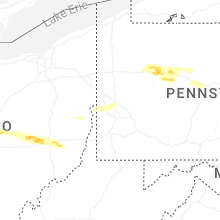
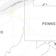


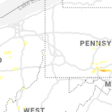


Connect with Interactive Hail Maps