

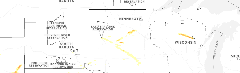
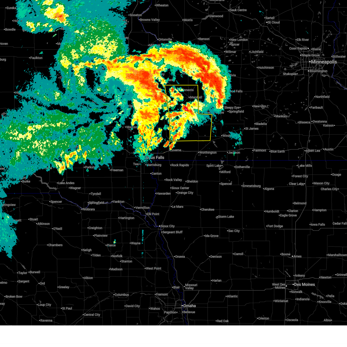
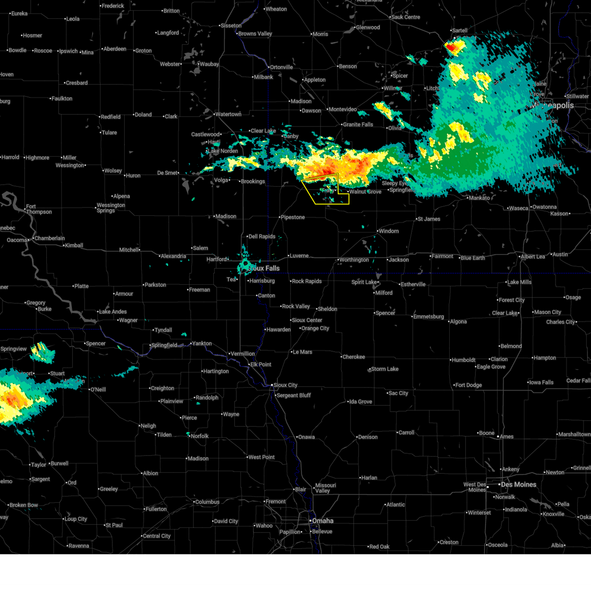
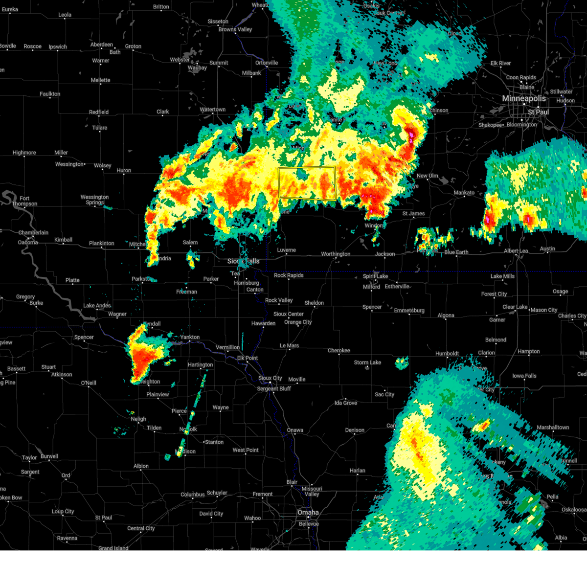
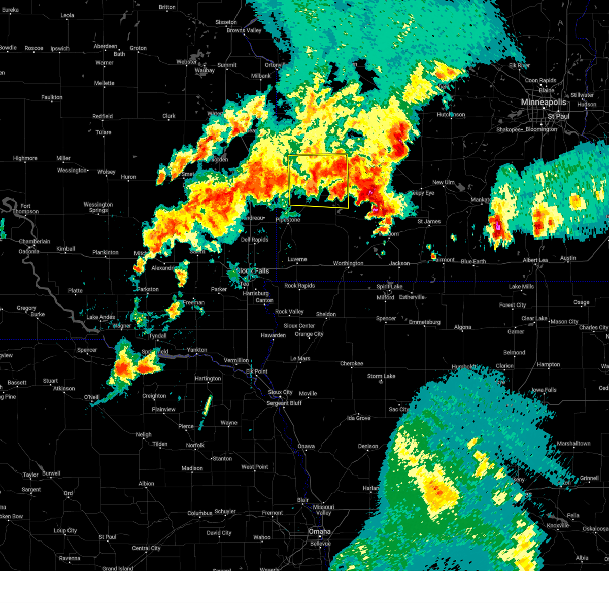
Hail Map for Tracy, MN
The Tracy, MN area has had 12 reports of on-the-ground hail by trained spotters, and has been under severe weather warnings 13 times during the past 12 months. Doppler radar has detected hail at or near Tracy, MN on 48 occasions, including 1 occasion during the past year.
| Name: | Tracy, MN |
| Where Located: | 49.7 miles S of Montevideo, MN |
| Map: | Google Map for Tracy, MN |
| Population: | 2163 |
| Housing Units: | 1032 |
| More Info: | Search Google for Tracy, MN |
0
The Top Recent Hail Date for Tracy, MN is Friday, July 18, 2025 (47th out of 48)
Hail and Wind Damage Spotted near Tracy, MN
| Date / Time | Report Details |
|---|---|
| 9/4/2025 5:45 PM CDT |
 Svrfsd the national weather service in sioux falls has issued a * severe thunderstorm warning for, southeastern lyon county in southwestern minnesota, western cottonwood county in southwestern minnesota, northeastern murray county in southwestern minnesota, * until 630 pm cdt. * at 543 pm cdt, a severe thunderstorm was located over dovray, or 12 miles northeast of slayton, moving southeast at 65 mph (trained weather spotters. at 525 pm an estimated 50 mph wind was reported near balaton). Hazards include 60 mph wind gusts. Expect damage to roofs, siding, and trees. This severe thunderstorm will be near, westbrook and storden around 550 pm cdt. Svrfsd the national weather service in sioux falls has issued a * severe thunderstorm warning for, southeastern lyon county in southwestern minnesota, western cottonwood county in southwestern minnesota, northeastern murray county in southwestern minnesota, * until 630 pm cdt. * at 543 pm cdt, a severe thunderstorm was located over dovray, or 12 miles northeast of slayton, moving southeast at 65 mph (trained weather spotters. at 525 pm an estimated 50 mph wind was reported near balaton). Hazards include 60 mph wind gusts. Expect damage to roofs, siding, and trees. This severe thunderstorm will be near, westbrook and storden around 550 pm cdt.
|
| 9/4/2025 5:38 PM CDT |
 At 537 pm cdt, a severe thunderstorm was located over lake shetek state park, or 10 miles northeast of slayton, moving southeast at 60 mph (trained weather spotters. at 530 pm a 47 mph wind gust was reported near florence). Hazards include 60 mph wind gusts. Expect damage to roofs, siding, and trees. this severe storm will be near, westbrook, currie, dovray, and lake shetek state park around 540 pm cdt. Other locations in the path of this severe thunderstorm include storden. At 537 pm cdt, a severe thunderstorm was located over lake shetek state park, or 10 miles northeast of slayton, moving southeast at 60 mph (trained weather spotters. at 530 pm a 47 mph wind gust was reported near florence). Hazards include 60 mph wind gusts. Expect damage to roofs, siding, and trees. this severe storm will be near, westbrook, currie, dovray, and lake shetek state park around 540 pm cdt. Other locations in the path of this severe thunderstorm include storden.
|
| 9/4/2025 5:24 PM CDT |
 Svrfsd the national weather service in sioux falls has issued a * severe thunderstorm warning for, southern lyon county in southwestern minnesota, western cottonwood county in southwestern minnesota, northern murray county in southwestern minnesota, * until 600 pm cdt. * at 524 pm cdt, a severe thunderstorm was located over balaton, or 15 miles north of slayton, moving southeast at 70 mph (radar indicated). Hazards include 60 mph wind gusts. Expect damage to roofs, siding, and trees. this severe thunderstorm will be near, tracy, currie, and lake shetek state park around 530 pm cdt. dovray around 535 pm cdt. westbrook around 540 pm cdt. Other locations in the path of this severe thunderstorm include storden. Svrfsd the national weather service in sioux falls has issued a * severe thunderstorm warning for, southern lyon county in southwestern minnesota, western cottonwood county in southwestern minnesota, northern murray county in southwestern minnesota, * until 600 pm cdt. * at 524 pm cdt, a severe thunderstorm was located over balaton, or 15 miles north of slayton, moving southeast at 70 mph (radar indicated). Hazards include 60 mph wind gusts. Expect damage to roofs, siding, and trees. this severe thunderstorm will be near, tracy, currie, and lake shetek state park around 530 pm cdt. dovray around 535 pm cdt. westbrook around 540 pm cdt. Other locations in the path of this severe thunderstorm include storden.
|
| 8/16/2025 6:07 AM CDT |
 The storms which prompted the warning have weakened below severe limits, and have exited the warned area. therefore, the warning will be allowed to expire. a severe thunderstorm watch remains in effect until 900 am cdt for southwestern minnesota. The storms which prompted the warning have weakened below severe limits, and have exited the warned area. therefore, the warning will be allowed to expire. a severe thunderstorm watch remains in effect until 900 am cdt for southwestern minnesota.
|
| 8/16/2025 5:51 AM CDT |
 At 551 am cdt, severe thunderstorms were located along a line extending from wood lake to near walnut grove to near dovray, moving east at 30 mph (radar indicated). Hazards include 60 mph wind gusts and penny size hail. Expect damage to roofs, siding, and trees. Locations impacted include, westbrook, storden and jeffers. At 551 am cdt, severe thunderstorms were located along a line extending from wood lake to near walnut grove to near dovray, moving east at 30 mph (radar indicated). Hazards include 60 mph wind gusts and penny size hail. Expect damage to roofs, siding, and trees. Locations impacted include, westbrook, storden and jeffers.
|
| 8/16/2025 5:25 AM CDT |
 Svrfsd the national weather service in sioux falls has issued a * severe thunderstorm warning for, eastern lyon county in southwestern minnesota, northwestern cottonwood county in southwestern minnesota, eastern murray county in southwestern minnesota, * until 615 am cdt. * at 525 am cdt, severe thunderstorms were located along a line extending from 6 miles west of cottonwood to near balaton to near slayton, moving east at 30 mph (radar indicated). Hazards include 70 mph wind gusts and penny size hail. Expect considerable tree damage. damage is likely to mobile homes, roofs, and outbuildings. severe thunderstorms will be near, marshall, slayton, tracy, cottonwood, currie, and lake shetek state park around 530 am cdt. dovray around 540 am cdt. Other locations in the path of these severe thunderstorms include westbrook and storden. Svrfsd the national weather service in sioux falls has issued a * severe thunderstorm warning for, eastern lyon county in southwestern minnesota, northwestern cottonwood county in southwestern minnesota, eastern murray county in southwestern minnesota, * until 615 am cdt. * at 525 am cdt, severe thunderstorms were located along a line extending from 6 miles west of cottonwood to near balaton to near slayton, moving east at 30 mph (radar indicated). Hazards include 70 mph wind gusts and penny size hail. Expect considerable tree damage. damage is likely to mobile homes, roofs, and outbuildings. severe thunderstorms will be near, marshall, slayton, tracy, cottonwood, currie, and lake shetek state park around 530 am cdt. dovray around 540 am cdt. Other locations in the path of these severe thunderstorms include westbrook and storden.
|
| 8/16/2025 5:14 AM CDT |
 At 513 am cdt, severe thunderstorms were located along a line extending from near hanley falls to tracy to near fulda, moving east at 45 mph (radar indicated. at 5:09 am cdt, a 70 mph wind gust was reported at marshall). Hazards include 70 mph wind gusts and nickel size hail. Expect considerable tree damage. damage is likely to mobile homes, roofs, and outbuildings. Locations impacted include, marshall, slayton, tracy, minneota, fulda, cottonwood, edgerton, tyler, westbrook, balaton, ivanhoe, leota, ghent, russell, chandler, lake wilson, ruthton, currie, holland, and taunton. At 513 am cdt, severe thunderstorms were located along a line extending from near hanley falls to tracy to near fulda, moving east at 45 mph (radar indicated. at 5:09 am cdt, a 70 mph wind gust was reported at marshall). Hazards include 70 mph wind gusts and nickel size hail. Expect considerable tree damage. damage is likely to mobile homes, roofs, and outbuildings. Locations impacted include, marshall, slayton, tracy, minneota, fulda, cottonwood, edgerton, tyler, westbrook, balaton, ivanhoe, leota, ghent, russell, chandler, lake wilson, ruthton, currie, holland, and taunton.
|
| 8/16/2025 4:59 AM CDT |
 At 458 am cdt, severe thunderstorms were located along a line extending from 7 miles north of minneota to near balaton to near wilmont, moving east at 45 mph (radar indicated. at 4:50 am cdt, a 66 mph wind gust was reported at florence). Hazards include 60 mph wind gusts and nickel size hail. Expect damage to roofs, siding, and trees. Locations impacted include, marshall, slayton, tracy, cottonwood, currie, lake shetek state park, fulda, dovray and westbrook. At 458 am cdt, severe thunderstorms were located along a line extending from 7 miles north of minneota to near balaton to near wilmont, moving east at 45 mph (radar indicated. at 4:50 am cdt, a 66 mph wind gust was reported at florence). Hazards include 60 mph wind gusts and nickel size hail. Expect damage to roofs, siding, and trees. Locations impacted include, marshall, slayton, tracy, cottonwood, currie, lake shetek state park, fulda, dovray and westbrook.
|
| 8/16/2025 4:38 AM CDT |
 Svrfsd the national weather service in sioux falls has issued a * severe thunderstorm warning for, lyon county in southwestern minnesota, northeastern rock county in southwestern minnesota, eastern lincoln county in southwestern minnesota, northwestern jackson county in southwestern minnesota, northern nobles county in southwestern minnesota, eastern pipestone county in southwestern minnesota, western cottonwood county in southwestern minnesota, murray county in southwestern minnesota, * until 530 am cdt. * at 438 am cdt, severe thunderstorms were located along a line extending from near porter to ruthton to near edgerton, moving east at 45 mph (radar indicated). Hazards include 60 mph wind gusts and nickel size hail. Expect damage to roofs, siding, and trees. severe thunderstorms will be near, minneota, leota, russell, chandler, lake wilson, taunton, florence, camden state park, and current lake around 445 am cdt. balaton and ghent around 450 am cdt. marshall and slayton around 455 am cdt. Other locations in the path of these severe thunderstorms include currie, lake shetek state park, tracy, fulda, cottonwood, dovray and westbrook. Svrfsd the national weather service in sioux falls has issued a * severe thunderstorm warning for, lyon county in southwestern minnesota, northeastern rock county in southwestern minnesota, eastern lincoln county in southwestern minnesota, northwestern jackson county in southwestern minnesota, northern nobles county in southwestern minnesota, eastern pipestone county in southwestern minnesota, western cottonwood county in southwestern minnesota, murray county in southwestern minnesota, * until 530 am cdt. * at 438 am cdt, severe thunderstorms were located along a line extending from near porter to ruthton to near edgerton, moving east at 45 mph (radar indicated). Hazards include 60 mph wind gusts and nickel size hail. Expect damage to roofs, siding, and trees. severe thunderstorms will be near, minneota, leota, russell, chandler, lake wilson, taunton, florence, camden state park, and current lake around 445 am cdt. balaton and ghent around 450 am cdt. marshall and slayton around 455 am cdt. Other locations in the path of these severe thunderstorms include currie, lake shetek state park, tracy, fulda, cottonwood, dovray and westbrook.
|
| 7/18/2025 10:13 PM CDT |
 Svrfsd the national weather service in sioux falls has issued a * severe thunderstorm warning for, southeastern lyon county in southwestern minnesota, northern cottonwood county in southwestern minnesota, northeastern murray county in southwestern minnesota, * until 1115 pm cdt. * at 1013 pm cdt, severe thunderstorms were located along a line extending from lamberton to 11 miles north of storden to near walnut grove to tracy, moving southeast at 25 mph (radar indicated). Hazards include 60 mph wind gusts and quarter size hail. Hail damage to vehicles is expected. Expect wind damage to roofs, siding, and trees. Svrfsd the national weather service in sioux falls has issued a * severe thunderstorm warning for, southeastern lyon county in southwestern minnesota, northern cottonwood county in southwestern minnesota, northeastern murray county in southwestern minnesota, * until 1115 pm cdt. * at 1013 pm cdt, severe thunderstorms were located along a line extending from lamberton to 11 miles north of storden to near walnut grove to tracy, moving southeast at 25 mph (radar indicated). Hazards include 60 mph wind gusts and quarter size hail. Hail damage to vehicles is expected. Expect wind damage to roofs, siding, and trees.
|
| 7/18/2025 9:59 PM CDT |
 At 958 pm cdt, severe thunderstorms were located along a line extending from near lamberton to walnut grove to tracy to 9 miles east of balaton, moving east at 30 mph (radar indicated). Hazards include 60 mph wind gusts. Expect damage to roofs, siding, and trees. Locations impacted include, tracy, lake shetek state park, and garvin. At 958 pm cdt, severe thunderstorms were located along a line extending from near lamberton to walnut grove to tracy to 9 miles east of balaton, moving east at 30 mph (radar indicated). Hazards include 60 mph wind gusts. Expect damage to roofs, siding, and trees. Locations impacted include, tracy, lake shetek state park, and garvin.
|
| 7/18/2025 9:43 PM CDT |
 At 943 pm cdt, severe thunderstorms were located along a line extending from near walnut grove to near tracy to 11 miles north of lake shetek state park to near balaton, moving southeast at 25 mph (radar indicated). Hazards include 60 mph wind gusts and quarter size hail. Hail damage to vehicles is expected. expect wind damage to roofs, siding, and trees. Locations impacted include, tracy. At 943 pm cdt, severe thunderstorms were located along a line extending from near walnut grove to near tracy to 11 miles north of lake shetek state park to near balaton, moving southeast at 25 mph (radar indicated). Hazards include 60 mph wind gusts and quarter size hail. Hail damage to vehicles is expected. expect wind damage to roofs, siding, and trees. Locations impacted include, tracy.
|
| 7/18/2025 9:27 PM CDT |
 Svrfsd the national weather service in sioux falls has issued a * severe thunderstorm warning for, southern lyon county in southwestern minnesota, northeastern murray county in southwestern minnesota, * until 1015 pm cdt. * at 927 pm cdt, severe thunderstorms were located along a line extending from 8 miles northwest of walnut grove to near tracy to near balaton to near russell, moving east at 30 mph (radar indicated). Hazards include 60 mph wind gusts and quarter size hail. Hail damage to vehicles is expected. expect wind damage to roofs, siding, and trees. Severe thunderstorms will be near, tracy and balaton around 930 pm cdt. Svrfsd the national weather service in sioux falls has issued a * severe thunderstorm warning for, southern lyon county in southwestern minnesota, northeastern murray county in southwestern minnesota, * until 1015 pm cdt. * at 927 pm cdt, severe thunderstorms were located along a line extending from 8 miles northwest of walnut grove to near tracy to near balaton to near russell, moving east at 30 mph (radar indicated). Hazards include 60 mph wind gusts and quarter size hail. Hail damage to vehicles is expected. expect wind damage to roofs, siding, and trees. Severe thunderstorms will be near, tracy and balaton around 930 pm cdt.
|
| 6/28/2025 11:12 PM CDT |
 This portion of the line of storms which prompted the warning have weakened below severe limits, and no longer pose an immediate threat to life or property. therefore, the warning will be allowed to expire. however, gusty winds and heavy rain are still possible with these thunderstorms. a tornado watch remains in effect until 100 am cdt for southwestern minnesota, and east central south dakota. remember, a severe thunderstorm warning still remains in effect for brookings and eastern kingsbury county until 1130 pm cdt. This portion of the line of storms which prompted the warning have weakened below severe limits, and no longer pose an immediate threat to life or property. therefore, the warning will be allowed to expire. however, gusty winds and heavy rain are still possible with these thunderstorms. a tornado watch remains in effect until 100 am cdt for southwestern minnesota, and east central south dakota. remember, a severe thunderstorm warning still remains in effect for brookings and eastern kingsbury county until 1130 pm cdt.
|
| 6/28/2025 10:57 PM CDT |
 At 1057 pm cdt, severe thunderstorms were located along a line extending from near wabasso to near russell to white, moving southeast at 30 mph (radar indicated). Hazards include 60 mph wind gusts and penny size hail. Expect damage to roofs, siding, and trees. Locations impacted include, tracy, tyler, lake benton, balaton, russell, florence, camden state park and elkton. At 1057 pm cdt, severe thunderstorms were located along a line extending from near wabasso to near russell to white, moving southeast at 30 mph (radar indicated). Hazards include 60 mph wind gusts and penny size hail. Expect damage to roofs, siding, and trees. Locations impacted include, tracy, tyler, lake benton, balaton, russell, florence, camden state park and elkton.
|
| 6/28/2025 10:33 PM CDT |
 Svrfsd the national weather service in sioux falls has issued a * severe thunderstorm warning for, lyon county in southwestern minnesota, lincoln county in southwestern minnesota, northeastern brookings county in east central south dakota, * until 1115 pm cdt. * at 1032 pm cdt, severe thunderstorms were located along a line extending from near echo to near ivanhoe to near toronto, moving southeast at 35 mph (automated weather station. at 1015 pm cdt, a 62 mph wind gust was reported by just southeast of taunton). Hazards include 60 mph wind gusts and nickel size hail. Expect damage to roofs, siding, and trees. severe thunderstorms will be near, marshall, hendricks, ivanhoe, white, ghent, and arco around 1040 pm cdt. camden state park around 1045 pm cdt. Other locations in the path of these severe thunderstorms include russell. Svrfsd the national weather service in sioux falls has issued a * severe thunderstorm warning for, lyon county in southwestern minnesota, lincoln county in southwestern minnesota, northeastern brookings county in east central south dakota, * until 1115 pm cdt. * at 1032 pm cdt, severe thunderstorms were located along a line extending from near echo to near ivanhoe to near toronto, moving southeast at 35 mph (automated weather station. at 1015 pm cdt, a 62 mph wind gust was reported by just southeast of taunton). Hazards include 60 mph wind gusts and nickel size hail. Expect damage to roofs, siding, and trees. severe thunderstorms will be near, marshall, hendricks, ivanhoe, white, ghent, and arco around 1040 pm cdt. camden state park around 1045 pm cdt. Other locations in the path of these severe thunderstorms include russell.
|
| 6/20/2025 1:26 AM CDT |
 the severe thunderstorm warning has been cancelled and is no longer in effect the severe thunderstorm warning has been cancelled and is no longer in effect
|
| 6/20/2025 1:26 AM CDT |
 At 125 am cdt, a severe thunderstorm was located near tracy, or 14 miles northeast of slayton, moving southeast at 60 mph (radar indicated). Hazards include 60 mph wind gusts and quarter size hail. Hail damage to vehicles is expected. expect wind damage to roofs, siding, and trees. Locations impacted include, currie. At 125 am cdt, a severe thunderstorm was located near tracy, or 14 miles northeast of slayton, moving southeast at 60 mph (radar indicated). Hazards include 60 mph wind gusts and quarter size hail. Hail damage to vehicles is expected. expect wind damage to roofs, siding, and trees. Locations impacted include, currie.
|
| 6/20/2025 1:09 AM CDT |
 Svrfsd the national weather service in sioux falls has issued a * severe thunderstorm warning for, southern lyon county in southwestern minnesota, eastern pipestone county in southwestern minnesota, northwestern murray county in southwestern minnesota, * until 145 am cdt. * at 109 am cdt, a severe thunderstorm was located over russell, or 13 miles southwest of marshall, moving southeast at 60 mph (radar indicated). Hazards include 60 mph wind gusts and quarter size hail. Hail damage to vehicles is expected. expect wind damage to roofs, siding, and trees. this severe thunderstorm will be near, tracy and balaton around 115 am cdt. lake shetek state park around 120 am cdt. Currie around 125 am cdt. Svrfsd the national weather service in sioux falls has issued a * severe thunderstorm warning for, southern lyon county in southwestern minnesota, eastern pipestone county in southwestern minnesota, northwestern murray county in southwestern minnesota, * until 145 am cdt. * at 109 am cdt, a severe thunderstorm was located over russell, or 13 miles southwest of marshall, moving southeast at 60 mph (radar indicated). Hazards include 60 mph wind gusts and quarter size hail. Hail damage to vehicles is expected. expect wind damage to roofs, siding, and trees. this severe thunderstorm will be near, tracy and balaton around 115 am cdt. lake shetek state park around 120 am cdt. Currie around 125 am cdt.
|
| 5/15/2025 4:10 AM CDT |
 The storms which prompted the warning have weakened below severe limits, and no longer pose an immediate threat to life or property. therefore, the warning will be allowed to expire. however, gusty winds and heavy rain are still possible with these thunderstorms. a severe thunderstorm watch remains in effect until 900 am cdt for southwestern minnesota. to report severe weather, contact your nearest law enforcement agency. they will relay your report to the national weather service sioux falls. The storms which prompted the warning have weakened below severe limits, and no longer pose an immediate threat to life or property. therefore, the warning will be allowed to expire. however, gusty winds and heavy rain are still possible with these thunderstorms. a severe thunderstorm watch remains in effect until 900 am cdt for southwestern minnesota. to report severe weather, contact your nearest law enforcement agency. they will relay your report to the national weather service sioux falls.
|
| 5/15/2025 3:52 AM CDT |
 the severe thunderstorm warning has been cancelled and is no longer in effect the severe thunderstorm warning has been cancelled and is no longer in effect
|
| 5/15/2025 3:52 AM CDT |
 At 352 am cdt, severe thunderstorms were located along a line extending from moritz to 6 miles northeast of ivanhoe to russell to near current lake, moving northeast at 40 mph (radar indicated). Hazards include 60 mph wind gusts. Expect damage to roofs, siding, and trees. these severe storms will be near, minneota, balaton, russell, taunton, and camden state park around 355 am cdt. marshall and ghent around 400 am cdt. tracy around 410 am cdt. cottonwood around 420 am cdt. Other locations impacted by these severe thunderstorms include kenneth, avoca, hadley, lynd, garvin, iona, hatfield, and dundee. At 352 am cdt, severe thunderstorms were located along a line extending from moritz to 6 miles northeast of ivanhoe to russell to near current lake, moving northeast at 40 mph (radar indicated). Hazards include 60 mph wind gusts. Expect damage to roofs, siding, and trees. these severe storms will be near, minneota, balaton, russell, taunton, and camden state park around 355 am cdt. marshall and ghent around 400 am cdt. tracy around 410 am cdt. cottonwood around 420 am cdt. Other locations impacted by these severe thunderstorms include kenneth, avoca, hadley, lynd, garvin, iona, hatfield, and dundee.
|
| 5/15/2025 3:42 AM CDT |
 At 341 am cdt, severe thunderstorms were located along a line extending from near clear lake to ivanhoe to florence to near lake wilson, moving northeast at 40 mph (radar indicated). Hazards include 60 mph wind gusts. Expect damage to roofs, siding, and trees. these severe storms will be near, balaton, russell, camden state park, and current lake around 345 am cdt. taunton around 350 am cdt. minneota around 355 am cdt. marshall and ghent around 400 am cdt. tracy around 410 am cdt. cottonwood around 420 am cdt. Other locations impacted by these severe thunderstorms include kenneth, ihlen, avoca, hadley, lynd, garvin, iona, hatfield, and dundee. At 341 am cdt, severe thunderstorms were located along a line extending from near clear lake to ivanhoe to florence to near lake wilson, moving northeast at 40 mph (radar indicated). Hazards include 60 mph wind gusts. Expect damage to roofs, siding, and trees. these severe storms will be near, balaton, russell, camden state park, and current lake around 345 am cdt. taunton around 350 am cdt. minneota around 355 am cdt. marshall and ghent around 400 am cdt. tracy around 410 am cdt. cottonwood around 420 am cdt. Other locations impacted by these severe thunderstorms include kenneth, ihlen, avoca, hadley, lynd, garvin, iona, hatfield, and dundee.
|
| 5/15/2025 3:42 AM CDT |
 the severe thunderstorm warning has been cancelled and is no longer in effect the severe thunderstorm warning has been cancelled and is no longer in effect
|
| 5/15/2025 3:17 AM CDT |
 At 316 am cdt, severe thunderstorms were located along a line extending from near estelline to near elkton to near holland to edgerton, moving northeast at 40 mph (trained weather spotters. at 306 am cdt, a 60 mph wind gust was reported 2 miles north of trosky). Hazards include 60 mph wind gusts and quarter size hail. Hail damage to vehicles is expected. expect wind damage to roofs, siding, and trees. these severe storms will be near, edgerton, lake benton, ruthton, holland, and woodstock around 320 am cdt. tyler and hendricks around 325 am cdt. ivanhoe, chandler, lake wilson, arco, and florence around 330 am cdt. current lake around 335 am cdt. russell around 340 am cdt. balaton and camden state park around 345 am cdt. taunton around 350 am cdt. marshall, minneota, and ghent around 355 am cdt. Other locations impacted by these severe thunderstorms include kenneth, ihlen, avoca, flandreau santee sioux tribal nation, hadley, lynd, garvin, iona, hatfield, and bushnell. At 316 am cdt, severe thunderstorms were located along a line extending from near estelline to near elkton to near holland to edgerton, moving northeast at 40 mph (trained weather spotters. at 306 am cdt, a 60 mph wind gust was reported 2 miles north of trosky). Hazards include 60 mph wind gusts and quarter size hail. Hail damage to vehicles is expected. expect wind damage to roofs, siding, and trees. these severe storms will be near, edgerton, lake benton, ruthton, holland, and woodstock around 320 am cdt. tyler and hendricks around 325 am cdt. ivanhoe, chandler, lake wilson, arco, and florence around 330 am cdt. current lake around 335 am cdt. russell around 340 am cdt. balaton and camden state park around 345 am cdt. taunton around 350 am cdt. marshall, minneota, and ghent around 355 am cdt. Other locations impacted by these severe thunderstorms include kenneth, ihlen, avoca, flandreau santee sioux tribal nation, hadley, lynd, garvin, iona, hatfield, and bushnell.
|
| 5/15/2025 3:06 AM CDT |
 Svrfsd the national weather service in sioux falls has issued a * severe thunderstorm warning for, lyon county in southwestern minnesota, northern rock county in southwestern minnesota, lincoln county in southwestern minnesota, northwestern nobles county in southwestern minnesota, pipestone county in southwestern minnesota, murray county in southwestern minnesota, eastern moody county in east central south dakota, brookings county in east central south dakota, * until 415 am cdt. * at 306 am cdt, severe thunderstorms were located along a line extending from near estelline to elkton to near pipestone national monument to near hardwick, moving northeast at 35 mph (radar indicated). Hazards include 60 mph wind gusts and quarter size hail. Hail damage to vehicles is expected. expect wind damage to roofs, siding, and trees. severe thunderstorms will be near, pipestone, edgerton, elkton, lake benton, white, holland, and trosky around 310 am cdt. woodstock around 315 am cdt. hendricks and ruthton around 320 am cdt. tyler, chandler, lake wilson, arco, and florence around 325 am cdt. Other locations in the path of these severe thunderstorms include ivanhoe, current lake, balaton, russell, camden state park, minneota and taunton. Svrfsd the national weather service in sioux falls has issued a * severe thunderstorm warning for, lyon county in southwestern minnesota, northern rock county in southwestern minnesota, lincoln county in southwestern minnesota, northwestern nobles county in southwestern minnesota, pipestone county in southwestern minnesota, murray county in southwestern minnesota, eastern moody county in east central south dakota, brookings county in east central south dakota, * until 415 am cdt. * at 306 am cdt, severe thunderstorms were located along a line extending from near estelline to elkton to near pipestone national monument to near hardwick, moving northeast at 35 mph (radar indicated). Hazards include 60 mph wind gusts and quarter size hail. Hail damage to vehicles is expected. expect wind damage to roofs, siding, and trees. severe thunderstorms will be near, pipestone, edgerton, elkton, lake benton, white, holland, and trosky around 310 am cdt. woodstock around 315 am cdt. hendricks and ruthton around 320 am cdt. tyler, chandler, lake wilson, arco, and florence around 325 am cdt. Other locations in the path of these severe thunderstorms include ivanhoe, current lake, balaton, russell, camden state park, minneota and taunton.
|
| 7/31/2024 9:20 PM CDT |
 The storms which prompted the warning have weakened below severe limits, and no longer pose an immediate threat to life or property. therefore, the warning has been allowed to expire. however, heavy rain is still possible with these thunderstorms. a severe thunderstorm watch remains in effect until midnight cdt for southwestern minnesota. to report severe weather, contact your nearest law enforcement agency. they will relay your report to the national weather service sioux falls. The storms which prompted the warning have weakened below severe limits, and no longer pose an immediate threat to life or property. therefore, the warning has been allowed to expire. however, heavy rain is still possible with these thunderstorms. a severe thunderstorm watch remains in effect until midnight cdt for southwestern minnesota. to report severe weather, contact your nearest law enforcement agency. they will relay your report to the national weather service sioux falls.
|
| 7/31/2024 9:00 PM CDT |
 At 900 pm cdt, severe thunderstorms were located along a line extending from near tracy to near balaton to near ruthton, moving east at 25 mph (radar indicated). Hazards include 60 mph wind gusts. Expect damage to roofs, siding, and trees. Locations impacted include, tracy, balaton, ruthton and florence. At 900 pm cdt, severe thunderstorms were located along a line extending from near tracy to near balaton to near ruthton, moving east at 25 mph (radar indicated). Hazards include 60 mph wind gusts. Expect damage to roofs, siding, and trees. Locations impacted include, tracy, balaton, ruthton and florence.
|
| 7/31/2024 8:30 PM CDT |
 Svrfsd the national weather service in sioux falls has issued a * severe thunderstorm warning for, lyon county in southwestern minnesota, eastern lincoln county in southwestern minnesota, northeastern pipestone county in southwestern minnesota, northwestern murray county in southwestern minnesota, * until 915 pm cdt. * at 830 pm cdt, severe thunderstorms were located along a line extending from near russell to florence to lake benton, moving southeast at 30 mph (radar indicated). Hazards include 60 mph wind gusts. Expect damage to roofs, siding, and trees. Severe thunderstorms will be near, lake benton, balaton, ruthton, and florence around 835 pm cdt. Svrfsd the national weather service in sioux falls has issued a * severe thunderstorm warning for, lyon county in southwestern minnesota, eastern lincoln county in southwestern minnesota, northeastern pipestone county in southwestern minnesota, northwestern murray county in southwestern minnesota, * until 915 pm cdt. * at 830 pm cdt, severe thunderstorms were located along a line extending from near russell to florence to lake benton, moving southeast at 30 mph (radar indicated). Hazards include 60 mph wind gusts. Expect damage to roofs, siding, and trees. Severe thunderstorms will be near, lake benton, balaton, ruthton, and florence around 835 pm cdt.
|
| 7/6/2024 8:17 PM CDT |
 the severe thunderstorm warning has been cancelled and is no longer in effect the severe thunderstorm warning has been cancelled and is no longer in effect
|
| 7/6/2024 8:01 PM CDT |
 Svrfsd the national weather service in sioux falls has issued a * severe thunderstorm warning for, southeastern lyon county in southwestern minnesota, northeastern murray county in southwestern minnesota, * until 845 pm cdt. * at 801 pm cdt, a severe thunderstorm was located near lake shetek state park, or near slayton, moving northeast at 35 mph (radar indicated). Hazards include 60 mph wind gusts and quarter size hail. Hail damage to vehicles is expected. expect wind damage to roofs, siding, and trees. this severe thunderstorm will be near, currie and lake shetek state park around 805 pm cdt. Tracy around 810 pm cdt. Svrfsd the national weather service in sioux falls has issued a * severe thunderstorm warning for, southeastern lyon county in southwestern minnesota, northeastern murray county in southwestern minnesota, * until 845 pm cdt. * at 801 pm cdt, a severe thunderstorm was located near lake shetek state park, or near slayton, moving northeast at 35 mph (radar indicated). Hazards include 60 mph wind gusts and quarter size hail. Hail damage to vehicles is expected. expect wind damage to roofs, siding, and trees. this severe thunderstorm will be near, currie and lake shetek state park around 805 pm cdt. Tracy around 810 pm cdt.
|
| 10/24/2023 12:03 PM CDT | Quarter sized hail reported 3.6 miles ENE of Tracy, MN, ground covered in nickel to quarter size hail. |
| 9/29/2023 5:27 PM CDT |
 At 527 pm cdt, a severe thunderstorm was located near lake shetek state park, or 12 miles northeast of slayton, moving northeast at 35 mph (radar indicated). Hazards include 60 mph wind gusts and quarter size hail. Hail damage to vehicles is expected. expect wind damage to roofs, siding, and trees. this severe storm will be near, tracy around 530 pm cdt. other locations impacted by this severe thunderstorm include garvin. hail threat, radar indicated max hail size, 1. 00 in wind threat, radar indicated max wind gust, 60 mph. At 527 pm cdt, a severe thunderstorm was located near lake shetek state park, or 12 miles northeast of slayton, moving northeast at 35 mph (radar indicated). Hazards include 60 mph wind gusts and quarter size hail. Hail damage to vehicles is expected. expect wind damage to roofs, siding, and trees. this severe storm will be near, tracy around 530 pm cdt. other locations impacted by this severe thunderstorm include garvin. hail threat, radar indicated max hail size, 1. 00 in wind threat, radar indicated max wind gust, 60 mph.
|
| 9/29/2023 5:17 PM CDT |
 At 517 pm cdt, a severe thunderstorm was located over lake shetek state park, or 7 miles northeast of slayton, moving northeast at 35 mph (radar indicated). Hazards include ping pong ball size hail and 60 mph wind gusts. People and animals outdoors will be injured. expect hail damage to roofs, siding, windows, and vehicles. Expect wind damage to roofs, siding, and trees. At 517 pm cdt, a severe thunderstorm was located over lake shetek state park, or 7 miles northeast of slayton, moving northeast at 35 mph (radar indicated). Hazards include ping pong ball size hail and 60 mph wind gusts. People and animals outdoors will be injured. expect hail damage to roofs, siding, windows, and vehicles. Expect wind damage to roofs, siding, and trees.
|
| 9/29/2023 5:09 PM CDT |
 At 509 pm cdt, a severe thunderstorm was located near slayton, moving northeast at 35 mph (radar indicated). Hazards include 60 mph wind gusts and quarter size hail. Hail damage to vehicles is expected. expect wind damage to roofs, siding, and trees. this severe thunderstorm will be near, currie, dovray, and lake shetek state park around 515 pm cdt. tracy around 520 pm cdt. other locations impacted by this severe thunderstorm include hadley and garvin. hail threat, radar indicated max hail size, 1. 00 in wind threat, radar indicated max wind gust, 60 mph. At 509 pm cdt, a severe thunderstorm was located near slayton, moving northeast at 35 mph (radar indicated). Hazards include 60 mph wind gusts and quarter size hail. Hail damage to vehicles is expected. expect wind damage to roofs, siding, and trees. this severe thunderstorm will be near, currie, dovray, and lake shetek state park around 515 pm cdt. tracy around 520 pm cdt. other locations impacted by this severe thunderstorm include hadley and garvin. hail threat, radar indicated max hail size, 1. 00 in wind threat, radar indicated max wind gust, 60 mph.
|
| 8/11/2023 4:53 PM CDT |
 At 452 pm cdt, a severe thunderstorm was located near dovray, or 14 miles northeast of slayton, moving east at 40 mph (radar indicated). Hazards include 60 mph wind gusts and quarter size hail. Hail damage to vehicles is expected. expect wind damage to roofs, siding, and trees. this severe thunderstorm will be near, westbrook and storden around 500 pm cdt. jeffers around 505 pm cdt. other locations in the path of this severe thunderstorm include bingham lake and mountain lake. hail threat, radar indicated max hail size, 1. 00 in wind threat, radar indicated max wind gust, 60 mph. At 452 pm cdt, a severe thunderstorm was located near dovray, or 14 miles northeast of slayton, moving east at 40 mph (radar indicated). Hazards include 60 mph wind gusts and quarter size hail. Hail damage to vehicles is expected. expect wind damage to roofs, siding, and trees. this severe thunderstorm will be near, westbrook and storden around 500 pm cdt. jeffers around 505 pm cdt. other locations in the path of this severe thunderstorm include bingham lake and mountain lake. hail threat, radar indicated max hail size, 1. 00 in wind threat, radar indicated max wind gust, 60 mph.
|
| 8/11/2023 4:47 PM CDT |
 At 446 pm cdt, a severe thunderstorm located near lake shetek state park, or 11 miles north of slayton, moving southeast at 35 mph (radar indicated). Hazards include 60 mph wind gusts and quarter size hail. Hail damage to vehicles is expected. expect wind damage to roofs, siding, and trees. this severe storm will be near, currie, dovray, and lake shetek state park around 450 pm cdt. hail threat, radar indicated max hail size, 1. 00 in wind threat, radar indicated max wind gust, 60 mph. At 446 pm cdt, a severe thunderstorm located near lake shetek state park, or 11 miles north of slayton, moving southeast at 35 mph (radar indicated). Hazards include 60 mph wind gusts and quarter size hail. Hail damage to vehicles is expected. expect wind damage to roofs, siding, and trees. this severe storm will be near, currie, dovray, and lake shetek state park around 450 pm cdt. hail threat, radar indicated max hail size, 1. 00 in wind threat, radar indicated max wind gust, 60 mph.
|
| 8/11/2023 4:34 PM CDT |
 At 432 pm cdt, a severe thunderstorm was located near balaton, or 14 miles north of slayton, moving east at 35 mph (at 409 cdt a trained spotter reported quarter sized hail 8 miles west of tracy. at 416 a trained spotter east of florence reported quarter sized hail). Hazards include 60 mph wind gusts and quarter size hail. Hail damage to vehicles is expected. expect wind damage to roofs, siding, and trees. this severe storm will be near, tracy, currie, and lake shetek state park around 440 pm cdt. other locations in the path of this severe thunderstorm include dovray. hail threat, radar indicated max hail size, 1. 00 in wind threat, radar indicated max wind gust, 60 mph. At 432 pm cdt, a severe thunderstorm was located near balaton, or 14 miles north of slayton, moving east at 35 mph (at 409 cdt a trained spotter reported quarter sized hail 8 miles west of tracy. at 416 a trained spotter east of florence reported quarter sized hail). Hazards include 60 mph wind gusts and quarter size hail. Hail damage to vehicles is expected. expect wind damage to roofs, siding, and trees. this severe storm will be near, tracy, currie, and lake shetek state park around 440 pm cdt. other locations in the path of this severe thunderstorm include dovray. hail threat, radar indicated max hail size, 1. 00 in wind threat, radar indicated max wind gust, 60 mph.
|
| 8/11/2023 4:26 PM CDT |
 At 425 pm cdt, a severe thunderstorm was located near balaton, or 17 miles northwest of slayton, moving southeast at 35 mph (at 4:19 cdt trained spotters reported quarter sized hail east of florence). Hazards include 60 mph wind gusts and quarter size hail. Hail damage to vehicles is expected. expect wind damage to roofs, siding, and trees. this severe storm will be near, balaton around 430 pm cdt. lake shetek state park around 435 pm cdt. other locations in the path of this severe thunderstorm include tracy and currie. hail threat, radar indicated max hail size, 1. 00 in wind threat, radar indicated max wind gust, 60 mph. At 425 pm cdt, a severe thunderstorm was located near balaton, or 17 miles northwest of slayton, moving southeast at 35 mph (at 4:19 cdt trained spotters reported quarter sized hail east of florence). Hazards include 60 mph wind gusts and quarter size hail. Hail damage to vehicles is expected. expect wind damage to roofs, siding, and trees. this severe storm will be near, balaton around 430 pm cdt. lake shetek state park around 435 pm cdt. other locations in the path of this severe thunderstorm include tracy and currie. hail threat, radar indicated max hail size, 1. 00 in wind threat, radar indicated max wind gust, 60 mph.
|
| 8/11/2023 4:16 PM CDT |
 At 416 pm cdt, a severe thunderstorm was located over florence, or 18 miles southwest of marshall, moving southeast at 35 mph (radar indicated). Hazards include 60 mph wind gusts and quarter size hail. Hail damage to vehicles is expected. expect wind damage to roofs, siding, and trees. this severe thunderstorm will be near, balaton, russell, and current lake around 420 pm cdt. lake shetek state park around 435 pm cdt. other locations in the path of this severe thunderstorm include tracy and currie. hail threat, radar indicated max hail size, 1. 00 in wind threat, radar indicated max wind gust, 60 mph. At 416 pm cdt, a severe thunderstorm was located over florence, or 18 miles southwest of marshall, moving southeast at 35 mph (radar indicated). Hazards include 60 mph wind gusts and quarter size hail. Hail damage to vehicles is expected. expect wind damage to roofs, siding, and trees. this severe thunderstorm will be near, balaton, russell, and current lake around 420 pm cdt. lake shetek state park around 435 pm cdt. other locations in the path of this severe thunderstorm include tracy and currie. hail threat, radar indicated max hail size, 1. 00 in wind threat, radar indicated max wind gust, 60 mph.
|
| 7/22/2023 3:33 PM CDT |
 At 333 pm cdt, a severe thunderstorm was located near walnut grove, or 17 miles southeast of marshall, moving southeast at 10 mph (radar indicated). Hazards include 60 mph wind gusts and quarter size hail. Hail damage to vehicles is expected. expect wind damage to roofs, siding, and trees. locations impacted include, walnut grove and revere. hail threat, radar indicated max hail size, 1. 00 in wind threat, radar indicated max wind gust, 60 mph. At 333 pm cdt, a severe thunderstorm was located near walnut grove, or 17 miles southeast of marshall, moving southeast at 10 mph (radar indicated). Hazards include 60 mph wind gusts and quarter size hail. Hail damage to vehicles is expected. expect wind damage to roofs, siding, and trees. locations impacted include, walnut grove and revere. hail threat, radar indicated max hail size, 1. 00 in wind threat, radar indicated max wind gust, 60 mph.
|
| 7/22/2023 3:18 PM CDT |
 At 318 pm cdt, a severe thunderstorm was located 6 miles northeast of tracy, or 15 miles southeast of marshall, moving south at 20 mph (trained weather spotters). Hazards include two inch hail and 70 mph wind gusts. People and animals outdoors will be injured. expect hail damage to roofs, siding, windows, and vehicles. expect considerable tree damage. wind damage is also likely to mobile homes, roofs, and outbuildings. locations impacted include, walnut grove and revere. thunderstorm damage threat, considerable hail threat, observed max hail size, 2. 00 in wind threat, observed max wind gust, 70 mph. At 318 pm cdt, a severe thunderstorm was located 6 miles northeast of tracy, or 15 miles southeast of marshall, moving south at 20 mph (trained weather spotters). Hazards include two inch hail and 70 mph wind gusts. People and animals outdoors will be injured. expect hail damage to roofs, siding, windows, and vehicles. expect considerable tree damage. wind damage is also likely to mobile homes, roofs, and outbuildings. locations impacted include, walnut grove and revere. thunderstorm damage threat, considerable hail threat, observed max hail size, 2. 00 in wind threat, observed max wind gust, 70 mph.
|
| 7/22/2023 3:17 PM CDT | Ping Pong Ball sized hail reported 8.4 miles SSW of Tracy, MN |
| 7/22/2023 3:17 PM CDT | Storm damage reported in redwood county MN, 9 miles SSW of Tracy, MN |
| 7/22/2023 3:13 PM CDT | Half Dollar sized hail reported 8.7 miles S of Tracy, MN, picture via twitter between milroy and tracy. |
| 7/22/2023 3:03 PM CDT |
 At 303 pm cdt, a severe thunderstorm was located 10 miles north of tracy, or 11 miles southeast of marshall, moving southeast at 20 mph (trained weather spotters). Hazards include ping pong ball size hail and 60 mph wind gusts. People and animals outdoors will be injured. expect hail damage to roofs, siding, windows, and vehicles. Expect wind damage to roofs, siding, and trees. At 303 pm cdt, a severe thunderstorm was located 10 miles north of tracy, or 11 miles southeast of marshall, moving southeast at 20 mph (trained weather spotters). Hazards include ping pong ball size hail and 60 mph wind gusts. People and animals outdoors will be injured. expect hail damage to roofs, siding, windows, and vehicles. Expect wind damage to roofs, siding, and trees.
|
| 6/24/2023 6:17 AM CDT |
 At 617 am cdt, severe thunderstorms were located along a line extending from 8 miles southwest of clarkfield to near tracy, moving northeast at 40 mph (radar indicated). Hazards include 60 mph wind gusts. Expect damage to roofs, siding, and trees. these severe storms will be near, cottonwood around 630 am cdt. other locations impacted by these severe thunderstorms include garvin. hail threat, radar indicated max hail size, <. 75 in wind threat, radar indicated max wind gust, 60 mph. At 617 am cdt, severe thunderstorms were located along a line extending from 8 miles southwest of clarkfield to near tracy, moving northeast at 40 mph (radar indicated). Hazards include 60 mph wind gusts. Expect damage to roofs, siding, and trees. these severe storms will be near, cottonwood around 630 am cdt. other locations impacted by these severe thunderstorms include garvin. hail threat, radar indicated max hail size, <. 75 in wind threat, radar indicated max wind gust, 60 mph.
|
| 6/24/2023 5:55 AM CDT |
 At 554 am cdt, severe thunderstorms were located along a line extending from porter to balaton, moving east at 30 mph (radar indicated. around 542 am, a wind gust to 65 mph was reported by the rwis station near florence, at the intersection of highways 23 and 14). Hazards include 70 mph wind gusts. Expect considerable tree damage. damage is likely to mobile homes, roofs, and outbuildings. severe thunderstorms will be near, balaton and camden state park around 600 am cdt. tracy and ghent around 620 am cdt. cottonwood around 630 am cdt. other locations impacted by these severe thunderstorms include lynd and garvin. thunderstorm damage threat, considerable hail threat, radar indicated max hail size, <. 75 in wind threat, observed max wind gust, 70 mph. At 554 am cdt, severe thunderstorms were located along a line extending from porter to balaton, moving east at 30 mph (radar indicated. around 542 am, a wind gust to 65 mph was reported by the rwis station near florence, at the intersection of highways 23 and 14). Hazards include 70 mph wind gusts. Expect considerable tree damage. damage is likely to mobile homes, roofs, and outbuildings. severe thunderstorms will be near, balaton and camden state park around 600 am cdt. tracy and ghent around 620 am cdt. cottonwood around 630 am cdt. other locations impacted by these severe thunderstorms include lynd and garvin. thunderstorm damage threat, considerable hail threat, radar indicated max hail size, <. 75 in wind threat, observed max wind gust, 70 mph.
|
| 8/18/2022 4:53 PM CDT |
 The severe thunderstorm warning for southeastern lyon, northeastern murray and northwestern cottonwood counties will expire at 500 pm cdt, the storm which prompted the warning has weakened below severe limits, and no longer poses an immediate threat to life or property. therefore, the warning will be allowed to expire. however hail to dime size, gusty winds and heavy rain are still possible with this thunderstorm. The severe thunderstorm warning for southeastern lyon, northeastern murray and northwestern cottonwood counties will expire at 500 pm cdt, the storm which prompted the warning has weakened below severe limits, and no longer poses an immediate threat to life or property. therefore, the warning will be allowed to expire. however hail to dime size, gusty winds and heavy rain are still possible with this thunderstorm.
|
| 8/18/2022 4:39 PM CDT |
 At 439 pm cdt, a severe thunderstorm was located over lake shetek state park, or 9 miles north of slayton, moving southeast at 30 mph (radar indicated). Hazards include 60 mph wind gusts and half dollar size hail. Hail damage to vehicles is expected. expect wind damage to roofs, siding, and trees. this severe storm will be near, currie around 450 pm cdt. dovray around 500 pm cdt. westbrook around 510 pm cdt. other locations impacted by this severe thunderstorm include garvin. hail threat, radar indicated max hail size, 1. 25 in wind threat, radar indicated max wind gust, 60 mph. At 439 pm cdt, a severe thunderstorm was located over lake shetek state park, or 9 miles north of slayton, moving southeast at 30 mph (radar indicated). Hazards include 60 mph wind gusts and half dollar size hail. Hail damage to vehicles is expected. expect wind damage to roofs, siding, and trees. this severe storm will be near, currie around 450 pm cdt. dovray around 500 pm cdt. westbrook around 510 pm cdt. other locations impacted by this severe thunderstorm include garvin. hail threat, radar indicated max hail size, 1. 25 in wind threat, radar indicated max wind gust, 60 mph.
|
| 8/18/2022 4:22 PM CDT |
 At 421 pm cdt, a severe thunderstorm was located near balaton, or 14 miles north of slayton, moving southeast at 25 mph (radar indicated). Hazards include 60 mph wind gusts and half dollar size hail. Hail damage to vehicles is expected. expect wind damage to roofs, siding, and trees. this severe thunderstorm will be near, tracy and lake shetek state park around 445 pm cdt. currie around 455 pm cdt. westbrook and dovray around 500 pm cdt. other locations impacted by this severe thunderstorm include garvin. hail threat, radar indicated max hail size, 1. 25 in wind threat, radar indicated max wind gust, 60 mph. At 421 pm cdt, a severe thunderstorm was located near balaton, or 14 miles north of slayton, moving southeast at 25 mph (radar indicated). Hazards include 60 mph wind gusts and half dollar size hail. Hail damage to vehicles is expected. expect wind damage to roofs, siding, and trees. this severe thunderstorm will be near, tracy and lake shetek state park around 445 pm cdt. currie around 455 pm cdt. westbrook and dovray around 500 pm cdt. other locations impacted by this severe thunderstorm include garvin. hail threat, radar indicated max hail size, 1. 25 in wind threat, radar indicated max wind gust, 60 mph.
|
| 8/18/2022 3:34 PM CDT | Half Dollar sized hail reported 9.8 miles SSE of Tracy, MN, picture via social media. time estimated via radar. |
| 8/2/2022 10:50 PM CDT |
 The severe thunderstorm warning for lyon county will expire at 1100 pm cdt, the storms which prompted the warning have moved out of the area. therefore, the warning will be allowed to expire. however gusty winds are still possible with these thunderstorms. The severe thunderstorm warning for lyon county will expire at 1100 pm cdt, the storms which prompted the warning have moved out of the area. therefore, the warning will be allowed to expire. however gusty winds are still possible with these thunderstorms.
|
| 8/2/2022 10:27 PM CDT |
 At 1027 pm cdt, severe thunderstorms were located along a line extending from near hanley falls to 8 miles southwest of wabasso to near fulda, moving east at 45 mph (radar indicated). Hazards include 70 mph wind gusts. Expect considerable tree damage. damage is likely to mobile homes, roofs, and outbuildings. these severe thunderstorms will remain over mainly rural areas of lyon county, including the following locations, lynd and garvin. thunderstorm damage threat, considerable hail threat, radar indicated max hail size, <. 75 in wind threat, observed max wind gust, 70 mph. At 1027 pm cdt, severe thunderstorms were located along a line extending from near hanley falls to 8 miles southwest of wabasso to near fulda, moving east at 45 mph (radar indicated). Hazards include 70 mph wind gusts. Expect considerable tree damage. damage is likely to mobile homes, roofs, and outbuildings. these severe thunderstorms will remain over mainly rural areas of lyon county, including the following locations, lynd and garvin. thunderstorm damage threat, considerable hail threat, radar indicated max hail size, <. 75 in wind threat, observed max wind gust, 70 mph.
|
| 8/2/2022 10:14 PM CDT |
 At 1013 pm cdt, severe thunderstorms were located along a line extending from 8 miles west of cottonwood to 7 miles north of tracy to 6 miles south of slayton, moving east at 55 mph (radar indicated). Hazards include 70 mph wind gusts. at 1008 pm cdt, automated equipment at marshall airport gusted to 74 mph. Expect considerable tree damage. damage is likely to mobile homes, roofs, and outbuildings. these severe storms will be near, dovray around 1030 pm cdt. westbrook around 1035 pm cdt. storden around 1040 pm cdt. jeffers around 1045 pm cdt. windom around 1050 pm cdt. bingham lake around 1055 pm cdt. mountain lake around 1100 pm cdt. comfrey around 1105 pm cdt. other locations impacted by these severe thunderstorms include avoca, delft, lynd, hadley, garvin, iona and hatfield. thunderstorm damage threat, considerable hail threat, radar indicated max hail size, <. 75 in wind threat, observed max wind gust, 70 mph. At 1013 pm cdt, severe thunderstorms were located along a line extending from 8 miles west of cottonwood to 7 miles north of tracy to 6 miles south of slayton, moving east at 55 mph (radar indicated). Hazards include 70 mph wind gusts. at 1008 pm cdt, automated equipment at marshall airport gusted to 74 mph. Expect considerable tree damage. damage is likely to mobile homes, roofs, and outbuildings. these severe storms will be near, dovray around 1030 pm cdt. westbrook around 1035 pm cdt. storden around 1040 pm cdt. jeffers around 1045 pm cdt. windom around 1050 pm cdt. bingham lake around 1055 pm cdt. mountain lake around 1100 pm cdt. comfrey around 1105 pm cdt. other locations impacted by these severe thunderstorms include avoca, delft, lynd, hadley, garvin, iona and hatfield. thunderstorm damage threat, considerable hail threat, radar indicated max hail size, <. 75 in wind threat, observed max wind gust, 70 mph.
|
| 8/2/2022 9:56 PM CDT |
 At 955 pm cdt, severe thunderstorms were located along a line extending from near taunton to near russell to near leota, moving east at 60 mph (radar indicated). Hazards include 60 mph wind gusts. strong gusts are also occurring with the outflow ahead of the rainfall and lightning. Expect damage to roofs, siding, and trees. severe thunderstorms will be near, marshall and balaton around 1000 pm cdt. ghent around 1005 pm cdt. slayton and tracy around 1010 pm cdt. fulda, cottonwood, currie and lake shetek state park around 1015 pm cdt. dovray around 1020 pm cdt. westbrook around 1030 pm cdt. storden around 1035 pm cdt. windom and jeffers around 1040 pm cdt. other locations impacted by these severe thunderstorms include ihlen, avoca, delft, lynd, hadley, garvin, iona and hatfield. hail threat, radar indicated max hail size, <. 75 in wind threat, radar indicated max wind gust, 60 mph. At 955 pm cdt, severe thunderstorms were located along a line extending from near taunton to near russell to near leota, moving east at 60 mph (radar indicated). Hazards include 60 mph wind gusts. strong gusts are also occurring with the outflow ahead of the rainfall and lightning. Expect damage to roofs, siding, and trees. severe thunderstorms will be near, marshall and balaton around 1000 pm cdt. ghent around 1005 pm cdt. slayton and tracy around 1010 pm cdt. fulda, cottonwood, currie and lake shetek state park around 1015 pm cdt. dovray around 1020 pm cdt. westbrook around 1030 pm cdt. storden around 1035 pm cdt. windom and jeffers around 1040 pm cdt. other locations impacted by these severe thunderstorms include ihlen, avoca, delft, lynd, hadley, garvin, iona and hatfield. hail threat, radar indicated max hail size, <. 75 in wind threat, radar indicated max wind gust, 60 mph.
|
| 7/5/2022 4:01 PM CDT |
 At 401 pm cdt, a severe thunderstorm was located over lamberton, or 22 miles south of redwood falls, moving northeast at 15 mph (radar indicated). Hazards include 60 mph wind gusts and quarter size hail. Hail damage to vehicles is expected. expect wind damage to roofs, siding, and trees. locations impacted include, springfield, walnut grove, lamberton, sanborn and revere. hail threat, radar indicated max hail size, 1. 00 in wind threat, radar indicated max wind gust, 60 mph. At 401 pm cdt, a severe thunderstorm was located over lamberton, or 22 miles south of redwood falls, moving northeast at 15 mph (radar indicated). Hazards include 60 mph wind gusts and quarter size hail. Hail damage to vehicles is expected. expect wind damage to roofs, siding, and trees. locations impacted include, springfield, walnut grove, lamberton, sanborn and revere. hail threat, radar indicated max hail size, 1. 00 in wind threat, radar indicated max wind gust, 60 mph.
|
| 7/5/2022 3:38 PM CDT |
 At 338 pm cdt, a severe thunderstorm was located near lamberton, or 24 miles northwest of windom, moving northeast at 10 mph (radar indicated). Hazards include 60 mph wind gusts and half dollar size hail. Hail damage to vehicles is expected. Expect wind damage to roofs, siding, and trees. At 338 pm cdt, a severe thunderstorm was located near lamberton, or 24 miles northwest of windom, moving northeast at 10 mph (radar indicated). Hazards include 60 mph wind gusts and half dollar size hail. Hail damage to vehicles is expected. Expect wind damage to roofs, siding, and trees.
|
| 6/21/2022 12:19 AM CDT |
 At 1219 am cdt, severe thunderstorms were located along a line extending from 7 miles southeast of cottonwood to near marshall to balaton, moving east at 60 mph (radar indicated). Hazards include 60 mph wind gusts. Expect damage to roofs, siding, and trees. locations impacted include, cottonwood. hail threat, radar indicated max hail size, <. 75 in wind threat, radar indicated max wind gust, 60 mph. At 1219 am cdt, severe thunderstorms were located along a line extending from 7 miles southeast of cottonwood to near marshall to balaton, moving east at 60 mph (radar indicated). Hazards include 60 mph wind gusts. Expect damage to roofs, siding, and trees. locations impacted include, cottonwood. hail threat, radar indicated max hail size, <. 75 in wind threat, radar indicated max wind gust, 60 mph.
|
| 6/20/2022 11:58 PM CDT |
 At 1158 pm cdt, severe thunderstorms were located along a line extending from near minneota to florence, moving east at 55 mph (radar indicated). Hazards include 70 mph wind gusts and penny size hail. Expect considerable tree damage. damage is likely to mobile homes, roofs, and outbuildings. severe thunderstorms will be near, cottonwood around 1210 am cdt. marshall around 1215 am cdt. other locations in the path of these severe thunderstorms include tracy. thunderstorm damage threat, considerable hail threat, radar indicated max hail size, 0. 75 in wind threat, radar indicated max wind gust, 70 mph. At 1158 pm cdt, severe thunderstorms were located along a line extending from near minneota to florence, moving east at 55 mph (radar indicated). Hazards include 70 mph wind gusts and penny size hail. Expect considerable tree damage. damage is likely to mobile homes, roofs, and outbuildings. severe thunderstorms will be near, cottonwood around 1210 am cdt. marshall around 1215 am cdt. other locations in the path of these severe thunderstorms include tracy. thunderstorm damage threat, considerable hail threat, radar indicated max hail size, 0. 75 in wind threat, radar indicated max wind gust, 70 mph.
|
| 6/20/2022 9:11 PM CDT |
 At 911 pm cdt, severe thunderstorms were located along a line extending from near russell to near current lake to near chandler, moving northeast at 45 mph (radar indicated). Hazards include 70 mph wind gusts. Expect considerable tree damage. damage is likely to mobile homes, roofs, and outbuildings. severe thunderstorms will be near, camden state park around 915 pm cdt. other locations in the path of these severe thunderstorms include tracy, currie, lake shetek state park and dovray. thunderstorm damage threat, considerable hail threat, radar indicated max hail size, <. 75 in wind threat, radar indicated max wind gust, 70 mph. At 911 pm cdt, severe thunderstorms were located along a line extending from near russell to near current lake to near chandler, moving northeast at 45 mph (radar indicated). Hazards include 70 mph wind gusts. Expect considerable tree damage. damage is likely to mobile homes, roofs, and outbuildings. severe thunderstorms will be near, camden state park around 915 pm cdt. other locations in the path of these severe thunderstorms include tracy, currie, lake shetek state park and dovray. thunderstorm damage threat, considerable hail threat, radar indicated max hail size, <. 75 in wind threat, radar indicated max wind gust, 70 mph.
|
| 5/30/2022 7:25 PM CDT |
 The severe thunderstorm warning for lyon, northeastern lincoln, northern nobles and murray counties will expire at 730 pm cdt, the storms which prompted the warning have moved out of the area. therefore, the warning will be allowed to expire. however gusty winds are still possible with these thunderstorms. The severe thunderstorm warning for lyon, northeastern lincoln, northern nobles and murray counties will expire at 730 pm cdt, the storms which prompted the warning have moved out of the area. therefore, the warning will be allowed to expire. however gusty winds are still possible with these thunderstorms.
|
| 5/30/2022 7:04 PM CDT |
 At 703 pm cdt, severe thunderstorms were located along a line extending from near minneota to near marshall to near slayton to near wilmont, moving northeast at 75 mph (radar indicated). Hazards include 60 mph wind gusts. Expect damage to roofs, siding, and trees. these severe storms will be near, marshall around 710 pm cdt. tracy and cottonwood around 715 pm cdt. hail threat, radar indicated max hail size, <. 75 in wind threat, radar indicated max wind gust, 60 mph. At 703 pm cdt, severe thunderstorms were located along a line extending from near minneota to near marshall to near slayton to near wilmont, moving northeast at 75 mph (radar indicated). Hazards include 60 mph wind gusts. Expect damage to roofs, siding, and trees. these severe storms will be near, marshall around 710 pm cdt. tracy and cottonwood around 715 pm cdt. hail threat, radar indicated max hail size, <. 75 in wind threat, radar indicated max wind gust, 60 mph.
|
| 5/30/2022 6:59 PM CDT |
 At 659 pm cdt, severe thunderstorms were located along a line extending from near minneota to near camden state park to near chandler to near rushmore, moving northeast at 75 mph (radar indicated). Hazards include 60 mph wind gusts. Expect damage to roofs, siding, and trees. locations impacted include, marshall, minneota, ghent, taunton, camden state park, currie, lake shetek state park, cottonwood, dovray and tracy. hail threat, radar indicated max hail size, <. 75 in wind threat, radar indicated max wind gust, 60 mph. At 659 pm cdt, severe thunderstorms were located along a line extending from near minneota to near camden state park to near chandler to near rushmore, moving northeast at 75 mph (radar indicated). Hazards include 60 mph wind gusts. Expect damage to roofs, siding, and trees. locations impacted include, marshall, minneota, ghent, taunton, camden state park, currie, lake shetek state park, cottonwood, dovray and tracy. hail threat, radar indicated max hail size, <. 75 in wind threat, radar indicated max wind gust, 60 mph.
|
| 5/30/2022 6:41 PM CDT |
 At 640 pm cdt, severe thunderstorms were located along a line extending from near pipestone national monument to hardwick to 6 miles southeast of luverne, moving northeast at 65 mph (radar indicated). Hazards include 60 mph wind gusts. Expect damage to roofs, siding, and trees. severe thunderstorms will be near, edgerton around 645 pm cdt. adrian and leota around 650 pm cdt. chandler, lake wilson and lismore around 655 pm cdt. wilmont, florence and current lake around 700 pm cdt. other locations in the path of these severe thunderstorms include slayton, balaton, russell, fulda, currie, lake shetek state park, camden state park, ghent, dovray, marshall and tracy. hail threat, radar indicated max hail size, <. 75 in wind threat, radar indicated max wind gust, 60 mph. At 640 pm cdt, severe thunderstorms were located along a line extending from near pipestone national monument to hardwick to 6 miles southeast of luverne, moving northeast at 65 mph (radar indicated). Hazards include 60 mph wind gusts. Expect damage to roofs, siding, and trees. severe thunderstorms will be near, edgerton around 645 pm cdt. adrian and leota around 650 pm cdt. chandler, lake wilson and lismore around 655 pm cdt. wilmont, florence and current lake around 700 pm cdt. other locations in the path of these severe thunderstorms include slayton, balaton, russell, fulda, currie, lake shetek state park, camden state park, ghent, dovray, marshall and tracy. hail threat, radar indicated max hail size, <. 75 in wind threat, radar indicated max wind gust, 60 mph.
|
| 5/30/2022 4:19 PM CDT |
 At 419 pm cdt, severe thunderstorms were located along a line extending from near boyd to near hanley falls to 6 miles east of marshall, moving northeast at 65 mph (radar indicated). Hazards include 70 mph wind gusts and penny size hail. Expect considerable tree damage. damage is likely to mobile homes, roofs, and outbuildings. these severe thunderstorms will remain over mainly rural areas of lyon, northeastern lincoln and northwestern murray counties, including the following locations, lynd and garvin. thunderstorm damage threat, considerable hail threat, radar indicated max hail size, 0. 75 in wind threat, radar indicated max wind gust, 70 mph. At 419 pm cdt, severe thunderstorms were located along a line extending from near boyd to near hanley falls to 6 miles east of marshall, moving northeast at 65 mph (radar indicated). Hazards include 70 mph wind gusts and penny size hail. Expect considerable tree damage. damage is likely to mobile homes, roofs, and outbuildings. these severe thunderstorms will remain over mainly rural areas of lyon, northeastern lincoln and northwestern murray counties, including the following locations, lynd and garvin. thunderstorm damage threat, considerable hail threat, radar indicated max hail size, 0. 75 in wind threat, radar indicated max wind gust, 70 mph.
|
| 5/30/2022 3:44 PM CDT |
 At 344 pm cdt, severe thunderstorms were located along a line extending from near ivanhoe to tyler to near woodstock, moving northeast at 65 mph (radar indicated). Hazards include 70 mph wind gusts and penny size hail. Expect considerable tree damage. damage is likely to mobile homes, roofs, and outbuildings. severe thunderstorms will be near, ivanhoe around 350 pm cdt. russell and camden state park around 355 pm cdt. balaton and taunton around 400 pm cdt. other locations in the path of these severe thunderstorms include marshall, minneota, ghent, tracy and cottonwood. thunderstorm damage threat, considerable hail threat, radar indicated max hail size, 0. 75 in wind threat, radar indicated max wind gust, 70 mph. At 344 pm cdt, severe thunderstorms were located along a line extending from near ivanhoe to tyler to near woodstock, moving northeast at 65 mph (radar indicated). Hazards include 70 mph wind gusts and penny size hail. Expect considerable tree damage. damage is likely to mobile homes, roofs, and outbuildings. severe thunderstorms will be near, ivanhoe around 350 pm cdt. russell and camden state park around 355 pm cdt. balaton and taunton around 400 pm cdt. other locations in the path of these severe thunderstorms include marshall, minneota, ghent, tracy and cottonwood. thunderstorm damage threat, considerable hail threat, radar indicated max hail size, 0. 75 in wind threat, radar indicated max wind gust, 70 mph.
|
| 5/30/2022 3:10 AM CDT |
 At 310 am cdt, a severe thunderstorm was located near marshall, moving northeast at 70 mph (instrumentation. an observation site near marshall, minnesota gusted to 66 mph at 3:05 am). Hazards include 70 mph wind gusts. Expect considerable tree damage. damage is likely to mobile homes, roofs, and outbuildings. This severe thunderstorm will remain over mainly rural areas of lyon county, including the following locations, lynd and garvin. At 310 am cdt, a severe thunderstorm was located near marshall, moving northeast at 70 mph (instrumentation. an observation site near marshall, minnesota gusted to 66 mph at 3:05 am). Hazards include 70 mph wind gusts. Expect considerable tree damage. damage is likely to mobile homes, roofs, and outbuildings. This severe thunderstorm will remain over mainly rural areas of lyon county, including the following locations, lynd and garvin.
|
| 5/30/2022 2:59 AM CDT |
 At 259 am cdt, a severe thunderstorm was located near tracy, or 12 miles southeast of marshall, moving northeast at 70 mph (radar indicated). Hazards include 70 mph wind gusts. Expect considerable tree damage. damage is likely to mobile homes, roofs, and outbuildings. This severe thunderstorm will remain over mainly rural areas of lyon county, including the following locations, lynd and garvin. At 259 am cdt, a severe thunderstorm was located near tracy, or 12 miles southeast of marshall, moving northeast at 70 mph (radar indicated). Hazards include 70 mph wind gusts. Expect considerable tree damage. damage is likely to mobile homes, roofs, and outbuildings. This severe thunderstorm will remain over mainly rural areas of lyon county, including the following locations, lynd and garvin.
|
| 5/30/2022 2:47 AM CDT |
 At 247 am cdt, a severe thunderstorm was located over current lake, or 15 miles northwest of slayton, moving northeast at 70 mph (radar indicated). Hazards include 70 mph wind gusts. Expect considerable tree damage. damage is likely to mobile homes, roofs, and outbuildings. this severe thunderstorm will be near, balaton and russell around 250 am cdt. camden state park around 255 am cdt. marshall and tracy around 300 am cdt. Other locations impacted by this severe thunderstorm include lynd and garvin. At 247 am cdt, a severe thunderstorm was located over current lake, or 15 miles northwest of slayton, moving northeast at 70 mph (radar indicated). Hazards include 70 mph wind gusts. Expect considerable tree damage. damage is likely to mobile homes, roofs, and outbuildings. this severe thunderstorm will be near, balaton and russell around 250 am cdt. camden state park around 255 am cdt. marshall and tracy around 300 am cdt. Other locations impacted by this severe thunderstorm include lynd and garvin.
|
| 5/29/2022 5:40 AM CDT |
 At 540 am cdt, a severe thunderstorm capable of producing a tornado was located over tracy, or 17 miles southeast of marshall, moving northeast at 40 mph (radar indicated rotation). Hazards include tornado and quarter size hail. Flying debris will be dangerous to those caught without shelter. mobile homes will be damaged or destroyed. damage to roofs, windows, and vehicles will occur. tree damage is likely. This tornadic thunderstorm will remain over mainly rural areas of southeastern lyon county. At 540 am cdt, a severe thunderstorm capable of producing a tornado was located over tracy, or 17 miles southeast of marshall, moving northeast at 40 mph (radar indicated rotation). Hazards include tornado and quarter size hail. Flying debris will be dangerous to those caught without shelter. mobile homes will be damaged or destroyed. damage to roofs, windows, and vehicles will occur. tree damage is likely. This tornadic thunderstorm will remain over mainly rural areas of southeastern lyon county.
|
| 5/29/2022 5:35 AM CDT | Quarter sized hail reported 0.3 miles SSE of Tracy, MN |
| 5/29/2022 5:31 AM CDT |
 At 531 am cdt, a severe thunderstorm capable of producing a tornado was located near lake shetek state park, or 12 miles north of slayton, moving northeast at 40 mph (radar indicated rotation). Hazards include tornado and quarter size hail. Flying debris will be dangerous to those caught without shelter. mobile homes will be damaged or destroyed. damage to roofs, windows, and vehicles will occur. tree damage is likely. This dangerous storm will be near, tracy around 540 am cdt. At 531 am cdt, a severe thunderstorm capable of producing a tornado was located near lake shetek state park, or 12 miles north of slayton, moving northeast at 40 mph (radar indicated rotation). Hazards include tornado and quarter size hail. Flying debris will be dangerous to those caught without shelter. mobile homes will be damaged or destroyed. damage to roofs, windows, and vehicles will occur. tree damage is likely. This dangerous storm will be near, tracy around 540 am cdt.
|
| 5/12/2022 9:26 PM CDT |
 The severe thunderstorm warning for lyon, lincoln, northwestern murray and northeastern pipestone counties will expire at 930 pm cdt, the storms which prompted the warning have moved out of the area. therefore, the warning will be allowed to expire. a severe thunderstorm watch remains in effect until 1000 pm cdt for southwestern minnesota. The severe thunderstorm warning for lyon, lincoln, northwestern murray and northeastern pipestone counties will expire at 930 pm cdt, the storms which prompted the warning have moved out of the area. therefore, the warning will be allowed to expire. a severe thunderstorm watch remains in effect until 1000 pm cdt for southwestern minnesota.
|
| 5/12/2022 9:26 PM CDT |
 The severe thunderstorm warning for redwood and brown counties will expire at 930 pm cdt, the storm which prompted the warning has weakened below severe limits, and no longer poses an immediate threat to life or property. therefore, the warning will be allowed to expire. however gusty winds and heavy rain are still possible with this thunderstorm. a tornado watch remains in effect until midnight cdt for south central, central and southwestern minnesota. The severe thunderstorm warning for redwood and brown counties will expire at 930 pm cdt, the storm which prompted the warning has weakened below severe limits, and no longer poses an immediate threat to life or property. therefore, the warning will be allowed to expire. however gusty winds and heavy rain are still possible with this thunderstorm. a tornado watch remains in effect until midnight cdt for south central, central and southwestern minnesota.
|
| 5/12/2022 9:03 PM CDT |
 At 902 pm cdt, severe thunderstorms were located along a line extending from near taunton to near balaton, moving northeast at 60 mph (radar indicated. at 8:43 pm cdt, a 63 mph wind gust was reported at lake benton). Hazards include 60 mph wind gusts and quarter size hail. Hail damage to vehicles is expected. expect wind damage to roofs, siding, and trees. locations impacted include, ghent, taunton, tracy, minneota, marshall and cottonwood. hail threat, radar indicated max hail size, 1. 00 in wind threat, radar indicated max wind gust, 60 mph. At 902 pm cdt, severe thunderstorms were located along a line extending from near taunton to near balaton, moving northeast at 60 mph (radar indicated. at 8:43 pm cdt, a 63 mph wind gust was reported at lake benton). Hazards include 60 mph wind gusts and quarter size hail. Hail damage to vehicles is expected. expect wind damage to roofs, siding, and trees. locations impacted include, ghent, taunton, tracy, minneota, marshall and cottonwood. hail threat, radar indicated max hail size, 1. 00 in wind threat, radar indicated max wind gust, 60 mph.
|
| 5/12/2022 9:03 PM CDT |
 At 903 pm cdt, a severe thunderstorm was located near lamberton, or 20 miles north of windom, moving northeast at 65 mph (radar indicated). Hazards include 60 mph wind gusts and quarter size hail. Hail damage to vehicles is expected. expect wind damage to roofs, siding, and trees. this severe thunderstorm will be near, springfield around 915 pm cdt. other locations in the path of this severe thunderstorm include morgan. hail threat, radar indicated max hail size, 1. 00 in wind threat, radar indicated max wind gust, 60 mph. At 903 pm cdt, a severe thunderstorm was located near lamberton, or 20 miles north of windom, moving northeast at 65 mph (radar indicated). Hazards include 60 mph wind gusts and quarter size hail. Hail damage to vehicles is expected. expect wind damage to roofs, siding, and trees. this severe thunderstorm will be near, springfield around 915 pm cdt. other locations in the path of this severe thunderstorm include morgan. hail threat, radar indicated max hail size, 1. 00 in wind threat, radar indicated max wind gust, 60 mph.
|
| 5/12/2022 8:38 PM CDT |
 At 838 pm cdt, severe thunderstorms were located along a line extending from near lake benton to woodstock, moving northeast at 55 mph (radar indicated). Hazards include 60 mph wind gusts and quarter size hail. Hail damage to vehicles is expected. expect wind damage to roofs, siding, and trees. severe thunderstorms will be near, tyler around 845 pm cdt. ivanhoe, arco, florence and current lake around 850 pm cdt. balaton around 855 pm cdt. other locations in the path of these severe thunderstorms include russell, tracy, minneota, ghent, taunton, camden state park, marshall and cottonwood. hail threat, radar indicated max hail size, 1. 00 in wind threat, radar indicated max wind gust, 60 mph. At 838 pm cdt, severe thunderstorms were located along a line extending from near lake benton to woodstock, moving northeast at 55 mph (radar indicated). Hazards include 60 mph wind gusts and quarter size hail. Hail damage to vehicles is expected. expect wind damage to roofs, siding, and trees. severe thunderstorms will be near, tyler around 845 pm cdt. ivanhoe, arco, florence and current lake around 850 pm cdt. balaton around 855 pm cdt. other locations in the path of these severe thunderstorms include russell, tracy, minneota, ghent, taunton, camden state park, marshall and cottonwood. hail threat, radar indicated max hail size, 1. 00 in wind threat, radar indicated max wind gust, 60 mph.
|
| 5/12/2022 6:20 PM CDT |
 At 620 pm cdt, severe thunderstorms were located along a line extending from near echo to near storden to near spirit lake, moving northeast at 70 mph (radar indicated). Hazards include 70 mph wind gusts. Expect considerable tree damage. damage is likely to mobile homes, roofs, and outbuildings. these severe storms will be near, echo around 625 pm cdt. sacred heart around 630 pm cdt. renville and comfrey around 635 pm cdt. springfield around 640 pm cdt. sherburn around 645 pm cdt. sleepy eye and trimont around 650 pm cdt. truman around 700 pm cdt. lewisville around 705 pm cdt. thunderstorm damage threat, considerable hail threat, radar indicated max hail size, <. 75 in wind threat, radar indicated max wind gust, 70 mph. At 620 pm cdt, severe thunderstorms were located along a line extending from near echo to near storden to near spirit lake, moving northeast at 70 mph (radar indicated). Hazards include 70 mph wind gusts. Expect considerable tree damage. damage is likely to mobile homes, roofs, and outbuildings. these severe storms will be near, echo around 625 pm cdt. sacred heart around 630 pm cdt. renville and comfrey around 635 pm cdt. springfield around 640 pm cdt. sherburn around 645 pm cdt. sleepy eye and trimont around 650 pm cdt. truman around 700 pm cdt. lewisville around 705 pm cdt. thunderstorm damage threat, considerable hail threat, radar indicated max hail size, <. 75 in wind threat, radar indicated max wind gust, 70 mph.
|
| 5/12/2022 6:20 PM CDT |
 At 620 pm cdt, severe thunderstorms were located along a line extending from near minneota to tracy to 6 miles northwest of brewster, moving east at 80 mph (radar indicated). Hazards include 70 mph wind gusts. Expect considerable tree damage. damage is likely to mobile homes, roofs, and outbuildings. severe thunderstorms will be near, westbrook and brewster around 625 pm cdt. heron lake and storden around 630 pm cdt. windom, lakefield and jeffers around 635 pm cdt. jackson in jackson county, bergen, bingham lake and kilen woods state park around 640 pm cdt. mountain lake around 645 pm cdt. other locations impacted by these severe thunderstorms include avoca, delft, lynd, garvin, alpha, kinbrae, wilder, dundee and okabena. thunderstorm damage threat, considerable hail threat, radar indicated max hail size, <. 75 in wind threat, radar indicated max wind gust, 70 mph. At 620 pm cdt, severe thunderstorms were located along a line extending from near minneota to tracy to 6 miles northwest of brewster, moving east at 80 mph (radar indicated). Hazards include 70 mph wind gusts. Expect considerable tree damage. damage is likely to mobile homes, roofs, and outbuildings. severe thunderstorms will be near, westbrook and brewster around 625 pm cdt. heron lake and storden around 630 pm cdt. windom, lakefield and jeffers around 635 pm cdt. jackson in jackson county, bergen, bingham lake and kilen woods state park around 640 pm cdt. mountain lake around 645 pm cdt. other locations impacted by these severe thunderstorms include avoca, delft, lynd, garvin, alpha, kinbrae, wilder, dundee and okabena. thunderstorm damage threat, considerable hail threat, radar indicated max hail size, <. 75 in wind threat, radar indicated max wind gust, 70 mph.
|
| 5/12/2022 6:02 PM CDT |
 At 602 pm cdt, severe thunderstorms were located along a line extending from near camden state park to 5 miles south of fulda to 6 miles southeast of ocheyedan, moving northeast at 75 mph (radar indicated). Hazards include 70 mph wind gusts and quarter size hail. Hail damage to vehicles is expected. expect considerable tree damage. wind damage is also likely to mobile homes, roofs, and outbuildings. severe thunderstorms will be near, wood lake and echo around 625 pm cdt. springfield, sherburn, sacred heart and comfrey around 635 pm cdt. renville and trimont around 640 pm cdt. sleepy eye and olivia around 645 pm cdt. new ulm, truman and lewisville around 655 pm cdt. madelia around 700 pm cdt. thunderstorm damage threat, considerable hail threat, radar indicated max hail size, 1. 00 in wind threat, radar indicated max wind gust, 70 mph. At 602 pm cdt, severe thunderstorms were located along a line extending from near camden state park to 5 miles south of fulda to 6 miles southeast of ocheyedan, moving northeast at 75 mph (radar indicated). Hazards include 70 mph wind gusts and quarter size hail. Hail damage to vehicles is expected. expect considerable tree damage. wind damage is also likely to mobile homes, roofs, and outbuildings. severe thunderstorms will be near, wood lake and echo around 625 pm cdt. springfield, sherburn, sacred heart and comfrey around 635 pm cdt. renville and trimont around 640 pm cdt. sleepy eye and olivia around 645 pm cdt. new ulm, truman and lewisville around 655 pm cdt. madelia around 700 pm cdt. thunderstorm damage threat, considerable hail threat, radar indicated max hail size, 1. 00 in wind threat, radar indicated max wind gust, 70 mph.
|
| 5/12/2022 5:42 PM CDT |
 At 541 pm cdt, severe thunderstorms were located along a line extending from near hendricks to florence to near wilmont, moving northeast at 65 mph. these are destructive storms for ivanhoe, marshall, tracy, dovray, and surrounding areas (radar indicated). Hazards include 80 mph wind gusts. Flying debris will be dangerous to those caught without shelter. mobile homes will be heavily damaged. expect considerable damage to roofs, windows, and vehicles. extensive tree damage and power outages are likely. severe thunderstorms will be near, ivanhoe, arco, florence and current lake around 545 pm cdt. balaton and russell around 550 pm cdt. slayton and camden state park around 555 pm cdt. marshall, tracy, minneota, fulda, ghent and taunton around 600 pm cdt. currie and dovray around 605 pm cdt. cottonwood and westbrook around 610 pm cdt. jeffers and storden around 615 pm cdt. other locations impacted by these severe thunderstorms include kenneth, avoca, lynd, hadley, garvin, kinbrae, dundee, iona, magnolia and bushnell. thunderstorm damage threat, destructive hail threat, radar indicated max hail size, <. 75 in wind threat, radar indicated max wind gust, 80 mph. At 541 pm cdt, severe thunderstorms were located along a line extending from near hendricks to florence to near wilmont, moving northeast at 65 mph. these are destructive storms for ivanhoe, marshall, tracy, dovray, and surrounding areas (radar indicated). Hazards include 80 mph wind gusts. Flying debris will be dangerous to those caught without shelter. mobile homes will be heavily damaged. expect considerable damage to roofs, windows, and vehicles. extensive tree damage and power outages are likely. severe thunderstorms will be near, ivanhoe, arco, florence and current lake around 545 pm cdt. balaton and russell around 550 pm cdt. slayton and camden state park around 555 pm cdt. marshall, tracy, minneota, fulda, ghent and taunton around 600 pm cdt. currie and dovray around 605 pm cdt. cottonwood and westbrook around 610 pm cdt. jeffers and storden around 615 pm cdt. other locations impacted by these severe thunderstorms include kenneth, avoca, lynd, hadley, garvin, kinbrae, dundee, iona, magnolia and bushnell. thunderstorm damage threat, destructive hail threat, radar indicated max hail size, <. 75 in wind threat, radar indicated max wind gust, 80 mph.
|
| 5/11/2022 6:04 PM CDT |
 At 604 pm cdt, severe thunderstorms were located along a line extending from 8 miles west of wabasso to mountain lake, moving northeast at 45 mph (radar indicated). Hazards include 60 mph wind gusts and quarter size hail. Hail damage to vehicles is expected. expect wind damage to roofs, siding, and trees. Locations impacted include, comfrey, redwood falls and new ulm. At 604 pm cdt, severe thunderstorms were located along a line extending from 8 miles west of wabasso to mountain lake, moving northeast at 45 mph (radar indicated). Hazards include 60 mph wind gusts and quarter size hail. Hail damage to vehicles is expected. expect wind damage to roofs, siding, and trees. Locations impacted include, comfrey, redwood falls and new ulm.
|
| 5/11/2022 5:55 PM CDT |
 At 555 pm cdt, severe thunderstorms were located along a line extending from tracy to near lakefield, moving northeast at 25 mph (radar indicated). Hazards include 60 mph wind gusts and quarter size hail. Hail damage to vehicles is expected. expect wind damage to roofs, siding, and trees. severe thunderstorms will be near, walnut grove around 610 pm cdt. other locations in the path of these severe thunderstorms include wabasso and redwood falls. hail threat, radar indicated max hail size, 1. 00 in wind threat, radar indicated max wind gust, 60 mph. At 555 pm cdt, severe thunderstorms were located along a line extending from tracy to near lakefield, moving northeast at 25 mph (radar indicated). Hazards include 60 mph wind gusts and quarter size hail. Hail damage to vehicles is expected. expect wind damage to roofs, siding, and trees. severe thunderstorms will be near, walnut grove around 610 pm cdt. other locations in the path of these severe thunderstorms include wabasso and redwood falls. hail threat, radar indicated max hail size, 1. 00 in wind threat, radar indicated max wind gust, 60 mph.
|
| 4/12/2022 7:52 PM CDT |
 The severe thunderstorm warning for lyon county will expire at 800 pm cdt, the storm which prompted the warning has moved out of the area. therefore, the warning will be allowed to expire. a severe thunderstorm watch remains in effect until midnight cdt for southwestern minnesota. The severe thunderstorm warning for lyon county will expire at 800 pm cdt, the storm which prompted the warning has moved out of the area. therefore, the warning will be allowed to expire. a severe thunderstorm watch remains in effect until midnight cdt for southwestern minnesota.
|
| 4/12/2022 7:32 PM CDT |
 At 732 pm cdt, a severe thunderstorm was located near balaton, or 11 miles south of marshall, moving northeast at 60 mph (radar indicated). Hazards include golf ball size hail and 60 mph wind gusts. People and animals outdoors will be injured. expect hail damage to roofs, siding, windows, and vehicles. expect wind damage to roofs, siding, and trees. locations impacted include, marshall. thunderstorm damage threat, considerable hail threat, radar indicated max hail size, 1. 75 in wind threat, radar indicated max wind gust, 60 mph. At 732 pm cdt, a severe thunderstorm was located near balaton, or 11 miles south of marshall, moving northeast at 60 mph (radar indicated). Hazards include golf ball size hail and 60 mph wind gusts. People and animals outdoors will be injured. expect hail damage to roofs, siding, windows, and vehicles. expect wind damage to roofs, siding, and trees. locations impacted include, marshall. thunderstorm damage threat, considerable hail threat, radar indicated max hail size, 1. 75 in wind threat, radar indicated max wind gust, 60 mph.
|
| 4/12/2022 7:14 PM CDT |
 At 713 pm cdt, a severe thunderstorm was located near woodstock, or 13 miles northeast of pipestone, moving northeast at 60 mph (radar indicated). Hazards include golf ball size hail. People and animals outdoors will be injured. expect damage to roofs, siding, windows, and vehicles. this severe thunderstorm will be near, florence and current lake around 720 pm cdt. balaton around 725 pm cdt. russell around 730 pm cdt. other locations in the path of this severe thunderstorm include camden state park and marshall. thunderstorm damage threat, considerable hail threat, radar indicated max hail size, 1. 75 in wind threat, radar indicated max wind gust, <50 mph. At 713 pm cdt, a severe thunderstorm was located near woodstock, or 13 miles northeast of pipestone, moving northeast at 60 mph (radar indicated). Hazards include golf ball size hail. People and animals outdoors will be injured. expect damage to roofs, siding, windows, and vehicles. this severe thunderstorm will be near, florence and current lake around 720 pm cdt. balaton around 725 pm cdt. russell around 730 pm cdt. other locations in the path of this severe thunderstorm include camden state park and marshall. thunderstorm damage threat, considerable hail threat, radar indicated max hail size, 1. 75 in wind threat, radar indicated max wind gust, <50 mph.
|
| 9/17/2021 1:21 AM CDT |
 At 120 am cdt, severe thunderstorms were located along a line extending from near echo to near walnut grove to 7 miles northwest of worthington, moving east at 55 mph (radar indicated). Hazards include 60 mph wind gusts. Expect damage to roofs, siding, and trees. severe thunderstorms will be near, jeffers around 135 am cdt. heron lake around 140 am cdt. other locations in the path of these severe thunderstorms include comfrey and bergen. hail threat, radar indicated max hail size, <. 75 in wind threat, observed max wind gust, 60 mph. At 120 am cdt, severe thunderstorms were located along a line extending from near echo to near walnut grove to 7 miles northwest of worthington, moving east at 55 mph (radar indicated). Hazards include 60 mph wind gusts. Expect damage to roofs, siding, and trees. severe thunderstorms will be near, jeffers around 135 am cdt. heron lake around 140 am cdt. other locations in the path of these severe thunderstorms include comfrey and bergen. hail threat, radar indicated max hail size, <. 75 in wind threat, observed max wind gust, 60 mph.
|
| 9/17/2021 1:02 AM CDT |
 At 102 am cdt, severe thunderstorms were located along a line extending from cottonwood to lake shetek state park to 6 miles north of wilmont, moving east at 65 mph (radar indicated). Hazards include 60 mph wind gusts. Expect damage to roofs, siding, and trees. locations impacted include, dovray, fulda, westbrook, storden, heron lake, jeffers, windom, bingham lake and mountain lake. hail threat, radar indicated max hail size, <. 75 in wind threat, radar indicated max wind gust, 60 mph. At 102 am cdt, severe thunderstorms were located along a line extending from cottonwood to lake shetek state park to 6 miles north of wilmont, moving east at 65 mph (radar indicated). Hazards include 60 mph wind gusts. Expect damage to roofs, siding, and trees. locations impacted include, dovray, fulda, westbrook, storden, heron lake, jeffers, windom, bingham lake and mountain lake. hail threat, radar indicated max hail size, <. 75 in wind threat, radar indicated max wind gust, 60 mph.
|
| 9/17/2021 12:34 AM CDT |
 At 1234 am cdt, severe thunderstorms were located along a line extending from near porter to near holland to jasper, moving east at 65 mph (radar indicated). Hazards include 70 mph wind gusts. Expect considerable tree damage. damage is likely to mobile homes, roofs, and outbuildings. severe thunderstorms will be near, ruthton and woodstock around 1240 am cdt. minneota, edgerton and taunton around 1245 am cdt. ghent, lake wilson and current lake around 1250 am cdt. other locations in the path of these severe thunderstorms include slayton, leota, chandler, cottonwood, currie, lake shetek state park, dovray, fulda, westbrook and storden. thunderstorm damage threat, considerable hail threat, radar indicated max hail size, <. 75 in wind threat, radar indicated max wind gust, 70 mph. At 1234 am cdt, severe thunderstorms were located along a line extending from near porter to near holland to jasper, moving east at 65 mph (radar indicated). Hazards include 70 mph wind gusts. Expect considerable tree damage. damage is likely to mobile homes, roofs, and outbuildings. severe thunderstorms will be near, ruthton and woodstock around 1240 am cdt. minneota, edgerton and taunton around 1245 am cdt. ghent, lake wilson and current lake around 1250 am cdt. other locations in the path of these severe thunderstorms include slayton, leota, chandler, cottonwood, currie, lake shetek state park, dovray, fulda, westbrook and storden. thunderstorm damage threat, considerable hail threat, radar indicated max hail size, <. 75 in wind threat, radar indicated max wind gust, 70 mph.
|
| 8/28/2021 9:09 PM CDT |
 The severe thunderstorm warning for southeastern lyon, northeastern murray and northwestern cottonwood counties will expire at 915 pm cdt, the storm which prompted the warning has weakened below severe limits, and no longer poses an immediate threat to life or property. therefore, the warning will be allowed to expire. however gusty winds and heavy rain are still possible with this thunderstorm. a severe thunderstorm watch remains in effect until 1100 pm cdt for southwestern minnesota. The severe thunderstorm warning for southeastern lyon, northeastern murray and northwestern cottonwood counties will expire at 915 pm cdt, the storm which prompted the warning has weakened below severe limits, and no longer poses an immediate threat to life or property. therefore, the warning will be allowed to expire. however gusty winds and heavy rain are still possible with this thunderstorm. a severe thunderstorm watch remains in effect until 1100 pm cdt for southwestern minnesota.
|
| 8/28/2021 8:22 PM CDT |
 At 822 pm cdt, a severe thunderstorm was located near lake shetek state park, or 12 miles northeast of slayton, moving northeast at 20 mph (trained weather spotters reported golf ball size hail 4 miles north of currie at 820 pm). Hazards include golf ball size hail and 60 mph wind gusts. People and animals outdoors will be injured. expect hail damage to roofs, siding, windows, and vehicles. expect wind damage to roofs, siding, and trees. This severe storm will be near, tracy around 830 pm cdt. At 822 pm cdt, a severe thunderstorm was located near lake shetek state park, or 12 miles northeast of slayton, moving northeast at 20 mph (trained weather spotters reported golf ball size hail 4 miles north of currie at 820 pm). Hazards include golf ball size hail and 60 mph wind gusts. People and animals outdoors will be injured. expect hail damage to roofs, siding, windows, and vehicles. expect wind damage to roofs, siding, and trees. This severe storm will be near, tracy around 830 pm cdt.
|
| 8/28/2021 8:21 PM CDT | Golf Ball sized hail reported 7.8 miles NNE of Tracy, MN, lots of golf ball sized hail and heavy rainfall 3.40 inches so far. |
| 8/28/2021 8:17 PM CDT |
 At 816 pm cdt, a severe thunderstorm was located near lake shetek state park, or 10 miles northeast of slayton, moving northeast at 20 mph (radar indicated). Hazards include golf ball size hail and 60 mph wind gusts. People and animals outdoors will be injured. expect hail damage to roofs, siding, windows, and vehicles. expect wind damage to roofs, siding, and trees. this severe thunderstorm will be near, dovray around 825 pm cdt. Tracy around 835 pm cdt. At 816 pm cdt, a severe thunderstorm was located near lake shetek state park, or 10 miles northeast of slayton, moving northeast at 20 mph (radar indicated). Hazards include golf ball size hail and 60 mph wind gusts. People and animals outdoors will be injured. expect hail damage to roofs, siding, windows, and vehicles. expect wind damage to roofs, siding, and trees. this severe thunderstorm will be near, dovray around 825 pm cdt. Tracy around 835 pm cdt.
|
| 8/28/2021 8:12 PM CDT |
 At 811 pm cdt, a severe thunderstorm was located near lake shetek state park, or 12 miles north of slayton, moving northeast at 20 mph (radar indicated). Hazards include golf ball size hail and 60 mph wind gusts. People and animals outdoors will be injured. expect hail damage to roofs, siding, windows, and vehicles. expect wind damage to roofs, siding, and trees. Locations impacted include, slayton, tracy, balaton, currie, dovray, lake shetek state park, current lake, garvin and hadley. At 811 pm cdt, a severe thunderstorm was located near lake shetek state park, or 12 miles north of slayton, moving northeast at 20 mph (radar indicated). Hazards include golf ball size hail and 60 mph wind gusts. People and animals outdoors will be injured. expect hail damage to roofs, siding, windows, and vehicles. expect wind damage to roofs, siding, and trees. Locations impacted include, slayton, tracy, balaton, currie, dovray, lake shetek state park, current lake, garvin and hadley.
|
| 8/28/2021 7:48 PM CDT |
 At 747 pm cdt, a severe thunderstorm was located near current lake, or 10 miles northwest of slayton, moving northeast at 30 mph (radar indicated). Hazards include golf ball size hail and 60 mph wind gusts. People and animals outdoors will be injured. expect hail damage to roofs, siding, windows, and vehicles. expect wind damage to roofs, siding, and trees. locations impacted include, currie, lake shetek state park and tracy. thunderstorm damage threat, considerable hail threat, radar indicated max hail size, 1. 75 in wind threat, radar indicated max wind gust, 60 mph. At 747 pm cdt, a severe thunderstorm was located near current lake, or 10 miles northwest of slayton, moving northeast at 30 mph (radar indicated). Hazards include golf ball size hail and 60 mph wind gusts. People and animals outdoors will be injured. expect hail damage to roofs, siding, windows, and vehicles. expect wind damage to roofs, siding, and trees. locations impacted include, currie, lake shetek state park and tracy. thunderstorm damage threat, considerable hail threat, radar indicated max hail size, 1. 75 in wind threat, radar indicated max wind gust, 60 mph.
|
| 8/28/2021 7:40 PM CDT |
 At 740 pm cdt, a severe thunderstorm was located near tracy, or 17 miles northeast of slayton, moving northeast at 35 mph (radar indicated). Hazards include 60 mph wind gusts and half dollar size hail. Hail damage to vehicles is expected. expect wind damage to roofs, siding, and trees. this severe thunderstorm will be near, walnut grove around 750 pm cdt. other locations in the path of this severe thunderstorm include lamberton and wabasso. hail threat, radar indicated max hail size, 1. 25 in wind threat, radar indicated max wind gust, 60 mph. At 740 pm cdt, a severe thunderstorm was located near tracy, or 17 miles northeast of slayton, moving northeast at 35 mph (radar indicated). Hazards include 60 mph wind gusts and half dollar size hail. Hail damage to vehicles is expected. expect wind damage to roofs, siding, and trees. this severe thunderstorm will be near, walnut grove around 750 pm cdt. other locations in the path of this severe thunderstorm include lamberton and wabasso. hail threat, radar indicated max hail size, 1. 25 in wind threat, radar indicated max wind gust, 60 mph.
|
| 8/28/2021 7:34 PM CDT |
 At 734 pm cdt, a severe thunderstorm was located near woodstock, or 14 miles east of pipestone, moving northeast at 20 mph (radar indicated). Hazards include ping pong ball size hail and 60 mph wind gusts. People and animals outdoors will be injured. expect hail damage to roofs, siding, windows, and vehicles. expect wind damage to roofs, siding, and trees. this severe thunderstorm will be near, lake wilson around 740 pm cdt. current lake around 750 pm cdt. other locations in the path of this severe thunderstorm include balaton, currie, lake shetek state park and tracy. hail threat, radar indicated max hail size, 1. 50 in wind threat, radar indicated max wind gust, 60 mph. At 734 pm cdt, a severe thunderstorm was located near woodstock, or 14 miles east of pipestone, moving northeast at 20 mph (radar indicated). Hazards include ping pong ball size hail and 60 mph wind gusts. People and animals outdoors will be injured. expect hail damage to roofs, siding, windows, and vehicles. expect wind damage to roofs, siding, and trees. this severe thunderstorm will be near, lake wilson around 740 pm cdt. current lake around 750 pm cdt. other locations in the path of this severe thunderstorm include balaton, currie, lake shetek state park and tracy. hail threat, radar indicated max hail size, 1. 50 in wind threat, radar indicated max wind gust, 60 mph.
|
| 8/28/2021 7:12 PM CDT |
 At 711 pm cdt, a severe thunderstorm was located over holland, or 8 miles northeast of pipestone, moving northeast at 20 mph (radar indicated). Hazards include ping pong ball size hail and 60 mph wind gusts. People and animals outdoors will be injured. expect hail damage to roofs, siding, windows, and vehicles. expect wind damage to roofs, siding, and trees. this severe storm will be near, woodstock around 715 pm cdt. other locations in the path of this severe thunderstorm include ruthton, florence, current lake, balaton and russell. hail threat, radar indicated max hail size, 1. 50 in wind threat, radar indicated max wind gust, 60 mph. At 711 pm cdt, a severe thunderstorm was located over holland, or 8 miles northeast of pipestone, moving northeast at 20 mph (radar indicated). Hazards include ping pong ball size hail and 60 mph wind gusts. People and animals outdoors will be injured. expect hail damage to roofs, siding, windows, and vehicles. expect wind damage to roofs, siding, and trees. this severe storm will be near, woodstock around 715 pm cdt. other locations in the path of this severe thunderstorm include ruthton, florence, current lake, balaton and russell. hail threat, radar indicated max hail size, 1. 50 in wind threat, radar indicated max wind gust, 60 mph.
|
| 8/28/2021 7:00 PM CDT |
 At 659 pm cdt, a severe thunderstorm was located near pipestone, moving northeast at 50 mph (radar indicated). Hazards include golf ball size hail and 60 mph wind gusts. People and animals outdoors will be injured. expect hail damage to roofs, siding, windows, and vehicles. expect wind damage to roofs, siding, and trees. this severe thunderstorm will be near, holland and woodstock around 705 pm cdt. ruthton around 715 pm cdt. other locations in the path of this severe thunderstorm include florence, current lake, balaton and tracy. thunderstorm damage threat, considerable hail threat, radar indicated max hail size, 1. 75 in wind threat, radar indicated max wind gust, 60 mph. At 659 pm cdt, a severe thunderstorm was located near pipestone, moving northeast at 50 mph (radar indicated). Hazards include golf ball size hail and 60 mph wind gusts. People and animals outdoors will be injured. expect hail damage to roofs, siding, windows, and vehicles. expect wind damage to roofs, siding, and trees. this severe thunderstorm will be near, holland and woodstock around 705 pm cdt. ruthton around 715 pm cdt. other locations in the path of this severe thunderstorm include florence, current lake, balaton and tracy. thunderstorm damage threat, considerable hail threat, radar indicated max hail size, 1. 75 in wind threat, radar indicated max wind gust, 60 mph.
|
| 8/28/2021 6:06 PM CDT |
 At 605 pm cdt, severe thunderstorms were located along a line extending from near tracy to 6 miles southeast of storden, moving northeast at 55 mph (radar indicated). Hazards include 70 mph wind gusts. Expect considerable tree damage. damage is likely to mobile homes, roofs, and outbuildings. severe thunderstorms will be near, wabasso around 625 pm cdt. Other locations in the path of these severe thunderstorms include comfrey, redwood falls, morgan, franklin, morton, hanska and new ulm. At 605 pm cdt, severe thunderstorms were located along a line extending from near tracy to 6 miles southeast of storden, moving northeast at 55 mph (radar indicated). Hazards include 70 mph wind gusts. Expect considerable tree damage. damage is likely to mobile homes, roofs, and outbuildings. severe thunderstorms will be near, wabasso around 625 pm cdt. Other locations in the path of these severe thunderstorms include comfrey, redwood falls, morgan, franklin, morton, hanska and new ulm.
|
| 9/5/2020 11:55 PM CDT |
 At 1155 pm cdt, a severe thunderstorm was located over ruthton, or 17 miles northeast of pipestone, moving east at 45 mph (radar indicated). Hazards include 60 mph wind gusts and half dollar size hail. Hail damage to vehicles is expected. expect wind damage to roofs, siding, and trees. this severe thunderstorm will be near, balaton and current lake around 1210 am cdt. slayton and lake shetek state park around 1225 am cdt. currie around 1230 am cdt. Other locations impacted by this severe thunderstorm include hadley, garvin and avoca. At 1155 pm cdt, a severe thunderstorm was located over ruthton, or 17 miles northeast of pipestone, moving east at 45 mph (radar indicated). Hazards include 60 mph wind gusts and half dollar size hail. Hail damage to vehicles is expected. expect wind damage to roofs, siding, and trees. this severe thunderstorm will be near, balaton and current lake around 1210 am cdt. slayton and lake shetek state park around 1225 am cdt. currie around 1230 am cdt. Other locations impacted by this severe thunderstorm include hadley, garvin and avoca.
|
| 8/28/2020 3:09 AM CDT |
 The severe thunderstorm warning for lyon county will expire at 315 am cdt, the storms which prompted the warning have moved out of the area. therefore, the warning will be allowed to expire. however gusty winds are still possible with these thunderstorms. a severe thunderstorm watch remains in effect until 900 am cdt for southwestern minnesota. The severe thunderstorm warning for lyon county will expire at 315 am cdt, the storms which prompted the warning have moved out of the area. therefore, the warning will be allowed to expire. however gusty winds are still possible with these thunderstorms. a severe thunderstorm watch remains in effect until 900 am cdt for southwestern minnesota.
|
| 8/28/2020 3:04 AM CDT |
 At 303 am cdt, severe thunderstorms were located along a line extending from near cottonwood to 6 miles east of marshall to near balaton, moving east at 55 mph (radar indicated). Hazards include 60 mph wind gusts. Expect damage to roofs, siding, and trees. These severe thunderstorms will remain over mainly rural areas of lyon county, including the following locations, lynd and garvin. At 303 am cdt, severe thunderstorms were located along a line extending from near cottonwood to 6 miles east of marshall to near balaton, moving east at 55 mph (radar indicated). Hazards include 60 mph wind gusts. Expect damage to roofs, siding, and trees. These severe thunderstorms will remain over mainly rural areas of lyon county, including the following locations, lynd and garvin.
|
| 8/28/2020 2:37 AM CDT |
 At 237 am cdt, severe thunderstorms were located along a line extending from porter to near arco to near lake benton, moving east at 60 mph (radar indicated). Hazards include 70 mph wind gusts. Expect considerable tree damage. damage is likely to mobile homes, roofs, and outbuildings. severe thunderstorms will be near, taunton around 245 am cdt. minneota, florence and camden state park around 250 am cdt. marshall, ghent and russell around 255 am cdt. balaton around 300 am cdt. cottonwood around 305 am cdt. tracy around 315 am cdt. Other locations impacted by these severe thunderstorms include lynd and garvin. At 237 am cdt, severe thunderstorms were located along a line extending from porter to near arco to near lake benton, moving east at 60 mph (radar indicated). Hazards include 70 mph wind gusts. Expect considerable tree damage. damage is likely to mobile homes, roofs, and outbuildings. severe thunderstorms will be near, taunton around 245 am cdt. minneota, florence and camden state park around 250 am cdt. marshall, ghent and russell around 255 am cdt. balaton around 300 am cdt. cottonwood around 305 am cdt. tracy around 315 am cdt. Other locations impacted by these severe thunderstorms include lynd and garvin.
|
| 7/18/2020 1:46 AM CDT |
 At 145 am cdt, severe thunderstorms were located along a line extending from near tyler to near arlington, moving southeast at 35 mph (public). Hazards include 60 mph wind gusts and penny size hail. Expect damage to roofs, siding, and trees. these severe storms will be near, tyler and russell around 150 am cdt. florence around 155 am cdt. balaton around 200 am cdt. Other locations impacted by these severe thunderstorms include erwin, bushnell, lynd and garvin. At 145 am cdt, severe thunderstorms were located along a line extending from near tyler to near arlington, moving southeast at 35 mph (public). Hazards include 60 mph wind gusts and penny size hail. Expect damage to roofs, siding, and trees. these severe storms will be near, tyler and russell around 150 am cdt. florence around 155 am cdt. balaton around 200 am cdt. Other locations impacted by these severe thunderstorms include erwin, bushnell, lynd and garvin.
|
| 7/18/2020 1:02 AM CDT |
 At 102 am cdt, severe thunderstorms were located along a line extending from near porter to near lake norden, moving southeast at 35 mph (surface observation stations). Hazards include 70 mph wind gusts and penny size hail. Expect considerable tree damage. damage is likely to mobile homes, roofs, and outbuildings. severe thunderstorms will be near, ivanhoe around 115 am cdt. hetland around 125 am cdt. arlington and arco around 130 am cdt. tyler around 140 am cdt. russell around 145 am cdt. sinai and florence around 150 am cdt. balaton around 155 am cdt. Other locations impacted by these severe thunderstorms include bancroft, erwin, bushnell, lynd and garvin. At 102 am cdt, severe thunderstorms were located along a line extending from near porter to near lake norden, moving southeast at 35 mph (surface observation stations). Hazards include 70 mph wind gusts and penny size hail. Expect considerable tree damage. damage is likely to mobile homes, roofs, and outbuildings. severe thunderstorms will be near, ivanhoe around 115 am cdt. hetland around 125 am cdt. arlington and arco around 130 am cdt. tyler around 140 am cdt. russell around 145 am cdt. sinai and florence around 150 am cdt. balaton around 155 am cdt. Other locations impacted by these severe thunderstorms include bancroft, erwin, bushnell, lynd and garvin.
|
| 6/6/2020 8:54 PM CDT |
 At 854 pm cdt, a severe thunderstorm was located near tracy, or 16 miles southeast of marshall, moving northeast at 35 mph (automated equipment. at 8:37 pm, a 74 mph wind gust was reported at tracy, mn). Hazards include 70 mph wind gusts. Expect considerable tree damage. damage is likely to mobile homes, roofs, and outbuildings. Locations impacted include, tracy, currie and lake shetek state park. At 854 pm cdt, a severe thunderstorm was located near tracy, or 16 miles southeast of marshall, moving northeast at 35 mph (automated equipment. at 8:37 pm, a 74 mph wind gust was reported at tracy, mn). Hazards include 70 mph wind gusts. Expect considerable tree damage. damage is likely to mobile homes, roofs, and outbuildings. Locations impacted include, tracy, currie and lake shetek state park.
|
| 6/6/2020 8:44 PM CDT |
 At 843 pm cdt, a severe thunderstorm was located near tracy, or 15 miles south of marshall, moving northeast at 35 mph (automated equipment. at 8:37 pm, a 74 mph wind gust was reported at tracy, mn). Hazards include 70 mph wind gusts. Expect considerable tree damage. damage is likely to mobile homes, roofs, and outbuildings. This severe thunderstorm will remain over mainly rural areas of southeastern lyon, northeastern murray and northwestern cottonwood counties, including the following locations, garvin. At 843 pm cdt, a severe thunderstorm was located near tracy, or 15 miles south of marshall, moving northeast at 35 mph (automated equipment. at 8:37 pm, a 74 mph wind gust was reported at tracy, mn). Hazards include 70 mph wind gusts. Expect considerable tree damage. damage is likely to mobile homes, roofs, and outbuildings. This severe thunderstorm will remain over mainly rural areas of southeastern lyon, northeastern murray and northwestern cottonwood counties, including the following locations, garvin.
|
| 6/6/2020 8:32 PM CDT | Storm damage reported in lyon county MN, 1 miles SSW of Tracy, MN |
| 6/4/2020 11:08 PM CDT |
 At 1108 pm cdt, a severe thunderstorm was located near fulda, or 13 miles southeast of slayton, moving southeast at 40 mph (radar indicated). Hazards include 60 mph wind gusts and nickel size hail. Expect damage to roofs, siding, and trees. This severe thunderstorm will remain over mainly rural areas of southeastern lyon, northeastern nobles, murray and western cottonwood counties, including the following locations, kinbrae, dundee, avoca, iona, hadley and garvin. At 1108 pm cdt, a severe thunderstorm was located near fulda, or 13 miles southeast of slayton, moving southeast at 40 mph (radar indicated). Hazards include 60 mph wind gusts and nickel size hail. Expect damage to roofs, siding, and trees. This severe thunderstorm will remain over mainly rural areas of southeastern lyon, northeastern nobles, murray and western cottonwood counties, including the following locations, kinbrae, dundee, avoca, iona, hadley and garvin.
|
| 6/4/2020 10:41 PM CDT |
 The national weather service in sioux falls has issued a * severe thunderstorm warning for. southeastern lyon county in southwestern minnesota. northeastern nobles county in southwestern minnesota. murray county in southwestern minnesota. Western cottonwood county in southwestern minnesota. The national weather service in sioux falls has issued a * severe thunderstorm warning for. southeastern lyon county in southwestern minnesota. northeastern nobles county in southwestern minnesota. murray county in southwestern minnesota. Western cottonwood county in southwestern minnesota.
|
| 6/4/2020 10:18 PM CDT |
 At 1018 pm cdt, a severe thunderstorm was located over florence, or 19 miles southwest of marshall, moving southeast at 40 mph (radar indicated). Hazards include 60 mph wind gusts. Expect damage to roofs, siding, and trees. this severe storm will be near, balaton around 1025 pm cdt. current lake around 1030 pm cdt. slayton and lake shetek state park around 1045 pm cdt. currie around 1050 pm cdt. Other locations impacted by this severe thunderstorm include hadley, garvin and iona. At 1018 pm cdt, a severe thunderstorm was located over florence, or 19 miles southwest of marshall, moving southeast at 40 mph (radar indicated). Hazards include 60 mph wind gusts. Expect damage to roofs, siding, and trees. this severe storm will be near, balaton around 1025 pm cdt. current lake around 1030 pm cdt. slayton and lake shetek state park around 1045 pm cdt. currie around 1050 pm cdt. Other locations impacted by this severe thunderstorm include hadley, garvin and iona.
|
| 6/4/2020 10:00 PM CDT |
 At 959 pm cdt, a severe thunderstorm was located near arco, or 23 miles north of pipestone, moving southeast at 40 mph (radar indicated). Hazards include 60 mph wind gusts. Expect damage to roofs, siding, and trees. this severe thunderstorm will be near, tyler around 1010 pm cdt. ruthton and florence around 1015 pm cdt. balaton around 1025 pm cdt. current lake around 1030 pm cdt. slayton, currie and lake shetek state park around 1045 pm cdt. Other locations impacted by this severe thunderstorm include hadley, garvin and iona. At 959 pm cdt, a severe thunderstorm was located near arco, or 23 miles north of pipestone, moving southeast at 40 mph (radar indicated). Hazards include 60 mph wind gusts. Expect damage to roofs, siding, and trees. this severe thunderstorm will be near, tyler around 1010 pm cdt. ruthton and florence around 1015 pm cdt. balaton around 1025 pm cdt. current lake around 1030 pm cdt. slayton, currie and lake shetek state park around 1045 pm cdt. Other locations impacted by this severe thunderstorm include hadley, garvin and iona.
|
| 7/20/2019 8:28 AM CDT |
 At 828 am cdt, severe thunderstorms were located along a line extending from near tyler to near edgerton to rowena, moving east at 60 mph (radar indicated). Hazards include 70 mph wind gusts. Expect considerable tree damage. damage is likely to mobile homes, roofs, and outbuildings. severe thunderstorms will be near, leota, russell, chandler, lake wilson, woodstock and camden state park around 835 am cdt. balaton around 840 am cdt. slayton around 845 am cdt. tracy around 850 am cdt. fulda and ellsworth around 855 am cdt. westbrook and rushmore around 905 am cdt. storden around 910 am cdt. jeffers around 915 am cdt. Other locations impacted by these severe thunderstorms include ihlen, lynd, dundee, steen, magnolia, bigelow, hatfield, kenneth, avoca and hadley. At 828 am cdt, severe thunderstorms were located along a line extending from near tyler to near edgerton to rowena, moving east at 60 mph (radar indicated). Hazards include 70 mph wind gusts. Expect considerable tree damage. damage is likely to mobile homes, roofs, and outbuildings. severe thunderstorms will be near, leota, russell, chandler, lake wilson, woodstock and camden state park around 835 am cdt. balaton around 840 am cdt. slayton around 845 am cdt. tracy around 850 am cdt. fulda and ellsworth around 855 am cdt. westbrook and rushmore around 905 am cdt. storden around 910 am cdt. jeffers around 915 am cdt. Other locations impacted by these severe thunderstorms include ihlen, lynd, dundee, steen, magnolia, bigelow, hatfield, kenneth, avoca and hadley.
|
| 6/30/2019 10:44 PM CDT |
 At 1044 pm cdt, severe thunderstorms were located along a line extending from near bird island to near morton to near wabasso, moving east at 55 mph (radar indicated). Hazards include 60 mph wind gusts. Expect damage to roofs, siding, and trees. these severe storms will be near, bird island and franklin around 1050 pm cdt. hector around 1055 pm cdt. morgan around 1105 pm cdt. Other locations impacted by these severe thunderstorms include bechyn, seaforth, delhi, clements, lucan, revere, redwood falls airport, sanborn, danube and north redwood. At 1044 pm cdt, severe thunderstorms were located along a line extending from near bird island to near morton to near wabasso, moving east at 55 mph (radar indicated). Hazards include 60 mph wind gusts. Expect damage to roofs, siding, and trees. these severe storms will be near, bird island and franklin around 1050 pm cdt. hector around 1055 pm cdt. morgan around 1105 pm cdt. Other locations impacted by these severe thunderstorms include bechyn, seaforth, delhi, clements, lucan, revere, redwood falls airport, sanborn, danube and north redwood.
|
| 6/30/2019 10:29 PM CDT |
 At 1028 pm cdt, severe thunderstorms were located along a line extending from near renville to 8 miles south of echo to 7 miles north of walnut grove, moving east at 50 mph (radar indicated). Hazards include 60 mph wind gusts. Expect damage to roofs, siding, and trees. severe thunderstorms will be near, renville around 1035 pm cdt. olivia around 1040 pm cdt. redwood falls, bird island and lamberton around 1045 pm cdt. morton around 1050 pm cdt. morgan and franklin around 1055 pm cdt. hector around 1100 pm cdt. other locations impacted by these severe thunderstorms include bechyn, seaforth, delhi, clements, lucan, revere, redwood falls airport, sanborn, belview and milroy. This includes jackpot junction casino. At 1028 pm cdt, severe thunderstorms were located along a line extending from near renville to 8 miles south of echo to 7 miles north of walnut grove, moving east at 50 mph (radar indicated). Hazards include 60 mph wind gusts. Expect damage to roofs, siding, and trees. severe thunderstorms will be near, renville around 1035 pm cdt. olivia around 1040 pm cdt. redwood falls, bird island and lamberton around 1045 pm cdt. morton around 1050 pm cdt. morgan and franklin around 1055 pm cdt. hector around 1100 pm cdt. other locations impacted by these severe thunderstorms include bechyn, seaforth, delhi, clements, lucan, revere, redwood falls airport, sanborn, belview and milroy. This includes jackpot junction casino.
|
| 9/18/2018 5:36 AM CDT |
 The severe thunderstorm warning for southeastern lyon county will expire at 545 am cdt, the storm which prompted the warning has weakened below severe limits, and no longer poses an immediate threat to life or property. therefore, the warning will be allowed to expire. The severe thunderstorm warning for southeastern lyon county will expire at 545 am cdt, the storm which prompted the warning has weakened below severe limits, and no longer poses an immediate threat to life or property. therefore, the warning will be allowed to expire.
|
| 9/18/2018 5:23 AM CDT |
 At 522 am cdt, a severe thunderstorm was located near marshall, moving southeast at 15 mph (radar indicated). Hazards include 60 mph wind gusts and half dollar size hail. Hail damage to vehicles is expected. expect wind damage to roofs, siding, and trees. locations impacted include, marshall, tracy and garvin. At 516 am cdt, nickel sized hail was reported in marshall. At 522 am cdt, a severe thunderstorm was located near marshall, moving southeast at 15 mph (radar indicated). Hazards include 60 mph wind gusts and half dollar size hail. Hail damage to vehicles is expected. expect wind damage to roofs, siding, and trees. locations impacted include, marshall, tracy and garvin. At 516 am cdt, nickel sized hail was reported in marshall.
|
| 9/18/2018 5:15 AM CDT |
 At 515 am cdt, a severe thunderstorm was located over marshall, moving southeast at 15 mph (radar indicated). Hazards include 60 mph wind gusts and half dollar size hail. Hail damage to vehicles is expected. expect wind damage to roofs, siding, and trees. This severe thunderstorm will remain over mainly rural areas of southeastern lyon county, including the following locations, garvin. At 515 am cdt, a severe thunderstorm was located over marshall, moving southeast at 15 mph (radar indicated). Hazards include 60 mph wind gusts and half dollar size hail. Hail damage to vehicles is expected. expect wind damage to roofs, siding, and trees. This severe thunderstorm will remain over mainly rural areas of southeastern lyon county, including the following locations, garvin.
|
| 7/10/2018 8:25 AM CDT |
 The severe thunderstorm warning for lyon and lincoln counties will expire at 830 am cdt, the storms which prompted the warning have weakened below severe limits, and no longer pose an immediate threat to life or property. therefore, the warning will be allowed to expire. however gusty winds are still possible with these thunderstorms. The severe thunderstorm warning for lyon and lincoln counties will expire at 830 am cdt, the storms which prompted the warning have weakened below severe limits, and no longer pose an immediate threat to life or property. therefore, the warning will be allowed to expire. however gusty winds are still possible with these thunderstorms.
|
| 7/10/2018 8:11 AM CDT |
 At 811 am cdt, severe thunderstorms were located along a line extending from 6 miles west of cottonwood to near ivanhoe, moving southeast at 40 mph (radar indicated). Hazards include 60 mph wind gusts. Expect damage to roofs, siding, and trees. these severe storms will be near, cottonwood around 815 am cdt. arco around 820 am cdt. marshall around 825 am cdt. tyler and florence around 830 am cdt. Other locations impacted by these severe thunderstorms include lynd and garvin. At 811 am cdt, severe thunderstorms were located along a line extending from 6 miles west of cottonwood to near ivanhoe, moving southeast at 40 mph (radar indicated). Hazards include 60 mph wind gusts. Expect damage to roofs, siding, and trees. these severe storms will be near, cottonwood around 815 am cdt. arco around 820 am cdt. marshall around 825 am cdt. tyler and florence around 830 am cdt. Other locations impacted by these severe thunderstorms include lynd and garvin.
|
| 7/10/2018 7:43 AM CDT |
 At 743 am cdt, severe thunderstorms were located along a line extending from 7 miles south of dawson to near lake cochrane rec area, moving southeast at 45 mph (radar indicated). Hazards include 60 mph wind gusts. Expect damage to roofs, siding, and trees. severe thunderstorms will be near, ivanhoe around 810 am cdt. cottonwood and arco around 815 am cdt. russell and camden state park around 830 am cdt. Other locations impacted by these severe thunderstorms include lynd and garvin. At 743 am cdt, severe thunderstorms were located along a line extending from 7 miles south of dawson to near lake cochrane rec area, moving southeast at 45 mph (radar indicated). Hazards include 60 mph wind gusts. Expect damage to roofs, siding, and trees. severe thunderstorms will be near, ivanhoe around 810 am cdt. cottonwood and arco around 815 am cdt. russell and camden state park around 830 am cdt. Other locations impacted by these severe thunderstorms include lynd and garvin.
|
| 5/23/2018 2:34 AM CDT |
 At 234 am cdt, a severe thunderstorm was located near tracy, or 14 miles north of slayton, moving east at 15 mph (radar indicated). Hazards include quarter size hail. Damage to vehicles is expected. This severe thunderstorm will be near, tracy around 255 am cdt. At 234 am cdt, a severe thunderstorm was located near tracy, or 14 miles north of slayton, moving east at 15 mph (radar indicated). Hazards include quarter size hail. Damage to vehicles is expected. This severe thunderstorm will be near, tracy around 255 am cdt.
|
| 8/18/2017 6:23 PM CDT |
 At 623 pm cdt, severe thunderstorms were located along a line extending from 7 miles southeast of marshall to near balaton to near ruthton, moving southeast at 40 mph (trained weather spotters). Hazards include 60 mph wind gusts and quarter size hail. Hail damage to vehicles is expected. expect wind damage to roofs, siding, and trees. Locations impacted include, slayton, tracy, balaton, chandler, lake wilson, ruthton, currie, dovray, lake shetek state park, current lake, avoca, iona, garvin and hadley. At 623 pm cdt, severe thunderstorms were located along a line extending from 7 miles southeast of marshall to near balaton to near ruthton, moving southeast at 40 mph (trained weather spotters). Hazards include 60 mph wind gusts and quarter size hail. Hail damage to vehicles is expected. expect wind damage to roofs, siding, and trees. Locations impacted include, slayton, tracy, balaton, chandler, lake wilson, ruthton, currie, dovray, lake shetek state park, current lake, avoca, iona, garvin and hadley.
|
| 8/18/2017 6:15 PM CDT |
 At 615 pm cdt, a severe thunderstorm was located 7 miles southeast of marshall, moving southeast at 40 mph (radar indicated). Hazards include 60 mph wind gusts and quarter size hail. Hail damage to vehicles is expected. expect wind damage to roofs, siding, and trees. this severe thunderstorm will be near, walnut grove around 640 pm cdt. this includes u. s. Highway 14 between mile markers 44 and 54. At 615 pm cdt, a severe thunderstorm was located 7 miles southeast of marshall, moving southeast at 40 mph (radar indicated). Hazards include 60 mph wind gusts and quarter size hail. Hail damage to vehicles is expected. expect wind damage to roofs, siding, and trees. this severe thunderstorm will be near, walnut grove around 640 pm cdt. this includes u. s. Highway 14 between mile markers 44 and 54.
|
| 8/18/2017 6:07 PM CDT |
 At 607 pm cdt, severe thunderstorms were located along a line extending from near marshall to near russell to near lake benton, moving southeast at 40 mph (radar indicated). Hazards include 60 mph wind gusts and quarter size hail. Hail damage to vehicles is expected. Expect wind damage to roofs, siding, and trees. At 607 pm cdt, severe thunderstorms were located along a line extending from near marshall to near russell to near lake benton, moving southeast at 40 mph (radar indicated). Hazards include 60 mph wind gusts and quarter size hail. Hail damage to vehicles is expected. Expect wind damage to roofs, siding, and trees.
|
| 7/19/2017 2:40 PM CDT |
 The severe thunderstorm warning for southwestern redwood county will expire at 245 pm cdt, the storm which prompted the warning has moved out of the area. therefore the warning will be allowed to expire. however heavy rain is still possible with this thunderstorm. a severe thunderstorm watch remains in effect until 600 pm cdt for southwestern minnesota. The severe thunderstorm warning for southwestern redwood county will expire at 245 pm cdt, the storm which prompted the warning has moved out of the area. therefore the warning will be allowed to expire. however heavy rain is still possible with this thunderstorm. a severe thunderstorm watch remains in effect until 600 pm cdt for southwestern minnesota.
|
| 7/19/2017 2:24 PM CDT |
 At 205 pm cdt, a severe thunderstorm was located near tracy, or 13 miles southeast of marshall, moving east at 50 mph (radar indicated). Hazards include 60 mph wind gusts and quarter size hail. Hail damage to vehicles is expected. expect wind damage to roofs, siding, and trees. this severe thunderstorm will be near, walnut grove around 215 pm cdt. lamberton around 230 pm cdt. Other locations impacted by this severe thunderstorm include seaforth, lucan, milroy, wanda, revere and sanborn. At 205 pm cdt, a severe thunderstorm was located near tracy, or 13 miles southeast of marshall, moving east at 50 mph (radar indicated). Hazards include 60 mph wind gusts and quarter size hail. Hail damage to vehicles is expected. expect wind damage to roofs, siding, and trees. this severe thunderstorm will be near, walnut grove around 215 pm cdt. lamberton around 230 pm cdt. Other locations impacted by this severe thunderstorm include seaforth, lucan, milroy, wanda, revere and sanborn.
|
| 7/19/2017 2:06 PM CDT |
 At 205 pm cdt, a severe thunderstorm was located near tracy, or 13 miles southeast of marshall, moving east at 50 mph (radar indicated). Hazards include 60 mph wind gusts and quarter size hail. Hail damage to vehicles is expected. expect wind damage to roofs, siding, and trees. this severe thunderstorm will be near, walnut grove around 215 pm cdt. lamberton around 230 pm cdt. Other locations impacted by this severe thunderstorm include seaforth, lucan, milroy, wanda, revere and sanborn. At 205 pm cdt, a severe thunderstorm was located near tracy, or 13 miles southeast of marshall, moving east at 50 mph (radar indicated). Hazards include 60 mph wind gusts and quarter size hail. Hail damage to vehicles is expected. expect wind damage to roofs, siding, and trees. this severe thunderstorm will be near, walnut grove around 215 pm cdt. lamberton around 230 pm cdt. Other locations impacted by this severe thunderstorm include seaforth, lucan, milroy, wanda, revere and sanborn.
|
| 7/9/2017 10:21 PM CDT |
 At 1014 pm cdt, a severe thunderstorm was located near marshall, moving southeast at 35 mph (radar indicated). Hazards include golf ball size hail and 70 mph wind gusts. People and animals outdoors will be injured. expect hail damage to roofs, siding, windows, and vehicles. expect considerable tree damage. wind damage is also likely to mobile homes, roofs, and outbuildings. This severe storm will be near, tracy around 1045 pm cdt. At 1014 pm cdt, a severe thunderstorm was located near marshall, moving southeast at 35 mph (radar indicated). Hazards include golf ball size hail and 70 mph wind gusts. People and animals outdoors will be injured. expect hail damage to roofs, siding, windows, and vehicles. expect considerable tree damage. wind damage is also likely to mobile homes, roofs, and outbuildings. This severe storm will be near, tracy around 1045 pm cdt.
|
| 7/9/2017 10:15 PM CDT |
 At 1014 pm cdt, a severe thunderstorm was located near marshall, moving southeast at 35 mph (radar indicated). Hazards include golf ball size hail and 70 mph wind gusts. People and animals outdoors will be injured. expect hail damage to roofs, siding, windows, and vehicles. expect considerable tree damage. wind damage is also likely to mobile homes, roofs, and outbuildings. This severe storm will be near, tracy around 1045 pm cdt. At 1014 pm cdt, a severe thunderstorm was located near marshall, moving southeast at 35 mph (radar indicated). Hazards include golf ball size hail and 70 mph wind gusts. People and animals outdoors will be injured. expect hail damage to roofs, siding, windows, and vehicles. expect considerable tree damage. wind damage is also likely to mobile homes, roofs, and outbuildings. This severe storm will be near, tracy around 1045 pm cdt.
|
| 7/9/2017 9:56 PM CDT |
 At 956 pm cdt, a severe thunderstorm was located near ghent, or 11 miles north of marshall, moving southeast at 45 mph (radar indicated). Hazards include golf ball size hail and 60 mph wind gusts. People and animals outdoors will be injured. expect hail damage to roofs, siding, windows, and vehicles. expect wind damage to roofs, siding, and trees. this severe thunderstorm will be near, cottonwood and ghent around 1000 pm cdt. marshall around 1010 pm cdt. Tracy around 1030 pm cdt. At 956 pm cdt, a severe thunderstorm was located near ghent, or 11 miles north of marshall, moving southeast at 45 mph (radar indicated). Hazards include golf ball size hail and 60 mph wind gusts. People and animals outdoors will be injured. expect hail damage to roofs, siding, windows, and vehicles. expect wind damage to roofs, siding, and trees. this severe thunderstorm will be near, cottonwood and ghent around 1000 pm cdt. marshall around 1010 pm cdt. Tracy around 1030 pm cdt.
|
| 7/9/2017 9:42 PM CDT |
 At 942 pm cdt, a severe thunderstorm was located near minneota, or 14 miles north of marshall, moving south at 40 mph (radar indicated). Hazards include golf ball size hail and 60 mph wind gusts. People and animals outdoors will be injured. expect hail damage to roofs, siding, windows, and vehicles. expect wind damage to roofs, siding, and trees. Locations impacted include, marshall, tracy, minneota, cottonwood, balaton, ghent, russell, taunton, camden state park, lynd and garvin. At 942 pm cdt, a severe thunderstorm was located near minneota, or 14 miles north of marshall, moving south at 40 mph (radar indicated). Hazards include golf ball size hail and 60 mph wind gusts. People and animals outdoors will be injured. expect hail damage to roofs, siding, windows, and vehicles. expect wind damage to roofs, siding, and trees. Locations impacted include, marshall, tracy, minneota, cottonwood, balaton, ghent, russell, taunton, camden state park, lynd and garvin.
|
| 7/9/2017 9:35 PM CDT |
 At 935 pm cdt, a severe thunderstorm was located near minneota, or 14 miles northwest of marshall, moving south at 55 mph (radar indicated). Hazards include 60 mph wind gusts and quarter size hail. Hail damage to vehicles is expected. Expect wind damage to roofs, siding, and trees. At 935 pm cdt, a severe thunderstorm was located near minneota, or 14 miles northwest of marshall, moving south at 55 mph (radar indicated). Hazards include 60 mph wind gusts and quarter size hail. Hail damage to vehicles is expected. Expect wind damage to roofs, siding, and trees.
|
| 6/27/2017 6:21 PM CDT |
 At 1120 pm cdt, a severe thunderstorm was located near lake shetek state park, or 10 miles north of slayton, moving east at 30 mph (radar indicated). Hazards include 60 mph wind gusts and half dollar size hail. Hail damage to vehicles is expected. expect wind damage to roofs, siding, and trees. this severe storm will be near, currie and lake shetek state park around 1130 pm cdt. tracy around 1145 pm cdt. Other locations impacted by this severe thunderstorm include hadley and garvin. At 1120 pm cdt, a severe thunderstorm was located near lake shetek state park, or 10 miles north of slayton, moving east at 30 mph (radar indicated). Hazards include 60 mph wind gusts and half dollar size hail. Hail damage to vehicles is expected. expect wind damage to roofs, siding, and trees. this severe storm will be near, currie and lake shetek state park around 1130 pm cdt. tracy around 1145 pm cdt. Other locations impacted by this severe thunderstorm include hadley and garvin.
|
| 6/27/2017 6:08 PM CDT |
 At 1107 pm cdt, a severe thunderstorm was located over current lake, or 11 miles northwest of slayton, moving east at 30 mph (radar indicated). Hazards include 60 mph wind gusts and half dollar size hail. Hail damage to vehicles is expected. expect wind damage to roofs, siding, and trees. this severe thunderstorm will be near, currie and lake shetek state park around 1130 pm cdt. tracy around 1145 pm cdt. Other locations impacted by this severe thunderstorm include avoca, iona, hadley and garvin. At 1107 pm cdt, a severe thunderstorm was located over current lake, or 11 miles northwest of slayton, moving east at 30 mph (radar indicated). Hazards include 60 mph wind gusts and half dollar size hail. Hail damage to vehicles is expected. expect wind damage to roofs, siding, and trees. this severe thunderstorm will be near, currie and lake shetek state park around 1130 pm cdt. tracy around 1145 pm cdt. Other locations impacted by this severe thunderstorm include avoca, iona, hadley and garvin.
|
| 6/22/2017 4:56 AM CDT | Quarter sized hail reported 8 miles SSE of Tracy, MN |
| 6/22/2017 4:52 AM CDT | Hen Egg sized hail reported 9.1 miles SE of Tracy, MN |
| 6/22/2017 4:40 AM CDT |
 At 438 am cdt, a severe thunderstorm was located near lynd, just south of marshall, moving southeast at 45 mph (radar indicated). Hazards include golf ball size hail and 60 mph wind gusts. People and animals outdoors will be injured. expect hail damage to roofs, siding, windows, and vehicles. expect wind damage to roofs, siding, and trees. this severe storm will be near, tracy around 455 am cdt. other locations impacted by this severe thunderstorm include camden state park. This storm has a history of producing nickel to golf ball size hail across central lincoln county. At 438 am cdt, a severe thunderstorm was located near lynd, just south of marshall, moving southeast at 45 mph (radar indicated). Hazards include golf ball size hail and 60 mph wind gusts. People and animals outdoors will be injured. expect hail damage to roofs, siding, windows, and vehicles. expect wind damage to roofs, siding, and trees. this severe storm will be near, tracy around 455 am cdt. other locations impacted by this severe thunderstorm include camden state park. This storm has a history of producing nickel to golf ball size hail across central lincoln county.
|
| 6/22/2017 4:23 AM CDT |
 At 423 am cdt, a severe thunderstorm was located near ghent, or 9 miles west of marshall, moving east at 45 mph (radar indicated). Hazards include golf ball size hail and 60 mph wind gusts. People and animals outdoors will be injured. expect hail damage to roofs, siding, windows, and vehicles. expect wind damage to roofs, siding, and trees. this severe thunderstorm will be near, marshall around 435 am cdt. tracy around 450 am cdt. other locations impacted by this severe thunderstorm include lynd and camden state park. This extends the previous warning across lyon county. At 423 am cdt, a severe thunderstorm was located near ghent, or 9 miles west of marshall, moving east at 45 mph (radar indicated). Hazards include golf ball size hail and 60 mph wind gusts. People and animals outdoors will be injured. expect hail damage to roofs, siding, windows, and vehicles. expect wind damage to roofs, siding, and trees. this severe thunderstorm will be near, marshall around 435 am cdt. tracy around 450 am cdt. other locations impacted by this severe thunderstorm include lynd and camden state park. This extends the previous warning across lyon county.
|
| 6/13/2017 10:37 PM CDT |
 The severe thunderstorm warning for osceola, northwestern o`brien, lyon, southeastern lincoln, southwestern jackson, nobles, murray and southwestern cottonwood counties will expire at 1045 pm cdt, the storms which prompted the warning have moved out of the area. therefore the warning will be allowed to expire. however gusty winds are still possible with these thunderstorms. a tornado watch remains in effect until 200 am cdt for northwestern iowa, and southwestern minnesota. The severe thunderstorm warning for osceola, northwestern o`brien, lyon, southeastern lincoln, southwestern jackson, nobles, murray and southwestern cottonwood counties will expire at 1045 pm cdt, the storms which prompted the warning have moved out of the area. therefore the warning will be allowed to expire. however gusty winds are still possible with these thunderstorms. a tornado watch remains in effect until 200 am cdt for northwestern iowa, and southwestern minnesota.
|
| 6/13/2017 10:20 PM CDT |
 At 1020 pm cdt, severe thunderstorms were located along a line extending from near tracy to near sibley, moving east at 55 mph (radar indicated). Hazards include 70 mph wind gusts and penny size hail. Expect considerable tree damage. damage is likely to mobile homes, roofs, and outbuildings. these severe storms will be near, tracy around 1025 pm cdt. harris around 1035 pm cdt. other locations impacted by these severe thunderstorms include avoca, lynd, garvin, hadley, kinbrae, dundee, iona and bigelow. A tornado watch remains in effect until 200 am cdt for northwestern iowa, and southwestern minnesota. At 1020 pm cdt, severe thunderstorms were located along a line extending from near tracy to near sibley, moving east at 55 mph (radar indicated). Hazards include 70 mph wind gusts and penny size hail. Expect considerable tree damage. damage is likely to mobile homes, roofs, and outbuildings. these severe storms will be near, tracy around 1025 pm cdt. harris around 1035 pm cdt. other locations impacted by these severe thunderstorms include avoca, lynd, garvin, hadley, kinbrae, dundee, iona and bigelow. A tornado watch remains in effect until 200 am cdt for northwestern iowa, and southwestern minnesota.
|
| 6/13/2017 9:58 PM CDT |
 At 957 pm cdt, severe thunderstorms were located along a line extending from near ghent to near hawarden, moving east at 20 mph (radar indicated). Hazards include 70 mph wind gusts and penny size hail. Expect considerable tree damage. damage is likely to mobile homes, roofs, and outbuildings. severe thunderstorms will be near, minneota and ghent around 1005 pm cdt. marshall around 1015 pm cdt. cottonwood around 1035 pm cdt. other locations impacted by these severe thunderstorms include kenneth, avoca, lynd, garvin, hadley, kinbrae, dundee, steen, iona and magnolia. precautionary/preparedness actions, for your protection move to an interior room on the lowest floor of a building. this is a dangerous situation. these storms are producing widespread wind damage across parts of southwest minnesota. Seek shelter now inside a sturdy structure and stay away from windows! && a tornado watch remains in effect until 200 am cdt for northwestern iowa, and southwestern minnesota. At 957 pm cdt, severe thunderstorms were located along a line extending from near ghent to near hawarden, moving east at 20 mph (radar indicated). Hazards include 70 mph wind gusts and penny size hail. Expect considerable tree damage. damage is likely to mobile homes, roofs, and outbuildings. severe thunderstorms will be near, minneota and ghent around 1005 pm cdt. marshall around 1015 pm cdt. cottonwood around 1035 pm cdt. other locations impacted by these severe thunderstorms include kenneth, avoca, lynd, garvin, hadley, kinbrae, dundee, steen, iona and magnolia. precautionary/preparedness actions, for your protection move to an interior room on the lowest floor of a building. this is a dangerous situation. these storms are producing widespread wind damage across parts of southwest minnesota. Seek shelter now inside a sturdy structure and stay away from windows! && a tornado watch remains in effect until 200 am cdt for northwestern iowa, and southwestern minnesota.
|
| 6/13/2017 9:35 PM CDT |
 At 935 pm cdt, severe thunderstorms were located along a line extending from near tyler to trosky, moving northeast at 45 mph (radar indicated). Hazards include 70 mph wind gusts and penny size hail. Expect considerable tree damage. damage is likely to mobile homes, roofs, and outbuildings. these severe storms will be near, tyler and florence around 940 pm cdt. balaton and russell around 945 pm cdt. woodstock and camden state park around 950 pm cdt. chandler around 955 pm cdt. marshall, lake wilson and current lake around 1000 pm cdt. other locations impacted by these severe thunderstorms include ihlen, hatfield, lynd, garvin and hadley. A tornado watch remains in effect until 200 am cdt for southwestern minnesota, and southeastern and east central south dakota. At 935 pm cdt, severe thunderstorms were located along a line extending from near tyler to trosky, moving northeast at 45 mph (radar indicated). Hazards include 70 mph wind gusts and penny size hail. Expect considerable tree damage. damage is likely to mobile homes, roofs, and outbuildings. these severe storms will be near, tyler and florence around 940 pm cdt. balaton and russell around 945 pm cdt. woodstock and camden state park around 950 pm cdt. chandler around 955 pm cdt. marshall, lake wilson and current lake around 1000 pm cdt. other locations impacted by these severe thunderstorms include ihlen, hatfield, lynd, garvin and hadley. A tornado watch remains in effect until 200 am cdt for southwestern minnesota, and southeastern and east central south dakota.
|
| 6/13/2017 9:18 PM CDT |
 At 918 pm cdt, a severe thunderstorm was located near ward, or 7 miles north of pipestone, moving northeast at 55 mph (radar indicated). Hazards include 70 mph wind gusts and penny size hail. Expect considerable tree damage. damage is likely to mobile homes, roofs, and outbuildings. this severe thunderstorm will be near, holland around 925 pm cdt. tyler and ruthton around 935 pm cdt. florence around 940 pm cdt. balaton and russell around 945 pm cdt. camden state park around 950 pm cdt. marshall around 1000 pm cdt. other locations impacted by this severe thunderstorm include ihlen, hatfield, lynd, garvin and hadley. A tornado watch remains in effect until 200 am cdt for southwestern minnesota, and southeastern and east central south dakota. At 918 pm cdt, a severe thunderstorm was located near ward, or 7 miles north of pipestone, moving northeast at 55 mph (radar indicated). Hazards include 70 mph wind gusts and penny size hail. Expect considerable tree damage. damage is likely to mobile homes, roofs, and outbuildings. this severe thunderstorm will be near, holland around 925 pm cdt. tyler and ruthton around 935 pm cdt. florence around 940 pm cdt. balaton and russell around 945 pm cdt. camden state park around 950 pm cdt. marshall around 1000 pm cdt. other locations impacted by this severe thunderstorm include ihlen, hatfield, lynd, garvin and hadley. A tornado watch remains in effect until 200 am cdt for southwestern minnesota, and southeastern and east central south dakota.
|
| 6/11/2017 7:19 AM CDT |
 At 718 am cdt, severe thunderstorms were located along a line extending from near redwood falls to near dovray to near fulda, moving east at 45 mph (radar indicated). Hazards include ping pong ball size hail and 60 mph wind gusts. People and animals outdoors will be injured. expect hail damage to roofs, siding, windows, and vehicles. expect wind damage to roofs, siding, and trees. these severe storms will be near, storden around 730 am cdt. jeffers around 740 am cdt. other locations impacted by these severe thunderstorms include avoca, iona, delft, garvin, hadley and sanborn. The largest hail with this storm looks to be near slayton and avoca. At 718 am cdt, severe thunderstorms were located along a line extending from near redwood falls to near dovray to near fulda, moving east at 45 mph (radar indicated). Hazards include ping pong ball size hail and 60 mph wind gusts. People and animals outdoors will be injured. expect hail damage to roofs, siding, windows, and vehicles. expect wind damage to roofs, siding, and trees. these severe storms will be near, storden around 730 am cdt. jeffers around 740 am cdt. other locations impacted by these severe thunderstorms include avoca, iona, delft, garvin, hadley and sanborn. The largest hail with this storm looks to be near slayton and avoca.
|
| 6/11/2017 7:05 AM CDT |
 At 705 am cdt, severe thunderstorms were located along a line extending from 7 miles northwest of wabasso to currie to 6 miles southeast of chandler, moving east at 45 mph (radar indicated). Hazards include 60 mph wind gusts and quarter size hail. Hail damage to vehicles is expected. expect wind damage to roofs, siding, and trees. severe thunderstorms will be near, dovray around 715 am cdt. westbrook around 720 am cdt. fulda around 725 am cdt. storden around 730 am cdt. jeffers around 735 am cdt. Other locations impacted by these severe thunderstorms include avoca, iona, delft, garvin, hadley and sanborn. At 705 am cdt, severe thunderstorms were located along a line extending from 7 miles northwest of wabasso to currie to 6 miles southeast of chandler, moving east at 45 mph (radar indicated). Hazards include 60 mph wind gusts and quarter size hail. Hail damage to vehicles is expected. expect wind damage to roofs, siding, and trees. severe thunderstorms will be near, dovray around 715 am cdt. westbrook around 720 am cdt. fulda around 725 am cdt. storden around 730 am cdt. jeffers around 735 am cdt. Other locations impacted by these severe thunderstorms include avoca, iona, delft, garvin, hadley and sanborn.
|
| 6/11/2017 7:05 AM CDT |
 At 704 am cdt, severe thunderstorms were located along a line extending from near cottonwood to near lake shetek state park, moving east at 50 mph (radar indicated). Hazards include 70 mph wind gusts and quarter size hail. Hail damage to vehicles is expected. expect considerable tree damage. wind damage is also likely to mobile homes, roofs, and outbuildings. severe thunderstorms will be near, springfield around 755 am cdt. comfrey around 800 am cdt. other locations impacted by these severe thunderstorms include clements, lucan, milroy, wanda, revere and sanborn. this includes the following highways, u. s. highway 14 between mile markers 44 and 81. u. s. Highway 71 between mile markers 52 and 70. At 704 am cdt, severe thunderstorms were located along a line extending from near cottonwood to near lake shetek state park, moving east at 50 mph (radar indicated). Hazards include 70 mph wind gusts and quarter size hail. Hail damage to vehicles is expected. expect considerable tree damage. wind damage is also likely to mobile homes, roofs, and outbuildings. severe thunderstorms will be near, springfield around 755 am cdt. comfrey around 800 am cdt. other locations impacted by these severe thunderstorms include clements, lucan, milroy, wanda, revere and sanborn. this includes the following highways, u. s. highway 14 between mile markers 44 and 81. u. s. Highway 71 between mile markers 52 and 70.
|
| 6/11/2017 7:01 AM CDT |
 At 700 am cdt, severe thunderstorms were located along a line extending from near echo to near tracy to near leota, moving east at 45 mph (radar indicated). Hazards include 60 mph wind gusts and quarter size hail. Hail damage to vehicles is expected. expect wind damage to roofs, siding, and trees. These severe thunderstorms will remain over mainly rural areas of lyon, eastern pipestone and murray counties, including the following locations: avoca, iona, lynd, garvin and hadley. At 700 am cdt, severe thunderstorms were located along a line extending from near echo to near tracy to near leota, moving east at 45 mph (radar indicated). Hazards include 60 mph wind gusts and quarter size hail. Hail damage to vehicles is expected. expect wind damage to roofs, siding, and trees. These severe thunderstorms will remain over mainly rural areas of lyon, eastern pipestone and murray counties, including the following locations: avoca, iona, lynd, garvin and hadley.
|
| 6/11/2017 6:55 AM CDT |
 At 655 am cdt, severe thunderstorms were located along a line extending from near echo to near balaton to leota, moving east at 45 mph (radar indicated). Hazards include 60 mph wind gusts and quarter size hail. Hail damage to vehicles is expected. expect wind damage to roofs, siding, and trees. these severe storms will be near, tracy around 710 am cdt. Other locations impacted by these severe thunderstorms include ihlen, avoca, lynd, garvin, hadley, iona and hatfield. At 655 am cdt, severe thunderstorms were located along a line extending from near echo to near balaton to leota, moving east at 45 mph (radar indicated). Hazards include 60 mph wind gusts and quarter size hail. Hail damage to vehicles is expected. expect wind damage to roofs, siding, and trees. these severe storms will be near, tracy around 710 am cdt. Other locations impacted by these severe thunderstorms include ihlen, avoca, lynd, garvin, hadley, iona and hatfield.
|
| 6/11/2017 6:40 AM CDT |
 At 638 am cdt, severe thunderstorms were located along a line extending from near cottonwood to near florence to near trosky, moving east at 45 mph (radar indicated). Hazards include 60 mph wind gusts and quarter size hail. Hail damage to vehicles is expected. expect wind damage to roofs, siding, and trees. severe thunderstorms will be near, cottonwood around 645 am cdt. balaton around 650 am cdt. chandler and lake shetek state park around 700 am cdt. tracy around 705 am cdt. at 616 am, 62 mph winds were reported at lake benton. Other locations impacted by these severe thunderstorms include ihlen, avoca, lynd, garvin, hadley, iona and hatfield. At 638 am cdt, severe thunderstorms were located along a line extending from near cottonwood to near florence to near trosky, moving east at 45 mph (radar indicated). Hazards include 60 mph wind gusts and quarter size hail. Hail damage to vehicles is expected. expect wind damage to roofs, siding, and trees. severe thunderstorms will be near, cottonwood around 645 am cdt. balaton around 650 am cdt. chandler and lake shetek state park around 700 am cdt. tracy around 705 am cdt. at 616 am, 62 mph winds were reported at lake benton. Other locations impacted by these severe thunderstorms include ihlen, avoca, lynd, garvin, hadley, iona and hatfield.
|
| 9/24/2016 4:28 PM CDT | The severe thunderstorm warning for eastern murray, northwestern cottonwood and southeastern lyon counties will expire at 430 pm cdt, the storm which prompted the warning has weakened below severe limits, and no longer pose an immediate threat to life or property. therefore, the warning will be allowed to expire. however gusty winds are still possible with this thunderstorm. at 356 pm, 70 mph winds were reported at lake sarah by a trained spotter. |
| 9/24/2016 4:25 PM CDT |
 At 424 pm cdt, severe thunderstorms were located along a line extending from 6 miles northwest of camden state park to 8 miles east of marshall, moving northeast at 50 mph (radar indicated). Hazards include 60 mph wind gusts. Expect damage to roofs. siding. and trees. These severe thunderstorms will remain over mainly rural areas of lyon county, including the following locations: garvin and lynd. At 424 pm cdt, severe thunderstorms were located along a line extending from 6 miles northwest of camden state park to 8 miles east of marshall, moving northeast at 50 mph (radar indicated). Hazards include 60 mph wind gusts. Expect damage to roofs. siding. and trees. These severe thunderstorms will remain over mainly rural areas of lyon county, including the following locations: garvin and lynd.
|
| 9/24/2016 4:12 PM CDT |
 At 411 pm cdt, a severe thunderstorm was located near dovray, or 13 miles northeast of slayton, moving northeast at 55 mph (radar indicated). Hazards include 60 mph wind gusts. Expect damage to roofs. siding. and trees. winds of 53 mph were reported recently at the slayton airport. some tree damage has been reported earlier from these storms. This severe thunderstorm will remain over mainly rural areas of eastern murray, northwestern cottonwood and southeastern lyon counties, including the following locations: hadley and iona. At 411 pm cdt, a severe thunderstorm was located near dovray, or 13 miles northeast of slayton, moving northeast at 55 mph (radar indicated). Hazards include 60 mph wind gusts. Expect damage to roofs. siding. and trees. winds of 53 mph were reported recently at the slayton airport. some tree damage has been reported earlier from these storms. This severe thunderstorm will remain over mainly rural areas of eastern murray, northwestern cottonwood and southeastern lyon counties, including the following locations: hadley and iona.
|
| 9/24/2016 4:02 PM CDT |
 At 402 pm cdt, severe thunderstorms were located along a line extending from tyler to 6 miles northwest of slayton, moving northeast at 55 mph (radar indicated). Hazards include 60 mph wind gusts. Expect damage to roofs. siding. and trees. severe thunderstorms will be near, russell and camden state park around 410 pm cdt. marshall, tracy and ghent around 420 pm cdt. Other locations impacted by these severe thunderstorms include garvin, hadley and lynd. At 402 pm cdt, severe thunderstorms were located along a line extending from tyler to 6 miles northwest of slayton, moving northeast at 55 mph (radar indicated). Hazards include 60 mph wind gusts. Expect damage to roofs. siding. and trees. severe thunderstorms will be near, russell and camden state park around 410 pm cdt. marshall, tracy and ghent around 420 pm cdt. Other locations impacted by these severe thunderstorms include garvin, hadley and lynd.
|
| 9/24/2016 3:56 PM CDT | Few trees down at schreier campground and 1.30" rainfall so fa in murray county MN, 9.1 miles NNE of Tracy, MN |
| 9/24/2016 3:54 PM CDT |
 At 353 pm cdt, a severe thunderstorm was located over slayton, moving northeast at 60 mph (radar indicated). Hazards include 60 mph wind gusts. Expect damage to roofs. siding. and trees. this severe thunderstorm will be near, dovray around 405 pm cdt. tracy around 410 pm cdt. Other locations impacted by this severe thunderstorm include hadley and iona. At 353 pm cdt, a severe thunderstorm was located over slayton, moving northeast at 60 mph (radar indicated). Hazards include 60 mph wind gusts. Expect damage to roofs. siding. and trees. this severe thunderstorm will be near, dovray around 405 pm cdt. tracy around 410 pm cdt. Other locations impacted by this severe thunderstorm include hadley and iona.
|
| 7/17/2016 12:15 AM CDT |
 At 1215 am cdt, severe thunderstorms were located along a line extending from near dovray to near balaton to near lake benton, moving southeast at 15 mph (radar indicated). Hazards include 60 mph wind gusts and penny size hail. Expect damage to roofs. siding. and trees. these severe storms will be near, dovray around 1220 am cdt. westbrook around 1230 am cdt. ruthton, currie, florence and lake shetek state park around 100 am cdt. Other locations impacted by these severe thunderstorms include garvin, avoca and hadley. At 1215 am cdt, severe thunderstorms were located along a line extending from near dovray to near balaton to near lake benton, moving southeast at 15 mph (radar indicated). Hazards include 60 mph wind gusts and penny size hail. Expect damage to roofs. siding. and trees. these severe storms will be near, dovray around 1220 am cdt. westbrook around 1230 am cdt. ruthton, currie, florence and lake shetek state park around 100 am cdt. Other locations impacted by these severe thunderstorms include garvin, avoca and hadley.
|
| 7/16/2016 11:54 PM CDT |
 At 1153 pm cdt, a severe thunderstorm was located near ruthton, or 15 miles northeast of pipestone, moving east at 45 mph (radar indicated). Hazards include 70 mph wind gusts and quarter size hail. Hail damage to vehicles is expected. expect considerable tree damage. wind damage is also likely to mobile homes, roofs, and outbuildings. this severe thunderstorm will be near, florence around 1200 am cdt. balaton and current lake around 1210 am cdt. slayton and lake shetek state park around 1225 am cdt. currie around 1230 am cdt. dovray around 1240 am cdt. westbrook around 1245 am cdt. Other locations impacted by this severe thunderstorm include garvin, avoca and hadley. At 1153 pm cdt, a severe thunderstorm was located near ruthton, or 15 miles northeast of pipestone, moving east at 45 mph (radar indicated). Hazards include 70 mph wind gusts and quarter size hail. Hail damage to vehicles is expected. expect considerable tree damage. wind damage is also likely to mobile homes, roofs, and outbuildings. this severe thunderstorm will be near, florence around 1200 am cdt. balaton and current lake around 1210 am cdt. slayton and lake shetek state park around 1225 am cdt. currie around 1230 am cdt. dovray around 1240 am cdt. westbrook around 1245 am cdt. Other locations impacted by this severe thunderstorm include garvin, avoca and hadley.
|
| 7/16/2016 11:02 PM CDT |
 At 1102 pm cdt, a severe thunderstorm was located near balaton, or 15 miles north of slayton, moving east at 30 mph (radar indicated). Hazards include 70 mph wind gusts and half dollar size hail. Hail damage to vehicles is expected. expect considerable tree damage. wind damage is also likely to mobile homes, roofs, and outbuildings. this severe thunderstorm will be near, lake shetek state park around 1115 pm cdt. tracy around 1120 pm cdt. westbrook around 1145 pm cdt. Other locations impacted by this severe thunderstorm include garvin. At 1102 pm cdt, a severe thunderstorm was located near balaton, or 15 miles north of slayton, moving east at 30 mph (radar indicated). Hazards include 70 mph wind gusts and half dollar size hail. Hail damage to vehicles is expected. expect considerable tree damage. wind damage is also likely to mobile homes, roofs, and outbuildings. this severe thunderstorm will be near, lake shetek state park around 1115 pm cdt. tracy around 1120 pm cdt. westbrook around 1145 pm cdt. Other locations impacted by this severe thunderstorm include garvin.
|
| 6/17/2016 6:09 PM CDT | The severe thunderstorm warning for murray and southern lyon counties will expire at 615 pm cdt, the storms which prompted the warning have weakened below severe limits, and no longer pose an immediate threat to life or property. therefore, the warning will be allowed to expire. however gusty winds are still possible with these thunderstorms. a severe thunderstorm watch remains in effect until 1000 pm cdt for southwestern minnesota. |
| 6/17/2016 5:40 PM CDT | Large tree blown dow in lyon county MN, 0.3 miles SSE of Tracy, MN |
| 6/17/2016 5:31 PM CDT | Top of a grain elevator damage in lyon county MN, 4.9 miles SSE of Tracy, MN |
| 6/17/2016 5:31 PM CDT |
 At 531 pm cdt, severe thunderstorms were located along a line extending from 9 miles north of tracy to near russell, moving south at 40 mph. these are very dangerous storms (radar indicated). Hazards include 80 mph wind gusts. Flying debris will be dangerous to those caught without shelter. mobile homes will be heavily damaged. expect considerable damage to roofs, windows, and vehicles. extensive tree damage and power outages are likely. severe thunderstorms will be near, tracy, balaton and florence around 545 pm cdt. current lake and lake shetek state park around 555 pm cdt. currie and dovray around 605 pm cdt. lake wilson around 610 pm cdt. chandler around 615 pm cdt. Other locations impacted by these severe thunderstorms include garvin, avoca, hadley, iona and lynd. At 531 pm cdt, severe thunderstorms were located along a line extending from 9 miles north of tracy to near russell, moving south at 40 mph. these are very dangerous storms (radar indicated). Hazards include 80 mph wind gusts. Flying debris will be dangerous to those caught without shelter. mobile homes will be heavily damaged. expect considerable damage to roofs, windows, and vehicles. extensive tree damage and power outages are likely. severe thunderstorms will be near, tracy, balaton and florence around 545 pm cdt. current lake and lake shetek state park around 555 pm cdt. currie and dovray around 605 pm cdt. lake wilson around 610 pm cdt. chandler around 615 pm cdt. Other locations impacted by these severe thunderstorms include garvin, avoca, hadley, iona and lynd.
|
| 6/3/2016 6:28 PM CDT | The severe thunderstorm warning for southeastern lyon, northeastern murray and northwestern cottonwood counties will expire at 630 pm cdt, the storm which prompted the warning has weakened below severe limits, and have exited the warned area. therefore the warning will be allowed to expire. however gusty winds are still possible with this thunderstorm. |
| 6/3/2016 6:13 PM CDT |
 At 613 pm cdt, a severe thunderstorm was located over tracy, or 14 miles southeast of marshall, moving east at 45 mph (radar indicated). Hazards include 60 mph wind gusts. Expect damage to roofs. siding. and trees. This severe thunderstorm will remain over mainly rural areas of southeastern lyon, northeastern murray and northwestern cottonwood counties, including the following locations: garvin. At 613 pm cdt, a severe thunderstorm was located over tracy, or 14 miles southeast of marshall, moving east at 45 mph (radar indicated). Hazards include 60 mph wind gusts. Expect damage to roofs. siding. and trees. This severe thunderstorm will remain over mainly rural areas of southeastern lyon, northeastern murray and northwestern cottonwood counties, including the following locations: garvin.
|
| 6/3/2016 5:44 PM CDT |
 At 544 pm cdt, a severe thunderstorm was located over camden state park, or 9 miles southwest of marshall, moving east at 40 mph (radar indicated). Hazards include 60 mph wind gusts and quarter size hail. Hail damage to vehicles is expected. expect wind damage to roofs, siding, and trees. this severe thunderstorm will be near, tracy around 610 pm cdt. Other locations impacted by this severe thunderstorm include garvin and lynd. At 544 pm cdt, a severe thunderstorm was located over camden state park, or 9 miles southwest of marshall, moving east at 40 mph (radar indicated). Hazards include 60 mph wind gusts and quarter size hail. Hail damage to vehicles is expected. expect wind damage to roofs, siding, and trees. this severe thunderstorm will be near, tracy around 610 pm cdt. Other locations impacted by this severe thunderstorm include garvin and lynd.
|
| 8/5/2013 12:30 AM CDT | Quarter sized hail reported 7.8 miles NNE of Tracy, MN |
| 8/23/2012 7:02 PM CDT | Quarter sized hail reported 10.4 miles ESE of Tracy, MN |
| 5/26/2012 8:05 AM CDT | Quarter sized hail reported 0.3 miles SSE of Tracy, MN |
| 5/26/2012 8:05 AM CDT | Golf Ball sized hail reported 1.1 miles N of Tracy, MN |
Hail Maps for Tracy, MN
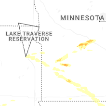


Connect with Interactive Hail Maps