

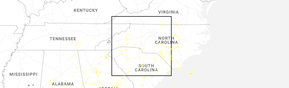
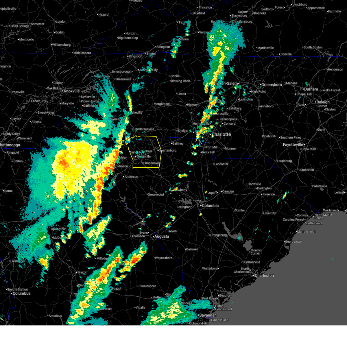
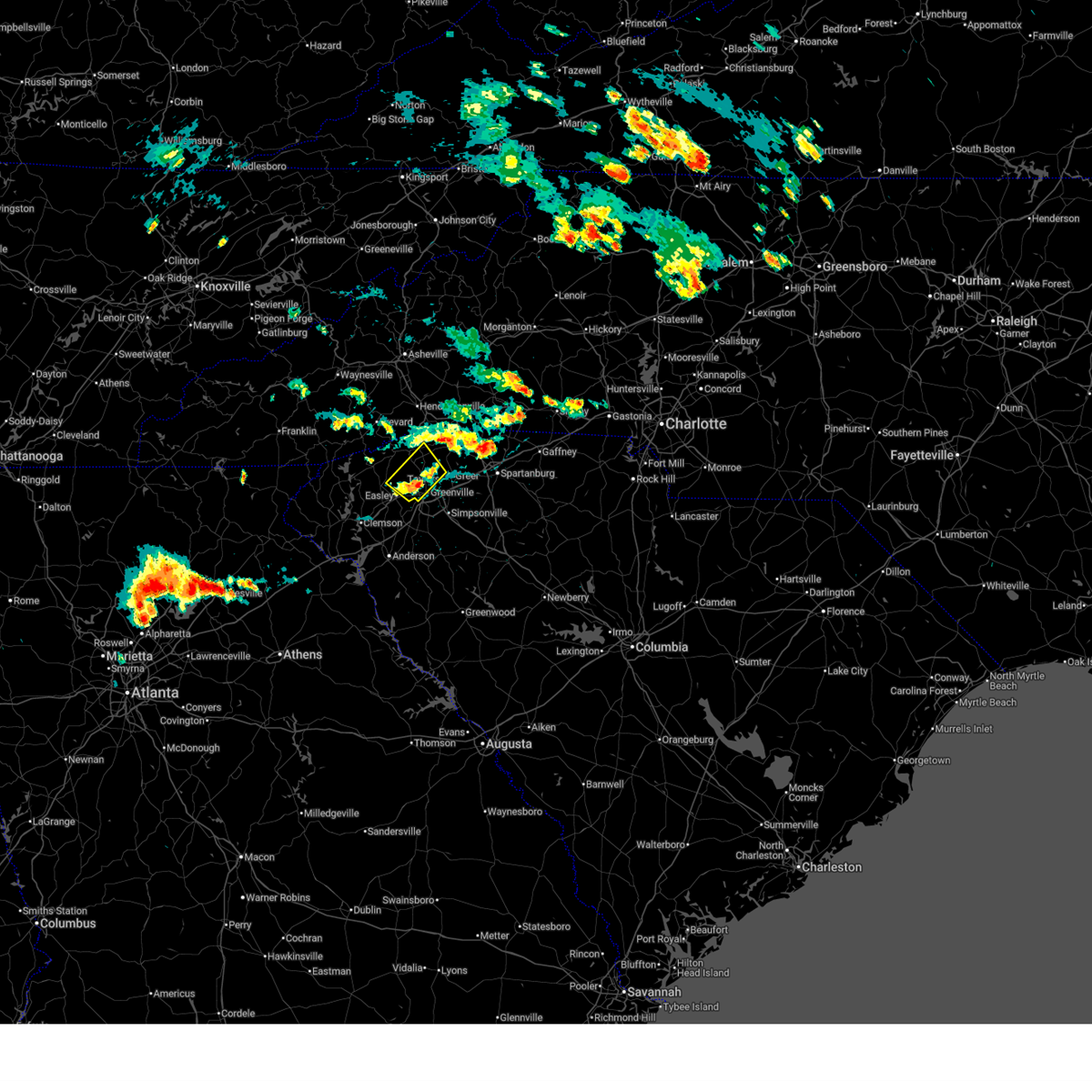
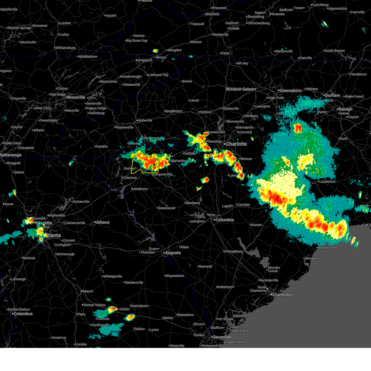
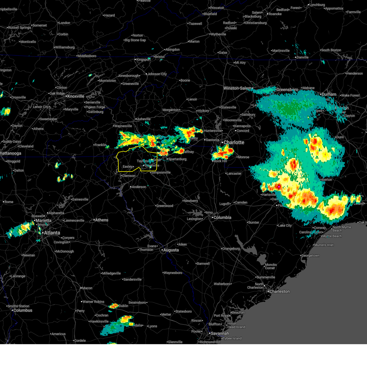
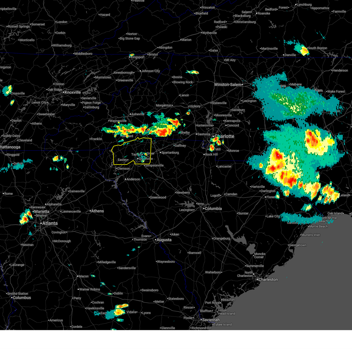
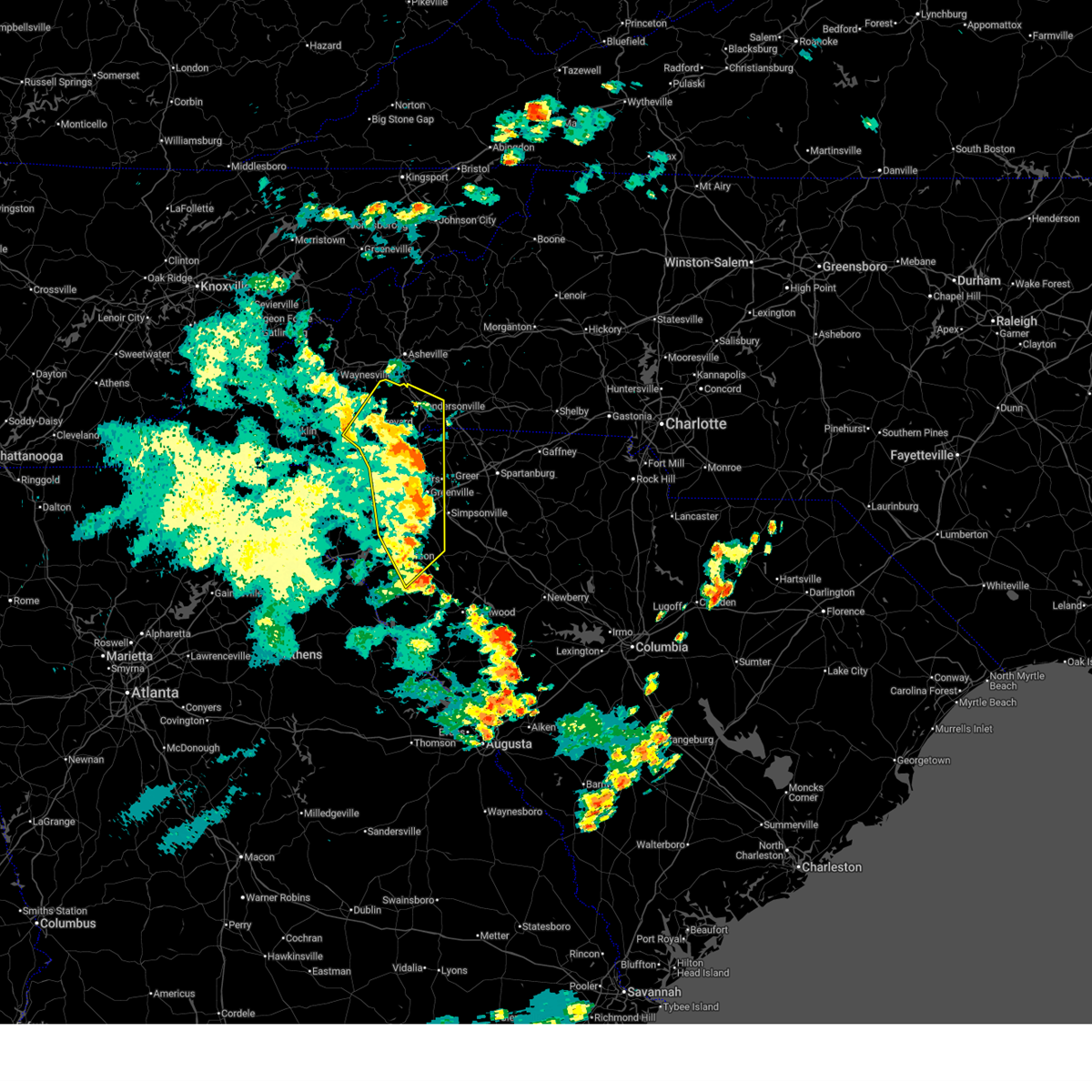
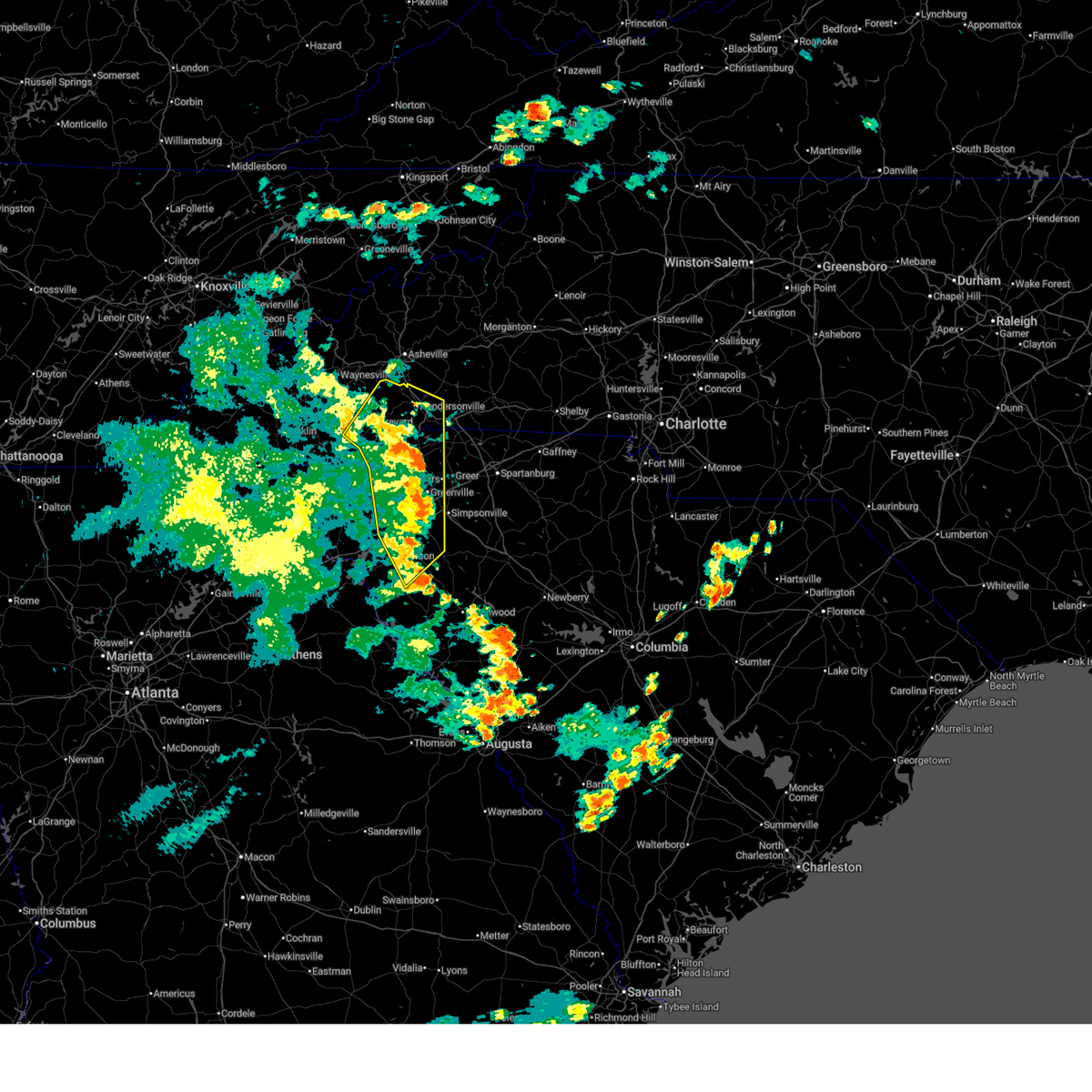
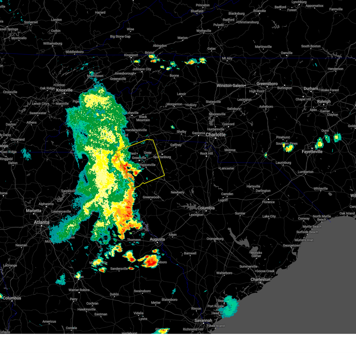
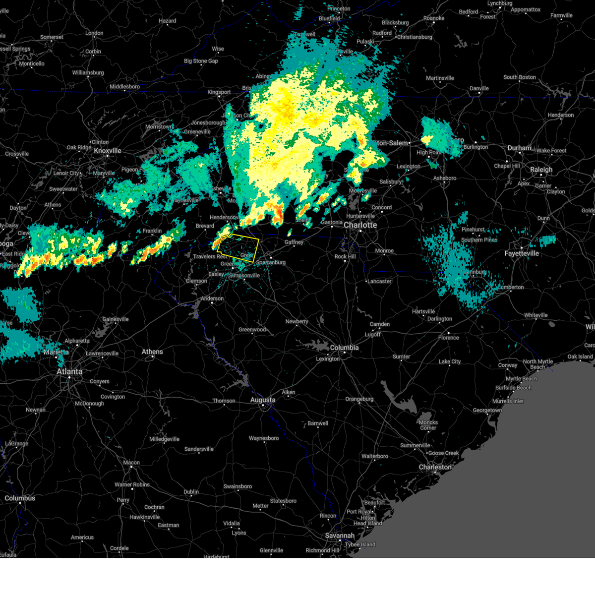
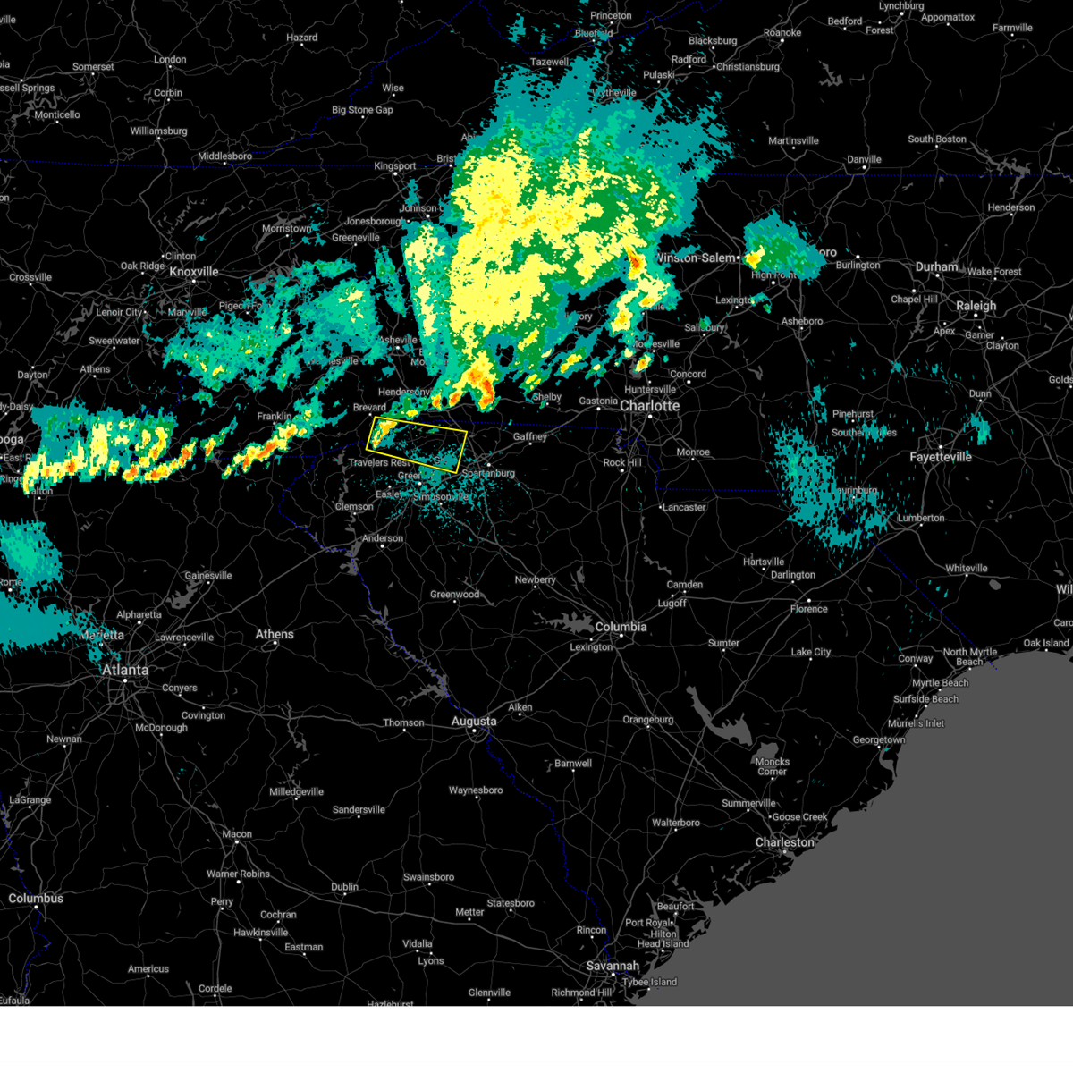
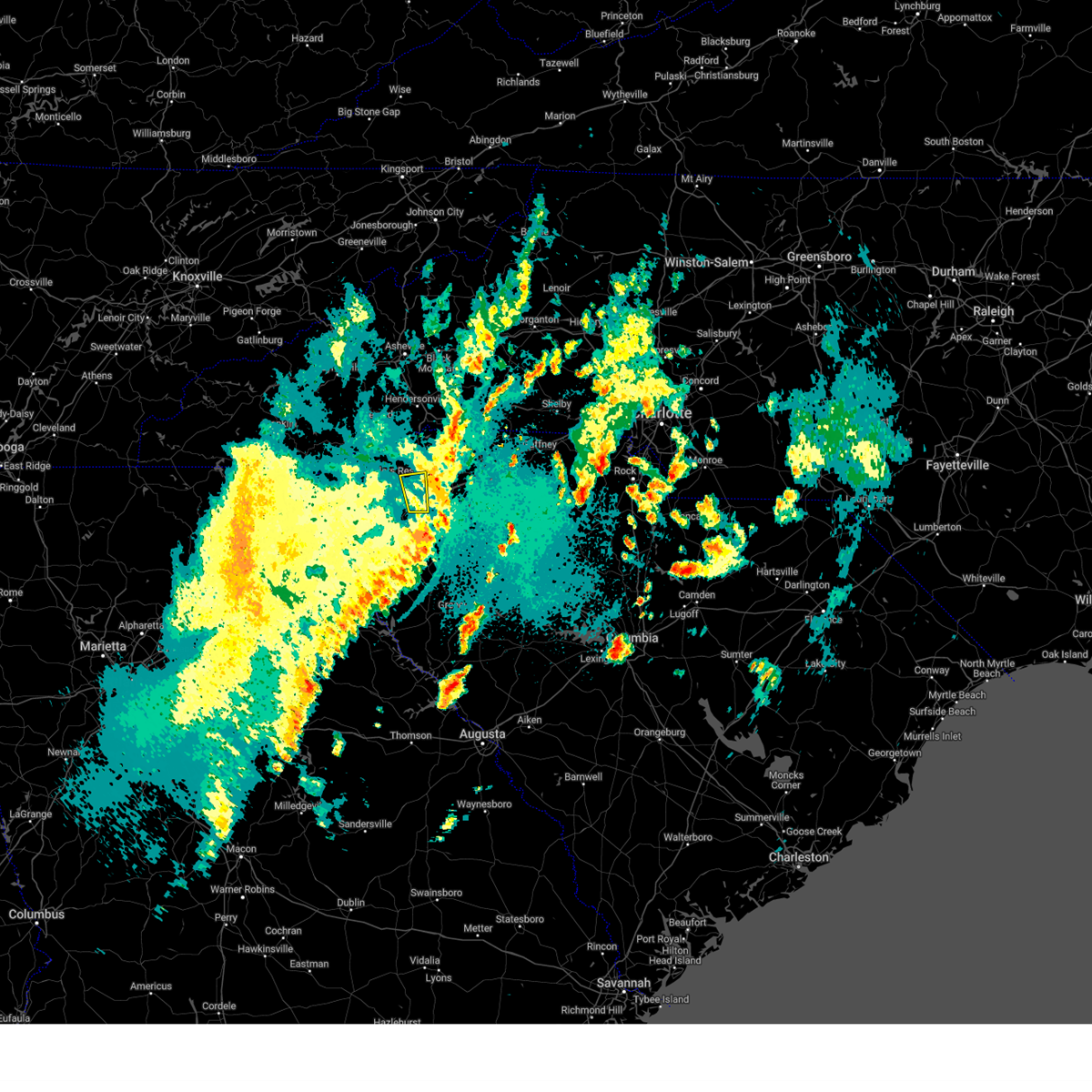
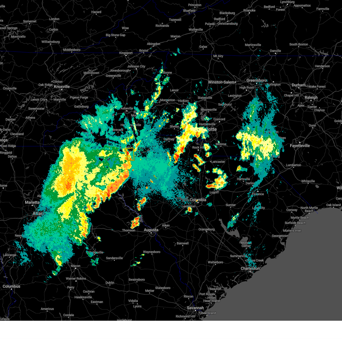
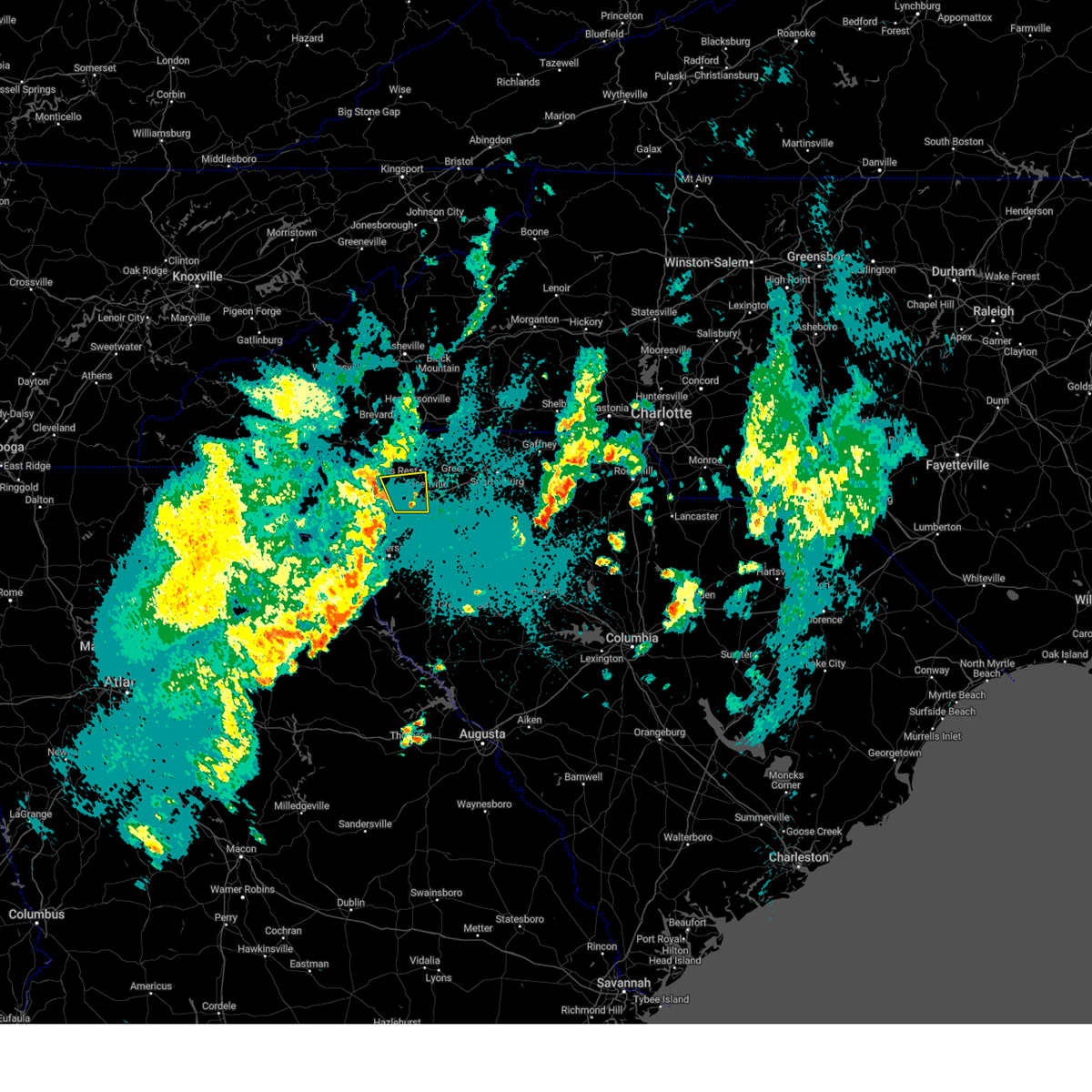
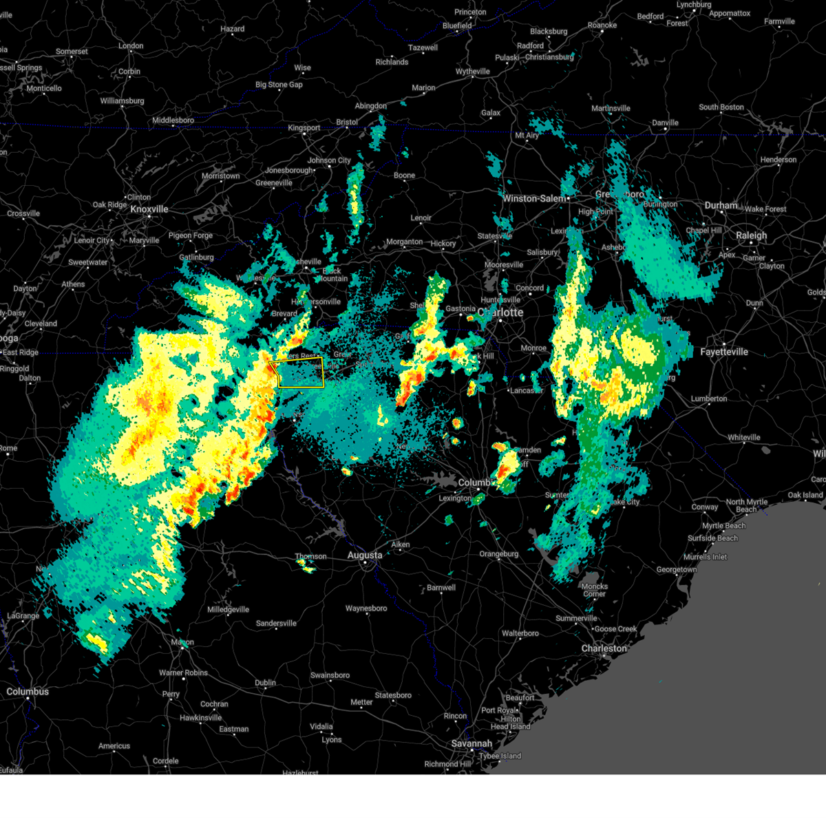
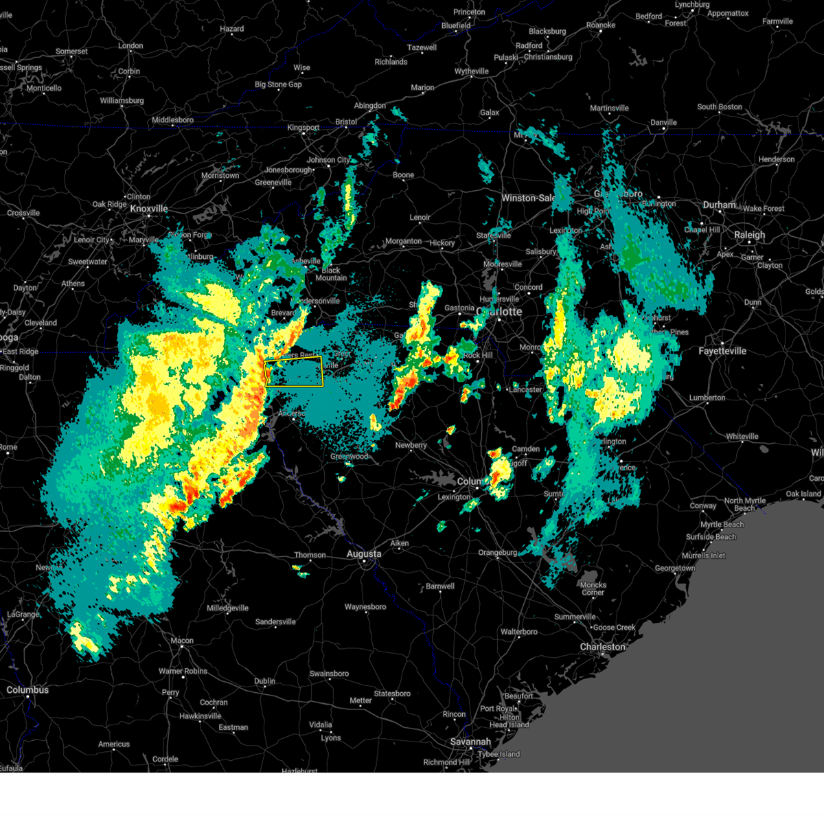
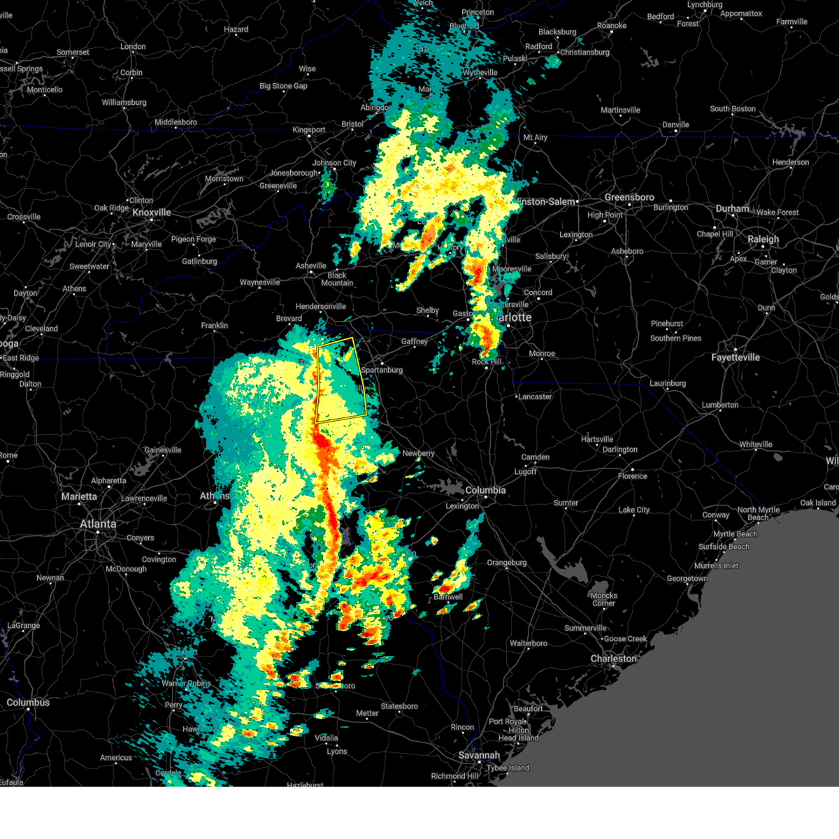
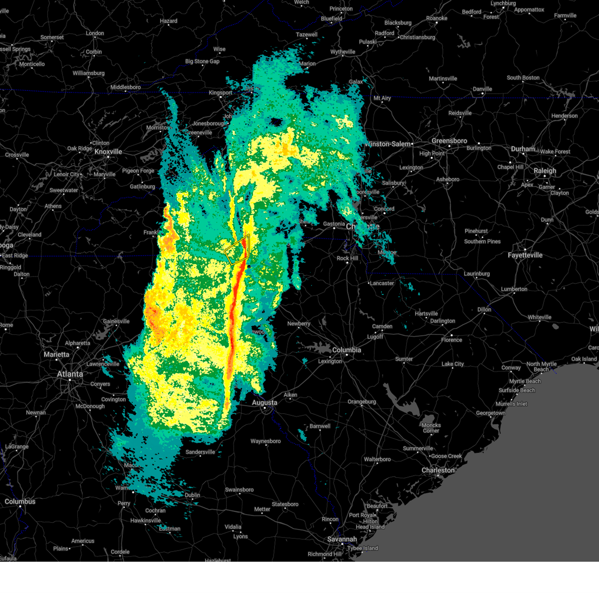
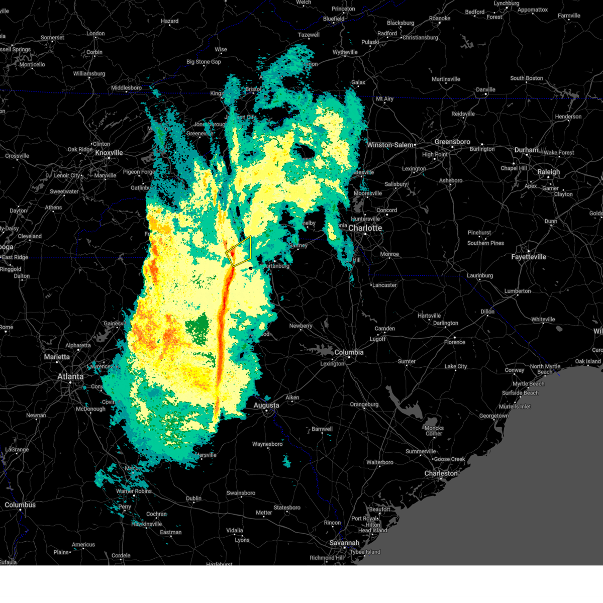
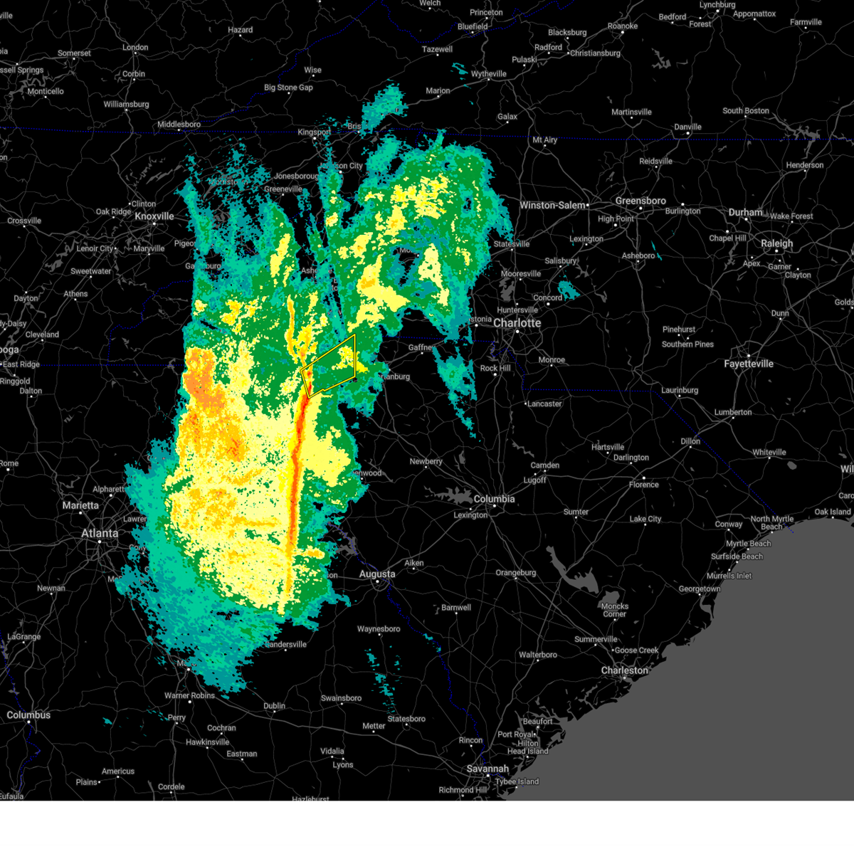
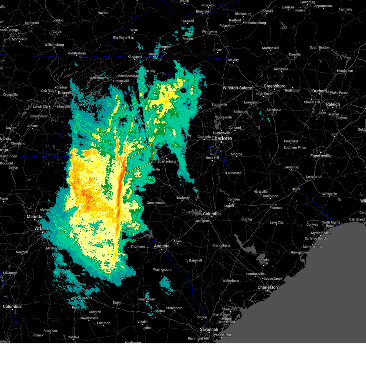
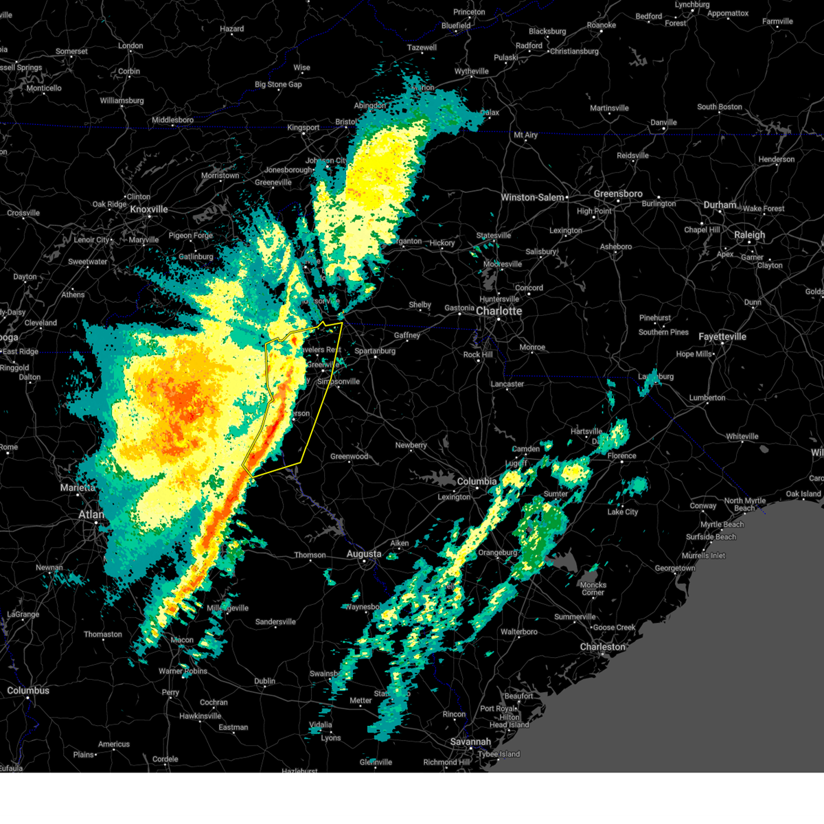
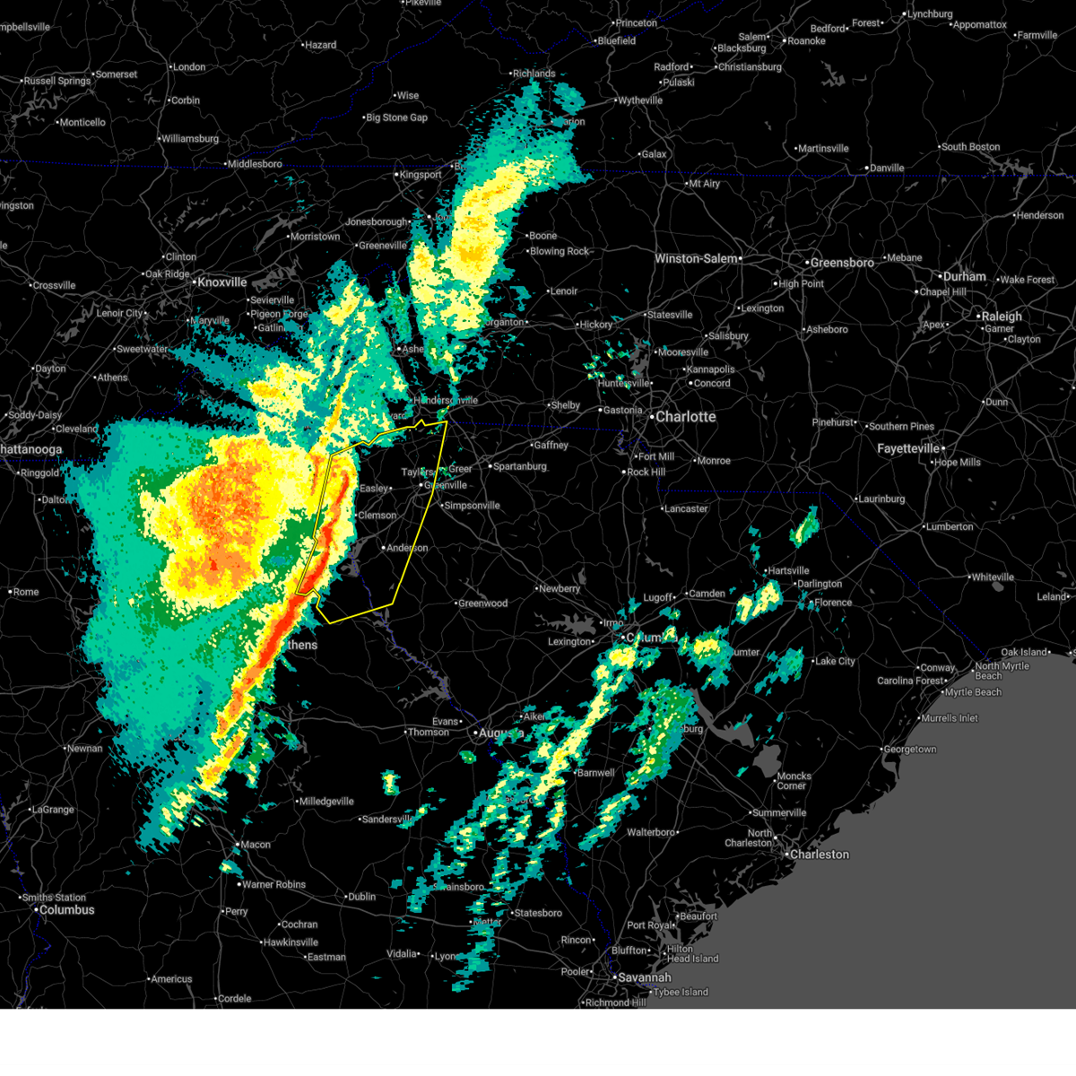
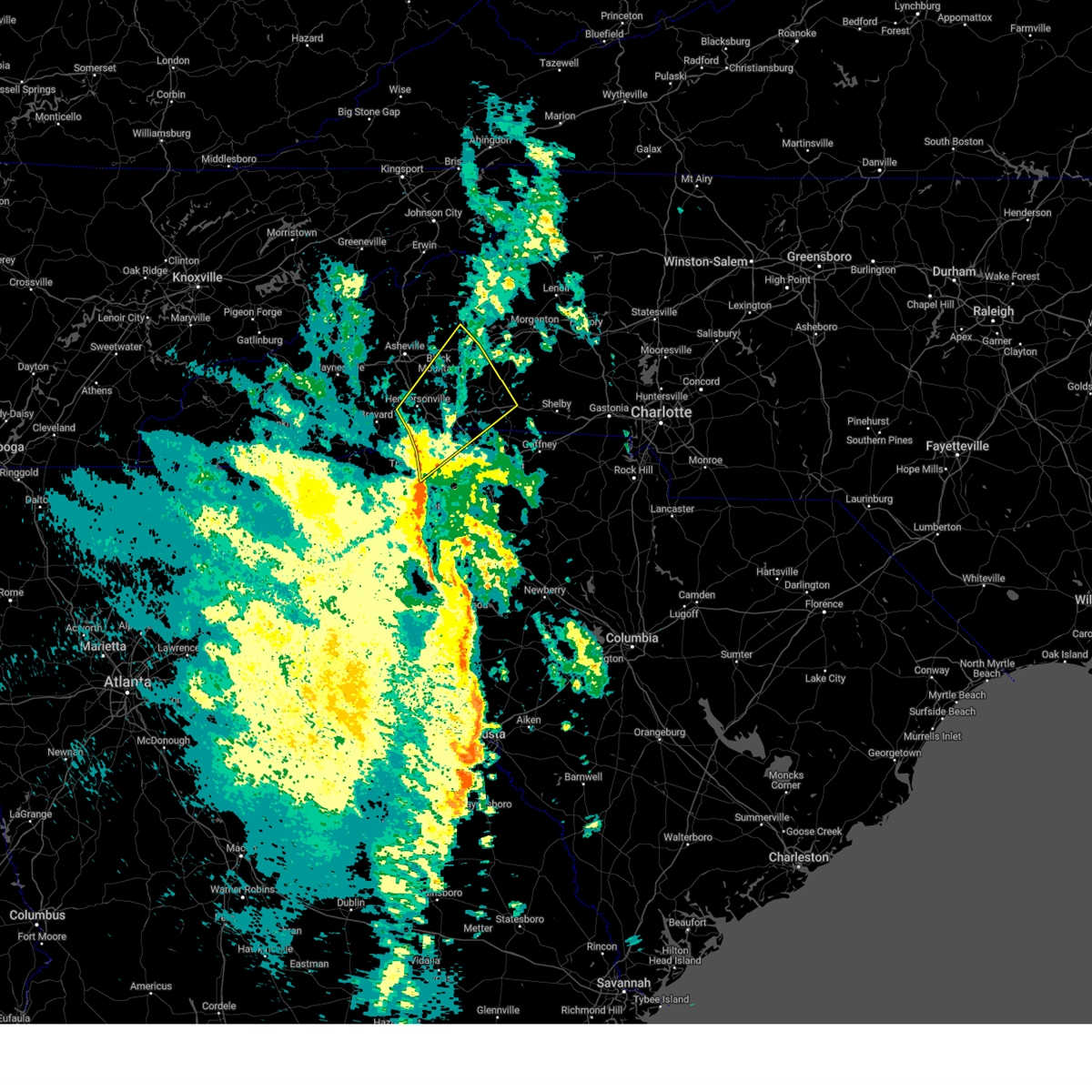
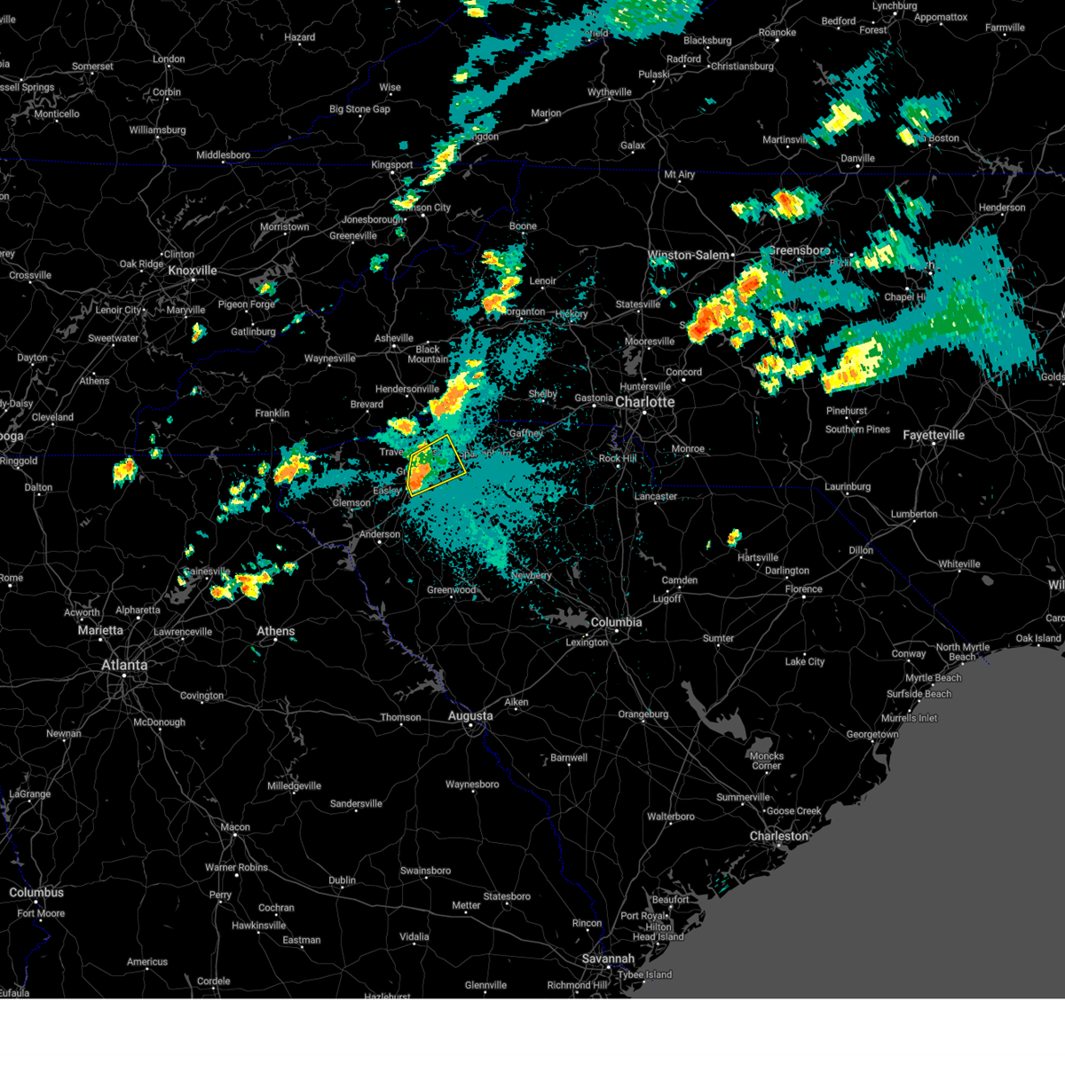
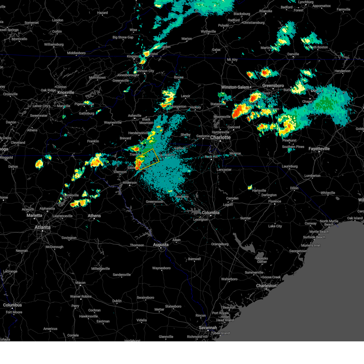
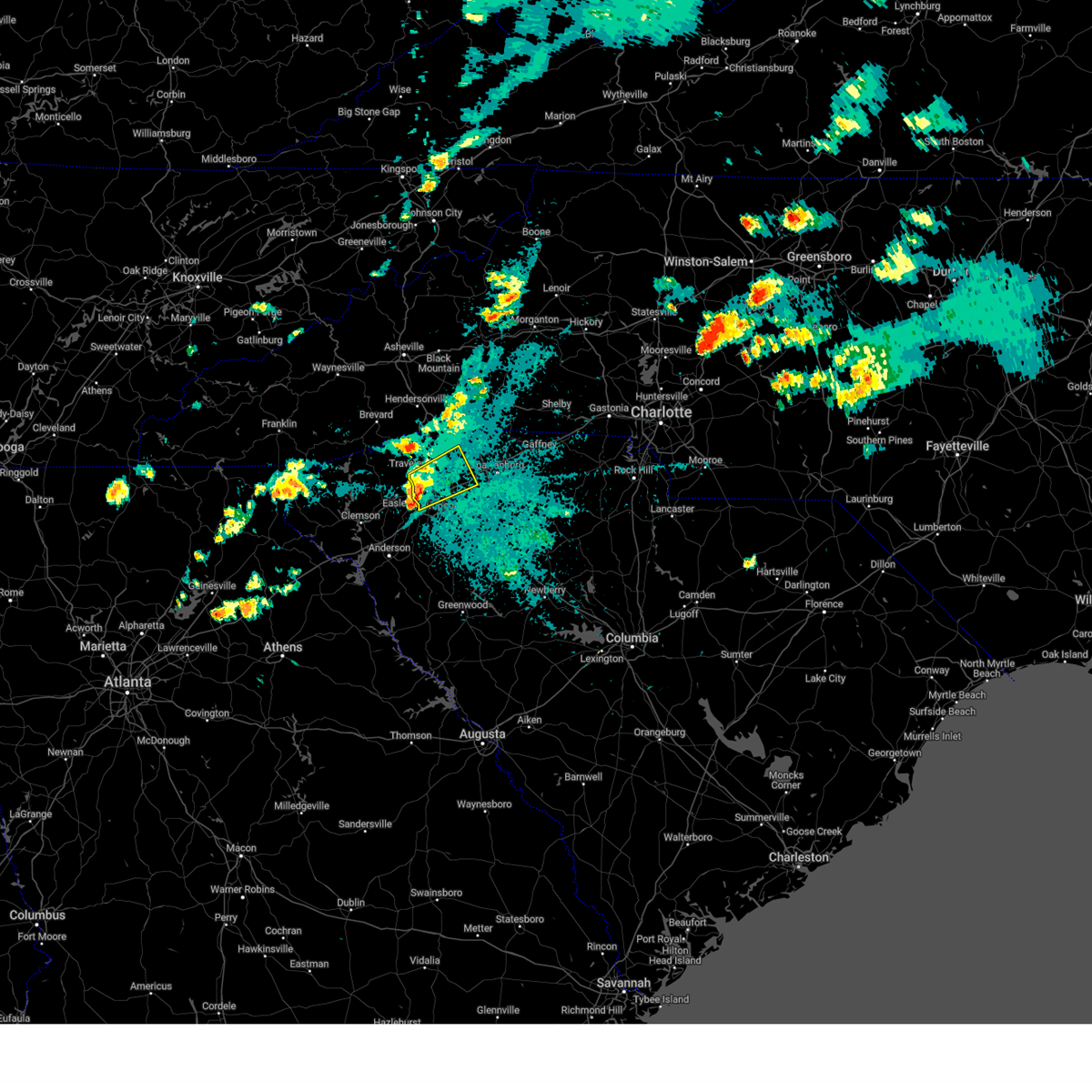
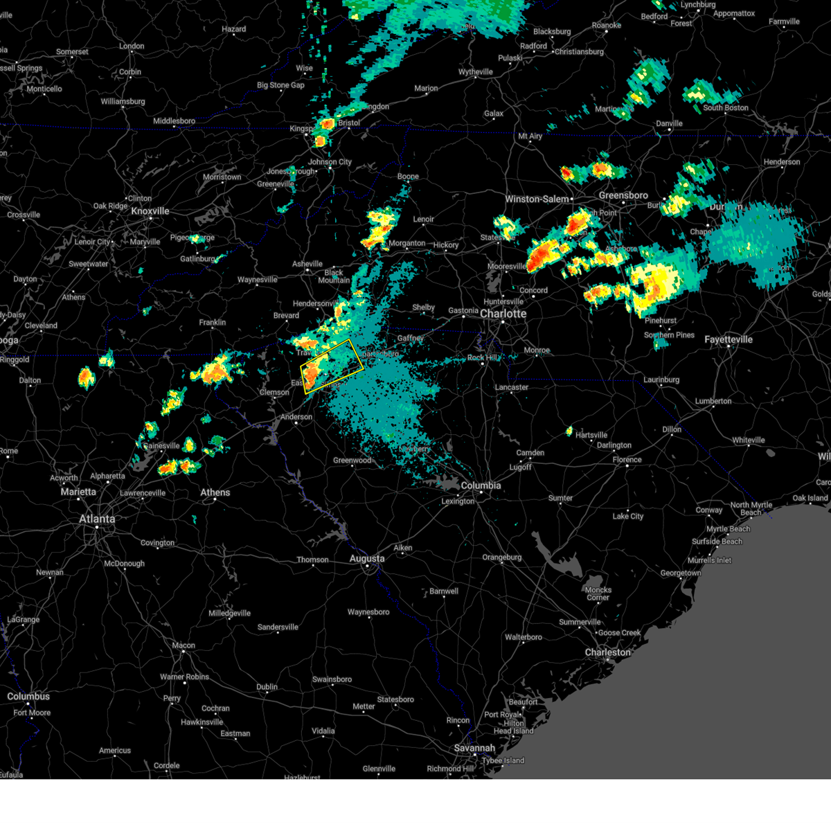
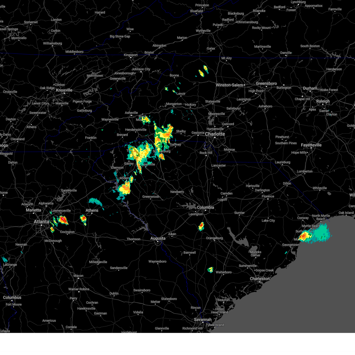
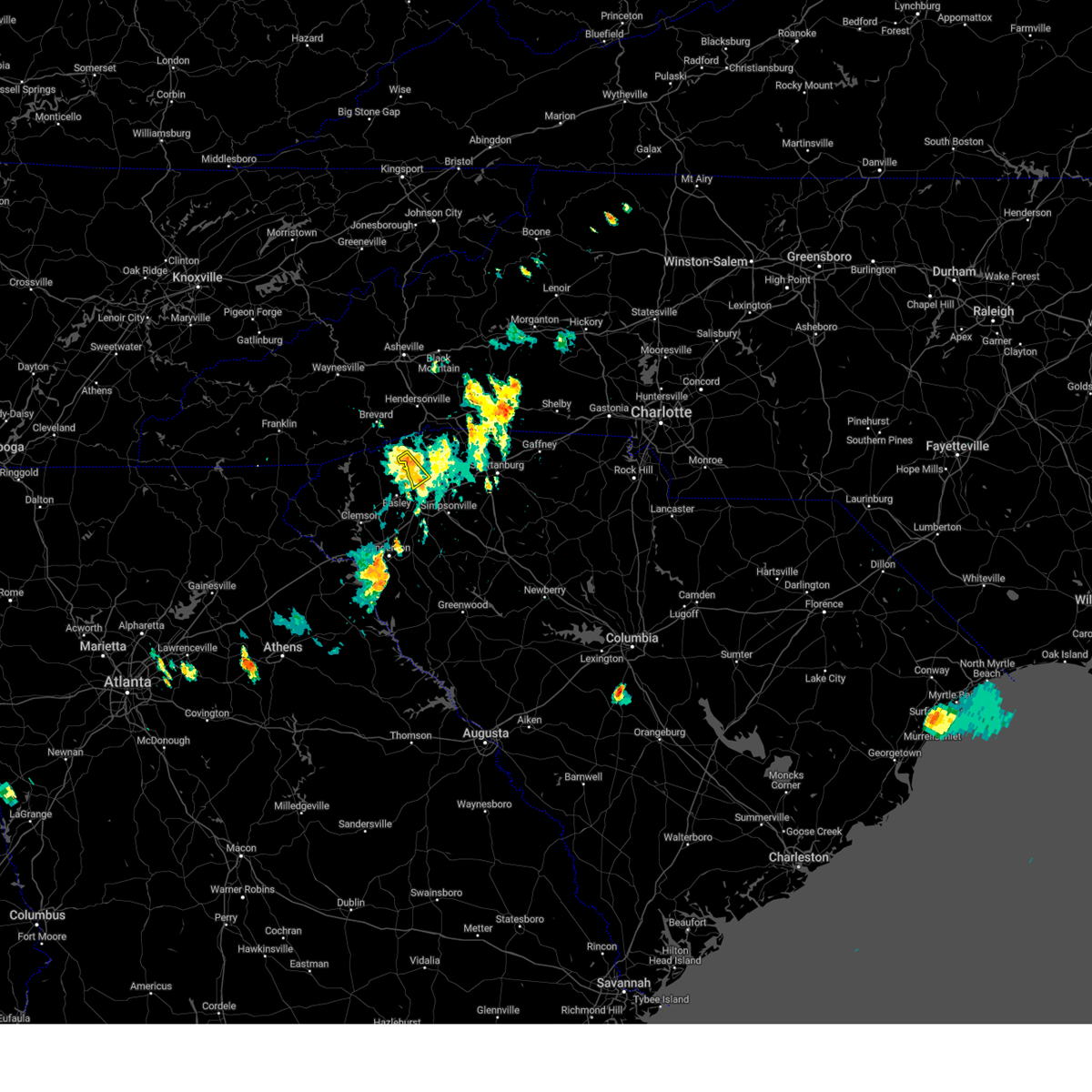
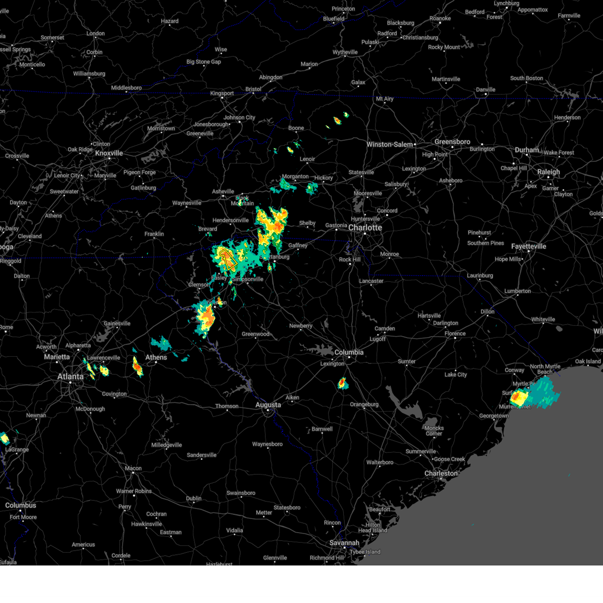
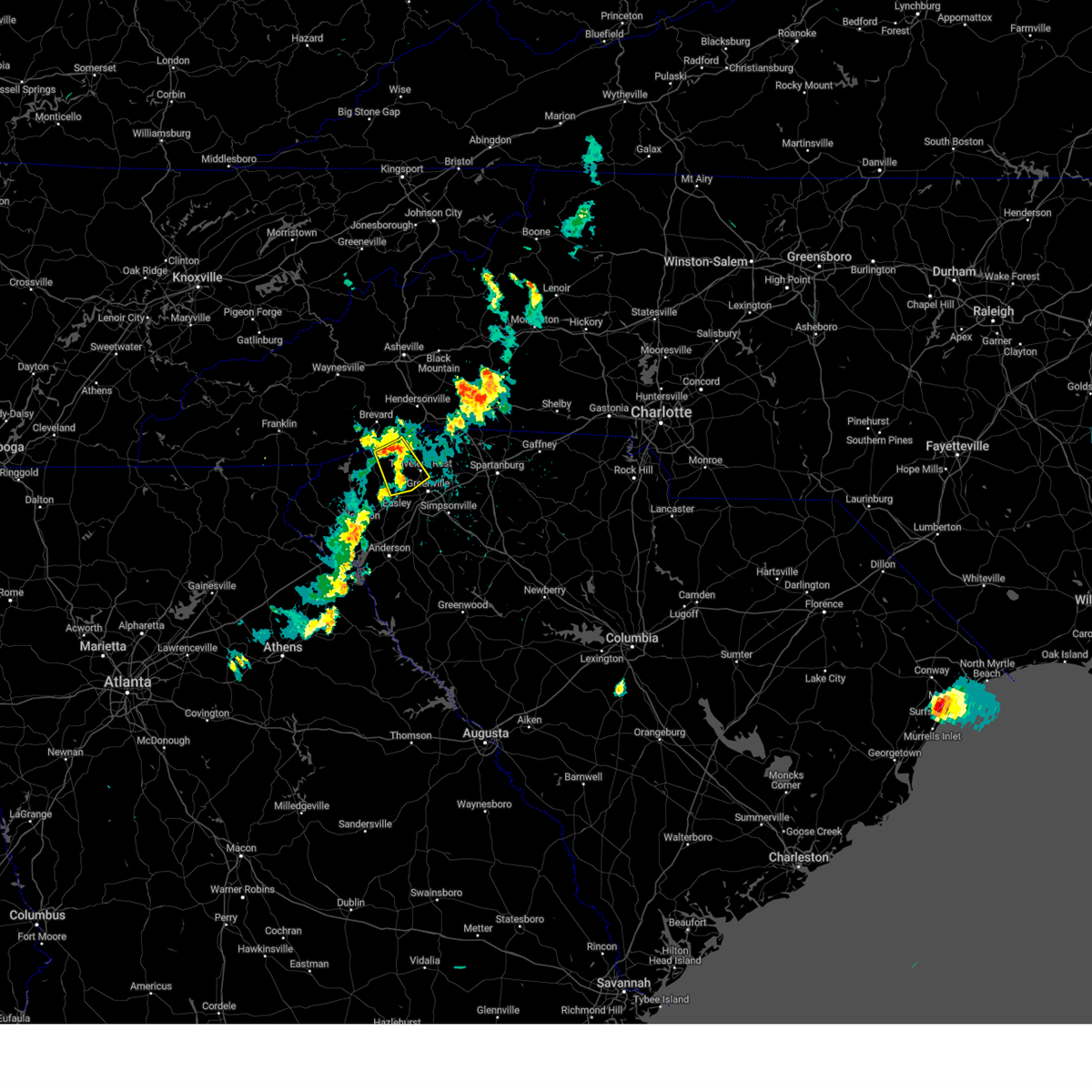
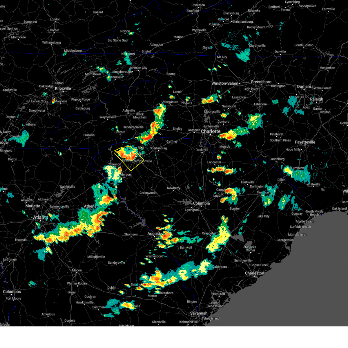
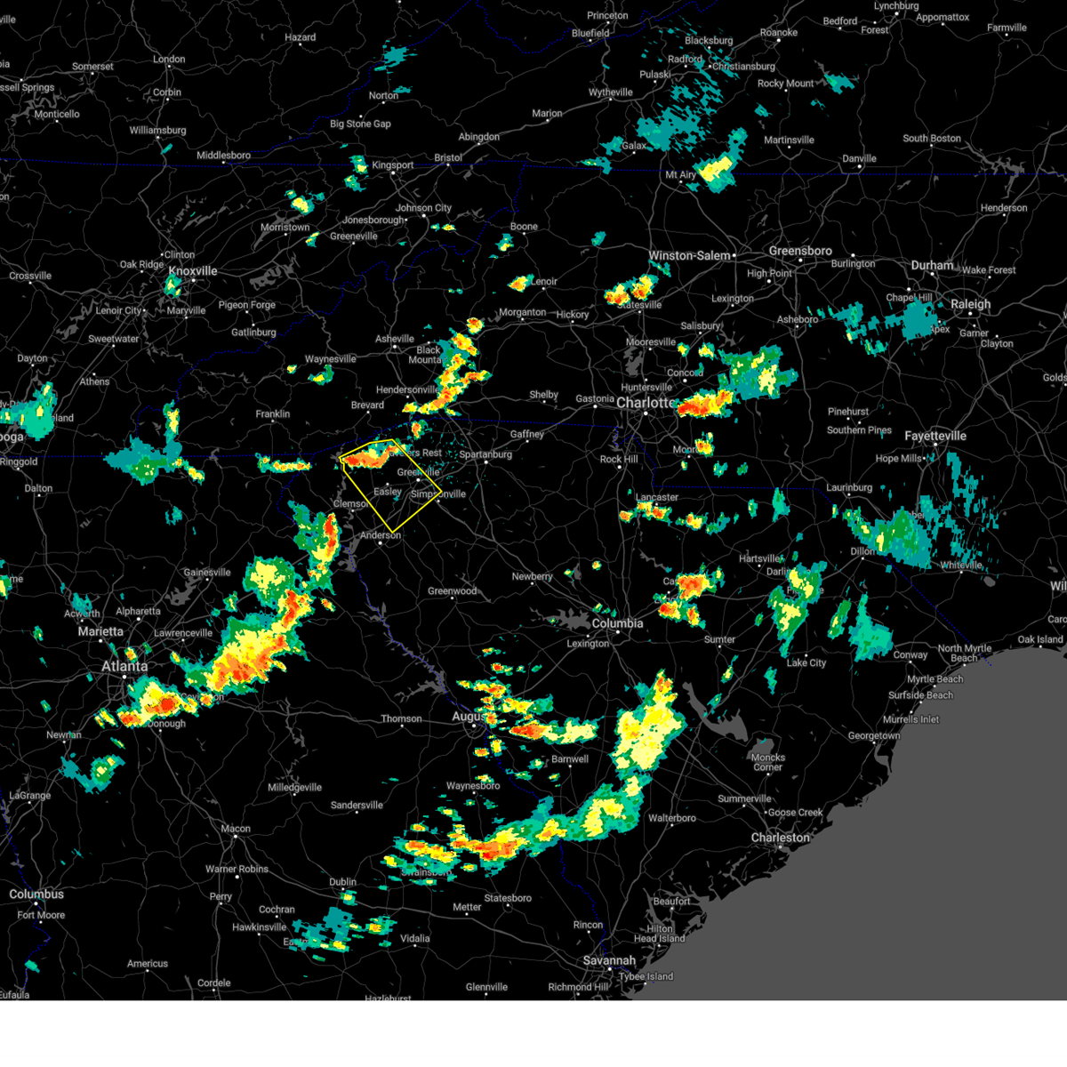
Hail Map for Travelers Rest, SC
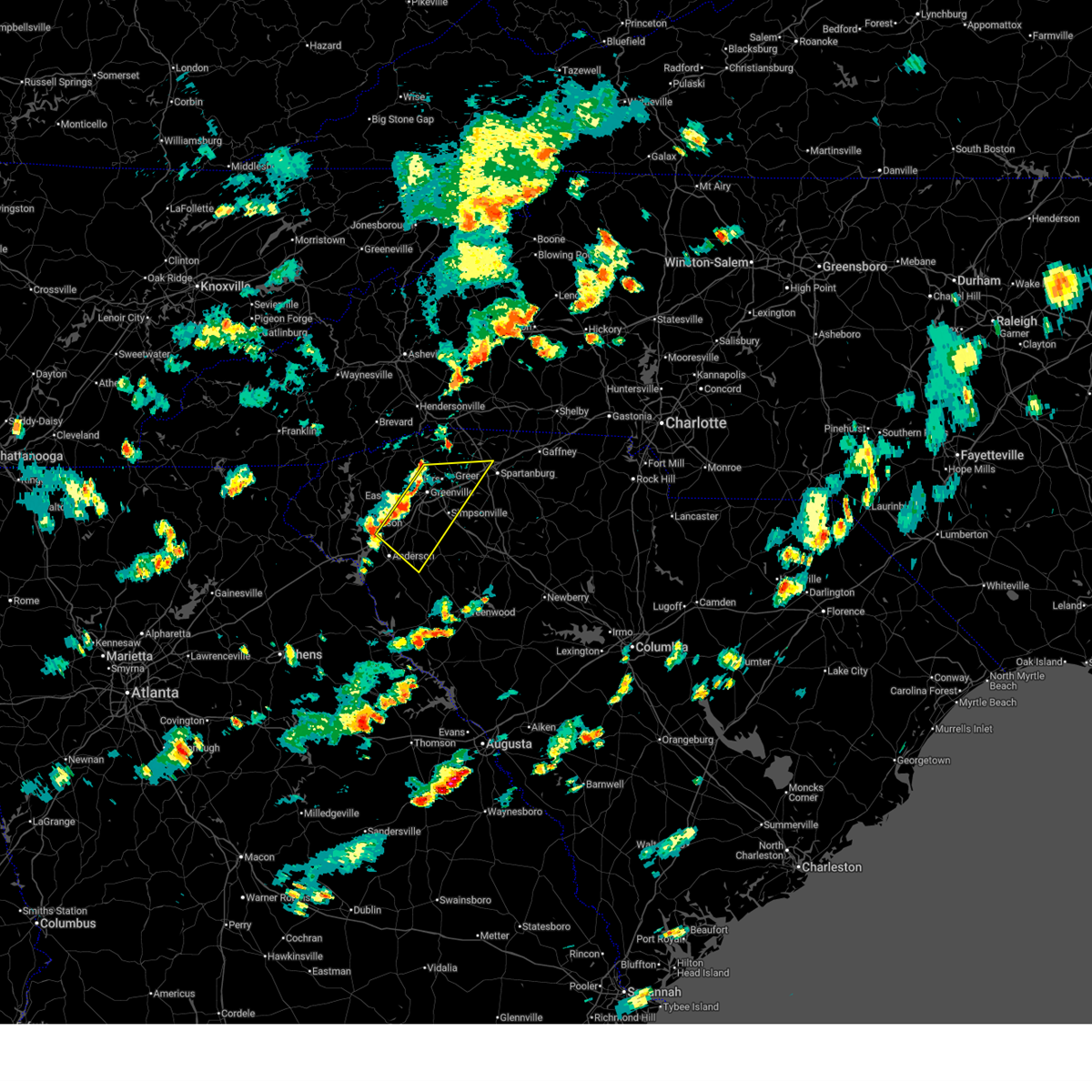
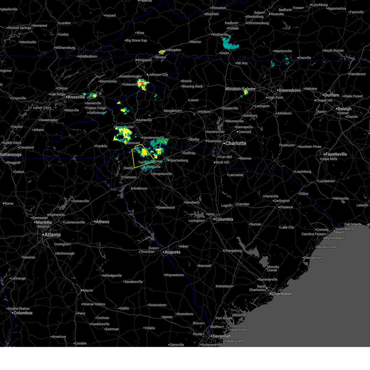
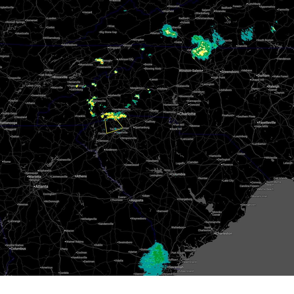
The Travelers Rest, SC area has had 18 reports of on-the-ground hail by trained spotters, and has been under severe weather warnings 6 times during the past 12 months. Doppler radar has detected hail at or near Travelers Rest, SC on 51 occasions.
| Name: | Travelers Rest, SC |
| Where Located: | 13.1 miles NE of Greenville, SC |
| Map: | Google Map for Travelers Rest, SC |
| Population: | 4576 |
| Housing Units: | 1919 |
| More Info: | Search Google for Travelers Rest, SC |
0
The Top Recent Hail Date for Travelers Rest, SC is Wednesday, June 25, 2025 (51st out of 51)
Hail and Wind Damage Spotted near Travelers Rest, SC
| Date / Time | Report Details |
|---|---|
| 6/27/2026 3:12 PM EDT |
 Svrgsp the national weather service in greenville-spartanburg has issued a * severe thunderstorm warning for, southeastern greenville county in upstate south carolina, west central spartanburg county in upstate south carolina, northeastern anderson county in upstate south carolina, east central pickens county in upstate south carolina, * until 415 pm edt. * at 311 pm edt, severe thunderstorms were located along a line extending from 7 miles north of greenville downtown to 7 miles north of anderson, moving east at 25 mph (radar indicated). Hazards include 60 mph wind gusts. expect damage to trees and power lines Svrgsp the national weather service in greenville-spartanburg has issued a * severe thunderstorm warning for, southeastern greenville county in upstate south carolina, west central spartanburg county in upstate south carolina, northeastern anderson county in upstate south carolina, east central pickens county in upstate south carolina, * until 415 pm edt. * at 311 pm edt, severe thunderstorms were located along a line extending from 7 miles north of greenville downtown to 7 miles north of anderson, moving east at 25 mph (radar indicated). Hazards include 60 mph wind gusts. expect damage to trees and power lines
|
| 6/12/2026 9:15 PM EDT |
 the severe thunderstorm warning has been cancelled and is no longer in effect the severe thunderstorm warning has been cancelled and is no longer in effect
|
| 6/12/2026 8:28 PM EDT |
 Svrgsp the national weather service in greenville-spartanburg has issued a * severe thunderstorm warning for, south central henderson county in western north carolina, northern greenville county in upstate south carolina, northeastern pickens county in upstate south carolina, * until 930 pm edt. * at 828 pm edt, a severe thunderstorm was located 14 miles south of hendersonville, or near pleasant ridge state park, moving south at 20 mph (radar indicated). Hazards include 60 mph wind gusts and half dollar size hail. Minor hail damage to vehicles is expected. Expect wind damage to trees and power lines. Svrgsp the national weather service in greenville-spartanburg has issued a * severe thunderstorm warning for, south central henderson county in western north carolina, northern greenville county in upstate south carolina, northeastern pickens county in upstate south carolina, * until 930 pm edt. * at 828 pm edt, a severe thunderstorm was located 14 miles south of hendersonville, or near pleasant ridge state park, moving south at 20 mph (radar indicated). Hazards include 60 mph wind gusts and half dollar size hail. Minor hail damage to vehicles is expected. Expect wind damage to trees and power lines.
|
| 3/16/2026 7:15 AM EDT |
 Svrgsp the national weather service in greenville-spartanburg has issued a * severe thunderstorm warning for, northwestern laurens county in upstate south carolina, greenville county in upstate south carolina, spartanburg county in upstate south carolina, * until 815 am edt. * at 715 am edt, severe thunderstorms were located along a line extending from 16 miles south of brevard to 9 miles west of pickens to 11 miles northwest of hartwell, moving east at 45 mph (radar indicated). Hazards include 60 mph wind gusts. expect damage to trees and power lines Svrgsp the national weather service in greenville-spartanburg has issued a * severe thunderstorm warning for, northwestern laurens county in upstate south carolina, greenville county in upstate south carolina, spartanburg county in upstate south carolina, * until 815 am edt. * at 715 am edt, severe thunderstorms were located along a line extending from 16 miles south of brevard to 9 miles west of pickens to 11 miles northwest of hartwell, moving east at 45 mph (radar indicated). Hazards include 60 mph wind gusts. expect damage to trees and power lines
|
| 7/11/2025 5:04 PM EDT |
 the severe thunderstorm warning has been cancelled and is no longer in effect the severe thunderstorm warning has been cancelled and is no longer in effect
|
| 7/11/2025 4:15 PM EDT |
 Svrgsp the national weather service in greenville-spartanburg has issued a * severe thunderstorm warning for, northern greenville county in upstate south carolina, * until 515 pm edt. * at 414 pm edt, a severe thunderstorm was located 14 miles northwest of greenville downtown, or near slater-marietta, moving southeast at 15 mph (radar indicated). Hazards include 60 mph wind gusts and quarter size hail. Minor hail damage to vehicles is expected. Expect wind damage to trees and power lines. Svrgsp the national weather service in greenville-spartanburg has issued a * severe thunderstorm warning for, northern greenville county in upstate south carolina, * until 515 pm edt. * at 414 pm edt, a severe thunderstorm was located 14 miles northwest of greenville downtown, or near slater-marietta, moving southeast at 15 mph (radar indicated). Hazards include 60 mph wind gusts and quarter size hail. Minor hail damage to vehicles is expected. Expect wind damage to trees and power lines.
|
| 6/26/2025 4:46 PM EDT |
 The storms which prompted the warning have weakened below severe limits, and no longer pose an immediate threat to life or property. therefore, the warning has been allowed to expire. however, heavy rain is still possible with these thunderstorms. to report severe weather to the national weather service greenville-spartanburg, call toll free, 1, 800, 2 6 7, 8 1 0 1, or post on our facebook page, or tweet it using hashtag nwsgsp. your message should describe the event and the specific location where it occurred. please include the size of any hail observed. The storms which prompted the warning have weakened below severe limits, and no longer pose an immediate threat to life or property. therefore, the warning has been allowed to expire. however, heavy rain is still possible with these thunderstorms. to report severe weather to the national weather service greenville-spartanburg, call toll free, 1, 800, 2 6 7, 8 1 0 1, or post on our facebook page, or tweet it using hashtag nwsgsp. your message should describe the event and the specific location where it occurred. please include the size of any hail observed.
|
| 6/26/2025 4:00 PM EDT |
 Svrgsp the national weather service in greenville-spartanburg has issued a * severe thunderstorm warning for, northeastern greenville county in upstate south carolina, east central pickens county in upstate south carolina, * until 445 pm edt. * at 359 pm edt, severe thunderstorms were located along a line extending from 14 miles northeast of easley to 4 miles northwest of greenville downtown, and are nearly stationary (radar indicated). Hazards include 60 mph wind gusts and nickel size hail. expect damage to trees and power lines Svrgsp the national weather service in greenville-spartanburg has issued a * severe thunderstorm warning for, northeastern greenville county in upstate south carolina, east central pickens county in upstate south carolina, * until 445 pm edt. * at 359 pm edt, severe thunderstorms were located along a line extending from 14 miles northeast of easley to 4 miles northwest of greenville downtown, and are nearly stationary (radar indicated). Hazards include 60 mph wind gusts and nickel size hail. expect damage to trees and power lines
|
| 6/25/2025 6:46 PM EDT |
 At 646 pm edt, a severe thunderstorm was located 5 miles southeast of greenville downtown, or near mauldin, moving south at 15 mph (radar indicated). Hazards include 60 mph wind gusts and penny size hail. Expect damage to trees and power lines. Locations impacted include, greenville downtown, easley, greenville eastside, west greenville, greer, mauldin, taylors, berea, five forks, and welcome. At 646 pm edt, a severe thunderstorm was located 5 miles southeast of greenville downtown, or near mauldin, moving south at 15 mph (radar indicated). Hazards include 60 mph wind gusts and penny size hail. Expect damage to trees and power lines. Locations impacted include, greenville downtown, easley, greenville eastside, west greenville, greer, mauldin, taylors, berea, five forks, and welcome.
|
| 6/25/2025 6:21 PM EDT |
 At 621 pm edt, a severe thunderstorm was located 6 miles northeast of greenville downtown, or over taylors, moving south at 15 mph (radar indicated). Hazards include 60 mph wind gusts and quarter size hail. Minor hail damage to vehicles is expected. expect wind damage to trees and power lines. Locations impacted include, greenville downtown, easley, pickens, greenville eastside, west greenville, greer, mauldin, taylors, berea, and five forks. At 621 pm edt, a severe thunderstorm was located 6 miles northeast of greenville downtown, or over taylors, moving south at 15 mph (radar indicated). Hazards include 60 mph wind gusts and quarter size hail. Minor hail damage to vehicles is expected. expect wind damage to trees and power lines. Locations impacted include, greenville downtown, easley, pickens, greenville eastside, west greenville, greer, mauldin, taylors, berea, and five forks.
|
| 6/25/2025 5:30 PM EDT |
 Svrgsp the national weather service in greenville-spartanburg has issued a * severe thunderstorm warning for, greenville county in upstate south carolina, northwestern spartanburg county in upstate south carolina, pickens county in upstate south carolina, * until 700 pm edt. * at 530 pm edt, a severe thunderstorm was located 4 miles southwest of hendersonville, or near laurel park, and is nearly stationary (radar indicated). Hazards include 60 mph wind gusts and quarter size hail. Minor hail damage to vehicles is expected. Expect wind damage to trees and power lines. Svrgsp the national weather service in greenville-spartanburg has issued a * severe thunderstorm warning for, greenville county in upstate south carolina, northwestern spartanburg county in upstate south carolina, pickens county in upstate south carolina, * until 700 pm edt. * at 530 pm edt, a severe thunderstorm was located 4 miles southwest of hendersonville, or near laurel park, and is nearly stationary (radar indicated). Hazards include 60 mph wind gusts and quarter size hail. Minor hail damage to vehicles is expected. Expect wind damage to trees and power lines.
|
| 6/17/2025 8:53 PM EDT |
 At 853 pm edt, severe thunderstorms were located along a line extending from 3 miles southwest of brevard to 14 miles south of hendersonville to 7 miles southeast of anderson, moving east at 30 mph (radar indicated). Hazards include 60 mph wind gusts. Expect damage to trees and power lines. Locations impacted include, greenville downtown, anderson, easley, hendersonville, brevard, pickens, greenville eastside, west greenville, mauldin, and taylors. At 853 pm edt, severe thunderstorms were located along a line extending from 3 miles southwest of brevard to 14 miles south of hendersonville to 7 miles southeast of anderson, moving east at 30 mph (radar indicated). Hazards include 60 mph wind gusts. Expect damage to trees and power lines. Locations impacted include, greenville downtown, anderson, easley, hendersonville, brevard, pickens, greenville eastside, west greenville, mauldin, and taylors.
|
| 6/17/2025 8:53 PM EDT |
 the severe thunderstorm warning has been cancelled and is no longer in effect the severe thunderstorm warning has been cancelled and is no longer in effect
|
| 6/17/2025 8:50 PM EDT |
 Svrgsp the national weather service in greenville-spartanburg has issued a * severe thunderstorm warning for, rutherford county in western north carolina, southeastern henderson county in western north carolina, polk county in western north carolina, cleveland county in the piedmont of north carolina, laurens county in upstate south carolina, northeastern pickens county in upstate south carolina, union county in upstate south carolina, greenville county in upstate south carolina, spartanburg county in upstate south carolina, eastern anderson county in upstate south carolina, cherokee county in upstate south carolina, northeastern abbeville county in upstate south carolina, northwestern greenwood county in upstate south carolina, * until 945 pm edt. * at 849 pm edt, severe thunderstorms were located along a line extending from 12 miles south of hendersonville to 18 miles southwest of columbus to 7 miles south of greenville downtown to 11 miles north of abbeville, moving northeast at 50 mph (radar indicated). Hazards include 60 mph wind gusts. expect damage to trees and power lines Svrgsp the national weather service in greenville-spartanburg has issued a * severe thunderstorm warning for, rutherford county in western north carolina, southeastern henderson county in western north carolina, polk county in western north carolina, cleveland county in the piedmont of north carolina, laurens county in upstate south carolina, northeastern pickens county in upstate south carolina, union county in upstate south carolina, greenville county in upstate south carolina, spartanburg county in upstate south carolina, eastern anderson county in upstate south carolina, cherokee county in upstate south carolina, northeastern abbeville county in upstate south carolina, northwestern greenwood county in upstate south carolina, * until 945 pm edt. * at 849 pm edt, severe thunderstorms were located along a line extending from 12 miles south of hendersonville to 18 miles southwest of columbus to 7 miles south of greenville downtown to 11 miles north of abbeville, moving northeast at 50 mph (radar indicated). Hazards include 60 mph wind gusts. expect damage to trees and power lines
|
| 6/17/2025 8:46 PM EDT | Trees and powerlines down in the travelers rest are in greenville county SC, 0.1 miles WSW of Travelers Rest, SC |
| 6/17/2025 8:12 PM EDT |
 Svrgsp the national weather service in greenville-spartanburg has issued a * severe thunderstorm warning for, north central elbert county in northeastern georgia, central hart county in northeastern georgia, transylvania county in western north carolina, henderson county in western north carolina, southwestern polk county in western north carolina, greenville county in upstate south carolina, anderson county in upstate south carolina, pickens county in upstate south carolina, northwestern abbeville county in upstate south carolina, oconee county in upstate south carolina, * until 915 pm edt. * at 812 pm edt, severe thunderstorms were located along a line extending from 14 miles north of walhalla to 5 miles west of pickens to 9 miles northeast of elberton, moving northeast at 35 mph (radar indicated). Hazards include 60 mph wind gusts. expect damage to trees and power lines Svrgsp the national weather service in greenville-spartanburg has issued a * severe thunderstorm warning for, north central elbert county in northeastern georgia, central hart county in northeastern georgia, transylvania county in western north carolina, henderson county in western north carolina, southwestern polk county in western north carolina, greenville county in upstate south carolina, anderson county in upstate south carolina, pickens county in upstate south carolina, northwestern abbeville county in upstate south carolina, oconee county in upstate south carolina, * until 915 pm edt. * at 812 pm edt, severe thunderstorms were located along a line extending from 14 miles north of walhalla to 5 miles west of pickens to 9 miles northeast of elberton, moving northeast at 35 mph (radar indicated). Hazards include 60 mph wind gusts. expect damage to trees and power lines
|
| 6/7/2025 8:25 PM EDT |
 The storms which prompted the warning have moved out of the area. therefore, the warning will be allowed to expire. a severe thunderstorm watch remains in effect until 1100 pm edt for upstate south carolina. to report severe weather to the national weather service greenville-spartanburg, call toll free, 1, 800, 2 6 7, 8 1 0 1, or post on our facebook page, or tweet it using hashtag nwsgsp. your message should describe the event and the specific location where it occurred. remember, a severe thunderstorm warning still remains in effect for spartanburg county and eastern laurens county until 900 pm edt. The storms which prompted the warning have moved out of the area. therefore, the warning will be allowed to expire. a severe thunderstorm watch remains in effect until 1100 pm edt for upstate south carolina. to report severe weather to the national weather service greenville-spartanburg, call toll free, 1, 800, 2 6 7, 8 1 0 1, or post on our facebook page, or tweet it using hashtag nwsgsp. your message should describe the event and the specific location where it occurred. remember, a severe thunderstorm warning still remains in effect for spartanburg county and eastern laurens county until 900 pm edt.
|
| 6/7/2025 8:09 PM EDT |
 At 808 pm edt, severe thunderstorms were located along a line extending from 14 miles north of greenville downtown to 6 miles west of laurens, moving east at 55 mph (radar indicated). Hazards include 60 mph wind gusts. Expect damage to trees and power lines. Locations impacted include, greenville downtown, greenville eastside, west greenville, greer, mauldin, taylors, simpsonville, berea, five forks, and fountain inn. At 808 pm edt, severe thunderstorms were located along a line extending from 14 miles north of greenville downtown to 6 miles west of laurens, moving east at 55 mph (radar indicated). Hazards include 60 mph wind gusts. Expect damage to trees and power lines. Locations impacted include, greenville downtown, greenville eastside, west greenville, greer, mauldin, taylors, simpsonville, berea, five forks, and fountain inn.
|
| 6/7/2025 8:09 PM EDT |
 the severe thunderstorm warning has been cancelled and is no longer in effect the severe thunderstorm warning has been cancelled and is no longer in effect
|
| 6/7/2025 7:42 PM EDT |
 Svrgsp the national weather service in greenville-spartanburg has issued a * severe thunderstorm warning for, northwestern laurens county in upstate south carolina, greenville county in upstate south carolina, western spartanburg county in upstate south carolina, northeastern anderson county in upstate south carolina, pickens county in upstate south carolina, * until 830 pm edt. * at 742 pm edt, severe thunderstorms were located along a line extending from 7 miles northwest of pickens to 8 miles southeast of anderson, moving northeast at 45 mph (radar indicated). Hazards include 60 mph wind gusts. expect damage to trees and power lines Svrgsp the national weather service in greenville-spartanburg has issued a * severe thunderstorm warning for, northwestern laurens county in upstate south carolina, greenville county in upstate south carolina, western spartanburg county in upstate south carolina, northeastern anderson county in upstate south carolina, pickens county in upstate south carolina, * until 830 pm edt. * at 742 pm edt, severe thunderstorms were located along a line extending from 7 miles northwest of pickens to 8 miles southeast of anderson, moving northeast at 45 mph (radar indicated). Hazards include 60 mph wind gusts. expect damage to trees and power lines
|
| 5/17/2025 6:09 AM EDT |
 the severe thunderstorm warning has been cancelled and is no longer in effect the severe thunderstorm warning has been cancelled and is no longer in effect
|
| 5/17/2025 6:09 AM EDT |
 At 609 am edt, a severe thunderstorm was located 15 miles north of greenville downtown, or near pleasant ridge state park, moving east at 35 mph (radar indicated). Hazards include 60 mph wind gusts and quarter size hail. Minor hail damage to vehicles is expected. expect wind damage to trees and power lines. Locations impacted include, campobello, tigerville, north saluda reservoir, lake robinson, glassy mountain, pleasant ridge state park, cleveland, gowensville, greer, and slater-marietta. At 609 am edt, a severe thunderstorm was located 15 miles north of greenville downtown, or near pleasant ridge state park, moving east at 35 mph (radar indicated). Hazards include 60 mph wind gusts and quarter size hail. Minor hail damage to vehicles is expected. expect wind damage to trees and power lines. Locations impacted include, campobello, tigerville, north saluda reservoir, lake robinson, glassy mountain, pleasant ridge state park, cleveland, gowensville, greer, and slater-marietta.
|
| 5/17/2025 5:51 AM EDT |
 Svrgsp the national weather service in greenville-spartanburg has issued a * severe thunderstorm warning for, southeastern transylvania county in western north carolina, south central henderson county in western north carolina, northern greenville county in upstate south carolina, northwestern spartanburg county in upstate south carolina, northeastern pickens county in upstate south carolina, * until 630 am edt. * at 550 am edt, a severe thunderstorm was located 10 miles southeast of brevard, or over caesars head state park, moving east at 35 mph (radar indicated). Hazards include 60 mph wind gusts and quarter size hail. Minor hail damage to vehicles is expected. Expect wind damage to trees and power lines. Svrgsp the national weather service in greenville-spartanburg has issued a * severe thunderstorm warning for, southeastern transylvania county in western north carolina, south central henderson county in western north carolina, northern greenville county in upstate south carolina, northwestern spartanburg county in upstate south carolina, northeastern pickens county in upstate south carolina, * until 630 am edt. * at 550 am edt, a severe thunderstorm was located 10 miles southeast of brevard, or over caesars head state park, moving east at 35 mph (radar indicated). Hazards include 60 mph wind gusts and quarter size hail. Minor hail damage to vehicles is expected. Expect wind damage to trees and power lines.
|
| 5/3/2025 10:29 PM EDT |
 the severe thunderstorm warning has been cancelled and is no longer in effect the severe thunderstorm warning has been cancelled and is no longer in effect
|
| 5/3/2025 10:15 PM EDT |
 At 1015 pm edt, a severe thunderstorm was located near greenville downtown, or over west greenville, moving east at 30 mph (radar indicated). Hazards include 60 mph wind gusts. Expect damage to trees and power lines. Locations impacted include, dacusville, welcome, berea, furman university, west greenville, powdersville, cherrydale point, greenville downtown, travelers rest, and paris mountain state park. At 1015 pm edt, a severe thunderstorm was located near greenville downtown, or over west greenville, moving east at 30 mph (radar indicated). Hazards include 60 mph wind gusts. Expect damage to trees and power lines. Locations impacted include, dacusville, welcome, berea, furman university, west greenville, powdersville, cherrydale point, greenville downtown, travelers rest, and paris mountain state park.
|
| 5/3/2025 10:02 PM EDT |
 At 1001 pm edt, a severe thunderstorm was located near easley, moving east at 30 mph (radar indicated). Hazards include 60 mph wind gusts. Expect damage to trees and power lines. Locations impacted include, easley, dacusville, berea, welcome, furman university, west greenville, powdersville, cherrydale point, greenville downtown, and travelers rest. At 1001 pm edt, a severe thunderstorm was located near easley, moving east at 30 mph (radar indicated). Hazards include 60 mph wind gusts. Expect damage to trees and power lines. Locations impacted include, easley, dacusville, berea, welcome, furman university, west greenville, powdersville, cherrydale point, greenville downtown, and travelers rest.
|
| 5/3/2025 9:46 PM EDT |
 At 946 pm edt, a severe thunderstorm was located 4 miles south of pickens, or near liberty, moving east at 30 mph (radar indicated). Hazards include 60 mph wind gusts. Expect damage to trees and power lines. Locations impacted include, norris, easley, dacusville, nine times, liberty, west greenville, pickens, powdersville, berea, and welcome. At 946 pm edt, a severe thunderstorm was located 4 miles south of pickens, or near liberty, moving east at 30 mph (radar indicated). Hazards include 60 mph wind gusts. Expect damage to trees and power lines. Locations impacted include, norris, easley, dacusville, nine times, liberty, west greenville, pickens, powdersville, berea, and welcome.
|
| 5/3/2025 9:37 PM EDT |
 Svrgsp the national weather service in greenville-spartanburg has issued a * severe thunderstorm warning for, central greenville county in upstate south carolina, north central anderson county in upstate south carolina, central pickens county in upstate south carolina, * until 1045 pm edt. * at 937 pm edt, a severe thunderstorm was located 6 miles southwest of pickens, or near six mile, moving east at 30 mph (radar indicated). Hazards include 60 mph wind gusts. expect damage to trees and power lines Svrgsp the national weather service in greenville-spartanburg has issued a * severe thunderstorm warning for, central greenville county in upstate south carolina, north central anderson county in upstate south carolina, central pickens county in upstate south carolina, * until 1045 pm edt. * at 937 pm edt, a severe thunderstorm was located 6 miles southwest of pickens, or near six mile, moving east at 30 mph (radar indicated). Hazards include 60 mph wind gusts. expect damage to trees and power lines
|
| 3/31/2025 3:25 PM EDT |
 the severe thunderstorm warning has been cancelled and is no longer in effect the severe thunderstorm warning has been cancelled and is no longer in effect
|
| 3/31/2025 3:25 PM EDT |
 At 325 pm edt, severe thunderstorms were located along a line extending from 17 miles northeast of easley to 8 miles south of greenville downtown to 13 miles east of anderson, moving east at 45 mph (radar indicated). Hazards include 60 mph wind gusts. Expect damage to trees and power lines. Locations impacted include, paris mountain state park, tigerville, fork shoals, williamston, west pelzer, gsp airport, gowensville, berea, travelers rest, and reidville. At 325 pm edt, severe thunderstorms were located along a line extending from 17 miles northeast of easley to 8 miles south of greenville downtown to 13 miles east of anderson, moving east at 45 mph (radar indicated). Hazards include 60 mph wind gusts. Expect damage to trees and power lines. Locations impacted include, paris mountain state park, tigerville, fork shoals, williamston, west pelzer, gsp airport, gowensville, berea, travelers rest, and reidville.
|
| 3/31/2025 3:15 PM EDT |
 At 314 pm edt, severe thunderstorms were located along a line extending from 11 miles northeast of pickens to 9 miles southeast of easley to 5 miles east of anderson, moving east at 45 mph (radar indicated). Hazards include 60 mph wind gusts. Expect damage to trees and power lines. Locations impacted include, paris mountain state park, tigerville, easley, fork shoals, williamston, west pelzer, gsp airport, powdersville, gowensville, and berea. At 314 pm edt, severe thunderstorms were located along a line extending from 11 miles northeast of pickens to 9 miles southeast of easley to 5 miles east of anderson, moving east at 45 mph (radar indicated). Hazards include 60 mph wind gusts. Expect damage to trees and power lines. Locations impacted include, paris mountain state park, tigerville, easley, fork shoals, williamston, west pelzer, gsp airport, powdersville, gowensville, and berea.
|
| 3/31/2025 2:55 PM EDT |
 Svrgsp the national weather service in greenville-spartanburg has issued a * severe thunderstorm warning for, northwestern laurens county in upstate south carolina, greenville county in upstate south carolina, west central spartanburg county in upstate south carolina, northeastern anderson county in upstate south carolina, northeastern pickens county in upstate south carolina, * until 400 pm edt. * at 255 pm edt, severe thunderstorms were located along a line extending from 7 miles northwest of pickens to 5 miles east of clemson to 7 miles southwest of anderson, moving east at 45 mph (radar indicated). Hazards include 70 mph wind gusts. Expect considerable tree damage. Damage is likely to mobile homes, roofs, and outbuildings. Svrgsp the national weather service in greenville-spartanburg has issued a * severe thunderstorm warning for, northwestern laurens county in upstate south carolina, greenville county in upstate south carolina, west central spartanburg county in upstate south carolina, northeastern anderson county in upstate south carolina, northeastern pickens county in upstate south carolina, * until 400 pm edt. * at 255 pm edt, severe thunderstorms were located along a line extending from 7 miles northwest of pickens to 5 miles east of clemson to 7 miles southwest of anderson, moving east at 45 mph (radar indicated). Hazards include 70 mph wind gusts. Expect considerable tree damage. Damage is likely to mobile homes, roofs, and outbuildings.
|
| 3/5/2025 5:42 AM EST |
 The storm which prompted the warning has weakened below severe limits, and no longer poses an immediate threat to life or property. therefore, the warning will be allowed to expire. however, gusty winds will continue through the day today. to report severe weather to the national weather service greenville-spartanburg, call toll free, 1, 800, 2 6 7, 8 1 0 1, or post on our facebook page, or tweet it using hashtag nwsgsp. your message should describe the event and the specific location where it occurred. The storm which prompted the warning has weakened below severe limits, and no longer poses an immediate threat to life or property. therefore, the warning will be allowed to expire. however, gusty winds will continue through the day today. to report severe weather to the national weather service greenville-spartanburg, call toll free, 1, 800, 2 6 7, 8 1 0 1, or post on our facebook page, or tweet it using hashtag nwsgsp. your message should describe the event and the specific location where it occurred.
|
| 3/5/2025 5:32 AM EST |
 the severe thunderstorm warning has been cancelled and is no longer in effect the severe thunderstorm warning has been cancelled and is no longer in effect
|
| 3/5/2025 5:32 AM EST |
 At 531 am est, a severe thunderstorm was located 12 miles north of downtown greenville, or near tigerville, moving northeast at 45 mph (radar indicated). Hazards include 60 mph wind gusts. Expect damage to trees and power lines. Locations impacted include, paris mountain state park, gowensville, tigerville, lake robinson, glassy mountain, furman university, slater-marietta, travelers rest, and taylors. At 531 am est, a severe thunderstorm was located 12 miles north of downtown greenville, or near tigerville, moving northeast at 45 mph (radar indicated). Hazards include 60 mph wind gusts. Expect damage to trees and power lines. Locations impacted include, paris mountain state park, gowensville, tigerville, lake robinson, glassy mountain, furman university, slater-marietta, travelers rest, and taylors.
|
| 3/5/2025 5:15 AM EST |
 At 515 am est, a severe storm was located 6 miles north of easley, or 5 miles northwest of berea, moving northeast at 45 mph (radar indicated). Hazards include 60 mph wind gusts. Expect damage to trees and power lines. Locations impacted include, paris mountain state park, tigerville, easley, dacusville, lake robinson, west greenville, gowensville, greenville downtown, cherrydale point, and berea. At 515 am est, a severe storm was located 6 miles north of easley, or 5 miles northwest of berea, moving northeast at 45 mph (radar indicated). Hazards include 60 mph wind gusts. Expect damage to trees and power lines. Locations impacted include, paris mountain state park, tigerville, easley, dacusville, lake robinson, west greenville, gowensville, greenville downtown, cherrydale point, and berea.
|
| 3/5/2025 5:04 AM EST |
 Svrgsp the national weather service in greenville-spartanburg has issued a * severe thunderstorm warning for, northeastern greenville county in upstate south carolina, eastern pickens county in upstate south carolina, * until 545 am est. * at 504 am est, a severe thunderstorm was located near pickens, or near liberty, moving northeast at 45 mph (radar indicated). Hazards include 60 mph wind gusts. expect damage to trees and power lines Svrgsp the national weather service in greenville-spartanburg has issued a * severe thunderstorm warning for, northeastern greenville county in upstate south carolina, eastern pickens county in upstate south carolina, * until 545 am est. * at 504 am est, a severe thunderstorm was located near pickens, or near liberty, moving northeast at 45 mph (radar indicated). Hazards include 60 mph wind gusts. expect damage to trees and power lines
|
| 2/16/2025 5:44 AM EST |
 the severe thunderstorm warning has been cancelled and is no longer in effect the severe thunderstorm warning has been cancelled and is no longer in effect
|
| 2/16/2025 5:44 AM EST |
 At 544 am est, severe thunderstorms were located along a line extending from 12 miles southeast of brevard to 6 miles southeast of clemson to 8 miles south of hartwell, moving northeast at 75 mph (radar indicated). Hazards include 60 mph wind gusts. Expect damage to trees and power lines. Locations impacted include, greenville downtown, anderson, easley, clemson, hartwell, pickens, greenville eastside, west greenville, taylors, and berea. At 544 am est, severe thunderstorms were located along a line extending from 12 miles southeast of brevard to 6 miles southeast of clemson to 8 miles south of hartwell, moving northeast at 75 mph (radar indicated). Hazards include 60 mph wind gusts. Expect damage to trees and power lines. Locations impacted include, greenville downtown, anderson, easley, clemson, hartwell, pickens, greenville eastside, west greenville, taylors, and berea.
|
| 2/16/2025 5:26 AM EST |
 Svrgsp the national weather service in greenville-spartanburg has issued a * severe thunderstorm warning for, eastern franklin county in northeastern georgia, northwestern elbert county in northeastern georgia, hart county in northeastern georgia, greenville county in upstate south carolina, anderson county in upstate south carolina, west central abbeville county in upstate south carolina, pickens county in upstate south carolina, eastern oconee county in upstate south carolina, * until 600 am est. * at 526 am est, severe thunderstorms were located along a line extending from 12 miles northwest of pickens to 10 miles northwest of hartwell to 3 miles southwest of danielsville, moving northeast at 75 mph (radar indicated). Hazards include 60 mph wind gusts. expect damage to trees and power lines Svrgsp the national weather service in greenville-spartanburg has issued a * severe thunderstorm warning for, eastern franklin county in northeastern georgia, northwestern elbert county in northeastern georgia, hart county in northeastern georgia, greenville county in upstate south carolina, anderson county in upstate south carolina, west central abbeville county in upstate south carolina, pickens county in upstate south carolina, eastern oconee county in upstate south carolina, * until 600 am est. * at 526 am est, severe thunderstorms were located along a line extending from 12 miles northwest of pickens to 10 miles northwest of hartwell to 3 miles southwest of danielsville, moving northeast at 75 mph (radar indicated). Hazards include 60 mph wind gusts. expect damage to trees and power lines
|
| 12/29/2024 7:43 AM EST |
 the severe thunderstorm warning has been cancelled and is no longer in effect the severe thunderstorm warning has been cancelled and is no longer in effect
|
| 12/29/2024 7:43 AM EST |
 At 743 am est, severe thunderstorms were located along a line extending from 13 miles northeast of brevard to near hendersonville to 11 miles southwest of columbus to 13 miles north of greenville downtown, moving northeast at 50 mph (radar indicated). Hazards include 60 mph wind gusts. Expect damage to trees and power lines. Locations impacted include, hendersonville, forest city, rutherfordton, columbus, travelers rest, spindale, flat rock, landrum, mountain home, and laurel park. At 743 am est, severe thunderstorms were located along a line extending from 13 miles northeast of brevard to near hendersonville to 11 miles southwest of columbus to 13 miles north of greenville downtown, moving northeast at 50 mph (radar indicated). Hazards include 60 mph wind gusts. Expect damage to trees and power lines. Locations impacted include, hendersonville, forest city, rutherfordton, columbus, travelers rest, spindale, flat rock, landrum, mountain home, and laurel park.
|
| 12/29/2024 7:40 AM EST | Schp reported tree downed along keeler mill r in greenville county SC, 3.1 miles ESE of Travelers Rest, SC |
| 12/29/2024 7:26 AM EST |
 Svrgsp the national weather service in greenville-spartanburg has issued a * severe thunderstorm warning for, southwestern mcdowell county in western north carolina, central rutherford county in western north carolina, east central transylvania county in western north carolina, henderson county in western north carolina, polk county in western north carolina, southeastern buncombe county in western north carolina, southeastern yancey county in western north carolina, northern greenville county in upstate south carolina, northwestern spartanburg county in upstate south carolina, * until 845 am est. * at 726 am est, severe thunderstorms were located along a line extending from near brevard to 14 miles southwest of hendersonville to 13 miles northeast of pickens to 6 miles north of easley, moving northeast at 50 mph (radar indicated). Hazards include 60 mph wind gusts. expect damage to trees and power lines Svrgsp the national weather service in greenville-spartanburg has issued a * severe thunderstorm warning for, southwestern mcdowell county in western north carolina, central rutherford county in western north carolina, east central transylvania county in western north carolina, henderson county in western north carolina, polk county in western north carolina, southeastern buncombe county in western north carolina, southeastern yancey county in western north carolina, northern greenville county in upstate south carolina, northwestern spartanburg county in upstate south carolina, * until 845 am est. * at 726 am est, severe thunderstorms were located along a line extending from near brevard to 14 miles southwest of hendersonville to 13 miles northeast of pickens to 6 miles north of easley, moving northeast at 50 mph (radar indicated). Hazards include 60 mph wind gusts. expect damage to trees and power lines
|
| 9/24/2024 8:11 PM EDT |
 At 811 pm edt, a severe thunderstorm was located near greenville downtown, or near greenville eastside, moving east at 25 mph (radar indicated). Hazards include 70 mph wind gusts and nickel size hail. Expect considerable tree damage. damage is likely to mobile homes, roofs, and outbuildings. Locations impacted include, greenville downtown, greenville eastside, west greenville, greer, taylors, welcome, duncan, lyman, paris mountain state park, and lake robinson. At 811 pm edt, a severe thunderstorm was located near greenville downtown, or near greenville eastside, moving east at 25 mph (radar indicated). Hazards include 70 mph wind gusts and nickel size hail. Expect considerable tree damage. damage is likely to mobile homes, roofs, and outbuildings. Locations impacted include, greenville downtown, greenville eastside, west greenville, greer, taylors, welcome, duncan, lyman, paris mountain state park, and lake robinson.
|
| 9/24/2024 8:01 PM EDT |
 the severe thunderstorm warning has been cancelled and is no longer in effect the severe thunderstorm warning has been cancelled and is no longer in effect
|
| 9/24/2024 8:01 PM EDT |
 At 800 pm edt, a severe thunderstorm was located over greenville downtown, moving east at 25 mph (radar indicated). Hazards include 60 mph wind gusts and nickel size hail. Expect damage to trees and power lines. Locations impacted include, greenville downtown, greenville eastside, west greenville, greer, taylors, berea, welcome, travelers rest, duncan, and lyman. At 800 pm edt, a severe thunderstorm was located over greenville downtown, moving east at 25 mph (radar indicated). Hazards include 60 mph wind gusts and nickel size hail. Expect damage to trees and power lines. Locations impacted include, greenville downtown, greenville eastside, west greenville, greer, taylors, berea, welcome, travelers rest, duncan, and lyman.
|
| 9/24/2024 7:49 PM EDT |
 Svrgsp the national weather service in greenville-spartanburg has issued a * severe thunderstorm warning for, northeastern greenville county in upstate south carolina, west central spartanburg county in upstate south carolina, north central anderson county in upstate south carolina, east central pickens county in upstate south carolina, * until 845 pm edt. * at 749 pm edt, a severe thunderstorm was located 4 miles west of greenville downtown, or near berea, moving northeast at 30 mph (radar indicated). Hazards include 60 mph wind gusts and quarter size hail. Minor hail damage to vehicles is expected. Expect wind damage to trees and power lines. Svrgsp the national weather service in greenville-spartanburg has issued a * severe thunderstorm warning for, northeastern greenville county in upstate south carolina, west central spartanburg county in upstate south carolina, north central anderson county in upstate south carolina, east central pickens county in upstate south carolina, * until 845 pm edt. * at 749 pm edt, a severe thunderstorm was located 4 miles west of greenville downtown, or near berea, moving northeast at 30 mph (radar indicated). Hazards include 60 mph wind gusts and quarter size hail. Minor hail damage to vehicles is expected. Expect wind damage to trees and power lines.
|
| 8/1/2024 5:10 PM EDT |
 The storm which prompted the warning has weakened below severe limits, and no longer poses an immediate threat to life or property. therefore, the warning will be allowed to expire. The storm which prompted the warning has weakened below severe limits, and no longer poses an immediate threat to life or property. therefore, the warning will be allowed to expire.
|
| 8/1/2024 4:59 PM EDT |
 the severe thunderstorm warning has been cancelled and is no longer in effect the severe thunderstorm warning has been cancelled and is no longer in effect
|
| 8/1/2024 4:59 PM EDT |
 At 459 pm edt, a severe thunderstorm was located 6 miles northeast of easley, or 4 miles northwest of berea, moving southeast at 20 mph (radar indicated). Hazards include 60 mph wind gusts and penny size hail. Expect damage to trees and power lines. Locations impacted include, travelers rest, slater-marietta, furman university, paris mountain state park, berea, and cleveland. At 459 pm edt, a severe thunderstorm was located 6 miles northeast of easley, or 4 miles northwest of berea, moving southeast at 20 mph (radar indicated). Hazards include 60 mph wind gusts and penny size hail. Expect damage to trees and power lines. Locations impacted include, travelers rest, slater-marietta, furman university, paris mountain state park, berea, and cleveland.
|
| 8/1/2024 4:25 PM EDT |
 Svrgsp the national weather service in greenville-spartanburg has issued a * severe thunderstorm warning for, northwestern greenville county in upstate south carolina, northeastern pickens county in upstate south carolina, * until 515 pm edt. * at 424 pm edt, a severe thunderstorm was located 12 miles north of pickens, or near table rock state park, moving southeast at 20 mph (radar indicated). Hazards include 60 mph wind gusts and nickel size hail. expect damage to trees and power lines Svrgsp the national weather service in greenville-spartanburg has issued a * severe thunderstorm warning for, northwestern greenville county in upstate south carolina, northeastern pickens county in upstate south carolina, * until 515 pm edt. * at 424 pm edt, a severe thunderstorm was located 12 miles north of pickens, or near table rock state park, moving southeast at 20 mph (radar indicated). Hazards include 60 mph wind gusts and nickel size hail. expect damage to trees and power lines
|
| 7/29/2024 3:24 PM EDT |
 At 324 pm edt, a severe thunderstorm was located 5 miles west of greenville downtown, or near welcome, moving southeast at 20 mph (radar indicated). Hazards include 60 mph wind gusts. Expect damage to trees and power lines. Locations impacted include, greenville downtown, easley, pickens, greenville eastside, west greenville, mauldin, berea, welcome, powdersville, and piedmont. At 324 pm edt, a severe thunderstorm was located 5 miles west of greenville downtown, or near welcome, moving southeast at 20 mph (radar indicated). Hazards include 60 mph wind gusts. Expect damage to trees and power lines. Locations impacted include, greenville downtown, easley, pickens, greenville eastside, west greenville, mauldin, berea, welcome, powdersville, and piedmont.
|
| 7/29/2024 2:50 PM EDT |
 Svrgsp the national weather service in greenville-spartanburg has issued a * severe thunderstorm warning for, central greenville county in upstate south carolina, northeastern anderson county in upstate south carolina, pickens county in upstate south carolina, * until 345 pm edt. * at 250 pm edt, a severe thunderstorm was located near pickens, moving southeast at 20 mph (radar indicated). Hazards include 60 mph wind gusts. expect damage to trees and power lines Svrgsp the national weather service in greenville-spartanburg has issued a * severe thunderstorm warning for, central greenville county in upstate south carolina, northeastern anderson county in upstate south carolina, pickens county in upstate south carolina, * until 345 pm edt. * at 250 pm edt, a severe thunderstorm was located near pickens, moving southeast at 20 mph (radar indicated). Hazards include 60 mph wind gusts. expect damage to trees and power lines
|
| 7/7/2024 5:20 PM EDT |
 The storm which prompted the warning has moved out of the area. therefore, the warning will be allowed to expire. The storm which prompted the warning has moved out of the area. therefore, the warning will be allowed to expire.
|
| 7/7/2024 4:40 PM EDT |
 Svrgsp the national weather service in greenville-spartanburg has issued a * severe thunderstorm warning for, northeastern greenville county in upstate south carolina, * until 530 pm edt. * at 440 pm edt, a severe thunderstorm was located 13 miles south of hendersonville, or 4 miles northwest of tigerville, moving east at 15 mph (radar indicated). Hazards include 60 mph wind gusts and penny size hail. expect damage to trees and power lines Svrgsp the national weather service in greenville-spartanburg has issued a * severe thunderstorm warning for, northeastern greenville county in upstate south carolina, * until 530 pm edt. * at 440 pm edt, a severe thunderstorm was located 13 miles south of hendersonville, or 4 miles northwest of tigerville, moving east at 15 mph (radar indicated). Hazards include 60 mph wind gusts and penny size hail. expect damage to trees and power lines
|
| 7/5/2024 5:10 PM EDT |
 At 509 pm edt, a severe thunderstorm was located 5 miles north of pickens, moving east at 30 mph (radar indicated). Hazards include 60 mph wind gusts and quarter size hail. Minor hail damage to vehicles is expected. expect wind damage to trees and power lines. Locations impacted include, easley, pickens, west greenville, berea, welcome, travelers rest, slater-marietta, jocassee gorges, table rock state park, and lake keowee. At 509 pm edt, a severe thunderstorm was located 5 miles north of pickens, moving east at 30 mph (radar indicated). Hazards include 60 mph wind gusts and quarter size hail. Minor hail damage to vehicles is expected. expect wind damage to trees and power lines. Locations impacted include, easley, pickens, west greenville, berea, welcome, travelers rest, slater-marietta, jocassee gorges, table rock state park, and lake keowee.
|
| 7/5/2024 5:10 PM EDT |
 the severe thunderstorm warning has been cancelled and is no longer in effect the severe thunderstorm warning has been cancelled and is no longer in effect
|
| 7/5/2024 4:53 PM EDT |
 Svrgsp the national weather service in greenville-spartanburg has issued a * severe thunderstorm warning for, northwestern greenville county in upstate south carolina, pickens county in upstate south carolina, northeastern oconee county in upstate south carolina, * until 530 pm edt. * at 452 pm edt, a severe thunderstorm was located 11 miles west of pickens, or near keowee toxaway state park, moving east at 35 mph (radar indicated). Hazards include 60 mph wind gusts and quarter size hail. Minor hail damage to vehicles is expected. Expect wind damage to trees and power lines. Svrgsp the national weather service in greenville-spartanburg has issued a * severe thunderstorm warning for, northwestern greenville county in upstate south carolina, pickens county in upstate south carolina, northeastern oconee county in upstate south carolina, * until 530 pm edt. * at 452 pm edt, a severe thunderstorm was located 11 miles west of pickens, or near keowee toxaway state park, moving east at 35 mph (radar indicated). Hazards include 60 mph wind gusts and quarter size hail. Minor hail damage to vehicles is expected. Expect wind damage to trees and power lines.
|
| 6/30/2024 3:13 PM EDT |
 the severe thunderstorm warning has been cancelled and is no longer in effect the severe thunderstorm warning has been cancelled and is no longer in effect
|
| 6/30/2024 3:05 PM EDT |
 At 305 pm edt, a severe thunderstorm was located near easley, moving southeast at 30 mph (radar indicated). Hazards include 60 mph wind gusts. Expect damage to trees and power lines. Locations impacted include, berea, welcome, furman university, dacusville, easley, paris mountain state park, and west greenville. At 305 pm edt, a severe thunderstorm was located near easley, moving southeast at 30 mph (radar indicated). Hazards include 60 mph wind gusts. Expect damage to trees and power lines. Locations impacted include, berea, welcome, furman university, dacusville, easley, paris mountain state park, and west greenville.
|
| 6/30/2024 2:37 PM EDT |
 Svrgsp the national weather service in greenville-spartanburg has issued a * severe thunderstorm warning for, central greenville county in upstate south carolina, northeastern pickens county in upstate south carolina, * until 330 pm edt. * at 237 pm edt, a severe thunderstorm was located 4 miles north of pickens, moving southeast at 20 mph (radar indicated). Hazards include 60 mph wind gusts and penny size hail. expect damage to trees and power lines Svrgsp the national weather service in greenville-spartanburg has issued a * severe thunderstorm warning for, central greenville county in upstate south carolina, northeastern pickens county in upstate south carolina, * until 330 pm edt. * at 237 pm edt, a severe thunderstorm was located 4 miles north of pickens, moving southeast at 20 mph (radar indicated). Hazards include 60 mph wind gusts and penny size hail. expect damage to trees and power lines
|
| 5/26/2024 7:04 PM EDT |
 At 704 pm edt, a severe thunderstorm was located 9 miles northwest of greenville downtown, or near travelers rest, moving east at 20 mph (radar indicated). Hazards include golf ball size hail and 60 mph wind gusts. People and animals outdoors will be injured. expect hail damage to roofs, siding, windows, and vehicles. expect wind damage to trees and power lines. Locations impacted include, greenville, greer, taylors, berea, travelers rest, slater-marietta, paris mountain state park, and lake robinson. At 704 pm edt, a severe thunderstorm was located 9 miles northwest of greenville downtown, or near travelers rest, moving east at 20 mph (radar indicated). Hazards include golf ball size hail and 60 mph wind gusts. People and animals outdoors will be injured. expect hail damage to roofs, siding, windows, and vehicles. expect wind damage to trees and power lines. Locations impacted include, greenville, greer, taylors, berea, travelers rest, slater-marietta, paris mountain state park, and lake robinson.
|
| 5/26/2024 6:53 PM EDT |
 Svrgsp the national weather service in greenville-spartanburg has issued a * severe thunderstorm warning for, central greenville county in upstate south carolina, * until 745 pm edt. * at 652 pm edt, a severe thunderstorm was located 9 miles northeast of pickens, or 6 miles southwest of slater-marietta, moving east at 25 mph (radar indicated). Hazards include golf ball size hail and 60 mph wind gusts. People and animals outdoors will be injured. expect hail damage to roofs, siding, windows, and vehicles. Expect wind damage to trees and power lines. Svrgsp the national weather service in greenville-spartanburg has issued a * severe thunderstorm warning for, central greenville county in upstate south carolina, * until 745 pm edt. * at 652 pm edt, a severe thunderstorm was located 9 miles northeast of pickens, or 6 miles southwest of slater-marietta, moving east at 25 mph (radar indicated). Hazards include golf ball size hail and 60 mph wind gusts. People and animals outdoors will be injured. expect hail damage to roofs, siding, windows, and vehicles. Expect wind damage to trees and power lines.
|
| 5/9/2024 1:08 AM EDT |
 At 107 am edt, a severe thunderstorm was located 11 miles northeast of pickens, or 5 miles east of table rock state park, moving east at 50 mph (radar indicated). Hazards include 60 mph wind gusts and penny size hail. Expect damage to trees and power lines. Locations impacted include, spartanburg, greer, taylors, berea, five forks, boiling springs sc, travelers rest, duncan, lyman, and landrum. At 107 am edt, a severe thunderstorm was located 11 miles northeast of pickens, or 5 miles east of table rock state park, moving east at 50 mph (radar indicated). Hazards include 60 mph wind gusts and penny size hail. Expect damage to trees and power lines. Locations impacted include, spartanburg, greer, taylors, berea, five forks, boiling springs sc, travelers rest, duncan, lyman, and landrum.
|
| 5/9/2024 1:08 AM EDT |
 the severe thunderstorm warning has been cancelled and is no longer in effect the severe thunderstorm warning has been cancelled and is no longer in effect
|
| 5/9/2024 12:48 AM EDT |
 Svrgsp the national weather service in greenville-spartanburg has issued a * severe thunderstorm warning for, transylvania county in western north carolina, southeastern henderson county in western north carolina, southern polk county in western north carolina, greenville county in upstate south carolina, spartanburg county in upstate south carolina, northern pickens county in upstate south carolina, * until 145 am edt. * at 1248 am edt, a severe thunderstorm was located 6 miles southwest of brevard, or near rosman, moving east at 50 mph (radar indicated). Hazards include 60 mph wind gusts. expect damage to trees and power lines Svrgsp the national weather service in greenville-spartanburg has issued a * severe thunderstorm warning for, transylvania county in western north carolina, southeastern henderson county in western north carolina, southern polk county in western north carolina, greenville county in upstate south carolina, spartanburg county in upstate south carolina, northern pickens county in upstate south carolina, * until 145 am edt. * at 1248 am edt, a severe thunderstorm was located 6 miles southwest of brevard, or near rosman, moving east at 50 mph (radar indicated). Hazards include 60 mph wind gusts. expect damage to trees and power lines
|
| 5/8/2024 2:52 PM EDT |
 At 252 pm edt, a severe thunderstorm was located 5 miles east of greenville downtown, or near taylors, moving east at 30 mph (radar indicated). Hazards include 60 mph wind gusts and half dollar size hail. Minor hail damage to vehicles is expected. expect wind damage to trees and power lines. Locations impacted include, greenville downtown, greenville eastside, west greenville, greer, mauldin, taylors, berea, five forks, welcome, and duncan. At 252 pm edt, a severe thunderstorm was located 5 miles east of greenville downtown, or near taylors, moving east at 30 mph (radar indicated). Hazards include 60 mph wind gusts and half dollar size hail. Minor hail damage to vehicles is expected. expect wind damage to trees and power lines. Locations impacted include, greenville downtown, greenville eastside, west greenville, greer, mauldin, taylors, berea, five forks, welcome, and duncan.
|
| 5/8/2024 2:52 PM EDT |
 the severe thunderstorm warning has been cancelled and is no longer in effect the severe thunderstorm warning has been cancelled and is no longer in effect
|
| 5/8/2024 2:39 PM EDT |
 Svrgsp the national weather service in greenville-spartanburg has issued a * severe thunderstorm warning for, east central greenville county in upstate south carolina, west central spartanburg county in upstate south carolina, north central anderson county in upstate south carolina, east central pickens county in upstate south carolina, * until 330 pm edt. * at 238 pm edt, a severe thunderstorm was located near greenville downtown, or near berea, moving east at 30 mph (radar indicated). Hazards include 60 mph wind gusts and half dollar size hail. Minor hail damage to vehicles is expected. Expect wind damage to trees and power lines. Svrgsp the national weather service in greenville-spartanburg has issued a * severe thunderstorm warning for, east central greenville county in upstate south carolina, west central spartanburg county in upstate south carolina, north central anderson county in upstate south carolina, east central pickens county in upstate south carolina, * until 330 pm edt. * at 238 pm edt, a severe thunderstorm was located near greenville downtown, or near berea, moving east at 30 mph (radar indicated). Hazards include 60 mph wind gusts and half dollar size hail. Minor hail damage to vehicles is expected. Expect wind damage to trees and power lines.
|
| 5/8/2024 2:31 PM EDT |
 At 231 pm edt, a severe thunderstorm was located 5 miles northeast of easley, or near berea, moving east at 25 mph (radar indicated). Hazards include tennis ball size hail and 60 mph wind gusts. People and animals outdoors will be injured. expect hail damage to roofs, siding, windows, and vehicles. expect wind damage to trees and power lines. Locations impacted include, greenville downtown, easley, west greenville, berea, welcome, powdersville, paris mountain state park, cherrydale point, furman university, and donaldson center. At 231 pm edt, a severe thunderstorm was located 5 miles northeast of easley, or near berea, moving east at 25 mph (radar indicated). Hazards include tennis ball size hail and 60 mph wind gusts. People and animals outdoors will be injured. expect hail damage to roofs, siding, windows, and vehicles. expect wind damage to trees and power lines. Locations impacted include, greenville downtown, easley, west greenville, berea, welcome, powdersville, paris mountain state park, cherrydale point, furman university, and donaldson center.
|
| 5/8/2024 2:18 PM EDT |
 At 218 pm edt, a severe thunderstorm was located 4 miles east of pickens, moving east at 25 mph (radar indicated). Hazards include two inch hail and 60 mph wind gusts. People and animals outdoors will be injured. expect hail damage to roofs, siding, windows, and vehicles. expect wind damage to trees and power lines. Locations impacted include, greenville downtown, easley, pickens, west greenville, berea, welcome, powdersville, travelers rest, liberty, and paris mountain state park. At 218 pm edt, a severe thunderstorm was located 4 miles east of pickens, moving east at 25 mph (radar indicated). Hazards include two inch hail and 60 mph wind gusts. People and animals outdoors will be injured. expect hail damage to roofs, siding, windows, and vehicles. expect wind damage to trees and power lines. Locations impacted include, greenville downtown, easley, pickens, west greenville, berea, welcome, powdersville, travelers rest, liberty, and paris mountain state park.
|
| 5/8/2024 1:58 PM EDT |
 Svrgsp the national weather service in greenville-spartanburg has issued a * severe thunderstorm warning for, central greenville county in upstate south carolina, north central anderson county in upstate south carolina, pickens county in upstate south carolina, * until 245 pm edt. * at 158 pm edt, a severe thunderstorm was located near pickens, moving east at 25 mph (radar indicated). Hazards include 60 mph wind gusts and quarter size hail. Minor hail damage to vehicles is expected. Expect wind damage to trees and power lines. Svrgsp the national weather service in greenville-spartanburg has issued a * severe thunderstorm warning for, central greenville county in upstate south carolina, north central anderson county in upstate south carolina, pickens county in upstate south carolina, * until 245 pm edt. * at 158 pm edt, a severe thunderstorm was located near pickens, moving east at 25 mph (radar indicated). Hazards include 60 mph wind gusts and quarter size hail. Minor hail damage to vehicles is expected. Expect wind damage to trees and power lines.
|
| 5/6/2024 4:31 PM EDT |
 Svrgsp the national weather service in greenville-spartanburg has issued a * severe thunderstorm warning for, central greenville county in upstate south carolina, northeastern pickens county in upstate south carolina, * until 530 pm edt. * at 430 pm edt, a severe thunderstorm was located 7 miles northeast of easley, or 4 miles northwest of berea, moving east at 10 mph (radar indicated). Hazards include 60 mph wind gusts and quarter size hail. Minor hail damage to vehicles is expected. Expect wind damage to trees and power lines. Svrgsp the national weather service in greenville-spartanburg has issued a * severe thunderstorm warning for, central greenville county in upstate south carolina, northeastern pickens county in upstate south carolina, * until 530 pm edt. * at 430 pm edt, a severe thunderstorm was located 7 miles northeast of easley, or 4 miles northwest of berea, moving east at 10 mph (radar indicated). Hazards include 60 mph wind gusts and quarter size hail. Minor hail damage to vehicles is expected. Expect wind damage to trees and power lines.
|
| 8/24/2023 3:19 PM EDT |
 At 319 pm edt, a severe thunderstorm was located 11 miles northeast of pickens, or 4 miles east of table rock state park, moving southeast at 20 mph (radar indicated). Hazards include 60 mph wind gusts and penny size hail. Expect damage to trees and power lines. locations impacted include, easley, travelers rest, slater-marietta, pleasant ridge state park, jones gap state park, table rock state park, caesars head state park, pumpkintown, dacusville and cleveland. hail threat, radar indicated max hail size, 0. 75 in wind threat, radar indicated max wind gust, 60 mph. At 319 pm edt, a severe thunderstorm was located 11 miles northeast of pickens, or 4 miles east of table rock state park, moving southeast at 20 mph (radar indicated). Hazards include 60 mph wind gusts and penny size hail. Expect damage to trees and power lines. locations impacted include, easley, travelers rest, slater-marietta, pleasant ridge state park, jones gap state park, table rock state park, caesars head state park, pumpkintown, dacusville and cleveland. hail threat, radar indicated max hail size, 0. 75 in wind threat, radar indicated max wind gust, 60 mph.
|
| 8/24/2023 3:03 PM EDT |
 At 303 pm edt, a severe thunderstorm was located 12 miles south of brevard, or near table rock state park, moving southeast at 20 mph (radar indicated). Hazards include 60 mph wind gusts and penny size hail. expect damage to trees and power lines At 303 pm edt, a severe thunderstorm was located 12 miles south of brevard, or near table rock state park, moving southeast at 20 mph (radar indicated). Hazards include 60 mph wind gusts and penny size hail. expect damage to trees and power lines
|
| 8/14/2023 8:33 PM EDT |
 At 833 pm edt, a severe thunderstorm was located 15 miles north of greenville downtown, or near pleasant ridge state park, moving northeast at 45 mph (radar indicated). Hazards include 60 mph wind gusts and quarter size hail. Minor hail damage to vehicles is expected. expect wind damage to trees and power lines. locations impacted include, travelers rest, slater-marietta, tigerville, lake robinson, pleasant ridge state park, gowensville, north saluda reservoir, glassy mountain, cleveland and saluda. hail threat, radar indicated max hail size, 1. 00 in wind threat, radar indicated max wind gust, 60 mph. At 833 pm edt, a severe thunderstorm was located 15 miles north of greenville downtown, or near pleasant ridge state park, moving northeast at 45 mph (radar indicated). Hazards include 60 mph wind gusts and quarter size hail. Minor hail damage to vehicles is expected. expect wind damage to trees and power lines. locations impacted include, travelers rest, slater-marietta, tigerville, lake robinson, pleasant ridge state park, gowensville, north saluda reservoir, glassy mountain, cleveland and saluda. hail threat, radar indicated max hail size, 1. 00 in wind threat, radar indicated max wind gust, 60 mph.
|
| 8/14/2023 8:16 PM EDT |
 At 816 pm edt, a severe thunderstorm was located 12 miles northeast of pickens, or 4 miles west of slater-marietta, moving northeast at 45 mph (radar indicated). Hazards include 60 mph wind gusts and quarter size hail. Minor hail damage to vehicles is expected. Expect wind damage to trees and power lines. At 816 pm edt, a severe thunderstorm was located 12 miles northeast of pickens, or 4 miles west of slater-marietta, moving northeast at 45 mph (radar indicated). Hazards include 60 mph wind gusts and quarter size hail. Minor hail damage to vehicles is expected. Expect wind damage to trees and power lines.
|
| 8/12/2023 6:10 PM EDT |
 At 609 pm edt, severe thunderstorms were located along a line extending from 6 miles west of columbus to 6 miles north of anderson, moving southeast at 20 mph (radar indicated). Hazards include 60 mph wind gusts. expect damage to trees and power lines At 609 pm edt, severe thunderstorms were located along a line extending from 6 miles west of columbus to 6 miles north of anderson, moving southeast at 20 mph (radar indicated). Hazards include 60 mph wind gusts. expect damage to trees and power lines
|
| 8/12/2023 5:58 PM EDT |
 At 558 pm edt, severe thunderstorms were located along a line extending from 12 miles south of columbus to 5 miles south of easley, moving east at 35 mph (radar indicated). Hazards include 60 mph wind gusts and penny size hail. Expect damage to trees and power lines. locations impacted include, greenville downtown, easley, greenville eastside, west greenville, greer, mauldin, taylors, simpsonville, berea and five forks. hail threat, radar indicated max hail size, 0. 75 in wind threat, radar indicated max wind gust, 60 mph. At 558 pm edt, severe thunderstorms were located along a line extending from 12 miles south of columbus to 5 miles south of easley, moving east at 35 mph (radar indicated). Hazards include 60 mph wind gusts and penny size hail. Expect damage to trees and power lines. locations impacted include, greenville downtown, easley, greenville eastside, west greenville, greer, mauldin, taylors, simpsonville, berea and five forks. hail threat, radar indicated max hail size, 0. 75 in wind threat, radar indicated max wind gust, 60 mph.
|
| 8/12/2023 5:36 PM EDT |
 At 535 pm edt, severe thunderstorms were located along a line extending from 16 miles south of hendersonville to 3 miles north of clemson, moving east at 35 mph (radar indicated). Hazards include 60 mph wind gusts and quarter size hail. Minor hail damage to vehicles is expected. Expect wind damage to trees and power lines. At 535 pm edt, severe thunderstorms were located along a line extending from 16 miles south of hendersonville to 3 miles north of clemson, moving east at 35 mph (radar indicated). Hazards include 60 mph wind gusts and quarter size hail. Minor hail damage to vehicles is expected. Expect wind damage to trees and power lines.
|
| 8/7/2023 5:05 PM EDT |
 At 505 pm edt, a severe thunderstorm was located 10 miles north of greenville downtown, or near lake robinson, moving east at 30 mph (radar indicated). Hazards include 60 mph wind gusts and quarter size hail. Minor hail damage to vehicles is expected. Expect wind damage to trees and power lines. At 505 pm edt, a severe thunderstorm was located 10 miles north of greenville downtown, or near lake robinson, moving east at 30 mph (radar indicated). Hazards include 60 mph wind gusts and quarter size hail. Minor hail damage to vehicles is expected. Expect wind damage to trees and power lines.
|
| 8/7/2023 4:59 PM EDT |
 At 458 pm edt, a severe thunderstorm was located 4 miles north of easley, moving east at 55 mph (radar indicated). Hazards include 60 mph wind gusts and quarter size hail. Minor hail damage to vehicles is expected. Expect wind damage to trees and power lines. At 458 pm edt, a severe thunderstorm was located 4 miles north of easley, moving east at 55 mph (radar indicated). Hazards include 60 mph wind gusts and quarter size hail. Minor hail damage to vehicles is expected. Expect wind damage to trees and power lines.
|
| 8/7/2023 4:33 PM EDT |
 At 433 pm edt, a severe thunderstorm was located 13 miles south of columbus, or 5 miles southwest of campobello, moving east at 30 mph (radar indicated). Hazards include 70 mph wind gusts and quarter size hail. Minor hail damage to vehicles is expected. expect considerable tree damage. wind damage is also likely to mobile homes, roofs, and outbuildings. locations impacted include, greer, taylors, berea, travelers rest, duncan, lyman, wellford, slater-marietta, inman and campobello. thunderstorm damage threat, considerable hail threat, radar indicated max hail size, 1. 00 in wind threat, radar indicated max wind gust, 70 mph. At 433 pm edt, a severe thunderstorm was located 13 miles south of columbus, or 5 miles southwest of campobello, moving east at 30 mph (radar indicated). Hazards include 70 mph wind gusts and quarter size hail. Minor hail damage to vehicles is expected. expect considerable tree damage. wind damage is also likely to mobile homes, roofs, and outbuildings. locations impacted include, greer, taylors, berea, travelers rest, duncan, lyman, wellford, slater-marietta, inman and campobello. thunderstorm damage threat, considerable hail threat, radar indicated max hail size, 1. 00 in wind threat, radar indicated max wind gust, 70 mph.
|
| 8/7/2023 4:03 PM EDT |
 At 403 pm edt, a severe thunderstorm was located 13 miles northwest of greenville downtown, or over slater-marietta, moving east at 30 mph (radar indicated). Hazards include 60 mph wind gusts and quarter size hail. Minor hail damage to vehicles is expected. Expect wind damage to trees and power lines. At 403 pm edt, a severe thunderstorm was located 13 miles northwest of greenville downtown, or over slater-marietta, moving east at 30 mph (radar indicated). Hazards include 60 mph wind gusts and quarter size hail. Minor hail damage to vehicles is expected. Expect wind damage to trees and power lines.
|
| 7/29/2023 7:11 PM EDT |
 At 711 pm edt, severe thunderstorms were located along a line extending from 8 miles southeast of columbus to 15 miles north of downtown greenville to 11 miles southeast of brevard, moving southeast at 20 mph (radar indicated). Hazards include 60 mph wind gusts. expect damage to trees and power lines At 711 pm edt, severe thunderstorms were located along a line extending from 8 miles southeast of columbus to 15 miles north of downtown greenville to 11 miles southeast of brevard, moving southeast at 20 mph (radar indicated). Hazards include 60 mph wind gusts. expect damage to trees and power lines
|
| 7/28/2023 5:03 PM EDT |
 At 503 pm edt, a severe thunderstorm was located northwest of downtown greenville, or over cherrydale point, and is nearly stationary (radar indicated). Hazards include 60 mph wind gusts and nickel size hail. expect damage to trees and power lines At 503 pm edt, a severe thunderstorm was located northwest of downtown greenville, or over cherrydale point, and is nearly stationary (radar indicated). Hazards include 60 mph wind gusts and nickel size hail. expect damage to trees and power lines
|
| 7/19/2023 1:27 AM EDT | Trees down on power lines/utility equipment in the belvue school rd are in greenville county SC, 3.1 miles SSW of Travelers Rest, SC |
| 7/19/2023 1:26 AM EDT |
 At 125 am edt, severe thunderstorms were located along a line extending from 7 miles east of brevard to 15 miles south of hendersonville to 6 miles northeast of easley, moving east at 30 mph (radar indicated). Hazards include 60 mph wind gusts and penny size hail. Expect damage to trees and power lines. locations impacted include, hendersonville, travelers rest, flat rock, slater-marietta, laurel park, paris mountain state park, tigerville, pleasant ridge state park, cherrydale point and furman university. hail threat, radar indicated max hail size, 0. 75 in wind threat, radar indicated max wind gust, 60 mph. At 125 am edt, severe thunderstorms were located along a line extending from 7 miles east of brevard to 15 miles south of hendersonville to 6 miles northeast of easley, moving east at 30 mph (radar indicated). Hazards include 60 mph wind gusts and penny size hail. Expect damage to trees and power lines. locations impacted include, hendersonville, travelers rest, flat rock, slater-marietta, laurel park, paris mountain state park, tigerville, pleasant ridge state park, cherrydale point and furman university. hail threat, radar indicated max hail size, 0. 75 in wind threat, radar indicated max wind gust, 60 mph.
|
| 7/19/2023 1:12 AM EDT |
 At 112 am edt, severe thunderstorms were located along a line extending from near brevard to near pickens, moving east at 25 mph (radar indicated). Hazards include 60 mph wind gusts and penny size hail. expect damage to trees and power lines At 112 am edt, severe thunderstorms were located along a line extending from near brevard to near pickens, moving east at 25 mph (radar indicated). Hazards include 60 mph wind gusts and penny size hail. expect damage to trees and power lines
|
| 7/18/2023 7:54 PM EDT |
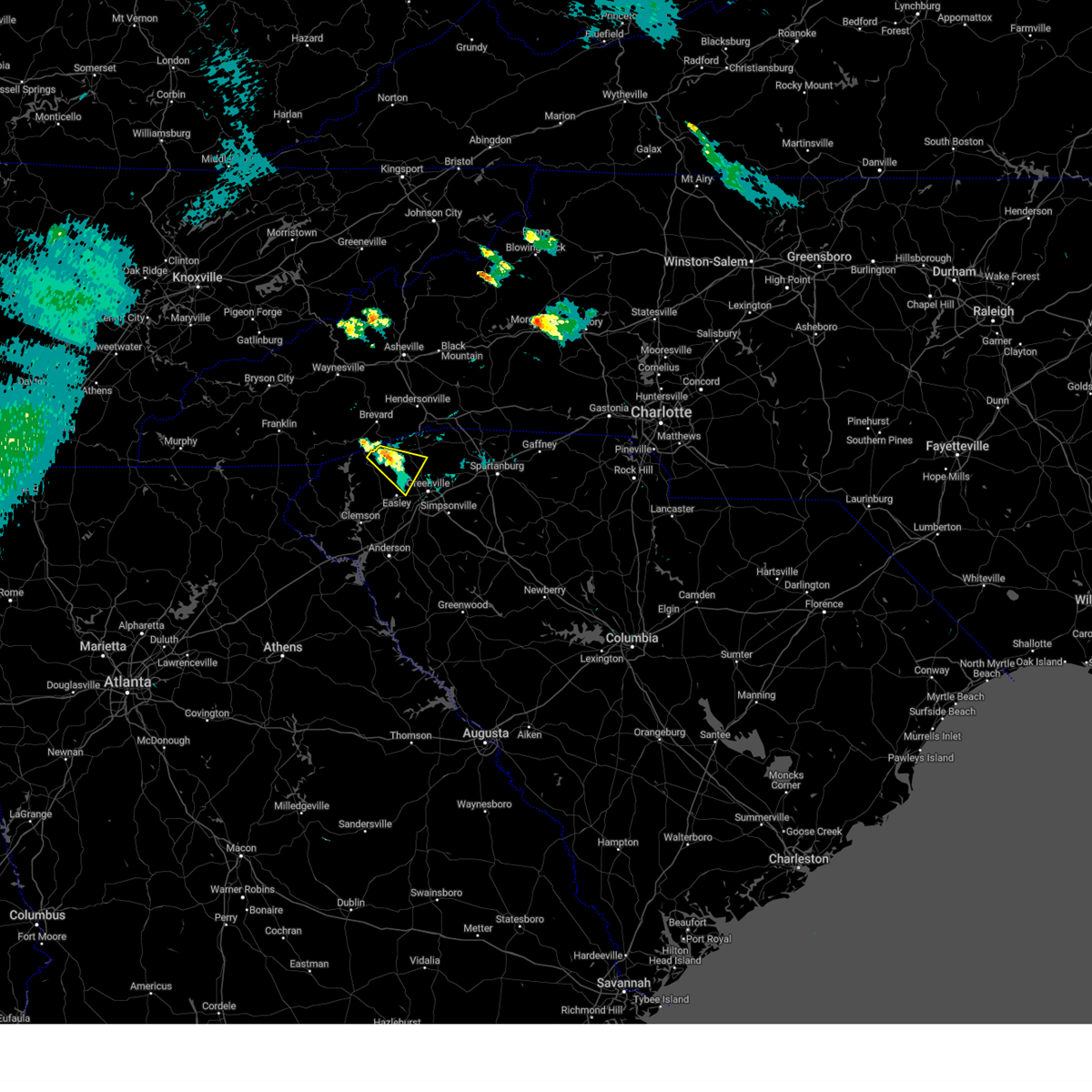 The severe thunderstorm warning for northwestern greenville and northeastern pickens counties will expire at 800 pm edt, the storm which prompted the warning has weakened below severe limits, and no longer poses an immediate threat to life or property. therefore, the warning will be allowed to expire. however small hail and gusty winds are still possible with this thunderstorm. The severe thunderstorm warning for northwestern greenville and northeastern pickens counties will expire at 800 pm edt, the storm which prompted the warning has weakened below severe limits, and no longer poses an immediate threat to life or property. therefore, the warning will be allowed to expire. however small hail and gusty winds are still possible with this thunderstorm.
|
| 7/18/2023 7:23 PM EDT |
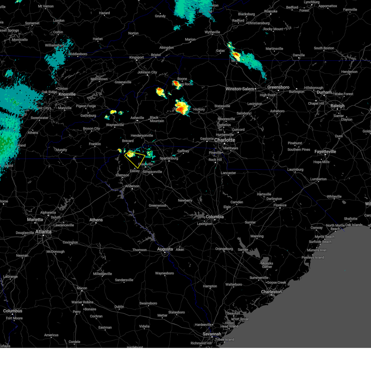 At 722 pm edt, a severe thunderstorm was located 11 miles northeast of pickens, or 5 miles west of slater-marietta, moving southeast at 20 mph (radar indicated). Hazards include 60 mph wind gusts and quarter size hail. Minor hail damage to vehicles is expected. Expect wind damage to trees and power lines. At 722 pm edt, a severe thunderstorm was located 11 miles northeast of pickens, or 5 miles west of slater-marietta, moving southeast at 20 mph (radar indicated). Hazards include 60 mph wind gusts and quarter size hail. Minor hail damage to vehicles is expected. Expect wind damage to trees and power lines.
|
| 7/7/2023 3:23 PM EDT |
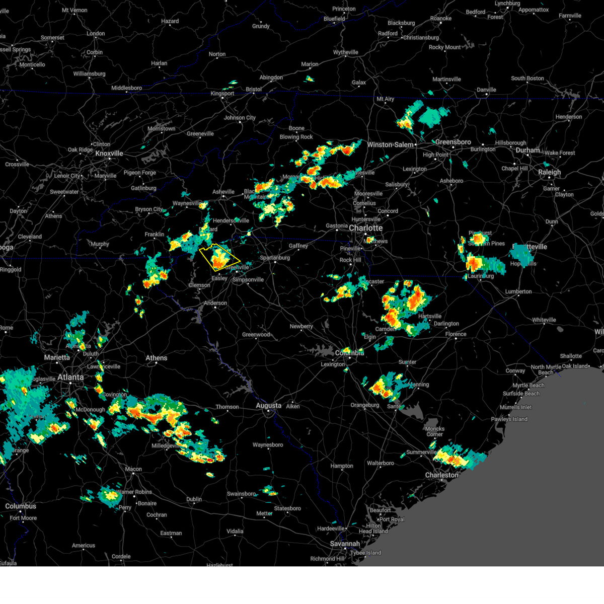 The severe thunderstorm warning for northwestern greenville and northeastern pickens counties will expire at 330 pm edt, the storm which prompted the warning has weakened below severe limits, and no longer poses an immediate threat to life or property. therefore, the warning will be allowed to expire. however gusty winds and heavy rain are still possible with this thunderstorm. The severe thunderstorm warning for northwestern greenville and northeastern pickens counties will expire at 330 pm edt, the storm which prompted the warning has weakened below severe limits, and no longer poses an immediate threat to life or property. therefore, the warning will be allowed to expire. however gusty winds and heavy rain are still possible with this thunderstorm.
|
| 7/7/2023 2:56 PM EDT |
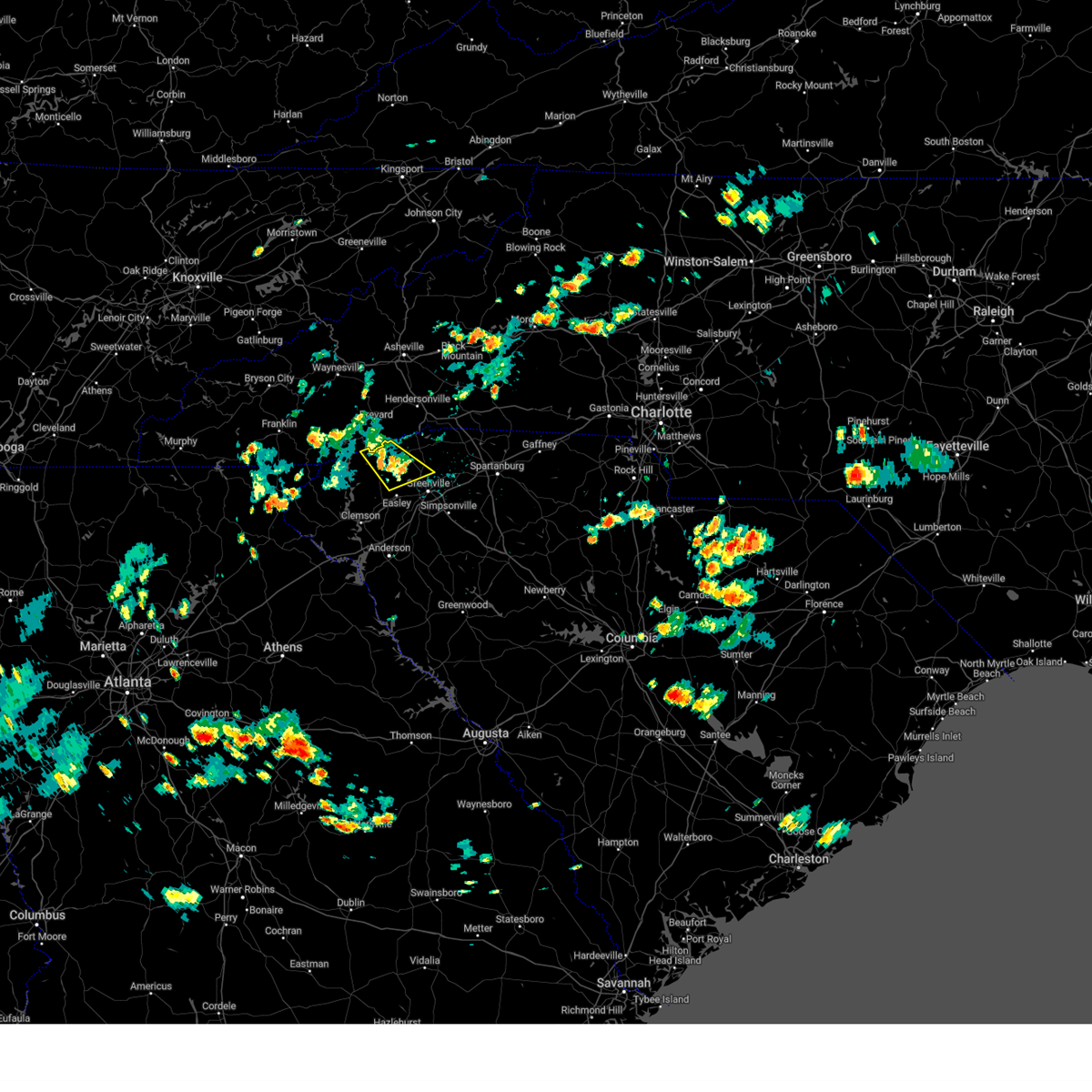 At 256 pm edt, a severe thunderstorm was located 8 miles northeast of pickens, or 7 miles southwest of slater-marietta, moving southeast at 10 mph (radar indicated). Hazards include 60 mph wind gusts and quarter size hail. Minor hail damage to vehicles is expected. expect wind damage to trees and power lines. locations impacted include, travelers rest, slater-marietta, paris mountain state park, table rock state park, caesars head state park, pumpkintown, dacusville, sassafras mountain, rocky bottom and furman university. hail threat, radar indicated max hail size, 1. 00 in wind threat, radar indicated max wind gust, 60 mph. At 256 pm edt, a severe thunderstorm was located 8 miles northeast of pickens, or 7 miles southwest of slater-marietta, moving southeast at 10 mph (radar indicated). Hazards include 60 mph wind gusts and quarter size hail. Minor hail damage to vehicles is expected. expect wind damage to trees and power lines. locations impacted include, travelers rest, slater-marietta, paris mountain state park, table rock state park, caesars head state park, pumpkintown, dacusville, sassafras mountain, rocky bottom and furman university. hail threat, radar indicated max hail size, 1. 00 in wind threat, radar indicated max wind gust, 60 mph.
|
| 7/7/2023 2:44 PM EDT |
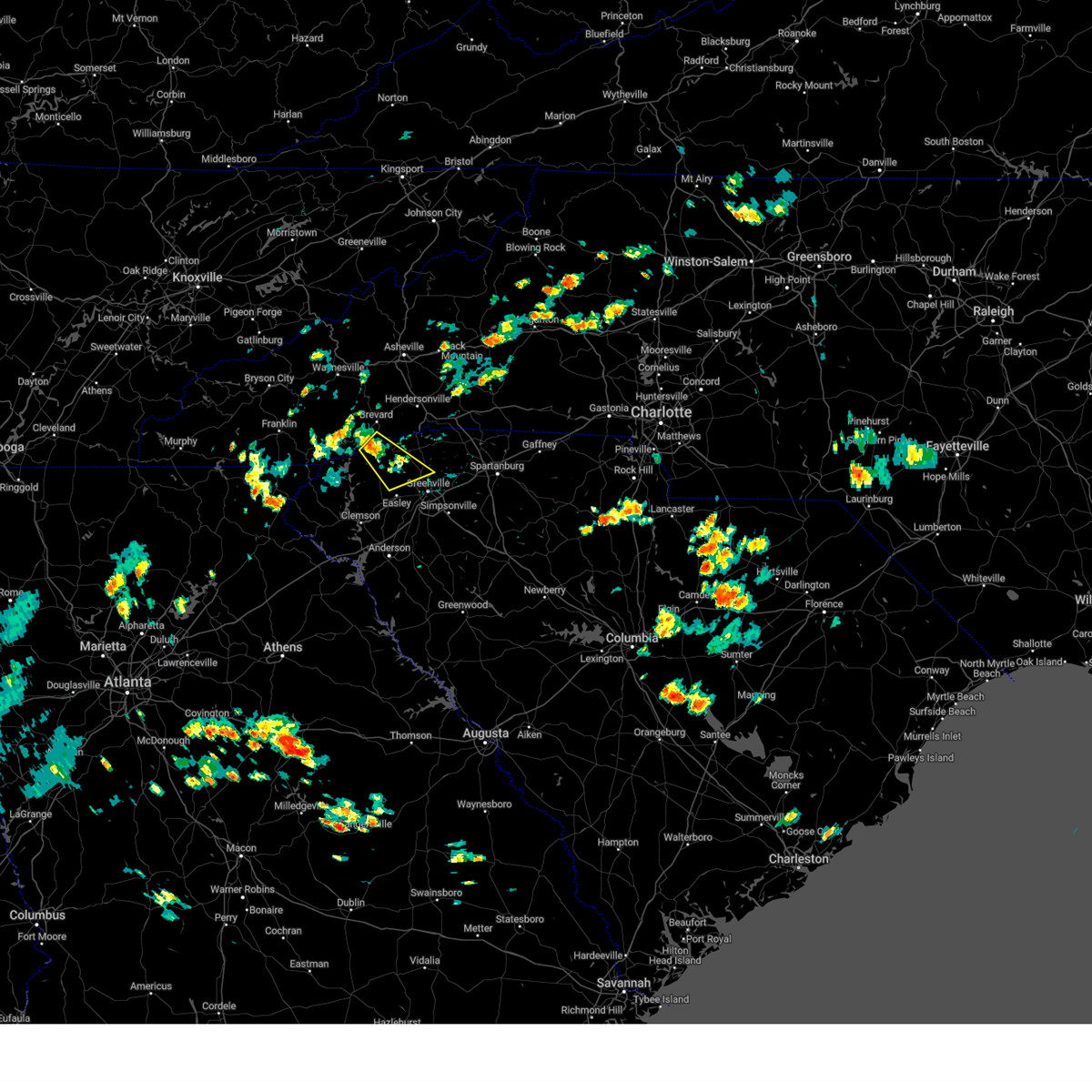 At 243 pm edt, a severe thunderstorm was located 9 miles northeast of pickens, or 5 miles southeast of table rock state park, moving southeast at 10 mph (radar indicated). Hazards include 60 mph wind gusts and quarter size hail. Minor hail damage to vehicles is expected. Expect wind damage to trees and power lines. At 243 pm edt, a severe thunderstorm was located 9 miles northeast of pickens, or 5 miles southeast of table rock state park, moving southeast at 10 mph (radar indicated). Hazards include 60 mph wind gusts and quarter size hail. Minor hail damage to vehicles is expected. Expect wind damage to trees and power lines.
|
| 7/7/2023 2:44 PM EDT |
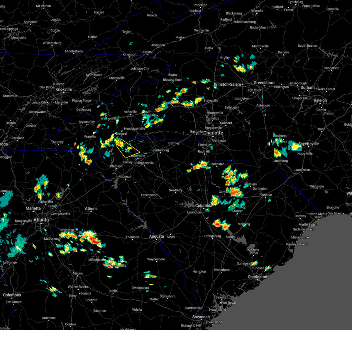 At 243 pm edt, a severe thunderstorm was located 9 miles northeast of pickens, or 5 miles southeast of table rock state park, moving southeast at 10 mph (radar indicated). Hazards include 60 mph wind gusts and quarter size hail. Minor hail damage to vehicles is expected. Expect wind damage to trees and power lines. At 243 pm edt, a severe thunderstorm was located 9 miles northeast of pickens, or 5 miles southeast of table rock state park, moving southeast at 10 mph (radar indicated). Hazards include 60 mph wind gusts and quarter size hail. Minor hail damage to vehicles is expected. Expect wind damage to trees and power lines.
|
| 7/4/2023 7:12 PM EDT |
 The severe thunderstorm warning for central greenville, north central anderson and east central pickens counties will expire at 715 pm edt, the storm which prompted the warning has weakened below severe limits, and no longer poses an immediate threat to life or property. therefore, the warning will be allowed to expire. however, small hail and gusty winds to 40 mph are still possible with this thunderstorm. The severe thunderstorm warning for central greenville, north central anderson and east central pickens counties will expire at 715 pm edt, the storm which prompted the warning has weakened below severe limits, and no longer poses an immediate threat to life or property. therefore, the warning will be allowed to expire. however, small hail and gusty winds to 40 mph are still possible with this thunderstorm.
|
| 7/4/2023 6:57 PM EDT |
 At 657 pm edt, a severe thunderstorm was located near easley, moving southeast at 20 mph (radar indicated). Hazards include 60 mph wind gusts and quarter size hail. Minor hail damage to vehicles is expected. expect wind damage to trees and power lines. locations impacted include, easley, berea, welcome, powdersville, liberty, furman university, dacusville, west greenville and piedmont. hail threat, radar indicated max hail size, 1. 00 in wind threat, radar indicated max wind gust, 60 mph. At 657 pm edt, a severe thunderstorm was located near easley, moving southeast at 20 mph (radar indicated). Hazards include 60 mph wind gusts and quarter size hail. Minor hail damage to vehicles is expected. expect wind damage to trees and power lines. locations impacted include, easley, berea, welcome, powdersville, liberty, furman university, dacusville, west greenville and piedmont. hail threat, radar indicated max hail size, 1. 00 in wind threat, radar indicated max wind gust, 60 mph.
|
| 7/4/2023 6:44 PM EDT |
 At 644 pm edt, a severe thunderstorm was located over pickens, moving east at 20 mph (radar indicated). Hazards include 60 mph wind gusts and quarter size hail. Minor hail damage to vehicles is expected. Expect wind damage to trees and power lines. At 644 pm edt, a severe thunderstorm was located over pickens, moving east at 20 mph (radar indicated). Hazards include 60 mph wind gusts and quarter size hail. Minor hail damage to vehicles is expected. Expect wind damage to trees and power lines.
|
| 7/2/2023 9:43 PM EDT |
 The severe thunderstorm warning for northeastern greenville county will expire at 945 pm edt, the storms which prompted the warning have moved out of the area. therefore, the warning will be allowed to expire. a severe thunderstorm watch remains in effect until midnight edt for upstate south carolina. to report severe weather to the national weather service greenville-spartanburg, call toll free, 1, 800, 2 6 7, 8 1 0 1, or post on our facebook page, or tweet it using hashtag nwsgsp. your message should describe the event and the specific location where it occurred. The severe thunderstorm warning for northeastern greenville county will expire at 945 pm edt, the storms which prompted the warning have moved out of the area. therefore, the warning will be allowed to expire. a severe thunderstorm watch remains in effect until midnight edt for upstate south carolina. to report severe weather to the national weather service greenville-spartanburg, call toll free, 1, 800, 2 6 7, 8 1 0 1, or post on our facebook page, or tweet it using hashtag nwsgsp. your message should describe the event and the specific location where it occurred.
|
| 7/2/2023 9:24 PM EDT |
 At 924 pm edt, severe thunderstorms were located along a line extending from 16 miles northeast of easley to 5 miles northeast of greenville downtown, moving northeast at 45 mph (radar indicated). Hazards include 60 mph wind gusts and nickel size hail. Expect damage to trees and power lines. locations impacted include, greenville downtown, greenville eastside, west greenville, greer, mauldin, taylors, berea, welcome, travelers rest and paris mountain state park. hail threat, radar indicated max hail size, 0. 88 in wind threat, radar indicated max wind gust, 60 mph. At 924 pm edt, severe thunderstorms were located along a line extending from 16 miles northeast of easley to 5 miles northeast of greenville downtown, moving northeast at 45 mph (radar indicated). Hazards include 60 mph wind gusts and nickel size hail. Expect damage to trees and power lines. locations impacted include, greenville downtown, greenville eastside, west greenville, greer, mauldin, taylors, berea, welcome, travelers rest and paris mountain state park. hail threat, radar indicated max hail size, 0. 88 in wind threat, radar indicated max wind gust, 60 mph.
|
| 7/2/2023 8:57 PM EDT |
 At 857 pm edt, severe thunderstorms were located along a line extending from 3 miles southeast of pickens to 3 miles south of easley to 8 miles north of anderson, moving northeast at 45 mph (radar indicated). Hazards include 60 mph wind gusts and nickel size hail. expect damage to trees and power lines At 857 pm edt, severe thunderstorms were located along a line extending from 3 miles southeast of pickens to 3 miles south of easley to 8 miles north of anderson, moving northeast at 45 mph (radar indicated). Hazards include 60 mph wind gusts and nickel size hail. expect damage to trees and power lines
|
| 6/25/2023 4:50 PM EDT |
 At 449 pm edt, a severe thunderstorm was located 9 miles north of downtown greenville, or near paris mountain state park, moving southeast at 15 mph (radar indicated). Hazards include 60 mph wind gusts and quarter size hail. Minor hail damage to vehicles is expected. Expect wind damage to trees and power lines. At 449 pm edt, a severe thunderstorm was located 9 miles north of downtown greenville, or near paris mountain state park, moving southeast at 15 mph (radar indicated). Hazards include 60 mph wind gusts and quarter size hail. Minor hail damage to vehicles is expected. Expect wind damage to trees and power lines.
|
| 6/15/2023 5:51 PM EDT |
 The severe thunderstorm warning for north central greenville county will expire at 600 pm edt, the storm which prompted the warning has weakened below severe limits, and no longer poses an immediate threat to life or property. therefore, the warning will be allowed to expire. however small hail and gusty winds are still possible with this thunderstorm. The severe thunderstorm warning for north central greenville county will expire at 600 pm edt, the storm which prompted the warning has weakened below severe limits, and no longer poses an immediate threat to life or property. therefore, the warning will be allowed to expire. however small hail and gusty winds are still possible with this thunderstorm.
|
| 6/15/2023 5:46 PM EDT |
 At 545 pm edt, a severe thunderstorm was located 11 miles north of greenville downtown, or near tigerville, moving southeast at 10 mph (radar indicated). Hazards include 60 mph wind gusts. Expect damage to trees and power lines. locations impacted include, travelers rest, slater-marietta, tigerville, pleasant ridge state park and cleveland. hail threat, radar indicated max hail size, <. 75 in wind threat, radar indicated max wind gust, 60 mph. At 545 pm edt, a severe thunderstorm was located 11 miles north of greenville downtown, or near tigerville, moving southeast at 10 mph (radar indicated). Hazards include 60 mph wind gusts. Expect damage to trees and power lines. locations impacted include, travelers rest, slater-marietta, tigerville, pleasant ridge state park and cleveland. hail threat, radar indicated max hail size, <. 75 in wind threat, radar indicated max wind gust, 60 mph.
|
| 6/15/2023 5:16 PM EDT |
 At 516 pm edt, a severe thunderstorm was located 15 miles north of greenville downtown, or near pleasant ridge state park, moving southeast at 10 mph (radar indicated). Hazards include 60 mph wind gusts and quarter size hail. Minor hail damage to vehicles is expected. Expect wind damage to trees and power lines. At 516 pm edt, a severe thunderstorm was located 15 miles north of greenville downtown, or near pleasant ridge state park, moving southeast at 10 mph (radar indicated). Hazards include 60 mph wind gusts and quarter size hail. Minor hail damage to vehicles is expected. Expect wind damage to trees and power lines.
|
| 5/9/2023 4:44 PM EDT |
 At 444 pm edt, a severe thunderstorm was located near greenville downtown, or near cherrydale point, moving southeast at 15 mph (radar indicated). Hazards include quarter size hail. minor damage to vehicles is expected At 444 pm edt, a severe thunderstorm was located near greenville downtown, or near cherrydale point, moving southeast at 15 mph (radar indicated). Hazards include quarter size hail. minor damage to vehicles is expected
|
| 3/3/2023 6:30 PM EST |
 At 629 pm est, a severe thunderstorm was located near greenville downtown, or near cherrydale point, moving northeast at 85 mph (radar indicated). Hazards include 60 mph wind gusts. Expect damage to trees and power lines. Locations impacted include, greenville downtown, easley, greenville eastside, west greenville, greer, mauldin, taylors, berea, welcome and powdersville. At 629 pm est, a severe thunderstorm was located near greenville downtown, or near cherrydale point, moving northeast at 85 mph (radar indicated). Hazards include 60 mph wind gusts. Expect damage to trees and power lines. Locations impacted include, greenville downtown, easley, greenville eastside, west greenville, greer, mauldin, taylors, berea, welcome and powdersville.
|
| 3/3/2023 6:01 PM EST |
 At 601 pm est, a severe thunderstorm was located 5 miles southwest of seneca, or near westminster, moving northeast at 80 mph (radar indicated). Hazards include 60 mph wind gusts. expect damage to trees and power lines At 601 pm est, a severe thunderstorm was located 5 miles southwest of seneca, or near westminster, moving northeast at 80 mph (radar indicated). Hazards include 60 mph wind gusts. expect damage to trees and power lines
|
| 1/12/2023 4:55 PM EST |
 At 455 pm est, severe thunderstorms were located along a line extending from 10 miles southwest of columbus to 8 miles northeast of greenville downtown to 8 miles south of easley, moving northeast at 60 mph (radar indicated). Hazards include 60 mph wind gusts and nickel size hail. Expect damage to trees and power lines. locations impacted include, greenville downtown, spartanburg, easley, greenville eastside, west greenville, greer, mauldin, taylors, berea and five forks. hail threat, radar indicated max hail size, 0. 88 in wind threat, radar indicated max wind gust, 60 mph. At 455 pm est, severe thunderstorms were located along a line extending from 10 miles southwest of columbus to 8 miles northeast of greenville downtown to 8 miles south of easley, moving northeast at 60 mph (radar indicated). Hazards include 60 mph wind gusts and nickel size hail. Expect damage to trees and power lines. locations impacted include, greenville downtown, spartanburg, easley, greenville eastside, west greenville, greer, mauldin, taylors, berea and five forks. hail threat, radar indicated max hail size, 0. 88 in wind threat, radar indicated max wind gust, 60 mph.
|
| 1/12/2023 4:39 PM EST |
 At 439 pm est, severe thunderstorms were located along a line extending from 9 miles northeast of pickens to 3 miles northwest of easley to 3 miles southeast of clemson, moving east at 60 mph (radar indicated). Hazards include 60 mph wind gusts and nickel size hail. expect damage to trees and power lines At 439 pm est, severe thunderstorms were located along a line extending from 9 miles northeast of pickens to 3 miles northwest of easley to 3 miles southeast of clemson, moving east at 60 mph (radar indicated). Hazards include 60 mph wind gusts and nickel size hail. expect damage to trees and power lines
|
| 7/18/2022 8:12 PM EDT |
 At 811 pm edt, a severe thunderstorm was located 13 miles south of columbus, or 4 miles northeast of lake robinson, moving east at 25 mph (radar indicated). Hazards include 60 mph wind gusts. Expect damage to trees and power lines. locations impacted include, greer, landrum, inman, campobello, paris mountain state park, tigerville, lake robinson, glassy mountain, gowensville and taylors. hail threat, radar indicated max hail size, <. 75 in wind threat, radar indicated max wind gust, 60 mph. At 811 pm edt, a severe thunderstorm was located 13 miles south of columbus, or 4 miles northeast of lake robinson, moving east at 25 mph (radar indicated). Hazards include 60 mph wind gusts. Expect damage to trees and power lines. locations impacted include, greer, landrum, inman, campobello, paris mountain state park, tigerville, lake robinson, glassy mountain, gowensville and taylors. hail threat, radar indicated max hail size, <. 75 in wind threat, radar indicated max wind gust, 60 mph.
|
| 7/18/2022 7:52 PM EDT |
 At 752 pm edt, a severe thunderstorm was located 11 miles north of greenville downtown, or 4 miles north of travelers rest, moving east at 25 mph (radar indicated). Hazards include 60 mph wind gusts and penny size hail. expect damage to trees and power lines At 752 pm edt, a severe thunderstorm was located 11 miles north of greenville downtown, or 4 miles north of travelers rest, moving east at 25 mph (radar indicated). Hazards include 60 mph wind gusts and penny size hail. expect damage to trees and power lines
|
| 7/18/2022 7:44 PM EDT |
 At 744 pm edt, a severe thunderstorm was located 9 miles north of easley, or 5 miles southwest of slater-marietta, moving east at 25 mph (radar indicated). Hazards include 60 mph wind gusts. Expect damage to trees and power lines. locations impacted include, greenville downtown, berea, travelers rest, slater-marietta, pleasant ridge state park, cherrydale point, furman university, dacusville, cleveland and paris mountain state park. hail threat, radar indicated max hail size, <. 75 in wind threat, radar indicated max wind gust, 60 mph. At 744 pm edt, a severe thunderstorm was located 9 miles north of easley, or 5 miles southwest of slater-marietta, moving east at 25 mph (radar indicated). Hazards include 60 mph wind gusts. Expect damage to trees and power lines. locations impacted include, greenville downtown, berea, travelers rest, slater-marietta, pleasant ridge state park, cherrydale point, furman university, dacusville, cleveland and paris mountain state park. hail threat, radar indicated max hail size, <. 75 in wind threat, radar indicated max wind gust, 60 mph.
|
| 7/18/2022 7:35 PM EDT |
 At 734 pm edt, a severe thunderstorm was located 6 miles northeast of pickens, moving east at 25 mph (radar indicated). Hazards include 60 mph wind gusts. Expect damage to trees and power lines. locations impacted include, greenville downtown, pickens, berea, travelers rest, slater-marietta, pleasant ridge state park, table rock state park, cherrydale point, furman university and pumpkintown. hail threat, radar indicated max hail size, <. 75 in wind threat, radar indicated max wind gust, 60 mph. At 734 pm edt, a severe thunderstorm was located 6 miles northeast of pickens, moving east at 25 mph (radar indicated). Hazards include 60 mph wind gusts. Expect damage to trees and power lines. locations impacted include, greenville downtown, pickens, berea, travelers rest, slater-marietta, pleasant ridge state park, table rock state park, cherrydale point, furman university and pumpkintown. hail threat, radar indicated max hail size, <. 75 in wind threat, radar indicated max wind gust, 60 mph.
|
| 7/18/2022 7:19 PM EDT |
 At 719 pm edt, a severe thunderstorm was located near pickens, moving east at 25 mph (radar indicated). Hazards include 60 mph wind gusts. expect damage to trees and power lines At 719 pm edt, a severe thunderstorm was located near pickens, moving east at 25 mph (radar indicated). Hazards include 60 mph wind gusts. expect damage to trees and power lines
|
| 7/9/2022 9:21 PM EDT |
 At 920 pm edt, a severe thunderstorm was located 5 miles northwest of downtown greenville, or over furman university, moving east at 5 mph (radar indicated). Hazards include 60 mph wind gusts and penny size hail. Expect damage to trees and power lines. locations impacted include, greenville, berea, travelers rest, paris mountain state park, cherrydale point, furman university, welcome, and lake robinson. hail threat, radar indicated max hail size, 0. 75 in wind threat, radar indicated max wind gust, 60 mph. At 920 pm edt, a severe thunderstorm was located 5 miles northwest of downtown greenville, or over furman university, moving east at 5 mph (radar indicated). Hazards include 60 mph wind gusts and penny size hail. Expect damage to trees and power lines. locations impacted include, greenville, berea, travelers rest, paris mountain state park, cherrydale point, furman university, welcome, and lake robinson. hail threat, radar indicated max hail size, 0. 75 in wind threat, radar indicated max wind gust, 60 mph.
|
| 7/9/2022 9:01 PM EDT |
 At 900 pm edt, a severe thunderstorm was located 7 miles northwest of downtown greenville, or near furman university, moving east at 5 mph (radar indicated). Hazards include 60 mph wind gusts and quarter size hail. Minor hail damage to vehicles is expected. Expect wind damage to trees and power lines. At 900 pm edt, a severe thunderstorm was located 7 miles northwest of downtown greenville, or near furman university, moving east at 5 mph (radar indicated). Hazards include 60 mph wind gusts and quarter size hail. Minor hail damage to vehicles is expected. Expect wind damage to trees and power lines.
|
| 7/7/2022 3:17 PM EDT |
 At 317 pm edt, a severe thunderstorm was located 6 miles north of downtown greenville, or near paris mountain state park, moving southeast at 10 mph (radar indicated). Hazards include 60 mph wind gusts and penny size hail. Expect damage to trees and power lines. locations impacted include, greenville, greer, taylors, travelers rest, paris mountain state park, lake robinson, cherrydale point, gsp airport, furman university. hail threat, radar indicated max hail size, 0. 75 in wind threat, radar indicated max wind gust, 60 mph. At 317 pm edt, a severe thunderstorm was located 6 miles north of downtown greenville, or near paris mountain state park, moving southeast at 10 mph (radar indicated). Hazards include 60 mph wind gusts and penny size hail. Expect damage to trees and power lines. locations impacted include, greenville, greer, taylors, travelers rest, paris mountain state park, lake robinson, cherrydale point, gsp airport, furman university. hail threat, radar indicated max hail size, 0. 75 in wind threat, radar indicated max wind gust, 60 mph.
|
| 7/7/2022 2:48 PM EDT |
 At 248 pm edt, a severe thunderstorm was located 7 miles north of downtown greenville, or near paris mountain state park, and is nearly stationary, but should eventually drift slowly south or southeast (radar indicated). Hazards include 60 mph wind gusts and quarter size hail. Minor hail damage to vehicles is expected. Expect wind damage to trees and power lines. At 248 pm edt, a severe thunderstorm was located 7 miles north of downtown greenville, or near paris mountain state park, and is nearly stationary, but should eventually drift slowly south or southeast (radar indicated). Hazards include 60 mph wind gusts and quarter size hail. Minor hail damage to vehicles is expected. Expect wind damage to trees and power lines.
|
| 7/7/2022 2:36 PM EDT |
 At 236 pm edt, a severe thunderstorm was located 12 miles northwest of downtown greenville, or near slater-marietta, moving southeast at 15 mph (radar indicated). Hazards include 60 mph wind gusts and penny size hail. Expect damage to trees and power lines. locations impacted include, berea, travelers rest, slater-marietta, paris mountain state park, tigerville, lake robinson, cherrydale point, furman university, dacusville and welcome. hail threat, radar indicated max hail size, 0. 75 in wind threat, radar indicated max wind gust, 60 mph. At 236 pm edt, a severe thunderstorm was located 12 miles northwest of downtown greenville, or near slater-marietta, moving southeast at 15 mph (radar indicated). Hazards include 60 mph wind gusts and penny size hail. Expect damage to trees and power lines. locations impacted include, berea, travelers rest, slater-marietta, paris mountain state park, tigerville, lake robinson, cherrydale point, furman university, dacusville and welcome. hail threat, radar indicated max hail size, 0. 75 in wind threat, radar indicated max wind gust, 60 mph.
|
| 7/7/2022 2:04 PM EDT |
 At 204 pm edt, a severe thunderstorm was located 13 miles southeast of brevard, or near jones gap state park, moving southeast at 15 mph (radar indicated). Hazards include 60 mph wind gusts and quarter size hail. Minor hail damage to vehicles is expected. Expect wind damage to trees and power lines. At 204 pm edt, a severe thunderstorm was located 13 miles southeast of brevard, or near jones gap state park, moving southeast at 15 mph (radar indicated). Hazards include 60 mph wind gusts and quarter size hail. Minor hail damage to vehicles is expected. Expect wind damage to trees and power lines.
|
| 6/17/2022 4:40 PM EDT |
 At 440 pm edt, a severe thunderstorm was located 14 miles southwest of columbus, or near tigerville, moving east at 15 mph (radar indicated). Hazards include 60 mph wind gusts and quarter size hail. Minor hail damage to vehicles is expected. Expect wind damage to trees and power lines. At 440 pm edt, a severe thunderstorm was located 14 miles southwest of columbus, or near tigerville, moving east at 15 mph (radar indicated). Hazards include 60 mph wind gusts and quarter size hail. Minor hail damage to vehicles is expected. Expect wind damage to trees and power lines.
|
| 6/17/2022 4:24 PM EDT |
 At 423 pm edt, a severe thunderstorm was located 15 miles southwest of columbus, or over tigerville, moving southeast at 10 mph (radar indicated). Hazards include 60 mph wind gusts and half dollar size hail. Minor hail damage to vehicles is expected. expect wind damage to trees and power lines. locations impacted include, taylors, slater-marietta, campobello, tigerville, lake robinson, gowensville, north saluda reservoir, glassy mountain, paris mountain state park and travelers rest. hail threat, radar indicated max hail size, 1. 25 in wind threat, radar indicated max wind gust, 60 mph. At 423 pm edt, a severe thunderstorm was located 15 miles southwest of columbus, or over tigerville, moving southeast at 10 mph (radar indicated). Hazards include 60 mph wind gusts and half dollar size hail. Minor hail damage to vehicles is expected. expect wind damage to trees and power lines. locations impacted include, taylors, slater-marietta, campobello, tigerville, lake robinson, gowensville, north saluda reservoir, glassy mountain, paris mountain state park and travelers rest. hail threat, radar indicated max hail size, 1. 25 in wind threat, radar indicated max wind gust, 60 mph.
|
| 6/17/2022 4:00 PM EDT |
 At 400 pm edt, a severe thunderstorm was located 15 miles south of hendersonville, or near pleasant ridge state park, moving east at 15 mph (radar indicated). Hazards include 60 mph wind gusts and quarter size hail. Minor hail damage to vehicles is expected. Expect wind damage to trees and power lines. At 400 pm edt, a severe thunderstorm was located 15 miles south of hendersonville, or near pleasant ridge state park, moving east at 15 mph (radar indicated). Hazards include 60 mph wind gusts and quarter size hail. Minor hail damage to vehicles is expected. Expect wind damage to trees and power lines.
|
| 6/3/2022 1:42 PM EDT |
 At 141 pm edt, a severe thunderstorm was located near greenville downtown, or over cherrydale point, moving southeast at 15 mph (radar indicated). Hazards include 60 mph wind gusts and penny size hail. expect damage to trees and power lines At 141 pm edt, a severe thunderstorm was located near greenville downtown, or over cherrydale point, moving southeast at 15 mph (radar indicated). Hazards include 60 mph wind gusts and penny size hail. expect damage to trees and power lines
|
| 6/2/2022 4:39 PM EDT |
 At 439 pm edt, a severe thunderstorm was located 11 miles northeast of pickens, or 4 miles south of caesars head state park, moving east at 10 mph (radar indicated). Hazards include 60 mph wind gusts and penny size hail. Expect damage to trees and power lines. locations impacted include, slater-marietta, table rock state park, pleasant ridge state park, caesars head state park, jones gap state park, pumpkintown, cleveland, furman university, dacusville and travelers rest. hail threat, radar indicated max hail size, 0. 75 in wind threat, radar indicated max wind gust, 60 mph. At 439 pm edt, a severe thunderstorm was located 11 miles northeast of pickens, or 4 miles south of caesars head state park, moving east at 10 mph (radar indicated). Hazards include 60 mph wind gusts and penny size hail. Expect damage to trees and power lines. locations impacted include, slater-marietta, table rock state park, pleasant ridge state park, caesars head state park, jones gap state park, pumpkintown, cleveland, furman university, dacusville and travelers rest. hail threat, radar indicated max hail size, 0. 75 in wind threat, radar indicated max wind gust, 60 mph.
|
| 6/2/2022 4:17 PM EDT |
 At 417 pm edt, a severe thunderstorm was located 10 miles north of pickens, or near table rock state park, moving east at 10 mph (radar indicated). Hazards include 60 mph wind gusts and penny size hail. expect damage to trees and power lines At 417 pm edt, a severe thunderstorm was located 10 miles north of pickens, or near table rock state park, moving east at 10 mph (radar indicated). Hazards include 60 mph wind gusts and penny size hail. expect damage to trees and power lines
|
| 5/23/2022 5:09 PM EDT |
 At 509 pm edt, a severe thunderstorm capable of producing a tornado was located near easley, or near powdersville, moving northeast at 35 mph (radar indicated rotation). Hazards include tornado. Flying debris will be dangerous to those caught without shelter. mobile homes will be damaged or destroyed. damage to roofs, windows, and vehicles will occur. tree damage is likely. this dangerous storm will be near, easley around 510 pm edt. welcome and powdersville around 520 pm edt. greenville downtown, cherrydale point, furman university, berea and west greenville around 530 pm edt. Taylors around 540 pm edt. At 509 pm edt, a severe thunderstorm capable of producing a tornado was located near easley, or near powdersville, moving northeast at 35 mph (radar indicated rotation). Hazards include tornado. Flying debris will be dangerous to those caught without shelter. mobile homes will be damaged or destroyed. damage to roofs, windows, and vehicles will occur. tree damage is likely. this dangerous storm will be near, easley around 510 pm edt. welcome and powdersville around 520 pm edt. greenville downtown, cherrydale point, furman university, berea and west greenville around 530 pm edt. Taylors around 540 pm edt.
|
| 5/23/2022 5:02 PM EDT |
 At 502 pm edt, a severe thunderstorm capable of producing a tornado was located 6 miles south of easley, moving northeast at 35 mph (radar indicated rotation). Hazards include tornado. Flying debris will be dangerous to those caught without shelter. mobile homes will be damaged or destroyed. damage to roofs, windows, and vehicles will occur. tree damage is likely. this dangerous storm will be near, easley and piedmont around 510 pm edt. welcome and powdersville around 520 pm edt. greenville downtown, berea, furman university, cherrydale point and west greenville around 530 pm edt. Paris mountain state park, travelers rest, taylors and greenville eastside around 540 pm edt. At 502 pm edt, a severe thunderstorm capable of producing a tornado was located 6 miles south of easley, moving northeast at 35 mph (radar indicated rotation). Hazards include tornado. Flying debris will be dangerous to those caught without shelter. mobile homes will be damaged or destroyed. damage to roofs, windows, and vehicles will occur. tree damage is likely. this dangerous storm will be near, easley and piedmont around 510 pm edt. welcome and powdersville around 520 pm edt. greenville downtown, berea, furman university, cherrydale point and west greenville around 530 pm edt. Paris mountain state park, travelers rest, taylors and greenville eastside around 540 pm edt.
|
| 5/23/2022 4:49 PM EDT |
 At 449 pm edt, a severe thunderstorm capable of producing a tornado was located 8 miles east of clemson, or 6 miles north of northlake, moving northeast at 35 mph (radar indicated rotation). Hazards include tornado. Flying debris will be dangerous to those caught without shelter. mobile homes will be damaged or destroyed. damage to roofs, windows, and vehicles will occur. tree damage is likely. this dangerous storm will be near, easley and piedmont around 510 pm edt. west greenville, welcome, powdersville and donaldson center around 520 pm edt. Greenville downtown, cherrydale point, furman university, berea and greenville eastside around 530 pm edt. At 449 pm edt, a severe thunderstorm capable of producing a tornado was located 8 miles east of clemson, or 6 miles north of northlake, moving northeast at 35 mph (radar indicated rotation). Hazards include tornado. Flying debris will be dangerous to those caught without shelter. mobile homes will be damaged or destroyed. damage to roofs, windows, and vehicles will occur. tree damage is likely. this dangerous storm will be near, easley and piedmont around 510 pm edt. west greenville, welcome, powdersville and donaldson center around 520 pm edt. Greenville downtown, cherrydale point, furman university, berea and greenville eastside around 530 pm edt.
|
| 5/6/2022 4:32 PM EDT |
 At 431 pm edt, a severe thunderstorm was located 15 miles northwest of greenville downtown, or near slater-marietta, moving east at 40 mph (radar indicated). Hazards include 60 mph wind gusts and quarter size hail. Minor hail damage to vehicles is expected. Expect wind damage to trees and power lines. At 431 pm edt, a severe thunderstorm was located 15 miles northwest of greenville downtown, or near slater-marietta, moving east at 40 mph (radar indicated). Hazards include 60 mph wind gusts and quarter size hail. Minor hail damage to vehicles is expected. Expect wind damage to trees and power lines.
|
| 5/6/2022 4:06 PM EDT |
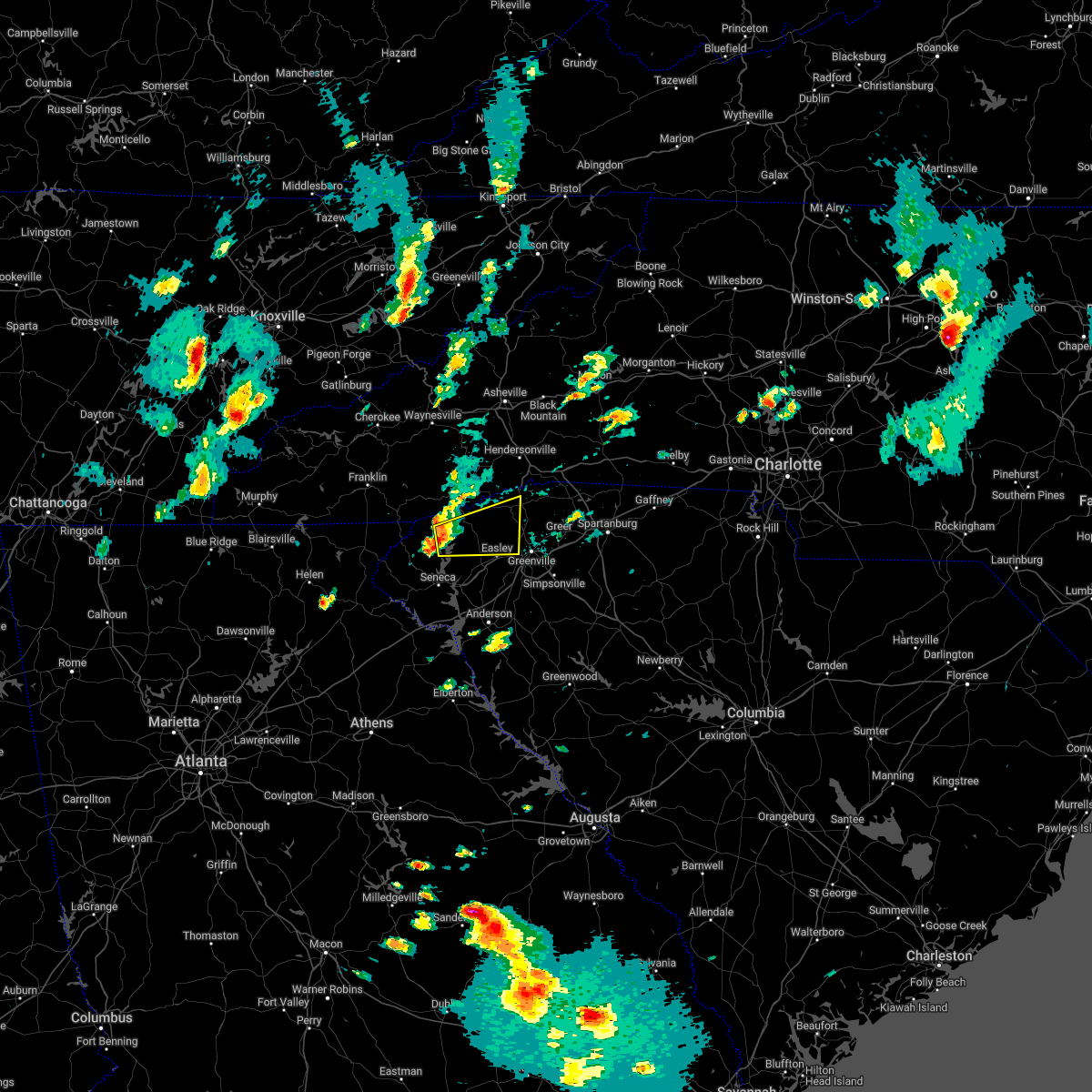 At 405 pm edt, a severe thunderstorm was located 9 miles west of pickens, or near keowee toxaway state park, moving east at 40 mph (radar indicated). Hazards include 60 mph wind gusts and penny size hail. expect damage to trees and power lines At 405 pm edt, a severe thunderstorm was located 9 miles west of pickens, or near keowee toxaway state park, moving east at 40 mph (radar indicated). Hazards include 60 mph wind gusts and penny size hail. expect damage to trees and power lines
|
| 3/23/2022 10:24 PM EDT |
 At 1024 pm edt, a severe thunderstorm capable of producing a tornado was located 16 miles southeast of brevard, or near pleasant ridge state park, moving northeast at 40 mph (radar indicated rotation). Hazards include tornado. Flying debris will be dangerous to those caught without shelter. mobile homes will be damaged or destroyed. damage to roofs, windows, and vehicles will occur. tree damage is likely. this dangerous storm will be near, tigerville around 1030 pm edt. Other locations impacted by this tornadic thunderstorm include cleveland and crab creek. At 1024 pm edt, a severe thunderstorm capable of producing a tornado was located 16 miles southeast of brevard, or near pleasant ridge state park, moving northeast at 40 mph (radar indicated rotation). Hazards include tornado. Flying debris will be dangerous to those caught without shelter. mobile homes will be damaged or destroyed. damage to roofs, windows, and vehicles will occur. tree damage is likely. this dangerous storm will be near, tigerville around 1030 pm edt. Other locations impacted by this tornadic thunderstorm include cleveland and crab creek.
|
| 3/23/2022 10:08 PM EDT |
 At 1008 pm edt, a severe thunderstorm capable of producing a tornado was located 6 miles north of pickens, or 4 miles south of table rock state park, moving northeast at 40 mph (radar indicated rotation). Hazards include tornado. Flying debris will be dangerous to those caught without shelter. mobile homes will be damaged or destroyed. damage to roofs, windows, and vehicles will occur. tree damage is likely. this dangerous storm will be near, caesars head state park around 1020 pm edt. pleasant ridge state park, slater-marietta and jones gap state park around 1030 pm edt. tigerville around 1040 pm edt. Other locations impacted by this dangerous thunderstorm include sunset, pumpkintown, crab creek, cleveland and cedar mountain. At 1008 pm edt, a severe thunderstorm capable of producing a tornado was located 6 miles north of pickens, or 4 miles south of table rock state park, moving northeast at 40 mph (radar indicated rotation). Hazards include tornado. Flying debris will be dangerous to those caught without shelter. mobile homes will be damaged or destroyed. damage to roofs, windows, and vehicles will occur. tree damage is likely. this dangerous storm will be near, caesars head state park around 1020 pm edt. pleasant ridge state park, slater-marietta and jones gap state park around 1030 pm edt. tigerville around 1040 pm edt. Other locations impacted by this dangerous thunderstorm include sunset, pumpkintown, crab creek, cleveland and cedar mountain.
|
| 8/31/2021 4:30 PM EDT |
 At 429 pm edt, severe thunderstorms were located along a line extending from 15 miles north of greenville downtown to 12 miles south of columbus to 10 miles west of spartanburg, moving north at 45 mph (radar indicated). Hazards include 60 mph wind gusts. expect damage to trees and power lines At 429 pm edt, severe thunderstorms were located along a line extending from 15 miles north of greenville downtown to 12 miles south of columbus to 10 miles west of spartanburg, moving north at 45 mph (radar indicated). Hazards include 60 mph wind gusts. expect damage to trees and power lines
|
| 8/17/2021 5:49 PM EDT |
 At 549 pm edt, a severe thunderstorm capable of producing a tornado was located 12 miles south of hendersonville, or 4 miles northeast of pleasant ridge state park, moving north at 40 mph (radar indicated rotation). Hazards include tornado. Flying debris will be dangerous to those caught without shelter. mobile homes will be damaged or destroyed. damage to roofs, windows, and vehicles will occur. tree damage is likely. This tornadic thunderstorm will remain over mainly rural areas of north central greenville county, including the following locations, glassy mountain, cleveland and north saluda reservoir. At 549 pm edt, a severe thunderstorm capable of producing a tornado was located 12 miles south of hendersonville, or 4 miles northeast of pleasant ridge state park, moving north at 40 mph (radar indicated rotation). Hazards include tornado. Flying debris will be dangerous to those caught without shelter. mobile homes will be damaged or destroyed. damage to roofs, windows, and vehicles will occur. tree damage is likely. This tornadic thunderstorm will remain over mainly rural areas of north central greenville county, including the following locations, glassy mountain, cleveland and north saluda reservoir.
|
| 8/17/2021 5:30 PM EDT |
 At 529 pm edt, a severe thunderstorm capable of producing a tornado was located 9 miles northwest of greenville downtown, or near travelers rest, moving north at 40 mph (radar indicated rotation). Hazards include tornado. Flying debris will be dangerous to those caught without shelter. mobile homes will be damaged or destroyed. damage to roofs, windows, and vehicles will occur. tree damage is likely. this dangerous storm will be near, pleasant ridge state park around 540 pm edt. tigerville and jones gap state park around 550 pm edt. Other locations impacted by this tornadic thunderstorm include glassy mountain, cleveland, dacusville and north saluda reservoir. At 529 pm edt, a severe thunderstorm capable of producing a tornado was located 9 miles northwest of greenville downtown, or near travelers rest, moving north at 40 mph (radar indicated rotation). Hazards include tornado. Flying debris will be dangerous to those caught without shelter. mobile homes will be damaged or destroyed. damage to roofs, windows, and vehicles will occur. tree damage is likely. this dangerous storm will be near, pleasant ridge state park around 540 pm edt. tigerville and jones gap state park around 550 pm edt. Other locations impacted by this tornadic thunderstorm include glassy mountain, cleveland, dacusville and north saluda reservoir.
|
| 8/17/2021 5:20 PM EDT |
 At 520 pm edt, a severe thunderstorm capable of producing a tornado was located 4 miles northeast of easley, or near berea, moving northeast at 25 mph (radar indicated rotation). Hazards include tornado. Flying debris will be dangerous to those caught without shelter. mobile homes will be damaged or destroyed. damage to roofs, windows, and vehicles will occur. tree damage is likely. this dangerous storm will be near, furman university and cherrydale point around 530 pm edt. travelers rest and paris mountain state park around 540 pm edt. slater-marietta around 550 pm edt. tigerville and pleasant ridge state park around 600 pm edt. Other locations impacted by this tornadic thunderstorm include glassy mountain, cleveland, dacusville and north saluda reservoir. At 520 pm edt, a severe thunderstorm capable of producing a tornado was located 4 miles northeast of easley, or near berea, moving northeast at 25 mph (radar indicated rotation). Hazards include tornado. Flying debris will be dangerous to those caught without shelter. mobile homes will be damaged or destroyed. damage to roofs, windows, and vehicles will occur. tree damage is likely. this dangerous storm will be near, furman university and cherrydale point around 530 pm edt. travelers rest and paris mountain state park around 540 pm edt. slater-marietta around 550 pm edt. tigerville and pleasant ridge state park around 600 pm edt. Other locations impacted by this tornadic thunderstorm include glassy mountain, cleveland, dacusville and north saluda reservoir.
|
| 8/17/2021 5:08 PM EDT |
 At 508 pm edt, a severe thunderstorm capable of producing a tornado was located near easley, moving north at 40 mph (radar indicated rotation). Hazards include tornado. Flying debris will be dangerous to those caught without shelter. mobile homes will be damaged or destroyed. damage to roofs, windows, and vehicles will occur. tree damage is likely. this dangerous storm will be near, furman university, berea, paris mountain state park and cherrydale point around 520 pm edt. slater-marietta and travelers rest around 530 pm edt. pleasant ridge state park, jones gap state park and tigerville around 540 pm edt. Other locations impacted by this dangerous thunderstorm include glassy mountain, cleveland, dacusville and north saluda reservoir. At 508 pm edt, a severe thunderstorm capable of producing a tornado was located near easley, moving north at 40 mph (radar indicated rotation). Hazards include tornado. Flying debris will be dangerous to those caught without shelter. mobile homes will be damaged or destroyed. damage to roofs, windows, and vehicles will occur. tree damage is likely. this dangerous storm will be near, furman university, berea, paris mountain state park and cherrydale point around 520 pm edt. slater-marietta and travelers rest around 530 pm edt. pleasant ridge state park, jones gap state park and tigerville around 540 pm edt. Other locations impacted by this dangerous thunderstorm include glassy mountain, cleveland, dacusville and north saluda reservoir.
|
| 8/17/2021 3:12 PM EDT |
 At 312 pm edt, a severe thunderstorm capable of producing a tornado was located near greenville downtown, or near taylors, moving north at 25 mph (radar indicated rotation). Hazards include tornado. Flying debris will be dangerous to those caught without shelter. mobile homes will be damaged or destroyed. damage to roofs, windows, and vehicles will occur. tree damage is likely. this dangerous storm will be near, travelers rest, paris mountain state park and lake robinson around 330 pm edt. Tigerville around 340 pm edt. At 312 pm edt, a severe thunderstorm capable of producing a tornado was located near greenville downtown, or near taylors, moving north at 25 mph (radar indicated rotation). Hazards include tornado. Flying debris will be dangerous to those caught without shelter. mobile homes will be damaged or destroyed. damage to roofs, windows, and vehicles will occur. tree damage is likely. this dangerous storm will be near, travelers rest, paris mountain state park and lake robinson around 330 pm edt. Tigerville around 340 pm edt.
|
| 8/17/2021 3:01 PM EDT |
 At 300 pm edt, a tornado producing storm was located 4 miles southeast of greenville downtown, or near greenville eastside, moving north at 25 mph (radar confirmed tornado). Hazards include damaging tornado. Flying debris will be dangerous to those caught without shelter. mobile homes will be damaged or destroyed. damage to roofs, windows, and vehicles will occur. tree damage is likely. this dangerous storm will be near, cherrydale point around 310 pm edt. taylors, paris mountain state park and greer around 320 pm edt. lake robinson and travelers rest around 330 pm edt. Tigerville around 340 pm edt. At 300 pm edt, a tornado producing storm was located 4 miles southeast of greenville downtown, or near greenville eastside, moving north at 25 mph (radar confirmed tornado). Hazards include damaging tornado. Flying debris will be dangerous to those caught without shelter. mobile homes will be damaged or destroyed. damage to roofs, windows, and vehicles will occur. tree damage is likely. this dangerous storm will be near, cherrydale point around 310 pm edt. taylors, paris mountain state park and greer around 320 pm edt. lake robinson and travelers rest around 330 pm edt. Tigerville around 340 pm edt.
|
| 8/17/2021 2:52 PM EDT |
 At 252 pm edt, a severe thunderstorm capable of producing a tornado was located 7 miles southeast of greenville downtown, or near mauldin, moving north at 30 mph (radar indicated rotation). Hazards include tornado. Flying debris will be dangerous to those caught without shelter. mobile homes will be damaged or destroyed. damage to roofs, windows, and vehicles will occur. tree damage is likely. this dangerous storm will be near, greenville downtown, greenville eastside, gsp airport, cherrydale point and west greenville around 310 pm edt. taylors, greer, paris mountain state park and travelers rest around 320 pm edt. Lake robinson and tigerville around 330 pm edt. At 252 pm edt, a severe thunderstorm capable of producing a tornado was located 7 miles southeast of greenville downtown, or near mauldin, moving north at 30 mph (radar indicated rotation). Hazards include tornado. Flying debris will be dangerous to those caught without shelter. mobile homes will be damaged or destroyed. damage to roofs, windows, and vehicles will occur. tree damage is likely. this dangerous storm will be near, greenville downtown, greenville eastside, gsp airport, cherrydale point and west greenville around 310 pm edt. taylors, greer, paris mountain state park and travelers rest around 320 pm edt. Lake robinson and tigerville around 330 pm edt.
|
| 7/9/2021 12:53 PM EDT |
 At 1252 pm edt, a severe thunderstorm was located 12 miles north of greenville downtown, or near slater-marietta, moving east at 25 mph (radar indicated). Hazards include 60 mph wind gusts. Expect damage to trees and power lines. Locations impacted include, greer, taylors, travelers rest, slater-marietta, paris mountain state park, tigerville, lake robinson, cleveland and gsp airport. At 1252 pm edt, a severe thunderstorm was located 12 miles north of greenville downtown, or near slater-marietta, moving east at 25 mph (radar indicated). Hazards include 60 mph wind gusts. Expect damage to trees and power lines. Locations impacted include, greer, taylors, travelers rest, slater-marietta, paris mountain state park, tigerville, lake robinson, cleveland and gsp airport.
|
| 7/9/2021 12:40 PM EDT |
 At 1239 pm edt, a severe thunderstorm was located 13 miles northeast of pickens, or 4 miles west of slater-marietta, moving east at 25 mph (radar indicated). Hazards include 60 mph wind gusts and penny size hail. expect damage to trees and power lines At 1239 pm edt, a severe thunderstorm was located 13 miles northeast of pickens, or 4 miles west of slater-marietta, moving east at 25 mph (radar indicated). Hazards include 60 mph wind gusts and penny size hail. expect damage to trees and power lines
|
| 6/14/2021 2:43 PM EDT |
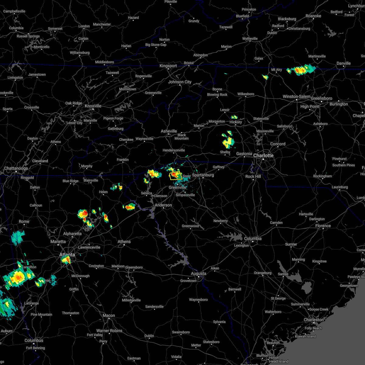 At 242 pm edt, a severe thunderstorm was located 10 miles north of greenville downtown, or near travelers rest, moving south at 10 mph (radar indicated). Hazards include 60 mph wind gusts and quarter size hail. Minor hail damage to vehicles is expected. expect wind damage to trees and power lines. Locations impacted include, travelers rest, paris mountain state park, furman university, slater-marietta and taylors. At 242 pm edt, a severe thunderstorm was located 10 miles north of greenville downtown, or near travelers rest, moving south at 10 mph (radar indicated). Hazards include 60 mph wind gusts and quarter size hail. Minor hail damage to vehicles is expected. expect wind damage to trees and power lines. Locations impacted include, travelers rest, paris mountain state park, furman university, slater-marietta and taylors.
|
| 6/14/2021 2:22 PM EDT |
 At 222 pm edt, a severe thunderstorm was located 12 miles north of greenville downtown, or near slater-marietta, moving south at 10 mph (radar indicated). Hazards include 60 mph wind gusts and quarter size hail. Minor hail damage to vehicles is expected. Expect wind damage to trees and power lines. At 222 pm edt, a severe thunderstorm was located 12 miles north of greenville downtown, or near slater-marietta, moving south at 10 mph (radar indicated). Hazards include 60 mph wind gusts and quarter size hail. Minor hail damage to vehicles is expected. Expect wind damage to trees and power lines.
|
| 6/11/2021 7:36 PM EDT |
 At 735 pm edt, severe thunderstorms were located along a line extending from 5 miles southeast of gaffney to 12 miles east of spartanburg to 5 miles east of greenville downtown to 5 miles north of easley, moving southeast at 20 mph (radar indicated). Hazards include 60 mph wind gusts and penny size hail. Expect damage to trees and power lines. Locations impacted include, greenville downtown, spartanburg, easley, gaffney, greenville eastside, west greenville, greer, mauldin, taylors and simpsonville. At 735 pm edt, severe thunderstorms were located along a line extending from 5 miles southeast of gaffney to 12 miles east of spartanburg to 5 miles east of greenville downtown to 5 miles north of easley, moving southeast at 20 mph (radar indicated). Hazards include 60 mph wind gusts and penny size hail. Expect damage to trees and power lines. Locations impacted include, greenville downtown, spartanburg, easley, gaffney, greenville eastside, west greenville, greer, mauldin, taylors and simpsonville.
|
| 6/11/2021 7:19 PM EDT |
 At 719 pm edt, severe thunderstorms were located along a line extending from near gaffney to 5 miles east of spartanburg to 3 miles northeast of greenville downtown to 6 miles northeast of pickens, moving southeast at 25 mph (radar indicated). Hazards include 60 mph wind gusts and penny size hail. Expect damage to trees and power lines. Locations impacted include, greenville downtown, spartanburg, easley, gaffney, greenville eastside, west greenville, greer, mauldin, taylors and simpsonville. At 719 pm edt, severe thunderstorms were located along a line extending from near gaffney to 5 miles east of spartanburg to 3 miles northeast of greenville downtown to 6 miles northeast of pickens, moving southeast at 25 mph (radar indicated). Hazards include 60 mph wind gusts and penny size hail. Expect damage to trees and power lines. Locations impacted include, greenville downtown, spartanburg, easley, gaffney, greenville eastside, west greenville, greer, mauldin, taylors and simpsonville.
|
| 6/11/2021 6:59 PM EDT |
 At 658 pm edt, severe thunderstorms were located along a line extending from 7 miles west of gaffney to 8 miles north of greenville downtown to 10 miles north of pickens, moving southeast at 20 mph (radar indicated). Hazards include 60 mph wind gusts and penny size hail. expect damage to trees and power lines At 658 pm edt, severe thunderstorms were located along a line extending from 7 miles west of gaffney to 8 miles north of greenville downtown to 10 miles north of pickens, moving southeast at 20 mph (radar indicated). Hazards include 60 mph wind gusts and penny size hail. expect damage to trees and power lines
|
| 5/28/2021 10:07 PM EDT |
 The severe thunderstorm warning for greenville and northwestern spartanburg counties will expire at 1015 pm edt, the storms which prompted the warning have weakened below severe limits, and no longer pose an immediate threat to life or property. therefore the warning will be allowed to expire. however, gusty winds to 40 mph and occasional lightning are still possible with these thunderstorms. The severe thunderstorm warning for greenville and northwestern spartanburg counties will expire at 1015 pm edt, the storms which prompted the warning have weakened below severe limits, and no longer pose an immediate threat to life or property. therefore the warning will be allowed to expire. however, gusty winds to 40 mph and occasional lightning are still possible with these thunderstorms.
|
| 5/28/2021 9:45 PM EDT |
 At 944 pm edt, severe thunderstorms were located along a line extending from 16 miles south of hendersonville to near greenville downtown to 13 miles east of anderson, moving northeast at 50 mph (radar indicated). Hazards include 60 mph wind gusts. Expect damage to trees and power lines. Locations impacted include, greenville downtown, greenville eastside, west greenville, greer, mauldin, taylors, simpsonville, berea, five forks and fountain inn. At 944 pm edt, severe thunderstorms were located along a line extending from 16 miles south of hendersonville to near greenville downtown to 13 miles east of anderson, moving northeast at 50 mph (radar indicated). Hazards include 60 mph wind gusts. Expect damage to trees and power lines. Locations impacted include, greenville downtown, greenville eastside, west greenville, greer, mauldin, taylors, simpsonville, berea, five forks and fountain inn.
|
| 5/28/2021 9:28 PM EDT |
 At 927 pm edt, severe thunderstorms were located along a line extending from 10 miles south of brevard to near easley to near anderson, moving northeast at 50 mph (radar indicated). Hazards include 70 mph wind gusts. Expect considerable tree damage. Damage is likely to mobile homes, roofs, and outbuildings. At 927 pm edt, severe thunderstorms were located along a line extending from 10 miles south of brevard to near easley to near anderson, moving northeast at 50 mph (radar indicated). Hazards include 70 mph wind gusts. Expect considerable tree damage. Damage is likely to mobile homes, roofs, and outbuildings.
|
| 3/25/2021 3:03 PM EDT |
 At 302 pm edt, a severe thunderstorm capable of producing a tornado was located 14 miles southeast of brevard, or near pleasant ridge state park, moving east at 40 mph (radar indicated rotation). Hazards include tornado. Flying debris will be dangerous to those caught without shelter. mobile homes will be damaged or destroyed. damage to roofs, windows, and vehicles will occur. tree damage is likely. this dangerous storm will be near, tigerville around 320 pm edt. tryon around 330 pm edt. columbus, landrum and campobello around 340 pm edt. Other locations impacted by this dangerous storm include glassy mountain, gowensville, cleveland and north saluda reservoir. At 302 pm edt, a severe thunderstorm capable of producing a tornado was located 14 miles southeast of brevard, or near pleasant ridge state park, moving east at 40 mph (radar indicated rotation). Hazards include tornado. Flying debris will be dangerous to those caught without shelter. mobile homes will be damaged or destroyed. damage to roofs, windows, and vehicles will occur. tree damage is likely. this dangerous storm will be near, tigerville around 320 pm edt. tryon around 330 pm edt. columbus, landrum and campobello around 340 pm edt. Other locations impacted by this dangerous storm include glassy mountain, gowensville, cleveland and north saluda reservoir.
|
| 3/25/2021 2:40 PM EDT |
 At 240 pm edt, a severe thunderstorm capable of producing a tornado was located 10 miles north of pickens, or near table rock state park, moving east at 40 mph (radar indicated rotation). Hazards include tornado. Flying debris will be dangerous to those caught without shelter. mobile homes will be damaged or destroyed. damage to roofs, windows, and vehicles will occur. tree damage is likely. this dangerous storm will be near, jones gap state park and caesars head state park around 300 pm edt. pleasant ridge state park, tigerville, slater-marietta and travelers rest around 310 pm edt. lake robinson around 320 pm edt. campobello, landrum and tryon around 330 pm edt. Other locations impacted by this dangerous thunderstorm include sunset, gowensville, pumpkintown, north saluda reservoir and glassy mountain. At 240 pm edt, a severe thunderstorm capable of producing a tornado was located 10 miles north of pickens, or near table rock state park, moving east at 40 mph (radar indicated rotation). Hazards include tornado. Flying debris will be dangerous to those caught without shelter. mobile homes will be damaged or destroyed. damage to roofs, windows, and vehicles will occur. tree damage is likely. this dangerous storm will be near, jones gap state park and caesars head state park around 300 pm edt. pleasant ridge state park, tigerville, slater-marietta and travelers rest around 310 pm edt. lake robinson around 320 pm edt. campobello, landrum and tryon around 330 pm edt. Other locations impacted by this dangerous thunderstorm include sunset, gowensville, pumpkintown, north saluda reservoir and glassy mountain.
|
| 8/28/2020 10:53 PM EDT |
 At 1043 pm edt, a severe thunderstorm was located 6 miles northwest of greenville downtown, or near furman university, moving northeast at 30 mph (radar indicated). Hazards include 60 mph wind gusts. Expect damage to trees and power lines. Locations impacted include, greenville downtown, taylors, berea, travelers rest, paris mountain state park, tigerville, cherrydale point, furman university, slater-marietta and west greenville. At 1043 pm edt, a severe thunderstorm was located 6 miles northwest of greenville downtown, or near furman university, moving northeast at 30 mph (radar indicated). Hazards include 60 mph wind gusts. Expect damage to trees and power lines. Locations impacted include, greenville downtown, taylors, berea, travelers rest, paris mountain state park, tigerville, cherrydale point, furman university, slater-marietta and west greenville.
|
| 8/28/2020 10:44 PM EDT |
 At 1043 pm edt, a severe thunderstorm was located 6 miles northwest of greenville downtown, or near furman university, moving northeast at 30 mph (radar indicated). Hazards include 60 mph wind gusts. Expect damage to trees and power lines. Locations impacted include, greenville downtown, taylors, berea, travelers rest, paris mountain state park, tigerville, cherrydale point, furman university, slater-marietta and west greenville. At 1043 pm edt, a severe thunderstorm was located 6 miles northwest of greenville downtown, or near furman university, moving northeast at 30 mph (radar indicated). Hazards include 60 mph wind gusts. Expect damage to trees and power lines. Locations impacted include, greenville downtown, taylors, berea, travelers rest, paris mountain state park, tigerville, cherrydale point, furman university, slater-marietta and west greenville.
|
| 8/28/2020 10:30 PM EDT |
 At 1029 pm edt, a severe thunderstorm was located 7 miles northeast of easley, or 4 miles northwest of berea, moving northeast at 30 mph (radar indicated). Hazards include 60 mph wind gusts. Expect damage to trees and power lines. Locations impacted include, greenville downtown, taylors, berea, travelers rest, slater-marietta, paris mountain state park, tigerville, cherrydale point, furman university and dacusville. At 1029 pm edt, a severe thunderstorm was located 7 miles northeast of easley, or 4 miles northwest of berea, moving northeast at 30 mph (radar indicated). Hazards include 60 mph wind gusts. Expect damage to trees and power lines. Locations impacted include, greenville downtown, taylors, berea, travelers rest, slater-marietta, paris mountain state park, tigerville, cherrydale point, furman university and dacusville.
|
| 8/28/2020 10:13 PM EDT |
 At 1013 pm edt, a severe thunderstorm was located near pickens, or near liberty, moving northeast at 30 mph (radar indicated). Hazards include 60 mph wind gusts. expect damage to trees and power lines At 1013 pm edt, a severe thunderstorm was located near pickens, or near liberty, moving northeast at 30 mph (radar indicated). Hazards include 60 mph wind gusts. expect damage to trees and power lines
|
| 8/19/2020 3:45 PM EDT |
 At 345 pm edt, a severe thunderstorm was located 13 miles southwest of columbus, or near tigerville, moving southeast at 10 mph (radar indicated). Hazards include 60 mph wind gusts and nickel size hail. expect damage to trees and power lines At 345 pm edt, a severe thunderstorm was located 13 miles southwest of columbus, or near tigerville, moving southeast at 10 mph (radar indicated). Hazards include 60 mph wind gusts and nickel size hail. expect damage to trees and power lines
|
| 7/25/2020 2:30 PM EDT |
 At 230 pm edt, a severe thunderstorm was located 7 miles north of easley, or 5 miles northwest of berea, moving southwest at 10 mph (radar indicated). Hazards include 60 mph wind gusts and quarter size hail. Minor hail damage to vehicles is expected. Expect wind damage to trees and power lines. At 230 pm edt, a severe thunderstorm was located 7 miles north of easley, or 5 miles northwest of berea, moving southwest at 10 mph (radar indicated). Hazards include 60 mph wind gusts and quarter size hail. Minor hail damage to vehicles is expected. Expect wind damage to trees and power lines.
|
| 7/25/2020 2:29 PM EDT | Schp reported tree on roadway at keeler mill road and silvers road. time estimated with rada in greenville county SC, 3.4 miles ESE of Travelers Rest, SC |
| 7/24/2020 2:13 PM EDT |
 The severe thunderstorm warning for northeastern greenville and west central spartanburg counties will expire at 215 pm edt, the storms which prompted the warning have weakened below severe limits, and no longer pose an immediate threat to life or property. therefore, the warning will be allowed to expire. however, gusty winds and heavy rain are still possible with these thunderstorms. The severe thunderstorm warning for northeastern greenville and west central spartanburg counties will expire at 215 pm edt, the storms which prompted the warning have weakened below severe limits, and no longer pose an immediate threat to life or property. therefore, the warning will be allowed to expire. however, gusty winds and heavy rain are still possible with these thunderstorms.
|
| 7/24/2020 1:49 PM EDT |
 At 148 pm edt, severe thunderstorms were located along a line extending from travelers rest to greer to five forks, and these storms were nearly stationary (radar indicated). Hazards include 60 mph wind gusts and penny size hail. Expect damage to trees and power lines. Locations impacted include, greenville downtown, greenville eastside, west greenville, greer, mauldin, taylors, berea, five forks, travelers rest and paris mountain state park. At 148 pm edt, severe thunderstorms were located along a line extending from travelers rest to greer to five forks, and these storms were nearly stationary (radar indicated). Hazards include 60 mph wind gusts and penny size hail. Expect damage to trees and power lines. Locations impacted include, greenville downtown, greenville eastside, west greenville, greer, mauldin, taylors, berea, five forks, travelers rest and paris mountain state park.
|
| 7/24/2020 1:25 PM EDT |
 At 125 pm edt, a severe thunderstorm was located 6 miles north of greenville downtown, or over paris mountain state park, moving southeast at 15 mph (radar indicated). Hazards include 60 mph wind gusts and penny size hail. expect damage to trees and power lines At 125 pm edt, a severe thunderstorm was located 6 miles north of greenville downtown, or over paris mountain state park, moving southeast at 15 mph (radar indicated). Hazards include 60 mph wind gusts and penny size hail. expect damage to trees and power lines
|
| 7/21/2020 4:15 PM EDT |
 At 415 pm edt, a severe thunderstorm was located 5 miles northeast of easley, or near berea, moving east at 10 mph (radar indicated). Hazards include 60 mph wind gusts and penny size hail. expect damage to trees and power lines At 415 pm edt, a severe thunderstorm was located 5 miles northeast of easley, or near berea, moving east at 10 mph (radar indicated). Hazards include 60 mph wind gusts and penny size hail. expect damage to trees and power lines
|
| 7/21/2020 3:57 PM EDT |
 At 339 pm edt, a severe thunderstorm was located 13 miles north of greenville downtown, or near lake robinson, moving east at 10 mph (radar indicated). Hazards include 60 mph wind gusts and penny size hail. expect damage to trees and power lines At 339 pm edt, a severe thunderstorm was located 13 miles north of greenville downtown, or near lake robinson, moving east at 10 mph (radar indicated). Hazards include 60 mph wind gusts and penny size hail. expect damage to trees and power lines
|
| 7/21/2020 3:50 PM EDT |
 At 350 pm edt, a severe thunderstorm was located near greenville downtown, moving east at 10 mph (radar indicated). Hazards include 60 mph wind gusts and penny size hail. expect damage to trees and power lines At 350 pm edt, a severe thunderstorm was located near greenville downtown, moving east at 10 mph (radar indicated). Hazards include 60 mph wind gusts and penny size hail. expect damage to trees and power lines
|
| 7/21/2020 3:40 PM EDT |
 At 339 pm edt, a severe thunderstorm was located 13 miles north of greenville downtown, or near lake robinson, moving east at 10 mph (radar indicated). Hazards include 60 mph wind gusts and penny size hail. expect damage to trees and power lines At 339 pm edt, a severe thunderstorm was located 13 miles north of greenville downtown, or near lake robinson, moving east at 10 mph (radar indicated). Hazards include 60 mph wind gusts and penny size hail. expect damage to trees and power lines
|
| 6/28/2020 5:47 PM EDT |
 At 546 pm edt, severe thunderstorms were located along a line extending from 7 miles north of greenville downtown to 13 miles southeast of easley to near anderson, moving east at 35 mph (radar indicated). Hazards include 60 mph wind gusts and penny size hail. Expect damage to trees and power lines. Locations impacted include, greenville downtown, anderson, greenville eastside, west greenville, greer, mauldin, taylors, simpsonville, berea and welcome. At 546 pm edt, severe thunderstorms were located along a line extending from 7 miles north of greenville downtown to 13 miles southeast of easley to near anderson, moving east at 35 mph (radar indicated). Hazards include 60 mph wind gusts and penny size hail. Expect damage to trees and power lines. Locations impacted include, greenville downtown, anderson, greenville eastside, west greenville, greer, mauldin, taylors, simpsonville, berea and welcome.
|
| 6/28/2020 5:24 PM EDT |
 At 524 pm edt, severe thunderstorms were located along a line extending from 11 miles northeast of pickens to 6 miles east of clemson to 10 miles south of seneca, moving east at 35 mph (radar indicated). Hazards include 60 mph wind gusts and penny size hail. expect damage to trees and power lines At 524 pm edt, severe thunderstorms were located along a line extending from 11 miles northeast of pickens to 6 miles east of clemson to 10 miles south of seneca, moving east at 35 mph (radar indicated). Hazards include 60 mph wind gusts and penny size hail. expect damage to trees and power lines
|
| 5/22/2020 2:35 PM EDT | Trained spotter reported fence sections blown down... along with 4 inch limbs from the top of trees...on feversham c in greenville county SC, 4.1 miles W of Travelers Rest, SC |
| 5/22/2020 2:29 PM EDT | Tree down on jackson grove rd. time estimated from rada in greenville county SC, 4.6 miles W of Travelers Rest, SC |
| 5/22/2020 2:24 PM EDT |
 At 224 pm edt, a severe thunderstorm was located 5 miles northwest of greenville downtown, or over furman university, moving east at 45 mph (radar indicated). Hazards include 60 mph wind gusts and quarter size hail. Minor hail damage to vehicles is expected. Expect wind damage to trees and power lines. At 224 pm edt, a severe thunderstorm was located 5 miles northwest of greenville downtown, or over furman university, moving east at 45 mph (radar indicated). Hazards include 60 mph wind gusts and quarter size hail. Minor hail damage to vehicles is expected. Expect wind damage to trees and power lines.
|
| 5/22/2020 2:13 PM EDT |
 At 212 pm edt, a severe thunderstorm was located 15 miles northeast of pickens, or 4 miles south of jones gap state park, moving east at 45 mph (radar indicated). Hazards include 60 mph wind gusts and quarter size hail. Minor hail damage to vehicles is expected. expect wind damage to trees and power lines. Locations impacted include, greenville downtown, pickens, west greenville, berea, travelers rest, flat rock, slater-marietta, paris mountain state park, tigerville and table rock state park. At 212 pm edt, a severe thunderstorm was located 15 miles northeast of pickens, or 4 miles south of jones gap state park, moving east at 45 mph (radar indicated). Hazards include 60 mph wind gusts and quarter size hail. Minor hail damage to vehicles is expected. expect wind damage to trees and power lines. Locations impacted include, greenville downtown, pickens, west greenville, berea, travelers rest, flat rock, slater-marietta, paris mountain state park, tigerville and table rock state park.
|
| 5/22/2020 1:48 PM EDT |
 At 147 pm edt, a severe thunderstorm was located 13 miles southwest of brevard, or near gorges state park, moving east at 40 mph (radar indicated). Hazards include 60 mph wind gusts and quarter size hail. Minor hail damage to vehicles is expected. Expect wind damage to trees and power lines. At 147 pm edt, a severe thunderstorm was located 13 miles southwest of brevard, or near gorges state park, moving east at 40 mph (radar indicated). Hazards include 60 mph wind gusts and quarter size hail. Minor hail damage to vehicles is expected. Expect wind damage to trees and power lines.
|
| 5/5/2020 5:04 PM EDT |
 At 504 pm edt, a severe thunderstorm was located 7 miles northwest of greenville downtown, or near furman university, moving east at 55 mph (radar indicated). Hazards include 60 mph wind gusts and quarter size hail. Minor hail damage to vehicles is expected. Expect wind damage to trees and power lines. At 504 pm edt, a severe thunderstorm was located 7 miles northwest of greenville downtown, or near furman university, moving east at 55 mph (radar indicated). Hazards include 60 mph wind gusts and quarter size hail. Minor hail damage to vehicles is expected. Expect wind damage to trees and power lines.
|
| 5/5/2020 3:00 AM EDT |
 At 258 am edt, severe thunderstorms were located along a line extending from 9 miles northeast of greenville downtown to 14 miles southwest of spartanburg to 7 miles north of laurens to 13 miles north of abbeville, moving east at 60 mph (radar indicated). Hazards include 70 mph wind gusts and quarter size hail. Minor hail damage to vehicles is expected. expect considerable tree damage. wind damage is also likely to mobile homes, roofs, and outbuildings. Locations impacted include, greenville downtown, spartanburg, greenwood, laurens, union, abbeville, greenville eastside, west greenville, greer and mauldin. At 258 am edt, severe thunderstorms were located along a line extending from 9 miles northeast of greenville downtown to 14 miles southwest of spartanburg to 7 miles north of laurens to 13 miles north of abbeville, moving east at 60 mph (radar indicated). Hazards include 70 mph wind gusts and quarter size hail. Minor hail damage to vehicles is expected. expect considerable tree damage. wind damage is also likely to mobile homes, roofs, and outbuildings. Locations impacted include, greenville downtown, spartanburg, greenwood, laurens, union, abbeville, greenville eastside, west greenville, greer and mauldin.
|
| 5/5/2020 2:40 AM EDT |
 At 239 am edt, severe thunderstorms were located along a line extending from 10 miles northeast of easley to 7 miles southeast of greenville downtown to 9 miles northwest of abbeville, moving east at 65 mph (radar indicated). Hazards include 70 mph wind gusts and quarter size hail. Minor hail damage to vehicles is expected. expect considerable tree damage. Wind damage is also likely to mobile homes, roofs, and outbuildings. At 239 am edt, severe thunderstorms were located along a line extending from 10 miles northeast of easley to 7 miles southeast of greenville downtown to 9 miles northwest of abbeville, moving east at 65 mph (radar indicated). Hazards include 70 mph wind gusts and quarter size hail. Minor hail damage to vehicles is expected. expect considerable tree damage. Wind damage is also likely to mobile homes, roofs, and outbuildings.
|
| 5/5/2020 2:30 AM EDT |
 At 228 am edt, severe thunderstorms were located along a line extending from 3 miles north of pickens to near easley to 6 miles southwest of anderson, moving east at 50 mph (radar indicated). Hazards include 70 mph wind gusts and quarter size hail. Minor hail damage to vehicles is expected. expect considerable tree damage. wind damage is also likely to mobile homes, roofs, and outbuildings. Locations impacted include, greenville downtown, anderson, easley, clemson, pickens, greenville eastside, west greenville, greer, mauldin and taylors. At 228 am edt, severe thunderstorms were located along a line extending from 3 miles north of pickens to near easley to 6 miles southwest of anderson, moving east at 50 mph (radar indicated). Hazards include 70 mph wind gusts and quarter size hail. Minor hail damage to vehicles is expected. expect considerable tree damage. wind damage is also likely to mobile homes, roofs, and outbuildings. Locations impacted include, greenville downtown, anderson, easley, clemson, pickens, greenville eastside, west greenville, greer, mauldin and taylors.
|
| 5/5/2020 2:16 AM EDT |
 At 215 am edt, severe thunderstorms were located along a line extending from 10 miles west of pickens to 3 miles southeast of clemson to 6 miles north of hartwell, moving east at 45 mph (radar indicated). Hazards include 60 mph wind gusts and quarter size hail. Minor hail damage to vehicles is expected. expect wind damage to trees and power lines. Locations impacted include, greenville downtown, anderson, easley, clemson, seneca, pickens, greenville eastside, west greenville, greer and mauldin. At 215 am edt, severe thunderstorms were located along a line extending from 10 miles west of pickens to 3 miles southeast of clemson to 6 miles north of hartwell, moving east at 45 mph (radar indicated). Hazards include 60 mph wind gusts and quarter size hail. Minor hail damage to vehicles is expected. expect wind damage to trees and power lines. Locations impacted include, greenville downtown, anderson, easley, clemson, seneca, pickens, greenville eastside, west greenville, greer and mauldin.
|
| 5/5/2020 2:00 AM EDT |
 At 159 am edt, severe thunderstorms were located along a line extending from 14 miles north of walhalla to 3 miles northeast of seneca to 7 miles northwest of hartwell, moving east at 65 mph (radar indicated). Hazards include 60 mph wind gusts and quarter size hail. Minor hail damage to vehicles is expected. Expect wind damage to trees and power lines. At 159 am edt, severe thunderstorms were located along a line extending from 14 miles north of walhalla to 3 miles northeast of seneca to 7 miles northwest of hartwell, moving east at 65 mph (radar indicated). Hazards include 60 mph wind gusts and quarter size hail. Minor hail damage to vehicles is expected. Expect wind damage to trees and power lines.
|
| 5/4/2020 7:25 PM EDT |
 At 725 pm edt, a severe thunderstorm was located 11 miles northeast of greenville downtown, or over lake robinson, moving southeast at 15 mph (radar indicated). Hazards include 60 mph wind gusts and quarter size hail. Minor hail damage to vehicles is expected. Expect wind damage to trees and power lines. At 725 pm edt, a severe thunderstorm was located 11 miles northeast of greenville downtown, or over lake robinson, moving southeast at 15 mph (radar indicated). Hazards include 60 mph wind gusts and quarter size hail. Minor hail damage to vehicles is expected. Expect wind damage to trees and power lines.
|
| 4/25/2020 9:00 PM EDT |
 At 900 pm edt, a severe thunderstorm was located 7 miles northwest of greenville downtown, or near furman university, moving east at 40 mph (radar indicated). Hazards include 60 mph wind gusts and quarter size hail. Minor hail damage to vehicles is expected. Expect wind damage to trees and power lines. At 900 pm edt, a severe thunderstorm was located 7 miles northwest of greenville downtown, or near furman university, moving east at 40 mph (radar indicated). Hazards include 60 mph wind gusts and quarter size hail. Minor hail damage to vehicles is expected. Expect wind damage to trees and power lines.
|
| 4/25/2020 8:33 PM EDT |
 At 832 pm edt, a severe thunderstorm capable of producing a tornado was located 14 miles northeast of greenville downtown, or near lake robinson, moving east at 45 mph (radar indicated rotation). Hazards include tornado and quarter size hail. Flying debris will be dangerous to those caught without shelter. mobile homes will be damaged or destroyed. damage to roofs, windows, and vehicles will occur. tree damage is likely. this dangerous storm will be near, campobello around 840 pm edt. lake bowen and inman around 850 pm edt. Other locations impacted by this dangerous storm include glassy mountain, gowensville and north saluda reservoir. At 832 pm edt, a severe thunderstorm capable of producing a tornado was located 14 miles northeast of greenville downtown, or near lake robinson, moving east at 45 mph (radar indicated rotation). Hazards include tornado and quarter size hail. Flying debris will be dangerous to those caught without shelter. mobile homes will be damaged or destroyed. damage to roofs, windows, and vehicles will occur. tree damage is likely. this dangerous storm will be near, campobello around 840 pm edt. lake bowen and inman around 850 pm edt. Other locations impacted by this dangerous storm include glassy mountain, gowensville and north saluda reservoir.
|
| 4/25/2020 8:24 PM EDT |
 At 824 pm edt, a severe thunderstorm capable of producing a tornado was located 11 miles north of greenville downtown, or near tigerville, moving east at 45 mph (radar indicated rotation). Hazards include tornado and quarter size hail. Flying debris will be dangerous to those caught without shelter. mobile homes will be damaged or destroyed. damage to roofs, windows, and vehicles will occur. tree damage is likely. this dangerous storm will be near, lake robinson around 830 pm edt. campobello and greer around 840 pm edt. inman and lake bowen around 850 pm edt. Other locations impacted by this dangerous thunderstorm include glassy mountain, gowensville, cleveland and north saluda reservoir. At 824 pm edt, a severe thunderstorm capable of producing a tornado was located 11 miles north of greenville downtown, or near tigerville, moving east at 45 mph (radar indicated rotation). Hazards include tornado and quarter size hail. Flying debris will be dangerous to those caught without shelter. mobile homes will be damaged or destroyed. damage to roofs, windows, and vehicles will occur. tree damage is likely. this dangerous storm will be near, lake robinson around 830 pm edt. campobello and greer around 840 pm edt. inman and lake bowen around 850 pm edt. Other locations impacted by this dangerous thunderstorm include glassy mountain, gowensville, cleveland and north saluda reservoir.
|
| 4/25/2020 8:07 PM EDT |
 At 807 pm edt, a severe thunderstorm was located 8 miles north of pickens, or near table rock state park, moving east at 20 mph (radar indicated). Hazards include 60 mph wind gusts and quarter size hail. Minor hail damage to vehicles is expected. Expect wind damage to trees and power lines. At 807 pm edt, a severe thunderstorm was located 8 miles north of pickens, or near table rock state park, moving east at 20 mph (radar indicated). Hazards include 60 mph wind gusts and quarter size hail. Minor hail damage to vehicles is expected. Expect wind damage to trees and power lines.
|
| 4/25/2020 8:07 PM EDT |
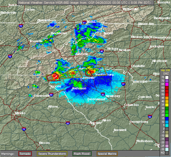 At 807 pm edt, a severe thunderstorm was located 8 miles north of pickens, or near table rock state park, moving east at 20 mph (radar indicated). Hazards include 60 mph wind gusts and quarter size hail. Minor hail damage to vehicles is expected. Expect wind damage to trees and power lines. At 807 pm edt, a severe thunderstorm was located 8 miles north of pickens, or near table rock state park, moving east at 20 mph (radar indicated). Hazards include 60 mph wind gusts and quarter size hail. Minor hail damage to vehicles is expected. Expect wind damage to trees and power lines.
|
| 4/25/2020 7:40 PM EDT |
 At 740 pm edt, a severe thunderstorm capable of producing a tornado was located 8 miles north of greenville downtown, or near paris mountain state park, moving east at 40 mph (radar indicated rotation). Hazards include tornado and quarter size hail. Flying debris will be dangerous to those caught without shelter. mobile homes will be damaged or destroyed. damage to roofs, windows, and vehicles will occur. tree damage is likely. this dangerous storm will be near, lyman, wellford, inman and duncan around 800 pm edt. lake bowen around 810 pm edt. Other locations impacted by this dangerous thunderstorm include gowensville. At 740 pm edt, a severe thunderstorm capable of producing a tornado was located 8 miles north of greenville downtown, or near paris mountain state park, moving east at 40 mph (radar indicated rotation). Hazards include tornado and quarter size hail. Flying debris will be dangerous to those caught without shelter. mobile homes will be damaged or destroyed. damage to roofs, windows, and vehicles will occur. tree damage is likely. this dangerous storm will be near, lyman, wellford, inman and duncan around 800 pm edt. lake bowen around 810 pm edt. Other locations impacted by this dangerous thunderstorm include gowensville.
|
| 4/25/2020 7:34 PM EDT |
 At 734 pm edt, a severe thunderstorm capable of producing a tornado was located 8 miles north of greenville downtown, or over travelers rest, moving east at 40 mph (radar indicated rotation). Hazards include tornado and quarter size hail. Flying debris will be dangerous to those caught without shelter. mobile homes will be damaged or destroyed. damage to roofs, windows, and vehicles will occur. tree damage is likely. This dangerous storm will remain over mainly rural areas of north central greenville county. At 734 pm edt, a severe thunderstorm capable of producing a tornado was located 8 miles north of greenville downtown, or over travelers rest, moving east at 40 mph (radar indicated rotation). Hazards include tornado and quarter size hail. Flying debris will be dangerous to those caught without shelter. mobile homes will be damaged or destroyed. damage to roofs, windows, and vehicles will occur. tree damage is likely. This dangerous storm will remain over mainly rural areas of north central greenville county.
|
| 4/25/2020 7:23 PM EDT |
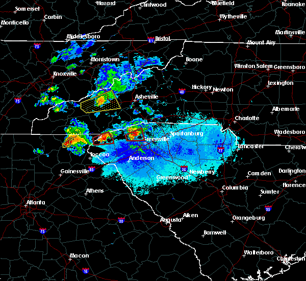 At 723 pm edt, a severe thunderstorm capable of producing a tornado was located 8 miles north of easley, or 6 miles northwest of berea, moving east at 40 mph (radar indicated rotation). Hazards include tornado and quarter size hail. Flying debris will be dangerous to those caught without shelter. mobile homes will be damaged or destroyed. damage to roofs, windows, and vehicles will occur. tree damage is likely. this dangerous storm will be near, furman university, travelers rest, paris mountain state park and cherrydale point around 730 pm edt. Other locations impacted by this dangerous storm include dacusville. At 723 pm edt, a severe thunderstorm capable of producing a tornado was located 8 miles north of easley, or 6 miles northwest of berea, moving east at 40 mph (radar indicated rotation). Hazards include tornado and quarter size hail. Flying debris will be dangerous to those caught without shelter. mobile homes will be damaged or destroyed. damage to roofs, windows, and vehicles will occur. tree damage is likely. this dangerous storm will be near, furman university, travelers rest, paris mountain state park and cherrydale point around 730 pm edt. Other locations impacted by this dangerous storm include dacusville.
|
| 4/25/2020 7:10 PM EDT |
 At 710 pm edt, a severe thunderstorm capable of producing a tornado was located near pickens, moving east at 40 mph (radar indicated rotation). Hazards include tornado and quarter size hail. Flying debris will be dangerous to those caught without shelter. mobile homes will be damaged or destroyed. damage to roofs, windows, and vehicles will occur. tree damage is likely. this dangerous storm will be near, travelers rest, paris mountain state park, furman university, slater-marietta and berea around 730 pm edt. Other locations impacted by this dangerous thunderstorm include dacusville and pumpkintown. At 710 pm edt, a severe thunderstorm capable of producing a tornado was located near pickens, moving east at 40 mph (radar indicated rotation). Hazards include tornado and quarter size hail. Flying debris will be dangerous to those caught without shelter. mobile homes will be damaged or destroyed. damage to roofs, windows, and vehicles will occur. tree damage is likely. this dangerous storm will be near, travelers rest, paris mountain state park, furman university, slater-marietta and berea around 730 pm edt. Other locations impacted by this dangerous thunderstorm include dacusville and pumpkintown.
|
| 4/13/2020 4:38 AM EDT |
 The severe thunderstorm warning for east central hart, western laurens, greenville, spartanburg, western cherokee, anderson, northeastern abbeville and northwestern greenwood counties will expire at 445 am edt, the storms which prompted the warning have weakened below severe limits, and no longer pose an immediate threat to life or property. therefore the warning will be allowed to expire. however gusty winds and heavy rain are still possible with these thunderstorms. a tornado watch remains in effect until 800 am edt for northeastern georgia, western north carolina, and upstate south carolina. if you observed large hail or wind damage, please report it to the national weather service greenville-spartanburg by calling toll free, 1, 800, 2 6 7, 8 1 0 1, or by posting on our facebook page, or tweet it using hashtag nwsgsp. your message should describe the event and the specific location where it occurred. The severe thunderstorm warning for east central hart, western laurens, greenville, spartanburg, western cherokee, anderson, northeastern abbeville and northwestern greenwood counties will expire at 445 am edt, the storms which prompted the warning have weakened below severe limits, and no longer pose an immediate threat to life or property. therefore the warning will be allowed to expire. however gusty winds and heavy rain are still possible with these thunderstorms. a tornado watch remains in effect until 800 am edt for northeastern georgia, western north carolina, and upstate south carolina. if you observed large hail or wind damage, please report it to the national weather service greenville-spartanburg by calling toll free, 1, 800, 2 6 7, 8 1 0 1, or by posting on our facebook page, or tweet it using hashtag nwsgsp. your message should describe the event and the specific location where it occurred.
|
| 4/13/2020 4:03 AM EDT |
 At 403 am edt, severe thunderstorms were located along a line extending from 10 miles southwest of columbus to 8 miles northeast of anderson to 5 miles east of hartwell, moving east at 45 mph (radar indicated). Hazards include 60 mph wind gusts and penny size hail. expect damage to trees and power lines At 403 am edt, severe thunderstorms were located along a line extending from 10 miles southwest of columbus to 8 miles northeast of anderson to 5 miles east of hartwell, moving east at 45 mph (radar indicated). Hazards include 60 mph wind gusts and penny size hail. expect damage to trees and power lines
|
| 4/13/2020 3:55 AM EDT | Outbuilding and fence blown over along chinquapin r in greenville county SC, 9.1 miles S of Travelers Rest, SC |
| 4/13/2020 3:51 AM EDT |
 At 350 am edt, a severe thunderstorm capable of producing a tornado was located 5 miles northeast of easley, or near berea, moving northeast at 75 mph (radar indicated rotation). Hazards include tornado. Flying debris will be dangerous to those caught without shelter. mobile homes will be damaged or destroyed. damage to roofs, windows, and vehicles will occur. tree damage is likely. this dangerous storm will be near, taylors, gsp airport and lake robinson around 400 am edt. Lyman, wellford, inman, duncan and greer around 410 am edt. At 350 am edt, a severe thunderstorm capable of producing a tornado was located 5 miles northeast of easley, or near berea, moving northeast at 75 mph (radar indicated rotation). Hazards include tornado. Flying debris will be dangerous to those caught without shelter. mobile homes will be damaged or destroyed. damage to roofs, windows, and vehicles will occur. tree damage is likely. this dangerous storm will be near, taylors, gsp airport and lake robinson around 400 am edt. Lyman, wellford, inman, duncan and greer around 410 am edt.
|
| 4/13/2020 3:41 AM EDT |
 At 341 am edt, severe thunderstorms were located along a line extending from 11 miles north of pickens to near clemson to 5 miles west of hartwell, moving east at 60 mph (radar indicated). Hazards include 60 mph wind gusts and quarter size hail. Minor hail damage to vehicles is expected. expect wind damage to trees and power lines. Locations impacted include, greenville downtown, anderson, easley, clemson, hartwell, pickens, greenville eastside, west greenville, mauldin and taylors. At 341 am edt, severe thunderstorms were located along a line extending from 11 miles north of pickens to near clemson to 5 miles west of hartwell, moving east at 60 mph (radar indicated). Hazards include 60 mph wind gusts and quarter size hail. Minor hail damage to vehicles is expected. expect wind damage to trees and power lines. Locations impacted include, greenville downtown, anderson, easley, clemson, hartwell, pickens, greenville eastside, west greenville, mauldin and taylors.
|
| 4/13/2020 3:13 AM EDT |
 At 312 am edt, severe thunderstorms were located along a line extending from 12 miles northeast of clayton to 4 miles east of toccoa to 5 miles northeast of commerce, moving east at 55 mph (radar indicated). Hazards include 60 mph wind gusts and quarter size hail. Minor hail damage to vehicles is expected. Expect wind damage to trees and power lines. At 312 am edt, severe thunderstorms were located along a line extending from 12 miles northeast of clayton to 4 miles east of toccoa to 5 miles northeast of commerce, moving east at 55 mph (radar indicated). Hazards include 60 mph wind gusts and quarter size hail. Minor hail damage to vehicles is expected. Expect wind damage to trees and power lines.
|
| 2/13/2020 7:28 AM EST |
 At 727 am est, severe thunderstorms were located along a line extending from 11 miles southwest of brevard to 4 miles east of walhalla to 9 miles east of toccoa, moving northeast at 65 mph (radar indicated). Hazards include 60 mph wind gusts. expect damage to trees and power lines At 727 am est, severe thunderstorms were located along a line extending from 11 miles southwest of brevard to 4 miles east of walhalla to 9 miles east of toccoa, moving northeast at 65 mph (radar indicated). Hazards include 60 mph wind gusts. expect damage to trees and power lines
|
| 2/6/2020 9:01 AM EST |
 At 901 am est, severe thunderstorms were located along a line extending from 5 miles southwest of columbus to 7 miles northwest of greenville downtown, moving northeast at 35 mph (radar indicated). Hazards include 60 mph wind gusts. expect damage to trees and power lines At 901 am est, severe thunderstorms were located along a line extending from 5 miles southwest of columbus to 7 miles northwest of greenville downtown, moving northeast at 35 mph (radar indicated). Hazards include 60 mph wind gusts. expect damage to trees and power lines
|
| 1/11/2020 8:29 PM EST |
 At 828 pm est, severe thunderstorms were located along a line extending from near greenville downtown to near anderson, moving northeast at 45 mph (radar indicated). Hazards include 60 mph wind gusts. expect damage to trees and power lines At 828 pm est, severe thunderstorms were located along a line extending from near greenville downtown to near anderson, moving northeast at 45 mph (radar indicated). Hazards include 60 mph wind gusts. expect damage to trees and power lines
|
| 1/11/2020 8:15 PM EST | Trees blown across roadways on belvue school road and east old mill roa in greenville county SC, 4 miles SW of Travelers Rest, SC |
| 1/11/2020 7:36 PM EST |
 At 735 pm est, severe thunderstorms were located along a line extending from 11 miles southwest of hendersonville to 15 miles southeast of brevard to 4 miles west of pickens, moving northeast at 50 mph (radar indicated). Hazards include 60 mph wind gusts. Expect damage to trees and power lines. locations impacted include, easley, clemson, pickens, taylors, berea, travelers rest, central, liberty, slater-marietta and norris. A tornado watch remains in effect until midnight est for western north carolina, and upstate south carolina. At 735 pm est, severe thunderstorms were located along a line extending from 11 miles southwest of hendersonville to 15 miles southeast of brevard to 4 miles west of pickens, moving northeast at 50 mph (radar indicated). Hazards include 60 mph wind gusts. Expect damage to trees and power lines. locations impacted include, easley, clemson, pickens, taylors, berea, travelers rest, central, liberty, slater-marietta and norris. A tornado watch remains in effect until midnight est for western north carolina, and upstate south carolina.
|
| 1/11/2020 7:13 PM EST |
 At 713 pm est, severe thunderstorms were located along a line extending from 9 miles south of brevard to 7 miles north of pickens to 8 miles north of clemson, moving northeast at 50 mph (radar indicated). Hazards include 60 mph wind gusts. expect damage to trees and power lines At 713 pm est, severe thunderstorms were located along a line extending from 9 miles south of brevard to 7 miles north of pickens to 8 miles north of clemson, moving northeast at 50 mph (radar indicated). Hazards include 60 mph wind gusts. expect damage to trees and power lines
|
| 10/31/2019 3:36 PM EDT |
 At 336 pm edt, severe thunderstorms were located along a line extending from 7 miles southwest of columbus to near greenville downtown to 7 miles east of anderson, moving east at 45 mph (radar indicated). Hazards include 60 mph wind gusts. Expect damage to trees and power lines. Locations impacted include, greenville downtown, anderson, columbus, greenville eastside, west greenville, greer, mauldin, taylors, simpsonville and berea. At 336 pm edt, severe thunderstorms were located along a line extending from 7 miles southwest of columbus to near greenville downtown to 7 miles east of anderson, moving east at 45 mph (radar indicated). Hazards include 60 mph wind gusts. Expect damage to trees and power lines. Locations impacted include, greenville downtown, anderson, columbus, greenville eastside, west greenville, greer, mauldin, taylors, simpsonville and berea.
|
| 10/31/2019 3:15 PM EDT |
 At 315 pm edt, severe thunderstorms were located along a line extending from 14 miles southeast of brevard to 4 miles south of easley to 10 miles east of hartwell, moving northeast at 45 mph (radar indicated). Hazards include 60 mph wind gusts. expect damage to trees and power lines At 315 pm edt, severe thunderstorms were located along a line extending from 14 miles southeast of brevard to 4 miles south of easley to 10 miles east of hartwell, moving northeast at 45 mph (radar indicated). Hazards include 60 mph wind gusts. expect damage to trees and power lines
|
| 10/31/2019 3:15 PM EDT |
 The national weather service in greenville-spartanburg has issued a * severe thunderstorm warning for. polk county in western north carolina. greenville county in upstate south carolina. northwestern spartanburg county in upstate south carolina. Central anderson county in upstate south carolina. The national weather service in greenville-spartanburg has issued a * severe thunderstorm warning for. polk county in western north carolina. greenville county in upstate south carolina. northwestern spartanburg county in upstate south carolina. Central anderson county in upstate south carolina.
|
| 8/19/2019 5:39 PM EDT |
 At 507 pm edt, a severe thunderstorm was located 12 miles north of greenville downtown, or near tigerville, and is nearly stationary (radar indicated). Hazards include 60 mph wind gusts and quarter size hail. Minor hail damage to vehicles is expected. Expect wind damage to trees and power lines. At 507 pm edt, a severe thunderstorm was located 12 miles north of greenville downtown, or near tigerville, and is nearly stationary (radar indicated). Hazards include 60 mph wind gusts and quarter size hail. Minor hail damage to vehicles is expected. Expect wind damage to trees and power lines.
|
| 8/19/2019 5:22 PM EDT | Trees down. time estimated by rada in greenville county SC, 4.4 miles SE of Travelers Rest, SC |
| 8/19/2019 5:07 PM EDT |
 At 507 pm edt, a severe thunderstorm was located 12 miles north of greenville downtown, or near tigerville, and is nearly stationary (radar indicated). Hazards include 60 mph wind gusts and quarter size hail. Minor hail damage to vehicles is expected. Expect wind damage to trees and power lines. At 507 pm edt, a severe thunderstorm was located 12 miles north of greenville downtown, or near tigerville, and is nearly stationary (radar indicated). Hazards include 60 mph wind gusts and quarter size hail. Minor hail damage to vehicles is expected. Expect wind damage to trees and power lines.
|
| 8/13/2019 6:09 PM EDT |
 The severe thunderstorm warning for northeastern greenville and northeastern pickens counties will expire at 615 pm edt, the storm which prompted the warning has weakened below severe limits, and no longer poses an immediate threat to life or property. therefore the warning will be allowed to expire. however gusty winds are still possible with this thunderstorm. a severe thunderstorm watch remains in effect until 700 pm edt for upstate south carolina. if you observed large hail or wind damage, please report it to the national weather service greenville-spartanburg by calling toll free, 1, 800, 2 6 7, 8 1 0 1, or by posting on our facebook page, or tweet it using hashtag nwsgsp. your message should describe the event and the specific location where it occurred. The severe thunderstorm warning for northeastern greenville and northeastern pickens counties will expire at 615 pm edt, the storm which prompted the warning has weakened below severe limits, and no longer poses an immediate threat to life or property. therefore the warning will be allowed to expire. however gusty winds are still possible with this thunderstorm. a severe thunderstorm watch remains in effect until 700 pm edt for upstate south carolina. if you observed large hail or wind damage, please report it to the national weather service greenville-spartanburg by calling toll free, 1, 800, 2 6 7, 8 1 0 1, or by posting on our facebook page, or tweet it using hashtag nwsgsp. your message should describe the event and the specific location where it occurred.
|
| 8/13/2019 5:34 PM EDT |
 At 534 pm edt, a severe thunderstorm was located 15 miles southeast of brevard, or near pleasant ridge state park, moving southeast at 15 mph (radar indicated). Hazards include 60 mph wind gusts and penny size hail. expect damage to trees and power lines At 534 pm edt, a severe thunderstorm was located 15 miles southeast of brevard, or near pleasant ridge state park, moving southeast at 15 mph (radar indicated). Hazards include 60 mph wind gusts and penny size hail. expect damage to trees and power lines
|
| 8/1/2019 6:20 PM EDT |
 At 619 pm edt, a severe thunderstorm was located 5 miles northeast of downtown greeville, or near taylors, moving northeast at 20 mph (radar indicated). Hazards include 60 mph wind gusts and quarter size hail. Minor hail damage to vehicles is expected. Expect wind damage to trees and power lines. At 619 pm edt, a severe thunderstorm was located 5 miles northeast of downtown greeville, or near taylors, moving northeast at 20 mph (radar indicated). Hazards include 60 mph wind gusts and quarter size hail. Minor hail damage to vehicles is expected. Expect wind damage to trees and power lines.
|
| 7/30/2019 6:43 PM EDT |
 At 643 pm edt, a severe thunderstorm was located 11 miles northeast of pickens, or 4 miles southwest of slater-marietta, moving northwest at 15 mph (radar indicated). Hazards include 60 mph wind gusts. Expect damage to trees and power lines. Locations impacted include, greenville downtown, west greenville, taylors, berea, welcome, travelers rest, slater-marietta, paris mountain state park, cherrydale point and furman university. At 643 pm edt, a severe thunderstorm was located 11 miles northeast of pickens, or 4 miles southwest of slater-marietta, moving northwest at 15 mph (radar indicated). Hazards include 60 mph wind gusts. Expect damage to trees and power lines. Locations impacted include, greenville downtown, west greenville, taylors, berea, welcome, travelers rest, slater-marietta, paris mountain state park, cherrydale point and furman university.
|
| 7/30/2019 6:12 PM EDT |
 At 612 pm edt, a severe thunderstorm was located 4 miles northwest of greenville downtown, or near berea, moving northwest at 15 mph (radar indicated). Hazards include 60 mph wind gusts and penny size hail. expect damage to trees and power lines At 612 pm edt, a severe thunderstorm was located 4 miles northwest of greenville downtown, or near berea, moving northwest at 15 mph (radar indicated). Hazards include 60 mph wind gusts and penny size hail. expect damage to trees and power lines
|
| 7/17/2019 4:11 PM EDT | Schp reported a tree down at n tigerville rd and highway 11 in greenville county SC, 10.3 miles SSW of Travelers Rest, SC |
| 7/17/2019 4:05 PM EDT | Tree down along highway 414 near meadow fork r in greenville county SC, 7.2 miles SSW of Travelers Rest, SC |
| 7/17/2019 4:04 PM EDT |
 At 403 pm edt, a severe thunderstorm was located 13 miles north of greenville downtown, or near tigerville, moving east at 30 mph (radar indicated). Hazards include 60 mph wind gusts and penny size hail. Expect damage to trees and power lines. Locations impacted include, tigerville, pleasant ridge state park, lake robinson, north saluda reservoir, slater-marietta and glassy mountain. At 403 pm edt, a severe thunderstorm was located 13 miles north of greenville downtown, or near tigerville, moving east at 30 mph (radar indicated). Hazards include 60 mph wind gusts and penny size hail. Expect damage to trees and power lines. Locations impacted include, tigerville, pleasant ridge state park, lake robinson, north saluda reservoir, slater-marietta and glassy mountain.
|
| 7/17/2019 4:01 PM EDT |
 At 401 pm edt, a severe thunderstorm was located 10 miles north of greenville downtown, or near travelers rest, moving east at 30 mph (radar indicated). Hazards include 60 mph wind gusts and penny size hail. expect damage to trees and power lines At 401 pm edt, a severe thunderstorm was located 10 miles north of greenville downtown, or near travelers rest, moving east at 30 mph (radar indicated). Hazards include 60 mph wind gusts and penny size hail. expect damage to trees and power lines
|
| 7/17/2019 3:53 PM EDT | Sc highway patrol reports tree down near intersection of talley road and highway 41 in greenville county SC, 5 miles SSE of Travelers Rest, SC |
| 7/17/2019 3:39 PM EDT |
 At 338 pm edt, a severe thunderstorm was located 10 miles northeast of pickens, or 4 miles east of table rock state park, moving east at 30 mph (radar indicated). Hazards include 60 mph wind gusts. expect damage to trees and power lines At 338 pm edt, a severe thunderstorm was located 10 miles northeast of pickens, or 4 miles east of table rock state park, moving east at 30 mph (radar indicated). Hazards include 60 mph wind gusts. expect damage to trees and power lines
|
| 6/24/2019 9:57 PM EDT | Schp reported a tree down at sam langley rd and east old mill rd in greenville county SC, 4.1 miles WSW of Travelers Rest, SC |
| 6/22/2019 3:30 PM EDT |
 At 329 pm edt, severe thunderstorms were located along a line extending from 9 miles northwest of gaffney to 11 miles northeast of greenville downtown, moving east at 60 mph (radar indicated). Hazards include 60 mph wind gusts and penny size hail. Expect damage to trees and power lines. Locations impacted include, spartanburg, gaffney, greenville eastside, greer, taylors, five forks, boiling springs sc, duncan, lyman and cowpens. At 329 pm edt, severe thunderstorms were located along a line extending from 9 miles northwest of gaffney to 11 miles northeast of greenville downtown, moving east at 60 mph (radar indicated). Hazards include 60 mph wind gusts and penny size hail. Expect damage to trees and power lines. Locations impacted include, spartanburg, gaffney, greenville eastside, greer, taylors, five forks, boiling springs sc, duncan, lyman and cowpens.
|
| 6/22/2019 3:05 PM EDT |
 At 305 pm edt, severe thunderstorms were located along a line extending from 7 miles southeast of columbus to 11 miles north of easley, moving east at 30 mph (radar indicated). Hazards include 60 mph wind gusts and quarter size hail. Minor hail damage to vehicles is expected. Expect wind damage to trees and power lines. At 305 pm edt, severe thunderstorms were located along a line extending from 7 miles southeast of columbus to 11 miles north of easley, moving east at 30 mph (radar indicated). Hazards include 60 mph wind gusts and quarter size hail. Minor hail damage to vehicles is expected. Expect wind damage to trees and power lines.
|
| 5/4/2019 4:17 PM EDT |
 At 417 pm edt, a severe thunderstorm was located 7 miles northeast of greenville downtown, or near taylors, moving northeast at 35 mph (radar indicated). Hazards include 60 mph wind gusts and quarter size hail. Minor hail damage to vehicles is expected. Expect wind damage to trees and power lines. At 417 pm edt, a severe thunderstorm was located 7 miles northeast of greenville downtown, or near taylors, moving northeast at 35 mph (radar indicated). Hazards include 60 mph wind gusts and quarter size hail. Minor hail damage to vehicles is expected. Expect wind damage to trees and power lines.
|
| 4/19/2019 6:12 PM EDT |
 At 612 pm edt, a severe thunderstorm was located over greenville downtown, moving northeast at 35 mph (radar indicated). Hazards include 60 mph wind gusts. expect damage to trees and power lines At 612 pm edt, a severe thunderstorm was located over greenville downtown, moving northeast at 35 mph (radar indicated). Hazards include 60 mph wind gusts. expect damage to trees and power lines
|
| 4/19/2019 9:43 AM EDT |
 The severe thunderstorm warning for northern greenville and northern pickens counties will expire at 945 am edt, the storm which prompted the warning has moved out of the area. therefore the warning will be allowed to expire. however heavy rain is still possible with this thunderstorm. The severe thunderstorm warning for northern greenville and northern pickens counties will expire at 945 am edt, the storm which prompted the warning has moved out of the area. therefore the warning will be allowed to expire. however heavy rain is still possible with this thunderstorm.
|
| 4/19/2019 8:57 AM EDT |
 At 857 am edt, a severe thunderstorm was located near pickens, moving northeast at 40 mph (radar indicated). Hazards include 60 mph wind gusts. expect damage to trees and power lines At 857 am edt, a severe thunderstorm was located near pickens, moving northeast at 40 mph (radar indicated). Hazards include 60 mph wind gusts. expect damage to trees and power lines
|
| 4/13/2019 1:38 PM EDT |
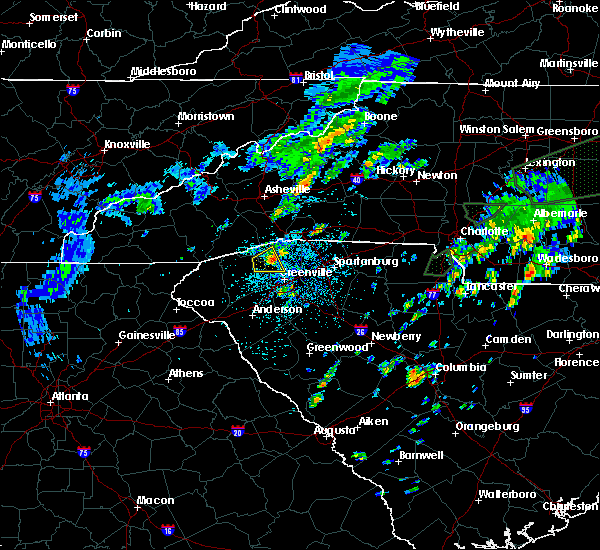 The severe thunderstorm warning for north central greenville and northeastern pickens counties will expire at 145 pm edt, the storm which prompted the warning has moved out of the area. therefore the warning will be allowed to expire. however small hail and gusty winds are still possible with this thunderstorm. if you observed large hail or wind damage, please report it to the national weather service greenville-spartanburg by calling toll free, 1, 800, 2 6 7, 8 1 0 1, or by posting on our facebook page, or tweet it using hashtag nwsgsp. your message should describe the event and the specific location where it occurred. The severe thunderstorm warning for north central greenville and northeastern pickens counties will expire at 145 pm edt, the storm which prompted the warning has moved out of the area. therefore the warning will be allowed to expire. however small hail and gusty winds are still possible with this thunderstorm. if you observed large hail or wind damage, please report it to the national weather service greenville-spartanburg by calling toll free, 1, 800, 2 6 7, 8 1 0 1, or by posting on our facebook page, or tweet it using hashtag nwsgsp. your message should describe the event and the specific location where it occurred.
|
| 4/13/2019 1:23 PM EDT |
 At 122 pm edt, a severe thunderstorm was located 8 miles north of easley, or 5 miles west of furman university, moving east at 20 mph (radar indicated). Hazards include 60 mph wind gusts and quarter size hail. Minor hail damage to vehicles is expected. expect wind damage to trees and power lines. Locations impacted include, travelers rest, slater-marietta, paris mountain state park, pleasant ridge state park, furman university, dacusville and cleveland. At 122 pm edt, a severe thunderstorm was located 8 miles north of easley, or 5 miles west of furman university, moving east at 20 mph (radar indicated). Hazards include 60 mph wind gusts and quarter size hail. Minor hail damage to vehicles is expected. expect wind damage to trees and power lines. Locations impacted include, travelers rest, slater-marietta, paris mountain state park, pleasant ridge state park, furman university, dacusville and cleveland.
|
| 4/13/2019 1:01 PM EDT |
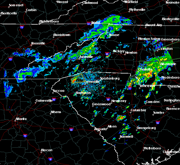 At 101 pm edt, a severe thunderstorm was located near pickens, moving east at 20 mph (radar indicated). Hazards include 60 mph wind gusts and quarter size hail. Minor hail damage to vehicles is expected. Expect wind damage to trees and power lines. At 101 pm edt, a severe thunderstorm was located near pickens, moving east at 20 mph (radar indicated). Hazards include 60 mph wind gusts and quarter size hail. Minor hail damage to vehicles is expected. Expect wind damage to trees and power lines.
|
| 9/27/2018 7:30 PM EDT |
 At 729 pm edt, severe thunderstorms were located along a line extending from 5 miles northeast of easley to 3 miles east of downtown greenville to 18 miles southwest of spartanburg to 8 miles northwest of laurens, moving northeast at 45 mph (radar indicated). Hazards include 60 mph wind gusts. Expect damage to trees and power lines. Locations impacted include, greenville, spartanburg, columbus, greer, mauldin, taylors, berea and five forks. At 729 pm edt, severe thunderstorms were located along a line extending from 5 miles northeast of easley to 3 miles east of downtown greenville to 18 miles southwest of spartanburg to 8 miles northwest of laurens, moving northeast at 45 mph (radar indicated). Hazards include 60 mph wind gusts. Expect damage to trees and power lines. Locations impacted include, greenville, spartanburg, columbus, greer, mauldin, taylors, berea and five forks.
|
| 9/27/2018 7:12 PM EDT |
 At 712 pm edt, severe thunderstorms were located along a line extending from 3 miles southwest of easley to 13 miles south of greenville downtown to 12 miles west of laurens, moving northeast at 50 mph (radar indicated). Hazards include 70 mph wind gusts. Expect considerable tree damage. damage is likely to mobile homes, roofs, and outbuildings. Locations impacted include, greenville, spartanburg, easley, columbus, greer, mauldin, taylors and simpsonville. At 712 pm edt, severe thunderstorms were located along a line extending from 3 miles southwest of easley to 13 miles south of greenville downtown to 12 miles west of laurens, moving northeast at 50 mph (radar indicated). Hazards include 70 mph wind gusts. Expect considerable tree damage. damage is likely to mobile homes, roofs, and outbuildings. Locations impacted include, greenville, spartanburg, easley, columbus, greer, mauldin, taylors and simpsonville.
|
| 9/27/2018 6:53 PM EDT |
 The national weather service in greenville-spartanburg has issued a * severe thunderstorm warning for. southeastern henderson county in western north carolina. southern polk county in western north carolina. northwestern laurens county in upstate south carolina. Greenville county in upstate south carolina. The national weather service in greenville-spartanburg has issued a * severe thunderstorm warning for. southeastern henderson county in western north carolina. southern polk county in western north carolina. northwestern laurens county in upstate south carolina. Greenville county in upstate south carolina.
|
| 9/2/2018 4:56 PM EDT |
 A severe thunderstorm warning remains in effect until 515 pm edt for northeastern greenville county. at 456 pm edt, a severe thunderstorm was located 13 miles southwest of columbus, or near tigerville, moving west at 10 mph. hazard. 60 mph wind gusts and quarter size hail. source. Radar indicated. A severe thunderstorm warning remains in effect until 515 pm edt for northeastern greenville county. at 456 pm edt, a severe thunderstorm was located 13 miles southwest of columbus, or near tigerville, moving west at 10 mph. hazard. 60 mph wind gusts and quarter size hail. source. Radar indicated.
|
| 9/2/2018 4:54 PM EDT | 2 trees and a power line down near intersection of highway 25 and old highway 2 in greenville county SC, 9 miles S of Travelers Rest, SC |
| 9/2/2018 4:40 PM EDT |
 At 440 pm edt, a severe thunderstorm was located 11 miles south of columbus, or 5 miles southwest of campobello, moving west at 5 mph (radar indicated). Hazards include 60 mph wind gusts and quarter size hail. Minor hail damage to vehicles is expected. Expect wind damage to trees and power lines. At 440 pm edt, a severe thunderstorm was located 11 miles south of columbus, or 5 miles southwest of campobello, moving west at 5 mph (radar indicated). Hazards include 60 mph wind gusts and quarter size hail. Minor hail damage to vehicles is expected. Expect wind damage to trees and power lines.
|
| 7/21/2018 7:23 PM EDT |
 The national weather service in greenville-spartanburg has issued a * severe thunderstorm warning for. central greenville county in upstate south carolina. north central anderson county in upstate south carolina. central pickens county in upstate south carolina. Until 815 pm edt. The national weather service in greenville-spartanburg has issued a * severe thunderstorm warning for. central greenville county in upstate south carolina. north central anderson county in upstate south carolina. central pickens county in upstate south carolina. Until 815 pm edt.
|
| 6/27/2018 4:46 PM EDT |
 At 446 pm edt, severe thunderstorms were located along a line extending from 10 miles northwest of spartanburg to 14 miles east of greenville downtown, moving southeast at 30 mph (radar indicated). Hazards include 60 mph wind gusts and quarter size hail. Minor hail damage to vehicles is expected. expect wind damage to trees and power lines. Locations impacted include, greenville downtown, spartanburg, greenville eastside, west greenville, greer, taylors, five forks, welcome, boiling springs sc and travelers rest. At 446 pm edt, severe thunderstorms were located along a line extending from 10 miles northwest of spartanburg to 14 miles east of greenville downtown, moving southeast at 30 mph (radar indicated). Hazards include 60 mph wind gusts and quarter size hail. Minor hail damage to vehicles is expected. expect wind damage to trees and power lines. Locations impacted include, greenville downtown, spartanburg, greenville eastside, west greenville, greer, taylors, five forks, welcome, boiling springs sc and travelers rest.
|
| 6/27/2018 4:29 PM EDT |
 The national weather service in greenville-spartanburg has issued a * severe thunderstorm warning for. northeastern greenville county in upstate south carolina. spartanburg county in upstate south carolina. until 515 pm edt. At 428 pm edt, a severe thunderstorm was located 12 miles south of. The national weather service in greenville-spartanburg has issued a * severe thunderstorm warning for. northeastern greenville county in upstate south carolina. spartanburg county in upstate south carolina. until 515 pm edt. At 428 pm edt, a severe thunderstorm was located 12 miles south of.
|
| 6/27/2018 4:20 PM EDT | Schp reported a tree down at tubbs mountain rd and bowers rd in greenville county SC, 2.1 miles S of Travelers Rest, SC |
| 6/27/2018 4:14 PM EDT |
 At 414 pm edt, severe thunderstorms were located along a line extending from 18 miles southwest of columbus to 8 miles north of greenville downtown to 4 miles northwest of easley, moving east at 45 mph (radar indicated). Hazards include 70 mph wind gusts and ping pong ball size hail. People and animals outdoors will be injured. expect hail damage to roofs, siding, windows, and vehicles. expect considerable tree damage. wind damage is also likely to mobile homes, roofs, and outbuildings. Locations impacted include, greenville downtown, easley, pickens, west greenville, greer, taylors, berea, welcome, travelers rest and slater-marietta. At 414 pm edt, severe thunderstorms were located along a line extending from 18 miles southwest of columbus to 8 miles north of greenville downtown to 4 miles northwest of easley, moving east at 45 mph (radar indicated). Hazards include 70 mph wind gusts and ping pong ball size hail. People and animals outdoors will be injured. expect hail damage to roofs, siding, windows, and vehicles. expect considerable tree damage. wind damage is also likely to mobile homes, roofs, and outbuildings. Locations impacted include, greenville downtown, easley, pickens, west greenville, greer, taylors, berea, welcome, travelers rest and slater-marietta.
|
| 6/27/2018 4:01 PM EDT |
 At 401 pm edt, severe thunderstorms were located along a line extending from 13 miles southeast of brevard to 9 miles northwest of pickens, moving east at 30 mph (radar indicated). Hazards include 60 mph wind gusts and quarter size hail. Minor hail damage to vehicles is expected. Expect wind damage to trees and power lines. At 401 pm edt, severe thunderstorms were located along a line extending from 13 miles southeast of brevard to 9 miles northwest of pickens, moving east at 30 mph (radar indicated). Hazards include 60 mph wind gusts and quarter size hail. Minor hail damage to vehicles is expected. Expect wind damage to trees and power lines.
|
| 6/26/2018 3:29 PM EDT |
 At 329 pm edt, a severe thunderstorm was located 4 miles north of greenville downtown, or near paris mountain state park, moving southeast at 5 mph (radar indicated). Hazards include 60 mph wind gusts and quarter size hail. Minor hail damage to vehicles is expected. Expect wind damage to trees and power lines. At 329 pm edt, a severe thunderstorm was located 4 miles north of greenville downtown, or near paris mountain state park, moving southeast at 5 mph (radar indicated). Hazards include 60 mph wind gusts and quarter size hail. Minor hail damage to vehicles is expected. Expect wind damage to trees and power lines.
|
| 6/26/2018 3:02 PM EDT |
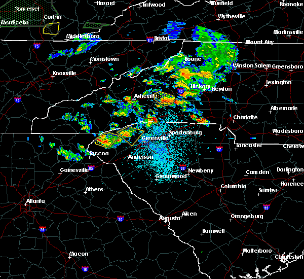 At 302 pm edt, a severe thunderstorm was located 7 miles northeast of pickens, or 4 miles southeast of table rock state park, moving southeast at 10 mph (radar indicated). Hazards include 60 mph wind gusts and quarter size hail. Minor hail damage to vehicles is expected. expect wind damage to trees and power lines. Locations impacted include, easley, travelers rest, slater-marietta, table rock state park, caesars head state park, pumpkintown, dacusville, cleveland, sunset and furman university. At 302 pm edt, a severe thunderstorm was located 7 miles northeast of pickens, or 4 miles southeast of table rock state park, moving southeast at 10 mph (radar indicated). Hazards include 60 mph wind gusts and quarter size hail. Minor hail damage to vehicles is expected. expect wind damage to trees and power lines. Locations impacted include, easley, travelers rest, slater-marietta, table rock state park, caesars head state park, pumpkintown, dacusville, cleveland, sunset and furman university.
|
| 6/26/2018 2:44 PM EDT |
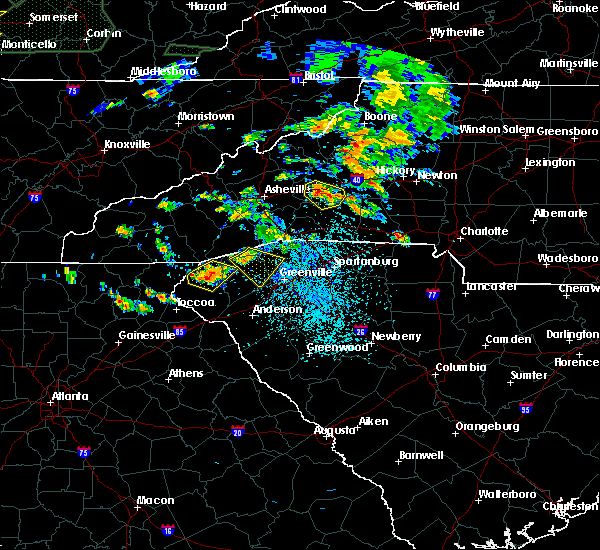 At 243 pm edt, a severe thunderstorm was located 9 miles north of pickens, or near table rock state park, moving southeast at 20 mph (radar indicated). Hazards include 60 mph wind gusts and quarter size hail. Minor hail damage to vehicles is expected. Expect wind damage to trees and power lines. At 243 pm edt, a severe thunderstorm was located 9 miles north of pickens, or near table rock state park, moving southeast at 20 mph (radar indicated). Hazards include 60 mph wind gusts and quarter size hail. Minor hail damage to vehicles is expected. Expect wind damage to trees and power lines.
|
| 6/25/2018 6:36 PM EDT |
 The severe thunderstorm warning for northwestern elbert, hart, northwestern laurens, greenville, west central spartanburg, anderson, southeastern pickens and northwestern abbeville counties will expire at 645 pm edt, the storms which prompted the warning have moved out of the area. therefore the warning will be allowed to expire. however gusty winds are still possible with these thunderstorms. a severe thunderstorm watch remains in effect until 1000 pm edt for northeastern georgia, and upstate south carolina. The severe thunderstorm warning for northwestern elbert, hart, northwestern laurens, greenville, west central spartanburg, anderson, southeastern pickens and northwestern abbeville counties will expire at 645 pm edt, the storms which prompted the warning have moved out of the area. therefore the warning will be allowed to expire. however gusty winds are still possible with these thunderstorms. a severe thunderstorm watch remains in effect until 1000 pm edt for northeastern georgia, and upstate south carolina.
|
| 6/25/2018 6:25 PM EDT |
 A severe thunderstorm warning remains in effect until 645 pm edt for northwestern elbert. hart. northwestern laurens. greenville. west central spartanburg. anderson. southeastern pickens and northwestern abbeville counties. At 625 pm edt, severe thunderstorms were located along a line extending from 9 miles southwest of spartanburg to 13 miles southeast. A severe thunderstorm warning remains in effect until 645 pm edt for northwestern elbert. hart. northwestern laurens. greenville. west central spartanburg. anderson. southeastern pickens and northwestern abbeville counties. At 625 pm edt, severe thunderstorms were located along a line extending from 9 miles southwest of spartanburg to 13 miles southeast.
|
| 6/25/2018 6:25 PM EDT |
 At 625 pm edt, severe thunderstorms were located along a line extending from 9 miles southwest of spartanburg to 13 miles southeast of anderson to 8 miles south of hartwell, moving southeast at 45 mph (radar indicated). Hazards include 60 mph wind gusts and quarter size hail. Minor hail damage to vehicles is expected. expect wind damage to trees and power lines. Locations impacted include, greenville downtown, spartanburg, anderson, easley, elberton, hartwell, greenville eastside, west greenville, greer and mauldin. At 625 pm edt, severe thunderstorms were located along a line extending from 9 miles southwest of spartanburg to 13 miles southeast of anderson to 8 miles south of hartwell, moving southeast at 45 mph (radar indicated). Hazards include 60 mph wind gusts and quarter size hail. Minor hail damage to vehicles is expected. expect wind damage to trees and power lines. Locations impacted include, greenville downtown, spartanburg, anderson, easley, elberton, hartwell, greenville eastside, west greenville, greer and mauldin.
|
| 6/25/2018 6:22 PM EDT |
 At 621 pm edt, severe thunderstorms were located along a line extending from 6 miles northwest of gastonia to 4 miles northwest of spartanburg, moving east at 35 mph (radar indicated). Hazards include 60 mph wind gusts and quarter size hail. Minor hail damage to vehicles is expected. Expect wind damage to trees and power lines. At 621 pm edt, severe thunderstorms were located along a line extending from 6 miles northwest of gastonia to 4 miles northwest of spartanburg, moving east at 35 mph (radar indicated). Hazards include 60 mph wind gusts and quarter size hail. Minor hail damage to vehicles is expected. Expect wind damage to trees and power lines.
|
| 6/25/2018 5:59 PM EDT |
 At 558 pm edt, severe thunderstorms were located along a line extending from 8 miles northeast of greenville downtown to 3 miles northwest of anderson to 5 miles southeast of carnesville, moving southeast at 45 mph (radar indicated). Hazards include 60 mph wind gusts and quarter size hail. Minor hail damage to vehicles is expected. Expect wind damage to trees and power lines. At 558 pm edt, severe thunderstorms were located along a line extending from 8 miles northeast of greenville downtown to 3 miles northwest of anderson to 5 miles southeast of carnesville, moving southeast at 45 mph (radar indicated). Hazards include 60 mph wind gusts and quarter size hail. Minor hail damage to vehicles is expected. Expect wind damage to trees and power lines.
|
| 6/25/2018 5:59 PM EDT |
 The national weather service in greenville-spartanburg has issued a * severe thunderstorm warning for. franklin county in northeastern georgia. southeastern stephens county in northeastern georgia. northwestern elbert county in northeastern georgia. Hart county in northeastern georgia. The national weather service in greenville-spartanburg has issued a * severe thunderstorm warning for. franklin county in northeastern georgia. southeastern stephens county in northeastern georgia. northwestern elbert county in northeastern georgia. Hart county in northeastern georgia.
|
| 6/24/2018 5:38 PM EDT |
 The severe thunderstorm warning for greenville, northeastern anderson and eastern pickens counties will expire at 545 pm edt, the storms which prompted the warning have weakened below severe limits, and are starting to move east of greenville county. therefore, the warning will be allowed to expire on schedule. however, gusty winds of 30 to 40 mph are still possible behind these thunderstorms through 6 pm. The severe thunderstorm warning for greenville, northeastern anderson and eastern pickens counties will expire at 545 pm edt, the storms which prompted the warning have weakened below severe limits, and are starting to move east of greenville county. therefore, the warning will be allowed to expire on schedule. however, gusty winds of 30 to 40 mph are still possible behind these thunderstorms through 6 pm.
|
| 6/24/2018 5:21 PM EDT |
 At 521 pm edt, severe thunderstorms were located along a line extending from 20 miles southwest of columbus to 3 miles east of greenville downtown to 10 miles southeast of easley, moving east at 45 mph (radar indicated). Hazards include 60 mph wind gusts and penny size hail. Expect damage to trees and power lines. Locations impacted include, greenville downtown, easley, greenville eastside, west greenville, greer, mauldin, taylors, simpsonville, berea and five forks. At 521 pm edt, severe thunderstorms were located along a line extending from 20 miles southwest of columbus to 3 miles east of greenville downtown to 10 miles southeast of easley, moving east at 45 mph (radar indicated). Hazards include 60 mph wind gusts and penny size hail. Expect damage to trees and power lines. Locations impacted include, greenville downtown, easley, greenville eastside, west greenville, greer, mauldin, taylors, simpsonville, berea and five forks.
|
| 6/24/2018 4:55 PM EDT |
 At 454 pm edt, severe thunderstorms were located along a line extending from 14 miles south of brevard to 3 miles northeast of pickens to 5 miles north of clemson, moving east at 45 mph (radar indicated). Hazards include 60 mph wind gusts and penny size hail. expect damage to trees and power lines At 454 pm edt, severe thunderstorms were located along a line extending from 14 miles south of brevard to 3 miles northeast of pickens to 5 miles north of clemson, moving east at 45 mph (radar indicated). Hazards include 60 mph wind gusts and penny size hail. expect damage to trees and power lines
|
| 6/23/2018 5:36 PM EDT |
 At 535 pm edt, severe thunderstorms were located along a line extending from 5 miles northwest of hendersonville to 13 miles southwest of columbus to 5 miles southeast of greenville downtown to 15 miles east of anderson, moving east at 45 mph (radar indicated). Hazards include 60 mph wind gusts. Expect damage to trees and power lines. Locations impacted include, greenville downtown, spartanburg, hendersonville, columbus, greenville eastside, west greenville, greer, mauldin, taylors and simpsonville. At 535 pm edt, severe thunderstorms were located along a line extending from 5 miles northwest of hendersonville to 13 miles southwest of columbus to 5 miles southeast of greenville downtown to 15 miles east of anderson, moving east at 45 mph (radar indicated). Hazards include 60 mph wind gusts. Expect damage to trees and power lines. Locations impacted include, greenville downtown, spartanburg, hendersonville, columbus, greenville eastside, west greenville, greer, mauldin, taylors and simpsonville.
|
| 6/23/2018 5:03 PM EDT |
 At 502 pm edt, severe thunderstorms were located along a line extending from 9 miles southeast of waynesville to 5 miles south of brevard to 5 miles south of pickens to 7 miles southeast of clemson, moving east at 55 mph (radar indicated). Hazards include 60 mph wind gusts. expect damage to trees and power lines At 502 pm edt, severe thunderstorms were located along a line extending from 9 miles southeast of waynesville to 5 miles south of brevard to 5 miles south of pickens to 7 miles southeast of clemson, moving east at 55 mph (radar indicated). Hazards include 60 mph wind gusts. expect damage to trees and power lines
|
| 6/20/2018 3:18 PM EDT | Quarter sized hail reported 12.6 miles S of Travelers Rest, SC, nickel to quarter sized hail at camp old indian. |
| 6/20/2018 3:18 PM EDT | A few trees down in the area from stor in greenville county SC, 12.6 miles S of Travelers Rest, SC |
| 6/16/2018 4:41 PM EDT |
 At 441 pm edt, severe thunderstorms were located along a line extending from near greenville downtown to 4 miles south of easley, moving southeast at 10 mph (radar indicated). Hazards include 60 mph wind gusts and quarter size hail. Minor hail damage to vehicles is expected. expect wind damage to trees and power lines. Locations impacted include, greenville downtown, easley, greenville eastside, west greenville, mauldin, simpsonville, berea, welcome, powdersville and piedmont. At 441 pm edt, severe thunderstorms were located along a line extending from near greenville downtown to 4 miles south of easley, moving southeast at 10 mph (radar indicated). Hazards include 60 mph wind gusts and quarter size hail. Minor hail damage to vehicles is expected. expect wind damage to trees and power lines. Locations impacted include, greenville downtown, easley, greenville eastside, west greenville, mauldin, simpsonville, berea, welcome, powdersville and piedmont.
|
| 6/16/2018 4:19 PM EDT |
 At 419 pm edt, severe thunderstorms were located along a line extending from 4 miles northwest of greenville downtown to 4 miles east of clemson, moving southeast at 10 mph (radar indicated). Hazards include 60 mph wind gusts and quarter size hail. Minor hail damage to vehicles is expected. Expect wind damage to trees and power lines. At 419 pm edt, severe thunderstorms were located along a line extending from 4 miles northwest of greenville downtown to 4 miles east of clemson, moving southeast at 10 mph (radar indicated). Hazards include 60 mph wind gusts and quarter size hail. Minor hail damage to vehicles is expected. Expect wind damage to trees and power lines.
|
| 6/16/2018 4:01 PM EDT |
 At 400 pm edt, severe thunderstorms were located along a line extending from 11 miles north of easley to 3 miles southwest of pickens, moving southeast at 10 mph (radar indicated). Hazards include 60 mph wind gusts and quarter size hail. Minor hail damage to vehicles is expected. expect wind damage to trees and power lines. Locations impacted include, easley, pickens, berea, central, liberty, norris, six mile, jocassee gorges, table rock state park and keowee toxaway state park. At 400 pm edt, severe thunderstorms were located along a line extending from 11 miles north of easley to 3 miles southwest of pickens, moving southeast at 10 mph (radar indicated). Hazards include 60 mph wind gusts and quarter size hail. Minor hail damage to vehicles is expected. expect wind damage to trees and power lines. Locations impacted include, easley, pickens, berea, central, liberty, norris, six mile, jocassee gorges, table rock state park and keowee toxaway state park.
|
| 6/16/2018 3:43 PM EDT |
 At 342 pm edt, severe thunderstorms were located along a line extending from 14 miles north of easley to 4 miles west of pickens, moving southeast at 10 mph (radar indicated). Hazards include 60 mph wind gusts and quarter size hail. Minor hail damage to vehicles is expected. Expect wind damage to trees and power lines. At 342 pm edt, severe thunderstorms were located along a line extending from 14 miles north of easley to 4 miles west of pickens, moving southeast at 10 mph (radar indicated). Hazards include 60 mph wind gusts and quarter size hail. Minor hail damage to vehicles is expected. Expect wind damage to trees and power lines.
|
| 6/1/2018 6:32 PM EDT |
 At 632 pm edt, a severe thunderstorm was located 6 miles east of greenville downtown, or 4 miles southwest of gsp airport, moving northeast at 55 mph (radar indicated). Hazards include 60 mph wind gusts. Expect damage to trees and power lines. Locations impacted include, greenville downtown, easley, greenville eastside, west greenville, mauldin, simpsonville, berea, welcome, powdersville and piedmont. At 632 pm edt, a severe thunderstorm was located 6 miles east of greenville downtown, or 4 miles southwest of gsp airport, moving northeast at 55 mph (radar indicated). Hazards include 60 mph wind gusts. Expect damage to trees and power lines. Locations impacted include, greenville downtown, easley, greenville eastside, west greenville, mauldin, simpsonville, berea, welcome, powdersville and piedmont.
|
| 6/1/2018 6:01 PM EDT |
 At 601 pm edt, a severe thunderstorm was located near clemson, or near central, moving east at 55 mph (radar indicated). Hazards include 60 mph wind gusts. expect damage to trees and power lines At 601 pm edt, a severe thunderstorm was located near clemson, or near central, moving east at 55 mph (radar indicated). Hazards include 60 mph wind gusts. expect damage to trees and power lines
|
| 5/31/2018 5:00 PM EDT |
 At 500 pm edt, a severe thunderstorm was located 7 miles northeast of greenville downtown, or near taylors, moving southeast at 25 mph (radar indicated). Hazards include 60 mph wind gusts and quarter size hail. Minor hail damage to vehicles is expected. expect wind damage to trees and power lines. Locations impacted include, greenville downtown, greenville eastside, west greenville, greer, mauldin, taylors, simpsonville, berea, five forks and fountain inn. At 500 pm edt, a severe thunderstorm was located 7 miles northeast of greenville downtown, or near taylors, moving southeast at 25 mph (radar indicated). Hazards include 60 mph wind gusts and quarter size hail. Minor hail damage to vehicles is expected. expect wind damage to trees and power lines. Locations impacted include, greenville downtown, greenville eastside, west greenville, greer, mauldin, taylors, simpsonville, berea, five forks and fountain inn.
|
| 5/31/2018 4:50 PM EDT | Schp reported a tree down on hawkins rd at bridwell wa in greenville county SC, 1.8 miles W of Travelers Rest, SC |
| 5/31/2018 4:39 PM EDT | Schp reported a tree down at mush creek rd and boswell ci in greenville county SC, 4.5 miles SSW of Travelers Rest, SC |
| 5/31/2018 4:39 PM EDT |
 At 438 pm edt, a severe thunderstorm was located 9 miles north of greenville downtown, or near travelers rest, moving southeast at 25 mph. several other thunderstorms developing in northern greenville county may become severe as well, particularly one moving south of gowensville and another near berea (radar indicated). Hazards include 60 mph wind gusts and quarter size hail. Minor hail damage to vehicles is expected. Expect wind damage to trees and power lines. At 438 pm edt, a severe thunderstorm was located 9 miles north of greenville downtown, or near travelers rest, moving southeast at 25 mph. several other thunderstorms developing in northern greenville county may become severe as well, particularly one moving south of gowensville and another near berea (radar indicated). Hazards include 60 mph wind gusts and quarter size hail. Minor hail damage to vehicles is expected. Expect wind damage to trees and power lines.
|
| 5/10/2018 5:24 PM EDT |
 At 523 pm edt, a severe thunderstorm was located 10 miles north of easley, or 5 miles southwest of slater-marietta, moving southeast at 20 mph (radar indicated). Hazards include 60 mph wind gusts and quarter size hail. Minor hail damage to vehicles is expected. Expect wind damage to trees and power lines. At 523 pm edt, a severe thunderstorm was located 10 miles north of easley, or 5 miles southwest of slater-marietta, moving southeast at 20 mph (radar indicated). Hazards include 60 mph wind gusts and quarter size hail. Minor hail damage to vehicles is expected. Expect wind damage to trees and power lines.
|
| 8/7/2017 5:54 PM EDT |
 At 552 pm, the thunderstorms which prompted the warning were weakening as they moved east from greenville county into northern spartanburg county. the warning will be allowed to expire on schedule at 600 pm, however, gusty winds to 35 mph may continue across spartanburg and southern polk counties through 630 pm. At 552 pm, the thunderstorms which prompted the warning were weakening as they moved east from greenville county into northern spartanburg county. the warning will be allowed to expire on schedule at 600 pm, however, gusty winds to 35 mph may continue across spartanburg and southern polk counties through 630 pm.
|
| 8/7/2017 5:40 PM EDT |
 At 540 pm edt, severe thunderstorms were located along a line extending from 6 miles southwest of columbus to 20 miles west of spartanburg to 4 miles northeast of greenville downtown, moving northeast at 40 mph (radar indicated). Hazards include 60 mph wind gusts. Expect damage to trees and power lines. Locations impacted include, greenville downtown, columbus, west greenville, greer, taylors, boiling springs sc, travelers rest, duncan, lyman and landrum. At 540 pm edt, severe thunderstorms were located along a line extending from 6 miles southwest of columbus to 20 miles west of spartanburg to 4 miles northeast of greenville downtown, moving northeast at 40 mph (radar indicated). Hazards include 60 mph wind gusts. Expect damage to trees and power lines. Locations impacted include, greenville downtown, columbus, west greenville, greer, taylors, boiling springs sc, travelers rest, duncan, lyman and landrum.
|
| 8/7/2017 5:25 PM EDT | Tree down at intersection of foot hills road and mcelhaney roa in greenville county SC, 1.2 miles ENE of Travelers Rest, SC |
| 8/7/2017 5:18 PM EDT |
 At 518 pm edt, severe thunderstorms were located along a line extending from 13 miles northeast of pickens to 11 miles northeast of easley to 6 miles west of greenville downtown, moving northeast at 40 mph (radar indicated). Hazards include 60 mph wind gusts. expect damage to trees and power lines At 518 pm edt, severe thunderstorms were located along a line extending from 13 miles northeast of pickens to 11 miles northeast of easley to 6 miles west of greenville downtown, moving northeast at 40 mph (radar indicated). Hazards include 60 mph wind gusts. expect damage to trees and power lines
|
| 8/6/2017 7:38 PM EDT |
 At 738 pm edt, a severe thunderstorm was located 8 miles north of greenville downtown, or near paris mountain state park, moving northeast at 15 mph (radar indicated). Hazards include 60 mph wind gusts. expect damage to trees and power lines At 738 pm edt, a severe thunderstorm was located 8 miles north of greenville downtown, or near paris mountain state park, moving northeast at 15 mph (radar indicated). Hazards include 60 mph wind gusts. expect damage to trees and power lines
|
| 7/28/2017 3:04 PM EDT |
 At 304 pm edt, severe thunderstorms were located along a line extending from 17 miles southwest of columbus to 7 miles east of greenville downtown to 19 miles northwest of laurens, moving east at 35 mph (radar indicated). Hazards include 60 mph wind gusts and quarter size hail. Minor hail damage to vehicles is expected. expect wind damage to trees and power lines. Locations impacted include, greenville downtown, greenville eastside, west greenville, greer, mauldin, taylors, simpsonville, berea, five forks and fountain inn. At 304 pm edt, severe thunderstorms were located along a line extending from 17 miles southwest of columbus to 7 miles east of greenville downtown to 19 miles northwest of laurens, moving east at 35 mph (radar indicated). Hazards include 60 mph wind gusts and quarter size hail. Minor hail damage to vehicles is expected. expect wind damage to trees and power lines. Locations impacted include, greenville downtown, greenville eastside, west greenville, greer, mauldin, taylors, simpsonville, berea, five forks and fountain inn.
|
| 7/28/2017 2:46 PM EDT |
 At 246 pm edt, severe thunderstorms were located along a line extending from 10 miles north of easley to 4 miles southwest of greenville downtown to 12 miles northeast of anderson, moving east at 35 mph (radar indicated). Hazards include 60 mph wind gusts and quarter size hail. Minor hail damage to vehicles is expected. Expect wind damage to trees and power lines. At 246 pm edt, severe thunderstorms were located along a line extending from 10 miles north of easley to 4 miles southwest of greenville downtown to 12 miles northeast of anderson, moving east at 35 mph (radar indicated). Hazards include 60 mph wind gusts and quarter size hail. Minor hail damage to vehicles is expected. Expect wind damage to trees and power lines.
|
| 7/17/2017 9:23 PM EDT |
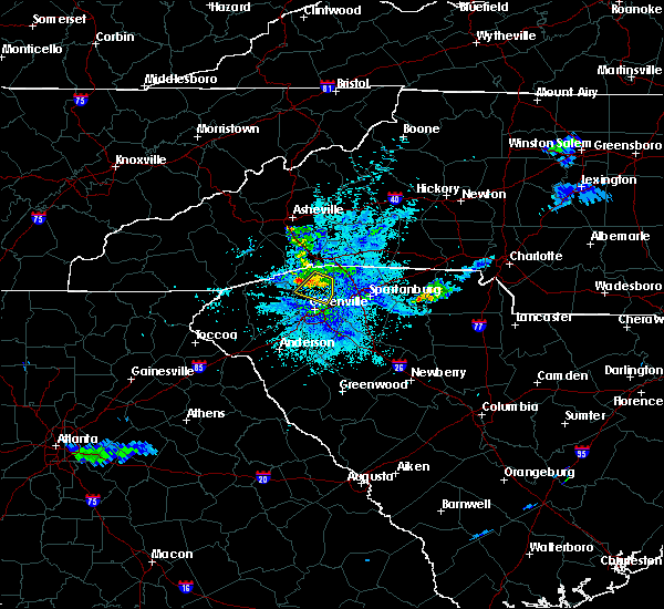 The severe thunderstorm warning for northeastern greenville county will expire at 930 pm edt, the storm which prompted the warning has weakened below severe limits, and no longer poses an immediate threat to life or property. therefore the warning will be allowed to expire. however small hail and gusty winds are still possible with this thunderstorm. if you observed large hail or wind damage, please report it to the national weather service greenville-spartanburg by calling toll free, 1, 800, 2 6 7, 8 1 0 1, or by posting on our facebook page, or tweet it using hashtag nwsgsp. your message should describe the event and the specific location where it occurred. The severe thunderstorm warning for northeastern greenville county will expire at 930 pm edt, the storm which prompted the warning has weakened below severe limits, and no longer poses an immediate threat to life or property. therefore the warning will be allowed to expire. however small hail and gusty winds are still possible with this thunderstorm. if you observed large hail or wind damage, please report it to the national weather service greenville-spartanburg by calling toll free, 1, 800, 2 6 7, 8 1 0 1, or by posting on our facebook page, or tweet it using hashtag nwsgsp. your message should describe the event and the specific location where it occurred.
|
| 7/17/2017 9:14 PM EDT |
 At 914 pm edt, a severe thunderstorm was located 14 miles north of greenville downtown, or near lake robinson, moving southwest at 5 mph (radar indicated). Hazards include 60 mph wind gusts and penny size hail. Expect damage to trees and power lines. Locations impacted include, taylors, travelers rest, paris mountain state park, tigerville, lake robinson, greer and glassy mountain. At 914 pm edt, a severe thunderstorm was located 14 miles north of greenville downtown, or near lake robinson, moving southwest at 5 mph (radar indicated). Hazards include 60 mph wind gusts and penny size hail. Expect damage to trees and power lines. Locations impacted include, taylors, travelers rest, paris mountain state park, tigerville, lake robinson, greer and glassy mountain.
|
| 7/17/2017 8:47 PM EDT |
 At 847 pm edt, a severe thunderstorm was located 13 miles southwest of columbus, or near tigerville, moving southwest at 10 mph (radar indicated). Hazards include 60 mph wind gusts and quarter size hail. Minor hail damage to vehicles is expected. Expect wind damage to trees and power lines. At 847 pm edt, a severe thunderstorm was located 13 miles southwest of columbus, or near tigerville, moving southwest at 10 mph (radar indicated). Hazards include 60 mph wind gusts and quarter size hail. Minor hail damage to vehicles is expected. Expect wind damage to trees and power lines.
|
| 7/16/2017 7:53 PM EDT |
 At 752 pm edt, a severe thunderstorm was located near easley, moving north at 15 mph (radar indicated). Hazards include 60 mph wind gusts and penny size hail. expect damage to trees and power lines At 752 pm edt, a severe thunderstorm was located near easley, moving north at 15 mph (radar indicated). Hazards include 60 mph wind gusts and penny size hail. expect damage to trees and power lines
|
| 7/15/2017 2:52 PM EDT | Schp reported a tree down at jackson grove rd and walker rd in greenville county SC, 4.7 miles W of Travelers Rest, SC |
| 7/15/2017 2:07 PM EDT | Schp reported a tree down at keeler mill rd and jordan ebenezer rd in greenville county SC, 3.1 miles ESE of Travelers Rest, SC |
| 7/8/2017 4:47 PM EDT |
 At 446 pm edt, a severe thunderstorm was located 11 miles northwest of greenville downtown, or near slater-marietta, moving east at 15 mph (radar indicated). Hazards include 60 mph wind gusts and quarter size hail. Minor hail damage to vehicles is expected. Expect wind damage to trees and power lines. At 446 pm edt, a severe thunderstorm was located 11 miles northwest of greenville downtown, or near slater-marietta, moving east at 15 mph (radar indicated). Hazards include 60 mph wind gusts and quarter size hail. Minor hail damage to vehicles is expected. Expect wind damage to trees and power lines.
|
| 7/8/2017 4:00 PM EDT |
 At 400 pm edt, a severe thunderstorm was located 10 miles north of pickens, or near table rock state park, moving east at 15 mph (radar indicated). Hazards include 60 mph wind gusts and nickel size hail. expect damage to trees and power lines At 400 pm edt, a severe thunderstorm was located 10 miles north of pickens, or near table rock state park, moving east at 15 mph (radar indicated). Hazards include 60 mph wind gusts and nickel size hail. expect damage to trees and power lines
|
| 6/24/2017 3:31 PM EDT |
 At 331 pm edt, severe thunderstorms were located along a line extending from 8 miles south of columbus to 17 miles southeast of hendersonville to 14 miles north of downtown greenville, moving southeast at 20 mph (radar indicated). Hazards include 60 mph wind gusts and penny size hail. expect damage to trees and power lines At 331 pm edt, severe thunderstorms were located along a line extending from 8 miles south of columbus to 17 miles southeast of hendersonville to 14 miles north of downtown greenville, moving southeast at 20 mph (radar indicated). Hazards include 60 mph wind gusts and penny size hail. expect damage to trees and power lines
|
| 6/24/2017 3:10 PM EDT |
 At 310 pm edt, a severe thunderstorm was located 13 miles south of hendersonville, or near pleasant ridge state park, moving southeast at 30 mph (radar indicated). Hazards include 60 mph wind gusts and penny size hail. Expect damage to trees and power lines. Locations impacted include, slater-marietta, tigerville, lake robinson, pleasant ridge state park, jones gap state park, north saluda reservoir, tuxedo, glassy mountain, crab creek and cleveland. At 310 pm edt, a severe thunderstorm was located 13 miles south of hendersonville, or near pleasant ridge state park, moving southeast at 30 mph (radar indicated). Hazards include 60 mph wind gusts and penny size hail. Expect damage to trees and power lines. Locations impacted include, slater-marietta, tigerville, lake robinson, pleasant ridge state park, jones gap state park, north saluda reservoir, tuxedo, glassy mountain, crab creek and cleveland.
|
| 6/24/2017 2:57 PM EDT |
 At 256 pm edt, a severe thunderstorm was located 10 miles south of hendersonville, or 4 miles northeast of jones gap state park, moving southeast at 30 mph (radar indicated). Hazards include 60 mph wind gusts and quarter size hail. Minor hail damage to vehicles is expected. expect wind damage to trees and power lines. Locations impacted include, slater-marietta, tigerville, lake robinson, pleasant ridge state park, jones gap state park, north saluda reservoir, tuxedo, glassy mountain, crab creek and cleveland. At 256 pm edt, a severe thunderstorm was located 10 miles south of hendersonville, or 4 miles northeast of jones gap state park, moving southeast at 30 mph (radar indicated). Hazards include 60 mph wind gusts and quarter size hail. Minor hail damage to vehicles is expected. expect wind damage to trees and power lines. Locations impacted include, slater-marietta, tigerville, lake robinson, pleasant ridge state park, jones gap state park, north saluda reservoir, tuxedo, glassy mountain, crab creek and cleveland.
|
| 6/24/2017 2:47 PM EDT |
 At 247 pm edt, a severe thunderstorm was located 8 miles east of brevard, or near dupont state forest, moving southeast at 30 mph (radar indicated). Hazards include 60 mph wind gusts. expect damage to trees and power lines At 247 pm edt, a severe thunderstorm was located 8 miles east of brevard, or near dupont state forest, moving southeast at 30 mph (radar indicated). Hazards include 60 mph wind gusts. expect damage to trees and power lines
|
| 5/28/2017 12:48 AM EDT |
 At 1248 am edt, severe thunderstorms were located along a line extending from 15 miles northeast of hendersonville to 9 miles southwest of columbus to 6 miles north of easley, moving southeast at 50 mph (radar indicated). Hazards include 60 mph wind gusts and penny size hail. Expect damage to trees and power lines. Locations impacted include, marion, rutherfordton, columbus, taylors, berea, welcome, travelers rest, spindale, landrum and slater-marietta. At 1248 am edt, severe thunderstorms were located along a line extending from 15 miles northeast of hendersonville to 9 miles southwest of columbus to 6 miles north of easley, moving southeast at 50 mph (radar indicated). Hazards include 60 mph wind gusts and penny size hail. Expect damage to trees and power lines. Locations impacted include, marion, rutherfordton, columbus, taylors, berea, welcome, travelers rest, spindale, landrum and slater-marietta.
|
| 5/28/2017 12:18 AM EDT |
 At 1217 am edt, severe thunderstorms were located along a line extending from 4 miles northwest of downtown asheville to 6 miles northeast of brevard to 17 miles northwest of pickens, moving southeast at 45 mph (radar indicated). Hazards include 60 mph wind gusts and penny size hail. expect damage to trees and power lines At 1217 am edt, severe thunderstorms were located along a line extending from 4 miles northwest of downtown asheville to 6 miles northeast of brevard to 17 miles northwest of pickens, moving southeast at 45 mph (radar indicated). Hazards include 60 mph wind gusts and penny size hail. expect damage to trees and power lines
|
| 4/6/2017 12:24 AM EDT |
 At 1224 am edt, severe thunderstorms were located along a line extending from 4 miles northeast of easley to 11 miles east of anderson to 15 miles west of abbeville, moving northeast at 85 mph (radar indicated). Hazards include 60 mph wind gusts and quarter size hail. Hail damage to vehicles is expected. Expect wind damage to roofs, siding, and trees. At 1224 am edt, severe thunderstorms were located along a line extending from 4 miles northeast of easley to 11 miles east of anderson to 15 miles west of abbeville, moving northeast at 85 mph (radar indicated). Hazards include 60 mph wind gusts and quarter size hail. Hail damage to vehicles is expected. Expect wind damage to roofs, siding, and trees.
|
| 4/5/2017 11:57 PM EDT |
 At 1157 pm edt, a severe thunderstorm was located 10 miles north of easley, or 5 miles southwest of slater-marietta, moving northeast at 60 mph (radar indicated). Hazards include 60 mph wind gusts and quarter size hail. Hail damage to vehicles is expected. expect wind damage to roofs, siding, and trees. Locations impacted include, greenville downtown, easley, clemson, pickens, west greenville, taylors, berea, welcome, travelers rest and central. At 1157 pm edt, a severe thunderstorm was located 10 miles north of easley, or 5 miles southwest of slater-marietta, moving northeast at 60 mph (radar indicated). Hazards include 60 mph wind gusts and quarter size hail. Hail damage to vehicles is expected. expect wind damage to roofs, siding, and trees. Locations impacted include, greenville downtown, easley, clemson, pickens, west greenville, taylors, berea, welcome, travelers rest and central.
|
| 4/5/2017 11:37 PM EDT |
 At 1137 pm edt, a severe thunderstorm was located 5 miles southwest of pickens, or near six mile, moving northeast at 60 mph (radar indicated). Hazards include 60 mph wind gusts and quarter size hail. Hail damage to vehicles is expected. Expect wind damage to roofs, siding, and trees. At 1137 pm edt, a severe thunderstorm was located 5 miles southwest of pickens, or near six mile, moving northeast at 60 mph (radar indicated). Hazards include 60 mph wind gusts and quarter size hail. Hail damage to vehicles is expected. Expect wind damage to roofs, siding, and trees.
|
| 4/3/2017 2:19 PM EDT |
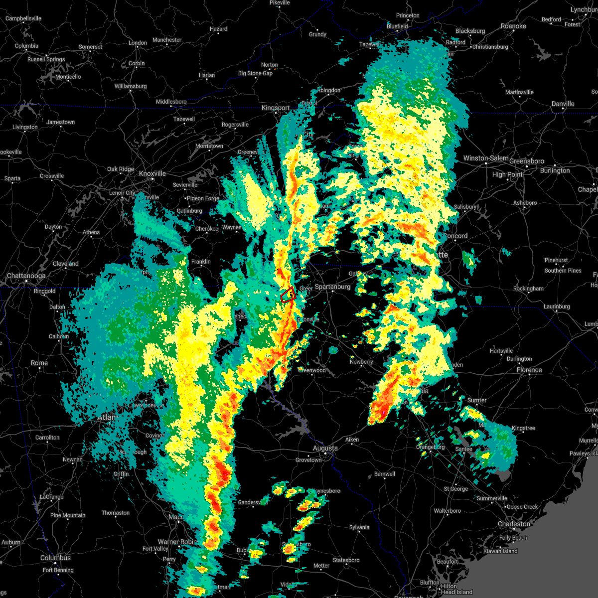 At 218 pm edt, a severe thunderstorm capable of producing a tornado was located 4 miles northwest of greenville downtown, or over berea, moving northeast at 40 mph (radar indicated rotation). Hazards include tornado. Flying debris will be dangerous to those caught without shelter. mobile homes will be damaged or destroyed. damage to roofs, windows, and vehicles will occur. tree damage is likely. this dangerous storm will be near, cherrydale point and furman university around 220 pm edt. Greenville downtown, greenville eastside and paris mountain state park around 230 pm edt. At 218 pm edt, a severe thunderstorm capable of producing a tornado was located 4 miles northwest of greenville downtown, or over berea, moving northeast at 40 mph (radar indicated rotation). Hazards include tornado. Flying debris will be dangerous to those caught without shelter. mobile homes will be damaged or destroyed. damage to roofs, windows, and vehicles will occur. tree damage is likely. this dangerous storm will be near, cherrydale point and furman university around 220 pm edt. Greenville downtown, greenville eastside and paris mountain state park around 230 pm edt.
|
| 4/3/2017 2:12 PM EDT |
 At 212 pm edt, a severe thunderstorm capable of producing a tornado was located 5 miles northeast of easley, or near berea, moving northeast at 55 mph (radar indicated rotation). Hazards include tornado. Flying debris will be dangerous to those caught without shelter. mobile homes will be damaged or destroyed. damage to roofs, windows, and vehicles will occur. tree damage is likely. This dangerous storm will be near, greenville eastside, paris mountain state park and travelers rest around 220 pm edt. At 212 pm edt, a severe thunderstorm capable of producing a tornado was located 5 miles northeast of easley, or near berea, moving northeast at 55 mph (radar indicated rotation). Hazards include tornado. Flying debris will be dangerous to those caught without shelter. mobile homes will be damaged or destroyed. damage to roofs, windows, and vehicles will occur. tree damage is likely. This dangerous storm will be near, greenville eastside, paris mountain state park and travelers rest around 220 pm edt.
|
| 3/21/2017 6:45 PM EDT |
 At 644 pm edt, a severe thunderstorm was located 12 miles northwest of greenville downtown, or near slater-marietta, moving southeast at 20 mph (radar indicated). Hazards include quarter size hail. Damage to vehicles is expected. Locations impacted include, greenville downtown, greenville eastside, west greenville, berea, welcome, travelers rest, slater-marietta, paris mountain state park, jones gap state park and cherrydale point. At 644 pm edt, a severe thunderstorm was located 12 miles northwest of greenville downtown, or near slater-marietta, moving southeast at 20 mph (radar indicated). Hazards include quarter size hail. Damage to vehicles is expected. Locations impacted include, greenville downtown, greenville eastside, west greenville, berea, welcome, travelers rest, slater-marietta, paris mountain state park, jones gap state park and cherrydale point.
|
| 3/21/2017 6:28 PM EDT |
 At 627 pm edt, a severe thunderstorm was located 7 miles northeast of greenville downtown, or near taylors, moving southeast at 15 mph. another severe thunderstorm was moving south of greer (radar indicated). Hazards include golf ball size hail. People and animals outdoors will be injured. expect damage to roofs, siding, windows and vehicles. Locations impacted include, greenville downtown, greenville eastside, greer, mauldin, taylors, simpsonville, five forks, fountain inn, travelers rest and duncan. At 627 pm edt, a severe thunderstorm was located 7 miles northeast of greenville downtown, or near taylors, moving southeast at 15 mph. another severe thunderstorm was moving south of greer (radar indicated). Hazards include golf ball size hail. People and animals outdoors will be injured. expect damage to roofs, siding, windows and vehicles. Locations impacted include, greenville downtown, greenville eastside, greer, mauldin, taylors, simpsonville, five forks, fountain inn, travelers rest and duncan.
|
| 3/21/2017 6:15 PM EDT | Golf Ball sized hail reported 0.1 miles WSW of Travelers Rest, SC, golf ball size hail broke sun roof in travelers rest |
| 3/21/2017 6:14 PM EDT |
 At 613 pm edt, a severe thunderstorm was located 13 miles north of pickens, or near caesars head state park, moving southeast at 20 mph (radar indicated). Hazards include golf ball size hail. People and animals outdoors will be injured. Expect damage to roofs, siding, windows and vehicles. At 613 pm edt, a severe thunderstorm was located 13 miles north of pickens, or near caesars head state park, moving southeast at 20 mph (radar indicated). Hazards include golf ball size hail. People and animals outdoors will be injured. Expect damage to roofs, siding, windows and vehicles.
|
| 3/21/2017 6:01 PM EDT | Hen Egg sized hail reported 3.5 miles W of Travelers Rest, SC, 2 inch hail reported off mosteller rd in travelers rest |
| 3/21/2017 5:59 PM EDT |
 At 559 pm edt, a severe thunderstorm was located 7 miles east of greenville downtown, or 4 miles southwest of gsp airport, moving southeast at 20 mph (radar indicated). Hazards include ping pong ball size hail. People and animals outdoors will be injured. Expect damage to roofs, siding, windows and vehicles. At 559 pm edt, a severe thunderstorm was located 7 miles east of greenville downtown, or 4 miles southwest of gsp airport, moving southeast at 20 mph (radar indicated). Hazards include ping pong ball size hail. People and animals outdoors will be injured. Expect damage to roofs, siding, windows and vehicles.
|
| 3/21/2017 5:45 PM EDT |
 At 544 pm edt, a severe thunderstorm was located 6 miles east of greenville downtown, or near gsp airport, moving southeast at 15 mph (radar indicated). Hazards include quarter size hail. Damage to vehicles is expected. Locations impacted include, greenville eastside, greer, taylors, travelers rest, duncan, lyman, paris mountain state park, gsp airport, cherrydale point and greenville downtown. At 544 pm edt, a severe thunderstorm was located 6 miles east of greenville downtown, or near gsp airport, moving southeast at 15 mph (radar indicated). Hazards include quarter size hail. Damage to vehicles is expected. Locations impacted include, greenville eastside, greer, taylors, travelers rest, duncan, lyman, paris mountain state park, gsp airport, cherrydale point and greenville downtown.
|
| 3/21/2017 5:41 PM EDT |
 At 540 pm edt, a severe thunderstorm was located 15 miles north of greenville downtown, or near pleasant ridge state park, moving southeast at 10 mph (radar indicated). Hazards include quarter size hail. damage to vehicles is expected At 540 pm edt, a severe thunderstorm was located 15 miles north of greenville downtown, or near pleasant ridge state park, moving southeast at 10 mph (radar indicated). Hazards include quarter size hail. damage to vehicles is expected
|
| 3/21/2017 5:23 PM EDT | Golf Ball sized hail reported 0.1 miles WSW of Travelers Rest, SC, hail to golfball size covering the ground. |
| 3/21/2017 5:23 PM EDT | Golf Ball sized hail reported 3.5 miles W of Travelers Rest, SC, hail to golfball size covering the ground. |
| 3/21/2017 5:14 PM EDT |
 At 514 pm edt, a severe thunderstorm was located 7 miles northeast of greenville downtown, or near taylors, moving southeast at 15 mph (radar indicated). Hazards include ping pong ball size hail. People and animals outdoors will be injured. Expect damage to roofs, siding, windows and vehicles. At 514 pm edt, a severe thunderstorm was located 7 miles northeast of greenville downtown, or near taylors, moving southeast at 15 mph (radar indicated). Hazards include ping pong ball size hail. People and animals outdoors will be injured. Expect damage to roofs, siding, windows and vehicles.
|
| 3/21/2017 5:10 PM EDT | Quarter sized hail reported 6.5 miles SSW of Travelers Rest, SC, quarter size hail off starview rd in travelers rest |
| 3/21/2017 5:03 PM EDT | Golf Ball sized hail reported 4.1 miles W of Travelers Rest, SC, golf ball size hail off feversham ct. |
| 3/21/2017 4:56 PM EDT |
 At 455 pm edt, a severe thunderstorm was located 12 miles north of greenville downtown, or three miles east of slater-marietta, moving southeast at 15 mph (radar indicated). Hazards include golf ball size hail. People and animals outdoors will be injured. expect damage to roofs, siding, windows and vehicles. Locations impacted include, greer, taylors, tigerville, lake robinson, pleasant ridge state park, paris mountain state park, slater-marietta and travelers rest. At 455 pm edt, a severe thunderstorm was located 12 miles north of greenville downtown, or three miles east of slater-marietta, moving southeast at 15 mph (radar indicated). Hazards include golf ball size hail. People and animals outdoors will be injured. expect damage to roofs, siding, windows and vehicles. Locations impacted include, greer, taylors, tigerville, lake robinson, pleasant ridge state park, paris mountain state park, slater-marietta and travelers rest.
|
| 3/21/2017 4:37 PM EDT |
 At 436 pm edt, a severe thunderstorm was located 14 miles north of greenville downtown, or near tigerville, moving east at 15 mph (radar indicated). Hazards include quarter size hail. damage to vehicles is expected At 436 pm edt, a severe thunderstorm was located 14 miles north of greenville downtown, or near tigerville, moving east at 15 mph (radar indicated). Hazards include quarter size hail. damage to vehicles is expected
|
| 3/1/2017 6:53 PM EST |
 At 652 pm est, severe thunderstorms were located along a line extending from 11 miles north of downtown greenville, to 7 miles southeast of easley, moving east at 60 mph (radar indicated). Hazards include 70 mph wind gusts and penny size hail. Expect considerable tree damage. damage is likely to mobile homes, roofs and outbuildings. Locations impacted include, greenville downtown, greenville eastside, west greenville, greer, mauldin, taylors, berea, welcome, powdersville and piedmont. At 652 pm est, severe thunderstorms were located along a line extending from 11 miles north of downtown greenville, to 7 miles southeast of easley, moving east at 60 mph (radar indicated). Hazards include 70 mph wind gusts and penny size hail. Expect considerable tree damage. damage is likely to mobile homes, roofs and outbuildings. Locations impacted include, greenville downtown, greenville eastside, west greenville, greer, mauldin, taylors, berea, welcome, powdersville and piedmont.
|
| 3/1/2017 6:51 PM EST |
 At 651 pm est, severe thunderstorms were located along a line extending from 10 miles southeast of columbus to 12 miles west of laurens, moving east at 55 mph (radar indicated). Hazards include 60 mph wind gusts and quarter size hail. Hail damage to vehicles is expected. expect wind damage to roofs, siding and trees. Locations impacted include, greenville downtown, spartanburg, laurens, greenville eastside, west greenville, greer, mauldin, taylors, simpsonville and berea. At 651 pm est, severe thunderstorms were located along a line extending from 10 miles southeast of columbus to 12 miles west of laurens, moving east at 55 mph (radar indicated). Hazards include 60 mph wind gusts and quarter size hail. Hail damage to vehicles is expected. expect wind damage to roofs, siding and trees. Locations impacted include, greenville downtown, spartanburg, laurens, greenville eastside, west greenville, greer, mauldin, taylors, simpsonville and berea.
|
| 3/1/2017 6:45 PM EST | Quarter sized hail reported 0.1 miles WSW of Travelers Rest, SC, quarter size hail reported in travellers rest. time estimated from radar. |
| 3/1/2017 6:33 PM EST |
 At 633 pm est, severe thunderstorms were located along a line extending from 8 miles north of pickens to 3 miles northwest of clemson, moving east at 65 mph (radar indicated). Hazards include 60 mph wind gusts and nickel size hail. Expect damage to roofs. Siding and trees. At 633 pm est, severe thunderstorms were located along a line extending from 8 miles north of pickens to 3 miles northwest of clemson, moving east at 65 mph (radar indicated). Hazards include 60 mph wind gusts and nickel size hail. Expect damage to roofs. Siding and trees.
|
| 3/1/2017 6:29 PM EST |
 At 629 pm est, severe thunderstorms were located along a line extending from 12 miles north of greenville downtown to 8 miles southeast of anderson, moving east at 55 mph (radar indicated). Hazards include 60 mph wind gusts and quarter size hail. Hail damage to vehicles is expected. Expect wind damage to roofs, siding and trees. At 629 pm est, severe thunderstorms were located along a line extending from 12 miles north of greenville downtown to 8 miles southeast of anderson, moving east at 55 mph (radar indicated). Hazards include 60 mph wind gusts and quarter size hail. Hail damage to vehicles is expected. Expect wind damage to roofs, siding and trees.
|
| 3/1/2017 6:22 PM EST |
 At 622 pm est, severe thunderstorms were located along a line extending from 7 miles northeast of pickens to 4 miles southwest of anderson, moving northeast at 60 mph (radar indicated). Hazards include 60 mph wind gusts and quarter size hail. Hail damage to vehicles is expected. expect wind damage to roofs, siding and trees. Locations impacted include, greenville downtown, anderson, easley, pickens, greenville eastside, west greenville, greer, mauldin, taylors and simpsonville. At 622 pm est, severe thunderstorms were located along a line extending from 7 miles northeast of pickens to 4 miles southwest of anderson, moving northeast at 60 mph (radar indicated). Hazards include 60 mph wind gusts and quarter size hail. Hail damage to vehicles is expected. expect wind damage to roofs, siding and trees. Locations impacted include, greenville downtown, anderson, easley, pickens, greenville eastside, west greenville, greer, mauldin, taylors and simpsonville.
|
| 3/1/2017 6:10 PM EST |
 At 610 pm est, severe thunderstorms were located along a line extending from near pickens to 6 miles northeast of hartwell, moving northeast at 60 mph (radar indicated). Hazards include 60 mph wind gusts and quarter size hail. Hail damage to vehicles is expected. expect wind damage to roofs, siding and trees. Locations impacted include, greenville downtown, anderson, easley, clemson, hartwell, pickens, greenville eastside, west greenville, greer and mauldin. At 610 pm est, severe thunderstorms were located along a line extending from near pickens to 6 miles northeast of hartwell, moving northeast at 60 mph (radar indicated). Hazards include 60 mph wind gusts and quarter size hail. Hail damage to vehicles is expected. expect wind damage to roofs, siding and trees. Locations impacted include, greenville downtown, anderson, easley, clemson, hartwell, pickens, greenville eastside, west greenville, greer and mauldin.
|
| 3/1/2017 5:50 PM EST |
 At 550 pm est, severe thunderstorms were located along a line extending from 3 miles southeast of walhalla to 7 miles east of carnesville, moving northeast at 60 mph (radar indicated). Hazards include 60 mph wind gusts and quarter size hail. Hail damage to vehicles is expected. Expect wind damage to roofs, siding and trees. At 550 pm est, severe thunderstorms were located along a line extending from 3 miles southeast of walhalla to 7 miles east of carnesville, moving northeast at 60 mph (radar indicated). Hazards include 60 mph wind gusts and quarter size hail. Hail damage to vehicles is expected. Expect wind damage to roofs, siding and trees.
|
| 11/30/2016 4:41 PM EST |
 At 441 pm est, severe thunderstorms were located along a line extending from 7 miles west of rutherfordton to near greenville downtown to 18 miles southeast of easley to 5 miles northeast of abbeville to 21 miles northeast of washington, moving east at 55 mph (radar indicated). Hazards include 60 mph wind gusts. Expect damage to roofs. Siding and trees. At 441 pm est, severe thunderstorms were located along a line extending from 7 miles west of rutherfordton to near greenville downtown to 18 miles southeast of easley to 5 miles northeast of abbeville to 21 miles northeast of washington, moving east at 55 mph (radar indicated). Hazards include 60 mph wind gusts. Expect damage to roofs. Siding and trees.
|
| 11/30/2016 3:59 PM EST |
 At 359 pm est, severe thunderstorms were located along a line extending from 11 miles northwest of pickens to 6 miles south of clemson to near hartwell to 9 miles north of elberton to 4 miles southwest of lexington, moving east at 40 mph (radar indicated). Hazards include 60 mph wind gusts. Expect damage to roofs. Siding and trees. At 359 pm est, severe thunderstorms were located along a line extending from 11 miles northwest of pickens to 6 miles south of clemson to near hartwell to 9 miles north of elberton to 4 miles southwest of lexington, moving east at 40 mph (radar indicated). Hazards include 60 mph wind gusts. Expect damage to roofs. Siding and trees.
|
| 7/8/2016 8:56 PM EDT |
 At 855 pm edt, severe thunderstorms were located along a line extending from 8 miles northeast of hendersonville to 7 miles east of hartwell, moving east at 35 mph (radar indicated). Hazards include 60 mph wind gusts and quarter size hail. Hail damage to vehicles is expected. Expect wind damage to roofs, siding and trees. At 855 pm edt, severe thunderstorms were located along a line extending from 8 miles northeast of hendersonville to 7 miles east of hartwell, moving east at 35 mph (radar indicated). Hazards include 60 mph wind gusts and quarter size hail. Hail damage to vehicles is expected. Expect wind damage to roofs, siding and trees.
|
| 7/8/2016 8:19 PM EDT |
 At 819 pm edt, a severe thunderstorm was located 19 miles north of walhalla, or 5 miles west of gorges state park, moving southeast at 30 mph (radar indicated). Hazards include 60 mph wind gusts. Expect damage to roofs. Siding and trees. At 819 pm edt, a severe thunderstorm was located 19 miles north of walhalla, or 5 miles west of gorges state park, moving southeast at 30 mph (radar indicated). Hazards include 60 mph wind gusts. Expect damage to roofs. Siding and trees.
|
| 6/30/2016 6:17 PM EDT |
 At 617 pm edt, a severe thunderstorm was located 13 miles northwest of greenville downtown, or near slater-marietta, moving northeast at 15 mph (radar indicated). Hazards include 60 mph wind gusts. Expect damage to roofs. siding and trees. Locations impacted include, slater-marietta and travelers rest. At 617 pm edt, a severe thunderstorm was located 13 miles northwest of greenville downtown, or near slater-marietta, moving northeast at 15 mph (radar indicated). Hazards include 60 mph wind gusts. Expect damage to roofs. siding and trees. Locations impacted include, slater-marietta and travelers rest.
|
| 6/30/2016 5:31 PM EDT |
 At 531 pm edt, a severe thunderstorm was located near pickens, or near liberty, moving northeast at 15 mph (radar indicated). Hazards include 60 mph wind gusts and quarter size hail. Hail damage to vehicles is expected. Expect wind damage to roofs, siding and trees. At 531 pm edt, a severe thunderstorm was located near pickens, or near liberty, moving northeast at 15 mph (radar indicated). Hazards include 60 mph wind gusts and quarter size hail. Hail damage to vehicles is expected. Expect wind damage to roofs, siding and trees.
|
| 6/27/2016 2:17 PM EDT | Schp reported a tree down at highway 414 and meadow fork rd in greenville county SC, 7.2 miles SSW of Travelers Rest, SC |
| 6/14/2016 6:33 PM EDT | Powerlines blown down at hwy 290 and locust hill baptist churc in greenville county SC, 4.9 miles SW of Travelers Rest, SC |
| 6/14/2016 6:30 PM EDT | Tree down at tigerville rd and locust hill r in greenville county SC, 4.9 miles SW of Travelers Rest, SC |
| 6/14/2016 6:24 PM EDT |
 At 623 pm edt, severe thunderstorms were located along a line extending from 14 miles northwest of pickens to 16 miles south of hendersonville to 13 miles northeast of greenville downtown, moving northeast at 20 mph (radar indicated). Hazards include 60 mph wind gusts and nickel size hail. Expect damage to roofs. siding and trees. Locations impacted include, greer, travelers rest, duncan, landrum, slater-marietta, inman, campobello, rosman, and caesars head state park. At 623 pm edt, severe thunderstorms were located along a line extending from 14 miles northwest of pickens to 16 miles south of hendersonville to 13 miles northeast of greenville downtown, moving northeast at 20 mph (radar indicated). Hazards include 60 mph wind gusts and nickel size hail. Expect damage to roofs. siding and trees. Locations impacted include, greer, travelers rest, duncan, landrum, slater-marietta, inman, campobello, rosman, and caesars head state park.
|
| 6/14/2016 6:05 PM EDT |
 At 604 pm edt, severe thunderstorms were located along a line extending from 17 miles northeast of walhalla to 13 miles northeast of pickens to 10 miles northeast of greenville downtown, moving northeast at 20 mph (radar indicated). Hazards include 60 mph wind gusts. Expect damage to roofs. Siding and trees. At 604 pm edt, severe thunderstorms were located along a line extending from 17 miles northeast of walhalla to 13 miles northeast of pickens to 10 miles northeast of greenville downtown, moving northeast at 20 mph (radar indicated). Hazards include 60 mph wind gusts. Expect damage to roofs. Siding and trees.
|
| 6/14/2016 12:05 PM EDT | At 604 pm edt, severe thunderstorms were located along a line extending from 17 miles northeast of walhalla to 13 miles northeast of pickens to 10 miles northeast of greenville downtown, moving northeast at 20 mph (radar indicated). Hazards include 60 mph wind gusts. Expect damage to roofs. Siding and trees. |
| 6/14/2016 12:05 PM EDT | At 604 pm edt, severe thunderstorms were located along a line extending from 17 miles northeast of walhalla to 13 miles northeast of pickens to 10 miles northeast of greenville downtown, moving northeast at 20 mph (radar indicated). Hazards include 60 mph wind gusts. Expect damage to roofs. Siding and trees. |
| 5/11/2016 3:35 PM EDT |
 At 334 pm edt, a severe thunderstorm was located 15 miles northwest of greenville downtown, or near slater-marietta, moving southeast at 15 mph (radar indicated). Hazards include 60 mph wind gusts and quarter size hail. Hail damage to vehicles is expected. expect wind damage to roofs, siding and trees. Locations impacted include, travelers rest, slater-marietta, pleasant ridge state park, tigerville, pumpkintown, dacusville, cleveland, furman university, jones gap state park and paris mountain state park. At 334 pm edt, a severe thunderstorm was located 15 miles northwest of greenville downtown, or near slater-marietta, moving southeast at 15 mph (radar indicated). Hazards include 60 mph wind gusts and quarter size hail. Hail damage to vehicles is expected. expect wind damage to roofs, siding and trees. Locations impacted include, travelers rest, slater-marietta, pleasant ridge state park, tigerville, pumpkintown, dacusville, cleveland, furman university, jones gap state park and paris mountain state park.
|
| 5/11/2016 3:04 PM EDT |
 At 304 pm edt, a severe thunderstorm was located 9 miles southeast of brevard, or over caesars head state park, moving southeast at 15 mph (radar indicated). Hazards include 60 mph wind gusts and quarter size hail. Hail damage to vehicles is expected. Expect wind damage to roofs, siding and trees. At 304 pm edt, a severe thunderstorm was located 9 miles southeast of brevard, or over caesars head state park, moving southeast at 15 mph (radar indicated). Hazards include 60 mph wind gusts and quarter size hail. Hail damage to vehicles is expected. Expect wind damage to roofs, siding and trees.
|
| 3/14/2016 6:19 PM EDT |
 At 618 pm edt, doppler radar indicated a severe thunderstorm with a history of producing large hail up to ping pong ball size and damaging winds in excess of 60 mph. this storm was located 12 miles east of greenville downtown, or near gsp airport, moving east at 35 mph. locations impacted include, greenville downtown, greenville eastside, west greenville, greer, taylors, welcome, travelers rest, duncan, lyman and wellford. At 618 pm edt, doppler radar indicated a severe thunderstorm with a history of producing large hail up to ping pong ball size and damaging winds in excess of 60 mph. this storm was located 12 miles east of greenville downtown, or near gsp airport, moving east at 35 mph. locations impacted include, greenville downtown, greenville eastside, west greenville, greer, taylors, welcome, travelers rest, duncan, lyman and wellford.
|
| 3/14/2016 6:00 PM EDT |
 At 559 pm edt, doppler radar indicated a severe thunderstorm capable of producing quarter size hail and damaging winds in excess of 60 mph. this storm was located 4 miles northeast of greenville downtown, or near taylors, moving east at 40 mph. locations impacted include, greenville downtown, greenville eastside, west greenville, greer, taylors, welcome, travelers rest, duncan, lyman and wellford. At 559 pm edt, doppler radar indicated a severe thunderstorm capable of producing quarter size hail and damaging winds in excess of 60 mph. this storm was located 4 miles northeast of greenville downtown, or near taylors, moving east at 40 mph. locations impacted include, greenville downtown, greenville eastside, west greenville, greer, taylors, welcome, travelers rest, duncan, lyman and wellford.
|
| 3/14/2016 5:44 PM EDT |
 At 543 pm edt, doppler radar indicated a severe thunderstorm capable of producing large damaging hail up to golf ball size and hurricane force winds in excess of 70 mph. this storm was located 7 miles northeast of easley, or near berea, and moving east at 40 mph. * locations in the warning include, greenville downtown, greenville eastside, west greenville, greer, taylors, berea, welcome, travelers rest, duncan and lyman. At 543 pm edt, doppler radar indicated a severe thunderstorm capable of producing large damaging hail up to golf ball size and hurricane force winds in excess of 70 mph. this storm was located 7 miles northeast of easley, or near berea, and moving east at 40 mph. * locations in the warning include, greenville downtown, greenville eastside, west greenville, greer, taylors, berea, welcome, travelers rest, duncan and lyman.
|
| 9/4/2015 7:20 PM EDT |
 At 717 pm edt, the public reported a severe thunderstorm producing quarter size hail and damaging winds in excess of 60 mph. this storm was located near greenville downtown, or near welcome, moving southwest at 15 mph. locations impacted include, greenville downtown, easley, mauldin, berea, welcome, powdersville, piedmont, west pelzer, furman university and greenville eastside. At 717 pm edt, the public reported a severe thunderstorm producing quarter size hail and damaging winds in excess of 60 mph. this storm was located near greenville downtown, or near welcome, moving southwest at 15 mph. locations impacted include, greenville downtown, easley, mauldin, berea, welcome, powdersville, piedmont, west pelzer, furman university and greenville eastside.
|
| 9/4/2015 6:49 PM EDT |
 At 649 pm edt, doppler radar indicated a severe thunderstorm capable of producing quarter size hail and damaging winds in excess of 60 mph. this storm was located over greenville downtown, and moving southwest at 15 mph. * locations in the warning include, greenville downtown, easley, mauldin, berea, welcome, powdersville, piedmont, west pelzer, greenville eastside and furman university. At 649 pm edt, doppler radar indicated a severe thunderstorm capable of producing quarter size hail and damaging winds in excess of 60 mph. this storm was located over greenville downtown, and moving southwest at 15 mph. * locations in the warning include, greenville downtown, easley, mauldin, berea, welcome, powdersville, piedmont, west pelzer, greenville eastside and furman university.
|
| 8/6/2015 3:25 PM EDT |
 At 324 pm edt, doppler radar indicated a severe thunderstorm capable of producing damaging winds in excess of 60 mph. this storm was located 7 miles north of greenville downtown, or near travelers rest, moving east at 20 mph. nickel size hail may also accompany the damaging winds. locations impacted include, taylors, travelers rest, lake robinson, tigerville, furman university, paris mountain state park, glassy mountain, cherrydale point, gowensville and greer. At 324 pm edt, doppler radar indicated a severe thunderstorm capable of producing damaging winds in excess of 60 mph. this storm was located 7 miles north of greenville downtown, or near travelers rest, moving east at 20 mph. nickel size hail may also accompany the damaging winds. locations impacted include, taylors, travelers rest, lake robinson, tigerville, furman university, paris mountain state park, glassy mountain, cherrydale point, gowensville and greer.
|
| 8/6/2015 2:55 PM EDT |
 At 255 pm edt, doppler radar indicated a severe thunderstorm capable of producing quarter size hail and damaging winds in excess of 60 mph. this storm was located 6 miles northeast of pickens, moving east at 25 mph. locations impacted include, taylors, travelers rest, slater-marietta, pleasant ridge state park, furman university, lake robinson, tigerville, paris mountain state park, pumpkintown and cleveland. At 255 pm edt, doppler radar indicated a severe thunderstorm capable of producing quarter size hail and damaging winds in excess of 60 mph. this storm was located 6 miles northeast of pickens, moving east at 25 mph. locations impacted include, taylors, travelers rest, slater-marietta, pleasant ridge state park, furman university, lake robinson, tigerville, paris mountain state park, pumpkintown and cleveland.
|
| 8/6/2015 2:36 PM EDT |
 At 235 pm edt, doppler radar indicated a severe thunderstorm capable of producing quarter size hail and damaging winds in excess of 60 mph. this storm was located 7 miles north of pickens, or near table rock state park, and moving east at 20 mph. * locations in the warning include, pickens, taylors, travelers rest, slater-marietta, pleasant ridge state park, furman university, table rock state park, lake robinson, tigerville and paris mountain state park. At 235 pm edt, doppler radar indicated a severe thunderstorm capable of producing quarter size hail and damaging winds in excess of 60 mph. this storm was located 7 miles north of pickens, or near table rock state park, and moving east at 20 mph. * locations in the warning include, pickens, taylors, travelers rest, slater-marietta, pleasant ridge state park, furman university, table rock state park, lake robinson, tigerville and paris mountain state park.
|
| 8/5/2015 8:19 PM EDT |
 At 818 pm edt, doppler radar indicated a severe thunderstorm capable of producing damaging winds in excess of 60 mph. this storm was located 8 miles east of greenville downtown, or near gsp airport, moving east at 15 mph. penny size hail may also accompany the damaging winds. locations impacted include, greenville downtown, greer, taylors, travelers rest, duncan, reidville, gsp airport, furman university, greenville eastside and lake robinson. At 818 pm edt, doppler radar indicated a severe thunderstorm capable of producing damaging winds in excess of 60 mph. this storm was located 8 miles east of greenville downtown, or near gsp airport, moving east at 15 mph. penny size hail may also accompany the damaging winds. locations impacted include, greenville downtown, greer, taylors, travelers rest, duncan, reidville, gsp airport, furman university, greenville eastside and lake robinson.
|
| 8/5/2015 7:53 PM EDT |
 At 753 pm edt, doppler radar indicated a severe thunderstorm capable of producing damaging winds in excess of 60 mph. this storm was located near greenville downtown, or near taylors, and moving east at 10 mph. penny size hail may also accompany the damaging winds. * locations in the warning include, greenville downtown, greer, taylors, berea, welcome, travelers rest, duncan, reidville, gsp airport and furman university. At 753 pm edt, doppler radar indicated a severe thunderstorm capable of producing damaging winds in excess of 60 mph. this storm was located near greenville downtown, or near taylors, and moving east at 10 mph. penny size hail may also accompany the damaging winds. * locations in the warning include, greenville downtown, greer, taylors, berea, welcome, travelers rest, duncan, reidville, gsp airport and furman university.
|
| 7/20/2015 8:36 PM EDT |
 At 835 pm edt, doppler radar indicated a line of severe thunderstorms capable of producing damaging winds in excess of 60 mph. these storms were located along a line extending from 5 miles west of hendersonville to 15 miles north of easley to 6 miles southwest of pickens, and moving east at 30 mph. * locations in the warning include, greenville downtown, spartanburg, easley, hendersonville, pickens, columbus, greer, mauldin, taylors and simpsonville. At 835 pm edt, doppler radar indicated a line of severe thunderstorms capable of producing damaging winds in excess of 60 mph. these storms were located along a line extending from 5 miles west of hendersonville to 15 miles north of easley to 6 miles southwest of pickens, and moving east at 30 mph. * locations in the warning include, greenville downtown, spartanburg, easley, hendersonville, pickens, columbus, greer, mauldin, taylors and simpsonville.
|
| 7/18/2015 5:02 PM EDT |
 At 502 pm edt, doppler radar indicated a line of severe thunderstorms capable of producing quarter size hail and damaging winds in excess of 60 mph. these storms were located along a line extending from 4 miles east of greenville downtown to 15 miles southeast of pickens to near easley, moving southeast at 10 mph. locations impacted include, greenville downtown, easley, mauldin, simpsonville, berea, welcome, powdersville, piedmont, travelers rest and west pelzer. At 502 pm edt, doppler radar indicated a line of severe thunderstorms capable of producing quarter size hail and damaging winds in excess of 60 mph. these storms were located along a line extending from 4 miles east of greenville downtown to 15 miles southeast of pickens to near easley, moving southeast at 10 mph. locations impacted include, greenville downtown, easley, mauldin, simpsonville, berea, welcome, powdersville, piedmont, travelers rest and west pelzer.
|
| 7/18/2015 4:36 PM EDT |
 At 436 pm edt, doppler radar indicated a severe thunderstorm capable of producing quarter size hail and damaging winds in excess of 60 mph. this storm was located 7 miles northeast of easley, or near berea, and moving southeast at 15 mph. * locations in the warning include, greenville downtown, easley, mauldin, simpsonville, berea, welcome, powdersville, piedmont, travelers rest and west pelzer. At 436 pm edt, doppler radar indicated a severe thunderstorm capable of producing quarter size hail and damaging winds in excess of 60 mph. this storm was located 7 miles northeast of easley, or near berea, and moving southeast at 15 mph. * locations in the warning include, greenville downtown, easley, mauldin, simpsonville, berea, welcome, powdersville, piedmont, travelers rest and west pelzer.
|
| 6/27/2015 4:24 PM EDT |
 At 424 pm edt, doppler radar indicated a severe thunderstorm capable of producing quarter size hail and damaging winds in excess of 60 mph. this storm was located near greenville downtown, or near berea, and moving east at 20 mph. At 424 pm edt, doppler radar indicated a severe thunderstorm capable of producing quarter size hail and damaging winds in excess of 60 mph. this storm was located near greenville downtown, or near berea, and moving east at 20 mph.
|
| 6/24/2015 6:11 PM EDT |
 At 540 pm edt, doppler radar indicated a severe thunderstorm capable of producing damaging winds in excess of 60 mph. this storm was located 12 miles northwest of taylors, or near slater-marietta, moving southeast at 10 mph. penny size hail may also accompany the damaging winds. locations impacted include, berea, travelers rest, slater-marietta, pleasant ridge state park, lake robinson, furman university, paris mountain state park, cleveland and tigerville. At 540 pm edt, doppler radar indicated a severe thunderstorm capable of producing damaging winds in excess of 60 mph. this storm was located 12 miles northwest of taylors, or near slater-marietta, moving southeast at 10 mph. penny size hail may also accompany the damaging winds. locations impacted include, berea, travelers rest, slater-marietta, pleasant ridge state park, lake robinson, furman university, paris mountain state park, cleveland and tigerville.
|
| 6/24/2015 5:40 PM EDT |
 At 540 pm edt, doppler radar indicated a severe thunderstorm capable of producing damaging winds in excess of 60 mph. this storm was located 12 miles northwest of taylors, or near slater-marietta, moving southeast at 10 mph. penny size hail may also accompany the damaging winds. locations impacted include, berea, travelers rest, slater-marietta, pleasant ridge state park, lake robinson, furman university, paris mountain state park, cleveland and tigerville. At 540 pm edt, doppler radar indicated a severe thunderstorm capable of producing damaging winds in excess of 60 mph. this storm was located 12 miles northwest of taylors, or near slater-marietta, moving southeast at 10 mph. penny size hail may also accompany the damaging winds. locations impacted include, berea, travelers rest, slater-marietta, pleasant ridge state park, lake robinson, furman university, paris mountain state park, cleveland and tigerville.
|
| 6/24/2015 5:15 PM EDT |
 At 514 pm edt, doppler radar indicated a severe thunderstorm capable of producing damaging winds in excess of 60 mph. this storm was located 15 miles northeast of pickens, or 4 miles northwest of slater-marietta, and moving southeast at 15 mph. At 514 pm edt, doppler radar indicated a severe thunderstorm capable of producing damaging winds in excess of 60 mph. this storm was located 15 miles northeast of pickens, or 4 miles northwest of slater-marietta, and moving southeast at 15 mph.
|
| 6/9/2015 6:37 PM EDT |
 The severe thunderstorm warning for northeastern pickens and central greenville counties will expire at 645 pm edt, the storm which prompted the warning has weakened below severe limits, and no longer poses an immediate threat to life or property. therefore the warning will be allowed to expire. The severe thunderstorm warning for northeastern pickens and central greenville counties will expire at 645 pm edt, the storm which prompted the warning has weakened below severe limits, and no longer poses an immediate threat to life or property. therefore the warning will be allowed to expire.
|
| 6/9/2015 6:24 PM EDT |
 At 624 pm edt, doppler radar indicated a severe thunderstorm capable of producing quarter size hail and damaging winds in excess of 60 mph. this storm was located 7 miles northwest of greenville downtown, or near berea. this storm was nearly stationary. locations impacted include, greenville downtown, easley, pickens, berea, welcome, travelers rest, furman university, west greenville, cherrydale point and dacusville. At 624 pm edt, doppler radar indicated a severe thunderstorm capable of producing quarter size hail and damaging winds in excess of 60 mph. this storm was located 7 miles northwest of greenville downtown, or near berea. this storm was nearly stationary. locations impacted include, greenville downtown, easley, pickens, berea, welcome, travelers rest, furman university, west greenville, cherrydale point and dacusville.
|
| 6/9/2015 6:00 PM EDT |
 At 600 pm edt, doppler radar indicated a severe thunderstorm capable of producing quarter size hail and damaging winds in excess of 60 mph. this storm was located 6 miles northwest of greenville downtown, or near berea, and moving west at 10 mph. At 600 pm edt, doppler radar indicated a severe thunderstorm capable of producing quarter size hail and damaging winds in excess of 60 mph. this storm was located 6 miles northwest of greenville downtown, or near berea, and moving west at 10 mph.
|
| 6/8/2015 10:32 PM EDT | At 1032 pm edt, doppler radar indicated a line of severe thunderstorms capable of producing damaging winds in excess of 60 mph. these storms were located along a line extending from 4 miles southwest of hendersonville to 6 miles west of pickens, moving east at 35 mph. locations impacted include, easley, hendersonville, brevard, walhalla, pickens, columbus, berea, travelers rest, liberty and flat rock. |
| 6/8/2015 10:32 PM EDT | At 1032 pm edt, doppler radar indicated a line of severe thunderstorms capable of producing damaging winds in excess of 60 mph. these storms were located along a line extending from 4 miles southwest of hendersonville to 6 miles west of pickens, moving east at 35 mph. locations impacted include, easley, hendersonville, brevard, walhalla, pickens, columbus, berea, travelers rest, liberty and flat rock. |
| 6/8/2015 10:05 PM EDT | At 1004 pm edt, doppler radar indicated a line of severe thunderstorms capable of producing damaging winds in excess of 60 mph. these storms were located along a line extending from 4 miles west of brevard to 3 miles northwest of walhalla, and moving east at 35 mph. |
| 6/8/2015 10:05 PM EDT | At 1004 pm edt, doppler radar indicated a line of severe thunderstorms capable of producing damaging winds in excess of 60 mph. these storms were located along a line extending from 4 miles west of brevard to 3 miles northwest of walhalla, and moving east at 35 mph. |
| 5/26/2015 8:18 PM EDT | At 817 pm edt, doppler radar indicated a line of severe thunderstorms capable of producing damaging winds in excess of 60 mph. these storms were located along a line extending from 10 miles north of taylors to 10 miles southwest of spartanburg, moving northeast at 40 mph. penny size hail may also accompany the damaging winds. locations impacted include, taylors, greer, duncan, lyman, wellford, reidville, gsp airport, lake robinson, paris mountain state park and travelers rest. |
| 5/26/2015 8:12 PM EDT | At 811 pm edt, doppler radar indicated a line of severe thunderstorms capable of producing damaging winds in excess of 60 mph. these storms were located along a line extending from 7 miles north of taylors to 11 miles east of mauldin, moving northeast at 40 mph. penny size hail may also accompany the damaging winds. locations impacted include, greenville downtown, mauldin, taylors, greenville eastside, greer, simpsonville, five forks, fountain inn, travelers rest and woodruff. |
| 5/26/2015 8:00 PM EDT | At 758 pm edt, doppler radar indicated a line of severe thunderstorms capable of producing damaging winds in excess of 60 mph. these storms were located along a line extending from 5 miles northwest of taylors to 7 miles southeast of mauldin, moving northeast at 50 mph. this line has a long history of wind damage from southern greenville county west across the savannah river valley. penny size hail may also accompany the damaging winds. locations impacted include, greenville downtown, mauldin, taylors, greenville eastside, greer, simpsonville, berea, five forks, fountain inn and welcome. |
| 5/26/2015 7:57 PM EDT | A few trees reported down. time estimated from radar dat in greenville county SC, 0.1 miles WSW of Travelers Rest, SC |
| 5/26/2015 7:47 PM EDT | At 746 pm edt, doppler radar indicated a line of severe thunderstorms capable of producing damaging winds in excess of 60 mph. these storms were located along a line extending from near greenville downtown to 14 miles west of laurens, moving northeast at 45 mph. this line of storms produced widespread tree and power line damage across anderson county. penny size hail may also accompany the damaging winds. locations impacted include, greenville downtown, mauldin, taylors, greenville eastside, greer, simpsonville, berea, five forks, fountain inn and welcome. |
| 5/26/2015 7:47 PM EDT | At 746 pm edt, doppler radar indicated a line of severe thunderstorms capable of producing damaging winds in excess of 60 mph. these storms were located along a line extending from near greenville downtown to 14 miles west of laurens, moving northeast at 45 mph. this line of storms produced widespread tree and power line damage across anderson county. penny size hail may also accompany the damaging winds. locations impacted include, greenville downtown, mauldin, taylors, greenville eastside, greer, simpsonville, berea, five forks, fountain inn and welcome. |
| 5/26/2015 7:30 PM EDT | At 730 pm edt, doppler radar indicated a line of severe thunderstorms capable of producing damaging winds in excess of 60 mph. these storms were located along a line extending from 5 miles south of easley to 13 miles north of abbeville, and moving northeast at 40 mph. penny size hail may also accompany the damaging winds. |
| 5/26/2015 7:30 PM EDT | At 730 pm edt, doppler radar indicated a line of severe thunderstorms capable of producing damaging winds in excess of 60 mph. these storms were located along a line extending from 5 miles south of easley to 13 miles north of abbeville, and moving northeast at 40 mph. penny size hail may also accompany the damaging winds. |
| 4/22/2015 9:25 PM EDT | The severe thunderstorm warning for northern pickens and northwestern greenville counties will expire at 930 pm edt, the storm which prompted the warning has weakened below severe limits, and no longer poses an immediate threat to life or property. therefore the warning will be allowed to expire. however gusty winds are still possible with this thunderstorm. |
| 4/22/2015 9:09 PM EDT | At 907 pm edt, doppler radar indicated a severe thunderstorm capable of producing damaging winds in excess of 60 mph. this storm was located 12 miles northeast of pickens, or near slater-marietta, moving east at 50 mph. locations impacted include, travelers rest, slater-marietta, pleasant ridge state park, furman university, table rock state park, tigerville, jocassee gorges, jones gap state park, caesars head state park and pumpkintown. |
| 4/22/2015 8:46 PM EDT | At 845 pm edt, doppler radar indicated a severe thunderstorm capable of producing damaging winds in excess of 60 mph. this storm was located 9 miles southwest of brevard, or over rosman, and moving east at 55 mph. |
| 4/22/2015 8:46 PM EDT | At 845 pm edt, doppler radar indicated a severe thunderstorm capable of producing damaging winds in excess of 60 mph. this storm was located 9 miles southwest of brevard, or over rosman, and moving east at 55 mph. |
| 4/20/2015 3:21 PM EDT | At 311 pm edt, national weather service doppler radar indicated multiple severe thunderstorm capable of producing quarter size hail. the storms extended from western greenville county through central cherokee county and were moving east at 45 mph. * other locations in the warning include but are not limited to taylors, tigerville, greer, duncan, lyman, inman, boiling springs sc, mayo, chesnee, cowpens, earl, cliffside, boiling springs nc, thicketty and blacksburg. |
| 4/20/2015 3:21 PM EDT | At 311 pm edt, national weather service doppler radar indicated multiple severe thunderstorm capable of producing quarter size hail. the storms extended from western greenville county through central cherokee county and were moving east at 45 mph. * other locations in the warning include but are not limited to taylors, tigerville, greer, duncan, lyman, inman, boiling springs sc, mayo, chesnee, cowpens, earl, cliffside, boiling springs nc, thicketty and blacksburg. |
| 4/20/2015 3:18 PM EDT | Quarter sized hail reported 3.1 miles NW of Travelers Rest, SC, 1 inch hail reported. |
| 4/20/2015 2:56 PM EDT | At 254 pm edt, national weather service doppler radar continued to indicate a severe thunderstorm capable of producing golf ball size. |
| 4/20/2015 2:48 PM EDT | The national weather service in columbia has issued a * severe thunderstorm warning for. greenville county in south carolina. oconee county in south carolina. pickens county in south carolina. This includes the city of pickens. |
| 4/20/2015 2:46 PM EDT | At 240 pm edt, national weather service doppler radar indicated a severe thunderstorm capable of producing nickel size hail. this storm was located near inman, or 14 miles south of columbus, and moving east at 35 mph. * the severe thunderstorm will be near, boiling springs sc by 255 pm edt, chesnee, mayo and 8 miles north of cowpens by 310 pm edt,. |
| 4/20/2015 2:00 PM EDT | Quarter sized hail reported 0.1 miles WSW of Travelers Rest, SC |
| 4/20/2015 1:42 PM EDT | At 141 pm edt, doppler radar indicated a severe thunderstorm capable of producing quarter size hail and damaging winds in excess of 60 mph. this storm was located 6 miles west of pickens, or near six mile, and moving east at 45 mph. |
| 4/20/2015 1:21 PM EDT | At 120 pm edt, doppler radar indicated a severe thunderstorm capable of producing quarter size hail and damaging winds in excess of 60 mph. this storm was located over taylors, and moving northeast at 30 mph. |
| 9/16/2014 5:40 PM EDT | Quarter sized hail reported 9.2 miles SSW of Travelers Rest, SC |
| 9/16/2014 5:16 PM EDT | Quarter sized hail reported 9.9 miles SSW of Travelers Rest, SC, dime to quarter sized hail fell along north tigerville road. strong wind that may have produced wind damage but resident not able to get to yet to check. |
| 7/3/2014 6:20 PM EDT | Numerous reports of trees and powerlines down in the troutman are in greenville county SC, 0.1 miles WSW of Travelers Rest, SC |
| 8/1/2013 2:50 PM EDT | Trees down near travelers rest. us 25 and roe ford rd...near intersection of altamont and new altamont rds...poinsett hwy and old buncombe rd...also power lines down al in greenville county SC, 1.3 miles N of Travelers Rest, SC |
| 7/5/2013 5:08 PM EDT | Tree down near intersection of tigerville road and langley roa in greenville county SC, 3.3 miles WSW of Travelers Rest, SC |
| 5/22/2013 10:08 PM EDT | Quarter sized hail reported 0.1 miles WSW of Travelers Rest, SC, 1 inch hail in travellers rest. |
| 4/27/2012 5:27 PM EDT | Tree down along old hunts bridge road at faith d in greenville county SC, 4.4 miles ENE of Travelers Rest, SC |
| 3/31/2012 6:00 PM EDT | Quarter sized hail reported 0.8 miles NE of Travelers Rest, SC, along southcreek drive. |
| 1/1/0001 12:00 AM | Tree across road near old mcelhaney rd in greenville county SC, 3.6 miles ENE of Travelers Rest, SC |
| 1/1/0001 12:00 AM | Quarter sized hail reported 9.9 miles SSW of Travelers Rest, SC, 1 inch hail 2 miles north of tigerville. |
| 5/10/2011 6:40 PM EDT | Tea Cup sized hail reported 5.8 miles SW of Travelers Rest, SC, off duty nws employee reports numerous dents in vehicles...lots of leaf debris...and several branches down from the hail. |
| 1/1/0001 12:00 AM | Quarter sized hail reported 5.4 miles SW of Travelers Rest, SC, hail covering the ground. |
| 1/1/0001 12:00 AM | Half Dollar sized hail reported 8 miles SSW of Travelers Rest, SC, hail fell from 633 pm to 645 pm |
| 1/1/0001 12:00 AM | Trees down in greenville county SC, 0.1 miles WSW of Travelers Rest, SC |
Hail Maps for Travelers Rest, SC


Connect with Interactive Hail Maps