

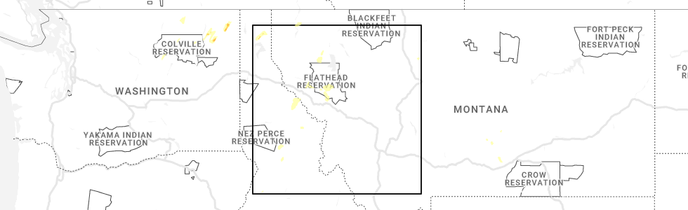
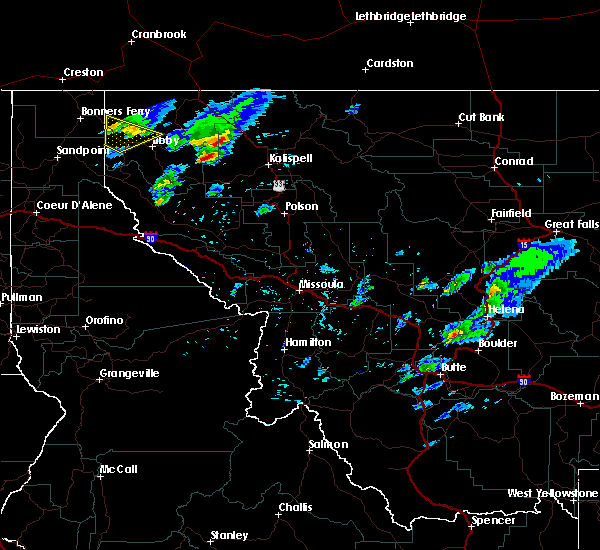
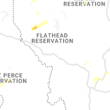
Hail Map for Trego, MT
The Trego, MT area has had 0 reports of on-the-ground hail by trained spotters, and has been under severe weather warnings 0 times during the past 12 months. Doppler radar has detected hail at or near Trego, MT on 10 occasions, including 1 occasion during the past year.
| Name: | Trego, MT |
| Where Located: | 32 miles WNW of Whitefish, MT |
| Map: | Google Map for Trego, MT |
| Population: | 541 |
| Housing Units: | 329 |
| More Info: | Search Google for Trego, MT |
0
The Top Recent Hail Date for Trego, MT is Sunday, May 21, 2023 (9th out of 10)
Hail and Wind Damage Spotted near Trego, MT
| Date / Time | Report Details |
|---|---|
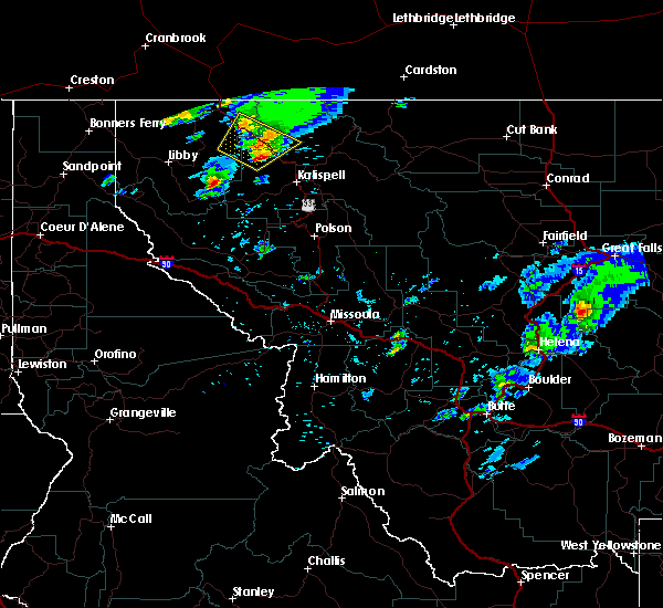
| 5/31/2020 8:42 AM MDT |
 The severe thunderstorm warning for north central lake and west central flathead counties will expire at 845 am mdt, the storms which prompted the warning have moved out of the area. therefore, the warning will be allowed to expire. The severe thunderstorm warning for north central lake and west central flathead counties will expire at 845 am mdt, the storms which prompted the warning have moved out of the area. therefore, the warning will be allowed to expire.
|
| 5/31/2020 8:25 AM MDT |
 At 822 am mdt, severe thunderstorms were located along a line extending from 26 miles west of whitefish to 6 miles north of swan lake, moving northeast at 55 mph (widespread reports of tree damage and poweroutages have been recieved). Hazards include 60 mph wind gusts. Expect damage to roofs, siding, and trees. These severe thunderstorms will remain over mainly rural areas of north central lake and west central flathead counties, including the following locations, blacktail, stryker, olney, pinnacle, radnor, martin city, coram, creston, lupfer and essex. At 822 am mdt, severe thunderstorms were located along a line extending from 26 miles west of whitefish to 6 miles north of swan lake, moving northeast at 55 mph (widespread reports of tree damage and poweroutages have been recieved). Hazards include 60 mph wind gusts. Expect damage to roofs, siding, and trees. These severe thunderstorms will remain over mainly rural areas of north central lake and west central flathead counties, including the following locations, blacktail, stryker, olney, pinnacle, radnor, martin city, coram, creston, lupfer and essex.
|
| 5/31/2020 8:14 AM MDT |
 At 813 am mdt, severe thunderstorms were located along a line extending from 25 miles east of libby to near swan lake, moving northeast at 55 mph (radar indicated). Hazards include 60 mph wind gusts. expect damage to roofs, siding, and trees At 813 am mdt, severe thunderstorms were located along a line extending from 25 miles east of libby to near swan lake, moving northeast at 55 mph (radar indicated). Hazards include 60 mph wind gusts. expect damage to roofs, siding, and trees
|
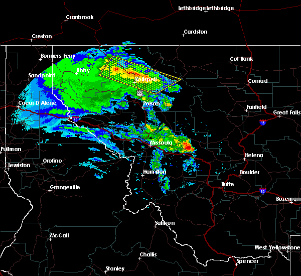
| 7/18/2016 5:26 PM MDT |
 At 526 pm mdt, doppler radar indicated severe thunderstorms capable of producing quarter size hail and damaging winds in excess of 60 mph. these storms were located along a line extending from 16 miles southeast of eureka to 10 miles northwest of whitefish, moving northeast at 45 mph. locations impacted include, olney, stryker, trego, fortine, radnor and lupfer. At 526 pm mdt, doppler radar indicated severe thunderstorms capable of producing quarter size hail and damaging winds in excess of 60 mph. these storms were located along a line extending from 16 miles southeast of eureka to 10 miles northwest of whitefish, moving northeast at 45 mph. locations impacted include, olney, stryker, trego, fortine, radnor and lupfer.
|
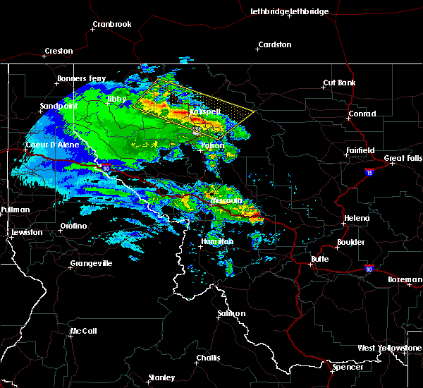
| 7/18/2016 4:59 PM MDT |
 At 459 pm mdt, doppler radar indicated a line of severe thunderstorms capable of producing quarter size hail and damaging winds in excess of 60 mph. these storms were located along a line extending from 25 miles south of eureka to 16 miles west of whitefish, and moving northeast at 40 mph. At 459 pm mdt, doppler radar indicated a line of severe thunderstorms capable of producing quarter size hail and damaging winds in excess of 60 mph. these storms were located along a line extending from 25 miles south of eureka to 16 miles west of whitefish, and moving northeast at 40 mph.
|
Hail Maps for Trego, MT


Connect with Interactive Hail Maps