

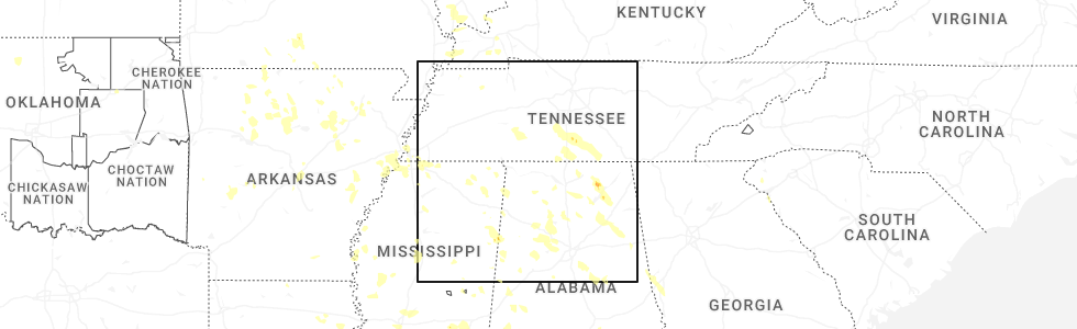
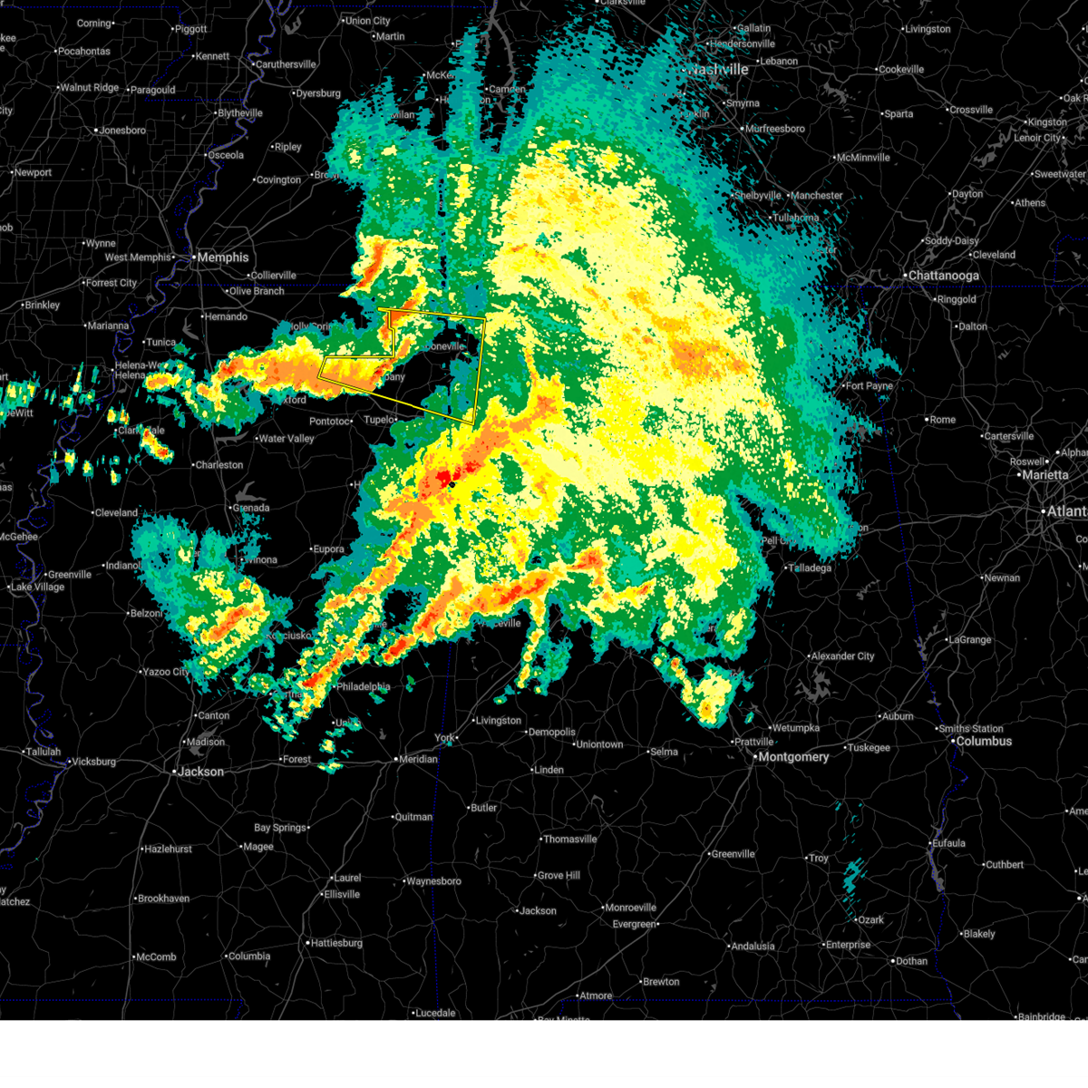
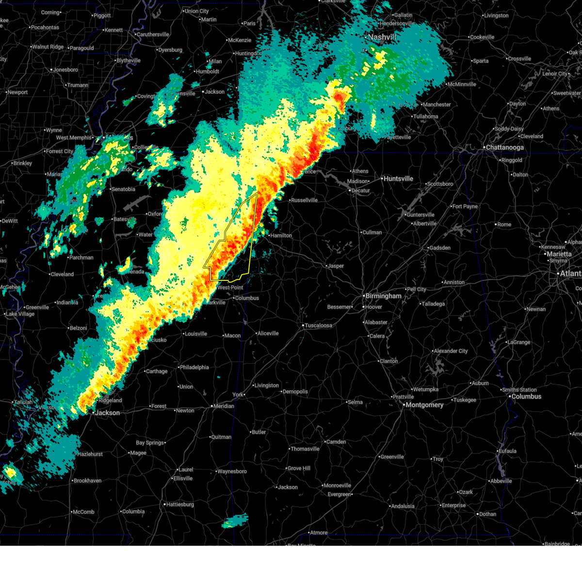
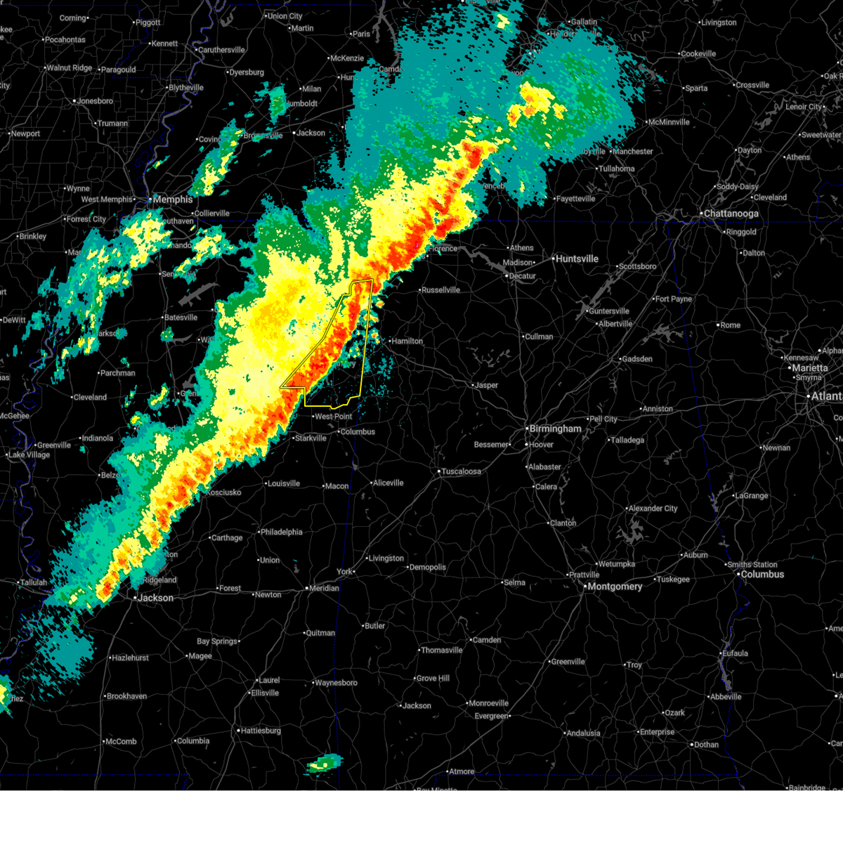
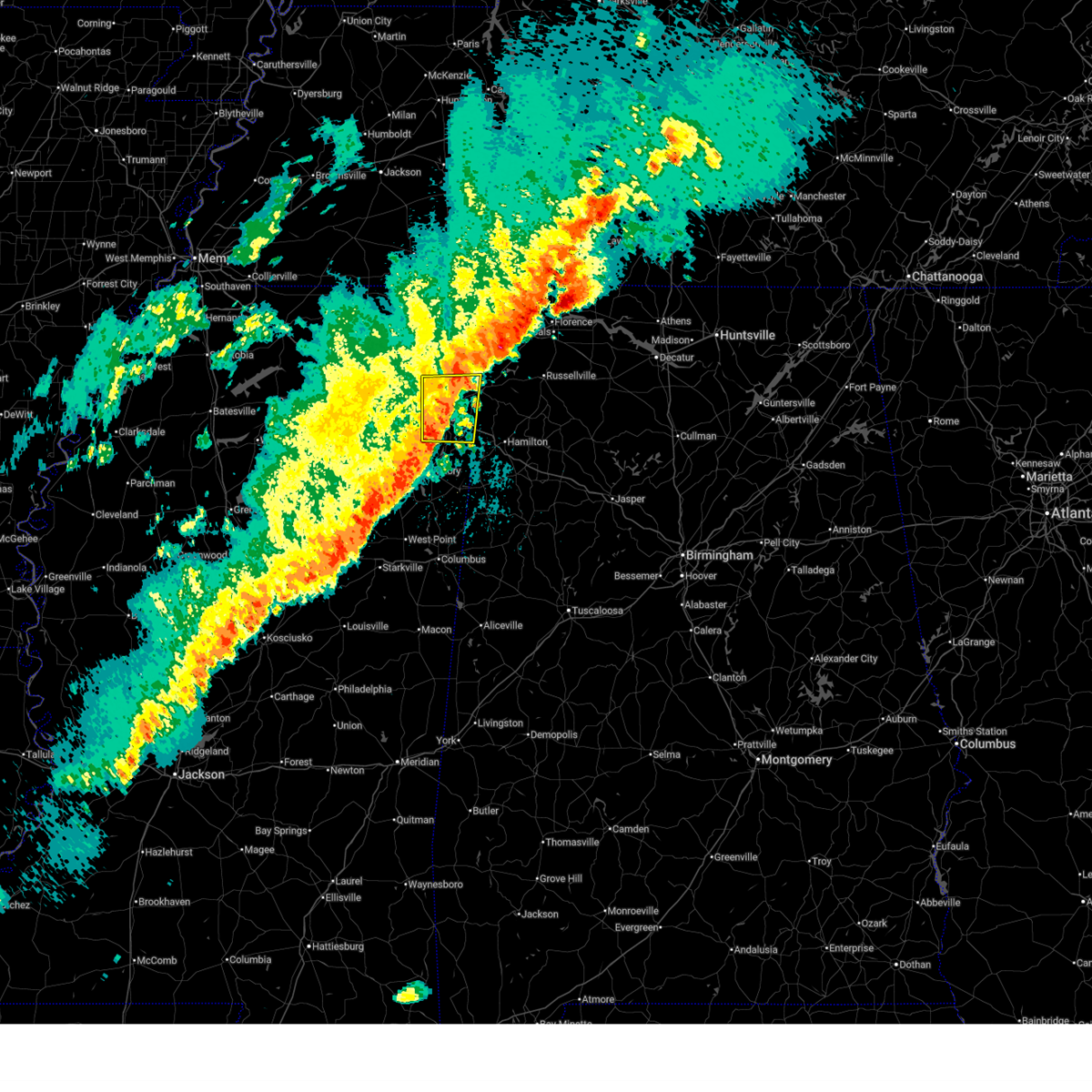
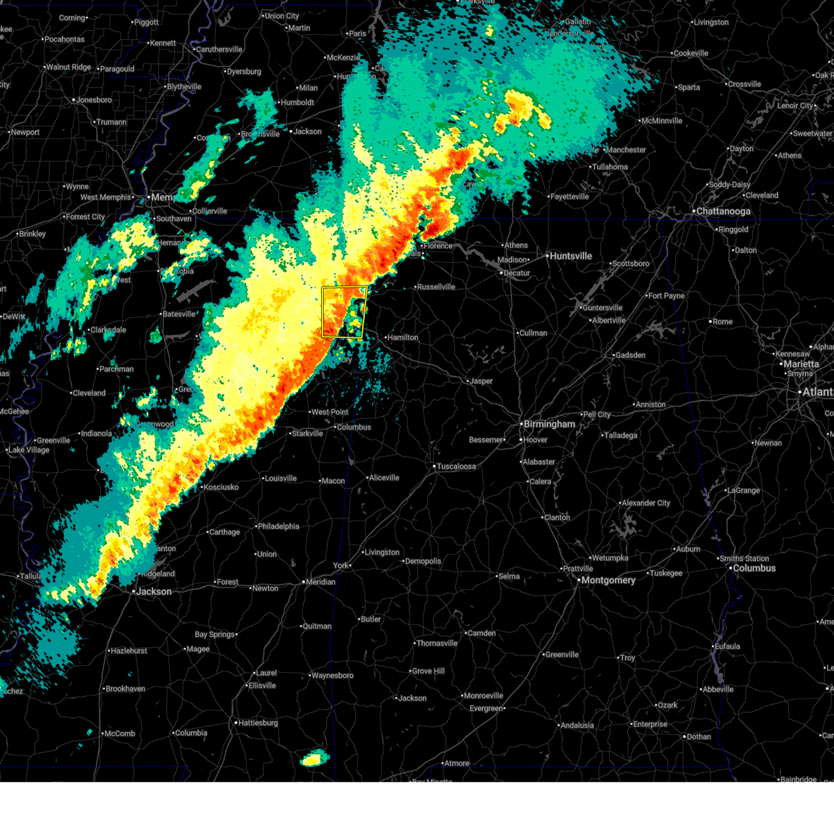
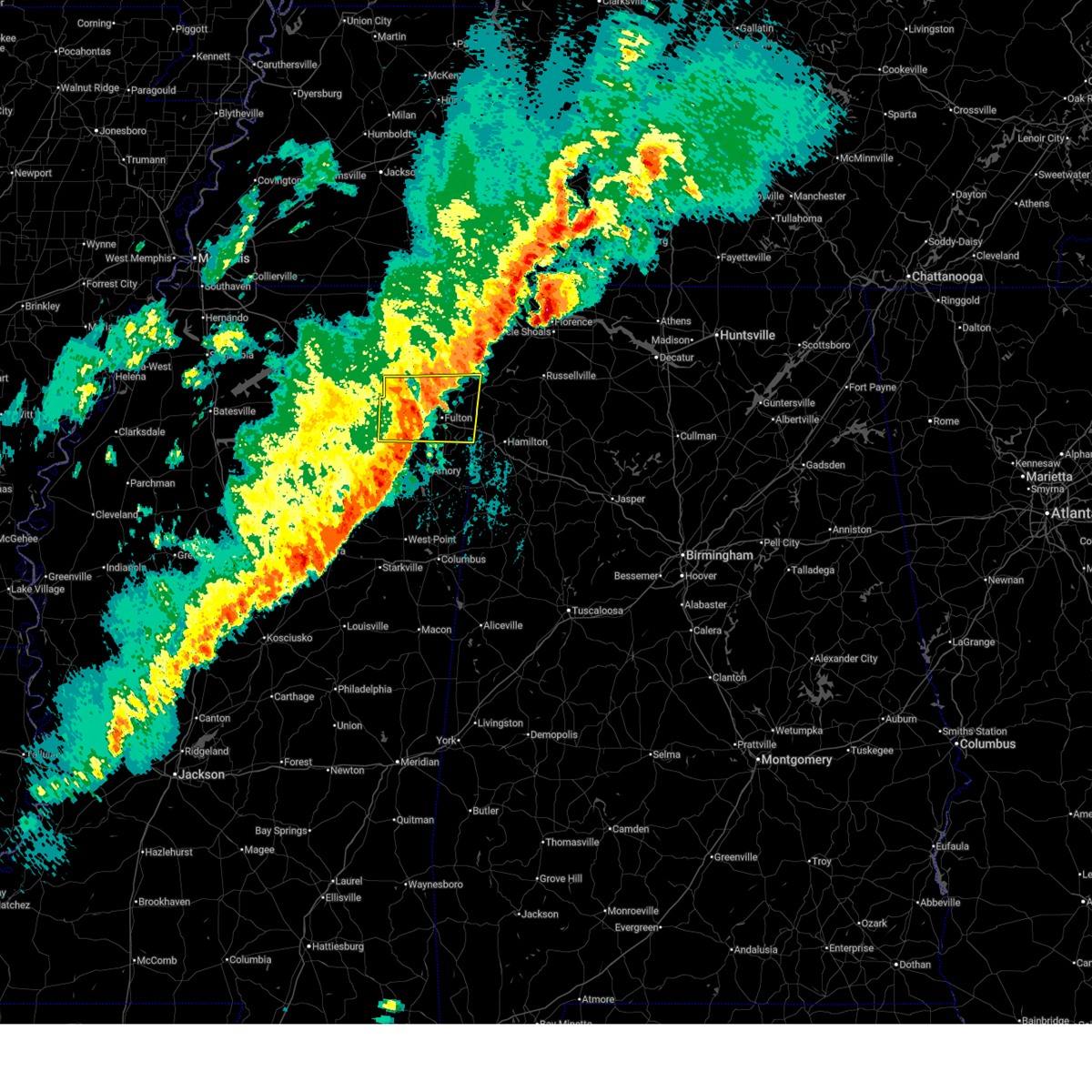
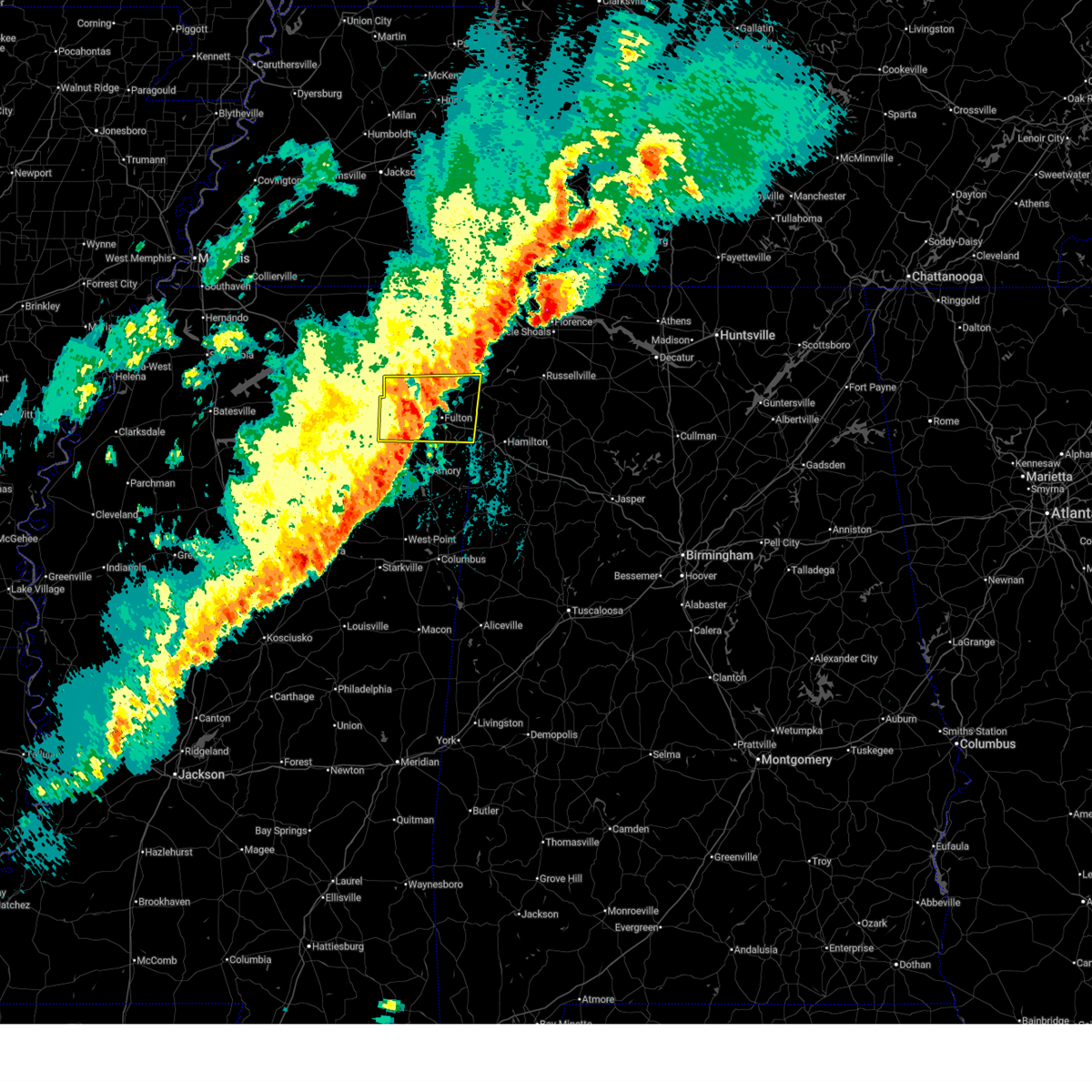
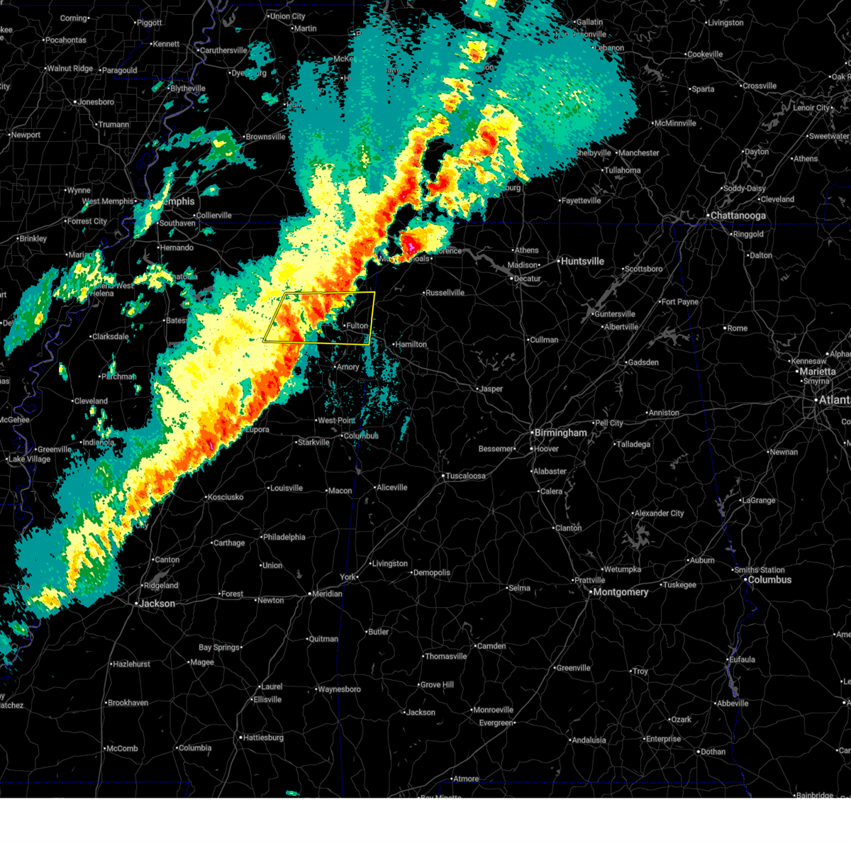
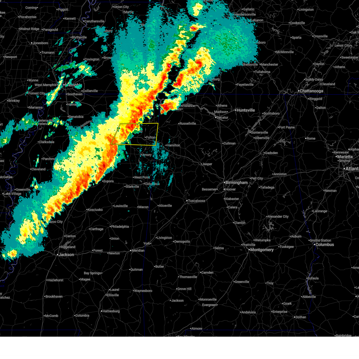
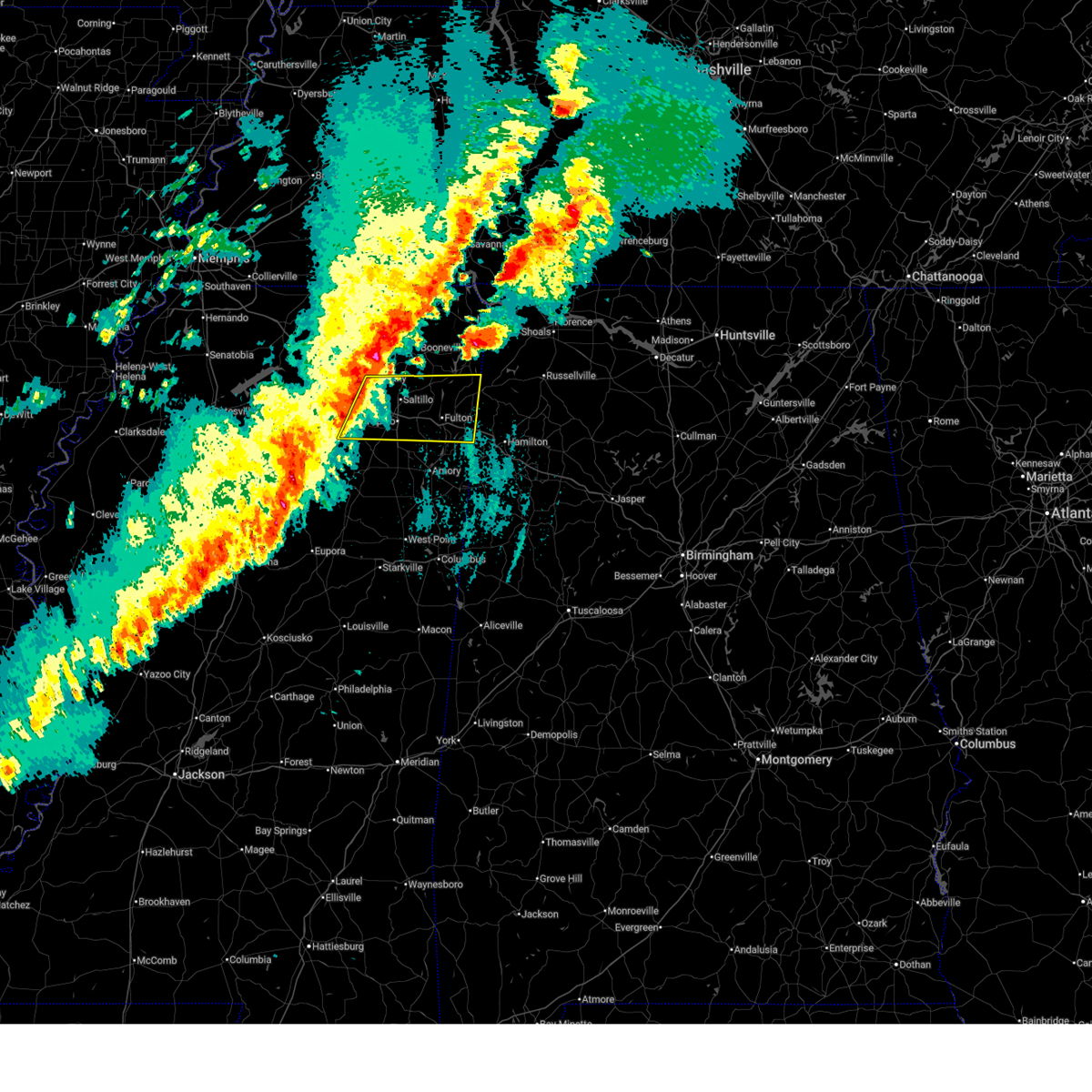
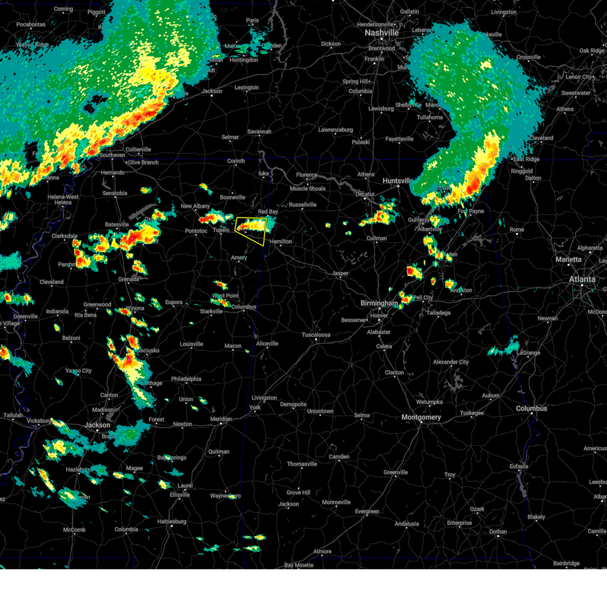
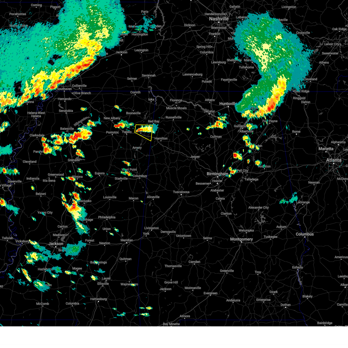
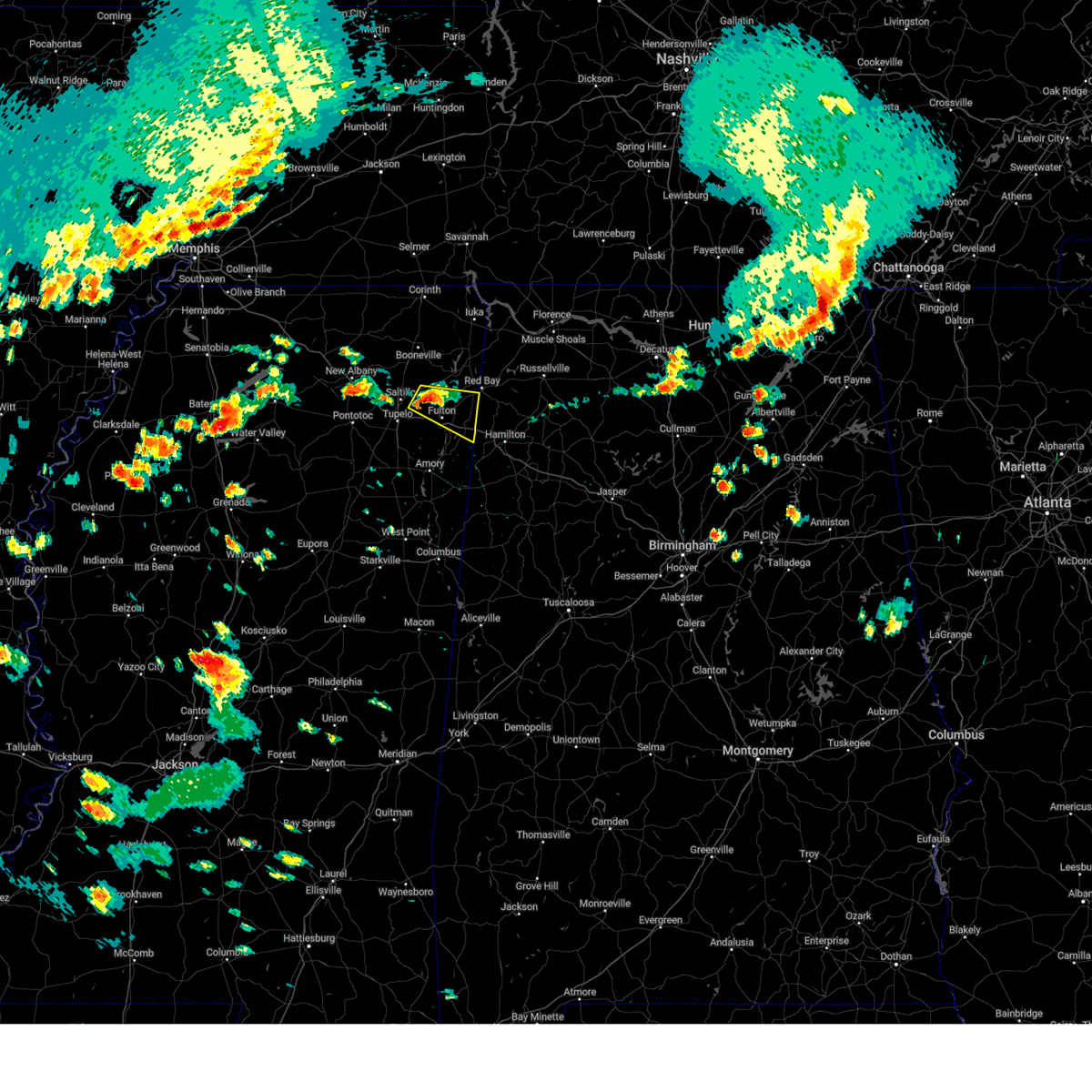
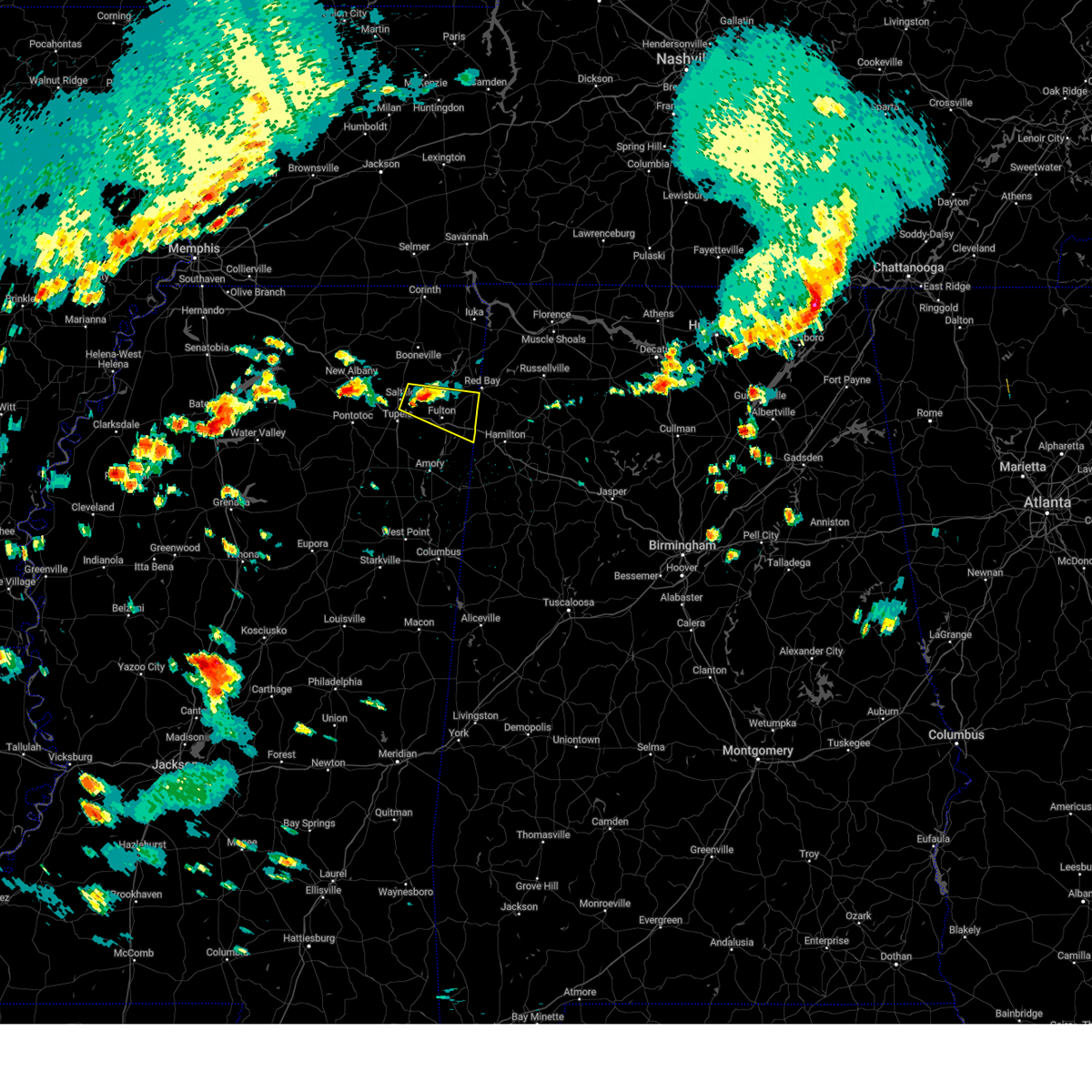
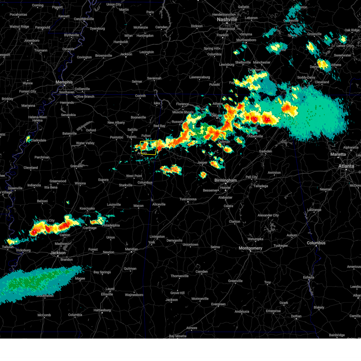
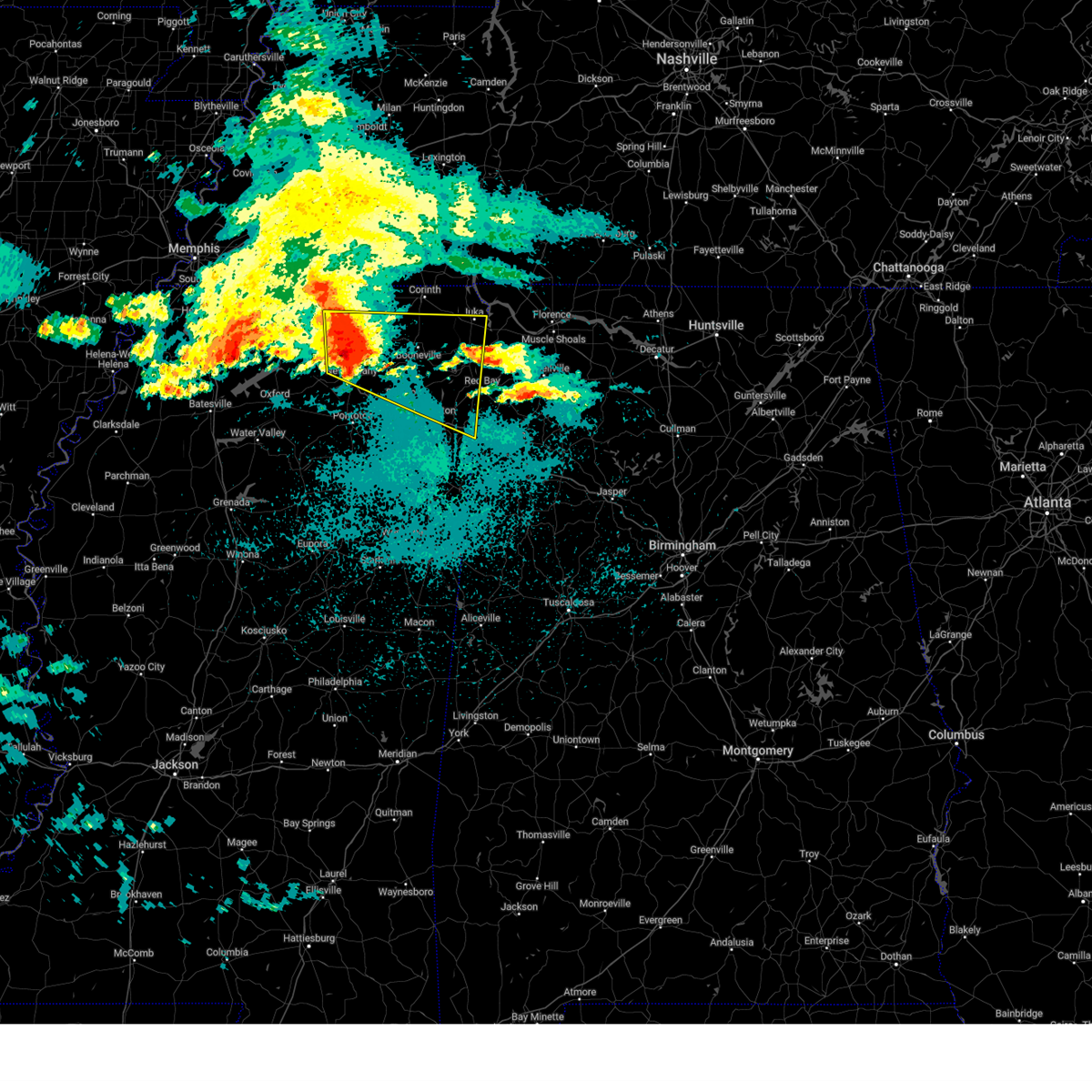
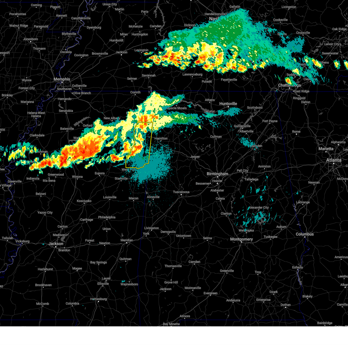
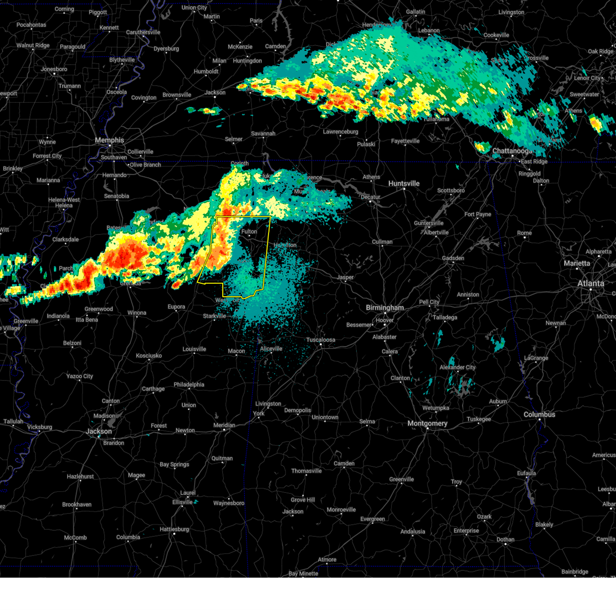
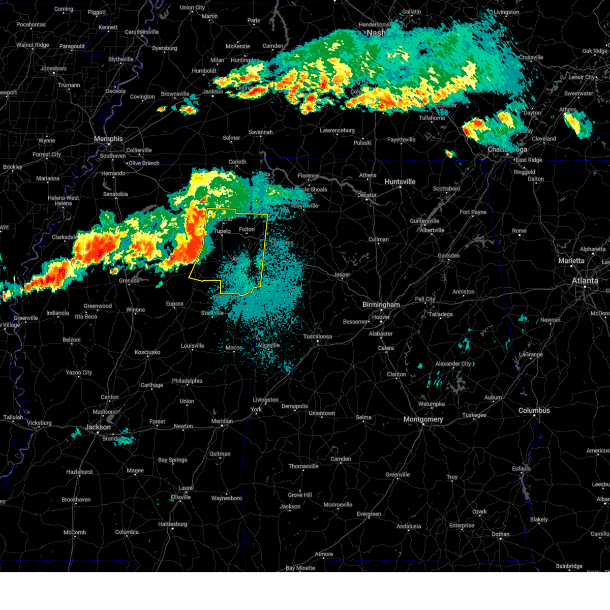
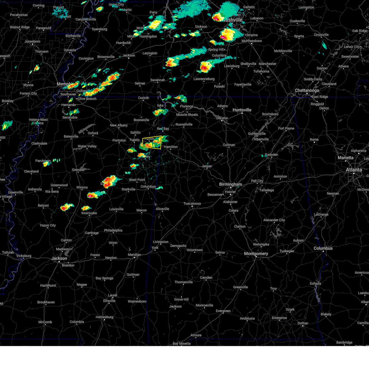
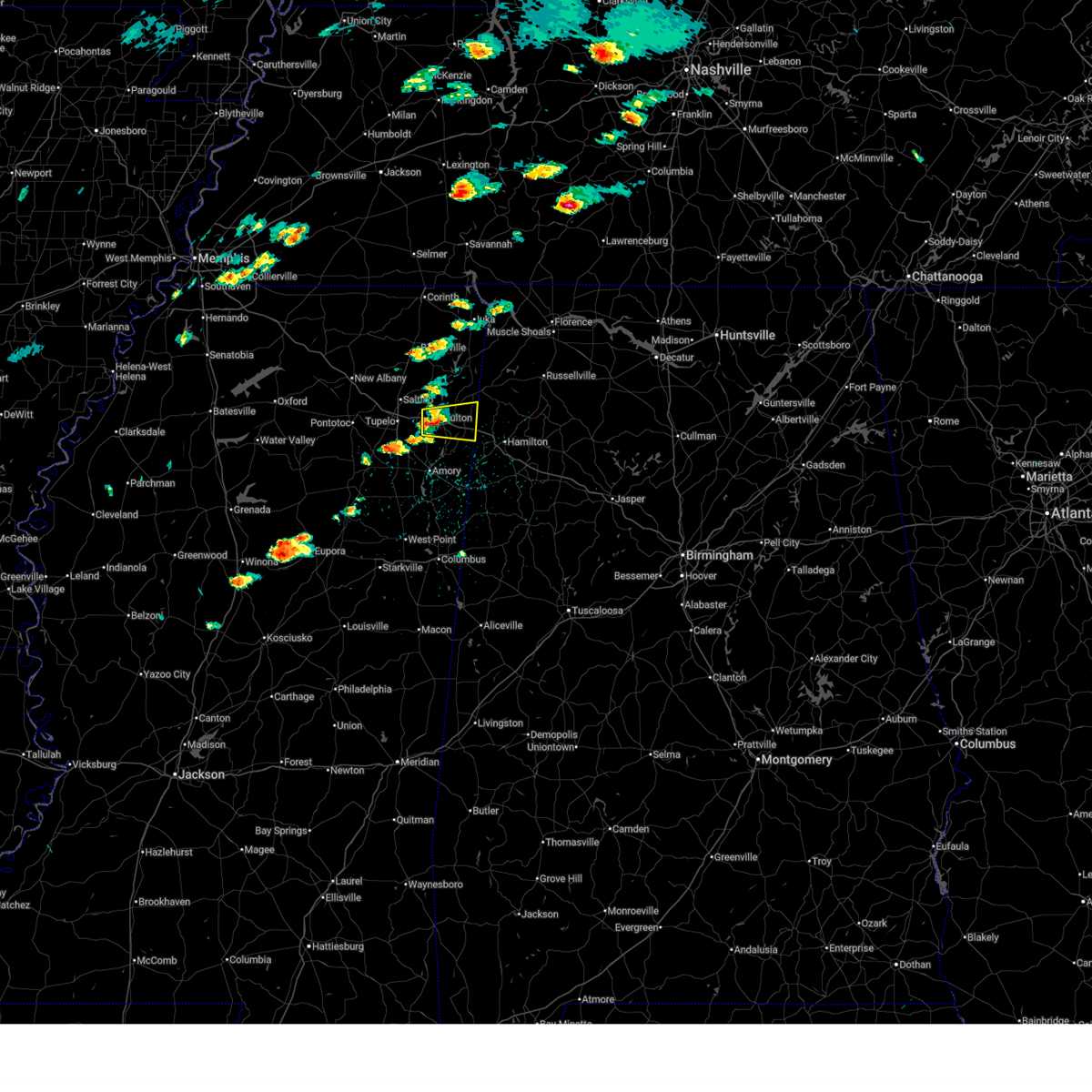
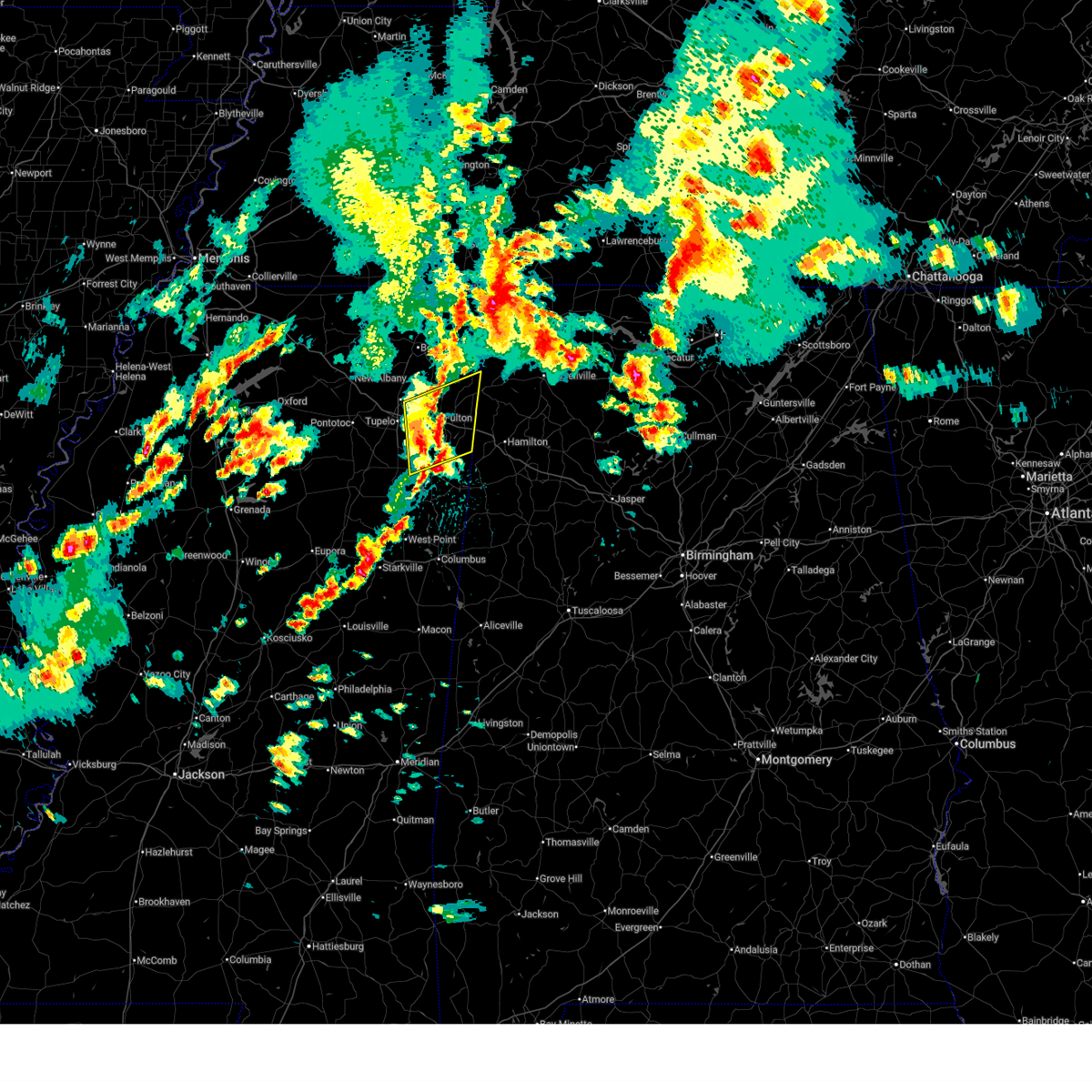
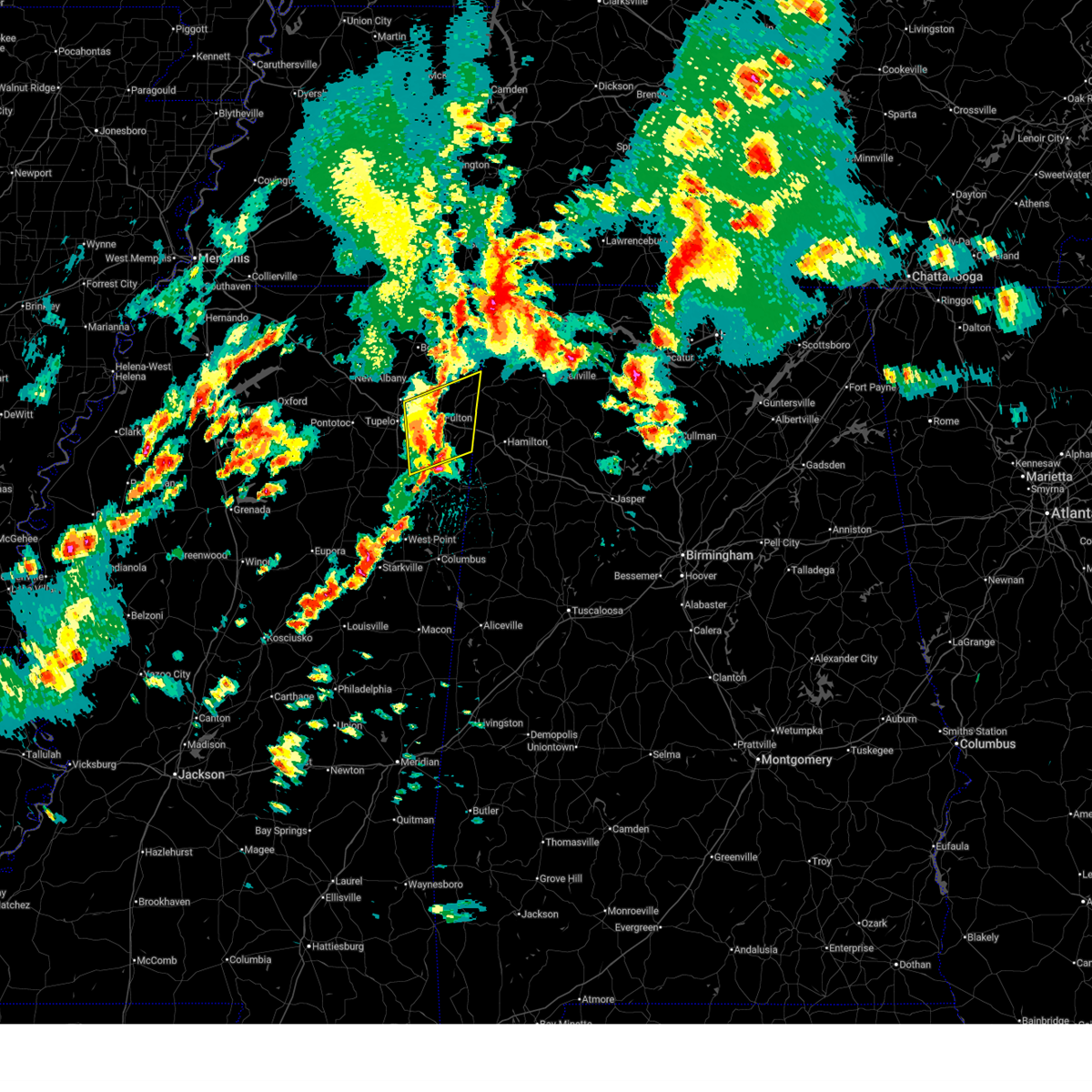
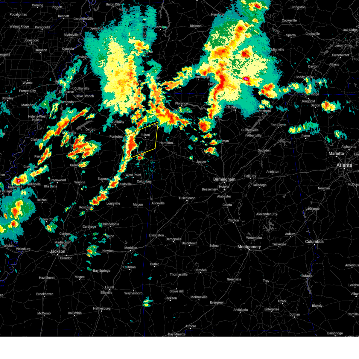
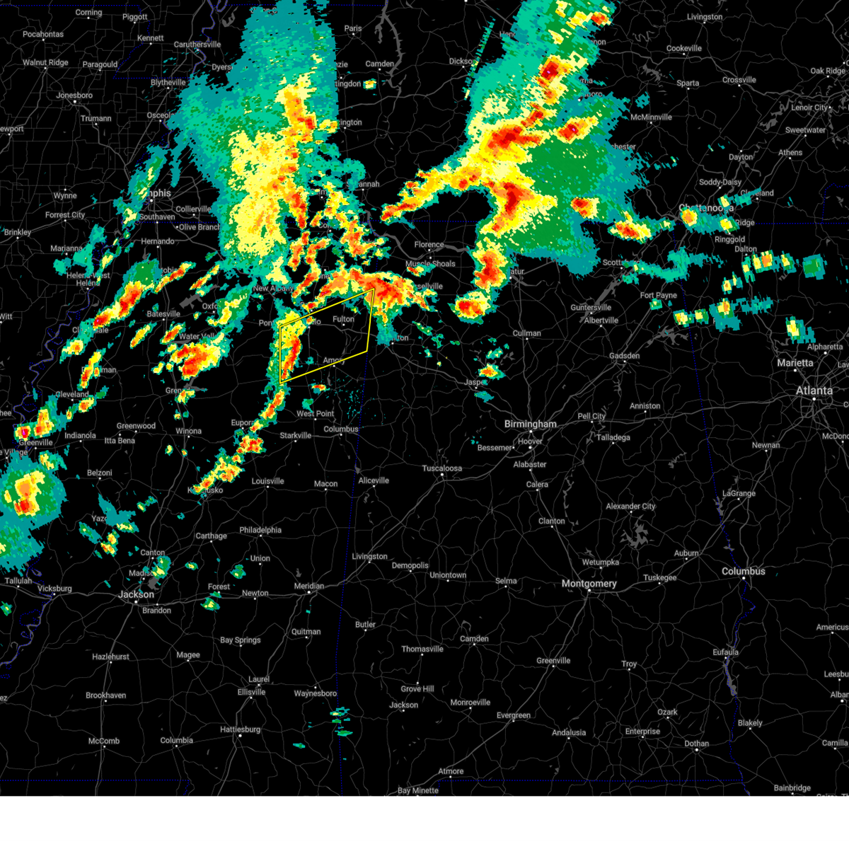
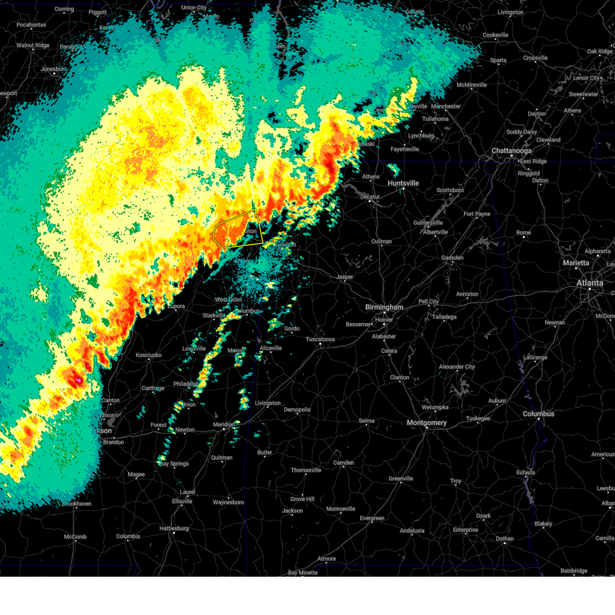
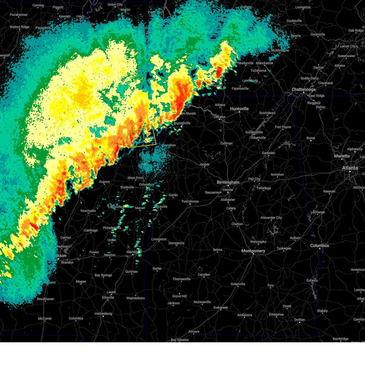
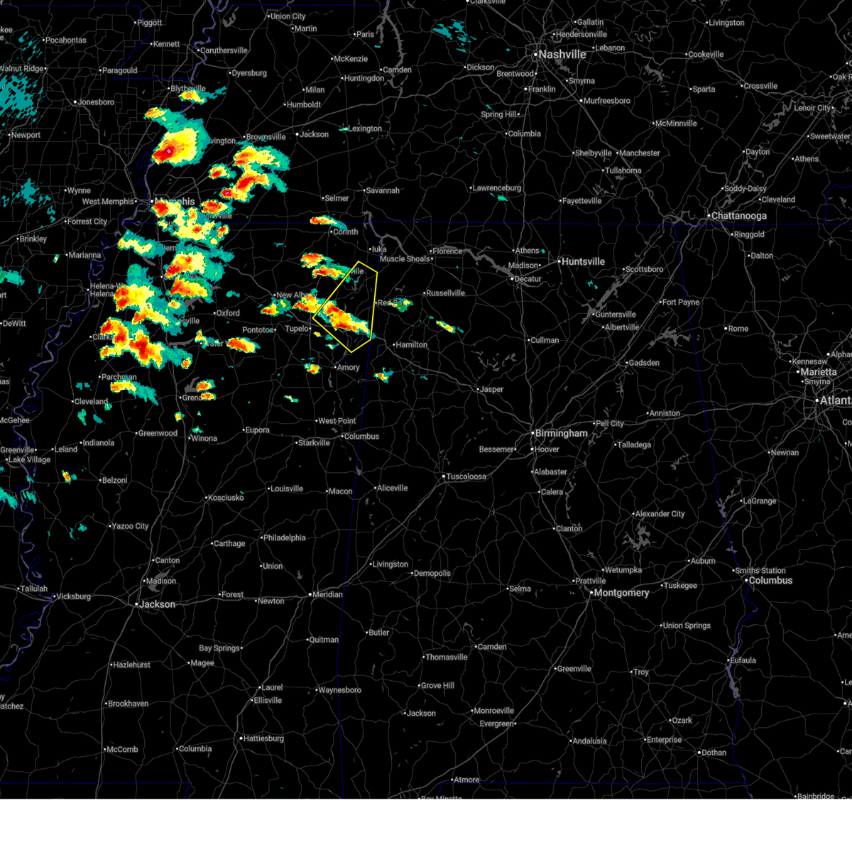
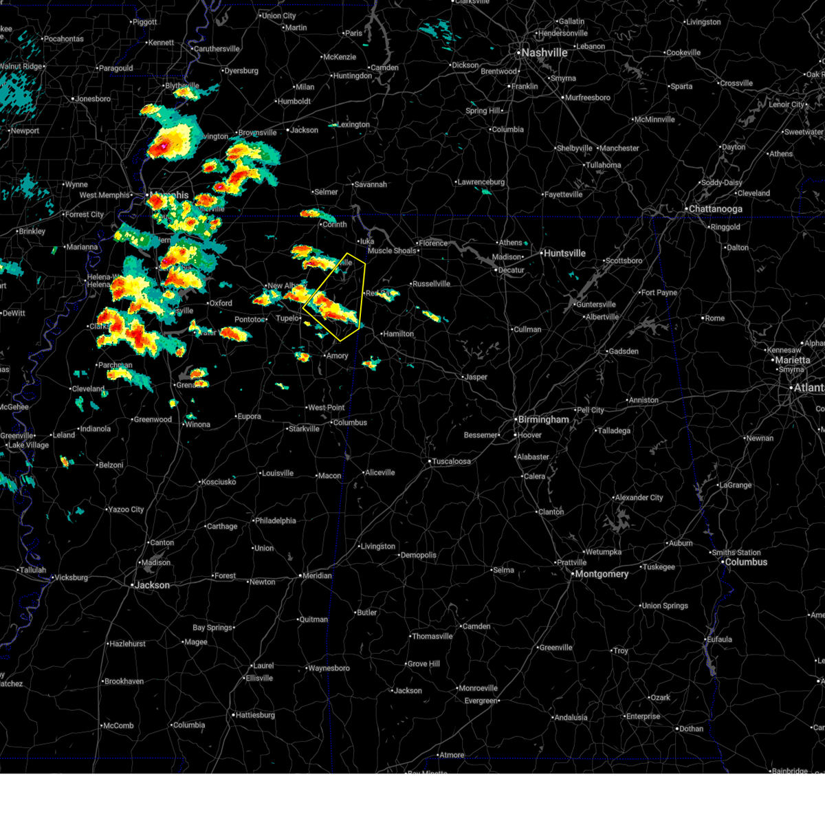
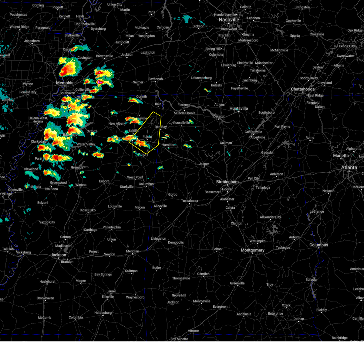
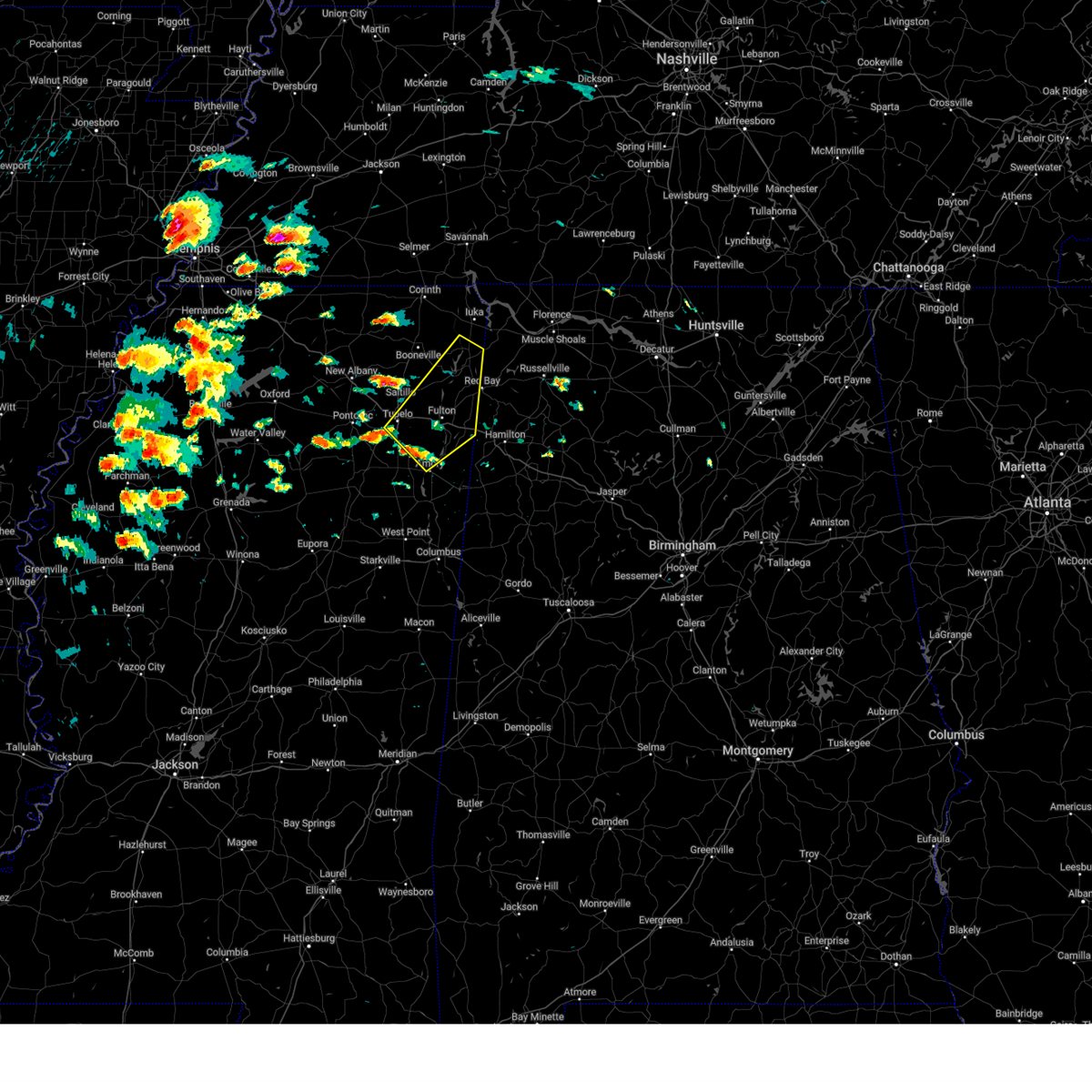
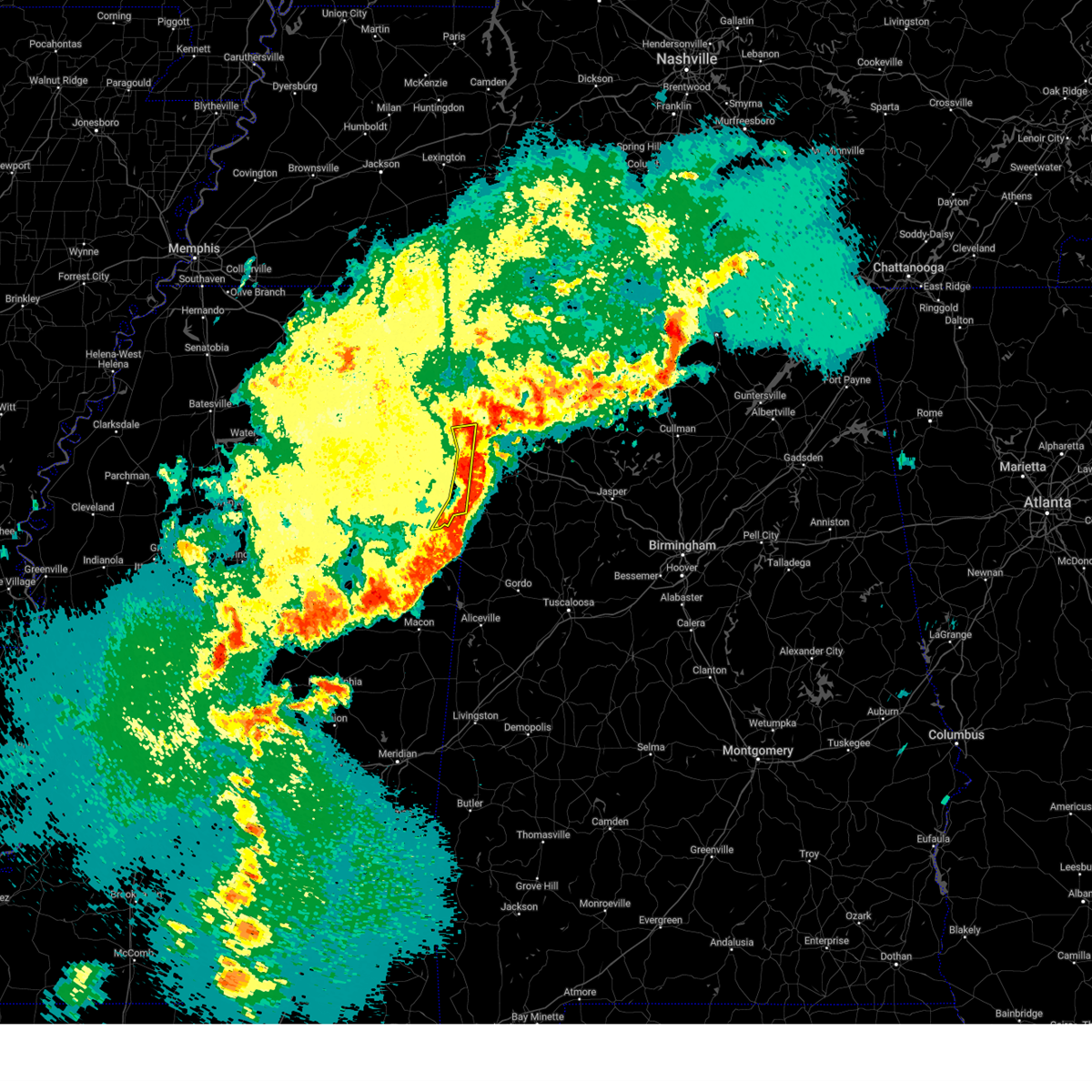
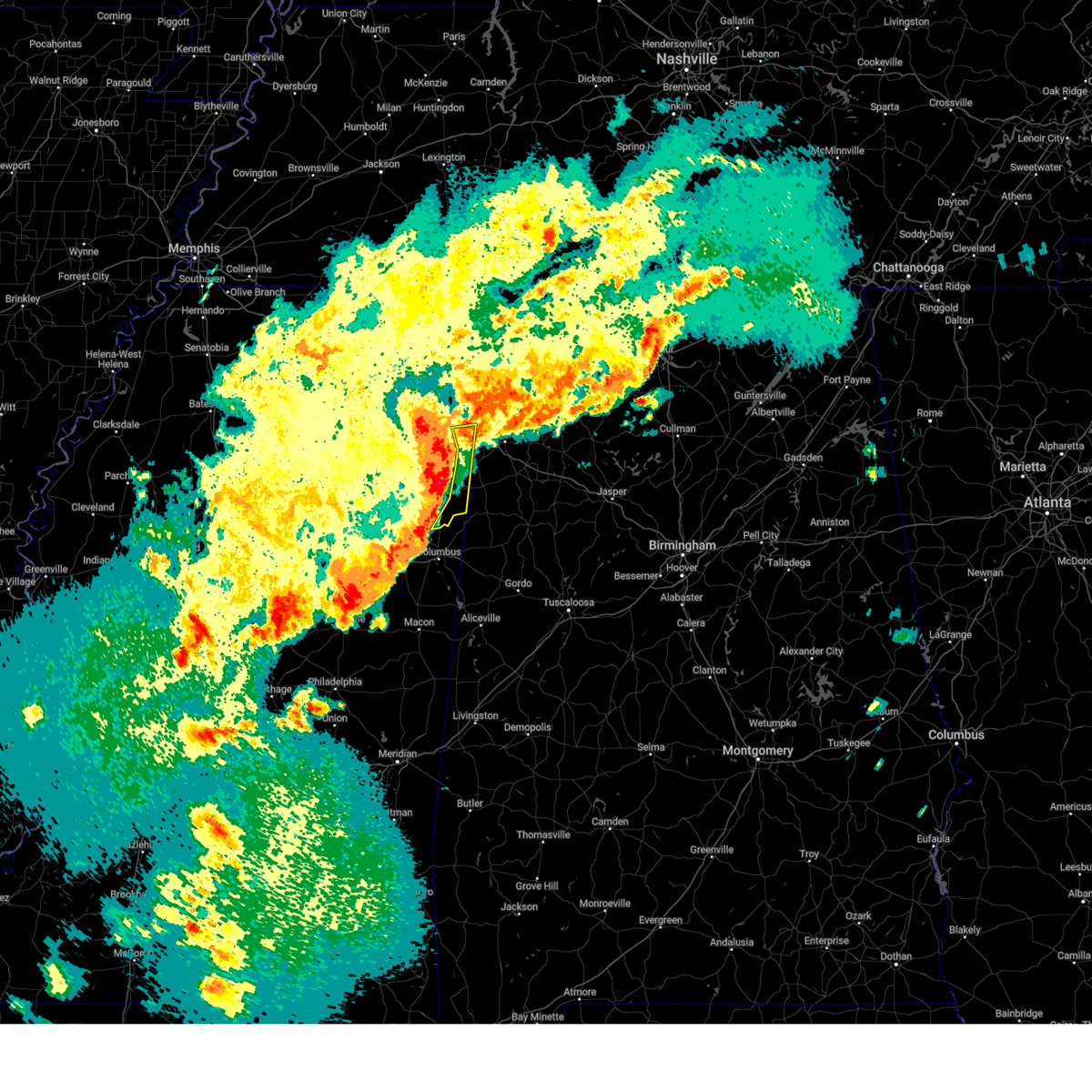
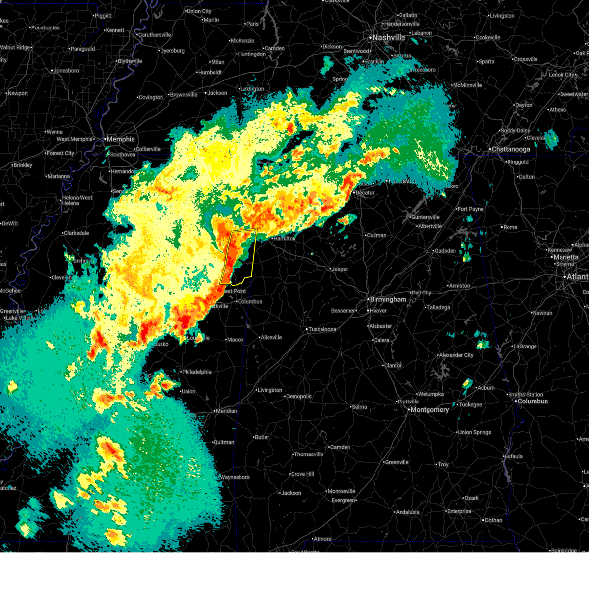
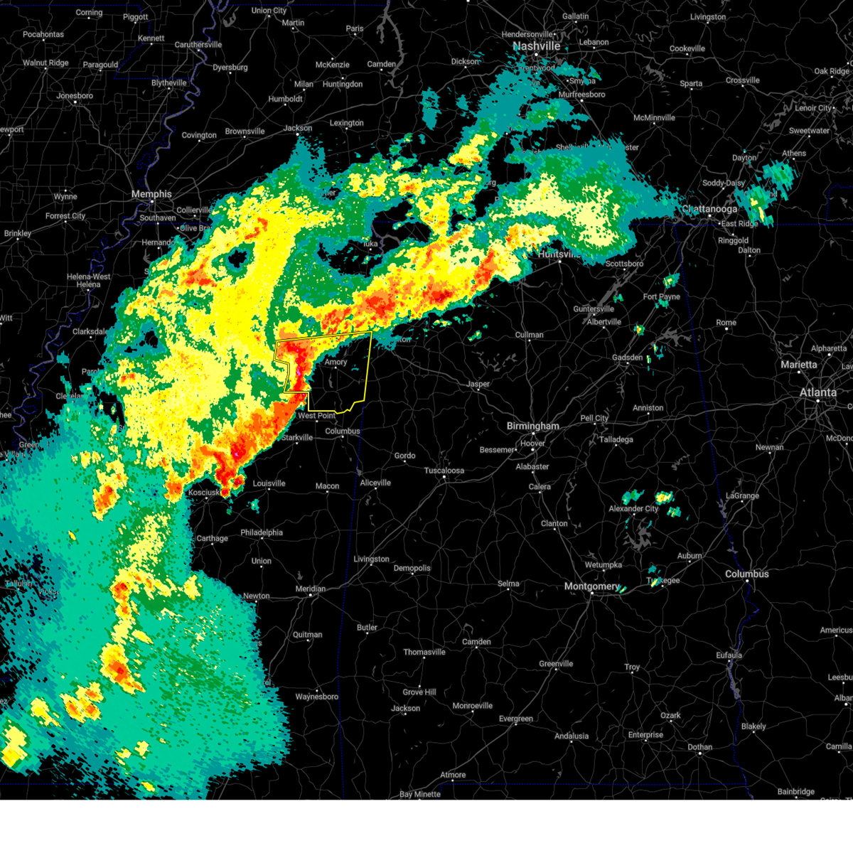
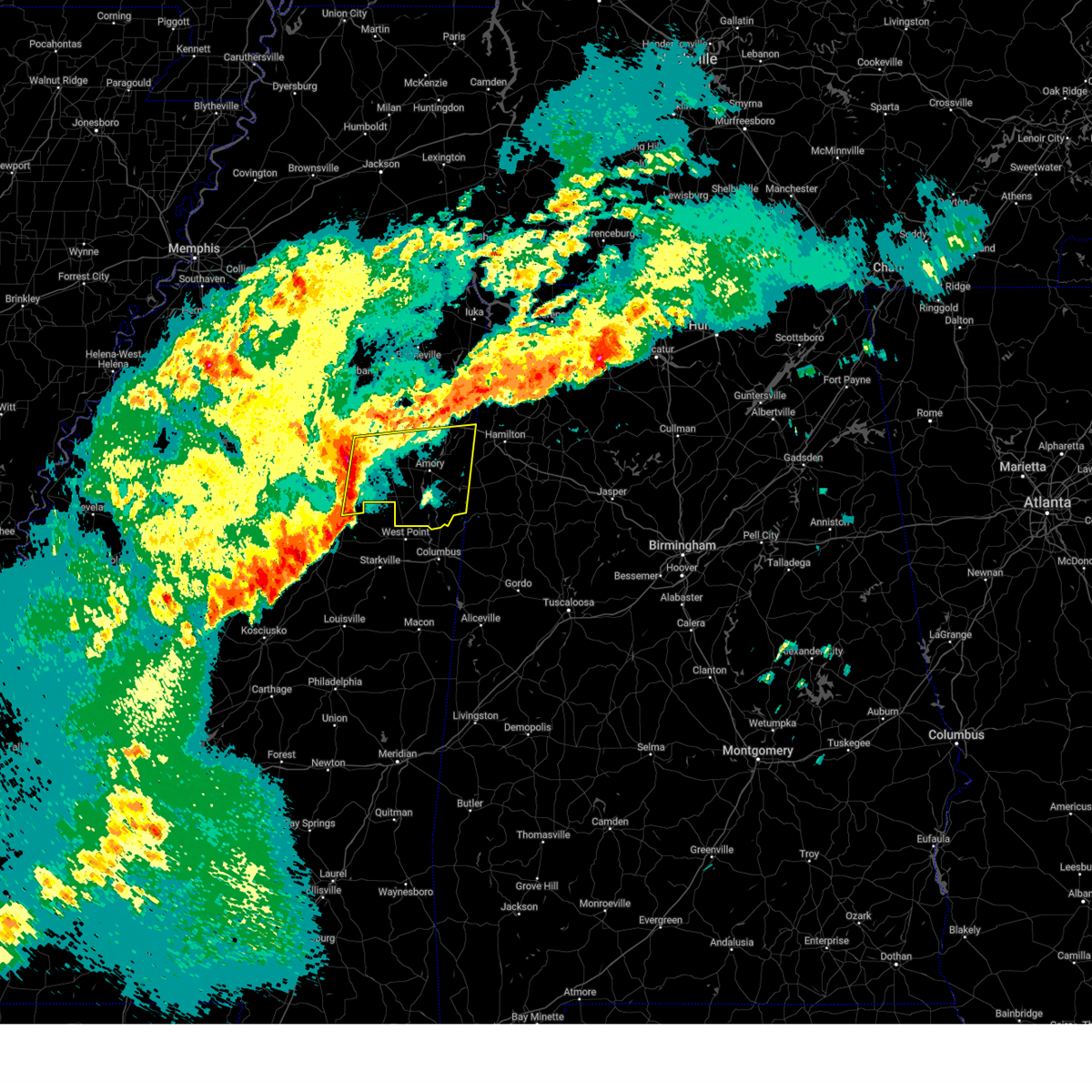
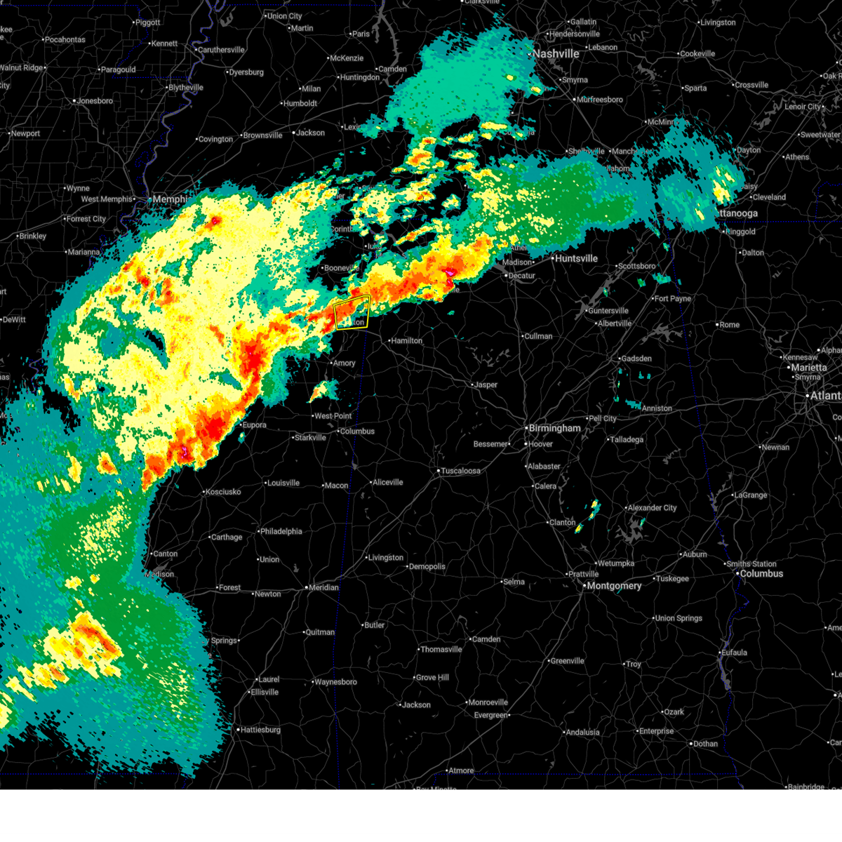
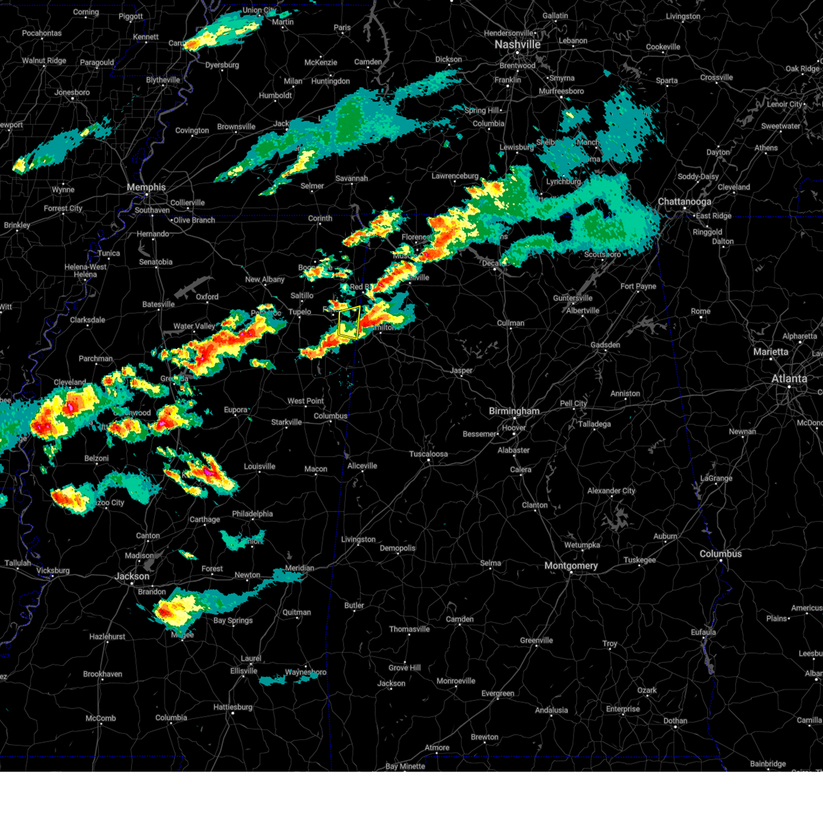
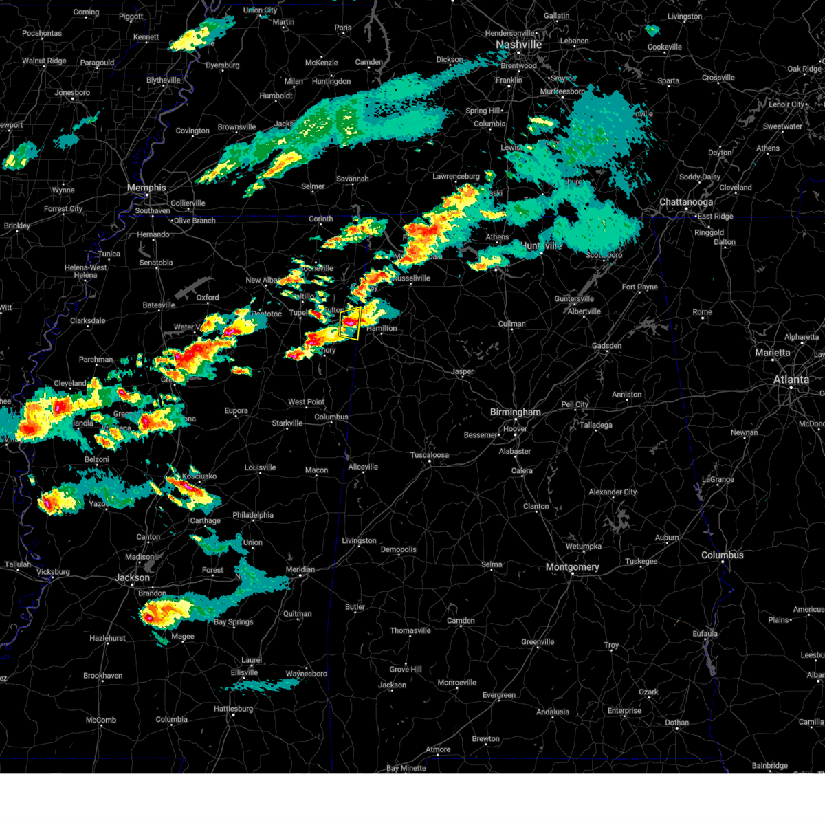
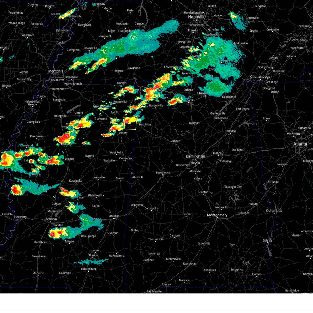
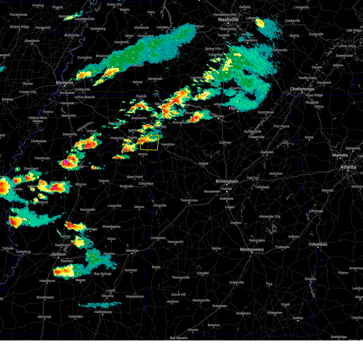
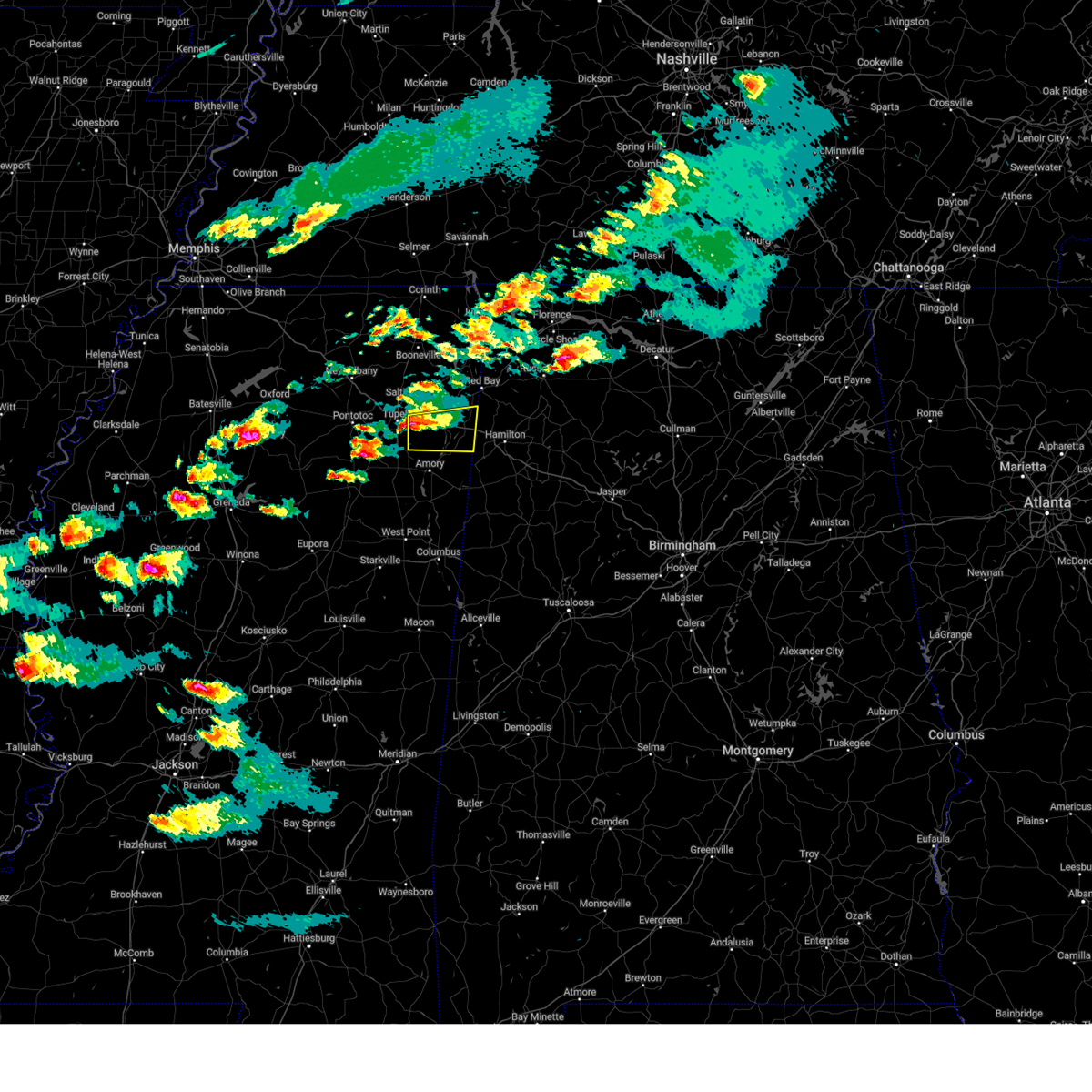
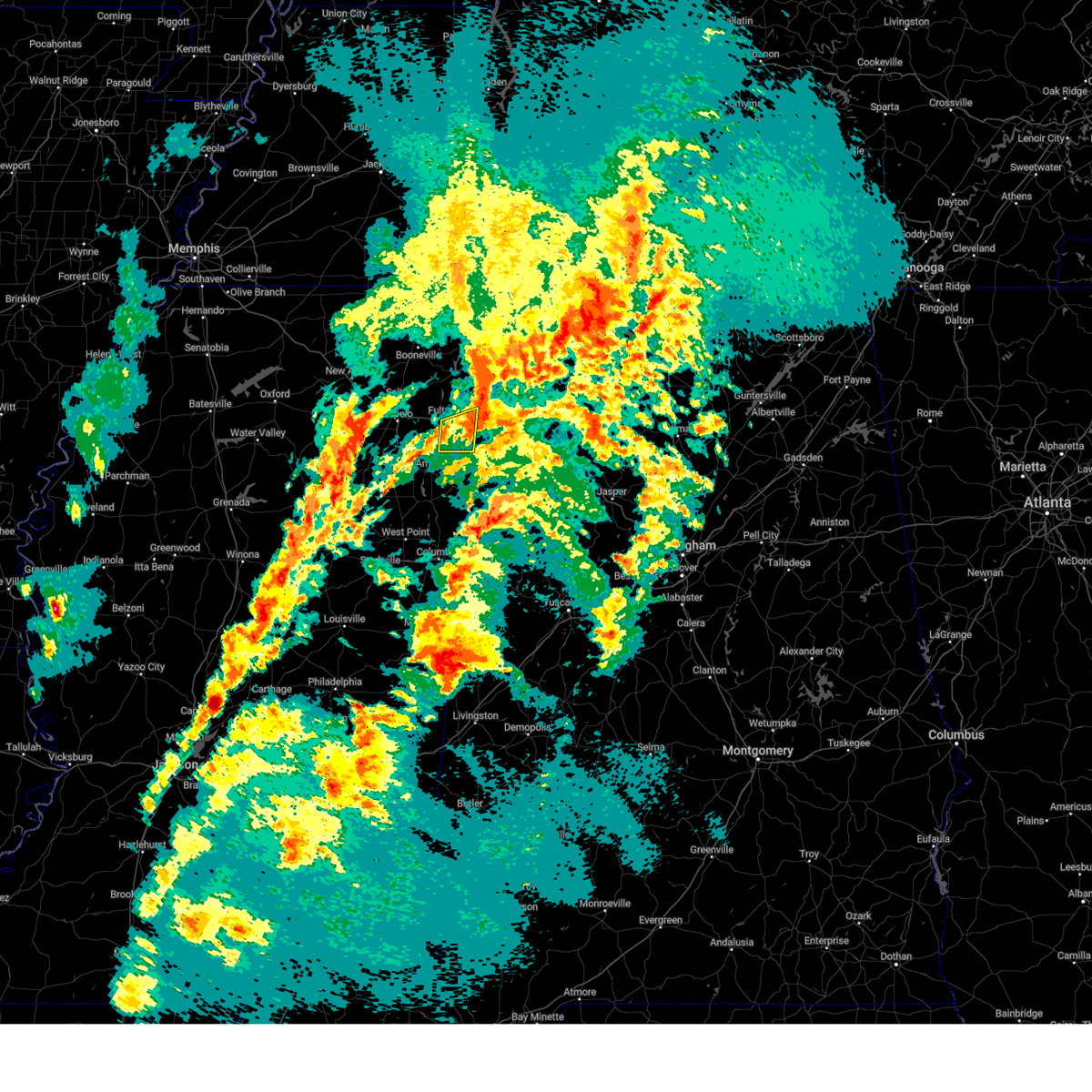
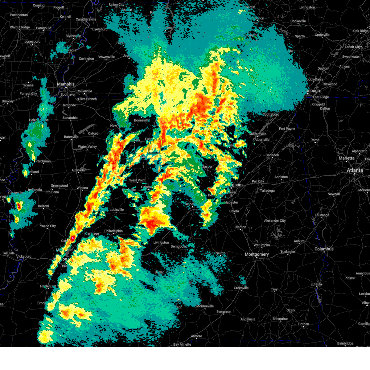
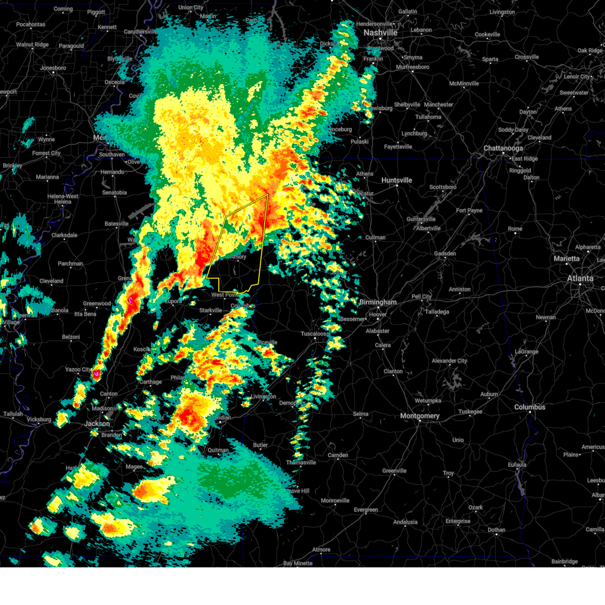
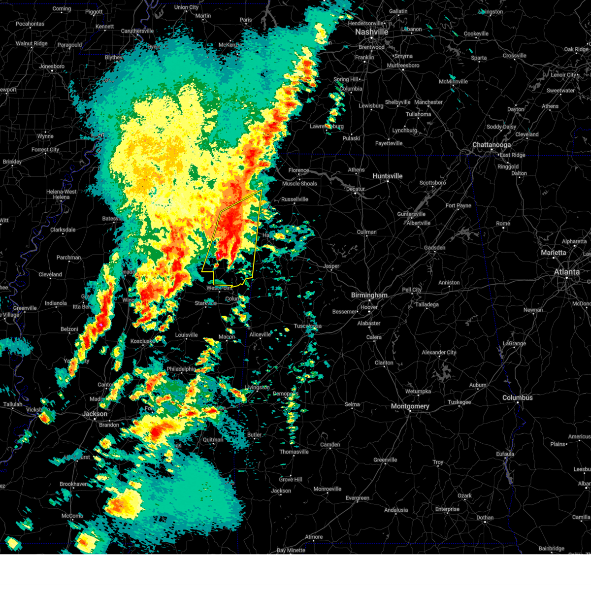
Hail Map for Tremont, MS
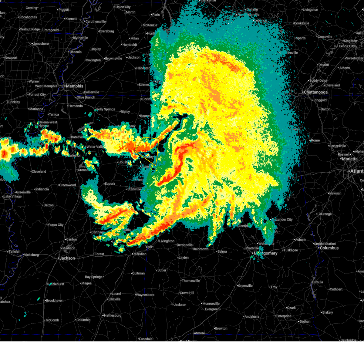
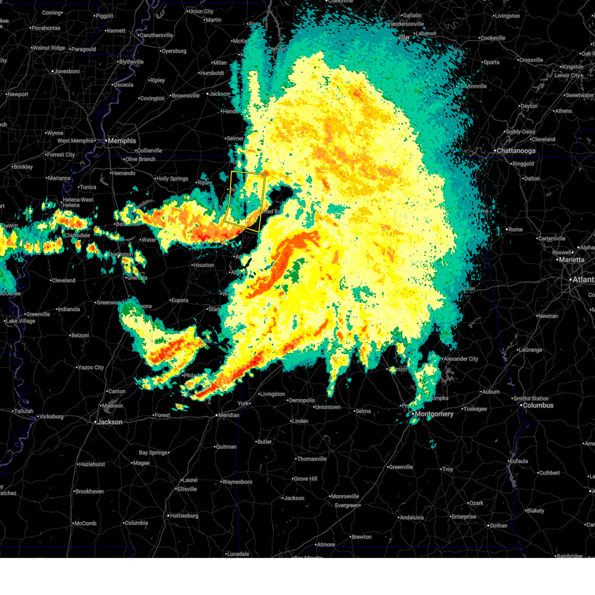
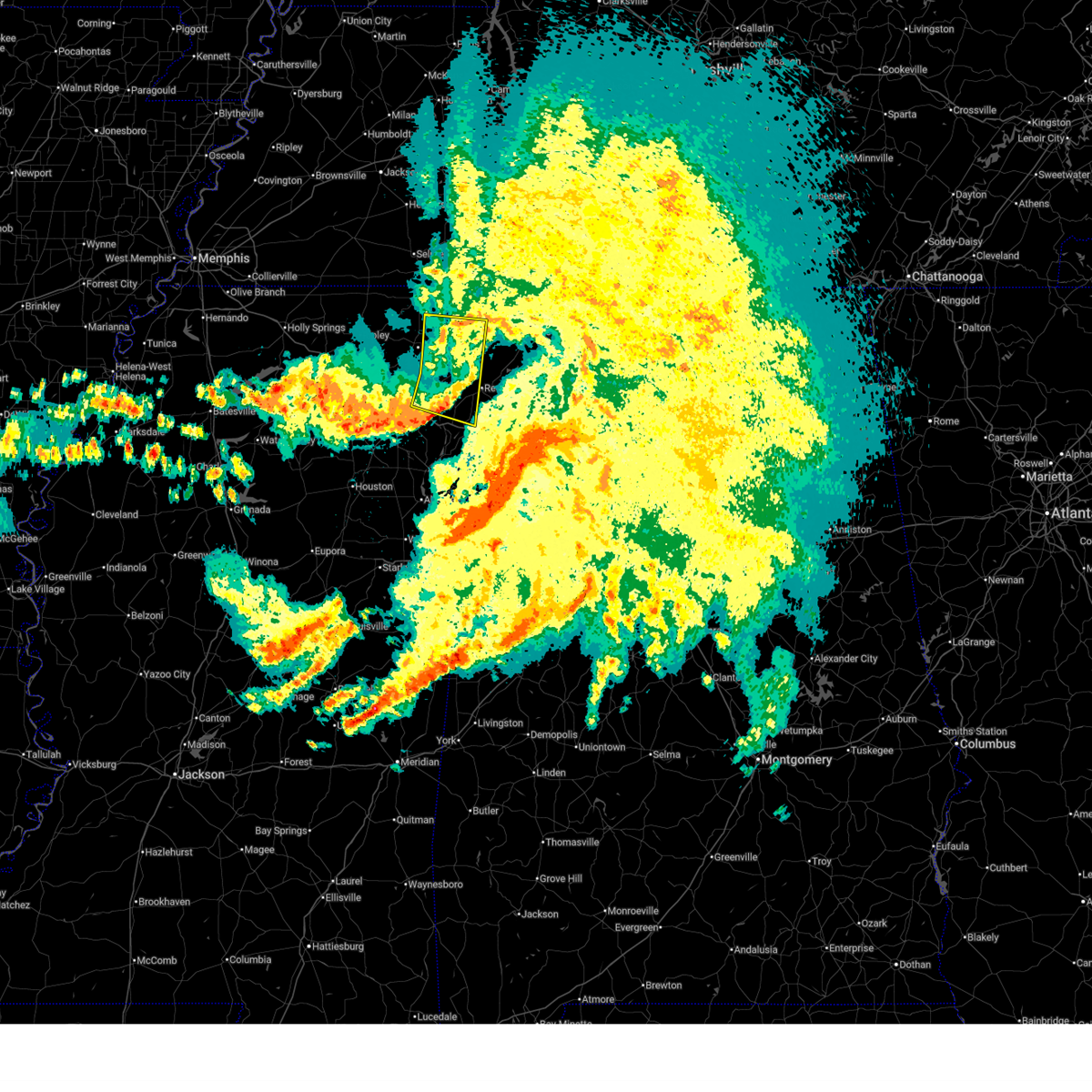
The Tremont, MS area has had 6 reports of on-the-ground hail by trained spotters, and has been under severe weather warnings 24 times during the past 12 months. Doppler radar has detected hail at or near Tremont, MS on 89 occasions, including 2 occasions during the past year.
| Name: | Tremont, MS |
| Where Located: | 51.3 miles SW of Florence, AL |
| Map: | Google Map for Tremont, MS |
| Population: | 465 |
| Housing Units: | 209 |
| More Info: | Search Google for Tremont, MS |
0
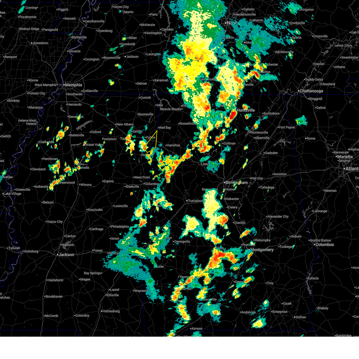
The Top Recent Hail Date for Tremont, MS is Monday, June 1, 2026 (89th out of 89)
Hail and Wind Damage Spotted near Tremont, MS
| Date / Time | Report Details |
|---|---|
| 4/29/2026 12:06 AM CDT |
 Svrmeg the national weather service in memphis has issued a * severe thunderstorm warning for, southern itawamba county in northeastern mississippi, southeastern lee county in northeastern mississippi, northeastern monroe county in northeastern mississippi, * until 1245 am cdt. * at 1206 am cdt, a severe thunderstorm was located over new salem, or 9 miles south of fulton, moving southeast at 45 mph (radar indicated). Hazards include 60 mph wind gusts. expect damage to roofs, siding, and trees Svrmeg the national weather service in memphis has issued a * severe thunderstorm warning for, southern itawamba county in northeastern mississippi, southeastern lee county in northeastern mississippi, northeastern monroe county in northeastern mississippi, * until 1245 am cdt. * at 1206 am cdt, a severe thunderstorm was located over new salem, or 9 miles south of fulton, moving southeast at 45 mph (radar indicated). Hazards include 60 mph wind gusts. expect damage to roofs, siding, and trees
|
| 4/29/2026 12:05 AM CDT |
 The storm which prompted the warning has weakened below severe limits, and has exited the warned area. therefore, the warning will be allowed to expire. a tornado watch remains in effect until 400 am cdt for northeastern mississippi. The storm which prompted the warning has weakened below severe limits, and has exited the warned area. therefore, the warning will be allowed to expire. a tornado watch remains in effect until 400 am cdt for northeastern mississippi.
|
| 4/28/2026 11:50 PM CDT |
 At 1150 pm cdt, a severe thunderstorm was located 7 miles southwest of burton, or 11 miles southeast of booneville, moving east at 40 mph (radar indicated). Hazards include 60 mph wind gusts. Expect damage to roofs, siding, and trees. Locations impacted include, booneville, fulton, iuka, tishomingo state park, belmont, mantachie, burnsville, tremont, tishomingo, thrashers, fairview, burton, midway, leedy, sandy springs, clay, rienzi, marietta, golden, and paden. At 1150 pm cdt, a severe thunderstorm was located 7 miles southwest of burton, or 11 miles southeast of booneville, moving east at 40 mph (radar indicated). Hazards include 60 mph wind gusts. Expect damage to roofs, siding, and trees. Locations impacted include, booneville, fulton, iuka, tishomingo state park, belmont, mantachie, burnsville, tremont, tishomingo, thrashers, fairview, burton, midway, leedy, sandy springs, clay, rienzi, marietta, golden, and paden.
|
| 4/28/2026 11:24 PM CDT |
 At 1123 pm cdt, a severe thunderstorm was located 7 miles southwest of jumpertown, or 8 miles northwest of baldwyn, moving east at 40 mph (radar indicated). Hazards include 60 mph wind gusts. Expect damage to roofs, siding, and trees. locations impacted include, booneville, new albany, fulton, baldwyn, iuka, tishomingo state park, saltillo, guntown, belmont, mantachie, burnsville, jumpertown, tremont, tishomingo, thrashers, fairview, keownville, midway, pratts friendship, and hinkle. This includes interstate 22 in mississipppi between mile markers 52 and 68. At 1123 pm cdt, a severe thunderstorm was located 7 miles southwest of jumpertown, or 8 miles northwest of baldwyn, moving east at 40 mph (radar indicated). Hazards include 60 mph wind gusts. Expect damage to roofs, siding, and trees. locations impacted include, booneville, new albany, fulton, baldwyn, iuka, tishomingo state park, saltillo, guntown, belmont, mantachie, burnsville, jumpertown, tremont, tishomingo, thrashers, fairview, keownville, midway, pratts friendship, and hinkle. This includes interstate 22 in mississipppi between mile markers 52 and 68.
|
| 4/28/2026 11:24 PM CDT |
 the severe thunderstorm warning has been cancelled and is no longer in effect the severe thunderstorm warning has been cancelled and is no longer in effect
|
| 4/28/2026 11:10 PM CDT |
 Svrmeg the national weather service in memphis has issued a * severe thunderstorm warning for, union county in northeastern mississippi, northern itawamba county in northeastern mississippi, northern lee county in northeastern mississippi, tippah county in northeastern mississippi, tishomingo county in northeastern mississippi, prentiss county in northeastern mississippi, southern alcorn county in northeastern mississippi, * until 1215 am cdt. * at 1110 pm cdt, a severe thunderstorm was located near ripley, moving east at 40 mph (radar indicated). Hazards include 60 mph wind gusts. expect damage to roofs, siding, and trees Svrmeg the national weather service in memphis has issued a * severe thunderstorm warning for, union county in northeastern mississippi, northern itawamba county in northeastern mississippi, northern lee county in northeastern mississippi, tippah county in northeastern mississippi, tishomingo county in northeastern mississippi, prentiss county in northeastern mississippi, southern alcorn county in northeastern mississippi, * until 1215 am cdt. * at 1110 pm cdt, a severe thunderstorm was located near ripley, moving east at 40 mph (radar indicated). Hazards include 60 mph wind gusts. expect damage to roofs, siding, and trees
|
| 4/28/2026 11:07 PM CDT |
 Svrmeg the national weather service in memphis has issued a * severe thunderstorm warning for, southern itawamba county in northeastern mississippi, monroe county in northeastern mississippi, * until midnight cdt. * at 1107 pm cdt, severe thunderstorms were located along a line extending from 6 miles northwest of detroit to near amory to near prairie, moving southeast at 45 mph (radar indicated). Hazards include 60 mph wind gusts. expect damage to roofs, siding, and trees Svrmeg the national weather service in memphis has issued a * severe thunderstorm warning for, southern itawamba county in northeastern mississippi, monroe county in northeastern mississippi, * until midnight cdt. * at 1107 pm cdt, severe thunderstorms were located along a line extending from 6 miles northwest of detroit to near amory to near prairie, moving southeast at 45 mph (radar indicated). Hazards include 60 mph wind gusts. expect damage to roofs, siding, and trees
|
| 4/28/2026 10:57 PM CDT |
 At 1057 pm cdt, severe thunderstorms were located along a line extending from 6 miles east of tremont to near trebloc, moving east at 60 mph (radar indicated). Hazards include 60 mph wind gusts. Expect damage to roofs, siding, and trees. locations impacted include, amory, aberdeen, fulton, houston, okolona, shannon, smithville, tremont, prairie, new salem, new wren, trebloc, evergreen, clay, nettleton, hatley, gattman, eastman, abney, and quincy. This includes interstate 22 in mississipppi between mile markers 101 and 117. At 1057 pm cdt, severe thunderstorms were located along a line extending from 6 miles east of tremont to near trebloc, moving east at 60 mph (radar indicated). Hazards include 60 mph wind gusts. Expect damage to roofs, siding, and trees. locations impacted include, amory, aberdeen, fulton, houston, okolona, shannon, smithville, tremont, prairie, new salem, new wren, trebloc, evergreen, clay, nettleton, hatley, gattman, eastman, abney, and quincy. This includes interstate 22 in mississipppi between mile markers 101 and 117.
|
| 4/28/2026 10:45 PM CDT |
 At 1044 pm cdt, severe thunderstorms were located along a line extending from near fulton to near houston, moving southeast at 55 mph (radar indicated). Hazards include 60 mph wind gusts. Expect damage to roofs, siding, and trees. locations impacted include, tupelo, amory, aberdeen, fulton, houston, verona, okolona, tombigbee state park, shannon, plantersville, mantachie, smithville, tremont, prairie, fairview, new salem, new wren, trebloc, evergreen, and pyland. This includes interstate 22 in mississipppi between mile markers 91 and 117. At 1044 pm cdt, severe thunderstorms were located along a line extending from near fulton to near houston, moving southeast at 55 mph (radar indicated). Hazards include 60 mph wind gusts. Expect damage to roofs, siding, and trees. locations impacted include, tupelo, amory, aberdeen, fulton, houston, verona, okolona, tombigbee state park, shannon, plantersville, mantachie, smithville, tremont, prairie, fairview, new salem, new wren, trebloc, evergreen, and pyland. This includes interstate 22 in mississipppi between mile markers 91 and 117.
|
| 4/28/2026 10:30 PM CDT |
 Svrmeg the national weather service in memphis has issued a * severe thunderstorm warning for, chickasaw county in northeastern mississippi, southeastern pontotoc county in northeastern mississippi, itawamba county in northeastern mississippi, lee county in northeastern mississippi, monroe county in northeastern mississippi, * until 1115 pm cdt. * at 1030 pm cdt, severe thunderstorms were located along a line extending from near mantachie to near houston, moving east at 60 mph (radar indicated). Hazards include 60 mph wind gusts. expect damage to roofs, siding, and trees Svrmeg the national weather service in memphis has issued a * severe thunderstorm warning for, chickasaw county in northeastern mississippi, southeastern pontotoc county in northeastern mississippi, itawamba county in northeastern mississippi, lee county in northeastern mississippi, monroe county in northeastern mississippi, * until 1115 pm cdt. * at 1030 pm cdt, severe thunderstorms were located along a line extending from near mantachie to near houston, moving east at 60 mph (radar indicated). Hazards include 60 mph wind gusts. expect damage to roofs, siding, and trees
|
| 3/15/2026 10:57 PM CDT |
 At 1056 pm cdt, severe thunderstorms were located along a line extending from near belgreen to near weston to 8 miles southwest of detroit to 7 miles south of aberdeen, moving east at 45 mph (radar indicated). Hazards include 60 mph wind gusts and nickel size hail. Expect damage to roofs, siding, and trees. locations impacted include, amory, aberdeen, fulton, smithville, tremont, prairie, fairview, new salem, new wren, evergreen, clay, nettleton, hatley, gattman, abney, eastman, quincy, turon, wise gap, and wren. This includes interstate 22 in mississipppi between mile markers 100 and 117. At 1056 pm cdt, severe thunderstorms were located along a line extending from near belgreen to near weston to 8 miles southwest of detroit to 7 miles south of aberdeen, moving east at 45 mph (radar indicated). Hazards include 60 mph wind gusts and nickel size hail. Expect damage to roofs, siding, and trees. locations impacted include, amory, aberdeen, fulton, smithville, tremont, prairie, fairview, new salem, new wren, evergreen, clay, nettleton, hatley, gattman, abney, eastman, quincy, turon, wise gap, and wren. This includes interstate 22 in mississipppi between mile markers 100 and 117.
|
| 3/15/2026 10:57 PM CDT |
 the severe thunderstorm warning has been cancelled and is no longer in effect the severe thunderstorm warning has been cancelled and is no longer in effect
|
| 3/15/2026 10:50 PM CDT |
 At 1049 pm cdt, severe thunderstorms were located along a line extending from 7 miles northeast of red bay to near tremont to 8 miles southeast of amory to 7 miles southeast of prairie, moving east at 45 mph (radar indicated). Hazards include 60 mph wind gusts and nickel size hail. Expect damage to roofs, siding, and trees. locations impacted include, amory, aberdeen, fulton, red bay, belmont, smithville, tremont, prairie, fairview, new salem, new wren, evergreen, clay, nettleton, hatley, golden, gattman, abney, eastman, and quincy. This includes interstate 22 in mississipppi between mile markers 100 and 117. At 1049 pm cdt, severe thunderstorms were located along a line extending from 7 miles northeast of red bay to near tremont to 8 miles southeast of amory to 7 miles southeast of prairie, moving east at 45 mph (radar indicated). Hazards include 60 mph wind gusts and nickel size hail. Expect damage to roofs, siding, and trees. locations impacted include, amory, aberdeen, fulton, red bay, belmont, smithville, tremont, prairie, fairview, new salem, new wren, evergreen, clay, nettleton, hatley, golden, gattman, abney, eastman, and quincy. This includes interstate 22 in mississipppi between mile markers 100 and 117.
|
| 3/15/2026 10:50 PM CDT |
 the severe thunderstorm warning has been cancelled and is no longer in effect the severe thunderstorm warning has been cancelled and is no longer in effect
|
| 3/15/2026 10:38 PM CDT |
 Svrmeg the national weather service in memphis has issued a * severe thunderstorm warning for, southeastern chickasaw county in northeastern mississippi, itawamba county in northeastern mississippi, southeastern lee county in northeastern mississippi, monroe county in northeastern mississippi, southeastern tishomingo county in northeastern mississippi, * until 1145 pm cdt. * at 1038 pm cdt, severe thunderstorms were located along a line extending from near belmont to new salem to near amory to near pala alto, moving east at 45 mph (radar indicated). Hazards include 60 mph wind gusts and nickel size hail. expect damage to roofs, siding, and trees Svrmeg the national weather service in memphis has issued a * severe thunderstorm warning for, southeastern chickasaw county in northeastern mississippi, itawamba county in northeastern mississippi, southeastern lee county in northeastern mississippi, monroe county in northeastern mississippi, southeastern tishomingo county in northeastern mississippi, * until 1145 pm cdt. * at 1038 pm cdt, severe thunderstorms were located along a line extending from near belmont to new salem to near amory to near pala alto, moving east at 45 mph (radar indicated). Hazards include 60 mph wind gusts and nickel size hail. expect damage to roofs, siding, and trees
|
| 3/15/2026 10:34 PM CDT |
 At 1034 pm cdt, severe thunderstorms were located along a line extending from near red bay to 7 miles east of fairview to near new salem, moving east at 50 mph (radar indicated). Hazards include 60 mph wind gusts and nickel size hail. Expect damage to roofs, siding, and trees. locations impacted include, fulton, belmont, mantachie, tremont, sandy springs, fairview, new salem, evergreen, clay, marietta, golden, abney, eastman, cardsville, tilden, moores mill, ballardsville, kirkville, bounds crossroads, and dorsey. This includes interstate 22 in mississipppi between mile markers 97 and 117. At 1034 pm cdt, severe thunderstorms were located along a line extending from near red bay to 7 miles east of fairview to near new salem, moving east at 50 mph (radar indicated). Hazards include 60 mph wind gusts and nickel size hail. Expect damage to roofs, siding, and trees. locations impacted include, fulton, belmont, mantachie, tremont, sandy springs, fairview, new salem, evergreen, clay, marietta, golden, abney, eastman, cardsville, tilden, moores mill, ballardsville, kirkville, bounds crossroads, and dorsey. This includes interstate 22 in mississipppi between mile markers 97 and 117.
|
| 3/15/2026 10:34 PM CDT |
 the severe thunderstorm warning has been cancelled and is no longer in effect the severe thunderstorm warning has been cancelled and is no longer in effect
|
| 3/15/2026 10:20 PM CDT |
 At 1019 pm cdt, severe thunderstorms were located along a line extending from near belmont to near fairview to near evergreen, moving east at 50 mph (radar indicated). Hazards include 60 mph wind gusts and nickel size hail. Expect damage to roofs, siding, and trees. locations impacted include, tupelo, fulton, baldwyn, verona, tombigbee state park, saltillo, guntown, belmont, plantersville, mantachie, tremont, fairview, pratts friendship, new salem, sandy springs, blair, evergreen, clay, marietta, and golden. This includes interstate 22 in mississipppi between mile markers 79 and 117. At 1019 pm cdt, severe thunderstorms were located along a line extending from near belmont to near fairview to near evergreen, moving east at 50 mph (radar indicated). Hazards include 60 mph wind gusts and nickel size hail. Expect damage to roofs, siding, and trees. locations impacted include, tupelo, fulton, baldwyn, verona, tombigbee state park, saltillo, guntown, belmont, plantersville, mantachie, tremont, fairview, pratts friendship, new salem, sandy springs, blair, evergreen, clay, marietta, and golden. This includes interstate 22 in mississipppi between mile markers 79 and 117.
|
| 3/15/2026 10:20 PM CDT |
 the severe thunderstorm warning has been cancelled and is no longer in effect the severe thunderstorm warning has been cancelled and is no longer in effect
|
| 3/15/2026 10:07 PM CDT |
 At 1006 pm cdt, severe thunderstorms were located along a line extending from near sandy springs to near mantachie to near verona, moving east at 50 mph (trained weather spotters). Hazards include 70 mph wind gusts and nickel size hail. Expect considerable tree damage. damage is likely to mobile homes, roofs, and outbuildings. locations impacted include, tupelo, pontotoc, fulton, baldwyn, verona, trace state park, tombigbee state park, saltillo, guntown, belmont, plantersville, mantachie, tremont, fairview, new harmony, pratts friendship, troy, new salem, sandy springs, and blair. This includes interstate 22 in mississipppi between mile markers 70 and 117. At 1006 pm cdt, severe thunderstorms were located along a line extending from near sandy springs to near mantachie to near verona, moving east at 50 mph (trained weather spotters). Hazards include 70 mph wind gusts and nickel size hail. Expect considerable tree damage. damage is likely to mobile homes, roofs, and outbuildings. locations impacted include, tupelo, pontotoc, fulton, baldwyn, verona, trace state park, tombigbee state park, saltillo, guntown, belmont, plantersville, mantachie, tremont, fairview, new harmony, pratts friendship, troy, new salem, sandy springs, and blair. This includes interstate 22 in mississipppi between mile markers 70 and 117.
|
| 3/15/2026 9:58 PM CDT |
 At 957 pm cdt, severe thunderstorms were located along a line extending from baldwyn to near saltillo to near verona, moving east at 50 mph (radar indicated). Hazards include 70 mph wind gusts and nickel size hail. Expect considerable tree damage. damage is likely to mobile homes, roofs, and outbuildings. locations impacted include, tupelo, pontotoc, fulton, baldwyn, verona, trace state park, tombigbee state park, saltillo, guntown, belmont, plantersville, mantachie, tremont, fairview, new harmony, pratts friendship, troy, new salem, sandy springs, and blair. This includes interstate 22 in mississipppi between mile markers 70 and 117. At 957 pm cdt, severe thunderstorms were located along a line extending from baldwyn to near saltillo to near verona, moving east at 50 mph (radar indicated). Hazards include 70 mph wind gusts and nickel size hail. Expect considerable tree damage. damage is likely to mobile homes, roofs, and outbuildings. locations impacted include, tupelo, pontotoc, fulton, baldwyn, verona, trace state park, tombigbee state park, saltillo, guntown, belmont, plantersville, mantachie, tremont, fairview, new harmony, pratts friendship, troy, new salem, sandy springs, and blair. This includes interstate 22 in mississipppi between mile markers 70 and 117.
|
| 3/15/2026 9:41 PM CDT |
 Svrmeg the national weather service in memphis has issued a * severe thunderstorm warning for, southeastern union county in northeastern mississippi, northeastern pontotoc county in northeastern mississippi, itawamba county in northeastern mississippi, lee county in northeastern mississippi, south central tishomingo county in northeastern mississippi, southeastern prentiss county in northeastern mississippi, * until 1045 pm cdt. * at 940 pm cdt, severe thunderstorms were located along a line extending from near keownville to near new harmony to near pontotoc, moving east at 50 mph (radar indicated). Hazards include 60 mph wind gusts and nickel size hail. expect damage to roofs, siding, and trees Svrmeg the national weather service in memphis has issued a * severe thunderstorm warning for, southeastern union county in northeastern mississippi, northeastern pontotoc county in northeastern mississippi, itawamba county in northeastern mississippi, lee county in northeastern mississippi, south central tishomingo county in northeastern mississippi, southeastern prentiss county in northeastern mississippi, * until 1045 pm cdt. * at 940 pm cdt, severe thunderstorms were located along a line extending from near keownville to near new harmony to near pontotoc, moving east at 50 mph (radar indicated). Hazards include 60 mph wind gusts and nickel size hail. expect damage to roofs, siding, and trees
|
| 3/9/2026 5:51 PM CDT |
 At 551 pm cdt, a severe thunderstorm was located near new wren, or near amory, moving east at 50 mph (radar indicated). Hazards include golf ball size hail and 60 mph wind gusts. People and animals outdoors will be injured. expect hail damage to roofs, siding, windows, and vehicles. expect wind damage to roofs, siding, and trees. locations impacted include, amory, aberdeen, fulton, shannon, smithville, tremont, new salem, new wren, evergreen, nettleton, hatley, gattman, abney, quincy, turon, mooreville, wise gap, ballardsville, wren, and sipsey fork. This includes interstate 22 in mississipppi between mile markers 101 and 117. At 551 pm cdt, a severe thunderstorm was located near new wren, or near amory, moving east at 50 mph (radar indicated). Hazards include golf ball size hail and 60 mph wind gusts. People and animals outdoors will be injured. expect hail damage to roofs, siding, windows, and vehicles. expect wind damage to roofs, siding, and trees. locations impacted include, amory, aberdeen, fulton, shannon, smithville, tremont, new salem, new wren, evergreen, nettleton, hatley, gattman, abney, quincy, turon, mooreville, wise gap, ballardsville, wren, and sipsey fork. This includes interstate 22 in mississipppi between mile markers 101 and 117.
|
| 3/9/2026 5:48 PM CDT |
 Svrmeg the national weather service in memphis has issued a * severe thunderstorm warning for, southern itawamba county in northeastern mississippi, southeastern lee county in northeastern mississippi, monroe county in northeastern mississippi, * until 630 pm cdt. * at 548 pm cdt, a severe thunderstorm was located near new wren, or near okolona, moving southeast at 50 mph (radar indicated). Hazards include ping pong ball size hail and 60 mph wind gusts. People and animals outdoors will be injured. expect hail damage to roofs, siding, windows, and vehicles. Expect wind damage to roofs, siding, and trees. Svrmeg the national weather service in memphis has issued a * severe thunderstorm warning for, southern itawamba county in northeastern mississippi, southeastern lee county in northeastern mississippi, monroe county in northeastern mississippi, * until 630 pm cdt. * at 548 pm cdt, a severe thunderstorm was located near new wren, or near okolona, moving southeast at 50 mph (radar indicated). Hazards include ping pong ball size hail and 60 mph wind gusts. People and animals outdoors will be injured. expect hail damage to roofs, siding, windows, and vehicles. Expect wind damage to roofs, siding, and trees.
|
| 6/13/2025 3:34 PM CDT |
 the severe thunderstorm warning has been cancelled and is no longer in effect the severe thunderstorm warning has been cancelled and is no longer in effect
|
| 6/13/2025 3:30 PM CDT |
 the severe thunderstorm warning has been cancelled and is no longer in effect the severe thunderstorm warning has been cancelled and is no longer in effect
|
| 6/13/2025 3:30 PM CDT |
 At 329 pm cdt, a severe thunderstorm was located near tremont, or 11 miles southeast of fulton, moving northeast at 30 mph (radar indicated). Hazards include 60 mph wind gusts and penny size hail. Expect damage to roofs, siding, and trees. Locations impacted include, cadamy, tremont,. At 329 pm cdt, a severe thunderstorm was located near tremont, or 11 miles southeast of fulton, moving northeast at 30 mph (radar indicated). Hazards include 60 mph wind gusts and penny size hail. Expect damage to roofs, siding, and trees. Locations impacted include, cadamy, tremont,.
|
| 6/13/2025 3:23 PM CDT |
 At 322 pm cdt, a severe thunderstorm was located near new salem, or 10 miles southeast of fulton, moving northeast at 30 mph (radar indicated). Hazards include 60 mph wind gusts and quarter size hail. Hail damage to vehicles is expected. expect wind damage to roofs, siding, and trees. Locations impacted include, tremont, cadamy, new salem, turon, tilden, bounds crossroads,. At 322 pm cdt, a severe thunderstorm was located near new salem, or 10 miles southeast of fulton, moving northeast at 30 mph (radar indicated). Hazards include 60 mph wind gusts and quarter size hail. Hail damage to vehicles is expected. expect wind damage to roofs, siding, and trees. Locations impacted include, tremont, cadamy, new salem, turon, tilden, bounds crossroads,.
|
| 6/13/2025 3:15 PM CDT |
 Svrmeg the national weather service in memphis has issued a * severe thunderstorm warning for, southeastern itawamba county in northeastern mississippi, north central monroe county in northeastern mississippi, * until 345 pm cdt. * at 315 pm cdt, a severe thunderstorm was located near new salem, or 11 miles northeast of amory, moving northeast at 25 mph (radar indicated). Hazards include 60 mph wind gusts and quarter size hail. Hail damage to vehicles is expected. Expect wind damage to roofs, siding, and trees. Svrmeg the national weather service in memphis has issued a * severe thunderstorm warning for, southeastern itawamba county in northeastern mississippi, north central monroe county in northeastern mississippi, * until 345 pm cdt. * at 315 pm cdt, a severe thunderstorm was located near new salem, or 11 miles northeast of amory, moving northeast at 25 mph (radar indicated). Hazards include 60 mph wind gusts and quarter size hail. Hail damage to vehicles is expected. Expect wind damage to roofs, siding, and trees.
|
| 6/7/2025 12:34 PM CDT |
 At 1234 pm cdt, severe thunderstorms were located along a line extending from near burton to near sandy springs to near evergreen, moving east at 20 mph (radar indicated). Hazards include 70 mph wind gusts and nickel size hail. Expect considerable tree damage. damage is likely to mobile homes, roofs, and outbuildings. Locations impacted include, fulton, red bay, iuka, tishomingo state park, belmont, shannon, mantachie, smithville, tremont, tishomingo, fairview, burton, new salem, midway, sandy springs, evergreen, clay, nettleton, marietta, and golden. At 1234 pm cdt, severe thunderstorms were located along a line extending from near burton to near sandy springs to near evergreen, moving east at 20 mph (radar indicated). Hazards include 70 mph wind gusts and nickel size hail. Expect considerable tree damage. damage is likely to mobile homes, roofs, and outbuildings. Locations impacted include, fulton, red bay, iuka, tishomingo state park, belmont, shannon, mantachie, smithville, tremont, tishomingo, fairview, burton, new salem, midway, sandy springs, evergreen, clay, nettleton, marietta, and golden.
|
| 6/7/2025 12:34 PM CDT |
 the severe thunderstorm warning has been cancelled and is no longer in effect the severe thunderstorm warning has been cancelled and is no longer in effect
|
| 6/7/2025 12:12 PM CDT |
 Svrmeg the national weather service in memphis has issued a * severe thunderstorm warning for, southeastern pontotoc county in northeastern mississippi, itawamba county in northeastern mississippi, lee county in northeastern mississippi, northern monroe county in northeastern mississippi, tishomingo county in northeastern mississippi, prentiss county in northeastern mississippi, * until 100 pm cdt. * at 1212 pm cdt, severe thunderstorms were located along a line extending from near hinkle to baldwyn to near troy, moving east at 40 mph (radar indicated). Hazards include 70 mph wind gusts and nickel size hail. Expect considerable tree damage. Damage is likely to mobile homes, roofs, and outbuildings. Svrmeg the national weather service in memphis has issued a * severe thunderstorm warning for, southeastern pontotoc county in northeastern mississippi, itawamba county in northeastern mississippi, lee county in northeastern mississippi, northern monroe county in northeastern mississippi, tishomingo county in northeastern mississippi, prentiss county in northeastern mississippi, * until 100 pm cdt. * at 1212 pm cdt, severe thunderstorms were located along a line extending from near hinkle to baldwyn to near troy, moving east at 40 mph (radar indicated). Hazards include 70 mph wind gusts and nickel size hail. Expect considerable tree damage. Damage is likely to mobile homes, roofs, and outbuildings.
|
| 5/25/2025 5:30 PM CDT |
 Svrmeg the national weather service in memphis has issued a * severe thunderstorm warning for, southeastern itawamba county in northeastern mississippi, * until 615 pm cdt. * at 530 pm cdt, a severe thunderstorm was located over fulton, moving east at 20 mph (radar indicated). Hazards include 60 mph wind gusts and quarter size hail. Hail damage to vehicles is expected. Expect wind damage to roofs, siding, and trees. Svrmeg the national weather service in memphis has issued a * severe thunderstorm warning for, southeastern itawamba county in northeastern mississippi, * until 615 pm cdt. * at 530 pm cdt, a severe thunderstorm was located over fulton, moving east at 20 mph (radar indicated). Hazards include 60 mph wind gusts and quarter size hail. Hail damage to vehicles is expected. Expect wind damage to roofs, siding, and trees.
|
| 5/25/2025 5:05 PM CDT |
 At 504 pm cdt, a severe thunderstorm was located over mantachie, or near fulton, moving southeast at 20 mph (radar indicated). Hazards include 60 mph wind gusts and half dollar size hail. Hail damage to vehicles is expected. expect wind damage to roofs, siding, and trees. Locations impacted include, fairview, fulton, clay, eastman, mantachie, bounds crossroads, tremont, and cadamy. At 504 pm cdt, a severe thunderstorm was located over mantachie, or near fulton, moving southeast at 20 mph (radar indicated). Hazards include 60 mph wind gusts and half dollar size hail. Hail damage to vehicles is expected. expect wind damage to roofs, siding, and trees. Locations impacted include, fairview, fulton, clay, eastman, mantachie, bounds crossroads, tremont, and cadamy.
|
| 5/25/2025 5:05 PM CDT |
 the severe thunderstorm warning has been cancelled and is no longer in effect the severe thunderstorm warning has been cancelled and is no longer in effect
|
| 5/25/2025 4:47 PM CDT |
 At 447 pm cdt, a severe thunderstorm was located near mantachie, or 7 miles northeast of tombigbee state park, moving east at 15 mph (radar indicated). Hazards include golf ball size hail and 60 mph wind gusts. People and animals outdoors will be injured. expect hail damage to roofs, siding, windows, and vehicles. expect wind damage to roofs, siding, and trees. Locations impacted include, fairview, fulton, clay, eastman, mantachie, unity, bounds crossroads, tremont, eggville, cadamy, and sandy springs. At 447 pm cdt, a severe thunderstorm was located near mantachie, or 7 miles northeast of tombigbee state park, moving east at 15 mph (radar indicated). Hazards include golf ball size hail and 60 mph wind gusts. People and animals outdoors will be injured. expect hail damage to roofs, siding, windows, and vehicles. expect wind damage to roofs, siding, and trees. Locations impacted include, fairview, fulton, clay, eastman, mantachie, unity, bounds crossroads, tremont, eggville, cadamy, and sandy springs.
|
| 5/25/2025 4:37 PM CDT |
 Svrmeg the national weather service in memphis has issued a * severe thunderstorm warning for, itawamba county in northeastern mississippi, northeastern lee county in northeastern mississippi, * until 530 pm cdt. * at 437 pm cdt, a severe thunderstorm was located near saltillo, or 8 miles north of tombigbee state park, moving east at 15 mph (radar indicated). Hazards include 60 mph wind gusts and quarter size hail. Hail damage to vehicles is expected. Expect wind damage to roofs, siding, and trees. Svrmeg the national weather service in memphis has issued a * severe thunderstorm warning for, itawamba county in northeastern mississippi, northeastern lee county in northeastern mississippi, * until 530 pm cdt. * at 437 pm cdt, a severe thunderstorm was located near saltillo, or 8 miles north of tombigbee state park, moving east at 15 mph (radar indicated). Hazards include 60 mph wind gusts and quarter size hail. Hail damage to vehicles is expected. Expect wind damage to roofs, siding, and trees.
|
| 5/20/2025 8:21 PM CDT |
 The storm which prompted the warning has moved out of the area. therefore, the warning will be allowed to expire. a tornado watch remains in effect until 900 pm cdt for northeastern mississippi. The storm which prompted the warning has moved out of the area. therefore, the warning will be allowed to expire. a tornado watch remains in effect until 900 pm cdt for northeastern mississippi.
|
| 5/20/2025 7:57 PM CDT |
 At 756 pm cdt, a severe thunderstorm was located near smithville, or 9 miles north of amory, moving east at 45 mph (trained weather spotters). Hazards include 60 mph wind gusts and quarter size hail. Hail damage to vehicles is expected. expect wind damage to roofs, siding, and trees. Locations impacted include, abney, cardsville, new salem, smithville, turon, tilden, tremont, jacinto, parham, cadamy, and amory. At 756 pm cdt, a severe thunderstorm was located near smithville, or 9 miles north of amory, moving east at 45 mph (trained weather spotters). Hazards include 60 mph wind gusts and quarter size hail. Hail damage to vehicles is expected. expect wind damage to roofs, siding, and trees. Locations impacted include, abney, cardsville, new salem, smithville, turon, tilden, tremont, jacinto, parham, cadamy, and amory.
|
| 5/20/2025 7:57 PM CDT |
 the severe thunderstorm warning has been cancelled and is no longer in effect the severe thunderstorm warning has been cancelled and is no longer in effect
|
| 5/20/2025 7:52 PM CDT |
 At 751 pm cdt, a severe thunderstorm was located near evergreen, or 9 miles north of amory, moving east at 50 mph (trained weather spotters. at 743pm quarter sized hail was reported south of shannon, ms). Hazards include 60 mph wind gusts and quarter size hail. Hail damage to vehicles is expected. expect wind damage to roofs, siding, and trees. Locations impacted include, abney, cardsville, smithville, turon, tilden, shannon, plantersville, nettleton, bigbee, new salem, tremont, verona, jacinto, parham, cadamy, old union, evergreen, richmond, amory, and fulton. At 751 pm cdt, a severe thunderstorm was located near evergreen, or 9 miles north of amory, moving east at 50 mph (trained weather spotters. at 743pm quarter sized hail was reported south of shannon, ms). Hazards include 60 mph wind gusts and quarter size hail. Hail damage to vehicles is expected. expect wind damage to roofs, siding, and trees. Locations impacted include, abney, cardsville, smithville, turon, tilden, shannon, plantersville, nettleton, bigbee, new salem, tremont, verona, jacinto, parham, cadamy, old union, evergreen, richmond, amory, and fulton.
|
| 5/20/2025 7:39 PM CDT |
 Svrmeg the national weather service in memphis has issued a * severe thunderstorm warning for, southern itawamba county in northeastern mississippi, southeastern lee county in northeastern mississippi, northern monroe county in northeastern mississippi, * until 830 pm cdt. * at 739 pm cdt, a severe thunderstorm was located over shannon, or near verona, moving east at 40 mph (radar indicated). Hazards include 60 mph wind gusts and half dollar size hail. Hail damage to vehicles is expected. Expect wind damage to roofs, siding, and trees. Svrmeg the national weather service in memphis has issued a * severe thunderstorm warning for, southern itawamba county in northeastern mississippi, southeastern lee county in northeastern mississippi, northern monroe county in northeastern mississippi, * until 830 pm cdt. * at 739 pm cdt, a severe thunderstorm was located over shannon, or near verona, moving east at 40 mph (radar indicated). Hazards include 60 mph wind gusts and half dollar size hail. Hail damage to vehicles is expected. Expect wind damage to roofs, siding, and trees.
|
| 5/18/2025 11:58 PM CDT |
 Svrmeg the national weather service in memphis has issued a * severe thunderstorm warning for, northeastern union county in northeastern mississippi, itawamba county in northeastern mississippi, northern lee county in northeastern mississippi, tippah county in northeastern mississippi, tishomingo county in northeastern mississippi, southeastern benton county in northeastern mississippi, prentiss county in northeastern mississippi, southern alcorn county in northeastern mississippi, * until 115 am cdt. * at 1158 pm cdt, a severe thunderstorm was located near keownville, or 9 miles south of ripley, moving east at 40 mph (radar indicated). Hazards include 70 mph wind gusts and quarter size hail. Hail damage to vehicles is expected. expect considerable tree damage. Wind damage is also likely to mobile homes, roofs, and outbuildings. Svrmeg the national weather service in memphis has issued a * severe thunderstorm warning for, northeastern union county in northeastern mississippi, itawamba county in northeastern mississippi, northern lee county in northeastern mississippi, tippah county in northeastern mississippi, tishomingo county in northeastern mississippi, southeastern benton county in northeastern mississippi, prentiss county in northeastern mississippi, southern alcorn county in northeastern mississippi, * until 115 am cdt. * at 1158 pm cdt, a severe thunderstorm was located near keownville, or 9 miles south of ripley, moving east at 40 mph (radar indicated). Hazards include 70 mph wind gusts and quarter size hail. Hail damage to vehicles is expected. expect considerable tree damage. Wind damage is also likely to mobile homes, roofs, and outbuildings.
|
| 5/17/2025 2:26 AM CDT |
 the severe thunderstorm warning has been cancelled and is no longer in effect the severe thunderstorm warning has been cancelled and is no longer in effect
|
| 5/17/2025 2:26 AM CDT |
 At 226 am cdt, severe thunderstorms were located along a line extending from near mantachie to near smithville to near aberdeen, moving east at 45 mph (radar indicated). Hazards include 60 mph wind gusts and penny size hail. Expect damage to roofs, siding, and trees. Locations impacted include, fulton, abney, eastman, quincy, aberdeen, smithville, turon, prairie, wise gap, ballardsville, wren, strong, fairview, new salem, muldon, gattman, clay, sandy springs, binford, and mantachie. At 226 am cdt, severe thunderstorms were located along a line extending from near mantachie to near smithville to near aberdeen, moving east at 45 mph (radar indicated). Hazards include 60 mph wind gusts and penny size hail. Expect damage to roofs, siding, and trees. Locations impacted include, fulton, abney, eastman, quincy, aberdeen, smithville, turon, prairie, wise gap, ballardsville, wren, strong, fairview, new salem, muldon, gattman, clay, sandy springs, binford, and mantachie.
|
| 5/17/2025 2:10 AM CDT |
 the severe thunderstorm warning has been cancelled and is no longer in effect the severe thunderstorm warning has been cancelled and is no longer in effect
|
| 5/17/2025 2:10 AM CDT |
 At 209 am cdt, severe thunderstorms were located along a line extending from near saltillo to 7 miles southeast of shannon to near trebloc, moving east at 50 mph (radar indicated). Hazards include 60 mph wind gusts and penny size hail. Expect damage to roofs, siding, and trees. Locations impacted include, abney, eastman, aberdeen, smithville, mooreville, prairie, wise gap, shannon, ballardsville, strong, plantersville, fairview, mccondy, nettleton, muldon, okolona, leotis, pratts friendship, buena vista, and beech springs. At 209 am cdt, severe thunderstorms were located along a line extending from near saltillo to 7 miles southeast of shannon to near trebloc, moving east at 50 mph (radar indicated). Hazards include 60 mph wind gusts and penny size hail. Expect damage to roofs, siding, and trees. Locations impacted include, abney, eastman, aberdeen, smithville, mooreville, prairie, wise gap, shannon, ballardsville, strong, plantersville, fairview, mccondy, nettleton, muldon, okolona, leotis, pratts friendship, buena vista, and beech springs.
|
| 5/17/2025 1:52 AM CDT |
 Svrmeg the national weather service in memphis has issued a * severe thunderstorm warning for, chickasaw county in northeastern mississippi, southeastern union county in northeastern mississippi, eastern pontotoc county in northeastern mississippi, itawamba county in northeastern mississippi, lee county in northeastern mississippi, monroe county in northeastern mississippi, * until 245 am cdt. * at 151 am cdt, severe thunderstorms were located along a line extending from near new harmony to near troy to houston, moving east at 60 mph (radar indicated). Hazards include 70 mph wind gusts and quarter size hail. Hail damage to vehicles is expected. expect considerable tree damage. Wind damage is also likely to mobile homes, roofs, and outbuildings. Svrmeg the national weather service in memphis has issued a * severe thunderstorm warning for, chickasaw county in northeastern mississippi, southeastern union county in northeastern mississippi, eastern pontotoc county in northeastern mississippi, itawamba county in northeastern mississippi, lee county in northeastern mississippi, monroe county in northeastern mississippi, * until 245 am cdt. * at 151 am cdt, severe thunderstorms were located along a line extending from near new harmony to near troy to houston, moving east at 60 mph (radar indicated). Hazards include 70 mph wind gusts and quarter size hail. Hail damage to vehicles is expected. expect considerable tree damage. Wind damage is also likely to mobile homes, roofs, and outbuildings.
|
| 5/8/2025 3:12 PM CDT |
 the severe thunderstorm warning has been cancelled and is no longer in effect the severe thunderstorm warning has been cancelled and is no longer in effect
|
| 5/8/2025 2:45 PM CDT |
 Svrmeg the national weather service in memphis has issued a * severe thunderstorm warning for, central itawamba county in northeastern mississippi, * until 330 pm cdt. * at 245 pm cdt, a severe thunderstorm was located over fulton, moving east at 35 mph (radar indicated). Hazards include 60 mph wind gusts and quarter size hail. Hail damage to vehicles is expected. Expect wind damage to roofs, siding, and trees. Svrmeg the national weather service in memphis has issued a * severe thunderstorm warning for, central itawamba county in northeastern mississippi, * until 330 pm cdt. * at 245 pm cdt, a severe thunderstorm was located over fulton, moving east at 35 mph (radar indicated). Hazards include 60 mph wind gusts and quarter size hail. Hail damage to vehicles is expected. Expect wind damage to roofs, siding, and trees.
|
| 5/2/2025 2:10 PM CDT |
 the severe thunderstorm warning has been cancelled and is no longer in effect the severe thunderstorm warning has been cancelled and is no longer in effect
|
| 5/2/2025 2:10 PM CDT |
 At 210 pm cdt, a severe thunderstorm was located over evergreen, or near tombigbee state park, moving northeast at 25 mph (radar indicated). Hazards include 60 mph wind gusts and quarter size hail. Hail damage to vehicles is expected. expect wind damage to roofs, siding, and trees. Locations impacted include, fulton, abney, eastman, smithville, turon, mooreville, belmont, eggville, ballardsville, wren, fairview, nettleton, new salem, golden, clay, sandy springs, skyline, mantachie, cardsville, and tilden. At 210 pm cdt, a severe thunderstorm was located over evergreen, or near tombigbee state park, moving northeast at 25 mph (radar indicated). Hazards include 60 mph wind gusts and quarter size hail. Hail damage to vehicles is expected. expect wind damage to roofs, siding, and trees. Locations impacted include, fulton, abney, eastman, smithville, turon, mooreville, belmont, eggville, ballardsville, wren, fairview, nettleton, new salem, golden, clay, sandy springs, skyline, mantachie, cardsville, and tilden.
|
| 5/2/2025 1:52 PM CDT |
 At 151 pm cdt, a severe thunderstorm was located near plantersville, or near tombigbee state park, moving northeast at 35 mph (radar indicated). Hazards include 60 mph wind gusts and quarter size hail. Hail damage to vehicles is expected. expect wind damage to roofs, siding, and trees. Locations impacted include, fulton, abney, eastman, smithville, turon, mooreville, belmont, eggville, shannon, ballardsville, wren, plantersville, fairview, nettleton, new salem, okolona, leotis, flowerdale, old union, and golden. At 151 pm cdt, a severe thunderstorm was located near plantersville, or near tombigbee state park, moving northeast at 35 mph (radar indicated). Hazards include 60 mph wind gusts and quarter size hail. Hail damage to vehicles is expected. expect wind damage to roofs, siding, and trees. Locations impacted include, fulton, abney, eastman, smithville, turon, mooreville, belmont, eggville, shannon, ballardsville, wren, plantersville, fairview, nettleton, new salem, okolona, leotis, flowerdale, old union, and golden.
|
| 5/2/2025 1:47 PM CDT |
 the severe thunderstorm warning has been cancelled and is no longer in effect the severe thunderstorm warning has been cancelled and is no longer in effect
|
| 5/2/2025 1:47 PM CDT |
 At 147 pm cdt, a severe thunderstorm was located over shannon, or near verona, moving northeast at 40 mph (radar indicated). Hazards include 60 mph wind gusts and quarter size hail. Hail damage to vehicles is expected. expect wind damage to roofs, siding, and trees. Locations impacted include, fulton, abney, eastman, smithville, turon, mooreville, belmont, eggville, shannon, ballardsville, wren, plantersville, fairview, nettleton, new salem, okolona, leotis, flowerdale, old union, and golden. At 147 pm cdt, a severe thunderstorm was located over shannon, or near verona, moving northeast at 40 mph (radar indicated). Hazards include 60 mph wind gusts and quarter size hail. Hail damage to vehicles is expected. expect wind damage to roofs, siding, and trees. Locations impacted include, fulton, abney, eastman, smithville, turon, mooreville, belmont, eggville, shannon, ballardsville, wren, plantersville, fairview, nettleton, new salem, okolona, leotis, flowerdale, old union, and golden.
|
| 5/2/2025 1:35 PM CDT |
 Svrmeg the national weather service in memphis has issued a * severe thunderstorm warning for, northeastern chickasaw county in northeastern mississippi, southeastern pontotoc county in northeastern mississippi, itawamba county in northeastern mississippi, lee county in northeastern mississippi, northwestern monroe county in northeastern mississippi, south central tishomingo county in northeastern mississippi, * until 230 pm cdt. * at 135 pm cdt, a severe thunderstorm was located near shannon, or near okolona, moving northeast at 35 mph (radar indicated). Hazards include 60 mph wind gusts and quarter size hail. Hail damage to vehicles is expected. Expect wind damage to roofs, siding, and trees. Svrmeg the national weather service in memphis has issued a * severe thunderstorm warning for, northeastern chickasaw county in northeastern mississippi, southeastern pontotoc county in northeastern mississippi, itawamba county in northeastern mississippi, lee county in northeastern mississippi, northwestern monroe county in northeastern mississippi, south central tishomingo county in northeastern mississippi, * until 230 pm cdt. * at 135 pm cdt, a severe thunderstorm was located near shannon, or near okolona, moving northeast at 35 mph (radar indicated). Hazards include 60 mph wind gusts and quarter size hail. Hail damage to vehicles is expected. Expect wind damage to roofs, siding, and trees.
|
| 4/5/2025 10:56 PM CDT |
 the severe thunderstorm warning has been cancelled and is no longer in effect the severe thunderstorm warning has been cancelled and is no longer in effect
|
| 4/5/2025 10:25 PM CDT |
 Svrmeg the national weather service in memphis has issued a * severe thunderstorm warning for, northern itawamba county in northeastern mississippi, central lee county in northeastern mississippi, southeastern prentiss county in northeastern mississippi, * until 1115 pm cdt. * at 1025 pm cdt, a severe thunderstorm was located over tupelo, moving east at 30 mph (radar indicated). Hazards include 60 mph wind gusts and nickel size hail. expect damage to roofs, siding, and trees Svrmeg the national weather service in memphis has issued a * severe thunderstorm warning for, northern itawamba county in northeastern mississippi, central lee county in northeastern mississippi, southeastern prentiss county in northeastern mississippi, * until 1115 pm cdt. * at 1025 pm cdt, a severe thunderstorm was located over tupelo, moving east at 30 mph (radar indicated). Hazards include 60 mph wind gusts and nickel size hail. expect damage to roofs, siding, and trees
|
| 4/2/2025 3:49 PM CDT |
 At 349 pm cdt, a severe thunderstorm was located near fairview, or 8 miles north of fulton, moving northeast at 50 mph (radar indicated). Hazards include ping pong ball size hail and 60 mph wind gusts. People and animals outdoors will be injured. expect hail damage to roofs, siding, windows, and vehicles. expect wind damage to roofs, siding, and trees. Locations impacted include, fulton, abney, eastman, thrasher, dennis, mooreville, belmont, paden, eggville, ballardsville, kirkville, carter branch, fairview, burton, new salem, neil, golden, tishomingo, clay, and sandy springs. At 349 pm cdt, a severe thunderstorm was located near fairview, or 8 miles north of fulton, moving northeast at 50 mph (radar indicated). Hazards include ping pong ball size hail and 60 mph wind gusts. People and animals outdoors will be injured. expect hail damage to roofs, siding, windows, and vehicles. expect wind damage to roofs, siding, and trees. Locations impacted include, fulton, abney, eastman, thrasher, dennis, mooreville, belmont, paden, eggville, ballardsville, kirkville, carter branch, fairview, burton, new salem, neil, golden, tishomingo, clay, and sandy springs.
|
| 4/2/2025 3:49 PM CDT |
 the severe thunderstorm warning has been cancelled and is no longer in effect the severe thunderstorm warning has been cancelled and is no longer in effect
|
| 4/2/2025 3:34 PM CDT |
 At 334 pm cdt, a severe thunderstorm was located near evergreen, or near fulton, moving northeast at 50 mph (radar indicated). Hazards include 60 mph wind gusts and half dollar size hail. Hail damage to vehicles is expected. expect wind damage to roofs, siding, and trees. Locations impacted include, fulton, abney, eastman, thrasher, smithville, turon, dennis, mooreville, belmont, paden, eggville, ballardsville, kirkville, carter branch, plantersville, fairview, burton, new salem, neil, and golden. At 334 pm cdt, a severe thunderstorm was located near evergreen, or near fulton, moving northeast at 50 mph (radar indicated). Hazards include 60 mph wind gusts and half dollar size hail. Hail damage to vehicles is expected. expect wind damage to roofs, siding, and trees. Locations impacted include, fulton, abney, eastman, thrasher, smithville, turon, dennis, mooreville, belmont, paden, eggville, ballardsville, kirkville, carter branch, plantersville, fairview, burton, new salem, neil, and golden.
|
| 4/2/2025 3:25 PM CDT |
 Svrmeg the national weather service in memphis has issued a * severe thunderstorm warning for, itawamba county in northeastern mississippi, southern lee county in northeastern mississippi, north central monroe county in northeastern mississippi, southern tishomingo county in northeastern mississippi, southeastern prentiss county in northeastern mississippi, * until 430 pm cdt. * at 325 pm cdt, a severe thunderstorm was located near evergreen, or 8 miles southeast of tombigbee state park, moving northeast at 50 mph (radar indicated). Hazards include 60 mph wind gusts and half dollar size hail. Hail damage to vehicles is expected. Expect wind damage to roofs, siding, and trees. Svrmeg the national weather service in memphis has issued a * severe thunderstorm warning for, itawamba county in northeastern mississippi, southern lee county in northeastern mississippi, north central monroe county in northeastern mississippi, southern tishomingo county in northeastern mississippi, southeastern prentiss county in northeastern mississippi, * until 430 pm cdt. * at 325 pm cdt, a severe thunderstorm was located near evergreen, or 8 miles southeast of tombigbee state park, moving northeast at 50 mph (radar indicated). Hazards include 60 mph wind gusts and half dollar size hail. Hail damage to vehicles is expected. Expect wind damage to roofs, siding, and trees.
|
| 3/31/2025 6:15 AM CDT |
 The storms which prompted the warning have moved out of the area. therefore, the warning will be allowed to expire. a severe thunderstorm watch remains in effect until noon cdt for northeastern mississippi. The storms which prompted the warning have moved out of the area. therefore, the warning will be allowed to expire. a severe thunderstorm watch remains in effect until noon cdt for northeastern mississippi.
|
| 3/31/2025 6:09 AM CDT |
 At 609 am cdt, severe thunderstorms were located along a line extending from near detroit to near bedford, moving east at 45 mph (radar indicated). Hazards include 60 mph wind gusts and quarter size hail. Hail damage to vehicles is expected. expect wind damage to roofs, siding, and trees. Locations impacted include, sipsey fork, greenwood springs, gattman, splunge, wise gap, athens, cadamy, and tremont. At 609 am cdt, severe thunderstorms were located along a line extending from near detroit to near bedford, moving east at 45 mph (radar indicated). Hazards include 60 mph wind gusts and quarter size hail. Hail damage to vehicles is expected. expect wind damage to roofs, siding, and trees. Locations impacted include, sipsey fork, greenwood springs, gattman, splunge, wise gap, athens, cadamy, and tremont.
|
| 3/31/2025 5:52 AM CDT |
 At 552 am cdt, severe thunderstorms were located along a line extending from smithville to near kolola springs, moving east at 45 mph (radar indicated). Hazards include 60 mph wind gusts and quarter size hail. Hail damage to vehicles is expected. expect wind damage to roofs, siding, and trees. Locations impacted include, abney, quincy, aberdeen, smithville, turon, wise gap, strong, new salem, gattman, binford, sipsey fork, new hamilton, becker, cardsville, tilden, splunge, athens, amory, hatley, and east aberdeen. At 552 am cdt, severe thunderstorms were located along a line extending from smithville to near kolola springs, moving east at 45 mph (radar indicated). Hazards include 60 mph wind gusts and quarter size hail. Hail damage to vehicles is expected. expect wind damage to roofs, siding, and trees. Locations impacted include, abney, quincy, aberdeen, smithville, turon, wise gap, strong, new salem, gattman, binford, sipsey fork, new hamilton, becker, cardsville, tilden, splunge, athens, amory, hatley, and east aberdeen.
|
| 3/31/2025 5:52 AM CDT |
 the severe thunderstorm warning has been cancelled and is no longer in effect the severe thunderstorm warning has been cancelled and is no longer in effect
|
| 3/31/2025 5:26 AM CDT |
 At 526 am cdt, severe thunderstorms were located along a line extending from near okolona to pala alto, moving east at 45 mph (radar indicated). Hazards include 60 mph wind gusts and quarter size hail. Hail damage to vehicles is expected. expect wind damage to roofs, siding, and trees. Locations impacted include, abney, quincy, aberdeen, smithville, turon, egypt, prairie, wise gap, shannon, wren, strong, mccondy, nettleton, new salem, muldon, okolona, gattman, leotis, old union, and buena vista. At 526 am cdt, severe thunderstorms were located along a line extending from near okolona to pala alto, moving east at 45 mph (radar indicated). Hazards include 60 mph wind gusts and quarter size hail. Hail damage to vehicles is expected. expect wind damage to roofs, siding, and trees. Locations impacted include, abney, quincy, aberdeen, smithville, turon, egypt, prairie, wise gap, shannon, wren, strong, mccondy, nettleton, new salem, muldon, okolona, gattman, leotis, old union, and buena vista.
|
| 3/31/2025 5:10 AM CDT |
 Svrmeg the national weather service in memphis has issued a * severe thunderstorm warning for, chickasaw county in northeastern mississippi, southeastern pontotoc county in northeastern mississippi, southern itawamba county in northeastern mississippi, southern lee county in northeastern mississippi, monroe county in northeastern mississippi, * until 615 am cdt. * at 510 am cdt, severe thunderstorms were located along a line extending from near houlka to near montpelier, moving east at 45 mph (radar indicated). Hazards include 60 mph wind gusts and quarter size hail. Hail damage to vehicles is expected. Expect wind damage to roofs, siding, and trees. Svrmeg the national weather service in memphis has issued a * severe thunderstorm warning for, chickasaw county in northeastern mississippi, southeastern pontotoc county in northeastern mississippi, southern itawamba county in northeastern mississippi, southern lee county in northeastern mississippi, monroe county in northeastern mississippi, * until 615 am cdt. * at 510 am cdt, severe thunderstorms were located along a line extending from near houlka to near montpelier, moving east at 45 mph (radar indicated). Hazards include 60 mph wind gusts and quarter size hail. Hail damage to vehicles is expected. Expect wind damage to roofs, siding, and trees.
|
| 3/31/2025 5:04 AM CDT |
 Svrmeg the national weather service in memphis has issued a * severe thunderstorm warning for, northern itawamba county in northeastern mississippi, * until 530 am cdt. * at 504 am cdt, a severe thunderstorm was located near fairview, or near fulton, moving east at 35 mph (radar indicated). Hazards include 60 mph wind gusts and quarter size hail. Hail damage to vehicles is expected. Expect wind damage to roofs, siding, and trees. Svrmeg the national weather service in memphis has issued a * severe thunderstorm warning for, northern itawamba county in northeastern mississippi, * until 530 am cdt. * at 504 am cdt, a severe thunderstorm was located near fairview, or near fulton, moving east at 35 mph (radar indicated). Hazards include 60 mph wind gusts and quarter size hail. Hail damage to vehicles is expected. Expect wind damage to roofs, siding, and trees.
|
| 3/23/2025 7:29 PM CDT |
 The storm which prompted the warning has moved out of the area. therefore, the warning will be allowed to expire. a tornado watch remains in effect until 1100 pm cdt for northeastern mississippi. The storm which prompted the warning has moved out of the area. therefore, the warning will be allowed to expire. a tornado watch remains in effect until 1100 pm cdt for northeastern mississippi.
|
| 3/23/2025 7:16 PM CDT |
 At 716 pm cdt, a severe thunderstorm was located near tremont, or 10 miles southeast of fulton, moving east at 35 mph (radar indicated). Hazards include ping pong ball size hail and 60 mph wind gusts. People and animals outdoors will be injured. expect hail damage to roofs, siding, windows, and vehicles. expect wind damage to roofs, siding, and trees. Locations impacted include, clay, tremont, cadamy, new salem, tilden, and bounds crossroads. At 716 pm cdt, a severe thunderstorm was located near tremont, or 10 miles southeast of fulton, moving east at 35 mph (radar indicated). Hazards include ping pong ball size hail and 60 mph wind gusts. People and animals outdoors will be injured. expect hail damage to roofs, siding, windows, and vehicles. expect wind damage to roofs, siding, and trees. Locations impacted include, clay, tremont, cadamy, new salem, tilden, and bounds crossroads.
|
| 3/23/2025 7:04 PM CDT |
 At 704 pm cdt, a severe thunderstorm was located near new salem, or near fulton, moving east at 35 mph (radar indicated). Hazards include two inch hail and 60 mph wind gusts. People and animals outdoors will be injured. expect hail damage to roofs, siding, windows, and vehicles. expect wind damage to roofs, siding, and trees. Locations impacted include, fulton, clay, cardsville, new salem, turon, tilden, bounds crossroads, tremont, jacinto, and cadamy. At 704 pm cdt, a severe thunderstorm was located near new salem, or near fulton, moving east at 35 mph (radar indicated). Hazards include two inch hail and 60 mph wind gusts. People and animals outdoors will be injured. expect hail damage to roofs, siding, windows, and vehicles. expect wind damage to roofs, siding, and trees. Locations impacted include, fulton, clay, cardsville, new salem, turon, tilden, bounds crossroads, tremont, jacinto, and cadamy.
|
| 3/23/2025 7:01 PM CDT |
 At 701 pm cdt, a severe thunderstorm was located near fulton, moving east at 35 mph (radar indicated). Hazards include ping pong ball size hail and 60 mph wind gusts. People and animals outdoors will be injured. expect hail damage to roofs, siding, windows, and vehicles. expect wind damage to roofs, siding, and trees. Locations impacted include, fulton, clay, abney, cardsville, new salem, turon, tilden, bounds crossroads, tremont, jacinto, and cadamy. At 701 pm cdt, a severe thunderstorm was located near fulton, moving east at 35 mph (radar indicated). Hazards include ping pong ball size hail and 60 mph wind gusts. People and animals outdoors will be injured. expect hail damage to roofs, siding, windows, and vehicles. expect wind damage to roofs, siding, and trees. Locations impacted include, fulton, clay, abney, cardsville, new salem, turon, tilden, bounds crossroads, tremont, jacinto, and cadamy.
|
| 3/23/2025 6:52 PM CDT |
 the severe thunderstorm warning has been cancelled and is no longer in effect the severe thunderstorm warning has been cancelled and is no longer in effect
|
| 3/23/2025 6:52 PM CDT |
 At 652 pm cdt, a severe thunderstorm was located near evergreen, or near fulton, moving east at 35 mph (radar indicated). Hazards include 60 mph wind gusts and quarter size hail. Hail damage to vehicles is expected. expect wind damage to roofs, siding, and trees. Locations impacted include, fulton, clay, abney, cardsville, turon, tilden, ballardsville, new salem, bounds crossroads, tremont, dorsey, jacinto, cadamy, evergreen, and mantachie. At 652 pm cdt, a severe thunderstorm was located near evergreen, or near fulton, moving east at 35 mph (radar indicated). Hazards include 60 mph wind gusts and quarter size hail. Hail damage to vehicles is expected. expect wind damage to roofs, siding, and trees. Locations impacted include, fulton, clay, abney, cardsville, turon, tilden, ballardsville, new salem, bounds crossroads, tremont, dorsey, jacinto, cadamy, evergreen, and mantachie.
|
| 3/23/2025 6:39 PM CDT |
 Svrmeg the national weather service in memphis has issued a * severe thunderstorm warning for, southern itawamba county in northeastern mississippi, southeastern lee county in northeastern mississippi, * until 730 pm cdt. * at 639 pm cdt, a severe thunderstorm was located over tombigbee state park, moving east at 35 mph (radar indicated). Hazards include 60 mph wind gusts and quarter size hail. Hail damage to vehicles is expected. Expect wind damage to roofs, siding, and trees. Svrmeg the national weather service in memphis has issued a * severe thunderstorm warning for, southern itawamba county in northeastern mississippi, southeastern lee county in northeastern mississippi, * until 730 pm cdt. * at 639 pm cdt, a severe thunderstorm was located over tombigbee state park, moving east at 35 mph (radar indicated). Hazards include 60 mph wind gusts and quarter size hail. Hail damage to vehicles is expected. Expect wind damage to roofs, siding, and trees.
|
| 3/15/2025 2:52 PM CDT |
 The storm which prompted the warning has moved out of the area. therefore, the warning will be allowed to expire. a tornado watch remains in effect until 600 pm cdt for northeastern mississippi. The storm which prompted the warning has moved out of the area. therefore, the warning will be allowed to expire. a tornado watch remains in effect until 600 pm cdt for northeastern mississippi.
|
| 3/15/2025 2:47 PM CDT |
 At 247 pm cdt, a severe thunderstorm was located near tremont, or 11 miles west of hamilton, moving northeast at 35 mph (radar indicated). Hazards include 60 mph wind gusts and penny size hail. Expect damage to roofs, siding, and trees. Locations impacted include, fulton, clay, cardsville, new salem, turon, tilden, tremont, and cadamy. At 247 pm cdt, a severe thunderstorm was located near tremont, or 11 miles west of hamilton, moving northeast at 35 mph (radar indicated). Hazards include 60 mph wind gusts and penny size hail. Expect damage to roofs, siding, and trees. Locations impacted include, fulton, clay, cardsville, new salem, turon, tilden, tremont, and cadamy.
|
| 3/15/2025 2:47 PM CDT |
 the severe thunderstorm warning has been cancelled and is no longer in effect the severe thunderstorm warning has been cancelled and is no longer in effect
|
| 3/15/2025 2:29 PM CDT |
 Svrmeg the national weather service in memphis has issued a * severe thunderstorm warning for, southeastern itawamba county in northeastern mississippi, northeastern monroe county in northeastern mississippi, * until 300 pm cdt. * at 229 pm cdt, a severe thunderstorm was located near new salem, or 11 miles southeast of fulton, moving northeast at 35 mph (radar indicated). Hazards include 60 mph wind gusts and penny size hail. expect damage to roofs, siding, and trees Svrmeg the national weather service in memphis has issued a * severe thunderstorm warning for, southeastern itawamba county in northeastern mississippi, northeastern monroe county in northeastern mississippi, * until 300 pm cdt. * at 229 pm cdt, a severe thunderstorm was located near new salem, or 11 miles southeast of fulton, moving northeast at 35 mph (radar indicated). Hazards include 60 mph wind gusts and penny size hail. expect damage to roofs, siding, and trees
|
| 3/15/2025 1:52 PM CDT |
 The storm which prompted the warning has weakened below severe limits, and no longer appears capable of producing a tornado. therefore, the warning will be allowed to expire. however, gusty winds are still possible with this thunderstorm. a tornado watch remains in effect until 600 pm cdt for northeastern mississippi. The storm which prompted the warning has weakened below severe limits, and no longer appears capable of producing a tornado. therefore, the warning will be allowed to expire. however, gusty winds are still possible with this thunderstorm. a tornado watch remains in effect until 600 pm cdt for northeastern mississippi.
|
| 3/15/2025 1:47 PM CDT |
 At 147 pm cdt, a severe thunderstorm capable of producing a tornado was located near tremont, or 11 miles east of fulton, moving northeast at 55 mph (radar indicated rotation). Hazards include tornado and quarter size hail. Flying debris will be dangerous to those caught without shelter. mobile homes will be damaged or destroyed. damage to roofs, windows, and vehicles will occur. tree damage is likely. Locations impacted include, clay, tremont, eastman, cadamy, and bounds crossroads. At 147 pm cdt, a severe thunderstorm capable of producing a tornado was located near tremont, or 11 miles east of fulton, moving northeast at 55 mph (radar indicated rotation). Hazards include tornado and quarter size hail. Flying debris will be dangerous to those caught without shelter. mobile homes will be damaged or destroyed. damage to roofs, windows, and vehicles will occur. tree damage is likely. Locations impacted include, clay, tremont, eastman, cadamy, and bounds crossroads.
|
| 3/15/2025 1:40 PM CDT |
 The storm which prompted the warning has moved out of the area. therefore, the warning will be allowed to expire. a tornado watch remains in effect until 600 pm cdt for northeastern mississippi. to report severe weather, contact your nearest law enforcement agency. they will relay your report to the national weather service memphis. remember, a tornado warning still remains in effect for itawamba county until 2 pm cdt. The storm which prompted the warning has moved out of the area. therefore, the warning will be allowed to expire. a tornado watch remains in effect until 600 pm cdt for northeastern mississippi. to report severe weather, contact your nearest law enforcement agency. they will relay your report to the national weather service memphis. remember, a tornado warning still remains in effect for itawamba county until 2 pm cdt.
|
| 3/15/2025 1:37 PM CDT |
 At 137 pm cdt, a severe thunderstorm capable of producing a tornado was located over new salem, or 7 miles southeast of fulton, moving northeast at 55 mph (radar indicated rotation). Hazards include tornado and quarter size hail. Flying debris will be dangerous to those caught without shelter. mobile homes will be damaged or destroyed. damage to roofs, windows, and vehicles will occur. tree damage is likely. Locations impacted include, fulton, clay, abney, eastman, cardsville, turon, tilden, fairview, new salem, bounds crossroads, tremont, jacinto, cadamy, and evergreen. At 137 pm cdt, a severe thunderstorm capable of producing a tornado was located over new salem, or 7 miles southeast of fulton, moving northeast at 55 mph (radar indicated rotation). Hazards include tornado and quarter size hail. Flying debris will be dangerous to those caught without shelter. mobile homes will be damaged or destroyed. damage to roofs, windows, and vehicles will occur. tree damage is likely. Locations impacted include, fulton, clay, abney, eastman, cardsville, turon, tilden, fairview, new salem, bounds crossroads, tremont, jacinto, cadamy, and evergreen.
|
| 3/15/2025 1:37 PM CDT |
 the tornado warning has been cancelled and is no longer in effect the tornado warning has been cancelled and is no longer in effect
|
| 3/15/2025 1:22 PM CDT |
 At 121 pm cdt, a confirmed tornado was located near amory, moving northeast at 55 mph (weather spotters confirmed tornado). Hazards include damaging tornado and quarter size hail. Flying debris will be dangerous to those caught without shelter. mobile homes will be damaged or destroyed. damage to roofs, windows, and vehicles will occur. tree damage is likely. Locations impacted include, fulton, clay, abney, eastman, becker, cardsville, smithville, turon, tilden, new wren, wren, amory, hatley, fairview, nettleton, bigbee, new salem, bounds crossroads, tremont, and jacinto. At 121 pm cdt, a confirmed tornado was located near amory, moving northeast at 55 mph (weather spotters confirmed tornado). Hazards include damaging tornado and quarter size hail. Flying debris will be dangerous to those caught without shelter. mobile homes will be damaged or destroyed. damage to roofs, windows, and vehicles will occur. tree damage is likely. Locations impacted include, fulton, clay, abney, eastman, becker, cardsville, smithville, turon, tilden, new wren, wren, amory, hatley, fairview, nettleton, bigbee, new salem, bounds crossroads, tremont, and jacinto.
|
| 3/15/2025 1:19 PM CDT |
 Tormeg the national weather service in memphis has issued a * tornado warning for, itawamba county in northeastern mississippi, northwestern monroe county in northeastern mississippi, * until 200 pm cdt. * at 119 pm cdt, a severe thunderstorm capable of producing a tornado was located near new wren, or near amory, moving northeast at 55 mph (radar indicated rotation). Hazards include tornado and quarter size hail. Flying debris will be dangerous to those caught without shelter. mobile homes will be damaged or destroyed. damage to roofs, windows, and vehicles will occur. Tree damage is likely. Tormeg the national weather service in memphis has issued a * tornado warning for, itawamba county in northeastern mississippi, northwestern monroe county in northeastern mississippi, * until 200 pm cdt. * at 119 pm cdt, a severe thunderstorm capable of producing a tornado was located near new wren, or near amory, moving northeast at 55 mph (radar indicated rotation). Hazards include tornado and quarter size hail. Flying debris will be dangerous to those caught without shelter. mobile homes will be damaged or destroyed. damage to roofs, windows, and vehicles will occur. Tree damage is likely.
|
| 3/15/2025 1:06 PM CDT |
 Svrmeg the national weather service in memphis has issued a * severe thunderstorm warning for, eastern chickasaw county in northeastern mississippi, itawamba county in northeastern mississippi, eastern lee county in northeastern mississippi, monroe county in northeastern mississippi, southern tishomingo county in northeastern mississippi, southeastern prentiss county in northeastern mississippi, * until 145 pm cdt. * at 106 pm cdt, a severe thunderstorm was located near smithville, or near amory, moving northeast at 40 mph (radar indicated). Hazards include 60 mph wind gusts and quarter size hail. Hail damage to vehicles is expected. Expect wind damage to roofs, siding, and trees. Svrmeg the national weather service in memphis has issued a * severe thunderstorm warning for, eastern chickasaw county in northeastern mississippi, itawamba county in northeastern mississippi, eastern lee county in northeastern mississippi, monroe county in northeastern mississippi, southern tishomingo county in northeastern mississippi, southeastern prentiss county in northeastern mississippi, * until 145 pm cdt. * at 106 pm cdt, a severe thunderstorm was located near smithville, or near amory, moving northeast at 40 mph (radar indicated). Hazards include 60 mph wind gusts and quarter size hail. Hail damage to vehicles is expected. Expect wind damage to roofs, siding, and trees.
|
| 3/15/2025 3:12 AM CDT |
 The storm which prompted the warning has moved out of the area. therefore, the warning will be allowed to expire. however, small hail and gusty winds are still possible with this thunderstorm. a tornado watch remains in effect until 400 am cdt for northeastern mississippi. The storm which prompted the warning has moved out of the area. therefore, the warning will be allowed to expire. however, small hail and gusty winds are still possible with this thunderstorm. a tornado watch remains in effect until 400 am cdt for northeastern mississippi.
|
| 3/15/2025 2:59 AM CDT |
 Tormeg the national weather service in memphis has issued a * tornado warning for, southern itawamba county in northeastern mississippi, * until 315 am cdt. * at 258 am cdt, a severe thunderstorm capable of producing a tornado was located over tremont, or near fulton, moving northeast at 40 mph (radar indicated rotation). Hazards include tornado and hail up to two inches in diameter. Flying debris will be dangerous to those caught without shelter. mobile homes will be damaged or destroyed. damage to roofs, windows, and vehicles will occur. Tree damage is likely. Tormeg the national weather service in memphis has issued a * tornado warning for, southern itawamba county in northeastern mississippi, * until 315 am cdt. * at 258 am cdt, a severe thunderstorm capable of producing a tornado was located over tremont, or near fulton, moving northeast at 40 mph (radar indicated rotation). Hazards include tornado and hail up to two inches in diameter. Flying debris will be dangerous to those caught without shelter. mobile homes will be damaged or destroyed. damage to roofs, windows, and vehicles will occur. Tree damage is likely.
|
| 3/15/2025 2:50 AM CDT |
 At 249 am cdt, a severe thunderstorm capable of producing a tornado was located over new salem, or near fulton, moving northeast at 50 mph (radar indicated rotation). Hazards include tornado and half dollar size hail. Flying debris will be dangerous to those caught without shelter. mobile homes will be damaged or destroyed. damage to roofs, windows, and vehicles will occur. tree damage is likely. Locations impacted include, fulton, clay, abney, eastman, cardsville, turon, tilden, new salem, bounds crossroads, tremont, jacinto, cadamy, evergreen, and ballardsville. At 249 am cdt, a severe thunderstorm capable of producing a tornado was located over new salem, or near fulton, moving northeast at 50 mph (radar indicated rotation). Hazards include tornado and half dollar size hail. Flying debris will be dangerous to those caught without shelter. mobile homes will be damaged or destroyed. damage to roofs, windows, and vehicles will occur. tree damage is likely. Locations impacted include, fulton, clay, abney, eastman, cardsville, turon, tilden, new salem, bounds crossroads, tremont, jacinto, cadamy, evergreen, and ballardsville.
|
| 3/15/2025 2:50 AM CDT |
 the tornado warning has been cancelled and is no longer in effect the tornado warning has been cancelled and is no longer in effect
|
| 3/15/2025 2:46 AM CDT |
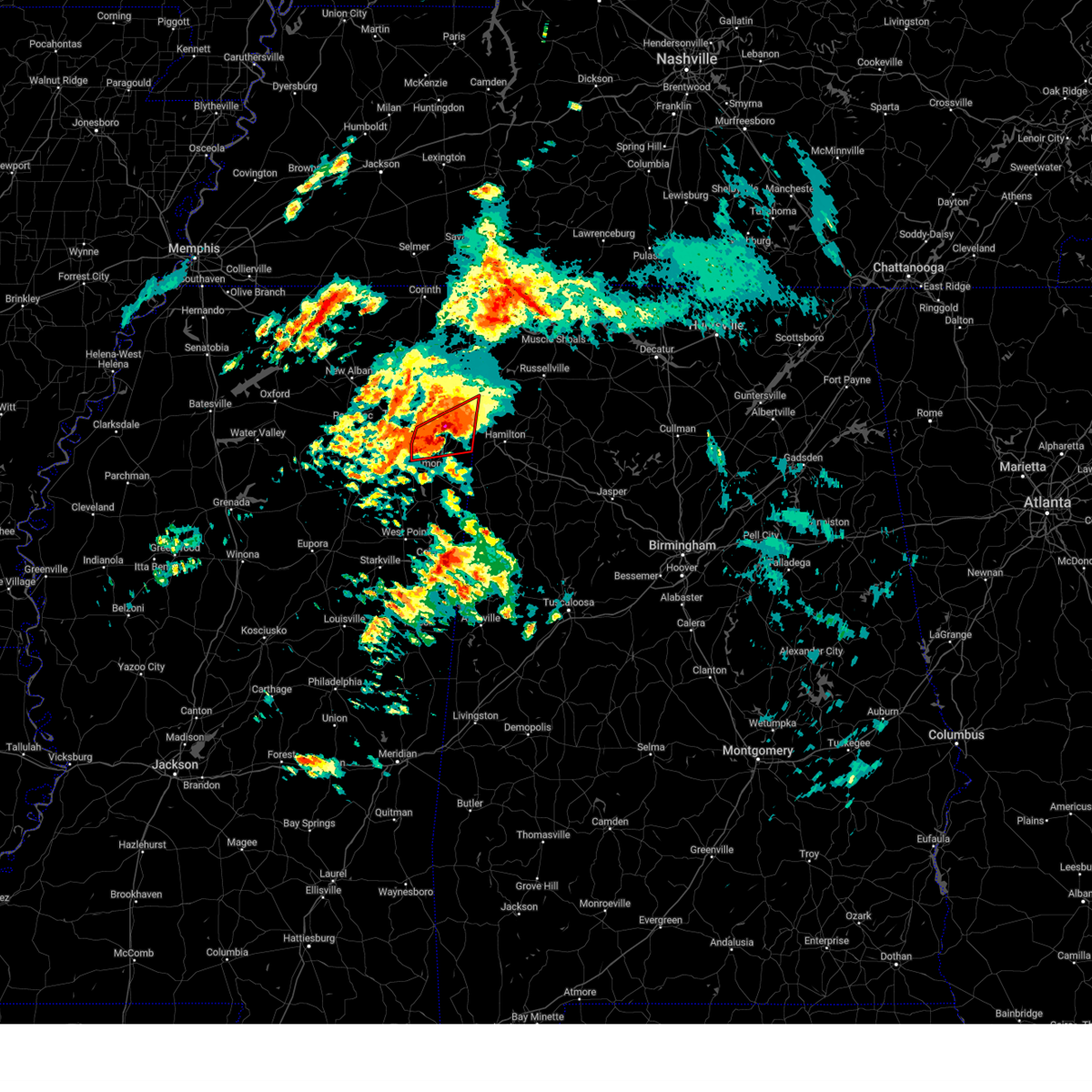 At 245 am cdt, a severe thunderstorm capable of producing a tornado was located near new salem, or 8 miles south of fulton, moving northeast at 45 mph (radar indicated rotation). Hazards include tornado and quarter size hail. Flying debris will be dangerous to those caught without shelter. mobile homes will be damaged or destroyed. damage to roofs, windows, and vehicles will occur. tree damage is likely. Locations impacted include, fulton, clay, abney, eastman, cardsville, smithville, turon, tilden, new salem, bounds crossroads, tremont, jacinto, cadamy, evergreen, richmond, and nettleton. At 245 am cdt, a severe thunderstorm capable of producing a tornado was located near new salem, or 8 miles south of fulton, moving northeast at 45 mph (radar indicated rotation). Hazards include tornado and quarter size hail. Flying debris will be dangerous to those caught without shelter. mobile homes will be damaged or destroyed. damage to roofs, windows, and vehicles will occur. tree damage is likely. Locations impacted include, fulton, clay, abney, eastman, cardsville, smithville, turon, tilden, new salem, bounds crossroads, tremont, jacinto, cadamy, evergreen, richmond, and nettleton.
|
| 3/15/2025 2:29 AM CDT |
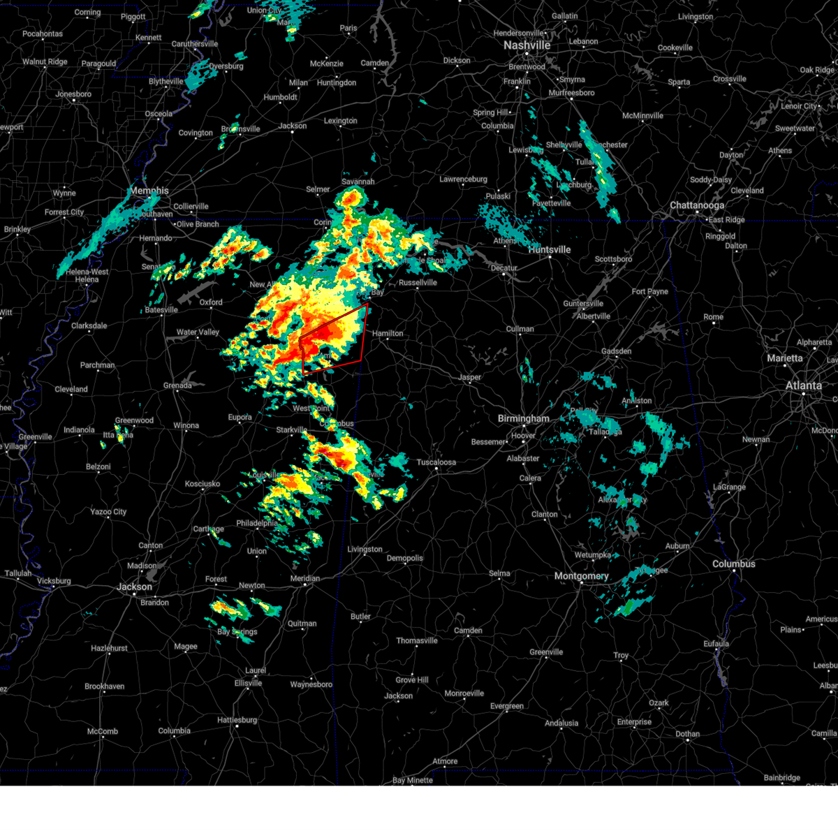 the tornado warning has been cancelled and is no longer in effect the tornado warning has been cancelled and is no longer in effect
|
| 3/15/2025 2:29 AM CDT |
 At 228 am cdt, a severe thunderstorm capable of producing a tornado was located near shannon, or 8 miles northwest of amory, moving northeast at 40 mph (radar indicated rotation). Hazards include tornado and half dollar size hail. Flying debris will be dangerous to those caught without shelter. mobile homes will be damaged or destroyed. damage to roofs, windows, and vehicles will occur. tree damage is likely. Locations impacted include, fulton, clay, abney, eastman, cardsville, smithville, turon, tilden, new wren, shannon, wren, amory, hatley, nettleton, bigbee, new salem, bounds crossroads, tremont, jacinto, and parham. At 228 am cdt, a severe thunderstorm capable of producing a tornado was located near shannon, or 8 miles northwest of amory, moving northeast at 40 mph (radar indicated rotation). Hazards include tornado and half dollar size hail. Flying debris will be dangerous to those caught without shelter. mobile homes will be damaged or destroyed. damage to roofs, windows, and vehicles will occur. tree damage is likely. Locations impacted include, fulton, clay, abney, eastman, cardsville, smithville, turon, tilden, new wren, shannon, wren, amory, hatley, nettleton, bigbee, new salem, bounds crossroads, tremont, jacinto, and parham.
|
| 3/15/2025 2:10 AM CDT |
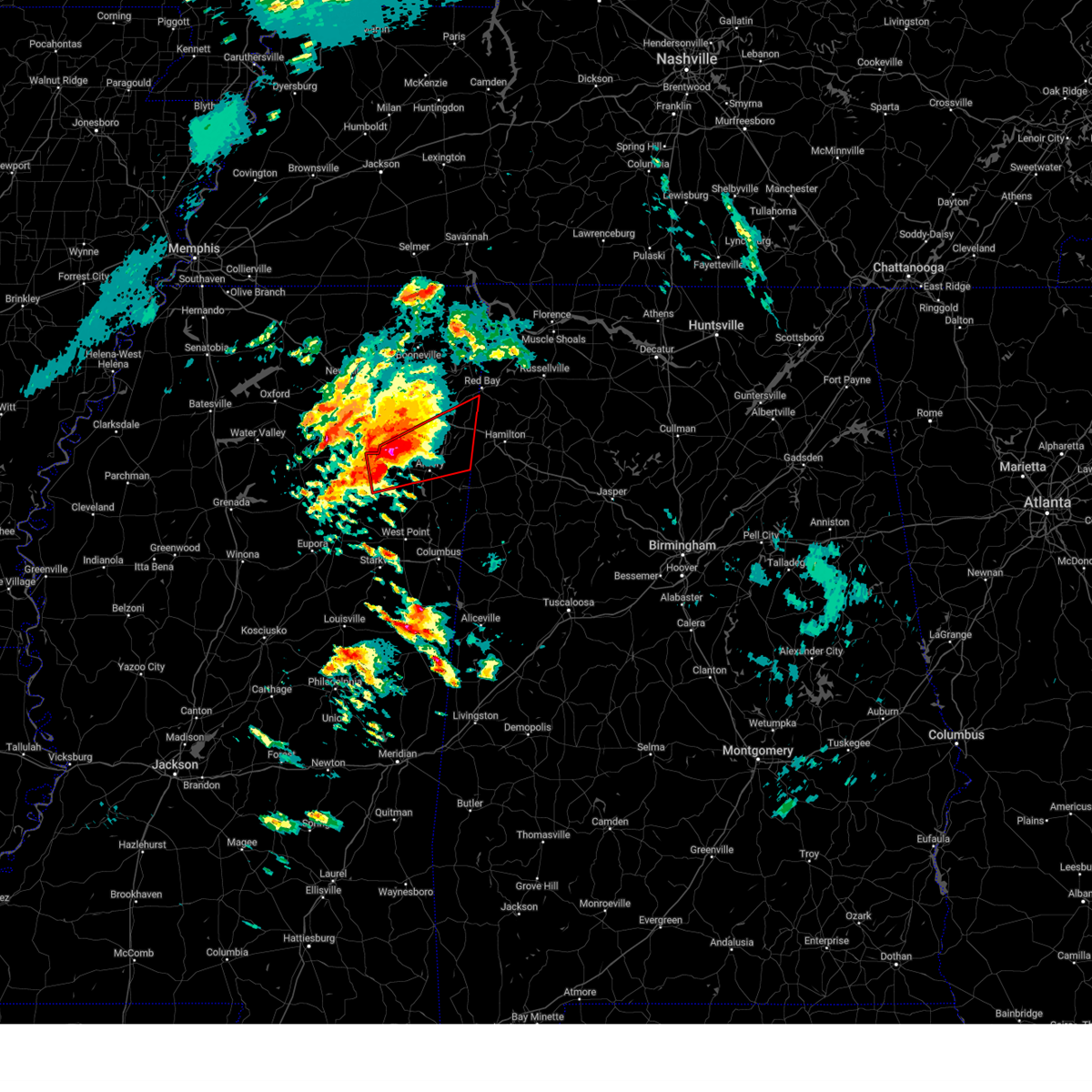 Tormeg the national weather service in memphis has issued a * tornado warning for, northeastern chickasaw county in northeastern mississippi, southern itawamba county in northeastern mississippi, southern lee county in northeastern mississippi, northern monroe county in northeastern mississippi, * until 300 am cdt. * at 210 am cdt, a severe thunderstorm capable of producing a tornado was located over okolona, moving northeast at 45 mph (radar indicated rotation). Hazards include tornado and half dollar size hail. Flying debris will be dangerous to those caught without shelter. mobile homes will be damaged or destroyed. damage to roofs, windows, and vehicles will occur. Tree damage is likely. Tormeg the national weather service in memphis has issued a * tornado warning for, northeastern chickasaw county in northeastern mississippi, southern itawamba county in northeastern mississippi, southern lee county in northeastern mississippi, northern monroe county in northeastern mississippi, * until 300 am cdt. * at 210 am cdt, a severe thunderstorm capable of producing a tornado was located over okolona, moving northeast at 45 mph (radar indicated rotation). Hazards include tornado and half dollar size hail. Flying debris will be dangerous to those caught without shelter. mobile homes will be damaged or destroyed. damage to roofs, windows, and vehicles will occur. Tree damage is likely.
|
| 2/15/2025 10:58 PM CST |
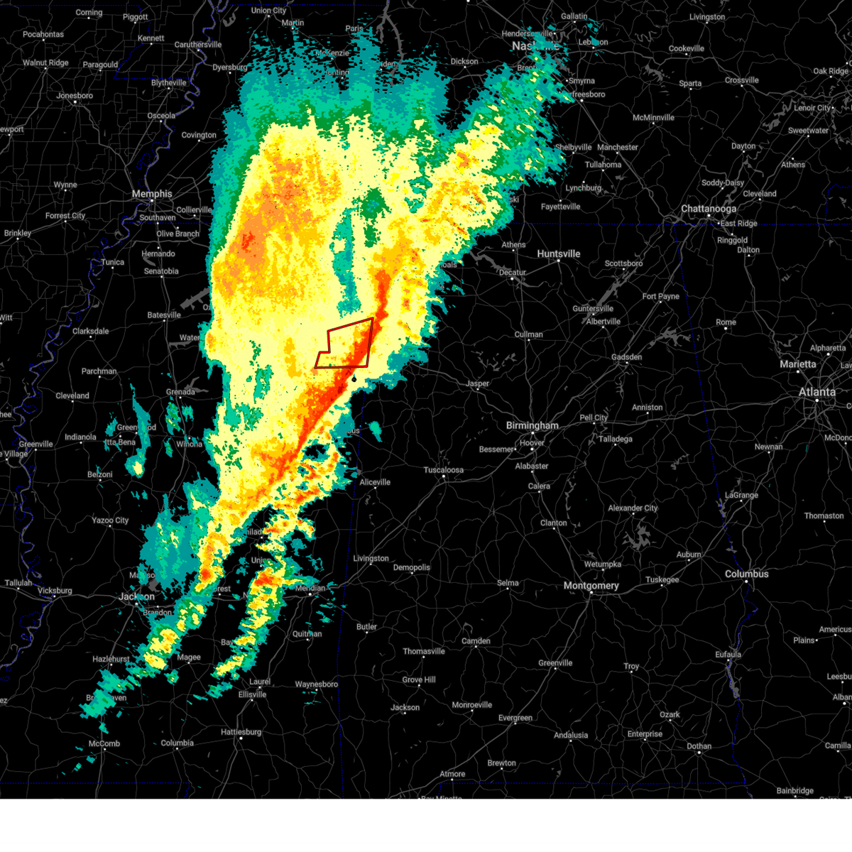 The storm which prompted the warning has moved out of the area. therefore, the warning will be allowed to expire. a tornado watch remains in effect until 400 am cst for northeastern mississippi. The storm which prompted the warning has moved out of the area. therefore, the warning will be allowed to expire. a tornado watch remains in effect until 400 am cst for northeastern mississippi.
|
| 2/15/2025 10:58 PM CST |
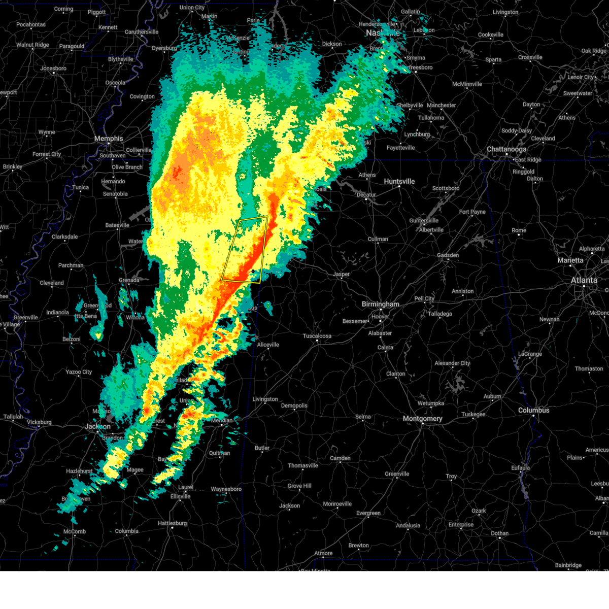 The storm which prompted the warning has weakened below severe limits, and has exited the warned area. therefore, the warning will be allowed to expire. a tornado watch remains in effect until 400 am cst for northeastern mississippi. The storm which prompted the warning has weakened below severe limits, and has exited the warned area. therefore, the warning will be allowed to expire. a tornado watch remains in effect until 400 am cst for northeastern mississippi.
|
| 2/15/2025 10:49 PM CST |
 At 1049 pm cst, a severe thunderstorm was located near detroit, or 13 miles west of hamilton, moving east at 50 mph (radar indicated). Hazards include 60 mph wind gusts and quarter size hail. Hail damage to vehicles is expected. expect wind damage to roofs, siding, and trees. Locations impacted include, amory, aberdeen, fulton, mantachie, smithville, tremont, fairview, new salem, new wren, evergreen, clay, hatley, gattman, abney, eastman, quincy, turon, wise gap, ballardsville, and wren. At 1049 pm cst, a severe thunderstorm was located near detroit, or 13 miles west of hamilton, moving east at 50 mph (radar indicated). Hazards include 60 mph wind gusts and quarter size hail. Hail damage to vehicles is expected. expect wind damage to roofs, siding, and trees. Locations impacted include, amory, aberdeen, fulton, mantachie, smithville, tremont, fairview, new salem, new wren, evergreen, clay, hatley, gattman, abney, eastman, quincy, turon, wise gap, ballardsville, and wren.
|
| 2/15/2025 10:49 PM CST |
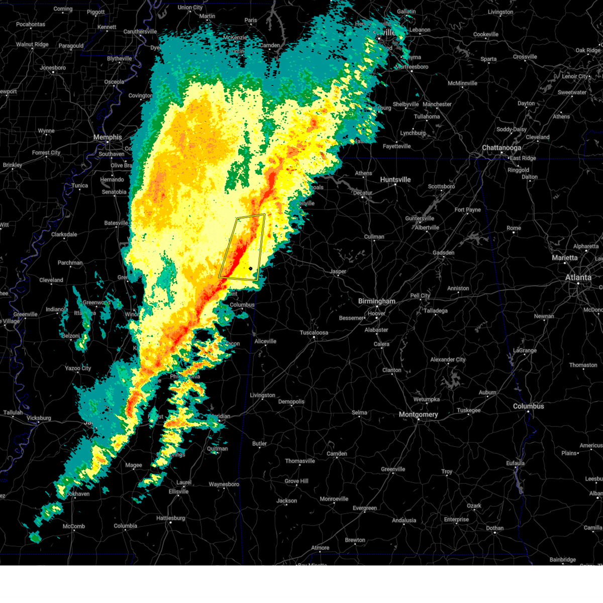 the severe thunderstorm warning has been cancelled and is no longer in effect the severe thunderstorm warning has been cancelled and is no longer in effect
|
| 2/15/2025 10:38 PM CST |
 At 1037 pm cst, a severe thunderstorm was located over smithville, or 9 miles northeast of amory, moving east at 50 mph (radar indicated). Hazards include 60 mph wind gusts and quarter size hail. Hail damage to vehicles is expected. expect wind damage to roofs, siding, and trees. Locations impacted include, tupelo, amory, aberdeen, fulton, verona, okolona, tombigbee state park, saltillo, shannon, plantersville, mantachie, smithville, tremont, fairview, new salem, new wren, trebloc, evergreen, clay, and nettleton. At 1037 pm cst, a severe thunderstorm was located over smithville, or 9 miles northeast of amory, moving east at 50 mph (radar indicated). Hazards include 60 mph wind gusts and quarter size hail. Hail damage to vehicles is expected. expect wind damage to roofs, siding, and trees. Locations impacted include, tupelo, amory, aberdeen, fulton, verona, okolona, tombigbee state park, saltillo, shannon, plantersville, mantachie, smithville, tremont, fairview, new salem, new wren, trebloc, evergreen, clay, and nettleton.
|
| 2/15/2025 10:38 PM CST |
 the severe thunderstorm warning has been cancelled and is no longer in effect the severe thunderstorm warning has been cancelled and is no longer in effect
|
| 2/15/2025 10:37 PM CST |
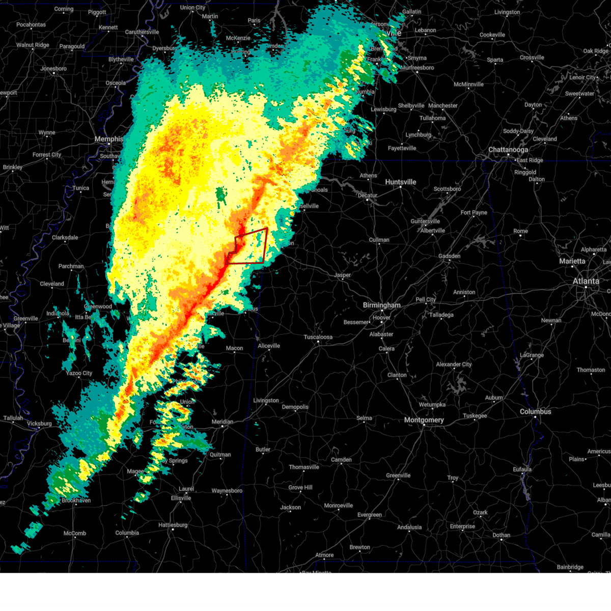 At 1036 pm cst, a severe thunderstorm capable of producing a tornado was located near fulton, moving northeast at 55 mph (radar indicated rotation). Hazards include tornado and quarter size hail. Flying debris will be dangerous to those caught without shelter. mobile homes will be damaged or destroyed. damage to roofs, windows, and vehicles will occur. tree damage is likely. Locations impacted include, amory, fulton, smithville, tremont, new salem, evergreen, clay, nettleton, hatley, abney, cardsville, turon, tilden, ballardsville, bigbee, jacinto, parham, and cadamy. At 1036 pm cst, a severe thunderstorm capable of producing a tornado was located near fulton, moving northeast at 55 mph (radar indicated rotation). Hazards include tornado and quarter size hail. Flying debris will be dangerous to those caught without shelter. mobile homes will be damaged or destroyed. damage to roofs, windows, and vehicles will occur. tree damage is likely. Locations impacted include, amory, fulton, smithville, tremont, new salem, evergreen, clay, nettleton, hatley, abney, cardsville, turon, tilden, ballardsville, bigbee, jacinto, parham, and cadamy.
|
| 2/15/2025 10:37 PM CST |
 the tornado warning has been cancelled and is no longer in effect the tornado warning has been cancelled and is no longer in effect
|
| 2/15/2025 10:24 PM CST |
 the tornado warning has been cancelled and is no longer in effect the tornado warning has been cancelled and is no longer in effect
|
| 2/15/2025 10:24 PM CST |
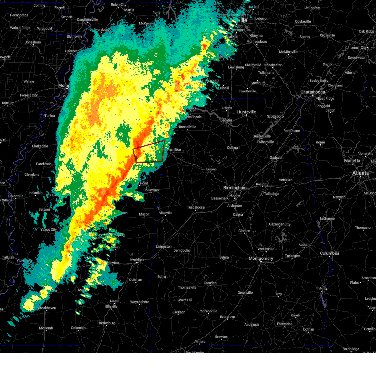 At 1024 pm cst, a severe thunderstorm capable of producing a tornado was located near shannon, or 7 miles southeast of verona, moving east at 55 mph (radar indicated rotation). Hazards include tornado and quarter size hail. Flying debris will be dangerous to those caught without shelter. mobile homes will be damaged or destroyed. damage to roofs, windows, and vehicles will occur. tree damage is likely. Locations impacted include, amory, fulton, verona, shannon, plantersville, smithville, tremont, new salem, evergreen, clay, nettleton, abney, cardsville, turon, tilden, ballardsville, bigbee, jacinto, parham, and cadamy. At 1024 pm cst, a severe thunderstorm capable of producing a tornado was located near shannon, or 7 miles southeast of verona, moving east at 55 mph (radar indicated rotation). Hazards include tornado and quarter size hail. Flying debris will be dangerous to those caught without shelter. mobile homes will be damaged or destroyed. damage to roofs, windows, and vehicles will occur. tree damage is likely. Locations impacted include, amory, fulton, verona, shannon, plantersville, smithville, tremont, new salem, evergreen, clay, nettleton, abney, cardsville, turon, tilden, ballardsville, bigbee, jacinto, parham, and cadamy.
|
| 2/15/2025 10:17 PM CST |
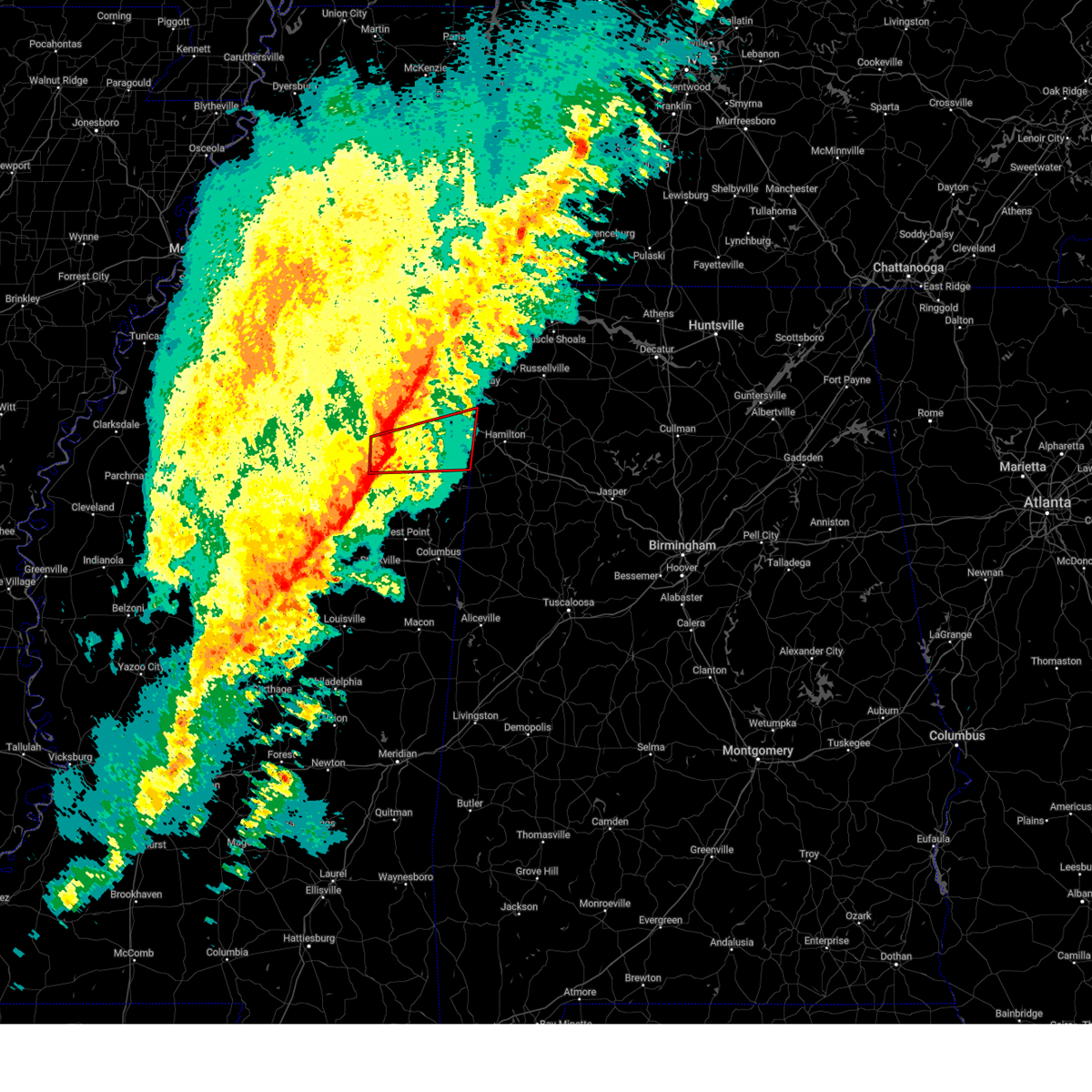 At 1017 pm cst, a severe thunderstorm capable of producing a tornado was located near shannon, or near okolona, moving east at 40 mph (radar indicated rotation). Hazards include tornado and quarter size hail. Flying debris will be dangerous to those caught without shelter. mobile homes will be damaged or destroyed. damage to roofs, windows, and vehicles will occur. tree damage is likely. Locations impacted include, amory, fulton, verona, okolona, shannon, plantersville, smithville, tremont, new salem, evergreen, clay, nettleton, hatley, abney, turon, ballardsville, leotis, old union, cardsville, and tilden. At 1017 pm cst, a severe thunderstorm capable of producing a tornado was located near shannon, or near okolona, moving east at 40 mph (radar indicated rotation). Hazards include tornado and quarter size hail. Flying debris will be dangerous to those caught without shelter. mobile homes will be damaged or destroyed. damage to roofs, windows, and vehicles will occur. tree damage is likely. Locations impacted include, amory, fulton, verona, okolona, shannon, plantersville, smithville, tremont, new salem, evergreen, clay, nettleton, hatley, abney, turon, ballardsville, leotis, old union, cardsville, and tilden.
|
| 2/15/2025 10:15 PM CST |
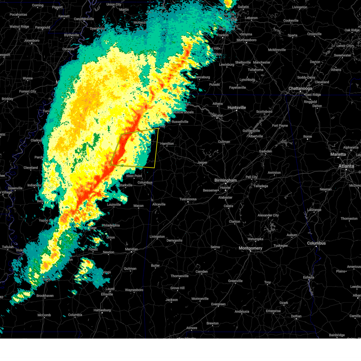 At 1015 pm cst, a severe thunderstorm was located near shannon, or near okolona, moving east at 50 mph (radar indicated). Hazards include 60 mph wind gusts and quarter size hail. Hail damage to vehicles is expected. expect wind damage to roofs, siding, and trees. Locations impacted include, tupelo, amory, aberdeen, fulton, houston, verona, okolona, trace state park, tombigbee state park, saltillo, shannon, plantersville, mantachie, smithville, tremont, fairview, troy, new salem, new wren, and trebloc. At 1015 pm cst, a severe thunderstorm was located near shannon, or near okolona, moving east at 50 mph (radar indicated). Hazards include 60 mph wind gusts and quarter size hail. Hail damage to vehicles is expected. expect wind damage to roofs, siding, and trees. Locations impacted include, tupelo, amory, aberdeen, fulton, houston, verona, okolona, trace state park, tombigbee state park, saltillo, shannon, plantersville, mantachie, smithville, tremont, fairview, troy, new salem, new wren, and trebloc.
|
| 2/15/2025 10:11 PM CST |
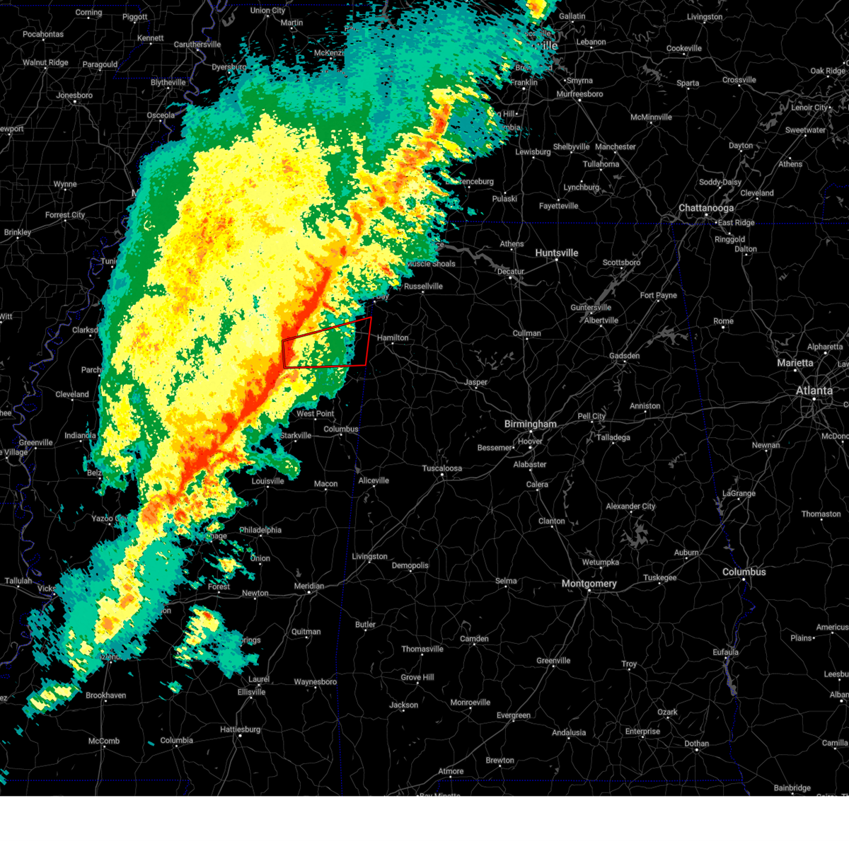 Tormeg the national weather service in memphis has issued a * tornado warning for, northeastern chickasaw county in northeastern mississippi, southeastern pontotoc county in northeastern mississippi, southern itawamba county in northeastern mississippi, southern lee county in northeastern mississippi, northern monroe county in northeastern mississippi, * until 1100 pm cst. * at 1010 pm cst, a severe thunderstorm capable of producing a tornado was located near troy, or 7 miles northwest of okolona, moving east at 55 mph (radar indicated rotation). Hazards include tornado. Flying debris will be dangerous to those caught without shelter. mobile homes will be damaged or destroyed. damage to roofs, windows, and vehicles will occur. Tree damage is likely. Tormeg the national weather service in memphis has issued a * tornado warning for, northeastern chickasaw county in northeastern mississippi, southeastern pontotoc county in northeastern mississippi, southern itawamba county in northeastern mississippi, southern lee county in northeastern mississippi, northern monroe county in northeastern mississippi, * until 1100 pm cst. * at 1010 pm cst, a severe thunderstorm capable of producing a tornado was located near troy, or 7 miles northwest of okolona, moving east at 55 mph (radar indicated rotation). Hazards include tornado. Flying debris will be dangerous to those caught without shelter. mobile homes will be damaged or destroyed. damage to roofs, windows, and vehicles will occur. Tree damage is likely.
|
| 2/15/2025 10:09 PM CST |
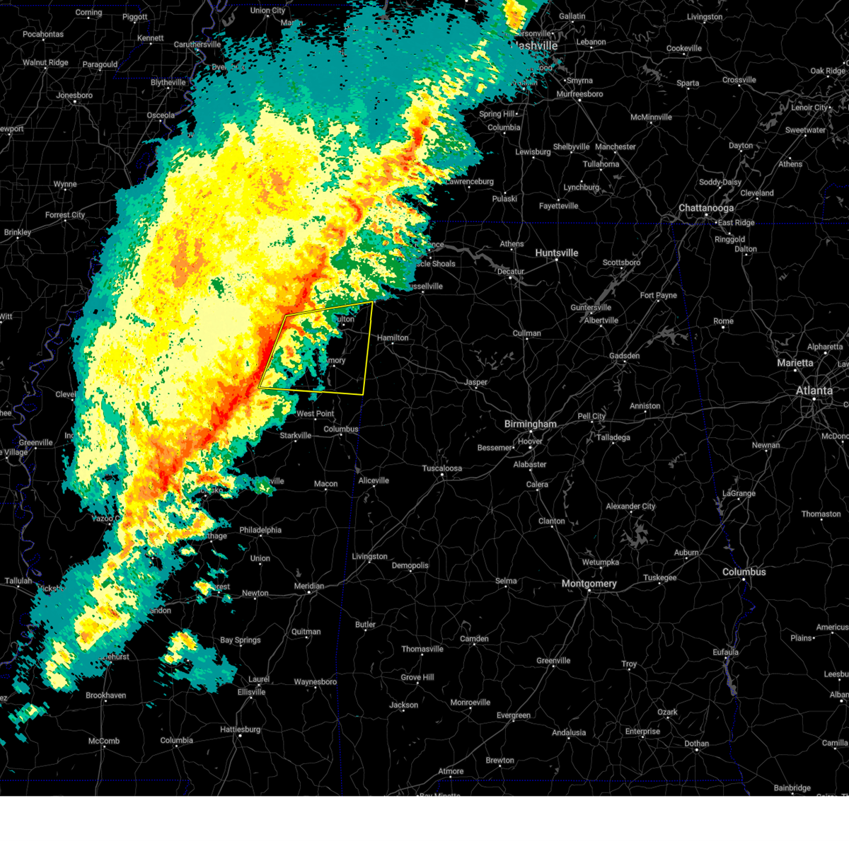 Svrmeg the national weather service in memphis has issued a * severe thunderstorm warning for, chickasaw county in northeastern mississippi, eastern pontotoc county in northeastern mississippi, itawamba county in northeastern mississippi, lee county in northeastern mississippi, monroe county in northeastern mississippi, * until 1100 pm cst. * at 1008 pm cst, a severe thunderstorm was located near okolona, moving east at 50 mph (radar indicated). Hazards include 60 mph wind gusts and nickel size hail. expect damage to roofs, siding, and trees Svrmeg the national weather service in memphis has issued a * severe thunderstorm warning for, chickasaw county in northeastern mississippi, eastern pontotoc county in northeastern mississippi, itawamba county in northeastern mississippi, lee county in northeastern mississippi, monroe county in northeastern mississippi, * until 1100 pm cst. * at 1008 pm cst, a severe thunderstorm was located near okolona, moving east at 50 mph (radar indicated). Hazards include 60 mph wind gusts and nickel size hail. expect damage to roofs, siding, and trees
|
| 9/24/2024 4:22 PM CDT |
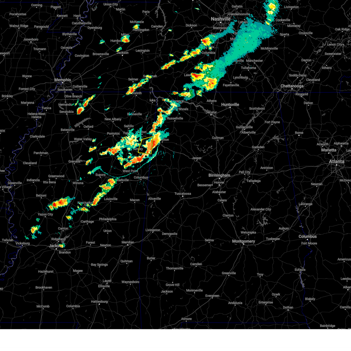 The storm which prompted the warning has moved out of the area. therefore, the warning will be allowed to expire. The storm which prompted the warning has moved out of the area. therefore, the warning will be allowed to expire.
|
| 9/24/2024 4:13 PM CDT |
 At 413 pm cdt, a severe thunderstorm was located near detroit, or 13 miles west of hamilton, moving east at 25 mph (radar indicated). Hazards include 60 mph wind gusts and quarter size hail. Hail damage to vehicles is expected. expect wind damage to roofs, siding, and trees. Locations impacted include, amory, smithville, tremont, new salem, hatley, sipsey fork, cardsville, turon, tilden, splunge, parham, and cadamy. At 413 pm cdt, a severe thunderstorm was located near detroit, or 13 miles west of hamilton, moving east at 25 mph (radar indicated). Hazards include 60 mph wind gusts and quarter size hail. Hail damage to vehicles is expected. expect wind damage to roofs, siding, and trees. Locations impacted include, amory, smithville, tremont, new salem, hatley, sipsey fork, cardsville, turon, tilden, splunge, parham, and cadamy.
|
| 9/24/2024 4:00 PM CDT |
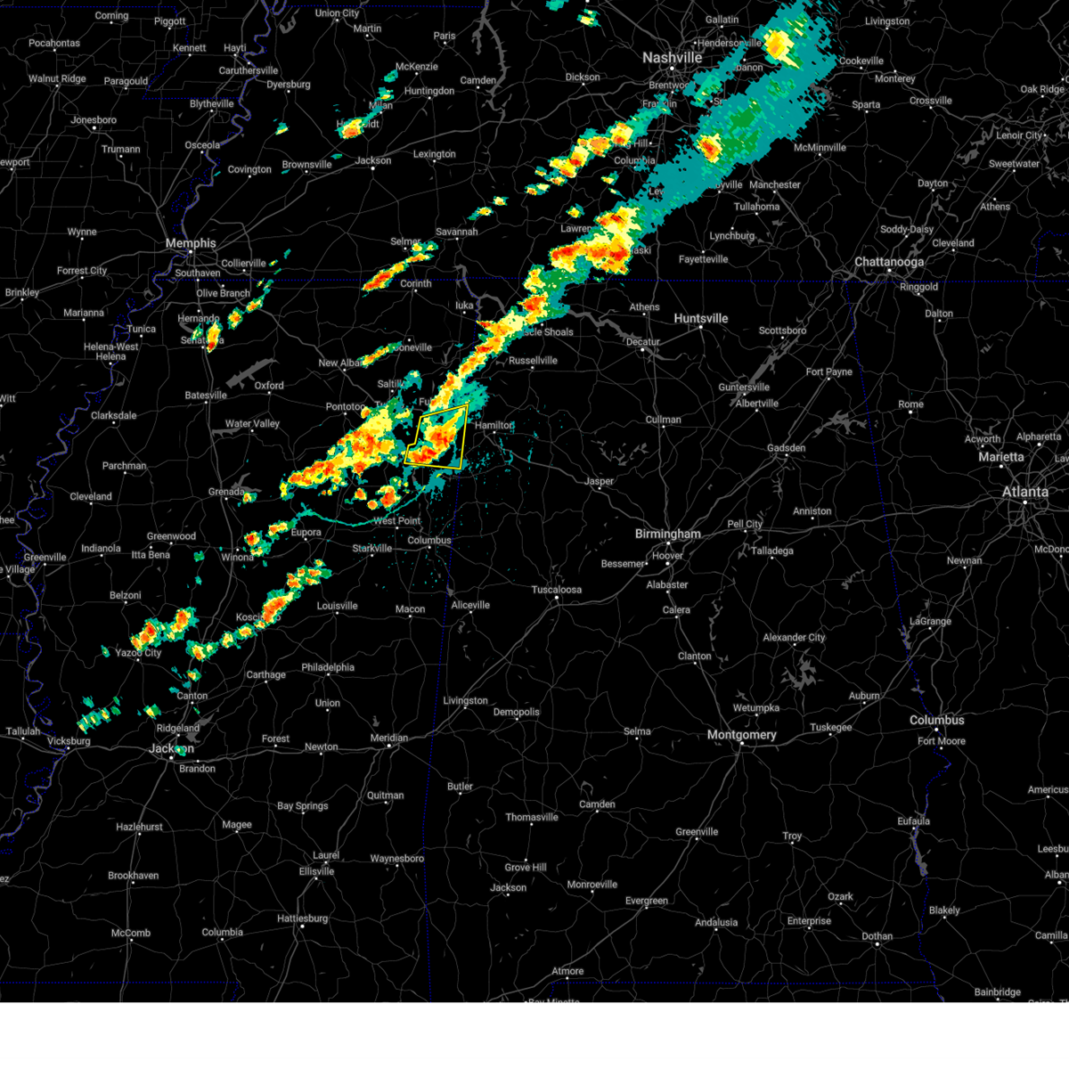 the severe thunderstorm warning has been cancelled and is no longer in effect the severe thunderstorm warning has been cancelled and is no longer in effect
|
| 9/24/2024 4:00 PM CDT |
 At 400 pm cdt, a severe thunderstorm was located near new salem, or 13 miles southeast of fulton, moving east at 40 mph (radar indicated). Hazards include 60 mph wind gusts and quarter size hail. Hail damage to vehicles is expected. expect wind damage to roofs, siding, and trees. Locations impacted include, amory, fulton, smithville, tremont, new salem, hatley, abney, sipsey fork, cardsville, turon, tilden, splunge, wren, bigbee, jacinto, parham, and cadamy. At 400 pm cdt, a severe thunderstorm was located near new salem, or 13 miles southeast of fulton, moving east at 40 mph (radar indicated). Hazards include 60 mph wind gusts and quarter size hail. Hail damage to vehicles is expected. expect wind damage to roofs, siding, and trees. Locations impacted include, amory, fulton, smithville, tremont, new salem, hatley, abney, sipsey fork, cardsville, turon, tilden, splunge, wren, bigbee, jacinto, parham, and cadamy.
|
| 9/24/2024 3:42 PM CDT |
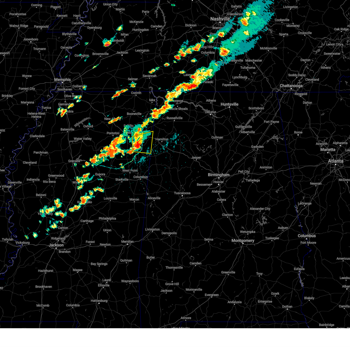 Svrmeg the national weather service in memphis has issued a * severe thunderstorm warning for, southern itawamba county in northeastern mississippi, southeastern lee county in northeastern mississippi, northeastern monroe county in northeastern mississippi, * until 430 pm cdt. * at 342 pm cdt, a severe thunderstorm was located near smithville, or near amory, moving east at 40 mph (radar indicated). Hazards include 60 mph wind gusts and quarter size hail. Hail damage to vehicles is expected. Expect wind damage to roofs, siding, and trees. Svrmeg the national weather service in memphis has issued a * severe thunderstorm warning for, southern itawamba county in northeastern mississippi, southeastern lee county in northeastern mississippi, northeastern monroe county in northeastern mississippi, * until 430 pm cdt. * at 342 pm cdt, a severe thunderstorm was located near smithville, or near amory, moving east at 40 mph (radar indicated). Hazards include 60 mph wind gusts and quarter size hail. Hail damage to vehicles is expected. Expect wind damage to roofs, siding, and trees.
|
| 8/30/2024 3:42 PM CDT |
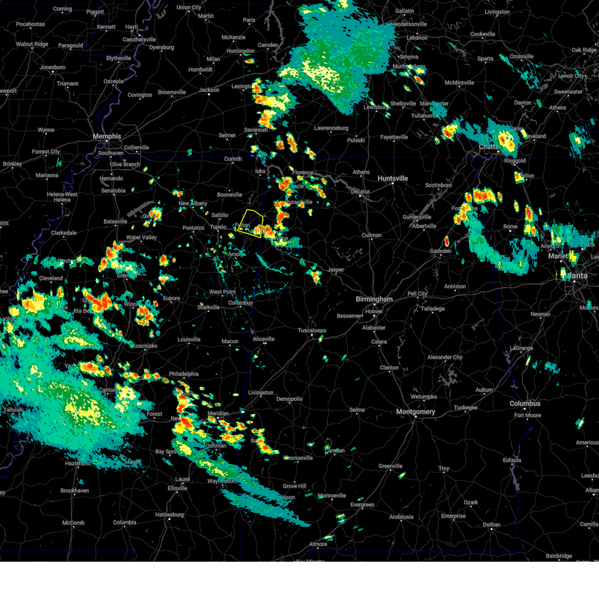 Svrmeg the national weather service in memphis has issued a * severe thunderstorm warning for, northern itawamba county in northeastern mississippi, * until 430 pm cdt. * at 342 pm cdt, a severe thunderstorm was located near tremont, or 10 miles south of red bay, moving northwest at 10 mph (radar indicated). Hazards include 60 mph wind gusts and quarter size hail. Hail damage to vehicles is expected. Expect wind damage to roofs, siding, and trees. Svrmeg the national weather service in memphis has issued a * severe thunderstorm warning for, northern itawamba county in northeastern mississippi, * until 430 pm cdt. * at 342 pm cdt, a severe thunderstorm was located near tremont, or 10 miles south of red bay, moving northwest at 10 mph (radar indicated). Hazards include 60 mph wind gusts and quarter size hail. Hail damage to vehicles is expected. Expect wind damage to roofs, siding, and trees.
|
| 6/26/2024 2:23 PM CDT |
 the severe thunderstorm warning has been cancelled and is no longer in effect the severe thunderstorm warning has been cancelled and is no longer in effect
|
| 6/26/2024 2:19 PM CDT |
 At 219 pm cdt, a severe thunderstorm was located near smithville, or 7 miles north of amory, moving northeast at 20 mph (radar indicated). Hazards include 60 mph wind gusts and quarter size hail. Hail damage to vehicles is expected. expect wind damage to roofs, siding, and trees. Locations impacted include, amory, fulton, smithville, tremont, new salem, evergreen, clay, nettleton, hatley, abney, cardsville, turon, tilden, bigbee, jacinto, and cadamy. At 219 pm cdt, a severe thunderstorm was located near smithville, or 7 miles north of amory, moving northeast at 20 mph (radar indicated). Hazards include 60 mph wind gusts and quarter size hail. Hail damage to vehicles is expected. expect wind damage to roofs, siding, and trees. Locations impacted include, amory, fulton, smithville, tremont, new salem, evergreen, clay, nettleton, hatley, abney, cardsville, turon, tilden, bigbee, jacinto, and cadamy.
|
| 6/26/2024 2:03 PM CDT |
 Svrmeg the national weather service in memphis has issued a * severe thunderstorm warning for, southern itawamba county in northeastern mississippi, northwestern monroe county in northeastern mississippi, * until 245 pm cdt. * at 203 pm cdt, a severe thunderstorm was located near amory, moving northeast at 20 mph (radar indicated). Hazards include 60 mph wind gusts and quarter size hail. Hail damage to vehicles is expected. Expect wind damage to roofs, siding, and trees. Svrmeg the national weather service in memphis has issued a * severe thunderstorm warning for, southern itawamba county in northeastern mississippi, northwestern monroe county in northeastern mississippi, * until 245 pm cdt. * at 203 pm cdt, a severe thunderstorm was located near amory, moving northeast at 20 mph (radar indicated). Hazards include 60 mph wind gusts and quarter size hail. Hail damage to vehicles is expected. Expect wind damage to roofs, siding, and trees.
|
| 6/9/2024 7:56 PM CDT |
 At 756 pm cdt, a severe thunderstorm was located near saltillo, or 7 miles north of tombigbee state park, moving east at 35 mph (radar indicated). Hazards include 60 mph wind gusts and half dollar size hail. Hail damage to vehicles is expected. expect wind damage to roofs, siding, and trees. Locations impacted include, tupelo, fulton, saltillo, mantachie, tremont, sandy springs, fairview, clay, beech springs, eastman, mooreville, eggville, frog island, unity, bounds crossroads, indian hills, dorsey, flowerdale, ballardsville, and skyline. At 756 pm cdt, a severe thunderstorm was located near saltillo, or 7 miles north of tombigbee state park, moving east at 35 mph (radar indicated). Hazards include 60 mph wind gusts and half dollar size hail. Hail damage to vehicles is expected. expect wind damage to roofs, siding, and trees. Locations impacted include, tupelo, fulton, saltillo, mantachie, tremont, sandy springs, fairview, clay, beech springs, eastman, mooreville, eggville, frog island, unity, bounds crossroads, indian hills, dorsey, flowerdale, ballardsville, and skyline.
|
| 6/9/2024 7:48 PM CDT |
 Svrmeg the national weather service in memphis has issued a * severe thunderstorm warning for, itawamba county in northeastern mississippi, central lee county in northeastern mississippi, * until 830 pm cdt. * at 748 pm cdt, a severe thunderstorm was located over saltillo, or near tupelo, moving east at 35 mph (radar indicated). Hazards include 60 mph wind gusts and quarter size hail. Hail damage to vehicles is expected. Expect wind damage to roofs, siding, and trees. Svrmeg the national weather service in memphis has issued a * severe thunderstorm warning for, itawamba county in northeastern mississippi, central lee county in northeastern mississippi, * until 830 pm cdt. * at 748 pm cdt, a severe thunderstorm was located over saltillo, or near tupelo, moving east at 35 mph (radar indicated). Hazards include 60 mph wind gusts and quarter size hail. Hail damage to vehicles is expected. Expect wind damage to roofs, siding, and trees.
|
| 6/5/2024 6:51 PM CDT |
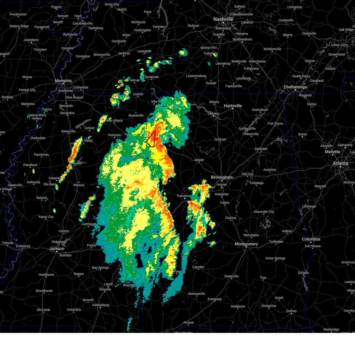 The storm which prompted the warning has moved out of the area. therefore, the warning will be allowed to expire. The storm which prompted the warning has moved out of the area. therefore, the warning will be allowed to expire.
|
| 6/5/2024 6:44 PM CDT |
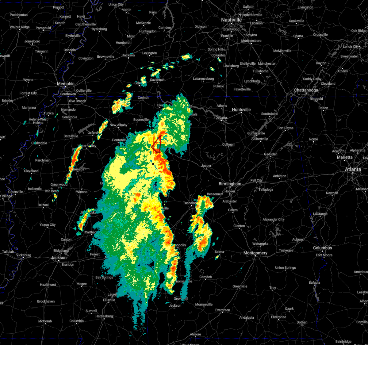 Tormeg the national weather service in memphis has issued a * tornado warning for, southeastern itawamba county in northeastern mississippi, * until 700 pm cdt. * at 644 pm cdt, a severe thunderstorm capable of producing a tornado was located near tremont, or 11 miles southeast of fulton, moving northeast at 30 mph (radar indicated rotation). Hazards include tornado. Flying debris will be dangerous to those caught without shelter. mobile homes will be damaged or destroyed. damage to roofs, windows, and vehicles will occur. Tree damage is likely. Tormeg the national weather service in memphis has issued a * tornado warning for, southeastern itawamba county in northeastern mississippi, * until 700 pm cdt. * at 644 pm cdt, a severe thunderstorm capable of producing a tornado was located near tremont, or 11 miles southeast of fulton, moving northeast at 30 mph (radar indicated rotation). Hazards include tornado. Flying debris will be dangerous to those caught without shelter. mobile homes will be damaged or destroyed. damage to roofs, windows, and vehicles will occur. Tree damage is likely.
|
| 6/5/2024 6:43 PM CDT | Trees reported down along pate road in itawamba county. radar estimated time. possible tornad in itawamba county MS, 4.7 miles NNW of Tremont, MS |
| 6/5/2024 6:34 PM CDT |
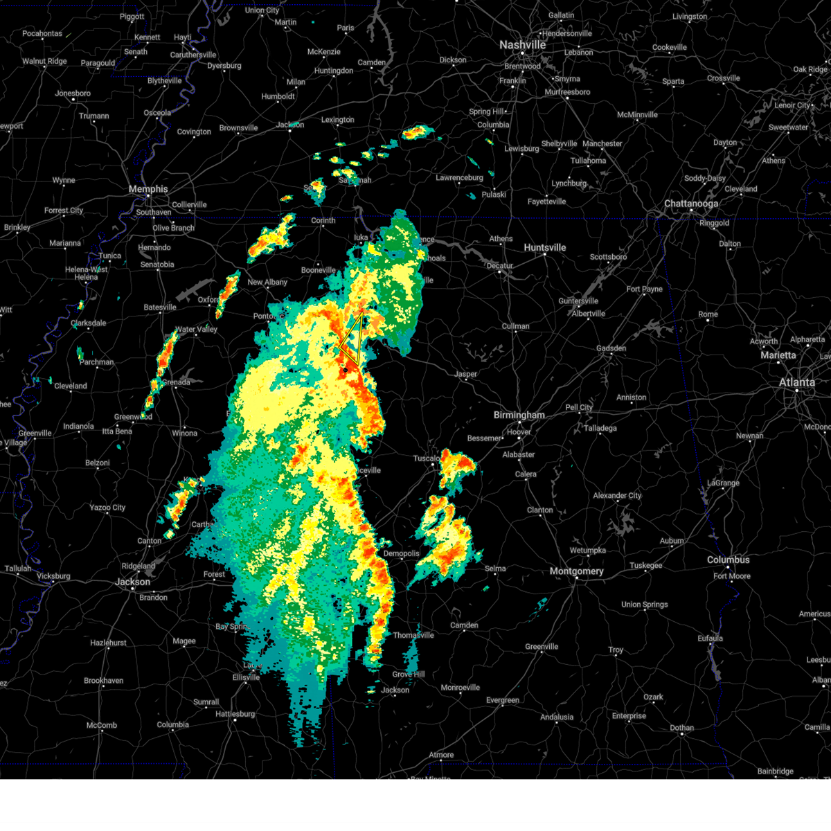 Svrmeg the national weather service in memphis has issued a * severe thunderstorm warning for, southeastern itawamba county in northeastern mississippi, northeastern monroe county in northeastern mississippi, * until 700 pm cdt. * at 634 pm cdt, a severe thunderstorm was located near detroit, or 14 miles northwest of sulligent, moving northeast at 45 mph (radar indicated). Hazards include 60 mph wind gusts and penny size hail. expect damage to roofs, siding, and trees Svrmeg the national weather service in memphis has issued a * severe thunderstorm warning for, southeastern itawamba county in northeastern mississippi, northeastern monroe county in northeastern mississippi, * until 700 pm cdt. * at 634 pm cdt, a severe thunderstorm was located near detroit, or 14 miles northwest of sulligent, moving northeast at 45 mph (radar indicated). Hazards include 60 mph wind gusts and penny size hail. expect damage to roofs, siding, and trees
|
| 3/15/2024 5:03 AM CDT |
 The storms which prompted the warning have moved out of the area. therefore, the warning has been allowed to expire. The storms which prompted the warning have moved out of the area. therefore, the warning has been allowed to expire.
|
| 3/15/2024 4:41 AM CDT |
 Svrmeg the national weather service in memphis has issued a * severe thunderstorm warning for, southeastern itawamba county in northeastern mississippi, northeastern monroe county in northeastern mississippi, * until 500 am cdt. * at 441 am cdt, severe thunderstorms were located along a line extending from near fulton to 6 miles east of aberdeen, moving east at 35 mph (radar indicated). Hazards include 60 mph wind gusts. expect damage to roofs, siding, and trees Svrmeg the national weather service in memphis has issued a * severe thunderstorm warning for, southeastern itawamba county in northeastern mississippi, northeastern monroe county in northeastern mississippi, * until 500 am cdt. * at 441 am cdt, severe thunderstorms were located along a line extending from near fulton to 6 miles east of aberdeen, moving east at 35 mph (radar indicated). Hazards include 60 mph wind gusts. expect damage to roofs, siding, and trees
|
| 3/15/2024 4:03 AM CDT |
 Svrmeg the national weather service in memphis has issued a * severe thunderstorm warning for, northeastern chickasaw county in northeastern mississippi, southeastern pontotoc county in northeastern mississippi, itawamba county in northeastern mississippi, lee county in northeastern mississippi, monroe county in northeastern mississippi, * until 445 am cdt. * at 403 am cdt, severe thunderstorms were located along a line extending from near blair to near verona to near trebloc, moving east at 25 mph (radar indicated). Hazards include 60 mph wind gusts and nickel size hail. expect damage to roofs, siding, and trees Svrmeg the national weather service in memphis has issued a * severe thunderstorm warning for, northeastern chickasaw county in northeastern mississippi, southeastern pontotoc county in northeastern mississippi, itawamba county in northeastern mississippi, lee county in northeastern mississippi, monroe county in northeastern mississippi, * until 445 am cdt. * at 403 am cdt, severe thunderstorms were located along a line extending from near blair to near verona to near trebloc, moving east at 25 mph (radar indicated). Hazards include 60 mph wind gusts and nickel size hail. expect damage to roofs, siding, and trees
|
| 3/14/2024 7:10 PM CDT |
 The storm which prompted the warning has moved out of the area. therefore, the warning will be allowed to expire. The storm which prompted the warning has moved out of the area. therefore, the warning will be allowed to expire.
|
| 3/14/2024 7:05 PM CDT | Quarter sized hail reported 5.5 miles SW of Tremont, MS, 1.00 inch hail reported along cotton gin road. |
| 3/14/2024 7:00 PM CDT | Powerline reported down in north tremont... m in itawamba county MS, 0.6 miles SSE of Tremont, MS |
| 3/14/2024 6:54 PM CDT |
 At 654 pm cdt, a severe thunderstorm was located near detroit, or 10 miles west of hamilton, moving northeast at 40 mph (radar indicated). Hazards include 60 mph wind gusts and quarter size hail. Hail damage to vehicles is expected. expect wind damage to roofs, siding, and trees. Locations impacted include, amory, smithville, tremont, new salem, hatley, sipsey fork, becker, quincy, cardsville, turon, tilden, splunge, wise gap, athens, bigbee, greenwood springs, jacinto, parham, cadamy, and bounds crossroads. At 654 pm cdt, a severe thunderstorm was located near detroit, or 10 miles west of hamilton, moving northeast at 40 mph (radar indicated). Hazards include 60 mph wind gusts and quarter size hail. Hail damage to vehicles is expected. expect wind damage to roofs, siding, and trees. Locations impacted include, amory, smithville, tremont, new salem, hatley, sipsey fork, becker, quincy, cardsville, turon, tilden, splunge, wise gap, athens, bigbee, greenwood springs, jacinto, parham, cadamy, and bounds crossroads.
|
| 3/14/2024 6:35 PM CDT |
 Svrmeg the national weather service in memphis has issued a * severe thunderstorm warning for, southeastern itawamba county in northeastern mississippi, northeastern monroe county in northeastern mississippi, * until 715 pm cdt. * at 634 pm cdt, a severe thunderstorm was located 7 miles southeast of smithville, or 8 miles east of amory, moving northeast at 40 mph (radar indicated). Hazards include 60 mph wind gusts and quarter size hail. Hail damage to vehicles is expected. Expect wind damage to roofs, siding, and trees. Svrmeg the national weather service in memphis has issued a * severe thunderstorm warning for, southeastern itawamba county in northeastern mississippi, northeastern monroe county in northeastern mississippi, * until 715 pm cdt. * at 634 pm cdt, a severe thunderstorm was located 7 miles southeast of smithville, or 8 miles east of amory, moving northeast at 40 mph (radar indicated). Hazards include 60 mph wind gusts and quarter size hail. Hail damage to vehicles is expected. Expect wind damage to roofs, siding, and trees.
|
| 2/28/2024 8:35 AM CST |
 The storm which prompted the warning has weakened below severe limits, and no longer poses an immediate threat to life or property. therefore, the warning will be allowed to expire. The storm which prompted the warning has weakened below severe limits, and no longer poses an immediate threat to life or property. therefore, the warning will be allowed to expire.
|
| 2/28/2024 8:22 AM CST |
 At 821 am cst, a severe thunderstorm was located over mantachie, or near fulton, moving east at 55 mph (radar indicated). Hazards include 60 mph wind gusts and quarter size hail. Hail damage to vehicles is expected. expect wind damage to roofs, siding, and trees. Locations impacted include, tupelo, fulton, saltillo, mantachie, tremont, sandy springs, fairview, clay, beech springs, skyline, eastman, mooreville, eggville, ballardsville, unity, bounds crossroads, indian hills, dorsey, and flowerdale. At 821 am cst, a severe thunderstorm was located over mantachie, or near fulton, moving east at 55 mph (radar indicated). Hazards include 60 mph wind gusts and quarter size hail. Hail damage to vehicles is expected. expect wind damage to roofs, siding, and trees. Locations impacted include, tupelo, fulton, saltillo, mantachie, tremont, sandy springs, fairview, clay, beech springs, skyline, eastman, mooreville, eggville, ballardsville, unity, bounds crossroads, indian hills, dorsey, and flowerdale.
|
| 2/28/2024 8:09 AM CST |
 At 809 am cst, a severe thunderstorm was located near saltillo, or near tupelo, moving east at 55 mph (radar indicated). Hazards include 60 mph wind gusts and quarter size hail. Hail damage to vehicles is expected. expect wind damage to roofs, siding, and trees. Locations impacted include, tupelo, fulton, trace state park, tombigbee state park, saltillo, guntown, plantersville, mantachie, tremont, fairview, sandy springs, furrs, clay, sherman, abney, eastman, mooreville, eggville, ballardsville, and flowerdale. At 809 am cst, a severe thunderstorm was located near saltillo, or near tupelo, moving east at 55 mph (radar indicated). Hazards include 60 mph wind gusts and quarter size hail. Hail damage to vehicles is expected. expect wind damage to roofs, siding, and trees. Locations impacted include, tupelo, fulton, trace state park, tombigbee state park, saltillo, guntown, plantersville, mantachie, tremont, fairview, sandy springs, furrs, clay, sherman, abney, eastman, mooreville, eggville, ballardsville, and flowerdale.
|
| 2/28/2024 8:07 AM CST |
 At 806 am cst, a severe thunderstorm was located near saltillo, or near tupelo, moving east at 55 mph (radar indicated). Hazards include 60 mph wind gusts and quarter size hail. Hail damage to vehicles is expected. expect wind damage to roofs, siding, and trees. Locations impacted include, tupelo, fulton, trace state park, tombigbee state park, saltillo, guntown, plantersville, mantachie, tremont, fairview, sandy springs, furrs, clay, sherman, abney, eastman, mooreville, eggville, ballardsville, and flowerdale. At 806 am cst, a severe thunderstorm was located near saltillo, or near tupelo, moving east at 55 mph (radar indicated). Hazards include 60 mph wind gusts and quarter size hail. Hail damage to vehicles is expected. expect wind damage to roofs, siding, and trees. Locations impacted include, tupelo, fulton, trace state park, tombigbee state park, saltillo, guntown, plantersville, mantachie, tremont, fairview, sandy springs, furrs, clay, sherman, abney, eastman, mooreville, eggville, ballardsville, and flowerdale.
|
| 2/28/2024 7:53 AM CST |
 Svrmeg the national weather service in memphis has issued a * severe thunderstorm warning for, northeastern pontotoc county in northeastern mississippi, southeastern union county in northeastern mississippi, itawamba county in northeastern mississippi, central lee county in northeastern mississippi, * until 845 am cst. * at 753 am cst, a severe thunderstorm was located near new harmony, or near trace state park, moving east at 55 mph (radar indicated). Hazards include 60 mph wind gusts and quarter size hail. Hail damage to vehicles is expected. Expect wind damage to roofs, siding, and trees. Svrmeg the national weather service in memphis has issued a * severe thunderstorm warning for, northeastern pontotoc county in northeastern mississippi, southeastern union county in northeastern mississippi, itawamba county in northeastern mississippi, central lee county in northeastern mississippi, * until 845 am cst. * at 753 am cst, a severe thunderstorm was located near new harmony, or near trace state park, moving east at 55 mph (radar indicated). Hazards include 60 mph wind gusts and quarter size hail. Hail damage to vehicles is expected. Expect wind damage to roofs, siding, and trees.
|
| 12/9/2023 7:00 PM CST |
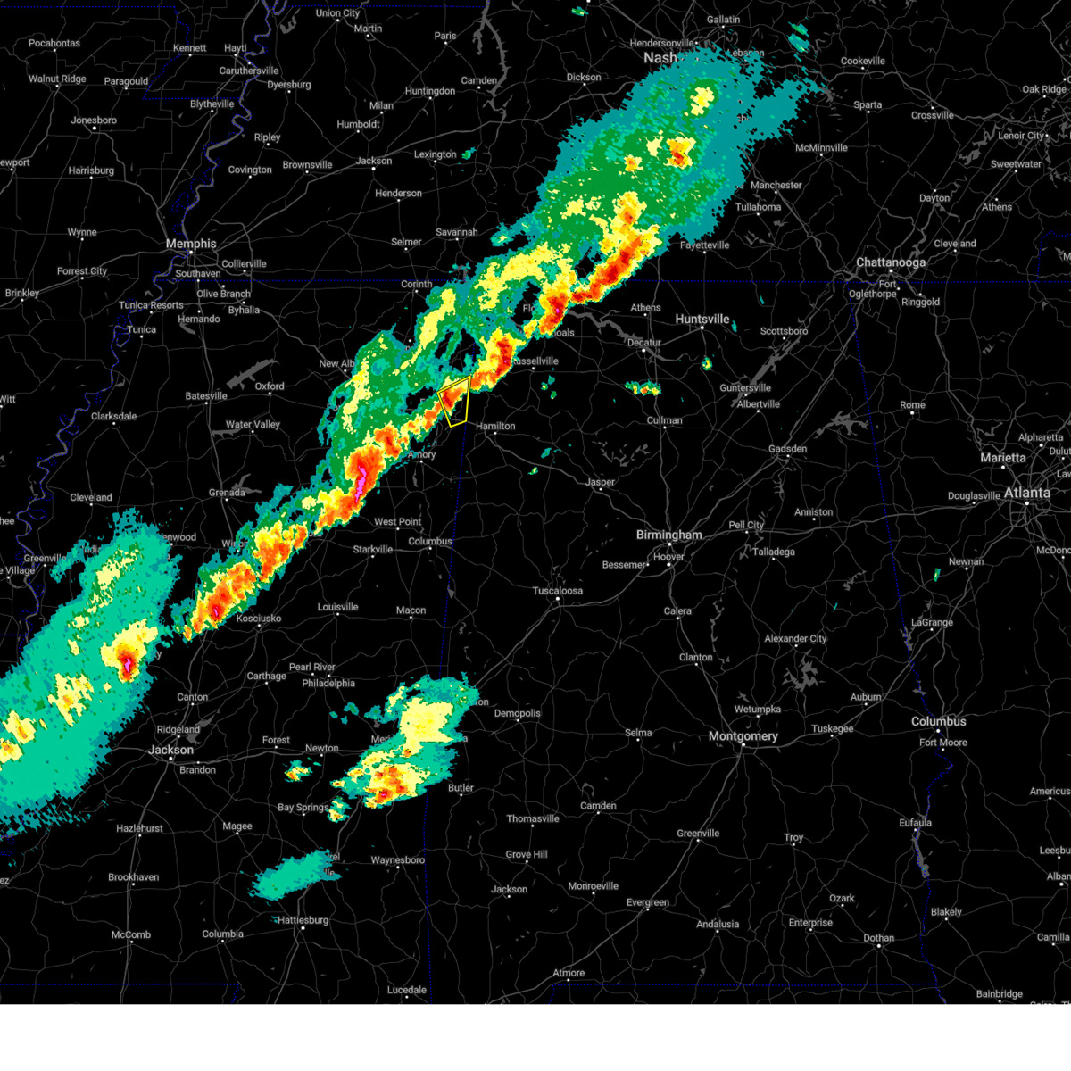 At 700 pm cst, a severe thunderstorm was located 7 miles east of fairview, or 7 miles south of red bay, moving northeast at 55 mph (radar indicated). Hazards include 60 mph wind gusts and quarter size hail. Hail damage to vehicles is expected. expect wind damage to roofs, siding, and trees. locations impacted include, tremont, fairview, eastman, and bounds crossroads. hail threat, radar indicated max hail size, 1. 00 in wind threat, radar indicated max wind gust, 60 mph. At 700 pm cst, a severe thunderstorm was located 7 miles east of fairview, or 7 miles south of red bay, moving northeast at 55 mph (radar indicated). Hazards include 60 mph wind gusts and quarter size hail. Hail damage to vehicles is expected. expect wind damage to roofs, siding, and trees. locations impacted include, tremont, fairview, eastman, and bounds crossroads. hail threat, radar indicated max hail size, 1. 00 in wind threat, radar indicated max wind gust, 60 mph.
|
| 12/9/2023 6:43 PM CST |
 At 643 pm cst, a severe thunderstorm was located over fulton, moving northeast at 55 mph (radar indicated). Hazards include 60 mph wind gusts and quarter size hail. Hail damage to vehicles is expected. Expect wind damage to roofs, siding, and trees. At 643 pm cst, a severe thunderstorm was located over fulton, moving northeast at 55 mph (radar indicated). Hazards include 60 mph wind gusts and quarter size hail. Hail damage to vehicles is expected. Expect wind damage to roofs, siding, and trees.
|
| 9/6/2023 5:27 PM CDT |
 At 526 pm cdt, a severe thunderstorm was located over fulton, moving southeast at 30 mph (radar indicated). Hazards include 60 mph wind gusts. Expect damage to roofs, siding, and trees. locations impacted include, fulton, tombigbee state park, mantachie, smithville, tremont, fairview, new salem, evergreen, clay, abney, eastman, turon, mooreville, eggville, ballardsville, sipsey fork, cardsville, tilden, splunge and unity. hail threat, radar indicated max hail size, <. 75 in wind threat, radar indicated max wind gust, 60 mph. At 526 pm cdt, a severe thunderstorm was located over fulton, moving southeast at 30 mph (radar indicated). Hazards include 60 mph wind gusts. Expect damage to roofs, siding, and trees. locations impacted include, fulton, tombigbee state park, mantachie, smithville, tremont, fairview, new salem, evergreen, clay, abney, eastman, turon, mooreville, eggville, ballardsville, sipsey fork, cardsville, tilden, splunge and unity. hail threat, radar indicated max hail size, <. 75 in wind threat, radar indicated max wind gust, 60 mph.
|
| 9/6/2023 5:07 PM CDT |
 At 507 pm cdt, a severe thunderstorm was located over mantachie, or near fulton, moving southeast at 40 mph (radar indicated). Hazards include 60 mph wind gusts. expect damage to roofs, siding, and trees At 507 pm cdt, a severe thunderstorm was located over mantachie, or near fulton, moving southeast at 40 mph (radar indicated). Hazards include 60 mph wind gusts. expect damage to roofs, siding, and trees
|
| 8/7/2023 2:12 PM CDT |
 The severe thunderstorm warning for southeastern itawamba and northern monroe counties will expire at 215 pm cdt, the storms which prompted the warning have moved out of the area. therefore, the warning will be allowed to expire. to report severe weather, contact your nearest law enforcement agency. they will relay your report to the national weather service memphis. The severe thunderstorm warning for southeastern itawamba and northern monroe counties will expire at 215 pm cdt, the storms which prompted the warning have moved out of the area. therefore, the warning will be allowed to expire. to report severe weather, contact your nearest law enforcement agency. they will relay your report to the national weather service memphis.
|
| 8/7/2023 1:58 PM CDT |
 At 158 pm cdt, severe thunderstorms were located along a line extending from near weston to near new salem to near amory, moving east at 40 mph (public). Hazards include 60 mph wind gusts. Expect damage to roofs, siding, and trees. locations impacted include, amory, aberdeen, smithville, tremont, new salem, hatley, gattman, sipsey fork, becker, quincy, turon, splunge, wise gap, athens, greenwood springs, parham and cadamy. hail threat, radar indicated max hail size, <. 75 in wind threat, radar indicated max wind gust, 60 mph. At 158 pm cdt, severe thunderstorms were located along a line extending from near weston to near new salem to near amory, moving east at 40 mph (public). Hazards include 60 mph wind gusts. Expect damage to roofs, siding, and trees. locations impacted include, amory, aberdeen, smithville, tremont, new salem, hatley, gattman, sipsey fork, becker, quincy, turon, splunge, wise gap, athens, greenwood springs, parham and cadamy. hail threat, radar indicated max hail size, <. 75 in wind threat, radar indicated max wind gust, 60 mph.
|
| 8/7/2023 1:49 PM CDT |
 At 148 pm cdt, severe thunderstorms were located along a line extending from near tremont to near smithville to near new wren, moving east at 40 mph (public). Hazards include 60 mph wind gusts. Expect damage to roofs, siding, and trees. locations impacted include, amory, aberdeen, fulton, smithville, tremont, new salem, new wren, evergreen, clay, nettleton, hatley, gattman, abney, quincy, turon, wise gap, wren, sipsey fork, becker and cardsville. hail threat, radar indicated max hail size, <. 75 in wind threat, radar indicated max wind gust, 60 mph. At 148 pm cdt, severe thunderstorms were located along a line extending from near tremont to near smithville to near new wren, moving east at 40 mph (public). Hazards include 60 mph wind gusts. Expect damage to roofs, siding, and trees. locations impacted include, amory, aberdeen, fulton, smithville, tremont, new salem, new wren, evergreen, clay, nettleton, hatley, gattman, abney, quincy, turon, wise gap, wren, sipsey fork, becker and cardsville. hail threat, radar indicated max hail size, <. 75 in wind threat, radar indicated max wind gust, 60 mph.
|
| 8/7/2023 1:39 PM CDT |
 At 139 pm cdt, severe thunderstorms were located along a line extending from tremont to near evergreen to near new wren, moving east at 40 mph (public). Hazards include 60 mph wind gusts and penny size hail. expect damage to roofs, siding, and trees At 139 pm cdt, severe thunderstorms were located along a line extending from tremont to near evergreen to near new wren, moving east at 40 mph (public). Hazards include 60 mph wind gusts and penny size hail. expect damage to roofs, siding, and trees
|
| 8/7/2023 1:21 PM CDT |
 At 121 pm cdt, severe thunderstorms were located along a line extending from 6 miles west of littleville to 7 miles northeast of tremont to near new wren, moving east at 60 mph (public). Hazards include 60 mph wind gusts. Expect damage to roofs, siding, and trees. locations impacted include, tupelo, amory, fulton, verona, okolona, tombigbee state park, shannon, plantersville, mantachie, smithville, tremont, fairview, new salem, houlka, evergreen, clay, nettleton, new houlka, hatley and abney. hail threat, radar indicated max hail size, <. 75 in wind threat, radar indicated max wind gust, 60 mph. At 121 pm cdt, severe thunderstorms were located along a line extending from 6 miles west of littleville to 7 miles northeast of tremont to near new wren, moving east at 60 mph (public). Hazards include 60 mph wind gusts. Expect damage to roofs, siding, and trees. locations impacted include, tupelo, amory, fulton, verona, okolona, tombigbee state park, shannon, plantersville, mantachie, smithville, tremont, fairview, new salem, houlka, evergreen, clay, nettleton, new houlka, hatley and abney. hail threat, radar indicated max hail size, <. 75 in wind threat, radar indicated max wind gust, 60 mph.
|
| 8/7/2023 12:59 PM CDT |
 At 1259 pm cdt, severe thunderstorms were located along a line extending from near tishomingo state park to mantachie to 6 miles east of houlka, moving east at 55 mph (radar indicated). Hazards include 60 mph wind gusts and penny size hail. expect damage to roofs, siding, and trees At 1259 pm cdt, severe thunderstorms were located along a line extending from near tishomingo state park to mantachie to 6 miles east of houlka, moving east at 55 mph (radar indicated). Hazards include 60 mph wind gusts and penny size hail. expect damage to roofs, siding, and trees
|
| 8/6/2023 1:33 PM CDT |
 At 133 pm cdt, severe thunderstorms were located along a line extending from near sandy springs to near tremont to near bedford, moving east at 35 mph (broadcast media). Hazards include 60 mph wind gusts. Expect damage to roofs, siding, and trees. locations impacted include, fulton, red bay, tishomingo state park, belmont, mantachie, smithville, tremont, tishomingo, fairview, burton, new salem, sandy springs, clay, hatley, marietta, golden, paden, gattman, abney and eastman. hail threat, radar indicated max hail size, <. 75 in wind threat, observed max wind gust, 60 mph. At 133 pm cdt, severe thunderstorms were located along a line extending from near sandy springs to near tremont to near bedford, moving east at 35 mph (broadcast media). Hazards include 60 mph wind gusts. Expect damage to roofs, siding, and trees. locations impacted include, fulton, red bay, tishomingo state park, belmont, mantachie, smithville, tremont, tishomingo, fairview, burton, new salem, sandy springs, clay, hatley, marietta, golden, paden, gattman, abney and eastman. hail threat, radar indicated max hail size, <. 75 in wind threat, observed max wind gust, 60 mph.
|
| 8/6/2023 1:11 PM CDT |
 At 111 pm cdt, severe thunderstorms were located along a line extending from pratts friendship to near smithville to near caledonia, moving east at 35 mph (broadcast media). Hazards include 60 mph wind gusts. expect damage to roofs, siding, and trees At 111 pm cdt, severe thunderstorms were located along a line extending from pratts friendship to near smithville to near caledonia, moving east at 35 mph (broadcast media). Hazards include 60 mph wind gusts. expect damage to roofs, siding, and trees
|
| 7/21/2023 4:12 PM CDT |
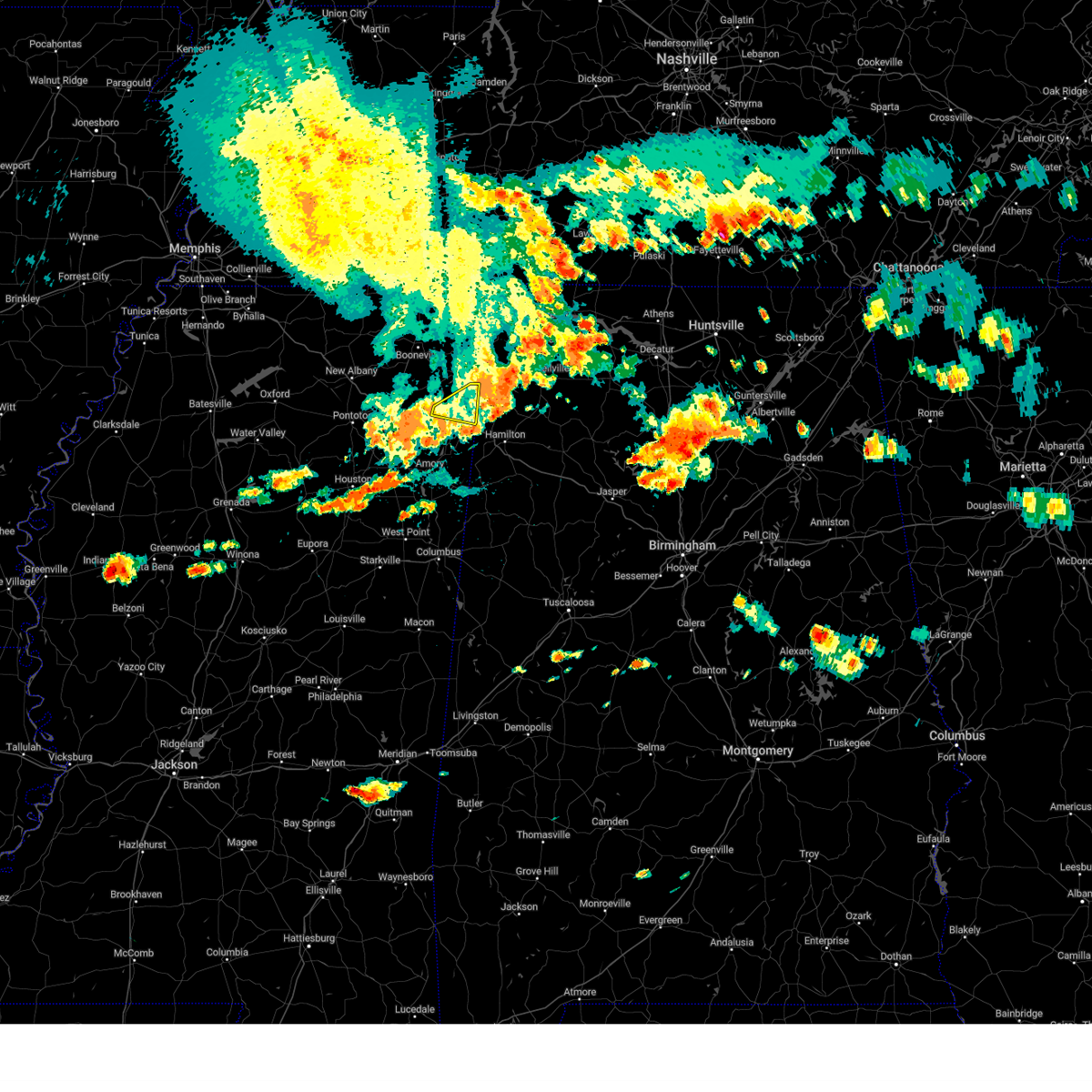 The severe thunderstorm warning for northern itawamba county will expire at 415 pm cdt, the storm which prompted the warning has weakened below severe limits, and has exited the warned area. therefore, the warning will be allowed to expire. however gusty winds are still possible with this thunderstorm. a severe thunderstorm watch remains in effect until 600 pm cdt for northeastern mississippi. The severe thunderstorm warning for northern itawamba county will expire at 415 pm cdt, the storm which prompted the warning has weakened below severe limits, and has exited the warned area. therefore, the warning will be allowed to expire. however gusty winds are still possible with this thunderstorm. a severe thunderstorm watch remains in effect until 600 pm cdt for northeastern mississippi.
|
| 7/21/2023 4:05 PM CDT |
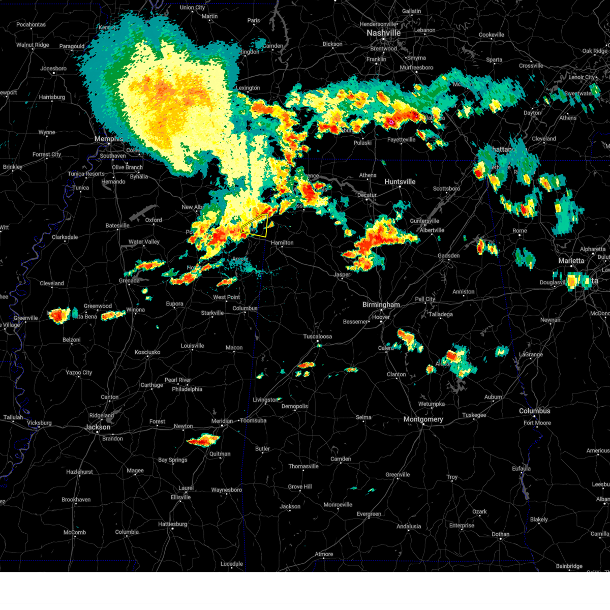 At 404 pm cdt, a severe thunderstorm was located near fairview, or near red bay, moving east at 30 mph (radar indicated). Hazards include 60 mph wind gusts. Expect damage to roofs, siding, and trees. locations impacted include, fulton, tremont, fairview, clay, eastman and bounds crossroads. hail threat, radar indicated max hail size, <. 75 in wind threat, radar indicated max wind gust, 60 mph. At 404 pm cdt, a severe thunderstorm was located near fairview, or near red bay, moving east at 30 mph (radar indicated). Hazards include 60 mph wind gusts. Expect damage to roofs, siding, and trees. locations impacted include, fulton, tremont, fairview, clay, eastman and bounds crossroads. hail threat, radar indicated max hail size, <. 75 in wind threat, radar indicated max wind gust, 60 mph.
|
| 7/21/2023 3:46 PM CDT |
 At 346 pm cdt, a severe thunderstorm was located over sandy springs, or 12 miles north of fulton, moving east at 30 mph (radar indicated). Hazards include 60 mph wind gusts and penny size hail. expect damage to roofs, siding, and trees At 346 pm cdt, a severe thunderstorm was located over sandy springs, or 12 miles north of fulton, moving east at 30 mph (radar indicated). Hazards include 60 mph wind gusts and penny size hail. expect damage to roofs, siding, and trees
|
| 7/18/2023 7:37 PM CDT |
 At 737 pm cdt, severe thunderstorms were located along a line extending from near leedy to near new harmony, moving southeast at 55 mph (radar indicated). Hazards include 60 mph wind gusts and penny size hail. expect damage to roofs, siding, and trees At 737 pm cdt, severe thunderstorms were located along a line extending from near leedy to near new harmony, moving southeast at 55 mph (radar indicated). Hazards include 60 mph wind gusts and penny size hail. expect damage to roofs, siding, and trees
|
| 7/18/2023 7:37 PM CDT |
 The severe thunderstorm warning for northeastern pontotoc, union, itawamba, lee, tippah, northeastern monroe, southeastern benton, southern tishomingo, prentiss and alcorn counties will expire at 745 pm cdt, the storms which prompted the warning have moved out of the area. therefore, the warning will be allowed to expire. a severe thunderstorm watch remains in effect until midnight cdt for northeastern and northwestern mississippi, and west tennessee. The severe thunderstorm warning for northeastern pontotoc, union, itawamba, lee, tippah, northeastern monroe, southeastern benton, southern tishomingo, prentiss and alcorn counties will expire at 745 pm cdt, the storms which prompted the warning have moved out of the area. therefore, the warning will be allowed to expire. a severe thunderstorm watch remains in effect until midnight cdt for northeastern and northwestern mississippi, and west tennessee.
|
| 7/18/2023 7:06 PM CDT |
 At 706 pm cdt, severe thunderstorms were located along a line extending from near big hill pond state park to pinedale, moving southeast at 90 mph (radar indicated). Hazards include 60 mph wind gusts and penny size hail. expect damage to roofs, siding, and trees At 706 pm cdt, severe thunderstorms were located along a line extending from near big hill pond state park to pinedale, moving southeast at 90 mph (radar indicated). Hazards include 60 mph wind gusts and penny size hail. expect damage to roofs, siding, and trees
|
| 7/14/2023 2:06 PM CDT |
 The severe thunderstorm warning for eastern chickasaw, itawamba, lee, monroe, tishomingo, prentiss and southeastern alcorn counties will expire at 215 pm cdt, the storms which prompted the warning have weakened below severe limits, and no longer pose an immediate threat to life or property. therefore, the warning will be allowed to expire. The severe thunderstorm warning for eastern chickasaw, itawamba, lee, monroe, tishomingo, prentiss and southeastern alcorn counties will expire at 215 pm cdt, the storms which prompted the warning have weakened below severe limits, and no longer pose an immediate threat to life or property. therefore, the warning will be allowed to expire.
|
| 7/14/2023 1:31 PM CDT |
 At 131 pm cdt, severe thunderstorms were located along a line extending from near thrashers to near pratts friendship to near houston, moving east at 35 mph (radar indicated). Hazards include 60 mph wind gusts. expect damage to roofs, siding, and trees At 131 pm cdt, severe thunderstorms were located along a line extending from near thrashers to near pratts friendship to near houston, moving east at 35 mph (radar indicated). Hazards include 60 mph wind gusts. expect damage to roofs, siding, and trees
|
| 6/25/2023 9:22 PM CDT |
 The severe thunderstorm warning for itawamba, lee, northeastern monroe, southwestern tishomingo and southeastern prentiss counties will expire at 930 pm cdt, the storm which prompted the warning has weakened below severe limits, and has exited the warned area. therefore, the warning will be allowed to expire. a severe thunderstorm watch remains in effect until 200 am cdt for northeastern mississippi. The severe thunderstorm warning for itawamba, lee, northeastern monroe, southwestern tishomingo and southeastern prentiss counties will expire at 930 pm cdt, the storm which prompted the warning has weakened below severe limits, and has exited the warned area. therefore, the warning will be allowed to expire. a severe thunderstorm watch remains in effect until 200 am cdt for northeastern mississippi.
|
| 6/25/2023 8:41 PM CDT |
 At 840 pm cdt, a severe thunderstorm was located near mantachie, or 9 miles north of tombigbee state park, moving southeast at 55 mph (radar indicated). Hazards include 70 mph wind gusts. Expect considerable tree damage. Damage is likely to mobile homes, roofs, and outbuildings. At 840 pm cdt, a severe thunderstorm was located near mantachie, or 9 miles north of tombigbee state park, moving southeast at 55 mph (radar indicated). Hazards include 70 mph wind gusts. Expect considerable tree damage. Damage is likely to mobile homes, roofs, and outbuildings.
|
| 6/25/2023 7:53 PM CDT |
 At 753 pm cdt, a severe thunderstorm was located near ripley, moving southeast at 65 mph (radar indicated). Hazards include 70 mph wind gusts. Expect considerable tree damage. Damage is likely to mobile homes, roofs, and outbuildings. At 753 pm cdt, a severe thunderstorm was located near ripley, moving southeast at 65 mph (radar indicated). Hazards include 70 mph wind gusts. Expect considerable tree damage. Damage is likely to mobile homes, roofs, and outbuildings.
|
| 6/18/2023 6:53 AM CDT |
 At 653 am cdt, a severe thunderstorm was located over guntown, or near baldwyn, moving east at 45 mph (radar indicated). Hazards include 60 mph wind gusts and penny size hail. expect damage to roofs, siding, and trees At 653 am cdt, a severe thunderstorm was located over guntown, or near baldwyn, moving east at 45 mph (radar indicated). Hazards include 60 mph wind gusts and penny size hail. expect damage to roofs, siding, and trees
|
| 6/14/2023 12:24 PM CDT |
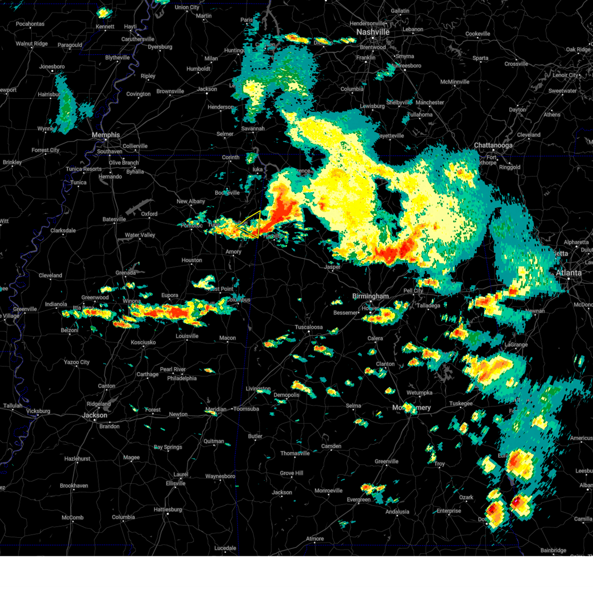 The severe thunderstorm warning for northeastern itawamba county will expire at 1230 pm cdt, the storm which prompted the warning has moved out of the area. therefore, the warning will be allowed to expire. a severe thunderstorm watch remains in effect until 200 pm cdt for northeastern mississippi. The severe thunderstorm warning for northeastern itawamba county will expire at 1230 pm cdt, the storm which prompted the warning has moved out of the area. therefore, the warning will be allowed to expire. a severe thunderstorm watch remains in effect until 200 pm cdt for northeastern mississippi.
|
| 6/14/2023 12:13 PM CDT | Large trees down. time estimated by rada in itawamba county MS, 0.3 miles ENE of Tremont, MS |
| 6/14/2023 12:12 PM CDT |
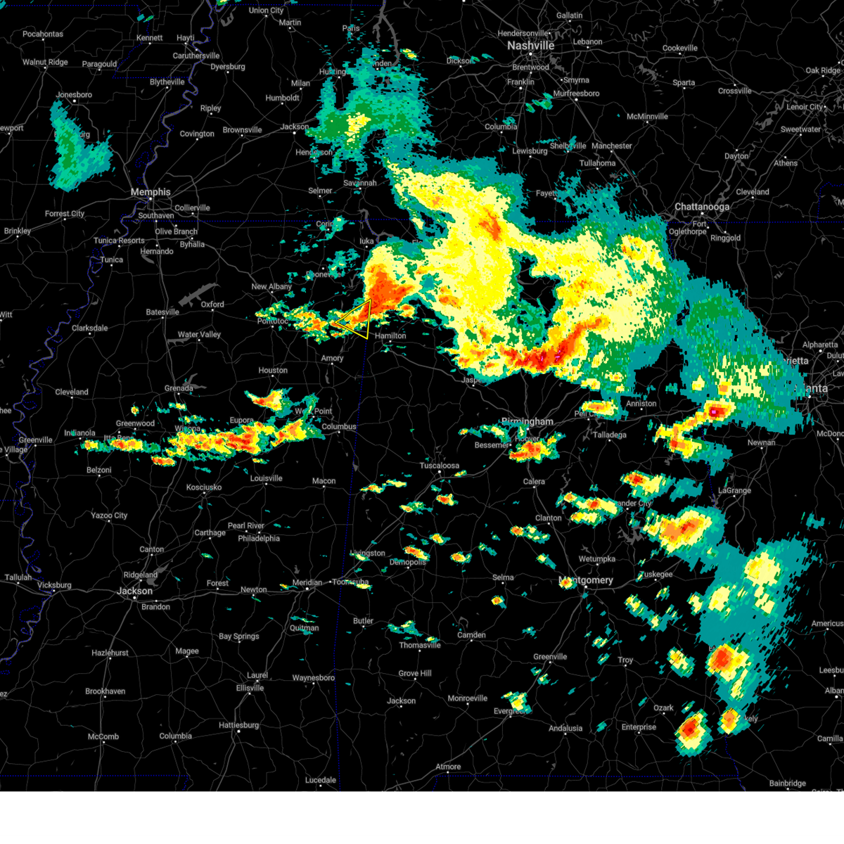 At 1212 pm cdt, a severe thunderstorm was located near tremont, or 10 miles south of red bay, moving southeast at 50 mph (radar indicated). Hazards include 60 mph wind gusts. Expect damage to roofs, siding, and trees. locations impacted include, fulton, tremont, clay, eastman and bounds crossroads. hail threat, radar indicated max hail size, <. 75 in wind threat, radar indicated max wind gust, 60 mph. At 1212 pm cdt, a severe thunderstorm was located near tremont, or 10 miles south of red bay, moving southeast at 50 mph (radar indicated). Hazards include 60 mph wind gusts. Expect damage to roofs, siding, and trees. locations impacted include, fulton, tremont, clay, eastman and bounds crossroads. hail threat, radar indicated max hail size, <. 75 in wind threat, radar indicated max wind gust, 60 mph.
|
| 6/14/2023 11:54 AM CDT |
 At 1154 am cdt, a severe thunderstorm was located near sandy springs, or 8 miles north of fulton, moving southeast at 50 mph (radar indicated). Hazards include 60 mph wind gusts and penny size hail. expect damage to roofs, siding, and trees At 1154 am cdt, a severe thunderstorm was located near sandy springs, or 8 miles north of fulton, moving southeast at 50 mph (radar indicated). Hazards include 60 mph wind gusts and penny size hail. expect damage to roofs, siding, and trees
|
| 3/24/2023 11:12 PM CDT |
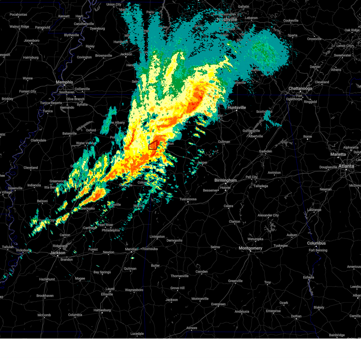 At 1112 pm cdt, a confirmed large and extremely dangerous tornado was located near tremont, or 11 miles southeast of fulton, moving northeast at 60 mph. this is a particularly dangerous situation. take cover now! (radar confirmed tornado). Hazards include damaging tornado. You are in a life-threatening situation. flying debris may be deadly to those caught without shelter. mobile homes will be destroyed. Considerable damage to homes, businesses, and vehicles is likely and complete destruction is possible. At 1112 pm cdt, a confirmed large and extremely dangerous tornado was located near tremont, or 11 miles southeast of fulton, moving northeast at 60 mph. this is a particularly dangerous situation. take cover now! (radar confirmed tornado). Hazards include damaging tornado. You are in a life-threatening situation. flying debris may be deadly to those caught without shelter. mobile homes will be destroyed. Considerable damage to homes, businesses, and vehicles is likely and complete destruction is possible.
|
| 3/24/2023 10:29 PM CDT |
 At 1028 pm cdt, a severe thunderstorm was located over trebloc, or 7 miles southeast of houston, moving east at 55 mph (radar indicated). Hazards include 60 mph wind gusts and nickel size hail. expect damage to roofs, siding, and trees At 1028 pm cdt, a severe thunderstorm was located over trebloc, or 7 miles southeast of houston, moving east at 55 mph (radar indicated). Hazards include 60 mph wind gusts and nickel size hail. expect damage to roofs, siding, and trees
|
| 1/3/2023 10:32 AM CST |
 At 1032 am cst, severe thunderstorms were located along a line extending from belmont to near tremont to near new salem, moving east at 40 mph (radar indicated). Hazards include 60 mph wind gusts. Expect damage to roofs, siding, and trees. Locations impacted include, amory, fulton, belmont, shannon, mantachie, smithville, tremont, fairview, new salem, sandy springs, evergreen, clay, nettleton, golden, abney, eastman, turon, ballardsville, cardsville and tilden. At 1032 am cst, severe thunderstorms were located along a line extending from belmont to near tremont to near new salem, moving east at 40 mph (radar indicated). Hazards include 60 mph wind gusts. Expect damage to roofs, siding, and trees. Locations impacted include, amory, fulton, belmont, shannon, mantachie, smithville, tremont, fairview, new salem, sandy springs, evergreen, clay, nettleton, golden, abney, eastman, turon, ballardsville, cardsville and tilden.
|
| 1/3/2023 9:59 AM CST |
 At 959 am cst, severe thunderstorms were located along a line extending from near pratts friendship to near tombigbee state park to near okolona, moving east at 45 mph (radar indicated). Hazards include 60 mph wind gusts. expect damage to roofs, siding, and trees At 959 am cst, severe thunderstorms were located along a line extending from near pratts friendship to near tombigbee state park to near okolona, moving east at 45 mph (radar indicated). Hazards include 60 mph wind gusts. expect damage to roofs, siding, and trees
|
| 10/12/2022 7:08 PM CDT |
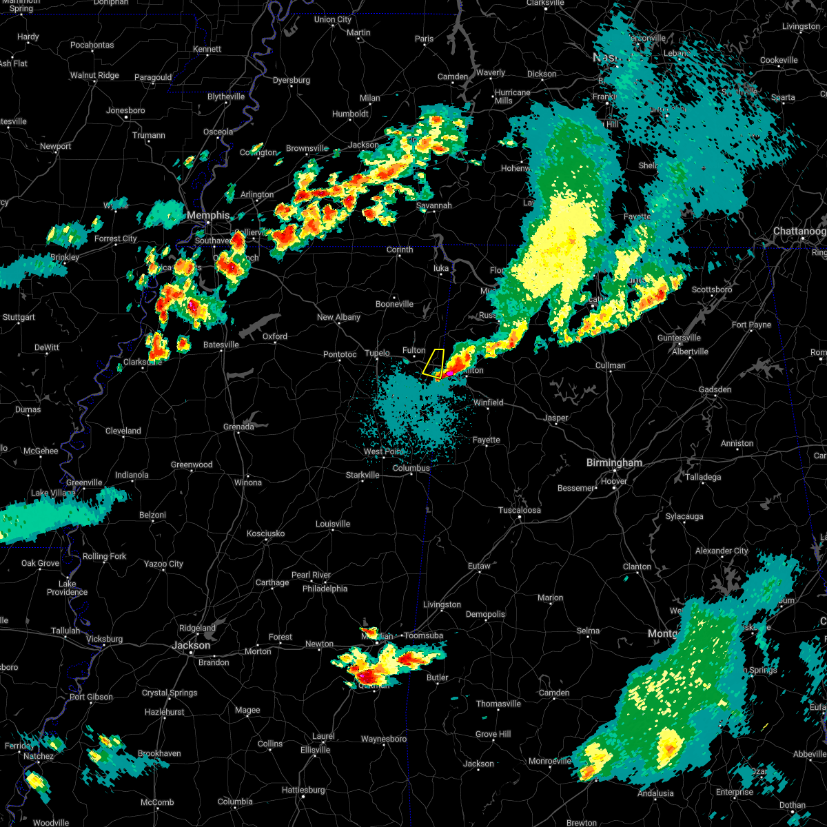 The severe thunderstorm warning for southeastern itawamba county will expire at 715 pm cdt, the storm which prompted the warning has moved out of the area. therefore, the warning will be allowed to expire. a severe thunderstorm watch remains in effect until 1000 pm cdt for northeastern mississippi. The severe thunderstorm warning for southeastern itawamba county will expire at 715 pm cdt, the storm which prompted the warning has moved out of the area. therefore, the warning will be allowed to expire. a severe thunderstorm watch remains in effect until 1000 pm cdt for northeastern mississippi.
|
| 10/12/2022 6:53 PM CDT |
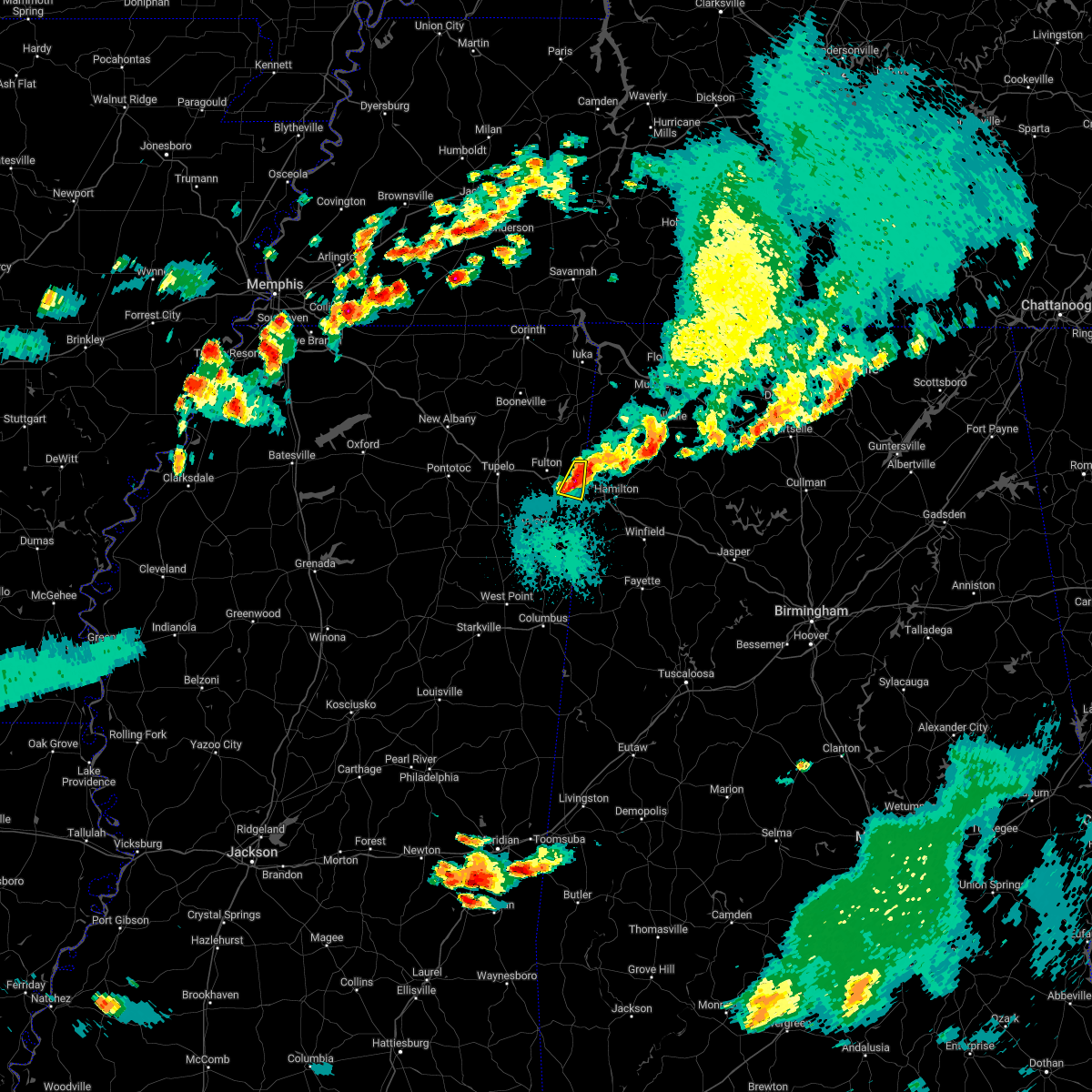 At 653 pm cdt, a severe thunderstorm was located over tremont, or 11 miles east of fulton, moving east at 30 mph (radar indicated). Hazards include ping pong ball size hail. People and animals outdoors will be injured. expect damage to roofs, siding, windows, and vehicles. locations impacted include, tremont and cadamy. hail threat, radar indicated max hail size, 1. 50 in wind threat, radar indicated max wind gust, <50 mph. At 653 pm cdt, a severe thunderstorm was located over tremont, or 11 miles east of fulton, moving east at 30 mph (radar indicated). Hazards include ping pong ball size hail. People and animals outdoors will be injured. expect damage to roofs, siding, windows, and vehicles. locations impacted include, tremont and cadamy. hail threat, radar indicated max hail size, 1. 50 in wind threat, radar indicated max wind gust, <50 mph.
|
| 10/12/2022 6:35 PM CDT |
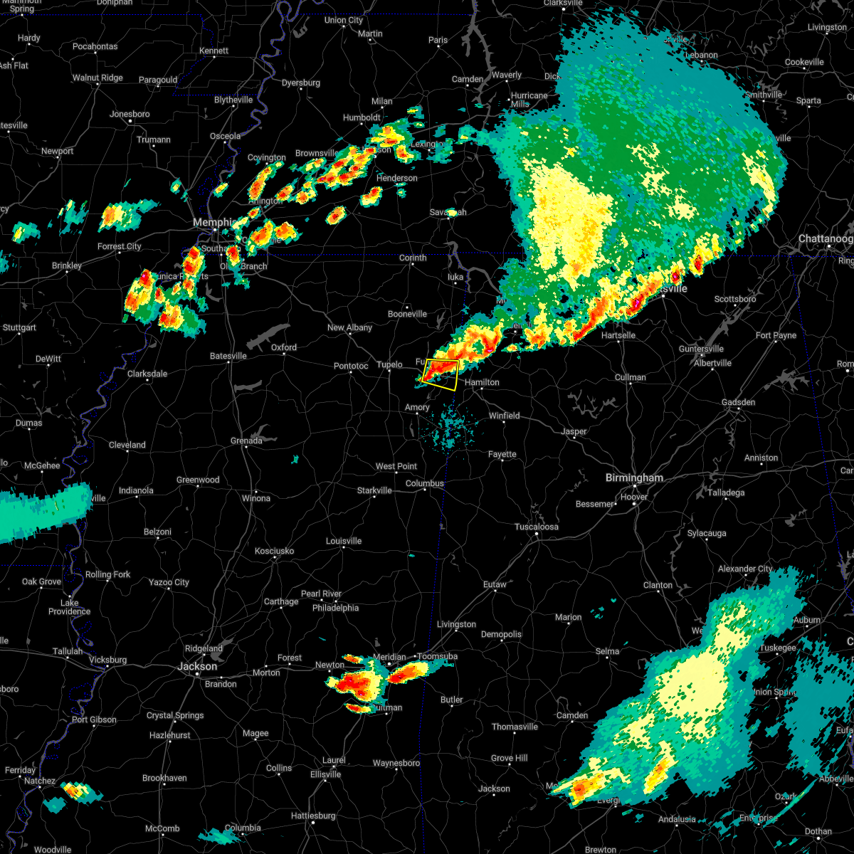 At 634 pm cdt, a severe thunderstorm was located over fulton, moving east at 25 mph (radar indicated). Hazards include ping pong ball size hail. People and animals outdoors will be injured. Expect damage to roofs, siding, windows, and vehicles. At 634 pm cdt, a severe thunderstorm was located over fulton, moving east at 25 mph (radar indicated). Hazards include ping pong ball size hail. People and animals outdoors will be injured. Expect damage to roofs, siding, windows, and vehicles.
|
| 7/9/2022 5:10 PM CDT |
 The severe thunderstorm warning for southern itawamba, southeastern lee and north central monroe counties will expire at 515 pm cdt, the storm which prompted the warning has weakened below severe limits, and no longer poses an immediate threat to life or property. therefore, the warning will be allowed to expire. a severe thunderstorm watch remains in effect until 1000 pm cdt for northeastern mississippi. The severe thunderstorm warning for southern itawamba, southeastern lee and north central monroe counties will expire at 515 pm cdt, the storm which prompted the warning has weakened below severe limits, and no longer poses an immediate threat to life or property. therefore, the warning will be allowed to expire. a severe thunderstorm watch remains in effect until 1000 pm cdt for northeastern mississippi.
|
| 7/9/2022 4:51 PM CDT |
 At 451 pm cdt, a severe thunderstorm was located near tombigbee state park, moving southeast at 45 mph (radar indicated). Hazards include 60 mph wind gusts. expect damage to roofs, siding, and trees At 451 pm cdt, a severe thunderstorm was located near tombigbee state park, moving southeast at 45 mph (radar indicated). Hazards include 60 mph wind gusts. expect damage to roofs, siding, and trees
|
| 6/17/2022 2:01 PM CDT |
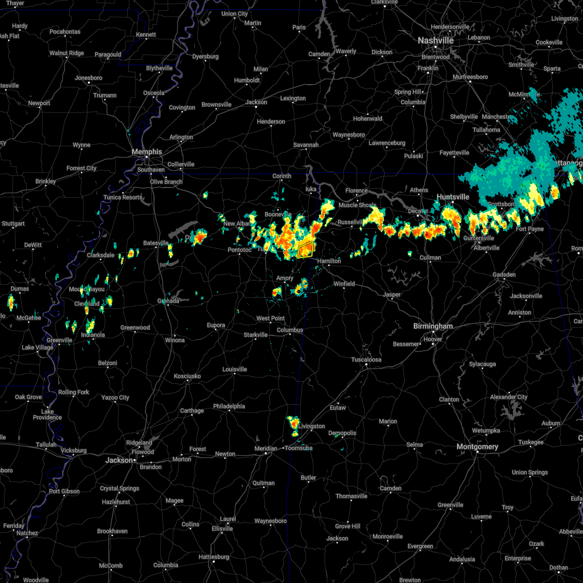 At 201 pm cdt, a severe thunderstorm was located over tremont, or 10 miles east of fulton, moving south at 15 mph (radar indicated). Hazards include quarter size hail. Damage to vehicles is expected. locations impacted include, tremont, eastman and bounds crossroads. hail threat, radar indicated max hail size, 1. 00 in wind threat, radar indicated max wind gust, <50 mph. At 201 pm cdt, a severe thunderstorm was located over tremont, or 10 miles east of fulton, moving south at 15 mph (radar indicated). Hazards include quarter size hail. Damage to vehicles is expected. locations impacted include, tremont, eastman and bounds crossroads. hail threat, radar indicated max hail size, 1. 00 in wind threat, radar indicated max wind gust, <50 mph.
|
| 6/17/2022 1:35 PM CDT |
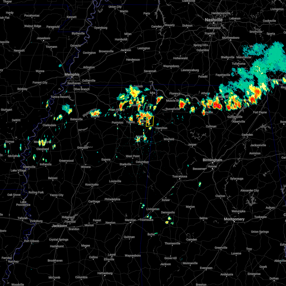 At 134 pm cdt, a severe thunderstorm was located over fairview, or 9 miles southwest of red bay, moving south at 10 mph (radar indicated). Hazards include quarter size hail. damage to vehicles is expected At 134 pm cdt, a severe thunderstorm was located over fairview, or 9 miles southwest of red bay, moving south at 10 mph (radar indicated). Hazards include quarter size hail. damage to vehicles is expected
|
| 5/25/2022 3:22 PM CDT |
 At 321 pm cdt, severe thunderstorms were located along a line extending from near sandy springs to near fairview to near tremont, moving northeast at 70 mph (radar indicated). Hazards include 70 mph wind gusts. Expect considerable tree damage. damage is likely to mobile homes, roofs, and outbuildings. locations impacted include, red bay, tishomingo state park, belmont, tremont, tishomingo, sandy springs, fairview, burton, clay, marietta, golden, paden, eastman, thrasher, turon, dennis, moores mill, bloody springs, kirkville and mingo. thunderstorm damage threat, considerable hail threat, radar indicated max hail size, <. 75 in wind threat, radar indicated max wind gust, 70 mph. At 321 pm cdt, severe thunderstorms were located along a line extending from near sandy springs to near fairview to near tremont, moving northeast at 70 mph (radar indicated). Hazards include 70 mph wind gusts. Expect considerable tree damage. damage is likely to mobile homes, roofs, and outbuildings. locations impacted include, red bay, tishomingo state park, belmont, tremont, tishomingo, sandy springs, fairview, burton, clay, marietta, golden, paden, eastman, thrasher, turon, dennis, moores mill, bloody springs, kirkville and mingo. thunderstorm damage threat, considerable hail threat, radar indicated max hail size, <. 75 in wind threat, radar indicated max wind gust, 70 mph.
|
| 5/25/2022 3:13 PM CDT |
 At 313 pm cdt, severe thunderstorms were located along a line extending from near mantachie to near fulton to near new salem, moving northeast at 70 mph (radar indicated). Hazards include 60 mph wind gusts. Expect damage to roofs, siding, and trees. locations impacted include, tupelo, fulton, red bay, tishomingo state park, belmont, mantachie, smithville, tremont, tishomingo, fairview, burton, new salem, sandy springs, clay, marietta, golden, paden, abney, eastman and thrasher. hail threat, radar indicated max hail size, <. 75 in wind threat, radar indicated max wind gust, 60 mph. At 313 pm cdt, severe thunderstorms were located along a line extending from near mantachie to near fulton to near new salem, moving northeast at 70 mph (radar indicated). Hazards include 60 mph wind gusts. Expect damage to roofs, siding, and trees. locations impacted include, tupelo, fulton, red bay, tishomingo state park, belmont, mantachie, smithville, tremont, tishomingo, fairview, burton, new salem, sandy springs, clay, marietta, golden, paden, abney, eastman and thrasher. hail threat, radar indicated max hail size, <. 75 in wind threat, radar indicated max wind gust, 60 mph.
|
| 5/25/2022 3:03 PM CDT |
 At 303 pm cdt, severe thunderstorms were located along a line extending from near tombigbee state park to near evergreen to near smithville, moving northeast at 60 mph (radar indicated). Hazards include 60 mph wind gusts. expect damage to roofs, siding, and trees At 303 pm cdt, severe thunderstorms were located along a line extending from near tombigbee state park to near evergreen to near smithville, moving northeast at 60 mph (radar indicated). Hazards include 60 mph wind gusts. expect damage to roofs, siding, and trees
|
| 5/1/2022 1:58 AM CDT |
 At 157 am cdt, a severe thunderstorm was located near evergreen, or near tombigbee state park, moving east at 35 mph (radar indicated). Hazards include 60 mph wind gusts and quarter size hail. Hail damage to vehicles is expected. expect wind damage to roofs, siding, and trees. locations impacted include, tupelo, fulton, verona, tombigbee state park, saltillo, shannon, plantersville, mantachie, tremont, fairview, new salem, sandy springs, evergreen, clay, nettleton, abney, eastman, mooreville, eggville and ballardsville. hail threat, radar indicated max hail size, 1. 00 in wind threat, radar indicated max wind gust, 60 mph. At 157 am cdt, a severe thunderstorm was located near evergreen, or near tombigbee state park, moving east at 35 mph (radar indicated). Hazards include 60 mph wind gusts and quarter size hail. Hail damage to vehicles is expected. expect wind damage to roofs, siding, and trees. locations impacted include, tupelo, fulton, verona, tombigbee state park, saltillo, shannon, plantersville, mantachie, tremont, fairview, new salem, sandy springs, evergreen, clay, nettleton, abney, eastman, mooreville, eggville and ballardsville. hail threat, radar indicated max hail size, 1. 00 in wind threat, radar indicated max wind gust, 60 mph.
|
| 5/1/2022 1:33 AM CDT |
 At 133 am cdt, a severe thunderstorm was located over tupelo, moving east at 35 mph (radar indicated). Hazards include 60 mph wind gusts and quarter size hail. Hail damage to vehicles is expected. Expect wind damage to roofs, siding, and trees. At 133 am cdt, a severe thunderstorm was located over tupelo, moving east at 35 mph (radar indicated). Hazards include 60 mph wind gusts and quarter size hail. Hail damage to vehicles is expected. Expect wind damage to roofs, siding, and trees.
|
| 4/13/2022 8:34 PM CDT |
 At 833 pm cdt, severe thunderstorms were located along a line extending from near tremont to near west point, moving southeast at 60 mph (radar indicated). Hazards include 60 mph wind gusts. Expect damage to roofs, siding, and trees. locations impacted include, amory, aberdeen, fulton, mantachie, smithville, tremont, prairie, fairview, new salem, sandy springs, new wren, evergreen, clay, nettleton, hatley, gattman, abney, eastman, quincy and turon. hail threat, radar indicated max hail size, <. 75 in wind threat, radar indicated max wind gust, 60 mph. At 833 pm cdt, severe thunderstorms were located along a line extending from near tremont to near west point, moving southeast at 60 mph (radar indicated). Hazards include 60 mph wind gusts. Expect damage to roofs, siding, and trees. locations impacted include, amory, aberdeen, fulton, mantachie, smithville, tremont, prairie, fairview, new salem, sandy springs, new wren, evergreen, clay, nettleton, hatley, gattman, abney, eastman, quincy and turon. hail threat, radar indicated max hail size, <. 75 in wind threat, radar indicated max wind gust, 60 mph.
|
| 4/13/2022 8:15 PM CDT |
 At 814 pm cdt, severe thunderstorms were located along a line extending from near sandy springs to near montpelier, moving southeast at 60 mph (radar indicated). Hazards include 60 mph wind gusts. expect damage to roofs, siding, and trees At 814 pm cdt, severe thunderstorms were located along a line extending from near sandy springs to near montpelier, moving southeast at 60 mph (radar indicated). Hazards include 60 mph wind gusts. expect damage to roofs, siding, and trees
|
| 4/13/2022 7:32 PM CDT |
 At 731 pm cdt, severe thunderstorms were located along a line extending from near jumpertown to near saltillo, moving east at 55 mph (radar indicated). Hazards include 70 mph wind gusts. Expect considerable tree damage. damage is likely to mobile homes, roofs, and outbuildings. locations impacted include, tupelo, booneville, pontotoc, fulton, baldwyn, red bay, trace state park, tombigbee state park, tishomingo state park, saltillo, guntown, belmont, mantachie, tremont, tishomingo, fairview, new harmony, pratts friendship, burton and wheeler. thunderstorm damage threat, considerable hail threat, radar indicated max hail size, <. 75 in wind threat, radar indicated max wind gust, 70 mph. At 731 pm cdt, severe thunderstorms were located along a line extending from near jumpertown to near saltillo, moving east at 55 mph (radar indicated). Hazards include 70 mph wind gusts. Expect considerable tree damage. damage is likely to mobile homes, roofs, and outbuildings. locations impacted include, tupelo, booneville, pontotoc, fulton, baldwyn, red bay, trace state park, tombigbee state park, tishomingo state park, saltillo, guntown, belmont, mantachie, tremont, tishomingo, fairview, new harmony, pratts friendship, burton and wheeler. thunderstorm damage threat, considerable hail threat, radar indicated max hail size, <. 75 in wind threat, radar indicated max wind gust, 70 mph.
|
| 4/13/2022 7:26 PM CDT |
 At 725 pm cdt, severe thunderstorms were located along a line extending from near jumpertown to near tupelo, moving east at 65 mph (radar indicated). Hazards include 70 mph wind gusts. Expect considerable tree damage. damage is likely to mobile homes, roofs, and outbuildings. locations impacted include, tupelo, booneville, pontotoc, fulton, baldwyn, red bay, trace state park, tombigbee state park, tishomingo state park, saltillo, guntown, belmont, mantachie, ecru, jumpertown, tremont, tishomingo, thrashers, fairview and new harmony. thunderstorm damage threat, considerable hail threat, radar indicated max hail size, <. 75 in wind threat, radar indicated max wind gust, 70 mph. At 725 pm cdt, severe thunderstorms were located along a line extending from near jumpertown to near tupelo, moving east at 65 mph (radar indicated). Hazards include 70 mph wind gusts. Expect considerable tree damage. damage is likely to mobile homes, roofs, and outbuildings. locations impacted include, tupelo, booneville, pontotoc, fulton, baldwyn, red bay, trace state park, tombigbee state park, tishomingo state park, saltillo, guntown, belmont, mantachie, ecru, jumpertown, tremont, tishomingo, thrashers, fairview and new harmony. thunderstorm damage threat, considerable hail threat, radar indicated max hail size, <. 75 in wind threat, radar indicated max wind gust, 70 mph.
|
| 4/13/2022 7:13 PM CDT |
 At 713 pm cdt, severe thunderstorms were located along a line extending from near blue mountain to near ecru, moving east at 55 mph (radar indicated). Hazards include 70 mph wind gusts. Expect considerable tree damage. Damage is likely to mobile homes, roofs, and outbuildings. At 713 pm cdt, severe thunderstorms were located along a line extending from near blue mountain to near ecru, moving east at 55 mph (radar indicated). Hazards include 70 mph wind gusts. Expect considerable tree damage. Damage is likely to mobile homes, roofs, and outbuildings.
|
| 3/30/2022 7:42 PM CDT |
 At 742 pm cdt, severe thunderstorms were located along a line extending from near red bay to near kolola springs, moving northeast at 60 mph (radar indicated). Hazards include 60 mph wind gusts. Expect damage to roofs, siding, and trees. Locations impacted include, amory, aberdeen, fulton, smithville, tremont, fairview, new salem, clay, hatley, gattman, eastman, quincy, turon, wise gap, sipsey fork, new hamilton, becker, cardsville, tilden and splunge. At 742 pm cdt, severe thunderstorms were located along a line extending from near red bay to near kolola springs, moving northeast at 60 mph (radar indicated). Hazards include 60 mph wind gusts. Expect damage to roofs, siding, and trees. Locations impacted include, amory, aberdeen, fulton, smithville, tremont, fairview, new salem, clay, hatley, gattman, eastman, quincy, turon, wise gap, sipsey fork, new hamilton, becker, cardsville, tilden and splunge.
|
| 3/30/2022 7:36 PM CDT |
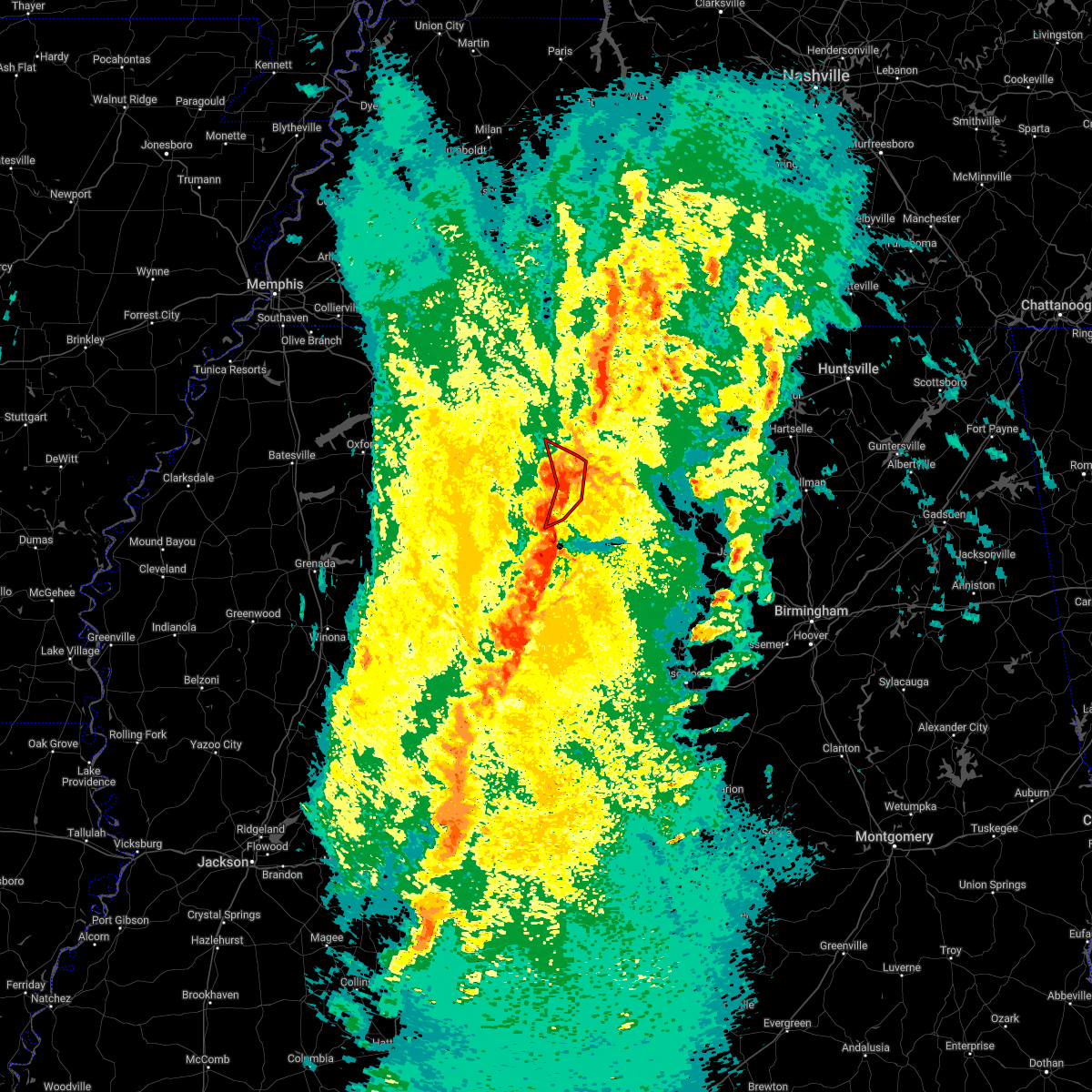 At 735 pm cdt, a severe thunderstorm producing a tornado was located near tremont, or 7 miles east of fulton, moving northeast at 60 mph (radar indicated rotation). Hazards include tornado and 60 mph wind gusts. Flying debris will be dangerous to those caught without shelter. mobile homes will be damaged or destroyed. damage to roofs, windows, and vehicles will occur. tree damage is likely. Locations impacted include, smithville, tremont, fairview, new salem, clay, eastman, turon, bounds crossroads and cadamy. At 735 pm cdt, a severe thunderstorm producing a tornado was located near tremont, or 7 miles east of fulton, moving northeast at 60 mph (radar indicated rotation). Hazards include tornado and 60 mph wind gusts. Flying debris will be dangerous to those caught without shelter. mobile homes will be damaged or destroyed. damage to roofs, windows, and vehicles will occur. tree damage is likely. Locations impacted include, smithville, tremont, fairview, new salem, clay, eastman, turon, bounds crossroads and cadamy.
|
| 3/30/2022 7:30 PM CDT | Vehicle trapped beneath trees and power lines on hwy 178 near nita lake road west of tremon in itawamba county MS, 0.4 miles WNW of Tremont, MS |
| 3/30/2022 7:22 PM CDT |
 At 721 pm cdt, severe thunderstorms were located along a line extending from near new salem to sessums, moving northeast at 60 mph (radar indicated). Hazards include 60 mph wind gusts. expect damage to roofs, siding, and trees At 721 pm cdt, severe thunderstorms were located along a line extending from near new salem to sessums, moving northeast at 60 mph (radar indicated). Hazards include 60 mph wind gusts. expect damage to roofs, siding, and trees
|
| 3/30/2022 7:11 PM CDT |
 At 711 pm cdt, a severe thunderstorm producing a tornado was located near amory, moving northeast at 60 mph (radar indicated rotation). Hazards include tornado. Flying debris will be dangerous to those caught without shelter. mobile homes will be damaged or destroyed. damage to roofs, windows, and vehicles will occur. Tree damage is likely. At 711 pm cdt, a severe thunderstorm producing a tornado was located near amory, moving northeast at 60 mph (radar indicated rotation). Hazards include tornado. Flying debris will be dangerous to those caught without shelter. mobile homes will be damaged or destroyed. damage to roofs, windows, and vehicles will occur. Tree damage is likely.
|
| 3/30/2022 7:07 PM CDT |
 At 707 pm cdt, severe thunderstorms were located along a line extending from near sandy springs to near smithville to 6 miles north of west point, moving northeast at 45 mph (radar indicated). Hazards include 70 mph wind gusts. Expect considerable tree damage. damage is likely to mobile homes, roofs, and outbuildings. Locations impacted include, amory, aberdeen, fulton, tombigbee state park, shannon, mantachie, smithville, tremont, prairie, fairview, new salem, sandy springs, new wren, evergreen, clay, nettleton, hatley, gattman, abney and eastman. At 707 pm cdt, severe thunderstorms were located along a line extending from near sandy springs to near smithville to 6 miles north of west point, moving northeast at 45 mph (radar indicated). Hazards include 70 mph wind gusts. Expect considerable tree damage. damage is likely to mobile homes, roofs, and outbuildings. Locations impacted include, amory, aberdeen, fulton, tombigbee state park, shannon, mantachie, smithville, tremont, prairie, fairview, new salem, sandy springs, new wren, evergreen, clay, nettleton, hatley, gattman, abney and eastman.
|
| 3/30/2022 6:37 PM CDT |
 At 636 pm cdt, severe thunderstorms were located along a line extending from near saltillo to near shannon to griffith, moving northeast at 55 mph (radar indicated). Hazards include 60 mph wind gusts. expect damage to roofs, siding, and trees At 636 pm cdt, severe thunderstorms were located along a line extending from near saltillo to near shannon to griffith, moving northeast at 55 mph (radar indicated). Hazards include 60 mph wind gusts. expect damage to roofs, siding, and trees
|
| 3/22/2022 4:00 PM CDT | Trees down near the city of tremon in itawamba county MS, 0.7 miles SSW of Tremont, MS |
| 3/22/2022 3:15 PM CDT |
 At 315 pm cdt, a tornado producing storm was located 7 miles northwest of kolola springs, or 7 miles northwest of columbus afb, moving northeast at 55 mph (radar confirmed tornado). Hazards include damaging tornado. Flying debris will be dangerous to those caught without shelter. mobile homes will be damaged or destroyed. damage to roofs, windows, and vehicles will occur. Tree damage is likely. At 315 pm cdt, a tornado producing storm was located 7 miles northwest of kolola springs, or 7 miles northwest of columbus afb, moving northeast at 55 mph (radar confirmed tornado). Hazards include damaging tornado. Flying debris will be dangerous to those caught without shelter. mobile homes will be damaged or destroyed. damage to roofs, windows, and vehicles will occur. Tree damage is likely.
|
| 3/22/2022 2:55 PM CDT |
 At 252 pm cdt, severe thunderstorms were located along a line extending from near okolona to near prairie to near griffith, moving northeast at 40 mph (radar indicated). Hazards include 60 mph wind gusts. expect damage to roofs, siding, and trees At 252 pm cdt, severe thunderstorms were located along a line extending from near okolona to near prairie to near griffith, moving northeast at 40 mph (radar indicated). Hazards include 60 mph wind gusts. expect damage to roofs, siding, and trees
|
| 6/13/2021 12:46 PM CDT |
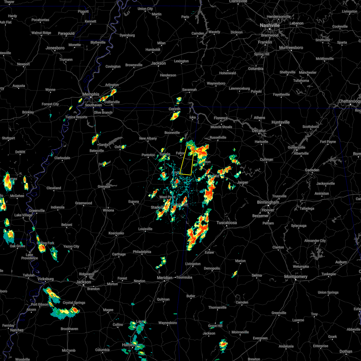 At 1246 pm cdt, a severe thunderstorm was located near fairview, or 8 miles southwest of red bay, moving south at 45 mph (radar indicated). Hazards include quarter size hail. damage to vehicles is expected At 1246 pm cdt, a severe thunderstorm was located near fairview, or 8 miles southwest of red bay, moving south at 45 mph (radar indicated). Hazards include quarter size hail. damage to vehicles is expected
|
| 5/9/2021 8:04 PM CDT |
 At 804 pm cdt, a severe thunderstorm was located near amory, moving southeast at 65 mph (radar indicated). Hazards include 60 mph wind gusts. Expect damage to roofs, siding, and trees. Locations impacted include, tupelo, amory, aberdeen, fulton, verona, okolona, tombigbee state park, shannon, plantersville, mantachie, smithville, tremont, prairie, fairview, new salem, new wren, houlka, evergreen, clay and nettleton. At 804 pm cdt, a severe thunderstorm was located near amory, moving southeast at 65 mph (radar indicated). Hazards include 60 mph wind gusts. Expect damage to roofs, siding, and trees. Locations impacted include, tupelo, amory, aberdeen, fulton, verona, okolona, tombigbee state park, shannon, plantersville, mantachie, smithville, tremont, prairie, fairview, new salem, new wren, houlka, evergreen, clay and nettleton.
|
| 5/9/2021 7:28 PM CDT |
 At 724 pm cdt, a severe thunderstorm was located over pontotoc, moving southeast at 45 mph (radar indicated). Hazards include 60 mph wind gusts and quarter size hail. Hail damage to vehicles is expected. Expect wind damage to roofs, siding, and trees. At 724 pm cdt, a severe thunderstorm was located over pontotoc, moving southeast at 45 mph (radar indicated). Hazards include 60 mph wind gusts and quarter size hail. Hail damage to vehicles is expected. Expect wind damage to roofs, siding, and trees.
|
| 5/6/2021 6:02 PM CDT |
 At 559 pm cdt, severe thunderstorms were located along a line extending from near haleyville to near amory to 6 miles west of houlka, moving southeast at 70 mph (radar indicated). Hazards include 60 mph wind gusts. Expect damage to roofs, siding, and trees. wind gust of 60 mph reported at the tupelo airport. Locations impacted include, tupelo, oxford, amory, pontotoc, aberdeen, fulton, houston, water valley, verona, okolona, trace state park, holly springs national forest, tombigbee state park, saltillo, guntown, bruce, calhoun city, shannon, vardaman and plantersville. At 559 pm cdt, severe thunderstorms were located along a line extending from near haleyville to near amory to 6 miles west of houlka, moving southeast at 70 mph (radar indicated). Hazards include 60 mph wind gusts. Expect damage to roofs, siding, and trees. wind gust of 60 mph reported at the tupelo airport. Locations impacted include, tupelo, oxford, amory, pontotoc, aberdeen, fulton, houston, water valley, verona, okolona, trace state park, holly springs national forest, tombigbee state park, saltillo, guntown, bruce, calhoun city, shannon, vardaman and plantersville.
|
| 5/6/2021 5:24 PM CDT |
 At 523 pm cdt, severe thunderstorms were located along a line extending from near cherokee to near keownville to near harmontown, moving southeast at 70 mph (radar indicated). Hazards include 60 mph wind gusts. expect damage to roofs, siding, and trees At 523 pm cdt, severe thunderstorms were located along a line extending from near cherokee to near keownville to near harmontown, moving southeast at 70 mph (radar indicated). Hazards include 60 mph wind gusts. expect damage to roofs, siding, and trees
|
| 5/4/2021 3:37 PM CDT |
 The severe thunderstorm warning for itawamba and southeastern lee counties will expire at 345 pm cdt, the storm which prompted the warning has weakened below severe limits, and no longer poses an immediate threat to life or property. therefore, the warning will be allowed to expire. however gusty winds are still possible with this thunderstorm. a severe thunderstorm watch remains in effect until 700 pm cdt for northeastern mississippi. The severe thunderstorm warning for itawamba and southeastern lee counties will expire at 345 pm cdt, the storm which prompted the warning has weakened below severe limits, and no longer poses an immediate threat to life or property. therefore, the warning will be allowed to expire. however gusty winds are still possible with this thunderstorm. a severe thunderstorm watch remains in effect until 700 pm cdt for northeastern mississippi.
|
| 5/4/2021 3:17 PM CDT |
 At 317 pm cdt, a severe thunderstorm was located near mantachie, or near fulton, moving east at 45 mph (radar indicated). Hazards include 60 mph wind gusts. expect damage to roofs, siding, and trees At 317 pm cdt, a severe thunderstorm was located near mantachie, or near fulton, moving east at 45 mph (radar indicated). Hazards include 60 mph wind gusts. expect damage to roofs, siding, and trees
|
| 4/9/2021 9:51 PM CDT |
 The severe thunderstorm warning for itawamba, southern lee and monroe counties will expire at 1000 pm cdt, the storms which prompted the warning have moved out of the area. therefore, the warning will be allowed to expire. a severe thunderstorm watch remains in effect until 1100 pm cdt for northeastern mississippi. The severe thunderstorm warning for itawamba, southern lee and monroe counties will expire at 1000 pm cdt, the storms which prompted the warning have moved out of the area. therefore, the warning will be allowed to expire. a severe thunderstorm watch remains in effect until 1100 pm cdt for northeastern mississippi.
|
| 4/9/2021 9:09 PM CDT |
 At 909 pm cdt, severe thunderstorms were located along a line extending from near verona to near new wren to near pala alto, moving east at 50 mph. these are very dangerous storms (radar indicated). Hazards include 80 mph wind gusts. Flying debris will be dangerous to those caught without shelter. mobile homes will be heavily damaged. expect considerable damage to roofs, windows, and vehicles. Extensive tree damage and power outages are likely. At 909 pm cdt, severe thunderstorms were located along a line extending from near verona to near new wren to near pala alto, moving east at 50 mph. these are very dangerous storms (radar indicated). Hazards include 80 mph wind gusts. Flying debris will be dangerous to those caught without shelter. mobile homes will be heavily damaged. expect considerable damage to roofs, windows, and vehicles. Extensive tree damage and power outages are likely.
|
| 4/8/2021 4:43 AM CDT |
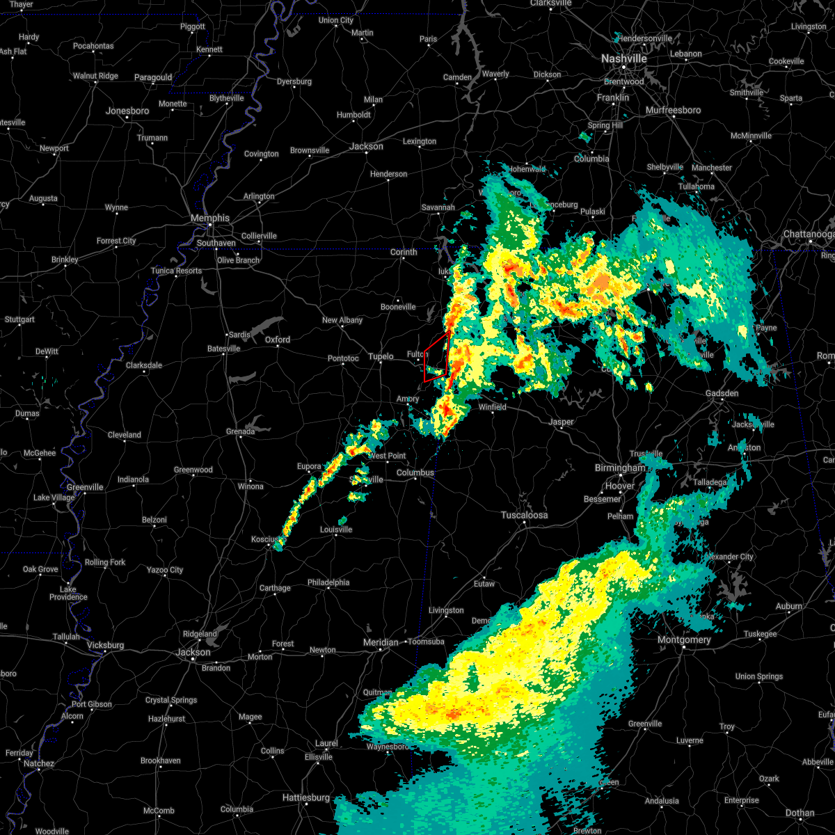 The tornado warning for eastern itawamba county will expire at 445 am cdt, the storm which prompted the warning has weakened below severe limits, and has exited the warned area. therefore, the warning will be allowed to expire. The tornado warning for eastern itawamba county will expire at 445 am cdt, the storm which prompted the warning has weakened below severe limits, and has exited the warned area. therefore, the warning will be allowed to expire.
|
| 4/8/2021 4:24 AM CDT |
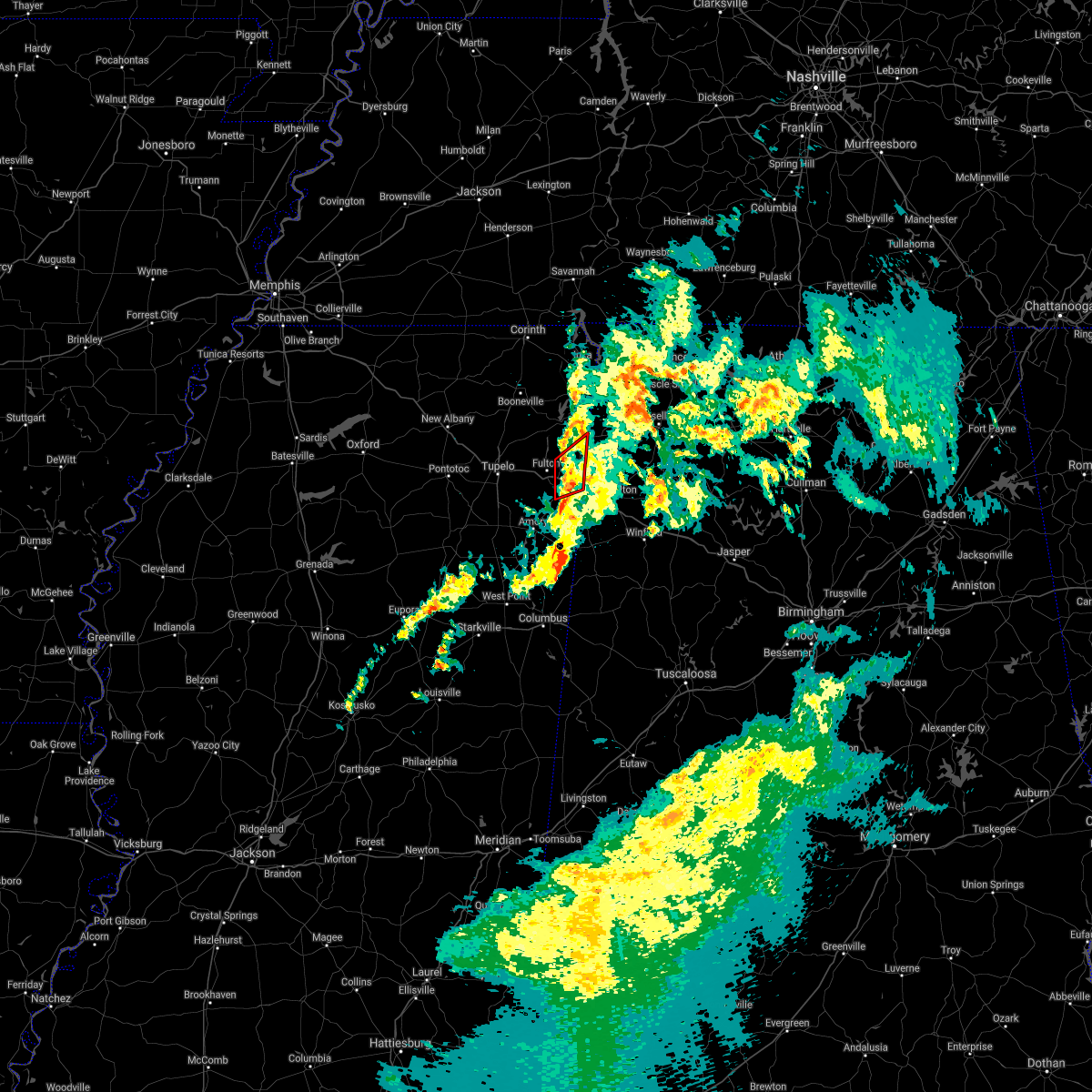 At 424 am cdt, doppler radar indicated a severe thunderstorm producing a tornado was located near fairview, or 7 miles northeast of fulton, moving northeast at 25 mph (radar indicated rotation). Hazards include tornado. Flying debris will be dangerous to those caught without shelter. mobile homes will be damaged or destroyed. damage to roofs, windows, and vehicles will occur. tree damage is likely. Locations impacted include, tremont, new salem, clay, eastman, tilden, bounds crossroads and cadamy. At 424 am cdt, doppler radar indicated a severe thunderstorm producing a tornado was located near fairview, or 7 miles northeast of fulton, moving northeast at 25 mph (radar indicated rotation). Hazards include tornado. Flying debris will be dangerous to those caught without shelter. mobile homes will be damaged or destroyed. damage to roofs, windows, and vehicles will occur. tree damage is likely. Locations impacted include, tremont, new salem, clay, eastman, tilden, bounds crossroads and cadamy.
|
| 4/8/2021 4:08 AM CDT |
 At 407 am cdt, doppler radar indicated a severe thunderstorm producing a tornado was located near fulton, moving northeast at 25 mph (radar indicated rotation). Hazards include tornado. Flying debris will be dangerous to those caught without shelter. mobile homes will be damaged or destroyed. damage to roofs, windows, and vehicles will occur. tree damage is likely. Locations impacted include, fulton, tremont, new salem, clay, abney, eastman, cardsville, tilden, bounds crossroads, jacinto and cadamy. At 407 am cdt, doppler radar indicated a severe thunderstorm producing a tornado was located near fulton, moving northeast at 25 mph (radar indicated rotation). Hazards include tornado. Flying debris will be dangerous to those caught without shelter. mobile homes will be damaged or destroyed. damage to roofs, windows, and vehicles will occur. tree damage is likely. Locations impacted include, fulton, tremont, new salem, clay, abney, eastman, cardsville, tilden, bounds crossroads, jacinto and cadamy.
|
| 4/8/2021 3:56 AM CDT |
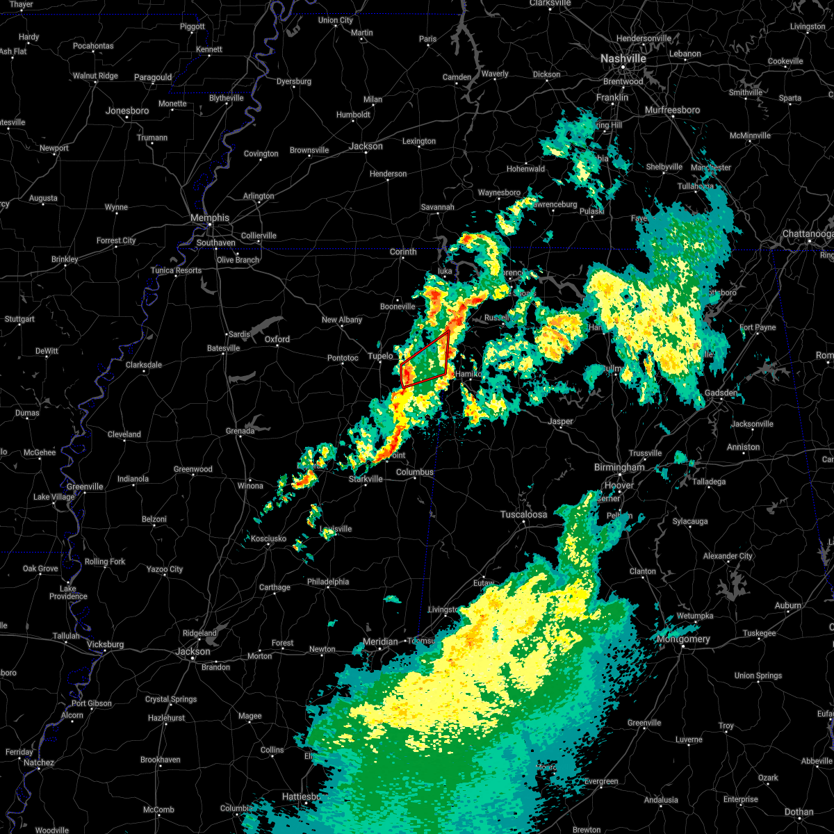 At 356 am cdt, doppler radar indicated a severe thunderstorm producing a tornado was located over evergreen, or 8 miles southwest of fulton, moving northeast at 25 mph (radar indicated rotation). Hazards include tornado. Flying debris will be dangerous to those caught without shelter. mobile homes will be damaged or destroyed. damage to roofs, windows, and vehicles will occur. Tree damage is likely. At 356 am cdt, doppler radar indicated a severe thunderstorm producing a tornado was located over evergreen, or 8 miles southwest of fulton, moving northeast at 25 mph (radar indicated rotation). Hazards include tornado. Flying debris will be dangerous to those caught without shelter. mobile homes will be damaged or destroyed. damage to roofs, windows, and vehicles will occur. Tree damage is likely.
|
| 3/28/2021 2:30 AM CDT |
 At 230 am cdt, a severe thunderstorm was located near evergreen, or near tombigbee state park, moving east at 60 mph (radar indicated). Hazards include 60 mph wind gusts. expect damage to roofs, siding, and trees At 230 am cdt, a severe thunderstorm was located near evergreen, or near tombigbee state park, moving east at 60 mph (radar indicated). Hazards include 60 mph wind gusts. expect damage to roofs, siding, and trees
|
| 3/28/2021 2:23 AM CDT |
 At 222 am cdt, a severe thunderstorm was located near fulton, moving east at 60 mph (radar indicated). Hazards include 60 mph wind gusts. Expect damage to roofs, siding, and trees. Locations impacted include, tupelo, fulton, verona, tombigbee state park, shannon, plantersville, smithville, tremont, new salem, evergreen, clay, nettleton, abney, turon, ballardsville, old union, cardsville, tilden, palmetto and bissell. At 222 am cdt, a severe thunderstorm was located near fulton, moving east at 60 mph (radar indicated). Hazards include 60 mph wind gusts. Expect damage to roofs, siding, and trees. Locations impacted include, tupelo, fulton, verona, tombigbee state park, shannon, plantersville, smithville, tremont, new salem, evergreen, clay, nettleton, abney, turon, ballardsville, old union, cardsville, tilden, palmetto and bissell.
|
| 3/28/2021 1:47 AM CDT |
 At 147 am cdt, a severe thunderstorm was located 7 miles north of houlka, or 7 miles south of pontotoc, moving east at 60 mph (radar indicated). Hazards include 60 mph wind gusts. expect damage to roofs, siding, and trees At 147 am cdt, a severe thunderstorm was located 7 miles north of houlka, or 7 miles south of pontotoc, moving east at 60 mph (radar indicated). Hazards include 60 mph wind gusts. expect damage to roofs, siding, and trees
|
| 3/17/2021 8:04 PM CDT |
 At 804 pm cdt, a severe thunderstorm was located near pratts friendship, or 8 miles southeast of baldwyn, moving northeast at 60 mph (radar indicated). Hazards include 60 mph wind gusts. Expect damage to roofs, siding, and trees. Locations impacted include, tupelo, fulton, baldwyn, red bay, tombigbee state park, guntown, belmont, plantersville, mantachie, tremont, fairview, wheeler, pratts friendship, sandy springs, clay, marietta, golden, eastman, thrasher and dennis. At 804 pm cdt, a severe thunderstorm was located near pratts friendship, or 8 miles southeast of baldwyn, moving northeast at 60 mph (radar indicated). Hazards include 60 mph wind gusts. Expect damage to roofs, siding, and trees. Locations impacted include, tupelo, fulton, baldwyn, red bay, tombigbee state park, guntown, belmont, plantersville, mantachie, tremont, fairview, wheeler, pratts friendship, sandy springs, clay, marietta, golden, eastman, thrasher and dennis.
|
| 3/17/2021 7:46 PM CDT |
 At 746 pm cdt, a severe thunderstorm was located over new wren, or 8 miles southeast of okolona, moving northeast at 35 mph (radar indicated). Hazards include 60 mph wind gusts. Expect damage to roofs, siding, and trees. Locations impacted include, amory, aberdeen, fulton, verona, shannon, smithville, tremont, new salem, new wren, evergreen, nettleton, hatley, gattman, abney, quincy, turon, wise gap, wren, old union and sipsey fork. At 746 pm cdt, a severe thunderstorm was located over new wren, or 8 miles southeast of okolona, moving northeast at 35 mph (radar indicated). Hazards include 60 mph wind gusts. Expect damage to roofs, siding, and trees. Locations impacted include, amory, aberdeen, fulton, verona, shannon, smithville, tremont, new salem, new wren, evergreen, nettleton, hatley, gattman, abney, quincy, turon, wise gap, wren, old union and sipsey fork.
|
| 3/17/2021 7:44 PM CDT |
 At 744 pm cdt, a severe thunderstorm was located over plantersville, or near verona, moving northeast at 55 mph (radar indicated). Hazards include 60 mph wind gusts. expect damage to roofs, siding, and trees At 744 pm cdt, a severe thunderstorm was located over plantersville, or near verona, moving northeast at 55 mph (radar indicated). Hazards include 60 mph wind gusts. expect damage to roofs, siding, and trees
|
| 3/17/2021 7:17 PM CDT |
 At 717 pm cdt, a severe thunderstorm was located over trebloc, or 7 miles southeast of houston, moving northeast at 35 mph (radar indicated). Hazards include 60 mph wind gusts. expect damage to roofs, siding, and trees At 717 pm cdt, a severe thunderstorm was located over trebloc, or 7 miles southeast of houston, moving northeast at 35 mph (radar indicated). Hazards include 60 mph wind gusts. expect damage to roofs, siding, and trees
|
| 3/17/2021 7:11 PM CDT |
 The severe thunderstorm warning for southeastern itawamba county will expire at 715 pm cdt, the storm which prompted the warning has moved out of the area. therefore, the warning will be allowed to expire. a tornado watch remains in effect until midnight cdt for northeastern mississippi. The severe thunderstorm warning for southeastern itawamba county will expire at 715 pm cdt, the storm which prompted the warning has moved out of the area. therefore, the warning will be allowed to expire. a tornado watch remains in effect until midnight cdt for northeastern mississippi.
|
| 3/17/2021 6:53 PM CDT |
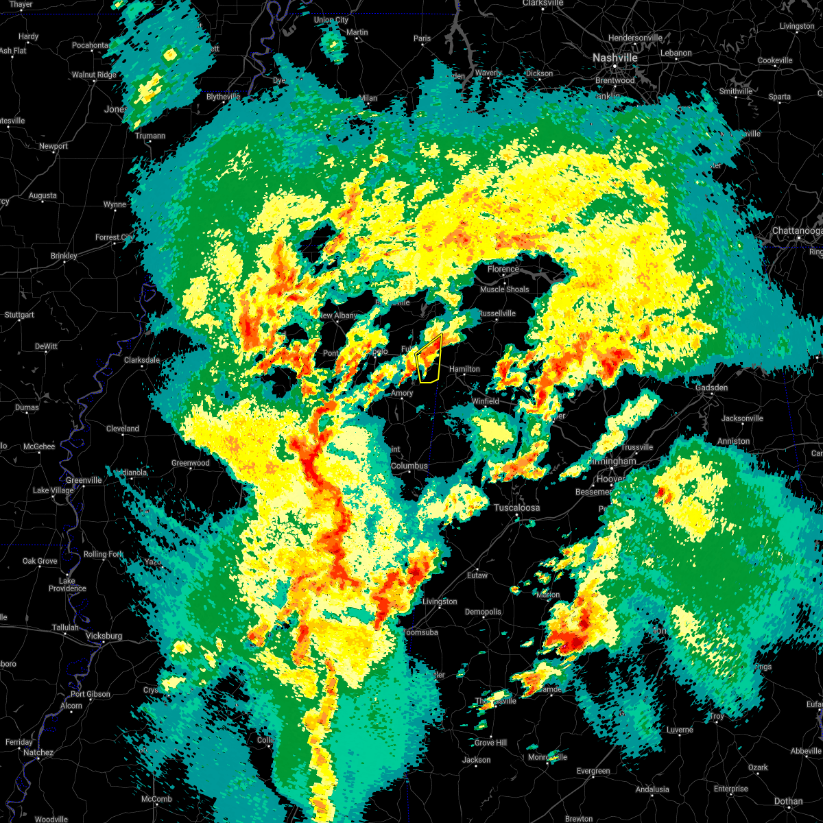 At 652 pm cdt, a severe thunderstorm was located over tremont, or 7 miles southeast of fulton, moving northeast at 35 mph (radar indicated). Hazards include 60 mph wind gusts and quarter size hail. Hail damage to vehicles is expected. expect wind damage to roofs, siding, and trees. Locations impacted include, fulton, tremont, new salem, clay, eastman, turon, tilden, bounds crossroads and cadamy. At 652 pm cdt, a severe thunderstorm was located over tremont, or 7 miles southeast of fulton, moving northeast at 35 mph (radar indicated). Hazards include 60 mph wind gusts and quarter size hail. Hail damage to vehicles is expected. expect wind damage to roofs, siding, and trees. Locations impacted include, fulton, tremont, new salem, clay, eastman, turon, tilden, bounds crossroads and cadamy.
|
| 3/17/2021 6:28 PM CDT |
 At 628 pm cdt, a severe thunderstorm was located near evergreen, or 8 miles north of amory, moving northeast at 35 mph (radar indicated). Hazards include 60 mph wind gusts and quarter size hail. Hail damage to vehicles is expected. Expect wind damage to roofs, siding, and trees. At 628 pm cdt, a severe thunderstorm was located near evergreen, or 8 miles north of amory, moving northeast at 35 mph (radar indicated). Hazards include 60 mph wind gusts and quarter size hail. Hail damage to vehicles is expected. Expect wind damage to roofs, siding, and trees.
|
| 3/17/2021 6:07 PM CDT |
 At 607 pm cdt, a severe thunderstorm was located near shannon, or near tombigbee state park, moving northeast at 45 mph (radar indicated). Hazards include 60 mph wind gusts and half dollar size hail. Hail damage to vehicles is expected. expect wind damage to roofs, siding, and trees. Locations impacted include, fulton, verona, tombigbee state park, shannon, plantersville, mantachie, tremont, new salem, evergreen, clay, nettleton, abney, cardsville, tilden, mooreville, ballardsville, dorsey, jacinto, old union and richmond. At 607 pm cdt, a severe thunderstorm was located near shannon, or near tombigbee state park, moving northeast at 45 mph (radar indicated). Hazards include 60 mph wind gusts and half dollar size hail. Hail damage to vehicles is expected. expect wind damage to roofs, siding, and trees. Locations impacted include, fulton, verona, tombigbee state park, shannon, plantersville, mantachie, tremont, new salem, evergreen, clay, nettleton, abney, cardsville, tilden, mooreville, ballardsville, dorsey, jacinto, old union and richmond.
|
| 3/17/2021 5:45 PM CDT |
 At 545 pm cdt, a severe thunderstorm was located near okolona, moving northeast at 45 mph (radar indicated). Hazards include 60 mph wind gusts and quarter size hail. Hail damage to vehicles is expected. Expect wind damage to roofs, siding, and trees. At 545 pm cdt, a severe thunderstorm was located near okolona, moving northeast at 45 mph (radar indicated). Hazards include 60 mph wind gusts and quarter size hail. Hail damage to vehicles is expected. Expect wind damage to roofs, siding, and trees.
|
| 6/5/2020 4:38 PM CDT |
 The severe thunderstorm warning for southeastern chickasaw, southeastern itawamba and monroe counties will expire at 445 pm cdt, the storms which prompted the warning have weakened below severe limits, and have exited the warned area. therefore, the warning will be allowed to expire. however gusty winds and heavy rain are still possible with these thunderstorms. a severe thunderstorm watch remains in effect until 600 pm cdt for northeastern mississippi. The severe thunderstorm warning for southeastern chickasaw, southeastern itawamba and monroe counties will expire at 445 pm cdt, the storms which prompted the warning have weakened below severe limits, and have exited the warned area. therefore, the warning will be allowed to expire. however gusty winds and heavy rain are still possible with these thunderstorms. a severe thunderstorm watch remains in effect until 600 pm cdt for northeastern mississippi.
|
| 6/5/2020 4:26 PM CDT |
 At 426 pm cdt, severe thunderstorms were located along a line extending from near sulligent to near kolola springs to near griffith, moving southeast at 40 mph (radar indicated). Hazards include 60 mph wind gusts and penny size hail. Expect damage to roofs, siding, and trees. Locations impacted include, amory, aberdeen, smithville, tremont, prairie, new salem, new wren, trebloc, hatley, woodland, gattman, quincy, turon, egypt, wise gap, wren, strong, mccondy, muldon and buena vista. At 426 pm cdt, severe thunderstorms were located along a line extending from near sulligent to near kolola springs to near griffith, moving southeast at 40 mph (radar indicated). Hazards include 60 mph wind gusts and penny size hail. Expect damage to roofs, siding, and trees. Locations impacted include, amory, aberdeen, smithville, tremont, prairie, new salem, new wren, trebloc, hatley, woodland, gattman, quincy, turon, egypt, wise gap, wren, strong, mccondy, muldon and buena vista.
|
| 6/5/2020 4:01 PM CDT |
 A severe thunderstorm warning remains in effect until 445 pm cdt for chickasaw. southern itawamba. southern lee and monroe counties. At 400 pm cdt, severe thunderstorms were located along a line extending from near new salem to near new wren to near houston, moving southeast at 40 mph. A severe thunderstorm warning remains in effect until 445 pm cdt for chickasaw. southern itawamba. southern lee and monroe counties. At 400 pm cdt, severe thunderstorms were located along a line extending from near new salem to near new wren to near houston, moving southeast at 40 mph.
|
| 6/5/2020 3:45 PM CDT |
 At 345 pm cdt, severe thunderstorms were located along a line extending from near fulton to near new wren to near houston, moving southeast at 45 mph (radar indicated). Hazards include 60 mph wind gusts and penny size hail. Expect damage to roofs, siding, and trees. Locations impacted include, tupelo, amory, pontotoc, aberdeen, fulton, houston, verona, okolona, trace state park, tombigbee state park, saltillo, shannon, plantersville, mantachie, smithville, tremont, prairie, troy, new salem and new wren. At 345 pm cdt, severe thunderstorms were located along a line extending from near fulton to near new wren to near houston, moving southeast at 45 mph (radar indicated). Hazards include 60 mph wind gusts and penny size hail. Expect damage to roofs, siding, and trees. Locations impacted include, tupelo, amory, pontotoc, aberdeen, fulton, houston, verona, okolona, trace state park, tombigbee state park, saltillo, shannon, plantersville, mantachie, smithville, tremont, prairie, troy, new salem and new wren.
|
| 6/5/2020 3:24 PM CDT |
 At 324 pm cdt, severe thunderstorms were located along a line extending from near pratts friendship to near houlka, moving southeast at 40 mph (radar indicated). Hazards include 60 mph wind gusts. expect damage to roofs, siding, and trees At 324 pm cdt, severe thunderstorms were located along a line extending from near pratts friendship to near houlka, moving southeast at 40 mph (radar indicated). Hazards include 60 mph wind gusts. expect damage to roofs, siding, and trees
|
| 4/12/2020 11:42 PM CDT |
 At 1142 pm cdt, severe thunderstorms were located along a line extending from 6 miles northwest of adamsville to j p coleman state park to beaverton, moving northeast at 75 mph (radar indicated). Hazards include 60 mph wind gusts. Expect damage to roofs, siding, and trees. Locations impacted include, iuka, j p coleman state park, tishomingo state park, belmont, burnsville, tremont, tishomingo, pineflat, midway, leedy, golden, paden, gattman, oldham, eastman, doskie, dennis, blythe crossing, carter branch and hazard switch. At 1142 pm cdt, severe thunderstorms were located along a line extending from 6 miles northwest of adamsville to j p coleman state park to beaverton, moving northeast at 75 mph (radar indicated). Hazards include 60 mph wind gusts. Expect damage to roofs, siding, and trees. Locations impacted include, iuka, j p coleman state park, tishomingo state park, belmont, burnsville, tremont, tishomingo, pineflat, midway, leedy, golden, paden, gattman, oldham, eastman, doskie, dennis, blythe crossing, carter branch and hazard switch.
|
| 4/12/2020 11:33 PM CDT |
 At 1133 pm cdt, severe thunderstorms were located along a line extending from near selmer to near iuka to near vernon, moving east at 60 mph (radar indicated). Hazards include 60 mph wind gusts. Expect damage to roofs, siding, and trees. Locations impacted include, corinth, iuka, j p coleman state park, tishomingo state park, belmont, burnsville, tremont, glen, tishomingo, pineflat, fairview, burton, midway, leedy, clay, farmington, golden, paden, gattman and oldham. At 1133 pm cdt, severe thunderstorms were located along a line extending from near selmer to near iuka to near vernon, moving east at 60 mph (radar indicated). Hazards include 60 mph wind gusts. Expect damage to roofs, siding, and trees. Locations impacted include, corinth, iuka, j p coleman state park, tishomingo state park, belmont, burnsville, tremont, glen, tishomingo, pineflat, fairview, burton, midway, leedy, clay, farmington, golden, paden, gattman and oldham.
|
| 4/12/2020 10:58 PM CDT |
 At 1057 pm cdt, severe thunderstorms were located along a line extending from 6 miles southeast of somerville to 6 miles north of ripley to near trebloc, moving northeast at 75 mph (radar indicated). Hazards include 60 mph wind gusts. expect damage to roofs, siding, and trees At 1057 pm cdt, severe thunderstorms were located along a line extending from 6 miles southeast of somerville to 6 miles north of ripley to near trebloc, moving northeast at 75 mph (radar indicated). Hazards include 60 mph wind gusts. expect damage to roofs, siding, and trees
|
| 4/12/2020 3:28 PM CDT |
 At 328 pm cdt, a severe thunderstorm was located near shannon, or 9 miles northwest of amory, moving east at 55 mph (radar indicated). Hazards include 60 mph wind gusts. expect damage to roofs, siding, and trees At 328 pm cdt, a severe thunderstorm was located near shannon, or 9 miles northwest of amory, moving east at 55 mph (radar indicated). Hazards include 60 mph wind gusts. expect damage to roofs, siding, and trees
|
| 4/12/2020 3:22 PM CDT |
 At 322 pm cdt, a severe thunderstorm was located near okolona, moving east at 55 mph (radar indicated). Hazards include 60 mph wind gusts. Expect damage to roofs, siding, and trees. Locations impacted include, amory, okolona, shannon, smithville, tremont, new wren, new salem, nettleton, hatley, cardsville, turon, tilden, egypt, wren, bigbee, leotis, jacinto, parham, cadamy and buena vista. At 322 pm cdt, a severe thunderstorm was located near okolona, moving east at 55 mph (radar indicated). Hazards include 60 mph wind gusts. Expect damage to roofs, siding, and trees. Locations impacted include, amory, okolona, shannon, smithville, tremont, new wren, new salem, nettleton, hatley, cardsville, turon, tilden, egypt, wren, bigbee, leotis, jacinto, parham, cadamy and buena vista.
|
| 4/12/2020 3:07 PM CDT |
 At 307 pm cdt, a severe thunderstorm was located near houston, moving east at 55 mph (radar indicated). Hazards include 60 mph wind gusts. expect damage to roofs, siding, and trees At 307 pm cdt, a severe thunderstorm was located near houston, moving east at 55 mph (radar indicated). Hazards include 60 mph wind gusts. expect damage to roofs, siding, and trees
|
| 2/10/2020 3:32 AM CST |
 At 332 am cst, a severe thunderstorm was located near fulton, moving northeast at 50 mph (radar indicated). Hazards include quarter size hail. Damage to vehicles is expected. Locations impacted include, fulton, belmont, mantachie, tremont, sandy springs, fairview, new salem, evergreen, clay, golden, abney, eastman, cardsville, tilden, moores mill, ballardsville, bounds crossroads, dorsey, jacinto and cadamy. At 332 am cst, a severe thunderstorm was located near fulton, moving northeast at 50 mph (radar indicated). Hazards include quarter size hail. Damage to vehicles is expected. Locations impacted include, fulton, belmont, mantachie, tremont, sandy springs, fairview, new salem, evergreen, clay, golden, abney, eastman, cardsville, tilden, moores mill, ballardsville, bounds crossroads, dorsey, jacinto and cadamy.
|
| 2/10/2020 3:20 AM CST |
 At 320 am cst, a severe thunderstorm was located near plantersville, or near tombigbee state park, moving northeast at 50 mph (radar indicated). Hazards include quarter size hail. Damage to vehicles is expected. Locations impacted include, tupelo, fulton, red bay, verona, tombigbee state park, belmont, shannon, plantersville, mantachie, tremont, fairview, new salem, sandy springs, evergreen, clay, nettleton, golden, abney, eastman and mooreville. At 320 am cst, a severe thunderstorm was located near plantersville, or near tombigbee state park, moving northeast at 50 mph (radar indicated). Hazards include quarter size hail. Damage to vehicles is expected. Locations impacted include, tupelo, fulton, red bay, verona, tombigbee state park, belmont, shannon, plantersville, mantachie, tremont, fairview, new salem, sandy springs, evergreen, clay, nettleton, golden, abney, eastman and mooreville.
|
| 2/10/2020 3:11 AM CST |
 At 311 am cst, a severe thunderstorm was located near shannon, or near verona, moving northeast at 50 mph (radar indicated). Hazards include quarter size hail. damage to vehicles is expected At 311 am cst, a severe thunderstorm was located near shannon, or near verona, moving northeast at 50 mph (radar indicated). Hazards include quarter size hail. damage to vehicles is expected
|
| 2/5/2020 5:21 PM CST |
 At 520 pm cst, a severe thunderstorm was located over fairview, or 10 miles west of red bay, moving northeast at 70 mph (radar indicated). Hazards include 60 mph wind gusts and penny size hail. Expect damage to roofs, siding, and trees. Locations impacted include, fulton, tishomingo state park, belmont, mantachie, tremont, sandy springs, fairview, clay, marietta, golden, abney, eastman, dennis, mooreville, moores mill, eggville, ballardsville, kirkville, unity and bounds crossroads. At 520 pm cst, a severe thunderstorm was located over fairview, or 10 miles west of red bay, moving northeast at 70 mph (radar indicated). Hazards include 60 mph wind gusts and penny size hail. Expect damage to roofs, siding, and trees. Locations impacted include, fulton, tishomingo state park, belmont, mantachie, tremont, sandy springs, fairview, clay, marietta, golden, abney, eastman, dennis, mooreville, moores mill, eggville, ballardsville, kirkville, unity and bounds crossroads.
|
| 2/5/2020 4:56 PM CST |
 At 456 pm cst, a severe thunderstorm was located over verona, moving east at 70 mph (radar indicated). Hazards include 60 mph wind gusts. expect damage to roofs, siding, and trees At 456 pm cst, a severe thunderstorm was located over verona, moving east at 70 mph (radar indicated). Hazards include 60 mph wind gusts. expect damage to roofs, siding, and trees
|
| 1/11/2020 8:28 AM CST |
 The severe thunderstorm warning for southern itawamba, southeastern lee and northern monroe counties will expire at 830 am cst, the storm which prompted the warning has weakened below severe limits, and no longer poses an immediate threat to life or property. therefore, the warning will be allowed to expire. a tornado watch remains in effect until 1000 am cst for northeastern mississippi. The severe thunderstorm warning for southern itawamba, southeastern lee and northern monroe counties will expire at 830 am cst, the storm which prompted the warning has weakened below severe limits, and no longer poses an immediate threat to life or property. therefore, the warning will be allowed to expire. a tornado watch remains in effect until 1000 am cst for northeastern mississippi.
|
| 1/11/2020 7:40 AM CST |
 At 740 am cst, a severe thunderstorm was located near evergreen, or near amory, moving east at 50 mph (radar indicated). Hazards include 60 mph wind gusts. expect damage to roofs, siding, and trees At 740 am cst, a severe thunderstorm was located near evergreen, or near amory, moving east at 50 mph (radar indicated). Hazards include 60 mph wind gusts. expect damage to roofs, siding, and trees
|
| 1/11/2020 7:37 AM CST |
 At 737 am cst, severe thunderstorms were located along a line extending from near tishomingo to near prairie, moving east at 50 mph (radar indicated). Hazards include 60 mph wind gusts. Expect damage to roofs, siding, and trees. Locations impacted include, amory, aberdeen, fulton, red bay, okolona, tishomingo state park, belmont, shannon, mantachie, smithville, tremont, tishomingo, prairie, fairview, new salem, new wren, trebloc, evergreen, clay and nettleton. At 737 am cst, severe thunderstorms were located along a line extending from near tishomingo to near prairie, moving east at 50 mph (radar indicated). Hazards include 60 mph wind gusts. Expect damage to roofs, siding, and trees. Locations impacted include, amory, aberdeen, fulton, red bay, okolona, tishomingo state park, belmont, shannon, mantachie, smithville, tremont, tishomingo, prairie, fairview, new salem, new wren, trebloc, evergreen, clay and nettleton.
|
| 1/11/2020 7:31 AM CST |
 At 731 am cst, severe thunderstorms were located along a line extending from near burton to near trebloc, moving east at 30 mph (radar indicated). Hazards include 60 mph wind gusts. Expect damage to roofs, siding, and trees. Locations impacted include, tupelo, amory, aberdeen, fulton, red bay, verona, okolona, tombigbee state park, tishomingo state park, belmont, shannon, plantersville, mantachie, smithville, tremont, prairie, fairview, new salem, sandy springs and new wren. At 731 am cst, severe thunderstorms were located along a line extending from near burton to near trebloc, moving east at 30 mph (radar indicated). Hazards include 60 mph wind gusts. Expect damage to roofs, siding, and trees. Locations impacted include, tupelo, amory, aberdeen, fulton, red bay, verona, okolona, tombigbee state park, tishomingo state park, belmont, shannon, plantersville, mantachie, smithville, tremont, prairie, fairview, new salem, sandy springs and new wren.
|
| 1/11/2020 7:21 AM CST |
 At 721 am cst, severe thunderstorms were located along a line extending from near belmont to prairie, moving east at 50 mph (radar indicated). Hazards include 60 mph wind gusts. Expect damage to roofs, siding, and trees. Locations impacted include, tupelo, amory, aberdeen, fulton, red bay, verona, okolona, tombigbee state park, tishomingo state park, belmont, shannon, plantersville, mantachie, smithville, tremont, prairie, fairview, new salem, sandy springs and new wren. At 721 am cst, severe thunderstorms were located along a line extending from near belmont to prairie, moving east at 50 mph (radar indicated). Hazards include 60 mph wind gusts. Expect damage to roofs, siding, and trees. Locations impacted include, tupelo, amory, aberdeen, fulton, red bay, verona, okolona, tombigbee state park, tishomingo state park, belmont, shannon, plantersville, mantachie, smithville, tremont, prairie, fairview, new salem, sandy springs and new wren.
|
| 1/11/2020 7:08 AM CST |
 At 707 am cst, severe thunderstorms were located along a line extending from 8 miles east of wheeler to near trebloc, moving east at 50 mph (radar indicated). Hazards include 60 mph wind gusts. expect damage to roofs, siding, and trees At 707 am cst, severe thunderstorms were located along a line extending from 8 miles east of wheeler to near trebloc, moving east at 50 mph (radar indicated). Hazards include 60 mph wind gusts. expect damage to roofs, siding, and trees
|
| 12/16/2019 4:25 PM CST |
 At 424 pm cst, a severe thunderstorm was located over okolona, moving east at 55 mph (radar indicated). Hazards include 60 mph wind gusts. expect damage to roofs, siding, and trees At 424 pm cst, a severe thunderstorm was located over okolona, moving east at 55 mph (radar indicated). Hazards include 60 mph wind gusts. expect damage to roofs, siding, and trees
|
| 6/23/2019 11:02 PM CDT |
 At 1101 pm cdt, severe thunderstorms were located along a line extending from near saltillo to new salem, moving northeast at 35 mph (trained weather spotters). Hazards include 60 mph wind gusts. Expect damage to roofs, siding, and trees. Locations impacted include, tupelo, fulton, baldwyn, tombigbee state park, saltillo, guntown, mantachie, tremont, fairview, pratts friendship, sandy springs, evergreen, blair, clay, abney, eastman, mooreville, eggville, ballardsville and kirkville. At 1101 pm cdt, severe thunderstorms were located along a line extending from near saltillo to new salem, moving northeast at 35 mph (trained weather spotters). Hazards include 60 mph wind gusts. Expect damage to roofs, siding, and trees. Locations impacted include, tupelo, fulton, baldwyn, tombigbee state park, saltillo, guntown, mantachie, tremont, fairview, pratts friendship, sandy springs, evergreen, blair, clay, abney, eastman, mooreville, eggville, ballardsville and kirkville.
|
| 6/23/2019 10:40 PM CDT |
 At 1040 pm cdt, severe thunderstorms were located along a line extending from near tupelo to near amory, moving northeast at 35 mph (trained weather spotters). Hazards include 60 mph wind gusts and pea size hail. Hail damage to vehicles is expected. Expect wind damage to roofs, siding, and trees. At 1040 pm cdt, severe thunderstorms were located along a line extending from near tupelo to near amory, moving northeast at 35 mph (trained weather spotters). Hazards include 60 mph wind gusts and pea size hail. Hail damage to vehicles is expected. Expect wind damage to roofs, siding, and trees.
|
| 6/20/2019 1:21 AM CDT |
 At 121 am cdt, severe thunderstorms were located along a line extending from new salem to near caledonia, moving east at 65 mph (radar indicated). Hazards include 60 mph wind gusts. expect damage to roofs, siding, and trees At 121 am cdt, severe thunderstorms were located along a line extending from new salem to near caledonia, moving east at 65 mph (radar indicated). Hazards include 60 mph wind gusts. expect damage to roofs, siding, and trees
|
| 4/13/2019 11:40 PM CDT |
 At 1140 pm cdt, a confirmed large and extremely dangerous tornado was located near new salem, or 12 miles southeast of fulton, moving north at 50 mph. this is a particularly dangerous situation. take cover now! (radar confirmed tornado). Hazards include damaging tornado. You are in a life-threatening situation. flying debris may be deadly to those caught without shelter. mobile homes will be destroyed. Considerable damage to homes, businesses, and vehicles is likely and complete destruction is possible. At 1140 pm cdt, a confirmed large and extremely dangerous tornado was located near new salem, or 12 miles southeast of fulton, moving north at 50 mph. this is a particularly dangerous situation. take cover now! (radar confirmed tornado). Hazards include damaging tornado. You are in a life-threatening situation. flying debris may be deadly to those caught without shelter. mobile homes will be destroyed. Considerable damage to homes, businesses, and vehicles is likely and complete destruction is possible.
|
| 3/9/2019 5:58 PM CST |
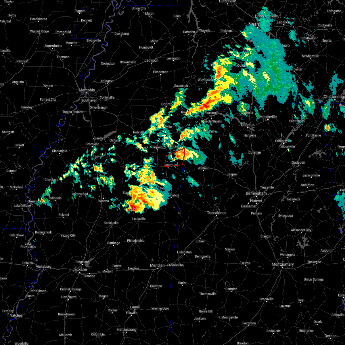 The tornado warning for southern itawamba and northeastern monroe counties will expire at 600 pm cst, the storm which prompted the warning has weakened below severe limits, and no longer appears capable of producing a tornado. therefore, the warning will be allowed to expire. however small hail and gusty winds are still possible with this thunderstorm. a tornado watch remains in effect until 900 pm cst for northeastern mississippi. The tornado warning for southern itawamba and northeastern monroe counties will expire at 600 pm cst, the storm which prompted the warning has weakened below severe limits, and no longer appears capable of producing a tornado. therefore, the warning will be allowed to expire. however small hail and gusty winds are still possible with this thunderstorm. a tornado watch remains in effect until 900 pm cst for northeastern mississippi.
|
| 3/9/2019 5:41 PM CST |
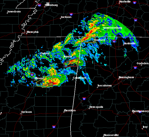 At 541 pm cst, doppler radar indicated a severe thunderstorm producing a tornado was located near smithville, or near amory, moving east at 55 mph (radar indicated rotation). Hazards include tornado. Flying debris will be dangerous to those caught without shelter. mobile homes will be damaged or destroyed. damage to roofs, windows, and vehicles will occur. tree damage is likely. Locations impacted include, amory, smithville, tremont, new salem, evergreen, bigbee, cardsville, turon, tilden, jacinto, cadamy and parham. At 541 pm cst, doppler radar indicated a severe thunderstorm producing a tornado was located near smithville, or near amory, moving east at 55 mph (radar indicated rotation). Hazards include tornado. Flying debris will be dangerous to those caught without shelter. mobile homes will be damaged or destroyed. damage to roofs, windows, and vehicles will occur. tree damage is likely. Locations impacted include, amory, smithville, tremont, new salem, evergreen, bigbee, cardsville, turon, tilden, jacinto, cadamy and parham.
|
| 3/9/2019 5:33 PM CST |
 At 531 pm cst, radar-indicated tornado located near new wren, or near amory, moving east at 55 mph (radar indicated rotation). Hazards include tornado and quarter size hail. Flying debris will be dangerous to those caught without shelter. mobile homes will be damaged or destroyed. damage to roofs, windows, and vehicles will occur. tree damage is likely. Locations impacted include, amory, shannon, smithville, tremont, new wren, new salem, evergreen, nettleton, hatley, cardsville, turon, tilden, wren, bigbee, jacinto, parham and cadamy. At 531 pm cst, radar-indicated tornado located near new wren, or near amory, moving east at 55 mph (radar indicated rotation). Hazards include tornado and quarter size hail. Flying debris will be dangerous to those caught without shelter. mobile homes will be damaged or destroyed. damage to roofs, windows, and vehicles will occur. tree damage is likely. Locations impacted include, amory, shannon, smithville, tremont, new wren, new salem, evergreen, nettleton, hatley, cardsville, turon, tilden, wren, bigbee, jacinto, parham and cadamy.
|
| 3/9/2019 5:11 PM CST |
 At 511 pm cst, doppler radar indicated a severe thunderstorm producing a tornado was located 7 miles northeast of houston, moving east at 55 mph (radar indicated rotation). Hazards include tornado and quarter size hail. Flying debris will be dangerous to those caught without shelter. mobile homes will be damaged or destroyed. damage to roofs, windows, and vehicles will occur. Tree damage is likely. At 511 pm cst, doppler radar indicated a severe thunderstorm producing a tornado was located 7 miles northeast of houston, moving east at 55 mph (radar indicated rotation). Hazards include tornado and quarter size hail. Flying debris will be dangerous to those caught without shelter. mobile homes will be damaged or destroyed. damage to roofs, windows, and vehicles will occur. Tree damage is likely.
|
| 2/23/2019 4:50 PM CST |
 At 450 pm cst, a severe thunderstorm was located over tremont, or 11 miles east of fulton, moving northeast at 55 mph (radar indicated). Hazards include 60 mph wind gusts. expect damage to roofs, siding, and trees At 450 pm cst, a severe thunderstorm was located over tremont, or 11 miles east of fulton, moving northeast at 55 mph (radar indicated). Hazards include 60 mph wind gusts. expect damage to roofs, siding, and trees
|
| 12/31/2018 1:07 PM CST |
 At 107 pm cst, a severe thunderstorm was located over new wren, or near okolona, moving northeast at 70 mph (radar indicated). Hazards include 60 mph wind gusts. Expect damage to roofs, siding, and trees. locations impacted include, amory, smithville, tremont, new wren, new salem, nettleton, hatley, becker, cardsville, turon, tilden, splunge, wren, bigbee, jacinto, parham and cadamy. A tornado watch remains in effect until 700 pm cst for northeastern mississippi. At 107 pm cst, a severe thunderstorm was located over new wren, or near okolona, moving northeast at 70 mph (radar indicated). Hazards include 60 mph wind gusts. Expect damage to roofs, siding, and trees. locations impacted include, amory, smithville, tremont, new wren, new salem, nettleton, hatley, becker, cardsville, turon, tilden, splunge, wren, bigbee, jacinto, parham and cadamy. A tornado watch remains in effect until 700 pm cst for northeastern mississippi.
|
| 12/31/2018 12:59 PM CST |
 At 1259 pm cst, a severe thunderstorm was located near trebloc, or 9 miles south of okolona, moving northeast at 60 mph (radar indicated). Hazards include 60 mph wind gusts. expect damage to roofs, siding, and trees At 1259 pm cst, a severe thunderstorm was located near trebloc, or 9 miles south of okolona, moving northeast at 60 mph (radar indicated). Hazards include 60 mph wind gusts. expect damage to roofs, siding, and trees
|
| 11/5/2018 11:08 PM CST |
 At 1107 pm cst, a large and extremely dangerous tornado was located near the intersection of highway 45 and interstate 22 near tupelo, moving east at 35 mph. this is a particularly dangerous situation. take cover now! (radar indicated rotation). Hazards include damaging tornado. You are in a life-threatening situation. flying debris may be deadly to those caught without shelter. mobile homes will be destroyed. considerable damage to homes, businesses, and vehicles is likely and complete destruction is possible. Locations impacted include, tupelo, fulton, verona, tombigbee state park, saltillo, plantersville, mantachie, tremont, sandy springs, fairview, clay, beech springs, skyline, abney, mooreville, eggville, ballardsville, kirkville, frog island and unity. At 1107 pm cst, a large and extremely dangerous tornado was located near the intersection of highway 45 and interstate 22 near tupelo, moving east at 35 mph. this is a particularly dangerous situation. take cover now! (radar indicated rotation). Hazards include damaging tornado. You are in a life-threatening situation. flying debris may be deadly to those caught without shelter. mobile homes will be destroyed. considerable damage to homes, businesses, and vehicles is likely and complete destruction is possible. Locations impacted include, tupelo, fulton, verona, tombigbee state park, saltillo, plantersville, mantachie, tremont, sandy springs, fairview, clay, beech springs, skyline, abney, mooreville, eggville, ballardsville, kirkville, frog island and unity.
|
| 11/5/2018 11:01 PM CST |
 At 1101 pm cst, a large and extremely dangerous tornado was located near tupelo, moving east at 30 mph. this is a particularly dangerous situation. take cover now! (radar indicated rotation). Hazards include damaging tornado. You are in a life-threatening situation. flying debris may be deadly to those caught without shelter. mobile homes will be destroyed. Considerable damage to homes, businesses, and vehicles is likely and complete destruction is possible. At 1101 pm cst, a large and extremely dangerous tornado was located near tupelo, moving east at 30 mph. this is a particularly dangerous situation. take cover now! (radar indicated rotation). Hazards include damaging tornado. You are in a life-threatening situation. flying debris may be deadly to those caught without shelter. mobile homes will be destroyed. Considerable damage to homes, businesses, and vehicles is likely and complete destruction is possible.
|
| 6/21/2018 11:48 PM CDT |
 At 1148 pm cdt, severe thunderstorms were located along a line extending from near fulton, to 7 miles east of shannon, to 6 miles northeast of houston, moving southeast at 40 mph (radar indicated). Hazards include 60 mph wind gusts. Expect damage to roofs, siding, and trees. Locations impacted include, tupelo, amory, aberdeen, fulton, verona, okolona, tombigbee state park, shannon, plantersville, mantachie, smithville, tremont, prairie, fairview, new salem, new wren, houlka, evergreen, clay and nettleton. At 1148 pm cdt, severe thunderstorms were located along a line extending from near fulton, to 7 miles east of shannon, to 6 miles northeast of houston, moving southeast at 40 mph (radar indicated). Hazards include 60 mph wind gusts. Expect damage to roofs, siding, and trees. Locations impacted include, tupelo, amory, aberdeen, fulton, verona, okolona, tombigbee state park, shannon, plantersville, mantachie, smithville, tremont, prairie, fairview, new salem, new wren, houlka, evergreen, clay and nettleton.
|
| 6/21/2018 11:30 PM CDT |
 At 1129 pm cdt, severe thunderstorms were located along a line extending from near mantachie to near houlka, moving southeast at 40 mph (radar indicated). Hazards include 60 mph wind gusts. expect damage to roofs, siding, and trees At 1129 pm cdt, severe thunderstorms were located along a line extending from near mantachie to near houlka, moving southeast at 40 mph (radar indicated). Hazards include 60 mph wind gusts. expect damage to roofs, siding, and trees
|
| 6/21/2018 11:12 PM CDT |
 At 1112 pm cdt, a severe thunderstorm was located over new salem, or near fulton, moving southeast at 35 mph (radar indicated). Hazards include 60 mph wind gusts. Expect damage to roofs, siding, and trees. Locations impacted include, fulton, smithville, tremont, new salem, evergreen, abney, sipsey fork, cardsville, turon, tilden, splunge, ballardsville, dorsey, jacinto, parham and cadamy. At 1112 pm cdt, a severe thunderstorm was located over new salem, or near fulton, moving southeast at 35 mph (radar indicated). Hazards include 60 mph wind gusts. Expect damage to roofs, siding, and trees. Locations impacted include, fulton, smithville, tremont, new salem, evergreen, abney, sipsey fork, cardsville, turon, tilden, splunge, ballardsville, dorsey, jacinto, parham and cadamy.
|
| 6/21/2018 10:53 PM CDT |
 At 1052 pm cdt, a severe thunderstorm was located near evergreen, or near fulton, moving southeast at 35 mph (radar indicated). Hazards include 60 mph wind gusts. expect damage to roofs, siding, and trees At 1052 pm cdt, a severe thunderstorm was located near evergreen, or near fulton, moving southeast at 35 mph (radar indicated). Hazards include 60 mph wind gusts. expect damage to roofs, siding, and trees
|
| 6/17/2018 7:35 PM CDT |
 The severe thunderstorm warning for itawamba county will expire at 745 pm cdt, the storm which prompted the warning has weakened below severe limits, and no longer poses an immediate threat to life or property. therefore, the warning will be allowed to expire. The severe thunderstorm warning for itawamba county will expire at 745 pm cdt, the storm which prompted the warning has weakened below severe limits, and no longer poses an immediate threat to life or property. therefore, the warning will be allowed to expire.
|
| 6/17/2018 7:12 PM CDT |
 At 711 pm cdt, a severe thunderstorm was located near tremont, or 11 miles west of hamilton, moving northwest at 5 mph while a second severe thunderstorm has developed just southwest of sandy springs (radar indicated). Hazards include 60 mph wind gusts and quarter size hail. Hail damage to vehicles is expected. expect wind damage to roofs, siding, and trees. Locations impacted include, fulton, mantachie, tremont, fairview, sandy springs, clay, eastman, tilden, bounds crossroads, dorsey, cadamy and kirkville. At 711 pm cdt, a severe thunderstorm was located near tremont, or 11 miles west of hamilton, moving northwest at 5 mph while a second severe thunderstorm has developed just southwest of sandy springs (radar indicated). Hazards include 60 mph wind gusts and quarter size hail. Hail damage to vehicles is expected. expect wind damage to roofs, siding, and trees. Locations impacted include, fulton, mantachie, tremont, fairview, sandy springs, clay, eastman, tilden, bounds crossroads, dorsey, cadamy and kirkville.
|
| 6/17/2018 6:57 PM CDT |
 At 657 pm cdt, a severe thunderstorm was located near tremont, or 10 miles west of hamilton, moving northwest at 5 mph (radar indicated). Hazards include 60 mph wind gusts and quarter size hail. Hail damage to vehicles is expected. Expect wind damage to roofs, siding, and trees. At 657 pm cdt, a severe thunderstorm was located near tremont, or 10 miles west of hamilton, moving northwest at 5 mph (radar indicated). Hazards include 60 mph wind gusts and quarter size hail. Hail damage to vehicles is expected. Expect wind damage to roofs, siding, and trees.
|
| 4/14/2018 6:39 AM CDT |
 At 639 am cdt, a severe thunderstorm was located over fulton, moving east at 30 mph (radar indicated). Hazards include 60 mph wind gusts. expect damage to roofs, siding, and trees At 639 am cdt, a severe thunderstorm was located over fulton, moving east at 30 mph (radar indicated). Hazards include 60 mph wind gusts. expect damage to roofs, siding, and trees
|
| 4/14/2018 5:47 AM CDT |
 At 546 am cdt, a severe thunderstorm was located near new harmony, or 11 miles north of trace state park, moving east at 50 mph (radar indicated). Hazards include 60 mph wind gusts. expect damage to roofs, siding, and trees At 546 am cdt, a severe thunderstorm was located near new harmony, or 11 miles north of trace state park, moving east at 50 mph (radar indicated). Hazards include 60 mph wind gusts. expect damage to roofs, siding, and trees
|
| 4/3/2018 9:05 PM CDT |
 At 904 pm cdt, severe thunderstorms were located along a line extending from near tishomingo state park to near fairview to near evergreen, moving east at 45 mph (radar indicated). Hazards include 60 mph wind gusts. Expect damage to roofs, siding, and trees. Locations impacted include, tupelo, booneville, fulton, baldwyn, verona, tombigbee state park, saltillo, guntown, belmont, plantersville, mantachie, tremont, fairview, new salem, pratts friendship, sandy springs, evergreen, clay, marietta and golden. At 904 pm cdt, severe thunderstorms were located along a line extending from near tishomingo state park to near fairview to near evergreen, moving east at 45 mph (radar indicated). Hazards include 60 mph wind gusts. Expect damage to roofs, siding, and trees. Locations impacted include, tupelo, booneville, fulton, baldwyn, verona, tombigbee state park, saltillo, guntown, belmont, plantersville, mantachie, tremont, fairview, new salem, pratts friendship, sandy springs, evergreen, clay, marietta and golden.
|
| 4/3/2018 8:26 PM CDT |
 At 826 pm cdt, severe thunderstorms were located along a line extending from near keownville to near new harmony to near ecru, moving east at 65 mph (radar indicated). Hazards include 60 mph wind gusts. expect damage to roofs, siding, and trees At 826 pm cdt, severe thunderstorms were located along a line extending from near keownville to near new harmony to near ecru, moving east at 65 mph (radar indicated). Hazards include 60 mph wind gusts. expect damage to roofs, siding, and trees
|
| 3/19/2018 6:11 PM CDT |
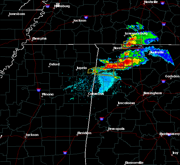 The severe thunderstorm warning for southeastern itawamba county will expire at 615 pm cdt, the storm which prompted the warning has weakened below severe limits, and has exited the warned area. therefore, the warning will be allowed to expire. however small hail is still possible with this thunderstorm. a tornado watch remains in effect until 1100 pm cdt for northeastern mississippi. The severe thunderstorm warning for southeastern itawamba county will expire at 615 pm cdt, the storm which prompted the warning has weakened below severe limits, and has exited the warned area. therefore, the warning will be allowed to expire. however small hail is still possible with this thunderstorm. a tornado watch remains in effect until 1100 pm cdt for northeastern mississippi.
|
| 3/19/2018 6:04 PM CDT |
 At 603 pm cdt, a severe thunderstorm was located 3 miles northeast of new salem, moving northeast at 45 mph (radar indicated). Hazards include 60 mph wind gusts and quarter size hail. Hail damage to vehicles is expected. expect wind damage to roofs, siding, and trees. locations impacted include, fulton, tremont, clay and tilden. A tornado watch remains in effect until 1100 pm cdt for northeastern mississippi. At 603 pm cdt, a severe thunderstorm was located 3 miles northeast of new salem, moving northeast at 45 mph (radar indicated). Hazards include 60 mph wind gusts and quarter size hail. Hail damage to vehicles is expected. expect wind damage to roofs, siding, and trees. locations impacted include, fulton, tremont, clay and tilden. A tornado watch remains in effect until 1100 pm cdt for northeastern mississippi.
|
| 3/19/2018 5:44 PM CDT |
 At 544 pm cdt, a severe thunderstorm was located 7 miles east of fairview, or 8 miles southwest of red bay, moving east at 45 mph (radar indicated). Hazards include 60 mph wind gusts and quarter size hail. Hail damage to vehicles is expected. expect wind damage to roofs, siding, and trees. locations impacted include, fulton, mantachie, tremont, fairview, evergreen, clay, abney, eastman, tilden, bounds crossroads, dorsey and ballardsville. A tornado watch remains in effect until 1100 pm cdt for northeastern mississippi. At 544 pm cdt, a severe thunderstorm was located 7 miles east of fairview, or 8 miles southwest of red bay, moving east at 45 mph (radar indicated). Hazards include 60 mph wind gusts and quarter size hail. Hail damage to vehicles is expected. expect wind damage to roofs, siding, and trees. locations impacted include, fulton, mantachie, tremont, fairview, evergreen, clay, abney, eastman, tilden, bounds crossroads, dorsey and ballardsville. A tornado watch remains in effect until 1100 pm cdt for northeastern mississippi.
|
| 3/19/2018 5:38 PM CDT |
 At 538 pm cdt, a severe thunderstorm was located near fairview, or 7 miles northeast of fulton, moving east at 45 mph (radar indicated). Hazards include ping pong ball size hail and 60 mph wind gusts. People and animals outdoors will be injured. expect hail damage to roofs, siding, windows, and vehicles. expect wind damage to roofs, siding, and trees. locations impacted include, fulton, mantachie, tremont, fairview, evergreen, clay, abney, eastman, tilden, bounds crossroads, dorsey and ballardsville. A tornado watch remains in effect until 1100 pm cdt for northeastern mississippi. At 538 pm cdt, a severe thunderstorm was located near fairview, or 7 miles northeast of fulton, moving east at 45 mph (radar indicated). Hazards include ping pong ball size hail and 60 mph wind gusts. People and animals outdoors will be injured. expect hail damage to roofs, siding, windows, and vehicles. expect wind damage to roofs, siding, and trees. locations impacted include, fulton, mantachie, tremont, fairview, evergreen, clay, abney, eastman, tilden, bounds crossroads, dorsey and ballardsville. A tornado watch remains in effect until 1100 pm cdt for northeastern mississippi.
|
| 3/19/2018 5:27 PM CDT |
 At 527 pm cdt, a severe thunderstorm was located over fulton, moving east at 45 mph (radar indicated). Hazards include ping pong ball size hail and 60 mph wind gusts. People and animals outdoors will be injured. expect hail damage to roofs, siding, windows, and vehicles. Expect wind damage to roofs, siding, and trees. At 527 pm cdt, a severe thunderstorm was located over fulton, moving east at 45 mph (radar indicated). Hazards include ping pong ball size hail and 60 mph wind gusts. People and animals outdoors will be injured. expect hail damage to roofs, siding, windows, and vehicles. Expect wind damage to roofs, siding, and trees.
|
| 11/18/2017 4:55 PM CST |
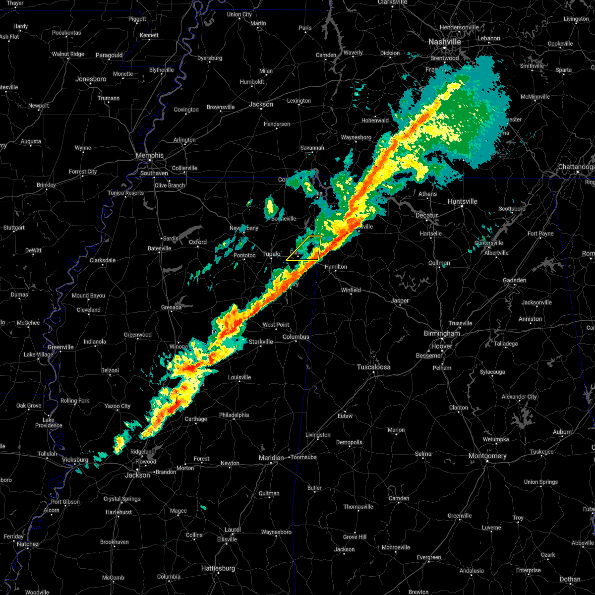 The severe thunderstorm warning for northern itawamba county will expire at 500 pm cst, the storm which prompted the warning has moved out of the area. therefore the warning will be allowed to expire. The severe thunderstorm warning for northern itawamba county will expire at 500 pm cst, the storm which prompted the warning has moved out of the area. therefore the warning will be allowed to expire.
|
| 11/18/2017 4:44 PM CST |
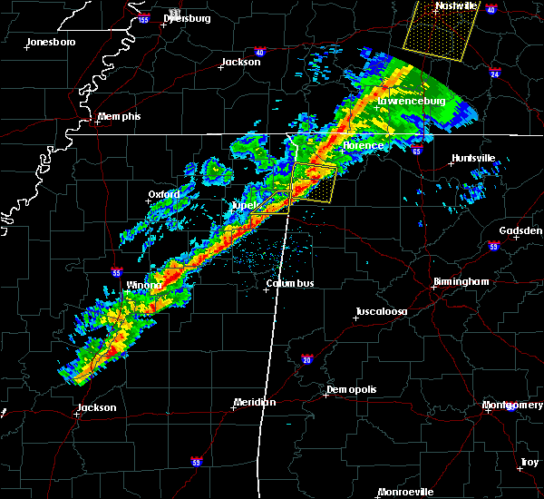 At 444 pm cst, a severe thunderstorm was located near belgreen, or 7 miles northwest of russellville, moving east at 85 mph (radar indicated). Hazards include 60 mph wind gusts. Expect damage to roofs, siding, and trees. Locations impacted include, fulton, red bay, tremont, fairview, clay, eastman, bounds crossroads, dorsey and ballardsville. At 444 pm cst, a severe thunderstorm was located near belgreen, or 7 miles northwest of russellville, moving east at 85 mph (radar indicated). Hazards include 60 mph wind gusts. Expect damage to roofs, siding, and trees. Locations impacted include, fulton, red bay, tremont, fairview, clay, eastman, bounds crossroads, dorsey and ballardsville.
|
| 11/18/2017 4:31 PM CST |
 At 431 pm cst, a severe thunderstorm was located over belmont, or near tishomingo state park, moving east at 60 mph (radar indicated). Hazards include 60 mph wind gusts. expect damage to roofs, siding, and trees At 431 pm cst, a severe thunderstorm was located over belmont, or near tishomingo state park, moving east at 60 mph (radar indicated). Hazards include 60 mph wind gusts. expect damage to roofs, siding, and trees
|
| 6/23/2017 11:38 AM CDT |
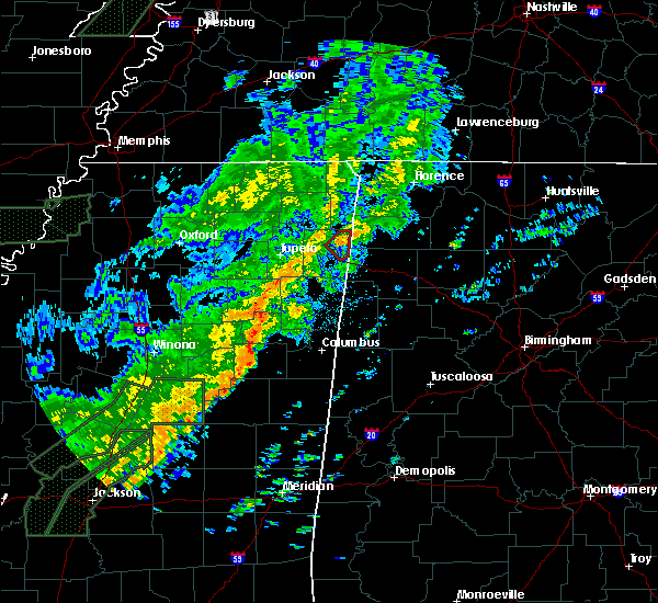 At 1138 am cdt, a severe thunderstorm producing a tornado was located near fairview, or 9 miles southwest of red bay, moving northeast at 45 mph (radar indicated rotation). Hazards include tornado. Flying debris will be dangerous to those caught without shelter. mobile homes will be damaged or destroyed. damage to roofs, windows, and vehicles will occur. tree damage is likely. This tornadic thunderstorm will remain over mainly rural areas of northeastern itawamba county, including the following locations: eastman and bounds crossroads. At 1138 am cdt, a severe thunderstorm producing a tornado was located near fairview, or 9 miles southwest of red bay, moving northeast at 45 mph (radar indicated rotation). Hazards include tornado. Flying debris will be dangerous to those caught without shelter. mobile homes will be damaged or destroyed. damage to roofs, windows, and vehicles will occur. tree damage is likely. This tornadic thunderstorm will remain over mainly rural areas of northeastern itawamba county, including the following locations: eastman and bounds crossroads.
|
| 6/15/2017 1:45 PM CDT |
 At 144 pm cdt, a severe thunderstorm was located over new salem, or 8 miles south of fulton, moving southeast at 40 mph (radar indicated). Hazards include 60 mph wind gusts. Expect damage to roofs, siding, and trees. Locations impacted include, fulton, tremont, new salem, abney, cardsville, turon, tilden and cadamy. At 144 pm cdt, a severe thunderstorm was located over new salem, or 8 miles south of fulton, moving southeast at 40 mph (radar indicated). Hazards include 60 mph wind gusts. Expect damage to roofs, siding, and trees. Locations impacted include, fulton, tremont, new salem, abney, cardsville, turon, tilden and cadamy.
|
| 6/15/2017 1:30 PM CDT |
 At 130 pm cdt, a severe thunderstorm was located over mantachie, or near fulton, moving southeast at 35 mph (radar indicated). Hazards include 60 mph wind gusts. expect damage to roofs, siding, and trees At 130 pm cdt, a severe thunderstorm was located over mantachie, or near fulton, moving southeast at 35 mph (radar indicated). Hazards include 60 mph wind gusts. expect damage to roofs, siding, and trees
|
| 5/28/2017 1:38 AM CDT |
 At 138 am cdt, a severe thunderstorm was located near evergreen, or 9 miles northwest of amory, moving southeast at 25 mph (radar indicated). Hazards include 60 mph wind gusts. expect damage to roofs, siding, and trees At 138 am cdt, a severe thunderstorm was located near evergreen, or 9 miles northwest of amory, moving southeast at 25 mph (radar indicated). Hazards include 60 mph wind gusts. expect damage to roofs, siding, and trees
|
| 5/28/2017 12:56 AM CDT |
 At 1256 am cdt, a severe thunderstorm was located near fulton, moving southeast at 65 mph (radar indicated). Hazards include 70 mph wind gusts. Expect considerable tree damage. Damage is likely to mobile homes, roofs, and outbuildings. At 1256 am cdt, a severe thunderstorm was located near fulton, moving southeast at 65 mph (radar indicated). Hazards include 70 mph wind gusts. Expect considerable tree damage. Damage is likely to mobile homes, roofs, and outbuildings.
|
| 5/28/2017 12:50 AM CDT |
 At 1250 am cdt, a severe thunderstorm was located near evergreen, or 8 miles north of amory, moving southeast at 65 mph (radar indicated). Hazards include 70 mph wind gusts and quarter size hail. Hail damage to vehicles is expected. expect considerable tree damage. wind damage is also likely to mobile homes, roofs, and outbuildings. Locations impacted include, tupelo, booneville, new albany, pontotoc, fulton, baldwyn, iuka, verona, trace state park, tombigbee state park, tishomingo state park, saltillo, guntown, belmont, shannon, plantersville, mantachie, ecru, tremont and tishomingo. At 1250 am cdt, a severe thunderstorm was located near evergreen, or 8 miles north of amory, moving southeast at 65 mph (radar indicated). Hazards include 70 mph wind gusts and quarter size hail. Hail damage to vehicles is expected. expect considerable tree damage. wind damage is also likely to mobile homes, roofs, and outbuildings. Locations impacted include, tupelo, booneville, new albany, pontotoc, fulton, baldwyn, iuka, verona, trace state park, tombigbee state park, tishomingo state park, saltillo, guntown, belmont, shannon, plantersville, mantachie, ecru, tremont and tishomingo.
|
| 5/28/2017 12:30 AM CDT |
 At 1230 am cdt, a severe thunderstorm was located over saltillo, or 8 miles south of baldwyn, moving southeast at 65 mph (radar indicated). Hazards include 60 mph wind gusts and quarter size hail. Hail damage to vehicles is expected. Expect wind damage to roofs, siding, and trees. At 1230 am cdt, a severe thunderstorm was located over saltillo, or 8 miles south of baldwyn, moving southeast at 65 mph (radar indicated). Hazards include 60 mph wind gusts and quarter size hail. Hail damage to vehicles is expected. Expect wind damage to roofs, siding, and trees.
|
| 4/22/2017 2:45 PM CDT |
 At 245 pm cdt, a severe thunderstorm was located near houston, moving northeast at 45 mph (radar indicated). Hazards include 60 mph wind gusts and half dollar size hail. Hail damage to vehicles is expected. Expect wind damage to roofs, siding, and trees. At 245 pm cdt, a severe thunderstorm was located near houston, moving northeast at 45 mph (radar indicated). Hazards include 60 mph wind gusts and half dollar size hail. Hail damage to vehicles is expected. Expect wind damage to roofs, siding, and trees.
|
| 3/27/2017 10:54 PM CDT |
 The severe thunderstorm warning for northern itawamba county will expire at 1100 pm cdt, the severe thunderstorm which prompted the warning has weakened. therefore, the warning will be allowed to expire. The severe thunderstorm warning for northern itawamba county will expire at 1100 pm cdt, the severe thunderstorm which prompted the warning has weakened. therefore, the warning will be allowed to expire.
|
| 3/27/2017 10:33 PM CDT |
 At 1032 pm cdt, a severe thunderstorm was located near sandy springs, or 10 miles north of fulton, moving east at 25 mph (radar indicated). Hazards include quarter size hail. Damage to vehicles is expected. Locations impacted include, fulton, mantachie, tremont, fairview, sandy springs, clay, eastman, bounds crossroads and kirkville. At 1032 pm cdt, a severe thunderstorm was located near sandy springs, or 10 miles north of fulton, moving east at 25 mph (radar indicated). Hazards include quarter size hail. Damage to vehicles is expected. Locations impacted include, fulton, mantachie, tremont, fairview, sandy springs, clay, eastman, bounds crossroads and kirkville.
|
| 3/27/2017 10:21 PM CDT |
 At 1021 pm cdt, a severe thunderstorm was located over pratts friendship, or near baldwyn, moving east at 25 mph (radar indicated). Hazards include quarter size hail. damage to vehicles is expected At 1021 pm cdt, a severe thunderstorm was located over pratts friendship, or near baldwyn, moving east at 25 mph (radar indicated). Hazards include quarter size hail. damage to vehicles is expected
|
| 3/27/2017 3:56 PM CDT |
 At 356 pm cdt, a severe thunderstorm was located over fulton, moving east at 35 mph (radar indicated). Hazards include golf ball size hail and 60 mph wind gusts. People and animals outdoors will be injured. expect hail damage to roofs, siding, windows, and vehicles. Expect wind damage to roofs, siding, and trees. At 356 pm cdt, a severe thunderstorm was located over fulton, moving east at 35 mph (radar indicated). Hazards include golf ball size hail and 60 mph wind gusts. People and animals outdoors will be injured. expect hail damage to roofs, siding, windows, and vehicles. Expect wind damage to roofs, siding, and trees.
|
| 3/27/2017 3:44 PM CDT | Half Dollar sized hail reported 7.3 miles SSW of Tremont, MS, quarter to half dollar size hail |
| 3/27/2017 3:41 PM CDT |
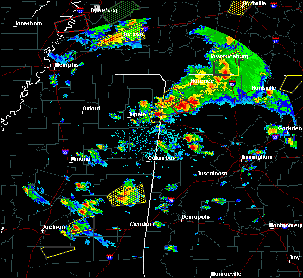 At 341 pm cdt, a severe thunderstorm was located near tremont, or 8 miles east of fulton, moving east at 30 mph (radar indicated). Hazards include golf ball size hail and 60 mph wind gusts. People and animals outdoors will be injured. expect hail damage to roofs, siding, windows, and vehicles. Expect wind damage to roofs, siding, and trees. At 341 pm cdt, a severe thunderstorm was located near tremont, or 8 miles east of fulton, moving east at 30 mph (radar indicated). Hazards include golf ball size hail and 60 mph wind gusts. People and animals outdoors will be injured. expect hail damage to roofs, siding, windows, and vehicles. Expect wind damage to roofs, siding, and trees.
|
| 3/27/2017 3:20 PM CDT |
 At 320 pm cdt, a severe thunderstorm was located near red bay, moving northeast at 40 mph (radar indicated). Hazards include 60 mph wind gusts and quarter size hail. Hail damage to vehicles is expected. expect wind damage to roofs, siding, and trees. Locations impacted include, fulton, belmont, mantachie, tremont, sandy springs, fairview, clay, marietta, golden, eastman, dennis, moores mill, kirkville, bounds crossroads and bloody springs. At 320 pm cdt, a severe thunderstorm was located near red bay, moving northeast at 40 mph (radar indicated). Hazards include 60 mph wind gusts and quarter size hail. Hail damage to vehicles is expected. expect wind damage to roofs, siding, and trees. Locations impacted include, fulton, belmont, mantachie, tremont, sandy springs, fairview, clay, marietta, golden, eastman, dennis, moores mill, kirkville, bounds crossroads and bloody springs.
|
| 3/27/2017 2:56 PM CDT |
 At 256 pm cdt, a severe thunderstorm was located over fairview, or 7 miles northeast of fulton, moving northeast at 40 mph (radar indicated). Hazards include quarter size hail. damage to vehicles is expected At 256 pm cdt, a severe thunderstorm was located over fairview, or 7 miles northeast of fulton, moving northeast at 40 mph (radar indicated). Hazards include quarter size hail. damage to vehicles is expected
|
| 3/10/2017 12:05 AM CST |
 At 1205 am cst, a severe thunderstorm was located near tremont, or 9 miles east of fulton, moving east at 45 mph (radar indicated). Hazards include 60 mph wind gusts and half dollar size hail. Hail damage to vehicles is expected. Expect wind damage to roofs, siding, and trees. At 1205 am cst, a severe thunderstorm was located near tremont, or 9 miles east of fulton, moving east at 45 mph (radar indicated). Hazards include 60 mph wind gusts and half dollar size hail. Hail damage to vehicles is expected. Expect wind damage to roofs, siding, and trees.
|
| 3/9/2017 11:36 PM CST |
 At 1135 pm cst, a severe thunderstorm was located over new salem, or 9 miles southeast of fulton, moving east at 30 mph (radar indicated). Hazards include 60 mph wind gusts and quarter size hail. Hail damage to vehicles is expected. expect wind damage to roofs, siding, and trees. Locations impacted include, fulton, tombigbee state park, shannon, mantachie, tremont, fairview, new salem, sandy springs, evergreen, clay, nettleton, abney, eastman, turon, mooreville, eggville, ballardsville, kirkville, cardsville and tilden. At 1135 pm cst, a severe thunderstorm was located over new salem, or 9 miles southeast of fulton, moving east at 30 mph (radar indicated). Hazards include 60 mph wind gusts and quarter size hail. Hail damage to vehicles is expected. expect wind damage to roofs, siding, and trees. Locations impacted include, fulton, tombigbee state park, shannon, mantachie, tremont, fairview, new salem, sandy springs, evergreen, clay, nettleton, abney, eastman, turon, mooreville, eggville, ballardsville, kirkville, cardsville and tilden.
|
| 3/9/2017 11:18 PM CST |
 At 1118 pm cst, a severe thunderstorm was located near evergreen, or 7 miles south of fulton, moving east at 30 mph (radar indicated). Hazards include 60 mph wind gusts and quarter size hail. Hail damage to vehicles is expected. Expect wind damage to roofs, siding, and trees. At 1118 pm cst, a severe thunderstorm was located near evergreen, or 7 miles south of fulton, moving east at 30 mph (radar indicated). Hazards include 60 mph wind gusts and quarter size hail. Hail damage to vehicles is expected. Expect wind damage to roofs, siding, and trees.
|
| 3/9/2017 6:10 PM CST |
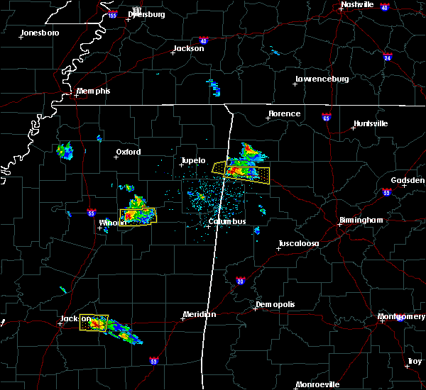 The severe thunderstorm warning for southeastern itawamba county will expire at 615 pm cst, the severe thunderstorm which prompted the warning has moved out of the warned area. therefore, the warning will be allowed to expire. The severe thunderstorm warning for southeastern itawamba county will expire at 615 pm cst, the severe thunderstorm which prompted the warning has moved out of the warned area. therefore, the warning will be allowed to expire.
|
| 3/9/2017 5:52 PM CST |
 At 552 pm cst, a severe thunderstorm was located over tremont, or 8 miles east of fulton, moving east at 25 mph (radar indicated). Hazards include 60 mph wind gusts and quarter size hail. Hail damage to vehicles is expected. expect wind damage to roofs, siding, and trees. Locations impacted include, tremont and cadamy. At 552 pm cst, a severe thunderstorm was located over tremont, or 8 miles east of fulton, moving east at 25 mph (radar indicated). Hazards include 60 mph wind gusts and quarter size hail. Hail damage to vehicles is expected. expect wind damage to roofs, siding, and trees. Locations impacted include, tremont and cadamy.
|
| 3/9/2017 5:45 PM CST | Quarter sized hail reported 2.2 miles WNW of Tremont, MS, quarter sized hail reported. |
| 3/9/2017 5:40 PM CST |
 At 540 pm cst, a severe thunderstorm was located near fulton, moving east at 25 mph (radar indicated). Hazards include 60 mph wind gusts and quarter size hail. Hail damage to vehicles is expected. Expect wind damage to roofs, siding, and trees. At 540 pm cst, a severe thunderstorm was located near fulton, moving east at 25 mph (radar indicated). Hazards include 60 mph wind gusts and quarter size hail. Hail damage to vehicles is expected. Expect wind damage to roofs, siding, and trees.
|
| 12/18/2016 1:00 AM CST |
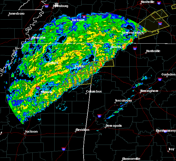 At 1259 am cst, a severe thunderstorm was located near hackleburg, or 12 miles southwest of russellville, moving east at 65 mph (radar indicated). Hazards include 60 mph wind gusts. Expect damage to roofs, siding, and trees. locations impacted include, fulton, tremont, evergreen, fairview, new salem, clay, tilden, abney, eastman, jacinto, cardsville, bounds crossroads, turon and cadamy. A tornado watch remains in effect until 300 am cst for northeastern mississippi. At 1259 am cst, a severe thunderstorm was located near hackleburg, or 12 miles southwest of russellville, moving east at 65 mph (radar indicated). Hazards include 60 mph wind gusts. Expect damage to roofs, siding, and trees. locations impacted include, fulton, tremont, evergreen, fairview, new salem, clay, tilden, abney, eastman, jacinto, cardsville, bounds crossroads, turon and cadamy. A tornado watch remains in effect until 300 am cst for northeastern mississippi.
|
| 12/18/2016 12:57 AM CST |
 At 1256 am cst, a severe thunderstorm was located near hackleburg, or 14 miles southwest of russellville, moving east at 65 mph (radar indicated). Hazards include 60 mph wind gusts. Expect damage to roofs, siding, and trees. locations impacted include, fulton, tremont, evergreen, fairview, new salem, clay, tilden, abney, eastman, jacinto, cardsville, bounds crossroads, turon and cadamy. A tornado watch remains in effect until 300 am cst for northeastern mississippi. At 1256 am cst, a severe thunderstorm was located near hackleburg, or 14 miles southwest of russellville, moving east at 65 mph (radar indicated). Hazards include 60 mph wind gusts. Expect damage to roofs, siding, and trees. locations impacted include, fulton, tremont, evergreen, fairview, new salem, clay, tilden, abney, eastman, jacinto, cardsville, bounds crossroads, turon and cadamy. A tornado watch remains in effect until 300 am cst for northeastern mississippi.
|
| 12/18/2016 12:42 AM CST |
 At 1241 am cst, a severe thunderstorm was located over tremont, or 8 miles east of fulton, moving east at 60 mph (radar indicated). Hazards include 60 mph wind gusts. expect damage to roofs, siding, and trees At 1241 am cst, a severe thunderstorm was located over tremont, or 8 miles east of fulton, moving east at 60 mph (radar indicated). Hazards include 60 mph wind gusts. expect damage to roofs, siding, and trees
|
| 12/18/2016 12:41 AM CST |
 At 1240 am cst, a severe thunderstorm was located over tremont, or 7 miles east of fulton, moving east at 60 mph (radar indicated). Hazards include 60 mph wind gusts. expect damage to roofs, siding, and trees At 1240 am cst, a severe thunderstorm was located over tremont, or 7 miles east of fulton, moving east at 60 mph (radar indicated). Hazards include 60 mph wind gusts. expect damage to roofs, siding, and trees
|
| 12/18/2016 12:03 AM CST |
 At 1203 am cst, a severe thunderstorm was located over mantachie, or 8 miles northwest of fulton, moving northeast at 55 mph (radar indicated). Hazards include 60 mph wind gusts. expect damage to roofs, siding, and trees At 1203 am cst, a severe thunderstorm was located over mantachie, or 8 miles northwest of fulton, moving northeast at 55 mph (radar indicated). Hazards include 60 mph wind gusts. expect damage to roofs, siding, and trees
|
| 11/28/2016 4:43 PM CST |
 At 443 pm cst, a severe thunderstorm was located near evergreen, or 8 miles south of fulton, moving northeast at 55 mph (radar indicated). Hazards include 60 mph wind gusts. Expect damage to roofs. siding. And trees. At 443 pm cst, a severe thunderstorm was located near evergreen, or 8 miles south of fulton, moving northeast at 55 mph (radar indicated). Hazards include 60 mph wind gusts. Expect damage to roofs. siding. And trees.
|
| 6/17/2016 1:11 PM CDT |
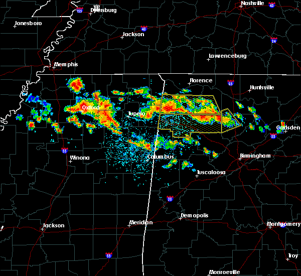 At 111 pm cdt, a severe thunderstorm was located near red bay, moving south at 25 mph (radar indicated). Hazards include 60 mph wind gusts and nickel size hail. Expect damage to roofs. siding. And trees. At 111 pm cdt, a severe thunderstorm was located near red bay, moving south at 25 mph (radar indicated). Hazards include 60 mph wind gusts and nickel size hail. Expect damage to roofs. siding. And trees.
|
| 3/31/2016 7:39 PM CDT |
 At 739 pm cdt, a severe thunderstorm was located over tremont, or 9 miles east of fulton, moving east at 15 mph (radar indicated). Hazards include 60 mph wind gusts and quarter size hail. Hail damage to vehicles is expected. expect wind damage to roofs, siding, and trees. locations impacted include, fulton, mantachie, tremont, sandy springs, evergreen, fairview, clay, abney, tilden, ballardsville, eastman, bounds crossroads and dorsey. A tornado watch remains in effect until 1000 pm cdt for northeastern mississippi. At 739 pm cdt, a severe thunderstorm was located over tremont, or 9 miles east of fulton, moving east at 15 mph (radar indicated). Hazards include 60 mph wind gusts and quarter size hail. Hail damage to vehicles is expected. expect wind damage to roofs, siding, and trees. locations impacted include, fulton, mantachie, tremont, sandy springs, evergreen, fairview, clay, abney, tilden, ballardsville, eastman, bounds crossroads and dorsey. A tornado watch remains in effect until 1000 pm cdt for northeastern mississippi.
|
| 3/31/2016 7:26 PM CDT |
 At 726 pm cdt, a severe thunderstorm was located over tombigbee state park, moving northeast at 40 mph (radar indicated). Hazards include 60 mph wind gusts and quarter size hail. Hail damage to vehicles is expected. Expect wind damage to roofs, siding, and trees. At 726 pm cdt, a severe thunderstorm was located over tombigbee state park, moving northeast at 40 mph (radar indicated). Hazards include 60 mph wind gusts and quarter size hail. Hail damage to vehicles is expected. Expect wind damage to roofs, siding, and trees.
|
| 3/31/2016 7:09 PM CDT |
 At 709 pm cdt, a severe thunderstorm was located near fulton, moving northeast at 10 mph (radar indicated). Hazards include 60 mph wind gusts and half dollar size hail. Hail damage to vehicles is expected. expect wind damage to roofs, siding, and trees. locations impacted include, fulton, mantachie, tremont, sandy springs, evergreen, fairview, new salem, clay, tilden, abney, ballardsville, eastman, jacinto, cardsville, bounds crossroads, dorsey, kirkville and cadamy. A tornado watch remains in effect until 1000 pm cdt for northeastern mississippi. At 709 pm cdt, a severe thunderstorm was located near fulton, moving northeast at 10 mph (radar indicated). Hazards include 60 mph wind gusts and half dollar size hail. Hail damage to vehicles is expected. expect wind damage to roofs, siding, and trees. locations impacted include, fulton, mantachie, tremont, sandy springs, evergreen, fairview, new salem, clay, tilden, abney, ballardsville, eastman, jacinto, cardsville, bounds crossroads, dorsey, kirkville and cadamy. A tornado watch remains in effect until 1000 pm cdt for northeastern mississippi.
|
| 3/31/2016 6:57 PM CDT |
 At 657 pm cdt, a severe thunderstorm was located near fulton, moving east at 20 mph (radar indicated). Hazards include 60 mph wind gusts and half dollar size hail. Hail damage to vehicles is expected. expect wind damage to roofs, siding, and trees. locations impacted include, fulton, mantachie, tremont, sandy springs, evergreen, fairview, new salem, clay, tilden, abney, ballardsville, eastman, jacinto, cardsville, bounds crossroads, dorsey, turon, kirkville and cadamy. A tornado watch remains in effect until 1000 pm cdt for northeastern mississippi. At 657 pm cdt, a severe thunderstorm was located near fulton, moving east at 20 mph (radar indicated). Hazards include 60 mph wind gusts and half dollar size hail. Hail damage to vehicles is expected. expect wind damage to roofs, siding, and trees. locations impacted include, fulton, mantachie, tremont, sandy springs, evergreen, fairview, new salem, clay, tilden, abney, ballardsville, eastman, jacinto, cardsville, bounds crossroads, dorsey, turon, kirkville and cadamy. A tornado watch remains in effect until 1000 pm cdt for northeastern mississippi.
|
| 3/31/2016 6:24 PM CDT |
 At 624 pm cdt, a severe thunderstorm was located near evergreen, or near fulton, moving northeast at 10 mph (radar indicated). Hazards include 60 mph wind gusts and half dollar size hail. Hail damage to vehicles is expected. Expect wind damage to roofs, siding, and trees. At 624 pm cdt, a severe thunderstorm was located near evergreen, or near fulton, moving northeast at 10 mph (radar indicated). Hazards include 60 mph wind gusts and half dollar size hail. Hail damage to vehicles is expected. Expect wind damage to roofs, siding, and trees.
|
| 12/25/2015 7:56 AM CST |
 The severe thunderstorm warning for southeastern itawamba and northeastern monroe counties will expire at 800 am cst, the severe thunderstorm which prompted the warning has weakened. therefore the warning will be allowed to expire. The severe thunderstorm warning for southeastern itawamba and northeastern monroe counties will expire at 800 am cst, the severe thunderstorm which prompted the warning has weakened. therefore the warning will be allowed to expire.
|
| 12/25/2015 7:43 AM CST |
 At 743 am cst, a severe thunderstorm was located near detroit, or 14 miles west of hamilton, moving northeast at 55 mph (radar indicated). Hazards include 60 mph wind gusts and penny size hail. Expect damage to roofs. siding and trees. Locations impacted include, amory, smithville, tremont, new salem, hatley, gattman, parham, athens, quincy, wise gap, sipsey fork, greenwood springs, turon, cadamy and splunge. At 743 am cst, a severe thunderstorm was located near detroit, or 14 miles west of hamilton, moving northeast at 55 mph (radar indicated). Hazards include 60 mph wind gusts and penny size hail. Expect damage to roofs. siding and trees. Locations impacted include, amory, smithville, tremont, new salem, hatley, gattman, parham, athens, quincy, wise gap, sipsey fork, greenwood springs, turon, cadamy and splunge.
|
| 12/25/2015 7:15 AM CST |
 At 715 am cst, a severe thunderstorm was located near new wren, or near aberdeen, moving northeast at 55 mph (radar indicated). Hazards include 60 mph wind gusts and penny size hail. Expect damage to roofs. Siding and trees. At 715 am cst, a severe thunderstorm was located near new wren, or near aberdeen, moving northeast at 55 mph (radar indicated). Hazards include 60 mph wind gusts and penny size hail. Expect damage to roofs. Siding and trees.
|
| 7/14/2015 6:45 PM CDT |
 At 645 pm cdt, a severe thunderstorm was located near new salem, or 11 miles southeast of fulton, moving southeast at 45 mph (trained weather spotters). Hazards include 60 mph wind gusts. Expect damage to roofs. siding and trees. Locations impacted include, tupelo, amory, aberdeen, fulton, verona, okolona, tombigbee state park, shannon, plantersville, smithville, tremont, new wren, evergreen, prairie, new salem, clay, nettleton, hatley, gattman and eastman. At 645 pm cdt, a severe thunderstorm was located near new salem, or 11 miles southeast of fulton, moving southeast at 45 mph (trained weather spotters). Hazards include 60 mph wind gusts. Expect damage to roofs. siding and trees. Locations impacted include, tupelo, amory, aberdeen, fulton, verona, okolona, tombigbee state park, shannon, plantersville, smithville, tremont, new wren, evergreen, prairie, new salem, clay, nettleton, hatley, gattman and eastman.
|
| 7/14/2015 6:10 PM CDT |
 At 609 pm cdt, a severe thunderstorm was located over pratts friendship, or near baldwyn, moving southeast at 45 mph (radar indicated). Hazards include 60 mph wind gusts. Expect damage to roofs. Siding and trees. At 609 pm cdt, a severe thunderstorm was located over pratts friendship, or near baldwyn, moving southeast at 45 mph (radar indicated). Hazards include 60 mph wind gusts. Expect damage to roofs. Siding and trees.
|
| 7/14/2015 5:55 PM CDT |
 At 551 pm cdt, severe thunderstorms were located along a line extending from 8 miles east of red bay to near smithville to 7 miles northeast of houston, moving southeast at 60 mph (radar indicated). Hazards include 60 mph wind gusts. Expect damage to roofs. siding and trees. Locations impacted include, tupelo, corinth, booneville, new albany, ripley, fulton, baldwyn, verona, tishomingo state park, tombigbee state park, saltillo, guntown, belmont, shannon, plantersville, mantachie, blue mountain, jumpertown, tremont and glen. At 551 pm cdt, severe thunderstorms were located along a line extending from 8 miles east of red bay to near smithville to 7 miles northeast of houston, moving southeast at 60 mph (radar indicated). Hazards include 60 mph wind gusts. Expect damage to roofs. siding and trees. Locations impacted include, tupelo, corinth, booneville, new albany, ripley, fulton, baldwyn, verona, tishomingo state park, tombigbee state park, saltillo, guntown, belmont, shannon, plantersville, mantachie, blue mountain, jumpertown, tremont and glen.
|
| 7/14/2015 5:53 PM CDT |
 At 551 pm cdt, severe thunderstorms were located along a line extending from 8 miles east of red bay to near smithville to 7 miles northeast of houston, moving southeast at 60 mph (radar indicated). Hazards include 60 mph wind gusts. Expect damage to roofs. siding and trees. Locations impacted include, tupelo, corinth, booneville, new albany, ripley, fulton, baldwyn, verona, tishomingo state park, tombigbee state park, saltillo, guntown, belmont, shannon, plantersville, mantachie, blue mountain, jumpertown, tremont and glen. At 551 pm cdt, severe thunderstorms were located along a line extending from 8 miles east of red bay to near smithville to 7 miles northeast of houston, moving southeast at 60 mph (radar indicated). Hazards include 60 mph wind gusts. Expect damage to roofs. siding and trees. Locations impacted include, tupelo, corinth, booneville, new albany, ripley, fulton, baldwyn, verona, tishomingo state park, tombigbee state park, saltillo, guntown, belmont, shannon, plantersville, mantachie, blue mountain, jumpertown, tremont and glen.
|
| 7/14/2015 5:26 PM CDT |
 At 526 pm cdt, severe thunderstorms were located along a line extending from near theo to near new albany to near oxford, moving southeast at 60 mph (radar indicated). Hazards include 60 mph wind gusts. Expect damage to roofs. Siding and trees. At 526 pm cdt, severe thunderstorms were located along a line extending from near theo to near new albany to near oxford, moving southeast at 60 mph (radar indicated). Hazards include 60 mph wind gusts. Expect damage to roofs. Siding and trees.
|
| 6/24/2015 12:02 AM CDT |
 At 1202 am cdt, a severe thunderstorm was located near new salem, or 9 miles southeast of fulton, moving south at 50 mph (radar indicated). Hazards include 60 mph wind gusts. Expect damage to roofs. Siding and trees. At 1202 am cdt, a severe thunderstorm was located near new salem, or 9 miles southeast of fulton, moving south at 50 mph (radar indicated). Hazards include 60 mph wind gusts. Expect damage to roofs. Siding and trees.
|
| 6/8/2015 1:15 PM CDT |
 At 114 pm cdt, a severe thunderstorm was located near verona, moving northeast at 40 mph (radar indicated). Hazards include 60 mph wind gusts and quarter size hail. Hail damage to vehicles is expected. expect wind damage to roofs, siding and trees. Locations impacted include, tupelo, fulton, verona, tombigbee state park, shannon, plantersville, mantachie, tremont, sandy springs, fairview, evergreen, new salem, clay, nettleton, eastman, jacinto, eggville, richmond, mooreville and dorsey. At 114 pm cdt, a severe thunderstorm was located near verona, moving northeast at 40 mph (radar indicated). Hazards include 60 mph wind gusts and quarter size hail. Hail damage to vehicles is expected. expect wind damage to roofs, siding and trees. Locations impacted include, tupelo, fulton, verona, tombigbee state park, shannon, plantersville, mantachie, tremont, sandy springs, fairview, evergreen, new salem, clay, nettleton, eastman, jacinto, eggville, richmond, mooreville and dorsey.
|
| 6/8/2015 12:55 PM CDT |
 At 1255 pm cdt, a severe thunderstorm was located 7 miles south of troy, or 7 miles northwest of okolona, moving northeast at 40 mph (radar indicated). Hazards include 60 mph wind gusts and quarter size hail. Hail damage to vehicles is expected. Expect wind damage to roofs, siding and trees. At 1255 pm cdt, a severe thunderstorm was located 7 miles south of troy, or 7 miles northwest of okolona, moving northeast at 40 mph (radar indicated). Hazards include 60 mph wind gusts and quarter size hail. Hail damage to vehicles is expected. Expect wind damage to roofs, siding and trees.
|
| 5/27/2015 4:26 PM CDT | The severe thunderstorm warning for itawamba, northern monroe, southeastern prentiss, eastern lee and south central tishomingo counties will expire at 430 pm cdt, the storm which prompted the warning has moved out of the area. therefore the warning will be allowed to expire. |
| 5/27/2015 3:45 PM CDT | At 344 pm cdt, a severe thunderstorm was located near amory, moving east at 45 mph (radar indicated). Hazards include 60 mph wind gusts and quarter size hail. Hail damage to vehicles is expected. Expect wind damage to roofs, siding and trees. |
| 5/25/2015 9:26 AM CDT | The severe thunderstorm warning for southern itawamba and eastern monroe counties will expire at 930 am cdt, the storms which prompted the warning have moved out of the area. therefore the warning will be allowed to expire. to report severe weather, contact your nearest law enforcement agency. they will relay your report to the national weather service memphis. |
| 5/25/2015 9:05 AM CDT | At 904 am cdt, severe thunderstorms were located along a line extending from near new salem to near detroit, moving northeast at 45 mph (radar indicated). Hazards include 60 mph wind gusts. Expect damage to roofs. siding and trees. Locations impacted include, amory, smithville, tremont, new salem, hatley, gattman, tilden, jacinto, parham, athens, bigbee, new hamilton, quincy, becker, wise gap, cardsville, sipsey fork, greenwood springs, turon and cadamy. |
| 5/25/2015 9:00 AM CDT | At 900 am cdt, a severe thunderstorm producing a tornado was located near smithville, or near amory, moving northeast at 45 mph (radar indicated rotation). Hazards include tornado and quarter size hail. Flying debris will be dangerous to those caught without shelter. mobile homes will be damaged or destroyed. damage to roofs, windows and vehicles will occur. tree damage is likely. this dangerous storm will be near, new salem around 910 am cdt. tremont around 915 am cdt. Other locations impacted by this tornadic thunderstorm include bounds crossroads, tilden, turon, cardsville and cadamy. |
| 5/25/2015 8:50 AM CDT | At 850 am cdt, a severe thunderstorm producing a tornado was located over new wren, or near amory, moving northeast at 30 mph (radar indicated rotation). Hazards include tornado and quarter size hail. Flying debris will be dangerous to those caught without shelter. mobile homes will be damaged or destroyed. damage to roofs, windows and vehicles will occur. tree damage is likely. this dangerous storm will be near, amory around 905 am cdt. smithville and new salem around 915 am cdt. Other locations impacted by this tornadic thunderstorm include tilden, cardsville, jacinto, parham, bigbee, hatley, bounds crossroads, wren, turon and cadamy. |
| 5/25/2015 8:41 AM CDT | At 841 am cdt, severe thunderstorms were located along a line extending from near new wren to near amory to 8 miles northwest of caledonia, moving northeast at 50 mph (radar indicated). Hazards include 60 mph wind gusts. Expect damage to roofs. Siding and trees. |
| 5/25/2015 8:35 AM CDT | At 835 am cdt, a severe thunderstorm producing a tornado was located near prairie, or 8 miles northwest of aberdeen, moving northeast at 45 mph (radar indicated rotation). Hazards include tornado and quarter size hail. Flying debris will be dangerous to those caught without shelter. mobile homes will be damaged or destroyed. damage to roofs, windows and vehicles will occur. tree damage is likely. this dangerous storm will be near, new wren around 845 am cdt. amory around 855 am cdt. smithville around 900 am cdt. new salem around 910 am cdt. tremont around 915 am cdt. Other locations impacted by this tornadic thunderstorm include egypt, tilden, cardsville, jacinto, parham, bigbee, hatley, bounds crossroads, wren and turon. |
| 4/20/2015 12:37 AM CDT | Several trees were blown dow in marion county AL, 7.5 miles WSW of Tremont, MS |
| 4/3/2015 6:55 PM CDT | A severe thunderstorm warning remains in effect until 715 pm cdt for northern itawamba county. at 654 pm cdt. a severe thunderstorm was located near fairview. or near fulton. moving east at 50 mph. hazard. 60 mph wind gusts and quarter size hail. source. Radar indicated. |
| 4/3/2015 6:50 PM CDT | A severe thunderstorm warning remains in effect until 715 pm cdt for itawamba and east central lee counties. at 650 pm cdt. a severe thunderstorm was located near mantachie. or 7 miles northwest of fulton. and is nearly stationary. hazard. 60 mph wind gusts and quarter size hail. source. Radar indicated. |
| 4/3/2015 6:36 PM CDT | The national weather service in memphis has issued a * severe thunderstorm warning for. itawamba county in northeastern mississippi. northern lee county in northeastern mississippi. until 715 pm cdt * at 636 pm cdt. A severe thunderstorm was located over saltillo. |
| 10/13/2014 4:42 PM CDT | Half Dollar sized hail reported 2.5 miles NW of Tremont, MS |
| 3/31/2012 10:28 PM CDT | Golf Ball sized hail reported 3.2 miles W of Tremont, MS, golf ball size hail on us 78 on the state line. |
| 1/1/0001 12:00 AM | 4-6 inch limbs on cotton gin road in itawamba county MS, 2.5 miles E of Tremont, MS |
| 1/1/0001 12:00 AM | Quarter sized hail reported 4.4 miles NE of Tremont, MS, nickel to quarter sized hail across the southern sections of itawamba county |
Hail Maps for Tremont, MS

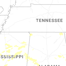
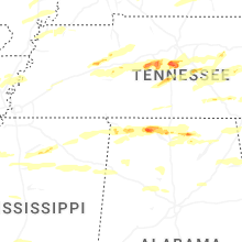


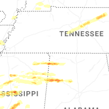

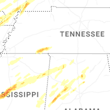


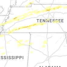


Connect with Interactive Hail Maps