

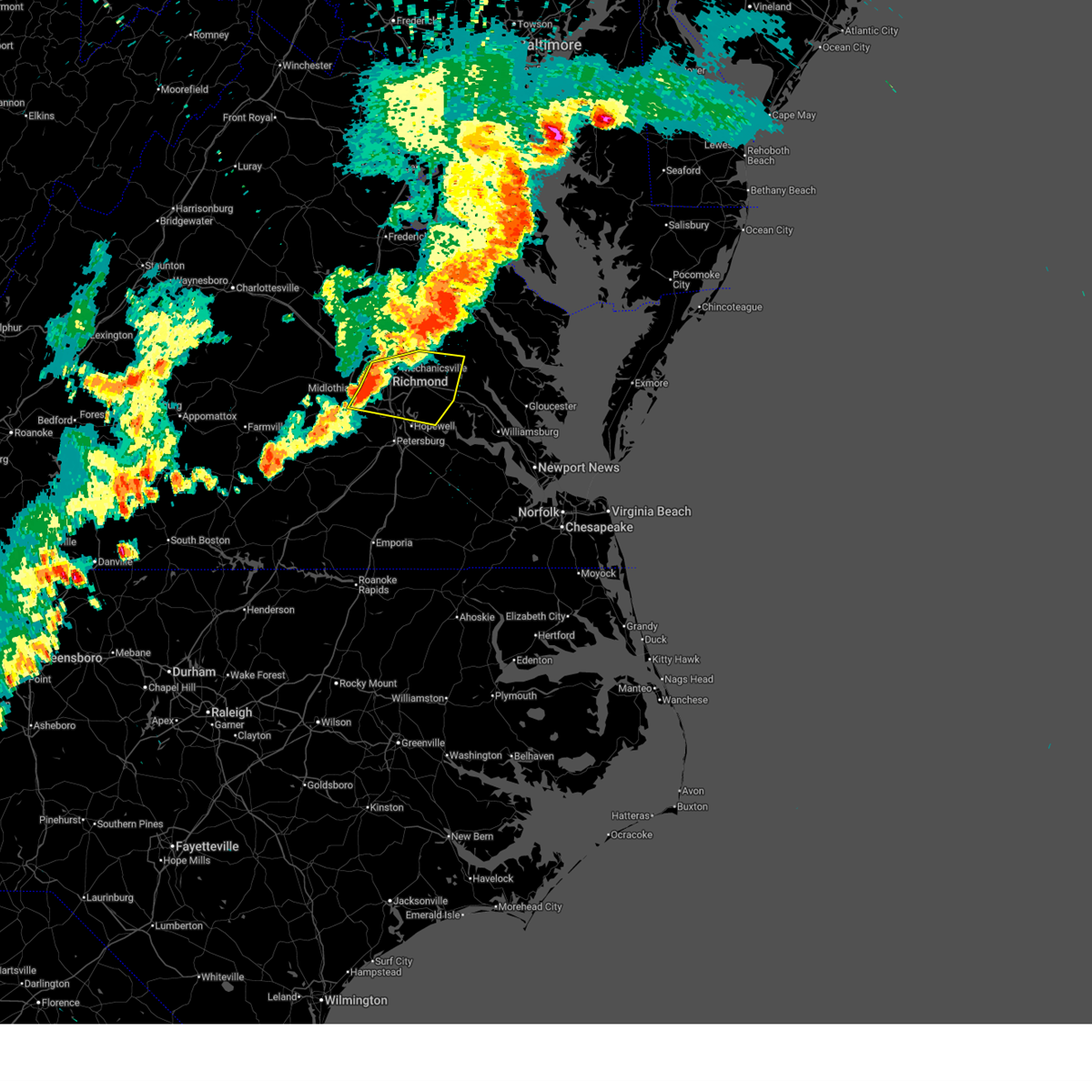
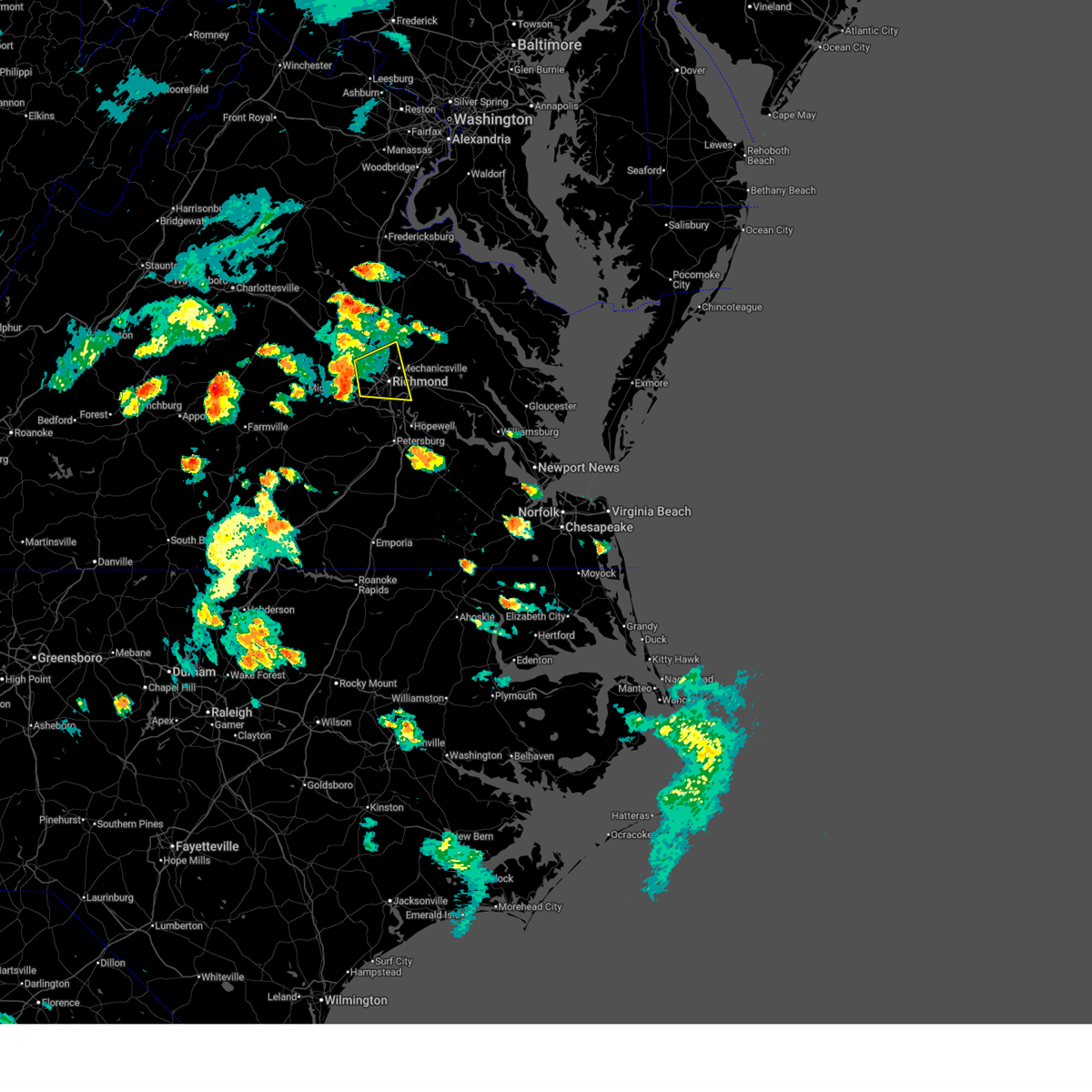
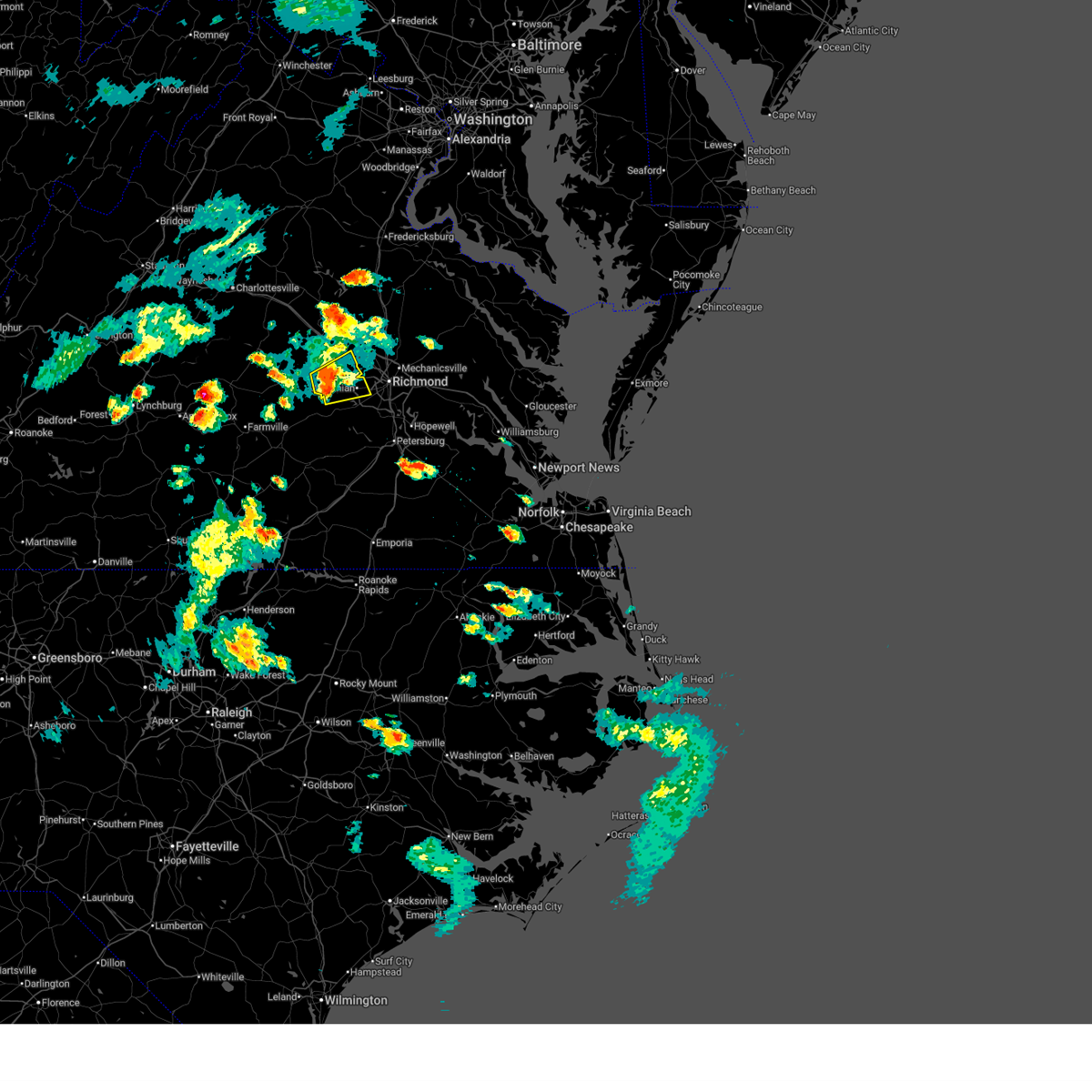
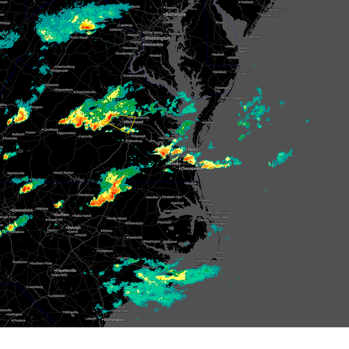
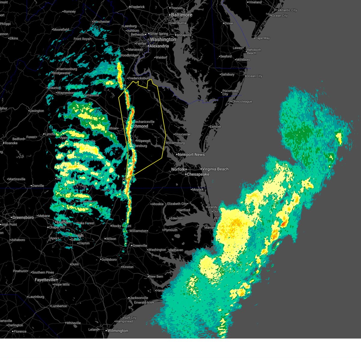
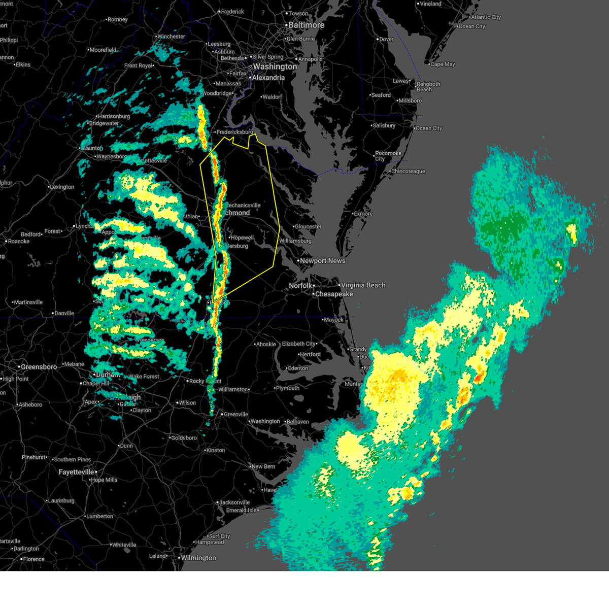
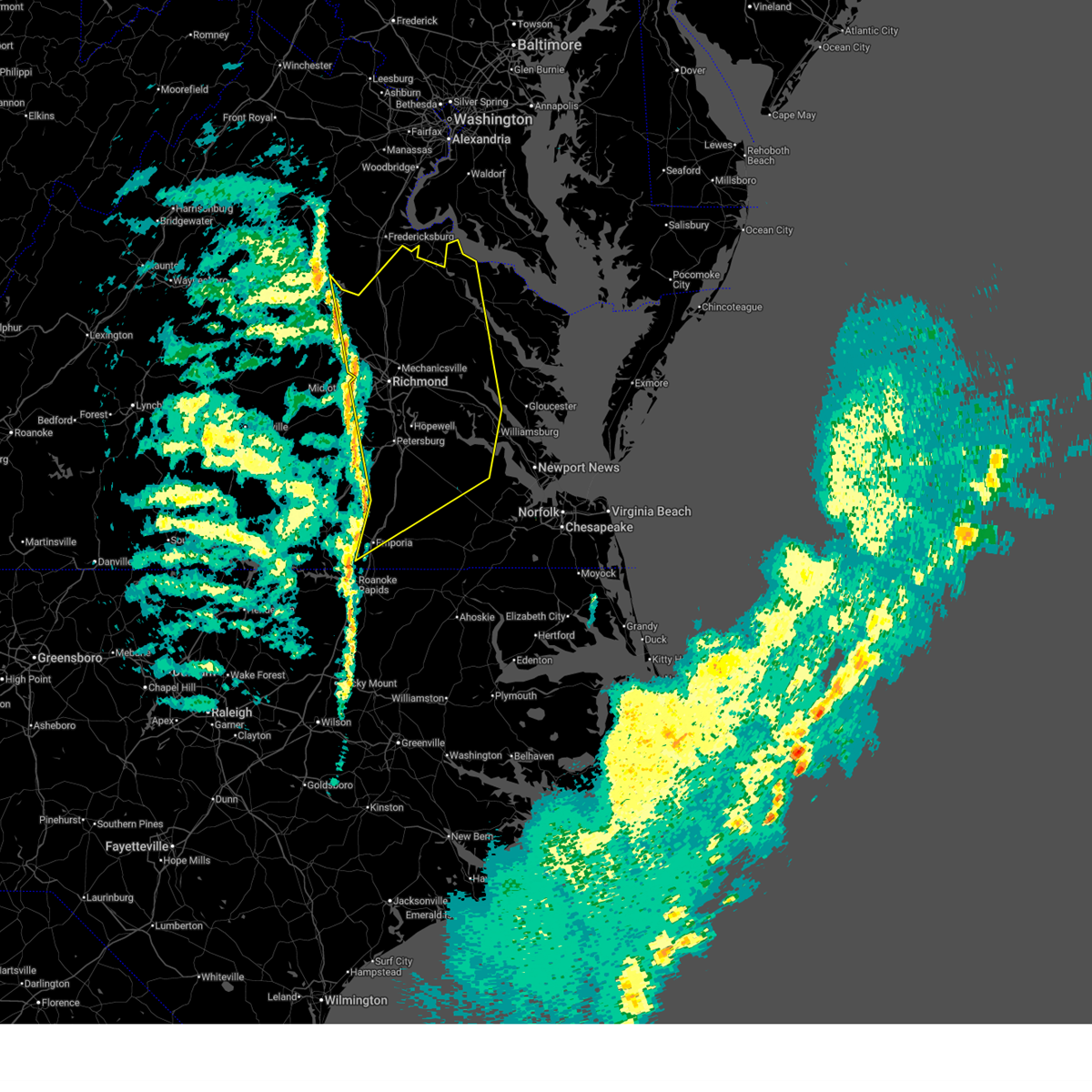
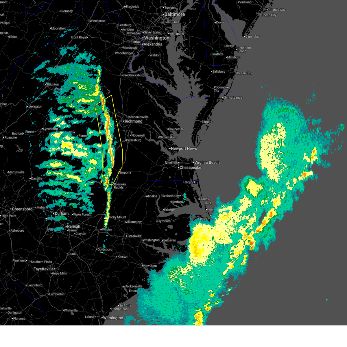
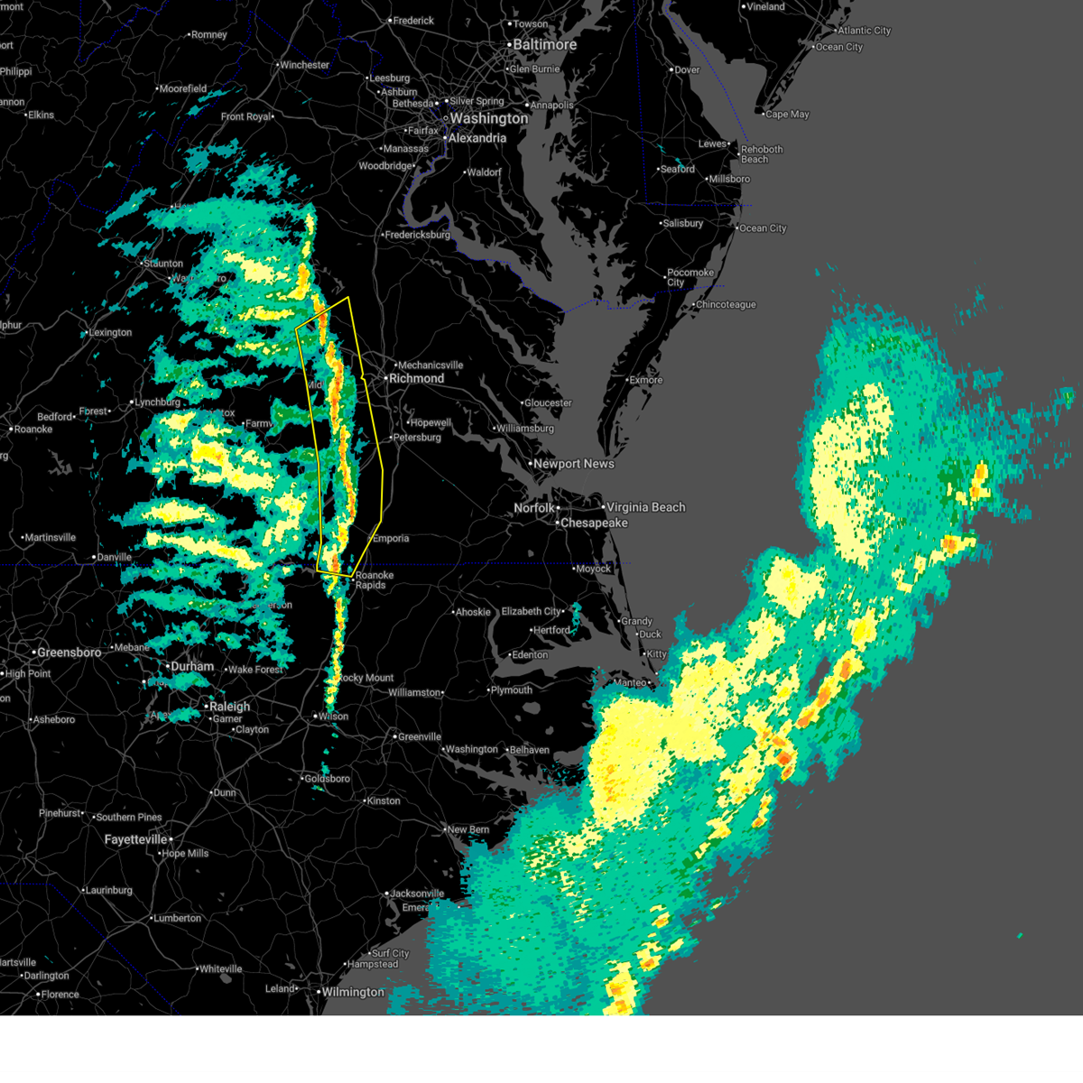
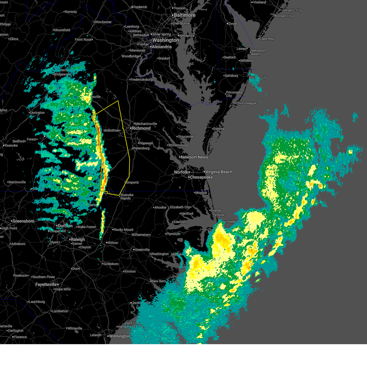
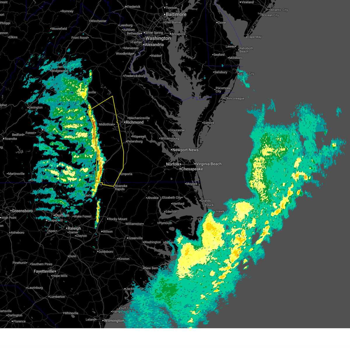
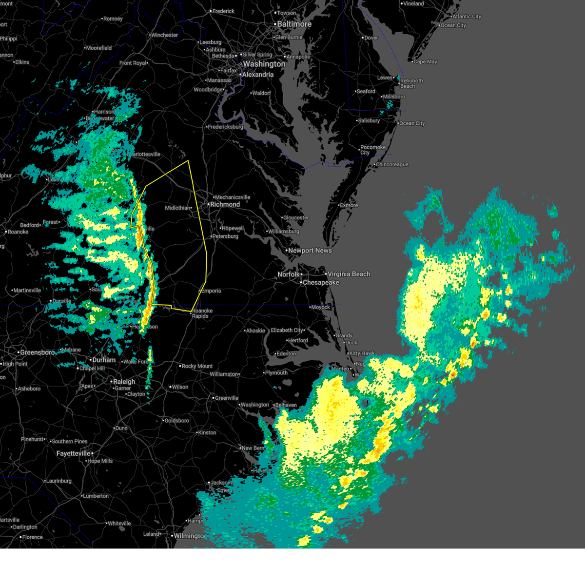
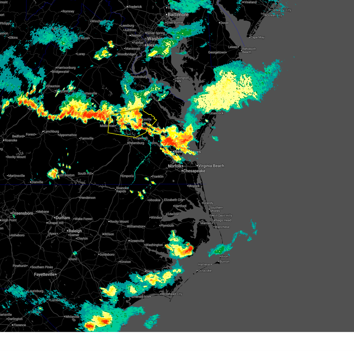
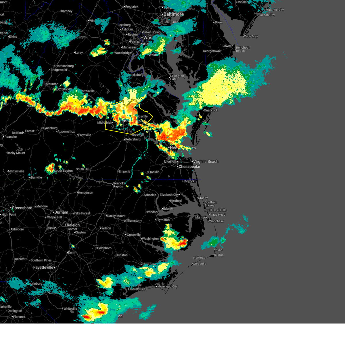
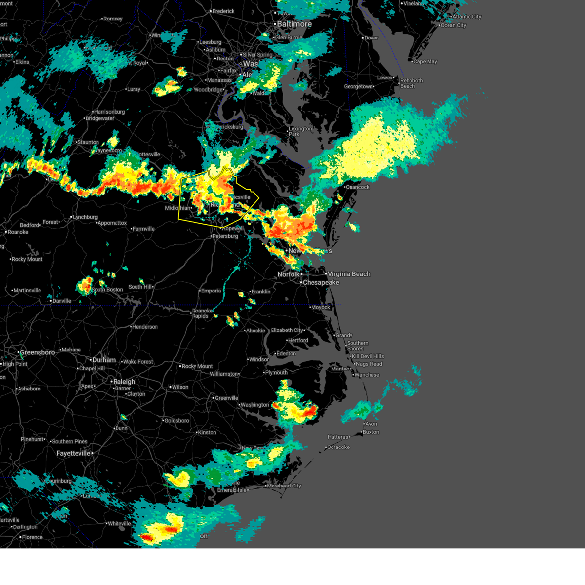
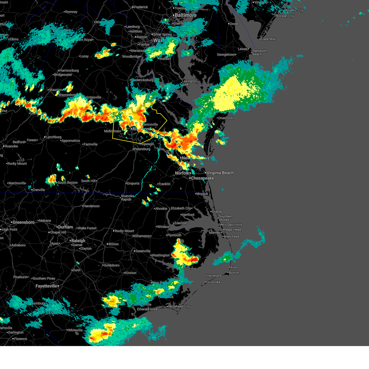
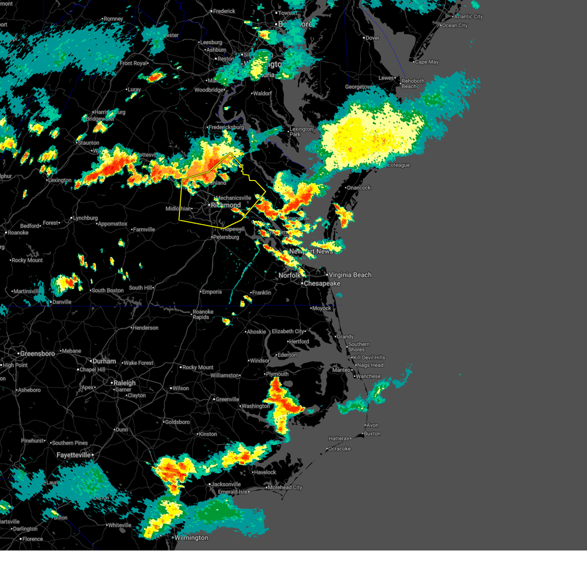
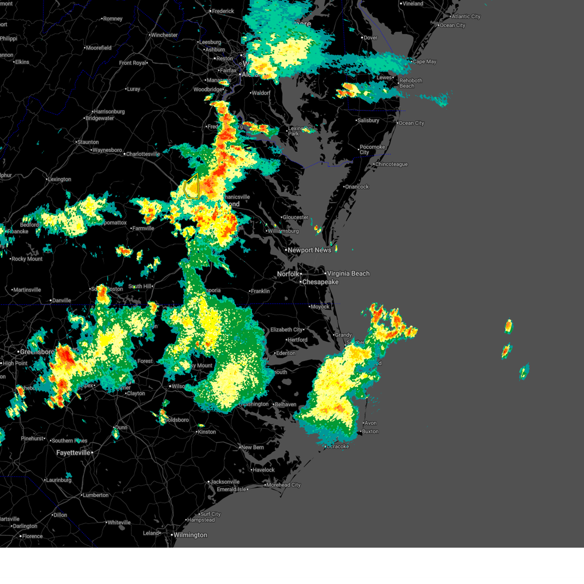
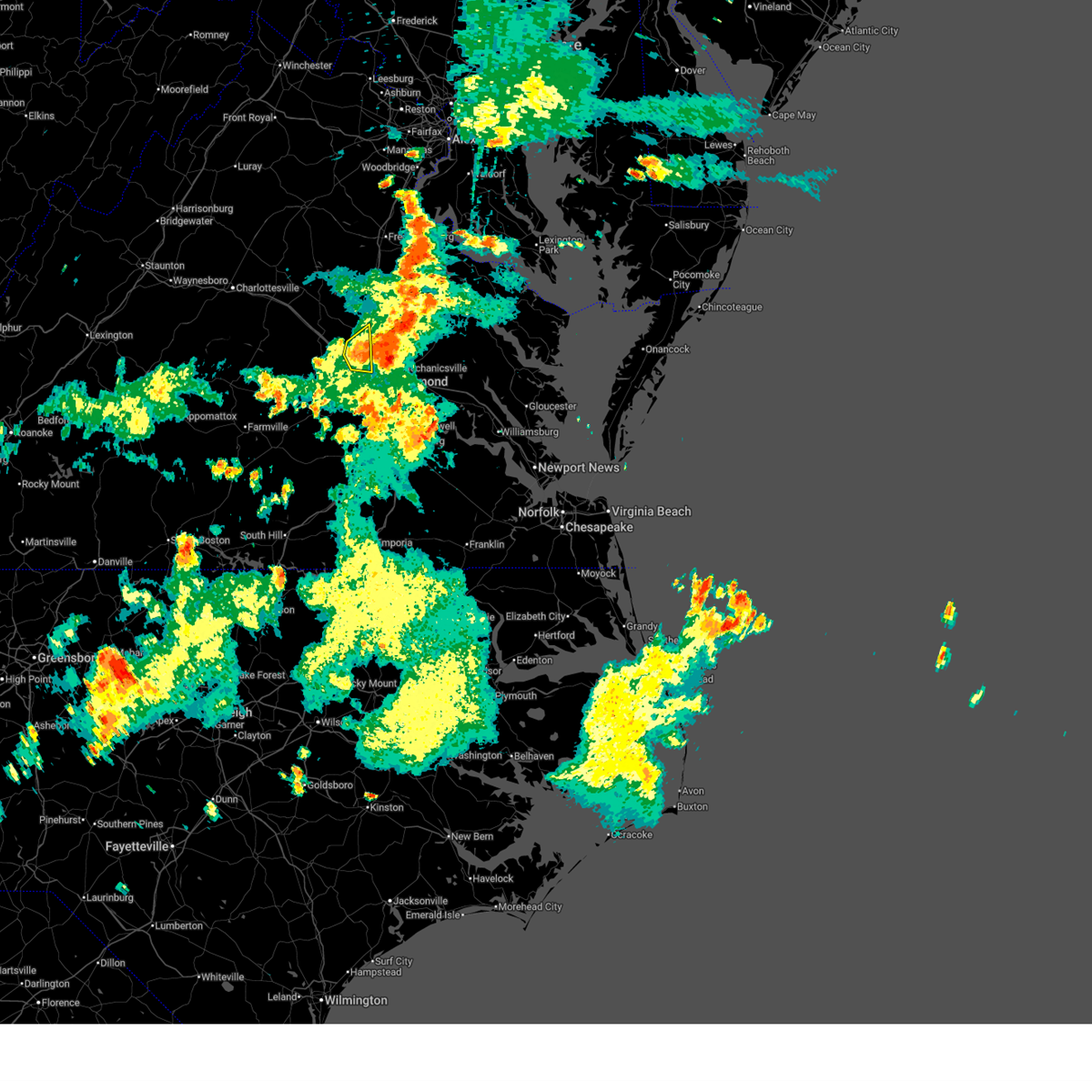
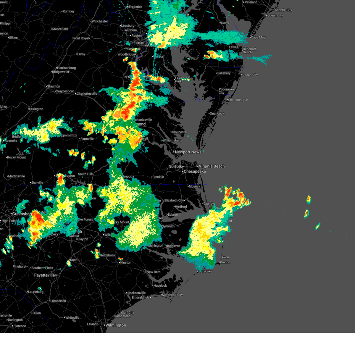
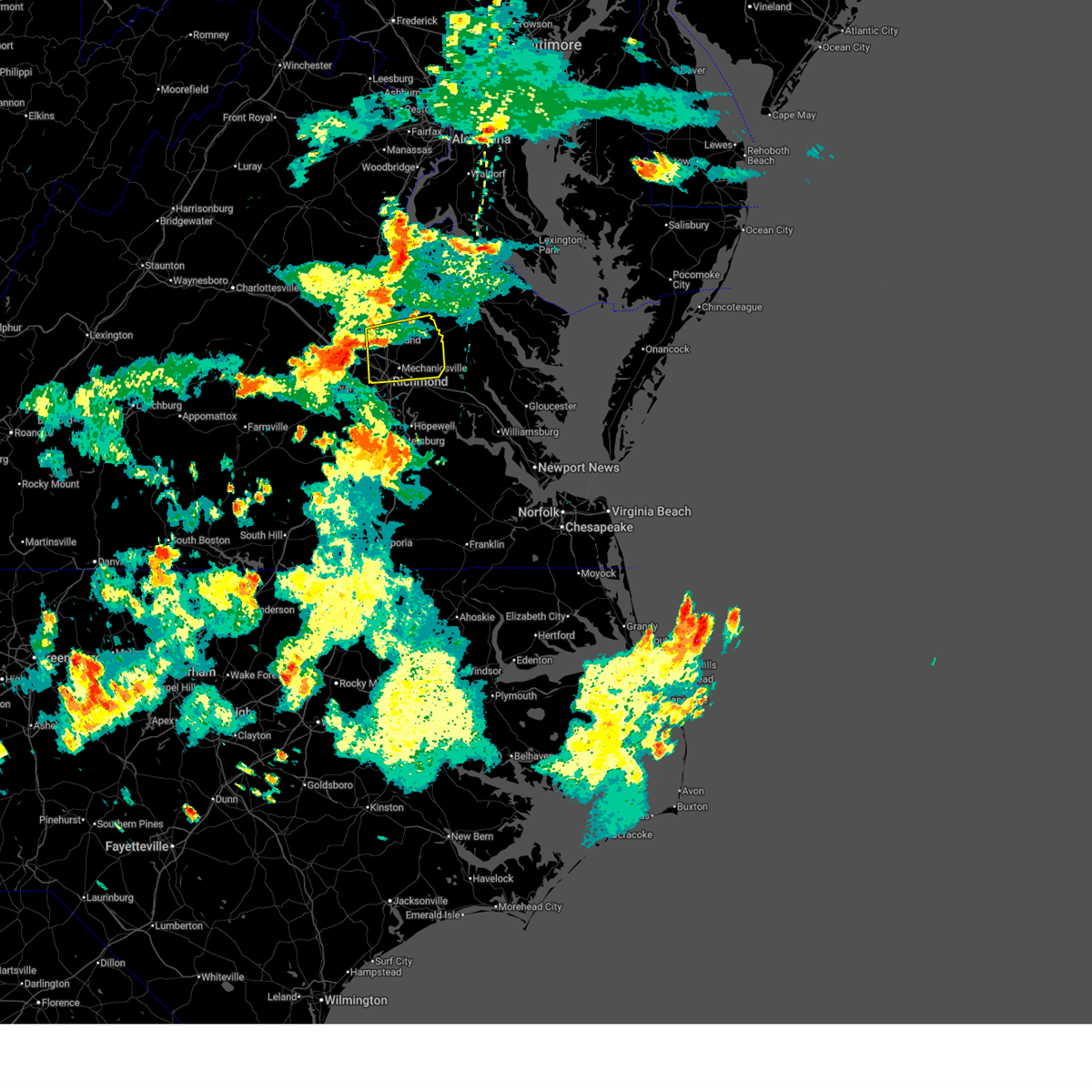
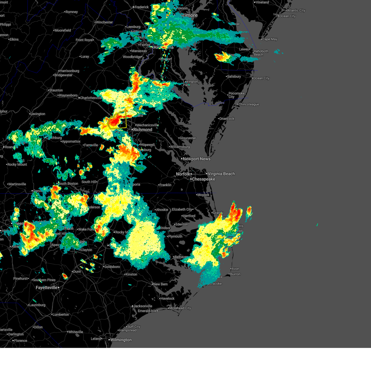
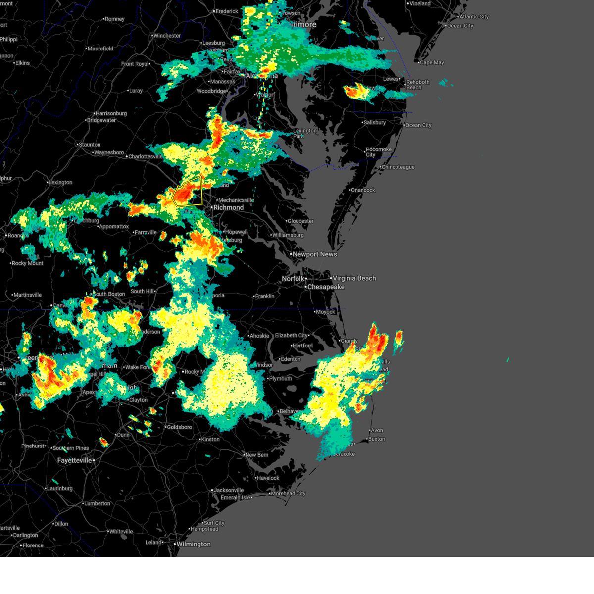
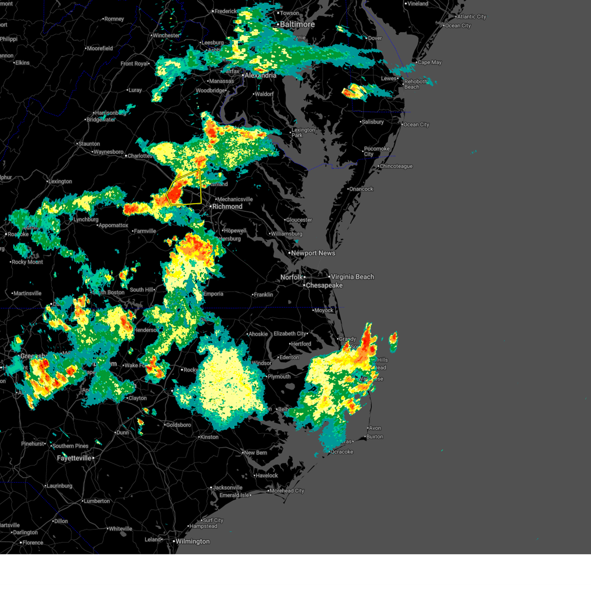
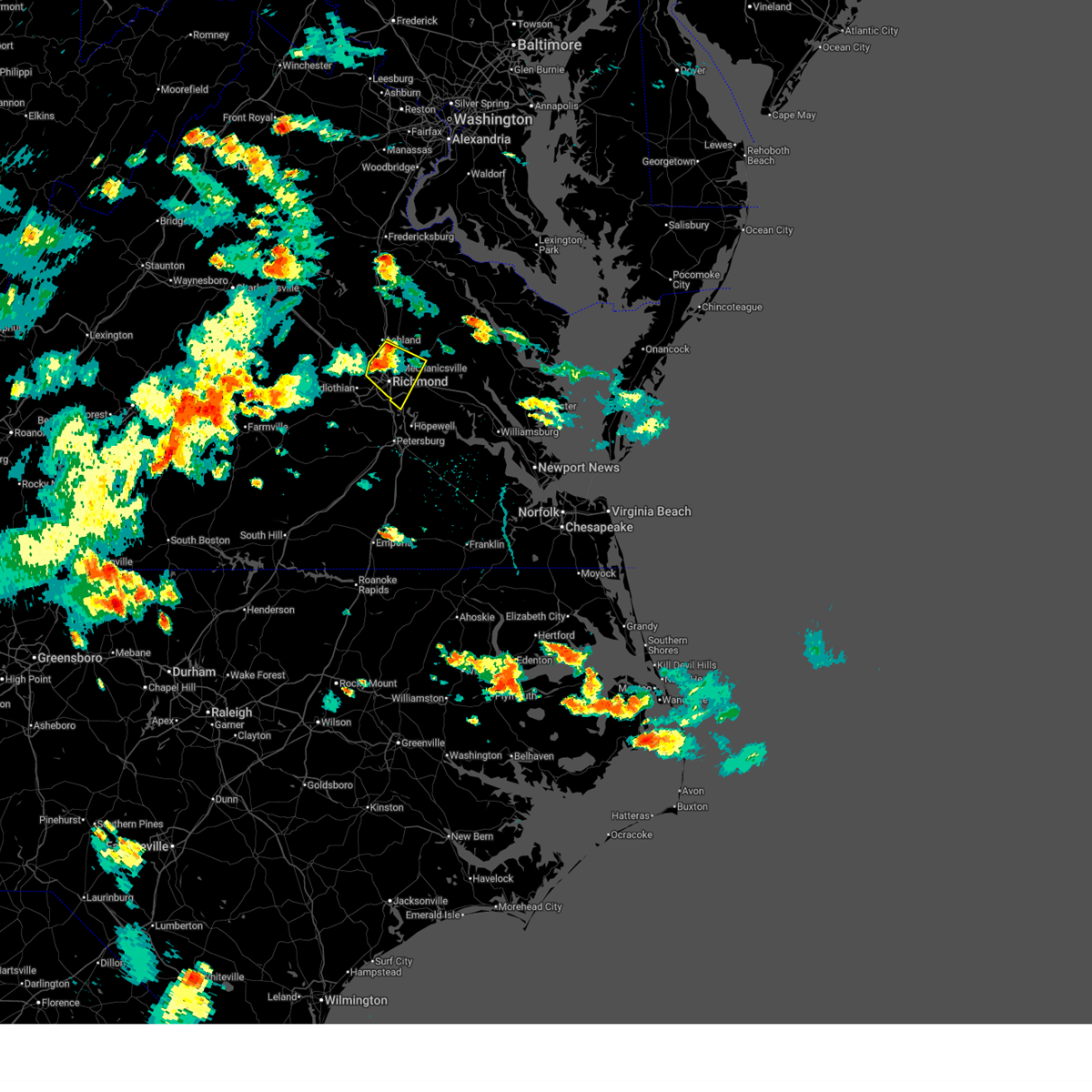
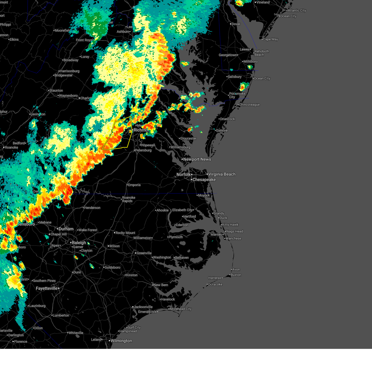
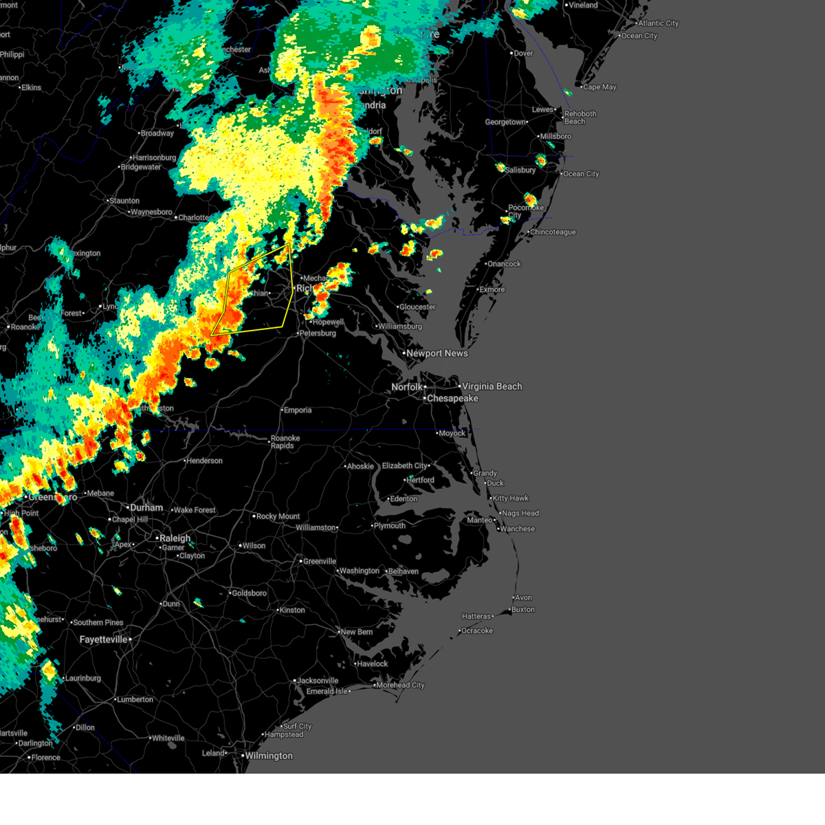
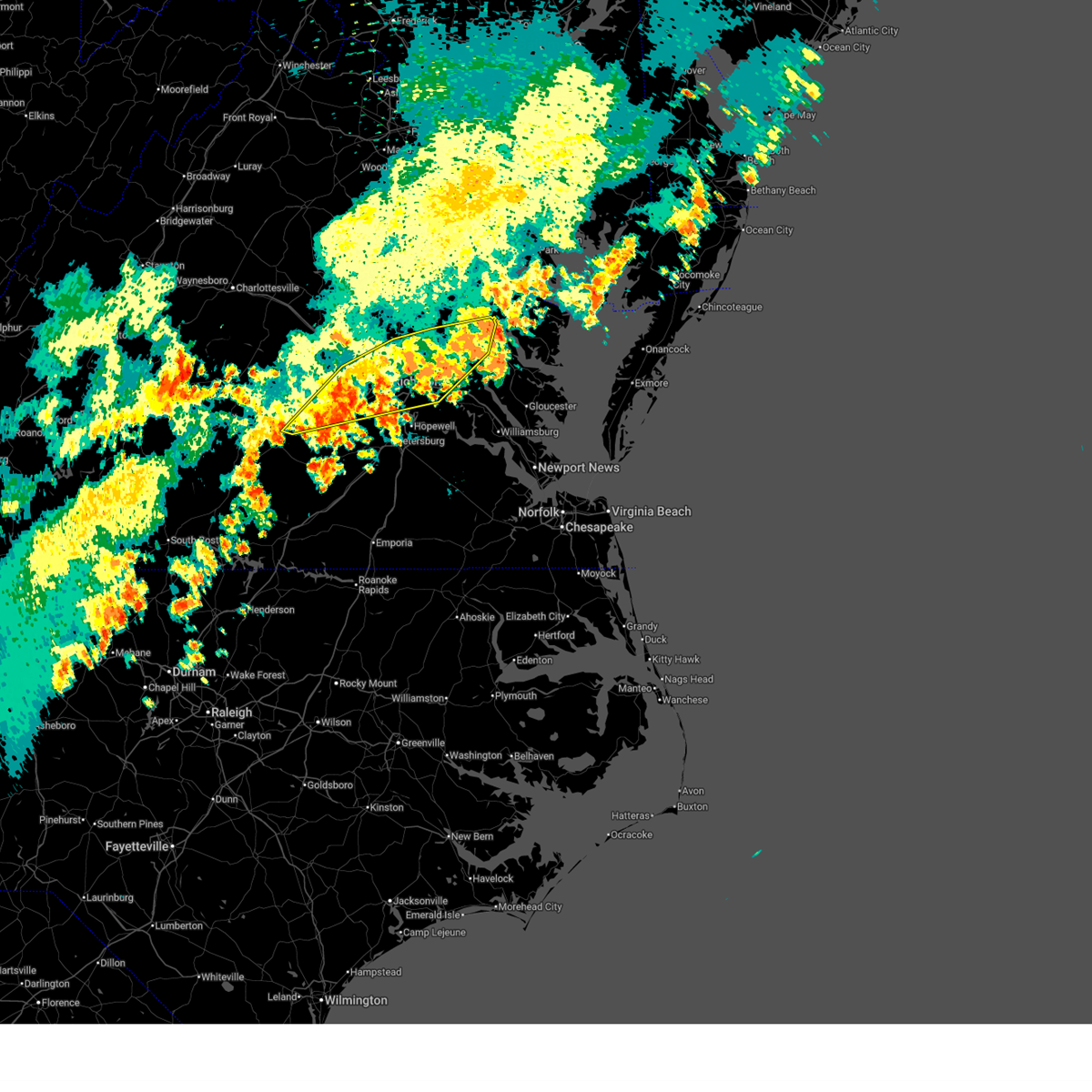
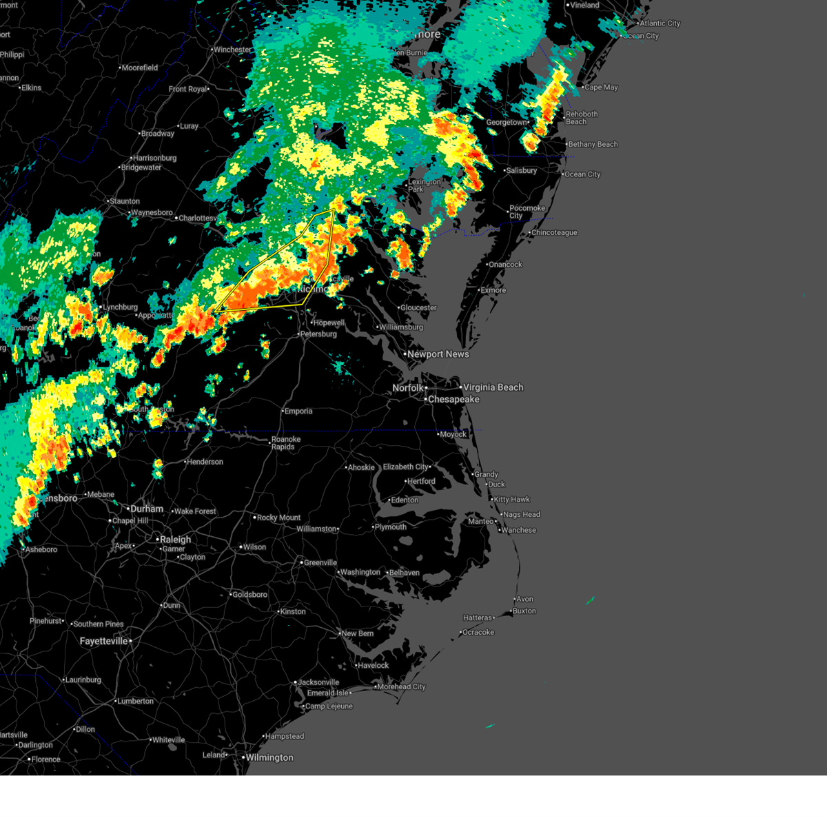
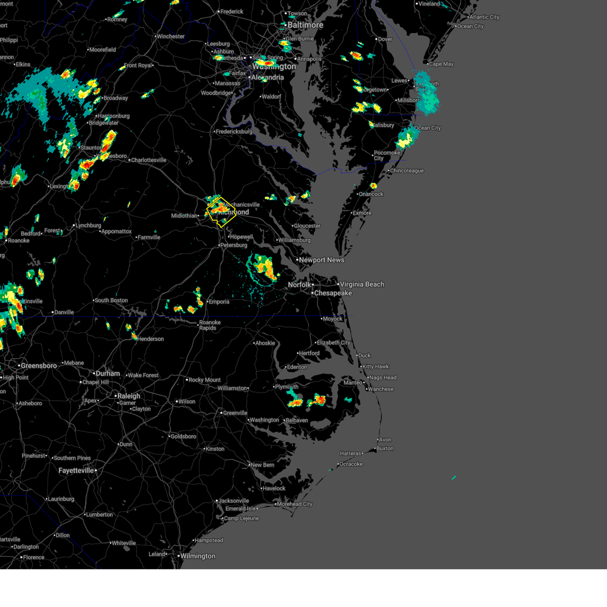
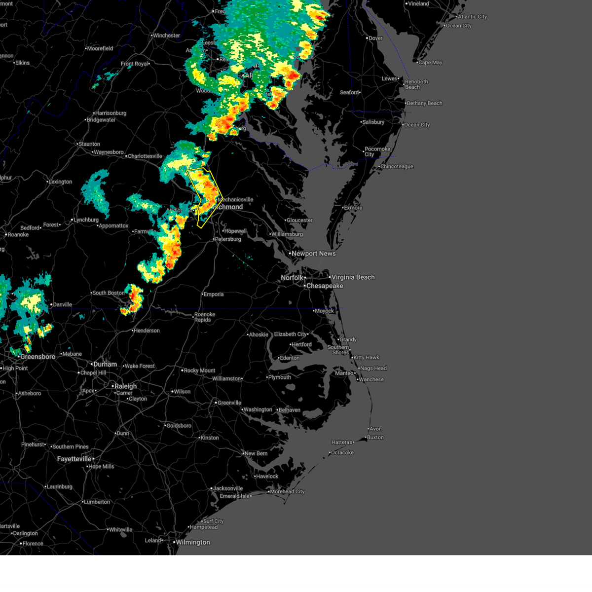
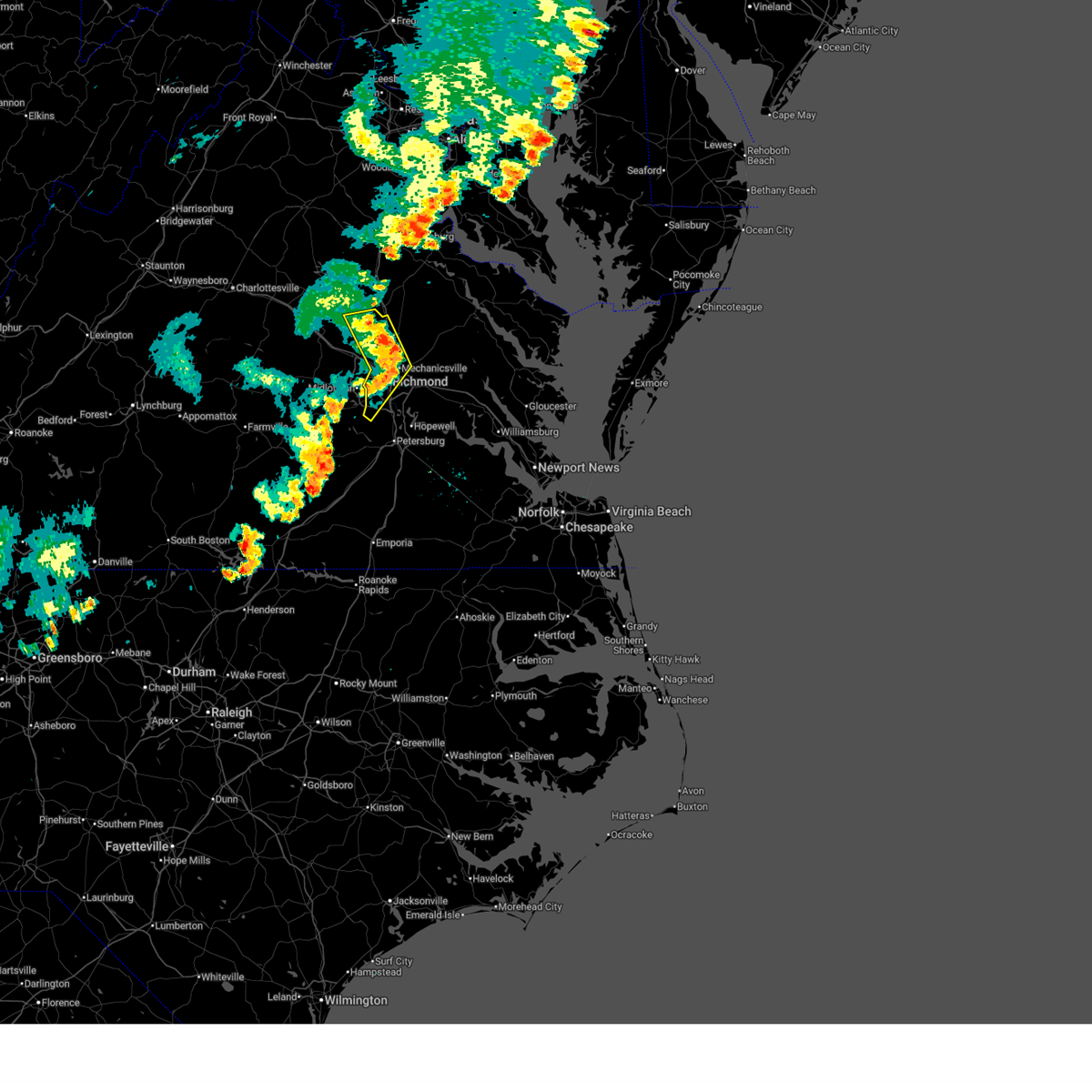
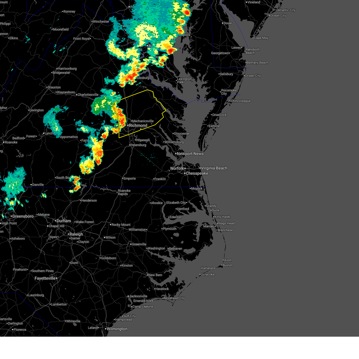
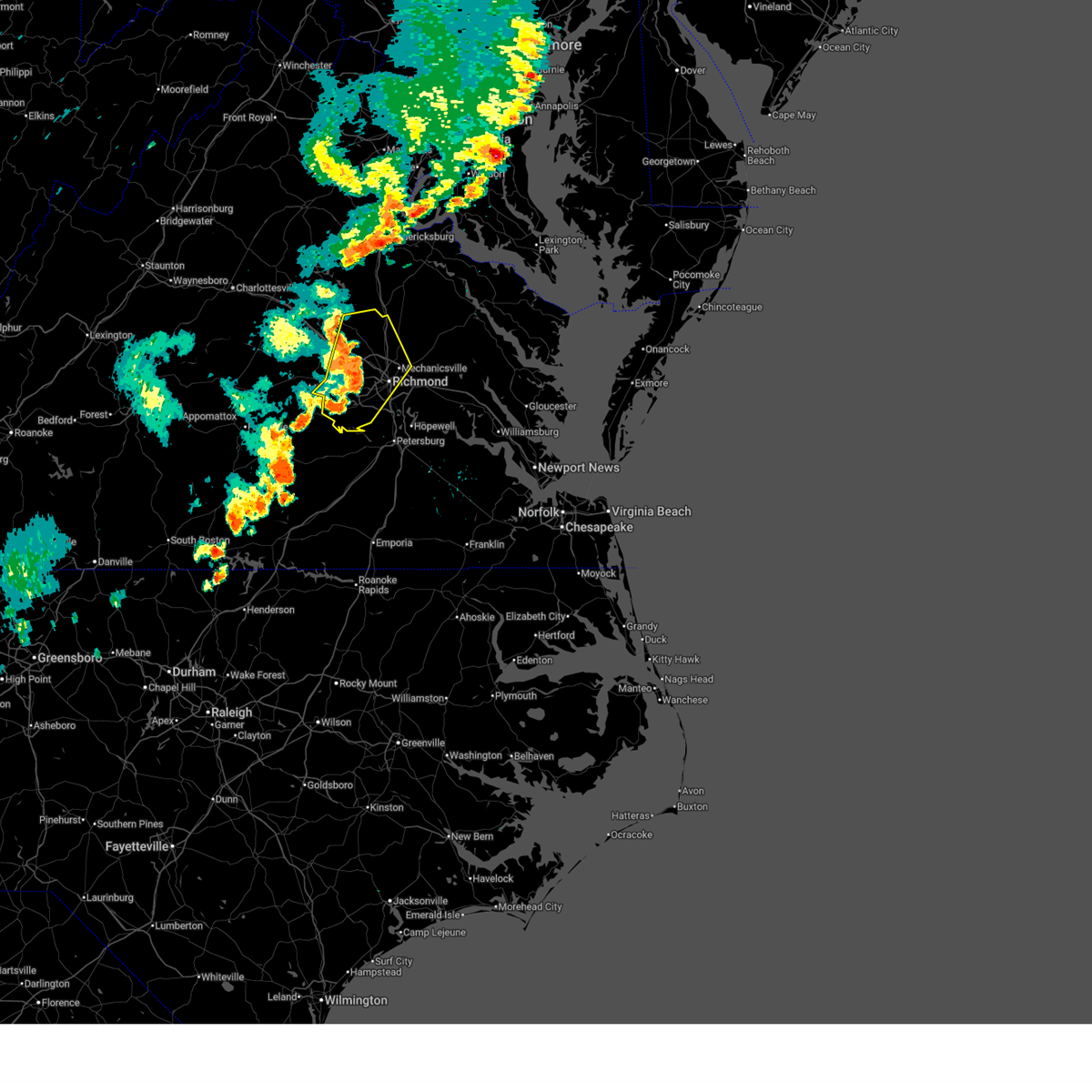
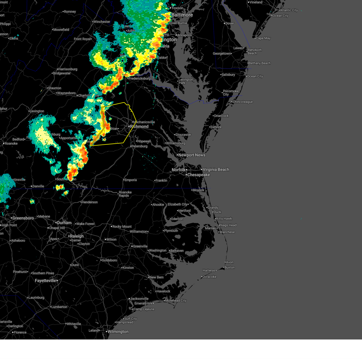
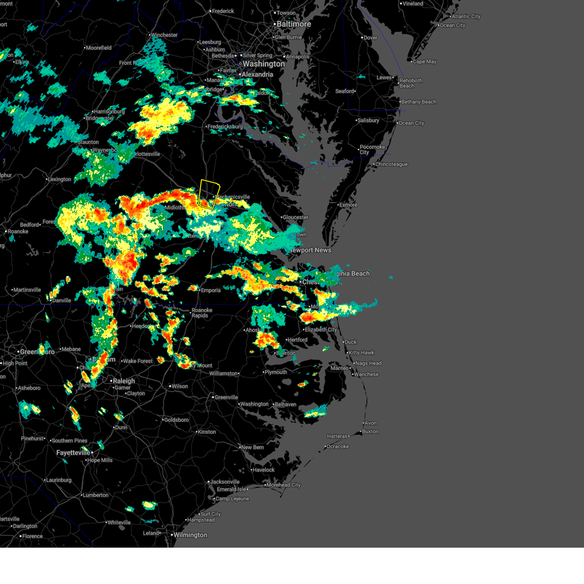
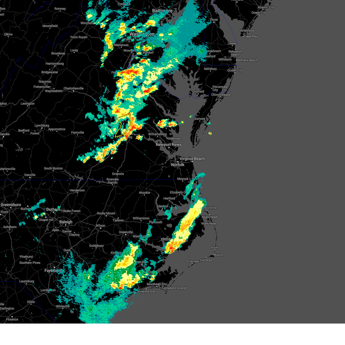
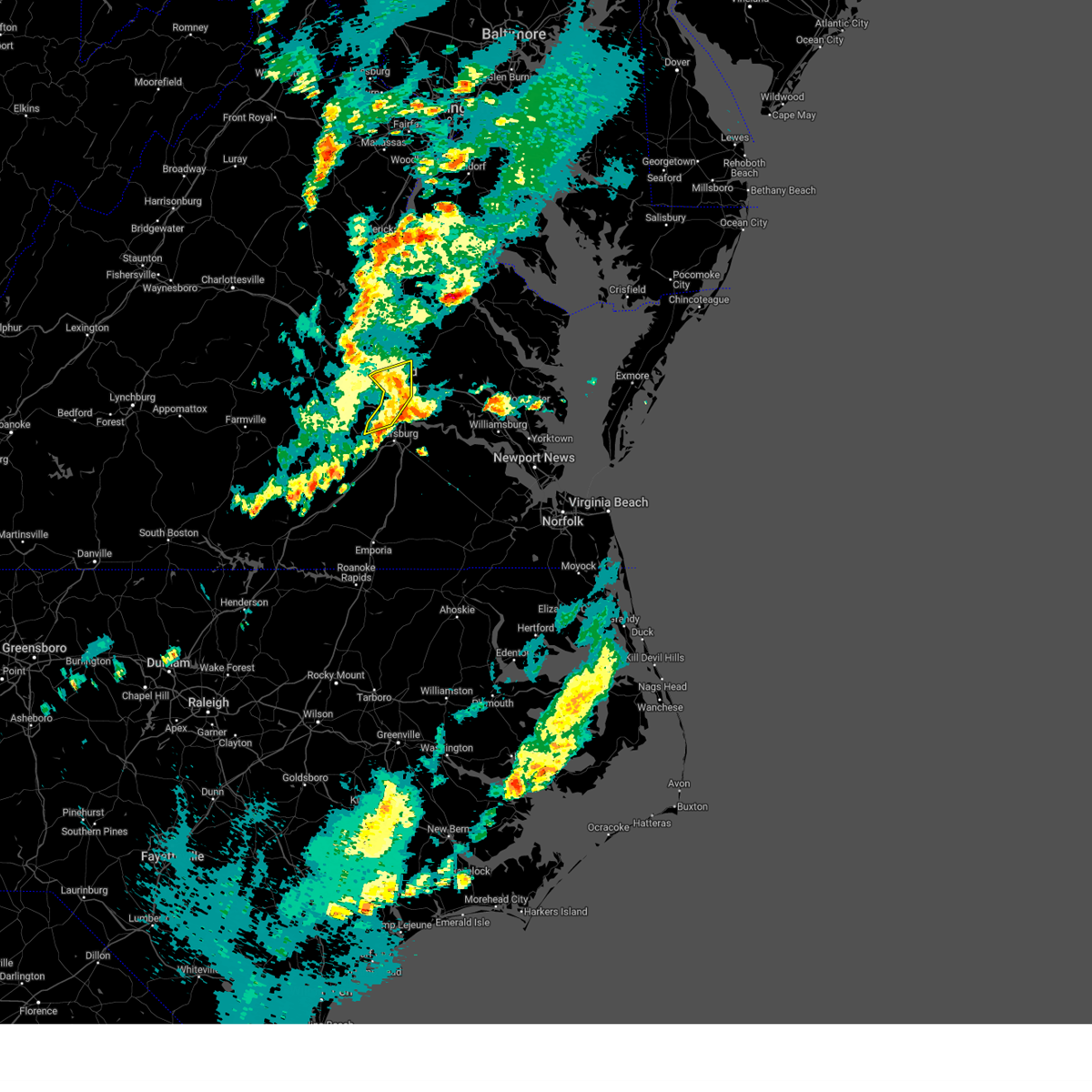
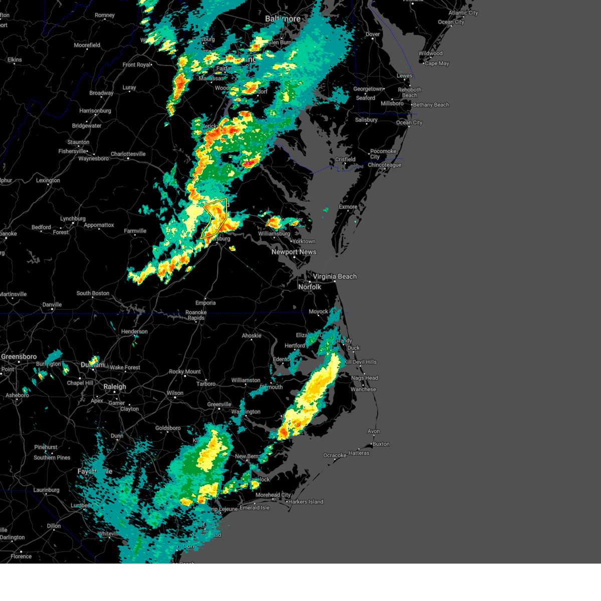
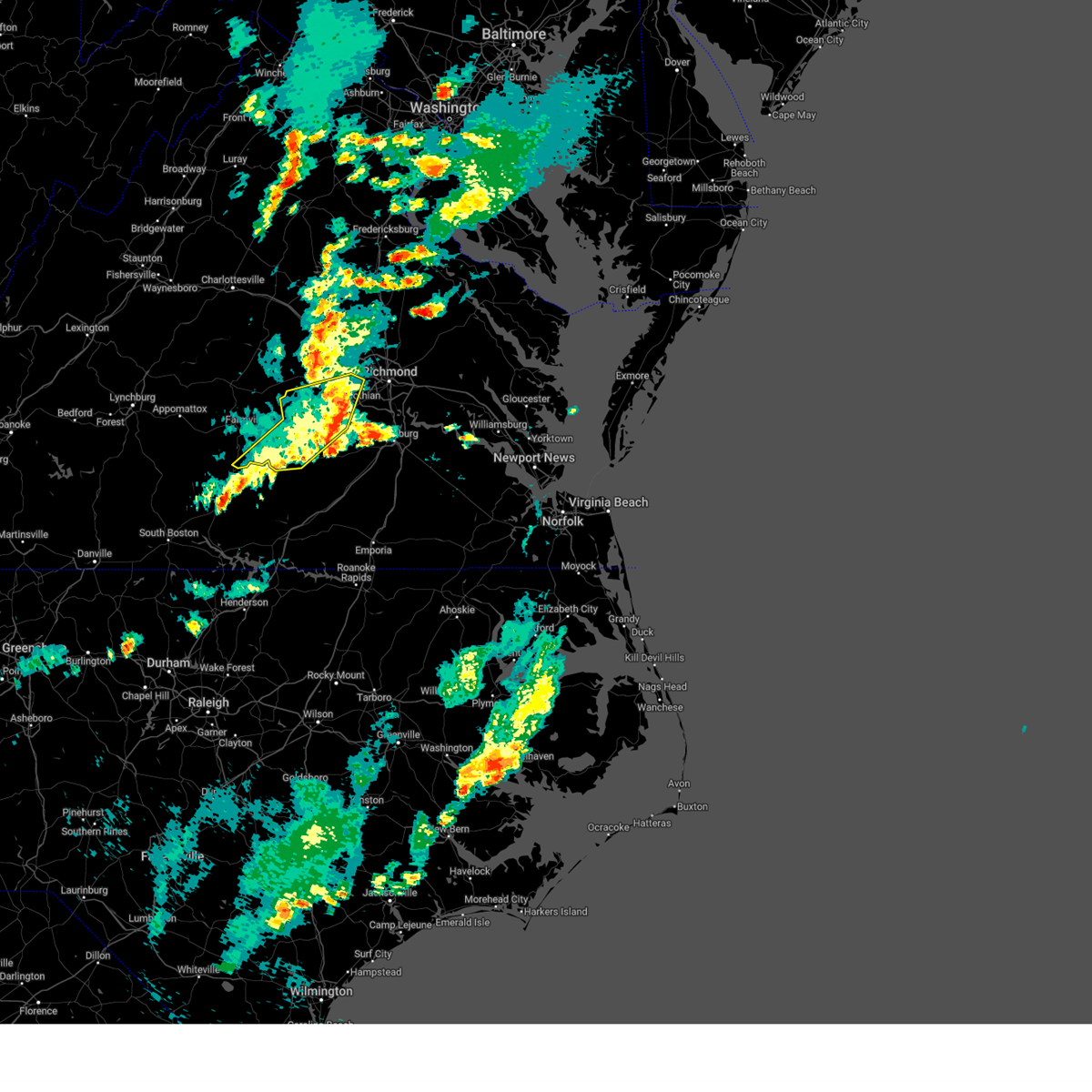
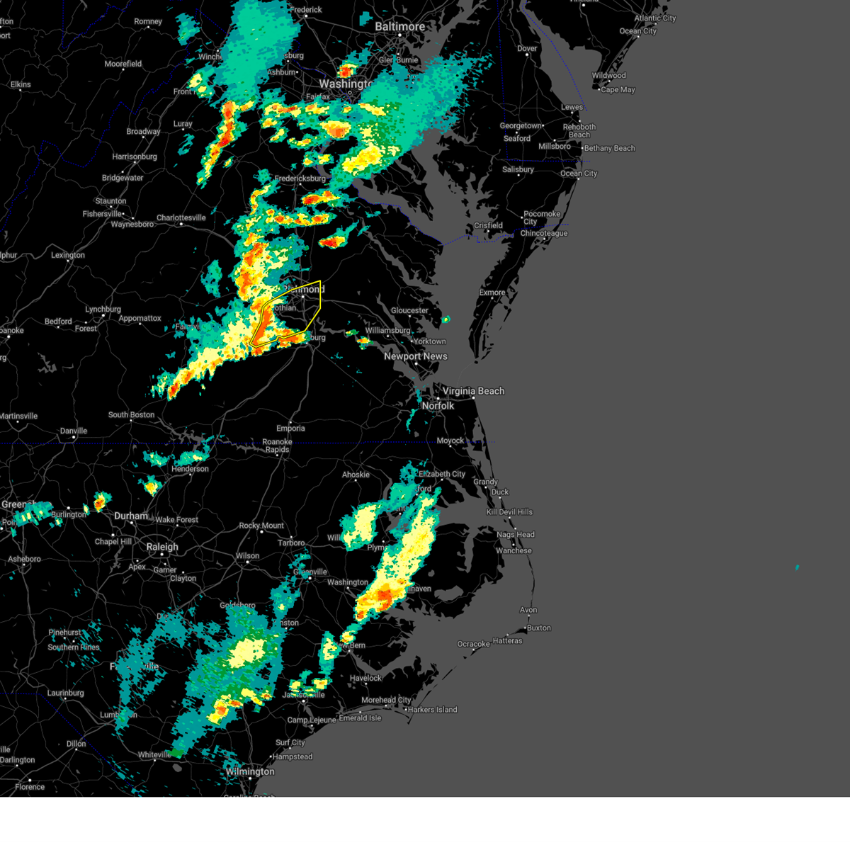
Hail Map for Tuckahoe, VA
The Tuckahoe, VA area has had 14 reports of on-the-ground hail by trained spotters, and has been under severe weather warnings 40 times during the past 12 months. Doppler radar has detected hail at or near Tuckahoe, VA on 57 occasions, including 1 occasion during the past year.
| Name: | Tuckahoe, VA |
| Where Located: | 6.1 miles NNE of Richmond, VA |
| Map: | Google Map for Tuckahoe, VA |
| Population: | 44990 |
| Housing Units: | 19679 |
| More Info: | Search Google for Tuckahoe, VA |
0
The Top Recent Hail Date for Tuckahoe, VA is Friday, July 18, 2025 (36th out of 57)

Hail and Wind Damage Spotted near Tuckahoe, VA
| Date / Time | Report Details |
|---|---|
| 6/22/2026 7:09 PM EDT |
 Svrakq the national weather service in wakefield has issued a * severe thunderstorm warning for, the city of richmond in central virginia, central chesterfield county in central virginia, northwestern charles city county in east central virginia, western new kent county in east central virginia, henrico county in central virginia, southwestern king william county in east central virginia, southeastern hanover county in central virginia, * until 800 pm edt. * at 708 pm edt, severe thunderstorms were located along a line extending from lakeside to near bon air to 7 miles west of chesterfield court house, moving east at 40 mph (radar indicated). Hazards include 60 mph wind gusts. Expect damage to trees and powerlines. severe thunderstorms will be near, richmond, virginia union university, mechanicsville, chester, highland springs, downtown richmond, virginia commonwealth university, east highland park, bellwood, and bensley around 715 pm edt. bottoms bridge around 730 pm edt. roxbury and tunstall around 735 pm edt. talleysville around 740 pm edt. adkins store and providence forge around 745 pm edt. Other locations impacted by these severe thunderstorms include wayside, richmond heights, mountcastle, elko, montrose, sandston, glendale, westwood, pocahontas state park, and richmond international. Svrakq the national weather service in wakefield has issued a * severe thunderstorm warning for, the city of richmond in central virginia, central chesterfield county in central virginia, northwestern charles city county in east central virginia, western new kent county in east central virginia, henrico county in central virginia, southwestern king william county in east central virginia, southeastern hanover county in central virginia, * until 800 pm edt. * at 708 pm edt, severe thunderstorms were located along a line extending from lakeside to near bon air to 7 miles west of chesterfield court house, moving east at 40 mph (radar indicated). Hazards include 60 mph wind gusts. Expect damage to trees and powerlines. severe thunderstorms will be near, richmond, virginia union university, mechanicsville, chester, highland springs, downtown richmond, virginia commonwealth university, east highland park, bellwood, and bensley around 715 pm edt. bottoms bridge around 730 pm edt. roxbury and tunstall around 735 pm edt. talleysville around 740 pm edt. adkins store and providence forge around 745 pm edt. Other locations impacted by these severe thunderstorms include wayside, richmond heights, mountcastle, elko, montrose, sandston, glendale, westwood, pocahontas state park, and richmond international.
|
| 6/14/2026 6:30 PM EDT | Large tree uprooted along mayland dr between parham rd and comet rd. time estimated from rada in henrico county VA, 4 miles SW of Tuckahoe, VA |
| 6/14/2026 6:25 PM EDT | Trees downed in tuckahoe just north of river roa in henrico county VA, 1 miles WSW of Tuckahoe, VA |
| 6/14/2026 6:11 PM EDT |
 Svrakq the national weather service in wakefield has issued a * severe thunderstorm warning for, the city of richmond in central virginia, north central chesterfield county in central virginia, southeastern goochland county in central virginia, northwestern henrico county in central virginia, south central hanover county in central virginia, * until 645 pm edt. * at 611 pm edt, severe thunderstorms were located along a line extending from near manakin to near bon air, moving east at 30 mph (radar indicated). Hazards include 60 mph wind gusts. expect damage to trees and powerlines Svrakq the national weather service in wakefield has issued a * severe thunderstorm warning for, the city of richmond in central virginia, north central chesterfield county in central virginia, southeastern goochland county in central virginia, northwestern henrico county in central virginia, south central hanover county in central virginia, * until 645 pm edt. * at 611 pm edt, severe thunderstorms were located along a line extending from near manakin to near bon air, moving east at 30 mph (radar indicated). Hazards include 60 mph wind gusts. expect damage to trees and powerlines
|
| 6/14/2026 5:53 PM EDT |
 Svrakq the national weather service in wakefield has issued a * severe thunderstorm warning for, northwestern chesterfield county in central virginia, southeastern goochland county in central virginia, central powhatan county in central virginia, * until 630 pm edt. * at 553 pm edt, a severe thunderstorm was located near powhatan, moving east at 30 mph (radar indicated). Hazards include 60 mph wind gusts. expect damage to trees and powerlines Svrakq the national weather service in wakefield has issued a * severe thunderstorm warning for, northwestern chesterfield county in central virginia, southeastern goochland county in central virginia, central powhatan county in central virginia, * until 630 pm edt. * at 553 pm edt, a severe thunderstorm was located near powhatan, moving east at 30 mph (radar indicated). Hazards include 60 mph wind gusts. expect damage to trees and powerlines
|
| 5/27/2026 6:52 PM EDT |
 Svrakq the national weather service in wakefield has issued a * severe thunderstorm warning for, the city of richmond in central virginia, northeastern chesterfield county in central virginia, southeastern goochland county in central virginia, henrico county in central virginia, southeastern hanover county in central virginia, east central powhatan county in central virginia, * until 730 pm edt. * at 651 pm edt, a severe thunderstorm was located over manakin, or near tuckahoe, moving east at 30 mph (radar indicated). Hazards include 60 mph wind gusts. expect damage to trees and powerlines Svrakq the national weather service in wakefield has issued a * severe thunderstorm warning for, the city of richmond in central virginia, northeastern chesterfield county in central virginia, southeastern goochland county in central virginia, henrico county in central virginia, southeastern hanover county in central virginia, east central powhatan county in central virginia, * until 730 pm edt. * at 651 pm edt, a severe thunderstorm was located over manakin, or near tuckahoe, moving east at 30 mph (radar indicated). Hazards include 60 mph wind gusts. expect damage to trees and powerlines
|
| 3/16/2026 8:41 PM EDT |
 the severe thunderstorm warning has been cancelled and is no longer in effect the severe thunderstorm warning has been cancelled and is no longer in effect
|
| 3/16/2026 8:41 PM EDT |
 At 839 pm edt, severe thunderstorms were located along a line extending from near ladysmith to near hopewell to 6 miles east of carson to near sussex, moving northeast at 55 mph (radar indicated). Hazards include 60 mph wind gusts. Expect damage to trees and powerlines. these severe storms will be near, hopewell, bowling green, mechanicsville, highland springs, milford, disputanta, hanover, sussex, jordans point, and garysville around 845 pm edt. charles city, waverly, roxbury, manquin, burrowsville, tunstall, beulahville, adkins store, and fort walker around 850 pm edt. claremont, talleysville, port royal, newtown, ruthville, cabin point, aylett, and providence forge around 855 pm edt. new kent, king william, saint stephens church, dendron, holdcroft, and rustic around 900 pm edt. champlain, stevensville, millers tavern, loretto, leedstown, and elberon around 905 pm edt. colonial beach, west point, tappahannock, surry, toano, king and queen court house, norge, scotland, and barhamsville around 910 pm edt. williamsburg, college of william and mary, jamestown, dunnsville, newland, little plymouth, center cross, and shacklefords around 915 pm edt. Other locations impacted by these severe thunderstorms include eltham, grizzard, croaker, wayside, lumberton, etna mills, sandston, glendale, hilda, and rose garden. At 839 pm edt, severe thunderstorms were located along a line extending from near ladysmith to near hopewell to 6 miles east of carson to near sussex, moving northeast at 55 mph (radar indicated). Hazards include 60 mph wind gusts. Expect damage to trees and powerlines. these severe storms will be near, hopewell, bowling green, mechanicsville, highland springs, milford, disputanta, hanover, sussex, jordans point, and garysville around 845 pm edt. charles city, waverly, roxbury, manquin, burrowsville, tunstall, beulahville, adkins store, and fort walker around 850 pm edt. claremont, talleysville, port royal, newtown, ruthville, cabin point, aylett, and providence forge around 855 pm edt. new kent, king william, saint stephens church, dendron, holdcroft, and rustic around 900 pm edt. champlain, stevensville, millers tavern, loretto, leedstown, and elberon around 905 pm edt. colonial beach, west point, tappahannock, surry, toano, king and queen court house, norge, scotland, and barhamsville around 910 pm edt. williamsburg, college of william and mary, jamestown, dunnsville, newland, little plymouth, center cross, and shacklefords around 915 pm edt. Other locations impacted by these severe thunderstorms include eltham, grizzard, croaker, wayside, lumberton, etna mills, sandston, glendale, hilda, and rose garden.
|
| 3/16/2026 8:20 PM EDT |
 Svrakq the national weather service in wakefield has issued a * severe thunderstorm warning for, northeastern louisa county in central virginia, the city of petersburg in south central virginia, hanover county in central virginia, sussex county in southeastern virginia, eastern dinwiddie county in south central virginia, the city of richmond in central virginia, chesterfield county in central virginia, charles city county in east central virginia, prince george county in south central virginia, northwestern richmond county in east central virginia, new kent county in east central virginia, henrico county in central virginia, central greensville county in southeastern virginia, the city of colonial heights in central virginia, the city of hopewell in south central virginia, southeastern goochland county in central virginia, northwestern york county in southeastern virginia, james city county in southeastern virginia, the city of emporia in southeastern virginia, king and queen county in east central virginia, northwestern westmoreland county in east central virginia, caroline county in north central virginia, king william county in east central virginia, surry county in southeastern virginia, essex county in east central virginia, the city of williamsburg in southeastern virginia, * until 915 pm edt. * at 819 pm edt, severe thunderstorms were located along a line extending from near bumpass to near sutherland to 6 miles north of purdy to near radium, moving northeast at 55 mph (radar indicated). Hazards include 60 mph wind gusts. Expect damage to trees and powerlines. severe thunderstorms will be near, richmond, petersburg, colonial heights, university of richmond, chester, downtown richmond, virginia state university, tuckahoe, bon air, and jarratt around 825 pm edt. ashland, virginia union university, randolph macon college, mechanicsville, fort gregg-adams, virginia commonwealth university, ladysmith, and east highland park around 830 pm edt. hopewell, highland springs, hanover, prince george, sussex, and kings dominion around 835 pm edt. bowling green, milford, disputanta, jordans point, dawn, and studley around 840 pm edt. waverly, garysville, mangohick, homeville, and bottoms bridge around 845 pm edt. charles city, roxbury, manquin, burrowsville, cabin point, tunstall, beulahville, adkins store, and fort walker around 850 pm edt. claremont, saint stephens church, talleysville, port royal, newtown, ruthville, aylett, and providence forge around 855 pm edt. new kent, king william, dendron, loretto, holdcroft, and rustic around 900 pm edt. Other locations impacted by these severe thunderstorms include eltham, grizzard, croaker, wayside, lumberton, etna mills, sandston, glendale, hilda, and rose garden. Svrakq the national weather service in wakefield has issued a * severe thunderstorm warning for, northeastern louisa county in central virginia, the city of petersburg in south central virginia, hanover county in central virginia, sussex county in southeastern virginia, eastern dinwiddie county in south central virginia, the city of richmond in central virginia, chesterfield county in central virginia, charles city county in east central virginia, prince george county in south central virginia, northwestern richmond county in east central virginia, new kent county in east central virginia, henrico county in central virginia, central greensville county in southeastern virginia, the city of colonial heights in central virginia, the city of hopewell in south central virginia, southeastern goochland county in central virginia, northwestern york county in southeastern virginia, james city county in southeastern virginia, the city of emporia in southeastern virginia, king and queen county in east central virginia, northwestern westmoreland county in east central virginia, caroline county in north central virginia, king william county in east central virginia, surry county in southeastern virginia, essex county in east central virginia, the city of williamsburg in southeastern virginia, * until 915 pm edt. * at 819 pm edt, severe thunderstorms were located along a line extending from near bumpass to near sutherland to 6 miles north of purdy to near radium, moving northeast at 55 mph (radar indicated). Hazards include 60 mph wind gusts. Expect damage to trees and powerlines. severe thunderstorms will be near, richmond, petersburg, colonial heights, university of richmond, chester, downtown richmond, virginia state university, tuckahoe, bon air, and jarratt around 825 pm edt. ashland, virginia union university, randolph macon college, mechanicsville, fort gregg-adams, virginia commonwealth university, ladysmith, and east highland park around 830 pm edt. hopewell, highland springs, hanover, prince george, sussex, and kings dominion around 835 pm edt. bowling green, milford, disputanta, jordans point, dawn, and studley around 840 pm edt. waverly, garysville, mangohick, homeville, and bottoms bridge around 845 pm edt. charles city, roxbury, manquin, burrowsville, cabin point, tunstall, beulahville, adkins store, and fort walker around 850 pm edt. claremont, saint stephens church, talleysville, port royal, newtown, ruthville, aylett, and providence forge around 855 pm edt. new kent, king william, dendron, loretto, holdcroft, and rustic around 900 pm edt. Other locations impacted by these severe thunderstorms include eltham, grizzard, croaker, wayside, lumberton, etna mills, sandston, glendale, hilda, and rose garden.
|
| 3/16/2026 8:19 PM EDT |
 Torakq the national weather service in wakefield has issued a * tornado warning for, southeastern goochland county in central virginia, northwestern henrico county in central virginia, northwestern hanover county in central virginia, * until 845 pm edt. * at 819 pm edt, a severe thunderstorm capable of producing a tornado was located near manakin, or 7 miles northwest of tuckahoe, moving northeast at 60 mph (radar indicated rotation). Hazards include tornado. Flying debris will be dangerous to those caught without shelter. mobile homes will be damaged or destroyed. damage to roofs, windows, and vehicles will occur. tree damage is likely. this dangerous storm will be near, wyndham around 825 pm edt. ashland and randolph macon college around 830 pm edt. kings dominion around 835 pm edt. Other locations impacted by this tornadic thunderstorm include crozier, oliver, gum tree, coatesville, hewlett, johnsons springs, goodall, doswell, elmont, and short pump. Torakq the national weather service in wakefield has issued a * tornado warning for, southeastern goochland county in central virginia, northwestern henrico county in central virginia, northwestern hanover county in central virginia, * until 845 pm edt. * at 819 pm edt, a severe thunderstorm capable of producing a tornado was located near manakin, or 7 miles northwest of tuckahoe, moving northeast at 60 mph (radar indicated rotation). Hazards include tornado. Flying debris will be dangerous to those caught without shelter. mobile homes will be damaged or destroyed. damage to roofs, windows, and vehicles will occur. tree damage is likely. this dangerous storm will be near, wyndham around 825 pm edt. ashland and randolph macon college around 830 pm edt. kings dominion around 835 pm edt. Other locations impacted by this tornadic thunderstorm include crozier, oliver, gum tree, coatesville, hewlett, johnsons springs, goodall, doswell, elmont, and short pump.
|
| 3/16/2026 8:12 PM EDT | Multiple trees down. steel heater blown off back dec in powhatan county VA, 9.1 miles E of Tuckahoe, VA |
| 3/16/2026 8:11 PM EDT |
 At 810 pm edt, severe thunderstorms were located along a line extending from near hadensville to near wilsons to 7 miles northeast of lawrenceville to near brunswick, moving northeast at 50 mph (radar indicated). Hazards include 60 mph wind gusts. Expect damage to trees and powerlines. these severe storms will be near, goochland, mckenney, moseley, oilville, radium, dewitt, sabot, and gum spring around 815 pm edt. dinwiddie, purdy, tuckahoe, manakin, and sutherland around 820 pm edt. bon air, jarratt, montpelier, and wyndham around 825 pm edt. Other locations impacted by these severe thunderstorms include orchid, gum forks, dolphin, ammon, maidens, pleasant shade, henrico, three square, wharfs store, and pocahontas state park. At 810 pm edt, severe thunderstorms were located along a line extending from near hadensville to near wilsons to 7 miles northeast of lawrenceville to near brunswick, moving northeast at 50 mph (radar indicated). Hazards include 60 mph wind gusts. Expect damage to trees and powerlines. these severe storms will be near, goochland, mckenney, moseley, oilville, radium, dewitt, sabot, and gum spring around 815 pm edt. dinwiddie, purdy, tuckahoe, manakin, and sutherland around 820 pm edt. bon air, jarratt, montpelier, and wyndham around 825 pm edt. Other locations impacted by these severe thunderstorms include orchid, gum forks, dolphin, ammon, maidens, pleasant shade, henrico, three square, wharfs store, and pocahontas state park.
|
| 3/16/2026 8:11 PM EDT |
 the severe thunderstorm warning has been cancelled and is no longer in effect the severe thunderstorm warning has been cancelled and is no longer in effect
|
| 3/16/2026 7:59 PM EDT |
 At 758 pm edt, severe thunderstorms were located along a line extending from near fife to fort barfoot to near lawrenceville to near gasburg, moving northeast at 50 mph (radar indicated). Hazards include 60 mph wind gusts. Expect damage to trees and powerlines. these severe storms will be near, powhatan, goochland, lawrenceville, mckenney, mannboro, brunswick, scotts fork, wilsons, macon, and chula around 805 pm edt. moseley and oilville around 810 pm edt. dinwiddie, purdy, radium, dewitt, manakin, and sabot around 815 pm edt. tuckahoe, bon air, montpelier, and sutherland around 820 pm edt. jarratt and wyndham around 825 pm edt. Other locations impacted by these severe thunderstorms include gum forks, dolphin, maidens, henrico, pocahontas state park, skinquarter, wellville, michaux, west view, and blackstone airport. At 758 pm edt, severe thunderstorms were located along a line extending from near fife to fort barfoot to near lawrenceville to near gasburg, moving northeast at 50 mph (radar indicated). Hazards include 60 mph wind gusts. Expect damage to trees and powerlines. these severe storms will be near, powhatan, goochland, lawrenceville, mckenney, mannboro, brunswick, scotts fork, wilsons, macon, and chula around 805 pm edt. moseley and oilville around 810 pm edt. dinwiddie, purdy, radium, dewitt, manakin, and sabot around 815 pm edt. tuckahoe, bon air, montpelier, and sutherland around 820 pm edt. jarratt and wyndham around 825 pm edt. Other locations impacted by these severe thunderstorms include gum forks, dolphin, maidens, henrico, pocahontas state park, skinquarter, wellville, michaux, west view, and blackstone airport.
|
| 3/16/2026 7:59 PM EDT |
 the severe thunderstorm warning has been cancelled and is no longer in effect the severe thunderstorm warning has been cancelled and is no longer in effect
|
| 3/16/2026 7:40 PM EDT |
 Svrakq the national weather service in wakefield has issued a * severe thunderstorm warning for, northwestern northampton county in northeastern north carolina, southeastern louisa county in central virginia, greensville county in southeastern virginia, cumberland county in central virginia, nottoway county in south central virginia, goochland county in central virginia, northwestern hanover county in central virginia, southwestern sussex county in southeastern virginia, dinwiddie county in south central virginia, powhatan county in central virginia, chesterfield county in central virginia, southeastern mecklenburg county in south central virginia, east central prince edward county in central virginia, eastern lunenburg county in south central virginia, the city of emporia in southeastern virginia, northwestern henrico county in central virginia, amelia county in central virginia, brunswick county in south central virginia, * until 830 pm edt. * at 739 pm edt, severe thunderstorms were located along a line extending from near gold hill to near kenbridge to near la crosse to near norlina, moving northeast at 50 mph (radar indicated). Hazards include 60 mph wind gusts. Expect damage to trees and powerlines. severe thunderstorms will be near, cumberland, south hill, blackstone, crewe, kenbridge, brodnax, nottoway, la crosse, dundas, and sunnyside around 745 pm edt. cartersville, morven, duncan, ballsville, fort barfoot, tobaccoville, and trenholm around 750 pm edt. lawrenceville, amelia courthouse, brunswick, alberta, spainville, gasburg, macon, and fife around 755 pm edt. powhatan, mannboro, scotts fork, wilsons, and chula around 800 pm edt. goochland, mckenney, and gum spring around 805 pm edt. moseley, oilville, and dewitt around 810 pm edt. dinwiddie, purdy, radium, manakin, and sabot around 815 pm edt. tuckahoe, bon air, montpelier, wyndham, and sutherland around 820 pm edt. Other locations impacted by these severe thunderstorms include bacons fork, angola, gum forks, dolphin, murdocks, maidens, henrico, forksville, pocahontas state park, and skinquarter. Svrakq the national weather service in wakefield has issued a * severe thunderstorm warning for, northwestern northampton county in northeastern north carolina, southeastern louisa county in central virginia, greensville county in southeastern virginia, cumberland county in central virginia, nottoway county in south central virginia, goochland county in central virginia, northwestern hanover county in central virginia, southwestern sussex county in southeastern virginia, dinwiddie county in south central virginia, powhatan county in central virginia, chesterfield county in central virginia, southeastern mecklenburg county in south central virginia, east central prince edward county in central virginia, eastern lunenburg county in south central virginia, the city of emporia in southeastern virginia, northwestern henrico county in central virginia, amelia county in central virginia, brunswick county in south central virginia, * until 830 pm edt. * at 739 pm edt, severe thunderstorms were located along a line extending from near gold hill to near kenbridge to near la crosse to near norlina, moving northeast at 50 mph (radar indicated). Hazards include 60 mph wind gusts. Expect damage to trees and powerlines. severe thunderstorms will be near, cumberland, south hill, blackstone, crewe, kenbridge, brodnax, nottoway, la crosse, dundas, and sunnyside around 745 pm edt. cartersville, morven, duncan, ballsville, fort barfoot, tobaccoville, and trenholm around 750 pm edt. lawrenceville, amelia courthouse, brunswick, alberta, spainville, gasburg, macon, and fife around 755 pm edt. powhatan, mannboro, scotts fork, wilsons, and chula around 800 pm edt. goochland, mckenney, and gum spring around 805 pm edt. moseley, oilville, and dewitt around 810 pm edt. dinwiddie, purdy, radium, manakin, and sabot around 815 pm edt. tuckahoe, bon air, montpelier, wyndham, and sutherland around 820 pm edt. Other locations impacted by these severe thunderstorms include bacons fork, angola, gum forks, dolphin, murdocks, maidens, henrico, forksville, pocahontas state park, and skinquarter.
|
| 7/27/2025 6:02 PM EDT |
 At 602 pm edt, severe thunderstorms were located along a line extending from near king william to near roxbury to bensley, moving southeast at 45 mph (radar indicated). Hazards include 60 mph wind gusts. Expect damage to trees and powerlines. these severe storms will be near, new kent, chester, talleysville, roxbury, bellwood, bensley, adkins store, and providence forge around 605 pm edt. Other locations impacted by these severe thunderstorms include wayside, cohoke, etna mills, montrose, glendale, sandston, rose garden, pocahontas state park, skinquarter, and chamberlayne. At 602 pm edt, severe thunderstorms were located along a line extending from near king william to near roxbury to bensley, moving southeast at 45 mph (radar indicated). Hazards include 60 mph wind gusts. Expect damage to trees and powerlines. these severe storms will be near, new kent, chester, talleysville, roxbury, bellwood, bensley, adkins store, and providence forge around 605 pm edt. Other locations impacted by these severe thunderstorms include wayside, cohoke, etna mills, montrose, glendale, sandston, rose garden, pocahontas state park, skinquarter, and chamberlayne.
|
| 7/27/2025 5:52 PM EDT |
 the severe thunderstorm warning has been cancelled and is no longer in effect the severe thunderstorm warning has been cancelled and is no longer in effect
|
| 7/27/2025 5:52 PM EDT |
 At 551 pm edt, severe thunderstorms were located along a line extending from near king william to near highland springs to university of richmond, moving southeast at 55 mph (radar indicated). Hazards include 70 mph wind gusts. Expect considerable tree damage. damage is likely to mobile homes, roofs, and outbuildings. these severe storms will be near, richmond, king william, talleysville, roxbury, highland springs, downtown richmond, virginia commonwealth university, bellwood, bensley, and tunstall around 555 pm edt. new kent and providence forge around 600 pm edt. adkins store around 605 pm edt. Other locations impacted by these severe thunderstorms include wayside, gum tree, etna mills, cohoke, montrose, sandston, glendale, rose garden, pocahontas state park, and skinquarter. At 551 pm edt, severe thunderstorms were located along a line extending from near king william to near highland springs to university of richmond, moving southeast at 55 mph (radar indicated). Hazards include 70 mph wind gusts. Expect considerable tree damage. damage is likely to mobile homes, roofs, and outbuildings. these severe storms will be near, richmond, king william, talleysville, roxbury, highland springs, downtown richmond, virginia commonwealth university, bellwood, bensley, and tunstall around 555 pm edt. new kent and providence forge around 600 pm edt. adkins store around 605 pm edt. Other locations impacted by these severe thunderstorms include wayside, gum tree, etna mills, cohoke, montrose, sandston, glendale, rose garden, pocahontas state park, and skinquarter.
|
| 7/27/2025 5:46 PM EDT |
 the severe thunderstorm warning has been cancelled and is no longer in effect the severe thunderstorm warning has been cancelled and is no longer in effect
|
| 7/27/2025 5:46 PM EDT |
 At 545 pm edt, severe thunderstorms were located along a line extending from manquin to east highland park to tuckahoe, moving southeast at 55 mph (radar indicated). Hazards include 70 mph wind gusts. Expect considerable tree damage. damage is likely to mobile homes, roofs, and outbuildings. these severe storms will be near, richmond, virginia union university, university of richmond, highland springs, downtown richmond, tuckahoe, bon air, virginia commonwealth university, bensley, and tunstall around 550 pm edt. talleysville, roxbury, and bellwood around 555 pm edt. new kent, chester, chesterfield court house, and providence forge around 600 pm edt. hopewell and adkins store around 605 pm edt. Other locations impacted by these severe thunderstorms include wayside, gum tree, etna mills, cohoke, montrose, sandston, glendale, rose garden, pocahontas state park, and biscoe. At 545 pm edt, severe thunderstorms were located along a line extending from manquin to east highland park to tuckahoe, moving southeast at 55 mph (radar indicated). Hazards include 70 mph wind gusts. Expect considerable tree damage. damage is likely to mobile homes, roofs, and outbuildings. these severe storms will be near, richmond, virginia union university, university of richmond, highland springs, downtown richmond, tuckahoe, bon air, virginia commonwealth university, bensley, and tunstall around 550 pm edt. talleysville, roxbury, and bellwood around 555 pm edt. new kent, chester, chesterfield court house, and providence forge around 600 pm edt. hopewell and adkins store around 605 pm edt. Other locations impacted by these severe thunderstorms include wayside, gum tree, etna mills, cohoke, montrose, sandston, glendale, rose garden, pocahontas state park, and biscoe.
|
| 7/27/2025 5:40 PM EDT | Tree down on pemberton road near i-64 in henrico count in henrico county VA, 3.7 miles SSW of Tuckahoe, VA |
| 7/27/2025 5:23 PM EDT |
 Svrakq the national weather service in wakefield has issued a * severe thunderstorm warning for, the city of richmond in central virginia, central chesterfield county in central virginia, king and queen county in east central virginia, northwestern charles city county in east central virginia, southeastern goochland county in central virginia, new kent county in east central virginia, henrico county in central virginia, southeastern caroline county in north central virginia, hanover county in central virginia, king william county in east central virginia, southeastern powhatan county in central virginia, * until 630 pm edt. * at 522 pm edt, severe thunderstorms were located along a line extending from near newtown to hanover to near montpelier, moving southeast at 45 mph (radar indicated). Hazards include 70 mph wind gusts. Expect considerable tree damage. damage is likely to mobile homes, roofs, and outbuildings. severe thunderstorms will be near, ashland, saint stephens church, mechanicsville, beulahville, aylett, laurel, glen allen, and studley around 530 pm edt. richmond, manquin, lakeside, and east highland park around 535 pm edt. king william, highland springs, stevensville, and tunstall around 540 pm edt. king and queen court house, talleysville, and bottoms bridge around 550 pm edt. new kent, roxbury, and little plymouth around 555 pm edt. providence forge around 600 pm edt. adkins store around 605 pm edt. Other locations impacted by these severe thunderstorms include wayside, gum tree, etna mills, cohoke, montrose, sandston, glendale, rose garden, pocahontas state park, and biscoe. Svrakq the national weather service in wakefield has issued a * severe thunderstorm warning for, the city of richmond in central virginia, central chesterfield county in central virginia, king and queen county in east central virginia, northwestern charles city county in east central virginia, southeastern goochland county in central virginia, new kent county in east central virginia, henrico county in central virginia, southeastern caroline county in north central virginia, hanover county in central virginia, king william county in east central virginia, southeastern powhatan county in central virginia, * until 630 pm edt. * at 522 pm edt, severe thunderstorms were located along a line extending from near newtown to hanover to near montpelier, moving southeast at 45 mph (radar indicated). Hazards include 70 mph wind gusts. Expect considerable tree damage. damage is likely to mobile homes, roofs, and outbuildings. severe thunderstorms will be near, ashland, saint stephens church, mechanicsville, beulahville, aylett, laurel, glen allen, and studley around 530 pm edt. richmond, manquin, lakeside, and east highland park around 535 pm edt. king william, highland springs, stevensville, and tunstall around 540 pm edt. king and queen court house, talleysville, and bottoms bridge around 550 pm edt. new kent, roxbury, and little plymouth around 555 pm edt. providence forge around 600 pm edt. adkins store around 605 pm edt. Other locations impacted by these severe thunderstorms include wayside, gum tree, etna mills, cohoke, montrose, sandston, glendale, rose garden, pocahontas state park, and biscoe.
|
| 7/19/2025 7:28 PM EDT |
 The storm which prompted the warning has moved out of the area. therefore, the warning will be allowed to expire. a severe thunderstorm watch remains in effect until 1000 pm edt for central virginia. The storm which prompted the warning has moved out of the area. therefore, the warning will be allowed to expire. a severe thunderstorm watch remains in effect until 1000 pm edt for central virginia.
|
| 7/19/2025 7:18 PM EDT |
 At 718 pm edt, a severe thunderstorm was located near glen allen, or near ashland, moving east at 40 mph (radar indicated). Hazards include 60 mph wind gusts. Expect damage to trees and powerlines. this severe storm will be near, mechanicsville and studley around 725 pm edt. manquin around 735 pm edt. aylett around 740 pm edt. Other locations impacted by this severe thunderstorm include enfield, central garage, hanover airport, gum tree, upshaw, elmont, etna mills, longdale, epworth, and westwood. At 718 pm edt, a severe thunderstorm was located near glen allen, or near ashland, moving east at 40 mph (radar indicated). Hazards include 60 mph wind gusts. Expect damage to trees and powerlines. this severe storm will be near, mechanicsville and studley around 725 pm edt. manquin around 735 pm edt. aylett around 740 pm edt. Other locations impacted by this severe thunderstorm include enfield, central garage, hanover airport, gum tree, upshaw, elmont, etna mills, longdale, epworth, and westwood.
|
| 7/19/2025 7:16 PM EDT |
 the severe thunderstorm warning has been cancelled and is no longer in effect the severe thunderstorm warning has been cancelled and is no longer in effect
|
| 7/19/2025 7:16 PM EDT |
 At 716 pm edt, a severe thunderstorm was located over wyndham, or near tuckahoe, moving east at 20 mph (radar indicated). Hazards include 60 mph wind gusts. Expect damage to trees and powerlines. this severe storm will be near, wyndham around 720 pm edt. Other locations impacted by this severe thunderstorm include rockville, gilman, johnsons springs, goodall, and short pump. At 716 pm edt, a severe thunderstorm was located over wyndham, or near tuckahoe, moving east at 20 mph (radar indicated). Hazards include 60 mph wind gusts. Expect damage to trees and powerlines. this severe storm will be near, wyndham around 720 pm edt. Other locations impacted by this severe thunderstorm include rockville, gilman, johnsons springs, goodall, and short pump.
|
| 7/19/2025 7:04 PM EDT |
 Svrakq the national weather service in wakefield has issued a * severe thunderstorm warning for, the city of richmond in central virginia, northwestern new kent county in east central virginia, northern henrico county in central virginia, south central caroline county in north central virginia, southeastern hanover county in central virginia, western king william county in east central virginia, * until 745 pm edt. * at 703 pm edt, a severe thunderstorm was located over wyndham, or near tuckahoe, moving east at 40 mph (radar indicated). Hazards include 60 mph wind gusts. Expect damage to trees and powerlines. this severe thunderstorm will be near, ashland, laurel, lakeside, and glen allen around 710 pm edt. mechanicsville around 715 pm edt. studley around 725 pm edt. manquin around 735 pm edt. aylett around 740 pm edt. Other locations impacted by this severe thunderstorm include enfield, gum tree, elmont, etna mills, epworth, westwood, gilman, solomons store, chamberlayne, and atlee. Svrakq the national weather service in wakefield has issued a * severe thunderstorm warning for, the city of richmond in central virginia, northwestern new kent county in east central virginia, northern henrico county in central virginia, south central caroline county in north central virginia, southeastern hanover county in central virginia, western king william county in east central virginia, * until 745 pm edt. * at 703 pm edt, a severe thunderstorm was located over wyndham, or near tuckahoe, moving east at 40 mph (radar indicated). Hazards include 60 mph wind gusts. Expect damage to trees and powerlines. this severe thunderstorm will be near, ashland, laurel, lakeside, and glen allen around 710 pm edt. mechanicsville around 715 pm edt. studley around 725 pm edt. manquin around 735 pm edt. aylett around 740 pm edt. Other locations impacted by this severe thunderstorm include enfield, gum tree, elmont, etna mills, epworth, westwood, gilman, solomons store, chamberlayne, and atlee.
|
| 7/19/2025 6:58 PM EDT |
 At 658 pm edt, a severe thunderstorm was located over sabot, or 7 miles east of goochland, moving east at 30 mph (radar indicated). Hazards include 60 mph wind gusts. Expect damage to trees and powerlines. this severe storm will be near, tuckahoe, wyndham, and manakin around 705 pm edt. Other locations impacted by this severe thunderstorm include crozier, jefferson, maidens, vontay, johnsons springs, goodall, short pump, subletts, rockville, and gilman. At 658 pm edt, a severe thunderstorm was located over sabot, or 7 miles east of goochland, moving east at 30 mph (radar indicated). Hazards include 60 mph wind gusts. Expect damage to trees and powerlines. this severe storm will be near, tuckahoe, wyndham, and manakin around 705 pm edt. Other locations impacted by this severe thunderstorm include crozier, jefferson, maidens, vontay, johnsons springs, goodall, short pump, subletts, rockville, and gilman.
|
| 7/19/2025 6:58 PM EDT |
 the severe thunderstorm warning has been cancelled and is no longer in effect the severe thunderstorm warning has been cancelled and is no longer in effect
|
| 7/19/2025 6:42 PM EDT |
 Svrakq the national weather service in wakefield has issued a * severe thunderstorm warning for, southeastern louisa county in central virginia, southeastern goochland county in central virginia, northwestern henrico county in central virginia, west central hanover county in central virginia, northeastern powhatan county in central virginia, * until 730 pm edt. * at 642 pm edt, a severe thunderstorm was located near goochland, moving east at 20 mph (radar indicated). Hazards include 60 mph wind gusts. Expect damage to trees and powerlines. this severe thunderstorm will be near, sabot around 655 pm edt. manakin around 705 pm edt. tuckahoe and wyndham around 715 pm edt. Other locations impacted by this severe thunderstorm include sandy hook, crozier, jefferson, maidens, vontay, irwin, coatesville, johnsons springs, goodall, and short pump. Svrakq the national weather service in wakefield has issued a * severe thunderstorm warning for, southeastern louisa county in central virginia, southeastern goochland county in central virginia, northwestern henrico county in central virginia, west central hanover county in central virginia, northeastern powhatan county in central virginia, * until 730 pm edt. * at 642 pm edt, a severe thunderstorm was located near goochland, moving east at 20 mph (radar indicated). Hazards include 60 mph wind gusts. Expect damage to trees and powerlines. this severe thunderstorm will be near, sabot around 655 pm edt. manakin around 705 pm edt. tuckahoe and wyndham around 715 pm edt. Other locations impacted by this severe thunderstorm include sandy hook, crozier, jefferson, maidens, vontay, irwin, coatesville, johnsons springs, goodall, and short pump.
|
| 7/18/2025 5:45 PM EDT | Tree limbs down near the intersection of i-64 and parham rd reported by trained spotte in henrico county VA, 4 miles SW of Tuckahoe, VA |
| 7/18/2025 5:45 PM EDT |
 At 545 pm edt, a severe thunderstorm was located over laurel, or near tuckahoe, moving southeast at 15 mph (radar indicated). Hazards include 60 mph wind gusts and quarter size hail. Minor damage to vehicles is possible. expect wind damage to trees and powerlines. this severe storm will be near, richmond, virginia union university, university of richmond, tuckahoe, virginia commonwealth university, laurel, lakeside, and glen allen around 550 pm edt. downtown richmond and east highland park around 555 pm edt. mechanicsville around 600 pm edt. highland springs around 605 pm edt. Other locations impacted by this severe thunderstorm include richmond heights, hanover airport, elmont, montrose, sandston, longdale, richmond international, fair oaks, solomons store, and chamberlayne. At 545 pm edt, a severe thunderstorm was located over laurel, or near tuckahoe, moving southeast at 15 mph (radar indicated). Hazards include 60 mph wind gusts and quarter size hail. Minor damage to vehicles is possible. expect wind damage to trees and powerlines. this severe storm will be near, richmond, virginia union university, university of richmond, tuckahoe, virginia commonwealth university, laurel, lakeside, and glen allen around 550 pm edt. downtown richmond and east highland park around 555 pm edt. mechanicsville around 600 pm edt. highland springs around 605 pm edt. Other locations impacted by this severe thunderstorm include richmond heights, hanover airport, elmont, montrose, sandston, longdale, richmond international, fair oaks, solomons store, and chamberlayne.
|
| 7/18/2025 5:35 PM EDT |
 Svrakq the national weather service in wakefield has issued a * severe thunderstorm warning for, the city of richmond in central virginia, henrico county in central virginia, southeastern hanover county in central virginia, * until 615 pm edt. * at 535 pm edt, a severe thunderstorm was located over tuckahoe, moving southeast at 15 mph (radar indicated). Hazards include 60 mph wind gusts. Expect damage to trees and powerlines. this severe thunderstorm will be near, richmond, tuckahoe, laurel, lakeside, and glen allen around 540 pm edt. virginia union university and university of richmond around 545 pm edt. downtown richmond, virginia commonwealth university, and east highland park around 550 pm edt. mechanicsville around 555 pm edt. Other locations impacted by this severe thunderstorm include richmond heights, hanover airport, elmont, montrose, sandston, longdale, richmond international, fair oaks, solomons store, and chamberlayne. Svrakq the national weather service in wakefield has issued a * severe thunderstorm warning for, the city of richmond in central virginia, henrico county in central virginia, southeastern hanover county in central virginia, * until 615 pm edt. * at 535 pm edt, a severe thunderstorm was located over tuckahoe, moving southeast at 15 mph (radar indicated). Hazards include 60 mph wind gusts. Expect damage to trees and powerlines. this severe thunderstorm will be near, richmond, tuckahoe, laurel, lakeside, and glen allen around 540 pm edt. virginia union university and university of richmond around 545 pm edt. downtown richmond, virginia commonwealth university, and east highland park around 550 pm edt. mechanicsville around 555 pm edt. Other locations impacted by this severe thunderstorm include richmond heights, hanover airport, elmont, montrose, sandston, longdale, richmond international, fair oaks, solomons store, and chamberlayne.
|
| 7/9/2025 6:58 PM EDT |
 At 657 pm edt, severe thunderstorms were located along a line extending from near wyndham to 6 miles east of moseley to mannboro, moving east at 35 mph (radar indicated). Hazards include 60 mph wind gusts. Expect damage to trees and powerlines. these severe storms will be near, richmond, university of richmond, downtown richmond, tuckahoe, bon air, virginia commonwealth university, laurel, lakeside, glen allen, and chesterfield court house around 705 pm edt. Other locations impacted by these severe thunderstorms include flat rock, winterpock, pilkinton, midlothian, elmont, short pump, subletts, winterham, longdale, and pocahontas state park. At 657 pm edt, severe thunderstorms were located along a line extending from near wyndham to 6 miles east of moseley to mannboro, moving east at 35 mph (radar indicated). Hazards include 60 mph wind gusts. Expect damage to trees and powerlines. these severe storms will be near, richmond, university of richmond, downtown richmond, tuckahoe, bon air, virginia commonwealth university, laurel, lakeside, glen allen, and chesterfield court house around 705 pm edt. Other locations impacted by these severe thunderstorms include flat rock, winterpock, pilkinton, midlothian, elmont, short pump, subletts, winterham, longdale, and pocahontas state park.
|
| 7/9/2025 6:58 PM EDT |
 the severe thunderstorm warning has been cancelled and is no longer in effect the severe thunderstorm warning has been cancelled and is no longer in effect
|
| 7/9/2025 6:34 PM EDT |
 Svrakq the national weather service in wakefield has issued a * severe thunderstorm warning for, the city of richmond in central virginia, chesterfield county in central virginia, northwestern nottoway county in south central virginia, southeastern goochland county in central virginia, northwestern henrico county in central virginia, west central hanover county in central virginia, amelia county in central virginia, powhatan county in central virginia, * until 715 pm edt. * at 633 pm edt, severe thunderstorms were located along a line extending from near powhatan to near chula to near spainville, moving east at 30 mph (radar indicated). Hazards include 60 mph wind gusts. Expect damage to trees and powerlines. severe thunderstorms will be near, scotts fork and chula around 640 pm edt. moseley, mannboro, and sabot around 645 pm edt. manakin around 650 pm edt. tuckahoe around 655 pm edt. wyndham around 700 pm edt. Other locations impacted by these severe thunderstorms include crozier, rock castle, pilkinton, maidens, johnsons springs, elmont, winterham, pocahontas state park, skinquarter, and maplewood. Svrakq the national weather service in wakefield has issued a * severe thunderstorm warning for, the city of richmond in central virginia, chesterfield county in central virginia, northwestern nottoway county in south central virginia, southeastern goochland county in central virginia, northwestern henrico county in central virginia, west central hanover county in central virginia, amelia county in central virginia, powhatan county in central virginia, * until 715 pm edt. * at 633 pm edt, severe thunderstorms were located along a line extending from near powhatan to near chula to near spainville, moving east at 30 mph (radar indicated). Hazards include 60 mph wind gusts. Expect damage to trees and powerlines. severe thunderstorms will be near, scotts fork and chula around 640 pm edt. moseley, mannboro, and sabot around 645 pm edt. manakin around 650 pm edt. tuckahoe around 655 pm edt. wyndham around 700 pm edt. Other locations impacted by these severe thunderstorms include crozier, rock castle, pilkinton, maidens, johnsons springs, elmont, winterham, pocahontas state park, skinquarter, and maplewood.
|
| 7/1/2025 9:30 PM EDT |
 the severe thunderstorm warning has been cancelled and is no longer in effect the severe thunderstorm warning has been cancelled and is no longer in effect
|
| 7/1/2025 9:30 PM EDT |
 At 929 pm edt, severe thunderstorms were located along a line extending from near heathsville to chester, moving east at 40 mph (radar indicated). Hazards include 60 mph wind gusts. Expect damage to trees and powerlines. these severe storms will be near, king and queen court house, talleysville, roxbury, and bottoms bridge around 935 pm edt. Other locations impacted by these severe thunderstorms include etna mills, cohoke, montrose, sandston, glendale, rose garden, pocahontas state park, biscoe, skinquarter, and beach. At 929 pm edt, severe thunderstorms were located along a line extending from near heathsville to chester, moving east at 40 mph (radar indicated). Hazards include 60 mph wind gusts. Expect damage to trees and powerlines. these severe storms will be near, king and queen court house, talleysville, roxbury, and bottoms bridge around 935 pm edt. Other locations impacted by these severe thunderstorms include etna mills, cohoke, montrose, sandston, glendale, rose garden, pocahontas state park, biscoe, skinquarter, and beach.
|
| 7/1/2025 8:46 PM EDT |
 The storms which prompted the first severe thunderstorm warning continues to show severe characteristics. therefore a new severe thunderstorm warning has been issued. The storms which prompted the first severe thunderstorm warning continues to show severe characteristics. therefore a new severe thunderstorm warning has been issued.
|
| 7/1/2025 8:44 PM EDT |
 Svrakq the national weather service in wakefield has issued a * severe thunderstorm warning for, northwestern nottoway county in south central virginia, southeastern goochland county in central virginia, hanover county in central virginia, central powhatan county in central virginia, the city of richmond in central virginia, chesterfield county in central virginia, king and queen county in east central virginia, northwestern charles city county in east central virginia, southwestern richmond county in east central virginia, northwestern new kent county in east central virginia, henrico county in central virginia, south central westmoreland county in east central virginia, southeastern caroline county in north central virginia, king william county in east central virginia, central amelia county in central virginia, essex county in east central virginia, * until 945 pm edt. * at 843 pm edt, severe thunderstorms were located along a line extending from near millers tavern to near amelia courthouse, moving east at 40 mph (radar indicated). Hazards include 60 mph wind gusts. Expect damage to trees and powerlines. severe thunderstorms will be near, richmond, tappahannock, virginia union university, mechanicsville, highland springs, downtown richmond, bon air, saint stephens church, virginia commonwealth university, and millers tavern around 850 pm edt. bellwood and chesterfield court house around 855 pm edt. king william, warsaw, stevensville, and tunstall around 900 pm edt. chester and center cross around 905 pm edt. bottoms bridge around 915 pm edt. king and queen court house around 920 pm edt. talleysville around 925 pm edt. roxbury around 930 pm edt. Other locations impacted by these severe thunderstorms include beazley, threeway, gum tree, etna mills, cohoke, montrose, sandston, glendale, rose garden, and pocahontas state park. Svrakq the national weather service in wakefield has issued a * severe thunderstorm warning for, northwestern nottoway county in south central virginia, southeastern goochland county in central virginia, hanover county in central virginia, central powhatan county in central virginia, the city of richmond in central virginia, chesterfield county in central virginia, king and queen county in east central virginia, northwestern charles city county in east central virginia, southwestern richmond county in east central virginia, northwestern new kent county in east central virginia, henrico county in central virginia, south central westmoreland county in east central virginia, southeastern caroline county in north central virginia, king william county in east central virginia, central amelia county in central virginia, essex county in east central virginia, * until 945 pm edt. * at 843 pm edt, severe thunderstorms were located along a line extending from near millers tavern to near amelia courthouse, moving east at 40 mph (radar indicated). Hazards include 60 mph wind gusts. Expect damage to trees and powerlines. severe thunderstorms will be near, richmond, tappahannock, virginia union university, mechanicsville, highland springs, downtown richmond, bon air, saint stephens church, virginia commonwealth university, and millers tavern around 850 pm edt. bellwood and chesterfield court house around 855 pm edt. king william, warsaw, stevensville, and tunstall around 900 pm edt. chester and center cross around 905 pm edt. bottoms bridge around 915 pm edt. king and queen court house around 920 pm edt. talleysville around 925 pm edt. roxbury around 930 pm edt. Other locations impacted by these severe thunderstorms include beazley, threeway, gum tree, etna mills, cohoke, montrose, sandston, glendale, rose garden, and pocahontas state park.
|
| 7/1/2025 8:35 PM EDT |
 At 835 pm edt, severe thunderstorms were located along a line extending from 7 miles southeast of milford to near glen allen to near moseley, moving east at 25 mph (radar indicated). Hazards include 60 mph wind gusts. Expect damage to trees and powerlines. these severe storms will be near, richmond, virginia union university, university of richmond, mechanicsville, downtown richmond, tuckahoe, bon air, virginia commonwealth university, lakeside, and east highland park around 840 pm edt. highland springs, bensley, and newtown around 845 pm edt. bellwood around 850 pm edt. manquin around 855 pm edt. Other locations impacted by these severe thunderstorms include enfield, crozier, richmond heights, pilkinton, gum tree, johnsons springs, elmont, etna mills, montrose, and epworth. At 835 pm edt, severe thunderstorms were located along a line extending from 7 miles southeast of milford to near glen allen to near moseley, moving east at 25 mph (radar indicated). Hazards include 60 mph wind gusts. Expect damage to trees and powerlines. these severe storms will be near, richmond, virginia union university, university of richmond, mechanicsville, downtown richmond, tuckahoe, bon air, virginia commonwealth university, lakeside, and east highland park around 840 pm edt. highland springs, bensley, and newtown around 845 pm edt. bellwood around 850 pm edt. manquin around 855 pm edt. Other locations impacted by these severe thunderstorms include enfield, crozier, richmond heights, pilkinton, gum tree, johnsons springs, elmont, etna mills, montrose, and epworth.
|
| 7/1/2025 8:23 PM EDT |
 At 823 pm edt, severe thunderstorms were located along a line extending from near milford to glen allen to moseley, moving east at 25 mph (radar indicated). Hazards include 60 mph wind gusts. Expect damage to trees and powerlines. these severe storms will be near, richmond, university of richmond, mechanicsville, tuckahoe, bon air, hanover, laurel, lakeside, east highland park, and dawn around 830 pm edt. virginia union university, downtown richmond, and virginia commonwealth university around 835 pm edt. beulahville and studley around 840 pm edt. highland springs and newtown around 845 pm edt. bensley around 850 pm edt. manquin and bellwood around 855 pm edt. Other locations impacted by these severe thunderstorms include gum tree, etna mills, montrose, chamberlayne, fine creek mills, atlee, ashcake, holly hills, duane fork, and genito. At 823 pm edt, severe thunderstorms were located along a line extending from near milford to glen allen to moseley, moving east at 25 mph (radar indicated). Hazards include 60 mph wind gusts. Expect damage to trees and powerlines. these severe storms will be near, richmond, university of richmond, mechanicsville, tuckahoe, bon air, hanover, laurel, lakeside, east highland park, and dawn around 830 pm edt. virginia union university, downtown richmond, and virginia commonwealth university around 835 pm edt. beulahville and studley around 840 pm edt. highland springs and newtown around 845 pm edt. bensley around 850 pm edt. manquin and bellwood around 855 pm edt. Other locations impacted by these severe thunderstorms include gum tree, etna mills, montrose, chamberlayne, fine creek mills, atlee, ashcake, holly hills, duane fork, and genito.
|
| 7/1/2025 7:59 PM EDT |
 Svrakq the national weather service in wakefield has issued a * severe thunderstorm warning for, the city of richmond in central virginia, northwestern chesterfield county in central virginia, northwestern king and queen county in east central virginia, southeastern goochland county in central virginia, henrico county in central virginia, southern caroline county in north central virginia, hanover county in central virginia, northwestern king william county in east central virginia, northwestern amelia county in central virginia, powhatan county in central virginia, northwestern essex county in east central virginia, * until 845 pm edt. * at 758 pm edt, severe thunderstorms were located along a line extending from near ladysmith to near manakin to near chula, moving east at 25 mph (radar indicated). Hazards include 60 mph wind gusts. Expect damage to trees and powerlines. severe thunderstorms will be near, ashland, tuckahoe, wyndham, and manakin around 805 pm edt. moseley, randolph macon college, laurel, kings dominion, and glen allen around 810 pm edt. richmond, bon air, and lakeside around 815 pm edt. university of richmond, hanover, and dawn around 820 pm edt. mechanicsville around 825 pm edt. east highland park and mangohick around 830 pm edt. Other locations impacted by these severe thunderstorms include gum tree, etna mills, montrose, chamberlayne, fine creek mills, atlee, ashcake, holly hills, duane fork, and genito. Svrakq the national weather service in wakefield has issued a * severe thunderstorm warning for, the city of richmond in central virginia, northwestern chesterfield county in central virginia, northwestern king and queen county in east central virginia, southeastern goochland county in central virginia, henrico county in central virginia, southern caroline county in north central virginia, hanover county in central virginia, northwestern king william county in east central virginia, northwestern amelia county in central virginia, powhatan county in central virginia, northwestern essex county in east central virginia, * until 845 pm edt. * at 758 pm edt, severe thunderstorms were located along a line extending from near ladysmith to near manakin to near chula, moving east at 25 mph (radar indicated). Hazards include 60 mph wind gusts. Expect damage to trees and powerlines. severe thunderstorms will be near, ashland, tuckahoe, wyndham, and manakin around 805 pm edt. moseley, randolph macon college, laurel, kings dominion, and glen allen around 810 pm edt. richmond, bon air, and lakeside around 815 pm edt. university of richmond, hanover, and dawn around 820 pm edt. mechanicsville around 825 pm edt. east highland park and mangohick around 830 pm edt. Other locations impacted by these severe thunderstorms include gum tree, etna mills, montrose, chamberlayne, fine creek mills, atlee, ashcake, holly hills, duane fork, and genito.
|
| 6/26/2025 4:17 PM EDT |
 Svrakq the national weather service in wakefield has issued a * severe thunderstorm warning for, the city of richmond in central virginia, central henrico county in central virginia, south central hanover county in central virginia, * until 445 pm edt. * at 417 pm edt, a severe thunderstorm was located over east highland park, or over virginia union university, and is nearly stationary (radar indicated). Hazards include 60 mph wind gusts. Expect damage to trees and powerlines. this severe thunderstorm will be near, richmond, mechanicsville, highland springs, and east highland park around 420 pm edt. Other locations impacted by this severe thunderstorm include richmond international, fair oaks, chamberlayne, atlee, richmond heights, varina, montrose, sandston, and dumbarton. Svrakq the national weather service in wakefield has issued a * severe thunderstorm warning for, the city of richmond in central virginia, central henrico county in central virginia, south central hanover county in central virginia, * until 445 pm edt. * at 417 pm edt, a severe thunderstorm was located over east highland park, or over virginia union university, and is nearly stationary (radar indicated). Hazards include 60 mph wind gusts. Expect damage to trees and powerlines. this severe thunderstorm will be near, richmond, mechanicsville, highland springs, and east highland park around 420 pm edt. Other locations impacted by this severe thunderstorm include richmond international, fair oaks, chamberlayne, atlee, richmond heights, varina, montrose, sandston, and dumbarton.
|
| 6/19/2025 5:17 PM EDT |
 At 516 pm edt, severe thunderstorms were located along a line extending from near kings dominion to highland springs to 7 miles southeast of moseley, moving east at 50 mph (radar indicated). Hazards include 60 mph wind gusts. Expect damage to trees and powerlines. these severe storms will be near, richmond, ashland, mechanicsville, highland springs, chesterfield court house, east highland park, kings dominion, and bensley around 520 pm edt. Other locations impacted by these severe thunderstorms include oliver, hanover airport, gum tree, coatesville, goodall, doswell, elmont, noel, longdale, and pocahontas state park. At 516 pm edt, severe thunderstorms were located along a line extending from near kings dominion to highland springs to 7 miles southeast of moseley, moving east at 50 mph (radar indicated). Hazards include 60 mph wind gusts. Expect damage to trees and powerlines. these severe storms will be near, richmond, ashland, mechanicsville, highland springs, chesterfield court house, east highland park, kings dominion, and bensley around 520 pm edt. Other locations impacted by these severe thunderstorms include oliver, hanover airport, gum tree, coatesville, goodall, doswell, elmont, noel, longdale, and pocahontas state park.
|
| 6/19/2025 5:17 PM EDT |
 the severe thunderstorm warning has been cancelled and is no longer in effect the severe thunderstorm warning has been cancelled and is no longer in effect
|
| 6/19/2025 5:07 PM EDT |
 Svrakq the national weather service in wakefield has issued a * severe thunderstorm warning for, the city of richmond in central virginia, central chesterfield county in central virginia, king and queen county in east central virginia, southwestern richmond county in east central virginia, northwestern new kent county in east central virginia, henrico county in central virginia, southern caroline county in north central virginia, hanover county in central virginia, king william county in east central virginia, essex county in east central virginia, * until 545 pm edt. * at 507 pm edt, severe thunderstorms were located along a line extending from near montpelier to near lakeside to near bon air, moving east at 55 mph (radar indicated). Hazards include 60 mph wind gusts. Expect damage to trees and powerlines. severe thunderstorms will be near, richmond, ashland, virginia union university, mechanicsville, randolph macon college, highland springs, downtown richmond, bon air, virginia commonwealth university, and hanover around 510 pm edt. dawn around 515 pm edt. manquin and mangohick around 520 pm edt. tunstall, bottoms bridge, beulahville, and aylett around 525 pm edt. king william, saint stephens church, talleysville, and newtown around 530 pm edt. king and queen court house and stevensville around 535 pm edt. millers tavern around 540 pm edt. Other locations impacted by these severe thunderstorms include beazley, gum tree, etna mills, cohoke, montrose, sandston, rose garden, pocahontas state park, biscoe, and beach. Svrakq the national weather service in wakefield has issued a * severe thunderstorm warning for, the city of richmond in central virginia, central chesterfield county in central virginia, king and queen county in east central virginia, southwestern richmond county in east central virginia, northwestern new kent county in east central virginia, henrico county in central virginia, southern caroline county in north central virginia, hanover county in central virginia, king william county in east central virginia, essex county in east central virginia, * until 545 pm edt. * at 507 pm edt, severe thunderstorms were located along a line extending from near montpelier to near lakeside to near bon air, moving east at 55 mph (radar indicated). Hazards include 60 mph wind gusts. Expect damage to trees and powerlines. severe thunderstorms will be near, richmond, ashland, virginia union university, mechanicsville, randolph macon college, highland springs, downtown richmond, bon air, virginia commonwealth university, and hanover around 510 pm edt. dawn around 515 pm edt. manquin and mangohick around 520 pm edt. tunstall, bottoms bridge, beulahville, and aylett around 525 pm edt. king william, saint stephens church, talleysville, and newtown around 530 pm edt. king and queen court house and stevensville around 535 pm edt. millers tavern around 540 pm edt. Other locations impacted by these severe thunderstorms include beazley, gum tree, etna mills, cohoke, montrose, sandston, rose garden, pocahontas state park, biscoe, and beach.
|
| 6/19/2025 5:05 PM EDT | Picture on social media shows a damaged sign to the puff cloud vape shop on patterson av in henrico county VA, 1.5 miles WSW of Tuckahoe, VA |
| 6/19/2025 5:05 PM EDT | Large tree down on catesby lane in richmon in henrico county VA, 2.9 miles SSW of Tuckahoe, VA |
| 6/19/2025 5:02 PM EDT |
 At 501 pm edt, severe thunderstorms were located along a line extending from near montpelier to university of richmond to scotts fork, moving east at 50 mph (radar indicated). Hazards include 60 mph wind gusts. Expect damage to trees and powerlines. these severe storms will be near, richmond, ashland, virginia union university, university of richmond, downtown richmond, tuckahoe, bon air, virginia commonwealth university, laurel, and lakeside around 505 pm edt. mechanicsville, randolph macon college, highland springs, bensley, and chesterfield court house around 510 pm edt. kings dominion around 515 pm edt. Other locations impacted by these severe thunderstorms include crozier, pilkinton, vontay, gum tree, johnsons springs, elmont, pocahontas state park, skinquarter, beach, and gilman. At 501 pm edt, severe thunderstorms were located along a line extending from near montpelier to university of richmond to scotts fork, moving east at 50 mph (radar indicated). Hazards include 60 mph wind gusts. Expect damage to trees and powerlines. these severe storms will be near, richmond, ashland, virginia union university, university of richmond, downtown richmond, tuckahoe, bon air, virginia commonwealth university, laurel, and lakeside around 505 pm edt. mechanicsville, randolph macon college, highland springs, bensley, and chesterfield court house around 510 pm edt. kings dominion around 515 pm edt. Other locations impacted by these severe thunderstorms include crozier, pilkinton, vontay, gum tree, johnsons springs, elmont, pocahontas state park, skinquarter, beach, and gilman.
|
| 6/19/2025 5:02 PM EDT |
 the severe thunderstorm warning has been cancelled and is no longer in effect the severe thunderstorm warning has been cancelled and is no longer in effect
|
| 6/19/2025 4:59 PM EDT | Picture on social media shows a downed tree on patterson ave near the goochland county borde in goochland county VA, 1.7 miles SE of Tuckahoe, VA |
| 6/19/2025 4:46 PM EDT |
 Svrakq the national weather service in wakefield has issued a * severe thunderstorm warning for, southeastern louisa county in central virginia, the city of richmond in central virginia, chesterfield county in central virginia, northwestern nottoway county in south central virginia, eastern goochland county in central virginia, northwestern henrico county in central virginia, hanover county in central virginia, central amelia county in central virginia, powhatan county in central virginia, * until 530 pm edt. * at 446 pm edt, severe thunderstorms were located along a line extending from near gum spring to near manakin to near jetersville, moving east at 50 mph (radar indicated). Hazards include 60 mph wind gusts. Expect damage to trees and powerlines. severe thunderstorms will be near, richmond, amelia courthouse, moseley, tuckahoe, bon air, scotts fork, chula, oilville, manakin, and sabot around 450 pm edt. university of richmond, laurel, montpelier, and wyndham around 455 pm edt. virginia union university, downtown richmond, virginia commonwealth university, lakeside, and glen allen around 500 pm edt. ashland, mechanicsville, randolph macon college, highland springs, east highland park, and bensley around 505 pm edt. hanover, bellwood, chesterfield court house, and kings dominion around 510 pm edt. Other locations impacted by these severe thunderstorms include orchid, maidens, gum tree, montrose, pocahontas state park, skinquarter, beach, chamberlayne, fine creek mills, and michaux. Svrakq the national weather service in wakefield has issued a * severe thunderstorm warning for, southeastern louisa county in central virginia, the city of richmond in central virginia, chesterfield county in central virginia, northwestern nottoway county in south central virginia, eastern goochland county in central virginia, northwestern henrico county in central virginia, hanover county in central virginia, central amelia county in central virginia, powhatan county in central virginia, * until 530 pm edt. * at 446 pm edt, severe thunderstorms were located along a line extending from near gum spring to near manakin to near jetersville, moving east at 50 mph (radar indicated). Hazards include 60 mph wind gusts. Expect damage to trees and powerlines. severe thunderstorms will be near, richmond, amelia courthouse, moseley, tuckahoe, bon air, scotts fork, chula, oilville, manakin, and sabot around 450 pm edt. university of richmond, laurel, montpelier, and wyndham around 455 pm edt. virginia union university, downtown richmond, virginia commonwealth university, lakeside, and glen allen around 500 pm edt. ashland, mechanicsville, randolph macon college, highland springs, east highland park, and bensley around 505 pm edt. hanover, bellwood, chesterfield court house, and kings dominion around 510 pm edt. Other locations impacted by these severe thunderstorms include orchid, maidens, gum tree, montrose, pocahontas state park, skinquarter, beach, chamberlayne, fine creek mills, and michaux.
|
| 6/15/2025 5:09 PM EDT |
 Svrakq the national weather service in wakefield has issued a * severe thunderstorm warning for, the city of richmond in central virginia, northwestern henrico county in central virginia, south central hanover county in central virginia, * until 600 pm edt. * at 509 pm edt, a severe thunderstorm was located over virginia union university, moving north at 15 mph (radar indicated). Hazards include 60 mph wind gusts. Expect damage to trees and powerlines. this severe thunderstorm will be near, richmond, mechanicsville, laurel, lakeside, east highland park, and glen allen around 515 pm edt. ashland around 545 pm edt. Other locations impacted by this severe thunderstorm include solomons store, chamberlayne, atlee, ashcake, greendale, hanover airport, dumbarton, elmont, montrose, and longdale. Svrakq the national weather service in wakefield has issued a * severe thunderstorm warning for, the city of richmond in central virginia, northwestern henrico county in central virginia, south central hanover county in central virginia, * until 600 pm edt. * at 509 pm edt, a severe thunderstorm was located over virginia union university, moving north at 15 mph (radar indicated). Hazards include 60 mph wind gusts. Expect damage to trees and powerlines. this severe thunderstorm will be near, richmond, mechanicsville, laurel, lakeside, east highland park, and glen allen around 515 pm edt. ashland around 545 pm edt. Other locations impacted by this severe thunderstorm include solomons store, chamberlayne, atlee, ashcake, greendale, hanover airport, dumbarton, elmont, montrose, and longdale.
|
| 5/30/2025 7:22 PM EDT |
 The storms which prompted the warning have weakened below severe limits, and have exited the warned area. therefore, the warning will be allowed to expire. a tornado watch remains in effect until midnight edt for central virginia. The storms which prompted the warning have weakened below severe limits, and have exited the warned area. therefore, the warning will be allowed to expire. a tornado watch remains in effect until midnight edt for central virginia.
|
| 5/30/2025 7:09 PM EDT |
 the severe thunderstorm warning has been cancelled and is no longer in effect the severe thunderstorm warning has been cancelled and is no longer in effect
|
| 5/30/2025 7:09 PM EDT |
 At 709 pm edt, severe thunderstorms were located along a line extending from east highland park to near bensley to near bellwood, moving east at 45 mph (radar indicated). Hazards include 60 mph wind gusts. Expect damage to trees and powerlines. these severe storms will be near, mechanicsville, highland springs, and east highland park around 715 pm edt. Other locations impacted by these severe thunderstorms include richmond international, fair oaks, richmond heights, varina, drewrys bluff, montrose, centralia, chesterfield, chamberlayne, and dumbarton. At 709 pm edt, severe thunderstorms were located along a line extending from east highland park to near bensley to near bellwood, moving east at 45 mph (radar indicated). Hazards include 60 mph wind gusts. Expect damage to trees and powerlines. these severe storms will be near, mechanicsville, highland springs, and east highland park around 715 pm edt. Other locations impacted by these severe thunderstorms include richmond international, fair oaks, richmond heights, varina, drewrys bluff, montrose, centralia, chesterfield, chamberlayne, and dumbarton.
|
| 5/30/2025 6:43 PM EDT |
 The storms which prompted the warning have moved out of the area. therefore, the warning will be allowed to expire. a tornado watch remains in effect until midnight edt for central and south central virginia. The storms which prompted the warning have moved out of the area. therefore, the warning will be allowed to expire. a tornado watch remains in effect until midnight edt for central and south central virginia.
|
| 5/30/2025 6:42 PM EDT |
 Svrakq the national weather service in wakefield has issued a * severe thunderstorm warning for, the city of richmond in central virginia, chesterfield county in central virginia, central henrico county in central virginia, south central hanover county in central virginia, southeastern amelia county in central virginia, * until 730 pm edt. * at 641 pm edt, severe thunderstorms were located along a line extending from near moseley to 7 miles east of scotts fork to near mannboro, moving east at 30 mph (radar indicated). Hazards include 60 mph wind gusts. Expect damage to trees and powerlines. severe thunderstorms will be near, mannboro around 645 pm edt. bon air around 650 pm edt. richmond around 655 pm edt. university of richmond, tuckahoe, and chesterfield court house around 700 pm edt. chester, downtown richmond, bellwood, and bensley around 705 pm edt. virginia union university and virginia commonwealth university around 710 pm edt. highland springs and east highland park around 715 pm edt. Other locations impacted by these severe thunderstorms include winterpock, richmond heights, midlothian, montrose, pocahontas state park, richmond international, skinquarter, fair oaks, beach, and varina. Svrakq the national weather service in wakefield has issued a * severe thunderstorm warning for, the city of richmond in central virginia, chesterfield county in central virginia, central henrico county in central virginia, south central hanover county in central virginia, southeastern amelia county in central virginia, * until 730 pm edt. * at 641 pm edt, severe thunderstorms were located along a line extending from near moseley to 7 miles east of scotts fork to near mannboro, moving east at 30 mph (radar indicated). Hazards include 60 mph wind gusts. Expect damage to trees and powerlines. severe thunderstorms will be near, mannboro around 645 pm edt. bon air around 650 pm edt. richmond around 655 pm edt. university of richmond, tuckahoe, and chesterfield court house around 700 pm edt. chester, downtown richmond, bellwood, and bensley around 705 pm edt. virginia union university and virginia commonwealth university around 710 pm edt. highland springs and east highland park around 715 pm edt. Other locations impacted by these severe thunderstorms include winterpock, richmond heights, midlothian, montrose, pocahontas state park, richmond international, skinquarter, fair oaks, beach, and varina.
|
| 5/30/2025 6:20 PM EDT |
 the severe thunderstorm warning has been cancelled and is no longer in effect the severe thunderstorm warning has been cancelled and is no longer in effect
|
| 5/30/2025 6:20 PM EDT |
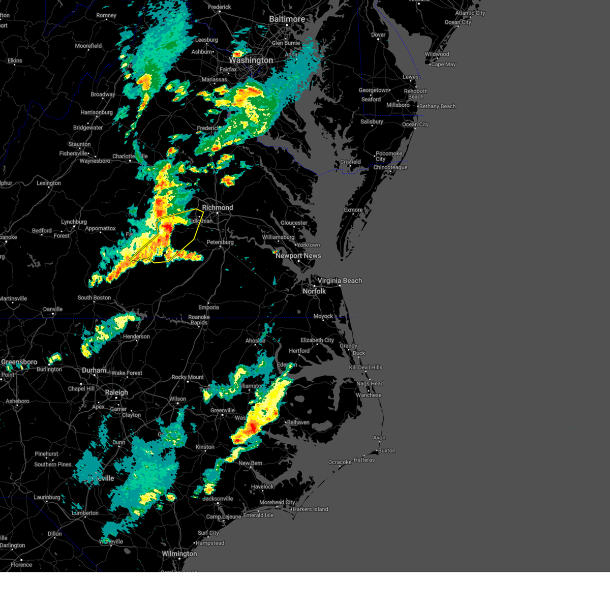 At 620 pm edt, severe thunderstorms were located along a line extending from near chula to near amelia courthouse to crewe, moving east at 50 mph (radar indicated). Hazards include 60 mph wind gusts and penny size hail. Expect damage to trees and powerlines. these severe storms will be near, crewe, amelia courthouse, nottoway, scotts fork, and chula around 625 pm edt. moseley and spainville around 630 pm edt. mannboro around 635 pm edt. Other locations impacted by these severe thunderstorms include prince edward station, briery, earls, pilkinton, twin lakes state park, winterham, skinquarter, maplewood, fergusonville, and holly hills. At 620 pm edt, severe thunderstorms were located along a line extending from near chula to near amelia courthouse to crewe, moving east at 50 mph (radar indicated). Hazards include 60 mph wind gusts and penny size hail. Expect damage to trees and powerlines. these severe storms will be near, crewe, amelia courthouse, nottoway, scotts fork, and chula around 625 pm edt. moseley and spainville around 630 pm edt. mannboro around 635 pm edt. Other locations impacted by these severe thunderstorms include prince edward station, briery, earls, pilkinton, twin lakes state park, winterham, skinquarter, maplewood, fergusonville, and holly hills.
|
| 5/30/2025 5:59 PM EDT |
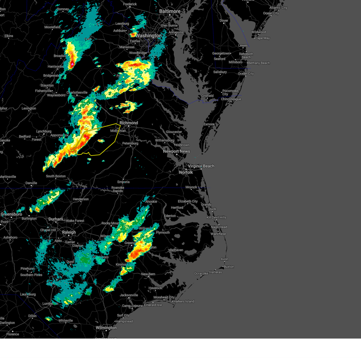 Svrakq the national weather service in wakefield has issued a * severe thunderstorm warning for, western chesterfield county in central virginia, southeastern cumberland county in central virginia, prince edward county in central virginia, nottoway county in south central virginia, amelia county in central virginia, southern powhatan county in central virginia, * until 645 pm edt. * at 559 pm edt, severe thunderstorms were located along a line extending from 6 miles southeast of guinea mills to near rice to near abilene, moving east at 40 mph (radar indicated). Hazards include 60 mph wind gusts and penny size hail. Expect damage to trees and powerlines. severe thunderstorms will be near, burkeville, morven, rice, and green bay around 605 pm edt. crewe and jetersville around 610 pm edt. amelia courthouse around 615 pm edt. chula around 620 pm edt. scotts fork around 625 pm edt. moseley and nottoway around 630 pm edt. Other locations impacted by these severe thunderstorms include raines tavern, prince edward station, angola, briery, earls, pilkinton, twin lakes state park, winterham, kingsville, and skinquarter. Svrakq the national weather service in wakefield has issued a * severe thunderstorm warning for, western chesterfield county in central virginia, southeastern cumberland county in central virginia, prince edward county in central virginia, nottoway county in south central virginia, amelia county in central virginia, southern powhatan county in central virginia, * until 645 pm edt. * at 559 pm edt, severe thunderstorms were located along a line extending from 6 miles southeast of guinea mills to near rice to near abilene, moving east at 40 mph (radar indicated). Hazards include 60 mph wind gusts and penny size hail. Expect damage to trees and powerlines. severe thunderstorms will be near, burkeville, morven, rice, and green bay around 605 pm edt. crewe and jetersville around 610 pm edt. amelia courthouse around 615 pm edt. chula around 620 pm edt. scotts fork around 625 pm edt. moseley and nottoway around 630 pm edt. Other locations impacted by these severe thunderstorms include raines tavern, prince edward station, angola, briery, earls, pilkinton, twin lakes state park, winterham, kingsville, and skinquarter.
|
| 5/8/2025 10:41 PM EDT |
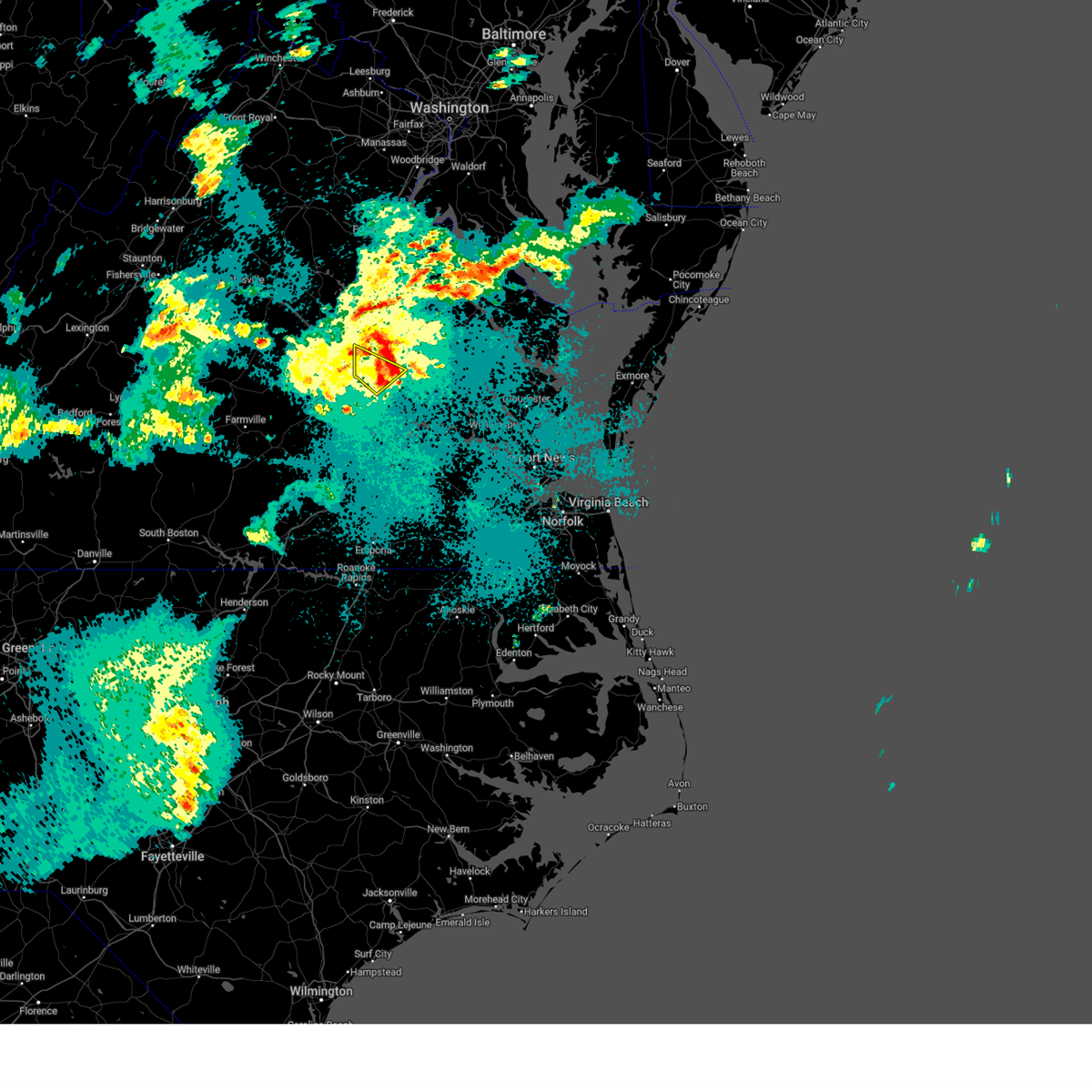 The storm which prompted the warning has weakened below severe limits, and no longer poses an immediate threat to life or property. therefore, the warning will be allowed to expire. The storm which prompted the warning has weakened below severe limits, and no longer poses an immediate threat to life or property. therefore, the warning will be allowed to expire.
|
| 5/8/2025 10:34 PM EDT |
 the severe thunderstorm warning has been cancelled and is no longer in effect the severe thunderstorm warning has been cancelled and is no longer in effect
|
| 5/8/2025 10:34 PM EDT |
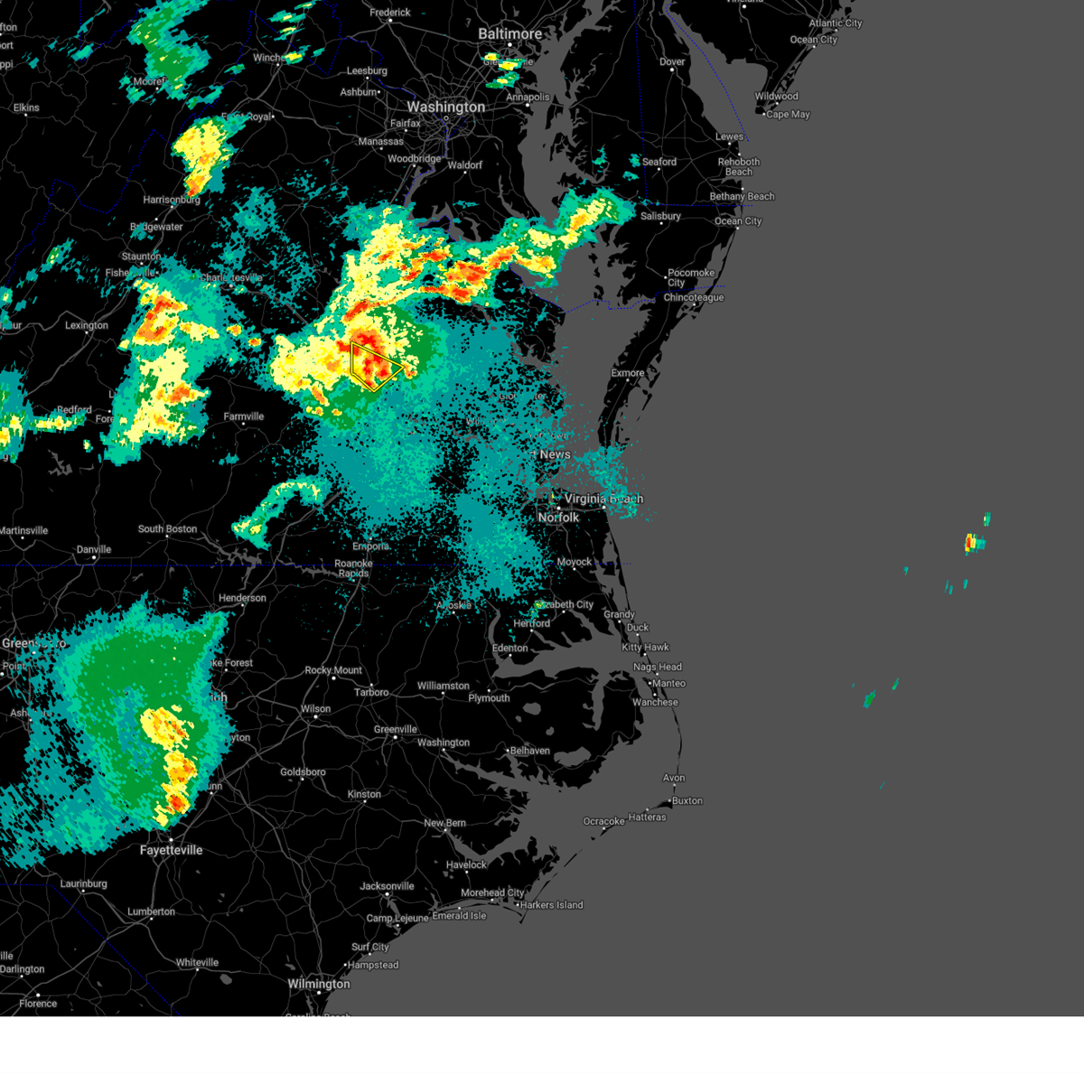 At 1034 pm edt, a severe thunderstorm was located near virginia commonwealth university, moving east at 30 mph (radar indicated). Hazards include 60 mph wind gusts. Expect damage to trees and powerlines. Locations impacted include, richmond, downtown richmond, bon air, virginia union university, virginia commonwealth university, tuckahoe, university of richmond, mechanicsville, laurel, wyndham, east highland park, lakeside, glen allen, short pump, solomons store, chamberlayne, greendale, roslyn hills, and dumbarton. At 1034 pm edt, a severe thunderstorm was located near virginia commonwealth university, moving east at 30 mph (radar indicated). Hazards include 60 mph wind gusts. Expect damage to trees and powerlines. Locations impacted include, richmond, downtown richmond, bon air, virginia union university, virginia commonwealth university, tuckahoe, university of richmond, mechanicsville, laurel, wyndham, east highland park, lakeside, glen allen, short pump, solomons store, chamberlayne, greendale, roslyn hills, and dumbarton.
|
| 5/8/2025 10:13 PM EDT |
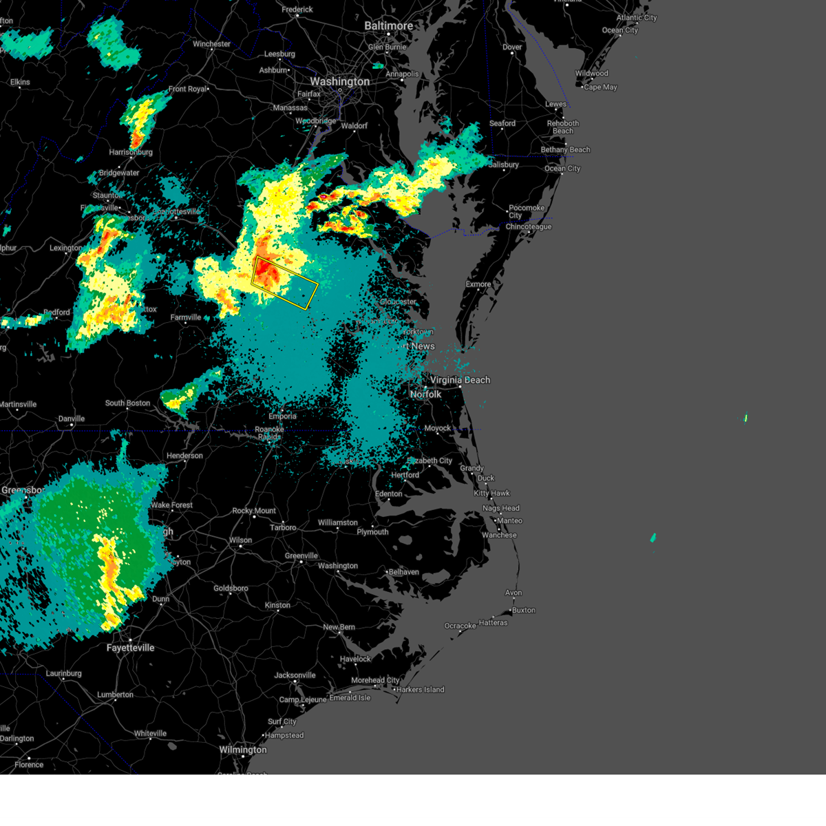 At 1012 pm edt, a severe thunderstorm was located over tuckahoe, moving east at 25 mph (radar indicated). Hazards include 60 mph wind gusts. Expect damage to trees and powerlines. Locations impacted include, richmond, downtown richmond, bon air, virginia union university, virginia commonwealth university, tuckahoe, university of richmond, highland springs, mechanicsville, bensley, manakin, east highland park, sabot, laurel, wyndham, lakeside, glen allen, bellwood, richmond heights, and johnsons springs. At 1012 pm edt, a severe thunderstorm was located over tuckahoe, moving east at 25 mph (radar indicated). Hazards include 60 mph wind gusts. Expect damage to trees and powerlines. Locations impacted include, richmond, downtown richmond, bon air, virginia union university, virginia commonwealth university, tuckahoe, university of richmond, highland springs, mechanicsville, bensley, manakin, east highland park, sabot, laurel, wyndham, lakeside, glen allen, bellwood, richmond heights, and johnsons springs.
|
| 5/8/2025 9:59 PM EDT |
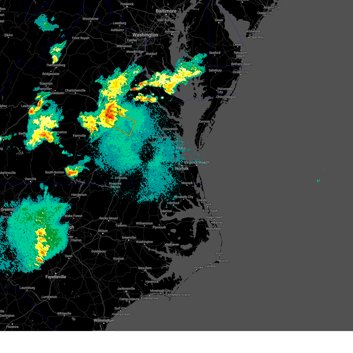 Svrakq the national weather service in wakefield has issued a * severe thunderstorm warning for, the city of richmond in central virginia, northeastern chesterfield county in central virginia, southeastern goochland county in central virginia, henrico county in central virginia, southwestern hanover county in central virginia, east central powhatan county in central virginia, * until 1045 pm edt. * at 959 pm edt, a severe thunderstorm was located over manakin, or near tuckahoe, moving east at 30 mph (radar indicated). Hazards include 60 mph wind gusts. expect damage to trees and powerlines Svrakq the national weather service in wakefield has issued a * severe thunderstorm warning for, the city of richmond in central virginia, northeastern chesterfield county in central virginia, southeastern goochland county in central virginia, henrico county in central virginia, southwestern hanover county in central virginia, east central powhatan county in central virginia, * until 1045 pm edt. * at 959 pm edt, a severe thunderstorm was located over manakin, or near tuckahoe, moving east at 30 mph (radar indicated). Hazards include 60 mph wind gusts. expect damage to trees and powerlines
|
| 5/5/2025 5:16 PM EDT |
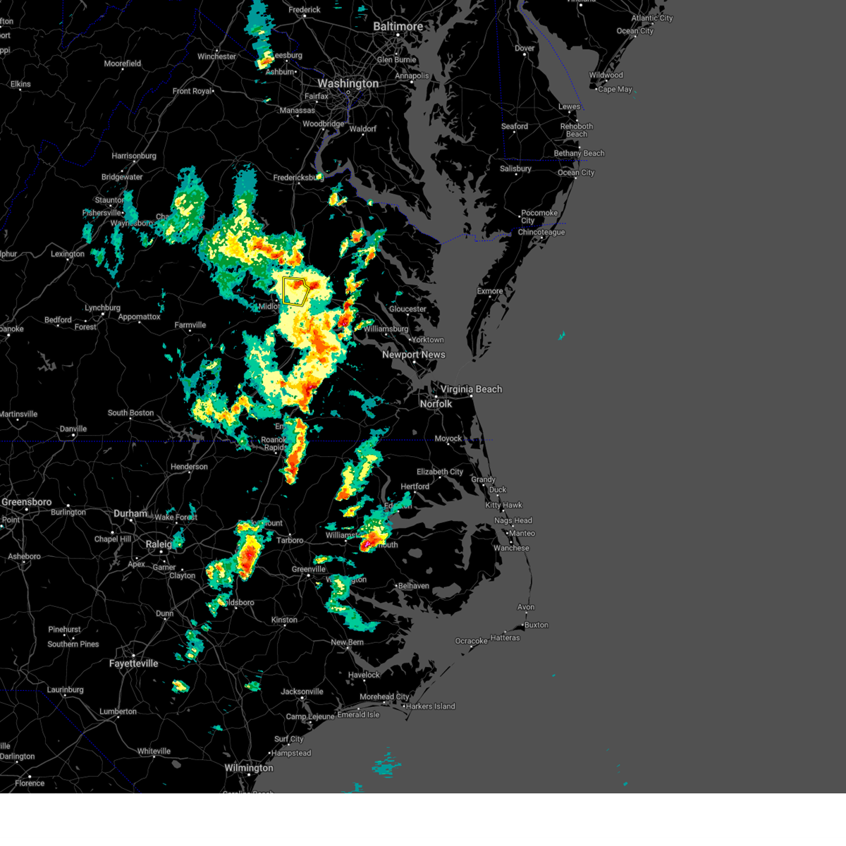 the severe thunderstorm warning has been cancelled and is no longer in effect the severe thunderstorm warning has been cancelled and is no longer in effect
|
| 5/5/2025 4:57 PM EDT |
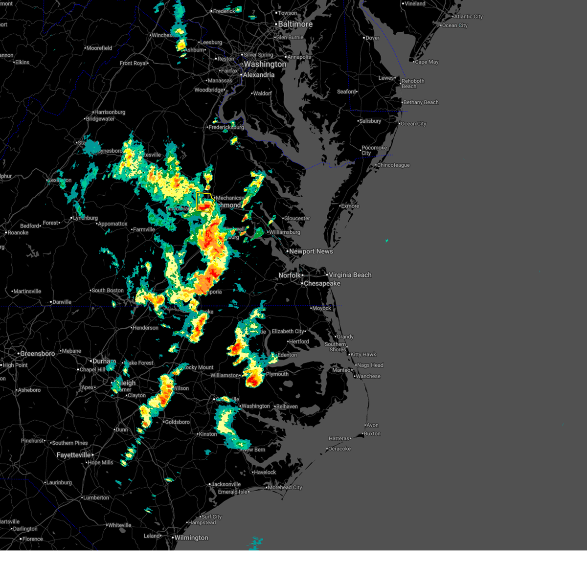 At 457 pm edt, a severe thunderstorm was located over bon air, moving north at 20 mph (radar indicated). Hazards include 60 mph wind gusts and quarter size hail. Minor damage to vehicles is possible. expect wind damage to trees and powerlines. this severe storm will be near, richmond, university of richmond, downtown richmond, tuckahoe, bon air, and virginia commonwealth university around 500 pm edt. virginia union university and lakeside around 505 pm edt. laurel around 510 pm edt. glen allen around 515 pm edt. Other locations impacted by this severe thunderstorm include dumbarton, solomons store, chamberlayne, greendale, and roslyn hills. At 457 pm edt, a severe thunderstorm was located over bon air, moving north at 20 mph (radar indicated). Hazards include 60 mph wind gusts and quarter size hail. Minor damage to vehicles is possible. expect wind damage to trees and powerlines. this severe storm will be near, richmond, university of richmond, downtown richmond, tuckahoe, bon air, and virginia commonwealth university around 500 pm edt. virginia union university and lakeside around 505 pm edt. laurel around 510 pm edt. glen allen around 515 pm edt. Other locations impacted by this severe thunderstorm include dumbarton, solomons store, chamberlayne, greendale, and roslyn hills.
|
| 5/5/2025 4:41 PM EDT |
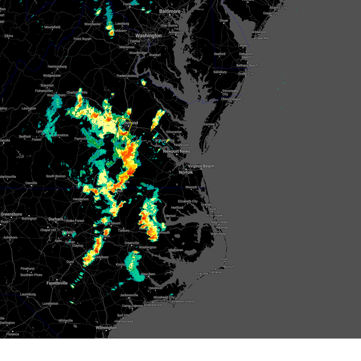 Svrakq the national weather service in wakefield has issued a * severe thunderstorm warning for, the city of richmond in central virginia, north central chesterfield county in central virginia, northwestern henrico county in central virginia, * until 530 pm edt. * at 441 pm edt, a severe thunderstorm was located near chesterfield court house, or near bon air, moving north at 20 mph (radar indicated). Hazards include 60 mph wind gusts and quarter size hail. Minor damage to vehicles is possible. expect wind damage to trees and powerlines. this severe thunderstorm will be near, richmond and bon air around 445 pm edt. university of richmond and downtown richmond around 455 pm edt. tuckahoe around 500 pm edt. virginia commonwealth university and lakeside around 505 pm edt. virginia union university and laurel around 510 pm edt. glen allen around 515 pm edt. Other locations impacted by this severe thunderstorm include solomons store, chamberlayne, greendale, roslyn hills, dumbarton, short pump, drewrys bluff, midlothian, and montrose. Svrakq the national weather service in wakefield has issued a * severe thunderstorm warning for, the city of richmond in central virginia, north central chesterfield county in central virginia, northwestern henrico county in central virginia, * until 530 pm edt. * at 441 pm edt, a severe thunderstorm was located near chesterfield court house, or near bon air, moving north at 20 mph (radar indicated). Hazards include 60 mph wind gusts and quarter size hail. Minor damage to vehicles is possible. expect wind damage to trees and powerlines. this severe thunderstorm will be near, richmond and bon air around 445 pm edt. university of richmond and downtown richmond around 455 pm edt. tuckahoe around 500 pm edt. virginia commonwealth university and lakeside around 505 pm edt. virginia union university and laurel around 510 pm edt. glen allen around 515 pm edt. Other locations impacted by this severe thunderstorm include solomons store, chamberlayne, greendale, roslyn hills, dumbarton, short pump, drewrys bluff, midlothian, and montrose.
|
| 3/20/2025 5:58 PM EDT |
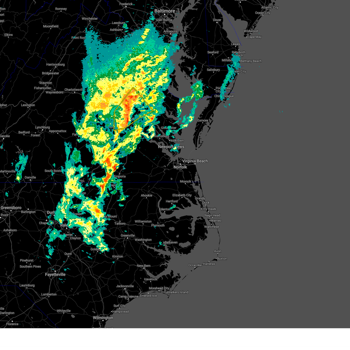 The storms which prompted the warning have weakened below severe limits, and no longer pose an immediate threat to life or property. therefore, the warning will be allowed to expire. however, gusty winds and heavy rain are still possible with these thunderstorms. to report severe weather, contact your nearest law enforcement agency. they will relay your report to the national weather service wakefield. The storms which prompted the warning have weakened below severe limits, and no longer pose an immediate threat to life or property. therefore, the warning will be allowed to expire. however, gusty winds and heavy rain are still possible with these thunderstorms. to report severe weather, contact your nearest law enforcement agency. they will relay your report to the national weather service wakefield.
|
| 3/20/2025 5:41 PM EDT |
 the severe thunderstorm warning has been cancelled and is no longer in effect the severe thunderstorm warning has been cancelled and is no longer in effect
|
| 3/20/2025 5:41 PM EDT |
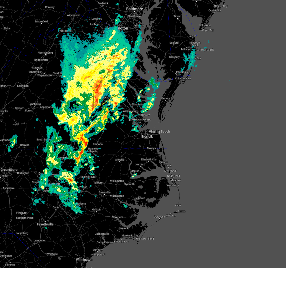 At 541 pm edt, severe thunderstorms were located along a line extending from near kings dominion to glen allen to university of richmond, moving northeast at 75 mph (radar indicated). Hazards include 60 mph wind gusts. Expect damage to trees and powerlines. Locations impacted include, randolph macon college, gum tree, manquin, beulahville, etna mills, montrose, biscoe, chamberlayne, atlee, dawn, ashcake, crouch, virginia commonwealth university, tuckahoe, duane fork, king william, sparta, central garage, laurel, and wyndham. At 541 pm edt, severe thunderstorms were located along a line extending from near kings dominion to glen allen to university of richmond, moving northeast at 75 mph (radar indicated). Hazards include 60 mph wind gusts. Expect damage to trees and powerlines. Locations impacted include, randolph macon college, gum tree, manquin, beulahville, etna mills, montrose, biscoe, chamberlayne, atlee, dawn, ashcake, crouch, virginia commonwealth university, tuckahoe, duane fork, king william, sparta, central garage, laurel, and wyndham.
|
| 3/20/2025 5:32 PM EDT |
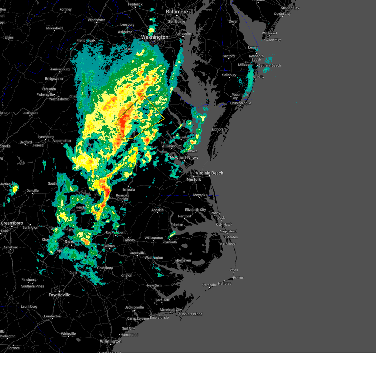 Svrakq the national weather service in wakefield has issued a * severe thunderstorm warning for, the city of richmond in central virginia, north central chesterfield county in central virginia, northwestern king and queen county in east central virginia, southeastern goochland county in central virginia, southeastern caroline county in north central virginia, northern henrico county in central virginia, king william county in east central virginia, hanover county in central virginia, east central powhatan county in central virginia, south central essex county in east central virginia, * until 600 pm edt. * at 532 pm edt, severe thunderstorms were located along a line extending from near wyndham to near tuckahoe to 6 miles east of moseley, moving northeast at 80 mph (radar indicated). Hazards include 60 mph wind gusts. expect damage to trees and powerlines Svrakq the national weather service in wakefield has issued a * severe thunderstorm warning for, the city of richmond in central virginia, north central chesterfield county in central virginia, northwestern king and queen county in east central virginia, southeastern goochland county in central virginia, southeastern caroline county in north central virginia, northern henrico county in central virginia, king william county in east central virginia, hanover county in central virginia, east central powhatan county in central virginia, south central essex county in east central virginia, * until 600 pm edt. * at 532 pm edt, severe thunderstorms were located along a line extending from near wyndham to near tuckahoe to 6 miles east of moseley, moving northeast at 80 mph (radar indicated). Hazards include 60 mph wind gusts. expect damage to trees and powerlines
|
| 3/5/2025 12:31 PM EST |
 At 1230 pm est, severe thunderstorms were located along a line extending from near kings dominion to hanover to near mechanicsville to virginia union university to near bensley to near chesterfield court house, moving east at 40 mph (radar indicated). Hazards include 60 mph wind gusts. Expect damage to trees and powerlines. these severe storms will be near, hanover, mechanicsville, chester, highland springs, east highland park, dawn, mangohick, bellwood, richmond, and bensley around 1235 pm est. manquin and beulahville around 1245 pm est. bottoms bridge and aylett around 1250 pm est. Other locations impacted by these severe thunderstorms include enfield, richmond heights, gum tree, elmont, etna mills, montrose, penola, sandston, epworth, and glendale. At 1230 pm est, severe thunderstorms were located along a line extending from near kings dominion to hanover to near mechanicsville to virginia union university to near bensley to near chesterfield court house, moving east at 40 mph (radar indicated). Hazards include 60 mph wind gusts. Expect damage to trees and powerlines. these severe storms will be near, hanover, mechanicsville, chester, highland springs, east highland park, dawn, mangohick, bellwood, richmond, and bensley around 1235 pm est. manquin and beulahville around 1245 pm est. bottoms bridge and aylett around 1250 pm est. Other locations impacted by these severe thunderstorms include enfield, richmond heights, gum tree, elmont, etna mills, montrose, penola, sandston, epworth, and glendale.
|
| 3/5/2025 12:31 PM EST |
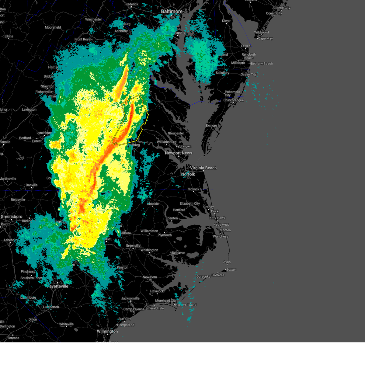 the severe thunderstorm warning has been cancelled and is no longer in effect the severe thunderstorm warning has been cancelled and is no longer in effect
|
| 3/5/2025 12:27 PM EST | Large tree down near the intersection of biscayne and capehart rd. time estimate in henrico county VA, 4.6 miles WSW of Tuckahoe, VA |
| 3/5/2025 12:26 PM EST |
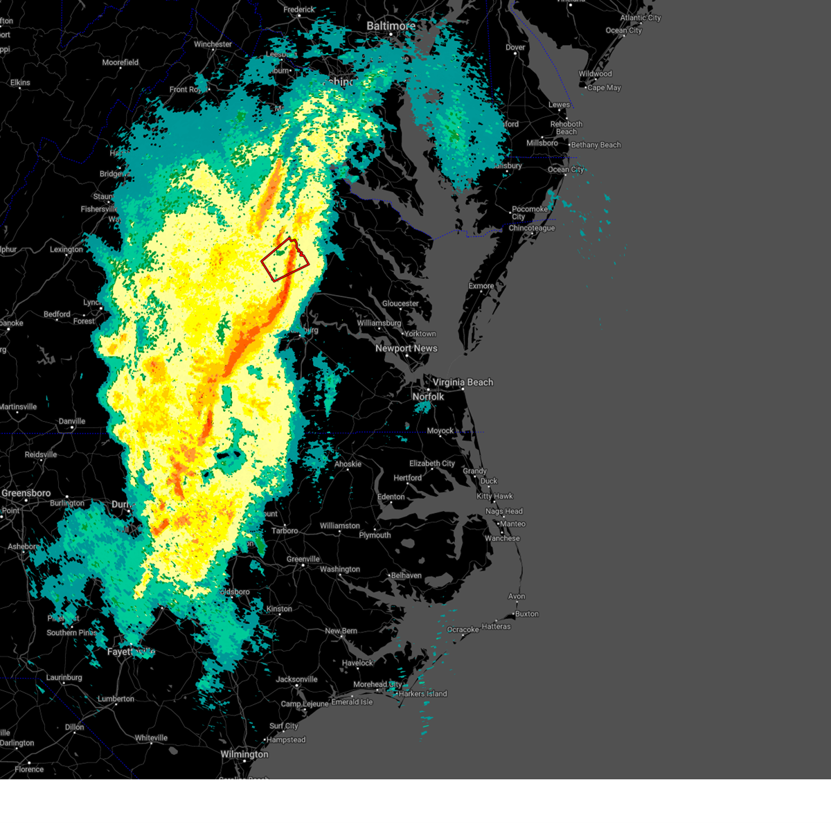 The tornado threat has diminished and the tornado warning has been cancelled. however, damaging winds remain likely and a severe thunderstorm warning remains in effect for the area. a severe thunderstorm watch remains in effect until 600 pm est for central and north central virginia. The tornado threat has diminished and the tornado warning has been cancelled. however, damaging winds remain likely and a severe thunderstorm warning remains in effect for the area. a severe thunderstorm watch remains in effect until 600 pm est for central and north central virginia.
|
| 3/5/2025 12:15 PM EST |
 At 1215 pm est, a severe thunderstorm capable of producing a tornado was located over wyndham, or near randolph macon college, moving northeast at 50 mph (radar indicated rotation). Hazards include tornado. Flying debris will be dangerous to those caught without shelter. mobile homes will be damaged or destroyed. damage to roofs, windows, and vehicles will occur. tree damage is likely. this dangerous storm will be near, randolph macon college and ashland around 1220 pm est. kings dominion around 1225 pm est. Other locations impacted by this tornadic thunderstorm include rockville, gilman, ashcake, oliver, hanover airport, gum tree, goodall, doswell, elmont, and short pump. At 1215 pm est, a severe thunderstorm capable of producing a tornado was located over wyndham, or near randolph macon college, moving northeast at 50 mph (radar indicated rotation). Hazards include tornado. Flying debris will be dangerous to those caught without shelter. mobile homes will be damaged or destroyed. damage to roofs, windows, and vehicles will occur. tree damage is likely. this dangerous storm will be near, randolph macon college and ashland around 1220 pm est. kings dominion around 1225 pm est. Other locations impacted by this tornadic thunderstorm include rockville, gilman, ashcake, oliver, hanover airport, gum tree, goodall, doswell, elmont, and short pump.
|
| 3/5/2025 12:15 PM EST |
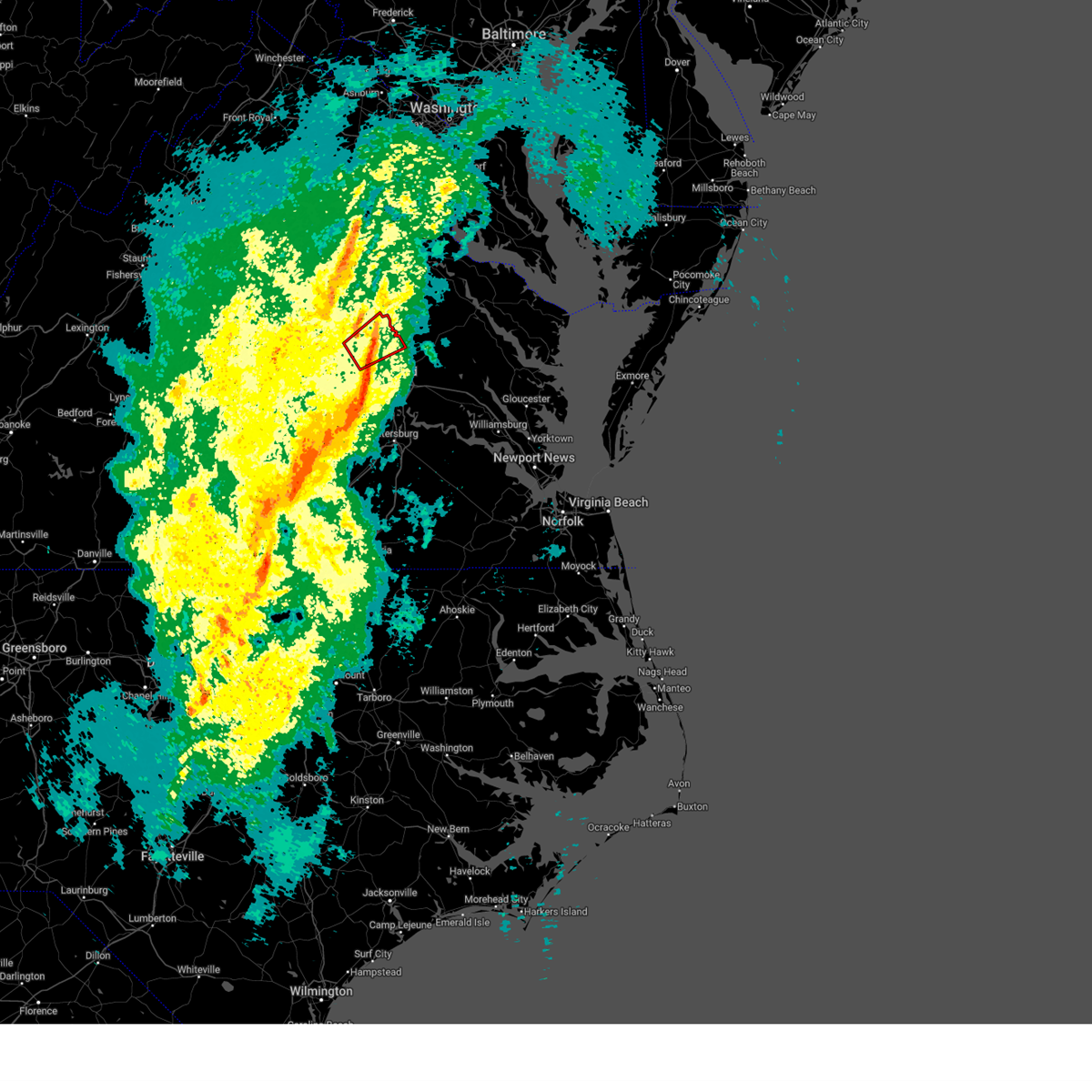 the tornado warning has been cancelled and is no longer in effect the tornado warning has been cancelled and is no longer in effect
|
| 3/5/2025 12:14 PM EST |
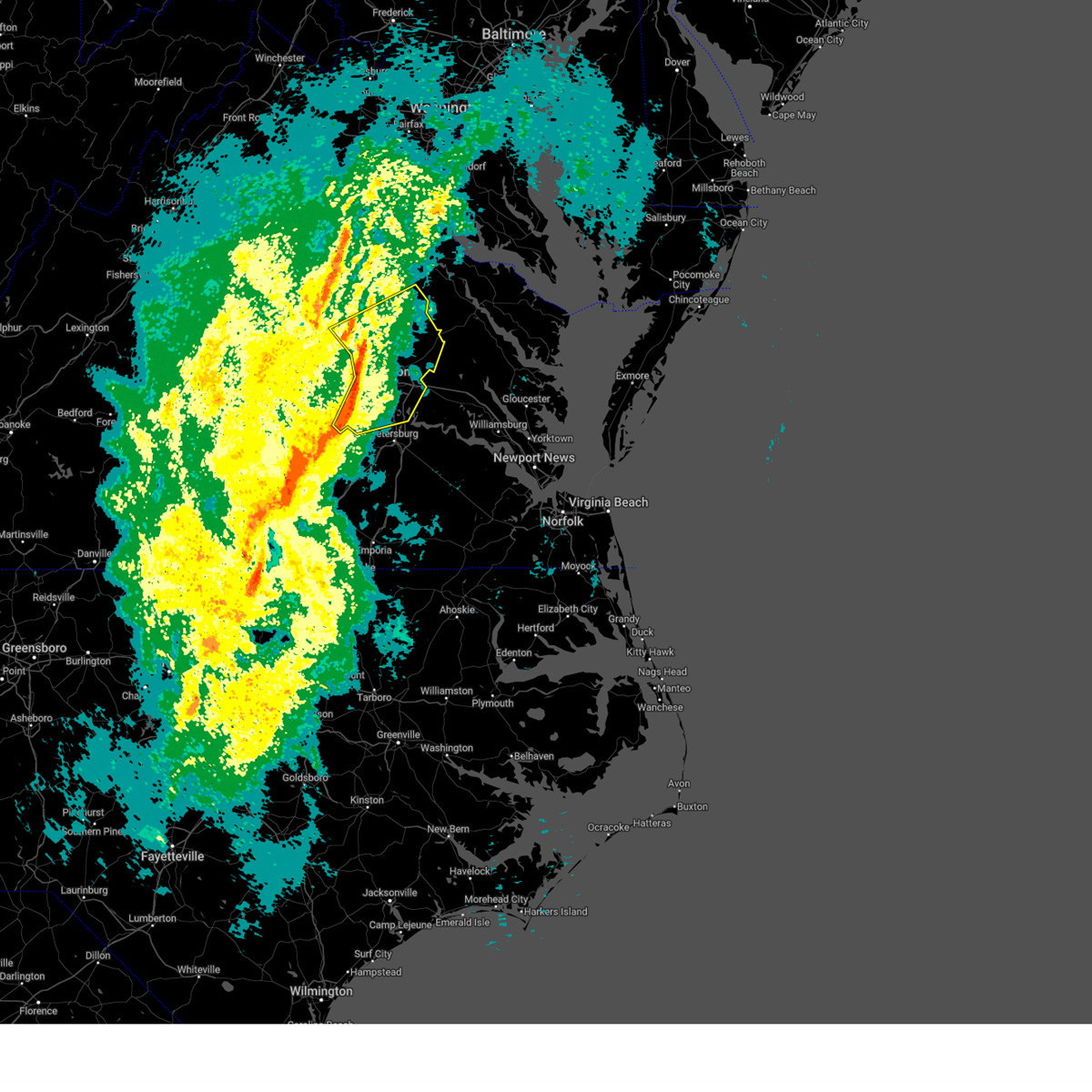 Svrakq the national weather service in wakefield has issued a * severe thunderstorm warning for, southeastern louisa county in central virginia, the city of richmond in central virginia, chesterfield county in central virginia, southeastern goochland county in central virginia, southern caroline county in north central virginia, henrico county in central virginia, northwestern king william county in east central virginia, hanover county in central virginia, * until 100 pm est. * at 1213 pm est, severe thunderstorms were located along a line extending from montpelier to wyndham to near tuckahoe to near bon air to 6 miles east of moseley to near mannboro, moving east at 40 mph (radar indicated). Hazards include 60 mph wind gusts. Expect damage to trees and powerlines. severe thunderstorms will be near, university of richmond, virginia union university, randolph macon college, mechanicsville, laurel, lakeside, downtown richmond, ashland, richmond, and tuckahoe around 1220 pm est. hanover, east highland park, kings dominion, bellwood, and bensley around 1225 pm est. chester, highland springs, and dawn around 1230 pm est. mangohick and studley around 1235 pm est. manquin and beulahville around 1245 pm est. bottoms bridge and aylett around 1250 pm est. Other locations impacted by these severe thunderstorms include gum tree, etna mills, montrose, sandston, glendale, pocahontas state park, beach, chamberlayne, atlee, and meadowville. Svrakq the national weather service in wakefield has issued a * severe thunderstorm warning for, southeastern louisa county in central virginia, the city of richmond in central virginia, chesterfield county in central virginia, southeastern goochland county in central virginia, southern caroline county in north central virginia, henrico county in central virginia, northwestern king william county in east central virginia, hanover county in central virginia, * until 100 pm est. * at 1213 pm est, severe thunderstorms were located along a line extending from montpelier to wyndham to near tuckahoe to near bon air to 6 miles east of moseley to near mannboro, moving east at 40 mph (radar indicated). Hazards include 60 mph wind gusts. Expect damage to trees and powerlines. severe thunderstorms will be near, university of richmond, virginia union university, randolph macon college, mechanicsville, laurel, lakeside, downtown richmond, ashland, richmond, and tuckahoe around 1220 pm est. hanover, east highland park, kings dominion, bellwood, and bensley around 1225 pm est. chester, highland springs, and dawn around 1230 pm est. mangohick and studley around 1235 pm est. manquin and beulahville around 1245 pm est. bottoms bridge and aylett around 1250 pm est. Other locations impacted by these severe thunderstorms include gum tree, etna mills, montrose, sandston, glendale, pocahontas state park, beach, chamberlayne, atlee, and meadowville.
|
| 3/5/2025 12:01 PM EST |
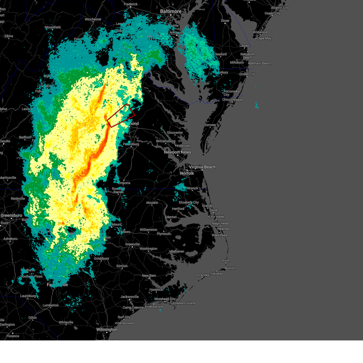 Torakq the national weather service in wakefield has issued a * tornado warning for, southeastern goochland county in central virginia, northwestern henrico county in central virginia, central hanover county in central virginia, northeastern powhatan county in central virginia, * until 1230 pm est. * at 1200 pm est, a severe thunderstorm capable of producing a tornado was located over sabot, or 8 miles southeast of goochland, moving northeast at 55 mph (radar indicated rotation). Hazards include tornado. Flying debris will be dangerous to those caught without shelter. mobile homes will be damaged or destroyed. damage to roofs, windows, and vehicles will occur. tree damage is likely. this dangerous storm will be near, wyndham, manakin, and tuckahoe around 1205 pm est. randolph macon college and ashland around 1215 pm est. kings dominion around 1220 pm est. Other locations impacted by this tornadic thunderstorm include crozier, oliver, hanover airport, gum tree, johnsons springs, goodall, doswell, elmont, short pump, and subletts. Torakq the national weather service in wakefield has issued a * tornado warning for, southeastern goochland county in central virginia, northwestern henrico county in central virginia, central hanover county in central virginia, northeastern powhatan county in central virginia, * until 1230 pm est. * at 1200 pm est, a severe thunderstorm capable of producing a tornado was located over sabot, or 8 miles southeast of goochland, moving northeast at 55 mph (radar indicated rotation). Hazards include tornado. Flying debris will be dangerous to those caught without shelter. mobile homes will be damaged or destroyed. damage to roofs, windows, and vehicles will occur. tree damage is likely. this dangerous storm will be near, wyndham, manakin, and tuckahoe around 1205 pm est. randolph macon college and ashland around 1215 pm est. kings dominion around 1220 pm est. Other locations impacted by this tornadic thunderstorm include crozier, oliver, hanover airport, gum tree, johnsons springs, goodall, doswell, elmont, short pump, and subletts.
|
| 3/5/2025 11:58 AM EST |
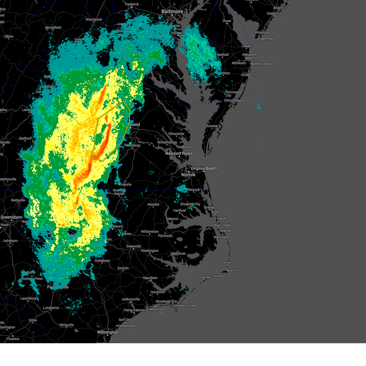 At 1158 am est, severe thunderstorms were located along a line extending from near gum spring to sabot to near moseley to spainville, moving northeast at 55 mph (radar indicated). Hazards include 60 mph wind gusts. Expect damage to trees and powerlines. these severe storms will be near, montpelier, moseley, wyndham, manakin, richmond, tuckahoe, bon air, and mannboro around 1205 pm est. university of richmond, laurel, ashland, and glen allen around 1210 pm est. randolph macon college and lakeside around 1215 pm est. Other locations impacted by these severe thunderstorms include north wellville, ammon, maidens, gum tree, three square, skinquarter, wellville, beach, fine creek mills, and michaux. At 1158 am est, severe thunderstorms were located along a line extending from near gum spring to sabot to near moseley to spainville, moving northeast at 55 mph (radar indicated). Hazards include 60 mph wind gusts. Expect damage to trees and powerlines. these severe storms will be near, montpelier, moseley, wyndham, manakin, richmond, tuckahoe, bon air, and mannboro around 1205 pm est. university of richmond, laurel, ashland, and glen allen around 1210 pm est. randolph macon college and lakeside around 1215 pm est. Other locations impacted by these severe thunderstorms include north wellville, ammon, maidens, gum tree, three square, skinquarter, wellville, beach, fine creek mills, and michaux.
|
| 3/5/2025 11:58 AM EST |
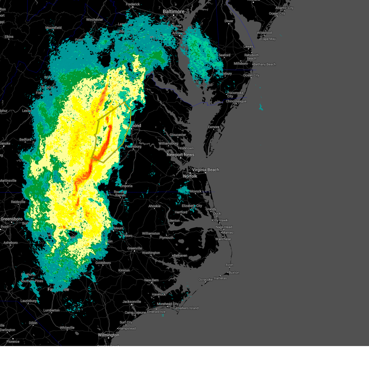 the severe thunderstorm warning has been cancelled and is no longer in effect the severe thunderstorm warning has been cancelled and is no longer in effect
|
| 3/5/2025 11:35 AM EST |
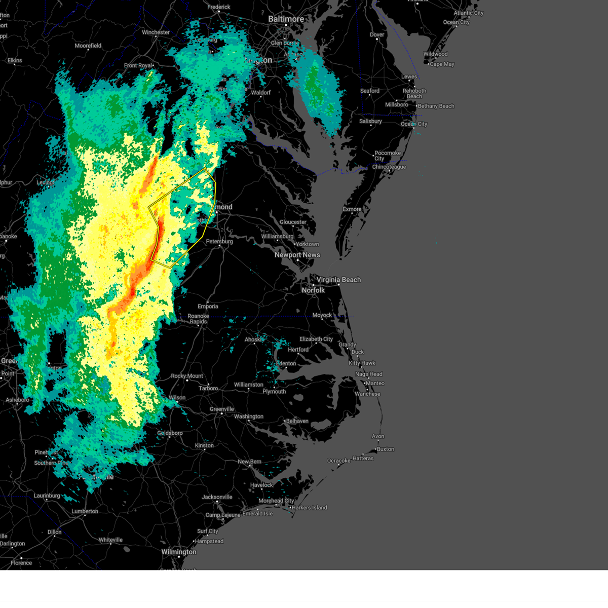 Svrakq the national weather service in wakefield has issued a * severe thunderstorm warning for, southeastern louisa county in central virginia, the city of richmond in central virginia, western chesterfield county in central virginia, east central cumberland county in central virginia, nottoway county in south central virginia, southern goochland county in central virginia, northwestern henrico county in central virginia, northwestern hanover county in central virginia, northwestern dinwiddie county in south central virginia, amelia county in central virginia, powhatan county in central virginia, * until 1215 pm est. * at 1134 am est, severe thunderstorms were located along a line extending from near trenholm to near morven to jetersville to victoria, moving northeast at 55 mph (radar indicated). Hazards include 60 mph wind gusts. Expect damage to trees and powerlines. severe thunderstorms will be near, amelia courthouse, nottoway, crewe, powhatan, macon, chula, cartersville, and trenholm around 1140 am est. goochland, scotts fork, and blackstone around 1145 am est. spainville, moseley, sabot, and gum spring around 1150 am est. oilville, manakin, and mannboro around 1155 am est. wyndham and tuckahoe around 1200 pm est. montpelier, richmond, and bon air around 1205 pm est. Other locations impacted by these severe thunderstorms include north wellville, ammon, maidens, gum tree, three square, skinquarter, wellville, beach, whiteville, and fine creek mills. Svrakq the national weather service in wakefield has issued a * severe thunderstorm warning for, southeastern louisa county in central virginia, the city of richmond in central virginia, western chesterfield county in central virginia, east central cumberland county in central virginia, nottoway county in south central virginia, southern goochland county in central virginia, northwestern henrico county in central virginia, northwestern hanover county in central virginia, northwestern dinwiddie county in south central virginia, amelia county in central virginia, powhatan county in central virginia, * until 1215 pm est. * at 1134 am est, severe thunderstorms were located along a line extending from near trenholm to near morven to jetersville to victoria, moving northeast at 55 mph (radar indicated). Hazards include 60 mph wind gusts. Expect damage to trees and powerlines. severe thunderstorms will be near, amelia courthouse, nottoway, crewe, powhatan, macon, chula, cartersville, and trenholm around 1140 am est. goochland, scotts fork, and blackstone around 1145 am est. spainville, moseley, sabot, and gum spring around 1150 am est. oilville, manakin, and mannboro around 1155 am est. wyndham and tuckahoe around 1200 pm est. montpelier, richmond, and bon air around 1205 pm est. Other locations impacted by these severe thunderstorms include north wellville, ammon, maidens, gum tree, three square, skinquarter, wellville, beach, whiteville, and fine creek mills.
|
| 2/16/2025 10:42 AM EST |
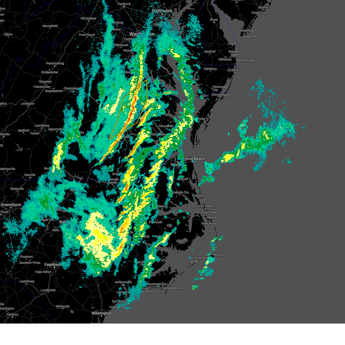 The storms which prompted the warning have moved out of the area. therefore, the warning will be allowed to expire. The storms which prompted the warning have moved out of the area. therefore, the warning will be allowed to expire.
|
| 2/16/2025 10:33 AM EST | Public reported multiple branches down across their apartment comple in henrico county VA, 4.1 miles SW of Tuckahoe, VA |
| 2/16/2025 10:27 AM EST |
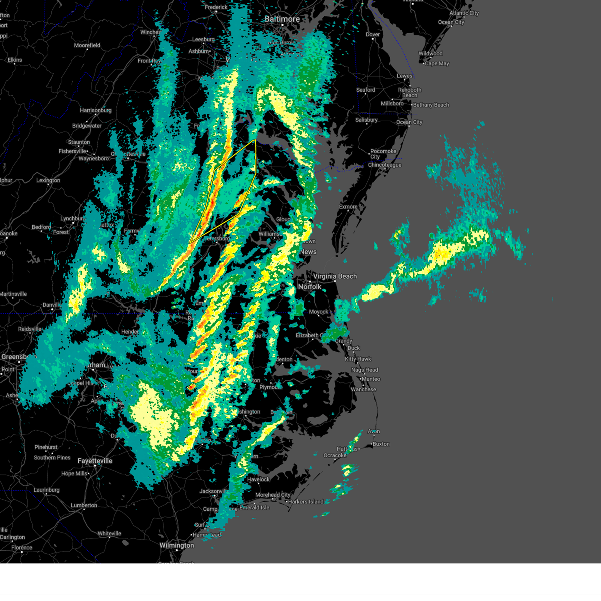 the severe thunderstorm warning has been cancelled and is no longer in effect the severe thunderstorm warning has been cancelled and is no longer in effect
|
| 2/16/2025 10:27 AM EST |
 At 1026 am est, severe thunderstorms were located along a line extending from 6 miles north of dawn to lakeside to near chesterfield court house, moving northeast at 80 mph (radar indicated). Hazards include 60 mph wind gusts. Expect damage to trees and powerlines. these severe storms will be near, virginia union university, hanover, mechanicsville, lakeside, highland springs, downtown richmond, east highland park, dawn, mangohick, and bellwood around 1030 am est. beulahville around 1035 am est. newtown, loretto, manquin, leedstown, and aylett around 1040 am est. champlain and saint stephens church around 1045 am est. Other locations impacted by these severe thunderstorms include beazley, etna mills, montrose, sandston, pocahontas state park, biscoe, beach, chamberlayne, atlee, and ashcake. At 1026 am est, severe thunderstorms were located along a line extending from 6 miles north of dawn to lakeside to near chesterfield court house, moving northeast at 80 mph (radar indicated). Hazards include 60 mph wind gusts. Expect damage to trees and powerlines. these severe storms will be near, virginia union university, hanover, mechanicsville, lakeside, highland springs, downtown richmond, east highland park, dawn, mangohick, and bellwood around 1030 am est. beulahville around 1035 am est. newtown, loretto, manquin, leedstown, and aylett around 1040 am est. champlain and saint stephens church around 1045 am est. Other locations impacted by these severe thunderstorms include beazley, etna mills, montrose, sandston, pocahontas state park, biscoe, beach, chamberlayne, atlee, and ashcake.
|
| 2/16/2025 10:25 AM EST | Numerous tree limbs downed near henrico doctors hospita in henrico county VA, 3.8 miles WSW of Tuckahoe, VA |
| 2/16/2025 10:18 AM EST |
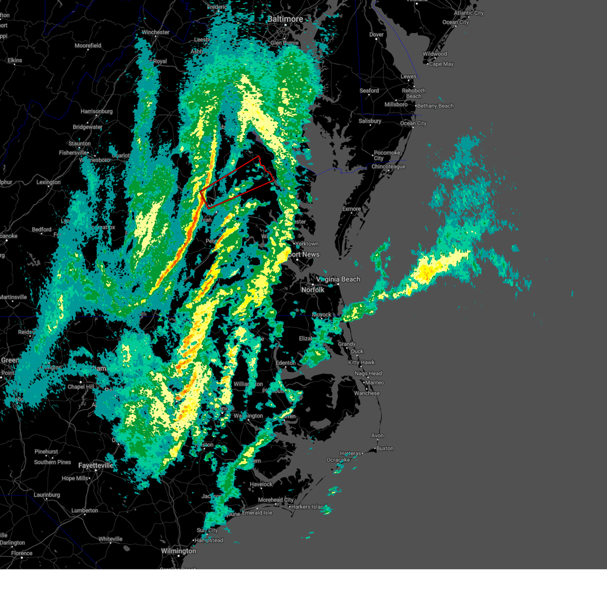 Torakq the national weather service in wakefield has issued a * tornado warning for, the city of richmond in central virginia, northwestern king and queen county in east central virginia, southeastern caroline county in north central virginia, northwestern henrico county in central virginia, northwestern king william county in east central virginia, central hanover county in central virginia, essex county in east central virginia, * until 1045 am est. * at 1018 am est, a severe thunderstorm capable of producing a tornado was located over glen allen, or near randolph macon college, moving northeast at 70 mph (radar indicated rotation). Hazards include tornado. Flying debris will be dangerous to those caught without shelter. mobile homes will be damaged or destroyed. damage to roofs, windows, and vehicles will occur. tree damage is likely. this dangerous storm will be near, hanover and ashland around 1025 am est. mangohick around 1030 am est. beulahville around 1035 am est. Other locations impacted by this tornadic thunderstorm include beazley, enfield, elevon, elmont, etna mills, epworth, biscoe, solomons store, chamberlayne, and atlee. Torakq the national weather service in wakefield has issued a * tornado warning for, the city of richmond in central virginia, northwestern king and queen county in east central virginia, southeastern caroline county in north central virginia, northwestern henrico county in central virginia, northwestern king william county in east central virginia, central hanover county in central virginia, essex county in east central virginia, * until 1045 am est. * at 1018 am est, a severe thunderstorm capable of producing a tornado was located over glen allen, or near randolph macon college, moving northeast at 70 mph (radar indicated rotation). Hazards include tornado. Flying debris will be dangerous to those caught without shelter. mobile homes will be damaged or destroyed. damage to roofs, windows, and vehicles will occur. tree damage is likely. this dangerous storm will be near, hanover and ashland around 1025 am est. mangohick around 1030 am est. beulahville around 1035 am est. Other locations impacted by this tornadic thunderstorm include beazley, enfield, elevon, elmont, etna mills, epworth, biscoe, solomons store, chamberlayne, and atlee.
|
| 2/16/2025 10:04 AM EST |
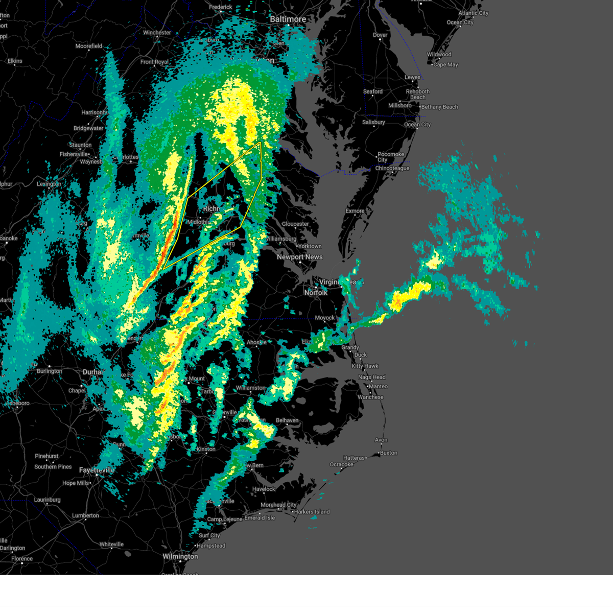 Svrakq the national weather service in wakefield has issued a * severe thunderstorm warning for, eastern nottoway county in south central virginia, southeastern goochland county in central virginia, hanover county in central virginia, northwestern dinwiddie county in south central virginia, southeastern powhatan county in central virginia, the city of richmond in central virginia, chesterfield county in central virginia, northwestern king and queen county in east central virginia, northwestern charles city county in east central virginia, northwestern new kent county in east central virginia, southeastern caroline county in north central virginia, west central westmoreland county in east central virginia, henrico county in central virginia, king william county in east central virginia, eastern amelia county in central virginia, northwestern essex county in east central virginia, * until 1045 am est. * at 1003 am est, severe thunderstorms were located along a line extending from near oilville to near scotts fork to near blackstone, moving northeast at 75 mph (radar indicated). Hazards include 60 mph wind gusts. Expect damage to trees and powerlines. severe thunderstorms will be near, moseley, wyndham, manakin, tuckahoe, sabot, bon air, and mannboro around 1010 am est. university of richmond, randolph macon college, laurel, ashland, richmond, and glen allen around 1015 am est. lakeside, downtown richmond, and kings dominion around 1020 am est. virginia union university, hanover, mechanicsville, east highland park, dawn, bensley, chesterfield court house, and virginia commonwealth university around 1025 am est. highland springs, mangohick, bellwood, and studley around 1030 am est. newtown and beulahville around 1035 am est. Other locations impacted by these severe thunderstorms include beazley, north wellville, ammon, gum tree, etna mills, montrose, sandston, glendale, pocahontas state park, and biscoe. Svrakq the national weather service in wakefield has issued a * severe thunderstorm warning for, eastern nottoway county in south central virginia, southeastern goochland county in central virginia, hanover county in central virginia, northwestern dinwiddie county in south central virginia, southeastern powhatan county in central virginia, the city of richmond in central virginia, chesterfield county in central virginia, northwestern king and queen county in east central virginia, northwestern charles city county in east central virginia, northwestern new kent county in east central virginia, southeastern caroline county in north central virginia, west central westmoreland county in east central virginia, henrico county in central virginia, king william county in east central virginia, eastern amelia county in central virginia, northwestern essex county in east central virginia, * until 1045 am est. * at 1003 am est, severe thunderstorms were located along a line extending from near oilville to near scotts fork to near blackstone, moving northeast at 75 mph (radar indicated). Hazards include 60 mph wind gusts. Expect damage to trees and powerlines. severe thunderstorms will be near, moseley, wyndham, manakin, tuckahoe, sabot, bon air, and mannboro around 1010 am est. university of richmond, randolph macon college, laurel, ashland, richmond, and glen allen around 1015 am est. lakeside, downtown richmond, and kings dominion around 1020 am est. virginia union university, hanover, mechanicsville, east highland park, dawn, bensley, chesterfield court house, and virginia commonwealth university around 1025 am est. highland springs, mangohick, bellwood, and studley around 1030 am est. newtown and beulahville around 1035 am est. Other locations impacted by these severe thunderstorms include beazley, north wellville, ammon, gum tree, etna mills, montrose, sandston, glendale, pocahontas state park, and biscoe.
|
| 8/29/2024 11:52 PM EDT |
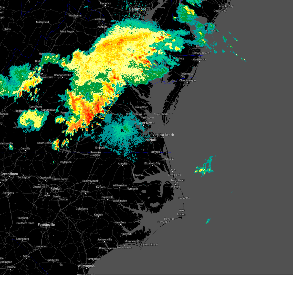 At 1151 pm edt, severe thunderstorms were located along a line extending from highland springs to 6 miles south of chesterfield court house, moving southeast at 25 mph (radar indicated). Hazards include 60 mph wind gusts. Expect damage to trees and powerlines. Locations impacted include, richmond, colonial heights, downtown richmond, bon air, virginia union university, virginia commonwealth university, university of richmond, chester, mechanicsville, highland springs, tuckahoe, bensley, bellwood, east highland park, glen allen, laurel, matoaca, lakeside, chesterfield court house, and chesterfield. At 1151 pm edt, severe thunderstorms were located along a line extending from highland springs to 6 miles south of chesterfield court house, moving southeast at 25 mph (radar indicated). Hazards include 60 mph wind gusts. Expect damage to trees and powerlines. Locations impacted include, richmond, colonial heights, downtown richmond, bon air, virginia union university, virginia commonwealth university, university of richmond, chester, mechanicsville, highland springs, tuckahoe, bensley, bellwood, east highland park, glen allen, laurel, matoaca, lakeside, chesterfield court house, and chesterfield.
|
| 8/29/2024 11:31 PM EDT |
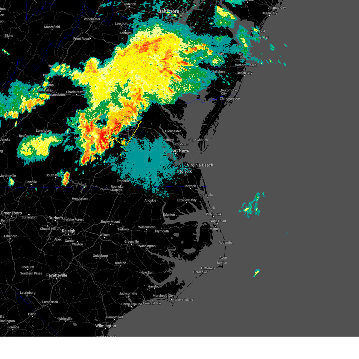 Svrakq the national weather service in wakefield has issued a * severe thunderstorm warning for, the city of richmond in central virginia, chesterfield county in central virginia, henrico county in central virginia, southeastern hanover county in central virginia, * until 1215 am edt. * at 1131 pm edt, severe thunderstorms were located along a line extending from lakeside to 7 miles southeast of moseley, moving southeast at 15 mph (radar indicated). Hazards include 60 mph wind gusts. expect damage to trees and powerlines Svrakq the national weather service in wakefield has issued a * severe thunderstorm warning for, the city of richmond in central virginia, chesterfield county in central virginia, henrico county in central virginia, southeastern hanover county in central virginia, * until 1215 am edt. * at 1131 pm edt, severe thunderstorms were located along a line extending from lakeside to 7 miles southeast of moseley, moving southeast at 15 mph (radar indicated). Hazards include 60 mph wind gusts. expect damage to trees and powerlines
|
| 8/29/2024 11:22 PM EDT |
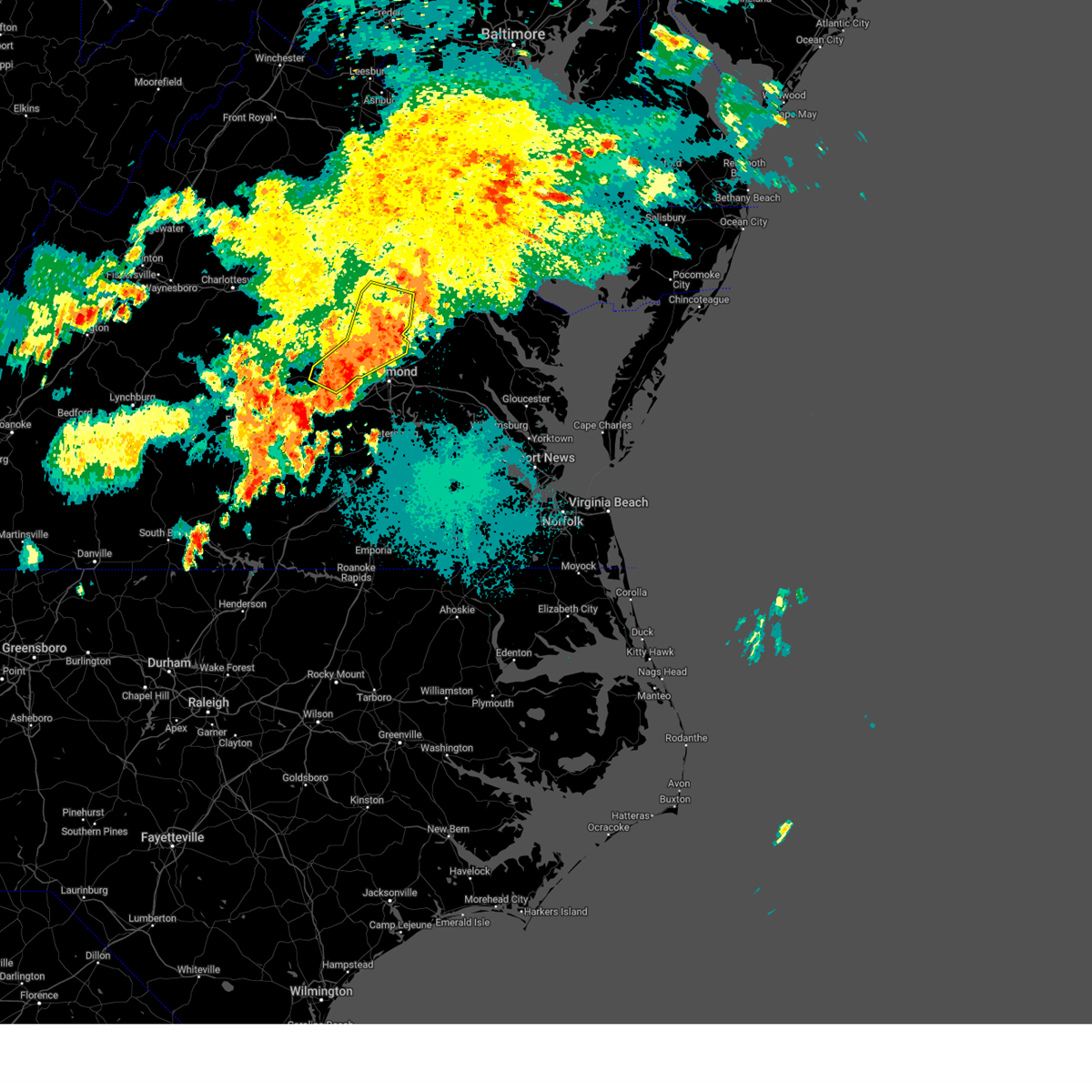 The storms which prompted the warning have weakened below severe limits, and no longer pose an immediate threat to life or property. therefore, the warning will be allowed to expire. however, gusty winds are still possible with these thunderstorms. The storms which prompted the warning have weakened below severe limits, and no longer pose an immediate threat to life or property. therefore, the warning will be allowed to expire. however, gusty winds are still possible with these thunderstorms.
|
| 8/29/2024 11:04 PM EDT |
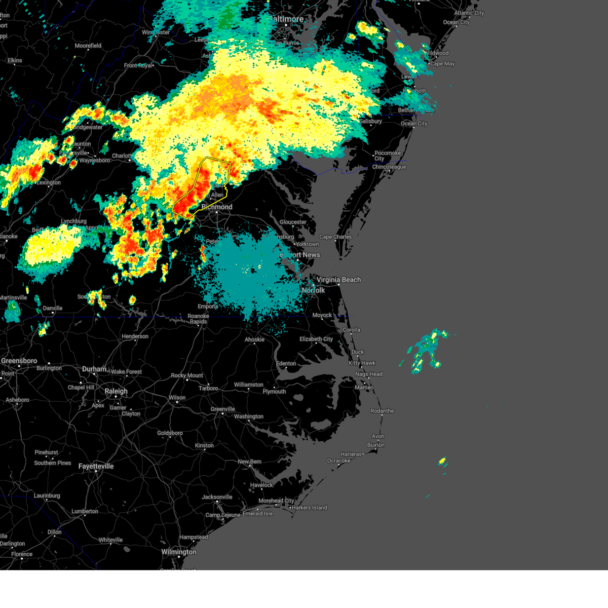 At 1104 pm edt, severe thunderstorms were located along a line extending from near ladysmith to near glen allen to powhatan, moving east at 15 mph (radar indicated). Hazards include 60 mph wind gusts. Expect damage to trees and powerlines. these severe storms will be near, ashland, randolph macon college, tuckahoe, laurel, lakeside, kings dominion, wyndham, manakin, sabot, and glen allen around 1110 pm edt. mechanicsville, hanover, and dawn around 1115 pm edt. Other locations impacted by these severe thunderstorms include chilesburg, golansville, crozier, gum tree, johnsons springs, elmont, penola, gilman, solomons store, and fine creek mills. At 1104 pm edt, severe thunderstorms were located along a line extending from near ladysmith to near glen allen to powhatan, moving east at 15 mph (radar indicated). Hazards include 60 mph wind gusts. Expect damage to trees and powerlines. these severe storms will be near, ashland, randolph macon college, tuckahoe, laurel, lakeside, kings dominion, wyndham, manakin, sabot, and glen allen around 1110 pm edt. mechanicsville, hanover, and dawn around 1115 pm edt. Other locations impacted by these severe thunderstorms include chilesburg, golansville, crozier, gum tree, johnsons springs, elmont, penola, gilman, solomons store, and fine creek mills.
|
| 8/29/2024 10:47 PM EDT |
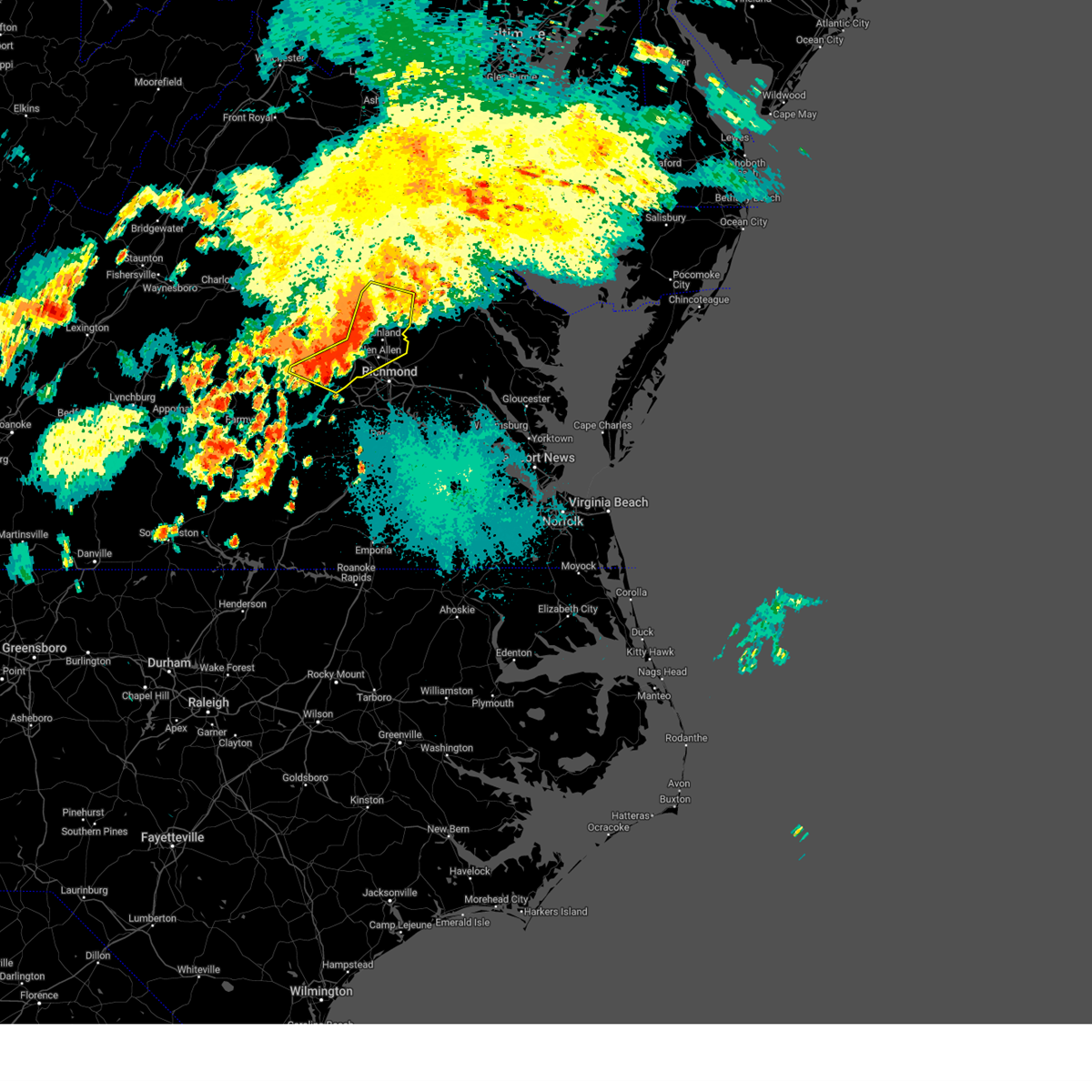 Svrakq the national weather service in wakefield has issued a * severe thunderstorm warning for, southeastern goochland county in central virginia, southwestern caroline county in north central virginia, northwestern henrico county in central virginia, hanover county in central virginia, powhatan county in central virginia, * until 1130 pm edt. * at 1046 pm edt, severe thunderstorms were located along a line extending from near ladysmith to near wyndham to near trenholm, moving east at 15 mph (radar indicated). Hazards include 60 mph wind gusts. Expect damage to trees and powerlines. severe thunderstorms will be near, powhatan, ashland, randolph macon college, tuckahoe, ladysmith, wyndham, sabot, and glen allen around 1050 pm edt. kings dominion and manakin around 1055 pm edt. laurel around 1100 pm edt. hanover, lakeside, and dawn around 1110 pm edt. mechanicsville around 1115 pm edt. Other locations impacted by these severe thunderstorms include chilesburg, golansville, crozier, rock castle, maidens, gum tree, johnsons springs, elmont, penola, and gilman. Svrakq the national weather service in wakefield has issued a * severe thunderstorm warning for, southeastern goochland county in central virginia, southwestern caroline county in north central virginia, northwestern henrico county in central virginia, hanover county in central virginia, powhatan county in central virginia, * until 1130 pm edt. * at 1046 pm edt, severe thunderstorms were located along a line extending from near ladysmith to near wyndham to near trenholm, moving east at 15 mph (radar indicated). Hazards include 60 mph wind gusts. Expect damage to trees and powerlines. severe thunderstorms will be near, powhatan, ashland, randolph macon college, tuckahoe, ladysmith, wyndham, sabot, and glen allen around 1050 pm edt. kings dominion and manakin around 1055 pm edt. laurel around 1100 pm edt. hanover, lakeside, and dawn around 1110 pm edt. mechanicsville around 1115 pm edt. Other locations impacted by these severe thunderstorms include chilesburg, golansville, crozier, rock castle, maidens, gum tree, johnsons springs, elmont, penola, and gilman.
|
| 8/18/2024 4:59 PM EDT |
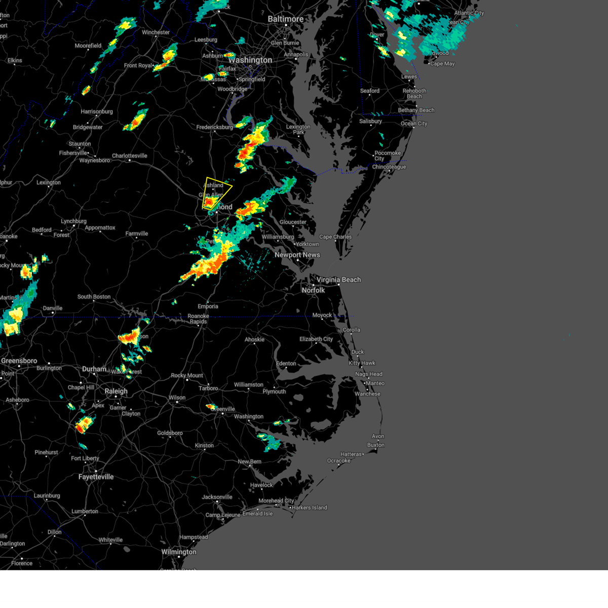 At 458 pm edt, a severe thunderstorm was located over laurel, or near tuckahoe, moving northeast at 30 mph (radar indicated. at 4:53 pm edt, ping pong sized hail was reported in the tuckahoe area). Hazards include ping pong ball size hail and 60 mph wind gusts. People and animals outdoors will be injured. expect hail damage to roofs, siding, windows, and vehicles. expect wind damage to trees and powerlines. this severe storm will be near, ashland, randolph macon college, and glen allen around 505 pm edt. kings dominion around 520 pm edt. Other locations impacted by this severe thunderstorm include solomons store, atlee, ashcake, oliver, greendale, hanover airport, gum tree, dumbarton, elmont, and longdale. At 458 pm edt, a severe thunderstorm was located over laurel, or near tuckahoe, moving northeast at 30 mph (radar indicated. at 4:53 pm edt, ping pong sized hail was reported in the tuckahoe area). Hazards include ping pong ball size hail and 60 mph wind gusts. People and animals outdoors will be injured. expect hail damage to roofs, siding, windows, and vehicles. expect wind damage to trees and powerlines. this severe storm will be near, ashland, randolph macon college, and glen allen around 505 pm edt. kings dominion around 520 pm edt. Other locations impacted by this severe thunderstorm include solomons store, atlee, ashcake, oliver, greendale, hanover airport, gum tree, dumbarton, elmont, and longdale.
|
| 8/18/2024 4:55 PM EDT | Half Dollar sized hail reported 4.1 miles SW of Tuckahoe, VA, i-64 and parham road. |
| 8/18/2024 4:53 PM EDT | Half Dollar sized hail reported 3.1 miles SW of Tuckahoe, VA |
| 8/18/2024 4:52 PM EDT | Ping Pong Ball sized hail reported 4.1 miles SW of Tuckahoe, VA, trained spotter reported three solar pathway lights damaged from the hail with a fourth destroyed... window screen damage to a home... and hail dents in vehicles includ |
| 8/18/2024 4:51 PM EDT | Hen Egg sized hail reported 1 miles WSW of Tuckahoe, VA, public reports from social media show large hail estimated to be around two inches in diameter in the tuckahoe area. time estimated from radar. |
| 8/18/2024 4:51 PM EDT | Ping Pong Ball sized hail reported 1 miles WSW of Tuckahoe, VA |
| 8/18/2024 4:48 PM EDT | *** 1 fatal *** tree fell on a car and killed a man inside the car. confirmed by broadcast media from henrico police and fir in henrico county VA, 1 miles WSW of Tuckahoe, VA |
| 8/18/2024 4:48 PM EDT | Tree downed on three chopt road at freeman high schoo in henrico county VA, 2.8 miles WSW of Tuckahoe, VA |
| 8/18/2024 4:48 PM EDT | Minor structural damage to a home on gunby d in henrico county VA, 0.9 miles WNW of Tuckahoe, VA |
| 8/18/2024 4:47 PM EDT |
 the severe thunderstorm warning has been cancelled and is no longer in effect the severe thunderstorm warning has been cancelled and is no longer in effect
|
| 8/18/2024 4:47 PM EDT |
 At 447 pm edt, a severe thunderstorm was located over tuckahoe, moving northeast at 30 mph (radar indicated). Hazards include ping pong ball size hail and 60 mph wind gusts. People and animals outdoors will be injured. expect hail damage to roofs, siding, windows, and vehicles. expect wind damage to trees and powerlines. this severe storm will be near, tuckahoe, laurel, lakeside, wyndham, and glen allen around 455 pm edt. ashland around 500 pm edt. randolph macon college around 505 pm edt. kings dominion around 520 pm edt. Other locations impacted by this severe thunderstorm include oliver, hanover airport, gum tree, elmont, short pump, longdale, gilman, solomons store, atlee, and ashcake. At 447 pm edt, a severe thunderstorm was located over tuckahoe, moving northeast at 30 mph (radar indicated). Hazards include ping pong ball size hail and 60 mph wind gusts. People and animals outdoors will be injured. expect hail damage to roofs, siding, windows, and vehicles. expect wind damage to trees and powerlines. this severe storm will be near, tuckahoe, laurel, lakeside, wyndham, and glen allen around 455 pm edt. ashland around 500 pm edt. randolph macon college around 505 pm edt. kings dominion around 520 pm edt. Other locations impacted by this severe thunderstorm include oliver, hanover airport, gum tree, elmont, short pump, longdale, gilman, solomons store, atlee, and ashcake.
|
| 8/18/2024 4:45 PM EDT | Half Dollar sized hail reported 1.5 miles W of Tuckahoe, VA, report from mping: half dollar (1.25 in.). |
| 8/18/2024 4:45 PM EDT | Tree down across desota drive. multiple trees down and significant tree damage in the general are in henrico county VA, 1.5 miles W of Tuckahoe, VA |
| 8/18/2024 4:42 PM EDT |
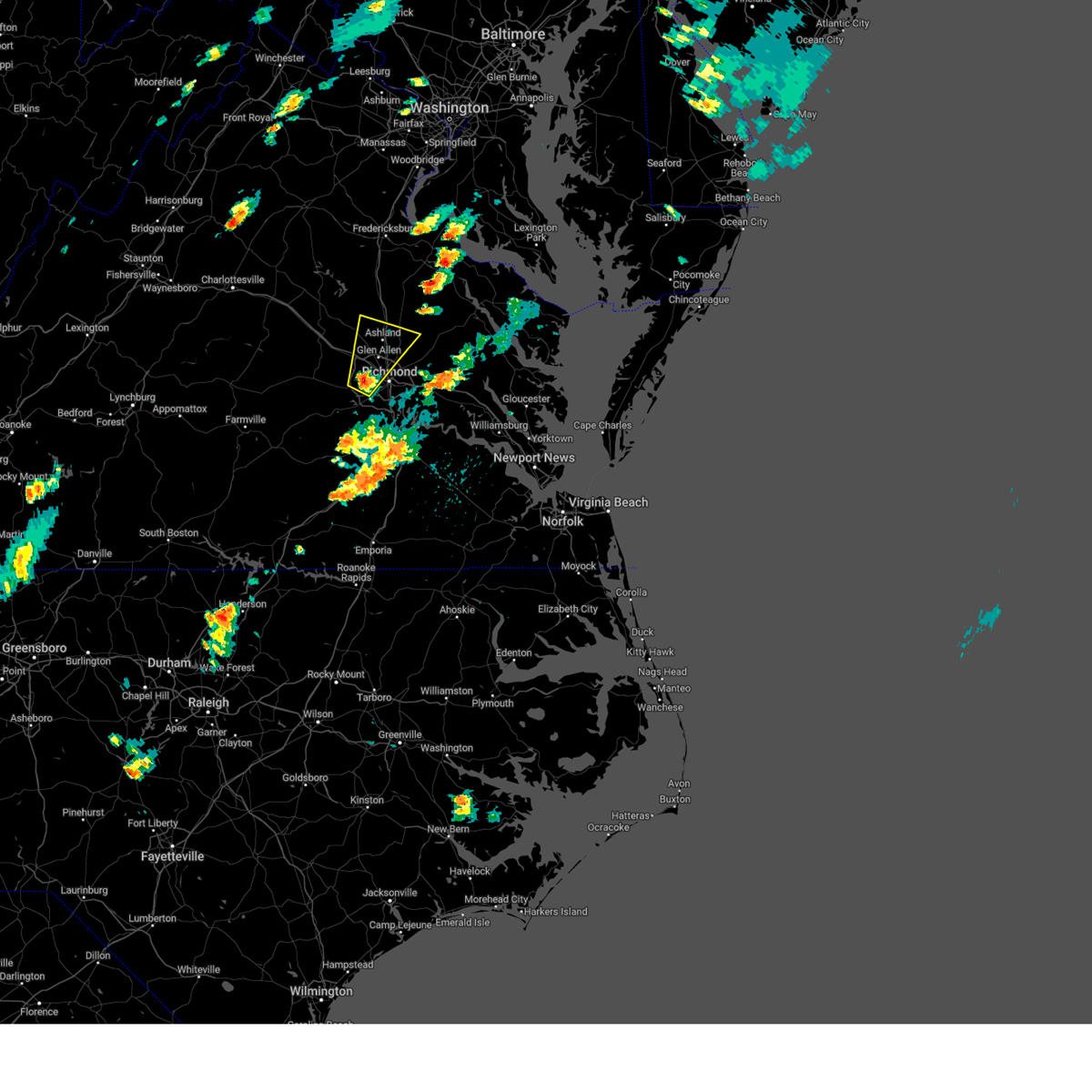 Svrakq the national weather service in wakefield has issued a * severe thunderstorm warning for, the city of richmond in central virginia, north central chesterfield county in central virginia, southeastern goochland county in central virginia, south central caroline county in north central virginia, northwestern henrico county in central virginia, west central king william county in east central virginia, central hanover county in central virginia, east central powhatan county in central virginia, * until 530 pm edt. * at 442 pm edt, a severe thunderstorm was located over tuckahoe, moving northeast at 30 mph (radar indicated). Hazards include 60 mph wind gusts and quarter size hail. Minor damage to vehicles is possible. expect wind damage to trees and powerlines. this severe thunderstorm will be near, richmond, university of richmond, tuckahoe, and laurel around 445 pm edt. lakeside and glen allen around 450 pm edt. wyndham around 455 pm edt. ashland around 500 pm edt. randolph macon college around 505 pm edt. kings dominion around 520 pm edt. Other locations impacted by this severe thunderstorm include oliver, hanover airport, gum tree, coatesville, goodall, midlothian, elmont, etna mills, short pump, and longdale. Svrakq the national weather service in wakefield has issued a * severe thunderstorm warning for, the city of richmond in central virginia, north central chesterfield county in central virginia, southeastern goochland county in central virginia, south central caroline county in north central virginia, northwestern henrico county in central virginia, west central king william county in east central virginia, central hanover county in central virginia, east central powhatan county in central virginia, * until 530 pm edt. * at 442 pm edt, a severe thunderstorm was located over tuckahoe, moving northeast at 30 mph (radar indicated). Hazards include 60 mph wind gusts and quarter size hail. Minor damage to vehicles is possible. expect wind damage to trees and powerlines. this severe thunderstorm will be near, richmond, university of richmond, tuckahoe, and laurel around 445 pm edt. lakeside and glen allen around 450 pm edt. wyndham around 455 pm edt. ashland around 500 pm edt. randolph macon college around 505 pm edt. kings dominion around 520 pm edt. Other locations impacted by this severe thunderstorm include oliver, hanover airport, gum tree, coatesville, goodall, midlothian, elmont, etna mills, short pump, and longdale.
|
| 6/30/2024 8:38 PM EDT |
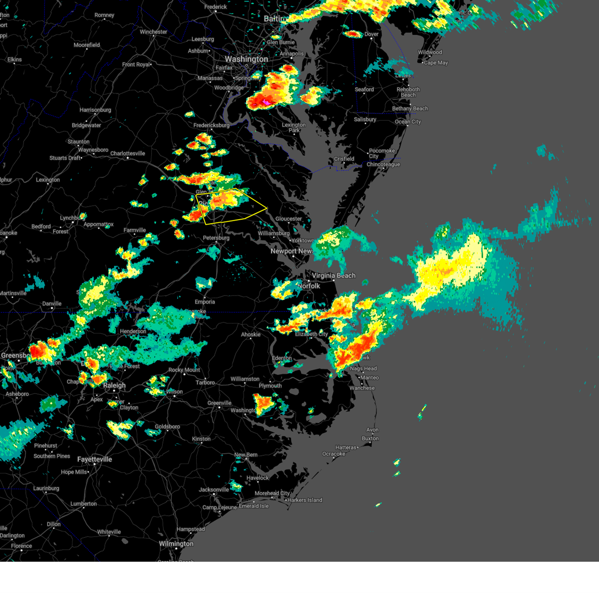 the severe thunderstorm warning has been cancelled and is no longer in effect the severe thunderstorm warning has been cancelled and is no longer in effect
|
| 6/30/2024 8:09 PM EDT |
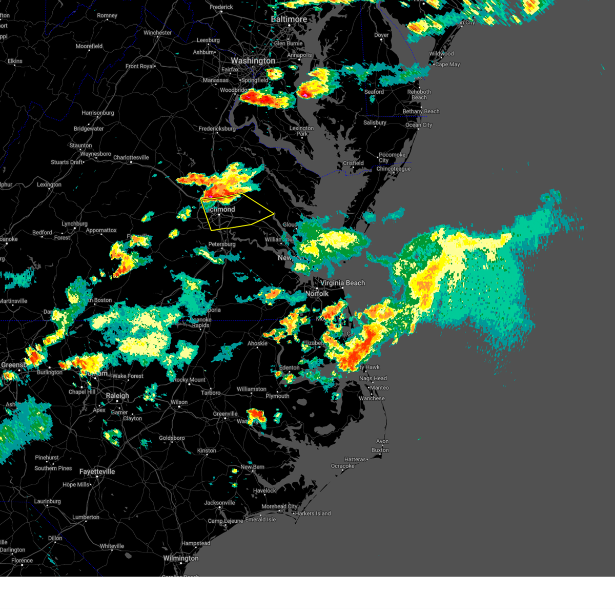 Svrakq the national weather service in wakefield has issued a * severe thunderstorm warning for, the city of richmond in central virginia, north central chesterfield county in central virginia, northwestern charles city county in east central virginia, new kent county in east central virginia, henrico county in central virginia, southern king william county in east central virginia, southeastern hanover county in central virginia, * until 900 pm edt. * at 808 pm edt, severe thunderstorms were located along a line extending from manquin to near studley to near wyndham, moving southeast at 25 mph (radar indicated). Hazards include 60 mph wind gusts and penny size hail. Expect damage to trees and powerlines. severe thunderstorms will be near, richmond, mechanicsville, highland springs, tuckahoe, laurel, lakeside, east highland park, and glen allen around 815 pm edt. virginia union university and tunstall around 820 pm edt. downtown richmond and virginia commonwealth university around 825 pm edt. bottoms bridge around 830 pm edt. talleysville around 835 pm edt. new kent and roxbury around 840 pm edt. Other locations impacted by these severe thunderstorms include richmond heights, mountcastle, elko, cohoke, montrose, sandston, glendale, westwood, richmond international, and colonial downs. Svrakq the national weather service in wakefield has issued a * severe thunderstorm warning for, the city of richmond in central virginia, north central chesterfield county in central virginia, northwestern charles city county in east central virginia, new kent county in east central virginia, henrico county in central virginia, southern king william county in east central virginia, southeastern hanover county in central virginia, * until 900 pm edt. * at 808 pm edt, severe thunderstorms were located along a line extending from manquin to near studley to near wyndham, moving southeast at 25 mph (radar indicated). Hazards include 60 mph wind gusts and penny size hail. Expect damage to trees and powerlines. severe thunderstorms will be near, richmond, mechanicsville, highland springs, tuckahoe, laurel, lakeside, east highland park, and glen allen around 815 pm edt. virginia union university and tunstall around 820 pm edt. downtown richmond and virginia commonwealth university around 825 pm edt. bottoms bridge around 830 pm edt. talleysville around 835 pm edt. new kent and roxbury around 840 pm edt. Other locations impacted by these severe thunderstorms include richmond heights, mountcastle, elko, cohoke, montrose, sandston, glendale, westwood, richmond international, and colonial downs.
|
| 6/30/2024 8:01 PM EDT |
 At 801 pm edt, severe thunderstorms were located along a line extending from aylett to near mechanicsville to wyndham, moving southeast at 25 mph (radar indicated). Hazards include 70 mph wind gusts and quarter size hail. Minor damage to vehicles is possible. expect considerable tree damage. wind damage is also likely to mobile homes, roofs, and outbuildings. these severe storms will be near, mechanicsville, laurel, lakeside, manquin, wyndham, glen allen, studley, and aylett around 805 pm edt. king william around 810 pm edt. Other locations impacted by these severe thunderstorms include enfield, central garage, hanover airport, gum tree, upshaw, goodall, elmont, etna mills, epworth, and longdale. At 801 pm edt, severe thunderstorms were located along a line extending from aylett to near mechanicsville to wyndham, moving southeast at 25 mph (radar indicated). Hazards include 70 mph wind gusts and quarter size hail. Minor damage to vehicles is possible. expect considerable tree damage. wind damage is also likely to mobile homes, roofs, and outbuildings. these severe storms will be near, mechanicsville, laurel, lakeside, manquin, wyndham, glen allen, studley, and aylett around 805 pm edt. king william around 810 pm edt. Other locations impacted by these severe thunderstorms include enfield, central garage, hanover airport, gum tree, upshaw, goodall, elmont, etna mills, epworth, and longdale.
|
| 6/30/2024 7:53 PM EDT |
 the severe thunderstorm warning has been cancelled and is no longer in effect the severe thunderstorm warning has been cancelled and is no longer in effect
|
| 6/30/2024 7:53 PM EDT |
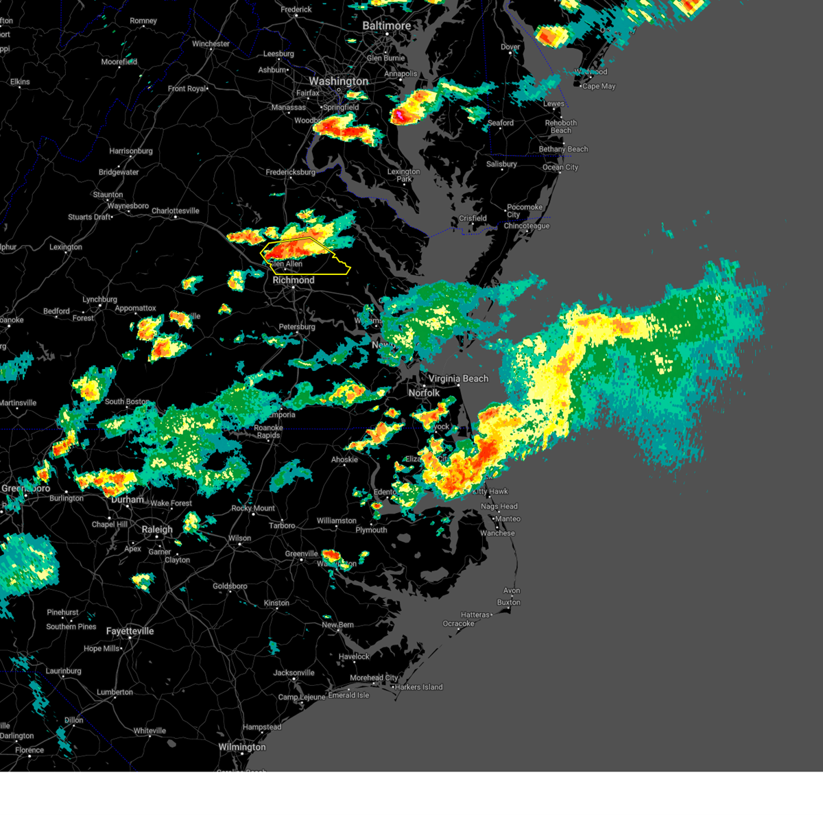 At 753 pm edt, severe thunderstorms were located along a line extending from aylett to near manquin to near wyndham, moving southeast at 25 mph (radar indicated). Hazards include 70 mph wind gusts and quarter size hail. Minor damage to vehicles is possible. expect considerable tree damage. wind damage is also likely to mobile homes, roofs, and outbuildings. these severe storms will be near, ashland, mechanicsville, laurel, manquin, wyndham, glen allen, and studley around 800 pm edt. king william and lakeside around 805 pm edt. Other locations impacted by these severe thunderstorms include enfield, central garage, oliver, hanover airport, gum tree, upshaw, goodall, doswell, elmont, and etna mills. At 753 pm edt, severe thunderstorms were located along a line extending from aylett to near manquin to near wyndham, moving southeast at 25 mph (radar indicated). Hazards include 70 mph wind gusts and quarter size hail. Minor damage to vehicles is possible. expect considerable tree damage. wind damage is also likely to mobile homes, roofs, and outbuildings. these severe storms will be near, ashland, mechanicsville, laurel, manquin, wyndham, glen allen, and studley around 800 pm edt. king william and lakeside around 805 pm edt. Other locations impacted by these severe thunderstorms include enfield, central garage, oliver, hanover airport, gum tree, upshaw, goodall, doswell, elmont, and etna mills.
|
| 6/30/2024 7:45 PM EDT |
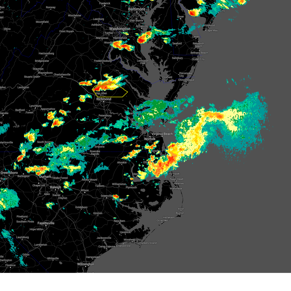 At 745 pm edt, severe thunderstorms were located along a line extending from saint stephens church to near mangohick to near wyndham, moving east at 20 mph (radar indicated). Hazards include 60 mph wind gusts and penny size hail. Expect damage to trees and powerlines. these severe storms will be near, ashland, randolph macon college, saint stephens church, hanover, manquin, wyndham, mangohick, glen allen, and aylett around 750 pm edt. Other locations impacted by these severe thunderstorms include enfield, gum tree, elmont, etna mills, epworth, biscoe, gilman, solomons store, atlee, and ashcake. At 745 pm edt, severe thunderstorms were located along a line extending from saint stephens church to near mangohick to near wyndham, moving east at 20 mph (radar indicated). Hazards include 60 mph wind gusts and penny size hail. Expect damage to trees and powerlines. these severe storms will be near, ashland, randolph macon college, saint stephens church, hanover, manquin, wyndham, mangohick, glen allen, and aylett around 750 pm edt. Other locations impacted by these severe thunderstorms include enfield, gum tree, elmont, etna mills, epworth, biscoe, gilman, solomons store, atlee, and ashcake.
|
| 6/30/2024 7:30 PM EDT |
 Svrakq the national weather service in wakefield has issued a * severe thunderstorm warning for, west central king and queen county in east central virginia, southeastern caroline county in north central virginia, northwestern henrico county in central virginia, king william county in east central virginia, hanover county in central virginia, * until 815 pm edt. * at 729 pm edt, severe thunderstorms were located along a line extending from near saint stephens church to mangohick to near montpelier, moving southeast at 25 mph (radar indicated). Hazards include 60 mph wind gusts. Expect damage to trees and powerlines. severe thunderstorms will be near, ashland, randolph macon college, saint stephens church, hanover, mangohick, and aylett around 735 pm edt. wyndham around 740 pm edt. manquin and glen allen around 745 pm edt. mechanicsville, stevensville, laurel, and studley around 750 pm edt. king william around 755 pm edt. lakeside around 800 pm edt. Other locations impacted by these severe thunderstorms include enfield, gum tree, elmont, etna mills, epworth, biscoe, gilman, solomons store, atlee, and ashcake. Svrakq the national weather service in wakefield has issued a * severe thunderstorm warning for, west central king and queen county in east central virginia, southeastern caroline county in north central virginia, northwestern henrico county in central virginia, king william county in east central virginia, hanover county in central virginia, * until 815 pm edt. * at 729 pm edt, severe thunderstorms were located along a line extending from near saint stephens church to mangohick to near montpelier, moving southeast at 25 mph (radar indicated). Hazards include 60 mph wind gusts. Expect damage to trees and powerlines. severe thunderstorms will be near, ashland, randolph macon college, saint stephens church, hanover, mangohick, and aylett around 735 pm edt. wyndham around 740 pm edt. manquin and glen allen around 745 pm edt. mechanicsville, stevensville, laurel, and studley around 750 pm edt. king william around 755 pm edt. lakeside around 800 pm edt. Other locations impacted by these severe thunderstorms include enfield, gum tree, elmont, etna mills, epworth, biscoe, gilman, solomons store, atlee, and ashcake.
|
| 5/26/2024 10:09 PM EDT |
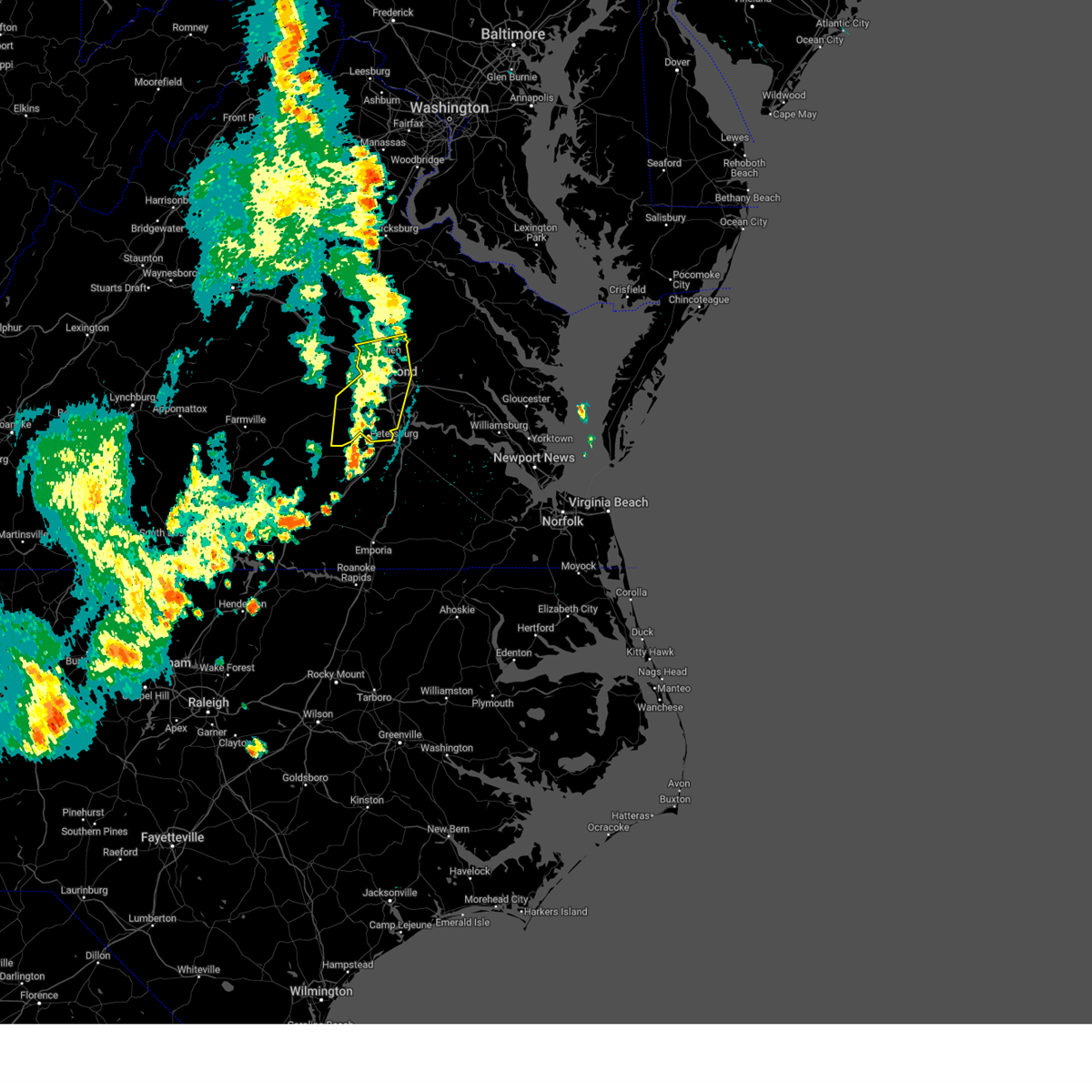 The storms which prompted the warning have weakened below severe limits, and no longer pose an immediate threat to life or property. therefore, the warning will be allowed to expire. however, gusty winds are still possible with these thunderstorms. a severe thunderstorm watch remains in effect until midnight edt for central, south central and north central virginia. The storms which prompted the warning have weakened below severe limits, and no longer pose an immediate threat to life or property. therefore, the warning will be allowed to expire. however, gusty winds are still possible with these thunderstorms. a severe thunderstorm watch remains in effect until midnight edt for central, south central and north central virginia.
|
| 5/26/2024 9:50 PM EDT |
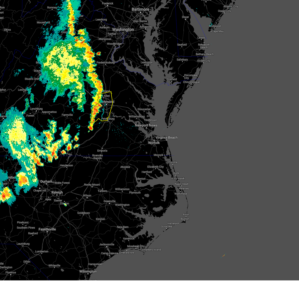 At 950 pm edt, severe thunderstorms were located along a line extending from near montpelier to bon air to near mannboro, moving northeast at 30 mph (radar indicated). Hazards include 60 mph wind gusts. Expect damage to trees and powerlines. these severe storms will be near, richmond, ashland, randolph macon college, university of richmond, downtown richmond, tuckahoe, bon air, laurel, lakeside, and glen allen around 955 pm edt. virginia union university, mechanicsville, virginia commonwealth university, and chesterfield court house around 1000 pm edt. east highland park and bensley around 1005 pm edt. chester, hanover, and bellwood around 1010 pm edt. highland springs around 1015 pm edt. Other locations impacted by these severe thunderstorms include richmond heights, ammon, elmont, montrose, pocahontas state park, richmond international, skinquarter, fair oaks, solomons store, and beach. At 950 pm edt, severe thunderstorms were located along a line extending from near montpelier to bon air to near mannboro, moving northeast at 30 mph (radar indicated). Hazards include 60 mph wind gusts. Expect damage to trees and powerlines. these severe storms will be near, richmond, ashland, randolph macon college, university of richmond, downtown richmond, tuckahoe, bon air, laurel, lakeside, and glen allen around 955 pm edt. virginia union university, mechanicsville, virginia commonwealth university, and chesterfield court house around 1000 pm edt. east highland park and bensley around 1005 pm edt. chester, hanover, and bellwood around 1010 pm edt. highland springs around 1015 pm edt. Other locations impacted by these severe thunderstorms include richmond heights, ammon, elmont, montrose, pocahontas state park, richmond international, skinquarter, fair oaks, solomons store, and beach.
|
| 5/26/2024 9:50 PM EDT |
 the severe thunderstorm warning has been cancelled and is no longer in effect the severe thunderstorm warning has been cancelled and is no longer in effect
|
| 5/26/2024 9:20 PM EDT |
 Svrakq the national weather service in wakefield has issued a * severe thunderstorm warning for, the city of richmond in central virginia, chesterfield county in central virginia, southeastern goochland county in central virginia, henrico county in central virginia, southwestern hanover county in central virginia, amelia county in central virginia, powhatan county in central virginia, * until 1015 pm edt. * at 920 pm edt, severe thunderstorms were located along a line extending from near goochland to near powhatan to near scotts fork, moving northeast at 35 mph (radar indicated). Hazards include 60 mph wind gusts. Expect damage to trees and powerlines. severe thunderstorms will be near, moseley, oilville, scotts fork, and sabot around 925 pm edt. manakin around 930 pm edt. tuckahoe, bon air, and wyndham around 935 pm edt. richmond around 940 pm edt. university of richmond, laurel, and glen allen around 945 pm edt. ashland, randolph macon college, lakeside, and chesterfield court house around 950 pm edt. virginia union university, mechanicsville, downtown richmond, virginia commonwealth university, and bensley around 955 pm edt. east highland park and bellwood around 1000 pm edt. Other locations impacted by these severe thunderstorms include crozier, richmond heights, earls, ammon, pilkinton, maidens, irwin, johnsons springs, elmont, and montrose. Svrakq the national weather service in wakefield has issued a * severe thunderstorm warning for, the city of richmond in central virginia, chesterfield county in central virginia, southeastern goochland county in central virginia, henrico county in central virginia, southwestern hanover county in central virginia, amelia county in central virginia, powhatan county in central virginia, * until 1015 pm edt. * at 920 pm edt, severe thunderstorms were located along a line extending from near goochland to near powhatan to near scotts fork, moving northeast at 35 mph (radar indicated). Hazards include 60 mph wind gusts. Expect damage to trees and powerlines. severe thunderstorms will be near, moseley, oilville, scotts fork, and sabot around 925 pm edt. manakin around 930 pm edt. tuckahoe, bon air, and wyndham around 935 pm edt. richmond around 940 pm edt. university of richmond, laurel, and glen allen around 945 pm edt. ashland, randolph macon college, lakeside, and chesterfield court house around 950 pm edt. virginia union university, mechanicsville, downtown richmond, virginia commonwealth university, and bensley around 955 pm edt. east highland park and bellwood around 1000 pm edt. Other locations impacted by these severe thunderstorms include crozier, richmond heights, earls, ammon, pilkinton, maidens, irwin, johnsons springs, elmont, and montrose.
|
| 4/15/2024 6:47 PM EDT |
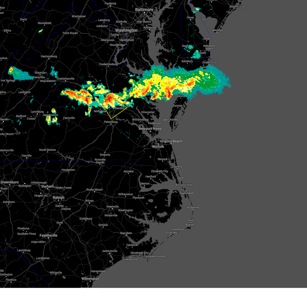 the severe thunderstorm warning has been cancelled and is no longer in effect the severe thunderstorm warning has been cancelled and is no longer in effect
|
| 4/15/2024 6:47 PM EDT |
 At 647 pm edt, a severe thunderstorm was located over laurel, or near virginia union university, moving southeast at 30 mph (radar indicated). Hazards include 60 mph wind gusts and quarter size hail. Minor damage to vehicles is possible. expect wind damage to trees and powerlines. this severe storm will be near, richmond, virginia union university, mechanicsville, laurel, lakeside, east highland park, and glen allen around 650 pm edt. highland springs and virginia commonwealth university around 655 pm edt. bottoms bridge around 720 pm edt. roxbury around 725 pm edt. Other locations impacted by this severe thunderstorm include richmond heights, elko, elmont, montrose, sandston, glendale, westwood, richmond international, fair oaks, and solomons store. At 647 pm edt, a severe thunderstorm was located over laurel, or near virginia union university, moving southeast at 30 mph (radar indicated). Hazards include 60 mph wind gusts and quarter size hail. Minor damage to vehicles is possible. expect wind damage to trees and powerlines. this severe storm will be near, richmond, virginia union university, mechanicsville, laurel, lakeside, east highland park, and glen allen around 650 pm edt. highland springs and virginia commonwealth university around 655 pm edt. bottoms bridge around 720 pm edt. roxbury around 725 pm edt. Other locations impacted by this severe thunderstorm include richmond heights, elko, elmont, montrose, sandston, glendale, westwood, richmond international, fair oaks, and solomons store.
|
| 4/15/2024 6:35 PM EDT |
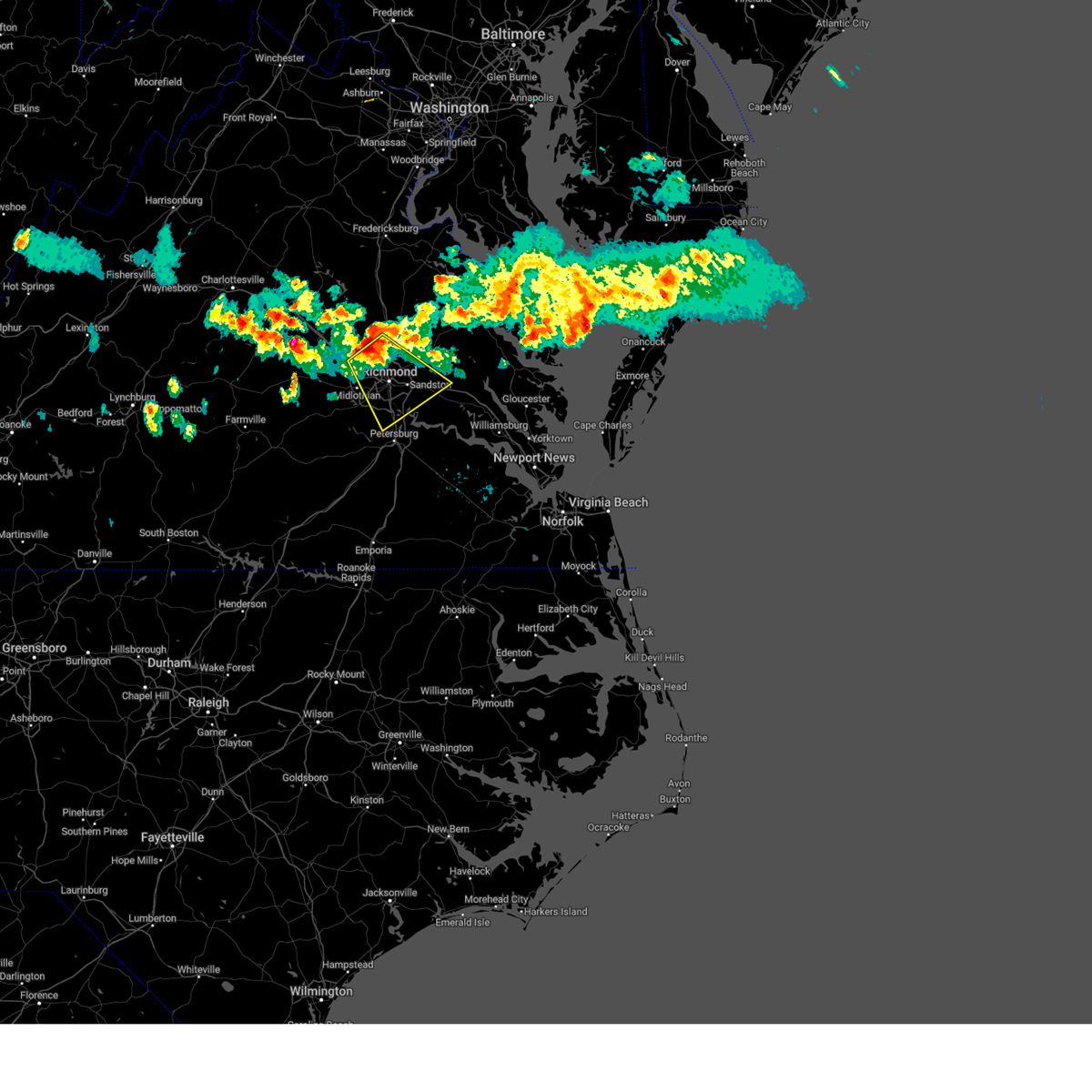 Svrakq the national weather service in wakefield has issued a * severe thunderstorm warning for, the city of richmond in central virginia, central chesterfield county in central virginia, northwestern charles city county in east central virginia, southeastern goochland county in central virginia, northwestern new kent county in east central virginia, henrico county in central virginia, southeastern hanover county in central virginia, * until 715 pm edt. * at 635 pm edt, a severe thunderstorm was located over wyndham, or near tuckahoe, moving southeast at 35 mph (radar indicated). Hazards include 60 mph wind gusts and quarter size hail. Minor damage to vehicles is possible. expect wind damage to trees and powerlines. this severe thunderstorm will be near, richmond, tuckahoe, laurel, lakeside, and glen allen around 640 pm edt. university of richmond around 645 pm edt. virginia union university, downtown richmond, virginia commonwealth university, and east highland park around 650 pm edt. highland springs and bensley around 700 pm edt. Other locations impacted by this severe thunderstorm include richmond heights, elko, elmont, montrose, sandston, glendale, westwood, richmond international, fair oaks, and solomons store. Svrakq the national weather service in wakefield has issued a * severe thunderstorm warning for, the city of richmond in central virginia, central chesterfield county in central virginia, northwestern charles city county in east central virginia, southeastern goochland county in central virginia, northwestern new kent county in east central virginia, henrico county in central virginia, southeastern hanover county in central virginia, * until 715 pm edt. * at 635 pm edt, a severe thunderstorm was located over wyndham, or near tuckahoe, moving southeast at 35 mph (radar indicated). Hazards include 60 mph wind gusts and quarter size hail. Minor damage to vehicles is possible. expect wind damage to trees and powerlines. this severe thunderstorm will be near, richmond, tuckahoe, laurel, lakeside, and glen allen around 640 pm edt. university of richmond around 645 pm edt. virginia union university, downtown richmond, virginia commonwealth university, and east highland park around 650 pm edt. highland springs and bensley around 700 pm edt. Other locations impacted by this severe thunderstorm include richmond heights, elko, elmont, montrose, sandston, glendale, westwood, richmond international, fair oaks, and solomons store.
|
| 4/15/2024 6:30 PM EDT |
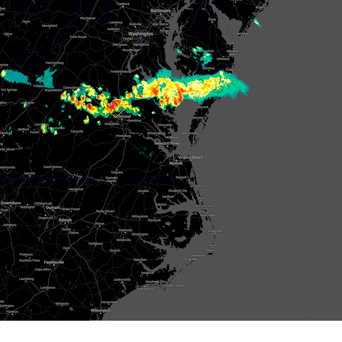 At 629 pm edt, a severe thunderstorm was located over wyndham, or 7 miles west of randolph macon college, moving southeast at 35 mph (radar indicated). Hazards include 60 mph wind gusts and quarter size hail. Minor damage to vehicles is possible. expect wind damage to trees and powerlines. this severe storm will be near, tuckahoe, laurel, wyndham, and glen allen around 635 pm edt. Other locations impacted by this severe thunderstorm include rockville, gilman, hanover airport, roslyn hills, johnsons springs, goodall, elmont, short pump, longdale, and dumbarton. At 629 pm edt, a severe thunderstorm was located over wyndham, or 7 miles west of randolph macon college, moving southeast at 35 mph (radar indicated). Hazards include 60 mph wind gusts and quarter size hail. Minor damage to vehicles is possible. expect wind damage to trees and powerlines. this severe storm will be near, tuckahoe, laurel, wyndham, and glen allen around 635 pm edt. Other locations impacted by this severe thunderstorm include rockville, gilman, hanover airport, roslyn hills, johnsons springs, goodall, elmont, short pump, longdale, and dumbarton.
|
| 4/15/2024 6:18 PM EDT |
 the severe thunderstorm warning has been cancelled and is no longer in effect the severe thunderstorm warning has been cancelled and is no longer in effect
|
| 4/15/2024 6:18 PM EDT |
 At 617 pm edt, a severe thunderstorm was located over montpelier, or 11 miles west of randolph macon college, moving southeast at 30 mph (radar indicated). Hazards include ping pong ball size hail and 60 mph wind gusts. People and animals outdoors will be injured. expect hail damage to roofs, siding, windows, and vehicles. expect wind damage to trees and powerlines. this severe storm will be near, wyndham around 625 pm edt. laurel and glen allen around 635 pm edt. tuckahoe around 640 pm edt. Other locations impacted by this severe thunderstorm include oliver, hanover airport, vontay, gum tree, coatesville, johnsons springs, goodall, elmont, short pump, and mabelton. At 617 pm edt, a severe thunderstorm was located over montpelier, or 11 miles west of randolph macon college, moving southeast at 30 mph (radar indicated). Hazards include ping pong ball size hail and 60 mph wind gusts. People and animals outdoors will be injured. expect hail damage to roofs, siding, windows, and vehicles. expect wind damage to trees and powerlines. this severe storm will be near, wyndham around 625 pm edt. laurel and glen allen around 635 pm edt. tuckahoe around 640 pm edt. Other locations impacted by this severe thunderstorm include oliver, hanover airport, vontay, gum tree, coatesville, johnsons springs, goodall, elmont, short pump, and mabelton.
|
| 4/15/2024 6:11 PM EDT |
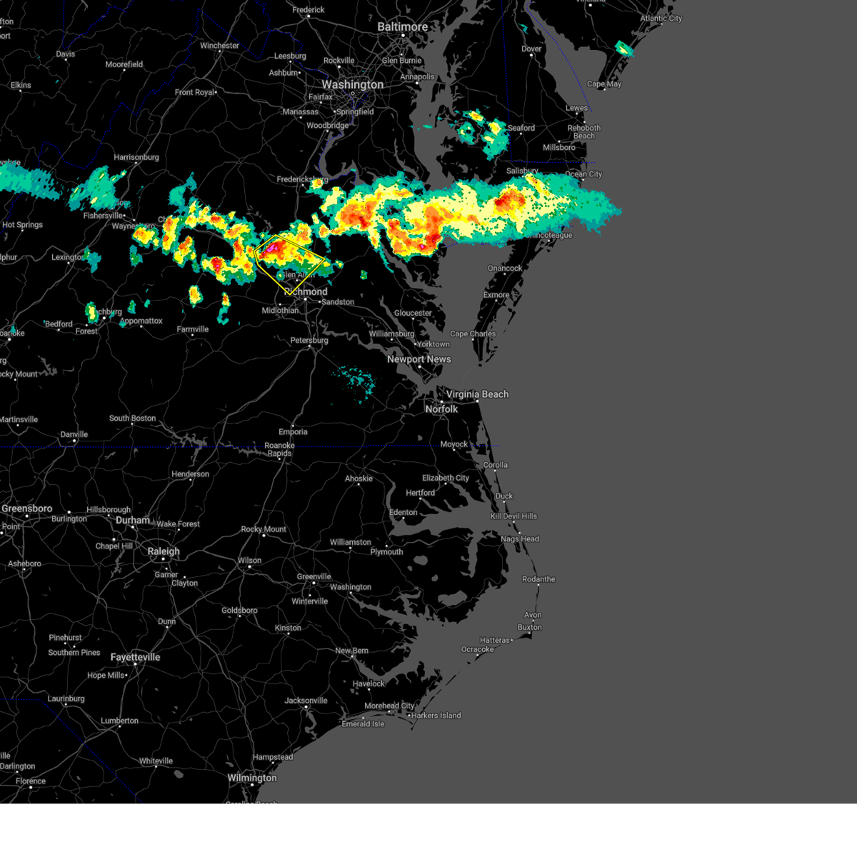 At 610 pm edt, a severe thunderstorm was located near montpelier, or 13 miles southeast of mineral, moving southeast at 20 mph (radar indicated). Hazards include 60 mph wind gusts and quarter size hail. Minor damage to vehicles is possible. expect wind damage to trees and powerlines. this severe storm will be near, montpelier around 615 pm edt. wyndham around 635 pm edt. glen allen around 645 pm edt. tuckahoe and laurel around 650 pm edt. Other locations impacted by this severe thunderstorm include oliver, hanover airport, vontay, gum tree, coatesville, hewlett, johnsons springs, goodall, doswell, and elmont. At 610 pm edt, a severe thunderstorm was located near montpelier, or 13 miles southeast of mineral, moving southeast at 20 mph (radar indicated). Hazards include 60 mph wind gusts and quarter size hail. Minor damage to vehicles is possible. expect wind damage to trees and powerlines. this severe storm will be near, montpelier around 615 pm edt. wyndham around 635 pm edt. glen allen around 645 pm edt. tuckahoe and laurel around 650 pm edt. Other locations impacted by this severe thunderstorm include oliver, hanover airport, vontay, gum tree, coatesville, hewlett, johnsons springs, goodall, doswell, and elmont.
|
| 4/15/2024 5:58 PM EDT |
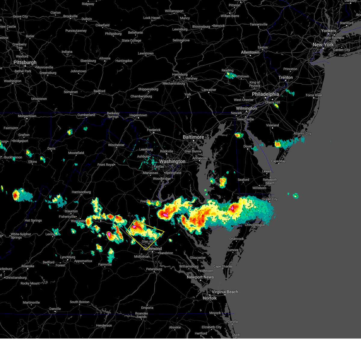 Svrakq the national weather service in wakefield has issued a * severe thunderstorm warning for, southeastern louisa county in central virginia, east central goochland county in central virginia, southwestern caroline county in north central virginia, northwestern henrico county in central virginia, northwestern king william county in east central virginia, hanover county in central virginia, * until 645 pm edt. * at 558 pm edt, a severe thunderstorm was located near bumpass, or 9 miles southeast of mineral, moving southeast at 30 mph (radar indicated). Hazards include 60 mph wind gusts and quarter size hail. Minor damage to vehicles is possible. expect wind damage to trees and powerlines. this severe thunderstorm will be near, montpelier around 610 pm edt. ashland and randolph macon college around 625 pm edt. glen allen around 635 pm edt. hanover around 640 pm edt. Other locations impacted by this severe thunderstorm include orchid, vontay, gum tree, johnsons springs, elmont, gilman, roslyn hills, cedar fork, oliver, and hanover airport. Svrakq the national weather service in wakefield has issued a * severe thunderstorm warning for, southeastern louisa county in central virginia, east central goochland county in central virginia, southwestern caroline county in north central virginia, northwestern henrico county in central virginia, northwestern king william county in east central virginia, hanover county in central virginia, * until 645 pm edt. * at 558 pm edt, a severe thunderstorm was located near bumpass, or 9 miles southeast of mineral, moving southeast at 30 mph (radar indicated). Hazards include 60 mph wind gusts and quarter size hail. Minor damage to vehicles is possible. expect wind damage to trees and powerlines. this severe thunderstorm will be near, montpelier around 610 pm edt. ashland and randolph macon college around 625 pm edt. glen allen around 635 pm edt. hanover around 640 pm edt. Other locations impacted by this severe thunderstorm include orchid, vontay, gum tree, johnsons springs, elmont, gilman, roslyn hills, cedar fork, oliver, and hanover airport.
|
| 4/12/2024 12:26 AM EDT | the severe thunderstorm warning has been cancelled and is no longer in effect |
| 4/12/2024 12:26 AM EDT | At 1225 am edt, severe thunderstorms were located along a line extending from 7 miles southwest of spotsylvania to 7 miles northwest of kings dominion to near bon air to near carson, moving east at 45 mph (radar indicated). Hazards include 60 mph wind gusts. Expect damage to trees and powerlines. Locations impacted include, richmond, powhatan, dinwiddie, mckenney, tuckahoe, moseley, bon air, mannboro, university of richmond, dewitt, wyndham, chesterfield court house, wilsons, scotts fork, chula, sutherland, matoaca, laurel, glen allen, and chesterfield. |
| 4/12/2024 12:01 AM EDT | Svrakq the national weather service in wakefield has issued a * severe thunderstorm warning for, louisa county in central virginia, the city of richmond in central virginia, chesterfield county in central virginia, southeastern goochland county in central virginia, southwestern caroline county in north central virginia, henrico county in central virginia, hanover county in central virginia, eastern amelia county in central virginia, eastern powhatan county in central virginia, * until 1245 am edt. * at 1201 am edt, severe thunderstorms were located along a line extending from near louisa to near oilville to 6 miles northeast of mannboro, moving east at 45 mph (radar indicated). Hazards include 60 mph wind gusts. expect damage to roofs, siding, and trees |
| 4/11/2024 11:45 PM EDT |
 Svrakq the national weather service in wakefield has issued a * severe thunderstorm warning for, the western city of richmond in central virginia, chesterfield county in central virginia, eastern cumberland county in central virginia, eastern lunenburg county in south central virginia, nottoway county in south central virginia, northwestern henrico county in central virginia, dinwiddie county in south central virginia, amelia county in central virginia, powhatan county in central virginia, northern brunswick county in south central virginia, * until 1245 am edt. * at 1145 pm edt, severe thunderstorms were located along a line extending from near hadensville to near goochland to near spainville to near alberta, moving northeast at 45 mph (radar indicated). Hazards include 60 mph wind gusts. expect damage to roofs, siding, and trees Svrakq the national weather service in wakefield has issued a * severe thunderstorm warning for, the western city of richmond in central virginia, chesterfield county in central virginia, eastern cumberland county in central virginia, eastern lunenburg county in south central virginia, nottoway county in south central virginia, northwestern henrico county in central virginia, dinwiddie county in south central virginia, amelia county in central virginia, powhatan county in central virginia, northern brunswick county in south central virginia, * until 1245 am edt. * at 1145 pm edt, severe thunderstorms were located along a line extending from near hadensville to near goochland to near spainville to near alberta, moving northeast at 45 mph (radar indicated). Hazards include 60 mph wind gusts. expect damage to roofs, siding, and trees
|
| 4/11/2024 11:20 PM EDT |
 Svrakq the national weather service in wakefield has issued a * severe thunderstorm warning for, louisa county in central virginia, northeastern cumberland county in central virginia, goochland county in central virginia, northwestern henrico county in central virginia, northwestern hanover county in central virginia, central powhatan county in central virginia, fluvanna county in central virginia, * until midnight edt. * at 1119 pm edt, severe thunderstorms were located along a line extending from near fork union to near gold hill to 6 miles southeast of guinea mills, moving east at 40 mph (radar indicated). Hazards include 60 mph wind gusts. expect damage to roofs, siding, and trees Svrakq the national weather service in wakefield has issued a * severe thunderstorm warning for, louisa county in central virginia, northeastern cumberland county in central virginia, goochland county in central virginia, northwestern henrico county in central virginia, northwestern hanover county in central virginia, central powhatan county in central virginia, fluvanna county in central virginia, * until midnight edt. * at 1119 pm edt, severe thunderstorms were located along a line extending from near fork union to near gold hill to 6 miles southeast of guinea mills, moving east at 40 mph (radar indicated). Hazards include 60 mph wind gusts. expect damage to roofs, siding, and trees
|
| 4/3/2024 3:06 PM EDT |
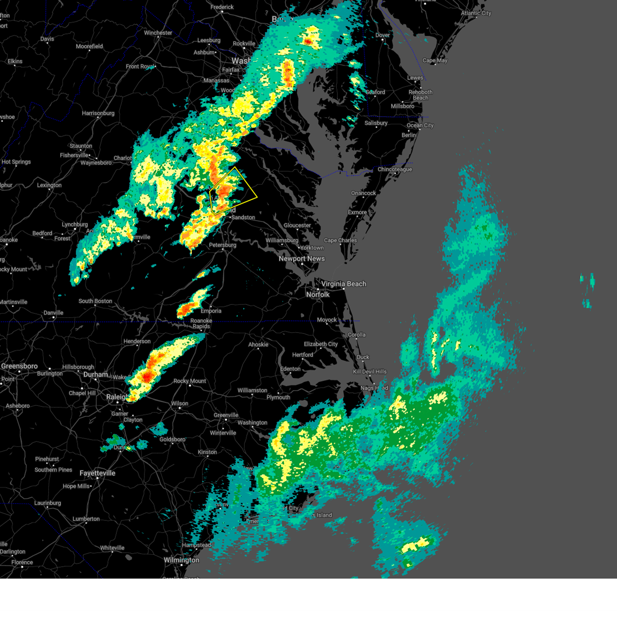 the severe thunderstorm warning has been cancelled and is no longer in effect the severe thunderstorm warning has been cancelled and is no longer in effect
|
| 4/3/2024 3:06 PM EDT |
 At 306 pm edt, a severe thunderstorm was located near hanover, or near ashland, moving northeast at 50 mph (radar indicated). Hazards include 60 mph wind gusts and quarter size hail. Minor damage to vehicles is possible. expect wind damage to trees and powerlines. this severe storm will be near, hanover around 310 pm edt. mangohick around 315 pm edt. beulahville around 320 pm edt. Other locations impacted by this severe thunderstorm include enfield, central garage, hanover airport, gum tree, upshaw, elmont, etna mills, walkerton, epworth, and longdale. At 306 pm edt, a severe thunderstorm was located near hanover, or near ashland, moving northeast at 50 mph (radar indicated). Hazards include 60 mph wind gusts and quarter size hail. Minor damage to vehicles is possible. expect wind damage to trees and powerlines. this severe storm will be near, hanover around 310 pm edt. mangohick around 315 pm edt. beulahville around 320 pm edt. Other locations impacted by this severe thunderstorm include enfield, central garage, hanover airport, gum tree, upshaw, elmont, etna mills, walkerton, epworth, and longdale.
|
| 4/3/2024 2:57 PM EDT |
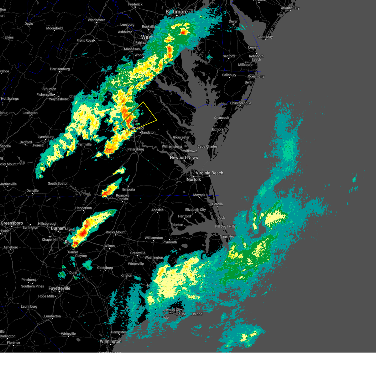 Svrakq the national weather service in wakefield has issued a * severe thunderstorm warning for, the city of richmond in central virginia, west central king and queen county in east central virginia, east central goochland county in central virginia, southeastern caroline county in north central virginia, northwestern henrico county in central virginia, northwestern king william county in east central virginia, southeastern hanover county in central virginia, * until 345 pm edt. * at 256 pm edt, a severe thunderstorm was located over laurel, or near tuckahoe, moving northeast at 50 mph (radar indicated). Hazards include 60 mph wind gusts and quarter size hail. Minor damage to vehicles is possible. expect wind damage to trees and powerlines. this severe thunderstorm will be near, ashland, mechanicsville, laurel, lakeside, and glen allen around 300 pm edt. hanover around 305 pm edt. mangohick around 315 pm edt. beulahville around 320 pm edt. Other locations impacted by this severe thunderstorm include enfield, gum tree, elmont, etna mills, epworth, solomons store, chamberlayne, atlee, ashcake, and globe. Svrakq the national weather service in wakefield has issued a * severe thunderstorm warning for, the city of richmond in central virginia, west central king and queen county in east central virginia, east central goochland county in central virginia, southeastern caroline county in north central virginia, northwestern henrico county in central virginia, northwestern king william county in east central virginia, southeastern hanover county in central virginia, * until 345 pm edt. * at 256 pm edt, a severe thunderstorm was located over laurel, or near tuckahoe, moving northeast at 50 mph (radar indicated). Hazards include 60 mph wind gusts and quarter size hail. Minor damage to vehicles is possible. expect wind damage to trees and powerlines. this severe thunderstorm will be near, ashland, mechanicsville, laurel, lakeside, and glen allen around 300 pm edt. hanover around 305 pm edt. mangohick around 315 pm edt. beulahville around 320 pm edt. Other locations impacted by this severe thunderstorm include enfield, gum tree, elmont, etna mills, epworth, solomons store, chamberlayne, atlee, ashcake, and globe.
|
| 1/9/2024 6:30 PM EST | Large tree down on i-64 near mile marker 181 causing delay in henrico county VA, 4.1 miles SW of Tuckahoe, VA |
| 1/9/2024 6:25 PM EST | Trained spotter estimated 60 mph wind gusts with storm. also... there is a tree dow in henrico county VA, 1 miles WSW of Tuckahoe, VA |
| 1/9/2024 6:13 PM EST |
 At 613 pm est, severe thunderstorms were located along a line extending from near gum spring to near mckenney, moving east at 50 mph (radar indicated). Hazards include 60 mph wind gusts. Expect damage to trees and powerlines. severe thunderstorms will be near, mckenney, tuckahoe, bon air, montpelier, wyndham, dewitt, manakin, and sabot around 620 pm est. richmond, dinwiddie, university of richmond, laurel, sutherland, and chesterfield court house around 625 pm est. ashland, randolph macon college, chester, downtown richmond, virginia commonwealth university, lakeside, matoaca, bensley, and glen allen around 630 pm est. petersburg, colonial heights, virginia union university, mechanicsville, virginia state university, ettrick, east highland park, kings dominion, bellwood, and carson around 635 pm est. hopewell, highland springs, fort gregg-adams, hanover, and dawn around 640 pm est. prince george, mangohick, and studley around 645 pm est. disputanta, jordans point, bottoms bridge, and beulahville around 650 pm est. Other locations impacted by these severe thunderstorms include wayside, etna mills, sandston, glendale, pocahontas state park, skinquarter, atlee, richard bland college, meadowville, and ashcake. At 613 pm est, severe thunderstorms were located along a line extending from near gum spring to near mckenney, moving east at 50 mph (radar indicated). Hazards include 60 mph wind gusts. Expect damage to trees and powerlines. severe thunderstorms will be near, mckenney, tuckahoe, bon air, montpelier, wyndham, dewitt, manakin, and sabot around 620 pm est. richmond, dinwiddie, university of richmond, laurel, sutherland, and chesterfield court house around 625 pm est. ashland, randolph macon college, chester, downtown richmond, virginia commonwealth university, lakeside, matoaca, bensley, and glen allen around 630 pm est. petersburg, colonial heights, virginia union university, mechanicsville, virginia state university, ettrick, east highland park, kings dominion, bellwood, and carson around 635 pm est. hopewell, highland springs, fort gregg-adams, hanover, and dawn around 640 pm est. prince george, mangohick, and studley around 645 pm est. disputanta, jordans point, bottoms bridge, and beulahville around 650 pm est. Other locations impacted by these severe thunderstorms include wayside, etna mills, sandston, glendale, pocahontas state park, skinquarter, atlee, richard bland college, meadowville, and ashcake.
|
| 1/9/2024 5:22 PM EST |
 At 522 pm est, severe thunderstorms were located along a line extending from near bowling green to near randolph macon college to near bon air, moving northeast at 60 mph (radar indicated). Hazards include 60 mph wind gusts. Expect damage to trees and powerlines. these severe storms will be near, richmond, ashland, bowling green, randolph macon college, university of richmond, milford, tuckahoe, bon air, hanover, and laurel around 525 pm est. mechanicsville and fort walker around 530 pm est. port royal, east highland park, and mangohick around 535 pm est. beulahville around 545 pm est. other locations impacted by these severe thunderstorms include chilesburg, maidens, gum tree, etna mills, pocahontas state park, skinquarter, beach, chamberlayne, fine creek mills, and michaux. hail threat, radar indicated max hail size, <. 75 in wind threat, radar indicated max wind gust, 60 mph. At 522 pm est, severe thunderstorms were located along a line extending from near bowling green to near randolph macon college to near bon air, moving northeast at 60 mph (radar indicated). Hazards include 60 mph wind gusts. Expect damage to trees and powerlines. these severe storms will be near, richmond, ashland, bowling green, randolph macon college, university of richmond, milford, tuckahoe, bon air, hanover, and laurel around 525 pm est. mechanicsville and fort walker around 530 pm est. port royal, east highland park, and mangohick around 535 pm est. beulahville around 545 pm est. other locations impacted by these severe thunderstorms include chilesburg, maidens, gum tree, etna mills, pocahontas state park, skinquarter, beach, chamberlayne, fine creek mills, and michaux. hail threat, radar indicated max hail size, <. 75 in wind threat, radar indicated max wind gust, 60 mph.
|
| 1/9/2024 5:01 PM EST |
 At 501 pm est, severe thunderstorms were located along a line extending from near bumpass to near sabot to scotts fork, moving northeast at 70 mph (radar indicated). Hazards include 60 mph wind gusts. Expect damage to trees and powerlines. these severe storms will be near, moseley, tuckahoe, montpelier, chula, wyndham, manakin, and sabot around 505 pm est. ashland and ladysmith around 510 pm est. randolph macon college and kings dominion around 515 pm est. bowling green, milford, laurel, and glen allen around 520 pm est. dawn and fort walker around 530 pm est. hanover and port royal around 535 pm est. Other locations impacted by these severe thunderstorms include chilesburg, maidens, gum tree, etna mills, pocahontas state park, skinquarter, beach, chamberlayne, fine creek mills, and michaux. At 501 pm est, severe thunderstorms were located along a line extending from near bumpass to near sabot to scotts fork, moving northeast at 70 mph (radar indicated). Hazards include 60 mph wind gusts. Expect damage to trees and powerlines. these severe storms will be near, moseley, tuckahoe, montpelier, chula, wyndham, manakin, and sabot around 505 pm est. ashland and ladysmith around 510 pm est. randolph macon college and kings dominion around 515 pm est. bowling green, milford, laurel, and glen allen around 520 pm est. dawn and fort walker around 530 pm est. hanover and port royal around 535 pm est. Other locations impacted by these severe thunderstorms include chilesburg, maidens, gum tree, etna mills, pocahontas state park, skinquarter, beach, chamberlayne, fine creek mills, and michaux.
|
| 1/9/2024 4:40 PM EST |
 At 439 pm est, severe thunderstorms were located along a line extending from near goochland to near amelia courthouse to near crewe, moving northeast at 60 mph (radar indicated). Hazards include 60 mph wind gusts. Expect damage to trees and powerlines. severe thunderstorms will be near, powhatan, goochland, crewe, amelia courthouse, scotts fork, chula, and macon around 445 pm est. oilville and sabot around 450 pm est. moseley, montpelier, and manakin around 455 pm est. tuckahoe and wyndham around 500 pm est. richmond and bon air around 505 pm est. ashland, randolph macon college, laurel, ladysmith, lakeside, and glen allen around 510 pm est. university of richmond and kings dominion around 515 pm est. bowling green, virginia union university, mechanicsville, milford, downtown richmond, hanover, and dawn around 520 pm est. other locations impacted by these severe thunderstorms include chilesburg, maidens, gum tree, etna mills, pocahontas state park, skinquarter, beach, chamberlayne, fine creek mills, and michaux. hail threat, radar indicated max hail size, <. 75 in wind threat, radar indicated max wind gust, 60 mph. At 439 pm est, severe thunderstorms were located along a line extending from near goochland to near amelia courthouse to near crewe, moving northeast at 60 mph (radar indicated). Hazards include 60 mph wind gusts. Expect damage to trees and powerlines. severe thunderstorms will be near, powhatan, goochland, crewe, amelia courthouse, scotts fork, chula, and macon around 445 pm est. oilville and sabot around 450 pm est. moseley, montpelier, and manakin around 455 pm est. tuckahoe and wyndham around 500 pm est. richmond and bon air around 505 pm est. ashland, randolph macon college, laurel, ladysmith, lakeside, and glen allen around 510 pm est. university of richmond and kings dominion around 515 pm est. bowling green, virginia union university, mechanicsville, milford, downtown richmond, hanover, and dawn around 520 pm est. other locations impacted by these severe thunderstorms include chilesburg, maidens, gum tree, etna mills, pocahontas state park, skinquarter, beach, chamberlayne, fine creek mills, and michaux. hail threat, radar indicated max hail size, <. 75 in wind threat, radar indicated max wind gust, 60 mph.
|
| 9/7/2023 7:57 PM EDT |
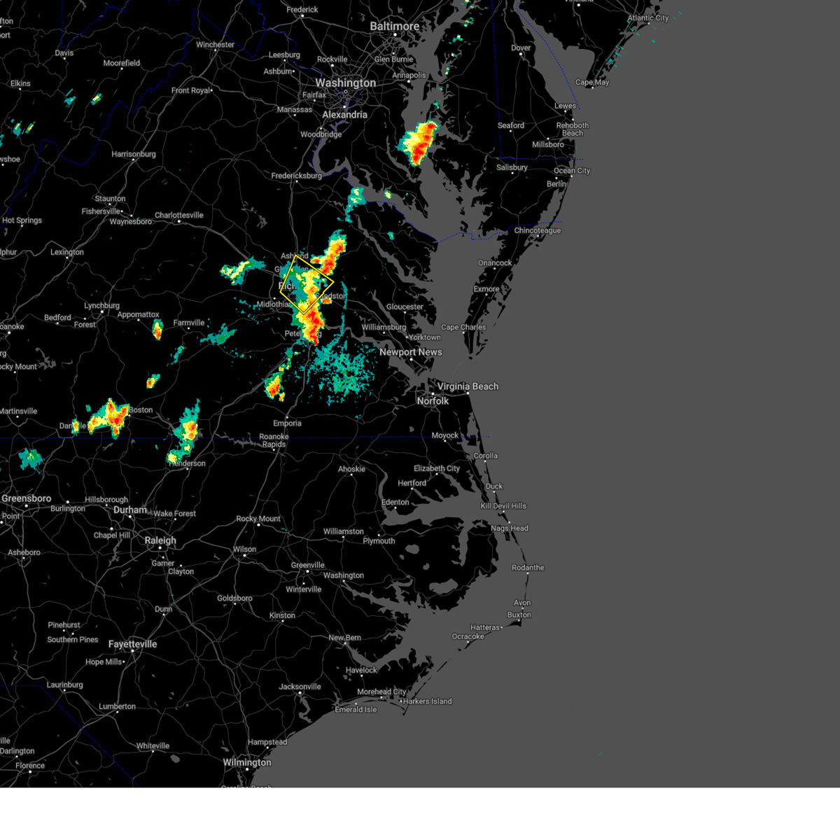 The severe thunderstorm warning for north central chesterfield, central henrico and southeastern hanover counties and the city of richmond will expire at 800 pm edt, the storms which prompted the warning have weakened below severe limits, and no longer pose an immediate threat to life or property. therefore, the warning will be allowed to expire. The severe thunderstorm warning for north central chesterfield, central henrico and southeastern hanover counties and the city of richmond will expire at 800 pm edt, the storms which prompted the warning have weakened below severe limits, and no longer pose an immediate threat to life or property. therefore, the warning will be allowed to expire.
|
| 9/7/2023 7:42 PM EDT |
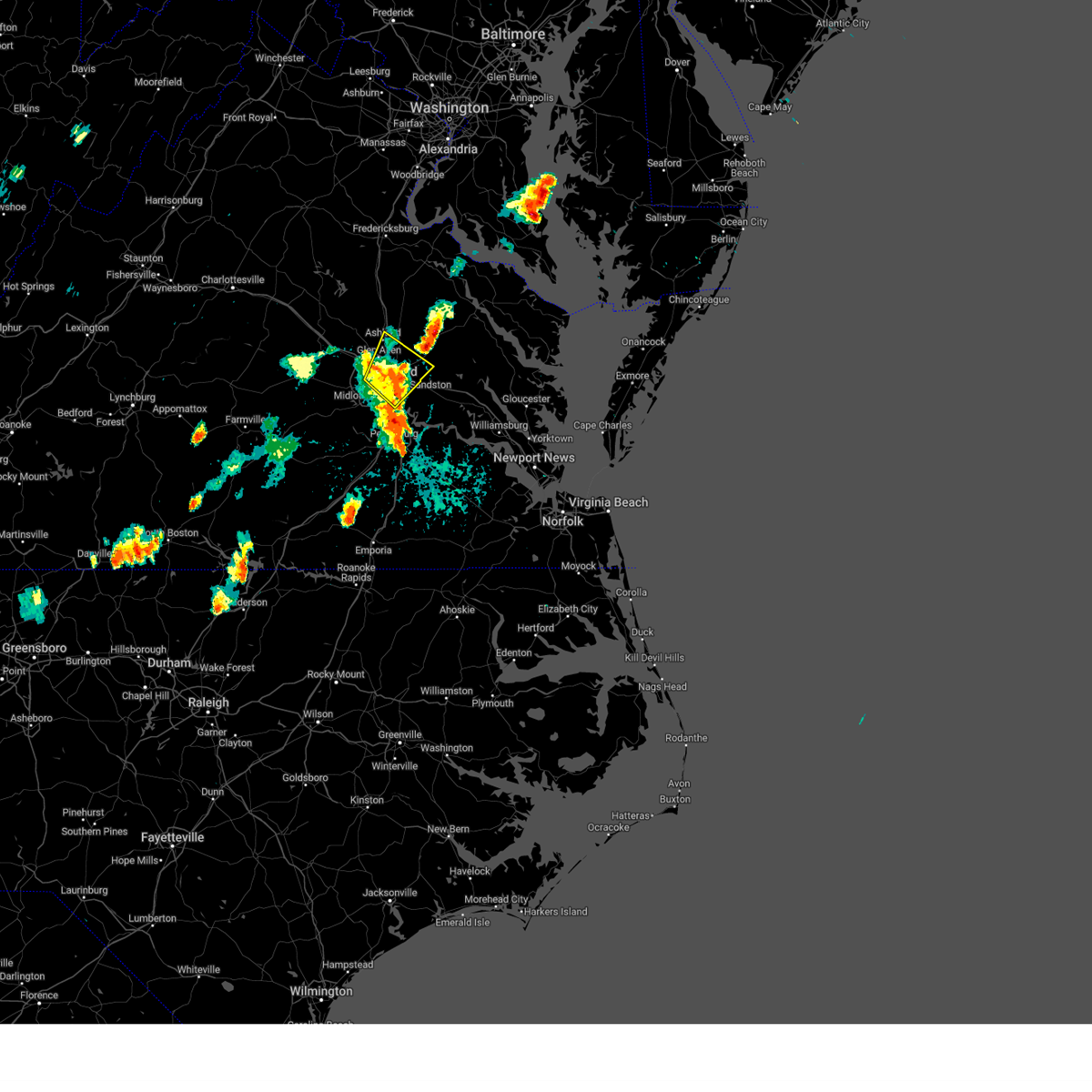 At 742 pm edt, severe thunderstorms were located along a line extending from near laurel to near highland springs, moving northeast at 20 mph (radar indicated). Hazards include 60 mph wind gusts. Expect damage to trees and powerlines. these severe storms will be near, ashland, mechanicsville, highland springs, laurel, lakeside, east highland park, and glen allen around 745 pm edt. randolph macon college around 750 pm edt. studley around 755 pm edt. other locations impacted by these severe thunderstorms include richmond heights, hanover airport, elmont, montrose, sandston, longdale, westwood, richmond international, fair oaks, and solomons store. hail threat, radar indicated max hail size, <. 75 in wind threat, radar indicated max wind gust, 60 mph. At 742 pm edt, severe thunderstorms were located along a line extending from near laurel to near highland springs, moving northeast at 20 mph (radar indicated). Hazards include 60 mph wind gusts. Expect damage to trees and powerlines. these severe storms will be near, ashland, mechanicsville, highland springs, laurel, lakeside, east highland park, and glen allen around 745 pm edt. randolph macon college around 750 pm edt. studley around 755 pm edt. other locations impacted by these severe thunderstorms include richmond heights, hanover airport, elmont, montrose, sandston, longdale, westwood, richmond international, fair oaks, and solomons store. hail threat, radar indicated max hail size, <. 75 in wind threat, radar indicated max wind gust, 60 mph.
|
| 9/7/2023 7:30 PM EDT |
 At 729 pm edt, severe thunderstorms were located along a line extending from tuckahoe to near highland springs, moving northeast at 25 mph (radar indicated). Hazards include 60 mph wind gusts and quarter size hail. Minor damage to vehicles is possible. expect wind damage to trees and powerlines. these severe storms will be near, richmond, virginia union university, mechanicsville, highland springs, tuckahoe, laurel, lakeside, east highland park, and glen allen around 735 pm edt. ashland around 745 pm edt. randolph macon college around 750 pm edt. studley around 755 pm edt. other locations impacted by these severe thunderstorms include richmond heights, hanover airport, elmont, montrose, sandston, longdale, westwood, richmond international, fair oaks, and solomons store. hail threat, radar indicated max hail size, 1. 00 in wind threat, radar indicated max wind gust, 60 mph. At 729 pm edt, severe thunderstorms were located along a line extending from tuckahoe to near highland springs, moving northeast at 25 mph (radar indicated). Hazards include 60 mph wind gusts and quarter size hail. Minor damage to vehicles is possible. expect wind damage to trees and powerlines. these severe storms will be near, richmond, virginia union university, mechanicsville, highland springs, tuckahoe, laurel, lakeside, east highland park, and glen allen around 735 pm edt. ashland around 745 pm edt. randolph macon college around 750 pm edt. studley around 755 pm edt. other locations impacted by these severe thunderstorms include richmond heights, hanover airport, elmont, montrose, sandston, longdale, westwood, richmond international, fair oaks, and solomons store. hail threat, radar indicated max hail size, 1. 00 in wind threat, radar indicated max wind gust, 60 mph.
|
| 9/7/2023 7:28 PM EDT |
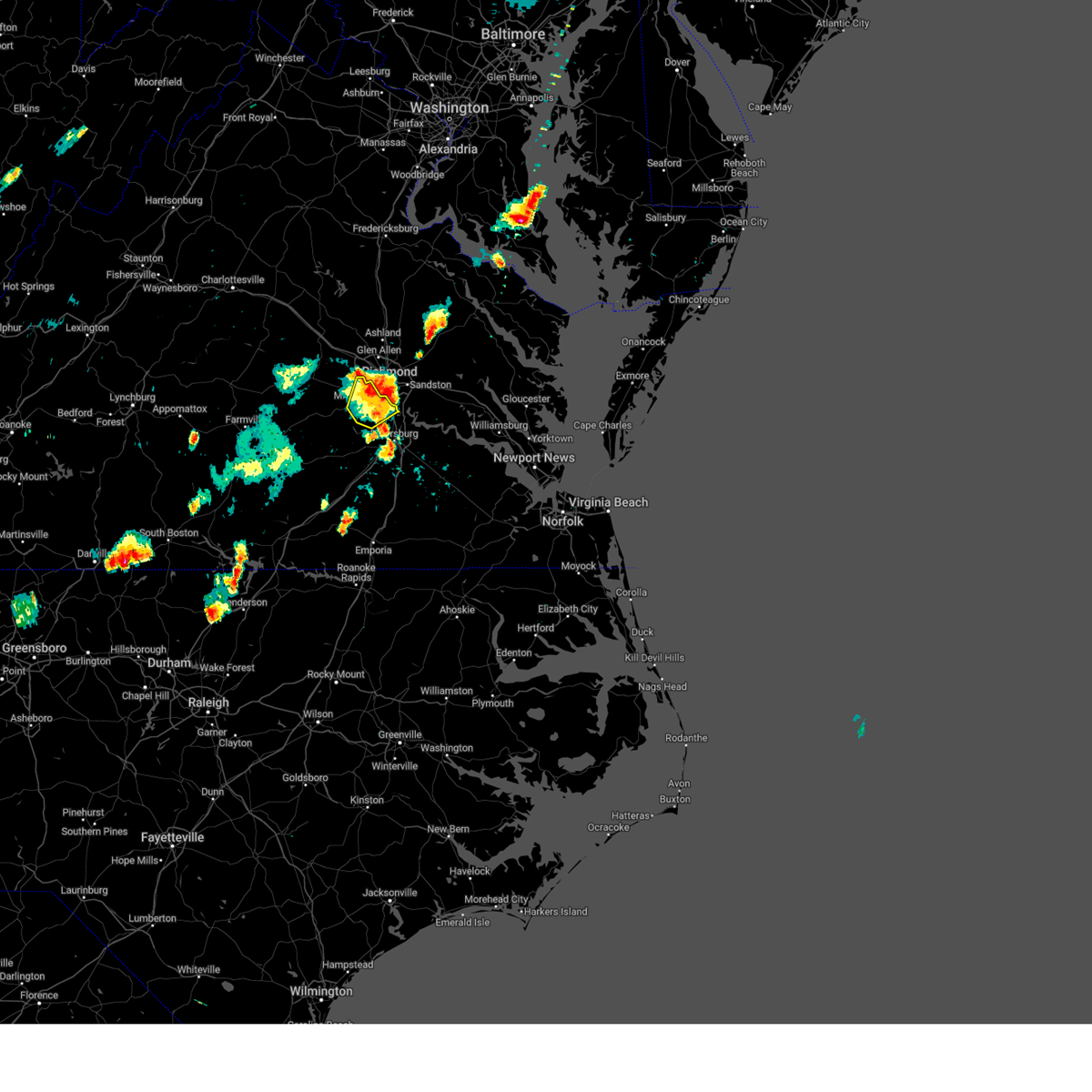 The severe thunderstorm warning for central chesterfield county will expire at 730 pm edt, the storms which prompted the warning have moved out of the area. therefore, the warning will be allowed to expire. The severe thunderstorm warning for central chesterfield county will expire at 730 pm edt, the storms which prompted the warning have moved out of the area. therefore, the warning will be allowed to expire.
|
| 9/7/2023 7:13 PM EDT |
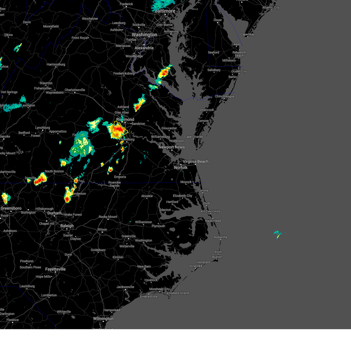 At 713 pm edt, severe thunderstorms were located along a line extending from 6 miles southwest of bon air to near chesterfield court house, moving northeast at 20 mph (radar indicated). Hazards include 60 mph wind gusts and quarter size hail. Minor damage to vehicles is possible. expect wind damage to trees and powerlines. these severe storms will be near, chester, bon air, bellwood, and chesterfield court house around 720 pm edt. tuckahoe and bensley around 725 pm edt. other locations impacted by these severe thunderstorms include pocahontas state park, beach, midlothian, drewrys bluff, centralia, and chesterfield. hail threat, radar indicated max hail size, 1. 00 in wind threat, radar indicated max wind gust, 60 mph. At 713 pm edt, severe thunderstorms were located along a line extending from 6 miles southwest of bon air to near chesterfield court house, moving northeast at 20 mph (radar indicated). Hazards include 60 mph wind gusts and quarter size hail. Minor damage to vehicles is possible. expect wind damage to trees and powerlines. these severe storms will be near, chester, bon air, bellwood, and chesterfield court house around 720 pm edt. tuckahoe and bensley around 725 pm edt. other locations impacted by these severe thunderstorms include pocahontas state park, beach, midlothian, drewrys bluff, centralia, and chesterfield. hail threat, radar indicated max hail size, 1. 00 in wind threat, radar indicated max wind gust, 60 mph.
|
| 9/7/2023 7:11 PM EDT |
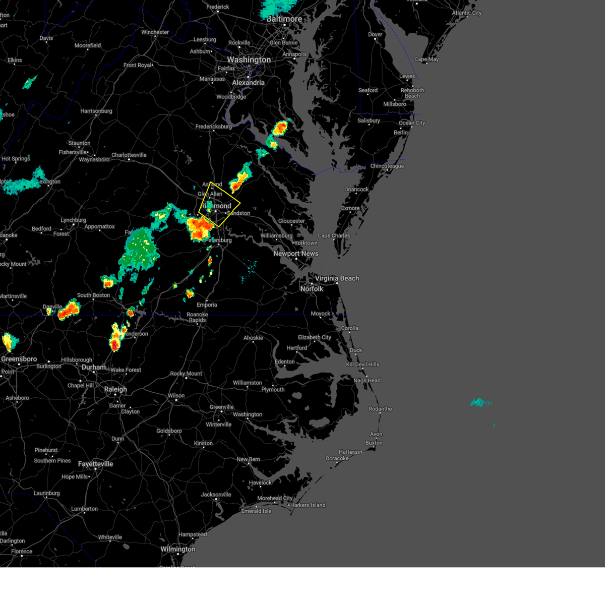 At 710 pm edt, severe thunderstorms were located along a line extending from near bon air to bellwood, moving northeast at 25 mph (radar indicated). Hazards include 60 mph wind gusts and quarter size hail. Minor damage to vehicles is possible. expect wind damage to trees and powerlines. severe thunderstorms will be near, richmond, university of richmond, downtown richmond, tuckahoe, bon air, virginia commonwealth university, bellwood, and bensley around 715 pm edt. virginia union university, laurel, lakeside, and east highland park around 720 pm edt. highland springs and glen allen around 725 pm edt. mechanicsville around 730 pm edt. ashland around 740 pm edt. randolph macon college and studley around 745 pm edt. other locations impacted by these severe thunderstorms include richmond heights, hanover airport, elmont, montrose, sandston, longdale, westwood, richmond international, fair oaks, and solomons store. hail threat, radar indicated max hail size, 1. 00 in wind threat, radar indicated max wind gust, 60 mph. At 710 pm edt, severe thunderstorms were located along a line extending from near bon air to bellwood, moving northeast at 25 mph (radar indicated). Hazards include 60 mph wind gusts and quarter size hail. Minor damage to vehicles is possible. expect wind damage to trees and powerlines. severe thunderstorms will be near, richmond, university of richmond, downtown richmond, tuckahoe, bon air, virginia commonwealth university, bellwood, and bensley around 715 pm edt. virginia union university, laurel, lakeside, and east highland park around 720 pm edt. highland springs and glen allen around 725 pm edt. mechanicsville around 730 pm edt. ashland around 740 pm edt. randolph macon college and studley around 745 pm edt. other locations impacted by these severe thunderstorms include richmond heights, hanover airport, elmont, montrose, sandston, longdale, westwood, richmond international, fair oaks, and solomons store. hail threat, radar indicated max hail size, 1. 00 in wind threat, radar indicated max wind gust, 60 mph.
|
| 9/7/2023 7:02 PM EDT |
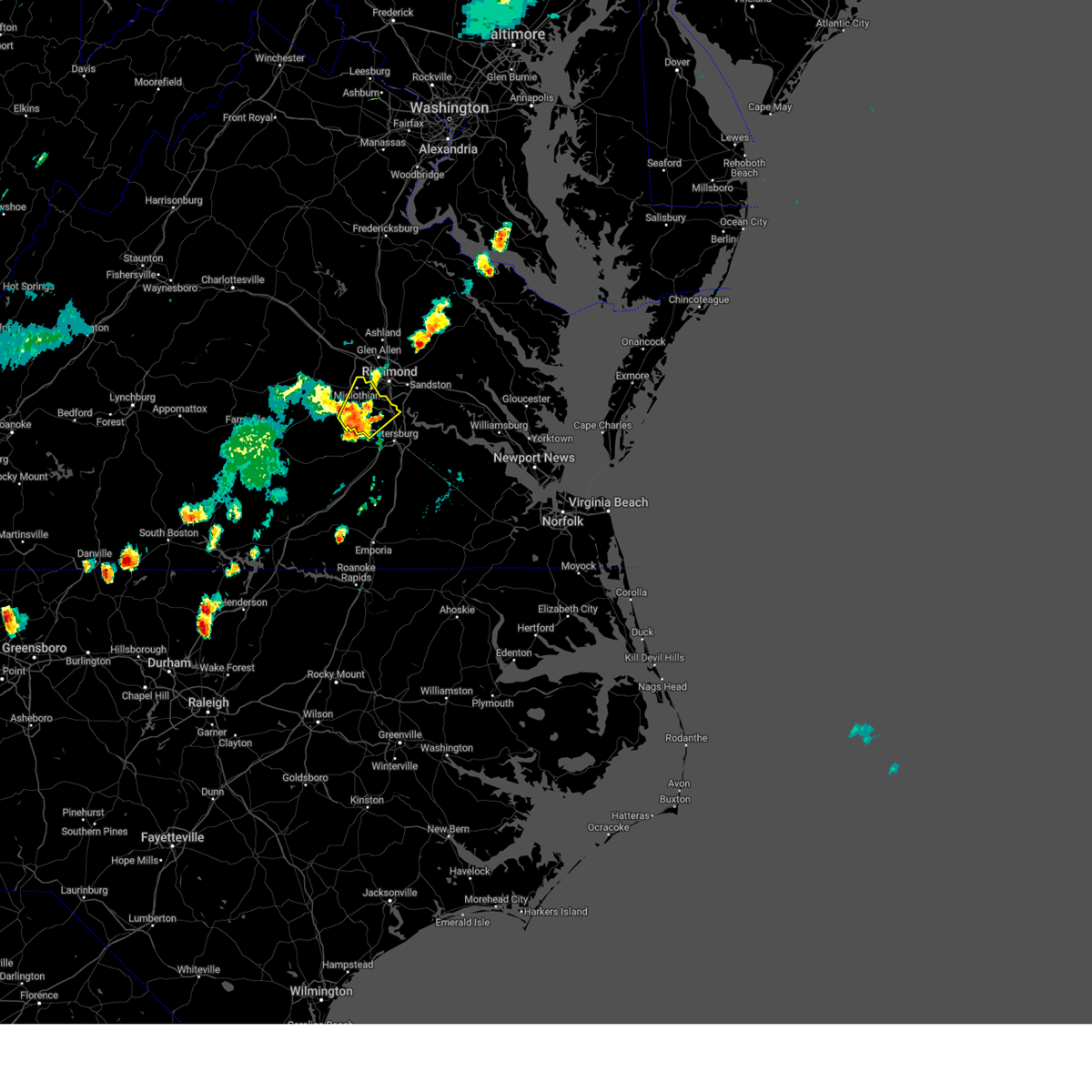 At 702 pm edt, severe thunderstorms were located along a line extending from near moseley to 6 miles north of sutherland, moving northeast at 20 mph (radar indicated). Hazards include 60 mph wind gusts and quarter size hail. Minor damage to vehicles is possible. expect wind damage to trees and powerlines. these severe storms will be near, chesterfield court house around 705 pm edt. chester around 710 pm edt. bon air around 715 pm edt. tuckahoe and bellwood around 720 pm edt. bensley around 725 pm edt. other locations impacted by these severe thunderstorms include pocahontas state park, beach, winterpock, midlothian, drewrys bluff, centralia, and chesterfield. hail threat, radar indicated max hail size, 1. 00 in wind threat, radar indicated max wind gust, 60 mph. At 702 pm edt, severe thunderstorms were located along a line extending from near moseley to 6 miles north of sutherland, moving northeast at 20 mph (radar indicated). Hazards include 60 mph wind gusts and quarter size hail. Minor damage to vehicles is possible. expect wind damage to trees and powerlines. these severe storms will be near, chesterfield court house around 705 pm edt. chester around 710 pm edt. bon air around 715 pm edt. tuckahoe and bellwood around 720 pm edt. bensley around 725 pm edt. other locations impacted by these severe thunderstorms include pocahontas state park, beach, winterpock, midlothian, drewrys bluff, centralia, and chesterfield. hail threat, radar indicated max hail size, 1. 00 in wind threat, radar indicated max wind gust, 60 mph.
|
| 9/7/2023 6:48 PM EDT |
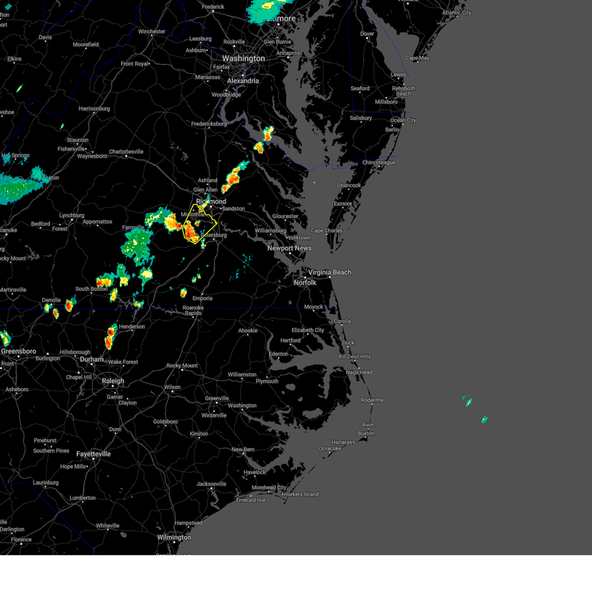 At 648 pm edt, severe thunderstorms were located along a line extending from near moseley to near sutherland, moving northeast at 20 mph (radar indicated). Hazards include 60 mph wind gusts and quarter size hail. Minor damage to vehicles is possible. expect wind damage to trees and powerlines. severe thunderstorms will be near, chester and chesterfield court house around 705 pm edt. bon air around 710 pm edt. other locations impacted by these severe thunderstorms include pocahontas state park, beach, winterpock, midlothian, drewrys bluff, centralia, and chesterfield. hail threat, radar indicated max hail size, 1. 00 in wind threat, radar indicated max wind gust, 60 mph. At 648 pm edt, severe thunderstorms were located along a line extending from near moseley to near sutherland, moving northeast at 20 mph (radar indicated). Hazards include 60 mph wind gusts and quarter size hail. Minor damage to vehicles is possible. expect wind damage to trees and powerlines. severe thunderstorms will be near, chester and chesterfield court house around 705 pm edt. bon air around 710 pm edt. other locations impacted by these severe thunderstorms include pocahontas state park, beach, winterpock, midlothian, drewrys bluff, centralia, and chesterfield. hail threat, radar indicated max hail size, 1. 00 in wind threat, radar indicated max wind gust, 60 mph.
|
| 8/6/2023 7:15 PM EDT |
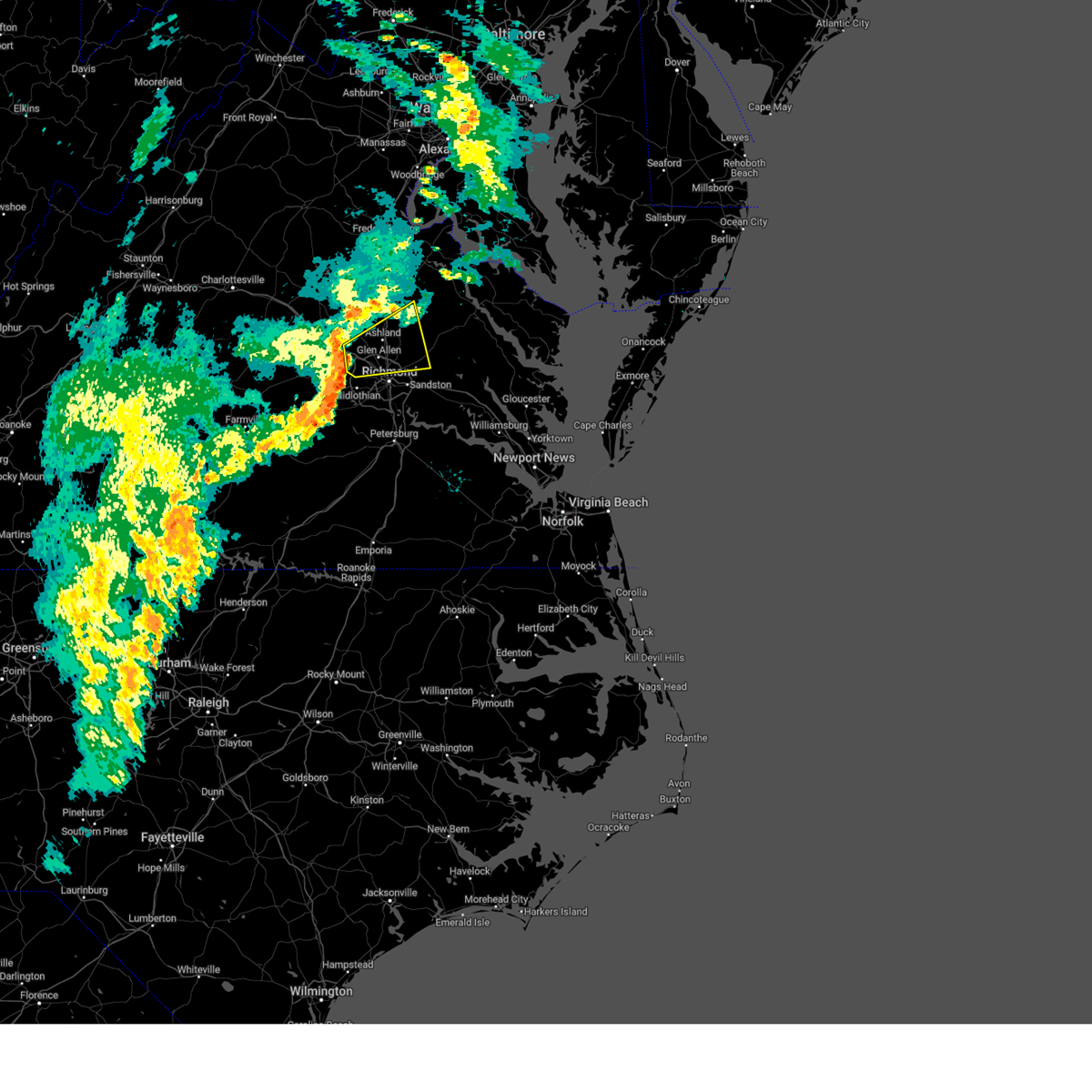 At 715 pm edt, a severe thunderstorm was located over wyndham, or 7 miles northwest of tuckahoe, moving east at 30 mph (radar indicated). Hazards include 60 mph wind gusts. Expect damage to trees and powerlines. this severe thunderstorm will be near, wyndham around 720 pm edt. glen allen around 725 pm edt. ashland and randolph macon college around 730 pm edt. hanover around 745 pm edt. dawn around 750 pm edt. other locations impacted by this severe thunderstorm include enfield, hanover airport, gum tree, johnsons springs, doswell, elmont, etna mills, short pump, longdale, and rockville. hail threat, radar indicated max hail size, <. 75 in wind threat, radar indicated max wind gust, 60 mph. At 715 pm edt, a severe thunderstorm was located over wyndham, or 7 miles northwest of tuckahoe, moving east at 30 mph (radar indicated). Hazards include 60 mph wind gusts. Expect damage to trees and powerlines. this severe thunderstorm will be near, wyndham around 720 pm edt. glen allen around 725 pm edt. ashland and randolph macon college around 730 pm edt. hanover around 745 pm edt. dawn around 750 pm edt. other locations impacted by this severe thunderstorm include enfield, hanover airport, gum tree, johnsons springs, doswell, elmont, etna mills, short pump, longdale, and rockville. hail threat, radar indicated max hail size, <. 75 in wind threat, radar indicated max wind gust, 60 mph.
|
| 8/6/2023 6:55 PM EDT |
 At 654 pm edt, severe thunderstorms were located along a line extending from near oilville to near sabot to chula, moving northeast at 25 mph (radar indicated). Hazards include 60 mph wind gusts. Expect damage to trees and powerlines. these severe storms will be near, moseley, montpelier, chula, manakin, and sabot around 700 pm edt. tuckahoe and wyndham around 705 pm edt. other locations impacted by these severe thunderstorms include crozier, rock castle, pilkinton, vontay, maidens, irwin, johnsons springs, elmont, winterham, and skinquarter. hail threat, radar indicated max hail size, <. 75 in wind threat, radar indicated max wind gust, 60 mph. At 654 pm edt, severe thunderstorms were located along a line extending from near oilville to near sabot to chula, moving northeast at 25 mph (radar indicated). Hazards include 60 mph wind gusts. Expect damage to trees and powerlines. these severe storms will be near, moseley, montpelier, chula, manakin, and sabot around 700 pm edt. tuckahoe and wyndham around 705 pm edt. other locations impacted by these severe thunderstorms include crozier, rock castle, pilkinton, vontay, maidens, irwin, johnsons springs, elmont, winterham, and skinquarter. hail threat, radar indicated max hail size, <. 75 in wind threat, radar indicated max wind gust, 60 mph.
|
| 8/6/2023 6:37 PM EDT |
 At 637 pm edt, severe thunderstorms were located along a line extending from goochland to powhatan to near amelia courthouse, moving northeast at 25 mph (radar indicated). Hazards include 60 mph wind gusts. Expect damage to trees and powerlines. severe thunderstorms will be near, powhatan, goochland, amelia courthouse, oilville, and chula around 640 pm edt. sabot around 645 pm edt. manakin around 655 pm edt. moseley and montpelier around 700 pm edt. tuckahoe and wyndham around 705 pm edt. other locations impacted by these severe thunderstorms include crozier, rock castle, pilkinton, vontay, maidens, three square, irwin, johnsons springs, elmont, and winterham. hail threat, radar indicated max hail size, <. 75 in wind threat, radar indicated max wind gust, 60 mph. At 637 pm edt, severe thunderstorms were located along a line extending from goochland to powhatan to near amelia courthouse, moving northeast at 25 mph (radar indicated). Hazards include 60 mph wind gusts. Expect damage to trees and powerlines. severe thunderstorms will be near, powhatan, goochland, amelia courthouse, oilville, and chula around 640 pm edt. sabot around 645 pm edt. manakin around 655 pm edt. moseley and montpelier around 700 pm edt. tuckahoe and wyndham around 705 pm edt. other locations impacted by these severe thunderstorms include crozier, rock castle, pilkinton, vontay, maidens, three square, irwin, johnsons springs, elmont, and winterham. hail threat, radar indicated max hail size, <. 75 in wind threat, radar indicated max wind gust, 60 mph.
|
| 7/29/2023 7:37 PM EDT |
 At 736 pm edt, severe thunderstorms were located along a line extending from near moseley to near spainville, moving east at 25 mph (radar indicated). Hazards include 60 mph wind gusts. Expect damage to trees and powerlines. locations impacted include, mannboro, moseley, amelia courthouse, jetersville, morven, scotts fork, chula, spainville, north wellville, earls, winterham, skinquarter, wellville, maplewood, fergusonville, deatonville, lodore, denaro, rodophil, and midlothian. hail threat, radar indicated max hail size, <. 75 in wind threat, radar indicated max wind gust, 60 mph. At 736 pm edt, severe thunderstorms were located along a line extending from near moseley to near spainville, moving east at 25 mph (radar indicated). Hazards include 60 mph wind gusts. Expect damage to trees and powerlines. locations impacted include, mannboro, moseley, amelia courthouse, jetersville, morven, scotts fork, chula, spainville, north wellville, earls, winterham, skinquarter, wellville, maplewood, fergusonville, deatonville, lodore, denaro, rodophil, and midlothian. hail threat, radar indicated max hail size, <. 75 in wind threat, radar indicated max wind gust, 60 mph.
|
| 7/29/2023 7:28 PM EDT |
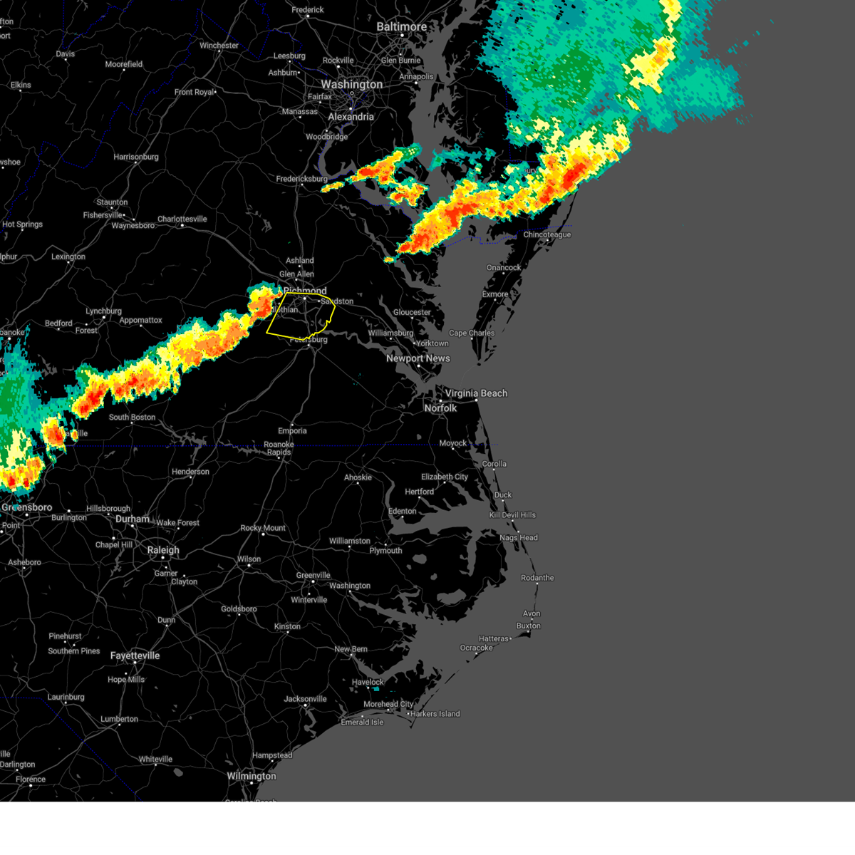 At 727 pm edt, severe thunderstorms were located along a line extending from near manakin to 8 miles southwest of bon air to moseley, moving east at 35 mph (radar indicated). Hazards include 60 mph wind gusts. expect damage to trees and powerlines At 727 pm edt, severe thunderstorms were located along a line extending from near manakin to 8 miles southwest of bon air to moseley, moving east at 35 mph (radar indicated). Hazards include 60 mph wind gusts. expect damage to trees and powerlines
|
| 7/29/2023 7:06 PM EDT |
 At 706 pm edt, severe thunderstorms were located along a line extending from near macon to near burkeville, moving east at 25 mph (radar indicated). Hazards include 60 mph wind gusts. expect damage to trees and powerlines At 706 pm edt, severe thunderstorms were located along a line extending from near macon to near burkeville, moving east at 25 mph (radar indicated). Hazards include 60 mph wind gusts. expect damage to trees and powerlines
|
| 7/3/2023 4:09 PM EDT |
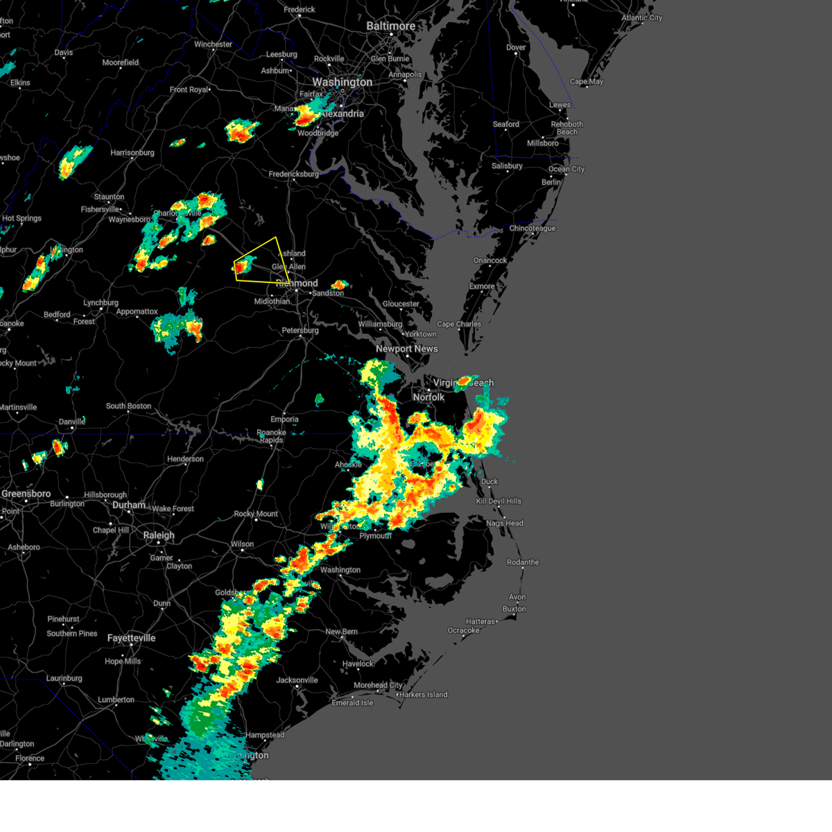 At 409 pm edt, a severe thunderstorm was located over goochland, moving east at 25 mph (radar indicated). Hazards include 60 mph wind gusts and quarter size hail. Minor damage to vehicles is possible. Expect wind damage to trees and powerlines. At 409 pm edt, a severe thunderstorm was located over goochland, moving east at 25 mph (radar indicated). Hazards include 60 mph wind gusts and quarter size hail. Minor damage to vehicles is possible. Expect wind damage to trees and powerlines.
|
| 6/26/2023 9:36 PM EDT |
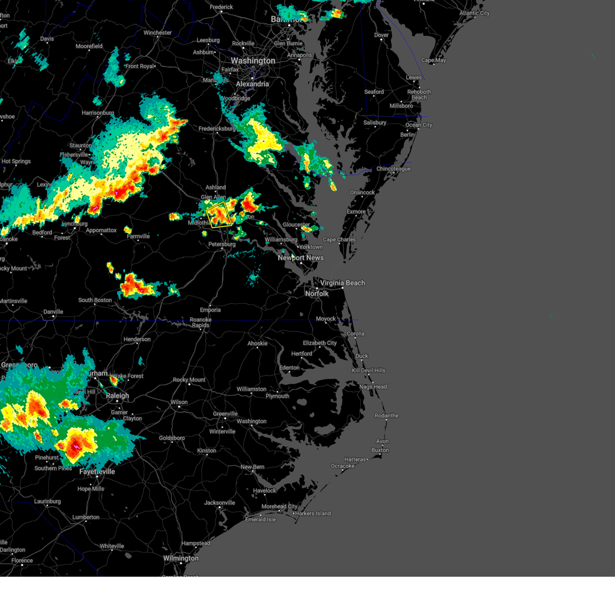 At 935 pm edt, a severe thunderstorm was located over east highland park, or near highland springs, moving east at 25 mph (radar indicated). Hazards include 60 mph wind gusts and penny size hail. Expect damage to trees and powerlines. this severe storm will be near, highland springs around 940 pm edt. other locations impacted by this severe thunderstorm include chamberlayne, greendale, richmond heights, roslyn hills, varina, dumbarton, drewrys bluff, montrose and richmond international. hail threat, radar indicated max hail size, 0. 75 in wind threat, radar indicated max wind gust, 60 mph. At 935 pm edt, a severe thunderstorm was located over east highland park, or near highland springs, moving east at 25 mph (radar indicated). Hazards include 60 mph wind gusts and penny size hail. Expect damage to trees and powerlines. this severe storm will be near, highland springs around 940 pm edt. other locations impacted by this severe thunderstorm include chamberlayne, greendale, richmond heights, roslyn hills, varina, dumbarton, drewrys bluff, montrose and richmond international. hail threat, radar indicated max hail size, 0. 75 in wind threat, radar indicated max wind gust, 60 mph.
|
| 6/26/2023 9:23 PM EDT |
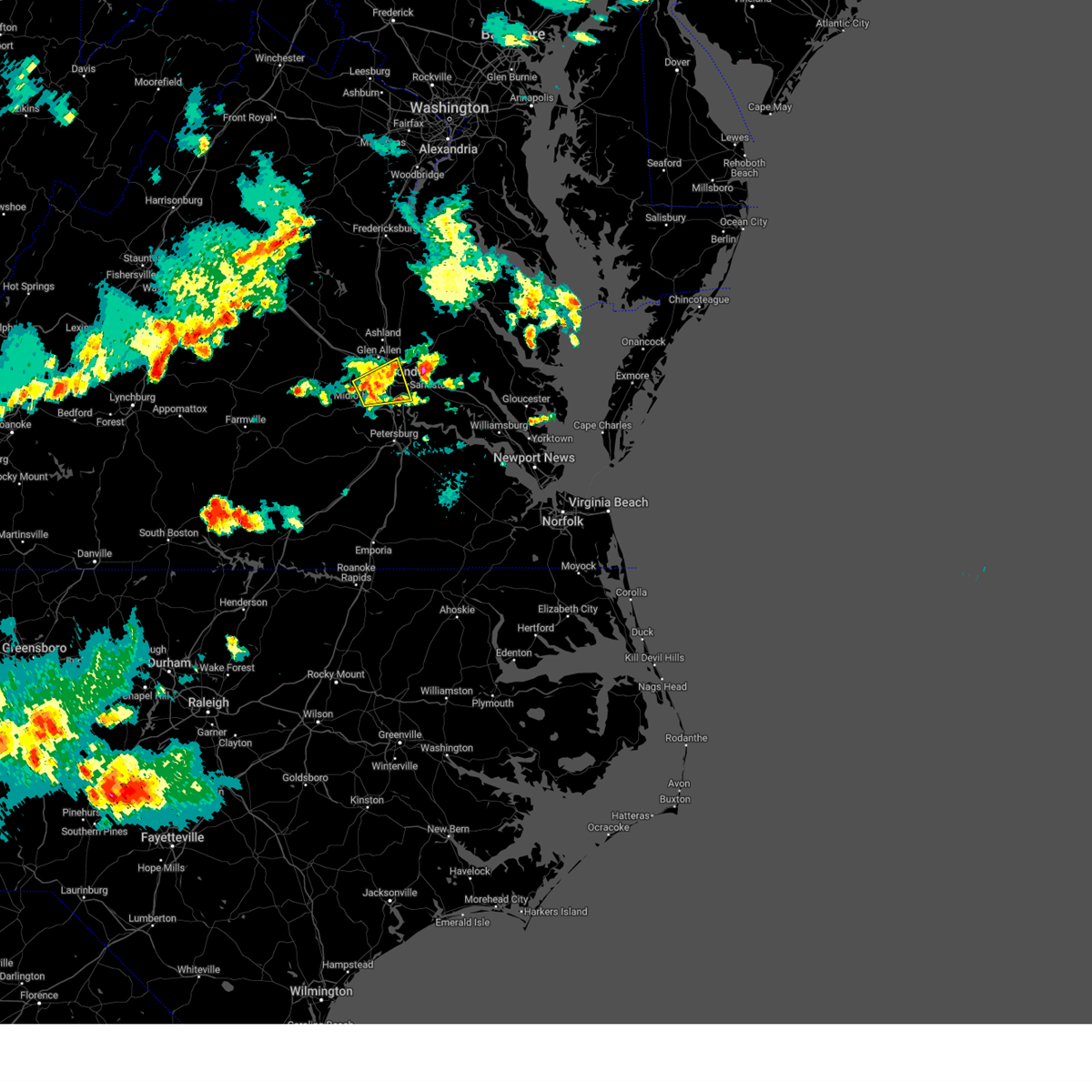 At 922 pm edt, a severe thunderstorm was located over richmond, moving east at 35 mph (radar indicated). Hazards include 60 mph wind gusts. Expect damage to trees and powerlines. this severe storm will be near, highland springs around 930 pm edt. other locations impacted by this severe thunderstorm include chamberlayne, richmond heights, roslyn hills, varina, midlothian, drewrys bluff, montrose, richmond international, greendale and dumbarton. hail threat, radar indicated max hail size, <. 75 in wind threat, radar indicated max wind gust, 60 mph. At 922 pm edt, a severe thunderstorm was located over richmond, moving east at 35 mph (radar indicated). Hazards include 60 mph wind gusts. Expect damage to trees and powerlines. this severe storm will be near, highland springs around 930 pm edt. other locations impacted by this severe thunderstorm include chamberlayne, richmond heights, roslyn hills, varina, midlothian, drewrys bluff, montrose, richmond international, greendale and dumbarton. hail threat, radar indicated max hail size, <. 75 in wind threat, radar indicated max wind gust, 60 mph.
|
| 6/26/2023 9:04 PM EDT |
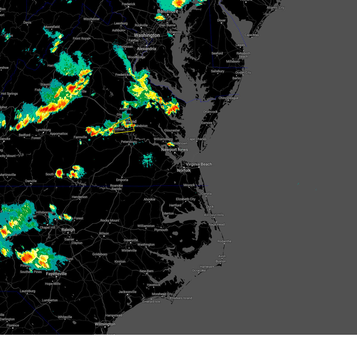 At 904 pm edt, a severe thunderstorm was located near bon air, moving east at 35 mph (radar indicated). Hazards include 60 mph wind gusts and penny size hail. Expect damage to trees and powerlines. this severe thunderstorm will be near, bon air and university of richmond around 915 pm edt. downtown richmond, bensley and bellwood around 920 pm edt. richmond, virginia commonwealth university and virginia union university around 925 pm edt. highland springs and east highland park around 930 pm edt. other locations impacted by this severe thunderstorm include chamberlayne, richmond heights, roslyn hills, varina, midlothian, drewrys bluff, montrose, richmond international, greendale and dumbarton. hail threat, radar indicated max hail size, 0. 75 in wind threat, radar indicated max wind gust, 60 mph. At 904 pm edt, a severe thunderstorm was located near bon air, moving east at 35 mph (radar indicated). Hazards include 60 mph wind gusts and penny size hail. Expect damage to trees and powerlines. this severe thunderstorm will be near, bon air and university of richmond around 915 pm edt. downtown richmond, bensley and bellwood around 920 pm edt. richmond, virginia commonwealth university and virginia union university around 925 pm edt. highland springs and east highland park around 930 pm edt. other locations impacted by this severe thunderstorm include chamberlayne, richmond heights, roslyn hills, varina, midlothian, drewrys bluff, montrose, richmond international, greendale and dumbarton. hail threat, radar indicated max hail size, 0. 75 in wind threat, radar indicated max wind gust, 60 mph.
|
| 6/26/2023 8:08 PM EDT |
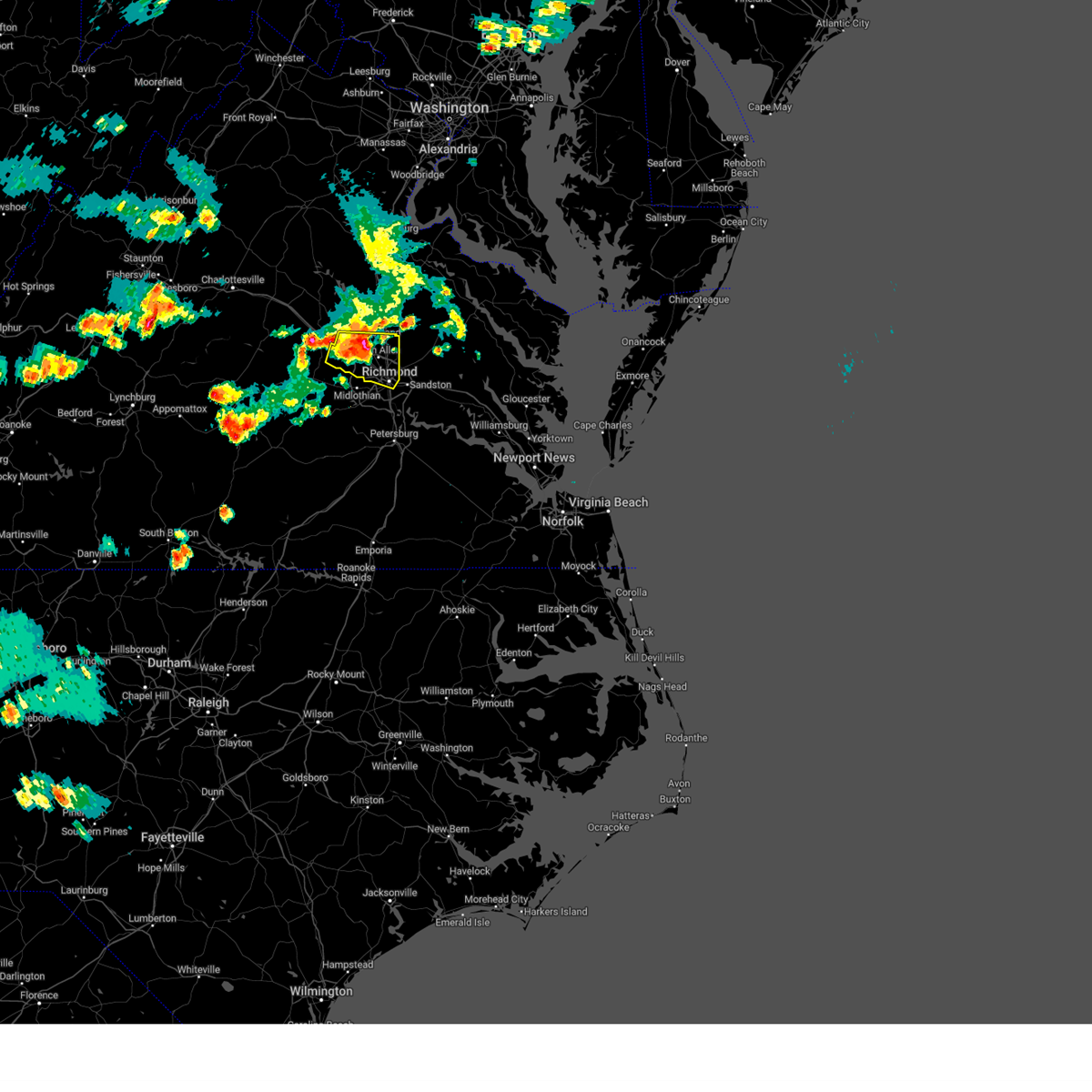 At 807 pm edt, severe thunderstorms were located along a line extending from near randolph macon college to near glen allen to near bon air, moving east at 30 mph (radar indicated). Hazards include 70 mph wind gusts and penny size hail. Expect considerable tree damage. damage is likely to mobile homes, roofs, and outbuildings. these severe storms will be near, ashland, randolph macon college, glen allen and lakeside around 815 pm edt. downtown richmond and mechanicsville around 820 pm edt. richmond, virginia commonwealth university, virginia union university and hanover around 825 pm edt. east highland park around 830 pm edt. other locations impacted by these severe thunderstorms include crozier, hanover airport, vontay, johnsons springs, goodall, elmont, short pump, longdale, rockville and gilman. thunderstorm damage threat, considerable hail threat, radar indicated max hail size, 0. 75 in wind threat, radar indicated max wind gust, 70 mph. At 807 pm edt, severe thunderstorms were located along a line extending from near randolph macon college to near glen allen to near bon air, moving east at 30 mph (radar indicated). Hazards include 70 mph wind gusts and penny size hail. Expect considerable tree damage. damage is likely to mobile homes, roofs, and outbuildings. these severe storms will be near, ashland, randolph macon college, glen allen and lakeside around 815 pm edt. downtown richmond and mechanicsville around 820 pm edt. richmond, virginia commonwealth university, virginia union university and hanover around 825 pm edt. east highland park around 830 pm edt. other locations impacted by these severe thunderstorms include crozier, hanover airport, vontay, johnsons springs, goodall, elmont, short pump, longdale, rockville and gilman. thunderstorm damage threat, considerable hail threat, radar indicated max hail size, 0. 75 in wind threat, radar indicated max wind gust, 70 mph.
|
| 6/26/2023 7:57 PM EDT |
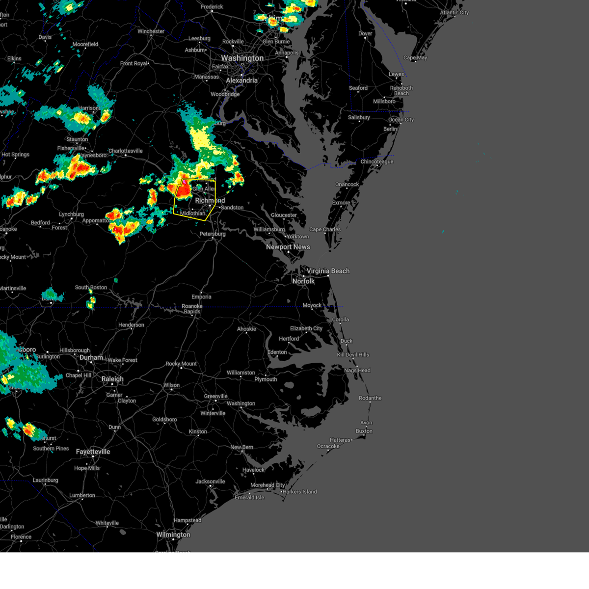 At 756 pm edt, severe thunderstorms were located along a line extending from near wyndham to near tuckahoe to near moseley, moving east at 45 mph (radar indicated). Hazards include 70 mph wind gusts and penny size hail. Expect considerable tree damage. damage is likely to mobile homes, roofs, and outbuildings. these severe storms will be near, tuckahoe, university of richmond, bon air and wyndham around 800 pm edt. downtown richmond, lakeside and laurel around 805 pm edt. richmond, ashland, randolph macon college, virginia union university, virginia commonwealth university, east highland park and glen allen around 810 pm edt. mechanicsville around 815 pm edt. hanover and bensley around 820 pm edt. other locations impacted by these severe thunderstorms include crozier, vontay, johnsons springs, elmont, gilman, solomons store, chamberlayne, fine creek mills, atlee and ashcake. thunderstorm damage threat, considerable hail threat, radar indicated max hail size, 0. 75 in wind threat, radar indicated max wind gust, 70 mph. At 756 pm edt, severe thunderstorms were located along a line extending from near wyndham to near tuckahoe to near moseley, moving east at 45 mph (radar indicated). Hazards include 70 mph wind gusts and penny size hail. Expect considerable tree damage. damage is likely to mobile homes, roofs, and outbuildings. these severe storms will be near, tuckahoe, university of richmond, bon air and wyndham around 800 pm edt. downtown richmond, lakeside and laurel around 805 pm edt. richmond, ashland, randolph macon college, virginia union university, virginia commonwealth university, east highland park and glen allen around 810 pm edt. mechanicsville around 815 pm edt. hanover and bensley around 820 pm edt. other locations impacted by these severe thunderstorms include crozier, vontay, johnsons springs, elmont, gilman, solomons store, chamberlayne, fine creek mills, atlee and ashcake. thunderstorm damage threat, considerable hail threat, radar indicated max hail size, 0. 75 in wind threat, radar indicated max wind gust, 70 mph.
|
| 6/26/2023 7:48 PM EDT |
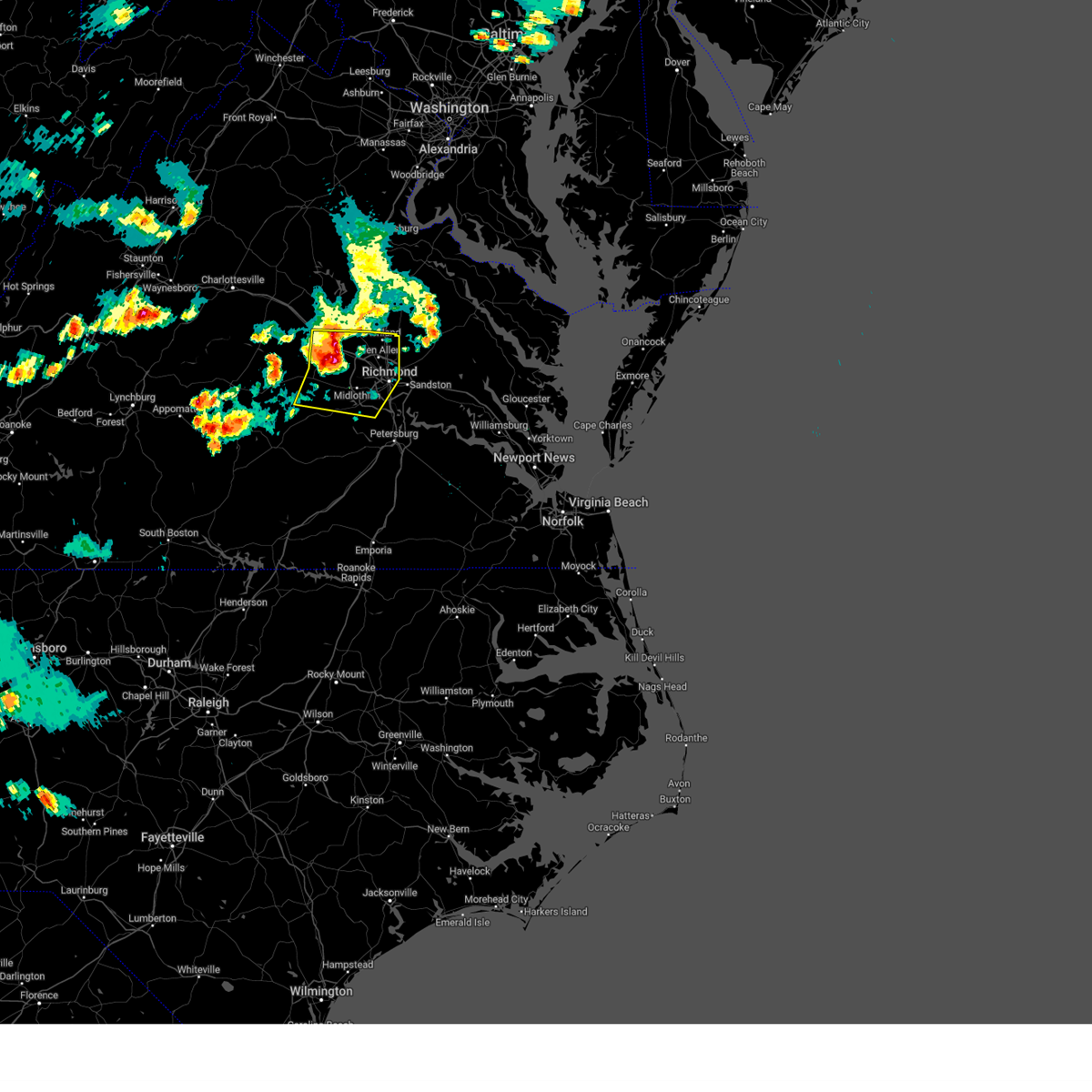 At 747 pm edt, severe thunderstorms were located along a line extending from oilville to near sabot to near chula, moving east at 35 mph (radar indicated). Hazards include 70 mph wind gusts and penny size hail. Expect considerable tree damage. damage is likely to mobile homes, roofs, and outbuildings. these severe storms will be near, manakin around 755 pm edt. tuckahoe and wyndham around 800 pm edt. university of richmond and bon air around 810 pm edt. richmond, ashland, downtown richmond, randolph macon college, glen allen, laurel and lakeside around 815 pm edt. virginia union university, virginia commonwealth university and east highland park around 820 pm edt. mechanicsville, hanover and chesterfield court house around 825 pm edt. bensley around 830 pm edt. other locations impacted by these severe thunderstorms include crozier, pilkinton, vontay, maidens, irwin, johnsons springs, elmont, pocahontas state park, skinquarter and gilman. thunderstorm damage threat, considerable hail threat, radar indicated max hail size, 0. 75 in wind threat, radar indicated max wind gust, 70 mph. At 747 pm edt, severe thunderstorms were located along a line extending from oilville to near sabot to near chula, moving east at 35 mph (radar indicated). Hazards include 70 mph wind gusts and penny size hail. Expect considerable tree damage. damage is likely to mobile homes, roofs, and outbuildings. these severe storms will be near, manakin around 755 pm edt. tuckahoe and wyndham around 800 pm edt. university of richmond and bon air around 810 pm edt. richmond, ashland, downtown richmond, randolph macon college, glen allen, laurel and lakeside around 815 pm edt. virginia union university, virginia commonwealth university and east highland park around 820 pm edt. mechanicsville, hanover and chesterfield court house around 825 pm edt. bensley around 830 pm edt. other locations impacted by these severe thunderstorms include crozier, pilkinton, vontay, maidens, irwin, johnsons springs, elmont, pocahontas state park, skinquarter and gilman. thunderstorm damage threat, considerable hail threat, radar indicated max hail size, 0. 75 in wind threat, radar indicated max wind gust, 70 mph.
|
| 6/26/2023 7:24 PM EDT |
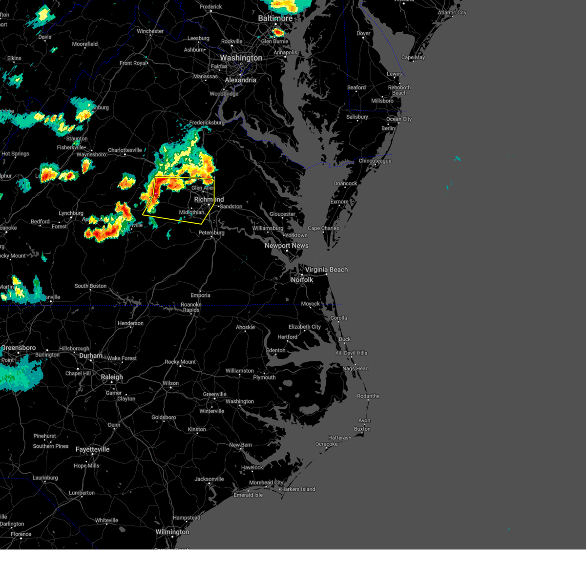 At 723 pm edt, severe thunderstorms were located along a line extending from fife to trenholm to sunnyside, moving east at 35 mph (radar indicated). Hazards include 70 mph wind gusts and quarter size hail. Minor damage to vehicles is possible. expect considerable tree damage. wind damage is also likely to mobile homes, roofs, and outbuildings. severe thunderstorms will be near, powhatan, goochland and gum spring around 735 pm edt. macon around 740 pm edt. oilville around 745 pm edt. sabot around 750 pm edt. manakin around 755 pm edt. moseley, tuckahoe and wyndham around 800 pm edt. university of richmond and bon air around 810 pm edt. richmond, ashland, downtown richmond, randolph macon college, glen allen, laurel and lakeside around 815 pm edt. other locations impacted by these severe thunderstorms include maidens, three square, pocahontas state park, skinquarter, chamberlayne, fine creek mills, michaux, atlee, west view and ashcake. thunderstorm damage threat, considerable hail threat, radar indicated max hail size, 1. 00 in wind threat, radar indicated max wind gust, 70 mph. At 723 pm edt, severe thunderstorms were located along a line extending from fife to trenholm to sunnyside, moving east at 35 mph (radar indicated). Hazards include 70 mph wind gusts and quarter size hail. Minor damage to vehicles is possible. expect considerable tree damage. wind damage is also likely to mobile homes, roofs, and outbuildings. severe thunderstorms will be near, powhatan, goochland and gum spring around 735 pm edt. macon around 740 pm edt. oilville around 745 pm edt. sabot around 750 pm edt. manakin around 755 pm edt. moseley, tuckahoe and wyndham around 800 pm edt. university of richmond and bon air around 810 pm edt. richmond, ashland, downtown richmond, randolph macon college, glen allen, laurel and lakeside around 815 pm edt. other locations impacted by these severe thunderstorms include maidens, three square, pocahontas state park, skinquarter, chamberlayne, fine creek mills, michaux, atlee, west view and ashcake. thunderstorm damage threat, considerable hail threat, radar indicated max hail size, 1. 00 in wind threat, radar indicated max wind gust, 70 mph.
|
| 6/26/2023 7:04 PM EDT |
 At 703 pm edt, severe thunderstorms were located along a line extending from 6 miles southwest of ladysmith to near montpelier to near goochland, moving east at 30 mph (radar indicated). Hazards include 70 mph wind gusts and penny size hail. Expect considerable tree damage. damage is likely to mobile homes, roofs, and outbuildings. these severe storms will be near, ashland, randolph macon college and oilville around 720 pm edt. sabot and kings dominion around 725 pm edt. manakin around 730 pm edt. wyndham around 735 pm edt. other locations impacted by these severe thunderstorms include chilesburg, golansville, crozier, rock castle, vontay, maidens, gum tree, three square, irwin and johnsons springs. thunderstorm damage threat, considerable hail threat, radar indicated max hail size, 0. 75 in wind threat, radar indicated max wind gust, 70 mph. At 703 pm edt, severe thunderstorms were located along a line extending from 6 miles southwest of ladysmith to near montpelier to near goochland, moving east at 30 mph (radar indicated). Hazards include 70 mph wind gusts and penny size hail. Expect considerable tree damage. damage is likely to mobile homes, roofs, and outbuildings. these severe storms will be near, ashland, randolph macon college and oilville around 720 pm edt. sabot and kings dominion around 725 pm edt. manakin around 730 pm edt. wyndham around 735 pm edt. other locations impacted by these severe thunderstorms include chilesburg, golansville, crozier, rock castle, vontay, maidens, gum tree, three square, irwin and johnsons springs. thunderstorm damage threat, considerable hail threat, radar indicated max hail size, 0. 75 in wind threat, radar indicated max wind gust, 70 mph.
|
| 6/26/2023 6:53 PM EDT |
 At 653 pm edt, severe thunderstorms were located along a line extending from near bumpass to near montpelier to near goochland, moving east at 30 mph (radar indicated). Hazards include 70 mph wind gusts and quarter size hail. Minor damage to vehicles is possible. expect considerable tree damage. wind damage is also likely to mobile homes, roofs, and outbuildings. these severe storms will be near, montpelier and bumpass around 700 pm edt. randolph macon college and sabot around 720 pm edt. ashland, kings dominion and manakin around 725 pm edt. wyndham around 730 pm edt. other locations impacted by these severe thunderstorms include chilesburg, orchid, golansville, crozier, rock castle, vontay, maidens, gum tree, three square and irwin. thunderstorm damage threat, considerable hail threat, radar indicated max hail size, 1. 00 in wind threat, radar indicated max wind gust, 70 mph. At 653 pm edt, severe thunderstorms were located along a line extending from near bumpass to near montpelier to near goochland, moving east at 30 mph (radar indicated). Hazards include 70 mph wind gusts and quarter size hail. Minor damage to vehicles is possible. expect considerable tree damage. wind damage is also likely to mobile homes, roofs, and outbuildings. these severe storms will be near, montpelier and bumpass around 700 pm edt. randolph macon college and sabot around 720 pm edt. ashland, kings dominion and manakin around 725 pm edt. wyndham around 730 pm edt. other locations impacted by these severe thunderstorms include chilesburg, orchid, golansville, crozier, rock castle, vontay, maidens, gum tree, three square and irwin. thunderstorm damage threat, considerable hail threat, radar indicated max hail size, 1. 00 in wind threat, radar indicated max wind gust, 70 mph.
|
| 6/26/2023 6:29 PM EDT |
 At 629 pm edt, severe thunderstorms were located along a line extending from near mineral to near hadensville to lakeside village, moving east at 30 mph (radar indicated). Hazards include 70 mph wind gusts and quarter size hail. Minor damage to vehicles is possible. expect considerable tree damage. wind damage is also likely to mobile homes, roofs, and outbuildings. severe thunderstorms will be near, gum spring around 635 pm edt. bumpass around 645 pm edt. montpelier around 655 pm edt. goochland around 700 pm edt. oilville around 715 pm edt. ashland, randolph macon college and sabot around 720 pm edt. kings dominion and manakin around 725 pm edt. wyndham around 730 pm edt. other locations impacted by these severe thunderstorms include chilesburg, orchid, golansville, crozier, rock castle, vontay, maidens, gum tree, three square and irwin. thunderstorm damage threat, considerable hail threat, radar indicated max hail size, 1. 00 in wind threat, radar indicated max wind gust, 70 mph. At 629 pm edt, severe thunderstorms were located along a line extending from near mineral to near hadensville to lakeside village, moving east at 30 mph (radar indicated). Hazards include 70 mph wind gusts and quarter size hail. Minor damage to vehicles is possible. expect considerable tree damage. wind damage is also likely to mobile homes, roofs, and outbuildings. severe thunderstorms will be near, gum spring around 635 pm edt. bumpass around 645 pm edt. montpelier around 655 pm edt. goochland around 700 pm edt. oilville around 715 pm edt. ashland, randolph macon college and sabot around 720 pm edt. kings dominion and manakin around 725 pm edt. wyndham around 730 pm edt. other locations impacted by these severe thunderstorms include chilesburg, orchid, golansville, crozier, rock castle, vontay, maidens, gum tree, three square and irwin. thunderstorm damage threat, considerable hail threat, radar indicated max hail size, 1. 00 in wind threat, radar indicated max wind gust, 70 mph.
|
| 5/16/2023 9:39 PM EDT |
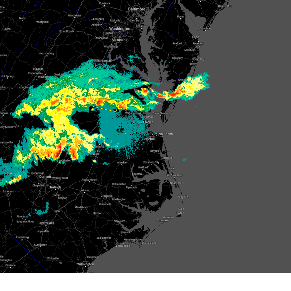 At 938 pm edt, a severe thunderstorm was located over richmond, moving east at 35 mph (public. at 935 pm edt, nickel to quarter size hail was reported in north chesterfield). Hazards include 60 mph wind gusts and quarter size hail. Minor damage to vehicles is possible. expect wind damage to trees and powerlines. this severe storm will be near, bellwood and east highland park around 945 pm edt. highland springs around 950 pm edt. bottoms bridge around 1005 pm edt. roxbury around 1010 pm edt. talleysville around 1015 pm edt. other locations impacted by this severe thunderstorm include wrights corner, richmond heights, wayside, mountcastle, orapax farms, elko, midlothian, montrose, sandston and glendale. hail threat, observed max hail size, 1. 00 in wind threat, radar indicated max wind gust, 60 mph. At 938 pm edt, a severe thunderstorm was located over richmond, moving east at 35 mph (public. at 935 pm edt, nickel to quarter size hail was reported in north chesterfield). Hazards include 60 mph wind gusts and quarter size hail. Minor damage to vehicles is possible. expect wind damage to trees and powerlines. this severe storm will be near, bellwood and east highland park around 945 pm edt. highland springs around 950 pm edt. bottoms bridge around 1005 pm edt. roxbury around 1010 pm edt. talleysville around 1015 pm edt. other locations impacted by this severe thunderstorm include wrights corner, richmond heights, wayside, mountcastle, orapax farms, elko, midlothian, montrose, sandston and glendale. hail threat, observed max hail size, 1. 00 in wind threat, radar indicated max wind gust, 60 mph.
|
| 5/16/2023 9:32 PM EDT |
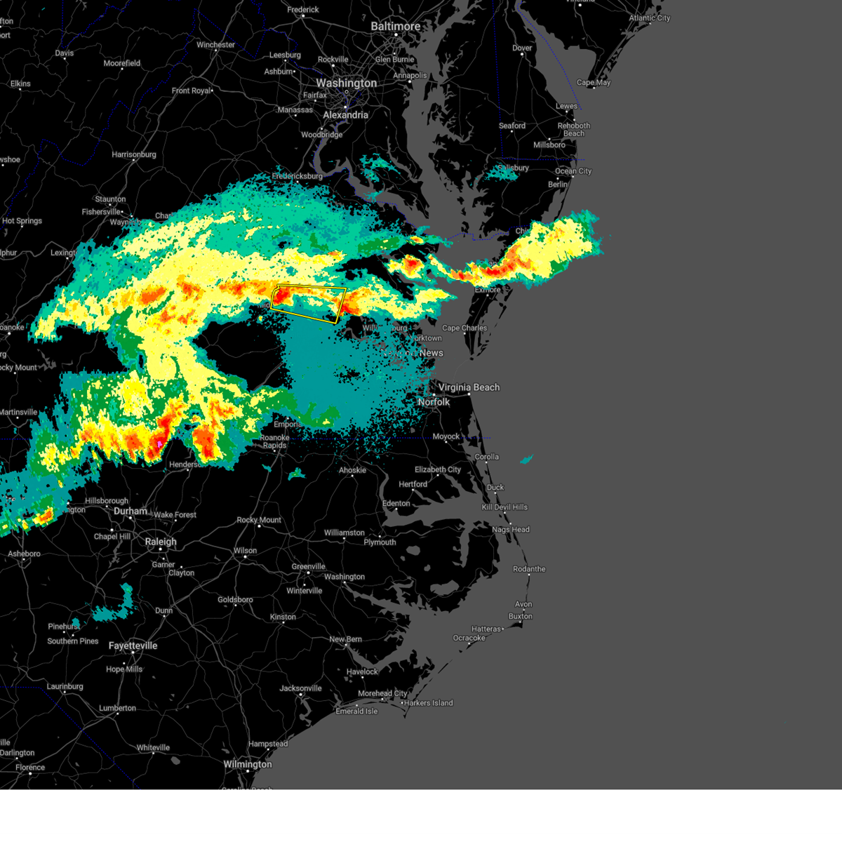 At 931 pm edt, a severe thunderstorm was located over bon air, moving east at 35 mph (radar indicated). Hazards include 60 mph wind gusts. Expect damage to trees and powerlines. this severe thunderstorm will be near, university of richmond around 935 pm edt. richmond and downtown richmond around 940 pm edt. virginia commonwealth university, virginia union university, bensley, bellwood and east highland park around 945 pm edt. highland springs around 950 pm edt. bottoms bridge around 1010 pm edt. roxbury and talleysville around 1015 pm edt. other locations impacted by this severe thunderstorm include wrights corner, richmond heights, wayside, mountcastle, orapax farms, elko, midlothian, montrose, sandston and glendale. hail threat, radar indicated max hail size, <. 75 in wind threat, radar indicated max wind gust, 60 mph. At 931 pm edt, a severe thunderstorm was located over bon air, moving east at 35 mph (radar indicated). Hazards include 60 mph wind gusts. Expect damage to trees and powerlines. this severe thunderstorm will be near, university of richmond around 935 pm edt. richmond and downtown richmond around 940 pm edt. virginia commonwealth university, virginia union university, bensley, bellwood and east highland park around 945 pm edt. highland springs around 950 pm edt. bottoms bridge around 1010 pm edt. roxbury and talleysville around 1015 pm edt. other locations impacted by this severe thunderstorm include wrights corner, richmond heights, wayside, mountcastle, orapax farms, elko, midlothian, montrose, sandston and glendale. hail threat, radar indicated max hail size, <. 75 in wind threat, radar indicated max wind gust, 60 mph.
|
| 4/1/2023 8:04 PM EDT |
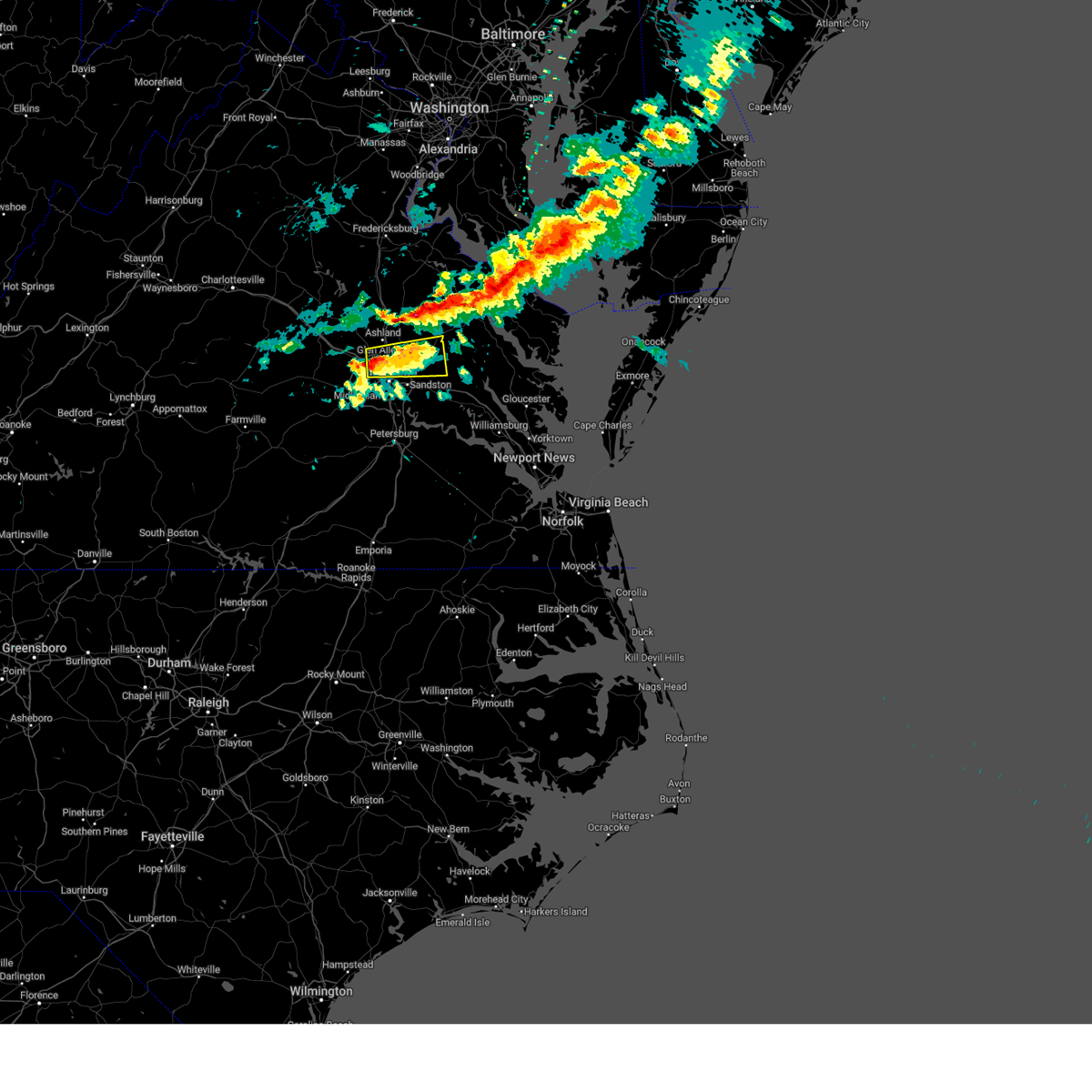 At 804 pm edt, a severe thunderstorm was located over laurel, or near virginia union university, moving east at 45 mph (radar indicated). Hazards include 60 mph wind gusts and quarter size hail. Minor damage to vehicles is possible. expect wind damage to trees and powerlines. this severe thunderstorm will be near, mechanicsville and east highland park around 810 pm edt. highland springs around 815 pm edt. studley around 820 pm edt. manquin, tunstall and aylett around 830 pm edt. other locations impacted by this severe thunderstorm include enfield, central garage, hanover airport, elmont, longdale, westwood, solomons store, chamberlayne, rumford and atlee. hail threat, radar indicated max hail size, 1. 00 in wind threat, radar indicated max wind gust, 60 mph. At 804 pm edt, a severe thunderstorm was located over laurel, or near virginia union university, moving east at 45 mph (radar indicated). Hazards include 60 mph wind gusts and quarter size hail. Minor damage to vehicles is possible. expect wind damage to trees and powerlines. this severe thunderstorm will be near, mechanicsville and east highland park around 810 pm edt. highland springs around 815 pm edt. studley around 820 pm edt. manquin, tunstall and aylett around 830 pm edt. other locations impacted by this severe thunderstorm include enfield, central garage, hanover airport, elmont, longdale, westwood, solomons store, chamberlayne, rumford and atlee. hail threat, radar indicated max hail size, 1. 00 in wind threat, radar indicated max wind gust, 60 mph.
|
| 10/17/2022 4:58 PM EDT |
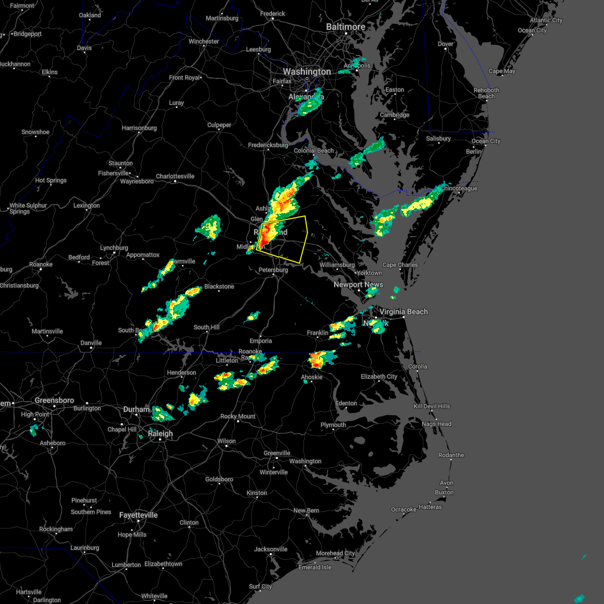 At 458 pm edt, severe thunderstorms were located along a line extending from lakeside to downtown richmond to near bon air, moving east at 35 mph (radar indicated). Hazards include 60 mph wind gusts and quarter size hail. Minor damage to vehicles is possible. expect wind damage to trees and powerlines. severe thunderstorms will be near, mechanicsville and east highland park around 505 pm edt. highland springs around 510 pm edt. studley around 515 pm edt. bottoms bridge and manquin around 530 pm edt. roxbury and tunstall around 535 pm edt. talleysville around 545 pm edt. other locations impacted by these severe thunderstorms include wayside, richmond heights, mountcastle, elko, montrose, sandston, glendale, westwood, richmond international and fair oaks. hail threat, radar indicated max hail size, 1. 00 in wind threat, radar indicated max wind gust, 60 mph. At 458 pm edt, severe thunderstorms were located along a line extending from lakeside to downtown richmond to near bon air, moving east at 35 mph (radar indicated). Hazards include 60 mph wind gusts and quarter size hail. Minor damage to vehicles is possible. expect wind damage to trees and powerlines. severe thunderstorms will be near, mechanicsville and east highland park around 505 pm edt. highland springs around 510 pm edt. studley around 515 pm edt. bottoms bridge and manquin around 530 pm edt. roxbury and tunstall around 535 pm edt. talleysville around 545 pm edt. other locations impacted by these severe thunderstorms include wayside, richmond heights, mountcastle, elko, montrose, sandston, glendale, westwood, richmond international and fair oaks. hail threat, radar indicated max hail size, 1. 00 in wind threat, radar indicated max wind gust, 60 mph.
|
| 8/10/2022 6:29 PM EDT |
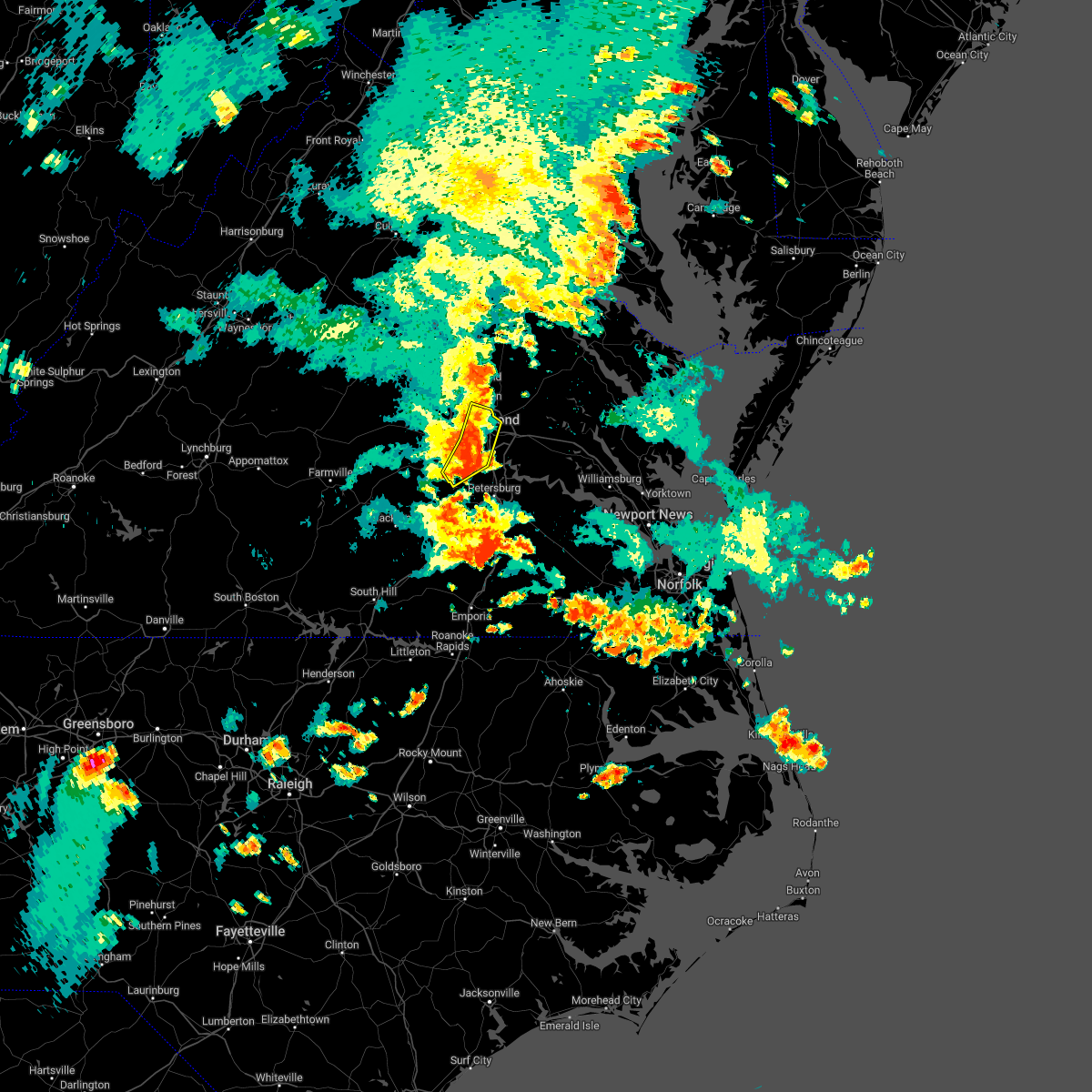 At 628 pm edt, severe thunderstorms were located along a line extending from laurel to bon air to near moseley, moving southeast at 25 mph (radar indicated). Hazards include 60 mph wind gusts. Expect damage to trees and powerlines. these severe storms will be near, richmond and lakeside around 635 pm edt. virginia union university, virginia commonwealth university, downtown richmond and east highland park around 640 pm edt. bensley and chesterfield court house around 650 pm edt. chester and bellwood around 655 pm edt. other locations impacted by these severe thunderstorms include pocahontas state park, solomons store, beach, chamberlayne, greendale, roslyn hills, dumbarton, drewrys bluff, centralia and chesterfield. hail threat, radar indicated max hail size, <. 75 in wind threat, radar indicated max wind gust, 60 mph. At 628 pm edt, severe thunderstorms were located along a line extending from laurel to bon air to near moseley, moving southeast at 25 mph (radar indicated). Hazards include 60 mph wind gusts. Expect damage to trees and powerlines. these severe storms will be near, richmond and lakeside around 635 pm edt. virginia union university, virginia commonwealth university, downtown richmond and east highland park around 640 pm edt. bensley and chesterfield court house around 650 pm edt. chester and bellwood around 655 pm edt. other locations impacted by these severe thunderstorms include pocahontas state park, solomons store, beach, chamberlayne, greendale, roslyn hills, dumbarton, drewrys bluff, centralia and chesterfield. hail threat, radar indicated max hail size, <. 75 in wind threat, radar indicated max wind gust, 60 mph.
|
| 8/10/2022 6:03 PM EDT |
 At 602 pm edt, severe thunderstorms were located along a line extending from near wyndham to near sabot to near chula, moving east to southeast at 15 mph (radar indicated). Hazards include 60 mph wind gusts. Expect damage to trees and powerlines. severe thunderstorms will be near, wyndham and manakin around 610 pm edt. tuckahoe around 615 pm edt. moseley around 625 pm edt. laurel around 635 pm edt. glen allen around 640 pm edt. richmond, university of richmond, bon air, virginia union university, downtown richmond, virginia commonwealth university, mechanicsville, lakeside, east highland park and chesterfield court house around 645 pm edt. other locations impacted by these severe thunderstorms include crozier, pilkinton, johnsons springs, pocahontas state park, skinquarter, solomons store, beach, chamberlayne, fine creek mills and roslyn hills. hail threat, radar indicated max hail size, <. 75 in wind threat, radar indicated max wind gust, 60 mph. At 602 pm edt, severe thunderstorms were located along a line extending from near wyndham to near sabot to near chula, moving east to southeast at 15 mph (radar indicated). Hazards include 60 mph wind gusts. Expect damage to trees and powerlines. severe thunderstorms will be near, wyndham and manakin around 610 pm edt. tuckahoe around 615 pm edt. moseley around 625 pm edt. laurel around 635 pm edt. glen allen around 640 pm edt. richmond, university of richmond, bon air, virginia union university, downtown richmond, virginia commonwealth university, mechanicsville, lakeside, east highland park and chesterfield court house around 645 pm edt. other locations impacted by these severe thunderstorms include crozier, pilkinton, johnsons springs, pocahontas state park, skinquarter, solomons store, beach, chamberlayne, fine creek mills and roslyn hills. hail threat, radar indicated max hail size, <. 75 in wind threat, radar indicated max wind gust, 60 mph.
|
| 8/5/2022 6:00 PM EDT |
 At 559 pm edt, severe thunderstorms were located along a line extending from near hadensville to near goochland to near moseley, moving east to northeast at 20 mph (radar indicated). Hazards include 60 mph wind gusts and quarter size hail. Minor damage to vehicles is possible. expect wind damage to trees and powerlines. severe thunderstorms will be near, moseley around 605 pm edt. oilville around 610 pm edt. sabot around 615 pm edt. manakin around 620 pm edt. gum spring around 625 pm edt. tuckahoe around 630 pm edt. wyndham and chesterfield court house around 635 pm edt. laurel and glen allen around 645 pm edt. other locations impacted by these severe thunderstorms include orchid, crozier, rock castle, pilkinton, vontay, maidens, three square, irwin, johnsons springs and pocahontas state park. hail threat, radar indicated max hail size, 1. 00 in wind threat, radar indicated max wind gust, 60 mph. At 559 pm edt, severe thunderstorms were located along a line extending from near hadensville to near goochland to near moseley, moving east to northeast at 20 mph (radar indicated). Hazards include 60 mph wind gusts and quarter size hail. Minor damage to vehicles is possible. expect wind damage to trees and powerlines. severe thunderstorms will be near, moseley around 605 pm edt. oilville around 610 pm edt. sabot around 615 pm edt. manakin around 620 pm edt. gum spring around 625 pm edt. tuckahoe around 630 pm edt. wyndham and chesterfield court house around 635 pm edt. laurel and glen allen around 645 pm edt. other locations impacted by these severe thunderstorms include orchid, crozier, rock castle, pilkinton, vontay, maidens, three square, irwin, johnsons springs and pocahontas state park. hail threat, radar indicated max hail size, 1. 00 in wind threat, radar indicated max wind gust, 60 mph.
|
| 8/5/2022 5:09 PM EDT |
 The severe thunderstorm warning for central chesterfield and east central powhatan counties and the city of richmond will expire at 515 pm edt, the storm which prompted the warning has weakened below severe limits, and no longer poses an immediate threat to life or property. therefore, the warning will be allowed to expire. however heavy rain is still expected with this thunderstorm. The severe thunderstorm warning for central chesterfield and east central powhatan counties and the city of richmond will expire at 515 pm edt, the storm which prompted the warning has weakened below severe limits, and no longer poses an immediate threat to life or property. therefore, the warning will be allowed to expire. however heavy rain is still expected with this thunderstorm.
|
| 8/5/2022 4:57 PM EDT |
 At 456 pm edt, a severe thunderstorm was located near bon air, moving north at 10 mph (radar indicated). Hazards include 60 mph wind gusts. Expect damage to trees and powerlines. this severe storm will be near, bon air, university of richmond and downtown richmond around 530 pm edt. other locations impacted by this severe thunderstorm include pocahontas state park, beach, midlothian, subletts and chesterfield. hail threat, radar indicated max hail size, <. 75 in wind threat, radar indicated max wind gust, 60 mph. At 456 pm edt, a severe thunderstorm was located near bon air, moving north at 10 mph (radar indicated). Hazards include 60 mph wind gusts. Expect damage to trees and powerlines. this severe storm will be near, bon air, university of richmond and downtown richmond around 530 pm edt. other locations impacted by this severe thunderstorm include pocahontas state park, beach, midlothian, subletts and chesterfield. hail threat, radar indicated max hail size, <. 75 in wind threat, radar indicated max wind gust, 60 mph.
|
| 8/5/2022 4:43 PM EDT |
 At 442 pm edt, a severe thunderstorm was located near bon air, moving north at 10 mph (radar indicated). Hazards include 60 mph wind gusts and nickel size hail. Expect damage to trees and powerlines. this severe thunderstorm will be near, bon air, university of richmond and downtown richmond around 515 pm edt. other locations impacted by this severe thunderstorm include pocahontas state park, beach, midlothian, subletts and chesterfield. hail threat, radar indicated max hail size, 0. 88 in wind threat, radar indicated max wind gust, 60 mph. At 442 pm edt, a severe thunderstorm was located near bon air, moving north at 10 mph (radar indicated). Hazards include 60 mph wind gusts and nickel size hail. Expect damage to trees and powerlines. this severe thunderstorm will be near, bon air, university of richmond and downtown richmond around 515 pm edt. other locations impacted by this severe thunderstorm include pocahontas state park, beach, midlothian, subletts and chesterfield. hail threat, radar indicated max hail size, 0. 88 in wind threat, radar indicated max wind gust, 60 mph.
|
| 8/5/2022 4:21 PM EDT |
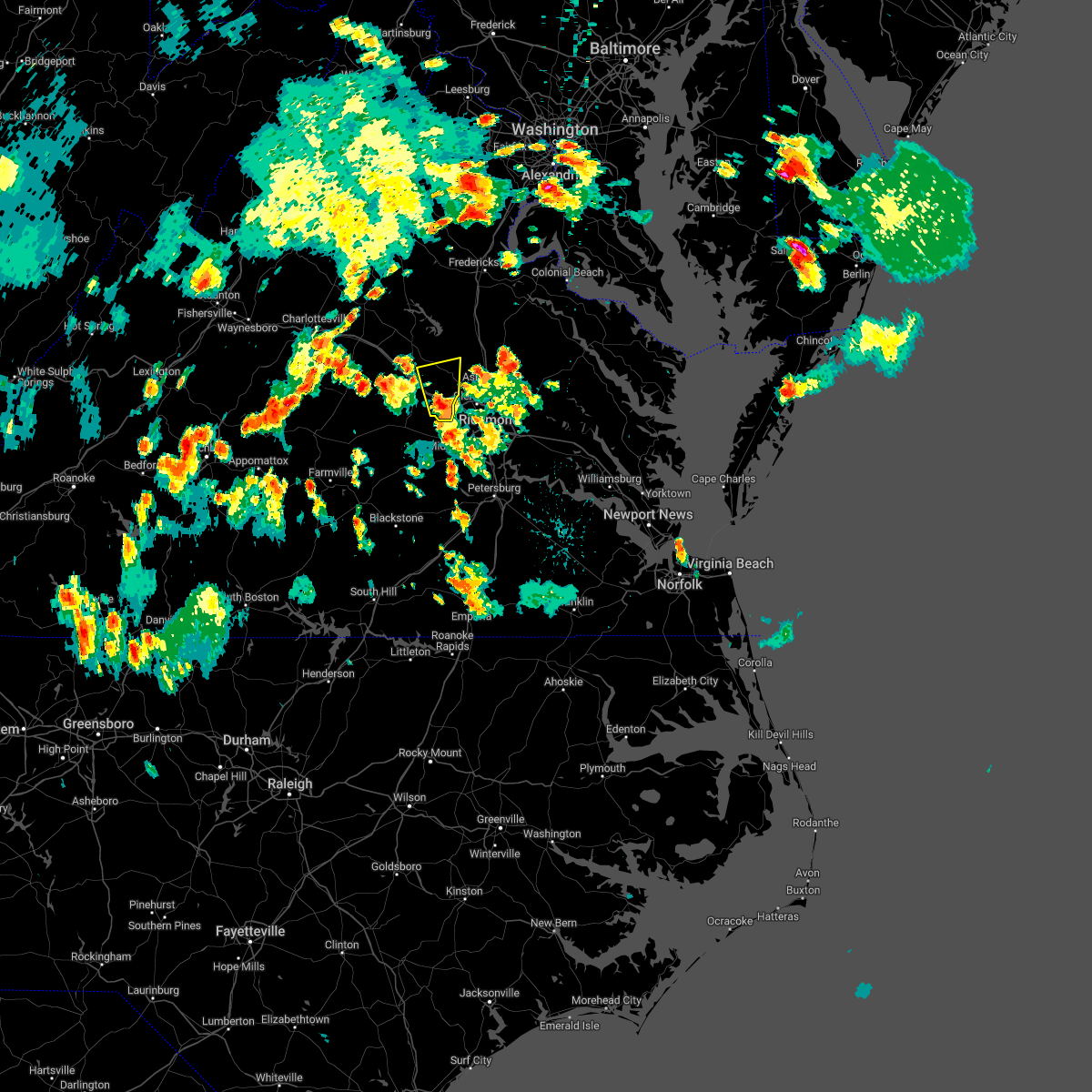 At 421 pm edt, a severe thunderstorm was located near sabot, or 8 miles east of goochland, moving north at 15 mph (radar indicated). Hazards include 60 mph wind gusts and penny size hail. Expect damage to trees and powerlines. this severe thunderstorm will be near, oilville around 430 pm edt. montpelier around 500 pm edt. other locations impacted by this severe thunderstorm include rockville, dabneys, crozier, vontay, johnsons springs, goodall and mabelton. hail threat, radar indicated max hail size, 0. 75 in wind threat, radar indicated max wind gust, 60 mph. At 421 pm edt, a severe thunderstorm was located near sabot, or 8 miles east of goochland, moving north at 15 mph (radar indicated). Hazards include 60 mph wind gusts and penny size hail. Expect damage to trees and powerlines. this severe thunderstorm will be near, oilville around 430 pm edt. montpelier around 500 pm edt. other locations impacted by this severe thunderstorm include rockville, dabneys, crozier, vontay, johnsons springs, goodall and mabelton. hail threat, radar indicated max hail size, 0. 75 in wind threat, radar indicated max wind gust, 60 mph.
|
| 8/5/2022 4:15 PM EDT |
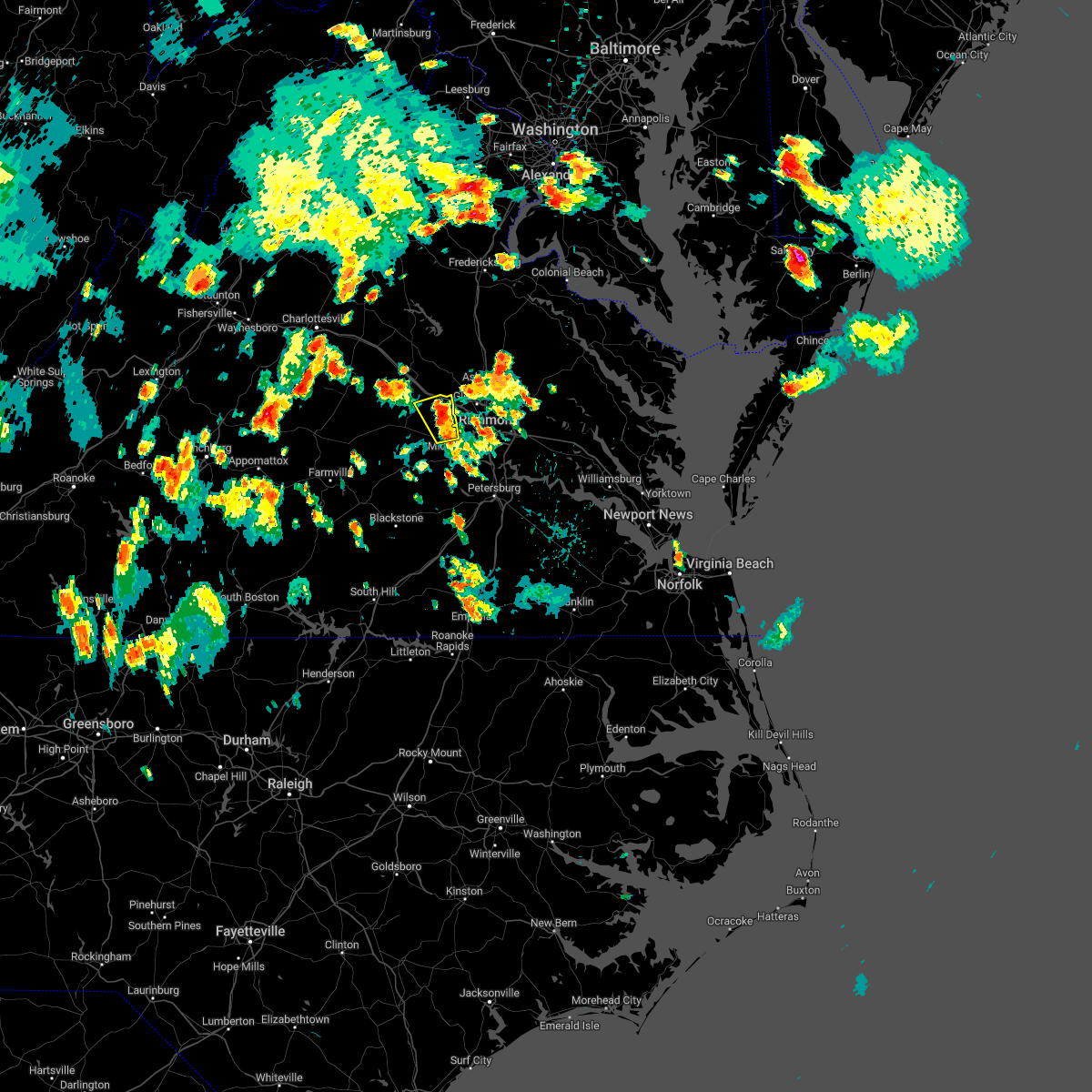 At 415 pm edt, a severe thunderstorm was located over sabot, or 8 miles west of tuckahoe, moving north at 15 mph (radar indicated). Hazards include 60 mph wind gusts and penny size hail. Expect damage to trees and powerlines. this severe thunderstorm will remain over mainly rural areas of northwestern chesterfield, southeastern goochland and northeastern powhatan counties, including the following locations, crozier, fine creek mills, maidens, holly hills, johnsons springs, midlothian and subletts. hail threat, radar indicated max hail size, 0. 75 in wind threat, radar indicated max wind gust, 60 mph. At 415 pm edt, a severe thunderstorm was located over sabot, or 8 miles west of tuckahoe, moving north at 15 mph (radar indicated). Hazards include 60 mph wind gusts and penny size hail. Expect damage to trees and powerlines. this severe thunderstorm will remain over mainly rural areas of northwestern chesterfield, southeastern goochland and northeastern powhatan counties, including the following locations, crozier, fine creek mills, maidens, holly hills, johnsons springs, midlothian and subletts. hail threat, radar indicated max hail size, 0. 75 in wind threat, radar indicated max wind gust, 60 mph.
|
| 8/5/2022 4:05 PM EDT | Trees down near 288 east of manaki in goochland county VA, 3.7 miles ESE of Tuckahoe, VA |
| 8/5/2022 4:01 PM EDT |
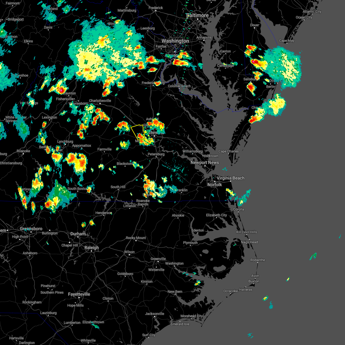 At 401 pm edt, a severe thunderstorm was located over manakin, or 7 miles west of tuckahoe, moving north at 10 mph (radar indicated). Hazards include 60 mph wind gusts and penny size hail. Expect damage to trees and powerlines. this severe thunderstorm will be near, manakin around 410 pm edt. sabot around 415 pm edt. other locations impacted by this severe thunderstorm include crozier, fine creek mills, maidens, holly hills, johnsons springs, midlothian and subletts. hail threat, radar indicated max hail size, 0. 75 in wind threat, radar indicated max wind gust, 60 mph. At 401 pm edt, a severe thunderstorm was located over manakin, or 7 miles west of tuckahoe, moving north at 10 mph (radar indicated). Hazards include 60 mph wind gusts and penny size hail. Expect damage to trees and powerlines. this severe thunderstorm will be near, manakin around 410 pm edt. sabot around 415 pm edt. other locations impacted by this severe thunderstorm include crozier, fine creek mills, maidens, holly hills, johnsons springs, midlothian and subletts. hail threat, radar indicated max hail size, 0. 75 in wind threat, radar indicated max wind gust, 60 mph.
|
| 7/29/2022 4:36 PM EDT |
 The severe thunderstorm warning for western chesterfield, southeastern goochland, amelia and central powhatan counties will expire at 445 pm edt, the storms which prompted the warning have weakened below severe limits, and have exited the warned area. therefore, the warning will be allowed to expire. a severe thunderstorm watch remains in effect until 800 pm edt for central virginia. The severe thunderstorm warning for western chesterfield, southeastern goochland, amelia and central powhatan counties will expire at 445 pm edt, the storms which prompted the warning have weakened below severe limits, and have exited the warned area. therefore, the warning will be allowed to expire. a severe thunderstorm watch remains in effect until 800 pm edt for central virginia.
|
| 7/29/2022 4:18 PM EDT |
 At 418 pm edt, severe thunderstorms were located along a line extending from near sabot to near moseley to near jetersville, moving east at 35 mph (radar indicated). Hazards include 60 mph wind gusts. Expect damage to trees and powerlines. these severe storms will be near, moseley, tuckahoe and manakin around 425 pm edt. bon air around 435 pm edt. mannboro around 440 pm edt. other locations impacted by these severe thunderstorms include goodwins store, flat rock, winterpock, pilkinton, midlothian, giles mill, subletts, winterham, paineville and skinquarter. hail threat, radar indicated max hail size, <. 75 in wind threat, radar indicated max wind gust, 60 mph. At 418 pm edt, severe thunderstorms were located along a line extending from near sabot to near moseley to near jetersville, moving east at 35 mph (radar indicated). Hazards include 60 mph wind gusts. Expect damage to trees and powerlines. these severe storms will be near, moseley, tuckahoe and manakin around 425 pm edt. bon air around 435 pm edt. mannboro around 440 pm edt. other locations impacted by these severe thunderstorms include goodwins store, flat rock, winterpock, pilkinton, midlothian, giles mill, subletts, winterham, paineville and skinquarter. hail threat, radar indicated max hail size, <. 75 in wind threat, radar indicated max wind gust, 60 mph.
|
| 7/29/2022 4:06 PM EDT |
 At 406 pm edt, severe thunderstorms were located along a line extending from near sabot to chula to jetersville, moving east at 35 mph (radar indicated). Hazards include 60 mph wind gusts. Expect damage to trees and powerlines. these severe storms will be near, sabot and scotts fork around 410 pm edt. moseley and manakin around 415 pm edt. tuckahoe around 420 pm edt. bon air around 430 pm edt. mannboro around 435 pm edt. other locations impacted by these severe thunderstorms include rock castle, pilkinton, winterham, skinquarter, maplewood, fine creek mills, deatonville, holly hills, lodore and lake powhatan. hail threat, radar indicated max hail size, <. 75 in wind threat, radar indicated max wind gust, 60 mph. At 406 pm edt, severe thunderstorms were located along a line extending from near sabot to chula to jetersville, moving east at 35 mph (radar indicated). Hazards include 60 mph wind gusts. Expect damage to trees and powerlines. these severe storms will be near, sabot and scotts fork around 410 pm edt. moseley and manakin around 415 pm edt. tuckahoe around 420 pm edt. bon air around 430 pm edt. mannboro around 435 pm edt. other locations impacted by these severe thunderstorms include rock castle, pilkinton, winterham, skinquarter, maplewood, fine creek mills, deatonville, holly hills, lodore and lake powhatan. hail threat, radar indicated max hail size, <. 75 in wind threat, radar indicated max wind gust, 60 mph.
|
| 7/29/2022 3:56 PM EDT |
 At 356 pm edt, severe thunderstorms were located along a line extending from near powhatan to near amelia courthouse to near rice, moving east at 35 mph (radar indicated). Hazards include 60 mph wind gusts. Expect damage to trees and powerlines. severe thunderstorms will be near, powhatan, amelia courthouse and macon around 400 pm edt. chula around 405 pm edt. scotts fork around 410 pm edt. moseley, sabot and manakin around 415 pm edt. tuckahoe around 420 pm edt. bon air and mannboro around 435 pm edt. other locations impacted by these severe thunderstorms include rock castle, pilkinton, winterham, skinquarter, maplewood, fine creek mills, deatonville, holly hills, lodore and lake powhatan. hail threat, radar indicated max hail size, <. 75 in wind threat, radar indicated max wind gust, 60 mph. At 356 pm edt, severe thunderstorms were located along a line extending from near powhatan to near amelia courthouse to near rice, moving east at 35 mph (radar indicated). Hazards include 60 mph wind gusts. Expect damage to trees and powerlines. severe thunderstorms will be near, powhatan, amelia courthouse and macon around 400 pm edt. chula around 405 pm edt. scotts fork around 410 pm edt. moseley, sabot and manakin around 415 pm edt. tuckahoe around 420 pm edt. bon air and mannboro around 435 pm edt. other locations impacted by these severe thunderstorms include rock castle, pilkinton, winterham, skinquarter, maplewood, fine creek mills, deatonville, holly hills, lodore and lake powhatan. hail threat, radar indicated max hail size, <. 75 in wind threat, radar indicated max wind gust, 60 mph.
|
| 7/29/2022 2:20 PM EDT | Henrico police reports downed tree blocking roa in henrico county VA, 3.1 miles SW of Tuckahoe, VA |
| 7/29/2022 2:11 PM EDT |
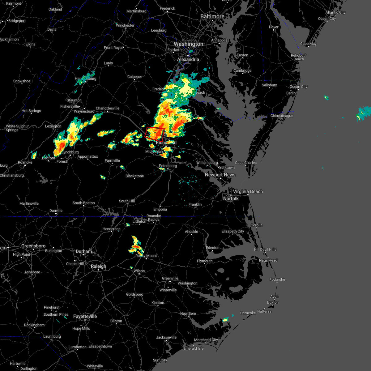 The tornado warning for east central goochland, northwestern henrico and west central hanover counties will expire at 215 pm edt, the tornado threat has diminished and the tornado warning will be allowed to expire. however, damaging winds remain likely and a severe thunderstorm warning remains in effect for the area. a severe thunderstorm watch remains in effect until 800 pm edt for central virginia. The tornado warning for east central goochland, northwestern henrico and west central hanover counties will expire at 215 pm edt, the tornado threat has diminished and the tornado warning will be allowed to expire. however, damaging winds remain likely and a severe thunderstorm warning remains in effect for the area. a severe thunderstorm watch remains in effect until 800 pm edt for central virginia.
|
| 7/29/2022 2:11 PM EDT |
 At 209 pm edt, severe thunderstorms were located along a line extending from kings dominion to near tuckahoe, moving east at 35 mph (radar indicated). Hazards include 60 mph wind gusts. Expect damage to trees and powerlines. severe thunderstorms will be near, kings dominion around 215 pm edt. hanover, dawn and east highland park around 220 pm edt. highland springs, mechanicsville and mangohick around 225 pm edt. beulahville and studley around 235 pm edt. aylett and manquin around 240 pm edt. saint stephens church around 250 pm edt. Other locations impacted by these severe thunderstorms include enfield, central garage, hanover airport, gum tree, upshaw, elmont, etna mills, longdale, epworth and westwood. At 209 pm edt, severe thunderstorms were located along a line extending from kings dominion to near tuckahoe, moving east at 35 mph (radar indicated). Hazards include 60 mph wind gusts. Expect damage to trees and powerlines. severe thunderstorms will be near, kings dominion around 215 pm edt. hanover, dawn and east highland park around 220 pm edt. highland springs, mechanicsville and mangohick around 225 pm edt. beulahville and studley around 235 pm edt. aylett and manquin around 240 pm edt. saint stephens church around 250 pm edt. Other locations impacted by these severe thunderstorms include enfield, central garage, hanover airport, gum tree, upshaw, elmont, etna mills, longdale, epworth and westwood.
|
| 7/29/2022 1:48 PM EDT |
 At 147 pm edt, a severe thunderstorm capable of producing a tornado was located near wyndham, or 10 miles east of goochland, moving east at 30 mph (law enforcement reported a funnel cloud between pouncey tract and howardsmille road near rockville). Hazards include tornado. Flying debris will be dangerous to those caught without shelter. mobile homes will be damaged or destroyed. damage to roofs, windows, and vehicles will occur. tree damage is likely. this dangerous storm will be near, tuckahoe and wyndham around 155 pm edt. ashland, randolph macon college, glen allen and laurel around 210 pm edt. Other locations impacted by this tornadic thunderstorm include rockville, gilman, vontay, johnsons springs, goodall, elmont, short pump and dumbarton. At 147 pm edt, a severe thunderstorm capable of producing a tornado was located near wyndham, or 10 miles east of goochland, moving east at 30 mph (law enforcement reported a funnel cloud between pouncey tract and howardsmille road near rockville). Hazards include tornado. Flying debris will be dangerous to those caught without shelter. mobile homes will be damaged or destroyed. damage to roofs, windows, and vehicles will occur. tree damage is likely. this dangerous storm will be near, tuckahoe and wyndham around 155 pm edt. ashland, randolph macon college, glen allen and laurel around 210 pm edt. Other locations impacted by this tornadic thunderstorm include rockville, gilman, vontay, johnsons springs, goodall, elmont, short pump and dumbarton.
|
| 7/29/2022 1:38 PM EDT |
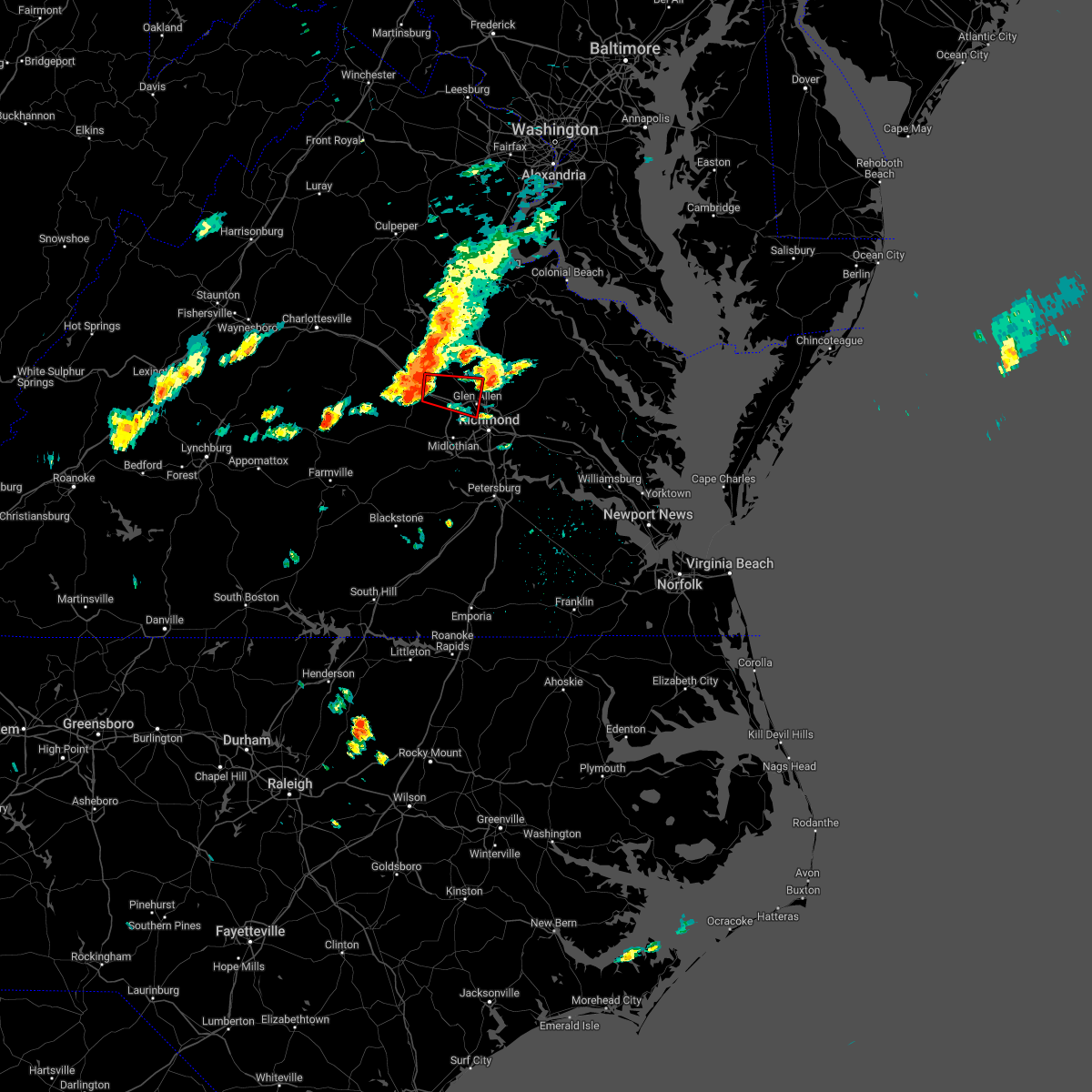 At 138 pm edt, a severe thunderstorm capable of producing a tornado was located over oilville, or near goochland, moving east at 30 mph (radar indicated rotation). Hazards include tornado. Flying debris will be dangerous to those caught without shelter. mobile homes will be damaged or destroyed. damage to roofs, windows, and vehicles will occur. tree damage is likely. this dangerous storm will be near, tuckahoe and wyndham around 155 pm edt. ashland, randolph macon college and laurel around 210 pm edt. glen allen around 215 pm edt. Other locations impacted by this tornadic thunderstorm include rockville, dabneys, gilman, vontay, johnsons springs, goodall, elmont, short pump and dumbarton. At 138 pm edt, a severe thunderstorm capable of producing a tornado was located over oilville, or near goochland, moving east at 30 mph (radar indicated rotation). Hazards include tornado. Flying debris will be dangerous to those caught without shelter. mobile homes will be damaged or destroyed. damage to roofs, windows, and vehicles will occur. tree damage is likely. this dangerous storm will be near, tuckahoe and wyndham around 155 pm edt. ashland, randolph macon college and laurel around 210 pm edt. glen allen around 215 pm edt. Other locations impacted by this tornadic thunderstorm include rockville, dabneys, gilman, vontay, johnsons springs, goodall, elmont, short pump and dumbarton.
|
| 7/29/2022 1:35 PM EDT |
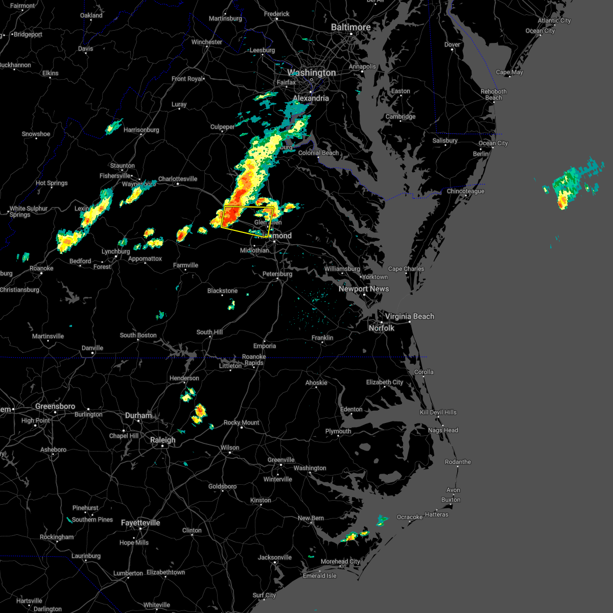 At 135 pm edt, a severe thunderstorm was located over oilville, or 7 miles northeast of goochland, moving east at 35 mph (radar indicated). Hazards include 60 mph wind gusts and penny size hail. Expect damage to trees and powerlines. this severe storm will be near, montpelier around 145 pm edt. tuckahoe and wyndham around 150 pm edt. laurel around 200 pm edt. ashland, randolph macon college and glen allen around 205 pm edt. Other locations impacted by this severe thunderstorm include orchid, crozier, sandy hook, vontay, maidens, gum tree, three square, irwin, johnsons springs and goodall. At 135 pm edt, a severe thunderstorm was located over oilville, or 7 miles northeast of goochland, moving east at 35 mph (radar indicated). Hazards include 60 mph wind gusts and penny size hail. Expect damage to trees and powerlines. this severe storm will be near, montpelier around 145 pm edt. tuckahoe and wyndham around 150 pm edt. laurel around 200 pm edt. ashland, randolph macon college and glen allen around 205 pm edt. Other locations impacted by this severe thunderstorm include orchid, crozier, sandy hook, vontay, maidens, gum tree, three square, irwin, johnsons springs and goodall.
|
| 7/29/2022 1:25 PM EDT |
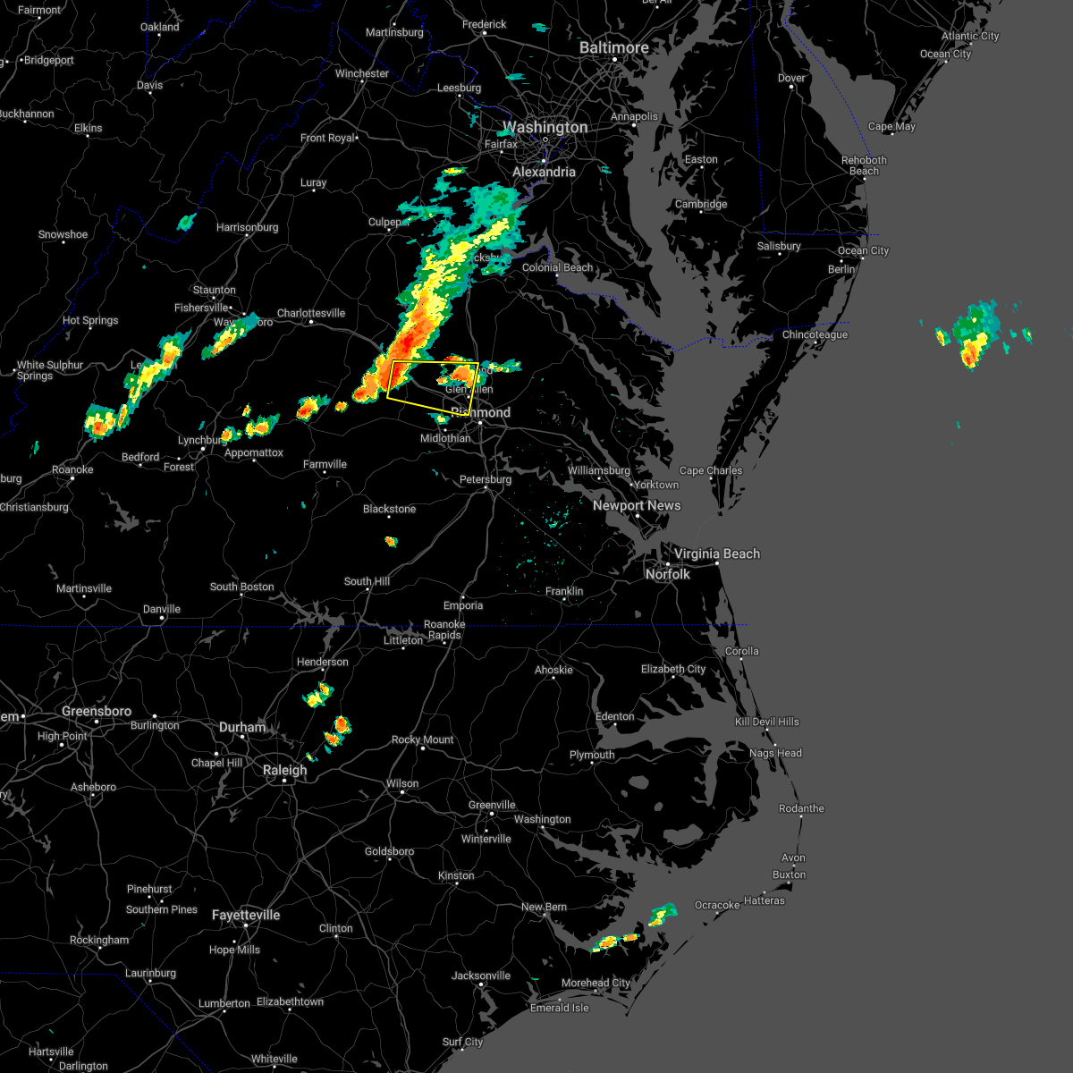 The national weather service in wakefield has issued a * severe thunderstorm warning for. southeastern louisa county in central virginia. central goochland county in central virginia. northwestern henrico county in central virginia. West central hanover county in central virginia. The national weather service in wakefield has issued a * severe thunderstorm warning for. southeastern louisa county in central virginia. central goochland county in central virginia. northwestern henrico county in central virginia. West central hanover county in central virginia.
|
| 7/26/2022 2:51 PM EDT |
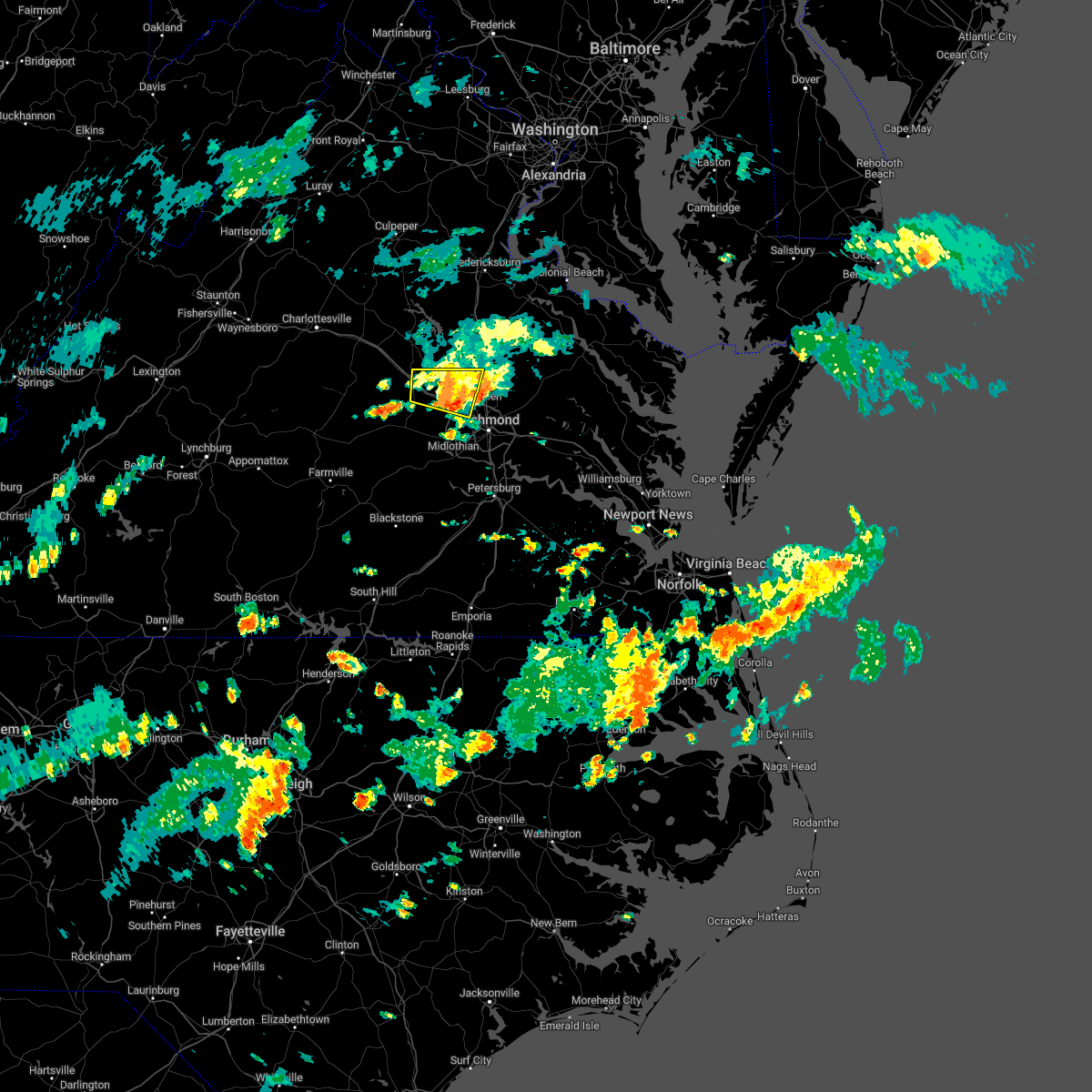 The severe thunderstorm warning for southeastern louisa, east central goochland, northwestern henrico and west central hanover counties will expire at 300 pm edt, the storm which prompted the warning has weakened below severe limits, and no longer poses an immediate threat to life or property. therefore, the warning will be allowed to expire. however heavy rain and frequent lightning is still possible with this thunderstorm. to report severe weather, contact your nearest law enforcement agency. they will relay your report to the national weather service wakefield. The severe thunderstorm warning for southeastern louisa, east central goochland, northwestern henrico and west central hanover counties will expire at 300 pm edt, the storm which prompted the warning has weakened below severe limits, and no longer poses an immediate threat to life or property. therefore, the warning will be allowed to expire. however heavy rain and frequent lightning is still possible with this thunderstorm. to report severe weather, contact your nearest law enforcement agency. they will relay your report to the national weather service wakefield.
|
| 7/26/2022 2:35 PM EDT |
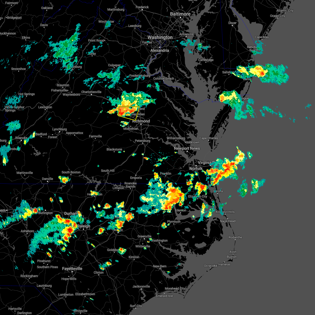 At 234 pm edt, a severe thunderstorm was located over oilville, or near goochland, moving east at 30 mph (radar indicated). Hazards include 60 mph wind gusts. Expect damage to trees and powerlines. this severe storm will be near, wyndham around 245 pm edt. tuckahoe around 250 pm edt. other locations impacted by this severe thunderstorm include orchid, rockville, dabneys, gilman, vontay, gum tree, johnsons springs, goodall and short pump. hail threat, radar indicated max hail size, <. 75 in wind threat, radar indicated max wind gust, 60 mph. At 234 pm edt, a severe thunderstorm was located over oilville, or near goochland, moving east at 30 mph (radar indicated). Hazards include 60 mph wind gusts. Expect damage to trees and powerlines. this severe storm will be near, wyndham around 245 pm edt. tuckahoe around 250 pm edt. other locations impacted by this severe thunderstorm include orchid, rockville, dabneys, gilman, vontay, gum tree, johnsons springs, goodall and short pump. hail threat, radar indicated max hail size, <. 75 in wind threat, radar indicated max wind gust, 60 mph.
|
| 7/26/2022 2:19 PM EDT |
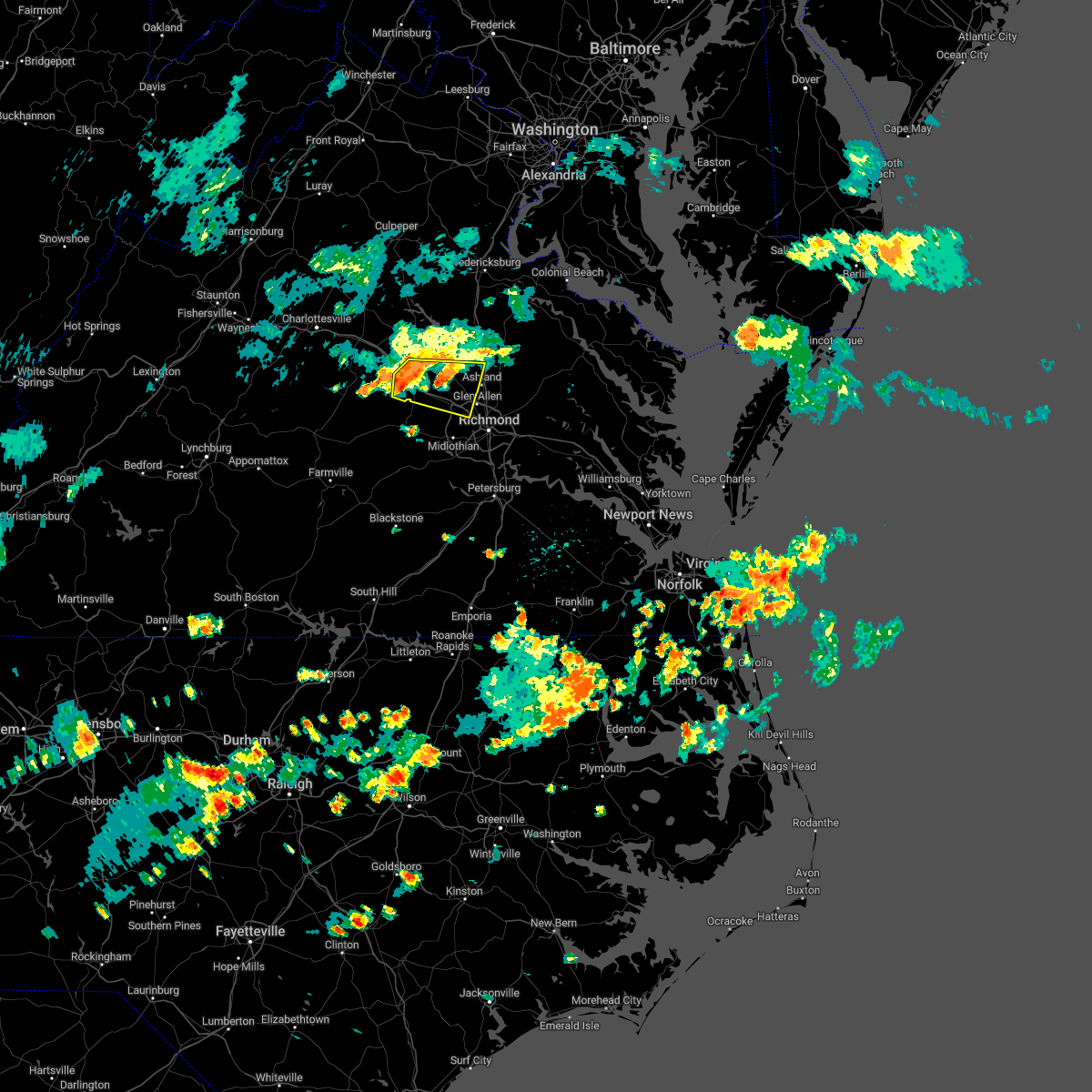 At 219 pm edt, a severe thunderstorm was located over gum spring, or near goochland, moving east at 25 mph (radar indicated). Hazards include 60 mph wind gusts and penny size hail. Expect damage to trees and powerlines. this severe thunderstorm will be near, oilville around 235 pm edt. montpelier around 245 pm edt. wyndham around 250 pm edt. tuckahoe around 255 pm edt. other locations impacted by this severe thunderstorm include orchid, sandy hook, oliver, vontay, gum tree, irwin, johnsons springs, goodall, short pump and mabelton. hail threat, radar indicated max hail size, 0. 75 in wind threat, radar indicated max wind gust, 60 mph. At 219 pm edt, a severe thunderstorm was located over gum spring, or near goochland, moving east at 25 mph (radar indicated). Hazards include 60 mph wind gusts and penny size hail. Expect damage to trees and powerlines. this severe thunderstorm will be near, oilville around 235 pm edt. montpelier around 245 pm edt. wyndham around 250 pm edt. tuckahoe around 255 pm edt. other locations impacted by this severe thunderstorm include orchid, sandy hook, oliver, vontay, gum tree, irwin, johnsons springs, goodall, short pump and mabelton. hail threat, radar indicated max hail size, 0. 75 in wind threat, radar indicated max wind gust, 60 mph.
|
| 7/25/2022 5:23 PM EDT |
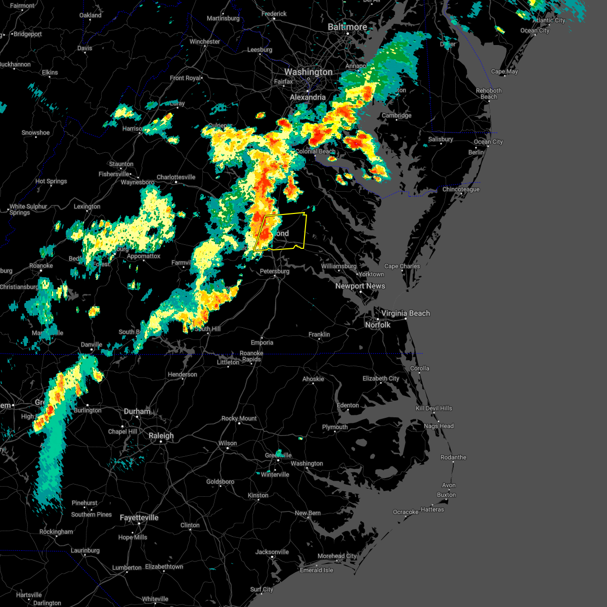 At 523 pm edt, severe thunderstorms were located along a line extending from near hanover to downtown richmond, moving northeast at 35 mph (radar indicated). Hazards include 60 mph wind gusts and quarter size hail. Minor damage to vehicles is possible. expect wind damage to trees and powerlines. severe thunderstorms will be near, studley around 545 pm edt. manquin and tunstall around 555 pm edt. other locations impacted by these severe thunderstorms include enfield, richmond heights, elko, elmont, montrose, sandston, westwood, richmond international, fair oaks and solomons store. hail threat, radar indicated max hail size, 1. 00 in wind threat, radar indicated max wind gust, 60 mph. At 523 pm edt, severe thunderstorms were located along a line extending from near hanover to downtown richmond, moving northeast at 35 mph (radar indicated). Hazards include 60 mph wind gusts and quarter size hail. Minor damage to vehicles is possible. expect wind damage to trees and powerlines. severe thunderstorms will be near, studley around 545 pm edt. manquin and tunstall around 555 pm edt. other locations impacted by these severe thunderstorms include enfield, richmond heights, elko, elmont, montrose, sandston, westwood, richmond international, fair oaks and solomons store. hail threat, radar indicated max hail size, 1. 00 in wind threat, radar indicated max wind gust, 60 mph.
|
| 7/23/2022 10:07 PM EDT |
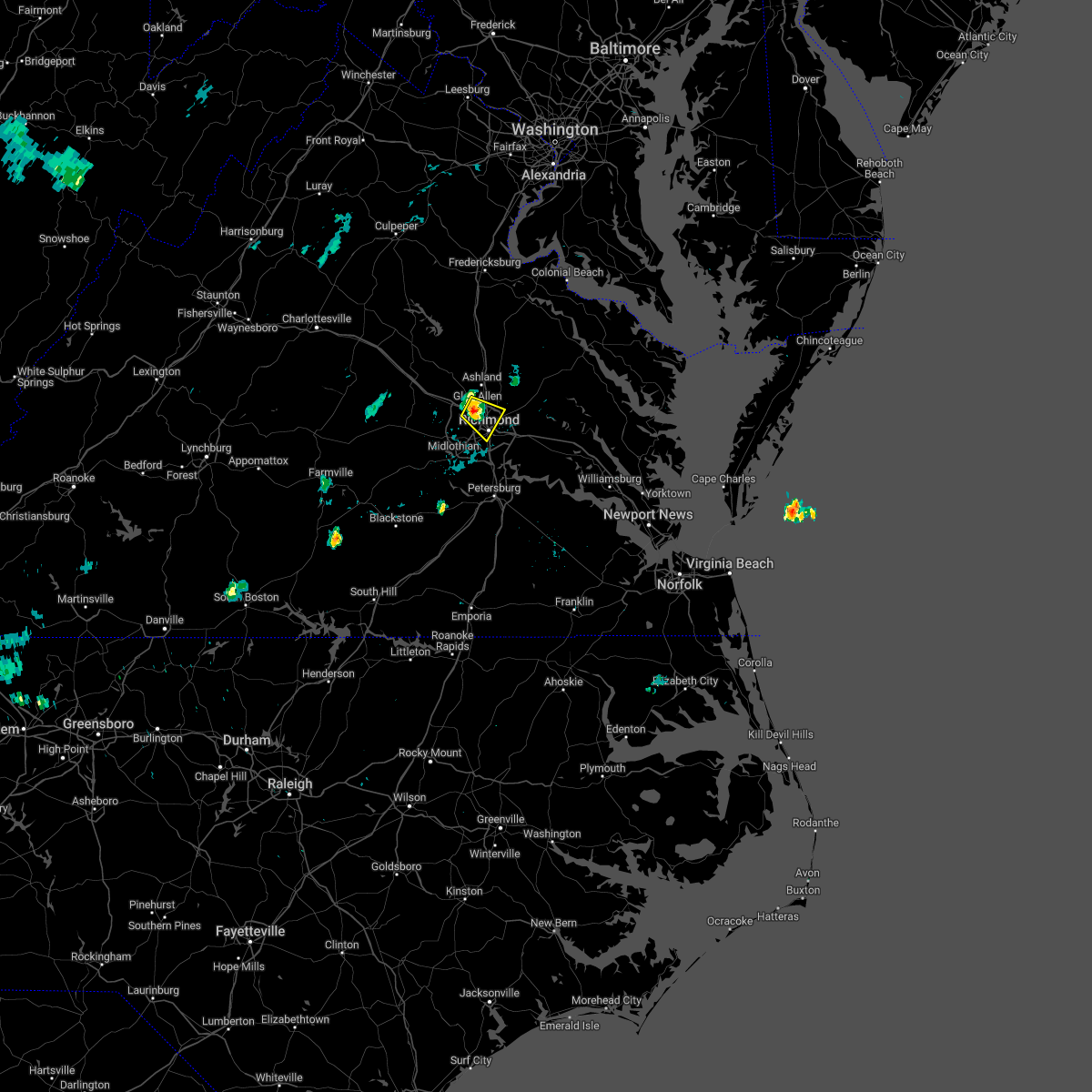 At 1006 pm edt, a severe thunderstorm was located over laurel, or near tuckahoe, moving east at 10 mph (radar indicated). Hazards include 60 mph wind gusts. Expect damage to trees and powerlines. locations impacted include, richmond, downtown richmond, virginia union university, mechanicsville, virginia commonwealth university, tuckahoe, laurel, lakeside, glen allen, east highland park, longdale, solomons store, chamberlayne, atlee, greendale and dumbarton. hail threat, radar indicated max hail size, <. 75 in wind threat, radar indicated max wind gust, 60 mph. At 1006 pm edt, a severe thunderstorm was located over laurel, or near tuckahoe, moving east at 10 mph (radar indicated). Hazards include 60 mph wind gusts. Expect damage to trees and powerlines. locations impacted include, richmond, downtown richmond, virginia union university, mechanicsville, virginia commonwealth university, tuckahoe, laurel, lakeside, glen allen, east highland park, longdale, solomons store, chamberlayne, atlee, greendale and dumbarton. hail threat, radar indicated max hail size, <. 75 in wind threat, radar indicated max wind gust, 60 mph.
|
| 7/23/2022 10:00 PM EDT | Trees down and around 2...000 power outages between short pump and henrico likely caused by storm. time estimate in henrico county VA, 4.1 miles SW of Tuckahoe, VA |
| 7/23/2022 9:54 PM EDT |
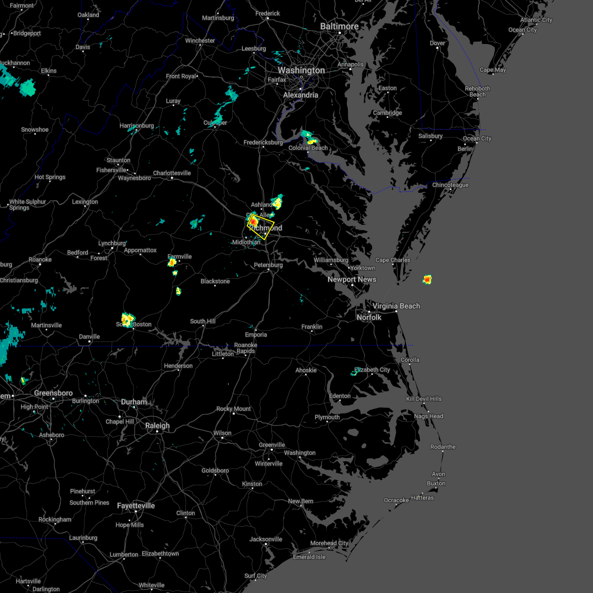 At 954 pm edt, a severe thunderstorm was located over laurel, or near tuckahoe, moving east at 15 mph (radar indicated). Hazards include 60 mph wind gusts and penny size hail. expect damage to trees and powerlines At 954 pm edt, a severe thunderstorm was located over laurel, or near tuckahoe, moving east at 15 mph (radar indicated). Hazards include 60 mph wind gusts and penny size hail. expect damage to trees and powerlines
|
| 6/22/2022 3:45 PM EDT |
 At 343 pm edt, severe thunderstorms were located along a line extending from near bottoms bridge to near bon air, moving south at 40 mph. these are destructive storms for the richmond metro and chesterfield (radar indicated). Hazards include 80 mph wind gusts and quarter size hail. Flying debris will be dangerous to those caught without shelter. mobile homes will be heavily damaged. expect considerable damage to roofs, windows, and vehicles. extensive tree damage and power outages are likely. these severe storms will be near, chester and chesterfield court house around 350 pm edt. hopewell around 355 pm edt. colonial heights and fort lee around 400 pm edt. petersburg, virginia state university and ettrick around 405 pm edt. other locations impacted by these severe thunderstorms include richmond heights, midlothian, montrose, sandston, glendale, pocahontas state park, richmond international, fair oaks, beach and meadowville. thunderstorm damage threat, destructive hail threat, radar indicated max hail size, 1. 00 in wind threat, radar indicated max wind gust, 80 mph. At 343 pm edt, severe thunderstorms were located along a line extending from near bottoms bridge to near bon air, moving south at 40 mph. these are destructive storms for the richmond metro and chesterfield (radar indicated). Hazards include 80 mph wind gusts and quarter size hail. Flying debris will be dangerous to those caught without shelter. mobile homes will be heavily damaged. expect considerable damage to roofs, windows, and vehicles. extensive tree damage and power outages are likely. these severe storms will be near, chester and chesterfield court house around 350 pm edt. hopewell around 355 pm edt. colonial heights and fort lee around 400 pm edt. petersburg, virginia state university and ettrick around 405 pm edt. other locations impacted by these severe thunderstorms include richmond heights, midlothian, montrose, sandston, glendale, pocahontas state park, richmond international, fair oaks, beach and meadowville. thunderstorm damage threat, destructive hail threat, radar indicated max hail size, 1. 00 in wind threat, radar indicated max wind gust, 80 mph.
|
| 6/22/2022 3:32 PM EDT |
 At 331 pm edt, severe thunderstorms were located along a line extending from near bottoms bridge to university of richmond, moving south at 45 mph. these are destructive storms for richmond and surrounding areas (radar indicated). Hazards include 80 mph wind gusts and quarter size hail. Flying debris will be dangerous to those caught without shelter. mobile homes will be heavily damaged. expect considerable damage to roofs, windows, and vehicles. extensive tree damage and power outages are likely. these severe storms will be near, bensley around 340 pm edt. bellwood around 345 pm edt. hopewell, chester and chesterfield court house around 350 pm edt. fort lee around 355 pm edt. colonial heights, matoaca and ettrick around 400 pm edt. virginia state university around 405 pm edt. other locations impacted by these severe thunderstorms include richmond heights, elmont, montrose, petersburg national battlefield, sandston, glendale, pocahontas state park, richmond international, skinquarter and fair oaks. thunderstorm damage threat, destructive hail threat, radar indicated max hail size, 1. 00 in wind threat, radar indicated max wind gust, 80 mph. At 331 pm edt, severe thunderstorms were located along a line extending from near bottoms bridge to university of richmond, moving south at 45 mph. these are destructive storms for richmond and surrounding areas (radar indicated). Hazards include 80 mph wind gusts and quarter size hail. Flying debris will be dangerous to those caught without shelter. mobile homes will be heavily damaged. expect considerable damage to roofs, windows, and vehicles. extensive tree damage and power outages are likely. these severe storms will be near, bensley around 340 pm edt. bellwood around 345 pm edt. hopewell, chester and chesterfield court house around 350 pm edt. fort lee around 355 pm edt. colonial heights, matoaca and ettrick around 400 pm edt. virginia state university around 405 pm edt. other locations impacted by these severe thunderstorms include richmond heights, elmont, montrose, petersburg national battlefield, sandston, glendale, pocahontas state park, richmond international, skinquarter and fair oaks. thunderstorm damage threat, destructive hail threat, radar indicated max hail size, 1. 00 in wind threat, radar indicated max wind gust, 80 mph.
|
| 6/22/2022 3:08 PM EDT |
 At 307 pm edt, severe thunderstorms were located along a line extending from near mangohick to near montpelier, moving south at 40 mph. these are destructive storms for the richmond metro and surrounding areas (radar indicated). Hazards include 80 mph wind gusts and quarter size hail. Flying debris will be dangerous to those caught without shelter. mobile homes will be heavily damaged. expect considerable damage to roofs, windows, and vehicles. extensive tree damage and power outages are likely. severe thunderstorms will be near, randolph macon college around 315 pm edt. mechanicsville, wyndham, studley and laurel around 325 pm edt. richmond, tuckahoe, east highland park and lakeside around 330 pm edt. highland springs, virginia union university, virginia commonwealth university and manakin around 335 pm edt. bon air, university of richmond and downtown richmond around 340 pm edt. bellwood and bensley around 345 pm edt. chester around 350 pm edt. moseley around 355 pm edt. other locations impacted by these severe thunderstorms include enfield, richmond heights, gum tree, johnsons springs, elmont, etna mills, montrose, petersburg national battlefield, sandston and epworth. thunderstorm damage threat, destructive hail threat, radar indicated max hail size, 1. 00 in wind threat, radar indicated max wind gust, 80 mph. At 307 pm edt, severe thunderstorms were located along a line extending from near mangohick to near montpelier, moving south at 40 mph. these are destructive storms for the richmond metro and surrounding areas (radar indicated). Hazards include 80 mph wind gusts and quarter size hail. Flying debris will be dangerous to those caught without shelter. mobile homes will be heavily damaged. expect considerable damage to roofs, windows, and vehicles. extensive tree damage and power outages are likely. severe thunderstorms will be near, randolph macon college around 315 pm edt. mechanicsville, wyndham, studley and laurel around 325 pm edt. richmond, tuckahoe, east highland park and lakeside around 330 pm edt. highland springs, virginia union university, virginia commonwealth university and manakin around 335 pm edt. bon air, university of richmond and downtown richmond around 340 pm edt. bellwood and bensley around 345 pm edt. chester around 350 pm edt. moseley around 355 pm edt. other locations impacted by these severe thunderstorms include enfield, richmond heights, gum tree, johnsons springs, elmont, etna mills, montrose, petersburg national battlefield, sandston and epworth. thunderstorm damage threat, destructive hail threat, radar indicated max hail size, 1. 00 in wind threat, radar indicated max wind gust, 80 mph.
|
| 6/17/2022 6:02 PM EDT |
 At 602 pm edt, severe thunderstorms were located along a line extending from near loretto to near hanover to 6 miles east of gum spring, moving southeast at 45 mph (radar indicated). Hazards include 70 mph wind gusts and quarter size hail. Minor damage to vehicles is possible. expect considerable tree damage. wind damage is also likely to mobile homes, roofs, and outbuildings. these severe storms will be near, hanover, mangohick and dawn around 605 pm edt. studley around 610 pm edt. wyndham and aylett around 615 pm edt. tuckahoe around 620 pm edt. randolph macon college, laurel and glen allen around 625 pm edt. richmond and lakeside around 630 pm edt. mechanicsville and east highland park around 635 pm edt. other locations impacted by these severe thunderstorms include chilesburg, orchid, gum tree, etna mills, chamberlayne, atlee, ashcake, nancy wrights corner, ruther glen and duane fork. thunderstorm damage threat, considerable hail threat, radar indicated max hail size, 1. 00 in wind threat, radar indicated max wind gust, 70 mph. At 602 pm edt, severe thunderstorms were located along a line extending from near loretto to near hanover to 6 miles east of gum spring, moving southeast at 45 mph (radar indicated). Hazards include 70 mph wind gusts and quarter size hail. Minor damage to vehicles is possible. expect considerable tree damage. wind damage is also likely to mobile homes, roofs, and outbuildings. these severe storms will be near, hanover, mangohick and dawn around 605 pm edt. studley around 610 pm edt. wyndham and aylett around 615 pm edt. tuckahoe around 620 pm edt. randolph macon college, laurel and glen allen around 625 pm edt. richmond and lakeside around 630 pm edt. mechanicsville and east highland park around 635 pm edt. other locations impacted by these severe thunderstorms include chilesburg, orchid, gum tree, etna mills, chamberlayne, atlee, ashcake, nancy wrights corner, ruther glen and duane fork. thunderstorm damage threat, considerable hail threat, radar indicated max hail size, 1. 00 in wind threat, radar indicated max wind gust, 70 mph.
|
| 6/17/2022 5:38 PM EDT |
 At 538 pm edt, severe thunderstorms were located along a line extending from 6 miles east of massaponax to 8 miles southeast of bumpass to near ferncliff, moving southeast at 30 mph (radar indicated). Hazards include 60 mph wind gusts and quarter size hail. Minor damage to vehicles is possible. expect wind damage to trees and powerlines. severe thunderstorms will be near, montpelier around 545 pm edt. bowling green, milford and fort a. p. hill around 550 pm edt. ashland and kings dominion around 555 pm edt. randolph macon college, gum spring and dawn around 600 pm edt. hanover, glen allen and laurel around 605 pm edt. goochland, mechanicsville, oilville and lakeside around 610 pm edt. richmond, newtown, studley, beulahville and east highland park around 615 pm edt. sabot around 620 pm edt. other locations impacted by these severe thunderstorms include chilesburg, orchid, gum tree, etna mills, chamberlayne, atlee, ashcake, nancy wrights corner, ruther glen and duane fork. hail threat, radar indicated max hail size, 1. 00 in wind threat, radar indicated max wind gust, 60 mph. At 538 pm edt, severe thunderstorms were located along a line extending from 6 miles east of massaponax to 8 miles southeast of bumpass to near ferncliff, moving southeast at 30 mph (radar indicated). Hazards include 60 mph wind gusts and quarter size hail. Minor damage to vehicles is possible. expect wind damage to trees and powerlines. severe thunderstorms will be near, montpelier around 545 pm edt. bowling green, milford and fort a. p. hill around 550 pm edt. ashland and kings dominion around 555 pm edt. randolph macon college, gum spring and dawn around 600 pm edt. hanover, glen allen and laurel around 605 pm edt. goochland, mechanicsville, oilville and lakeside around 610 pm edt. richmond, newtown, studley, beulahville and east highland park around 615 pm edt. sabot around 620 pm edt. other locations impacted by these severe thunderstorms include chilesburg, orchid, gum tree, etna mills, chamberlayne, atlee, ashcake, nancy wrights corner, ruther glen and duane fork. hail threat, radar indicated max hail size, 1. 00 in wind threat, radar indicated max wind gust, 60 mph.
|
| 6/16/2022 8:15 PM EDT | Numerous trees dow in powhatan county VA, 7.9 miles E of Tuckahoe, VA |
| 6/16/2022 8:14 PM EDT |
 At 812 pm edt, a severe thunderstorm was located near sabot, or 7 miles northeast of powhatan, moving southeast at 45 mph (radar indicated). Hazards include 60 mph wind gusts and half dollar size hail. Minor damage to vehicles is possible. expect wind damage to trees and powerlines. this severe thunderstorm will be near, moseley around 825 pm edt. other locations impacted by this severe thunderstorm include goodwins store, flat rock, crozier, winterpock, jefferson, midlothian, subletts, skinquarter, fine creek mills and holly hills. hail threat, radar indicated max hail size, 1. 25 in wind threat, radar indicated max wind gust, 60 mph. At 812 pm edt, a severe thunderstorm was located near sabot, or 7 miles northeast of powhatan, moving southeast at 45 mph (radar indicated). Hazards include 60 mph wind gusts and half dollar size hail. Minor damage to vehicles is possible. expect wind damage to trees and powerlines. this severe thunderstorm will be near, moseley around 825 pm edt. other locations impacted by this severe thunderstorm include goodwins store, flat rock, crozier, winterpock, jefferson, midlothian, subletts, skinquarter, fine creek mills and holly hills. hail threat, radar indicated max hail size, 1. 25 in wind threat, radar indicated max wind gust, 60 mph.
|
| 6/16/2022 7:42 PM EDT |
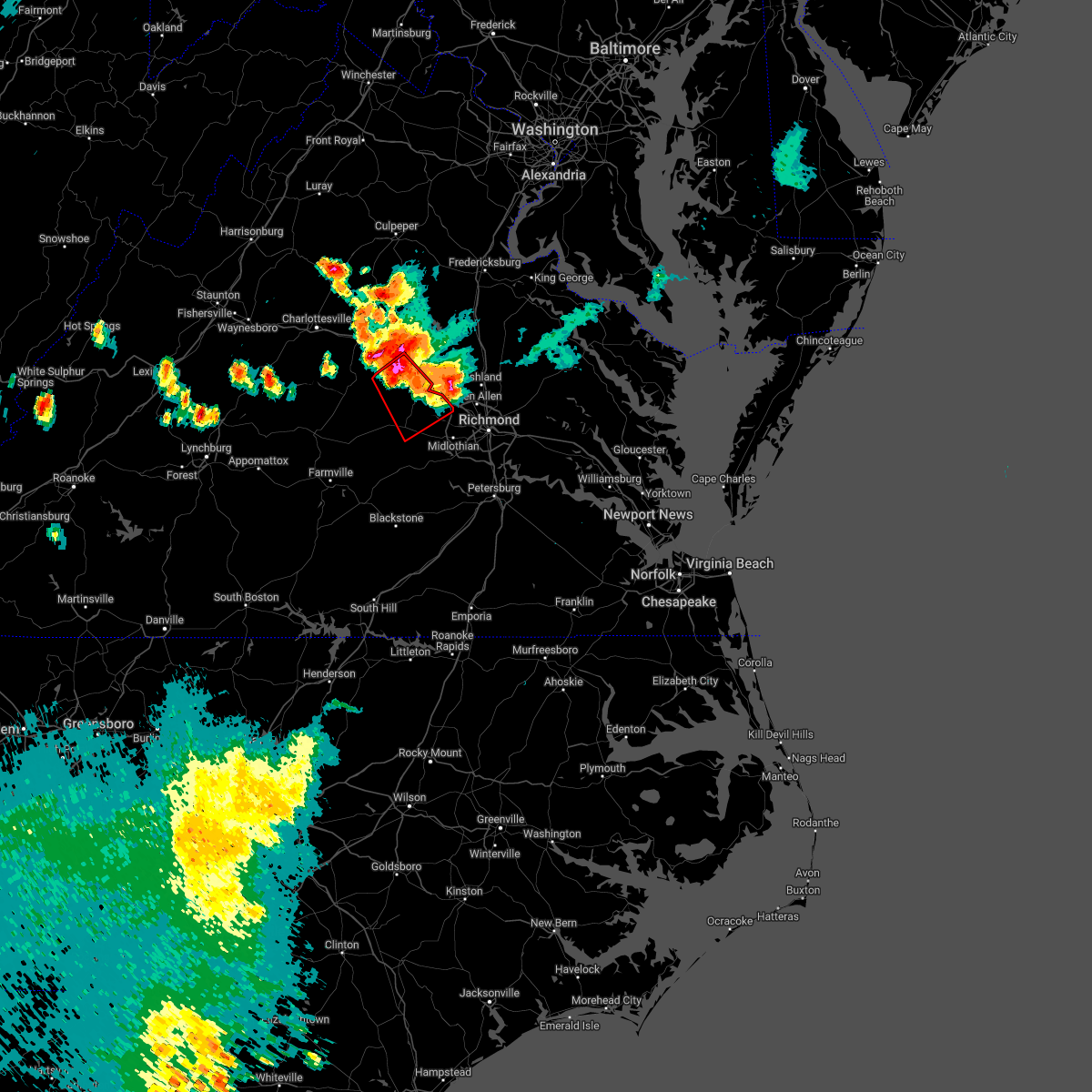 At 741 pm edt, a severe thunderstorm capable of producing a tornado was located near gum spring, or near hadensville, moving southeast at 25 mph (radar indicated rotation). Hazards include tornado and half dollar size hail. Flying debris will be dangerous to those caught without shelter. mobile homes will be damaged or destroyed. damage to roofs, windows, and vehicles will occur. tree damage is likely. this dangerous storm will be near, gum spring around 745 pm edt. goochland around 800 pm edt. oilville around 805 pm edt. powhatan and sabot around 815 pm edt. Other locations impacted by this tornadic thunderstorm include orchid, goodwins store, crozier, sandy hook, rock castle, jefferson, maidens, provost, three square and irwin. At 741 pm edt, a severe thunderstorm capable of producing a tornado was located near gum spring, or near hadensville, moving southeast at 25 mph (radar indicated rotation). Hazards include tornado and half dollar size hail. Flying debris will be dangerous to those caught without shelter. mobile homes will be damaged or destroyed. damage to roofs, windows, and vehicles will occur. tree damage is likely. this dangerous storm will be near, gum spring around 745 pm edt. goochland around 800 pm edt. oilville around 805 pm edt. powhatan and sabot around 815 pm edt. Other locations impacted by this tornadic thunderstorm include orchid, goodwins store, crozier, sandy hook, rock castle, jefferson, maidens, provost, three square and irwin.
|
| 6/12/2022 11:16 AM EDT |
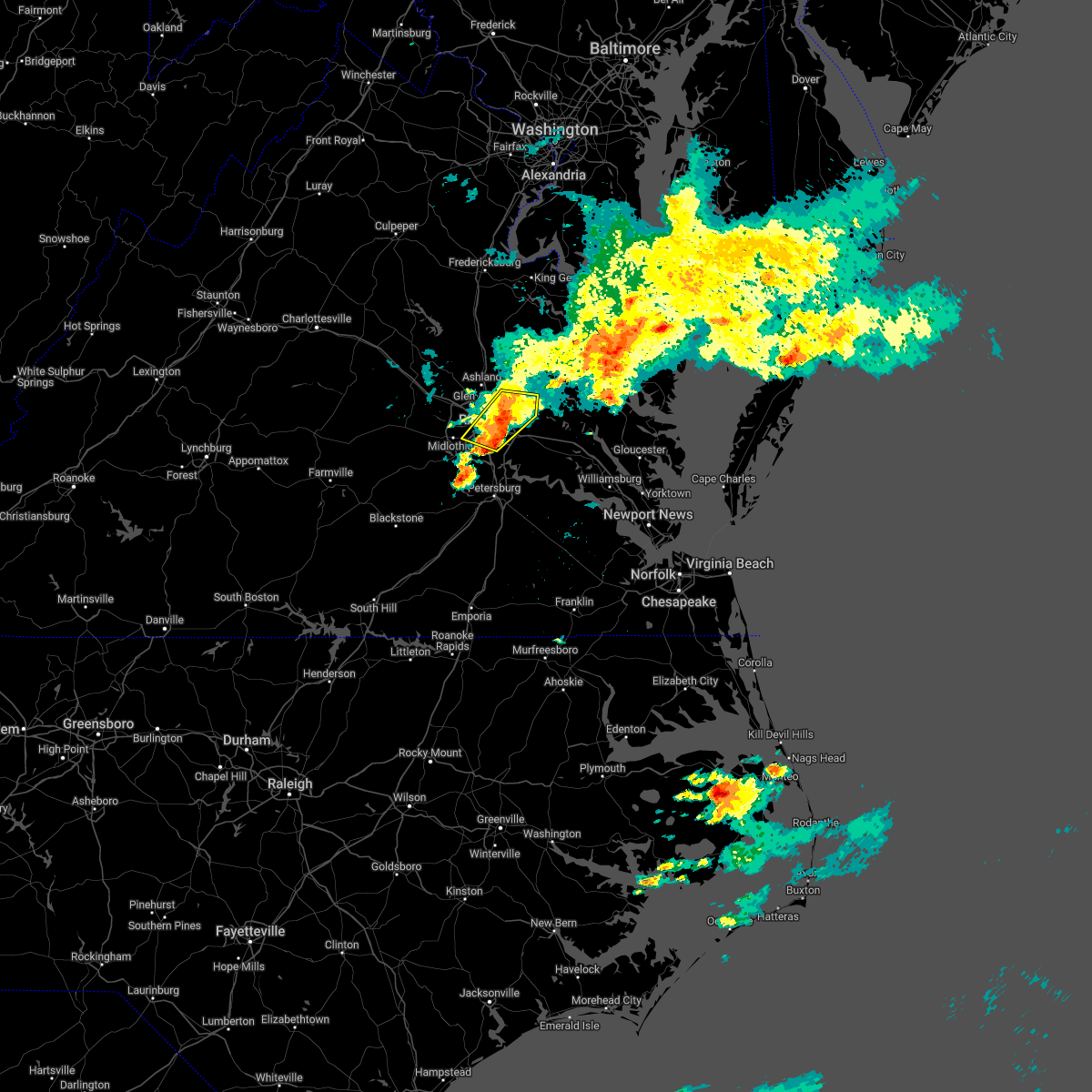 At 1116 am edt, severe thunderstorms were located along a line extending from near studley to near bensley, moving southeast at 25 mph (radar indicated). Hazards include 60 mph wind gusts and nickel size hail. Expect damage to trees and powerlines. these severe storms will be near, manquin around 1125 am edt. other locations impacted by these severe thunderstorms include richmond international, fair oaks, chamberlayne, atlee, richmond heights, montrose, westwood and dumbarton. hail threat, radar indicated max hail size, 0. 88 in wind threat, radar indicated max wind gust, 60 mph. At 1116 am edt, severe thunderstorms were located along a line extending from near studley to near bensley, moving southeast at 25 mph (radar indicated). Hazards include 60 mph wind gusts and nickel size hail. Expect damage to trees and powerlines. these severe storms will be near, manquin around 1125 am edt. other locations impacted by these severe thunderstorms include richmond international, fair oaks, chamberlayne, atlee, richmond heights, montrose, westwood and dumbarton. hail threat, radar indicated max hail size, 0. 88 in wind threat, radar indicated max wind gust, 60 mph.
|
| 6/12/2022 11:01 AM EDT |
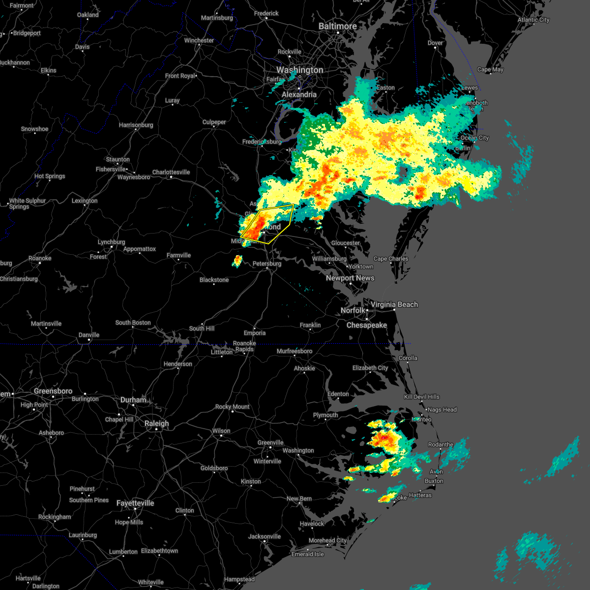 At 1100 am edt, severe thunderstorms were located along a line extending from near studley to near richmond, moving east at 30 mph (radar indicated). Hazards include 60 mph wind gusts and penny size hail. Expect damage to trees and powerlines. these severe storms will be near, mechanicsville and east highland park around 1105 am edt. studley around 1110 am edt. highland springs around 1115 am edt. manquin around 1125 am edt. aylett around 1130 am edt. other locations impacted by these severe thunderstorms include enfield, central garage, richmond heights, hanover airport, midlothian, elmont, etna mills, montrose, longdale and westwood. hail threat, radar indicated max hail size, 0. 75 in wind threat, radar indicated max wind gust, 60 mph. At 1100 am edt, severe thunderstorms were located along a line extending from near studley to near richmond, moving east at 30 mph (radar indicated). Hazards include 60 mph wind gusts and penny size hail. Expect damage to trees and powerlines. these severe storms will be near, mechanicsville and east highland park around 1105 am edt. studley around 1110 am edt. highland springs around 1115 am edt. manquin around 1125 am edt. aylett around 1130 am edt. other locations impacted by these severe thunderstorms include enfield, central garage, richmond heights, hanover airport, midlothian, elmont, etna mills, montrose, longdale and westwood. hail threat, radar indicated max hail size, 0. 75 in wind threat, radar indicated max wind gust, 60 mph.
|
| 6/12/2022 10:53 AM EDT |
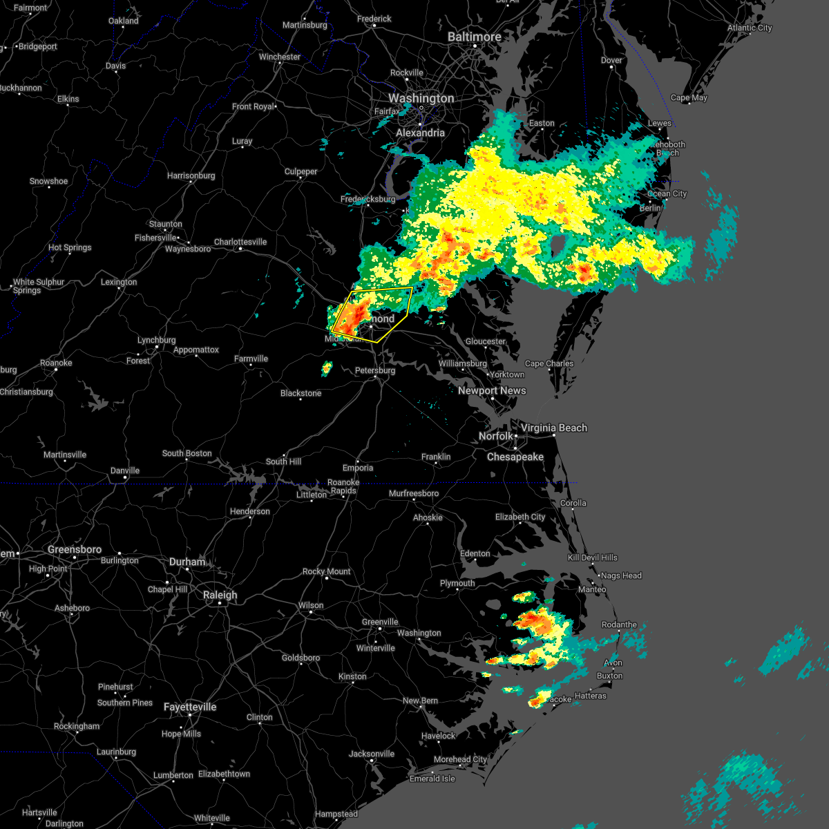 At 1053 am edt, severe thunderstorms were located along a line extending from near glen allen to near bon air, moving east at 30 mph (radar indicated). Hazards include 60 mph wind gusts. Expect damage to trees and powerlines. these severe storms will be near, mechanicsville, hanover and east highland park around 1100 am edt. bensley and studley around 1105 am edt. highland springs around 1110 am edt. manquin around 1120 am edt. other locations impacted by these severe thunderstorms include enfield, central garage, richmond heights, hanover airport, midlothian, elmont, etna mills, short pump, montrose and longdale. hail threat, radar indicated max hail size, <. 75 in wind threat, radar indicated max wind gust, 60 mph. At 1053 am edt, severe thunderstorms were located along a line extending from near glen allen to near bon air, moving east at 30 mph (radar indicated). Hazards include 60 mph wind gusts. Expect damage to trees and powerlines. these severe storms will be near, mechanicsville, hanover and east highland park around 1100 am edt. bensley and studley around 1105 am edt. highland springs around 1110 am edt. manquin around 1120 am edt. other locations impacted by these severe thunderstorms include enfield, central garage, richmond heights, hanover airport, midlothian, elmont, etna mills, short pump, montrose and longdale. hail threat, radar indicated max hail size, <. 75 in wind threat, radar indicated max wind gust, 60 mph.
|
| 6/12/2022 10:38 AM EDT |
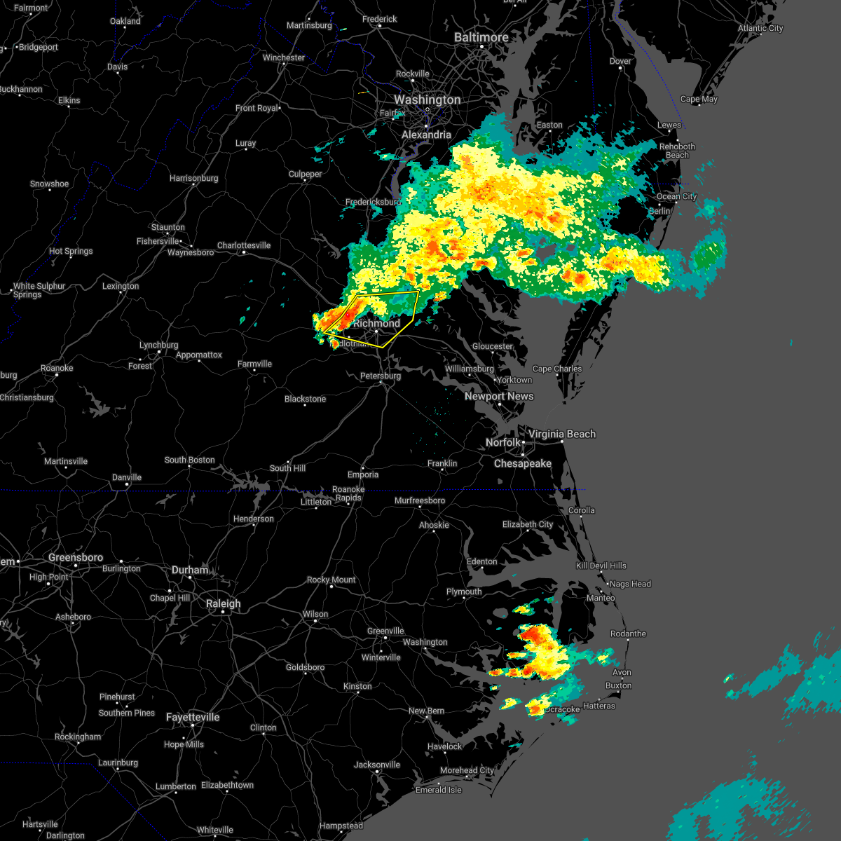 At 1038 am edt, severe thunderstorms were located along a line extending from near glen allen to near tuckahoe to near sabot, moving east at 30 mph (radar indicated). Hazards include 60 mph wind gusts. Expect damage to trees and powerlines. severe thunderstorms will be near, ashland, randolph macon college, glen allen and laurel around 1045 am edt. richmond and lakeside around 1050 am edt. hanover around 1055 am edt. bon air, mechanicsville and east highland park around 1100 am edt. university of richmond and studley around 1105 am edt. downtown richmond around 1110 am edt. virginia commonwealth university, virginia union university and bensley around 1115 am edt. manquin around 1120 am edt. other locations impacted by these severe thunderstorms include enfield, central garage, richmond heights, hanover airport, midlothian, elmont, etna mills, short pump, montrose and subletts. hail threat, radar indicated max hail size, <. 75 in wind threat, radar indicated max wind gust, 60 mph. At 1038 am edt, severe thunderstorms were located along a line extending from near glen allen to near tuckahoe to near sabot, moving east at 30 mph (radar indicated). Hazards include 60 mph wind gusts. Expect damage to trees and powerlines. severe thunderstorms will be near, ashland, randolph macon college, glen allen and laurel around 1045 am edt. richmond and lakeside around 1050 am edt. hanover around 1055 am edt. bon air, mechanicsville and east highland park around 1100 am edt. university of richmond and studley around 1105 am edt. downtown richmond around 1110 am edt. virginia commonwealth university, virginia union university and bensley around 1115 am edt. manquin around 1120 am edt. other locations impacted by these severe thunderstorms include enfield, central garage, richmond heights, hanover airport, midlothian, elmont, etna mills, short pump, montrose and subletts. hail threat, radar indicated max hail size, <. 75 in wind threat, radar indicated max wind gust, 60 mph.
|
| 6/11/2022 9:27 PM EDT |
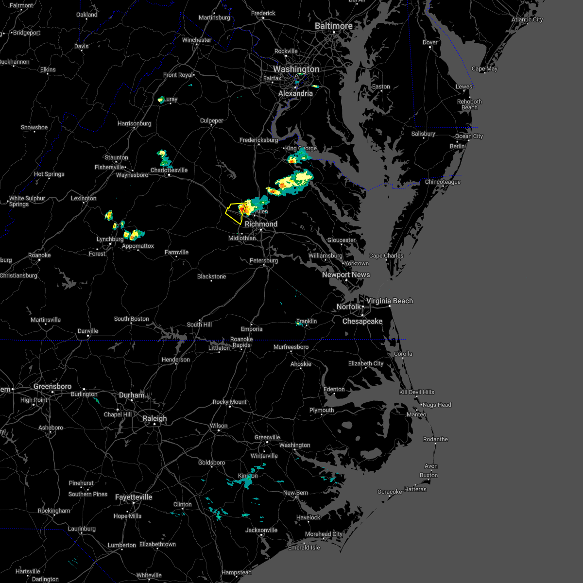 The severe thunderstorm warning for southeastern goochland and west central hanover counties will expire at 930 pm edt, the storm which prompted the warning has weakened below severe limits, and no longer poses an immediate threat to life or property. therefore, the warning will be allowed to expire. The severe thunderstorm warning for southeastern goochland and west central hanover counties will expire at 930 pm edt, the storm which prompted the warning has weakened below severe limits, and no longer poses an immediate threat to life or property. therefore, the warning will be allowed to expire.
|
| 6/11/2022 9:05 PM EDT |
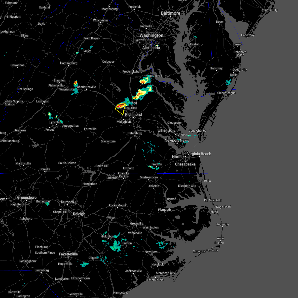 At 905 pm edt, a severe thunderstorm was located over oilville, or 8 miles east of goochland, moving east at 20 mph (radar indicated). Hazards include 60 mph wind gusts and quarter size hail. Minor damage to vehicles is possible. expect wind damage to trees and powerlines. this severe thunderstorm will remain over mainly rural areas of southeastern goochland and west central hanover counties, including the following locations, rockville, johnsons springs and vontay. hail threat, radar indicated max hail size, 1. 00 in wind threat, radar indicated max wind gust, 60 mph. At 905 pm edt, a severe thunderstorm was located over oilville, or 8 miles east of goochland, moving east at 20 mph (radar indicated). Hazards include 60 mph wind gusts and quarter size hail. Minor damage to vehicles is possible. expect wind damage to trees and powerlines. this severe thunderstorm will remain over mainly rural areas of southeastern goochland and west central hanover counties, including the following locations, rockville, johnsons springs and vontay. hail threat, radar indicated max hail size, 1. 00 in wind threat, radar indicated max wind gust, 60 mph.
|
| 6/2/2022 6:32 PM EDT |
 At 632 pm edt, a severe thunderstorm was located over richmond, moving east at 40 mph (radar indicated). Hazards include 60 mph wind gusts. Expect damage to trees and powerlines. this severe storm will be near, east highland park around 635 pm edt. highland springs around 640 pm edt. other locations impacted by this severe thunderstorm include enfield, richmond heights, birchett estate, jordan point country club, montrose, sandston, glendale, pocahontas state park, richmond international and fair oaks. hail threat, radar indicated max hail size, <. 75 in wind threat, radar indicated max wind gust, 60 mph. At 632 pm edt, a severe thunderstorm was located over richmond, moving east at 40 mph (radar indicated). Hazards include 60 mph wind gusts. Expect damage to trees and powerlines. this severe storm will be near, east highland park around 635 pm edt. highland springs around 640 pm edt. other locations impacted by this severe thunderstorm include enfield, richmond heights, birchett estate, jordan point country club, montrose, sandston, glendale, pocahontas state park, richmond international and fair oaks. hail threat, radar indicated max hail size, <. 75 in wind threat, radar indicated max wind gust, 60 mph.
|
| 6/2/2022 6:15 PM EDT |
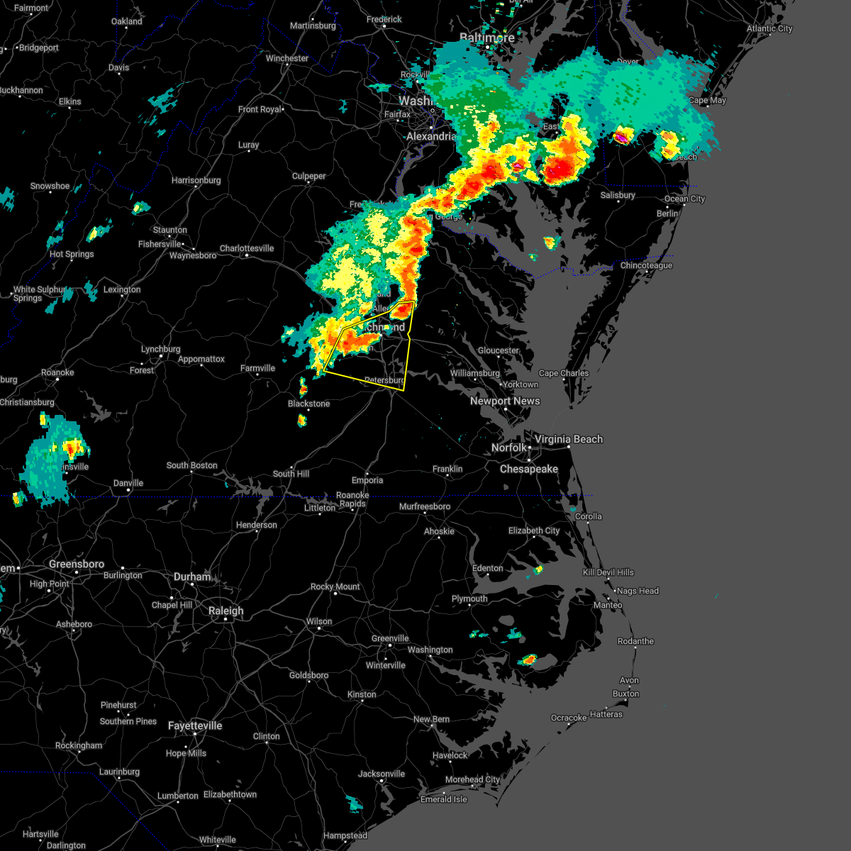 At 614 pm edt, a severe thunderstorm was located near bon air, moving east at 35 mph (radar indicated). Hazards include 60 mph wind gusts. Expect damage to trees and powerlines. this severe storm will be near, bon air, university of richmond and chesterfield court house around 625 pm edt. richmond and downtown richmond around 630 pm edt. virginia commonwealth university, virginia union university, bensley, bellwood and east highland park around 635 pm edt. highland springs around 640 pm edt. other locations impacted by this severe thunderstorm include enfield, richmond heights, birchett estate, jordan point country club, montrose, petersburg national battlefield, sandston, glendale, pocahontas state park and richmond international. hail threat, radar indicated max hail size, <. 75 in wind threat, radar indicated max wind gust, 60 mph. At 614 pm edt, a severe thunderstorm was located near bon air, moving east at 35 mph (radar indicated). Hazards include 60 mph wind gusts. Expect damage to trees and powerlines. this severe storm will be near, bon air, university of richmond and chesterfield court house around 625 pm edt. richmond and downtown richmond around 630 pm edt. virginia commonwealth university, virginia union university, bensley, bellwood and east highland park around 635 pm edt. highland springs around 640 pm edt. other locations impacted by this severe thunderstorm include enfield, richmond heights, birchett estate, jordan point country club, montrose, petersburg national battlefield, sandston, glendale, pocahontas state park and richmond international. hail threat, radar indicated max hail size, <. 75 in wind threat, radar indicated max wind gust, 60 mph.
|
| 6/2/2022 5:55 PM EDT |
 The national weather service in wakefield has issued a * severe thunderstorm warning for. the city of colonial heights in central virginia. the city of hopewell in south central virginia. the northeastern city of petersburg in south central virginia. Southeastern goochland county in central virginia. The national weather service in wakefield has issued a * severe thunderstorm warning for. the city of colonial heights in central virginia. the city of hopewell in south central virginia. the northeastern city of petersburg in south central virginia. Southeastern goochland county in central virginia.
|
| 6/2/2022 5:32 PM EDT |
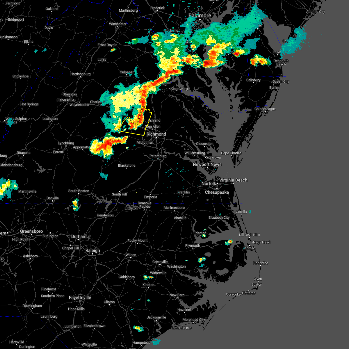 At 532 pm edt, severe thunderstorms were located along a line extending from near ladysmith to montpelier to near oilville, moving east at 35 mph (radar indicated). Hazards include 60 mph wind gusts and penny size hail. Expect damage to trees and powerlines. these severe storms will be near, wyndham around 550 pm edt. other locations impacted by these severe thunderstorms include crozier, rock castle, vontay, maidens, three square, irwin, johnsons springs, gilman, fine creek mills and michaux. hail threat, radar indicated max hail size, 0. 75 in wind threat, radar indicated max wind gust, 60 mph. At 532 pm edt, severe thunderstorms were located along a line extending from near ladysmith to montpelier to near oilville, moving east at 35 mph (radar indicated). Hazards include 60 mph wind gusts and penny size hail. Expect damage to trees and powerlines. these severe storms will be near, wyndham around 550 pm edt. other locations impacted by these severe thunderstorms include crozier, rock castle, vontay, maidens, three square, irwin, johnsons springs, gilman, fine creek mills and michaux. hail threat, radar indicated max hail size, 0. 75 in wind threat, radar indicated max wind gust, 60 mph.
|
| 6/2/2022 5:22 PM EDT |
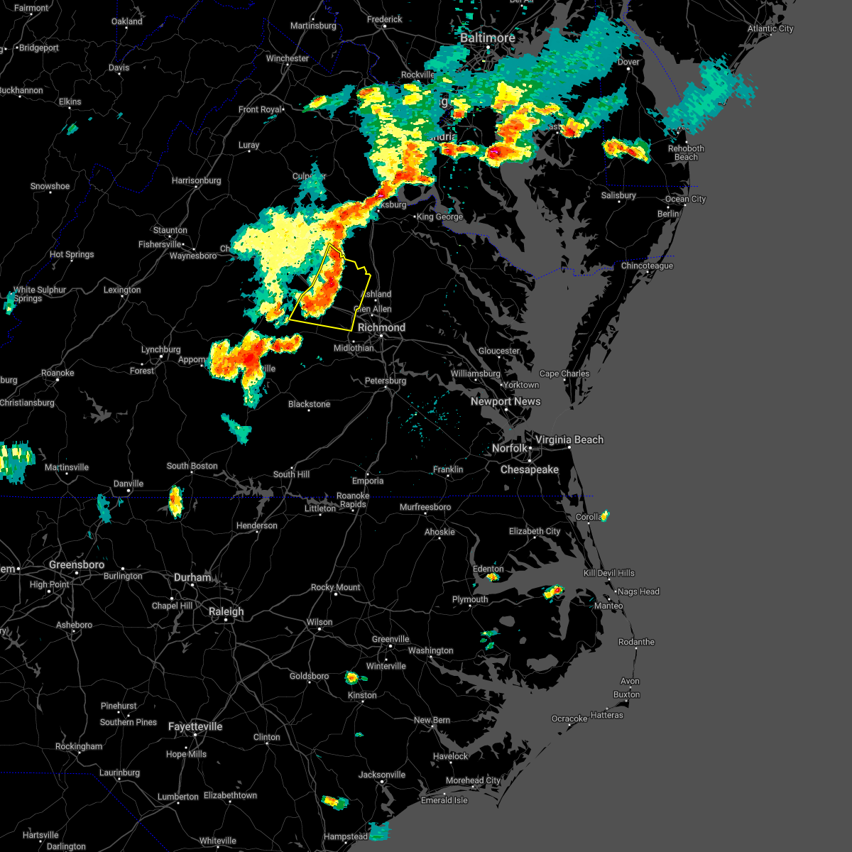 At 522 pm edt, severe thunderstorms were located along a line extending from near bumpass to near montpelier to near goochland, moving east at 35 mph (radar indicated). Hazards include 60 mph wind gusts and penny size hail. Expect damage to trees and powerlines. these severe storms will be near, montpelier around 530 pm edt. sabot around 535 pm edt. manakin around 540 pm edt. wyndham around 545 pm edt. other locations impacted by these severe thunderstorms include orchid, crozier, rock castle, vontay, maidens, three square, irwin, johnsons springs, gilman and fine creek mills. hail threat, radar indicated max hail size, 0. 75 in wind threat, radar indicated max wind gust, 60 mph. At 522 pm edt, severe thunderstorms were located along a line extending from near bumpass to near montpelier to near goochland, moving east at 35 mph (radar indicated). Hazards include 60 mph wind gusts and penny size hail. Expect damage to trees and powerlines. these severe storms will be near, montpelier around 530 pm edt. sabot around 535 pm edt. manakin around 540 pm edt. wyndham around 545 pm edt. other locations impacted by these severe thunderstorms include orchid, crozier, rock castle, vontay, maidens, three square, irwin, johnsons springs, gilman and fine creek mills. hail threat, radar indicated max hail size, 0. 75 in wind threat, radar indicated max wind gust, 60 mph.
|
| 6/2/2022 5:04 PM EDT |
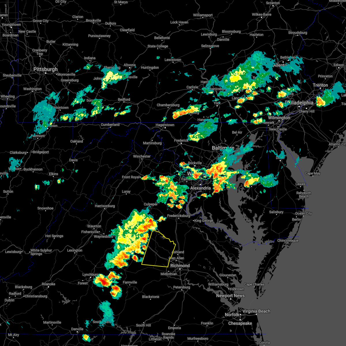 At 504 pm edt, severe thunderstorms were located along a line extending from near mineral to near cartersville, moving east at 35 mph (radar indicated). Hazards include 60 mph wind gusts and penny size hail. Expect damage to trees and powerlines. severe thunderstorms will be near, mineral around 510 pm edt. goochland and gum spring around 520 pm edt. oilville around 530 pm edt. sabot around 535 pm edt. manakin around 540 pm edt. wyndham and montpelier around 545 pm edt. other locations impacted by these severe thunderstorms include orchid, crozier, rock castle, louisa airport, vontay, maidens, three square, irwin, johnsons springs and gilman. hail threat, radar indicated max hail size, 0. 75 in wind threat, radar indicated max wind gust, 60 mph. At 504 pm edt, severe thunderstorms were located along a line extending from near mineral to near cartersville, moving east at 35 mph (radar indicated). Hazards include 60 mph wind gusts and penny size hail. Expect damage to trees and powerlines. severe thunderstorms will be near, mineral around 510 pm edt. goochland and gum spring around 520 pm edt. oilville around 530 pm edt. sabot around 535 pm edt. manakin around 540 pm edt. wyndham and montpelier around 545 pm edt. other locations impacted by these severe thunderstorms include orchid, crozier, rock castle, louisa airport, vontay, maidens, three square, irwin, johnsons springs and gilman. hail threat, radar indicated max hail size, 0. 75 in wind threat, radar indicated max wind gust, 60 mph.
|
| 5/27/2022 7:31 PM EDT |
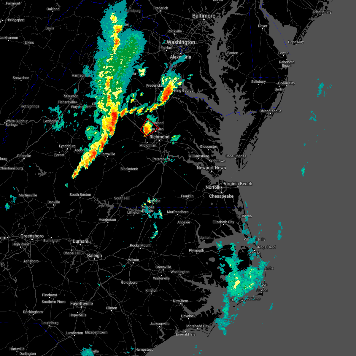 At 730 pm edt, a severe thunderstorm capable of producing a tornado was located over wyndham, or 8 miles northwest of tuckahoe, moving northeast at 35 mph (radar indicated rotation). Hazards include tornado. Flying debris will be dangerous to those caught without shelter. mobile homes will be damaged or destroyed. damage to roofs, windows, and vehicles will occur. tree damage is likely. this dangerous storm will be near, montpelier around 740 pm edt. ashland around 750 pm edt. Other locations impacted by this tornadic thunderstorm include rockville, gilman, johnsons springs, goodall, elmont and short pump. At 730 pm edt, a severe thunderstorm capable of producing a tornado was located over wyndham, or 8 miles northwest of tuckahoe, moving northeast at 35 mph (radar indicated rotation). Hazards include tornado. Flying debris will be dangerous to those caught without shelter. mobile homes will be damaged or destroyed. damage to roofs, windows, and vehicles will occur. tree damage is likely. this dangerous storm will be near, montpelier around 740 pm edt. ashland around 750 pm edt. Other locations impacted by this tornadic thunderstorm include rockville, gilman, johnsons springs, goodall, elmont and short pump.
|
| 5/27/2022 7:22 PM EDT |
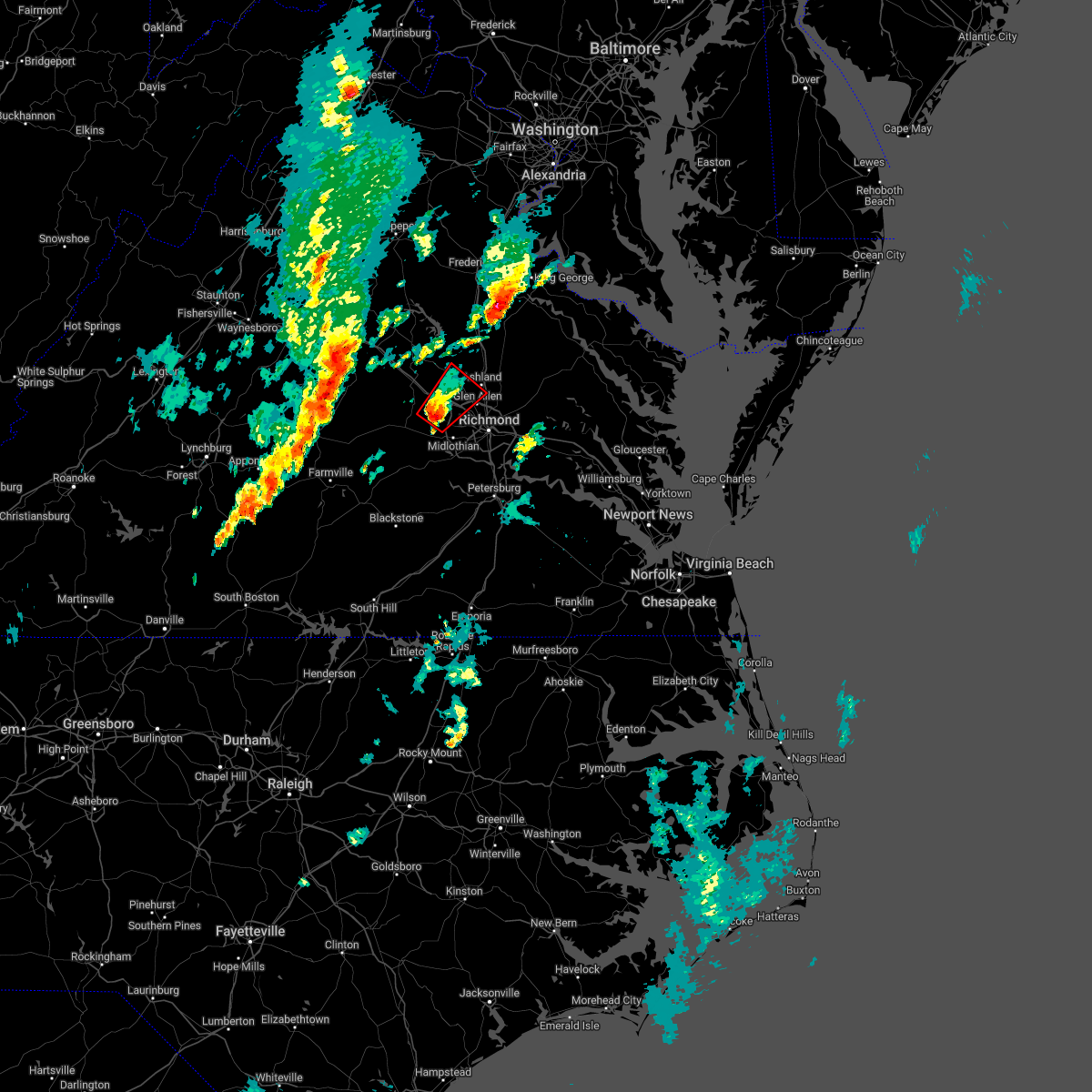 At 721 pm edt, a severe thunderstorm capable of producing a tornado was located over sabot, or 8 miles west of tuckahoe, moving northeast at 35 mph (radar indicated rotation). Hazards include tornado. Flying debris will be dangerous to those caught without shelter. mobile homes will be damaged or destroyed. damage to roofs, windows, and vehicles will occur. tree damage is likely. this dangerous storm will be near, tuckahoe around 730 pm edt. wyndham around 735 pm edt. montpelier around 740 pm edt. ashland around 750 pm edt. Other locations impacted by this tornadic thunderstorm include rockville, gilman, crozier, fine creek mills, johnsons springs, goodall, elmont, short pump, subletts and vontay. At 721 pm edt, a severe thunderstorm capable of producing a tornado was located over sabot, or 8 miles west of tuckahoe, moving northeast at 35 mph (radar indicated rotation). Hazards include tornado. Flying debris will be dangerous to those caught without shelter. mobile homes will be damaged or destroyed. damage to roofs, windows, and vehicles will occur. tree damage is likely. this dangerous storm will be near, tuckahoe around 730 pm edt. wyndham around 735 pm edt. montpelier around 740 pm edt. ashland around 750 pm edt. Other locations impacted by this tornadic thunderstorm include rockville, gilman, crozier, fine creek mills, johnsons springs, goodall, elmont, short pump, subletts and vontay.
|
| 5/27/2022 6:50 PM EDT |
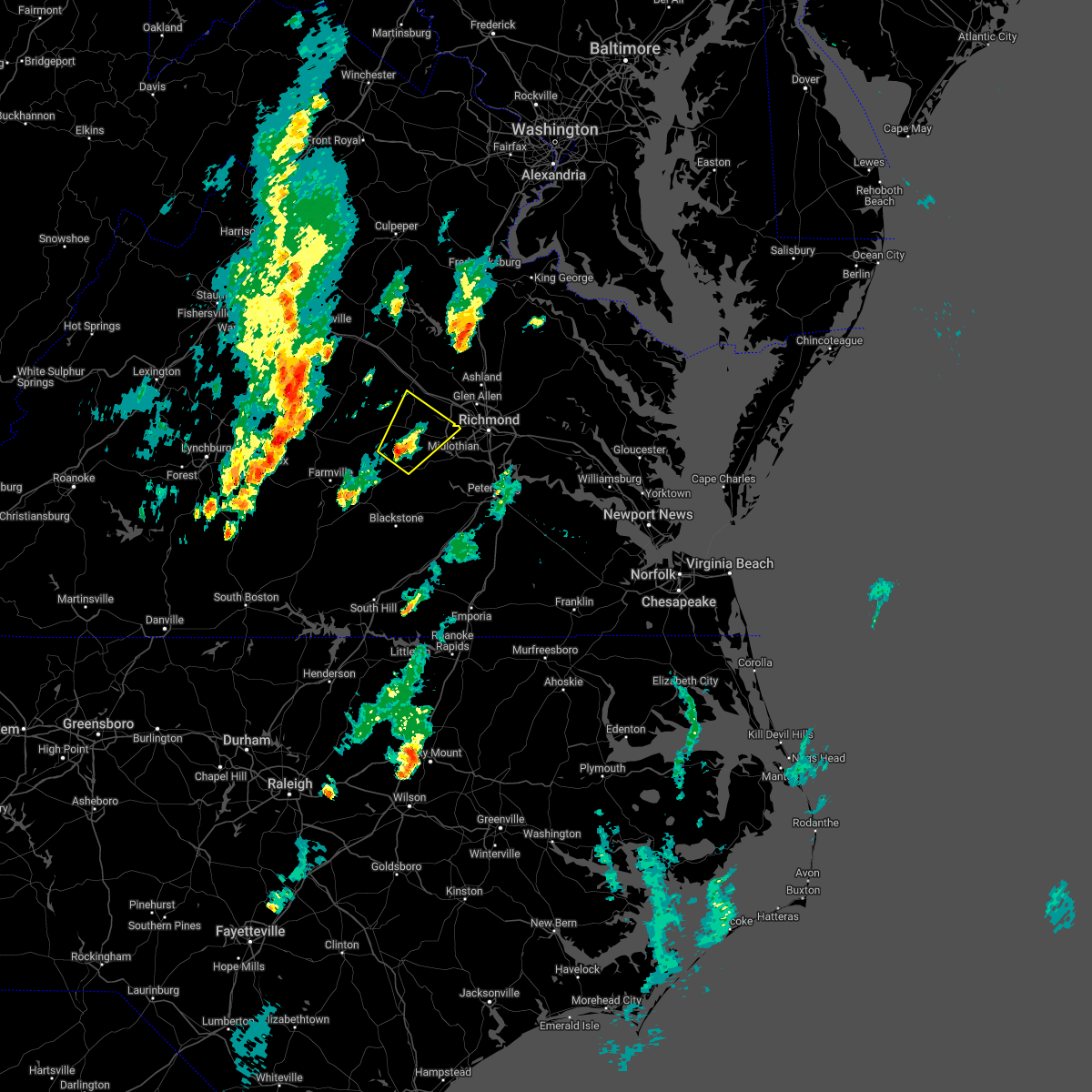 At 649 pm edt, a severe thunderstorm was located near macon, or near powhatan, moving northeast at 40 mph (radar indicated). Hazards include 60 mph wind gusts. Expect damage to trees and powerlines. this severe thunderstorm will be near, macon around 655 pm edt. powhatan around 700 pm edt. goochland around 710 pm edt. sabot and manakin around 715 pm edt. Other locations impacted by this severe thunderstorm include goodwins store, flat rock, crozier, rock castle, pilkinton, jefferson, maidens, provost, irwin and giles mill. At 649 pm edt, a severe thunderstorm was located near macon, or near powhatan, moving northeast at 40 mph (radar indicated). Hazards include 60 mph wind gusts. Expect damage to trees and powerlines. this severe thunderstorm will be near, macon around 655 pm edt. powhatan around 700 pm edt. goochland around 710 pm edt. sabot and manakin around 715 pm edt. Other locations impacted by this severe thunderstorm include goodwins store, flat rock, crozier, rock castle, pilkinton, jefferson, maidens, provost, irwin and giles mill.
|
| 4/26/2022 3:56 PM EDT |
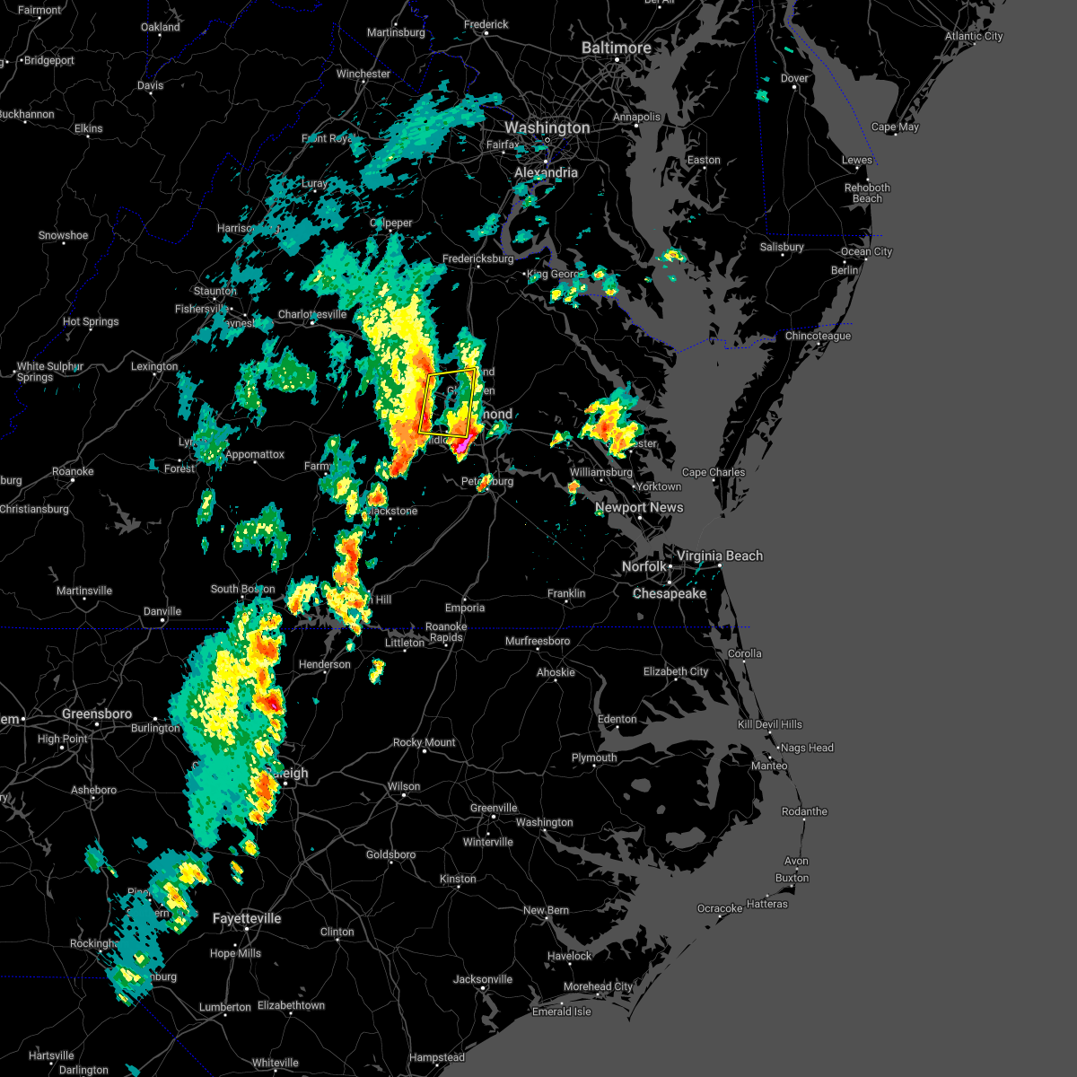 At 355 pm edt, severe thunderstorms were located along a line extending from near wyndham to 6 miles northeast of moseley, moving east at 35 mph (radar indicated). Hazards include 60 mph wind gusts and quarter size hail. Minor damage to vehicles is possible. expect wind damage to trees and powerlines. these severe storms will be near, tuckahoe and wyndham around 400 pm edt. bon air and university of richmond around 410 pm edt. richmond, ashland, glen allen and laurel around 415 pm edt. other locations impacted by these severe thunderstorms include rockville, gilman, roslyn hills, vontay, holly hills, johnsons springs, goodall, midlothian, short pump and subletts. hail threat, observed max hail size, 1. 00 in wind threat, observed max wind gust, 60 mph. At 355 pm edt, severe thunderstorms were located along a line extending from near wyndham to 6 miles northeast of moseley, moving east at 35 mph (radar indicated). Hazards include 60 mph wind gusts and quarter size hail. Minor damage to vehicles is possible. expect wind damage to trees and powerlines. these severe storms will be near, tuckahoe and wyndham around 400 pm edt. bon air and university of richmond around 410 pm edt. richmond, ashland, glen allen and laurel around 415 pm edt. other locations impacted by these severe thunderstorms include rockville, gilman, roslyn hills, vontay, holly hills, johnsons springs, goodall, midlothian, short pump and subletts. hail threat, observed max hail size, 1. 00 in wind threat, observed max wind gust, 60 mph.
|
| 4/26/2022 3:28 PM EDT |
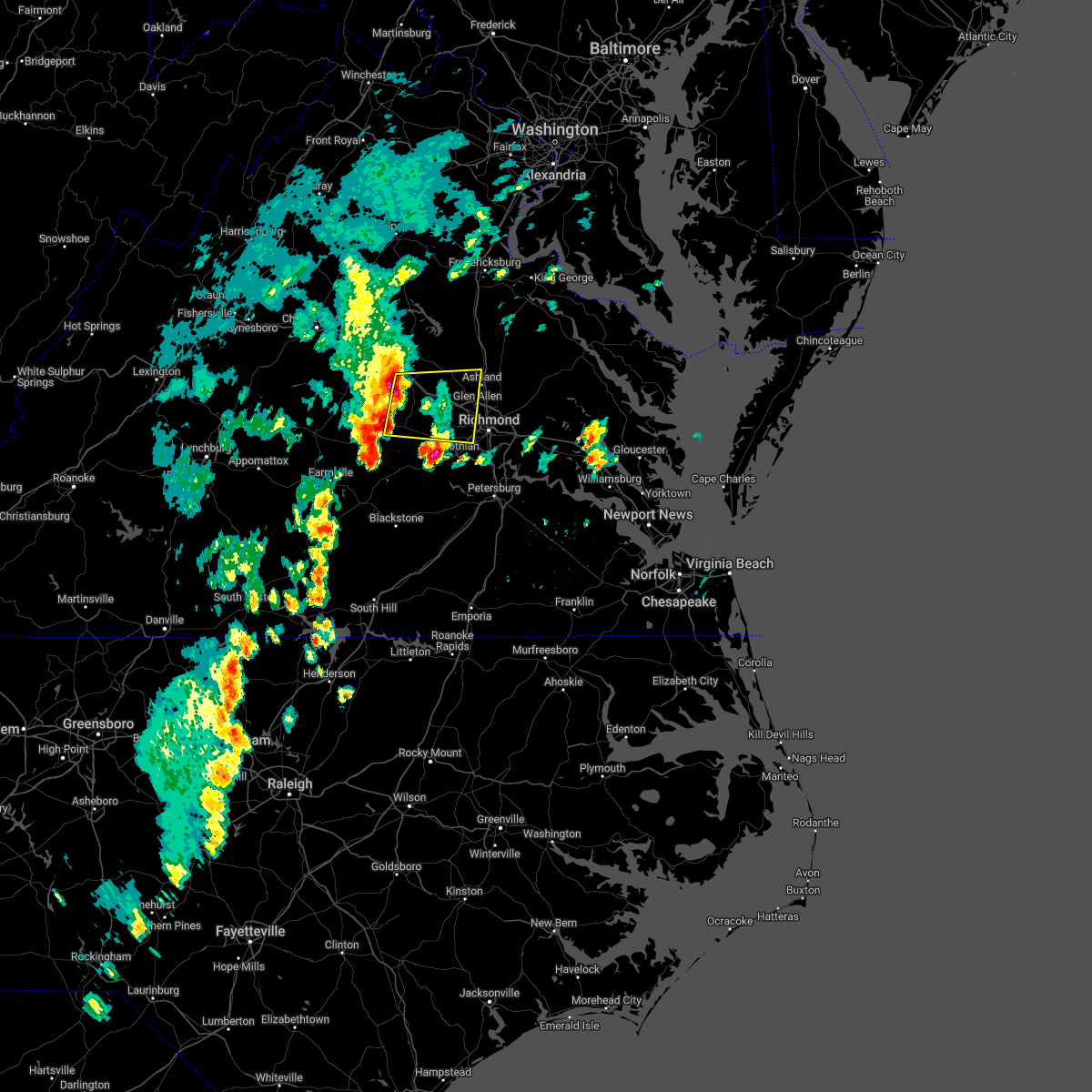 At 327 pm edt, severe thunderstorms were located along a line extending from near gum spring to near trenholm, moving east at 35 mph (radar indicated). Hazards include 60 mph wind gusts and quarter size hail. Minor damage to vehicles is possible. expect wind damage to trees and powerlines. severe thunderstorms will be near, goochland and gum spring around 335 pm edt. powhatan around 340 pm edt. oilville around 345 pm edt. montpelier and sabot around 355 pm edt. manakin and wyndham around 400 pm edt. tuckahoe around 405 pm edt. richmond, ashland, university of richmond, bon air, glen allen and laurel around 415 pm edt. other locations impacted by these severe thunderstorms include crozier, rock castle, vontay, maidens, three square, irwin, johnsons springs, gilman, fine creek mills and michaux. hail threat, radar indicated max hail size, 1. 00 in wind threat, radar indicated max wind gust, 60 mph. At 327 pm edt, severe thunderstorms were located along a line extending from near gum spring to near trenholm, moving east at 35 mph (radar indicated). Hazards include 60 mph wind gusts and quarter size hail. Minor damage to vehicles is possible. expect wind damage to trees and powerlines. severe thunderstorms will be near, goochland and gum spring around 335 pm edt. powhatan around 340 pm edt. oilville around 345 pm edt. montpelier and sabot around 355 pm edt. manakin and wyndham around 400 pm edt. tuckahoe around 405 pm edt. richmond, ashland, university of richmond, bon air, glen allen and laurel around 415 pm edt. other locations impacted by these severe thunderstorms include crozier, rock castle, vontay, maidens, three square, irwin, johnsons springs, gilman, fine creek mills and michaux. hail threat, radar indicated max hail size, 1. 00 in wind threat, radar indicated max wind gust, 60 mph.
|
| 3/31/2022 2:43 PM EDT |
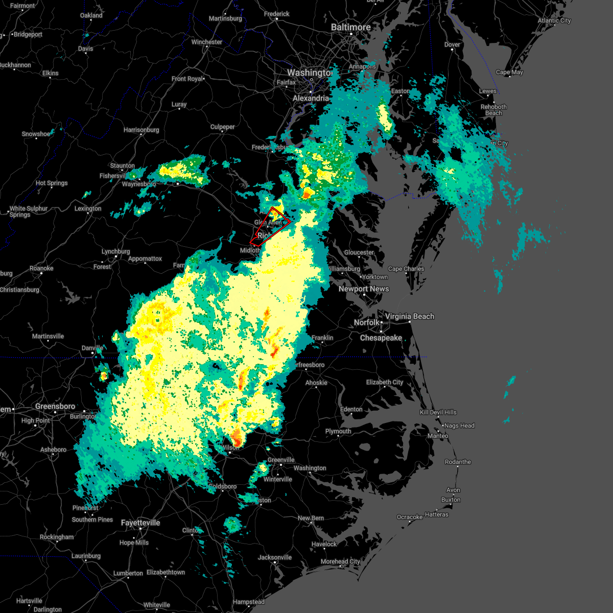 The tornado warning for north central chesterfield, northwestern henrico and central hanover counties and the city of richmond will expire at 245 pm edt, the tornadic thunderstorm which prompted the warning will move out of the warned area around 245 pm. therefore, the warning will be allowed to expire. a tornado watch remains in effect until 800 pm edt for central, north central and east central virginia. The tornado warning for north central chesterfield, northwestern henrico and central hanover counties and the city of richmond will expire at 245 pm edt, the tornadic thunderstorm which prompted the warning will move out of the warned area around 245 pm. therefore, the warning will be allowed to expire. a tornado watch remains in effect until 800 pm edt for central, north central and east central virginia.
|
| 3/31/2022 2:22 PM EDT |
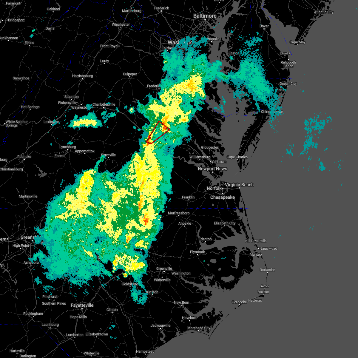 At 222 pm edt, a severe thunderstorm capable of producing a tornado was located over bon air, moving northeast at 45 mph (radar indicated rotation). Hazards include tornado. Flying debris will be dangerous to those caught without shelter. mobile homes will be damaged or destroyed. damage to roofs, windows, and vehicles will occur. tree damage is likely. this dangerous storm will be near, university of richmond around 225 pm edt. tuckahoe around 230 pm edt. richmond, lakeside and laurel around 235 pm edt. mechanicsville and glen allen around 240 pm edt. ashland, randolph macon college and hanover around 245 pm edt. Other locations impacted by this tornadic thunderstorm include solomons store, chamberlayne, atlee, ashcake, greendale, hanover airport, roslyn hills, dumbarton, elmont and longdale. At 222 pm edt, a severe thunderstorm capable of producing a tornado was located over bon air, moving northeast at 45 mph (radar indicated rotation). Hazards include tornado. Flying debris will be dangerous to those caught without shelter. mobile homes will be damaged or destroyed. damage to roofs, windows, and vehicles will occur. tree damage is likely. this dangerous storm will be near, university of richmond around 225 pm edt. tuckahoe around 230 pm edt. richmond, lakeside and laurel around 235 pm edt. mechanicsville and glen allen around 240 pm edt. ashland, randolph macon college and hanover around 245 pm edt. Other locations impacted by this tornadic thunderstorm include solomons store, chamberlayne, atlee, ashcake, greendale, hanover airport, roslyn hills, dumbarton, elmont and longdale.
|
| 3/31/2022 2:16 PM EDT |
 At 216 pm edt, a severe thunderstorm was located near bon air, moving northeast at 60 mph (radar indicated). Hazards include 60 mph wind gusts. Expect damage to trees and powerlines. this severe thunderstorm will be near, bon air, university of richmond and tuckahoe around 225 pm edt. richmond, virginia union university, laurel, lakeside, east highland park and wyndham around 230 pm edt. randolph macon college, mechanicsville and glen allen around 235 pm edt. ashland around 240 pm edt. Other locations impacted by this severe thunderstorm include solomons store, chamberlayne, atlee, ashcake, greendale, hanover airport, roslyn hills, dumbarton, midlothian and elmont. At 216 pm edt, a severe thunderstorm was located near bon air, moving northeast at 60 mph (radar indicated). Hazards include 60 mph wind gusts. Expect damage to trees and powerlines. this severe thunderstorm will be near, bon air, university of richmond and tuckahoe around 225 pm edt. richmond, virginia union university, laurel, lakeside, east highland park and wyndham around 230 pm edt. randolph macon college, mechanicsville and glen allen around 235 pm edt. ashland around 240 pm edt. Other locations impacted by this severe thunderstorm include solomons store, chamberlayne, atlee, ashcake, greendale, hanover airport, roslyn hills, dumbarton, midlothian and elmont.
|
| 3/31/2022 2:10 PM EDT |
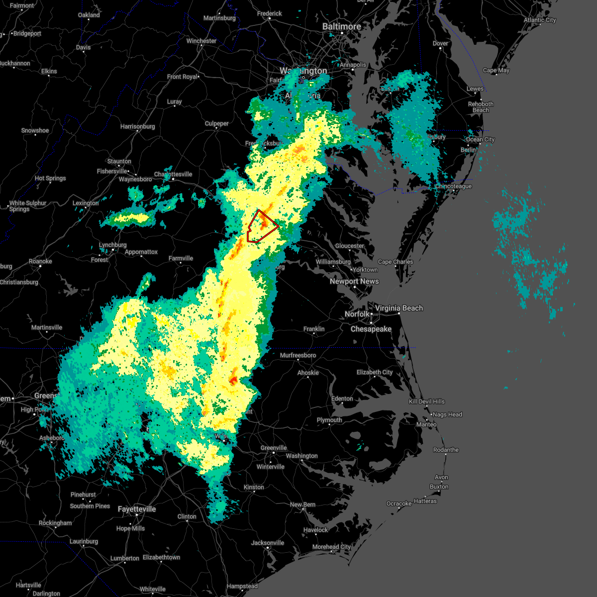 The tornado warning for north central chesterfield, northwestern henrico and south central hanover counties and the city of richmond will expire at 215 pm edt, the tornadic thunderstorm which prompted the warning will be moving out of the warned area by 215 pm. therefore, the warning will be allowed to expire. The tornado warning for north central chesterfield, northwestern henrico and south central hanover counties and the city of richmond will expire at 215 pm edt, the tornadic thunderstorm which prompted the warning will be moving out of the warned area by 215 pm. therefore, the warning will be allowed to expire.
|
| 3/31/2022 1:57 PM EDT |
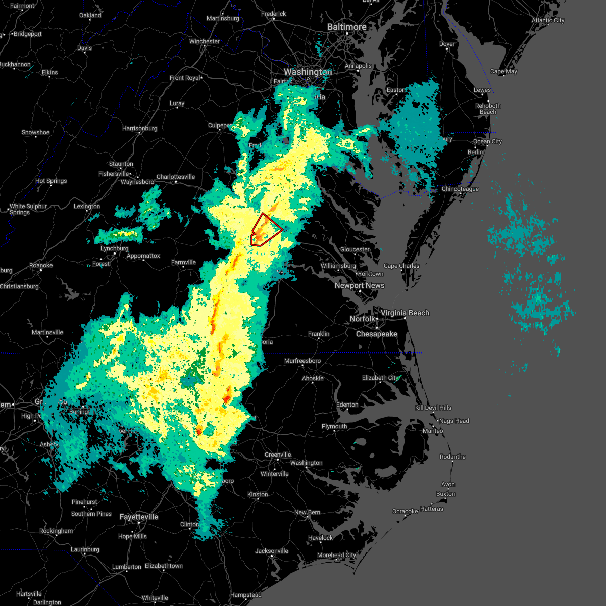 At 157 pm edt, a severe thunderstorm capable of producing a tornado was located over tuckahoe, moving northeast at 50 mph (radar indicated rotation). Hazards include tornado. Flying debris will be dangerous to those caught without shelter. mobile homes will be damaged or destroyed. damage to roofs, windows, and vehicles will occur. tree damage is likely. this dangerous storm will be near, virginia union university, downtown richmond and virginia commonwealth university around 200 pm edt. lakeside, laurel and east highland park around 205 pm edt. mechanicsville and glen allen around 210 pm edt. Other locations impacted by this tornadic thunderstorm include solomons store, chamberlayne, atlee, greendale, roslyn hills, dumbarton, midlothian, elmont, longdale and short pump. At 157 pm edt, a severe thunderstorm capable of producing a tornado was located over tuckahoe, moving northeast at 50 mph (radar indicated rotation). Hazards include tornado. Flying debris will be dangerous to those caught without shelter. mobile homes will be damaged or destroyed. damage to roofs, windows, and vehicles will occur. tree damage is likely. this dangerous storm will be near, virginia union university, downtown richmond and virginia commonwealth university around 200 pm edt. lakeside, laurel and east highland park around 205 pm edt. mechanicsville and glen allen around 210 pm edt. Other locations impacted by this tornadic thunderstorm include solomons store, chamberlayne, atlee, greendale, roslyn hills, dumbarton, midlothian, elmont, longdale and short pump.
|
| 3/31/2022 1:46 PM EDT |
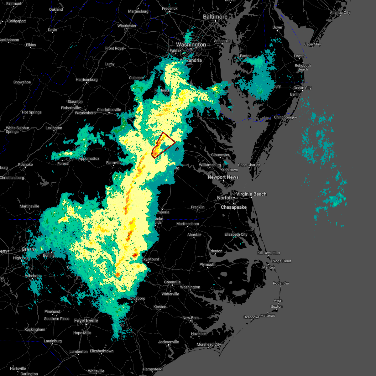 At 146 pm edt, a severe thunderstorm capable of producing a tornado was located near moseley, moving northeast at 50 mph (radar indicated rotation). Hazards include tornado. Flying debris will be dangerous to those caught without shelter. mobile homes will be damaged or destroyed. damage to roofs, windows, and vehicles will occur. tree damage is likely. this dangerous storm will be near, bon air around 155 pm edt. university of richmond, downtown richmond, virginia commonwealth university and tuckahoe around 200 pm edt. richmond, virginia union university, lakeside and laurel around 205 pm edt. mechanicsville, glen allen and east highland park around 210 pm edt. Other locations impacted by this tornadic thunderstorm include solomons store, chamberlayne, atlee, greendale, roslyn hills, dumbarton, midlothian, elmont, longdale and short pump. At 146 pm edt, a severe thunderstorm capable of producing a tornado was located near moseley, moving northeast at 50 mph (radar indicated rotation). Hazards include tornado. Flying debris will be dangerous to those caught without shelter. mobile homes will be damaged or destroyed. damage to roofs, windows, and vehicles will occur. tree damage is likely. this dangerous storm will be near, bon air around 155 pm edt. university of richmond, downtown richmond, virginia commonwealth university and tuckahoe around 200 pm edt. richmond, virginia union university, lakeside and laurel around 205 pm edt. mechanicsville, glen allen and east highland park around 210 pm edt. Other locations impacted by this tornadic thunderstorm include solomons store, chamberlayne, atlee, greendale, roslyn hills, dumbarton, midlothian, elmont, longdale and short pump.
|
| 3/31/2022 1:40 PM EDT |
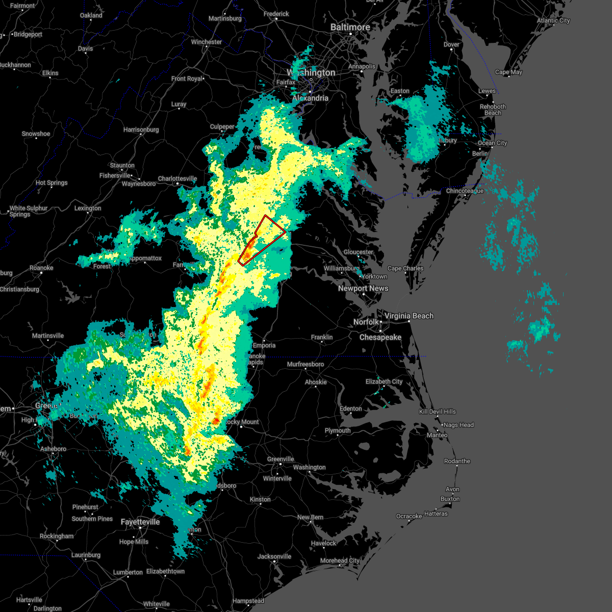 At 139 pm edt, a severe thunderstorm capable of producing a tornado was located over moseley, moving northeast at 50 mph (radar indicated rotation). Hazards include tornado. Flying debris will be dangerous to those caught without shelter. mobile homes will be damaged or destroyed. damage to roofs, windows, and vehicles will occur. tree damage is likely. this dangerous storm will be near, university of richmond, bon air, downtown richmond and tuckahoe around 200 pm edt. richmond, virginia union university, virginia commonwealth university and lakeside around 205 pm edt. mechanicsville, glen allen, laurel and east highland park around 210 pm edt. Other locations impacted by this tornadic thunderstorm include skinquarter, solomons store, chamberlayne, atlee, greendale, roslyn hills, dumbarton, midlothian, elmont and longdale. At 139 pm edt, a severe thunderstorm capable of producing a tornado was located over moseley, moving northeast at 50 mph (radar indicated rotation). Hazards include tornado. Flying debris will be dangerous to those caught without shelter. mobile homes will be damaged or destroyed. damage to roofs, windows, and vehicles will occur. tree damage is likely. this dangerous storm will be near, university of richmond, bon air, downtown richmond and tuckahoe around 200 pm edt. richmond, virginia union university, virginia commonwealth university and lakeside around 205 pm edt. mechanicsville, glen allen, laurel and east highland park around 210 pm edt. Other locations impacted by this tornadic thunderstorm include skinquarter, solomons store, chamberlayne, atlee, greendale, roslyn hills, dumbarton, midlothian, elmont and longdale.
|
| 3/31/2022 1:29 PM EDT |
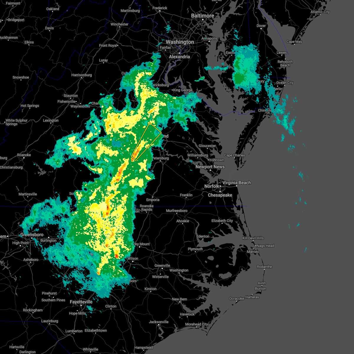 At 128 pm edt, a severe thunderstorm was located over scotts fork, or near mannboro, moving northeast at 50 mph (radar indicated). Hazards include 60 mph wind gusts. Expect damage to trees and powerlines. this severe thunderstorm will be near, moseley around 140 pm edt. manakin around 155 pm edt. bon air, university of richmond and tuckahoe around 200 pm edt. richmond, lakeside and wyndham around 205 pm edt. mechanicsville, glen allen and laurel around 210 pm edt. Other locations impacted by this severe thunderstorm include pilkinton, midlothian, elmont, short pump, longdale, skinquarter, solomons store, chamberlayne, atlee and greendale. At 128 pm edt, a severe thunderstorm was located over scotts fork, or near mannboro, moving northeast at 50 mph (radar indicated). Hazards include 60 mph wind gusts. Expect damage to trees and powerlines. this severe thunderstorm will be near, moseley around 140 pm edt. manakin around 155 pm edt. bon air, university of richmond and tuckahoe around 200 pm edt. richmond, lakeside and wyndham around 205 pm edt. mechanicsville, glen allen and laurel around 210 pm edt. Other locations impacted by this severe thunderstorm include pilkinton, midlothian, elmont, short pump, longdale, skinquarter, solomons store, chamberlayne, atlee and greendale.
|
| 8/30/2021 6:54 PM EDT |
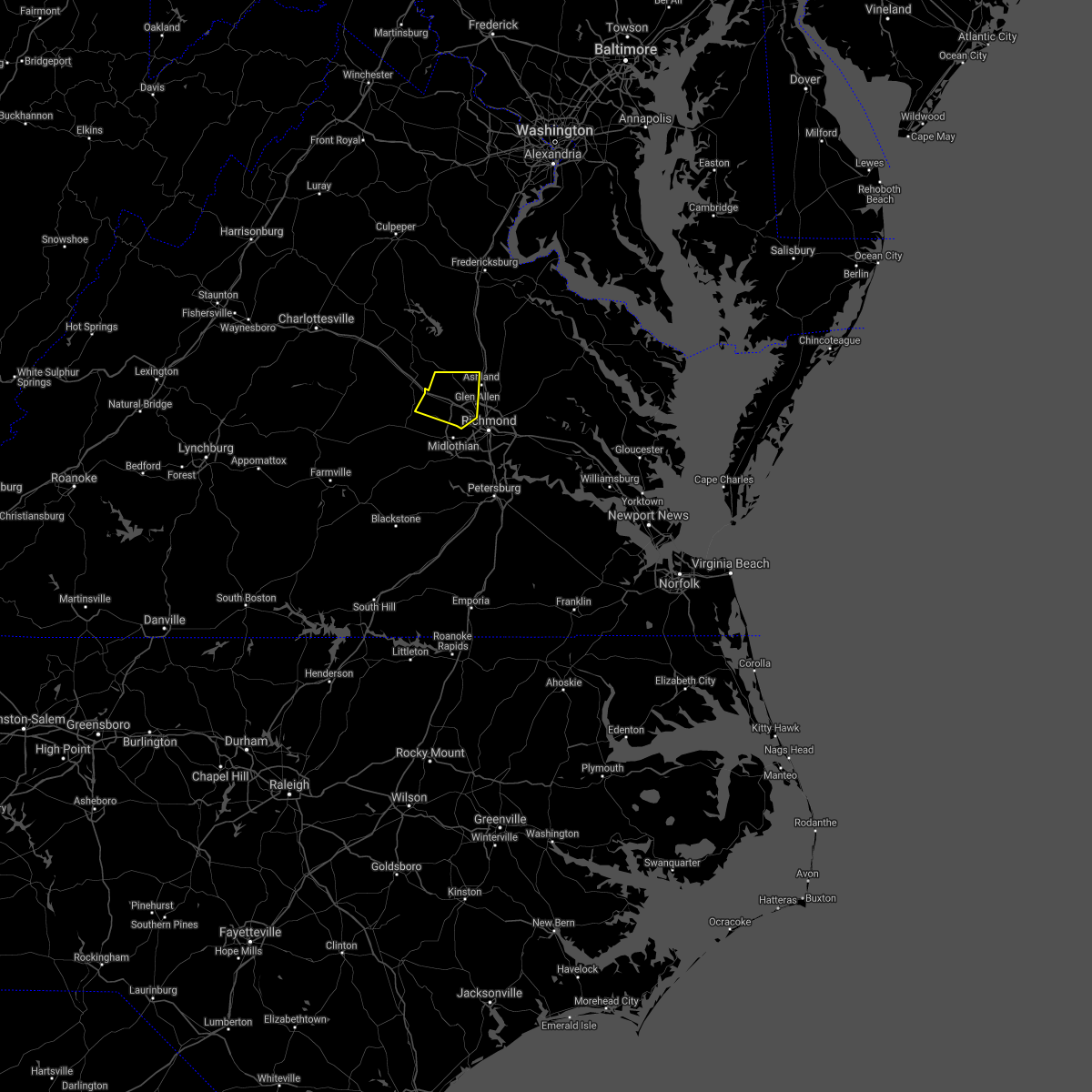 The severe thunderstorm warning for southeastern goochland, northwestern henrico, west central hanover and northeastern powhatan counties will expire at 700 pm edt, the storms which prompted the warning have weakened below severe limits, and no longer pose an immediate threat to life or property. therefore, the warning will be allowed to expire. however gusty winds and heavy rain are still possible with these thunderstorms. The severe thunderstorm warning for southeastern goochland, northwestern henrico, west central hanover and northeastern powhatan counties will expire at 700 pm edt, the storms which prompted the warning have weakened below severe limits, and no longer pose an immediate threat to life or property. therefore, the warning will be allowed to expire. however gusty winds and heavy rain are still possible with these thunderstorms.
|
| 8/30/2021 6:36 PM EDT |
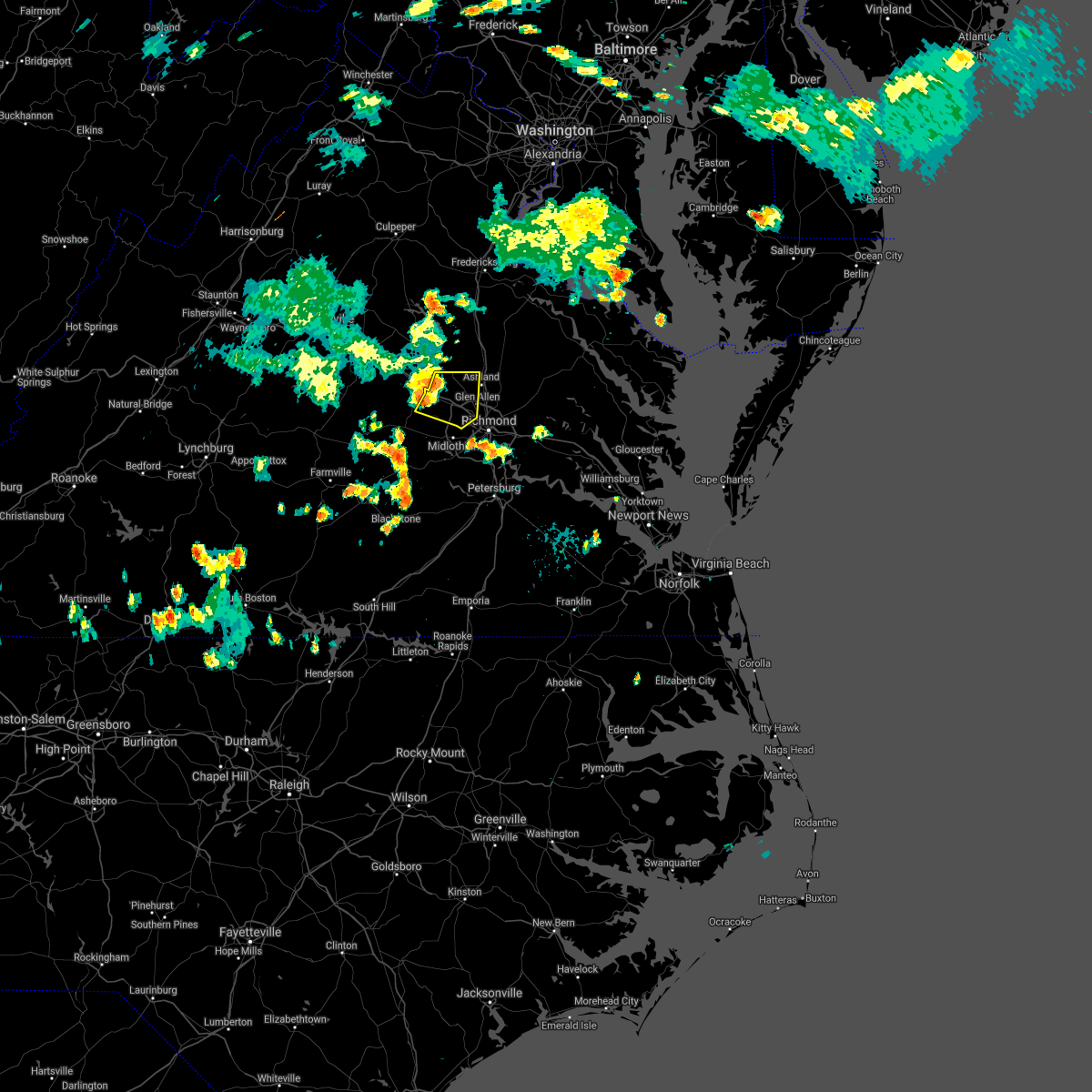 At 635 pm edt, severe thunderstorms were located along a line extending from near montpelier to oilville to near goochland, moving east at 25 mph (radar indicated). Hazards include 60 mph wind gusts. Expect damage to trees and powerlines. these severe storms will be near, montpelier around 645 pm edt. wyndham and sabot around 650 pm edt. manakin around 655 pm edt. tuckahoe around 700 pm edt. ashland, glen allen and laurel around 710 pm edt. other locations impacted by these severe thunderstorms include rockville, gilman, crozier, roslyn hills, vontay, johnsons springs, goodall, short pump and dumbarton. hail threat, radar indicated max hail size, <. 75 in wind threat, radar indicated max wind gust, 60 mph. At 635 pm edt, severe thunderstorms were located along a line extending from near montpelier to oilville to near goochland, moving east at 25 mph (radar indicated). Hazards include 60 mph wind gusts. Expect damage to trees and powerlines. these severe storms will be near, montpelier around 645 pm edt. wyndham and sabot around 650 pm edt. manakin around 655 pm edt. tuckahoe around 700 pm edt. ashland, glen allen and laurel around 710 pm edt. other locations impacted by these severe thunderstorms include rockville, gilman, crozier, roslyn hills, vontay, johnsons springs, goodall, short pump and dumbarton. hail threat, radar indicated max hail size, <. 75 in wind threat, radar indicated max wind gust, 60 mph.
|
| 8/30/2021 6:17 PM EDT |
 At 617 pm edt, severe thunderstorms were located along a line extending from near gum spring to near goochland to 6 miles northeast of trenholm, moving east at 25 mph (radar indicated). Hazards include 60 mph wind gusts and penny size hail. expect damage to trees and powerlines At 617 pm edt, severe thunderstorms were located along a line extending from near gum spring to near goochland to 6 miles northeast of trenholm, moving east at 25 mph (radar indicated). Hazards include 60 mph wind gusts and penny size hail. expect damage to trees and powerlines
|
| 8/11/2021 7:35 PM EDT |
 At 734 pm edt, a severe thunderstorm was located over bensley, or near richmond, moving east at 20 mph (radar indicated). Hazards include 60 mph wind gusts. Expect damage to trees and powerlines. locations impacted include, richmond, downtown richmond, bon air, virginia union university, chester, highland springs, virginia commonwealth university, university of richmond, tuckahoe, bensley, bellwood, east highland park, chesterfield court house, chesterfield, richmond heights, midlothian, montrose, sandston, pocahontas state park and richmond international. hail threat, radar indicated max hail size, <. 75 in wind threat, radar indicated max wind gust, 60 mph. At 734 pm edt, a severe thunderstorm was located over bensley, or near richmond, moving east at 20 mph (radar indicated). Hazards include 60 mph wind gusts. Expect damage to trees and powerlines. locations impacted include, richmond, downtown richmond, bon air, virginia union university, chester, highland springs, virginia commonwealth university, university of richmond, tuckahoe, bensley, bellwood, east highland park, chesterfield court house, chesterfield, richmond heights, midlothian, montrose, sandston, pocahontas state park and richmond international. hail threat, radar indicated max hail size, <. 75 in wind threat, radar indicated max wind gust, 60 mph.
|
| 8/11/2021 7:23 PM EDT |
 At 723 pm edt, a severe thunderstorm was located near richmond, moving east at 20 mph (radar indicated). Hazards include 70 mph wind gusts and penny size hail. Expect considerable tree damage. damage is likely to mobile homes, roofs, and outbuildings. locations impacted include, richmond, downtown richmond, bon air, virginia union university, virginia commonwealth university, tuckahoe, university of richmond, chester, highland springs, bensley, bellwood, east highland park, lakeside, chesterfield court house, laurel, chesterfield, richmond heights, montrose, sandston and pocahontas state park. thunderstorm damage threat, considerable hail threat, radar indicated max hail size, 0. 75 in wind threat, radar indicated max wind gust, 70 mph. At 723 pm edt, a severe thunderstorm was located near richmond, moving east at 20 mph (radar indicated). Hazards include 70 mph wind gusts and penny size hail. Expect considerable tree damage. damage is likely to mobile homes, roofs, and outbuildings. locations impacted include, richmond, downtown richmond, bon air, virginia union university, virginia commonwealth university, tuckahoe, university of richmond, chester, highland springs, bensley, bellwood, east highland park, lakeside, chesterfield court house, laurel, chesterfield, richmond heights, montrose, sandston and pocahontas state park. thunderstorm damage threat, considerable hail threat, radar indicated max hail size, 0. 75 in wind threat, radar indicated max wind gust, 70 mph.
|
| 8/11/2021 7:14 PM EDT |
 At 714 pm edt, a severe thunderstorm was located over bon air, moving southeast at 20 mph (radar indicated). Hazards include 70 mph wind gusts and penny size hail. Expect considerable tree damage. Damage is likely to mobile homes, roofs, and outbuildings. At 714 pm edt, a severe thunderstorm was located over bon air, moving southeast at 20 mph (radar indicated). Hazards include 70 mph wind gusts and penny size hail. Expect considerable tree damage. Damage is likely to mobile homes, roofs, and outbuildings.
|
| 8/11/2021 7:02 PM EDT | Report from mping: trees uprooted or snapped; roof blown of in powhatan county VA, 6.8 miles ENE of Tuckahoe, VA |
| 8/11/2021 6:57 PM EDT |
 At 657 pm edt, a severe thunderstorm was located near bon air, moving east at 30 mph (radar indicated). Hazards include 70 mph wind gusts and penny size hail. Expect considerable tree damage. damage is likely to mobile homes, roofs, and outbuildings. locations impacted include, richmond, powhatan, downtown richmond, bon air, virginia union university, virginia commonwealth university, tuckahoe, university of richmond, moseley, chester, highland springs, bensley, manakin, bellwood, east highland park, sabot, chesterfield court house, lakeside, chesterfield and richmond heights. thunderstorm damage threat, considerable hail threat, radar indicated max hail size, 0. 75 in wind threat, radar indicated max wind gust, 70 mph. At 657 pm edt, a severe thunderstorm was located near bon air, moving east at 30 mph (radar indicated). Hazards include 70 mph wind gusts and penny size hail. Expect considerable tree damage. damage is likely to mobile homes, roofs, and outbuildings. locations impacted include, richmond, powhatan, downtown richmond, bon air, virginia union university, virginia commonwealth university, tuckahoe, university of richmond, moseley, chester, highland springs, bensley, manakin, bellwood, east highland park, sabot, chesterfield court house, lakeside, chesterfield and richmond heights. thunderstorm damage threat, considerable hail threat, radar indicated max hail size, 0. 75 in wind threat, radar indicated max wind gust, 70 mph.
|
| 8/11/2021 6:32 PM EDT |
 At 632 pm edt, severe thunderstorms were located along a line extending from newtown to aylett to virginia union university, moving east at 30 mph (radar indicated). Hazards include 60 mph wind gusts. Expect damage to trees and powerlines. locations impacted include, mechanicsville, highland springs, manquin, beulahville, newtown, aylett, glen allen, laurel, studley, mangohick, lakeside, east highland park, enfield, etna mills, epworth, solomons store, chamberlayne, atlee, ashcake and globe. hail threat, radar indicated max hail size, <. 75 in wind threat, radar indicated max wind gust, 60 mph. At 632 pm edt, severe thunderstorms were located along a line extending from newtown to aylett to virginia union university, moving east at 30 mph (radar indicated). Hazards include 60 mph wind gusts. Expect damage to trees and powerlines. locations impacted include, mechanicsville, highland springs, manquin, beulahville, newtown, aylett, glen allen, laurel, studley, mangohick, lakeside, east highland park, enfield, etna mills, epworth, solomons store, chamberlayne, atlee, ashcake and globe. hail threat, radar indicated max hail size, <. 75 in wind threat, radar indicated max wind gust, 60 mph.
|
| 8/11/2021 6:31 PM EDT |
 At 631 pm edt, a severe thunderstorm was located near sabot, or 8 miles north of moseley, moving southeast at 20 mph (radar indicated). Hazards include 60 mph wind gusts and penny size hail. expect damage to trees and powerlines At 631 pm edt, a severe thunderstorm was located near sabot, or 8 miles north of moseley, moving southeast at 20 mph (radar indicated). Hazards include 60 mph wind gusts and penny size hail. expect damage to trees and powerlines
|
| 8/11/2021 6:16 PM EDT |
 At 616 pm edt, severe thunderstorms were located along a line extending from 7 miles west of newtown to mangohick to tuckahoe, moving east at 25 mph (radar indicated). Hazards include 60 mph wind gusts. Expect damage to trees and powerlines. locations impacted include, ashland, randolph macon college, mechanicsville, highland springs, hanover, manquin, beulahville, newtown, dawn, aylett, glen allen, kings dominion, laurel, studley, wyndham, mangohick, lakeside, east highland park, enfield and gum tree. hail threat, radar indicated max hail size, <. 75 in wind threat, radar indicated max wind gust, 60 mph. At 616 pm edt, severe thunderstorms were located along a line extending from 7 miles west of newtown to mangohick to tuckahoe, moving east at 25 mph (radar indicated). Hazards include 60 mph wind gusts. Expect damage to trees and powerlines. locations impacted include, ashland, randolph macon college, mechanicsville, highland springs, hanover, manquin, beulahville, newtown, dawn, aylett, glen allen, kings dominion, laurel, studley, wyndham, mangohick, lakeside, east highland park, enfield and gum tree. hail threat, radar indicated max hail size, <. 75 in wind threat, radar indicated max wind gust, 60 mph.
|
| 8/11/2021 5:56 PM EDT |
 At 556 pm edt, severe thunderstorms were located along a line extending from near ladysmith to near kings dominion to wyndham, moving east at 30 mph (radar indicated). Hazards include 60 mph wind gusts. expect damage to trees and powerlines At 556 pm edt, severe thunderstorms were located along a line extending from near ladysmith to near kings dominion to wyndham, moving east at 30 mph (radar indicated). Hazards include 60 mph wind gusts. expect damage to trees and powerlines
|
| 7/28/2021 9:37 PM EDT |
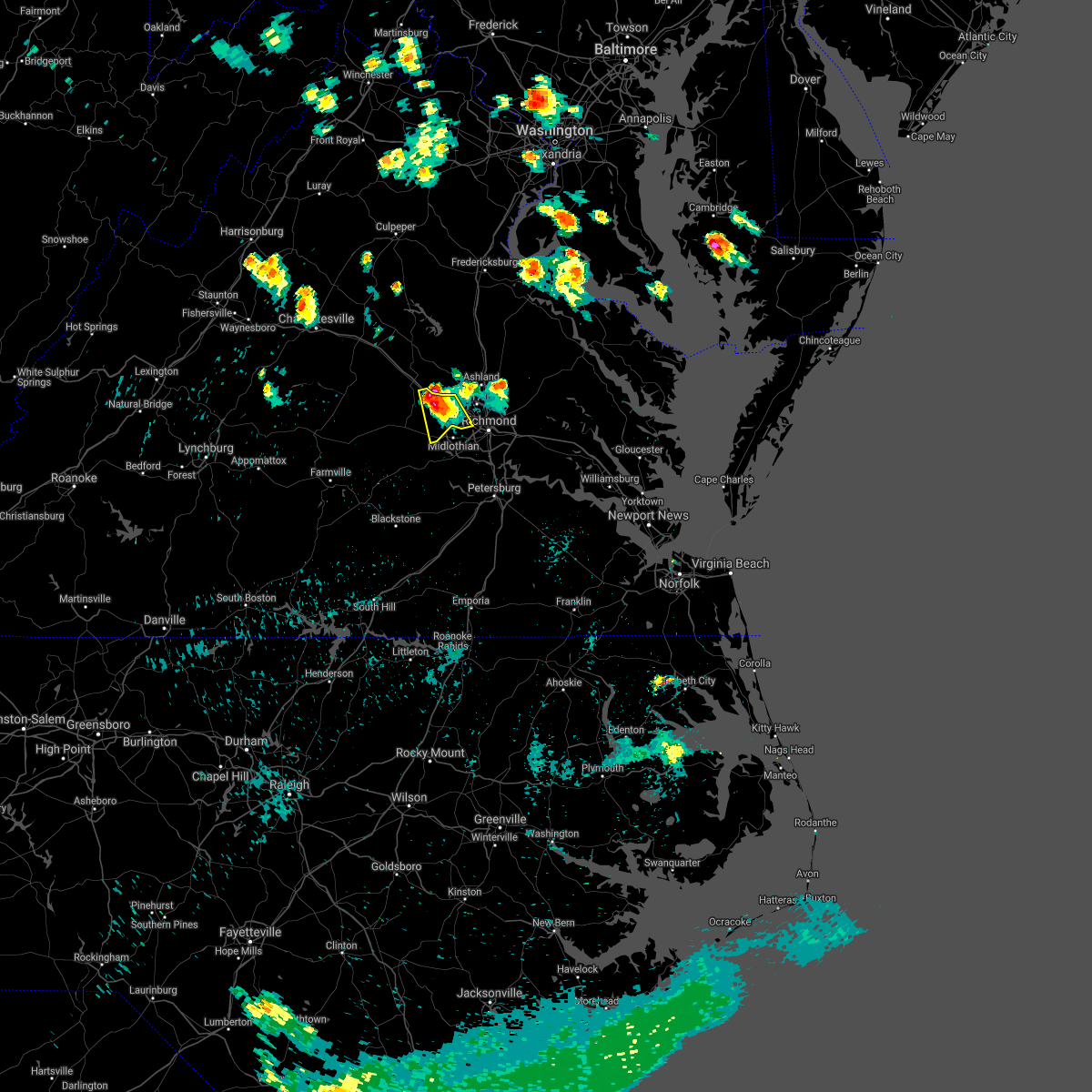 At 936 pm edt, a severe thunderstorm was located over sabot, or 8 miles east of goochland, moving south at 25 mph (radar indicated). Hazards include 60 mph wind gusts and quarter size hail. Minor damage to vehicles is possible. expect wind damage to trees and powerlines. this severe thunderstorm will be near, tuckahoe, manakin and sabot around 945 pm edt. Other locations impacted by this severe thunderstorm include crozier, fine creek mills, roslyn hills, holly hills, johnsons springs, short pump and subletts. At 936 pm edt, a severe thunderstorm was located over sabot, or 8 miles east of goochland, moving south at 25 mph (radar indicated). Hazards include 60 mph wind gusts and quarter size hail. Minor damage to vehicles is possible. expect wind damage to trees and powerlines. this severe thunderstorm will be near, tuckahoe, manakin and sabot around 945 pm edt. Other locations impacted by this severe thunderstorm include crozier, fine creek mills, roslyn hills, holly hills, johnsons springs, short pump and subletts.
|
| 7/28/2021 9:26 PM EDT |
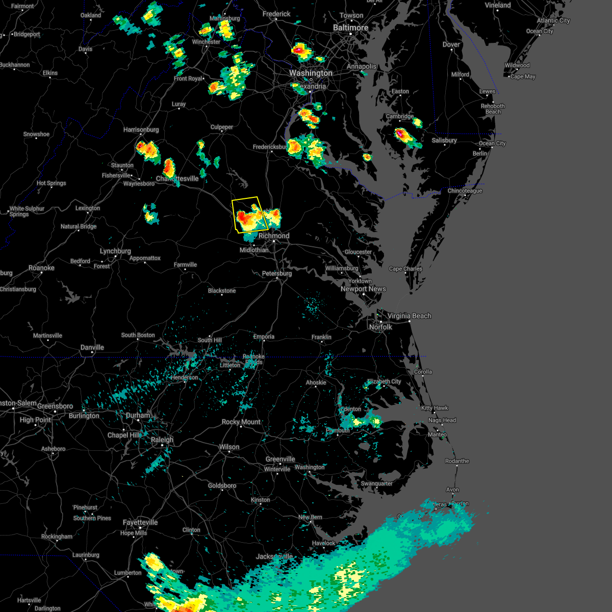 The severe thunderstorm warning for southeastern louisa, southeastern goochland, northwestern henrico and northwestern hanover counties will expire at 930 pm edt, the storm which prompted the warning has weakened below severe limits, and no longer poses an immediate threat to life or property. therefore, the warning will be allowed to expire. however gusty winds and heavy rain are still possible with this thunderstorm. to report severe weather, contact your nearest law enforcement agency. they will relay your report to the national weather service in wakefield. The severe thunderstorm warning for southeastern louisa, southeastern goochland, northwestern henrico and northwestern hanover counties will expire at 930 pm edt, the storm which prompted the warning has weakened below severe limits, and no longer poses an immediate threat to life or property. therefore, the warning will be allowed to expire. however gusty winds and heavy rain are still possible with this thunderstorm. to report severe weather, contact your nearest law enforcement agency. they will relay your report to the national weather service in wakefield.
|
| 7/28/2021 8:51 PM EDT |
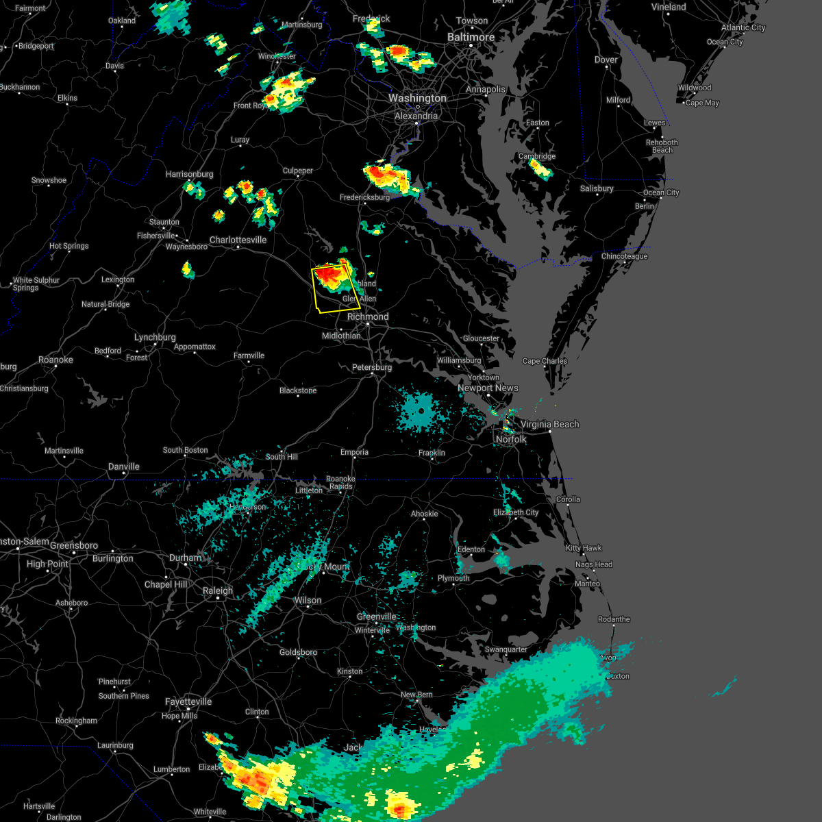 At 850 pm edt, a severe thunderstorm was located near montpelier, or 9 miles northeast of goochland, moving south at 25 mph (radar indicated). Hazards include 60 mph wind gusts and quarter size hail. Minor damage to vehicles is possible. Expect wind damage to trees and powerlines. At 850 pm edt, a severe thunderstorm was located near montpelier, or 9 miles northeast of goochland, moving south at 25 mph (radar indicated). Hazards include 60 mph wind gusts and quarter size hail. Minor damage to vehicles is possible. Expect wind damage to trees and powerlines.
|
| 5/4/2021 6:02 PM EDT |
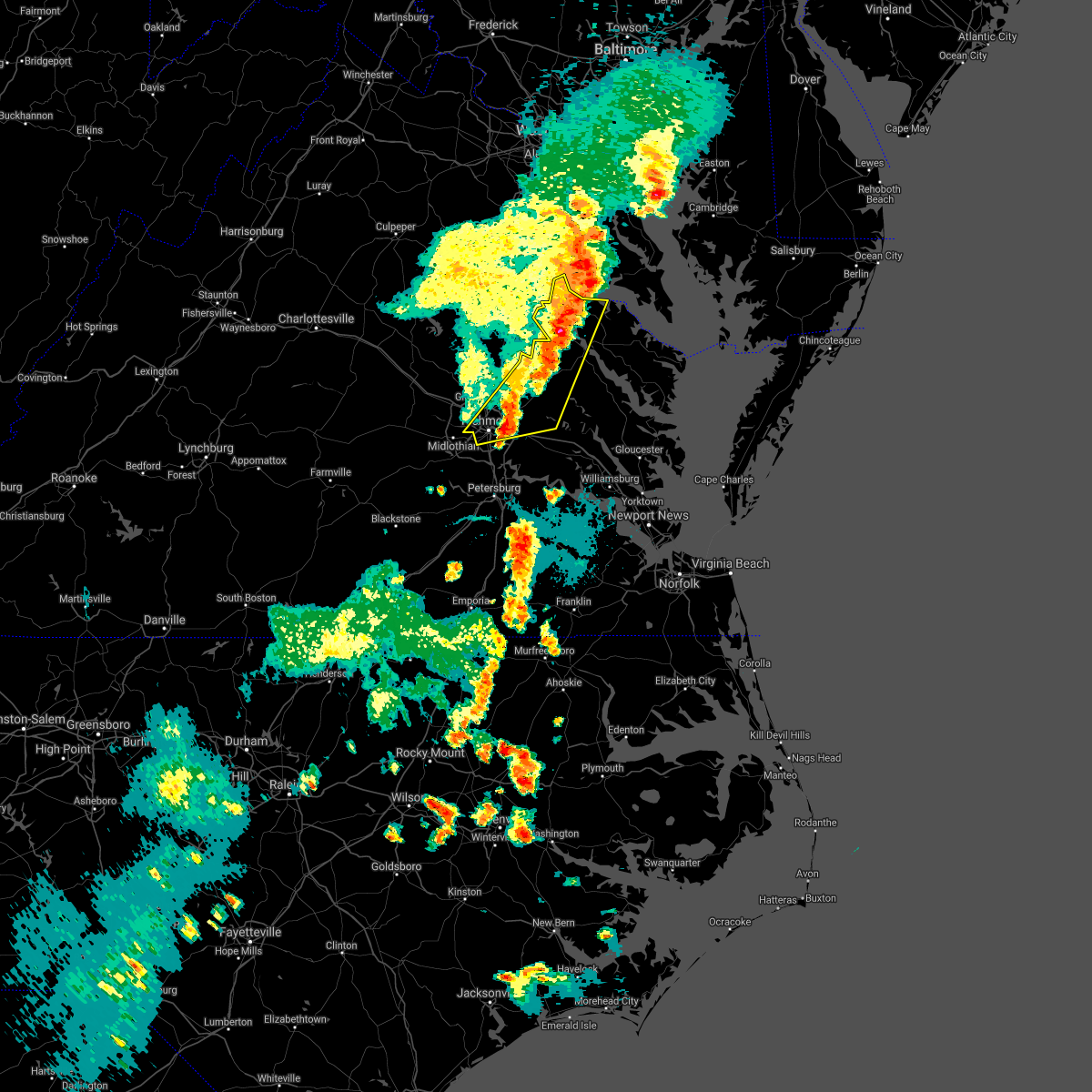 At 601 pm edt, severe thunderstorms were located along a line extending from near popes creek to 6 miles northwest of montross to near highland springs, moving east at 50 mph (radar indicated). Hazards include 60 mph wind gusts and penny size hail. Expect damage to trees and powerlines. these severe storms will be near, colonial beach and montross around 605 pm edt. king william around 620 pm edt. Other locations impacted by these severe thunderstorms include beazley, currioman landing, etna mills, montrose, sandston, biscoe, chamberlayne, atlee, ashcake and mount landing. At 601 pm edt, severe thunderstorms were located along a line extending from near popes creek to 6 miles northwest of montross to near highland springs, moving east at 50 mph (radar indicated). Hazards include 60 mph wind gusts and penny size hail. Expect damage to trees and powerlines. these severe storms will be near, colonial beach and montross around 605 pm edt. king william around 620 pm edt. Other locations impacted by these severe thunderstorms include beazley, currioman landing, etna mills, montrose, sandston, biscoe, chamberlayne, atlee, ashcake and mount landing.
|
| 5/4/2021 5:47 PM EDT |
 At 546 pm edt, severe thunderstorms were located along a line extending from king george to near loretto to richmond, moving east at 50 mph (radar indicated). Hazards include 60 mph wind gusts and penny size hail. Expect damage to trees and powerlines. these severe storms will be near, leedstown and loretto around 550 pm edt. colonial beach and montross around 600 pm edt. tunstall around 610 pm edt. king william around 620 pm edt. Other locations impacted by these severe thunderstorms include beazley, currioman landing, gum tree, etna mills, montrose, sandston, biscoe, chamberlayne, atlee and ashcake. At 546 pm edt, severe thunderstorms were located along a line extending from king george to near loretto to richmond, moving east at 50 mph (radar indicated). Hazards include 60 mph wind gusts and penny size hail. Expect damage to trees and powerlines. these severe storms will be near, leedstown and loretto around 550 pm edt. colonial beach and montross around 600 pm edt. tunstall around 610 pm edt. king william around 620 pm edt. Other locations impacted by these severe thunderstorms include beazley, currioman landing, gum tree, etna mills, montrose, sandston, biscoe, chamberlayne, atlee and ashcake.
|
| 5/4/2021 5:35 PM EDT | Siding damaged on hom in henrico county VA, 2 miles WSW of Tuckahoe, VA |
| 5/4/2021 5:27 PM EDT |
 At 526 pm edt, severe thunderstorms were located along a line extending from near fredericksburg to near bowling green to near manakin, moving east at 50 mph (radar indicated). Hazards include 60 mph wind gusts and penny size hail. Expect damage to trees and powerlines. severe thunderstorms will be near, bowling green and milford around 530 pm edt. fort a. p. hill around 535 pm edt. virginia union university, virginia commonwealth university, downtown richmond, port royal and glen allen around 540 pm edt. mechanicsville, highland springs and east highland park around 545 pm edt. studley, leedstown and loretto around 550 pm edt. colonial beach, manquin and tunstall around 600 pm edt. montross and aylett around 605 pm edt. king william and saint stephens church around 610 pm edt. Other locations impacted by these severe thunderstorms include beazley, currioman landing, gum tree, etna mills, montrose, sandston, biscoe, chamberlayne, atlee and ashcake. At 526 pm edt, severe thunderstorms were located along a line extending from near fredericksburg to near bowling green to near manakin, moving east at 50 mph (radar indicated). Hazards include 60 mph wind gusts and penny size hail. Expect damage to trees and powerlines. severe thunderstorms will be near, bowling green and milford around 530 pm edt. fort a. p. hill around 535 pm edt. virginia union university, virginia commonwealth university, downtown richmond, port royal and glen allen around 540 pm edt. mechanicsville, highland springs and east highland park around 545 pm edt. studley, leedstown and loretto around 550 pm edt. colonial beach, manquin and tunstall around 600 pm edt. montross and aylett around 605 pm edt. king william and saint stephens church around 610 pm edt. Other locations impacted by these severe thunderstorms include beazley, currioman landing, gum tree, etna mills, montrose, sandston, biscoe, chamberlayne, atlee and ashcake.
|
| 5/4/2021 5:22 PM EDT | Trees down along huguenot trai in powhatan county VA, 9 miles E of Tuckahoe, VA |
| 5/4/2021 5:18 PM EDT |
 At 518 pm edt, severe thunderstorms were located along a line extending from spotsylvania to ladysmith to near oilville, moving northeast at 50 mph (radar indicated). Hazards include 60 mph wind gusts and penny size hail. Expect damage to trees and powerlines. these severe storms will be near, milford around 525 pm edt. bowling green around 530 pm edt. ashland and fort a. p. hill around 535 pm edt. hanover, port royal, kings dominion and dawn around 540 pm edt. Other locations impacted by these severe thunderstorms include chilesburg, golansville, crozier, rock castle, guinea, corbin, vontay, maidens, gum tree and three square. At 518 pm edt, severe thunderstorms were located along a line extending from spotsylvania to ladysmith to near oilville, moving northeast at 50 mph (radar indicated). Hazards include 60 mph wind gusts and penny size hail. Expect damage to trees and powerlines. these severe storms will be near, milford around 525 pm edt. bowling green around 530 pm edt. ashland and fort a. p. hill around 535 pm edt. hanover, port royal, kings dominion and dawn around 540 pm edt. Other locations impacted by these severe thunderstorms include chilesburg, golansville, crozier, rock castle, guinea, corbin, vontay, maidens, gum tree and three square.
|
| 5/4/2021 4:52 PM EDT |
 At 451 pm edt, severe thunderstorms were located along a line extending from 6 miles northeast of louisa to near bumpass to trenholm, moving east at 60 mph (radar indicated). Hazards include 60 mph wind gusts and penny size hail. Expect damage to trees and powerlines. severe thunderstorms will be near, bumpass around 500 pm edt. gum spring around 505 pm edt. ladysmith, oilville and sabot around 510 pm edt. tuckahoe, wyndham and montpelier around 515 pm edt. bowling green and milford around 520 pm edt. ashland, randolph macon college, fort a. p. hill, glen allen and laurel around 525 pm edt. hanover, port royal, kings dominion and dawn around 530 pm edt. Other locations impacted by these severe thunderstorms include chilesburg, orchid, maidens, gum tree, three square, fine creek mills, michaux, atlee, west view and ashcake. At 451 pm edt, severe thunderstorms were located along a line extending from 6 miles northeast of louisa to near bumpass to trenholm, moving east at 60 mph (radar indicated). Hazards include 60 mph wind gusts and penny size hail. Expect damage to trees and powerlines. severe thunderstorms will be near, bumpass around 500 pm edt. gum spring around 505 pm edt. ladysmith, oilville and sabot around 510 pm edt. tuckahoe, wyndham and montpelier around 515 pm edt. bowling green and milford around 520 pm edt. ashland, randolph macon college, fort a. p. hill, glen allen and laurel around 525 pm edt. hanover, port royal, kings dominion and dawn around 530 pm edt. Other locations impacted by these severe thunderstorms include chilesburg, orchid, maidens, gum tree, three square, fine creek mills, michaux, atlee, west view and ashcake.
|
| 12/24/2020 3:55 PM EST |
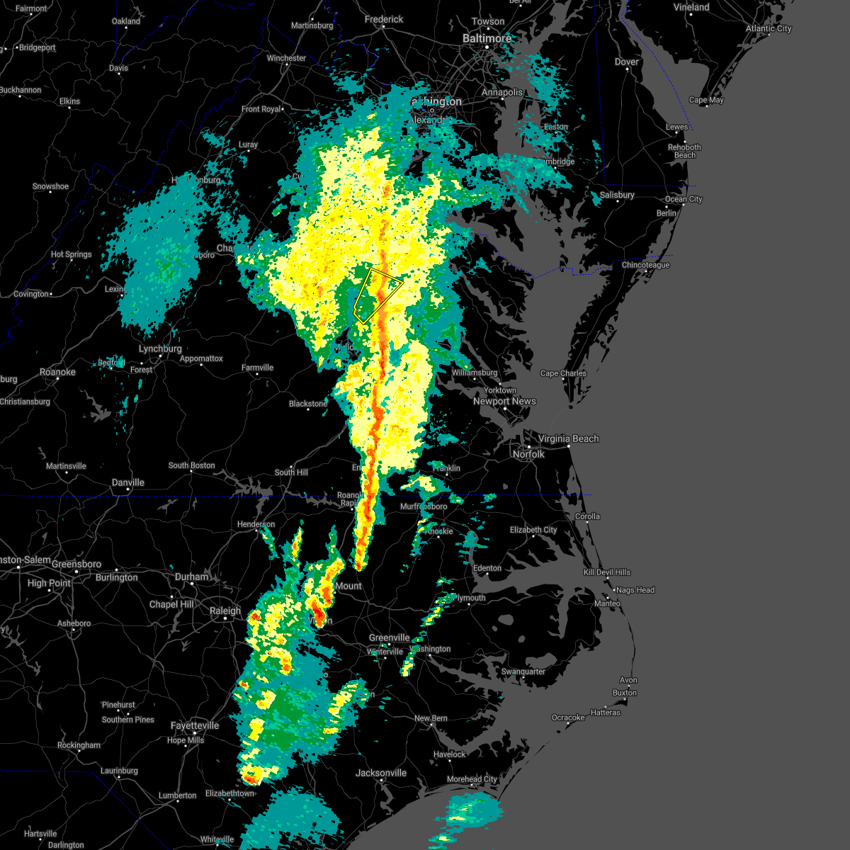 The severe thunderstorm warning for southwestern caroline, northwestern henrico and central hanover counties will expire at 400 pm est, the storms which prompted the warning have weakened below severe limits, and no longer pose an immediate threat to life or property. therefore, the warning will be allowed to expire. however gusty winds and heavy rain are still possible with these thunderstorms. The severe thunderstorm warning for southwestern caroline, northwestern henrico and central hanover counties will expire at 400 pm est, the storms which prompted the warning have weakened below severe limits, and no longer pose an immediate threat to life or property. therefore, the warning will be allowed to expire. however gusty winds and heavy rain are still possible with these thunderstorms.
|
| 12/24/2020 3:46 PM EST |
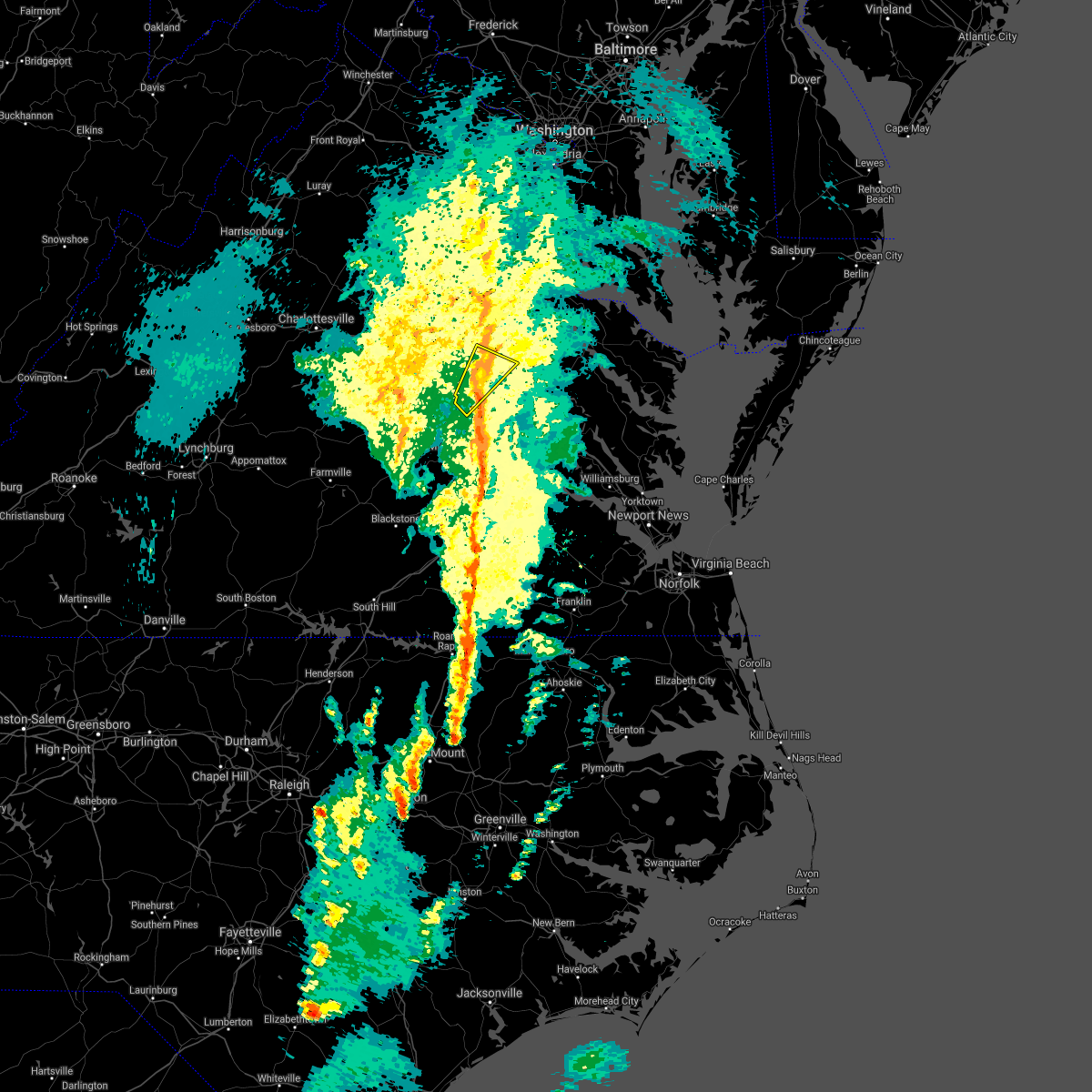 At 345 pm est, severe thunderstorms were located along a line extending from 6 miles south of ladysmith to near kings dominion to near laurel, moving northeast at 30 mph (radar indicated). Hazards include 60 mph wind gusts. Expect damage to trees and powerlines. these severe storms will be near, kings dominion around 350 pm est. dawn around 415 pm est. Other locations impacted by these severe thunderstorms include gilman, oliver, burruss corner, gum tree, doswell, elmont and short pump. At 345 pm est, severe thunderstorms were located along a line extending from 6 miles south of ladysmith to near kings dominion to near laurel, moving northeast at 30 mph (radar indicated). Hazards include 60 mph wind gusts. Expect damage to trees and powerlines. these severe storms will be near, kings dominion around 350 pm est. dawn around 415 pm est. Other locations impacted by these severe thunderstorms include gilman, oliver, burruss corner, gum tree, doswell, elmont and short pump.
|
| 12/24/2020 3:28 PM EST |
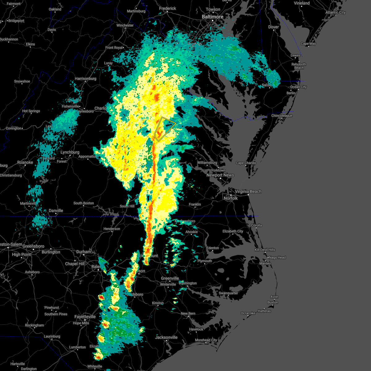 At 327 pm est, a severe thunderstorm was located over wyndham, or near tuckahoe, moving northeast at 35 mph (radar indicated). Hazards include 60 mph wind gusts. Expect damage to trees and powerlines. this severe thunderstorm will be near, randolph macon college around 340 pm est. ashland around 345 pm est. kings dominion and dawn around 350 pm est. Other locations impacted by this severe thunderstorm include gilman, oliver, burruss corner, gum tree, doswell, elmont and short pump. At 327 pm est, a severe thunderstorm was located over wyndham, or near tuckahoe, moving northeast at 35 mph (radar indicated). Hazards include 60 mph wind gusts. Expect damage to trees and powerlines. this severe thunderstorm will be near, randolph macon college around 340 pm est. ashland around 345 pm est. kings dominion and dawn around 350 pm est. Other locations impacted by this severe thunderstorm include gilman, oliver, burruss corner, gum tree, doswell, elmont and short pump.
|
| 7/1/2020 4:18 PM EDT |
 At 418 pm edt, severe thunderstorms were located along a line extending from near richmond to near bellwood to near chester, moving southeast at 20 mph (radar indicated). Hazards include 60 mph wind gusts and quarter size hail. Minor damage to vehicles is possible. expect wind damage to trees and powerlines. severe thunderstorms will be near, chester around 425 pm edt. colonial heights, bellwood and ettrick around 435 pm edt. fort lee around 445 pm edt. petersburg and hopewell around 450 pm edt. prince george, jordans point and garysville around 500 pm edt. Other locations impacted by these severe thunderstorms include wayside, richmond heights, birchett estate, elko, jordan point country club, montrose, petersburg national battlefield, glendale, richmond international and meadowville. At 418 pm edt, severe thunderstorms were located along a line extending from near richmond to near bellwood to near chester, moving southeast at 20 mph (radar indicated). Hazards include 60 mph wind gusts and quarter size hail. Minor damage to vehicles is possible. expect wind damage to trees and powerlines. severe thunderstorms will be near, chester around 425 pm edt. colonial heights, bellwood and ettrick around 435 pm edt. fort lee around 445 pm edt. petersburg and hopewell around 450 pm edt. prince george, jordans point and garysville around 500 pm edt. Other locations impacted by these severe thunderstorms include wayside, richmond heights, birchett estate, elko, jordan point country club, montrose, petersburg national battlefield, glendale, richmond international and meadowville.
|
| 6/22/2020 2:52 PM EDT |
 The severe thunderstorm warning for northwestern chesterfield, northwestern henrico and southeastern powhatan counties and the city of richmond will expire at 300 pm edt, the severe thunderstorm which prompted the warning has weakened over the past ten minutes. therefore, the warning will be allowed to expire. however, heavy rain, gusty winds and frequent lightning are still possible over the city of richmond over the next thirty minutes. The severe thunderstorm warning for northwestern chesterfield, northwestern henrico and southeastern powhatan counties and the city of richmond will expire at 300 pm edt, the severe thunderstorm which prompted the warning has weakened over the past ten minutes. therefore, the warning will be allowed to expire. however, heavy rain, gusty winds and frequent lightning are still possible over the city of richmond over the next thirty minutes.
|
| 6/22/2020 2:36 PM EDT |
 At 236 pm edt, a severe thunderstorm was located over tuckahoe, moving northeast at 35 mph (radar indicated). Hazards include 60 mph wind gusts and quarter size hail. Minor damage to vehicles is possible. expect wind damage to trees and powerlines. this severe storm will be near, downtown richmond around 240 pm edt. richmond around 245 pm edt. Other locations impacted by this severe thunderstorm include holly hills, midlothian, short pump and roslyn hills. At 236 pm edt, a severe thunderstorm was located over tuckahoe, moving northeast at 35 mph (radar indicated). Hazards include 60 mph wind gusts and quarter size hail. Minor damage to vehicles is possible. expect wind damage to trees and powerlines. this severe storm will be near, downtown richmond around 240 pm edt. richmond around 245 pm edt. Other locations impacted by this severe thunderstorm include holly hills, midlothian, short pump and roslyn hills.
|
| 6/22/2020 2:20 PM EDT |
 At 220 pm edt, a severe thunderstorm was located near moseley, moving northeast at 35 mph (radar indicated). Hazards include 60 mph wind gusts and quarter size hail. Minor damage to vehicles is possible. expect wind damage to trees and powerlines. this severe thunderstorm will be near, bon air, university of richmond and tuckahoe around 235 pm edt. downtown richmond around 240 pm edt. richmond around 245 pm edt. Other locations impacted by this severe thunderstorm include holly hills, midlothian, short pump and roslyn hills. At 220 pm edt, a severe thunderstorm was located near moseley, moving northeast at 35 mph (radar indicated). Hazards include 60 mph wind gusts and quarter size hail. Minor damage to vehicles is possible. expect wind damage to trees and powerlines. this severe thunderstorm will be near, bon air, university of richmond and tuckahoe around 235 pm edt. downtown richmond around 240 pm edt. richmond around 245 pm edt. Other locations impacted by this severe thunderstorm include holly hills, midlothian, short pump and roslyn hills.
|
| 6/19/2020 6:05 PM EDT |
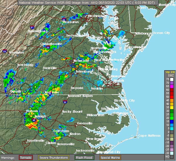 At 605 pm edt, a severe thunderstorm was located near manakin, or near tuckahoe, moving north at 10 mph (radar indicated). Hazards include 60 mph wind gusts and quarter size hail. Minor damage to vehicles is possible. expect wind damage to trees and powerlines. this severe thunderstorm will be near, wyndham around 625 pm edt. oilville around 635 pm edt. montpelier around 645 pm edt. Other locations impacted by this severe thunderstorm include rockville, dabneys, gilman, crozier, vontay, johnsons springs, goodall, short pump and subletts. At 605 pm edt, a severe thunderstorm was located near manakin, or near tuckahoe, moving north at 10 mph (radar indicated). Hazards include 60 mph wind gusts and quarter size hail. Minor damage to vehicles is possible. expect wind damage to trees and powerlines. this severe thunderstorm will be near, wyndham around 625 pm edt. oilville around 635 pm edt. montpelier around 645 pm edt. Other locations impacted by this severe thunderstorm include rockville, dabneys, gilman, crozier, vontay, johnsons springs, goodall, short pump and subletts.
|
| 6/19/2020 3:07 PM EDT |
 The severe thunderstorm warning for south central caroline, northwestern henrico, central hanover and west central king william counties will expire at 315 pm edt, the storm which prompted the warning has weakened below severe limits, and no longer poses an immediate threat to life or property. therefore, the warning will be allowed to expire. however gusty winds to 35 mph are still possible with this thunderstorm. The severe thunderstorm warning for south central caroline, northwestern henrico, central hanover and west central king william counties will expire at 315 pm edt, the storm which prompted the warning has weakened below severe limits, and no longer poses an immediate threat to life or property. therefore, the warning will be allowed to expire. however gusty winds to 35 mph are still possible with this thunderstorm.
|
| 6/19/2020 2:46 PM EDT |
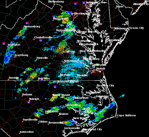 At 245 pm edt, a severe thunderstorm was located over ashland, moving northeast at 25 mph (radar indicated). Hazards include 60 mph wind gusts and penny size hail. Expect damage to trees and powerlines. this severe storm will be near, studley around 255 pm edt. hanover and kings dominion around 300 pm edt. dawn around 305 pm edt. mangohick around 315 pm edt. Other locations impacted by this severe thunderstorm include enfield, hanover airport, gum tree, elmont, etna mills, longdale, calno, solomons store, chamberlayne and atlee. At 245 pm edt, a severe thunderstorm was located over ashland, moving northeast at 25 mph (radar indicated). Hazards include 60 mph wind gusts and penny size hail. Expect damage to trees and powerlines. this severe storm will be near, studley around 255 pm edt. hanover and kings dominion around 300 pm edt. dawn around 305 pm edt. mangohick around 315 pm edt. Other locations impacted by this severe thunderstorm include enfield, hanover airport, gum tree, elmont, etna mills, longdale, calno, solomons store, chamberlayne and atlee.
|
| 6/19/2020 2:32 PM EDT |
 At 232 pm edt, a severe thunderstorm was located over glen allen, or near randolph macon college, moving northeast at 25 mph (radar indicated). Hazards include 60 mph wind gusts and penny size hail. Expect damage to trees and powerlines. this severe thunderstorm will be near, east highland park around 235 pm edt. mechanicsville around 240 pm edt. randolph macon college around 245 pm edt. ashland around 250 pm edt. hanover, kings dominion and studley around 255 pm edt. dawn around 305 pm edt. mangohick around 310 pm edt. Other locations impacted by this severe thunderstorm include enfield, hanover airport, gum tree, elmont, etna mills, longdale, calno, solomons store, chamberlayne and atlee. At 232 pm edt, a severe thunderstorm was located over glen allen, or near randolph macon college, moving northeast at 25 mph (radar indicated). Hazards include 60 mph wind gusts and penny size hail. Expect damage to trees and powerlines. this severe thunderstorm will be near, east highland park around 235 pm edt. mechanicsville around 240 pm edt. randolph macon college around 245 pm edt. ashland around 250 pm edt. hanover, kings dominion and studley around 255 pm edt. dawn around 305 pm edt. mangohick around 310 pm edt. Other locations impacted by this severe thunderstorm include enfield, hanover airport, gum tree, elmont, etna mills, longdale, calno, solomons store, chamberlayne and atlee.
|
| 4/24/2020 4:32 PM EDT |
 At 431 pm edt, a severe thunderstorm was located near chesterfield court house, or 7 miles southwest of richmond, moving southeast at 30 mph (trained weather spotters). Hazards include 60 mph wind gusts and quarter size hail. Minor damage to vehicles is possible. expect wind damage to trees and powerlines. this severe storm will be near, chesterfield court house and bensley around 435 pm edt. chester and bellwood around 440 pm edt. Other locations impacted by this severe thunderstorm include pocahontas state park, beach, richmond heights, drewrys bluff, montrose, centralia and chesterfield. At 431 pm edt, a severe thunderstorm was located near chesterfield court house, or 7 miles southwest of richmond, moving southeast at 30 mph (trained weather spotters). Hazards include 60 mph wind gusts and quarter size hail. Minor damage to vehicles is possible. expect wind damage to trees and powerlines. this severe storm will be near, chesterfield court house and bensley around 435 pm edt. chester and bellwood around 440 pm edt. Other locations impacted by this severe thunderstorm include pocahontas state park, beach, richmond heights, drewrys bluff, montrose, centralia and chesterfield.
|
| 4/24/2020 4:19 PM EDT |
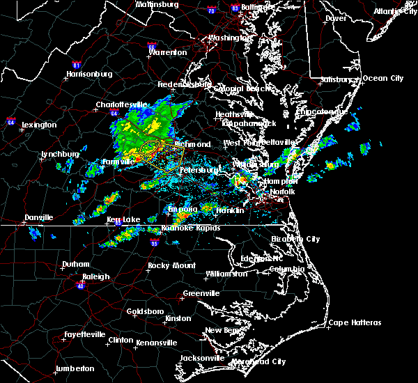 At 418 pm edt, a severe thunderstorm was located near moseley, moving southeast at 30 mph. the public has reported strong wind gusts and trees down in the moseley area (public). Hazards include 60 mph wind gusts and quarter size hail. Minor damage to vehicles is possible. expect wind damage to trees and powerlines. this severe storm will be near, chesterfield court house around 435 pm edt. bellwood and bensley around 440 pm edt. chester around 445 pm edt. Other locations impacted by this severe thunderstorm include pocahontas state park, skinquarter, beach, winterpock, richmond heights, roslyn hills, midlothian, drewrys bluff, montrose and centralia. At 418 pm edt, a severe thunderstorm was located near moseley, moving southeast at 30 mph. the public has reported strong wind gusts and trees down in the moseley area (public). Hazards include 60 mph wind gusts and quarter size hail. Minor damage to vehicles is possible. expect wind damage to trees and powerlines. this severe storm will be near, chesterfield court house around 435 pm edt. bellwood and bensley around 440 pm edt. chester around 445 pm edt. Other locations impacted by this severe thunderstorm include pocahontas state park, skinquarter, beach, winterpock, richmond heights, roslyn hills, midlothian, drewrys bluff, montrose and centralia.
|
| 4/24/2020 4:13 PM EDT |
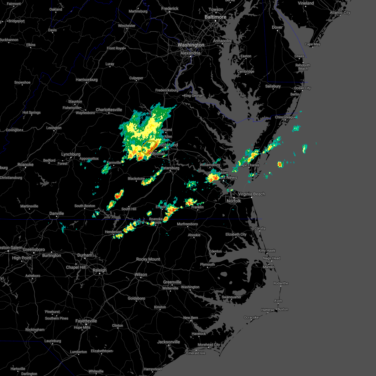 The severe thunderstorm warning for southeastern goochland and southeastern powhatan counties will expire at 415 pm edt, the storm which prompted the warning has moved out of the area. therefore, the warning will be allowed to expire. The severe thunderstorm warning for southeastern goochland and southeastern powhatan counties will expire at 415 pm edt, the storm which prompted the warning has moved out of the area. therefore, the warning will be allowed to expire.
|
| 4/24/2020 4:04 PM EDT |
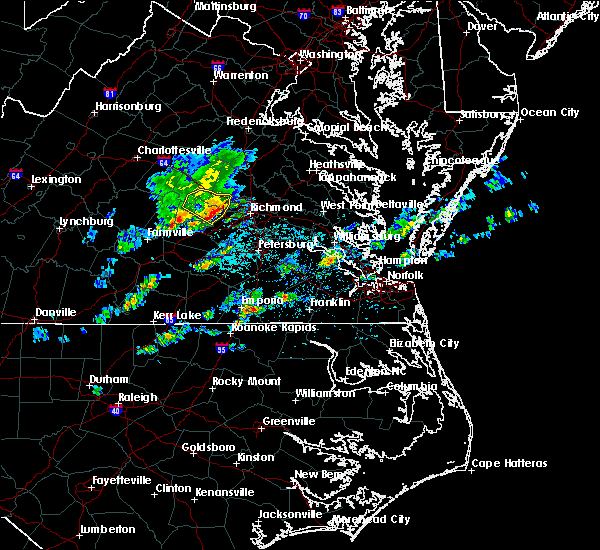 At 404 pm edt, a severe thunderstorm was located near moseley, moving southeast at 35 mph (radar indicated). Hazards include 60 mph wind gusts and quarter size hail. Minor damage to vehicles is possible. expect wind damage to trees and powerlines. This severe thunderstorm will remain over mainly rural areas of southeastern goochland and southeastern powhatan counties, including the following locations, goodwins store, flat rock, crozier, fine creek mills, holly hills, subletts, clayville and worshams. At 404 pm edt, a severe thunderstorm was located near moseley, moving southeast at 35 mph (radar indicated). Hazards include 60 mph wind gusts and quarter size hail. Minor damage to vehicles is possible. expect wind damage to trees and powerlines. This severe thunderstorm will remain over mainly rural areas of southeastern goochland and southeastern powhatan counties, including the following locations, goodwins store, flat rock, crozier, fine creek mills, holly hills, subletts, clayville and worshams.
|
| 4/24/2020 4:02 PM EDT |
 At 401 pm edt, a severe thunderstorm was located near moseley, moving southeast at 30 mph. this storm has a history of producing large hail and damaging wind gusts (radar indicated). Hazards include 60 mph wind gusts and quarter size hail. Minor damage to vehicles is possible. expect wind damage to trees and powerlines. this severe thunderstorm will be near, moseley around 410 pm edt. chesterfield court house around 430 pm edt. bellwood and bensley around 435 pm edt. chester around 440 pm edt. other locations impacted by this severe thunderstorm include goodwins store, flat rock, winterpock, richmond heights, pilkinton, midlothian, montrose, subletts, pocahontas state park and skinquarter. people at chippenham hospital, bon secours st. frances, johnston-willis hospital, hunter holmes mcguire va medical center, and st. Mary`s hospital should seek safe shelter immediately!. At 401 pm edt, a severe thunderstorm was located near moseley, moving southeast at 30 mph. this storm has a history of producing large hail and damaging wind gusts (radar indicated). Hazards include 60 mph wind gusts and quarter size hail. Minor damage to vehicles is possible. expect wind damage to trees and powerlines. this severe thunderstorm will be near, moseley around 410 pm edt. chesterfield court house around 430 pm edt. bellwood and bensley around 435 pm edt. chester around 440 pm edt. other locations impacted by this severe thunderstorm include goodwins store, flat rock, winterpock, richmond heights, pilkinton, midlothian, montrose, subletts, pocahontas state park and skinquarter. people at chippenham hospital, bon secours st. frances, johnston-willis hospital, hunter holmes mcguire va medical center, and st. Mary`s hospital should seek safe shelter immediately!.
|
| 4/24/2020 3:46 PM EDT |
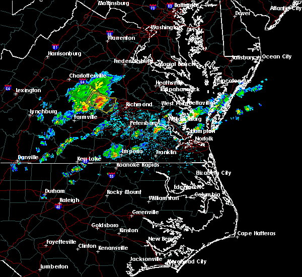 At 345 pm edt, a severe thunderstorm was located near goochland, moving southeast at 30 mph (radar indicated). Hazards include 60 mph wind gusts and quarter size hail. Minor damage to vehicles is possible. expect wind damage to trees and powerlines. this severe storm will be near, powhatan around 355 pm edt. oilville around 400 pm edt. sabot around 405 pm edt. manakin around 415 pm edt. Other locations impacted by this severe thunderstorm include goodwins store, flat rock, crozier, sandy hook, rock castle, jefferson, maidens, provost, three square and irwin. At 345 pm edt, a severe thunderstorm was located near goochland, moving southeast at 30 mph (radar indicated). Hazards include 60 mph wind gusts and quarter size hail. Minor damage to vehicles is possible. expect wind damage to trees and powerlines. this severe storm will be near, powhatan around 355 pm edt. oilville around 400 pm edt. sabot around 405 pm edt. manakin around 415 pm edt. Other locations impacted by this severe thunderstorm include goodwins store, flat rock, crozier, sandy hook, rock castle, jefferson, maidens, provost, three square and irwin.
|
| 4/24/2020 3:31 PM EDT |
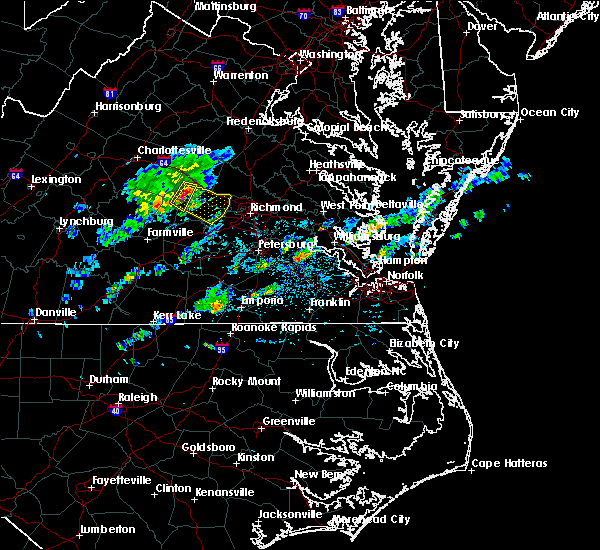 At 330 pm edt, a severe thunderstorm was located near fife, or 9 miles west of goochland, moving southeast at 30 mph (radar indicated). Hazards include 60 mph wind gusts and half dollar size hail. Minor damage to vehicles is possible. expect wind damage to trees and powerlines. this severe thunderstorm will be near, trenholm around 335 pm edt. goochland around 350 pm edt. powhatan around 355 pm edt. sabot around 405 pm edt. manakin around 415 pm edt. Other locations impacted by this severe thunderstorm include crozier, rock castle, maidens, three square, irwin, johnsons springs, fine creek mills, michaux, west view and othma. At 330 pm edt, a severe thunderstorm was located near fife, or 9 miles west of goochland, moving southeast at 30 mph (radar indicated). Hazards include 60 mph wind gusts and half dollar size hail. Minor damage to vehicles is possible. expect wind damage to trees and powerlines. this severe thunderstorm will be near, trenholm around 335 pm edt. goochland around 350 pm edt. powhatan around 355 pm edt. sabot around 405 pm edt. manakin around 415 pm edt. Other locations impacted by this severe thunderstorm include crozier, rock castle, maidens, three square, irwin, johnsons springs, fine creek mills, michaux, west view and othma.
|
| 4/13/2020 7:18 AM EDT |
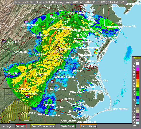 At 718 am edt, severe thunderstorms were located along a line extending from 7 miles southwest of spotsylvania to near montpelier to near ballsville, moving northeast at 65 mph (radar indicated). Hazards include 60 mph wind gusts. Expect damage to trees and powerlines. these severe storms will be near, montpelier and bumpass around 725 am edt. goochland around 730 am edt. sabot, oilville and manakin around 735 am edt. tuckahoe around 740 am edt. wyndham around 745 am edt. Other locations impacted by these severe thunderstorms include crozier, rock castle, pilkinton, vontay, maidens, three square, irwin, johnsons springs, gilman and fine creek mills. At 718 am edt, severe thunderstorms were located along a line extending from 7 miles southwest of spotsylvania to near montpelier to near ballsville, moving northeast at 65 mph (radar indicated). Hazards include 60 mph wind gusts. Expect damage to trees and powerlines. these severe storms will be near, montpelier and bumpass around 725 am edt. goochland around 730 am edt. sabot, oilville and manakin around 735 am edt. tuckahoe around 740 am edt. wyndham around 745 am edt. Other locations impacted by these severe thunderstorms include crozier, rock castle, pilkinton, vontay, maidens, three square, irwin, johnsons springs, gilman and fine creek mills.
|
| 4/13/2020 7:11 AM EDT |
 At 710 am edt, severe thunderstorms were located along a line extending from near bumpass to near gum spring to morven, moving northeast at 65 mph (radar indicated). Hazards include 60 mph wind gusts. Expect damage to trees and powerlines. these severe storms will be near, montpelier, bumpass and trenholm around 720 am edt. goochland, sabot and manakin around 730 am edt. tuckahoe around 735 am edt. wyndham around 740 am edt. Other locations impacted by these severe thunderstorms include orchid, maidens, three square, fine creek mills, michaux, west view, holly hills, wares crossroads, pemberton and genito. At 710 am edt, severe thunderstorms were located along a line extending from near bumpass to near gum spring to morven, moving northeast at 65 mph (radar indicated). Hazards include 60 mph wind gusts. Expect damage to trees and powerlines. these severe storms will be near, montpelier, bumpass and trenholm around 720 am edt. goochland, sabot and manakin around 730 am edt. tuckahoe around 735 am edt. wyndham around 740 am edt. Other locations impacted by these severe thunderstorms include orchid, maidens, three square, fine creek mills, michaux, west view, holly hills, wares crossroads, pemberton and genito.
|
| 4/13/2020 6:55 AM EDT |
 At 655 am edt, severe thunderstorms were located along a line extending from 6 miles north of hadensville to trenholm to near hampden sydney college, moving northeast at 60 mph (radar indicated). Hazards include 60 mph wind gusts. Expect damage to trees and powerlines. severe thunderstorms will be near, louisa, mineral and trenholm around 700 am edt. goochland and bumpass around 705 am edt. oilville, jetersville and gum spring around 710 am edt. amelia courthouse, morven and tobaccoville around 715 am edt. montpelier, chula and ballsville around 720 am edt. powhatan and macon around 725 am edt. sabot around 735 am edt. tuckahoe and manakin around 740 am edt. other locations impacted by these severe thunderstorms include orchid, maidens, three square, fine creek mills, michaux, west view, holly hills, wares crossroads, pemberton and genito. A tornado watch remains in effect until noon edt for central and south central virginia. At 655 am edt, severe thunderstorms were located along a line extending from 6 miles north of hadensville to trenholm to near hampden sydney college, moving northeast at 60 mph (radar indicated). Hazards include 60 mph wind gusts. Expect damage to trees and powerlines. severe thunderstorms will be near, louisa, mineral and trenholm around 700 am edt. goochland and bumpass around 705 am edt. oilville, jetersville and gum spring around 710 am edt. amelia courthouse, morven and tobaccoville around 715 am edt. montpelier, chula and ballsville around 720 am edt. powhatan and macon around 725 am edt. sabot around 735 am edt. tuckahoe and manakin around 740 am edt. other locations impacted by these severe thunderstorms include orchid, maidens, three square, fine creek mills, michaux, west view, holly hills, wares crossroads, pemberton and genito. A tornado watch remains in effect until noon edt for central and south central virginia.
|
| 1/12/2020 1:10 AM EST |
 The severe thunderstorm warning for chesterfield, northeastern nottoway, southeastern goochland, henrico, southern hanover, southeastern amelia, northern dinwiddie and southeastern powhatan counties and the city of richmond will expire at 115 am est, the storms which prompted the warning have weakened below severe limits, and no longer pose an immediate threat to life or property. therefore, the warning will be allowed to expire. however gusty winds and heavy rain are still possible with these thunderstorms. remember, another severe thunderstorm warning remains in effect for parts of nottaway and dinwiddie counties until 130 am. a severe thunderstorm watch remains in effect until 500 am est for central, south central, north central and east central virginia. The severe thunderstorm warning for chesterfield, northeastern nottoway, southeastern goochland, henrico, southern hanover, southeastern amelia, northern dinwiddie and southeastern powhatan counties and the city of richmond will expire at 115 am est, the storms which prompted the warning have weakened below severe limits, and no longer pose an immediate threat to life or property. therefore, the warning will be allowed to expire. however gusty winds and heavy rain are still possible with these thunderstorms. remember, another severe thunderstorm warning remains in effect for parts of nottaway and dinwiddie counties until 130 am. a severe thunderstorm watch remains in effect until 500 am est for central, south central, north central and east central virginia.
|
| 1/12/2020 12:57 AM EST |
 At 1257 am est, severe thunderstorms were located along a line extending from near wyndham to near bon air to spainville, moving northeast at 60 mph (radar indicated). Hazards include 60 mph wind gusts. Expect damage to trees and powerlines. these severe storms will be near, randolph macon college and wyndham around 100 am est. ashland, downtown richmond, university of richmond, bon air, hanover and kings dominion around 105 am est. richmond, virginia union university, virginia commonwealth university and lakeside around 110 am est. highland springs, mechanicsville, moseley and east highland park around 115 am est. studley around 120 am est. chester and chesterfield court house around 125 am est. bensley and bellwood around 130 am est. Other locations impacted by these severe thunderstorms include north wellville, ammon, gum tree, montrose, sandston, pocahontas state park, skinquarter, wellville, beach and chamberlayne. At 1257 am est, severe thunderstorms were located along a line extending from near wyndham to near bon air to spainville, moving northeast at 60 mph (radar indicated). Hazards include 60 mph wind gusts. Expect damage to trees and powerlines. these severe storms will be near, randolph macon college and wyndham around 100 am est. ashland, downtown richmond, university of richmond, bon air, hanover and kings dominion around 105 am est. richmond, virginia union university, virginia commonwealth university and lakeside around 110 am est. highland springs, mechanicsville, moseley and east highland park around 115 am est. studley around 120 am est. chester and chesterfield court house around 125 am est. bensley and bellwood around 130 am est. Other locations impacted by these severe thunderstorms include north wellville, ammon, gum tree, montrose, sandston, pocahontas state park, skinquarter, wellville, beach and chamberlayne.
|
| 1/12/2020 12:34 AM EST |
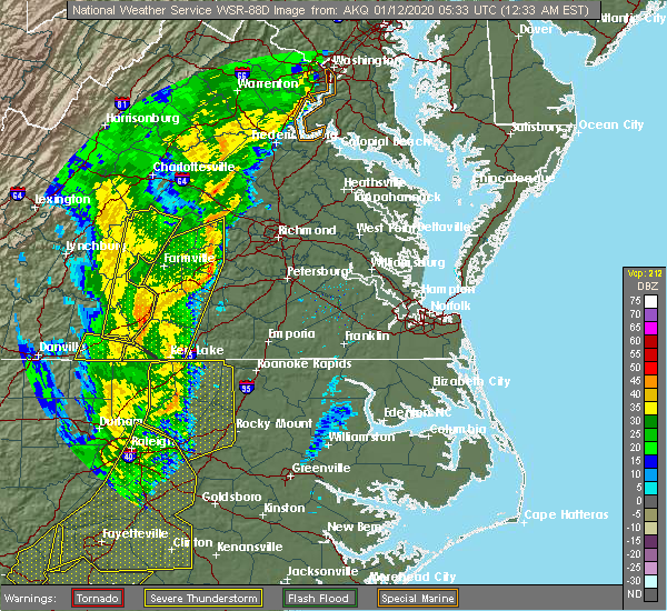 At 1234 am est, severe thunderstorms were located along a line extending from near trenholm to amelia courthouse to near green bay, moving northeast at 60 mph (radar indicated). Hazards include 60 mph wind gusts. Expect damage to trees and powerlines. severe thunderstorms will be near, goochland, chula and scotts fork around 1240 am est. oilville around 1245 am est. moseley around 1250 am est. spainville around 1255 am est. mannboro around 100 am est. university of richmond, bon air, downtown richmond and bensley around 105 am est. richmond, virginia union university, virginia commonwealth university, east highland park, lakeside, laurel, glen allen and kings dominion around 110 am est. mechanicsville, highland springs, studley and chesterfield court house around 115 am est. Other locations impacted by these severe thunderstorms include north wellville, ammon, maidens, gum tree, three square, montrose, sandston, pocahontas state park, skinquarter and wellville. At 1234 am est, severe thunderstorms were located along a line extending from near trenholm to amelia courthouse to near green bay, moving northeast at 60 mph (radar indicated). Hazards include 60 mph wind gusts. Expect damage to trees and powerlines. severe thunderstorms will be near, goochland, chula and scotts fork around 1240 am est. oilville around 1245 am est. moseley around 1250 am est. spainville around 1255 am est. mannboro around 100 am est. university of richmond, bon air, downtown richmond and bensley around 105 am est. richmond, virginia union university, virginia commonwealth university, east highland park, lakeside, laurel, glen allen and kings dominion around 110 am est. mechanicsville, highland springs, studley and chesterfield court house around 115 am est. Other locations impacted by these severe thunderstorms include north wellville, ammon, maidens, gum tree, three square, montrose, sandston, pocahontas state park, skinquarter and wellville.
|
| 8/22/2019 6:20 PM EDT |
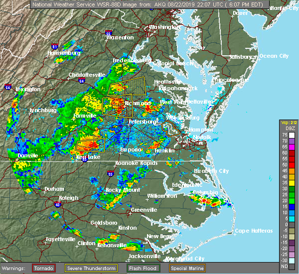 A severe thunderstorm warning remains in effect until 630 pm edt for northeastern chesterfield. central henrico and south central hanover counties and the city of richmond. at 620 pm edt, severe thunderstorms were located along a line extending from near lakeside to bellwood, moving east at 30 mph. hazard. 60 mph wind gusts. A severe thunderstorm warning remains in effect until 630 pm edt for northeastern chesterfield. central henrico and south central hanover counties and the city of richmond. at 620 pm edt, severe thunderstorms were located along a line extending from near lakeside to bellwood, moving east at 30 mph. hazard. 60 mph wind gusts.
|
| 8/22/2019 6:11 PM EDT |
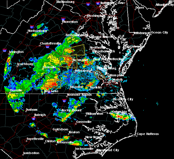 The national weather service in wakefield has issued a * severe thunderstorm warning for. the city of richmond in central virginia. northeastern chesterfield county in central virginia. central king and queen county in east central virginia. Northern charles city county in east central virginia. The national weather service in wakefield has issued a * severe thunderstorm warning for. the city of richmond in central virginia. northeastern chesterfield county in central virginia. central king and queen county in east central virginia. Northern charles city county in east central virginia.
|
| 8/22/2019 5:39 PM EDT |
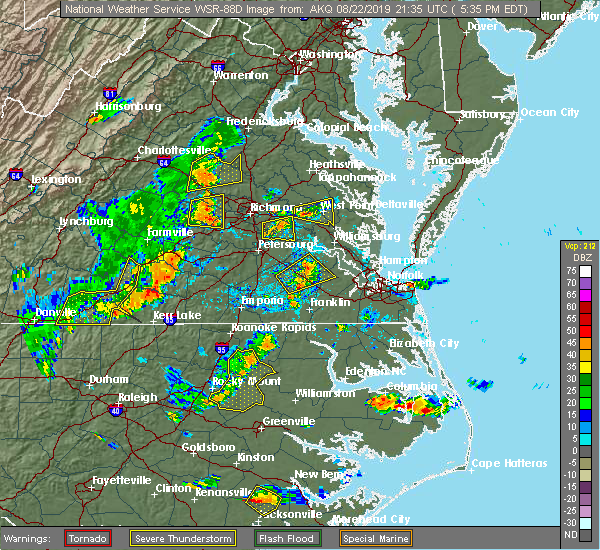 At 539 pm edt, severe thunderstorms were located along a line extending from near sabot to moseley, moving east at 25 mph (radar indicated). Hazards include 60 mph wind gusts and nickel size hail. These storms have produced numerous reports of downed trees in powhatan county. expect damage to trees and powerlines. severe thunderstorms will be near, manakin around 550 pm edt. tuckahoe and wyndham around 600 pm edt. university of richmond, bon air and chesterfield court house around 610 pm edt. laurel around 615 pm edt. richmond, chester, virginia union university, virginia commonwealth university, downtown richmond, lakeside, bellwood, glen allen and bensley around 620 pm edt. east highland park around 625 pm edt. mechanicsville and highland springs around 630 pm edt. Other locations impacted by these severe thunderstorms include crozier, richmond heights, pilkinton, johnsons springs, elmont, montrose, pocahontas state park, skinquarter, solomons store and chamberlayne. At 539 pm edt, severe thunderstorms were located along a line extending from near sabot to moseley, moving east at 25 mph (radar indicated). Hazards include 60 mph wind gusts and nickel size hail. These storms have produced numerous reports of downed trees in powhatan county. expect damage to trees and powerlines. severe thunderstorms will be near, manakin around 550 pm edt. tuckahoe and wyndham around 600 pm edt. university of richmond, bon air and chesterfield court house around 610 pm edt. laurel around 615 pm edt. richmond, chester, virginia union university, virginia commonwealth university, downtown richmond, lakeside, bellwood, glen allen and bensley around 620 pm edt. east highland park around 625 pm edt. mechanicsville and highland springs around 630 pm edt. Other locations impacted by these severe thunderstorms include crozier, richmond heights, pilkinton, johnsons springs, elmont, montrose, pocahontas state park, skinquarter, solomons store and chamberlayne.
|
| 8/15/2019 3:03 PM EDT |
 At 303 pm edt, a severe thunderstorm was located over bensley, or over richmond, moving east at 20 mph (radar indicated). Hazards include 60 mph wind gusts. Expect damage to trees and powerlines. this severe thunderstorm will be near, bellwood around 310 pm edt. highland springs around 325 pm edt. Other locations impacted by this severe thunderstorm include richmond heights, elko, midlothian, montrose, sandston, glendale, pocahontas state park, richmond international, fair oaks and beach. At 303 pm edt, a severe thunderstorm was located over bensley, or over richmond, moving east at 20 mph (radar indicated). Hazards include 60 mph wind gusts. Expect damage to trees and powerlines. this severe thunderstorm will be near, bellwood around 310 pm edt. highland springs around 325 pm edt. Other locations impacted by this severe thunderstorm include richmond heights, elko, midlothian, montrose, sandston, glendale, pocahontas state park, richmond international, fair oaks and beach.
|
| 8/15/2019 2:00 PM EDT | Trees down along flint hill r in powhatan county VA, 11.6 miles ENE of Tuckahoe, VA |
| 8/13/2019 9:41 PM EDT |
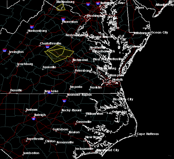 At 941 pm edt, severe thunderstorms were located along a line extending from dawn to near glen allen to tuckahoe, moving southeast at 25 mph (radar indicated). Hazards include 60 mph wind gusts and penny size hail. Expect damage to trees and powerlines. these severe storms will be near, mechanicsville, hanover and east highland park around 945 pm edt. mangohick around 950 pm edt. richmond, studley and beulahville around 955 pm edt. virginia commonwealth university, downtown richmond, virginia union university, highland springs, aylett, manquin, bensley and bellwood around 1000 pm edt. Other locations impacted by these severe thunderstorms include enfield, richmond heights, gum tree, elmont, etna mills, montrose, sandston, epworth, westwood and biscoe. At 941 pm edt, severe thunderstorms were located along a line extending from dawn to near glen allen to tuckahoe, moving southeast at 25 mph (radar indicated). Hazards include 60 mph wind gusts and penny size hail. Expect damage to trees and powerlines. these severe storms will be near, mechanicsville, hanover and east highland park around 945 pm edt. mangohick around 950 pm edt. richmond, studley and beulahville around 955 pm edt. virginia commonwealth university, downtown richmond, virginia union university, highland springs, aylett, manquin, bensley and bellwood around 1000 pm edt. Other locations impacted by these severe thunderstorms include enfield, richmond heights, gum tree, elmont, etna mills, montrose, sandston, epworth, westwood and biscoe.
|
| 8/13/2019 9:14 PM EDT |
 At 914 pm edt, severe thunderstorms were located along a line extending from 6 miles northwest of kings dominion to near montpelier to near oilville, moving southeast at 35 mph (radar indicated). Hazards include 60 mph wind gusts and penny size hail. Expect damage to trees and powerlines. severe thunderstorms will be near, ashland, tuckahoe, randolph macon college and kings dominion around 925 pm edt. dawn, glen allen, laurel and lakeside around 930 pm edt. mechanicsville and hanover around 935 pm edt. richmond, university of richmond, bon air, mangohick and east highland park around 940 pm edt. downtown richmond, virginia commonwealth university, virginia union university, studley and beulahville around 945 pm edt. highland springs and bensley around 950 pm edt. saint stephens church, chester, manquin, aylett and bellwood around 955 pm edt. tunstall and bottoms bridge around 1000 pm edt. Other locations impacted by these severe thunderstorms include enfield, crozier, richmond heights, gum tree, johnsons springs, elmont, etna mills, montrose, sandston and epworth. At 914 pm edt, severe thunderstorms were located along a line extending from 6 miles northwest of kings dominion to near montpelier to near oilville, moving southeast at 35 mph (radar indicated). Hazards include 60 mph wind gusts and penny size hail. Expect damage to trees and powerlines. severe thunderstorms will be near, ashland, tuckahoe, randolph macon college and kings dominion around 925 pm edt. dawn, glen allen, laurel and lakeside around 930 pm edt. mechanicsville and hanover around 935 pm edt. richmond, university of richmond, bon air, mangohick and east highland park around 940 pm edt. downtown richmond, virginia commonwealth university, virginia union university, studley and beulahville around 945 pm edt. highland springs and bensley around 950 pm edt. saint stephens church, chester, manquin, aylett and bellwood around 955 pm edt. tunstall and bottoms bridge around 1000 pm edt. Other locations impacted by these severe thunderstorms include enfield, crozier, richmond heights, gum tree, johnsons springs, elmont, etna mills, montrose, sandston and epworth.
|
| 8/8/2019 12:22 AM EDT |
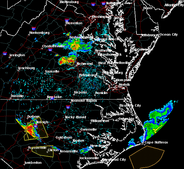 The severe thunderstorm warning for southeastern goochland, northwestern henrico and west central hanover counties will expire at 1230 am edt, the storm which prompted the warning has weakened below severe limits, and no longer poses an immediate threat to life or property. therefore, the warning will be allowed to expire. however, gusty winds and heavy rain are still possible with this thunderstorm. please report severe weather by calling 757-899-2415, posting to the nws wakefield facebook page, or using twitter @nwswakefieldva. The severe thunderstorm warning for southeastern goochland, northwestern henrico and west central hanover counties will expire at 1230 am edt, the storm which prompted the warning has weakened below severe limits, and no longer poses an immediate threat to life or property. therefore, the warning will be allowed to expire. however, gusty winds and heavy rain are still possible with this thunderstorm. please report severe weather by calling 757-899-2415, posting to the nws wakefield facebook page, or using twitter @nwswakefieldva.
|
| 8/8/2019 12:13 AM EDT |
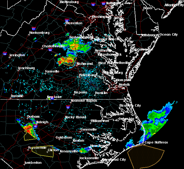 At 1213 am edt, a severe thunderstorm was located over wyndham, or near tuckahoe, moving east at 20 mph (radar indicated). Hazards include 60 mph wind gusts. Expect damage to trees and powerlines. this severe storm will be near, laurel and glen allen around 1230 am edt. Other locations impacted by this severe thunderstorm include rockville, johnsons springs, short pump and elmont. At 1213 am edt, a severe thunderstorm was located over wyndham, or near tuckahoe, moving east at 20 mph (radar indicated). Hazards include 60 mph wind gusts. Expect damage to trees and powerlines. this severe storm will be near, laurel and glen allen around 1230 am edt. Other locations impacted by this severe thunderstorm include rockville, johnsons springs, short pump and elmont.
|
| 8/7/2019 11:50 PM EDT |
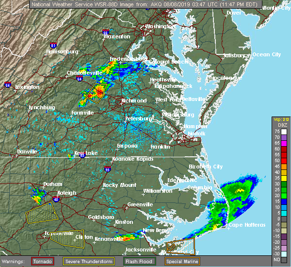 At 1150 pm edt, a severe thunderstorm was located over oilville, or near goochland, moving east at 20 mph (radar indicated). Hazards include 60 mph wind gusts. Expect damage to trees and powerlines. this severe thunderstorm will be near, sabot around 1155 pm edt. manakin around 1200 am edt. wyndham around 1205 am edt. tuckahoe around 1210 am edt. laurel and glen allen around 1225 am edt. Other locations impacted by this severe thunderstorm include rockville, crozier, fine creek mills, vontay, johnsons springs, short pump, subletts, gilman and elmont. At 1150 pm edt, a severe thunderstorm was located over oilville, or near goochland, moving east at 20 mph (radar indicated). Hazards include 60 mph wind gusts. Expect damage to trees and powerlines. this severe thunderstorm will be near, sabot around 1155 pm edt. manakin around 1200 am edt. wyndham around 1205 am edt. tuckahoe around 1210 am edt. laurel and glen allen around 1225 am edt. Other locations impacted by this severe thunderstorm include rockville, crozier, fine creek mills, vontay, johnsons springs, short pump, subletts, gilman and elmont.
|
| 7/11/2019 7:04 PM EDT |
 At 704 pm edt, a severe thunderstorm was located over university of richmond, moving east at 25 mph (radar indicated). Hazards include 60 mph wind gusts. Expect damage to trees and powerlines. this severe thunderstorm will be near, downtown richmond and lakeside around 710 pm edt. richmond, virginia union university, virginia commonwealth university and glen allen around 715 pm edt. mechanicsville and east highland park around 725 pm edt. highland springs around 735 pm edt. studley around 745 pm edt. Other locations impacted by this severe thunderstorm include elko, montrose, sandston, longdale, westwood, richmond international, fair oaks, solomons store, chamberlayne and atlee. At 704 pm edt, a severe thunderstorm was located over university of richmond, moving east at 25 mph (radar indicated). Hazards include 60 mph wind gusts. Expect damage to trees and powerlines. this severe thunderstorm will be near, downtown richmond and lakeside around 710 pm edt. richmond, virginia union university, virginia commonwealth university and glen allen around 715 pm edt. mechanicsville and east highland park around 725 pm edt. highland springs around 735 pm edt. studley around 745 pm edt. Other locations impacted by this severe thunderstorm include elko, montrose, sandston, longdale, westwood, richmond international, fair oaks, solomons store, chamberlayne and atlee.
|
| 6/5/2019 4:23 PM EDT |
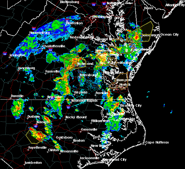 At 423 pm edt, severe thunderstorms were located along a line extending from near hanover to bon air, moving northeast at 50 mph (radar indicated). Hazards include 60 mph wind gusts and quarter size hail. Minor damage to vehicles is possible. expect wind damage to trees and powerlines. these severe storms will be near, hanover around 430 pm edt. highland springs and mechanicsville around 440 pm edt. studley around 445 pm edt. Other locations impacted by these severe thunderstorms include hanover airport, midlothian, elmont, short pump, montrose, sandston, longdale, richmond international, fair oaks and solomons store. At 423 pm edt, severe thunderstorms were located along a line extending from near hanover to bon air, moving northeast at 50 mph (radar indicated). Hazards include 60 mph wind gusts and quarter size hail. Minor damage to vehicles is possible. expect wind damage to trees and powerlines. these severe storms will be near, hanover around 430 pm edt. highland springs and mechanicsville around 440 pm edt. studley around 445 pm edt. Other locations impacted by these severe thunderstorms include hanover airport, midlothian, elmont, short pump, montrose, sandston, longdale, richmond international, fair oaks and solomons store.
|
| 6/5/2019 4:02 PM EDT |
 At 401 pm edt, a severe thunderstorm was located near sabot, or near powhatan, moving east at 30 mph (radar indicated). Hazards include 60 mph wind gusts and quarter size hail. Minor damage to vehicles is possible. expect wind damage to trees and powerlines. this severe thunderstorm will be near, sabot around 410 pm edt. manakin around 415 pm edt. tuckahoe around 420 pm edt. bon air and wyndham around 425 pm edt. university of richmond around 430 pm edt. virginia commonwealth university, downtown richmond and laurel around 435 pm edt. richmond, virginia union university, lakeside and glen allen around 440 pm edt. mechanicsville, highland springs, east highland park and studley around 445 pm edt. Other locations impacted by this severe thunderstorm include crozier, gum tree, johnsons springs, elmont, montrose, sandston, richmond international, fair oaks, gilman and solomons store. At 401 pm edt, a severe thunderstorm was located near sabot, or near powhatan, moving east at 30 mph (radar indicated). Hazards include 60 mph wind gusts and quarter size hail. Minor damage to vehicles is possible. expect wind damage to trees and powerlines. this severe thunderstorm will be near, sabot around 410 pm edt. manakin around 415 pm edt. tuckahoe around 420 pm edt. bon air and wyndham around 425 pm edt. university of richmond around 430 pm edt. virginia commonwealth university, downtown richmond and laurel around 435 pm edt. richmond, virginia union university, lakeside and glen allen around 440 pm edt. mechanicsville, highland springs, east highland park and studley around 445 pm edt. Other locations impacted by this severe thunderstorm include crozier, gum tree, johnsons springs, elmont, montrose, sandston, richmond international, fair oaks, gilman and solomons store.
|
| 5/31/2019 8:42 PM EDT |
 At 841 pm edt, a severe thunderstorm was located over east highland park, or near virginia union university, and is nearly stationary (public). Hazards include 60 mph wind gusts and quarter size hail. Minor damage to vehicles is possible. expect wind damage to trees and powerlines. Locations impacted include, richmond, ashland, randolph macon college, virginia union university, mechanicsville, highland springs, virginia commonwealth university, tuckahoe, laurel, east highland park, lakeside, glen allen, hanover airport, elmont, montrose, longdale, solomons store, chamberlayne, atlee and ashcake. At 841 pm edt, a severe thunderstorm was located over east highland park, or near virginia union university, and is nearly stationary (public). Hazards include 60 mph wind gusts and quarter size hail. Minor damage to vehicles is possible. expect wind damage to trees and powerlines. Locations impacted include, richmond, ashland, randolph macon college, virginia union university, mechanicsville, highland springs, virginia commonwealth university, tuckahoe, laurel, east highland park, lakeside, glen allen, hanover airport, elmont, montrose, longdale, solomons store, chamberlayne, atlee and ashcake.
|
| 5/31/2019 8:18 PM EDT |
 At 818 pm edt, a severe thunderstorm was located over virginia union university, moving northwest at 5 mph (radar indicated). Hazards include 60 mph wind gusts and quarter size hail. Minor damage to vehicles is possible. Expect wind damage to trees and powerlines. At 818 pm edt, a severe thunderstorm was located over virginia union university, moving northwest at 5 mph (radar indicated). Hazards include 60 mph wind gusts and quarter size hail. Minor damage to vehicles is possible. Expect wind damage to trees and powerlines.
|
| 4/19/2019 1:24 PM EDT |
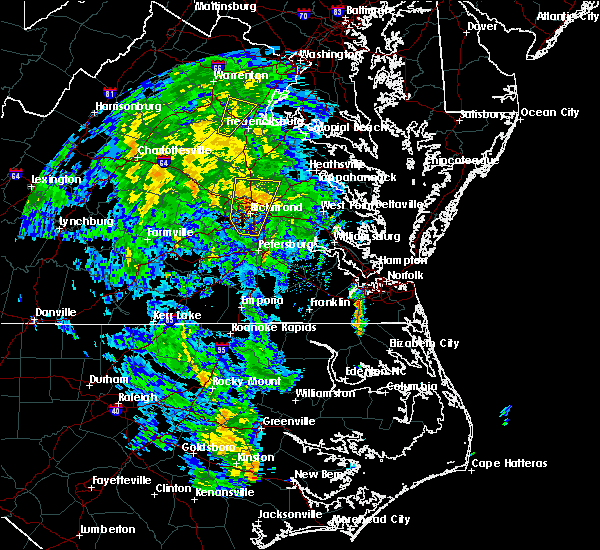 At 123 pm edt, a severe thunderstorm was located over virginia commonwealth university, moving north at 40 mph (radar indicated). Hazards include 60 mph wind gusts. Expect damage to trees and powerlines. this severe storm will be near, mechanicsville, lakeside and laurel around 135 pm edt. glen allen and studley around 140 pm edt. randolph macon college and hanover around 145 pm edt. ashland around 150 pm edt. dawn, kings dominion and mangohick around 155 pm edt. other locations impacted by this severe thunderstorm include hanover airport, gum tree, elmont, etna mills, short pump, longdale, epworth, gilman, calno and solomons store. A tornado watch remains in effect until midnight edt for central, north central and east central virginia. At 123 pm edt, a severe thunderstorm was located over virginia commonwealth university, moving north at 40 mph (radar indicated). Hazards include 60 mph wind gusts. Expect damage to trees and powerlines. this severe storm will be near, mechanicsville, lakeside and laurel around 135 pm edt. glen allen and studley around 140 pm edt. randolph macon college and hanover around 145 pm edt. ashland around 150 pm edt. dawn, kings dominion and mangohick around 155 pm edt. other locations impacted by this severe thunderstorm include hanover airport, gum tree, elmont, etna mills, short pump, longdale, epworth, gilman, calno and solomons store. A tornado watch remains in effect until midnight edt for central, north central and east central virginia.
|
| 4/19/2019 1:12 PM EDT |
 At 111 pm edt, a severe thunderstorm was located over chesterfield court house, or near richmond, moving north at 40 mph (radar indicated). Hazards include 60 mph wind gusts. Expect damage to trees and powerlines. this severe thunderstorm will be near, bensley around 115 pm edt. virginia commonwealth university, virginia union university, downtown richmond, university of richmond and bon air around 125 pm edt. richmond, highland springs and east highland park around 130 pm edt. mechanicsville, lakeside and laurel around 135 pm edt. glen allen and studley around 140 pm edt. randolph macon college around 145 pm edt. ashland and hanover around 150 pm edt. dawn, kings dominion and mangohick around 155 pm edt. Other locations impacted by this severe thunderstorm include richmond heights, gum tree, elmont, etna mills, montrose, epworth, pocahontas state park, fair oaks, gilman and solomons store. At 111 pm edt, a severe thunderstorm was located over chesterfield court house, or near richmond, moving north at 40 mph (radar indicated). Hazards include 60 mph wind gusts. Expect damage to trees and powerlines. this severe thunderstorm will be near, bensley around 115 pm edt. virginia commonwealth university, virginia union university, downtown richmond, university of richmond and bon air around 125 pm edt. richmond, highland springs and east highland park around 130 pm edt. mechanicsville, lakeside and laurel around 135 pm edt. glen allen and studley around 140 pm edt. randolph macon college around 145 pm edt. ashland and hanover around 150 pm edt. dawn, kings dominion and mangohick around 155 pm edt. Other locations impacted by this severe thunderstorm include richmond heights, gum tree, elmont, etna mills, montrose, epworth, pocahontas state park, fair oaks, gilman and solomons store.
|
| 4/15/2019 1:55 AM EDT |
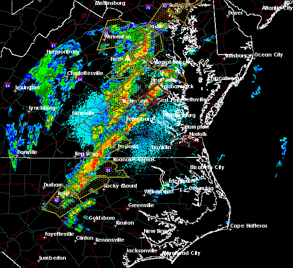 At 154 am edt, a severe thunderstorm was located near bon air, moving northeast at 50 mph (radar indicated). Hazards include 60 mph wind gusts and penny size hail. Expect damage to trees and powerlines. this severe storm will be near, university of richmond, bon air, downtown richmond and tuckahoe around 205 am edt. richmond and laurel around 210 am edt. glen allen around 215 am edt. other locations impacted by this severe thunderstorm include pocahontas state park, beach, greendale, roslyn hills, dumbarton, midlothian, short pump, drewrys bluff, centralia and chesterfield. A tornado watch remains in effect until 700 am edt for central and south central virginia. At 154 am edt, a severe thunderstorm was located near bon air, moving northeast at 50 mph (radar indicated). Hazards include 60 mph wind gusts and penny size hail. Expect damage to trees and powerlines. this severe storm will be near, university of richmond, bon air, downtown richmond and tuckahoe around 205 am edt. richmond and laurel around 210 am edt. glen allen around 215 am edt. other locations impacted by this severe thunderstorm include pocahontas state park, beach, greendale, roslyn hills, dumbarton, midlothian, short pump, drewrys bluff, centralia and chesterfield. A tornado watch remains in effect until 700 am edt for central and south central virginia.
|
| 4/15/2019 1:44 AM EDT |
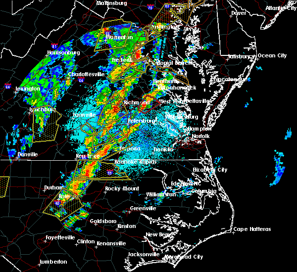 At 144 am edt, a severe thunderstorm was located near moseley, moving northeast at 50 mph (radar indicated). Hazards include 60 mph wind gusts and penny size hail. Expect damage to trees and powerlines. this severe storm will be near, university of richmond, bon air, downtown richmond and tuckahoe around 205 am edt. richmond and laurel around 210 am edt. glen allen around 215 am edt. other locations impacted by this severe thunderstorm include winterpock, earls, ammon, pilkinton, midlothian, short pump, subletts, pocahontas state park, skinquarter and beach. A tornado watch remains in effect until 700 am edt for central and south central virginia. At 144 am edt, a severe thunderstorm was located near moseley, moving northeast at 50 mph (radar indicated). Hazards include 60 mph wind gusts and penny size hail. Expect damage to trees and powerlines. this severe storm will be near, university of richmond, bon air, downtown richmond and tuckahoe around 205 am edt. richmond and laurel around 210 am edt. glen allen around 215 am edt. other locations impacted by this severe thunderstorm include winterpock, earls, ammon, pilkinton, midlothian, short pump, subletts, pocahontas state park, skinquarter and beach. A tornado watch remains in effect until 700 am edt for central and south central virginia.
|
| 4/15/2019 1:28 AM EDT |
 At 128 am edt, a severe thunderstorm was located over spainville, or near mannboro, moving northeast at 50 mph (radar indicated). Hazards include 60 mph wind gusts. Expect damage to trees and powerlines. this severe thunderstorm will be near, scotts fork around 135 am edt. chula around 140 am edt. moseley around 145 am edt. university of richmond, bon air, downtown richmond and tuckahoe around 205 am edt. richmond around 210 am edt. glen allen and laurel around 215 am edt. other locations impacted by this severe thunderstorm include north wellville, earls, ammon, pilkinton, winterham, pocahontas state park, skinquarter, wellville, beach and dominy corner. A tornado watch remains in effect until 700 am edt for central and south central virginia. At 128 am edt, a severe thunderstorm was located over spainville, or near mannboro, moving northeast at 50 mph (radar indicated). Hazards include 60 mph wind gusts. Expect damage to trees and powerlines. this severe thunderstorm will be near, scotts fork around 135 am edt. chula around 140 am edt. moseley around 145 am edt. university of richmond, bon air, downtown richmond and tuckahoe around 205 am edt. richmond around 210 am edt. glen allen and laurel around 215 am edt. other locations impacted by this severe thunderstorm include north wellville, earls, ammon, pilkinton, winterham, pocahontas state park, skinquarter, wellville, beach and dominy corner. A tornado watch remains in effect until 700 am edt for central and south central virginia.
|
| 4/8/2019 6:41 PM EDT |
 At 640 pm edt, a severe thunderstorm was located over lakeside, or over virginia union university, moving east at 35 mph (radar indicated). Hazards include 60 mph wind gusts and nickel size hail. Expect damage to trees and powerlines. this severe storm will be near, mechanicsville and east highland park around 645 pm edt. highland springs around 650 pm edt. studley around 700 pm edt. bottoms bridge around 705 pm edt. manquin around 710 pm edt. talleysville and tunstall around 715 pm edt. Other locations impacted by this severe thunderstorm include wrights corner, central garage, hanover airport, orapax farms, elmont, montrose, sandston, longdale, westwood and richmond international. At 640 pm edt, a severe thunderstorm was located over lakeside, or over virginia union university, moving east at 35 mph (radar indicated). Hazards include 60 mph wind gusts and nickel size hail. Expect damage to trees and powerlines. this severe storm will be near, mechanicsville and east highland park around 645 pm edt. highland springs around 650 pm edt. studley around 700 pm edt. bottoms bridge around 705 pm edt. manquin around 710 pm edt. talleysville and tunstall around 715 pm edt. Other locations impacted by this severe thunderstorm include wrights corner, central garage, hanover airport, orapax farms, elmont, montrose, sandston, longdale, westwood and richmond international.
|
| 4/8/2019 6:24 PM EDT |
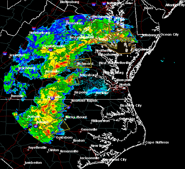 At 624 pm edt, a severe thunderstorm was located over tuckahoe, moving east at 35 mph (radar indicated). Hazards include 60 mph wind gusts and quarter size hail. Minor damage to vehicles is possible. expect wind damage to trees and powerlines. this severe thunderstorm will be near, university of richmond around 630 pm edt. laurel around 635 pm edt. richmond, virginia union university, virginia commonwealth university, downtown richmond, lakeside and glen allen around 640 pm edt. mechanicsville and east highland park around 645 pm edt. highland springs around 650 pm edt. studley around 700 pm edt. bottoms bridge around 705 pm edt. manquin around 710 pm edt. Other locations impacted by this severe thunderstorm include wrights corner, central garage, hanover airport, orapax farms, midlothian, elmont, short pump, montrose, sandston and longdale. At 624 pm edt, a severe thunderstorm was located over tuckahoe, moving east at 35 mph (radar indicated). Hazards include 60 mph wind gusts and quarter size hail. Minor damage to vehicles is possible. expect wind damage to trees and powerlines. this severe thunderstorm will be near, university of richmond around 630 pm edt. laurel around 635 pm edt. richmond, virginia union university, virginia commonwealth university, downtown richmond, lakeside and glen allen around 640 pm edt. mechanicsville and east highland park around 645 pm edt. highland springs around 650 pm edt. studley around 700 pm edt. bottoms bridge around 705 pm edt. manquin around 710 pm edt. Other locations impacted by this severe thunderstorm include wrights corner, central garage, hanover airport, orapax farms, midlothian, elmont, short pump, montrose, sandston and longdale.
|
| 9/17/2018 6:43 PM EDT |
 At 642 pm edt, a severe thunderstorm was located near bon air, moving east at 30 mph (radar indicated). Hazards include 60 mph wind gusts. Expect damage to trees and powerlines. A tornado watch remains in effect until 1000 pm edt for central virginia. At 642 pm edt, a severe thunderstorm was located near bon air, moving east at 30 mph (radar indicated). Hazards include 60 mph wind gusts. Expect damage to trees and powerlines. A tornado watch remains in effect until 1000 pm edt for central virginia.
|
| 9/17/2018 6:29 PM EDT |
 At 629 pm edt, a severe thunderstorm was located over moseley, moving east at 30 mph (radar indicated). Hazards include 60 mph wind gusts. Expect damage to trees and powerlines. this severe thunderstorm will be near, chesterfield court house around 655 pm edt. university of richmond and bon air around 700 pm edt. downtown richmond, bensley and bellwood around 705 pm edt. richmond, virginia commonwealth university, virginia union university and lakeside around 710 pm edt. other locations impacted by this severe thunderstorm include flat rock, winterpock, pilkinton, midlothian, pocahontas state park, skinquarter, beach, greendale, roslyn hills and holly hills. A tornado watch remains in effect until 1000 pm edt for central virginia. At 629 pm edt, a severe thunderstorm was located over moseley, moving east at 30 mph (radar indicated). Hazards include 60 mph wind gusts. Expect damage to trees and powerlines. this severe thunderstorm will be near, chesterfield court house around 655 pm edt. university of richmond and bon air around 700 pm edt. downtown richmond, bensley and bellwood around 705 pm edt. richmond, virginia commonwealth university, virginia union university and lakeside around 710 pm edt. other locations impacted by this severe thunderstorm include flat rock, winterpock, pilkinton, midlothian, pocahontas state park, skinquarter, beach, greendale, roslyn hills and holly hills. A tornado watch remains in effect until 1000 pm edt for central virginia.
|
| 9/17/2018 5:42 PM EDT |
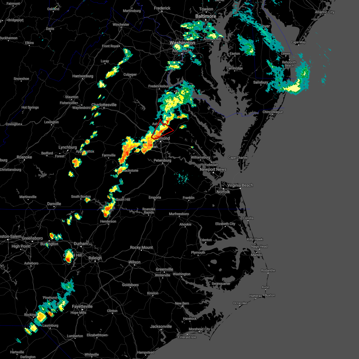 The tornado warning for northwestern henrico, west central king william and central hanover counties will expire at 545 pm edt, the storm which prompted the warning has weakened below severe limits, and no longer appears capable of producing a tornado. therefore, the warning will be allowed to expire. however gusty winds are still possible with this thunderstorm. a tornado watch remains in effect until 1000 pm edt for central, north central and east central virginia. The tornado warning for northwestern henrico, west central king william and central hanover counties will expire at 545 pm edt, the storm which prompted the warning has weakened below severe limits, and no longer appears capable of producing a tornado. therefore, the warning will be allowed to expire. however gusty winds are still possible with this thunderstorm. a tornado watch remains in effect until 1000 pm edt for central, north central and east central virginia.
|
| 9/17/2018 5:13 PM EDT |
 At 513 pm edt, a severe thunderstorm capable of producing a tornado was located over tuckahoe, moving northeast at 20 mph (radar indicated rotation). Hazards include tornado. Flying debris will be dangerous to those caught without shelter. mobile homes will be damaged or destroyed. damage to roofs, windows, and vehicles will occur. tree damage is likely. this dangerous storm will be near, lakeside and laurel around 525 pm edt. glen allen around 530 pm edt. mechanicsville and randolph macon college around 540 pm edt. ashland, hanover and studley around 545 pm edt. Other locations impacted by this tornadic thunderstorm include solomons store, chamberlayne, atlee, ashcake, greendale, hanover airport, dumbarton, elmont and longdale. At 513 pm edt, a severe thunderstorm capable of producing a tornado was located over tuckahoe, moving northeast at 20 mph (radar indicated rotation). Hazards include tornado. Flying debris will be dangerous to those caught without shelter. mobile homes will be damaged or destroyed. damage to roofs, windows, and vehicles will occur. tree damage is likely. this dangerous storm will be near, lakeside and laurel around 525 pm edt. glen allen around 530 pm edt. mechanicsville and randolph macon college around 540 pm edt. ashland, hanover and studley around 545 pm edt. Other locations impacted by this tornadic thunderstorm include solomons store, chamberlayne, atlee, ashcake, greendale, hanover airport, dumbarton, elmont and longdale.
|
| 9/17/2018 5:05 PM EDT | Tree down on house. reported via twitter. time estimated from rada in henrico county VA, 2.6 miles W of Tuckahoe, VA |
| 9/17/2018 5:00 PM EDT |
 At 500 pm edt, a severe thunderstorm capable of producing a tornado was located over laurel, or near tuckahoe, moving northeast at 35 mph (radar indicated rotation). Hazards include tornado. Flying debris will be dangerous to those caught without shelter. mobile homes will be damaged or destroyed. damage to roofs, windows, and vehicles will occur. tree damage is likely. this dangerous storm will be near, east highland park around 505 pm edt. mechanicsville and glen allen around 510 pm edt. ashland, randolph macon college, hanover and studley around 515 pm edt. Other locations impacted by this tornadic thunderstorm include hanover airport, gum tree, midlothian, elmont, short pump, longdale, solomons store, chamberlayne, atlee and ashcake. At 500 pm edt, a severe thunderstorm capable of producing a tornado was located over laurel, or near tuckahoe, moving northeast at 35 mph (radar indicated rotation). Hazards include tornado. Flying debris will be dangerous to those caught without shelter. mobile homes will be damaged or destroyed. damage to roofs, windows, and vehicles will occur. tree damage is likely. this dangerous storm will be near, east highland park around 505 pm edt. mechanicsville and glen allen around 510 pm edt. ashland, randolph macon college, hanover and studley around 515 pm edt. Other locations impacted by this tornadic thunderstorm include hanover airport, gum tree, midlothian, elmont, short pump, longdale, solomons store, chamberlayne, atlee and ashcake.
|
| 9/17/2018 4:44 PM EDT |
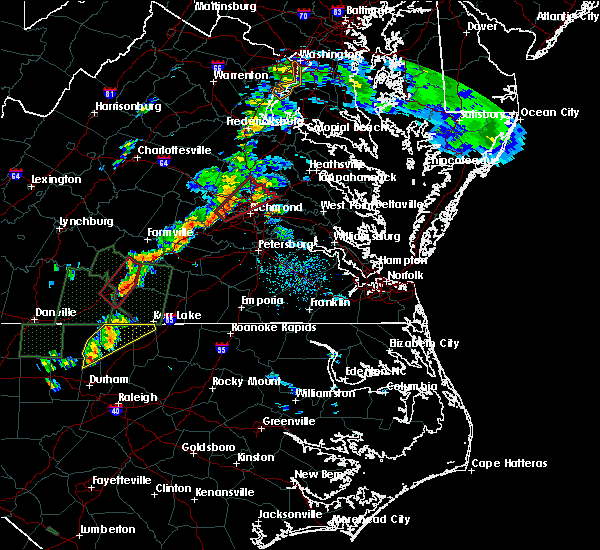 At 443 pm edt, a severe thunderstorm capable of producing a tornado was located near manakin, or near bon air, moving northeast at 35 mph (radar indicated rotation). Hazards include tornado. Flying debris will be dangerous to those caught without shelter. mobile homes will be damaged or destroyed. damage to roofs, windows, and vehicles will occur. tree damage is likely. this dangerous storm will be near, bon air, university of richmond and tuckahoe around 455 pm edt. wyndham around 500 pm edt. richmond, laurel and lakeside around 505 pm edt. mechanicsville, glen allen and east highland park around 510 pm edt. ashland, randolph macon college, hanover and studley around 515 pm edt. Other locations impacted by this tornadic thunderstorm include hanover airport, gum tree, midlothian, elmont, short pump, longdale, solomons store, chamberlayne, atlee and ashcake. At 443 pm edt, a severe thunderstorm capable of producing a tornado was located near manakin, or near bon air, moving northeast at 35 mph (radar indicated rotation). Hazards include tornado. Flying debris will be dangerous to those caught without shelter. mobile homes will be damaged or destroyed. damage to roofs, windows, and vehicles will occur. tree damage is likely. this dangerous storm will be near, bon air, university of richmond and tuckahoe around 455 pm edt. wyndham around 500 pm edt. richmond, laurel and lakeside around 505 pm edt. mechanicsville, glen allen and east highland park around 510 pm edt. ashland, randolph macon college, hanover and studley around 515 pm edt. Other locations impacted by this tornadic thunderstorm include hanover airport, gum tree, midlothian, elmont, short pump, longdale, solomons store, chamberlayne, atlee and ashcake.
|
| 9/17/2018 4:22 PM EDT |
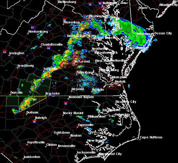 At 421 pm edt, a severe thunderstorm capable of producing a tornado was located over downtown richmond, moving northeast at 25 mph. this storm has a history of producing tornadoes (radar indicated rotation). Hazards include tornado. Flying debris will be dangerous to those caught without shelter. mobile homes will be damaged or destroyed. damage to roofs, windows, and vehicles will occur. tree damage is likely. this dangerous storm will be near, virginia commonwealth university around 425 pm edt. virginia union university around 430 pm edt. highland springs around 435 pm edt. east highland park, lakeside and laurel around 440 pm edt. mechanicsville, glen allen and studley around 445 pm edt. Other locations impacted by this tornadic thunderstorm include solomons store, chamberlayne, atlee, ashcake, greendale, hanover airport, dumbarton, longdale and montrose. At 421 pm edt, a severe thunderstorm capable of producing a tornado was located over downtown richmond, moving northeast at 25 mph. this storm has a history of producing tornadoes (radar indicated rotation). Hazards include tornado. Flying debris will be dangerous to those caught without shelter. mobile homes will be damaged or destroyed. damage to roofs, windows, and vehicles will occur. tree damage is likely. this dangerous storm will be near, virginia commonwealth university around 425 pm edt. virginia union university around 430 pm edt. highland springs around 435 pm edt. east highland park, lakeside and laurel around 440 pm edt. mechanicsville, glen allen and studley around 445 pm edt. Other locations impacted by this tornadic thunderstorm include solomons store, chamberlayne, atlee, ashcake, greendale, hanover airport, dumbarton, longdale and montrose.
|
| 9/17/2018 4:14 PM EDT |
 At 412 pm edt, a severe thunderstorm capable of producing a tornado was located over virginia union university, moving northeast at 25 mph. this storm has a history of producing damaging tornadoes. a second circulation has developed near bon air as well (radar indicated rotation). Hazards include tornado. Flying debris will be dangerous to those caught without shelter. mobile homes will be damaged or destroyed. damage to roofs, windows, and vehicles will occur. tree damage is likely. this dangerous storm will be near, highland springs around 420 pm edt. east highland park and glen allen around 425 pm edt. mechanicsville around 430 pm edt. hanover and studley around 445 pm edt. Other locations impacted by this tornadic thunderstorm include solomons store, chamberlayne, atlee, ashcake, greendale, hanover airport, dumbarton, montrose and longdale. At 412 pm edt, a severe thunderstorm capable of producing a tornado was located over virginia union university, moving northeast at 25 mph. this storm has a history of producing damaging tornadoes. a second circulation has developed near bon air as well (radar indicated rotation). Hazards include tornado. Flying debris will be dangerous to those caught without shelter. mobile homes will be damaged or destroyed. damage to roofs, windows, and vehicles will occur. tree damage is likely. this dangerous storm will be near, highland springs around 420 pm edt. east highland park and glen allen around 425 pm edt. mechanicsville around 430 pm edt. hanover and studley around 445 pm edt. Other locations impacted by this tornadic thunderstorm include solomons store, chamberlayne, atlee, ashcake, greendale, hanover airport, dumbarton, montrose and longdale.
|
| 9/17/2018 4:01 PM EDT |
 At 354 pm edt, a severe thunderstorm capable of producing a tornado was located near chula, or near moseley, moving northeast at 30 mph (radar indicated rotation). Hazards include tornado. Flying debris will be dangerous to those caught without shelter. mobile homes will be damaged or destroyed. damage to roofs, windows, and vehicles will occur. tree damage is likely. this dangerous storm will be near, tuckahoe around 430 pm edt. Other locations impacted by this tornadic thunderstorm include holly hills, flat rock, subletts, genito, clayville and pilkinton. At 354 pm edt, a severe thunderstorm capable of producing a tornado was located near chula, or near moseley, moving northeast at 30 mph (radar indicated rotation). Hazards include tornado. Flying debris will be dangerous to those caught without shelter. mobile homes will be damaged or destroyed. damage to roofs, windows, and vehicles will occur. tree damage is likely. this dangerous storm will be near, tuckahoe around 430 pm edt. Other locations impacted by this tornadic thunderstorm include holly hills, flat rock, subletts, genito, clayville and pilkinton.
|
| 9/17/2018 3:54 PM EDT |
 At 354 pm edt, a severe thunderstorm capable of producing a tornado was located near chula, or near moseley, moving northeast at 30 mph (radar indicated rotation). Hazards include tornado. Flying debris will be dangerous to those caught without shelter. mobile homes will be damaged or destroyed. damage to roofs, windows, and vehicles will occur. tree damage is likely. this dangerous storm will be near, tuckahoe around 430 pm edt. Other locations impacted by this tornadic thunderstorm include holly hills, flat rock, subletts, genito, clayville and pilkinton. At 354 pm edt, a severe thunderstorm capable of producing a tornado was located near chula, or near moseley, moving northeast at 30 mph (radar indicated rotation). Hazards include tornado. Flying debris will be dangerous to those caught without shelter. mobile homes will be damaged or destroyed. damage to roofs, windows, and vehicles will occur. tree damage is likely. this dangerous storm will be near, tuckahoe around 430 pm edt. Other locations impacted by this tornadic thunderstorm include holly hills, flat rock, subletts, genito, clayville and pilkinton.
|
| 9/17/2018 3:53 PM EDT |
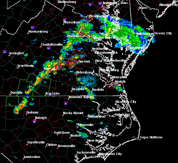 At 352 pm edt, a confirmed tornado was previously reported near sr 288 and hull street road, moving north at 20 mph. a second potential tornado is located southeast of bon air (weather spotters confirmed tornado). Hazards include damaging tornado. Flying debris will be dangerous to those caught without shelter. mobile homes will be damaged or destroyed. damage to roofs, windows, and vehicles will occur. tree damage is likely. this tornado will be near, bon air, university of richmond and downtown richmond around 405 pm edt. virginia commonwealth university around 410 pm edt. richmond and tuckahoe around 415 pm edt. Other locations impacted by this tornadic thunderstorm include roslyn hills and midlothian. At 352 pm edt, a confirmed tornado was previously reported near sr 288 and hull street road, moving north at 20 mph. a second potential tornado is located southeast of bon air (weather spotters confirmed tornado). Hazards include damaging tornado. Flying debris will be dangerous to those caught without shelter. mobile homes will be damaged or destroyed. damage to roofs, windows, and vehicles will occur. tree damage is likely. this tornado will be near, bon air, university of richmond and downtown richmond around 405 pm edt. virginia commonwealth university around 410 pm edt. richmond and tuckahoe around 415 pm edt. Other locations impacted by this tornadic thunderstorm include roslyn hills and midlothian.
|
| 9/17/2018 3:48 PM EDT |
 At 348 pm edt, a severe thunderstorm capable of producing a tornado was located over glen allen, or near randolph macon college, moving northeast at 40 mph (radar indicated rotation). Hazards include tornado. Flying debris will be dangerous to those caught without shelter. mobile homes will be damaged or destroyed. damage to roofs, windows, and vehicles will occur. tree damage is likely. this dangerous storm will be near, hanover, dawn and kings dominion around 400 pm edt. mangohick around 405 pm edt. Other locations impacted by this tornadic thunderstorm include enfield, hanover airport, gum tree, upshaw, doswell, etna mills, elmont, short pump, epworth and longdale. At 348 pm edt, a severe thunderstorm capable of producing a tornado was located over glen allen, or near randolph macon college, moving northeast at 40 mph (radar indicated rotation). Hazards include tornado. Flying debris will be dangerous to those caught without shelter. mobile homes will be damaged or destroyed. damage to roofs, windows, and vehicles will occur. tree damage is likely. this dangerous storm will be near, hanover, dawn and kings dominion around 400 pm edt. mangohick around 405 pm edt. Other locations impacted by this tornadic thunderstorm include enfield, hanover airport, gum tree, upshaw, doswell, etna mills, elmont, short pump, epworth and longdale.
|
| 9/17/2018 3:47 PM EDT |
 At 346 pm edt, a confirmed tornado was located near sr 288 and hull street road, moving north at 20 mph. a second potential tornado is being observed on radar near pochantas state park (weather spotters confirmed tornado). Hazards include damaging tornado. Flying debris will be dangerous to those caught without shelter. mobile homes will be damaged or destroyed. damage to roofs, windows, and vehicles will occur. tree damage is likely. this tornado will be near, bensley around 355 pm edt. bon air, university of richmond and downtown richmond around 405 pm edt. virginia commonwealth university around 410 pm edt. richmond and tuckahoe around 415 pm edt. Other locations impacted by this tornadic thunderstorm include roslyn hills and midlothian. At 346 pm edt, a confirmed tornado was located near sr 288 and hull street road, moving north at 20 mph. a second potential tornado is being observed on radar near pochantas state park (weather spotters confirmed tornado). Hazards include damaging tornado. Flying debris will be dangerous to those caught without shelter. mobile homes will be damaged or destroyed. damage to roofs, windows, and vehicles will occur. tree damage is likely. this tornado will be near, bensley around 355 pm edt. bon air, university of richmond and downtown richmond around 405 pm edt. virginia commonwealth university around 410 pm edt. richmond and tuckahoe around 415 pm edt. Other locations impacted by this tornadic thunderstorm include roslyn hills and midlothian.
|
| 9/17/2018 3:44 PM EDT |
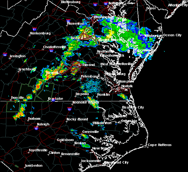 At 343 pm edt, a confirmed tornado was located near sr 288 and hull street road, moving northeast at 20 mph (weather spotters confirmed tornado). Hazards include damaging tornado. Flying debris will be dangerous to those caught without shelter. mobile homes will be damaged or destroyed. damage to roofs, windows, and vehicles will occur. tree damage is likely. this tornado will be near, bensley around 355 pm edt. university of richmond, bon air and downtown richmond around 405 pm edt. virginia commonwealth university around 410 pm edt. richmond and tuckahoe around 415 pm edt. Other locations impacted by this tornadic thunderstorm include pocahontas state park, roslyn hills and midlothian. At 343 pm edt, a confirmed tornado was located near sr 288 and hull street road, moving northeast at 20 mph (weather spotters confirmed tornado). Hazards include damaging tornado. Flying debris will be dangerous to those caught without shelter. mobile homes will be damaged or destroyed. damage to roofs, windows, and vehicles will occur. tree damage is likely. this tornado will be near, bensley around 355 pm edt. university of richmond, bon air and downtown richmond around 405 pm edt. virginia commonwealth university around 410 pm edt. richmond and tuckahoe around 415 pm edt. Other locations impacted by this tornadic thunderstorm include pocahontas state park, roslyn hills and midlothian.
|
| 9/17/2018 3:39 PM EDT |
 At 339 pm edt, a tornado producing storm was located 7 miles west of chesterfield court house, or 7 miles east of moseley, moving north at 20 mph (radar confirmed tornado). Hazards include damaging tornado. Flying debris will be dangerous to those caught without shelter. mobile homes will be damaged or destroyed. damage to roofs, windows, and vehicles will occur. tree damage is likely. this tornadic storm will be near, bon air around 405 pm edt. university of richmond and downtown richmond around 410 pm edt. richmond, tuckahoe and virginia commonwealth university around 415 pm edt. Other locations impacted by this tornadic thunderstorm include pocahontas state park, roslyn hills and midlothian. At 339 pm edt, a tornado producing storm was located 7 miles west of chesterfield court house, or 7 miles east of moseley, moving north at 20 mph (radar confirmed tornado). Hazards include damaging tornado. Flying debris will be dangerous to those caught without shelter. mobile homes will be damaged or destroyed. damage to roofs, windows, and vehicles will occur. tree damage is likely. this tornadic storm will be near, bon air around 405 pm edt. university of richmond and downtown richmond around 410 pm edt. richmond, tuckahoe and virginia commonwealth university around 415 pm edt. Other locations impacted by this tornadic thunderstorm include pocahontas state park, roslyn hills and midlothian.
|
| 9/17/2018 3:23 PM EDT |
 At 323 pm edt, a severe thunderstorm capable of producing a tornado was located over bon air, moving northeast at 40 mph (radar indicated rotation). Hazards include tornado. Flying debris will be dangerous to those caught without shelter. mobile homes will be damaged or destroyed. damage to roofs, windows, and vehicles will occur. tree damage is likely. this dangerous storm will be near, virginia union university around 330 pm edt. mechanicsville, glen allen, laurel, lakeside and east highland park around 335 pm edt. Other locations impacted by this tornadic thunderstorm include solomons store, chamberlayne, greendale, roslyn hills, dumbarton, midlothian, short pump and longdale. At 323 pm edt, a severe thunderstorm capable of producing a tornado was located over bon air, moving northeast at 40 mph (radar indicated rotation). Hazards include tornado. Flying debris will be dangerous to those caught without shelter. mobile homes will be damaged or destroyed. damage to roofs, windows, and vehicles will occur. tree damage is likely. this dangerous storm will be near, virginia union university around 330 pm edt. mechanicsville, glen allen, laurel, lakeside and east highland park around 335 pm edt. Other locations impacted by this tornadic thunderstorm include solomons store, chamberlayne, greendale, roslyn hills, dumbarton, midlothian, short pump and longdale.
|
| 9/17/2018 3:04 PM EDT |
 At 303 pm edt, a confirmed tornado was located over bon air, moving northeast at 40 mph (radar confirmed tornado). Hazards include damaging tornado. Flying debris will be dangerous to those caught without shelter. mobile homes will be damaged or destroyed. damage to roofs, windows, and vehicles will occur. tree damage is likely. This tornadic thunderstorm will remain over mainly rural areas of northwestern chesterfield county, including the following locations, skinquarter, winterpock and midlothian. At 303 pm edt, a confirmed tornado was located over bon air, moving northeast at 40 mph (radar confirmed tornado). Hazards include damaging tornado. Flying debris will be dangerous to those caught without shelter. mobile homes will be damaged or destroyed. damage to roofs, windows, and vehicles will occur. tree damage is likely. This tornadic thunderstorm will remain over mainly rural areas of northwestern chesterfield county, including the following locations, skinquarter, winterpock and midlothian.
|
| 9/17/2018 3:01 PM EDT |
 At 252 pm edt, a severe thunderstorm capable of producing a tornado was located near moseley, moving northeast at 40 mph (radar indicated rotation). Hazards include tornado. Flying debris will be dangerous to those caught without shelter. mobile homes will be damaged or destroyed. damage to roofs, windows, and vehicles will occur. tree damage is likely. this dangerous storm will be near, bon air around 310 pm edt. richmond around 315 pm edt. Other locations impacted by this tornadic thunderstorm include pocahontas state park, skinquarter, beach, winterpock, midlothian, drewrys bluff, centralia and chesterfield. At 252 pm edt, a severe thunderstorm capable of producing a tornado was located near moseley, moving northeast at 40 mph (radar indicated rotation). Hazards include tornado. Flying debris will be dangerous to those caught without shelter. mobile homes will be damaged or destroyed. damage to roofs, windows, and vehicles will occur. tree damage is likely. this dangerous storm will be near, bon air around 310 pm edt. richmond around 315 pm edt. Other locations impacted by this tornadic thunderstorm include pocahontas state park, skinquarter, beach, winterpock, midlothian, drewrys bluff, centralia and chesterfield.
|
| 9/17/2018 2:52 PM EDT |
 At 252 pm edt, a severe thunderstorm capable of producing a tornado was located near moseley, moving northeast at 40 mph (radar indicated rotation). Hazards include tornado. Flying debris will be dangerous to those caught without shelter. mobile homes will be damaged or destroyed. damage to roofs, windows, and vehicles will occur. tree damage is likely. this dangerous storm will be near, bon air around 310 pm edt. richmond around 315 pm edt. Other locations impacted by this tornadic thunderstorm include pocahontas state park, skinquarter, beach, winterpock, midlothian, drewrys bluff, centralia and chesterfield. At 252 pm edt, a severe thunderstorm capable of producing a tornado was located near moseley, moving northeast at 40 mph (radar indicated rotation). Hazards include tornado. Flying debris will be dangerous to those caught without shelter. mobile homes will be damaged or destroyed. damage to roofs, windows, and vehicles will occur. tree damage is likely. this dangerous storm will be near, bon air around 310 pm edt. richmond around 315 pm edt. Other locations impacted by this tornadic thunderstorm include pocahontas state park, skinquarter, beach, winterpock, midlothian, drewrys bluff, centralia and chesterfield.
|
| 9/17/2018 1:26 PM EDT |
 At 126 pm edt, a severe thunderstorm capable of producing a tornado was located near oilville, or 8 miles east of goochland, moving northeast at 30 mph (radar indicated rotation). Hazards include tornado. Flying debris will be dangerous to those caught without shelter. mobile homes will be damaged or destroyed. damage to roofs, windows, and vehicles will occur. tree damage is likely. this dangerous storm will be near, wyndham around 135 pm edt. montpelier around 145 pm edt. Other locations impacted by this tornadic thunderstorm include crozier, oliver, vontay, gum tree, coatesville, hewlett, johnsons springs, doswell, goodall and mabelton. At 126 pm edt, a severe thunderstorm capable of producing a tornado was located near oilville, or 8 miles east of goochland, moving northeast at 30 mph (radar indicated rotation). Hazards include tornado. Flying debris will be dangerous to those caught without shelter. mobile homes will be damaged or destroyed. damage to roofs, windows, and vehicles will occur. tree damage is likely. this dangerous storm will be near, wyndham around 135 pm edt. montpelier around 145 pm edt. Other locations impacted by this tornadic thunderstorm include crozier, oliver, vontay, gum tree, coatesville, hewlett, johnsons springs, doswell, goodall and mabelton.
|
| 8/30/2018 8:25 PM EDT |
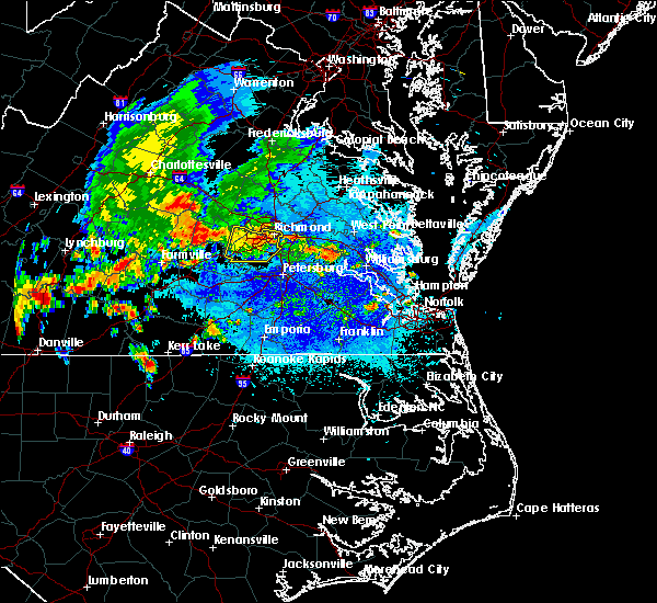 The severe thunderstorm warning for chesterfield and southeastern powhatan counties and the city of richmond will expire at 830 pm edt, the storm which prompted the warning has weakened below severe limits, and no longer poses an immediate threat to life or property. therefore, the warning will be allowed to expire. The severe thunderstorm warning for chesterfield and southeastern powhatan counties and the city of richmond will expire at 830 pm edt, the storm which prompted the warning has weakened below severe limits, and no longer poses an immediate threat to life or property. therefore, the warning will be allowed to expire.
|
| 8/30/2018 7:54 PM EDT |
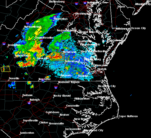 At 754 pm edt, a severe thunderstorm was located near bon air, moving north at 15 mph (radar indicated). Hazards include 60 mph wind gusts and quarter size hail. Minor damage to vehicles is possible. expect wind damage to trees and powerlines. Locations impacted include, richmond, downtown richmond, bon air, virginia union university, virginia commonwealth university, university of richmond, moseley, chester, tuckahoe, bensley, bellwood, chesterfield court house, east highland park, chesterfield, pocahontas state park, skinquarter, beach, holly hills, drewrys bluff and winterpock. At 754 pm edt, a severe thunderstorm was located near bon air, moving north at 15 mph (radar indicated). Hazards include 60 mph wind gusts and quarter size hail. Minor damage to vehicles is possible. expect wind damage to trees and powerlines. Locations impacted include, richmond, downtown richmond, bon air, virginia union university, virginia commonwealth university, university of richmond, moseley, chester, tuckahoe, bensley, bellwood, chesterfield court house, east highland park, chesterfield, pocahontas state park, skinquarter, beach, holly hills, drewrys bluff and winterpock.
|
| 8/30/2018 7:43 PM EDT |
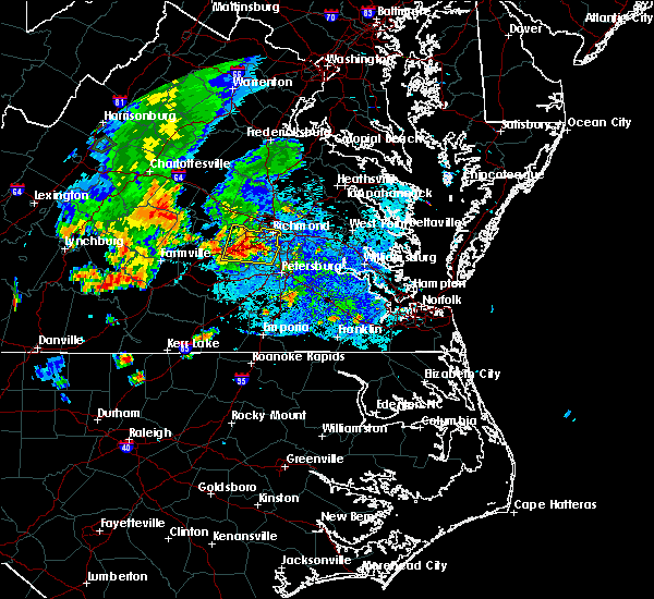 At 742 pm edt, a severe thunderstorm was located near chesterfield court house, or 7 miles south of bon air, moving north at 15 mph (radar indicated). Hazards include 60 mph wind gusts and quarter size hail. Minor damage to vehicles is possible. expect wind damage to trees and powerlines. this severe thunderstorm will be near, bellwood around 800 pm edt. bensley around 805 pm edt. university of richmond, bon air and downtown richmond around 825 pm edt. richmond, virginia union university, virginia commonwealth university, tuckahoe and east highland park around 830 pm edt. Other locations impacted by this severe thunderstorm include winterpock, pilkinton, midlothian, subletts, pocahontas state park, skinquarter, beach, holly hills, drewrys bluff and centralia. At 742 pm edt, a severe thunderstorm was located near chesterfield court house, or 7 miles south of bon air, moving north at 15 mph (radar indicated). Hazards include 60 mph wind gusts and quarter size hail. Minor damage to vehicles is possible. expect wind damage to trees and powerlines. this severe thunderstorm will be near, bellwood around 800 pm edt. bensley around 805 pm edt. university of richmond, bon air and downtown richmond around 825 pm edt. richmond, virginia union university, virginia commonwealth university, tuckahoe and east highland park around 830 pm edt. Other locations impacted by this severe thunderstorm include winterpock, pilkinton, midlothian, subletts, pocahontas state park, skinquarter, beach, holly hills, drewrys bluff and centralia.
|
| 8/13/2018 7:32 PM EDT |
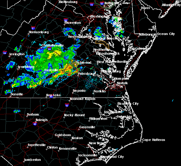 At 732 pm edt, a severe thunderstorm was located near chesterfield court house, or 9 miles west of chester, moving east at 35 mph (radar indicated). Hazards include 60 mph wind gusts and penny size hail. Expect damage to trees and powerlines. this severe storm will be near, chesterfield court house around 740 pm edt. chester, bellwood and bensley around 745 pm edt. Other locations impacted by this severe thunderstorm include pocahontas state park, beach, winterpock, midlothian, drewrys bluff, centralia and chesterfield. At 732 pm edt, a severe thunderstorm was located near chesterfield court house, or 9 miles west of chester, moving east at 35 mph (radar indicated). Hazards include 60 mph wind gusts and penny size hail. Expect damage to trees and powerlines. this severe storm will be near, chesterfield court house around 740 pm edt. chester, bellwood and bensley around 745 pm edt. Other locations impacted by this severe thunderstorm include pocahontas state park, beach, winterpock, midlothian, drewrys bluff, centralia and chesterfield.
|
| 8/13/2018 7:15 PM EDT |
 At 715 pm edt, a severe thunderstorm was located near moseley, moving east at 30 mph (radar indicated). Hazards include 60 mph wind gusts and penny size hail. Expect damage to trees and powerlines. this severe thunderstorm will be near, moseley around 720 pm edt. bon air around 745 pm edt. chesterfield court house around 750 pm edt. downtown richmond and bensley around 755 pm edt. chester and bellwood around 800 pm edt. Other locations impacted by this severe thunderstorm include pocahontas state park, skinquarter, beach, winterpock, holly hills, midlothian, drewrys bluff, centralia, clayville and chesterfield. At 715 pm edt, a severe thunderstorm was located near moseley, moving east at 30 mph (radar indicated). Hazards include 60 mph wind gusts and penny size hail. Expect damage to trees and powerlines. this severe thunderstorm will be near, moseley around 720 pm edt. bon air around 745 pm edt. chesterfield court house around 750 pm edt. downtown richmond and bensley around 755 pm edt. chester and bellwood around 800 pm edt. Other locations impacted by this severe thunderstorm include pocahontas state park, skinquarter, beach, winterpock, holly hills, midlothian, drewrys bluff, centralia, clayville and chesterfield.
|
| 8/13/2018 7:15 PM EDT |
 The national weather service in wakefield has issued a * severe thunderstorm warning for. the city of richmond in central virginia. chesterfield county in central virginia. southeastern powhatan county in central virginia. Until 800 pm edt. The national weather service in wakefield has issued a * severe thunderstorm warning for. the city of richmond in central virginia. chesterfield county in central virginia. southeastern powhatan county in central virginia. Until 800 pm edt.
|
| 8/13/2018 7:15 PM EDT |
 At 715 pm edt, a severe thunderstorm was located near moseley, moving east at 30 mph (radar indicated). Hazards include 60 mph wind gusts and penny size hail. Expect damage to trees and powerlines. this severe thunderstorm will be near, moseley around 720 pm edt. bon air around 745 pm edt. chesterfield court house around 750 pm edt. downtown richmond and bensley around 755 pm edt. chester and bellwood around 800 pm edt. Other locations impacted by this severe thunderstorm include pocahontas state park, skinquarter, beach, winterpock, holly hills, midlothian, drewrys bluff, centralia, clayville and chesterfield. At 715 pm edt, a severe thunderstorm was located near moseley, moving east at 30 mph (radar indicated). Hazards include 60 mph wind gusts and penny size hail. Expect damage to trees and powerlines. this severe thunderstorm will be near, moseley around 720 pm edt. bon air around 745 pm edt. chesterfield court house around 750 pm edt. downtown richmond and bensley around 755 pm edt. chester and bellwood around 800 pm edt. Other locations impacted by this severe thunderstorm include pocahontas state park, skinquarter, beach, winterpock, holly hills, midlothian, drewrys bluff, centralia, clayville and chesterfield.
|
| 6/24/2018 5:54 PM EDT |
 At 553 pm edt, severe thunderstorms were located along a line extending from highland springs to 6 miles east of mannboro, moving east at 50 mph (radar indicated). Hazards include 60 mph wind gusts and penny size hail. Expect damage to trees and powerlines. these severe storms will be near, bottoms bridge around 600 pm edt. tunstall around 605 pm edt. matoaca around 610 pm edt. petersburg, colonial heights, virginia state university and ettrick around 615 pm edt. Other locations impacted by these severe thunderstorms include richmond heights, addison, elko, montrose, sandston, glendale, westwood, pocahontas state park, richmond international and skinquarter. At 553 pm edt, severe thunderstorms were located along a line extending from highland springs to 6 miles east of mannboro, moving east at 50 mph (radar indicated). Hazards include 60 mph wind gusts and penny size hail. Expect damage to trees and powerlines. these severe storms will be near, bottoms bridge around 600 pm edt. tunstall around 605 pm edt. matoaca around 610 pm edt. petersburg, colonial heights, virginia state university and ettrick around 615 pm edt. Other locations impacted by these severe thunderstorms include richmond heights, addison, elko, montrose, sandston, glendale, westwood, pocahontas state park, richmond international and skinquarter.
|
| 6/24/2018 5:34 PM EDT |
 At 534 pm edt, severe thunderstorms were located along a line extending from near tuckahoe to amelia courthouse, moving east at 50 mph (radar indicated). Hazards include 60 mph wind gusts and penny size hail. Expect damage to trees and powerlines. severe thunderstorms will be near, richmond, virginia union university, downtown richmond, university of richmond, bon air, lakeside, laurel and glen allen around 540 pm edt. virginia commonwealth university, mechanicsville and east highland park around 545 pm edt. highland springs around 550 pm edt. bottoms bridge around 600 pm edt. sutherland and tunstall around 605 pm edt. colonial heights, matoaca and ettrick around 610 pm edt. petersburg and virginia state university around 615 pm edt. Other locations impacted by these severe thunderstorms include crozier, richmond heights, addison, pilkinton, johnsons springs, elko, montrose, winterham, sandston and glendale. At 534 pm edt, severe thunderstorms were located along a line extending from near tuckahoe to amelia courthouse, moving east at 50 mph (radar indicated). Hazards include 60 mph wind gusts and penny size hail. Expect damage to trees and powerlines. severe thunderstorms will be near, richmond, virginia union university, downtown richmond, university of richmond, bon air, lakeside, laurel and glen allen around 540 pm edt. virginia commonwealth university, mechanicsville and east highland park around 545 pm edt. highland springs around 550 pm edt. bottoms bridge around 600 pm edt. sutherland and tunstall around 605 pm edt. colonial heights, matoaca and ettrick around 610 pm edt. petersburg and virginia state university around 615 pm edt. Other locations impacted by these severe thunderstorms include crozier, richmond heights, addison, pilkinton, johnsons springs, elko, montrose, winterham, sandston and glendale.
|
| 6/24/2018 5:18 PM EDT |
 At 517 pm edt, severe thunderstorms were located along a line extending from near montpelier to near morven, moving east at 40 mph (radar indicated). Hazards include 60 mph wind gusts and quarter size hail. Minor damage to vehicles is possible. expect wind damage to trees and powerlines. these severe storms will be near, montpelier around 525 pm edt. wyndham around 530 pm edt. chula around 535 pm edt. Other locations impacted by these severe thunderstorms include angola, maidens, three square, hawk, whiteville, fine creek mills, michaux, west view, grays siding and holly hills. At 517 pm edt, severe thunderstorms were located along a line extending from near montpelier to near morven, moving east at 40 mph (radar indicated). Hazards include 60 mph wind gusts and quarter size hail. Minor damage to vehicles is possible. expect wind damage to trees and powerlines. these severe storms will be near, montpelier around 525 pm edt. wyndham around 530 pm edt. chula around 535 pm edt. Other locations impacted by these severe thunderstorms include angola, maidens, three square, hawk, whiteville, fine creek mills, michaux, west view, grays siding and holly hills.
|
| 6/24/2018 4:53 PM EDT |
 At 452 pm edt, severe thunderstorms were located along a line extending from hadensville to near guinea mills, moving east at 40 mph (radar indicated). Hazards include 60 mph wind gusts and quarter size hail. Minor damage to vehicles is possible. expect wind damage to trees and powerlines. severe thunderstorms will be near, hadensville around 500 pm edt. gum spring around 505 pm edt. oilville, sunnyside and tobaccoville around 515 pm edt. montpelier and morven around 520 pm edt. amelia courthouse and wyndham around 530 pm edt. chula around 535 pm edt. Other locations impacted by these severe thunderstorms include orchid, angola, maidens, three square, bremo bluff, hawk, whiteville, fine creek mills, michaux and west view. At 452 pm edt, severe thunderstorms were located along a line extending from hadensville to near guinea mills, moving east at 40 mph (radar indicated). Hazards include 60 mph wind gusts and quarter size hail. Minor damage to vehicles is possible. expect wind damage to trees and powerlines. severe thunderstorms will be near, hadensville around 500 pm edt. gum spring around 505 pm edt. oilville, sunnyside and tobaccoville around 515 pm edt. montpelier and morven around 520 pm edt. amelia courthouse and wyndham around 530 pm edt. chula around 535 pm edt. Other locations impacted by these severe thunderstorms include orchid, angola, maidens, three square, bremo bluff, hawk, whiteville, fine creek mills, michaux and west view.
|
| 6/10/2018 6:32 PM EDT |
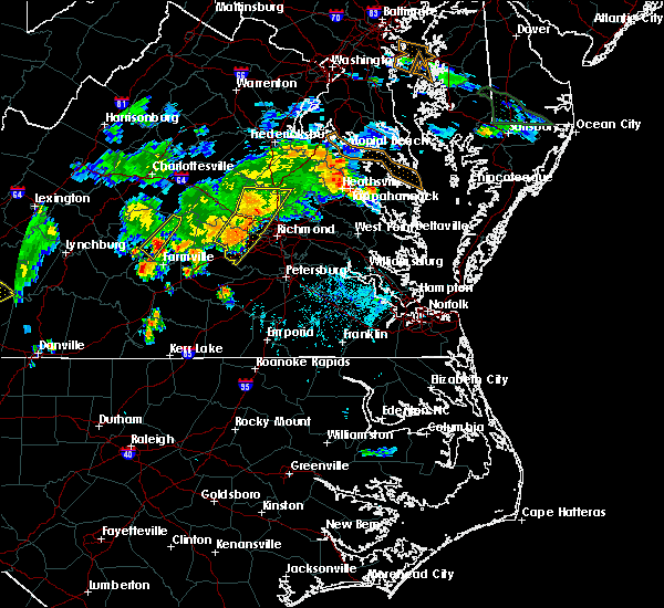 At 631 pm edt, severe thunderstorms were located along a line extending from near randolph macon college to near tuckahoe to near chula, moving east at 15 mph (radar indicated). Hazards include 60 mph wind gusts and penny size hail. Expect damage to trees and powerlines. Locations impacted include, powhatan, ashland, randolph macon college, tuckahoe, moseley, bon air, oilville, manakin, kings dominion, montpelier, sabot, wyndham, laurel, glen allen, crozier, pilkinton, vontay, gum tree, johnsons springs and elmont. At 631 pm edt, severe thunderstorms were located along a line extending from near randolph macon college to near tuckahoe to near chula, moving east at 15 mph (radar indicated). Hazards include 60 mph wind gusts and penny size hail. Expect damage to trees and powerlines. Locations impacted include, powhatan, ashland, randolph macon college, tuckahoe, moseley, bon air, oilville, manakin, kings dominion, montpelier, sabot, wyndham, laurel, glen allen, crozier, pilkinton, vontay, gum tree, johnsons springs and elmont.
|
| 6/10/2018 6:09 PM EDT |
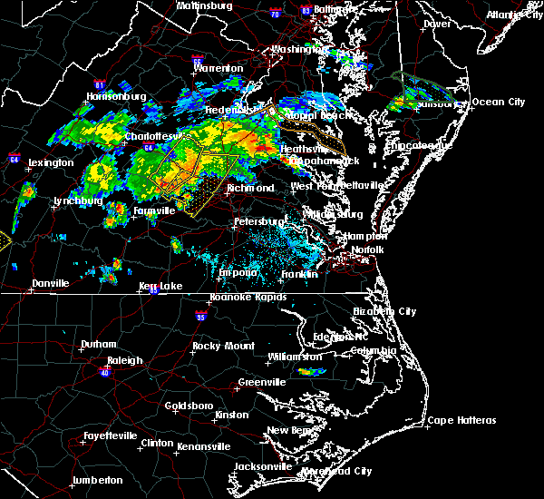 At 608 pm edt, severe thunderstorms were located along a line extending from near montpelier to near sabot to tobaccoville, moving east at 15 mph (radar indicated). Hazards include 60 mph wind gusts and quarter size hail. Minor damage to vehicles is possible. Expect wind damage to trees and powerlines. At 608 pm edt, severe thunderstorms were located along a line extending from near montpelier to near sabot to tobaccoville, moving east at 15 mph (radar indicated). Hazards include 60 mph wind gusts and quarter size hail. Minor damage to vehicles is possible. Expect wind damage to trees and powerlines.
|
| 5/14/2018 7:54 PM EDT |
 At 753 pm edt, severe thunderstorms were located along a line extending from millers tavern to near powhatan, moving east at 45 mph (law enforcement and trained spotters. numerous reports of wind damage have been reported throughout richmond metro and points west). Hazards include 70 mph wind gusts and quarter size hail. Minor damage to vehicles is possible. expect considerable tree damage. wind damage is also likely to mobile homes, roofs, and outbuildings. Locations impacted include, richmond, powhatan, goochland, king william, ashland, moseley, university of richmond, saint stephens church, randolph macon college, virginia commonwealth university, tuckahoe, highland springs, downtown richmond, bon air, virginia union university, mechanicsville, hanover, oilville, manakin and trenholm. At 753 pm edt, severe thunderstorms were located along a line extending from millers tavern to near powhatan, moving east at 45 mph (law enforcement and trained spotters. numerous reports of wind damage have been reported throughout richmond metro and points west). Hazards include 70 mph wind gusts and quarter size hail. Minor damage to vehicles is possible. expect considerable tree damage. wind damage is also likely to mobile homes, roofs, and outbuildings. Locations impacted include, richmond, powhatan, goochland, king william, ashland, moseley, university of richmond, saint stephens church, randolph macon college, virginia commonwealth university, tuckahoe, highland springs, downtown richmond, bon air, virginia union university, mechanicsville, hanover, oilville, manakin and trenholm.
|
| 5/14/2018 7:44 PM EDT | E 60mph wind gust knocked large tree down near tuckaho in henrico county VA, 2.6 miles W of Tuckahoe, VA |
| 5/14/2018 7:30 PM EDT |
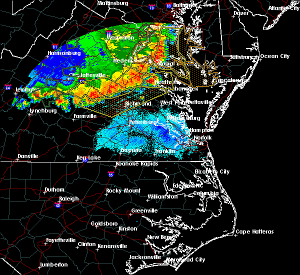 At 729 pm edt, severe thunderstorms were located along a line extending from near dawn to near trenholm, moving east at 45 mph (law enforcement. numerous trees have been reported down across louisa and goochland counties). Hazards include 60 mph wind gusts and quarter size hail. Minor damage to vehicles is possible. expect wind damage to trees and powerlines. severe thunderstorms will be near, mangohick and dawn around 735 pm edt. beulahville around 740 pm edt. saint stephens church and aylett around 750 pm edt. moseley around 755 pm edt. millers tavern around 800 pm edt. stevensville and dunnsville around 805 pm edt. bon air, university of richmond and center cross around 810 pm edt. downtown richmond and bensley around 815 pm edt. Other locations impacted by these severe thunderstorms include maidens, gum tree, three square, etna mills, montrose, biscoe, skinquarter, chamberlayne, whiteville and fine creek mills. At 729 pm edt, severe thunderstorms were located along a line extending from near dawn to near trenholm, moving east at 45 mph (law enforcement. numerous trees have been reported down across louisa and goochland counties). Hazards include 60 mph wind gusts and quarter size hail. Minor damage to vehicles is possible. expect wind damage to trees and powerlines. severe thunderstorms will be near, mangohick and dawn around 735 pm edt. beulahville around 740 pm edt. saint stephens church and aylett around 750 pm edt. moseley around 755 pm edt. millers tavern around 800 pm edt. stevensville and dunnsville around 805 pm edt. bon air, university of richmond and center cross around 810 pm edt. downtown richmond and bensley around 815 pm edt. Other locations impacted by these severe thunderstorms include maidens, gum tree, three square, etna mills, montrose, biscoe, skinquarter, chamberlayne, whiteville and fine creek mills.
|
| 5/10/2018 4:29 PM EDT |
 At 428 pm edt, severe thunderstorms were located along a line extending from near montpelier to near wyndham to near bon air, moving east at 45 mph (radar indicated). Hazards include 70 mph wind gusts and half dollar size hail. Minor damage to vehicles is possible. expect considerable tree damage. wind damage is also likely to mobile homes, roofs, and outbuildings. these severe storms will be near, richmond, glen allen, laurel and lakeside around 435 pm edt. ashland, mechanicsville, downtown richmond, randolph macon college, virginia union university and east highland park around 440 pm edt. virginia commonwealth university, highland springs and bensley around 445 pm edt. hanover and studley around 450 pm edt. mangohick around 455 pm edt. Other locations impacted by these severe thunderstorms include enfield, richmond heights, gum tree, etna mills, elmont, montrose, epworth, richmond international, fair oaks and gilman. At 428 pm edt, severe thunderstorms were located along a line extending from near montpelier to near wyndham to near bon air, moving east at 45 mph (radar indicated). Hazards include 70 mph wind gusts and half dollar size hail. Minor damage to vehicles is possible. expect considerable tree damage. wind damage is also likely to mobile homes, roofs, and outbuildings. these severe storms will be near, richmond, glen allen, laurel and lakeside around 435 pm edt. ashland, mechanicsville, downtown richmond, randolph macon college, virginia union university and east highland park around 440 pm edt. virginia commonwealth university, highland springs and bensley around 445 pm edt. hanover and studley around 450 pm edt. mangohick around 455 pm edt. Other locations impacted by these severe thunderstorms include enfield, richmond heights, gum tree, etna mills, elmont, montrose, epworth, richmond international, fair oaks and gilman.
|
| 5/10/2018 4:25 PM EDT | Tree down reported on pagebrook drive. time estimated by rada in goochland county VA, 3 miles E of Tuckahoe, VA |
| 5/10/2018 4:15 PM EDT |
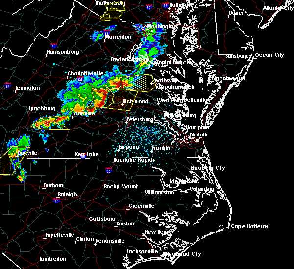 At 415 pm edt, severe thunderstorms were located along a line extending from 6 miles west of montpelier to near oilville to near moseley, moving east at 45 mph (radar indicated). Hazards include 70 mph wind gusts and quarter size hail. Minor damage to vehicles is possible. expect considerable tree damage. wind damage is also likely to mobile homes, roofs, and outbuildings. severe thunderstorms will be near, tuckahoe and wyndham around 420 pm edt. montpelier around 425 pm edt. glen allen, laurel and lakeside around 430 pm edt. bon air, university of richmond, randolph macon college and mechanicsville around 435 pm edt. richmond, ashland, downtown richmond, virginia commonwealth university, virginia union university, hanover and bensley around 440 pm edt. studley and east highland park around 445 pm edt. highland springs and mangohick around 450 pm edt. Other locations impacted by these severe thunderstorms include enfield, richmond heights, gum tree, etna mills, elmont, montrose, epworth, richmond international, fair oaks and gilman. At 415 pm edt, severe thunderstorms were located along a line extending from 6 miles west of montpelier to near oilville to near moseley, moving east at 45 mph (radar indicated). Hazards include 70 mph wind gusts and quarter size hail. Minor damage to vehicles is possible. expect considerable tree damage. wind damage is also likely to mobile homes, roofs, and outbuildings. severe thunderstorms will be near, tuckahoe and wyndham around 420 pm edt. montpelier around 425 pm edt. glen allen, laurel and lakeside around 430 pm edt. bon air, university of richmond, randolph macon college and mechanicsville around 435 pm edt. richmond, ashland, downtown richmond, virginia commonwealth university, virginia union university, hanover and bensley around 440 pm edt. studley and east highland park around 445 pm edt. highland springs and mangohick around 450 pm edt. Other locations impacted by these severe thunderstorms include enfield, richmond heights, gum tree, etna mills, elmont, montrose, epworth, richmond international, fair oaks and gilman.
|
| 5/10/2018 4:14 PM EDT |
 At 414 pm edt, severe thunderstorms were located along a line extending from near montpelier to sabot to near chula, moving east at 45 mph (radar indicated). Hazards include 60 mph wind gusts and quarter size hail. Minor damage to vehicles is possible. expect wind damage to trees and powerlines. these severe storms will be near, manakin around 420 pm edt. wyndham around 425 pm edt. Other locations impacted by these severe thunderstorms include orchid, crozier, rock castle, vontay, maidens, three square, irwin, johnsons springs, fine creek mills and michaux. At 414 pm edt, severe thunderstorms were located along a line extending from near montpelier to sabot to near chula, moving east at 45 mph (radar indicated). Hazards include 60 mph wind gusts and quarter size hail. Minor damage to vehicles is possible. expect wind damage to trees and powerlines. these severe storms will be near, manakin around 420 pm edt. wyndham around 425 pm edt. Other locations impacted by these severe thunderstorms include orchid, crozier, rock castle, vontay, maidens, three square, irwin, johnsons springs, fine creek mills and michaux.
|
| 5/10/2018 3:49 PM EDT |
 At 349 pm edt, severe thunderstorms were located along a line extending from near duncan to near fife to near cumberland, moving east at 45 mph (radar indicated). Hazards include 60 mph wind gusts and quarter size hail. Minor damage to vehicles is possible. expect wind damage to trees and powerlines. severe thunderstorms will be near, powhatan and ballsville around 400 pm edt. goochland, gum spring and macon around 405 pm edt. oilville, manakin and sabot around 415 pm edt. wyndham around 425 pm edt. Other locations impacted by these severe thunderstorms include orchid, crozier, rock castle, oak forest, vontay, maidens, three square, irwin, johnsons springs and fine creek mills. At 349 pm edt, severe thunderstorms were located along a line extending from near duncan to near fife to near cumberland, moving east at 45 mph (radar indicated). Hazards include 60 mph wind gusts and quarter size hail. Minor damage to vehicles is possible. expect wind damage to trees and powerlines. severe thunderstorms will be near, powhatan and ballsville around 400 pm edt. goochland, gum spring and macon around 405 pm edt. oilville, manakin and sabot around 415 pm edt. wyndham around 425 pm edt. Other locations impacted by these severe thunderstorms include orchid, crozier, rock castle, oak forest, vontay, maidens, three square, irwin, johnsons springs and fine creek mills.
|
| 4/15/2018 10:39 PM EDT |
 At 1038 pm edt, a severe thunderstorm capable of producing a tornado was located near chula, or near powhatan, moving north at 55 mph (radar indicated rotation). Hazards include tornado. Flying debris will be dangerous to those caught without shelter. mobile homes will be damaged or destroyed. damage to roofs, windows, and vehicles will occur. tree damage is likely. this dangerous storm will be near, manakin around 1050 pm edt. goochland and sabot around 1055 pm edt. oilville around 1100 pm edt. Other locations impacted by this tornadic thunderstorm include goodwins store, flat rock, crozier, jefferson, pilkinton, maidens, johnsons springs, subletts, winterham and fine creek mills. At 1038 pm edt, a severe thunderstorm capable of producing a tornado was located near chula, or near powhatan, moving north at 55 mph (radar indicated rotation). Hazards include tornado. Flying debris will be dangerous to those caught without shelter. mobile homes will be damaged or destroyed. damage to roofs, windows, and vehicles will occur. tree damage is likely. this dangerous storm will be near, manakin around 1050 pm edt. goochland and sabot around 1055 pm edt. oilville around 1100 pm edt. Other locations impacted by this tornadic thunderstorm include goodwins store, flat rock, crozier, jefferson, pilkinton, maidens, johnsons springs, subletts, winterham and fine creek mills.
|
| 1/12/2018 10:41 PM EST |
 The severe thunderstorm warning for southeastern louisa, southeastern goochland, northwestern henrico and west central hanover counties will expire at 1045 pm est, the storms which prompted the warning have weakened below severe limits, and no longer pose an immediate threat to life or property. therefore the warning will be allowed to expire. The severe thunderstorm warning for southeastern louisa, southeastern goochland, northwestern henrico and west central hanover counties will expire at 1045 pm est, the storms which prompted the warning have weakened below severe limits, and no longer pose an immediate threat to life or property. therefore the warning will be allowed to expire.
|
| 1/12/2018 10:32 PM EST |
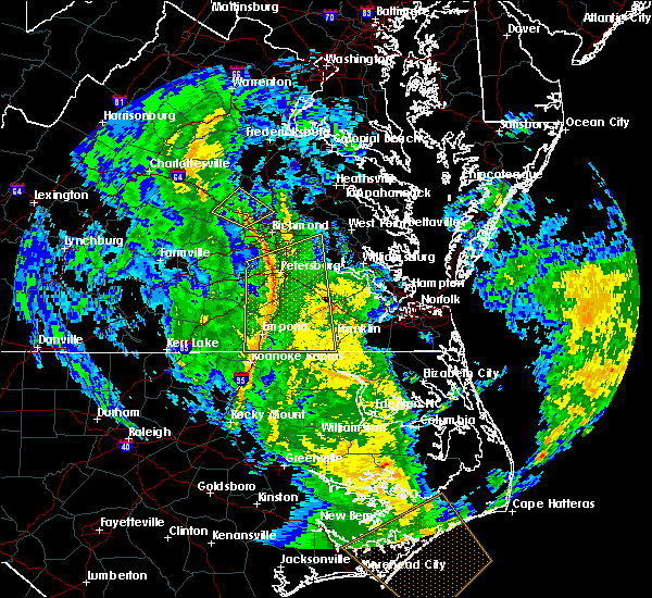 At 1032 pm est, severe thunderstorms were located along a line extending from near tuckahoe to chesterfield court house, moving northeast at 50 mph (radar indicated). Hazards include 60 mph wind gusts. Expect damage to trees and powerlines. severe thunderstorms will be near, chester and university of richmond around 1035 pm est. virginia commonwealth university, downtown richmond, bellwood and bensley around 1040 pm est. richmond, virginia union university, lakeside, laurel and glen allen around 1045 pm est. mechanicsville and east highland park around 1050 pm est. bottoms bridge and studley around 1055 pm est. talleysville and tunstall around 1100 pm est. Other locations impacted by these severe thunderstorms include richmond heights, elko, montrose, sandston, westwood, pocahontas state park, richmond international, fair oaks, solomons store and chamberlayne. At 1032 pm est, severe thunderstorms were located along a line extending from near tuckahoe to chesterfield court house, moving northeast at 50 mph (radar indicated). Hazards include 60 mph wind gusts. Expect damage to trees and powerlines. severe thunderstorms will be near, chester and university of richmond around 1035 pm est. virginia commonwealth university, downtown richmond, bellwood and bensley around 1040 pm est. richmond, virginia union university, lakeside, laurel and glen allen around 1045 pm est. mechanicsville and east highland park around 1050 pm est. bottoms bridge and studley around 1055 pm est. talleysville and tunstall around 1100 pm est. Other locations impacted by these severe thunderstorms include richmond heights, elko, montrose, sandston, westwood, pocahontas state park, richmond international, fair oaks, solomons store and chamberlayne.
|
| 1/12/2018 10:28 PM EST |
 At 1028 pm est, severe thunderstorms were located along a line extending from near goochland to manakin, moving northeast at 45 mph (radar indicated). Hazards include 60 mph wind gusts. Expect damage to trees and powerlines. these severe storms will be near, tuckahoe and wyndham around 1035 pm est. ashland, montpelier and glen allen around 1045 pm est. Other locations impacted by these severe thunderstorms include rockville, dabneys, gilman, crozier, vontay, irwin, johnsons springs, goodall, elmont and short pump. At 1028 pm est, severe thunderstorms were located along a line extending from near goochland to manakin, moving northeast at 45 mph (radar indicated). Hazards include 60 mph wind gusts. Expect damage to trees and powerlines. these severe storms will be near, tuckahoe and wyndham around 1035 pm est. ashland, montpelier and glen allen around 1045 pm est. Other locations impacted by these severe thunderstorms include rockville, dabneys, gilman, crozier, vontay, irwin, johnsons springs, goodall, elmont and short pump.
|
| 1/12/2018 10:14 PM EST |
 At 1014 pm est, severe thunderstorms were located along a line extending from near trenholm to near moseley, moving northeast at 45 mph (radar indicated). Hazards include 60 mph wind gusts. Expect damage to trees and powerlines. severe thunderstorms will be near, goochland, manakin and sabot around 1025 pm est. tuckahoe, oilville and gum spring around 1030 pm est. wyndham around 1035 pm est. montpelier around 1040 pm est. ashland and glen allen around 1045 pm est. Other locations impacted by these severe thunderstorms include crozier, rock castle, vontay, maidens, three square, irwin, johnsons springs, elmont, gilman and fine creek mills. At 1014 pm est, severe thunderstorms were located along a line extending from near trenholm to near moseley, moving northeast at 45 mph (radar indicated). Hazards include 60 mph wind gusts. Expect damage to trees and powerlines. severe thunderstorms will be near, goochland, manakin and sabot around 1025 pm est. tuckahoe, oilville and gum spring around 1030 pm est. wyndham around 1035 pm est. montpelier around 1040 pm est. ashland and glen allen around 1045 pm est. Other locations impacted by these severe thunderstorms include crozier, rock castle, vontay, maidens, three square, irwin, johnsons springs, elmont, gilman and fine creek mills.
|
| 1/12/2018 10:07 PM EST |
 At 1006 pm est, a severe thunderstorm was located near mannboro, moving northeast at 45 mph (radar indicated). Hazards include 60 mph wind gusts. Expect damage to trees and powerlines. this severe thunderstorm will be near, moseley around 1015 pm est. bon air, university of richmond, chester, chesterfield court house, bensley and bellwood around 1030 pm est. Other locations impacted by this severe thunderstorm include winterpock, pilkinton, midlothian, winterham, pocahontas state park, skinquarter, beach, roslyn hills, holly hills and drewrys bluff. At 1006 pm est, a severe thunderstorm was located near mannboro, moving northeast at 45 mph (radar indicated). Hazards include 60 mph wind gusts. Expect damage to trees and powerlines. this severe thunderstorm will be near, moseley around 1015 pm est. bon air, university of richmond, chester, chesterfield court house, bensley and bellwood around 1030 pm est. Other locations impacted by this severe thunderstorm include winterpock, pilkinton, midlothian, winterham, pocahontas state park, skinquarter, beach, roslyn hills, holly hills and drewrys bluff.
|
| 1/12/2018 9:48 PM EST |
 At 947 pm est, a severe thunderstorm capable of producing a tornado was located near morven, or near amelia courthouse, moving northeast at 60 mph (radar indicated rotation). Hazards include tornado. Flying debris will be dangerous to those caught without shelter. mobile homes will be damaged or destroyed. damage to roofs, windows, and vehicles will occur. tree damage is likely. this dangerous storm will be near, chula around 955 pm est. powhatan and macon around 1000 pm est. sabot around 1010 pm est. tuckahoe and manakin around 1015 pm est. Other locations impacted by this tornadic thunderstorm include crozier, rock castle, pilkinton, maidens, irwin, winterham, maplewood, fine creek mills, michaux and deatonville. At 947 pm est, a severe thunderstorm capable of producing a tornado was located near morven, or near amelia courthouse, moving northeast at 60 mph (radar indicated rotation). Hazards include tornado. Flying debris will be dangerous to those caught without shelter. mobile homes will be damaged or destroyed. damage to roofs, windows, and vehicles will occur. tree damage is likely. this dangerous storm will be near, chula around 955 pm est. powhatan and macon around 1000 pm est. sabot around 1010 pm est. tuckahoe and manakin around 1015 pm est. Other locations impacted by this tornadic thunderstorm include crozier, rock castle, pilkinton, maidens, irwin, winterham, maplewood, fine creek mills, michaux and deatonville.
|
| 6/19/2017 7:06 PM EDT |
 At 706 pm edt, severe thunderstorms were located along a line extending from near glen allen to near moseley, moving east at 40 mph (radar indicated). Hazards include 60 mph wind gusts. Expect damage to trees and powerlines. these severe storms will be near, richmond, mechanicsville, highland springs, east highland park, glen allen, lakeside and laurel around 710 pm edt. studley around 715 pm edt. chesterfield court house around 720 pm edt. chester, downtown richmond, virginia commonwealth university, bellwood, manquin and bensley around 730 pm edt. Other locations impacted by these severe thunderstorms include richmond heights, pilkinton, elko, montrose, winterham, sandston, glendale, westwood, pocahontas state park and richmond international. At 706 pm edt, severe thunderstorms were located along a line extending from near glen allen to near moseley, moving east at 40 mph (radar indicated). Hazards include 60 mph wind gusts. Expect damage to trees and powerlines. these severe storms will be near, richmond, mechanicsville, highland springs, east highland park, glen allen, lakeside and laurel around 710 pm edt. studley around 715 pm edt. chesterfield court house around 720 pm edt. chester, downtown richmond, virginia commonwealth university, bellwood, manquin and bensley around 730 pm edt. Other locations impacted by these severe thunderstorms include richmond heights, pilkinton, elko, montrose, winterham, sandston, glendale, westwood, pocahontas state park and richmond international.
|
| 6/19/2017 7:03 PM EDT |
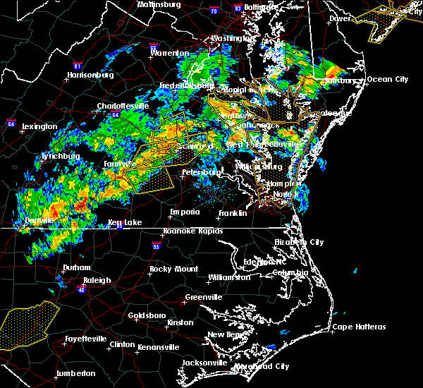 At 703 pm edt, severe thunderstorms were located along a line extending from 6 miles north of kings dominion to bon air, moving east at 35 mph (radar indicated). Hazards include 60 mph wind gusts. Expect damage to trees and powerlines. Locations impacted include, ashland, randolph macon college, tuckahoe, mechanicsville, milford, hanover, manakin, dawn, glen allen, kings dominion, montpelier, sabot, laurel, wyndham, lakeside, east highland park, vontay, gum tree, johnsons springs and elmont. At 703 pm edt, severe thunderstorms were located along a line extending from 6 miles north of kings dominion to bon air, moving east at 35 mph (radar indicated). Hazards include 60 mph wind gusts. Expect damage to trees and powerlines. Locations impacted include, ashland, randolph macon college, tuckahoe, mechanicsville, milford, hanover, manakin, dawn, glen allen, kings dominion, montpelier, sabot, laurel, wyndham, lakeside, east highland park, vontay, gum tree, johnsons springs and elmont.
|
| 6/19/2017 6:51 PM EDT |
 At 651 pm edt, severe thunderstorms were located along a line extending from near tuckahoe to near scotts fork, moving east at 40 mph (radar indicated). Hazards include 60 mph wind gusts. Expect damage to trees and powerlines. severe thunderstorms will be near, bon air, tuckahoe and manakin around 655 pm edt. university of richmond around 700 pm edt. richmond, virginia union university, virginia commonwealth university, downtown richmond, lakeside, laurel and glen allen around 705 pm edt. east highland park around 710 pm edt. mechanicsville and highland springs around 715 pm edt. chesterfield court house around 720 pm edt. studley around 725 pm edt. chester, bellwood, bensley, manquin and tunstall around 730 pm edt. Other locations impacted by these severe thunderstorms include richmond heights, pilkinton, elko, montrose, winterham, sandston, glendale, westwood, pocahontas state park and richmond international. At 651 pm edt, severe thunderstorms were located along a line extending from near tuckahoe to near scotts fork, moving east at 40 mph (radar indicated). Hazards include 60 mph wind gusts. Expect damage to trees and powerlines. severe thunderstorms will be near, bon air, tuckahoe and manakin around 655 pm edt. university of richmond around 700 pm edt. richmond, virginia union university, virginia commonwealth university, downtown richmond, lakeside, laurel and glen allen around 705 pm edt. east highland park around 710 pm edt. mechanicsville and highland springs around 715 pm edt. chesterfield court house around 720 pm edt. studley around 725 pm edt. chester, bellwood, bensley, manquin and tunstall around 730 pm edt. Other locations impacted by these severe thunderstorms include richmond heights, pilkinton, elko, montrose, winterham, sandston, glendale, westwood, pocahontas state park and richmond international.
|
| 6/19/2017 6:25 PM EDT |
 At 624 pm edt, severe thunderstorms were located along a line extending from near gum spring to near powhatan, moving east at 45 mph (radar indicated). Hazards include 60 mph wind gusts and quarter size hail. Minor damage to vehicles is possible. expect wind damage to trees and powerlines. severe thunderstorms will be near, manakin, sabot and montpelier around 635 pm edt. tuckahoe around 640 pm edt. wyndham around 645 pm edt. ashland around 650 pm edt. randolph macon college, lakeside, laurel, glen allen and kings dominion around 655 pm edt. mechanicsville, east highland park and dawn around 700 pm edt. milford and hanover around 705 pm edt. Other locations impacted by these severe thunderstorms include golansville, vontay, gum tree, johnsons springs, elmont, penola, gilman, solomons store, chamberlayne and atlee. At 624 pm edt, severe thunderstorms were located along a line extending from near gum spring to near powhatan, moving east at 45 mph (radar indicated). Hazards include 60 mph wind gusts and quarter size hail. Minor damage to vehicles is possible. expect wind damage to trees and powerlines. severe thunderstorms will be near, manakin, sabot and montpelier around 635 pm edt. tuckahoe around 640 pm edt. wyndham around 645 pm edt. ashland around 650 pm edt. randolph macon college, lakeside, laurel, glen allen and kings dominion around 655 pm edt. mechanicsville, east highland park and dawn around 700 pm edt. milford and hanover around 705 pm edt. Other locations impacted by these severe thunderstorms include golansville, vontay, gum tree, johnsons springs, elmont, penola, gilman, solomons store, chamberlayne and atlee.
|
| 5/27/2017 7:00 PM EDT |
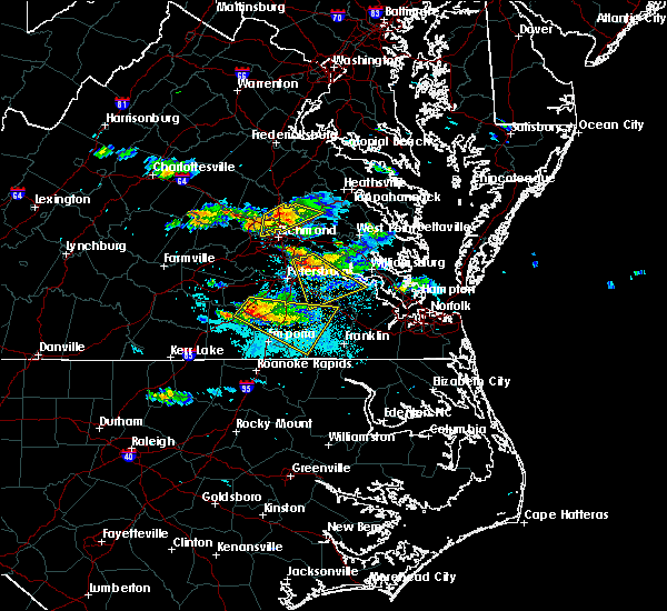 At 700 pm edt, a severe thunderstorm was located over mechanicsville, moving southeast at 30 mph (radar indicated). Hazards include ping pong ball size hail and 60 mph wind gusts. People and animals outdoors will be injured. expect hail damage to roofs, siding, windows, and vehicles. expect wind damage to trees and powerlines. this severe storm will be near, mechanicsville, east highland park and studley around 705 pm edt. Other locations impacted by this severe thunderstorm include enfield, central garage, hanover airport, etna mills, elmont, longdale, solomons store, chamberlayne, atlee and ashcake. At 700 pm edt, a severe thunderstorm was located over mechanicsville, moving southeast at 30 mph (radar indicated). Hazards include ping pong ball size hail and 60 mph wind gusts. People and animals outdoors will be injured. expect hail damage to roofs, siding, windows, and vehicles. expect wind damage to trees and powerlines. this severe storm will be near, mechanicsville, east highland park and studley around 705 pm edt. Other locations impacted by this severe thunderstorm include enfield, central garage, hanover airport, etna mills, elmont, longdale, solomons store, chamberlayne, atlee and ashcake.
|
| 5/27/2017 6:28 PM EDT |
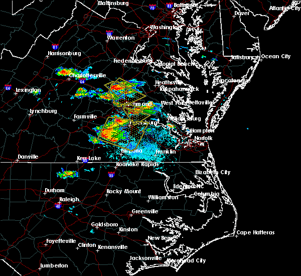 At 628 pm edt, a severe thunderstorm was located near montpelier, or 8 miles northwest of randolph macon college, moving southeast at 30 mph (radar indicated). Hazards include ping pong ball size hail and 60 mph wind gusts. People and animals outdoors will be injured. expect hail damage to roofs, siding, windows, and vehicles. expect wind damage to trees and powerlines. this severe thunderstorm will be near, ashland, wyndham and kings dominion around 640 pm edt. randolph macon college around 645 pm edt. hanover and glen allen around 650 pm edt. laurel and lakeside around 655 pm edt. mechanicsville around 700 pm edt. east highland park and studley around 705 pm edt. Other locations impacted by this severe thunderstorm include enfield, gum tree, etna mills, elmont, epworth, gilman, solomons store, chamberlayne, atlee and ashcake. At 628 pm edt, a severe thunderstorm was located near montpelier, or 8 miles northwest of randolph macon college, moving southeast at 30 mph (radar indicated). Hazards include ping pong ball size hail and 60 mph wind gusts. People and animals outdoors will be injured. expect hail damage to roofs, siding, windows, and vehicles. expect wind damage to trees and powerlines. this severe thunderstorm will be near, ashland, wyndham and kings dominion around 640 pm edt. randolph macon college around 645 pm edt. hanover and glen allen around 650 pm edt. laurel and lakeside around 655 pm edt. mechanicsville around 700 pm edt. east highland park and studley around 705 pm edt. Other locations impacted by this severe thunderstorm include enfield, gum tree, etna mills, elmont, epworth, gilman, solomons store, chamberlayne, atlee and ashcake.
|
| 5/27/2017 5:50 PM EDT | Hen Egg sized hail reported 4 miles SW of Tuckahoe, VA |
| 5/27/2017 5:47 PM EDT | Ping Pong Ball sized hail reported 3.6 miles SW of Tuckahoe, VA |
| 5/27/2017 5:45 PM EDT | Half Dollar sized hail reported 3.7 miles W of Tuckahoe, VA |
| 5/27/2017 5:42 PM EDT |
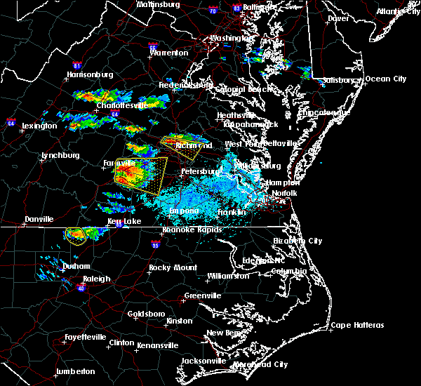 At 541 pm edt, a severe thunderstorm was located over laurel, or near virginia union university, moving southeast at 35 mph (trained weather spotters and radar). Hazards include ping pong ball size hail and 60 mph wind gusts. People and animals outdoors will be injured. expect hail damage to roofs, siding, windows, and vehicles. expect wind damage to trees and powerlines. this severe thunderstorm will be near, richmond around 545 pm edt. mechanicsville, virginia union university, virginia commonwealth university and east highland park around 550 pm edt. highland springs around 555 pm edt. bottoms bridge and tunstall around 615 pm edt. Other locations impacted by this severe thunderstorm include orapax farms, elko, short pump, montrose, sandston, longdale, glendale, westwood, richmond international and fair oaks. At 541 pm edt, a severe thunderstorm was located over laurel, or near virginia union university, moving southeast at 35 mph (trained weather spotters and radar). Hazards include ping pong ball size hail and 60 mph wind gusts. People and animals outdoors will be injured. expect hail damage to roofs, siding, windows, and vehicles. expect wind damage to trees and powerlines. this severe thunderstorm will be near, richmond around 545 pm edt. mechanicsville, virginia union university, virginia commonwealth university and east highland park around 550 pm edt. highland springs around 555 pm edt. bottoms bridge and tunstall around 615 pm edt. Other locations impacted by this severe thunderstorm include orapax farms, elko, short pump, montrose, sandston, longdale, glendale, westwood, richmond international and fair oaks.
|
| 5/27/2017 5:27 PM EDT |
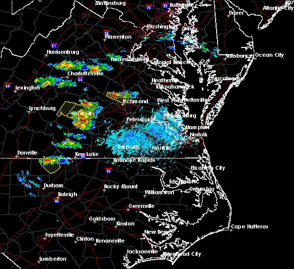 At 524 pm edt, a severe thunderstorm was located near short pump, or near tuckahoe, moving east, southeast at 25 mph (radar indicated). Hazards include golf ball size hail and 60 mph wind gusts. People and animals outdoors will be injured. expect hail damage to roofs, siding, windows, and vehicles. expect wind damage to trees and powerlines. this severe storm will be near, laurel and glen allen around 530 pm edt. lakeside around 535 pm edt. richmond around 545 pm edt. mechanicsville, virginia union university and east highland park around 550 pm edt. Other locations impacted by this severe thunderstorm include rockville, solomons store, chamberlayne, atlee, ashcake, greendale, hanover airport, dumbarton, johnsons springs and elmont. At 524 pm edt, a severe thunderstorm was located near short pump, or near tuckahoe, moving east, southeast at 25 mph (radar indicated). Hazards include golf ball size hail and 60 mph wind gusts. People and animals outdoors will be injured. expect hail damage to roofs, siding, windows, and vehicles. expect wind damage to trees and powerlines. this severe storm will be near, laurel and glen allen around 530 pm edt. lakeside around 535 pm edt. richmond around 545 pm edt. mechanicsville, virginia union university and east highland park around 550 pm edt. Other locations impacted by this severe thunderstorm include rockville, solomons store, chamberlayne, atlee, ashcake, greendale, hanover airport, dumbarton, johnsons springs and elmont.
|
| 5/27/2017 4:58 PM EDT |
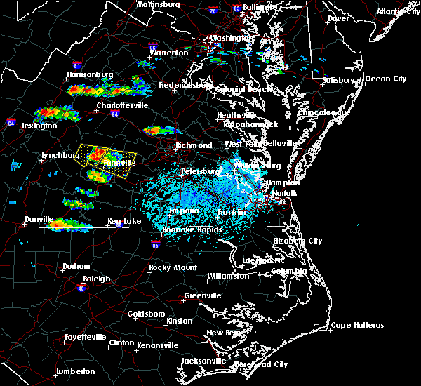 The national weather service in wakefield has issued a * severe thunderstorm warning for. the city of richmond in central virginia. southeastern louisa county in central virginia. east central goochland county in central virginia. Northwestern henrico county in central virginia. The national weather service in wakefield has issued a * severe thunderstorm warning for. the city of richmond in central virginia. southeastern louisa county in central virginia. east central goochland county in central virginia. Northwestern henrico county in central virginia.
|
| 5/5/2017 6:40 AM EDT |
 The severe thunderstorm warning for northwestern chesterfield, central nottoway, central amelia and powhatan counties will expire at 645 am edt, the storm which prompted the warning has weakened below severe limits, and no longer poses an immediate threat to life or property. therefore the warning will be allowed to expire. however gusty winds and heavy rain are still possible with this thunderstorm. The severe thunderstorm warning for northwestern chesterfield, central nottoway, central amelia and powhatan counties will expire at 645 am edt, the storm which prompted the warning has weakened below severe limits, and no longer poses an immediate threat to life or property. therefore the warning will be allowed to expire. however gusty winds and heavy rain are still possible with this thunderstorm.
|
| 5/5/2017 6:32 AM EDT |
 At 632 am edt, a severe thunderstorm was located over chula, or near amelia courthouse, moving northeast at 40 mph (radar indicated). Hazards include 60 mph wind gusts. Expect damage to roofs, siding, and trees. this severe storm will be near, moseley around 640 am edt. powhatan around 645 am edt. Other locations impacted by this severe thunderstorm include goodwins store, flat rock, earls, jefferson, pilkinton, midlothian, giles mill, subletts, winterham and skinquarter. At 632 am edt, a severe thunderstorm was located over chula, or near amelia courthouse, moving northeast at 40 mph (radar indicated). Hazards include 60 mph wind gusts. Expect damage to roofs, siding, and trees. this severe storm will be near, moseley around 640 am edt. powhatan around 645 am edt. Other locations impacted by this severe thunderstorm include goodwins store, flat rock, earls, jefferson, pilkinton, midlothian, giles mill, subletts, winterham and skinquarter.
|
| 5/5/2017 6:21 AM EDT |
 At 621 am edt, a severe thunderstorm was located over amelia courthouse, moving northeast at 40 mph (radar indicated). Hazards include 60 mph wind gusts. Expect damage to roofs, siding, and trees. this severe thunderstorm will be near, scotts fork around 625 am edt. chula around 630 am edt. moseley and macon around 640 am edt. powhatan around 645 am edt. Other locations impacted by this severe thunderstorm include goodwins store, flat rock, earls, jefferson, pilkinton, midlothian, giles mill, subletts, winterham and skinquarter. At 621 am edt, a severe thunderstorm was located over amelia courthouse, moving northeast at 40 mph (radar indicated). Hazards include 60 mph wind gusts. Expect damage to roofs, siding, and trees. this severe thunderstorm will be near, scotts fork around 625 am edt. chula around 630 am edt. moseley and macon around 640 am edt. powhatan around 645 am edt. Other locations impacted by this severe thunderstorm include goodwins store, flat rock, earls, jefferson, pilkinton, midlothian, giles mill, subletts, winterham and skinquarter.
|
| 4/21/2017 6:28 PM EDT |
 At 628 pm edt, a severe thunderstorm was located near gum spring, or 9 miles north of goochland, moving east at 20 mph (radar indicated). Hazards include 60 mph wind gusts and quarter size hail. Hail damage to vehicles is expected. expect wind damage to roofs, siding, and trees. this severe thunderstorm will be near, oilville around 640 pm edt. montpelier around 655 pm edt. wyndham around 710 pm edt. Other locations impacted by this severe thunderstorm include orchid, sandy hook, oliver, vontay, coatesville, johnsons springs, goodall, mabelton, rockville and dabneys. At 628 pm edt, a severe thunderstorm was located near gum spring, or 9 miles north of goochland, moving east at 20 mph (radar indicated). Hazards include 60 mph wind gusts and quarter size hail. Hail damage to vehicles is expected. expect wind damage to roofs, siding, and trees. this severe thunderstorm will be near, oilville around 640 pm edt. montpelier around 655 pm edt. wyndham around 710 pm edt. Other locations impacted by this severe thunderstorm include orchid, sandy hook, oliver, vontay, coatesville, johnsons springs, goodall, mabelton, rockville and dabneys.
|
| 3/1/2017 2:21 PM EST |
 The severe thunderstorm warning for southeastern louisa, southeastern goochland, northwestern hanover and powhatan counties will expire at 230 pm est, the storms which prompted the warning have moved out of the area. therefore the warning will be allowed to expire. a severe thunderstorm watch remains in effect until 700 pm est for central and north central virginia. The severe thunderstorm warning for southeastern louisa, southeastern goochland, northwestern hanover and powhatan counties will expire at 230 pm est, the storms which prompted the warning have moved out of the area. therefore the warning will be allowed to expire. a severe thunderstorm watch remains in effect until 700 pm est for central and north central virginia.
|
| 3/1/2017 1:56 PM EST |
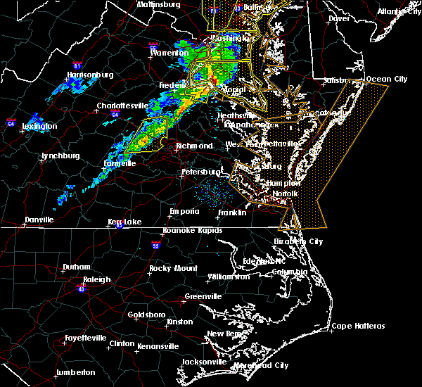 At 155 pm est, severe thunderstorms were located along a line extending from near montpelier to near powhatan, moving east at 65 mph (radar indicated). Hazards include 60 mph wind gusts. Expect damage to roofs, siding, and trees. locations impacted include, powhatan, goochland, tuckahoe, gum spring, oilville, manakin, trenholm, montpelier, macon, sabot, wyndham, orchid, crozier, rock castle, vontay, maidens, three square, irwin, johnsons springs and gilman. precautionary/preparedness actions, for your protection move to an interior room on the lowest floor of a building. please send your reports of hail and or wind damage, including trees or large limbs downed, by calling noaa`s national weather service in wakefield at , 7 5 7, 8 9 9, 2 4 1 5. At 155 pm est, severe thunderstorms were located along a line extending from near montpelier to near powhatan, moving east at 65 mph (radar indicated). Hazards include 60 mph wind gusts. Expect damage to roofs, siding, and trees. locations impacted include, powhatan, goochland, tuckahoe, gum spring, oilville, manakin, trenholm, montpelier, macon, sabot, wyndham, orchid, crozier, rock castle, vontay, maidens, three square, irwin, johnsons springs and gilman. precautionary/preparedness actions, for your protection move to an interior room on the lowest floor of a building. please send your reports of hail and or wind damage, including trees or large limbs downed, by calling noaa`s national weather service in wakefield at , 7 5 7, 8 9 9, 2 4 1 5.
|
| 3/1/2017 1:38 PM EST |
 At 137 pm est, severe thunderstorms were located along a line extending from near hadensville to near cumberland, moving east at 65 mph (radar indicated). Hazards include 60 mph wind gusts. Expect damage to roofs, siding, and trees. severe thunderstorms will be near, gum spring around 145 pm est. macon around 150 pm est. powhatan and montpelier around 155 pm est. goochland around 200 pm est. sabot, manakin and oilville around 205 pm est. tuckahoe and wyndham around 210 pm est. Other locations impacted by these severe thunderstorms include orchid, crozier, rock castle, oak forest, vontay, maidens, three square, irwin, johnsons springs and gilman. At 137 pm est, severe thunderstorms were located along a line extending from near hadensville to near cumberland, moving east at 65 mph (radar indicated). Hazards include 60 mph wind gusts. Expect damage to roofs, siding, and trees. severe thunderstorms will be near, gum spring around 145 pm est. macon around 150 pm est. powhatan and montpelier around 155 pm est. goochland around 200 pm est. sabot, manakin and oilville around 205 pm est. tuckahoe and wyndham around 210 pm est. Other locations impacted by these severe thunderstorms include orchid, crozier, rock castle, oak forest, vontay, maidens, three square, irwin, johnsons springs and gilman.
|
| 2/25/2017 2:47 PM EST |
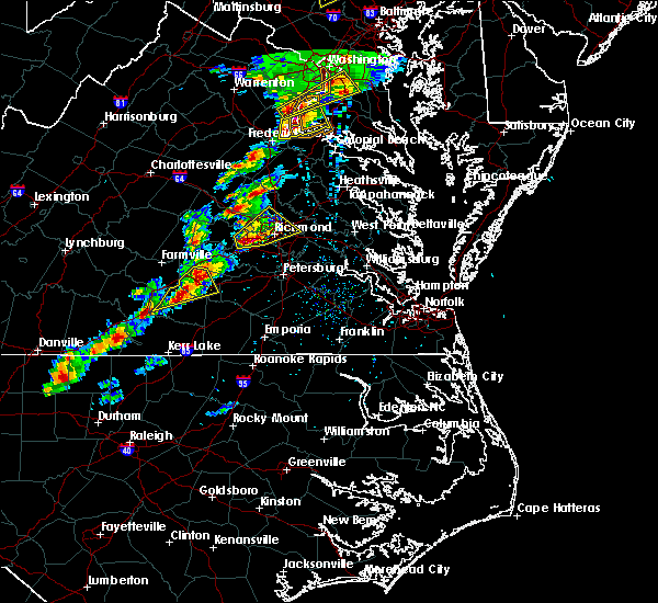 At 246 pm est, a severe thunderstorm was located near bon air, moving northeast at 40 mph (radar indicated). Hazards include 60 mph wind gusts and half dollar size hail. Hail damage to vehicles is expected. expect wind damage to roofs, siding, and trees. this severe storm will be near, bon air and university of richmond around 255 pm est. downtown richmond around 300 pm est. richmond, virginia union university, virginia commonwealth university, lakeside and laurel around 305 pm est. highland springs, mechanicsville and east highland park around 310 pm est. other locations impacted by this severe thunderstorm include hanover airport, midlothian, elmont, short pump, montrose, longdale, solomons store, chamberlayne, atlee and greendale. precautionary/preparedness actions, prepare immediately for large hail and damaging winds. people outside should move to a shelter, inside a strong building and away from windows. please send your reports of hail and or wind damage, including trees or large limbs downed, by calling noaa`s national weather service in wakefield at , 7 5 7, 8 9 9, 2 4 1 5. At 246 pm est, a severe thunderstorm was located near bon air, moving northeast at 40 mph (radar indicated). Hazards include 60 mph wind gusts and half dollar size hail. Hail damage to vehicles is expected. expect wind damage to roofs, siding, and trees. this severe storm will be near, bon air and university of richmond around 255 pm est. downtown richmond around 300 pm est. richmond, virginia union university, virginia commonwealth university, lakeside and laurel around 305 pm est. highland springs, mechanicsville and east highland park around 310 pm est. other locations impacted by this severe thunderstorm include hanover airport, midlothian, elmont, short pump, montrose, longdale, solomons store, chamberlayne, atlee and greendale. precautionary/preparedness actions, prepare immediately for large hail and damaging winds. people outside should move to a shelter, inside a strong building and away from windows. please send your reports of hail and or wind damage, including trees or large limbs downed, by calling noaa`s national weather service in wakefield at , 7 5 7, 8 9 9, 2 4 1 5.
|
| 2/25/2017 2:28 PM EST |
 At 227 pm est, a severe thunderstorm was located over chula, or near moseley, moving northeast at 45 mph (radar indicated). Hazards include 60 mph wind gusts and half dollar size hail. Hail damage to vehicles is expected. expect wind damage to roofs, siding, and trees. this severe thunderstorm will be near, moseley around 235 pm est. manakin and sabot around 245 pm est. tuckahoe around 250 pm est. university of richmond and bon air around 255 pm est. richmond, virginia union university, virginia commonwealth university, downtown richmond, lakeside and laurel around 300 pm est. mechanicsville, highland springs, east highland park and glen allen around 305 pm est. Other locations impacted by this severe thunderstorm include goodwins store, flat rock, hanover airport, pilkinton, midlothian, elmont, short pump, montrose, giles mill and subletts. At 227 pm est, a severe thunderstorm was located over chula, or near moseley, moving northeast at 45 mph (radar indicated). Hazards include 60 mph wind gusts and half dollar size hail. Hail damage to vehicles is expected. expect wind damage to roofs, siding, and trees. this severe thunderstorm will be near, moseley around 235 pm est. manakin and sabot around 245 pm est. tuckahoe around 250 pm est. university of richmond and bon air around 255 pm est. richmond, virginia union university, virginia commonwealth university, downtown richmond, lakeside and laurel around 300 pm est. mechanicsville, highland springs, east highland park and glen allen around 305 pm est. Other locations impacted by this severe thunderstorm include goodwins store, flat rock, hanover airport, pilkinton, midlothian, elmont, short pump, montrose, giles mill and subletts.
|
| 2/25/2017 1:48 PM EST |
 At 148 pm est, a severe thunderstorm was located near green bay, or near hampden sydney college, moving northeast at 65 mph (radar indicated). Hazards include 60 mph wind gusts and half dollar size hail. Hail damage to vehicles is expected. expect wind damage to roofs, siding, and trees. this severe thunderstorm will be near, crewe around 155 pm est. jetersville around 200 pm est. morven around 205 pm est. amelia courthouse and scotts fork around 210 pm est. chula and macon around 215 pm est. powhatan and moseley around 220 pm est. tuckahoe, bon air, manakin and sabot around 230 pm est. Other locations impacted by this severe thunderstorm include crozier, prince edward station, briery, pilkinton, twin lakes state park, winterham, skinquarter, maplewood, fine creek mills and fergusonville. At 148 pm est, a severe thunderstorm was located near green bay, or near hampden sydney college, moving northeast at 65 mph (radar indicated). Hazards include 60 mph wind gusts and half dollar size hail. Hail damage to vehicles is expected. expect wind damage to roofs, siding, and trees. this severe thunderstorm will be near, crewe around 155 pm est. jetersville around 200 pm est. morven around 205 pm est. amelia courthouse and scotts fork around 210 pm est. chula and macon around 215 pm est. powhatan and moseley around 220 pm est. tuckahoe, bon air, manakin and sabot around 230 pm est. Other locations impacted by this severe thunderstorm include crozier, prince edward station, briery, pilkinton, twin lakes state park, winterham, skinquarter, maplewood, fine creek mills and fergusonville.
|
| 9/28/2016 3:49 PM EDT |
 At 349 pm edt, a severe thunderstorm was located near wyndham, or near randolph macon college, moving northeast at 30 mph (radar indicated). Hazards include 60 mph wind gusts and quarter size hail. Hail damage to vehicles is expected. expect wind damage to roofs, siding, and trees. this severe storm will be near, ashland and randolph macon college around 400 pm edt. hanover and kings dominion around 405 pm edt. other locations impacted by this severe thunderstorm include elmont, hanover airport, ashcake, short pump, longdale and gum tree. precautionary/preparedness actions, for your protection move to an interior room on the lowest floor of a building. please send your reports of hail and or wind damage, including trees or large limbs downed, by calling noaa`s national weather service in wakefield at , 7 5 7, 8 9 9, 2 4 1 5. At 349 pm edt, a severe thunderstorm was located near wyndham, or near randolph macon college, moving northeast at 30 mph (radar indicated). Hazards include 60 mph wind gusts and quarter size hail. Hail damage to vehicles is expected. expect wind damage to roofs, siding, and trees. this severe storm will be near, ashland and randolph macon college around 400 pm edt. hanover and kings dominion around 405 pm edt. other locations impacted by this severe thunderstorm include elmont, hanover airport, ashcake, short pump, longdale and gum tree. precautionary/preparedness actions, for your protection move to an interior room on the lowest floor of a building. please send your reports of hail and or wind damage, including trees or large limbs downed, by calling noaa`s national weather service in wakefield at , 7 5 7, 8 9 9, 2 4 1 5.
|
| 9/28/2016 3:38 PM EDT |
 At 337 pm edt, a severe thunderstorm was located near wyndham, or near tuckahoe, moving northeast at 30 mph (radar indicated). Hazards include 60 mph wind gusts and quarter size hail. Hail damage to vehicles is expected. expect wind damage to roofs, siding, and trees. this severe thunderstorm will be near, laurel around 350 pm edt. glen allen around 355 pm edt. ashland and randolph macon college around 400 pm edt. kings dominion around 405 pm edt. hanover around 410 pm edt. Other locations impacted by this severe thunderstorm include elmont, gum tree, hanover airport, short pump, longdale, ashcake and johnsons springs. At 337 pm edt, a severe thunderstorm was located near wyndham, or near tuckahoe, moving northeast at 30 mph (radar indicated). Hazards include 60 mph wind gusts and quarter size hail. Hail damage to vehicles is expected. expect wind damage to roofs, siding, and trees. this severe thunderstorm will be near, laurel around 350 pm edt. glen allen around 355 pm edt. ashland and randolph macon college around 400 pm edt. kings dominion around 405 pm edt. hanover around 410 pm edt. Other locations impacted by this severe thunderstorm include elmont, gum tree, hanover airport, short pump, longdale, ashcake and johnsons springs.
|
| 7/31/2016 9:24 PM EDT |
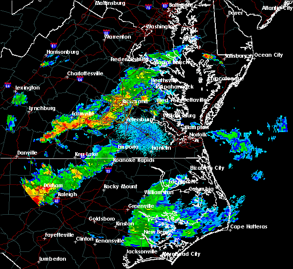 The severe thunderstorm warning for henrico, southeastern amelia, chesterfield and south central hanover counties, the city of richmond and the city of colonial heights will expire at 930 pm edt, the storms which prompted the warning have weakened below severe limits, and no longer pose an immediate threat to life or property. therefore the warning will be allowed to expire. The severe thunderstorm warning for henrico, southeastern amelia, chesterfield and south central hanover counties, the city of richmond and the city of colonial heights will expire at 930 pm edt, the storms which prompted the warning have weakened below severe limits, and no longer pose an immediate threat to life or property. therefore the warning will be allowed to expire.
|
| 7/31/2016 9:16 PM EDT |
 At 915 pm edt, severe thunderstorms were located along a line extending from east highland park to bellwood to sutherland, moving east at 25 mph (radar indicated). Hazards include 60 mph wind gusts and quarter size hail. Hail damage to vehicles is expected. expect wind damage to roofs, siding, and trees. these severe storms will be near, highland springs, chester, mechanicsville and east highland park around 920 pm edt. ettrick around 930 pm edt. other locations impacted by these severe thunderstorms include richmond international, winterpock, chesterfield, greendale, short pump, solomons store, dumbarton, drewrys bluff, roslyn hills and fair oaks. precautionary/preparedness actions, for your protection move to an interior room on the lowest floor of a building. please send your reports of hail and or wind damage, including trees or large limbs downed, by calling noaa`s national weather service in wakefield at , 7 5 7, 8 9 9, 2 4 1 5. At 915 pm edt, severe thunderstorms were located along a line extending from east highland park to bellwood to sutherland, moving east at 25 mph (radar indicated). Hazards include 60 mph wind gusts and quarter size hail. Hail damage to vehicles is expected. expect wind damage to roofs, siding, and trees. these severe storms will be near, highland springs, chester, mechanicsville and east highland park around 920 pm edt. ettrick around 930 pm edt. other locations impacted by these severe thunderstorms include richmond international, winterpock, chesterfield, greendale, short pump, solomons store, dumbarton, drewrys bluff, roslyn hills and fair oaks. precautionary/preparedness actions, for your protection move to an interior room on the lowest floor of a building. please send your reports of hail and or wind damage, including trees or large limbs downed, by calling noaa`s national weather service in wakefield at , 7 5 7, 8 9 9, 2 4 1 5.
|
| 7/31/2016 9:04 PM EDT |
 At 904 pm edt, severe thunderstorms were located along a line extending from near laurel to near chesterfield court house to 7 miles southeast of mannboro, moving east at 25 mph (radar indicated). Hazards include 60 mph wind gusts and quarter size hail. Hail damage to vehicles is expected. expect wind damage to roofs, siding, and trees. these severe storms will be near, richmond, downtown richmond, chesterfield court house and lakeside around 910 pm edt. chester, virginia union university, virginia commonwealth university, mechanicsville, east highland park, bellwood and bensley around 915 pm edt. colonial heights and highland springs around 920 pm edt. matoaca around 925 pm edt. ettrick around 930 pm edt. other locations impacted by these severe thunderstorms include richmond international, winterpock, chesterfield, greendale, short pump, rockville, skinquarter, solomons store, dumbarton and drewrys bluff. precautionary/preparedness actions, for your protection move to an interior room on the lowest floor of a building. please send your reports of hail and or wind damage, including trees or large limbs downed, by calling noaa`s national weather service in wakefield at , 7 5 7, 8 9 9, 2 4 1 5. At 904 pm edt, severe thunderstorms were located along a line extending from near laurel to near chesterfield court house to 7 miles southeast of mannboro, moving east at 25 mph (radar indicated). Hazards include 60 mph wind gusts and quarter size hail. Hail damage to vehicles is expected. expect wind damage to roofs, siding, and trees. these severe storms will be near, richmond, downtown richmond, chesterfield court house and lakeside around 910 pm edt. chester, virginia union university, virginia commonwealth university, mechanicsville, east highland park, bellwood and bensley around 915 pm edt. colonial heights and highland springs around 920 pm edt. matoaca around 925 pm edt. ettrick around 930 pm edt. other locations impacted by these severe thunderstorms include richmond international, winterpock, chesterfield, greendale, short pump, rockville, skinquarter, solomons store, dumbarton and drewrys bluff. precautionary/preparedness actions, for your protection move to an interior room on the lowest floor of a building. please send your reports of hail and or wind damage, including trees or large limbs downed, by calling noaa`s national weather service in wakefield at , 7 5 7, 8 9 9, 2 4 1 5.
|
| 7/31/2016 8:52 PM EDT |
 At 852 pm edt, severe thunderstorms were located along a line extending from near manakin to 6 miles east of moseley to mannboro, moving east at 35 mph (radar indicated). Hazards include 60 mph wind gusts and quarter size hail. Hail damage to vehicles is expected. expect wind damage to roofs, siding, and trees. severe thunderstorms will be near, tuckahoe around 855 pm edt. university of richmond, bon air, chesterfield court house, lakeside, laurel and glen allen around 905 pm edt. richmond, virginia union university, virginia commonwealth university, downtown richmond and bensley around 910 pm edt. chester, mechanicsville, east highland park and bellwood around 915 pm edt. colonial heights and highland springs around 920 pm edt. matoaca and ettrick around 925 pm edt. Other locations impacted by these severe thunderstorms include richmond international, winterpock, chesterfield, greendale, short pump, rockville, skinquarter, solomons store, dumbarton and drewrys bluff. At 852 pm edt, severe thunderstorms were located along a line extending from near manakin to 6 miles east of moseley to mannboro, moving east at 35 mph (radar indicated). Hazards include 60 mph wind gusts and quarter size hail. Hail damage to vehicles is expected. expect wind damage to roofs, siding, and trees. severe thunderstorms will be near, tuckahoe around 855 pm edt. university of richmond, bon air, chesterfield court house, lakeside, laurel and glen allen around 905 pm edt. richmond, virginia union university, virginia commonwealth university, downtown richmond and bensley around 910 pm edt. chester, mechanicsville, east highland park and bellwood around 915 pm edt. colonial heights and highland springs around 920 pm edt. matoaca and ettrick around 925 pm edt. Other locations impacted by these severe thunderstorms include richmond international, winterpock, chesterfield, greendale, short pump, rockville, skinquarter, solomons store, dumbarton and drewrys bluff.
|
| 7/26/2016 10:39 PM EDT | Large tree down across patterson ave blocking traffi in henrico county VA, 3.7 miles W of Tuckahoe, VA |
| 7/19/2016 5:00 PM EDT | Large limbs dow in henrico county VA, 1.2 miles SSW of Tuckahoe, VA |
| 7/19/2016 4:50 PM EDT |
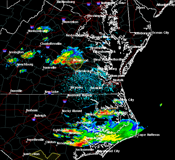 The severe thunderstorm warning for southeastern goochland and western henrico counties will expire at 500 pm edt, the storms which prompted the warning have moved out of the area. therefore the warning will be allowed to expire. however gusty winds and heavy rain are still possible with these thunderstorms. a severe thunderstorm watch remains in effect until 900 pm edt for central virginia. The severe thunderstorm warning for southeastern goochland and western henrico counties will expire at 500 pm edt, the storms which prompted the warning have moved out of the area. therefore the warning will be allowed to expire. however gusty winds and heavy rain are still possible with these thunderstorms. a severe thunderstorm watch remains in effect until 900 pm edt for central virginia.
|
| 7/19/2016 4:49 PM EDT |
 At 449 pm edt, a severe thunderstorm was located over downtown richmond, moving southeast at 15 mph (radar indicated). Hazards include 70 mph wind gusts and half dollar size hail. Hail damage to vehicles is expected. expect considerable tree damage. wind damage is also likely to mobile homes, roofs, and outbuildings. this severe storm will be near, richmond around 455 pm edt. highland springs, bensley and chesterfield court house around 505 pm edt. bellwood around 510 pm edt. chester around 515 pm edt. other locations impacted by this severe thunderstorm include richmond international, greendale, orapax farms, meadowville, solomons store, dumbarton, westwood, drewrys bluff, roslyn hills and atlee. precautionary/preparedness actions, for your protection move to an interior room on the lowest floor of a building. please send your reports of hail and or wind damage, including trees or large limbs downed, by calling noaa`s national weather service in wakefield at , 7 5 7, 8 9 9, 2 4 1 5. At 449 pm edt, a severe thunderstorm was located over downtown richmond, moving southeast at 15 mph (radar indicated). Hazards include 70 mph wind gusts and half dollar size hail. Hail damage to vehicles is expected. expect considerable tree damage. wind damage is also likely to mobile homes, roofs, and outbuildings. this severe storm will be near, richmond around 455 pm edt. highland springs, bensley and chesterfield court house around 505 pm edt. bellwood around 510 pm edt. chester around 515 pm edt. other locations impacted by this severe thunderstorm include richmond international, greendale, orapax farms, meadowville, solomons store, dumbarton, westwood, drewrys bluff, roslyn hills and atlee. precautionary/preparedness actions, for your protection move to an interior room on the lowest floor of a building. please send your reports of hail and or wind damage, including trees or large limbs downed, by calling noaa`s national weather service in wakefield at , 7 5 7, 8 9 9, 2 4 1 5.
|
| 7/19/2016 4:32 PM EDT |
 At 432 pm edt, a severe thunderstorm was located over university of richmond, moving southeast at 30 mph (radar indicated). Hazards include 60 mph wind gusts and quarter size hail. Hail damage to vehicles is expected. expect wind damage to roofs, siding, and trees. this severe thunderstorm will be near, richmond around 435 pm edt. downtown richmond, virginia commonwealth university, virginia union university and east highland park around 440 pm edt. highland springs and bensley around 445 pm edt. bellwood around 450 pm edt. chester around 455 pm edt. bottoms bridge around 505 pm edt. Other locations impacted by this severe thunderstorm include richmond international, greendale, orapax farms, meadowville, solomons store, dumbarton, westwood, drewrys bluff, roslyn hills and atlee. At 432 pm edt, a severe thunderstorm was located over university of richmond, moving southeast at 30 mph (radar indicated). Hazards include 60 mph wind gusts and quarter size hail. Hail damage to vehicles is expected. expect wind damage to roofs, siding, and trees. this severe thunderstorm will be near, richmond around 435 pm edt. downtown richmond, virginia commonwealth university, virginia union university and east highland park around 440 pm edt. highland springs and bensley around 445 pm edt. bellwood around 450 pm edt. chester around 455 pm edt. bottoms bridge around 505 pm edt. Other locations impacted by this severe thunderstorm include richmond international, greendale, orapax farms, meadowville, solomons store, dumbarton, westwood, drewrys bluff, roslyn hills and atlee.
|
| 7/19/2016 4:30 PM EDT | Quarter sized hail reported 1.8 miles S of Tuckahoe, VA, . |
| 7/19/2016 4:30 PM EDT | Quarter sized hail reported 1.1 miles S of Tuckahoe, VA, quarter size hail at patterson and lauderdale. |
| 7/19/2016 4:30 PM EDT | Half Dollar sized hail reported 1 miles WSW of Tuckahoe, VA, . |
| 7/19/2016 4:28 PM EDT |
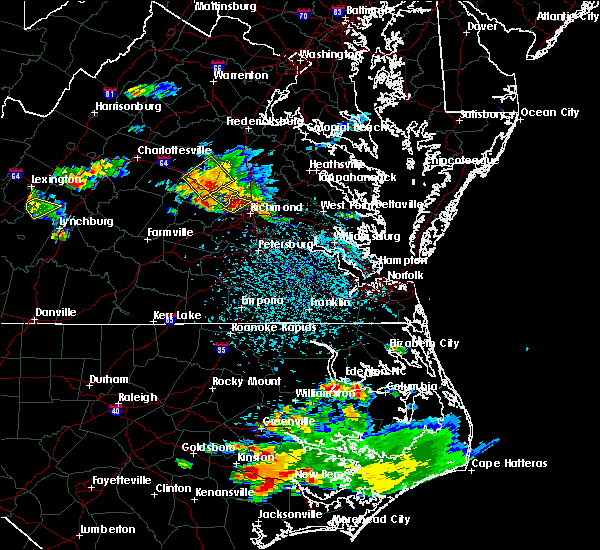 At 427 pm edt, severe thunderstorms were located along a line extending from near glen allen to near manakin, moving southeast at 10 mph (radar indicated). Hazards include 60 mph wind gusts and nickel size hail. Expect damage to roofs. siding. and trees. these severe storms will be near, tuckahoe around 435 pm edt. laurel and glen allen around 440 pm edt. lakeside around 450 pm edt. Other locations impacted by these severe thunderstorms include short pump, roslyn hills and dumbarton. At 427 pm edt, severe thunderstorms were located along a line extending from near glen allen to near manakin, moving southeast at 10 mph (radar indicated). Hazards include 60 mph wind gusts and nickel size hail. Expect damage to roofs. siding. and trees. these severe storms will be near, tuckahoe around 435 pm edt. laurel and glen allen around 440 pm edt. lakeside around 450 pm edt. Other locations impacted by these severe thunderstorms include short pump, roslyn hills and dumbarton.
|
| 7/19/2016 4:16 PM EDT |
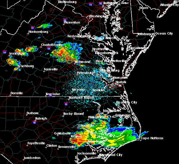 At 415 pm edt, severe thunderstorms were located along a line extending from wyndham to near sabot, moving southeast at 10 mph (radar indicated). Hazards include 60 mph wind gusts and nickel size hail. Expect damage to roofs. siding. and trees. severe thunderstorms will be near, wyndham around 420 pm edt. tuckahoe around 445 pm edt. laurel and glen allen around 450 pm edt. lakeside around 500 pm edt. Other locations impacted by these severe thunderstorms include short pump, roslyn hills and dumbarton. At 415 pm edt, severe thunderstorms were located along a line extending from wyndham to near sabot, moving southeast at 10 mph (radar indicated). Hazards include 60 mph wind gusts and nickel size hail. Expect damage to roofs. siding. and trees. severe thunderstorms will be near, wyndham around 420 pm edt. tuckahoe around 445 pm edt. laurel and glen allen around 450 pm edt. lakeside around 500 pm edt. Other locations impacted by these severe thunderstorms include short pump, roslyn hills and dumbarton.
|
| 7/19/2016 4:00 PM EDT |
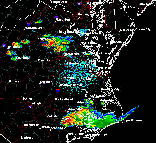 At 359 pm edt, a severe thunderstorm was located near oilville, or 9 miles east of goochland, moving southeast at 15 mph (radar indicated). Hazards include 60 mph wind gusts and nickel size hail. Expect damage to roofs. siding. and trees. this severe storm will be near, wyndham around 415 pm edt. Other locations impacted by this severe thunderstorm include johnsons springs, rockville and vontay. At 359 pm edt, a severe thunderstorm was located near oilville, or 9 miles east of goochland, moving southeast at 15 mph (radar indicated). Hazards include 60 mph wind gusts and nickel size hail. Expect damage to roofs. siding. and trees. this severe storm will be near, wyndham around 415 pm edt. Other locations impacted by this severe thunderstorm include johnsons springs, rockville and vontay.
|
| 7/19/2016 3:43 PM EDT |
 At 342 pm edt, a severe thunderstorm was located near oilville, or 8 miles northeast of goochland, moving southeast at 15 mph (radar indicated). Hazards include 60 mph wind gusts and nickel size hail. Expect damage to roofs. siding. and trees. this severe thunderstorm will be near, wyndham around 420 pm edt. Other locations impacted by this severe thunderstorm include johnsons springs, vontay and rockville. At 342 pm edt, a severe thunderstorm was located near oilville, or 8 miles northeast of goochland, moving southeast at 15 mph (radar indicated). Hazards include 60 mph wind gusts and nickel size hail. Expect damage to roofs. siding. and trees. this severe thunderstorm will be near, wyndham around 420 pm edt. Other locations impacted by this severe thunderstorm include johnsons springs, vontay and rockville.
|
| 6/23/2016 7:11 AM EDT |
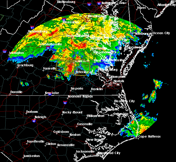 At 711 am edt, a severe thunderstorm was located over chesterfield court house, or near chester, moving east at 45 mph (radar indicated). Hazards include 60 mph wind gusts and quarter size hail. Hail damage to vehicles is expected. expect wind damage to roofs, siding, and trees. this severe thunderstorm will be near, hopewell around 720 am edt. jordans point around 730 am edt. roxbury and bottoms bridge around 735 am edt. charles city, talleysville and adkins store around 740 am edt. providence forge and ruthville around 745 am edt. new kent around 750 am edt. Other locations impacted by this severe thunderstorm include chesterfield, sandybottom, jordan point country club, orapax farms, new hope, richard bland college, colonial downs, new bohemia, wayside and roslyn hills. At 711 am edt, a severe thunderstorm was located over chesterfield court house, or near chester, moving east at 45 mph (radar indicated). Hazards include 60 mph wind gusts and quarter size hail. Hail damage to vehicles is expected. expect wind damage to roofs, siding, and trees. this severe thunderstorm will be near, hopewell around 720 am edt. jordans point around 730 am edt. roxbury and bottoms bridge around 735 am edt. charles city, talleysville and adkins store around 740 am edt. providence forge and ruthville around 745 am edt. new kent around 750 am edt. Other locations impacted by this severe thunderstorm include chesterfield, sandybottom, jordan point country club, orapax farms, new hope, richard bland college, colonial downs, new bohemia, wayside and roslyn hills.
|
| 6/23/2016 6:51 AM EDT |
 At 651 am edt, a severe thunderstorm was located over moseley, moving east at 35 mph (radar indicated). Hazards include 60 mph wind gusts and quarter size hail. Hail damage to vehicles is expected. expect wind damage to roofs, siding, and trees. this severe storm will be near, chester, chesterfield court house, bellwood and bensley around 715 am edt. other locations impacted by this severe thunderstorm include winterpock, subletts, chesterfield, genito, goodwins store, flat rock, pilkinton, skinquarter, fine creek mills and holly hills. precautionary/preparedness actions, for your protection move to an interior room on the lowest floor of a building. please send your reports of hail and or wind damage, including trees or large limbs downed, by calling noaa`s national weather service in wakefield at , 7 5 7, 8 9 9, 2 4 1 5. At 651 am edt, a severe thunderstorm was located over moseley, moving east at 35 mph (radar indicated). Hazards include 60 mph wind gusts and quarter size hail. Hail damage to vehicles is expected. expect wind damage to roofs, siding, and trees. this severe storm will be near, chester, chesterfield court house, bellwood and bensley around 715 am edt. other locations impacted by this severe thunderstorm include winterpock, subletts, chesterfield, genito, goodwins store, flat rock, pilkinton, skinquarter, fine creek mills and holly hills. precautionary/preparedness actions, for your protection move to an interior room on the lowest floor of a building. please send your reports of hail and or wind damage, including trees or large limbs downed, by calling noaa`s national weather service in wakefield at , 7 5 7, 8 9 9, 2 4 1 5.
|
| 6/23/2016 6:45 AM EDT |
 At 644 am edt, a severe thunderstorm was located near moseley, moving east at 35 mph (radar indicated). Hazards include 60 mph wind gusts and quarter size hail. Hail damage to vehicles is expected. expect wind damage to roofs, siding, and trees. this severe storm will be near, chesterfield court house around 710 am edt. chester, bellwood and bensley around 715 am edt. other locations impacted by this severe thunderstorm include winterpock, crozier, chesterfield, rodophil, michaux, jefferson, goodwins store, skinquarter, solomons store and maidens. precautionary/preparedness actions, for your protection move to an interior room on the lowest floor of a building. please send your reports of hail and or wind damage, including trees or large limbs downed, by calling noaa`s national weather service in wakefield at , 7 5 7, 8 9 9, 2 4 1 5. At 644 am edt, a severe thunderstorm was located near moseley, moving east at 35 mph (radar indicated). Hazards include 60 mph wind gusts and quarter size hail. Hail damage to vehicles is expected. expect wind damage to roofs, siding, and trees. this severe storm will be near, chesterfield court house around 710 am edt. chester, bellwood and bensley around 715 am edt. other locations impacted by this severe thunderstorm include winterpock, crozier, chesterfield, rodophil, michaux, jefferson, goodwins store, skinquarter, solomons store and maidens. precautionary/preparedness actions, for your protection move to an interior room on the lowest floor of a building. please send your reports of hail and or wind damage, including trees or large limbs downed, by calling noaa`s national weather service in wakefield at , 7 5 7, 8 9 9, 2 4 1 5.
|
| 6/23/2016 6:29 AM EDT |
 At 628 am edt, a severe thunderstorm was located near morven, or 7 miles southwest of powhatan, moving east at 35 mph (radar indicated). Hazards include 60 mph wind gusts and quarter size hail. Hail damage to vehicles is expected. expect wind damage to roofs, siding, and trees. this severe thunderstorm will be near, chula around 640 am edt. moseley around 650 am edt. chester, chesterfield court house, bellwood and bensley around 715 am edt. Other locations impacted by this severe thunderstorm include winterpock, crozier, chesterfield, rodophil, michaux, jefferson, goodwins store, maidens, ashby and irwin. At 628 am edt, a severe thunderstorm was located near morven, or 7 miles southwest of powhatan, moving east at 35 mph (radar indicated). Hazards include 60 mph wind gusts and quarter size hail. Hail damage to vehicles is expected. expect wind damage to roofs, siding, and trees. this severe thunderstorm will be near, chula around 640 am edt. moseley around 650 am edt. chester, chesterfield court house, bellwood and bensley around 715 am edt. Other locations impacted by this severe thunderstorm include winterpock, crozier, chesterfield, rodophil, michaux, jefferson, goodwins store, maidens, ashby and irwin.
|
| 6/16/2016 9:50 PM EDT |
 At 949 pm edt, severe thunderstorms were located along a line extending from near mangohick to near east highland park to 6 miles east of moseley, moving southeast at 180 mph (radar indicated). Hazards include 70 mph wind gusts and half dollar size hail. Hail damage to vehicles is expected. expect considerable tree damage. wind damage is also likely to mobile homes, roofs, and outbuildings. these severe thunderstorms will remain over henrico, northwestern new kent, central chesterfield and southeastern hanover counties and the city of richmond, including the following locations: richmond international, chesterfield, orapax farms, westwood, drewrys bluff, atlee, fair oaks, varina, chamberlayne and richmond heights. precautionary/preparedness actions, for your protection move to an interior room on the lowest floor of a building. prepare immediately for large hail and damaging winds. people outside should move to a shelter, inside a strong building and away from windows. please send your reports of hail and or wind damage, including trees or large limbs downed, by calling noaa`s national weather service in wakefield at , 7 5 7, 8 9 9, 2 4 1 5. Time, mot, loc 0149z 300deg 156kt 3777 7722 3752 7739 3742 7765. At 949 pm edt, severe thunderstorms were located along a line extending from near mangohick to near east highland park to 6 miles east of moseley, moving southeast at 180 mph (radar indicated). Hazards include 70 mph wind gusts and half dollar size hail. Hail damage to vehicles is expected. expect considerable tree damage. wind damage is also likely to mobile homes, roofs, and outbuildings. these severe thunderstorms will remain over henrico, northwestern new kent, central chesterfield and southeastern hanover counties and the city of richmond, including the following locations: richmond international, chesterfield, orapax farms, westwood, drewrys bluff, atlee, fair oaks, varina, chamberlayne and richmond heights. precautionary/preparedness actions, for your protection move to an interior room on the lowest floor of a building. prepare immediately for large hail and damaging winds. people outside should move to a shelter, inside a strong building and away from windows. please send your reports of hail and or wind damage, including trees or large limbs downed, by calling noaa`s national weather service in wakefield at , 7 5 7, 8 9 9, 2 4 1 5. Time, mot, loc 0149z 300deg 156kt 3777 7722 3752 7739 3742 7765.
|
| 6/16/2016 9:45 PM EDT | Tree blocking road at mapleway road and camrose roa in henrico county VA, 1.8 miles SW of Tuckahoe, VA |
| 6/16/2016 9:45 PM EDT | Tree downed on quioccasin road near shane roa in henrico county VA, 2.3 miles SW of Tuckahoe, VA |
| 6/16/2016 9:36 PM EDT | Storm damage reported in henrico county VA, 1 miles WSW of Tuckahoe, VA |
| 6/16/2016 9:15 PM EDT |
 At 915 pm edt, severe thunderstorms were located along a line extending from near bumpass to goochland to near trenholm, moving southeast at 45 mph (radar indicated). Hazards include 70 mph wind gusts and half dollar size hail. Hail damage to vehicles is expected. expect considerable tree damage. wind damage is also likely to mobile homes, roofs, and outbuildings. severe thunderstorms will be near, oilville around 920 pm edt. sabot around 925 pm edt. tuckahoe, manakin and wyndham around 930 pm edt. richmond, university of richmond, bon air, lakeside and laurel around 940 pm edt. virginia commonwealth university, downtown richmond, virginia union university and east highland park around 945 pm edt. highland springs, bensley and bellwood around 950 pm edt. tunstall and chesterfield court house around 955 pm edt. chester around 1000 pm edt. Other locations impacted by these severe thunderstorms include crozier, chesterfield, michaux, jefferson, orapax farms, goodwins store, rockville, solomons store, maidens and irwin. At 915 pm edt, severe thunderstorms were located along a line extending from near bumpass to goochland to near trenholm, moving southeast at 45 mph (radar indicated). Hazards include 70 mph wind gusts and half dollar size hail. Hail damage to vehicles is expected. expect considerable tree damage. wind damage is also likely to mobile homes, roofs, and outbuildings. severe thunderstorms will be near, oilville around 920 pm edt. sabot around 925 pm edt. tuckahoe, manakin and wyndham around 930 pm edt. richmond, university of richmond, bon air, lakeside and laurel around 940 pm edt. virginia commonwealth university, downtown richmond, virginia union university and east highland park around 945 pm edt. highland springs, bensley and bellwood around 950 pm edt. tunstall and chesterfield court house around 955 pm edt. chester around 1000 pm edt. Other locations impacted by these severe thunderstorms include crozier, chesterfield, michaux, jefferson, orapax farms, goodwins store, rockville, solomons store, maidens and irwin.
|
| 2/24/2016 6:23 PM EST |
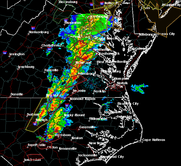 The tornado warning for southeastern hanover, north central chesterfield, and central henrico counties and the city of richmond will expire at 630 pm est, the tornadic thunderstorm which prompted the warning has moved northeast and out of the warned area. therefore the warning will be allowed to expire. The tornado warning for southeastern hanover, north central chesterfield, and central henrico counties and the city of richmond will expire at 630 pm est, the tornadic thunderstorm which prompted the warning has moved northeast and out of the warned area. therefore the warning will be allowed to expire.
|
| 2/24/2016 5:52 PM EST |
 At 552 pm est, doppler radar indicated a tornado. this dangerous storm was located near chesterfield court house, or 8 miles west of chester, and moving northeast at 50 mph. * this dangerous storm will be near, bon air, bensley and bellwood around 605 pm est. downtown richmond, virginia commonwealth university and university of richmond around 610 pm est. richmond, highland springs and virginia union university around 615 pm est. mechanicsville and east highland park around 620 pm est. studley around 625 pm est. other locations impacted by this tornadic thunderstorm include richmond international, greendale, ashcake, solomons store, dumbarton, westwood, roslyn hills, hanover airport, atlee and fair oaks. At 552 pm est, doppler radar indicated a tornado. this dangerous storm was located near chesterfield court house, or 8 miles west of chester, and moving northeast at 50 mph. * this dangerous storm will be near, bon air, bensley and bellwood around 605 pm est. downtown richmond, virginia commonwealth university and university of richmond around 610 pm est. richmond, highland springs and virginia union university around 615 pm est. mechanicsville and east highland park around 620 pm est. studley around 625 pm est. other locations impacted by this tornadic thunderstorm include richmond international, greendale, ashcake, solomons store, dumbarton, westwood, roslyn hills, hanover airport, atlee and fair oaks.
|
| 2/24/2016 5:42 PM EST |
 At 542 pm est, doppler radar indicated severe thunderstorms capable of producing tornadoes. these dangerous storms were located along a line extending from near montpelier to near powhatan, moving northeast at 60 mph. these dangerous storms will be near, tuckahoe and oilville around 555 pm est. wyndham around 600 pm est. other locations impacted by these tornadic storms include oliver, subletts, crozier, michaux, short pump, jefferson, goodwins store, rockville, johnsons springs and fine creek mills. At 542 pm est, doppler radar indicated severe thunderstorms capable of producing tornadoes. these dangerous storms were located along a line extending from near montpelier to near powhatan, moving northeast at 60 mph. these dangerous storms will be near, tuckahoe and oilville around 555 pm est. wyndham around 600 pm est. other locations impacted by these tornadic storms include oliver, subletts, crozier, michaux, short pump, jefferson, goodwins store, rockville, johnsons springs and fine creek mills.
|
| 2/24/2016 5:28 PM EST |
 At 527 pm est, doppler radar indicated a line of severe thunderstorms capable of producing a tornado. these dangerous storms were located along a line extending from near goochland to near amelia courthouse, and moving northeast at 60 mph. * these dangerous storms will be near, oilville around 535 pm est. sabot and manakin around 550 pm est. tuckahoe around 555 pm est. wyndham around 600 pm est. other locations impacted by these tornadic storms include oliver, subletts, crozier, genito, michaux, short pump, jefferson, goodwins store, rockville and flat rock. At 527 pm est, doppler radar indicated a line of severe thunderstorms capable of producing a tornado. these dangerous storms were located along a line extending from near goochland to near amelia courthouse, and moving northeast at 60 mph. * these dangerous storms will be near, oilville around 535 pm est. sabot and manakin around 550 pm est. tuckahoe around 555 pm est. wyndham around 600 pm est. other locations impacted by these tornadic storms include oliver, subletts, crozier, genito, michaux, short pump, jefferson, goodwins store, rockville and flat rock.
|
| 6/25/2015 9:41 PM EDT |
 At 940 pm edt, doppler radar indicated a severe thunderstorm capable of producing quarter size hail and destructive winds in excess of 70 mph. this storm was located near bon air, and moving southeast at 35 mph. * this severe thunderstorm will be near, downtown richmond and chesterfield court house around 945 pm edt. bellwood and bensley around 950 pm edt. chester around 955 pm edt. hopewell, colonial heights, fort lee and ettrick around 1005 pm edt. petersburg around 1010 pm edt. prince george and jordans point around 1015 pm edt. charles city and garysville around 1025 pm edt. burrowsville around 1030 pm edt. other locations impacted by this severe thunderstorm include addison, hebron, orapax farms, goodwins store, richard bland college, maidens, irwin, roslyn hills, atlee and richmond heights. At 940 pm edt, doppler radar indicated a severe thunderstorm capable of producing quarter size hail and destructive winds in excess of 70 mph. this storm was located near bon air, and moving southeast at 35 mph. * this severe thunderstorm will be near, downtown richmond and chesterfield court house around 945 pm edt. bellwood and bensley around 950 pm edt. chester around 955 pm edt. hopewell, colonial heights, fort lee and ettrick around 1005 pm edt. petersburg around 1010 pm edt. prince george and jordans point around 1015 pm edt. charles city and garysville around 1025 pm edt. burrowsville around 1030 pm edt. other locations impacted by this severe thunderstorm include addison, hebron, orapax farms, goodwins store, richard bland college, maidens, irwin, roslyn hills, atlee and richmond heights.
|
| 6/25/2015 9:33 PM EDT |
 At 932 pm edt, doppler radar indicated a severe thunderstorm capable of producing large hail up to ping pong ball size and destructive winds in excess of 70 mph. this storm was located near bon air, moving southeast at 35 mph. this severe storm will be near, bon air and university of richmond around 940 pm edt. downtown richmond, virginia commonwealth university and chesterfield court house around 950 pm edt. bensley around 955 pm edt. chester and bellwood around 1000 pm edt. other locations impacted by this severe thunderstorm include winterpock, crozier, dixie, chesterfield, jefferson, michaux, goodwins store, stage junction, maidens and ashby. At 932 pm edt, doppler radar indicated a severe thunderstorm capable of producing large hail up to ping pong ball size and destructive winds in excess of 70 mph. this storm was located near bon air, moving southeast at 35 mph. this severe storm will be near, bon air and university of richmond around 940 pm edt. downtown richmond, virginia commonwealth university and chesterfield court house around 950 pm edt. bensley around 955 pm edt. chester and bellwood around 1000 pm edt. other locations impacted by this severe thunderstorm include winterpock, crozier, dixie, chesterfield, jefferson, michaux, goodwins store, stage junction, maidens and ashby.
|
| 6/25/2015 9:14 PM EDT |
 At 913 pm edt, doppler radar indicated a severe thunderstorm capable of producing large hail up to ping pong ball size and destructive winds in excess of 70 mph. this storm was located near sabot, or near goochland, and moving east at 30 mph. * this severe thunderstorm will be near, sabot around 920 pm edt. manakin around 925 pm edt. tuckahoe and wyndham around 930 pm edt. university of richmond, bon air and laurel around 945 pm edt. richmond and lakeside around 950 pm edt. virginia commonwealth university, virginia union university, downtown richmond, mechanicsville and east highland park around 955 pm edt. highland springs, bensley and bellwood around 1000 pm edt. other locations impacted by this severe thunderstorm include winterpock, crozier, dixie, chesterfield, jefferson, michaux, goodwins store, stage junction, maidens and ashby. At 913 pm edt, doppler radar indicated a severe thunderstorm capable of producing large hail up to ping pong ball size and destructive winds in excess of 70 mph. this storm was located near sabot, or near goochland, and moving east at 30 mph. * this severe thunderstorm will be near, sabot around 920 pm edt. manakin around 925 pm edt. tuckahoe and wyndham around 930 pm edt. university of richmond, bon air and laurel around 945 pm edt. richmond and lakeside around 950 pm edt. virginia commonwealth university, virginia union university, downtown richmond, mechanicsville and east highland park around 955 pm edt. highland springs, bensley and bellwood around 1000 pm edt. other locations impacted by this severe thunderstorm include winterpock, crozier, dixie, chesterfield, jefferson, michaux, goodwins store, stage junction, maidens and ashby.
|
| 6/20/2015 9:27 PM EDT |
 At 926 pm edt, doppler radar indicated a line of severe thunderstorms capable of producing quarter size hail and damaging winds in excess of 60 mph. these storms were located along a line extending from near oilville to chester to emporia, and moving east at 40 mph. * severe thunderstorms will be near, petersburg, hopewell, colonial heights, fort lee, chester, virginia state university, ettrick, bellwood and matoaca around 930 pm edt. montpelier and wyndham around 935 pm edt. jordans point around 940 pm edt. roxbury, randolph macon college and bottoms bridge around 945 pm edt. charles city, ashland, talleysville, providence forge, kings dominion, adkins store and ruthville around 950 pm edt. courtland, hanover, dawn and holdcroft around 955 pm edt. new kent, sedley and mangohick around 1000 pm edt. barhamsville and beulahville around 1005 pm edt. At 926 pm edt, doppler radar indicated a line of severe thunderstorms capable of producing quarter size hail and damaging winds in excess of 60 mph. these storms were located along a line extending from near oilville to chester to emporia, and moving east at 40 mph. * severe thunderstorms will be near, petersburg, hopewell, colonial heights, fort lee, chester, virginia state university, ettrick, bellwood and matoaca around 930 pm edt. montpelier and wyndham around 935 pm edt. jordans point around 940 pm edt. roxbury, randolph macon college and bottoms bridge around 945 pm edt. charles city, ashland, talleysville, providence forge, kings dominion, adkins store and ruthville around 950 pm edt. courtland, hanover, dawn and holdcroft around 955 pm edt. new kent, sedley and mangohick around 1000 pm edt. barhamsville and beulahville around 1005 pm edt.
|
| 6/20/2015 8:24 PM EDT |
 At 823 pm edt, doppler radar indicated a line of severe thunderstorms capable of producing damaging winds in excess of 60 mph. these storms were located along a line extending from 14 miles northwest of spotsylvania to 6 miles southeast of ladysmith to near chesterfield court house, moving northeast at 50 mph. these severe storms will be near, bowling green and milford around 835 pm edt. highland springs and fort a.p. hill around 840 pm edt. bottoms bridge around 845 pm edt. talleysville, port royal and loretto around 850 pm edt. tunstall around 855 pm edt. other locations impacted by these severe thunderstorms include supply, chesterfield, elevon, hustle, turpin, orapax farms, woodford, epworth, sparta and burruss corner. At 823 pm edt, doppler radar indicated a line of severe thunderstorms capable of producing damaging winds in excess of 60 mph. these storms were located along a line extending from 14 miles northwest of spotsylvania to 6 miles southeast of ladysmith to near chesterfield court house, moving northeast at 50 mph. these severe storms will be near, bowling green and milford around 835 pm edt. highland springs and fort a.p. hill around 840 pm edt. bottoms bridge around 845 pm edt. talleysville, port royal and loretto around 850 pm edt. tunstall around 855 pm edt. other locations impacted by these severe thunderstorms include supply, chesterfield, elevon, hustle, turpin, orapax farms, woodford, epworth, sparta and burruss corner.
|
| 6/20/2015 8:09 PM EDT |
 At 808 pm edt, doppler radar indicated a line of severe thunderstorms capable of producing damaging winds in excess of 60 mph. these storms were located along a line extending from 8 miles east of orange to near montpelier to 7 miles northwest of sutherland, and moving northeast at 50 mph. * severe thunderstorms will be near, ashland around 815 pm edt. kings dominion around 820 pm edt. chester and ladysmith around 825 pm edt. milford, bellwood and bensley around 830 pm edt. bowling green around 835 pm edt. highland springs and fort a.p. hill around 840 pm edt. bottoms bridge around 845 pm edt. talleysville, port royal, tunstall and loretto around 850 pm edt. other locations impacted by these severe thunderstorms include supply, elevon, hustle, orapax farms, epworth, sparta, maidens, burruss corner, irwin and roslyn hills. At 808 pm edt, doppler radar indicated a line of severe thunderstorms capable of producing damaging winds in excess of 60 mph. these storms were located along a line extending from 8 miles east of orange to near montpelier to 7 miles northwest of sutherland, and moving northeast at 50 mph. * severe thunderstorms will be near, ashland around 815 pm edt. kings dominion around 820 pm edt. chester and ladysmith around 825 pm edt. milford, bellwood and bensley around 830 pm edt. bowling green around 835 pm edt. highland springs and fort a.p. hill around 840 pm edt. bottoms bridge around 845 pm edt. talleysville, port royal, tunstall and loretto around 850 pm edt. other locations impacted by these severe thunderstorms include supply, elevon, hustle, orapax farms, epworth, sparta, maidens, burruss corner, irwin and roslyn hills.
|
| 6/20/2015 7:46 PM EDT |
 At 746 pm edt, doppler radar indicated a line of severe thunderstorms capable of producing damaging winds in excess of 60 mph. these storms were located along a line extending from 6 miles southwest of orange to near powhatan, and moving northeast at 55 mph. * severe thunderstorms will be near, goochland around 750 pm edt. oilville and sabot around 755 pm edt. manakin around 800 pm edt. tuckahoe, wyndham and montpelier around 805 pm edt. laurel around 810 pm edt. ashland, randolph macon college and glen allen around 815 pm edt. other locations impacted by these severe thunderstorms include crozier, jefferson, michaux, goodwins store, pendleton, maidens, irwin, lake powhatan, roslyn hills and provost. At 746 pm edt, doppler radar indicated a line of severe thunderstorms capable of producing damaging winds in excess of 60 mph. these storms were located along a line extending from 6 miles southwest of orange to near powhatan, and moving northeast at 55 mph. * severe thunderstorms will be near, goochland around 750 pm edt. oilville and sabot around 755 pm edt. manakin around 800 pm edt. tuckahoe, wyndham and montpelier around 805 pm edt. laurel around 810 pm edt. ashland, randolph macon college and glen allen around 815 pm edt. other locations impacted by these severe thunderstorms include crozier, jefferson, michaux, goodwins store, pendleton, maidens, irwin, lake powhatan, roslyn hills and provost.
|
| 5/22/2014 5:23 PM EDT | Quarter sized hail reported 4 miles SW of Tuckahoe, VA, some rotation within the clouds |
| 5/22/2014 4:45 PM EDT | Quarter sized hail reported 4 miles SW of Tuckahoe, VA, winds over 50 mph |
| 8/23/2013 11:54 AM EDT | Couple of trees down on mill r in powhatan county VA, 12 miles E of Tuckahoe, VA |
| 6/13/2013 4:10 PM EDT | Trees down parham road at weldon dr in henrico county VA, 2.3 miles WSW of Tuckahoe, VA |
| 4/19/2013 6:57 PM EDT | Tree down on road in henrico county VA, 3.7 miles SSE of Tuckahoe, VA |
| 4/19/2013 6:25 PM EDT | Numerous trees down in powhatan county VA, 9.2 miles ESE of Tuckahoe, VA |
| 6/29/2012 10:35 PM EDT | Large tree downed and blocking roadway on sleepy hollow rd in richmond in henrico county VA, 1.5 miles W of Tuckahoe, VA |
| 1/1/0001 12:00 AM | Many trees down in the lake shawnee estates section. trees down on powerlines and house in powhatan county VA, 12.1 miles ENE of Tuckahoe, VA |
Hail Maps for Tuckahoe, VA


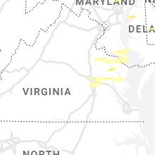


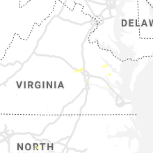


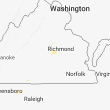


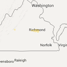


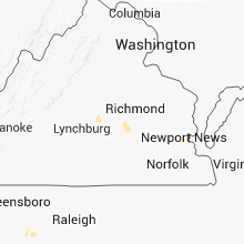


Connect with Interactive Hail Maps