

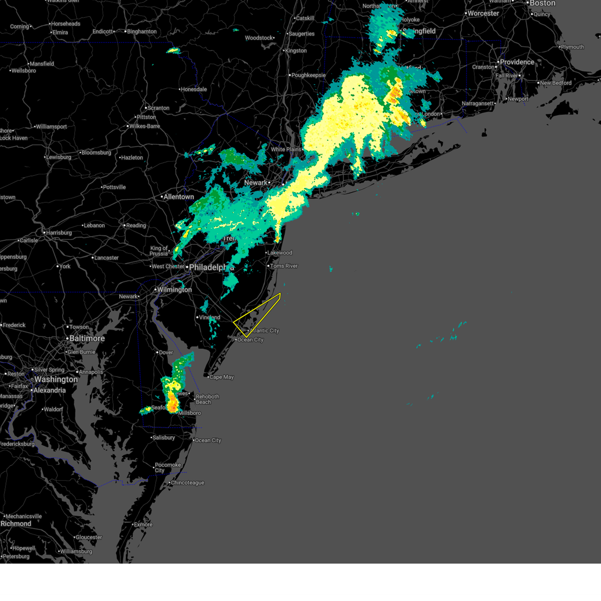
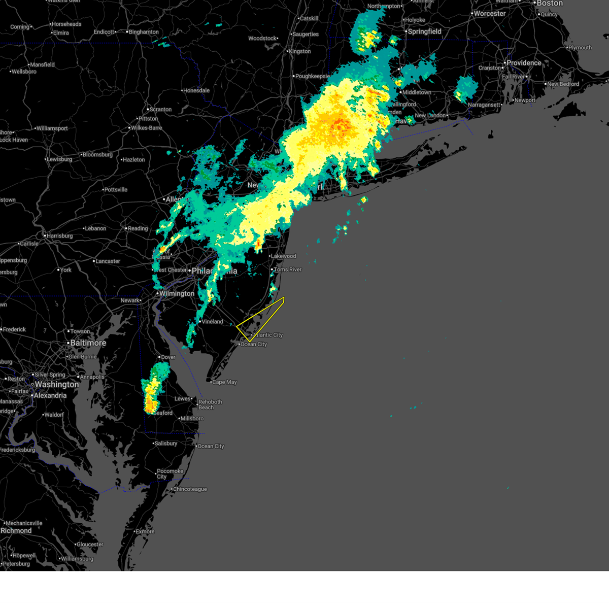
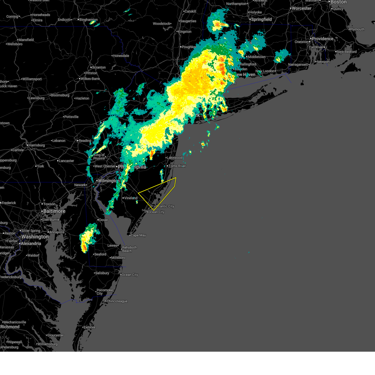
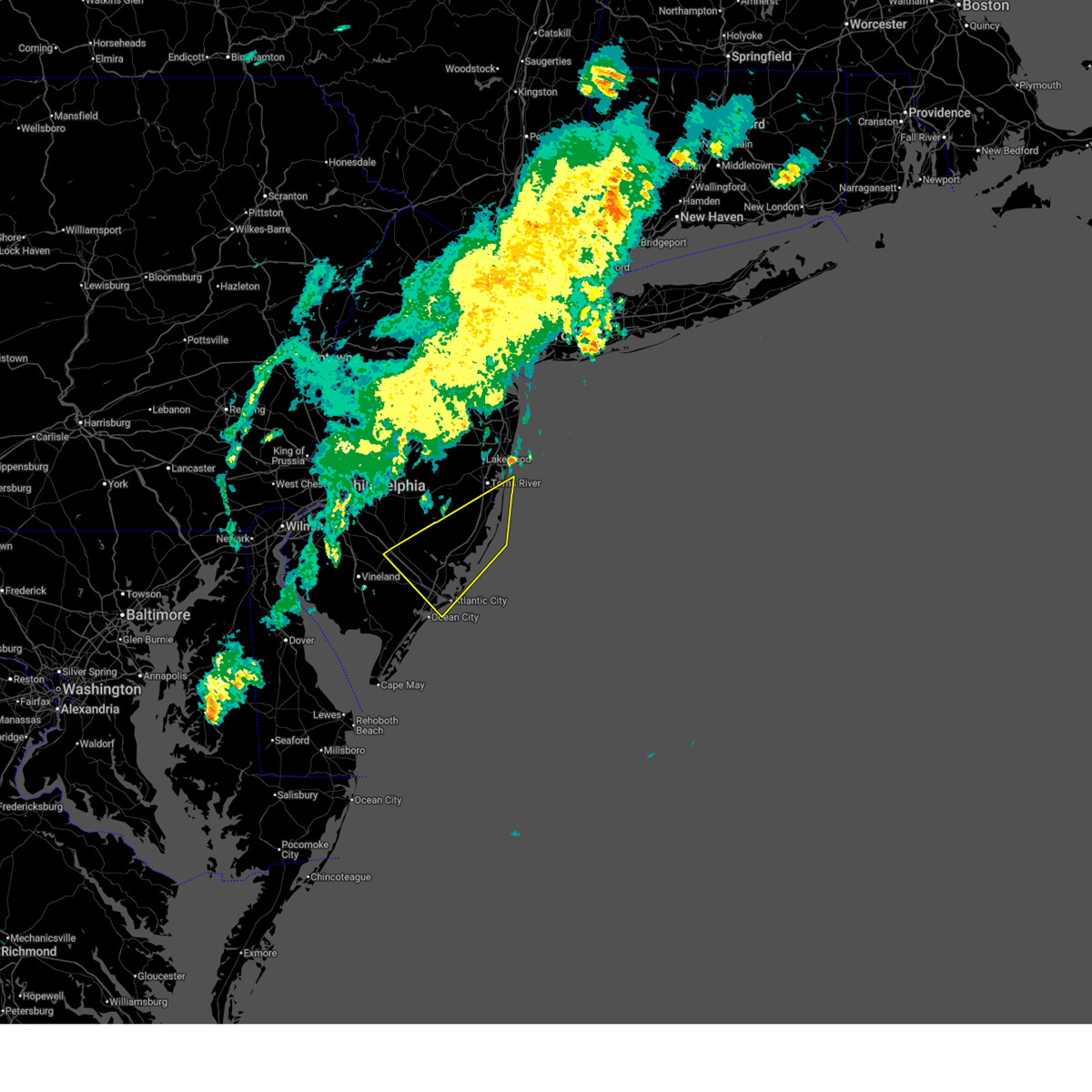
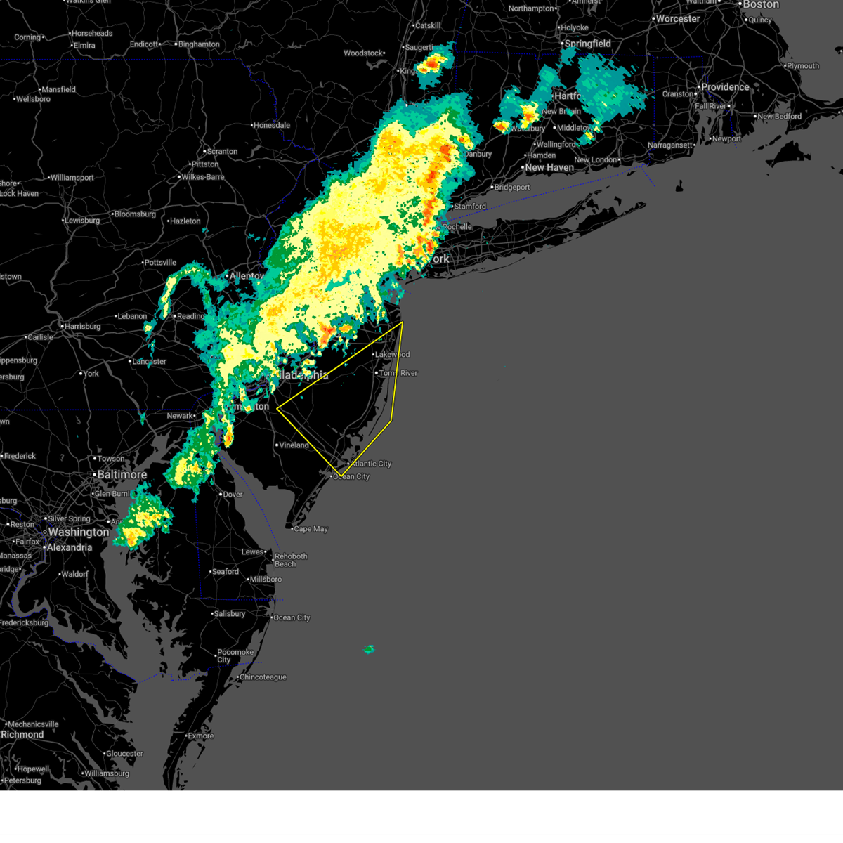
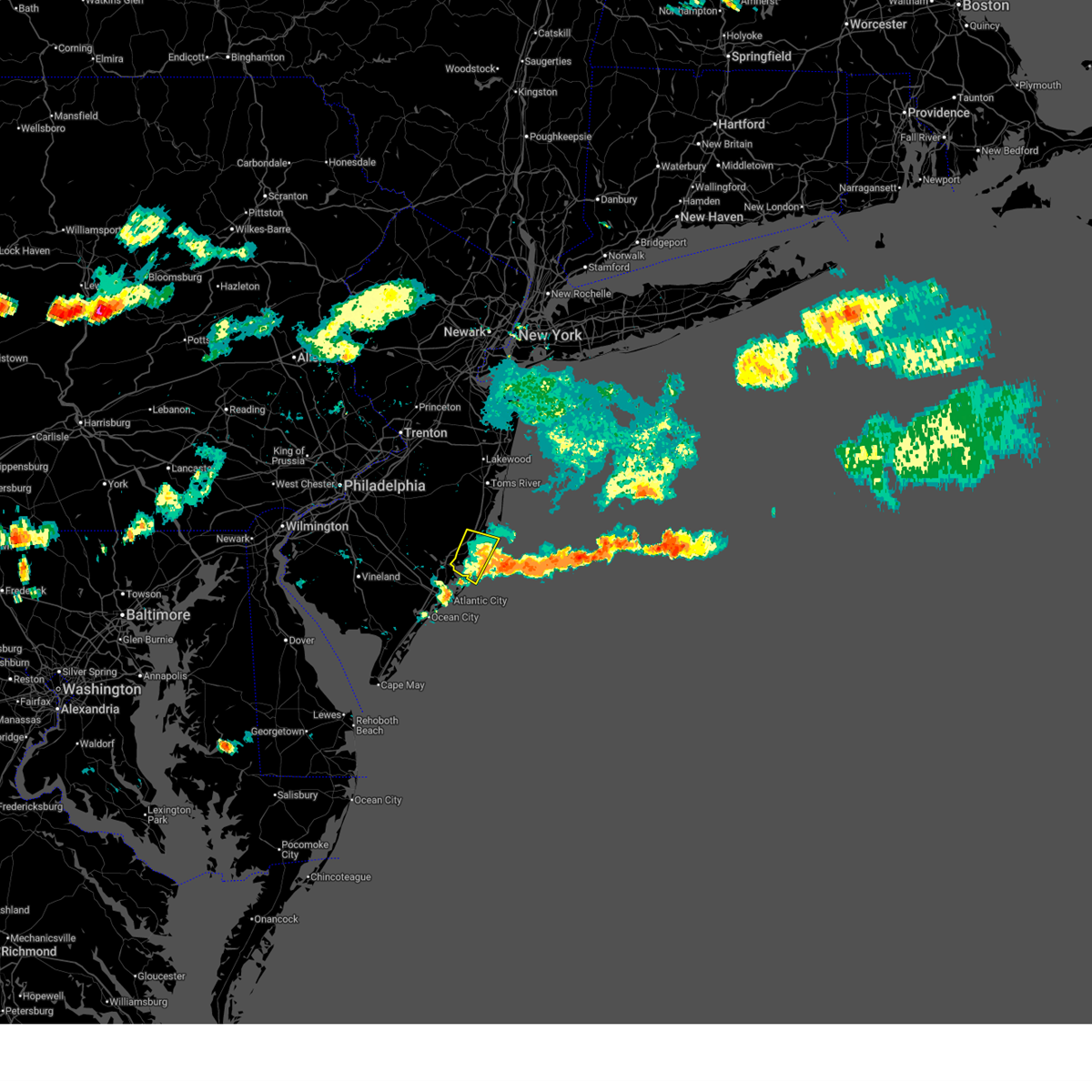
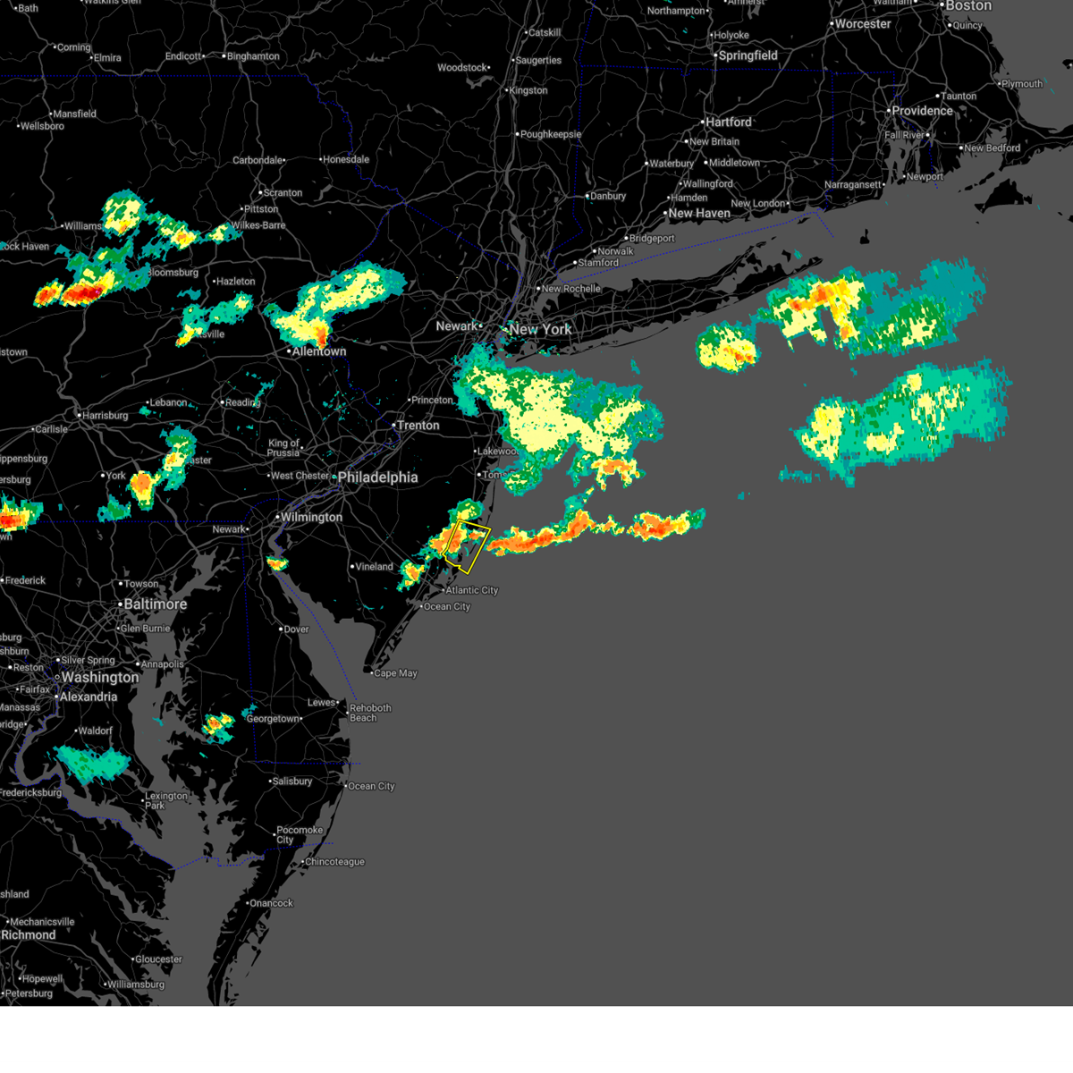
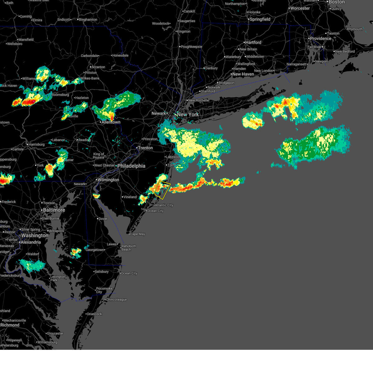
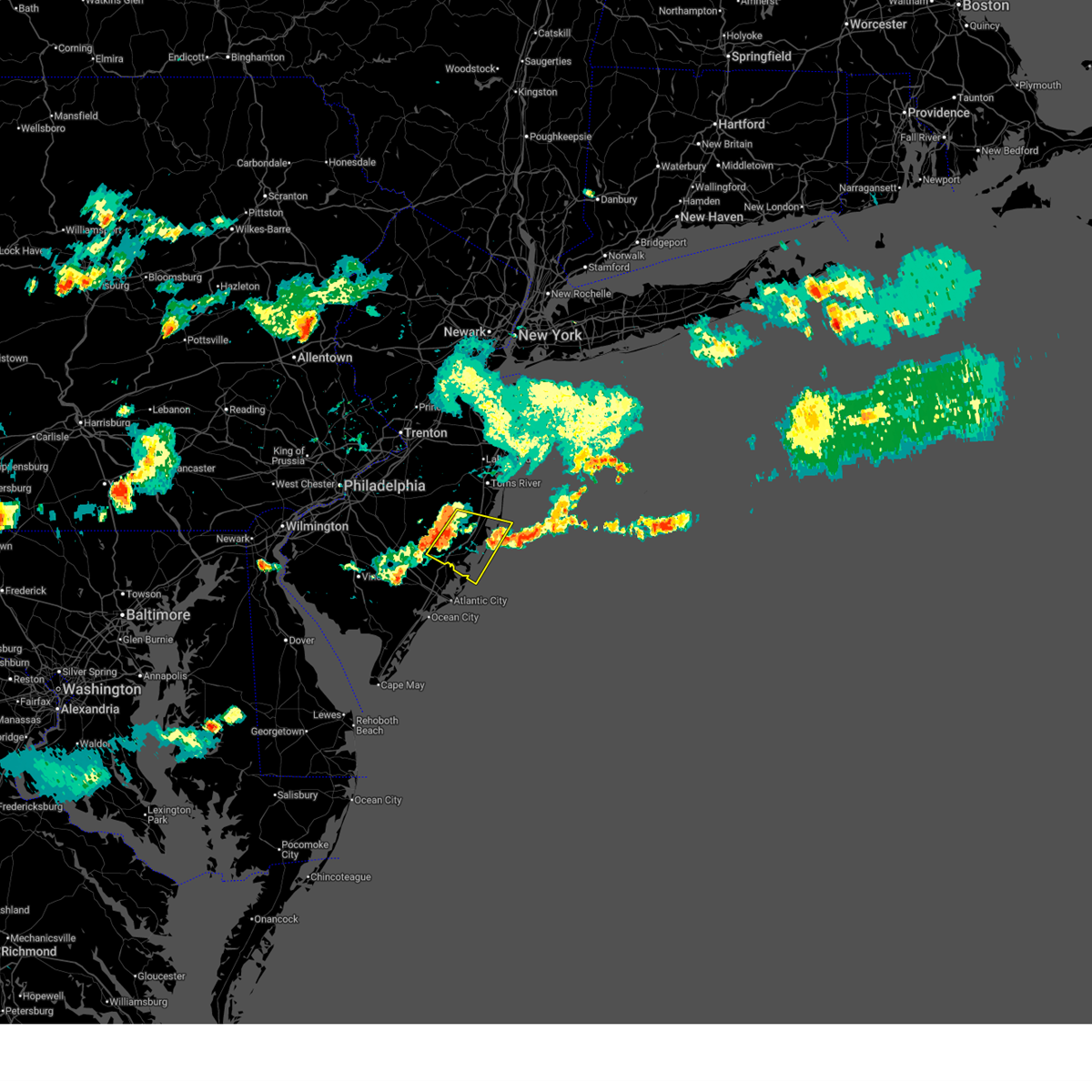
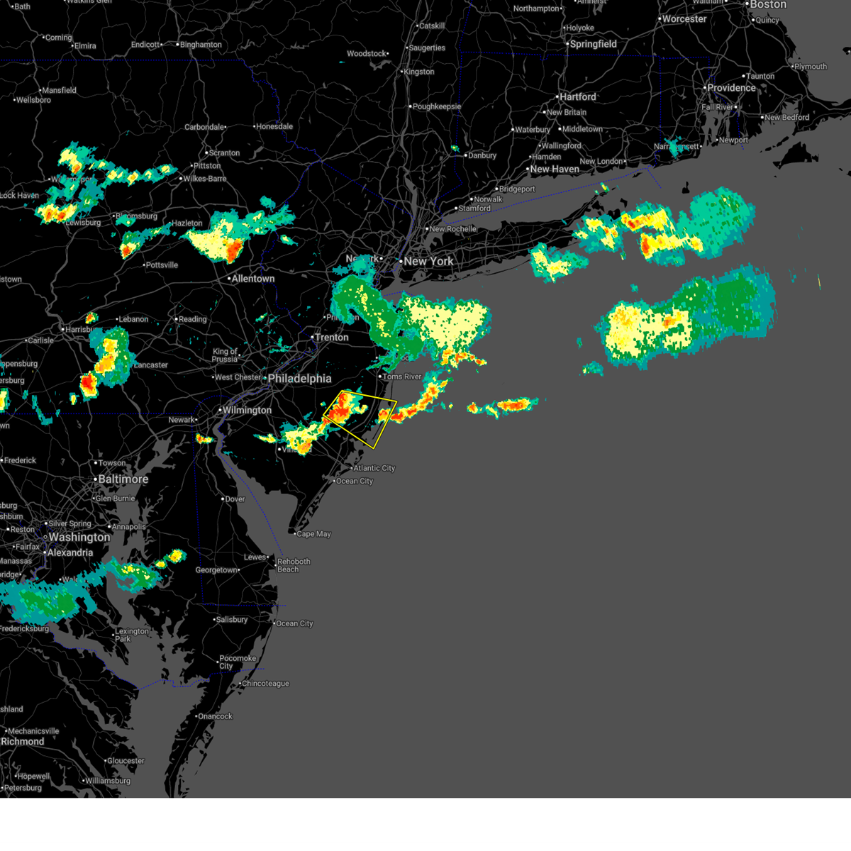
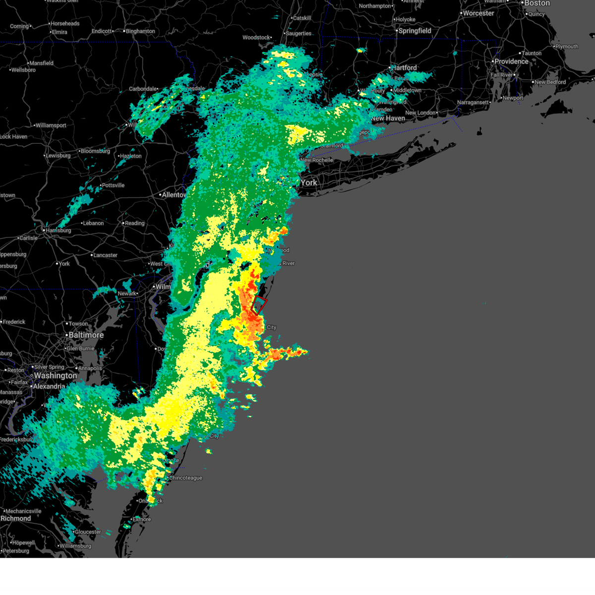
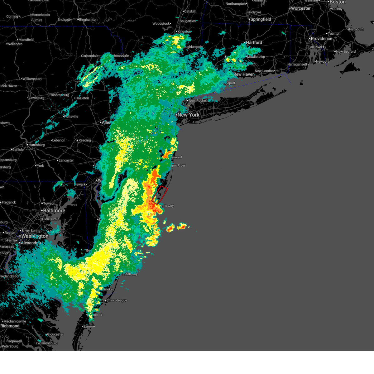
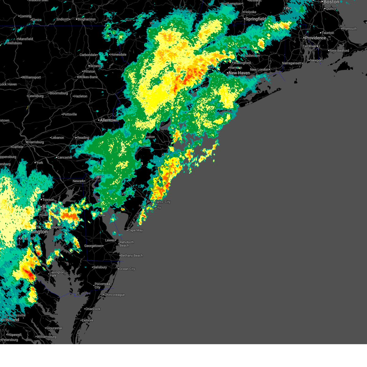
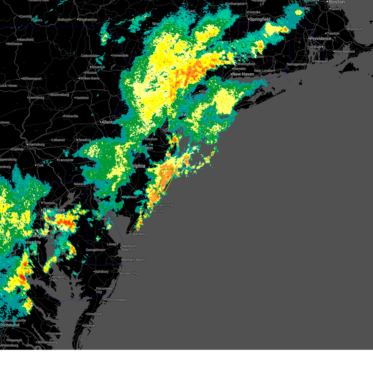
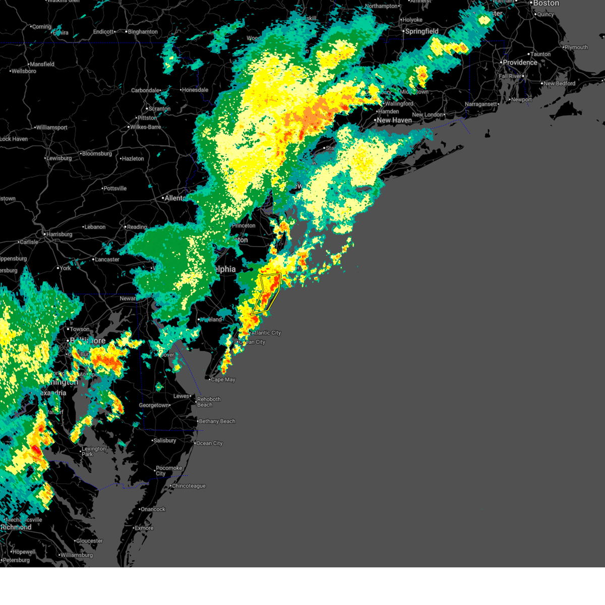
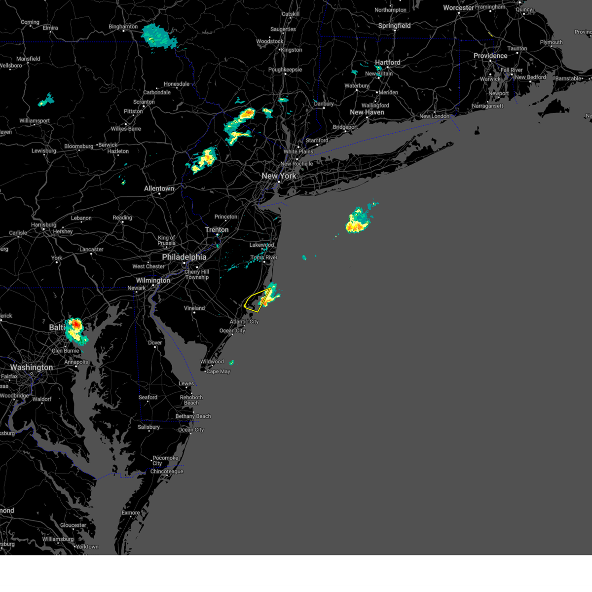
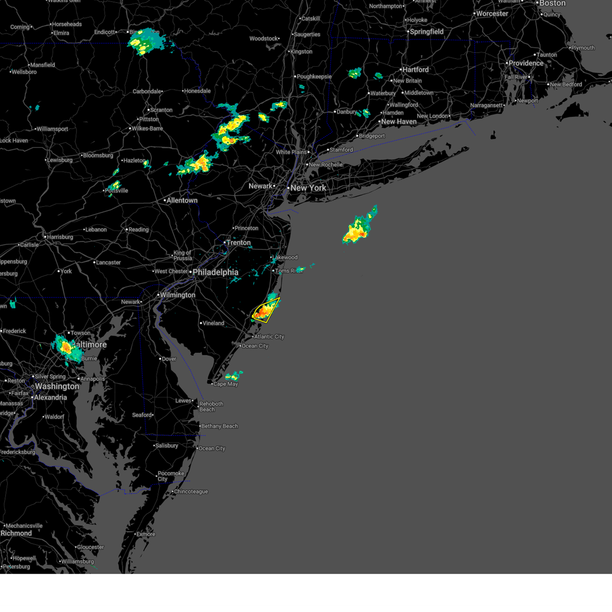
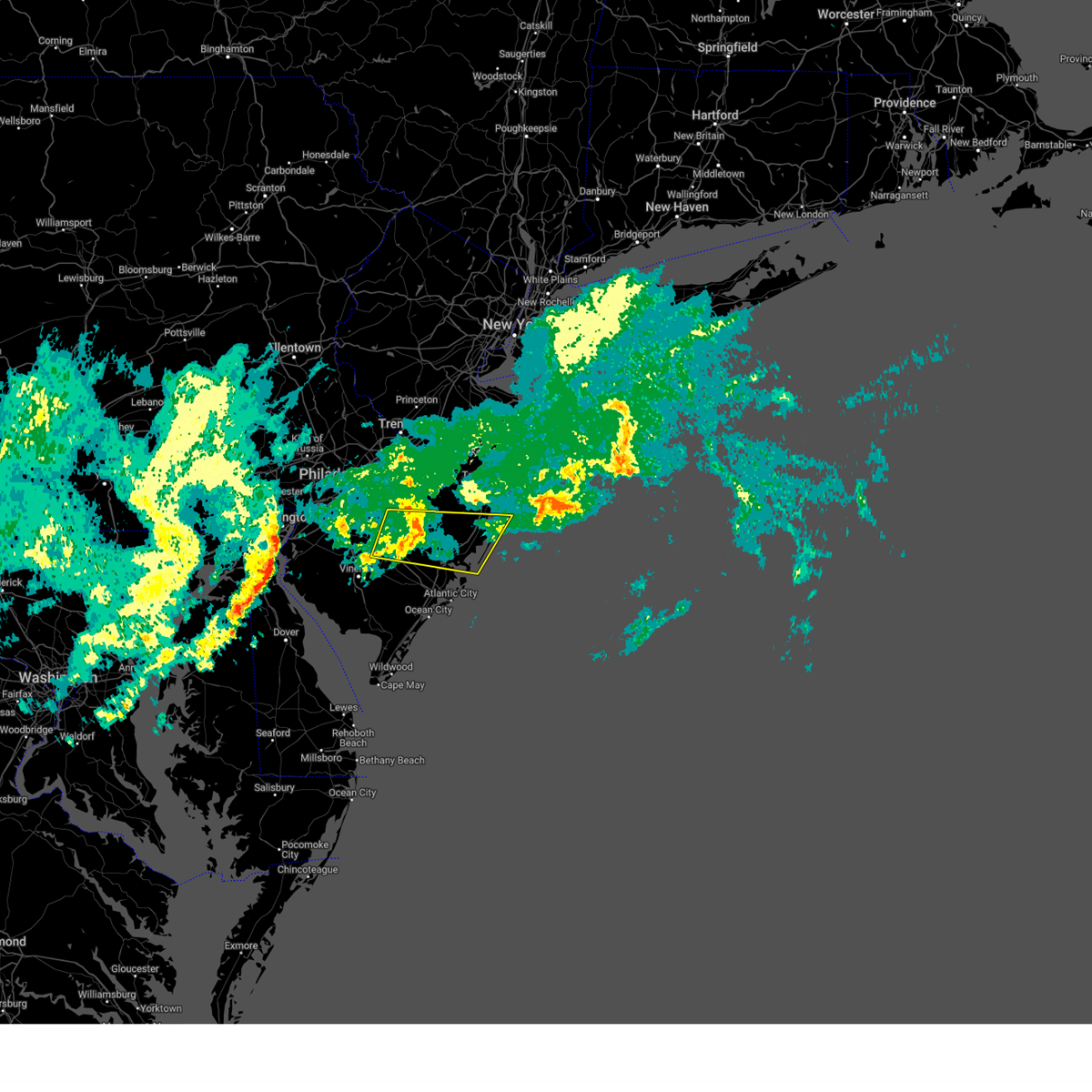
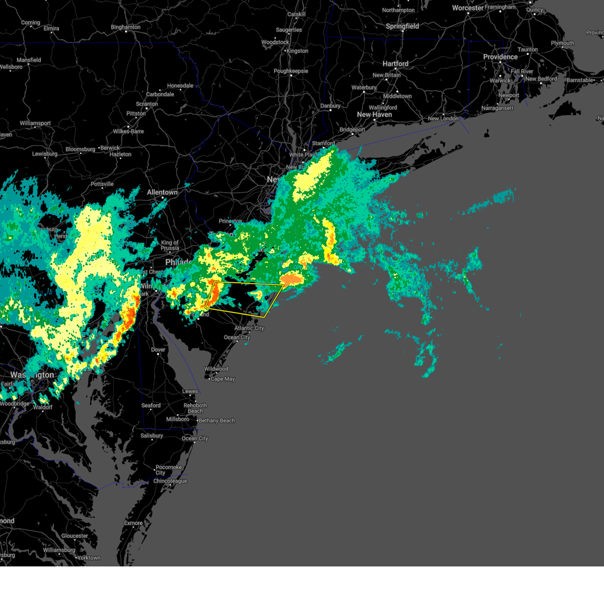
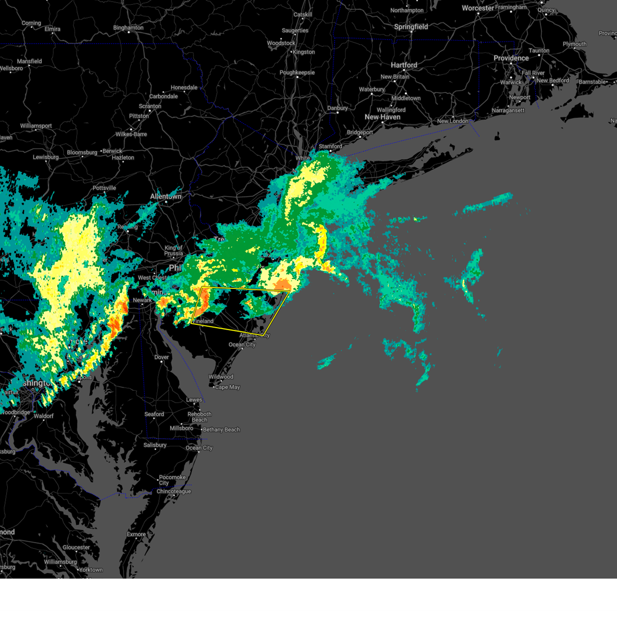
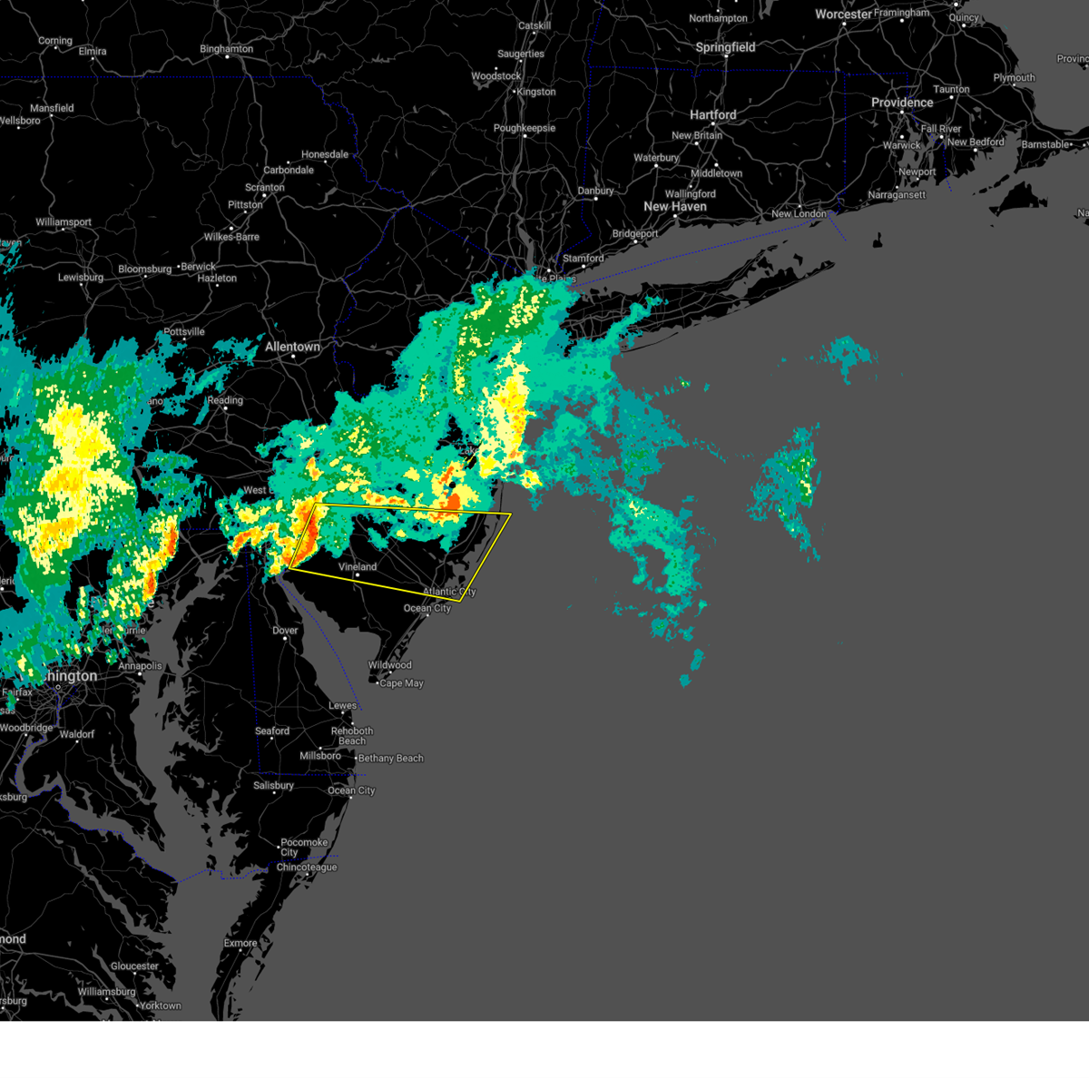
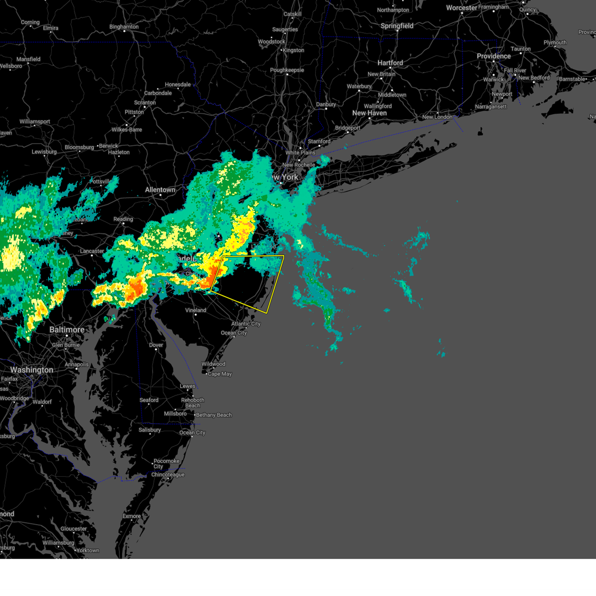
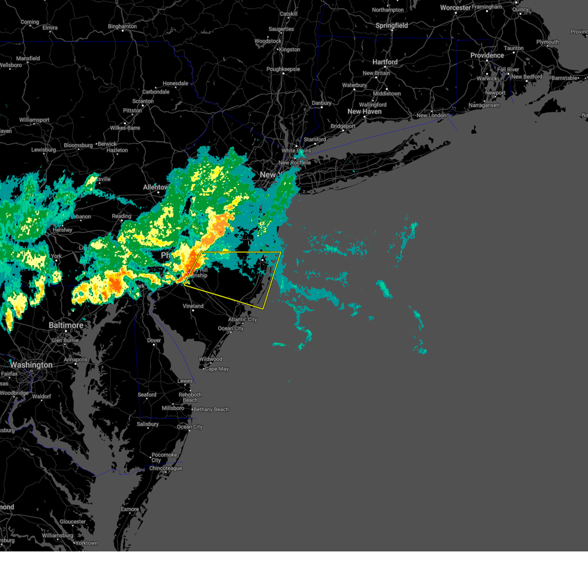
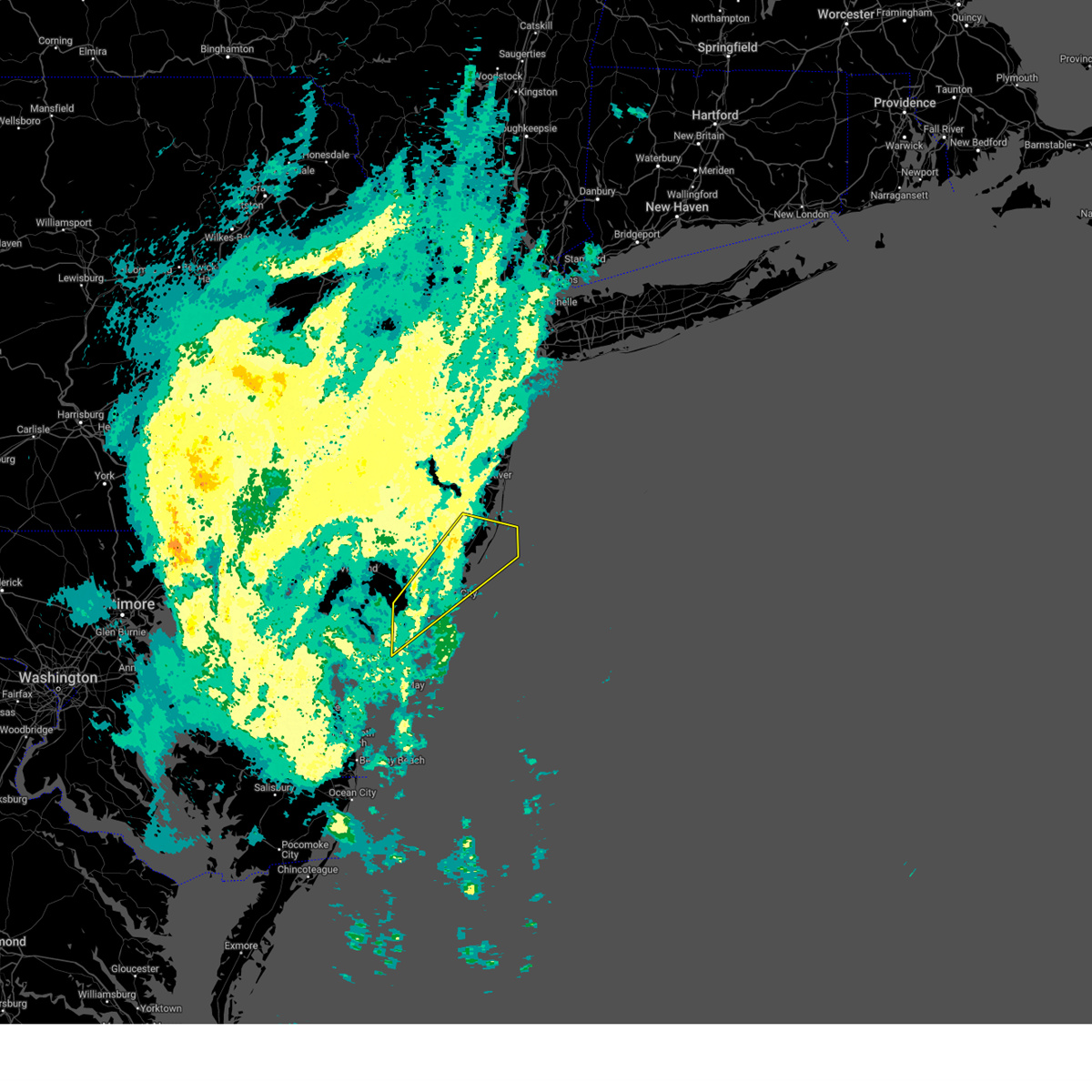
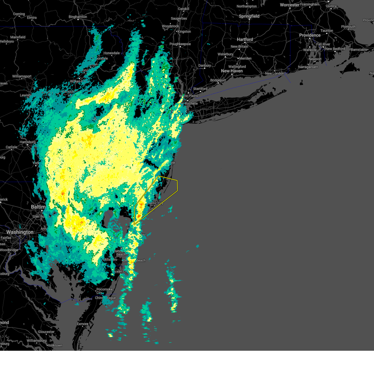
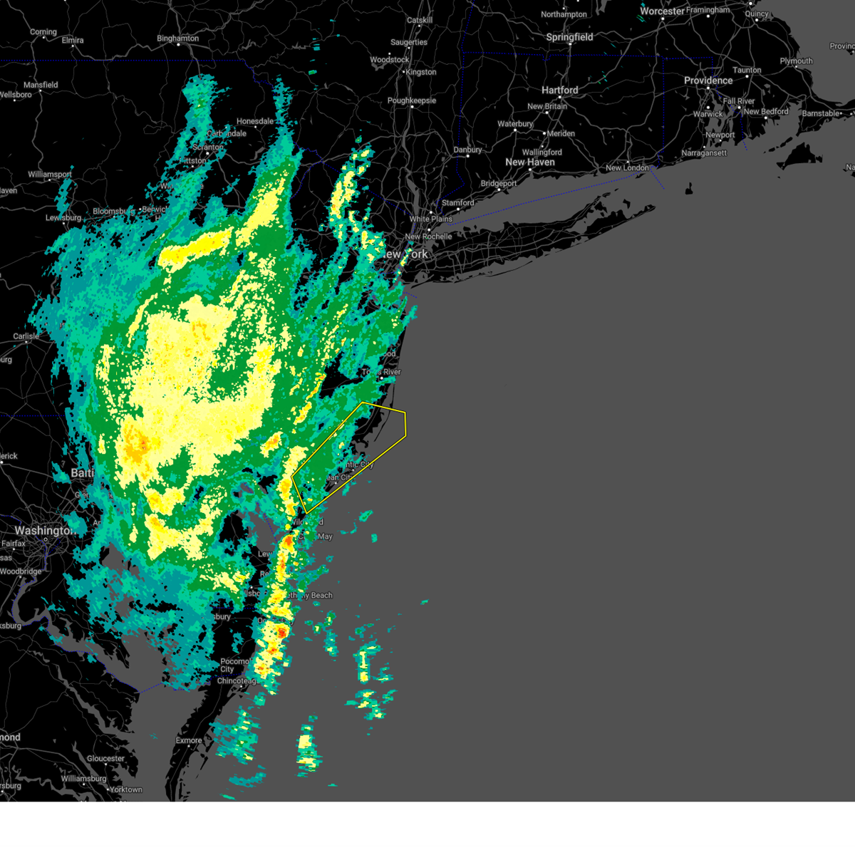
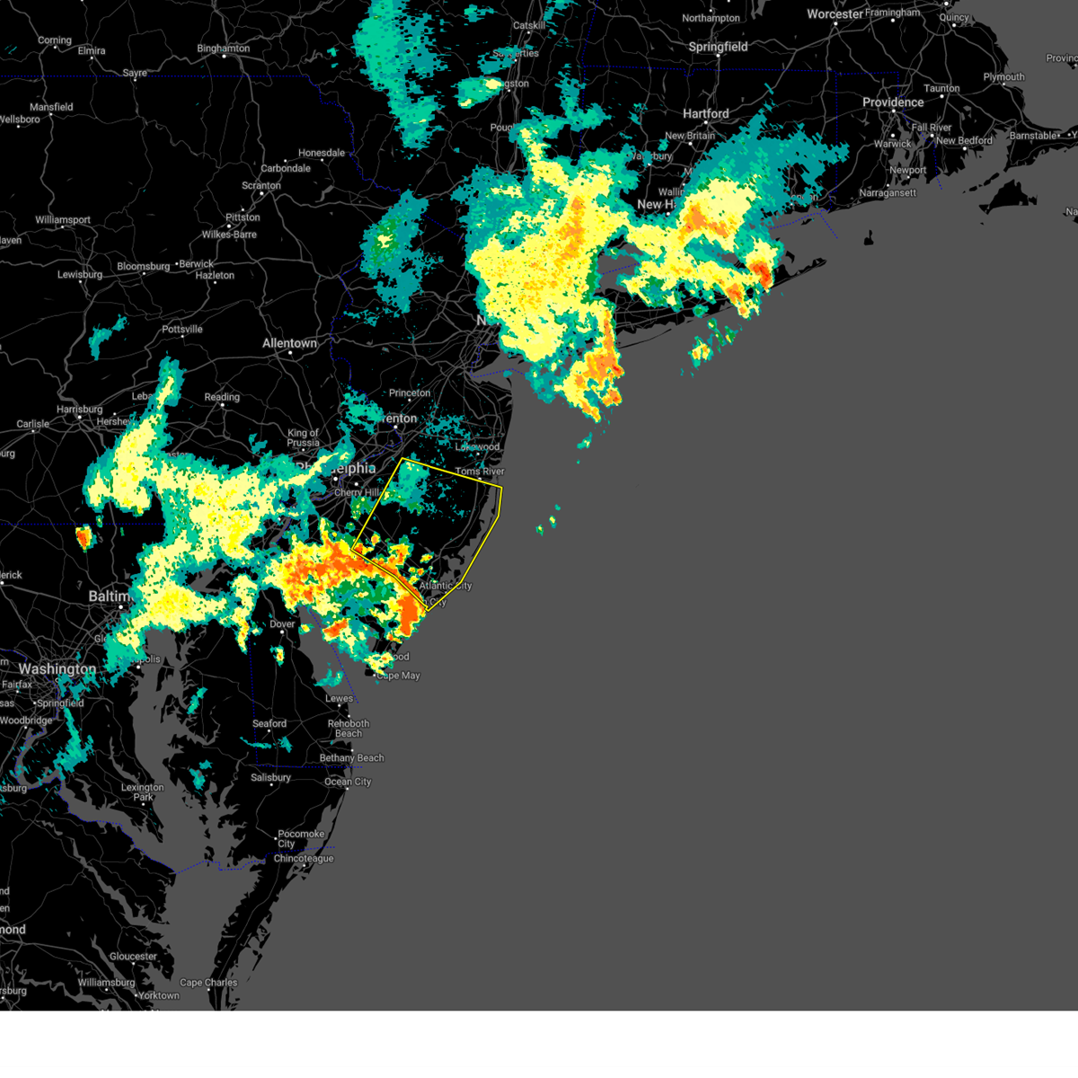
Hail Map for Tuckerton, NJ
The Tuckerton, NJ area has had 1 report of on-the-ground hail by trained spotters, and has been under severe weather warnings 25 times during the past 12 months. Doppler radar has detected hail at or near Tuckerton, NJ on 17 occasions.
| Name: | Tuckerton, NJ |
| Where Located: | 77.7 miles SSW of Brooklyn, NY |
| Map: | Google Map for Tuckerton, NJ |
| Population: | 3347 |
| Housing Units: | 1902 |
| More Info: | Search Google for Tuckerton, NJ |
0
The Top Recent Hail Date for Tuckerton, NJ is Sunday, June 30, 2024 (14th out of 17)

Hail and Wind Damage Spotted near Tuckerton, NJ
| Date / Time | Report Details |
|---|---|
| 6/6/2026 9:19 PM EDT |
 the severe thunderstorm warning has been cancelled and is no longer in effect the severe thunderstorm warning has been cancelled and is no longer in effect
|
| 6/6/2026 9:01 PM EDT |
 At 900 pm edt, an outflow boundary from a thunderstorm was located along a line extending from 18 miles east of surf city to near port republic, moving east at 40 mph (radar indicated). Hazards include 60 mph wind gusts. Damage to roofs, siding, trees, and power lines is possible. Locations impacted include, atlantic city, pleasantville, ventnor city, brigantine, northfield, absecon, pomona, and mystic island. At 900 pm edt, an outflow boundary from a thunderstorm was located along a line extending from 18 miles east of surf city to near port republic, moving east at 40 mph (radar indicated). Hazards include 60 mph wind gusts. Damage to roofs, siding, trees, and power lines is possible. Locations impacted include, atlantic city, pleasantville, ventnor city, brigantine, northfield, absecon, pomona, and mystic island.
|
| 6/6/2026 8:43 PM EDT |
 Svrphi the national weather service in mount holly nj has issued a * severe thunderstorm warning for, southeastern atlantic county in southern new jersey, southeastern ocean county in southern new jersey, southeastern burlington county in southern new jersey, * until 930 pm edt. * at 841 pm edt, an outflow boundary from a thunderstorm was located along a line extending from 11 miles east of barnegat to egg harbor city, moving southeast at 40 mph (radar indicated). Hazards include 60 mph wind gusts. Damage to roofs, siding, trees, and power lines is possible. severe thunderstorms will be near, egg harbor city, tuckerton, surf city, port republic, wading river, beach haven west, bass river state forest, and new gretna around 845 pm edt. pomona around 855 pm edt. brigantine around 900 pm edt. Other locations impacted by these severe thunderstorms include manahawkin and mystic island. Svrphi the national weather service in mount holly nj has issued a * severe thunderstorm warning for, southeastern atlantic county in southern new jersey, southeastern ocean county in southern new jersey, southeastern burlington county in southern new jersey, * until 930 pm edt. * at 841 pm edt, an outflow boundary from a thunderstorm was located along a line extending from 11 miles east of barnegat to egg harbor city, moving southeast at 40 mph (radar indicated). Hazards include 60 mph wind gusts. Damage to roofs, siding, trees, and power lines is possible. severe thunderstorms will be near, egg harbor city, tuckerton, surf city, port republic, wading river, beach haven west, bass river state forest, and new gretna around 845 pm edt. pomona around 855 pm edt. brigantine around 900 pm edt. Other locations impacted by these severe thunderstorms include manahawkin and mystic island.
|
| 6/6/2026 8:28 PM EDT |
 At 825 pm edt, an outflow boundary from a thunderstorm was located along a line extending from 17 miles southeast of asbury park to batsto, moving east at 45 mph (radar indicated). Hazards include 60 mph wind gusts. Damage to roofs, siding, trees, and power lines is possible. these severe storms will be near, barnegat, egg harbor city, seaside heights, wading river, warren grove, penn state forest, and brookville around 830 pm edt. beach haven west, bass river state forest, and new gretna around 835 pm edt. tuckerton around 840 pm edt. surf city around 845 pm edt. Other locations impacted by these severe thunderstorms include manahawkin, mystic island, ocean acres, folsom, waretown, linwood, island heights, and collings lakes. At 825 pm edt, an outflow boundary from a thunderstorm was located along a line extending from 17 miles southeast of asbury park to batsto, moving east at 45 mph (radar indicated). Hazards include 60 mph wind gusts. Damage to roofs, siding, trees, and power lines is possible. these severe storms will be near, barnegat, egg harbor city, seaside heights, wading river, warren grove, penn state forest, and brookville around 830 pm edt. beach haven west, bass river state forest, and new gretna around 835 pm edt. tuckerton around 840 pm edt. surf city around 845 pm edt. Other locations impacted by these severe thunderstorms include manahawkin, mystic island, ocean acres, folsom, waretown, linwood, island heights, and collings lakes.
|
| 6/6/2026 8:03 PM EDT |
 Svrphi the national weather service in mount holly nj has issued a * severe thunderstorm warning for, atlantic county in southern new jersey, ocean county in southern new jersey, southeastern camden county in southern new jersey, east central gloucester county in southern new jersey, southern burlington county in southern new jersey, southeastern monmouth county in central new jersey, * until 845 pm edt. * at 802 pm edt, an outflow boundary from a thunderstorm was located along a line extending from near elberon to chesilhurst, moving southeast at 45 mph (radar indicated). Hazards include 60 mph wind gusts. damage to roofs, siding, trees, and power lines is possible Svrphi the national weather service in mount holly nj has issued a * severe thunderstorm warning for, atlantic county in southern new jersey, ocean county in southern new jersey, southeastern camden county in southern new jersey, east central gloucester county in southern new jersey, southern burlington county in southern new jersey, southeastern monmouth county in central new jersey, * until 845 pm edt. * at 802 pm edt, an outflow boundary from a thunderstorm was located along a line extending from near elberon to chesilhurst, moving southeast at 45 mph (radar indicated). Hazards include 60 mph wind gusts. damage to roofs, siding, trees, and power lines is possible
|
| 3/17/2026 12:05 AM EDT |
 The storms which prompted the warning have moved out of the area. therefore, the warning will be allowed to expire. a severe thunderstorm watch remains in effect until 100 am edt for southern new jersey. to report severe weather, contact your nearest law enforcement agency. they will relay your report to the national weather service mount holly nj. The storms which prompted the warning have moved out of the area. therefore, the warning will be allowed to expire. a severe thunderstorm watch remains in effect until 100 am edt for southern new jersey. to report severe weather, contact your nearest law enforcement agency. they will relay your report to the national weather service mount holly nj.
|
| 3/16/2026 11:54 PM EDT |
 the severe thunderstorm warning has been cancelled and is no longer in effect the severe thunderstorm warning has been cancelled and is no longer in effect
|
| 3/16/2026 11:54 PM EDT |
 At 1154 pm edt, severe thunderstorms were located along a line extending from bass river state forest to near pomona to near longport, moving northeast at 50 mph (radar indicated). Hazards include 60 mph wind gusts. Damage to roofs, siding, trees, and power lines is possible. Locations impacted include, atlantic city, ventnor city, brigantine, absecon, tuckerton, surf city, port republic, beach haven west, mystic island, and manahawkin. At 1154 pm edt, severe thunderstorms were located along a line extending from bass river state forest to near pomona to near longport, moving northeast at 50 mph (radar indicated). Hazards include 60 mph wind gusts. Damage to roofs, siding, trees, and power lines is possible. Locations impacted include, atlantic city, ventnor city, brigantine, absecon, tuckerton, surf city, port republic, beach haven west, mystic island, and manahawkin.
|
| 3/16/2026 11:37 PM EDT |
 Svrphi the national weather service in mount holly nj has issued a * severe thunderstorm warning for, southeastern atlantic county in southern new jersey, southeastern ocean county in southern new jersey, northeastern cape may county in southern new jersey, southeastern burlington county in southern new jersey, * until 1215 am edt. * at 1137 pm edt, severe thunderstorms were located along a line extending from near elwood-magnolia to near english creek to near strathmere, moving northeast at 50 mph (radar indicated). Hazards include 60 mph wind gusts. damage to roofs, siding, trees, and power lines is possible Svrphi the national weather service in mount holly nj has issued a * severe thunderstorm warning for, southeastern atlantic county in southern new jersey, southeastern ocean county in southern new jersey, northeastern cape may county in southern new jersey, southeastern burlington county in southern new jersey, * until 1215 am edt. * at 1137 pm edt, severe thunderstorms were located along a line extending from near elwood-magnolia to near english creek to near strathmere, moving northeast at 50 mph (radar indicated). Hazards include 60 mph wind gusts. damage to roofs, siding, trees, and power lines is possible
|
| 7/25/2025 7:26 PM EDT |
 the severe thunderstorm warning has been cancelled and is no longer in effect the severe thunderstorm warning has been cancelled and is no longer in effect
|
| 7/25/2025 7:12 PM EDT |
 the severe thunderstorm warning has been cancelled and is no longer in effect the severe thunderstorm warning has been cancelled and is no longer in effect
|
| 7/25/2025 7:12 PM EDT |
 At 711 pm edt, a severe thunderstorm was located near tuckerton, or 16 miles northeast of atlantic city, moving southeast at 35 mph (radar indicated). Hazards include 60 mph wind gusts. Damage to roofs, siding, trees, and power lines is possible. Locations impacted include, tuckerton, surf city, beach haven west, mystic island, manahawkin, and ocean acres. At 711 pm edt, a severe thunderstorm was located near tuckerton, or 16 miles northeast of atlantic city, moving southeast at 35 mph (radar indicated). Hazards include 60 mph wind gusts. Damage to roofs, siding, trees, and power lines is possible. Locations impacted include, tuckerton, surf city, beach haven west, mystic island, manahawkin, and ocean acres.
|
| 7/25/2025 7:07 PM EDT | Damage to powerlines at radio rd and playhouse rd. time estimated by rada in ocean county NJ, 3.3 miles NE of Tuckerton, NJ |
| 7/25/2025 7:05 PM EDT | Powerlines damaged on cr 539. time estimated by rada in ocean county NJ, 3.8 miles SSE of Tuckerton, NJ |
| 7/25/2025 6:55 PM EDT |
 Svrphi the national weather service in mount holly nj has issued a * severe thunderstorm warning for, southeastern ocean county in southern new jersey, southeastern burlington county in southern new jersey, * until 745 pm edt. * at 655 pm edt, a severe thunderstorm was located over bass river state forest, or 20 miles north of atlantic city, moving southeast at 30 mph (radar indicated). Hazards include 60 mph wind gusts. damage to roofs, siding, trees, and power lines is possible Svrphi the national weather service in mount holly nj has issued a * severe thunderstorm warning for, southeastern ocean county in southern new jersey, southeastern burlington county in southern new jersey, * until 745 pm edt. * at 655 pm edt, a severe thunderstorm was located over bass river state forest, or 20 miles north of atlantic city, moving southeast at 30 mph (radar indicated). Hazards include 60 mph wind gusts. damage to roofs, siding, trees, and power lines is possible
|
| 7/25/2025 6:47 PM EDT |
 At 647 pm edt, a severe thunderstorm was located over penn state forest, or 22 miles north of atlantic city, moving southeast at 30 mph (radar indicated). Hazards include 60 mph wind gusts. Damage to roofs, siding, trees, and power lines is possible. Locations impacted include, barnegat, tuckerton, surf city, wharton state forest, brookville, warren grove, bass river state forest, chatsworth, penn state forest, beach haven west, mystic island, ocean acres, manahawkin, and waretown. At 647 pm edt, a severe thunderstorm was located over penn state forest, or 22 miles north of atlantic city, moving southeast at 30 mph (radar indicated). Hazards include 60 mph wind gusts. Damage to roofs, siding, trees, and power lines is possible. Locations impacted include, barnegat, tuckerton, surf city, wharton state forest, brookville, warren grove, bass river state forest, chatsworth, penn state forest, beach haven west, mystic island, ocean acres, manahawkin, and waretown.
|
| 7/25/2025 6:33 PM EDT |
 At 632 pm edt, a severe thunderstorm was located near chatsworth, or 24 miles southwest of toms river, moving southeast at 40 mph (radar indicated). Hazards include 60 mph wind gusts. Damage to roofs, siding, trees, and power lines is possible. Locations impacted include, barnegat, shamong, tuckerton, surf city, wharton state forest, atsion, brookville, warren grove, bass river state forest, chatsworth, penn state forest, beach haven west, mystic island, ocean acres, manahawkin, and waretown. At 632 pm edt, a severe thunderstorm was located near chatsworth, or 24 miles southwest of toms river, moving southeast at 40 mph (radar indicated). Hazards include 60 mph wind gusts. Damage to roofs, siding, trees, and power lines is possible. Locations impacted include, barnegat, shamong, tuckerton, surf city, wharton state forest, atsion, brookville, warren grove, bass river state forest, chatsworth, penn state forest, beach haven west, mystic island, ocean acres, manahawkin, and waretown.
|
| 7/25/2025 6:22 PM EDT |
 Svrphi the national weather service in mount holly nj has issued a * severe thunderstorm warning for, southern ocean county in southern new jersey, southeastern burlington county in southern new jersey, * until 700 pm edt. * at 622 pm edt, a severe thunderstorm was located over tabernacle, or 23 miles east of gloucester city, moving southeast at 35 mph (radar indicated). Hazards include 60 mph wind gusts. damage to roofs, siding, trees, and power lines is possible Svrphi the national weather service in mount holly nj has issued a * severe thunderstorm warning for, southern ocean county in southern new jersey, southeastern burlington county in southern new jersey, * until 700 pm edt. * at 622 pm edt, a severe thunderstorm was located over tabernacle, or 23 miles east of gloucester city, moving southeast at 35 mph (radar indicated). Hazards include 60 mph wind gusts. damage to roofs, siding, trees, and power lines is possible
|
| 7/9/2025 11:09 PM EDT |
 the tornado warning has been cancelled and is no longer in effect the tornado warning has been cancelled and is no longer in effect
|
| 7/9/2025 11:09 PM EDT |
 At 1108 pm edt, a severe thunderstorm capable of producing a tornado was located near tuckerton, or 12 miles northeast of atlantic city, moving northeast at 40 mph (radar indicated rotation). Hazards include tornado. Flying debris will be dangerous to those caught without shelter. mobile homes will be damaged or destroyed. damage to roofs, windows, and vehicles will occur. tree damage is likely. Locations impacted include, tuckerton. At 1108 pm edt, a severe thunderstorm capable of producing a tornado was located near tuckerton, or 12 miles northeast of atlantic city, moving northeast at 40 mph (radar indicated rotation). Hazards include tornado. Flying debris will be dangerous to those caught without shelter. mobile homes will be damaged or destroyed. damage to roofs, windows, and vehicles will occur. tree damage is likely. Locations impacted include, tuckerton.
|
| 7/9/2025 10:57 PM EDT |
 Torphi the national weather service in mount holly nj has issued a * tornado warning for, east central atlantic county in southern new jersey, south central ocean county in southern new jersey, * until 1130 pm edt. * at 1057 pm edt, a severe thunderstorm capable of producing a tornado was located over brigantine, or near atlantic city, moving northeast at 40 mph (radar indicated rotation). Hazards include tornado. Flying debris will be dangerous to those caught without shelter. mobile homes will be damaged or destroyed. damage to roofs, windows, and vehicles will occur. Tree damage is likely. Torphi the national weather service in mount holly nj has issued a * tornado warning for, east central atlantic county in southern new jersey, south central ocean county in southern new jersey, * until 1130 pm edt. * at 1057 pm edt, a severe thunderstorm capable of producing a tornado was located over brigantine, or near atlantic city, moving northeast at 40 mph (radar indicated rotation). Hazards include tornado. Flying debris will be dangerous to those caught without shelter. mobile homes will be damaged or destroyed. damage to roofs, windows, and vehicles will occur. Tree damage is likely.
|
| 7/1/2025 7:30 PM EDT |
 The storms which prompted the warning have moved offshore. therefore, the warning has been allowed to expire. a severe thunderstorm watch remains in effect until 900 pm edt for southern new jersey. to report severe weather, contact your nearest law enforcement agency. they will relay your report to the national weather service mount holly nj. The storms which prompted the warning have moved offshore. therefore, the warning has been allowed to expire. a severe thunderstorm watch remains in effect until 900 pm edt for southern new jersey. to report severe weather, contact your nearest law enforcement agency. they will relay your report to the national weather service mount holly nj.
|
| 7/1/2025 7:19 PM EDT |
 the severe thunderstorm warning has been cancelled and is no longer in effect the severe thunderstorm warning has been cancelled and is no longer in effect
|
| 7/1/2025 7:19 PM EDT |
 At 719 pm edt, severe thunderstorms were located along a line extending from near seaside heights to 8 miles east of barnegat to near tuckerton, moving northeast at 40 mph (radar indicated). Hazards include 60 mph wind gusts. Damage to roofs, siding, trees, and power lines is possible. Locations impacted include, barnegat, tuckerton, surf city, beach haven west, mystic island, manahawkin, ocean acres, and waretown. At 719 pm edt, severe thunderstorms were located along a line extending from near seaside heights to 8 miles east of barnegat to near tuckerton, moving northeast at 40 mph (radar indicated). Hazards include 60 mph wind gusts. Damage to roofs, siding, trees, and power lines is possible. Locations impacted include, barnegat, tuckerton, surf city, beach haven west, mystic island, manahawkin, ocean acres, and waretown.
|
| 7/1/2025 7:10 PM EDT |
 At 710 pm edt, severe thunderstorms were located along a line extending from near beachwood to near barnegat to tuckerton, moving east at 45 mph (radar indicated). Hazards include 60 mph wind gusts. Damage to roofs, siding, trees, and power lines is possible. Locations impacted include, barnegat, tuckerton, surf city, port republic, brookville, bass river state forest, warren grove, new gretna, beach haven west, mystic island, ocean acres, manahawkin, and waretown. At 710 pm edt, severe thunderstorms were located along a line extending from near beachwood to near barnegat to tuckerton, moving east at 45 mph (radar indicated). Hazards include 60 mph wind gusts. Damage to roofs, siding, trees, and power lines is possible. Locations impacted include, barnegat, tuckerton, surf city, port republic, brookville, bass river state forest, warren grove, new gretna, beach haven west, mystic island, ocean acres, manahawkin, and waretown.
|
| 7/1/2025 7:05 PM EDT | Njwxnet station at little egg harbor. sustained wind of 55 mph also reporte in ocean county NJ, 5.4 miles N of Tuckerton, NJ |
| 7/1/2025 6:54 PM EDT |
 At 653 pm edt, a severe thunderstorm was located near penn state forest, or 21 miles north of atlantic city, moving northeast at 40 mph (radar indicated). Hazards include 60 mph wind gusts and quarter size hail. Minor damage to vehicles is possible. wind damage to roofs, siding, trees, and power lines is possible. Locations impacted include, barnegat, egg harbor city, tuckerton, surf city, port republic, wharton state forest, wading river, brookville, bass river state forest, batsto, warren grove, new gretna, penn state forest, beach haven west, elwood-magnolia, mays landing, mystic island, ocean acres, manahawkin, and waretown. At 653 pm edt, a severe thunderstorm was located near penn state forest, or 21 miles north of atlantic city, moving northeast at 40 mph (radar indicated). Hazards include 60 mph wind gusts and quarter size hail. Minor damage to vehicles is possible. wind damage to roofs, siding, trees, and power lines is possible. Locations impacted include, barnegat, egg harbor city, tuckerton, surf city, port republic, wharton state forest, wading river, brookville, bass river state forest, batsto, warren grove, new gretna, penn state forest, beach haven west, elwood-magnolia, mays landing, mystic island, ocean acres, manahawkin, and waretown.
|
| 7/1/2025 6:32 PM EDT |
 Svrphi the national weather service in mount holly nj has issued a * severe thunderstorm warning for, central atlantic county in southern new jersey, southeastern ocean county in southern new jersey, southeastern burlington county in southern new jersey, * until 730 pm edt. * at 632 pm edt, a severe thunderstorm was located over elwood-magnolia, or 17 miles northeast of vineland, moving northeast at 40 mph (radar indicated). Hazards include 60 mph wind gusts and quarter size hail. Minor damage to vehicles is possible. Wind damage to roofs, siding, trees, and power lines is possible. Svrphi the national weather service in mount holly nj has issued a * severe thunderstorm warning for, central atlantic county in southern new jersey, southeastern ocean county in southern new jersey, southeastern burlington county in southern new jersey, * until 730 pm edt. * at 632 pm edt, a severe thunderstorm was located over elwood-magnolia, or 17 miles northeast of vineland, moving northeast at 40 mph (radar indicated). Hazards include 60 mph wind gusts and quarter size hail. Minor damage to vehicles is possible. Wind damage to roofs, siding, trees, and power lines is possible.
|
| 6/19/2025 6:00 PM EDT | Tree downed... little egg harbor... time es in ocean county NJ, 1.1 miles E of Tuckerton, NJ |
| 5/2/2025 5:37 PM EDT |
 The storm which prompted the warning has weakened below severe limits, and is moving offshore. therefore, the warning will be allowed to expire. to report severe weather, contact your nearest law enforcement agency. they will relay your report to the national weather service mount holly nj. The storm which prompted the warning has weakened below severe limits, and is moving offshore. therefore, the warning will be allowed to expire. to report severe weather, contact your nearest law enforcement agency. they will relay your report to the national weather service mount holly nj.
|
| 5/2/2025 5:22 PM EDT |
 At 521 pm edt, a severe thunderstorm was located over tuckerton, or 15 miles northeast of atlantic city, moving east at 25 mph (radar indicated). Hazards include 60 mph wind gusts and quarter size hail. Minor damage to vehicles is possible. wind damage to roofs, siding, trees, and power lines is possible. Locations impacted include, surf city, beach haven, mystic island, tuckerton, beach haven west, and manahawkin. At 521 pm edt, a severe thunderstorm was located over tuckerton, or 15 miles northeast of atlantic city, moving east at 25 mph (radar indicated). Hazards include 60 mph wind gusts and quarter size hail. Minor damage to vehicles is possible. wind damage to roofs, siding, trees, and power lines is possible. Locations impacted include, surf city, beach haven, mystic island, tuckerton, beach haven west, and manahawkin.
|
| 5/2/2025 5:22 PM EDT |
 the severe thunderstorm warning has been cancelled and is no longer in effect the severe thunderstorm warning has been cancelled and is no longer in effect
|
| 5/2/2025 5:02 PM EDT |
 Svrphi the national weather service in mount holly nj has issued a * severe thunderstorm warning for, east central atlantic county in southern new jersey, southeastern ocean county in southern new jersey, southeastern burlington county in southern new jersey, * until 545 pm edt. * at 502 pm edt, a severe thunderstorm was located over tuckerton, or 13 miles north of atlantic city, moving east at 30 mph (radar indicated). Hazards include 60 mph wind gusts and quarter size hail. Minor damage to vehicles is possible. Wind damage to roofs, siding, trees, and power lines is possible. Svrphi the national weather service in mount holly nj has issued a * severe thunderstorm warning for, east central atlantic county in southern new jersey, southeastern ocean county in southern new jersey, southeastern burlington county in southern new jersey, * until 545 pm edt. * at 502 pm edt, a severe thunderstorm was located over tuckerton, or 13 miles north of atlantic city, moving east at 30 mph (radar indicated). Hazards include 60 mph wind gusts and quarter size hail. Minor damage to vehicles is possible. Wind damage to roofs, siding, trees, and power lines is possible.
|
| 4/4/2025 6:28 AM EDT |
 the severe thunderstorm warning has been cancelled and is no longer in effect the severe thunderstorm warning has been cancelled and is no longer in effect
|
| 4/4/2025 6:16 AM EDT |
 the severe thunderstorm warning has been cancelled and is no longer in effect the severe thunderstorm warning has been cancelled and is no longer in effect
|
| 4/4/2025 6:16 AM EDT |
 At 616 am edt, a severe thunderstorm was located over hammonton, or 20 miles northeast of vineland, moving east at 55 mph (radar indicated). Hazards include 60 mph wind gusts and nickel size hail. Damage to roofs, siding, trees, and power lines is possible. locations impacted include, shamong, port republic, mystic island, elwood-magnolia, ocean acres, atsion, folsom, wading river, manahawkin, chesilhurst, hammonton, warren grove, egg harbor city, tuckerton, barnegat, surf city, wharton state forest, collings lakes, brookville, and bass river state forest. this includes the following highways, garden state parkway between mile markers 47 and 71. Atlantic city expressway between mile markers 23 and 34. At 616 am edt, a severe thunderstorm was located over hammonton, or 20 miles northeast of vineland, moving east at 55 mph (radar indicated). Hazards include 60 mph wind gusts and nickel size hail. Damage to roofs, siding, trees, and power lines is possible. locations impacted include, shamong, port republic, mystic island, elwood-magnolia, ocean acres, atsion, folsom, wading river, manahawkin, chesilhurst, hammonton, warren grove, egg harbor city, tuckerton, barnegat, surf city, wharton state forest, collings lakes, brookville, and bass river state forest. this includes the following highways, garden state parkway between mile markers 47 and 71. Atlantic city expressway between mile markers 23 and 34.
|
| 4/4/2025 6:04 AM EDT |
 At 604 am edt, a severe thunderstorm was located over monroe township, or 14 miles north of vineland, moving east at 60 mph (radar indicated). Hazards include 60 mph wind gusts and quarter size hail. Minor damage to vehicles is possible. wind damage to roofs, siding, trees, and power lines is possible. locations impacted include, mystic island, elwood-magnolia, atsion, gibbsboro, manahawkin, chesilhurst, brigantine, egg harbor city, pine hill, tuckerton, barnegat, victory lakes, surf city, wharton state forest, berlin, pomona, newfield, malaga, clayton, and brookville. this includes the following highways, garden state parkway between mile markers 39 and 71. Atlantic city expressway between mile markers 10 and 44. At 604 am edt, a severe thunderstorm was located over monroe township, or 14 miles north of vineland, moving east at 60 mph (radar indicated). Hazards include 60 mph wind gusts and quarter size hail. Minor damage to vehicles is possible. wind damage to roofs, siding, trees, and power lines is possible. locations impacted include, mystic island, elwood-magnolia, atsion, gibbsboro, manahawkin, chesilhurst, brigantine, egg harbor city, pine hill, tuckerton, barnegat, victory lakes, surf city, wharton state forest, berlin, pomona, newfield, malaga, clayton, and brookville. this includes the following highways, garden state parkway between mile markers 39 and 71. Atlantic city expressway between mile markers 10 and 44.
|
| 4/4/2025 5:46 AM EDT |
 Svrphi the national weather service in mount holly nj has issued a * severe thunderstorm warning for, atlantic county in southern new jersey, northern cumberland county in southern new jersey, salem county in southern new jersey, southeastern ocean county in southern new jersey, camden county in southern new jersey, gloucester county in southern new jersey, southern burlington county in southern new jersey, * until 645 am edt. * at 546 am edt, a severe thunderstorm was located over woodstown, or 12 miles east of wilmington, moving east at 50 mph (radar indicated). Hazards include 60 mph wind gusts and quarter size hail. Minor damage to vehicles is possible. Wind damage to roofs, siding, trees, and power lines is possible. Svrphi the national weather service in mount holly nj has issued a * severe thunderstorm warning for, atlantic county in southern new jersey, northern cumberland county in southern new jersey, salem county in southern new jersey, southeastern ocean county in southern new jersey, camden county in southern new jersey, gloucester county in southern new jersey, southern burlington county in southern new jersey, * until 645 am edt. * at 546 am edt, a severe thunderstorm was located over woodstown, or 12 miles east of wilmington, moving east at 50 mph (radar indicated). Hazards include 60 mph wind gusts and quarter size hail. Minor damage to vehicles is possible. Wind damage to roofs, siding, trees, and power lines is possible.
|
| 4/4/2025 5:28 AM EDT |
 the severe thunderstorm warning has been cancelled and is no longer in effect the severe thunderstorm warning has been cancelled and is no longer in effect
|
| 4/4/2025 5:28 AM EDT |
 At 526 am edt, a severe thunderstorm was located over shamong, or 23 miles east of gloucester city, moving east at 60 mph. the most intense portion of this storm is moving through central portions of burlington county (trained weather spotters). Hazards include 60 mph wind gusts and quarter size hail. this storm has a history of producing large hail and wind gusts to 60 mph. Minor damage to vehicles is possible. wind damage to roofs, siding, trees, and power lines is possible. locations impacted include, country lake estates, mystic island, atsion, manahawkin, pemberton heights, island heights, holiday heights, leisuretowne, pemberton, wrightstown, tuckerton, barnegat, surf city, wharton state forest, presidential lakes, crestwood village, south toms river, whiting, brookville, and bass river state forest. This includes garden state parkway between mile markers 52 and 88. At 526 am edt, a severe thunderstorm was located over shamong, or 23 miles east of gloucester city, moving east at 60 mph. the most intense portion of this storm is moving through central portions of burlington county (trained weather spotters). Hazards include 60 mph wind gusts and quarter size hail. this storm has a history of producing large hail and wind gusts to 60 mph. Minor damage to vehicles is possible. wind damage to roofs, siding, trees, and power lines is possible. locations impacted include, country lake estates, mystic island, atsion, manahawkin, pemberton heights, island heights, holiday heights, leisuretowne, pemberton, wrightstown, tuckerton, barnegat, surf city, wharton state forest, presidential lakes, crestwood village, south toms river, whiting, brookville, and bass river state forest. This includes garden state parkway between mile markers 52 and 88.
|
| 4/4/2025 5:12 AM EDT |
 Svrphi the national weather service in mount holly nj has issued a * severe thunderstorm warning for, north central atlantic county in southern new jersey, ocean county in southern new jersey, camden county in southern new jersey, northeastern gloucester county in southern new jersey, burlington county in southern new jersey, * until 615 am edt. * at 511 am edt, a severe thunderstorm was located over lindenwold, or 9 miles southeast of gloucester city, moving east at 55 mph. this storm has a history of producing large hail and wind gusts up to 60 mph (trained weather spotters). Hazards include 60 mph wind gusts and quarter size hail. Minor damage to vehicles is possible. Wind damage to roofs, siding, trees, and power lines is possible. Svrphi the national weather service in mount holly nj has issued a * severe thunderstorm warning for, north central atlantic county in southern new jersey, ocean county in southern new jersey, camden county in southern new jersey, northeastern gloucester county in southern new jersey, burlington county in southern new jersey, * until 615 am edt. * at 511 am edt, a severe thunderstorm was located over lindenwold, or 9 miles southeast of gloucester city, moving east at 55 mph. this storm has a history of producing large hail and wind gusts up to 60 mph (trained weather spotters). Hazards include 60 mph wind gusts and quarter size hail. Minor damage to vehicles is possible. Wind damage to roofs, siding, trees, and power lines is possible.
|
| 3/20/2025 9:05 PM EDT |
 The storm which prompted the warning has weakened below severe limits, and no longer poses an immediate threat to life or property. therefore, the warning will be allowed to expire. The storm which prompted the warning has weakened below severe limits, and no longer poses an immediate threat to life or property. therefore, the warning will be allowed to expire.
|
| 3/20/2025 8:43 PM EDT |
 At 842 pm edt, a severe thunderstorm was located over absecon, or near atlantic city, moving northeast at 70 mph (radar indicated). Hazards include 60 mph wind gusts. Damage to roofs, siding, trees, and power lines is possible. locations impacted include, atlantic city, ocean city, port republic, mystic island, ocean acres, beesleys point, seaville, wading river, corbin city, manahawkin, linwood, warren grove, somers point, brigantine, pleasantville, northfield, egg harbor city, strathmere, longport, and tuckerton. this includes the following highways, garden state parkway between mile markers 10 and 69. Atlantic city expressway between mile markers 0 and 15. At 842 pm edt, a severe thunderstorm was located over absecon, or near atlantic city, moving northeast at 70 mph (radar indicated). Hazards include 60 mph wind gusts. Damage to roofs, siding, trees, and power lines is possible. locations impacted include, atlantic city, ocean city, port republic, mystic island, ocean acres, beesleys point, seaville, wading river, corbin city, manahawkin, linwood, warren grove, somers point, brigantine, pleasantville, northfield, egg harbor city, strathmere, longport, and tuckerton. this includes the following highways, garden state parkway between mile markers 10 and 69. Atlantic city expressway between mile markers 0 and 15.
|
| 3/20/2025 8:43 PM EDT |
 the severe thunderstorm warning has been cancelled and is no longer in effect the severe thunderstorm warning has been cancelled and is no longer in effect
|
| 3/20/2025 8:27 PM EDT |
 Svrphi the national weather service in mount holly nj has issued a * severe thunderstorm warning for, atlantic county in southern new jersey, east central cumberland county in southern new jersey, southeastern ocean county in southern new jersey, northern cape may county in southern new jersey, southeastern burlington county in southern new jersey, * until 915 pm edt. * at 827 pm edt, a severe thunderstorm was located over woodbine, or 9 miles west of ocean city, moving northeast at 70 mph (radar indicated). Hazards include 60 mph wind gusts. damage to roofs, siding, trees, and power lines is possible Svrphi the national weather service in mount holly nj has issued a * severe thunderstorm warning for, atlantic county in southern new jersey, east central cumberland county in southern new jersey, southeastern ocean county in southern new jersey, northern cape may county in southern new jersey, southeastern burlington county in southern new jersey, * until 915 pm edt. * at 827 pm edt, a severe thunderstorm was located over woodbine, or 9 miles west of ocean city, moving northeast at 70 mph (radar indicated). Hazards include 60 mph wind gusts. damage to roofs, siding, trees, and power lines is possible
|
| 8/3/2024 9:30 PM EDT |
 At 930 pm edt, severe thunderstorms were located along a line extending from tabernacle to near warren grove to near surf city, moving northeast at 45 mph (radar indicated). Hazards include 60 mph wind gusts. Damage to roofs, siding, trees, and power lines is possible. locations impacted include, atlantic city, medford, barnegat, beachwood, brigantine, tabernacle, shamong, tuckerton, presidential lakes estates, pemberton, surf city, wrightstown, atsion, wading river, warren grove, leisuretowne, chatsworth, wharton state forest, presidential lakes, and bamber lake. This includes garden state parkway between mile markers 51 and 81. At 930 pm edt, severe thunderstorms were located along a line extending from tabernacle to near warren grove to near surf city, moving northeast at 45 mph (radar indicated). Hazards include 60 mph wind gusts. Damage to roofs, siding, trees, and power lines is possible. locations impacted include, atlantic city, medford, barnegat, beachwood, brigantine, tabernacle, shamong, tuckerton, presidential lakes estates, pemberton, surf city, wrightstown, atsion, wading river, warren grove, leisuretowne, chatsworth, wharton state forest, presidential lakes, and bamber lake. This includes garden state parkway between mile markers 51 and 81.
|
| 8/3/2024 9:30 PM EDT |
 the severe thunderstorm warning has been cancelled and is no longer in effect the severe thunderstorm warning has been cancelled and is no longer in effect
|
| 8/3/2024 9:12 PM EDT |
 At 911 pm edt, severe thunderstorms were located along a line extending from near victory lakes to near egg harbor city to near brigantine, moving northeast at 45 mph (radar indicated). Hazards include 70 mph wind gusts. Expect considerable tree damage. damage is likely to mobile homes, roofs, and outbuildings. locations impacted include, atlantic city, ocean city, medford, barnegat, pleasantville, hammonton, beachwood, somers point, ventnor city, brigantine, northfield, absecon, berlin, tabernacle, shamong, margate city, egg harbor city, tuckerton, presidential lakes estates, and weymouth. this includes the following highways, garden state parkway between mile markers 32 and 81. Atlantic city expressway between mile markers 0 and 37. At 911 pm edt, severe thunderstorms were located along a line extending from near victory lakes to near egg harbor city to near brigantine, moving northeast at 45 mph (radar indicated). Hazards include 70 mph wind gusts. Expect considerable tree damage. damage is likely to mobile homes, roofs, and outbuildings. locations impacted include, atlantic city, ocean city, medford, barnegat, pleasantville, hammonton, beachwood, somers point, ventnor city, brigantine, northfield, absecon, berlin, tabernacle, shamong, margate city, egg harbor city, tuckerton, presidential lakes estates, and weymouth. this includes the following highways, garden state parkway between mile markers 32 and 81. Atlantic city expressway between mile markers 0 and 37.
|
| 8/3/2024 8:59 PM EDT |
 Svrphi the national weather service in mount holly nj has issued a * severe thunderstorm warning for, atlantic county in southern new jersey, central ocean county in southern new jersey, southeastern camden county in southern new jersey, southeastern gloucester county in southern new jersey, burlington county in southern new jersey, * until 1000 pm edt. * at 859 pm edt, severe thunderstorms were located along a line extending from near buena to near mays landing to margate city, moving northeast at 45 mph (radar indicated). Hazards include 60 mph wind gusts. damage to roofs, siding, trees, and power lines is possible Svrphi the national weather service in mount holly nj has issued a * severe thunderstorm warning for, atlantic county in southern new jersey, central ocean county in southern new jersey, southeastern camden county in southern new jersey, southeastern gloucester county in southern new jersey, burlington county in southern new jersey, * until 1000 pm edt. * at 859 pm edt, severe thunderstorms were located along a line extending from near buena to near mays landing to margate city, moving northeast at 45 mph (radar indicated). Hazards include 60 mph wind gusts. damage to roofs, siding, trees, and power lines is possible
|
| 8/2/2024 6:22 PM EDT |
 Svrphi the national weather service in mount holly nj has issued a * severe thunderstorm warning for, ocean county in southern new jersey, burlington county in southern new jersey, * until 745 pm edt. * at 622 pm edt, severe thunderstorms were located along a line extending from columbus to near leisuretowne to near marlton lakes, moving east at 25 mph (radar indicated). Hazards include 60 mph wind gusts. damage to roofs, siding, trees, and power lines is possible Svrphi the national weather service in mount holly nj has issued a * severe thunderstorm warning for, ocean county in southern new jersey, burlington county in southern new jersey, * until 745 pm edt. * at 622 pm edt, severe thunderstorms were located along a line extending from columbus to near leisuretowne to near marlton lakes, moving east at 25 mph (radar indicated). Hazards include 60 mph wind gusts. damage to roofs, siding, trees, and power lines is possible
|
| 7/17/2024 11:15 PM EDT |
 The severe thunderstorm which prompted the warning has weakened. therefore, the warning has been allowed to expire. The severe thunderstorm which prompted the warning has weakened. therefore, the warning has been allowed to expire.
|
| 7/17/2024 10:58 PM EDT |
 At 1058 pm edt, a severe thunderstorm was located over egg harbor city, or 16 miles northwest of atlantic city, moving northeast at 40 mph (radar indicated). Hazards include 60 mph wind gusts. Damage to roofs, siding, trees, and power lines is possible. locations impacted include, egg harbor city, tuckerton, port republic, bass river state forest, batsto, pomona, elwood-magnolia, new gretna, wading river, and mystic island. this includes the following highways, garden state parkway between mile markers 40 and 56. Atlantic city expressway between mile markers 9 and 23. At 1058 pm edt, a severe thunderstorm was located over egg harbor city, or 16 miles northwest of atlantic city, moving northeast at 40 mph (radar indicated). Hazards include 60 mph wind gusts. Damage to roofs, siding, trees, and power lines is possible. locations impacted include, egg harbor city, tuckerton, port republic, bass river state forest, batsto, pomona, elwood-magnolia, new gretna, wading river, and mystic island. this includes the following highways, garden state parkway between mile markers 40 and 56. Atlantic city expressway between mile markers 9 and 23.
|
| 7/17/2024 10:36 PM EDT |
 Svrphi the national weather service in mount holly nj has issued a * severe thunderstorm warning for, central atlantic county in southern new jersey, south central ocean county in southern new jersey, southeastern burlington county in southern new jersey, * until 1115 pm edt. * at 1036 pm edt, a severe thunderstorm was located over mizpah, or 9 miles east of vineland, moving northeast at 40 mph (radar indicated). Hazards include 60 mph wind gusts. damage to roofs, siding, trees, and power lines is possible Svrphi the national weather service in mount holly nj has issued a * severe thunderstorm warning for, central atlantic county in southern new jersey, south central ocean county in southern new jersey, southeastern burlington county in southern new jersey, * until 1115 pm edt. * at 1036 pm edt, a severe thunderstorm was located over mizpah, or 9 miles east of vineland, moving northeast at 40 mph (radar indicated). Hazards include 60 mph wind gusts. damage to roofs, siding, trees, and power lines is possible
|
| 7/16/2024 10:53 PM EDT |
 The storms which prompted the warning have weakened below severe limits, and no longer pose an immediate threat to life or property. therefore, the warning will be allowed to expire. however gusty winds and heavy rain are still possible with these thunderstorms. a severe thunderstorm watch remains in effect until 1100 pm edt for southern new jersey. to report severe weather, contact your nearest law enforcement agency. they will relay your report to the national weather service mount holly nj. The storms which prompted the warning have weakened below severe limits, and no longer pose an immediate threat to life or property. therefore, the warning will be allowed to expire. however gusty winds and heavy rain are still possible with these thunderstorms. a severe thunderstorm watch remains in effect until 1100 pm edt for southern new jersey. to report severe weather, contact your nearest law enforcement agency. they will relay your report to the national weather service mount holly nj.
|
| 7/16/2024 10:34 PM EDT |
 the severe thunderstorm warning has been cancelled and is no longer in effect the severe thunderstorm warning has been cancelled and is no longer in effect
|
| 7/16/2024 10:34 PM EDT |
 At 1034 pm edt, severe thunderstorms were located along a line extending from near seaside heights to near beach haven west to near cumberland, moving southeast at 30 mph (radar indicated). Hazards include 60 mph wind gusts. Damage to roofs, siding, trees, and power lines is possible. locations impacted include, toms river, vineland, atlantic city, ocean city, barnegat, pleasantville, hammonton, beachwood, somers point, ventnor city, brigantine, northfield, absecon, margate city, buena, egg harbor city, tuckerton, seaside heights, weymouth, and sea isle city. this includes the following highways, garden state parkway between mile markers 21 and 88. Atlantic city expressway between mile markers 0 and 28. At 1034 pm edt, severe thunderstorms were located along a line extending from near seaside heights to near beach haven west to near cumberland, moving southeast at 30 mph (radar indicated). Hazards include 60 mph wind gusts. Damage to roofs, siding, trees, and power lines is possible. locations impacted include, toms river, vineland, atlantic city, ocean city, barnegat, pleasantville, hammonton, beachwood, somers point, ventnor city, brigantine, northfield, absecon, margate city, buena, egg harbor city, tuckerton, seaside heights, weymouth, and sea isle city. this includes the following highways, garden state parkway between mile markers 21 and 88. Atlantic city expressway between mile markers 0 and 28.
|
| 7/16/2024 10:10 PM EDT |
 At 1010 pm edt, severe thunderstorms were located along a line extending from manasquan to near warren grove to near victory lakes, moving southeast at 30 mph (radar indicated). Hazards include 60 mph wind gusts. Damage to roofs, siding, trees, and power lines is possible. locations impacted include, toms river, vineland, atlantic city, asbury park, ocean city, lakewood, jackson, howell, barnegat, pleasantville, glassboro, tinton falls, hammonton, beachwood, somers point, ventnor city, brigantine, northfield, absecon, and clayton. this includes the following highways, interstate 195 in new jersey between mile markers 21 and 34. garden state parkway between mile markers 21 and 102. Atlantic city expressway between mile markers 0 and 41. At 1010 pm edt, severe thunderstorms were located along a line extending from manasquan to near warren grove to near victory lakes, moving southeast at 30 mph (radar indicated). Hazards include 60 mph wind gusts. Damage to roofs, siding, trees, and power lines is possible. locations impacted include, toms river, vineland, atlantic city, asbury park, ocean city, lakewood, jackson, howell, barnegat, pleasantville, glassboro, tinton falls, hammonton, beachwood, somers point, ventnor city, brigantine, northfield, absecon, and clayton. this includes the following highways, interstate 195 in new jersey between mile markers 21 and 34. garden state parkway between mile markers 21 and 102. Atlantic city expressway between mile markers 0 and 41.
|
| 7/16/2024 9:49 PM EDT |
 Svrphi the national weather service in mount holly nj has issued a * severe thunderstorm warning for, atlantic county in southern new jersey, northeastern cumberland county in southern new jersey, east central salem county in southern new jersey, ocean county in southern new jersey, camden county in southern new jersey, gloucester county in southern new jersey, northeastern cape may county in southern new jersey, burlington county in southern new jersey, southern monmouth county in central new jersey, * until 1100 pm edt. * at 949 pm edt, severe thunderstorms were located along a line extending from vista center to presidential lakes estates to near chesilhurst, moving east at 30 mph (radar indicated). Hazards include 60 mph wind gusts. damage to roofs, siding, trees, and power lines is possible Svrphi the national weather service in mount holly nj has issued a * severe thunderstorm warning for, atlantic county in southern new jersey, northeastern cumberland county in southern new jersey, east central salem county in southern new jersey, ocean county in southern new jersey, camden county in southern new jersey, gloucester county in southern new jersey, northeastern cape may county in southern new jersey, burlington county in southern new jersey, southern monmouth county in central new jersey, * until 1100 pm edt. * at 949 pm edt, severe thunderstorms were located along a line extending from vista center to presidential lakes estates to near chesilhurst, moving east at 30 mph (radar indicated). Hazards include 60 mph wind gusts. damage to roofs, siding, trees, and power lines is possible
|
| 6/30/2024 7:40 PM EDT |
 The storms which prompted the warning have moved offshore. therefore, the warning will be allowed to expire. a severe thunderstorm watch remains in effect until 900 pm edt for southern new jersey. a severe thunderstorm watch also remains in effect until 1100 pm edt for southern new jersey. to report severe weather, contact your nearest law enforcement agency. they will relay your report to the national weather service mount holly nj. The storms which prompted the warning have moved offshore. therefore, the warning will be allowed to expire. a severe thunderstorm watch remains in effect until 900 pm edt for southern new jersey. a severe thunderstorm watch also remains in effect until 1100 pm edt for southern new jersey. to report severe weather, contact your nearest law enforcement agency. they will relay your report to the national weather service mount holly nj.
|
| 6/30/2024 7:31 PM EDT |
 the severe thunderstorm warning has been cancelled and is no longer in effect the severe thunderstorm warning has been cancelled and is no longer in effect
|
| 6/30/2024 7:31 PM EDT |
 At 731 pm edt, severe thunderstorms were located along a line extending from near brookville to near tuckerton to near brigantine, moving east at 25 mph (mesonet. at 7:15 pm, a mesonet near mystic island gusted to 60 mph). Hazards include 60 mph wind gusts and quarter size hail. Minor damage to vehicles is possible. wind damage to roofs, siding, trees, and power lines is possible. locations impacted include, barnegat, brigantine, tuckerton, surf city, brookville, beach haven west, mystic island, manahawkin, ocean acres, and waretown. This includes garden state parkway between mile markers 58 and 70. At 731 pm edt, severe thunderstorms were located along a line extending from near brookville to near tuckerton to near brigantine, moving east at 25 mph (mesonet. at 7:15 pm, a mesonet near mystic island gusted to 60 mph). Hazards include 60 mph wind gusts and quarter size hail. Minor damage to vehicles is possible. wind damage to roofs, siding, trees, and power lines is possible. locations impacted include, barnegat, brigantine, tuckerton, surf city, brookville, beach haven west, mystic island, manahawkin, ocean acres, and waretown. This includes garden state parkway between mile markers 58 and 70.
|
| 6/30/2024 7:15 PM EDT | Twin lakes mesonet gusted to 50 kt. time given in repor in ocean county NJ, 3.3 miles N of Tuckerton, NJ |
| 6/30/2024 7:10 PM EDT |
 At 710 pm edt, severe thunderstorms were located along a line extending from near warren grove to bass river state forest to near egg harbor city, moving east at 35 mph (emergency management. at 6:45 pm, downed wires were reported in presidential lakes, nj). Hazards include 60 mph wind gusts and quarter size hail. Minor damage to vehicles is possible. wind damage to roofs, siding, trees, and power lines is possible. locations impacted include, barnegat, brigantine, egg harbor city, tuckerton, surf city, port republic, wading river, brookville, warren grove, bass river state forest, new gretna, beach haven west, mystic island, ocean acres, manahawkin, and waretown. This includes garden state parkway between mile markers 42 and 70. At 710 pm edt, severe thunderstorms were located along a line extending from near warren grove to bass river state forest to near egg harbor city, moving east at 35 mph (emergency management. at 6:45 pm, downed wires were reported in presidential lakes, nj). Hazards include 60 mph wind gusts and quarter size hail. Minor damage to vehicles is possible. wind damage to roofs, siding, trees, and power lines is possible. locations impacted include, barnegat, brigantine, egg harbor city, tuckerton, surf city, port republic, wading river, brookville, warren grove, bass river state forest, new gretna, beach haven west, mystic island, ocean acres, manahawkin, and waretown. This includes garden state parkway between mile markers 42 and 70.
|
| 6/30/2024 7:05 PM EDT | Nj turnpike auth.: downed tree on garden state parkway northbound south of exit 58 - cr 539 (little egg harbor twp) . time estimated from rada in ocean county NJ, 3.6 miles SE of Tuckerton, NJ |
| 6/30/2024 6:59 PM EDT |
 At 659 pm edt, severe thunderstorms were located along a line extending from old halfway to wading river to elwood-magnolia, moving east at 35 mph (radar indicated). Hazards include 60 mph wind gusts and quarter size hail. Minor damage to vehicles is possible. wind damage to roofs, siding, trees, and power lines is possible. locations impacted include, barnegat, brigantine, egg harbor city, tuckerton, surf city, port republic, elwood-magnolia, wading river, brookville, warren grove, bass river state forest, chatsworth, old halfway, new gretna, penn state forest, beach haven west, mystic island, folsom, ocean acres, and manahawkin. this includes the following highways, garden state parkway between mile markers 42 and 72. Atlantic city expressway between mile markers 20 and 24. At 659 pm edt, severe thunderstorms were located along a line extending from old halfway to wading river to elwood-magnolia, moving east at 35 mph (radar indicated). Hazards include 60 mph wind gusts and quarter size hail. Minor damage to vehicles is possible. wind damage to roofs, siding, trees, and power lines is possible. locations impacted include, barnegat, brigantine, egg harbor city, tuckerton, surf city, port republic, elwood-magnolia, wading river, brookville, warren grove, bass river state forest, chatsworth, old halfway, new gretna, penn state forest, beach haven west, mystic island, folsom, ocean acres, and manahawkin. this includes the following highways, garden state parkway between mile markers 42 and 72. Atlantic city expressway between mile markers 20 and 24.
|
| 6/30/2024 6:59 PM EDT |
 the severe thunderstorm warning has been cancelled and is no longer in effect the severe thunderstorm warning has been cancelled and is no longer in effect
|
| 6/30/2024 6:40 PM EDT |
 Svrphi the national weather service in mount holly nj has issued a * severe thunderstorm warning for, central atlantic county in southern new jersey, southeastern ocean county in southern new jersey, southeastern camden county in southern new jersey, southeastern burlington county in southern new jersey, * until 745 pm edt. * at 640 pm edt, severe thunderstorms were located along a line extending from near chatsworth to near hammonton to near victory lakes, moving east at 35 mph (radar indicated). Hazards include 60 mph wind gusts and quarter size hail. Minor damage to vehicles is possible. Wind damage to roofs, siding, trees, and power lines is possible. Svrphi the national weather service in mount holly nj has issued a * severe thunderstorm warning for, central atlantic county in southern new jersey, southeastern ocean county in southern new jersey, southeastern camden county in southern new jersey, southeastern burlington county in southern new jersey, * until 745 pm edt. * at 640 pm edt, severe thunderstorms were located along a line extending from near chatsworth to near hammonton to near victory lakes, moving east at 35 mph (radar indicated). Hazards include 60 mph wind gusts and quarter size hail. Minor damage to vehicles is possible. Wind damage to roofs, siding, trees, and power lines is possible.
|
| 6/23/2024 10:55 PM EDT |
 The storms which prompted the warning are moving out of the area offshore. therefore, the warning will be allowed to expire. to report severe weather, contact your nearest law enforcement agency. they will relay your report to the national weather service mount holly nj. The storms which prompted the warning are moving out of the area offshore. therefore, the warning will be allowed to expire. to report severe weather, contact your nearest law enforcement agency. they will relay your report to the national weather service mount holly nj.
|
| 6/23/2024 10:36 PM EDT |
 At 1036 pm edt, severe thunderstorms were located along a line extending from pleasant plains to near beachwood to near warren grove, moving east at 50 mph (radar indicated). Hazards include 60 mph wind gusts. Damage to roofs, siding, trees, and power lines is possible. locations impacted include, toms river, barnegat, beachwood, manasquan, point pleasant beach, tuckerton, seaside heights, lakehurst, surf city, mantoloking, leisure village, wading river, dover beaches north, holiday city south, pleasant plains, warren grove, cedar glen west, leisure village east, dover beaches south, and holiday city-berkeley. This includes garden state parkway between mile markers 51 and 92. At 1036 pm edt, severe thunderstorms were located along a line extending from pleasant plains to near beachwood to near warren grove, moving east at 50 mph (radar indicated). Hazards include 60 mph wind gusts. Damage to roofs, siding, trees, and power lines is possible. locations impacted include, toms river, barnegat, beachwood, manasquan, point pleasant beach, tuckerton, seaside heights, lakehurst, surf city, mantoloking, leisure village, wading river, dover beaches north, holiday city south, pleasant plains, warren grove, cedar glen west, leisure village east, dover beaches south, and holiday city-berkeley. This includes garden state parkway between mile markers 51 and 92.
|
| 6/23/2024 10:36 PM EDT |
 the severe thunderstorm warning has been cancelled and is no longer in effect the severe thunderstorm warning has been cancelled and is no longer in effect
|
| 6/23/2024 10:17 PM EDT |
 Svrphi the national weather service in mount holly nj has issued a * severe thunderstorm warning for, north central atlantic county in southern new jersey, ocean county in southern new jersey, southeastern burlington county in southern new jersey, * until 1100 pm edt. * at 1017 pm edt, severe thunderstorms were located along a line extending from near presidential lakes to near chatsworth to near batsto, moving east at 50 mph (radar indicated). Hazards include 60 mph wind gusts. damage to roofs, siding, trees, and power lines is possible Svrphi the national weather service in mount holly nj has issued a * severe thunderstorm warning for, north central atlantic county in southern new jersey, ocean county in southern new jersey, southeastern burlington county in southern new jersey, * until 1100 pm edt. * at 1017 pm edt, severe thunderstorms were located along a line extending from near presidential lakes to near chatsworth to near batsto, moving east at 50 mph (radar indicated). Hazards include 60 mph wind gusts. damage to roofs, siding, trees, and power lines is possible
|
| 6/23/2024 9:36 PM EDT |
 The storms which prompted the warning have weakened below severe limits, and no longer pose an immediate threat to life or property. therefore, the warning will be allowed to expire. however gusty winds and heavy rain are still possible with these thunderstorms. a severe thunderstorm watch remains in effect until 1000 pm edt for southern new jersey. to report severe weather, contact your nearest law enforcement agency. they will relay your report to the national weather service mount holly nj. The storms which prompted the warning have weakened below severe limits, and no longer pose an immediate threat to life or property. therefore, the warning will be allowed to expire. however gusty winds and heavy rain are still possible with these thunderstorms. a severe thunderstorm watch remains in effect until 1000 pm edt for southern new jersey. to report severe weather, contact your nearest law enforcement agency. they will relay your report to the national weather service mount holly nj.
|
| 6/23/2024 9:16 PM EDT |
 the severe thunderstorm warning has been cancelled and is no longer in effect the severe thunderstorm warning has been cancelled and is no longer in effect
|
| 6/23/2024 9:16 PM EDT |
 At 916 pm edt, severe thunderstorms were located along a line extending from near seaside heights to near surf city to near tuckerton, moving east at 35 mph (radar indicated). Hazards include 60 mph wind gusts. Damage to roofs, siding, trees, and power lines is possible. locations impacted include, toms river, atlantic city, barnegat, pleasantville, beachwood, brigantine, absecon, egg harbor city, tuckerton, seaside heights, surf city, port republic, wading river, warren grove, dover beaches south, pomona, brookville, bass river state forest, new gretna, and beach haven west. this includes the following highways, garden state parkway between mile markers 37 and 80. Atlantic city expressway between mile markers 5 and 15. At 916 pm edt, severe thunderstorms were located along a line extending from near seaside heights to near surf city to near tuckerton, moving east at 35 mph (radar indicated). Hazards include 60 mph wind gusts. Damage to roofs, siding, trees, and power lines is possible. locations impacted include, toms river, atlantic city, barnegat, pleasantville, beachwood, brigantine, absecon, egg harbor city, tuckerton, seaside heights, surf city, port republic, wading river, warren grove, dover beaches south, pomona, brookville, bass river state forest, new gretna, and beach haven west. this includes the following highways, garden state parkway between mile markers 37 and 80. Atlantic city expressway between mile markers 5 and 15.
|
| 6/23/2024 9:00 PM EDT |
 At 900 pm edt, severe thunderstorms were located along a line extending from near beachwood to near beach haven west to near egg harbor city, moving east at 35 mph (radar indicated). Hazards include 60 mph wind gusts. Damage to roofs, siding, trees, and power lines is possible. locations impacted include, toms river, vineland, atlantic city, barnegat, pleasantville, hammonton, beachwood, brigantine, absecon, shamong, buena, egg harbor city, tuckerton, presidential lakes estates, seaside heights, weymouth, estell manor, surf city, port republic, and elwood-magnolia. this includes the following highways, garden state parkway between mile markers 37 and 84. Atlantic city expressway between mile markers 5 and 28. At 900 pm edt, severe thunderstorms were located along a line extending from near beachwood to near beach haven west to near egg harbor city, moving east at 35 mph (radar indicated). Hazards include 60 mph wind gusts. Damage to roofs, siding, trees, and power lines is possible. locations impacted include, toms river, vineland, atlantic city, barnegat, pleasantville, hammonton, beachwood, brigantine, absecon, shamong, buena, egg harbor city, tuckerton, presidential lakes estates, seaside heights, weymouth, estell manor, surf city, port republic, and elwood-magnolia. this includes the following highways, garden state parkway between mile markers 37 and 84. Atlantic city expressway between mile markers 5 and 28.
|
| 6/23/2024 8:34 PM EDT |
 Svrphi the national weather service in mount holly nj has issued a * severe thunderstorm warning for, atlantic county in southern new jersey, northeastern cumberland county in southern new jersey, central ocean county in southern new jersey, southeastern burlington county in southern new jersey, * until 945 pm edt. * at 834 pm edt, severe thunderstorms were located along a line extending from chatsworth to batsto to near buena, moving east at 35 mph (radar indicated). Hazards include 60 mph wind gusts. damage to roofs, siding, trees, and power lines is possible Svrphi the national weather service in mount holly nj has issued a * severe thunderstorm warning for, atlantic county in southern new jersey, northeastern cumberland county in southern new jersey, central ocean county in southern new jersey, southeastern burlington county in southern new jersey, * until 945 pm edt. * at 834 pm edt, severe thunderstorms were located along a line extending from chatsworth to batsto to near buena, moving east at 35 mph (radar indicated). Hazards include 60 mph wind gusts. damage to roofs, siding, trees, and power lines is possible
|
| 6/23/2024 8:10 PM EDT |
 The storms which prompted the warning have moved out of the warned area offshore. therefore, the warning will be allowed to expire. however gusty winds and heavy rain are still possible with these thunderstorms. a severe thunderstorm watch remains in effect until 1000 pm edt for southern new jersey. The storms which prompted the warning have moved out of the warned area offshore. therefore, the warning will be allowed to expire. however gusty winds and heavy rain are still possible with these thunderstorms. a severe thunderstorm watch remains in effect until 1000 pm edt for southern new jersey.
|
| 6/23/2024 7:52 PM EDT |
 At 752 pm edt, severe thunderstorms were located along a line extending from near beachwood to near surf city to new gretna, moving east at 45 mph (radar indicated). Hazards include 60 mph wind gusts and quarter size hail. Minor damage to vehicles is possible. wind damage to roofs, siding, trees, and power lines is possible. locations impacted include, barnegat, egg harbor city, tuckerton, seaside heights, surf city, port republic, wading river, brookville, warren grove, bass river state forest, batsto, new gretna, penn state forest, beach haven west, elwood-magnolia, mystic island, ocean acres, manahawkin, and waretown. This includes garden state parkway between mile markers 45 and 78. At 752 pm edt, severe thunderstorms were located along a line extending from near beachwood to near surf city to new gretna, moving east at 45 mph (radar indicated). Hazards include 60 mph wind gusts and quarter size hail. Minor damage to vehicles is possible. wind damage to roofs, siding, trees, and power lines is possible. locations impacted include, barnegat, egg harbor city, tuckerton, seaside heights, surf city, port republic, wading river, brookville, warren grove, bass river state forest, batsto, new gretna, penn state forest, beach haven west, elwood-magnolia, mystic island, ocean acres, manahawkin, and waretown. This includes garden state parkway between mile markers 45 and 78.
|
| 6/23/2024 7:31 PM EDT |
 the severe thunderstorm warning has been cancelled and is no longer in effect the severe thunderstorm warning has been cancelled and is no longer in effect
|
| 6/23/2024 7:31 PM EDT |
 At 731 pm edt, a severe thunderstorm was located near penn state forest, or 21 miles north of atlantic city, moving east at 45 mph (radar indicated). Hazards include 70 mph wind gusts and quarter size hail. Minor damage to vehicles is possible. expect considerable tree damage. wind damage is also likely to mobile homes, roofs, and outbuildings. locations impacted include, barnegat, hammonton, egg harbor city, tuckerton, seaside heights, surf city, port republic, wharton state forest, wading river, brookville, warren grove, bass river state forest, batsto, chatsworth, old halfway, new gretna, penn state forest, beach haven west, elwood-magnolia, and mystic island. This includes garden state parkway between mile markers 45 and 78. At 731 pm edt, a severe thunderstorm was located near penn state forest, or 21 miles north of atlantic city, moving east at 45 mph (radar indicated). Hazards include 70 mph wind gusts and quarter size hail. Minor damage to vehicles is possible. expect considerable tree damage. wind damage is also likely to mobile homes, roofs, and outbuildings. locations impacted include, barnegat, hammonton, egg harbor city, tuckerton, seaside heights, surf city, port republic, wharton state forest, wading river, brookville, warren grove, bass river state forest, batsto, chatsworth, old halfway, new gretna, penn state forest, beach haven west, elwood-magnolia, and mystic island. This includes garden state parkway between mile markers 45 and 78.
|
| 6/23/2024 7:13 PM EDT |
 Svrphi the national weather service in mount holly nj has issued a * severe thunderstorm warning for, northern atlantic county in southern new jersey, southeastern ocean county in southern new jersey, southeastern camden county in southern new jersey, southeastern gloucester county in southern new jersey, southeastern burlington county in southern new jersey, * until 815 pm edt. * at 713 pm edt, a severe thunderstorm was located near hammonton, or 20 miles northeast of vineland, moving east at 45 mph (radar indicated). Hazards include 70 mph wind gusts and quarter size hail. Minor damage to vehicles is possible. expect considerable tree damage. Wind damage is also likely to mobile homes, roofs, and outbuildings. Svrphi the national weather service in mount holly nj has issued a * severe thunderstorm warning for, northern atlantic county in southern new jersey, southeastern ocean county in southern new jersey, southeastern camden county in southern new jersey, southeastern gloucester county in southern new jersey, southeastern burlington county in southern new jersey, * until 815 pm edt. * at 713 pm edt, a severe thunderstorm was located near hammonton, or 20 miles northeast of vineland, moving east at 45 mph (radar indicated). Hazards include 70 mph wind gusts and quarter size hail. Minor damage to vehicles is possible. expect considerable tree damage. Wind damage is also likely to mobile homes, roofs, and outbuildings.
|
| 6/23/2024 7:08 PM EDT |
 At 708 pm edt, severe thunderstorms were located along a line extending from lincroft to lakewood to near beachwood to near penn state forest, moving east at 40 mph (radar indicated). Hazards include 60 mph wind gusts. Damage to roofs, siding, trees, and power lines is possible. locations impacted include, toms river, long branch, asbury park, sandy hook, lakewood, middletown, jackson, howell, marlboro, barnegat, tinton falls, holmdel, red bank, beachwood, matawan, shamong, manasquan, highlands, point pleasant beach, and tuckerton. this includes the following highways, interstate 195 in new jersey between mile markers 20 and 34. Garden state parkway between mile markers 56 and 118. At 708 pm edt, severe thunderstorms were located along a line extending from lincroft to lakewood to near beachwood to near penn state forest, moving east at 40 mph (radar indicated). Hazards include 60 mph wind gusts. Damage to roofs, siding, trees, and power lines is possible. locations impacted include, toms river, long branch, asbury park, sandy hook, lakewood, middletown, jackson, howell, marlboro, barnegat, tinton falls, holmdel, red bank, beachwood, matawan, shamong, manasquan, highlands, point pleasant beach, and tuckerton. this includes the following highways, interstate 195 in new jersey between mile markers 20 and 34. Garden state parkway between mile markers 56 and 118.
|
| 6/23/2024 7:08 PM EDT |
 the severe thunderstorm warning has been cancelled and is no longer in effect the severe thunderstorm warning has been cancelled and is no longer in effect
|
| 6/23/2024 6:51 PM EDT |
 the severe thunderstorm warning has been cancelled and is no longer in effect the severe thunderstorm warning has been cancelled and is no longer in effect
|
| 6/23/2024 6:51 PM EDT |
 At 650 pm edt, severe thunderstorms were located along a line extending from near yorketown to near woodruff to near old halfway to near wharton state forest, moving east at 40 mph. these storms have a history of producing damaging winds across the philadelphia metro area (public). Hazards include 60 mph wind gusts. Damage to roofs, siding, trees, and power lines is possible. locations impacted include, toms river, long branch, asbury park, sandy hook, lakewood, middletown, old bridge, jackson, howell, marlboro, manalapan, barnegat, tinton falls, holmdel, red bank, beachwood, matawan, tabernacle, shamong, and jamesburg. this includes the following highways, interstate 195 in new jersey between mile markers 10 and 34. Garden state parkway between mile markers 56 and 120. At 650 pm edt, severe thunderstorms were located along a line extending from near yorketown to near woodruff to near old halfway to near wharton state forest, moving east at 40 mph. these storms have a history of producing damaging winds across the philadelphia metro area (public). Hazards include 60 mph wind gusts. Damage to roofs, siding, trees, and power lines is possible. locations impacted include, toms river, long branch, asbury park, sandy hook, lakewood, middletown, old bridge, jackson, howell, marlboro, manalapan, barnegat, tinton falls, holmdel, red bank, beachwood, matawan, tabernacle, shamong, and jamesburg. this includes the following highways, interstate 195 in new jersey between mile markers 10 and 34. Garden state parkway between mile markers 56 and 120.
|
| 6/23/2024 6:32 PM EDT |
 Svrphi the national weather service in mount holly nj has issued a * severe thunderstorm warning for, northern atlantic county in southern new jersey, ocean county in southern new jersey, southeastern camden county in southern new jersey, southeastern mercer county in central new jersey, burlington county in southern new jersey, monmouth county in central new jersey, southeastern middlesex county in northern new jersey, * until 730 pm edt. * at 632 pm edt, severe thunderstorms were located along a line extending from near windsor to georgetown to near leisuretowne to near chesilhurst, moving east at 40 mph (public). Hazards include 60 mph wind gusts. damage to roofs, siding, trees, and power lines is possible Svrphi the national weather service in mount holly nj has issued a * severe thunderstorm warning for, northern atlantic county in southern new jersey, ocean county in southern new jersey, southeastern camden county in southern new jersey, southeastern mercer county in central new jersey, burlington county in southern new jersey, monmouth county in central new jersey, southeastern middlesex county in northern new jersey, * until 730 pm edt. * at 632 pm edt, severe thunderstorms were located along a line extending from near windsor to georgetown to near leisuretowne to near chesilhurst, moving east at 40 mph (public). Hazards include 60 mph wind gusts. damage to roofs, siding, trees, and power lines is possible
|
| 8/7/2023 8:03 PM EDT |
 At 802 pm edt, severe thunderstorms were located along a line extending from kendall park to near east brunswick to east freehold to leisure village east to brookville, moving east at 50 mph (radar indicated). Hazards include 60 mph wind gusts and nickel size hail. Damage to roofs, siding, trees, and power lines is possible. locations impacted include, toms river, new brunswick, perth amboy, long branch, asbury park, sandy hook, somerset, edison, lakewood, middletown, old bridge, jackson, howell, east brunswick, south brunswick, sayreville, north brunswick, marlboro, manalapan and carteret. this includes the following highways, new jersey turnpike between exits 9 and 12. interstate 195 in new jersey between mile markers 19 and 34. interstate 287 in new jersey between mile markers 0 and 11. garden state parkway between mile markers 47 and 134. hail threat, radar indicated max hail size, 0. 88 in wind threat, radar indicated max wind gust, 60 mph. At 802 pm edt, severe thunderstorms were located along a line extending from kendall park to near east brunswick to east freehold to leisure village east to brookville, moving east at 50 mph (radar indicated). Hazards include 60 mph wind gusts and nickel size hail. Damage to roofs, siding, trees, and power lines is possible. locations impacted include, toms river, new brunswick, perth amboy, long branch, asbury park, sandy hook, somerset, edison, lakewood, middletown, old bridge, jackson, howell, east brunswick, south brunswick, sayreville, north brunswick, marlboro, manalapan and carteret. this includes the following highways, new jersey turnpike between exits 9 and 12. interstate 195 in new jersey between mile markers 19 and 34. interstate 287 in new jersey between mile markers 0 and 11. garden state parkway between mile markers 47 and 134. hail threat, radar indicated max hail size, 0. 88 in wind threat, radar indicated max wind gust, 60 mph.
|
| 8/7/2023 7:48 PM EDT |
 At 748 pm edt, severe thunderstorms were located along a line extending from hopewell to south brunswick to near roosevelt to whiting to penn state forest, moving east at 50 mph (radar indicated). Hazards include 60 mph wind gusts and nickel size hail. Damage to roofs, siding, trees, and power lines is possible. locations impacted include, toms river, new brunswick, perth amboy, long branch, asbury park, sandy hook, somerset, edison, lakewood, middletown, old bridge, jackson, howell, east brunswick, south brunswick, sayreville, north brunswick, marlboro, manalapan and carteret. this includes the following highways, new jersey turnpike between exits 8a and 12. interstate 195 in new jersey between mile markers 9 and 34. interstate 287 in new jersey between mile markers 0 and 11. garden state parkway between mile markers 47 and 134. atlantic city expressway between mile markers 22 and 28. hail threat, radar indicated max hail size, 0. 88 in wind threat, radar indicated max wind gust, 60 mph. At 748 pm edt, severe thunderstorms were located along a line extending from hopewell to south brunswick to near roosevelt to whiting to penn state forest, moving east at 50 mph (radar indicated). Hazards include 60 mph wind gusts and nickel size hail. Damage to roofs, siding, trees, and power lines is possible. locations impacted include, toms river, new brunswick, perth amboy, long branch, asbury park, sandy hook, somerset, edison, lakewood, middletown, old bridge, jackson, howell, east brunswick, south brunswick, sayreville, north brunswick, marlboro, manalapan and carteret. this includes the following highways, new jersey turnpike between exits 8a and 12. interstate 195 in new jersey between mile markers 9 and 34. interstate 287 in new jersey between mile markers 0 and 11. garden state parkway between mile markers 47 and 134. atlantic city expressway between mile markers 22 and 28. hail threat, radar indicated max hail size, 0. 88 in wind threat, radar indicated max wind gust, 60 mph.
|
| 8/7/2023 7:20 PM EDT |
 At 720 pm edt, severe thunderstorms were located along a line extending from doylestown to near washington crossing to tullytown to near medford to near hammonton, moving east at 50 mph (radar indicated). Hazards include 60 mph wind gusts and nickel size hail. damage to roofs, siding, trees, and power lines is possible At 720 pm edt, severe thunderstorms were located along a line extending from doylestown to near washington crossing to tullytown to near medford to near hammonton, moving east at 50 mph (radar indicated). Hazards include 60 mph wind gusts and nickel size hail. damage to roofs, siding, trees, and power lines is possible
|
| 7/29/2023 7:05 PM EDT |
 At 705 pm edt, a severe thunderstorm was located near tuckerton, or 12 miles north of atlantic city, moving east at 35 mph (radar indicated). Hazards include 60 mph wind gusts and penny size hail. Damage to roofs, siding, trees, and power lines is possible. locations impacted include, egg harbor city, tuckerton, surf city, port republic, bass river state forest, pomona, new gretna, wading river, beach haven west, mystic island, manahawkin and ocean acres. this includes the following highways, garden state parkway between mile markers 42 and 64. atlantic city expressway between mile markers 14 and 18. hail threat, radar indicated max hail size, 0. 75 in wind threat, radar indicated max wind gust, 60 mph. At 705 pm edt, a severe thunderstorm was located near tuckerton, or 12 miles north of atlantic city, moving east at 35 mph (radar indicated). Hazards include 60 mph wind gusts and penny size hail. Damage to roofs, siding, trees, and power lines is possible. locations impacted include, egg harbor city, tuckerton, surf city, port republic, bass river state forest, pomona, new gretna, wading river, beach haven west, mystic island, manahawkin and ocean acres. this includes the following highways, garden state parkway between mile markers 42 and 64. atlantic city expressway between mile markers 14 and 18. hail threat, radar indicated max hail size, 0. 75 in wind threat, radar indicated max wind gust, 60 mph.
|
| 7/29/2023 6:28 PM EDT |
 At 627 pm edt, a severe thunderstorm was located near elwood-magnolia, or 14 miles northeast of vineland, moving east at 40 mph (radar indicated). Hazards include 60 mph wind gusts and penny size hail. damage to roofs, siding, trees, and power lines is possible At 627 pm edt, a severe thunderstorm was located near elwood-magnolia, or 14 miles northeast of vineland, moving east at 40 mph (radar indicated). Hazards include 60 mph wind gusts and penny size hail. damage to roofs, siding, trees, and power lines is possible
|
| 7/21/2023 7:55 AM EDT |
 The severe thunderstorm warning for southeastern atlantic and southeastern ocean counties will expire at 800 am edt, the storms which prompted the warning have weakened below severe limits, and have exited the warned area. therefore, the warning will be allowed to expire. however heavy rain is still possible with these thunderstorms. The severe thunderstorm warning for southeastern atlantic and southeastern ocean counties will expire at 800 am edt, the storms which prompted the warning have weakened below severe limits, and have exited the warned area. therefore, the warning will be allowed to expire. however heavy rain is still possible with these thunderstorms.
|
| 7/21/2023 7:31 AM EDT |
 At 730 am edt, severe thunderstorms were located along a line extending from near bass river state forest to near ventnor city, moving east at 25 mph (radar indicated). Hazards include 60 mph wind gusts. Damage to roofs, siding, trees, and power lines is possible. locations impacted include, atlantic city, brigantine, tuckerton, surf city, beach haven west, mystic island and manahawkin. this includes the following highways, garden state parkway between mile markers 56 and 64. atlantic city expressway near mile marker 0. hail threat, radar indicated max hail size, <. 75 in wind threat, radar indicated max wind gust, 60 mph. At 730 am edt, severe thunderstorms were located along a line extending from near bass river state forest to near ventnor city, moving east at 25 mph (radar indicated). Hazards include 60 mph wind gusts. Damage to roofs, siding, trees, and power lines is possible. locations impacted include, atlantic city, brigantine, tuckerton, surf city, beach haven west, mystic island and manahawkin. this includes the following highways, garden state parkway between mile markers 56 and 64. atlantic city expressway near mile marker 0. hail threat, radar indicated max hail size, <. 75 in wind threat, radar indicated max wind gust, 60 mph.
|
| 7/21/2023 7:14 AM EDT |
 At 714 am edt, severe thunderstorms were located along a line extending from wading river to near longport, moving east at 25 mph (radar indicated). Hazards include 60 mph wind gusts. damage to roofs, siding, trees, and power lines is possible At 714 am edt, severe thunderstorms were located along a line extending from wading river to near longport, moving east at 25 mph (radar indicated). Hazards include 60 mph wind gusts. damage to roofs, siding, trees, and power lines is possible
|
| 6/16/2023 2:07 PM EDT |
 The severe thunderstorm warning for atlantic, ocean, northeastern cape may, southeastern burlington and southeastern monmouth counties will expire at 215 pm edt, the storms which prompted the warning are moving out of the area and offshore. therefore, the warning will be allowed to expire. a severe thunderstorm watch remains in effect until 600 pm edt for southern and central new jersey. The severe thunderstorm warning for atlantic, ocean, northeastern cape may, southeastern burlington and southeastern monmouth counties will expire at 215 pm edt, the storms which prompted the warning are moving out of the area and offshore. therefore, the warning will be allowed to expire. a severe thunderstorm watch remains in effect until 600 pm edt for southern and central new jersey.
|
| 6/16/2023 1:46 PM EDT |
 At 145 pm edt, severe thunderstorms were located along a line extending from collingwood park to seaside heights to near beach haven west to near somers point, moving east at 40 mph. this line of storms has a history of producing a 61 mph wind gust at joint base mdl (radar indicated). Hazards include 60 mph wind gusts and quarter size hail. Minor damage to vehicles is possible. wind damage to roofs, siding, trees, and power lines is possible. locations impacted include, toms river, atlantic city, long branch, asbury park, ocean city, lakewood, jackson, howell, barnegat, pleasantville, tinton falls, beachwood, somers point, ventnor city, brigantine, northfield, absecon, margate city, manasquan and point pleasant beach. this includes the following highways, interstate 195 in new jersey between mile markers 21 and 34. garden state parkway between mile markers 20 and 109. atlantic city expressway between mile markers 0 and 20. hail threat, radar indicated max hail size, 1. 00 in wind threat, observed max wind gust, 60 mph. At 145 pm edt, severe thunderstorms were located along a line extending from collingwood park to seaside heights to near beach haven west to near somers point, moving east at 40 mph. this line of storms has a history of producing a 61 mph wind gust at joint base mdl (radar indicated). Hazards include 60 mph wind gusts and quarter size hail. Minor damage to vehicles is possible. wind damage to roofs, siding, trees, and power lines is possible. locations impacted include, toms river, atlantic city, long branch, asbury park, ocean city, lakewood, jackson, howell, barnegat, pleasantville, tinton falls, beachwood, somers point, ventnor city, brigantine, northfield, absecon, margate city, manasquan and point pleasant beach. this includes the following highways, interstate 195 in new jersey between mile markers 21 and 34. garden state parkway between mile markers 20 and 109. atlantic city expressway between mile markers 0 and 20. hail threat, radar indicated max hail size, 1. 00 in wind threat, observed max wind gust, 60 mph.
|
| 6/16/2023 1:15 PM EDT |
 At 115 pm edt, severe thunderstorms were located along a line extending from roosevelt to old halfway to near estell manor, moving east at 30 mph (radar indicated). Hazards include 60 mph wind gusts and quarter size hail. Minor damage to vehicles is possible. Wind damage to roofs, siding, trees, and power lines is possible. At 115 pm edt, severe thunderstorms were located along a line extending from roosevelt to old halfway to near estell manor, moving east at 30 mph (radar indicated). Hazards include 60 mph wind gusts and quarter size hail. Minor damage to vehicles is possible. Wind damage to roofs, siding, trees, and power lines is possible.
|
| 4/1/2023 8:22 PM EDT |
 The severe thunderstorm warning for atlantic, southeastern cumberland, southeastern ocean, cape may and southeastern burlington counties will expire at 830 pm edt, the storms which prompted the warning are moving offshore. therefore, the warning will be allowed to expire. however gusty winds will continue into tonight. a tornado watch remains in effect until 1000 pm edt for southern new jersey. The severe thunderstorm warning for atlantic, southeastern cumberland, southeastern ocean, cape may and southeastern burlington counties will expire at 830 pm edt, the storms which prompted the warning are moving offshore. therefore, the warning will be allowed to expire. however gusty winds will continue into tonight. a tornado watch remains in effect until 1000 pm edt for southern new jersey.
|
| 4/1/2023 8:08 PM EDT |
 At 807 pm edt, severe thunderstorms were located along a line extending from 12 miles northeast of surf city to absecon to near eldora, moving east at 60 mph. the atlantic city international airport measured a 60 mph wind gust (trained weather spotters). Hazards include 70 mph wind gusts and quarter size hail. Minor damage to vehicles is possible. expect considerable tree damage. wind damage is also likely to mobile homes, roofs, and outbuildings. locations impacted include, atlantic city, millville, ocean city, cape may, cumberland, barnegat, pleasantville, somers point, ventnor city, brigantine, northfield, absecon, margate city, egg harbor city, north wildwood, laurel lake, tuckerton, wildwood crest, woodbine and sea isle city. this includes the following highways, garden state parkway between mile markers 0 and 74. Atlantic city expressway between mile markers 0 and 19. At 807 pm edt, severe thunderstorms were located along a line extending from 12 miles northeast of surf city to absecon to near eldora, moving east at 60 mph. the atlantic city international airport measured a 60 mph wind gust (trained weather spotters). Hazards include 70 mph wind gusts and quarter size hail. Minor damage to vehicles is possible. expect considerable tree damage. wind damage is also likely to mobile homes, roofs, and outbuildings. locations impacted include, atlantic city, millville, ocean city, cape may, cumberland, barnegat, pleasantville, somers point, ventnor city, brigantine, northfield, absecon, margate city, egg harbor city, north wildwood, laurel lake, tuckerton, wildwood crest, woodbine and sea isle city. this includes the following highways, garden state parkway between mile markers 0 and 74. Atlantic city expressway between mile markers 0 and 19.
|
| 4/1/2023 7:55 PM EDT |
 At 754 pm edt, severe thunderstorms were located along a line extending from near long branch to 6 miles east of barnegat to near egg harbor city, moving east at 60 mph. this storm recently produced a 58 mph wind gust at millville (trained weather spotters). Hazards include 70 mph wind gusts and quarter size hail. Minor damage to vehicles is possible. expect considerable tree damage. wind damage is also likely to mobile homes, roofs, and outbuildings. locations impacted include, toms river, long branch, asbury park, sandy hook, lakewood, middletown, barnegat, tinton falls, hammonton, red bank, beachwood, manasquan, highlands, point pleasant beach, buena, egg harbor city, tuckerton, seaside heights, weymouth and estell manor. this includes the following highways, interstate 195 in new jersey between mile markers 30 and 34. garden state parkway between mile markers 42 and 112. Atlantic city expressway between mile markers 10 and 26. At 754 pm edt, severe thunderstorms were located along a line extending from near long branch to 6 miles east of barnegat to near egg harbor city, moving east at 60 mph. this storm recently produced a 58 mph wind gust at millville (trained weather spotters). Hazards include 70 mph wind gusts and quarter size hail. Minor damage to vehicles is possible. expect considerable tree damage. wind damage is also likely to mobile homes, roofs, and outbuildings. locations impacted include, toms river, long branch, asbury park, sandy hook, lakewood, middletown, barnegat, tinton falls, hammonton, red bank, beachwood, manasquan, highlands, point pleasant beach, buena, egg harbor city, tuckerton, seaside heights, weymouth and estell manor. this includes the following highways, interstate 195 in new jersey between mile markers 30 and 34. garden state parkway between mile markers 42 and 112. Atlantic city expressway between mile markers 10 and 26.
|
| 4/1/2023 7:52 PM EDT |
 At 751 pm edt, severe thunderstorms were located along a line extending from barnegat to mays landing to near fortesque, moving east at 60 mph. this storm recently produced a 58 mph wind gust at millville (trained weather spotters). Hazards include 70 mph wind gusts and quarter size hail. Minor damage to vehicles is possible. expect considerable tree damage. Wind damage is also likely to mobile homes, roofs, and outbuildings. At 751 pm edt, severe thunderstorms were located along a line extending from barnegat to mays landing to near fortesque, moving east at 60 mph. this storm recently produced a 58 mph wind gust at millville (trained weather spotters). Hazards include 70 mph wind gusts and quarter size hail. Minor damage to vehicles is possible. expect considerable tree damage. Wind damage is also likely to mobile homes, roofs, and outbuildings.
|
| 4/1/2023 7:37 PM EDT |
 At 736 pm edt, severe thunderstorms were located along a line extending from middletown to leisure village to near hammonton, moving east at 50 mph. this line of storms has a history of producing damaging winds (trained weather spotters). Hazards include 70 mph wind gusts and quarter size hail. Minor damage to vehicles is possible. expect considerable tree damage. wind damage is also likely to mobile homes, roofs, and outbuildings. locations impacted include, toms river, long branch, asbury park, sandy hook, lakewood, middletown, old bridge, jackson, howell, marlboro, manalapan, medford, barnegat, glassboro, tinton falls, holmdel, hammonton, red bank, beachwood and matawan. this includes the following highways, interstate 195 in new jersey between mile markers 13 and 34. garden state parkway between mile markers 42 and 123. Atlantic city expressway between mile markers 10 and 42. At 736 pm edt, severe thunderstorms were located along a line extending from middletown to leisure village to near hammonton, moving east at 50 mph. this line of storms has a history of producing damaging winds (trained weather spotters). Hazards include 70 mph wind gusts and quarter size hail. Minor damage to vehicles is possible. expect considerable tree damage. wind damage is also likely to mobile homes, roofs, and outbuildings. locations impacted include, toms river, long branch, asbury park, sandy hook, lakewood, middletown, old bridge, jackson, howell, marlboro, manalapan, medford, barnegat, glassboro, tinton falls, holmdel, hammonton, red bank, beachwood and matawan. this includes the following highways, interstate 195 in new jersey between mile markers 13 and 34. garden state parkway between mile markers 42 and 123. Atlantic city expressway between mile markers 10 and 42.
|
| 4/1/2023 7:22 PM EDT |
 At 721 pm edt, severe thunderstorms were located along a line extending from near matawan to near wrightstown to pitman, moving southeast at 40 mph. the philadelphia international airport measured a 63 mph wind gust (trained weather spotters). Hazards include 70 mph wind gusts and quarter size hail. Minor damage to vehicles is possible. expect considerable tree damage. wind damage is also likely to mobile homes, roofs, and outbuildings. locations impacted include, toms river, camden, new brunswick, perth amboy, long branch, asbury park, gloucester city, sandy hook, somerset, edison, lakewood, cherry hill, middletown, old bridge, jackson, howell, east brunswick, evesham, south brunswick and sayreville. this includes the following highways, new jersey turnpike between exits 2 and 13. interstate 76 in new jersey between mile markers 0 and 2. interstate 195 in new jersey between mile markers 2 and 34. interstate 295 in new jersey between mile markers 16 and 58. interstate 287 in new jersey between mile markers 0 and 5. interstate 676 in new jersey near mile marker 0. garden state parkway between mile markers 42 and 134. Atlantic city expressway between mile markers 10 and 44. At 721 pm edt, severe thunderstorms were located along a line extending from near matawan to near wrightstown to pitman, moving southeast at 40 mph. the philadelphia international airport measured a 63 mph wind gust (trained weather spotters). Hazards include 70 mph wind gusts and quarter size hail. Minor damage to vehicles is possible. expect considerable tree damage. wind damage is also likely to mobile homes, roofs, and outbuildings. locations impacted include, toms river, camden, new brunswick, perth amboy, long branch, asbury park, gloucester city, sandy hook, somerset, edison, lakewood, cherry hill, middletown, old bridge, jackson, howell, east brunswick, evesham, south brunswick and sayreville. this includes the following highways, new jersey turnpike between exits 2 and 13. interstate 76 in new jersey between mile markers 0 and 2. interstate 195 in new jersey between mile markers 2 and 34. interstate 295 in new jersey between mile markers 16 and 58. interstate 287 in new jersey between mile markers 0 and 5. interstate 676 in new jersey near mile marker 0. garden state parkway between mile markers 42 and 134. Atlantic city expressway between mile markers 10 and 44.
|
| 4/1/2023 7:11 PM EDT |
 At 711 pm edt, severe thunderstorms were located along a line extending from near sayreville to georgetown to near mullica hill, moving southeast at 40 mph (radar indicated). Hazards include 70 mph wind gusts and quarter size hail. Minor damage to vehicles is possible. expect considerable tree damage. Wind damage is also likely to mobile homes, roofs, and outbuildings. At 711 pm edt, severe thunderstorms were located along a line extending from near sayreville to georgetown to near mullica hill, moving southeast at 40 mph (radar indicated). Hazards include 70 mph wind gusts and quarter size hail. Minor damage to vehicles is possible. expect considerable tree damage. Wind damage is also likely to mobile homes, roofs, and outbuildings.
|
| 9/25/2022 3:42 PM EDT |
 At 342 pm edt, a severe thunderstorm was located near chesilhurst, or 16 miles northeast of vineland, moving east at 55 mph (radar indicated). Hazards include 60 mph wind gusts. Damage to roofs, siding, trees, and power lines is possible. locations impacted include, voorhees, lindenwold, hammonton, clayton, berlin, tabernacle, shamong, buena, magnolia, egg harbor city, tuckerton, chesilhurst, newfield, port republic, sicklerville, elwood-magnolia, atsion, wading river, warren grove and echelon. this includes the following highways, garden state parkway between mile markers 49 and 58. atlantic city expressway between mile markers 20 and 44. hail threat, radar indicated max hail size, <. 75 in wind threat, radar indicated max wind gust, 60 mph. At 342 pm edt, a severe thunderstorm was located near chesilhurst, or 16 miles northeast of vineland, moving east at 55 mph (radar indicated). Hazards include 60 mph wind gusts. Damage to roofs, siding, trees, and power lines is possible. locations impacted include, voorhees, lindenwold, hammonton, clayton, berlin, tabernacle, shamong, buena, magnolia, egg harbor city, tuckerton, chesilhurst, newfield, port republic, sicklerville, elwood-magnolia, atsion, wading river, warren grove and echelon. this includes the following highways, garden state parkway between mile markers 49 and 58. atlantic city expressway between mile markers 20 and 44. hail threat, radar indicated max hail size, <. 75 in wind threat, radar indicated max wind gust, 60 mph.
|
| 9/25/2022 3:25 PM EDT |
 At 325 pm edt, a severe thunderstorm was located over glassboro, or 14 miles south of gloucester city, moving east at 55 mph (radar indicated). Hazards include 60 mph wind gusts. damage to roofs, siding, trees, and power lines is possible At 325 pm edt, a severe thunderstorm was located over glassboro, or 14 miles south of gloucester city, moving east at 55 mph (radar indicated). Hazards include 60 mph wind gusts. damage to roofs, siding, trees, and power lines is possible
|
| 7/12/2022 7:20 PM EDT |
 The severe thunderstorm warning for central atlantic, south central ocean and southeastern burlington counties will expire at 730 pm edt, the storm which prompted the warning has weakened below severe limits, and no longer poses an immediate threat to life or property. therefore, the warning will be allowed to expire. a severe thunderstorm watch remains in effect until 1000 pm edt for southern new jersey. to report severe weather, contact your nearest law enforcement agency. they will relay your report to the national weather service mount holly nj. The severe thunderstorm warning for central atlantic, south central ocean and southeastern burlington counties will expire at 730 pm edt, the storm which prompted the warning has weakened below severe limits, and no longer poses an immediate threat to life or property. therefore, the warning will be allowed to expire. a severe thunderstorm watch remains in effect until 1000 pm edt for southern new jersey. to report severe weather, contact your nearest law enforcement agency. they will relay your report to the national weather service mount holly nj.
|
| 7/12/2022 6:57 PM EDT |
 At 657 pm edt, a severe thunderstorm was located over pomona, or 8 miles northwest of atlantic city, moving east at 50 mph (radar indicated). Hazards include 60 mph wind gusts and quarter size hail. Minor damage to vehicles is possible. wind damage to roofs, siding, trees, and power lines is possible. locations impacted include, atlantic city, pleasantville, somers point, ventnor city, northfield, absecon, margate city, egg harbor city, tuckerton, port republic, longport, pomona, wading river, new gretna, mystic island and linwood. this includes the following highways, garden state parkway between mile markers 31 and 54. atlantic city expressway between mile markers 3 and 16. hail threat, radar indicated max hail size, 1. 00 in wind threat, radar indicated max wind gust, 60 mph. At 657 pm edt, a severe thunderstorm was located over pomona, or 8 miles northwest of atlantic city, moving east at 50 mph (radar indicated). Hazards include 60 mph wind gusts and quarter size hail. Minor damage to vehicles is possible. wind damage to roofs, siding, trees, and power lines is possible. locations impacted include, atlantic city, pleasantville, somers point, ventnor city, northfield, absecon, margate city, egg harbor city, tuckerton, port republic, longport, pomona, wading river, new gretna, mystic island and linwood. this includes the following highways, garden state parkway between mile markers 31 and 54. atlantic city expressway between mile markers 3 and 16. hail threat, radar indicated max hail size, 1. 00 in wind threat, radar indicated max wind gust, 60 mph.
|
| 7/12/2022 6:40 PM EDT |
 At 640 pm edt, a severe thunderstorm was located over weymouth, or 12 miles east of vineland, moving east at 50 mph (radar indicated). Hazards include 70 mph wind gusts and quarter size hail. Minor damage to vehicles is possible. expect considerable tree damage. Wind damage is also likely to mobile homes, roofs, and outbuildings. At 640 pm edt, a severe thunderstorm was located over weymouth, or 12 miles east of vineland, moving east at 50 mph (radar indicated). Hazards include 70 mph wind gusts and quarter size hail. Minor damage to vehicles is possible. expect considerable tree damage. Wind damage is also likely to mobile homes, roofs, and outbuildings.
|
| 6/9/2022 5:44 AM EDT |
 At 544 am edt, severe thunderstorms were located along a line extending from bamber lake to near brigantine, moving northeast at 55 mph (radar indicated). Hazards include 60 mph wind gusts. Damage to roofs, siding, trees, and power lines is possible. locations impacted include, atlantic city, barnegat, ventnor city, brigantine, absecon, tuckerton, surf city, port republic, brookville, warren grove, bass river state forest, new gretna, penn state forest, beach haven west, mystic island, ocean acres, manahawkin and waretown. this includes the following highways, garden state parkway between mile markers 49 and 77. atlantic city expressway between mile markers 0 and 1. hail threat, radar indicated max hail size, <. 75 in wind threat, radar indicated max wind gust, 60 mph. At 544 am edt, severe thunderstorms were located along a line extending from bamber lake to near brigantine, moving northeast at 55 mph (radar indicated). Hazards include 60 mph wind gusts. Damage to roofs, siding, trees, and power lines is possible. locations impacted include, atlantic city, barnegat, ventnor city, brigantine, absecon, tuckerton, surf city, port republic, brookville, warren grove, bass river state forest, new gretna, penn state forest, beach haven west, mystic island, ocean acres, manahawkin and waretown. this includes the following highways, garden state parkway between mile markers 49 and 77. atlantic city expressway between mile markers 0 and 1. hail threat, radar indicated max hail size, <. 75 in wind threat, radar indicated max wind gust, 60 mph.
|
| 6/9/2022 5:24 AM EDT |
 At 524 am edt, severe thunderstorms were located along a line extending from near wharton state forest to somers point, moving northeast at 55 mph (radar indicated). Hazards include 60 mph wind gusts. damage to roofs, siding, trees, and power lines is possible At 524 am edt, severe thunderstorms were located along a line extending from near wharton state forest to somers point, moving northeast at 55 mph (radar indicated). Hazards include 60 mph wind gusts. damage to roofs, siding, trees, and power lines is possible
|
| 5/27/2022 4:09 PM EDT |
 The severe thunderstorm warning for southwestern ocean and southeastern burlington counties will expire at 415 pm edt, the storm which prompted the warning has weakened below severe limits, and has exited the warned area. therefore, the warning will be allowed to expire. a severe thunderstorm watch remains in effect until 700 pm edt for southern new jersey. The severe thunderstorm warning for southwestern ocean and southeastern burlington counties will expire at 415 pm edt, the storm which prompted the warning has weakened below severe limits, and has exited the warned area. therefore, the warning will be allowed to expire. a severe thunderstorm watch remains in effect until 700 pm edt for southern new jersey.
|
| 5/27/2022 3:59 PM EDT |
 At 359 pm edt, a severe thunderstorm was located over penn state forest, or 23 miles north of atlantic city, moving northeast at 45 mph (radar indicated). Hazards include 60 mph wind gusts and penny size hail. Damage to roofs, siding, trees, and power lines is possible. locations impacted include, barnegat, tuckerton, surf city, wharton state forest, brookville, warren grove, bass river state forest, chatsworth, old halfway, penn state forest, beach haven west, mystic island, ocean acres and manahawkin. This includes garden state parkway between mile markers 52 and 67. At 359 pm edt, a severe thunderstorm was located over penn state forest, or 23 miles north of atlantic city, moving northeast at 45 mph (radar indicated). Hazards include 60 mph wind gusts and penny size hail. Damage to roofs, siding, trees, and power lines is possible. locations impacted include, barnegat, tuckerton, surf city, wharton state forest, brookville, warren grove, bass river state forest, chatsworth, old halfway, penn state forest, beach haven west, mystic island, ocean acres and manahawkin. This includes garden state parkway between mile markers 52 and 67.
|
| 5/27/2022 3:46 PM EDT |
 At 346 pm edt, a severe thunderstorm was located over batsto, or 18 miles northwest of atlantic city, moving northeast at 45 mph (radar indicated). Hazards include 60 mph wind gusts and penny size hail. Damage to roofs, siding, trees, and power lines is possible. locations impacted include, barnegat, hammonton, egg harbor city, tuckerton, surf city, port republic, wharton state forest, wading river, brookville, warren grove, bass river state forest, batsto, chatsworth, old halfway, new gretna, penn state forest, beach haven west, pomona, elwood-magnolia and mystic island. this includes garden state parkway between mile markers 42 and 67. hail threat, radar indicated max hail size, 0. 75 in wind threat, radar indicated max wind gust, 60 mph. At 346 pm edt, a severe thunderstorm was located over batsto, or 18 miles northwest of atlantic city, moving northeast at 45 mph (radar indicated). Hazards include 60 mph wind gusts and penny size hail. Damage to roofs, siding, trees, and power lines is possible. locations impacted include, barnegat, hammonton, egg harbor city, tuckerton, surf city, port republic, wharton state forest, wading river, brookville, warren grove, bass river state forest, batsto, chatsworth, old halfway, new gretna, penn state forest, beach haven west, pomona, elwood-magnolia and mystic island. this includes garden state parkway between mile markers 42 and 67. hail threat, radar indicated max hail size, 0. 75 in wind threat, radar indicated max wind gust, 60 mph.
|
| 5/27/2022 3:29 PM EDT |
 At 328 pm edt, a severe thunderstorm was located over weymouth, or 11 miles east of vineland, moving northeast at 45 mph (radar indicated). Hazards include 60 mph wind gusts and penny size hail. damage to roofs, siding, trees, and power lines is possible At 328 pm edt, a severe thunderstorm was located over weymouth, or 11 miles east of vineland, moving northeast at 45 mph (radar indicated). Hazards include 60 mph wind gusts and penny size hail. damage to roofs, siding, trees, and power lines is possible
|
| 5/20/2022 5:38 PM EDT |
 At 537 pm edt, a severe thunderstorm was located over chatsworth, or 21 miles southwest of toms river, moving east at 30 mph. this storm has a history of producing quarter to ping pong ball sized hail within the last hour (public). Hazards include ping pong ball size hail and 60 mph wind gusts. People and animals outdoors will be injured. expect hail damage to roofs, siding, windows, and vehicles. wind damage to roofs, siding, trees, and power lines is possible. locations impacted include, tuckerton, brookville, warren grove, bass river state forest, bamber lake, chatsworth, old halfway, penn state forest and ocean acres. this includes garden state parkway between mile markers 56 and 60. hail threat, observed max hail size, 1. 50 in wind threat, radar indicated max wind gust, 60 mph. At 537 pm edt, a severe thunderstorm was located over chatsworth, or 21 miles southwest of toms river, moving east at 30 mph. this storm has a history of producing quarter to ping pong ball sized hail within the last hour (public). Hazards include ping pong ball size hail and 60 mph wind gusts. People and animals outdoors will be injured. expect hail damage to roofs, siding, windows, and vehicles. wind damage to roofs, siding, trees, and power lines is possible. locations impacted include, tuckerton, brookville, warren grove, bass river state forest, bamber lake, chatsworth, old halfway, penn state forest and ocean acres. this includes garden state parkway between mile markers 56 and 60. hail threat, observed max hail size, 1. 50 in wind threat, radar indicated max wind gust, 60 mph.
|
| 5/20/2022 5:24 PM EDT |
 At 523 pm edt, a severe thunderstorm was located near shamong, or 26 miles southwest of toms river, moving east at 25 mph (trained weather spotters). Hazards include two inch hail and 60 mph wind gusts. People and animals outdoors will be injured. expect hail damage to roofs, siding, windows, and vehicles. wind damage to roofs, siding, trees, and power lines is possible. locations impacted include, tabernacle, shamong, tuckerton, wharton state forest, bamber lake, atsion, brookville, warren grove, bass river state forest, chatsworth, old halfway, penn state forest, leisuretowne and ocean acres. this includes garden state parkway between mile markers 56 and 60. thunderstorm damage threat, considerable hail threat, observed max hail size, 2. 00 in wind threat, radar indicated max wind gust, 60 mph. At 523 pm edt, a severe thunderstorm was located near shamong, or 26 miles southwest of toms river, moving east at 25 mph (trained weather spotters). Hazards include two inch hail and 60 mph wind gusts. People and animals outdoors will be injured. expect hail damage to roofs, siding, windows, and vehicles. wind damage to roofs, siding, trees, and power lines is possible. locations impacted include, tabernacle, shamong, tuckerton, wharton state forest, bamber lake, atsion, brookville, warren grove, bass river state forest, chatsworth, old halfway, penn state forest, leisuretowne and ocean acres. this includes garden state parkway between mile markers 56 and 60. thunderstorm damage threat, considerable hail threat, observed max hail size, 2. 00 in wind threat, radar indicated max wind gust, 60 mph.
|
| 5/20/2022 5:11 PM EDT |
 At 509 pm edt, a severe thunderstorm was located over tabernacle, or 21 miles east of gloucester city, moving east at 25 mph (trained weather spotters. at 437 pm edt, two and a half inch diameter hail was reported in cherry hill). Hazards include two inch hail and 60 mph wind gusts. People and animals outdoors will be injured. expect hail damage to roofs, siding, windows, and vehicles. Wind damage to roofs, siding, trees, and power lines is possible. At 509 pm edt, a severe thunderstorm was located over tabernacle, or 21 miles east of gloucester city, moving east at 25 mph (trained weather spotters. at 437 pm edt, two and a half inch diameter hail was reported in cherry hill). Hazards include two inch hail and 60 mph wind gusts. People and animals outdoors will be injured. expect hail damage to roofs, siding, windows, and vehicles. Wind damage to roofs, siding, trees, and power lines is possible.
|
| 4/16/2022 9:50 PM EDT |
 The severe thunderstorm warning for southeastern ocean county will expire at 1000 pm edt, the storm which prompted the warning has weakened below severe limits, and no longer poses an immediate threat to life or property. therefore, the warning will be allowed to expire. The severe thunderstorm warning for southeastern ocean county will expire at 1000 pm edt, the storm which prompted the warning has weakened below severe limits, and no longer poses an immediate threat to life or property. therefore, the warning will be allowed to expire.
|
| 4/16/2022 9:47 PM EDT |
 At 947 pm edt, a severe thunderstorm was located over beach haven west, or 21 miles northeast of atlantic city, moving east at 55 mph (radar indicated). Hazards include quarter size hail. Minor damage to vehicles is possible. locations impacted include, tuckerton, surf city, beach haven west and mystic island. hail threat, radar indicated max hail size, 1. 00 in wind threat, radar indicated max wind gust, <50 mph. At 947 pm edt, a severe thunderstorm was located over beach haven west, or 21 miles northeast of atlantic city, moving east at 55 mph (radar indicated). Hazards include quarter size hail. Minor damage to vehicles is possible. locations impacted include, tuckerton, surf city, beach haven west and mystic island. hail threat, radar indicated max hail size, 1. 00 in wind threat, radar indicated max wind gust, <50 mph.
|
| 4/16/2022 9:34 PM EDT |
 At 933 pm edt, a severe thunderstorm was located over pomona, or 9 miles northwest of atlantic city, moving east at 50 mph (radar indicated). Hazards include quarter size hail. Minor damage to vehicles is possible. locations impacted include, atlantic city, pleasantville, brigantine, northfield, absecon, egg harbor city, tuckerton, estell manor, surf city, port republic, pomona, mays landing, new gretna, beach haven west and mystic island. this includes the following highways, garden state parkway between mile markers 36 and 53. atlantic city expressway between mile markers 3 and 19. hail threat, radar indicated max hail size, 1. 00 in wind threat, radar indicated max wind gust, <50 mph. At 933 pm edt, a severe thunderstorm was located over pomona, or 9 miles northwest of atlantic city, moving east at 50 mph (radar indicated). Hazards include quarter size hail. Minor damage to vehicles is possible. locations impacted include, atlantic city, pleasantville, brigantine, northfield, absecon, egg harbor city, tuckerton, estell manor, surf city, port republic, pomona, mays landing, new gretna, beach haven west and mystic island. this includes the following highways, garden state parkway between mile markers 36 and 53. atlantic city expressway between mile markers 3 and 19. hail threat, radar indicated max hail size, 1. 00 in wind threat, radar indicated max wind gust, <50 mph.
|
| 4/16/2022 9:20 PM EDT |
 At 920 pm edt, a severe thunderstorm was located near dorothy, or 11 miles east of vineland, moving east at 55 mph (radar indicated). Hazards include quarter size hail. minor damage to vehicles is possible At 920 pm edt, a severe thunderstorm was located near dorothy, or 11 miles east of vineland, moving east at 55 mph (radar indicated). Hazards include quarter size hail. minor damage to vehicles is possible
|
| 3/7/2022 10:24 PM EST |
 The severe thunderstorm warning for central atlantic, ocean, southeastern burlington and southeastern monmouth counties will expire at 1030 pm est, the showers and storms which prompted the warning have weakened below severe limits, and are exiting the warned area. therefore, the warning will be allowed to expire. however gusty winds are still possible for a time. a severe thunderstorm watch remains in effect until 1100 pm est for southern and central new jersey. The severe thunderstorm warning for central atlantic, ocean, southeastern burlington and southeastern monmouth counties will expire at 1030 pm est, the showers and storms which prompted the warning have weakened below severe limits, and are exiting the warned area. therefore, the warning will be allowed to expire. however gusty winds are still possible for a time. a severe thunderstorm watch remains in effect until 1100 pm est for southern and central new jersey.
|
| 3/7/2022 10:10 PM EST |
 At 1009 pm est, severe showers and embedded thunderstorms were located along a line extending from asbury park to near warren grove to near weymouth, moving southeast at 50 mph (radar indicated. some automated weather stations in ocean and monmouth counties reported wind gusts to 60 mph). Hazards include 60 mph wind gusts. Damage to roofs, siding, trees, and power lines is possible. locations impacted include, toms river, long branch, asbury park, lakewood, barnegat, tinton falls, red bank, beachwood, manasquan, highlands, point pleasant beach, egg harbor city, tuckerton, seaside heights, weymouth, lakehurst, farmingdale, surf city, port republic and mantoloking. this includes the following highways, interstate 195 in new jersey between mile markers 29 and 34. garden state parkway between mile markers 43 and 107. atlantic city expressway between mile markers 17 and 22. hail threat, radar indicated max hail size, <. 75 in wind threat, radar indicated max wind gust, 60 mph. At 1009 pm est, severe showers and embedded thunderstorms were located along a line extending from asbury park to near warren grove to near weymouth, moving southeast at 50 mph (radar indicated. some automated weather stations in ocean and monmouth counties reported wind gusts to 60 mph). Hazards include 60 mph wind gusts. Damage to roofs, siding, trees, and power lines is possible. locations impacted include, toms river, long branch, asbury park, lakewood, barnegat, tinton falls, red bank, beachwood, manasquan, highlands, point pleasant beach, egg harbor city, tuckerton, seaside heights, weymouth, lakehurst, farmingdale, surf city, port republic and mantoloking. this includes the following highways, interstate 195 in new jersey between mile markers 29 and 34. garden state parkway between mile markers 43 and 107. atlantic city expressway between mile markers 17 and 22. hail threat, radar indicated max hail size, <. 75 in wind threat, radar indicated max wind gust, 60 mph.
|
| 3/7/2022 9:50 PM EST |
 At 950 pm est, severe showers and embedded thunderstorms were located along a line extending from navesink to newfield, moving east at 60 mph (radar indicated). Hazards include 60 mph wind gusts. damage to roofs, siding, trees, and power lines is possible At 950 pm est, severe showers and embedded thunderstorms were located along a line extending from navesink to newfield, moving east at 60 mph (radar indicated). Hazards include 60 mph wind gusts. damage to roofs, siding, trees, and power lines is possible
|
| 3/7/2022 9:36 PM EST |
 At 936 pm est, severe showers and embedded thunderstorms were located along a line extending from near allentown to glassboro, moving east at 65 mph (radar indicated). Hazards include 60 mph wind gusts. Damage to roofs, siding, trees, and power lines is possible. locations impacted include, toms river, lakewood, cherry hill, jackson, evesham, mount laurel, voorhees, medford, barnegat, glassboro, lindenwold, hammonton, lumberton, florence, beachwood, burlington, mount holly, pitman, clayton and berlin. this includes the following highways, new jersey turnpike between exits 4 and 7a. interstate 295 in new jersey between mile markers 31 and 58. garden state parkway between mile markers 46 and 92. atlantic city expressway between mile markers 21 and 44. hail threat, radar indicated max hail size, <. 75 in wind threat, radar indicated max wind gust, 60 mph. At 936 pm est, severe showers and embedded thunderstorms were located along a line extending from near allentown to glassboro, moving east at 65 mph (radar indicated). Hazards include 60 mph wind gusts. Damage to roofs, siding, trees, and power lines is possible. locations impacted include, toms river, lakewood, cherry hill, jackson, evesham, mount laurel, voorhees, medford, barnegat, glassboro, lindenwold, hammonton, lumberton, florence, beachwood, burlington, mount holly, pitman, clayton and berlin. this includes the following highways, new jersey turnpike between exits 4 and 7a. interstate 295 in new jersey between mile markers 31 and 58. garden state parkway between mile markers 46 and 92. atlantic city expressway between mile markers 21 and 44. hail threat, radar indicated max hail size, <. 75 in wind threat, radar indicated max wind gust, 60 mph.
|
| 3/7/2022 9:22 PM EST |
 At 921 pm est, severe showers and embedded thunderstorms were located along a line extending from levittown to woodstown, moving east at 45 mph (radar indicated). Hazards include 60 mph wind gusts. Damage to roofs, siding, trees, and power lines is possible. locations impacted include, philadelphia, toms river, camden, gloucester city, lakewood, cherry hill, bensalem, jackson, evesham, mount laurel, willingboro, deptford, voorhees, medford, west deptford, barnegat, glassboro, lindenwold, hammonton and pennsville. this includes the following highways, new jersey turnpike between exits 1 and 7a. pennsylvania turnpike between mile markers 349 and 359. interstate 95 in pennsylvania between mile markers 10 and 40. interstate 76 in pennsylvania between mile markers 344 and 351. interstate 76 in new jersey between mile markers 0 and 3. interstate 295 in new jersey between mile markers 5 and 58. interstate 676 in pennsylvania between mile markers 0 and 1. interstate 676 in new jersey between mile markers 0 and 4. garden state parkway between mile markers 46 and 92. atlantic city expressway between mile markers 21 and 44. hail threat, radar indicated max hail size, <. 75 in wind threat, radar indicated max wind gust, 60 mph. At 921 pm est, severe showers and embedded thunderstorms were located along a line extending from levittown to woodstown, moving east at 45 mph (radar indicated). Hazards include 60 mph wind gusts. Damage to roofs, siding, trees, and power lines is possible. locations impacted include, philadelphia, toms river, camden, gloucester city, lakewood, cherry hill, bensalem, jackson, evesham, mount laurel, willingboro, deptford, voorhees, medford, west deptford, barnegat, glassboro, lindenwold, hammonton and pennsville. this includes the following highways, new jersey turnpike between exits 1 and 7a. pennsylvania turnpike between mile markers 349 and 359. interstate 95 in pennsylvania between mile markers 10 and 40. interstate 76 in pennsylvania between mile markers 344 and 351. interstate 76 in new jersey between mile markers 0 and 3. interstate 295 in new jersey between mile markers 5 and 58. interstate 676 in pennsylvania between mile markers 0 and 1. interstate 676 in new jersey between mile markers 0 and 4. garden state parkway between mile markers 46 and 92. atlantic city expressway between mile markers 21 and 44. hail threat, radar indicated max hail size, <. 75 in wind threat, radar indicated max wind gust, 60 mph.
|
| 3/7/2022 9:02 PM EST |
 At 900 pm est, severe showers and embedded thunderstorms were located along a line extending from near chalfont to stanton, moving east at 65 mph. this line has a history of producing areas of wind damage (radar indicated). Hazards include 70 mph wind gusts. Expect considerable tree damage. Damage is likely to mobile homes, roofs, and outbuildings. At 900 pm est, severe showers and embedded thunderstorms were located along a line extending from near chalfont to stanton, moving east at 65 mph. this line has a history of producing areas of wind damage (radar indicated). Hazards include 70 mph wind gusts. Expect considerable tree damage. Damage is likely to mobile homes, roofs, and outbuildings.
|
| 1/17/2022 1:21 AM EST | Storm damage reported in ocean county NJ, 5.5 miles NW of Tuckerton, NJ |
| 1/17/2022 1:20 AM EST | Downed wires on u.s. highway 9 near green street with all lanes closed. time estimated from rada in ocean county NJ, 0.9 miles S of Tuckerton, NJ |
| 1/17/2022 1:18 AM EST |
 At 118 am est, a severe thunderstorm was located 7 miles south of surf city, or 19 miles northeast of atlantic city, moving north at 55 mph (radar indicated). Hazards include 70 mph wind gusts. Expect considerable tree damage. Damage is likely to mobile homes, roofs, and outbuildings. At 118 am est, a severe thunderstorm was located 7 miles south of surf city, or 19 miles northeast of atlantic city, moving north at 55 mph (radar indicated). Hazards include 70 mph wind gusts. Expect considerable tree damage. Damage is likely to mobile homes, roofs, and outbuildings.
|
| 7/21/2021 1:43 PM EDT |
 At 142 pm edt, a severe thunderstorm was located near beach haven west, or 20 miles northeast of atlantic city, moving east at 20 mph (radar indicated). Hazards include 60 mph wind gusts and quarter size hail. Minor damage to vehicles is possible. Wind damage to roofs, siding, trees, and power lines is possible. At 142 pm edt, a severe thunderstorm was located near beach haven west, or 20 miles northeast of atlantic city, moving east at 20 mph (radar indicated). Hazards include 60 mph wind gusts and quarter size hail. Minor damage to vehicles is possible. Wind damage to roofs, siding, trees, and power lines is possible.
|
| 7/21/2021 1:10 PM EDT |
 At 109 pm edt, a severe thunderstorm was located near brigantine, or near atlantic city, moving east at 10 mph (radar indicated). Hazards include 60 mph wind gusts and quarter size hail. Minor damage to vehicles is possible. wind damage to roofs, siding, trees, and power lines is possible. Locations impacted include, atlantic city, brigantine, absecon and mystic island. At 109 pm edt, a severe thunderstorm was located near brigantine, or near atlantic city, moving east at 10 mph (radar indicated). Hazards include 60 mph wind gusts and quarter size hail. Minor damage to vehicles is possible. wind damage to roofs, siding, trees, and power lines is possible. Locations impacted include, atlantic city, brigantine, absecon and mystic island.
|
| 7/21/2021 12:51 PM EDT |
 At 1251 pm edt, a severe thunderstorm was located near port republic, or near atlantic city, moving southeast at 15 mph (radar indicated). Hazards include 60 mph wind gusts and quarter size hail. Minor damage to vehicles is possible. Wind damage to roofs, siding, trees, and power lines is possible. At 1251 pm edt, a severe thunderstorm was located near port republic, or near atlantic city, moving southeast at 15 mph (radar indicated). Hazards include 60 mph wind gusts and quarter size hail. Minor damage to vehicles is possible. Wind damage to roofs, siding, trees, and power lines is possible.
|
| 7/9/2021 8:46 PM EDT |
 At 845 pm edt, severe thunderstorms were located along a line extending from near pomona to absecon to near corbin city, moving east at 30 mph (radar indicated). Hazards include 60 mph wind gusts and quarter size hail. Minor damage to vehicles is possible. wind damage to roofs, siding, trees, and power lines is possible. locations impacted include, atlantic city, ocean city, pleasantville, somers point, ventnor city, brigantine, northfield, absecon, margate city, egg harbor city, tuckerton, estell manor, port republic, longport, corbin city, pomona, english creek, mystic island and linwood. this includes the following highways, garden state parkway between mile markers 28 and 50. Atlantic city expressway between mile markers 0 and 13. At 845 pm edt, severe thunderstorms were located along a line extending from near pomona to absecon to near corbin city, moving east at 30 mph (radar indicated). Hazards include 60 mph wind gusts and quarter size hail. Minor damage to vehicles is possible. wind damage to roofs, siding, trees, and power lines is possible. locations impacted include, atlantic city, ocean city, pleasantville, somers point, ventnor city, brigantine, northfield, absecon, margate city, egg harbor city, tuckerton, estell manor, port republic, longport, corbin city, pomona, english creek, mystic island and linwood. this includes the following highways, garden state parkway between mile markers 28 and 50. Atlantic city expressway between mile markers 0 and 13.
|
| 7/9/2021 8:25 PM EDT |
 At 825 pm edt, severe thunderstorms were located along a line extending from near elwood-magnolia to near mays landing to near english creek, moving east at 30 mph (radar indicated). Hazards include 60 mph wind gusts and quarter size hail. Minor damage to vehicles is possible. Wind damage to roofs, siding, trees, and power lines is possible. At 825 pm edt, severe thunderstorms were located along a line extending from near elwood-magnolia to near mays landing to near english creek, moving east at 30 mph (radar indicated). Hazards include 60 mph wind gusts and quarter size hail. Minor damage to vehicles is possible. Wind damage to roofs, siding, trees, and power lines is possible.
|
| 7/9/2021 3:44 AM EDT |
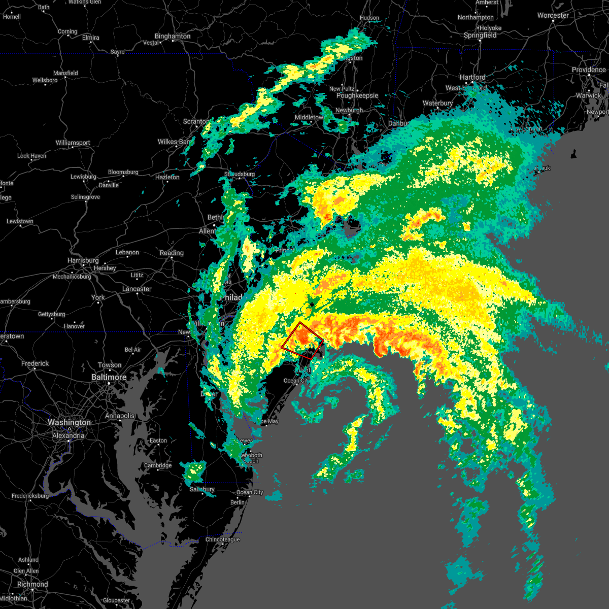 At 344 am edt, a severe thunderstorm capable of producing a tornado was located over new gretna, or 14 miles north of atlantic city, moving west at 20 mph (radar indicated rotation). Hazards include tornado. Flying debris will be dangerous to those caught without shelter. mobile homes will be damaged or destroyed. damage to roofs, windows, and vehicles will occur. tree damage is likely. locations impacted include, egg harbor city, tuckerton, port republic, bass river state forest, batsto, new gretna, penn state forest, wading river, elwood-magnolia and mystic island. This includes garden state parkway between mile markers 45 and 60. At 344 am edt, a severe thunderstorm capable of producing a tornado was located over new gretna, or 14 miles north of atlantic city, moving west at 20 mph (radar indicated rotation). Hazards include tornado. Flying debris will be dangerous to those caught without shelter. mobile homes will be damaged or destroyed. damage to roofs, windows, and vehicles will occur. tree damage is likely. locations impacted include, egg harbor city, tuckerton, port republic, bass river state forest, batsto, new gretna, penn state forest, wading river, elwood-magnolia and mystic island. This includes garden state parkway between mile markers 45 and 60.
|
| 7/9/2021 3:38 AM EDT |
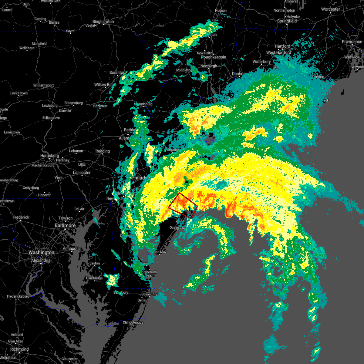 At 338 am edt, a severe thunderstorm capable of producing a tornado was located near tuckerton, or 14 miles north of atlantic city, moving northwest at 20 mph (radar indicated rotation). Hazards include tornado. Flying debris will be dangerous to those caught without shelter. mobile homes will be damaged or destroyed. damage to roofs, windows, and vehicles will occur. Tree damage is likely. At 338 am edt, a severe thunderstorm capable of producing a tornado was located near tuckerton, or 14 miles north of atlantic city, moving northwest at 20 mph (radar indicated rotation). Hazards include tornado. Flying debris will be dangerous to those caught without shelter. mobile homes will be damaged or destroyed. damage to roofs, windows, and vehicles will occur. Tree damage is likely.
|
| 7/9/2021 3:31 AM EDT | Storm damage reported in ocean county NJ, 5 miles NW of Tuckerton, NJ |
| 7/1/2021 6:29 PM EDT |
 At 628 pm edt, severe thunderstorms were located along a line extending from near highlands to near mantoloking to near warren grove to near port republic to 7 miles northeast of brigantine, moving east at 35 mph (radar indicated). Hazards include 60 mph wind gusts. Damage to roofs, siding, trees, and power lines is possible. locations impacted include, toms river, atlantic city, long branch, asbury park, sandy hook, lakewood, middletown, jackson, howell, barnegat, pleasantville, tinton falls, holmdel, red bank, beachwood, brigantine, matawan, northfield, absecon and manasquan. this includes the following highways, interstate 195 in new jersey between mile markers 22 and 34. garden state parkway between mile markers 35 and 119. Atlantic city expressway between mile markers 2 and 10. At 628 pm edt, severe thunderstorms were located along a line extending from near highlands to near mantoloking to near warren grove to near port republic to 7 miles northeast of brigantine, moving east at 35 mph (radar indicated). Hazards include 60 mph wind gusts. Damage to roofs, siding, trees, and power lines is possible. locations impacted include, toms river, atlantic city, long branch, asbury park, sandy hook, lakewood, middletown, jackson, howell, barnegat, pleasantville, tinton falls, holmdel, red bank, beachwood, brigantine, matawan, northfield, absecon and manasquan. this includes the following highways, interstate 195 in new jersey between mile markers 22 and 34. garden state parkway between mile markers 35 and 119. Atlantic city expressway between mile markers 2 and 10.
|
| 7/1/2021 5:50 PM EDT |
 At 550 pm edt, severe thunderstorms were located along a line extending from matawan to wharton state forest to near weymouth to near wildwood crest, moving east at 30 mph (radar indicated). Hazards include 70 mph wind gusts. Expect considerable tree damage. damage is likely to mobile homes, roofs, and outbuildings. locations impacted include, toms river, vineland, atlantic city, long branch, millville, asbury park, ocean city, cape may, sandy hook, cumberland, lakewood, middletown, old bridge, jackson, howell, east brunswick, marlboro, manalapan, barnegat and pleasantville. this includes the following highways, interstate 195 in new jersey between mile markers 10 and 34. garden state parkway between mile markers 0 and 123. Atlantic city expressway between mile markers 0 and 34. At 550 pm edt, severe thunderstorms were located along a line extending from matawan to wharton state forest to near weymouth to near wildwood crest, moving east at 30 mph (radar indicated). Hazards include 70 mph wind gusts. Expect considerable tree damage. damage is likely to mobile homes, roofs, and outbuildings. locations impacted include, toms river, vineland, atlantic city, long branch, millville, asbury park, ocean city, cape may, sandy hook, cumberland, lakewood, middletown, old bridge, jackson, howell, east brunswick, marlboro, manalapan, barnegat and pleasantville. this includes the following highways, interstate 195 in new jersey between mile markers 10 and 34. garden state parkway between mile markers 0 and 123. Atlantic city expressway between mile markers 0 and 34.
|
| 7/1/2021 5:27 PM EDT |
 At 527 pm edt, severe thunderstorms were located along a line extending from jamesburg to near chesilhurst to near newfield to near west cape may, moving east at 45 mph (radar indicated). Hazards include 70 mph wind gusts. Expect considerable tree damage. Damage is likely to mobile homes, roofs, and outbuildings. At 527 pm edt, severe thunderstorms were located along a line extending from jamesburg to near chesilhurst to near newfield to near west cape may, moving east at 45 mph (radar indicated). Hazards include 70 mph wind gusts. Expect considerable tree damage. Damage is likely to mobile homes, roofs, and outbuildings.
|
| 6/14/2021 11:56 PM EDT |
 The severe thunderstorm warning for atlantic, southeastern ocean and southeastern burlington counties will expire at midnight edt, the storms which prompted the warning have weakened below severe limits, and no longer pose an immediate threat to life or property. therefore, the warning will be allowed to expire. however, gusty winds are still possible with these thunderstorms. a severe thunderstorm watch remains in effect until 200 am edt for southern new jersey. The severe thunderstorm warning for atlantic, southeastern ocean and southeastern burlington counties will expire at midnight edt, the storms which prompted the warning have weakened below severe limits, and no longer pose an immediate threat to life or property. therefore, the warning will be allowed to expire. however, gusty winds are still possible with these thunderstorms. a severe thunderstorm watch remains in effect until 200 am edt for southern new jersey.
|
| 6/14/2021 11:41 PM EDT |
 At 1141 pm edt, severe thunderstorms were located along a line extending from 8 miles southeast of seaside heights to near surf city to weymouth, moving east at 25 mph (radar indicated). Hazards include 60 mph wind gusts. Damage to roofs, siding, trees, and power lines is possible. locations impacted include, toms river, barnegat, hammonton, brigantine, absecon, buena, egg harbor city, tuckerton, seaside heights, weymouth, surf city, port republic, elwood-magnolia, wading river, pomona, mays landing, brookville, bass river state forest, batsto and mizpah. this includes the following highways, garden state parkway between mile markers 39 and 77. Atlantic city expressway between mile markers 9 and 29. At 1141 pm edt, severe thunderstorms were located along a line extending from 8 miles southeast of seaside heights to near surf city to weymouth, moving east at 25 mph (radar indicated). Hazards include 60 mph wind gusts. Damage to roofs, siding, trees, and power lines is possible. locations impacted include, toms river, barnegat, hammonton, brigantine, absecon, buena, egg harbor city, tuckerton, seaside heights, weymouth, surf city, port republic, elwood-magnolia, wading river, pomona, mays landing, brookville, bass river state forest, batsto and mizpah. this includes the following highways, garden state parkway between mile markers 39 and 77. Atlantic city expressway between mile markers 9 and 29.
|
| 6/14/2021 11:21 PM EDT |
 At 1121 pm edt, severe thunderstorms were located along a line extending from near seaside heights to near beach haven west to near wading river, moving east at 30 mph (radar indicated). Hazards include 60 mph wind gusts. damage to roofs, siding, trees, and power lines is possible At 1121 pm edt, severe thunderstorms were located along a line extending from near seaside heights to near beach haven west to near wading river, moving east at 30 mph (radar indicated). Hazards include 60 mph wind gusts. damage to roofs, siding, trees, and power lines is possible
|
| 6/8/2021 6:40 PM EDT |
 At 640 pm edt, severe thunderstorms were located along a line extending from near tuckerton to near surf city, moving east at 20 mph (radar indicated). Hazards include 60 mph wind gusts and quarter size hail. Minor damage to vehicles is possible. wind damage to roofs, siding, trees, and power lines is possible. locations impacted include, barnegat, tuckerton, surf city, bass river state forest, new gretna, beach haven west, mystic island, manahawkin and ocean acres. This includes garden state parkway between mile markers 51 and 66. At 640 pm edt, severe thunderstorms were located along a line extending from near tuckerton to near surf city, moving east at 20 mph (radar indicated). Hazards include 60 mph wind gusts and quarter size hail. Minor damage to vehicles is possible. wind damage to roofs, siding, trees, and power lines is possible. locations impacted include, barnegat, tuckerton, surf city, bass river state forest, new gretna, beach haven west, mystic island, manahawkin and ocean acres. This includes garden state parkway between mile markers 51 and 66.
|
| 6/8/2021 6:24 PM EDT |
 At 624 pm edt, severe thunderstorms were located along a line extending from near new gretna to near beach haven west to near old halfway, moving east at 25 mph (radar indicated). Hazards include 60 mph wind gusts and quarter size hail. Minor damage to vehicles is possible. wind damage to roofs, siding, trees, and power lines is possible. locations impacted include, barnegat, tuckerton, surf city, port republic, wading river, brookville, warren grove, bass river state forest, chatsworth, old halfway, new gretna, penn state forest, beach haven west, mystic island, ocean acres, manahawkin and waretown. This includes garden state parkway between mile markers 47 and 71. At 624 pm edt, severe thunderstorms were located along a line extending from near new gretna to near beach haven west to near old halfway, moving east at 25 mph (radar indicated). Hazards include 60 mph wind gusts and quarter size hail. Minor damage to vehicles is possible. wind damage to roofs, siding, trees, and power lines is possible. locations impacted include, barnegat, tuckerton, surf city, port republic, wading river, brookville, warren grove, bass river state forest, chatsworth, old halfway, new gretna, penn state forest, beach haven west, mystic island, ocean acres, manahawkin and waretown. This includes garden state parkway between mile markers 47 and 71.
|
| 6/8/2021 6:01 PM EDT |
 At 600 pm edt, severe thunderstorms were located along a line extending from near wading river to shamong, moving east at 20 mph (radar indicated). Hazards include 60 mph wind gusts and quarter size hail. Minor damage to vehicles is possible. Wind damage to roofs, siding, trees, and power lines is possible. At 600 pm edt, severe thunderstorms were located along a line extending from near wading river to shamong, moving east at 20 mph (radar indicated). Hazards include 60 mph wind gusts and quarter size hail. Minor damage to vehicles is possible. Wind damage to roofs, siding, trees, and power lines is possible.
|
| 6/8/2021 6:00 PM EDT | Power lines downed. time estimated from rada in ocean county NJ, 2.5 miles SSW of Tuckerton, NJ |
| 6/3/2021 7:35 PM EDT |
 The severe thunderstorm warning for atlantic, northeastern cumberland, south central ocean, southeastern camden, southeastern gloucester and southeastern burlington counties will expire at 745 pm edt, the storm which prompted the warning has moved out of the area. therefore, the warning will be allowed to expire. however gusty winds and heavy rain are still possible with this thunderstorm. a severe thunderstorm watch remains in effect until 900 pm edt for southern new jersey. The severe thunderstorm warning for atlantic, northeastern cumberland, south central ocean, southeastern camden, southeastern gloucester and southeastern burlington counties will expire at 745 pm edt, the storm which prompted the warning has moved out of the area. therefore, the warning will be allowed to expire. however gusty winds and heavy rain are still possible with this thunderstorm. a severe thunderstorm watch remains in effect until 900 pm edt for southern new jersey.
|
| 6/3/2021 7:20 PM EDT |
 At 720 pm edt, a severe thunderstorm was located over batsto, or 18 miles northwest of atlantic city, moving northeast at 70 mph (radar indicated). Hazards include 60 mph wind gusts and penny size hail. Damage to roofs, siding, trees, and power lines is possible. locations impacted include, vineland, atlantic city, pleasantville, hammonton, somers point, ventnor city, brigantine, northfield, absecon, berlin, margate city, buena, egg harbor city, tuckerton, weymouth, estell manor, chesilhurst, newfield, port republic and longport. people at the atlantic county mega site should seek safe shelter immediately! this includes the following highways, garden state parkway between mile markers 30 and 57. Atlantic city expressway between mile markers 0 and 38. At 720 pm edt, a severe thunderstorm was located over batsto, or 18 miles northwest of atlantic city, moving northeast at 70 mph (radar indicated). Hazards include 60 mph wind gusts and penny size hail. Damage to roofs, siding, trees, and power lines is possible. locations impacted include, vineland, atlantic city, pleasantville, hammonton, somers point, ventnor city, brigantine, northfield, absecon, berlin, margate city, buena, egg harbor city, tuckerton, weymouth, estell manor, chesilhurst, newfield, port republic and longport. people at the atlantic county mega site should seek safe shelter immediately! this includes the following highways, garden state parkway between mile markers 30 and 57. Atlantic city expressway between mile markers 0 and 38.
|
| 6/3/2021 7:07 PM EDT |
 At 707 pm edt, a severe thunderstorm was located near dorothy, or 12 miles east of vineland, moving northeast at 70 mph (radar indicated). Hazards include 60 mph wind gusts and quarter size hail. Minor damage to vehicles is possible. Wind damage to roofs, siding, trees, and power lines is possible. At 707 pm edt, a severe thunderstorm was located near dorothy, or 12 miles east of vineland, moving northeast at 70 mph (radar indicated). Hazards include 60 mph wind gusts and quarter size hail. Minor damage to vehicles is possible. Wind damage to roofs, siding, trees, and power lines is possible.
|
| 4/21/2021 3:16 PM EDT | Cwop site ew432 in ocean county NJ, 5.5 miles NW of Tuckerton, NJ |
| 4/21/2021 3:12 PM EDT | Corrects previous tstm wnd gst report from 5 se mystic islan in ocean county NJ, 5.4 miles N of Tuckerton, NJ |
| 4/21/2021 3:10 PM EDT | Personal weather station knjlongb8 in ocean county NJ, 5 miles NW of Tuckerton, NJ |
| 4/21/2021 3:09 PM EDT |
 At 309 pm edt, a severe thunderstorm was located over tuckerton, or 15 miles northeast of atlantic city, moving east at 60 mph (radar indicated). Hazards include 60 mph wind gusts and quarter size hail. Minor damage to vehicles is possible. wind damage to roofs, siding, trees, and power lines is possible. locations impacted include, barnegat, absecon, egg harbor city, tuckerton, surf city, port republic, wading river, bass river state forest, new gretna, beach haven west, mystic island, manahawkin and ocean acres. This includes garden state parkway between mile markers 43 and 66. At 309 pm edt, a severe thunderstorm was located over tuckerton, or 15 miles northeast of atlantic city, moving east at 60 mph (radar indicated). Hazards include 60 mph wind gusts and quarter size hail. Minor damage to vehicles is possible. wind damage to roofs, siding, trees, and power lines is possible. locations impacted include, barnegat, absecon, egg harbor city, tuckerton, surf city, port republic, wading river, bass river state forest, new gretna, beach haven west, mystic island, manahawkin and ocean acres. This includes garden state parkway between mile markers 43 and 66.
|
| 4/21/2021 2:59 PM EDT |
 At 249 pm edt, a severe thunderstorm was located near elwood-magnolia, or 15 miles northwest of atlantic city, moving east at 55 mph (radar indicated). Hazards include 60 mph wind gusts and quarter size hail. Minor damage to vehicles is possible. Wind damage to roofs, siding, trees, and power lines is possible. At 249 pm edt, a severe thunderstorm was located near elwood-magnolia, or 15 miles northwest of atlantic city, moving east at 55 mph (radar indicated). Hazards include 60 mph wind gusts and quarter size hail. Minor damage to vehicles is possible. Wind damage to roofs, siding, trees, and power lines is possible.
|
| 4/21/2021 2:50 PM EDT |
 At 249 pm edt, a severe thunderstorm was located near elwood-magnolia, or 15 miles northwest of atlantic city, moving east at 55 mph (radar indicated). Hazards include 60 mph wind gusts and quarter size hail. Minor damage to vehicles is possible. Wind damage to roofs, siding, trees, and power lines is possible. At 249 pm edt, a severe thunderstorm was located near elwood-magnolia, or 15 miles northwest of atlantic city, moving east at 55 mph (radar indicated). Hazards include 60 mph wind gusts and quarter size hail. Minor damage to vehicles is possible. Wind damage to roofs, siding, trees, and power lines is possible.
|
| 3/28/2021 8:22 PM EDT |
 The severe thunderstorm warning for east central atlantic, central ocean, southeastern burlington and southeastern monmouth counties will expire at 830 pm edt, the storms which prompted the warning have moved out of the area. therefore, the warning will be allowed to expire. however gusty winds are still expected through this evening. a severe thunderstorm watch remains in effect until 900 pm edt for southern and central new jersey. The severe thunderstorm warning for east central atlantic, central ocean, southeastern burlington and southeastern monmouth counties will expire at 830 pm edt, the storms which prompted the warning have moved out of the area. therefore, the warning will be allowed to expire. however gusty winds are still expected through this evening. a severe thunderstorm watch remains in effect until 900 pm edt for southern and central new jersey.
|
| 3/28/2021 8:05 PM EDT |
 At 804 pm edt, severe thunderstorms were located along a line extending from leisure village east to near bamber lake to near new gretna, moving east at 50 mph. this line of storms has a history of producing wind damage (trained weather spotters and automated gauges). Hazards include 70 mph wind gusts. Expect considerable tree damage. damage is likely to mobile homes, roofs, and outbuildings. locations impacted include, toms river, lakewood, barnegat, beachwood, manasquan, point pleasant beach, tuckerton, seaside heights, surf city, port republic, mantoloking, leisure village, allenwood, dover beaches north, holiday city south, pleasant plains, warren grove, leisure village east, dover beaches south and ramtown. this includes the following highways, interstate 195 in new jersey between mile markers 30 and 34. Garden state parkway between mile markers 45 and 99. At 804 pm edt, severe thunderstorms were located along a line extending from leisure village east to near bamber lake to near new gretna, moving east at 50 mph. this line of storms has a history of producing wind damage (trained weather spotters and automated gauges). Hazards include 70 mph wind gusts. Expect considerable tree damage. damage is likely to mobile homes, roofs, and outbuildings. locations impacted include, toms river, lakewood, barnegat, beachwood, manasquan, point pleasant beach, tuckerton, seaside heights, surf city, port republic, mantoloking, leisure village, allenwood, dover beaches north, holiday city south, pleasant plains, warren grove, leisure village east, dover beaches south and ramtown. this includes the following highways, interstate 195 in new jersey between mile markers 30 and 34. Garden state parkway between mile markers 45 and 99.
|
| 3/28/2021 7:45 PM EDT |
 At 743 pm edt, severe thunderstorms were located along a line extending from woodruff to near presidential lakes to elwood- magnolia, moving east at 50 mph. the mdl joint base weather station recently reported a wind gust of 70 mph (trained weather spotters). Hazards include 70 mph wind gusts. Expect considerable tree damage. damage is likely to mobile homes, roofs, and outbuildings. locations impacted include, toms river, lakewood, jackson, barnegat, hammonton, beachwood, manasquan, point pleasant beach, egg harbor city, tuckerton, presidential lakes estates, seaside heights, weymouth, lakehurst, surf city, port republic, mantoloking, allenwood, elwood-magnolia and six flags theme park. this includes the following highways, interstate 195 in new jersey between mile markers 15 and 34. garden state parkway between mile markers 42 and 99. Atlantic city expressway between mile markers 14 and 25. At 743 pm edt, severe thunderstorms were located along a line extending from woodruff to near presidential lakes to elwood- magnolia, moving east at 50 mph. the mdl joint base weather station recently reported a wind gust of 70 mph (trained weather spotters). Hazards include 70 mph wind gusts. Expect considerable tree damage. damage is likely to mobile homes, roofs, and outbuildings. locations impacted include, toms river, lakewood, jackson, barnegat, hammonton, beachwood, manasquan, point pleasant beach, egg harbor city, tuckerton, presidential lakes estates, seaside heights, weymouth, lakehurst, surf city, port republic, mantoloking, allenwood, elwood-magnolia and six flags theme park. this includes the following highways, interstate 195 in new jersey between mile markers 15 and 34. garden state parkway between mile markers 42 and 99. Atlantic city expressway between mile markers 14 and 25.
|
| 3/28/2021 7:20 PM EDT |
 At 719 pm edt, severe thunderstorms were located along a line extending from florence-roebling to near ramblewood to malaga, moving east at 50 mph. this storm has a history of producing wind damage (trained weather spotters). Hazards include 70 mph wind gusts. Expect considerable tree damage. Damage is likely to mobile homes, roofs, and outbuildings. At 719 pm edt, severe thunderstorms were located along a line extending from florence-roebling to near ramblewood to malaga, moving east at 50 mph. this storm has a history of producing wind damage (trained weather spotters). Hazards include 70 mph wind gusts. Expect considerable tree damage. Damage is likely to mobile homes, roofs, and outbuildings.
|
| 2/22/2021 2:35 PM EST | Storm damage reported in ocean county NJ, 1.2 miles N of Tuckerton, NJ |
| 11/15/2020 9:53 PM EST | Weatherflow gaug in ocean county NJ, 5.4 miles N of Tuckerton, NJ |
| 11/15/2020 9:41 PM EST |
 The severe thunderstorm warning for atlantic, southeastern cumberland, ocean, cape may, southeastern burlington and southeastern monmouth counties will expire at 945 pm est, the storms which prompted the warning have moved out of most of the area, and will clear cape may county soon. therefore, the warning will be allowed to expire. a severe thunderstorm watch remains in effect until 1100 pm est for southern and central new jersey. The severe thunderstorm warning for atlantic, southeastern cumberland, ocean, cape may, southeastern burlington and southeastern monmouth counties will expire at 945 pm est, the storms which prompted the warning have moved out of most of the area, and will clear cape may county soon. therefore, the warning will be allowed to expire. a severe thunderstorm watch remains in effect until 1100 pm est for southern and central new jersey.
|
| 11/15/2020 9:26 PM EST | Storm damage reported in ocean county NJ, 5.5 miles NW of Tuckerton, NJ |
| 11/15/2020 9:24 PM EST | Weather underground site knjlongb5 in ocean county NJ, 6 miles NW of Tuckerton, NJ |
| 11/15/2020 9:21 PM EST | Weatherflow gaug in ocean county NJ, 5.4 miles N of Tuckerton, NJ |
| 11/15/2020 9:20 PM EST | A tree was uprooted in west creek. report via social media with a photo. time estimated from rada in ocean county NJ, 3.4 miles SSW of Tuckerton, NJ |
| 11/15/2020 9:17 PM EST |
 At 916 pm est, intense showers with some embedded severe thunderstorms were located along a line extending from 7 miles southeast of asbury park to near beachwood to tuckerton to near marmora to near north cape may, moving east at 50 mph. this line has a history of producing areas of wind damage. this line may contain little or no lightning. do not wait until you hear thunder before taking cover (trained weather spotters). Hazards include 60 mph wind gusts. Damage to roofs, siding, trees, and power lines is possible. locations impacted include, toms river, atlantic city, ocean city, cape may, lakewood, barnegat, pleasantville, beachwood, somers point, ventnor city, brigantine, northfield, absecon, margate city, manasquan, point pleasant beach, egg harbor city, north wildwood, tuckerton and wildwood crest. this includes the following highways, interstate 195 in new jersey between mile markers 31 and 32. garden state parkway between mile markers 0 and 97. Atlantic city expressway between mile markers 0 and 18. At 916 pm est, intense showers with some embedded severe thunderstorms were located along a line extending from 7 miles southeast of asbury park to near beachwood to tuckerton to near marmora to near north cape may, moving east at 50 mph. this line has a history of producing areas of wind damage. this line may contain little or no lightning. do not wait until you hear thunder before taking cover (trained weather spotters). Hazards include 60 mph wind gusts. Damage to roofs, siding, trees, and power lines is possible. locations impacted include, toms river, atlantic city, ocean city, cape may, lakewood, barnegat, pleasantville, beachwood, somers point, ventnor city, brigantine, northfield, absecon, margate city, manasquan, point pleasant beach, egg harbor city, north wildwood, tuckerton and wildwood crest. this includes the following highways, interstate 195 in new jersey between mile markers 31 and 32. garden state parkway between mile markers 0 and 97. Atlantic city expressway between mile markers 0 and 18.
|
| 11/15/2020 8:54 PM EST |
 At 853 pm est, intense showers and some embedded severe thunderstorms were located along a line extending from freewood acres to wharton state forest to near fortesque, moving east at 45 mph. this line has a history of producing areas of wind damage. this line may contain little or no lightning. do not wait until you hear thunder before taking cover (trained weather spotters). Hazards include 60 mph wind gusts. damage to roofs, siding, trees, and power lines is possible At 853 pm est, intense showers and some embedded severe thunderstorms were located along a line extending from freewood acres to wharton state forest to near fortesque, moving east at 45 mph. this line has a history of producing areas of wind damage. this line may contain little or no lightning. do not wait until you hear thunder before taking cover (trained weather spotters). Hazards include 60 mph wind gusts. damage to roofs, siding, trees, and power lines is possible
|
| 11/15/2020 8:49 PM EST |
 At 848 pm est, intense showers and some embedded severe thunderstorms were located along a line extending from holmdel to vista center to presidential lakes to near hammonton to near mizpah, moving east at 60 mph. this line has a history of producing areas of wind damage. this line may contain little or no lightning. do not wait until you hear thunder before taking cover (trained weather spotters). Hazards include 60 mph wind gusts. Damage to roofs, siding, trees, and power lines is possible. locations impacted include, toms river, vineland, atlantic city, millville, bridgeton, ocean city, cape may, cumberland, lakewood, jackson, barnegat, pleasantville, hammonton, beachwood, somers point, ventnor city, brigantine, northfield, absecon and berlin. this includes the following highways, interstate 195 in new jersey between mile markers 13 and 34. garden state parkway between mile markers 0 and 98. Atlantic city expressway between mile markers 0 and 38. At 848 pm est, intense showers and some embedded severe thunderstorms were located along a line extending from holmdel to vista center to presidential lakes to near hammonton to near mizpah, moving east at 60 mph. this line has a history of producing areas of wind damage. this line may contain little or no lightning. do not wait until you hear thunder before taking cover (trained weather spotters). Hazards include 60 mph wind gusts. Damage to roofs, siding, trees, and power lines is possible. locations impacted include, toms river, vineland, atlantic city, millville, bridgeton, ocean city, cape may, cumberland, lakewood, jackson, barnegat, pleasantville, hammonton, beachwood, somers point, ventnor city, brigantine, northfield, absecon and berlin. this includes the following highways, interstate 195 in new jersey between mile markers 13 and 34. garden state parkway between mile markers 0 and 98. Atlantic city expressway between mile markers 0 and 38.
|
| 11/15/2020 8:20 PM EST |
 At 819 pm est, intense showers and embedded severe thunderstorms were located along a line extending from near mercerville-hamilton square to near burlington to turnersville to near seabrook farms to near hope creek, moving east at 65 mph. this line has a history of producing areas of wind damage. this line may contain little or no lightning. do not wait until you hear thunder before taking cover (trained weather spotters). Hazards include 60 mph wind gusts. Damage to roofs, siding, trees, and power lines is possible. locations impacted include, philadelphia, toms river, camden, vineland, atlantic city, millville, bridgeton, ocean city, gloucester city, cape may, cumberland, lakewood, cherry hill, bensalem, jackson, evesham, mount laurel, willingboro, deptford and voorhees. this includes the following highways, new jersey turnpike between exits 1 and 7a. pennsylvania turnpike between mile markers 350 and 359. interstate 95 in pennsylvania between mile markers 14 and 40. interstate 76 in pennsylvania between mile markers 347 and 351. interstate 76 in new jersey between mile markers 0 and 3. interstate 195 in new jersey between mile markers 13 and 34. interstate 295 in new jersey between mile markers 12 and 59. interstate 676 in pennsylvania near mile marker 1. interstate 676 in new jersey between mile markers 0 and 4. garden state parkway between mile markers 0 and 98. Atlantic city expressway between mile markers 0 and 44. At 819 pm est, intense showers and embedded severe thunderstorms were located along a line extending from near mercerville-hamilton square to near burlington to turnersville to near seabrook farms to near hope creek, moving east at 65 mph. this line has a history of producing areas of wind damage. this line may contain little or no lightning. do not wait until you hear thunder before taking cover (trained weather spotters). Hazards include 60 mph wind gusts. Damage to roofs, siding, trees, and power lines is possible. locations impacted include, philadelphia, toms river, camden, vineland, atlantic city, millville, bridgeton, ocean city, gloucester city, cape may, cumberland, lakewood, cherry hill, bensalem, jackson, evesham, mount laurel, willingboro, deptford and voorhees. this includes the following highways, new jersey turnpike between exits 1 and 7a. pennsylvania turnpike between mile markers 350 and 359. interstate 95 in pennsylvania between mile markers 14 and 40. interstate 76 in pennsylvania between mile markers 347 and 351. interstate 76 in new jersey between mile markers 0 and 3. interstate 195 in new jersey between mile markers 13 and 34. interstate 295 in new jersey between mile markers 12 and 59. interstate 676 in pennsylvania near mile marker 1. interstate 676 in new jersey between mile markers 0 and 4. garden state parkway between mile markers 0 and 98. Atlantic city expressway between mile markers 0 and 44.
|
| 11/15/2020 7:50 PM EST |
 At 749 pm est, intense showers and embedded severe thunderstorms were located along a line extending from near chalfont to chelsea to port penn to morgnec, moving northeast at 65 mph. this line may contain little or no lightning. do not wait until you hear thunder before taking cover (trained weather spotters). Hazards include 60 mph wind gusts. damage to roofs, siding, trees, and power lines is possible At 749 pm est, intense showers and embedded severe thunderstorms were located along a line extending from near chalfont to chelsea to port penn to morgnec, moving northeast at 65 mph. this line may contain little or no lightning. do not wait until you hear thunder before taking cover (trained weather spotters). Hazards include 60 mph wind gusts. damage to roofs, siding, trees, and power lines is possible
|
| 8/28/2020 5:59 PM EDT |
 At 558 pm edt, severe thunderstorms were located along a line extending from near wading river to marmora to 6 miles northwest of green creek, moving east at 50 mph (radar indicated). Hazards include 60 mph wind gusts and quarter size hail. Minor damage to vehicles is possible. wind damage to roofs, siding, trees, and power lines is possible. locations impacted include, atlantic city, ocean city, cape may, barnegat, pleasantville, hammonton, somers point, ventnor city, brigantine, northfield, absecon, margate city, egg harbor city, north wildwood, tuckerton, wildwood crest, woodbine, sea isle city, estell manor and avalon. this includes the following highways, garden state parkway between mile markers 0 and 69. Atlantic city expressway between mile markers 0 and 23. At 558 pm edt, severe thunderstorms were located along a line extending from near wading river to marmora to 6 miles northwest of green creek, moving east at 50 mph (radar indicated). Hazards include 60 mph wind gusts and quarter size hail. Minor damage to vehicles is possible. wind damage to roofs, siding, trees, and power lines is possible. locations impacted include, atlantic city, ocean city, cape may, barnegat, pleasantville, hammonton, somers point, ventnor city, brigantine, northfield, absecon, margate city, egg harbor city, north wildwood, tuckerton, wildwood crest, woodbine, sea isle city, estell manor and avalon. this includes the following highways, garden state parkway between mile markers 0 and 69. Atlantic city expressway between mile markers 0 and 23.
|
| 8/28/2020 5:28 PM EDT |
 At 528 pm edt, severe thunderstorms were located along a line extending from chesilhurst to near millville to near greenwich, moving east at 45 mph (radar indicated). Hazards include 60 mph wind gusts and quarter size hail. Minor damage to vehicles is possible. Wind damage to roofs, siding, trees, and power lines is possible. At 528 pm edt, severe thunderstorms were located along a line extending from chesilhurst to near millville to near greenwich, moving east at 45 mph (radar indicated). Hazards include 60 mph wind gusts and quarter size hail. Minor damage to vehicles is possible. Wind damage to roofs, siding, trees, and power lines is possible.
|
| 8/7/2020 8:49 PM EDT |
 At 849 pm edt, severe thunderstorms were located along a line extending from near absecon to near marmora to near north cape may, moving southeast at 15 mph (radar indicated). Hazards include 60 mph wind gusts. Damage to roofs, siding, trees, and power lines is possible. locations impacted include, atlantic city, ocean city, cape may, pleasantville, somers point, ventnor city, brigantine, northfield, absecon, margate city, egg harbor city, north wildwood, tuckerton, wildwood crest, woodbine, sea isle city, estell manor, avalon, port republic and west cape may. this includes the following highways, garden state parkway between mile markers 0 and 51. Atlantic city expressway between mile markers 0 and 15. At 849 pm edt, severe thunderstorms were located along a line extending from near absecon to near marmora to near north cape may, moving southeast at 15 mph (radar indicated). Hazards include 60 mph wind gusts. Damage to roofs, siding, trees, and power lines is possible. locations impacted include, atlantic city, ocean city, cape may, pleasantville, somers point, ventnor city, brigantine, northfield, absecon, margate city, egg harbor city, north wildwood, tuckerton, wildwood crest, woodbine, sea isle city, estell manor, avalon, port republic and west cape may. this includes the following highways, garden state parkway between mile markers 0 and 51. Atlantic city expressway between mile markers 0 and 15.
|
| 8/7/2020 8:30 PM EDT |
 At 829 pm edt, severe thunderstorms were located along a line extending from egg harbor city to marmora to near green creek, moving southeast at 25 mph (radar indicated). Hazards include 60 mph wind gusts. Damage to roofs, siding, trees, and power lines is possible. locations impacted include, vineland, atlantic city, millville, ocean city, cape may, cumberland, pleasantville, hammonton, somers point, ventnor city, brigantine, northfield, absecon, margate city, egg harbor city, north wildwood, laurel lake, tuckerton, wildwood crest and weymouth. this includes the following highways, garden state parkway between mile markers 0 and 52. Atlantic city expressway between mile markers 0 and 27. At 829 pm edt, severe thunderstorms were located along a line extending from egg harbor city to marmora to near green creek, moving southeast at 25 mph (radar indicated). Hazards include 60 mph wind gusts. Damage to roofs, siding, trees, and power lines is possible. locations impacted include, vineland, atlantic city, millville, ocean city, cape may, cumberland, pleasantville, hammonton, somers point, ventnor city, brigantine, northfield, absecon, margate city, egg harbor city, north wildwood, laurel lake, tuckerton, wildwood crest and weymouth. this includes the following highways, garden state parkway between mile markers 0 and 52. Atlantic city expressway between mile markers 0 and 27.
|
| 8/7/2020 8:02 PM EDT |
 At 802 pm edt, severe thunderstorms were located along a line extending from hammonton to near estell manor to near fortesque, moving southeast at 25 mph (radar indicated). Hazards include 60 mph wind gusts. damage to roofs, siding, trees, and power lines is possible At 802 pm edt, severe thunderstorms were located along a line extending from hammonton to near estell manor to near fortesque, moving southeast at 25 mph (radar indicated). Hazards include 60 mph wind gusts. damage to roofs, siding, trees, and power lines is possible
|
| 8/4/2020 10:24 AM EDT |
 At 1024 am edt, a severe thunderstorm capable of producing a tornado was located near port republic, or 10 miles north of atlantic city, moving north at 60 mph (radar indicated rotation). Hazards include tornado. Flying debris will be dangerous to those caught without shelter. mobile homes will be damaged or destroyed. damage to roofs, windows, and vehicles will occur. tree damage is likely. locations impacted include, tuckerton, port republic, brookville, warren grove, bass river state forest, chatsworth, new gretna, penn state forest, mystic island and ocean acres. This includes garden state parkway between mile markers 48 and 62. At 1024 am edt, a severe thunderstorm capable of producing a tornado was located near port republic, or 10 miles north of atlantic city, moving north at 60 mph (radar indicated rotation). Hazards include tornado. Flying debris will be dangerous to those caught without shelter. mobile homes will be damaged or destroyed. damage to roofs, windows, and vehicles will occur. tree damage is likely. locations impacted include, tuckerton, port republic, brookville, warren grove, bass river state forest, chatsworth, new gretna, penn state forest, mystic island and ocean acres. This includes garden state parkway between mile markers 48 and 62.
|
| 8/4/2020 10:15 AM EDT |
 At 1014 am edt, a severe thunderstorm capable of producing a tornado was located over brigantine, or near atlantic city, moving north at 65 mph (radar indicated rotation). Hazards include tornado. Flying debris will be dangerous to those caught without shelter. mobile homes will be damaged or destroyed. damage to roofs, windows, and vehicles will occur. Tree damage is likely. At 1014 am edt, a severe thunderstorm capable of producing a tornado was located over brigantine, or near atlantic city, moving north at 65 mph (radar indicated rotation). Hazards include tornado. Flying debris will be dangerous to those caught without shelter. mobile homes will be damaged or destroyed. damage to roofs, windows, and vehicles will occur. Tree damage is likely.
|
| 8/3/2020 12:24 AM EDT |
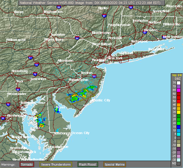 The severe thunderstorm warning for northern atlantic, northeastern cumberland, east central salem, south central ocean, southeastern camden, southeastern gloucester and southeastern burlington counties will expire at 1230 am edt, the storm which prompted the warning has weakened below severe limits, and no longer poses an immediate threat to life or property. therefore, the warning will be allowed to expire. The severe thunderstorm warning for northern atlantic, northeastern cumberland, east central salem, south central ocean, southeastern camden, southeastern gloucester and southeastern burlington counties will expire at 1230 am edt, the storm which prompted the warning has weakened below severe limits, and no longer poses an immediate threat to life or property. therefore, the warning will be allowed to expire.
|
| 8/3/2020 12:06 AM EDT |
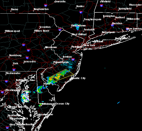 At 1206 am edt, a severe thunderstorm was located near batsto, or 20 miles northeast of vineland, moving northeast at 50 mph (radar indicated). Hazards include 60 mph wind gusts. Damage to roofs, siding, trees, and power lines is possible. locations impacted include, vineland, millville, cumberland, hammonton, buena, egg harbor city, laurel lake, tuckerton, weymouth, estell manor, newfield, port republic, elwood-magnolia, atsion, wading river, victory lakes, wharton state forest, mays landing, malaga and bass river state forest. this includes the following highways, garden state parkway between mile markers 47 and 57. Atlantic city expressway between mile markers 14 and 33. At 1206 am edt, a severe thunderstorm was located near batsto, or 20 miles northeast of vineland, moving northeast at 50 mph (radar indicated). Hazards include 60 mph wind gusts. Damage to roofs, siding, trees, and power lines is possible. locations impacted include, vineland, millville, cumberland, hammonton, buena, egg harbor city, laurel lake, tuckerton, weymouth, estell manor, newfield, port republic, elwood-magnolia, atsion, wading river, victory lakes, wharton state forest, mays landing, malaga and bass river state forest. this includes the following highways, garden state parkway between mile markers 47 and 57. Atlantic city expressway between mile markers 14 and 33.
|
| 8/2/2020 11:49 PM EDT |
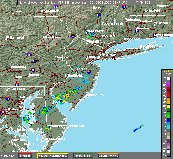 At 1149 pm edt, a severe thunderstorm was located over buena, or 7 miles north of vineland, moving northeast at 50 mph (radar indicated). Hazards include 60 mph wind gusts. damage to roofs, siding, trees, and power lines is possible At 1149 pm edt, a severe thunderstorm was located over buena, or 7 miles north of vineland, moving northeast at 50 mph (radar indicated). Hazards include 60 mph wind gusts. damage to roofs, siding, trees, and power lines is possible
|
| 7/22/2020 8:41 PM EDT | Weatherflow statio in ocean county NJ, 5.4 miles N of Tuckerton, NJ |
| 7/22/2020 8:15 PM EDT | Cwop statio in ocean county NJ, 5.5 miles WNW of Tuckerton, NJ |
| 7/22/2020 8:11 PM EDT | Cwop statio in ocean county NJ, 5.5 miles NW of Tuckerton, NJ |
| 7/22/2020 8:08 PM EDT | Corrects previous tstm wnd gst report from 4 se mystic island. weatherflow statio in ocean county NJ, 5.4 miles N of Tuckerton, NJ |
| 7/22/2020 8:06 PM EDT | Weatherflow gaug in ocean county NJ, 5.4 miles N of Tuckerton, NJ |
| 7/22/2020 8:06 PM EDT | Hads statio in ocean county NJ, 6.1 miles N of Tuckerton, NJ |
| 7/22/2020 7:58 PM EDT |
 At 758 pm edt, severe thunderstorms were located along a line extending from shamong to near new gretna to near brigantine, moving east at 40 mph (radar indicated). Hazards include 60 mph wind gusts and penny size hail. damage to roofs, siding, trees, and power lines is possible At 758 pm edt, severe thunderstorms were located along a line extending from shamong to near new gretna to near brigantine, moving east at 40 mph (radar indicated). Hazards include 60 mph wind gusts and penny size hail. damage to roofs, siding, trees, and power lines is possible
|
| 7/6/2020 3:59 PM EDT |
 At 359 pm edt, severe thunderstorms were located along a line extending from 7 miles east of barnegat to 6 miles southeast of tuckerton to near port republic to near pomona, moving southeast at 25 mph (radar indicated). Hazards include 60 mph wind gusts and quarter size hail. Minor damage to vehicles is possible. wind damage to roofs, siding, trees, and power lines is possible. locations impacted include, atlantic city, barnegat, pleasantville, brigantine, absecon, tuckerton, surf city, port republic, pomona, bass river state forest, new gretna, beach haven west, mystic island, ocean acres, manahawkin and waretown. this includes the following highways, garden state parkway between mile markers 40 and 72. Atlantic city expressway between mile markers 0 and 2. At 359 pm edt, severe thunderstorms were located along a line extending from 7 miles east of barnegat to 6 miles southeast of tuckerton to near port republic to near pomona, moving southeast at 25 mph (radar indicated). Hazards include 60 mph wind gusts and quarter size hail. Minor damage to vehicles is possible. wind damage to roofs, siding, trees, and power lines is possible. locations impacted include, atlantic city, barnegat, pleasantville, brigantine, absecon, tuckerton, surf city, port republic, pomona, bass river state forest, new gretna, beach haven west, mystic island, ocean acres, manahawkin and waretown. this includes the following highways, garden state parkway between mile markers 40 and 72. Atlantic city expressway between mile markers 0 and 2.
|
| 7/6/2020 3:36 PM EDT |
 The national weather service in mount holly nj has issued a * severe thunderstorm warning for. central atlantic county in southern new jersey. southeastern ocean county in southern new jersey. southeastern burlington county in southern new jersey. Until 430 pm edt. The national weather service in mount holly nj has issued a * severe thunderstorm warning for. central atlantic county in southern new jersey. southeastern ocean county in southern new jersey. southeastern burlington county in southern new jersey. Until 430 pm edt.
|
| 7/6/2020 3:24 PM EDT |
 At 323 pm edt, severe thunderstorms were located along a line extending from near barnegat to near wading river to elwood-magnolia to near clayton to paulsboro, moving south at 15 mph (radar indicated). Hazards include 60 mph wind gusts and quarter size hail. Minor damage to vehicles is possible. wind damage to roofs, siding, trees, and power lines is possible. locations impacted include, philadelphia, camden, gloucester city, cherry hill, evesham, deptford, voorhees, west deptford, barnegat, glassboro, lindenwold, hammonton, bellmawr, yeadon, woodbury, brigantine, pitman, clayton, berlin and shamong. this includes the following highways, new jersey turnpike near exit 3. interstate 95 in pennsylvania between mile markers 13 and 21. interstate 76 in pennsylvania between mile markers 345 and 351. interstate 76 in new jersey between mile markers 0 and 3. interstate 295 in new jersey between mile markers 17 and 34. interstate 676 in new jersey between mile markers 0 and 3. garden state parkway between mile markers 43 and 71. Atlantic city expressway between mile markers 20 and 44. At 323 pm edt, severe thunderstorms were located along a line extending from near barnegat to near wading river to elwood-magnolia to near clayton to paulsboro, moving south at 15 mph (radar indicated). Hazards include 60 mph wind gusts and quarter size hail. Minor damage to vehicles is possible. wind damage to roofs, siding, trees, and power lines is possible. locations impacted include, philadelphia, camden, gloucester city, cherry hill, evesham, deptford, voorhees, west deptford, barnegat, glassboro, lindenwold, hammonton, bellmawr, yeadon, woodbury, brigantine, pitman, clayton, berlin and shamong. this includes the following highways, new jersey turnpike near exit 3. interstate 95 in pennsylvania between mile markers 13 and 21. interstate 76 in pennsylvania between mile markers 345 and 351. interstate 76 in new jersey between mile markers 0 and 3. interstate 295 in new jersey between mile markers 17 and 34. interstate 676 in new jersey between mile markers 0 and 3. garden state parkway between mile markers 43 and 71. Atlantic city expressway between mile markers 20 and 44.
|
| 7/6/2020 3:02 PM EDT |
 At 301 pm edt, a severe thunderstorm was located over palmyra, or near camden, moving southeast at 10 mph. numerous other thunderstorms continue across the warned area (radar indicated). Hazards include 60 mph wind gusts and quarter size hail. Minor damage to vehicles is possible. wind damage to roofs, siding, trees, and power lines is possible. locations impacted include, philadelphia, camden, gloucester city, cherry hill, bensalem, evesham, mount laurel, willingboro, deptford, voorhees, medford, west deptford, barnegat, glassboro, lindenwold, hammonton, lumberton, florence, bellmawr and yeadon. this includes the following highways, new jersey turnpike between exits 3 and 6a. pennsylvania turnpike between mile markers 348 and 359. interstate 95 in pennsylvania between mile markers 13 and 40. interstate 76 in pennsylvania between mile markers 334 and 351. interstate 76 in new jersey between mile markers 0 and 3. interstate 295 in new jersey between mile markers 17 and 56. interstate 676 in pennsylvania between mile markers 0 and 1. interstate 676 in new jersey between mile markers 0 and 4. garden state parkway between mile markers 43 and 77. Atlantic city expressway between mile markers 20 and 44. At 301 pm edt, a severe thunderstorm was located over palmyra, or near camden, moving southeast at 10 mph. numerous other thunderstorms continue across the warned area (radar indicated). Hazards include 60 mph wind gusts and quarter size hail. Minor damage to vehicles is possible. wind damage to roofs, siding, trees, and power lines is possible. locations impacted include, philadelphia, camden, gloucester city, cherry hill, bensalem, evesham, mount laurel, willingboro, deptford, voorhees, medford, west deptford, barnegat, glassboro, lindenwold, hammonton, lumberton, florence, bellmawr and yeadon. this includes the following highways, new jersey turnpike between exits 3 and 6a. pennsylvania turnpike between mile markers 348 and 359. interstate 95 in pennsylvania between mile markers 13 and 40. interstate 76 in pennsylvania between mile markers 334 and 351. interstate 76 in new jersey between mile markers 0 and 3. interstate 295 in new jersey between mile markers 17 and 56. interstate 676 in pennsylvania between mile markers 0 and 1. interstate 676 in new jersey between mile markers 0 and 4. garden state parkway between mile markers 43 and 77. Atlantic city expressway between mile markers 20 and 44.
|
| 7/6/2020 2:39 PM EDT |
 At 239 pm edt, a severe thunderstorm was located over palmyra, or near philadelphia, moving southeast at 15 mph (radar indicated). Hazards include 60 mph wind gusts and quarter size hail. Minor damage to vehicles is possible. Wind damage to roofs, siding, trees, and power lines is possible. At 239 pm edt, a severe thunderstorm was located over palmyra, or near philadelphia, moving southeast at 15 mph (radar indicated). Hazards include 60 mph wind gusts and quarter size hail. Minor damage to vehicles is possible. Wind damage to roofs, siding, trees, and power lines is possible.
|
| 6/4/2020 10:59 PM EDT |
 The national weather service in mount holly nj has issued a * severe thunderstorm warning for. atlantic county in southern new jersey. eastern cumberland county in southern new jersey. central ocean county in southern new jersey. Camden county in southern new jersey. The national weather service in mount holly nj has issued a * severe thunderstorm warning for. atlantic county in southern new jersey. eastern cumberland county in southern new jersey. central ocean county in southern new jersey. Camden county in southern new jersey.
|
| 6/3/2020 8:37 PM EDT | Downed power lines reporte in ocean county NJ, 5.5 miles WNW of Tuckerton, NJ |
| 6/3/2020 8:32 PM EDT |
 At 831 pm edt, severe thunderstorms were located along a line extending from near surf city to near brigantine to near ocean city, moving southeast at 50 mph (radar indicated). Hazards include 70 mph wind gusts and quarter size hail. Minor damage to vehicles is possible. expect considerable tree damage. Wind damage is also likely to mobile homes, roofs, and outbuildings. At 831 pm edt, severe thunderstorms were located along a line extending from near surf city to near brigantine to near ocean city, moving southeast at 50 mph (radar indicated). Hazards include 70 mph wind gusts and quarter size hail. Minor damage to vehicles is possible. expect considerable tree damage. Wind damage is also likely to mobile homes, roofs, and outbuildings.
|
| 6/3/2020 8:14 PM EDT |
 At 812 pm edt, severe thunderstorms were located along a line extending from penn state forest to near egg harbor city to mays landing, moving southeast at 55 mph (radar indicated). Hazards include 70 mph wind gusts and quarter size hail. Minor damage to vehicles is possible. expect considerable tree damage. wind damage is also likely to mobile homes, roofs, and outbuildings. locations impacted include, atlantic city, ocean city, pleasantville, hammonton, somers point, ventnor city, brigantine, northfield, absecon, shamong, margate city, buena, egg harbor city, tuckerton, weymouth, estell manor, port republic, longport, elwood-magnolia and atsion. this includes the following highways, atlantic city expressway between mile markers 0 and 29. Garden state parkway between mile markers 29 and 63. At 812 pm edt, severe thunderstorms were located along a line extending from penn state forest to near egg harbor city to mays landing, moving southeast at 55 mph (radar indicated). Hazards include 70 mph wind gusts and quarter size hail. Minor damage to vehicles is possible. expect considerable tree damage. wind damage is also likely to mobile homes, roofs, and outbuildings. locations impacted include, atlantic city, ocean city, pleasantville, hammonton, somers point, ventnor city, brigantine, northfield, absecon, shamong, margate city, buena, egg harbor city, tuckerton, weymouth, estell manor, port republic, longport, elwood-magnolia and atsion. this includes the following highways, atlantic city expressway between mile markers 0 and 29. Garden state parkway between mile markers 29 and 63.
|
| 6/3/2020 7:55 PM EDT |
 At 754 pm edt, severe thunderstorms were located along a line extending from near tabernacle to hammonton to buena, moving southeast at 50 mph (radar indicated). Hazards include 70 mph wind gusts. Expect considerable tree damage. Damage is likely to mobile homes, roofs, and outbuildings. At 754 pm edt, severe thunderstorms were located along a line extending from near tabernacle to hammonton to buena, moving southeast at 50 mph (radar indicated). Hazards include 70 mph wind gusts. Expect considerable tree damage. Damage is likely to mobile homes, roofs, and outbuildings.
|
| 6/3/2020 1:23 PM EDT |
 At 122 pm edt, severe thunderstorms were located along a line extending from beach haven west to near new gretna to near vineland, moving east at 60 mph. these are very dangerous storms (radar indicated). Hazards include 80 mph wind gusts. widespread wind damage is occurring with these storms. Flying debris will be dangerous to those caught without shelter. mobile homes will be heavily damaged. expect considerable damage to roofs, windows, and vehicles. extensive tree damage and power outages are likely. locations impacted include, vineland, atlantic city, millville, bridgeton, ocean city, cumberland, pleasantville, somers point, ventnor city, brigantine, northfield, absecon, margate city, buena, egg harbor city, tuckerton, weymouth, estell manor, surf city and port republic. this includes the following highways, atlantic city expressway between mile markers 0 and 24. Garden state parkway between mile markers 25 and 65. At 122 pm edt, severe thunderstorms were located along a line extending from beach haven west to near new gretna to near vineland, moving east at 60 mph. these are very dangerous storms (radar indicated). Hazards include 80 mph wind gusts. widespread wind damage is occurring with these storms. Flying debris will be dangerous to those caught without shelter. mobile homes will be heavily damaged. expect considerable damage to roofs, windows, and vehicles. extensive tree damage and power outages are likely. locations impacted include, vineland, atlantic city, millville, bridgeton, ocean city, cumberland, pleasantville, somers point, ventnor city, brigantine, northfield, absecon, margate city, buena, egg harbor city, tuckerton, weymouth, estell manor, surf city and port republic. this includes the following highways, atlantic city expressway between mile markers 0 and 24. Garden state parkway between mile markers 25 and 65.
|
| 6/3/2020 1:19 PM EDT | Measured 93 mph wind gust from wxunderground knjlongb4 in ocean county NJ, 5 miles WNW of Tuckerton, NJ |
| 6/3/2020 1:18 PM EDT | Hads senso in ocean county NJ, 6.1 miles N of Tuckerton, NJ |
| 6/3/2020 1:18 PM EDT | Wxflow senso in ocean county NJ, 5.4 miles N of Tuckerton, NJ |
| 6/3/2020 1:15 PM EDT | Storm damage reported in ocean county NJ, 5.5 miles NW of Tuckerton, NJ |
| 6/3/2020 1:15 PM EDT | Photo of a large tree down in a residential neighborhood. time estimated from rada in ocean county NJ, 3.1 miles ESE of Tuckerton, NJ |
| 6/3/2020 1:14 PM EDT | Measured 72mph wind gust from wxunderground knjlongb4 in ocean county NJ, 5.5 miles WNW of Tuckerton, NJ |
| 6/3/2020 1:10 PM EDT | Several trees down. time estimated from rada in ocean county NJ, 2 miles NE of Tuckerton, NJ |
| 6/3/2020 1:10 PM EDT | Wxflow senso in ocean county NJ, 5.4 miles N of Tuckerton, NJ |
| 6/3/2020 12:58 PM EDT |
 At 1257 pm edt, severe thunderstorms were located along a line extending from near shamong to near chesilhurst to near alloway, moving east at 60 mph. these are very dangerous storms (radar indicated). Hazards include 80 mph wind gusts. these storms continue to produce widespread wind damage. Flying debris will be dangerous to those caught without shelter. mobile homes will be heavily damaged. expect considerable damage to roofs, windows, and vehicles. extensive tree damage and power outages are likely. locations impacted include, vineland, atlantic city, millville, bridgeton, ocean city, cumberland, pleasantville, glassboro, lindenwold, hammonton, somers point, ventnor city, brigantine, pitman, northfield, absecon, clayton, berlin, tabernacle and shamong. this includes the following highways, atlantic city expressway between mile markers 0 and 44. Garden state parkway between mile markers 25 and 65. At 1257 pm edt, severe thunderstorms were located along a line extending from near shamong to near chesilhurst to near alloway, moving east at 60 mph. these are very dangerous storms (radar indicated). Hazards include 80 mph wind gusts. these storms continue to produce widespread wind damage. Flying debris will be dangerous to those caught without shelter. mobile homes will be heavily damaged. expect considerable damage to roofs, windows, and vehicles. extensive tree damage and power outages are likely. locations impacted include, vineland, atlantic city, millville, bridgeton, ocean city, cumberland, pleasantville, glassboro, lindenwold, hammonton, somers point, ventnor city, brigantine, pitman, northfield, absecon, clayton, berlin, tabernacle and shamong. this includes the following highways, atlantic city expressway between mile markers 0 and 44. Garden state parkway between mile markers 25 and 65.
|
| 6/3/2020 12:38 PM EDT |
 At 1238 pm edt, severe thunderstorms were located along a line extending from evesham to near turnersville to wilmington manor, moving southeast at 60 mph (radar indicated). Hazards include 70 mph wind gusts and penny size hail. Expect considerable tree damage. Damage is likely to mobile homes, roofs, and outbuildings. At 1238 pm edt, severe thunderstorms were located along a line extending from evesham to near turnersville to wilmington manor, moving southeast at 60 mph (radar indicated). Hazards include 70 mph wind gusts and penny size hail. Expect considerable tree damage. Damage is likely to mobile homes, roofs, and outbuildings.
|
| 4/21/2020 3:30 PM EDT | Several reports of structural damage in little egg harbor. time estimated from rada in ocean county NJ, 2 miles NE of Tuckerton, NJ |
| 4/21/2020 3:29 PM EDT | Beach haven mesonet measures 58 mph wind gus in ocean county NJ, 5.5 miles NW of Tuckerton, NJ |
| 4/21/2020 3:09 PM EDT |
 At 307 pm edt, severe thunderstorms were located along a line extending from near penn state forest to near elwood-magnolia to fortesque, moving east at 80 mph (radar indicated). Hazards include 60 mph wind gusts and penny size hail. Damage to roofs, siding, trees, and power lines is possible. locations impacted include, vineland, atlantic city, millville, ocean city, cape may, cumberland, pleasantville, hammonton, somers point, ventnor city, brigantine, northfield, absecon, margate city, buena, egg harbor city, north wildwood, laurel lake, tuckerton and wildwood crest. this includes the following highways, atlantic city expressway between mile markers 0 and 28. Garden state parkway between mile markers 0 and 63. At 307 pm edt, severe thunderstorms were located along a line extending from near penn state forest to near elwood-magnolia to fortesque, moving east at 80 mph (radar indicated). Hazards include 60 mph wind gusts and penny size hail. Damage to roofs, siding, trees, and power lines is possible. locations impacted include, vineland, atlantic city, millville, ocean city, cape may, cumberland, pleasantville, hammonton, somers point, ventnor city, brigantine, northfield, absecon, margate city, buena, egg harbor city, north wildwood, laurel lake, tuckerton and wildwood crest. this includes the following highways, atlantic city expressway between mile markers 0 and 28. Garden state parkway between mile markers 0 and 63.
|
| 4/21/2020 2:57 PM EDT |
 At 254 pm edt, severe thunderstorms were located along a line extending from bamber lake to near penn state forest to millville, moving east at 55 mph (radar indicated). Hazards include 60 mph wind gusts and penny size hail. Damage to roofs, siding, trees, and power lines is possible. locations impacted include, vineland, atlantic city, millville, bridgeton, ocean city, cape may, cumberland, pleasantville, hammonton, somers point, ventnor city, brigantine, northfield, absecon, tabernacle, shamong, margate city, buena, egg harbor city and north wildwood. this includes the following highways, atlantic city expressway between mile markers 0 and 37. Garden state parkway between mile markers 0 and 64. At 254 pm edt, severe thunderstorms were located along a line extending from bamber lake to near penn state forest to millville, moving east at 55 mph (radar indicated). Hazards include 60 mph wind gusts and penny size hail. Damage to roofs, siding, trees, and power lines is possible. locations impacted include, vineland, atlantic city, millville, bridgeton, ocean city, cape may, cumberland, pleasantville, hammonton, somers point, ventnor city, brigantine, northfield, absecon, tabernacle, shamong, margate city, buena, egg harbor city and north wildwood. this includes the following highways, atlantic city expressway between mile markers 0 and 37. Garden state parkway between mile markers 0 and 64.
|
| 4/21/2020 2:24 PM EDT |
 At 223 pm edt, severe thunderstorms were located along a line extending from near medford to williamstown to 6 miles northeast of green spring, moving east at 55 mph (radar indicated). Hazards include 60 mph wind gusts. damage to roofs, siding, trees, and power lines is possible At 223 pm edt, severe thunderstorms were located along a line extending from near medford to williamstown to 6 miles northeast of green spring, moving east at 55 mph (radar indicated). Hazards include 60 mph wind gusts. damage to roofs, siding, trees, and power lines is possible
|
| 4/13/2020 5:00 PM EDT | Storm damage reported in ocean county NJ, 6.1 miles N of Tuckerton, NJ |
| 4/13/2020 4:40 PM EDT |
 The severe thunderstorm warning for atlantic, eastern cumberland, central ocean, southeastern gloucester and southeastern burlington counties will expire at 445 pm edt, the storms which prompted the warning have weakened below severe limits, and have exited the warned area. therefore, the warning will be allowed to expire. however gusty winds are still possible with these thunderstorms. a tornado watch remains in effect until 600 pm edt for southern new jersey. to report severe weather, contact your nearest law enforcement agency. they will relay your report to the national weather service mount holly nj. The severe thunderstorm warning for atlantic, eastern cumberland, central ocean, southeastern gloucester and southeastern burlington counties will expire at 445 pm edt, the storms which prompted the warning have weakened below severe limits, and have exited the warned area. therefore, the warning will be allowed to expire. however gusty winds are still possible with these thunderstorms. a tornado watch remains in effect until 600 pm edt for southern new jersey. to report severe weather, contact your nearest law enforcement agency. they will relay your report to the national weather service mount holly nj.
|
| 4/13/2020 4:36 PM EDT | Corrects previous tstm wnd gst report from tuckerton. for tim in ocean county NJ, 6.1 miles N of Tuckerton, NJ |
| 4/13/2020 4:20 PM EDT |
 At 419 pm edt, severe thunderstorms were located along a line extending from near tabernacle to hammonton to mays landing, moving east at 60 mph (radar indicated). Hazards include 60 mph wind gusts. Damage to roofs, siding, trees, and power lines is possible. locations impacted include, toms river, vineland, atlantic city, millville, cumberland, barnegat, pleasantville, hammonton, beachwood, ventnor city, brigantine, northfield, absecon, buena, egg harbor city, laurel lake, tuckerton, seaside heights, weymouth and estell manor. this includes the following highways, atlantic city expressway between mile markers 0 and 29. Garden state parkway between mile markers 32 and 81. At 419 pm edt, severe thunderstorms were located along a line extending from near tabernacle to hammonton to mays landing, moving east at 60 mph (radar indicated). Hazards include 60 mph wind gusts. Damage to roofs, siding, trees, and power lines is possible. locations impacted include, toms river, vineland, atlantic city, millville, cumberland, barnegat, pleasantville, hammonton, beachwood, ventnor city, brigantine, northfield, absecon, buena, egg harbor city, laurel lake, tuckerton, seaside heights, weymouth and estell manor. this includes the following highways, atlantic city expressway between mile markers 0 and 29. Garden state parkway between mile markers 32 and 81.
|
| 4/13/2020 3:40 PM EDT |
 At 340 pm edt, severe thunderstorms were located along a line extending from swedesboro to quinton to near woodland beach, moving east at 60 mph (radar indicated). Hazards include 70 mph wind gusts. Expect considerable tree damage. Damage is likely to mobile homes, roofs, and outbuildings. At 340 pm edt, severe thunderstorms were located along a line extending from swedesboro to quinton to near woodland beach, moving east at 60 mph (radar indicated). Hazards include 70 mph wind gusts. Expect considerable tree damage. Damage is likely to mobile homes, roofs, and outbuildings.
|
| 4/10/2020 1:16 AM EDT | Storm damage reported in ocean county NJ, 5.5 miles NW of Tuckerton, NJ |
| 4/10/2020 1:12 AM EDT | Wxflow senso in ocean county NJ, 5.4 miles N of Tuckerton, NJ |
| 4/10/2020 1:07 AM EDT |
 The severe thunderstorm warning for atlantic, southeastern cumberland, south central ocean, cape may and southeastern burlington counties will expire at 115 am edt, the storms which prompted the warning are moving out of the area. therefore, the warning will be allowed to expire. however gusty winds are still possible overnight. The severe thunderstorm warning for atlantic, southeastern cumberland, south central ocean, cape may and southeastern burlington counties will expire at 115 am edt, the storms which prompted the warning are moving out of the area. therefore, the warning will be allowed to expire. however gusty winds are still possible overnight.
|
| 4/10/2020 12:48 AM EDT |
 At 1247 am edt, severe thunderstorms were located along a line extending from egg harbor city to corbin city to near bivalve, moving east at 65 mph (radar indicated). Hazards include 70 mph wind gusts and small hail. Expect considerable tree damage. damage is likely to mobile homes, roofs, and outbuildings. locations impacted include, atlantic city, millville, ocean city, cape may, cumberland, pleasantville, hammonton, somers point, ventnor city, brigantine, northfield, absecon, margate city, egg harbor city, north wildwood, laurel lake, tuckerton, wildwood crest, weymouth and woodbine. this includes the following highways, atlantic city expressway between mile markers 0 and 24. Garden state parkway between mile markers 0 and 55. At 1247 am edt, severe thunderstorms were located along a line extending from egg harbor city to corbin city to near bivalve, moving east at 65 mph (radar indicated). Hazards include 70 mph wind gusts and small hail. Expect considerable tree damage. damage is likely to mobile homes, roofs, and outbuildings. locations impacted include, atlantic city, millville, ocean city, cape may, cumberland, pleasantville, hammonton, somers point, ventnor city, brigantine, northfield, absecon, margate city, egg harbor city, north wildwood, laurel lake, tuckerton, wildwood crest, weymouth and woodbine. this includes the following highways, atlantic city expressway between mile markers 0 and 24. Garden state parkway between mile markers 0 and 55.
|
| 4/10/2020 12:18 AM EDT |
 At 1218 am edt, severe thunderstorms were located along a line extending from pitman to shiloh to near green spring, moving east at 65 mph (radar indicated). Hazards include 70 mph wind gusts. Expect considerable tree damage. Damage is likely to mobile homes, roofs, and outbuildings. At 1218 am edt, severe thunderstorms were located along a line extending from pitman to shiloh to near green spring, moving east at 65 mph (radar indicated). Hazards include 70 mph wind gusts. Expect considerable tree damage. Damage is likely to mobile homes, roofs, and outbuildings.
|
| 4/10/2020 12:16 AM EDT |
 At 1215 am edt, severe thunderstorms were located along a line extending from mullica hill to near quinton to near warwick, moving east at 65 mph (radar indicated). Hazards include 70 mph wind gusts and small hail. Expect considerable tree damage. Damage is likely to mobile homes, roofs, and outbuildings. At 1215 am edt, severe thunderstorms were located along a line extending from mullica hill to near quinton to near warwick, moving east at 65 mph (radar indicated). Hazards include 70 mph wind gusts and small hail. Expect considerable tree damage. Damage is likely to mobile homes, roofs, and outbuildings.
|
| 4/9/2020 2:26 PM EDT |
 At 225 pm edt, severe thunderstorms were located along a line extending from near manasquan to near barnegat to near new gretna, moving east at 55 mph (radar indicated). Hazards include 60 mph wind gusts and penny size hail. Damage to roofs, siding, trees, and power lines is possible. locations impacted include, toms river, barnegat, manasquan, point pleasant beach, tuckerton, seaside heights, surf city, port republic, mantoloking, dover beaches north, dover beaches south, bass river state forest, new gretna, beach haven west, brick township, mystic island, point pleasant, brielle, spring lake heights and spring lake. This includes garden state parkway between mile markers 49 and 76. At 225 pm edt, severe thunderstorms were located along a line extending from near manasquan to near barnegat to near new gretna, moving east at 55 mph (radar indicated). Hazards include 60 mph wind gusts and penny size hail. Damage to roofs, siding, trees, and power lines is possible. locations impacted include, toms river, barnegat, manasquan, point pleasant beach, tuckerton, seaside heights, surf city, port republic, mantoloking, dover beaches north, dover beaches south, bass river state forest, new gretna, beach haven west, brick township, mystic island, point pleasant, brielle, spring lake heights and spring lake. This includes garden state parkway between mile markers 49 and 76.
|
| 4/9/2020 2:08 PM EDT |
 At 208 pm edt, severe thunderstorms were located along a line extending from near jacksons mills to near old halfway to near hammonton, moving east at 65 mph (radar indicated). Hazards include 60 mph wind gusts and penny size hail. damage to roofs, siding, trees, and power lines is possible At 208 pm edt, severe thunderstorms were located along a line extending from near jacksons mills to near old halfway to near hammonton, moving east at 65 mph (radar indicated). Hazards include 60 mph wind gusts and penny size hail. damage to roofs, siding, trees, and power lines is possible
|
| 3/3/2020 10:50 PM EST |
 The severe thunderstorm warning for eastern ocean and southeastern monmouth counties will expire at 1100 pm est, the storms which prompted the warning have weakened below severe limits, and have exited the warned area. therefore, the warning will be allowed to expire. however gusty winds are still possible even behind these thunderstorms. The severe thunderstorm warning for eastern ocean and southeastern monmouth counties will expire at 1100 pm est, the storms which prompted the warning have weakened below severe limits, and have exited the warned area. therefore, the warning will be allowed to expire. however gusty winds are still possible even behind these thunderstorms.
|
| 3/3/2020 10:38 PM EST |
 At 1037 pm est, severe thunderstorms were located along a line extending from 13 miles east of manasquan to near tuckerton, moving east at 50 mph (radar indicated). Hazards include 60 mph wind gusts. Damage to roofs, siding, trees, and power lines is possible. Locations impacted include, toms river, barnegat, manasquan, point pleasant beach, tuckerton, seaside heights, surf city, mantoloking, dover beaches north, dover beaches south, brick township, beach haven west, allenwood, point pleasant, neptune city, brielle, spring lake heights, spring lake, avon-by-the-sea and sea girt. At 1037 pm est, severe thunderstorms were located along a line extending from 13 miles east of manasquan to near tuckerton, moving east at 50 mph (radar indicated). Hazards include 60 mph wind gusts. Damage to roofs, siding, trees, and power lines is possible. Locations impacted include, toms river, barnegat, manasquan, point pleasant beach, tuckerton, seaside heights, surf city, mantoloking, dover beaches north, dover beaches south, brick township, beach haven west, allenwood, point pleasant, neptune city, brielle, spring lake heights, spring lake, avon-by-the-sea and sea girt.
|
| 3/3/2020 10:18 PM EST |
 At 1018 pm est, severe thunderstorms were located along a line extending from near allenwood to wading river, moving east at 50 mph (radar indicated). Hazards include 60 mph wind gusts. damage to roofs, siding, trees, and power lines is possible At 1018 pm est, severe thunderstorms were located along a line extending from near allenwood to wading river, moving east at 50 mph (radar indicated). Hazards include 60 mph wind gusts. damage to roofs, siding, trees, and power lines is possible
|
| 2/7/2020 11:02 AM EST | Weatherflow site xtu in ocean county NJ, 5.4 miles N of Tuckerton, NJ |
| 2/7/2020 11:00 AM EST | Hads senso in ocean county NJ, 6.1 miles N of Tuckerton, NJ |
| 2/7/2020 10:56 AM EST |
 At 1054 am est, severe thunderstorms were located along a line extending from cedar glen lakes to 6 miles southeast of tuckerton to 11 miles southeast of atlantic city, moving northeast at 70 mph (radar indicated. cape may harbor reported a 73 mph wind gust at 10:30 am est). Hazards include 70 mph wind gusts and penny size hail. Expect considerable tree damage. damage is likely to mobile homes, roofs, and outbuildings. locations impacted include, toms river, atlantic city, ocean city, lakewood, jackson, barnegat, pleasantville, hammonton, beachwood, somers point, ventnor city, brigantine, northfield, absecon, berlin, tabernacle, shamong, margate city, manasquan and point pleasant beach. this includes the following highways, atlantic city expressway between mile markers 0 and 35. garden state parkway between mile markers 15 and 93. Interstate 195 in new jersey between mile markers 17 and 26. At 1054 am est, severe thunderstorms were located along a line extending from cedar glen lakes to 6 miles southeast of tuckerton to 11 miles southeast of atlantic city, moving northeast at 70 mph (radar indicated. cape may harbor reported a 73 mph wind gust at 10:30 am est). Hazards include 70 mph wind gusts and penny size hail. Expect considerable tree damage. damage is likely to mobile homes, roofs, and outbuildings. locations impacted include, toms river, atlantic city, ocean city, lakewood, jackson, barnegat, pleasantville, hammonton, beachwood, somers point, ventnor city, brigantine, northfield, absecon, berlin, tabernacle, shamong, margate city, manasquan and point pleasant beach. this includes the following highways, atlantic city expressway between mile markers 0 and 35. garden state parkway between mile markers 15 and 93. Interstate 195 in new jersey between mile markers 17 and 26.
|
| 2/7/2020 10:10 AM EST |
 At 1010 am est, severe thunderstorms were located along a line extending from olivet to near fortesque to 7 miles northwest of lewes, moving northeast at 65 mph (radar indicated). Hazards include 70 mph wind gusts and penny size hail. Expect considerable tree damage. Damage is likely to mobile homes, roofs, and outbuildings. At 1010 am est, severe thunderstorms were located along a line extending from olivet to near fortesque to 7 miles northwest of lewes, moving northeast at 65 mph (radar indicated). Hazards include 70 mph wind gusts and penny size hail. Expect considerable tree damage. Damage is likely to mobile homes, roofs, and outbuildings.
|
| 11/1/2019 1:18 AM EDT | Hads gaug in ocean county NJ, 6.1 miles N of Tuckerton, NJ |
| 11/1/2019 12:59 AM EDT |
 At 1257 am edt, severe thunderstorms were located along a line extending from near holmdel to somers point, moving east at 55 mph (radar indicated). Hazards include 60 mph wind gusts. Damage to roofs, siding, trees, and power lines is possible. locations impacted include, toms river, atlantic city, long branch, asbury park, ocean city, cape may, sandy hook, lakewood, middletown, old bridge, jackson, howell, marlboro, barnegat, pleasantville, tinton falls, holmdel, hammonton, red bank and beachwood. this includes the following highways, atlantic city expressway between mile markers 0 and 23. garden state parkway between mile markers 0 and 120. Interstate 195 in new jersey between mile markers 16 and 34. At 1257 am edt, severe thunderstorms were located along a line extending from near holmdel to somers point, moving east at 55 mph (radar indicated). Hazards include 60 mph wind gusts. Damage to roofs, siding, trees, and power lines is possible. locations impacted include, toms river, atlantic city, long branch, asbury park, ocean city, cape may, sandy hook, lakewood, middletown, old bridge, jackson, howell, marlboro, barnegat, pleasantville, tinton falls, holmdel, hammonton, red bank and beachwood. this includes the following highways, atlantic city expressway between mile markers 0 and 23. garden state parkway between mile markers 0 and 120. Interstate 195 in new jersey between mile markers 16 and 34.
|
| 11/1/2019 12:07 AM EDT |
 At 1207 am edt, severe thunderstorms were located along a line extending from mount laurel to bridgeton, moving northeast at 50 mph (radar indicated). Hazards include 60 mph wind gusts. damage to roofs, siding, trees, and power lines is possible At 1207 am edt, severe thunderstorms were located along a line extending from mount laurel to bridgeton, moving northeast at 50 mph (radar indicated). Hazards include 60 mph wind gusts. damage to roofs, siding, trees, and power lines is possible
|
| 9/4/2019 10:05 PM EDT |
 The severe thunderstorm warning for east central atlantic, southeastern ocean and southeastern burlington counties will expire at 1015 pm edt, the storms which prompted the warning have weakened below severe limits, and have exited the warned area. therefore, the warning will be allowed to expire. The severe thunderstorm warning for east central atlantic, southeastern ocean and southeastern burlington counties will expire at 1015 pm edt, the storms which prompted the warning have weakened below severe limits, and have exited the warned area. therefore, the warning will be allowed to expire.
|
| 9/4/2019 9:50 PM EDT |
 At 950 pm edt, severe thunderstorms were located along a line extending from near barnegat to near tuckerton to near absecon, moving east at 20 mph (radar indicated). Hazards include 60 mph wind gusts and penny size hail. Damage to roofs, siding, trees, and power lines is possible. locations impacted include, atlantic city, barnegat, brigantine, absecon, tuckerton, surf city, port republic, warren grove, new gretna, beach haven west, pomona, mystic island, ocean acres and manahawkin. This includes garden state parkway between mile markers 39 and 69. At 950 pm edt, severe thunderstorms were located along a line extending from near barnegat to near tuckerton to near absecon, moving east at 20 mph (radar indicated). Hazards include 60 mph wind gusts and penny size hail. Damage to roofs, siding, trees, and power lines is possible. locations impacted include, atlantic city, barnegat, brigantine, absecon, tuckerton, surf city, port republic, warren grove, new gretna, beach haven west, pomona, mystic island, ocean acres and manahawkin. This includes garden state parkway between mile markers 39 and 69.
|
| 9/4/2019 9:26 PM EDT |
 At 926 pm edt, severe thunderstorms were located along a line extending from near barnegat to tuckerton to near egg harbor city, moving east at 30 mph (radar indicated). Hazards include 60 mph wind gusts and penny size hail. Damage to roofs, siding, trees, and power lines is possible. locations impacted include, atlantic city, barnegat, pleasantville, brigantine, absecon, egg harbor city, tuckerton, surf city, port republic, pomona, elwood-magnolia, wading river, brookville, warren grove, bass river state forest, new gretna, penn state forest, beach haven west, batsto and mystic island. this includes the following highways, atlantic city expressway between mile markers 1 and 23. Garden state parkway between mile markers 38 and 69. At 926 pm edt, severe thunderstorms were located along a line extending from near barnegat to tuckerton to near egg harbor city, moving east at 30 mph (radar indicated). Hazards include 60 mph wind gusts and penny size hail. Damage to roofs, siding, trees, and power lines is possible. locations impacted include, atlantic city, barnegat, pleasantville, brigantine, absecon, egg harbor city, tuckerton, surf city, port republic, pomona, elwood-magnolia, wading river, brookville, warren grove, bass river state forest, new gretna, penn state forest, beach haven west, batsto and mystic island. this includes the following highways, atlantic city expressway between mile markers 1 and 23. Garden state parkway between mile markers 38 and 69.
|
| 9/4/2019 9:18 PM EDT |
 At 917 pm edt, severe thunderstorms were located along a line extending from near warren grove to bass river state forest to near egg harbor city to near buena, moving southeast at 25 mph (radar indicated). Hazards include 60 mph wind gusts and penny size hail. Damage to roofs, siding, trees, and power lines is possible. locations impacted include, atlantic city, barnegat, pleasantville, glassboro, hammonton, ventnor city, brigantine, northfield, absecon, clayton, margate city, buena, egg harbor city, tuckerton, weymouth, chesilhurst, surf city, port republic, sicklerville and elwood-magnolia. this includes the following highways, atlantic city expressway between mile markers 1 and 42. Garden state parkway between mile markers 33 and 69. At 917 pm edt, severe thunderstorms were located along a line extending from near warren grove to bass river state forest to near egg harbor city to near buena, moving southeast at 25 mph (radar indicated). Hazards include 60 mph wind gusts and penny size hail. Damage to roofs, siding, trees, and power lines is possible. locations impacted include, atlantic city, barnegat, pleasantville, glassboro, hammonton, ventnor city, brigantine, northfield, absecon, clayton, margate city, buena, egg harbor city, tuckerton, weymouth, chesilhurst, surf city, port republic, sicklerville and elwood-magnolia. this includes the following highways, atlantic city expressway between mile markers 1 and 42. Garden state parkway between mile markers 33 and 69.
|
| 9/4/2019 8:54 PM EDT |
 The national weather service in mount holly nj has issued a * severe thunderstorm warning for. atlantic county in southern new jersey. southeastern ocean county in southern new jersey. southern camden county in southern new jersey. Southeastern gloucester county in southern new jersey. The national weather service in mount holly nj has issued a * severe thunderstorm warning for. atlantic county in southern new jersey. southeastern ocean county in southern new jersey. southern camden county in southern new jersey. Southeastern gloucester county in southern new jersey.
|
| 9/2/2019 8:04 PM EDT | Weatherflow site xtu in anz451 county NJ, 5.4 miles N of Tuckerton, NJ |
| 9/2/2019 8:04 PM EDT | Weatherflow site xtu in ocean county NJ, 5.4 miles N of Tuckerton, NJ |
| 8/19/2019 5:50 PM EDT |
 The severe thunderstorm warning for northwestern atlantic, central ocean, southeastern camden, east central gloucester and southeastern burlington counties will expire at 600 pm edt, the storms which prompted the warning have weakened below severe limits, and have exited the warned area. therefore, the warning will be allowed to expire. however gusty winds are still possible with these thunderstorms. The severe thunderstorm warning for northwestern atlantic, central ocean, southeastern camden, east central gloucester and southeastern burlington counties will expire at 600 pm edt, the storms which prompted the warning have weakened below severe limits, and have exited the warned area. therefore, the warning will be allowed to expire. however gusty winds are still possible with these thunderstorms.
|
| 8/19/2019 5:32 PM EDT |
 At 531 pm edt, severe thunderstorms were located along a line extending from 8 miles northeast of barnegat to 6 miles north of buena, moving southeast at 15 mph (radar indicated). Hazards include 60 mph wind gusts and quarter size hail. Minor damage to vehicles is possible. wind damage to roofs, siding, trees, and power lines is possible. locations impacted include, toms river, barnegat, hammonton, beachwood, shamong, egg harbor city, tuckerton, seaside heights, chesilhurst, surf city, port republic, sicklerville, elwood-magnolia, atsion, wading river, holiday city south, warren grove, wharton state forest, bamber lake and brookville. this includes the following highways, atlantic city expressway between mile markers 28 and 39. Garden state parkway between mile markers 50 and 82. At 531 pm edt, severe thunderstorms were located along a line extending from 8 miles northeast of barnegat to 6 miles north of buena, moving southeast at 15 mph (radar indicated). Hazards include 60 mph wind gusts and quarter size hail. Minor damage to vehicles is possible. wind damage to roofs, siding, trees, and power lines is possible. locations impacted include, toms river, barnegat, hammonton, beachwood, shamong, egg harbor city, tuckerton, seaside heights, chesilhurst, surf city, port republic, sicklerville, elwood-magnolia, atsion, wading river, holiday city south, warren grove, wharton state forest, bamber lake and brookville. this includes the following highways, atlantic city expressway between mile markers 28 and 39. Garden state parkway between mile markers 50 and 82.
|
| 8/19/2019 5:03 PM EDT |
 At 503 pm edt, severe thunderstorms were located along a line extending from near beachwood to near clayton, moving southeast at 15 mph (radar indicated). Hazards include 60 mph wind gusts and quarter size hail. Minor damage to vehicles is possible. Wind damage to roofs, siding, trees, and power lines is possible. At 503 pm edt, severe thunderstorms were located along a line extending from near beachwood to near clayton, moving southeast at 15 mph (radar indicated). Hazards include 60 mph wind gusts and quarter size hail. Minor damage to vehicles is possible. Wind damage to roofs, siding, trees, and power lines is possible.
|
| 8/7/2019 7:36 PM EDT |
 At 736 pm edt, severe thunderstorms were located along a line extending from elberon to near wharton state forest, moving northeast at 35 mph (radar indicated). Hazards include 60 mph wind gusts and half dollar size hail. Minor damage to vehicles is possible. wind damage to roofs, siding, trees, and power lines is possible. locations impacted include, toms river, lakewood, middletown, jackson, howell, marlboro, barnegat, tinton falls, holmdel, red bank, beachwood, tabernacle, shamong, manasquan, point pleasant beach, tuckerton, presidential lakes estates, seaside heights, lakehurst and pemberton. this includes the following highways, garden state parkway between mile markers 51 and 116. Interstate 195 in new jersey between mile markers 14 and 34. At 736 pm edt, severe thunderstorms were located along a line extending from elberon to near wharton state forest, moving northeast at 35 mph (radar indicated). Hazards include 60 mph wind gusts and half dollar size hail. Minor damage to vehicles is possible. wind damage to roofs, siding, trees, and power lines is possible. locations impacted include, toms river, lakewood, middletown, jackson, howell, marlboro, barnegat, tinton falls, holmdel, red bank, beachwood, tabernacle, shamong, manasquan, point pleasant beach, tuckerton, presidential lakes estates, seaside heights, lakehurst and pemberton. this includes the following highways, garden state parkway between mile markers 51 and 116. Interstate 195 in new jersey between mile markers 14 and 34.
|
| 8/7/2019 7:18 PM EDT |
 At 718 pm edt, severe thunderstorms with a history of producing wind damage in cumberland county were located along a line extending from near shamong to near elwood-magnolia to near longport, moving east at 30 mph (radar indicated). Hazards include 60 mph wind gusts and quarter size hail. Minor damage to vehicles is possible. wind damage to roofs, siding, trees, and power lines is possible. locations impacted include, atlantic city, ocean city, cape may, barnegat, pleasantville, hammonton, brigantine, northfield, absecon, egg harbor city, north wildwood, tuckerton, wildwood crest, weymouth, woodbine, sea isle city, estell manor, chesilhurst, avalon and port republic. this includes the following highways, atlantic city expressway between mile markers 3 and 35. Garden state parkway between mile markers 0 and 27, and between mile markers 33 and 69. At 718 pm edt, severe thunderstorms with a history of producing wind damage in cumberland county were located along a line extending from near shamong to near elwood-magnolia to near longport, moving east at 30 mph (radar indicated). Hazards include 60 mph wind gusts and quarter size hail. Minor damage to vehicles is possible. wind damage to roofs, siding, trees, and power lines is possible. locations impacted include, atlantic city, ocean city, cape may, barnegat, pleasantville, hammonton, brigantine, northfield, absecon, egg harbor city, north wildwood, tuckerton, wildwood crest, weymouth, woodbine, sea isle city, estell manor, chesilhurst, avalon and port republic. this includes the following highways, atlantic city expressway between mile markers 3 and 35. Garden state parkway between mile markers 0 and 27, and between mile markers 33 and 69.
|
| 8/7/2019 7:15 PM EDT |
 At 714 pm edt, severe thunderstorms with a history of producing large hail and wind damage were located along a line extending from farmingdale to hammonton, moving northeast at 35 mph (radar indicated). Hazards include 60 mph wind gusts and half dollar size hail. Minor damage to vehicles is possible. Wind damage to roofs, siding, trees, and power lines is possible. At 714 pm edt, severe thunderstorms with a history of producing large hail and wind damage were located along a line extending from farmingdale to hammonton, moving northeast at 35 mph (radar indicated). Hazards include 60 mph wind gusts and half dollar size hail. Minor damage to vehicles is possible. Wind damage to roofs, siding, trees, and power lines is possible.
|
| 8/7/2019 6:52 PM EDT |
 At 652 pm edt, severe thunderstorms were located along a line extending from pemberton to franklinville to woodbine, moving northeast at 25 mph (radar indicated). Hazards include 60 mph wind gusts and quarter size hail. Minor damage to vehicles is possible. wind damage to roofs, siding, trees, and power lines is possible. locations impacted include, vineland, atlantic city, millville, ocean city, cape may, cumberland, barnegat, pleasantville, glassboro, hammonton, somers point, brigantine, pitman, northfield, absecon, clayton, buena, egg harbor city, laurel lake and tuckerton. this includes the following highways, atlantic city expressway between mile markers 2 and 42. Garden state parkway between mile markers 0 and 29, and between mile markers 32 and 69. At 652 pm edt, severe thunderstorms were located along a line extending from pemberton to franklinville to woodbine, moving northeast at 25 mph (radar indicated). Hazards include 60 mph wind gusts and quarter size hail. Minor damage to vehicles is possible. wind damage to roofs, siding, trees, and power lines is possible. locations impacted include, vineland, atlantic city, millville, ocean city, cape may, cumberland, barnegat, pleasantville, glassboro, hammonton, somers point, brigantine, pitman, northfield, absecon, clayton, buena, egg harbor city, laurel lake and tuckerton. this includes the following highways, atlantic city expressway between mile markers 2 and 42. Garden state parkway between mile markers 0 and 29, and between mile markers 32 and 69.
|
| 8/7/2019 6:21 PM EDT |
 At 621 pm edt, severe thunderstorms were located along a line extending from evesham to near seabrook farms to 9 miles northeast of big stone beach, moving northeast at 25 mph (radar indicated). Hazards include 60 mph wind gusts and penny size hail. damage to roofs, siding, trees, and power lines is possible At 621 pm edt, severe thunderstorms were located along a line extending from evesham to near seabrook farms to 9 miles northeast of big stone beach, moving northeast at 25 mph (radar indicated). Hazards include 60 mph wind gusts and penny size hail. damage to roofs, siding, trees, and power lines is possible
|
| 7/31/2019 6:25 PM EDT |
 The severe thunderstorm warning for east central atlantic, southeastern ocean and southeastern burlington counties will expire at 630 pm edt, the storm which prompted the warning has moved out of the area. therefore, the warning will be allowed to expire. however gusty winds and heavy rain are still possible with this thunderstorm. a severe thunderstorm watch remains in effect until 900 pm edt for southern new jersey. to report severe weather, contact your nearest law enforcement agency. they will relay your report to the national weather service mount holly nj. The severe thunderstorm warning for east central atlantic, southeastern ocean and southeastern burlington counties will expire at 630 pm edt, the storm which prompted the warning has moved out of the area. therefore, the warning will be allowed to expire. however gusty winds and heavy rain are still possible with this thunderstorm. a severe thunderstorm watch remains in effect until 900 pm edt for southern new jersey. to report severe weather, contact your nearest law enforcement agency. they will relay your report to the national weather service mount holly nj.
|
| 7/31/2019 6:23 PM EDT | Cwop site ew432 in ocean county NJ, 5.5 miles NW of Tuckerton, NJ |
| 7/31/2019 6:16 PM EDT | Cwop site ew432 in ocean county NJ, 5.5 miles NW of Tuckerton, NJ |
| 7/31/2019 5:55 PM EDT |
 At 555 pm edt, a severe thunderstorm was located over bass river state forest, or 18 miles north of atlantic city, moving east at 25 mph (radar indicated). Hazards include 60 mph wind gusts and penny size hail. damage to roofs, siding, trees, and power lines is possible At 555 pm edt, a severe thunderstorm was located over bass river state forest, or 18 miles north of atlantic city, moving east at 25 mph (radar indicated). Hazards include 60 mph wind gusts and penny size hail. damage to roofs, siding, trees, and power lines is possible
|
| 7/23/2019 2:22 AM EDT |
 The severe thunderstorm warning for southeastern atlantic, south central ocean and southeastern burlington counties will expire at 230 am edt, the storm which prompted the warning has moved out of the area. therefore, the warning will be allowed to expire. to report severe weather, contact your nearest law enforcement agency. they will relay your report to the national weather service mount holly nj. The severe thunderstorm warning for southeastern atlantic, south central ocean and southeastern burlington counties will expire at 230 am edt, the storm which prompted the warning has moved out of the area. therefore, the warning will be allowed to expire. to report severe weather, contact your nearest law enforcement agency. they will relay your report to the national weather service mount holly nj.
|
| 7/23/2019 2:09 AM EDT |
 At 209 am edt, a severe thunderstorm was located over new gretna, or 14 miles north of atlantic city, moving northeast at 45 mph (radar indicated). Hazards include 60 mph wind gusts. Damage to roofs, siding, trees, and power lines is possible. Locations impacted include, atlantic city, pleasantville, brigantine, absecon, tuckerton, port republic, bass river state forest, pomona, new gretna and mystic island. At 209 am edt, a severe thunderstorm was located over new gretna, or 14 miles north of atlantic city, moving northeast at 45 mph (radar indicated). Hazards include 60 mph wind gusts. Damage to roofs, siding, trees, and power lines is possible. Locations impacted include, atlantic city, pleasantville, brigantine, absecon, tuckerton, port republic, bass river state forest, pomona, new gretna and mystic island.
|
| 7/23/2019 1:44 AM EDT |
 At 143 am edt, a severe thunderstorm was located over somers point, or near ocean city, moving northeast at 45 mph (this storm previously produced a 59 mph wind gust at cape may harbor). Hazards include 60 mph wind gusts. damage to roofs, siding, trees, and power lines is possible At 143 am edt, a severe thunderstorm was located over somers point, or near ocean city, moving northeast at 45 mph (this storm previously produced a 59 mph wind gust at cape may harbor). Hazards include 60 mph wind gusts. damage to roofs, siding, trees, and power lines is possible
|
| 7/22/2019 7:48 PM EDT | Site tktn in ocean county NJ, 6 miles N of Tuckerton, NJ |
| 7/22/2019 7:32 PM EDT |
 At 731 pm edt, severe thunderstorms were located along a line extending from near tuckerton to near dennisville, moving east at 30 mph (radar indicated). Hazards include 60 mph wind gusts. Damage to roofs, siding, trees, and power lines is possible. Locations impacted include, vineland, atlantic city, millville, ocean city, cumberland, barnegat, pleasantville, somers point, brigantine, northfield, absecon, egg harbor city, laurel lake, tuckerton, woodbine, sea isle city, estell manor, avalon, port republic and corbin city. At 731 pm edt, severe thunderstorms were located along a line extending from near tuckerton to near dennisville, moving east at 30 mph (radar indicated). Hazards include 60 mph wind gusts. Damage to roofs, siding, trees, and power lines is possible. Locations impacted include, vineland, atlantic city, millville, ocean city, cumberland, barnegat, pleasantville, somers point, brigantine, northfield, absecon, egg harbor city, laurel lake, tuckerton, woodbine, sea isle city, estell manor, avalon, port republic and corbin city.
|
| 7/22/2019 6:58 PM EDT |
 The severe thunderstorm warning for atlantic, eastern cumberland, south central ocean, northern cape may and southeastern burlington counties will expire at 700 pm edt, the storms which prompted the warning have moved out of the area. therefore, the warning will be allowed to expire. a severe thunderstorm watch remains in effect until 1000 pm edt for southern new jersey. remember, a severe thunderstorm warning still remains in effect for portions of the warned area. The severe thunderstorm warning for atlantic, eastern cumberland, south central ocean, northern cape may and southeastern burlington counties will expire at 700 pm edt, the storms which prompted the warning have moved out of the area. therefore, the warning will be allowed to expire. a severe thunderstorm watch remains in effect until 1000 pm edt for southern new jersey. remember, a severe thunderstorm warning still remains in effect for portions of the warned area.
|
| 7/22/2019 6:55 PM EDT |
 The severe thunderstorm warning for northwestern atlantic, northeastern cumberland, ocean, southeastern camden, southeastern mercer, southeastern gloucester, burlington, monmouth and southern middlesex counties will expire at 700 pm edt, the storms which prompted the warning have moved out of the area. therefore, the warning will be allowed to expire. a severe thunderstorm watch remains in effect until 1000 pm edt for southern, central and northern new jersey. remember, a severe thunderstorm warning still remains in effect for portions of the warned area. The severe thunderstorm warning for northwestern atlantic, northeastern cumberland, ocean, southeastern camden, southeastern mercer, southeastern gloucester, burlington, monmouth and southern middlesex counties will expire at 700 pm edt, the storms which prompted the warning have moved out of the area. therefore, the warning will be allowed to expire. a severe thunderstorm watch remains in effect until 1000 pm edt for southern, central and northern new jersey. remember, a severe thunderstorm warning still remains in effect for portions of the warned area.
|
| 7/22/2019 6:54 PM EDT |
 At 654 pm edt, severe thunderstorms were located along a line extending from highlands to near barnegat to 10 miles south of fortesque, moving east at 30 mph (radar indicated). Hazards include 60 mph wind gusts. damage to roofs, siding, trees, and power lines is possible At 654 pm edt, severe thunderstorms were located along a line extending from highlands to near barnegat to 10 miles south of fortesque, moving east at 30 mph (radar indicated). Hazards include 60 mph wind gusts. damage to roofs, siding, trees, and power lines is possible
|
| 7/22/2019 6:31 PM EDT |
 At 630 pm edt, severe thunderstorms were located along a line extending from near red bank to brick township to warren grove, moving east at 75 mph (radar indicated). Hazards include 70 mph wind gusts. Expect considerable tree damage. damage is likely to mobile homes, roofs, and outbuildings. Locations impacted include, toms river, vineland, long branch, asbury park, lakewood, middletown, old bridge, jackson, howell, marlboro, manalapan, barnegat, tinton falls, holmdel, hammonton, red bank, beachwood, matawan, tabernacle and shamong. At 630 pm edt, severe thunderstorms were located along a line extending from near red bank to brick township to warren grove, moving east at 75 mph (radar indicated). Hazards include 70 mph wind gusts. Expect considerable tree damage. damage is likely to mobile homes, roofs, and outbuildings. Locations impacted include, toms river, vineland, long branch, asbury park, lakewood, middletown, old bridge, jackson, howell, marlboro, manalapan, barnegat, tinton falls, holmdel, hammonton, red bank, beachwood, matawan, tabernacle and shamong.
|
| 7/22/2019 6:09 PM EDT |
 At 607 pm edt, severe thunderstorms were located along a line extending from mizpah to near dorothy to near bivalve, moving northeast at 40 mph (radar indicated). Hazards include 60 mph wind gusts. damage to roofs, siding, trees, and power lines is possible At 607 pm edt, severe thunderstorms were located along a line extending from mizpah to near dorothy to near bivalve, moving northeast at 40 mph (radar indicated). Hazards include 60 mph wind gusts. damage to roofs, siding, trees, and power lines is possible
|
| 7/22/2019 5:40 PM EDT |
 At 540 pm edt, severe thunderstorms were located along a line extending from andalusia to lindenwold to shiloh, moving northeast at 65 mph. these are very dangerous storms (radar indicated). Hazards include 80 mph wind gusts. Flying debris will be dangerous to those caught without shelter. mobile homes will be heavily damaged. expect considerable damage to roofs, windows, and vehicles. Extensive tree damage and power outages are likely. At 540 pm edt, severe thunderstorms were located along a line extending from andalusia to lindenwold to shiloh, moving northeast at 65 mph. these are very dangerous storms (radar indicated). Hazards include 80 mph wind gusts. Flying debris will be dangerous to those caught without shelter. mobile homes will be heavily damaged. expect considerable damage to roofs, windows, and vehicles. Extensive tree damage and power outages are likely.
|
| 7/22/2019 5:40 PM EDT |
 The national weather service in mount holly nj has issued a * severe thunderstorm warning for. northwestern atlantic county in southern new jersey. northern cumberland county in southern new jersey. east central salem county in southern new jersey. Ocean county in southern new jersey. The national weather service in mount holly nj has issued a * severe thunderstorm warning for. northwestern atlantic county in southern new jersey. northern cumberland county in southern new jersey. east central salem county in southern new jersey. Ocean county in southern new jersey.
|
| 7/6/2019 3:41 PM EDT |
 At 341 pm edt, a severe thunderstorm was located near brigantine, or 8 miles north of atlantic city, moving northeast at 20 mph (radar indicated). Hazards include 60 mph wind gusts. Damage to roofs, siding, trees, and power lines is possible. Locations impacted include, atlantic city, brigantine, absecon, tuckerton, port republic and mystic island. At 341 pm edt, a severe thunderstorm was located near brigantine, or 8 miles north of atlantic city, moving northeast at 20 mph (radar indicated). Hazards include 60 mph wind gusts. Damage to roofs, siding, trees, and power lines is possible. Locations impacted include, atlantic city, brigantine, absecon, tuckerton, port republic and mystic island.
|
| 7/6/2019 3:22 PM EDT |
 At 322 pm edt, a severe thunderstorm was located over absecon, or near atlantic city, moving east at 20 mph (radar indicated). Hazards include 60 mph wind gusts. damage to roofs, siding, trees, and power lines is possible At 322 pm edt, a severe thunderstorm was located over absecon, or near atlantic city, moving east at 20 mph (radar indicated). Hazards include 60 mph wind gusts. damage to roofs, siding, trees, and power lines is possible
|
| 7/6/2019 3:06 PM EDT |
 The severe thunderstorm warning for southeastern atlantic and southeastern ocean counties will expire at 315 pm edt, the storms which prompted the warning have weakened below severe limits, and no longer pose an immediate threat to life or property. therefore, the warning will be allowed to expire. however heavy rain is still possible with these thunderstorms. to report severe weather, contact your nearest law enforcement agency. they will relay your report to the national weather service mount holly nj. remember, a severe thunderstorm warning still remains in effect for south central ocean county until 3:30 pm edt. The severe thunderstorm warning for southeastern atlantic and southeastern ocean counties will expire at 315 pm edt, the storms which prompted the warning have weakened below severe limits, and no longer pose an immediate threat to life or property. therefore, the warning will be allowed to expire. however heavy rain is still possible with these thunderstorms. to report severe weather, contact your nearest law enforcement agency. they will relay your report to the national weather service mount holly nj. remember, a severe thunderstorm warning still remains in effect for south central ocean county until 3:30 pm edt.
|
| 7/6/2019 2:46 PM EDT |
 At 246 pm edt, severe thunderstorms were located along a line extending from near barnegat to near beach haven west to near absecon, moving east at 20 mph (radar indicated). Hazards include 60 mph wind gusts. Damage to roofs, siding, trees, and power lines is possible. Locations impacted include, atlantic city, barnegat, pleasantville, brigantine, northfield, absecon, tuckerton, surf city, beach haven west, mystic island, manahawkin and waretown. At 246 pm edt, severe thunderstorms were located along a line extending from near barnegat to near beach haven west to near absecon, moving east at 20 mph (radar indicated). Hazards include 60 mph wind gusts. Damage to roofs, siding, trees, and power lines is possible. Locations impacted include, atlantic city, barnegat, pleasantville, brigantine, northfield, absecon, tuckerton, surf city, beach haven west, mystic island, manahawkin and waretown.
|
| 7/6/2019 2:28 PM EDT |
 At 228 pm edt, severe thunderstorms were located along a line extending from near barnegat to near tuckerton to absecon, moving east at 25 mph (radar indicated). Hazards include 60 mph wind gusts. damage to roofs, siding, trees, and power lines is possible At 228 pm edt, severe thunderstorms were located along a line extending from near barnegat to near tuckerton to absecon, moving east at 25 mph (radar indicated). Hazards include 60 mph wind gusts. damage to roofs, siding, trees, and power lines is possible
|
| 6/29/2019 6:00 PM EDT |
 At 559 pm edt, severe thunderstorms were located along a line extending from 6 miles east of manasquan to near atlantic city, moving east at 40 mph (radar indicated). Hazards include 60 mph wind gusts. several surface observations of 50 to 60 mph have been observed with these storms along the coast. Damage to roofs, siding, trees, and power lines is possible. Locations impacted include, toms river, atlantic city, ocean city, barnegat, pleasantville, beachwood, somers point, ventnor city, brigantine, northfield, absecon, margate city, manasquan, point pleasant beach, tuckerton, seaside heights, surf city, port republic, longport and mantoloking. At 559 pm edt, severe thunderstorms were located along a line extending from 6 miles east of manasquan to near atlantic city, moving east at 40 mph (radar indicated). Hazards include 60 mph wind gusts. several surface observations of 50 to 60 mph have been observed with these storms along the coast. Damage to roofs, siding, trees, and power lines is possible. Locations impacted include, toms river, atlantic city, ocean city, barnegat, pleasantville, beachwood, somers point, ventnor city, brigantine, northfield, absecon, margate city, manasquan, point pleasant beach, tuckerton, seaside heights, surf city, port republic, longport and mantoloking.
|
| 6/29/2019 5:43 PM EDT |
 At 543 pm edt, severe thunderstorms were located along a line extending from allenwood to somers point, moving east at 35 mph (radar indicated). Hazards include 60 mph wind gusts. damage to roofs, siding, trees, and power lines is possible At 543 pm edt, severe thunderstorms were located along a line extending from allenwood to somers point, moving east at 35 mph (radar indicated). Hazards include 60 mph wind gusts. damage to roofs, siding, trees, and power lines is possible
|
| 6/29/2019 3:51 PM EDT |
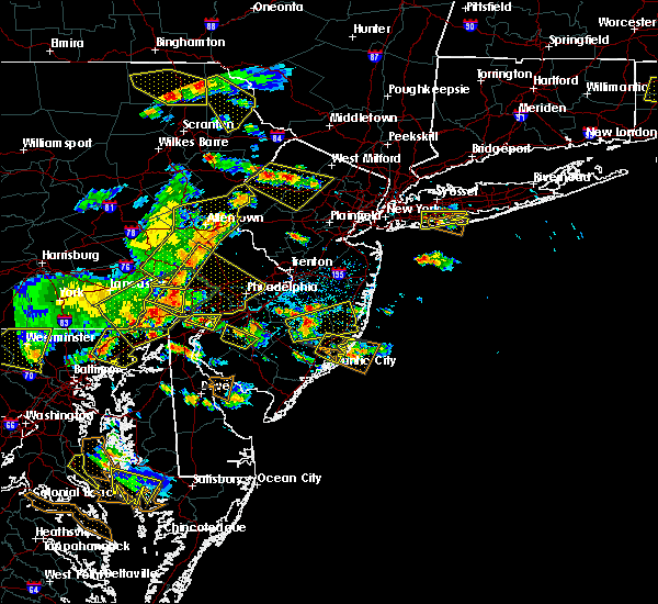 The severe thunderstorm warning for east central atlantic, south central ocean and southeastern burlington counties will expire at 400 pm edt, the storm which prompted the warning has weakened below severe limits, and no longer poses an immediate threat to life or property. therefore, the warning will be allowed to expire. however heavy rain is still possible with this thunderstorm. a severe thunderstorm watch remains in effect until 700 pm edt for southern new jersey. to report severe weather, contact your nearest law enforcement agency. they will relay your report to the national weather service mount holly nj. The severe thunderstorm warning for east central atlantic, south central ocean and southeastern burlington counties will expire at 400 pm edt, the storm which prompted the warning has weakened below severe limits, and no longer poses an immediate threat to life or property. therefore, the warning will be allowed to expire. however heavy rain is still possible with this thunderstorm. a severe thunderstorm watch remains in effect until 700 pm edt for southern new jersey. to report severe weather, contact your nearest law enforcement agency. they will relay your report to the national weather service mount holly nj.
|
| 6/29/2019 3:33 PM EDT |
 At 333 pm edt, a severe thunderstorm was located over new gretna, or 15 miles north of atlantic city, moving southeast at 25 mph (radar indicated). Hazards include 60 mph wind gusts and quarter size hail. Minor damage to vehicles is possible. wind damage to roofs, siding, trees, and power lines is possible. Locations impacted include, brigantine, tuckerton, port republic, bass river state forest, new gretna and mystic island. At 333 pm edt, a severe thunderstorm was located over new gretna, or 15 miles north of atlantic city, moving southeast at 25 mph (radar indicated). Hazards include 60 mph wind gusts and quarter size hail. Minor damage to vehicles is possible. wind damage to roofs, siding, trees, and power lines is possible. Locations impacted include, brigantine, tuckerton, port republic, bass river state forest, new gretna and mystic island.
|
| 6/29/2019 3:17 PM EDT |
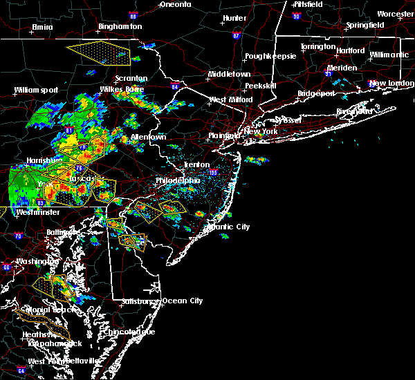 At 317 pm edt, a severe thunderstorm was located over wading river, or 17 miles north of atlantic city, moving southeast at 30 mph (radar indicated). Hazards include 60 mph wind gusts and quarter size hail. Minor damage to vehicles is possible. Wind damage to roofs, siding, trees, and power lines is possible. At 317 pm edt, a severe thunderstorm was located over wading river, or 17 miles north of atlantic city, moving southeast at 30 mph (radar indicated). Hazards include 60 mph wind gusts and quarter size hail. Minor damage to vehicles is possible. Wind damage to roofs, siding, trees, and power lines is possible.
|
| 6/17/2019 2:26 AM EDT |
 The severe thunderstorm warning for east central atlantic and south central ocean counties will expire at 230 am edt, the storm which prompted the warning is moving out of the area. therefore, the warning will be allowed to expire. however, gusty winds and heavy rain are still possible with this thunderstorm. a wind gust to 72 mph was reported at a weather station in beach haven at 219 am. The severe thunderstorm warning for east central atlantic and south central ocean counties will expire at 230 am edt, the storm which prompted the warning is moving out of the area. therefore, the warning will be allowed to expire. however, gusty winds and heavy rain are still possible with this thunderstorm. a wind gust to 72 mph was reported at a weather station in beach haven at 219 am.
|
| 6/17/2019 2:19 AM EDT | Private weather statio in ocean county NJ, 5 miles WNW of Tuckerton, NJ |
| 6/17/2019 2:17 AM EDT |
 At 217 am edt, a severe thunderstorm was located near tuckerton, or 16 miles northeast of atlantic city, moving east at 35 mph (radar indicated). Hazards include 60 mph wind gusts. Damage to roofs, siding, trees, and power lines is possible. Locations impacted include, tuckerton, surf city, beach haven west and mystic island. At 217 am edt, a severe thunderstorm was located near tuckerton, or 16 miles northeast of atlantic city, moving east at 35 mph (radar indicated). Hazards include 60 mph wind gusts. Damage to roofs, siding, trees, and power lines is possible. Locations impacted include, tuckerton, surf city, beach haven west and mystic island.
|
| 6/17/2019 2:07 AM EDT |
 At 207 am edt, a severe thunderstorm was located near tuckerton, or 13 miles north of atlantic city, moving east at 35 mph (radar indicated). Hazards include 60 mph wind gusts. damage to roofs, siding, trees, and power lines is possible At 207 am edt, a severe thunderstorm was located near tuckerton, or 13 miles north of atlantic city, moving east at 35 mph (radar indicated). Hazards include 60 mph wind gusts. damage to roofs, siding, trees, and power lines is possible
|
| 6/2/2019 8:31 PM EDT |
 At 831 pm edt, severe thunderstorms were located along a line extending from near cedar glen lakes to near warren grove, moving east at 35 mph (radar indicated). Hazards include 60 mph wind gusts and quarter size hail. Minor damage to vehicles is possible. wind damage to roofs, siding, trees, and power lines is possible. Locations impacted include, toms river, lakewood, jackson, howell, barnegat, tinton falls, beachwood, manasquan, point pleasant beach, tuckerton, presidential lakes estates, seaside heights, lakehurst, farmingdale, surf city, wrightstown, mantoloking, allenwood, six flags theme park and cassville. At 831 pm edt, severe thunderstorms were located along a line extending from near cedar glen lakes to near warren grove, moving east at 35 mph (radar indicated). Hazards include 60 mph wind gusts and quarter size hail. Minor damage to vehicles is possible. wind damage to roofs, siding, trees, and power lines is possible. Locations impacted include, toms river, lakewood, jackson, howell, barnegat, tinton falls, beachwood, manasquan, point pleasant beach, tuckerton, presidential lakes estates, seaside heights, lakehurst, farmingdale, surf city, wrightstown, mantoloking, allenwood, six flags theme park and cassville.
|
| 6/2/2019 8:13 PM EDT |
 At 813 pm edt, severe thunderstorms were located along a line extending from near pemberton to near penn state forest, moving east at 35 mph (radar indicated). Hazards include 60 mph wind gusts and quarter size hail. Minor damage to vehicles is possible. Wind damage to roofs, siding, trees, and power lines is possible. At 813 pm edt, severe thunderstorms were located along a line extending from near pemberton to near penn state forest, moving east at 35 mph (radar indicated). Hazards include 60 mph wind gusts and quarter size hail. Minor damage to vehicles is possible. Wind damage to roofs, siding, trees, and power lines is possible.
|
| 6/2/2019 5:07 PM EDT |
 The severe thunderstorm warning for southeastern ocean and southeastern burlington counties will expire at 515 pm edt, the storm which prompted the warning has moved out of the area. therefore, the warning will be allowed to expire. a severe thunderstorm watch remains in effect until 1000 pm edt for southern new jersey. The severe thunderstorm warning for southeastern ocean and southeastern burlington counties will expire at 515 pm edt, the storm which prompted the warning has moved out of the area. therefore, the warning will be allowed to expire. a severe thunderstorm watch remains in effect until 1000 pm edt for southern new jersey.
|
| 6/2/2019 4:53 PM EDT |
 At 452 pm edt, a severe thunderstorm was located over beach haven west, or 18 miles south of toms river, moving east at 30 mph (radar indicated). Hazards include 60 mph wind gusts and quarter size hail. Minor damage to vehicles is possible. wind damage to roofs, siding, trees, and power lines is possible. Locations impacted include, barnegat, tuckerton, surf city, warren grove, bass river state forest, new gretna, beach haven west, mystic island, manahawkin, ocean acres and waretown. At 452 pm edt, a severe thunderstorm was located over beach haven west, or 18 miles south of toms river, moving east at 30 mph (radar indicated). Hazards include 60 mph wind gusts and quarter size hail. Minor damage to vehicles is possible. wind damage to roofs, siding, trees, and power lines is possible. Locations impacted include, barnegat, tuckerton, surf city, warren grove, bass river state forest, new gretna, beach haven west, mystic island, manahawkin, ocean acres and waretown.
|
| 6/2/2019 4:37 PM EDT |
 At 437 pm edt, a severe thunderstorm was located near beach haven west, or 18 miles south of toms river, moving east at 30 mph (radar indicated). Hazards include 60 mph wind gusts and quarter size hail. Minor damage to vehicles is possible. Wind damage to roofs, siding, trees, and power lines is possible. At 437 pm edt, a severe thunderstorm was located near beach haven west, or 18 miles south of toms river, moving east at 30 mph (radar indicated). Hazards include 60 mph wind gusts and quarter size hail. Minor damage to vehicles is possible. Wind damage to roofs, siding, trees, and power lines is possible.
|
| 5/29/2019 7:33 PM EDT |
 At 732 pm edt, severe thunderstorms were located along a line extending from near hammonton to near big stone beach, moving east at 50 mph (radar indicated). Hazards include 60 mph wind gusts and quarter size hail. Minor damage to vehicles is possible. Wind damage to roofs, siding, trees, and power lines is possible. At 732 pm edt, severe thunderstorms were located along a line extending from near hammonton to near big stone beach, moving east at 50 mph (radar indicated). Hazards include 60 mph wind gusts and quarter size hail. Minor damage to vehicles is possible. Wind damage to roofs, siding, trees, and power lines is possible.
|
| 5/29/2019 6:29 PM EDT |
 At 628 pm edt, a severe thunderstorm was located near cherry hill mall, or 7 miles northeast of camden, moving east at 45 mph (radar indicated). Hazards include 60 mph wind gusts and quarter size hail. Minor damage to vehicles is possible. Wind damage to roofs, siding, trees, and power lines is possible. At 628 pm edt, a severe thunderstorm was located near cherry hill mall, or 7 miles northeast of camden, moving east at 45 mph (radar indicated). Hazards include 60 mph wind gusts and quarter size hail. Minor damage to vehicles is possible. Wind damage to roofs, siding, trees, and power lines is possible.
|
| 4/15/2019 4:37 AM EDT |
 The severe thunderstorm warning for atlantic, southeastern cumberland, central ocean, cape may and southeastern burlington counties will expire at 445 am edt, the storms which prompted the warning have weakened below severe limits, and have exited the warned area. therefore, the warning will be allowed to expire. however gusty winds, frequent lightning, and heavy rain are still possible with these thunderstorms. a tornado watch remains in effect until 700 am edt for southern new jersey. to report severe weather, contact your nearest law enforcement agency. they will relay your report to the national weather service in mount holly nj. The severe thunderstorm warning for atlantic, southeastern cumberland, central ocean, cape may and southeastern burlington counties will expire at 445 am edt, the storms which prompted the warning have weakened below severe limits, and have exited the warned area. therefore, the warning will be allowed to expire. however gusty winds, frequent lightning, and heavy rain are still possible with these thunderstorms. a tornado watch remains in effect until 700 am edt for southern new jersey. to report severe weather, contact your nearest law enforcement agency. they will relay your report to the national weather service in mount holly nj.
|
| 4/15/2019 4:25 AM EDT |
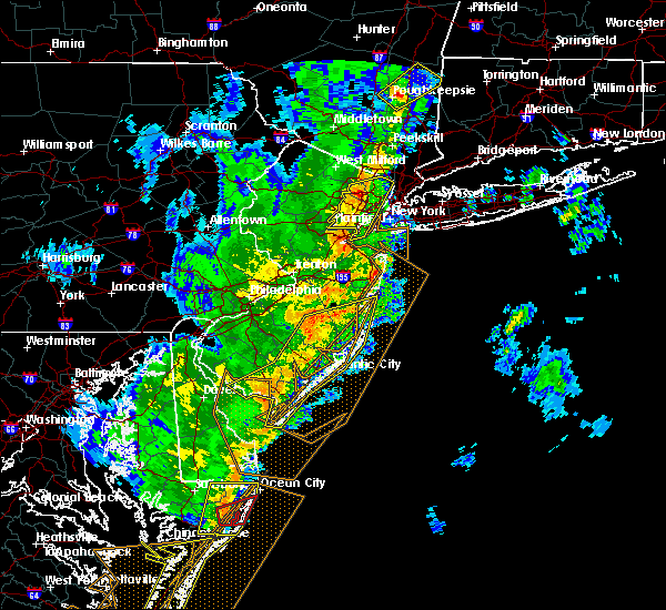 At 425 am edt, severe thunderstorms were located along a line extending from old halfway to ocean city to 8 miles south of cape may, moving east at 55 mph (radar indicated). Hazards include 60 mph wind gusts. Damage to roofs, siding, trees, and power lines is possible. locations impacted include, toms river, vineland, atlantic city, millville, ocean city, cape may, cumberland, barnegat, pleasantville, hammonton, beachwood, somers point, ventnor city, brigantine, northfield, absecon, shamong, margate city, egg harbor city and north wildwood. A tornado watch remains in effect until 700 am edt for southern new jersey. At 425 am edt, severe thunderstorms were located along a line extending from old halfway to ocean city to 8 miles south of cape may, moving east at 55 mph (radar indicated). Hazards include 60 mph wind gusts. Damage to roofs, siding, trees, and power lines is possible. locations impacted include, toms river, vineland, atlantic city, millville, ocean city, cape may, cumberland, barnegat, pleasantville, hammonton, beachwood, somers point, ventnor city, brigantine, northfield, absecon, shamong, margate city, egg harbor city and north wildwood. A tornado watch remains in effect until 700 am edt for southern new jersey.
|
| 4/15/2019 4:11 AM EDT |
 At 411 am edt, severe thunderstorms were located along a line extending from near tabernacle to near woodbine to cape henlopen state park, moving east at 65 mph (radar indicated). Hazards include 60 mph wind gusts. Damage to roofs, siding, trees, and power lines is possible. locations impacted include, toms river, vineland, atlantic city, millville, ocean city, georgetown, cape may, cumberland, barnegat, pleasantville, hammonton, beachwood, somers point, ventnor city, brigantine, northfield, absecon, tabernacle, shamong and margate city. A tornado watch remains in effect until 700 am edt for southern delaware, and southern new jersey. At 411 am edt, severe thunderstorms were located along a line extending from near tabernacle to near woodbine to cape henlopen state park, moving east at 65 mph (radar indicated). Hazards include 60 mph wind gusts. Damage to roofs, siding, trees, and power lines is possible. locations impacted include, toms river, vineland, atlantic city, millville, ocean city, georgetown, cape may, cumberland, barnegat, pleasantville, hammonton, beachwood, somers point, ventnor city, brigantine, northfield, absecon, tabernacle, shamong and margate city. A tornado watch remains in effect until 700 am edt for southern delaware, and southern new jersey.
|
| 4/15/2019 3:41 AM EDT |
 At 340 am edt, severe thunderstorms were located along a line extending from deptford to 6 miles west of fortesque to bridgeville, moving east at 55 mph (radar indicated). Hazards include 60 mph wind gusts. damage to roofs, siding, trees, and power lines is possible At 340 am edt, severe thunderstorms were located along a line extending from deptford to 6 miles west of fortesque to bridgeville, moving east at 55 mph (radar indicated). Hazards include 60 mph wind gusts. damage to roofs, siding, trees, and power lines is possible
|
| 7/24/2017 3:55 AM EDT |
 At 354 am edt, severe thunderstorms were located along a line extending from near tabernacle to near bass river state forest to near new gretna, moving northeast at 45 mph (radar indicated). Hazards include 60 mph wind gusts. Expect damage to trees and power lines. severe thunderstorms will be near, tuckerton and warren grove around 400 am edt. brookville and browns mills around 405 am edt. barnegat, old halfway and beach haven west around 410 am edt. surf city, cedar glen lakes and whiting around 415 am edt. bamber lake around 420 am edt. lakehurst, holiday city-berkeley, pine ridge at crestwood, leisure village west-pine lake park and holiday city south around 425 am edt. toms river, beachwood, pleasant plains and cedar glen west around 430 am edt. lakewood, seaside heights, leisure village, leisure village east and dover beaches south around 435 am edt. Other locations impacted by these severe thunderstorms include country lake estates, silver ridge, point pleasant, mystic island, leisure knoll, crestwood village, ocean acres, gilford park, south toms river and bay head. At 354 am edt, severe thunderstorms were located along a line extending from near tabernacle to near bass river state forest to near new gretna, moving northeast at 45 mph (radar indicated). Hazards include 60 mph wind gusts. Expect damage to trees and power lines. severe thunderstorms will be near, tuckerton and warren grove around 400 am edt. brookville and browns mills around 405 am edt. barnegat, old halfway and beach haven west around 410 am edt. surf city, cedar glen lakes and whiting around 415 am edt. bamber lake around 420 am edt. lakehurst, holiday city-berkeley, pine ridge at crestwood, leisure village west-pine lake park and holiday city south around 425 am edt. toms river, beachwood, pleasant plains and cedar glen west around 430 am edt. lakewood, seaside heights, leisure village, leisure village east and dover beaches south around 435 am edt. Other locations impacted by these severe thunderstorms include country lake estates, silver ridge, point pleasant, mystic island, leisure knoll, crestwood village, ocean acres, gilford park, south toms river and bay head.
|
| 7/24/2017 3:38 AM EDT |
 At 337 am edt, severe thunderstorms were located along a line extending from atco to near egg harbor city to near english creek, moving northeast at 45 mph (radar indicated). Hazards include 60 mph wind gusts. Expect damage to trees and power lines. Locations impacted include, toms river, atlantic city, barnegat, pleasantville, hammonton, beachwood, somers point, ventnor city, brigantine, northfield, absecon, berlin, shamong, buena, egg harbor city, tuckerton, seaside heights, weymouth, estell manor and chesilhurst. At 337 am edt, severe thunderstorms were located along a line extending from atco to near egg harbor city to near english creek, moving northeast at 45 mph (radar indicated). Hazards include 60 mph wind gusts. Expect damage to trees and power lines. Locations impacted include, toms river, atlantic city, barnegat, pleasantville, hammonton, beachwood, somers point, ventnor city, brigantine, northfield, absecon, berlin, shamong, buena, egg harbor city, tuckerton, seaside heights, weymouth, estell manor and chesilhurst.
|
| 7/24/2017 3:03 AM EDT |
 At 303 am edt, severe thunderstorms were located along a line extending from woodstown to near millville to dividing creek, moving northeast at 40 mph (radar indicated). Hazards include 60 mph wind gusts. expect damage to trees and power lines At 303 am edt, severe thunderstorms were located along a line extending from woodstown to near millville to dividing creek, moving northeast at 40 mph (radar indicated). Hazards include 60 mph wind gusts. expect damage to trees and power lines
|
| 7/22/2017 7:42 PM EDT |
 At 741 pm edt, a severe thunderstorm was located over penn state forest, or 23 miles southwest of toms river, moving east at 35 mph (radar indicated). Hazards include 60 mph wind gusts. Expect damage to trees and power lines. Locations impacted include, barnegat, tuckerton, surf city, warren grove, bass river state forest, penn state forest, beach haven west, manahawkin and ocean acres. At 741 pm edt, a severe thunderstorm was located over penn state forest, or 23 miles southwest of toms river, moving east at 35 mph (radar indicated). Hazards include 60 mph wind gusts. Expect damage to trees and power lines. Locations impacted include, barnegat, tuckerton, surf city, warren grove, bass river state forest, penn state forest, beach haven west, manahawkin and ocean acres.
|
| 7/22/2017 7:22 PM EDT |
 At 720 pm edt, a severe thunderstorm was located over shamong, or 24 miles east of gloucester city, moving east at 30 mph (radar indicated and public reported. between 630 and 700 pm, numerous trees down were reported in northern camden county). Hazards include 60 mph wind gusts and penny size hail. expect damage to trees and power lines At 720 pm edt, a severe thunderstorm was located over shamong, or 24 miles east of gloucester city, moving east at 30 mph (radar indicated and public reported. between 630 and 700 pm, numerous trees down were reported in northern camden county). Hazards include 60 mph wind gusts and penny size hail. expect damage to trees and power lines
|
| 6/24/2017 8:13 AM EDT |
 The severe thunderstorm warning for southeastern atlantic. southeastern cumberland. ocean. cape may. southeastern burlington and south central monmouth counties will expire at 815 am edt. the storms which prompted the warning have weakened below severe limits, and are exiting the warned area. therefore the warning will be allowed to expire. However heavy rain is still possible with. The severe thunderstorm warning for southeastern atlantic. southeastern cumberland. ocean. cape may. southeastern burlington and south central monmouth counties will expire at 815 am edt. the storms which prompted the warning have weakened below severe limits, and are exiting the warned area. therefore the warning will be allowed to expire. However heavy rain is still possible with.
|
| 6/24/2017 7:19 AM EDT |
 At 718 am edt, severe thunderstorms were located along a line extending from near jackson to near wharton state forest to near bivalve, moving southeast at 40 mph (radar indicated). Hazards include 60 mph wind gusts. expect damage to trees and power lines At 718 am edt, severe thunderstorms were located along a line extending from near jackson to near wharton state forest to near bivalve, moving southeast at 40 mph (radar indicated). Hazards include 60 mph wind gusts. expect damage to trees and power lines
|
| 6/21/2017 6:09 PM EDT |
 At 606 pm edt, severe thunderstorms were located along a line extending from near browns mills to near wharton state forest to near atsion, moving southeast at 40 mph (trained weather spotters and public. trained weather spotters. numerous downed trees and wires have been reported in burlington, camden and ocean counties in southern new jersey has been reported since 500 pm). Hazards include 60 mph wind gusts. Expect damage to trees and power lines. Locations impacted include, barnegat, tuckerton, surf city, bass river state forest, new gretna, beach haven west, mystic island, manahawkin, ocean acres and waretown. At 606 pm edt, severe thunderstorms were located along a line extending from near browns mills to near wharton state forest to near atsion, moving southeast at 40 mph (trained weather spotters and public. trained weather spotters. numerous downed trees and wires have been reported in burlington, camden and ocean counties in southern new jersey has been reported since 500 pm). Hazards include 60 mph wind gusts. Expect damage to trees and power lines. Locations impacted include, barnegat, tuckerton, surf city, bass river state forest, new gretna, beach haven west, mystic island, manahawkin, ocean acres and waretown.
|
| 6/21/2017 5:58 PM EDT |
 At 556 pm edt, severe thunderstorms were located along a line extending from near beachwood to near warren grove to wading river, moving southeast at 35 mph (trained weather spotters. numerous downed trees and wires have been reported in burlington, camden and ocean counties in southern new jersey has been reported since 500 pm). Hazards include 60 mph wind gusts. Expect damage to trees and power lines. Locations impacted include, barnegat, tuckerton, surf city, bamber lake, wading river, brookville, warren grove, bass river state forest, new gretna, penn state forest, beach haven west, mystic island, ocean acres, manahawkin, waretown and holiday heights. At 556 pm edt, severe thunderstorms were located along a line extending from near beachwood to near warren grove to wading river, moving southeast at 35 mph (trained weather spotters. numerous downed trees and wires have been reported in burlington, camden and ocean counties in southern new jersey has been reported since 500 pm). Hazards include 60 mph wind gusts. Expect damage to trees and power lines. Locations impacted include, barnegat, tuckerton, surf city, bamber lake, wading river, brookville, warren grove, bass river state forest, new gretna, penn state forest, beach haven west, mystic island, ocean acres, manahawkin, waretown and holiday heights.
|
| 6/21/2017 5:38 PM EDT |
 The national weather service in mount holly nj has issued a * severe thunderstorm warning for. northern atlantic county in southern new jersey. central ocean county in southern new jersey. southeastern camden county in southern new jersey. Southeastern burlington county in southern new jersey. The national weather service in mount holly nj has issued a * severe thunderstorm warning for. northern atlantic county in southern new jersey. central ocean county in southern new jersey. southeastern camden county in southern new jersey. Southeastern burlington county in southern new jersey.
|
| 6/19/2017 7:38 PM EDT |
 The severe thunderstorm warning for southeastern atlantic and southeastern ocean counties will expire at 745 pm edt, the storms which prompted the warning have weakened below severe limits, and no longer pose an immediate threat to life or property. therefore the warning will be allowed to expire. a severe thunderstorm watch remains in effect until 800 pm edt for southern new jersey. The severe thunderstorm warning for southeastern atlantic and southeastern ocean counties will expire at 745 pm edt, the storms which prompted the warning have weakened below severe limits, and no longer pose an immediate threat to life or property. therefore the warning will be allowed to expire. a severe thunderstorm watch remains in effect until 800 pm edt for southern new jersey.
|
| 6/19/2017 7:20 PM EDT |
 At 719 pm edt, severe thunderstorms were located along a line extending from near estell manor to ocean city to near strathmere, moving northeast at 75 mph. a 59 mph gust was reported at cape may at 658 pm (radar indicated). Hazards include 60 mph wind gusts. Expect damage to trees and power lines. severe thunderstorms will be near, ventnor city, margate city and longport around 725 pm edt. atlantic city, pleasantville, brigantine, northfield and pomona around 730 pm edt. absecon around 735 pm edt. port republic around 740 pm edt. tuckerton around 745 pm edt. Other locations impacted by these severe thunderstorms include linwood and mystic island. At 719 pm edt, severe thunderstorms were located along a line extending from near estell manor to ocean city to near strathmere, moving northeast at 75 mph. a 59 mph gust was reported at cape may at 658 pm (radar indicated). Hazards include 60 mph wind gusts. Expect damage to trees and power lines. severe thunderstorms will be near, ventnor city, margate city and longport around 725 pm edt. atlantic city, pleasantville, brigantine, northfield and pomona around 730 pm edt. absecon around 735 pm edt. port republic around 740 pm edt. tuckerton around 745 pm edt. Other locations impacted by these severe thunderstorms include linwood and mystic island.
|
| 4/6/2017 4:08 PM EDT | Storm damage reported in ocean county NJ, 0.2 miles S of Tuckerton, NJ |
| 4/6/2017 3:28 PM EDT | Storm damage reported in ocean county NJ, 0.2 miles S of Tuckerton, NJ |
| 2/13/2017 12:17 AM EST |
 At 1215 am est, severe thunderstorms were located along a line extending from near wharton state forest to near pomona to viola to hambleton, moving east at 65 mph (radar indicated. this line also has a history of producing wind damage and gusts in excess of 60 mph across southern pennsylvania and central and southern maryland). Hazards include 60 mph wind gusts. Expect damage to roofs, siding, and trees. Locations impacted include, vineland, atlantic city, dover, millville, easton, ocean city, georgetown, cumberland, barnegat, pleasantville, hammonton, somers point, ventnor city, milford, northfield, absecon, seaford, margate city, buena and denton. At 1215 am est, severe thunderstorms were located along a line extending from near wharton state forest to near pomona to viola to hambleton, moving east at 65 mph (radar indicated. this line also has a history of producing wind damage and gusts in excess of 60 mph across southern pennsylvania and central and southern maryland). Hazards include 60 mph wind gusts. Expect damage to roofs, siding, and trees. Locations impacted include, vineland, atlantic city, dover, millville, easton, ocean city, georgetown, cumberland, barnegat, pleasantville, hammonton, somers point, ventnor city, milford, northfield, absecon, seaford, margate city, buena and denton.
|
| 2/12/2017 11:53 PM EST |
 At 1151 pm est, severe thunderstorms were located along a line extending from near shamong to near bridgeton to near hartly to talbot, moving east at 60 mph (radar indicated. this line also has a history of producing wind damage and gusts near 60 mph across southern pennsylvania and central and southern maryland). Hazards include 60 mph wind gusts. expect damage to roofs, siding, and trees At 1151 pm est, severe thunderstorms were located along a line extending from near shamong to near bridgeton to near hartly to talbot, moving east at 60 mph (radar indicated. this line also has a history of producing wind damage and gusts near 60 mph across southern pennsylvania and central and southern maryland). Hazards include 60 mph wind gusts. expect damage to roofs, siding, and trees
|
| 7/25/2016 8:20 PM EDT |
 At 819 pm edt, a severe thunderstorm was located near tuckerton, or 19 miles northeast of atlantic city, moving east at 40 mph (radar indicated). Hazards include 60 mph wind gusts. frequent cloud to ground lightning is occurring. Expect damage to roofs. siding. and trees. Locations impacted include, barnegat, brigantine, egg harbor city, tuckerton, surf city, port republic, wading river, beach haven west, bass river state forest, new gretna, warren grove, mystic island, manahawkin and ocean acres. At 819 pm edt, a severe thunderstorm was located near tuckerton, or 19 miles northeast of atlantic city, moving east at 40 mph (radar indicated). Hazards include 60 mph wind gusts. frequent cloud to ground lightning is occurring. Expect damage to roofs. siding. and trees. Locations impacted include, barnegat, brigantine, egg harbor city, tuckerton, surf city, port republic, wading river, beach haven west, bass river state forest, new gretna, warren grove, mystic island, manahawkin and ocean acres.
|
| 7/25/2016 7:58 PM EDT |
 At 758 pm edt, a severe thunderstorm was located near wading river, or 22 miles north of atlantic city, moving east at 45 mph (radar indicated). Hazards include 60 mph wind gusts and penny size hail. frequent cloud to ground lightning is occurring. Expect damage to roofs. siding. And trees. At 758 pm edt, a severe thunderstorm was located near wading river, or 22 miles north of atlantic city, moving east at 45 mph (radar indicated). Hazards include 60 mph wind gusts and penny size hail. frequent cloud to ground lightning is occurring. Expect damage to roofs. siding. And trees.
|
| 7/23/2016 5:55 PM EDT |
 At 554 pm edt, a severe thunderstorm was located near atsion, or 20 miles northeast of vineland, moving southeast at 35 mph (trained weather spotters). Hazards include 60 mph wind gusts and quarter size hail. Hail damage to vehicles is expected. Expect wind damage to roofs, siding, and trees. At 554 pm edt, a severe thunderstorm was located near atsion, or 20 miles northeast of vineland, moving southeast at 35 mph (trained weather spotters). Hazards include 60 mph wind gusts and quarter size hail. Hail damage to vehicles is expected. Expect wind damage to roofs, siding, and trees.
|
| 6/8/2016 1:07 PM EDT |
 The severe thunderstorm warning for northeastern cape may, southeastern atlantic, southeastern monmouth, ocean and southeastern burlington counties will expire at 115 pm edt, the storms which prompted the warning have moved offshore and out of the warned area. therefore the warning will be allowed to expire. The severe thunderstorm warning for northeastern cape may, southeastern atlantic, southeastern monmouth, ocean and southeastern burlington counties will expire at 115 pm edt, the storms which prompted the warning have moved offshore and out of the warned area. therefore the warning will be allowed to expire.
|
| 6/8/2016 12:55 PM EDT |
 At 1254 pm edt, severe thunderstorms were located along a line extending from allenwood to near beachwood to longport, moving east at 50 mph (radar indicated). Hazards include 70 mph wind gusts. Expect considerable tree damage. damage is likely to mobile homes, roofs, and outbuildings. these severe storms will be near, manasquan, point pleasant beach, seaside heights, mantoloking, allenwood, ramtown and dover beaches south around 100 pm edt. Other locations impacted by these severe thunderstorms include spring lake heights, gilford park, spring lake, holiday heights, holiday city, brielle, point pleasant, south toms river, mystic island and manahawkin. At 1254 pm edt, severe thunderstorms were located along a line extending from allenwood to near beachwood to longport, moving east at 50 mph (radar indicated). Hazards include 70 mph wind gusts. Expect considerable tree damage. damage is likely to mobile homes, roofs, and outbuildings. these severe storms will be near, manasquan, point pleasant beach, seaside heights, mantoloking, allenwood, ramtown and dover beaches south around 100 pm edt. Other locations impacted by these severe thunderstorms include spring lake heights, gilford park, spring lake, holiday heights, holiday city, brielle, point pleasant, south toms river, mystic island and manahawkin.
|
| 6/8/2016 12:37 PM EDT |
 At 1237 pm edt, severe thunderstorms were located along a line extending from near vista center to old halfway to near corbin city, moving east at 50 mph (radar indicated). Hazards include 70 mph wind gusts. Expect considerable tree damage. damage is likely to mobile homes, roofs, and outbuildings. severe thunderstorms will be near, jackson, vista center, jacksons mills, old halfway, cassville, six flags theme park, whiting and cedar glen lakes around 1240 pm edt. freewood acres, bamber lake, brookville and pine ridge at crestwood around 1245 pm edt. lakewood, barnegat, beachwood, somers point, northfield, ramtown, holiday city south, leisure village and leisure village east around 1250 pm edt. ventnor city, margate city, seaside heights, longport, allenwood and brick township around 1255 pm edt. manasquan, point pleasant beach and mantoloking around 100 pm edt. Other locations impacted by these severe thunderstorms include crestwood village, spring lake heights, new egypt, gilford park, spring lake, holiday heights, holiday city, brielle, leisure knoll and point pleasant. At 1237 pm edt, severe thunderstorms were located along a line extending from near vista center to old halfway to near corbin city, moving east at 50 mph (radar indicated). Hazards include 70 mph wind gusts. Expect considerable tree damage. damage is likely to mobile homes, roofs, and outbuildings. severe thunderstorms will be near, jackson, vista center, jacksons mills, old halfway, cassville, six flags theme park, whiting and cedar glen lakes around 1240 pm edt. freewood acres, bamber lake, brookville and pine ridge at crestwood around 1245 pm edt. lakewood, barnegat, beachwood, somers point, northfield, ramtown, holiday city south, leisure village and leisure village east around 1250 pm edt. ventnor city, margate city, seaside heights, longport, allenwood and brick township around 1255 pm edt. manasquan, point pleasant beach and mantoloking around 100 pm edt. Other locations impacted by these severe thunderstorms include crestwood village, spring lake heights, new egypt, gilford park, spring lake, holiday heights, holiday city, brielle, leisure knoll and point pleasant.
|
| 6/5/2016 6:56 PM EDT |
 At 654 pm edt, severe thunderstorms were located along a line extending from willingboro to near tabernacle to near weymouth, and are nearly stationary (radar indicated). Hazards include 60 mph wind gusts. Expect damage to roofs. siding. and trees. Locations impacted include, toms river, lakewood, jackson, howell, willingboro, medford, barnegat, hammonton, lumberton, beachwood, burlington, mount holly, riverside, tabernacle, shamong, manasquan, point pleasant beach, egg harbor city, tuckerton and presidential lakes estates. At 654 pm edt, severe thunderstorms were located along a line extending from willingboro to near tabernacle to near weymouth, and are nearly stationary (radar indicated). Hazards include 60 mph wind gusts. Expect damage to roofs. siding. and trees. Locations impacted include, toms river, lakewood, jackson, howell, willingboro, medford, barnegat, hammonton, lumberton, beachwood, burlington, mount holly, riverside, tabernacle, shamong, manasquan, point pleasant beach, egg harbor city, tuckerton and presidential lakes estates.
|
| 6/5/2016 6:33 PM EDT |
 At 632 pm edt, severe thunderstorms were located along a line extending from willingboro to near shamong to near weymouth, moving east at 50 mph (trained weather spotters reported wind gusts up to 70 mph). Hazards include 70 mph wind gusts. Expect considerable tree damage. Damage is likely to mobile homes, roofs, and outbuildings. At 632 pm edt, severe thunderstorms were located along a line extending from willingboro to near shamong to near weymouth, moving east at 50 mph (trained weather spotters reported wind gusts up to 70 mph). Hazards include 70 mph wind gusts. Expect considerable tree damage. Damage is likely to mobile homes, roofs, and outbuildings.
|
| 4/26/2016 1:48 AM EDT |
 At 145 am edt, severe thunderstorms were located along a line extending from near tabernacle to 13 miles east of brigantine, moving northeast at 30 mph (radar indicated). Hazards include quarter size hail. Damage to vehicles is expected. these severe storms will be near, old halfway around 205 am edt. pine ridge at crestwood, bamber lake and holiday city-berkeley around 215 am edt. Other locations impacted by these severe thunderstorms include manahawkin, island heights, silver ridge, gilford park, ocean acres, holiday heights, holiday city, waretown, south toms river and mystic island. At 145 am edt, severe thunderstorms were located along a line extending from near tabernacle to 13 miles east of brigantine, moving northeast at 30 mph (radar indicated). Hazards include quarter size hail. Damage to vehicles is expected. these severe storms will be near, old halfway around 205 am edt. pine ridge at crestwood, bamber lake and holiday city-berkeley around 215 am edt. Other locations impacted by these severe thunderstorms include manahawkin, island heights, silver ridge, gilford park, ocean acres, holiday heights, holiday city, waretown, south toms river and mystic island.
|
| 4/26/2016 1:22 AM EDT |
 At 120 am edt, severe thunderstorms were located along a line extending from near atsion to brigantine, moving east at 35 mph. there is also a stronger cell moving through burlington county that will move into ocean county (radar indicated). Hazards include quarter size hail. Damage to vehicles is expected. severe thunderstorms will be near, brigantine around 125 am edt. chatsworth and penn state forest around 145 am edt. old halfway around 155 am edt. bamber lake around 205 am edt. pine ridge at crestwood around 210 am edt. toms river, beachwood, seaside heights, holiday city south and holiday city-berkeley around 215 am edt. Other locations impacted by these severe thunderstorms include manahawkin, island heights, silver ridge, gilford park, ocean acres, holiday heights, holiday city, waretown, south toms river and mystic island. At 120 am edt, severe thunderstorms were located along a line extending from near atsion to brigantine, moving east at 35 mph. there is also a stronger cell moving through burlington county that will move into ocean county (radar indicated). Hazards include quarter size hail. Damage to vehicles is expected. severe thunderstorms will be near, brigantine around 125 am edt. chatsworth and penn state forest around 145 am edt. old halfway around 155 am edt. bamber lake around 205 am edt. pine ridge at crestwood around 210 am edt. toms river, beachwood, seaside heights, holiday city south and holiday city-berkeley around 215 am edt. Other locations impacted by these severe thunderstorms include manahawkin, island heights, silver ridge, gilford park, ocean acres, holiday heights, holiday city, waretown, south toms river and mystic island.
|
| 4/7/2016 8:22 PM EDT |
 The severe thunderstorm warning for central atlantic, southeastern ocean and southeastern burlington counties will expire at 830 pm edt, the storm which prompted the warning has weakened and no longer poses an immediate threat to life or property. therefore the warning will be allowed to expire. to report severe weather, contact your nearest law enforcement agency. they will relay your report to the national weather service mount holly nj. The severe thunderstorm warning for central atlantic, southeastern ocean and southeastern burlington counties will expire at 830 pm edt, the storm which prompted the warning has weakened and no longer poses an immediate threat to life or property. therefore the warning will be allowed to expire. to report severe weather, contact your nearest law enforcement agency. they will relay your report to the national weather service mount holly nj.
|
| 4/7/2016 8:05 PM EDT |
 At 804 pm edt, doppler radar indicated a severe thunderstorm capable of producing damaging winds to 60 mph. this storm was located near wading river, or 20 miles north of atlantic city, moving northeast at 50 mph. this severe storm will be near, bass river state forest around 810 pm edt. warren grove around 820 pm edt. brookville around 825 pm edt. barnegat around 830 pm edt. the strong winds may not be accompanied by lightning and thunder. other locations impacted by this severe thunderstorm include ocean acres, manahawkin, waretown and mystic island. At 804 pm edt, doppler radar indicated a severe thunderstorm capable of producing damaging winds to 60 mph. this storm was located near wading river, or 20 miles north of atlantic city, moving northeast at 50 mph. this severe storm will be near, bass river state forest around 810 pm edt. warren grove around 820 pm edt. brookville around 825 pm edt. barnegat around 830 pm edt. the strong winds may not be accompanied by lightning and thunder. other locations impacted by this severe thunderstorm include ocean acres, manahawkin, waretown and mystic island.
|
| 4/7/2016 7:40 PM EDT |
 At 738 pm edt, doppler radar indicated a severe thunderstorm capable of producing damaging winds in excess of 60 mph. this storm was located over mizpah, or 7 miles east of vineland, and moving northeast at 55 mph. the strong winds may not be accompanied by lightning and thunder. * this severe thunderstorm will be near, mays landing around 745 pm edt. elwood-magnolia around 750 pm edt. pomona and batsto around 755 pm edt. egg harbor city around 800 pm edt. port republic, new gretna and wading river around 805 pm edt. tuckerton and bass river state forest around 810 pm edt. warren grove around 815 pm edt. beach haven west and brookville around 820 pm edt. other locations impacted by this severe thunderstorm include ocean acres, linwood, manahawkin, waretown, mystic island and folsom. At 738 pm edt, doppler radar indicated a severe thunderstorm capable of producing damaging winds in excess of 60 mph. this storm was located over mizpah, or 7 miles east of vineland, and moving northeast at 55 mph. the strong winds may not be accompanied by lightning and thunder. * this severe thunderstorm will be near, mays landing around 745 pm edt. elwood-magnolia around 750 pm edt. pomona and batsto around 755 pm edt. egg harbor city around 800 pm edt. port republic, new gretna and wading river around 805 pm edt. tuckerton and bass river state forest around 810 pm edt. warren grove around 815 pm edt. beach haven west and brookville around 820 pm edt. other locations impacted by this severe thunderstorm include ocean acres, linwood, manahawkin, waretown, mystic island and folsom.
|
| 4/3/2016 12:36 AM EDT |
 At 1234 am edt, doppler radar indicated a line of severe thunderstorms capable of producing damaging winds in excess of 60 mph. these storms were located along a line extending from leisure village west-pine lake park to warren grove to tuckerton to absecon, moving east at 60 mph. pea to penny size hail may also accompany the damaging winds. these severe storms will be near, toms river, beachwood, lakehurst, leisure village east, beach haven west, pleasant plains, leisure village west-pine lake park, holiday city-berkeley, holiday city south and bamber lake around 1240 am edt. barnegat, dover beaches north and dover beaches south around 1245 am edt. other locations impacted by these severe thunderstorms include crestwood village, manahawkin, island heights, silver ridge, gilford park, ocean acres, holiday heights, holiday city, waretown and south toms river. At 1234 am edt, doppler radar indicated a line of severe thunderstorms capable of producing damaging winds in excess of 60 mph. these storms were located along a line extending from leisure village west-pine lake park to warren grove to tuckerton to absecon, moving east at 60 mph. pea to penny size hail may also accompany the damaging winds. these severe storms will be near, toms river, beachwood, lakehurst, leisure village east, beach haven west, pleasant plains, leisure village west-pine lake park, holiday city-berkeley, holiday city south and bamber lake around 1240 am edt. barnegat, dover beaches north and dover beaches south around 1245 am edt. other locations impacted by these severe thunderstorms include crestwood village, manahawkin, island heights, silver ridge, gilford park, ocean acres, holiday heights, holiday city, waretown and south toms river.
|
| 4/3/2016 12:14 AM EDT |
 At 1212 am edt, doppler radar indicated a line of showers and scattered severe thunderstorms capable of producing damaging winds in excess of 60 mph. these storms were located along a line extending from near leisuretowne to near mays landing to belleplain forest, and moving east at 60 mph. penny size hail may also accompany the damaging winds. * severe thunderstorms will be near, presidential lakes estates, pomona, presidential lakes, chatsworth and browns mills around 1220 am edt. pleasantville, absecon, old halfway and wading river around 1225 am edt. somers point, northfield, lakehurst, port republic, bamber lake, whiting, cedar glen lakes and new gretna around 1230 am edt. tuckerton, holiday city south, pine ridge at crestwood, holiday city-berkeley, pleasant plains and leisure village west-pine lake park around 1235 am edt. atlantic city, beachwood and brigantine around 1240 am edt. seaside heights, dover beaches south and dover beaches north around 1245 am edt. other locations impacted by these severe thunderstorms include crestwood village, gilford park, holiday heights, holiday city, south toms river, country lake estates, mystic island, manahawkin, island heights and silver ridge. At 1212 am edt, doppler radar indicated a line of showers and scattered severe thunderstorms capable of producing damaging winds in excess of 60 mph. these storms were located along a line extending from near leisuretowne to near mays landing to belleplain forest, and moving east at 60 mph. penny size hail may also accompany the damaging winds. * severe thunderstorms will be near, presidential lakes estates, pomona, presidential lakes, chatsworth and browns mills around 1220 am edt. pleasantville, absecon, old halfway and wading river around 1225 am edt. somers point, northfield, lakehurst, port republic, bamber lake, whiting, cedar glen lakes and new gretna around 1230 am edt. tuckerton, holiday city south, pine ridge at crestwood, holiday city-berkeley, pleasant plains and leisure village west-pine lake park around 1235 am edt. atlantic city, beachwood and brigantine around 1240 am edt. seaside heights, dover beaches south and dover beaches north around 1245 am edt. other locations impacted by these severe thunderstorms include crestwood village, gilford park, holiday heights, holiday city, south toms river, country lake estates, mystic island, manahawkin, island heights and silver ridge.
|
| 2/24/2016 11:25 PM EST |
 At 1125 pm est, doppler radar indicated a severe thunderstorm capable of producing damaging winds in excess of 60 mph. this storm was located near beachwood, or 7 miles south of toms river, and moving northeast at 95 mph. At 1125 pm est, doppler radar indicated a severe thunderstorm capable of producing damaging winds in excess of 60 mph. this storm was located near beachwood, or 7 miles south of toms river, and moving northeast at 95 mph.
|
| 2/16/2016 2:17 PM EST |
 At 213 pm est, doppler radar indicated a line of heavy rain with embedded strong to severe winds, some in excess of 60 mph.this line was moving east at 40 mph and will reach the coast by 230 pm. locations impacted include, toms river, perth amboy, long branch, asbury park, edison, lakewood, middletown, old bridge, jackson, howell, east brunswick, sayreville, marlboro, carteret, barnegat, tinton falls, holmdel, red bank, beachwood and keansburg. At 213 pm est, doppler radar indicated a line of heavy rain with embedded strong to severe winds, some in excess of 60 mph.this line was moving east at 40 mph and will reach the coast by 230 pm. locations impacted include, toms river, perth amboy, long branch, asbury park, edison, lakewood, middletown, old bridge, jackson, howell, east brunswick, sayreville, marlboro, carteret, barnegat, tinton falls, holmdel, red bank, beachwood and keansburg.
|
| 2/16/2016 1:11 PM EST |
 At 108 pm est, doppler radar indicated a line of severe thunderstorms just east of the delaware river moving east at 45 mph.these thunderstorms have a history of producing wind gusts near 60 mph, with tree and wire damage. At 108 pm est, doppler radar indicated a line of severe thunderstorms just east of the delaware river moving east at 45 mph.these thunderstorms have a history of producing wind gusts near 60 mph, with tree and wire damage.
|
| 7/15/2015 9:13 AM EDT |
 At 911 am edt, doppler radar indicated a severe thunderstorm capable of producing damaging winds in excess of 60 mph. this storm was located near beach haven, or 18 miles northeast of atlantic city, moving northeast at 10 mph. this severe storm will be near, surf city and beach haven west around 925 am edt. other locations impacted by this severe thunderstorm include mystic island and manahawkin. At 911 am edt, doppler radar indicated a severe thunderstorm capable of producing damaging winds in excess of 60 mph. this storm was located near beach haven, or 18 miles northeast of atlantic city, moving northeast at 10 mph. this severe storm will be near, surf city and beach haven west around 925 am edt. other locations impacted by this severe thunderstorm include mystic island and manahawkin.
|
| 7/15/2015 9:01 AM EDT | Storm damage reported in ocean county NJ, 5.5 miles NW of Tuckerton, NJ |
| 7/15/2015 8:44 AM EDT |
 At 843 am edt, doppler radar indicated a severe thunderstorm capable of producing damaging winds in excess of 60 mph. this storm was located near tuckerton, or 16 miles northeast of atlantic city, and moving east at 20 mph. * this severe thunderstorm will be near, beach haven west around 850 am edt. surf city around 900 am edt. other locations impacted by this severe thunderstorm include manahawkin and mystic island. At 843 am edt, doppler radar indicated a severe thunderstorm capable of producing damaging winds in excess of 60 mph. this storm was located near tuckerton, or 16 miles northeast of atlantic city, and moving east at 20 mph. * this severe thunderstorm will be near, beach haven west around 850 am edt. surf city around 900 am edt. other locations impacted by this severe thunderstorm include manahawkin and mystic island.
|
| 7/9/2015 9:14 PM EDT |
 At 912 pm edt, doppler radar indicated a line of severe thunderstorms capable of producing damaging winds in excess of 60 mph. these storms were located along a line extending from near sandy hook to allenwood to near woodruff to near chatsworth to near weymouth, moving northeast at 45 mph. locations impacted include, toms river, vineland, atlantic city, lakewood, jackson, barnegat, pleasantville, hammonton, beachwood, brigantine, northfield, absecon, tabernacle, shamong, point pleasant beach, egg harbor city, tuckerton, presidential lakes estates, weymouth and lakehurst. At 912 pm edt, doppler radar indicated a line of severe thunderstorms capable of producing damaging winds in excess of 60 mph. these storms were located along a line extending from near sandy hook to allenwood to near woodruff to near chatsworth to near weymouth, moving northeast at 45 mph. locations impacted include, toms river, vineland, atlantic city, lakewood, jackson, barnegat, pleasantville, hammonton, beachwood, brigantine, northfield, absecon, tabernacle, shamong, point pleasant beach, egg harbor city, tuckerton, presidential lakes estates, weymouth and lakehurst.
|
| 7/9/2015 8:50 PM EDT |
 At 849 pm edt, doppler radar indicated a line of severe thunderstorms capable of producing damaging winds in excess of 60 mph. these storms were located along a line extending from robertsville to near cassville to medford to near hammonton to near millville, moving east at 35 mph. locations impacted include, toms river, vineland, atlantic city, millville, lakewood, jackson, evesham, mount laurel, willingboro, voorhees, medford, barnegat, pleasantville, lindenwold, hammonton, lumberton, beachwood, mount holly, brigantine and northfield. At 849 pm edt, doppler radar indicated a line of severe thunderstorms capable of producing damaging winds in excess of 60 mph. these storms were located along a line extending from robertsville to near cassville to medford to near hammonton to near millville, moving east at 35 mph. locations impacted include, toms river, vineland, atlantic city, millville, lakewood, jackson, evesham, mount laurel, willingboro, voorhees, medford, barnegat, pleasantville, lindenwold, hammonton, lumberton, beachwood, mount holly, brigantine and northfield.
|
| 7/9/2015 8:19 PM EDT |
 The national weather service in mount holly nj has issued a * severe thunderstorm warning for. atlantic county in southern new jersey. camden county in southern new jersey. east central salem county in southern new jersey. Ocean county in southern new jersey. The national weather service in mount holly nj has issued a * severe thunderstorm warning for. atlantic county in southern new jersey. camden county in southern new jersey. east central salem county in southern new jersey. Ocean county in southern new jersey.
|
| 7/9/2015 8:19 PM EDT |
 At 819 pm edt, doppler radar indicated a line of severe thunderstorms capable of producing damaging winds in excess of 60 mph. these storms were located along a line extending from near kendall park to near bordentown to near palmyra to pitman to shiloh, and moving northeast at 45 mph. At 819 pm edt, doppler radar indicated a line of severe thunderstorms capable of producing damaging winds in excess of 60 mph. these storms were located along a line extending from near kendall park to near bordentown to near palmyra to pitman to shiloh, and moving northeast at 45 mph.
|
| 6/23/2015 10:03 PM EDT | Storm damage reported in ocean county NJ, 0.2 miles S of Tuckerton, NJ |
| 6/23/2015 7:26 PM EDT |
 The severe thunderstorm warning for southeastern atlantic, ocean, southeastern burlington and northeastern cape may counties will expire at 730 pm edt, the storms which prompted the warning have moved offshore. The severe thunderstorm warning for southeastern atlantic, ocean, southeastern burlington and northeastern cape may counties will expire at 730 pm edt, the storms which prompted the warning have moved offshore.
|
| 6/23/2015 7:14 PM EDT |
 At 712 pm edt, doppler radar indicated a line of severe thunderstorms capable of producing destructive winds in excess of 70 mph. these storms were located along a line extending from near seaside heights to 9 miles southeast of surf city to 6 miles east of strathmere, moving east at 70 mph. the kdix doppler radar is showing 70 mph winds near manahawkin. locations impacted include, toms river, atlantic city, ocean city, barnegat, pleasantville, beachwood, somers point, brigantine, northfield, absecon, tuckerton, seaside heights, lakehurst, woodbine, estell manor, surf city, port republic, corbin city, pleasant plains and holiday city south. At 712 pm edt, doppler radar indicated a line of severe thunderstorms capable of producing destructive winds in excess of 70 mph. these storms were located along a line extending from near seaside heights to 9 miles southeast of surf city to 6 miles east of strathmere, moving east at 70 mph. the kdix doppler radar is showing 70 mph winds near manahawkin. locations impacted include, toms river, atlantic city, ocean city, barnegat, pleasantville, beachwood, somers point, brigantine, northfield, absecon, tuckerton, seaside heights, lakehurst, woodbine, estell manor, surf city, port republic, corbin city, pleasant plains and holiday city south.
|
| 6/23/2015 6:55 PM EDT | Storm damage reported in ocean county NJ, 3.8 miles SSE of Tuckerton, NJ |
| 6/23/2015 6:47 PM EDT | Numerous wires and trees dow in ocean county NJ, 0.2 miles S of Tuckerton, NJ |
| 6/23/2015 6:37 PM EDT |
 At 635 pm edt, doppler radar indicated a line of severe thunderstorms capable of producing destructive winds in excess of 70 mph. these storms were located along a line extending from florence to near atsion to near fairton, moving east at 45 mph. there have been numerous reports of wind damage, especially in burlington county. please take this warning seriously and remain indoors until this storm passes. locations impacted include, toms river, vineland, atlantic city, millville, bridgeton, ocean city, cumberland, medford, barnegat, pleasantville, hammonton, lumberton, florence, beachwood, somers point, burlington, mount holly, brigantine, northfield and absecon. At 635 pm edt, doppler radar indicated a line of severe thunderstorms capable of producing destructive winds in excess of 70 mph. these storms were located along a line extending from florence to near atsion to near fairton, moving east at 45 mph. there have been numerous reports of wind damage, especially in burlington county. please take this warning seriously and remain indoors until this storm passes. locations impacted include, toms river, vineland, atlantic city, millville, bridgeton, ocean city, cumberland, medford, barnegat, pleasantville, hammonton, lumberton, florence, beachwood, somers point, burlington, mount holly, brigantine, northfield and absecon.
|
| 6/23/2015 6:13 PM EDT |
 At 612 pm edt, doppler radar indicated a line of severe thunderstorms capable of producing destructive winds in excess of 70 mph. these storms were located along a line extending from near feasterville-trevose to berlin to near newport meadows, and moving east at 70 mph. this storm has had a history of downing trees and producing wind gusts of around 70 mph. please remain indoors untuil this threat passes. At 612 pm edt, doppler radar indicated a line of severe thunderstorms capable of producing destructive winds in excess of 70 mph. these storms were located along a line extending from near feasterville-trevose to berlin to near newport meadows, and moving east at 70 mph. this storm has had a history of downing trees and producing wind gusts of around 70 mph. please remain indoors untuil this threat passes.
|
| 4/22/2015 3:42 PM EDT | At 339 pm edt, doppler radar indicated a line of severe showers and thunderstorms capable of producing damaging winds to 60 mph. these storms were located along a line extending from yorketown to presidential lakes to near hammonton, moving east at 50 mph. locations impacted include, toms river, long branch, asbury park, lakewood, jackson, howell, marlboro, manalapan, barnegat, tinton falls, holmdel, hammonton, red bank, beachwood, tabernacle, shamong, manasquan, hightstown, point pleasant beach and buena. |
| 4/22/2015 3:29 PM EDT | At 324 pm edt, doppler radar indicated a line of severe showers and thunderstorms capable of producing damaging winds in excess of 60 mph. these storms were located along a line extending from princeton meadows to medford to monroe township, moving east at 50 mph. locations impacted include, toms river, trenton, vineland, long branch, asbury park, lakewood, pemberton, bensalem, jackson, howell, evesham, mount laurel, marlboro, manalapan, ewing, willingboro, voorhees, medford, barnegat and tinton falls. |
| 4/22/2015 3:29 PM EDT | At 324 pm edt, doppler radar indicated a line of severe showers and thunderstorms capable of producing damaging winds in excess of 60 mph. these storms were located along a line extending from princeton meadows to medford to monroe township, moving east at 50 mph. locations impacted include, toms river, trenton, vineland, long branch, asbury park, lakewood, pemberton, bensalem, jackson, howell, evesham, mount laurel, marlboro, manalapan, ewing, willingboro, voorhees, medford, barnegat and tinton falls. |
| 4/22/2015 3:09 PM EDT | At 307 pm edt, doppler radar indicated a line of severe thunderstorms capable of producing destructive winds up to 70 mph. these storms were located along a line extending from ewing to magnolia to near elmer, and moving east at 50 mph. philadelphia international airport reported a wind gust to 71 mph with these storms. |
| 4/22/2015 3:09 PM EDT | At 307 pm edt, doppler radar indicated a line of severe thunderstorms capable of producing destructive winds up to 70 mph. these storms were located along a line extending from ewing to magnolia to near elmer, and moving east at 50 mph. philadelphia international airport reported a wind gust to 71 mph with these storms. |
| 6/30/2012 1:40 AM EDT | Storm damage reported in ocean county NJ, 0.2 miles S of Tuckerton, NJ |
| 6/30/2012 1:30 AM EDT | Storm damage reported in ocean county NJ, 0.2 miles S of Tuckerton, NJ |
| 6/29/2012 6:15 AM EDT | Large limbs down in tuckerton in ocean county NJ, 0.2 miles S of Tuckerton, NJ |
| 6/29/2012 6:10 AM EDT | Storm damage reported in ocean county NJ, 0.2 miles S of Tuckerton, NJ |
| 6/22/2012 12:43 PM EDT | Quarter sized hail reported 2.5 miles SSW of Tuckerton, NJ |
Hail Maps for Tuckerton, NJ


Connect with Interactive Hail Maps