

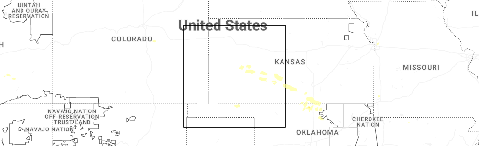
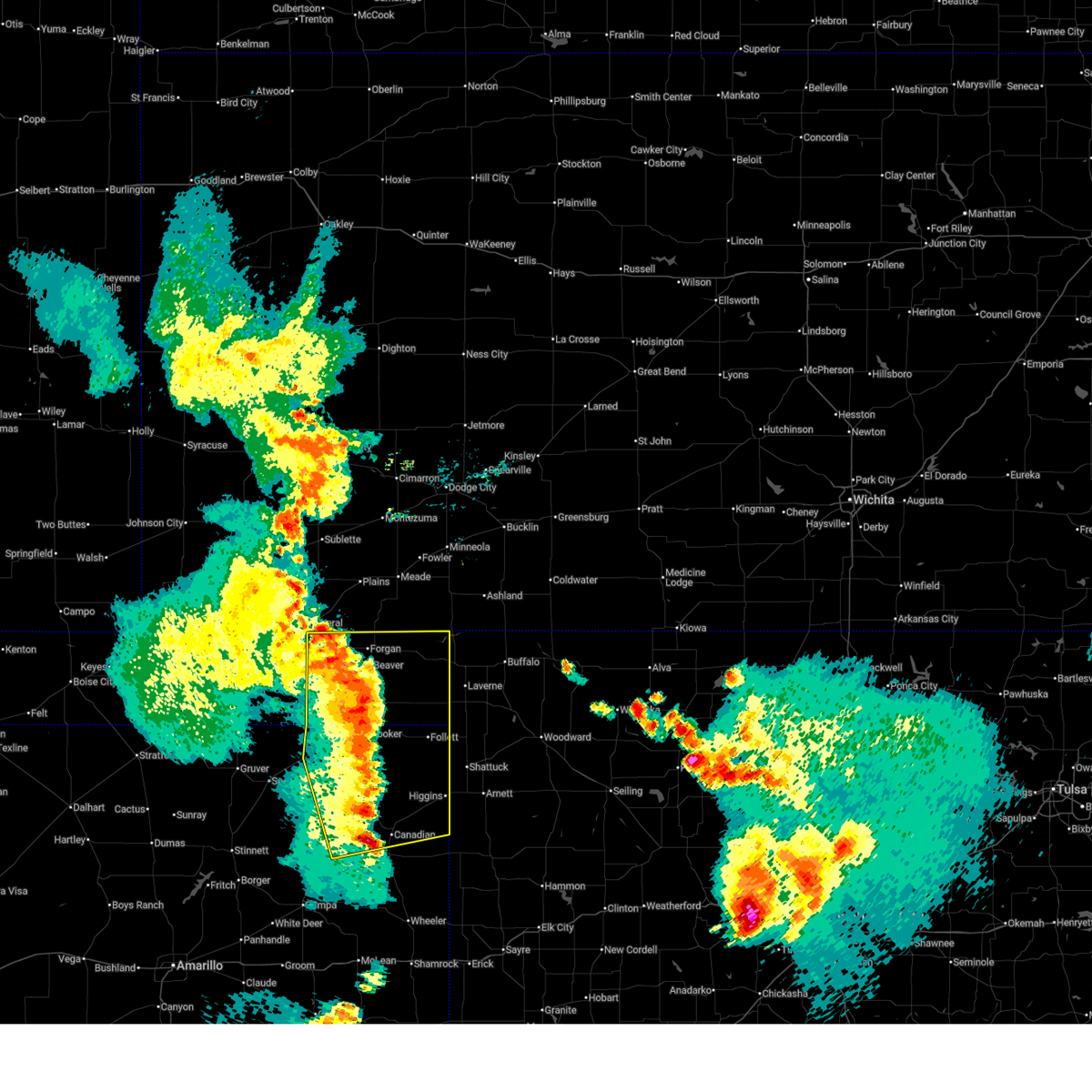
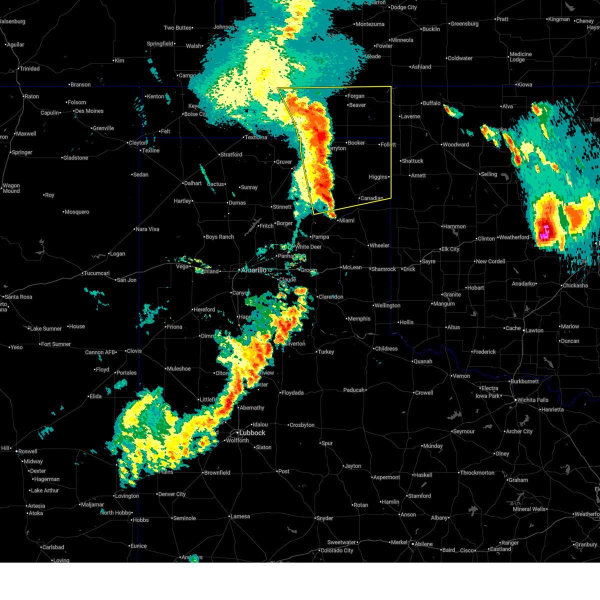
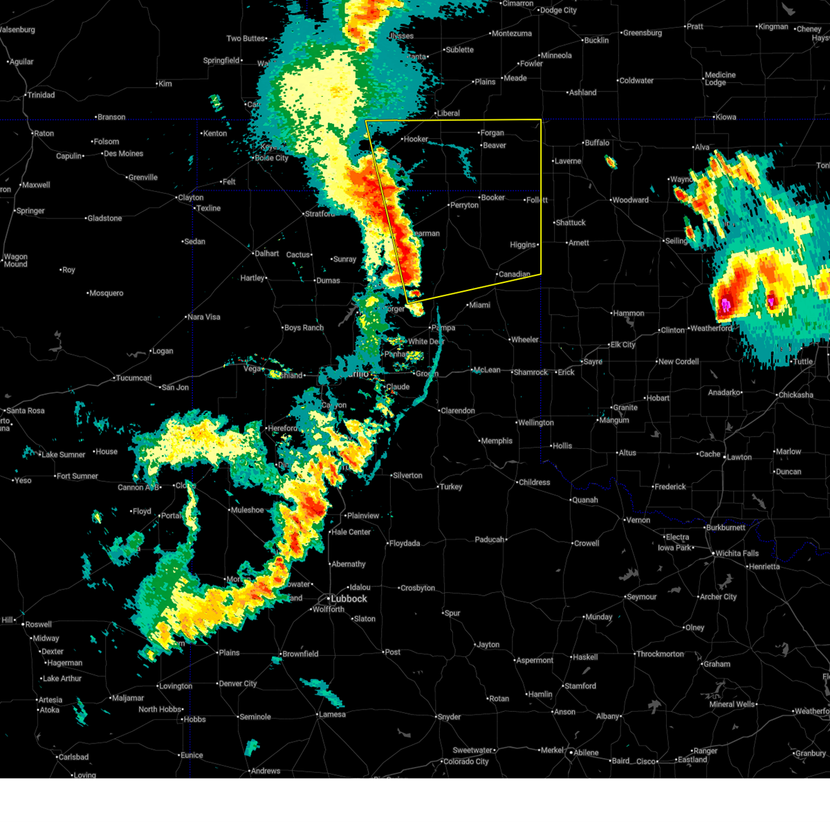
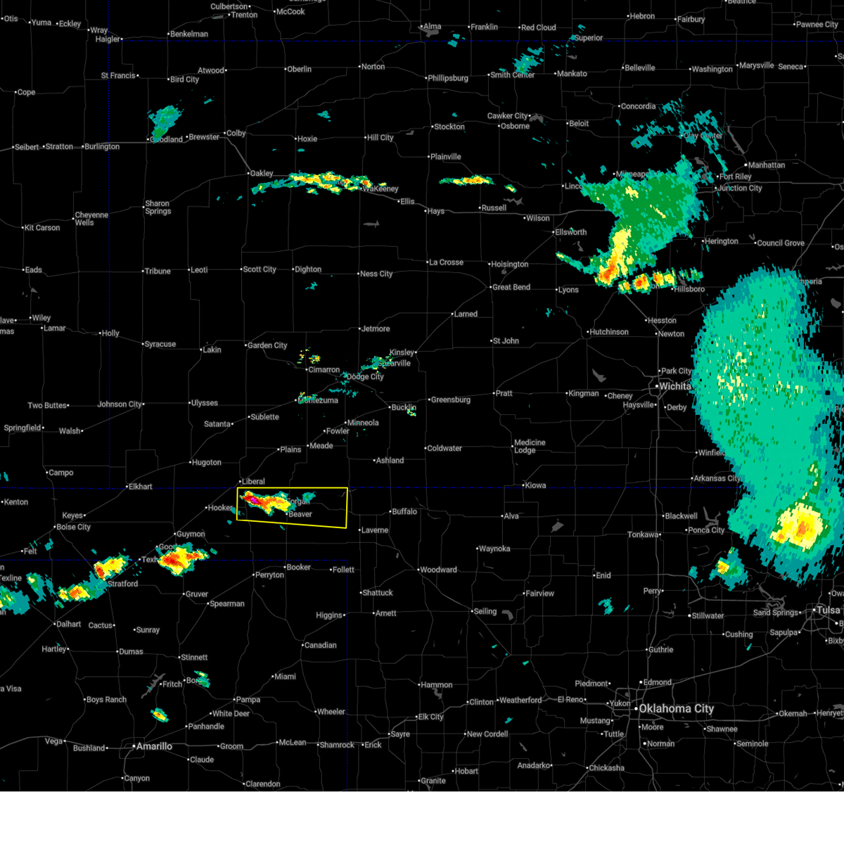
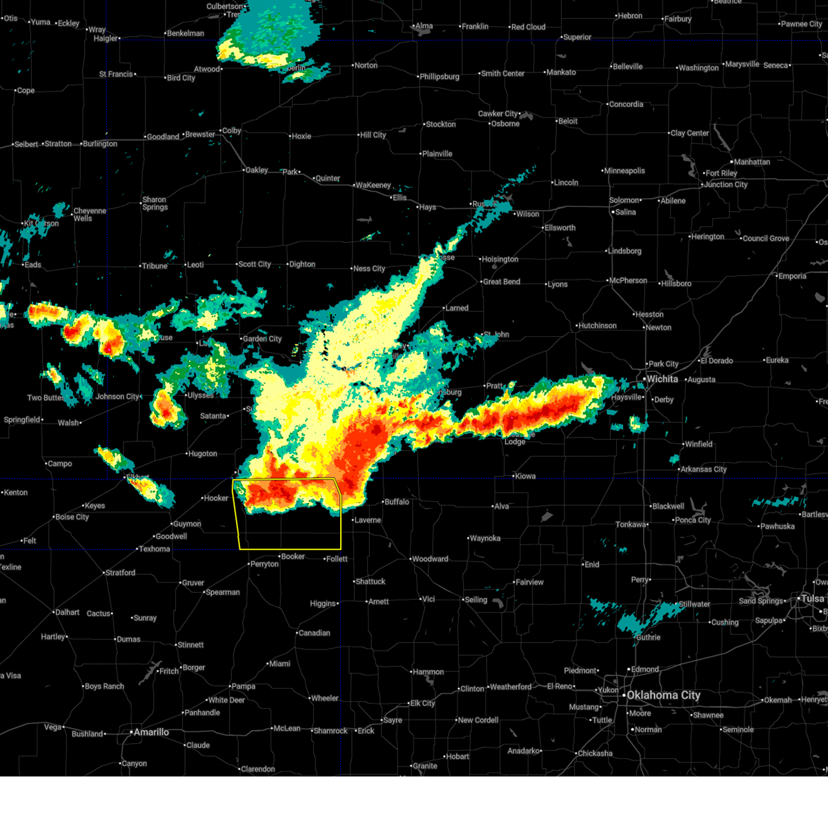
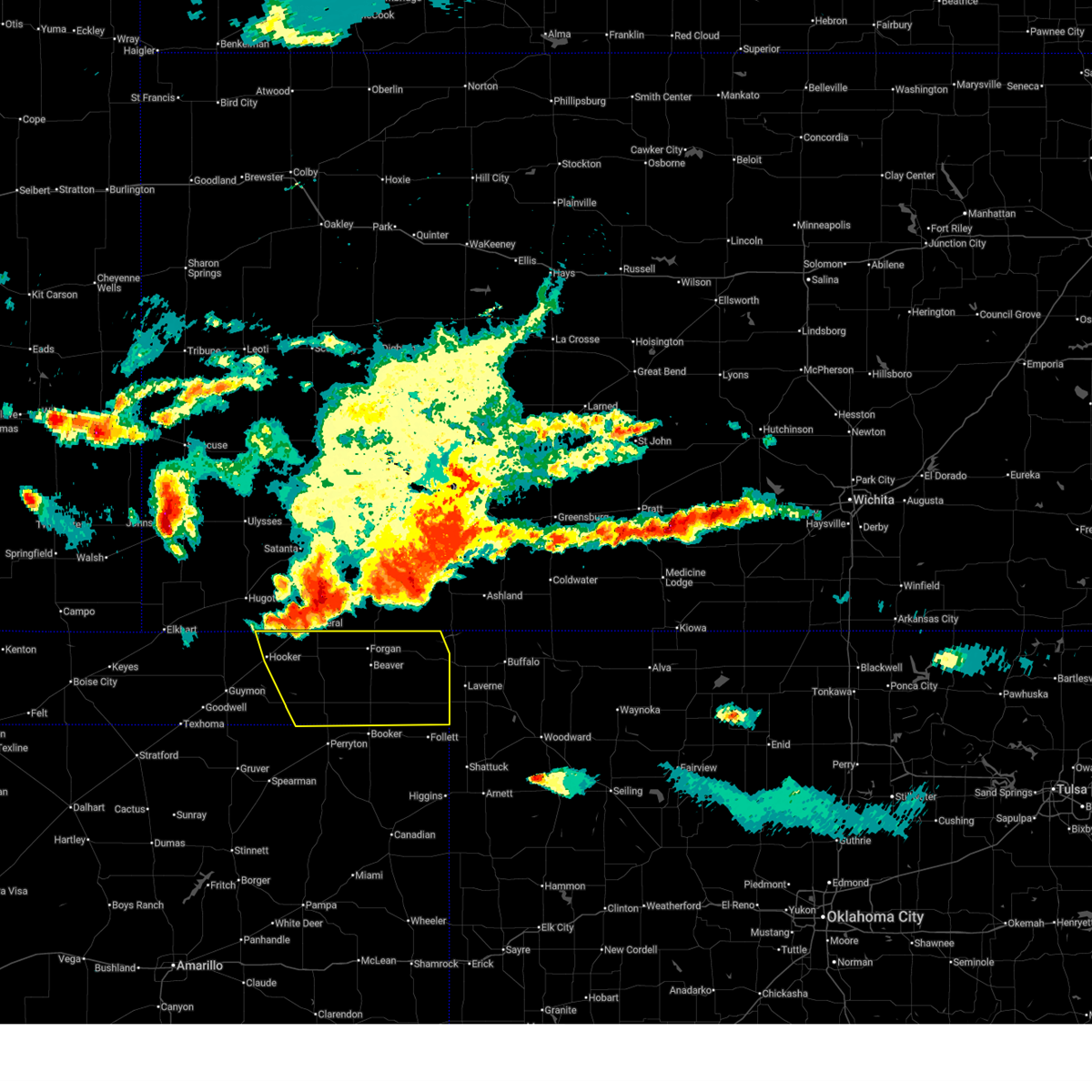
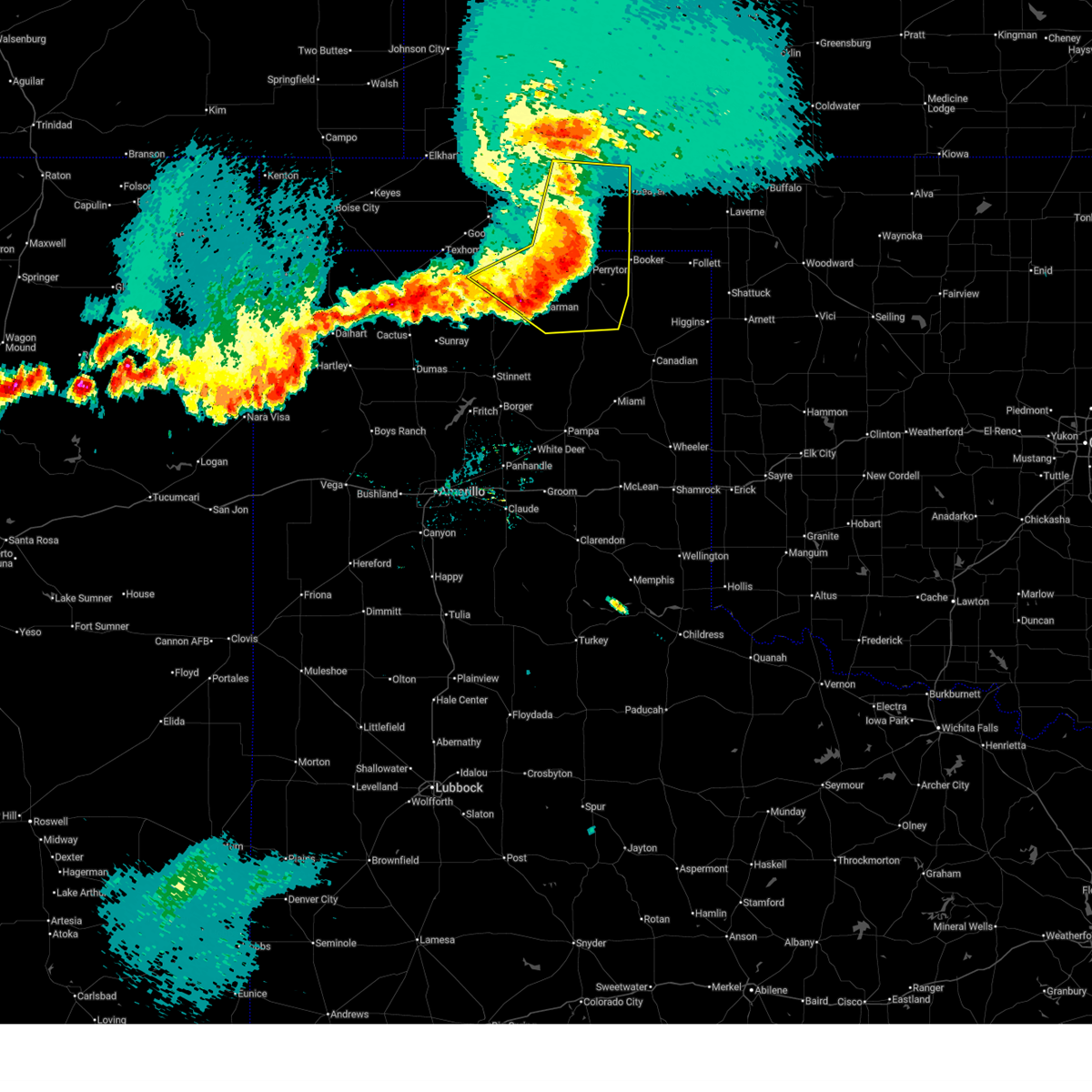
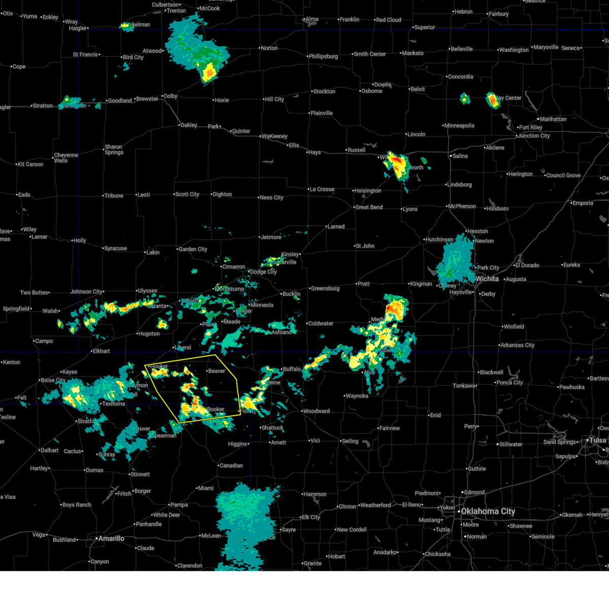
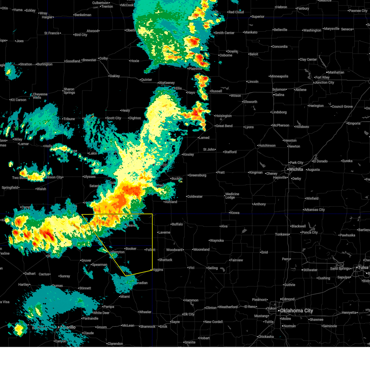
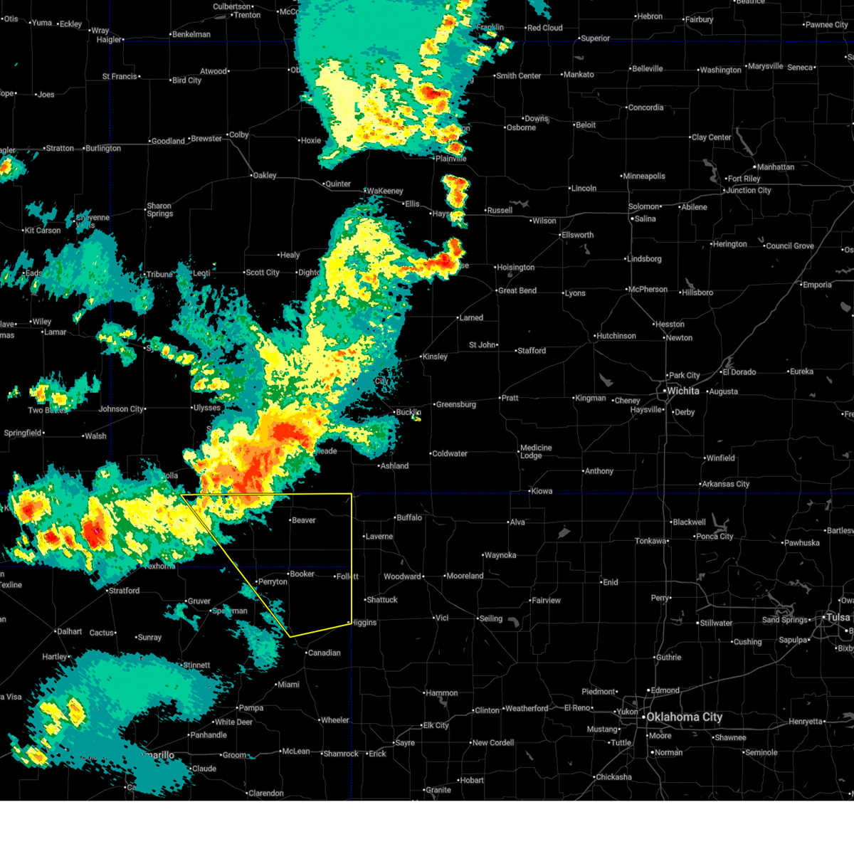
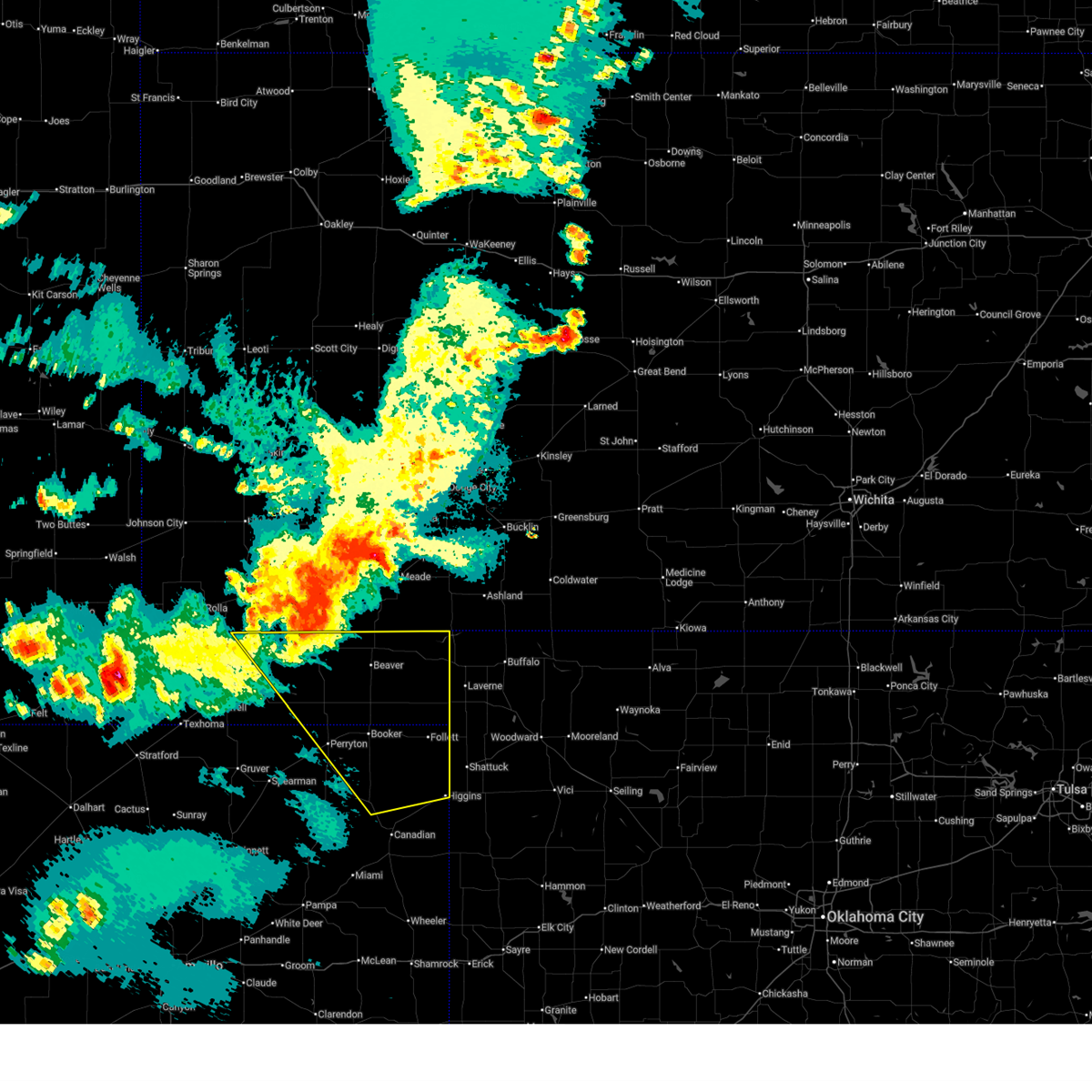
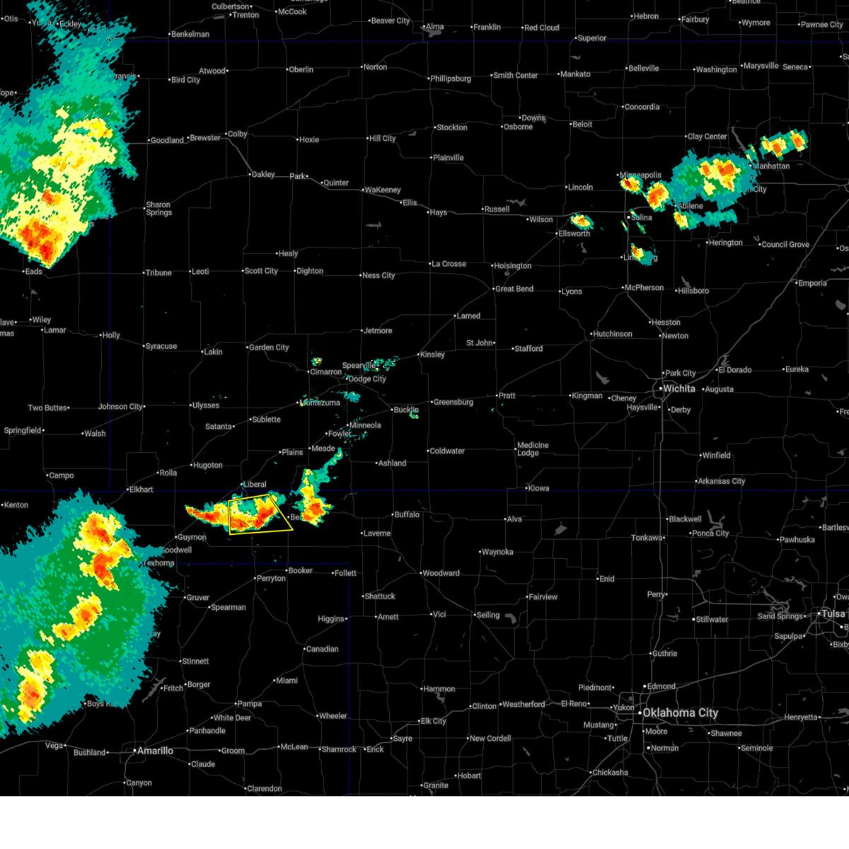
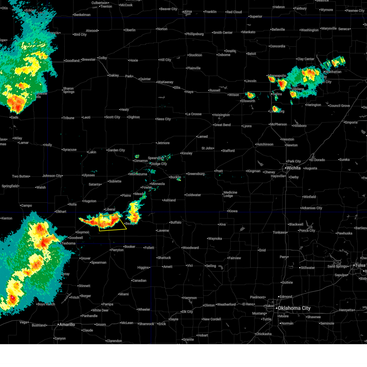
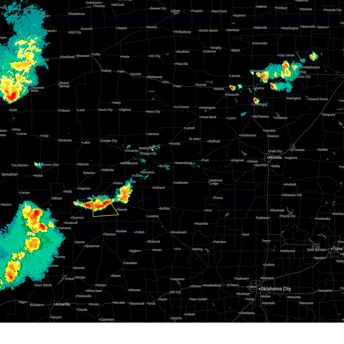
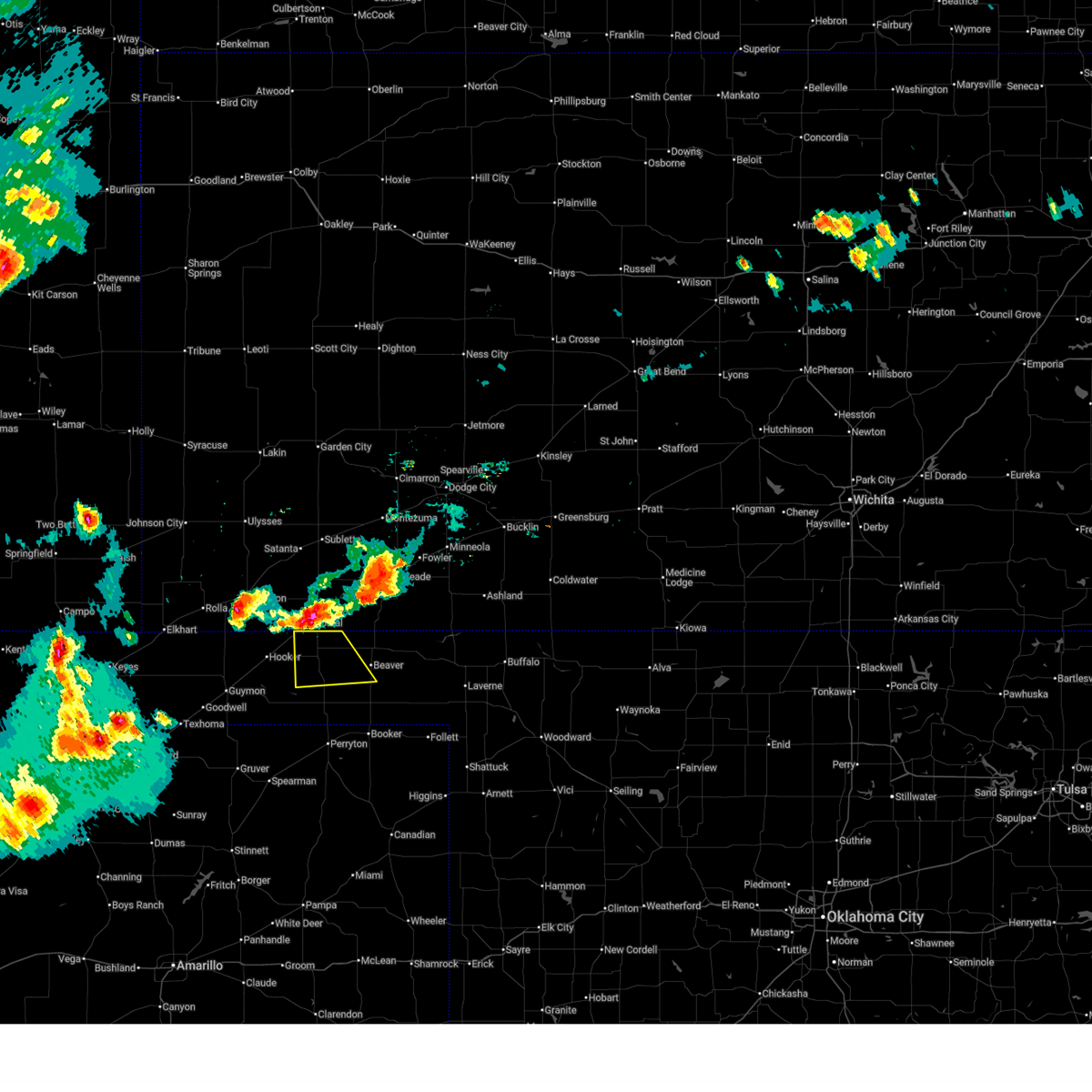
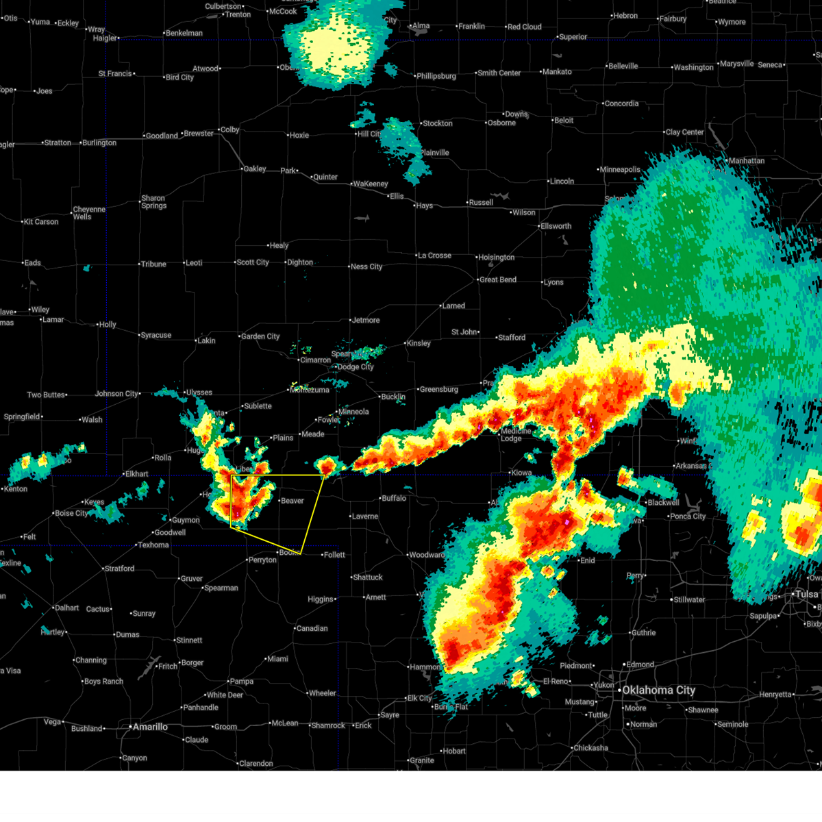
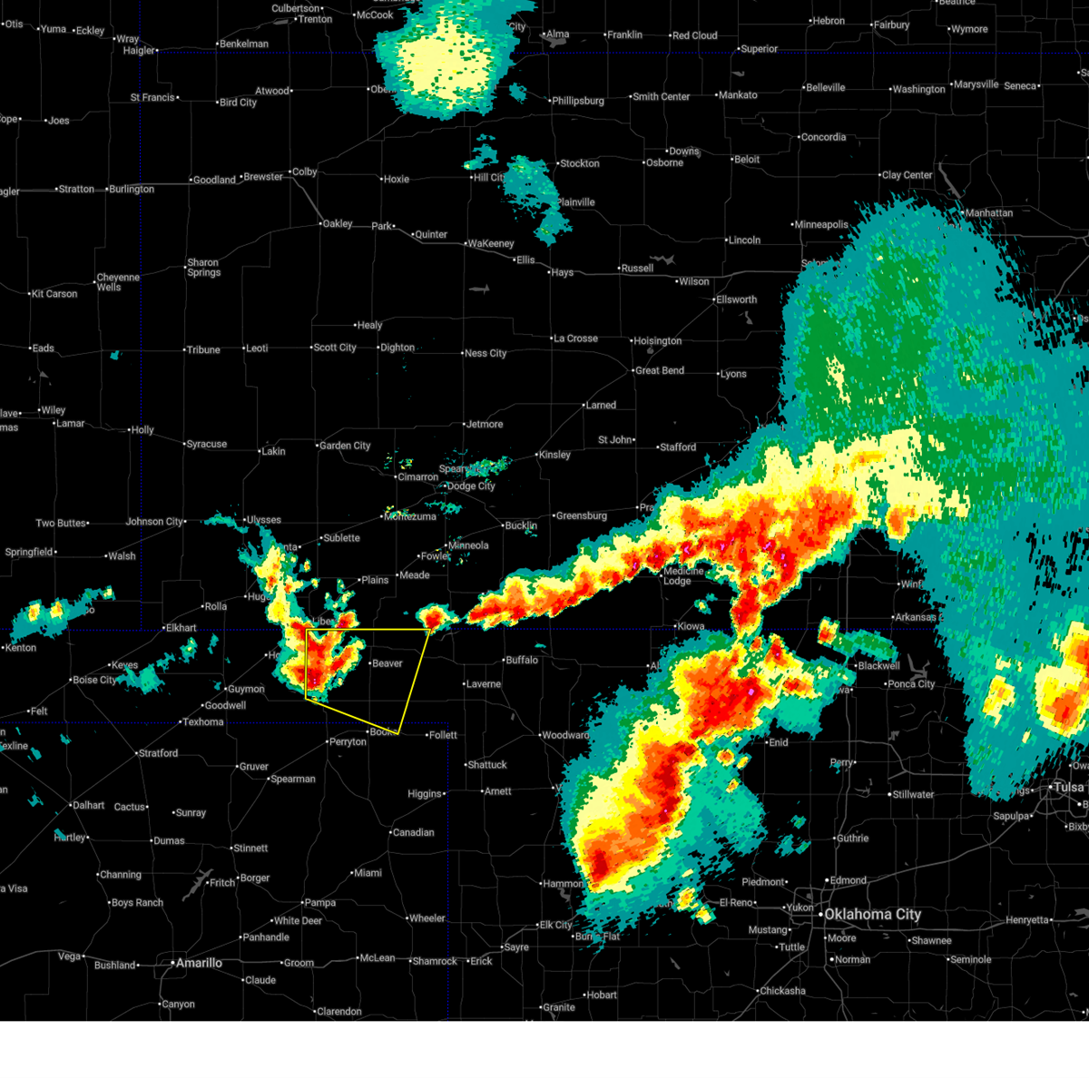
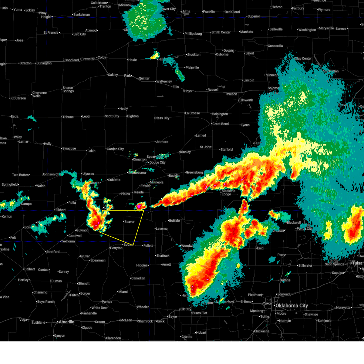
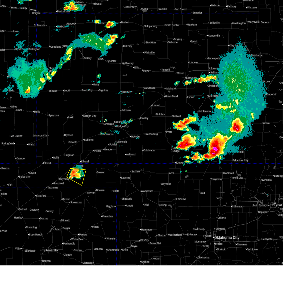
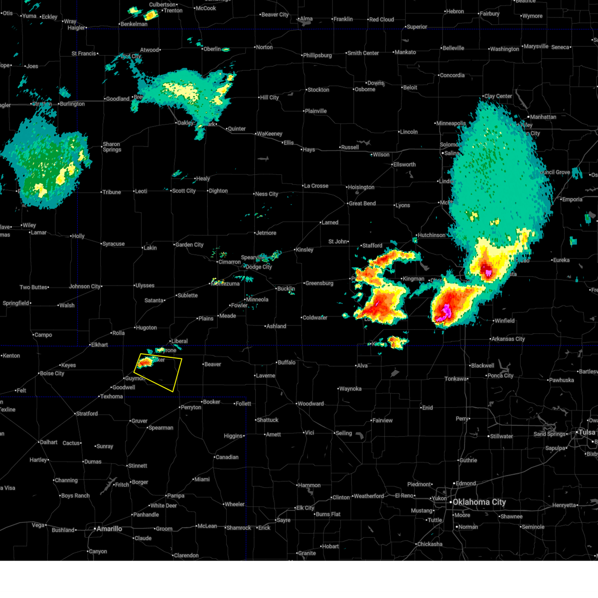
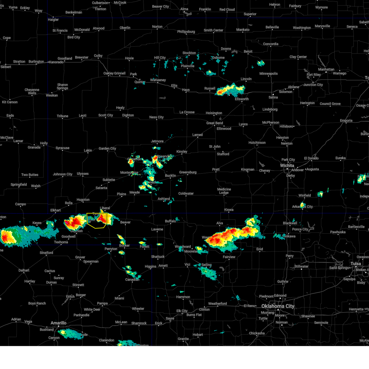
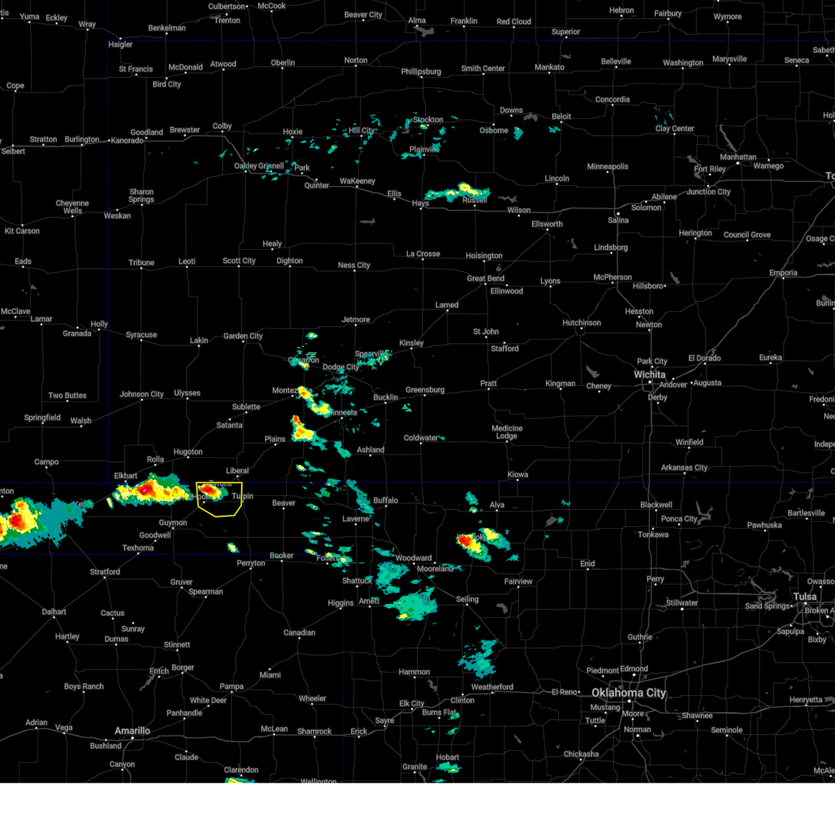
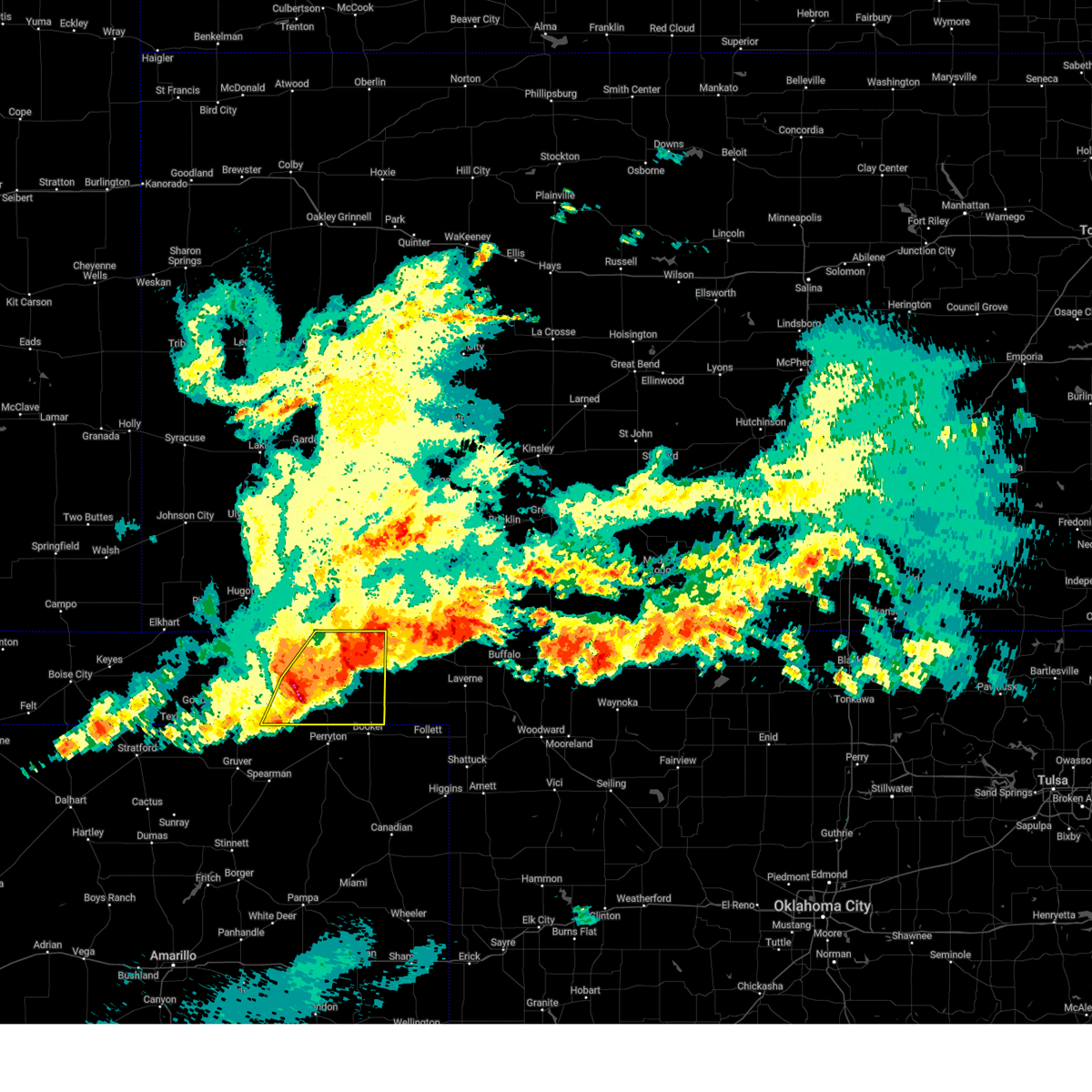
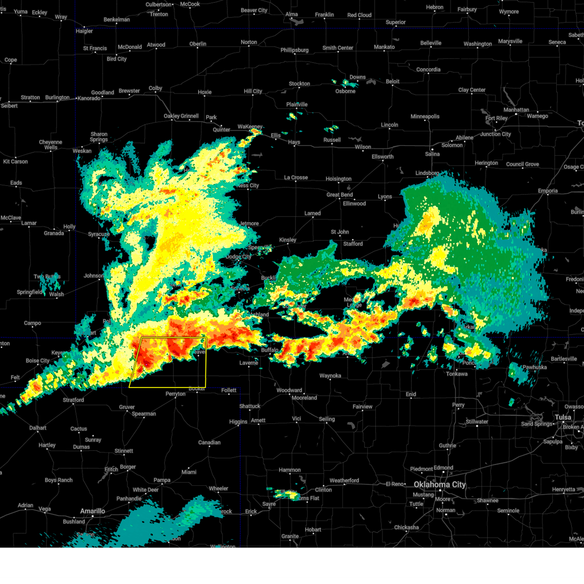
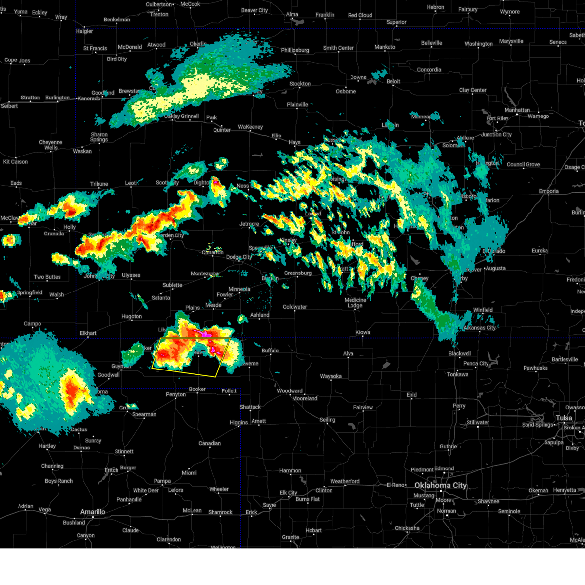
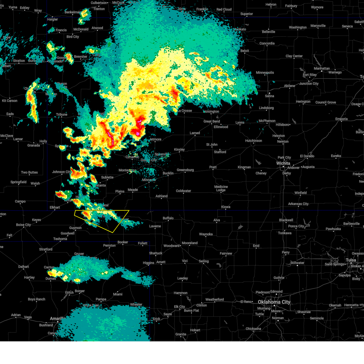
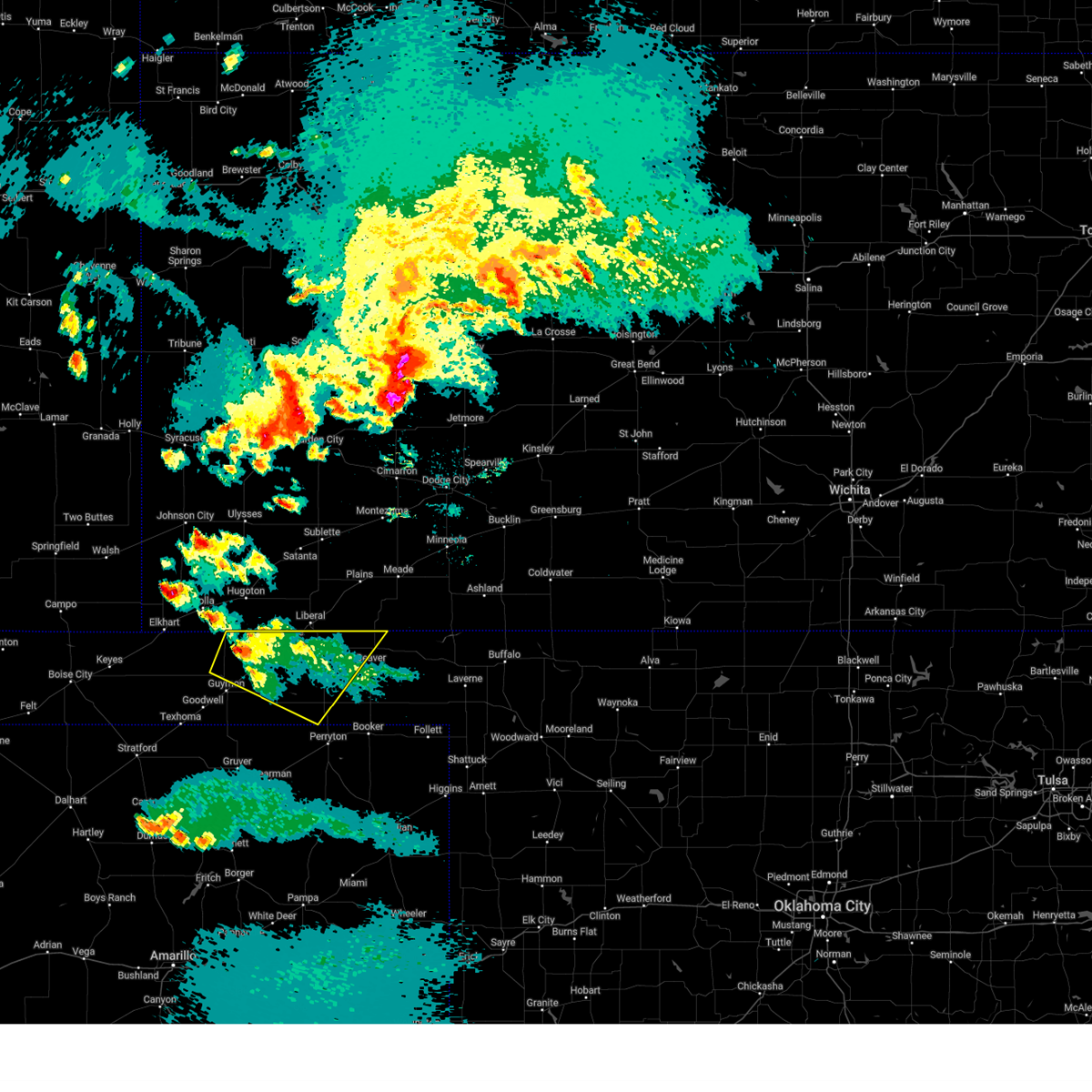
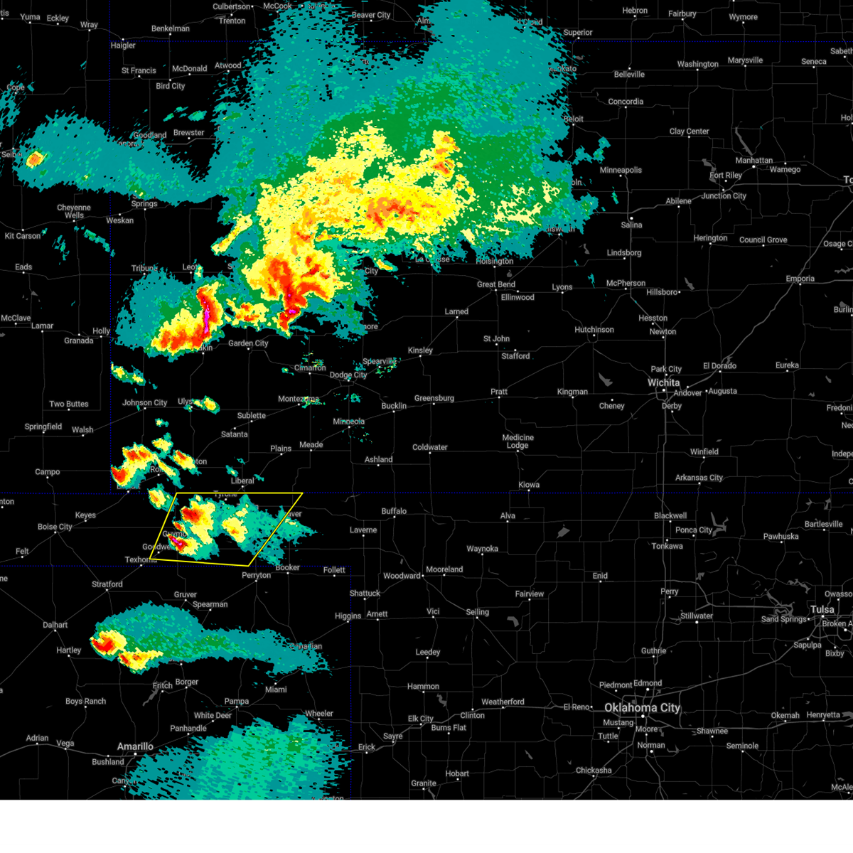
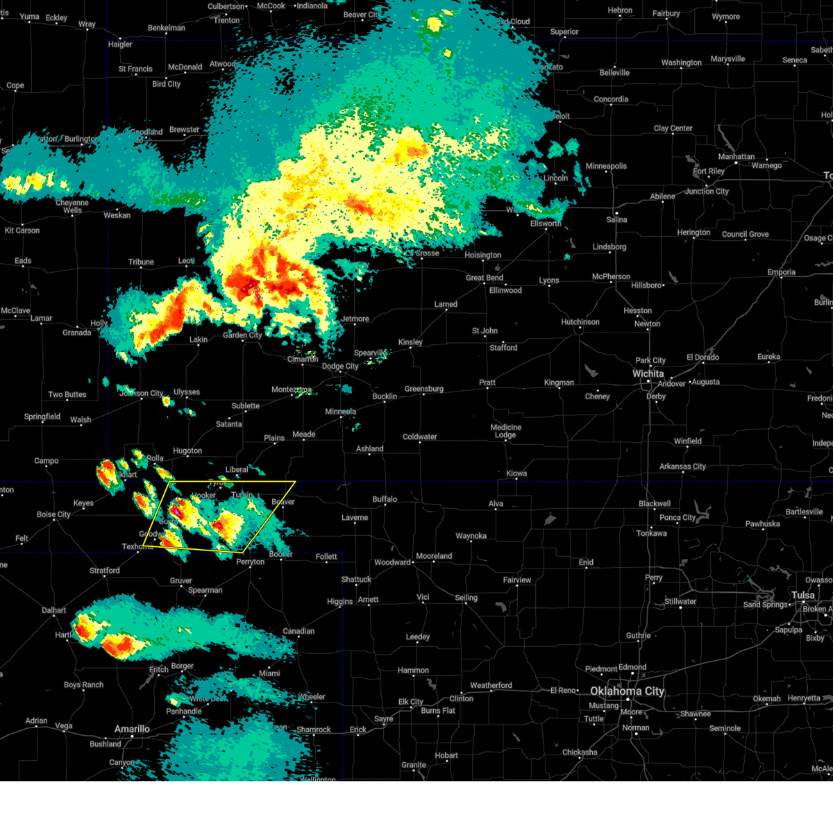
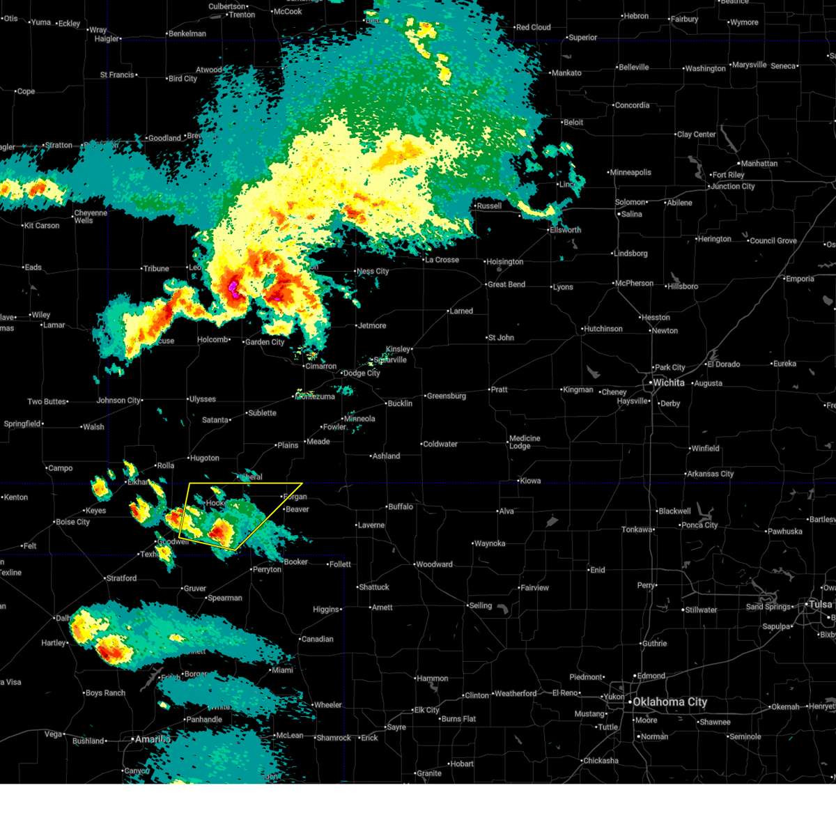
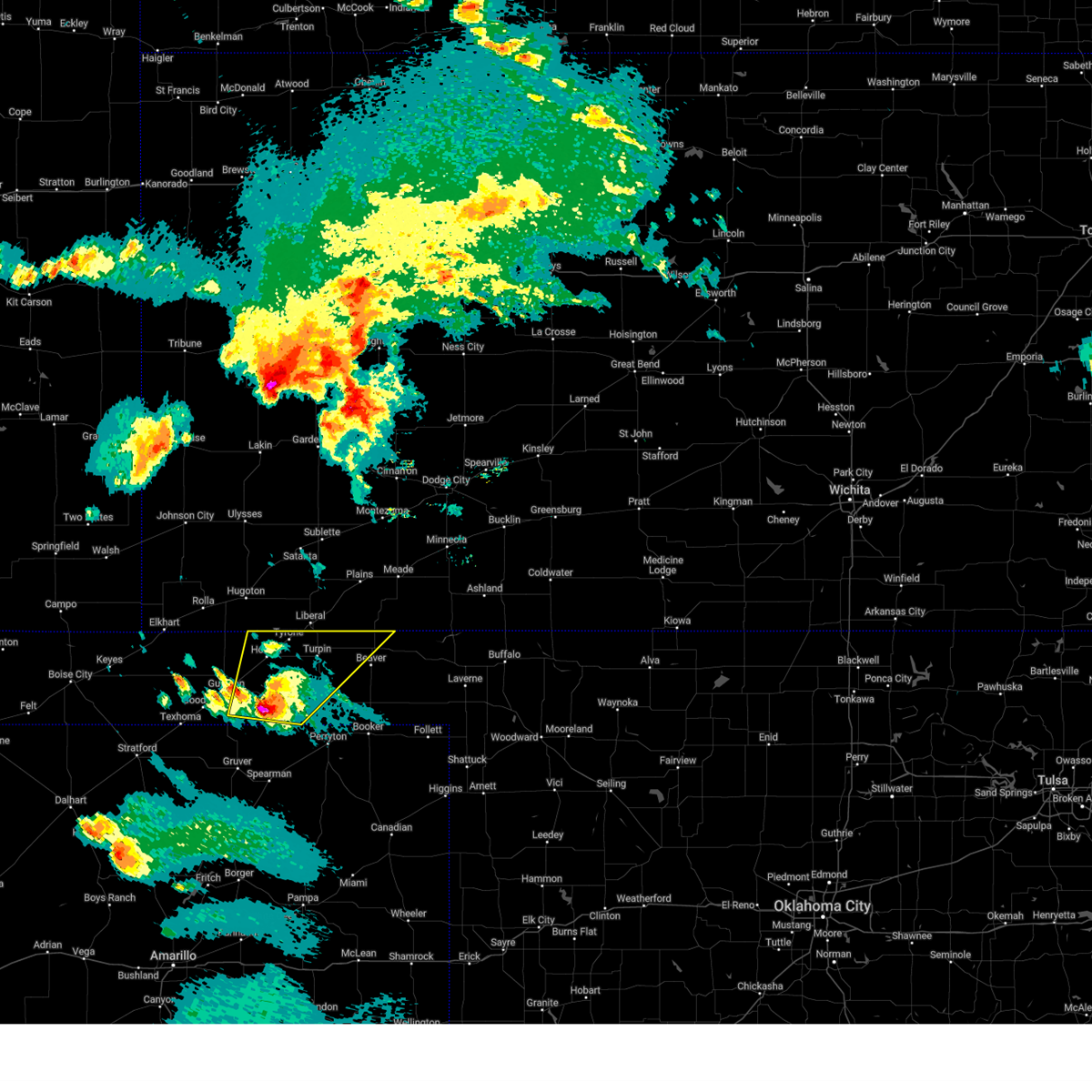
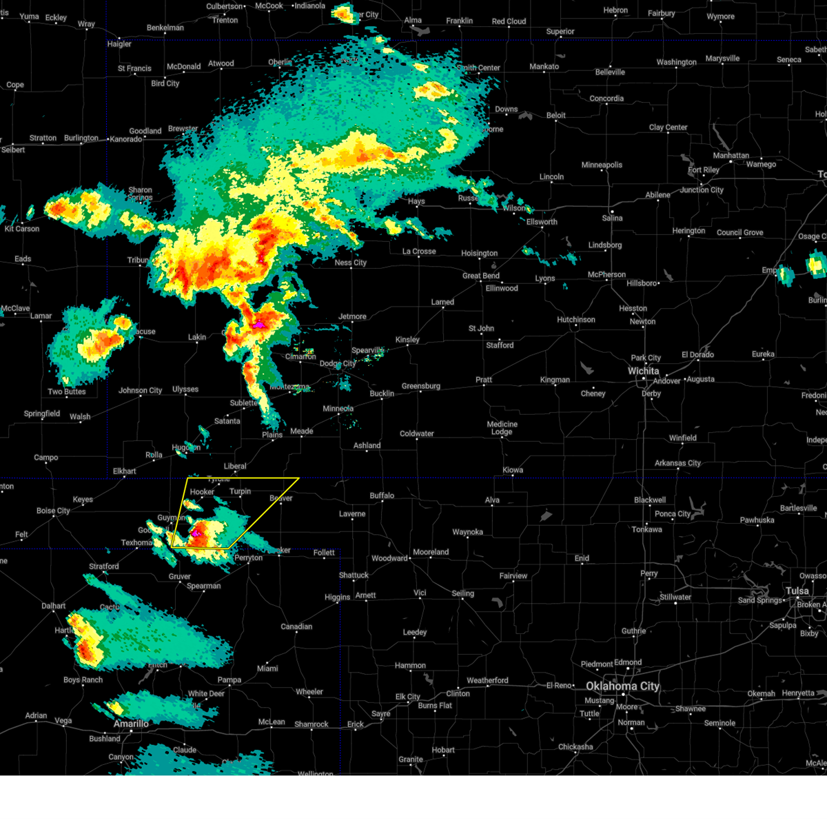
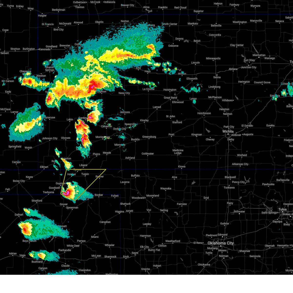
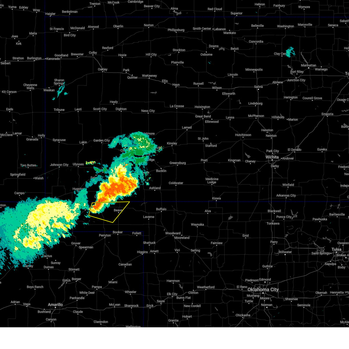
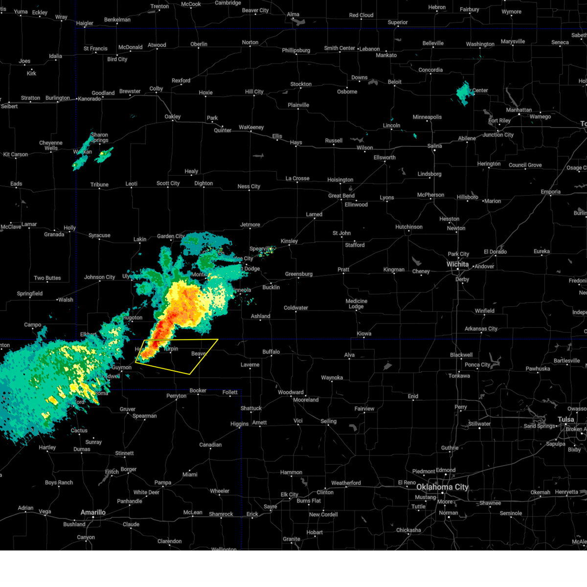
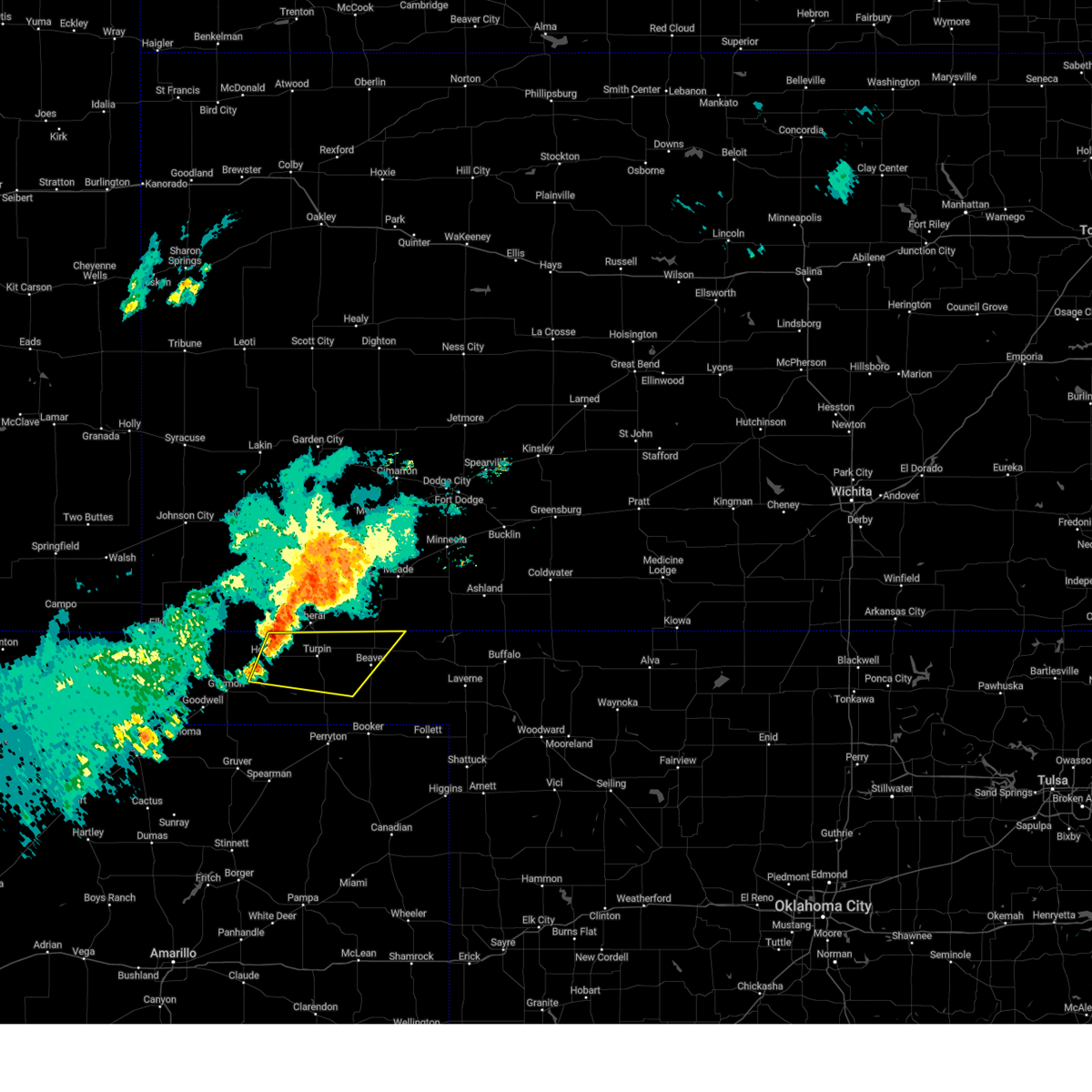
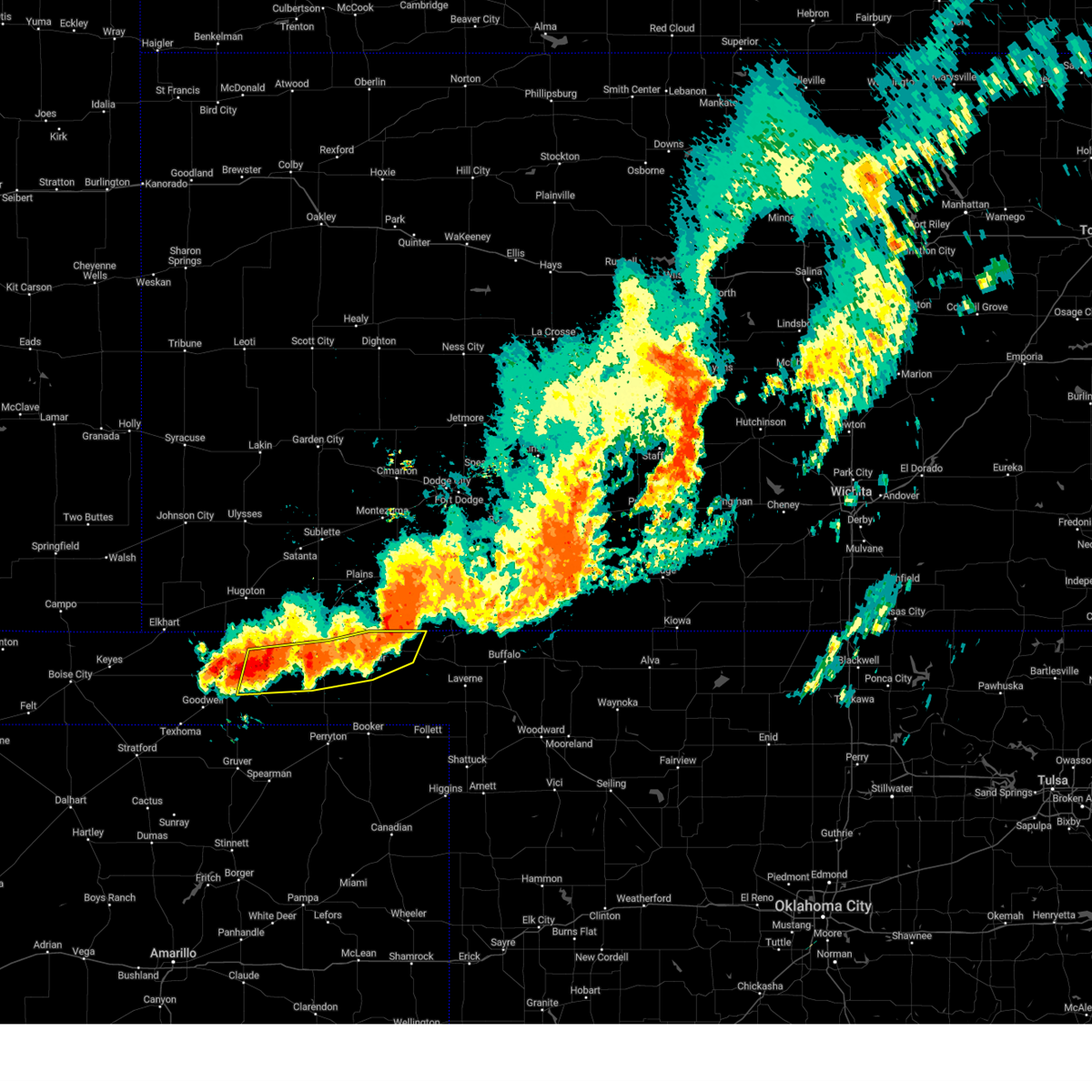
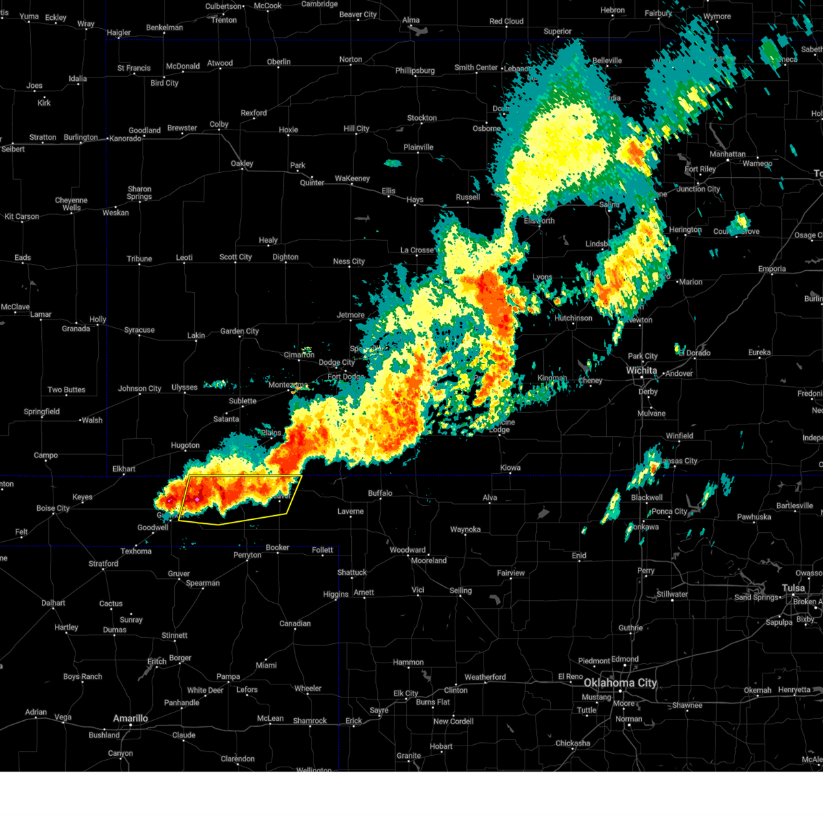
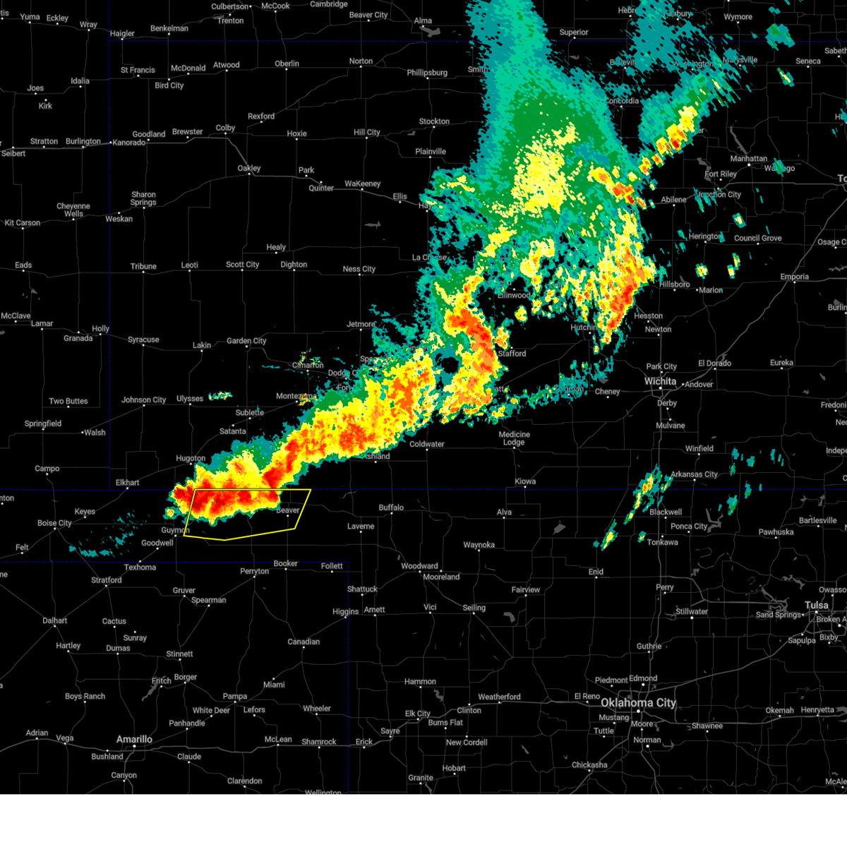
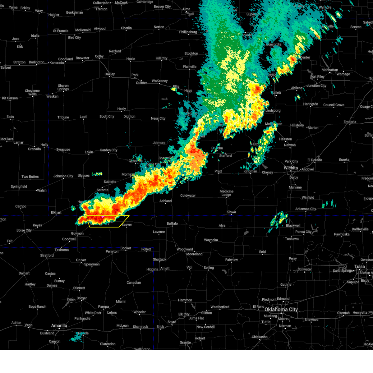
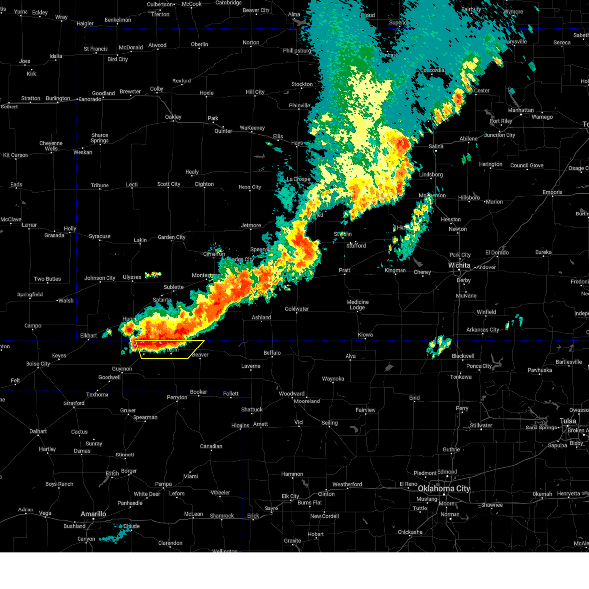
Hail Map for Turpin, OK
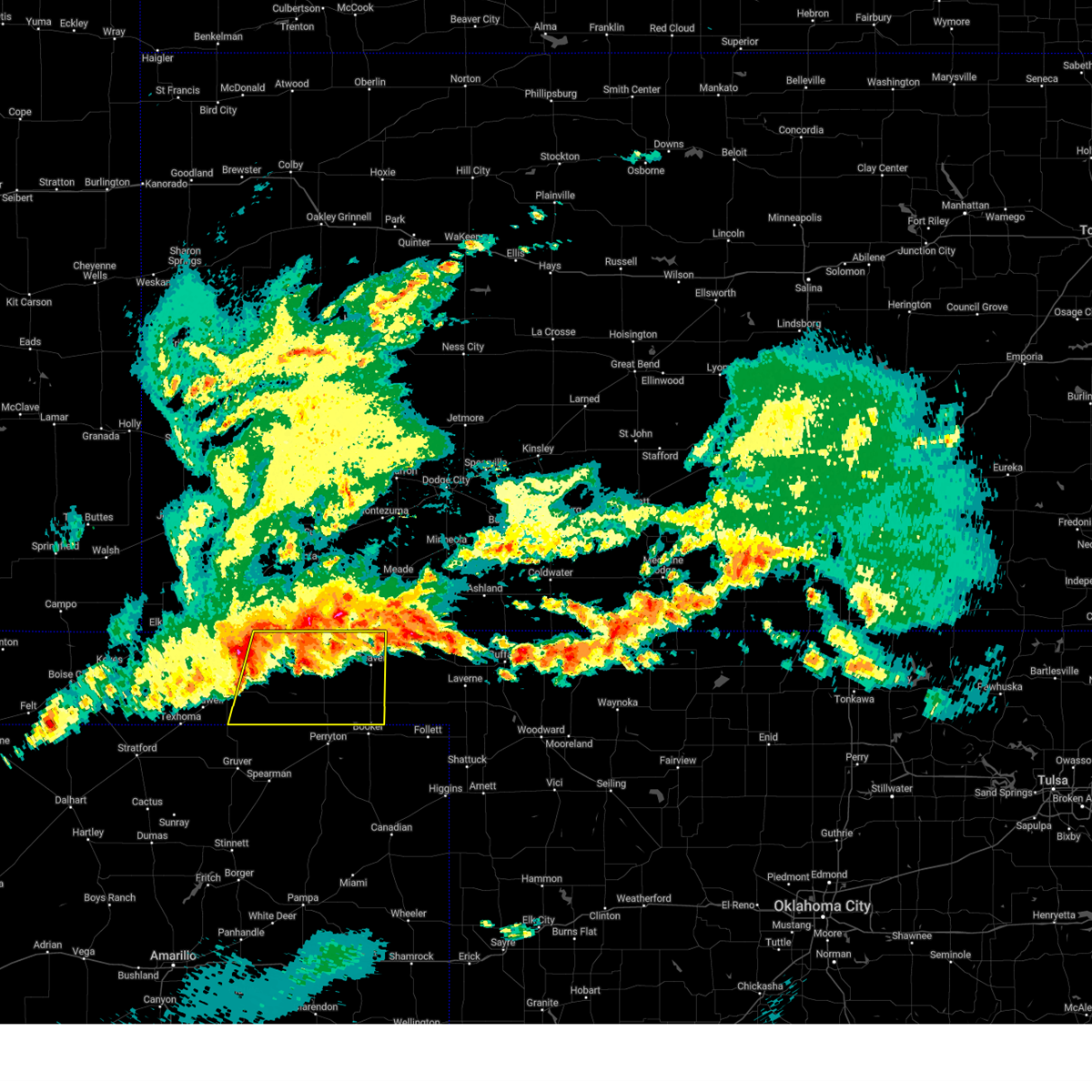
The Turpin, OK area has had 16 reports of on-the-ground hail by trained spotters, and has been under severe weather warnings 27 times during the past 12 months. Doppler radar has detected hail at or near Turpin, OK on 82 occasions, including 4 occasions during the past year.
| Name: | Turpin, OK |
| Where Located: | 76 miles S of Garden City, KS |
| Map: | Google Map for Turpin, OK |
| Population: | 467 |
| Housing Units: | 201 |
| More Info: | Search Google for Turpin, OK |
0
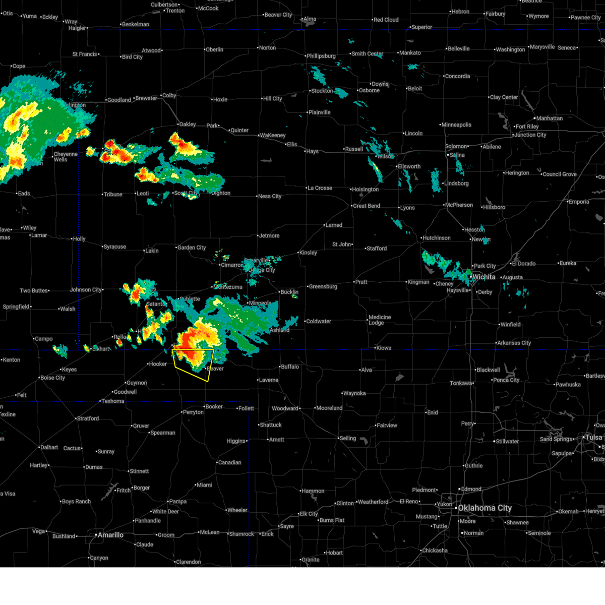
The Top Recent Hail Date for Turpin, OK is Thursday, June 25, 2026 (82nd out of 82)
Hail and Wind Damage Spotted near Turpin, OK
| Date / Time | Report Details |
|---|---|
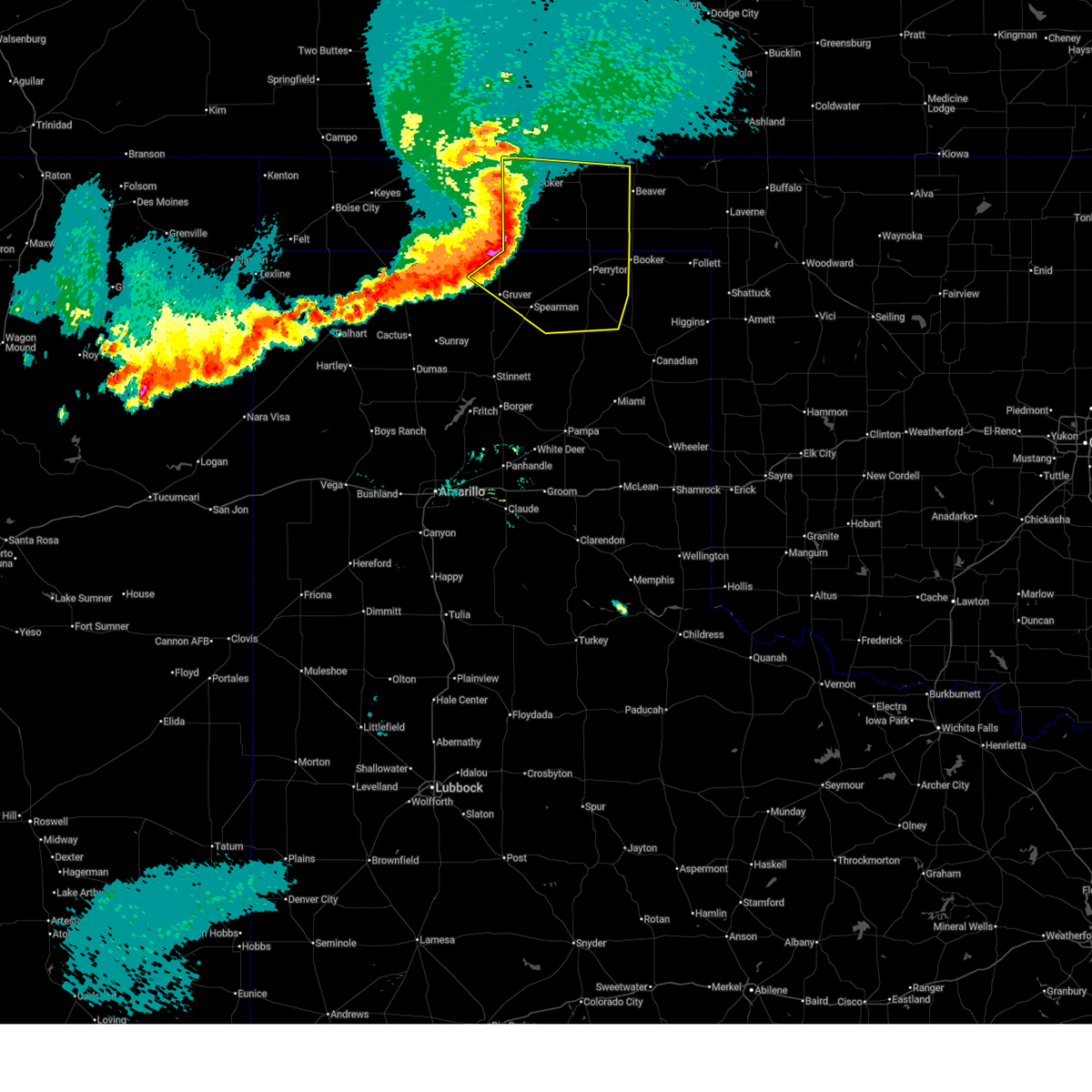
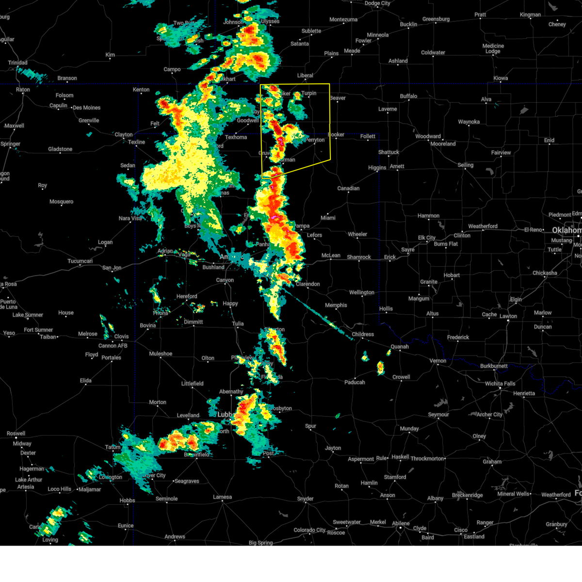
| 6/27/2026 12:12 AM CDT |
 At 1211 am cdt, severe thunderstorms were located along a line extending from 7 miles northwest of floris to 4 miles north of elmwood to 6 miles west of canadian, moving northeast at 45 mph (radar indicated). Hazards include 60 mph wind gusts. Minor damage to roofs, siding, and trees is possible. Locations impacted include, perryton, lipscomb, canadian, beaver, booker, forgan, follett, higgins, darrouzett, gate, knowles, wolf creek park, elmwood, farnsworth, boyd, floris, glazier, lake marvin, bryans corner, and mocane. At 1211 am cdt, severe thunderstorms were located along a line extending from 7 miles northwest of floris to 4 miles north of elmwood to 6 miles west of canadian, moving northeast at 45 mph (radar indicated). Hazards include 60 mph wind gusts. Minor damage to roofs, siding, and trees is possible. Locations impacted include, perryton, lipscomb, canadian, beaver, booker, forgan, follett, higgins, darrouzett, gate, knowles, wolf creek park, elmwood, farnsworth, boyd, floris, glazier, lake marvin, bryans corner, and mocane.
|
| 6/26/2026 11:57 PM CDT |
 At 1156 pm cdt, severe thunderstorms were located along a line extending from near tyrone to 4 miles southeast of bryans corner to 9 miles north of lora, moving northeast at 45 mph (radar indicated). Hazards include 60 mph wind gusts. Minor damage to roofs, siding, and trees is possible. Locations impacted include, perryton, lipscomb, canadian, beaver, hooker, booker, tyrone, forgan, follett, higgins, darrouzett, gate, knowles, wolf creek park, lake marvin, baker, slapout, balko, elmwood, and adams. At 1156 pm cdt, severe thunderstorms were located along a line extending from near tyrone to 4 miles southeast of bryans corner to 9 miles north of lora, moving northeast at 45 mph (radar indicated). Hazards include 60 mph wind gusts. Minor damage to roofs, siding, and trees is possible. Locations impacted include, perryton, lipscomb, canadian, beaver, hooker, booker, tyrone, forgan, follett, higgins, darrouzett, gate, knowles, wolf creek park, lake marvin, baker, slapout, balko, elmwood, and adams.
|
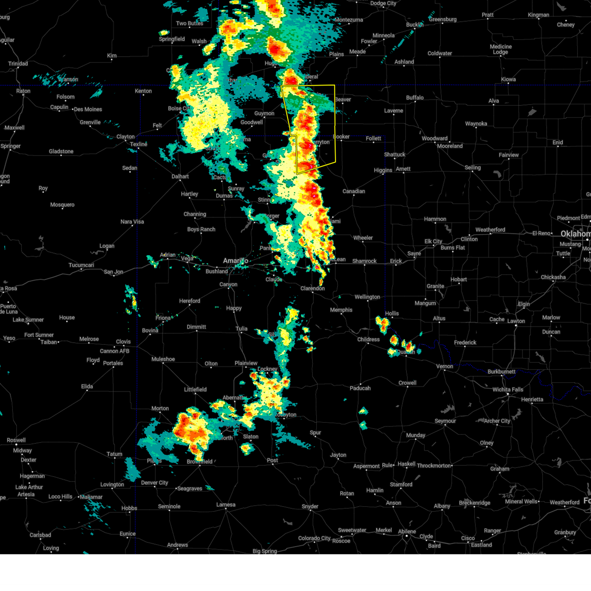
| 6/26/2026 11:27 PM CDT |
 Svrama the national weather service in amarillo has issued a * severe thunderstorm warning for, beaver county in the panhandle of oklahoma, eastern texas county in the panhandle of oklahoma, lipscomb county in the panhandle of texas, northeastern hutchinson county in the panhandle of texas, eastern hansford county in the panhandle of texas, roberts county in the panhandle of texas, northern hemphill county in the panhandle of texas, ochiltree county in the panhandle of texas, * until 100 am cdt. * at 1126 pm cdt, severe thunderstorms were located along a line extending from 10 miles northeast of hough to 20 miles northwest of codman, moving northeast at 40 mph (radar indicated). Hazards include 70 mph wind gusts. Expect some tree damage. Damage is likely to mobile homes, roofs, and outbuildings. Svrama the national weather service in amarillo has issued a * severe thunderstorm warning for, beaver county in the panhandle of oklahoma, eastern texas county in the panhandle of oklahoma, lipscomb county in the panhandle of texas, northeastern hutchinson county in the panhandle of texas, eastern hansford county in the panhandle of texas, roberts county in the panhandle of texas, northern hemphill county in the panhandle of texas, ochiltree county in the panhandle of texas, * until 100 am cdt. * at 1126 pm cdt, severe thunderstorms were located along a line extending from 10 miles northeast of hough to 20 miles northwest of codman, moving northeast at 40 mph (radar indicated). Hazards include 70 mph wind gusts. Expect some tree damage. Damage is likely to mobile homes, roofs, and outbuildings.
|
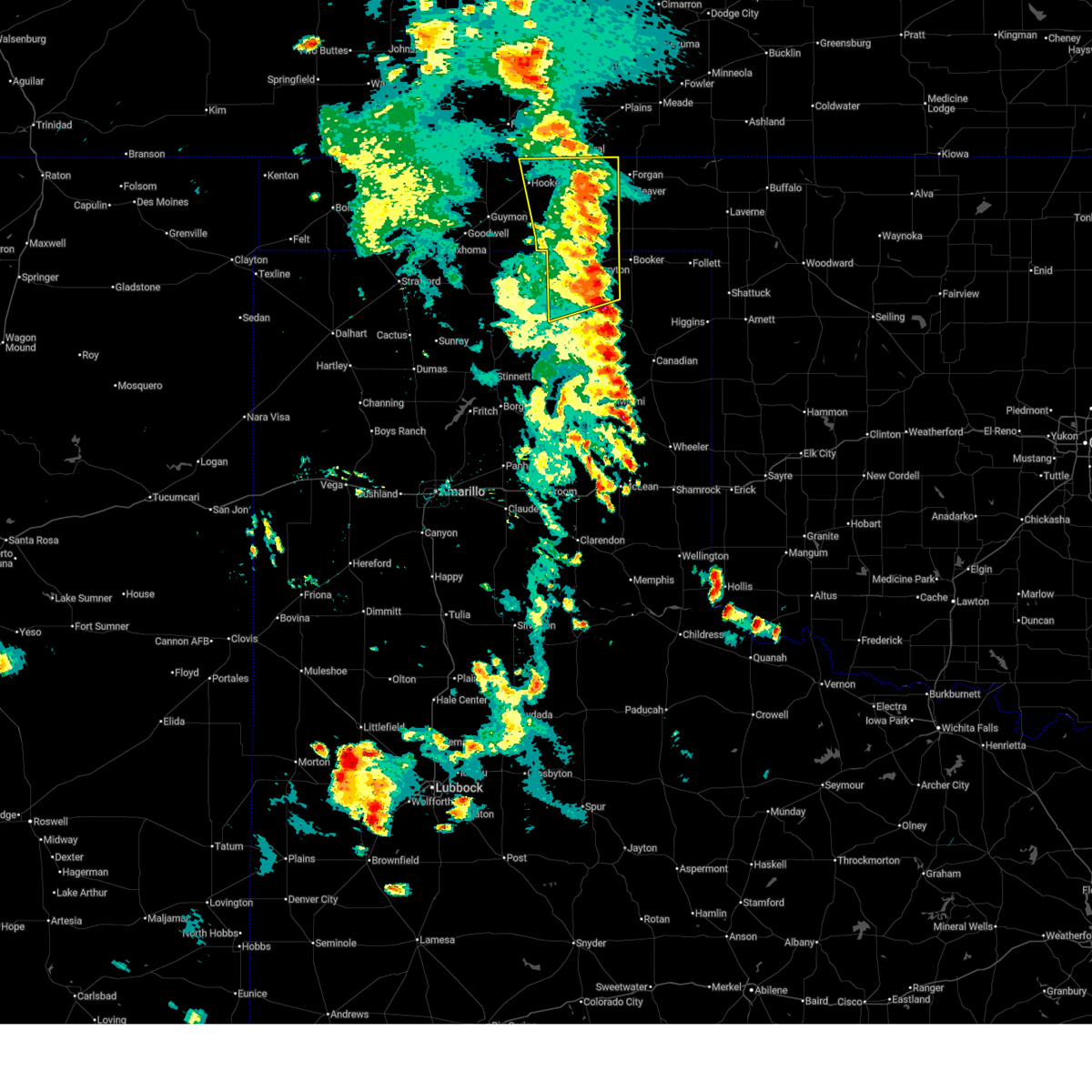
| 6/25/2026 3:13 PM CDT |
 Svrama the national weather service in amarillo has issued a * severe thunderstorm warning for, northern beaver county in the panhandle of oklahoma, * until 415 pm cdt. * at 313 pm cdt, a severe thunderstorm was located over floris, or 11 miles northwest of beaver, moving east at 35 mph (radar indicated). Hazards include 60 mph wind gusts and half dollar size hail. Minor damage to roofs, siding, and trees is possible. Hail damage to vehicles is expected. Svrama the national weather service in amarillo has issued a * severe thunderstorm warning for, northern beaver county in the panhandle of oklahoma, * until 415 pm cdt. * at 313 pm cdt, a severe thunderstorm was located over floris, or 11 miles northwest of beaver, moving east at 35 mph (radar indicated). Hazards include 60 mph wind gusts and half dollar size hail. Minor damage to roofs, siding, and trees is possible. Hail damage to vehicles is expected.
|
| 6/21/2026 10:35 PM CDT |
 At 1035 pm cdt, severe thunderstorms were located along a line extending from 3 miles north of boyd to 3 miles northeast of knowles, moving south at 30 mph (radar indicated). Hazards include 70 mph wind gusts and quarter size hail. Expect some tree damage. damage is likely to mobile homes, roofs, and outbuildings. hail damage to vehicles is expected. Locations impacted include, beaver, forgan, gate, knowles, elmwood, bryans corner, boyd, mocane, turpin, floris, slapout, and balko. At 1035 pm cdt, severe thunderstorms were located along a line extending from 3 miles north of boyd to 3 miles northeast of knowles, moving south at 30 mph (radar indicated). Hazards include 70 mph wind gusts and quarter size hail. Expect some tree damage. damage is likely to mobile homes, roofs, and outbuildings. hail damage to vehicles is expected. Locations impacted include, beaver, forgan, gate, knowles, elmwood, bryans corner, boyd, mocane, turpin, floris, slapout, and balko.
|
| 6/21/2026 9:53 PM CDT |
 Svrama the national weather service in amarillo has issued a * severe thunderstorm warning for, beaver county in the panhandle of oklahoma, eastern texas county in the panhandle of oklahoma, northeastern ochiltree county in the panhandle of texas, * until 1100 pm cdt. * at 953 pm cdt, severe thunderstorms were located along a line extending from tyrone to 9 miles southeast of meade, moving south at 30 mph (radar indicated). Hazards include 70 mph wind gusts and ping pong ball size hail. Expect some tree damage. damage is likely to mobile homes, roofs, and outbuildings. people and animals outdoors will be injured. Expect hail damage to roofs, siding, windows, and vehicles. Svrama the national weather service in amarillo has issued a * severe thunderstorm warning for, beaver county in the panhandle of oklahoma, eastern texas county in the panhandle of oklahoma, northeastern ochiltree county in the panhandle of texas, * until 1100 pm cdt. * at 953 pm cdt, severe thunderstorms were located along a line extending from tyrone to 9 miles southeast of meade, moving south at 30 mph (radar indicated). Hazards include 70 mph wind gusts and ping pong ball size hail. Expect some tree damage. damage is likely to mobile homes, roofs, and outbuildings. people and animals outdoors will be injured. Expect hail damage to roofs, siding, windows, and vehicles.
|
| 6/12/2026 10:33 PM CDT |
 At 1032 pm cdt, severe thunderstorms were located along a line extending from 3 miles northeast of boyd to 4 miles southeast of perryton to 8 miles southeast of waka, moving east at 45 mph (radar indicated). Hazards include 60 mph wind gusts and penny size hail. Minor damage to roofs, siding, and trees is possible. Locations impacted include, perryton, spearman, gruver, wolf creek park, adams, farnsworth, boyd, waka, floris, bryans corner, baker, turpin, and balko. At 1032 pm cdt, severe thunderstorms were located along a line extending from 3 miles northeast of boyd to 4 miles southeast of perryton to 8 miles southeast of waka, moving east at 45 mph (radar indicated). Hazards include 60 mph wind gusts and penny size hail. Minor damage to roofs, siding, and trees is possible. Locations impacted include, perryton, spearman, gruver, wolf creek park, adams, farnsworth, boyd, waka, floris, bryans corner, baker, turpin, and balko.
|
| 6/12/2026 9:52 PM CDT |
 Svrama the national weather service in amarillo has issued a * severe thunderstorm warning for, western beaver county in the panhandle of oklahoma, eastern texas county in the panhandle of oklahoma, central hansford county in the panhandle of texas, ochiltree county in the panhandle of texas, * until 1045 pm cdt. * at 951 pm cdt, severe thunderstorms were located along a line extending from near hooker to 10 miles south of hardesty to 5 miles northwest of gruver, moving east at 45 mph (radar indicated). Hazards include 70 mph wind gusts and penny size hail. Expect some tree damage. Damage is likely to mobile homes, roofs, and outbuildings. Svrama the national weather service in amarillo has issued a * severe thunderstorm warning for, western beaver county in the panhandle of oklahoma, eastern texas county in the panhandle of oklahoma, central hansford county in the panhandle of texas, ochiltree county in the panhandle of texas, * until 1045 pm cdt. * at 951 pm cdt, severe thunderstorms were located along a line extending from near hooker to 10 miles south of hardesty to 5 miles northwest of gruver, moving east at 45 mph (radar indicated). Hazards include 70 mph wind gusts and penny size hail. Expect some tree damage. Damage is likely to mobile homes, roofs, and outbuildings.
|
| 6/3/2026 2:04 PM CDT |
 Svrama the national weather service in amarillo has issued a * severe thunderstorm warning for, northwestern beaver county in the panhandle of oklahoma, * until 300 pm cdt. * at 204 pm cdt, a severe thunderstorm was located 5 miles north of floris, or 11 miles south of hayne, moving north at 20 mph (radar indicated). Hazards include 60 mph wind gusts and quarter size hail. Minor damage to roofs, siding, and trees is possible. Hail damage to vehicles is expected. Svrama the national weather service in amarillo has issued a * severe thunderstorm warning for, northwestern beaver county in the panhandle of oklahoma, * until 300 pm cdt. * at 204 pm cdt, a severe thunderstorm was located 5 miles north of floris, or 11 miles south of hayne, moving north at 20 mph (radar indicated). Hazards include 60 mph wind gusts and quarter size hail. Minor damage to roofs, siding, and trees is possible. Hail damage to vehicles is expected.
|
| 5/14/2026 7:51 PM CDT |
 The storms which prompted the warning have weakened below severe limits, and no longer pose an immediate threat to life or property. therefore, the warning will be allowed to expire. a severe thunderstorm watch remains in effect until 1000 pm cdt for the panhandle of oklahoma, and the panhandle of texas. The storms which prompted the warning have weakened below severe limits, and no longer pose an immediate threat to life or property. therefore, the warning will be allowed to expire. a severe thunderstorm watch remains in effect until 1000 pm cdt for the panhandle of oklahoma, and the panhandle of texas.
|
| 5/14/2026 7:33 PM CDT |
 At 732 pm cdt, severe thunderstorms were located along a line extending from floris to near beaver to 12 miles northeast of elmwood to 5 miles northeast of darrouzett, moving east at 30 mph (radar indicated). Hazards include 60 mph wind gusts. Minor damage to roofs, siding, and trees is possible. Locations impacted include, beaver, hooker, booker, forgan, follett, darrouzett, elmwood, adams, boyd, floris, bryans corner, baker, mocane, turpin, and balko. At 732 pm cdt, severe thunderstorms were located along a line extending from floris to near beaver to 12 miles northeast of elmwood to 5 miles northeast of darrouzett, moving east at 30 mph (radar indicated). Hazards include 60 mph wind gusts. Minor damage to roofs, siding, and trees is possible. Locations impacted include, beaver, hooker, booker, forgan, follett, darrouzett, elmwood, adams, boyd, floris, bryans corner, baker, mocane, turpin, and balko.
|
| 5/14/2026 6:57 PM CDT |
 Svrama the national weather service in amarillo has issued a * severe thunderstorm warning for, beaver county in the panhandle of oklahoma, southeastern texas county in the panhandle of oklahoma, northern lipscomb county in the panhandle of texas, northeastern ochiltree county in the panhandle of texas, * until 800 pm cdt. * at 656 pm cdt, severe thunderstorms were located along a line extending from near baker to 6 miles north of boyd to 3 miles northeast of balko to booker, moving east at 30 mph (radar indicated). Hazards include 60 mph wind gusts. Blowing dust and reduced visibilities are likely. Minor damage to roofs, siding, and trees is possible. Svrama the national weather service in amarillo has issued a * severe thunderstorm warning for, beaver county in the panhandle of oklahoma, southeastern texas county in the panhandle of oklahoma, northern lipscomb county in the panhandle of texas, northeastern ochiltree county in the panhandle of texas, * until 800 pm cdt. * at 656 pm cdt, severe thunderstorms were located along a line extending from near baker to 6 miles north of boyd to 3 miles northeast of balko to booker, moving east at 30 mph (radar indicated). Hazards include 60 mph wind gusts. Blowing dust and reduced visibilities are likely. Minor damage to roofs, siding, and trees is possible.
|
| 9/22/2025 10:21 PM CDT | The storm which prompted the warning has weakened below severe limits, and has exited the warned area. therefore, the warning will be allowed to expire. however, heavy rain is still possible with this thunderstorm. a severe thunderstorm watch remains in effect until 300 am cdt for the panhandle of oklahoma. |
| 9/22/2025 10:13 PM CDT | At 1013 pm cdt, a severe thunderstorm was located over liberal, moving northeast at 45 mph (radar indicated). Hazards include 60 mph wind gusts and quarter size hail. Minor damage to roofs, siding, and trees is possible. hail damage to vehicles is expected. Locations impacted include, tyrone. |
| 9/22/2025 9:44 PM CDT | Svrama the national weather service in amarillo has issued a * severe thunderstorm warning for, northwestern beaver county in the panhandle of oklahoma, northern texas county in the panhandle of oklahoma, * until 1030 pm cdt. * at 943 pm cdt, a severe thunderstorm was located over hooker, or 16 miles northeast of guymon, moving northeast at 45 mph (radar indicated). Hazards include 60 mph wind gusts and quarter size hail. Minor damage to roofs, siding, and trees is possible. Hail damage to vehicles is expected. |
| 8/27/2025 9:15 PM CDT |
 At 914 pm cdt, a severe thunderstorm was located 6 miles northwest of forgan, or 11 miles northwest of beaver, moving east at 20 mph (radar indicated). Hazards include 60 mph wind gusts and quarter size hail. Minor damage to roofs, siding, and trees is possible. hail damage to vehicles is expected. Locations impacted include, beaver, forgan, mocane, turpin, and floris. At 914 pm cdt, a severe thunderstorm was located 6 miles northwest of forgan, or 11 miles northwest of beaver, moving east at 20 mph (radar indicated). Hazards include 60 mph wind gusts and quarter size hail. Minor damage to roofs, siding, and trees is possible. hail damage to vehicles is expected. Locations impacted include, beaver, forgan, mocane, turpin, and floris.
|
| 8/27/2025 9:15 PM CDT |
 the severe thunderstorm warning has been cancelled and is no longer in effect the severe thunderstorm warning has been cancelled and is no longer in effect
|
| 8/27/2025 8:46 PM CDT |
 Svrama the national weather service in amarillo has issued a * severe thunderstorm warning for, northwestern beaver county in the panhandle of oklahoma, northeastern texas county in the panhandle of oklahoma, * until 945 pm cdt. * at 846 pm cdt, a severe thunderstorm was located 7 miles northeast of turpin, or 8 miles southeast of liberal, moving east at 20 mph (radar indicated). Hazards include 60 mph wind gusts and quarter size hail. Minor damage to roofs, siding, and trees is possible. Hail damage to vehicles is expected. Svrama the national weather service in amarillo has issued a * severe thunderstorm warning for, northwestern beaver county in the panhandle of oklahoma, northeastern texas county in the panhandle of oklahoma, * until 945 pm cdt. * at 846 pm cdt, a severe thunderstorm was located 7 miles northeast of turpin, or 8 miles southeast of liberal, moving east at 20 mph (radar indicated). Hazards include 60 mph wind gusts and quarter size hail. Minor damage to roofs, siding, and trees is possible. Hail damage to vehicles is expected.
|
| 8/10/2025 11:36 PM CDT |
 Svrama the national weather service in amarillo has issued a * severe thunderstorm warning for, beaver county in the panhandle of oklahoma, northeastern texas county in the panhandle of oklahoma, * until 1245 am cdt. * at 1135 pm cdt, severe thunderstorms were located along a line extending from 8 miles northwest of plains to baker, moving east at 30 mph (radar indicated). Hazards include 70 mph wind gusts and quarter size hail. Expect some tree damage. damage is likely to mobile homes, roofs, and outbuildings. Hail damage to vehicles is expected. Svrama the national weather service in amarillo has issued a * severe thunderstorm warning for, beaver county in the panhandle of oklahoma, northeastern texas county in the panhandle of oklahoma, * until 1245 am cdt. * at 1135 pm cdt, severe thunderstorms were located along a line extending from 8 miles northwest of plains to baker, moving east at 30 mph (radar indicated). Hazards include 70 mph wind gusts and quarter size hail. Expect some tree damage. damage is likely to mobile homes, roofs, and outbuildings. Hail damage to vehicles is expected.
|
| 8/3/2025 1:25 AM CDT |
 The storms which prompted the warning have weakened below severe limits, and no longer pose an immediate threat to life or property. therefore, the warning will be allowed to expire. however, gusty winds are still possible with these thunderstorms. a severe thunderstorm watch remains in effect until 600 am cdt for the panhandle of oklahoma, and the panhandle of texas. remember, a severe thunderstorm warning still remains in effect for beaver, lipscomb, hemphill and ochiltree counties. The storms which prompted the warning have weakened below severe limits, and no longer pose an immediate threat to life or property. therefore, the warning will be allowed to expire. however, gusty winds are still possible with these thunderstorms. a severe thunderstorm watch remains in effect until 600 am cdt for the panhandle of oklahoma, and the panhandle of texas. remember, a severe thunderstorm warning still remains in effect for beaver, lipscomb, hemphill and ochiltree counties.
|
| 8/3/2025 12:57 AM CDT |
 At 1257 am cdt, severe thunderstorms were located along a line extending from mocane to 4 miles southeast of adams, moving east at 35 mph (radar indicated). Hazards include 60 mph wind gusts. Minor damage to roofs, siding, and trees is possible. Locations impacted include, perryton, lipscomb, beaver, hooker, booker, tyrone, forgan, follett, higgins, darrouzett, gate, knowles, wolf creek park, elmwood, adams, boyd, floris, bryans corner, baker, and mocane. At 1257 am cdt, severe thunderstorms were located along a line extending from mocane to 4 miles southeast of adams, moving east at 35 mph (radar indicated). Hazards include 60 mph wind gusts. Minor damage to roofs, siding, and trees is possible. Locations impacted include, perryton, lipscomb, beaver, hooker, booker, tyrone, forgan, follett, higgins, darrouzett, gate, knowles, wolf creek park, elmwood, adams, boyd, floris, bryans corner, baker, and mocane.
|
| 8/3/2025 12:42 AM CDT |
 At 1241 am cdt, severe thunderstorms were located along a line extending from 5 miles northwest of floris to 6 miles northwest of hooker, moving southeast at 40 mph (radar indicated). Hazards include 60 mph wind gusts and penny size hail. Minor damage to roofs, siding, and trees is possible. Locations impacted include, perryton, lipscomb, beaver, hooker, booker, tyrone, forgan, follett, higgins, darrouzett, gate, knowles, wolf creek park, elmwood, adams, boyd, floris, bryans corner, baker, and mocane. At 1241 am cdt, severe thunderstorms were located along a line extending from 5 miles northwest of floris to 6 miles northwest of hooker, moving southeast at 40 mph (radar indicated). Hazards include 60 mph wind gusts and penny size hail. Minor damage to roofs, siding, and trees is possible. Locations impacted include, perryton, lipscomb, beaver, hooker, booker, tyrone, forgan, follett, higgins, darrouzett, gate, knowles, wolf creek park, elmwood, adams, boyd, floris, bryans corner, baker, and mocane.
|
| 8/3/2025 12:35 AM CDT |
 Svrama the national weather service in amarillo has issued a * severe thunderstorm warning for, beaver county in the panhandle of oklahoma, eastern texas county in the panhandle of oklahoma, lipscomb county in the panhandle of texas, northwestern hemphill county in the panhandle of texas, eastern ochiltree county in the panhandle of texas, * until 130 am cdt. * at 1235 am cdt, severe thunderstorms were located along a line extending from 11 miles southeast of kismet to 8 miles northwest of hooker, moving southeast at 85 mph (radar indicated). Hazards include 60 mph wind gusts and penny size hail. minor damage to roofs, siding, and trees is possible Svrama the national weather service in amarillo has issued a * severe thunderstorm warning for, beaver county in the panhandle of oklahoma, eastern texas county in the panhandle of oklahoma, lipscomb county in the panhandle of texas, northwestern hemphill county in the panhandle of texas, eastern ochiltree county in the panhandle of texas, * until 130 am cdt. * at 1235 am cdt, severe thunderstorms were located along a line extending from 11 miles southeast of kismet to 8 miles northwest of hooker, moving southeast at 85 mph (radar indicated). Hazards include 60 mph wind gusts and penny size hail. minor damage to roofs, siding, and trees is possible
|
| 7/5/2025 8:54 PM CDT |
 The storm which prompted the warning has weakened below severe limits, and has exited the warned area. therefore, the warning will be allowed to expire. however, gusty winds are still possible with this thunderstorm. The storm which prompted the warning has weakened below severe limits, and has exited the warned area. therefore, the warning will be allowed to expire. however, gusty winds are still possible with this thunderstorm.
|
| 7/5/2025 8:45 PM CDT |
 At 845 pm cdt, a severe thunderstorm was located 5 miles northwest of boyd, or 19 miles south of liberal, moving south at 25 mph (radar indicated). Hazards include 60 mph wind gusts and penny size hail. Minor damage to roofs, siding, and trees is possible. Locations impacted include, turpin, baker, and floris. At 845 pm cdt, a severe thunderstorm was located 5 miles northwest of boyd, or 19 miles south of liberal, moving south at 25 mph (radar indicated). Hazards include 60 mph wind gusts and penny size hail. Minor damage to roofs, siding, and trees is possible. Locations impacted include, turpin, baker, and floris.
|
| 7/5/2025 8:32 PM CDT |
 At 832 pm cdt, a severe thunderstorm was located over turpin, or 14 miles south of liberal, moving south at 25 mph (radar indicated). Hazards include 70 mph wind gusts and quarter size hail. Expect some tree damage. damage is likely to mobile homes, roofs, and outbuildings. hail damage to vehicles is expected. Locations impacted include, turpin, baker, and floris. At 832 pm cdt, a severe thunderstorm was located over turpin, or 14 miles south of liberal, moving south at 25 mph (radar indicated). Hazards include 70 mph wind gusts and quarter size hail. Expect some tree damage. damage is likely to mobile homes, roofs, and outbuildings. hail damage to vehicles is expected. Locations impacted include, turpin, baker, and floris.
|
| 7/5/2025 7:56 PM CDT |
 Svrama the national weather service in amarillo has issued a * severe thunderstorm warning for, northwestern beaver county in the panhandle of oklahoma, northeastern texas county in the panhandle of oklahoma, * until 900 pm cdt. * at 755 pm cdt, a severe thunderstorm was located over liberal, moving south at 25 mph (radar indicated). Hazards include 60 mph wind gusts and half dollar size hail. Minor damage to roofs, siding, and trees is possible. Hail damage to vehicles is expected. Svrama the national weather service in amarillo has issued a * severe thunderstorm warning for, northwestern beaver county in the panhandle of oklahoma, northeastern texas county in the panhandle of oklahoma, * until 900 pm cdt. * at 755 pm cdt, a severe thunderstorm was located over liberal, moving south at 25 mph (radar indicated). Hazards include 60 mph wind gusts and half dollar size hail. Minor damage to roofs, siding, and trees is possible. Hail damage to vehicles is expected.
|
| 6/17/2025 9:51 PM CDT |
 the severe thunderstorm warning has been cancelled and is no longer in effect the severe thunderstorm warning has been cancelled and is no longer in effect
|
| 6/17/2025 9:51 PM CDT |
 At 951 pm cdt, a severe thunderstorm was located over boyd, or 17 miles west of beaver, moving east at 40 mph (radar indicated). Hazards include two inch hail and 60 mph wind gusts. People and animals outdoors will be injured. expect hail damage to roofs, siding, windows, and vehicles. expect wind damage to roofs, siding, and trees. Locations impacted include, beaver, forgan, knowles, elmwood, bryans corner, boyd, mocane, turpin, floris, and balko. At 951 pm cdt, a severe thunderstorm was located over boyd, or 17 miles west of beaver, moving east at 40 mph (radar indicated). Hazards include two inch hail and 60 mph wind gusts. People and animals outdoors will be injured. expect hail damage to roofs, siding, windows, and vehicles. expect wind damage to roofs, siding, and trees. Locations impacted include, beaver, forgan, knowles, elmwood, bryans corner, boyd, mocane, turpin, floris, and balko.
|
| 6/17/2025 9:33 PM CDT |
 Svrama the national weather service in amarillo has issued a * severe thunderstorm warning for, beaver county in the panhandle of oklahoma, east central texas county in the panhandle of oklahoma, north central lipscomb county in the panhandle of texas, * until 1030 pm cdt. * at 932 pm cdt, a severe thunderstorm was located near adams, or 20 miles south of liberal, moving east at 45 mph (radar indicated). Hazards include ping pong ball size hail and 60 mph wind gusts. People and animals outdoors will be injured. expect hail damage to roofs, siding, windows, and vehicles. Expect wind damage to roofs, siding, and trees. Svrama the national weather service in amarillo has issued a * severe thunderstorm warning for, beaver county in the panhandle of oklahoma, east central texas county in the panhandle of oklahoma, north central lipscomb county in the panhandle of texas, * until 1030 pm cdt. * at 932 pm cdt, a severe thunderstorm was located near adams, or 20 miles south of liberal, moving east at 45 mph (radar indicated). Hazards include ping pong ball size hail and 60 mph wind gusts. People and animals outdoors will be injured. expect hail damage to roofs, siding, windows, and vehicles. Expect wind damage to roofs, siding, and trees.
|
| 6/17/2025 5:58 PM CDT |
 At 557 pm cdt, a severe thunderstorm was located over adams, or 20 miles south of liberal, moving east at 40 mph (radar indicated). Hazards include 60 mph wind gusts and half dollar size hail. Hail damage to vehicles is expected. expect wind damage to roofs, siding, and trees. Locations impacted include, turpin, baker, and adams. At 557 pm cdt, a severe thunderstorm was located over adams, or 20 miles south of liberal, moving east at 40 mph (radar indicated). Hazards include 60 mph wind gusts and half dollar size hail. Hail damage to vehicles is expected. expect wind damage to roofs, siding, and trees. Locations impacted include, turpin, baker, and adams.
|
| 6/17/2025 5:37 PM CDT |
 Svrama the national weather service in amarillo has issued a * severe thunderstorm warning for, west central beaver county in the panhandle of oklahoma, northeastern texas county in the panhandle of oklahoma, * until 615 pm cdt. * at 537 pm cdt, a severe thunderstorm was located near hooker, or 16 miles northeast of guymon, moving east at 25 mph (radar indicated). Hazards include 60 mph wind gusts and half dollar size hail. Hail damage to vehicles is expected. Expect wind damage to roofs, siding, and trees. Svrama the national weather service in amarillo has issued a * severe thunderstorm warning for, west central beaver county in the panhandle of oklahoma, northeastern texas county in the panhandle of oklahoma, * until 615 pm cdt. * at 537 pm cdt, a severe thunderstorm was located near hooker, or 16 miles northeast of guymon, moving east at 25 mph (radar indicated). Hazards include 60 mph wind gusts and half dollar size hail. Hail damage to vehicles is expected. Expect wind damage to roofs, siding, and trees.
|
| 6/8/2025 2:36 PM CDT |
 At 236 pm cdt, a severe thunderstorm was located over baker, or 10 miles south of liberal, moving east at 20 mph (radar indicated). Hazards include golf ball size hail and 60 mph wind gusts. Minor damage to roofs, siding, and trees is possible. people and animals outdoors will be injured. expect hail damage to roofs, siding, windows, and vehicles. Locations impacted include, tyrone, hooker, and baker. At 236 pm cdt, a severe thunderstorm was located over baker, or 10 miles south of liberal, moving east at 20 mph (radar indicated). Hazards include golf ball size hail and 60 mph wind gusts. Minor damage to roofs, siding, and trees is possible. people and animals outdoors will be injured. expect hail damage to roofs, siding, windows, and vehicles. Locations impacted include, tyrone, hooker, and baker.
|
| 6/8/2025 2:06 PM CDT |
 Svrama the national weather service in amarillo has issued a * severe thunderstorm warning for, northwestern beaver county in the panhandle of oklahoma, northeastern texas county in the panhandle of oklahoma, * until 300 pm cdt. * at 206 pm cdt, a severe thunderstorm was located 5 miles west of tyrone, or 15 miles southwest of liberal, moving east at 10 mph (radar indicated). Hazards include 60 mph wind gusts and half dollar size hail. Minor damage to roofs, siding, and trees is possible. Hail damage to vehicles is expected. Svrama the national weather service in amarillo has issued a * severe thunderstorm warning for, northwestern beaver county in the panhandle of oklahoma, northeastern texas county in the panhandle of oklahoma, * until 300 pm cdt. * at 206 pm cdt, a severe thunderstorm was located 5 miles west of tyrone, or 15 miles southwest of liberal, moving east at 10 mph (radar indicated). Hazards include 60 mph wind gusts and half dollar size hail. Minor damage to roofs, siding, and trees is possible. Hail damage to vehicles is expected.
|
| 6/6/2025 12:10 AM CDT |
 At 1209 am cdt, a severe thunderstorm was located near bryans corner, or 13 miles north of perryton, moving east at 35 mph (radar indicated). Hazards include golf ball size hail and 60 mph wind gusts. Minor damage to roofs, siding, and trees is possible. people and animals outdoors will be injured. expect hail damage to roofs, siding, windows, and vehicles. Locations impacted include, elmwood, bryans corner, adams, boyd, mocane, beaver, turpin, floris, balko, and forgan. At 1209 am cdt, a severe thunderstorm was located near bryans corner, or 13 miles north of perryton, moving east at 35 mph (radar indicated). Hazards include golf ball size hail and 60 mph wind gusts. Minor damage to roofs, siding, and trees is possible. people and animals outdoors will be injured. expect hail damage to roofs, siding, windows, and vehicles. Locations impacted include, elmwood, bryans corner, adams, boyd, mocane, beaver, turpin, floris, balko, and forgan.
|
| 6/5/2025 11:54 PM CDT |
 At 1154 pm cdt, a severe thunderstorm was located 9 miles east of hardesty, or 19 miles northwest of perryton, moving southeast at 45 mph (radar indicated). Hazards include golf ball size hail and 60 mph wind gusts. Minor damage to roofs, siding, and trees is possible. people and animals outdoors will be injured. expect hail damage to roofs, siding, windows, and vehicles. Locations impacted include, elmwood, adams, boyd, floris, tyrone, forgan, hardesty, bryans corner, baker, mocane, beaver, turpin, hooker, and balko. At 1154 pm cdt, a severe thunderstorm was located 9 miles east of hardesty, or 19 miles northwest of perryton, moving southeast at 45 mph (radar indicated). Hazards include golf ball size hail and 60 mph wind gusts. Minor damage to roofs, siding, and trees is possible. people and animals outdoors will be injured. expect hail damage to roofs, siding, windows, and vehicles. Locations impacted include, elmwood, adams, boyd, floris, tyrone, forgan, hardesty, bryans corner, baker, mocane, beaver, turpin, hooker, and balko.
|
| 6/5/2025 11:38 PM CDT |
 Svrama the national weather service in amarillo has issued a * severe thunderstorm warning for, western beaver county in the panhandle of oklahoma, eastern texas county in the panhandle of oklahoma, * until 1245 am cdt. * at 1137 pm cdt, a severe thunderstorm was located 5 miles southeast of hooker, or 18 miles northeast of guymon, moving east at 40 mph (radar indicated). Hazards include 60 mph wind gusts and half dollar size hail. Minor damage to roofs, siding, and trees is possible. Hail damage to vehicles is expected. Svrama the national weather service in amarillo has issued a * severe thunderstorm warning for, western beaver county in the panhandle of oklahoma, eastern texas county in the panhandle of oklahoma, * until 1245 am cdt. * at 1137 pm cdt, a severe thunderstorm was located 5 miles southeast of hooker, or 18 miles northeast of guymon, moving east at 40 mph (radar indicated). Hazards include 60 mph wind gusts and half dollar size hail. Minor damage to roofs, siding, and trees is possible. Hail damage to vehicles is expected.
|
| 6/2/2025 5:51 PM CDT |
 The storms which prompted the warning have weakened below severe limits, and have exited the warned area. therefore, the warning will be allowed to expire. however, small hail and gusty winds are still possible with these thunderstorms. a severe thunderstorm watch remains in effect until 900 pm cdt for the panhandle of oklahoma, and the panhandle of texas. The storms which prompted the warning have weakened below severe limits, and have exited the warned area. therefore, the warning will be allowed to expire. however, small hail and gusty winds are still possible with these thunderstorms. a severe thunderstorm watch remains in effect until 900 pm cdt for the panhandle of oklahoma, and the panhandle of texas.
|
| 6/2/2025 5:34 PM CDT |
 the severe thunderstorm warning has been cancelled and is no longer in effect the severe thunderstorm warning has been cancelled and is no longer in effect
|
| 6/2/2025 5:34 PM CDT |
 At 534 pm cdt, severe thunderstorms were located along a line extending from woods to near perryton, moving northeast at 30 mph (radar indicated). Hazards include 60 mph wind gusts and quarter size hail. Minor damage to roofs, siding, and trees is possible. hail damage to vehicles is expected. Locations impacted include, perryton, bryans corner, baker, adams, farnsworth, boyd, waka, turpin, floris, tyrone, hooker, and balko. At 534 pm cdt, severe thunderstorms were located along a line extending from woods to near perryton, moving northeast at 30 mph (radar indicated). Hazards include 60 mph wind gusts and quarter size hail. Minor damage to roofs, siding, and trees is possible. hail damage to vehicles is expected. Locations impacted include, perryton, bryans corner, baker, adams, farnsworth, boyd, waka, turpin, floris, tyrone, hooker, and balko.
|
| 6/2/2025 4:53 PM CDT |
 Svrama the national weather service in amarillo has issued a * severe thunderstorm warning for, western beaver county in the panhandle of oklahoma, eastern texas county in the panhandle of oklahoma, hansford county in the panhandle of texas, ochiltree county in the panhandle of texas, * until 600 pm cdt. * at 453 pm cdt, severe thunderstorms were located along a line extending from 7 miles north of hooker to 10 miles south of waka, moving northeast at 35 mph (radar indicated). Hazards include ping pong ball size hail and 60 mph wind gusts. Minor damage to roofs, siding, and trees is possible. people and animals outdoors will be injured. Expect hail damage to roofs, siding, windows, and vehicles. Svrama the national weather service in amarillo has issued a * severe thunderstorm warning for, western beaver county in the panhandle of oklahoma, eastern texas county in the panhandle of oklahoma, hansford county in the panhandle of texas, ochiltree county in the panhandle of texas, * until 600 pm cdt. * at 453 pm cdt, severe thunderstorms were located along a line extending from 7 miles north of hooker to 10 miles south of waka, moving northeast at 35 mph (radar indicated). Hazards include ping pong ball size hail and 60 mph wind gusts. Minor damage to roofs, siding, and trees is possible. people and animals outdoors will be injured. Expect hail damage to roofs, siding, windows, and vehicles.
|
| 5/28/2025 6:38 PM CDT |
 Svrama the national weather service in amarillo has issued a * severe thunderstorm warning for, central beaver county in the panhandle of oklahoma, northeastern texas county in the panhandle of oklahoma, * until 745 pm cdt. * at 638 pm cdt, severe thunderstorms were located along a line extending from 7 miles southeast of hayne to near boyd, moving east at 30 mph (radar indicated). Hazards include ping pong ball size hail and 60 mph wind gusts. Minor damage to roofs, siding, and trees is possible. people and animals outdoors will be injured. Expect hail damage to roofs, siding, windows, and vehicles. Svrama the national weather service in amarillo has issued a * severe thunderstorm warning for, central beaver county in the panhandle of oklahoma, northeastern texas county in the panhandle of oklahoma, * until 745 pm cdt. * at 638 pm cdt, severe thunderstorms were located along a line extending from 7 miles southeast of hayne to near boyd, moving east at 30 mph (radar indicated). Hazards include ping pong ball size hail and 60 mph wind gusts. Minor damage to roofs, siding, and trees is possible. people and animals outdoors will be injured. Expect hail damage to roofs, siding, windows, and vehicles.
|
| 5/28/2025 6:30 PM CDT |
 At 630 pm cdt, severe thunderstorms were located along a line extending from 7 miles southeast of hayne to near adams, moving east at 20 mph (radar indicated). Hazards include two inch hail and 60 mph wind gusts. Minor damage to roofs, siding, and trees is possible. people and animals outdoors will be injured. expect hail damage to roofs, siding, windows, and vehicles. Locations impacted include, turpin, tyrone, baker, and adams. At 630 pm cdt, severe thunderstorms were located along a line extending from 7 miles southeast of hayne to near adams, moving east at 20 mph (radar indicated). Hazards include two inch hail and 60 mph wind gusts. Minor damage to roofs, siding, and trees is possible. people and animals outdoors will be injured. expect hail damage to roofs, siding, windows, and vehicles. Locations impacted include, turpin, tyrone, baker, and adams.
|
| 5/28/2025 5:45 PM CDT |
 Svrama the national weather service in amarillo has issued a * severe thunderstorm warning for, northwestern beaver county in the panhandle of oklahoma, northeastern texas county in the panhandle of oklahoma, * until 645 pm cdt. * at 545 pm cdt, a severe thunderstorm was located over tyrone, or 10 miles southwest of liberal, moving southeast at 15 mph (radar indicated). Hazards include golf ball size hail and 60 mph wind gusts. Minor damage to roofs, siding, and trees is possible. people and animals outdoors will be injured. Expect hail damage to roofs, siding, windows, and vehicles. Svrama the national weather service in amarillo has issued a * severe thunderstorm warning for, northwestern beaver county in the panhandle of oklahoma, northeastern texas county in the panhandle of oklahoma, * until 645 pm cdt. * at 545 pm cdt, a severe thunderstorm was located over tyrone, or 10 miles southwest of liberal, moving southeast at 15 mph (radar indicated). Hazards include golf ball size hail and 60 mph wind gusts. Minor damage to roofs, siding, and trees is possible. people and animals outdoors will be injured. Expect hail damage to roofs, siding, windows, and vehicles.
|
| 4/23/2025 9:54 PM CDT |
 The storm which prompted the warning has moved out of the area. therefore, the warning will be allowed to expire. a severe thunderstorm watch remains in effect until midnight cdt for the panhandle of oklahoma. The storm which prompted the warning has moved out of the area. therefore, the warning will be allowed to expire. a severe thunderstorm watch remains in effect until midnight cdt for the panhandle of oklahoma.
|
| 4/23/2025 9:36 PM CDT |
 At 936 pm cdt, a severe thunderstorm was located 8 miles northwest of hooker, or 15 miles south of hugoton, moving northeast at 20 mph (radar indicated). Hazards include 60 mph wind gusts and quarter size hail. Minor damage to roofs, siding, and trees is possible. hail damage to vehicles is expected. Locations impacted include, baker, boyd, mocane, turpin, floris, tyrone, hooker, and forgan. At 936 pm cdt, a severe thunderstorm was located 8 miles northwest of hooker, or 15 miles south of hugoton, moving northeast at 20 mph (radar indicated). Hazards include 60 mph wind gusts and quarter size hail. Minor damage to roofs, siding, and trees is possible. hail damage to vehicles is expected. Locations impacted include, baker, boyd, mocane, turpin, floris, tyrone, hooker, and forgan.
|
| 4/23/2025 9:17 PM CDT |
 At 917 pm cdt, a severe thunderstorm was located 9 miles north of optima, or 15 miles north of guymon, moving northeast at 20 mph (radar indicated). Hazards include 60 mph wind gusts and half dollar size hail. Minor damage to roofs, siding, and trees is possible. hail damage to vehicles is expected. Locations impacted include, bryans corner, optima, baker, adams, boyd, mocane, turpin, floris, tyrone, hooker, and forgan. At 917 pm cdt, a severe thunderstorm was located 9 miles north of optima, or 15 miles north of guymon, moving northeast at 20 mph (radar indicated). Hazards include 60 mph wind gusts and half dollar size hail. Minor damage to roofs, siding, and trees is possible. hail damage to vehicles is expected. Locations impacted include, bryans corner, optima, baker, adams, boyd, mocane, turpin, floris, tyrone, hooker, and forgan.
|
| 4/23/2025 8:49 PM CDT |
 At 848 pm cdt, a severe thunderstorm was located over guymon, moving north at 15 mph (radar indicated). Hazards include golf ball size hail and 60 mph wind gusts. Minor damage to roofs, siding, and trees is possible. people and animals outdoors will be injured. expect hail damage to roofs, siding, windows, and vehicles. Locations impacted include, goodwell, optima, adams, boyd, floris, tyrone, forgan, guymon, hardesty, bryans corner, baker, mocane, turpin, and hooker. At 848 pm cdt, a severe thunderstorm was located over guymon, moving north at 15 mph (radar indicated). Hazards include golf ball size hail and 60 mph wind gusts. Minor damage to roofs, siding, and trees is possible. people and animals outdoors will be injured. expect hail damage to roofs, siding, windows, and vehicles. Locations impacted include, goodwell, optima, adams, boyd, floris, tyrone, forgan, guymon, hardesty, bryans corner, baker, mocane, turpin, and hooker.
|
| 4/23/2025 8:26 PM CDT |
 Svrama the national weather service in amarillo has issued a * severe thunderstorm warning for, western beaver county in the panhandle of oklahoma, eastern texas county in the panhandle of oklahoma, * until 1000 pm cdt. * at 825 pm cdt, severe thunderstorms were located along a line extending from 6 miles northwest of optima to 5 miles south of adams, moving northeast at 15 mph (radar indicated). Hazards include golf ball size hail and 60 mph wind gusts. Minor damage to roofs, siding, and trees is possible. people and animals outdoors will be injured. Expect hail damage to roofs, siding, windows, and vehicles. Svrama the national weather service in amarillo has issued a * severe thunderstorm warning for, western beaver county in the panhandle of oklahoma, eastern texas county in the panhandle of oklahoma, * until 1000 pm cdt. * at 825 pm cdt, severe thunderstorms were located along a line extending from 6 miles northwest of optima to 5 miles south of adams, moving northeast at 15 mph (radar indicated). Hazards include golf ball size hail and 60 mph wind gusts. Minor damage to roofs, siding, and trees is possible. people and animals outdoors will be injured. Expect hail damage to roofs, siding, windows, and vehicles.
|
| 4/23/2025 8:09 PM CDT |
 At 809 pm cdt, a severe thunderstorm was located 6 miles northeast of hardesty, or 20 miles east of guymon, moving northeast at 20 mph (radar indicated). Hazards include ping pong ball size hail and 60 mph wind gusts. Minor damage to roofs, siding, and trees is possible. people and animals outdoors will be injured. expect hail damage to roofs, siding, windows, and vehicles. Locations impacted include, hardesty, optima, baker, adams, boyd, mocane, turpin, floris, tyrone, hooker, and forgan. At 809 pm cdt, a severe thunderstorm was located 6 miles northeast of hardesty, or 20 miles east of guymon, moving northeast at 20 mph (radar indicated). Hazards include ping pong ball size hail and 60 mph wind gusts. Minor damage to roofs, siding, and trees is possible. people and animals outdoors will be injured. expect hail damage to roofs, siding, windows, and vehicles. Locations impacted include, hardesty, optima, baker, adams, boyd, mocane, turpin, floris, tyrone, hooker, and forgan.
|
| 4/23/2025 7:56 PM CDT |
 At 755 pm cdt, a severe thunderstorm was located over hardesty, or 18 miles east of guymon, moving northeast at 20 mph (radar indicated). Hazards include two inch hail and 60 mph wind gusts. Minor damage to roofs, siding, and trees is possible. people and animals outdoors will be injured. expect hail damage to roofs, siding, windows, and vehicles. Locations impacted include, hardesty, optima, baker, adams, boyd, mocane, turpin, floris, tyrone, hooker, and forgan. At 755 pm cdt, a severe thunderstorm was located over hardesty, or 18 miles east of guymon, moving northeast at 20 mph (radar indicated). Hazards include two inch hail and 60 mph wind gusts. Minor damage to roofs, siding, and trees is possible. people and animals outdoors will be injured. expect hail damage to roofs, siding, windows, and vehicles. Locations impacted include, hardesty, optima, baker, adams, boyd, mocane, turpin, floris, tyrone, hooker, and forgan.
|
| 4/23/2025 7:45 PM CDT |
 At 745 pm cdt, a severe thunderstorm was located over hardesty, or 16 miles southeast of guymon, moving northeast at 10 mph (radar indicated). Hazards include golf ball size hail and 60 mph wind gusts. Minor damage to roofs, siding, and trees is possible. people and animals outdoors will be injured. expect hail damage to roofs, siding, windows, and vehicles. Locations impacted include, hardesty, optima, baker, adams, boyd, mocane, turpin, floris, tyrone, hooker, and forgan. At 745 pm cdt, a severe thunderstorm was located over hardesty, or 16 miles southeast of guymon, moving northeast at 10 mph (radar indicated). Hazards include golf ball size hail and 60 mph wind gusts. Minor damage to roofs, siding, and trees is possible. people and animals outdoors will be injured. expect hail damage to roofs, siding, windows, and vehicles. Locations impacted include, hardesty, optima, baker, adams, boyd, mocane, turpin, floris, tyrone, hooker, and forgan.
|
| 4/23/2025 7:20 PM CDT |
 At 720 pm cdt, a severe thunderstorm was located near hardesty, or 13 miles southeast of guymon, moving northeast at 20 mph (radar indicated). Hazards include golf ball size hail and 60 mph wind gusts. Minor damage to roofs, siding, and trees is possible. people and animals outdoors will be injured. expect hail damage to roofs, siding, windows, and vehicles. Locations impacted include, hardesty, optima, baker, adams, boyd, mocane, turpin, floris, tyrone, hooker, and forgan. At 720 pm cdt, a severe thunderstorm was located near hardesty, or 13 miles southeast of guymon, moving northeast at 20 mph (radar indicated). Hazards include golf ball size hail and 60 mph wind gusts. Minor damage to roofs, siding, and trees is possible. people and animals outdoors will be injured. expect hail damage to roofs, siding, windows, and vehicles. Locations impacted include, hardesty, optima, baker, adams, boyd, mocane, turpin, floris, tyrone, hooker, and forgan.
|
| 4/23/2025 7:20 PM CDT |
 the severe thunderstorm warning has been cancelled and is no longer in effect the severe thunderstorm warning has been cancelled and is no longer in effect
|
| 4/23/2025 6:54 PM CDT |
 Svrama the national weather service in amarillo has issued a * severe thunderstorm warning for, northwestern beaver county in the panhandle of oklahoma, eastern texas county in the panhandle of oklahoma, northeastern hansford county in the panhandle of texas, northwestern ochiltree county in the panhandle of texas, * until 830 pm cdt. * at 654 pm cdt, a severe thunderstorm was located 8 miles southwest of hardesty, or 14 miles southeast of guymon, moving northeast at 20 mph (radar indicated). Hazards include golf ball size hail and 60 mph wind gusts. Minor damage to roofs, siding, and trees is possible. people and animals outdoors will be injured. Expect hail damage to roofs, siding, windows, and vehicles. Svrama the national weather service in amarillo has issued a * severe thunderstorm warning for, northwestern beaver county in the panhandle of oklahoma, eastern texas county in the panhandle of oklahoma, northeastern hansford county in the panhandle of texas, northwestern ochiltree county in the panhandle of texas, * until 830 pm cdt. * at 654 pm cdt, a severe thunderstorm was located 8 miles southwest of hardesty, or 14 miles southeast of guymon, moving northeast at 20 mph (radar indicated). Hazards include golf ball size hail and 60 mph wind gusts. Minor damage to roofs, siding, and trees is possible. people and animals outdoors will be injured. Expect hail damage to roofs, siding, windows, and vehicles.
|
| 7/16/2024 10:09 PM CDT |
 Svrama the national weather service in amarillo has issued a * severe thunderstorm warning for, beaver county in the panhandle of oklahoma, lipscomb county in the panhandle of texas, hutchinson county in the panhandle of texas, roberts county in the panhandle of texas, hemphill county in the panhandle of texas, ochiltree county in the panhandle of texas, northeastern moore county in the panhandle of texas, * until 1145 pm cdt. * at 1008 pm cdt, severe thunderstorms were located along a line extending from 6 miles east of beaver to 3 miles southeast of elmwood to 8 miles south of booker to wolf creek park to 19 miles southeast of farnsworth to 17 miles east of pringle to 4 miles northwest of sanford, moving southeast at 35 mph (radar indicated). Hazards include 60 mph wind gusts and penny size hail. minor damage to roofs, siding, and trees is possible Svrama the national weather service in amarillo has issued a * severe thunderstorm warning for, beaver county in the panhandle of oklahoma, lipscomb county in the panhandle of texas, hutchinson county in the panhandle of texas, roberts county in the panhandle of texas, hemphill county in the panhandle of texas, ochiltree county in the panhandle of texas, northeastern moore county in the panhandle of texas, * until 1145 pm cdt. * at 1008 pm cdt, severe thunderstorms were located along a line extending from 6 miles east of beaver to 3 miles southeast of elmwood to 8 miles south of booker to wolf creek park to 19 miles southeast of farnsworth to 17 miles east of pringle to 4 miles northwest of sanford, moving southeast at 35 mph (radar indicated). Hazards include 60 mph wind gusts and penny size hail. minor damage to roofs, siding, and trees is possible
|
| 7/16/2024 10:04 PM CDT |
 At 1004 pm cdt, severe thunderstorms were located along a line extending from near elmwood to 5 miles north of wolf creek park to 20 miles southeast of spearman, moving southeast at 30 mph (radar indicated). Hazards include 60 mph wind gusts. Minor damage to roofs, siding, and trees is possible. Locations impacted include, perryton, spearman, beaver, booker, forgan, wolf creek park, elmwood, farnsworth, boyd, waka, floris, bryans corner, mocane, turpin, and balko. At 1004 pm cdt, severe thunderstorms were located along a line extending from near elmwood to 5 miles north of wolf creek park to 20 miles southeast of spearman, moving southeast at 30 mph (radar indicated). Hazards include 60 mph wind gusts. Minor damage to roofs, siding, and trees is possible. Locations impacted include, perryton, spearman, beaver, booker, forgan, wolf creek park, elmwood, farnsworth, boyd, waka, floris, bryans corner, mocane, turpin, and balko.
|
| 7/16/2024 9:18 PM CDT |
 Svrama the national weather service in amarillo has issued a * severe thunderstorm warning for, beaver county in the panhandle of oklahoma, eastern texas county in the panhandle of oklahoma, northwestern lipscomb county in the panhandle of texas, hansford county in the panhandle of texas, ochiltree county in the panhandle of texas, * until 1015 pm cdt. * at 917 pm cdt, severe thunderstorms were located along a line extending from near turpin to 11 miles north of farnsworth to 5 miles west of spearman, moving southeast at 30 mph (radar indicated). Hazards include 60 mph wind gusts. minor damage to roofs, siding, and trees is possible Svrama the national weather service in amarillo has issued a * severe thunderstorm warning for, beaver county in the panhandle of oklahoma, eastern texas county in the panhandle of oklahoma, northwestern lipscomb county in the panhandle of texas, hansford county in the panhandle of texas, ochiltree county in the panhandle of texas, * until 1015 pm cdt. * at 917 pm cdt, severe thunderstorms were located along a line extending from near turpin to 11 miles north of farnsworth to 5 miles west of spearman, moving southeast at 30 mph (radar indicated). Hazards include 60 mph wind gusts. minor damage to roofs, siding, and trees is possible
|
| 7/16/2024 8:50 PM CDT |
 At 849 pm cdt, automated weather equipment reported severe thunderstorms were located along a line extending from 8 miles northwest of hooker to 3 miles south of guymon to 12 miles southeast of texhoma, moving east at 30 mph (automated weather equipment. at 840 pm cst, goodwell mesonet recorded a 60 mph wind gust). Hazards include 60 mph wind gusts and nickel size hail. Minor damage to roofs, siding, and trees is possible. Locations impacted include, guymon, spearman, hooker, goodwell, gruver, tyrone, optima, hardesty, hough, baker, adams, and turpin. At 849 pm cdt, automated weather equipment reported severe thunderstorms were located along a line extending from 8 miles northwest of hooker to 3 miles south of guymon to 12 miles southeast of texhoma, moving east at 30 mph (automated weather equipment. at 840 pm cst, goodwell mesonet recorded a 60 mph wind gust). Hazards include 60 mph wind gusts and nickel size hail. Minor damage to roofs, siding, and trees is possible. Locations impacted include, guymon, spearman, hooker, goodwell, gruver, tyrone, optima, hardesty, hough, baker, adams, and turpin.
|
| 7/16/2024 8:26 PM CDT |
 Svrama the national weather service in amarillo has issued a * severe thunderstorm warning for, northwestern beaver county in the panhandle of oklahoma, texas county in the panhandle of oklahoma, hansford county in the panhandle of texas, eastern sherman county in the panhandle of texas, northwestern ochiltree county in the panhandle of texas, * until 930 pm cdt. * at 826 pm cdt, severe thunderstorms were located along a line extending from 9 miles northeast of hough to 4 miles north of goodwell to 7 miles south of texhoma, moving east at 30 mph (radar indicated). Hazards include 60 mph wind gusts and nickel size hail. minor damage to roofs, siding, and trees is possible Svrama the national weather service in amarillo has issued a * severe thunderstorm warning for, northwestern beaver county in the panhandle of oklahoma, texas county in the panhandle of oklahoma, hansford county in the panhandle of texas, eastern sherman county in the panhandle of texas, northwestern ochiltree county in the panhandle of texas, * until 930 pm cdt. * at 826 pm cdt, severe thunderstorms were located along a line extending from 9 miles northeast of hough to 4 miles north of goodwell to 7 miles south of texhoma, moving east at 30 mph (radar indicated). Hazards include 60 mph wind gusts and nickel size hail. minor damage to roofs, siding, and trees is possible
|
| 6/27/2024 10:24 PM CDT |
 The storms which prompted the warning have weakened below severe limits, and no longer pose an immediate threat to life or property. therefore, the warning will be allowed to expire. however, gusty winds are still possible with these thunderstorms. a severe thunderstorm watch remains in effect until midnight cdt for the panhandle of oklahoma, and the panhandle of texas. The storms which prompted the warning have weakened below severe limits, and no longer pose an immediate threat to life or property. therefore, the warning will be allowed to expire. however, gusty winds are still possible with these thunderstorms. a severe thunderstorm watch remains in effect until midnight cdt for the panhandle of oklahoma, and the panhandle of texas.
|
| 6/27/2024 10:18 PM CDT |
 the severe thunderstorm warning has been cancelled and is no longer in effect the severe thunderstorm warning has been cancelled and is no longer in effect
|
| 6/27/2024 10:18 PM CDT |
 At 1018 pm cdt, severe thunderstorms were located along a line extending from 8 miles east of forgan to 7 miles northwest of perryton, moving east at 40 mph (radar indicated). Hazards include 60 mph wind gusts. Minor damage to roofs, siding, and trees is possible. Locations impacted include, perryton, beaver, booker, forgan, follett, darrouzett, gate, knowles, elmwood, boyd, floris, bryans corner, mocane, turpin, slapout, and balko. At 1018 pm cdt, severe thunderstorms were located along a line extending from 8 miles east of forgan to 7 miles northwest of perryton, moving east at 40 mph (radar indicated). Hazards include 60 mph wind gusts. Minor damage to roofs, siding, and trees is possible. Locations impacted include, perryton, beaver, booker, forgan, follett, darrouzett, gate, knowles, elmwood, boyd, floris, bryans corner, mocane, turpin, slapout, and balko.
|
| 6/27/2024 9:43 PM CDT |
 At 942 pm cdt, severe thunderstorms were located along a line extending from 4 miles north of forgan to 6 miles southeast of hardesty, moving east at 25 mph (radar indicated). Hazards include 60 mph wind gusts and quarter size hail. Minor damage to roofs, siding, and trees is possible. hail damage to vehicles is expected. Locations impacted include, perryton, beaver, booker, forgan, follett, darrouzett, hardesty, gate, knowles, elmwood, adams, boyd, floris, bryans corner, baker, mocane, turpin, slapout, and balko. At 942 pm cdt, severe thunderstorms were located along a line extending from 4 miles north of forgan to 6 miles southeast of hardesty, moving east at 25 mph (radar indicated). Hazards include 60 mph wind gusts and quarter size hail. Minor damage to roofs, siding, and trees is possible. hail damage to vehicles is expected. Locations impacted include, perryton, beaver, booker, forgan, follett, darrouzett, hardesty, gate, knowles, elmwood, adams, boyd, floris, bryans corner, baker, mocane, turpin, slapout, and balko.
|
| 6/27/2024 9:43 PM CDT |
 the severe thunderstorm warning has been cancelled and is no longer in effect the severe thunderstorm warning has been cancelled and is no longer in effect
|
| 6/27/2024 8:57 PM CDT |
 Svrama the national weather service in amarillo has issued a * severe thunderstorm warning for, beaver county in the panhandle of oklahoma, eastern texas county in the panhandle of oklahoma, northern lipscomb county in the panhandle of texas, northern hansford county in the panhandle of texas, northern ochiltree county in the panhandle of texas, * until 1030 pm cdt. * at 856 pm cdt, severe thunderstorms were located along a line extending from 5 miles northwest of forgan to 13 miles southwest of hardesty, moving east at 35 mph (radar indicated). Hazards include 60 mph wind gusts and quarter size hail. Minor damage to roofs, siding, and trees is possible. Hail damage to vehicles is expected. Svrama the national weather service in amarillo has issued a * severe thunderstorm warning for, beaver county in the panhandle of oklahoma, eastern texas county in the panhandle of oklahoma, northern lipscomb county in the panhandle of texas, northern hansford county in the panhandle of texas, northern ochiltree county in the panhandle of texas, * until 1030 pm cdt. * at 856 pm cdt, severe thunderstorms were located along a line extending from 5 miles northwest of forgan to 13 miles southwest of hardesty, moving east at 35 mph (radar indicated). Hazards include 60 mph wind gusts and quarter size hail. Minor damage to roofs, siding, and trees is possible. Hail damage to vehicles is expected.
|
| 6/27/2024 8:33 PM CDT |
 At 832 pm cdt, severe thunderstorms were located along a line extending from 8 miles southeast of hayne to 6 miles southeast of baker, moving east at 35 mph (radar indicated). Hazards include 60 mph wind gusts and quarter size hail. Minor damage to roofs, siding, and trees is possible. hail damage to vehicles is expected. Locations impacted include, beaver, tyrone, forgan, baker, boyd, mocane, turpin, and floris. At 832 pm cdt, severe thunderstorms were located along a line extending from 8 miles southeast of hayne to 6 miles southeast of baker, moving east at 35 mph (radar indicated). Hazards include 60 mph wind gusts and quarter size hail. Minor damage to roofs, siding, and trees is possible. hail damage to vehicles is expected. Locations impacted include, beaver, tyrone, forgan, baker, boyd, mocane, turpin, and floris.
|
| 6/27/2024 8:11 PM CDT |
 At 811 pm cdt, severe thunderstorms were located along a line extending from 5 miles south of hayne to 3 miles west of adams, moving east at 25 mph (trained weather spotters). Hazards include 60 mph wind gusts and quarter size hail. Minor damage to roofs, siding, and trees is possible. hail damage to vehicles is expected. Locations impacted include, beaver, hooker, tyrone, forgan, baker, adams, boyd, mocane, turpin, and floris. At 811 pm cdt, severe thunderstorms were located along a line extending from 5 miles south of hayne to 3 miles west of adams, moving east at 25 mph (trained weather spotters). Hazards include 60 mph wind gusts and quarter size hail. Minor damage to roofs, siding, and trees is possible. hail damage to vehicles is expected. Locations impacted include, beaver, hooker, tyrone, forgan, baker, adams, boyd, mocane, turpin, and floris.
|
| 6/27/2024 8:05 PM CDT |
 At 805 pm cdt, severe thunderstorms were located along a line extending from 3 miles east of liberal to 6 miles west of adams, moving east at 30 mph (radar indicated). Hazards include ping pong ball size hail and 60 mph wind gusts. Minor damage to roofs, siding, and trees is possible. people and animals outdoors will be injured. expect hail damage to roofs, siding, windows, and vehicles. Locations impacted include, beaver, hooker, tyrone, forgan, baker, adams, boyd, mocane, turpin, and floris. At 805 pm cdt, severe thunderstorms were located along a line extending from 3 miles east of liberal to 6 miles west of adams, moving east at 30 mph (radar indicated). Hazards include ping pong ball size hail and 60 mph wind gusts. Minor damage to roofs, siding, and trees is possible. people and animals outdoors will be injured. expect hail damage to roofs, siding, windows, and vehicles. Locations impacted include, beaver, hooker, tyrone, forgan, baker, adams, boyd, mocane, turpin, and floris.
|
| 6/27/2024 7:56 PM CDT |
 Svrama the national weather service in amarillo has issued a * severe thunderstorm warning for, northwestern beaver county in the panhandle of oklahoma, northeastern texas county in the panhandle of oklahoma, * until 900 pm cdt. * at 756 pm cdt, severe thunderstorms were located along a line extending from liberal to 4 miles east of optima, moving east at 25 mph (radar indicated). Hazards include 60 mph wind gusts and quarter size hail. Minor damage to roofs, siding, and trees is possible. Hail damage to vehicles is expected. Svrama the national weather service in amarillo has issued a * severe thunderstorm warning for, northwestern beaver county in the panhandle of oklahoma, northeastern texas county in the panhandle of oklahoma, * until 900 pm cdt. * at 756 pm cdt, severe thunderstorms were located along a line extending from liberal to 4 miles east of optima, moving east at 25 mph (radar indicated). Hazards include 60 mph wind gusts and quarter size hail. Minor damage to roofs, siding, and trees is possible. Hail damage to vehicles is expected.
|
| 6/18/2024 10:11 PM CDT |
 Svrama the national weather service in amarillo has issued a * severe thunderstorm warning for, northern beaver county in the panhandle of oklahoma, northeastern texas county in the panhandle of oklahoma, * until 1115 pm cdt. * at 1011 pm cdt, severe thunderstorms were located along a line extending from 3 miles east of optima to 9 miles northwest of knowles, moving east at 15 mph (radar indicated). Hazards include 60 mph wind gusts and quarter size hail. Minor damage to roofs, siding, and trees is possible. Hail damage to vehicles is expected. Svrama the national weather service in amarillo has issued a * severe thunderstorm warning for, northern beaver county in the panhandle of oklahoma, northeastern texas county in the panhandle of oklahoma, * until 1115 pm cdt. * at 1011 pm cdt, severe thunderstorms were located along a line extending from 3 miles east of optima to 9 miles northwest of knowles, moving east at 15 mph (radar indicated). Hazards include 60 mph wind gusts and quarter size hail. Minor damage to roofs, siding, and trees is possible. Hail damage to vehicles is expected.
|
| 6/18/2024 10:03 PM CDT | Pictures of power poles snapped along us hwy - 64 13 miles east of hooker received via social media. time estimated via rada in texas county OK, 4.6 miles E of Turpin, OK |
| 6/18/2024 9:47 PM CDT |
 At 946 pm cdt, severe thunderstorms were located along a line extending from 5 miles southeast of hooker to 3 miles east of floris, moving south at 10 mph (radar indicated). Hazards include 60 mph wind gusts and quarter size hail. Minor damage to roofs, siding, and trees is possible. hail damage to vehicles is expected. Locations impacted include, beaver, hooker, tyrone, forgan, optima, baker, adams, boyd, mocane, turpin, and floris. At 946 pm cdt, severe thunderstorms were located along a line extending from 5 miles southeast of hooker to 3 miles east of floris, moving south at 10 mph (radar indicated). Hazards include 60 mph wind gusts and quarter size hail. Minor damage to roofs, siding, and trees is possible. hail damage to vehicles is expected. Locations impacted include, beaver, hooker, tyrone, forgan, optima, baker, adams, boyd, mocane, turpin, and floris.
|
| 6/18/2024 9:16 PM CDT |
 Svrama the national weather service in amarillo has issued a * severe thunderstorm warning for, northwestern beaver county in the panhandle of oklahoma, northeastern texas county in the panhandle of oklahoma, * until 1015 pm cdt. * at 915 pm cdt, severe thunderstorms were located along a line extending from 3 miles east of hooker to 5 miles northwest of forgan, moving south at 10 mph (radar indicated). Hazards include golf ball size hail and 70 mph wind gusts. Expect some tree damage. damage is likely to mobile homes, roofs, and outbuildings. people and animals outdoors will be injured. Expect hail damage to roofs, siding, windows, and vehicles. Svrama the national weather service in amarillo has issued a * severe thunderstorm warning for, northwestern beaver county in the panhandle of oklahoma, northeastern texas county in the panhandle of oklahoma, * until 1015 pm cdt. * at 915 pm cdt, severe thunderstorms were located along a line extending from 3 miles east of hooker to 5 miles northwest of forgan, moving south at 10 mph (radar indicated). Hazards include golf ball size hail and 70 mph wind gusts. Expect some tree damage. damage is likely to mobile homes, roofs, and outbuildings. people and animals outdoors will be injured. Expect hail damage to roofs, siding, windows, and vehicles.
|
| 6/18/2024 8:49 PM CDT |
 At 848 pm cdt, a severe thunderstorm was located 5 miles west of floris, or 14 miles west of beaver, moving south at 15 mph (radar indicated). Hazards include two inch hail and 70 mph wind gusts. Expect some tree damage. damage is likely to mobile homes, roofs, and outbuildings. people and animals outdoors will be injured. expect hail damage to roofs, siding, windows, and vehicles. Locations impacted include, hooker, tyrone, turpin, floris, and baker. At 848 pm cdt, a severe thunderstorm was located 5 miles west of floris, or 14 miles west of beaver, moving south at 15 mph (radar indicated). Hazards include two inch hail and 70 mph wind gusts. Expect some tree damage. damage is likely to mobile homes, roofs, and outbuildings. people and animals outdoors will be injured. expect hail damage to roofs, siding, windows, and vehicles. Locations impacted include, hooker, tyrone, turpin, floris, and baker.
|
| 6/18/2024 8:42 PM CDT |
 At 841 pm cdt, a severe thunderstorm was located 4 miles east of turpin, or 13 miles southeast of liberal, moving south at 15 mph (radar indicated). Hazards include 70 mph wind gusts and quarter size hail. Expect some tree damage. damage is likely to mobile homes, roofs, and outbuildings. hail damage to vehicles is expected. Locations impacted include, hooker, tyrone, turpin, floris, and baker. At 841 pm cdt, a severe thunderstorm was located 4 miles east of turpin, or 13 miles southeast of liberal, moving south at 15 mph (radar indicated). Hazards include 70 mph wind gusts and quarter size hail. Expect some tree damage. damage is likely to mobile homes, roofs, and outbuildings. hail damage to vehicles is expected. Locations impacted include, hooker, tyrone, turpin, floris, and baker.
|
| 6/18/2024 8:14 PM CDT |
 Svrama the national weather service in amarillo has issued a * severe thunderstorm warning for, northwestern beaver county in the panhandle of oklahoma, northeastern texas county in the panhandle of oklahoma, * until 915 pm cdt. * at 814 pm cdt, a severe thunderstorm was located 6 miles north of turpin, or 7 miles southeast of liberal, moving south at 15 mph (radar indicated). Hazards include 70 mph wind gusts and quarter size hail. Expect some tree damage. damage is likely to mobile homes, roofs, and outbuildings. Hail damage to vehicles is expected. Svrama the national weather service in amarillo has issued a * severe thunderstorm warning for, northwestern beaver county in the panhandle of oklahoma, northeastern texas county in the panhandle of oklahoma, * until 915 pm cdt. * at 814 pm cdt, a severe thunderstorm was located 6 miles north of turpin, or 7 miles southeast of liberal, moving south at 15 mph (radar indicated). Hazards include 70 mph wind gusts and quarter size hail. Expect some tree damage. damage is likely to mobile homes, roofs, and outbuildings. Hail damage to vehicles is expected.
|
| 6/7/2024 7:04 PM CDT |
 At 704 pm cdt, severe thunderstorms were located along a line extending from 4 miles northwest of forgan to 4 miles north of boyd to 7 miles south of hardesty, moving southeast at 20 mph (radar indicated). Hazards include 60 mph wind gusts and penny size hail. Minor damage to roofs, siding, and trees is possible. Locations impacted include, perryton, beaver, hooker, tyrone, forgan, hardesty, gate, knowles, elmwood, adams, boyd, floris, bryans corner, baker, mocane, turpin, and balko. At 704 pm cdt, severe thunderstorms were located along a line extending from 4 miles northwest of forgan to 4 miles north of boyd to 7 miles south of hardesty, moving southeast at 20 mph (radar indicated). Hazards include 60 mph wind gusts and penny size hail. Minor damage to roofs, siding, and trees is possible. Locations impacted include, perryton, beaver, hooker, tyrone, forgan, hardesty, gate, knowles, elmwood, adams, boyd, floris, bryans corner, baker, mocane, turpin, and balko.
|
| 6/7/2024 6:30 PM CDT |
 Svrama the national weather service in amarillo has issued a * severe thunderstorm warning for, beaver county in the panhandle of oklahoma, eastern texas county in the panhandle of oklahoma, northern hansford county in the panhandle of texas, northern ochiltree county in the panhandle of texas, * until 730 pm cdt. * at 630 pm cdt, severe thunderstorms were located along a line extending from 4 miles northwest of hayne to 3 miles east of baker to 7 miles southeast of guymon, moving east at 50 mph (radar indicated). Hazards include 70 mph wind gusts and penny size hail. Expect some tree damage. Damage is likely to mobile homes, roofs, and outbuildings. Svrama the national weather service in amarillo has issued a * severe thunderstorm warning for, beaver county in the panhandle of oklahoma, eastern texas county in the panhandle of oklahoma, northern hansford county in the panhandle of texas, northern ochiltree county in the panhandle of texas, * until 730 pm cdt. * at 630 pm cdt, severe thunderstorms were located along a line extending from 4 miles northwest of hayne to 3 miles east of baker to 7 miles southeast of guymon, moving east at 50 mph (radar indicated). Hazards include 70 mph wind gusts and penny size hail. Expect some tree damage. Damage is likely to mobile homes, roofs, and outbuildings.
|
| 6/1/2024 9:29 PM CDT |
 At 929 pm cdt, severe thunderstorms were located along a line extending from beaver to 10 miles south of hardesty, moving southeast at 30 mph (radar indicated). Hazards include 60 mph wind gusts and quarter size hail. Minor damage to roofs, siding, and trees is possible. hail damage to vehicles is expected. Locations impacted include, guymon, beaver, hooker, goodwell, forgan, optima, hardesty, elmwood, hough, adams, boyd, floris, eva, bryans corner, baker, mocane, turpin, balko, and texhoma. At 929 pm cdt, severe thunderstorms were located along a line extending from beaver to 10 miles south of hardesty, moving southeast at 30 mph (radar indicated). Hazards include 60 mph wind gusts and quarter size hail. Minor damage to roofs, siding, and trees is possible. hail damage to vehicles is expected. Locations impacted include, guymon, beaver, hooker, goodwell, forgan, optima, hardesty, elmwood, hough, adams, boyd, floris, eva, bryans corner, baker, mocane, turpin, balko, and texhoma.
|
| 6/1/2024 9:09 PM CDT |
 At 908 pm cdt, severe thunderstorms were located along a line extending from floris to 11 miles south of guymon, moving southeast at 35 mph (radar indicated). Hazards include 60 mph wind gusts and half dollar size hail. Minor damage to roofs, siding, and trees is possible. hail damage to vehicles is expected. Locations impacted include, guymon, beaver, hooker, goodwell, tyrone, forgan, optima, hardesty, elmwood, hough, adams, boyd, floris, eva, bryans corner, baker, mocane, turpin, balko, and texhoma. At 908 pm cdt, severe thunderstorms were located along a line extending from floris to 11 miles south of guymon, moving southeast at 35 mph (radar indicated). Hazards include 60 mph wind gusts and half dollar size hail. Minor damage to roofs, siding, and trees is possible. hail damage to vehicles is expected. Locations impacted include, guymon, beaver, hooker, goodwell, tyrone, forgan, optima, hardesty, elmwood, hough, adams, boyd, floris, eva, bryans corner, baker, mocane, turpin, balko, and texhoma.
|
| 6/1/2024 8:57 PM CDT |
 At 856 pm cdt, severe thunderstorms were located along a line extending from 5 miles northeast of turpin to 7 miles east of goodwell, moving east at 20 mph (radar indicated). Hazards include 70 mph wind gusts and half dollar size hail. Expect some tree damage. damage is likely to mobile homes, roofs, and outbuildings. hail damage to vehicles is expected. Locations impacted include, guymon, beaver, hooker, goodwell, tyrone, forgan, optima, hardesty, elmwood, hough, adams, boyd, floris, eva, bryans corner, baker, mocane, turpin, balko, and texhoma. At 856 pm cdt, severe thunderstorms were located along a line extending from 5 miles northeast of turpin to 7 miles east of goodwell, moving east at 20 mph (radar indicated). Hazards include 70 mph wind gusts and half dollar size hail. Expect some tree damage. damage is likely to mobile homes, roofs, and outbuildings. hail damage to vehicles is expected. Locations impacted include, guymon, beaver, hooker, goodwell, tyrone, forgan, optima, hardesty, elmwood, hough, adams, boyd, floris, eva, bryans corner, baker, mocane, turpin, balko, and texhoma.
|
| 6/1/2024 8:43 PM CDT |
 Svrama the national weather service in amarillo has issued a * severe thunderstorm warning for, beaver county in the panhandle of oklahoma, texas county in the panhandle of oklahoma, northern hansford county in the panhandle of texas, northeastern sherman county in the panhandle of texas, northwestern ochiltree county in the panhandle of texas, * until 945 pm cdt. * at 842 pm cdt, severe thunderstorms were located along a line extending from 5 miles northeast of turpin to 7 miles east of goodwell, moving southeast at 35 mph (radar indicated). Hazards include 70 mph wind gusts and quarter size hail. Expect some tree damage. damage is likely to mobile homes, roofs, and outbuildings. Hail damage to vehicles is expected. Svrama the national weather service in amarillo has issued a * severe thunderstorm warning for, beaver county in the panhandle of oklahoma, texas county in the panhandle of oklahoma, northern hansford county in the panhandle of texas, northeastern sherman county in the panhandle of texas, northwestern ochiltree county in the panhandle of texas, * until 945 pm cdt. * at 842 pm cdt, severe thunderstorms were located along a line extending from 5 miles northeast of turpin to 7 miles east of goodwell, moving southeast at 35 mph (radar indicated). Hazards include 70 mph wind gusts and quarter size hail. Expect some tree damage. damage is likely to mobile homes, roofs, and outbuildings. Hail damage to vehicles is expected.
|
| 5/30/2024 7:11 PM CDT |
 the severe thunderstorm warning has been cancelled and is no longer in effect the severe thunderstorm warning has been cancelled and is no longer in effect
|
| 5/30/2024 7:11 PM CDT |
 At 708 pm cdt, severe thunderstorms were located along a line extending from 7 miles north of forgan to 4 miles south of bryans corner to 14 miles southwest of wolf creek park, moving east at 35 mph (radar indicated). Hazards include 70 mph wind gusts and quarter size hail. Expect some tree damage. damage is likely to mobile homes, roofs, and outbuildings. hail damage to vehicles is expected. Locations impacted include, perryton, lipscomb, beaver, booker, forgan, darrouzett, knowles, wolf creek park, elmwood, farnsworth, boyd, waka, floris, bryans corner, mocane, turpin, and balko. At 708 pm cdt, severe thunderstorms were located along a line extending from 7 miles north of forgan to 4 miles south of bryans corner to 14 miles southwest of wolf creek park, moving east at 35 mph (radar indicated). Hazards include 70 mph wind gusts and quarter size hail. Expect some tree damage. damage is likely to mobile homes, roofs, and outbuildings. hail damage to vehicles is expected. Locations impacted include, perryton, lipscomb, beaver, booker, forgan, darrouzett, knowles, wolf creek park, elmwood, farnsworth, boyd, waka, floris, bryans corner, mocane, turpin, and balko.
|
| 5/30/2024 6:51 PM CDT |
 Svrama the national weather service in amarillo has issued a * severe thunderstorm warning for, beaver county in the panhandle of oklahoma, eastern texas county in the panhandle of oklahoma, lipscomb county in the panhandle of texas, northeastern hutchinson county in the panhandle of texas, eastern hansford county in the panhandle of texas, northern roberts county in the panhandle of texas, northwestern hemphill county in the panhandle of texas, ochiltree county in the panhandle of texas, * until 800 pm cdt. * at 650 pm cdt, severe thunderstorms were located along a line extending from 8 miles southeast of hayne to 11 miles southeast of hardesty to 14 miles southeast of spearman, moving east at 40 mph (radar indicated). Hazards include 70 mph wind gusts and penny size hail. Expect some tree damage. Damage is likely to mobile homes, roofs, and outbuildings. Svrama the national weather service in amarillo has issued a * severe thunderstorm warning for, beaver county in the panhandle of oklahoma, eastern texas county in the panhandle of oklahoma, lipscomb county in the panhandle of texas, northeastern hutchinson county in the panhandle of texas, eastern hansford county in the panhandle of texas, northern roberts county in the panhandle of texas, northwestern hemphill county in the panhandle of texas, ochiltree county in the panhandle of texas, * until 800 pm cdt. * at 650 pm cdt, severe thunderstorms were located along a line extending from 8 miles southeast of hayne to 11 miles southeast of hardesty to 14 miles southeast of spearman, moving east at 40 mph (radar indicated). Hazards include 70 mph wind gusts and penny size hail. Expect some tree damage. Damage is likely to mobile homes, roofs, and outbuildings.
|
| 5/30/2024 5:58 PM CDT |
 Svrama the national weather service in amarillo has issued a * severe thunderstorm warning for, western beaver county in the panhandle of oklahoma, texas county in the panhandle of oklahoma, northeastern hutchinson county in the panhandle of texas, hansford county in the panhandle of texas, northern roberts county in the panhandle of texas, ochiltree county in the panhandle of texas, * until 700 pm cdt. * at 558 pm cdt, severe thunderstorms were located along a line extending from 5 miles south of guymon to 14 miles southwest of hardesty to 3 miles south of gruver, moving southeast at 45 mph (radar indicated). Hazards include 70 mph wind gusts. Expect some tree damage. Damage is likely to mobile homes, roofs, and outbuildings. Svrama the national weather service in amarillo has issued a * severe thunderstorm warning for, western beaver county in the panhandle of oklahoma, texas county in the panhandle of oklahoma, northeastern hutchinson county in the panhandle of texas, hansford county in the panhandle of texas, northern roberts county in the panhandle of texas, ochiltree county in the panhandle of texas, * until 700 pm cdt. * at 558 pm cdt, severe thunderstorms were located along a line extending from 5 miles south of guymon to 14 miles southwest of hardesty to 3 miles south of gruver, moving southeast at 45 mph (radar indicated). Hazards include 70 mph wind gusts. Expect some tree damage. Damage is likely to mobile homes, roofs, and outbuildings.
|
| 5/28/2024 8:44 PM CDT |
 The storms which prompted the warning have weakened below severe limits, and no longer pose an immediate threat to life or property. therefore, the warning will be allowed to expire. however, gusty winds are still possible with these thunderstorms. a severe thunderstorm watch remains in effect until 1000 pm cdt for the panhandle of oklahoma. The storms which prompted the warning have weakened below severe limits, and no longer pose an immediate threat to life or property. therefore, the warning will be allowed to expire. however, gusty winds are still possible with these thunderstorms. a severe thunderstorm watch remains in effect until 1000 pm cdt for the panhandle of oklahoma.
|
| 5/28/2024 8:21 PM CDT |
 At 821 pm cdt, severe thunderstorms were located along a line extending from 5 miles south of hayne to 3 miles west of boyd to 7 miles north of gruver, moving east at 30 mph (radar indicated). Hazards include 60 mph wind gusts. Minor damage to roofs, siding, and trees is possible. Locations impacted include, hooker, tyrone, forgan, hardesty, bryans corner, baker, adams, boyd, mocane, turpin, floris, and balko. At 821 pm cdt, severe thunderstorms were located along a line extending from 5 miles south of hayne to 3 miles west of boyd to 7 miles north of gruver, moving east at 30 mph (radar indicated). Hazards include 60 mph wind gusts. Minor damage to roofs, siding, and trees is possible. Locations impacted include, hooker, tyrone, forgan, hardesty, bryans corner, baker, adams, boyd, mocane, turpin, floris, and balko.
|
| 5/28/2024 7:41 PM CDT |
 Svrama the national weather service in amarillo has issued a * severe thunderstorm warning for, western beaver county in the panhandle of oklahoma, eastern texas county in the panhandle of oklahoma, * until 845 pm cdt. * at 740 pm cdt, severe thunderstorms were located along a line extending from 7 miles northwest of tyrone to 5 miles northwest of hardesty to 11 miles south of texhoma, moving east at 35 mph (radar indicated). Hazards include 60 mph wind gusts and penny size hail. minor damage to roofs, siding, and trees is possible Svrama the national weather service in amarillo has issued a * severe thunderstorm warning for, western beaver county in the panhandle of oklahoma, eastern texas county in the panhandle of oklahoma, * until 845 pm cdt. * at 740 pm cdt, severe thunderstorms were located along a line extending from 7 miles northwest of tyrone to 5 miles northwest of hardesty to 11 miles south of texhoma, moving east at 35 mph (radar indicated). Hazards include 60 mph wind gusts and penny size hail. minor damage to roofs, siding, and trees is possible
|
| 9/10/2023 8:13 PM CDT |
 At 813 pm cdt, automated weather equipment reported severe thunderstorms were located along a line extending from 7 miles south of hardesty to 7 miles southwest of beaver, moving southeast at 25 mph (automated weather equipment. at 805 pm cdt, automated weather equipment recorded a 61 mph wind gust in beaver). Hazards include 60 mph wind gusts and half dollar size hail. Minor damage to roofs, siding, and trees is possible. hail damage to vehicles is expected. locations impacted include, perryton, beaver, booker, forgan, optima, darrouzett, hardesty, elmwood, adams, farnsworth, boyd, waka, floris, bryans corner, mocane, turpin, and balko. hail threat, radar indicated max hail size, 1. 25 in wind threat, observed max wind gust, 60 mph. At 813 pm cdt, automated weather equipment reported severe thunderstorms were located along a line extending from 7 miles south of hardesty to 7 miles southwest of beaver, moving southeast at 25 mph (automated weather equipment. at 805 pm cdt, automated weather equipment recorded a 61 mph wind gust in beaver). Hazards include 60 mph wind gusts and half dollar size hail. Minor damage to roofs, siding, and trees is possible. hail damage to vehicles is expected. locations impacted include, perryton, beaver, booker, forgan, optima, darrouzett, hardesty, elmwood, adams, farnsworth, boyd, waka, floris, bryans corner, mocane, turpin, and balko. hail threat, radar indicated max hail size, 1. 25 in wind threat, observed max wind gust, 60 mph.
|
| 9/10/2023 8:04 PM CDT |
 At 804 pm cdt, severe thunderstorms were located along a line extending from 5 miles south of hardesty to 7 miles southwest of beaver, moving southeast at 25 mph (radar indicated). Hazards include 60 mph wind gusts and half dollar size hail. Minor damage to roofs, siding, and trees is possible. Hail damage to vehicles is expected. At 804 pm cdt, severe thunderstorms were located along a line extending from 5 miles south of hardesty to 7 miles southwest of beaver, moving southeast at 25 mph (radar indicated). Hazards include 60 mph wind gusts and half dollar size hail. Minor damage to roofs, siding, and trees is possible. Hail damage to vehicles is expected.
|
| 9/10/2023 7:25 PM CDT |
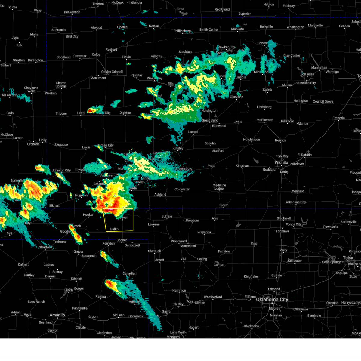 At 725 pm cdt, a severe thunderstorm was located over floris, or 12 miles northwest of beaver, moving southeast at 20 mph (radar indicated). Hazards include two inch hail and 60 mph wind gusts. Minor damage to roofs, siding, and trees is possible. people and animals outdoors will be injured. expect hail damage to roofs, siding, windows, and vehicles. locations impacted include, beaver, forgan, mocane, turpin, floris, and boyd. thunderstorm damage threat, considerable hail threat, radar indicated max hail size, 2. 00 in wind threat, radar indicated max wind gust, 60 mph. At 725 pm cdt, a severe thunderstorm was located over floris, or 12 miles northwest of beaver, moving southeast at 20 mph (radar indicated). Hazards include two inch hail and 60 mph wind gusts. Minor damage to roofs, siding, and trees is possible. people and animals outdoors will be injured. expect hail damage to roofs, siding, windows, and vehicles. locations impacted include, beaver, forgan, mocane, turpin, floris, and boyd. thunderstorm damage threat, considerable hail threat, radar indicated max hail size, 2. 00 in wind threat, radar indicated max wind gust, 60 mph.
|
| 9/10/2023 7:16 PM CDT |
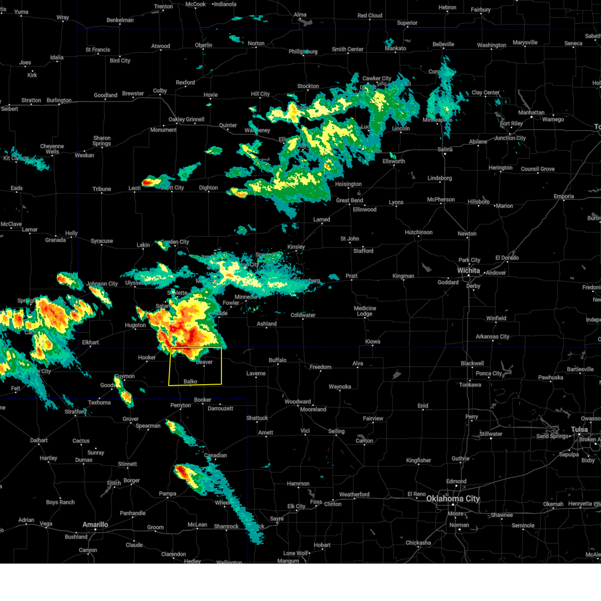 At 716 pm cdt, a severe thunderstorm was located 5 miles northwest of floris, or 12 miles southeast of liberal, moving southeast at 20 mph (radar indicated). Hazards include 60 mph wind gusts and half dollar size hail. Minor damage to roofs, siding, and trees is possible. Hail damage to vehicles is expected. At 716 pm cdt, a severe thunderstorm was located 5 miles northwest of floris, or 12 miles southeast of liberal, moving southeast at 20 mph (radar indicated). Hazards include 60 mph wind gusts and half dollar size hail. Minor damage to roofs, siding, and trees is possible. Hail damage to vehicles is expected.
|
| 8/7/2023 3:50 AM CDT |
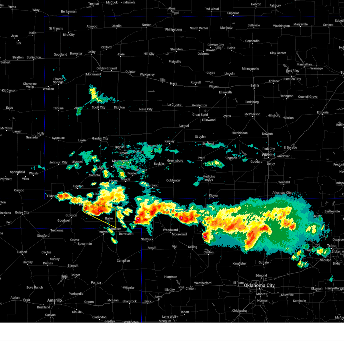 At 349 am cdt, a severe thunderstorm was located 5 miles east of boyd, or 12 miles southwest of beaver, moving southeast at 50 mph (radar indicated). Hazards include 60 mph wind gusts and quarter size hail. Minor damage to roofs, siding, and trees is possible. hail damage to vehicles is expected. locations impacted include, turpin, balko, baker, adams, boyd and bryans corner. hail threat, radar indicated max hail size, 1. 00in wind threat, radar indicated max wind gust, 60 mph. At 349 am cdt, a severe thunderstorm was located 5 miles east of boyd, or 12 miles southwest of beaver, moving southeast at 50 mph (radar indicated). Hazards include 60 mph wind gusts and quarter size hail. Minor damage to roofs, siding, and trees is possible. hail damage to vehicles is expected. locations impacted include, turpin, balko, baker, adams, boyd and bryans corner. hail threat, radar indicated max hail size, 1. 00in wind threat, radar indicated max wind gust, 60 mph.
|
| 8/7/2023 3:46 AM CDT |
 At 346 am cdt, a severe thunderstorm was located near boyd, or 14 miles west of beaver, moving southeast at 50 mph (radar indicated). Hazards include 60 mph wind gusts and quarter size hail. Minor damage to roofs, siding, and trees is possible. hail damage to vehicles is expected. locations impacted include, tyrone, baker, adams, boyd, turpin, floris, balko and bryans corner. hail threat, radar indicated max hail size, 1. 00in wind threat, radar indicated max wind gust, 60 mph. At 346 am cdt, a severe thunderstorm was located near boyd, or 14 miles west of beaver, moving southeast at 50 mph (radar indicated). Hazards include 60 mph wind gusts and quarter size hail. Minor damage to roofs, siding, and trees is possible. hail damage to vehicles is expected. locations impacted include, tyrone, baker, adams, boyd, turpin, floris, balko and bryans corner. hail threat, radar indicated max hail size, 1. 00in wind threat, radar indicated max wind gust, 60 mph.
|
| 8/7/2023 3:36 AM CDT |
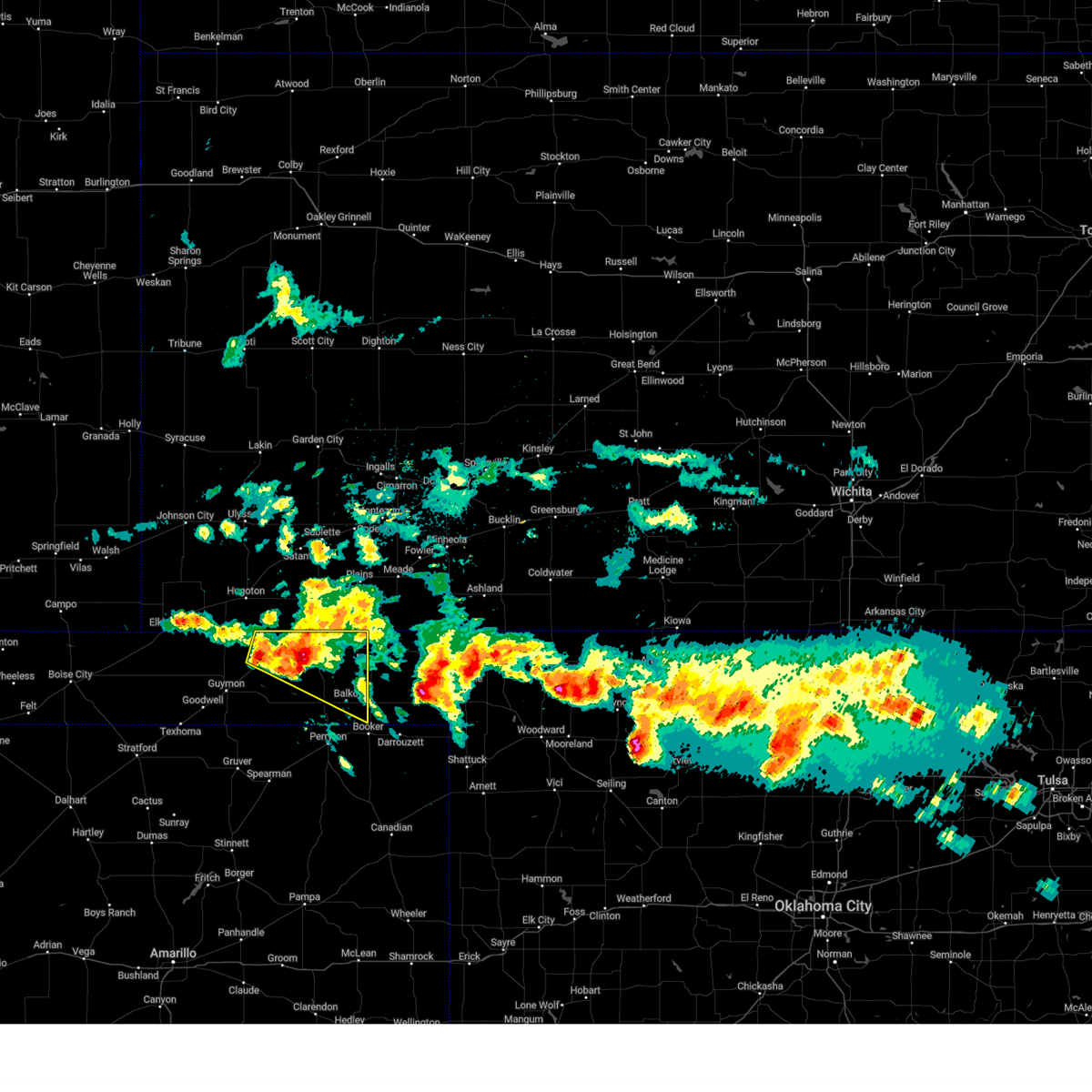 At 336 am cdt, a severe thunderstorm was located 5 miles south of turpin, or 17 miles south of liberal, moving southeast at 60 mph (radar indicated). Hazards include 60 mph wind gusts and quarter size hail. Minor damage to roofs, siding, and trees is possible. hail damage to vehicles is expected. locations impacted include, hooker, tyrone, baker, adams, boyd, turpin, floris, balko and bryans corner. hail threat, radar indicated max hail size, 1. 00in wind threat, radar indicated max wind gust, 60 mph. At 336 am cdt, a severe thunderstorm was located 5 miles south of turpin, or 17 miles south of liberal, moving southeast at 60 mph (radar indicated). Hazards include 60 mph wind gusts and quarter size hail. Minor damage to roofs, siding, and trees is possible. hail damage to vehicles is expected. locations impacted include, hooker, tyrone, baker, adams, boyd, turpin, floris, balko and bryans corner. hail threat, radar indicated max hail size, 1. 00in wind threat, radar indicated max wind gust, 60 mph.
|
| 8/7/2023 3:27 AM CDT |
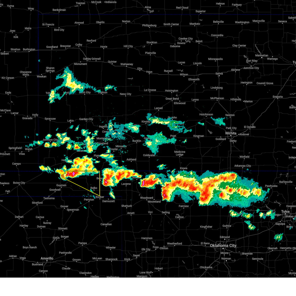 At 326 am cdt, a severe thunderstorm was located over baker, or 12 miles southwest of liberal, moving southeast at 50 mph (radar indicated). Hazards include 60 mph wind gusts and quarter size hail. Minor damage to roofs, siding, and trees is possible. hail damage to vehicles is expected. locations impacted include, hooker, tyrone, baker, adams, boyd, turpin, floris and balko. hail threat, radar indicated max hail size, 1. 00in wind threat, radar indicated max wind gust, 60 mph. At 326 am cdt, a severe thunderstorm was located over baker, or 12 miles southwest of liberal, moving southeast at 50 mph (radar indicated). Hazards include 60 mph wind gusts and quarter size hail. Minor damage to roofs, siding, and trees is possible. hail damage to vehicles is expected. locations impacted include, hooker, tyrone, baker, adams, boyd, turpin, floris and balko. hail threat, radar indicated max hail size, 1. 00in wind threat, radar indicated max wind gust, 60 mph.
|
| 8/7/2023 3:12 AM CDT |
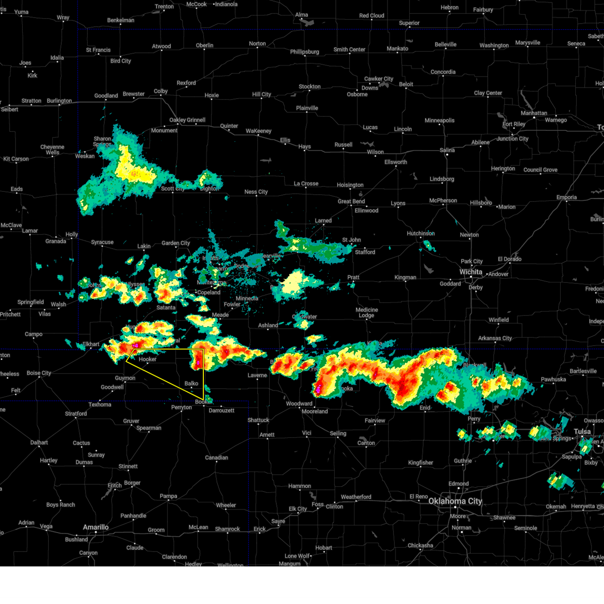 At 312 am cdt, a severe thunderstorm was located 6 miles north of hooker, or 16 miles south of hugoton, moving southeast at 50 mph (radar indicated). Hazards include 60 mph wind gusts and quarter size hail. Minor damage to roofs, siding, and trees is possible. Hail damage to vehicles is expected. At 312 am cdt, a severe thunderstorm was located 6 miles north of hooker, or 16 miles south of hugoton, moving southeast at 50 mph (radar indicated). Hazards include 60 mph wind gusts and quarter size hail. Minor damage to roofs, siding, and trees is possible. Hail damage to vehicles is expected.
|
| 8/7/2023 2:56 AM CDT |
 At 256 am cdt, a severe thunderstorm was located over floris, or 10 miles northwest of beaver, moving southeast at 50 mph (radar indicated). Hazards include quarter size hail. damage to vehicles is expected At 256 am cdt, a severe thunderstorm was located over floris, or 10 miles northwest of beaver, moving southeast at 50 mph (radar indicated). Hazards include quarter size hail. damage to vehicles is expected
|
| 7/21/2023 12:23 AM CDT |
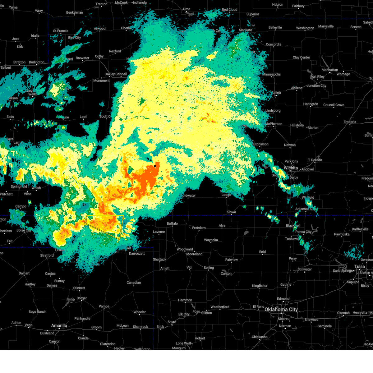 At 1221 am cdt, a severe thunderstorm was located over floris, or 12 miles northwest of beaver, moving east at 60 mph (radar indicated. the awos station at liberal measured a 62 mph gust at 12:20 am). Hazards include 70 mph wind gusts and nickel size hail. Expect some tree damage. damage is likely to mobile homes, roofs, and outbuildings. locations impacted include, hooker, tyrone, turpin, floris, baker and boyd. thunderstorm damage threat, considerable hail threat, radar indicated max hail size, 0. 88in wind threat, radar indicated max wind gust, 70 mph. At 1221 am cdt, a severe thunderstorm was located over floris, or 12 miles northwest of beaver, moving east at 60 mph (radar indicated. the awos station at liberal measured a 62 mph gust at 12:20 am). Hazards include 70 mph wind gusts and nickel size hail. Expect some tree damage. damage is likely to mobile homes, roofs, and outbuildings. locations impacted include, hooker, tyrone, turpin, floris, baker and boyd. thunderstorm damage threat, considerable hail threat, radar indicated max hail size, 0. 88in wind threat, radar indicated max wind gust, 70 mph.
|
| 7/20/2023 11:57 PM CDT |
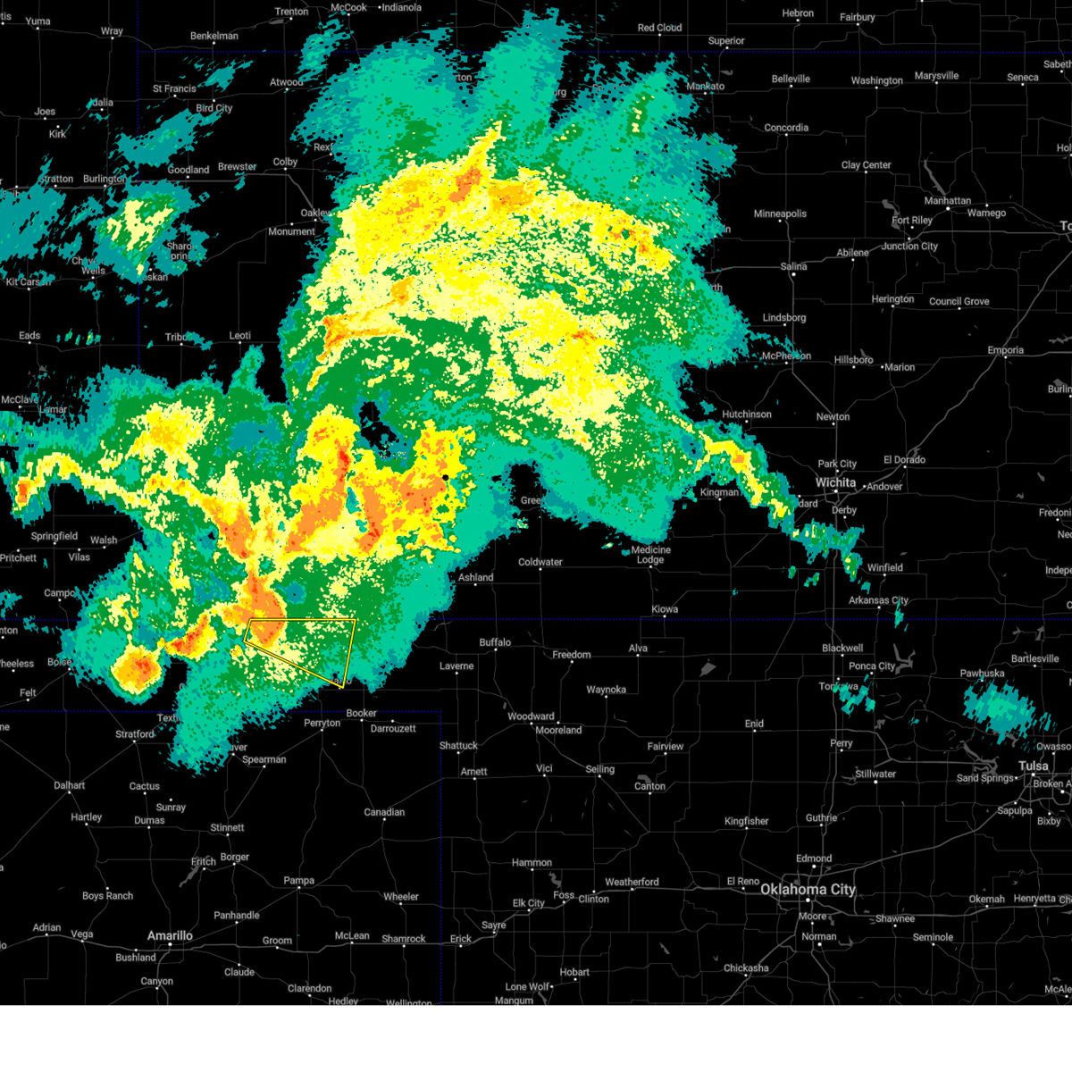 At 1157 pm cdt, a severe thunderstorm was located over tyrone, or 8 miles southwest of liberal, moving east at 35 mph (radar indicated). Hazards include 60 mph wind gusts and nickel size hail. minor damage to roofs, siding, and trees is possible At 1157 pm cdt, a severe thunderstorm was located over tyrone, or 8 miles southwest of liberal, moving east at 35 mph (radar indicated). Hazards include 60 mph wind gusts and nickel size hail. minor damage to roofs, siding, and trees is possible
|
| 7/9/2023 12:08 AM CDT |
 At 1207 am cdt, severe thunderstorms were located along a line extending from near elmwood to 9 miles south of hardesty, moving south at 40 mph (radar indicated). Hazards include 60 mph wind gusts and half dollar size hail. Minor damage to roofs, siding, and trees is possible. hail damage to vehicles is expected. locations impacted include, beaver, hooker, forgan, hardesty, elmwood, adams, boyd, floris, bryans corner, baker, mocane, turpin and balko. hail threat, radar indicated max hail size, 1. 25 in wind threat, radar indicated max wind gust, 60 mph. At 1207 am cdt, severe thunderstorms were located along a line extending from near elmwood to 9 miles south of hardesty, moving south at 40 mph (radar indicated). Hazards include 60 mph wind gusts and half dollar size hail. Minor damage to roofs, siding, and trees is possible. hail damage to vehicles is expected. locations impacted include, beaver, hooker, forgan, hardesty, elmwood, adams, boyd, floris, bryans corner, baker, mocane, turpin and balko. hail threat, radar indicated max hail size, 1. 25 in wind threat, radar indicated max wind gust, 60 mph.
|
| 7/8/2023 11:46 PM CDT |
 At 1146 pm cdt, severe thunderstorms were located along a line extending from 4 miles southwest of beaver to 3 miles northwest of hardesty, moving south at 40 mph (radar indicated). Hazards include 60 mph wind gusts and half dollar size hail. Minor damage to roofs, siding, and trees is possible. hail damage to vehicles is expected. locations impacted include, beaver, hooker, tyrone, forgan, hardesty, elmwood, adams, boyd, floris, bryans corner, baker, mocane, turpin and balko. hail threat, radar indicated max hail size, 1. 25 in wind threat, radar indicated max wind gust, 60 mph. At 1146 pm cdt, severe thunderstorms were located along a line extending from 4 miles southwest of beaver to 3 miles northwest of hardesty, moving south at 40 mph (radar indicated). Hazards include 60 mph wind gusts and half dollar size hail. Minor damage to roofs, siding, and trees is possible. hail damage to vehicles is expected. locations impacted include, beaver, hooker, tyrone, forgan, hardesty, elmwood, adams, boyd, floris, bryans corner, baker, mocane, turpin and balko. hail threat, radar indicated max hail size, 1. 25 in wind threat, radar indicated max wind gust, 60 mph.
|
| 7/8/2023 11:24 PM CDT |
 At 1123 pm cdt, severe thunderstorms were located along a line extending from 6 miles north of floris to 6 miles west of hooker, moving south at 40 mph (radar indicated). Hazards include 60 mph wind gusts and penny size hail. minor damage to roofs, siding, and trees is possible At 1123 pm cdt, severe thunderstorms were located along a line extending from 6 miles north of floris to 6 miles west of hooker, moving south at 40 mph (radar indicated). Hazards include 60 mph wind gusts and penny size hail. minor damage to roofs, siding, and trees is possible
|
| 7/7/2023 6:36 PM CDT |
 At 635 pm cdt, severe thunderstorms were located along a line extending from 7 miles northwest of forgan to 5 miles east of boyd to 6 miles north of farnsworth, moving east at 30 mph (radar indicated). Hazards include 60 mph wind gusts and quarter size hail. Minor damage to roofs, siding, and trees is possible. Hail damage to vehicles is expected. At 635 pm cdt, severe thunderstorms were located along a line extending from 7 miles northwest of forgan to 5 miles east of boyd to 6 miles north of farnsworth, moving east at 30 mph (radar indicated). Hazards include 60 mph wind gusts and quarter size hail. Minor damage to roofs, siding, and trees is possible. Hail damage to vehicles is expected.
|
| 7/7/2023 6:12 PM CDT |
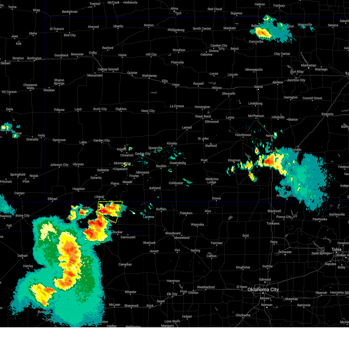 At 611 pm cdt, a severe thunderstorm was located near floris, or 14 miles west of beaver, moving east at 15 mph (radar indicated). Hazards include golf ball size hail and 60 mph wind gusts. Minor damage to roofs, siding, and trees is possible. people and animals outdoors will be injured. expect hail damage to roofs, siding, windows, and vehicles. locations impacted include, beaver, forgan, mocane, turpin and floris. thunderstorm damage threat, considerable hail threat, radar indicated max hail size, 1. 75 in wind threat, radar indicated max wind gust, 60 mph. At 611 pm cdt, a severe thunderstorm was located near floris, or 14 miles west of beaver, moving east at 15 mph (radar indicated). Hazards include golf ball size hail and 60 mph wind gusts. Minor damage to roofs, siding, and trees is possible. people and animals outdoors will be injured. expect hail damage to roofs, siding, windows, and vehicles. locations impacted include, beaver, forgan, mocane, turpin and floris. thunderstorm damage threat, considerable hail threat, radar indicated max hail size, 1. 75 in wind threat, radar indicated max wind gust, 60 mph.
|
| 7/7/2023 5:44 PM CDT |
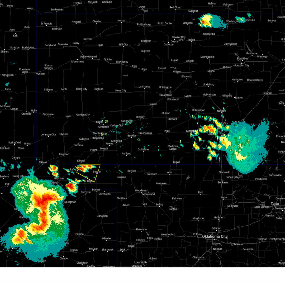 At 543 pm cdt, a severe thunderstorm was located over turpin, or 10 miles south of liberal, moving east at 15 mph (radar indicated). Hazards include ping pong ball size hail and 60 mph wind gusts. Minor damage to roofs, siding, and trees is possible. people and animals outdoors will be injured. Expect hail damage to roofs, siding, windows, and vehicles. At 543 pm cdt, a severe thunderstorm was located over turpin, or 10 miles south of liberal, moving east at 15 mph (radar indicated). Hazards include ping pong ball size hail and 60 mph wind gusts. Minor damage to roofs, siding, and trees is possible. people and animals outdoors will be injured. Expect hail damage to roofs, siding, windows, and vehicles.
|
| 7/7/2023 4:23 AM CDT |
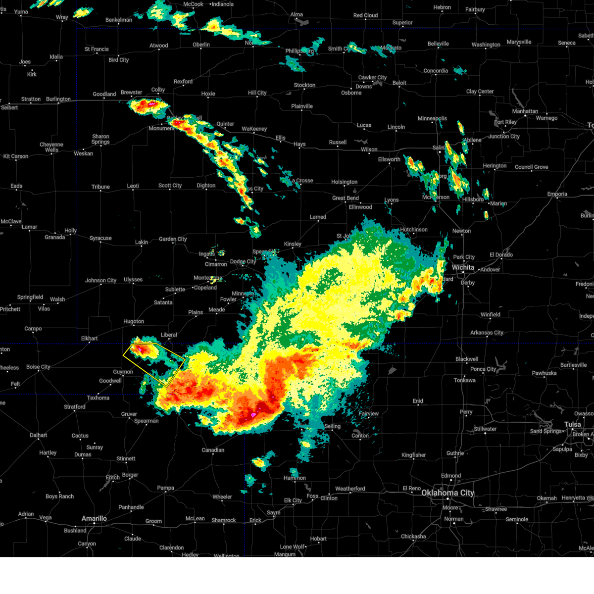 At 423 am cdt, a severe thunderstorm was located over hooker, or 19 miles southwest of liberal, moving southeast at 35 mph (radar indicated). Hazards include 60 mph wind gusts and quarter size hail. Minor damage to roofs, siding, and trees is possible. hail damage to vehicles is expected. locations impacted include, hooker, tyrone, turpin, baker and adams. hail threat, radar indicated max hail size, 1. 00in wind threat, radar indicated max wind gust, 60 mph. At 423 am cdt, a severe thunderstorm was located over hooker, or 19 miles southwest of liberal, moving southeast at 35 mph (radar indicated). Hazards include 60 mph wind gusts and quarter size hail. Minor damage to roofs, siding, and trees is possible. hail damage to vehicles is expected. locations impacted include, hooker, tyrone, turpin, baker and adams. hail threat, radar indicated max hail size, 1. 00in wind threat, radar indicated max wind gust, 60 mph.
|
| 7/7/2023 3:33 AM CDT |
 At 332 am cdt, severe thunderstorms were located along a line extending from 5 miles northwest of forgan to near tyrone to 3 miles west of rolla, moving southeast at 35 mph (radar indicated). Hazards include two inch hail and 70 mph wind gusts. Expect some tree damage. damage is likely to mobile homes, roofs, and outbuildings. people and animals outdoors will be injured. expect hail damage to roofs, siding, windows, and vehicles. locations impacted include, guymon, beaver, hooker, tyrone, forgan, optima, hardesty, elmwood, hough, adams, boyd, floris, bryans corner, baker, mocane, turpin and balko. thunderstorm damage threat, considerable hail threat, radar indicated max hail size, 2. 00 in wind threat, radar indicated max wind gust, 70 mph. At 332 am cdt, severe thunderstorms were located along a line extending from 5 miles northwest of forgan to near tyrone to 3 miles west of rolla, moving southeast at 35 mph (radar indicated). Hazards include two inch hail and 70 mph wind gusts. Expect some tree damage. damage is likely to mobile homes, roofs, and outbuildings. people and animals outdoors will be injured. expect hail damage to roofs, siding, windows, and vehicles. locations impacted include, guymon, beaver, hooker, tyrone, forgan, optima, hardesty, elmwood, hough, adams, boyd, floris, bryans corner, baker, mocane, turpin and balko. thunderstorm damage threat, considerable hail threat, radar indicated max hail size, 2. 00 in wind threat, radar indicated max wind gust, 70 mph.
|
| 7/7/2023 3:14 AM CDT | At 314 am cdt, severe thunderstorms were located along a line extending from 4 miles south of hayne to 7 miles northwest of tyrone to 6 miles northwest of wilburton, moving southeast at 30 mph (radar indicated). Hazards include two inch hail and 70 mph wind gusts. Expect some tree damage. damage is likely to mobile homes, roofs, and outbuildings. people and animals outdoors will be injured. Expect hail damage to roofs, siding, windows, and vehicles. |
| 7/6/2023 2:40 AM CDT | The severe thunderstorm warning for western beaver and southeastern texas counties will expire at 245 am cdt, the storms which prompted the warning have weakened below severe limits, and no longer pose an immediate threat to life or property. therefore, the warning will be allowed to expire. however small hail, gusty winds and heavy rain are still possible with these thunderstorms. a severe thunderstorm watch remains in effect until 500 am cdt for the panhandle of oklahoma. |
| 7/6/2023 2:26 AM CDT | At 225 am cdt, severe thunderstorms were located along a line extending from balko to 5 miles northeast of hardesty, moving southeast at 30 mph (trained weather spotters. at 2 am cdt, trained spotters reported quarter size hail 7 miles south southeast of hooker). Hazards include 60 mph wind gusts and quarter size hail. Minor damage to roofs, siding, and trees is possible. hail damage to vehicles is expected. locations impacted include, guymon, beaver, hooker, optima, hardesty, elmwood, adams, boyd, floris, bryans corner, baker, turpin and balko. hail threat, observed max hail size, 1. 00in wind threat, radar indicated max wind gust, 60 mph. |
| 7/6/2023 2:24 AM CDT | At 223 am cdt, severe thunderstorms were located along a line extending from near balko to 5 miles north of hardesty, moving southeast at 30 mph (trained weather spotters. at 223 am cdt, trained spotters reported quarter size hail 7 miles south southeast of hooker). Hazards include 60 mph wind gusts and quarter size hail. Minor damage to roofs, siding, and trees is possible. hail damage to vehicles is expected. locations impacted include, guymon, beaver, hooker, optima, hardesty, elmwood, adams, boyd, floris, bryans corner, baker, turpin and balko. hail threat, observed max hail size, 1. 00in wind threat, radar indicated max wind gust, 60 mph. |
| 7/6/2023 2:15 AM CDT |
 At 215 am cdt, severe thunderstorms were located along a line extending from 4 miles northwest of balko to 6 miles north of hardesty, moving southeast at 15 mph (radar indicated). Hazards include 60 mph wind gusts and half dollar size hail. Minor damage to roofs, siding, and trees is possible. hail damage to vehicles is expected. locations impacted include, guymon, beaver, hooker, optima, hardesty, elmwood, adams, boyd, floris, bryans corner, baker, turpin and balko. hail threat, radar indicated max hail size, 1. 25 in wind threat, radar indicated max wind gust, 60 mph. At 215 am cdt, severe thunderstorms were located along a line extending from 4 miles northwest of balko to 6 miles north of hardesty, moving southeast at 15 mph (radar indicated). Hazards include 60 mph wind gusts and half dollar size hail. Minor damage to roofs, siding, and trees is possible. hail damage to vehicles is expected. locations impacted include, guymon, beaver, hooker, optima, hardesty, elmwood, adams, boyd, floris, bryans corner, baker, turpin and balko. hail threat, radar indicated max hail size, 1. 25 in wind threat, radar indicated max wind gust, 60 mph.
|
| 7/6/2023 1:43 AM CDT |
 At 143 am cdt, severe thunderstorms were located along a line extending from 5 miles northwest of boyd to near optima, moving southeast at 30 mph (radar indicated). Hazards include 60 mph wind gusts and half dollar size hail. Minor damage to roofs, siding, and trees is possible. Hail damage to vehicles is expected. At 143 am cdt, severe thunderstorms were located along a line extending from 5 miles northwest of boyd to near optima, moving southeast at 30 mph (radar indicated). Hazards include 60 mph wind gusts and half dollar size hail. Minor damage to roofs, siding, and trees is possible. Hail damage to vehicles is expected.
|
| 6/27/2023 8:15 PM CDT |
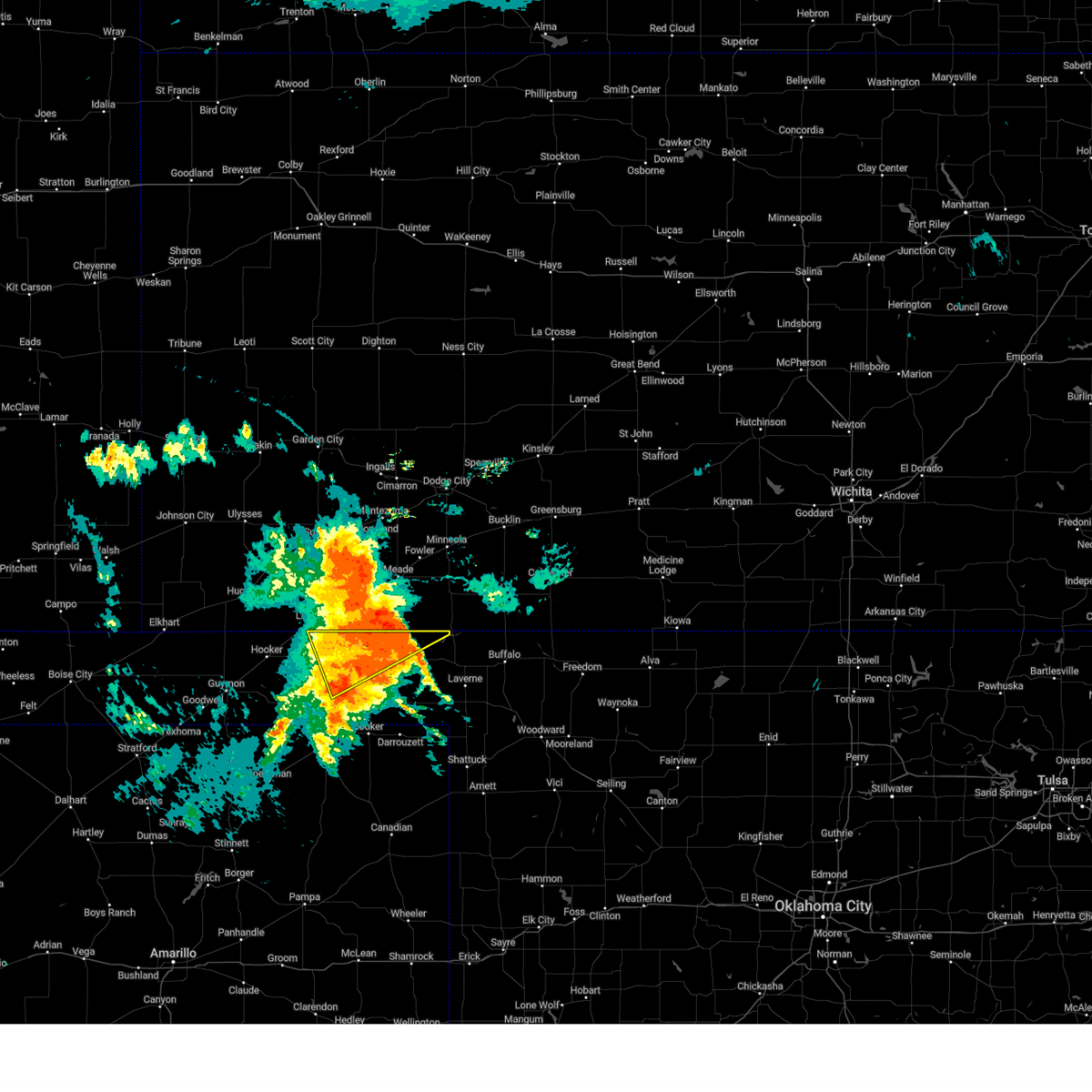 At 814 pm cdt, a severe thunderstorm was located 4 miles east of floris, or 6 miles northwest of beaver, moving northeast at 40 mph. this is a destructive storm for beaver and forgan (radar indicated). Hazards include 80 mph wind gusts and quarter size hail. Flying debris will be dangerous to those caught without shelter. mobile homes will be heavily damaged. expect considerable damage to roofs, windows, and vehicles. tree damage and power outages are likely. hail damage to vehicles is expected. locations impacted include, beaver, forgan, mocane, turpin and floris. thunderstorm damage threat, destructive hail threat, radar indicated max hail size, 1. 00in wind threat, radar indicated max wind gust, 80 mph. At 814 pm cdt, a severe thunderstorm was located 4 miles east of floris, or 6 miles northwest of beaver, moving northeast at 40 mph. this is a destructive storm for beaver and forgan (radar indicated). Hazards include 80 mph wind gusts and quarter size hail. Flying debris will be dangerous to those caught without shelter. mobile homes will be heavily damaged. expect considerable damage to roofs, windows, and vehicles. tree damage and power outages are likely. hail damage to vehicles is expected. locations impacted include, beaver, forgan, mocane, turpin and floris. thunderstorm damage threat, destructive hail threat, radar indicated max hail size, 1. 00in wind threat, radar indicated max wind gust, 80 mph.
|
| 6/27/2023 8:08 PM CDT |
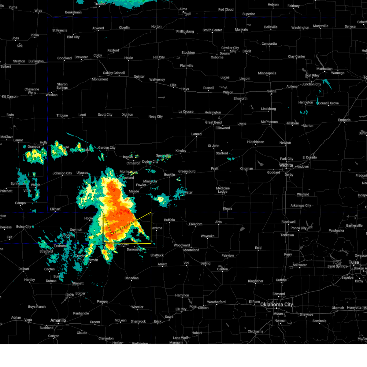 At 808 pm cdt, a severe thunderstorm was located over balko, or 16 miles north of perryton, moving east at 40 mph (radar indicated). Hazards include 70 mph wind gusts and ping pong ball size hail. Expect some tree damage. damage is likely to mobile homes, roofs, and outbuildings. people and animals outdoors will be injured. expect hail damage to roofs, siding, windows, and vehicles. locations impacted include, gate, knowles, elmwood, bryans corner, boyd, slapout and balko. thunderstorm damage threat, considerable hail threat, radar indicated max hail size, 1. 50 in wind threat, radar indicated max wind gust, 70 mph. At 808 pm cdt, a severe thunderstorm was located over balko, or 16 miles north of perryton, moving east at 40 mph (radar indicated). Hazards include 70 mph wind gusts and ping pong ball size hail. Expect some tree damage. damage is likely to mobile homes, roofs, and outbuildings. people and animals outdoors will be injured. expect hail damage to roofs, siding, windows, and vehicles. locations impacted include, gate, knowles, elmwood, bryans corner, boyd, slapout and balko. thunderstorm damage threat, considerable hail threat, radar indicated max hail size, 1. 50 in wind threat, radar indicated max wind gust, 70 mph.
|
| 6/27/2023 7:54 PM CDT |
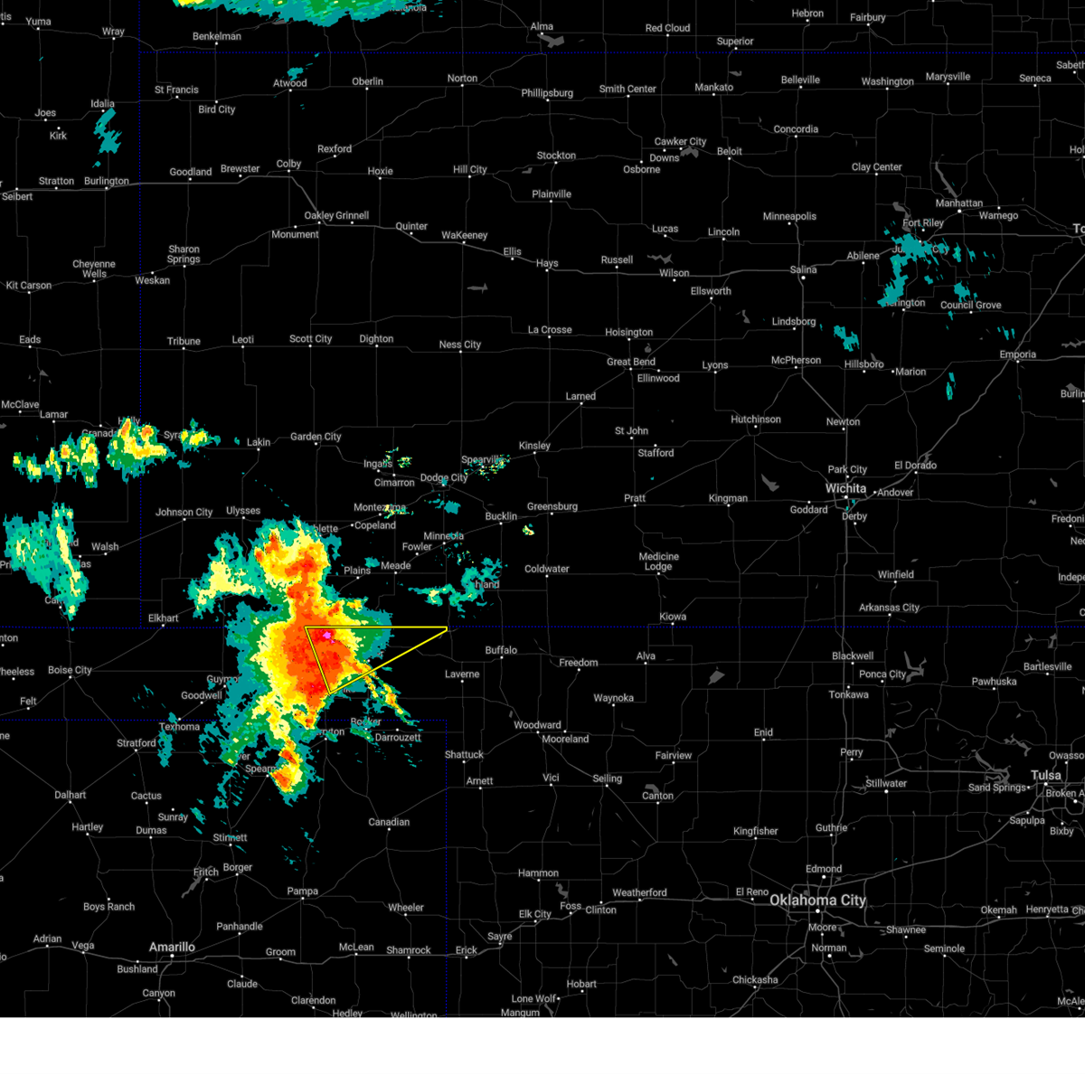 At 753 pm cdt, a severe thunderstorm was located over floris, or 10 miles west of beaver, moving northeast at 50 mph. this is a destructive storm for beaver and forgan (radar indicated). Hazards include 100 mph wind gusts and ping pong ball size hail. You are in a life-threatening situation. flying debris may be deadly to those caught without shelter. mobile homes will be destroyed. expect considerable damage to homes and businesses. Expect extensive tree damage and power outages. At 753 pm cdt, a severe thunderstorm was located over floris, or 10 miles west of beaver, moving northeast at 50 mph. this is a destructive storm for beaver and forgan (radar indicated). Hazards include 100 mph wind gusts and ping pong ball size hail. You are in a life-threatening situation. flying debris may be deadly to those caught without shelter. mobile homes will be destroyed. expect considerable damage to homes and businesses. Expect extensive tree damage and power outages.
|
| 6/27/2023 7:47 PM CDT | Storm chaser measured with a mounted anemomete in beaver county OK, 5.3 miles N of Turpin, OK |
| 6/27/2023 7:26 PM CDT |
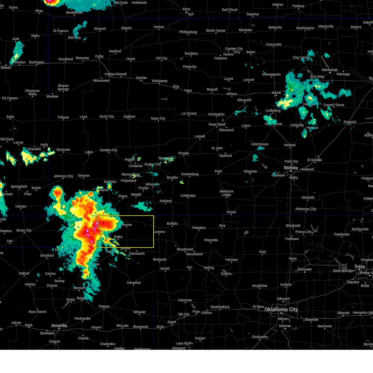 At 725 pm cdt, severe thunderstorms were located along a line extending from 3 miles north of tyrone to 6 miles east of adams to 9 miles southeast of hardesty, moving northeast at 30 mph (radar indicated). Hazards include two inch hail and 70 mph wind gusts. Expect some tree damage. damage is likely to mobile homes, roofs, and outbuildings. people and animals outdoors will be injured. Expect hail damage to roofs, siding, windows, and vehicles. At 725 pm cdt, severe thunderstorms were located along a line extending from 3 miles north of tyrone to 6 miles east of adams to 9 miles southeast of hardesty, moving northeast at 30 mph (radar indicated). Hazards include two inch hail and 70 mph wind gusts. Expect some tree damage. damage is likely to mobile homes, roofs, and outbuildings. people and animals outdoors will be injured. Expect hail damage to roofs, siding, windows, and vehicles.
|
| 6/27/2023 7:04 PM CDT |
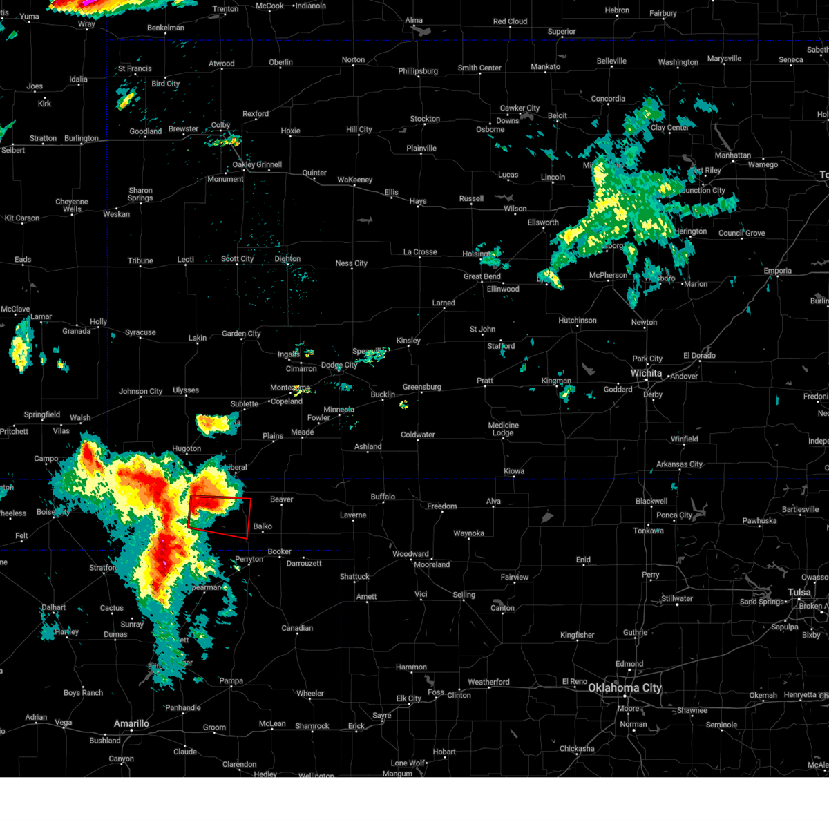 At 704 pm cdt, a severe thunderstorm capable of producing a tornado was located 4 miles west of adams, or 17 miles east of guymon, moving southeast at 30 mph (radar indicated rotation). Hazards include tornado and baseball size hail. Flying debris will be dangerous to those caught without shelter. mobile homes will be damaged or destroyed. damage to roofs, windows, and vehicles will occur. tree damage is likely. Locations impacted include, hooker, bryans corner, adams and boyd. At 704 pm cdt, a severe thunderstorm capable of producing a tornado was located 4 miles west of adams, or 17 miles east of guymon, moving southeast at 30 mph (radar indicated rotation). Hazards include tornado and baseball size hail. Flying debris will be dangerous to those caught without shelter. mobile homes will be damaged or destroyed. damage to roofs, windows, and vehicles will occur. tree damage is likely. Locations impacted include, hooker, bryans corner, adams and boyd.
|
| 6/27/2023 7:02 PM CDT |
 At 702 pm cdt, severe thunderstorms were located along a line extending from 6 miles north of wilburton to 10 miles northeast of hough to 7 miles west of hardesty, moving northeast at 50 mph (radar indicated). Hazards include 70 mph wind gusts and ping pong ball size hail. Expect some tree damage. damage is likely to mobile homes, roofs, and outbuildings. people and animals outdoors will be injured. expect hail damage to roofs, siding, windows, and vehicles. locations impacted include, guymon, hooker, tyrone, optima, hough, baker, adams and turpin. thunderstorm damage threat, considerable hail threat, radar indicated max hail size, 1. 50 in wind threat, radar indicated max wind gust, 70 mph. At 702 pm cdt, severe thunderstorms were located along a line extending from 6 miles north of wilburton to 10 miles northeast of hough to 7 miles west of hardesty, moving northeast at 50 mph (radar indicated). Hazards include 70 mph wind gusts and ping pong ball size hail. Expect some tree damage. damage is likely to mobile homes, roofs, and outbuildings. people and animals outdoors will be injured. expect hail damage to roofs, siding, windows, and vehicles. locations impacted include, guymon, hooker, tyrone, optima, hough, baker, adams and turpin. thunderstorm damage threat, considerable hail threat, radar indicated max hail size, 1. 50 in wind threat, radar indicated max wind gust, 70 mph.
|
| 6/27/2023 6:43 PM CDT |
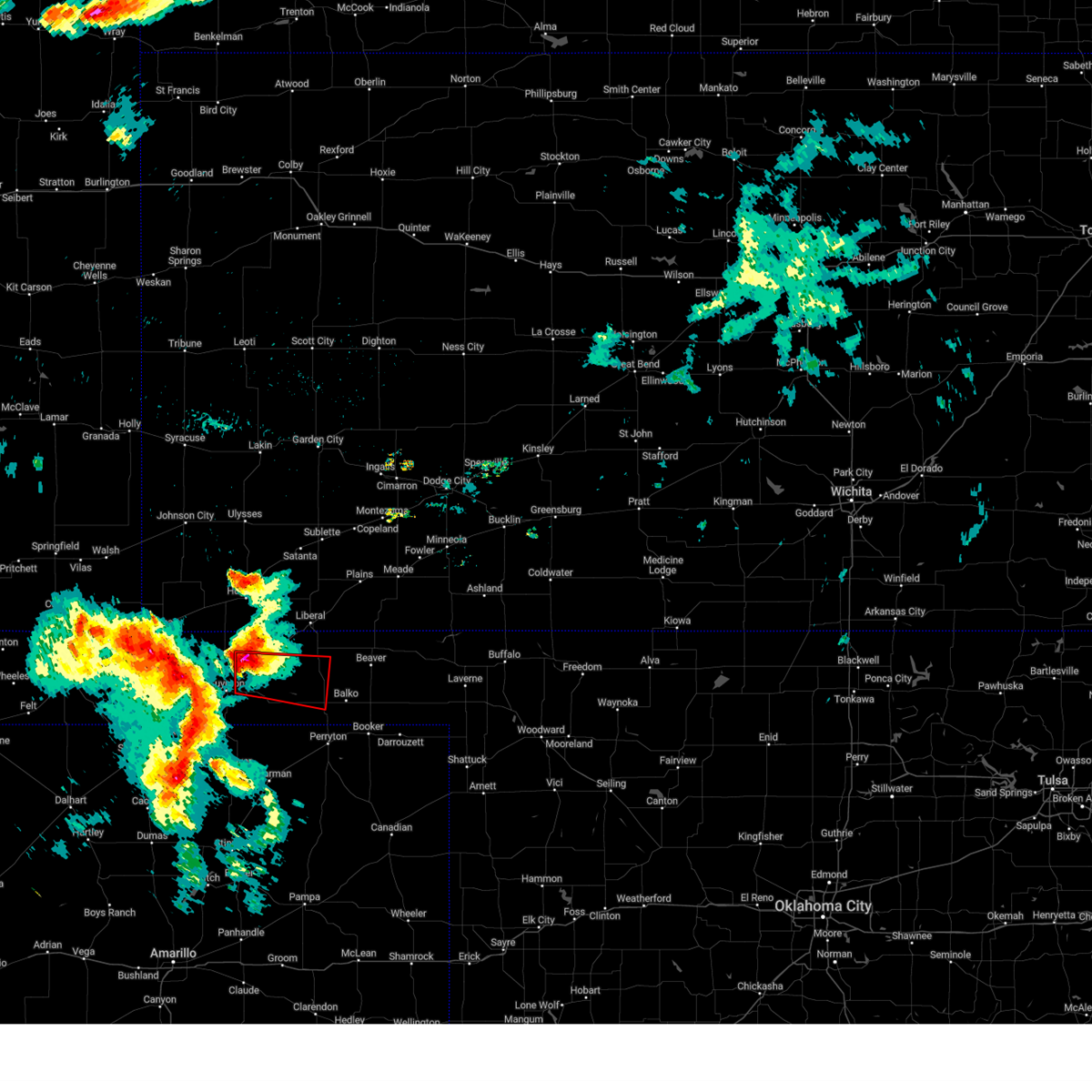 At 643 pm cdt, a severe thunderstorm capable of producing a tornado was located over optima, or 10 miles northeast of guymon, moving east at 30 mph (radar indicated rotation). Hazards include tornado and baseball size hail. Flying debris will be dangerous to those caught without shelter. mobile homes will be damaged or destroyed. damage to roofs, windows, and vehicles will occur. Tree damage is likely. At 643 pm cdt, a severe thunderstorm capable of producing a tornado was located over optima, or 10 miles northeast of guymon, moving east at 30 mph (radar indicated rotation). Hazards include tornado and baseball size hail. Flying debris will be dangerous to those caught without shelter. mobile homes will be damaged or destroyed. damage to roofs, windows, and vehicles will occur. Tree damage is likely.
|
| 6/27/2023 6:41 PM CDT |
 At 641 pm cdt, severe thunderstorms were located along a line extending from 5 miles west of elkhart to 6 miles southwest of hough to 10 miles southeast of goodwell, moving northeast at 50 mph. these are destructive storms for eva and guymon (radar indicated). Hazards include 80 mph wind gusts and ping pong ball size hail. Flying debris will be dangerous to those caught without shelter. mobile homes will be heavily damaged. expect considerable damage to roofs, windows, and vehicles. tree damage and power outages are likely. people and animals outdoors will be injured. Expect hail damage to roofs, siding, windows, and vehicles. At 641 pm cdt, severe thunderstorms were located along a line extending from 5 miles west of elkhart to 6 miles southwest of hough to 10 miles southeast of goodwell, moving northeast at 50 mph. these are destructive storms for eva and guymon (radar indicated). Hazards include 80 mph wind gusts and ping pong ball size hail. Flying debris will be dangerous to those caught without shelter. mobile homes will be heavily damaged. expect considerable damage to roofs, windows, and vehicles. tree damage and power outages are likely. people and animals outdoors will be injured. Expect hail damage to roofs, siding, windows, and vehicles.
|
| 6/17/2023 6:57 PM CDT |
 At 657 pm cdt, automated weather equipment reported a severe thunderstorm was located 4 miles southwest of floris, or 13 miles west of beaver, moving east at 30 mph (automated weather equipment. at 650 pm cdt, automated weather equipment recorded a 70 mph wind gust in hooker). Hazards include two inch hail and 70 mph wind gusts. Expect some tree damage. damage is likely to mobile homes, roofs, and outbuildings. people and animals outdoors will be injured. expect hail damage to roofs, siding, windows, and vehicles. locations impacted include, beaver, hooker, tyrone, forgan, knowles, baker, adams, boyd, mocane, turpin and floris. thunderstorm damage threat, considerable hail threat, radar indicated max hail size, 2. 00 in wind threat, observed max wind gust, 70 mph. At 657 pm cdt, automated weather equipment reported a severe thunderstorm was located 4 miles southwest of floris, or 13 miles west of beaver, moving east at 30 mph (automated weather equipment. at 650 pm cdt, automated weather equipment recorded a 70 mph wind gust in hooker). Hazards include two inch hail and 70 mph wind gusts. Expect some tree damage. damage is likely to mobile homes, roofs, and outbuildings. people and animals outdoors will be injured. expect hail damage to roofs, siding, windows, and vehicles. locations impacted include, beaver, hooker, tyrone, forgan, knowles, baker, adams, boyd, mocane, turpin and floris. thunderstorm damage threat, considerable hail threat, radar indicated max hail size, 2. 00 in wind threat, observed max wind gust, 70 mph.
|
| 6/17/2023 6:53 PM CDT |
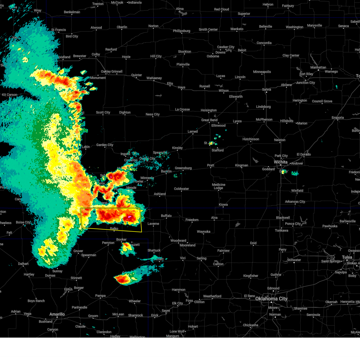 At 653 pm cdt, a severe thunderstorm was located 5 miles southeast of turpin, or 15 miles west of beaver, moving east at 30 mph (radar indicated). Hazards include two inch hail and 60 mph wind gusts. Minor damage to roofs, siding, and trees is possible. people and animals outdoors will be injured. Expect hail damage to roofs, siding, windows, and vehicles. At 653 pm cdt, a severe thunderstorm was located 5 miles southeast of turpin, or 15 miles west of beaver, moving east at 30 mph (radar indicated). Hazards include two inch hail and 60 mph wind gusts. Minor damage to roofs, siding, and trees is possible. people and animals outdoors will be injured. Expect hail damage to roofs, siding, windows, and vehicles.
|
| 6/17/2023 6:24 PM CDT |
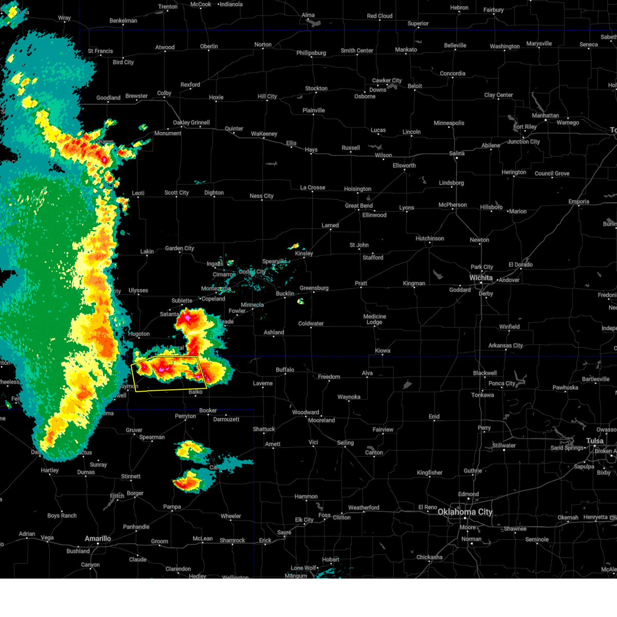 At 624 pm cdt, a severe thunderstorm was located over baker, or 13 miles southwest of liberal, moving east at 45 mph (radar indicated). Hazards include tennis ball size hail and 60 mph wind gusts. Minor damage to roofs, siding, and trees is possible. people and animals outdoors will be injured. expect hail damage to roofs, siding, windows, and vehicles. locations impacted include, hooker, tyrone, optima, baker, adams, boyd, turpin and floris. thunderstorm damage threat, considerable hail threat, radar indicated max hail size, 2. 50 in wind threat, radar indicated max wind gust, 60 mph. At 624 pm cdt, a severe thunderstorm was located over baker, or 13 miles southwest of liberal, moving east at 45 mph (radar indicated). Hazards include tennis ball size hail and 60 mph wind gusts. Minor damage to roofs, siding, and trees is possible. people and animals outdoors will be injured. expect hail damage to roofs, siding, windows, and vehicles. locations impacted include, hooker, tyrone, optima, baker, adams, boyd, turpin and floris. thunderstorm damage threat, considerable hail threat, radar indicated max hail size, 2. 50 in wind threat, radar indicated max wind gust, 60 mph.
|
| 6/17/2023 6:04 PM CDT |
 At 604 pm cdt, a severe thunderstorm capable of producing a tornado was located 6 miles southwest of floris, or 12 miles west of beaver, moving east at 35 mph (weather spotters reported a rotating wall cloud). Hazards include tornado and baseball size hail. Flying debris will be dangerous to those caught without shelter. mobile homes will be damaged or destroyed. damage to roofs, windows, and vehicles will occur. tree damage is likely. Locations impacted include, beaver, forgan, mocane and floris. At 604 pm cdt, a severe thunderstorm capable of producing a tornado was located 6 miles southwest of floris, or 12 miles west of beaver, moving east at 35 mph (weather spotters reported a rotating wall cloud). Hazards include tornado and baseball size hail. Flying debris will be dangerous to those caught without shelter. mobile homes will be damaged or destroyed. damage to roofs, windows, and vehicles will occur. tree damage is likely. Locations impacted include, beaver, forgan, mocane and floris.
|
| 6/17/2023 5:58 PM CDT |
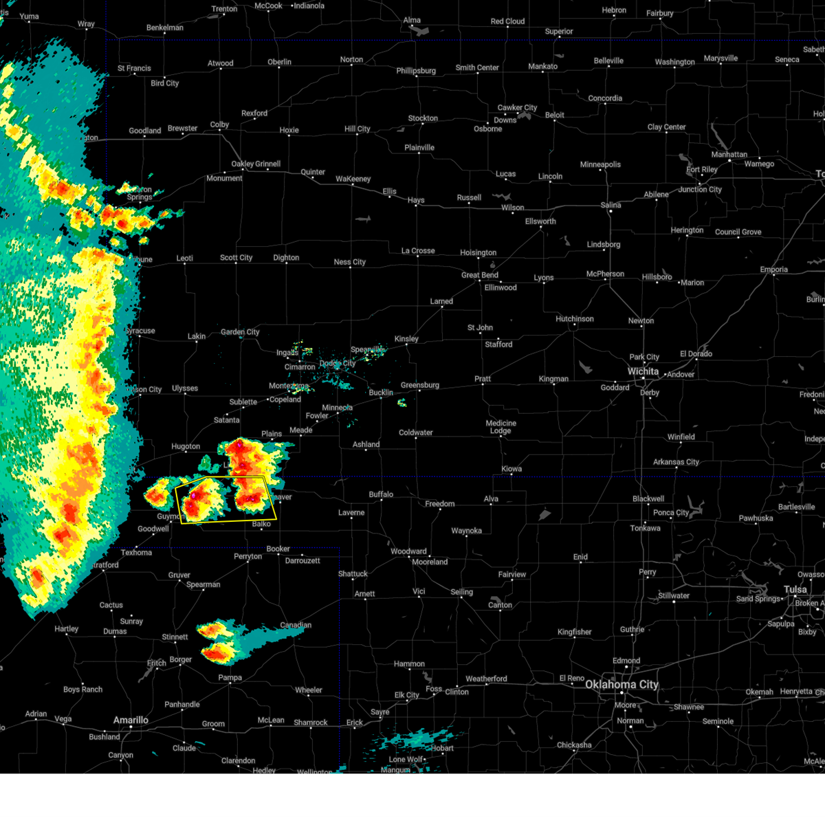 At 557 pm cdt, a severe thunderstorm was located over hooker, or 17 miles northeast of guymon, moving east at 25 mph (radar indicated). Hazards include two inch hail and 60 mph wind gusts. Minor damage to roofs, siding, and trees is possible. people and animals outdoors will be injured. Expect hail damage to roofs, siding, windows, and vehicles. At 557 pm cdt, a severe thunderstorm was located over hooker, or 17 miles northeast of guymon, moving east at 25 mph (radar indicated). Hazards include two inch hail and 60 mph wind gusts. Minor damage to roofs, siding, and trees is possible. people and animals outdoors will be injured. Expect hail damage to roofs, siding, windows, and vehicles.
|
| 6/17/2023 5:57 PM CDT | Baseball sized hail reported 5.5 miles NNE of Turpin, OK, hail report submitted via spotter network. |
| 6/17/2023 5:54 PM CDT | Hen Egg sized hail reported 5.8 miles NNE of Turpin, OK, hail reported via spotter network. |
| 6/17/2023 5:52 PM CDT |
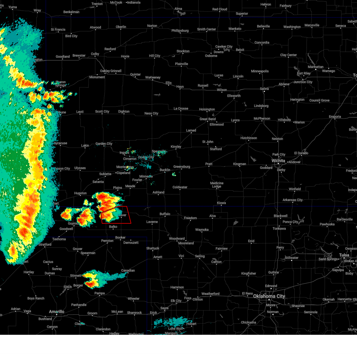 At 552 pm cdt, a severe thunderstorm capable of producing a tornado was located 5 miles southeast of turpin, or 16 miles west of beaver, moving east at 25 mph (weather spotters reported funnel cloud). Hazards include tornado and golf ball size hail. Flying debris will be dangerous to those caught without shelter. mobile homes will be damaged or destroyed. damage to roofs, windows, and vehicles will occur. Tree damage is likely. At 552 pm cdt, a severe thunderstorm capable of producing a tornado was located 5 miles southeast of turpin, or 16 miles west of beaver, moving east at 25 mph (weather spotters reported funnel cloud). Hazards include tornado and golf ball size hail. Flying debris will be dangerous to those caught without shelter. mobile homes will be damaged or destroyed. damage to roofs, windows, and vehicles will occur. Tree damage is likely.
|
| 6/17/2023 5:48 PM CDT |
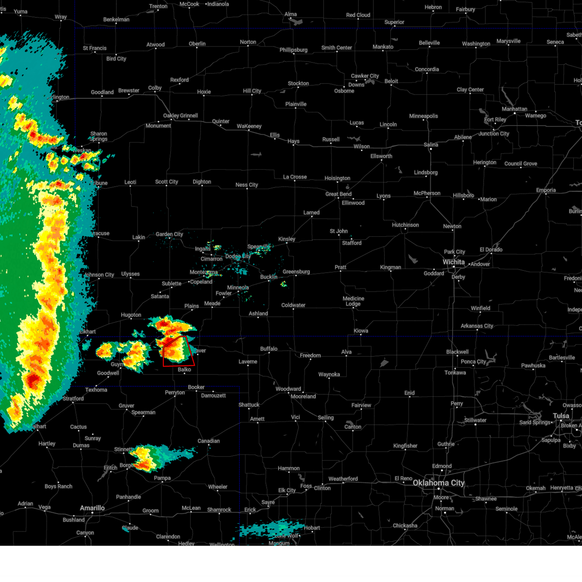 At 548 pm cdt, a severe thunderstorm capable of producing a tornado was located 4 miles southeast of turpin, or 16 miles south of liberal, moving east at 30 mph (weather spotters reported a funnel cloud). Hazards include tornado and golf ball size hail. Flying debris will be dangerous to those caught without shelter. mobile homes will be damaged or destroyed. damage to roofs, windows, and vehicles will occur. tree damage is likely. Locations impacted include, turpin and floris. At 548 pm cdt, a severe thunderstorm capable of producing a tornado was located 4 miles southeast of turpin, or 16 miles south of liberal, moving east at 30 mph (weather spotters reported a funnel cloud). Hazards include tornado and golf ball size hail. Flying debris will be dangerous to those caught without shelter. mobile homes will be damaged or destroyed. damage to roofs, windows, and vehicles will occur. tree damage is likely. Locations impacted include, turpin and floris.
|
| 6/17/2023 5:37 PM CDT | Tennis Ball sized hail reported 1.7 miles NE of Turpin, OK, picture submitted via social media. time estimated on radar. |
| 6/17/2023 5:28 PM CDT |
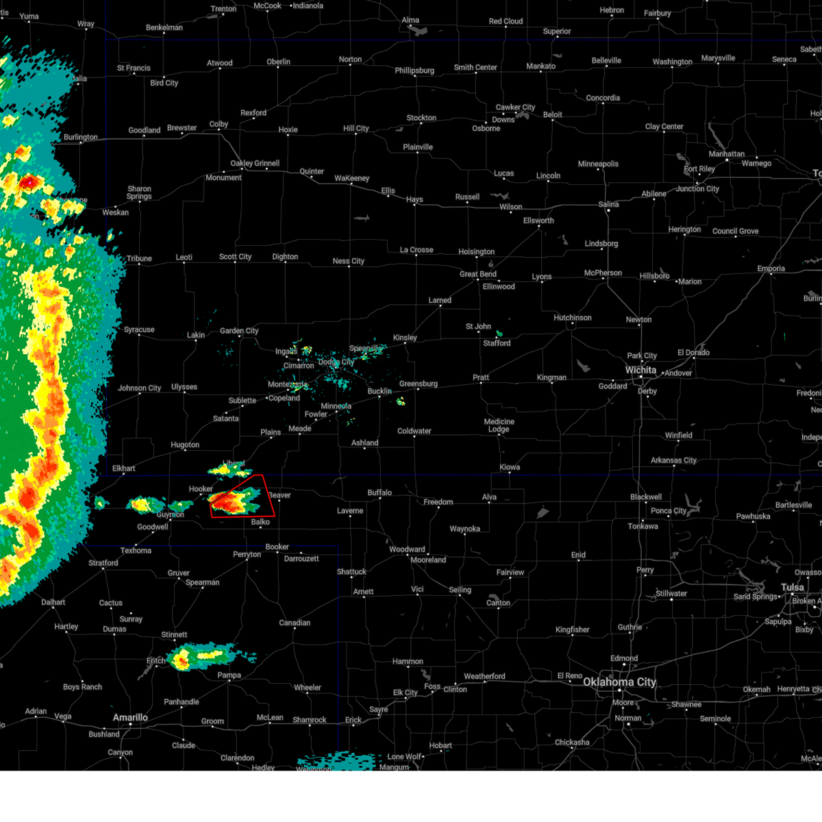 At 527 pm cdt, a severe thunderstorm capable of producing a tornado was located over adams, or 20 miles south of liberal, moving northeast at 30 mph (radar indicated rotation). Hazards include tornado and golf ball size hail. Flying debris will be dangerous to those caught without shelter. mobile homes will be damaged or destroyed. damage to roofs, windows, and vehicles will occur. tree damage is likely. Locations impacted include, turpin, adams and floris. At 527 pm cdt, a severe thunderstorm capable of producing a tornado was located over adams, or 20 miles south of liberal, moving northeast at 30 mph (radar indicated rotation). Hazards include tornado and golf ball size hail. Flying debris will be dangerous to those caught without shelter. mobile homes will be damaged or destroyed. damage to roofs, windows, and vehicles will occur. tree damage is likely. Locations impacted include, turpin, adams and floris.
|
| 6/17/2023 5:20 PM CDT |
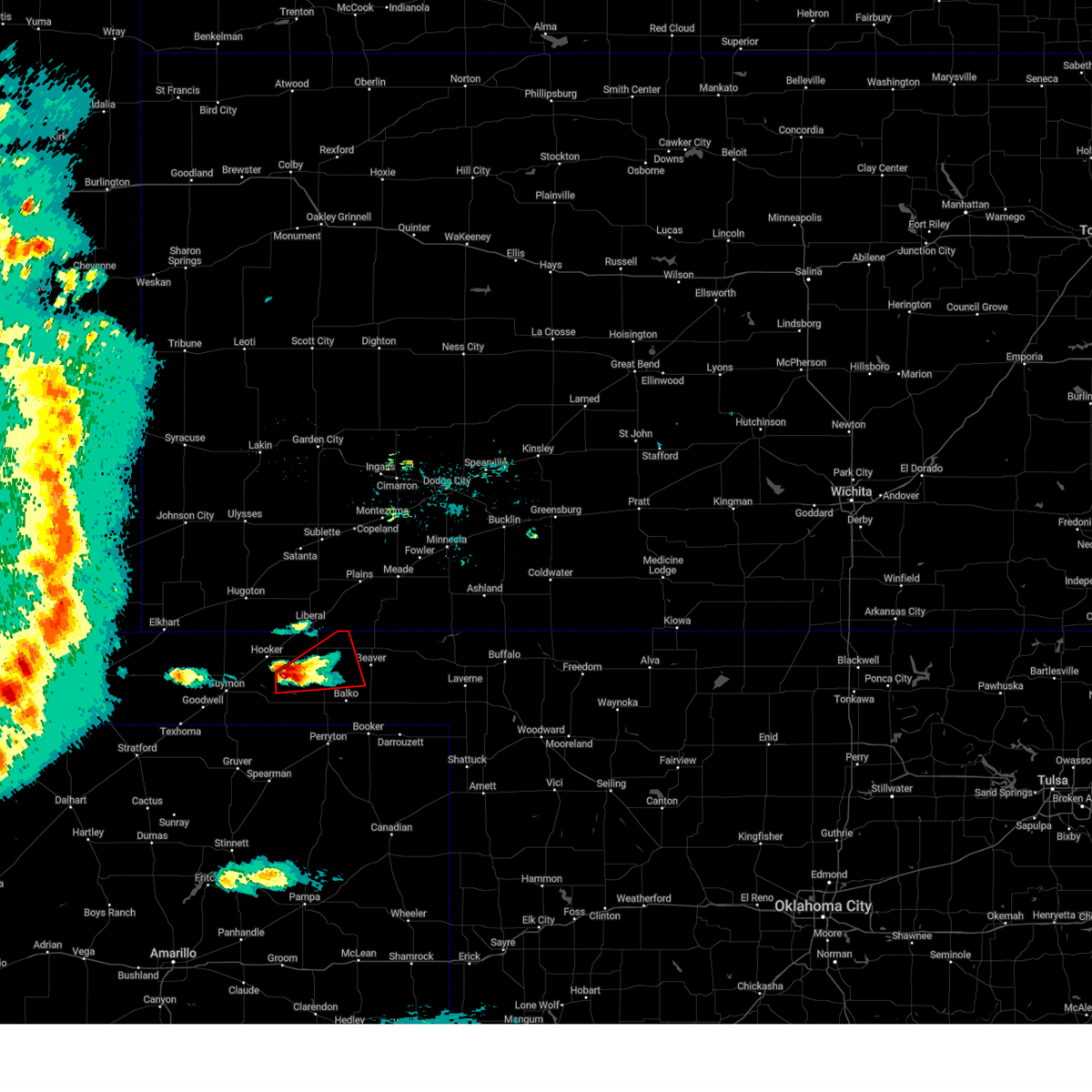 At 520 pm cdt, a severe thunderstorm capable of producing a tornado was located over adams, or 21 miles east of guymon, moving northeast at 30 mph (radar indicated rotation). Hazards include tornado and golf ball size hail. Flying debris will be dangerous to those caught without shelter. mobile homes will be damaged or destroyed. damage to roofs, windows, and vehicles will occur. Tree damage is likely. At 520 pm cdt, a severe thunderstorm capable of producing a tornado was located over adams, or 21 miles east of guymon, moving northeast at 30 mph (radar indicated rotation). Hazards include tornado and golf ball size hail. Flying debris will be dangerous to those caught without shelter. mobile homes will be damaged or destroyed. damage to roofs, windows, and vehicles will occur. Tree damage is likely.
|
| 6/17/2023 5:15 PM CDT |
 At 515 pm cdt, a severe thunderstorm was located over adams, or 21 miles east of guymon, moving northeast at 35 mph (radar indicated). Hazards include 60 mph wind gusts and quarter size hail. Minor damage to roofs, siding, and trees is possible. Hail damage to vehicles is expected. At 515 pm cdt, a severe thunderstorm was located over adams, or 21 miles east of guymon, moving northeast at 35 mph (radar indicated). Hazards include 60 mph wind gusts and quarter size hail. Minor damage to roofs, siding, and trees is possible. Hail damage to vehicles is expected.
|
| 6/15/2023 5:03 PM CDT |
 At 503 pm cdt, a severe thunderstorm was located 4 miles northeast of boyd, or 13 miles southwest of beaver, moving northeast at 25 mph (radar indicated). Hazards include two inch hail and 60 mph wind gusts. Minor damage to roofs, siding, and trees is possible. people and animals outdoors will be injured. expect hail damage to roofs, siding, windows, and vehicles. locations impacted include, beaver, hooker, tyrone, forgan, hardesty, gate, knowles, elmwood, adams, boyd, floris, bryans corner, baker, mocane, turpin, slapout and balko. thunderstorm damage threat, considerable hail threat, radar indicated max hail size, 2. 00 in wind threat, radar indicated max wind gust, 60 mph. At 503 pm cdt, a severe thunderstorm was located 4 miles northeast of boyd, or 13 miles southwest of beaver, moving northeast at 25 mph (radar indicated). Hazards include two inch hail and 60 mph wind gusts. Minor damage to roofs, siding, and trees is possible. people and animals outdoors will be injured. expect hail damage to roofs, siding, windows, and vehicles. locations impacted include, beaver, hooker, tyrone, forgan, hardesty, gate, knowles, elmwood, adams, boyd, floris, bryans corner, baker, mocane, turpin, slapout and balko. thunderstorm damage threat, considerable hail threat, radar indicated max hail size, 2. 00 in wind threat, radar indicated max wind gust, 60 mph.
|
| 6/15/2023 4:52 PM CDT |
 At 452 pm cdt, a severe thunderstorm was located 6 miles southwest of floris, or 14 miles west of beaver, moving east at 20 mph (radar indicated). Hazards include golf ball size hail and 60 mph wind gusts. Minor damage to roofs, siding, and trees is possible. people and animals outdoors will be injured. expect hail damage to roofs, siding, windows, and vehicles. locations impacted include, beaver, hooker, tyrone, forgan, hardesty, gate, knowles, elmwood, adams, boyd, floris, bryans corner, baker, mocane, turpin, slapout and balko. thunderstorm damage threat, considerable hail threat, radar indicated max hail size, 1. 75 in wind threat, radar indicated max wind gust, 60 mph. At 452 pm cdt, a severe thunderstorm was located 6 miles southwest of floris, or 14 miles west of beaver, moving east at 20 mph (radar indicated). Hazards include golf ball size hail and 60 mph wind gusts. Minor damage to roofs, siding, and trees is possible. people and animals outdoors will be injured. expect hail damage to roofs, siding, windows, and vehicles. locations impacted include, beaver, hooker, tyrone, forgan, hardesty, gate, knowles, elmwood, adams, boyd, floris, bryans corner, baker, mocane, turpin, slapout and balko. thunderstorm damage threat, considerable hail threat, radar indicated max hail size, 1. 75 in wind threat, radar indicated max wind gust, 60 mph.
|
| 6/15/2023 4:36 PM CDT |
 At 436 pm cdt, a severe thunderstorm was located 5 miles southwest of turpin, or 16 miles south of liberal, moving east at 20 mph (radar indicated). Hazards include golf ball size hail and 60 mph wind gusts. Minor damage to roofs, siding, and trees is possible. people and animals outdoors will be injured. expect hail damage to roofs, siding, windows, and vehicles. locations impacted include, beaver, hooker, tyrone, forgan, hardesty, gate, knowles, elmwood, adams, boyd, floris, bryans corner, baker, mocane, turpin, slapout and balko. thunderstorm damage threat, considerable hail threat, radar indicated max hail size, 1. 75 in wind threat, radar indicated max wind gust, 60 mph. At 436 pm cdt, a severe thunderstorm was located 5 miles southwest of turpin, or 16 miles south of liberal, moving east at 20 mph (radar indicated). Hazards include golf ball size hail and 60 mph wind gusts. Minor damage to roofs, siding, and trees is possible. people and animals outdoors will be injured. expect hail damage to roofs, siding, windows, and vehicles. locations impacted include, beaver, hooker, tyrone, forgan, hardesty, gate, knowles, elmwood, adams, boyd, floris, bryans corner, baker, mocane, turpin, slapout and balko. thunderstorm damage threat, considerable hail threat, radar indicated max hail size, 1. 75 in wind threat, radar indicated max wind gust, 60 mph.
|
| 6/15/2023 4:24 PM CDT |
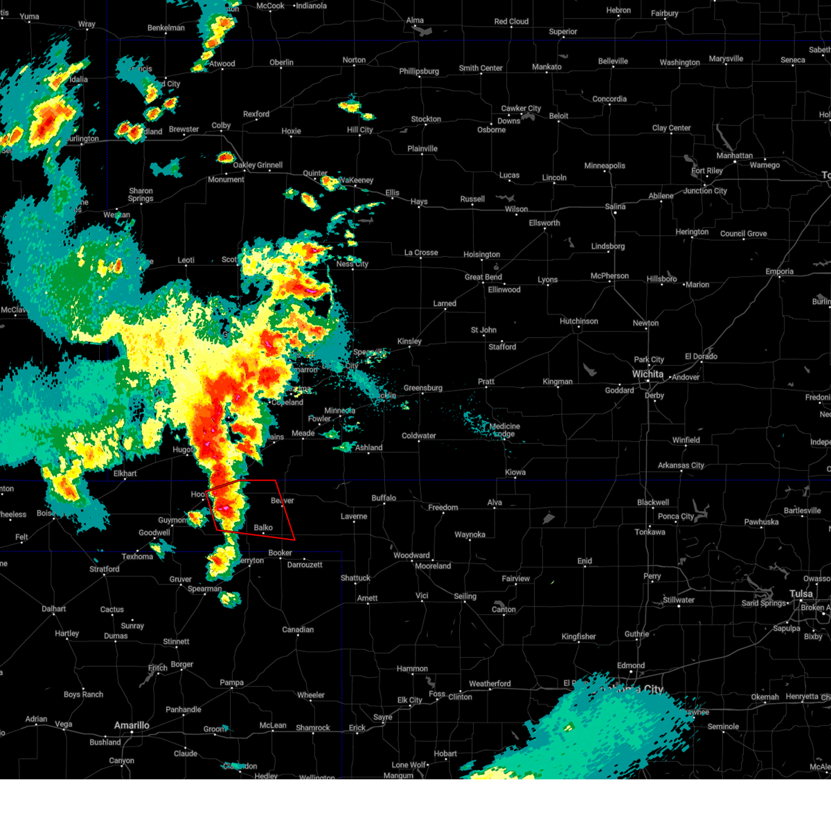 At 423 pm cdt, a severe thunderstorm capable of producing a tornado was located 5 miles east of adams, or 20 miles south of liberal, moving east at 25 mph (weather spotters reported a funnel cloud). Hazards include tornado and baseball size hail. Flying debris will be dangerous to those caught without shelter. mobile homes will be damaged or destroyed. damage to roofs, windows, and vehicles will occur. tree damage is likely. Locations impacted include, beaver, elmwood, baker, adams, boyd, turpin, floris and balko. At 423 pm cdt, a severe thunderstorm capable of producing a tornado was located 5 miles east of adams, or 20 miles south of liberal, moving east at 25 mph (weather spotters reported a funnel cloud). Hazards include tornado and baseball size hail. Flying debris will be dangerous to those caught without shelter. mobile homes will be damaged or destroyed. damage to roofs, windows, and vehicles will occur. tree damage is likely. Locations impacted include, beaver, elmwood, baker, adams, boyd, turpin, floris and balko.
|
| 6/15/2023 4:18 PM CDT |
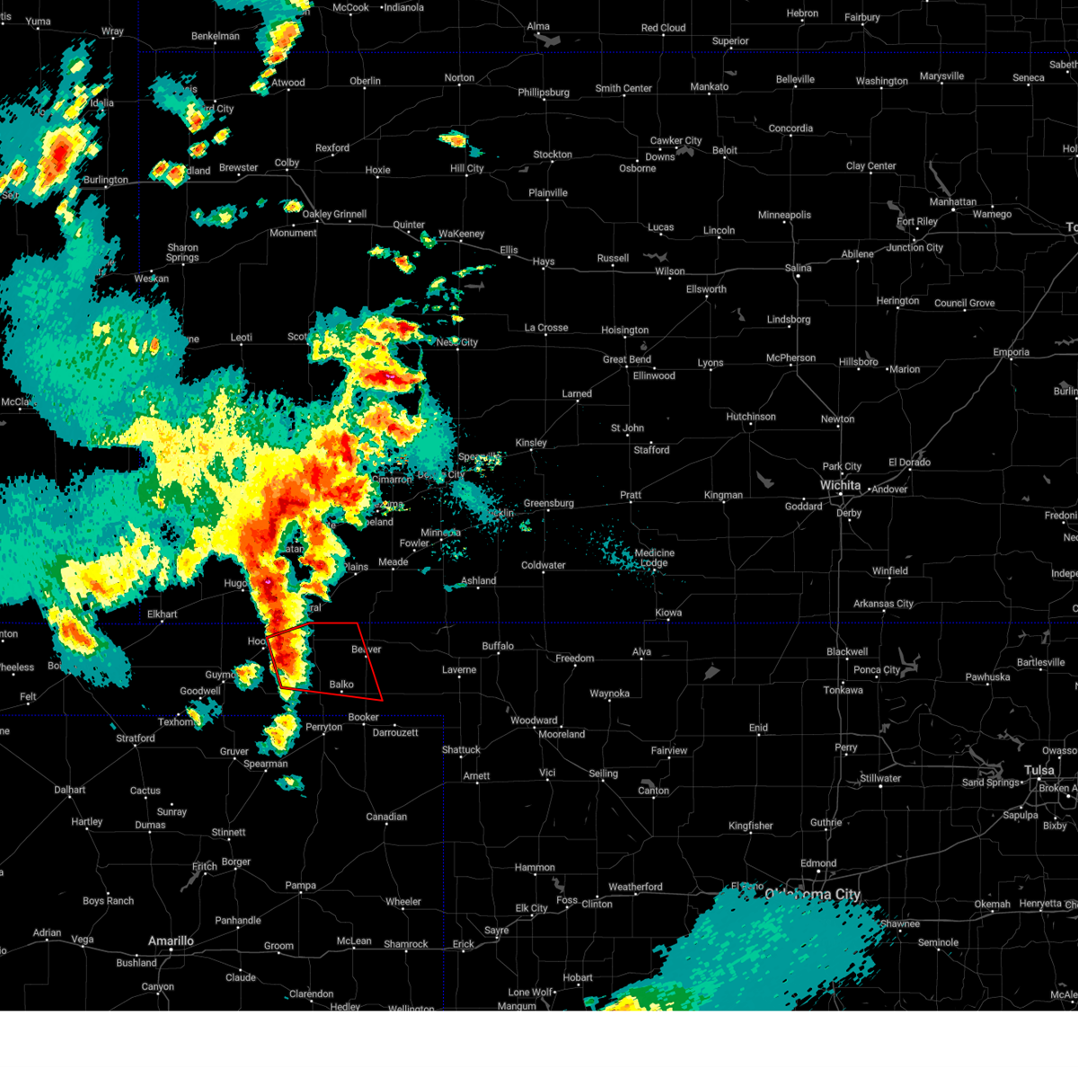 At 418 pm cdt, a severe thunderstorm capable of producing a tornado was located over adams, or 20 miles south of liberal, moving northeast at 20 mph (radar indicated rotation). Hazards include tornado and baseball size hail. Flying debris will be dangerous to those caught without shelter. mobile homes will be damaged or destroyed. damage to roofs, windows, and vehicles will occur. Tree damage is likely. At 418 pm cdt, a severe thunderstorm capable of producing a tornado was located over adams, or 20 miles south of liberal, moving northeast at 20 mph (radar indicated rotation). Hazards include tornado and baseball size hail. Flying debris will be dangerous to those caught without shelter. mobile homes will be damaged or destroyed. damage to roofs, windows, and vehicles will occur. Tree damage is likely.
|
| 6/15/2023 4:13 PM CDT |
 At 413 pm cdt, a severe thunderstorm was located over adams, or 21 miles south of liberal, moving east at 25 mph (radar indicated). Hazards include ping pong ball size hail and 60 mph wind gusts. Minor damage to roofs, siding, and trees is possible. people and animals outdoors will be injured. expect hail damage to roofs, siding, windows, and vehicles. locations impacted include, beaver, hooker, tyrone, forgan, hardesty, gate, knowles, elmwood, adams, boyd, floris, bryans corner, baker, mocane, turpin, slapout and balko. hail threat, radar indicated max hail size, 1. 50 in wind threat, radar indicated max wind gust, 60 mph. At 413 pm cdt, a severe thunderstorm was located over adams, or 21 miles south of liberal, moving east at 25 mph (radar indicated). Hazards include ping pong ball size hail and 60 mph wind gusts. Minor damage to roofs, siding, and trees is possible. people and animals outdoors will be injured. expect hail damage to roofs, siding, windows, and vehicles. locations impacted include, beaver, hooker, tyrone, forgan, hardesty, gate, knowles, elmwood, adams, boyd, floris, bryans corner, baker, mocane, turpin, slapout and balko. hail threat, radar indicated max hail size, 1. 50 in wind threat, radar indicated max wind gust, 60 mph.
|
| 6/15/2023 4:06 PM CDT |
 At 405 pm cdt, a severe thunderstorm was located near hooker, or 17 miles southwest of liberal, moving northeast at 35 mph (radar indicated). Hazards include two inch hail and 60 mph wind gusts. Minor damage to roofs, siding, and trees is possible. people and animals outdoors will be injured. expect hail damage to roofs, siding, windows, and vehicles. locations impacted include, beaver, hooker, tyrone, forgan, hardesty, gate, knowles, elmwood, adams, boyd, floris, bryans corner, baker, mocane, turpin, slapout and balko. thunderstorm damage threat, considerable hail threat, radar indicated max hail size, 2. 00 in wind threat, radar indicated max wind gust, 60 mph. At 405 pm cdt, a severe thunderstorm was located near hooker, or 17 miles southwest of liberal, moving northeast at 35 mph (radar indicated). Hazards include two inch hail and 60 mph wind gusts. Minor damage to roofs, siding, and trees is possible. people and animals outdoors will be injured. expect hail damage to roofs, siding, windows, and vehicles. locations impacted include, beaver, hooker, tyrone, forgan, hardesty, gate, knowles, elmwood, adams, boyd, floris, bryans corner, baker, mocane, turpin, slapout and balko. thunderstorm damage threat, considerable hail threat, radar indicated max hail size, 2. 00 in wind threat, radar indicated max wind gust, 60 mph.
|
| 6/15/2023 3:57 PM CDT |
 At 356 pm cdt, a severe thunderstorm was located 5 miles west of adams, or 16 miles east of guymon, moving northeast at 20 mph (radar indicated). Hazards include golf ball size hail and 60 mph wind gusts. Minor damage to roofs, siding, and trees is possible. people and animals outdoors will be injured. Expect hail damage to roofs, siding, windows, and vehicles. At 356 pm cdt, a severe thunderstorm was located 5 miles west of adams, or 16 miles east of guymon, moving northeast at 20 mph (radar indicated). Hazards include golf ball size hail and 60 mph wind gusts. Minor damage to roofs, siding, and trees is possible. people and animals outdoors will be injured. Expect hail damage to roofs, siding, windows, and vehicles.
|
| 6/2/2023 5:53 PM CDT |
 At 552 pm cdt, a severe thunderstorm was located over elmwood, or 11 miles south of beaver, moving north at 50 mph (radar indicated). Hazards include 60 mph wind gusts. Minor damage to roofs, siding, and trees is possible. locations impacted include, perryton, beaver, booker, tyrone, forgan, follett, darrouzett, gate, knowles, elmwood, adams, farnsworth, boyd, waka, floris, bryans corner, baker, mocane, turpin and slapout. hail threat, radar indicated max hail size, <. 75 in wind threat, radar indicated max wind gust, 60 mph. At 552 pm cdt, a severe thunderstorm was located over elmwood, or 11 miles south of beaver, moving north at 50 mph (radar indicated). Hazards include 60 mph wind gusts. Minor damage to roofs, siding, and trees is possible. locations impacted include, perryton, beaver, booker, tyrone, forgan, follett, darrouzett, gate, knowles, elmwood, adams, farnsworth, boyd, waka, floris, bryans corner, baker, mocane, turpin and slapout. hail threat, radar indicated max hail size, <. 75 in wind threat, radar indicated max wind gust, 60 mph.
|
| 6/2/2023 5:12 PM CDT |
 At 512 pm cdt, a severe thunderstorm was located 7 miles southeast of perryton, moving north at 30 mph (radar indicated). Hazards include 60 mph wind gusts. Minor damage to roofs, siding, and trees is possible. locations impacted include, perryton, beaver, booker, tyrone, forgan, follett, darrouzett, gate, knowles, elmwood, adams, farnsworth, boyd, waka, floris, bryans corner, baker, mocane, turpin and slapout. hail threat, radar indicated max hail size, <. 75 in wind threat, radar indicated max wind gust, 60 mph. At 512 pm cdt, a severe thunderstorm was located 7 miles southeast of perryton, moving north at 30 mph (radar indicated). Hazards include 60 mph wind gusts. Minor damage to roofs, siding, and trees is possible. locations impacted include, perryton, beaver, booker, tyrone, forgan, follett, darrouzett, gate, knowles, elmwood, adams, farnsworth, boyd, waka, floris, bryans corner, baker, mocane, turpin and slapout. hail threat, radar indicated max hail size, <. 75 in wind threat, radar indicated max wind gust, 60 mph.
|
| 6/2/2023 4:53 PM CDT |
 At 453 pm cdt, a severe thunderstorm was located near mocane, or 4 miles northeast of beaver, moving northeast at 35 mph (radar indicated). Hazards include 60 mph wind gusts. minor damage to roofs, siding, and trees is possible At 453 pm cdt, a severe thunderstorm was located near mocane, or 4 miles northeast of beaver, moving northeast at 35 mph (radar indicated). Hazards include 60 mph wind gusts. minor damage to roofs, siding, and trees is possible
|
| 5/28/2023 7:59 PM CDT |
 At 759 pm cdt, a severe thunderstorm was located over guymon, moving east at 35 mph (radar indicated). Hazards include ping pong ball size hail and 60 mph wind gusts. Minor damage to roofs, siding, and trees is possible. people and animals outdoors will be injured. expect hail damage to roofs, siding, windows, and vehicles. locations impacted include, guymon, beaver, hooker, goodwell, tyrone, forgan, optima, hardesty, gate, knowles, elmwood, hough, adams, boyd, floris, eva, bryans corner, baker, mocane and turpin. hail threat, radar indicated max hail size, 1. 50 in wind threat, radar indicated max wind gust, 60 mph. At 759 pm cdt, a severe thunderstorm was located over guymon, moving east at 35 mph (radar indicated). Hazards include ping pong ball size hail and 60 mph wind gusts. Minor damage to roofs, siding, and trees is possible. people and animals outdoors will be injured. expect hail damage to roofs, siding, windows, and vehicles. locations impacted include, guymon, beaver, hooker, goodwell, tyrone, forgan, optima, hardesty, gate, knowles, elmwood, hough, adams, boyd, floris, eva, bryans corner, baker, mocane and turpin. hail threat, radar indicated max hail size, 1. 50 in wind threat, radar indicated max wind gust, 60 mph.
|
| 5/28/2023 7:28 PM CDT |
 At 727 pm cdt, a severe thunderstorm was located 5 miles north of hooker, or 17 miles southwest of woods, moving east at 25 mph (radar indicated). Hazards include golf ball size hail and 60 mph wind gusts. Minor damage to roofs, siding, and trees is possible. people and animals outdoors will be injured. expect hail damage to roofs, siding, windows, and vehicles. locations impacted include, guymon, beaver, hooker, goodwell, tyrone, forgan, optima, hardesty, gate, knowles, elmwood, hough, adams, boyd, floris, eva, bryans corner, baker, mocane and turpin. thunderstorm damage threat, considerable hail threat, radar indicated max hail size, 1. 75 in wind threat, radar indicated max wind gust, 60 mph. At 727 pm cdt, a severe thunderstorm was located 5 miles north of hooker, or 17 miles southwest of woods, moving east at 25 mph (radar indicated). Hazards include golf ball size hail and 60 mph wind gusts. Minor damage to roofs, siding, and trees is possible. people and animals outdoors will be injured. expect hail damage to roofs, siding, windows, and vehicles. locations impacted include, guymon, beaver, hooker, goodwell, tyrone, forgan, optima, hardesty, gate, knowles, elmwood, hough, adams, boyd, floris, eva, bryans corner, baker, mocane and turpin. thunderstorm damage threat, considerable hail threat, radar indicated max hail size, 1. 75 in wind threat, radar indicated max wind gust, 60 mph.
|
| 5/28/2023 6:57 PM CDT |
 At 657 pm cdt, a severe thunderstorm was located 11 miles south of feterita, moving southeast at 10 mph (radar indicated). Hazards include golf ball size hail and 60 mph wind gusts. Minor damage to roofs, siding, and trees is possible. people and animals outdoors will be injured. expect hail damage to roofs, siding, windows, and vehicles. locations impacted include, guymon, beaver, hooker, goodwell, tyrone, forgan, optima, hardesty, gate, knowles, elmwood, hough, adams, boyd, floris, eva, bryans corner, baker, mocane and turpin. thunderstorm damage threat, considerable hail threat, radar indicated max hail size, 1. 75 in wind threat, radar indicated max wind gust, 60 mph. At 657 pm cdt, a severe thunderstorm was located 11 miles south of feterita, moving southeast at 10 mph (radar indicated). Hazards include golf ball size hail and 60 mph wind gusts. Minor damage to roofs, siding, and trees is possible. people and animals outdoors will be injured. expect hail damage to roofs, siding, windows, and vehicles. locations impacted include, guymon, beaver, hooker, goodwell, tyrone, forgan, optima, hardesty, gate, knowles, elmwood, hough, adams, boyd, floris, eva, bryans corner, baker, mocane and turpin. thunderstorm damage threat, considerable hail threat, radar indicated max hail size, 1. 75 in wind threat, radar indicated max wind gust, 60 mph.
|
| 5/28/2023 6:40 PM CDT | Tennis Ball sized hail reported 12.7 miles NNW of Turpin, OK |
| 5/28/2023 6:39 PM CDT |
 At 638 pm cdt, a severe thunderstorm was located 10 miles south of feterita, moving east at 55 mph (radar indicated). Hazards include ping pong ball size hail and 60 mph wind gusts. Minor damage to roofs, siding, and trees is possible. people and animals outdoors will be injured. Expect hail damage to roofs, siding, windows, and vehicles. At 638 pm cdt, a severe thunderstorm was located 10 miles south of feterita, moving east at 55 mph (radar indicated). Hazards include ping pong ball size hail and 60 mph wind gusts. Minor damage to roofs, siding, and trees is possible. people and animals outdoors will be injured. Expect hail damage to roofs, siding, windows, and vehicles.
|
| 5/28/2023 6:36 PM CDT | Hen Egg sized hail reported 13.2 miles NNW of Turpin, OK, report from mping. |
| 5/28/2023 6:28 PM CDT |
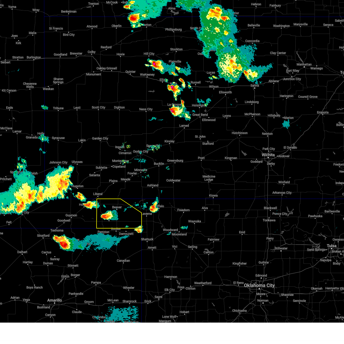 At 628 pm cdt, a severe thunderstorm was located over boyd, or 16 miles southwest of beaver, and is nearly stationary (radar indicated). Hazards include ping pong ball size hail and 60 mph wind gusts. Minor damage to roofs, siding, and trees is possible. people and animals outdoors will be injured. expect hail damage to roofs, siding, windows, and vehicles. hail may accumulate on roadways causing hazardous travel. locations impacted include, beaver, forgan, elmwood, bryans corner, boyd, mocane, turpin, slapout, floris and balko. hail threat, radar indicated max hail size, 1. 50 in wind threat, radar indicated max wind gust, 60 mph. At 628 pm cdt, a severe thunderstorm was located over boyd, or 16 miles southwest of beaver, and is nearly stationary (radar indicated). Hazards include ping pong ball size hail and 60 mph wind gusts. Minor damage to roofs, siding, and trees is possible. people and animals outdoors will be injured. expect hail damage to roofs, siding, windows, and vehicles. hail may accumulate on roadways causing hazardous travel. locations impacted include, beaver, forgan, elmwood, bryans corner, boyd, mocane, turpin, slapout, floris and balko. hail threat, radar indicated max hail size, 1. 50 in wind threat, radar indicated max wind gust, 60 mph.
|
| 5/28/2023 6:07 PM CDT |
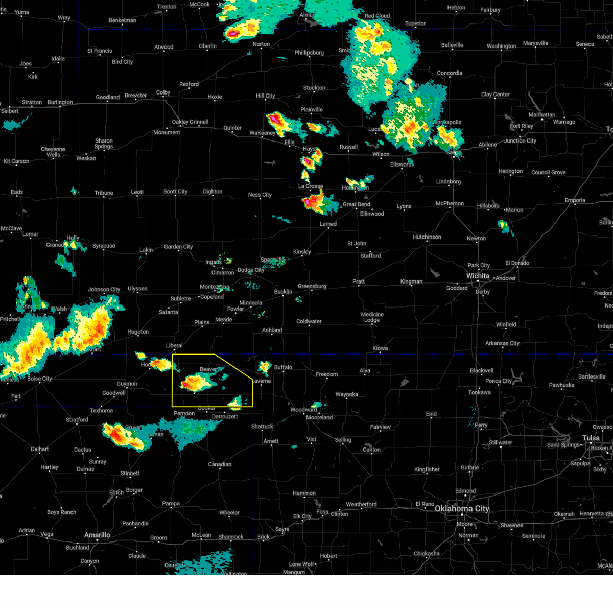 At 606 pm cdt, a severe thunderstorm was located over boyd, or 16 miles southwest of beaver, moving east at 5 mph (radar indicated). Hazards include 60 mph wind gusts and half dollar size hail. Minor damage to roofs, siding, and trees is possible. hail damage to vehicles is expected. hail may accumulate on roadways causing hazardous travel. locations impacted include, beaver, forgan, elmwood, bryans corner, boyd, mocane, turpin, slapout, floris and balko. hail threat, radar indicated max hail size, 1. 25 in wind threat, radar indicated max wind gust, 60 mph. At 606 pm cdt, a severe thunderstorm was located over boyd, or 16 miles southwest of beaver, moving east at 5 mph (radar indicated). Hazards include 60 mph wind gusts and half dollar size hail. Minor damage to roofs, siding, and trees is possible. hail damage to vehicles is expected. hail may accumulate on roadways causing hazardous travel. locations impacted include, beaver, forgan, elmwood, bryans corner, boyd, mocane, turpin, slapout, floris and balko. hail threat, radar indicated max hail size, 1. 25 in wind threat, radar indicated max wind gust, 60 mph.
|
| 5/28/2023 5:56 PM CDT | Golf Ball sized hail reported 13.9 miles NNW of Turpin, OK, report from mping: golf ball (1.75 in.). |
| 5/28/2023 5:44 PM CDT | Tennis Ball sized hail reported 12.5 miles NNW of Turpin, OK |
| 5/28/2023 5:43 PM CDT |
 At 542 pm cdt, a severe thunderstorm was located over boyd, or 17 miles southwest of beaver, and is nearly stationary (radar indicated). Hazards include golf ball size hail and 60 mph wind gusts. Minor damage to roofs, siding, and trees is possible. people and animals outdoors will be injured. expect hail damage to roofs, siding, windows, and vehicles. hail may accumulate on roadways causing hazardous travel. locations impacted include, beaver, forgan, elmwood, bryans corner, boyd, mocane, turpin, slapout, floris and balko. thunderstorm damage threat, considerable hail threat, radar indicated max hail size, 1. 75 in wind threat, radar indicated max wind gust, 60 mph. At 542 pm cdt, a severe thunderstorm was located over boyd, or 17 miles southwest of beaver, and is nearly stationary (radar indicated). Hazards include golf ball size hail and 60 mph wind gusts. Minor damage to roofs, siding, and trees is possible. people and animals outdoors will be injured. expect hail damage to roofs, siding, windows, and vehicles. hail may accumulate on roadways causing hazardous travel. locations impacted include, beaver, forgan, elmwood, bryans corner, boyd, mocane, turpin, slapout, floris and balko. thunderstorm damage threat, considerable hail threat, radar indicated max hail size, 1. 75 in wind threat, radar indicated max wind gust, 60 mph.
|
| 5/28/2023 5:34 PM CDT |
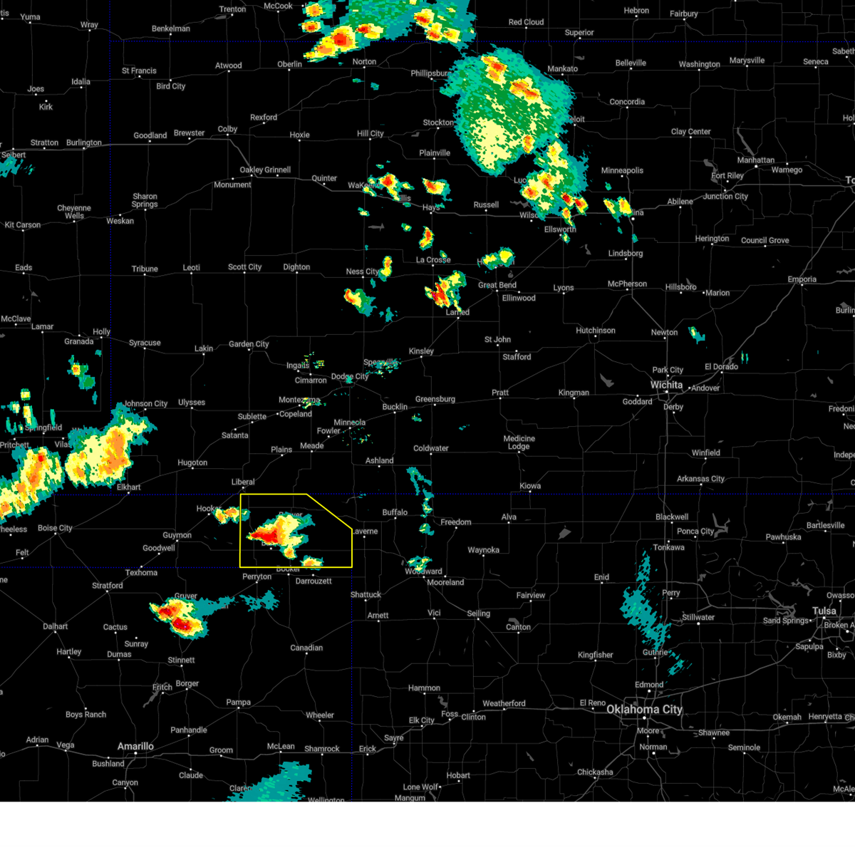 At 533 pm cdt, a severe thunderstorm was located over boyd, or 16 miles southwest of beaver, moving southeast at 5 mph (radar indicated). Hazards include 60 mph wind gusts and half dollar size hail. Minor damage to roofs, siding, and trees is possible. hail damage to vehicles is expected. hail may accumulate on roadways causing hazardous travel. locations impacted include, beaver, forgan, knowles, elmwood, bryans corner, boyd, mocane, turpin, slapout, floris and balko. hail threat, radar indicated max hail size, 1. 25 in wind threat, radar indicated max wind gust, 60 mph. At 533 pm cdt, a severe thunderstorm was located over boyd, or 16 miles southwest of beaver, moving southeast at 5 mph (radar indicated). Hazards include 60 mph wind gusts and half dollar size hail. Minor damage to roofs, siding, and trees is possible. hail damage to vehicles is expected. hail may accumulate on roadways causing hazardous travel. locations impacted include, beaver, forgan, knowles, elmwood, bryans corner, boyd, mocane, turpin, slapout, floris and balko. hail threat, radar indicated max hail size, 1. 25 in wind threat, radar indicated max wind gust, 60 mph.
|
| 5/28/2023 5:21 PM CDT |
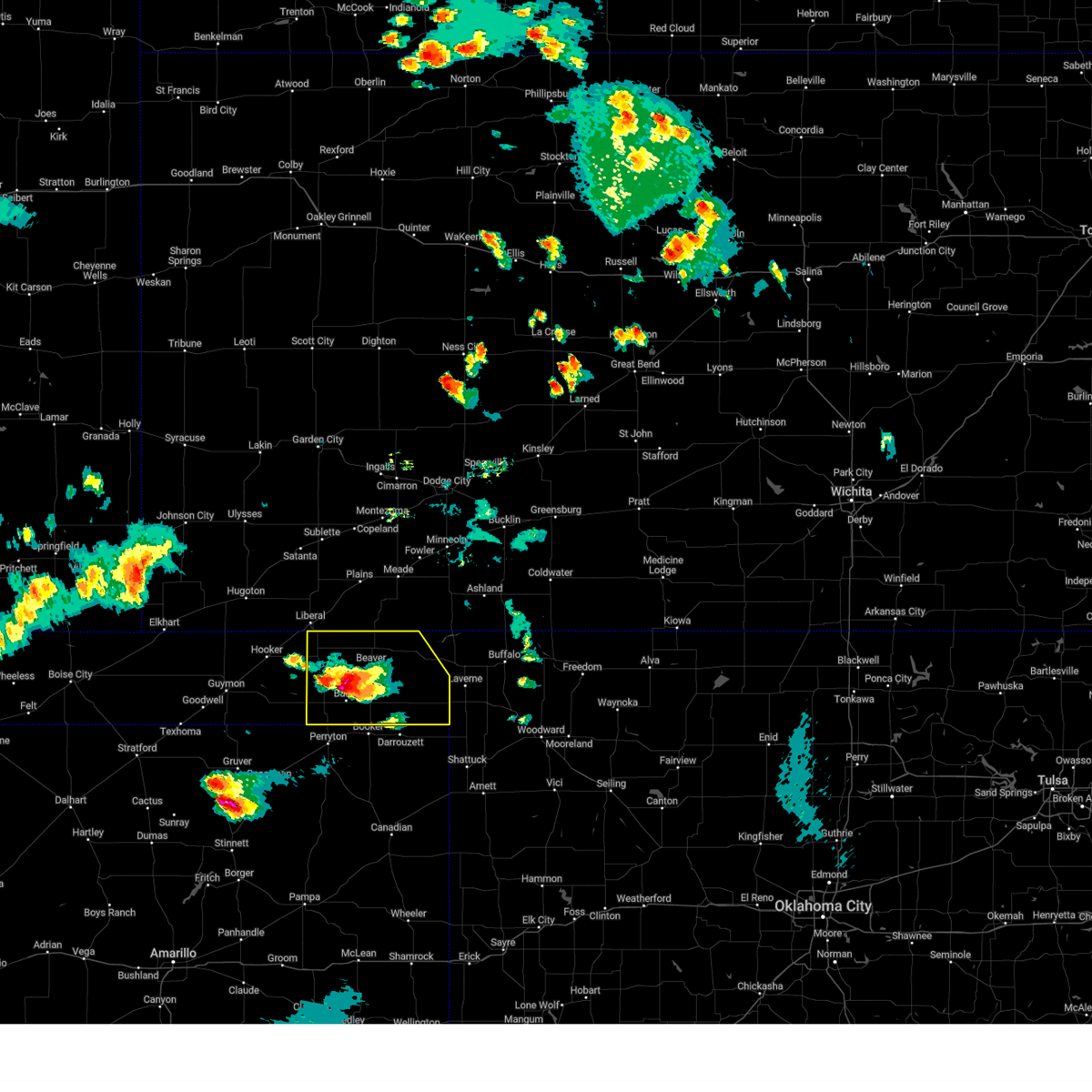 At 521 pm cdt, a severe thunderstorm was located 4 miles north of balko, or 11 miles southwest of beaver, moving east at 5 mph (radar indicated). Hazards include 60 mph wind gusts and half dollar size hail. Minor damage to roofs, siding, and trees is possible. hail damage to vehicles is expected. hail may accumulate on roadways causing hazardous travel. locations impacted include, beaver, forgan, knowles, elmwood, bryans corner, boyd, mocane, turpin, slapout, floris and balko. hail threat, radar indicated max hail size, 1. 25 in wind threat, radar indicated max wind gust, 60 mph. At 521 pm cdt, a severe thunderstorm was located 4 miles north of balko, or 11 miles southwest of beaver, moving east at 5 mph (radar indicated). Hazards include 60 mph wind gusts and half dollar size hail. Minor damage to roofs, siding, and trees is possible. hail damage to vehicles is expected. hail may accumulate on roadways causing hazardous travel. locations impacted include, beaver, forgan, knowles, elmwood, bryans corner, boyd, mocane, turpin, slapout, floris and balko. hail threat, radar indicated max hail size, 1. 25 in wind threat, radar indicated max wind gust, 60 mph.
|
| 5/28/2023 5:11 PM CDT |
 At 510 pm cdt, a severe thunderstorm was located near balko, or 12 miles southwest of beaver, and is nearly stationary (radar indicated). Hazards include two inch hail and 60 mph wind gusts. Minor damage to roofs, siding, and trees is possible. people and animals outdoors will be injured. expect hail damage to roofs, siding, windows, and vehicles. Hail may accumulate on roadways causing hazardous travel. At 510 pm cdt, a severe thunderstorm was located near balko, or 12 miles southwest of beaver, and is nearly stationary (radar indicated). Hazards include two inch hail and 60 mph wind gusts. Minor damage to roofs, siding, and trees is possible. people and animals outdoors will be injured. expect hail damage to roofs, siding, windows, and vehicles. Hail may accumulate on roadways causing hazardous travel.
|
| 5/22/2023 6:56 PM CDT |
 At 656 pm cdt, severe thunderstorms were located along a line extending from liberal to 3 miles west of hooker, moving southeast at 20 mph (radar indicated). Hazards include ping pong ball size hail and 60 mph wind gusts. Minor damage to roofs, siding, and trees is possible. people and animals outdoors will be injured. Expect hail damage to roofs, siding, windows, and vehicles. At 656 pm cdt, severe thunderstorms were located along a line extending from liberal to 3 miles west of hooker, moving southeast at 20 mph (radar indicated). Hazards include ping pong ball size hail and 60 mph wind gusts. Minor damage to roofs, siding, and trees is possible. people and animals outdoors will be injured. Expect hail damage to roofs, siding, windows, and vehicles.
|
| 5/22/2023 5:59 PM CDT | Quarter sized hail reported 13.3 miles NNW of Turpin, OK |
| 5/22/2023 5:55 PM CDT |
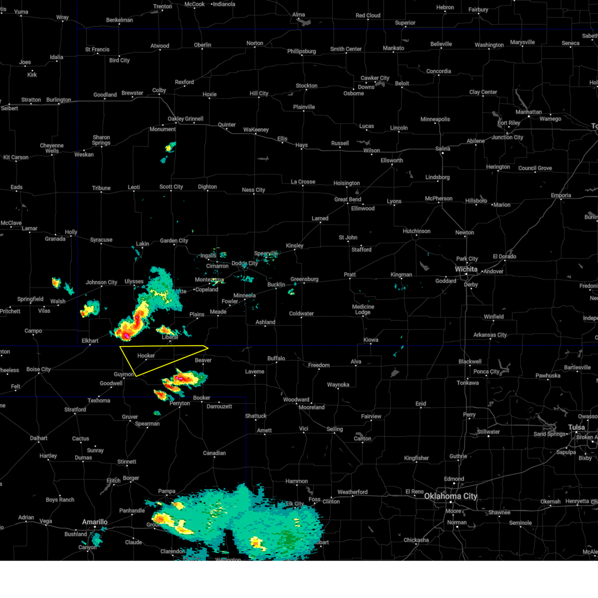 At 554 pm cdt, a severe thunderstorm was located 7 miles southeast of feterita, moving southeast at 20 mph (radar indicated). Hazards include ping pong ball size hail and 60 mph wind gusts. Minor damage to roofs, siding, and trees is possible. people and animals outdoors will be injured. Expect hail damage to roofs, siding, windows, and vehicles. At 554 pm cdt, a severe thunderstorm was located 7 miles southeast of feterita, moving southeast at 20 mph (radar indicated). Hazards include ping pong ball size hail and 60 mph wind gusts. Minor damage to roofs, siding, and trees is possible. people and animals outdoors will be injured. Expect hail damage to roofs, siding, windows, and vehicles.
|
| 2/26/2023 5:43 PM CST |
 The severe thunderstorm warning for beaver, eastern texas, northwestern lipscomb, eastern hansford and northern ochiltree counties will expire at 545 pm cst, the storms which prompted the warning have weakened below severe limits, and no longer pose an immediate threat to life or property. therefore, the warning will be allowed to expire. however gusty winds and blowing dust are still possible with these thunderstorms. a tornado watch remains in effect until 900 pm cst for the panhandle of oklahoma, and the panhandle of texas. The severe thunderstorm warning for beaver, eastern texas, northwestern lipscomb, eastern hansford and northern ochiltree counties will expire at 545 pm cst, the storms which prompted the warning have weakened below severe limits, and no longer pose an immediate threat to life or property. therefore, the warning will be allowed to expire. however gusty winds and blowing dust are still possible with these thunderstorms. a tornado watch remains in effect until 900 pm cst for the panhandle of oklahoma, and the panhandle of texas.
|
| 2/26/2023 5:18 PM CST |
 At 518 pm cst, severe thunderstorms were located along a line extending from 7 miles northwest of floris to 6 miles southeast of bryans corner, moving northeast at 65 mph (radar indicated). Hazards include 70 mph wind gusts and penny size hail. Expect some tree damage. damage is likely to mobile homes, roofs, and outbuildings. locations impacted include, perryton, spearman, beaver, hooker, booker, tyrone, forgan, hardesty, elmwood, adams, farnsworth, boyd, waka, floris, bryans corner, baker, mocane, turpin and balko. thunderstorm damage threat, considerable hail threat, radar indicated max hail size, 0. 75in wind threat, radar indicated max wind gust, 70 mph. At 518 pm cst, severe thunderstorms were located along a line extending from 7 miles northwest of floris to 6 miles southeast of bryans corner, moving northeast at 65 mph (radar indicated). Hazards include 70 mph wind gusts and penny size hail. Expect some tree damage. damage is likely to mobile homes, roofs, and outbuildings. locations impacted include, perryton, spearman, beaver, hooker, booker, tyrone, forgan, hardesty, elmwood, adams, farnsworth, boyd, waka, floris, bryans corner, baker, mocane, turpin and balko. thunderstorm damage threat, considerable hail threat, radar indicated max hail size, 0. 75in wind threat, radar indicated max wind gust, 70 mph.
|
| 2/26/2023 4:48 PM CST |
 At 448 pm cst, severe thunderstorms were located along a line extending from near liberal to 7 miles south of adams to near waka, moving northeast at 55 mph (radar indicated). Hazards include 70 mph wind gusts and quarter size hail. Expect some tree damage. damage is likely to mobile homes, roofs, and outbuildings. Hail damage to vehicles is expected. At 448 pm cst, severe thunderstorms were located along a line extending from near liberal to 7 miles south of adams to near waka, moving northeast at 55 mph (radar indicated). Hazards include 70 mph wind gusts and quarter size hail. Expect some tree damage. damage is likely to mobile homes, roofs, and outbuildings. Hail damage to vehicles is expected.
|
| 8/29/2022 9:03 PM CDT |
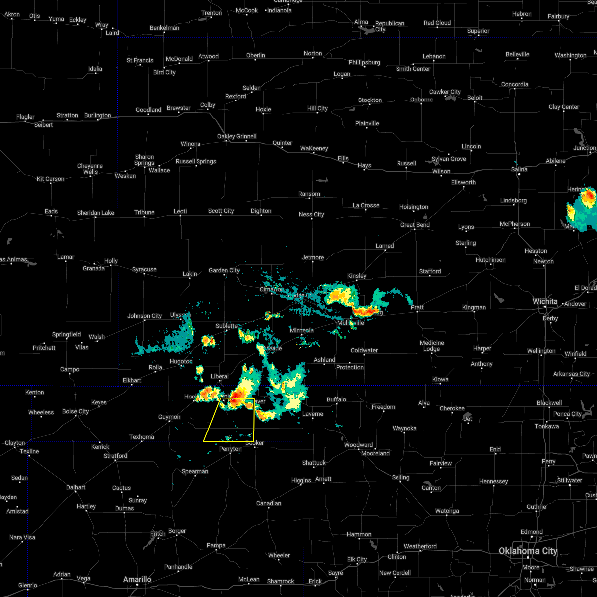 At 903 pm cdt, a severe thunderstorm was located 4 miles southeast of turpin, or 16 miles west of beaver, moving southwest at 25 mph (radar indicated). Hazards include 60 mph wind gusts and quarter size hail. Minor damage to roofs, siding, and trees is possible. hail damage to vehicles is expected. locations impacted include, turpin, floris, bryans corner, balko and boyd. hail threat, radar indicated max hail size, 1. 00in wind threat, radar indicated max wind gust, 60 mph. At 903 pm cdt, a severe thunderstorm was located 4 miles southeast of turpin, or 16 miles west of beaver, moving southwest at 25 mph (radar indicated). Hazards include 60 mph wind gusts and quarter size hail. Minor damage to roofs, siding, and trees is possible. hail damage to vehicles is expected. locations impacted include, turpin, floris, bryans corner, balko and boyd. hail threat, radar indicated max hail size, 1. 00in wind threat, radar indicated max wind gust, 60 mph.
|
| 8/29/2022 8:46 PM CDT |
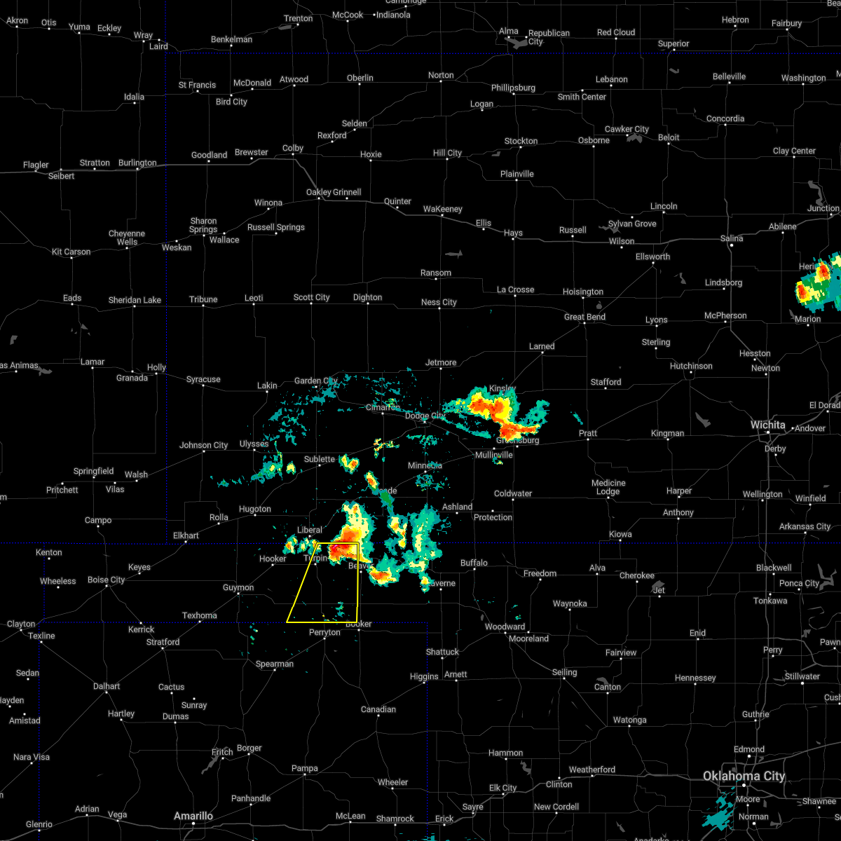 At 846 pm cdt, a severe thunderstorm was located over floris, or 12 miles northwest of beaver, moving south at 25 mph (radar indicated). Hazards include 60 mph wind gusts and quarter size hail. Minor damage to roofs, siding, and trees is possible. Hail damage to vehicles is expected. At 846 pm cdt, a severe thunderstorm was located over floris, or 12 miles northwest of beaver, moving south at 25 mph (radar indicated). Hazards include 60 mph wind gusts and quarter size hail. Minor damage to roofs, siding, and trees is possible. Hail damage to vehicles is expected.
|
| 6/7/2022 1:15 AM CDT |
 At 115 am cdt, severe thunderstorms were located along a line extending from near floris to 3 miles south of balko to 5 miles north of farnsworth, moving east at 45 mph (radar indicated). Hazards include 70 mph wind gusts and nickel size hail. Expect some tree damage. damage is likely to mobile homes, roofs, and outbuildings. locations impacted include, tyrone, bryans corner, baker, adams, boyd, turpin and floris. thunderstorm damage threat, considerable hail threat, radar indicated max hail size, 0. 88in wind threat, radar indicated max wind gust, 70 mph. At 115 am cdt, severe thunderstorms were located along a line extending from near floris to 3 miles south of balko to 5 miles north of farnsworth, moving east at 45 mph (radar indicated). Hazards include 70 mph wind gusts and nickel size hail. Expect some tree damage. damage is likely to mobile homes, roofs, and outbuildings. locations impacted include, tyrone, bryans corner, baker, adams, boyd, turpin and floris. thunderstorm damage threat, considerable hail threat, radar indicated max hail size, 0. 88in wind threat, radar indicated max wind gust, 70 mph.
|
| 6/7/2022 12:58 AM CDT |
 At 1257 am cdt, severe thunderstorms were located along a line extending from 5 miles north of turpin to 8 miles southeast of adams to 8 miles south of hardesty, moving southeast at 40 mph (radar indicated). Hazards include 70 mph wind gusts and quarter size hail. Expect some tree damage. damage is likely to mobile homes, roofs, and outbuildings. hail damage to vehicles is expected. locations impacted include, guymon, hooker, tyrone, optima, hardesty, bryans corner, hough, baker, adams, boyd, turpin and floris. thunderstorm damage threat, considerable hail threat, radar indicated max hail size, 1. 00in wind threat, radar indicated max wind gust, 70 mph. At 1257 am cdt, severe thunderstorms were located along a line extending from 5 miles north of turpin to 8 miles southeast of adams to 8 miles south of hardesty, moving southeast at 40 mph (radar indicated). Hazards include 70 mph wind gusts and quarter size hail. Expect some tree damage. damage is likely to mobile homes, roofs, and outbuildings. hail damage to vehicles is expected. locations impacted include, guymon, hooker, tyrone, optima, hardesty, bryans corner, hough, baker, adams, boyd, turpin and floris. thunderstorm damage threat, considerable hail threat, radar indicated max hail size, 1. 00in wind threat, radar indicated max wind gust, 70 mph.
|
| 6/7/2022 12:32 AM CDT |
 At 1231 am cdt, automated weather equipment reported a 77 mph wind gust in guymon from severe thunderstorms. these storms were located along a line extending from 8 miles northwest of tyrone to 4 miles south of hooker to near guymon, moving southeast at 40 mph. these are destructive storms for portions of texas and beaver counties (automated weather equipment). Hazards include 80 mph wind gusts and quarter size hail. Flying debris will be dangerous to those caught without shelter. mobile homes will be heavily damaged. expect considerable damage to roofs, windows, and vehicles. tree damage and power outages are likely. hail damage to vehicles is expected. locations impacted include, guymon, hooker, tyrone, optima, hardesty, bryans corner, hough, baker, adams, boyd, turpin and floris. thunderstorm damage threat, destructive hail threat, radar indicated max hail size, 1. 00in wind threat, observed max wind gust, 80 mph. At 1231 am cdt, automated weather equipment reported a 77 mph wind gust in guymon from severe thunderstorms. these storms were located along a line extending from 8 miles northwest of tyrone to 4 miles south of hooker to near guymon, moving southeast at 40 mph. these are destructive storms for portions of texas and beaver counties (automated weather equipment). Hazards include 80 mph wind gusts and quarter size hail. Flying debris will be dangerous to those caught without shelter. mobile homes will be heavily damaged. expect considerable damage to roofs, windows, and vehicles. tree damage and power outages are likely. hail damage to vehicles is expected. locations impacted include, guymon, hooker, tyrone, optima, hardesty, bryans corner, hough, baker, adams, boyd, turpin and floris. thunderstorm damage threat, destructive hail threat, radar indicated max hail size, 1. 00in wind threat, observed max wind gust, 80 mph.
|
| 6/7/2022 12:25 AM CDT |
 At 1225 am cdt, severe thunderstorms were located along a line extending from 5 miles southwest of woods to near hooker to 4 miles northwest of guymon, moving east at 40 mph (radar indicated). Hazards include 70 mph wind gusts and quarter size hail. Expect some tree damage. damage is likely to mobile homes, roofs, and outbuildings. hail damage to vehicles is expected. locations impacted include, guymon, hooker, tyrone, optima, hardesty, bryans corner, hough, baker, adams, boyd, turpin and floris. thunderstorm damage threat, considerable hail threat, radar indicated max hail size, 1. 00in wind threat, radar indicated max wind gust, 70 mph. At 1225 am cdt, severe thunderstorms were located along a line extending from 5 miles southwest of woods to near hooker to 4 miles northwest of guymon, moving east at 40 mph (radar indicated). Hazards include 70 mph wind gusts and quarter size hail. Expect some tree damage. damage is likely to mobile homes, roofs, and outbuildings. hail damage to vehicles is expected. locations impacted include, guymon, hooker, tyrone, optima, hardesty, bryans corner, hough, baker, adams, boyd, turpin and floris. thunderstorm damage threat, considerable hail threat, radar indicated max hail size, 1. 00in wind threat, radar indicated max wind gust, 70 mph.
|
| 6/6/2022 11:53 PM CDT |
 At 1153 pm cdt, severe thunderstorms were located along a line extending from 6 miles west of moscow to 5 miles southeast of rolla to 4 miles southwest of elkhart, moving southeast at 35 mph (radar indicated). Hazards include 60 mph wind gusts and quarter size hail. Minor damage to roofs, siding, and trees is possible. Hail damage to vehicles is expected. At 1153 pm cdt, severe thunderstorms were located along a line extending from 6 miles west of moscow to 5 miles southeast of rolla to 4 miles southwest of elkhart, moving southeast at 35 mph (radar indicated). Hazards include 60 mph wind gusts and quarter size hail. Minor damage to roofs, siding, and trees is possible. Hail damage to vehicles is expected.
|
| 5/18/2022 10:47 PM CDT |
 At 1047 pm cdt, automated weather equipment reported severe thunderstorms were located along a line extending from 6 miles north of ashland to 4 miles west of perryton, moving east at 55 mph (automated weather equipment). Hazards include 60 mph wind gusts. Minor damage to roofs, siding, and trees is possible. locations impacted include, perryton, beaver, booker, gruver, forgan, hardesty, gate, knowles, wolf creek park, elmwood, adams, farnsworth, boyd, waka, floris, bryans corner, mocane, turpin and balko. hail threat, radar indicated max hail size, <. 75 in wind threat, radar indicated max wind gust, 60 mph. At 1047 pm cdt, automated weather equipment reported severe thunderstorms were located along a line extending from 6 miles north of ashland to 4 miles west of perryton, moving east at 55 mph (automated weather equipment). Hazards include 60 mph wind gusts. Minor damage to roofs, siding, and trees is possible. locations impacted include, perryton, beaver, booker, gruver, forgan, hardesty, gate, knowles, wolf creek park, elmwood, adams, farnsworth, boyd, waka, floris, bryans corner, mocane, turpin and balko. hail threat, radar indicated max hail size, <. 75 in wind threat, radar indicated max wind gust, 60 mph.
|
| 5/18/2022 10:34 PM CDT |
 At 1034 pm cdt, automated weather equipment reported severe thunderstorms were located along a line extending from 10 miles south of minneola to 8 miles northwest of farnsworth, moving east at 55 mph (automated weather equipment). Hazards include 60 mph wind gusts. Minor damage to roofs, siding, and trees is possible. locations impacted include, guymon, perryton, beaver, hooker, booker, gruver, tyrone, forgan, optima, hardesty, gate, knowles, wolf creek park, elmwood, adams, farnsworth, boyd, waka, floris and bryans corner. hail threat, radar indicated max hail size, <. 75 in wind threat, radar indicated max wind gust, 60 mph. At 1034 pm cdt, automated weather equipment reported severe thunderstorms were located along a line extending from 10 miles south of minneola to 8 miles northwest of farnsworth, moving east at 55 mph (automated weather equipment). Hazards include 60 mph wind gusts. Minor damage to roofs, siding, and trees is possible. locations impacted include, guymon, perryton, beaver, hooker, booker, gruver, tyrone, forgan, optima, hardesty, gate, knowles, wolf creek park, elmwood, adams, farnsworth, boyd, waka, floris and bryans corner. hail threat, radar indicated max hail size, <. 75 in wind threat, radar indicated max wind gust, 60 mph.
|
| 5/18/2022 10:20 PM CDT |
 At 1020 pm cdt, automated weather equipment reported severe thunderstorms were located along a line extending from 4 miles south of fowler to 13 miles southwest of hardesty, moving east at 55 mph (automated weather equipment). Hazards include 60 mph wind gusts. Minor damage to roofs, siding, and trees is possible. locations impacted include, guymon, perryton, beaver, hooker, booker, goodwell, gruver, tyrone, forgan, optima, hardesty, gate, knowles, wolf creek park, baker, balko, elmwood, hough, adams and farnsworth. hail threat, radar indicated max hail size, <. 75 in wind threat, radar indicated max wind gust, 60 mph. At 1020 pm cdt, automated weather equipment reported severe thunderstorms were located along a line extending from 4 miles south of fowler to 13 miles southwest of hardesty, moving east at 55 mph (automated weather equipment). Hazards include 60 mph wind gusts. Minor damage to roofs, siding, and trees is possible. locations impacted include, guymon, perryton, beaver, hooker, booker, goodwell, gruver, tyrone, forgan, optima, hardesty, gate, knowles, wolf creek park, baker, balko, elmwood, hough, adams and farnsworth. hail threat, radar indicated max hail size, <. 75 in wind threat, radar indicated max wind gust, 60 mph.
|
| 5/18/2022 10:01 PM CDT |
 At 1001 pm cdt, severe thunderstorms were located along a line extending from near missler to 10 miles southeast of goodwell, moving east at 55 mph (radar indicated). Hazards include 60 mph wind gusts. minor damage to roofs, siding, and trees is possible At 1001 pm cdt, severe thunderstorms were located along a line extending from near missler to 10 miles southeast of goodwell, moving east at 55 mph (radar indicated). Hazards include 60 mph wind gusts. minor damage to roofs, siding, and trees is possible
|
| 5/17/2022 5:31 AM CDT |
 At 530 am cdt, automated weather equipment reported a severe thunderstorm was located 5 miles north of boyd, or 18 miles west of beaver, moving east at 35 mph (automated weather equipment. these storms have produced wind gusts in excess of 60 mph). Hazards include 60 mph wind gusts. Minor damage to roofs, siding, and trees is possible. locations impacted include, beaver, hooker, tyrone, forgan, optima, elmwood, adams, boyd, floris, bryans corner, baker, mocane, turpin and balko. hail threat, radar indicated max hail size, <. 75 in wind threat, radar indicated max wind gust, 60 mph. At 530 am cdt, automated weather equipment reported a severe thunderstorm was located 5 miles north of boyd, or 18 miles west of beaver, moving east at 35 mph (automated weather equipment. these storms have produced wind gusts in excess of 60 mph). Hazards include 60 mph wind gusts. Minor damage to roofs, siding, and trees is possible. locations impacted include, beaver, hooker, tyrone, forgan, optima, elmwood, adams, boyd, floris, bryans corner, baker, mocane, turpin and balko. hail threat, radar indicated max hail size, <. 75 in wind threat, radar indicated max wind gust, 60 mph.
|
| 5/17/2022 5:19 AM CDT |
 At 518 am cdt, automated weather equipment reported a severe thunderstorm was located 6 miles northeast of adams, or 18 miles south of liberal, moving east at 35 mph (automated weather equipment. similar storms today have produced wind gusts between 60 and 68 mph). Hazards include 60 mph wind gusts. Minor damage to roofs, siding, and trees is possible. locations impacted include, beaver, hooker, tyrone, forgan, optima, elmwood, adams, boyd, floris, bryans corner, baker, mocane, turpin and balko. hail threat, radar indicated max hail size, <. 75 in wind threat, radar indicated max wind gust, 60 mph. At 518 am cdt, automated weather equipment reported a severe thunderstorm was located 6 miles northeast of adams, or 18 miles south of liberal, moving east at 35 mph (automated weather equipment. similar storms today have produced wind gusts between 60 and 68 mph). Hazards include 60 mph wind gusts. Minor damage to roofs, siding, and trees is possible. locations impacted include, beaver, hooker, tyrone, forgan, optima, elmwood, adams, boyd, floris, bryans corner, baker, mocane, turpin and balko. hail threat, radar indicated max hail size, <. 75 in wind threat, radar indicated max wind gust, 60 mph.
|
| 5/17/2022 5:04 AM CDT |
 At 503 am cdt, a severe thunderstorm was located 4 miles northwest of adams, or 19 miles northeast of guymon, moving east at 35 mph (automated weather equipment. at hooker measured a wind gust of 63 mph at 4:45 am cdt). Hazards include 60 mph wind gusts. minor damage to roofs, siding, and trees is possible At 503 am cdt, a severe thunderstorm was located 4 miles northwest of adams, or 19 miles northeast of guymon, moving east at 35 mph (automated weather equipment. at hooker measured a wind gust of 63 mph at 4:45 am cdt). Hazards include 60 mph wind gusts. minor damage to roofs, siding, and trees is possible
|
| 5/10/2022 6:58 PM CDT |
 At 658 pm cdt, severe thunderstorms were located along a line extending from 7 miles south of bryans corner to 4 miles east of booker to 5 miles north of glazier, moving north at 45 mph (radar indicated). Hazards include 60 mph wind gusts and quarter size hail. Minor damage to roofs, siding, and trees is possible. Hail damage to vehicles is expected. At 658 pm cdt, severe thunderstorms were located along a line extending from 7 miles south of bryans corner to 4 miles east of booker to 5 miles north of glazier, moving north at 45 mph (radar indicated). Hazards include 60 mph wind gusts and quarter size hail. Minor damage to roofs, siding, and trees is possible. Hail damage to vehicles is expected.
|
| 4/27/2022 8:13 PM CDT |
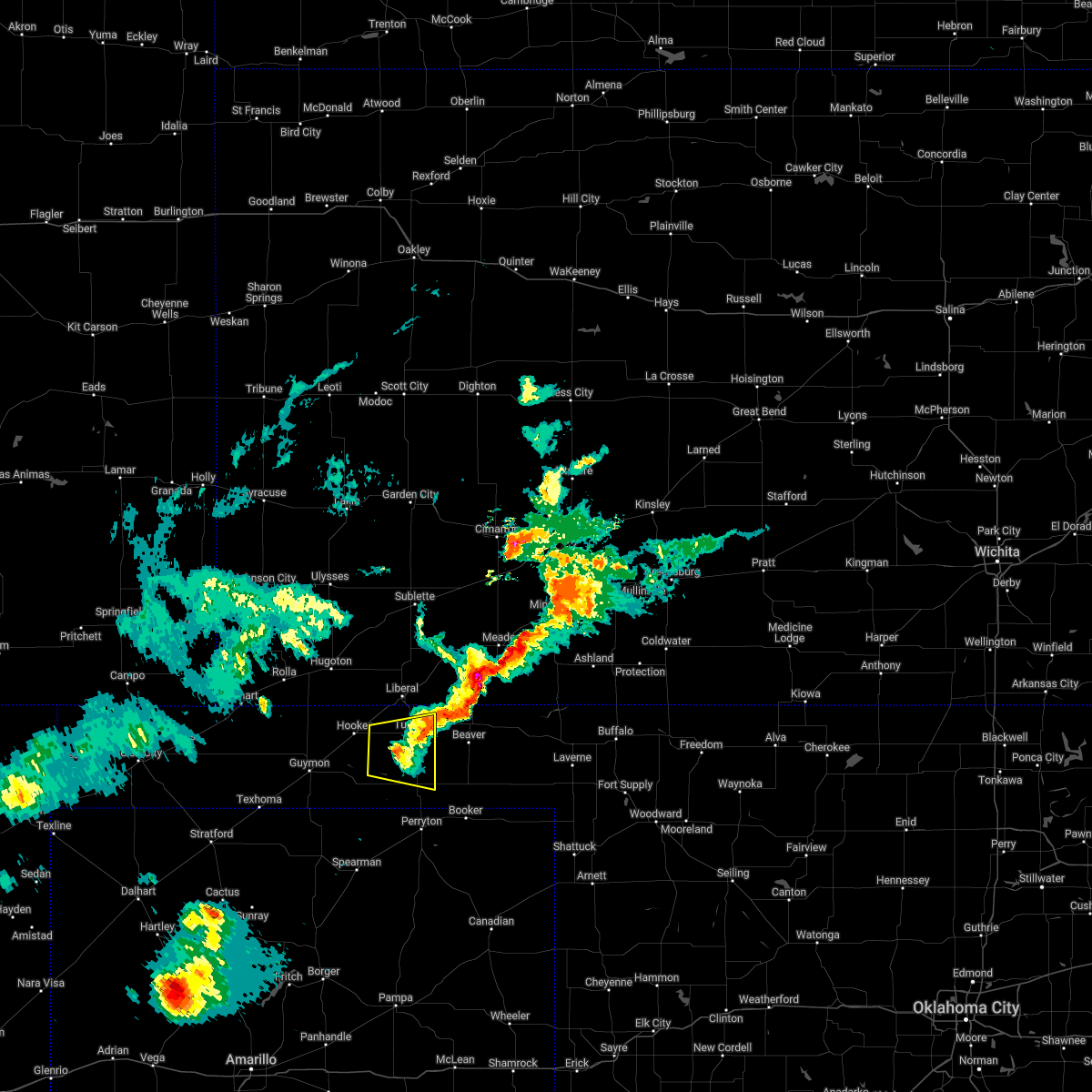 The severe thunderstorm warning for western beaver and east central texas counties will expire at 815 pm cdt, the storm which prompted the warning has weakened below severe limits, and has exited the warned area. therefore, the warning will be allowed to expire. a severe thunderstorm watch remains in effect until 100 am cdt for the panhandle of oklahoma. The severe thunderstorm warning for western beaver and east central texas counties will expire at 815 pm cdt, the storm which prompted the warning has weakened below severe limits, and has exited the warned area. therefore, the warning will be allowed to expire. a severe thunderstorm watch remains in effect until 100 am cdt for the panhandle of oklahoma.
|
| 4/27/2022 7:52 PM CDT |
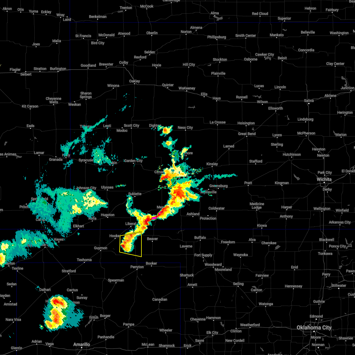 At 752 pm cdt, a severe thunderstorm was located 6 miles east of adams, or 19 miles south of liberal, moving east at 30 mph (radar indicated). Hazards include 60 mph wind gusts and nickel size hail. Minor damage to roofs, siding, and trees is possible. locations impacted include, turpin, bryans corner, baker, adams and boyd. hail threat, radar indicated max hail size, 0. 88in wind threat, radar indicated max wind gust, 60 mph. At 752 pm cdt, a severe thunderstorm was located 6 miles east of adams, or 19 miles south of liberal, moving east at 30 mph (radar indicated). Hazards include 60 mph wind gusts and nickel size hail. Minor damage to roofs, siding, and trees is possible. locations impacted include, turpin, bryans corner, baker, adams and boyd. hail threat, radar indicated max hail size, 0. 88in wind threat, radar indicated max wind gust, 60 mph.
|
| 4/27/2022 7:35 PM CDT |
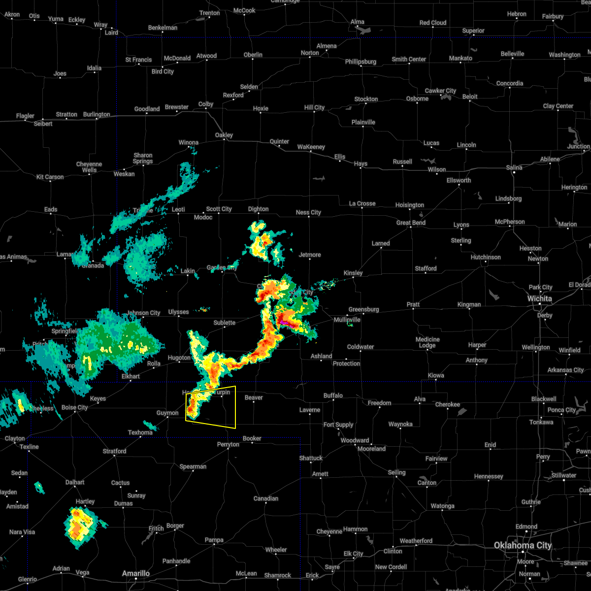 At 734 pm cdt, a severe thunderstorm was located over adams, or 19 miles east of guymon, moving east at 25 mph (radar indicated). Hazards include 60 mph wind gusts and quarter size hail. Minor damage to roofs, siding, and trees is possible. Hail damage to vehicles is expected. At 734 pm cdt, a severe thunderstorm was located over adams, or 19 miles east of guymon, moving east at 25 mph (radar indicated). Hazards include 60 mph wind gusts and quarter size hail. Minor damage to roofs, siding, and trees is possible. Hail damage to vehicles is expected.
|
| 4/23/2022 2:49 AM CDT |
 At 248 am cdt, severe thunderstorms were located along a line extending from 4 miles southwest of kismet to 3 miles northwest of turpin to 8 miles south of hardesty, moving east at 45 mph (radar indicated). Hazards include 60 mph wind gusts. Minor damage to roofs, siding, and trees is possible. locations impacted include, beaver, forgan, hardesty, gate, knowles, elmwood, adams, boyd, floris, bryans corner, baker, mocane, turpin, slapout and balko. hail threat, radar indicated max hail size, <. 75 in wind threat, radar indicated max wind gust, 60 mph. At 248 am cdt, severe thunderstorms were located along a line extending from 4 miles southwest of kismet to 3 miles northwest of turpin to 8 miles south of hardesty, moving east at 45 mph (radar indicated). Hazards include 60 mph wind gusts. Minor damage to roofs, siding, and trees is possible. locations impacted include, beaver, forgan, hardesty, gate, knowles, elmwood, adams, boyd, floris, bryans corner, baker, mocane, turpin, slapout and balko. hail threat, radar indicated max hail size, <. 75 in wind threat, radar indicated max wind gust, 60 mph.
|
| 4/23/2022 2:39 AM CDT |
 At 239 am cdt, severe thunderstorms were located along a line extending from 5 miles northwest of hayne to near baker to 8 miles west of stinnett, moving northeast at 55 mph (radar indicated). Hazards include 60 mph wind gusts. Minor damage to roofs, siding, and trees is possible. locations impacted include, borger, perryton, spearman, lipscomb, canadian, beaver, miami, fritch, hooker, stinnett, booker, gruver, tyrone, forgan, follett, higgins, optima, darrouzett, hardesty and sanford. hail threat, radar indicated max hail size, <. 75 in wind threat, radar indicated max wind gust, 60 mph. At 239 am cdt, severe thunderstorms were located along a line extending from 5 miles northwest of hayne to near baker to 8 miles west of stinnett, moving northeast at 55 mph (radar indicated). Hazards include 60 mph wind gusts. Minor damage to roofs, siding, and trees is possible. locations impacted include, borger, perryton, spearman, lipscomb, canadian, beaver, miami, fritch, hooker, stinnett, booker, gruver, tyrone, forgan, follett, higgins, optima, darrouzett, hardesty and sanford. hail threat, radar indicated max hail size, <. 75 in wind threat, radar indicated max wind gust, 60 mph.
|
| 4/23/2022 2:27 AM CDT |
 At 226 am cdt, severe thunderstorms were located along a line extending from 6 miles southeast of liberal to 6 miles west of boyd to fritch, moving east at 55 mph (radar indicated). Hazards include 60 mph wind gusts. Minor damage to roofs, siding, and trees is possible. locations impacted include, borger, guymon, perryton, spearman, lipscomb, canadian, beaver, miami, fritch, sunray, hooker, stinnett, booker, gruver, tyrone, forgan, follett, higgins, optima and darrouzett. hail threat, radar indicated max hail size, <. 75 in wind threat, radar indicated max wind gust, 60 mph. At 226 am cdt, severe thunderstorms were located along a line extending from 6 miles southeast of liberal to 6 miles west of boyd to fritch, moving east at 55 mph (radar indicated). Hazards include 60 mph wind gusts. Minor damage to roofs, siding, and trees is possible. locations impacted include, borger, guymon, perryton, spearman, lipscomb, canadian, beaver, miami, fritch, sunray, hooker, stinnett, booker, gruver, tyrone, forgan, follett, higgins, optima and darrouzett. hail threat, radar indicated max hail size, <. 75 in wind threat, radar indicated max wind gust, 60 mph.
|
| 4/23/2022 1:55 AM CDT |
 At 153 am cdt, severe thunderstorms were located along a line extending from 12 miles northeast of hough to guymon to 7 miles west of masterson, moving east at 55 mph (radar indicated). Hazards include 60 mph wind gusts. minor damage to roofs, siding, and trees is possible At 153 am cdt, severe thunderstorms were located along a line extending from 12 miles northeast of hough to guymon to 7 miles west of masterson, moving east at 55 mph (radar indicated). Hazards include 60 mph wind gusts. minor damage to roofs, siding, and trees is possible
|
| 4/22/2022 7:23 PM CDT |
 At 723 pm cdt, a severe thunderstorm was located 6 miles southeast of goodwell, or 10 miles south of guymon, moving northeast at 45 mph (radar indicated). Hazards include ping pong ball size hail and 60 mph wind gusts. Minor damage to roofs, siding, and trees is possible. people and animals outdoors will be injured. Expect hail damage to roofs, siding, windows, and vehicles. At 723 pm cdt, a severe thunderstorm was located 6 miles southeast of goodwell, or 10 miles south of guymon, moving northeast at 45 mph (radar indicated). Hazards include ping pong ball size hail and 60 mph wind gusts. Minor damage to roofs, siding, and trees is possible. people and animals outdoors will be injured. Expect hail damage to roofs, siding, windows, and vehicles.
|
| 10/12/2021 10:10 PM CDT |
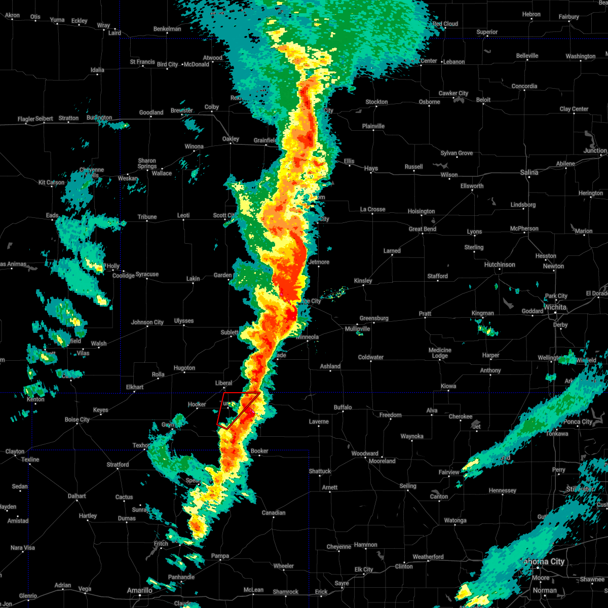 The tornado warning for northwestern beaver and east central texas counties will expire at 1015 pm cdt, the storm which prompted the warning has moved out of the area. therefore, the warning will be allowed to expire. however small hail, gusty winds and heavy rain are still possible with this thunderstorm. a tornado watch remains in effect until 1100 pm cdt for the panhandle of oklahoma. The tornado warning for northwestern beaver and east central texas counties will expire at 1015 pm cdt, the storm which prompted the warning has moved out of the area. therefore, the warning will be allowed to expire. however small hail, gusty winds and heavy rain are still possible with this thunderstorm. a tornado watch remains in effect until 1100 pm cdt for the panhandle of oklahoma.
|
| 10/12/2021 9:55 PM CDT |
 At 955 pm cdt, a severe thunderstorm capable of producing a tornado was located 4 miles northwest of boyd, or 20 miles west of beaver, moving northeast at 65 mph (radar indicated rotation). Hazards include tornado and quarter size hail. Flying debris will be dangerous to those caught without shelter. mobile homes will be damaged or destroyed. damage to roofs, windows, and vehicles will occur. tree damage is likely. Locations impacted include, turpin and floris. At 955 pm cdt, a severe thunderstorm capable of producing a tornado was located 4 miles northwest of boyd, or 20 miles west of beaver, moving northeast at 65 mph (radar indicated rotation). Hazards include tornado and quarter size hail. Flying debris will be dangerous to those caught without shelter. mobile homes will be damaged or destroyed. damage to roofs, windows, and vehicles will occur. tree damage is likely. Locations impacted include, turpin and floris.
|
| 10/12/2021 9:51 PM CDT |
 At 951 pm cdt, a severe thunderstorm was located 4 miles north of floris, or 12 miles south of hayne, moving northeast at 50 mph (radar indicated). Hazards include 70 mph wind gusts and quarter size hail. Expect some tree damage. damage is likely to mobile homes, roofs, and outbuildings. Hail damage to vehicles is expected. At 951 pm cdt, a severe thunderstorm was located 4 miles north of floris, or 12 miles south of hayne, moving northeast at 50 mph (radar indicated). Hazards include 70 mph wind gusts and quarter size hail. Expect some tree damage. damage is likely to mobile homes, roofs, and outbuildings. Hail damage to vehicles is expected.
|
| 10/12/2021 9:47 PM CDT |
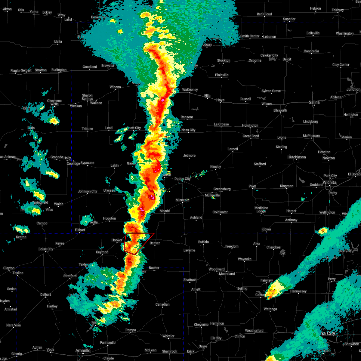 At 947 pm cdt, a severe thunderstorm capable of producing a tornado was located over turpin, or 11 miles south of liberal, moving northeast at 55 mph (radar indicated rotation). Hazards include tornado and quarter size hail. Flying debris will be dangerous to those caught without shelter. mobile homes will be damaged or destroyed. damage to roofs, windows, and vehicles will occur. Tree damage is likely. At 947 pm cdt, a severe thunderstorm capable of producing a tornado was located over turpin, or 11 miles south of liberal, moving northeast at 55 mph (radar indicated rotation). Hazards include tornado and quarter size hail. Flying debris will be dangerous to those caught without shelter. mobile homes will be damaged or destroyed. damage to roofs, windows, and vehicles will occur. Tree damage is likely.
|
| 10/12/2021 9:28 PM CDT |
 At 927 pm cdt, severe thunderstorms were located along a line extending from 3 miles southwest of liberal to 3 miles south of hardesty, moving northeast at 50 mph (radar indicated). Hazards include golf ball size hail and 70 mph wind gusts. Expect some tree damage. damage is likely to mobile homes, roofs, and outbuildings. people and animals outdoors will be injured. expect hail damage to roofs, siding, windows, and vehicles. locations impacted include, hooker, tyrone, hardesty, turpin, baker and adams. thunderstorm damage threat, considerable hail threat, radar indicated max hail size, 1. 75 in wind threat, radar indicated max wind gust, 70 mph. At 927 pm cdt, severe thunderstorms were located along a line extending from 3 miles southwest of liberal to 3 miles south of hardesty, moving northeast at 50 mph (radar indicated). Hazards include golf ball size hail and 70 mph wind gusts. Expect some tree damage. damage is likely to mobile homes, roofs, and outbuildings. people and animals outdoors will be injured. expect hail damage to roofs, siding, windows, and vehicles. locations impacted include, hooker, tyrone, hardesty, turpin, baker and adams. thunderstorm damage threat, considerable hail threat, radar indicated max hail size, 1. 75 in wind threat, radar indicated max wind gust, 70 mph.
|
| 10/12/2021 9:06 PM CDT |
 At 904 pm cdt, automated weather equipment reported severe thunderstorms were located along a line extending from 5 miles northwest of hooker to 11 miles southeast of goodwell, moving northeast at 35 mph (automated weather equipment at guymon airport reported a 67 mph gust at 8:58 pm). Hazards include golf ball size hail and 70 mph wind gusts. Expect some tree damage. damage is likely to mobile homes, roofs, and outbuildings. people and animals outdoors will be injured. expect hail damage to roofs, siding, windows, and vehicles. locations impacted include, guymon, hooker, tyrone, optima, hardesty, baker, adams and turpin. thunderstorm damage threat, considerable hail threat, radar indicated max hail size, 1. 75 in wind threat, radar indicated max wind gust, 70 mph. At 904 pm cdt, automated weather equipment reported severe thunderstorms were located along a line extending from 5 miles northwest of hooker to 11 miles southeast of goodwell, moving northeast at 35 mph (automated weather equipment at guymon airport reported a 67 mph gust at 8:58 pm). Hazards include golf ball size hail and 70 mph wind gusts. Expect some tree damage. damage is likely to mobile homes, roofs, and outbuildings. people and animals outdoors will be injured. expect hail damage to roofs, siding, windows, and vehicles. locations impacted include, guymon, hooker, tyrone, optima, hardesty, baker, adams and turpin. thunderstorm damage threat, considerable hail threat, radar indicated max hail size, 1. 75 in wind threat, radar indicated max wind gust, 70 mph.
|
| 10/12/2021 8:52 PM CDT |
 At 852 pm cdt, severe thunderstorms were located along a line extending from 7 miles west of hooker to 11 miles south of goodwell, moving northeast at 35 mph (radar indicated). Hazards include golf ball size hail and 70 mph wind gusts. Expect some tree damage. damage is likely to mobile homes, roofs, and outbuildings. people and animals outdoors will be injured. Expect hail damage to roofs, siding, windows, and vehicles. At 852 pm cdt, severe thunderstorms were located along a line extending from 7 miles west of hooker to 11 miles south of goodwell, moving northeast at 35 mph (radar indicated). Hazards include golf ball size hail and 70 mph wind gusts. Expect some tree damage. damage is likely to mobile homes, roofs, and outbuildings. people and animals outdoors will be injured. Expect hail damage to roofs, siding, windows, and vehicles.
|
| 8/21/2021 6:41 PM CDT |
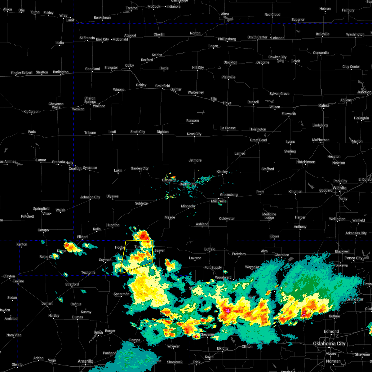 The severe thunderstorm warning for northwestern beaver and eastern texas counties will expire at 645 pm cdt, the storm which prompted the warning has moved out of the area. therefore, the warning will be allowed to expire. however gusty winds are still possible with this thunderstorm. The severe thunderstorm warning for northwestern beaver and eastern texas counties will expire at 645 pm cdt, the storm which prompted the warning has moved out of the area. therefore, the warning will be allowed to expire. however gusty winds are still possible with this thunderstorm.
|
| 8/21/2021 6:27 PM CDT |
 At 627 pm cdt, a severe thunderstorm was located 4 miles south of liberal, moving northeast at 35 mph (radar indicated). Hazards include 60 mph wind gusts and half dollar size hail. Minor damage to roofs, siding, and trees is possible. hail damage to vehicles is expected. locations impacted include, tyrone, hardesty, baker, adams, boyd, turpin and floris. hail threat, radar indicated max hail size, 1. 25 in wind threat, radar indicated max wind gust, 60 mph. At 627 pm cdt, a severe thunderstorm was located 4 miles south of liberal, moving northeast at 35 mph (radar indicated). Hazards include 60 mph wind gusts and half dollar size hail. Minor damage to roofs, siding, and trees is possible. hail damage to vehicles is expected. locations impacted include, tyrone, hardesty, baker, adams, boyd, turpin and floris. hail threat, radar indicated max hail size, 1. 25 in wind threat, radar indicated max wind gust, 60 mph.
|
| 8/21/2021 6:07 PM CDT |
 At 607 pm cdt, a severe thunderstorm was located over baker, or 13 miles south of liberal, moving north at 30 mph (radar indicated). Hazards include ping pong ball size hail and 60 mph wind gusts. Minor damage to roofs, siding, and trees is possible. people and animals outdoors will be injured. expect hail damage to roofs, siding, windows, and vehicles. locations impacted include, guymon, hooker, goodwell, tyrone, optima, hardesty, hough, adams, boyd, floris, bryans corner, baker, turpin and balko. hail threat, radar indicated max hail size, 1. 50 in wind threat, radar indicated max wind gust, 60 mph. At 607 pm cdt, a severe thunderstorm was located over baker, or 13 miles south of liberal, moving north at 30 mph (radar indicated). Hazards include ping pong ball size hail and 60 mph wind gusts. Minor damage to roofs, siding, and trees is possible. people and animals outdoors will be injured. expect hail damage to roofs, siding, windows, and vehicles. locations impacted include, guymon, hooker, goodwell, tyrone, optima, hardesty, hough, adams, boyd, floris, bryans corner, baker, turpin and balko. hail threat, radar indicated max hail size, 1. 50 in wind threat, radar indicated max wind gust, 60 mph.
|
| 8/21/2021 5:55 PM CDT | Golf Ball sized hail reported 10.5 miles NNW of Turpin, OK |
| 8/21/2021 5:53 PM CDT |
 At 553 pm cdt, a severe thunderstorm was located over boyd, or 16 miles west of beaver, moving north at 30 mph (radar indicated). Hazards include golf ball size hail and 60 mph wind gusts. Minor damage to roofs, siding, and trees is possible. people and animals outdoors will be injured. expect hail damage to roofs, siding, windows, and vehicles. locations impacted include, guymon, hooker, goodwell, tyrone, optima, hardesty, hough, adams, boyd, floris, bryans corner, baker, turpin and balko. thunderstorm damage threat, considerable hail threat, radar indicated max hail size, 1. 75 in wind threat, radar indicated max wind gust, 60 mph. At 553 pm cdt, a severe thunderstorm was located over boyd, or 16 miles west of beaver, moving north at 30 mph (radar indicated). Hazards include golf ball size hail and 60 mph wind gusts. Minor damage to roofs, siding, and trees is possible. people and animals outdoors will be injured. expect hail damage to roofs, siding, windows, and vehicles. locations impacted include, guymon, hooker, goodwell, tyrone, optima, hardesty, hough, adams, boyd, floris, bryans corner, baker, turpin and balko. thunderstorm damage threat, considerable hail threat, radar indicated max hail size, 1. 75 in wind threat, radar indicated max wind gust, 60 mph.
|
| 8/21/2021 5:39 PM CDT |
 At 539 pm cdt, a severe thunderstorm was located 8 miles southeast of guymon, moving northeast at 35 mph (radar indicated). Hazards include 60 mph wind gusts and quarter size hail. Minor damage to roofs, siding, and trees is possible. hail damage to vehicles is expected. locations impacted include, guymon, perryton, hooker, goodwell, tyrone, optima, hardesty, hough, adams, boyd, floris, bryans corner, baker, turpin and balko. hail threat, radar indicated max hail size, 1. 00in wind threat, radar indicated max wind gust, 60 mph. At 539 pm cdt, a severe thunderstorm was located 8 miles southeast of guymon, moving northeast at 35 mph (radar indicated). Hazards include 60 mph wind gusts and quarter size hail. Minor damage to roofs, siding, and trees is possible. hail damage to vehicles is expected. locations impacted include, guymon, perryton, hooker, goodwell, tyrone, optima, hardesty, hough, adams, boyd, floris, bryans corner, baker, turpin and balko. hail threat, radar indicated max hail size, 1. 00in wind threat, radar indicated max wind gust, 60 mph.
|
| 8/21/2021 5:31 PM CDT |
 At 530 pm cdt, a severe thunderstorm was located 4 miles south of beaver, moving north at 25 mph (radar indicated). Hazards include ping pong ball size hail and 60 mph wind gusts. Minor damage to roofs, siding, and trees is possible. people and animals outdoors will be injured. expect hail damage to roofs, siding, windows, and vehicles. locations impacted include, beaver, forgan, knowles, elmwood, boyd, mocane, turpin, floris and balko. hail threat, radar indicated max hail size, 1. 50 in wind threat, radar indicated max wind gust, 60 mph. At 530 pm cdt, a severe thunderstorm was located 4 miles south of beaver, moving north at 25 mph (radar indicated). Hazards include ping pong ball size hail and 60 mph wind gusts. Minor damage to roofs, siding, and trees is possible. people and animals outdoors will be injured. expect hail damage to roofs, siding, windows, and vehicles. locations impacted include, beaver, forgan, knowles, elmwood, boyd, mocane, turpin, floris and balko. hail threat, radar indicated max hail size, 1. 50 in wind threat, radar indicated max wind gust, 60 mph.
|
| 8/21/2021 5:27 PM CDT |
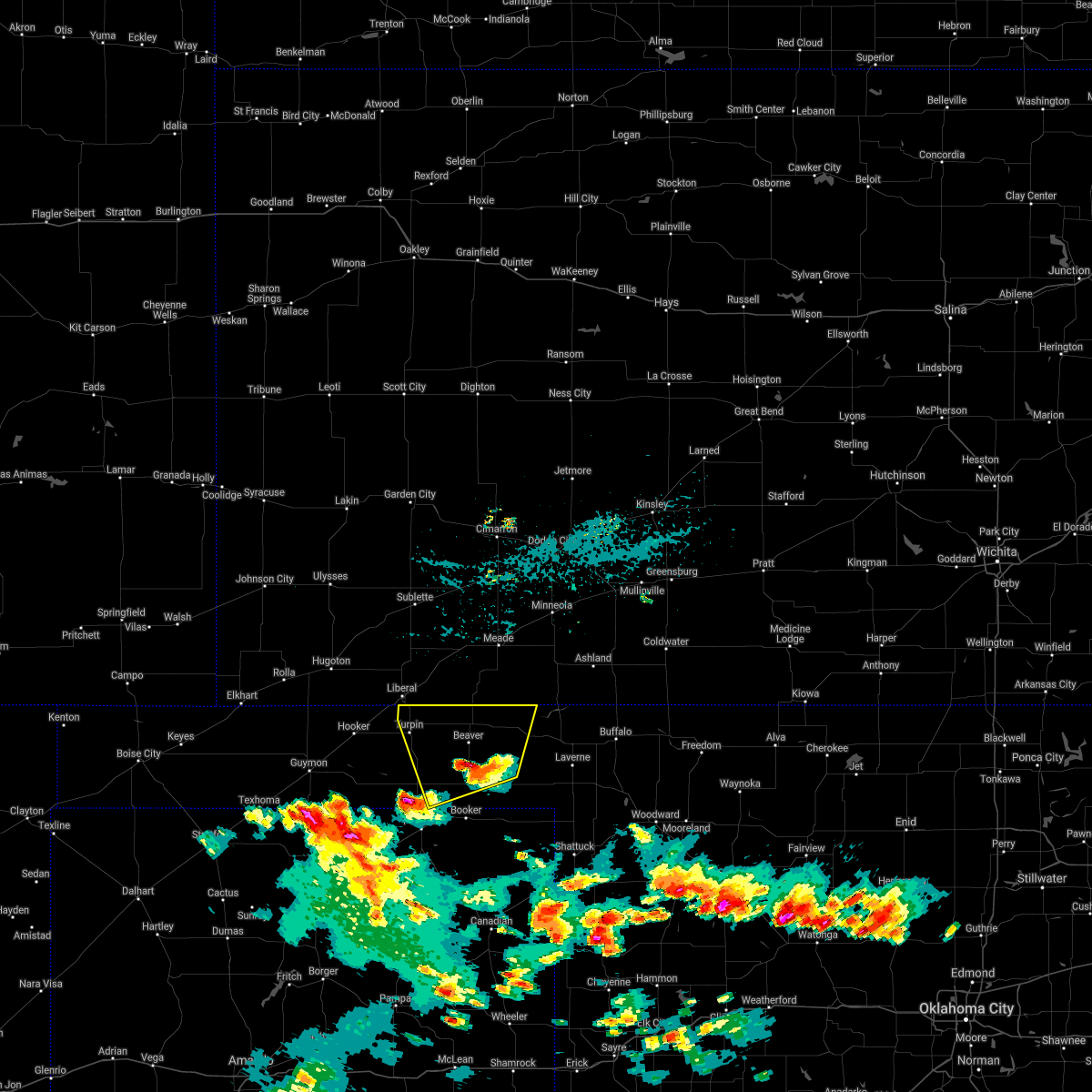 At 526 pm cdt, a severe thunderstorm was located 5 miles south of beaver, moving north at 35 mph (radar indicated). Hazards include 60 mph wind gusts and quarter size hail. Minor damage to roofs, siding, and trees is possible. hail damage to vehicles is expected. locations impacted include, beaver, forgan, knowles, elmwood, boyd, mocane, turpin, floris and balko. hail threat, radar indicated max hail size, 1. 00in wind threat, radar indicated max wind gust, 60 mph. At 526 pm cdt, a severe thunderstorm was located 5 miles south of beaver, moving north at 35 mph (radar indicated). Hazards include 60 mph wind gusts and quarter size hail. Minor damage to roofs, siding, and trees is possible. hail damage to vehicles is expected. locations impacted include, beaver, forgan, knowles, elmwood, boyd, mocane, turpin, floris and balko. hail threat, radar indicated max hail size, 1. 00in wind threat, radar indicated max wind gust, 60 mph.
|
| 8/21/2021 5:20 PM CDT |
 At 520 pm cdt, a severe thunderstorm was located 10 miles north of gruver, or 19 miles northwest of spearman, moving north at 40 mph (radar indicated). Hazards include 60 mph wind gusts and quarter size hail. Minor damage to roofs, siding, and trees is possible. Hail damage to vehicles is expected. At 520 pm cdt, a severe thunderstorm was located 10 miles north of gruver, or 19 miles northwest of spearman, moving north at 40 mph (radar indicated). Hazards include 60 mph wind gusts and quarter size hail. Minor damage to roofs, siding, and trees is possible. Hail damage to vehicles is expected.
|
| 8/21/2021 5:03 PM CDT |
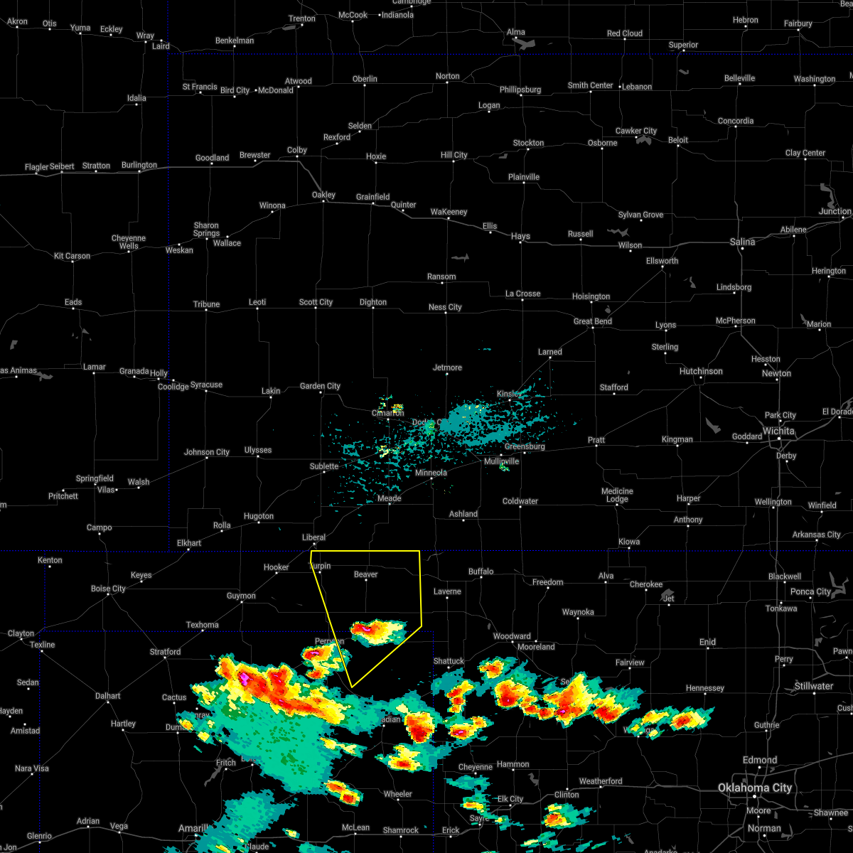 At 503 pm cdt, a severe thunderstorm was located 4 miles south of elmwood, or 17 miles south of beaver, moving north at 25 mph (radar indicated). Hazards include 60 mph wind gusts and half dollar size hail. Minor damage to roofs, siding, and trees is possible. hail damage to vehicles is expected. locations impacted include, beaver, booker, forgan, darrouzett, knowles, wolf creek park, elmwood, boyd, floris, bryans corner, mocane, turpin, slapout and balko. hail threat, radar indicated max hail size, 1. 25 in wind threat, radar indicated max wind gust, 60 mph. At 503 pm cdt, a severe thunderstorm was located 4 miles south of elmwood, or 17 miles south of beaver, moving north at 25 mph (radar indicated). Hazards include 60 mph wind gusts and half dollar size hail. Minor damage to roofs, siding, and trees is possible. hail damage to vehicles is expected. locations impacted include, beaver, booker, forgan, darrouzett, knowles, wolf creek park, elmwood, boyd, floris, bryans corner, mocane, turpin, slapout and balko. hail threat, radar indicated max hail size, 1. 25 in wind threat, radar indicated max wind gust, 60 mph.
|
| 8/21/2021 5:03 PM CDT |
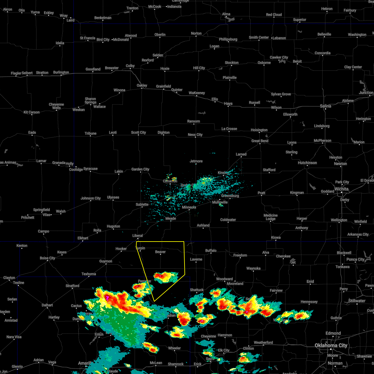 At 503 pm cdt, a severe thunderstorm was located 4 miles south of elmwood, or 17 miles south of beaver, moving north at 25 mph (radar indicated). Hazards include 60 mph wind gusts and half dollar size hail. Minor damage to roofs, siding, and trees is possible. hail damage to vehicles is expected. locations impacted include, beaver, booker, forgan, darrouzett, knowles, wolf creek park, elmwood, boyd, floris, bryans corner, mocane, turpin, slapout and balko. hail threat, radar indicated max hail size, 1. 25 in wind threat, radar indicated max wind gust, 60 mph. At 503 pm cdt, a severe thunderstorm was located 4 miles south of elmwood, or 17 miles south of beaver, moving north at 25 mph (radar indicated). Hazards include 60 mph wind gusts and half dollar size hail. Minor damage to roofs, siding, and trees is possible. hail damage to vehicles is expected. locations impacted include, beaver, booker, forgan, darrouzett, knowles, wolf creek park, elmwood, boyd, floris, bryans corner, mocane, turpin, slapout and balko. hail threat, radar indicated max hail size, 1. 25 in wind threat, radar indicated max wind gust, 60 mph.
|
| 8/21/2021 4:47 PM CDT |
 At 447 pm cdt, a severe thunderstorm was located over booker, or 16 miles east of perryton, moving north at 25 mph (radar indicated). Hazards include 60 mph wind gusts and quarter size hail. Minor damage to roofs, siding, and trees is possible. hail damage to vehicles is expected. locations impacted include, lipscomb, beaver, booker, forgan, follett, darrouzett, knowles, wolf creek park, elmwood, boyd, floris, bryans corner, mocane, turpin, slapout and balko. hail threat, radar indicated max hail size, 1. 00in wind threat, radar indicated max wind gust, 60 mph. At 447 pm cdt, a severe thunderstorm was located over booker, or 16 miles east of perryton, moving north at 25 mph (radar indicated). Hazards include 60 mph wind gusts and quarter size hail. Minor damage to roofs, siding, and trees is possible. hail damage to vehicles is expected. locations impacted include, lipscomb, beaver, booker, forgan, follett, darrouzett, knowles, wolf creek park, elmwood, boyd, floris, bryans corner, mocane, turpin, slapout and balko. hail threat, radar indicated max hail size, 1. 00in wind threat, radar indicated max wind gust, 60 mph.
|
| 8/21/2021 4:15 PM CDT |
 At 414 pm cdt, a severe thunderstorm was located 9 miles northeast of wolf creek park, or 12 miles west of lipscomb, moving north at 25 mph (radar indicated). Hazards include 60 mph wind gusts and quarter size hail. Minor damage to roofs, siding, and trees is possible. Hail damage to vehicles is expected. At 414 pm cdt, a severe thunderstorm was located 9 miles northeast of wolf creek park, or 12 miles west of lipscomb, moving north at 25 mph (radar indicated). Hazards include 60 mph wind gusts and quarter size hail. Minor damage to roofs, siding, and trees is possible. Hail damage to vehicles is expected.
|
| 7/18/2021 4:14 PM CDT |
 At 413 pm cdt, a severe thunderstorm was located over boyd, or 18 miles west of beaver, moving southwest at 5 mph. other storms were just north of slapout (radar indicated). Hazards include 70 mph wind gusts and ping pong ball size hail. Expect some tree damage. damage is likely to mobile homes, roofs, and outbuildings. people and animals outdoors will be injured. expect hail damage to roofs, siding, windows, and vehicles. hail may accumulate on roadways causing hazardous travel. Locations impacted include, elmwood, bryans corner, baker, adams, boyd, turpin, slapout and balko. At 413 pm cdt, a severe thunderstorm was located over boyd, or 18 miles west of beaver, moving southwest at 5 mph. other storms were just north of slapout (radar indicated). Hazards include 70 mph wind gusts and ping pong ball size hail. Expect some tree damage. damage is likely to mobile homes, roofs, and outbuildings. people and animals outdoors will be injured. expect hail damage to roofs, siding, windows, and vehicles. hail may accumulate on roadways causing hazardous travel. Locations impacted include, elmwood, bryans corner, baker, adams, boyd, turpin, slapout and balko.
|
| 7/18/2021 4:07 PM CDT |
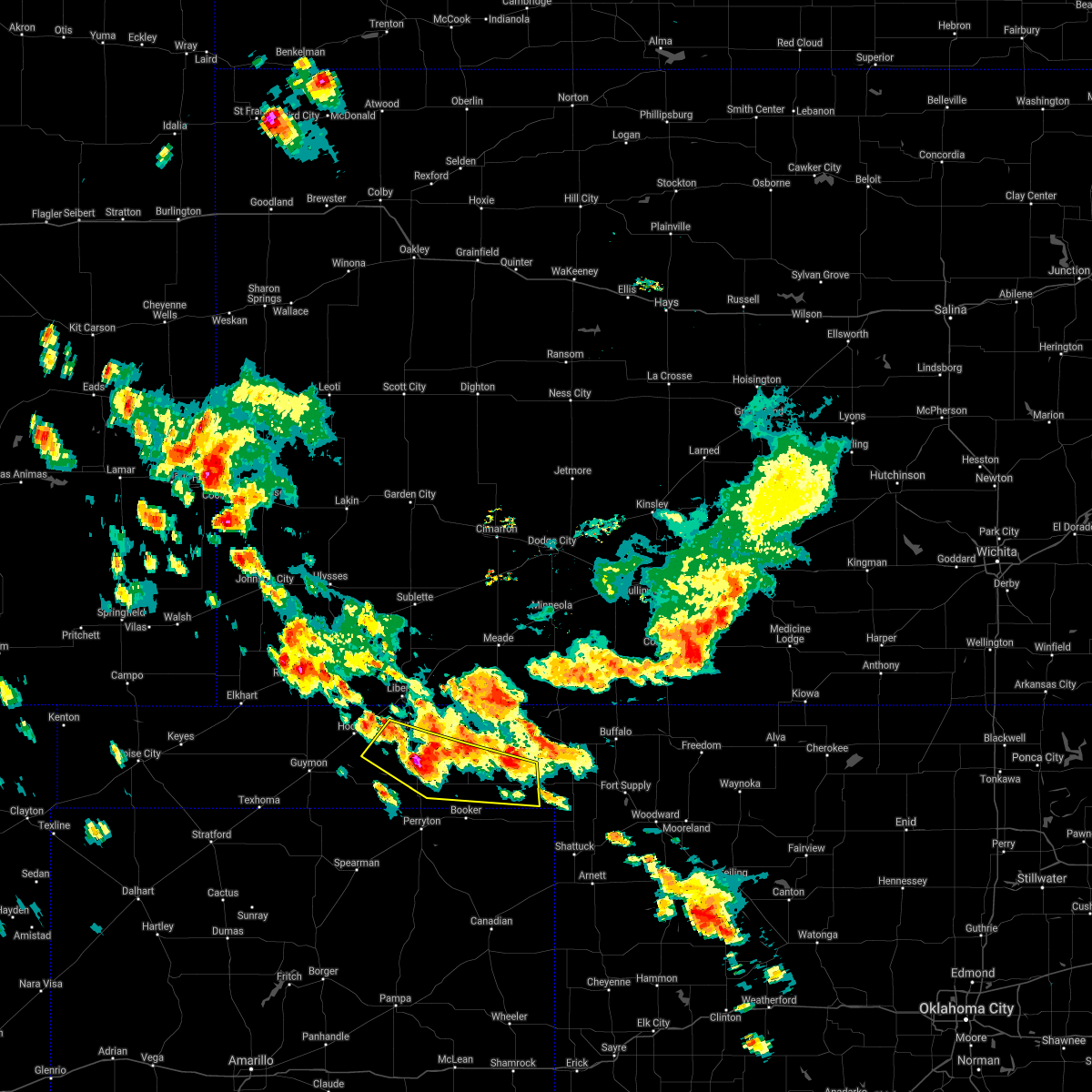 At 407 pm cdt, a severe thunderstorm was located over boyd, or 18 miles west of beaver, moving southwest at 5 mph (radar indicated). Hazards include ping pong ball size hail and 60 mph wind gusts. Minor damage to roofs, siding, and trees is possible. people and animals outdoors will be injured. expect hail damage to roofs, siding, windows, and vehicles. Locations impacted include, elmwood, bryans corner, baker, adams, boyd, turpin, slapout and balko. At 407 pm cdt, a severe thunderstorm was located over boyd, or 18 miles west of beaver, moving southwest at 5 mph (radar indicated). Hazards include ping pong ball size hail and 60 mph wind gusts. Minor damage to roofs, siding, and trees is possible. people and animals outdoors will be injured. expect hail damage to roofs, siding, windows, and vehicles. Locations impacted include, elmwood, bryans corner, baker, adams, boyd, turpin, slapout and balko.
|
| 7/18/2021 3:59 PM CDT |
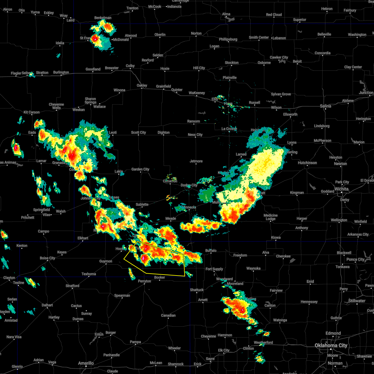 At 357 pm cdt, severe thunderstorms were located along a line extending from near turpin to 4 miles west of beaver to 10 miles southwest of knowles, moving southwest at 20 mph. another storm was located near boyd (radar indicated). Hazards include 60 mph wind gusts and quarter size hail. Minor damage to roofs, siding, and trees is possible. hail damage to vehicles is expected. Locations impacted include, beaver, forgan, elmwood, bryans corner, baker, adams, boyd, mocane, turpin, slapout, floris and balko. At 357 pm cdt, severe thunderstorms were located along a line extending from near turpin to 4 miles west of beaver to 10 miles southwest of knowles, moving southwest at 20 mph. another storm was located near boyd (radar indicated). Hazards include 60 mph wind gusts and quarter size hail. Minor damage to roofs, siding, and trees is possible. hail damage to vehicles is expected. Locations impacted include, beaver, forgan, elmwood, bryans corner, baker, adams, boyd, mocane, turpin, slapout, floris and balko.
|
| 7/18/2021 3:47 PM CDT |
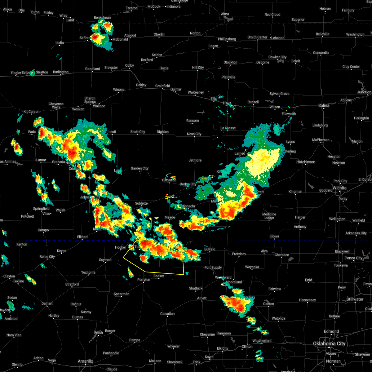 At 347 pm cdt, severe thunderstorms were located along a line extending from 3 miles north of turpin to 3 miles west of beaver to 9 miles southwest of knowles, moving southwest at 20 mph (radar indicated). Hazards include 60 mph wind gusts and nickel size hail. minor damage to roofs, siding, and trees is possible At 347 pm cdt, severe thunderstorms were located along a line extending from 3 miles north of turpin to 3 miles west of beaver to 9 miles southwest of knowles, moving southwest at 20 mph (radar indicated). Hazards include 60 mph wind gusts and nickel size hail. minor damage to roofs, siding, and trees is possible
|
| 6/25/2021 7:12 PM CDT |
 At 712 pm cdt, a severe thunderstorm was located 6 miles northeast of boyd, or 11 miles west of beaver, moving east at 35 mph. this is a very dangerous storm (radar indicated). Hazards include 80 mph wind gusts and quarter size hail. additionally, blowing dust and dangerously low visibilities are occurring with this storm. Flying debris will be dangerous to those caught without shelter. mobile homes will be heavily damaged. expect considerable damage to roofs, windows, and vehicles. tree damage and power outages are likely. hail damage to vehicles is expected. Locations impacted include, turpin, floris, bryans corner and boyd. At 712 pm cdt, a severe thunderstorm was located 6 miles northeast of boyd, or 11 miles west of beaver, moving east at 35 mph. this is a very dangerous storm (radar indicated). Hazards include 80 mph wind gusts and quarter size hail. additionally, blowing dust and dangerously low visibilities are occurring with this storm. Flying debris will be dangerous to those caught without shelter. mobile homes will be heavily damaged. expect considerable damage to roofs, windows, and vehicles. tree damage and power outages are likely. hail damage to vehicles is expected. Locations impacted include, turpin, floris, bryans corner and boyd.
|
| 6/25/2021 7:01 PM CDT |
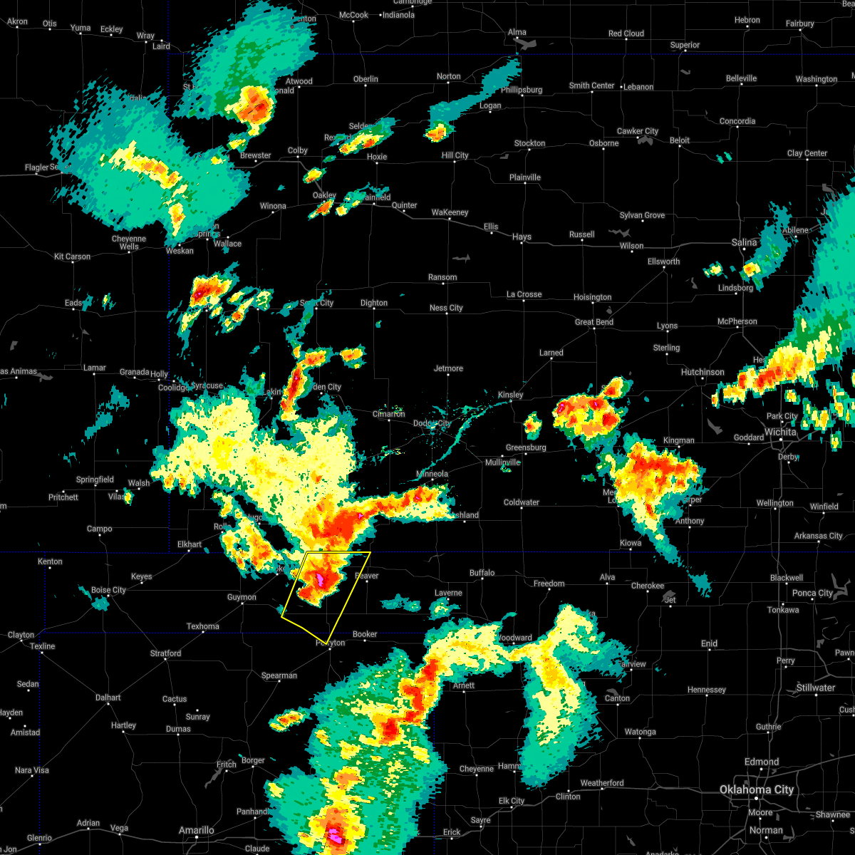 At 701 pm cdt, a severe thunderstorm was located 6 miles northeast of boyd, or 12 miles west of beaver, moving east at 40 mph. this is a very dangerous storm (radar indicated). Hazards include 80 mph wind gusts and quarter size hail. additionally, blowing dust and dangerously low visibilities are occurring with this storm. Flying debris will be dangerous to those caught without shelter. mobile homes will be heavily damaged. expect considerable damage to roofs, windows, and vehicles. tree damage and power outages are likely. hail damage to vehicles is expected. Locations impacted include, turpin, floris, bryans corner, baker, adams and boyd. At 701 pm cdt, a severe thunderstorm was located 6 miles northeast of boyd, or 12 miles west of beaver, moving east at 40 mph. this is a very dangerous storm (radar indicated). Hazards include 80 mph wind gusts and quarter size hail. additionally, blowing dust and dangerously low visibilities are occurring with this storm. Flying debris will be dangerous to those caught without shelter. mobile homes will be heavily damaged. expect considerable damage to roofs, windows, and vehicles. tree damage and power outages are likely. hail damage to vehicles is expected. Locations impacted include, turpin, floris, bryans corner, baker, adams and boyd.
|
| 6/25/2021 6:48 PM CDT |
 At 648 pm cdt, severe thunderstorms were located along a line extending from 7 miles southeast of liberal to 4 miles south of adams, moving east at 45 mph. these are very dangerous storms (radar indicated). Hazards include 80 mph wind gusts and quarter size hail. additionally, these storms are generating blowing dust and dangerously low visibilities. Flying debris will be dangerous to those caught without shelter. mobile homes will be heavily damaged. expect considerable damage to roofs, windows, and vehicles. tree damage and power outages are likely. hail damage to vehicles is expected. Locations impacted include, hooker, tyrone, hardesty, bryans corner, baker, adams, boyd, turpin and floris. At 648 pm cdt, severe thunderstorms were located along a line extending from 7 miles southeast of liberal to 4 miles south of adams, moving east at 45 mph. these are very dangerous storms (radar indicated). Hazards include 80 mph wind gusts and quarter size hail. additionally, these storms are generating blowing dust and dangerously low visibilities. Flying debris will be dangerous to those caught without shelter. mobile homes will be heavily damaged. expect considerable damage to roofs, windows, and vehicles. tree damage and power outages are likely. hail damage to vehicles is expected. Locations impacted include, hooker, tyrone, hardesty, bryans corner, baker, adams, boyd, turpin and floris.
|
| 6/25/2021 6:46 PM CDT |
 At 646 pm cdt, severe thunderstorms were located along a line extending from 7 miles south of hayne to 4 miles southeast of adams, moving east at 45 mph. these are very dangerous storms (radar indicated). Hazards include 80 mph wind gusts and quarter size hail. Flying debris will be dangerous to those caught without shelter. mobile homes will be heavily damaged. expect considerable damage to roofs, windows, and vehicles. tree damage and power outages are likely. hail damage to vehicles is expected. Locations impacted include, hooker, tyrone, hardesty, bryans corner, baker, adams, boyd, turpin and floris. At 646 pm cdt, severe thunderstorms were located along a line extending from 7 miles south of hayne to 4 miles southeast of adams, moving east at 45 mph. these are very dangerous storms (radar indicated). Hazards include 80 mph wind gusts and quarter size hail. Flying debris will be dangerous to those caught without shelter. mobile homes will be heavily damaged. expect considerable damage to roofs, windows, and vehicles. tree damage and power outages are likely. hail damage to vehicles is expected. Locations impacted include, hooker, tyrone, hardesty, bryans corner, baker, adams, boyd, turpin and floris.
|
| 6/25/2021 6:40 PM CDT |
 At 640 pm cdt, severe thunderstorms were located along a line extending from 7 miles southeast of liberal to 4 miles south of adams, moving east at 50 mph. these are very dangerous storms (radar indicated). Hazards include 80 mph wind gusts and quarter size hail. Flying debris will be dangerous to those caught without shelter. mobile homes will be heavily damaged. expect considerable damage to roofs, windows, and vehicles. tree damage and power outages are likely. hail damage to vehicles is expected. Locations impacted include, hooker, tyrone, hardesty, bryans corner, baker, adams, boyd, turpin and floris. At 640 pm cdt, severe thunderstorms were located along a line extending from 7 miles southeast of liberal to 4 miles south of adams, moving east at 50 mph. these are very dangerous storms (radar indicated). Hazards include 80 mph wind gusts and quarter size hail. Flying debris will be dangerous to those caught without shelter. mobile homes will be heavily damaged. expect considerable damage to roofs, windows, and vehicles. tree damage and power outages are likely. hail damage to vehicles is expected. Locations impacted include, hooker, tyrone, hardesty, bryans corner, baker, adams, boyd, turpin and floris.
|
| 6/25/2021 6:21 PM CDT |
 At 620 pm cdt, severe thunderstorms were located along a line extending from tyrone to 3 miles northeast of guymon, moving east at 45 mph. these are very dangerous storms (automated weather equipment. at 615 pm cdt, automated weather equipment recorded an 85 mph wind gust in hooker). Hazards include 90 mph wind gusts and quarter size hail. You are in a life-threatening situation. flying debris may be deadly to those caught without shelter. mobile homes will be heavily damaged or destroyed. homes and businesses will have substantial roof and window damage. Expect extensive tree damage and power outages. At 620 pm cdt, severe thunderstorms were located along a line extending from tyrone to 3 miles northeast of guymon, moving east at 45 mph. these are very dangerous storms (automated weather equipment. at 615 pm cdt, automated weather equipment recorded an 85 mph wind gust in hooker). Hazards include 90 mph wind gusts and quarter size hail. You are in a life-threatening situation. flying debris may be deadly to those caught without shelter. mobile homes will be heavily damaged or destroyed. homes and businesses will have substantial roof and window damage. Expect extensive tree damage and power outages.
|
| 5/2/2021 8:06 PM CDT |
 At 805 pm cdt, a severe thunderstorm was located 4 miles northeast of adams, or 17 miles south of liberal, moving east at 30 mph (radar indicated). Hazards include 60 mph wind gusts and penny size hail. Minor damage to roofs, siding, and trees is possible. Locations impacted include, hooker, tyrone, forgan, baker, adams, mocane, turpin and floris. At 805 pm cdt, a severe thunderstorm was located 4 miles northeast of adams, or 17 miles south of liberal, moving east at 30 mph (radar indicated). Hazards include 60 mph wind gusts and penny size hail. Minor damage to roofs, siding, and trees is possible. Locations impacted include, hooker, tyrone, forgan, baker, adams, mocane, turpin and floris.
|
| 5/2/2021 7:47 PM CDT |
 At 747 pm cdt, a severe thunderstorm was located over hooker, or 17 miles northeast of guymon, moving east at 30 mph (radar indicated). Hazards include 60 mph wind gusts and quarter size hail. Minor damage to roofs, siding, and trees is possible. Hail damage to vehicles is expected. At 747 pm cdt, a severe thunderstorm was located over hooker, or 17 miles northeast of guymon, moving east at 30 mph (radar indicated). Hazards include 60 mph wind gusts and quarter size hail. Minor damage to roofs, siding, and trees is possible. Hail damage to vehicles is expected.
|
| 8/14/2020 9:09 PM CDT |
 At 909 pm cdt, severe thunderstorms were located along a line extending from bryans corner to 3 miles southwest of texhoma, moving southeast at 35 mph (radar indicated). Hazards include 70 mph wind gusts and quarter size hail. Expect some tree damage. damage is likely to mobile homes, roofs, and outbuildings. hail damage to vehicles is expected. Locations impacted include, guymon, perryton, stratford, goodwell, gruver, optima, hardesty, adams, farnsworth, boyd, waka, bryans corner, baker, turpin, balko and texhoma. At 909 pm cdt, severe thunderstorms were located along a line extending from bryans corner to 3 miles southwest of texhoma, moving southeast at 35 mph (radar indicated). Hazards include 70 mph wind gusts and quarter size hail. Expect some tree damage. damage is likely to mobile homes, roofs, and outbuildings. hail damage to vehicles is expected. Locations impacted include, guymon, perryton, stratford, goodwell, gruver, optima, hardesty, adams, farnsworth, boyd, waka, bryans corner, baker, turpin, balko and texhoma.
|
| 8/14/2020 8:58 PM CDT |
 At 857 pm cdt, severe thunderstorms were located along a line extending from 3 miles west of boyd to 7 miles west of texhoma, moving southeast at 30 mph. these are very dangerous storms (radar indicated). Hazards include 80 mph wind gusts and half dollar size hail. Flying debris will be dangerous to those caught without shelter. mobile homes will be heavily damaged. expect considerable damage to roofs, windows, and vehicles. tree damage and power outages are likely. hail damage to vehicles is expected. Locations impacted include, guymon, perryton, stratford, goodwell, gruver, optima, hardesty, adams, farnsworth, boyd, waka, bryans corner, baker, turpin, balko and texhoma. At 857 pm cdt, severe thunderstorms were located along a line extending from 3 miles west of boyd to 7 miles west of texhoma, moving southeast at 30 mph. these are very dangerous storms (radar indicated). Hazards include 80 mph wind gusts and half dollar size hail. Flying debris will be dangerous to those caught without shelter. mobile homes will be heavily damaged. expect considerable damage to roofs, windows, and vehicles. tree damage and power outages are likely. hail damage to vehicles is expected. Locations impacted include, guymon, perryton, stratford, goodwell, gruver, optima, hardesty, adams, farnsworth, boyd, waka, bryans corner, baker, turpin, balko and texhoma.
|
| 8/14/2020 8:45 PM CDT |
 At 844 pm cdt, severe thunderstorms were located along a line extending from 3 miles southeast of adams to 9 miles northwest of texhoma, moving southeast at 35 mph (radar indicated). Hazards include 70 mph wind gusts and half dollar size hail. Expect some tree damage. damage is likely to mobile homes, roofs, and outbuildings. Hail damage to vehicles is expected. At 844 pm cdt, severe thunderstorms were located along a line extending from 3 miles southeast of adams to 9 miles northwest of texhoma, moving southeast at 35 mph (radar indicated). Hazards include 70 mph wind gusts and half dollar size hail. Expect some tree damage. damage is likely to mobile homes, roofs, and outbuildings. Hail damage to vehicles is expected.
|
| 7/14/2020 11:38 PM CDT |
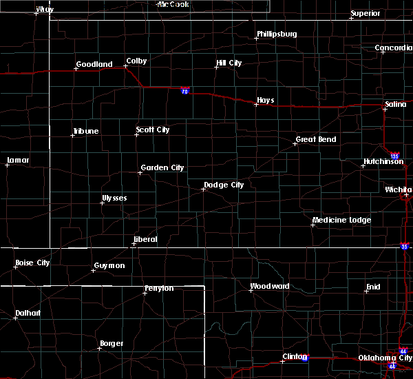 At 1137 pm cdt, a severe thunderstorm was located 4 miles northeast of hooker, or 15 miles southwest of liberal, moving east at 35 mph (automated weather equipment. at 1131 pm cdt, automated weather equipment recorded a 61 mph wind gust at liberal municipal airport). Hazards include 60 mph wind gusts and quarter size hail. Minor damage to roofs, siding, and trees is possible. Hail damage to vehicles is expected. At 1137 pm cdt, a severe thunderstorm was located 4 miles northeast of hooker, or 15 miles southwest of liberal, moving east at 35 mph (automated weather equipment. at 1131 pm cdt, automated weather equipment recorded a 61 mph wind gust at liberal municipal airport). Hazards include 60 mph wind gusts and quarter size hail. Minor damage to roofs, siding, and trees is possible. Hail damage to vehicles is expected.
|
| 7/14/2020 9:00 PM CDT |
 At 859 pm cdt, automated weather equipment reported severe thunderstorms were located along a line extending from 4 miles southeast of optima to hardesty to 3 miles east of waka to 16 miles east of pringle, moving east at 35 mph (automated weather equipment. at 841 pm cdt, automated weather equipment recorded a 63 mph gust at palo duro reservoir). Hazards include 70 mph wind gusts and quarter size hail. Expect some tree damage. damage is likely to mobile homes, roofs, and outbuildings. hail damage to vehicles is expected. Locations impacted include, perryton, spearman, hooker, optima, hardesty, wolf creek park, adams, farnsworth, boyd, waka, floris, bryans corner, baker, turpin and balko. At 859 pm cdt, automated weather equipment reported severe thunderstorms were located along a line extending from 4 miles southeast of optima to hardesty to 3 miles east of waka to 16 miles east of pringle, moving east at 35 mph (automated weather equipment. at 841 pm cdt, automated weather equipment recorded a 63 mph gust at palo duro reservoir). Hazards include 70 mph wind gusts and quarter size hail. Expect some tree damage. damage is likely to mobile homes, roofs, and outbuildings. hail damage to vehicles is expected. Locations impacted include, perryton, spearman, hooker, optima, hardesty, wolf creek park, adams, farnsworth, boyd, waka, floris, bryans corner, baker, turpin and balko.
|
| 7/14/2020 8:47 PM CDT |
 At 845 pm cdt, automated weather equipment reported severe thunderstorms were located along a line extending from 3 miles southeast of guymon to 3 miles west of spearman to 10 miles east of pringle, moving east at 45 mph (automated weather equipment. at 838 pm cdt, automated weather equipment recorded a 60 mph wind gust at palo duro reservoir). Hazards include 70 mph wind gusts and quarter size hail. Expect some tree damage. damage is likely to mobile homes, roofs, and outbuildings. hail damage to vehicles is expected. Locations impacted include, guymon, perryton, spearman, hooker, gruver, optima, hardesty, wolf creek park, adams, farnsworth, boyd, waka, floris, pringle, morse, bryans corner, baker, turpin and balko. At 845 pm cdt, automated weather equipment reported severe thunderstorms were located along a line extending from 3 miles southeast of guymon to 3 miles west of spearman to 10 miles east of pringle, moving east at 45 mph (automated weather equipment. at 838 pm cdt, automated weather equipment recorded a 60 mph wind gust at palo duro reservoir). Hazards include 70 mph wind gusts and quarter size hail. Expect some tree damage. damage is likely to mobile homes, roofs, and outbuildings. hail damage to vehicles is expected. Locations impacted include, guymon, perryton, spearman, hooker, gruver, optima, hardesty, wolf creek park, adams, farnsworth, boyd, waka, floris, pringle, morse, bryans corner, baker, turpin and balko.
|
| 7/14/2020 8:27 PM CDT |
 At 826 pm cdt, automated weather equipment reported severe thunderstorms were located along a line extending from goodwell to 4 miles west of gruver to pringle, moving east at 40 mph (automated weather equipment. at 820 pm cdt, automated weather equipment recorded a 62 mph wind gust at goodwell). Hazards include 70 mph wind gusts and quarter size hail. Expect some tree damage. damage is likely to mobile homes, roofs, and outbuildings. hail damage to vehicles is expected. Locations impacted include, guymon, perryton, spearman, hooker, goodwell, gruver, optima, hardesty, wolf creek park, adams, farnsworth, boyd, waka, floris, pringle, morse, bryans corner, baker, turpin and balko. At 826 pm cdt, automated weather equipment reported severe thunderstorms were located along a line extending from goodwell to 4 miles west of gruver to pringle, moving east at 40 mph (automated weather equipment. at 820 pm cdt, automated weather equipment recorded a 62 mph wind gust at goodwell). Hazards include 70 mph wind gusts and quarter size hail. Expect some tree damage. damage is likely to mobile homes, roofs, and outbuildings. hail damage to vehicles is expected. Locations impacted include, guymon, perryton, spearman, hooker, goodwell, gruver, optima, hardesty, wolf creek park, adams, farnsworth, boyd, waka, floris, pringle, morse, bryans corner, baker, turpin and balko.
|
| 7/14/2020 8:24 PM CDT |
 At 823 pm cdt, severe thunderstorms were located along a line extending from goodwell to 5 miles northwest of gruver to 3 miles northwest of pringle, moving east at 30 mph (radar indicated). Hazards include 70 mph wind gusts and quarter size hail. Expect some tree damage. damage is likely to mobile homes, roofs, and outbuildings. hail damage to vehicles is expected. Locations impacted include, guymon, perryton, spearman, hooker, goodwell, gruver, optima, hardesty, wolf creek park, adams, farnsworth, boyd, waka, floris, pringle, morse, bryans corner, baker, turpin and balko. At 823 pm cdt, severe thunderstorms were located along a line extending from goodwell to 5 miles northwest of gruver to 3 miles northwest of pringle, moving east at 30 mph (radar indicated). Hazards include 70 mph wind gusts and quarter size hail. Expect some tree damage. damage is likely to mobile homes, roofs, and outbuildings. hail damage to vehicles is expected. Locations impacted include, guymon, perryton, spearman, hooker, goodwell, gruver, optima, hardesty, wolf creek park, adams, farnsworth, boyd, waka, floris, pringle, morse, bryans corner, baker, turpin and balko.
|
| 7/14/2020 7:59 PM CDT |
 At 758 pm cdt, severe thunderstorms were located along a line extending from 8 miles northwest of goodwell to 12 miles southeast of texhoma to 8 miles east of sunray, moving east at 40 mph (radar indicated). Hazards include 70 mph wind gusts and quarter size hail. Expect some tree damage. damage is likely to mobile homes, roofs, and outbuildings. Hail damage to vehicles is expected. At 758 pm cdt, severe thunderstorms were located along a line extending from 8 miles northwest of goodwell to 12 miles southeast of texhoma to 8 miles east of sunray, moving east at 40 mph (radar indicated). Hazards include 70 mph wind gusts and quarter size hail. Expect some tree damage. damage is likely to mobile homes, roofs, and outbuildings. Hail damage to vehicles is expected.
|
| 7/14/2020 7:59 PM CDT |
 The national weather service in amarillo has issued a * severe thunderstorm warning for. western beaver county in the panhandle of oklahoma. texas county in the panhandle of oklahoma. northern hutchinson county in the panhandle of texas. Hansford county in the panhandle of texas. The national weather service in amarillo has issued a * severe thunderstorm warning for. western beaver county in the panhandle of oklahoma. texas county in the panhandle of oklahoma. northern hutchinson county in the panhandle of texas. Hansford county in the panhandle of texas.
|
| 6/21/2020 6:48 PM CDT |
 At 647 pm cdt, severe thunderstorms were located along a line extending from 6 miles north of acres to 7 miles north of floris, moving southeast at 55 mph (radar indicated). Hazards include 70 mph wind gusts and ping pong ball size hail. Expect some tree damage. damage is likely to mobile homes, roofs, and outbuildings. people and animals outdoors will be injured. Expect hail damage to roofs, siding, windows, and vehicles. At 647 pm cdt, severe thunderstorms were located along a line extending from 6 miles north of acres to 7 miles north of floris, moving southeast at 55 mph (radar indicated). Hazards include 70 mph wind gusts and ping pong ball size hail. Expect some tree damage. damage is likely to mobile homes, roofs, and outbuildings. people and animals outdoors will be injured. Expect hail damage to roofs, siding, windows, and vehicles.
|
| 6/11/2020 6:53 PM CDT |
 At 653 pm cdt, a severe thunderstorm was located near hough, or 10 miles northwest of guymon, moving east at 20 mph (radar indicated). Hazards include 60 mph wind gusts. Minor damage to roofs, siding, and trees is possible. Locations impacted include, hooker, optima, eva, hough, baker, adams and turpin. At 653 pm cdt, a severe thunderstorm was located near hough, or 10 miles northwest of guymon, moving east at 20 mph (radar indicated). Hazards include 60 mph wind gusts. Minor damage to roofs, siding, and trees is possible. Locations impacted include, hooker, optima, eva, hough, baker, adams and turpin.
|
| 6/11/2020 6:47 PM CDT |
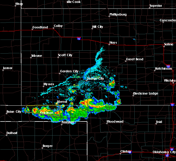 At 646 pm cdt, a severe thunderstorm was located near hough, or 12 miles northwest of guymon, moving east at 20 mph (radar indicated). Hazards include 60 mph wind gusts. Minor damage to roofs, siding, and trees is possible. Locations impacted include, hooker, tyrone, optima, eva, hough, baker, adams and turpin. At 646 pm cdt, a severe thunderstorm was located near hough, or 12 miles northwest of guymon, moving east at 20 mph (radar indicated). Hazards include 60 mph wind gusts. Minor damage to roofs, siding, and trees is possible. Locations impacted include, hooker, tyrone, optima, eva, hough, baker, adams and turpin.
|
| 6/11/2020 6:29 PM CDT |
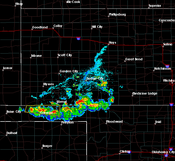 At 628 pm cdt, severe thunderstorms were located along a line extending from near adams to 5 miles north of optima to 7 miles west of hough, moving east at 25 mph (radar indicated). Hazards include 60 mph wind gusts. Minor damage to roofs, siding, and trees is possible. Locations impacted include, hooker, tyrone, optima, eva, hough, baker, adams and turpin. At 628 pm cdt, severe thunderstorms were located along a line extending from near adams to 5 miles north of optima to 7 miles west of hough, moving east at 25 mph (radar indicated). Hazards include 60 mph wind gusts. Minor damage to roofs, siding, and trees is possible. Locations impacted include, hooker, tyrone, optima, eva, hough, baker, adams and turpin.
|
| 6/11/2020 6:08 PM CDT |
 At 608 pm cdt, a severe thunderstorm was located 6 miles north of optima, or 12 miles north of guymon, moving east at 20 mph (radar indicated). Hazards include 60 mph wind gusts and quarter size hail. Minor damage to roofs, siding, and trees is possible. Hail damage to vehicles is expected. At 608 pm cdt, a severe thunderstorm was located 6 miles north of optima, or 12 miles north of guymon, moving east at 20 mph (radar indicated). Hazards include 60 mph wind gusts and quarter size hail. Minor damage to roofs, siding, and trees is possible. Hail damage to vehicles is expected.
|
| 6/11/2020 5:33 PM CDT |
 At 532 pm cdt, a severe thunderstorm was located 4 miles north of hooker, or 16 miles southwest of liberal, moving east at 30 mph (radar indicated). Hazards include 60 mph wind gusts and penny size hail. Minor damage to roofs, siding, and trees is possible. Locations impacted include, hooker, tyrone, optima, baker, adams, boyd and turpin. At 532 pm cdt, a severe thunderstorm was located 4 miles north of hooker, or 16 miles southwest of liberal, moving east at 30 mph (radar indicated). Hazards include 60 mph wind gusts and penny size hail. Minor damage to roofs, siding, and trees is possible. Locations impacted include, hooker, tyrone, optima, baker, adams, boyd and turpin.
|
| 6/11/2020 5:21 PM CDT |
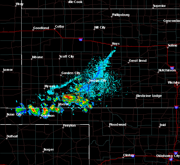 At 520 pm cdt, a severe thunderstorm was located 6 miles northwest of hooker, or 18 miles south of hugoton, moving east at 30 mph (radar indicated). Hazards include 60 mph wind gusts and quarter size hail. Minor damage to roofs, siding, and trees is possible. Hail damage to vehicles is expected. At 520 pm cdt, a severe thunderstorm was located 6 miles northwest of hooker, or 18 miles south of hugoton, moving east at 30 mph (radar indicated). Hazards include 60 mph wind gusts and quarter size hail. Minor damage to roofs, siding, and trees is possible. Hail damage to vehicles is expected.
|
| 6/4/2020 3:15 PM CDT |
 At 314 pm cdt, a severe thunderstorm was located over hardesty, or 19 miles east of guymon, moving east at 20 mph (radar indicated). Hazards include ping pong ball size hail and 60 mph wind gusts. Minor damage to roofs, siding, and trees is possible. people and animals outdoors will be injured. expect hail damage to roofs, siding, windows, and vehicles. Locations impacted include, hardesty, bryans corner, baker, adams, boyd, turpin and balko. At 314 pm cdt, a severe thunderstorm was located over hardesty, or 19 miles east of guymon, moving east at 20 mph (radar indicated). Hazards include ping pong ball size hail and 60 mph wind gusts. Minor damage to roofs, siding, and trees is possible. people and animals outdoors will be injured. expect hail damage to roofs, siding, windows, and vehicles. Locations impacted include, hardesty, bryans corner, baker, adams, boyd, turpin and balko.
|
| 6/4/2020 3:08 PM CDT |
 At 308 pm cdt, a severe thunderstorm was located over hardesty, or 16 miles east of guymon, moving southeast at 30 mph (radar indicated). Hazards include 60 mph wind gusts and quarter size hail. Minor damage to roofs, siding, and trees is possible. hail damage to vehicles is expected. Locations impacted include, hooker, optima, hardesty, bryans corner, baker, adams, boyd, turpin, floris and balko. At 308 pm cdt, a severe thunderstorm was located over hardesty, or 16 miles east of guymon, moving southeast at 30 mph (radar indicated). Hazards include 60 mph wind gusts and quarter size hail. Minor damage to roofs, siding, and trees is possible. hail damage to vehicles is expected. Locations impacted include, hooker, optima, hardesty, bryans corner, baker, adams, boyd, turpin, floris and balko.
|
| 6/4/2020 2:59 PM CDT |
 At 259 pm cdt, a severe thunderstorm was located 6 miles east of optima, or 13 miles east of guymon, moving southeast at 20 mph (radar indicated). Hazards include 60 mph wind gusts and quarter size hail. Minor damage to roofs, siding, and trees is possible. hail damage to vehicles is expected. Locations impacted include, guymon, hooker, tyrone, optima, hardesty, bryans corner, baker, adams, boyd, turpin, floris and balko. At 259 pm cdt, a severe thunderstorm was located 6 miles east of optima, or 13 miles east of guymon, moving southeast at 20 mph (radar indicated). Hazards include 60 mph wind gusts and quarter size hail. Minor damage to roofs, siding, and trees is possible. hail damage to vehicles is expected. Locations impacted include, guymon, hooker, tyrone, optima, hardesty, bryans corner, baker, adams, boyd, turpin, floris and balko.
|
| 6/4/2020 2:47 PM CDT |
 At 246 pm cdt, a severe thunderstorm was located over optima, or 10 miles northeast of guymon, moving east at 20 mph (radar indicated). Hazards include ping pong ball size hail and 60 mph wind gusts. Minor damage to roofs, siding, and trees is possible. people and animals outdoors will be injured. expect hail damage to roofs, siding, windows, and vehicles. Locations impacted include, guymon, hooker, tyrone, optima, hardesty, bryans corner, baker, adams, boyd, turpin, floris and balko. At 246 pm cdt, a severe thunderstorm was located over optima, or 10 miles northeast of guymon, moving east at 20 mph (radar indicated). Hazards include ping pong ball size hail and 60 mph wind gusts. Minor damage to roofs, siding, and trees is possible. people and animals outdoors will be injured. expect hail damage to roofs, siding, windows, and vehicles. Locations impacted include, guymon, hooker, tyrone, optima, hardesty, bryans corner, baker, adams, boyd, turpin, floris and balko.
|
| 6/4/2020 2:39 PM CDT |
 At 239 pm cdt, a severe thunderstorm was located over optima, or 7 miles northeast of guymon, moving east at 15 mph (radar indicated). Hazards include 60 mph wind gusts and quarter size hail. Minor damage to roofs, siding, and trees is possible. Hail damage to vehicles is expected. At 239 pm cdt, a severe thunderstorm was located over optima, or 7 miles northeast of guymon, moving east at 15 mph (radar indicated). Hazards include 60 mph wind gusts and quarter size hail. Minor damage to roofs, siding, and trees is possible. Hail damage to vehicles is expected.
|
| 8/23/2019 9:46 PM CDT |
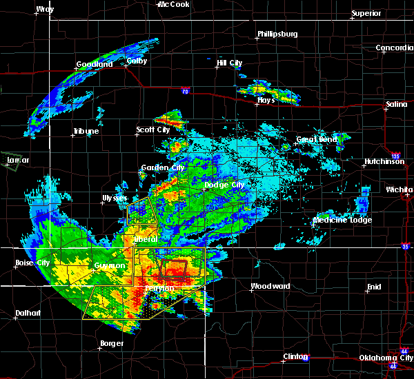 At 945 pm cdt, severe thunderstorms were located along a line extending from 4 miles northeast of boyd to 7 miles east of perryton to 15 miles southeast of waka, moving east at 25 mph (radar indicated). Hazards include 60 mph wind gusts and quarter size hail. Minor damage to roofs, siding, and trees is possible. hail damage to vehicles is expected. Locations impacted include, perryton, beaver, booker, forgan, follett, darrouzett, gate, knowles, wolf creek park, elmwood, farnsworth, boyd, waka, floris, bryans corner, mocane, turpin, slapout and balko. At 945 pm cdt, severe thunderstorms were located along a line extending from 4 miles northeast of boyd to 7 miles east of perryton to 15 miles southeast of waka, moving east at 25 mph (radar indicated). Hazards include 60 mph wind gusts and quarter size hail. Minor damage to roofs, siding, and trees is possible. hail damage to vehicles is expected. Locations impacted include, perryton, beaver, booker, forgan, follett, darrouzett, gate, knowles, wolf creek park, elmwood, farnsworth, boyd, waka, floris, bryans corner, mocane, turpin, slapout and balko.
|
| 8/23/2019 8:57 PM CDT |
 At 856 pm cdt, severe thunderstorms were located along a line extending from 5 miles northwest of turpin to 11 miles north of farnsworth to 8 miles north of morse, moving east at 30 mph (radar indicated). Hazards include 60 mph wind gusts and quarter size hail. Minor damage to roofs, siding, and trees is possible. Hail damage to vehicles is expected. At 856 pm cdt, severe thunderstorms were located along a line extending from 5 miles northwest of turpin to 11 miles north of farnsworth to 8 miles north of morse, moving east at 30 mph (radar indicated). Hazards include 60 mph wind gusts and quarter size hail. Minor damage to roofs, siding, and trees is possible. Hail damage to vehicles is expected.
|
| 8/23/2019 8:03 PM CDT |
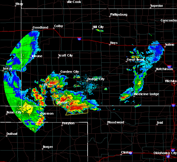 At 803 pm cdt, severe thunderstorms were located along a line extending from 5 miles northwest of knowles to near forgan, moving north at 10 mph (radar indicated). Hazards include golf ball size hail and 60 mph wind gusts. Minor damage to roofs, siding, and trees is possible. people and animals outdoors will be injured. expect hail damage to roofs, siding, windows, and vehicles. Locations impacted include, beaver, forgan, gate, knowles, mocane, turpin and floris. At 803 pm cdt, severe thunderstorms were located along a line extending from 5 miles northwest of knowles to near forgan, moving north at 10 mph (radar indicated). Hazards include golf ball size hail and 60 mph wind gusts. Minor damage to roofs, siding, and trees is possible. people and animals outdoors will be injured. expect hail damage to roofs, siding, windows, and vehicles. Locations impacted include, beaver, forgan, gate, knowles, mocane, turpin and floris.
|
| 8/23/2019 7:55 PM CDT |
 At 755 pm cdt, severe thunderstorms were located along a line extending from 3 miles northwest of knowles to near forgan, moving north at 10 mph (radar indicated). Hazards include golf ball size hail and 60 mph wind gusts. Minor damage to roofs, siding, and trees is possible. people and animals outdoors will be injured. Expect hail damage to roofs, siding, windows, and vehicles. At 755 pm cdt, severe thunderstorms were located along a line extending from 3 miles northwest of knowles to near forgan, moving north at 10 mph (radar indicated). Hazards include golf ball size hail and 60 mph wind gusts. Minor damage to roofs, siding, and trees is possible. people and animals outdoors will be injured. Expect hail damage to roofs, siding, windows, and vehicles.
|
| 6/23/2019 1:25 AM CDT |
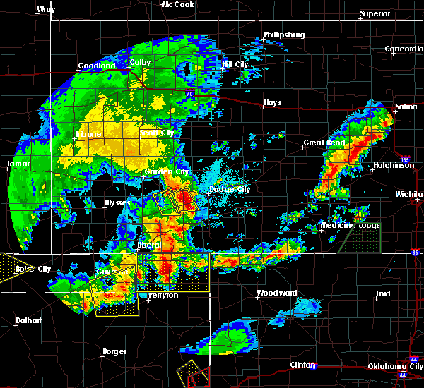 At 125 am cdt, a severe thunderstorm was located over beaver, moving east at 35 mph (radar indicated). Hazards include two inch hail and 60 mph wind gusts. Minor damage to roofs, siding, and trees is possible. people and animals outdoors will be injured. expect hail damage to roofs, siding, windows, and vehicles. Locations impacted include, beaver, forgan, gate, knowles, elmwood, bryans corner, boyd, mocane, turpin, slapout, floris and balko. At 125 am cdt, a severe thunderstorm was located over beaver, moving east at 35 mph (radar indicated). Hazards include two inch hail and 60 mph wind gusts. Minor damage to roofs, siding, and trees is possible. people and animals outdoors will be injured. expect hail damage to roofs, siding, windows, and vehicles. Locations impacted include, beaver, forgan, gate, knowles, elmwood, bryans corner, boyd, mocane, turpin, slapout, floris and balko.
|
| 6/23/2019 1:08 AM CDT |
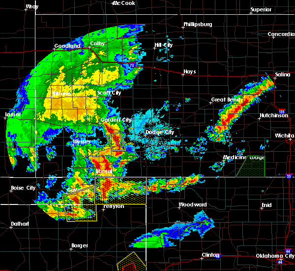 At 108 am cdt, a severe thunderstorm was located 4 miles north of balko, or 12 miles southwest of beaver, moving east at 30 mph (radar indicated). Hazards include ping pong ball size hail and 60 mph wind gusts. Minor damage to roofs, siding, and trees is possible. people and animals outdoors will be injured. expect hail damage to roofs, siding, windows, and vehicles. Locations impacted include, beaver, forgan, gate, knowles, elmwood, bryans corner, boyd, mocane, turpin, slapout, floris and balko. At 108 am cdt, a severe thunderstorm was located 4 miles north of balko, or 12 miles southwest of beaver, moving east at 30 mph (radar indicated). Hazards include ping pong ball size hail and 60 mph wind gusts. Minor damage to roofs, siding, and trees is possible. people and animals outdoors will be injured. expect hail damage to roofs, siding, windows, and vehicles. Locations impacted include, beaver, forgan, gate, knowles, elmwood, bryans corner, boyd, mocane, turpin, slapout, floris and balko.
|
| 6/23/2019 12:56 AM CDT |
 At 1256 am cdt, a severe thunderstorm was located over boyd, or 16 miles southwest of beaver, moving east at 40 mph (radar indicated). Hazards include 60 mph wind gusts and quarter size hail. Minor damage to roofs, siding, and trees is possible. Hail damage to vehicles is expected. At 1256 am cdt, a severe thunderstorm was located over boyd, or 16 miles southwest of beaver, moving east at 40 mph (radar indicated). Hazards include 60 mph wind gusts and quarter size hail. Minor damage to roofs, siding, and trees is possible. Hail damage to vehicles is expected.
|
| 6/23/2019 12:30 AM CDT |
 At 1230 am cdt, a severe thunderstorm was located 6 miles southeast of hough, or 8 miles north of guymon, moving east at 30 mph (radar indicated). Hazards include 60 mph wind gusts and half dollar size hail. Minor damage to roofs, siding, and trees is possible. hail damage to vehicles is expected. Locations impacted include, guymon, hooker, goodwell, tyrone, optima, hardesty, hough, baker, adams and turpin. At 1230 am cdt, a severe thunderstorm was located 6 miles southeast of hough, or 8 miles north of guymon, moving east at 30 mph (radar indicated). Hazards include 60 mph wind gusts and half dollar size hail. Minor damage to roofs, siding, and trees is possible. hail damage to vehicles is expected. Locations impacted include, guymon, hooker, goodwell, tyrone, optima, hardesty, hough, baker, adams and turpin.
|
| 6/23/2019 12:14 AM CDT |
 At 1213 am cdt, a severe thunderstorm was located near hough, or 14 miles south of rolla, moving east at 45 mph (radar indicated). Hazards include 60 mph wind gusts and penny size hail. minor damage to roofs, siding, and trees is possible At 1213 am cdt, a severe thunderstorm was located near hough, or 14 miles south of rolla, moving east at 45 mph (radar indicated). Hazards include 60 mph wind gusts and penny size hail. minor damage to roofs, siding, and trees is possible
|
| 5/26/2019 10:27 PM CDT |
 The severe thunderstorm warning for beaver, eastern texas, northwestern lipscomb, eastern hansford and ochiltree counties will expire at 1030 pm cdt, the storms which prompted the warning have weakened below severe limits, and no longer pose an immediate threat to life or property. therefore, the warning will be allowed to expire. however gusty winds up to 55 mph are still possible with these thunderstorms. a tornado watch remains in effect until 200 am cdt for the panhandle of oklahoma, and the panhandle of texas. The severe thunderstorm warning for beaver, eastern texas, northwestern lipscomb, eastern hansford and ochiltree counties will expire at 1030 pm cdt, the storms which prompted the warning have weakened below severe limits, and no longer pose an immediate threat to life or property. therefore, the warning will be allowed to expire. however gusty winds up to 55 mph are still possible with these thunderstorms. a tornado watch remains in effect until 200 am cdt for the panhandle of oklahoma, and the panhandle of texas.
|
| 5/26/2019 10:03 PM CDT |
 At 1002 pm cdt, automated weather equipment reported severe thunderstorms were located along a line extending from tyrone to 4 miles south of bryans corner to 4 miles southeast of waka, moving northeast at 60 mph. these are very dangerous storms (automated weather equipment. at 940 pm cdt, an 82 mph gust was reported in hooker). Hazards include 80 mph wind gusts and quarter size hail. Flying debris will be dangerous to those caught without shelter. mobile homes will be heavily damaged. expect considerable damage to roofs, windows, and vehicles. tree damage and power outages are likely. hail damage to vehicles is expected. locations impacted include, perryton, spearman, lipscomb, beaver, booker, tyrone, forgan, darrouzett, knowles, wolf creek park, elmwood, adams, farnsworth, boyd, waka, floris, bryans corner, baker, mocane and turpin. A tornado watch remains in effect until 200 am cdt for the panhandle of oklahoma, and the panhandle of texas. At 1002 pm cdt, automated weather equipment reported severe thunderstorms were located along a line extending from tyrone to 4 miles south of bryans corner to 4 miles southeast of waka, moving northeast at 60 mph. these are very dangerous storms (automated weather equipment. at 940 pm cdt, an 82 mph gust was reported in hooker). Hazards include 80 mph wind gusts and quarter size hail. Flying debris will be dangerous to those caught without shelter. mobile homes will be heavily damaged. expect considerable damage to roofs, windows, and vehicles. tree damage and power outages are likely. hail damage to vehicles is expected. locations impacted include, perryton, spearman, lipscomb, beaver, booker, tyrone, forgan, darrouzett, knowles, wolf creek park, elmwood, adams, farnsworth, boyd, waka, floris, bryans corner, baker, mocane and turpin. A tornado watch remains in effect until 200 am cdt for the panhandle of oklahoma, and the panhandle of texas.
|
| 5/26/2019 9:36 PM CDT |
 At 936 pm cdt, severe thunderstorms were located along a line extending from 7 miles north of optima to 11 miles south of hardesty to 7 miles southwest of spearman, moving northeast at 60 mph (radar indicated). Hazards include 60 mph wind gusts and quarter size hail. Minor damage to roofs, siding, and trees is possible. Hail damage to vehicles is expected. At 936 pm cdt, severe thunderstorms were located along a line extending from 7 miles north of optima to 11 miles south of hardesty to 7 miles southwest of spearman, moving northeast at 60 mph (radar indicated). Hazards include 60 mph wind gusts and quarter size hail. Minor damage to roofs, siding, and trees is possible. Hail damage to vehicles is expected.
|
| 5/23/2019 8:22 PM CDT |
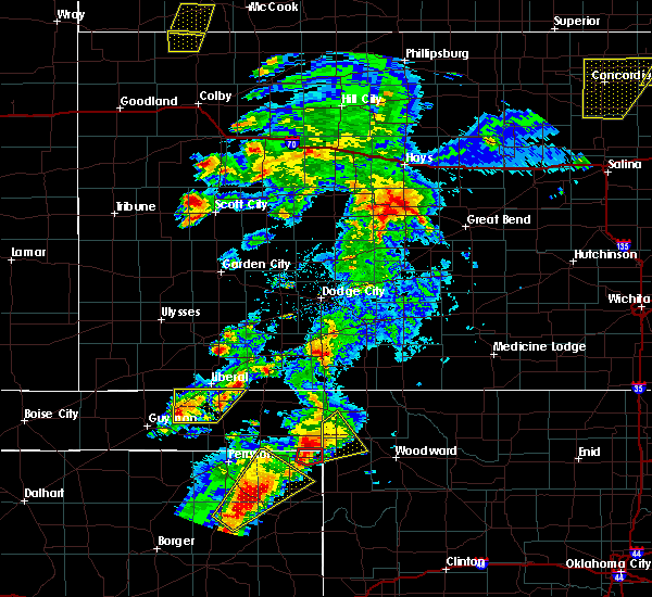 At 822 pm cdt, a severe thunderstorm was located over turpin, or 13 miles south of liberal, moving northeast at 55 mph (radar indicated). Hazards include quarter size hail. Damage to vehicles is expected. locations impacted include, hooker, tyrone, turpin, baker and adams. A tornado watch remains in effect until 1000 pm cdt for the panhandle of oklahoma. At 822 pm cdt, a severe thunderstorm was located over turpin, or 13 miles south of liberal, moving northeast at 55 mph (radar indicated). Hazards include quarter size hail. Damage to vehicles is expected. locations impacted include, hooker, tyrone, turpin, baker and adams. A tornado watch remains in effect until 1000 pm cdt for the panhandle of oklahoma.
|
| 5/23/2019 7:56 PM CDT |
 At 756 pm cdt, a severe thunderstorm was located near hardesty, or 20 miles east of guymon, moving northeast at 55 mph (radar indicated). Hazards include quarter size hail. damage to vehicles is expected At 756 pm cdt, a severe thunderstorm was located near hardesty, or 20 miles east of guymon, moving northeast at 55 mph (radar indicated). Hazards include quarter size hail. damage to vehicles is expected
|
| 5/23/2019 4:24 PM CDT |
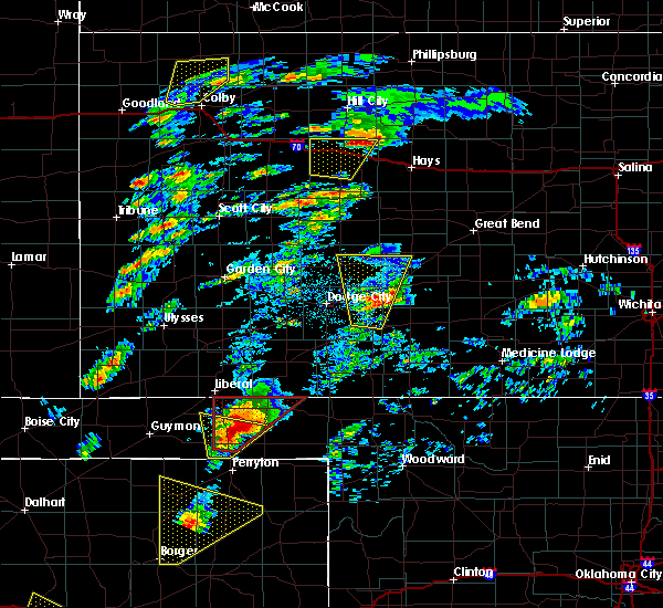 At 424 pm cdt, a severe thunderstorm capable of producing a tornado was located over boyd, or 16 miles southwest of beaver, moving north at 40 mph (weather spotters reported a rotating wall cloud). Hazards include tornado and golf ball size hail. Flying debris will be dangerous to those caught without shelter. mobile homes will be damaged or destroyed. damage to roofs, windows, and vehicles will occur. Tree damage is likely. At 424 pm cdt, a severe thunderstorm capable of producing a tornado was located over boyd, or 16 miles southwest of beaver, moving north at 40 mph (weather spotters reported a rotating wall cloud). Hazards include tornado and golf ball size hail. Flying debris will be dangerous to those caught without shelter. mobile homes will be damaged or destroyed. damage to roofs, windows, and vehicles will occur. Tree damage is likely.
|
| 5/20/2019 5:46 AM CDT |
 At 546 am cdt, a severe thunderstorm was located 4 miles southeast of gruver, or 8 miles west of spearman, moving northeast at 45 mph (radar indicated). Hazards include tennis ball size hail and 60 mph wind gusts. Minor damage to roofs, siding, and trees is possible. people and animals outdoors will be injured. expect hail damage to roofs, siding, windows, and vehicles. Locations impacted include, spearman, gruver, hardesty, baker, adams, boyd and turpin. At 546 am cdt, a severe thunderstorm was located 4 miles southeast of gruver, or 8 miles west of spearman, moving northeast at 45 mph (radar indicated). Hazards include tennis ball size hail and 60 mph wind gusts. Minor damage to roofs, siding, and trees is possible. people and animals outdoors will be injured. expect hail damage to roofs, siding, windows, and vehicles. Locations impacted include, spearman, gruver, hardesty, baker, adams, boyd and turpin.
|
| 5/20/2019 5:40 AM CDT |
 At 540 am cdt, a severe thunderstorm was located 5 miles south of gruver, or 11 miles west of spearman, moving northeast at 65 mph (radar indicated). Hazards include ping pong ball size hail and 60 mph wind gusts. Minor damage to roofs, siding, and trees is possible. people and animals outdoors will be injured. Expect hail damage to roofs, siding, windows, and vehicles. At 540 am cdt, a severe thunderstorm was located 5 miles south of gruver, or 11 miles west of spearman, moving northeast at 65 mph (radar indicated). Hazards include ping pong ball size hail and 60 mph wind gusts. Minor damage to roofs, siding, and trees is possible. people and animals outdoors will be injured. Expect hail damage to roofs, siding, windows, and vehicles.
|
| 5/7/2019 4:04 PM CDT |
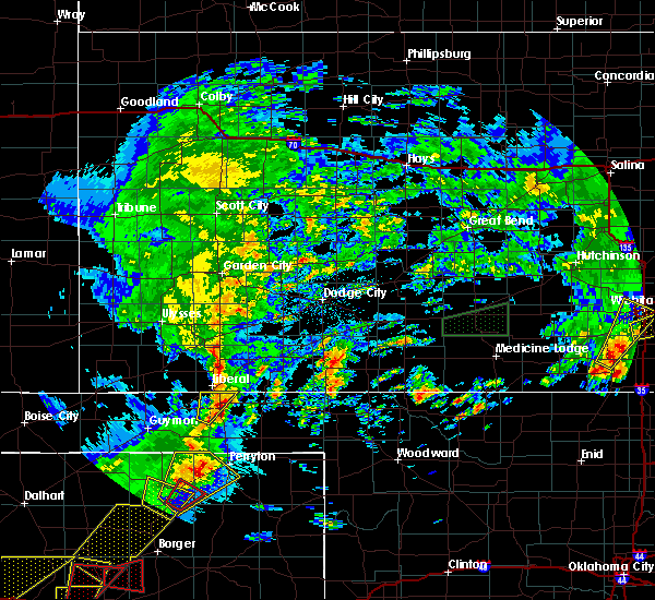 At 404 pm cdt, a severe thunderstorm capable of producing a tornado was located 4 miles southeast of turpin, or 16 miles west of beaver, moving northeast at 20 mph (radar indicated rotation). Hazards include tornado and golf ball size hail. Flying debris will be dangerous to those caught without shelter. mobile homes will be damaged or destroyed. damage to roofs, windows, and vehicles will occur. Tree damage is likely. At 404 pm cdt, a severe thunderstorm capable of producing a tornado was located 4 miles southeast of turpin, or 16 miles west of beaver, moving northeast at 20 mph (radar indicated rotation). Hazards include tornado and golf ball size hail. Flying debris will be dangerous to those caught without shelter. mobile homes will be damaged or destroyed. damage to roofs, windows, and vehicles will occur. Tree damage is likely.
|
| 5/7/2019 3:58 PM CDT |
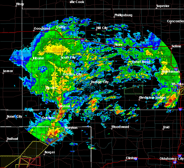 A severe thunderstorm warning remains in effect until 430 pm cdt for northwestern beaver county. at 358 pm cdt, a severe thunderstorm was located over turpin, or 13 miles south of liberal, moving northeast at 20 mph. hazard. ping pong ball size hail and 60 mph wind gusts. source. Radar indicated. A severe thunderstorm warning remains in effect until 430 pm cdt for northwestern beaver county. at 358 pm cdt, a severe thunderstorm was located over turpin, or 13 miles south of liberal, moving northeast at 20 mph. hazard. ping pong ball size hail and 60 mph wind gusts. source. Radar indicated.
|
| 5/7/2019 3:57 PM CDT | Quarter sized hail reported 0.5 miles N of Turpin, OK, late report of heavy rainfall and hail up to quarter size. |
| 5/7/2019 3:48 PM CDT |
 At 347 pm cdt, a severe thunderstorm was located over turpin, or 14 miles south of liberal, moving northeast at 30 mph (radar indicated). Hazards include 60 mph wind gusts and quarter size hail. Minor damage to roofs, siding, and trees is possible. hail damage to vehicles is expected. locations impacted include, turpin and baker. A tornado watch remains in effect until 1000 pm cdt for the panhandle of oklahoma. At 347 pm cdt, a severe thunderstorm was located over turpin, or 14 miles south of liberal, moving northeast at 30 mph (radar indicated). Hazards include 60 mph wind gusts and quarter size hail. Minor damage to roofs, siding, and trees is possible. hail damage to vehicles is expected. locations impacted include, turpin and baker. A tornado watch remains in effect until 1000 pm cdt for the panhandle of oklahoma.
|
| 5/7/2019 3:27 PM CDT |
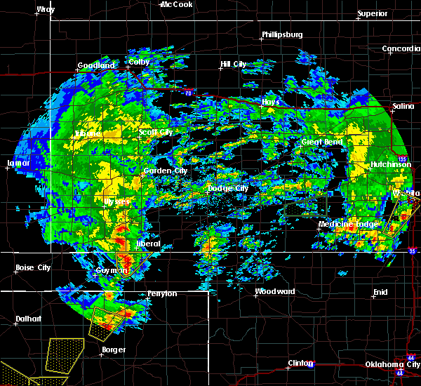 At 325 pm cdt, a severe thunderstorm was located near adams, or 18 miles south of liberal, moving northeast at 30 mph (radar indicated). Hazards include 60 mph wind gusts and quarter size hail. Minor damage to roofs, siding, and trees is possible. Hail damage to vehicles is expected. At 325 pm cdt, a severe thunderstorm was located near adams, or 18 miles south of liberal, moving northeast at 30 mph (radar indicated). Hazards include 60 mph wind gusts and quarter size hail. Minor damage to roofs, siding, and trees is possible. Hail damage to vehicles is expected.
|
| 5/7/2019 3:21 PM CDT |
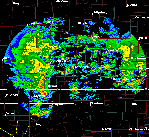 At 303 pm cdt, a severe thunderstorm was located 4 miles south of baker, or 17 miles south of liberal, moving north at 40 mph (radar indicated). Hazards include 60 mph wind gusts and quarter size hail. Minor damage to roofs, siding, and trees is possible. hail damage to vehicles is expected. locations impacted include, hooker, tyrone, turpin, baker and adams. A tornado watch remains in effect until 1000 pm cdt for the panhandle of oklahoma. At 303 pm cdt, a severe thunderstorm was located 4 miles south of baker, or 17 miles south of liberal, moving north at 40 mph (radar indicated). Hazards include 60 mph wind gusts and quarter size hail. Minor damage to roofs, siding, and trees is possible. hail damage to vehicles is expected. locations impacted include, hooker, tyrone, turpin, baker and adams. A tornado watch remains in effect until 1000 pm cdt for the panhandle of oklahoma.
|
| 5/7/2019 3:03 PM CDT |
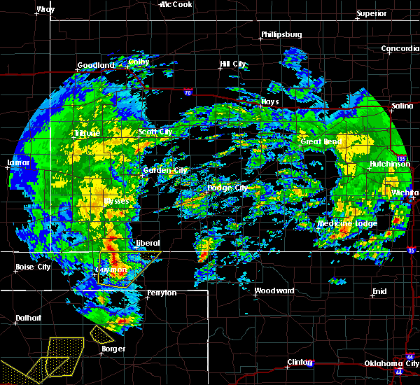 At 303 pm cdt, a severe thunderstorm was located 4 miles south of baker, or 17 miles south of liberal, moving north at 40 mph (radar indicated). Hazards include 60 mph wind gusts and quarter size hail. Minor damage to roofs, siding, and trees is possible. hail damage to vehicles is expected. locations impacted include, hooker, tyrone, turpin, baker and adams. A tornado watch remains in effect until 1000 pm cdt for the panhandle of oklahoma. At 303 pm cdt, a severe thunderstorm was located 4 miles south of baker, or 17 miles south of liberal, moving north at 40 mph (radar indicated). Hazards include 60 mph wind gusts and quarter size hail. Minor damage to roofs, siding, and trees is possible. hail damage to vehicles is expected. locations impacted include, hooker, tyrone, turpin, baker and adams. A tornado watch remains in effect until 1000 pm cdt for the panhandle of oklahoma.
|
| 5/7/2019 2:43 PM CDT |
 At 242 pm cdt, a severe thunderstorm was located over hardesty, or 19 miles east of guymon, moving northeast at 30 mph (radar indicated). Hazards include 60 mph wind gusts and quarter size hail. Minor damage to roofs, siding, and trees is possible. hail damage to vehicles is expected. locations impacted include, hooker, tyrone, optima, hardesty, baker, adams and turpin. A tornado watch remains in effect until 1000 pm cdt for the panhandle of oklahoma. At 242 pm cdt, a severe thunderstorm was located over hardesty, or 19 miles east of guymon, moving northeast at 30 mph (radar indicated). Hazards include 60 mph wind gusts and quarter size hail. Minor damage to roofs, siding, and trees is possible. hail damage to vehicles is expected. locations impacted include, hooker, tyrone, optima, hardesty, baker, adams and turpin. A tornado watch remains in effect until 1000 pm cdt for the panhandle of oklahoma.
|
| 5/7/2019 2:30 PM CDT |
 At 230 pm cdt, a severe thunderstorm was located over hardesty, or 18 miles southeast of guymon, moving north at 40 mph (radar indicated. trained spotters also reported a rotating wall cloud with the storm south of hardesty). Hazards include 60 mph wind gusts and quarter size hail. Minor damage to roofs, siding, and trees is possible. Hail damage to vehicles is expected. At 230 pm cdt, a severe thunderstorm was located over hardesty, or 18 miles southeast of guymon, moving north at 40 mph (radar indicated. trained spotters also reported a rotating wall cloud with the storm south of hardesty). Hazards include 60 mph wind gusts and quarter size hail. Minor damage to roofs, siding, and trees is possible. Hail damage to vehicles is expected.
|
| 7/29/2018 11:54 PM CDT |
 At 1154 pm cdt, a severe thunderstorm was located near hardesty, or 20 miles east of guymon, moving southeast at 30 mph (radar indicated). Hazards include 70 mph wind gusts and half dollar size hail. Expect some tree damage. damage is likely to mobile homes, roofs, and outbuildings. hail damage to vehicles is expected. Locations impacted include, guymon, perryton, spearman, lipscomb, booker, optima, darrouzett, hardesty, wolf creek park, elmwood, adams, farnsworth, boyd, waka, floris, bryans corner, turpin and balko. At 1154 pm cdt, a severe thunderstorm was located near hardesty, or 20 miles east of guymon, moving southeast at 30 mph (radar indicated). Hazards include 70 mph wind gusts and half dollar size hail. Expect some tree damage. damage is likely to mobile homes, roofs, and outbuildings. hail damage to vehicles is expected. Locations impacted include, guymon, perryton, spearman, lipscomb, booker, optima, darrouzett, hardesty, wolf creek park, elmwood, adams, farnsworth, boyd, waka, floris, bryans corner, turpin and balko.
|
| 7/29/2018 11:31 PM CDT |
 At 1130 pm cdt, a severe thunderstorm was located 4 miles southeast of optima, or 11 miles east of guymon, moving southeast at 30 mph (radar indicated). Hazards include 70 mph wind gusts and half dollar size hail. Expect some tree damage. damage is likely to mobile homes, roofs, and outbuildings. Hail damage to vehicles is expected. At 1130 pm cdt, a severe thunderstorm was located 4 miles southeast of optima, or 11 miles east of guymon, moving southeast at 30 mph (radar indicated). Hazards include 70 mph wind gusts and half dollar size hail. Expect some tree damage. damage is likely to mobile homes, roofs, and outbuildings. Hail damage to vehicles is expected.
|
| 7/29/2018 10:30 PM CDT |
 At 1030 pm cdt, a severe thunderstorm was located over rolla, moving southeast at 50 mph. this is a very dangerous storm (radar indicated). Hazards include 80 mph wind gusts and two inch hail. Flying debris will be dangerous to those caught without shelter. mobile homes will be heavily damaged. expect considerable damage to roofs, windows, and vehicles. tree damage and power outages are likely. people and animals outdoors will be injured. Expect hail damage to roofs, siding, windows, and vehicles. At 1030 pm cdt, a severe thunderstorm was located over rolla, moving southeast at 50 mph. this is a very dangerous storm (radar indicated). Hazards include 80 mph wind gusts and two inch hail. Flying debris will be dangerous to those caught without shelter. mobile homes will be heavily damaged. expect considerable damage to roofs, windows, and vehicles. tree damage and power outages are likely. people and animals outdoors will be injured. Expect hail damage to roofs, siding, windows, and vehicles.
|
| 7/28/2018 11:43 PM CDT |
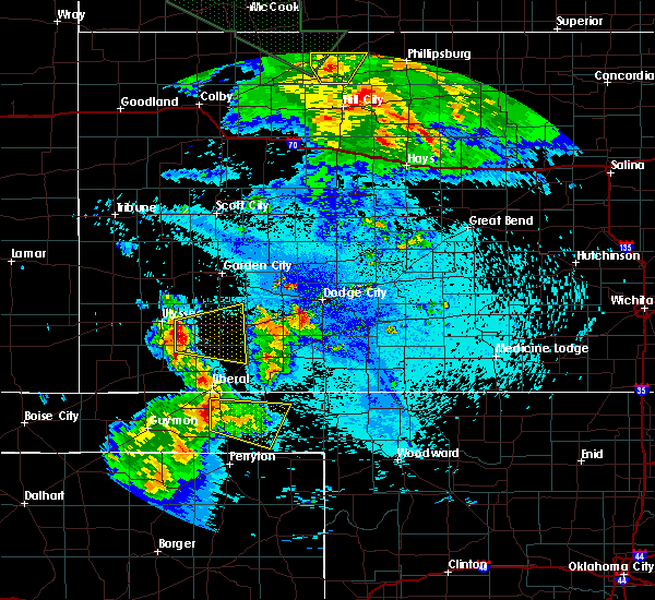 At 1143 pm cdt, a severe thunderstorm was located 6 miles southeast of baker, or 17 miles south of liberal, moving east at 30 mph (radar indicated). Hazards include 70 mph wind gusts and quarter size hail. Expect some tree damage. damage is likely to mobile homes, roofs, and outbuildings. Hail damage to vehicles is expected. At 1143 pm cdt, a severe thunderstorm was located 6 miles southeast of baker, or 17 miles south of liberal, moving east at 30 mph (radar indicated). Hazards include 70 mph wind gusts and quarter size hail. Expect some tree damage. damage is likely to mobile homes, roofs, and outbuildings. Hail damage to vehicles is expected.
|
| 7/26/2018 12:07 AM CDT |
 The severe thunderstorm warning for northwestern beaver and northeastern texas counties will expire at 1215 am cdt, the storm which prompted the warning has weakened below severe limits, and no longer poses an immediate threat to life or property. therefore, the warning will be allowed to expire. however, gusty winds are still possible with this thunderstorm. The severe thunderstorm warning for northwestern beaver and northeastern texas counties will expire at 1215 am cdt, the storm which prompted the warning has weakened below severe limits, and no longer poses an immediate threat to life or property. therefore, the warning will be allowed to expire. however, gusty winds are still possible with this thunderstorm.
|
| 7/25/2018 11:28 PM CDT |
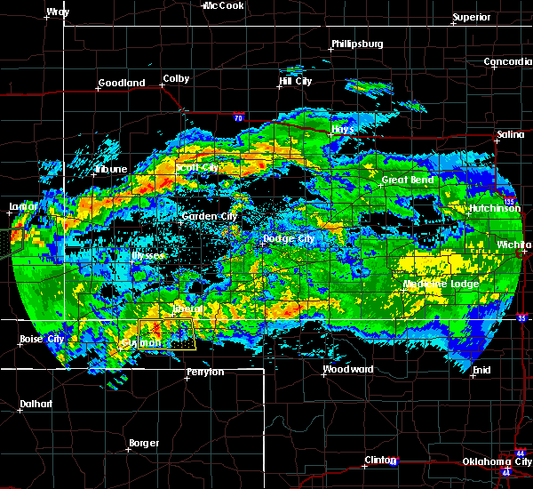 At 1128 pm cdt, a severe thunderstorm was located 4 miles east of hooker, or 16 miles southwest of liberal, moving east southeast at 20 mph (radar indicated). Hazards include 60 mph wind gusts. minor damage to roofs, siding, and trees is possible At 1128 pm cdt, a severe thunderstorm was located 4 miles east of hooker, or 16 miles southwest of liberal, moving east southeast at 20 mph (radar indicated). Hazards include 60 mph wind gusts. minor damage to roofs, siding, and trees is possible
|
| 7/19/2018 4:47 PM CDT |
 At 446 pm cdt, a severe thunderstorm was located 10 miles southeast of eva, or 14 miles west of guymon, moving south at 20 mph (radar indicated). Hazards include 60 mph wind gusts. Minor damage to roofs, siding, and trees is possible. Locations impacted include, guymon, hooker, goodwell, texhoma, tyrone, optima, hardesty, hough, adams, boyd, eva, bryans corner, baker, turpin and sturgis. At 446 pm cdt, a severe thunderstorm was located 10 miles southeast of eva, or 14 miles west of guymon, moving south at 20 mph (radar indicated). Hazards include 60 mph wind gusts. Minor damage to roofs, siding, and trees is possible. Locations impacted include, guymon, hooker, goodwell, texhoma, tyrone, optima, hardesty, hough, adams, boyd, eva, bryans corner, baker, turpin and sturgis.
|
| 7/19/2018 4:36 PM CDT |
 At 435 pm cdt, a severe thunderstorm was located 8 miles southwest of hough, or 12 miles northwest of guymon, moving southeast at 20 mph (radar indicated). Hazards include 60 mph wind gusts. Minor damage to roofs, siding, and trees is possible. Locations impacted include, guymon, hooker, goodwell, texhoma, tyrone, optima, hardesty, hough, adams, boyd, eva, bryans corner, baker, turpin and sturgis. At 435 pm cdt, a severe thunderstorm was located 8 miles southwest of hough, or 12 miles northwest of guymon, moving southeast at 20 mph (radar indicated). Hazards include 60 mph wind gusts. Minor damage to roofs, siding, and trees is possible. Locations impacted include, guymon, hooker, goodwell, texhoma, tyrone, optima, hardesty, hough, adams, boyd, eva, bryans corner, baker, turpin and sturgis.
|
| 7/19/2018 4:18 PM CDT |
 At 418 pm cdt, a severe thunderstorm was located 8 miles west of hough, or 14 miles southeast of elkhart, moving southeast at 30 mph (radar indicated). Hazards include 60 mph wind gusts. minor damage to roofs, siding, and trees is possible At 418 pm cdt, a severe thunderstorm was located 8 miles west of hough, or 14 miles southeast of elkhart, moving southeast at 30 mph (radar indicated). Hazards include 60 mph wind gusts. minor damage to roofs, siding, and trees is possible
|
| 6/24/2018 9:17 PM CDT |
 At 916 pm cdt, severe thunderstorms were located along a line extending from near tyrone to 5 miles southeast of guymon, moving east at 60 mph (radar indicated). Hazards include 60 mph wind gusts and quarter size hail. Minor damage to roofs, siding, and trees is possible. hail damage to vehicles is expected. Locations impacted include, guymon, hooker, tyrone, forgan, optima, hardesty, hough, baker, adams, boyd, turpin and floris. At 916 pm cdt, severe thunderstorms were located along a line extending from near tyrone to 5 miles southeast of guymon, moving east at 60 mph (radar indicated). Hazards include 60 mph wind gusts and quarter size hail. Minor damage to roofs, siding, and trees is possible. hail damage to vehicles is expected. Locations impacted include, guymon, hooker, tyrone, forgan, optima, hardesty, hough, baker, adams, boyd, turpin and floris.
|
| 6/24/2018 8:54 PM CDT |
 At 854 pm cdt, severe thunderstorms were located along a line extending from 6 miles east of hough to 7 miles west of guymon, moving east at 55 mph (radar indicated). Hazards include 60 mph wind gusts and quarter size hail. Minor damage to roofs, siding, and trees is possible. Hail damage to vehicles is expected. At 854 pm cdt, severe thunderstorms were located along a line extending from 6 miles east of hough to 7 miles west of guymon, moving east at 55 mph (radar indicated). Hazards include 60 mph wind gusts and quarter size hail. Minor damage to roofs, siding, and trees is possible. Hail damage to vehicles is expected.
|
| 6/22/2018 7:35 PM CDT |
 The severe thunderstorm warning for western beaver and east central texas counties will expire at 745 pm cdt, the storm which prompted the warning has moved out of the area. therefore the warning will be allowed to expire. a severe thunderstorm watch remains in effect until 1000 pm cdt for the panhandle of oklahoma. The severe thunderstorm warning for western beaver and east central texas counties will expire at 745 pm cdt, the storm which prompted the warning has moved out of the area. therefore the warning will be allowed to expire. a severe thunderstorm watch remains in effect until 1000 pm cdt for the panhandle of oklahoma.
|
| 6/22/2018 7:15 PM CDT |
 At 715 pm cdt, a severe thunderstorm was located 7 miles east of adams, or 20 miles south of liberal, moving east at 25 mph (public). Hazards include golf ball size hail and 60 mph wind gusts. Minor damage to roofs, siding, and trees is possible. people and animals outdoors will be injured. expect hail damage to roofs, siding, windows, and vehicles. Locations impacted include, bryans corner, turpin and boyd. At 715 pm cdt, a severe thunderstorm was located 7 miles east of adams, or 20 miles south of liberal, moving east at 25 mph (public). Hazards include golf ball size hail and 60 mph wind gusts. Minor damage to roofs, siding, and trees is possible. people and animals outdoors will be injured. expect hail damage to roofs, siding, windows, and vehicles. Locations impacted include, bryans corner, turpin and boyd.
|
| 6/22/2018 7:00 PM CDT |
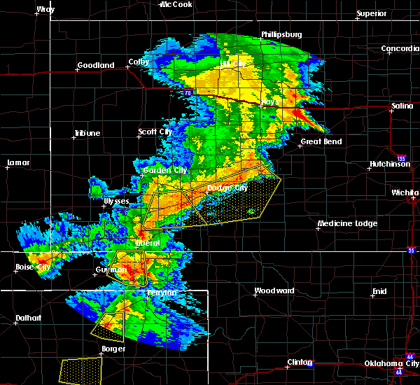 At 700 pm cdt, a severe thunderstorm was located over adams, or 22 miles south of liberal, moving east at 25 mph (public). Hazards include golf ball size hail and 60 mph wind gusts. Minor damage to roofs, siding, and trees is possible. people and animals outdoors will be injured. expect hail damage to roofs, siding, windows, and vehicles. Locations impacted include, hooker, tyrone, bryans corner, baker, adams, boyd and turpin. At 700 pm cdt, a severe thunderstorm was located over adams, or 22 miles south of liberal, moving east at 25 mph (public). Hazards include golf ball size hail and 60 mph wind gusts. Minor damage to roofs, siding, and trees is possible. people and animals outdoors will be injured. expect hail damage to roofs, siding, windows, and vehicles. Locations impacted include, hooker, tyrone, bryans corner, baker, adams, boyd and turpin.
|
| 6/22/2018 6:40 PM CDT |
 At 639 pm cdt, a severe thunderstorm was located 7 miles east of optima, or 14 miles east of guymon, moving east at 25 mph (radar indicated). Hazards include ping pong ball size hail and 60 mph wind gusts. Minor damage to roofs, siding, and trees is possible. people and animals outdoors will be injured. Expect hail damage to roofs, siding, windows, and vehicles. At 639 pm cdt, a severe thunderstorm was located 7 miles east of optima, or 14 miles east of guymon, moving east at 25 mph (radar indicated). Hazards include ping pong ball size hail and 60 mph wind gusts. Minor damage to roofs, siding, and trees is possible. people and animals outdoors will be injured. Expect hail damage to roofs, siding, windows, and vehicles.
|
| 6/20/2018 12:54 AM CDT |
 The severe thunderstorm warning for beaver and eastern texas counties will expire at 100 am cdt, the storm which prompted the warning has weakened below severe limits, and no longer poses an immediate threat to life or property. therefore the warning will be allowed to expire. a severe thunderstorm watch remains in effect until 500 am cdt for the panhandle of oklahoma. to report severe weather, contact your nearest law enforcement agency. they will relay your report to the national weather service amarillo. The severe thunderstorm warning for beaver and eastern texas counties will expire at 100 am cdt, the storm which prompted the warning has weakened below severe limits, and no longer poses an immediate threat to life or property. therefore the warning will be allowed to expire. a severe thunderstorm watch remains in effect until 500 am cdt for the panhandle of oklahoma. to report severe weather, contact your nearest law enforcement agency. they will relay your report to the national weather service amarillo.
|
| 6/20/2018 12:47 AM CDT |
 At 1246 am cdt, a severe thunderstorm was located 6 miles east of hardesty, or 22 miles east of guymon, moving southeast at 30 mph (radar indicated). Hazards include 60 mph wind gusts. Minor damage to roofs, siding, and trees is possible. Locations impacted include, beaver, hooker, hardesty, elmwood, bryans corner, baker, adams, boyd, turpin, slapout, floris and balko. At 1246 am cdt, a severe thunderstorm was located 6 miles east of hardesty, or 22 miles east of guymon, moving southeast at 30 mph (radar indicated). Hazards include 60 mph wind gusts. Minor damage to roofs, siding, and trees is possible. Locations impacted include, beaver, hooker, hardesty, elmwood, bryans corner, baker, adams, boyd, turpin, slapout, floris and balko.
|
| 6/20/2018 12:34 AM CDT |
 At 1234 am cdt, a severe thunderstorm was located 4 miles west of adams, or 18 miles east of guymon, moving south at 35 mph (radar indicated). Hazards include 60 mph wind gusts. Minor damage to roofs, siding, and trees is possible. Locations impacted include, beaver, hooker, tyrone, forgan, hardesty, gate, knowles, elmwood, adams, boyd, floris, bryans corner, baker, mocane, turpin, slapout and balko. At 1234 am cdt, a severe thunderstorm was located 4 miles west of adams, or 18 miles east of guymon, moving south at 35 mph (radar indicated). Hazards include 60 mph wind gusts. Minor damage to roofs, siding, and trees is possible. Locations impacted include, beaver, hooker, tyrone, forgan, hardesty, gate, knowles, elmwood, adams, boyd, floris, bryans corner, baker, mocane, turpin, slapout and balko.
|
| 6/20/2018 12:15 AM CDT |
 At 1215 am cdt, a severe thunderstorm was located near hooker, or 16 miles southwest of liberal, moving southeast at 20 mph (radar indicated). Hazards include 70 mph wind gusts and quarter size hail. Expect some tree damage. damage is likely to mobile homes, roofs, and outbuildings. hail damage to vehicles is expected. Locations impacted include, beaver, hooker, tyrone, forgan, hardesty, gate, knowles, elmwood, adams, boyd, floris, bryans corner, baker, mocane, turpin, slapout and balko. At 1215 am cdt, a severe thunderstorm was located near hooker, or 16 miles southwest of liberal, moving southeast at 20 mph (radar indicated). Hazards include 70 mph wind gusts and quarter size hail. Expect some tree damage. damage is likely to mobile homes, roofs, and outbuildings. hail damage to vehicles is expected. Locations impacted include, beaver, hooker, tyrone, forgan, hardesty, gate, knowles, elmwood, adams, boyd, floris, bryans corner, baker, mocane, turpin, slapout and balko.
|
| 6/20/2018 12:04 AM CDT |
 At 1203 am cdt, severe thunderstorms were located along a line extending from 3 miles east of beaver to 4 miles northeast of hooker, moving south at 30 mph (radar indicated). Hazards include 60 mph wind gusts and penny size hail. Minor damage to roofs, siding, and trees is possible. Locations impacted include, beaver, hooker, tyrone, forgan, hardesty, gate, knowles, elmwood, adams, boyd, floris, bryans corner, baker, mocane, turpin, slapout and balko. At 1203 am cdt, severe thunderstorms were located along a line extending from 3 miles east of beaver to 4 miles northeast of hooker, moving south at 30 mph (radar indicated). Hazards include 60 mph wind gusts and penny size hail. Minor damage to roofs, siding, and trees is possible. Locations impacted include, beaver, hooker, tyrone, forgan, hardesty, gate, knowles, elmwood, adams, boyd, floris, bryans corner, baker, mocane, turpin, slapout and balko.
|
| 6/19/2018 11:47 PM CDT |
 At 1147 pm cdt, severe thunderstorms were located along a line extending from 3 miles east of mocane to 7 miles west of tyrone, moving southeast at 35 mph (radar indicated). Hazards include 70 mph wind gusts and penny size hail. Expect some tree damage. damage is likely to mobile homes, roofs, and outbuildings. Locations impacted include, beaver, hooker, tyrone, forgan, hardesty, gate, knowles, elmwood, adams, boyd, floris, bryans corner, baker, mocane, turpin, slapout and balko. At 1147 pm cdt, severe thunderstorms were located along a line extending from 3 miles east of mocane to 7 miles west of tyrone, moving southeast at 35 mph (radar indicated). Hazards include 70 mph wind gusts and penny size hail. Expect some tree damage. damage is likely to mobile homes, roofs, and outbuildings. Locations impacted include, beaver, hooker, tyrone, forgan, hardesty, gate, knowles, elmwood, adams, boyd, floris, bryans corner, baker, mocane, turpin, slapout and balko.
|
| 6/19/2018 11:28 PM CDT |
 At 1128 pm cdt, a severe thunderstorm was located 7 miles north of floris, or 9 miles southeast of hayne, moving southeast at 40 mph (radar indicated). Hazards include 70 mph wind gusts and penny size hail. Expect some tree damage. Damage is likely to mobile homes, roofs, and outbuildings. At 1128 pm cdt, a severe thunderstorm was located 7 miles north of floris, or 9 miles southeast of hayne, moving southeast at 40 mph (radar indicated). Hazards include 70 mph wind gusts and penny size hail. Expect some tree damage. Damage is likely to mobile homes, roofs, and outbuildings.
|
| 6/12/2018 11:31 PM CDT |
 At 1130 pm cdt, severe thunderstorms were located along a line extending from 5 miles east of optima to 12 miles northeast of gruver, moving east at 20 mph (radar indicated). Hazards include 60 mph wind gusts and quarter size hail. Minor damage to roofs, siding, and trees is possible. hail damage to vehicles is expected. Locations impacted include, perryton, spearman, beaver, hooker, optima, hardesty, adams, farnsworth, boyd, waka, floris, bryans corner, baker, turpin and balko. At 1130 pm cdt, severe thunderstorms were located along a line extending from 5 miles east of optima to 12 miles northeast of gruver, moving east at 20 mph (radar indicated). Hazards include 60 mph wind gusts and quarter size hail. Minor damage to roofs, siding, and trees is possible. hail damage to vehicles is expected. Locations impacted include, perryton, spearman, beaver, hooker, optima, hardesty, adams, farnsworth, boyd, waka, floris, bryans corner, baker, turpin and balko.
|
| 6/12/2018 11:13 PM CDT |
 At 1113 pm cdt, a severe thunderstorm was located 10 miles southwest of hardesty, or 18 miles southeast of guymon, moving southeast at 35 mph (radar indicated). Hazards include 60 mph wind gusts and quarter size hail. Minor damage to roofs, siding, and trees is possible. hail damage to vehicles is expected. Locations impacted include, guymon, perryton, spearman, beaver, hooker, gruver, tyrone, optima, hardesty, adams, farnsworth, boyd, waka, floris, bryans corner, baker, turpin and balko. At 1113 pm cdt, a severe thunderstorm was located 10 miles southwest of hardesty, or 18 miles southeast of guymon, moving southeast at 35 mph (radar indicated). Hazards include 60 mph wind gusts and quarter size hail. Minor damage to roofs, siding, and trees is possible. hail damage to vehicles is expected. Locations impacted include, guymon, perryton, spearman, beaver, hooker, gruver, tyrone, optima, hardesty, adams, farnsworth, boyd, waka, floris, bryans corner, baker, turpin and balko.
|
| 6/12/2018 10:49 PM CDT |
 At 1049 pm cdt, a severe thunderstorm was located 6 miles south of guymon, moving southeast at 35 mph (radar indicated). Hazards include 60 mph wind gusts and half dollar size hail. Minor damage to roofs, siding, and trees is possible. Hail damage to vehicles is expected. At 1049 pm cdt, a severe thunderstorm was located 6 miles south of guymon, moving southeast at 35 mph (radar indicated). Hazards include 60 mph wind gusts and half dollar size hail. Minor damage to roofs, siding, and trees is possible. Hail damage to vehicles is expected.
|
| 6/12/2018 9:54 PM CDT |
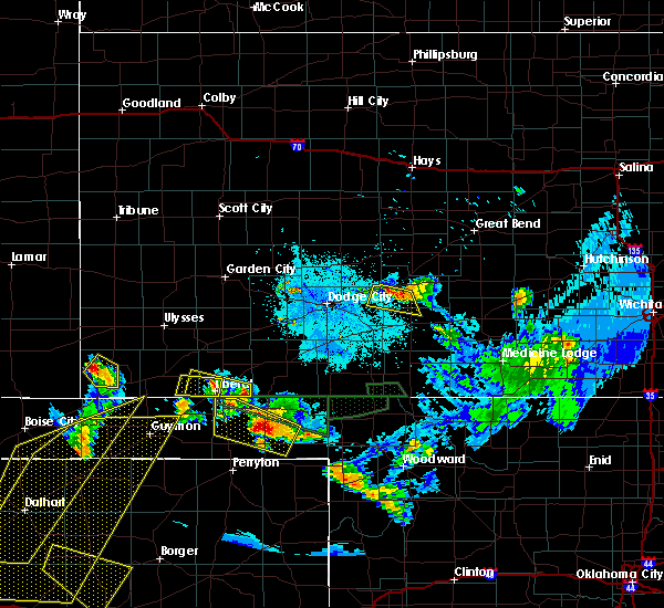 At 953 pm cdt, a severe thunderstorm was located 7 miles southwest of beaver, moving south at 10 mph (radar indicated). Hazards include golf ball size hail and 60 mph wind gusts. Minor damage to roofs, siding, and trees is possible. people and animals outdoors will be injured. expect hail damage to roofs, siding, windows, and vehicles. Locations impacted include, beaver, elmwood, boyd, mocane, turpin, floris and balko. At 953 pm cdt, a severe thunderstorm was located 7 miles southwest of beaver, moving south at 10 mph (radar indicated). Hazards include golf ball size hail and 60 mph wind gusts. Minor damage to roofs, siding, and trees is possible. people and animals outdoors will be injured. expect hail damage to roofs, siding, windows, and vehicles. Locations impacted include, beaver, elmwood, boyd, mocane, turpin, floris and balko.
|
| 6/12/2018 9:41 PM CDT |
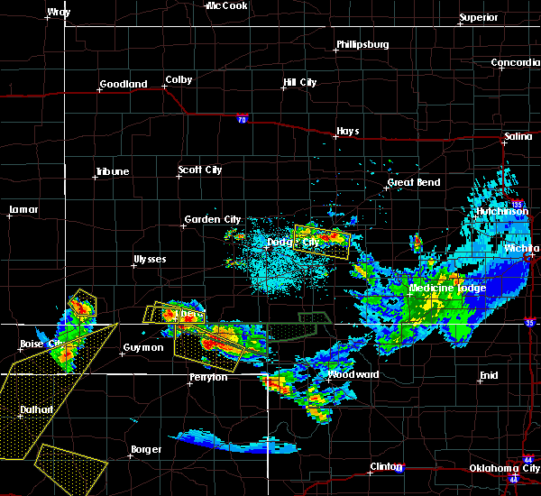 At 940 pm cdt, a severe thunderstorm was located 4 miles southwest of beaver, moving south at 10 mph (radar indicated). Hazards include 60 mph wind gusts and quarter size hail. Minor damage to roofs, siding, and trees is possible. Hail damage to vehicles is expected. At 940 pm cdt, a severe thunderstorm was located 4 miles southwest of beaver, moving south at 10 mph (radar indicated). Hazards include 60 mph wind gusts and quarter size hail. Minor damage to roofs, siding, and trees is possible. Hail damage to vehicles is expected.
|
| 6/12/2018 9:15 PM CDT |
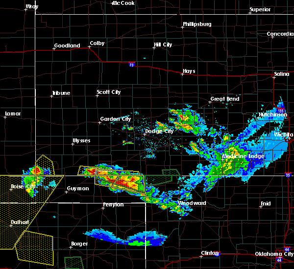 At 914 pm cdt, a severe thunderstorm was located near floris, or 10 miles northwest of beaver, and is nearly stationary (radar indicated). Hazards include 60 mph wind gusts and quarter size hail. Minor damage to roofs, siding, and trees is possible. hail damage to vehicles is expected. Locations impacted include, turpin and floris. At 914 pm cdt, a severe thunderstorm was located near floris, or 10 miles northwest of beaver, and is nearly stationary (radar indicated). Hazards include 60 mph wind gusts and quarter size hail. Minor damage to roofs, siding, and trees is possible. hail damage to vehicles is expected. Locations impacted include, turpin and floris.
|
| 6/12/2018 8:44 PM CDT |
 At 844 pm cdt, a severe thunderstorm was located 7 miles south of hayne, moving southeast at 15 mph (radar indicated). Hazards include 60 mph wind gusts and quarter size hail. Minor damage to roofs, siding, and trees is possible. Hail damage to vehicles is expected. At 844 pm cdt, a severe thunderstorm was located 7 miles south of hayne, moving southeast at 15 mph (radar indicated). Hazards include 60 mph wind gusts and quarter size hail. Minor damage to roofs, siding, and trees is possible. Hail damage to vehicles is expected.
|
| 5/30/2018 9:40 PM CDT |
 The severe thunderstorm warning for western beaver, southeastern texas, northeastern hansford and western ochiltree counties will expire at 945 pm cdt, a new severe thunderstorm warning is in place. remember, a severe thunderstorm warning still remains in effect for beaver, ochiltree, lipscomb, and hemphill counties. a severe thunderstorm watch remains in effect until 1100 pm cdt for the panhandle of oklahoma, and the panhandle of texas. The severe thunderstorm warning for western beaver, southeastern texas, northeastern hansford and western ochiltree counties will expire at 945 pm cdt, a new severe thunderstorm warning is in place. remember, a severe thunderstorm warning still remains in effect for beaver, ochiltree, lipscomb, and hemphill counties. a severe thunderstorm watch remains in effect until 1100 pm cdt for the panhandle of oklahoma, and the panhandle of texas.
|
| 5/30/2018 9:23 PM CDT |
 At 922 pm cdt, severe thunderstorms were located along a line extending from 4 miles southeast of floris to 5 miles south of perryton, moving east at 40 mph. these are very dangerous storms (radar indicated). Hazards include baseball size hail and 60 mph wind gusts. People and animals outdoors will be severely injured. Expect shattered windows, extensive damage to roofs, siding, and vehicles. At 922 pm cdt, severe thunderstorms were located along a line extending from 4 miles southeast of floris to 5 miles south of perryton, moving east at 40 mph. these are very dangerous storms (radar indicated). Hazards include baseball size hail and 60 mph wind gusts. People and animals outdoors will be severely injured. Expect shattered windows, extensive damage to roofs, siding, and vehicles.
|
| 5/30/2018 9:23 PM CDT |
 The national weather service in amarillo has issued a * severe thunderstorm warning for. beaver county in the panhandle of oklahoma. southeastern texas county in the panhandle of oklahoma. lipscomb county in the panhandle of texas. Northeastern hansford county in the panhandle of texas. The national weather service in amarillo has issued a * severe thunderstorm warning for. beaver county in the panhandle of oklahoma. southeastern texas county in the panhandle of oklahoma. lipscomb county in the panhandle of texas. Northeastern hansford county in the panhandle of texas.
|
| 5/30/2018 9:15 PM CDT |
 At 914 pm cdt, severe thunderstorms were located along a line extending from 4 miles west of floris to farnsworth, moving east at 30 mph. these are very dangerous storms (radar indicated). Hazards include baseball size hail and 60 mph wind gusts. People and animals outdoors will be severely injured. expect shattered windows, extensive damage to roofs, siding, and vehicles. Locations impacted include, perryton, beaver, forgan, hardesty, adams, farnsworth, boyd, waka, floris, bryans corner, baker, mocane, turpin and balko. At 914 pm cdt, severe thunderstorms were located along a line extending from 4 miles west of floris to farnsworth, moving east at 30 mph. these are very dangerous storms (radar indicated). Hazards include baseball size hail and 60 mph wind gusts. People and animals outdoors will be severely injured. expect shattered windows, extensive damage to roofs, siding, and vehicles. Locations impacted include, perryton, beaver, forgan, hardesty, adams, farnsworth, boyd, waka, floris, bryans corner, baker, mocane, turpin and balko.
|
| 5/30/2018 9:08 PM CDT |
 At 906 pm cdt, severe thunderstorms were located along a line extending from near turpin to near farnsworth, moving east-southeast at 50 mph (trained weather spotters have reported downed powerlines near spearman and blowing dust ahead of the storms). Hazards include ping pong ball size hail and 60 mph wind gusts. Minor damage to roofs, siding, and trees is possible. people and animals outdoors will be injured. expect hail damage to roofs, siding, windows, and vehicles. Locations impacted include, perryton, spearman, beaver, forgan, hardesty, adams, farnsworth, boyd, waka, floris, bryans corner, baker, mocane, turpin and balko. At 906 pm cdt, severe thunderstorms were located along a line extending from near turpin to near farnsworth, moving east-southeast at 50 mph (trained weather spotters have reported downed powerlines near spearman and blowing dust ahead of the storms). Hazards include ping pong ball size hail and 60 mph wind gusts. Minor damage to roofs, siding, and trees is possible. people and animals outdoors will be injured. expect hail damage to roofs, siding, windows, and vehicles. Locations impacted include, perryton, spearman, beaver, forgan, hardesty, adams, farnsworth, boyd, waka, floris, bryans corner, baker, mocane, turpin and balko.
|
| 5/30/2018 8:58 PM CDT |
 At 856 pm cdt, severe thunderstorms were located along a line extending from 5 miles northeast of adams to 9 miles north of spearman, moving east at 40 mph (nws employee and storm chasers reported half-dollar to ping pong ball size hail at 850 pm cdt, near and just north of gruver). Hazards include ping pong ball size hail and 60 mph wind gusts. Minor damage to roofs, siding, and trees is possible. people and animals outdoors will be injured. expect hail damage to roofs, siding, windows, and vehicles. Locations impacted include, perryton, spearman, beaver, forgan, hardesty, adams, farnsworth, boyd, waka, floris, bryans corner, baker, mocane, turpin and balko. At 856 pm cdt, severe thunderstorms were located along a line extending from 5 miles northeast of adams to 9 miles north of spearman, moving east at 40 mph (nws employee and storm chasers reported half-dollar to ping pong ball size hail at 850 pm cdt, near and just north of gruver). Hazards include ping pong ball size hail and 60 mph wind gusts. Minor damage to roofs, siding, and trees is possible. people and animals outdoors will be injured. expect hail damage to roofs, siding, windows, and vehicles. Locations impacted include, perryton, spearman, beaver, forgan, hardesty, adams, farnsworth, boyd, waka, floris, bryans corner, baker, mocane, turpin and balko.
|
| 5/30/2018 8:44 PM CDT |
 At 843 pm cdt, severe thunderstorms were located along a line extending from 4 miles northwest of adams to 5 miles north of gruver, moving east-southeast at 30 mph (radar indicated. storm chasers are reporting blowing dust ahead of these thunderstorms with reduced visibilities). Hazards include two inch hail and 60 mph wind gusts. Minor damage to roofs, siding, and trees is possible. people and animals outdoors will be injured. Expect hail damage to roofs, siding, windows, and vehicles. At 843 pm cdt, severe thunderstorms were located along a line extending from 4 miles northwest of adams to 5 miles north of gruver, moving east-southeast at 30 mph (radar indicated. storm chasers are reporting blowing dust ahead of these thunderstorms with reduced visibilities). Hazards include two inch hail and 60 mph wind gusts. Minor damage to roofs, siding, and trees is possible. people and animals outdoors will be injured. Expect hail damage to roofs, siding, windows, and vehicles.
|
| 5/30/2018 8:40 PM CDT |
 At 839 pm cdt, a severe thunderstorm was located near hardesty, or 15 miles southeast of guymon, moving east at 35 mph (radar indicated. storm chasers have reported blowing dust and reduced visibilities ahead of this storm). Hazards include golf ball size hail and 60 mph wind gusts. Minor damage to roofs, siding, and trees is possible. people and animals outdoors will be injured. expect hail damage to roofs, siding, windows, and vehicles. Locations impacted include, guymon, hooker, optima, hardesty, baker, adams and turpin. At 839 pm cdt, a severe thunderstorm was located near hardesty, or 15 miles southeast of guymon, moving east at 35 mph (radar indicated. storm chasers have reported blowing dust and reduced visibilities ahead of this storm). Hazards include golf ball size hail and 60 mph wind gusts. Minor damage to roofs, siding, and trees is possible. people and animals outdoors will be injured. expect hail damage to roofs, siding, windows, and vehicles. Locations impacted include, guymon, hooker, optima, hardesty, baker, adams and turpin.
|
| 5/30/2018 8:32 PM CDT |
 At 832 pm cdt, a severe thunderstorm was located 6 miles west of hardesty, or 11 miles southeast of guymon, moving east at 40 mph (radar indicated). Hazards include ping pong ball size hail and 60 mph wind gusts. Minor damage to roofs, siding, and trees is possible. people and animals outdoors will be injured. expect hail damage to roofs, siding, windows, and vehicles. Locations impacted include, guymon, hooker, goodwell, optima, hardesty, baker, adams and turpin. At 832 pm cdt, a severe thunderstorm was located 6 miles west of hardesty, or 11 miles southeast of guymon, moving east at 40 mph (radar indicated). Hazards include ping pong ball size hail and 60 mph wind gusts. Minor damage to roofs, siding, and trees is possible. people and animals outdoors will be injured. expect hail damage to roofs, siding, windows, and vehicles. Locations impacted include, guymon, hooker, goodwell, optima, hardesty, baker, adams and turpin.
|
| 5/30/2018 8:20 PM CDT |
 At 819 pm cdt, a severe thunderstorm was located 4 miles south of guymon, moving east at 40 mph (trained weather spotters reported 60 mph wind gust in guymon at 819 pm cdt). Hazards include golf ball size hail and 60 mph wind gusts. Minor damage to roofs, siding, and trees is possible. people and animals outdoors will be injured. expect hail damage to roofs, siding, windows, and vehicles. Locations impacted include, guymon, hooker, goodwell, optima, hardesty, baker, adams and turpin. At 819 pm cdt, a severe thunderstorm was located 4 miles south of guymon, moving east at 40 mph (trained weather spotters reported 60 mph wind gust in guymon at 819 pm cdt). Hazards include golf ball size hail and 60 mph wind gusts. Minor damage to roofs, siding, and trees is possible. people and animals outdoors will be injured. expect hail damage to roofs, siding, windows, and vehicles. Locations impacted include, guymon, hooker, goodwell, optima, hardesty, baker, adams and turpin.
|
| 5/30/2018 8:08 PM CDT |
 At 807 pm cdt, a severe thunderstorm was located over goodwell, or 10 miles southwest of guymon, moving east at 40 mph (radar indicated). Hazards include ping pong ball size hail and 60 mph wind gusts. Minor damage to roofs, siding, and trees is possible. people and animals outdoors will be injured. Expect hail damage to roofs, siding, windows, and vehicles. At 807 pm cdt, a severe thunderstorm was located over goodwell, or 10 miles southwest of guymon, moving east at 40 mph (radar indicated). Hazards include ping pong ball size hail and 60 mph wind gusts. Minor damage to roofs, siding, and trees is possible. people and animals outdoors will be injured. Expect hail damage to roofs, siding, windows, and vehicles.
|
| 5/28/2018 9:03 PM CDT |
 At 903 pm cdt, severe thunderstorms were located along a line extending from 4 miles southeast of baker to near adams to 12 miles northeast of gruver, moving northeast at 35 mph. these are very dangerous storms (weather spotters have reported hail from golf ball to baseball with these storms). Hazards include baseball size hail and 60 mph wind gusts. People and animals outdoors will be severely injured. Expect shattered windows, extensive damage to roofs, siding, and vehicles. At 903 pm cdt, severe thunderstorms were located along a line extending from 4 miles southeast of baker to near adams to 12 miles northeast of gruver, moving northeast at 35 mph. these are very dangerous storms (weather spotters have reported hail from golf ball to baseball with these storms). Hazards include baseball size hail and 60 mph wind gusts. People and animals outdoors will be severely injured. Expect shattered windows, extensive damage to roofs, siding, and vehicles.
|
| 5/28/2018 8:11 PM CDT |
 At 810 pm cdt, severe thunderstorms were located along a line extending from 4 miles north of hooker to 17 miles west of gruver to 8 miles north of sunray, moving east-northeast at 35 mph (radar indicated). Hazards include ping pong ball size hail and 60 mph wind gusts. Minor damage to roofs, siding, and trees is possible. people and animals outdoors will be injured. Expect hail damage to roofs, siding, windows, and vehicles. At 810 pm cdt, severe thunderstorms were located along a line extending from 4 miles north of hooker to 17 miles west of gruver to 8 miles north of sunray, moving east-northeast at 35 mph (radar indicated). Hazards include ping pong ball size hail and 60 mph wind gusts. Minor damage to roofs, siding, and trees is possible. people and animals outdoors will be injured. Expect hail damage to roofs, siding, windows, and vehicles.
|
| 8/18/2017 1:34 AM CDT |
 At 134 am cdt, a severe thunderstorm was located 6 miles south of turpin, or 18 miles south of liberal, moving southeast at 25 mph (radar indicated). Hazards include 60 mph wind gusts and quarter size hail. Minor damage to roofs, siding, and trees is possible. hail damage to vehicles is expected. Locations impacted include, beaver, booker, forgan, follett, darrouzett, elmwood, bryans corner, boyd, mocane, turpin, floris and balko. At 134 am cdt, a severe thunderstorm was located 6 miles south of turpin, or 18 miles south of liberal, moving southeast at 25 mph (radar indicated). Hazards include 60 mph wind gusts and quarter size hail. Minor damage to roofs, siding, and trees is possible. hail damage to vehicles is expected. Locations impacted include, beaver, booker, forgan, follett, darrouzett, elmwood, bryans corner, boyd, mocane, turpin, floris and balko.
|
| 8/18/2017 1:20 AM CDT |
 At 119 am cdt, severe thunderstorms were located along a line extending from near turpin to near booker, moving east at 35 mph (radar indicated). Hazards include 60 mph wind gusts and quarter size hail. Minor damage to roofs, siding, and trees is possible. hail damage to vehicles is expected. Locations impacted include, beaver, booker, tyrone, forgan, follett, darrouzett, gate, knowles, elmwood, boyd, floris, bryans corner, baker, mocane, turpin, slapout and balko. At 119 am cdt, severe thunderstorms were located along a line extending from near turpin to near booker, moving east at 35 mph (radar indicated). Hazards include 60 mph wind gusts and quarter size hail. Minor damage to roofs, siding, and trees is possible. hail damage to vehicles is expected. Locations impacted include, beaver, booker, tyrone, forgan, follett, darrouzett, gate, knowles, elmwood, boyd, floris, bryans corner, baker, mocane, turpin, slapout and balko.
|
| 8/18/2017 12:46 AM CDT |
 At 1245 am cdt, severe thunderstorms were located along a line extending from 3 miles southwest of tyrone to 7 miles south of balko, moving east at 10 mph (radar indicated). Hazards include 60 mph wind gusts and quarter size hail. Minor damage to roofs, siding, and trees is possible. Hail damage to vehicles is expected. At 1245 am cdt, severe thunderstorms were located along a line extending from 3 miles southwest of tyrone to 7 miles south of balko, moving east at 10 mph (radar indicated). Hazards include 60 mph wind gusts and quarter size hail. Minor damage to roofs, siding, and trees is possible. Hail damage to vehicles is expected.
|
| 8/17/2017 9:49 PM CDT |
 At 949 pm cdt, a severe thunderstorm was located 7 miles north of balko, or 9 miles southwest of beaver, moving east at 35 mph (radar indicated). Hazards include 60 mph wind gusts and penny size hail. Minor damage to roofs, siding, and trees is possible. Locations impacted include, beaver, forgan, elmwood, bryans corner, boyd, mocane, turpin, floris and balko. At 949 pm cdt, a severe thunderstorm was located 7 miles north of balko, or 9 miles southwest of beaver, moving east at 35 mph (radar indicated). Hazards include 60 mph wind gusts and penny size hail. Minor damage to roofs, siding, and trees is possible. Locations impacted include, beaver, forgan, elmwood, bryans corner, boyd, mocane, turpin, floris and balko.
|
| 8/17/2017 9:14 PM CDT |
 At 914 pm cdt, a severe thunderstorm was located over adams, or 19 miles south of liberal, moving east at 35 mph (radar indicated). Hazards include 60 mph wind gusts and penny size hail. minor damage to roofs, siding, and trees is possible At 914 pm cdt, a severe thunderstorm was located over adams, or 19 miles south of liberal, moving east at 35 mph (radar indicated). Hazards include 60 mph wind gusts and penny size hail. minor damage to roofs, siding, and trees is possible
|
| 8/17/2017 9:04 PM CDT |
 At 903 pm cdt, a severe thunderstorm was located over adams, or 20 miles east of guymon, moving east at 40 mph (radar indicated). Hazards include 70 mph wind gusts and penny size hail. Expect some tree damage. damage is likely to mobile homes, roofs, and outbuildings. Locations impacted include, guymon, hooker, tyrone, optima, hardesty, bryans corner, baker, adams, boyd and turpin. At 903 pm cdt, a severe thunderstorm was located over adams, or 20 miles east of guymon, moving east at 40 mph (radar indicated). Hazards include 70 mph wind gusts and penny size hail. Expect some tree damage. damage is likely to mobile homes, roofs, and outbuildings. Locations impacted include, guymon, hooker, tyrone, optima, hardesty, bryans corner, baker, adams, boyd and turpin.
|
| 8/17/2017 8:56 PM CDT |
 At 855 pm cdt, a severe thunderstorm was located 7 miles east of optima, or 15 miles east of guymon, moving east at 35 mph (radar indicated). Hazards include 70 mph wind gusts and penny size hail. Expect some tree damage. damage is likely to mobile homes, roofs, and outbuildings. Locations impacted include, guymon, hooker, goodwell, tyrone, optima, hardesty, bryans corner, baker, adams, boyd and turpin. At 855 pm cdt, a severe thunderstorm was located 7 miles east of optima, or 15 miles east of guymon, moving east at 35 mph (radar indicated). Hazards include 70 mph wind gusts and penny size hail. Expect some tree damage. damage is likely to mobile homes, roofs, and outbuildings. Locations impacted include, guymon, hooker, goodwell, tyrone, optima, hardesty, bryans corner, baker, adams, boyd and turpin.
|
| 8/17/2017 8:38 PM CDT |
 At 837 pm cdt, a severe thunderstorm was located 4 miles northwest of optima, or 7 miles northeast of guymon, moving east at 35 mph (radar indicated. spotters confirm winds in excess of 60 mph and nickle size hail). Hazards include 70 mph wind gusts and ping pong ball size hail. Expect some tree damage. damage is likely to mobile homes, roofs, and outbuildings. people and animals outdoors will be injured. expect hail damage to roofs, siding, windows, and vehicles. Locations impacted include, guymon, hooker, goodwell, tyrone, optima, hardesty, bryans corner, hough, baker, adams, boyd and turpin. At 837 pm cdt, a severe thunderstorm was located 4 miles northwest of optima, or 7 miles northeast of guymon, moving east at 35 mph (radar indicated. spotters confirm winds in excess of 60 mph and nickle size hail). Hazards include 70 mph wind gusts and ping pong ball size hail. Expect some tree damage. damage is likely to mobile homes, roofs, and outbuildings. people and animals outdoors will be injured. expect hail damage to roofs, siding, windows, and vehicles. Locations impacted include, guymon, hooker, goodwell, tyrone, optima, hardesty, bryans corner, hough, baker, adams, boyd and turpin.
|
| 8/17/2017 8:16 PM CDT |
 At 815 pm cdt, a severe thunderstorm was located over hough, or 15 miles northwest of guymon, moving east at 40 mph (radar indicated). Hazards include 70 mph wind gusts and ping pong ball size hail. Expect some tree damage. damage is likely to mobile homes, roofs, and outbuildings. people and animals outdoors will be injured. Expect hail damage to roofs, siding, windows, and vehicles. At 815 pm cdt, a severe thunderstorm was located over hough, or 15 miles northwest of guymon, moving east at 40 mph (radar indicated). Hazards include 70 mph wind gusts and ping pong ball size hail. Expect some tree damage. damage is likely to mobile homes, roofs, and outbuildings. people and animals outdoors will be injured. Expect hail damage to roofs, siding, windows, and vehicles.
|
| 8/10/2017 10:44 PM CDT |
 At 1044 pm cdt, severe thunderstorms were located along a line extending from bryans corner to 6 miles southeast of slapout, moving east at 30 mph (radar indicated). Hazards include 70 mph wind gusts and half dollar size hail. Expect some tree damage. damage is likely to mobile homes, roofs, and outbuildings. Hail damage to vehicles is expected. At 1044 pm cdt, severe thunderstorms were located along a line extending from bryans corner to 6 miles southeast of slapout, moving east at 30 mph (radar indicated). Hazards include 70 mph wind gusts and half dollar size hail. Expect some tree damage. damage is likely to mobile homes, roofs, and outbuildings. Hail damage to vehicles is expected.
|
| 8/10/2017 12:27 PM CDT |
 At 1227 pm cdt, a severe thunderstorm was located 5 miles south of hayne, moving east at 35 mph (radar indicated). Hazards include 60 mph wind gusts and quarter size hail. Minor damage to roofs, siding, and trees is possible. hail damage to vehicles is expected. Locations impacted include, beaver, forgan, mocane, turpin and floris. At 1227 pm cdt, a severe thunderstorm was located 5 miles south of hayne, moving east at 35 mph (radar indicated). Hazards include 60 mph wind gusts and quarter size hail. Minor damage to roofs, siding, and trees is possible. hail damage to vehicles is expected. Locations impacted include, beaver, forgan, mocane, turpin and floris.
|
| 8/10/2017 12:14 PM CDT |
 At 1214 pm cdt, a severe thunderstorm was located over liberal, moving east at 35 mph (radar indicated). Hazards include 60 mph wind gusts and half dollar size hail. Minor damage to roofs, siding, and trees is possible. Hail damage to vehicles is expected. At 1214 pm cdt, a severe thunderstorm was located over liberal, moving east at 35 mph (radar indicated). Hazards include 60 mph wind gusts and half dollar size hail. Minor damage to roofs, siding, and trees is possible. Hail damage to vehicles is expected.
|
| 6/21/2017 9:22 PM CDT |
 The severe thunderstorm warning for beaver and southeastern texas counties will expire at 930 pm cdt, the storms which prompted the warning have weakened below severe limits, and have exited the warned area. therefore the warning will be allowed to expire. however gusty winds are still possible with these thunderstorms. The severe thunderstorm warning for beaver and southeastern texas counties will expire at 930 pm cdt, the storms which prompted the warning have weakened below severe limits, and have exited the warned area. therefore the warning will be allowed to expire. however gusty winds are still possible with these thunderstorms.
|
| 6/21/2017 8:59 PM CDT |
 At 858 pm cdt, severe thunderstorms were located along a line extending from knowles to 4 miles east of perryton, moving east at 40 mph (radar indicated). Hazards include 60 mph wind gusts and quarter size hail. Minor damage to roofs, siding, and trees is possible. hail damage to vehicles is expected. Locations impacted include, beaver, hardesty, gate, knowles, elmwood, adams, boyd, floris, bryans corner, baker, mocane, turpin, slapout and balko. At 858 pm cdt, severe thunderstorms were located along a line extending from knowles to 4 miles east of perryton, moving east at 40 mph (radar indicated). Hazards include 60 mph wind gusts and quarter size hail. Minor damage to roofs, siding, and trees is possible. hail damage to vehicles is expected. Locations impacted include, beaver, hardesty, gate, knowles, elmwood, adams, boyd, floris, bryans corner, baker, mocane, turpin, slapout and balko.
|
| 6/21/2017 8:00 PM CDT |
 At 800 pm cdt, severe thunderstorms were located along a line extending from near hayne to 6 miles west of hardesty, moving east at 60 mph (radar indicated). Hazards include 60 mph wind gusts and quarter size hail. Minor damage to roofs, siding, and trees is possible. Hail damage to vehicles is expected. At 800 pm cdt, severe thunderstorms were located along a line extending from near hayne to 6 miles west of hardesty, moving east at 60 mph (radar indicated). Hazards include 60 mph wind gusts and quarter size hail. Minor damage to roofs, siding, and trees is possible. Hail damage to vehicles is expected.
|
| 5/27/2017 9:20 PM CDT |
 At 919 pm cdt, severe thunderstorms were located along a line extending from 5 miles northwest of turpin to 5 miles north of balko to 7 miles north of perryton, moving east at 50 mph (at 909 pm cdt, trained weather spotters reported 2 inch hail 4 miles north-northwest of boyd). Hazards include two inch hail and 70 mph wind gusts. Expect some tree damage. damage is likely to mobile homes, roofs, and outbuildings. people and animals outdoors will be injured. expect hail damage to roofs, siding, windows, and vehicles. Locations impacted include, perryton, beaver, booker, tyrone, forgan, knowles, elmwood, boyd, floris, bryans corner, baker, mocane, turpin and balko. At 919 pm cdt, severe thunderstorms were located along a line extending from 5 miles northwest of turpin to 5 miles north of balko to 7 miles north of perryton, moving east at 50 mph (at 909 pm cdt, trained weather spotters reported 2 inch hail 4 miles north-northwest of boyd). Hazards include two inch hail and 70 mph wind gusts. Expect some tree damage. damage is likely to mobile homes, roofs, and outbuildings. people and animals outdoors will be injured. expect hail damage to roofs, siding, windows, and vehicles. Locations impacted include, perryton, beaver, booker, tyrone, forgan, knowles, elmwood, boyd, floris, bryans corner, baker, mocane, turpin and balko.
|
| 5/27/2017 9:09 PM CDT | Hen Egg sized hail reported 7.6 miles NNW of Turpin, OK |
| 5/27/2017 9:00 PM CDT |
 At 900 pm cdt, severe thunderstorms were located along a line extending from 6 miles north of tyrone to near baker to near hardesty, moving east at 40 mph (a mesonet site 1 mile west of hooker reported 68 mph wind gust). Hazards include 70 mph wind gusts and quarter size hail. Expect some tree damage. damage is likely to mobile homes, roofs, and outbuildings. hail damage to vehicles is expected. Locations impacted include, perryton, beaver, booker, tyrone, forgan, hardesty, knowles, elmwood, adams, boyd, floris, bryans corner, baker, mocane, turpin and balko. At 900 pm cdt, severe thunderstorms were located along a line extending from 6 miles north of tyrone to near baker to near hardesty, moving east at 40 mph (a mesonet site 1 mile west of hooker reported 68 mph wind gust). Hazards include 70 mph wind gusts and quarter size hail. Expect some tree damage. damage is likely to mobile homes, roofs, and outbuildings. hail damage to vehicles is expected. Locations impacted include, perryton, beaver, booker, tyrone, forgan, hardesty, knowles, elmwood, adams, boyd, floris, bryans corner, baker, mocane, turpin and balko.
|
| 5/27/2017 8:51 PM CDT |
 At 851 pm cdt, severe thunderstorms were located along a line extending from 7 miles southwest of woods to near baker to 7 miles northwest of hardesty, moving east at 40 mph (radar indicated). Hazards include 60 mph wind gusts and quarter size hail. Minor damage to roofs, siding, and trees is possible. Hail damage to vehicles is expected. At 851 pm cdt, severe thunderstorms were located along a line extending from 7 miles southwest of woods to near baker to 7 miles northwest of hardesty, moving east at 40 mph (radar indicated). Hazards include 60 mph wind gusts and quarter size hail. Minor damage to roofs, siding, and trees is possible. Hail damage to vehicles is expected.
|
| 5/16/2017 5:20 PM CDT |
 At 520 pm cdt, a severe thunderstorm was located 4 miles east of turpin, or 15 miles southeast of liberal, moving northeast at 40 mph (radar indicated). Hazards include ping pong ball size hail and 60 mph wind gusts. Minor damage to roofs, siding, and trees is possible. people and animals outdoors will be injured. expect hail damage to roofs, siding, windows, and vehicles. locations impacted include, forgan, mocane, turpin and floris. A tornado watch remains in effect until 1000 pm cdt for the panhandle of oklahoma. At 520 pm cdt, a severe thunderstorm was located 4 miles east of turpin, or 15 miles southeast of liberal, moving northeast at 40 mph (radar indicated). Hazards include ping pong ball size hail and 60 mph wind gusts. Minor damage to roofs, siding, and trees is possible. people and animals outdoors will be injured. expect hail damage to roofs, siding, windows, and vehicles. locations impacted include, forgan, mocane, turpin and floris. A tornado watch remains in effect until 1000 pm cdt for the panhandle of oklahoma.
|
| 5/16/2017 5:02 PM CDT |
 At 502 pm cdt, a severe thunderstorm was located 5 miles west of boyd, or 21 miles north of perryton, moving northeast at 40 mph (radar indicated). Hazards include 60 mph wind gusts and half dollar size hail. Minor damage to roofs, siding, and trees is possible. Hail damage to vehicles is expected. At 502 pm cdt, a severe thunderstorm was located 5 miles west of boyd, or 21 miles north of perryton, moving northeast at 40 mph (radar indicated). Hazards include 60 mph wind gusts and half dollar size hail. Minor damage to roofs, siding, and trees is possible. Hail damage to vehicles is expected.
|
| 5/16/2017 2:44 PM CDT |
 At 243 pm cdt, a severe thunderstorm was located over boyd, or 18 miles north of perryton, moving northeast at 35 mph (radar indicated). Hazards include tennis ball size hail and 60 mph wind gusts. a wall cloud is being observed with this storm. Minor damage to roofs, siding, and trees is possible. people and animals outdoors will be injured. Expect hail damage to roofs, siding, windows, and vehicles. At 243 pm cdt, a severe thunderstorm was located over boyd, or 18 miles north of perryton, moving northeast at 35 mph (radar indicated). Hazards include tennis ball size hail and 60 mph wind gusts. a wall cloud is being observed with this storm. Minor damage to roofs, siding, and trees is possible. people and animals outdoors will be injured. Expect hail damage to roofs, siding, windows, and vehicles.
|
| 5/16/2017 2:18 PM CDT |
 At 217 pm cdt, a severe thunderstorm was located 4 miles southwest of bryans corner, or 13 miles north of perryton, moving northeast at 50 mph (radar indicated). Hazards include tennis ball size hail and 60 mph wind gusts. a wall cloud has been observed with this storm. Minor damage to roofs, siding, and trees is possible. people and animals outdoors will be injured. expect hail damage to roofs, siding, windows, and vehicles. locations impacted include, perryton, beaver, forgan, bryans corner, boyd, mocane, turpin, floris and balko. A tornado watch remains in effect until 1000 pm cdt for the panhandle of oklahoma, and the panhandle of texas. At 217 pm cdt, a severe thunderstorm was located 4 miles southwest of bryans corner, or 13 miles north of perryton, moving northeast at 50 mph (radar indicated). Hazards include tennis ball size hail and 60 mph wind gusts. a wall cloud has been observed with this storm. Minor damage to roofs, siding, and trees is possible. people and animals outdoors will be injured. expect hail damage to roofs, siding, windows, and vehicles. locations impacted include, perryton, beaver, forgan, bryans corner, boyd, mocane, turpin, floris and balko. A tornado watch remains in effect until 1000 pm cdt for the panhandle of oklahoma, and the panhandle of texas.
|
| 5/16/2017 2:18 PM CDT |
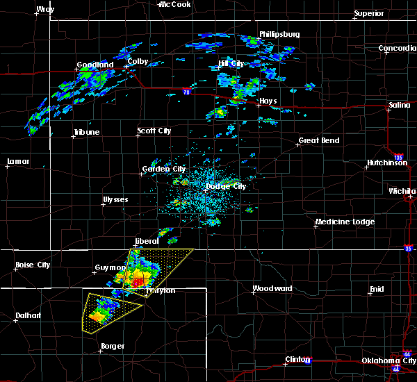 At 217 pm cdt, a severe thunderstorm was located 4 miles southwest of bryans corner, or 13 miles north of perryton, moving northeast at 50 mph (radar indicated). Hazards include tennis ball size hail and 60 mph wind gusts. a wall cloud has been observed with this storm. Minor damage to roofs, siding, and trees is possible. people and animals outdoors will be injured. expect hail damage to roofs, siding, windows, and vehicles. locations impacted include, perryton, beaver, forgan, bryans corner, boyd, mocane, turpin, floris and balko. A tornado watch remains in effect until 1000 pm cdt for the panhandle of oklahoma, and the panhandle of texas. At 217 pm cdt, a severe thunderstorm was located 4 miles southwest of bryans corner, or 13 miles north of perryton, moving northeast at 50 mph (radar indicated). Hazards include tennis ball size hail and 60 mph wind gusts. a wall cloud has been observed with this storm. Minor damage to roofs, siding, and trees is possible. people and animals outdoors will be injured. expect hail damage to roofs, siding, windows, and vehicles. locations impacted include, perryton, beaver, forgan, bryans corner, boyd, mocane, turpin, floris and balko. A tornado watch remains in effect until 1000 pm cdt for the panhandle of oklahoma, and the panhandle of texas.
|
| 5/16/2017 2:07 PM CDT |
 At 206 pm cdt, a severe thunderstorm was located 10 miles northwest of perryton, moving northeast at 50 mph (radar indicated). Hazards include golf ball size hail and 60 mph wind gusts. a wall cloud is also being observed with this storm. Minor damage to roofs, siding, and trees is possible. people and animals outdoors will be injured. expect hail damage to roofs, siding, windows, and vehicles. locations impacted include, perryton, beaver, tyrone, forgan, hardesty, adams, farnsworth, boyd, floris, bryans corner, baker, mocane, turpin, balko and elmwood. A tornado watch remains in effect until 1000 pm cdt for the panhandle of oklahoma, and the panhandle of texas. At 206 pm cdt, a severe thunderstorm was located 10 miles northwest of perryton, moving northeast at 50 mph (radar indicated). Hazards include golf ball size hail and 60 mph wind gusts. a wall cloud is also being observed with this storm. Minor damage to roofs, siding, and trees is possible. people and animals outdoors will be injured. expect hail damage to roofs, siding, windows, and vehicles. locations impacted include, perryton, beaver, tyrone, forgan, hardesty, adams, farnsworth, boyd, floris, bryans corner, baker, mocane, turpin, balko and elmwood. A tornado watch remains in effect until 1000 pm cdt for the panhandle of oklahoma, and the panhandle of texas.
|
| 5/16/2017 1:59 PM CDT |
 At 159 pm cdt, a severe thunderstorm was located 9 miles north of farnsworth, or 11 miles northwest of perryton, moving northeast at 50 mph (radar indicated). Hazards include golf ball size hail and 60 mph wind gusts. Minor damage to roofs, siding, and trees is possible. people and animals outdoors will be injured. expect hail damage to roofs, siding, windows, and vehicles. locations impacted include, perryton, beaver, tyrone, forgan, hardesty, adams, farnsworth, boyd, waka, floris, bryans corner, baker, mocane, turpin, balko and elmwood. A tornado watch remains in effect until 1000 pm cdt for the panhandle of oklahoma, and the panhandle of texas. At 159 pm cdt, a severe thunderstorm was located 9 miles north of farnsworth, or 11 miles northwest of perryton, moving northeast at 50 mph (radar indicated). Hazards include golf ball size hail and 60 mph wind gusts. Minor damage to roofs, siding, and trees is possible. people and animals outdoors will be injured. expect hail damage to roofs, siding, windows, and vehicles. locations impacted include, perryton, beaver, tyrone, forgan, hardesty, adams, farnsworth, boyd, waka, floris, bryans corner, baker, mocane, turpin, balko and elmwood. A tornado watch remains in effect until 1000 pm cdt for the panhandle of oklahoma, and the panhandle of texas.
|
| 5/16/2017 1:49 PM CDT |
 At 149 pm cdt, a severe thunderstorm was located 4 miles north of waka, or 12 miles northeast of spearman, moving northeast at 50 mph (radar indicated). Hazards include golf ball size hail and 60 mph wind gusts. Minor damage to roofs, siding, and trees is possible. people and animals outdoors will be injured. expect hail damage to roofs, siding, windows, and vehicles. Locations impacted include, perryton, spearman, beaver, tyrone, forgan, hardesty, adams, farnsworth, boyd, waka, floris, bryans corner, baker, mocane, turpin, balko and elmwood. At 149 pm cdt, a severe thunderstorm was located 4 miles north of waka, or 12 miles northeast of spearman, moving northeast at 50 mph (radar indicated). Hazards include golf ball size hail and 60 mph wind gusts. Minor damage to roofs, siding, and trees is possible. people and animals outdoors will be injured. expect hail damage to roofs, siding, windows, and vehicles. Locations impacted include, perryton, spearman, beaver, tyrone, forgan, hardesty, adams, farnsworth, boyd, waka, floris, bryans corner, baker, mocane, turpin, balko and elmwood.
|
| 5/16/2017 1:42 PM CDT |
 At 142 pm cdt, a severe thunderstorm was located near waka, or 6 miles northeast of spearman, moving northeast at 50 mph (radar indicated). Hazards include 60 mph wind gusts and quarter size hail. Minor damage to roofs, siding, and trees is possible. Hail damage to vehicles is expected. At 142 pm cdt, a severe thunderstorm was located near waka, or 6 miles northeast of spearman, moving northeast at 50 mph (radar indicated). Hazards include 60 mph wind gusts and quarter size hail. Minor damage to roofs, siding, and trees is possible. Hail damage to vehicles is expected.
|
| 5/2/2017 10:09 PM CDT |
 At 1008 pm cdt, a severe thunderstorm was located near elmwood, or 12 miles south of beaver, moving east at 25 mph (radar indicated). Hazards include ping pong ball size hail and 60 mph wind gusts. Minor damage to roofs, siding, and trees is possible. people and animals outdoors will be injured. expect hail damage to roofs, siding, windows, and vehicles. Locations impacted include, beaver, booker, forgan, follett, darrouzett, hardesty, gate, knowles, elmwood, adams, boyd, floris, bryans corner, baker, mocane, turpin, slapout and balko. At 1008 pm cdt, a severe thunderstorm was located near elmwood, or 12 miles south of beaver, moving east at 25 mph (radar indicated). Hazards include ping pong ball size hail and 60 mph wind gusts. Minor damage to roofs, siding, and trees is possible. people and animals outdoors will be injured. expect hail damage to roofs, siding, windows, and vehicles. Locations impacted include, beaver, booker, forgan, follett, darrouzett, hardesty, gate, knowles, elmwood, adams, boyd, floris, bryans corner, baker, mocane, turpin, slapout and balko.
|
| 5/2/2017 9:48 PM CDT |
 At 948 pm cdt, a severe thunderstorm was located 7 miles northwest of booker, or 11 miles northeast of perryton, moving east at 20 mph (radar indicated). Hazards include 60 mph wind gusts and half dollar size hail. Minor damage to roofs, siding, and trees is possible. hail damage to vehicles is expected. Locations impacted include, beaver, booker, forgan, follett, darrouzett, hardesty, gate, knowles, elmwood, adams, boyd, floris, bryans corner, baker, mocane, turpin, slapout and balko. At 948 pm cdt, a severe thunderstorm was located 7 miles northwest of booker, or 11 miles northeast of perryton, moving east at 20 mph (radar indicated). Hazards include 60 mph wind gusts and half dollar size hail. Minor damage to roofs, siding, and trees is possible. hail damage to vehicles is expected. Locations impacted include, beaver, booker, forgan, follett, darrouzett, hardesty, gate, knowles, elmwood, adams, boyd, floris, bryans corner, baker, mocane, turpin, slapout and balko.
|
| 5/2/2017 9:41 PM CDT |
 At 941 pm cdt, a severe thunderstorm was located 5 miles southeast of bryans corner, or 12 miles north of perryton, moving east at 25 mph (radar indicated). Hazards include ping pong ball size hail and 60 mph wind gusts. Minor damage to roofs, siding, and trees is possible. people and animals outdoors will be injured. expect hail damage to roofs, siding, windows, and vehicles. Locations impacted include, beaver, booker, forgan, follett, darrouzett, hardesty, gate, knowles, elmwood, adams, boyd, floris, bryans corner, baker, mocane, turpin, slapout and balko. At 941 pm cdt, a severe thunderstorm was located 5 miles southeast of bryans corner, or 12 miles north of perryton, moving east at 25 mph (radar indicated). Hazards include ping pong ball size hail and 60 mph wind gusts. Minor damage to roofs, siding, and trees is possible. people and animals outdoors will be injured. expect hail damage to roofs, siding, windows, and vehicles. Locations impacted include, beaver, booker, forgan, follett, darrouzett, hardesty, gate, knowles, elmwood, adams, boyd, floris, bryans corner, baker, mocane, turpin, slapout and balko.
|
| 5/2/2017 9:31 PM CDT |
 At 931 pm cdt, a severe thunderstorm was located near bryans corner, or 12 miles north of perryton, moving east at 20 mph (radar indicated). Hazards include ping pong ball size hail and 60 mph wind gusts. Minor damage to roofs, siding, and trees is possible. people and animals outdoors will be injured. expect hail damage to roofs, siding, windows, and vehicles. Locations impacted include, beaver, booker, forgan, follett, darrouzett, hardesty, gate, knowles, elmwood, adams, boyd, floris, bryans corner, baker, mocane, turpin, slapout and balko. At 931 pm cdt, a severe thunderstorm was located near bryans corner, or 12 miles north of perryton, moving east at 20 mph (radar indicated). Hazards include ping pong ball size hail and 60 mph wind gusts. Minor damage to roofs, siding, and trees is possible. people and animals outdoors will be injured. expect hail damage to roofs, siding, windows, and vehicles. Locations impacted include, beaver, booker, forgan, follett, darrouzett, hardesty, gate, knowles, elmwood, adams, boyd, floris, bryans corner, baker, mocane, turpin, slapout and balko.
|
| 5/2/2017 9:26 PM CDT |
 At 925 pm cdt, a severe thunderstorm was located 5 miles southwest of bryans corner, or 13 miles northwest of perryton, moving east at 20 mph (trained weather spotters have reported a large rotating wall cloud with this storm). Hazards include ping pong ball size hail and 60 mph wind gusts. Minor damage to roofs, siding, and trees is possible. people and animals outdoors will be injured. expect hail damage to roofs, siding, windows, and vehicles. Locations impacted include, beaver, booker, tyrone, forgan, follett, darrouzett, hardesty, gate, knowles, elmwood, adams, boyd, floris, bryans corner, baker, mocane, turpin, slapout and balko. At 925 pm cdt, a severe thunderstorm was located 5 miles southwest of bryans corner, or 13 miles northwest of perryton, moving east at 20 mph (trained weather spotters have reported a large rotating wall cloud with this storm). Hazards include ping pong ball size hail and 60 mph wind gusts. Minor damage to roofs, siding, and trees is possible. people and animals outdoors will be injured. expect hail damage to roofs, siding, windows, and vehicles. Locations impacted include, beaver, booker, tyrone, forgan, follett, darrouzett, hardesty, gate, knowles, elmwood, adams, boyd, floris, bryans corner, baker, mocane, turpin, slapout and balko.
|
| 5/2/2017 9:18 PM CDT |
 At 918 pm cdt, a severe thunderstorm was located 7 miles southwest of bryans corner, or 14 miles northwest of perryton, moving east at 20 mph (radar indicated). Hazards include ping pong ball size hail and 60 mph wind gusts. Minor damage to roofs, siding, and trees is possible. people and animals outdoors will be injured. expect hail damage to roofs, siding, windows, and vehicles. Locations impacted include, beaver, booker, tyrone, forgan, follett, darrouzett, hardesty, gate, knowles, elmwood, adams, boyd, floris, bryans corner, baker, mocane, turpin, slapout and balko. At 918 pm cdt, a severe thunderstorm was located 7 miles southwest of bryans corner, or 14 miles northwest of perryton, moving east at 20 mph (radar indicated). Hazards include ping pong ball size hail and 60 mph wind gusts. Minor damage to roofs, siding, and trees is possible. people and animals outdoors will be injured. expect hail damage to roofs, siding, windows, and vehicles. Locations impacted include, beaver, booker, tyrone, forgan, follett, darrouzett, hardesty, gate, knowles, elmwood, adams, boyd, floris, bryans corner, baker, mocane, turpin, slapout and balko.
|
| 5/2/2017 9:00 PM CDT |
 At 859 pm cdt, a severe thunderstorm was located 9 miles southeast of hardesty, or 17 miles northwest of perryton, moving east at 20 mph (radar indicated). Hazards include 60 mph wind gusts and half dollar size hail. Minor damage to roofs, siding, and trees is possible. Hail damage to vehicles is expected. At 859 pm cdt, a severe thunderstorm was located 9 miles southeast of hardesty, or 17 miles northwest of perryton, moving east at 20 mph (radar indicated). Hazards include 60 mph wind gusts and half dollar size hail. Minor damage to roofs, siding, and trees is possible. Hail damage to vehicles is expected.
|
| 7/15/2016 6:36 PM CDT |
 At 635 pm cdt, severe thunderstorms were located along a line extending from near turpin to near hardesty to 8 miles east of stratford, moving east at 30 mph (radar indicated). Hazards include 60 mph wind gusts and quarter size hail. Minor damage to roofs. siding. and trees is possible. hail damage to vehicles is expected. Locations impacted include, perryton, beaver, gruver, forgan, hardesty, elmwood, bryans corner, mocane, turpin, adams, waka, floris, balko, farnsworth and boyd. At 635 pm cdt, severe thunderstorms were located along a line extending from near turpin to near hardesty to 8 miles east of stratford, moving east at 30 mph (radar indicated). Hazards include 60 mph wind gusts and quarter size hail. Minor damage to roofs. siding. and trees is possible. hail damage to vehicles is expected. Locations impacted include, perryton, beaver, gruver, forgan, hardesty, elmwood, bryans corner, mocane, turpin, adams, waka, floris, balko, farnsworth and boyd.
|
| 7/15/2016 6:27 PM CDT |
 At 626 pm cdt, severe thunderstorms were located along a line extending from baker to hardesty to stratford, moving east at 30 mph (radar indicated). Hazards include 60 mph wind gusts and quarter size hail. Minor damage to roofs. siding. and trees is possible. Hail damage to vehicles is expected. At 626 pm cdt, severe thunderstorms were located along a line extending from baker to hardesty to stratford, moving east at 30 mph (radar indicated). Hazards include 60 mph wind gusts and quarter size hail. Minor damage to roofs. siding. and trees is possible. Hail damage to vehicles is expected.
|
| 5/24/2016 7:06 PM CDT | A severe thunderstorm warning remains in effect until 730 pm cdt for northeastern texas and northwestern beaver counties. at 705 pm cdt. a severe thunderstorm was located 6 miles south of liberal. moving northeast at 40 mph. hazard. 60 mph wind gusts and quarter size hail. source. Radar indicated. |
| 5/24/2016 5:57 PM CDT | Golf Ball sized hail reported 7.8 miles E of Turpin, OK |
| 5/24/2016 5:54 PM CDT |
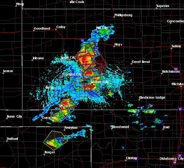 At 553 pm cdt, a severe thunderstorm was located over adams, or 20 miles south of liberal, moving northeast at 25 mph (radar indicated). Hazards include ping pong ball size hail and 60 mph wind gusts. Minor damage to roofs. siding. and trees is possible. people and animals outdoors will be injured. Expect hail damage to roofs, siding, windows, and vehicles. At 553 pm cdt, a severe thunderstorm was located over adams, or 20 miles south of liberal, moving northeast at 25 mph (radar indicated). Hazards include ping pong ball size hail and 60 mph wind gusts. Minor damage to roofs. siding. and trees is possible. people and animals outdoors will be injured. Expect hail damage to roofs, siding, windows, and vehicles.
|
| 5/22/2016 7:22 PM CDT |
 At 721 pm cdt, severe thunderstorms were located along a line extending from 3 miles northwest of hooker to 8 miles southeast of guymon, moving northeast at 35 mph (radar indicated). Hazards include golf ball size hail and 60 mph wind gusts. Minor damage to roofs. siding. and trees is possible. people and animals outdoors will be injured. expect hail damage to roofs, siding, windows, and vehicles. locations impacted include, guymon, beaver, hooker, optima, hardesty, bryans corner, mocane, turpin, adams, floris, boyd and baker. A tornado watch remains in effect until 1000 pm cdt. At 721 pm cdt, severe thunderstorms were located along a line extending from 3 miles northwest of hooker to 8 miles southeast of guymon, moving northeast at 35 mph (radar indicated). Hazards include golf ball size hail and 60 mph wind gusts. Minor damage to roofs. siding. and trees is possible. people and animals outdoors will be injured. expect hail damage to roofs, siding, windows, and vehicles. locations impacted include, guymon, beaver, hooker, optima, hardesty, bryans corner, mocane, turpin, adams, floris, boyd and baker. A tornado watch remains in effect until 1000 pm cdt.
|
| 5/22/2016 6:56 PM CDT | The national weather service in amarillo has issued a * severe thunderstorm warning for. eastern texas county in the panhandle of oklahoma. western beaver county in the panhandle of oklahoma. until 800 pm cdt * at 656 pm cdt. Severe thunderstorms were located along a line. |
| 4/29/2016 3:05 AM CDT |
 At 304 am cdt, severe thunderstorms were located along a line extending from 7 miles southeast of liberal to 4 miles east of boyd to 6 miles northwest of perryton, moving east at 45 mph (radar indicated). Hazards include golf ball size hail and 60 mph wind gusts. Minor damage to roofs. siding. and trees is possible. people and animals outdoors will be injured. expect hail damage to roofs, siding, windows, and vehicles. Locations impacted include, beaver, forgan, knowles, elmwood, bryans corner, mocane, balko, turpin, floris and boyd. At 304 am cdt, severe thunderstorms were located along a line extending from 7 miles southeast of liberal to 4 miles east of boyd to 6 miles northwest of perryton, moving east at 45 mph (radar indicated). Hazards include golf ball size hail and 60 mph wind gusts. Minor damage to roofs. siding. and trees is possible. people and animals outdoors will be injured. expect hail damage to roofs, siding, windows, and vehicles. Locations impacted include, beaver, forgan, knowles, elmwood, bryans corner, mocane, balko, turpin, floris and boyd.
|
| 4/29/2016 2:53 AM CDT |
 At 252 am cdt, severe thunderstorms were located along a line extending from 5 miles south of liberal to boyd to 9 miles north of farnsworth, moving east-northeast at 40 mph (radar indicated). Hazards include ping pong ball size hail and 60 mph wind gusts. Minor damage to roofs. siding. and trees is possible. people and animals outdoors will be injured. Expect hail damage to roofs, siding, windows, and vehicles. At 252 am cdt, severe thunderstorms were located along a line extending from 5 miles south of liberal to boyd to 9 miles north of farnsworth, moving east-northeast at 40 mph (radar indicated). Hazards include ping pong ball size hail and 60 mph wind gusts. Minor damage to roofs. siding. and trees is possible. people and animals outdoors will be injured. Expect hail damage to roofs, siding, windows, and vehicles.
|
| 4/29/2016 2:53 AM CDT |
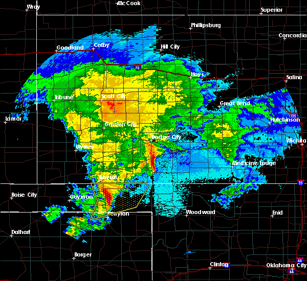 At 252 am cdt, severe thunderstorms were located along a line extending from 5 miles south of liberal to boyd to 9 miles north of farnsworth, moving east-northeast at 40 mph (radar indicated). Hazards include ping pong ball size hail and 60 mph wind gusts. Minor damage to roofs. siding. and trees is possible. people and animals outdoors will be injured. Expect hail damage to roofs, siding, windows, and vehicles. At 252 am cdt, severe thunderstorms were located along a line extending from 5 miles south of liberal to boyd to 9 miles north of farnsworth, moving east-northeast at 40 mph (radar indicated). Hazards include ping pong ball size hail and 60 mph wind gusts. Minor damage to roofs. siding. and trees is possible. people and animals outdoors will be injured. Expect hail damage to roofs, siding, windows, and vehicles.
|
| 10/21/2015 4:51 PM CDT |
 The severe thunderstorm warning for northwestern beaver and northeastern texas counties will expire at 500 pm cdt, the storm which prompted the warning has weakened below severe limits, and no longer pose an immediate threat to life or property. therefore the warning will be allowed to expire. however heavy rain is still possible with this thunderstorm. The severe thunderstorm warning for northwestern beaver and northeastern texas counties will expire at 500 pm cdt, the storm which prompted the warning has weakened below severe limits, and no longer pose an immediate threat to life or property. therefore the warning will be allowed to expire. however heavy rain is still possible with this thunderstorm.
|
| 10/21/2015 4:32 PM CDT |
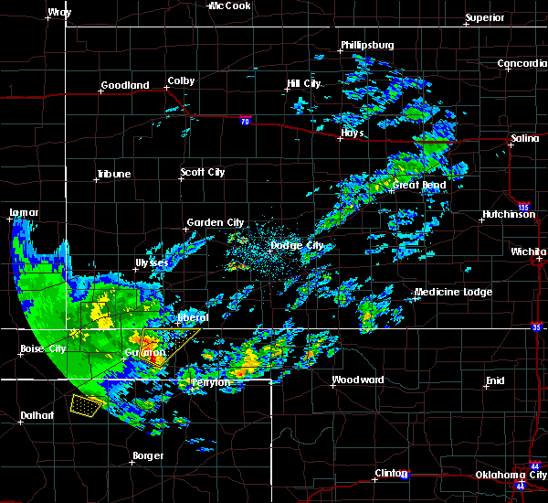 At 432 pm cdt, a severe thunderstorm was located near hooker, or 15 miles northeast of guymon, moving northeast at 30 mph (radar indicated). Hazards include half dollar size hail. Damage to vehicles is expected. Locations impacted include, hooker, tyrone, adams, baker and turpin. At 432 pm cdt, a severe thunderstorm was located near hooker, or 15 miles northeast of guymon, moving northeast at 30 mph (radar indicated). Hazards include half dollar size hail. Damage to vehicles is expected. Locations impacted include, hooker, tyrone, adams, baker and turpin.
|
| 10/21/2015 4:17 PM CDT |
 At 417 pm cdt, a severe thunderstorm was located near hardesty, or 10 miles east of guymon, moving northeast at 30 mph (radar indicated). Hazards include half dollar size hail. damage to vehicles is expected At 417 pm cdt, a severe thunderstorm was located near hardesty, or 10 miles east of guymon, moving northeast at 30 mph (radar indicated). Hazards include half dollar size hail. damage to vehicles is expected
|
| 7/18/2015 8:08 PM CDT |
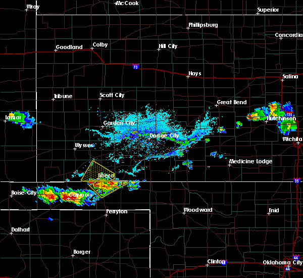 The severe thunderstorm warning for northwestern beaver and northeastern texas counties will expire at 815 pm cdt, the storm which prompted the warning has weakened and moved out of the warned area. The severe thunderstorm warning for northwestern beaver and northeastern texas counties will expire at 815 pm cdt, the storm which prompted the warning has weakened and moved out of the warned area.
|
| 7/18/2015 7:47 PM CDT |
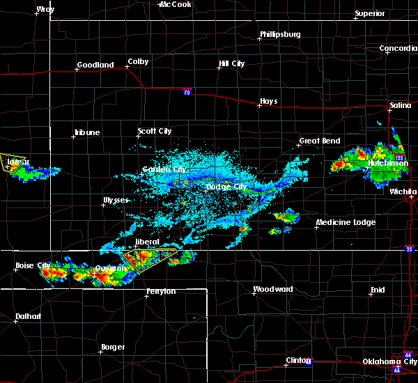 At 745 pm cdt, a severe thunderstorm was located 5 miles northeast of turpin, and moving northeast at 20 mph (radar indicated). Hazards include 60 mph wind gusts and quarter size hail. Hail damage to vehicles is expected. Minor wind damage to roofs, siding and trees is possible. At 745 pm cdt, a severe thunderstorm was located 5 miles northeast of turpin, and moving northeast at 20 mph (radar indicated). Hazards include 60 mph wind gusts and quarter size hail. Hail damage to vehicles is expected. Minor wind damage to roofs, siding and trees is possible.
|
| 7/18/2015 7:22 PM CDT |
 At 721 pm cdt, a severe thunderstorm was located near turpin, and moving northeast at 20 mph (radar indicated). Hazards include 60 mph wind gusts and quarter size hail. Hail damage to vehicles is expected. Minor wind damage to roofs, siding and trees is possible. At 721 pm cdt, a severe thunderstorm was located near turpin, and moving northeast at 20 mph (radar indicated). Hazards include 60 mph wind gusts and quarter size hail. Hail damage to vehicles is expected. Minor wind damage to roofs, siding and trees is possible.
|
| 6/7/2015 4:40 PM CDT | The severe thunderstorm warning for western beaver and southeastern texas counties will expire at 445 pm cdt, the storm which prompted the warning has weakened below severe limits, and no longer poses an immediate threat to life or property. however, gusty winds are still possible with this thunderstorm. |
| 6/7/2015 4:31 PM CDT | At 430 pm cdt, a severe thunderstorm was located 6 miles northeast of boyd, and moving east at 35 mph (radar indicated). Hazards include 60 mph wind gusts and quarter size hail. Hail damage to vehicles is expected. Minor wind damage to roofs, siding and trees is possible. |
| 6/7/2015 4:19 PM CDT | At 418 pm cdt, a severe thunderstorm was located near boyd, and moving east at 35 mph (radar indicated). Hazards include 60 mph wind gusts and quarter size hail. Hail damage to vehicles is expected. Minor wind damage to roofs, siding and trees is possible. |
| 6/7/2015 4:00 PM CDT | At 358 pm cdt, a severe thunderstorm was located near adams, and moving east at 30 mph (radar indicated). Hazards include 60 mph wind gusts and quarter size hail. Hail damage to vehicles is expected. Minor wind damage to roofs, siding and trees is possible. |
| 6/7/2015 3:49 PM CDT | At 348 pm cdt, a severe thunderstorm was located near adams, and moving east at 25 mph (radar indicated). Hazards include 60 mph wind gusts and quarter size hail. Hail damage to vehicles is expected. Minor wind damage to roofs, siding and trees is possible. |
| 6/7/2015 3:35 PM CDT | At 334 pm cdt, a severe thunderstorm was located 6 miles east of optima, and moving east at 20 mph (radar indicated). Hazards include 60 mph wind gusts and quarter size hail. Hail damage to vehicles is expected. Minor wind damage to roofs, siding and trees is possible. |
| 6/7/2015 3:24 PM CDT | At 322 pm cdt, a severe thunderstorm was located near optima, and moving east at 25 mph (radar indicated). Hazards include 60 mph wind gusts and quarter size hail. Hail damage to vehicles is expected. Minor wind damage to roofs, siding and trees is possible. |
| 6/7/2015 3:12 PM CDT | At 311 pm cdt, a severe thunderstorm was located near optima, and moving east at 25 mph (radar indicated). Hazards include 60 mph wind gusts and quarter size hail. Hail damage to vehicles is expected. Minor wind damage to roofs, siding and trees is possible. |
| 5/9/2015 6:52 PM CDT | At 649 pm cdt, a severe thunderstorm was located 6 miles south of beaver, and moving northeast at 65 mph (radar indicated). Hazards include 60 mph wind gusts and half dollar size hail. Hail damage to vehicles is expected. Minor wind damage to roofs, siding and trees is possible. |
| 5/9/2015 6:52 PM CDT | At 649 pm cdt, a severe thunderstorm was located 6 miles south of beaver, and moving northeast at 65 mph (radar indicated). Hazards include 60 mph wind gusts and half dollar size hail. Hail damage to vehicles is expected. Minor wind damage to roofs, siding and trees is possible. |
| 5/9/2015 6:37 PM CDT | At 634 pm cdt, a severe thunderstorm was located 6 miles south of balko, and moving northeast at 30 mph (radar indicated). Hazards include 60 mph wind gusts and half dollar size hail. Hail damage to vehicles is expected. Minor wind damage to roofs, siding and trees is possible. |
| 5/9/2015 6:37 PM CDT | At 634 pm cdt, a severe thunderstorm was located 6 miles south of balko, and moving northeast at 30 mph (radar indicated). Hazards include 60 mph wind gusts and half dollar size hail. Hail damage to vehicles is expected. Minor wind damage to roofs, siding and trees is possible. |
| 4/16/2015 2:54 PM CDT | At 252 pm cdt, a severe thunderstorm was located near balko, and moving northeast at 20 mph (trained weather spotters). Hazards include 60 mph wind gusts and quarter size hail. Hail damage to vehicles is expected. Minor wind damage to roofs, siding and trees is possible. |
| 4/16/2015 2:34 PM CDT | At 232 pm cdt, a severe thunderstorm was located near gray, and moving north at 20 mph (radar indicated). Hazards include golf ball size hail and 60 mph wind gusts. People and animals outdoors will be injured. expect hail damage to roofs, siding, windows and vehicles. Minor wind damage to roofs, siding and trees is possible. |
| 8/7/2013 10:34 PM CDT | Storm damage reported in beaver county OK, 0.2 miles SSE of Turpin, OK |
| 7/31/2013 7:50 PM CDT | Quarter sized hail reported 10.3 miles N of Turpin, OK |
| 6/3/2013 7:56 PM CDT | Quarter sized hail reported 14.5 miles NNW of Turpin, OK, reports quarter sized and bigger hail... but no exact size available |
| 6/14/2012 9:08 PM CDT | With dime size hail...heavy rain...leading to near zero visibility in texas county OK, 5.1 miles E of Turpin, OK |
| 6/14/2012 8:44 PM CDT | Quarter sized hail reported 4.1 miles SE of Turpin, OK, from 7 miles south of the kansas and oklahoma state line along hollow north 115 and then 1 mile east along hollow east 0070. |
| 1/1/0001 12:00 AM | Storm damage reported in beaver county OK, 8.6 miles WNW of Turpin, OK |
| 1/1/0001 12:00 AM | Estimated 60 mph winds 12 w of beaver in beaver county OK, 8.6 miles WNW of Turpin, OK |
| 1/1/0001 12:00 AM | Quarter sized hail reported 0.2 miles SSE of Turpin, OK |
| 1/1/0001 12:00 AM | The beaver county emergency managers office reported that there was downburst wind damage in turpin. there was damage to garages that were built on to trailer homes and in beaver county OK, 0.2 miles SSE of Turpin, OK |
Hail Maps for Turpin, OK
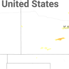
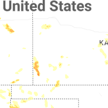
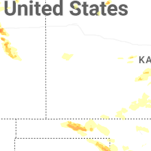
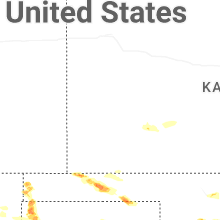
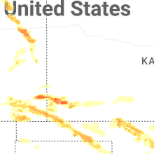


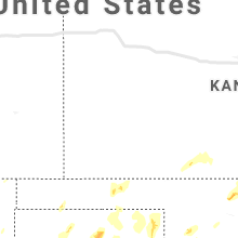


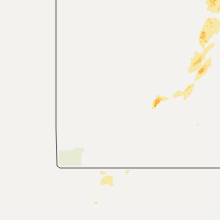


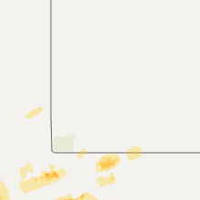


Connect with Interactive Hail Maps