

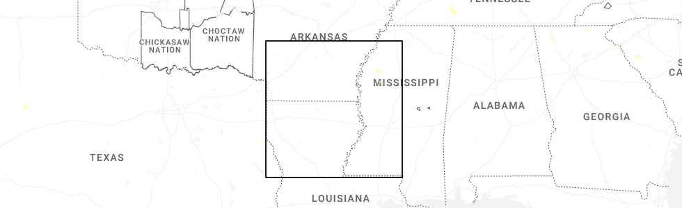
Hail Map for Tutwiler, MS
The Tutwiler, MS area has had 2 reports of on-the-ground hail by trained spotters, and has been under severe weather warnings 11 times during the past 12 months. Doppler radar has detected hail at or near Tutwiler, MS on 61 occasions, including 4 occasions during the past year.
| Name: | Tutwiler, MS |
| Where Located: | 81.4 miles SSW of Memphis, TN |
| Map: | Google Map for Tutwiler, MS |
| Population: | 3550 |
| Housing Units: | 435 |
| More Info: | Search Google for Tutwiler, MS |
0
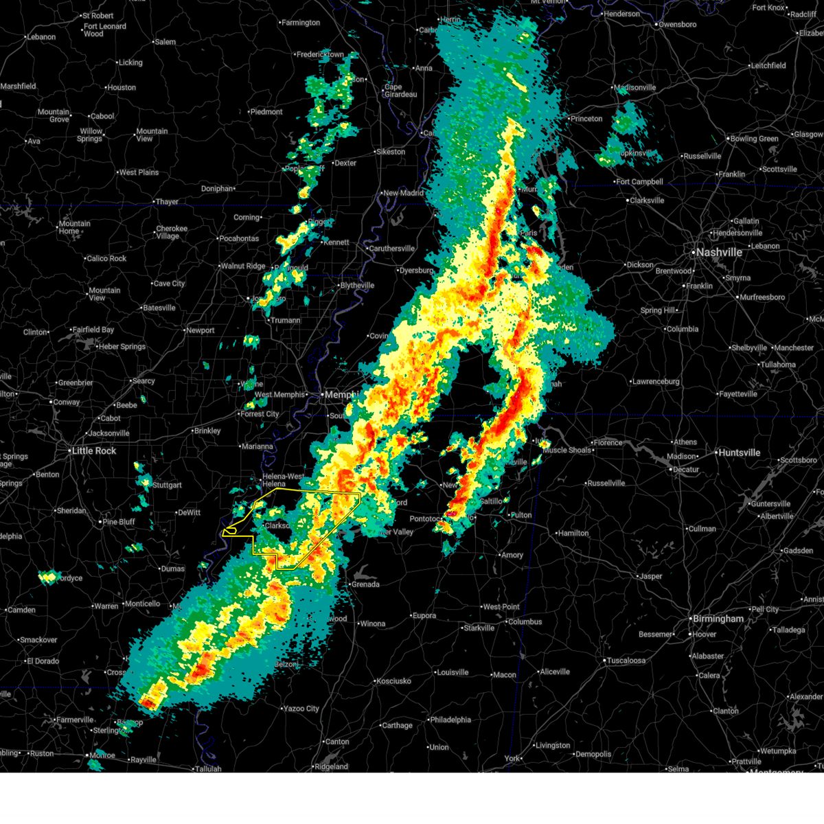
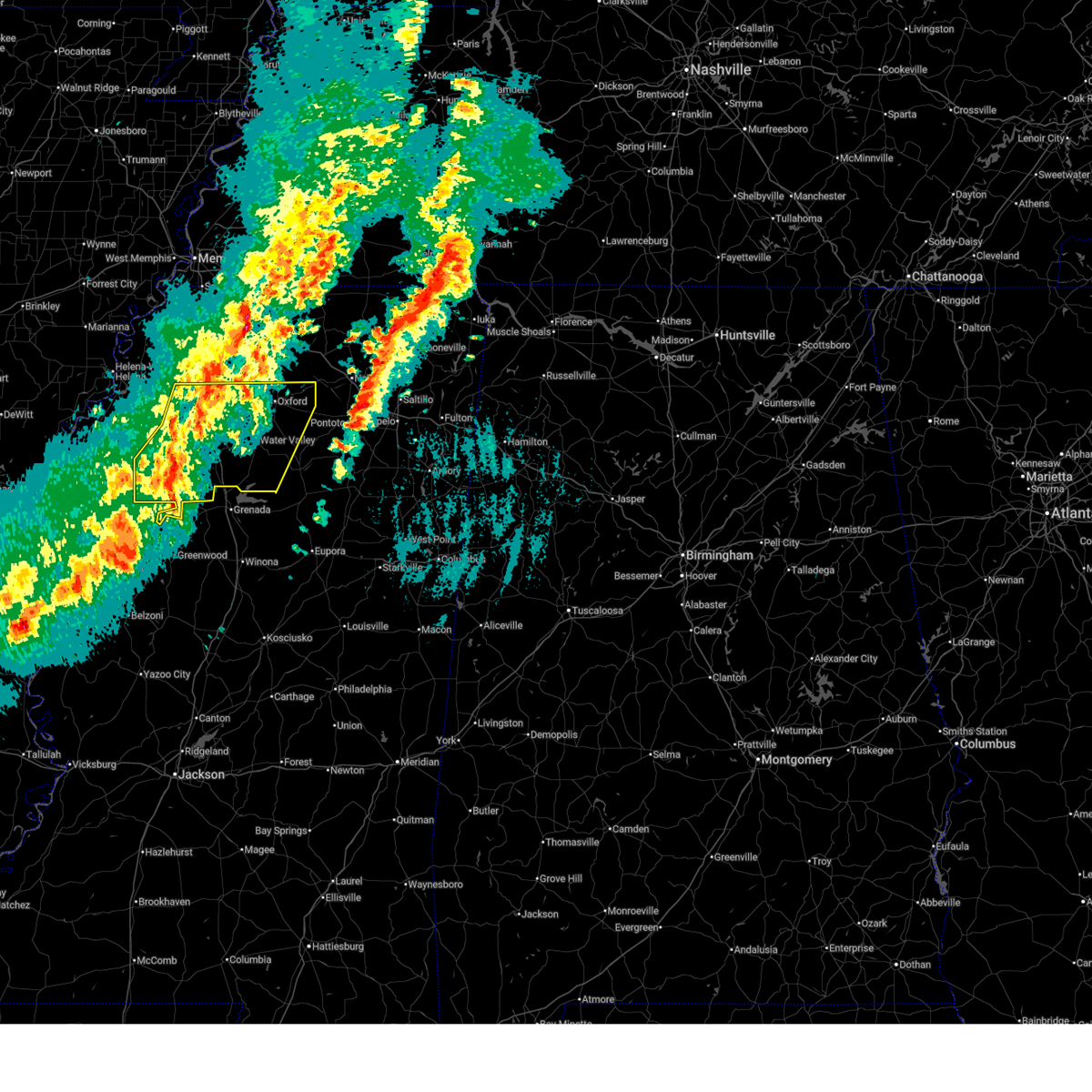
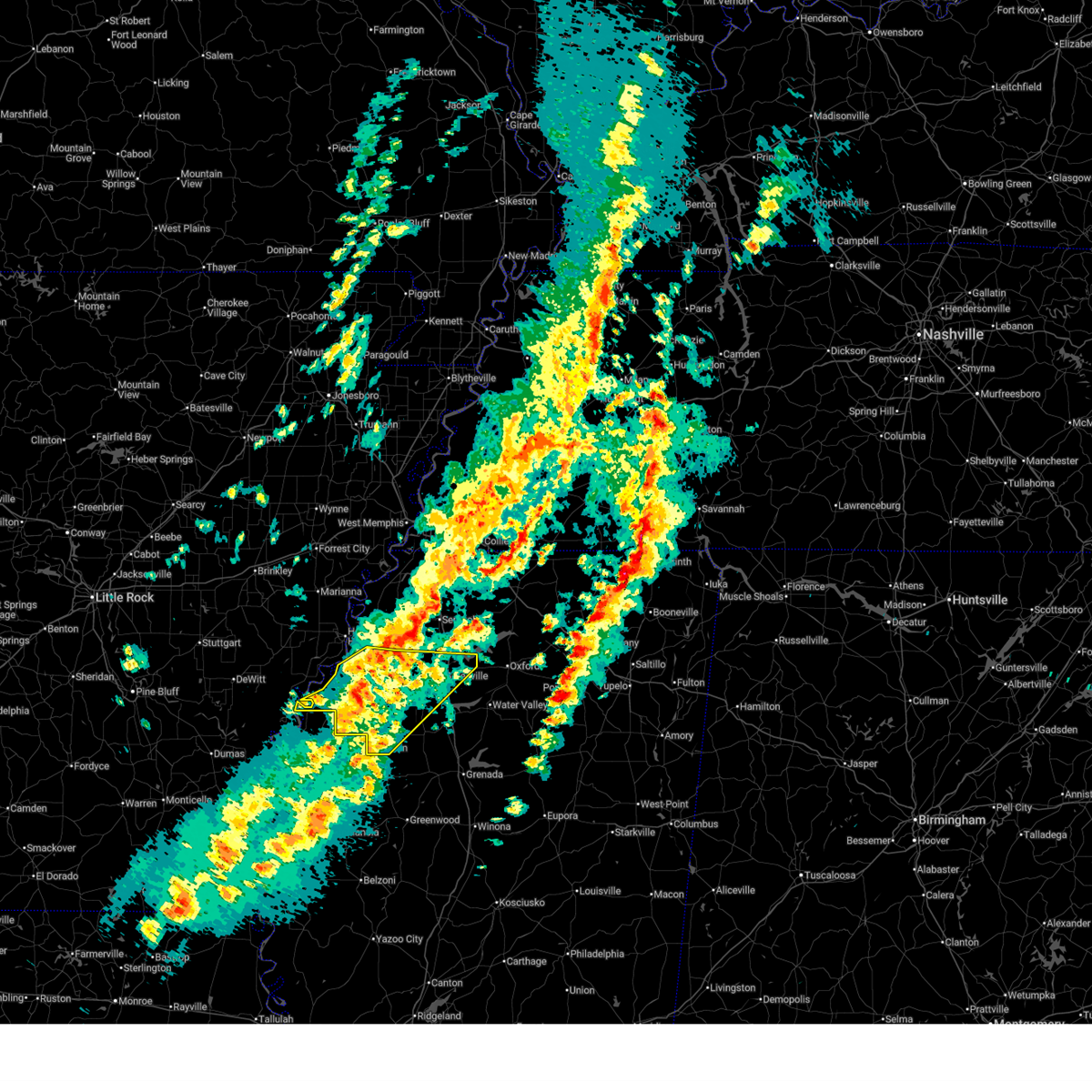
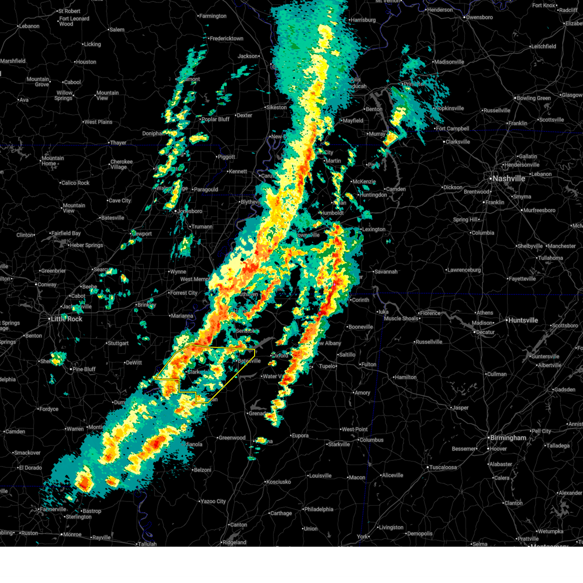
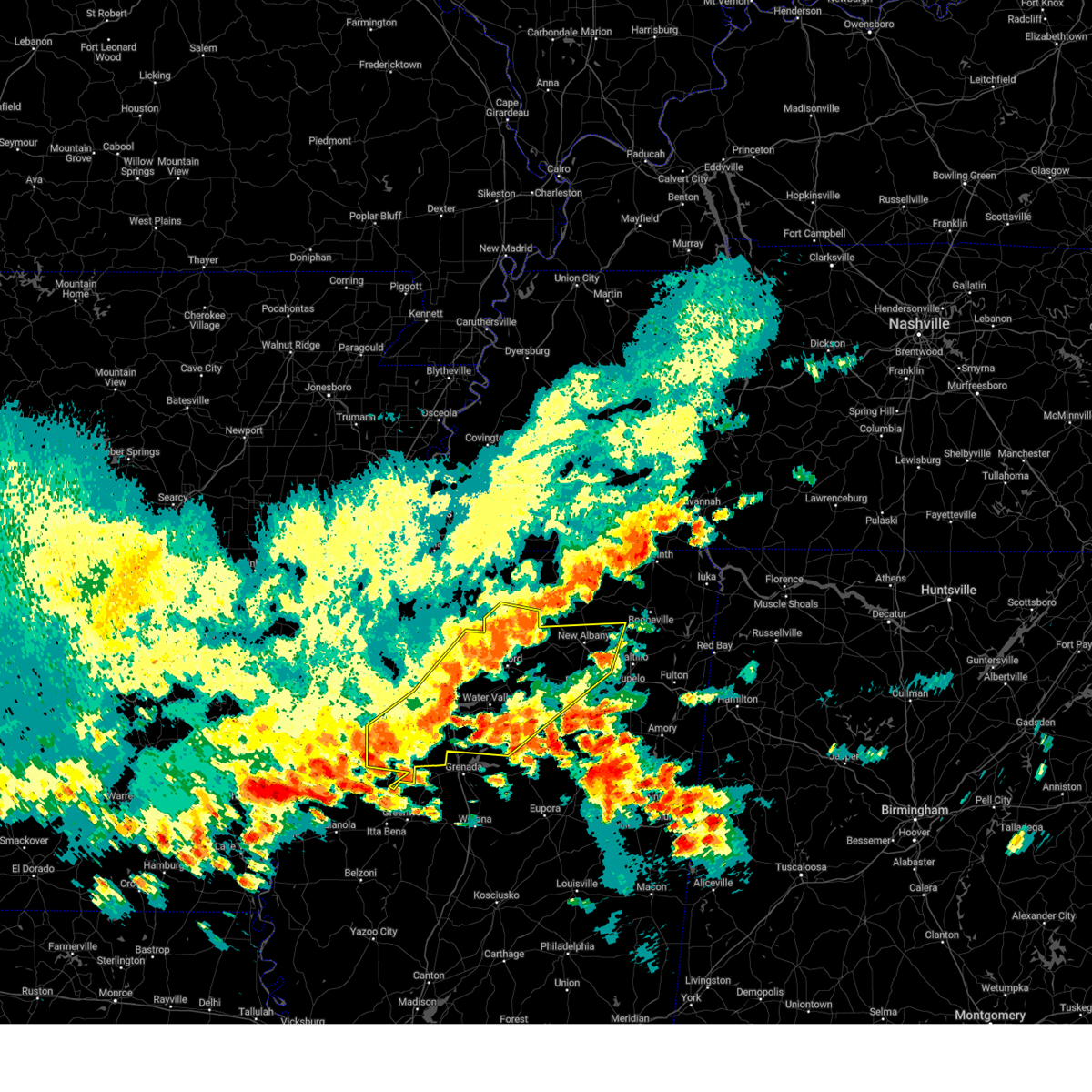
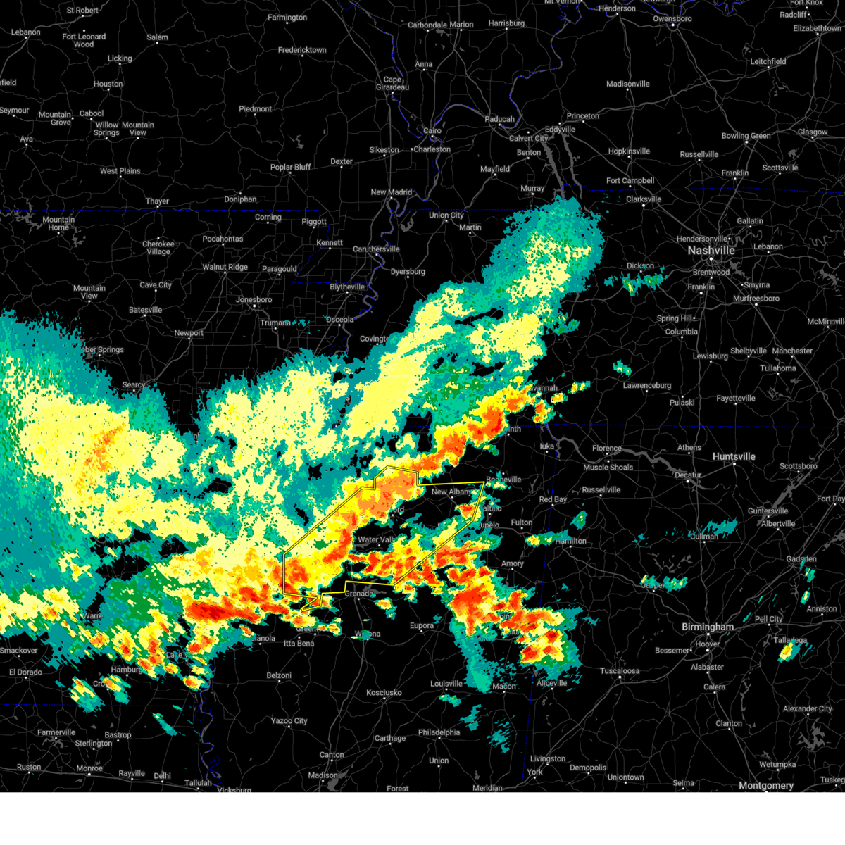
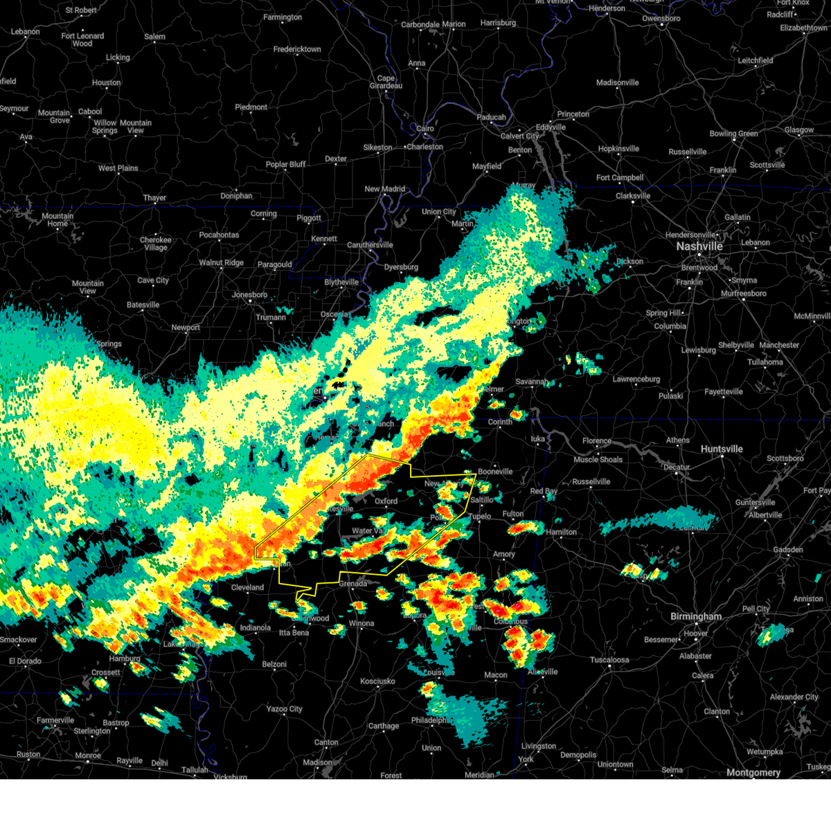
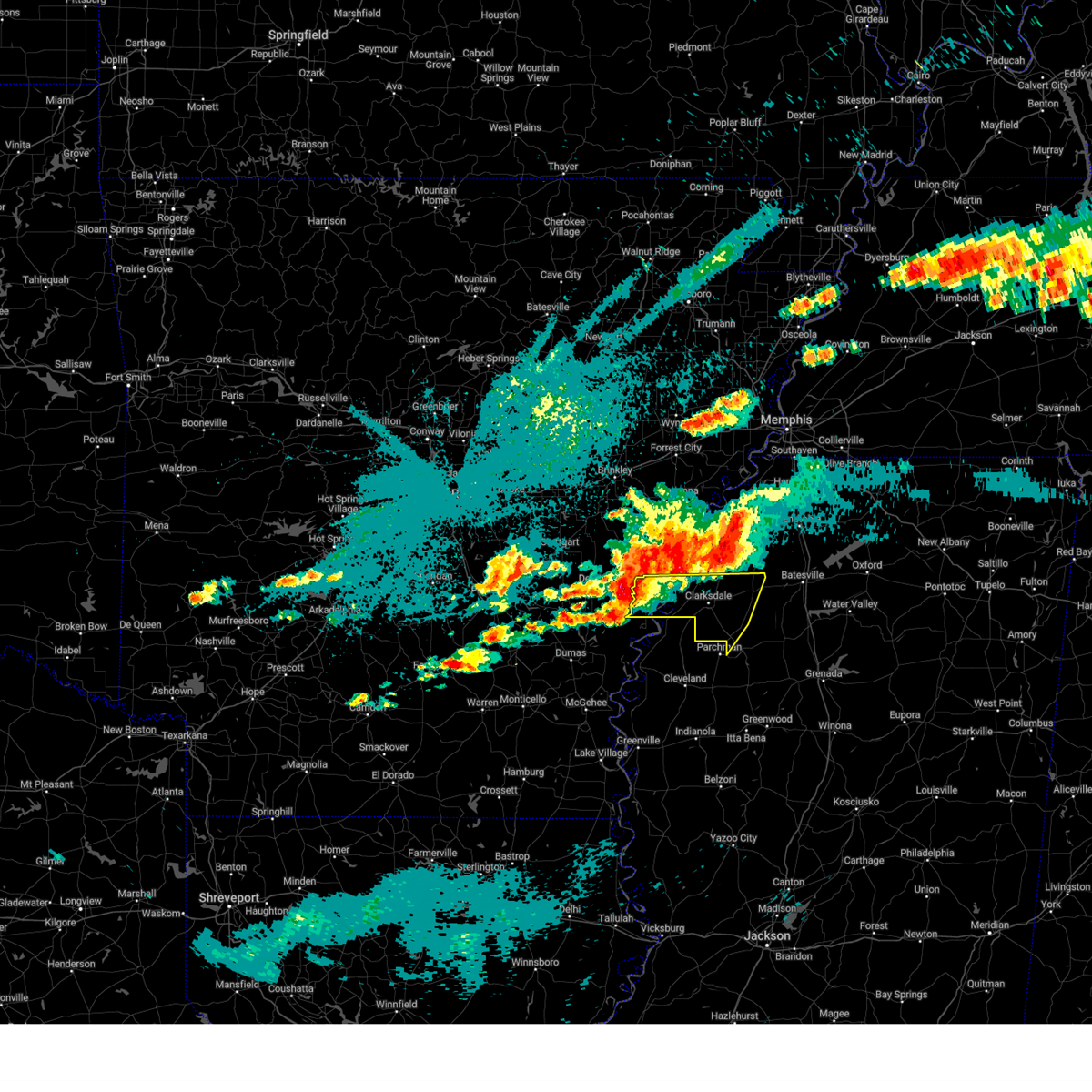
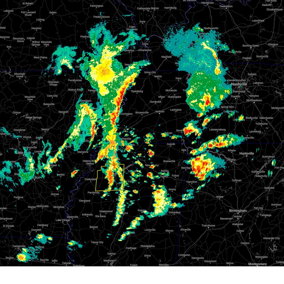
The Top Recent Hail Date for Tutwiler, MS is Thursday, July 2, 2026 (56th out of 61)
Hail and Wind Damage Spotted near Tutwiler, MS
| Date / Time | Report Details |
|---|---|
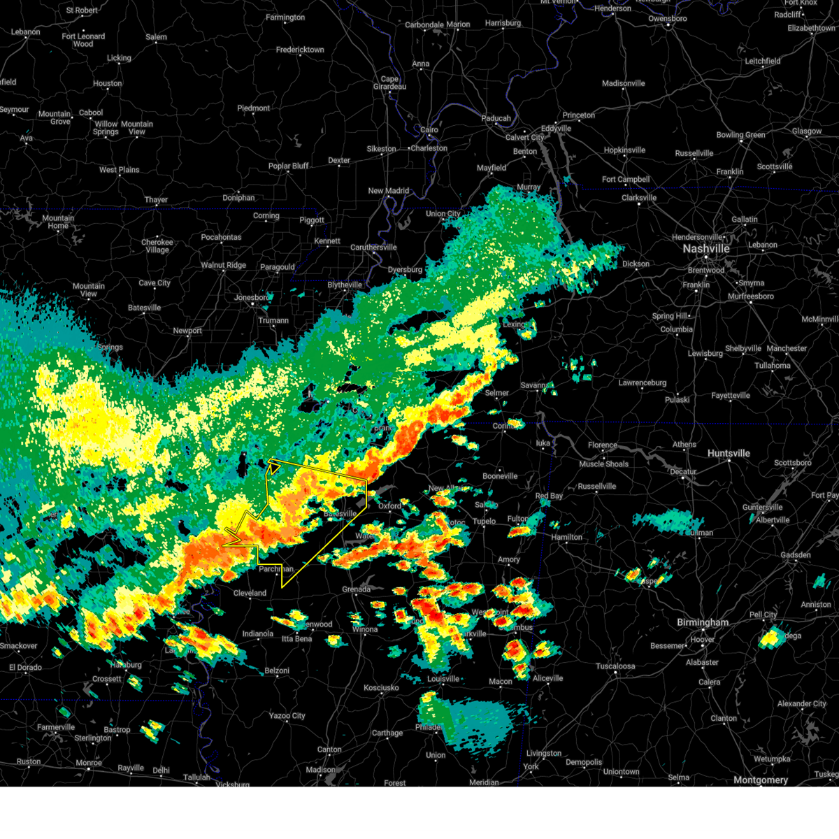
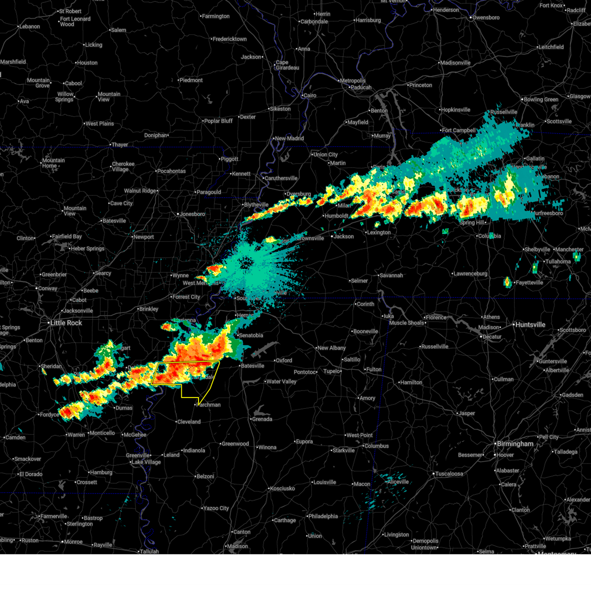
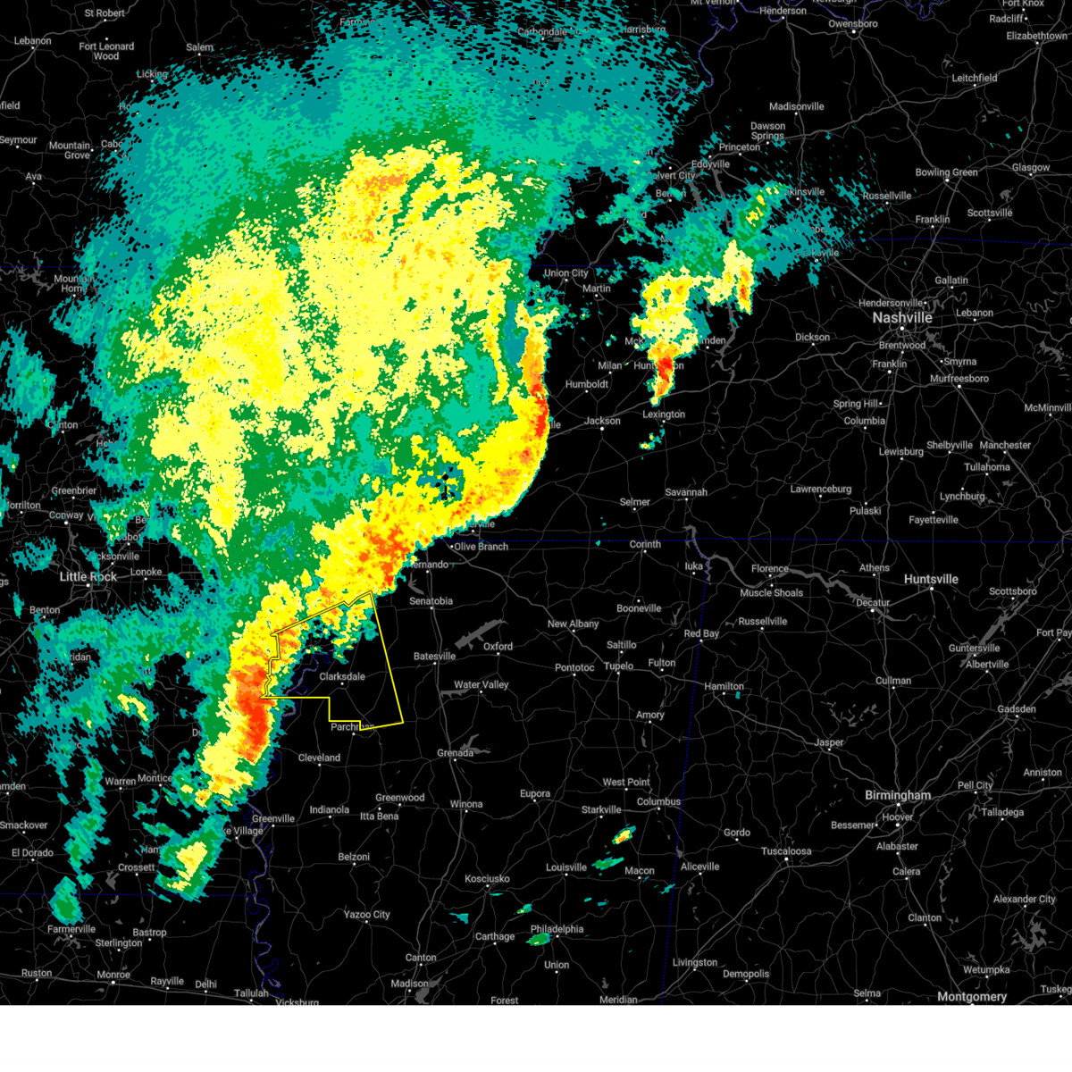
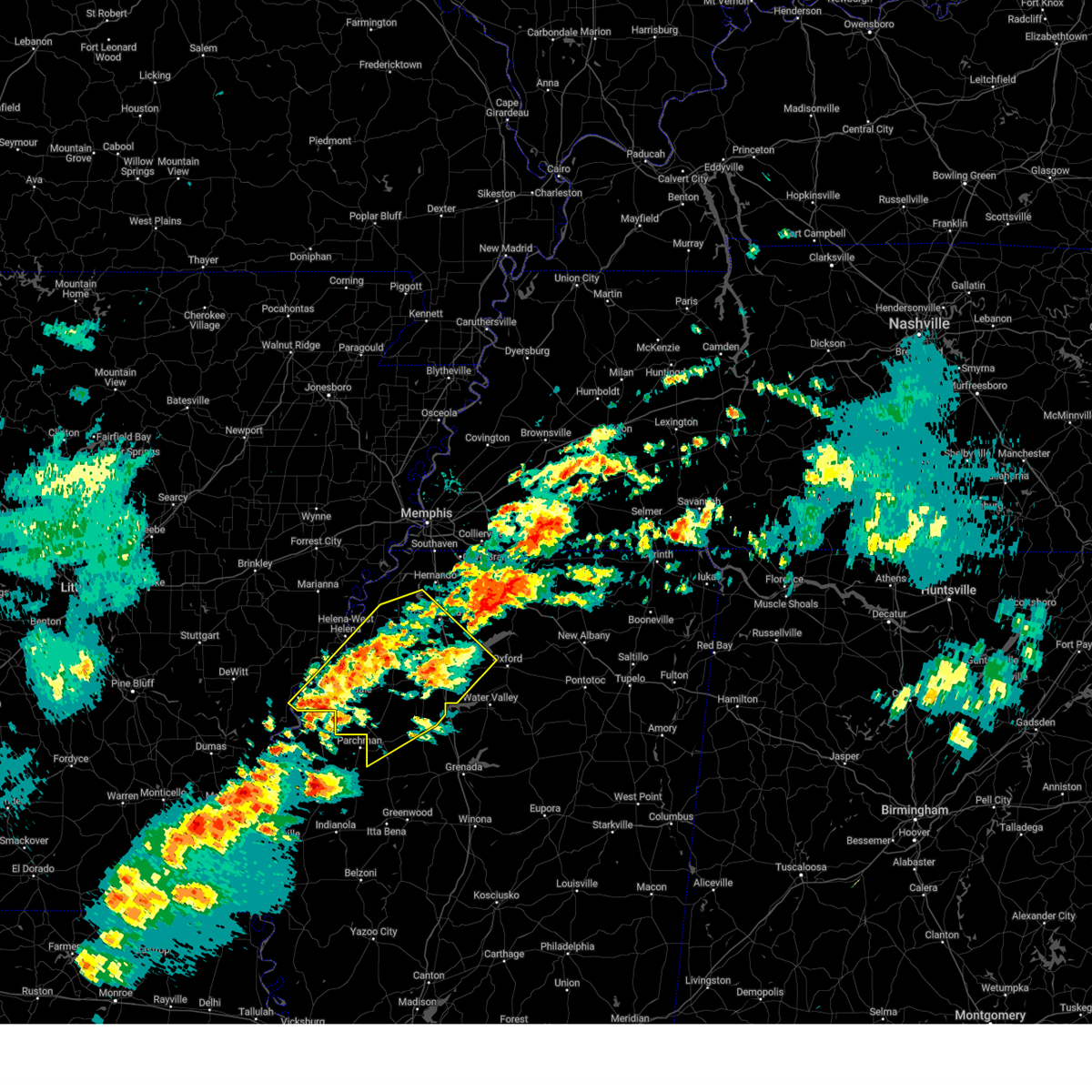
| 7/2/2026 4:19 PM CDT |
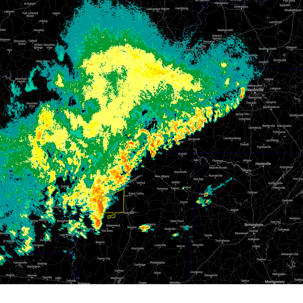
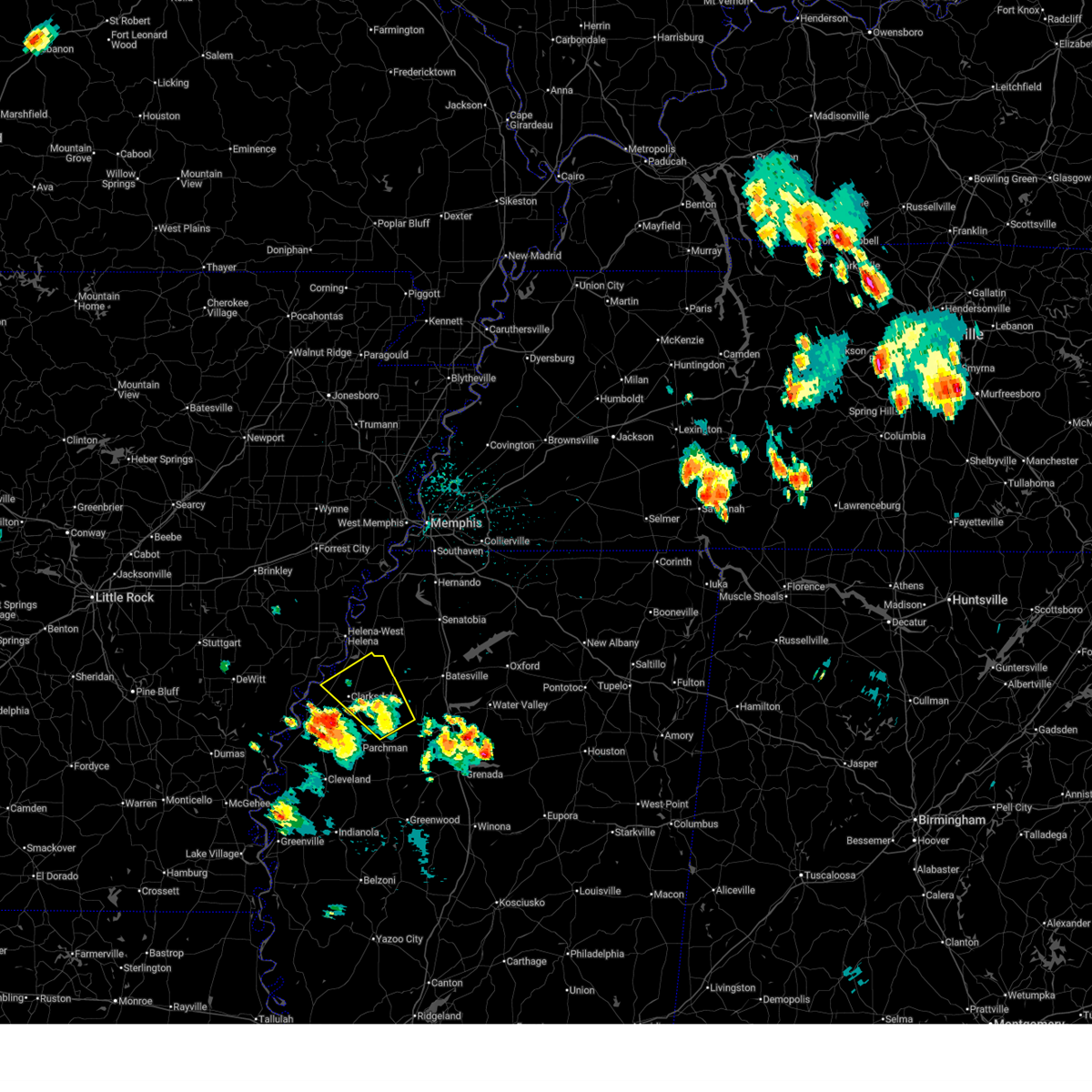 At 419 pm cdt, a severe thunderstorm was located near lambert, or 11 miles east of clarksdale, moving northwest at 25 mph (radar indicated). Hazards include 60 mph wind gusts and quarter size hail. Hail damage to vehicles is expected. expect wind damage to roofs, siding, and trees. Locations impacted include, clarksdale, tutwiler, marks, lambert, jonestown, sumner, belen, dublin, vance, kings, coahoma, lyon, mattson, rudyard, barksdale, denton, beverly, sabino, clover hill, and brazil. At 419 pm cdt, a severe thunderstorm was located near lambert, or 11 miles east of clarksdale, moving northwest at 25 mph (radar indicated). Hazards include 60 mph wind gusts and quarter size hail. Hail damage to vehicles is expected. expect wind damage to roofs, siding, and trees. Locations impacted include, clarksdale, tutwiler, marks, lambert, jonestown, sumner, belen, dublin, vance, kings, coahoma, lyon, mattson, rudyard, barksdale, denton, beverly, sabino, clover hill, and brazil.
|
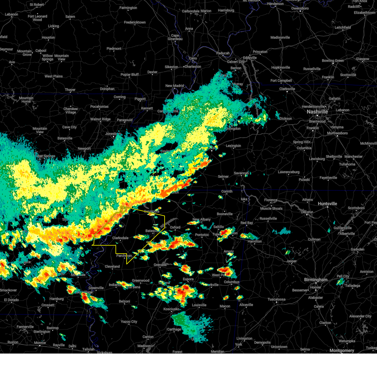
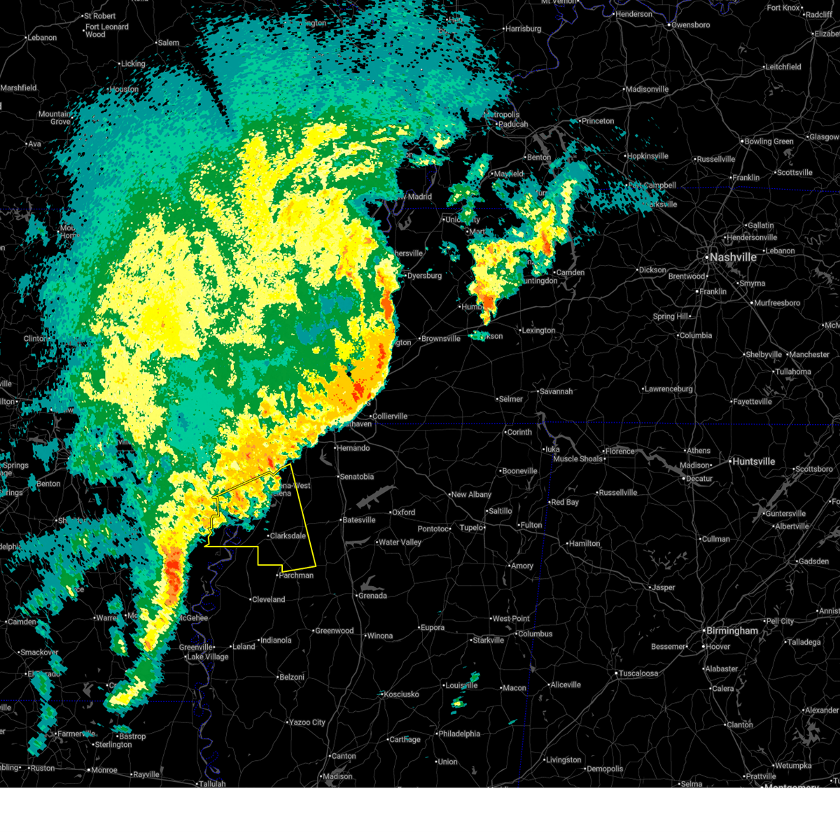
| 7/2/2026 3:58 PM CDT |
 Svrmeg the national weather service in memphis has issued a * severe thunderstorm warning for, southeastern coahoma county in northwestern mississippi, northwestern tallahatchie county in northwestern mississippi, quitman county in northwestern mississippi, * until 445 pm cdt. * at 358 pm cdt, a severe thunderstorm was located over vance, or 15 miles west of charleston, moving northwest at 25 mph (radar indicated). Hazards include 60 mph wind gusts and quarter size hail. Hail damage to vehicles is expected. Expect wind damage to roofs, siding, and trees. Svrmeg the national weather service in memphis has issued a * severe thunderstorm warning for, southeastern coahoma county in northwestern mississippi, northwestern tallahatchie county in northwestern mississippi, quitman county in northwestern mississippi, * until 445 pm cdt. * at 358 pm cdt, a severe thunderstorm was located over vance, or 15 miles west of charleston, moving northwest at 25 mph (radar indicated). Hazards include 60 mph wind gusts and quarter size hail. Hail damage to vehicles is expected. Expect wind damage to roofs, siding, and trees.
|
| 6/19/2026 4:31 PM CDT |
 Svrmeg the national weather service in memphis has issued a * severe thunderstorm warning for, southwestern yalobusha county in northwestern mississippi, tallahatchie county in northwestern mississippi, * until 515 pm cdt. * at 431 pm cdt, a severe thunderstorm was located near webb, or 14 miles southwest of charleston, moving east at 35 mph (radar indicated). Hazards include 60 mph wind gusts and quarter size hail. Hail damage to vehicles is expected. Expect wind damage to roofs, siding, and trees. Svrmeg the national weather service in memphis has issued a * severe thunderstorm warning for, southwestern yalobusha county in northwestern mississippi, tallahatchie county in northwestern mississippi, * until 515 pm cdt. * at 431 pm cdt, a severe thunderstorm was located near webb, or 14 miles southwest of charleston, moving east at 35 mph (radar indicated). Hazards include 60 mph wind gusts and quarter size hail. Hail damage to vehicles is expected. Expect wind damage to roofs, siding, and trees.
|
| 3/15/2026 8:36 PM CDT |
 The storms which prompted the warning have moved out of the area. therefore, the warning will be allowed to expire. a tornado watch remains in effect until 1100 pm cdt for northwestern mississippi. remember, a severe thunderstorm warning still remains in effect for portions of quitman, tallahatchie, and panola counties in mississippi. The storms which prompted the warning have moved out of the area. therefore, the warning will be allowed to expire. a tornado watch remains in effect until 1100 pm cdt for northwestern mississippi. remember, a severe thunderstorm warning still remains in effect for portions of quitman, tallahatchie, and panola counties in mississippi.
|
| 3/15/2026 8:33 PM CDT |
 Svrmeg the national weather service in memphis has issued a * severe thunderstorm warning for, lafayette county in northwestern mississippi, yalobusha county in northwestern mississippi, northwestern calhoun county in northeastern mississippi, tallahatchie county in northwestern mississippi, southeastern quitman county in northwestern mississippi, panola county in northwestern mississippi, * until 915 pm cdt. * at 831 pm cdt, severe thunderstorms were located along a line extending from near sardis to near minter city, moving east at 35 mph (radar indicated). Hazards include 60 mph wind gusts and nickel size hail. expect damage to roofs, siding, and trees Svrmeg the national weather service in memphis has issued a * severe thunderstorm warning for, lafayette county in northwestern mississippi, yalobusha county in northwestern mississippi, northwestern calhoun county in northeastern mississippi, tallahatchie county in northwestern mississippi, southeastern quitman county in northwestern mississippi, panola county in northwestern mississippi, * until 915 pm cdt. * at 831 pm cdt, severe thunderstorms were located along a line extending from near sardis to near minter city, moving east at 35 mph (radar indicated). Hazards include 60 mph wind gusts and nickel size hail. expect damage to roofs, siding, and trees
|
| 3/15/2026 8:09 PM CDT |
 the severe thunderstorm warning has been cancelled and is no longer in effect the severe thunderstorm warning has been cancelled and is no longer in effect
|
| 3/15/2026 8:09 PM CDT |
 At 808 pm cdt, severe thunderstorms were located along a line extending from near pleasant grove to near dublin, moving east at 40 mph (radar indicated). Hazards include 60 mph wind gusts and nickel size hail. Expect damage to roofs, siding, and trees. locations impacted include, clarksdale, batesville, john w kyle state park, tutwiler, marks, sardis, lambert, jonestown, friars point, crowder, webb, sledge, sumner, pope, belen, dublin, pleasant grove, curtis station, vance, and darling. This includes interstate 55 in mississippi between mile markers 236 and 252. At 808 pm cdt, severe thunderstorms were located along a line extending from near pleasant grove to near dublin, moving east at 40 mph (radar indicated). Hazards include 60 mph wind gusts and nickel size hail. Expect damage to roofs, siding, and trees. locations impacted include, clarksdale, batesville, john w kyle state park, tutwiler, marks, sardis, lambert, jonestown, friars point, crowder, webb, sledge, sumner, pope, belen, dublin, pleasant grove, curtis station, vance, and darling. This includes interstate 55 in mississippi between mile markers 236 and 252.
|
| 3/15/2026 7:58 PM CDT |
 Svrmeg the national weather service in memphis has issued a * severe thunderstorm warning for, southeastern phillips county in eastern arkansas, coahoma county in northwestern mississippi, south central tunica county in northwestern mississippi, northwestern tallahatchie county in northwestern mississippi, quitman county in northwestern mississippi, central panola county in northwestern mississippi, * until 845 pm cdt. * at 756 pm cdt, severe thunderstorms were located along a line extending from near crenshaw to alligator, moving east at 40 mph (radar indicated). Hazards include 60 mph wind gusts and nickel size hail. expect damage to roofs, siding, and trees Svrmeg the national weather service in memphis has issued a * severe thunderstorm warning for, southeastern phillips county in eastern arkansas, coahoma county in northwestern mississippi, south central tunica county in northwestern mississippi, northwestern tallahatchie county in northwestern mississippi, quitman county in northwestern mississippi, central panola county in northwestern mississippi, * until 845 pm cdt. * at 756 pm cdt, severe thunderstorms were located along a line extending from near crenshaw to alligator, moving east at 40 mph (radar indicated). Hazards include 60 mph wind gusts and nickel size hail. expect damage to roofs, siding, and trees
|
| 9/22/2025 5:13 PM CDT | the severe thunderstorm warning has been cancelled and is no longer in effect |
| 9/22/2025 4:58 PM CDT | At 458 pm cdt, a severe thunderstorm was located near dublin, or 11 miles south of clarksdale, moving northeast at 15 mph (radar indicated). Hazards include 60 mph wind gusts and quarter size hail. Hail damage to vehicles is expected. expect wind damage to roofs, siding, and trees. Locations impacted include, clarksdale, tutwiler, sumner, dublin, vance, lyon, mattson, counts, hopson, bobo, denton, longstreet, beverly, lurand, beaver dam, claremont, and stover. |
| 9/22/2025 4:43 PM CDT | Svrmeg the national weather service in memphis has issued a * severe thunderstorm warning for, southeastern coahoma county in northwestern mississippi, northwestern tallahatchie county in northwestern mississippi, southwestern quitman county in northwestern mississippi, * until 530 pm cdt. * at 442 pm cdt, a severe thunderstorm was located near alligator, or 10 miles northeast of shelby, moving northeast at 10 mph (radar indicated). Hazards include 60 mph wind gusts and quarter size hail. Hail damage to vehicles is expected. Expect wind damage to roofs, siding, and trees. |
| 5/25/2025 7:00 PM CDT |
 At 700 pm cdt, severe thunderstorms were located along a line extending from new albany to near paynes, moving east at 60 mph (radar indicated). Hazards include 70 mph wind gusts and quarter size hail. Hail damage to vehicles is expected. expect considerable tree damage. wind damage is also likely to mobile homes, roofs, and outbuildings. Locations impacted include, shari, robbs, charleston, esperanza, paynes, swan lake, pumpkin center, cambridge, chulahoma, tyson, gums, albin, new harmony, rough edge, glenfield, rosebloom, bryant, altus, bethlehem, and toccopola. At 700 pm cdt, severe thunderstorms were located along a line extending from new albany to near paynes, moving east at 60 mph (radar indicated). Hazards include 70 mph wind gusts and quarter size hail. Hail damage to vehicles is expected. expect considerable tree damage. wind damage is also likely to mobile homes, roofs, and outbuildings. Locations impacted include, shari, robbs, charleston, esperanza, paynes, swan lake, pumpkin center, cambridge, chulahoma, tyson, gums, albin, new harmony, rough edge, glenfield, rosebloom, bryant, altus, bethlehem, and toccopola.
|
| 5/25/2025 6:53 PM CDT |
 At 653 pm cdt, severe thunderstorms were located along a line extending from 6 miles northeast of etta to 7 miles east of webb, moving east at 60 mph (radar indicated). Hazards include 60 mph wind gusts and quarter size hail. Hail damage to vehicles is expected. expect wind damage to roofs, siding, and trees. Locations impacted include, shari, robbs, charleston, esperanza, paynes, swan lake, pumpkin center, cambridge, chulahoma, tyson, gums, albin, new harmony, rough edge, glenfield, rosebloom, bryant, altus, bethlehem, and toccopola. At 653 pm cdt, severe thunderstorms were located along a line extending from 6 miles northeast of etta to 7 miles east of webb, moving east at 60 mph (radar indicated). Hazards include 60 mph wind gusts and quarter size hail. Hail damage to vehicles is expected. expect wind damage to roofs, siding, and trees. Locations impacted include, shari, robbs, charleston, esperanza, paynes, swan lake, pumpkin center, cambridge, chulahoma, tyson, gums, albin, new harmony, rough edge, glenfield, rosebloom, bryant, altus, bethlehem, and toccopola.
|
| 5/25/2025 6:53 PM CDT |
 the severe thunderstorm warning has been cancelled and is no longer in effect the severe thunderstorm warning has been cancelled and is no longer in effect
|
| 5/25/2025 6:33 PM CDT |
 Svrmeg the national weather service in memphis has issued a * severe thunderstorm warning for, lafayette county in northwestern mississippi, yalobusha county in northwestern mississippi, southeastern coahoma county in northwestern mississippi, northern calhoun county in northeastern mississippi, union county in northeastern mississippi, pontotoc county in northeastern mississippi, southern marshall county in northwestern mississippi, southeastern tate county in northwestern mississippi, tallahatchie county in northwestern mississippi, quitman county in northwestern mississippi, panola county in northwestern mississippi, * until 730 pm cdt. * at 632 pm cdt, severe thunderstorms were located along a line extending from near wall doxey state park to near dublin, moving east at 60 mph (radar indicated). Hazards include 60 mph wind gusts and quarter size hail. Hail damage to vehicles is expected. Expect wind damage to roofs, siding, and trees. Svrmeg the national weather service in memphis has issued a * severe thunderstorm warning for, lafayette county in northwestern mississippi, yalobusha county in northwestern mississippi, southeastern coahoma county in northwestern mississippi, northern calhoun county in northeastern mississippi, union county in northeastern mississippi, pontotoc county in northeastern mississippi, southern marshall county in northwestern mississippi, southeastern tate county in northwestern mississippi, tallahatchie county in northwestern mississippi, quitman county in northwestern mississippi, panola county in northwestern mississippi, * until 730 pm cdt. * at 632 pm cdt, severe thunderstorms were located along a line extending from near wall doxey state park to near dublin, moving east at 60 mph (radar indicated). Hazards include 60 mph wind gusts and quarter size hail. Hail damage to vehicles is expected. Expect wind damage to roofs, siding, and trees.
|
| 5/25/2025 6:30 PM CDT |
 At 630 pm cdt, severe thunderstorms were located along a line extending from near como to marks to near dublin, moving east at 50 mph (radar indicated). Hazards include 60 mph wind gusts and quarter size hail. Hail damage to vehicles is expected. expect wind damage to roofs, siding, and trees. Locations impacted include, mattson, rena lara, askew, coahoma, gerlach mill, belen, rudyard, moon, buxton, savage, webb, dublin, senatobia, denton, falcon, beverly, como, glenville, clarksdale, and sabino. At 630 pm cdt, severe thunderstorms were located along a line extending from near como to marks to near dublin, moving east at 50 mph (radar indicated). Hazards include 60 mph wind gusts and quarter size hail. Hail damage to vehicles is expected. expect wind damage to roofs, siding, and trees. Locations impacted include, mattson, rena lara, askew, coahoma, gerlach mill, belen, rudyard, moon, buxton, savage, webb, dublin, senatobia, denton, falcon, beverly, como, glenville, clarksdale, and sabino.
|
| 5/25/2025 6:27 PM CDT |
 the severe thunderstorm warning has been cancelled and is no longer in effect the severe thunderstorm warning has been cancelled and is no longer in effect
|
| 5/25/2025 6:27 PM CDT |
 At 627 pm cdt, severe thunderstorms were located along a line extending from near como to near belen to near dublin, moving east at 50 mph (radar indicated). Hazards include 60 mph wind gusts and quarter size hail. Hail damage to vehicles is expected. expect wind damage to roofs, siding, and trees. Locations impacted include, rena lara, askew, belen, rudyard, moon, savage, senatobia, austin, falcon, como, clarksdale, strayhorn, jonestown, dubbs, lurand, dooley, north tunica, longstreet, clayton, and hinchcliff. At 627 pm cdt, severe thunderstorms were located along a line extending from near como to near belen to near dublin, moving east at 50 mph (radar indicated). Hazards include 60 mph wind gusts and quarter size hail. Hail damage to vehicles is expected. expect wind damage to roofs, siding, and trees. Locations impacted include, rena lara, askew, belen, rudyard, moon, savage, senatobia, austin, falcon, como, clarksdale, strayhorn, jonestown, dubbs, lurand, dooley, north tunica, longstreet, clayton, and hinchcliff.
|
| 5/25/2025 5:55 PM CDT |
 Svrmeg the national weather service in memphis has issued a * severe thunderstorm warning for, phillips county in eastern arkansas, coahoma county in northwestern mississippi, tunica county in northwestern mississippi, southern tate county in northwestern mississippi, northwestern tallahatchie county in northwestern mississippi, quitman county in northwestern mississippi, panola county in northwestern mississippi, * until 645 pm cdt. * at 554 pm cdt, severe thunderstorms were located along a line extending from near tunica to near friars point to near crumrod, moving east at 50 mph (radar indicated). Hazards include 60 mph wind gusts and quarter size hail. Hail damage to vehicles is expected. Expect wind damage to roofs, siding, and trees. Svrmeg the national weather service in memphis has issued a * severe thunderstorm warning for, phillips county in eastern arkansas, coahoma county in northwestern mississippi, tunica county in northwestern mississippi, southern tate county in northwestern mississippi, northwestern tallahatchie county in northwestern mississippi, quitman county in northwestern mississippi, panola county in northwestern mississippi, * until 645 pm cdt. * at 554 pm cdt, severe thunderstorms were located along a line extending from near tunica to near friars point to near crumrod, moving east at 50 mph (radar indicated). Hazards include 60 mph wind gusts and quarter size hail. Hail damage to vehicles is expected. Expect wind damage to roofs, siding, and trees.
|
| 5/17/2025 12:36 AM CDT |
 the severe thunderstorm warning has been cancelled and is no longer in effect the severe thunderstorm warning has been cancelled and is no longer in effect
|
| 5/17/2025 12:36 AM CDT |
 At 1235 am cdt, a severe thunderstorm was located near clarksdale, moving east at 50 mph (radar indicated). Hazards include 60 mph wind gusts and quarter size hail. Hail damage to vehicles is expected. expect wind damage to roofs, siding, and trees. Locations impacted include, mattson, rena lara, belen, counts, barksdale, dublin, denton, marks, darling, kings, beverly, sherard, clarksdale, sabino, clover hill, jonestown, lurand, beaver dam, essex, and farrell. At 1235 am cdt, a severe thunderstorm was located near clarksdale, moving east at 50 mph (radar indicated). Hazards include 60 mph wind gusts and quarter size hail. Hail damage to vehicles is expected. expect wind damage to roofs, siding, and trees. Locations impacted include, mattson, rena lara, belen, counts, barksdale, dublin, denton, marks, darling, kings, beverly, sherard, clarksdale, sabino, clover hill, jonestown, lurand, beaver dam, essex, and farrell.
|
| 5/17/2025 12:21 AM CDT |
 At 1221 am cdt, a severe thunderstorm was located over sherard, or near clarksdale, moving east at 55 mph (radar indicated). Hazards include 60 mph wind gusts and quarter size hail. Hail damage to vehicles is expected. expect wind damage to roofs, siding, and trees. Locations impacted include, mattson, rena lara, mosby spur, ferguson, belen, counts, rudyard, barksdale, modoc, dublin, denton, hoop spur, marks, darling, kings, beverly, sherard, clarksdale, sabino, and clover hill. At 1221 am cdt, a severe thunderstorm was located over sherard, or near clarksdale, moving east at 55 mph (radar indicated). Hazards include 60 mph wind gusts and quarter size hail. Hail damage to vehicles is expected. expect wind damage to roofs, siding, and trees. Locations impacted include, mattson, rena lara, mosby spur, ferguson, belen, counts, rudyard, barksdale, modoc, dublin, denton, hoop spur, marks, darling, kings, beverly, sherard, clarksdale, sabino, and clover hill.
|
| 5/16/2025 11:57 PM CDT |
 Svrmeg the national weather service in memphis has issued a * severe thunderstorm warning for, southern phillips county in eastern arkansas, coahoma county in northwestern mississippi, northwestern tallahatchie county in northwestern mississippi, southern quitman county in northwestern mississippi, * until 100 am cdt. * at 1156 pm cdt, a severe thunderstorm was located near white river national wildlife refuge, moving east at 50 mph (radar indicated). Hazards include ping pong ball size hail and 60 mph wind gusts. People and animals outdoors will be injured. expect hail damage to roofs, siding, windows, and vehicles. Expect wind damage to roofs, siding, and trees. Svrmeg the national weather service in memphis has issued a * severe thunderstorm warning for, southern phillips county in eastern arkansas, coahoma county in northwestern mississippi, northwestern tallahatchie county in northwestern mississippi, southern quitman county in northwestern mississippi, * until 100 am cdt. * at 1156 pm cdt, a severe thunderstorm was located near white river national wildlife refuge, moving east at 50 mph (radar indicated). Hazards include ping pong ball size hail and 60 mph wind gusts. People and animals outdoors will be injured. expect hail damage to roofs, siding, windows, and vehicles. Expect wind damage to roofs, siding, and trees.
|
| 5/2/2025 12:12 PM CDT |
 At 1212 pm cdt, severe thunderstorms were located along a line extending from near meeman shelby forest state park to near lewisburg to near enid, moving east at 55 mph (radar indicated). Hazards include 60 mph wind gusts and quarter size hail. Hail damage to vehicles is expected. expect wind damage to roofs, siding, and trees. Locations impacted include, charleston, askew, belen, enid, buxton, denton, oakland, falcon, como, glenville, sabino, pleasant grove, brazil, curtis station, george payne state park, riverview, longstreet, hinchcliff, lambert, and courtland. At 1212 pm cdt, severe thunderstorms were located along a line extending from near meeman shelby forest state park to near lewisburg to near enid, moving east at 55 mph (radar indicated). Hazards include 60 mph wind gusts and quarter size hail. Hail damage to vehicles is expected. expect wind damage to roofs, siding, and trees. Locations impacted include, charleston, askew, belen, enid, buxton, denton, oakland, falcon, como, glenville, sabino, pleasant grove, brazil, curtis station, george payne state park, riverview, longstreet, hinchcliff, lambert, and courtland.
|
| 5/2/2025 12:12 PM CDT |
 the severe thunderstorm warning has been cancelled and is no longer in effect the severe thunderstorm warning has been cancelled and is no longer in effect
|
| 5/2/2025 11:53 AM CDT |
 the severe thunderstorm warning has been cancelled and is no longer in effect the severe thunderstorm warning has been cancelled and is no longer in effect
|
| 5/2/2025 11:53 AM CDT |
 At 1153 am cdt, severe thunderstorms were located along a line extending from near joiner to hernando to near crowder, moving east at 45 mph (radar indicated). Hazards include 60 mph wind gusts and quarter size hail. Hail damage to vehicles is expected. expect wind damage to roofs, siding, and trees. Locations impacted include, three forks, charleston, horn lake, louise, austin, bright, falcon, edmondson, strayhorn, prichard, presidents island, beck, dubbs, glover, locke, arlington, elmore park, alden, dooley, and north tunica. At 1153 am cdt, severe thunderstorms were located along a line extending from near joiner to hernando to near crowder, moving east at 45 mph (radar indicated). Hazards include 60 mph wind gusts and quarter size hail. Hail damage to vehicles is expected. expect wind damage to roofs, siding, and trees. Locations impacted include, three forks, charleston, horn lake, louise, austin, bright, falcon, edmondson, strayhorn, prichard, presidents island, beck, dubbs, glover, locke, arlington, elmore park, alden, dooley, and north tunica.
|
| 5/2/2025 11:26 AM CDT |
 Svrmeg the national weather service in memphis has issued a * severe thunderstorm warning for, northeastern st. francis county in eastern arkansas, crittenden county in eastern arkansas, northeastern cross county in eastern arkansas, desoto county in northwestern mississippi, northwestern yalobusha county in northwestern mississippi, eastern coahoma county in northwestern mississippi, tunica county in northwestern mississippi, tate county in northwestern mississippi, northern tallahatchie county in northwestern mississippi, quitman county in northwestern mississippi, panola county in northwestern mississippi, shelby county in west tennessee, * until 1230 pm cdt. * at 1126 am cdt, severe thunderstorms were located along a line extending from near tyronza to robinsonville to dublin, moving east at 45 mph (radar indicated). Hazards include 60 mph wind gusts and quarter size hail. Hail damage to vehicles is expected. Expect wind damage to roofs, siding, and trees. Svrmeg the national weather service in memphis has issued a * severe thunderstorm warning for, northeastern st. francis county in eastern arkansas, crittenden county in eastern arkansas, northeastern cross county in eastern arkansas, desoto county in northwestern mississippi, northwestern yalobusha county in northwestern mississippi, eastern coahoma county in northwestern mississippi, tunica county in northwestern mississippi, tate county in northwestern mississippi, northern tallahatchie county in northwestern mississippi, quitman county in northwestern mississippi, panola county in northwestern mississippi, shelby county in west tennessee, * until 1230 pm cdt. * at 1126 am cdt, severe thunderstorms were located along a line extending from near tyronza to robinsonville to dublin, moving east at 45 mph (radar indicated). Hazards include 60 mph wind gusts and quarter size hail. Hail damage to vehicles is expected. Expect wind damage to roofs, siding, and trees.
|
| 4/5/2025 4:48 PM CDT |
 the severe thunderstorm warning has been cancelled and is no longer in effect the severe thunderstorm warning has been cancelled and is no longer in effect
|
| 4/5/2025 4:48 PM CDT |
 At 448 pm cdt, a severe thunderstorm was located near webb, or 14 miles west of charleston, moving northeast at 45 mph (radar indicated). Hazards include 60 mph wind gusts and quarter size hail. Hail damage to vehicles is expected. expect wind damage to roofs, siding, and trees. Locations impacted include, charleston, glendora, distall, enid, webb, paynes, swan lake, denton, vance, sumner, brazil, beaver dam, albin, effie, rosebloom, crowder, cascilla, mikoma, tippo, and stover. At 448 pm cdt, a severe thunderstorm was located near webb, or 14 miles west of charleston, moving northeast at 45 mph (radar indicated). Hazards include 60 mph wind gusts and quarter size hail. Hail damage to vehicles is expected. expect wind damage to roofs, siding, and trees. Locations impacted include, charleston, glendora, distall, enid, webb, paynes, swan lake, denton, vance, sumner, brazil, beaver dam, albin, effie, rosebloom, crowder, cascilla, mikoma, tippo, and stover.
|
| 4/5/2025 4:38 PM CDT |
 Svrmeg the national weather service in memphis has issued a * severe thunderstorm warning for, southeastern coahoma county in northwestern mississippi, tallahatchie county in northwestern mississippi, southern quitman county in northwestern mississippi, southwestern panola county in northwestern mississippi, * until 530 pm cdt. * at 438 pm cdt, a severe thunderstorm was located near webb, or 14 miles northeast of ruleville, moving northeast at 40 mph (radar indicated). Hazards include 60 mph wind gusts and quarter size hail. Hail damage to vehicles is expected. Expect wind damage to roofs, siding, and trees. Svrmeg the national weather service in memphis has issued a * severe thunderstorm warning for, southeastern coahoma county in northwestern mississippi, tallahatchie county in northwestern mississippi, southern quitman county in northwestern mississippi, southwestern panola county in northwestern mississippi, * until 530 pm cdt. * at 438 pm cdt, a severe thunderstorm was located near webb, or 14 miles northeast of ruleville, moving northeast at 40 mph (radar indicated). Hazards include 60 mph wind gusts and quarter size hail. Hail damage to vehicles is expected. Expect wind damage to roofs, siding, and trees.
|
| 4/5/2025 3:30 PM CDT |
 Svrmeg the national weather service in memphis has issued a * severe thunderstorm warning for, southeastern lee county in eastern arkansas, northeastern phillips county in eastern arkansas, coahoma county in northwestern mississippi, tunica county in northwestern mississippi, southwestern tate county in northwestern mississippi, northwestern tallahatchie county in northwestern mississippi, quitman county in northwestern mississippi, western panola county in northwestern mississippi, * until 430 pm cdt. * at 330 pm cdt, a severe thunderstorm was located near dundee, or 7 miles east of helena-west helena, moving northeast at 50 mph (radar indicated). Hazards include 60 mph wind gusts and quarter size hail. Hail damage to vehicles is expected. Expect wind damage to roofs, siding, and trees. Svrmeg the national weather service in memphis has issued a * severe thunderstorm warning for, southeastern lee county in eastern arkansas, northeastern phillips county in eastern arkansas, coahoma county in northwestern mississippi, tunica county in northwestern mississippi, southwestern tate county in northwestern mississippi, northwestern tallahatchie county in northwestern mississippi, quitman county in northwestern mississippi, western panola county in northwestern mississippi, * until 430 pm cdt. * at 330 pm cdt, a severe thunderstorm was located near dundee, or 7 miles east of helena-west helena, moving northeast at 50 mph (radar indicated). Hazards include 60 mph wind gusts and quarter size hail. Hail damage to vehicles is expected. Expect wind damage to roofs, siding, and trees.
|
| 4/5/2025 2:52 PM CDT |
 At 251 pm cdt, a severe thunderstorm was located 7 miles east of crumrod, or 8 miles south of elaine, moving northeast at 55 mph (radar indicated). Hazards include 60 mph wind gusts and quarter size hail. Hail damage to vehicles is expected. expect wind damage to roofs, siding, and trees. Locations impacted include, mattson, tunica, rena lara, coahoma, gerlach mill, mosby spur, ferguson, belen, rudyard, moon, helena-west helena, preston place, dublin, quarles, denton, austin, hoop spur, westover, beverly, and clarksdale. At 251 pm cdt, a severe thunderstorm was located 7 miles east of crumrod, or 8 miles south of elaine, moving northeast at 55 mph (radar indicated). Hazards include 60 mph wind gusts and quarter size hail. Hail damage to vehicles is expected. expect wind damage to roofs, siding, and trees. Locations impacted include, mattson, tunica, rena lara, coahoma, gerlach mill, mosby spur, ferguson, belen, rudyard, moon, helena-west helena, preston place, dublin, quarles, denton, austin, hoop spur, westover, beverly, and clarksdale.
|
| 4/5/2025 2:49 PM CDT |
 At 249 pm cdt, a severe thunderstorm was located near crumrod, or 10 miles east of white river national wildlife refuge, moving northeast at 55 mph (radar indicated). Hazards include 60 mph wind gusts and quarter size hail. Hail damage to vehicles is expected. expect wind damage to roofs, siding, and trees. Locations impacted include, mattson, tunica, rena lara, coahoma, gerlach mill, mosby spur, ferguson, belen, rudyard, moon, helena-west helena, preston place, dublin, quarles, denton, austin, hoop spur, westover, beverly, and clarksdale. At 249 pm cdt, a severe thunderstorm was located near crumrod, or 10 miles east of white river national wildlife refuge, moving northeast at 55 mph (radar indicated). Hazards include 60 mph wind gusts and quarter size hail. Hail damage to vehicles is expected. expect wind damage to roofs, siding, and trees. Locations impacted include, mattson, tunica, rena lara, coahoma, gerlach mill, mosby spur, ferguson, belen, rudyard, moon, helena-west helena, preston place, dublin, quarles, denton, austin, hoop spur, westover, beverly, and clarksdale.
|
| 4/5/2025 2:26 PM CDT |
 Svrmeg the national weather service in memphis has issued a * severe thunderstorm warning for, phillips county in eastern arkansas, coahoma county in northwestern mississippi, southwestern tunica county in northwestern mississippi, northwestern tallahatchie county in northwestern mississippi, quitman county in northwestern mississippi, * until 330 pm cdt. * at 226 pm cdt, a severe thunderstorm was located over trusten holder wma, or 9 miles northeast of pea ridge, moving northeast at 55 mph (radar indicated). Hazards include 60 mph wind gusts and quarter size hail. Hail damage to vehicles is expected. Expect wind damage to roofs, siding, and trees. Svrmeg the national weather service in memphis has issued a * severe thunderstorm warning for, phillips county in eastern arkansas, coahoma county in northwestern mississippi, southwestern tunica county in northwestern mississippi, northwestern tallahatchie county in northwestern mississippi, quitman county in northwestern mississippi, * until 330 pm cdt. * at 226 pm cdt, a severe thunderstorm was located over trusten holder wma, or 9 miles northeast of pea ridge, moving northeast at 55 mph (radar indicated). Hazards include 60 mph wind gusts and quarter size hail. Hail damage to vehicles is expected. Expect wind damage to roofs, siding, and trees.
|
| 3/15/2025 10:28 AM CDT |
 At 1028 am cdt, a severe thunderstorm was located over vance, or 14 miles west of charleston, moving north at 55 mph (radar indicated). Hazards include ping pong ball size hail and 60 mph wind gusts. People and animals outdoors will be injured. expect hail damage to roofs, siding, windows, and vehicles. expect wind damage to roofs, siding, and trees. Locations impacted include, charleston, glendora, belen, distall, enid, mims, webb, paynes, swan lake, denton, marks, vance, falcon, darling, asa, crenshaw, pleasant grove, sumner, brazil, and beaver dam. At 1028 am cdt, a severe thunderstorm was located over vance, or 14 miles west of charleston, moving north at 55 mph (radar indicated). Hazards include ping pong ball size hail and 60 mph wind gusts. People and animals outdoors will be injured. expect hail damage to roofs, siding, windows, and vehicles. expect wind damage to roofs, siding, and trees. Locations impacted include, charleston, glendora, belen, distall, enid, mims, webb, paynes, swan lake, denton, marks, vance, falcon, darling, asa, crenshaw, pleasant grove, sumner, brazil, and beaver dam.
|
| 3/15/2025 10:15 AM CDT |
 Svrmeg the national weather service in memphis has issued a * severe thunderstorm warning for, tallahatchie county in northwestern mississippi, quitman county in northwestern mississippi, central panola county in northwestern mississippi, * until 1100 am cdt. * at 1015 am cdt, a severe thunderstorm was located near webb, or 13 miles northeast of ruleville, moving northeast at 55 mph (radar indicated). Hazards include 60 mph wind gusts. expect damage to roofs, siding, and trees Svrmeg the national weather service in memphis has issued a * severe thunderstorm warning for, tallahatchie county in northwestern mississippi, quitman county in northwestern mississippi, central panola county in northwestern mississippi, * until 1100 am cdt. * at 1015 am cdt, a severe thunderstorm was located near webb, or 13 miles northeast of ruleville, moving northeast at 55 mph (radar indicated). Hazards include 60 mph wind gusts. expect damage to roofs, siding, and trees
|
| 3/15/2025 7:11 AM CDT |
 Svrmeg the national weather service in memphis has issued a * severe thunderstorm warning for, central phillips county in eastern arkansas, northwestern lafayette county in northwestern mississippi, southwestern desoto county in northwestern mississippi, coahoma county in northwestern mississippi, tunica county in northwestern mississippi, tate county in northwestern mississippi, northwestern tallahatchie county in northwestern mississippi, quitman county in northwestern mississippi, panola county in northwestern mississippi, * until 800 am cdt. * at 710 am cdt, a cluster of severe thunderstorms was located 7 miles northwest of darling, or 16 miles southeast of helena-west helena, moving northeast at 50 mph (radar indicated). Hazards include 60 mph wind gusts and quarter size hail. Hail damage to vehicles is expected. Expect wind damage to roofs, siding, and trees. Svrmeg the national weather service in memphis has issued a * severe thunderstorm warning for, central phillips county in eastern arkansas, northwestern lafayette county in northwestern mississippi, southwestern desoto county in northwestern mississippi, coahoma county in northwestern mississippi, tunica county in northwestern mississippi, tate county in northwestern mississippi, northwestern tallahatchie county in northwestern mississippi, quitman county in northwestern mississippi, panola county in northwestern mississippi, * until 800 am cdt. * at 710 am cdt, a cluster of severe thunderstorms was located 7 miles northwest of darling, or 16 miles southeast of helena-west helena, moving northeast at 50 mph (radar indicated). Hazards include 60 mph wind gusts and quarter size hail. Hail damage to vehicles is expected. Expect wind damage to roofs, siding, and trees.
|
| 3/15/2025 6:48 AM CDT |
 Svrmeg the national weather service in memphis has issued a * severe thunderstorm warning for, southeastern phillips county in eastern arkansas, west central lafayette county in northwestern mississippi, south central desoto county in northwestern mississippi, coahoma county in northwestern mississippi, southern tunica county in northwestern mississippi, western tate county in northwestern mississippi, northern tallahatchie county in northwestern mississippi, quitman county in northwestern mississippi, panola county in northwestern mississippi, * until 730 am cdt. * at 647 am cdt, a cluster of severe thunderstorms were located near batesville, moving northeast at 60 mph (radar indicated). Hazards include 60 mph wind gusts and quarter size hail. Hail damage to vehicles is expected. Expect wind damage to roofs, siding, and trees. Svrmeg the national weather service in memphis has issued a * severe thunderstorm warning for, southeastern phillips county in eastern arkansas, west central lafayette county in northwestern mississippi, south central desoto county in northwestern mississippi, coahoma county in northwestern mississippi, southern tunica county in northwestern mississippi, western tate county in northwestern mississippi, northern tallahatchie county in northwestern mississippi, quitman county in northwestern mississippi, panola county in northwestern mississippi, * until 730 am cdt. * at 647 am cdt, a cluster of severe thunderstorms were located near batesville, moving northeast at 60 mph (radar indicated). Hazards include 60 mph wind gusts and quarter size hail. Hail damage to vehicles is expected. Expect wind damage to roofs, siding, and trees.
|
| 1/12/2024 7:40 AM CST |
 The severe thunderstorm warning for northwestern yalobusha, northern tallahatchie, southeastern quitman and southern panola counties will expire at 745 am cst, the storm which prompted the warning has weakened below severe limits, and no longer poses an immediate threat to life or property. therefore, the warning will be allowed to expire. however, gusty winds are still possible with this thunderstorm. a tornado watch remains in effect until 1100 am cst for northwestern mississippi. The severe thunderstorm warning for northwestern yalobusha, northern tallahatchie, southeastern quitman and southern panola counties will expire at 745 am cst, the storm which prompted the warning has weakened below severe limits, and no longer poses an immediate threat to life or property. therefore, the warning will be allowed to expire. however, gusty winds are still possible with this thunderstorm. a tornado watch remains in effect until 1100 am cst for northwestern mississippi.
|
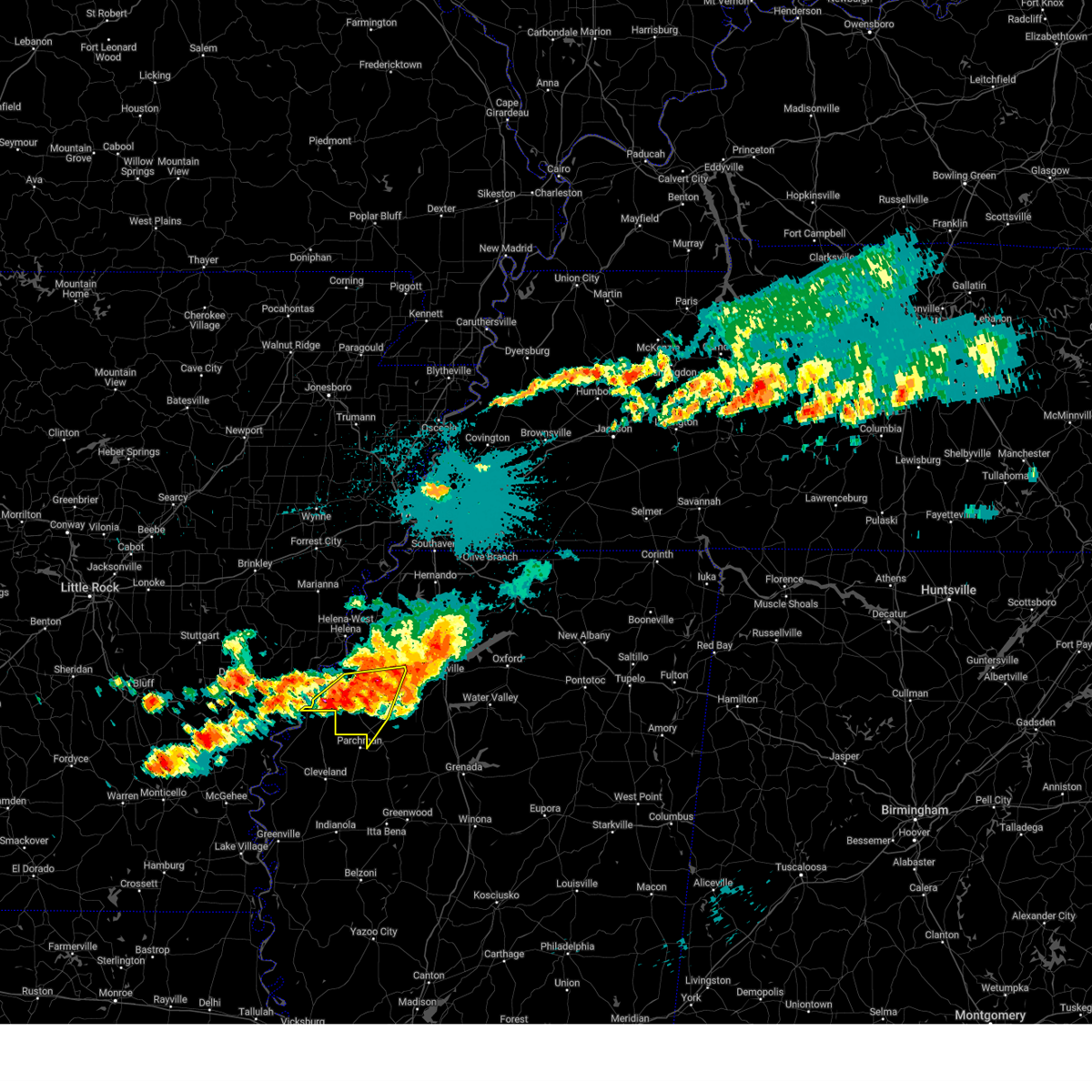
| 1/12/2024 7:02 AM CST |
 At 701 am cst, a severe thunderstorm was located over parchman, or 10 miles north of ruleville, moving northeast at 60 mph (radar indicated). Hazards include 70 mph wind gusts. Expect considerable tree damage. Damage is likely to mobile homes, roofs, and outbuildings. At 701 am cst, a severe thunderstorm was located over parchman, or 10 miles north of ruleville, moving northeast at 60 mph (radar indicated). Hazards include 70 mph wind gusts. Expect considerable tree damage. Damage is likely to mobile homes, roofs, and outbuildings.
|
| 7/14/2023 7:34 PM CDT |
 At 733 pm cdt, a severe thunderstorm was located over rome, or 15 miles north of ruleville, moving southeast at 20 mph (radar indicated). Hazards include 60 mph wind gusts and quarter size hail. Hail damage to vehicles is expected. Expect wind damage to roofs, siding, and trees. At 733 pm cdt, a severe thunderstorm was located over rome, or 15 miles north of ruleville, moving southeast at 20 mph (radar indicated). Hazards include 60 mph wind gusts and quarter size hail. Hail damage to vehicles is expected. Expect wind damage to roofs, siding, and trees.
|
| 6/25/2023 8:39 PM CDT |
 The severe thunderstorm warning for southeastern coahoma, tallahatchie and southern quitman counties will expire at 845 pm cdt, the storm which prompted the warning has moved out of the area. therefore, the warning will be allowed to expire. a severe thunderstorm watch remains in effect until midnight cdt for northwestern mississippi. The severe thunderstorm warning for southeastern coahoma, tallahatchie and southern quitman counties will expire at 845 pm cdt, the storm which prompted the warning has moved out of the area. therefore, the warning will be allowed to expire. a severe thunderstorm watch remains in effect until midnight cdt for northwestern mississippi.
|
| 6/25/2023 7:57 PM CDT |
 At 757 pm cdt, a severe thunderstorm was located over dublin, or 9 miles south of clarksdale, moving southeast at 50 mph (radar indicated). Hazards include 60 mph wind gusts and quarter size hail. Hail damage to vehicles is expected. Expect wind damage to roofs, siding, and trees. At 757 pm cdt, a severe thunderstorm was located over dublin, or 9 miles south of clarksdale, moving southeast at 50 mph (radar indicated). Hazards include 60 mph wind gusts and quarter size hail. Hail damage to vehicles is expected. Expect wind damage to roofs, siding, and trees.
|
| 6/14/2023 10:14 AM CDT |
 At 1014 am cdt, a severe thunderstorm was located near paynes, or 11 miles south of charleston, moving southeast at 60 mph (radar indicated). Hazards include 60 mph wind gusts and quarter size hail. Hail damage to vehicles is expected. expect wind damage to roofs, siding, and trees. locations impacted include, charleston, tutwiler, webb, sumner, paynes, scobey, enid, sunnyside, oakland, glendora, distall, swan lake, brazil, albin, effie, rosebloom, bryant, cascilla, mikoma and tippo. hail threat, radar indicated max hail size, 1. 00 in wind threat, radar indicated max wind gust, 60 mph. At 1014 am cdt, a severe thunderstorm was located near paynes, or 11 miles south of charleston, moving southeast at 60 mph (radar indicated). Hazards include 60 mph wind gusts and quarter size hail. Hail damage to vehicles is expected. expect wind damage to roofs, siding, and trees. locations impacted include, charleston, tutwiler, webb, sumner, paynes, scobey, enid, sunnyside, oakland, glendora, distall, swan lake, brazil, albin, effie, rosebloom, bryant, cascilla, mikoma and tippo. hail threat, radar indicated max hail size, 1. 00 in wind threat, radar indicated max wind gust, 60 mph.
|
| 6/14/2023 9:54 AM CDT |
 The severe thunderstorm warning for southeastern coahoma and southwestern tallahatchie counties will expire at 1000 am cdt, the storm which prompted the warning has moved out of the area. therefore, the warning will be allowed to expire. a severe thunderstorm watch remains in effect until 200 pm cdt for northwestern mississippi. The severe thunderstorm warning for southeastern coahoma and southwestern tallahatchie counties will expire at 1000 am cdt, the storm which prompted the warning has moved out of the area. therefore, the warning will be allowed to expire. a severe thunderstorm watch remains in effect until 200 pm cdt for northwestern mississippi.
|
| 6/14/2023 9:54 AM CDT |
 At 952 am cdt, a severe thunderstorm was located over vance, or 14 miles west of charleston, moving southeast at 60 mph (radar indicated). Hazards include 60 mph wind gusts and quarter size hail. Hail damage to vehicles is expected. Expect wind damage to roofs, siding, and trees. At 952 am cdt, a severe thunderstorm was located over vance, or 14 miles west of charleston, moving southeast at 60 mph (radar indicated). Hazards include 60 mph wind gusts and quarter size hail. Hail damage to vehicles is expected. Expect wind damage to roofs, siding, and trees.
|
| 6/14/2023 9:25 AM CDT |
 At 925 am cdt, a severe thunderstorm was located over alligator, or 9 miles southwest of clarksdale, moving southeast at 45 mph (radar indicated). Hazards include 60 mph wind gusts and quarter size hail. Hail damage to vehicles is expected. Expect wind damage to roofs, siding, and trees. At 925 am cdt, a severe thunderstorm was located over alligator, or 9 miles southwest of clarksdale, moving southeast at 45 mph (radar indicated). Hazards include 60 mph wind gusts and quarter size hail. Hail damage to vehicles is expected. Expect wind damage to roofs, siding, and trees.
|
| 1/3/2023 7:07 AM CST |
 The severe thunderstorm warning for southeastern coahoma, northwestern tallahatchie, quitman and southwestern panola counties will expire at 715 am cst, the storm which prompted the warning has weakened below severe limits, and no longer poses an immediate threat to life or property. therefore, the warning will be allowed to expire. a tornado watch remains in effect until 1100 am cst for northwestern mississippi. The severe thunderstorm warning for southeastern coahoma, northwestern tallahatchie, quitman and southwestern panola counties will expire at 715 am cst, the storm which prompted the warning has weakened below severe limits, and no longer poses an immediate threat to life or property. therefore, the warning will be allowed to expire. a tornado watch remains in effect until 1100 am cst for northwestern mississippi.
|
| 1/3/2023 6:45 AM CST |
 At 645 am cst, a severe thunderstorm was located 7 miles east of shelby, moving northeast at 60 mph (public). Hazards include 70 mph wind gusts. Expect considerable tree damage. Damage is likely to mobile homes, roofs, and outbuildings. At 645 am cst, a severe thunderstorm was located 7 miles east of shelby, moving northeast at 60 mph (public). Hazards include 70 mph wind gusts. Expect considerable tree damage. Damage is likely to mobile homes, roofs, and outbuildings.
|
| 10/12/2022 4:30 PM CDT | Half Dollar sized hail reported 7.4 miles NNE of Tutwiler, MS, half dollar sized hail reported near parchman. reported via social media. |
| 10/12/2022 4:05 PM CDT |
 At 404 pm cdt, a severe thunderstorm was located near shelby, moving east at 45 mph (radar indicated). Hazards include half dollar size hail. damage to vehicles is expected At 404 pm cdt, a severe thunderstorm was located near shelby, moving east at 45 mph (radar indicated). Hazards include half dollar size hail. damage to vehicles is expected
|
| 7/13/2022 2:40 PM CDT |
 At 240 pm cdt, a severe thunderstorm was located over dublin, or 8 miles southeast of clarksdale, moving southeast at 15 mph (radar indicated). Hazards include 60 mph wind gusts. Expect damage to roofs, siding, and trees. locations impacted include, clarksdale, tutwiler, webb, sumner, dublin, vance, mattson, counts, hopson, mikoma, stover, waverly, lurand, brazil, beaver dam, albin and claremont. hail threat, radar indicated max hail size, <. 75 in wind threat, radar indicated max wind gust, 60 mph. At 240 pm cdt, a severe thunderstorm was located over dublin, or 8 miles southeast of clarksdale, moving southeast at 15 mph (radar indicated). Hazards include 60 mph wind gusts. Expect damage to roofs, siding, and trees. locations impacted include, clarksdale, tutwiler, webb, sumner, dublin, vance, mattson, counts, hopson, mikoma, stover, waverly, lurand, brazil, beaver dam, albin and claremont. hail threat, radar indicated max hail size, <. 75 in wind threat, radar indicated max wind gust, 60 mph.
|
| 7/13/2022 2:18 PM CDT |
 At 217 pm cdt, a severe thunderstorm was located near clarksdale, moving southeast at 15 mph (radar indicated). Hazards include 60 mph wind gusts and penny size hail. expect damage to roofs, siding, and trees At 217 pm cdt, a severe thunderstorm was located near clarksdale, moving southeast at 15 mph (radar indicated). Hazards include 60 mph wind gusts and penny size hail. expect damage to roofs, siding, and trees
|
| 5/15/2022 6:36 PM CDT |
 The severe thunderstorm warning for coahoma, northwestern tallahatchie and quitman counties will expire at 645 pm cdt, the storms which prompted the warning have weakened below severe limits, and no longer pose an immediate threat to life or property. therefore, the warning will be allowed to expire. however gusty winds are still possible with these thunderstorms. a severe thunderstorm watch remains in effect until 900 pm cdt for eastern arkansas, and northwestern mississippi. The severe thunderstorm warning for coahoma, northwestern tallahatchie and quitman counties will expire at 645 pm cdt, the storms which prompted the warning have weakened below severe limits, and no longer pose an immediate threat to life or property. therefore, the warning will be allowed to expire. however gusty winds are still possible with these thunderstorms. a severe thunderstorm watch remains in effect until 900 pm cdt for eastern arkansas, and northwestern mississippi.
|
| 5/15/2022 6:23 PM CDT |
 At 622 pm cdt, severe thunderstorms were located along a line extending from 6 miles west of sledge to 6 miles southwest of belen to 7 miles northeast of shelby, moving southeast at 35 mph (radar indicated). Hazards include 60 mph wind gusts and quarter size hail. Hail damage to vehicles is expected. expect wind damage to roofs, siding, and trees. locations impacted include, clarksdale, tutwiler, marks, lambert, jonestown, friars point, webb, sledge, sumner, belen, dublin, vance, darling, kings, sherard, coahoma, lyon, lula, falcon and mattson. hail threat, radar indicated max hail size, 1. 00 in wind threat, radar indicated max wind gust, 60 mph. At 622 pm cdt, severe thunderstorms were located along a line extending from 6 miles west of sledge to 6 miles southwest of belen to 7 miles northeast of shelby, moving southeast at 35 mph (radar indicated). Hazards include 60 mph wind gusts and quarter size hail. Hail damage to vehicles is expected. expect wind damage to roofs, siding, and trees. locations impacted include, clarksdale, tutwiler, marks, lambert, jonestown, friars point, webb, sledge, sumner, belen, dublin, vance, darling, kings, sherard, coahoma, lyon, lula, falcon and mattson. hail threat, radar indicated max hail size, 1. 00 in wind threat, radar indicated max wind gust, 60 mph.
|
| 5/15/2022 5:59 PM CDT |
 At 558 pm cdt, severe thunderstorms were located along a line extending from near helena-west helena to near kings to near crumrod, moving southeast at 50 mph (radar indicated). Hazards include 60 mph wind gusts and quarter size hail. Hail damage to vehicles is expected. expect wind damage to roofs, siding, and trees. locations impacted include, clarksdale, marvell, elaine, helena-west helena, white river national wildlife refuge, st francis national park, tutwiler, marks, lambert, jonestown, friars point, webb, sledge, sumner, lexa, belen, dublin, dubbs, dundee and watkins corner. hail threat, radar indicated max hail size, 1. 00 in wind threat, radar indicated max wind gust, 60 mph. At 558 pm cdt, severe thunderstorms were located along a line extending from near helena-west helena to near kings to near crumrod, moving southeast at 50 mph (radar indicated). Hazards include 60 mph wind gusts and quarter size hail. Hail damage to vehicles is expected. expect wind damage to roofs, siding, and trees. locations impacted include, clarksdale, marvell, elaine, helena-west helena, white river national wildlife refuge, st francis national park, tutwiler, marks, lambert, jonestown, friars point, webb, sledge, sumner, lexa, belen, dublin, dubbs, dundee and watkins corner. hail threat, radar indicated max hail size, 1. 00 in wind threat, radar indicated max wind gust, 60 mph.
|
| 5/15/2022 5:44 PM CDT |
 At 544 pm cdt, severe thunderstorms were located along a line extending from near st francis national park to 6 miles southwest of elaine, moving southeast at 45 mph (radar indicated). Hazards include 60 mph wind gusts and quarter size hail. Hail damage to vehicles is expected. Expect wind damage to roofs, siding, and trees. At 544 pm cdt, severe thunderstorms were located along a line extending from near st francis national park to 6 miles southwest of elaine, moving southeast at 45 mph (radar indicated). Hazards include 60 mph wind gusts and quarter size hail. Hail damage to vehicles is expected. Expect wind damage to roofs, siding, and trees.
|
| 4/13/2022 5:28 PM CDT |
 At 528 pm cdt, severe thunderstorms were located along a line extending from near pleasant grove to near lambert to 6 miles northwest of rome, moving east at 40 mph (radar indicated). Hazards include 60 mph wind gusts. expect damage to roofs, siding, and trees At 528 pm cdt, severe thunderstorms were located along a line extending from near pleasant grove to near lambert to 6 miles northwest of rome, moving east at 40 mph (radar indicated). Hazards include 60 mph wind gusts. expect damage to roofs, siding, and trees
|
| 3/30/2022 4:23 PM CDT |
 At 423 pm cdt, severe thunderstorms were located along a line extending from near curtis station to crowder to near charleston, moving northeast at 60 mph (radar indicated). Hazards include 70 mph wind gusts. Expect considerable tree damage. damage is likely to mobile homes, roofs, and outbuildings. Locations impacted include, batesville, charleston, george payne state park, tutwiler, marks, sardis, lambert, como, crowder, webb, sledge, sumner, pope, belen, enid, paynes, pleasant grove, curtis station, vance and darling. At 423 pm cdt, severe thunderstorms were located along a line extending from near curtis station to crowder to near charleston, moving northeast at 60 mph (radar indicated). Hazards include 70 mph wind gusts. Expect considerable tree damage. damage is likely to mobile homes, roofs, and outbuildings. Locations impacted include, batesville, charleston, george payne state park, tutwiler, marks, sardis, lambert, como, crowder, webb, sledge, sumner, pope, belen, enid, paynes, pleasant grove, curtis station, vance and darling.
|
| 3/30/2022 3:57 PM CDT |
 At 357 pm cdt, severe thunderstorms were located along a line extending from near dublin to near sumner to 6 miles east of drew, moving northeast at 60 mph (radar indicated). Hazards include 70 mph wind gusts. Expect considerable tree damage. Damage is likely to mobile homes, roofs, and outbuildings. At 357 pm cdt, severe thunderstorms were located along a line extending from near dublin to near sumner to 6 miles east of drew, moving northeast at 60 mph (radar indicated). Hazards include 70 mph wind gusts. Expect considerable tree damage. Damage is likely to mobile homes, roofs, and outbuildings.
|
| 6/7/2021 6:56 PM CDT |
 At 656 pm cdt, severe thunderstorms were located along a line extending from 6 miles east of st. charles to jonestown to near crowder, moving northeast at 60 mph (radar indicated). Hazards include 60 mph wind gusts. Expect damage to roofs, siding, and trees. Locations impacted include, clarksdale, marvell, elaine, st francis national park, helena-west helena, white river national wildlife refuge, tutwiler, marks, lambert, jonestown, friars point, crowder, webb, sumner, lexa, rondo, belen, vance, crumrod and dublin. At 656 pm cdt, severe thunderstorms were located along a line extending from 6 miles east of st. charles to jonestown to near crowder, moving northeast at 60 mph (radar indicated). Hazards include 60 mph wind gusts. Expect damage to roofs, siding, and trees. Locations impacted include, clarksdale, marvell, elaine, st francis national park, helena-west helena, white river national wildlife refuge, tutwiler, marks, lambert, jonestown, friars point, crowder, webb, sumner, lexa, rondo, belen, vance, crumrod and dublin.
|
| 6/7/2021 6:26 PM CDT |
 At 625 pm cdt, severe thunderstorms were located along a line extending from near merrisach lake to near shelby to near drew, moving north at 60 mph. the asos at greenville reported 59 kts when the line went through (radar indicated). Hazards include 70 mph wind gusts. Expect considerable tree damage. Damage is likely to mobile homes, roofs, and outbuildings. At 625 pm cdt, severe thunderstorms were located along a line extending from near merrisach lake to near shelby to near drew, moving north at 60 mph. the asos at greenville reported 59 kts when the line went through (radar indicated). Hazards include 70 mph wind gusts. Expect considerable tree damage. Damage is likely to mobile homes, roofs, and outbuildings.
|
| 4/9/2021 6:14 PM CDT |
 At 614 pm cdt, severe thunderstorms were located along a line extending from near elaine to 9 miles west of dublin to near renova, moving northeast at 45 mph (radar indicated). Hazards include 60 mph wind gusts. Expect damage to roofs, siding, and trees. Locations impacted include, clarksdale, elaine, white river national wildlife refuge, tutwiler, friars point, webb, sumner, dublin, vance, kings, sherard, crumrod, lake view, lyon, mattson, rena lara, mosby spur, ferguson, counts and wabash. At 614 pm cdt, severe thunderstorms were located along a line extending from near elaine to 9 miles west of dublin to near renova, moving northeast at 45 mph (radar indicated). Hazards include 60 mph wind gusts. Expect damage to roofs, siding, and trees. Locations impacted include, clarksdale, elaine, white river national wildlife refuge, tutwiler, friars point, webb, sumner, dublin, vance, kings, sherard, crumrod, lake view, lyon, mattson, rena lara, mosby spur, ferguson, counts and wabash.
|
| 4/9/2021 5:50 PM CDT |
 At 550 pm cdt, severe thunderstorms were located along a line extending from crumrod to near shelby to 6 miles northeast of benoit, moving northeast at 50 mph (radar indicated). Hazards include 60 mph wind gusts and quarter size hail. Hail damage to vehicles is expected. Expect wind damage to roofs, siding, and trees. At 550 pm cdt, severe thunderstorms were located along a line extending from crumrod to near shelby to 6 miles northeast of benoit, moving northeast at 50 mph (radar indicated). Hazards include 60 mph wind gusts and quarter size hail. Hail damage to vehicles is expected. Expect wind damage to roofs, siding, and trees.
|
| 3/28/2021 12:26 AM CDT |
 The severe thunderstorm warning for south central coahoma and tallahatchie counties will expire at 1230 am cdt, the storm which prompted the warning has weakened below severe limits, and no longer poses an immediate threat to life or property. therefore, the warning will be allowed to expire. however gusty winds are still possible with this thunderstorm. a tornado watch remains in effect until 400 am cdt for northwestern mississippi. remember, a tornado warning still remains in effect for the extreme southern portion of hardin county until 1245 am!. The severe thunderstorm warning for south central coahoma and tallahatchie counties will expire at 1230 am cdt, the storm which prompted the warning has weakened below severe limits, and no longer poses an immediate threat to life or property. therefore, the warning will be allowed to expire. however gusty winds are still possible with this thunderstorm. a tornado watch remains in effect until 400 am cdt for northwestern mississippi. remember, a tornado warning still remains in effect for the extreme southern portion of hardin county until 1245 am!.
|
| 3/28/2021 12:04 AM CDT |
 At 1203 am cdt, a severe thunderstorm was located over webb, or 9 miles east of parchman, moving east at 60 mph (radar indicated). Hazards include 60 mph wind gusts and quarter size hail. Hail damage to vehicles is expected. expect wind damage to roofs, siding, and trees. Locations impacted include, charleston, tutwiler, webb, sumner, paynes, sunnyside, glendora, distall, swan lake, cascilla, mikoma, tippo, stover, leverett, waverly, whitehead, brazil, albin, effie and rosebloom. At 1203 am cdt, a severe thunderstorm was located over webb, or 9 miles east of parchman, moving east at 60 mph (radar indicated). Hazards include 60 mph wind gusts and quarter size hail. Hail damage to vehicles is expected. expect wind damage to roofs, siding, and trees. Locations impacted include, charleston, tutwiler, webb, sumner, paynes, sunnyside, glendora, distall, swan lake, cascilla, mikoma, tippo, stover, leverett, waverly, whitehead, brazil, albin, effie and rosebloom.
|
| 3/27/2021 11:41 PM CDT |
 At 1141 pm cdt, a severe thunderstorm was located near mound bayou, or 7 miles north of cleveland, moving east at 60 mph (radar indicated). Hazards include 60 mph wind gusts and quarter size hail. Hail damage to vehicles is expected. Expect wind damage to roofs, siding, and trees. At 1141 pm cdt, a severe thunderstorm was located near mound bayou, or 7 miles north of cleveland, moving east at 60 mph (radar indicated). Hazards include 60 mph wind gusts and quarter size hail. Hail damage to vehicles is expected. Expect wind damage to roofs, siding, and trees.
|
| 3/17/2021 7:02 AM CDT |
 At 701 am cdt, a severe thunderstorm was located near crowder, or 14 miles southwest of batesville, moving east at 50 mph (radar indicated). Hazards include 60 mph wind gusts and quarter size hail. Hail damage to vehicles is expected. expect wind damage to roofs, siding, and trees. Locations impacted include, clarksdale, batesville, charleston, tutwiler, marks, lambert, jonestown, como, crenshaw, crowder, sledge, pope, belen, enid, dublin, pleasant grove, curtis station, dundee, vance and darling. At 701 am cdt, a severe thunderstorm was located near crowder, or 14 miles southwest of batesville, moving east at 50 mph (radar indicated). Hazards include 60 mph wind gusts and quarter size hail. Hail damage to vehicles is expected. expect wind damage to roofs, siding, and trees. Locations impacted include, clarksdale, batesville, charleston, tutwiler, marks, lambert, jonestown, como, crenshaw, crowder, sledge, pope, belen, enid, dublin, pleasant grove, curtis station, dundee, vance and darling.
|
| 3/17/2021 6:51 AM CDT |
 At 651 am cdt, a severe thunderstorm was located over lambert, or 14 miles east of clarksdale, moving east at 45 mph (radar indicated). Hazards include 60 mph wind gusts and quarter size hail. Hail damage to vehicles is expected. expect wind damage to roofs, siding, and trees. Locations impacted include, clarksdale, batesville, charleston, helena-west helena, tutwiler, marks, lambert, jonestown, como, friars point, crenshaw, crowder, sledge, pope, belen, enid, dublin, pleasant grove, curtis station and dundee. At 651 am cdt, a severe thunderstorm was located over lambert, or 14 miles east of clarksdale, moving east at 45 mph (radar indicated). Hazards include 60 mph wind gusts and quarter size hail. Hail damage to vehicles is expected. expect wind damage to roofs, siding, and trees. Locations impacted include, clarksdale, batesville, charleston, helena-west helena, tutwiler, marks, lambert, jonestown, como, friars point, crenshaw, crowder, sledge, pope, belen, enid, dublin, pleasant grove, curtis station and dundee.
|
| 3/17/2021 6:35 AM CDT |
 At 635 am cdt, a severe thunderstorm was located near clarksdale, moving east at 50 mph (radar indicated). Hazards include 60 mph wind gusts and quarter size hail. Hail damage to vehicles is expected. Expect wind damage to roofs, siding, and trees. At 635 am cdt, a severe thunderstorm was located near clarksdale, moving east at 50 mph (radar indicated). Hazards include 60 mph wind gusts and quarter size hail. Hail damage to vehicles is expected. Expect wind damage to roofs, siding, and trees.
|
| 6/21/2020 4:43 PM CDT |
 At 443 pm cdt, severe thunderstorms were located along a line extending from 7 miles west of white river national wildlife refuge to 8 miles southwest of dublin, moving northeast at 15 mph (radar indicated). Hazards include 60 mph wind gusts and quarter size hail. Hail damage to vehicles is expected. Expect wind damage to roofs, siding, and trees. At 443 pm cdt, severe thunderstorms were located along a line extending from 7 miles west of white river national wildlife refuge to 8 miles southwest of dublin, moving northeast at 15 mph (radar indicated). Hazards include 60 mph wind gusts and quarter size hail. Hail damage to vehicles is expected. Expect wind damage to roofs, siding, and trees.
|
| 6/5/2020 4:05 PM CDT |
 At 404 pm cdt, a severe thunderstorm was located near rome, or 7 miles northwest of parchman, moving southeast at 45 mph (radar indicated). Hazards include 60 mph wind gusts and quarter size hail. Hail damage to vehicles is expected. expect wind damage to roofs, siding, and trees. Locations impacted include, clarksdale, tutwiler, dublin, sherard, lyon, mattson, rena lara, counts, hopson, bobo, green grove, hillhouse, beverly, lurand, beaver dam and claremont. At 404 pm cdt, a severe thunderstorm was located near rome, or 7 miles northwest of parchman, moving southeast at 45 mph (radar indicated). Hazards include 60 mph wind gusts and quarter size hail. Hail damage to vehicles is expected. expect wind damage to roofs, siding, and trees. Locations impacted include, clarksdale, tutwiler, dublin, sherard, lyon, mattson, rena lara, counts, hopson, bobo, green grove, hillhouse, beverly, lurand, beaver dam and claremont.
|
| 6/5/2020 3:58 PM CDT | Potential roof damage occurred at mississippi state penitentiar in sunflower county MS, 7.4 miles NNE of Tutwiler, MS |
| 6/5/2020 3:48 PM CDT |
 At 348 pm cdt, a severe thunderstorm was located near sherard, or near clarksdale, moving southeast at 45 mph (radar indicated). Hazards include 60 mph wind gusts and quarter size hail. Hail damage to vehicles is expected. Expect wind damage to roofs, siding, and trees. At 348 pm cdt, a severe thunderstorm was located near sherard, or near clarksdale, moving southeast at 45 mph (radar indicated). Hazards include 60 mph wind gusts and quarter size hail. Hail damage to vehicles is expected. Expect wind damage to roofs, siding, and trees.
|
| 6/5/2020 3:14 PM CDT |
 At 311 pm cdt, severe thunderstorms were located along a line extending from near springdale to 6 miles east of vance, moving southeast at 45 mph (radar indicated). Hazards include 60 mph wind gusts. expect damage to roofs, siding, and trees At 311 pm cdt, severe thunderstorms were located along a line extending from near springdale to 6 miles east of vance, moving southeast at 45 mph (radar indicated). Hazards include 60 mph wind gusts. expect damage to roofs, siding, and trees
|
| 4/12/2020 9:47 PM CDT |
 At 947 pm cdt, severe thunderstorms were located along a line extending from near madison to near dundee to near dublin, moving northeast at 65 mph (radar indicated). Hazards include 70 mph wind gusts. Expect considerable tree damage. damage is likely to mobile homes, roofs, and outbuildings. Locations impacted include, clarksdale, marianna, elaine, st francis national park, helena-west helena, tutwiler, marks, lambert, jonestown, friars point, tunica, crenshaw, crowder, webb, sledge, sumner, lexa, rondo, haynes and belen. At 947 pm cdt, severe thunderstorms were located along a line extending from near madison to near dundee to near dublin, moving northeast at 65 mph (radar indicated). Hazards include 70 mph wind gusts. Expect considerable tree damage. damage is likely to mobile homes, roofs, and outbuildings. Locations impacted include, clarksdale, marianna, elaine, st francis national park, helena-west helena, tutwiler, marks, lambert, jonestown, friars point, tunica, crenshaw, crowder, webb, sledge, sumner, lexa, rondo, haynes and belen.
|
| 4/12/2020 9:31 PM CDT |
 At 931 pm cdt, severe thunderstorms were located along a line extending from near wheatley to near marvell to 6 miles south of sherard, moving northeast at 65 mph (radar indicated). Hazards include 70 mph wind gusts. Expect considerable tree damage. Damage is likely to mobile homes, roofs, and outbuildings. At 931 pm cdt, severe thunderstorms were located along a line extending from near wheatley to near marvell to 6 miles south of sherard, moving northeast at 65 mph (radar indicated). Hazards include 70 mph wind gusts. Expect considerable tree damage. Damage is likely to mobile homes, roofs, and outbuildings.
|
| 3/28/2020 9:41 PM CDT |
 At 940 pm cdt, a severe thunderstorm was located over vance, or 13 miles northeast of parchman, moving northeast at 75 mph (radar indicated). Hazards include 60 mph wind gusts and quarter size hail. Hail damage to vehicles is expected. expect wind damage to roofs, siding, and trees. Locations impacted include, batesville, tutwiler, marks, sardis, lambert, crowder, pope, curtis station, vance, pleasant grove, courtland, west marks, shuford, mims, denton, stover, riverview, longstreet, asa and ballentine. At 940 pm cdt, a severe thunderstorm was located over vance, or 13 miles northeast of parchman, moving northeast at 75 mph (radar indicated). Hazards include 60 mph wind gusts and quarter size hail. Hail damage to vehicles is expected. expect wind damage to roofs, siding, and trees. Locations impacted include, batesville, tutwiler, marks, sardis, lambert, crowder, pope, curtis station, vance, pleasant grove, courtland, west marks, shuford, mims, denton, stover, riverview, longstreet, asa and ballentine.
|
| 3/28/2020 9:20 PM CDT |
 At 920 pm cdt, doppler radar indicated a severe thunderstorm producing a tornado was located near dublin, or 11 miles southeast of clarksdale, moving northeast at 75 mph (radar indicated rotation). Hazards include tornado. Flying debris will be dangerous to those caught without shelter. mobile homes will be damaged or destroyed. damage to roofs, windows, and vehicles will occur. Tree damage is likely. At 920 pm cdt, doppler radar indicated a severe thunderstorm producing a tornado was located near dublin, or 11 miles southeast of clarksdale, moving northeast at 75 mph (radar indicated rotation). Hazards include tornado. Flying debris will be dangerous to those caught without shelter. mobile homes will be damaged or destroyed. damage to roofs, windows, and vehicles will occur. Tree damage is likely.
|
| 3/28/2020 9:09 PM CDT |
 At 909 pm cdt, a severe thunderstorm was located 8 miles northeast of shelby, moving northeast at 65 mph (radar indicated). Hazards include 60 mph wind gusts and quarter size hail. Hail damage to vehicles is expected. Expect wind damage to roofs, siding, and trees. At 909 pm cdt, a severe thunderstorm was located 8 miles northeast of shelby, moving northeast at 65 mph (radar indicated). Hazards include 60 mph wind gusts and quarter size hail. Hail damage to vehicles is expected. Expect wind damage to roofs, siding, and trees.
|
| 3/28/2020 8:00 PM CDT |
 At 800 pm cdt, severe thunderstorms were located along a line extending from near como to drew, moving east at 35 mph (radar indicated). Hazards include 60 mph wind gusts. Expect damage to roofs, siding, and trees. Locations impacted include, senatobia, batesville, charleston, john w kyle state park, tutwiler, marks, sardis, coldwater, lambert, como, crenshaw, crowder, webb, sledge, sumner, pope, belen, strayhorn, pleasant grove and curtis station. At 800 pm cdt, severe thunderstorms were located along a line extending from near como to drew, moving east at 35 mph (radar indicated). Hazards include 60 mph wind gusts. Expect damage to roofs, siding, and trees. Locations impacted include, senatobia, batesville, charleston, john w kyle state park, tutwiler, marks, sardis, coldwater, lambert, como, crenshaw, crowder, webb, sledge, sumner, pope, belen, strayhorn, pleasant grove and curtis station.
|
| 3/28/2020 7:37 PM CDT |
 At 737 pm cdt, severe thunderstorms were located along a line extending from near crenshaw to renova, moving east at 35 mph (radar indicated). Hazards include 60 mph wind gusts. expect damage to roofs, siding, and trees At 737 pm cdt, severe thunderstorms were located along a line extending from near crenshaw to renova, moving east at 35 mph (radar indicated). Hazards include 60 mph wind gusts. expect damage to roofs, siding, and trees
|
| 1/11/2020 4:22 AM CST |
 At 422 am cst, a severe thunderstorm was located over parchman, moving east at 50 mph (radar indicated). Hazards include 60 mph wind gusts. expect damage to roofs, siding, and trees At 422 am cst, a severe thunderstorm was located over parchman, moving east at 50 mph (radar indicated). Hazards include 60 mph wind gusts. expect damage to roofs, siding, and trees
|
| 6/19/2019 11:28 PM CDT |
 At 1128 pm cdt, a severe thunderstorm was located near vance, or 11 miles northwest of charleston, moving northeast at 55 mph (radar indicated). Hazards include 60 mph wind gusts. expect damage to roofs, siding, and trees At 1128 pm cdt, a severe thunderstorm was located near vance, or 11 miles northwest of charleston, moving northeast at 55 mph (radar indicated). Hazards include 60 mph wind gusts. expect damage to roofs, siding, and trees
|
| 6/19/2019 10:52 PM CDT |
 At 1052 pm cdt, severe thunderstorms were located along a line extending from near kings to near moorhead, moving east at 55 mph (radar indicated). Hazards include 70 mph wind gusts. Expect considerable tree damage. Damage is likely to mobile homes, roofs, and outbuildings. At 1052 pm cdt, severe thunderstorms were located along a line extending from near kings to near moorhead, moving east at 55 mph (radar indicated). Hazards include 70 mph wind gusts. Expect considerable tree damage. Damage is likely to mobile homes, roofs, and outbuildings.
|
| 3/13/2019 9:04 PM CDT |
 At 904 pm cdt, a severe thunderstorm was located 8 miles northeast of shelby, moving northeast at 60 mph (radar indicated). Hazards include 60 mph wind gusts. expect damage to roofs, siding, and trees At 904 pm cdt, a severe thunderstorm was located 8 miles northeast of shelby, moving northeast at 60 mph (radar indicated). Hazards include 60 mph wind gusts. expect damage to roofs, siding, and trees
|
| 6/22/2018 10:50 AM CDT |
 The severe thunderstorm warning for northwestern tallahatchie and southern quitman counties will expire at 1100 am cdt, the storm which prompted the warning has weakened below severe limits, and no longer poses an immediate threat to life or property. therefore, the warning will be allowed to expire. however gusty winds are still possible with this thunderstorm. The severe thunderstorm warning for northwestern tallahatchie and southern quitman counties will expire at 1100 am cdt, the storm which prompted the warning has weakened below severe limits, and no longer poses an immediate threat to life or property. therefore, the warning will be allowed to expire. however gusty winds are still possible with this thunderstorm.
|
| 6/22/2018 10:36 AM CDT |
 At 1035 am cdt, a severe thunderstorm was located over tutwiler, or 10 miles northeast of parchman, moving east at 45 mph (radar indicated). Hazards include 60 mph wind gusts and quarter size hail. Hail damage to vehicles is expected. expect wind damage to roofs, siding, and trees. Locations impacted include, tutwiler, webb, sumner, vance, waverly, brazil, beaver dam and stover. At 1035 am cdt, a severe thunderstorm was located over tutwiler, or 10 miles northeast of parchman, moving east at 45 mph (radar indicated). Hazards include 60 mph wind gusts and quarter size hail. Hail damage to vehicles is expected. expect wind damage to roofs, siding, and trees. Locations impacted include, tutwiler, webb, sumner, vance, waverly, brazil, beaver dam and stover.
|
| 6/22/2018 10:16 AM CDT |
 At 1015 am cdt, a severe thunderstorm was located near shelby, moving east at 45 mph (radar indicated). Hazards include 60 mph wind gusts and half dollar size hail. Hail damage to vehicles is expected. Expect wind damage to roofs, siding, and trees. At 1015 am cdt, a severe thunderstorm was located near shelby, moving east at 45 mph (radar indicated). Hazards include 60 mph wind gusts and half dollar size hail. Hail damage to vehicles is expected. Expect wind damage to roofs, siding, and trees.
|
| 6/22/2018 8:50 AM CDT | Tree limbs down 6 miles northeast of tutwile in tallahatchie county MS, 5.7 miles SW of Tutwiler, MS |
| 6/22/2018 8:50 AM CDT | Tree limbs dow in tallahatchie county MS, 5.1 miles WSW of Tutwiler, MS |
| 6/22/2018 8:48 AM CDT |
 At 848 am cdt, a severe thunderstorm was located near webb, or 13 miles west of charleston, moving southeast at 55 mph (radar indicated). Hazards include 60 mph wind gusts and quarter size hail. Hail damage to vehicles is expected. Expect wind damage to roofs, siding, and trees. At 848 am cdt, a severe thunderstorm was located near webb, or 13 miles west of charleston, moving southeast at 55 mph (radar indicated). Hazards include 60 mph wind gusts and quarter size hail. Hail damage to vehicles is expected. Expect wind damage to roofs, siding, and trees.
|
| 6/15/2018 7:18 PM CDT |
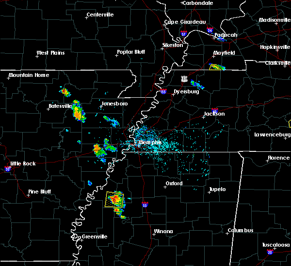 At 718 pm cdt, a severe thunderstorm was located near dublin, or near clarksdale, moving north at 10 mph (radar indicated). Hazards include 60 mph wind gusts and quarter size hail. Hail damage to vehicles is expected. Expect wind damage to roofs, siding, and trees. At 718 pm cdt, a severe thunderstorm was located near dublin, or near clarksdale, moving north at 10 mph (radar indicated). Hazards include 60 mph wind gusts and quarter size hail. Hail damage to vehicles is expected. Expect wind damage to roofs, siding, and trees.
|
| 6/3/2018 1:16 AM CDT |
 At 115 am cdt, a severe thunderstorm was located 7 miles northeast of minter city, or 14 miles southwest of charleston, moving southeast at 60 mph (radar indicated). Hazards include 60 mph wind gusts and quarter size hail. Hail damage to vehicles is expected. expect wind damage to roofs, siding, and trees. Locations impacted include, clarksdale, charleston, tutwiler, webb, sumner, paynes, dublin, vance, glendora, mattson, rena lara, counts, distall, swan lake, denton, beverly, lurand, brazil, beaver dam and albin. At 115 am cdt, a severe thunderstorm was located 7 miles northeast of minter city, or 14 miles southwest of charleston, moving southeast at 60 mph (radar indicated). Hazards include 60 mph wind gusts and quarter size hail. Hail damage to vehicles is expected. expect wind damage to roofs, siding, and trees. Locations impacted include, clarksdale, charleston, tutwiler, webb, sumner, paynes, dublin, vance, glendora, mattson, rena lara, counts, distall, swan lake, denton, beverly, lurand, brazil, beaver dam and albin.
|
| 6/3/2018 1:03 AM CDT |
 At 103 am cdt, a severe thunderstorm was located over sumner, or 9 miles northeast of parchman, moving southeast at 60 mph (radar indicated). Hazards include 60 mph wind gusts and quarter size hail. Hail damage to vehicles is expected. expect wind damage to roofs, siding, and trees. Locations impacted include, clarksdale, charleston, elaine, tutwiler, marks, lambert, crowder, webb, sumner, belen, enid, paynes, dublin, vance, kings, sherard, crumrod, sunnyside, lyon and glendora. At 103 am cdt, a severe thunderstorm was located over sumner, or 9 miles northeast of parchman, moving southeast at 60 mph (radar indicated). Hazards include 60 mph wind gusts and quarter size hail. Hail damage to vehicles is expected. expect wind damage to roofs, siding, and trees. Locations impacted include, clarksdale, charleston, elaine, tutwiler, marks, lambert, crowder, webb, sumner, belen, enid, paynes, dublin, vance, kings, sherard, crumrod, sunnyside, lyon and glendora.
|
| 6/3/2018 1:03 AM CDT |
 At 1248 am cdt, a severe thunderstorm was located near clarksdale, moving southeast at 60 mph (radar indicated). Hazards include 60 mph wind gusts and quarter size hail. Hail damage to vehicles is expected. expect wind damage to roofs, siding, and trees. Locations impacted include, clarksdale, batesville, charleston, elaine, tutwiler, marks, lambert, jonestown, friars point, crowder, webb, sumner, pope, belen, enid, paynes, dublin, curtis station, vance and darling. At 1248 am cdt, a severe thunderstorm was located near clarksdale, moving southeast at 60 mph (radar indicated). Hazards include 60 mph wind gusts and quarter size hail. Hail damage to vehicles is expected. expect wind damage to roofs, siding, and trees. Locations impacted include, clarksdale, batesville, charleston, elaine, tutwiler, marks, lambert, jonestown, friars point, crowder, webb, sumner, pope, belen, enid, paynes, dublin, curtis station, vance and darling.
|
| 6/3/2018 12:49 AM CDT |
 At 1248 am cdt, a severe thunderstorm was located near clarksdale, moving southeast at 60 mph (radar indicated). Hazards include 60 mph wind gusts and quarter size hail. Hail damage to vehicles is expected. expect wind damage to roofs, siding, and trees. Locations impacted include, clarksdale, batesville, charleston, elaine, tutwiler, marks, lambert, jonestown, friars point, crowder, webb, sumner, pope, belen, enid, paynes, dublin, curtis station, vance and darling. At 1248 am cdt, a severe thunderstorm was located near clarksdale, moving southeast at 60 mph (radar indicated). Hazards include 60 mph wind gusts and quarter size hail. Hail damage to vehicles is expected. expect wind damage to roofs, siding, and trees. Locations impacted include, clarksdale, batesville, charleston, elaine, tutwiler, marks, lambert, jonestown, friars point, crowder, webb, sumner, pope, belen, enid, paynes, dublin, curtis station, vance and darling.
|
| 6/3/2018 12:38 AM CDT |
 At 1237 am cdt, a severe thunderstorm was located near kings, or 9 miles northwest of clarksdale, moving southeast at 60 mph (radar indicated). Hazards include 60 mph wind gusts and quarter size hail. Hail damage to vehicles is expected. Expect wind damage to roofs, siding, and trees. At 1237 am cdt, a severe thunderstorm was located near kings, or 9 miles northwest of clarksdale, moving southeast at 60 mph (radar indicated). Hazards include 60 mph wind gusts and quarter size hail. Hail damage to vehicles is expected. Expect wind damage to roofs, siding, and trees.
|
| 6/1/2018 6:01 PM CDT |
 The national weather service in memphis has issued a * severe thunderstorm warning for. southeastern coahoma county in northwestern mississippi. west central tallahatchie county in northwestern mississippi. until 645 pm cdt. At 601 pm cdt, a severe thunderstorm was located over clarksdale,. The national weather service in memphis has issued a * severe thunderstorm warning for. southeastern coahoma county in northwestern mississippi. west central tallahatchie county in northwestern mississippi. until 645 pm cdt. At 601 pm cdt, a severe thunderstorm was located over clarksdale,.
|
| 3/28/2018 6:23 PM CDT |
 At 621 pm cdt, a severe thunderstorm was located near curtis station, or 9 miles west of batesville, moving northeast at 45 mph. a second severe thunderstorm is near sumner and will move towards lambert. this storm is also moving northeast at 45 mph (radar indicated). Hazards include 60 mph wind gusts and quarter size hail. Hail damage to vehicles is expected. expect wind damage to roofs, siding, and trees. Locations impacted include, batesville, john w kyle state park, tutwiler, marks, sardis, lambert, como, crowder, sledge, sumner, belen, vance, darling, pleasant grove, curtis station, falcon, mims, barksdale, denton and asa. At 621 pm cdt, a severe thunderstorm was located near curtis station, or 9 miles west of batesville, moving northeast at 45 mph. a second severe thunderstorm is near sumner and will move towards lambert. this storm is also moving northeast at 45 mph (radar indicated). Hazards include 60 mph wind gusts and quarter size hail. Hail damage to vehicles is expected. expect wind damage to roofs, siding, and trees. Locations impacted include, batesville, john w kyle state park, tutwiler, marks, sardis, lambert, como, crowder, sledge, sumner, belen, vance, darling, pleasant grove, curtis station, falcon, mims, barksdale, denton and asa.
|
| 3/28/2018 6:11 PM CDT |
 At 611 pm cdt, a severe thunderstorm was located over tutwiler, or 7 miles north of parchman, moving northeast at 55 mph (radar indicated). Hazards include 60 mph wind gusts and quarter size hail. Hail damage to vehicles is expected. Expect wind damage to roofs, siding, and trees. At 611 pm cdt, a severe thunderstorm was located over tutwiler, or 7 miles north of parchman, moving northeast at 55 mph (radar indicated). Hazards include 60 mph wind gusts and quarter size hail. Hail damage to vehicles is expected. Expect wind damage to roofs, siding, and trees.
|
| 4/17/2017 12:59 PM CDT |
 At 1259 pm cdt, a severe thunderstorm was located near dublin, or near clarksdale, moving northeast at 30 mph (radar indicated). Hazards include 60 mph wind gusts and quarter size hail. Hail damage to vehicles is expected. Expect wind damage to roofs, siding, and trees. At 1259 pm cdt, a severe thunderstorm was located near dublin, or near clarksdale, moving northeast at 30 mph (radar indicated). Hazards include 60 mph wind gusts and quarter size hail. Hail damage to vehicles is expected. Expect wind damage to roofs, siding, and trees.
|
| 4/2/2017 6:08 PM CDT |
 At 607 pm cdt, severe thunderstorms were located along a line extending from 6 miles southeast of dundee to 7 miles west of charleston, moving northeast at 60 mph (radar indicated). Hazards include 60 mph wind gusts and nickel size hail. Hail damage to vehicles is expected. expect wind damage to roofs, siding, and trees. Locations impacted include, batesville, charleston, george payne state park, john w kyle state park, tutwiler, marks, sardis, lambert, como, crenshaw, crowder, webb, sledge, sumner, pope, belen, enid, paynes, pleasant grove and curtis station. At 607 pm cdt, severe thunderstorms were located along a line extending from 6 miles southeast of dundee to 7 miles west of charleston, moving northeast at 60 mph (radar indicated). Hazards include 60 mph wind gusts and nickel size hail. Hail damage to vehicles is expected. expect wind damage to roofs, siding, and trees. Locations impacted include, batesville, charleston, george payne state park, john w kyle state park, tutwiler, marks, sardis, lambert, como, crenshaw, crowder, webb, sledge, sumner, pope, belen, enid, paynes, pleasant grove and curtis station.
|
| 4/2/2017 5:30 PM CDT |
 At 530 pm cdt, severe thunderstorms were located along a line extending from near crumrod to boyle, moving northeast at 70 mph (radar indicated). Hazards include 70 mph wind gusts and nickel size hail. Expect considerable tree damage. Wind damage is also likely to mobile homes, roofs, and outbuildings. At 530 pm cdt, severe thunderstorms were located along a line extending from near crumrod to boyle, moving northeast at 70 mph (radar indicated). Hazards include 70 mph wind gusts and nickel size hail. Expect considerable tree damage. Wind damage is also likely to mobile homes, roofs, and outbuildings.
|
| 3/25/2017 3:09 AM CDT |
 At 309 am cdt, a severe thunderstorm was located over ruleville, moving northeast at 55 mph (radar indicated). Hazards include 60 mph wind gusts. expect damage to roofs, siding, and trees At 309 am cdt, a severe thunderstorm was located over ruleville, moving northeast at 55 mph (radar indicated). Hazards include 60 mph wind gusts. expect damage to roofs, siding, and trees
|
| 1/21/2017 11:02 PM CST |
 At 1102 pm cst, a severe thunderstorm was located near vance, or 9 miles west of charleston, moving northeast at 55 mph (radar indicated). Hazards include quarter size hail. Damage to vehicles is expected. Locations impacted include, tutwiler, webb, sumner, waverly, brazil, beaver dam, mikoma, stover, effie and tippo. At 1102 pm cst, a severe thunderstorm was located near vance, or 9 miles west of charleston, moving northeast at 55 mph (radar indicated). Hazards include quarter size hail. Damage to vehicles is expected. Locations impacted include, tutwiler, webb, sumner, waverly, brazil, beaver dam, mikoma, stover, effie and tippo.
|
| 1/21/2017 10:45 PM CST |
 At 1045 pm cst, a severe thunderstorm was located near minter city, or 10 miles east of drew, moving north at 45 mph (radar indicated). Hazards include quarter size hail. damage to vehicles is expected At 1045 pm cst, a severe thunderstorm was located near minter city, or 10 miles east of drew, moving north at 45 mph (radar indicated). Hazards include quarter size hail. damage to vehicles is expected
|
| 3/31/2016 7:25 PM CDT |
 The severe thunderstorm warning for quitman, northern tallahatchie and southwestern panola counties will expire at 730 pm cdt, the storm which prompted the warning has weakened below severe limits, and no longer poses an immediate threat to life or property. therefore the warning will be allowed to expire. however small hail is still possible with this thunderstorm. a tornado watch remains in effect until 1000 pm cdt for northwestern mississippi. The severe thunderstorm warning for quitman, northern tallahatchie and southwestern panola counties will expire at 730 pm cdt, the storm which prompted the warning has weakened below severe limits, and no longer poses an immediate threat to life or property. therefore the warning will be allowed to expire. however small hail is still possible with this thunderstorm. a tornado watch remains in effect until 1000 pm cdt for northwestern mississippi.
|
| 3/31/2016 7:10 PM CDT |
 At 709 pm cdt, a severe thunderstorm was located near enid, or near george payne state park, moving northeast at 60 mph (radar indicated). Hazards include golf ball size hail and 60 mph wind gusts. People and animals outdoors will be injured. expect hail damage to roofs, siding, windows, and vehicles. expect wind damage to roofs, siding, and trees. locations impacted include, tutwiler, marks, lambert, crowder, webb, sumner, darling, enid, vance, belen, riverview, beaver dam, locke station, hinchcliff, longstreet, waverly, sabino, essex, barksdale and stover. A tornado watch remains in effect until 1000 pm cdt for northwestern mississippi. At 709 pm cdt, a severe thunderstorm was located near enid, or near george payne state park, moving northeast at 60 mph (radar indicated). Hazards include golf ball size hail and 60 mph wind gusts. People and animals outdoors will be injured. expect hail damage to roofs, siding, windows, and vehicles. expect wind damage to roofs, siding, and trees. locations impacted include, tutwiler, marks, lambert, crowder, webb, sumner, darling, enid, vance, belen, riverview, beaver dam, locke station, hinchcliff, longstreet, waverly, sabino, essex, barksdale and stover. A tornado watch remains in effect until 1000 pm cdt for northwestern mississippi.
|
| 3/31/2016 6:53 PM CDT | Quarter sized hail reported 4.5 miles NE of Tutwiler, MS |
| 3/31/2016 6:38 PM CDT |
 At 638 pm cdt, a severe thunderstorm was located over parchman, moving northeast at 60 mph (radar indicated). Hazards include golf ball size hail and 60 mph wind gusts. People and animals outdoors will be injured. expect hail damage to roofs, siding, windows, and vehicles. Expect wind damage to roofs, siding, and trees. At 638 pm cdt, a severe thunderstorm was located over parchman, moving northeast at 60 mph (radar indicated). Hazards include golf ball size hail and 60 mph wind gusts. People and animals outdoors will be injured. expect hail damage to roofs, siding, windows, and vehicles. Expect wind damage to roofs, siding, and trees.
|
| 12/23/2015 5:20 PM CST | At 520 pm cst, a severe thunderstorm was located over drew, moving northeast at 60 mph (radar indicated). Hazards include 60 mph wind gusts and quarter size hail. Hail damage to vehicles is expected. Expect wind damage to roofs, siding and trees. |
| 12/23/2015 4:11 PM CST | A tornado warning remains in effect until 430 pm cst for southern quitman. southeastern coahoma and northwestern tallahatchie counties. at 411 pm cst. a confirmed large and extremely dangerous tornado was located near vance. or 9 miles northwest of charleston. Moving northeast at 55 mph. |
| 12/23/2015 3:41 PM CST | At 340 pm cst, a severe thunderstorm producing a tornado was located over rome, or near parchman, moving northeast at 60 mph (radar indicated rotation). Hazards include tornado and quarter size hail. Flying debris will be dangerous to those caught without shelter. mobile homes will be damaged or destroyed. damage to roofs, windows and vehicles will occur. tree damage is likely. this dangerous storm will be near, webb and sumner around 345 pm cst. vance around 355 pm cst. lambert around 400 pm cst. crowder around 405 pm cst. Other locations impacted by this tornadic thunderstorm include denton, riverview, beaver dam, longstreet, waverly, brazil and stover. |
| 5/30/2015 3:15 PM CDT | At 315 pm cdt, a severe thunderstorm was located near webb, or 12 miles east of parchman, moving east at 20 mph (radar indicated). Hazards include 60 mph wind gusts and half dollar size hail. Hail damage to vehicles is expected. Expect wind damage to roofs, siding and trees. |
| 3/31/2015 4:40 PM CDT | The severe thunderstorm warning for southern quitman. northwestern tallahatchie and southeastern coahoma counties will expire at 445 pm cdt. the storm which prompted the warning has weakened below severe limits. and no longer poses an immediate threat to life or property. Therefore the warning will be allowed to expire. |
| 3/31/2015 4:17 PM CDT | A severe thunderstorm warning remains in effect until 445 pm cdt for southern quitman. northwestern tallahatchie and southeastern coahoma counties. at 416 pm cdt. trained weather spotters reported a severe thunderstorm producing large destructive hail up to baseball size. this storm was located over dublin. Or 9 miles southeast of. |
| 3/31/2015 3:57 PM CDT | The national weather service in memphis has issued a * severe thunderstorm warning for. southern quitman county in northwestern mississippi. northwestern tallahatchie county in northwestern mississippi. southern coahoma county in northwestern mississippi. Until 445 pm cdt. |
| 1/29/2013 11:20 PM CST | 2 houses and one car received damage from falling tree limb in tallahatchie county MS, 0.2 miles NW of Tutwiler, MS |
| 10/17/2012 9:30 PM CDT | One home uninhabitable on countyline road near sunflower county line. one agricultural shop and grain bins with major damage. one child with minor injurie in coahoma county MS, 4 miles ENE of Tutwiler, MS |
| 10/17/2012 9:26 PM CDT | Trees down around rome in sunflower county MS, 4.5 miles NE of Tutwiler, MS |
| 10/17/2012 9:00 PM CDT | *** 2 inj *** at least one home was damaged. two persons in the home had minor injuries in tallahatchie county MS, 0.2 miles NW of Tutwiler, MS |
| 1/1/0001 12:00 AM | A few power lines down in sunflower county MS, 7.4 miles NNE of Tutwiler, MS |
Hail Maps for Tutwiler, MS
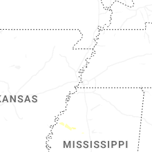
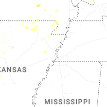
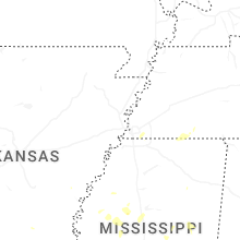
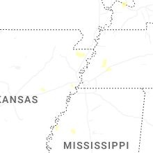


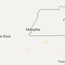


Connect with Interactive Hail Maps