

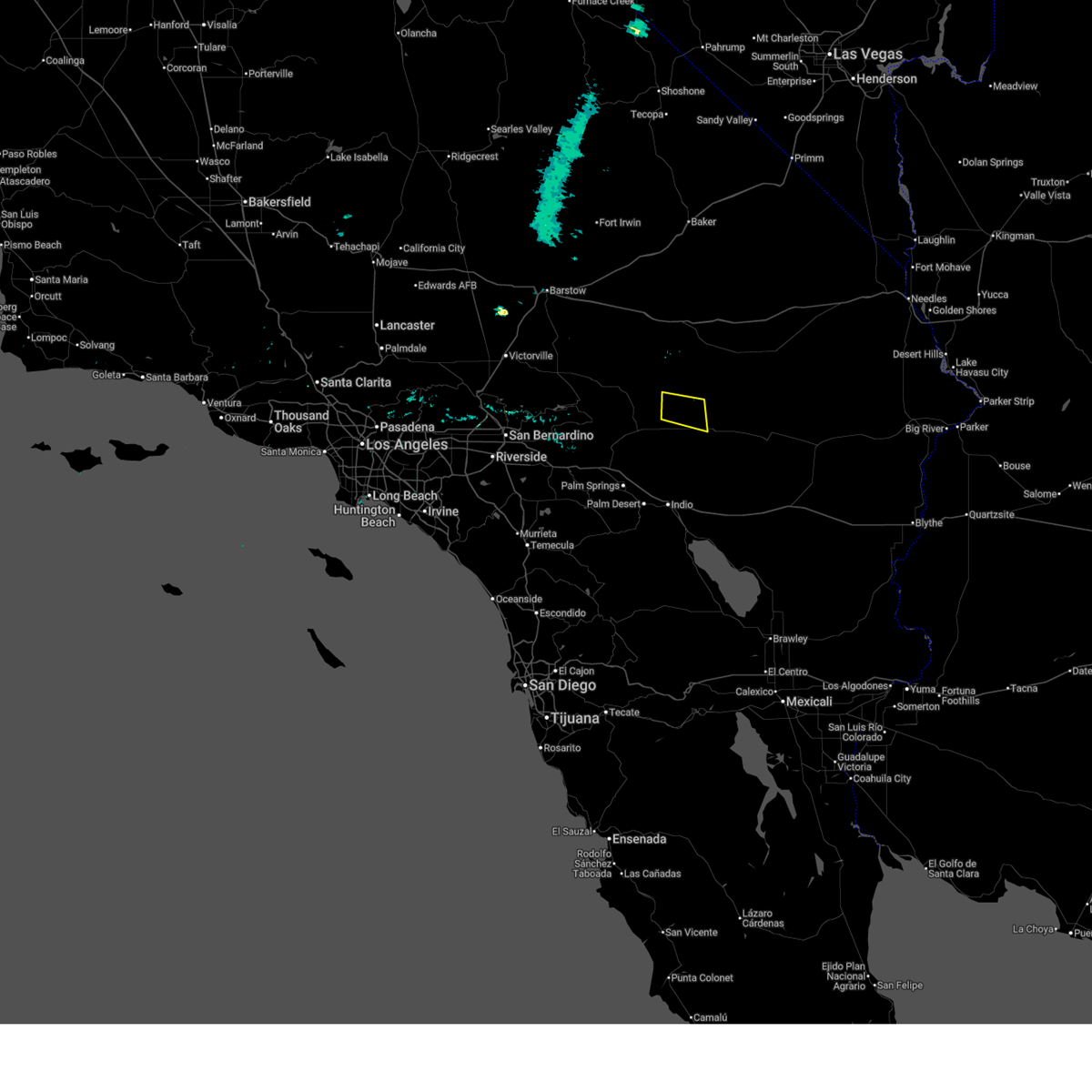
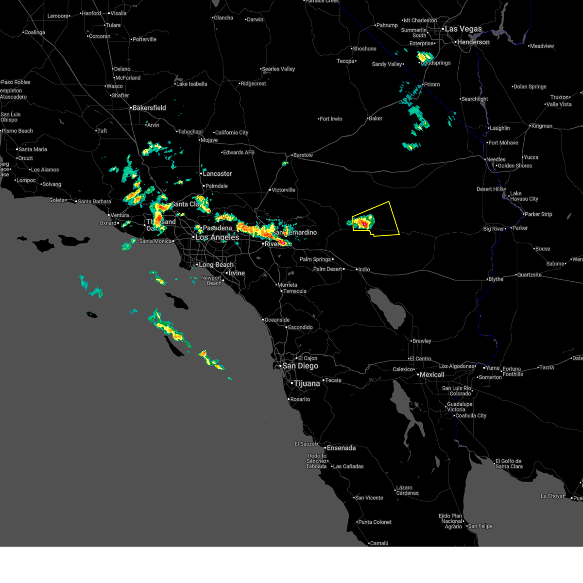
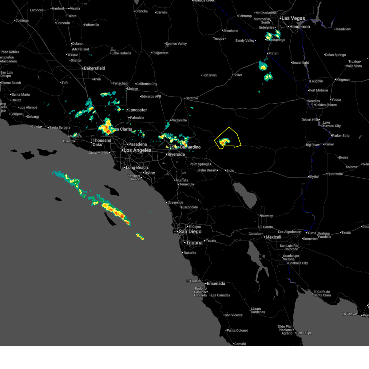
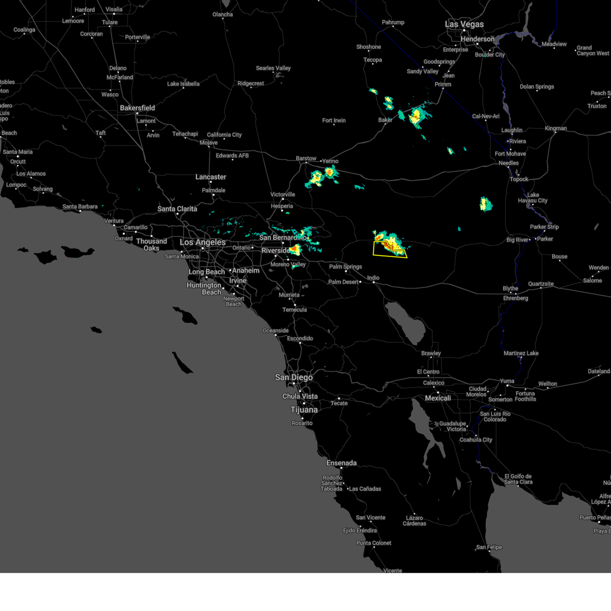
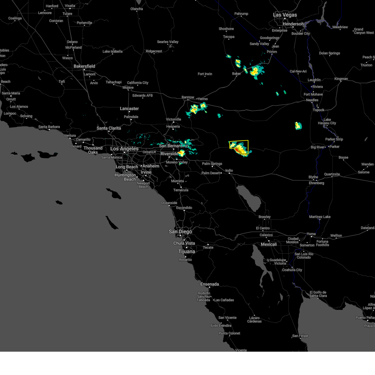
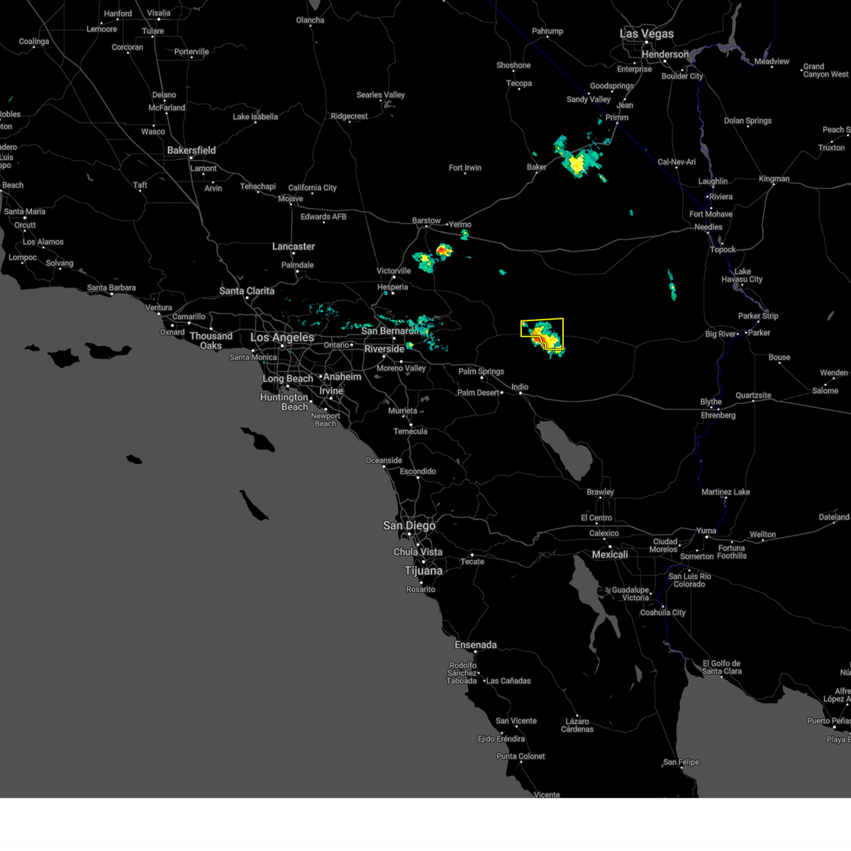
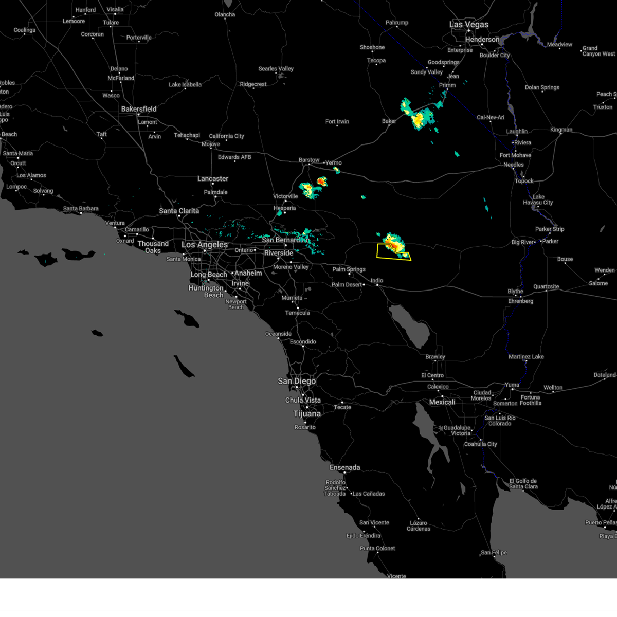
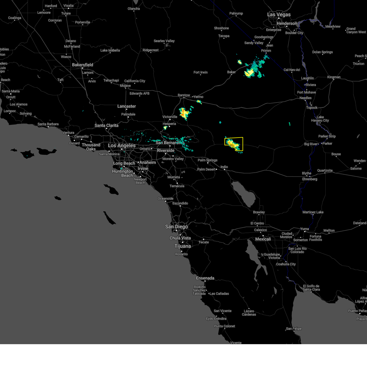
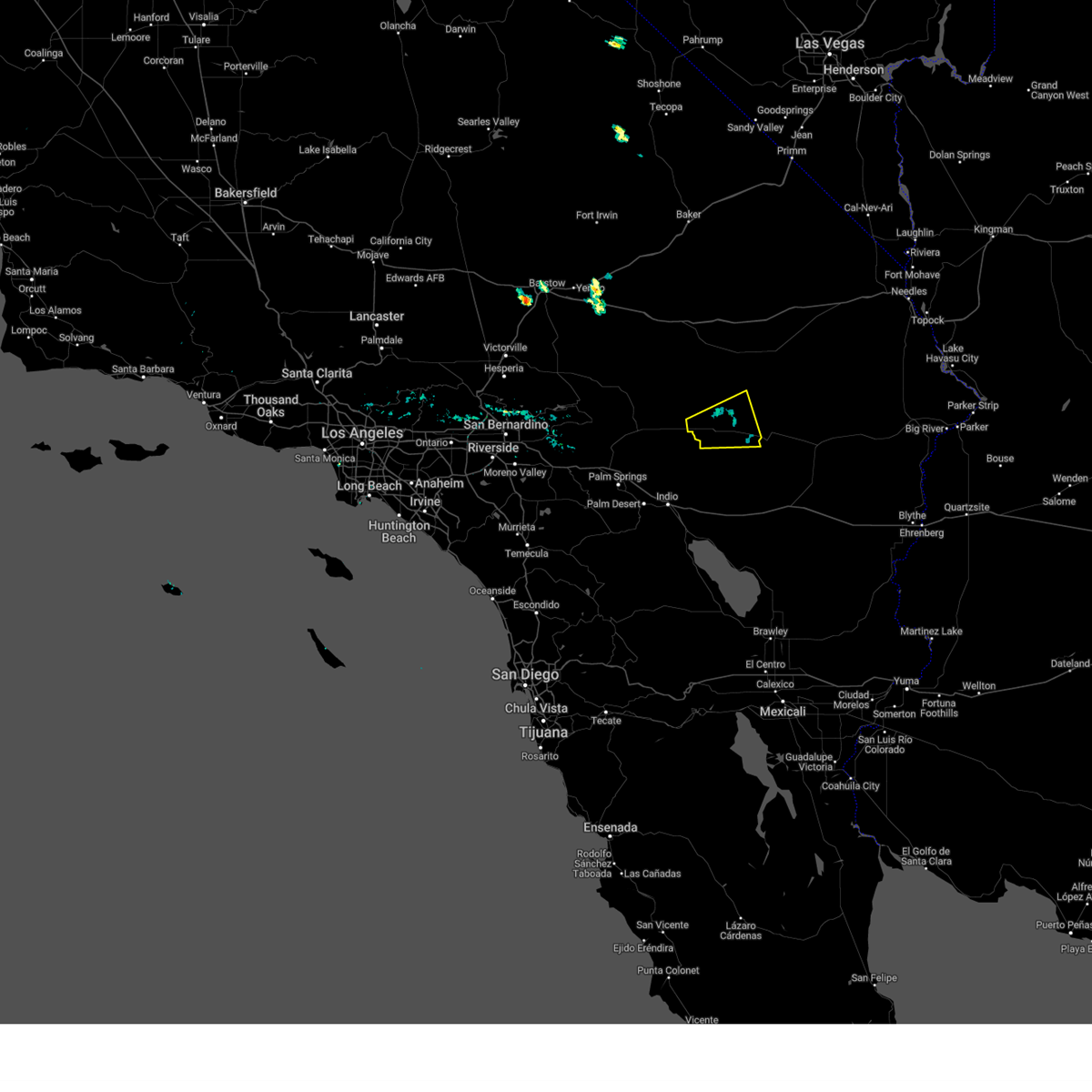
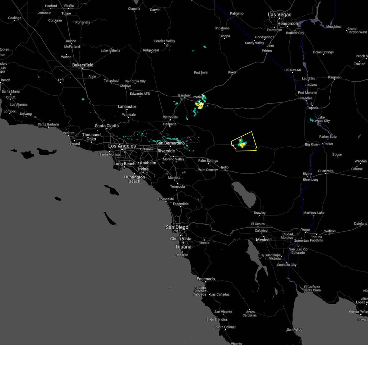
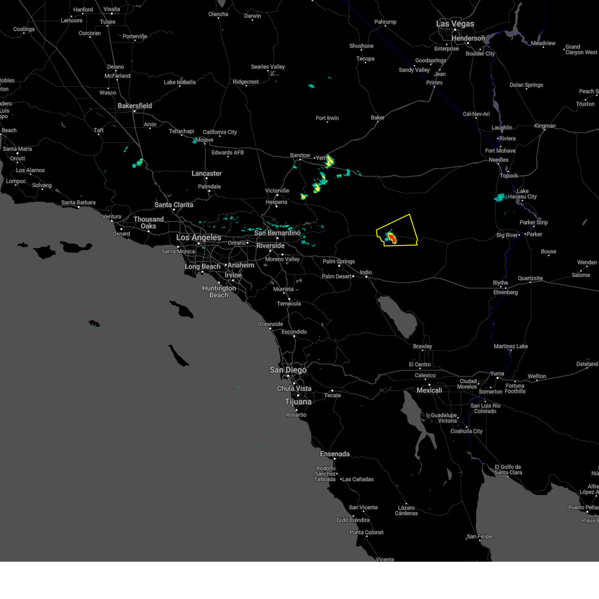
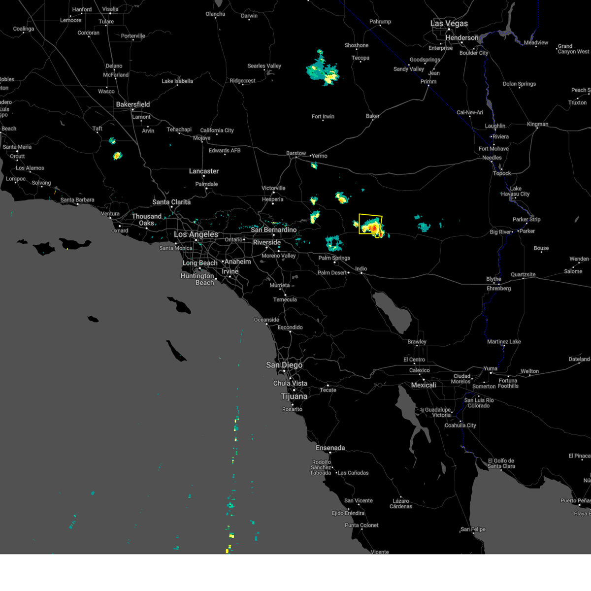
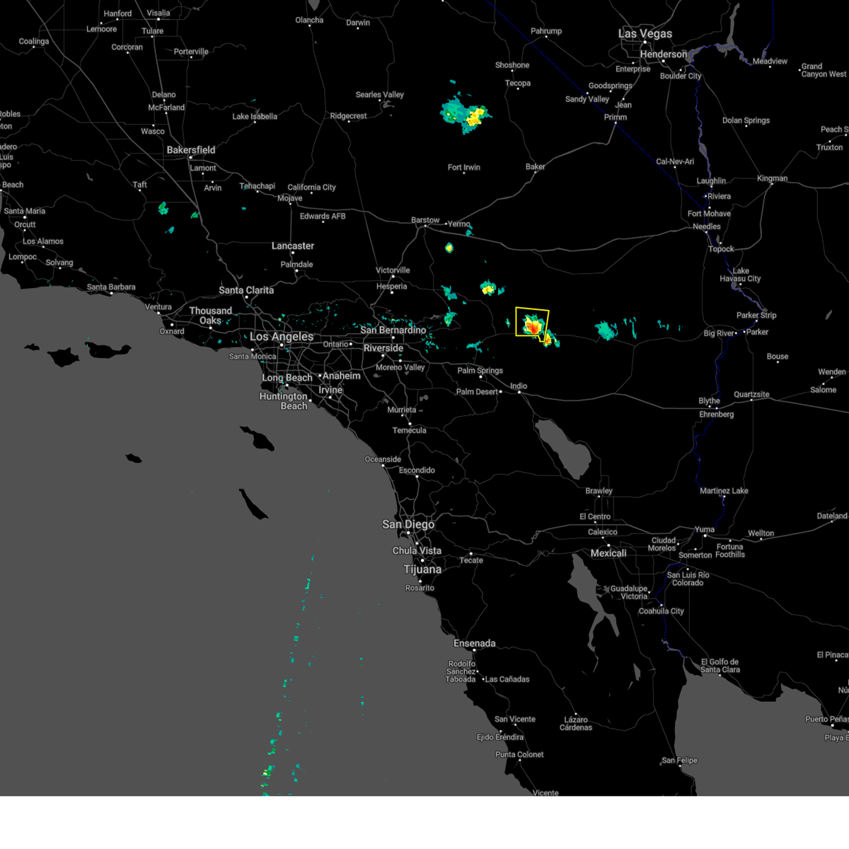
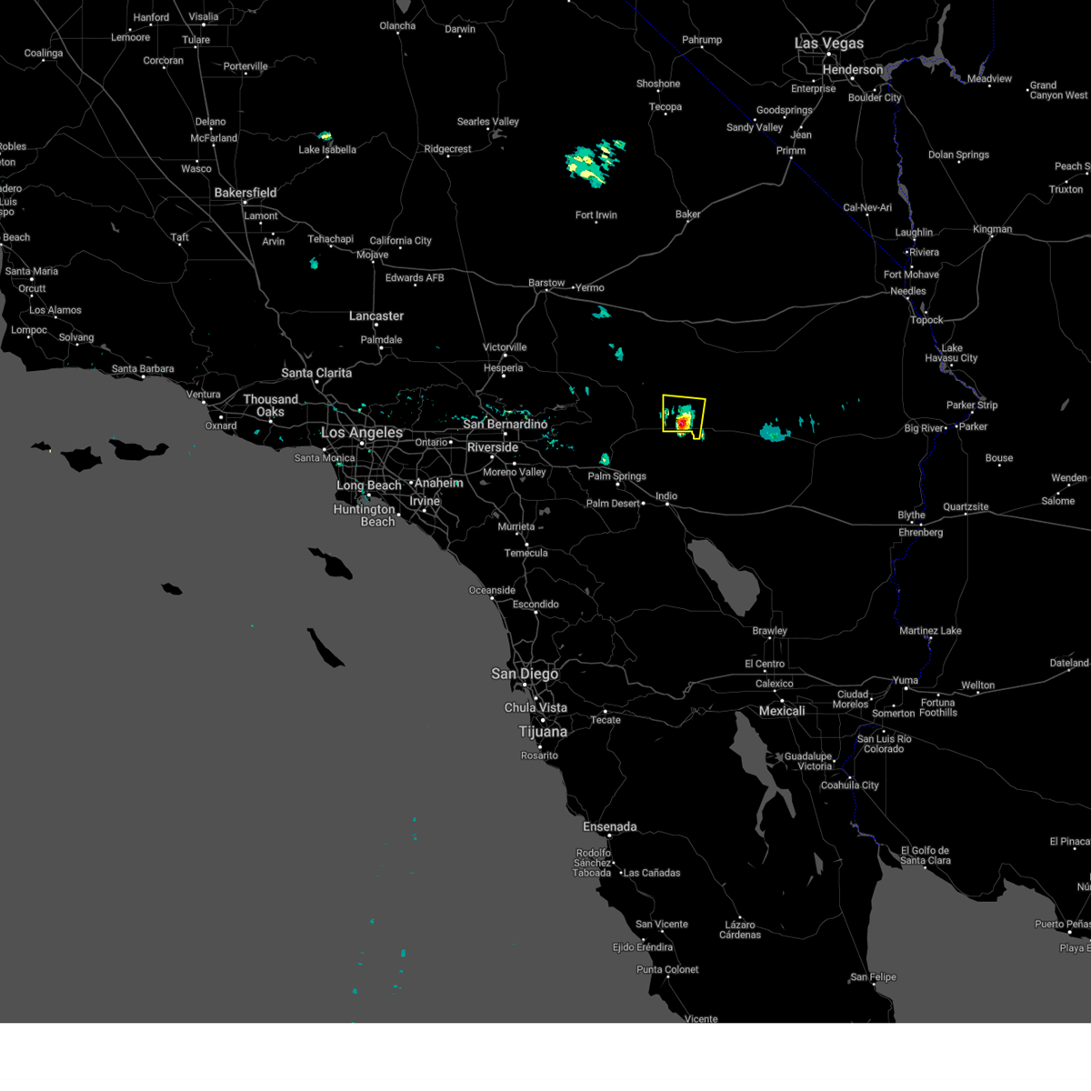
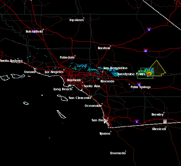
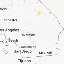
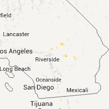
Hail Map for Twentynine Palms, CA
The Twentynine Palms, CA area has had 1 report of on-the-ground hail by trained spotters, and has been under severe weather warnings 7 times during the past 12 months. Doppler radar has detected hail at or near Twentynine Palms, CA on 25 occasions.
| Name: | Twentynine Palms, CA |
| Where Located: | 19.9 miles E of Yucca Valley, CA |
| Map: | Google Map for Twentynine Palms, CA |
| Population: | 25048 |
| Housing Units: | 9431 |
| More Info: | Search Google for Twentynine Palms, CA |
3
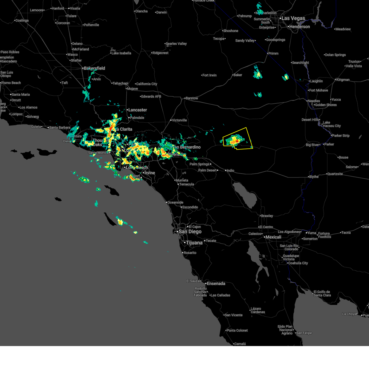
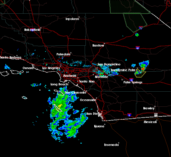
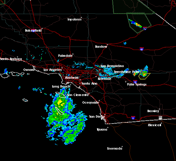
The Top Recent Hail Date for Twentynine Palms, CA is Sunday, July 14, 2024 (2nd out of 25)

Hail and Wind Damage Spotted near Twentynine Palms, CA
| Date / Time | Report Details |
|---|---|
| 9/18/2025 9:27 PM PDT | The storm which prompted the warning has weakened, and no longer poses an immediate threat to life or property. therefore, the warning will be allowed to expire. |
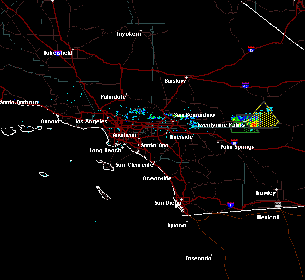
| 9/18/2025 9:07 PM PDT | At 903 pm pdt, a severe thunderstorm was located near twentynine palms base, or near twentynine palms, moving north at 25 mph (radar indicated). Hazards include 60 mph wind gusts and quarter size hail. Hail damage to vehicles is expected. expect wind damage to roofs and trees. Locations impacted include, twentynine palms, twentynine palms base, and twentynine palms airport. |
| 9/18/2025 8:42 PM PDT | Svrvef the national weather service in las vegas has issued a * severe thunderstorm warning for, south central san bernardino county in southern california, * until 930 pm pdt. * at 841 pm pdt, a severe thunderstorm was located 7 miles southwest of twentynine palms airport, or 7 miles southeast of twentynine palms, moving north at 25 mph (radar indicated). Hazards include 60 mph wind gusts and quarter size hail. Hail damage to vehicles is expected. Expect wind damage to roofs and trees. |
| 9/2/2025 6:58 AM PDT | Trained spotter recorded a wind gust of 58 mph from a nearby thunderstorm at 065 in san bernardino county CA, 3.1 miles NNE of Twentynine Palms, CA |
| 8/26/2025 6:54 PM PDT |
 Svrvef the national weather service in las vegas has issued a * severe thunderstorm warning for, southern san bernardino county in southern california, * until 730 pm pdt. * at 653 pm pdt, a severe thunderstorm was located over twentynine palms airport, or 8 miles east of twentynine palms, moving east at 5 mph (radar indicated). Hazards include 60 mph wind gusts and quarter size hail. Hail damage to vehicles is expected. Expect wind damage to roofs, siding, fencing and trees. Svrvef the national weather service in las vegas has issued a * severe thunderstorm warning for, southern san bernardino county in southern california, * until 730 pm pdt. * at 653 pm pdt, a severe thunderstorm was located over twentynine palms airport, or 8 miles east of twentynine palms, moving east at 5 mph (radar indicated). Hazards include 60 mph wind gusts and quarter size hail. Hail damage to vehicles is expected. Expect wind damage to roofs, siding, fencing and trees.
|
| 8/25/2025 3:47 PM PDT | Trained weather spotter reported a wind gust to 68 mp in san bernardino county CA, 2.3 miles NNE of Twentynine Palms, CA |
| 8/10/2025 4:11 PM PDT |
 The storm which prompted the warning has weakened, and no longer poses an immediate threat to life or property. therefore, the warning will be allowed to expire. however, gusty winds around 40 mph are still possible with this thunderstorm. The storm which prompted the warning has weakened, and no longer poses an immediate threat to life or property. therefore, the warning will be allowed to expire. however, gusty winds around 40 mph are still possible with this thunderstorm.
|
| 8/10/2025 3:53 PM PDT |
 At 353 pm pdt, a severe thunderstorm was located near twentynine palms airport, or 11 miles southeast of twentynine palms, moving east at 10 mph (radar indicated). Hazards include 60 mph wind gusts. Expect damage to roofs and trees. Locations impacted include, twentynine palms airport. At 353 pm pdt, a severe thunderstorm was located near twentynine palms airport, or 11 miles southeast of twentynine palms, moving east at 10 mph (radar indicated). Hazards include 60 mph wind gusts. Expect damage to roofs and trees. Locations impacted include, twentynine palms airport.
|
| 8/10/2025 3:33 PM PDT |
 Svrvef the national weather service in las vegas has issued a * severe thunderstorm warning for, south central san bernardino county in southern california, * until 415 pm pdt. * at 333 pm pdt, a severe thunderstorm was located near twentynine palms airport, or 9 miles southeast of twentynine palms, moving east at 10 mph (radar indicated). Hazards include 60 mph wind gusts. expect damage to roofs and trees Svrvef the national weather service in las vegas has issued a * severe thunderstorm warning for, south central san bernardino county in southern california, * until 415 pm pdt. * at 333 pm pdt, a severe thunderstorm was located near twentynine palms airport, or 9 miles southeast of twentynine palms, moving east at 10 mph (radar indicated). Hazards include 60 mph wind gusts. expect damage to roofs and trees
|
| 6/3/2025 3:54 PM PDT |
 The storm which prompted the warning has weakened, and no longer poses an immediate threat to life or property. therefore, the warning will be allowed to expire. to report severe weather, contact your nearest law enforcement agency. they will relay your report to the national weather service las vegas. The storm which prompted the warning has weakened, and no longer poses an immediate threat to life or property. therefore, the warning will be allowed to expire. to report severe weather, contact your nearest law enforcement agency. they will relay your report to the national weather service las vegas.
|
| 6/3/2025 3:33 PM PDT |
 At 332 pm pdt, a severe thunderstorm was located near twentynine palms base, or 7 miles northeast of twentynine palms, moving east at 15 mph (radar indicated). Hazards include 60 mph wind gusts and quarter size hail. Hail damage to vehicles is expected. expect wind damage to roofs and trees. Locations impacted include, twentynine palms, twentynine palms base, twentynine palms airport, and joshua tree lake campground. At 332 pm pdt, a severe thunderstorm was located near twentynine palms base, or 7 miles northeast of twentynine palms, moving east at 15 mph (radar indicated). Hazards include 60 mph wind gusts and quarter size hail. Hail damage to vehicles is expected. expect wind damage to roofs and trees. Locations impacted include, twentynine palms, twentynine palms base, twentynine palms airport, and joshua tree lake campground.
|
| 6/3/2025 3:12 PM PDT |
 Svrvef the national weather service in las vegas has issued a * severe thunderstorm warning for, south central san bernardino county in southern california, * until 400 pm pdt. * at 311 pm pdt, a severe thunderstorm was located over twentynine palms base, or near twentynine palms, moving east at 15 mph (radar indicated). Hazards include 60 mph wind gusts and quarter size hail. Hail damage to vehicles is expected. Expect wind damage to roofs and trees. Svrvef the national weather service in las vegas has issued a * severe thunderstorm warning for, south central san bernardino county in southern california, * until 400 pm pdt. * at 311 pm pdt, a severe thunderstorm was located over twentynine palms base, or near twentynine palms, moving east at 15 mph (radar indicated). Hazards include 60 mph wind gusts and quarter size hail. Hail damage to vehicles is expected. Expect wind damage to roofs and trees.
|
| 6/3/2025 2:30 PM PDT |
 Svrvef the national weather service in las vegas has issued a * severe thunderstorm warning for, southern san bernardino county in southern california, * until 315 pm pdt. * at 230 pm pdt, a severe thunderstorm was located over joshua tree lake campground, or 10 miles west of twentynine palms, moving northeast at 10 mph (radar indicated). Hazards include 60 mph wind gusts and quarter size hail. Hail damage to vehicles is expected. Expect wind damage to roofs and trees. Svrvef the national weather service in las vegas has issued a * severe thunderstorm warning for, southern san bernardino county in southern california, * until 315 pm pdt. * at 230 pm pdt, a severe thunderstorm was located over joshua tree lake campground, or 10 miles west of twentynine palms, moving northeast at 10 mph (radar indicated). Hazards include 60 mph wind gusts and quarter size hail. Hail damage to vehicles is expected. Expect wind damage to roofs and trees.
|
| 9/7/2024 3:17 PM PDT |
 The storm which prompted the warning has weakened below severe limits, and no longer poses an immediate threat to life or property. therefore, the warning has been allowed to expire. however, gusty winds are still possible with this thunderstorm. The storm which prompted the warning has weakened below severe limits, and no longer poses an immediate threat to life or property. therefore, the warning has been allowed to expire. however, gusty winds are still possible with this thunderstorm.
|
| 9/7/2024 3:11 PM PDT |
 The storm which prompted the warning has weakened, and no longer poses an immediate threat to life or property. therefore, the warning will be allowed to expire. however, small hail and heavy rain are still possible with this thunderstorm. The storm which prompted the warning has weakened, and no longer poses an immediate threat to life or property. therefore, the warning will be allowed to expire. however, small hail and heavy rain are still possible with this thunderstorm.
|
| 9/7/2024 2:52 PM PDT |
 At 251 pm pdt, a severe thunderstorm was located near twentynine palms, moving east at 10 mph (radar indicated). Hazards include 60 mph wind gusts. Expect damage to roofs and trees. locations impacted include, twentynine palms, twentynine palms base, and twentynine palms airport. This includes state route 62 in san bernardino county between mile markers 25 and 45. At 251 pm pdt, a severe thunderstorm was located near twentynine palms, moving east at 10 mph (radar indicated). Hazards include 60 mph wind gusts. Expect damage to roofs and trees. locations impacted include, twentynine palms, twentynine palms base, and twentynine palms airport. This includes state route 62 in san bernardino county between mile markers 25 and 45.
|
| 9/7/2024 2:47 PM PDT |
 Svrpsr the national weather service in phoenix has issued a * severe thunderstorm warning for, san bernardino county in southern california, riverside county in southern california, * until 315 pm pdt. * at 246 pm pdt, a severe thunderstorm was located over twentynine palms, and is nearly stationary (radar indicated). Hazards include 60 mph wind gusts and penny size hail. Expect damage to roofs, siding, and trees. This severe thunderstorm will remain over mainly rural areas of san bernardino and riverside counties. Svrpsr the national weather service in phoenix has issued a * severe thunderstorm warning for, san bernardino county in southern california, riverside county in southern california, * until 315 pm pdt. * at 246 pm pdt, a severe thunderstorm was located over twentynine palms, and is nearly stationary (radar indicated). Hazards include 60 mph wind gusts and penny size hail. Expect damage to roofs, siding, and trees. This severe thunderstorm will remain over mainly rural areas of san bernardino and riverside counties.
|
| 9/7/2024 2:33 PM PDT |
 Svrvef the national weather service in las vegas has issued a * severe thunderstorm warning for, southern san bernardino county in southern california, * until 315 pm pdt. * at 232 pm pdt, a severe thunderstorm was located over twentynine palms, moving east at 10 mph (radar indicated). Hazards include 60 mph wind gusts. expect damage to roofs and trees Svrvef the national weather service in las vegas has issued a * severe thunderstorm warning for, southern san bernardino county in southern california, * until 315 pm pdt. * at 232 pm pdt, a severe thunderstorm was located over twentynine palms, moving east at 10 mph (radar indicated). Hazards include 60 mph wind gusts. expect damage to roofs and trees
|
| 7/24/2024 4:06 PM PDT |
 The storm which prompted the warning has weakened, and no longer poses an immediate threat to life or property. therefore, the warning will be allowed to expire. The storm which prompted the warning has weakened, and no longer poses an immediate threat to life or property. therefore, the warning will be allowed to expire.
|
| 7/24/2024 3:57 PM PDT | Pubic reports about 3 large trees down and trailers knocked over due to strong winds near mile marker 55 on sr 6 in san bernardino county CA, 13 miles WNW of Twentynine Palms, CA |
| 7/24/2024 3:55 PM PDT | California highway patrol reports power pole down at the sr 62 and godwin rd intersectio in san bernardino county CA, 8.3 miles W of Twentynine Palms, CA |
| 7/24/2024 3:41 PM PDT |
 At 339 pm pdt, a severe thunderstorm was located over twentynine palms airport, or 9 miles east of twentynine palms, moving east at 10 mph (radar indicated). Hazards include 60 mph wind gusts. Expect damage to roofs and trees. locations impacted include, twentynine palms and twentynine palms airport. This includes state route 62 in san bernardino county between mile markers 32 and 60. At 339 pm pdt, a severe thunderstorm was located over twentynine palms airport, or 9 miles east of twentynine palms, moving east at 10 mph (radar indicated). Hazards include 60 mph wind gusts. Expect damage to roofs and trees. locations impacted include, twentynine palms and twentynine palms airport. This includes state route 62 in san bernardino county between mile markers 32 and 60.
|
| 7/24/2024 3:28 PM PDT |
 Svrvef the national weather service in las vegas has issued a * severe thunderstorm warning for, south central san bernardino county in southern california, * until 415 pm pdt. * at 327 pm pdt, a severe thunderstorm was located over twentynine palms airport, or 7 miles east of twentynine palms, moving east at 10 mph (radar indicated). Hazards include 60 mph wind gusts. expect damage to roofs and trees Svrvef the national weather service in las vegas has issued a * severe thunderstorm warning for, south central san bernardino county in southern california, * until 415 pm pdt. * at 327 pm pdt, a severe thunderstorm was located over twentynine palms airport, or 7 miles east of twentynine palms, moving east at 10 mph (radar indicated). Hazards include 60 mph wind gusts. expect damage to roofs and trees
|
| 7/23/2024 12:47 PM PDT | Spotter reports a gust of 62 mph on their personal weather statio in san bernardino county CA, 3.1 miles NNE of Twentynine Palms, CA |
| 7/14/2024 2:25 PM PDT |
 The storm which prompted the warning has weakened, and no longer poses an immediate threat to life or property. therefore, the warning will be allowed to expire. however, gusty winds and heavy rain are still possible with this thunderstorm. The storm which prompted the warning has weakened, and no longer poses an immediate threat to life or property. therefore, the warning will be allowed to expire. however, gusty winds and heavy rain are still possible with this thunderstorm.
|
| 7/14/2024 2:22 PM PDT | Quarter sized hail reported 1.6 miles NNE of Twentynine Palms, CA, report via social media with picture of hail larger than 1 inch at twentynine palms high school. |
| 7/14/2024 2:09 PM PDT |
 At 209 pm pdt, a severe thunderstorm was located near twentynine palms base, or near twentynine palms, moving north at 15 mph (radar indicated). Hazards include 60 mph wind gusts and quarter size hail. Hail damage to vehicles is expected. expect wind damage to roofs and trees. locations impacted include, twentynine palms and twentynine palms base. This includes state route 62 in san bernardino county between mile markers 23 and 36. At 209 pm pdt, a severe thunderstorm was located near twentynine palms base, or near twentynine palms, moving north at 15 mph (radar indicated). Hazards include 60 mph wind gusts and quarter size hail. Hail damage to vehicles is expected. expect wind damage to roofs and trees. locations impacted include, twentynine palms and twentynine palms base. This includes state route 62 in san bernardino county between mile markers 23 and 36.
|
| 7/14/2024 1:52 PM PDT |
 Svrvef the national weather service in las vegas has issued a * severe thunderstorm warning for, southern san bernardino county in southern california, * until 230 pm pdt. * at 152 pm pdt, a severe thunderstorm was located near twentynine palms, moving north at 15 mph (radar indicated). Hazards include 60 mph wind gusts and quarter size hail. Hail damage to vehicles is expected. Expect wind damage to roofs and trees. Svrvef the national weather service in las vegas has issued a * severe thunderstorm warning for, southern san bernardino county in southern california, * until 230 pm pdt. * at 152 pm pdt, a severe thunderstorm was located near twentynine palms, moving north at 15 mph (radar indicated). Hazards include 60 mph wind gusts and quarter size hail. Hail damage to vehicles is expected. Expect wind damage to roofs and trees.
|
| 8/24/2022 6:02 PM PDT | At 601 pm pdt, a severe thunderstorm was located over twentynine palms base, or near twentynine palms, moving northeast at 15 mph blowing dust reducing visibilities to less than a mile is also possible with this storm (radar indicated). Hazards include 60 mph wind gusts. expect damage to roofs and trees |
| 8/23/2022 5:19 PM PDT | At 519 pm pdt, a severe thunderstorm was located near twentynine palms airport, or near twentynine palms, moving northeast at 10 mph (radar indicated). Hazards include 60 mph wind gusts. expect damage to roofs and trees |
| 8/23/2022 5:14 PM PDT | At 514 pm pdt, a severe thunderstorm was located near twentynine palms, and is nearly stationary (radar indicated). Hazards include 60 mph wind gusts and quarter size hail. Hail damage to vehicles is expected. expect wind damage to roofs, siding, and trees. this severe thunderstorm will remain over mainly rural areas of san bernardino and riverside counties. hail threat, radar indicated max hail size, 1. 00 in wind threat, radar indicated max wind gust, 60 mph. |
| 8/20/2022 3:57 PM PDT |
 At 357 pm pdt, a severe thunderstorm was located 8 miles southwest of twentynine palms, moving east at 5 mph (radar indicated). Hazards include 60 mph wind gusts and quarter size hail. Hail damage to vehicles is expected. expect wind damage to roofs, siding, and trees. locations impacted include, lost horse-keys village. hail threat, radar indicated max hail size, 1. 00 in wind threat, radar indicated max wind gust, 60 mph. At 357 pm pdt, a severe thunderstorm was located 8 miles southwest of twentynine palms, moving east at 5 mph (radar indicated). Hazards include 60 mph wind gusts and quarter size hail. Hail damage to vehicles is expected. expect wind damage to roofs, siding, and trees. locations impacted include, lost horse-keys village. hail threat, radar indicated max hail size, 1. 00 in wind threat, radar indicated max wind gust, 60 mph.
|
| 8/20/2022 3:54 PM PDT |
 The severe thunderstorm warning for south central san bernardino county will expire at 400 pm pdt, the storm which prompted the warning has weakened below severe limits, and no longer poses an immediate threat to life or property. therefore, the warning will be allowed to expire. however gusty winds are still possible with this thunderstorm especially south of highway 62. The severe thunderstorm warning for south central san bernardino county will expire at 400 pm pdt, the storm which prompted the warning has weakened below severe limits, and no longer poses an immediate threat to life or property. therefore, the warning will be allowed to expire. however gusty winds are still possible with this thunderstorm especially south of highway 62.
|
| 8/20/2022 3:44 PM PDT |
 At 344 pm pdt, a severe thunderstorm was located 7 miles southeast of joshua tree, or 9 miles southwest of twentynine palms, moving southeast at 5 mph (radar indicated). Hazards include 60 mph wind gusts and quarter size hail. Hail damage to vehicles is expected. Expect wind damage to roofs, siding, and trees. At 344 pm pdt, a severe thunderstorm was located 7 miles southeast of joshua tree, or 9 miles southwest of twentynine palms, moving southeast at 5 mph (radar indicated). Hazards include 60 mph wind gusts and quarter size hail. Hail damage to vehicles is expected. Expect wind damage to roofs, siding, and trees.
|
| 8/20/2022 3:28 PM PDT |
 At 320 pm pdt, wind gusts near 50 mph were recorded in surprise valley north of joshua tree. wind gusts to 60 mph remain possible (radar indicated). Hazards include 60 mph wind gusts. Expect damage to roofs and trees. locations impacted include, twentynine palms, twentynine palms base, joshua tree lake campground and joshua tree. hail threat, radar indicated max hail size, <. 75 in wind threat, radar indicated max wind gust, 60 mph. At 320 pm pdt, wind gusts near 50 mph were recorded in surprise valley north of joshua tree. wind gusts to 60 mph remain possible (radar indicated). Hazards include 60 mph wind gusts. Expect damage to roofs and trees. locations impacted include, twentynine palms, twentynine palms base, joshua tree lake campground and joshua tree. hail threat, radar indicated max hail size, <. 75 in wind threat, radar indicated max wind gust, 60 mph.
|
| 8/20/2022 3:15 PM PDT |
 At 315 pm pdt, a severe thunderstorm was located over joshua tree lake campground, or 13 miles west of twentynine palms, moving northeast at 15 mph (radar indicated). Hazards include 60 mph wind gusts. expect damage to roofs and trees At 315 pm pdt, a severe thunderstorm was located over joshua tree lake campground, or 13 miles west of twentynine palms, moving northeast at 15 mph (radar indicated). Hazards include 60 mph wind gusts. expect damage to roofs and trees
|
| 8/13/2022 2:10 PM PDT |
 At 210 pm pdt, a severe thunderstorm was located 11 miles southeast of joshua tree, or 12 miles southwest of twentynine palms, and is nearly stationary (radar indicated). Hazards include 60 mph wind gusts and nickel size hail. expect damage to roofs, siding, and trees At 210 pm pdt, a severe thunderstorm was located 11 miles southeast of joshua tree, or 12 miles southwest of twentynine palms, and is nearly stationary (radar indicated). Hazards include 60 mph wind gusts and nickel size hail. expect damage to roofs, siding, and trees
|
| 9/9/2021 3:25 PM PDT |
 The severe thunderstorm warning for south central san bernardino county will expire at 330 pm pdt, the storm which prompted the warning has weakened below severe limits, and no longer poses an immediate threat to life or property. therefore, the warning will be allowed to expire. The severe thunderstorm warning for south central san bernardino county will expire at 330 pm pdt, the storm which prompted the warning has weakened below severe limits, and no longer poses an immediate threat to life or property. therefore, the warning will be allowed to expire.
|
| 9/9/2021 3:00 PM PDT |
 At 259 pm pdt, a severe thunderstorm was located near joshua tree lake campground, or 14 miles northwest of twentynine palms, moving northwest at 20 mph (radar indicated). Hazards include 60 mph wind gusts. Expect damage to roofs and trees. locations impacted include, twentynine palms, twentynine palms base, twentynine palms airport, ludlow, joshua tree lake campground, joshua tree, pioneertown and johnson valley. this includes interstate 40 in california between mile markers 45 and 49. hail threat, radar indicated max hail size, <. 75 in wind threat, radar indicated max wind gust, 60 mph. At 259 pm pdt, a severe thunderstorm was located near joshua tree lake campground, or 14 miles northwest of twentynine palms, moving northwest at 20 mph (radar indicated). Hazards include 60 mph wind gusts. Expect damage to roofs and trees. locations impacted include, twentynine palms, twentynine palms base, twentynine palms airport, ludlow, joshua tree lake campground, joshua tree, pioneertown and johnson valley. this includes interstate 40 in california between mile markers 45 and 49. hail threat, radar indicated max hail size, <. 75 in wind threat, radar indicated max wind gust, 60 mph.
|
| 9/9/2021 2:31 PM PDT |
 At 231 pm pdt, a severe thunderstorm was located near joshua tree lake campground, or near twentynine palms, moving northwest at 25 mph (radar indicated). Hazards include 60 mph wind gusts. expect damage to roofs and trees At 231 pm pdt, a severe thunderstorm was located near joshua tree lake campground, or near twentynine palms, moving northwest at 25 mph (radar indicated). Hazards include 60 mph wind gusts. expect damage to roofs and trees
|
| 10/3/2018 6:09 PM PDT |
 The severe thunderstorm warning for san bernardino and riverside counties will expire at 615 pm pdt, the severe thunderstorm which prompted the warning has moved out of the warned area. The severe thunderstorm warning for san bernardino and riverside counties will expire at 615 pm pdt, the severe thunderstorm which prompted the warning has moved out of the warned area.
|
| 10/3/2018 5:47 PM PDT |
 At 546 pm pdt, a severe thunderstorm was located 11 miles south of twentynine palms, moving northeast at 30 mph (radar indicated). Hazards include 60 mph wind gusts and penny size hail. Expect damage to roofs, siding, and trees. This severe thunderstorm will remain over mainly rural areas of san bernardino and riverside counties. At 546 pm pdt, a severe thunderstorm was located 11 miles south of twentynine palms, moving northeast at 30 mph (radar indicated). Hazards include 60 mph wind gusts and penny size hail. Expect damage to roofs, siding, and trees. This severe thunderstorm will remain over mainly rural areas of san bernardino and riverside counties.
|
| 8/11/2017 2:42 PM PDT |
 At 241 pm pdt, a severe thunderstorm was located near joshua tree lake campground, or 16 miles northwest of twentynine palms, moving northeast at 5 mph (radar indicated). Hazards include 60 mph wind gusts. expect damage to roofs, siding, and trees At 241 pm pdt, a severe thunderstorm was located near joshua tree lake campground, or 16 miles northwest of twentynine palms, moving northeast at 5 mph (radar indicated). Hazards include 60 mph wind gusts. expect damage to roofs, siding, and trees
|
| 8/11/2017 1:15 PM PDT | Trained spotter in twentynine palms measured a wind gust of 68 mp in san bernardino county CA, 2.5 miles NNE of Twentynine Palms, CA |
| 7/24/2017 5:00 PM PDT | A power pole was blown down by thunderstorm winds along utah trail north of amboy rd. reported via twitter with pictur in san bernardino county CA, 1.9 miles WSW of Twentynine Palms, CA |
| 7/24/2017 3:24 PM PDT | Knxp reports gust to 55 knots out of the east-southeast at 2224 in san bernardino county CA, 9.8 miles SE of Twentynine Palms, CA |
| 8/26/2015 3:13 PM PDT | The severe thunderstorm warning for south central san bernardino county will expire at 315 pm pdt, the storm which prompted the warning has weakened below severe limits, and no longer poses an immediate threat to life or property. therefore the warning will be allowed to expire. flash flooding still remains a threat in the area, be alert for this hazard. |
| 8/26/2015 2:46 PM PDT |
 At 245 pm pdt, doppler radar indicated a severe thunderstorm capable of producing quarter size hail and damaging winds in excess of 60 mph. this storm was located 17 miles northeast of twentynine palms airport, or 25 miles east of twentynine palms, moving northeast at 55 mph. locations impacted include, twentynine palms twentynine palms airport wonder valley highway 62 between mile marker 34 and 58. At 245 pm pdt, doppler radar indicated a severe thunderstorm capable of producing quarter size hail and damaging winds in excess of 60 mph. this storm was located 17 miles northeast of twentynine palms airport, or 25 miles east of twentynine palms, moving northeast at 55 mph. locations impacted include, twentynine palms twentynine palms airport wonder valley highway 62 between mile marker 34 and 58.
|
| 8/26/2015 2:29 PM PDT |
 At 227 pm pdt, doppler radar indicated a severe thunderstorm capable of producing quarter size hail and damaging winds in excess of 60 mph. this storm was located over twentynine palms airport, or 9 miles east of twentynine palms, and moving northeast at 55 mph. At 227 pm pdt, doppler radar indicated a severe thunderstorm capable of producing quarter size hail and damaging winds in excess of 60 mph. this storm was located over twentynine palms airport, or 9 miles east of twentynine palms, and moving northeast at 55 mph.
|
| 8/26/2015 2:01 PM PDT |
 At 200 pm pdt, doppler radar indicated a severe thunderstorm capable of producing damaging winds in excess of 60 mph. this storm was located near twentynine palms. this storm was nearly stationary. At 200 pm pdt, doppler radar indicated a severe thunderstorm capable of producing damaging winds in excess of 60 mph. this storm was located near twentynine palms. this storm was nearly stationary.
|
| 8/12/2012 4:20 PM PDT | Winds caused a large camper to tip over. wind gust also removed several fence poles from the ground. severe winds lasted for a 10 minute period starting at 1620 pd in san bernardino county CA, 15.6 miles W of Twentynine Palms, CA |
| 1/1/0001 12:00 AM | A spotter reported damage to a shed and an awning on their property as well as loose items blown around. a wind gust to 64 mph was also measured. the thunderstorm laste in san bernardino county CA, 13 miles WNW of Twentynine Palms, CA |
| 1/1/0001 12:00 AM | Damage to shed and awning on property. loose items blown around. also had a gust to 64 mph...lasted approximately 20 minutes. delayed repor in san bernardino county CA, 13 miles WNW of Twentynine Palms, CA |
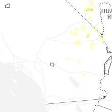
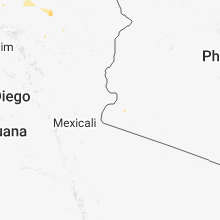
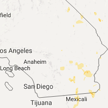
Hail Maps for Twentynine Palms, CA


Connect with Interactive Hail Maps