

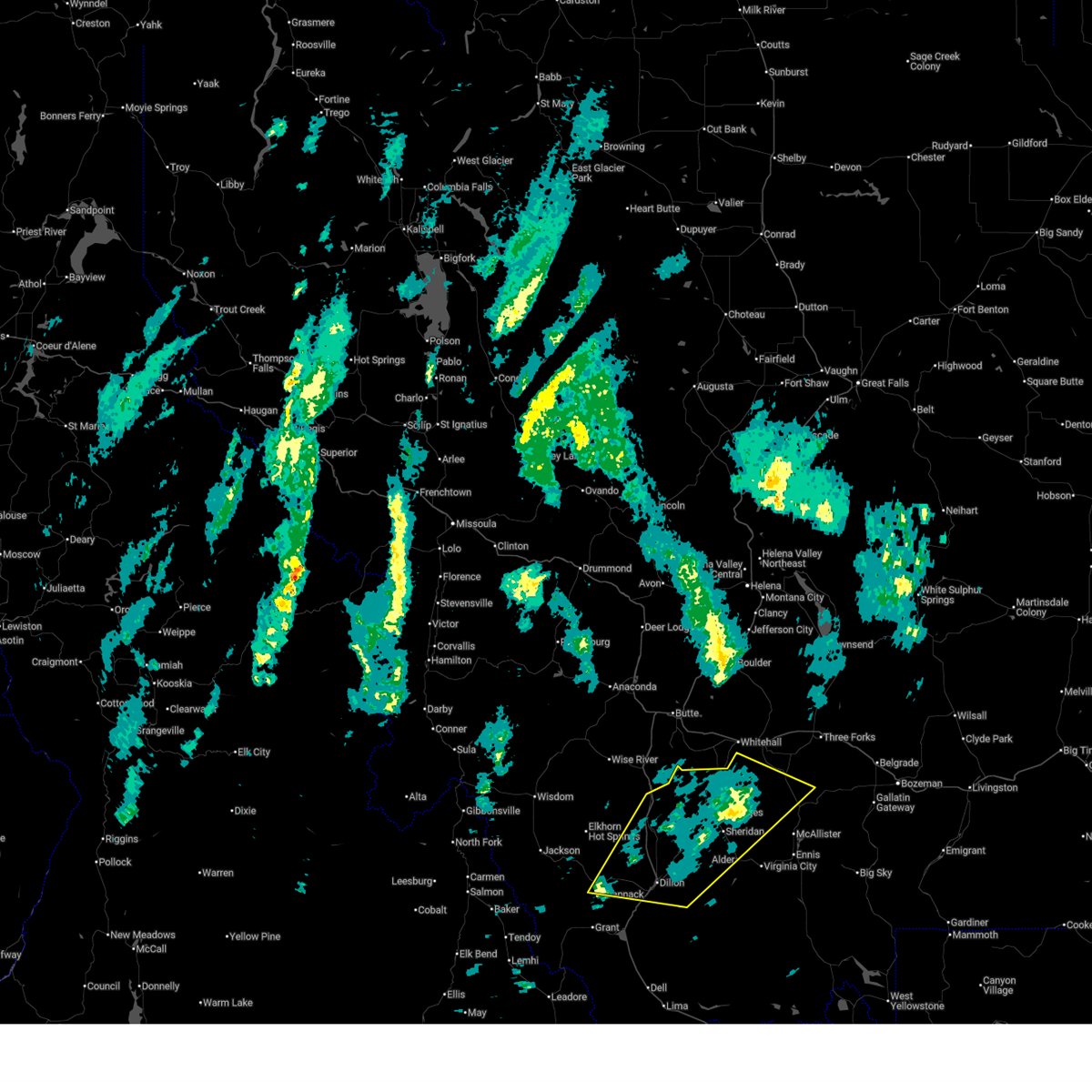
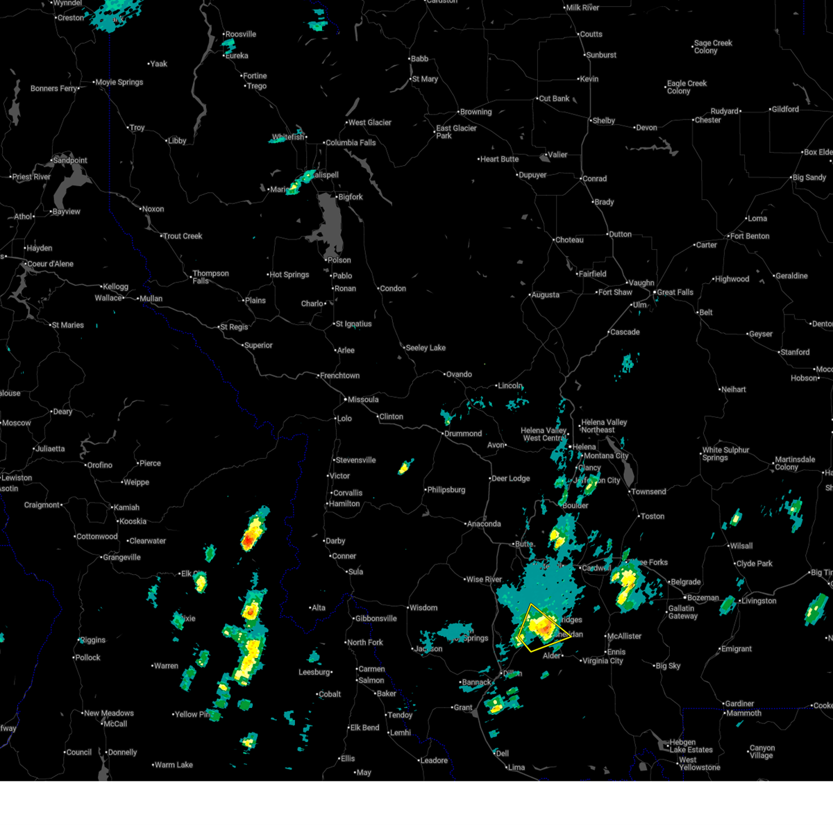
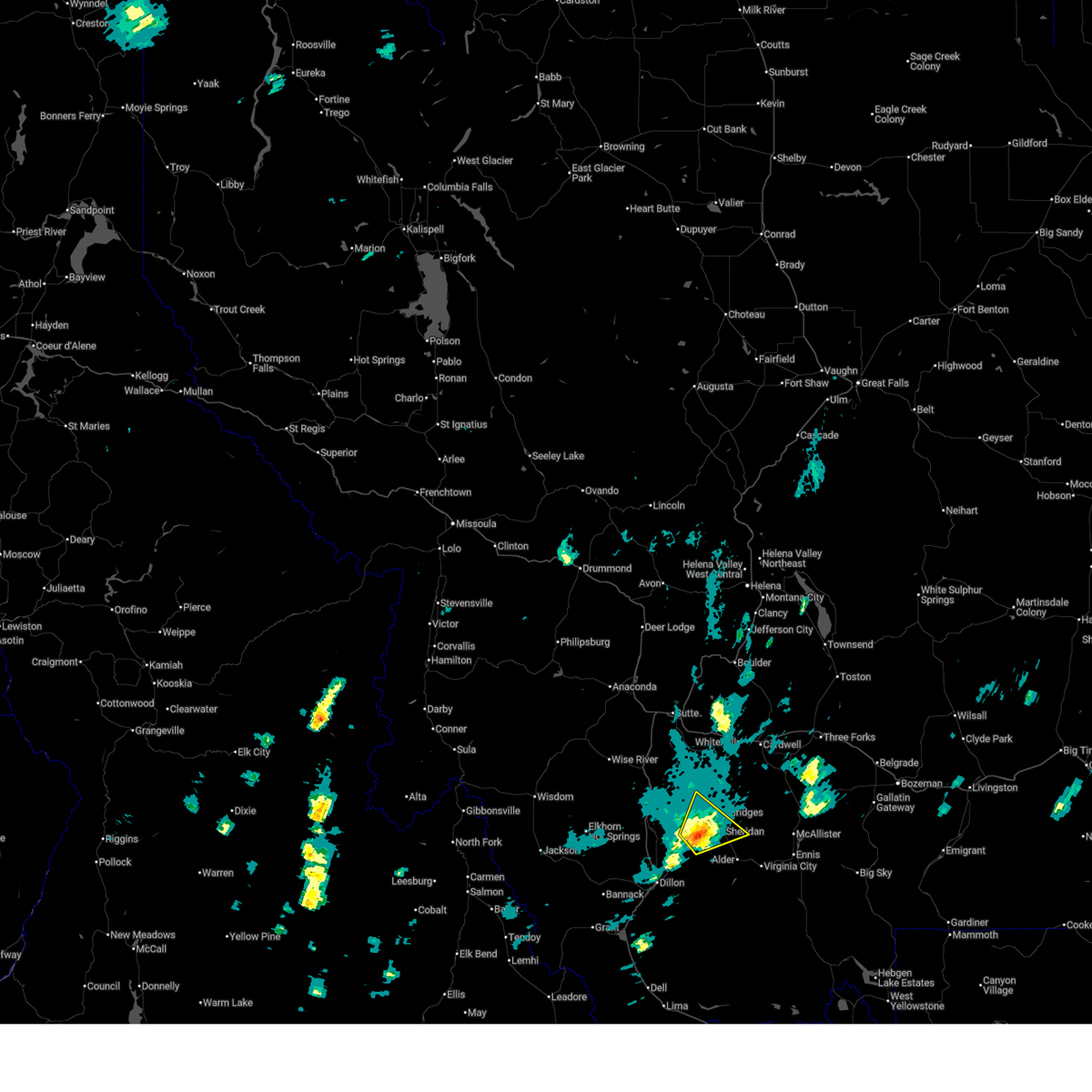
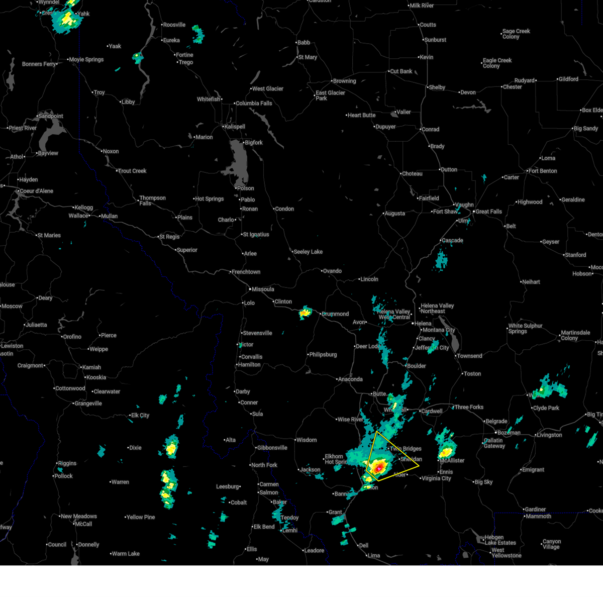
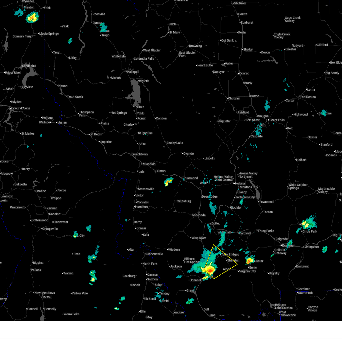
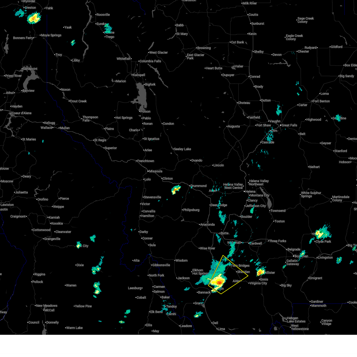
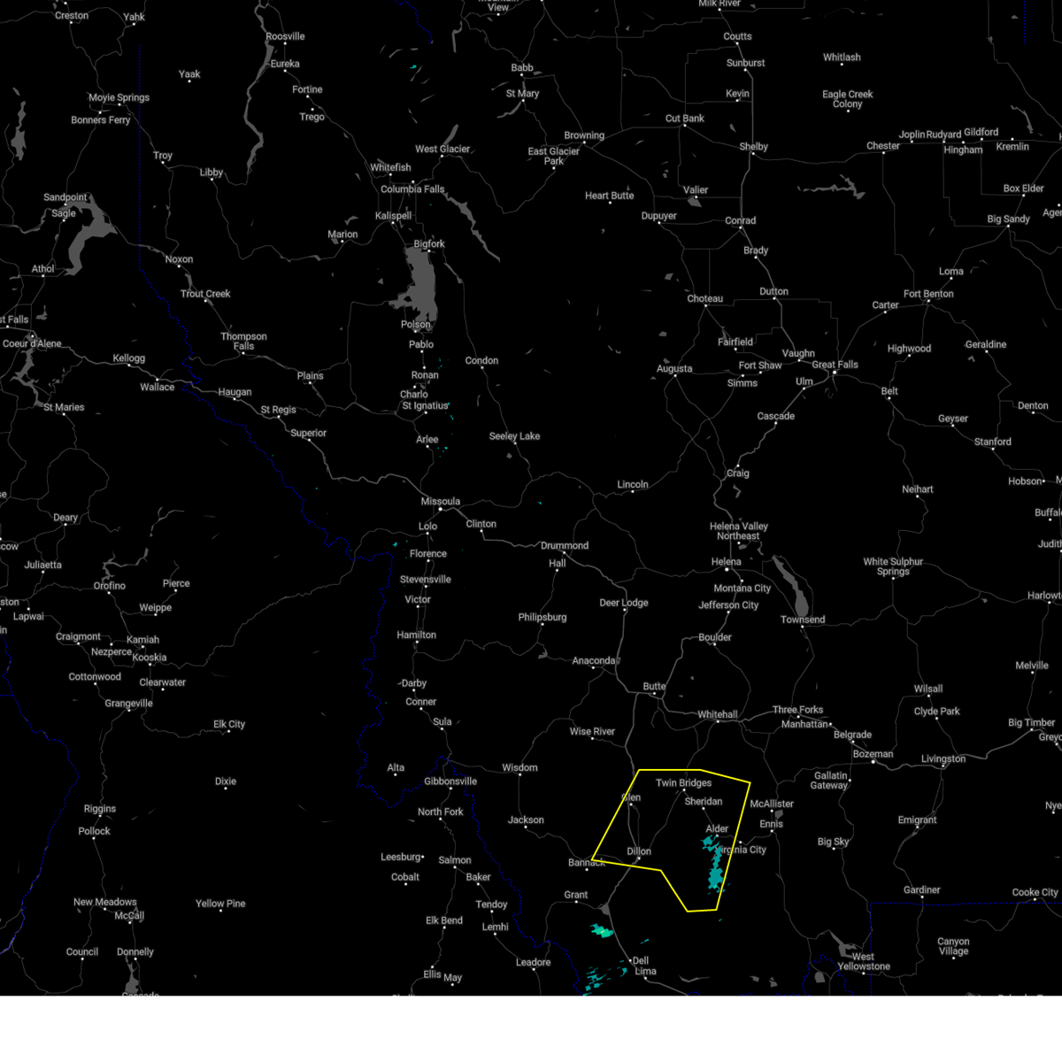
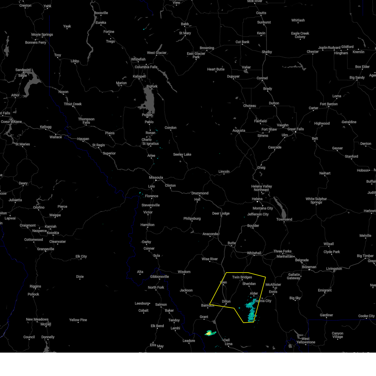
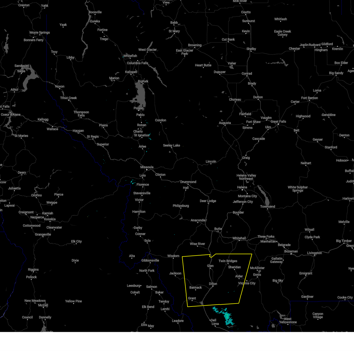
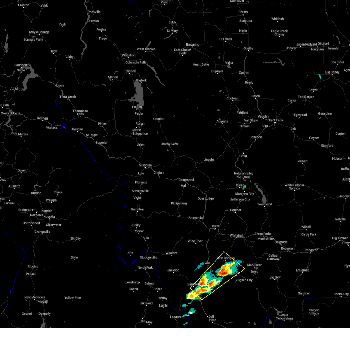
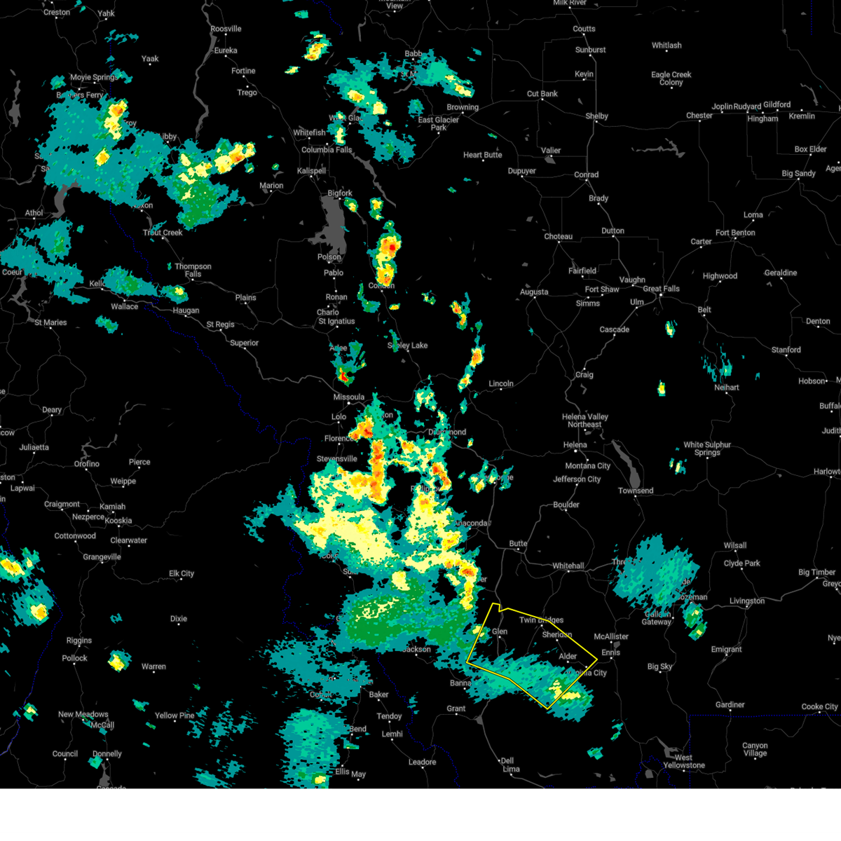
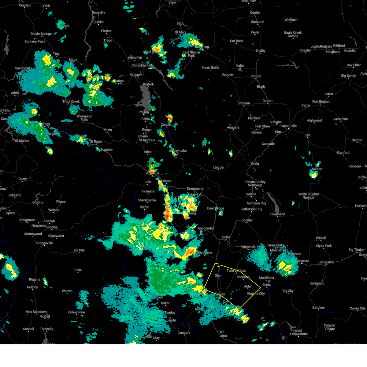
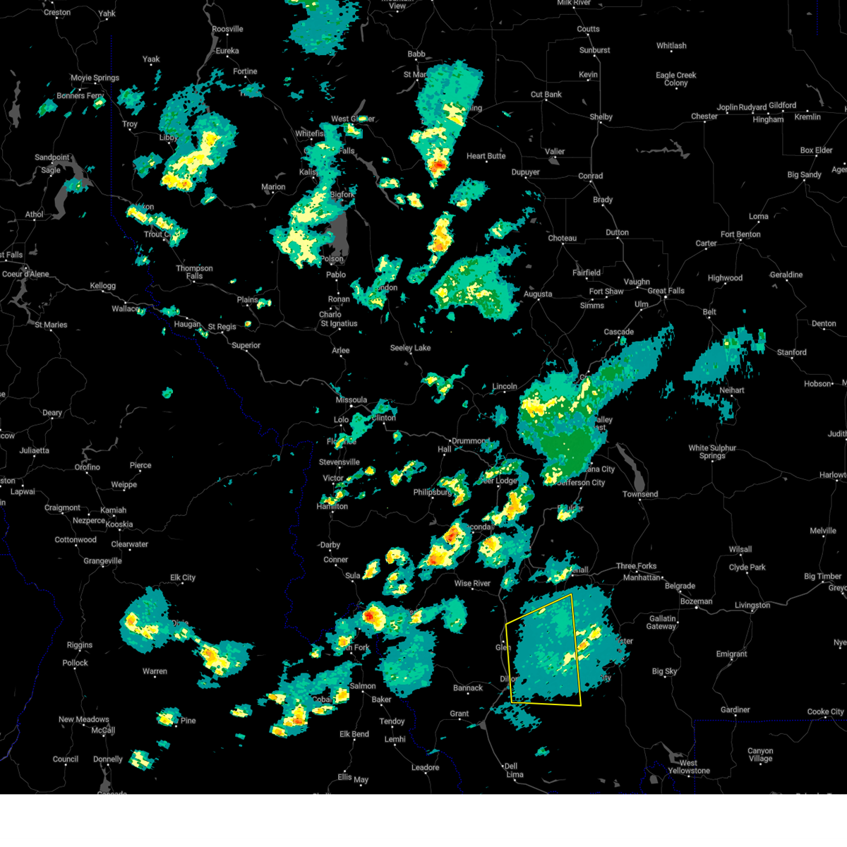
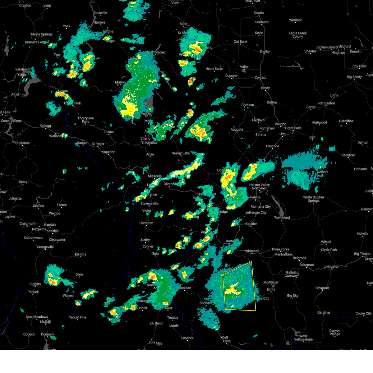
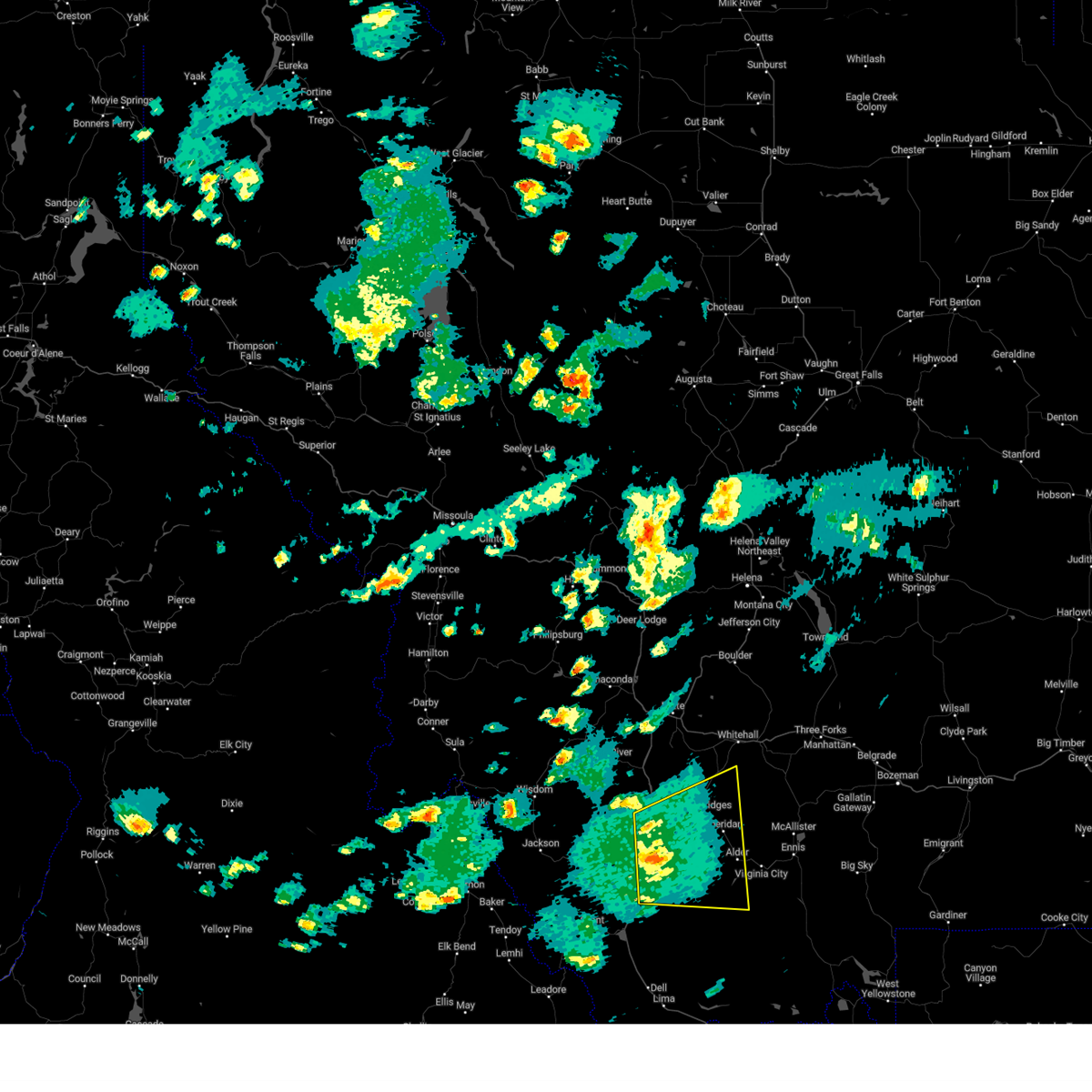
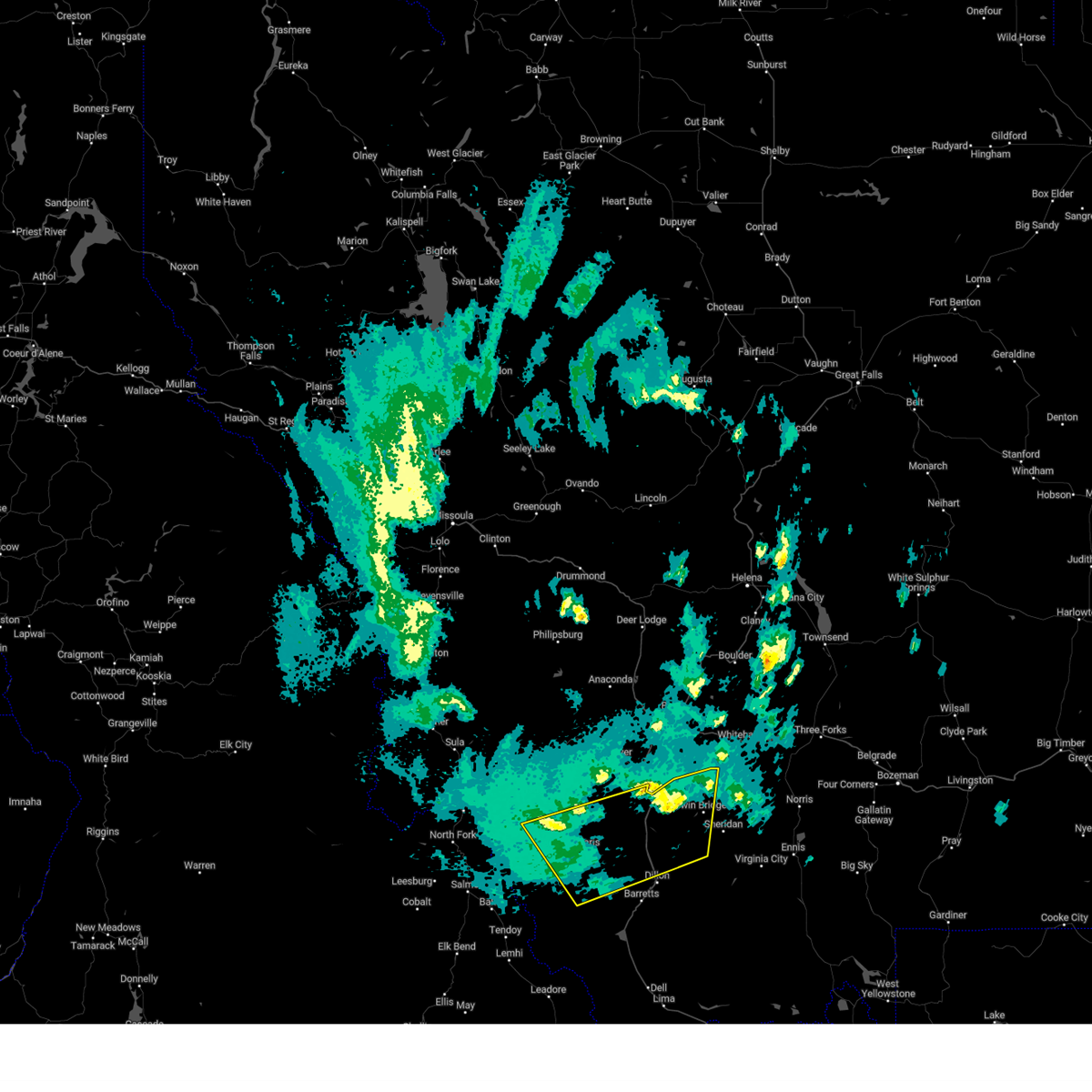
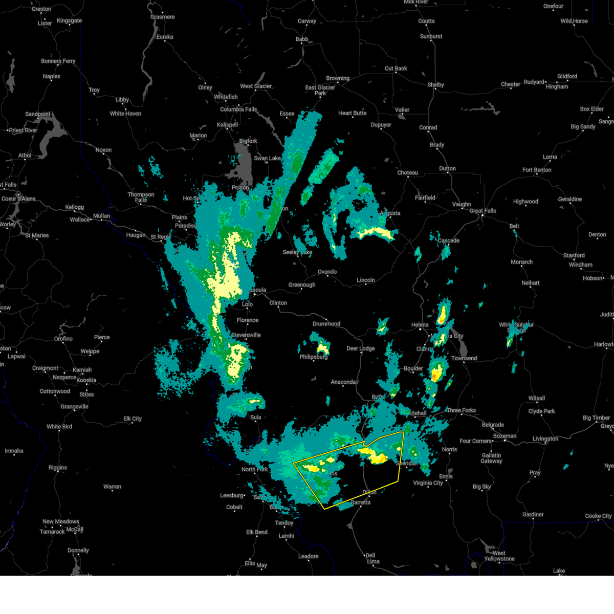
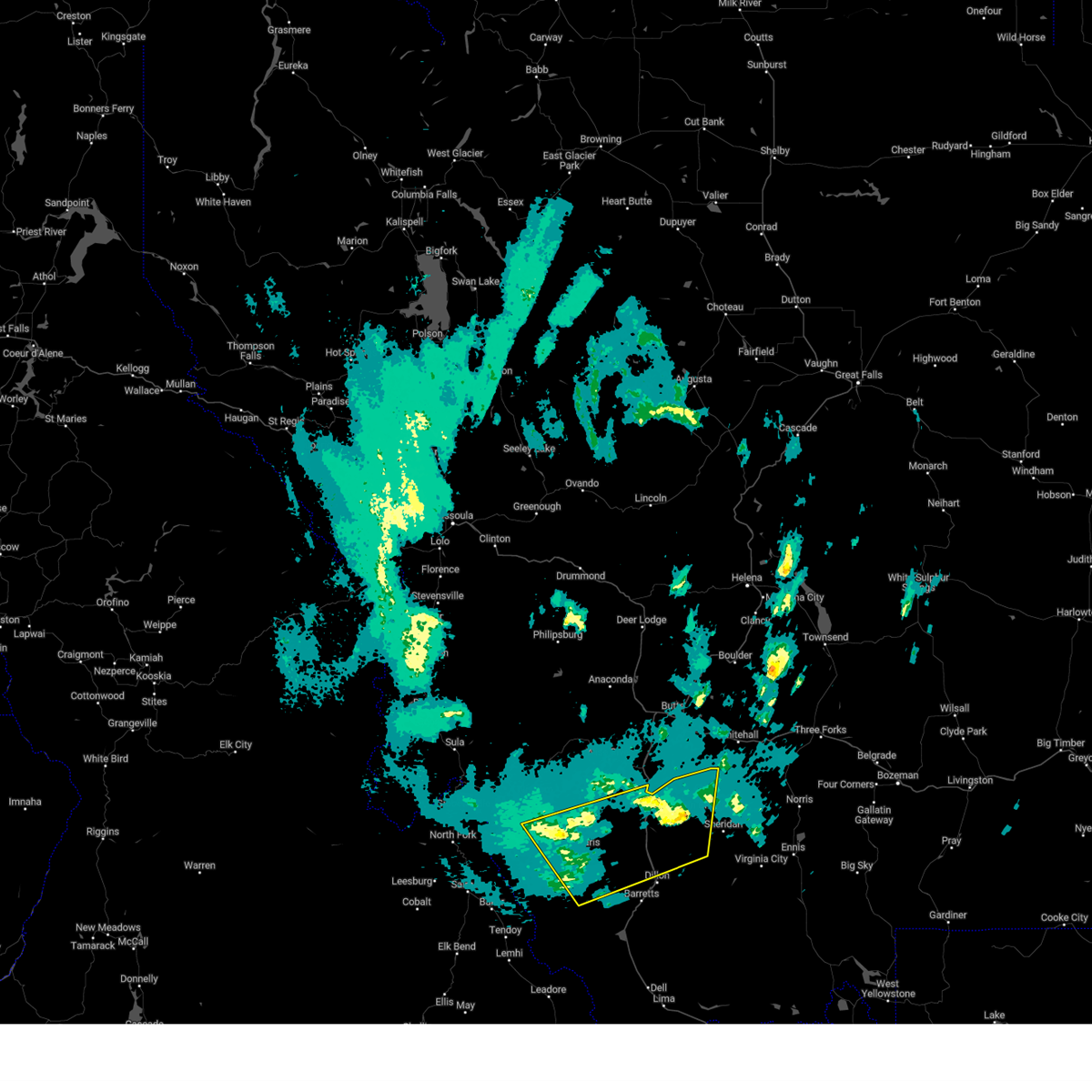
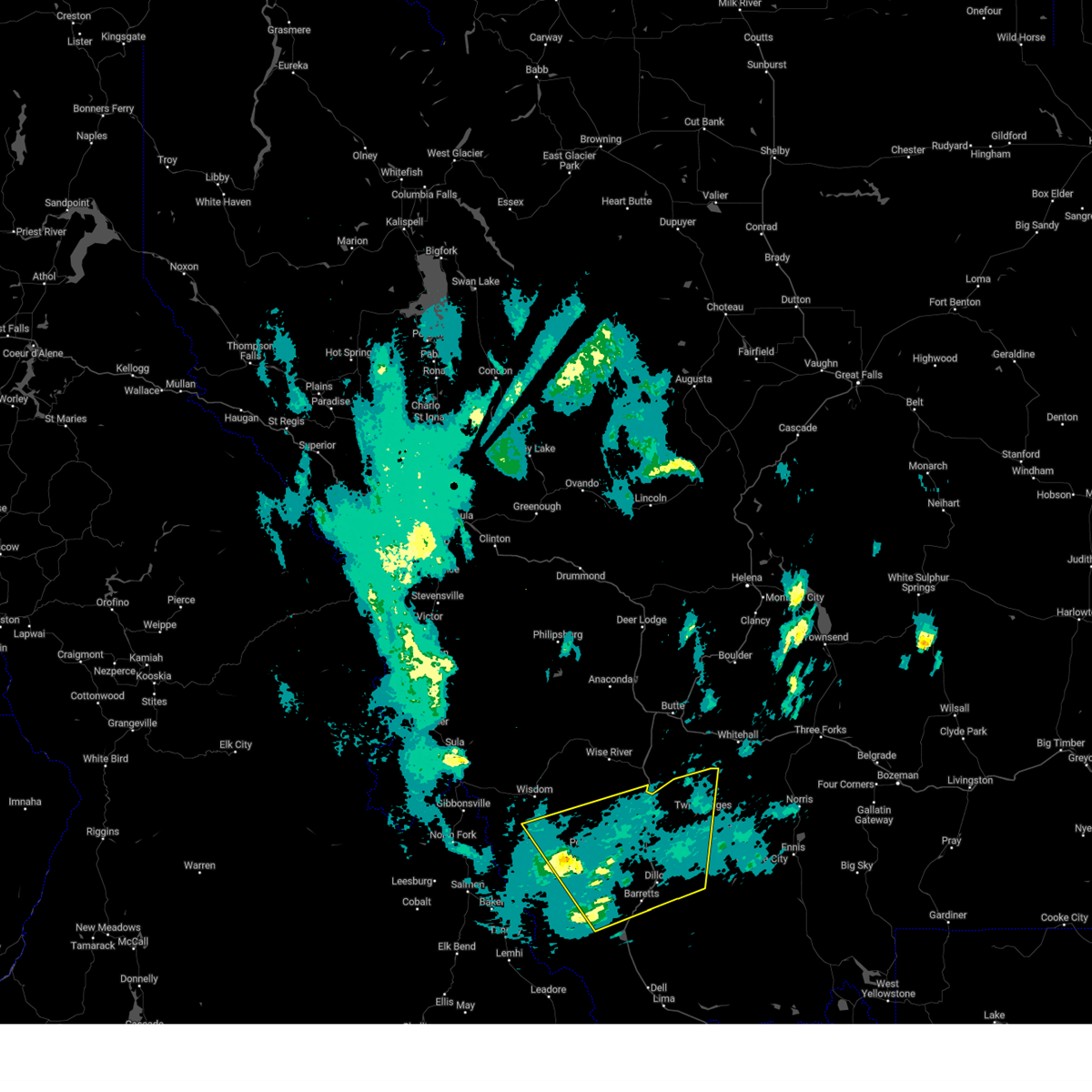
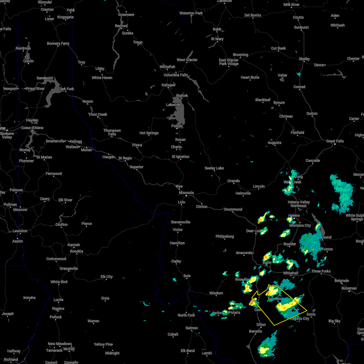
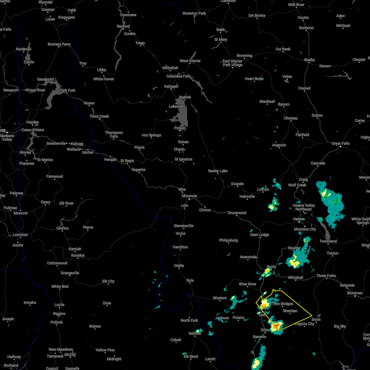
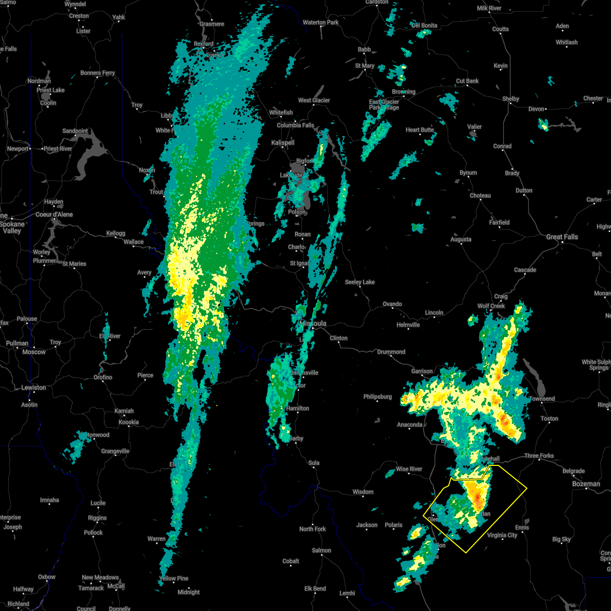
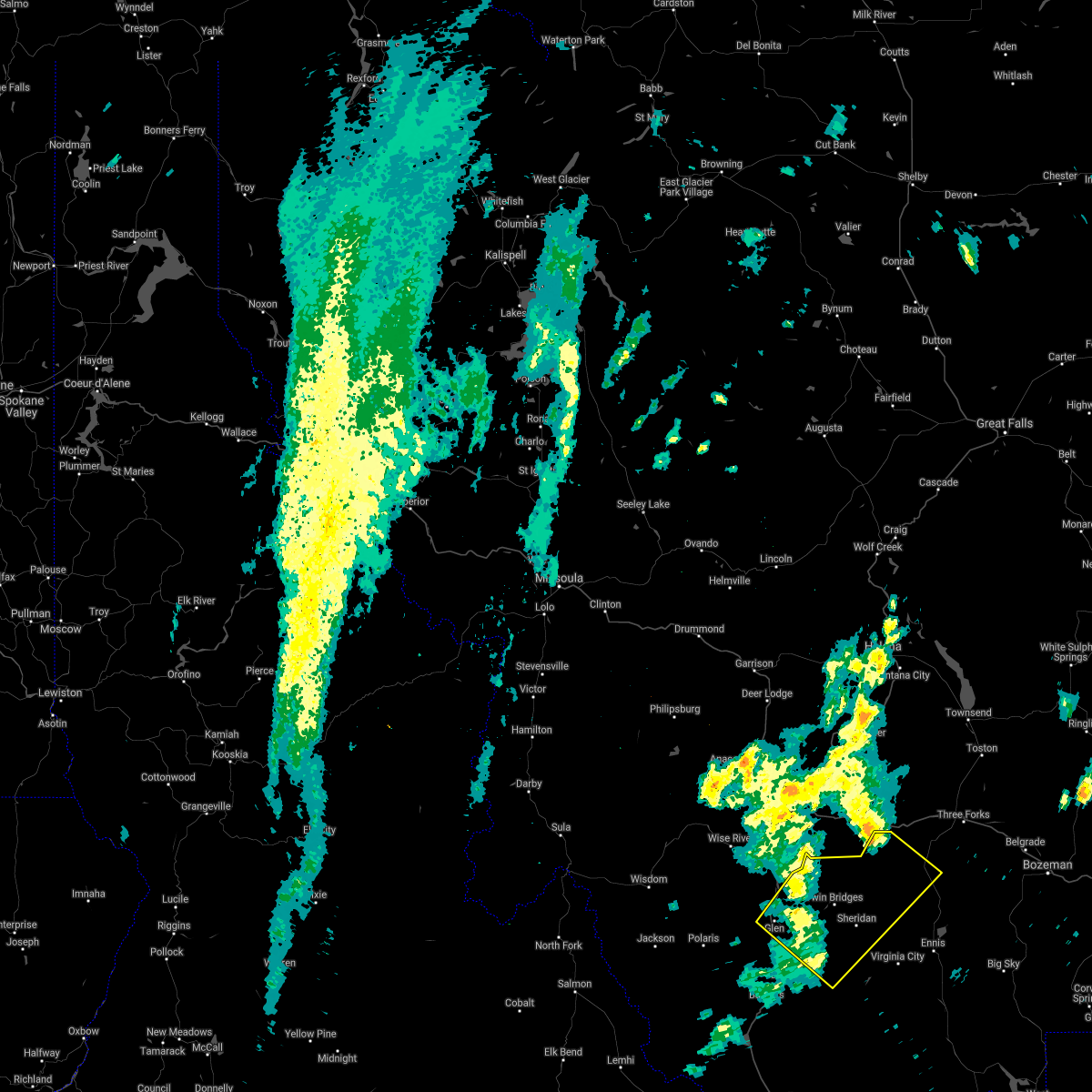
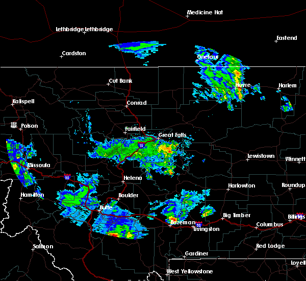
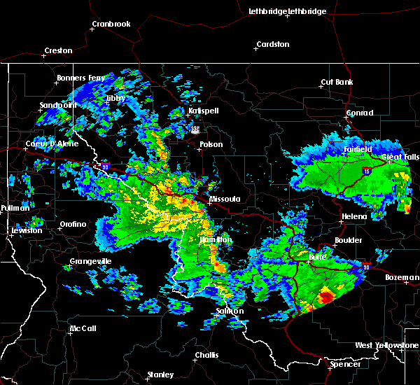
Hail Map for Twin Bridges, MT
The Twin Bridges, MT area has had 2 reports of on-the-ground hail by trained spotters, and has been under severe weather warnings 2 times during the past 12 months. Doppler radar has detected hail at or near Twin Bridges, MT on 7 occasions.
| Name: | Twin Bridges, MT |
| Where Located: | 63.7 miles W of Bozeman, MT |
| Map: | Google Map for Twin Bridges, MT |
| Population: | 375 |
| Housing Units: | 206 |
| More Info: | Search Google for Twin Bridges, MT |
0
The Top Recent Hail Date for Twin Bridges, MT is Tuesday, August 20, 2024 (5th out of 7)

Hail and Wind Damage Spotted near Twin Bridges, MT
| Date / Time | Report Details |
|---|---|
| 5/13/2026 2:55 PM MDT |
 The storm which prompted the warning has moved out of the area. therefore, the warning will be allowed to expire. however, gusty winds are still possible with this thunderstorm. a severe thunderstorm watch remains in effect until 900 pm mdt for southwestern montana. The storm which prompted the warning has moved out of the area. therefore, the warning will be allowed to expire. however, gusty winds are still possible with this thunderstorm. a severe thunderstorm watch remains in effect until 900 pm mdt for southwestern montana.
|
| 5/13/2026 2:35 PM MDT | Awos station krvf 1 ese twin bridge in madison county MT, 1.8 miles WNW of Twin Bridges, MT |
| 5/13/2026 2:13 PM MDT |
 Svrtfx the national weather service in great falls has issued a * severe thunderstorm warning for, northern madison county in southwestern montana, central beaverhead county in southwestern montana, * until 300 pm mdt. * at 212 pm mdt, a severe thunderstorm was located 8 miles east of dillon, moving northeast at 45 mph (radar indicated). Hazards include 70 mph wind gusts. Expect considerable tree damage. Damage is likely to mobile homes, roofs, and outbuildings. Svrtfx the national weather service in great falls has issued a * severe thunderstorm warning for, northern madison county in southwestern montana, central beaverhead county in southwestern montana, * until 300 pm mdt. * at 212 pm mdt, a severe thunderstorm was located 8 miles east of dillon, moving northeast at 45 mph (radar indicated). Hazards include 70 mph wind gusts. Expect considerable tree damage. Damage is likely to mobile homes, roofs, and outbuildings.
|
| 7/2/2025 2:55 PM MDT |
 The storm which prompted the warning has weakened below severe limits, and has exited the warned area. therefore, the warning will be allowed to expire. however, gusty winds are still possible with this thunderstorm. The storm which prompted the warning has weakened below severe limits, and has exited the warned area. therefore, the warning will be allowed to expire. however, gusty winds are still possible with this thunderstorm.
|
| 7/2/2025 2:43 PM MDT |
 At 243 pm mdt, a severe thunderstorm was located near twin bridges, or 7 miles west of sheridan, moving northeast at 35 mph (radar indicated). Hazards include 60 mph wind gusts. Expect damage to roofs, siding, and trees. Locations impacted include, sheridan and twin bridges. At 243 pm mdt, a severe thunderstorm was located near twin bridges, or 7 miles west of sheridan, moving northeast at 35 mph (radar indicated). Hazards include 60 mph wind gusts. Expect damage to roofs, siding, and trees. Locations impacted include, sheridan and twin bridges.
|
| 7/2/2025 2:43 PM MDT |
 the severe thunderstorm warning has been cancelled and is no longer in effect the severe thunderstorm warning has been cancelled and is no longer in effect
|
| 7/2/2025 2:29 PM MDT |
 At 229 pm mdt, a severe thunderstorm was located 12 miles southwest of twin bridges, or 13 miles southwest of sheridan, moving northeast at 35 mph (radar indicated). Hazards include 70 mph wind gusts and penny size hail. Expect considerable tree damage. damage is likely to mobile homes, roofs, and outbuildings. Locations impacted include, sheridan and twin bridges. At 229 pm mdt, a severe thunderstorm was located 12 miles southwest of twin bridges, or 13 miles southwest of sheridan, moving northeast at 35 mph (radar indicated). Hazards include 70 mph wind gusts and penny size hail. Expect considerable tree damage. damage is likely to mobile homes, roofs, and outbuildings. Locations impacted include, sheridan and twin bridges.
|
| 7/2/2025 2:21 PM MDT |
 At 221 pm mdt, a severe thunderstorm was located 10 miles northeast of dillon, moving northeast at 35 mph (trained weather spotters. at 215 pm a 74 mph wind gust was reported at the dillon airport). Hazards include 70 mph wind gusts. Expect considerable tree damage. damage is likely to mobile homes, roofs, and outbuildings. Locations impacted include, sheridan, twin bridges, and laurin. At 221 pm mdt, a severe thunderstorm was located 10 miles northeast of dillon, moving northeast at 35 mph (trained weather spotters. at 215 pm a 74 mph wind gust was reported at the dillon airport). Hazards include 70 mph wind gusts. Expect considerable tree damage. damage is likely to mobile homes, roofs, and outbuildings. Locations impacted include, sheridan, twin bridges, and laurin.
|
| 7/2/2025 2:16 PM MDT |
 Svrtfx the national weather service in great falls has issued a * severe thunderstorm warning for, northwestern madison county in southwestern montana, central beaverhead county in southwestern montana, * until 300 pm mdt. * at 216 pm mdt, a severe thunderstorm was located near dillon, moving northeast at 35 mph (radar indicated). Hazards include 60 mph wind gusts. expect damage to roofs, siding, and trees Svrtfx the national weather service in great falls has issued a * severe thunderstorm warning for, northwestern madison county in southwestern montana, central beaverhead county in southwestern montana, * until 300 pm mdt. * at 216 pm mdt, a severe thunderstorm was located near dillon, moving northeast at 35 mph (radar indicated). Hazards include 60 mph wind gusts. expect damage to roofs, siding, and trees
|
| 8/23/2024 2:50 AM MDT |
 The storms which prompted the warning have weakened below severe limits, and no longer pose an immediate threat to life or property. therefore, the warning will be allowed to expire. The storms which prompted the warning have weakened below severe limits, and no longer pose an immediate threat to life or property. therefore, the warning will be allowed to expire.
|
| 8/23/2024 2:35 AM MDT |
 At 235 am mdt, severe thunderstorms were located along a line extending from 13 miles northwest of dillon to 13 miles southwest of sheridan to near virginia city, moving north at 35 mph (radar indicated). Hazards include 60 mph wind gusts. Expect damage to roofs, siding, and trees. Locations impacted include, dillon, sheridan, twin bridges, alder, laurin, and glen. At 235 am mdt, severe thunderstorms were located along a line extending from 13 miles northwest of dillon to 13 miles southwest of sheridan to near virginia city, moving north at 35 mph (radar indicated). Hazards include 60 mph wind gusts. Expect damage to roofs, siding, and trees. Locations impacted include, dillon, sheridan, twin bridges, alder, laurin, and glen.
|
| 8/23/2024 1:56 AM MDT |
 Svrtfx the national weather service in great falls has issued a * severe thunderstorm warning for, western madison county in southwestern montana, central beaverhead county in southwestern montana, * until 300 am mdt. * at 156 am mdt, severe thunderstorms were located along a line extending from 19 miles southeast of jackson to dillon to 7 miles south of alder, moving north at 35 mph (radar indicated). Hazards include 60 mph wind gusts. expect damage to roofs, siding, and trees Svrtfx the national weather service in great falls has issued a * severe thunderstorm warning for, western madison county in southwestern montana, central beaverhead county in southwestern montana, * until 300 am mdt. * at 156 am mdt, severe thunderstorms were located along a line extending from 19 miles southeast of jackson to dillon to 7 miles south of alder, moving north at 35 mph (radar indicated). Hazards include 60 mph wind gusts. expect damage to roofs, siding, and trees
|
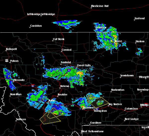
| 8/20/2024 2:45 PM MDT |
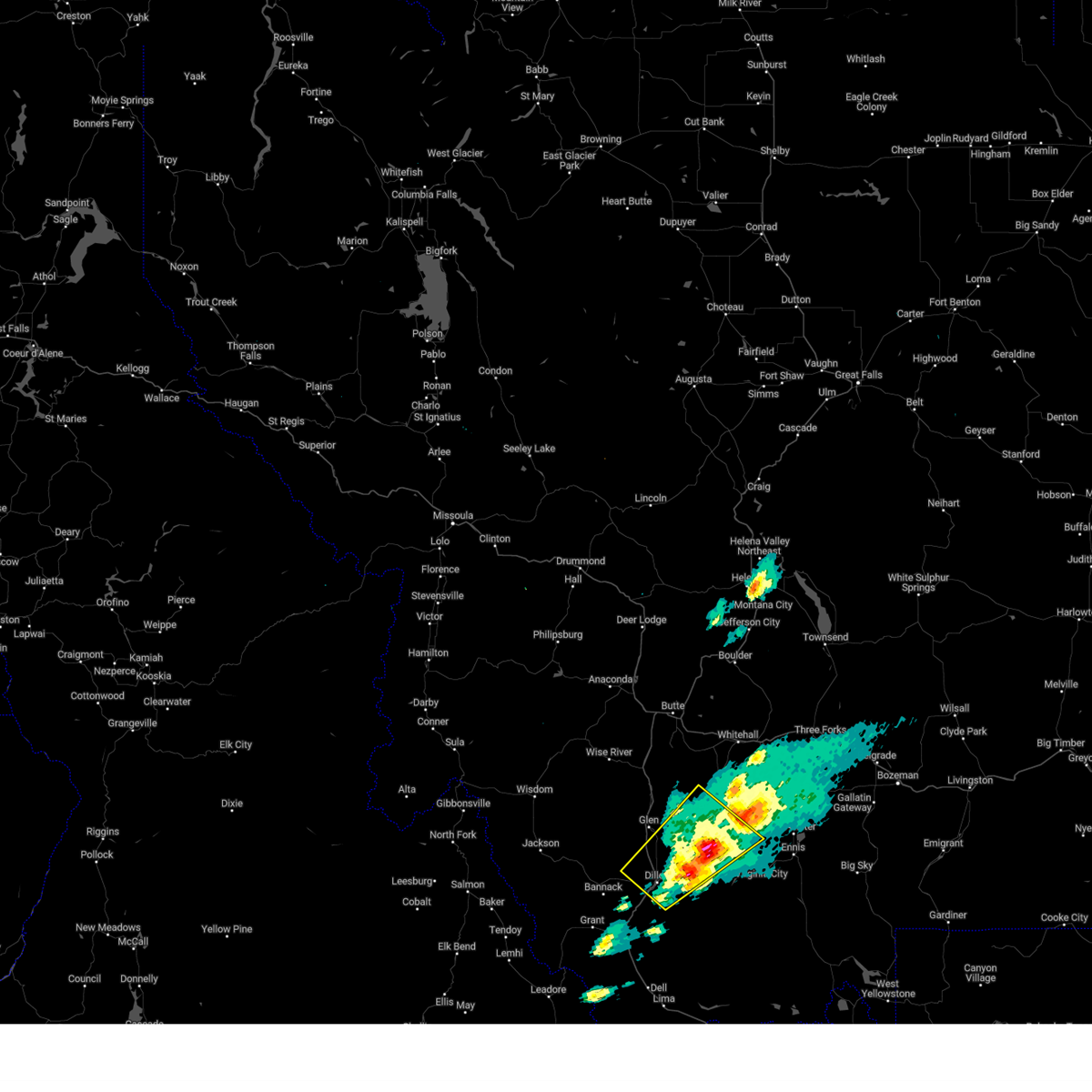 The severe thunderstorm which prompted the warning has moved out of beaverhead county and will be reissued for madison county. a severe thunderstorm watch remains in effect until 1000 pm mdt for southwestern montana. remember, a severe thunderstorm warning still remains in effect for madison county. The severe thunderstorm which prompted the warning has moved out of beaverhead county and will be reissued for madison county. a severe thunderstorm watch remains in effect until 1000 pm mdt for southwestern montana. remember, a severe thunderstorm warning still remains in effect for madison county.
|
| 8/20/2024 2:31 PM MDT |
 At 231 pm mdt, a severe thunderstorm was located 11 miles northeast of dillon, moving northeast at 30 mph (radar indicated). Hazards include 60 mph wind gusts and quarter size hail. Hail damage to vehicles is expected. expect wind damage to roofs, siding, and trees. Locations impacted include, dillon, sheridan, twin bridges, and laurin. At 231 pm mdt, a severe thunderstorm was located 11 miles northeast of dillon, moving northeast at 30 mph (radar indicated). Hazards include 60 mph wind gusts and quarter size hail. Hail damage to vehicles is expected. expect wind damage to roofs, siding, and trees. Locations impacted include, dillon, sheridan, twin bridges, and laurin.
|
| 8/20/2024 2:24 PM MDT |
 Svrtfx the national weather service in great falls has issued a * severe thunderstorm warning for, northern madison county in southwestern montana, * until 300 pm mdt. * at 224 pm mdt, a severe thunderstorm was located over sheridan, moving northeast at 25 mph (radar indicated). Hazards include 60 mph wind gusts and quarter size hail. Hail damage to vehicles is expected. Expect wind damage to roofs, siding, and trees. Svrtfx the national weather service in great falls has issued a * severe thunderstorm warning for, northern madison county in southwestern montana, * until 300 pm mdt. * at 224 pm mdt, a severe thunderstorm was located over sheridan, moving northeast at 25 mph (radar indicated). Hazards include 60 mph wind gusts and quarter size hail. Hail damage to vehicles is expected. Expect wind damage to roofs, siding, and trees.
|
| 8/20/2024 2:03 PM MDT |
 Svrtfx the national weather service in great falls has issued a * severe thunderstorm warning for, northwestern madison county in southwestern montana, central beaverhead county in southwestern montana, * until 245 pm mdt. * at 202 pm mdt, a severe thunderstorm was located over dillon, moving northeast at 25 mph (radar indicated. at 200 pm nickel-size hail was reported in dillon). Hazards include 60 mph wind gusts and quarter size hail. Hail damage to vehicles is expected. Expect wind damage to roofs, siding, and trees. Svrtfx the national weather service in great falls has issued a * severe thunderstorm warning for, northwestern madison county in southwestern montana, central beaverhead county in southwestern montana, * until 245 pm mdt. * at 202 pm mdt, a severe thunderstorm was located over dillon, moving northeast at 25 mph (radar indicated. at 200 pm nickel-size hail was reported in dillon). Hazards include 60 mph wind gusts and quarter size hail. Hail damage to vehicles is expected. Expect wind damage to roofs, siding, and trees.
|
| 8/15/2024 5:50 PM MDT |
 The storms which prompted the warning have weakened below severe limits, and no longer pose an immediate threat to life or property. therefore, the warning will be allowed to expire. however, gusty winds are still possible with these thunderstorms. The storms which prompted the warning have weakened below severe limits, and no longer pose an immediate threat to life or property. therefore, the warning will be allowed to expire. however, gusty winds are still possible with these thunderstorms.
|
| 8/15/2024 5:17 PM MDT |
 Svrtfx the national weather service in great falls has issued a * severe thunderstorm warning for, west central madison county in southwestern montana, central beaverhead county in southwestern montana, * until 600 pm mdt. * at 517 pm mdt, severe thunderstorms were located along a line extending from 24 miles east of jackson to 6 miles northeast of dillon to 16 miles southwest of alder, moving northeast at 30 mph (radar indicated). Hazards include 60 mph wind gusts. expect damage to roofs, siding, and trees Svrtfx the national weather service in great falls has issued a * severe thunderstorm warning for, west central madison county in southwestern montana, central beaverhead county in southwestern montana, * until 600 pm mdt. * at 517 pm mdt, severe thunderstorms were located along a line extending from 24 miles east of jackson to 6 miles northeast of dillon to 16 miles southwest of alder, moving northeast at 30 mph (radar indicated). Hazards include 60 mph wind gusts. expect damage to roofs, siding, and trees
|
| 8/10/2024 6:43 PM MDT |
 The storms which prompted the warning have weakened below severe limits, and no longer pose an immediate threat to life or property. therefore, the warning will be allowed to expire. however, gusty winds are still possible with these thunderstorms. The storms which prompted the warning have weakened below severe limits, and no longer pose an immediate threat to life or property. therefore, the warning will be allowed to expire. however, gusty winds are still possible with these thunderstorms.
|
| 8/10/2024 6:20 PM MDT |
 At 618 pm mdt, severe thunderstorms were located along a line extending from near twin bridges to 13 miles east of dillon, moving east at 35 mph (trained weather spotters and observed 62 mph wind gust at the dillon airport). Hazards include 60 mph wind gusts. Expect damage to roofs, siding, and trees. Locations impacted include, dillon, sheridan, twin bridges, alder, silver star, laurin, and waterloo. At 618 pm mdt, severe thunderstorms were located along a line extending from near twin bridges to 13 miles east of dillon, moving east at 35 mph (trained weather spotters and observed 62 mph wind gust at the dillon airport). Hazards include 60 mph wind gusts. Expect damage to roofs, siding, and trees. Locations impacted include, dillon, sheridan, twin bridges, alder, silver star, laurin, and waterloo.
|
| 8/10/2024 5:54 PM MDT |
 Svrtfx the national weather service in great falls has issued a * severe thunderstorm warning for, northwestern madison county in southwestern montana, central beaverhead county in southwestern montana, * until 645 pm mdt. * at 554 pm mdt, severe thunderstorms were located along a line extending from 16 miles west of twin bridges to dillon, moving east at 35 mph (trained weather spotters). Hazards include 60 mph wind gusts. expect damage to roofs, siding, and trees Svrtfx the national weather service in great falls has issued a * severe thunderstorm warning for, northwestern madison county in southwestern montana, central beaverhead county in southwestern montana, * until 645 pm mdt. * at 554 pm mdt, severe thunderstorms were located along a line extending from 16 miles west of twin bridges to dillon, moving east at 35 mph (trained weather spotters). Hazards include 60 mph wind gusts. expect damage to roofs, siding, and trees
|
| 4/5/2024 4:51 PM MDT |
 The storm which prompted the warning has weakened below severe limits, and has exited the warned area. therefore, the warning will be allowed to expire. The storm which prompted the warning has weakened below severe limits, and has exited the warned area. therefore, the warning will be allowed to expire.
|
| 4/5/2024 4:50 PM MDT |
 The storm which prompted the warning has weakened below severe limits, and has exited the warned area. therefore, the warning will be allowed to expire. The storm which prompted the warning has weakened below severe limits, and has exited the warned area. therefore, the warning will be allowed to expire.
|
| 4/5/2024 4:39 PM MDT |
 At 439 pm mdt, a severe thunderstorm was located 15 miles north of dillon, moving north at 45 mph (radar indicated). Hazards include 60 mph wind gusts. Expect damage to roofs, siding, and trees. Locations impacted include, twin bridges, silver star, jackson, melrose, polaris, bannack, bannack state park, and glen. At 439 pm mdt, a severe thunderstorm was located 15 miles north of dillon, moving north at 45 mph (radar indicated). Hazards include 60 mph wind gusts. Expect damage to roofs, siding, and trees. Locations impacted include, twin bridges, silver star, jackson, melrose, polaris, bannack, bannack state park, and glen.
|
| 4/5/2024 4:37 PM MDT |
 At 436 pm mdt, a severe thunderstorm was located 17 miles north of dillon, moving north at 45 mph (radar indicated). Hazards include 60 mph wind gusts. Expect damage to roofs, siding, and trees. Locations impacted include, twin bridges, silver star, jackson, melrose, polaris, bannack, bannack state park, and glen. At 436 pm mdt, a severe thunderstorm was located 17 miles north of dillon, moving north at 45 mph (radar indicated). Hazards include 60 mph wind gusts. Expect damage to roofs, siding, and trees. Locations impacted include, twin bridges, silver star, jackson, melrose, polaris, bannack, bannack state park, and glen.
|
| 4/5/2024 4:20 PM MDT |
 Svrtfx the national weather service in great falls has issued a * severe thunderstorm warning for, northwestern madison county in southwestern montana, central beaverhead county in southwestern montana, * until 500 pm mdt. * at 419 pm mdt, a severe thunderstorm was located near dillon, moving north at 35 mph (radar indicated). Hazards include 70 mph wind gusts. Expect considerable tree damage. Damage is likely to mobile homes, roofs, and outbuildings. Svrtfx the national weather service in great falls has issued a * severe thunderstorm warning for, northwestern madison county in southwestern montana, central beaverhead county in southwestern montana, * until 500 pm mdt. * at 419 pm mdt, a severe thunderstorm was located near dillon, moving north at 35 mph (radar indicated). Hazards include 70 mph wind gusts. Expect considerable tree damage. Damage is likely to mobile homes, roofs, and outbuildings.
|
| 7/1/2023 2:14 PM MDT | Madison county em relayed report of damage to structure between sheridan and twin bridge in madison county MT, 5.5 miles NW of Twin Bridges, MT |
| 6/28/2022 2:23 PM MDT |
 The severe thunderstorm warning for northwestern madison and north central beaverhead counties will expire at 230 pm mdt, the storm which prompted the warning has weakened below severe limits, and no longer poses an immediate threat to life or property. therefore, the warning will be allowed to expire. however gusty winds are still possible with this thunderstorm. The severe thunderstorm warning for northwestern madison and north central beaverhead counties will expire at 230 pm mdt, the storm which prompted the warning has weakened below severe limits, and no longer poses an immediate threat to life or property. therefore, the warning will be allowed to expire. however gusty winds are still possible with this thunderstorm.
|
| 6/28/2022 1:58 PM MDT |
 At 158 pm mdt, a severe thunderstorm was located 13 miles south of twin bridges, or 13 miles southwest of sheridan, moving northeast at 40 mph (radar indicated). Hazards include 60 mph wind gusts. expect damage to roofs, siding, and trees At 158 pm mdt, a severe thunderstorm was located 13 miles south of twin bridges, or 13 miles southwest of sheridan, moving northeast at 40 mph (radar indicated). Hazards include 60 mph wind gusts. expect damage to roofs, siding, and trees
|
| 9/10/2021 6:58 PM MDT |
 The severe thunderstorm warning for madison, central beaverhead and south central gallatin counties will expire at 700 pm mdt, the storms which prompted the warning have weakened below severe limits, and have exited the warned area. therefore, the warning will be allowed to expire. however gusty winds are still possible with these thunderstorms. to report severe weather, contact your nearest law enforcement agency. they will relay your report to the national weather service great falls. The severe thunderstorm warning for madison, central beaverhead and south central gallatin counties will expire at 700 pm mdt, the storms which prompted the warning have weakened below severe limits, and have exited the warned area. therefore, the warning will be allowed to expire. however gusty winds are still possible with these thunderstorms. to report severe weather, contact your nearest law enforcement agency. they will relay your report to the national weather service great falls.
|
| 9/10/2021 6:38 PM MDT |
 At 636 pm mdt, severe thunderstorms were located along a line extending from 24 miles north of wisdom to near harlequin lake, moving northeast at 50 mph (radar indicated. at 611 pm mdt, a 63 mph wind gust was reported at the dillon airport). Hazards include 70 mph wind gusts. Expect considerable tree damage. damage is likely to mobile homes, roofs, and outbuildings. blowing dust and smoke will also reduce visibility. locations impacted include, dillon, west yellowstone, sheridan, virginia city, ennis, twin bridges, pony, wisdom, alder, divide lake, silver star, west entrance, big sky, melrose, wise river, dewey, targhee pass, cameron, waterloo and glen. thunderstorm damage threat, considerable hail threat, radar indicated max hail size, <. 75 in wind threat, observed max wind gust, 70 mph. At 636 pm mdt, severe thunderstorms were located along a line extending from 24 miles north of wisdom to near harlequin lake, moving northeast at 50 mph (radar indicated. at 611 pm mdt, a 63 mph wind gust was reported at the dillon airport). Hazards include 70 mph wind gusts. Expect considerable tree damage. damage is likely to mobile homes, roofs, and outbuildings. blowing dust and smoke will also reduce visibility. locations impacted include, dillon, west yellowstone, sheridan, virginia city, ennis, twin bridges, pony, wisdom, alder, divide lake, silver star, west entrance, big sky, melrose, wise river, dewey, targhee pass, cameron, waterloo and glen. thunderstorm damage threat, considerable hail threat, radar indicated max hail size, <. 75 in wind threat, observed max wind gust, 70 mph.
|
| 9/10/2021 6:12 PM MDT |
 At 612 pm mdt, severe thunderstorms were located along a line extending from 16 miles southeast of conner to near island park village, moving northeast at 50 mph (radar indicated). Hazards include 70 mph wind gusts. Expect considerable tree damage. Damage is likely to mobile homes, roofs, and outbuildings. At 612 pm mdt, severe thunderstorms were located along a line extending from 16 miles southeast of conner to near island park village, moving northeast at 50 mph (radar indicated). Hazards include 70 mph wind gusts. Expect considerable tree damage. Damage is likely to mobile homes, roofs, and outbuildings.
|
| 8/17/2021 3:25 PM MDT |
 The severe thunderstorm warning for northwestern madison and central beaverhead counties will expire at 330 pm mdt, the storm which prompted the warning has weakened below severe limits, and has exited the warned area. therefore, the warning will be allowed to expire. however gusty winds and heavy rain are still possible with multiple thunderstorms moving through the region. The severe thunderstorm warning for northwestern madison and central beaverhead counties will expire at 330 pm mdt, the storm which prompted the warning has weakened below severe limits, and has exited the warned area. therefore, the warning will be allowed to expire. however gusty winds and heavy rain are still possible with multiple thunderstorms moving through the region.
|
| 8/17/2021 3:00 PM MDT |
 At 258 pm mdt, a severe thunderstorm was located near twin bridges, or 12 miles northwest of sheridan, moving northeast at 45 mph (radar indicated. additionally, 60 mph wind gust reported at dillon airport). Hazards include 60 mph wind gusts. expect damage to roofs, siding, and trees At 258 pm mdt, a severe thunderstorm was located near twin bridges, or 12 miles northwest of sheridan, moving northeast at 45 mph (radar indicated. additionally, 60 mph wind gust reported at dillon airport). Hazards include 60 mph wind gusts. expect damage to roofs, siding, and trees
|
| 8/26/2020 5:40 PM MDT | Corrects previous non-tstm wnd gst report from 2 ese twin bridges. awos station k7s1 twin bridge in madison county MT, 1.8 miles WNW of Twin Bridges, MT |
| 6/24/2020 5:55 PM MDT | Awos station k7s1 twin bridge in madison county MT, 1.8 miles WNW of Twin Bridges, MT |
| 8/11/2019 2:28 PM MDT |
 At 228 pm mdt, a severe thunderstorm was located over sheridan, moving northeast at 35 mph (radar indicated). Hazards include ping pong ball size hail and 60 mph wind gusts. People and animals outdoors will be injured. expect hail damage to roofs, siding, windows, and vehicles. expect wind damage to roofs, siding, and trees. Locations impacted include, sheridan, twin bridges, harrison, pony, norris and cardwell. At 228 pm mdt, a severe thunderstorm was located over sheridan, moving northeast at 35 mph (radar indicated). Hazards include ping pong ball size hail and 60 mph wind gusts. People and animals outdoors will be injured. expect hail damage to roofs, siding, windows, and vehicles. expect wind damage to roofs, siding, and trees. Locations impacted include, sheridan, twin bridges, harrison, pony, norris and cardwell.
|
| 8/11/2019 2:25 PM MDT |
 The severe thunderstorm warning for northwestern madison and northeastern beaverhead counties will expire at 230 pm mdt, the storm which prompted the warning has moved out of the area. a severe thunderstorm warning still remains in effect for northwestern madison county. The severe thunderstorm warning for northwestern madison and northeastern beaverhead counties will expire at 230 pm mdt, the storm which prompted the warning has moved out of the area. a severe thunderstorm warning still remains in effect for northwestern madison county.
|
| 8/11/2019 2:23 PM MDT |
 At 223 pm mdt, a severe thunderstorm was located over sheridan, moving northeast at 35 mph (radar indicated). Hazards include 60 mph wind gusts and quarter size hail. Hail damage to vehicles is expected. Expect wind damage to roofs, siding, and trees. At 223 pm mdt, a severe thunderstorm was located over sheridan, moving northeast at 35 mph (radar indicated). Hazards include 60 mph wind gusts and quarter size hail. Hail damage to vehicles is expected. Expect wind damage to roofs, siding, and trees.
|
| 8/11/2019 2:12 PM MDT |
 At 211 pm mdt, a severe thunderstorm was located 8 miles west of sheridan, moving northeast at 40 mph (doppler radar indicated). Hazards include 60 mph wind gusts and quarter size hail. Hail damage to vehicles is expected. expect wind damage to roofs, siding, and trees. Locations impacted include, sheridan, twin bridges and silver star. At 211 pm mdt, a severe thunderstorm was located 8 miles west of sheridan, moving northeast at 40 mph (doppler radar indicated). Hazards include 60 mph wind gusts and quarter size hail. Hail damage to vehicles is expected. expect wind damage to roofs, siding, and trees. Locations impacted include, sheridan, twin bridges and silver star.
|
| 8/11/2019 2:00 PM MDT |
 At 159 pm mdt, a severe thunderstorm was located 13 miles northeast of dillon, moving east at 45 mph (trained weather spotters). Hazards include 60 mph wind gusts and half dollar size hail. Hail damage to vehicles is expected. expect wind damage to roofs, siding, and trees. Locations impacted include, sheridan, twin bridges and silver star. At 159 pm mdt, a severe thunderstorm was located 13 miles northeast of dillon, moving east at 45 mph (trained weather spotters). Hazards include 60 mph wind gusts and half dollar size hail. Hail damage to vehicles is expected. expect wind damage to roofs, siding, and trees. Locations impacted include, sheridan, twin bridges and silver star.
|
| 8/11/2019 1:53 PM MDT |
 At 152 pm mdt, a severe thunderstorm was located 8 miles north of dillon, moving northeast at 45 mph (trained weather spotters). Hazards include golf ball size hail and 60 mph wind gusts. People and animals outdoors will be injured. expect hail damage to roofs, siding, windows, and vehicles. expect wind damage to roofs, siding, and trees. This storm is also producing accumulating hail on roadways, be prepared for hazardous driving conditions. At 152 pm mdt, a severe thunderstorm was located 8 miles north of dillon, moving northeast at 45 mph (trained weather spotters). Hazards include golf ball size hail and 60 mph wind gusts. People and animals outdoors will be injured. expect hail damage to roofs, siding, windows, and vehicles. expect wind damage to roofs, siding, and trees. This storm is also producing accumulating hail on roadways, be prepared for hazardous driving conditions.
|
| 8/1/2013 4:00 PM MDT | Quarter sized hail reported 0.3 miles NW of Twin Bridges, MT, trees down |
| 8/1/2013 3:58 PM MDT | Ping Pong Ball sized hail reported 0.5 miles SSW of Twin Bridges, MT, five large trees ripped from the ground pointing east. ping-pong size hail also reported. |
| 8/1/2013 3:58 PM MDT | Five large trees ripped from the ground pointing east. ping-pong size hail also reporte in madison county MT, 0.5 miles SSW of Twin Bridges, MT |
| 8/1/2013 3:55 PM MDT | Wind gust to 90 mph near twin bridge in madison county MT, 1.8 miles WNW of Twin Bridges, MT |
Hail Maps for Twin Bridges, MT


Connect with Interactive Hail Maps