

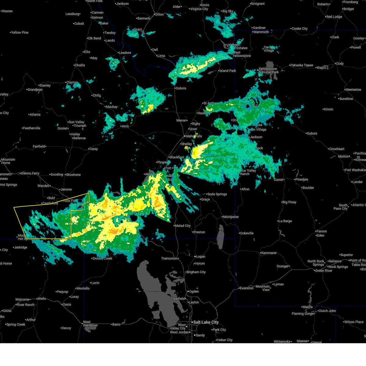
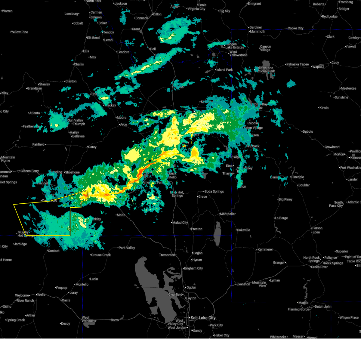
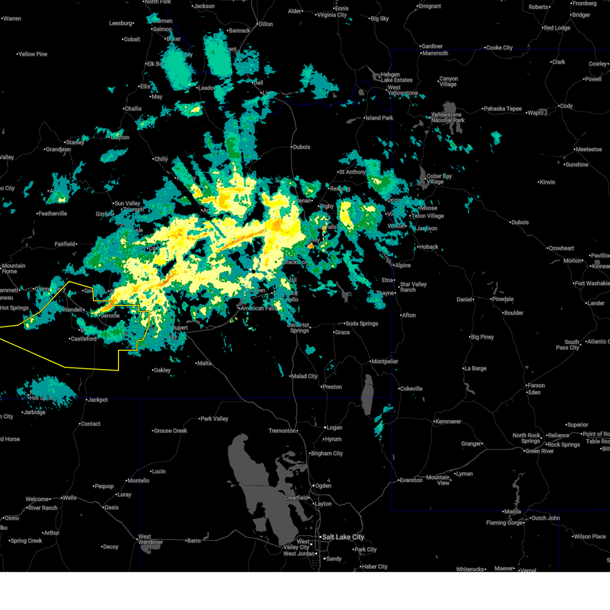
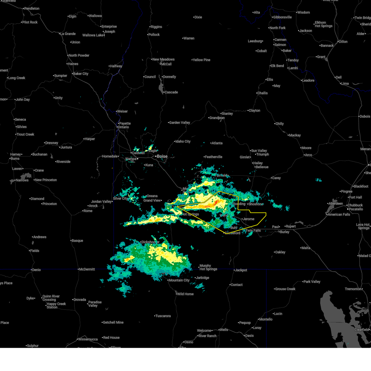
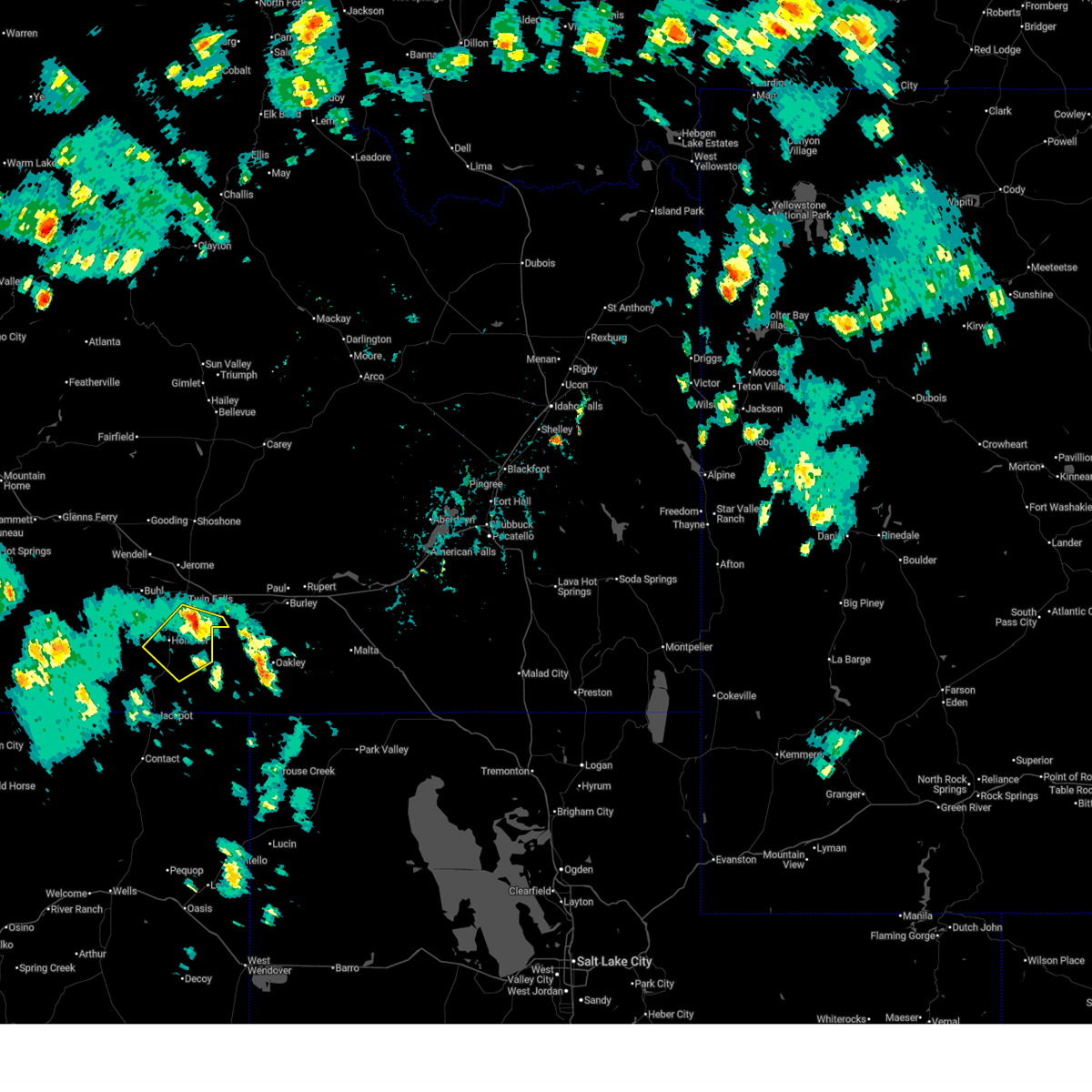
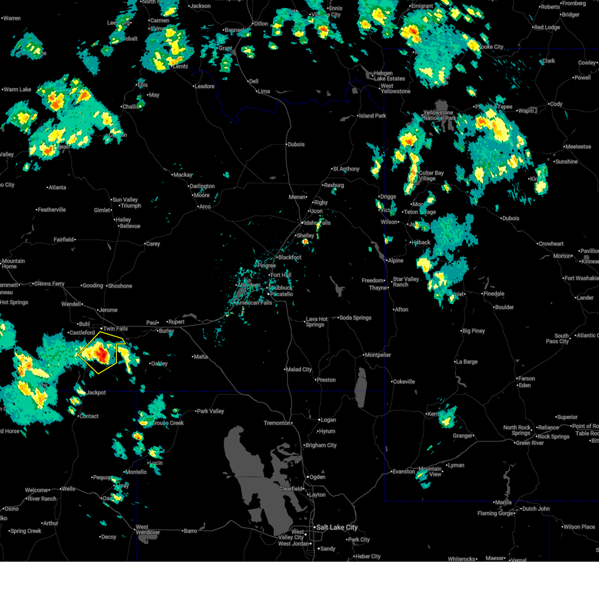
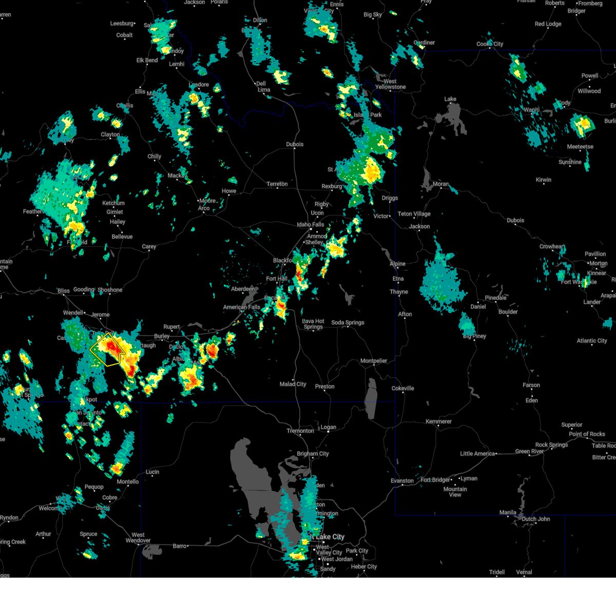
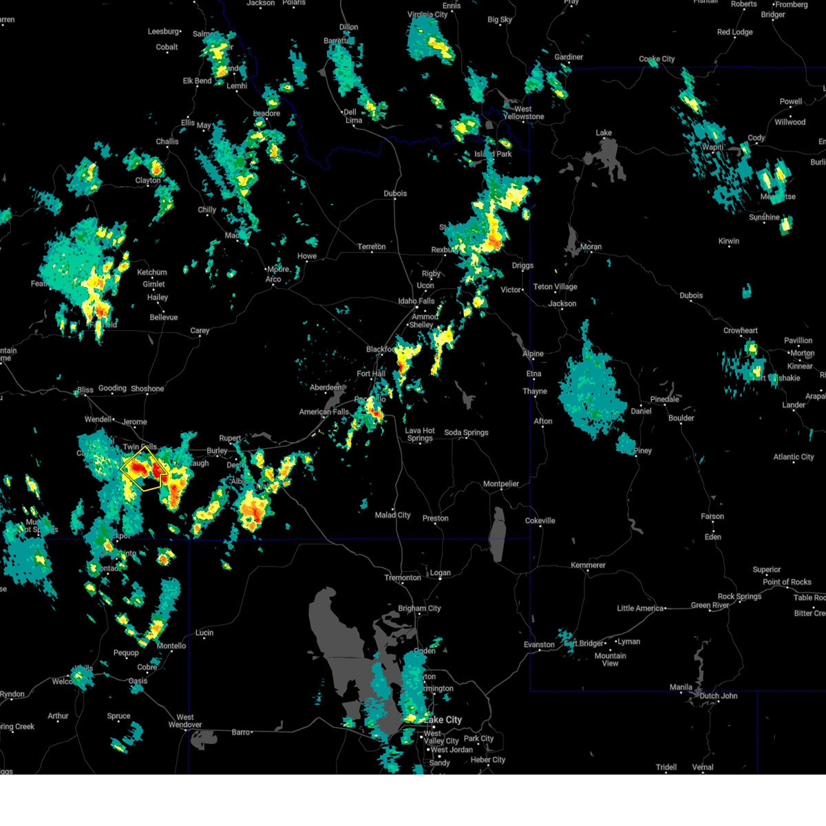
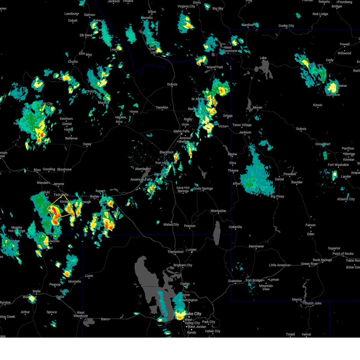
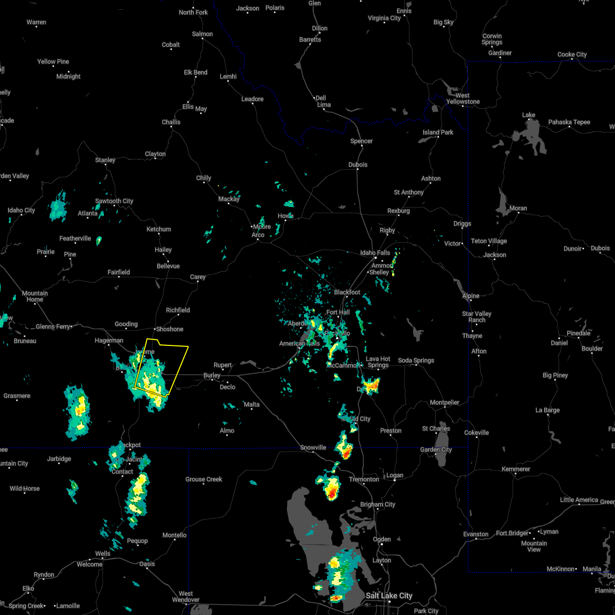
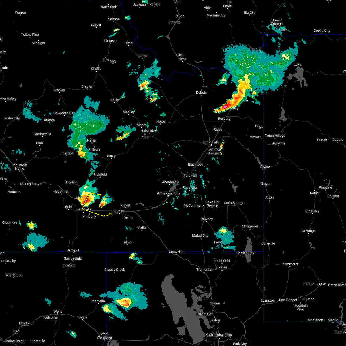
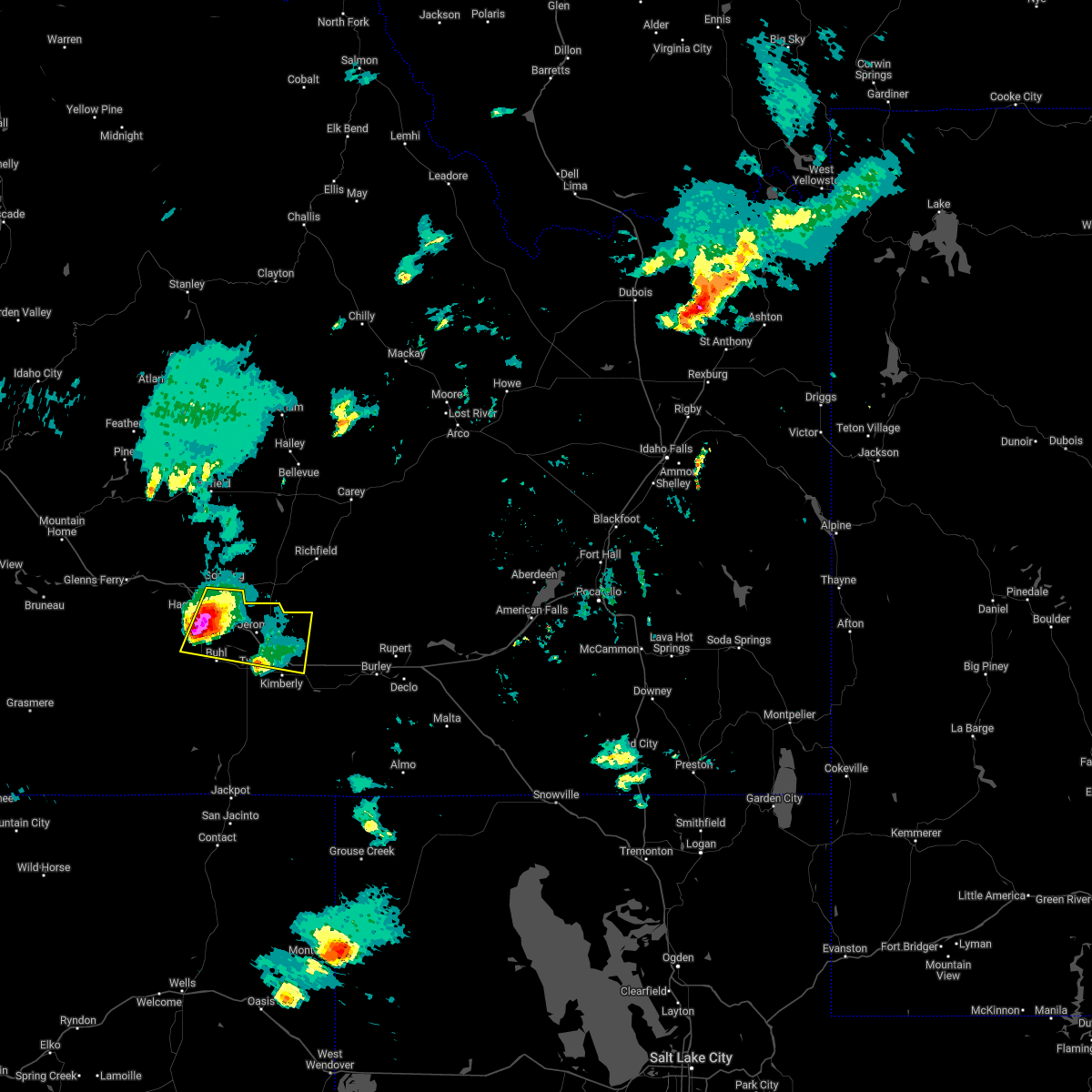
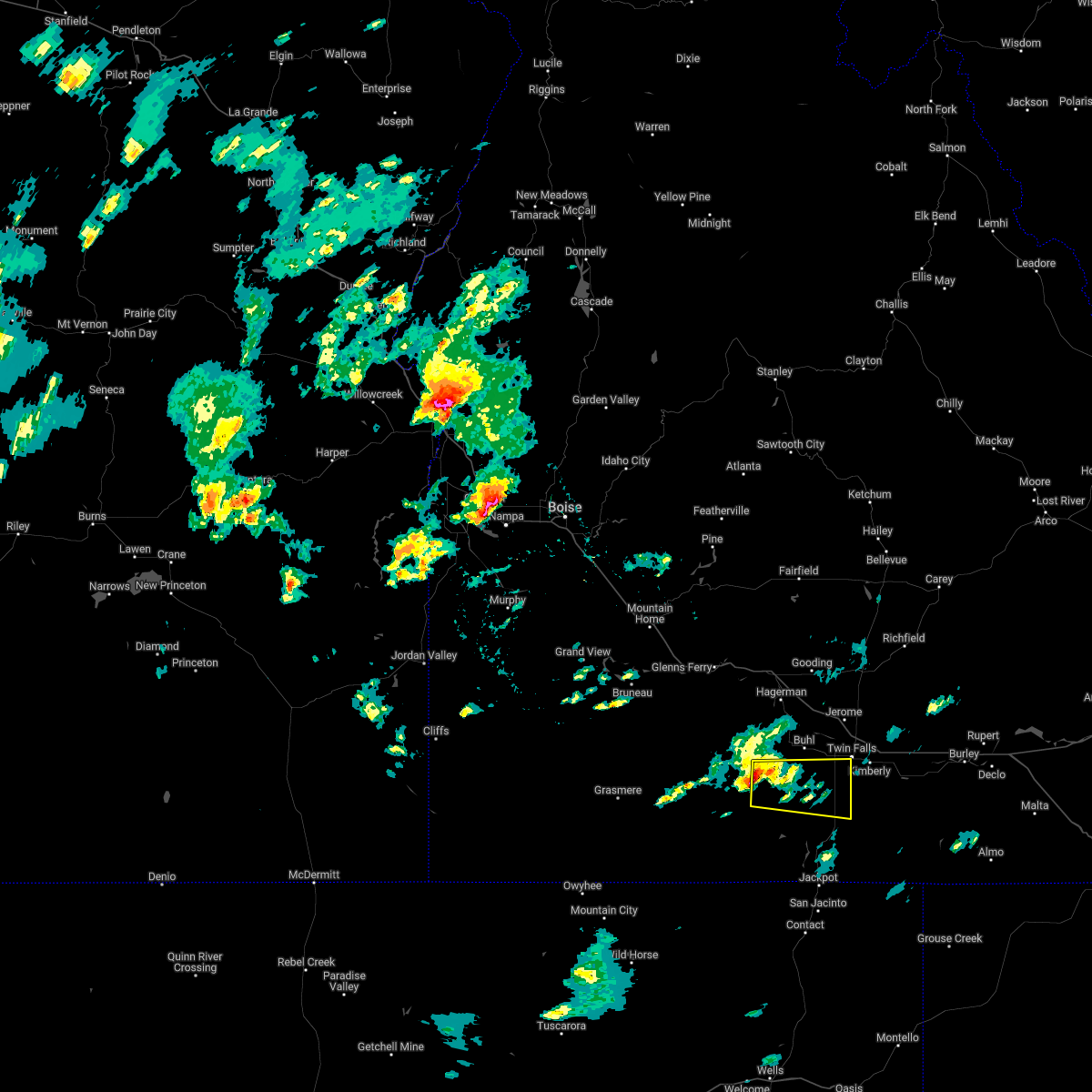
Hail Map for Twin Falls, ID
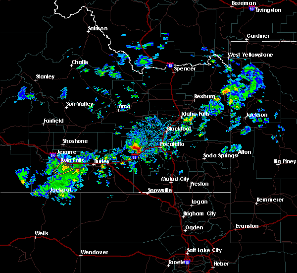
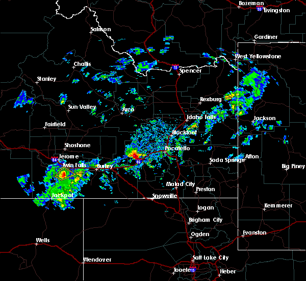
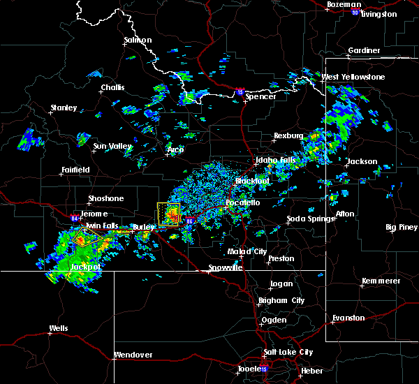
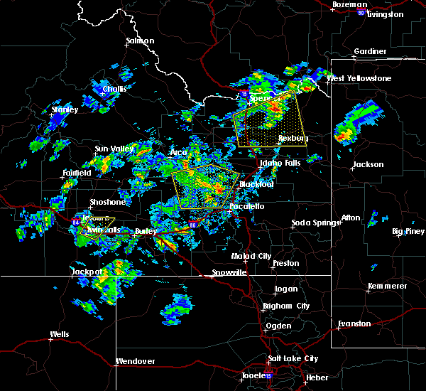
The Twin Falls, ID area has had 10 reports of on-the-ground hail by trained spotters, and has been under severe weather warnings 7 times during the past 12 months. Doppler radar has detected hail at or near Twin Falls, ID on 10 occasions.
| Name: | Twin Falls, ID |
| Where Located: | 0.4 miles ENE of Twin Falls, ID |
| Map: | Google Map for Twin Falls, ID |
| Population: | 44125 |
| Housing Units: | 18033 |
| More Info: | Search Google for Twin Falls, ID |
3
The Top Recent Hail Date for Twin Falls, ID is Thursday, July 25, 2024 (3rd out of 10)

Hail and Wind Damage Spotted near Twin Falls, ID
| Date / Time | Report Details |
|---|---|
| 12/17/2025 10:41 AM MST |
 The storms which prompted the warning have weakened below severe limits, and no longer pose an immediate threat to life or property. therefore, the warning will be allowed to expire. when safe to do so, please relay storm reports to the national weather service in boise via local law enforcement, or national weather service boise facebook and twitter accounts. The storms which prompted the warning have weakened below severe limits, and no longer pose an immediate threat to life or property. therefore, the warning will be allowed to expire. when safe to do so, please relay storm reports to the national weather service in boise via local law enforcement, or national weather service boise facebook and twitter accounts.
|
| 12/17/2025 10:00 AM MST | A member of the public posted a photo of a large fallen tree over the road... blocking traffi in twin falls county ID, 2.3 miles NE of Twin Falls, ID |
| 12/17/2025 9:56 AM MST |
 Svrboi the national weather service in boise has issued a * severe thunderstorm warning for, southeastern jerome county in south central idaho, twin falls county in south central idaho, southeastern owyhee county in southwestern idaho, * until 1045 am mst. * at 956 am mst, severe thunderstorms were located along a line extending from near milner dam to 7 miles west of magic valley regional airport to juniper ranch, moving southeast at 60 mph (radar indicated). Hazards include 70 mph wind gusts and penny size hail. Expect considerable tree damage. damage is likely to mobile homes, roofs, and outbuildings. severe thunderstorms will be near, kimberly, hansen, hollister, and murtaugh around 1000 am mst. Rogerson around 1030 am mst. Svrboi the national weather service in boise has issued a * severe thunderstorm warning for, southeastern jerome county in south central idaho, twin falls county in south central idaho, southeastern owyhee county in southwestern idaho, * until 1045 am mst. * at 956 am mst, severe thunderstorms were located along a line extending from near milner dam to 7 miles west of magic valley regional airport to juniper ranch, moving southeast at 60 mph (radar indicated). Hazards include 70 mph wind gusts and penny size hail. Expect considerable tree damage. damage is likely to mobile homes, roofs, and outbuildings. severe thunderstorms will be near, kimberly, hansen, hollister, and murtaugh around 1000 am mst. Rogerson around 1030 am mst.
|
| 12/17/2025 9:46 AM MST | Asos station ktwf twin fall in twin falls county ID, 5.5 miles N of Twin Falls, ID |
| 12/17/2025 9:09 AM MST |
 Svrboi the national weather service in boise has issued a * severe thunderstorm warning for, jerome county in south central idaho, twin falls county in south central idaho, southeastern elmore county in southwestern idaho, east central owyhee county in southwestern idaho, southern gooding county in south central idaho, * until 1000 am mst. * at 908 am mst, severe thunderstorms were located along a line extending from near gooding to 9 miles south of twentymile butte to near crows nest butte to near twin butte, moving east at 65 mph (radar indicated). Hazards include 70 mph wind gusts and penny size hail. Expect considerable tree damage. damage is likely to mobile homes, roofs, and outbuildings. severe thunderstorms will be near, gooding, wendell, hagerman, and crows nest butte around 910 am mst. jerome, buhl, and castleford around 920 am mst. twin falls, filer, horse butte, and clover creek crossing around 930 am mst. kimberly, hansen, hazelton, and eden around 940 am mst. Murtaugh, rock creek, and milner dam around 950 am mst. Svrboi the national weather service in boise has issued a * severe thunderstorm warning for, jerome county in south central idaho, twin falls county in south central idaho, southeastern elmore county in southwestern idaho, east central owyhee county in southwestern idaho, southern gooding county in south central idaho, * until 1000 am mst. * at 908 am mst, severe thunderstorms were located along a line extending from near gooding to 9 miles south of twentymile butte to near crows nest butte to near twin butte, moving east at 65 mph (radar indicated). Hazards include 70 mph wind gusts and penny size hail. Expect considerable tree damage. damage is likely to mobile homes, roofs, and outbuildings. severe thunderstorms will be near, gooding, wendell, hagerman, and crows nest butte around 910 am mst. jerome, buhl, and castleford around 920 am mst. twin falls, filer, horse butte, and clover creek crossing around 930 am mst. kimberly, hansen, hazelton, and eden around 940 am mst. Murtaugh, rock creek, and milner dam around 950 am mst.
|
| 12/17/2025 8:33 AM MST |
 Svrboi the national weather service in boise has issued a * severe thunderstorm warning for, jerome county in south central idaho, northwestern twin falls county in south central idaho, southeastern elmore county in southwestern idaho, east central owyhee county in southwestern idaho, gooding county in south central idaho, * until 915 am mst. * at 832 am mst, severe thunderstorms were located along a line extending from near white arrow hot spring to near glenns ferry to bruneau sand dunes, moving east at 55 mph (radar indicated). Hazards include 70 mph wind gusts and penny size hail. Expect considerable tree damage. damage is likely to mobile homes, roofs, and outbuildings. severe thunderstorms will be near, bliss, deadman flat, and twentymile butte around 840 am mst. gooding and hagerman around 850 am mst. wendell around 900 am mst. Jerome around 910 am mst. Svrboi the national weather service in boise has issued a * severe thunderstorm warning for, jerome county in south central idaho, northwestern twin falls county in south central idaho, southeastern elmore county in southwestern idaho, east central owyhee county in southwestern idaho, gooding county in south central idaho, * until 915 am mst. * at 832 am mst, severe thunderstorms were located along a line extending from near white arrow hot spring to near glenns ferry to bruneau sand dunes, moving east at 55 mph (radar indicated). Hazards include 70 mph wind gusts and penny size hail. Expect considerable tree damage. damage is likely to mobile homes, roofs, and outbuildings. severe thunderstorms will be near, bliss, deadman flat, and twentymile butte around 840 am mst. gooding and hagerman around 850 am mst. wendell around 900 am mst. Jerome around 910 am mst.
|
| 12/17/2025 8:30 AM MST | Asos station ktwf twin fall in twin falls county ID, 5.5 miles N of Twin Falls, ID |
| 12/17/2025 7:00 AM MST | Downed tree and power line critically injured 2 children waiting for a school bu in twin falls county ID, 0.2 miles WSW of Twin Falls, ID |
| 7/31/2025 3:37 PM MDT |
 The storm which prompted the warning has weakened below severe limits, and no longer poses an immediate threat to life or property. therefore, the warning will be allowed to expire. however, gusty winds are still possible with this thunderstorm. when safe to do so, please relay storm reports to the national weather service in boise via local law enforcement, or national weather service boise facebook and twitter accounts. The storm which prompted the warning has weakened below severe limits, and no longer poses an immediate threat to life or property. therefore, the warning will be allowed to expire. however, gusty winds are still possible with this thunderstorm. when safe to do so, please relay storm reports to the national weather service in boise via local law enforcement, or national weather service boise facebook and twitter accounts.
|
| 7/31/2025 3:23 PM MDT |
 At 323 pm mdt, a severe thunderstorm was located 8 miles east of hollister, or 14 miles south of twin falls, moving northeast at 15 mph (radar indicated). Hazards include 60 mph wind gusts. Expect damage to roofs, siding, and trees. Locations impacted include, twin falls, rogerson, hollister, magic valley regional airport, and rock creek. At 323 pm mdt, a severe thunderstorm was located 8 miles east of hollister, or 14 miles south of twin falls, moving northeast at 15 mph (radar indicated). Hazards include 60 mph wind gusts. Expect damage to roofs, siding, and trees. Locations impacted include, twin falls, rogerson, hollister, magic valley regional airport, and rock creek.
|
| 7/31/2025 2:57 PM MDT | Svrboi the national weather service in boise has issued a * severe thunderstorm warning for, central twin falls county in south central idaho, * until 345 pm mdt. * at 257 pm mdt, a severe thunderstorm was located near hollister, or 18 miles south of twin falls, moving northeast at 15 mph (radar indicated). Hazards include 70 mph wind gusts. Expect considerable tree damage. Damage is likely to mobile homes, roofs, and outbuildings. |
| 5/11/2025 1:58 PM MDT | Asos station ktwf twin fall in twin falls county ID, 5.5 miles N of Twin Falls, ID |
| 5/26/2023 2:50 PM MDT |
 The severe thunderstorm warning for central twin falls county will expire at 300 pm mdt, the storm which prompted the warning has weakened below severe limits, and no longer poses an immediate threat to life or property. therefore, the warning will be allowed to expire. however small hail, gusty winds and heavy rain are still possible with this thunderstorm. when safe to do so, please relay storm reports to the national weather service in boise via local law enforcement, or national weather service boise facebook and twitter accounts. The severe thunderstorm warning for central twin falls county will expire at 300 pm mdt, the storm which prompted the warning has weakened below severe limits, and no longer poses an immediate threat to life or property. therefore, the warning will be allowed to expire. however small hail, gusty winds and heavy rain are still possible with this thunderstorm. when safe to do so, please relay storm reports to the national weather service in boise via local law enforcement, or national weather service boise facebook and twitter accounts.
|
| 5/26/2023 2:37 PM MDT |
 At 237 pm mdt, a severe thunderstorm was located near magic valley regional airport, or 7 miles south of twin falls, moving northeast at 25 mph (trained weather spotters). Hazards include 60 mph wind gusts and half dollar size hail. Hail damage to vehicles is expected. expect wind damage to roofs, siding, and trees. this severe storm will be near, rock creek around 240 pm mdt. twin falls and kimberly around 250 pm mdt. hail threat, observed max hail size, 1. 25 in wind threat, radar indicated max wind gust, 60 mph. At 237 pm mdt, a severe thunderstorm was located near magic valley regional airport, or 7 miles south of twin falls, moving northeast at 25 mph (trained weather spotters). Hazards include 60 mph wind gusts and half dollar size hail. Hail damage to vehicles is expected. expect wind damage to roofs, siding, and trees. this severe storm will be near, rock creek around 240 pm mdt. twin falls and kimberly around 250 pm mdt. hail threat, observed max hail size, 1. 25 in wind threat, radar indicated max wind gust, 60 mph.
|
| 5/26/2023 2:25 PM MDT | Half Dollar sized hail reported 15.6 miles NNE of Twin Falls, ID |
| 5/26/2023 2:22 PM MDT | Quarter sized hail reported 15.6 miles NNE of Twin Falls, ID |
| 5/26/2023 2:19 PM MDT | Quarter sized hail reported 15.6 miles NNE of Twin Falls, ID |
| 5/26/2023 2:16 PM MDT |
 At 216 pm mdt, a severe thunderstorm was located over hollister, or 15 miles southwest of twin falls, moving northeast at 20 mph (radar indicated). Hazards include 60 mph wind gusts and half dollar size hail. Hail damage to vehicles is expected. expect wind damage to roofs, siding, and trees. this severe thunderstorm will be near, magic valley regional airport around 240 pm mdt. twin falls, kimberly and rock creek around 300 pm mdt. hail threat, radar indicated max hail size, 1. 25 in wind threat, radar indicated max wind gust, 60 mph. At 216 pm mdt, a severe thunderstorm was located over hollister, or 15 miles southwest of twin falls, moving northeast at 20 mph (radar indicated). Hazards include 60 mph wind gusts and half dollar size hail. Hail damage to vehicles is expected. expect wind damage to roofs, siding, and trees. this severe thunderstorm will be near, magic valley regional airport around 240 pm mdt. twin falls, kimberly and rock creek around 300 pm mdt. hail threat, radar indicated max hail size, 1. 25 in wind threat, radar indicated max wind gust, 60 mph.
|
| 5/25/2023 6:39 PM MDT | Storm damage reported in twin falls county ID, 17.7 miles NNE of Twin Falls, ID |
| 5/25/2023 6:35 PM MDT | Quarter sized hail reported 17.7 miles NNE of Twin Falls, ID, lots of lightning. |
| 3/10/2023 12:30 PM MST | Over 8000 customers without power in the twin falls area. ktwf and kjer without powe in twin falls county ID, 0.2 miles WSW of Twin Falls, ID |
| 9/21/2022 12:22 PM MDT |
 At 1221 pm mdt, a severe thunderstorm was located over kimberly, or near twin falls, moving northeast at 60 mph (61 mph gust measured at twin falls airport). Hazards include 65 mph wind gusts. Expect damage to roofs, siding, and trees. this severe thunderstorm will be near, jerome, eden and minidoka national monument around 1230 pm mdt. hail threat, radar indicated max hail size, <. 75 in wind threat, observed max wind gust, 60 mph. At 1221 pm mdt, a severe thunderstorm was located over kimberly, or near twin falls, moving northeast at 60 mph (61 mph gust measured at twin falls airport). Hazards include 65 mph wind gusts. Expect damage to roofs, siding, and trees. this severe thunderstorm will be near, jerome, eden and minidoka national monument around 1230 pm mdt. hail threat, radar indicated max hail size, <. 75 in wind threat, observed max wind gust, 60 mph.
|
| 9/21/2022 12:08 PM MDT | Storm damage reported in twin falls county ID, 4.8 miles N of Twin Falls, ID |
| 6/5/2022 6:47 PM MDT |
 At 647 pm mdt, a severe thunderstorm was located near minidoka national monument, or 9 miles east of jerome, moving east at 40 mph (radar indicated). Hazards include 60 mph wind gusts and quarter size hail. Hail damage to vehicles is expected. expect wind damage to roofs, siding, and trees. this severe thunderstorm will be near, minidoka national monument around 650 pm mdt. eden and hazelton around 700 pm mdt. milner dam around 710 pm mdt. hail threat, radar indicated max hail size, 1. 00 in wind threat, radar indicated max wind gust, 60 mph. At 647 pm mdt, a severe thunderstorm was located near minidoka national monument, or 9 miles east of jerome, moving east at 40 mph (radar indicated). Hazards include 60 mph wind gusts and quarter size hail. Hail damage to vehicles is expected. expect wind damage to roofs, siding, and trees. this severe thunderstorm will be near, minidoka national monument around 650 pm mdt. eden and hazelton around 700 pm mdt. milner dam around 710 pm mdt. hail threat, radar indicated max hail size, 1. 00 in wind threat, radar indicated max wind gust, 60 mph.
|
| 6/5/2022 6:14 PM MDT |
 At 613 pm mdt, a severe thunderstorm was located near wendell, or 12 miles south of gooding, moving east at 40 mph (radar indicated). Hazards include 60 mph wind gusts and quarter size hail. Hail damage to vehicles is expected. Expect wind damage to roofs, siding, and trees. At 613 pm mdt, a severe thunderstorm was located near wendell, or 12 miles south of gooding, moving east at 40 mph (radar indicated). Hazards include 60 mph wind gusts and quarter size hail. Hail damage to vehicles is expected. Expect wind damage to roofs, siding, and trees.
|
| 6/5/2022 3:11 PM MDT |
 At 311 pm mdt, a severe thunderstorm was located near roseworth, or 27 miles west of twin falls, moving east at 30 mph (radar indicated). Hazards include 60 mph wind gusts and quarter size hail. Hail damage to vehicles is expected. expect wind damage to roofs, siding, and trees. this severe thunderstorm will be near, castleford around 320 pm mdt. hollister around 350 pm mdt. twin falls and magic valley regional airport around 400 pm mdt. hail threat, radar indicated max hail size, 1. 00 in wind threat, radar indicated max wind gust, 60 mph. At 311 pm mdt, a severe thunderstorm was located near roseworth, or 27 miles west of twin falls, moving east at 30 mph (radar indicated). Hazards include 60 mph wind gusts and quarter size hail. Hail damage to vehicles is expected. expect wind damage to roofs, siding, and trees. this severe thunderstorm will be near, castleford around 320 pm mdt. hollister around 350 pm mdt. twin falls and magic valley regional airport around 400 pm mdt. hail threat, radar indicated max hail size, 1. 00 in wind threat, radar indicated max wind gust, 60 mph.
|
| 10/19/2019 2:30 PM MDT | Measured at hansen bridge in twin falls county ID, 0.2 miles WSW of Twin Falls, ID |
| 10/19/2019 2:26 PM MDT | Storm damage reported in twin falls county ID, 0.2 miles WSW of Twin Falls, ID |
| 10/19/2019 2:21 PM MDT | Storm damage reported in twin falls county ID, 0.2 miles WSW of Twin Falls, ID |
| 10/19/2019 2:14 PM MDT | Recorded at perrine bridge in downtown twf in twin falls county ID, 0.2 miles WSW of Twin Falls, ID |
| 9/9/2019 7:03 PM MDT | Quarter sized hail reported 5.9 miles NNE of Twin Falls, ID |
| 9/9/2019 7:01 PM MDT | Quarter sized hail reported 6.9 miles NE of Twin Falls, ID |
| 9/9/2019 6:56 PM MDT | Half Dollar sized hail reported 9.1 miles NE of Twin Falls, ID |
| 9/9/2019 6:53 PM MDT |
 At 653 pm mdt, a severe thunderstorm was located near magic valley regional airport, or 8 miles southwest of twin falls, moving northeast at 30 mph (radar indicated). Hazards include quarter size hail. Damage to vehicles is expected. this severe thunderstorm will be near, magic valley regional airport around 700 pm mdt. twin falls around 710 pm mdt. kimberly and hansen around 720 pm mdt. Eden, hazelton and minidoka national monument around 740 pm mdt. At 653 pm mdt, a severe thunderstorm was located near magic valley regional airport, or 8 miles southwest of twin falls, moving northeast at 30 mph (radar indicated). Hazards include quarter size hail. Damage to vehicles is expected. this severe thunderstorm will be near, magic valley regional airport around 700 pm mdt. twin falls around 710 pm mdt. kimberly and hansen around 720 pm mdt. Eden, hazelton and minidoka national monument around 740 pm mdt.
|
| 9/6/2019 2:07 PM MDT |
 The severe thunderstorm warning for central twin falls, western jerome and southeastern gooding counties will expire at 215 pm mdt, the storm which prompted the warning has weakened below severe limits, and no longer poses an immediate threat to life or property. therefore, the warning will be allowed to expire. however small hail and heavy rain are still possible with this thunderstorm. when safe to do so, please relay storm reports to the national weather service in boise via local law enforcement, or national weather service boise facebook and twitter accounts. The severe thunderstorm warning for central twin falls, western jerome and southeastern gooding counties will expire at 215 pm mdt, the storm which prompted the warning has weakened below severe limits, and no longer poses an immediate threat to life or property. therefore, the warning will be allowed to expire. however small hail and heavy rain are still possible with this thunderstorm. when safe to do so, please relay storm reports to the national weather service in boise via local law enforcement, or national weather service boise facebook and twitter accounts.
|
| 9/6/2019 1:26 PM MDT |
 At 126 pm mdt, a severe thunderstorm was located near castleford, or 18 miles west of twin falls, moving east at 25 mph (radar indicated). Hazards include 60 mph wind gusts and quarter size hail. Hail damage to vehicles is expected. expect wind damage to roofs, siding, and trees. this severe thunderstorm will be near, buhl around 130 pm mdt. filer around 150 pm mdt. twin falls and magic valley regional airport around 200 pm mdt. Jerome, kimberly, hansen and rock creek around 210 pm mdt. At 126 pm mdt, a severe thunderstorm was located near castleford, or 18 miles west of twin falls, moving east at 25 mph (radar indicated). Hazards include 60 mph wind gusts and quarter size hail. Hail damage to vehicles is expected. expect wind damage to roofs, siding, and trees. this severe thunderstorm will be near, buhl around 130 pm mdt. filer around 150 pm mdt. twin falls and magic valley regional airport around 200 pm mdt. Jerome, kimberly, hansen and rock creek around 210 pm mdt.
|
| 5/31/2018 1:50 PM MDT |
 At 150 pm mdt, a severe thunderstorm was located over kimberly, or near twin falls, moving northeast at 25 mph (radar indicated). Hazards include 60 mph wind gusts and quarter size hail. Hail damage to vehicles is expected. expect wind damage to roofs, siding, and trees. this severe storm will be near, eden around 200 pm mdt. Hazelton, minidoka national monument and milner dam around 210 pm mdt. At 150 pm mdt, a severe thunderstorm was located over kimberly, or near twin falls, moving northeast at 25 mph (radar indicated). Hazards include 60 mph wind gusts and quarter size hail. Hail damage to vehicles is expected. expect wind damage to roofs, siding, and trees. this severe storm will be near, eden around 200 pm mdt. Hazelton, minidoka national monument and milner dam around 210 pm mdt.
|
| 5/31/2018 1:27 PM MDT |
 At 126 pm mdt, a severe thunderstorm was located near magic valley regional airport, or 8 miles south of twin falls, moving northeast at 25 mph (radar indicated). Hazards include 60 mph wind gusts and quarter size hail. Hail damage to vehicles is expected. expect wind damage to roofs, siding, and trees. this severe thunderstorm will be near, rock creek around 140 pm mdt. twin falls, kimberly, hansen and murtaugh around 150 pm mdt. eden around 200 pm mdt. Hazelton, minidoka national monument and milner dam around 210 pm mdt. At 126 pm mdt, a severe thunderstorm was located near magic valley regional airport, or 8 miles south of twin falls, moving northeast at 25 mph (radar indicated). Hazards include 60 mph wind gusts and quarter size hail. Hail damage to vehicles is expected. expect wind damage to roofs, siding, and trees. this severe thunderstorm will be near, rock creek around 140 pm mdt. twin falls, kimberly, hansen and murtaugh around 150 pm mdt. eden around 200 pm mdt. Hazelton, minidoka national monument and milner dam around 210 pm mdt.
|
| 5/31/2018 1:07 PM MDT |
 At 107 pm mdt, a severe thunderstorm was located near hollister, or 17 miles southwest of twin falls, moving northeast at 30 mph (radar indicated). Hazards include 60 mph wind gusts and quarter size hail. Hail damage to vehicles is expected. expect wind damage to roofs, siding, and trees. this severe storm will be near, hollister around 110 pm mdt. Twin falls, filer, magic valley regional airport and rock creek around 130 pm mdt. At 107 pm mdt, a severe thunderstorm was located near hollister, or 17 miles southwest of twin falls, moving northeast at 30 mph (radar indicated). Hazards include 60 mph wind gusts and quarter size hail. Hail damage to vehicles is expected. expect wind damage to roofs, siding, and trees. this severe storm will be near, hollister around 110 pm mdt. Twin falls, filer, magic valley regional airport and rock creek around 130 pm mdt.
|
| 5/31/2018 12:49 PM MDT |
 At 1249 pm mdt, a severe thunderstorm was located over salmon falls dam, or 17 miles north of jackpot, moving northeast at 30 mph (radar indicated). Hazards include 60 mph wind gusts and quarter size hail. Hail damage to vehicles is expected. expect wind damage to roofs, siding, and trees. this severe thunderstorm will be near, rogerson around 1250 pm mdt. hollister around 110 pm mdt. Twin falls, filer, magic valley regional airport and rock creek around 130 pm mdt. At 1249 pm mdt, a severe thunderstorm was located over salmon falls dam, or 17 miles north of jackpot, moving northeast at 30 mph (radar indicated). Hazards include 60 mph wind gusts and quarter size hail. Hail damage to vehicles is expected. expect wind damage to roofs, siding, and trees. this severe thunderstorm will be near, rogerson around 1250 pm mdt. hollister around 110 pm mdt. Twin falls, filer, magic valley regional airport and rock creek around 130 pm mdt.
|
| 5/16/2018 3:10 PM MDT |
 The severe thunderstorm warning for central twin falls county will expire at 315 pm mdt, the storm which prompted the warning has weakened below severe limits, and no longer poses an immediate threat to life or property. therefore the warning will be allowed to expire. when safe to do so, please relay storm reports to the national weather service in boise via local law enforcement, or national weather service boise facebook and twitter accounts. The severe thunderstorm warning for central twin falls county will expire at 315 pm mdt, the storm which prompted the warning has weakened below severe limits, and no longer poses an immediate threat to life or property. therefore the warning will be allowed to expire. when safe to do so, please relay storm reports to the national weather service in boise via local law enforcement, or national weather service boise facebook and twitter accounts.
|
| 5/16/2018 2:57 PM MDT |
 At 256 pm mdt, a severe thunderstorm was located near magic valley regional airport, or near twin falls, moving northeast at 15 mph (radar indicated). Hazards include 45 mph wind gusts and quarter size hail. Hail damage to vehicles is expected. expect wind damage to roofs, siding, and trees. this severe storm will be near, rock creek around 300 pm mdt. Twin falls, kimberly and hansen around 310 pm mdt. At 256 pm mdt, a severe thunderstorm was located near magic valley regional airport, or near twin falls, moving northeast at 15 mph (radar indicated). Hazards include 45 mph wind gusts and quarter size hail. Hail damage to vehicles is expected. expect wind damage to roofs, siding, and trees. this severe storm will be near, rock creek around 300 pm mdt. Twin falls, kimberly and hansen around 310 pm mdt.
|
| 5/16/2018 2:40 PM MDT |
 At 239 pm mdt, a severe thunderstorm was located near magic valley regional airport, or 9 miles south of twin falls, moving northeast at 15 mph (radar indicated). Hazards include 45 mph wind gusts and quarter size hail. Hail damage to vehicles is expected. expect wind damage to roofs, siding, and trees. this severe thunderstorm will be near, magic valley regional airport around 250 pm mdt. rock creek around 300 pm mdt. Twin falls, kimberly and hansen around 310 pm mdt. At 239 pm mdt, a severe thunderstorm was located near magic valley regional airport, or 9 miles south of twin falls, moving northeast at 15 mph (radar indicated). Hazards include 45 mph wind gusts and quarter size hail. Hail damage to vehicles is expected. expect wind damage to roofs, siding, and trees. this severe thunderstorm will be near, magic valley regional airport around 250 pm mdt. rock creek around 300 pm mdt. Twin falls, kimberly and hansen around 310 pm mdt.
|
| 7/15/2017 4:30 PM MDT | Four large pine trees down on east side of twin fall in twin falls county ID, 2.2 miles W of Twin Falls, ID |
| 7/15/2017 4:30 PM MDT | Large section of sheet metal roofing peeled off of three story mote in twin falls county ID, 2.2 miles S of Twin Falls, ID |
| 6/4/2017 8:25 PM MDT |
 The severe thunderstorm warning for northern twin falls, jerome and southeastern gooding counties will expire at 830 pm mdt, the storm which prompted the warning has moved out of the area. therefore the warning will be allowed to expire. when safe to do so, please relay storm reports to the national weather service in boise via local law enforcement, or national weather service boise facebook and twitter accounts. The severe thunderstorm warning for northern twin falls, jerome and southeastern gooding counties will expire at 830 pm mdt, the storm which prompted the warning has moved out of the area. therefore the warning will be allowed to expire. when safe to do so, please relay storm reports to the national weather service in boise via local law enforcement, or national weather service boise facebook and twitter accounts.
|
| 6/4/2017 7:46 PM MDT |
 At 744 pm mdt, thunderstorm outflow winds associated with a cold front were located near wendell, or 12 miles south of gooding, moving east at 65 mph (radar indicated). Hazards include 60 to 70 mph wind gusts. Expect damage to roofs, siding, and trees. this severe thunderstorm will be near, jerome and filer around 750 pm mdt. twin falls, kimberly, hansen and minidoka national monument around 815 pm mdt. Hazelton, eden, milner dam and murtaugh around 825 pm mdt. At 744 pm mdt, thunderstorm outflow winds associated with a cold front were located near wendell, or 12 miles south of gooding, moving east at 65 mph (radar indicated). Hazards include 60 to 70 mph wind gusts. Expect damage to roofs, siding, and trees. this severe thunderstorm will be near, jerome and filer around 750 pm mdt. twin falls, kimberly, hansen and minidoka national monument around 815 pm mdt. Hazelton, eden, milner dam and murtaugh around 825 pm mdt.
|
| 8/14/2015 8:53 PM MDT | Ktwf in twin falls county ID, 5.5 miles N of Twin Falls, ID |
| 8/14/2015 6:08 PM MDT |
 At 607 pm mdt, doppler radar indicated a severe thunderstorm capable of producing damaging winds in excess of 60 mph. this storm was located near kimberly, or near twin falls, and moving northeast at 40 mph. * this severe thunderstorm will be near, eden around 610 pm mdt. minidoka national monument around 620 pm mdt. At 607 pm mdt, doppler radar indicated a severe thunderstorm capable of producing damaging winds in excess of 60 mph. this storm was located near kimberly, or near twin falls, and moving northeast at 40 mph. * this severe thunderstorm will be near, eden around 610 pm mdt. minidoka national monument around 620 pm mdt.
|
| 6/1/2015 1:40 PM MDT | Quarter sized hail reported 21 miles NNE of Twin Falls, ID, started as 1 inch hail...then quickly decreased to 1/2 inch hail. |
| 6/1/2015 1:08 PM MDT | At 107 pm mdt, doppler radar indicated a line of severe thunderstorms capable of producing quarter size hail and damaging winds in excess of 60 mph. these storms were located along a line extending from near buhl to near china mountain, and moving northeast at 40 mph. * severe thunderstorms will be near, buhl around 110 pm mdt. filer around 120 pm mdt. jerome, twin falls, rogerson and winter spring around 130 pm mdt. kimberly, hansen and timber butte around 140 pm mdt. eden, magic mountain ski area and minidoka national monument around 150 pm mdt. |
| 5/31/2015 6:22 PM MDT | The severe thunderstorm warning for southeastern jerome and east central twin falls counties will expire at 630 pm mdt, the storm which prompted the warning has weakened below severe limits, and no longer poses an immediate threat to life or property. therefore the warning will be allowed to expire. however small hail is still possible with this thunderstorm. when safe to do so, please relay storm reports to the national weather service in boise idaho via local law enforcement, or national weather service boise facebook and twitter accounts. |
| 5/31/2015 6:08 PM MDT | At 606 pm mdt, doppler radar indicated a severe thunderstorm capable of producing quarter size hail. this storm was located over eden, or 13 miles east of twin falls. this storm was moving east at 25 mph. this severe storm will be near, hazelton and milner dam around 620 pm mdt. |
| 5/31/2015 5:51 PM MDT | At 550 pm mdt, doppler radar indicated a severe thunderstorm capable of producing quarter size hail. this storm was located over hansen, or 8 miles east of twin falls, and moving northeast at 25 mph. * this severe thunderstorm will be near, murtaugh around 600 pm mdt. eden around 610 pm mdt. hazelton and milner dam around 620 pm mdt. |
| 8/22/2014 8:10 PM MDT | Quarter sized hail reported 0.2 miles WSW of Twin Falls, ID, large amounts of large hail in twin falls. this combined with heavy rain to produce minor street flooding as well. |
| 8/21/2014 4:07 PM MDT | Quarter sized hail reported 0.2 miles WSW of Twin Falls, ID, knvt-11 meteorologist reported quarter sized hail with isolated golf-ball sized hail. there is also flooding associated with this event. |
| 8/25/2013 7:00 PM MDT | Outflow winds knocked down at least 8 power polls.numerous people without powe in twin falls county ID, 0.2 miles WSW of Twin Falls, ID |
| 7/4/2013 7:53 PM MDT | Ktwf asos in twin falls county ID, 0.2 miles WSW of Twin Falls, ID |
| 10/16/2012 12:38 PM MDT | Wind gust measured at twin falls airpor in twin falls county ID, 6.1 miles N of Twin Falls, ID |
| 10/16/2012 12:00 PM MDT | Kmvt report of numerous large trees down in city of twin fall in twin falls county ID, 0.2 miles WSW of Twin Falls, ID |
| 10/16/2012 12:00 PM MDT | Kmvt report of up in twin falls county ID, 0.2 miles WSW of Twin Falls, ID |
| 10/16/2012 12:00 PM MDT | Widespread trees down along 3700n rd between buhl and kimberl in twin falls county ID, 0.2 miles WSW of Twin Falls, ID |
| 1/1/0001 12:00 AM | 58 mph wind gust measured by ktwf asos and confirmed by tower personel. wind gust was associated with a rain shower. no lightning was observe in twin falls county ID, 4.8 miles N of Twin Falls, ID |
Hail Maps for Twin Falls, ID


Connect with Interactive Hail Maps