

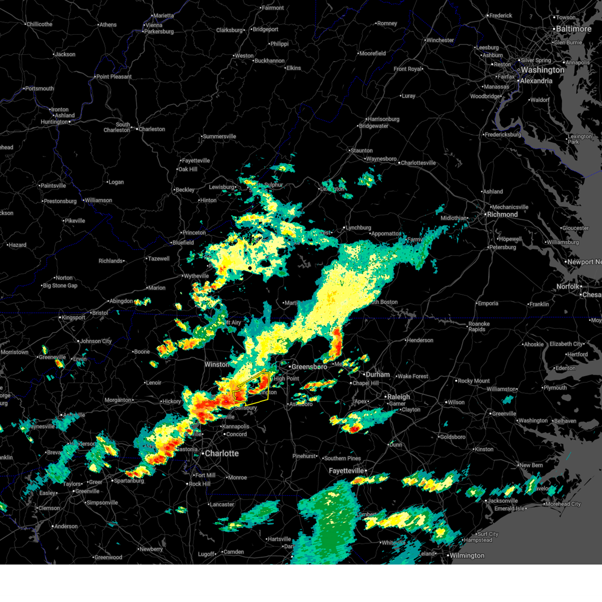
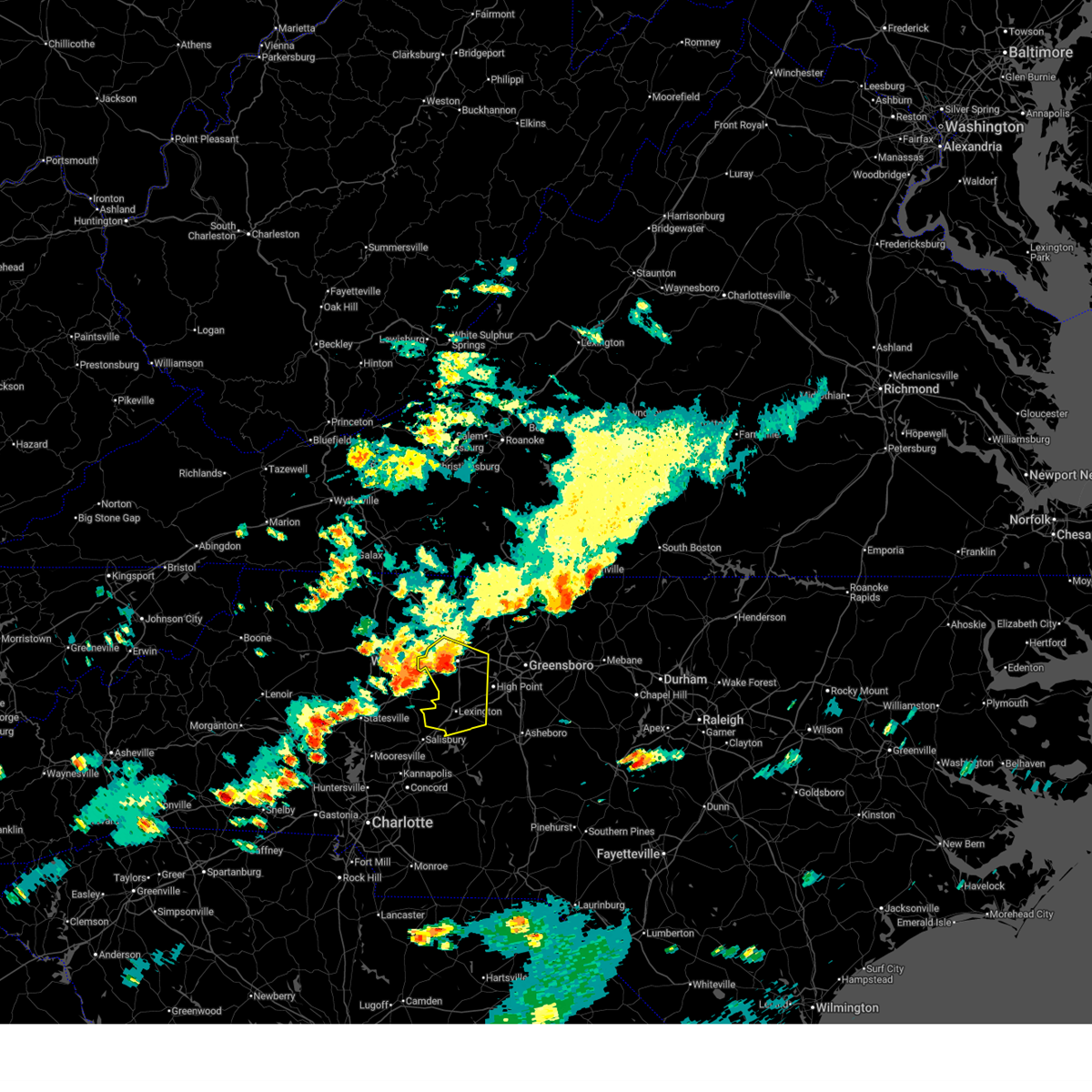
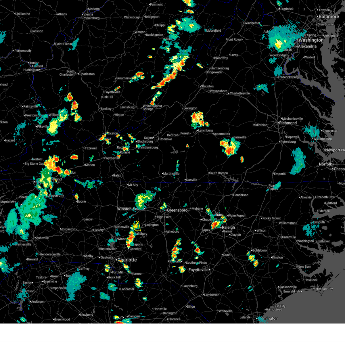
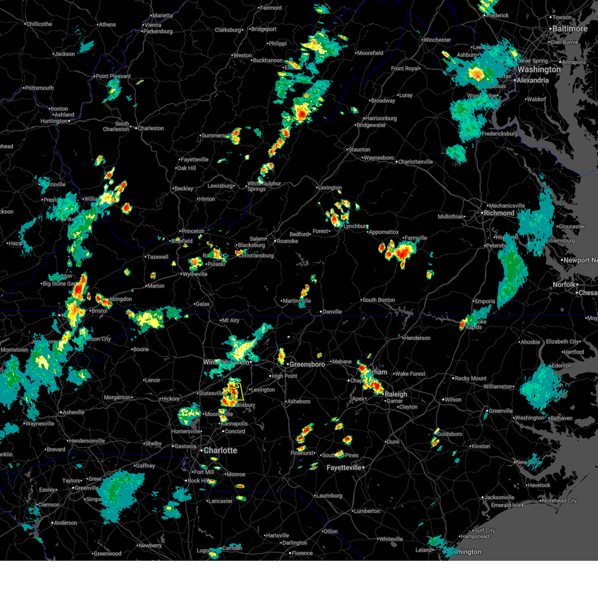
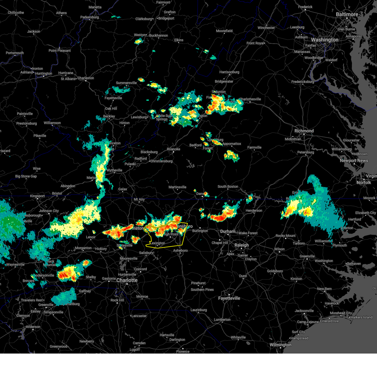
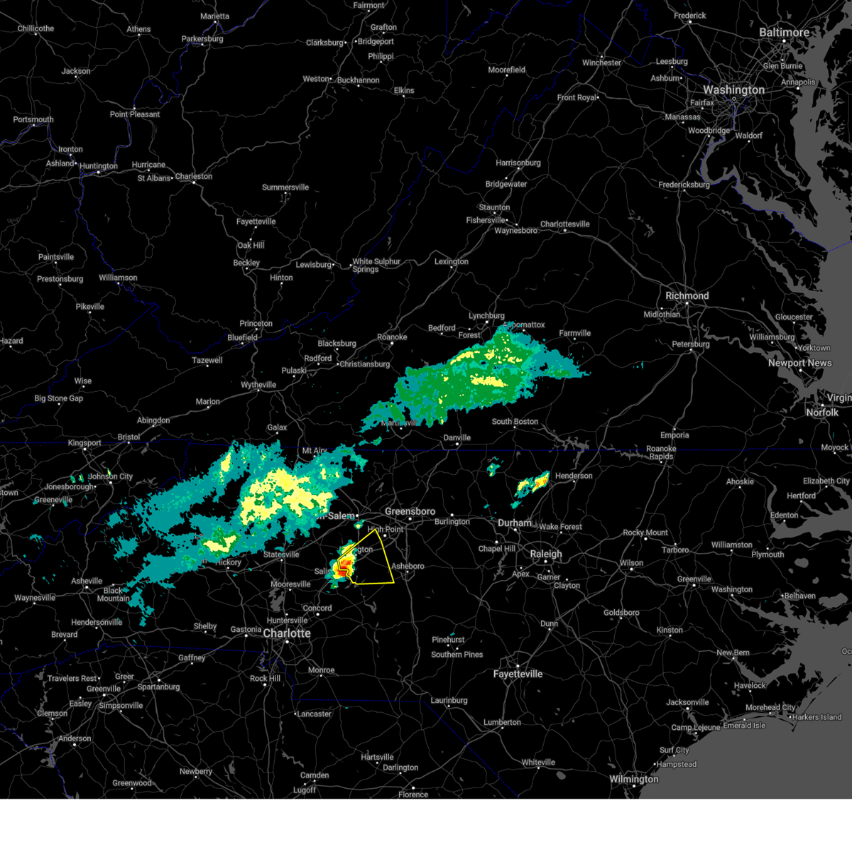
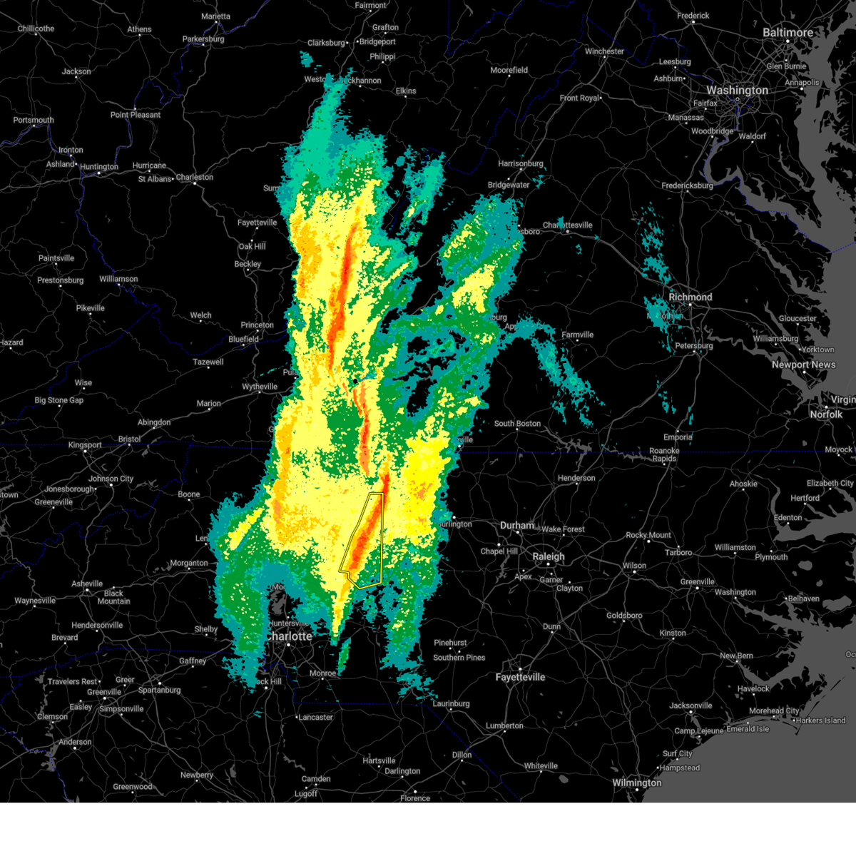
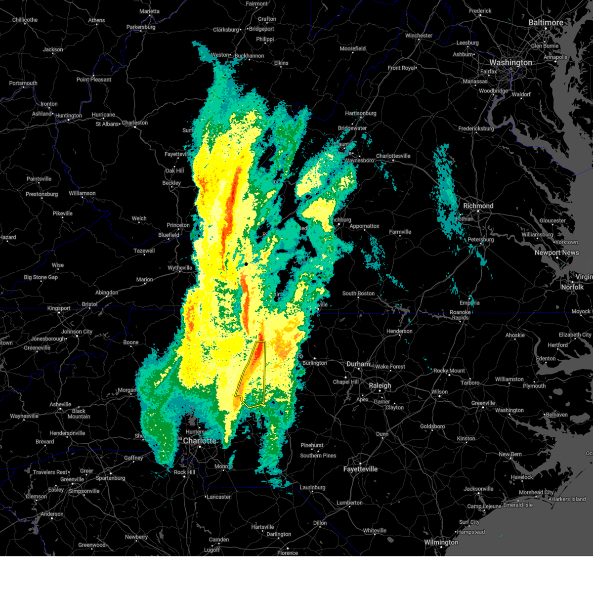
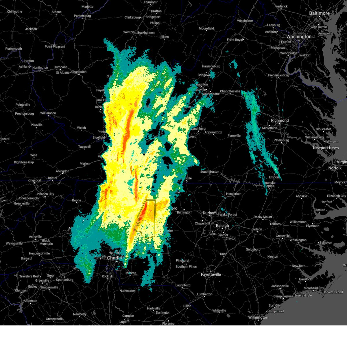
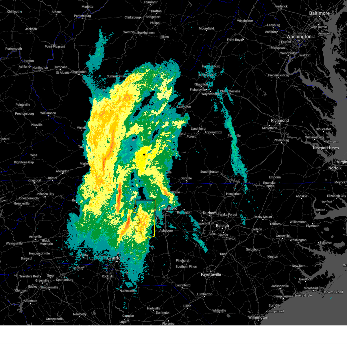
Hail Map for Tyro, NC
The Tyro, NC area has had 1 report of on-the-ground hail by trained spotters, and has been under severe weather warnings 11 times during the past 12 months. Doppler radar has detected hail at or near Tyro, NC on 38 occasions, including 1 occasion during the past year.
| Name: | Tyro, NC |
| Where Located: | 47.3 miles NNE of Charlotte, NC |
| Map: | Google Map for Tyro, NC |
| Population: | 3879 |
| Housing Units: | 1603 |
| More Info: | Search Google for Tyro, NC |
0
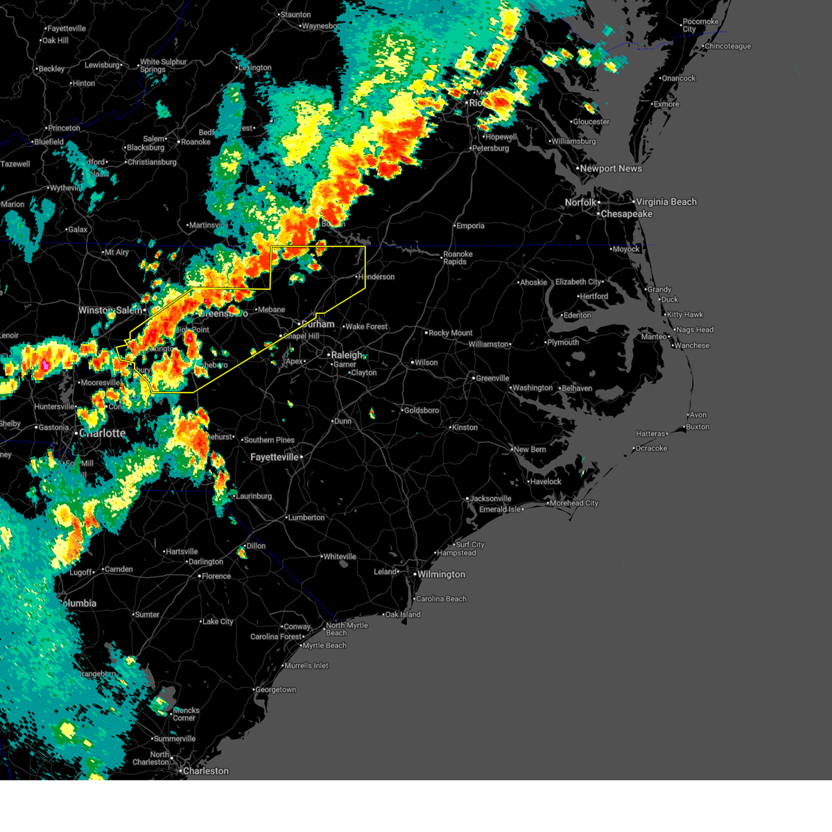
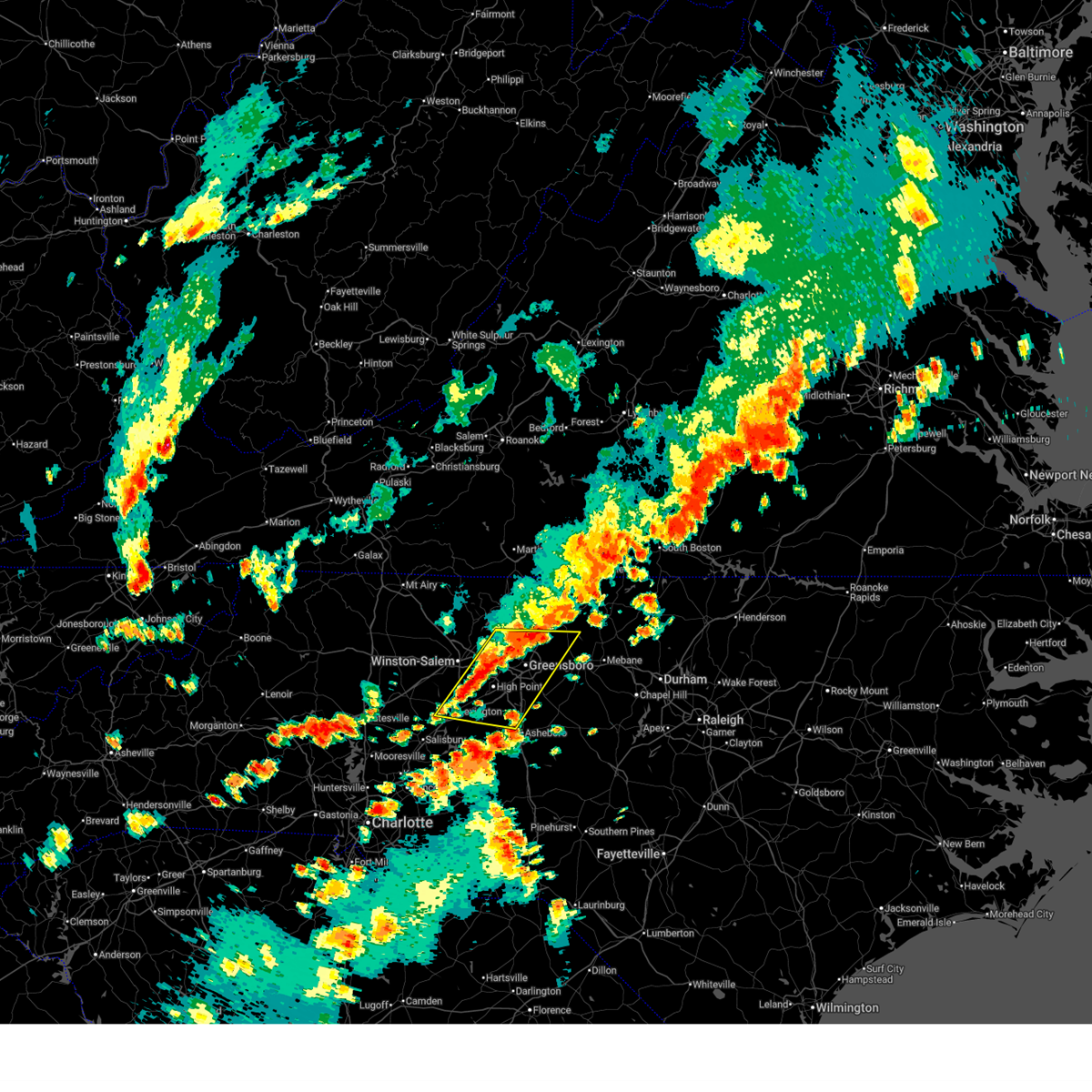
The Top Recent Hail Date for Tyro, NC is Friday, August 1, 2025 (17th out of 38)
Hail and Wind Damage Spotted near Tyro, NC
| Date / Time | Report Details |
|---|---|
| 3/16/2026 10:42 AM EDT |
 The storms which prompted the warning have weakened below severe limits, and no longer pose an immediate threat to life or property. therefore, the warning will be allowed to expire. however, gusty winds up to 50 mph are still possible with these thunderstorms. a tornado watch remains in effect until 200 pm edt for central north carolina. The storms which prompted the warning have weakened below severe limits, and no longer pose an immediate threat to life or property. therefore, the warning will be allowed to expire. however, gusty winds up to 50 mph are still possible with these thunderstorms. a tornado watch remains in effect until 200 pm edt for central north carolina.
|
| 3/16/2026 10:19 AM EDT |
 Svrrah the national weather service in raleigh has issued a * severe thunderstorm warning for, southern davidson county in central north carolina, northwestern anson county in central north carolina, montgomery county in central north carolina, western randolph county in central north carolina, stanly county in central north carolina, south central guilford county in central north carolina, * until 1100 am edt. * at 1019 am edt, severe thunderstorms were located along a line extending from near high rock lake to near unionville, moving northeast at 55 mph (radar indicated). Hazards include 60 mph wind gusts. expect damage to roofs, siding, and trees Svrrah the national weather service in raleigh has issued a * severe thunderstorm warning for, southern davidson county in central north carolina, northwestern anson county in central north carolina, montgomery county in central north carolina, western randolph county in central north carolina, stanly county in central north carolina, south central guilford county in central north carolina, * until 1100 am edt. * at 1019 am edt, severe thunderstorms were located along a line extending from near high rock lake to near unionville, moving northeast at 55 mph (radar indicated). Hazards include 60 mph wind gusts. expect damage to roofs, siding, and trees
|
| 3/16/2026 10:01 AM EDT |
 Svrrah the national weather service in raleigh has issued a * severe thunderstorm warning for, forsyth county in central north carolina, northern davidson county in central north carolina, western guilford county in central north carolina, * until 1045 am edt. * at 1000 am edt, severe thunderstorms were located along a line extending from near pinnacle to 6 miles northeast of cooleemee, moving northeast at 60 mph (radar indicated). Hazards include 60 mph wind gusts. expect damage to roofs, siding, and trees Svrrah the national weather service in raleigh has issued a * severe thunderstorm warning for, forsyth county in central north carolina, northern davidson county in central north carolina, western guilford county in central north carolina, * until 1045 am edt. * at 1000 am edt, severe thunderstorms were located along a line extending from near pinnacle to 6 miles northeast of cooleemee, moving northeast at 60 mph (radar indicated). Hazards include 60 mph wind gusts. expect damage to roofs, siding, and trees
|
| 8/1/2025 4:46 PM EDT |
 At 446 pm edt, severe thunderstorms were located along a line extending from thomasville to near spencer, moving southeast at 20 mph (radar indicated). Hazards include 60 mph wind gusts and quarter size hail. Hail damage to vehicles is expected. expect wind damage to roofs, siding, and trees. these severe storms will be near, lexington, thomasville, and linwood around 450 pm edt. Other locations impacted by these severe thunderstorms include gordontown, welcome, and high rock lake. At 446 pm edt, severe thunderstorms were located along a line extending from thomasville to near spencer, moving southeast at 20 mph (radar indicated). Hazards include 60 mph wind gusts and quarter size hail. Hail damage to vehicles is expected. expect wind damage to roofs, siding, and trees. these severe storms will be near, lexington, thomasville, and linwood around 450 pm edt. Other locations impacted by these severe thunderstorms include gordontown, welcome, and high rock lake.
|
| 8/1/2025 4:46 PM EDT |
 the severe thunderstorm warning has been cancelled and is no longer in effect the severe thunderstorm warning has been cancelled and is no longer in effect
|
| 8/1/2025 4:22 PM EDT |
 At 421 pm edt, severe thunderstorms were located along a line extending from 8 miles northwest of thomasville to cooleemee, moving southeast at 25 mph (radar indicated). Hazards include 60 mph wind gusts and quarter size hail. Hail damage to vehicles is expected. expect wind damage to roofs, siding, and trees. these severe storms will be near, lexington and thomasville around 425 pm edt. linwood around 440 pm edt. Other locations impacted by these severe thunderstorms include welcome, arcadia, gordontown, and high rock lake. At 421 pm edt, severe thunderstorms were located along a line extending from 8 miles northwest of thomasville to cooleemee, moving southeast at 25 mph (radar indicated). Hazards include 60 mph wind gusts and quarter size hail. Hail damage to vehicles is expected. expect wind damage to roofs, siding, and trees. these severe storms will be near, lexington and thomasville around 425 pm edt. linwood around 440 pm edt. Other locations impacted by these severe thunderstorms include welcome, arcadia, gordontown, and high rock lake.
|
| 8/1/2025 3:57 PM EDT |
 Svrrah the national weather service in raleigh has issued a * severe thunderstorm warning for, forsyth county in central north carolina, davidson county in central north carolina, * until 500 pm edt. * at 356 pm edt, a severe thunderstorm was located near winston-salem, moving southeast at 20 mph (radar indicated). Hazards include 60 mph wind gusts and quarter size hail. Hail damage to vehicles is expected. expect wind damage to roofs, siding, and trees. this severe thunderstorm will be near, winston-salem and clemmons around 400 pm edt. lexington and thomasville around 425 pm edt. Other locations impacted by this severe thunderstorm include arcadia, pfafftown, gordontown, welcome, and sedge garden. Svrrah the national weather service in raleigh has issued a * severe thunderstorm warning for, forsyth county in central north carolina, davidson county in central north carolina, * until 500 pm edt. * at 356 pm edt, a severe thunderstorm was located near winston-salem, moving southeast at 20 mph (radar indicated). Hazards include 60 mph wind gusts and quarter size hail. Hail damage to vehicles is expected. expect wind damage to roofs, siding, and trees. this severe thunderstorm will be near, winston-salem and clemmons around 400 pm edt. lexington and thomasville around 425 pm edt. Other locations impacted by this severe thunderstorm include arcadia, pfafftown, gordontown, welcome, and sedge garden.
|
| 7/12/2025 6:28 PM EDT |
 the severe thunderstorm warning has been cancelled and is no longer in effect the severe thunderstorm warning has been cancelled and is no longer in effect
|
| 7/12/2025 6:05 PM EDT |
 Svrrah the national weather service in raleigh has issued a * severe thunderstorm warning for, west central davidson county in central north carolina, * until 645 pm edt. * at 605 pm edt, a severe thunderstorm was located near cooleemee, or 9 miles southeast of mocksville, and is nearly stationary (radar indicated). Hazards include 60 mph wind gusts and penny size hail. expect damage to roofs, siding, and trees Svrrah the national weather service in raleigh has issued a * severe thunderstorm warning for, west central davidson county in central north carolina, * until 645 pm edt. * at 605 pm edt, a severe thunderstorm was located near cooleemee, or 9 miles southeast of mocksville, and is nearly stationary (radar indicated). Hazards include 60 mph wind gusts and penny size hail. expect damage to roofs, siding, and trees
|
| 7/9/2025 6:58 PM EDT |
 Svrrah the national weather service in raleigh has issued a * severe thunderstorm warning for, alamance county in central north carolina, southeastern forsyth county in central north carolina, person county in central north carolina, vance county in central north carolina, orange county in central north carolina, davidson county in central north carolina, granville county in central north carolina, randolph county in central north carolina, guilford county in central north carolina, durham county in central north carolina, northwestern chatham county in central north carolina, * until 800 pm edt. * at 658 pm edt, severe thunderstorms were located along a line extending from near virgilina to near linwood, moving southeast at 15 mph (radar indicated). Hazards include 60 mph wind gusts and penny size hail. expect damage to roofs, siding, and trees Svrrah the national weather service in raleigh has issued a * severe thunderstorm warning for, alamance county in central north carolina, southeastern forsyth county in central north carolina, person county in central north carolina, vance county in central north carolina, orange county in central north carolina, davidson county in central north carolina, granville county in central north carolina, randolph county in central north carolina, guilford county in central north carolina, durham county in central north carolina, northwestern chatham county in central north carolina, * until 800 pm edt. * at 658 pm edt, severe thunderstorms were located along a line extending from near virgilina to near linwood, moving southeast at 15 mph (radar indicated). Hazards include 60 mph wind gusts and penny size hail. expect damage to roofs, siding, and trees
|
| 7/9/2025 6:21 PM EDT |
 Svrrah the national weather service in raleigh has issued a * severe thunderstorm warning for, northwestern alamance county in central north carolina, southeastern forsyth county in central north carolina, northern davidson county in central north carolina, northwestern randolph county in central north carolina, guilford county in central north carolina, * until 700 pm edt. * at 621 pm edt, a severe thunderstorm was located 7 miles northwest of high point, moving northeast at 25 mph (radar indicated). Hazards include 60 mph wind gusts. expect damage to roofs, siding, and trees Svrrah the national weather service in raleigh has issued a * severe thunderstorm warning for, northwestern alamance county in central north carolina, southeastern forsyth county in central north carolina, northern davidson county in central north carolina, northwestern randolph county in central north carolina, guilford county in central north carolina, * until 700 pm edt. * at 621 pm edt, a severe thunderstorm was located 7 miles northwest of high point, moving northeast at 25 mph (radar indicated). Hazards include 60 mph wind gusts. expect damage to roofs, siding, and trees
|
| 6/6/2025 9:24 PM EDT |
 The storm which prompted the warning has weakened below severe limits, and no longer poses an immediate threat to life or property. therefore, the warning will be allowed to expire. however, gusty winds and heavy rain are still possible with this thunderstorm. The storm which prompted the warning has weakened below severe limits, and no longer poses an immediate threat to life or property. therefore, the warning will be allowed to expire. however, gusty winds and heavy rain are still possible with this thunderstorm.
|
| 6/6/2025 8:58 PM EDT |
 At 857 pm edt, a severe thunderstorm was located over west greensboro, moving east at 40 mph (radar indicated). Hazards include 60 mph wind gusts. Expect damage to roofs, siding, and trees. Locations impacted include, greensboro, high point, lexington, randleman, thomasville, archdale, summerfield, trinity, pleasant garden, and jamestown. At 857 pm edt, a severe thunderstorm was located over west greensboro, moving east at 40 mph (radar indicated). Hazards include 60 mph wind gusts. Expect damage to roofs, siding, and trees. Locations impacted include, greensboro, high point, lexington, randleman, thomasville, archdale, summerfield, trinity, pleasant garden, and jamestown.
|
| 6/6/2025 8:58 PM EDT |
 the severe thunderstorm warning has been cancelled and is no longer in effect the severe thunderstorm warning has been cancelled and is no longer in effect
|
| 6/6/2025 8:40 PM EDT |
 At 839 pm edt, a severe thunderstorm was located near kernersville, or 10 miles north of high point, moving east at 30 mph. winston- salem reported winds to 45 mph earlier (radar indicated). Hazards include 60 mph wind gusts. Expect damage to roofs, siding, and trees. Locations impacted include, greensboro, winston-salem, high point, lexington, randleman, thomasville, kernersville, clemmons, bermuda run, and huntsville. At 839 pm edt, a severe thunderstorm was located near kernersville, or 10 miles north of high point, moving east at 30 mph. winston- salem reported winds to 45 mph earlier (radar indicated). Hazards include 60 mph wind gusts. Expect damage to roofs, siding, and trees. Locations impacted include, greensboro, winston-salem, high point, lexington, randleman, thomasville, kernersville, clemmons, bermuda run, and huntsville.
|
| 6/6/2025 8:15 PM EDT |
 Svrrah the national weather service in raleigh has issued a * severe thunderstorm warning for, forsyth county in central north carolina, northern davidson county in central north carolina, northwestern randolph county in central north carolina, guilford county in central north carolina, * until 930 pm edt. * at 814 pm edt, a severe thunderstorm was located over winston-salem, moving east at 50 mph (radar indicated). Hazards include 60 mph wind gusts and penny size hail. expect damage to roofs, siding, and trees Svrrah the national weather service in raleigh has issued a * severe thunderstorm warning for, forsyth county in central north carolina, northern davidson county in central north carolina, northwestern randolph county in central north carolina, guilford county in central north carolina, * until 930 pm edt. * at 814 pm edt, a severe thunderstorm was located over winston-salem, moving east at 50 mph (radar indicated). Hazards include 60 mph wind gusts and penny size hail. expect damage to roofs, siding, and trees
|
| 5/8/2025 7:47 PM EDT |
 At 745 pm edt, severe thunderstorms were located along a line extending from near lexington to 6 miles east of kannapolis, moving east at 30 mph (radar indicated). Hazards include 60 mph wind gusts and half dollar size hail. Hail damage to vehicles is expected. expect wind damage to roofs, siding, and trees. Locations impacted include, high point, asheboro, lexington, albemarle, randleman, troy, badin lake, north carolina zoo, thomasville, and seagrove. At 745 pm edt, severe thunderstorms were located along a line extending from near lexington to 6 miles east of kannapolis, moving east at 30 mph (radar indicated). Hazards include 60 mph wind gusts and half dollar size hail. Hail damage to vehicles is expected. expect wind damage to roofs, siding, and trees. Locations impacted include, high point, asheboro, lexington, albemarle, randleman, troy, badin lake, north carolina zoo, thomasville, and seagrove.
|
| 5/8/2025 7:47 PM EDT |
 the severe thunderstorm warning has been cancelled and is no longer in effect the severe thunderstorm warning has been cancelled and is no longer in effect
|
| 5/8/2025 7:40 PM EDT | Tree down on swicegood roa in davidson county NC, 3.2 miles NNE of Tyro, NC |
| 5/8/2025 7:31 PM EDT |
 At 731 pm edt, severe thunderstorms were located along a line extending from 6 miles northwest of lexington to near china grove, moving east at 15 mph (radar indicated). Hazards include 60 mph wind gusts and half dollar size hail. Hail damage to vehicles is expected. expect wind damage to roofs, siding, and trees. Locations impacted include, high point, asheboro, lexington, albemarle, randleman, troy, badin lake, north carolina zoo, thomasville, and clemmons. At 731 pm edt, severe thunderstorms were located along a line extending from 6 miles northwest of lexington to near china grove, moving east at 15 mph (radar indicated). Hazards include 60 mph wind gusts and half dollar size hail. Hail damage to vehicles is expected. expect wind damage to roofs, siding, and trees. Locations impacted include, high point, asheboro, lexington, albemarle, randleman, troy, badin lake, north carolina zoo, thomasville, and clemmons.
|
| 5/8/2025 7:14 PM EDT |
 Svrrah the national weather service in raleigh has issued a * severe thunderstorm warning for, south central forsyth county in central north carolina, davidson county in central north carolina, western montgomery county in central north carolina, randolph county in central north carolina, stanly county in central north carolina, southwestern guilford county in central north carolina, * until 815 pm edt. * at 713 pm edt, severe thunderstorms were located along a line extending from near bermuda run to kannapolis, moving southeast at 35 mph (radar indicated). Hazards include 60 mph wind gusts and quarter size hail. Hail damage to vehicles is expected. Expect wind damage to roofs, siding, and trees. Svrrah the national weather service in raleigh has issued a * severe thunderstorm warning for, south central forsyth county in central north carolina, davidson county in central north carolina, western montgomery county in central north carolina, randolph county in central north carolina, stanly county in central north carolina, southwestern guilford county in central north carolina, * until 815 pm edt. * at 713 pm edt, severe thunderstorms were located along a line extending from near bermuda run to kannapolis, moving southeast at 35 mph (radar indicated). Hazards include 60 mph wind gusts and quarter size hail. Hail damage to vehicles is expected. Expect wind damage to roofs, siding, and trees.
|
| 4/22/2025 2:29 PM EDT |
 Svrrah the national weather service in raleigh has issued a * severe thunderstorm warning for, davidson county in central north carolina, northwestern randolph county in central north carolina, * until 315 pm edt. * at 229 pm edt, a severe thunderstorm was located over linwood, or near lexington, moving east at 20 mph (radar indicated). Hazards include 60 mph wind gusts and quarter size hail. Hail damage to vehicles is expected. Expect wind damage to roofs, siding, and trees. Svrrah the national weather service in raleigh has issued a * severe thunderstorm warning for, davidson county in central north carolina, northwestern randolph county in central north carolina, * until 315 pm edt. * at 229 pm edt, a severe thunderstorm was located over linwood, or near lexington, moving east at 20 mph (radar indicated). Hazards include 60 mph wind gusts and quarter size hail. Hail damage to vehicles is expected. Expect wind damage to roofs, siding, and trees.
|
| 3/5/2025 8:53 AM EST |
 The storms which prompted the warning have moved out of the area. therefore, this warning will be allowed to expire. however, a new severe thunderstorm warning remains in effect until 945 am est for eastern forsyth and davidson counties. a tornado watch remains in effect until 100 pm est for central north carolina. The storms which prompted the warning have moved out of the area. therefore, this warning will be allowed to expire. however, a new severe thunderstorm warning remains in effect until 945 am est for eastern forsyth and davidson counties. a tornado watch remains in effect until 100 pm est for central north carolina.
|
| 3/5/2025 8:43 AM EST |
 At 843 am est, severe thunderstorms were located along a line extending from 6 miles northwest of kernersville to lexington, moving northeast at 35 mph (radar indicated). Hazards include 60 mph wind gusts. Expect damage to roofs, siding, and trees. Locations impacted include, gordontown, lexington, kernersville, high rock lake, belews creek, linwood, arcadia, thomasville, high rock boat dock marina, and welcome. At 843 am est, severe thunderstorms were located along a line extending from 6 miles northwest of kernersville to lexington, moving northeast at 35 mph (radar indicated). Hazards include 60 mph wind gusts. Expect damage to roofs, siding, and trees. Locations impacted include, gordontown, lexington, kernersville, high rock lake, belews creek, linwood, arcadia, thomasville, high rock boat dock marina, and welcome.
|
| 3/5/2025 8:31 AM EST |
 At 831 am est, severe thunderstorms were located along a line extending from near winston-salem to near linwood, moving northeast at 35 mph (radar indicated). Hazards include 60 mph wind gusts. Expect damage to roofs, siding, and trees. Locations impacted include, pfafftown, gordontown, lexington, kernersville, high rock lake, belews creek, linwood, arcadia, stanleyville, and winston-salem. At 831 am est, severe thunderstorms were located along a line extending from near winston-salem to near linwood, moving northeast at 35 mph (radar indicated). Hazards include 60 mph wind gusts. Expect damage to roofs, siding, and trees. Locations impacted include, pfafftown, gordontown, lexington, kernersville, high rock lake, belews creek, linwood, arcadia, stanleyville, and winston-salem.
|
| 3/5/2025 7:56 AM EST |
 Svrrah the national weather service in raleigh has issued a * severe thunderstorm warning for, forsyth county in central north carolina, davidson county in central north carolina, * until 900 am est. * at 756 am est, severe thunderstorms were located along a line extending from near mocksville to near enochville, moving east at 35 mph (radar indicated). Hazards include 60 mph wind gusts. expect damage to roofs, siding, and trees Svrrah the national weather service in raleigh has issued a * severe thunderstorm warning for, forsyth county in central north carolina, davidson county in central north carolina, * until 900 am est. * at 756 am est, severe thunderstorms were located along a line extending from near mocksville to near enochville, moving east at 35 mph (radar indicated). Hazards include 60 mph wind gusts. expect damage to roofs, siding, and trees
|
| 12/29/2024 10:21 AM EST |
 Svrrah the national weather service in raleigh has issued a * severe thunderstorm warning for, forsyth county in central north carolina, western moore county in central north carolina, scotland county in central north carolina, davidson county in central north carolina, eastern anson county in central north carolina, montgomery county in central north carolina, richmond county in central north carolina, randolph county in central north carolina, eastern stanly county in central north carolina, western guilford county in central north carolina, * until 1100 am est. * at 1021 am est, severe thunderstorms were located along a line extending from bermuda run to near high rock lake to 6 miles north of ansonville to 8 miles north of chesterfield, moving northeast at 40 mph (radar indicated). Hazards include 60 mph wind gusts. expect damage to roofs, siding, and trees Svrrah the national weather service in raleigh has issued a * severe thunderstorm warning for, forsyth county in central north carolina, western moore county in central north carolina, scotland county in central north carolina, davidson county in central north carolina, eastern anson county in central north carolina, montgomery county in central north carolina, richmond county in central north carolina, randolph county in central north carolina, eastern stanly county in central north carolina, western guilford county in central north carolina, * until 1100 am est. * at 1021 am est, severe thunderstorms were located along a line extending from bermuda run to near high rock lake to 6 miles north of ansonville to 8 miles north of chesterfield, moving northeast at 40 mph (radar indicated). Hazards include 60 mph wind gusts. expect damage to roofs, siding, and trees
|
| 7/18/2024 5:22 PM EDT |
 The storm which prompted the warning has weakened below severe limits, and no longer poses an immediate threat to life or property. therefore, the warning will be allowed to expire. a severe thunderstorm watch remains in effect until 900 pm edt for central north carolina. The storm which prompted the warning has weakened below severe limits, and no longer poses an immediate threat to life or property. therefore, the warning will be allowed to expire. a severe thunderstorm watch remains in effect until 900 pm edt for central north carolina.
|
| 7/18/2024 4:42 PM EDT |
 Svrrah the national weather service in raleigh has issued a * severe thunderstorm warning for, davidson county in central north carolina, * until 530 pm edt. * at 442 pm edt, a severe thunderstorm was located near cooleemee, or near salisbury, moving east at 25 mph (radar indicated). Hazards include 60 mph wind gusts. expect damage to roofs, siding, and trees Svrrah the national weather service in raleigh has issued a * severe thunderstorm warning for, davidson county in central north carolina, * until 530 pm edt. * at 442 pm edt, a severe thunderstorm was located near cooleemee, or near salisbury, moving east at 25 mph (radar indicated). Hazards include 60 mph wind gusts. expect damage to roofs, siding, and trees
|
| 5/6/2024 11:10 PM EDT |
 Svrrah the national weather service in raleigh has issued a * severe thunderstorm warning for, davidson county in central north carolina, northwestern montgomery county in central north carolina, western randolph county in central north carolina, northeastern stanly county in central north carolina, southwestern guilford county in central north carolina, * until midnight edt. * at 1110 pm edt, severe thunderstorms were located along a line extending from near thomasville to 7 miles southeast of lexington to near high rock lake, moving east at 30 mph (radar indicated). Hazards include 60 mph wind gusts and quarter size hail. Hail damage to vehicles is expected. Expect wind damage to roofs, siding, and trees. Svrrah the national weather service in raleigh has issued a * severe thunderstorm warning for, davidson county in central north carolina, northwestern montgomery county in central north carolina, western randolph county in central north carolina, northeastern stanly county in central north carolina, southwestern guilford county in central north carolina, * until midnight edt. * at 1110 pm edt, severe thunderstorms were located along a line extending from near thomasville to 7 miles southeast of lexington to near high rock lake, moving east at 30 mph (radar indicated). Hazards include 60 mph wind gusts and quarter size hail. Hail damage to vehicles is expected. Expect wind damage to roofs, siding, and trees.
|
| 5/6/2024 10:52 PM EDT |
 At 1051 pm edt, severe thunderstorms were located along a line extending from 6 miles south of bermuda run to 8 miles north of spencer to near cooleemee, moving east at 15 mph (radar indicated). Hazards include 60 mph wind gusts and quarter size hail. Hail damage to vehicles is expected. expect wind damage to roofs, siding, and trees. Locations impacted include, high point, lexington, thomasville, linwood, trinity, denton, gordontown, high rock lake, high rock boat dock marina, and welcome. At 1051 pm edt, severe thunderstorms were located along a line extending from 6 miles south of bermuda run to 8 miles north of spencer to near cooleemee, moving east at 15 mph (radar indicated). Hazards include 60 mph wind gusts and quarter size hail. Hail damage to vehicles is expected. expect wind damage to roofs, siding, and trees. Locations impacted include, high point, lexington, thomasville, linwood, trinity, denton, gordontown, high rock lake, high rock boat dock marina, and welcome.
|
| 5/6/2024 10:43 PM EDT |
 At 1042 pm edt, severe thunderstorms were located along a line extending from 6 miles southeast of mocksville to near cooleemee to near cleveland, moving east at 20 mph (radar indicated). Hazards include 60 mph wind gusts and quarter size hail. Hail damage to vehicles is expected. expect wind damage to roofs, siding, and trees. Locations impacted include, high point, lexington, thomasville, linwood, trinity, denton, gordontown, high rock lake, high rock boat dock marina, and welcome. At 1042 pm edt, severe thunderstorms were located along a line extending from 6 miles southeast of mocksville to near cooleemee to near cleveland, moving east at 20 mph (radar indicated). Hazards include 60 mph wind gusts and quarter size hail. Hail damage to vehicles is expected. expect wind damage to roofs, siding, and trees. Locations impacted include, high point, lexington, thomasville, linwood, trinity, denton, gordontown, high rock lake, high rock boat dock marina, and welcome.
|
| 5/6/2024 10:31 PM EDT |
 Svrrah the national weather service in raleigh has issued a * severe thunderstorm warning for, davidson county in central north carolina, northwestern randolph county in central north carolina, * until 1115 pm edt. * at 1031 pm edt, severe thunderstorms were located along a line extending from near cooleemee to near cleveland to near troutman, moving east at 40 mph (radar indicated). Hazards include 60 mph wind gusts and quarter size hail. Hail damage to vehicles is expected. Expect wind damage to roofs, siding, and trees. Svrrah the national weather service in raleigh has issued a * severe thunderstorm warning for, davidson county in central north carolina, northwestern randolph county in central north carolina, * until 1115 pm edt. * at 1031 pm edt, severe thunderstorms were located along a line extending from near cooleemee to near cleveland to near troutman, moving east at 40 mph (radar indicated). Hazards include 60 mph wind gusts and quarter size hail. Hail damage to vehicles is expected. Expect wind damage to roofs, siding, and trees.
|
| 4/11/2024 8:24 PM EDT |
 At 824 pm edt, severe thunderstorms were located along a line extending from near buffalo ridge to near collinstown to near germanton to near clemmons, moving northeast at 55 mph (radar indicated). Hazards include 60 mph wind gusts. Expect damage to roofs, siding, and trees. Locations impacted include, winston-salem, lexington, clemmons, bermuda run, lewisville, rural hall, arcadia, pfafftown, stanleyville, and donnaha. At 824 pm edt, severe thunderstorms were located along a line extending from near buffalo ridge to near collinstown to near germanton to near clemmons, moving northeast at 55 mph (radar indicated). Hazards include 60 mph wind gusts. Expect damage to roofs, siding, and trees. Locations impacted include, winston-salem, lexington, clemmons, bermuda run, lewisville, rural hall, arcadia, pfafftown, stanleyville, and donnaha.
|
| 4/11/2024 8:18 PM EDT |
 Svrrah the national weather service in raleigh has issued a * severe thunderstorm warning for, forsyth county in central north carolina, northern davidson county in central north carolina, western guilford county in central north carolina, * until 900 pm edt. * at 817 pm edt, severe thunderstorms were located along a line extending from near collinstown to near francisco to king to near winston-salem to near linwood, moving east at 30 mph (radar indicated). Hazards include 60 mph wind gusts. expect damage to roofs, siding, and trees Svrrah the national weather service in raleigh has issued a * severe thunderstorm warning for, forsyth county in central north carolina, northern davidson county in central north carolina, western guilford county in central north carolina, * until 900 pm edt. * at 817 pm edt, severe thunderstorms were located along a line extending from near collinstown to near francisco to king to near winston-salem to near linwood, moving east at 30 mph (radar indicated). Hazards include 60 mph wind gusts. expect damage to roofs, siding, and trees
|
| 4/11/2024 8:03 PM EDT |
 At 803 pm edt, severe thunderstorms were located along a line extending from ararat to pilot mountain to near huntsville to near mocksville, moving northeast at 50 mph (radar indicated). Hazards include 60 mph wind gusts. Expect damage to roofs, siding, and trees. Locations impacted include, winston-salem, lexington, clemmons, bermuda run, huntsville, lewisville, rural hall, arcadia, pfafftown, and stanleyville. At 803 pm edt, severe thunderstorms were located along a line extending from ararat to pilot mountain to near huntsville to near mocksville, moving northeast at 50 mph (radar indicated). Hazards include 60 mph wind gusts. Expect damage to roofs, siding, and trees. Locations impacted include, winston-salem, lexington, clemmons, bermuda run, huntsville, lewisville, rural hall, arcadia, pfafftown, and stanleyville.
|
| 4/11/2024 7:52 PM EDT |
 Svrrah the national weather service in raleigh has issued a * severe thunderstorm warning for, western forsyth county in central north carolina, northwestern davidson county in central north carolina, * until 830 pm edt. * at 752 pm edt, severe thunderstorms were located along a line extending from flat rock to near pilot mountain state park to near bermuda run to 7 miles west of mocksville, moving northeast at 55 mph (radar indicated). Hazards include 60 mph wind gusts. expect damage to roofs, siding, and trees Svrrah the national weather service in raleigh has issued a * severe thunderstorm warning for, western forsyth county in central north carolina, northwestern davidson county in central north carolina, * until 830 pm edt. * at 752 pm edt, severe thunderstorms were located along a line extending from flat rock to near pilot mountain state park to near bermuda run to 7 miles west of mocksville, moving northeast at 55 mph (radar indicated). Hazards include 60 mph wind gusts. expect damage to roofs, siding, and trees
|
| 2/28/2024 5:53 PM EST |
 The storms which prompted the warning have weakened below severe limits, and no longer pose an immediate threat to life or property. therefore, the warning will be allowed to expire. The storms which prompted the warning have weakened below severe limits, and no longer pose an immediate threat to life or property. therefore, the warning will be allowed to expire.
|
| 2/28/2024 5:43 PM EST |
 At 543 pm est, severe thunderstorms were located along a line extending from 7 miles south of elon to 11 miles south of greensboro to 6 miles northwest of randleman to near lexington to linwood, moving east at 40 mph (radar indicated). Hazards include 60 mph wind gusts. Expect damage to roofs, siding, and trees. Locations impacted include, greensboro, high point, burlington, lexington, graham, randleman, thomasville, linwood, archdale, and trinity. At 543 pm est, severe thunderstorms were located along a line extending from 7 miles south of elon to 11 miles south of greensboro to 6 miles northwest of randleman to near lexington to linwood, moving east at 40 mph (radar indicated). Hazards include 60 mph wind gusts. Expect damage to roofs, siding, and trees. Locations impacted include, greensboro, high point, burlington, lexington, graham, randleman, thomasville, linwood, archdale, and trinity.
|
| 2/28/2024 5:32 PM EST |
 At 532 pm est, severe thunderstorms were located along a line extending from 7 miles north of elon to near mcleansville to 8 miles southeast of greensboro to near thomasville to near lexington, moving east at 55 mph (radar indicated). Hazards include 60 mph wind gusts. Expect damage to roofs, siding, and trees. Locations impacted include, greensboro, high point, burlington, lexington, graham, randleman, thomasville, mebane, elon, and linwood. At 532 pm est, severe thunderstorms were located along a line extending from 7 miles north of elon to near mcleansville to 8 miles southeast of greensboro to near thomasville to near lexington, moving east at 55 mph (radar indicated). Hazards include 60 mph wind gusts. Expect damage to roofs, siding, and trees. Locations impacted include, greensboro, high point, burlington, lexington, graham, randleman, thomasville, mebane, elon, and linwood.
|
| 2/28/2024 5:12 PM EST |
 Svrrah the national weather service in raleigh has issued a * severe thunderstorm warning for, alamance county in central north carolina, central davidson county in central north carolina, northern randolph county in central north carolina, guilford county in central north carolina, * until 600 pm est. * at 512 pm est, severe thunderstorms were located along a line extending from near monroeton to near greensboro to near high point to 7 miles north of lexington to 6 miles east of mocksville, moving east at 45 mph (radar indicated). Hazards include 60 mph wind gusts. expect damage to roofs, siding, and trees Svrrah the national weather service in raleigh has issued a * severe thunderstorm warning for, alamance county in central north carolina, central davidson county in central north carolina, northern randolph county in central north carolina, guilford county in central north carolina, * until 600 pm est. * at 512 pm est, severe thunderstorms were located along a line extending from near monroeton to near greensboro to near high point to 7 miles north of lexington to 6 miles east of mocksville, moving east at 45 mph (radar indicated). Hazards include 60 mph wind gusts. expect damage to roofs, siding, and trees
|
| 1/9/2024 1:39 PM EST |
 At 139 pm est, severe thunderstorms were located along a line extending from near enon to near bermuda run to near harrisburg, moving northeast at 55 mph (radar indicated). Hazards include 60 mph wind gusts. expect damage to roofs, siding, and trees At 139 pm est, severe thunderstorms were located along a line extending from near enon to near bermuda run to near harrisburg, moving northeast at 55 mph (radar indicated). Hazards include 60 mph wind gusts. expect damage to roofs, siding, and trees
|
| 8/26/2023 9:57 PM EDT |
 The severe thunderstorm warning for davidson and northwestern randolph counties will expire at 1000 pm edt, the storm which prompted the warning has weakened below severe limits, and no longer poses an immediate threat to life or property. therefore, the warning will be allowed to expire. however heavy rain is still possible with this thunderstorm. The severe thunderstorm warning for davidson and northwestern randolph counties will expire at 1000 pm edt, the storm which prompted the warning has weakened below severe limits, and no longer poses an immediate threat to life or property. therefore, the warning will be allowed to expire. however heavy rain is still possible with this thunderstorm.
|
| 8/26/2023 9:12 PM EDT |
 At 912 pm edt, a severe thunderstorm was located over lexington, moving east at 20 mph (radar indicated). Hazards include 60 mph wind gusts. expect damage to roofs, siding, and trees At 912 pm edt, a severe thunderstorm was located over lexington, moving east at 20 mph (radar indicated). Hazards include 60 mph wind gusts. expect damage to roofs, siding, and trees
|
| 8/26/2023 8:39 PM EDT |
 At 839 pm edt, a severe thunderstorm was located near bermuda run, or near mocksville, moving southeast at 25 mph (radar indicated). Hazards include 60 mph wind gusts. expect damage to roofs, siding, and trees At 839 pm edt, a severe thunderstorm was located near bermuda run, or near mocksville, moving southeast at 25 mph (radar indicated). Hazards include 60 mph wind gusts. expect damage to roofs, siding, and trees
|
| 8/24/2023 7:13 PM EDT |
 At 713 pm edt, severe thunderstorms were located along a line extending from near winston-salem to near lexington to granite quarry, moving southeast at 15 mph (radar indicated). Hazards include 60 mph wind gusts and nickel size hail. expect damage to roofs, siding, and trees At 713 pm edt, severe thunderstorms were located along a line extending from near winston-salem to near lexington to granite quarry, moving southeast at 15 mph (radar indicated). Hazards include 60 mph wind gusts and nickel size hail. expect damage to roofs, siding, and trees
|
| 8/24/2023 6:58 PM EDT |
 At 658 pm edt, severe thunderstorms were located along a line extending from winston-salem to 6 miles southeast of clemmons to 7 miles east of cooleemee, moving southeast at 15 mph (radar indicated). Hazards include 60 mph wind gusts and penny size hail. Expect damage to roofs, siding, and trees. locations impacted include, winston-salem, lexington, clemmons, bermuda run, arcadia, pfafftown, welcome and sedge garden. hail threat, radar indicated max hail size, 0. 75 in wind threat, radar indicated max wind gust, 60 mph. At 658 pm edt, severe thunderstorms were located along a line extending from winston-salem to 6 miles southeast of clemmons to 7 miles east of cooleemee, moving southeast at 15 mph (radar indicated). Hazards include 60 mph wind gusts and penny size hail. Expect damage to roofs, siding, and trees. locations impacted include, winston-salem, lexington, clemmons, bermuda run, arcadia, pfafftown, welcome and sedge garden. hail threat, radar indicated max hail size, 0. 75 in wind threat, radar indicated max wind gust, 60 mph.
|
| 8/24/2023 6:35 PM EDT |
 At 634 pm edt, severe thunderstorms were located along a line extending from near winston-salem to clemmons to near mocksville, moving southeast at 15 mph (radar indicated). Hazards include 60 mph wind gusts and penny size hail. expect damage to roofs, siding, and trees At 634 pm edt, severe thunderstorms were located along a line extending from near winston-salem to clemmons to near mocksville, moving southeast at 15 mph (radar indicated). Hazards include 60 mph wind gusts and penny size hail. expect damage to roofs, siding, and trees
|
| 8/15/2023 2:39 PM EDT |
 At 236 pm edt, a severe thunderstorm was located over bermuda run, or 10 miles northeast of mocksville, moving northeast at 40 mph (radar indicated). Hazards include 60 mph wind gusts and half dollar size hail. Hail damage to vehicles is expected. expect wind damage to roofs, siding, and trees. locations impacted include, winston-salem, lexington, thomasville, kernersville, clemmons, bermuda run, lewisville, walkertown, rural hall and pfafftown. hail threat, radar indicated max hail size, 1. 25 in wind threat, radar indicated max wind gust, 60 mph. At 236 pm edt, a severe thunderstorm was located over bermuda run, or 10 miles northeast of mocksville, moving northeast at 40 mph (radar indicated). Hazards include 60 mph wind gusts and half dollar size hail. Hail damage to vehicles is expected. expect wind damage to roofs, siding, and trees. locations impacted include, winston-salem, lexington, thomasville, kernersville, clemmons, bermuda run, lewisville, walkertown, rural hall and pfafftown. hail threat, radar indicated max hail size, 1. 25 in wind threat, radar indicated max wind gust, 60 mph.
|
| 8/15/2023 2:30 PM EDT |
 At 229 pm edt, a severe thunderstorm was located near mocksville, moving east at 40 mph (radar indicated). Hazards include 60 mph wind gusts and nickel size hail. expect damage to roofs, siding, and trees At 229 pm edt, a severe thunderstorm was located near mocksville, moving east at 40 mph (radar indicated). Hazards include 60 mph wind gusts and nickel size hail. expect damage to roofs, siding, and trees
|
| 8/14/2023 4:21 PM EDT |
 At 421 pm edt, a severe thunderstorm was located over lexington, moving east at 25 mph (radar indicated). Hazards include 60 mph wind gusts and penny size hail. Expect damage to roofs, siding, and trees. locations impacted include, lexington, thomasville, welcome and gordontown. hail threat, radar indicated max hail size, 0. 75 in wind threat, radar indicated max wind gust, 60 mph. At 421 pm edt, a severe thunderstorm was located over lexington, moving east at 25 mph (radar indicated). Hazards include 60 mph wind gusts and penny size hail. Expect damage to roofs, siding, and trees. locations impacted include, lexington, thomasville, welcome and gordontown. hail threat, radar indicated max hail size, 0. 75 in wind threat, radar indicated max wind gust, 60 mph.
|
| 8/14/2023 4:06 PM EDT |
 At 405 pm edt, a severe thunderstorm was located near mocksville, moving east at 30 mph (radar indicated). Hazards include 60 mph wind gusts and penny size hail. expect damage to roofs, siding, and trees At 405 pm edt, a severe thunderstorm was located near mocksville, moving east at 30 mph (radar indicated). Hazards include 60 mph wind gusts and penny size hail. expect damage to roofs, siding, and trees
|
| 8/7/2023 5:48 PM EDT |
 At 547 pm edt, severe thunderstorms were located along a line extending from near ellisboro to near plyler, moving east at 50 mph (radar indicated). Hazards include 60 mph wind gusts. Expect damage to roofs, siding, and trees. Locations impacted include, greensboro, winston-salem, high point, asheboro, lexington, albemarle, randleman, troy, badin lake and north carolina zoo. At 547 pm edt, severe thunderstorms were located along a line extending from near ellisboro to near plyler, moving east at 50 mph (radar indicated). Hazards include 60 mph wind gusts. Expect damage to roofs, siding, and trees. Locations impacted include, greensboro, winston-salem, high point, asheboro, lexington, albemarle, randleman, troy, badin lake and north carolina zoo.
|
| 8/7/2023 5:27 PM EDT |
 At 526 pm edt, severe thunderstorms were located along a line extending from germanton to near downtown concord, moving east at 50 mph (radar indicated). Hazards include 60 mph wind gusts. expect damage to roofs, siding, and trees At 526 pm edt, severe thunderstorms were located along a line extending from germanton to near downtown concord, moving east at 50 mph (radar indicated). Hazards include 60 mph wind gusts. expect damage to roofs, siding, and trees
|
| 8/6/2023 4:44 PM EDT |
 At 443 pm edt, severe thunderstorms were located along a line extending from 8 miles northwest of thomasville to 8 miles northwest of ansonville, moving east at 30 mph (radar indicated). Hazards include 60 mph wind gusts. Expect damage to roofs, siding, and trees. locations impacted include, greensboro, winston-salem, high point, asheboro, lexington, albemarle, randleman, troy, badin lake and north carolina zoo. hail threat, radar indicated max hail size, <. 75 in wind threat, radar indicated max wind gust, 60 mph. At 443 pm edt, severe thunderstorms were located along a line extending from 8 miles northwest of thomasville to 8 miles northwest of ansonville, moving east at 30 mph (radar indicated). Hazards include 60 mph wind gusts. Expect damage to roofs, siding, and trees. locations impacted include, greensboro, winston-salem, high point, asheboro, lexington, albemarle, randleman, troy, badin lake and north carolina zoo. hail threat, radar indicated max hail size, <. 75 in wind threat, radar indicated max wind gust, 60 mph.
|
| 8/6/2023 4:19 PM EDT |
 At 418 pm edt, severe thunderstorms were located along a line extending from near clemmons to near midland, moving southeast at 30 mph (radar indicated). Hazards include 60 mph wind gusts. expect damage to roofs, siding, and trees At 418 pm edt, severe thunderstorms were located along a line extending from near clemmons to near midland, moving southeast at 30 mph (radar indicated). Hazards include 60 mph wind gusts. expect damage to roofs, siding, and trees
|
| 7/9/2023 11:47 AM EDT |
 At 1147 am edt, severe thunderstorms were located along a line extending from near monroeton to near mcleansville to 8 miles east of high point to 8 miles south of thomasville to near spencer, moving east at 40 mph (radar indicated). Hazards include 60 mph wind gusts and quarter size hail. Hail damage to vehicles is expected. Expect wind damage to roofs, siding, and trees. At 1147 am edt, severe thunderstorms were located along a line extending from near monroeton to near mcleansville to 8 miles east of high point to 8 miles south of thomasville to near spencer, moving east at 40 mph (radar indicated). Hazards include 60 mph wind gusts and quarter size hail. Hail damage to vehicles is expected. Expect wind damage to roofs, siding, and trees.
|
| 7/9/2023 11:23 AM EDT |
 At 1122 am edt, a severe thunderstorm was located 8 miles northwest of lexington, moving east at 30 mph (radar indicated). Hazards include 60 mph wind gusts and quarter size hail. Hail damage to vehicles is expected. Expect wind damage to roofs, siding, and trees. At 1122 am edt, a severe thunderstorm was located 8 miles northwest of lexington, moving east at 30 mph (radar indicated). Hazards include 60 mph wind gusts and quarter size hail. Hail damage to vehicles is expected. Expect wind damage to roofs, siding, and trees.
|
| 6/26/2023 9:23 PM EDT |
 The severe thunderstorm warning for southern davidson county will expire at 930 pm edt, the storm which prompted the warning has moved out of the area. therefore, the warning will be allowed to expire. a severe thunderstorm watch remains in effect until 1100 pm edt for central north carolina. The severe thunderstorm warning for southern davidson county will expire at 930 pm edt, the storm which prompted the warning has moved out of the area. therefore, the warning will be allowed to expire. a severe thunderstorm watch remains in effect until 1100 pm edt for central north carolina.
|
| 6/26/2023 9:00 PM EDT |
 At 900 pm edt, a severe thunderstorm was located over high rock lake, or 8 miles south of lexington, moving east at 20 mph (radar indicated). Hazards include 60 mph wind gusts and quarter size hail. Hail damage to vehicles is expected. expect wind damage to roofs, siding, and trees. locations impacted include, lexington, linwood, denton, newsom, gordontown, high rock boat dock marina, nc wildlife access boat launch, high rock lake marina & campground, high rock lake and high rock. hail threat, radar indicated max hail size, 1. 00 in wind threat, radar indicated max wind gust, 60 mph. At 900 pm edt, a severe thunderstorm was located over high rock lake, or 8 miles south of lexington, moving east at 20 mph (radar indicated). Hazards include 60 mph wind gusts and quarter size hail. Hail damage to vehicles is expected. expect wind damage to roofs, siding, and trees. locations impacted include, lexington, linwood, denton, newsom, gordontown, high rock boat dock marina, nc wildlife access boat launch, high rock lake marina & campground, high rock lake and high rock. hail threat, radar indicated max hail size, 1. 00 in wind threat, radar indicated max wind gust, 60 mph.
|
| 6/26/2023 8:30 PM EDT |
 At 829 pm edt, a severe thunderstorm was located over salisbury, moving east at 20 mph (radar indicated. 1 inch hail was reported just west of salisbury at 815 pm). Hazards include 60 mph wind gusts and quarter size hail. Hail damage to vehicles is expected. Expect wind damage to roofs, siding, and trees. At 829 pm edt, a severe thunderstorm was located over salisbury, moving east at 20 mph (radar indicated. 1 inch hail was reported just west of salisbury at 815 pm). Hazards include 60 mph wind gusts and quarter size hail. Hail damage to vehicles is expected. Expect wind damage to roofs, siding, and trees.
|
| 6/26/2023 7:11 PM EDT |
 At 710 pm edt, a severe thunderstorm was located over lexington, moving southeast at 25 mph (radar indicated. at 7:05 pm half dollar size hail was reported in lexington from this storm). Hazards include two inch hail and 60 mph wind gusts. People and animals outdoors will be injured. expect hail damage to roofs, siding, windows, and vehicles. expect wind damage to roofs, siding, and trees. locations impacted include, lexington, thomasville, linwood, denton, gordontown, high rock boat dock marina, welcome, nc wildlife access boat launch, high rock lake marina & campground and high rock. thunderstorm damage threat, considerable hail threat, radar indicated max hail size, 2. 00 in wind threat, radar indicated max wind gust, 60 mph. At 710 pm edt, a severe thunderstorm was located over lexington, moving southeast at 25 mph (radar indicated. at 7:05 pm half dollar size hail was reported in lexington from this storm). Hazards include two inch hail and 60 mph wind gusts. People and animals outdoors will be injured. expect hail damage to roofs, siding, windows, and vehicles. expect wind damage to roofs, siding, and trees. locations impacted include, lexington, thomasville, linwood, denton, gordontown, high rock boat dock marina, welcome, nc wildlife access boat launch, high rock lake marina & campground and high rock. thunderstorm damage threat, considerable hail threat, radar indicated max hail size, 2. 00 in wind threat, radar indicated max wind gust, 60 mph.
|
| 6/26/2023 6:51 PM EDT |
 At 650 pm edt, a severe thunderstorm was located along i-85 near lexington, moving southeast at 30 mph (radar indicated. golf ball size hail was reported at fork church in eastern davie county associated with this storm). Hazards include two inch hail and 60 mph wind gusts. People and animals outdoors will be injured. expect hail damage to roofs, siding, windows, and vehicles. expect wind damage to roofs, siding, and trees. locations impacted include, lexington, thomasville, linwood, denton, arcadia, gordontown, high rock boat dock marina, welcome, nc wildlife access boat launch and high rock lake marina & campground. thunderstorm damage threat, considerable hail threat, observed max hail size, 2. 00 in wind threat, radar indicated max wind gust, 60 mph. At 650 pm edt, a severe thunderstorm was located along i-85 near lexington, moving southeast at 30 mph (radar indicated. golf ball size hail was reported at fork church in eastern davie county associated with this storm). Hazards include two inch hail and 60 mph wind gusts. People and animals outdoors will be injured. expect hail damage to roofs, siding, windows, and vehicles. expect wind damage to roofs, siding, and trees. locations impacted include, lexington, thomasville, linwood, denton, arcadia, gordontown, high rock boat dock marina, welcome, nc wildlife access boat launch and high rock lake marina & campground. thunderstorm damage threat, considerable hail threat, observed max hail size, 2. 00 in wind threat, radar indicated max wind gust, 60 mph.
|
| 6/26/2023 6:28 PM EDT |
 At 627 pm edt, a severe thunderstorm was located over mocksville, moving southeast at 25 mph (radar indicated. this storm has a history of damaging wind gusts and large hail). Hazards include two inch hail and 60 mph wind gusts. People and animals outdoors will be injured. expect hail damage to roofs, siding, windows, and vehicles. Expect wind damage to roofs, siding, and trees. At 627 pm edt, a severe thunderstorm was located over mocksville, moving southeast at 25 mph (radar indicated. this storm has a history of damaging wind gusts and large hail). Hazards include two inch hail and 60 mph wind gusts. People and animals outdoors will be injured. expect hail damage to roofs, siding, windows, and vehicles. Expect wind damage to roofs, siding, and trees.
|
| 4/6/2023 5:38 PM EDT |
 At 538 pm edt, a severe thunderstorm was located near lexington, moving northeast at 30 mph (radar indicated). Hazards include 60 mph wind gusts and quarter size hail. Hail damage to vehicles is expected. Expect wind damage to roofs, siding, and trees. At 538 pm edt, a severe thunderstorm was located near lexington, moving northeast at 30 mph (radar indicated). Hazards include 60 mph wind gusts and quarter size hail. Hail damage to vehicles is expected. Expect wind damage to roofs, siding, and trees.
|
| 1/12/2023 7:04 PM EST |
 At 704 pm est, severe thunderstorms were located along a line extending from near germanton to 8 miles northwest of thomasville to near high rock lake, moving northeast at 70 mph (radar indicated). Hazards include 60 mph wind gusts. Expect damage to roofs, siding, and trees. locations impacted include, greensboro, winston-salem, high point, lexington, randleman, thomasville, kernersville, linwood, mcleansville and archdale. hail threat, radar indicated max hail size, <. 75 in wind threat, radar indicated max wind gust, 60 mph. At 704 pm est, severe thunderstorms were located along a line extending from near germanton to 8 miles northwest of thomasville to near high rock lake, moving northeast at 70 mph (radar indicated). Hazards include 60 mph wind gusts. Expect damage to roofs, siding, and trees. locations impacted include, greensboro, winston-salem, high point, lexington, randleman, thomasville, kernersville, linwood, mcleansville and archdale. hail threat, radar indicated max hail size, <. 75 in wind threat, radar indicated max wind gust, 60 mph.
|
| 1/12/2023 6:49 PM EST |
 At 648 pm est, severe thunderstorms were located along a line extending from enon to 8 miles east of mocksville to china grove, moving northeast at 70 mph (radar indicated). Hazards include 60 mph wind gusts. expect damage to roofs, siding, and trees At 648 pm est, severe thunderstorms were located along a line extending from enon to 8 miles east of mocksville to china grove, moving northeast at 70 mph (radar indicated). Hazards include 60 mph wind gusts. expect damage to roofs, siding, and trees
|
| 7/24/2022 4:41 PM EDT |
 At 441 pm edt, a severe thunderstorm was located near lexington, moving northeast at 10 mph (radar indicated). Hazards include 60 mph wind gusts and penny size hail. Expect damage to roofs, siding, and trees. locations impacted include, lexington, linwood, welcome and arcadia. hail threat, radar indicated max hail size, 0. 75 in wind threat, radar indicated max wind gust, 60 mph. At 441 pm edt, a severe thunderstorm was located near lexington, moving northeast at 10 mph (radar indicated). Hazards include 60 mph wind gusts and penny size hail. Expect damage to roofs, siding, and trees. locations impacted include, lexington, linwood, welcome and arcadia. hail threat, radar indicated max hail size, 0. 75 in wind threat, radar indicated max wind gust, 60 mph.
|
| 7/24/2022 4:24 PM EDT |
 At 424 pm edt, a severe thunderstorm was located near lexington, moving northeast at 10 mph (radar indicated). Hazards include 60 mph wind gusts and penny size hail. expect damage to roofs, siding, and trees At 424 pm edt, a severe thunderstorm was located near lexington, moving northeast at 10 mph (radar indicated). Hazards include 60 mph wind gusts and penny size hail. expect damage to roofs, siding, and trees
|
| 7/5/2022 7:18 PM EDT |
 At 718 pm edt, a severe thunderstorm was located 8 miles east of lexington, moving southeast at 25 mph (radar indicated). Hazards include 60 mph wind gusts. Expect damage to roofs, siding, and trees. locations impacted include, high point, lexington, thomasville, linwood and high rock lake. hail threat, radar indicated max hail size, <. 75 in wind threat, observed max wind gust, 60 mph. At 718 pm edt, a severe thunderstorm was located 8 miles east of lexington, moving southeast at 25 mph (radar indicated). Hazards include 60 mph wind gusts. Expect damage to roofs, siding, and trees. locations impacted include, high point, lexington, thomasville, linwood and high rock lake. hail threat, radar indicated max hail size, <. 75 in wind threat, observed max wind gust, 60 mph.
|
| 7/5/2022 6:59 PM EDT |
 At 658 pm edt, a severe thunderstorm was located near thomasville, or 8 miles northeast of lexington, moving southeast at 20 mph (radar indicated). Hazards include 60 mph wind gusts are imminent in thomasville. Expect damage to roofs, siding, and trees. locations impacted include, high point, lexington, thomasville, linwood, arcadia, welcome and high rock lake. hail threat, radar indicated max hail size, <. 75 in wind threat, observed max wind gust, 60 mph. At 658 pm edt, a severe thunderstorm was located near thomasville, or 8 miles northeast of lexington, moving southeast at 20 mph (radar indicated). Hazards include 60 mph wind gusts are imminent in thomasville. Expect damage to roofs, siding, and trees. locations impacted include, high point, lexington, thomasville, linwood, arcadia, welcome and high rock lake. hail threat, radar indicated max hail size, <. 75 in wind threat, observed max wind gust, 60 mph.
|
| 7/5/2022 6:43 PM EDT |
 At 643 pm edt, severe thunderstorms were located along a line extending from 7 miles northwest of high point to near bermuda run, moving southeast at 20 mph (radar indicated). Hazards include 60 mph wind gusts. expect damage to roofs, siding, and trees At 643 pm edt, severe thunderstorms were located along a line extending from 7 miles northwest of high point to near bermuda run, moving southeast at 20 mph (radar indicated). Hazards include 60 mph wind gusts. expect damage to roofs, siding, and trees
|
| 6/17/2022 5:45 PM EDT |
 At 543 pm edt, severe thunderstorms were located along a line extending from near roxboro to 8 miles southwest of graham to near granite quarry, moving southeast at 30 mph (emergency management reported. at 5:40 pm, several trees were reported down near exit 157 of i-40 and i-85 in mebane). Hazards include 70 mph wind gusts and quarter size hail. Hail damage to vehicles is expected. expect considerable tree damage. wind damage is also likely to mobile homes, roofs, and outbuildings. locations impacted include, durham, high point, chapel hill, burlington, asheboro, lexington, albemarle, graham, oxford and roxboro. thunderstorm damage threat, considerable hail threat, radar indicated max hail size, 1. 00 in wind threat, radar indicated max wind gust, 70 mph. At 543 pm edt, severe thunderstorms were located along a line extending from near roxboro to 8 miles southwest of graham to near granite quarry, moving southeast at 30 mph (emergency management reported. at 5:40 pm, several trees were reported down near exit 157 of i-40 and i-85 in mebane). Hazards include 70 mph wind gusts and quarter size hail. Hail damage to vehicles is expected. expect considerable tree damage. wind damage is also likely to mobile homes, roofs, and outbuildings. locations impacted include, durham, high point, chapel hill, burlington, asheboro, lexington, albemarle, graham, oxford and roxboro. thunderstorm damage threat, considerable hail threat, radar indicated max hail size, 1. 00 in wind threat, radar indicated max wind gust, 70 mph.
|
| 6/17/2022 5:39 PM EDT |
 At 539 pm edt, severe thunderstorms were located along a line extending from near mebane to 12 miles northwest of siler city to 8 miles northwest of asheboro to near high rock lake, moving east at 40 mph (radar indicated). Hazards include 70 mph wind gusts and quarter size hail. Hail damage to vehicles is expected. expect considerable tree damage. wind damage is also likely to mobile homes, roofs, and outbuildings. locations impacted include, greensboro, high point, burlington, lexington, graham, randleman, thomasville, mebane, elon and linwood. thunderstorm damage threat, considerable hail threat, radar indicated max hail size, 1. 00 in wind threat, radar indicated max wind gust, 70 mph. At 539 pm edt, severe thunderstorms were located along a line extending from near mebane to 12 miles northwest of siler city to 8 miles northwest of asheboro to near high rock lake, moving east at 40 mph (radar indicated). Hazards include 70 mph wind gusts and quarter size hail. Hail damage to vehicles is expected. expect considerable tree damage. wind damage is also likely to mobile homes, roofs, and outbuildings. locations impacted include, greensboro, high point, burlington, lexington, graham, randleman, thomasville, mebane, elon and linwood. thunderstorm damage threat, considerable hail threat, radar indicated max hail size, 1. 00 in wind threat, radar indicated max wind gust, 70 mph.
|
| 6/17/2022 5:34 PM EDT |
 At 534 pm edt, severe thunderstorms were located along a line extending from near roxboro to 8 miles south of elon to near salisbury, moving southeast at 30 mph (radar indicated). Hazards include 70 mph wind gusts and quarter size hail. Hail damage to vehicles is expected. expect considerable tree damage. Wind damage is also likely to mobile homes, roofs, and outbuildings. At 534 pm edt, severe thunderstorms were located along a line extending from near roxboro to 8 miles south of elon to near salisbury, moving southeast at 30 mph (radar indicated). Hazards include 70 mph wind gusts and quarter size hail. Hail damage to vehicles is expected. expect considerable tree damage. Wind damage is also likely to mobile homes, roofs, and outbuildings.
|
| 6/17/2022 5:24 PM EDT |
 At 524 pm edt, severe thunderstorms were located along a line extending from near jericho to 11 miles south of mcleansville to near thomasville to near spencer, moving east at 40 mph (radar indicated). Hazards include 70 mph wind gusts and quarter size hail. Hail damage to vehicles is expected. expect considerable tree damage. wind damage is also likely to mobile homes, roofs, and outbuildings. locations impacted include, greensboro, high point, burlington, lexington, graham, randleman, thomasville, mebane, elon and linwood. thunderstorm damage threat, considerable hail threat, radar indicated max hail size, 1. 00 in wind threat, radar indicated max wind gust, 70 mph. At 524 pm edt, severe thunderstorms were located along a line extending from near jericho to 11 miles south of mcleansville to near thomasville to near spencer, moving east at 40 mph (radar indicated). Hazards include 70 mph wind gusts and quarter size hail. Hail damage to vehicles is expected. expect considerable tree damage. wind damage is also likely to mobile homes, roofs, and outbuildings. locations impacted include, greensboro, high point, burlington, lexington, graham, randleman, thomasville, mebane, elon and linwood. thunderstorm damage threat, considerable hail threat, radar indicated max hail size, 1. 00 in wind threat, radar indicated max wind gust, 70 mph.
|
| 6/17/2022 5:18 PM EDT |
 At 518 pm edt, severe thunderstorms were located along a line extending from near jericho to 10 miles southeast of greensboro to near thomasville to near cooleemee, moving east at 45 mph (radar indicated). Hazards include 70 mph wind gusts and quarter size hail. Hail damage to vehicles is expected. expect considerable tree damage. wind damage is also likely to mobile homes, roofs, and outbuildings. locations impacted include, greensboro, winston-salem, high point, burlington, lexington, graham, randleman, thomasville, kernersville and clemmons. thunderstorm damage threat, considerable hail threat, radar indicated max hail size, 1. 00 in wind threat, radar indicated max wind gust, 70 mph. At 518 pm edt, severe thunderstorms were located along a line extending from near jericho to 10 miles southeast of greensboro to near thomasville to near cooleemee, moving east at 45 mph (radar indicated). Hazards include 70 mph wind gusts and quarter size hail. Hail damage to vehicles is expected. expect considerable tree damage. wind damage is also likely to mobile homes, roofs, and outbuildings. locations impacted include, greensboro, winston-salem, high point, burlington, lexington, graham, randleman, thomasville, kernersville and clemmons. thunderstorm damage threat, considerable hail threat, radar indicated max hail size, 1. 00 in wind threat, radar indicated max wind gust, 70 mph.
|
| 6/17/2022 5:09 PM EDT |
 At 508 pm edt, severe thunderstorms were located along a line extending from camp springs to near greensboro to near thomasville to cooleemee, moving east at 50 mph (radar indicated. at 505 pm, numerous trees down were reported north of high point). Hazards include 60 mph wind gusts and quarter size hail. Hail damage to vehicles is expected. expect wind damage to roofs, siding, and trees. locations impacted include, greensboro, winston-salem, high point, burlington, lexington, graham, randleman, thomasville, kernersville and clemmons. hail threat, radar indicated max hail size, 1. 00 in wind threat, radar indicated max wind gust, 60 mph. At 508 pm edt, severe thunderstorms were located along a line extending from camp springs to near greensboro to near thomasville to cooleemee, moving east at 50 mph (radar indicated. at 505 pm, numerous trees down were reported north of high point). Hazards include 60 mph wind gusts and quarter size hail. Hail damage to vehicles is expected. expect wind damage to roofs, siding, and trees. locations impacted include, greensboro, winston-salem, high point, burlington, lexington, graham, randleman, thomasville, kernersville and clemmons. hail threat, radar indicated max hail size, 1. 00 in wind threat, radar indicated max wind gust, 60 mph.
|
| 6/17/2022 4:53 PM EDT |
 At 453 pm edt, severe thunderstorms were located along a line extending from reidsville to near greensboro to 6 miles southeast of clemmons to 8 miles southeast of harmony, moving southeast at 40 mph (radar indicated). Hazards include 60 mph wind gusts and quarter size hail. Hail damage to vehicles is expected. Expect wind damage to roofs, siding, and trees. At 453 pm edt, severe thunderstorms were located along a line extending from reidsville to near greensboro to 6 miles southeast of clemmons to 8 miles southeast of harmony, moving southeast at 40 mph (radar indicated). Hazards include 60 mph wind gusts and quarter size hail. Hail damage to vehicles is expected. Expect wind damage to roofs, siding, and trees.
|
| 6/14/2022 2:47 AM EDT |
 At 247 am edt, severe thunderstorms were located along a line extending from greensboro to near lexington, moving southeast at 30 mph (radar indicated). Hazards include 60 mph wind gusts. Expect damage to roofs, siding, and trees. locations impacted include, greensboro, winston-salem, high point, lexington, thomasville, kernersville, clemmons, bermuda run, summerfield and walkertown. hail threat, radar indicated max hail size, <. 75 in wind threat, radar indicated max wind gust, 60 mph. At 247 am edt, severe thunderstorms were located along a line extending from greensboro to near lexington, moving southeast at 30 mph (radar indicated). Hazards include 60 mph wind gusts. Expect damage to roofs, siding, and trees. locations impacted include, greensboro, winston-salem, high point, lexington, thomasville, kernersville, clemmons, bermuda run, summerfield and walkertown. hail threat, radar indicated max hail size, <. 75 in wind threat, radar indicated max wind gust, 60 mph.
|
| 6/14/2022 2:33 AM EDT |
 At 233 am edt, severe thunderstorms were located along a line extending from 7 miles northeast of kernersville to near clemmons, moving southeast at 25 mph (radar indicated). Hazards include 60 mph wind gusts. Expect damage to roofs, siding, and trees. locations impacted include, greensboro, winston-salem, high point, lexington, thomasville, kernersville, clemmons, bermuda run, mcleansville and lewisville. hail threat, radar indicated max hail size, <. 75 in wind threat, radar indicated max wind gust, 60 mph. At 233 am edt, severe thunderstorms were located along a line extending from 7 miles northeast of kernersville to near clemmons, moving southeast at 25 mph (radar indicated). Hazards include 60 mph wind gusts. Expect damage to roofs, siding, and trees. locations impacted include, greensboro, winston-salem, high point, lexington, thomasville, kernersville, clemmons, bermuda run, mcleansville and lewisville. hail threat, radar indicated max hail size, <. 75 in wind threat, radar indicated max wind gust, 60 mph.
|
| 6/14/2022 2:05 AM EDT |
 At 204 am edt, severe thunderstorms were located along a line extending from walnut cove to near enon, moving southeast at 25 mph (radar indicated). Hazards include 60 mph wind gusts. expect damage to roofs, siding, and trees At 204 am edt, severe thunderstorms were located along a line extending from walnut cove to near enon, moving southeast at 25 mph (radar indicated). Hazards include 60 mph wind gusts. expect damage to roofs, siding, and trees
|
| 5/27/2022 6:43 AM EDT |
 At 643 am edt, severe thunderstorms were located along a line extending from near kernersville to near lexington to near spencer, moving northeast at 45 mph (radar indicated). Hazards include 60 mph wind gusts. expect damage to roofs, siding, and trees At 643 am edt, severe thunderstorms were located along a line extending from near kernersville to near lexington to near spencer, moving northeast at 45 mph (radar indicated). Hazards include 60 mph wind gusts. expect damage to roofs, siding, and trees
|
| 5/23/2022 2:26 PM EDT |
 At 226 pm edt, severe thunderstorms were located along a line extending from 11 miles southeast of high rock lake to 7 miles east of badin lake to 10 miles south of troy, moving northeast at 40 mph (radar indicated). Hazards include 60 mph wind gusts. expect damage to roofs, siding, and trees At 226 pm edt, severe thunderstorms were located along a line extending from 11 miles southeast of high rock lake to 7 miles east of badin lake to 10 miles south of troy, moving northeast at 40 mph (radar indicated). Hazards include 60 mph wind gusts. expect damage to roofs, siding, and trees
|
| 5/19/2022 10:57 PM EDT |
 At 1056 pm edt, a severe thunderstorm was located over linwood, or near lexington, moving east at 15 mph (radar indicated). Hazards include 60 mph wind gusts and penny size hail. Expect damage to roofs, siding, and trees. locations impacted include, lexington, linwood, denton, gordontown, high rock, high rock lake and welcome. hail threat, radar indicated max hail size, 0. 75 in wind threat, radar indicated max wind gust, 60 mph. At 1056 pm edt, a severe thunderstorm was located over linwood, or near lexington, moving east at 15 mph (radar indicated). Hazards include 60 mph wind gusts and penny size hail. Expect damage to roofs, siding, and trees. locations impacted include, lexington, linwood, denton, gordontown, high rock, high rock lake and welcome. hail threat, radar indicated max hail size, 0. 75 in wind threat, radar indicated max wind gust, 60 mph.
|
| 5/19/2022 10:38 PM EDT |
 At 1037 pm edt, a severe thunderstorm was located near spencer, or 7 miles northeast of salisbury, moving east at 30 mph (radar indicated). Hazards include 60 mph wind gusts and quarter size hail. Hail damage to vehicles is expected. Expect wind damage to roofs, siding, and trees. At 1037 pm edt, a severe thunderstorm was located near spencer, or 7 miles northeast of salisbury, moving east at 30 mph (radar indicated). Hazards include 60 mph wind gusts and quarter size hail. Hail damage to vehicles is expected. Expect wind damage to roofs, siding, and trees.
|
| 5/6/2022 3:21 PM EDT |
 At 321 pm edt, a severe thunderstorm was located near lexington, moving northeast at 50 mph (radar indicated). Hazards include 60 mph wind gusts and quarter size hail. Hail damage to vehicles is expected. expect wind damage to roofs, siding, and trees. locations impacted include, greensboro, winston-salem, high point, lexington, thomasville, kernersville, linwood, mcleansville, archdale and summerfield. hail threat, radar indicated max hail size, 1. 00 in wind threat, radar indicated max wind gust, 60 mph. At 321 pm edt, a severe thunderstorm was located near lexington, moving northeast at 50 mph (radar indicated). Hazards include 60 mph wind gusts and quarter size hail. Hail damage to vehicles is expected. expect wind damage to roofs, siding, and trees. locations impacted include, greensboro, winston-salem, high point, lexington, thomasville, kernersville, linwood, mcleansville, archdale and summerfield. hail threat, radar indicated max hail size, 1. 00 in wind threat, radar indicated max wind gust, 60 mph.
|
| 5/6/2022 3:14 PM EDT |
 At 314 pm edt, a severe thunderstorm was located over lexington, moving northeast at 50 mph (radar indicated). Hazards include 60 mph wind gusts and quarter size hail. Hail damage to vehicles is expected. Expect wind damage to roofs, siding, and trees. At 314 pm edt, a severe thunderstorm was located over lexington, moving northeast at 50 mph (radar indicated). Hazards include 60 mph wind gusts and quarter size hail. Hail damage to vehicles is expected. Expect wind damage to roofs, siding, and trees.
|
| 10/25/2021 7:43 PM EDT |
 At 743 pm edt, a severe thunderstorm was located over greensboro, moving east at 40 mph (radar indicated). Hazards include 60 mph wind gusts. Expect damage to roofs, siding, and trees. Locations impacted include, greensboro, high point, asheboro, lexington, randleman, thomasville, mcleansville, linwood, archdale and trinity. At 743 pm edt, a severe thunderstorm was located over greensboro, moving east at 40 mph (radar indicated). Hazards include 60 mph wind gusts. Expect damage to roofs, siding, and trees. Locations impacted include, greensboro, high point, asheboro, lexington, randleman, thomasville, mcleansville, linwood, archdale and trinity.
|
| 10/25/2021 7:27 PM EDT |
 At 726 pm edt, a severe thunderstorm was located near kernersville, or near high point, moving east at 40 mph (radar indicated). Hazards include 60 mph wind gusts. expect damage to roofs, siding, and trees At 726 pm edt, a severe thunderstorm was located near kernersville, or near high point, moving east at 40 mph (radar indicated). Hazards include 60 mph wind gusts. expect damage to roofs, siding, and trees
|
| 8/14/2021 1:37 AM EDT |
 The severe thunderstorm warning for southern davidson, northwestern montgomery and northern stanly counties will expire at 145 am edt, the storms which prompted the warning have weakened below severe limits, and no longer pose an immediate threat to life or property. therefore, the warning will be allowed to expire. however gusty winds and heavy rain are still possible with these thunderstorms. to report severe weather, contact your nearest law enforcement agency. they will relay your report to the national weather service raleigh. The severe thunderstorm warning for southern davidson, northwestern montgomery and northern stanly counties will expire at 145 am edt, the storms which prompted the warning have weakened below severe limits, and no longer pose an immediate threat to life or property. therefore, the warning will be allowed to expire. however gusty winds and heavy rain are still possible with these thunderstorms. to report severe weather, contact your nearest law enforcement agency. they will relay your report to the national weather service raleigh.
|
| 8/14/2021 12:54 AM EDT |
 At 1254 am edt, severe thunderstorms were located along a line extending from near linwood to 7 miles east of high rock lake to near mt pleasant, moving east at 15 mph (radar indicated). Hazards include 60 mph wind gusts and quarter size hail. Hail damage to vehicles is expected. expect wind damage to roofs, siding, and trees. locations impacted include, lexington, albemarle, badin lake, thomasville, linwood, plyler, badin, denton, richfield and new london. hail threat, radar indicated max hail size, 1. 00 in wind threat, radar indicated max wind gust, 60 mph. At 1254 am edt, severe thunderstorms were located along a line extending from near linwood to 7 miles east of high rock lake to near mt pleasant, moving east at 15 mph (radar indicated). Hazards include 60 mph wind gusts and quarter size hail. Hail damage to vehicles is expected. expect wind damage to roofs, siding, and trees. locations impacted include, lexington, albemarle, badin lake, thomasville, linwood, plyler, badin, denton, richfield and new london. hail threat, radar indicated max hail size, 1. 00 in wind threat, radar indicated max wind gust, 60 mph.
|
| 8/14/2021 12:37 AM EDT |
 At 1236 am edt, severe thunderstorms were located along a line extending from near spencer to high rock lake to near mt pleasant, moving northeast at 10 mph (radar indicated). Hazards include 60 mph wind gusts and quarter size hail. Hail damage to vehicles is expected. Expect wind damage to roofs, siding, and trees. At 1236 am edt, severe thunderstorms were located along a line extending from near spencer to high rock lake to near mt pleasant, moving northeast at 10 mph (radar indicated). Hazards include 60 mph wind gusts and quarter size hail. Hail damage to vehicles is expected. Expect wind damage to roofs, siding, and trees.
|
| 8/1/2021 5:51 AM EDT |
 At 550 am edt, severe thunderstorms were located along a line extending from near winston-salem to near mocksville, moving east at 25 mph (radar indicated). Hazards include 60 mph wind gusts and quarter size hail. Hail damage to vehicles is expected. Expect wind damage to roofs, siding, and trees. At 550 am edt, severe thunderstorms were located along a line extending from near winston-salem to near mocksville, moving east at 25 mph (radar indicated). Hazards include 60 mph wind gusts and quarter size hail. Hail damage to vehicles is expected. Expect wind damage to roofs, siding, and trees.
|
| 5/29/2021 4:00 PM EDT |
 At 359 pm edt, a severe thunderstorm was located over spencer, or near salisbury, moving east at 35 mph (radar indicated). Hazards include 60 mph wind gusts and quarter size hail. Hail damage to vehicles is expected. Expect wind damage to roofs, siding, and trees. At 359 pm edt, a severe thunderstorm was located over spencer, or near salisbury, moving east at 35 mph (radar indicated). Hazards include 60 mph wind gusts and quarter size hail. Hail damage to vehicles is expected. Expect wind damage to roofs, siding, and trees.
|
| 3/27/2021 2:18 PM EDT |
 At 217 pm edt, a severe thunderstorm was located near lexington, moving east at 40 mph (radar indicated). Hazards include 60 mph wind gusts and quarter size hail. Hail damage to vehicles is expected. expect wind damage to roofs, siding, and trees. Locations impacted include, winston-salem, lexington, thomasville, kernersville, walkertown, arcadia, welcome and sedge garden. At 217 pm edt, a severe thunderstorm was located near lexington, moving east at 40 mph (radar indicated). Hazards include 60 mph wind gusts and quarter size hail. Hail damage to vehicles is expected. expect wind damage to roofs, siding, and trees. Locations impacted include, winston-salem, lexington, thomasville, kernersville, walkertown, arcadia, welcome and sedge garden.
|
| 3/27/2021 1:58 PM EDT |
 At 157 pm edt, a severe thunderstorm was located near mocksville, moving northeast at 55 mph (radar indicated). Hazards include 60 mph wind gusts and quarter size hail. Hail damage to vehicles is expected. Expect wind damage to roofs, siding, and trees. At 157 pm edt, a severe thunderstorm was located near mocksville, moving northeast at 55 mph (radar indicated). Hazards include 60 mph wind gusts and quarter size hail. Hail damage to vehicles is expected. Expect wind damage to roofs, siding, and trees.
|
| 7/10/2020 8:57 PM EDT |
 At 836 pm edt, severe thunderstorms were located along a line extending from 7 miles south of winston-salem to near salisbury, moving east at 35 mph (radar indicated). Hazards include 60 mph wind gusts. Expect damage to roofs, siding, and trees. Locations impacted include, greensboro, winston-salem, high point, lexington, thomasville, clemmons, linwood, archdale, trinity and jamestown. At 836 pm edt, severe thunderstorms were located along a line extending from 7 miles south of winston-salem to near salisbury, moving east at 35 mph (radar indicated). Hazards include 60 mph wind gusts. Expect damage to roofs, siding, and trees. Locations impacted include, greensboro, winston-salem, high point, lexington, thomasville, clemmons, linwood, archdale, trinity and jamestown.
|
| 7/10/2020 8:36 PM EDT |
 At 836 pm edt, severe thunderstorms were located along a line extending from 7 miles south of winston-salem to near salisbury, moving east at 35 mph (radar indicated). Hazards include 60 mph wind gusts. Expect damage to roofs, siding, and trees. Locations impacted include, greensboro, winston-salem, high point, lexington, thomasville, clemmons, linwood, archdale, trinity and jamestown. At 836 pm edt, severe thunderstorms were located along a line extending from 7 miles south of winston-salem to near salisbury, moving east at 35 mph (radar indicated). Hazards include 60 mph wind gusts. Expect damage to roofs, siding, and trees. Locations impacted include, greensboro, winston-salem, high point, lexington, thomasville, clemmons, linwood, archdale, trinity and jamestown.
|
| 7/10/2020 8:18 PM EDT |
 The national weather service in raleigh has issued a * severe thunderstorm warning for. southeastern forsyth county in central north carolina. davidson county in central north carolina. northwestern randolph county in central north carolina. Southwestern guilford county in central north carolina. The national weather service in raleigh has issued a * severe thunderstorm warning for. southeastern forsyth county in central north carolina. davidson county in central north carolina. northwestern randolph county in central north carolina. Southwestern guilford county in central north carolina.
|
| 4/25/2020 10:29 PM EDT |
 At 1028 pm edt, a severe thunderstorm was located near rockwell, or 12 miles east of kannapolis, moving northeast at 60 mph (radar indicated). Hazards include 60 mph wind gusts and quarter size hail. Hail damage to vehicles is expected. Expect wind damage to roofs, siding, and trees. At 1028 pm edt, a severe thunderstorm was located near rockwell, or 12 miles east of kannapolis, moving northeast at 60 mph (radar indicated). Hazards include 60 mph wind gusts and quarter size hail. Hail damage to vehicles is expected. Expect wind damage to roofs, siding, and trees.
|
| 4/13/2020 5:28 AM EDT |
 At 527 am edt, severe thunderstorms were located along a line extending from 7 miles southwest of bethany to 11 miles east of high rock lake, moving northeast at 55 mph (radar indicated). Hazards include 60 mph wind gusts. expect damage to roofs, siding, and trees At 527 am edt, severe thunderstorms were located along a line extending from 7 miles southwest of bethany to 11 miles east of high rock lake, moving northeast at 55 mph (radar indicated). Hazards include 60 mph wind gusts. expect damage to roofs, siding, and trees
|
| 4/13/2020 4:40 AM EDT |
 At 439 am edt, severe thunderstorms were located along a line extending from near germanton to near mooresville, moving northeast at 60 mph (radar indicated). Hazards include 60 mph wind gusts. expect damage to roofs, siding, and trees At 439 am edt, severe thunderstorms were located along a line extending from near germanton to near mooresville, moving northeast at 60 mph (radar indicated). Hazards include 60 mph wind gusts. expect damage to roofs, siding, and trees
|
| 2/6/2020 12:35 PM EST |
 At 1234 pm est, severe thunderstorms were located along a line extending from near high rock lake to near hemby bridge to near indian land, moving east at 65 mph (radar indicated). Hazards include 60 mph wind gusts. expect damage to roofs, siding, and trees At 1234 pm est, severe thunderstorms were located along a line extending from near high rock lake to near hemby bridge to near indian land, moving east at 65 mph (radar indicated). Hazards include 60 mph wind gusts. expect damage to roofs, siding, and trees
|
| 2/6/2020 11:12 AM EST |
 At 1112 am est, a severe thunderstorm capable of producing a tornado was located 8 miles southeast of clemmons, or 9 miles north of lexington, moving east at 55 mph (radar indicated rotation). Hazards include tornado. Flying debris will be dangerous to those caught without shelter. mobile homes will be damaged or destroyed. damage to roofs, windows, and vehicles will occur. tree damage is likely. This tornadic thunderstorm will remain over mainly rural areas of forsyth and northern davidson counties, including the following locations, rural hall, arcadia, pfafftown, stanleyville and belews lake. At 1112 am est, a severe thunderstorm capable of producing a tornado was located 8 miles southeast of clemmons, or 9 miles north of lexington, moving east at 55 mph (radar indicated rotation). Hazards include tornado. Flying debris will be dangerous to those caught without shelter. mobile homes will be damaged or destroyed. damage to roofs, windows, and vehicles will occur. tree damage is likely. This tornadic thunderstorm will remain over mainly rural areas of forsyth and northern davidson counties, including the following locations, rural hall, arcadia, pfafftown, stanleyville and belews lake.
|
| 2/6/2020 10:57 AM EST |
 At 1056 am est, a severe thunderstorm was located over cooleemee, or 7 miles south of mocksville, moving east at 65 mph (radar indicated). Hazards include 60 mph wind gusts. expect damage to roofs, siding, and trees At 1056 am est, a severe thunderstorm was located over cooleemee, or 7 miles south of mocksville, moving east at 65 mph (radar indicated). Hazards include 60 mph wind gusts. expect damage to roofs, siding, and trees
|
| 1/11/2020 10:41 PM EST |
 At 1041 pm est, severe thunderstorms were located along a line extending from eden to monroeton to near rockwell, moving northeast at 60 mph (radar indicated). Hazards include 60 mph wind gusts. expect damage to roofs, siding, and trees At 1041 pm est, severe thunderstorms were located along a line extending from eden to monroeton to near rockwell, moving northeast at 60 mph (radar indicated). Hazards include 60 mph wind gusts. expect damage to roofs, siding, and trees
|
| 1/11/2020 10:37 PM EST |
 At 1037 pm est, severe thunderstorms were located along a line extending from near stoneville to near mt pleasant, moving east at 45 mph (radar indicated). Hazards include 60 mph wind gusts. Expect damage to roofs, siding, and trees. Locations impacted include, greensboro, winston-salem, high point, asheboro, lexington, albemarle, randleman, badin lake, thomasville and kernersville. At 1037 pm est, severe thunderstorms were located along a line extending from near stoneville to near mt pleasant, moving east at 45 mph (radar indicated). Hazards include 60 mph wind gusts. Expect damage to roofs, siding, and trees. Locations impacted include, greensboro, winston-salem, high point, asheboro, lexington, albemarle, randleman, badin lake, thomasville and kernersville.
|
| 1/11/2020 10:00 PM EST |
 At 959 pm est, severe thunderstorms were located along a line extending from king to near charlotte, moving northeast at 45 mph (radar indicated). Hazards include 60 mph wind gusts. expect fallen trees and damage to roofs and siding At 959 pm est, severe thunderstorms were located along a line extending from king to near charlotte, moving northeast at 45 mph (radar indicated). Hazards include 60 mph wind gusts. expect fallen trees and damage to roofs and siding
|
| 10/31/2019 6:02 PM EDT |
 At 601 pm edt, a severe thunderstorm was located near winston-salem, moving northeast at 55 mph (radar indicated). Hazards include 60 mph wind gusts. Expect damage to roofs, siding, and trees. locations impacted include, greensboro, winston-salem, high point, lexington, thomasville, kernersville, clemmons, bermuda run, linwood and lewisville. A tornado watch remains in effect until 1100 pm edt for central north carolina. At 601 pm edt, a severe thunderstorm was located near winston-salem, moving northeast at 55 mph (radar indicated). Hazards include 60 mph wind gusts. Expect damage to roofs, siding, and trees. locations impacted include, greensboro, winston-salem, high point, lexington, thomasville, kernersville, clemmons, bermuda run, linwood and lewisville. A tornado watch remains in effect until 1100 pm edt for central north carolina.
|
| 10/31/2019 5:33 PM EDT |
 At 532 pm edt, a severe thunderstorm was located near cooleemee, or 9 miles south of mocksville, moving northeast at 55 mph (radar indicated). Hazards include 60 mph wind gusts. expect damage to roofs, siding, and trees At 532 pm edt, a severe thunderstorm was located near cooleemee, or 9 miles south of mocksville, moving northeast at 55 mph (radar indicated). Hazards include 60 mph wind gusts. expect damage to roofs, siding, and trees
|
| 8/22/2019 4:50 PM EDT |
 A severe thunderstorm warning remains in effect until 600 pm edt for alamance. northern davidson. northern randolph and southeastern guilford counties. At 450 pm edt, severe thunderstorms were located along a line extending from near monroeton to near greensboro to near thomasville to near lexington, moving east at 20 mph. A severe thunderstorm warning remains in effect until 600 pm edt for alamance. northern davidson. northern randolph and southeastern guilford counties. At 450 pm edt, severe thunderstorms were located along a line extending from near monroeton to near greensboro to near thomasville to near lexington, moving east at 20 mph.
|
| 8/22/2019 4:39 PM EDT |
 The national weather service in raleigh has issued a * severe thunderstorm warning for. alamance county in central north carolina. northern davidson county in central north carolina. northern randolph county in central north carolina. Southeastern guilford county in central north carolina. The national weather service in raleigh has issued a * severe thunderstorm warning for. alamance county in central north carolina. northern davidson county in central north carolina. northern randolph county in central north carolina. Southeastern guilford county in central north carolina.
|
| 8/22/2019 4:20 PM EDT |
 At 409 pm edt, severe thunderstorms were located along a line extending from near kernersville to near spencer, moving east at 10 mph (radar indicated). Hazards include 60 mph wind gusts. Expect damage to roofs, siding, and trees. Locations impacted include, winston-salem, lexington, thomasville, kernersville, linwood, walkertown, arcadia, belews lake, welcome and sedge garden. At 409 pm edt, severe thunderstorms were located along a line extending from near kernersville to near spencer, moving east at 10 mph (radar indicated). Hazards include 60 mph wind gusts. Expect damage to roofs, siding, and trees. Locations impacted include, winston-salem, lexington, thomasville, kernersville, linwood, walkertown, arcadia, belews lake, welcome and sedge garden.
|
| 8/22/2019 4:10 PM EDT |
 At 409 pm edt, severe thunderstorms were located along a line extending from near kernersville to near spencer, moving east at 10 mph (radar indicated). Hazards include 60 mph wind gusts. Expect damage to roofs, siding, and trees. Locations impacted include, winston-salem, lexington, thomasville, kernersville, linwood, walkertown, arcadia, belews lake, welcome and sedge garden. At 409 pm edt, severe thunderstorms were located along a line extending from near kernersville to near spencer, moving east at 10 mph (radar indicated). Hazards include 60 mph wind gusts. Expect damage to roofs, siding, and trees. Locations impacted include, winston-salem, lexington, thomasville, kernersville, linwood, walkertown, arcadia, belews lake, welcome and sedge garden.
|
| 8/22/2019 3:52 PM EDT |
 At 351 pm edt, severe thunderstorms were located along a line extending from near winston-salem to 6 miles southeast of bermuda run, moving east at 30 mph. damaging wind gusts are imminent in winston-salem. seek shelter now (radar indicated). Hazards include 60 mph wind gusts. Expect damage to roofs, siding, and trees. Locations impacted include, winston-salem, lexington, thomasville, kernersville, clemmons, bermuda run, linwood, lewisville, walkertown and rural hall. At 351 pm edt, severe thunderstorms were located along a line extending from near winston-salem to 6 miles southeast of bermuda run, moving east at 30 mph. damaging wind gusts are imminent in winston-salem. seek shelter now (radar indicated). Hazards include 60 mph wind gusts. Expect damage to roofs, siding, and trees. Locations impacted include, winston-salem, lexington, thomasville, kernersville, clemmons, bermuda run, linwood, lewisville, walkertown and rural hall.
|
| 8/22/2019 3:31 PM EDT |
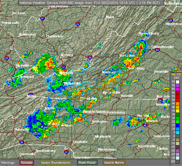 The national weather service in raleigh has issued a * severe thunderstorm warning for. forsyth county in central north carolina. northern davidson county in central north carolina. Until 430 pm edt * at 331 pm edt, severe thunderstorms were located along a line. The national weather service in raleigh has issued a * severe thunderstorm warning for. forsyth county in central north carolina. northern davidson county in central north carolina. Until 430 pm edt * at 331 pm edt, severe thunderstorms were located along a line.
|
| 8/21/2019 5:46 PM EDT |
 At 546 pm edt, severe thunderstorms were located along a line extending from near kernersville to 7 miles southeast of winston-salem to near lexington, moving east at 30 mph (radar indicated). Hazards include 60 mph wind gusts. Expect damage to roofs, siding, and trees. Locations impacted include, winston-salem, lexington, thomasville, kernersville, belews lake, welcome, sedge garden and belews creek. At 546 pm edt, severe thunderstorms were located along a line extending from near kernersville to 7 miles southeast of winston-salem to near lexington, moving east at 30 mph (radar indicated). Hazards include 60 mph wind gusts. Expect damage to roofs, siding, and trees. Locations impacted include, winston-salem, lexington, thomasville, kernersville, belews lake, welcome, sedge garden and belews creek.
|
| 8/21/2019 5:27 PM EDT |
 At 526 pm edt, severe thunderstorms were located along a line extending from germanton to near clemmons to near bermuda run, moving east at 20 mph (radar indicated). Hazards include 60 mph wind gusts. Expect damage to roofs, siding, and trees. Locations impacted include, winston-salem, lexington, thomasville, kernersville, clemmons, bermuda run, lewisville, walkertown, rural hall and pfafftown. At 526 pm edt, severe thunderstorms were located along a line extending from germanton to near clemmons to near bermuda run, moving east at 20 mph (radar indicated). Hazards include 60 mph wind gusts. Expect damage to roofs, siding, and trees. Locations impacted include, winston-salem, lexington, thomasville, kernersville, clemmons, bermuda run, lewisville, walkertown, rural hall and pfafftown.
|
| 8/21/2019 5:05 PM EDT |
 At 455 pm edt, severe thunderstorms were located along a line extending from near pilot mountain state park to east bend to shacktown, moving east at 25 mph (radar indicated). Hazards include 60 mph wind gusts and penny size hail. expect damage to roofs, siding, and trees At 455 pm edt, severe thunderstorms were located along a line extending from near pilot mountain state park to east bend to shacktown, moving east at 25 mph (radar indicated). Hazards include 60 mph wind gusts and penny size hail. expect damage to roofs, siding, and trees
|
| 8/21/2019 4:55 PM EDT |
 The national weather service in raleigh has issued a * severe thunderstorm warning for. forsyth county in central north carolina. northern davidson county in central north carolina. Until 615 pm edt * at 455 pm edt, severe thunderstorms were located along a line. The national weather service in raleigh has issued a * severe thunderstorm warning for. forsyth county in central north carolina. northern davidson county in central north carolina. Until 615 pm edt * at 455 pm edt, severe thunderstorms were located along a line.
|
| 8/19/2019 6:04 PM EDT |
 At 604 pm edt, severe thunderstorms were located along a line extending from near clemmons to near cooleemee, and are nearly stationary (radar indicated). Hazards include 60 mph wind gusts and penny size hail. Expect damage to roofs, siding, and trees. Locations impacted include, winston-salem, lexington, thomasville, kernersville, clemmons, bermuda run, huntsville, linwood, lewisville and walkertown. At 604 pm edt, severe thunderstorms were located along a line extending from near clemmons to near cooleemee, and are nearly stationary (radar indicated). Hazards include 60 mph wind gusts and penny size hail. Expect damage to roofs, siding, and trees. Locations impacted include, winston-salem, lexington, thomasville, kernersville, clemmons, bermuda run, huntsville, linwood, lewisville and walkertown.
|
| 8/19/2019 5:42 PM EDT |
 At 542 pm edt, severe thunderstorms were located along a line extending from near kernersville to 6 miles east of cooleemee, and are nearly stationary (radar indicated). Hazards include 60 mph wind gusts and quarter size hail. Hail damage to vehicles is expected. Expect wind damage to roofs, siding, and trees. At 542 pm edt, severe thunderstorms were located along a line extending from near kernersville to 6 miles east of cooleemee, and are nearly stationary (radar indicated). Hazards include 60 mph wind gusts and quarter size hail. Hail damage to vehicles is expected. Expect wind damage to roofs, siding, and trees.
|
| 8/19/2019 5:21 PM EDT |
 A severe thunderstorm warning remains in effect until 530 pm edt for davidson. randolph and northwestern chatham counties. at 520 pm edt, severe thunderstorms were located along a line extending from 6 miles northwest of siler city to near high rock lake, moving west at 20 mph. hazard. 60 mph wind gusts and quarter size hail. A severe thunderstorm warning remains in effect until 530 pm edt for davidson. randolph and northwestern chatham counties. at 520 pm edt, severe thunderstorms were located along a line extending from 6 miles northwest of siler city to near high rock lake, moving west at 20 mph. hazard. 60 mph wind gusts and quarter size hail.
|
| 8/19/2019 5:05 PM EDT |
 At 504 pm edt, severe thunderstorms were located along a line extending from near siler city to 8 miles southeast of high rock lake, moving north at 5 mph (radar indicated). Hazards include 60 mph wind gusts and quarter size hail. Hail damage to vehicles is expected. expect wind damage to roofs, siding, and trees. Locations impacted include, high point, asheboro, lexington, albemarle, randleman, siler city, badin lake, north carolina zoo, thomasville and goldston. At 504 pm edt, severe thunderstorms were located along a line extending from near siler city to 8 miles southeast of high rock lake, moving north at 5 mph (radar indicated). Hazards include 60 mph wind gusts and quarter size hail. Hail damage to vehicles is expected. expect wind damage to roofs, siding, and trees. Locations impacted include, high point, asheboro, lexington, albemarle, randleman, siler city, badin lake, north carolina zoo, thomasville and goldston.
|
| 8/19/2019 4:43 PM EDT |
 The national weather service in raleigh has issued a * severe thunderstorm warning for. southern alamance county in central north carolina. northwestern moore county in central north carolina. davidson county in central north carolina. Northern montgomery county in central north carolina. The national weather service in raleigh has issued a * severe thunderstorm warning for. southern alamance county in central north carolina. northwestern moore county in central north carolina. davidson county in central north carolina. Northern montgomery county in central north carolina.
|
| 8/13/2019 4:55 PM EDT |
 At 454 pm edt, severe thunderstorms were located along a line extending from near mcleansville to near linwood, moving southeast at 35 mph (law enforcement). Hazards include 60 mph wind gusts and penny size hail. Expect damage to roofs, siding, and trees. Locations impacted include, greensboro, high point, asheboro, lexington, randleman, north carolina zoo, thomasville, seagrove, linwood and mcleansville. At 454 pm edt, severe thunderstorms were located along a line extending from near mcleansville to near linwood, moving southeast at 35 mph (law enforcement). Hazards include 60 mph wind gusts and penny size hail. Expect damage to roofs, siding, and trees. Locations impacted include, greensboro, high point, asheboro, lexington, randleman, north carolina zoo, thomasville, seagrove, linwood and mcleansville.
|
| 8/13/2019 4:35 PM EDT |
 At 433 pm edt, severe thunderstorms were located along a line extending from near greensboro to near lexington, moving southeast at 35 mph (law enforcement). Hazards include 60 mph wind gusts and penny size hail. expect minor damage to roofs, siding, and trees At 433 pm edt, severe thunderstorms were located along a line extending from near greensboro to near lexington, moving southeast at 35 mph (law enforcement). Hazards include 60 mph wind gusts and penny size hail. expect minor damage to roofs, siding, and trees
|
| 7/22/2019 7:01 PM EDT |
 At 659 pm edt, a severe thunderstorm was located near lewisville to 5 miles west of welcome, moving east at 35 mph (radar indicated). Hazards include 60 mph wind gusts. Expect damage to trees. Locations impacted include, winston-salem, lexington, thomasville, kernersville, clemmons, bermuda run, huntsville, lewisville, walkertown and rural hall. At 659 pm edt, a severe thunderstorm was located near lewisville to 5 miles west of welcome, moving east at 35 mph (radar indicated). Hazards include 60 mph wind gusts. Expect damage to trees. Locations impacted include, winston-salem, lexington, thomasville, kernersville, clemmons, bermuda run, huntsville, lewisville, walkertown and rural hall.
|
| 7/22/2019 6:45 PM EDT |
 At 643 pm edt, a severe thunderstorm was located 10 miles west and southwest of clemmons, moving northeast at 35 mph (radar indicated). Hazards include 60 mph wind gusts. expect damage to trees At 643 pm edt, a severe thunderstorm was located 10 miles west and southwest of clemmons, moving northeast at 35 mph (radar indicated). Hazards include 60 mph wind gusts. expect damage to trees
|
| 7/7/2019 6:53 PM EDT |
 At 653 pm edt, a severe thunderstorm was located near lexington, moving south at 10 mph (radar indicated). Hazards include 60 mph wind gusts and penny size hail. Expect damage to roofs, siding, and trees. Locations impacted include, lexington, thomasville, linwood, high rock lake, gordontown, high rock lake marina & campground and welcome. At 653 pm edt, a severe thunderstorm was located near lexington, moving south at 10 mph (radar indicated). Hazards include 60 mph wind gusts and penny size hail. Expect damage to roofs, siding, and trees. Locations impacted include, lexington, thomasville, linwood, high rock lake, gordontown, high rock lake marina & campground and welcome.
|
| 7/7/2019 6:30 PM EDT |
 At 629 pm edt, a severe thunderstorm was located near lexington, moving south at 10 mph (radar indicated). Hazards include 60 mph wind gusts and penny size hail. expect damage to roofs, siding, and trees At 629 pm edt, a severe thunderstorm was located near lexington, moving south at 10 mph (radar indicated). Hazards include 60 mph wind gusts and penny size hail. expect damage to roofs, siding, and trees
|
| 6/30/2019 7:05 PM EDT |
 At 705 pm edt, a severe thunderstorm was located over lexington, moving southeast at 25 mph (radar indicated). Hazards include 60 mph wind gusts. Expect damage to roofs, siding, and trees. Locations impacted include, lexington and welcome. At 705 pm edt, a severe thunderstorm was located over lexington, moving southeast at 25 mph (radar indicated). Hazards include 60 mph wind gusts. Expect damage to roofs, siding, and trees. Locations impacted include, lexington and welcome.
|
| 6/30/2019 6:46 PM EDT |
 At 646 pm edt, a severe thunderstorm was located near lexington, moving southeast at 30 mph (radar indicated). Hazards include 60 mph wind gusts. Expect damage to roofs, siding, and trees. Locations impacted include, lexington, thomasville, welcome and arcadia. At 646 pm edt, a severe thunderstorm was located near lexington, moving southeast at 30 mph (radar indicated). Hazards include 60 mph wind gusts. Expect damage to roofs, siding, and trees. Locations impacted include, lexington, thomasville, welcome and arcadia.
|
| 6/30/2019 6:32 PM EDT |
 At 632 pm edt, severe thunderstorms were located along a line extending from near clemmons to 7 miles east of mocksville, moving southeast at 25 mph (radar indicated). Hazards include 60 mph wind gusts. Expect damage to roofs, siding, and trees. Locations impacted include, winston-salem, lexington, thomasville, clemmons, bermuda run, huntsville, lewisville, arcadia, welcome and sedge garden. At 632 pm edt, severe thunderstorms were located along a line extending from near clemmons to 7 miles east of mocksville, moving southeast at 25 mph (radar indicated). Hazards include 60 mph wind gusts. Expect damage to roofs, siding, and trees. Locations impacted include, winston-salem, lexington, thomasville, clemmons, bermuda run, huntsville, lewisville, arcadia, welcome and sedge garden.
|
| 6/30/2019 6:08 PM EDT |
 At 608 pm edt, a severe thunderstorm was located over enon, or near east bend, moving southeast at 20 mph (radar indicated). Hazards include 60 mph wind gusts. expect damage to roofs, siding, and trees At 608 pm edt, a severe thunderstorm was located over enon, or near east bend, moving southeast at 20 mph (radar indicated). Hazards include 60 mph wind gusts. expect damage to roofs, siding, and trees
|
| 6/20/2019 2:19 PM EDT |
 At 219 pm edt, severe thunderstorms with a history of producing intermittent tree damage were located along a line extending from near thomasville through lexington to salisbury, moving east at 40 mph (radar indicated). Hazards include 60 mph wind gusts and quarter size hail. Hail damage to vehicles is expected. Expect wind damage to roofs, siding, and trees. At 219 pm edt, severe thunderstorms with a history of producing intermittent tree damage were located along a line extending from near thomasville through lexington to salisbury, moving east at 40 mph (radar indicated). Hazards include 60 mph wind gusts and quarter size hail. Hail damage to vehicles is expected. Expect wind damage to roofs, siding, and trees.
|
| 4/19/2019 2:36 PM EDT |
 At 236 pm edt, severe thunderstorms were located along a line extending from near king to near high rock lake, moving north at 60 mph (radar indicated). Hazards include 60 mph wind gusts and penny size hail. Expect damage to roofs, siding, and trees. locations impacted include, greensboro, winston-salem, high point, lexington, thomasville, kernersville, clemmons, bermuda run, linwood and huntsville. A tornado watch remains in effect until 500 pm edt for central north carolina. At 236 pm edt, severe thunderstorms were located along a line extending from near king to near high rock lake, moving north at 60 mph (radar indicated). Hazards include 60 mph wind gusts and penny size hail. Expect damage to roofs, siding, and trees. locations impacted include, greensboro, winston-salem, high point, lexington, thomasville, kernersville, clemmons, bermuda run, linwood and huntsville. A tornado watch remains in effect until 500 pm edt for central north carolina.
|
| 4/19/2019 2:26 PM EDT |
 At 225 pm edt, severe thunderstorms were located along a line extending from near enon to 8 miles east of rockwell, moving north at 60 mph (radar indicated). Hazards include 60 mph wind gusts and penny size hail. expect damage to roofs, siding, and trees At 225 pm edt, severe thunderstorms were located along a line extending from near enon to 8 miles east of rockwell, moving north at 60 mph (radar indicated). Hazards include 60 mph wind gusts and penny size hail. expect damage to roofs, siding, and trees
|
| 4/15/2019 12:42 AM EDT |
 At 1242 am edt, a severe thunderstorm capable of producing a tornado was located near cooleemee, or near mocksville, moving northeast at 60 mph (radar indicated rotation). Hazards include tornado. Flying debris will be dangerous to those caught without shelter. mobile homes will be damaged or destroyed. damage to roofs, windows, and vehicles will occur. Tree damage is likely. At 1242 am edt, a severe thunderstorm capable of producing a tornado was located near cooleemee, or near mocksville, moving northeast at 60 mph (radar indicated rotation). Hazards include tornado. Flying debris will be dangerous to those caught without shelter. mobile homes will be damaged or destroyed. damage to roofs, windows, and vehicles will occur. Tree damage is likely.
|
| 9/27/2018 9:41 PM EDT |
 At 939 pm edt, severe thunderstorms were located along a line extending from near china grove to fairview in union county to near heath springs, moving northeast at 60 mph (radar indicated). Hazards include 60 mph wind gusts. expect damage to roofs, siding, and trees At 939 pm edt, severe thunderstorms were located along a line extending from near china grove to fairview in union county to near heath springs, moving northeast at 60 mph (radar indicated). Hazards include 60 mph wind gusts. expect damage to roofs, siding, and trees
|
| 8/21/2018 5:25 PM EDT |
 At 525 pm edt, a severe thunderstorm was located 7 miles southeast of bermuda run, or 9 miles northwest of lexington, moving east at 20 mph (radar indicated). Hazards include 60 mph wind gusts and penny size hail. Expect damage to roofs, siding, and trees. Locations impacted include, high point, lexington, thomasville, linwood, high rock lake, arcadia, gordontown and welcome. At 525 pm edt, a severe thunderstorm was located 7 miles southeast of bermuda run, or 9 miles northwest of lexington, moving east at 20 mph (radar indicated). Hazards include 60 mph wind gusts and penny size hail. Expect damage to roofs, siding, and trees. Locations impacted include, high point, lexington, thomasville, linwood, high rock lake, arcadia, gordontown and welcome.
|
| 8/21/2018 5:00 PM EDT |
 At 459 pm edt, a severe thunderstorm was located over mocksville, moving east at 20 mph. this storm is expected to push into western forsyth and western davidson counties over the next thirty minutes (radar indicated). Hazards include 60 mph wind gusts and penny size hail. expect damage to roofs, siding, and trees At 459 pm edt, a severe thunderstorm was located over mocksville, moving east at 20 mph. this storm is expected to push into western forsyth and western davidson counties over the next thirty minutes (radar indicated). Hazards include 60 mph wind gusts and penny size hail. expect damage to roofs, siding, and trees
|
| 8/8/2018 6:39 PM EDT |
 At 639 pm edt, severe thunderstorms were located along a line extending from clemmons to salisbury to near midland, moving east at 30 mph (radar indicated). Hazards include 60 mph wind gusts. expect damage to roofs, siding, and trees At 639 pm edt, severe thunderstorms were located along a line extending from clemmons to salisbury to near midland, moving east at 30 mph (radar indicated). Hazards include 60 mph wind gusts. expect damage to roofs, siding, and trees
|
| 8/3/2018 4:47 PM EDT |
 At 446 pm edt, a severe thunderstorm was located near linwood, or 7 miles south of lexington, moving east at 15 mph (radar indicated). Hazards include 60 mph wind gusts. expect downed trees At 446 pm edt, a severe thunderstorm was located near linwood, or 7 miles south of lexington, moving east at 15 mph (radar indicated). Hazards include 60 mph wind gusts. expect downed trees
|
| 7/22/2018 7:59 PM EDT |
 At 758 pm edt, severe thunderstorms were located along a line extending from 6 miles northwest of linwood to near rockwell, moving north at 30 mph (radar indicated). Hazards include 60 mph wind gusts. expect damage to roofs, siding, and trees At 758 pm edt, severe thunderstorms were located along a line extending from 6 miles northwest of linwood to near rockwell, moving north at 30 mph (radar indicated). Hazards include 60 mph wind gusts. expect damage to roofs, siding, and trees
|
| 6/25/2018 7:22 PM EDT |
 At 720 pm edt, a line of severe thunderstorms extended from high rock lake to lexington to 10 miles southeast of winston-salem, moving southeast at 40 mph (radar indicated). Hazards include 60 mph wind gusts. Expect damage to trees and crops. Locations impacted include, lexington, thomasville, kernersville, linwood, denton, gordontown and newsom. At 720 pm edt, a line of severe thunderstorms extended from high rock lake to lexington to 10 miles southeast of winston-salem, moving southeast at 40 mph (radar indicated). Hazards include 60 mph wind gusts. Expect damage to trees and crops. Locations impacted include, lexington, thomasville, kernersville, linwood, denton, gordontown and newsom.
|
| 6/25/2018 6:58 PM EDT |
 At 655 pm edt, a line of severe thunderstorms were located along the yadkin river, moving southeast 40 mph (radar indicated). Hazards include 60 mph wind gusts. Expect damage to crops and trees. Locations impacted include, winston-salem, lexington, thomasville, kernersville, clemmons, bermuda run, huntsville, linwood, lewisville and walkertown. At 655 pm edt, a line of severe thunderstorms were located along the yadkin river, moving southeast 40 mph (radar indicated). Hazards include 60 mph wind gusts. Expect damage to crops and trees. Locations impacted include, winston-salem, lexington, thomasville, kernersville, clemmons, bermuda run, huntsville, linwood, lewisville and walkertown.
|
| 6/25/2018 6:27 PM EDT |
 At 623 pm edt, a line of severe thunderstorms was approaching the triad from the west. the line will be moving into forsyth and davidson counties between 630 and 645 pm (radar indicated). Hazards include 60 mph wind gusts and half dollar size hail. expect wind damage to crops and trees At 623 pm edt, a line of severe thunderstorms was approaching the triad from the west. the line will be moving into forsyth and davidson counties between 630 and 645 pm (radar indicated). Hazards include 60 mph wind gusts and half dollar size hail. expect wind damage to crops and trees
|
| 6/1/2018 6:26 PM EDT |
 At 626 pm edt, severe thunderstorms were located along a line extending from near kernersville to linwood, moving east at 25 mph (radar indicated). Hazards include 60 mph wind gusts. Expect damage to roofs, siding, and trees. Locations impacted include, lexington, linwood, welcome and high rock lake. At 626 pm edt, severe thunderstorms were located along a line extending from near kernersville to linwood, moving east at 25 mph (radar indicated). Hazards include 60 mph wind gusts. Expect damage to roofs, siding, and trees. Locations impacted include, lexington, linwood, welcome and high rock lake.
|
| 6/1/2018 6:14 PM EDT |
 At 613 pm edt, severe thunderstorms were located along a line extending from near kernersville to near linwood, moving east at 20 mph (radar indicated). Hazards include 60 mph wind gusts and penny size hail. Expect damage to roofs, siding, and trees. Locations impacted include, winston-salem, lexington, kernersville, linwood, walkertown, pfafftown, belews creek, arcadia, stanleyville and belews lake. At 613 pm edt, severe thunderstorms were located along a line extending from near kernersville to near linwood, moving east at 20 mph (radar indicated). Hazards include 60 mph wind gusts and penny size hail. Expect damage to roofs, siding, and trees. Locations impacted include, winston-salem, lexington, kernersville, linwood, walkertown, pfafftown, belews creek, arcadia, stanleyville and belews lake.
|
| 6/1/2018 6:06 PM EDT |
 At 606 pm edt, severe thunderstorms were located along a line extending from near winston-salem to 6 miles northwest of linwood, moving east at 20 mph (radar indicated). Hazards include 60 mph wind gusts and penny size hail. Expect damage to roofs, siding, and trees. Locations impacted include, winston-salem, lexington, kernersville, clemmons, bermuda run, linwood, lewisville, walkertown, rural hall and pfafftown. At 606 pm edt, severe thunderstorms were located along a line extending from near winston-salem to 6 miles northwest of linwood, moving east at 20 mph (radar indicated). Hazards include 60 mph wind gusts and penny size hail. Expect damage to roofs, siding, and trees. Locations impacted include, winston-salem, lexington, kernersville, clemmons, bermuda run, linwood, lewisville, walkertown, rural hall and pfafftown.
|
| 6/1/2018 5:36 PM EDT |
 At 534 pm edt, severe thunderstorms were located along a line extending from near courtney to 6 miles east of statesville, moving east at 20 mph (radar indicated). Hazards include 60 mph wind gusts and penny size hail. expect damage to roofs, siding, and trees At 534 pm edt, severe thunderstorms were located along a line extending from near courtney to 6 miles east of statesville, moving east at 20 mph (radar indicated). Hazards include 60 mph wind gusts and penny size hail. expect damage to roofs, siding, and trees
|
| 4/15/2018 4:35 PM EDT |
 At 434 pm edt, a severe thunderstorm was located 10 miles southeast of lexington, moving north at 55 mph (radar indicated). Hazards include 70 mph wind gusts and quarter size hail. Hail damage to vehicles is possible. expect considerable tree damage. Wind damage is also likely, especially to mobile homes, roofs, and outbuildings. At 434 pm edt, a severe thunderstorm was located 10 miles southeast of lexington, moving north at 55 mph (radar indicated). Hazards include 70 mph wind gusts and quarter size hail. Hail damage to vehicles is possible. expect considerable tree damage. Wind damage is also likely, especially to mobile homes, roofs, and outbuildings.
|
| 4/15/2018 4:31 PM EDT |
 At 430 pm edt, severe thunderstorms were located along a line extending from 10 miles south of thomasville to 12 miles southwest of asheboro, moving northeast at 55 mph (radar indicated). Hazards include 60 mph wind gusts and quarter size hail. Hail damage to vehicles is expected. expect wind damage to roofs, siding, and trees. locations impacted include, asheboro, lexington, troy, badin lake, linwood, badin, denton, mount gilead, eldorado and gordontown. A tornado watch remains in effect until 1100 pm edt for central north carolina. At 430 pm edt, severe thunderstorms were located along a line extending from 10 miles south of thomasville to 12 miles southwest of asheboro, moving northeast at 55 mph (radar indicated). Hazards include 60 mph wind gusts and quarter size hail. Hail damage to vehicles is expected. expect wind damage to roofs, siding, and trees. locations impacted include, asheboro, lexington, troy, badin lake, linwood, badin, denton, mount gilead, eldorado and gordontown. A tornado watch remains in effect until 1100 pm edt for central north carolina.
|
| 4/15/2018 4:17 PM EDT |
 At 417 pm edt, a severe thunderstorm was located near clemmons, or 9 miles west of winston-salem, moving north at 80 mph (radar indicated). Hazards include 70 mph wind gusts and quarter size hail. Hail damage to vehicles is expected. expect considerable tree damage. Wind damage is also likely to mobile homes, roofs, and outbuildings. At 417 pm edt, a severe thunderstorm was located near clemmons, or 9 miles west of winston-salem, moving north at 80 mph (radar indicated). Hazards include 70 mph wind gusts and quarter size hail. Hail damage to vehicles is expected. expect considerable tree damage. Wind damage is also likely to mobile homes, roofs, and outbuildings.
|
| 4/15/2018 4:11 PM EDT |
 At 410 pm edt, severe thunderstorms were located along a line extending from plyler to 7 miles south of albemarle, moving northeast at 55 mph (radar indicated). Hazards include 60 mph wind gusts and quarter size hail. Hail damage to vehicles is expected. Expect wind damage to roofs, siding, and trees. At 410 pm edt, severe thunderstorms were located along a line extending from plyler to 7 miles south of albemarle, moving northeast at 55 mph (radar indicated). Hazards include 60 mph wind gusts and quarter size hail. Hail damage to vehicles is expected. Expect wind damage to roofs, siding, and trees.
|
| 10/23/2017 6:04 PM EDT |
 At 604 pm edt, a severe thunderstorm was located near winston-salem, moving northeast at 40 mph (radar indicated). Hazards include 60 mph wind gusts. Expect minor damage to roofs, siding, and trees. locations impacted include, winston-salem, lexington, thomasville, kernersville, clemmons, bermuda run, huntsville, linwood, lewisville and walkertown. A tornado watch remains in effect until 900 pm edt for central north carolina. At 604 pm edt, a severe thunderstorm was located near winston-salem, moving northeast at 40 mph (radar indicated). Hazards include 60 mph wind gusts. Expect minor damage to roofs, siding, and trees. locations impacted include, winston-salem, lexington, thomasville, kernersville, clemmons, bermuda run, huntsville, linwood, lewisville and walkertown. A tornado watch remains in effect until 900 pm edt for central north carolina.
|
| 10/23/2017 5:47 PM EDT |
 At 546 pm edt, a severe thunderstorm was located over bermuda run, or 10 miles northeast of mocksville, moving northeast at 50 mph (radar indicated). Hazards include 60 mph wind gusts. Expect damage to roofs, siding, and trees. locations impacted include, winston-salem, lexington, thomasville, kernersville, clemmons, bermuda run, huntsville, linwood, lewisville and walkertown. A tornado watch remains in effect until 900 pm edt for central north carolina. At 546 pm edt, a severe thunderstorm was located over bermuda run, or 10 miles northeast of mocksville, moving northeast at 50 mph (radar indicated). Hazards include 60 mph wind gusts. Expect damage to roofs, siding, and trees. locations impacted include, winston-salem, lexington, thomasville, kernersville, clemmons, bermuda run, huntsville, linwood, lewisville and walkertown. A tornado watch remains in effect until 900 pm edt for central north carolina.
|
| 10/23/2017 5:35 PM EDT |
 At 534 pm edt, a severe thunderstorm was located over mocksville, moving northeast at 55 mph (radar indicated). Hazards include 60 mph wind gusts. expect damage to roofs, siding, and trees At 534 pm edt, a severe thunderstorm was located over mocksville, moving northeast at 55 mph (radar indicated). Hazards include 60 mph wind gusts. expect damage to roofs, siding, and trees
|
| 7/22/2017 6:36 PM EDT |
 The severe thunderstorm warning for southern forsyth and northern davidson counties will expire at 645 pm edt, the storms which prompted the warning have weakened below severe limits, and no longer pose an immediate threat to life or property. therefore the warning will be allowed to expire. however gusty winds are still possible with these thunderstorms. to report severe weather, contact your nearest law enforcement agency. they will relay your report to the national weather service raleigh. The severe thunderstorm warning for southern forsyth and northern davidson counties will expire at 645 pm edt, the storms which prompted the warning have weakened below severe limits, and no longer pose an immediate threat to life or property. therefore the warning will be allowed to expire. however gusty winds are still possible with these thunderstorms. to report severe weather, contact your nearest law enforcement agency. they will relay your report to the national weather service raleigh.
|
| 7/22/2017 6:19 PM EDT |
 At 619 pm edt, severe thunderstorms were located along a line extending from 8 miles south of winston-salem to bermuda run, moving southeast at 15 mph (radar indicated). Hazards include 60 mph wind gusts. Expect damage to roofs, siding, and trees. Locations impacted include, winston-salem, high point, lexington, thomasville, clemmons, bermuda run, arcadia, gordontown and welcome. At 619 pm edt, severe thunderstorms were located along a line extending from 8 miles south of winston-salem to bermuda run, moving southeast at 15 mph (radar indicated). Hazards include 60 mph wind gusts. Expect damage to roofs, siding, and trees. Locations impacted include, winston-salem, high point, lexington, thomasville, clemmons, bermuda run, arcadia, gordontown and welcome.
|
| 7/22/2017 5:57 PM EDT |
 At 556 pm edt, a severe thunderstorm was located near clemmons, or 9 miles west of winston-salem, moving southeast at 15 mph (radar indicated). Hazards include 60 mph wind gusts. expect damage to roofs, siding, and trees At 556 pm edt, a severe thunderstorm was located near clemmons, or 9 miles west of winston-salem, moving southeast at 15 mph (radar indicated). Hazards include 60 mph wind gusts. expect damage to roofs, siding, and trees
|
| 7/1/2017 3:21 PM EDT |
 At 320 pm edt, severe thunderstorms were located along a line extending from 7 miles north of lexington to near linwood, moving southeast at 25 mph (radar indicated). Hazards include 60 mph wind gusts and quarter size hail. Hail damage to vehicles and crops is possible. wind damage to roofs, siding, and trees is possible. Locations impacted include, high point, lexington, thomasville, welcome and arcadia. At 320 pm edt, severe thunderstorms were located along a line extending from 7 miles north of lexington to near linwood, moving southeast at 25 mph (radar indicated). Hazards include 60 mph wind gusts and quarter size hail. Hail damage to vehicles and crops is possible. wind damage to roofs, siding, and trees is possible. Locations impacted include, high point, lexington, thomasville, welcome and arcadia.
|
| 7/1/2017 3:13 PM EDT |
 At 313 pm edt, severe thunderstorms were located along a line extending from winston-salem to 8 miles southeast of clemmons to near cooleemee, moving east at 25 mph (radar indicated). Hazards include 60 mph wind gusts and quarter size hail. Hail damage to vehicles and crops is possible. wind damage to roofs, siding, and trees is possible. Locations impacted include, winston-salem, high point, lexington, thomasville, kernersville, clemmons, arcadia, welcome and sedge garden. At 313 pm edt, severe thunderstorms were located along a line extending from winston-salem to 8 miles southeast of clemmons to near cooleemee, moving east at 25 mph (radar indicated). Hazards include 60 mph wind gusts and quarter size hail. Hail damage to vehicles and crops is possible. wind damage to roofs, siding, and trees is possible. Locations impacted include, winston-salem, high point, lexington, thomasville, kernersville, clemmons, arcadia, welcome and sedge garden.
|
| 7/1/2017 3:02 PM EDT |
 At 301 pm edt, severe thunderstorms were located along a line extending from near germanton to near bermuda run to near mocksville, moving east at 25 mph (radar indicated). Hazards include 60 mph wind gusts and quarter size hail. Hail damage to vehicles and crops is possible. wind damage to roofs, siding, and trees is possible. Locations impacted include, winston-salem, lexington, thomasville, kernersville, clemmons, bermuda run, lewisville, walkertown, rural hall and pfafftown. At 301 pm edt, severe thunderstorms were located along a line extending from near germanton to near bermuda run to near mocksville, moving east at 25 mph (radar indicated). Hazards include 60 mph wind gusts and quarter size hail. Hail damage to vehicles and crops is possible. wind damage to roofs, siding, and trees is possible. Locations impacted include, winston-salem, lexington, thomasville, kernersville, clemmons, bermuda run, lewisville, walkertown, rural hall and pfafftown.
|
| 7/1/2017 2:44 PM EDT |
 At 241 pm edt, severe thunderstorms were located along a line extending from near king to bermuda run to near mocksville, moving east at 25 mph (radar indicated). Hazards include 60 mph wind gusts and quarter size hail. Hail damage to vehicles and crops is expected. Wind damage to roofs, siding, and trees is possible. At 241 pm edt, severe thunderstorms were located along a line extending from near king to bermuda run to near mocksville, moving east at 25 mph (radar indicated). Hazards include 60 mph wind gusts and quarter size hail. Hail damage to vehicles and crops is expected. Wind damage to roofs, siding, and trees is possible.
|
| 6/13/2017 5:37 PM EDT |
 The severe thunderstorm warning for davidson county will expire at 545 pm edt, the storm which prompted the warning has weakened below severe limits, and no longer poses an immediate threat to life or property. therefore the warning will be allowed to expire. however lightning and heavy rain is still possible with this thunderstorm. The severe thunderstorm warning for davidson county will expire at 545 pm edt, the storm which prompted the warning has weakened below severe limits, and no longer poses an immediate threat to life or property. therefore the warning will be allowed to expire. however lightning and heavy rain is still possible with this thunderstorm.
|
| 6/13/2017 4:44 PM EDT |
 At 443 pm edt, a severe thunderstorm was located 8 miles north of lexington, moving southeast at 30 mph (radar indicated). Hazards include 60 mph wind gusts and quarter size hail. Hail damage to vehicles is expected. Expect wind damage to roofs, siding, and trees. At 443 pm edt, a severe thunderstorm was located 8 miles north of lexington, moving southeast at 30 mph (radar indicated). Hazards include 60 mph wind gusts and quarter size hail. Hail damage to vehicles is expected. Expect wind damage to roofs, siding, and trees.
|
| 5/31/2017 5:04 PM EDT |
 At 452 pm edt, a severe thunderstorm was located near lexington, moving east at 30 mph (radar indicated). Hazards include 60 mph wind gusts and nickel size hail. expect minor damage to roofs, siding, and trees At 452 pm edt, a severe thunderstorm was located near lexington, moving east at 30 mph (radar indicated). Hazards include 60 mph wind gusts and nickel size hail. expect minor damage to roofs, siding, and trees
|
| 5/31/2017 4:52 PM EDT |
 At 452 pm edt, a severe thunderstorm was located near lexington, moving east at 30 mph (radar indicated). Hazards include 60 mph wind gusts and nickel size hail. expect minor damage to roofs, siding, and trees At 452 pm edt, a severe thunderstorm was located near lexington, moving east at 30 mph (radar indicated). Hazards include 60 mph wind gusts and nickel size hail. expect minor damage to roofs, siding, and trees
|
| 5/28/2017 3:05 AM EDT |
 At 304 am edt, severe thunderstorms were located along a line extending from 7 miles northwest of thomasville to near lexington to near rockwell, moving east at 45 mph (radar indicated). Hazards include 60 mph wind gusts. Expect damage to roofs, siding, and trees. Locations impacted include, high point, asheboro, lexington, albemarle, randleman, badin lake, north carolina zoo, and thomasville. At 304 am edt, severe thunderstorms were located along a line extending from 7 miles northwest of thomasville to near lexington to near rockwell, moving east at 45 mph (radar indicated). Hazards include 60 mph wind gusts. Expect damage to roofs, siding, and trees. Locations impacted include, high point, asheboro, lexington, albemarle, randleman, badin lake, north carolina zoo, and thomasville.
|
| 5/28/2017 2:38 AM EDT |
 At 237 am edt, severe thunderstorms were located along a line extending from near mocksville to near harrisburg, moving east at 45 mph (radar indicated). Hazards include 60 mph wind gusts. expect damage to roofs, siding, and trees At 237 am edt, severe thunderstorms were located along a line extending from near mocksville to near harrisburg, moving east at 45 mph (radar indicated). Hazards include 60 mph wind gusts. expect damage to roofs, siding, and trees
|
| 5/19/2017 4:23 PM EDT |
 At 420 pm edt, severe thunderstorms were located along a line extending from near greensboro to near clemmons, moving east at 25 mph. the most intense storm along the line was located over northwestern guilford county, between stokesdale and piedmont triad airport, also moving east at about 25 mph. this storm will affect summerfield and lake townsend (radar indicated). Hazards include 60 mph wind gusts and penny size hail. Expect damage to roofs, siding, and trees. Locations impacted include, greensboro, winston-salem, high point, lexington, thomasville, kernersville, clemmons, mcleansville, summerfield and gibsonville. At 420 pm edt, severe thunderstorms were located along a line extending from near greensboro to near clemmons, moving east at 25 mph. the most intense storm along the line was located over northwestern guilford county, between stokesdale and piedmont triad airport, also moving east at about 25 mph. this storm will affect summerfield and lake townsend (radar indicated). Hazards include 60 mph wind gusts and penny size hail. Expect damage to roofs, siding, and trees. Locations impacted include, greensboro, winston-salem, high point, lexington, thomasville, kernersville, clemmons, mcleansville, summerfield and gibsonville.
|
| 5/19/2017 4:07 PM EDT |
 At 406 pm edt, severe thunderstorms were located along a line extending from 7 miles northwest of greensboro to near bermuda run, moving east at 25 mph (radar indicated). Hazards include 60 mph wind gusts and penny size hail. expect damage to roofs, siding, and trees At 406 pm edt, severe thunderstorms were located along a line extending from 7 miles northwest of greensboro to near bermuda run, moving east at 25 mph (radar indicated). Hazards include 60 mph wind gusts and penny size hail. expect damage to roofs, siding, and trees
|
| 5/1/2017 5:53 PM EDT |
 At 552 pm edt, severe thunderstorms were located along a line extending from near winston-salem to near lexington, moving northeast at 60 mph (radar indicated). Hazards include 60 mph wind gusts. Expect damage to roofs, siding, and trees. Locations impacted include, greensboro, winston-salem, high point, lexington, thomasville, kernersville, linwood, high rock lake, summerfield and stokesdale. At 552 pm edt, severe thunderstorms were located along a line extending from near winston-salem to near lexington, moving northeast at 60 mph (radar indicated). Hazards include 60 mph wind gusts. Expect damage to roofs, siding, and trees. Locations impacted include, greensboro, winston-salem, high point, lexington, thomasville, kernersville, linwood, high rock lake, summerfield and stokesdale.
|
| 5/1/2017 5:40 PM EDT |
 At 540 pm edt, severe thunderstorms were located along a line extending from near winston-salem to near spencer, moving northeast at 60 mph (radar indicated). Hazards include 60 mph wind gusts. expect damage to roofs, siding, and trees At 540 pm edt, severe thunderstorms were located along a line extending from near winston-salem to near spencer, moving northeast at 60 mph (radar indicated). Hazards include 60 mph wind gusts. expect damage to roofs, siding, and trees
|
| 3/1/2017 6:23 PM EST |
 At 622 pm est, a severe thunderstorm was located near lexington, moving east at 55 mph (radar indicated). Hazards include 60 mph wind gusts and half dollar size hail. Hail damage to vehicles is expected. expect wind damage to roofs, siding, and trees. Locations impacted include, greensboro, high point, asheboro, lexington, randleman, thomasville, linwood, archdale, trinity and pleasant garden. At 622 pm est, a severe thunderstorm was located near lexington, moving east at 55 mph (radar indicated). Hazards include 60 mph wind gusts and half dollar size hail. Hail damage to vehicles is expected. expect wind damage to roofs, siding, and trees. Locations impacted include, greensboro, high point, asheboro, lexington, randleman, thomasville, linwood, archdale, trinity and pleasant garden.
|
| 3/1/2017 5:59 PM EST |
 At 558 pm est, a severe thunderstorm was located over cooleemee, or near mocksville, moving east at 50 mph (radar indicated). Hazards include 60 mph wind gusts and quarter size hail. Hail damage to vehicles is expected. Expect wind damage to roofs, siding, and trees. At 558 pm est, a severe thunderstorm was located over cooleemee, or near mocksville, moving east at 50 mph (radar indicated). Hazards include 60 mph wind gusts and quarter size hail. Hail damage to vehicles is expected. Expect wind damage to roofs, siding, and trees.
|
| 11/30/2016 7:22 PM EST |
 At 722 pm est, severe thunderstorms were located along a line extending from monroeton to near greensboro to 6 miles east of high rock lake, moving northeast at 40 mph (radar indicated). Hazards include 60 mph wind gusts. Expect damage to roofs. siding. and trees. Locations impacted include, greensboro, winston-salem, high point, asheboro, lexington, randleman, north carolina zoo, thomasville, kernersville and clemmons. At 722 pm est, severe thunderstorms were located along a line extending from monroeton to near greensboro to 6 miles east of high rock lake, moving northeast at 40 mph (radar indicated). Hazards include 60 mph wind gusts. Expect damage to roofs. siding. and trees. Locations impacted include, greensboro, winston-salem, high point, asheboro, lexington, randleman, north carolina zoo, thomasville, kernersville and clemmons.
|
| 11/30/2016 6:57 PM EST |
 At 656 pm est, severe thunderstorms were located along a line extending from near walnut cove to 8 miles northwest of thomasville to enochville, moving northeast at 35 mph (radar indicated). Hazards include 60 mph wind gusts. Expect damage to roofs. siding. And trees. At 656 pm est, severe thunderstorms were located along a line extending from near walnut cove to 8 miles northwest of thomasville to enochville, moving northeast at 35 mph (radar indicated). Hazards include 60 mph wind gusts. Expect damage to roofs. siding. And trees.
|
| 7/27/2016 7:32 PM EDT |
 At 731 pm edt, severe thunderstorms were located along a line extending from near winston-salem to elon college, moving east at 35 mph (radar indicated). Hazards include 60 mph wind gusts and nickel size hail. Expect damage to roofs. siding. And trees. At 731 pm edt, severe thunderstorms were located along a line extending from near winston-salem to elon college, moving east at 35 mph (radar indicated). Hazards include 60 mph wind gusts and nickel size hail. Expect damage to roofs. siding. And trees.
|
| 7/8/2016 7:43 PM EDT |
 At 743 pm edt, severe thunderstorms were located along a line extending from clemmons to near greensboro, moving southeast at 25 mph (radar indicated). Hazards include 60 mph wind gusts and quarter size hail. Hail damage to vehicles is expected. Expect wind damage to roofs, siding, and trees. At 743 pm edt, severe thunderstorms were located along a line extending from clemmons to near greensboro, moving southeast at 25 mph (radar indicated). Hazards include 60 mph wind gusts and quarter size hail. Hail damage to vehicles is expected. Expect wind damage to roofs, siding, and trees.
|
| 7/5/2016 4:41 PM EDT |
 At 440 pm edt, severe thunderstorms were located along a line extending from clemmons to near high rock lake to near mt pleasant, moving east at 45 mph (radar indicated). Hazards include 60 mph wind gusts. Expect damage to roofs. siding. and trees. Locations impacted include, winston-salem, lexington, albemarle, badin lake, thomasville, kernersville, clemmons, bermuda run, linwood and plyler. At 440 pm edt, severe thunderstorms were located along a line extending from clemmons to near high rock lake to near mt pleasant, moving east at 45 mph (radar indicated). Hazards include 60 mph wind gusts. Expect damage to roofs. siding. and trees. Locations impacted include, winston-salem, lexington, albemarle, badin lake, thomasville, kernersville, clemmons, bermuda run, linwood and plyler.
|
| 7/5/2016 4:25 PM EDT |
 At 425 pm edt, severe thunderstorms were located along a line extending from near huntsville to salisbury to near downtown concord, moving east at 40 mph (radar indicated). Hazards include 60 mph wind gusts. Expect damage to roofs. siding. And trees. At 425 pm edt, severe thunderstorms were located along a line extending from near huntsville to salisbury to near downtown concord, moving east at 40 mph (radar indicated). Hazards include 60 mph wind gusts. Expect damage to roofs. siding. And trees.
|
| 5/2/2016 4:16 PM EDT |
 At 415 pm edt, a severe thunderstorm was located 8 miles southeast of thomasville, or 10 miles west of randleman, moving northeast at 45 mph (radar indicated). Hazards include 60 mph wind gusts and quarter size hail. Hail damage to vehicles is expected. expect wind damage to roofs, siding, and trees. Locations impacted include, high point, asheboro, lexington, randleman, thomasville, linwood, archdale, trinity, denton and franklinville. At 415 pm edt, a severe thunderstorm was located 8 miles southeast of thomasville, or 10 miles west of randleman, moving northeast at 45 mph (radar indicated). Hazards include 60 mph wind gusts and quarter size hail. Hail damage to vehicles is expected. expect wind damage to roofs, siding, and trees. Locations impacted include, high point, asheboro, lexington, randleman, thomasville, linwood, archdale, trinity, denton and franklinville.
|
| 5/2/2016 4:04 PM EDT |
 At 404 pm edt, a severe thunderstorm was located 9 miles southeast of lexington, moving northeast at 25 mph (radar indicated). Hazards include 60 mph wind gusts and quarter size hail. Hail damage to vehicles is expected. Expect wind damage to roofs, siding, and trees. At 404 pm edt, a severe thunderstorm was located 9 miles southeast of lexington, moving northeast at 25 mph (radar indicated). Hazards include 60 mph wind gusts and quarter size hail. Hail damage to vehicles is expected. Expect wind damage to roofs, siding, and trees.
|
| 2/24/2016 1:50 PM EST |
 At 149 pm est, emergency management reported a line of severe thunderstorms producing damaging winds in excess of 58 mph. these storms were located along a line extending from near belews lake to near high rock lake, moving east at 15 mph. locations impacted include, greensboro, winston-salem, high point, asheboro, lexington, randleman, north carolina zoo, thomasville, kernersville and seagrove. a tornado watch remains in effect until 700 pm est for central north carolina. At 149 pm est, emergency management reported a line of severe thunderstorms producing damaging winds in excess of 58 mph. these storms were located along a line extending from near belews lake to near high rock lake, moving east at 15 mph. locations impacted include, greensboro, winston-salem, high point, asheboro, lexington, randleman, north carolina zoo, thomasville, kernersville and seagrove. a tornado watch remains in effect until 700 pm est for central north carolina.
|
| 2/24/2016 1:29 PM EST |
 At 128 pm est, doppler radar continued to indicate a line of severe thunderstorms capable of producing damaging winds in excess of 58 mph. these storms were located along a line extending from near pine hall to near rockwell, moving east at 40 mph. locations impacted include, greensboro, winston-salem, high point, asheboro, lexington, randleman, north carolina zoo, thomasville, kernersville and clemmons. a tornado watch remains in effect until 700 pm est for central north carolina. At 128 pm est, doppler radar continued to indicate a line of severe thunderstorms capable of producing damaging winds in excess of 58 mph. these storms were located along a line extending from near pine hall to near rockwell, moving east at 40 mph. locations impacted include, greensboro, winston-salem, high point, asheboro, lexington, randleman, north carolina zoo, thomasville, kernersville and clemmons. a tornado watch remains in effect until 700 pm est for central north carolina.
|
| 2/24/2016 1:04 PM EST |
 At 103 pm est, doppler radar indicated a line of severe thunderstorms capable of producing damaging winds in excess of 58 mph. these storms were located along a line extending from near king to near kannapolis, and moving east at 50 mph. At 103 pm est, doppler radar indicated a line of severe thunderstorms capable of producing damaging winds in excess of 58 mph. these storms were located along a line extending from near king to near kannapolis, and moving east at 50 mph.
|
| 9/4/2015 6:07 PM EDT |
 At 606 pm edt, doppler radar continued to indicate a severe thunderstorm capable of producing quarter size hail and damaging winds in excess of 58 mph. this storm was located near cooleemee, or 8 miles southeast of mocksville, moving southwest at 10 mph. this severe thunderstorm will remain over mainly rural areas of west central davidson county. At 606 pm edt, doppler radar continued to indicate a severe thunderstorm capable of producing quarter size hail and damaging winds in excess of 58 mph. this storm was located near cooleemee, or 8 miles southeast of mocksville, moving southwest at 10 mph. this severe thunderstorm will remain over mainly rural areas of west central davidson county.
|
| 9/4/2015 5:28 PM EDT |
 At 528 pm edt, doppler radar indicated a severe thunderstorm capable of producing quarter size hail and damaging winds in excess of 58 mph. this storm was located 7 miles north of lexington, and moving southwest at 15 mph. At 528 pm edt, doppler radar indicated a severe thunderstorm capable of producing quarter size hail and damaging winds in excess of 58 mph. this storm was located 7 miles north of lexington, and moving southwest at 15 mph.
|
| 7/13/2015 8:46 PM EDT |
 At 843 pm edt, doppler radar indicated a line of severe thunderstorm capable of producing damaging winds to near 65 mph. this line extended from belews lake to clemmons to 10 miles west of high rock, moving east at 35 mph. At 843 pm edt, doppler radar indicated a line of severe thunderstorm capable of producing damaging winds to near 65 mph. this line extended from belews lake to clemmons to 10 miles west of high rock, moving east at 35 mph.
|
| 6/19/2015 5:31 PM EDT |
 At 531 pm edt, doppler radar continued to indicate a line of severe thunderstorms capable of producing quarter size hail and damaging winds in excess of 58 mph. these storms were located along a line extending from clemmons to 6 miles northwest of badin lake, moving northeast at 20 mph. locations impacted include, winston-salem, lexington, thomasville, kernersville, clemmons, linwood, lewisville, midway, walkertown and denton. At 531 pm edt, doppler radar continued to indicate a line of severe thunderstorms capable of producing quarter size hail and damaging winds in excess of 58 mph. these storms were located along a line extending from clemmons to 6 miles northwest of badin lake, moving northeast at 20 mph. locations impacted include, winston-salem, lexington, thomasville, kernersville, clemmons, linwood, lewisville, midway, walkertown and denton.
|
| 6/19/2015 5:22 PM EDT | Several trees down near where highway 64 crosses over into davidson count in davie county NC, 5.6 miles SSE of Tyro, NC |
| 6/19/2015 5:16 PM EDT |
 At 516 pm edt, doppler radar indicated a line of severe thunderstorms capable of producing damaging winds in excess of 58 mph. these storms were located along a line extending from near bermuda run to 7 miles southeast of rockwell, and moving northeast at 20 mph. At 516 pm edt, doppler radar indicated a line of severe thunderstorms capable of producing damaging winds in excess of 58 mph. these storms were located along a line extending from near bermuda run to 7 miles southeast of rockwell, and moving northeast at 20 mph.
|
| 4/20/2015 2:51 PM EDT | At 250 pm edt, doppler radar indicated a severe thunderstorm capable of producing quarter size hail and damaging winds in excess of 58 mph. this storm was located over winston-salem, moving northeast at 30 mph. locations impacted include, greensboro, winston-salem, high point, lexington, kernersville, clemmons, bermuda run, huntsville, linwood and lewisville. |
| 4/20/2015 2:35 PM EDT | At 232 pm edt, doppler radar indicated a severe thunderstorm capable of producing quarter size hail and damaging winds in excess of 58 mph. this storm was located over clemmons, or 9 miles southwest of winston-salem, and moving northeast at 35 mph. |
| 6/26/2013 5:39 PM EDT | 2 trees down on hwy 150 near old hwy 64 in davidson county NC, 4.6 miles SSW of Tyro, NC |
| 10/18/2012 8:35 PM EDT | Trees down on us 64 in davidson county NC, 3.8 miles S of Tyro, NC |
| 10/18/2012 8:34 PM EDT | Trees down along highway 64 just inside davie county at the bridg in davie county NC, 4.6 miles S of Tyro, NC |
| 6/22/2012 4:15 PM EDT | Tree down on power line at andrew sink rd in davidson county NC, 3.7 miles SSW of Tyro, NC |
| 11/16/2011 5:52 PM EST | Quarter sized hail reported 4 miles NNW of Tyro, NC, 1 hail near old salisbury road |
| 1/1/0001 12:00 AM | Tree down on swicegood road in davidson county NC, 2.4 miles N of Tyro, NC |
| 1/1/0001 12:00 AM | Davindson co 911 reported tree down on rd in churchland at boones cave rd and s hwy 150 in davidson county NC, 2.6 miles E of Tyro, NC |
| 1/1/0001 12:00 AM | Davindson co 911 reported tree down on rd in churchland at boones cave rd and s hwy 150 in davidson county NC, 2.6 miles E of Tyro, NC |
Hail Maps for Tyro, NC
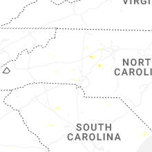


Connect with Interactive Hail Maps