

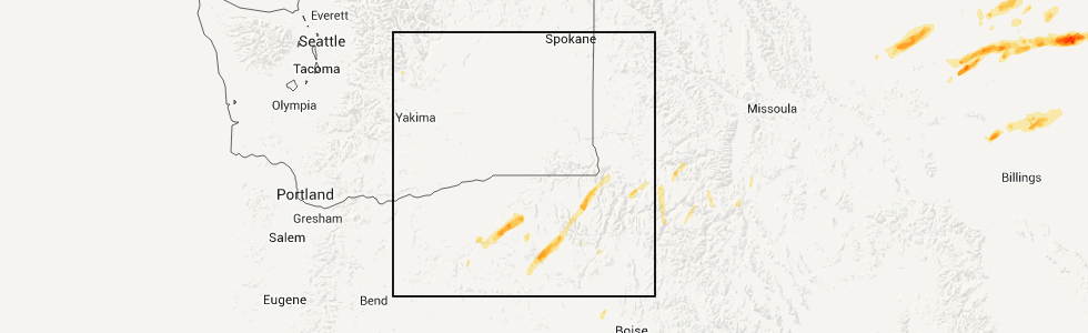
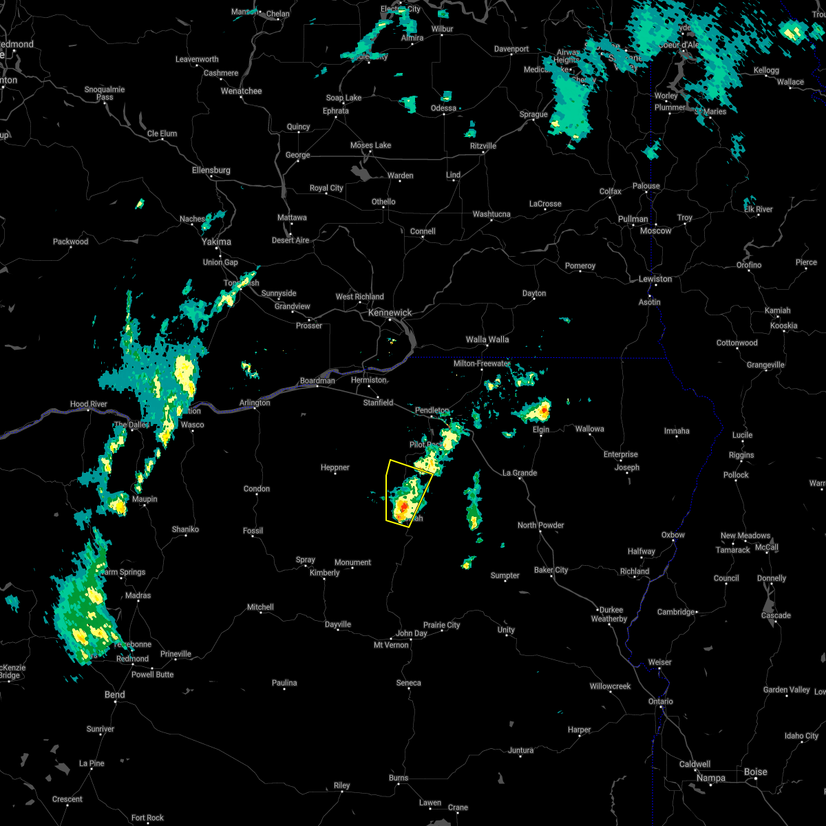
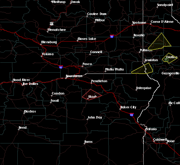
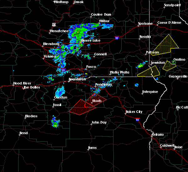
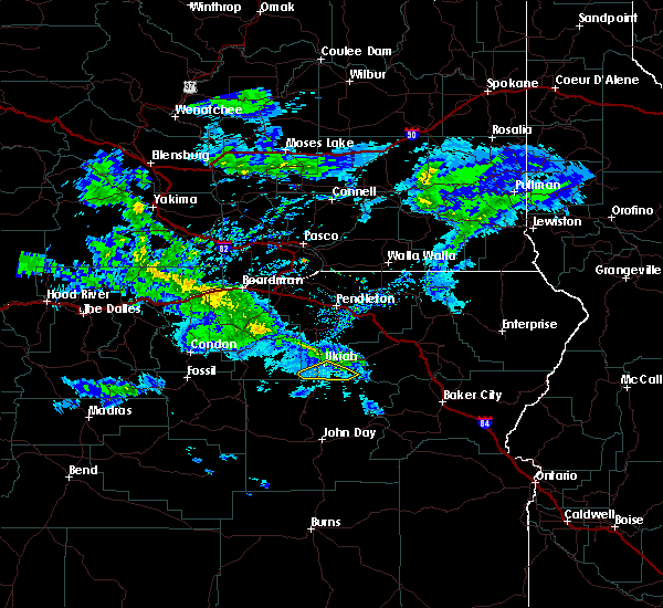
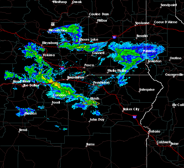
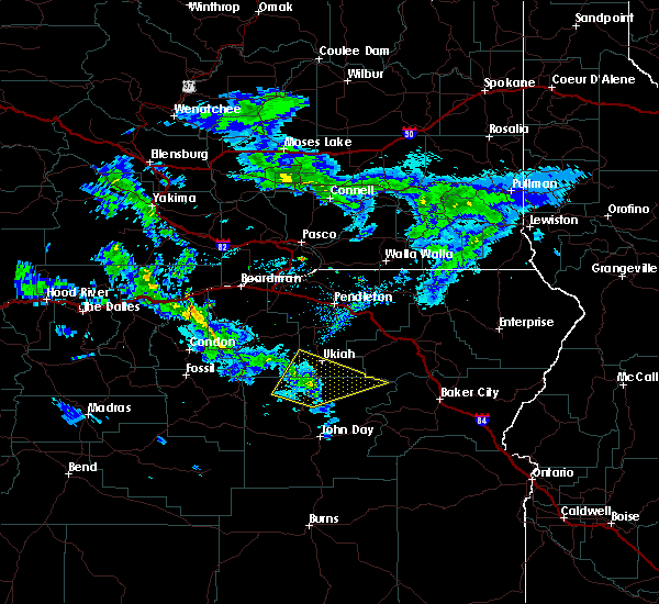
Hail Map for Ukiah, OR
The Ukiah, OR area has had 7 reports of on-the-ground hail by trained spotters, and has been under severe weather warnings 0 times during the past 12 months. Doppler radar has detected hail at or near Ukiah, OR on 5 occasions.
| Name: | Ukiah, OR |
| Where Located: | 70.7 miles SSW of Walla Walla, WA |
| Map: | Google Map for Ukiah, OR |
| Population: | 186 |
| Housing Units: | 122 |
| More Info: | Search Google for Ukiah, OR |
5
The Top Recent Hail Date for Ukiah, OR is Saturday, July 16, 2011 (1st out of 5)
Hail and Wind Damage Spotted near Ukiah, OR
| Date / Time | Report Details |
|---|---|
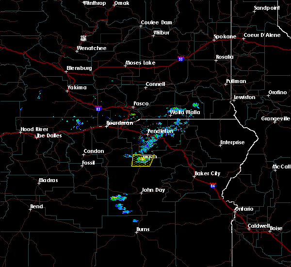
| 7/2/2022 7:01 PM PDT | Quarter sized hail reported 10 miles N of Ukiah, OR |
| 7/2/2022 6:37 PM PDT |
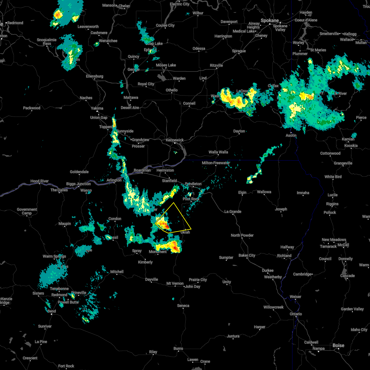 At 637 pm pdt, a severe thunderstorm was located 14 miles west of ukiah, or 19 miles southeast of heppner, moving northeast at 40 mph (radar indicated). Hazards include 60 mph wind gusts and quarter size hail. Hail damage to vehicles is expected. expect wind damage to roofs, siding, and trees. locations impacted include, ukiah. hail threat, radar indicated max hail size, 1. 00 in wind threat, radar indicated max wind gust, 60 mph. At 637 pm pdt, a severe thunderstorm was located 14 miles west of ukiah, or 19 miles southeast of heppner, moving northeast at 40 mph (radar indicated). Hazards include 60 mph wind gusts and quarter size hail. Hail damage to vehicles is expected. expect wind damage to roofs, siding, and trees. locations impacted include, ukiah. hail threat, radar indicated max hail size, 1. 00 in wind threat, radar indicated max wind gust, 60 mph.
|
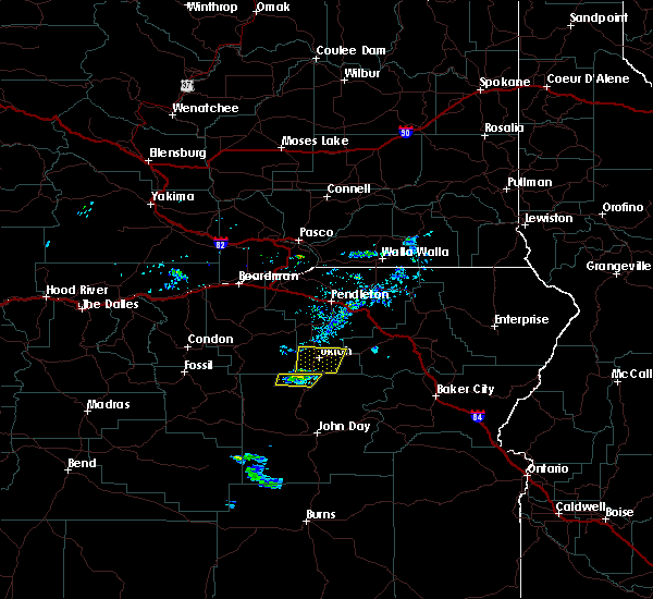
| 7/2/2022 6:00 PM PDT |
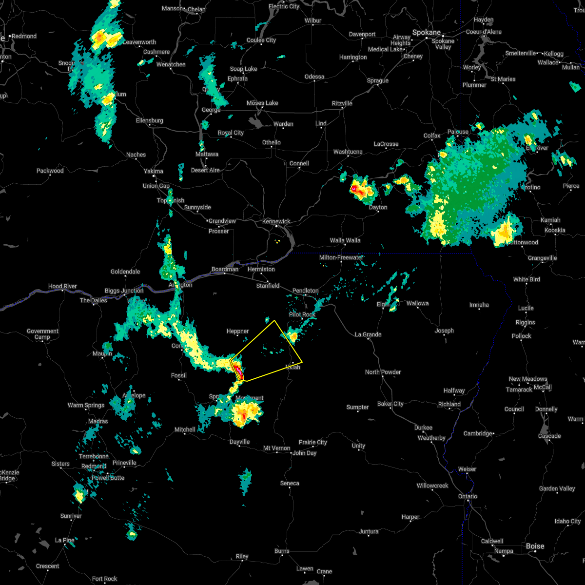 At 559 pm pdt, a severe thunderstorm was located 10 miles southeast of hardman, or 18 miles south of heppner, moving northeast at 25 mph (radar indicated). Hazards include 60 mph wind gusts and half dollar size hail. Hail damage to vehicles is expected. Expect wind damage to roofs, siding, and trees. At 559 pm pdt, a severe thunderstorm was located 10 miles southeast of hardman, or 18 miles south of heppner, moving northeast at 25 mph (radar indicated). Hazards include 60 mph wind gusts and half dollar size hail. Hail damage to vehicles is expected. Expect wind damage to roofs, siding, and trees.
|
| 8/5/2021 4:37 PM PDT |
 The severe thunderstorm warning for southwestern umatilla county will expire at 445 pm pdt, the storm which prompted the warning has weakened below severe limits, and has exited the warned area. therefore, the warning will be allowed to expire. The severe thunderstorm warning for southwestern umatilla county will expire at 445 pm pdt, the storm which prompted the warning has weakened below severe limits, and has exited the warned area. therefore, the warning will be allowed to expire.
|
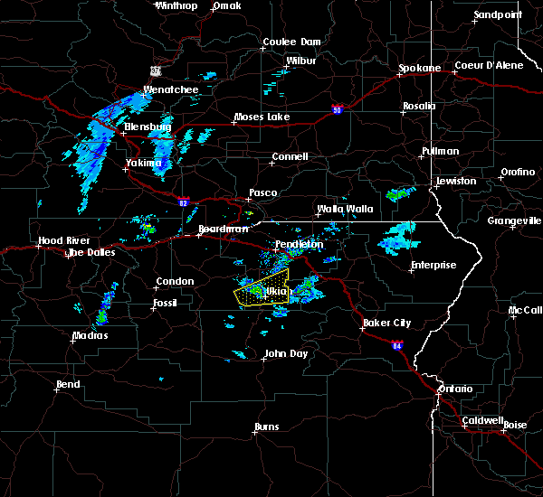
| 8/5/2021 3:43 PM PDT |
 At 342 pm pdt, a severe thunderstorm was located near ukiah, or 27 miles southeast of heppner, moving north at 5 mph (radar indicated). Hazards include 70 mph wind gusts and penny size hail. Expect considerable tree damage. Damage is likely to mobile homes, roofs, and outbuildings. At 342 pm pdt, a severe thunderstorm was located near ukiah, or 27 miles southeast of heppner, moving north at 5 mph (radar indicated). Hazards include 70 mph wind gusts and penny size hail. Expect considerable tree damage. Damage is likely to mobile homes, roofs, and outbuildings.
|
| 8/5/2021 3:00 PM PDT | 100 foot tree snapped in half due to high winds. 2.09 inches of rain with stor in umatilla county OR, 10 miles NW of Ukiah, OR |
| 5/28/2020 8:34 PM PDT |
 At 834 pm pdt, a severe thunderstorm was located near ukiah, or 31 miles southwest of meacham, moving northeast at 30 mph (trained weather spotters). Hazards include half dollar size hail. Damage to vehicles is expected. Locations impacted include, ukiah. At 834 pm pdt, a severe thunderstorm was located near ukiah, or 31 miles southwest of meacham, moving northeast at 30 mph (trained weather spotters). Hazards include half dollar size hail. Damage to vehicles is expected. Locations impacted include, ukiah.
|
| 5/28/2020 8:32 PM PDT | Half Dollar sized hail reported 0.3 miles NNW of Ukiah, OR |
| 5/28/2020 8:19 PM PDT |
 At 819 pm pdt, a severe thunderstorm was located near ukiah, or 32 miles southeast of heppner, moving northeast at 30 mph (radar indicated). Hazards include 60 mph wind gusts and quarter size hail. Hail damage to vehicles is expected. expect wind damage to roofs, siding, and trees. Locations impacted include, ukiah. At 819 pm pdt, a severe thunderstorm was located near ukiah, or 32 miles southeast of heppner, moving northeast at 30 mph (radar indicated). Hazards include 60 mph wind gusts and quarter size hail. Hail damage to vehicles is expected. expect wind damage to roofs, siding, and trees. Locations impacted include, ukiah.
|
| 5/28/2020 8:01 PM PDT |
 The national weather service in pendleton oregon has issued a * severe thunderstorm warning for. southwestern umatilla county in northeastern oregon. until 845 pm pdt. At 801 pm pdt, a severe thunderstorm was located near ritter, or 33 miles southeast of heppner, moving northeast at 30 mph. The national weather service in pendleton oregon has issued a * severe thunderstorm warning for. southwestern umatilla county in northeastern oregon. until 845 pm pdt. At 801 pm pdt, a severe thunderstorm was located near ritter, or 33 miles southeast of heppner, moving northeast at 30 mph.
|
| 6/3/2018 4:47 PM PDT |
 At 446 pm pdt, a severe thunderstorm was located near ukiah, or 27 miles southeast of heppner, moving northeast at 35 mph (radar indicated). Hazards include 60 mph wind gusts and quarter size hail. Hail damage to vehicles is expected. Expect wind damage to roofs, siding, and trees. At 446 pm pdt, a severe thunderstorm was located near ukiah, or 27 miles southeast of heppner, moving northeast at 35 mph (radar indicated). Hazards include 60 mph wind gusts and quarter size hail. Hail damage to vehicles is expected. Expect wind damage to roofs, siding, and trees.
|
| 6/8/2016 3:13 PM PDT | The tornado warning for west central union and south central umatilla counties will expire at 315 pm pdt, the storm which prompted the warning has weakened below severe limits and exited the warned area. therefore the warning will be allowed to expire. however gusty winds are still possible with this thunderstorm. |
| 6/8/2016 2:52 PM PDT |
 At 251 pm pdt, doppler radar indicated a severe thunderstorm capable of producing a tornado. this dangerous storm was located over ukiah, or 31 miles southeast of heppner, moving northeast at 30 mph. in addition this storm has a history of producing golf ball size hail and wind gusts in excess of 60 mph. locations impacted include, ukiah. At 251 pm pdt, doppler radar indicated a severe thunderstorm capable of producing a tornado. this dangerous storm was located over ukiah, or 31 miles southeast of heppner, moving northeast at 30 mph. in addition this storm has a history of producing golf ball size hail and wind gusts in excess of 60 mph. locations impacted include, ukiah.
|
| 6/8/2016 2:45 PM PDT | Quarter sized hail reported 0.3 miles NNW of Ukiah, OR, quarter size hail |
| 6/8/2016 2:45 PM PDT | Quarter sized hail reported 1.1 miles WSW of Ukiah, OR, quarter size hail |
| 6/8/2016 2:35 PM PDT |
 At 234 pm pdt, doppler radar indicated a severe thunderstorm capable of producing a tornado. this dangerous storm was located 8 miles northwest of dale, or 30 miles southeast of heppner, and moving northeast at 30 mph. in addition this storm has a history of producing golf ball size hail and winds in excess of 60 mph. At 234 pm pdt, doppler radar indicated a severe thunderstorm capable of producing a tornado. this dangerous storm was located 8 miles northwest of dale, or 30 miles southeast of heppner, and moving northeast at 30 mph. in addition this storm has a history of producing golf ball size hail and winds in excess of 60 mph.
|
| 5/14/2016 3:41 PM PDT |
 The severe thunderstorm warning for south central umatilla county will expire at 345 pm pdt, the severe thunderstorm which prompted the warning has weakened. therefore the warning will be allowed to expire. The severe thunderstorm warning for south central umatilla county will expire at 345 pm pdt, the severe thunderstorm which prompted the warning has weakened. therefore the warning will be allowed to expire.
|
| 5/14/2016 3:17 PM PDT |
 At 315 pm pdt, the public reported a severe thunderstorm producing quarter size hail and damaging winds in excess of 60 mph. this storm was located near dale, or 39 miles southeast of heppner, moving northeast at 25 mph. locations impacted include, ukiah. At 315 pm pdt, the public reported a severe thunderstorm producing quarter size hail and damaging winds in excess of 60 mph. this storm was located near dale, or 39 miles southeast of heppner, moving northeast at 25 mph. locations impacted include, ukiah.
|
| 5/14/2016 3:09 PM PDT | Quarter sized hail reported 10 miles N of Ukiah, OR, depth up to 6 inches on road. |
| 5/14/2016 2:45 PM PDT |
 At 245 pm pdt, doppler radar indicated a severe thunderstorm capable of producing quarter size hail and damaging winds in excess of 60 mph. this storm was located near dale, or 35 miles north of john day, and moving northeast at 30 mph. At 245 pm pdt, doppler radar indicated a severe thunderstorm capable of producing quarter size hail and damaging winds in excess of 60 mph. this storm was located near dale, or 35 miles north of john day, and moving northeast at 30 mph.
|
| 6/2/2014 5:29 PM PDT | Ping Pong Ball sized hail reported 10.9 miles NNW of Ukiah, OR |
| 6/2/2014 5:15 PM PDT | Quarter sized hail reported 10 miles N of Ukiah, OR |
| 5/3/2012 1:30 PM PDT | Several pine trees down near dale. pea size hail. occurred between 1pm and 2p in grant county OR, 10 miles N of Ukiah, OR |
Hail Maps for Ukiah, OR


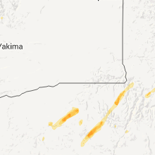
Connect with Interactive Hail Maps