

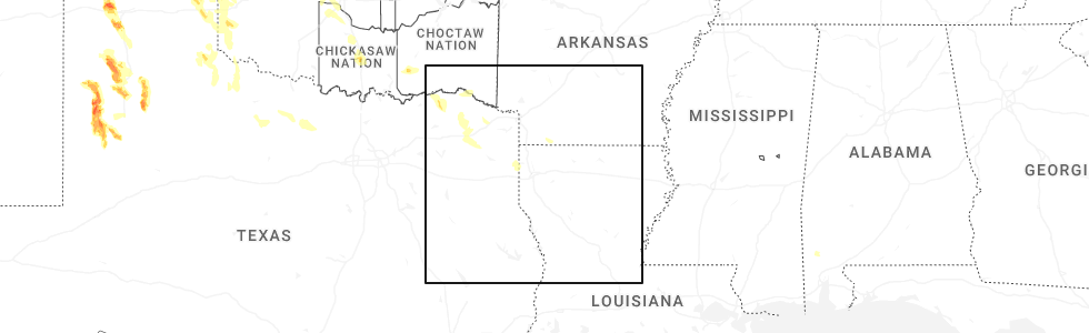
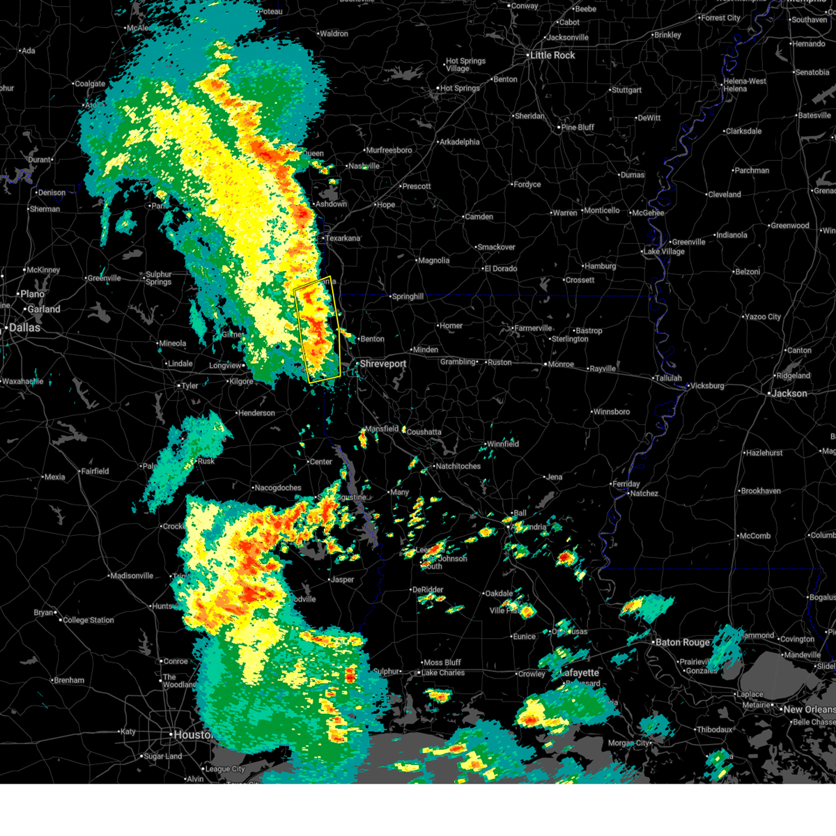
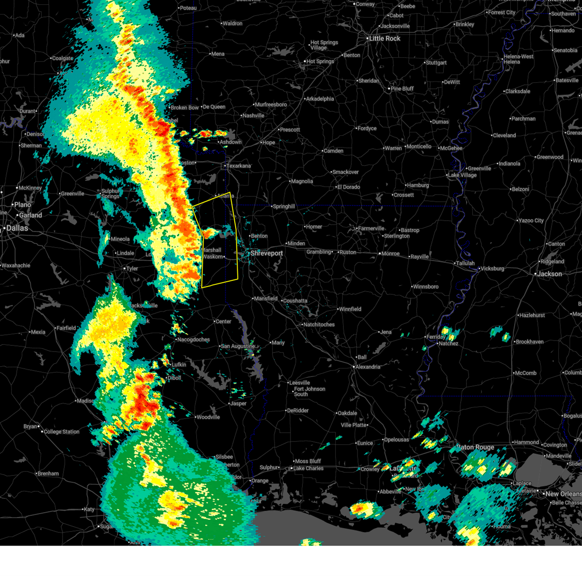
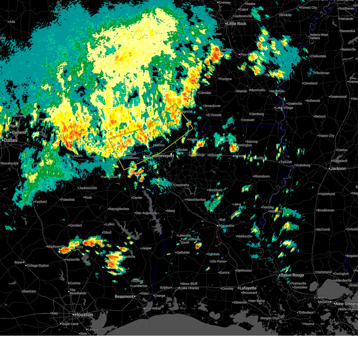
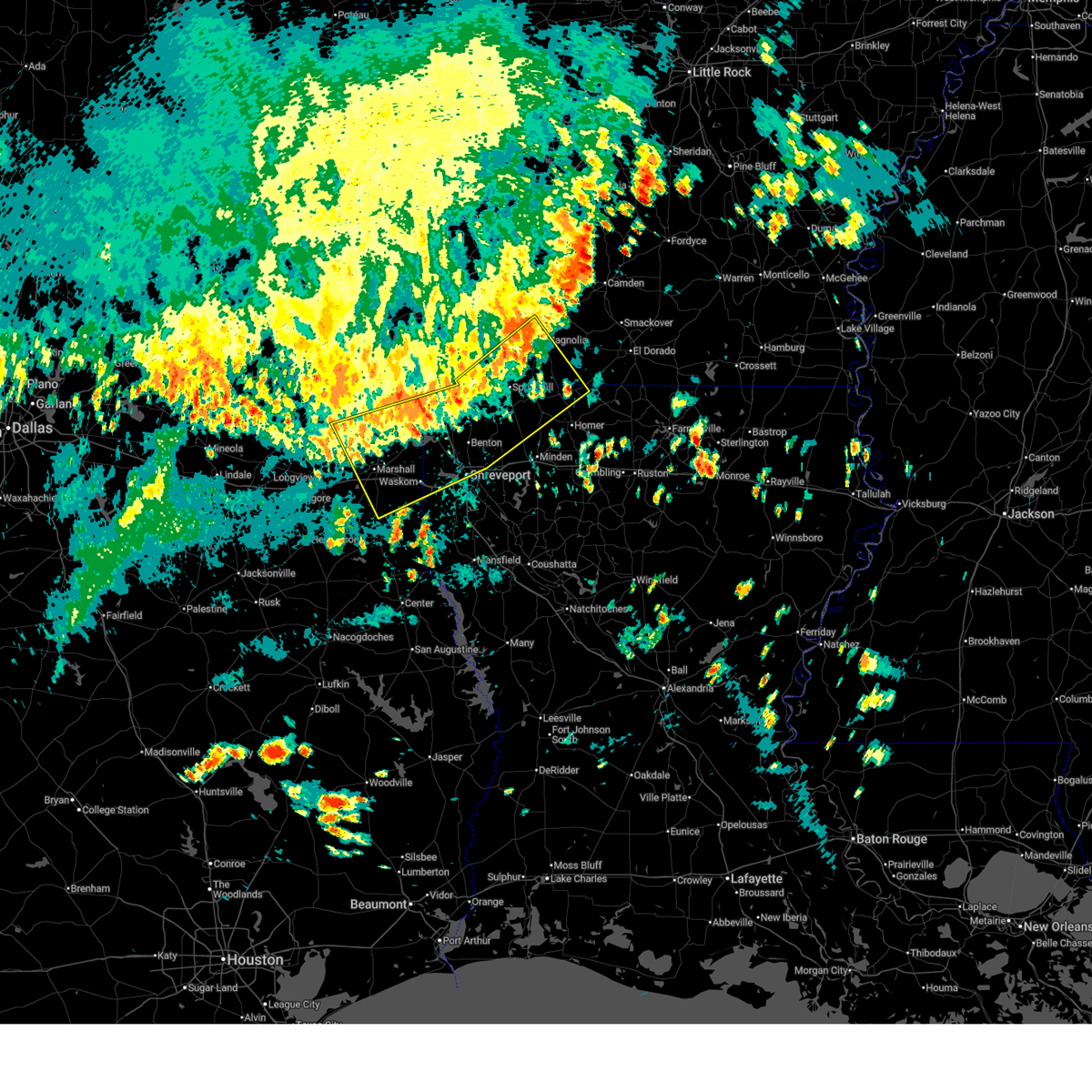
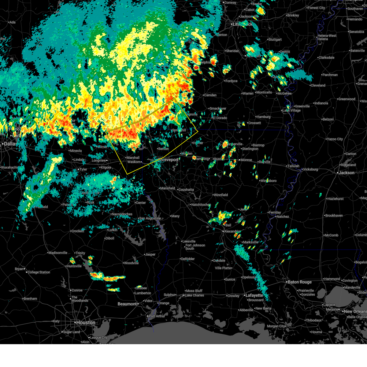
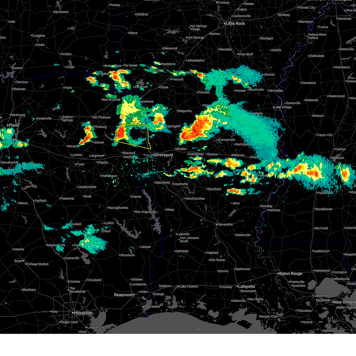
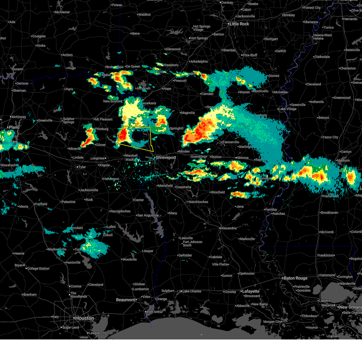
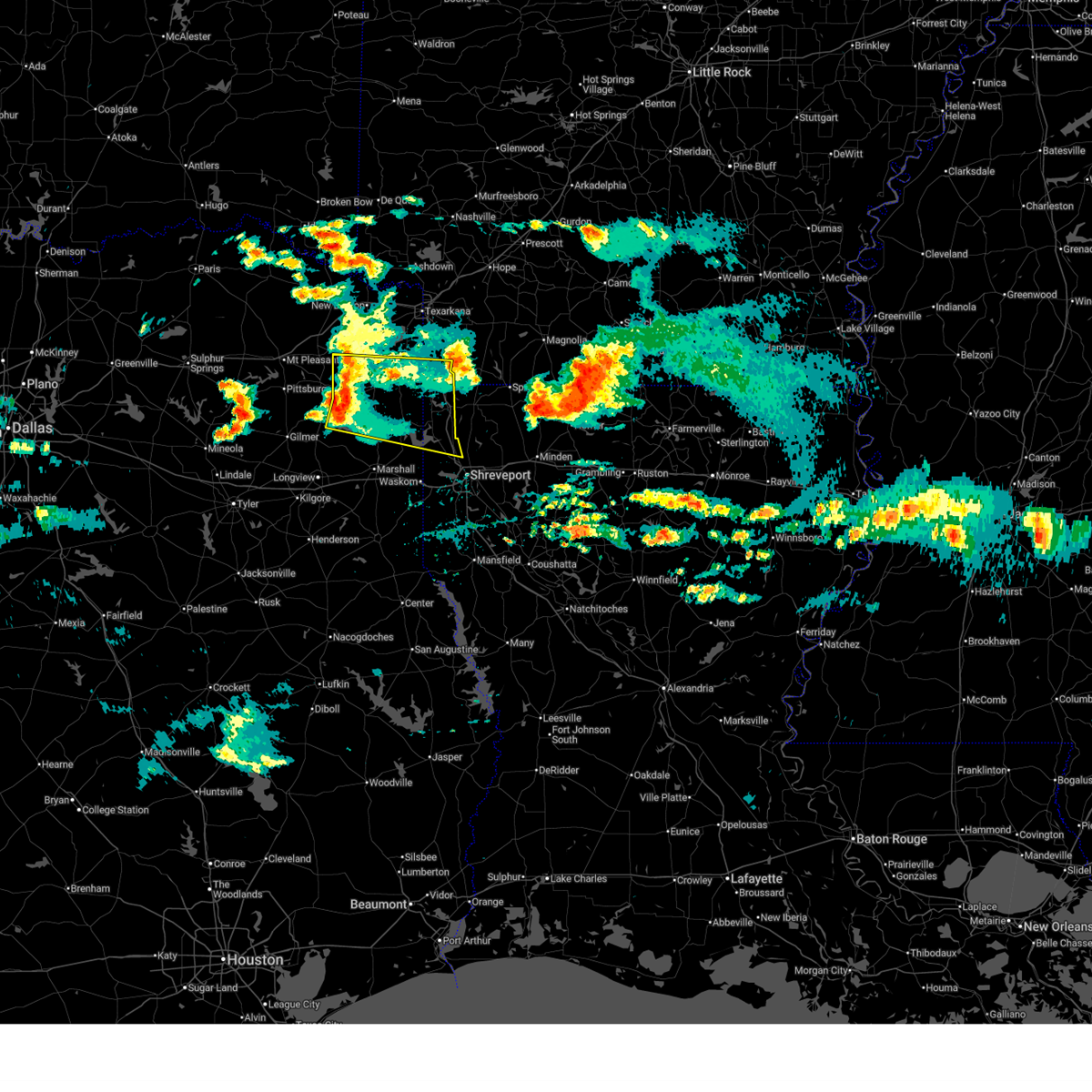
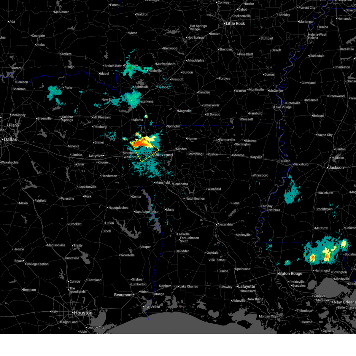
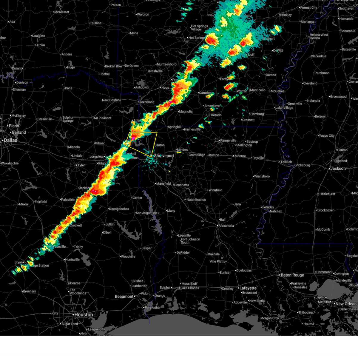
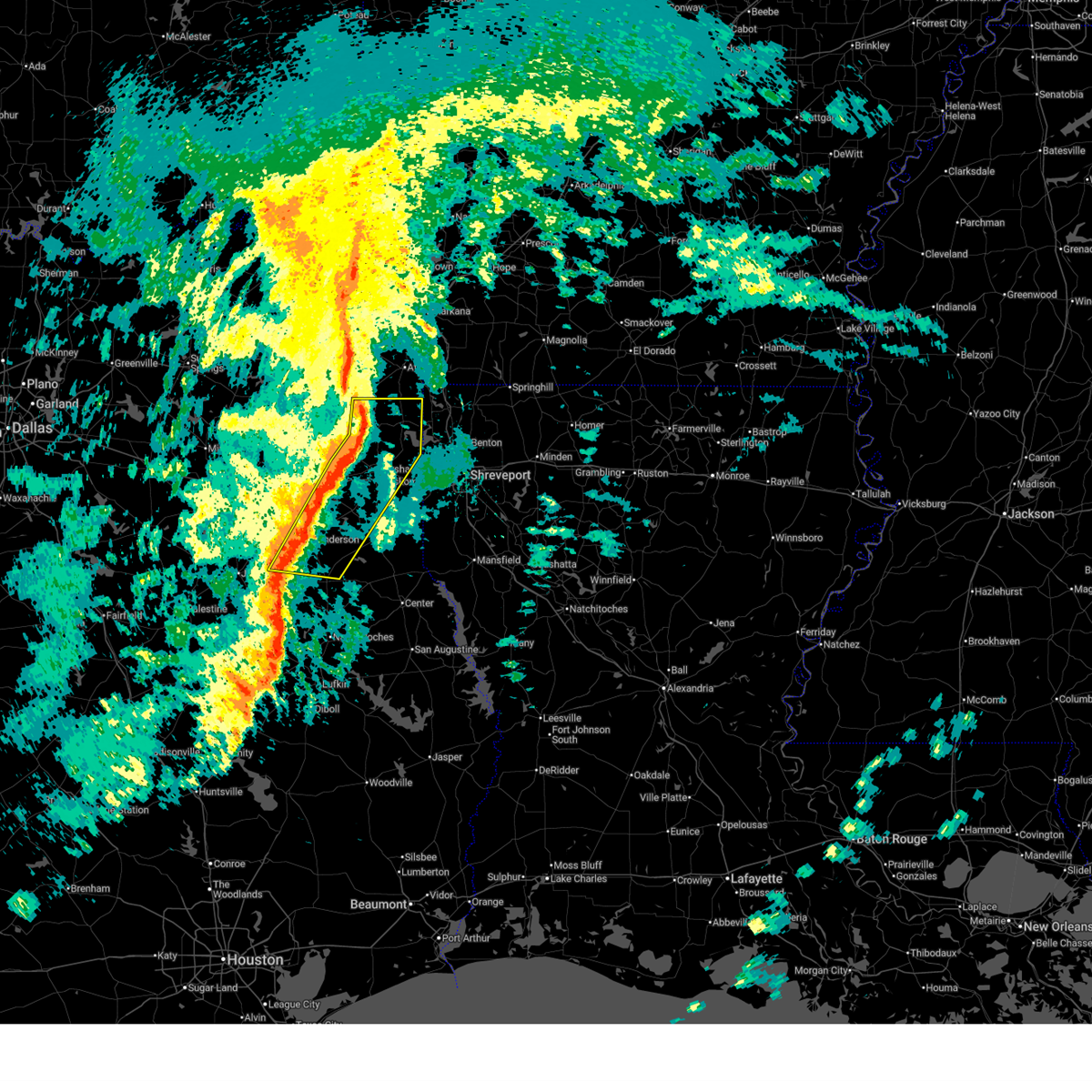
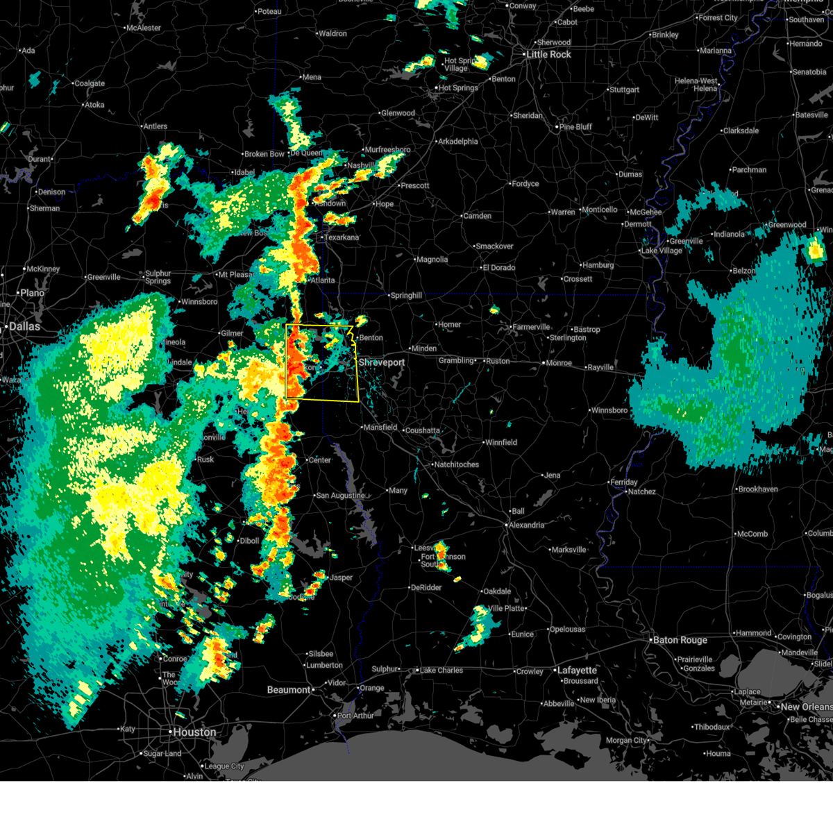
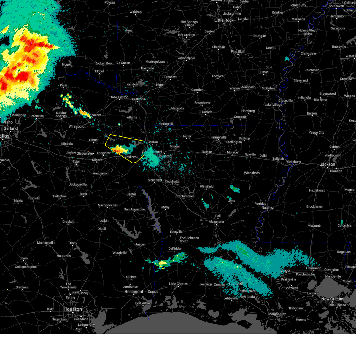
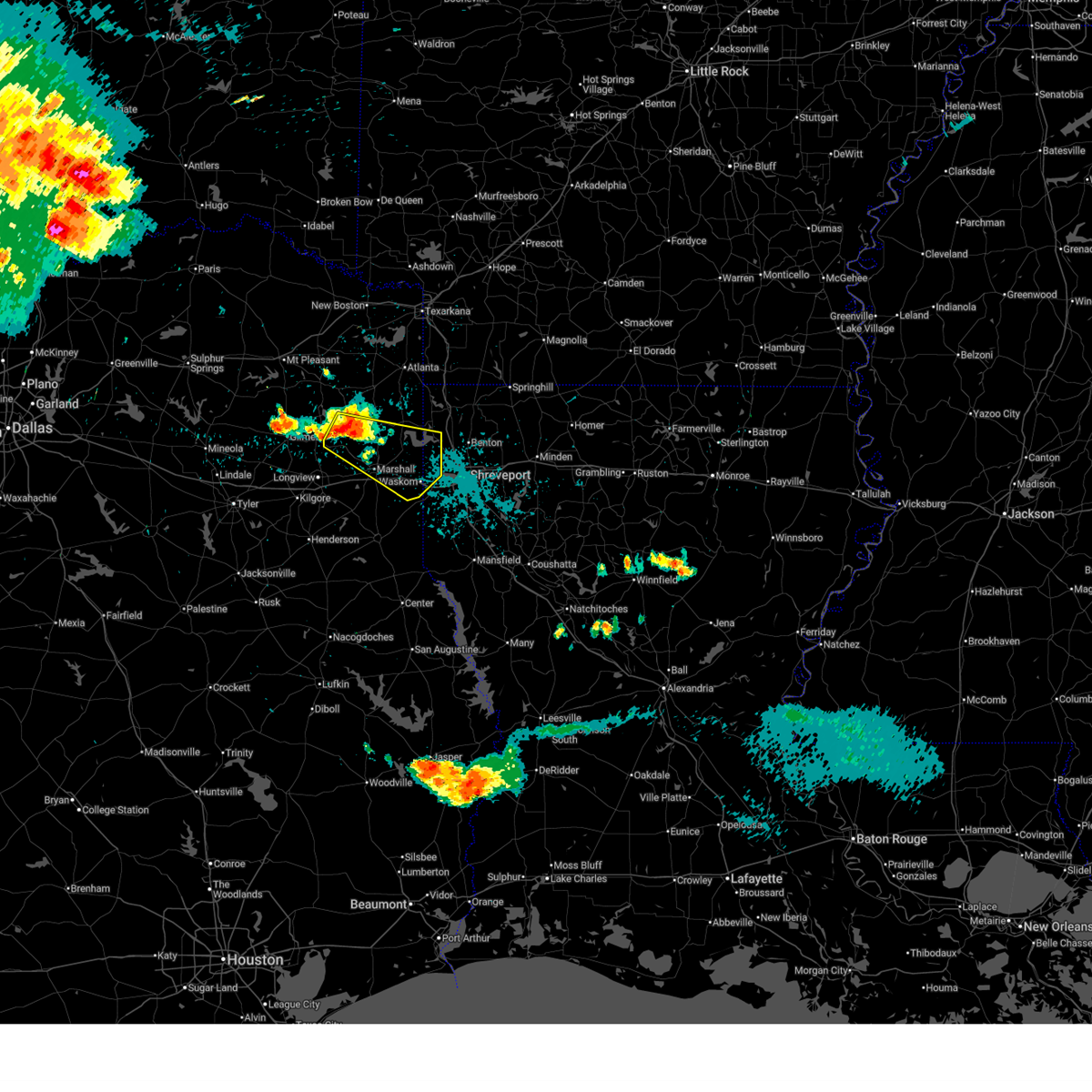
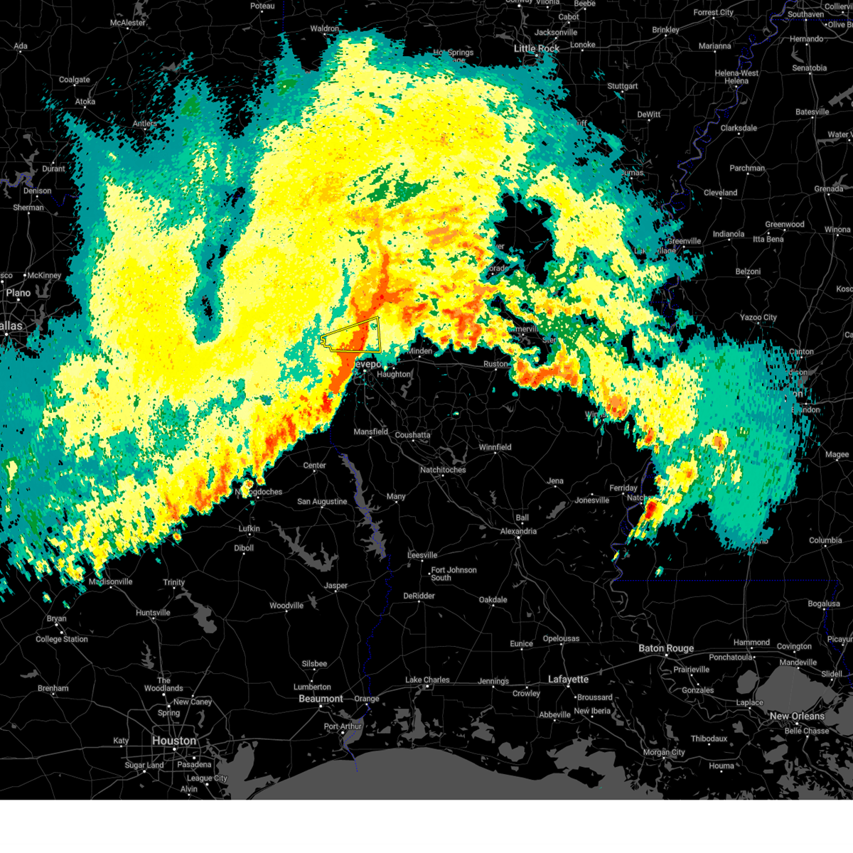
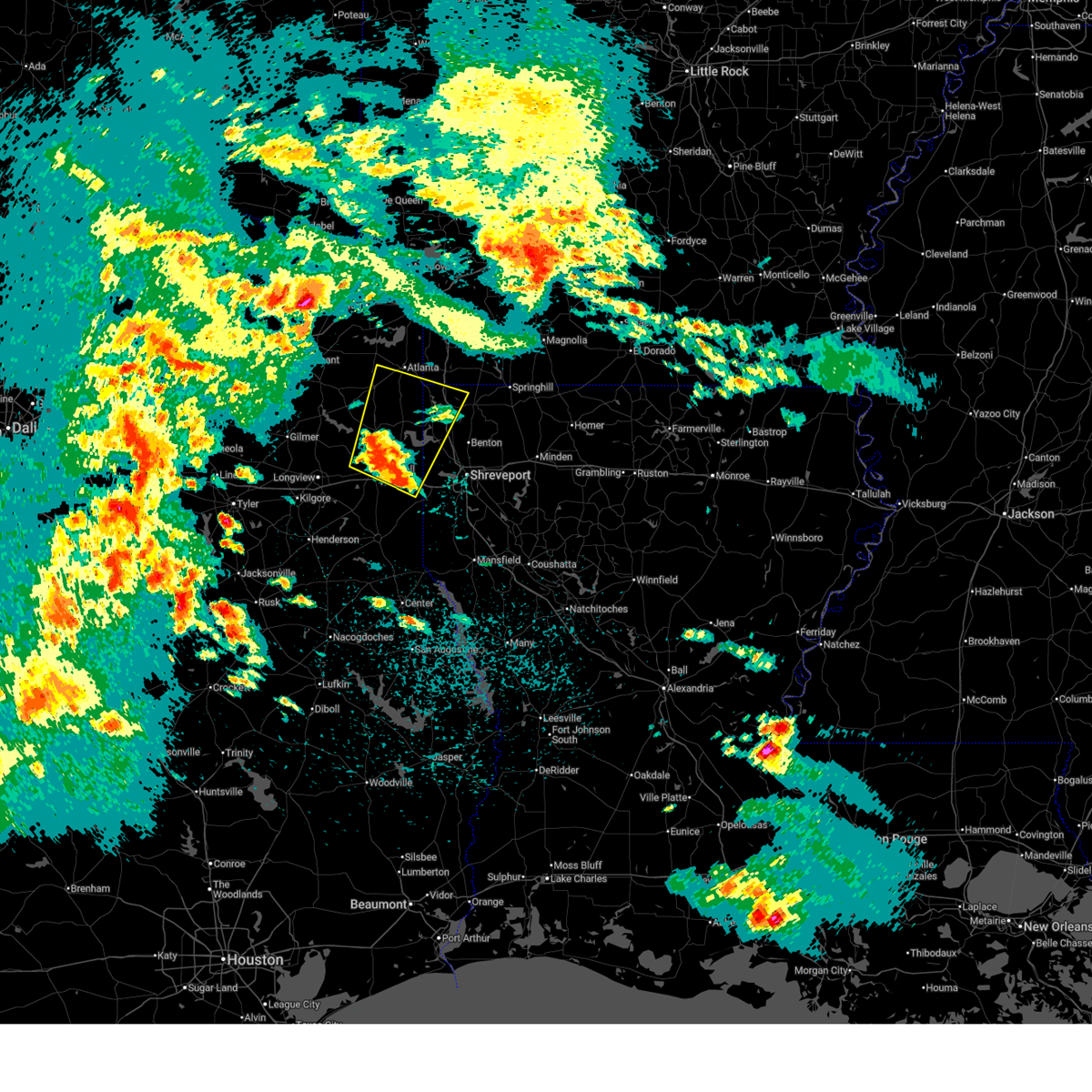
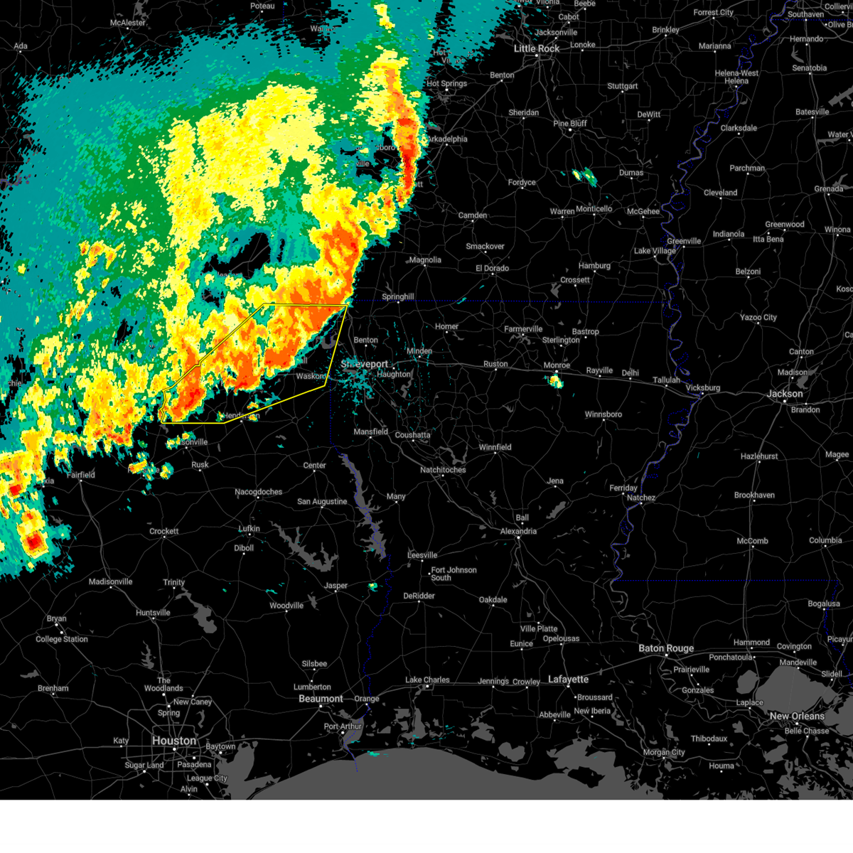
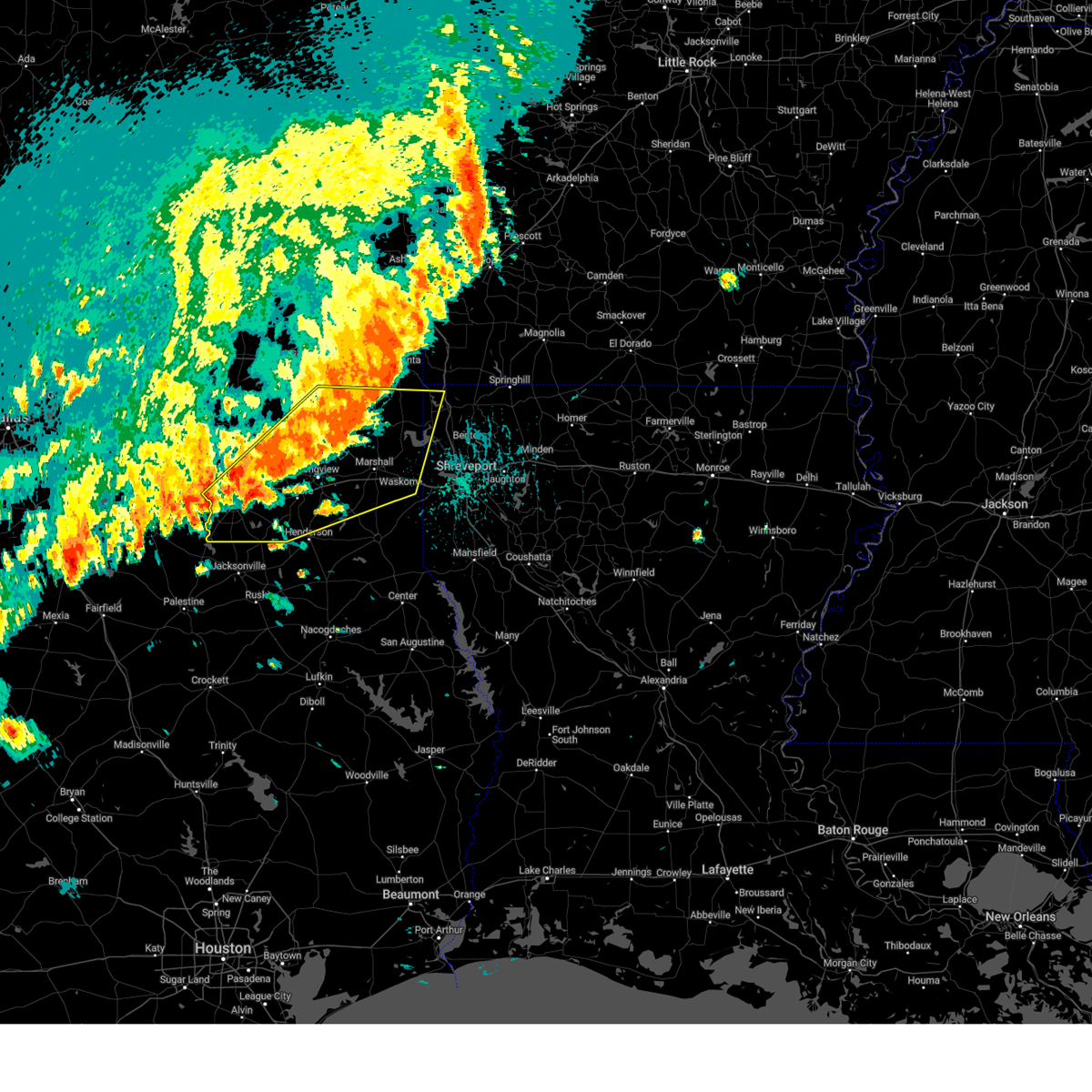
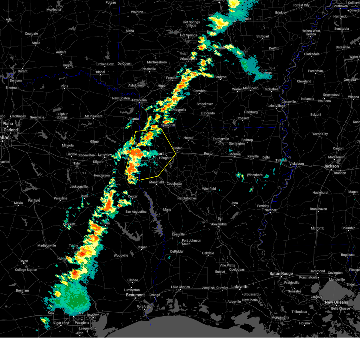
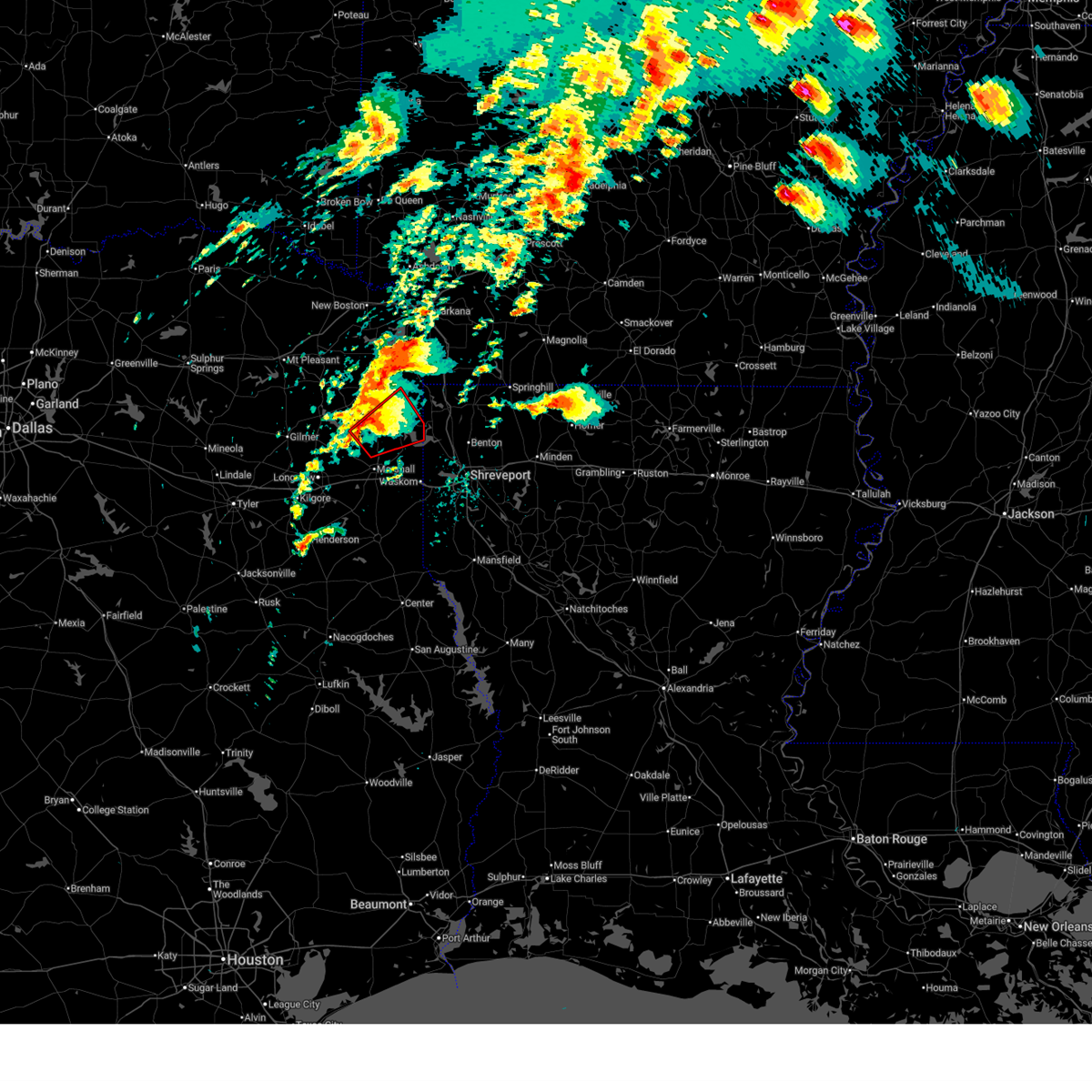
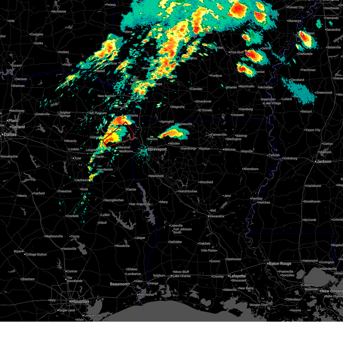
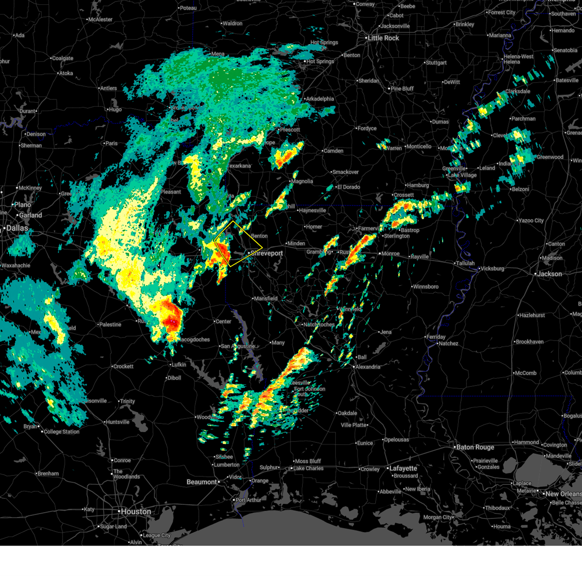
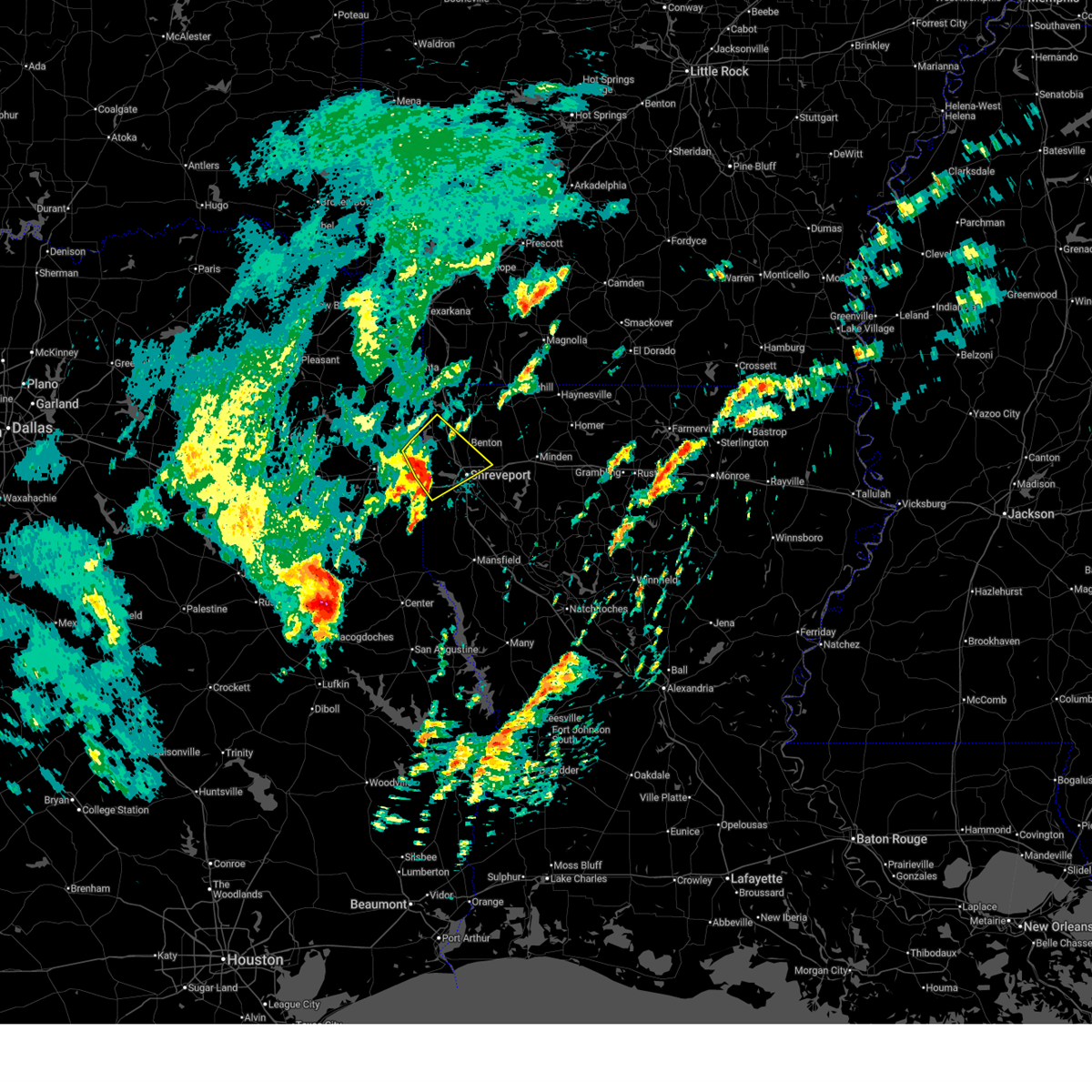
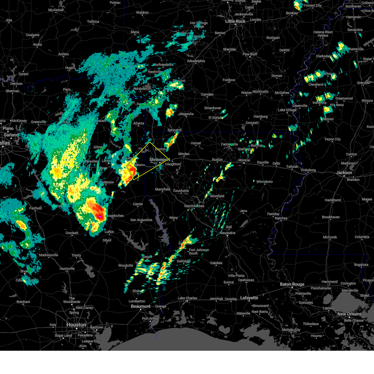
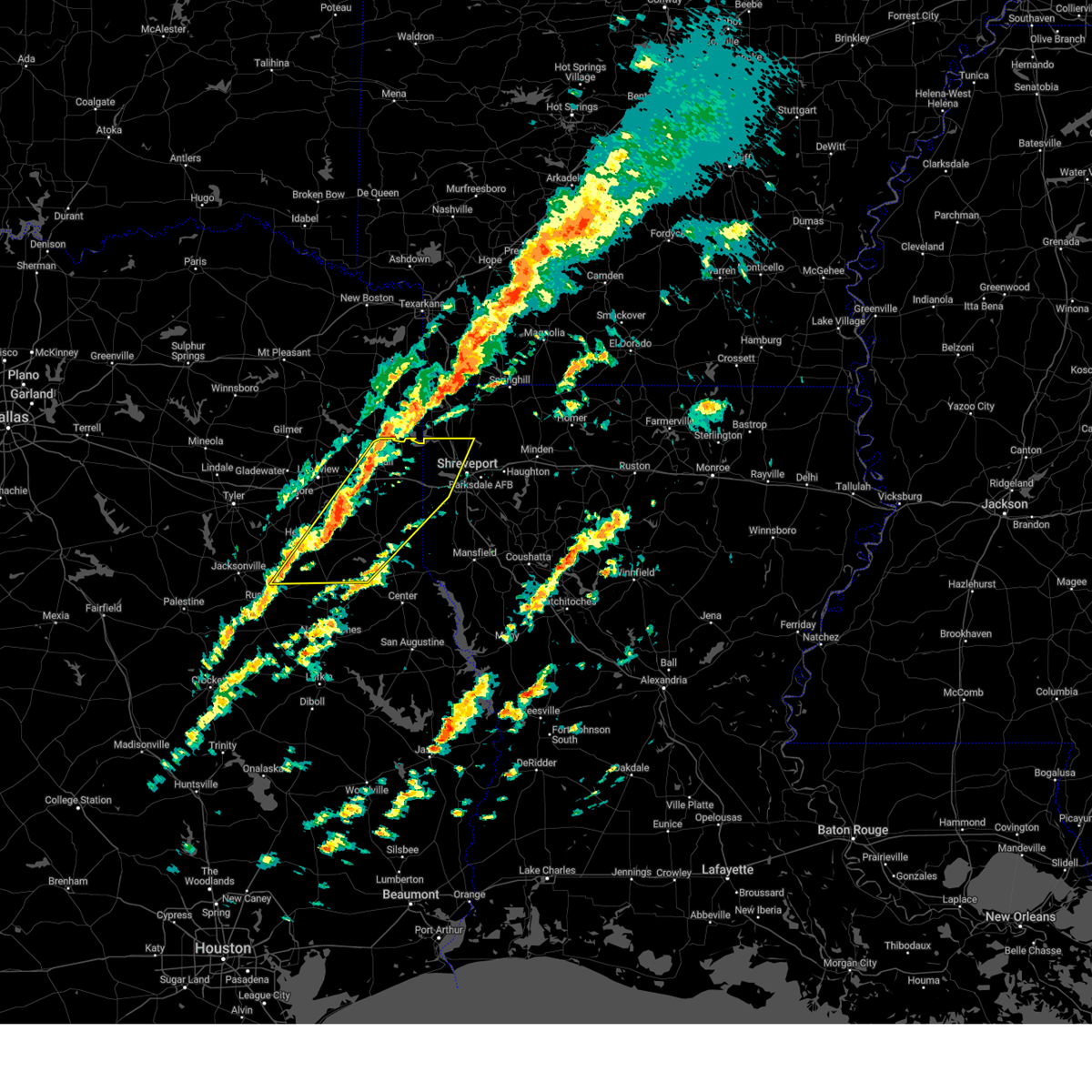
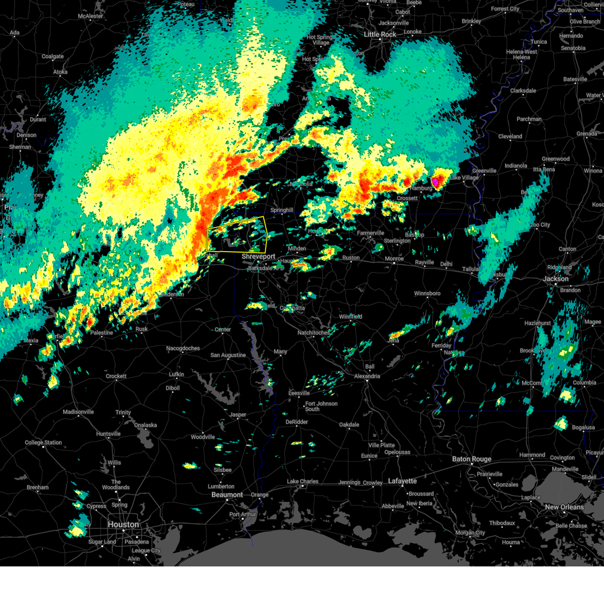
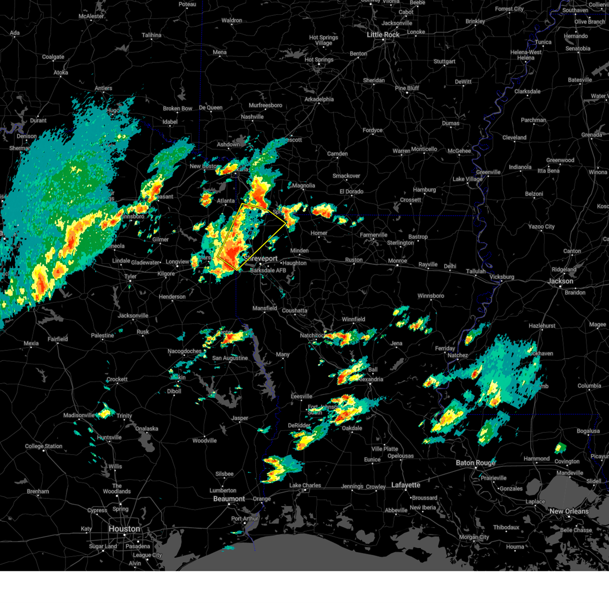
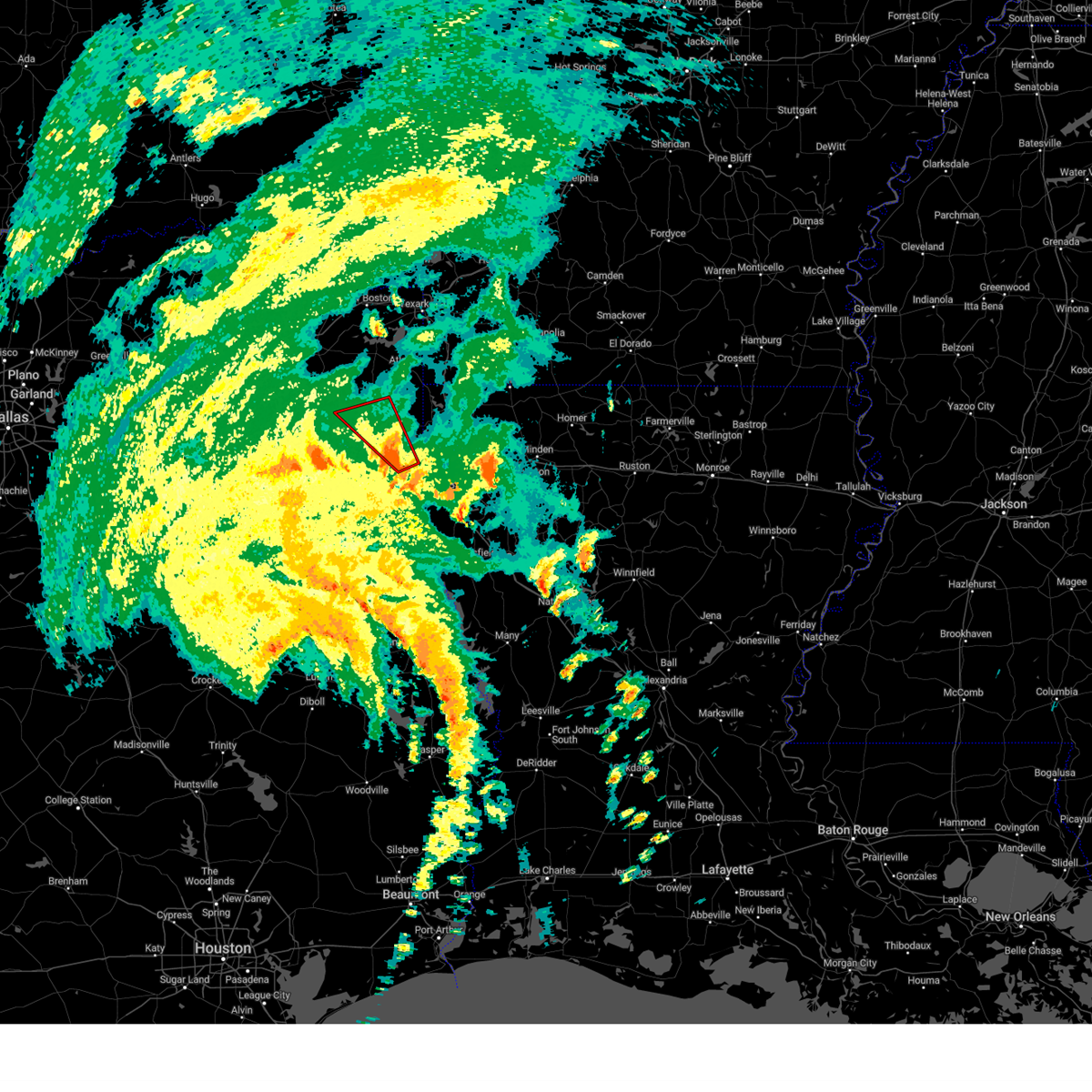
Hail Map for Uncertain, TX
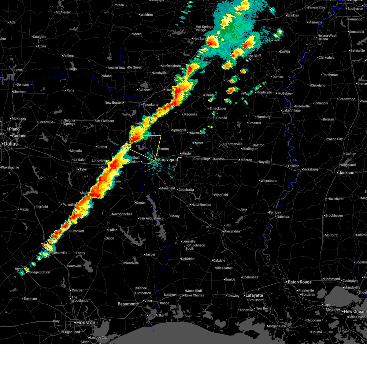
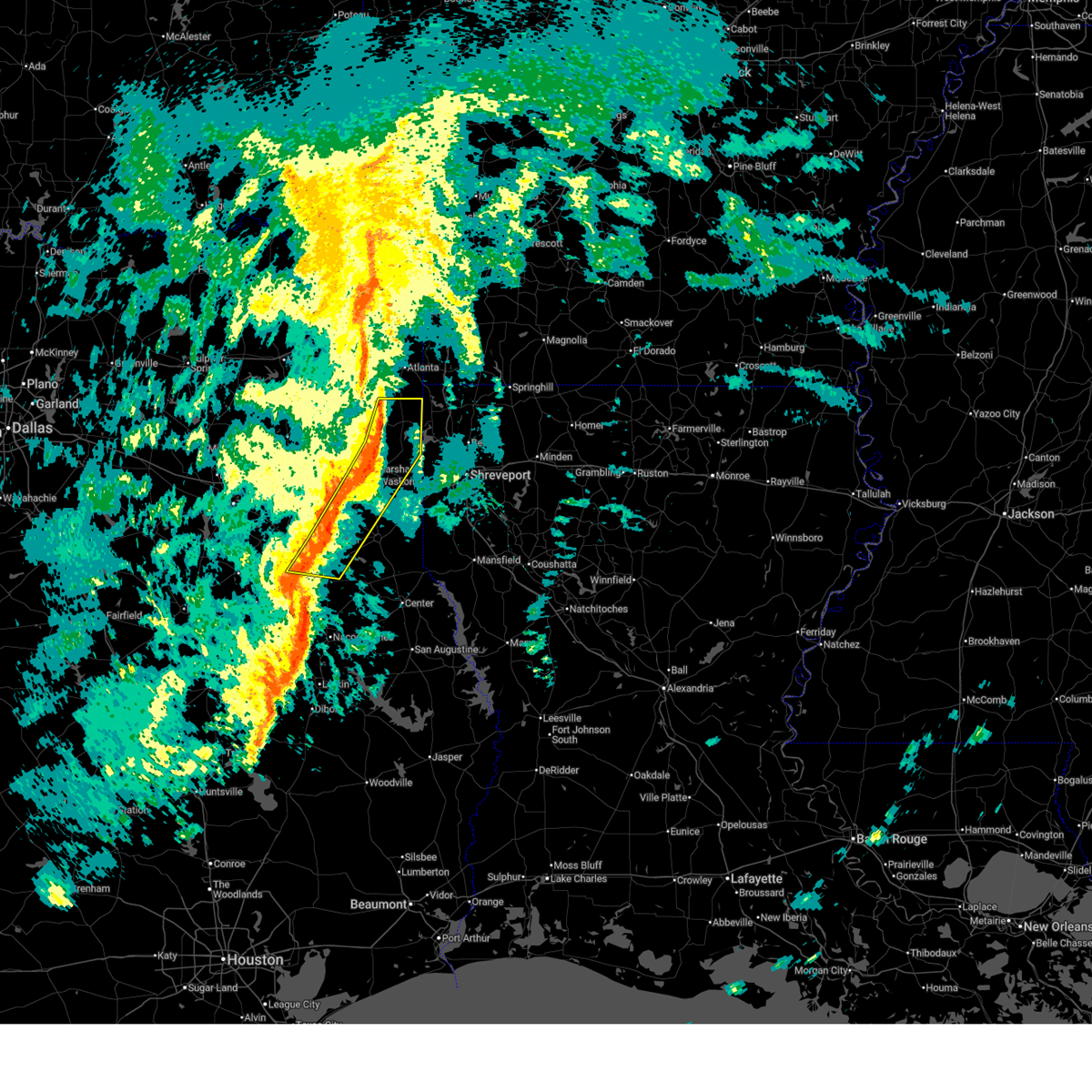
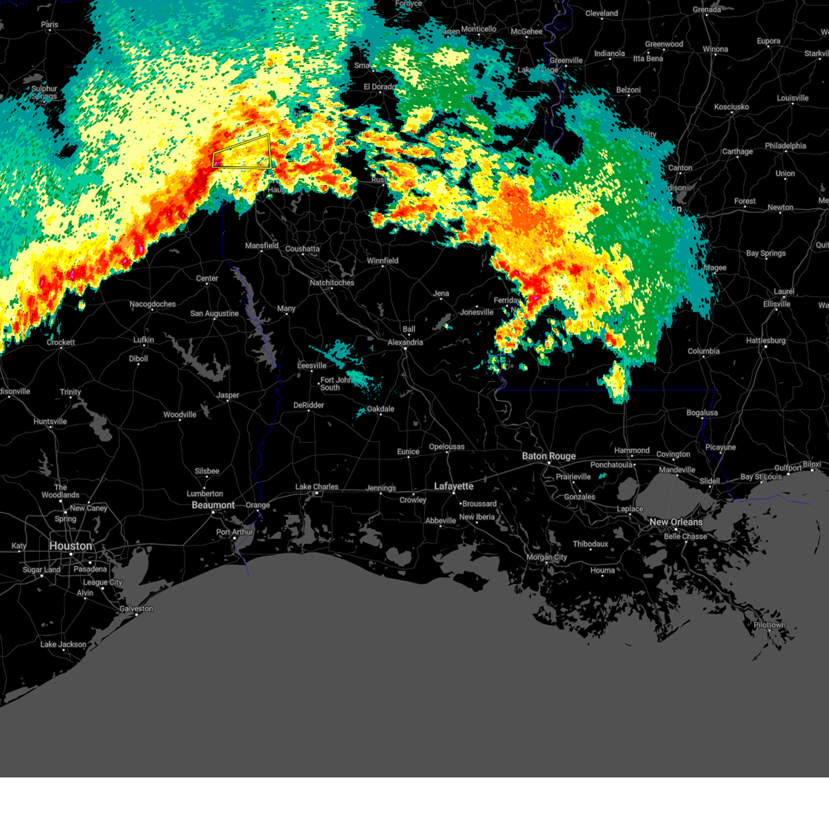
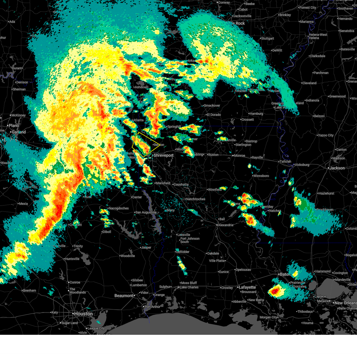
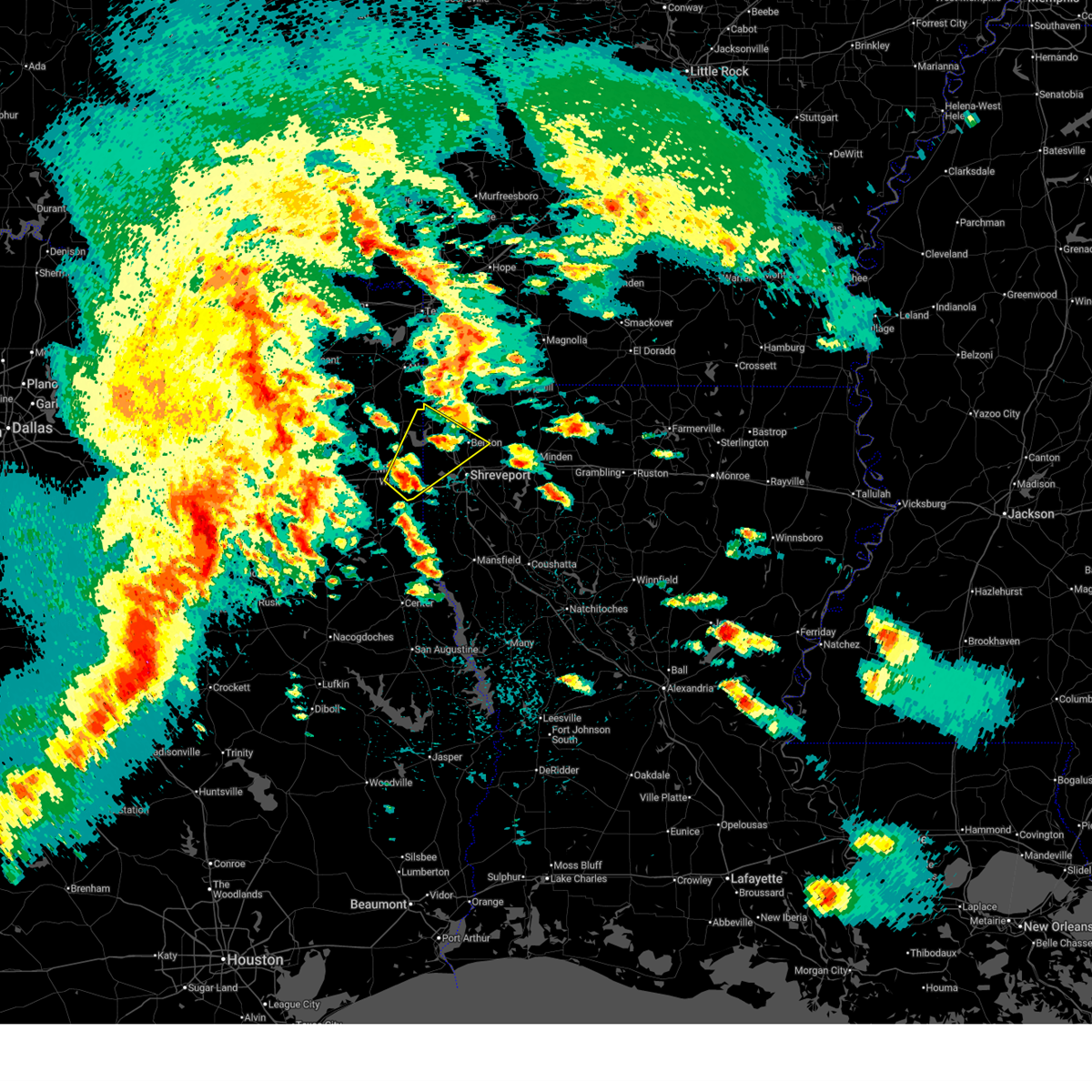
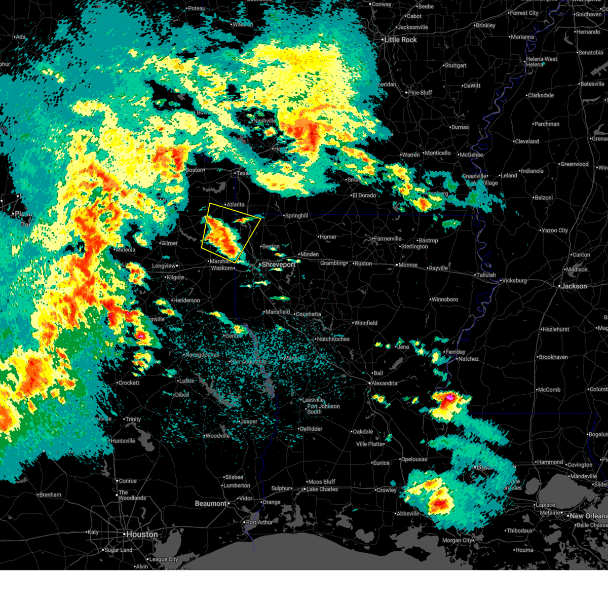
The Uncertain, TX area has had 4 reports of on-the-ground hail by trained spotters, and has been under severe weather warnings 32 times during the past 12 months. Doppler radar has detected hail at or near Uncertain, TX on 59 occasions, including 6 occasions during the past year.
| Name: | Uncertain, TX |
| Where Located: | 25.8 miles WNW of Shreveport, LA |
| Map: | Google Map for Uncertain, TX |
| Population: | 94 |
| Housing Units: | 146 |
| More Info: | Search Google for Uncertain, TX |
5
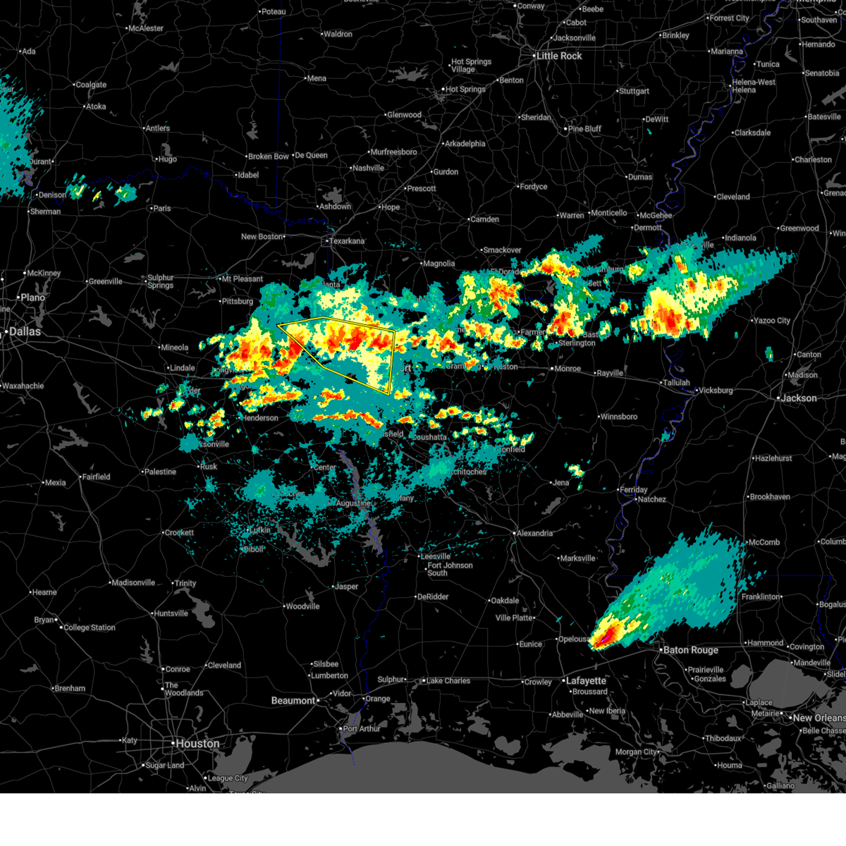
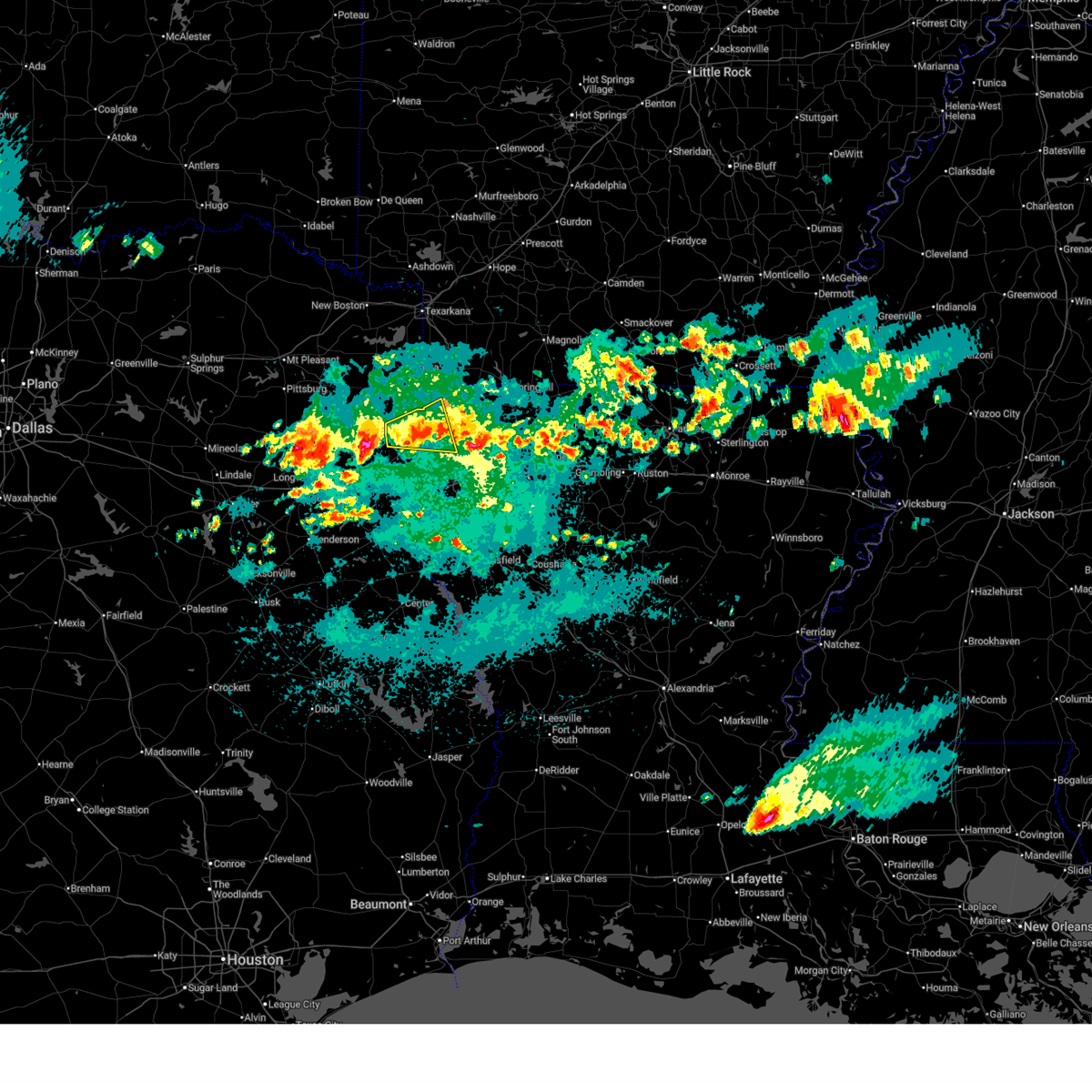
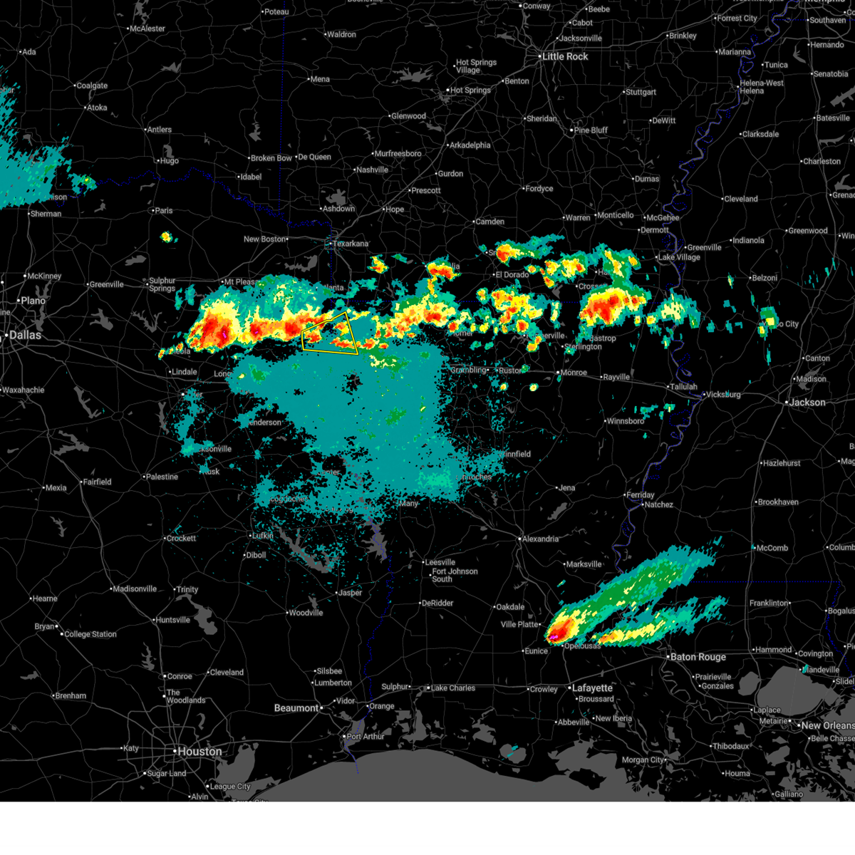
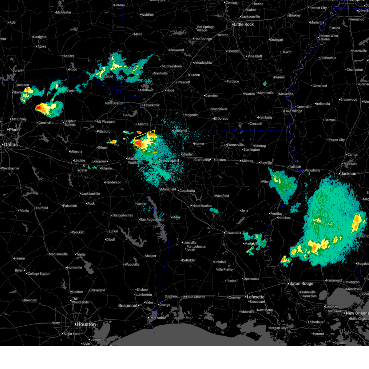
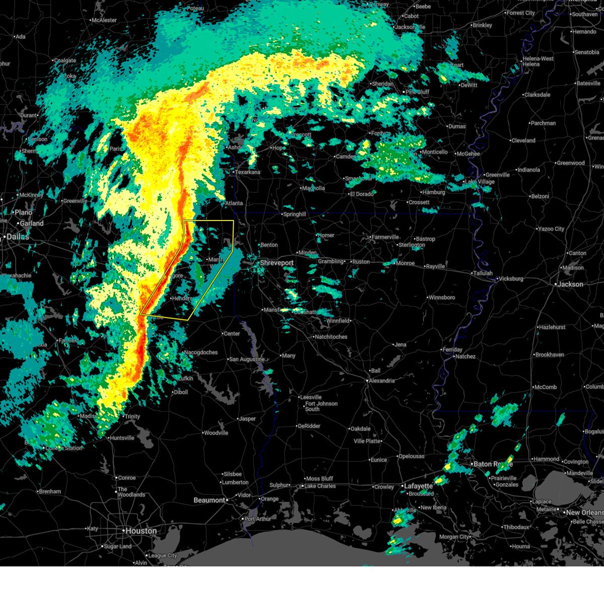
The Top Recent Hail Date for Uncertain, TX is Tuesday, June 23, 2026 (15th out of 59)
Hail and Wind Damage Spotted near Uncertain, TX
| Date / Time | Report Details |
|---|---|
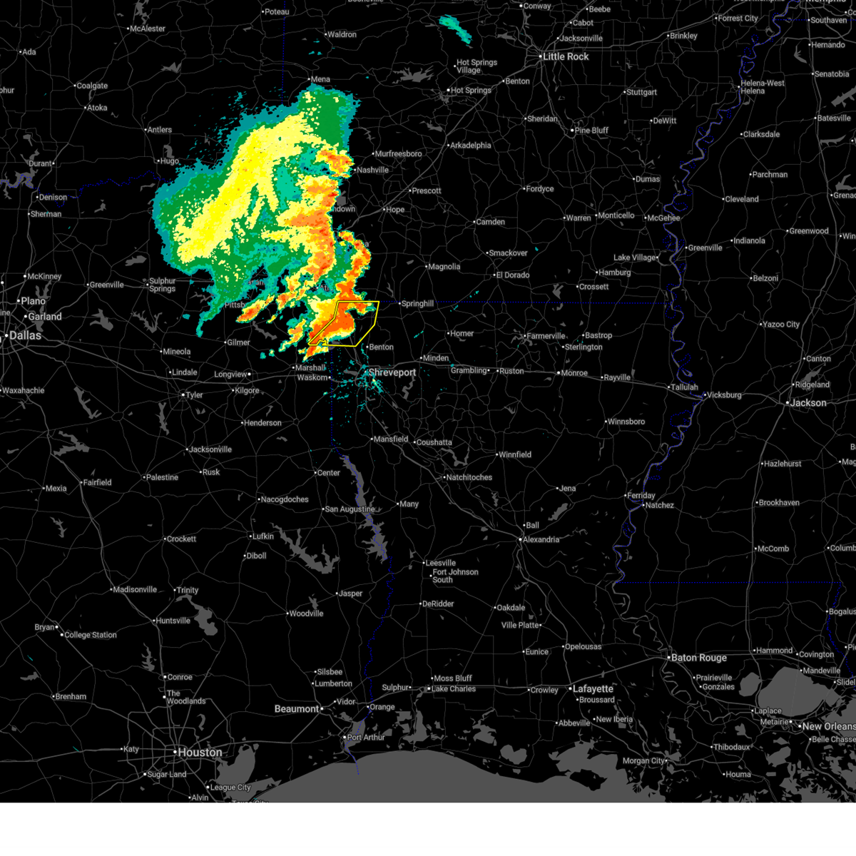
| 6/23/2026 8:48 PM CDT | Law enforcement received report of downed tree in harrison county TX, 4.7 miles NE of Uncertain, TX |
| 6/23/2026 8:30 PM CDT |
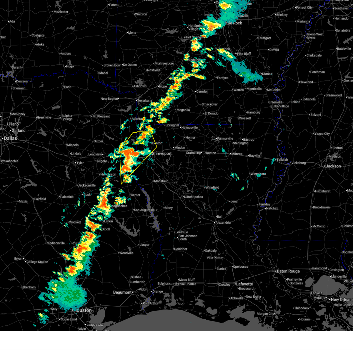
 Svrshv the national weather service in shreveport has issued a * severe thunderstorm warning for, west central caddo parish in northwestern louisiana, northeastern harrison county in northeastern texas, southeastern marion county in northeastern texas, * until 930 pm cdt. * at 830 pm cdt, a severe thunderstorm was located over karnack, or 14 miles northeast of marshall, moving east at 30 mph (radar indicated). Hazards include 60 mph wind gusts and quarter size hail. Hail damage to vehicles is expected. Expect wind damage to roofs, siding, and trees. Svrshv the national weather service in shreveport has issued a * severe thunderstorm warning for, west central caddo parish in northwestern louisiana, northeastern harrison county in northeastern texas, southeastern marion county in northeastern texas, * until 930 pm cdt. * at 830 pm cdt, a severe thunderstorm was located over karnack, or 14 miles northeast of marshall, moving east at 30 mph (radar indicated). Hazards include 60 mph wind gusts and quarter size hail. Hail damage to vehicles is expected. Expect wind damage to roofs, siding, and trees.
|
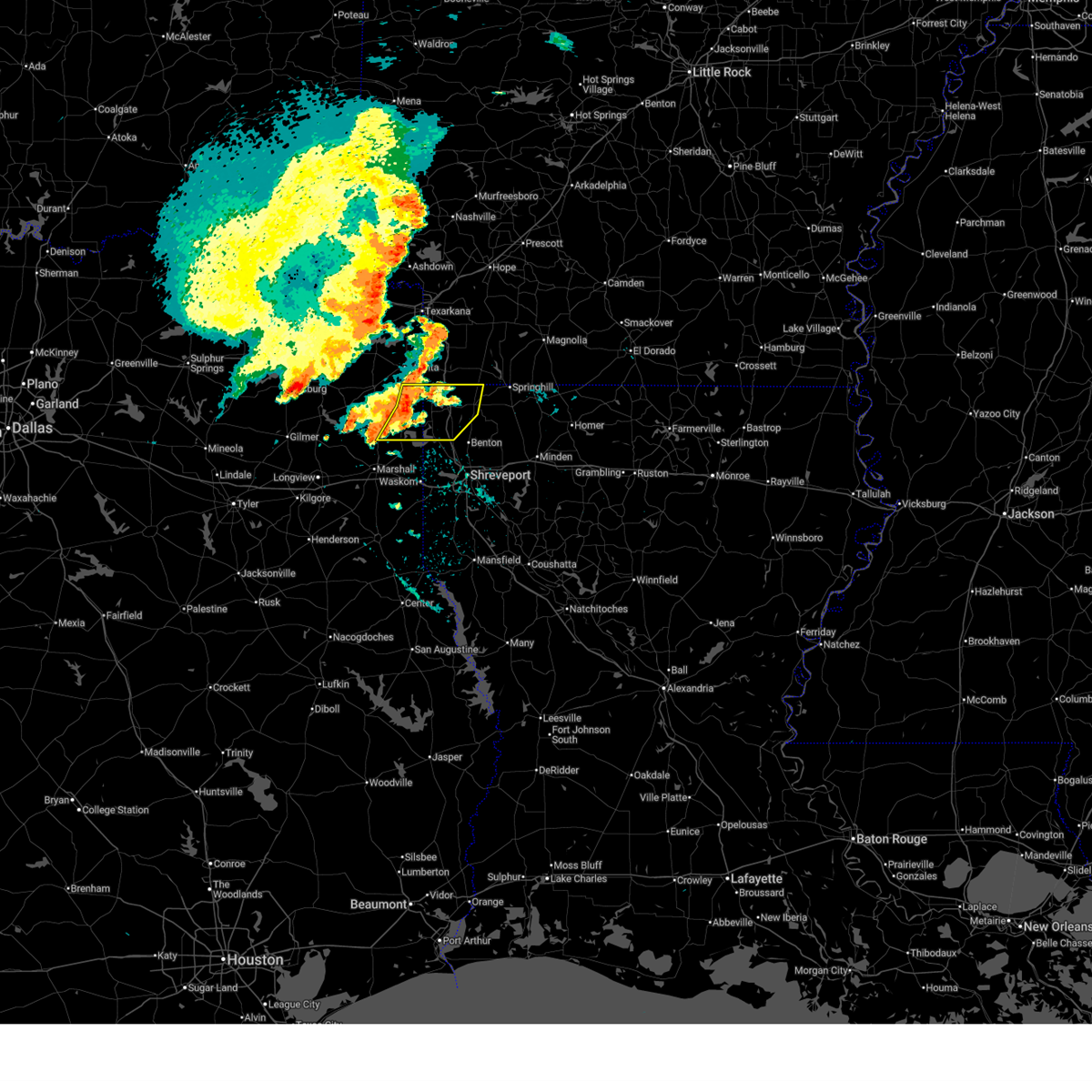
| 6/23/2026 8:24 PM CDT |
 At 824 pm cdt, severe thunderstorms were located along a line from over ida to near oil city, or along a line from 19 miles southeast of atlanta to 23 miles northeast of marshall, moving east at 35 mph (radar indicated). Hazards include 60 mph wind gusts and quarter size hail. Hail damage to vehicles is expected. expect wind damage to roofs, siding, and trees. Locations impacted include, vivian, plain dealing, oil city, hosston, rodessa, belcher, ida, gilliam, gray, cavett and bolinger. At 824 pm cdt, severe thunderstorms were located along a line from over ida to near oil city, or along a line from 19 miles southeast of atlanta to 23 miles northeast of marshall, moving east at 35 mph (radar indicated). Hazards include 60 mph wind gusts and quarter size hail. Hail damage to vehicles is expected. expect wind damage to roofs, siding, and trees. Locations impacted include, vivian, plain dealing, oil city, hosston, rodessa, belcher, ida, gilliam, gray, cavett and bolinger.
|
| 6/23/2026 8:05 PM CDT |
 Svrshv the national weather service in shreveport has issued a * severe thunderstorm warning for, northwestern bossier parish in northwestern louisiana, northwestern caddo parish in northwestern louisiana, southeastern cass county in northeastern texas, northeastern harrison county in northeastern texas, eastern marion county in northeastern texas, * until 900 pm cdt. * at 805 pm cdt, severe thunderstorms were located along a line from over mcleod to 7 miles southwest of smithland, or along a line from 10 miles southeast of atlanta to 16 miles northeast of marshall, moving east at 30 mph (radar indicated). Hazards include 60 mph wind gusts and quarter size hail. Hail damage to vehicles is expected. Expect wind damage to roofs, siding, and trees. Svrshv the national weather service in shreveport has issued a * severe thunderstorm warning for, northwestern bossier parish in northwestern louisiana, northwestern caddo parish in northwestern louisiana, southeastern cass county in northeastern texas, northeastern harrison county in northeastern texas, eastern marion county in northeastern texas, * until 900 pm cdt. * at 805 pm cdt, severe thunderstorms were located along a line from over mcleod to 7 miles southwest of smithland, or along a line from 10 miles southeast of atlanta to 16 miles northeast of marshall, moving east at 30 mph (radar indicated). Hazards include 60 mph wind gusts and quarter size hail. Hail damage to vehicles is expected. Expect wind damage to roofs, siding, and trees.
|
| 5/23/2026 8:09 AM CDT |
 The storms which prompted the warning have weakened below severe limits, and no longer pose an immediate threat to life or property. therefore, the warning will be allowed to expire. however, small hail and gusty winds are still possible with these thunderstorms. The storms which prompted the warning have weakened below severe limits, and no longer pose an immediate threat to life or property. therefore, the warning will be allowed to expire. however, small hail and gusty winds are still possible with these thunderstorms.
|
| 5/23/2026 7:11 AM CDT |
 Svrshv the national weather service in shreveport has issued a * severe thunderstorm warning for, southwestern miller county in southwestern arkansas, western caddo parish in northwestern louisiana, southeastern cass county in northeastern texas, eastern harrison county in northeastern texas, eastern marion county in northeastern texas, northeastern panola county in northeastern texas, * until 815 am cdt. * at 711 am cdt, severe thunderstorms were located along a line from over linden to 8 miles west of deberry, or along a line from 14 miles southwest of atlanta to 10 miles north of carthage, moving east at 25 mph (radar indicated). Hazards include 60 mph wind gusts and quarter size hail. Hail damage to vehicles is expected. Expect wind damage to roofs, siding, and trees. Svrshv the national weather service in shreveport has issued a * severe thunderstorm warning for, southwestern miller county in southwestern arkansas, western caddo parish in northwestern louisiana, southeastern cass county in northeastern texas, eastern harrison county in northeastern texas, eastern marion county in northeastern texas, northeastern panola county in northeastern texas, * until 815 am cdt. * at 711 am cdt, severe thunderstorms were located along a line from over linden to 8 miles west of deberry, or along a line from 14 miles southwest of atlanta to 10 miles north of carthage, moving east at 25 mph (radar indicated). Hazards include 60 mph wind gusts and quarter size hail. Hail damage to vehicles is expected. Expect wind damage to roofs, siding, and trees.
|
| 5/19/2026 3:52 PM CDT |
 The storms which prompted the warning have weakened below severe limits, and no longer pose an immediate threat to life or property. therefore, the warning will be allowed to expire. however, gusty winds are still possible with these thunderstorms. The storms which prompted the warning have weakened below severe limits, and no longer pose an immediate threat to life or property. therefore, the warning will be allowed to expire. however, gusty winds are still possible with these thunderstorms.
|
| 5/19/2026 3:35 PM CDT |
 At 335 pm cdt, severe thunderstorms were located along a line from near emerson to over marshall, or along a line from 9 miles south of magnolia to over marshall, moving southeast at 30 mph (radar indicated). Hazards include 60 mph wind gusts and small hail. Expect damage to roofs, siding, and trees. Locations impacted include, shreveport, bossier city, marshall, magnolia, springhill, waldo, vivian, greenwood, blanchard, haynesville, waskom, jefferson, benton, cullen, plain dealing, cotton valley, oil city, sarepta, mooringsport and bradley. At 335 pm cdt, severe thunderstorms were located along a line from near emerson to over marshall, or along a line from 9 miles south of magnolia to over marshall, moving southeast at 30 mph (radar indicated). Hazards include 60 mph wind gusts and small hail. Expect damage to roofs, siding, and trees. Locations impacted include, shreveport, bossier city, marshall, magnolia, springhill, waldo, vivian, greenwood, blanchard, haynesville, waskom, jefferson, benton, cullen, plain dealing, cotton valley, oil city, sarepta, mooringsport and bradley.
|
| 5/19/2026 3:12 PM CDT |
 Svrshv the national weather service in shreveport has issued a * severe thunderstorm warning for, columbia county in southwestern arkansas, lafayette county in southwestern arkansas, southern miller county in southwestern arkansas, southwestern nevada county in southwestern arkansas, bossier parish in northwestern louisiana, caddo parish in northwestern louisiana, northwestern claiborne parish in northwestern louisiana, northwestern webster parish in northwestern louisiana, southern cass county in northeastern texas, harrison county in northeastern texas, marion county in northeastern texas, southeastern morris county in northeastern texas, north central panola county in northeastern texas, * until 400 pm cdt. * at 312 pm cdt, severe thunderstorms were located along a line from near smithland to 5 miles northeast of harleton, or along a line from 5 miles southwest of waldo to 14 miles northwest of marshall, moving southeast at 30 mph (radar indicated). Hazards include 60 mph wind gusts and small hail. expect damage to roofs, siding, and trees Svrshv the national weather service in shreveport has issued a * severe thunderstorm warning for, columbia county in southwestern arkansas, lafayette county in southwestern arkansas, southern miller county in southwestern arkansas, southwestern nevada county in southwestern arkansas, bossier parish in northwestern louisiana, caddo parish in northwestern louisiana, northwestern claiborne parish in northwestern louisiana, northwestern webster parish in northwestern louisiana, southern cass county in northeastern texas, harrison county in northeastern texas, marion county in northeastern texas, southeastern morris county in northeastern texas, north central panola county in northeastern texas, * until 400 pm cdt. * at 312 pm cdt, severe thunderstorms were located along a line from near smithland to 5 miles northeast of harleton, or along a line from 5 miles southwest of waldo to 14 miles northwest of marshall, moving southeast at 30 mph (radar indicated). Hazards include 60 mph wind gusts and small hail. expect damage to roofs, siding, and trees
|
| 5/9/2026 1:11 AM CDT | Quarter sized hail reported 4.3 miles NE of Uncertain, TX, nickel to quarter size hail fell in karnack. |
| 5/9/2026 1:05 AM CDT |
 Svrshv the national weather service in shreveport has issued a * severe thunderstorm warning for, central bossier parish in northwestern louisiana, southwestern caddo parish in northwestern louisiana, northeastern harrison county in northeastern texas, eastern marion county in northeastern texas, * until 145 am cdt. * at 105 am cdt, a severe thunderstorm was located near benton, or 12 miles northwest of bossier city, moving southeast at 40 mph (radar indicated). Hazards include 60 mph wind gusts and half dollar size hail. Hail damage to vehicles is expected. Expect wind damage to roofs, siding, and trees. Svrshv the national weather service in shreveport has issued a * severe thunderstorm warning for, central bossier parish in northwestern louisiana, southwestern caddo parish in northwestern louisiana, northeastern harrison county in northeastern texas, eastern marion county in northeastern texas, * until 145 am cdt. * at 105 am cdt, a severe thunderstorm was located near benton, or 12 miles northwest of bossier city, moving southeast at 40 mph (radar indicated). Hazards include 60 mph wind gusts and half dollar size hail. Hail damage to vehicles is expected. Expect wind damage to roofs, siding, and trees.
|
| 5/9/2026 12:55 AM CDT |
 The storm which prompted the warning has weakened below severe limits, and no longer poses an immediate threat to life or property. therefore, the warning will be allowed to expire. however, small hail, gusty winds, and heavy rain are still possible with this thunderstorm. The storm which prompted the warning has weakened below severe limits, and no longer poses an immediate threat to life or property. therefore, the warning will be allowed to expire. however, small hail, gusty winds, and heavy rain are still possible with this thunderstorm.
|
| 5/9/2026 12:22 AM CDT |
 Svrshv the national weather service in shreveport has issued a * severe thunderstorm warning for, northwestern caddo parish in northwestern louisiana, northeastern harrison county in northeastern texas, eastern marion county in northeastern texas, * until 100 am cdt. * at 1222 am cdt, a severe thunderstorm was located 5 miles south of smithland, or 17 miles northeast of marshall, moving east at 20 mph (radar indicated). Hazards include quarter size hail. damage to vehicles is expected Svrshv the national weather service in shreveport has issued a * severe thunderstorm warning for, northwestern caddo parish in northwestern louisiana, northeastern harrison county in northeastern texas, eastern marion county in northeastern texas, * until 100 am cdt. * at 1222 am cdt, a severe thunderstorm was located 5 miles south of smithland, or 17 miles northeast of marshall, moving east at 20 mph (radar indicated). Hazards include quarter size hail. damage to vehicles is expected
|
| 4/29/2026 1:55 PM CDT |
 Svrshv the national weather service in shreveport has issued a * severe thunderstorm warning for, bossier parish in northwestern louisiana, northwestern caddo parish in northwestern louisiana, western claiborne parish in northwestern louisiana, webster parish in northwestern louisiana, east central harrison county in northeastern texas, southeastern marion county in northeastern texas, * until 245 pm cdt. * at 155 pm cdt, severe thunderstorms were located along a line from 5 miles north of plain dealing to 7 miles north of waskom, or along a line from 15 miles west of springhill to 17 miles east of marshall, moving east at 45 mph (radar indicated). Hazards include 60 mph wind gusts and quarter size hail. Hail damage to vehicles is expected. Expect wind damage to roofs, siding, and trees. Svrshv the national weather service in shreveport has issued a * severe thunderstorm warning for, bossier parish in northwestern louisiana, northwestern caddo parish in northwestern louisiana, western claiborne parish in northwestern louisiana, webster parish in northwestern louisiana, east central harrison county in northeastern texas, southeastern marion county in northeastern texas, * until 245 pm cdt. * at 155 pm cdt, severe thunderstorms were located along a line from 5 miles north of plain dealing to 7 miles north of waskom, or along a line from 15 miles west of springhill to 17 miles east of marshall, moving east at 45 mph (radar indicated). Hazards include 60 mph wind gusts and quarter size hail. Hail damage to vehicles is expected. Expect wind damage to roofs, siding, and trees.
|
| 4/29/2026 1:26 PM CDT |
 the severe thunderstorm warning has been cancelled and is no longer in effect the severe thunderstorm warning has been cancelled and is no longer in effect
|
| 4/29/2026 1:26 PM CDT |
 At 126 pm cdt, severe thunderstorms were located along a line from near kildare to near jefferson, or along a line from 9 miles southwest of atlanta to 16 miles north of marshall, moving east at 45 mph (radar indicated). Hazards include 60 mph wind gusts and quarter size hail. Hail damage to vehicles is expected. expect wind damage to roofs, siding, and trees. Locations impacted include, vivian, jefferson, linden, oil city, mooringsport, hosston, rodessa, belcher, ida, gilliam, smithland, mcleod, kildare, lodi, bivins, berea, gray, fairview, uncertain and caddo lake. At 126 pm cdt, severe thunderstorms were located along a line from near kildare to near jefferson, or along a line from 9 miles southwest of atlanta to 16 miles north of marshall, moving east at 45 mph (radar indicated). Hazards include 60 mph wind gusts and quarter size hail. Hail damage to vehicles is expected. expect wind damage to roofs, siding, and trees. Locations impacted include, vivian, jefferson, linden, oil city, mooringsport, hosston, rodessa, belcher, ida, gilliam, smithland, mcleod, kildare, lodi, bivins, berea, gray, fairview, uncertain and caddo lake.
|
| 4/29/2026 1:03 PM CDT |
 Svrshv the national weather service in shreveport has issued a * severe thunderstorm warning for, southwestern miller county in southwestern arkansas, northwestern caddo parish in northwestern louisiana, cass county in northeastern texas, northeastern harrison county in northeastern texas, marion county in northeastern texas, * until 200 pm cdt. * at 103 pm cdt, severe thunderstorms were located along a line from 8 miles northeast of hughes springs to 8 miles north of harleton, or along a line from 21 miles west of atlanta to 21 miles east of gilmer, moving east at 45 mph (radar indicated). Hazards include 60 mph wind gusts and half dollar size hail. Hail damage to vehicles is expected. Expect wind damage to roofs, siding, and trees. Svrshv the national weather service in shreveport has issued a * severe thunderstorm warning for, southwestern miller county in southwestern arkansas, northwestern caddo parish in northwestern louisiana, cass county in northeastern texas, northeastern harrison county in northeastern texas, marion county in northeastern texas, * until 200 pm cdt. * at 103 pm cdt, severe thunderstorms were located along a line from 8 miles northeast of hughes springs to 8 miles north of harleton, or along a line from 21 miles west of atlanta to 21 miles east of gilmer, moving east at 45 mph (radar indicated). Hazards include 60 mph wind gusts and half dollar size hail. Hail damage to vehicles is expected. Expect wind damage to roofs, siding, and trees.
|
| 4/26/2026 8:19 AM CDT |
 Svrshv the national weather service in shreveport has issued a * severe thunderstorm warning for, west central bossier parish in northwestern louisiana, west central caddo parish in northwestern louisiana, east central harrison county in northeastern texas, southeastern marion county in northeastern texas, * until 915 am cdt. * at 819 am cdt, a severe thunderstorm was located near mooringsport, or 18 miles northwest of shreveport, moving southeast at 15 mph (radar indicated). Hazards include 60 mph wind gusts and quarter size hail. Hail damage to vehicles is expected. Expect wind damage to roofs, siding, and trees. Svrshv the national weather service in shreveport has issued a * severe thunderstorm warning for, west central bossier parish in northwestern louisiana, west central caddo parish in northwestern louisiana, east central harrison county in northeastern texas, southeastern marion county in northeastern texas, * until 915 am cdt. * at 819 am cdt, a severe thunderstorm was located near mooringsport, or 18 miles northwest of shreveport, moving southeast at 15 mph (radar indicated). Hazards include 60 mph wind gusts and quarter size hail. Hail damage to vehicles is expected. Expect wind damage to roofs, siding, and trees.
|
| 4/26/2026 7:34 AM CDT |
 Svrshv the national weather service in shreveport has issued a * severe thunderstorm warning for, northwestern caddo parish in northwestern louisiana, southeastern cass county in northeastern texas, eastern marion county in northeastern texas, * until 830 am cdt. * at 734 am cdt, a severe thunderstorm was located over smithland, or 22 miles northeast of marshall, moving east at 20 mph (radar indicated). Hazards include 60 mph wind gusts and quarter size hail. Hail damage to vehicles is expected. Expect wind damage to roofs, siding, and trees. Svrshv the national weather service in shreveport has issued a * severe thunderstorm warning for, northwestern caddo parish in northwestern louisiana, southeastern cass county in northeastern texas, eastern marion county in northeastern texas, * until 830 am cdt. * at 734 am cdt, a severe thunderstorm was located over smithland, or 22 miles northeast of marshall, moving east at 20 mph (radar indicated). Hazards include 60 mph wind gusts and quarter size hail. Hail damage to vehicles is expected. Expect wind damage to roofs, siding, and trees.
|
| 4/18/2026 11:45 AM CDT |
 At 1145 am cdt, severe thunderstorms were located along a line from 6 miles southeast of karnack to 7 miles east of elysian fields, or along a line from 14 miles east of marshall to 17 miles southwest of shreveport, moving east at 50 mph (radar indicated). Hazards include 60 mph wind gusts and quarter size hail. Hail damage to vehicles is expected. expect wind damage to roofs, siding, and trees. Locations impacted include, waskom, karnack, uncertain, jonesville and leigh. At 1145 am cdt, severe thunderstorms were located along a line from 6 miles southeast of karnack to 7 miles east of elysian fields, or along a line from 14 miles east of marshall to 17 miles southwest of shreveport, moving east at 50 mph (radar indicated). Hazards include 60 mph wind gusts and quarter size hail. Hail damage to vehicles is expected. expect wind damage to roofs, siding, and trees. Locations impacted include, waskom, karnack, uncertain, jonesville and leigh.
|
| 4/18/2026 11:32 AM CDT |
 At 1132 am cdt, severe thunderstorms were located along a line from 6 miles southeast of woodlawn to 8 miles north of carthage, or along a line from 5 miles northeast of marshall to 8 miles north of carthage, moving east at 50 mph (radar indicated). Hazards include 60 mph wind gusts and quarter size hail. Hail damage to vehicles is expected. expect wind damage to roofs, siding, and trees. Locations impacted include, marshall, waskom, elysian fields, woodlawn, deberry, karnack, scottsville, uncertain, jonesville, darco, leigh and nesbitt. At 1132 am cdt, severe thunderstorms were located along a line from 6 miles southeast of woodlawn to 8 miles north of carthage, or along a line from 5 miles northeast of marshall to 8 miles north of carthage, moving east at 50 mph (radar indicated). Hazards include 60 mph wind gusts and quarter size hail. Hail damage to vehicles is expected. expect wind damage to roofs, siding, and trees. Locations impacted include, marshall, waskom, elysian fields, woodlawn, deberry, karnack, scottsville, uncertain, jonesville, darco, leigh and nesbitt.
|
| 4/18/2026 11:08 AM CDT |
 Svrshv the national weather service in shreveport has issued a * severe thunderstorm warning for, harrison county in northeastern texas, southeastern marion county in northeastern texas, northern panola county in northeastern texas, northeastern rusk county in northeastern texas, * until noon cdt. * at 1108 am cdt, severe thunderstorms were located along a line from 6 miles southwest of harleton to 8 miles southwest of tatum, or along a line from 10 miles northeast of longview to 12 miles northeast of henderson, moving east at 50 mph (radar indicated). Hazards include 60 mph wind gusts and quarter size hail. Hail damage to vehicles is expected. Expect wind damage to roofs, siding, and trees. Svrshv the national weather service in shreveport has issued a * severe thunderstorm warning for, harrison county in northeastern texas, southeastern marion county in northeastern texas, northern panola county in northeastern texas, northeastern rusk county in northeastern texas, * until noon cdt. * at 1108 am cdt, severe thunderstorms were located along a line from 6 miles southwest of harleton to 8 miles southwest of tatum, or along a line from 10 miles northeast of longview to 12 miles northeast of henderson, moving east at 50 mph (radar indicated). Hazards include 60 mph wind gusts and quarter size hail. Hail damage to vehicles is expected. Expect wind damage to roofs, siding, and trees.
|
| 3/15/2026 5:29 PM CDT |
 At 529 pm cdt, a severe thunderstorm was located over smithland, or 21 miles northeast of marshall, moving southeast at 40 mph (radar indicated). Hazards include two inch hail and 70 mph wind gusts. People and animals outdoors will be injured. expect hail damage to roofs, siding, windows, and vehicles. expect considerable tree damage. wind damage is also likely to mobile homes, roofs, and outbuildings. Locations impacted include, shreveport, vivian, blanchard, benton, plain dealing, oil city, mooringsport, hosston, belcher, gilliam, smithland, karnack, gray, uncertain, caddo lake, cavett, dixie and alden bridge. At 529 pm cdt, a severe thunderstorm was located over smithland, or 21 miles northeast of marshall, moving southeast at 40 mph (radar indicated). Hazards include two inch hail and 70 mph wind gusts. People and animals outdoors will be injured. expect hail damage to roofs, siding, windows, and vehicles. expect considerable tree damage. wind damage is also likely to mobile homes, roofs, and outbuildings. Locations impacted include, shreveport, vivian, blanchard, benton, plain dealing, oil city, mooringsport, hosston, belcher, gilliam, smithland, karnack, gray, uncertain, caddo lake, cavett, dixie and alden bridge.
|
| 3/15/2026 5:24 PM CDT |
 Svrshv the national weather service in shreveport has issued a * severe thunderstorm warning for, northwestern bossier parish in northwestern louisiana, northwestern caddo parish in northwestern louisiana, southeastern cass county in northeastern texas, northeastern harrison county in northeastern texas, eastern marion county in northeastern texas, * until 615 pm cdt. * at 524 pm cdt, a severe thunderstorm was located over smithland, or 20 miles northeast of marshall, moving southeast at 40 mph (radar indicated). Hazards include golf ball size hail and 70 mph wind gusts. People and animals outdoors will be injured. expect hail damage to roofs, siding, windows, and vehicles. expect considerable tree damage. Wind damage is also likely to mobile homes, roofs, and outbuildings. Svrshv the national weather service in shreveport has issued a * severe thunderstorm warning for, northwestern bossier parish in northwestern louisiana, northwestern caddo parish in northwestern louisiana, southeastern cass county in northeastern texas, northeastern harrison county in northeastern texas, eastern marion county in northeastern texas, * until 615 pm cdt. * at 524 pm cdt, a severe thunderstorm was located over smithland, or 20 miles northeast of marshall, moving southeast at 40 mph (radar indicated). Hazards include golf ball size hail and 70 mph wind gusts. People and animals outdoors will be injured. expect hail damage to roofs, siding, windows, and vehicles. expect considerable tree damage. Wind damage is also likely to mobile homes, roofs, and outbuildings.
|
| 2/14/2026 4:45 PM CST |
 the severe thunderstorm warning has been cancelled and is no longer in effect the severe thunderstorm warning has been cancelled and is no longer in effect
|
| 2/14/2026 4:45 PM CST |
 At 445 pm cst, severe thunderstorms were located along a line from over kildare to over minden, or along a line from 15 miles south of atlanta to 13 miles south of henderson, moving east at 35 mph (radar indicated). Hazards include 60 mph wind gusts. Expect damage to roofs, siding, and trees. Locations impacted include, marshall, henderson, hallsville, jefferson, tatum, beckville, woodlawn, karnack, pinehill, lodi, smithland, minden, kildare, gray, easton, scottsville, uncertain, darco, nesbitt and chalk hill. At 445 pm cst, severe thunderstorms were located along a line from over kildare to over minden, or along a line from 15 miles south of atlanta to 13 miles south of henderson, moving east at 35 mph (radar indicated). Hazards include 60 mph wind gusts. Expect damage to roofs, siding, and trees. Locations impacted include, marshall, henderson, hallsville, jefferson, tatum, beckville, woodlawn, karnack, pinehill, lodi, smithland, minden, kildare, gray, easton, scottsville, uncertain, darco, nesbitt and chalk hill.
|
| 2/14/2026 4:28 PM CST |
 the severe thunderstorm warning has been cancelled and is no longer in effect the severe thunderstorm warning has been cancelled and is no longer in effect
|
| 2/14/2026 4:28 PM CST |
 At 428 pm cst, severe thunderstorms were located along a line from 7 miles south of linden to 7 miles northeast of new salem, or along a line from 19 miles southwest of atlanta to 13 miles south of henderson, moving east at 35 mph (radar indicated). Hazards include 60 mph wind gusts. Expect damage to roofs, siding, and trees. Locations impacted include, longview, marshall, henderson, hallsville, jefferson, tatum, beckville, harleton, woodlawn, pinehill, berea, karnack, minden, joinerville, lodi, smithland, kildare, gray, lakeport and easton. At 428 pm cst, severe thunderstorms were located along a line from 7 miles south of linden to 7 miles northeast of new salem, or along a line from 19 miles southwest of atlanta to 13 miles south of henderson, moving east at 35 mph (radar indicated). Hazards include 60 mph wind gusts. Expect damage to roofs, siding, and trees. Locations impacted include, longview, marshall, henderson, hallsville, jefferson, tatum, beckville, harleton, woodlawn, pinehill, berea, karnack, minden, joinerville, lodi, smithland, kildare, gray, lakeport and easton.
|
| 2/14/2026 4:12 PM CST |
 Svrshv the national weather service in shreveport has issued a * severe thunderstorm warning for, southern cass county in northeastern texas, northeastern cherokee county in northeastern texas, eastern gregg county in northeastern texas, harrison county in northeastern texas, marion county in northeastern texas, western panola county in northeastern texas, rusk county in northeastern texas, eastern smith county in northeastern texas, * until 500 pm cst. * at 412 pm cst, severe thunderstorms were located along a line from 7 miles southeast of hughes springs to 6 miles north of ponta, or along a line from 25 miles east of pittsburg to 13 miles east of jacksonville, moving east at 35 mph (radar indicated). Hazards include 60 mph wind gusts. expect damage to roofs, siding, and trees Svrshv the national weather service in shreveport has issued a * severe thunderstorm warning for, southern cass county in northeastern texas, northeastern cherokee county in northeastern texas, eastern gregg county in northeastern texas, harrison county in northeastern texas, marion county in northeastern texas, western panola county in northeastern texas, rusk county in northeastern texas, eastern smith county in northeastern texas, * until 500 pm cst. * at 412 pm cst, severe thunderstorms were located along a line from 7 miles southeast of hughes springs to 6 miles north of ponta, or along a line from 25 miles east of pittsburg to 13 miles east of jacksonville, moving east at 35 mph (radar indicated). Hazards include 60 mph wind gusts. expect damage to roofs, siding, and trees
|
| 9/24/2025 12:38 PM CDT | Svrshv the national weather service in shreveport has issued a * severe thunderstorm warning for, bossier parish in northwestern louisiana, central caddo parish in northwestern louisiana, southwestern webster parish in northwestern louisiana, northeastern harrison county in northeastern texas, southeastern marion county in northeastern texas, * until 130 pm cdt. * at 1238 pm cdt, severe thunderstorms were located along a line from over oil city to near fosters, or along a line from 21 miles northwest of shreveport to near bossier city, moving northeast at 15 mph (radar indicated). Hazards include 60 mph wind gusts and small hail. expect damage to roofs, siding, and trees |
| 9/24/2025 12:19 PM CDT | Svrshv the national weather service in shreveport has issued a * severe thunderstorm warning for, southwestern caddo parish in northwestern louisiana, southeastern harrison county in northeastern texas, northeastern panola county in northeastern texas, * until 100 pm cdt. * at 1219 pm cdt, severe thunderstorms were located along a line from near karnack to 6 miles southwest of elysian fields, or along a line from 15 miles northeast of marshall to 13 miles north of carthage, moving east at 25 mph (radar indicated). Hazards include 60 mph wind gusts and small hail. expect damage to roofs, siding, and trees |
| 7/26/2025 1:42 PM CDT |
 At 142 pm cdt, a severe thunderstorm was located near karnack, or 15 miles east of marshall, moving northwest at 20 mph (radar indicated). Hazards include 60 mph wind gusts. Expect damage to roofs, siding, and trees. Locations impacted include, vivian, oil city, mooringsport, smithland, karnack, gray, uncertain, caddo lake, bethany, and leigh. At 142 pm cdt, a severe thunderstorm was located near karnack, or 15 miles east of marshall, moving northwest at 20 mph (radar indicated). Hazards include 60 mph wind gusts. Expect damage to roofs, siding, and trees. Locations impacted include, vivian, oil city, mooringsport, smithland, karnack, gray, uncertain, caddo lake, bethany, and leigh.
|
| 7/26/2025 1:11 PM CDT |
 Svrshv the national weather service in shreveport has issued a * severe thunderstorm warning for, northwestern caddo parish in northwestern louisiana, eastern marion county in northeastern texas, northeastern harrison county in northeastern texas, * until 200 pm cdt. * at 110 pm cdt, a severe thunderstorm was located near greenwood, or 12 miles west of shreveport, moving northwest at 20 mph (radar indicated). Hazards include 60 mph wind gusts. expect damage to roofs, siding, and trees Svrshv the national weather service in shreveport has issued a * severe thunderstorm warning for, northwestern caddo parish in northwestern louisiana, eastern marion county in northeastern texas, northeastern harrison county in northeastern texas, * until 200 pm cdt. * at 110 pm cdt, a severe thunderstorm was located near greenwood, or 12 miles west of shreveport, moving northwest at 20 mph (radar indicated). Hazards include 60 mph wind gusts. expect damage to roofs, siding, and trees
|
| 7/13/2025 5:47 PM CDT |
 Svrshv the national weather service in shreveport has issued a * severe thunderstorm warning for, northwestern de soto parish in northwestern louisiana, caddo parish in northwestern louisiana, southeastern marion county in northeastern texas, eastern harrison county in northeastern texas, northeastern panola county in northeastern texas, * until 630 pm cdt. * at 547 pm cdt, severe thunderstorms were located along a line extending from near smithland to 8 miles northeast of tenaha, moving east at 30 mph (radar indicated). Hazards include 60 mph wind gusts and penny size hail. expect damage to roofs, siding, and trees Svrshv the national weather service in shreveport has issued a * severe thunderstorm warning for, northwestern de soto parish in northwestern louisiana, caddo parish in northwestern louisiana, southeastern marion county in northeastern texas, eastern harrison county in northeastern texas, northeastern panola county in northeastern texas, * until 630 pm cdt. * at 547 pm cdt, severe thunderstorms were located along a line extending from near smithland to 8 miles northeast of tenaha, moving east at 30 mph (radar indicated). Hazards include 60 mph wind gusts and penny size hail. expect damage to roofs, siding, and trees
|
| 6/8/2025 9:28 PM CDT |
 the severe thunderstorm warning has been cancelled and is no longer in effect the severe thunderstorm warning has been cancelled and is no longer in effect
|
| 6/8/2025 8:55 PM CDT |
 Svrshv the national weather service in shreveport has issued a * severe thunderstorm warning for, west central caddo parish in northwestern louisiana, central marion county in northeastern texas, harrison county in northeastern texas, * until 1000 pm cdt. * at 855 pm cdt, a severe thunderstorm was located near harleton, or 17 miles northwest of marshall, moving southeast at 35 mph (radar indicated). Hazards include 60 mph wind gusts and quarter size hail. Hail damage to vehicles is expected. Expect wind damage to roofs, siding, and trees. Svrshv the national weather service in shreveport has issued a * severe thunderstorm warning for, west central caddo parish in northwestern louisiana, central marion county in northeastern texas, harrison county in northeastern texas, * until 1000 pm cdt. * at 855 pm cdt, a severe thunderstorm was located near harleton, or 17 miles northwest of marshall, moving southeast at 35 mph (radar indicated). Hazards include 60 mph wind gusts and quarter size hail. Hail damage to vehicles is expected. Expect wind damage to roofs, siding, and trees.
|
| 5/26/2025 7:42 AM CDT |
 At 741 am cdt, a severe thunderstorm was located near benton, or 14 miles northwest of bossier city, moving east at 25 mph (radar indicated). Hazards include 60 mph wind gusts. Expect damage to roofs, siding, and trees. Locations impacted include, oil city, dixie, alden bridge, caddo lake, gilliam, linton, mooringsport, benton, belcher, and cavett. At 741 am cdt, a severe thunderstorm was located near benton, or 14 miles northwest of bossier city, moving east at 25 mph (radar indicated). Hazards include 60 mph wind gusts. Expect damage to roofs, siding, and trees. Locations impacted include, oil city, dixie, alden bridge, caddo lake, gilliam, linton, mooringsport, benton, belcher, and cavett.
|
| 5/26/2025 7:42 AM CDT |
 the severe thunderstorm warning has been cancelled and is no longer in effect the severe thunderstorm warning has been cancelled and is no longer in effect
|
| 5/26/2025 7:03 AM CDT |
 Svrshv the national weather service in shreveport has issued a * severe thunderstorm warning for, northwestern caddo parish in northwestern louisiana, northwestern bossier parish in northwestern louisiana, southeastern marion county in northeastern texas, northeastern harrison county in northeastern texas, * until 800 am cdt. * at 703 am cdt, a severe thunderstorm was located near karnack, or 19 miles northeast of marshall, moving east at 25 mph (radar indicated). Hazards include 60 mph wind gusts. expect damage to roofs, siding, and trees Svrshv the national weather service in shreveport has issued a * severe thunderstorm warning for, northwestern caddo parish in northwestern louisiana, northwestern bossier parish in northwestern louisiana, southeastern marion county in northeastern texas, northeastern harrison county in northeastern texas, * until 800 am cdt. * at 703 am cdt, a severe thunderstorm was located near karnack, or 19 miles northeast of marshall, moving east at 25 mph (radar indicated). Hazards include 60 mph wind gusts. expect damage to roofs, siding, and trees
|
| 5/6/2025 1:56 PM CDT |
 At 156 pm cdt, a severe thunderstorm was located over mooringsport, or 17 miles northwest of shreveport, moving northeast at 40 mph (radar indicated). Hazards include 60 mph wind gusts and quarter size hail. Hail damage to vehicles is expected. expect wind damage to roofs, siding, and trees. Locations impacted include, oil city, dixie, caddo lake, gray, linton, mooringsport, benton, vivian, belcher, cavett, blanchard, uncertain, bethany, and shreveport. At 156 pm cdt, a severe thunderstorm was located over mooringsport, or 17 miles northwest of shreveport, moving northeast at 40 mph (radar indicated). Hazards include 60 mph wind gusts and quarter size hail. Hail damage to vehicles is expected. expect wind damage to roofs, siding, and trees. Locations impacted include, oil city, dixie, caddo lake, gray, linton, mooringsport, benton, vivian, belcher, cavett, blanchard, uncertain, bethany, and shreveport.
|
| 5/6/2025 1:36 PM CDT |
 Svrshv the national weather service in shreveport has issued a * severe thunderstorm warning for, northwestern caddo parish in northwestern louisiana, west central bossier parish in northwestern louisiana, eastern marion county in northeastern texas, eastern harrison county in northeastern texas, * until 215 pm cdt. * at 136 pm cdt, a severe thunderstorm was located near waskom, or 12 miles east of marshall, moving northeast at 40 mph (radar indicated). Hazards include 60 mph wind gusts and quarter size hail. Hail damage to vehicles is expected. Expect wind damage to roofs, siding, and trees. Svrshv the national weather service in shreveport has issued a * severe thunderstorm warning for, northwestern caddo parish in northwestern louisiana, west central bossier parish in northwestern louisiana, eastern marion county in northeastern texas, eastern harrison county in northeastern texas, * until 215 pm cdt. * at 136 pm cdt, a severe thunderstorm was located near waskom, or 12 miles east of marshall, moving northeast at 40 mph (radar indicated). Hazards include 60 mph wind gusts and quarter size hail. Hail damage to vehicles is expected. Expect wind damage to roofs, siding, and trees.
|
| 5/6/2025 12:36 PM CDT |
 At 1236 pm cdt, a severe thunderstorm was located near jefferson, or 15 miles north of marshall, moving northeast at 40 mph (radar indicated). Hazards include 60 mph wind gusts and quarter size hail. Hail damage to vehicles is expected. expect wind damage to roofs, siding, and trees. Locations impacted include, oil city, bivins, caddo lake, gray, karnack, jefferson, ida, mooringsport, vivian, lodi, woodlawn, leigh, fairview, uncertain, pruett, smithland, linden, mcleod, gilliam, and hosston. At 1236 pm cdt, a severe thunderstorm was located near jefferson, or 15 miles north of marshall, moving northeast at 40 mph (radar indicated). Hazards include 60 mph wind gusts and quarter size hail. Hail damage to vehicles is expected. expect wind damage to roofs, siding, and trees. Locations impacted include, oil city, bivins, caddo lake, gray, karnack, jefferson, ida, mooringsport, vivian, lodi, woodlawn, leigh, fairview, uncertain, pruett, smithland, linden, mcleod, gilliam, and hosston.
|
| 5/6/2025 12:21 PM CDT |
 Svrshv the national weather service in shreveport has issued a * severe thunderstorm warning for, southwestern miller county in southwestern arkansas, northwestern caddo parish in northwestern louisiana, northwestern bossier parish in northwestern louisiana, marion county in northeastern texas, southeastern cass county in northeastern texas, eastern harrison county in northeastern texas, * until 100 pm cdt. * at 1221 pm cdt, a severe thunderstorm was located near woodlawn, or near marshall, moving northeast at 40 mph (radar indicated). Hazards include 60 mph wind gusts and quarter size hail. Hail damage to vehicles is expected. Expect wind damage to roofs, siding, and trees. Svrshv the national weather service in shreveport has issued a * severe thunderstorm warning for, southwestern miller county in southwestern arkansas, northwestern caddo parish in northwestern louisiana, northwestern bossier parish in northwestern louisiana, marion county in northeastern texas, southeastern cass county in northeastern texas, eastern harrison county in northeastern texas, * until 100 pm cdt. * at 1221 pm cdt, a severe thunderstorm was located near woodlawn, or near marshall, moving northeast at 40 mph (radar indicated). Hazards include 60 mph wind gusts and quarter size hail. Hail damage to vehicles is expected. Expect wind damage to roofs, siding, and trees.
|
| 4/30/2025 4:13 PM CDT |
 Svrshv the national weather service in shreveport has issued a * severe thunderstorm warning for, southwestern bossier parish in northwestern louisiana, southwestern caddo parish in northwestern louisiana, northern cherokee county in northeastern texas, southern gregg county in northeastern texas, harrison county in northeastern texas, panola county in northeastern texas, rusk county in northeastern texas, southeastern smith county in northeastern texas, * until 515 pm cdt. * at 413 pm cdt, severe thunderstorms were located along a line from near oil city to 5 miles northeast of joinerville, or along a line from 24 miles northeast of marshall to 6 miles north of henderson, moving southeast at 15 mph (radar indicated). Hazards include 60 mph wind gusts and small hail. expect damage to roofs, siding, and trees Svrshv the national weather service in shreveport has issued a * severe thunderstorm warning for, southwestern bossier parish in northwestern louisiana, southwestern caddo parish in northwestern louisiana, northern cherokee county in northeastern texas, southern gregg county in northeastern texas, harrison county in northeastern texas, panola county in northeastern texas, rusk county in northeastern texas, southeastern smith county in northeastern texas, * until 515 pm cdt. * at 413 pm cdt, severe thunderstorms were located along a line from near oil city to 5 miles northeast of joinerville, or along a line from 24 miles northeast of marshall to 6 miles north of henderson, moving southeast at 15 mph (radar indicated). Hazards include 60 mph wind gusts and small hail. expect damage to roofs, siding, and trees
|
| 4/30/2025 3:46 PM CDT |
 At 346 pm cdt, severe thunderstorms were located along a line from near kildare to near liberty city, or along a line from 11 miles south of atlanta to 5 miles west of kilgore, moving east at 35 mph (radar indicated). Hazards include 60 mph wind gusts and quarter size hail. Hail damage to vehicles is expected. expect wind damage to roofs, siding, and trees. Locations impacted include, tyler, longview, marshall, henderson, kilgore, whitehouse, white oak, gladewater, gilmer, vivian, hallsville, overton, bullard, waskom, jefferson, troup, lone star, tatum, big sandy and ore city. At 346 pm cdt, severe thunderstorms were located along a line from near kildare to near liberty city, or along a line from 11 miles south of atlanta to 5 miles west of kilgore, moving east at 35 mph (radar indicated). Hazards include 60 mph wind gusts and quarter size hail. Hail damage to vehicles is expected. expect wind damage to roofs, siding, and trees. Locations impacted include, tyler, longview, marshall, henderson, kilgore, whitehouse, white oak, gladewater, gilmer, vivian, hallsville, overton, bullard, waskom, jefferson, troup, lone star, tatum, big sandy and ore city.
|
| 4/30/2025 3:46 PM CDT |
 the severe thunderstorm warning has been cancelled and is no longer in effect the severe thunderstorm warning has been cancelled and is no longer in effect
|
| 4/30/2025 3:14 PM CDT |
 Svrshv the national weather service in shreveport has issued a * severe thunderstorm warning for, northwestern caddo parish in northwestern louisiana, southeastern camp county in northeastern texas, southern cass county in northeastern texas, gregg county in northeastern texas, harrison county in northeastern texas, marion county in northeastern texas, southern morris county in northeastern texas, northwestern panola county in northeastern texas, northern rusk county in northeastern texas, smith county in northeastern texas, upshur county in northeastern texas, southeastern wood county in northeastern texas, * until 415 pm cdt. * at 314 pm cdt, severe thunderstorms were located along a line from near hughes springs to 8 miles southeast of lindale, or along a line from 23 miles east of pittsburg to 9 miles north of tyler, moving east at 35 mph (radar indicated). Hazards include 60 mph wind gusts and small hail. expect damage to roofs, siding, and trees Svrshv the national weather service in shreveport has issued a * severe thunderstorm warning for, northwestern caddo parish in northwestern louisiana, southeastern camp county in northeastern texas, southern cass county in northeastern texas, gregg county in northeastern texas, harrison county in northeastern texas, marion county in northeastern texas, southern morris county in northeastern texas, northwestern panola county in northeastern texas, northern rusk county in northeastern texas, smith county in northeastern texas, upshur county in northeastern texas, southeastern wood county in northeastern texas, * until 415 pm cdt. * at 314 pm cdt, severe thunderstorms were located along a line from near hughes springs to 8 miles southeast of lindale, or along a line from 23 miles east of pittsburg to 9 miles north of tyler, moving east at 35 mph (radar indicated). Hazards include 60 mph wind gusts and small hail. expect damage to roofs, siding, and trees
|
| 4/20/2025 6:58 PM CDT |
 Svrshv the national weather service in shreveport has issued a * severe thunderstorm warning for, southwestern webster parish in northwestern louisiana, northwestern de soto parish in northwestern louisiana, caddo parish in northwestern louisiana, bossier parish in northwestern louisiana, eastern marion county in northeastern texas, southeastern cass county in northeastern texas, eastern harrison county in northeastern texas, northeastern panola county in northeastern texas, * until 800 pm cdt. * at 658 pm cdt, a severe thunderstorm was located near mooringsport, or 14 miles northwest of shreveport, moving northeast at 40 mph (radar indicated). Hazards include 60 mph wind gusts and quarter size hail. Hail damage to vehicles is expected. Expect wind damage to roofs, siding, and trees. Svrshv the national weather service in shreveport has issued a * severe thunderstorm warning for, southwestern webster parish in northwestern louisiana, northwestern de soto parish in northwestern louisiana, caddo parish in northwestern louisiana, bossier parish in northwestern louisiana, eastern marion county in northeastern texas, southeastern cass county in northeastern texas, eastern harrison county in northeastern texas, northeastern panola county in northeastern texas, * until 800 pm cdt. * at 658 pm cdt, a severe thunderstorm was located near mooringsport, or 14 miles northwest of shreveport, moving northeast at 40 mph (radar indicated). Hazards include 60 mph wind gusts and quarter size hail. Hail damage to vehicles is expected. Expect wind damage to roofs, siding, and trees.
|
| 4/20/2025 6:48 PM CDT |
 the severe thunderstorm warning has been cancelled and is no longer in effect the severe thunderstorm warning has been cancelled and is no longer in effect
|
| 4/20/2025 6:48 PM CDT |
 At 647 pm cdt, a severe thunderstorm was located near mooringsport, or 17 miles northwest of shreveport, moving northeast at 45 mph (radar indicated). Hazards include 60 mph wind gusts and quarter size hail. Hail damage to vehicles is expected. expect wind damage to roofs, siding, and trees. Locations impacted include, deberry, alden bridge, elysian fields, mooringsport, cross lake, vivian, leigh, cavett, carthage, uncertain, smithland, midyett, hosston, oil city, dixie, waskom, caddo lake, gray, karnack, and greenwood. At 647 pm cdt, a severe thunderstorm was located near mooringsport, or 17 miles northwest of shreveport, moving northeast at 45 mph (radar indicated). Hazards include 60 mph wind gusts and quarter size hail. Hail damage to vehicles is expected. expect wind damage to roofs, siding, and trees. Locations impacted include, deberry, alden bridge, elysian fields, mooringsport, cross lake, vivian, leigh, cavett, carthage, uncertain, smithland, midyett, hosston, oil city, dixie, waskom, caddo lake, gray, karnack, and greenwood.
|
| 4/20/2025 6:07 PM CDT |
 Svrshv the national weather service in shreveport has issued a * severe thunderstorm warning for, northwestern caddo parish in northwestern louisiana, northwestern bossier parish in northwestern louisiana, eastern marion county in northeastern texas, southeastern cass county in northeastern texas, harrison county in northeastern texas, panola county in northeastern texas, northeastern rusk county in northeastern texas, southeastern gregg county in northeastern texas, * until 700 pm cdt. * at 607 pm cdt, a severe thunderstorm was located 8 miles east of beckville, or 8 miles north of carthage, moving northeast at 45 mph (radar indicated). Hazards include 60 mph wind gusts and half dollar size hail. Hail damage to vehicles is expected. Expect wind damage to roofs, siding, and trees. Svrshv the national weather service in shreveport has issued a * severe thunderstorm warning for, northwestern caddo parish in northwestern louisiana, northwestern bossier parish in northwestern louisiana, eastern marion county in northeastern texas, southeastern cass county in northeastern texas, harrison county in northeastern texas, panola county in northeastern texas, northeastern rusk county in northeastern texas, southeastern gregg county in northeastern texas, * until 700 pm cdt. * at 607 pm cdt, a severe thunderstorm was located 8 miles east of beckville, or 8 miles north of carthage, moving northeast at 45 mph (radar indicated). Hazards include 60 mph wind gusts and half dollar size hail. Hail damage to vehicles is expected. Expect wind damage to roofs, siding, and trees.
|
| 4/5/2025 9:14 AM CDT |
 Svrshv the national weather service in shreveport has issued a * severe thunderstorm warning for, southwestern miller county in southwestern arkansas, southwestern lafayette county in southwestern arkansas, caddo parish in northwestern louisiana, northwestern bossier parish in northwestern louisiana, eastern marion county in northeastern texas, southeastern cass county in northeastern texas, eastern harrison county in northeastern texas, northeastern panola county in northeastern texas, * until 1015 am cdt. * at 913 am cdt, severe thunderstorms were located along a line extending from ravanna to 6 miles southeast of karnack to near elysian fields, moving east at 35 mph (radar indicated). Hazards include 60 mph wind gusts and penny size hail. expect damage to roofs, siding, and trees Svrshv the national weather service in shreveport has issued a * severe thunderstorm warning for, southwestern miller county in southwestern arkansas, southwestern lafayette county in southwestern arkansas, caddo parish in northwestern louisiana, northwestern bossier parish in northwestern louisiana, eastern marion county in northeastern texas, southeastern cass county in northeastern texas, eastern harrison county in northeastern texas, northeastern panola county in northeastern texas, * until 1015 am cdt. * at 913 am cdt, severe thunderstorms were located along a line extending from ravanna to 6 miles southeast of karnack to near elysian fields, moving east at 35 mph (radar indicated). Hazards include 60 mph wind gusts and penny size hail. expect damage to roofs, siding, and trees
|
| 4/4/2025 7:14 PM CDT |
 Svrshv the national weather service in shreveport has issued a * severe thunderstorm warning for, southern miller county in southwestern arkansas, southwestern lafayette county in southwestern arkansas, northwestern caddo parish in northwestern louisiana, northwestern bossier parish in northwestern louisiana, marion county in northeastern texas, southeastern cass county in northeastern texas, northeastern harrison county in northeastern texas, * until 815 pm cdt. * at 713 pm cdt, severe thunderstorms were located along a line extending from 13 miles northeast of hughes springs to near linden to near jefferson, moving east at 30 mph (radar indicated). Hazards include 60 mph wind gusts and nickel size hail. expect damage to roofs, siding, and trees Svrshv the national weather service in shreveport has issued a * severe thunderstorm warning for, southern miller county in southwestern arkansas, southwestern lafayette county in southwestern arkansas, northwestern caddo parish in northwestern louisiana, northwestern bossier parish in northwestern louisiana, marion county in northeastern texas, southeastern cass county in northeastern texas, northeastern harrison county in northeastern texas, * until 815 pm cdt. * at 713 pm cdt, severe thunderstorms were located along a line extending from 13 miles northeast of hughes springs to near linden to near jefferson, moving east at 30 mph (radar indicated). Hazards include 60 mph wind gusts and nickel size hail. expect damage to roofs, siding, and trees
|
| 4/2/2025 6:00 PM CDT |
 At 600 pm cdt, a severe thunderstorm capable of producing a tornado was located over jefferson, or 16 miles north of marshall, moving northeast at 50 mph (radar indicated rotation). Hazards include tornado and quarter size hail. Flying debris will be dangerous to those caught without shelter. mobile homes will be damaged or destroyed. damage to roofs, windows, and vehicles will occur. tree damage is likely. this dangerous storm will be near, smithland around 605 pm cdt. Other locations impacted by this tornadic thunderstorm include uncertain, pruett, and gray. At 600 pm cdt, a severe thunderstorm capable of producing a tornado was located over jefferson, or 16 miles north of marshall, moving northeast at 50 mph (radar indicated rotation). Hazards include tornado and quarter size hail. Flying debris will be dangerous to those caught without shelter. mobile homes will be damaged or destroyed. damage to roofs, windows, and vehicles will occur. tree damage is likely. this dangerous storm will be near, smithland around 605 pm cdt. Other locations impacted by this tornadic thunderstorm include uncertain, pruett, and gray.
|
| 4/2/2025 5:41 PM CDT |
 Torshv the national weather service in shreveport has issued a * tornado warning for, marion county in northeastern texas, southeastern cass county in northeastern texas, northern harrison county in northeastern texas, * until 615 pm cdt. * at 540 pm cdt, a severe thunderstorm capable of producing a tornado was located over harleton, or 13 miles northwest of marshall, moving northeast at 50 mph (radar indicated rotation). Hazards include tornado and quarter size hail. Flying debris will be dangerous to those caught without shelter. mobile homes will be damaged or destroyed. damage to roofs, windows, and vehicles will occur. tree damage is likely. this dangerous storm will be near, jefferson around 550 pm cdt. smithland around 605 pm cdt. Other locations impacted by this tornadic thunderstorm include uncertain, pruett, gray, and nesbitt. Torshv the national weather service in shreveport has issued a * tornado warning for, marion county in northeastern texas, southeastern cass county in northeastern texas, northern harrison county in northeastern texas, * until 615 pm cdt. * at 540 pm cdt, a severe thunderstorm capable of producing a tornado was located over harleton, or 13 miles northwest of marshall, moving northeast at 50 mph (radar indicated rotation). Hazards include tornado and quarter size hail. Flying debris will be dangerous to those caught without shelter. mobile homes will be damaged or destroyed. damage to roofs, windows, and vehicles will occur. tree damage is likely. this dangerous storm will be near, jefferson around 550 pm cdt. smithland around 605 pm cdt. Other locations impacted by this tornadic thunderstorm include uncertain, pruett, gray, and nesbitt.
|
| 3/15/2025 5:43 AM CDT |
 At 543 am cdt, a severe thunderstorm was located near blanchard, or 12 miles northwest of shreveport, moving northeast at 50 mph (radar indicated). Hazards include golf ball size hail and 60 mph wind gusts. People and animals outdoors will be injured. expect hail damage to roofs, siding, windows, and vehicles. expect wind damage to roofs, siding, and trees. Locations impacted include, shreveport, bossier city, greenwood, blanchard, waskom, benton, oil city, mooringsport, belcher, uncertain, cross lake, caddo lake, bethany, dixie, jonesville, leigh, ferguson and red chute. At 543 am cdt, a severe thunderstorm was located near blanchard, or 12 miles northwest of shreveport, moving northeast at 50 mph (radar indicated). Hazards include golf ball size hail and 60 mph wind gusts. People and animals outdoors will be injured. expect hail damage to roofs, siding, windows, and vehicles. expect wind damage to roofs, siding, and trees. Locations impacted include, shreveport, bossier city, greenwood, blanchard, waskom, benton, oil city, mooringsport, belcher, uncertain, cross lake, caddo lake, bethany, dixie, jonesville, leigh, ferguson and red chute.
|
| 3/15/2025 5:43 AM CDT |
 the severe thunderstorm warning has been cancelled and is no longer in effect the severe thunderstorm warning has been cancelled and is no longer in effect
|
| 3/15/2025 5:22 AM CDT |
 Svrshv the national weather service in shreveport has issued a * severe thunderstorm warning for, west central bossier parish in northwestern louisiana, west central caddo parish in northwestern louisiana, southeastern harrison county in northeastern texas, southeastern marion county in northeastern texas, northeastern panola county in northeastern texas, * until 600 am cdt. * at 522 am cdt, a severe thunderstorm was located near elysian fields, or 12 miles southeast of marshall, moving northeast at 50 mph (radar indicated). Hazards include 60 mph wind gusts and quarter size hail. Hail damage to vehicles is expected. Expect wind damage to roofs, siding, and trees. Svrshv the national weather service in shreveport has issued a * severe thunderstorm warning for, west central bossier parish in northwestern louisiana, west central caddo parish in northwestern louisiana, southeastern harrison county in northeastern texas, southeastern marion county in northeastern texas, northeastern panola county in northeastern texas, * until 600 am cdt. * at 522 am cdt, a severe thunderstorm was located near elysian fields, or 12 miles southeast of marshall, moving northeast at 50 mph (radar indicated). Hazards include 60 mph wind gusts and quarter size hail. Hail damage to vehicles is expected. Expect wind damage to roofs, siding, and trees.
|
| 3/4/2025 8:46 AM CST |
 At 846 am cst, a severe thunderstorm capable of producing a tornado was located 7 miles east of marshall, moving northeast at 50 mph (radar indicated rotation). Hazards include tornado. Flying debris will be dangerous to those caught without shelter. mobile homes will be damaged or destroyed. damage to roofs, windows and vehicles will occur. tree damage is likely. Locations impacted include, marshall, vivian, oil city, mooringsport, hosston, karnack, gray, scottsville, uncertain, caddo lake and leigh. At 846 am cst, a severe thunderstorm capable of producing a tornado was located 7 miles east of marshall, moving northeast at 50 mph (radar indicated rotation). Hazards include tornado. Flying debris will be dangerous to those caught without shelter. mobile homes will be damaged or destroyed. damage to roofs, windows and vehicles will occur. tree damage is likely. Locations impacted include, marshall, vivian, oil city, mooringsport, hosston, karnack, gray, scottsville, uncertain, caddo lake and leigh.
|
| 3/4/2025 8:36 AM CST |
 Torshv the national weather service in shreveport has issued a * tornado warning for, northwestern caddo parish in northwestern louisiana, northeastern harrison county in northeastern texas, southeastern marion county in northeastern texas, * until 915 am cst. * at 836 am cst, a severe thunderstorm capable of producing a tornado was located over marshall, moving northeast at 55 mph (radar indicated rotation). Hazards include tornado. Flying debris will be dangerous to those caught without shelter. mobile homes will be damaged or destroyed. damage to roofs, windows and vehicles will occur. Tree damage is likely. Torshv the national weather service in shreveport has issued a * tornado warning for, northwestern caddo parish in northwestern louisiana, northeastern harrison county in northeastern texas, southeastern marion county in northeastern texas, * until 915 am cst. * at 836 am cst, a severe thunderstorm capable of producing a tornado was located over marshall, moving northeast at 55 mph (radar indicated rotation). Hazards include tornado. Flying debris will be dangerous to those caught without shelter. mobile homes will be damaged or destroyed. damage to roofs, windows and vehicles will occur. Tree damage is likely.
|
| 3/4/2025 8:18 AM CST |
 Svrshv the national weather service in shreveport has issued a * severe thunderstorm warning for, northeastern cherokee county in northeastern texas, gregg county in northeastern texas, harrison county in northeastern texas, eastern marion county in northeastern texas, central panola county in northeastern texas, rusk county in northeastern texas, southeastern smith county in northeastern texas, * until 900 am cst. * at 818 am cst, severe thunderstorms were located along a line from 5 miles northeast of harleton to over ponta, or along a line from 16 miles northwest of marshall to 9 miles northeast of rusk, moving northeast at 80 mph (radar indicated). Hazards include 60 mph wind gusts and small hail. expect damage to roofs, siding, and trees Svrshv the national weather service in shreveport has issued a * severe thunderstorm warning for, northeastern cherokee county in northeastern texas, gregg county in northeastern texas, harrison county in northeastern texas, eastern marion county in northeastern texas, central panola county in northeastern texas, rusk county in northeastern texas, southeastern smith county in northeastern texas, * until 900 am cst. * at 818 am cst, severe thunderstorms were located along a line from 5 miles northeast of harleton to over ponta, or along a line from 16 miles northwest of marshall to 9 miles northeast of rusk, moving northeast at 80 mph (radar indicated). Hazards include 60 mph wind gusts and small hail. expect damage to roofs, siding, and trees
|
| 1/5/2025 11:24 AM CST |
 Svrshv the national weather service in shreveport has issued a * severe thunderstorm warning for, northwestern union county in south central arkansas, columbia county in southwestern arkansas, lafayette county in southwestern arkansas, southeastern miller county in southwestern arkansas, southern nevada county in southwestern arkansas, northern bossier parish in northwestern louisiana, northwestern caddo parish in northwestern louisiana, northwestern webster parish in northwestern louisiana, northeastern harrison county in northeastern texas, eastern marion county in northeastern texas, * until 1230 pm cst. * at 1124 am cst, severe thunderstorms were located along a line from over bluff city to 6 miles east of smithland, or along a line from 16 miles southeast of prescott to 22 miles south of atlanta, moving east at 30 mph (radar indicated). Hazards include 60 mph wind gusts. expect damage to roofs, siding, and trees Svrshv the national weather service in shreveport has issued a * severe thunderstorm warning for, northwestern union county in south central arkansas, columbia county in southwestern arkansas, lafayette county in southwestern arkansas, southeastern miller county in southwestern arkansas, southern nevada county in southwestern arkansas, northern bossier parish in northwestern louisiana, northwestern caddo parish in northwestern louisiana, northwestern webster parish in northwestern louisiana, northeastern harrison county in northeastern texas, eastern marion county in northeastern texas, * until 1230 pm cst. * at 1124 am cst, severe thunderstorms were located along a line from over bluff city to 6 miles east of smithland, or along a line from 16 miles southeast of prescott to 22 miles south of atlanta, moving east at 30 mph (radar indicated). Hazards include 60 mph wind gusts. expect damage to roofs, siding, and trees
|
| 1/5/2025 11:19 AM CST |
 Svrshv the national weather service in shreveport has issued a * severe thunderstorm warning for, west central bossier parish in northwestern louisiana, southwestern caddo parish in northwestern louisiana, northwestern shelby county in eastern texas, northeastern cherokee county in northeastern texas, southeastern gregg county in northeastern texas, harrison county in northeastern texas, panola county in northeastern texas, central rusk county in northeastern texas, * until 1215 pm cst. * at 1119 am cst, severe thunderstorms were located along a line from near smithland to near new salem, or along a line from 18 miles northeast of marshall to 15 miles southwest of henderson, moving east at 35 mph (radar indicated). Hazards include 60 mph wind gusts. expect damage to roofs, siding, and trees Svrshv the national weather service in shreveport has issued a * severe thunderstorm warning for, west central bossier parish in northwestern louisiana, southwestern caddo parish in northwestern louisiana, northwestern shelby county in eastern texas, northeastern cherokee county in northeastern texas, southeastern gregg county in northeastern texas, harrison county in northeastern texas, panola county in northeastern texas, central rusk county in northeastern texas, * until 1215 pm cst. * at 1119 am cst, severe thunderstorms were located along a line from near smithland to near new salem, or along a line from 18 miles northeast of marshall to 15 miles southwest of henderson, moving east at 35 mph (radar indicated). Hazards include 60 mph wind gusts. expect damage to roofs, siding, and trees
|
| 12/28/2024 10:14 AM CST |
 Svrshv the national weather service in shreveport has issued a * severe thunderstorm warning for, northwestern bossier parish in northwestern louisiana, northwestern caddo parish in northwestern louisiana, southeastern cass county in northeastern texas, northeastern harrison county in northeastern texas, eastern marion county in northeastern texas, * until 1100 am cst. * at 1014 am cst, a severe thunderstorm was located near jefferson, or 15 miles north of marshall, moving east at 35 mph (radar indicated). Hazards include 60 mph wind gusts and quarter size hail. Hail damage to vehicles is expected. Expect wind damage to roofs, siding, and trees. Svrshv the national weather service in shreveport has issued a * severe thunderstorm warning for, northwestern bossier parish in northwestern louisiana, northwestern caddo parish in northwestern louisiana, southeastern cass county in northeastern texas, northeastern harrison county in northeastern texas, eastern marion county in northeastern texas, * until 1100 am cst. * at 1014 am cst, a severe thunderstorm was located near jefferson, or 15 miles north of marshall, moving east at 35 mph (radar indicated). Hazards include 60 mph wind gusts and quarter size hail. Hail damage to vehicles is expected. Expect wind damage to roofs, siding, and trees.
|
| 12/28/2024 7:25 AM CST |
 Svrshv the national weather service in shreveport has issued a * severe thunderstorm warning for, southwestern lafayette county in southwestern arkansas, southwestern miller county in southwestern arkansas, northwestern bossier parish in northwestern louisiana, northwestern caddo parish in northwestern louisiana, western webster parish in northwestern louisiana, southeastern cass county in northeastern texas, northeastern harrison county in northeastern texas, eastern marion county in northeastern texas, * until 815 am cst. * at 725 am cst, a severe thunderstorm was located near mooringsport, or 19 miles northwest of shreveport, moving northeast at 30 mph (radar indicated). Hazards include 60 mph wind gusts and quarter size hail. Hail damage to vehicles is expected. Expect wind damage to roofs, siding, and trees. Svrshv the national weather service in shreveport has issued a * severe thunderstorm warning for, southwestern lafayette county in southwestern arkansas, southwestern miller county in southwestern arkansas, northwestern bossier parish in northwestern louisiana, northwestern caddo parish in northwestern louisiana, western webster parish in northwestern louisiana, southeastern cass county in northeastern texas, northeastern harrison county in northeastern texas, eastern marion county in northeastern texas, * until 815 am cst. * at 725 am cst, a severe thunderstorm was located near mooringsport, or 19 miles northwest of shreveport, moving northeast at 30 mph (radar indicated). Hazards include 60 mph wind gusts and quarter size hail. Hail damage to vehicles is expected. Expect wind damage to roofs, siding, and trees.
|
| 7/8/2024 2:56 PM CDT |
 Torshv the national weather service in shreveport has issued a * tornado warning for, central marion county in northeastern texas, south central cass county in northeastern texas, northeastern harrison county in northeastern texas, * until 345 pm cdt. * at 255 pm cdt, a tornado producing storm was located near karnack, or 10 miles northeast of marshall, moving northwest at 40 mph (radar confirmed tornado). Hazards include damaging tornado. Flying debris will be dangerous to those caught without shelter. mobile homes will be damaged or destroyed. damage to roofs, windows, and vehicles will occur. tree damage is likely. this tornadic storm will be near, karnack around 300 pm cdt. woodlawn around 305 pm cdt. jefferson around 310 pm cdt. berea around 315 pm cdt. Other locations impacted by this tornadic thunderstorm include lassater, pruett, leigh, and uncertain. Torshv the national weather service in shreveport has issued a * tornado warning for, central marion county in northeastern texas, south central cass county in northeastern texas, northeastern harrison county in northeastern texas, * until 345 pm cdt. * at 255 pm cdt, a tornado producing storm was located near karnack, or 10 miles northeast of marshall, moving northwest at 40 mph (radar confirmed tornado). Hazards include damaging tornado. Flying debris will be dangerous to those caught without shelter. mobile homes will be damaged or destroyed. damage to roofs, windows, and vehicles will occur. tree damage is likely. this tornadic storm will be near, karnack around 300 pm cdt. woodlawn around 305 pm cdt. jefferson around 310 pm cdt. berea around 315 pm cdt. Other locations impacted by this tornadic thunderstorm include lassater, pruett, leigh, and uncertain.
|
| 6/26/2024 12:03 PM CDT |
 Svrshv the national weather service in shreveport has issued a * severe thunderstorm warning for, southwestern hempstead county in southwestern arkansas, lafayette county in southwestern arkansas, southeastern little river county in southwestern arkansas, miller county in southwestern arkansas, northwestern caddo parish in northwestern louisiana, northwestern bossier parish in northwestern louisiana, marion county in northeastern texas, franklin county in northeastern texas, southeastern bowie county in northeastern texas, upshur county in northeastern texas, titus county in northeastern texas, cass county in northeastern texas, northern harrison county in northeastern texas, eastern wood county in northeastern texas, morris county in northeastern texas, camp county in northeastern texas, north central gregg county in northeastern texas, * until 100 pm cdt. * at 1202 pm cdt, severe thunderstorms were located along a line extending from near fulton to 9 miles north of queen city to near rocky branch to near mount vernon, moving south at 45 mph (radar indicated). Hazards include 70 mph wind gusts and penny size hail. Expect considerable tree damage. Damage is likely to mobile homes, roofs, and outbuildings. Svrshv the national weather service in shreveport has issued a * severe thunderstorm warning for, southwestern hempstead county in southwestern arkansas, lafayette county in southwestern arkansas, southeastern little river county in southwestern arkansas, miller county in southwestern arkansas, northwestern caddo parish in northwestern louisiana, northwestern bossier parish in northwestern louisiana, marion county in northeastern texas, franklin county in northeastern texas, southeastern bowie county in northeastern texas, upshur county in northeastern texas, titus county in northeastern texas, cass county in northeastern texas, northern harrison county in northeastern texas, eastern wood county in northeastern texas, morris county in northeastern texas, camp county in northeastern texas, north central gregg county in northeastern texas, * until 100 pm cdt. * at 1202 pm cdt, severe thunderstorms were located along a line extending from near fulton to 9 miles north of queen city to near rocky branch to near mount vernon, moving south at 45 mph (radar indicated). Hazards include 70 mph wind gusts and penny size hail. Expect considerable tree damage. Damage is likely to mobile homes, roofs, and outbuildings.
|
| 6/5/2024 3:42 AM CDT |
 At 341 am cdt, severe thunderstorms were located along a line extending from near buckner to near vivian, moving east at 50 mph (radar indicated). Hazards include 60 mph wind gusts and penny size hail. Expect damage to roofs, siding, and trees. Locations impacted include, magnolia, springhill, vivian, blanchard, benton, cullen, plain dealing, oil city, mooringsport, bradley, taylor, hosston, rodessa, belcher, ida, gilliam, bussey, smithland, mcleod, and canfield. At 341 am cdt, severe thunderstorms were located along a line extending from near buckner to near vivian, moving east at 50 mph (radar indicated). Hazards include 60 mph wind gusts and penny size hail. Expect damage to roofs, siding, and trees. Locations impacted include, magnolia, springhill, vivian, blanchard, benton, cullen, plain dealing, oil city, mooringsport, bradley, taylor, hosston, rodessa, belcher, ida, gilliam, bussey, smithland, mcleod, and canfield.
|
| 6/5/2024 3:16 AM CDT |
 Svrshv the national weather service in shreveport has issued a * severe thunderstorm warning for, miller county in southwestern arkansas, lafayette county in southwestern arkansas, northwestern columbia county in southwestern arkansas, northwestern webster parish in northwestern louisiana, northwestern caddo parish in northwestern louisiana, northwestern bossier parish in northwestern louisiana, marion county in northeastern texas, southeastern cass county in northeastern texas, northeastern harrison county in northeastern texas, * until 400 am cdt. * at 315 am cdt, severe thunderstorms were located along a line extending from 7 miles northeast of genoa to near berea, moving east at 50 mph (radar indicated). Hazards include 60 mph wind gusts and penny size hail. expect damage to roofs, siding, and trees Svrshv the national weather service in shreveport has issued a * severe thunderstorm warning for, miller county in southwestern arkansas, lafayette county in southwestern arkansas, northwestern columbia county in southwestern arkansas, northwestern webster parish in northwestern louisiana, northwestern caddo parish in northwestern louisiana, northwestern bossier parish in northwestern louisiana, marion county in northeastern texas, southeastern cass county in northeastern texas, northeastern harrison county in northeastern texas, * until 400 am cdt. * at 315 am cdt, severe thunderstorms were located along a line extending from 7 miles northeast of genoa to near berea, moving east at 50 mph (radar indicated). Hazards include 60 mph wind gusts and penny size hail. expect damage to roofs, siding, and trees
|
| 6/3/2024 6:27 PM CDT | Power lines dow in harrison county TX, 4.2 miles NE of Uncertain, TX |
| 6/3/2024 6:26 PM CDT |
 Svrshv the national weather service in shreveport has issued a * severe thunderstorm warning for, webster parish in northwestern louisiana, northwestern de soto parish in northwestern louisiana, caddo parish in northwestern louisiana, bossier parish in northwestern louisiana, southeastern marion county in northeastern texas, harrison county in northeastern texas, panola county in northeastern texas, northeastern rusk county in northeastern texas, * until 730 pm cdt. * at 626 pm cdt, severe thunderstorms were located along a line extending from near harleton to 7 miles west of blanchard to near sarepta, moving south at 30 mph (radar indicated. numerous trees and power lines have been downed with these storms across northeast texas and southwest arkansas). Hazards include 60 mph wind gusts and quarter size hail. Hail damage to vehicles is expected. Expect wind damage to roofs, siding, and trees. Svrshv the national weather service in shreveport has issued a * severe thunderstorm warning for, webster parish in northwestern louisiana, northwestern de soto parish in northwestern louisiana, caddo parish in northwestern louisiana, bossier parish in northwestern louisiana, southeastern marion county in northeastern texas, harrison county in northeastern texas, panola county in northeastern texas, northeastern rusk county in northeastern texas, * until 730 pm cdt. * at 626 pm cdt, severe thunderstorms were located along a line extending from near harleton to 7 miles west of blanchard to near sarepta, moving south at 30 mph (radar indicated. numerous trees and power lines have been downed with these storms across northeast texas and southwest arkansas). Hazards include 60 mph wind gusts and quarter size hail. Hail damage to vehicles is expected. Expect wind damage to roofs, siding, and trees.
|
| 6/3/2024 6:11 PM CDT |
 the severe thunderstorm warning has been cancelled and is no longer in effect the severe thunderstorm warning has been cancelled and is no longer in effect
|
| 6/3/2024 6:11 PM CDT |
 At 611 pm cdt, severe thunderstorms were located along a line extending from near lisbon to near haynesville to hosston to harleton, moving southeast at 35 mph (radar indicated. numerous trees and power lines have been downed with these storms. large hail has also been reported in shongaloo as well). Hazards include 60 mph wind gusts and half dollar size hail. Hail damage to vehicles is expected. expect wind damage to roofs, siding, and trees. Locations impacted include, el dorado, magnolia, springhill, homer, smackover, norphlet, mcneil, vivian, haynesville, jefferson, linden, benton, cullen, plain dealing, cotton valley, oil city, sarepta, mooringsport, bradley, and taylor. At 611 pm cdt, severe thunderstorms were located along a line extending from near lisbon to near haynesville to hosston to harleton, moving southeast at 35 mph (radar indicated. numerous trees and power lines have been downed with these storms. large hail has also been reported in shongaloo as well). Hazards include 60 mph wind gusts and half dollar size hail. Hail damage to vehicles is expected. expect wind damage to roofs, siding, and trees. Locations impacted include, el dorado, magnolia, springhill, homer, smackover, norphlet, mcneil, vivian, haynesville, jefferson, linden, benton, cullen, plain dealing, cotton valley, oil city, sarepta, mooringsport, bradley, and taylor.
|
| 6/3/2024 5:39 PM CDT |
 Svrshv the national weather service in shreveport has issued a * severe thunderstorm warning for, southeastern hempstead county in southwestern arkansas, lafayette county in southwestern arkansas, western union county in south central arkansas, southern nevada county in southwestern arkansas, southern miller county in southwestern arkansas, columbia county in southwestern arkansas, northwestern webster parish in northwestern louisiana, northwestern caddo parish in northwestern louisiana, northwestern claiborne parish in northwestern louisiana, northern bossier parish in northwestern louisiana, marion county in northeastern texas, southeastern bowie county in northeastern texas, northeastern upshur county in northeastern texas, cass county in northeastern texas, northern harrison county in northeastern texas, eastern morris county in northeastern texas, southeastern camp county in northeastern texas, north central gregg county in northeastern texas, * until 645 pm cdt. * at 538 pm cdt, severe thunderstorms were located along a line extending from near stephens to near bussey to ida, moving southeast at 35 mph (radar indicated). Hazards include 60 mph wind gusts and nickel size hail. expect damage to roofs, siding, and trees Svrshv the national weather service in shreveport has issued a * severe thunderstorm warning for, southeastern hempstead county in southwestern arkansas, lafayette county in southwestern arkansas, western union county in south central arkansas, southern nevada county in southwestern arkansas, southern miller county in southwestern arkansas, columbia county in southwestern arkansas, northwestern webster parish in northwestern louisiana, northwestern caddo parish in northwestern louisiana, northwestern claiborne parish in northwestern louisiana, northern bossier parish in northwestern louisiana, marion county in northeastern texas, southeastern bowie county in northeastern texas, northeastern upshur county in northeastern texas, cass county in northeastern texas, northern harrison county in northeastern texas, eastern morris county in northeastern texas, southeastern camp county in northeastern texas, north central gregg county in northeastern texas, * until 645 pm cdt. * at 538 pm cdt, severe thunderstorms were located along a line extending from near stephens to near bussey to ida, moving southeast at 35 mph (radar indicated). Hazards include 60 mph wind gusts and nickel size hail. expect damage to roofs, siding, and trees
|
| 6/2/2024 8:38 PM CDT |
 Svrshv the national weather service in shreveport has issued a * severe thunderstorm warning for, north central de soto parish in northwestern louisiana, caddo parish in northwestern louisiana, bossier parish in northwestern louisiana, eastern marion county in northeastern texas, southeastern cass county in northeastern texas, harrison county in northeastern texas, northeastern panola county in northeastern texas, * until 930 pm cdt. * at 838 pm cdt, severe thunderstorms were located along a line extending from rodessa to near karnack to near marshall, moving east at 40 mph (radar indicated. multiple trees and power lines have been downed with these storms across northeast texas). Hazards include 60 mph wind gusts and penny size hail. expect damage to roofs, siding, and trees Svrshv the national weather service in shreveport has issued a * severe thunderstorm warning for, north central de soto parish in northwestern louisiana, caddo parish in northwestern louisiana, bossier parish in northwestern louisiana, eastern marion county in northeastern texas, southeastern cass county in northeastern texas, harrison county in northeastern texas, northeastern panola county in northeastern texas, * until 930 pm cdt. * at 838 pm cdt, severe thunderstorms were located along a line extending from rodessa to near karnack to near marshall, moving east at 40 mph (radar indicated. multiple trees and power lines have been downed with these storms across northeast texas). Hazards include 60 mph wind gusts and penny size hail. expect damage to roofs, siding, and trees
|
| 6/2/2024 7:45 PM CDT |
 Svrshv the national weather service in shreveport has issued a * severe thunderstorm warning for, marion county in northeastern texas, southern cass county in northeastern texas, harrison county in northeastern texas, upshur county in northeastern texas, southeastern morris county in northeastern texas, southeastern camp county in northeastern texas, central gregg county in northeastern texas, * until 845 pm cdt. * at 744 pm cdt, severe thunderstorms were located along a line extending from 7 miles northeast of hughes springs to near west mountain, moving east at 45 mph (radar indicated. trees and power lines have been downed throughout northeast texas with these storms). Hazards include 60 mph wind gusts and quarter size hail. Hail damage to vehicles is expected. Expect wind damage to roofs, siding, and trees. Svrshv the national weather service in shreveport has issued a * severe thunderstorm warning for, marion county in northeastern texas, southern cass county in northeastern texas, harrison county in northeastern texas, upshur county in northeastern texas, southeastern morris county in northeastern texas, southeastern camp county in northeastern texas, central gregg county in northeastern texas, * until 845 pm cdt. * at 744 pm cdt, severe thunderstorms were located along a line extending from 7 miles northeast of hughes springs to near west mountain, moving east at 45 mph (radar indicated. trees and power lines have been downed throughout northeast texas with these storms). Hazards include 60 mph wind gusts and quarter size hail. Hail damage to vehicles is expected. Expect wind damage to roofs, siding, and trees.
|
| 5/30/2024 5:02 PM CDT |
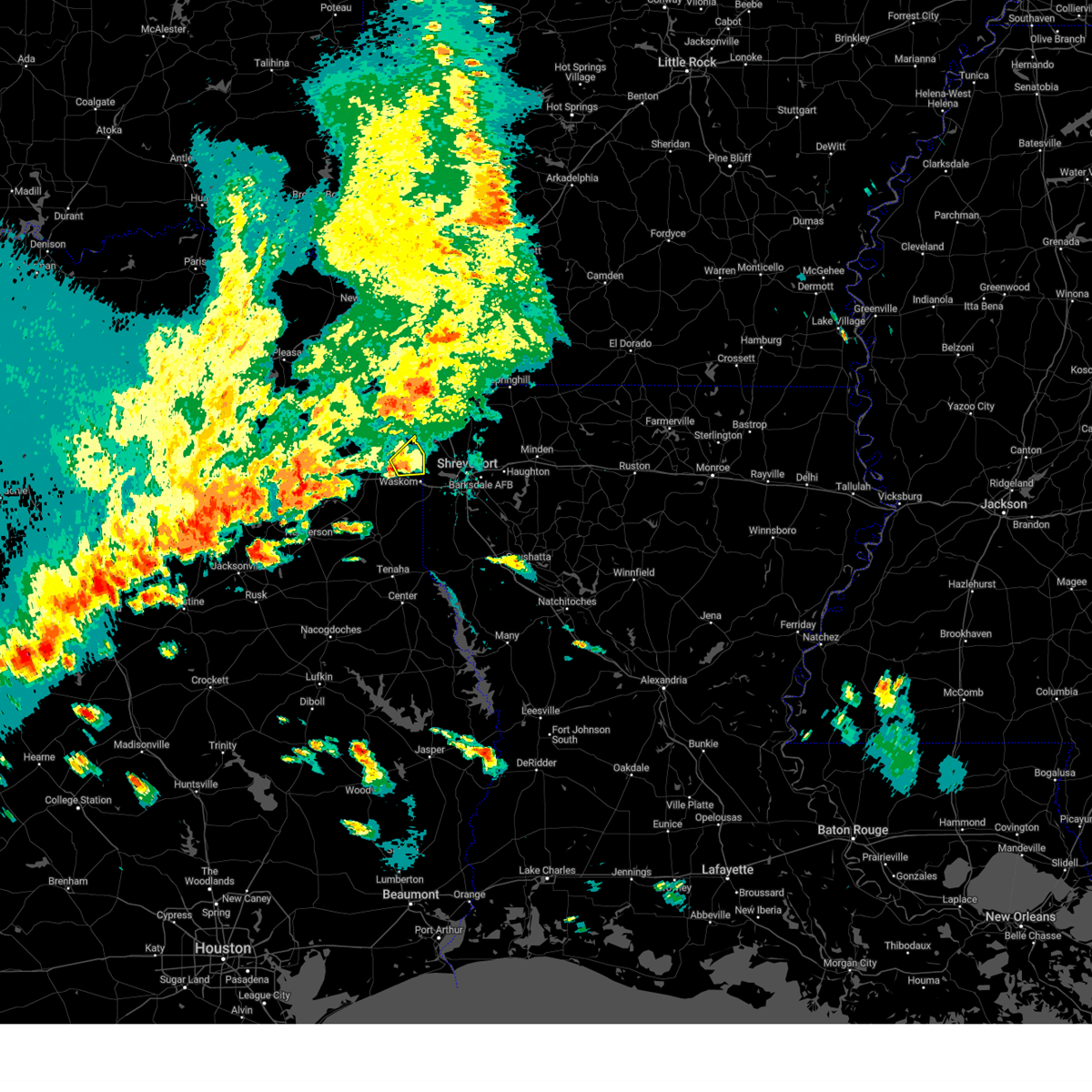 At 502 pm cdt, a severe thunderstorm was located 7 miles south of karnack, or 11 miles east of marshall, moving northeast at 10 mph (radar indicated). Hazards include 60 mph wind gusts and quarter size hail. Hail damage to vehicles is expected. expect wind damage to roofs, siding, and trees. Locations impacted include, karnack, uncertain, jonesville, and leigh. At 502 pm cdt, a severe thunderstorm was located 7 miles south of karnack, or 11 miles east of marshall, moving northeast at 10 mph (radar indicated). Hazards include 60 mph wind gusts and quarter size hail. Hail damage to vehicles is expected. expect wind damage to roofs, siding, and trees. Locations impacted include, karnack, uncertain, jonesville, and leigh.
|
| 5/30/2024 4:43 PM CDT |
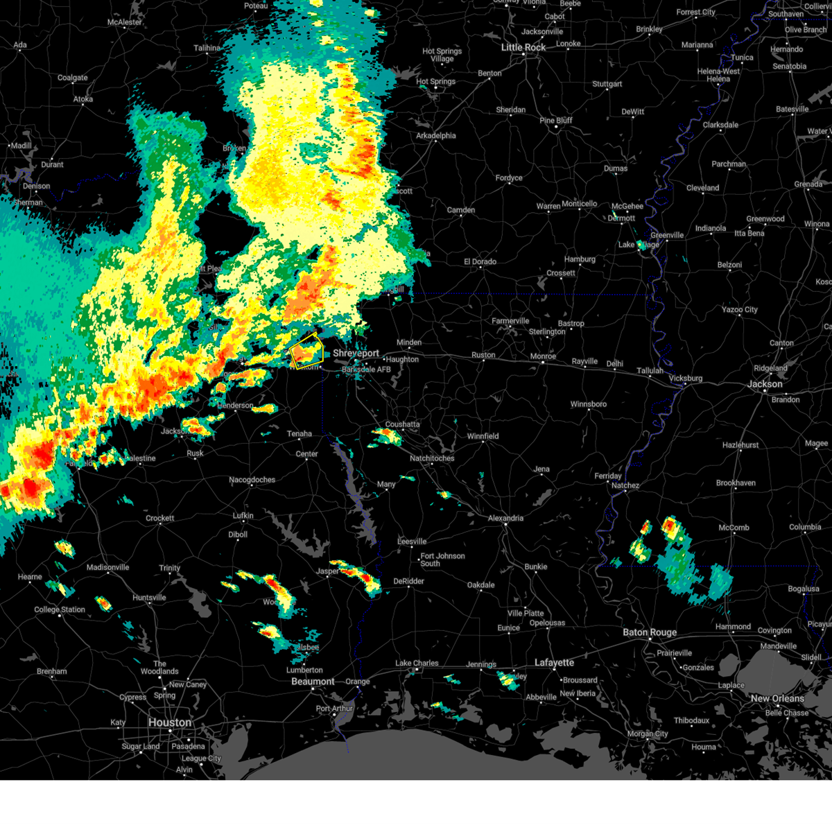 Svrshv the national weather service in shreveport has issued a * severe thunderstorm warning for, east central harrison county in northeastern texas, * until 530 pm cdt. * at 443 pm cdt, a severe thunderstorm was located 7 miles east of marshall, moving northeast at 10 mph (radar indicated). Hazards include 60 mph wind gusts and quarter size hail. Hail damage to vehicles is expected. Expect wind damage to roofs, siding, and trees. Svrshv the national weather service in shreveport has issued a * severe thunderstorm warning for, east central harrison county in northeastern texas, * until 530 pm cdt. * at 443 pm cdt, a severe thunderstorm was located 7 miles east of marshall, moving northeast at 10 mph (radar indicated). Hazards include 60 mph wind gusts and quarter size hail. Hail damage to vehicles is expected. Expect wind damage to roofs, siding, and trees.
|
| 5/22/2024 7:40 PM CDT |
 The storms which prompted the warning have weakened below severe limits, and have exited the warned area. therefore, the warning will be allowed to expire. however, heavy rain is still possible with these thunderstorms. a severe thunderstorm watch remains in effect until 1100 pm cdt for northwestern louisiana, and northeastern texas. The storms which prompted the warning have weakened below severe limits, and have exited the warned area. therefore, the warning will be allowed to expire. however, heavy rain is still possible with these thunderstorms. a severe thunderstorm watch remains in effect until 1100 pm cdt for northwestern louisiana, and northeastern texas.
|
| 5/22/2024 7:16 PM CDT |
 At 716 pm cdt, severe thunderstorms were located along a line extending from lodi to near smithland to near karnack to near marshall, moving east at 35 mph (radar indicated. at 700 pm, quarter size hail fell near hallsville with these storms). Hazards include 60 mph wind gusts and quarter size hail. Hail damage to vehicles is expected. expect wind damage to roofs, siding, and trees. Locations impacted include, marshall, waskom, jefferson, karnack, lodi, woodlawn, smithland, berea, gray, scottsville, uncertain, leigh, jonesville, and nesbitt. At 716 pm cdt, severe thunderstorms were located along a line extending from lodi to near smithland to near karnack to near marshall, moving east at 35 mph (radar indicated. at 700 pm, quarter size hail fell near hallsville with these storms). Hazards include 60 mph wind gusts and quarter size hail. Hail damage to vehicles is expected. expect wind damage to roofs, siding, and trees. Locations impacted include, marshall, waskom, jefferson, karnack, lodi, woodlawn, smithland, berea, gray, scottsville, uncertain, leigh, jonesville, and nesbitt.
|
| 5/22/2024 6:48 PM CDT |
 Svrshv the national weather service in shreveport has issued a * severe thunderstorm warning for, marion county in northeastern texas, southern cass county in northeastern texas, harrison county in northeastern texas, * until 745 pm cdt. * at 648 pm cdt, severe thunderstorms were located along a line extending from 6 miles southeast of jenkins to near berea to near woodlawn to near hallsville, moving east at 25 mph (radar indicated). Hazards include 60 mph wind gusts and quarter size hail. Hail damage to vehicles is expected. Expect wind damage to roofs, siding, and trees. Svrshv the national weather service in shreveport has issued a * severe thunderstorm warning for, marion county in northeastern texas, southern cass county in northeastern texas, harrison county in northeastern texas, * until 745 pm cdt. * at 648 pm cdt, severe thunderstorms were located along a line extending from 6 miles southeast of jenkins to near berea to near woodlawn to near hallsville, moving east at 25 mph (radar indicated). Hazards include 60 mph wind gusts and quarter size hail. Hail damage to vehicles is expected. Expect wind damage to roofs, siding, and trees.
|
| 5/9/2024 1:02 AM CDT |
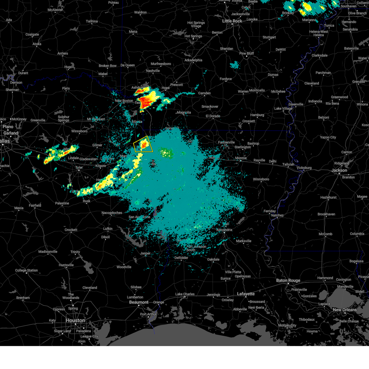 the severe thunderstorm warning has been cancelled and is no longer in effect the severe thunderstorm warning has been cancelled and is no longer in effect
|
| 5/9/2024 12:50 AM CDT |
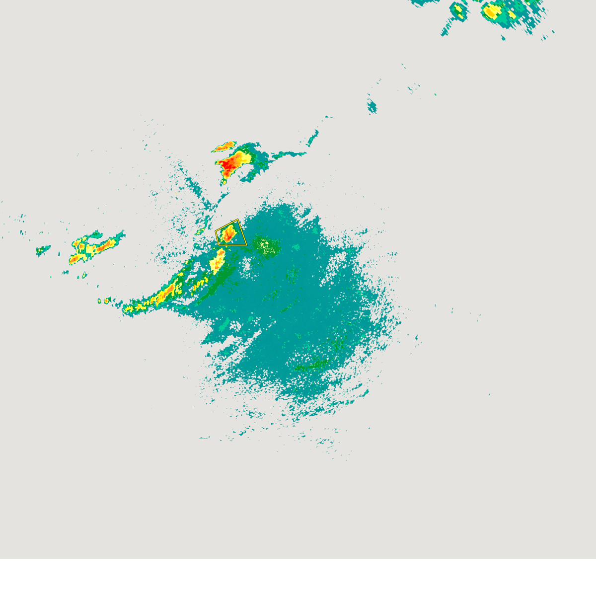 At 1249 am cdt, a severe thunderstorm was located near oil city, or 21 miles northeast of marshall, moving east at 25 mph (radar indicated). Hazards include 60 mph wind gusts and quarter size hail. Hail damage to vehicles is expected. expect wind damage to roofs, siding, and trees. Locations impacted include, vivian, oil city, mooringsport, smithland, karnack, gray, uncertain, and caddo lake. At 1249 am cdt, a severe thunderstorm was located near oil city, or 21 miles northeast of marshall, moving east at 25 mph (radar indicated). Hazards include 60 mph wind gusts and quarter size hail. Hail damage to vehicles is expected. expect wind damage to roofs, siding, and trees. Locations impacted include, vivian, oil city, mooringsport, smithland, karnack, gray, uncertain, and caddo lake.
|
| 5/9/2024 12:34 AM CDT |
 Svrshv the national weather service in shreveport has issued a * severe thunderstorm warning for, northwestern caddo parish in northwestern louisiana, eastern marion county in northeastern texas, northeastern harrison county in northeastern texas, * until 115 am cdt. * at 1234 am cdt, a severe thunderstorm was located near karnack, or 13 miles northeast of marshall, moving east at 30 mph (radar indicated). Hazards include 60 mph wind gusts and quarter size hail. Hail damage to vehicles is expected. Expect wind damage to roofs, siding, and trees. Svrshv the national weather service in shreveport has issued a * severe thunderstorm warning for, northwestern caddo parish in northwestern louisiana, eastern marion county in northeastern texas, northeastern harrison county in northeastern texas, * until 115 am cdt. * at 1234 am cdt, a severe thunderstorm was located near karnack, or 13 miles northeast of marshall, moving east at 30 mph (radar indicated). Hazards include 60 mph wind gusts and quarter size hail. Hail damage to vehicles is expected. Expect wind damage to roofs, siding, and trees.
|
| 4/28/2024 6:47 PM CDT |
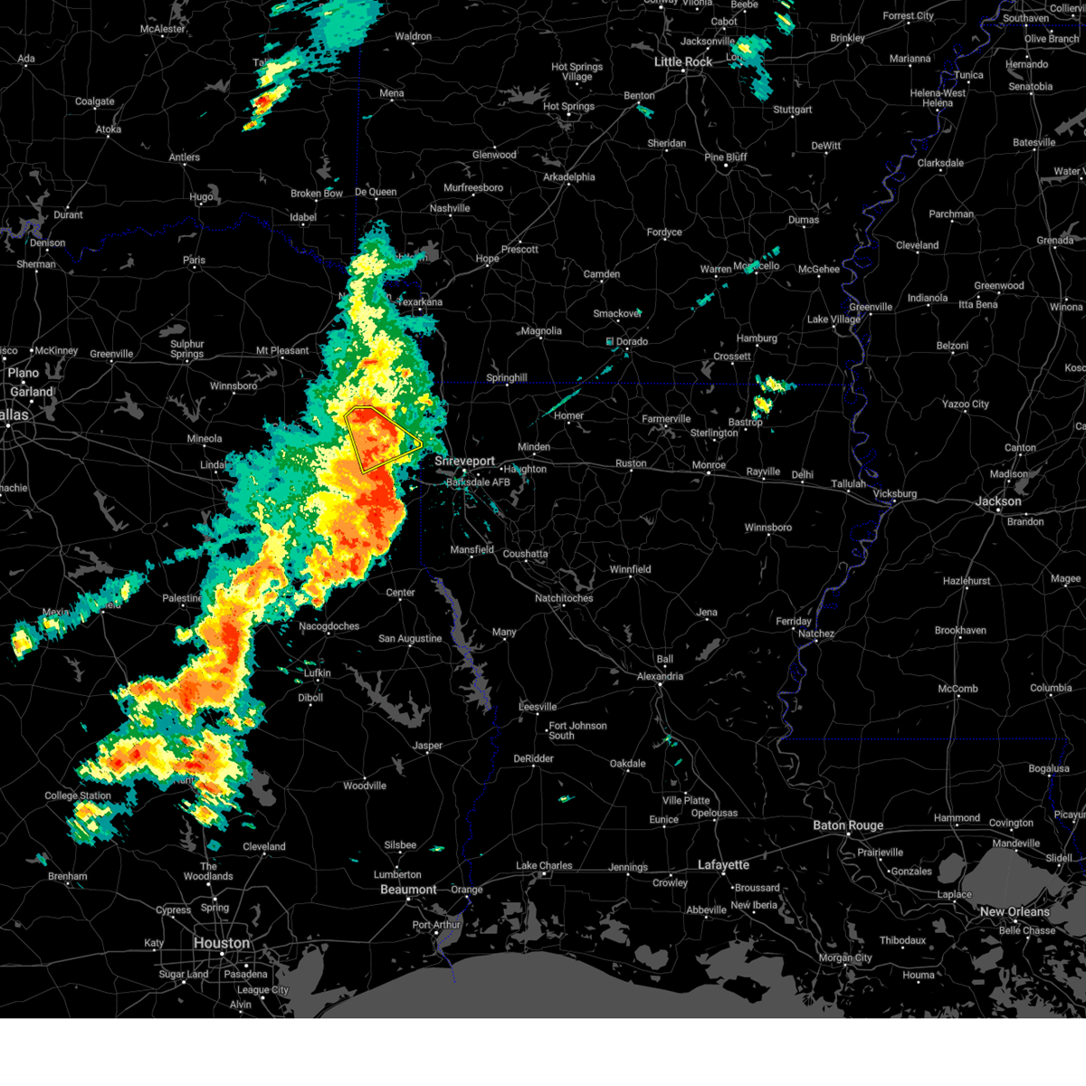 At 647 pm cdt, a severe thunderstorm was located over smithland, or 20 miles northeast of marshall, moving east at 50 mph (radar indicated). Hazards include 60 mph wind gusts and quarter size hail. Hail damage to vehicles is expected. expect wind damage to roofs, siding, and trees. Locations impacted include, marshall, jefferson, karnack, berea, woodlawn, uncertain, lassater, and nesbitt. At 647 pm cdt, a severe thunderstorm was located over smithland, or 20 miles northeast of marshall, moving east at 50 mph (radar indicated). Hazards include 60 mph wind gusts and quarter size hail. Hail damage to vehicles is expected. expect wind damage to roofs, siding, and trees. Locations impacted include, marshall, jefferson, karnack, berea, woodlawn, uncertain, lassater, and nesbitt.
|
| 4/28/2024 6:46 PM CDT |
 Svrshv the national weather service in shreveport has issued a * severe thunderstorm warning for, southwestern miller county in southwestern arkansas, northwestern caddo parish in northwestern louisiana, eastern marion county in northeastern texas, southeastern cass county in northeastern texas, northeastern harrison county in northeastern texas, * until 730 pm cdt. * at 645 pm cdt, severe thunderstorms were located along a line extending from near berea to lodi to near smithland, moving northeast at 40 mph (radar indicated). Hazards include 60 mph wind gusts and quarter size hail. Hail damage to vehicles is expected. Expect wind damage to roofs, siding, and trees. Svrshv the national weather service in shreveport has issued a * severe thunderstorm warning for, southwestern miller county in southwestern arkansas, northwestern caddo parish in northwestern louisiana, eastern marion county in northeastern texas, southeastern cass county in northeastern texas, northeastern harrison county in northeastern texas, * until 730 pm cdt. * at 645 pm cdt, severe thunderstorms were located along a line extending from near berea to lodi to near smithland, moving northeast at 40 mph (radar indicated). Hazards include 60 mph wind gusts and quarter size hail. Hail damage to vehicles is expected. Expect wind damage to roofs, siding, and trees.
|
| 4/28/2024 6:38 PM CDT |
 At 638 pm cdt, a severe thunderstorm was located over jefferson, or 15 miles north of marshall, moving northeast at 40 mph (radar indicated). Hazards include 60 mph wind gusts and quarter size hail. Hail damage to vehicles is expected. expect wind damage to roofs, siding, and trees. Locations impacted include, marshall, hallsville, jefferson, karnack, berea, harleton, woodlawn, uncertain, lassater, and nesbitt. At 638 pm cdt, a severe thunderstorm was located over jefferson, or 15 miles north of marshall, moving northeast at 40 mph (radar indicated). Hazards include 60 mph wind gusts and quarter size hail. Hail damage to vehicles is expected. expect wind damage to roofs, siding, and trees. Locations impacted include, marshall, hallsville, jefferson, karnack, berea, harleton, woodlawn, uncertain, lassater, and nesbitt.
|
| 4/28/2024 6:38 PM CDT |
 the severe thunderstorm warning has been cancelled and is no longer in effect the severe thunderstorm warning has been cancelled and is no longer in effect
|
| 4/28/2024 6:09 PM CDT |
 Svrshv the national weather service in shreveport has issued a * severe thunderstorm warning for, central marion county in northeastern texas, central harrison county in northeastern texas, southeastern upshur county in northeastern texas, north central gregg county in northeastern texas, * until 700 pm cdt. * at 608 pm cdt, a severe thunderstorm was located near hallsville, or 9 miles northeast of longview, moving northeast at 50 mph (radar indicated). Hazards include 60 mph wind gusts and quarter size hail. Hail damage to vehicles is expected. Expect wind damage to roofs, siding, and trees. Svrshv the national weather service in shreveport has issued a * severe thunderstorm warning for, central marion county in northeastern texas, central harrison county in northeastern texas, southeastern upshur county in northeastern texas, north central gregg county in northeastern texas, * until 700 pm cdt. * at 608 pm cdt, a severe thunderstorm was located near hallsville, or 9 miles northeast of longview, moving northeast at 50 mph (radar indicated). Hazards include 60 mph wind gusts and quarter size hail. Hail damage to vehicles is expected. Expect wind damage to roofs, siding, and trees.
|
| 2/11/2024 8:54 AM CST |
 At 853 am cst, severe thunderstorms were located along a line extending from near karnack to 6 miles west of blanchard to near greenwood, moving east at 45 mph (radar indicated). Hazards include two inch hail and 60 mph wind gusts. People and animals outdoors will be injured. expect hail damage to roofs, siding, windows, and vehicles. expect wind damage to roofs, siding, and trees. locations impacted include, shreveport, bossier city, haughton, greenwood, blanchard, waskom, benton, oil city, mooringsport, hosston, belcher, gilliam, eastwood, karnack, fosters, gray, uncertain, alden bridge, ferguson, and cross lake. thunderstorm damage threat, considerable hail threat, radar indicated max hail size, 2. 00 in wind threat, radar indicated max wind gust, 60 mph. At 853 am cst, severe thunderstorms were located along a line extending from near karnack to 6 miles west of blanchard to near greenwood, moving east at 45 mph (radar indicated). Hazards include two inch hail and 60 mph wind gusts. People and animals outdoors will be injured. expect hail damage to roofs, siding, windows, and vehicles. expect wind damage to roofs, siding, and trees. locations impacted include, shreveport, bossier city, haughton, greenwood, blanchard, waskom, benton, oil city, mooringsport, hosston, belcher, gilliam, eastwood, karnack, fosters, gray, uncertain, alden bridge, ferguson, and cross lake. thunderstorm damage threat, considerable hail threat, radar indicated max hail size, 2. 00 in wind threat, radar indicated max wind gust, 60 mph.
|
| 2/11/2024 8:42 AM CST |
 At 841 am cst, severe thunderstorms were located along a line extending from near karnack to near waskom to near elysian fields, moving northeast at 45 mph (radar indicated). Hazards include two inch hail and 60 mph wind gusts. People and animals outdoors will be injured. expect hail damage to roofs, siding, windows, and vehicles. Expect wind damage to roofs, siding, and trees. At 841 am cst, severe thunderstorms were located along a line extending from near karnack to near waskom to near elysian fields, moving northeast at 45 mph (radar indicated). Hazards include two inch hail and 60 mph wind gusts. People and animals outdoors will be injured. expect hail damage to roofs, siding, windows, and vehicles. Expect wind damage to roofs, siding, and trees.
|
| 2/11/2024 8:19 AM CST |
 At 818 am cst, a severe thunderstorm was located near marshall, moving east at 45 mph (radar indicated). Hazards include tennis ball size hail and 60 mph wind gusts. People and animals outdoors will be injured. expect hail damage to roofs, siding, windows, and vehicles. expect wind damage to roofs, siding, and trees. locations impacted include, shreveport, marshall, hallsville, greenwood, blanchard, waskom, mooringsport, karnack, woodlawn, gray, easton, scottsville, uncertain, nesbitt, caddo lake, cross lake, darco, leigh, jonesville, and bethany. thunderstorm damage threat, considerable hail threat, observed max hail size, 2. 50 in wind threat, radar indicated max wind gust, 60 mph. At 818 am cst, a severe thunderstorm was located near marshall, moving east at 45 mph (radar indicated). Hazards include tennis ball size hail and 60 mph wind gusts. People and animals outdoors will be injured. expect hail damage to roofs, siding, windows, and vehicles. expect wind damage to roofs, siding, and trees. locations impacted include, shreveport, marshall, hallsville, greenwood, blanchard, waskom, mooringsport, karnack, woodlawn, gray, easton, scottsville, uncertain, nesbitt, caddo lake, cross lake, darco, leigh, jonesville, and bethany. thunderstorm damage threat, considerable hail threat, observed max hail size, 2. 50 in wind threat, radar indicated max wind gust, 60 mph.
|
| 2/11/2024 7:46 AM CST |
 At 746 am cst, a severe thunderstorm was located near longview, moving east at 45 mph (radar indicated). Hazards include two inch hail. People and animals outdoors will be injured. Expect damage to roofs, siding, windows, and vehicles. At 746 am cst, a severe thunderstorm was located near longview, moving east at 45 mph (radar indicated). Hazards include two inch hail. People and animals outdoors will be injured. Expect damage to roofs, siding, windows, and vehicles.
|
| 9/24/2023 11:06 PM CDT |
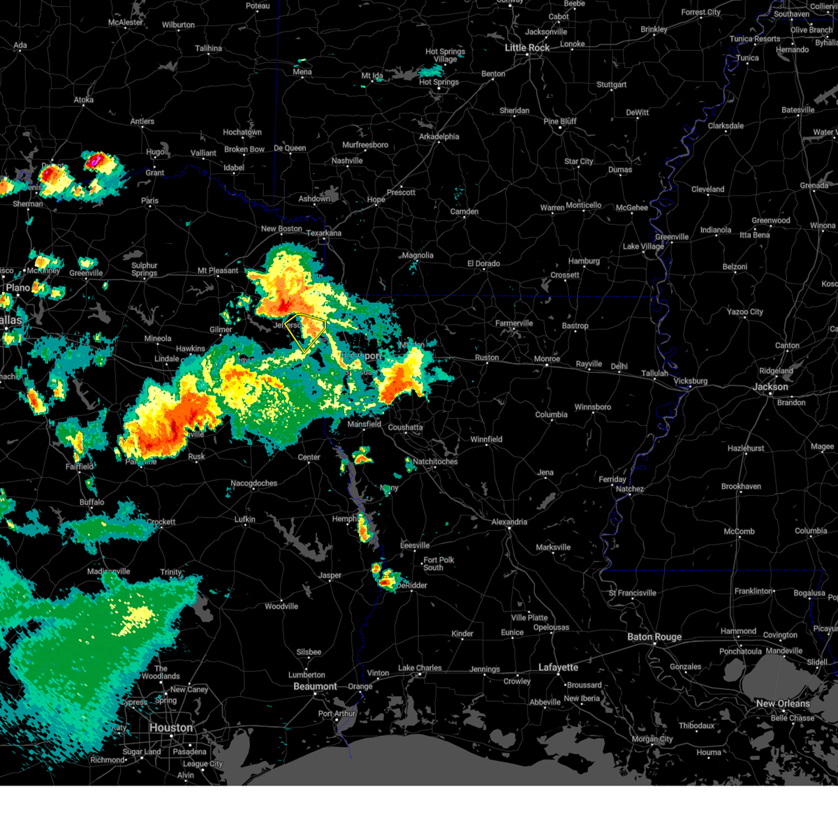 At 1106 pm cdt, a severe thunderstorm was located near lodi, or 19 miles north of marshall, moving southeast at 35 mph (radar indicated). Hazards include 60 mph wind gusts. expect damage to roofs, siding, and trees At 1106 pm cdt, a severe thunderstorm was located near lodi, or 19 miles north of marshall, moving southeast at 35 mph (radar indicated). Hazards include 60 mph wind gusts. expect damage to roofs, siding, and trees
|
| 9/24/2023 6:53 AM CDT |
 At 651 am cdt, a severe thunderstorm was located near oil city, or 20 miles northeast of marshall, moving southeast at 40 mph. this is a destructive storm for uncertain, karnack, caddo lake, greenwood, waskom, longwood, blanchard, mooringsport (radar indicated). Hazards include 80 mph wind gusts and nickel size hail. Flying debris will be dangerous to those caught without shelter. mobile homes will be heavily damaged. expect considerable damage to roofs, windows, and vehicles. Extensive tree damage and power outages are likely. At 651 am cdt, a severe thunderstorm was located near oil city, or 20 miles northeast of marshall, moving southeast at 40 mph. this is a destructive storm for uncertain, karnack, caddo lake, greenwood, waskom, longwood, blanchard, mooringsport (radar indicated). Hazards include 80 mph wind gusts and nickel size hail. Flying debris will be dangerous to those caught without shelter. mobile homes will be heavily damaged. expect considerable damage to roofs, windows, and vehicles. Extensive tree damage and power outages are likely.
|
| 9/24/2023 6:17 AM CDT |
 At 616 am cdt, severe thunderstorms were located along a line extending from near garland to near bivins to near linden, moving southeast at 40 mph (radar indicated). Hazards include 70 mph wind gusts and penny size hail. Expect considerable tree damage. Damage is likely to mobile homes, roofs, and outbuildings. At 616 am cdt, severe thunderstorms were located along a line extending from near garland to near bivins to near linden, moving southeast at 40 mph (radar indicated). Hazards include 70 mph wind gusts and penny size hail. Expect considerable tree damage. Damage is likely to mobile homes, roofs, and outbuildings.
|
| 8/27/2023 8:05 PM CDT | Trees down across roa in harrison county TX, 0.3 miles W of Uncertain, TX |
| 8/27/2023 7:57 PM CDT |
 At 757 pm cdt, a severe thunderstorm was located near karnack, or 17 miles northeast of marshall, moving south at 35 mph (radar indicated). Hazards include 60 mph wind gusts and quarter size hail. Hail damage to vehicles is expected. Expect wind damage to roofs, siding, and trees. At 757 pm cdt, a severe thunderstorm was located near karnack, or 17 miles northeast of marshall, moving south at 35 mph (radar indicated). Hazards include 60 mph wind gusts and quarter size hail. Hail damage to vehicles is expected. Expect wind damage to roofs, siding, and trees.
|
| 7/16/2023 2:00 PM CDT |
 At 200 pm cdt, severe thunderstorms were located along a line extending from near nashville to near fouke to 7 miles northwest of waskom, moving east at 45 mph (radar indicated). Hazards include 60 mph wind gusts and quarter size hail. Hail damage to vehicles is expected. expect wind damage to roofs, siding, and trees. locations impacted include, texarkana, marshall, atlanta, wake village, ashdown, new boston, horatio, foreman, hallsville, nash, hooks, waskom, jefferson, linden, queen city, redwater, maud, red lick, fouke and wilton. hail threat, radar indicated max hail size, 1. 00 in wind threat, radar indicated max wind gust, 60 mph. At 200 pm cdt, severe thunderstorms were located along a line extending from near nashville to near fouke to 7 miles northwest of waskom, moving east at 45 mph (radar indicated). Hazards include 60 mph wind gusts and quarter size hail. Hail damage to vehicles is expected. expect wind damage to roofs, siding, and trees. locations impacted include, texarkana, marshall, atlanta, wake village, ashdown, new boston, horatio, foreman, hallsville, nash, hooks, waskom, jefferson, linden, queen city, redwater, maud, red lick, fouke and wilton. hail threat, radar indicated max hail size, 1. 00 in wind threat, radar indicated max wind gust, 60 mph.
|
| 7/16/2023 1:56 PM CDT |
 At 156 pm cdt, severe thunderstorms were located along a line extending from bivins to near smithland to marshall, moving east at 50 mph (radar indicated. multiple trees and power lines have been downed across east texas from these storms). Hazards include 70 mph wind gusts. Expect considerable tree damage. Damage is likely to mobile homes, roofs, and outbuildings. At 156 pm cdt, severe thunderstorms were located along a line extending from bivins to near smithland to marshall, moving east at 50 mph (radar indicated. multiple trees and power lines have been downed across east texas from these storms). Hazards include 70 mph wind gusts. Expect considerable tree damage. Damage is likely to mobile homes, roofs, and outbuildings.
|
| 7/16/2023 1:09 PM CDT |
 At 108 pm cdt, severe thunderstorms were located along a line extending from 6 miles northwest of arkinda to 9 miles southwest of maud to longview, moving east at 45 mph (radar indicated). Hazards include 60 mph wind gusts and quarter size hail. Hail damage to vehicles is expected. Expect wind damage to roofs, siding, and trees. At 108 pm cdt, severe thunderstorms were located along a line extending from 6 miles northwest of arkinda to 9 miles southwest of maud to longview, moving east at 45 mph (radar indicated). Hazards include 60 mph wind gusts and quarter size hail. Hail damage to vehicles is expected. Expect wind damage to roofs, siding, and trees.
|
| 6/26/2023 6:47 AM CDT |
 At 646 am cdt, severe thunderstorms were located along a line extending from sarepta to mooringsport, moving southeast at 55 mph. these are destructive storms for benton! (radar indicated). Hazards include 80 mph wind gusts and quarter size hail. Flying debris will be dangerous to those caught without shelter. mobile homes will be heavily damaged. expect considerable damage to roofs, windows, and vehicles. extensive tree damage and power outages are likely. Locations impacted include, springhill, vivian, blanchard, benton, cullen, plain dealing, cotton valley, oil city, sarepta, mooringsport, hosston, belcher, gilliam, smithland, karnack, gray, uncertain, alden bridge, cavett and leigh. At 646 am cdt, severe thunderstorms were located along a line extending from sarepta to mooringsport, moving southeast at 55 mph. these are destructive storms for benton! (radar indicated). Hazards include 80 mph wind gusts and quarter size hail. Flying debris will be dangerous to those caught without shelter. mobile homes will be heavily damaged. expect considerable damage to roofs, windows, and vehicles. extensive tree damage and power outages are likely. Locations impacted include, springhill, vivian, blanchard, benton, cullen, plain dealing, cotton valley, oil city, sarepta, mooringsport, hosston, belcher, gilliam, smithland, karnack, gray, uncertain, alden bridge, cavett and leigh.
|
| 6/26/2023 6:21 AM CDT |
 At 619 am cdt, severe thunderstorms were located along a line extending from near canfield to near kildare, moving southeast at 40 mph. these are destructive storms for plain dealing, vivian, moorinsport, and benton (radar indicated). Hazards include 80 mph wind gusts and quarter size hail. Flying debris will be dangerous to those caught without shelter. mobile homes will be heavily damaged. expect considerable damage to roofs, windows, and vehicles. Extensive tree damage and power outages are likely. At 619 am cdt, severe thunderstorms were located along a line extending from near canfield to near kildare, moving southeast at 40 mph. these are destructive storms for plain dealing, vivian, moorinsport, and benton (radar indicated). Hazards include 80 mph wind gusts and quarter size hail. Flying debris will be dangerous to those caught without shelter. mobile homes will be heavily damaged. expect considerable damage to roofs, windows, and vehicles. Extensive tree damage and power outages are likely.
|
| 6/18/2023 9:14 AM CDT |
 At 913 am cdt, a severe thunderstorm was located over oil city, or 21 miles northwest of shreveport, moving southeast at 35 mph (radar indicated). Hazards include 60 mph wind gusts and quarter size hail. Hail damage to vehicles is expected. Expect wind damage to roofs, siding, and trees. At 913 am cdt, a severe thunderstorm was located over oil city, or 21 miles northwest of shreveport, moving southeast at 35 mph (radar indicated). Hazards include 60 mph wind gusts and quarter size hail. Hail damage to vehicles is expected. Expect wind damage to roofs, siding, and trees.
|
| 6/16/2023 1:14 AM CDT |
 At 113 am cdt, severe thunderstorms were located along a line extending from near rodessa to near waskom, moving east at 55 mph. these are destructive storms for shreveport and bossier city locations! (radar indicated). Hazards include 90 mph wind gusts and ping pong ball size hail. You are in a life-threatening situation. flying debris may be deadly to those caught without shelter. mobile homes will be heavily damaged or destroyed. homes and businesses will have substantial roof and window damage. expect extensive tree damage and power outages. Locations impacted include, shreveport, bossier city, vivian, haughton, greenwood, blanchard, benton, stonewall, plain dealing, oil city, mooringsport, hosston, rodessa, belcher, ida, gilliam, bivins, eastwood, smithland and mcleod. At 113 am cdt, severe thunderstorms were located along a line extending from near rodessa to near waskom, moving east at 55 mph. these are destructive storms for shreveport and bossier city locations! (radar indicated). Hazards include 90 mph wind gusts and ping pong ball size hail. You are in a life-threatening situation. flying debris may be deadly to those caught without shelter. mobile homes will be heavily damaged or destroyed. homes and businesses will have substantial roof and window damage. expect extensive tree damage and power outages. Locations impacted include, shreveport, bossier city, vivian, haughton, greenwood, blanchard, benton, stonewall, plain dealing, oil city, mooringsport, hosston, rodessa, belcher, ida, gilliam, bivins, eastwood, smithland and mcleod.
|
| 6/16/2023 12:50 AM CDT |
 At 1249 am cdt, severe thunderstorms were located along a line extending from near linden to near marshall, moving east at 55 mph. these are destructive storms for shreveport, stonewall, plain dealing, and bossier city (radar indicated). Hazards include 80 mph wind gusts and ping pong ball size hail. Flying debris will be dangerous to those caught without shelter. mobile homes will be heavily damaged. expect considerable damage to roofs, windows, and vehicles. Extensive tree damage and power outages are likely. At 1249 am cdt, severe thunderstorms were located along a line extending from near linden to near marshall, moving east at 55 mph. these are destructive storms for shreveport, stonewall, plain dealing, and bossier city (radar indicated). Hazards include 80 mph wind gusts and ping pong ball size hail. Flying debris will be dangerous to those caught without shelter. mobile homes will be heavily damaged. expect considerable damage to roofs, windows, and vehicles. Extensive tree damage and power outages are likely.
|
| 6/13/2023 12:45 PM CDT |
 At 1245 pm cdt, a severe thunderstorm was located near karnack, or 17 miles east of marshall, moving east at 55 mph (radar indicated). Hazards include ping pong ball size hail and 60 mph wind gusts. People and animals outdoors will be injured. expect hail damage to roofs, siding, windows, and vehicles. expect wind damage to roofs, siding, and trees. locations impacted include, shreveport, marshall, vivian, greenwood, blanchard, waskom, jefferson, oil city, mooringsport, belcher, gilliam, lodi, smithland, berea, harleton, karnack, woodlawn, gray, scottsville and uncertain. hail threat, radar indicated max hail size, 1. 50 in wind threat, radar indicated max wind gust, 60 mph. At 1245 pm cdt, a severe thunderstorm was located near karnack, or 17 miles east of marshall, moving east at 55 mph (radar indicated). Hazards include ping pong ball size hail and 60 mph wind gusts. People and animals outdoors will be injured. expect hail damage to roofs, siding, windows, and vehicles. expect wind damage to roofs, siding, and trees. locations impacted include, shreveport, marshall, vivian, greenwood, blanchard, waskom, jefferson, oil city, mooringsport, belcher, gilliam, lodi, smithland, berea, harleton, karnack, woodlawn, gray, scottsville and uncertain. hail threat, radar indicated max hail size, 1. 50 in wind threat, radar indicated max wind gust, 60 mph.
|
| 6/13/2023 12:10 PM CDT |
 At 1209 pm cdt, a severe thunderstorm was located near ore city, or 20 miles east of gilmer, moving east at 55 mph (radar indicated). Hazards include ping pong ball size hail and 60 mph wind gusts. People and animals outdoors will be injured. expect hail damage to roofs, siding, windows, and vehicles. Expect wind damage to roofs, siding, and trees. At 1209 pm cdt, a severe thunderstorm was located near ore city, or 20 miles east of gilmer, moving east at 55 mph (radar indicated). Hazards include ping pong ball size hail and 60 mph wind gusts. People and animals outdoors will be injured. expect hail damage to roofs, siding, windows, and vehicles. Expect wind damage to roofs, siding, and trees.
|
| 6/10/2023 1:28 PM CDT |
 At 127 pm cdt, severe thunderstorms were located along a line extending from tatum to 7 miles west of elysian fields to 7 miles north of waskom, moving southeast at 30 mph (radar indicated). Hazards include 60 mph wind gusts and quarter size hail. Hail damage to vehicles is expected. Expect wind damage to roofs, siding, and trees. At 127 pm cdt, severe thunderstorms were located along a line extending from tatum to 7 miles west of elysian fields to 7 miles north of waskom, moving southeast at 30 mph (radar indicated). Hazards include 60 mph wind gusts and quarter size hail. Hail damage to vehicles is expected. Expect wind damage to roofs, siding, and trees.
|
| 6/10/2023 12:24 PM CDT |
 At 1224 pm cdt, a severe thunderstorm was located near ore city, or 19 miles east of gilmer, moving southeast at 35 mph (radar indicated). Hazards include 60 mph wind gusts and nickel size hail. expect damage to roofs, siding, and trees At 1224 pm cdt, a severe thunderstorm was located near ore city, or 19 miles east of gilmer, moving southeast at 35 mph (radar indicated). Hazards include 60 mph wind gusts and nickel size hail. expect damage to roofs, siding, and trees
|
| 4/2/2023 9:46 PM CDT |
 At 946 pm cdt, a severe thunderstorm capable of producing a tornado was located just south of mooringsport, or 15 miles northwest of shreveport, moving east at 45 mph (radar indicated rotation). Hazards include tornado and half dollar size hail. Flying debris will be dangerous to those caught without shelter. mobile homes will be damaged or destroyed. damage to roofs, windows, and vehicles will occur. tree damage is likely. this dangerous storm will be near, blanchard around 950 pm cdt. shreveport and benton around 1000 pm cdt. bossier city around 1005 pm cdt. eastwood around 1015 pm cdt. haughton around 1020 pm cdt. Other locations impacted by this tornadic thunderstorm include dixie, caddo lake, ferguson, princeton, fillmore, linton, bodcau, bellevue, leigh and red chute. At 946 pm cdt, a severe thunderstorm capable of producing a tornado was located just south of mooringsport, or 15 miles northwest of shreveport, moving east at 45 mph (radar indicated rotation). Hazards include tornado and half dollar size hail. Flying debris will be dangerous to those caught without shelter. mobile homes will be damaged or destroyed. damage to roofs, windows, and vehicles will occur. tree damage is likely. this dangerous storm will be near, blanchard around 950 pm cdt. shreveport and benton around 1000 pm cdt. bossier city around 1005 pm cdt. eastwood around 1015 pm cdt. haughton around 1020 pm cdt. Other locations impacted by this tornadic thunderstorm include dixie, caddo lake, ferguson, princeton, fillmore, linton, bodcau, bellevue, leigh and red chute.
|
| 4/2/2023 9:24 PM CDT |
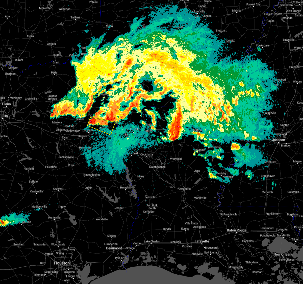 At 924 pm cdt, a severe thunderstorm was located near diana, or 14 miles northeast of longview, moving east at 30 mph (radar indicated. at 920 pm, golfball size hail fell in diana with this storm). Hazards include golf ball size hail and 60 mph wind gusts. People and animals outdoors will be injured. expect hail damage to roofs, siding, windows, and vehicles. Expect wind damage to roofs, siding, and trees. At 924 pm cdt, a severe thunderstorm was located near diana, or 14 miles northeast of longview, moving east at 30 mph (radar indicated. at 920 pm, golfball size hail fell in diana with this storm). Hazards include golf ball size hail and 60 mph wind gusts. People and animals outdoors will be injured. expect hail damage to roofs, siding, windows, and vehicles. Expect wind damage to roofs, siding, and trees.
|
| 4/2/2023 9:19 PM CDT |
 At 918 pm cdt, a severe thunderstorm was located near jefferson, or 15 miles north of marshall, moving east at 40 mph (radar indicated). Hazards include ping pong ball size hail and 60 mph wind gusts. People and animals outdoors will be injured. expect hail damage to roofs, siding, windows, and vehicles. Expect wind damage to roofs, siding, and trees. At 918 pm cdt, a severe thunderstorm was located near jefferson, or 15 miles north of marshall, moving east at 40 mph (radar indicated). Hazards include ping pong ball size hail and 60 mph wind gusts. People and animals outdoors will be injured. expect hail damage to roofs, siding, windows, and vehicles. Expect wind damage to roofs, siding, and trees.
|
| 4/2/2023 6:51 PM CDT |
 At 650 pm cdt, severe thunderstorms were located along a line extending from near woodlawn to near marshall to 7 miles east of hallsville, moving east at 30 mph (radar indicated). Hazards include 60 mph wind gusts and quarter size hail. Hail damage to vehicles is expected. Expect wind damage to roofs, siding, and trees. At 650 pm cdt, severe thunderstorms were located along a line extending from near woodlawn to near marshall to 7 miles east of hallsville, moving east at 30 mph (radar indicated). Hazards include 60 mph wind gusts and quarter size hail. Hail damage to vehicles is expected. Expect wind damage to roofs, siding, and trees.
|
| 3/2/2023 10:37 PM CST |
 At 1037 pm cst, a severe thunderstorm capable of producing a tornado was located near karnack, or 15 miles northeast of marshall, moving east at 40 mph (radar indicated rotation). Hazards include tornado. Flying debris will be dangerous to those caught without shelter. mobile homes will be damaged or destroyed. damage to roofs, windows, and vehicles will occur. tree damage is likely. this dangerous storm will be near, oil city around 1055 pm cst. hosston, belcher and gilliam around 1110 pm cst. Other locations impacted by this tornadic thunderstorm include uncertain, gray and cavett. At 1037 pm cst, a severe thunderstorm capable of producing a tornado was located near karnack, or 15 miles northeast of marshall, moving east at 40 mph (radar indicated rotation). Hazards include tornado. Flying debris will be dangerous to those caught without shelter. mobile homes will be damaged or destroyed. damage to roofs, windows, and vehicles will occur. tree damage is likely. this dangerous storm will be near, oil city around 1055 pm cst. hosston, belcher and gilliam around 1110 pm cst. Other locations impacted by this tornadic thunderstorm include uncertain, gray and cavett.
|
| 3/2/2023 10:28 PM CST |
 At 1028 pm cst, severe thunderstorms were located along a line extending from near texarkana to near kildare to near woodlawn to near marshall, moving east at 40 mph (radar indicated. numerous trees and power lines have been downed in longview and throughout much of east texas with these storms). Hazards include 60 mph wind gusts and penny size hail. expect damage to roofs, siding, and trees At 1028 pm cst, severe thunderstorms were located along a line extending from near texarkana to near kildare to near woodlawn to near marshall, moving east at 40 mph (radar indicated. numerous trees and power lines have been downed in longview and throughout much of east texas with these storms). Hazards include 60 mph wind gusts and penny size hail. expect damage to roofs, siding, and trees
|
| 3/2/2023 9:30 PM CST |
 At 930 pm cst, severe thunderstorms were located along a line extending from us 259 and i 30 intersection to near tyler, moving east at 45 mph (radar indicated). Hazards include 60 mph wind gusts. expect damage to roofs, siding, and trees At 930 pm cst, severe thunderstorms were located along a line extending from us 259 and i 30 intersection to near tyler, moving east at 45 mph (radar indicated). Hazards include 60 mph wind gusts. expect damage to roofs, siding, and trees
|
| 1/18/2023 9:40 AM CST |
 At 939 am cst, a severe thunderstorm was located near mooringsport, or 19 miles northeast of marshall, moving northeast at 35 mph (radar indicated). Hazards include 60 mph wind gusts and penny size hail. expect damage to roofs, siding, and trees At 939 am cst, a severe thunderstorm was located near mooringsport, or 19 miles northeast of marshall, moving northeast at 35 mph (radar indicated). Hazards include 60 mph wind gusts and penny size hail. expect damage to roofs, siding, and trees
|
| 7/9/2022 6:18 PM CDT | Pictures were posted to social media of multiple trees that were blown down on mound pond road... fm 2198... cypress drive... and bois d arc lane in the uncertain commu in harrison county TX, 0.3 miles W of Uncertain, TX |
| 5/21/2022 11:59 PM CDT |
 At 1159 pm cdt, severe thunderstorms were located along a line extending from near stephens to near macedonia to near vivian to near karnack, moving southeast at 25 mph (radar indicated). Hazards include 60 mph wind gusts and penny size hail. expect damage to roofs, siding, and trees At 1159 pm cdt, severe thunderstorms were located along a line extending from near stephens to near macedonia to near vivian to near karnack, moving southeast at 25 mph (radar indicated). Hazards include 60 mph wind gusts and penny size hail. expect damage to roofs, siding, and trees
|
| 5/21/2022 11:31 PM CDT |
 At 1130 pm cdt, a severe thunderstorm was located over woodlawn, or 11 miles north of marshall, moving east at 45 mph (radar indicated). Hazards include 60 mph wind gusts and penny size hail. expect damage to roofs, siding, and trees At 1130 pm cdt, a severe thunderstorm was located over woodlawn, or 11 miles north of marshall, moving east at 45 mph (radar indicated). Hazards include 60 mph wind gusts and penny size hail. expect damage to roofs, siding, and trees
|
| 5/5/2022 1:18 PM CDT |
 At 118 pm cdt, severe thunderstorms were located along a line extending from 6 miles northwest of bivins to near hallsville, moving east at 40 mph (radar indicated). Hazards include 60 mph wind gusts and quarter size hail. Hail damage to vehicles is expected. Expect wind damage to roofs, siding, and trees. At 118 pm cdt, severe thunderstorms were located along a line extending from 6 miles northwest of bivins to near hallsville, moving east at 40 mph (radar indicated). Hazards include 60 mph wind gusts and quarter size hail. Hail damage to vehicles is expected. Expect wind damage to roofs, siding, and trees.
|
| 4/17/2022 1:40 PM CDT |
 At 140 pm cdt, a severe thunderstorm was located over lodi, or 16 miles south of atlanta, moving east at 35 mph (radar indicated). Hazards include ping pong ball size hail and 60 mph wind gusts. People and animals outdoors will be injured. expect hail damage to roofs, siding, windows, and vehicles. Expect wind damage to roofs, siding, and trees. At 140 pm cdt, a severe thunderstorm was located over lodi, or 16 miles south of atlanta, moving east at 35 mph (radar indicated). Hazards include ping pong ball size hail and 60 mph wind gusts. People and animals outdoors will be injured. expect hail damage to roofs, siding, windows, and vehicles. Expect wind damage to roofs, siding, and trees.
|
| 4/12/2022 9:46 PM CDT |
 At 945 pm cdt, severe thunderstorms were located along a line extending from hooks to near blanchard, moving northeast at 65 mph (radar indicated). Hazards include 60 mph wind gusts and penny size hail. Expect damage to roofs, siding, and trees. Locations impacted include, shreveport, bossier city, minden, springhill, vivian, haughton, greenwood, blanchard, waskom, benton, sibley, cullen, plain dealing, cotton valley, oil city, sarepta, doyline, mooringsport, bradley and hosston. At 945 pm cdt, severe thunderstorms were located along a line extending from hooks to near blanchard, moving northeast at 65 mph (radar indicated). Hazards include 60 mph wind gusts and penny size hail. Expect damage to roofs, siding, and trees. Locations impacted include, shreveport, bossier city, minden, springhill, vivian, haughton, greenwood, blanchard, waskom, benton, sibley, cullen, plain dealing, cotton valley, oil city, sarepta, doyline, mooringsport, bradley and hosston.
|
| 4/12/2022 9:18 PM CDT |
 At 917 pm cdt, severe thunderstorms were located along a line extending from near dalby springs to near marshall, moving northeast at 65 mph (radar indicated). Hazards include 60 mph wind gusts and penny size hail. expect damage to roofs, siding, and trees At 917 pm cdt, severe thunderstorms were located along a line extending from near dalby springs to near marshall, moving northeast at 65 mph (radar indicated). Hazards include 60 mph wind gusts and penny size hail. expect damage to roofs, siding, and trees
|
| 4/5/2022 1:47 AM CDT |
 At 146 am cdt, severe thunderstorms were located along a line extending from near ravanna to near smithland to jefferson to harleton to near east mountain to near liberty city, moving east at 65 mph (radar indicated). Hazards include 60 mph wind gusts and quarter size hail. Hail damage to vehicles is expected. Expect wind damage to roofs, siding, and trees. At 146 am cdt, severe thunderstorms were located along a line extending from near ravanna to near smithland to jefferson to harleton to near east mountain to near liberty city, moving east at 65 mph (radar indicated). Hazards include 60 mph wind gusts and quarter size hail. Hail damage to vehicles is expected. Expect wind damage to roofs, siding, and trees.
|
| 3/22/2022 1:17 AM CDT |
 At 117 am cdt, severe thunderstorms were located along a line extending from near ida to near elysian fields, moving northeast at 55 mph (radar indicated). Hazards include 60 mph wind gusts. Expect damage to roofs, siding, and trees. locations impacted include, vivian, greenwood, waskom, oil city, mooringsport, hosston, ida, deberry, karnack, elysian fields, smithland, gray, uncertain, caddo lake, leigh, jonesville, midyett and bethany. hail threat, radar indicated max hail size, <. 75 in wind threat, radar indicated max wind gust, 60 mph. At 117 am cdt, severe thunderstorms were located along a line extending from near ida to near elysian fields, moving northeast at 55 mph (radar indicated). Hazards include 60 mph wind gusts. Expect damage to roofs, siding, and trees. locations impacted include, vivian, greenwood, waskom, oil city, mooringsport, hosston, ida, deberry, karnack, elysian fields, smithland, gray, uncertain, caddo lake, leigh, jonesville, midyett and bethany. hail threat, radar indicated max hail size, <. 75 in wind threat, radar indicated max wind gust, 60 mph.
|
| 3/22/2022 12:45 AM CDT |
 At 1245 am cdt, severe thunderstorms were located along a line extending from near smithland to 6 miles west of carthage, moving northeast at 55 mph (radar indicated). Hazards include 60 mph wind gusts. expect damage to roofs, siding, and trees At 1245 am cdt, severe thunderstorms were located along a line extending from near smithland to 6 miles west of carthage, moving northeast at 55 mph (radar indicated). Hazards include 60 mph wind gusts. expect damage to roofs, siding, and trees
|
| 10/27/2021 11:07 AM CDT |
 At 1106 am cdt, severe thunderstorms were located along a line extending from near vivian to oil city to near blanchard to near greenwood to 9 miles northwest of stonewall, moving east at 35 mph (radar indicated). Hazards include 60 mph wind gusts. Expect damage to roofs, siding, and trees. Locations impacted include, shreveport, vivian, greenwood, blanchard, waskom, oil city, mooringsport, hosston, rodessa, belcher, ida, gilliam, smithland, mcleod, kildare, karnack, gray, uncertain, spring ridge and cross lake. At 1106 am cdt, severe thunderstorms were located along a line extending from near vivian to oil city to near blanchard to near greenwood to 9 miles northwest of stonewall, moving east at 35 mph (radar indicated). Hazards include 60 mph wind gusts. Expect damage to roofs, siding, and trees. Locations impacted include, shreveport, vivian, greenwood, blanchard, waskom, oil city, mooringsport, hosston, rodessa, belcher, ida, gilliam, smithland, mcleod, kildare, karnack, gray, uncertain, spring ridge and cross lake.
|
| 10/27/2021 10:44 AM CDT |
 At 1042 am cdt, severe thunderstorms were located along a line extending from lodi to near smithland to near karnack to near waskom to elysian fields, moving east at 35 mph (radar indicated). Hazards include 60 mph wind gusts. expect damage to roofs, siding, and trees At 1042 am cdt, severe thunderstorms were located along a line extending from lodi to near smithland to near karnack to near waskom to elysian fields, moving east at 35 mph (radar indicated). Hazards include 60 mph wind gusts. expect damage to roofs, siding, and trees
|
| 5/10/2021 3:18 PM CDT |
 At 316 pm cdt, a severe thunderstorm was located near benton, or 18 miles north of bossier city, moving east at 35 mph (public. at 300 pm cdt, quarter size hail was reported in vivian). Hazards include 60 mph wind gusts and quarter size hail. Hail damage to vehicles is expected. expect wind damage to roofs, siding, and trees. Locations impacted include, shreveport, bossier city, vivian, blanchard, benton, plain dealing, oil city, mooringsport, hosston, rodessa, belcher, ida, gilliam, bivins, lodi, smithland, mcleod, kildare, karnack and gray. At 316 pm cdt, a severe thunderstorm was located near benton, or 18 miles north of bossier city, moving east at 35 mph (public. at 300 pm cdt, quarter size hail was reported in vivian). Hazards include 60 mph wind gusts and quarter size hail. Hail damage to vehicles is expected. expect wind damage to roofs, siding, and trees. Locations impacted include, shreveport, bossier city, vivian, blanchard, benton, plain dealing, oil city, mooringsport, hosston, rodessa, belcher, ida, gilliam, bivins, lodi, smithland, mcleod, kildare, karnack and gray.
|
| 5/10/2021 2:25 PM CDT |
 At 223 pm cdt, a severe thunderstorm was located over kildare, or 14 miles south of atlanta, moving east at 35 mph (trained weather spotters. at 225 pm cdt, golf ball size hail was reported in kildare). Hazards include golf ball size hail and 60 mph wind gusts. People and animals outdoors will be injured. expect hail damage to roofs, siding, windows, and vehicles. Expect wind damage to roofs, siding, and trees. At 223 pm cdt, a severe thunderstorm was located over kildare, or 14 miles south of atlanta, moving east at 35 mph (trained weather spotters. at 225 pm cdt, golf ball size hail was reported in kildare). Hazards include golf ball size hail and 60 mph wind gusts. People and animals outdoors will be injured. expect hail damage to roofs, siding, windows, and vehicles. Expect wind damage to roofs, siding, and trees.
|
| 4/10/2021 12:35 AM CDT |
 At 1235 am cdt, severe thunderstorms were located along a line extending from near mooringsport to 6 miles west of blanchard to 6 miles north of elysian fields to near tatum to 8 miles southeast of kilgore, moving southeast at 55 mph (radar indicated). Hazards include 60 mph wind gusts and penny size hail. Expect damage to roofs, siding, and trees. Locations impacted include, longview, marshall, kilgore, white oak, gladewater, atlanta, gilmer, vivian, hallsville, daingerfield, jefferson, linden, hughes springs, lone star, queen city, ore city, oil city, clarksville city, east mountain and mooringsport. At 1235 am cdt, severe thunderstorms were located along a line extending from near mooringsport to 6 miles west of blanchard to 6 miles north of elysian fields to near tatum to 8 miles southeast of kilgore, moving southeast at 55 mph (radar indicated). Hazards include 60 mph wind gusts and penny size hail. Expect damage to roofs, siding, and trees. Locations impacted include, longview, marshall, kilgore, white oak, gladewater, atlanta, gilmer, vivian, hallsville, daingerfield, jefferson, linden, hughes springs, lone star, queen city, ore city, oil city, clarksville city, east mountain and mooringsport.
|
| 4/9/2021 11:42 PM CDT |
 At 1142 pm cdt, severe thunderstorms were located along a line extending from 8 miles south of maud to 7 miles north of linden to hughes springs to 7 miles southeast of pittsburg to 8 miles northwest of rosewood, moving southeast at 55 mph (radar indicated). Hazards include 60 mph wind gusts and penny size hail. expect damage to roofs, siding, and trees At 1142 pm cdt, severe thunderstorms were located along a line extending from 8 miles south of maud to 7 miles north of linden to hughes springs to 7 miles southeast of pittsburg to 8 miles northwest of rosewood, moving southeast at 55 mph (radar indicated). Hazards include 60 mph wind gusts and penny size hail. expect damage to roofs, siding, and trees
|
| 3/27/2021 8:04 PM CDT |
 At 804 pm cdt, a severe thunderstorm capable of producing a tornado was located near karnack, or 20 miles northeast of marshall, moving east at 35 mph (radar indicated rotation). Hazards include tornado. Flying debris will be dangerous to those caught without shelter. mobile homes will be damaged or destroyed. damage to roofs, windows, and vehicles will occur. tree damage is likely. this dangerous storm will be near, oil city and mooringsport around 815 pm cdt. hosston and belcher around 830 pm cdt. gilliam around 835 pm cdt. plain dealing around 845 pm cdt. Other locations impacted by this tornadic thunderstorm include dixie, uncertain, alden bridge, caddo lake, gray and cavett. At 804 pm cdt, a severe thunderstorm capable of producing a tornado was located near karnack, or 20 miles northeast of marshall, moving east at 35 mph (radar indicated rotation). Hazards include tornado. Flying debris will be dangerous to those caught without shelter. mobile homes will be damaged or destroyed. damage to roofs, windows, and vehicles will occur. tree damage is likely. this dangerous storm will be near, oil city and mooringsport around 815 pm cdt. hosston and belcher around 830 pm cdt. gilliam around 835 pm cdt. plain dealing around 845 pm cdt. Other locations impacted by this tornadic thunderstorm include dixie, uncertain, alden bridge, caddo lake, gray and cavett.
|
| 3/27/2021 7:53 PM CDT |
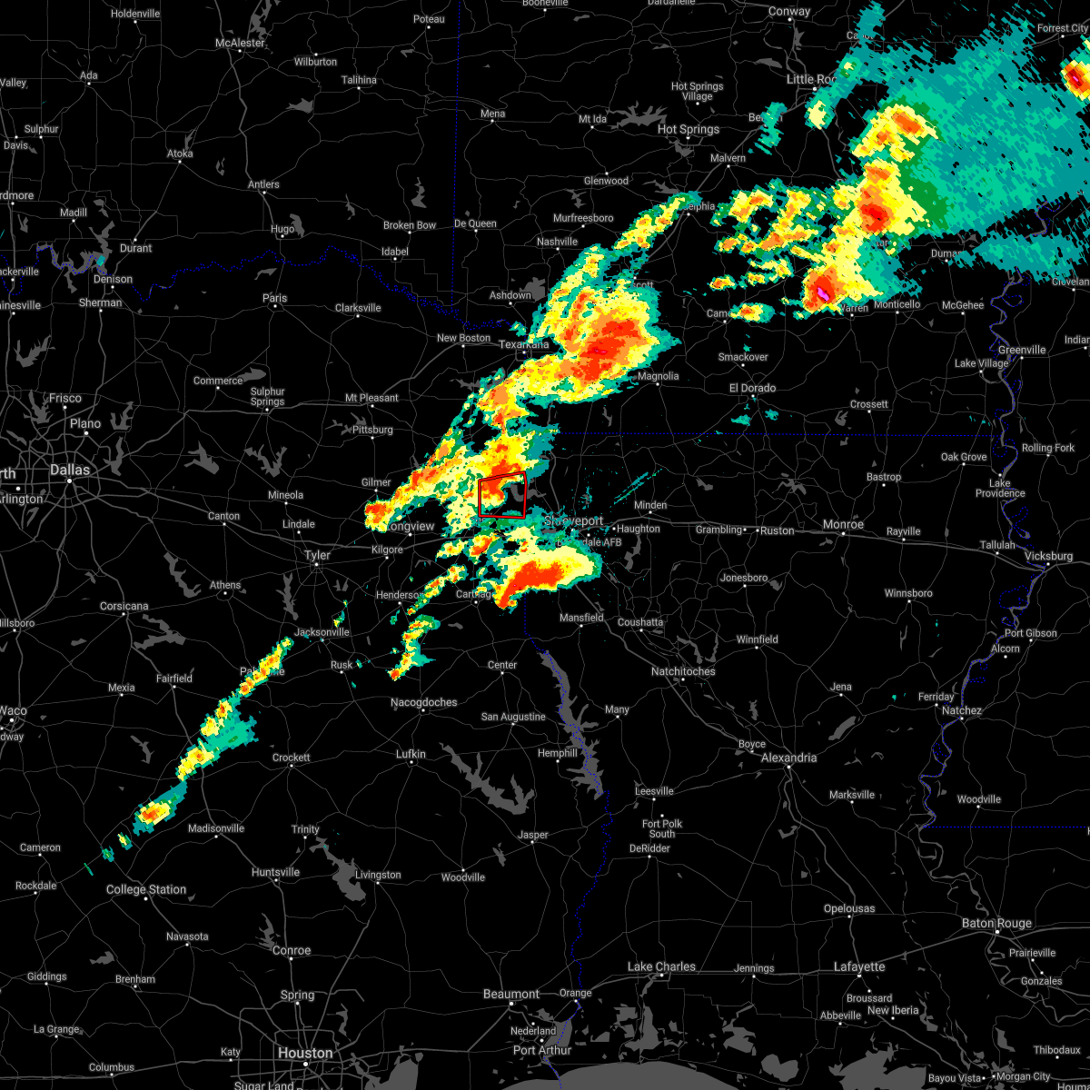 At 731 pm cdt, a severe thunderstorm capable of producing a tornado was located near woodlawn, or 9 miles north of marshall, moving east at 30 mph (radar indicated rotation). Hazards include tornado and quarter size hail. Flying debris will be dangerous to those caught without shelter. mobile homes will be damaged or destroyed. damage to roofs, windows, and vehicles will occur. tree damage is likely. this dangerous storm will be near, woodlawn around 740 pm cdt. karnack around 755 pm cdt. Other locations impacted by this tornadic thunderstorm include uncertain, gray, leigh and nesbitt. At 731 pm cdt, a severe thunderstorm capable of producing a tornado was located near woodlawn, or 9 miles north of marshall, moving east at 30 mph (radar indicated rotation). Hazards include tornado and quarter size hail. Flying debris will be dangerous to those caught without shelter. mobile homes will be damaged or destroyed. damage to roofs, windows, and vehicles will occur. tree damage is likely. this dangerous storm will be near, woodlawn around 740 pm cdt. karnack around 755 pm cdt. Other locations impacted by this tornadic thunderstorm include uncertain, gray, leigh and nesbitt.
|
| 3/27/2021 7:31 PM CDT |
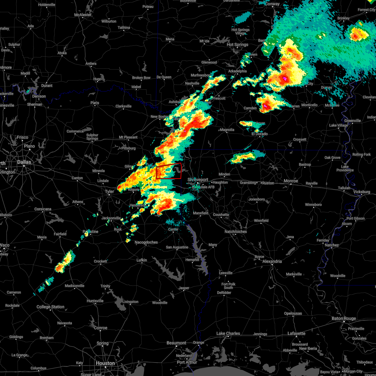 At 731 pm cdt, a severe thunderstorm capable of producing a tornado was located near woodlawn, or 9 miles north of marshall, moving east at 30 mph (radar indicated rotation). Hazards include tornado and quarter size hail. Flying debris will be dangerous to those caught without shelter. mobile homes will be damaged or destroyed. damage to roofs, windows, and vehicles will occur. tree damage is likely. this dangerous storm will be near, woodlawn around 740 pm cdt. karnack around 755 pm cdt. Other locations impacted by this tornadic thunderstorm include uncertain, gray, leigh and nesbitt. At 731 pm cdt, a severe thunderstorm capable of producing a tornado was located near woodlawn, or 9 miles north of marshall, moving east at 30 mph (radar indicated rotation). Hazards include tornado and quarter size hail. Flying debris will be dangerous to those caught without shelter. mobile homes will be damaged or destroyed. damage to roofs, windows, and vehicles will occur. tree damage is likely. this dangerous storm will be near, woodlawn around 740 pm cdt. karnack around 755 pm cdt. Other locations impacted by this tornadic thunderstorm include uncertain, gray, leigh and nesbitt.
|
| 3/17/2021 9:05 AM CDT |
 At 904 am cdt, severe thunderstorms were located along a line extending from 7 miles southeast of fouke to near waskom, moving east at 65 mph (radar indicated). Hazards include 60 mph wind gusts and quarter size hail. Hail damage to vehicles is expected. expect wind damage to roofs, siding, and trees. Locations impacted include, shreveport, marshall, atlanta, vivian, greenwood, blanchard, waskom, benton, plain dealing, oil city, mooringsport, bradley, hosston, rodessa, belcher, ida, gilliam, deberry, bivins and elysian fields. At 904 am cdt, severe thunderstorms were located along a line extending from 7 miles southeast of fouke to near waskom, moving east at 65 mph (radar indicated). Hazards include 60 mph wind gusts and quarter size hail. Hail damage to vehicles is expected. expect wind damage to roofs, siding, and trees. Locations impacted include, shreveport, marshall, atlanta, vivian, greenwood, blanchard, waskom, benton, plain dealing, oil city, mooringsport, bradley, hosston, rodessa, belcher, ida, gilliam, deberry, bivins and elysian fields.
|
| 3/17/2021 8:52 AM CDT | Trees down in karnack... trooper vehicle damaged with falling tree... no injurie in harrison county TX, 3.8 miles NE of Uncertain, TX |
| 3/17/2021 8:34 AM CDT |
 At 834 am cdt, severe thunderstorms were located along a line extending from near kildare to near tatum, moving northeast at 65 mph (radar indicated). Hazards include 60 mph wind gusts and quarter size hail. Hail damage to vehicles is expected. Expect wind damage to roofs, siding, and trees. At 834 am cdt, severe thunderstorms were located along a line extending from near kildare to near tatum, moving northeast at 65 mph (radar indicated). Hazards include 60 mph wind gusts and quarter size hail. Hail damage to vehicles is expected. Expect wind damage to roofs, siding, and trees.
|
| 7/5/2020 2:54 AM CDT |
 At 253 am cdt, a severe thunderstorm was located over jefferson, or 15 miles north of marshall, moving southeast at 20 mph (radar indicated). Hazards include 60 mph wind gusts. expect damage to roofs, siding, and trees At 253 am cdt, a severe thunderstorm was located over jefferson, or 15 miles north of marshall, moving southeast at 20 mph (radar indicated). Hazards include 60 mph wind gusts. expect damage to roofs, siding, and trees
|
| 6/21/2020 4:35 PM CDT |
 At 435 pm cdt, a severe thunderstorm was located near karnack, or 16 miles northeast of marshall, moving northeast at 15 mph (radar indicated). Hazards include 60 mph wind gusts and quarter size hail. Hail damage to vehicles is expected. Expect wind damage to roofs, siding, and trees. At 435 pm cdt, a severe thunderstorm was located near karnack, or 16 miles northeast of marshall, moving northeast at 15 mph (radar indicated). Hazards include 60 mph wind gusts and quarter size hail. Hail damage to vehicles is expected. Expect wind damage to roofs, siding, and trees.
|
| 6/9/2020 10:06 PM CDT |
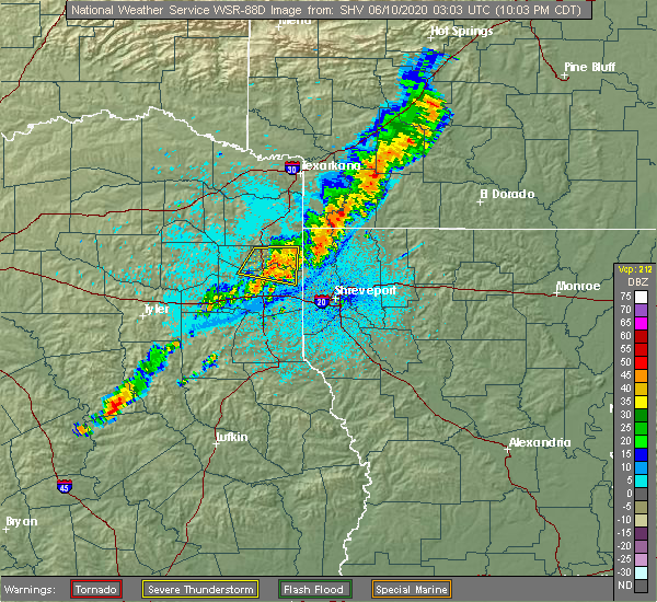 The severe thunderstorm warning for central marion and northeastern harrison counties will expire at 1015 pm cdt, the storm which prompted the warning has weakened below severe limits, and no longer poses an immediate threat to life or property. therefore, the warning will be allowed to expire. however gusty winds are still possible with this thunderstorm. The severe thunderstorm warning for central marion and northeastern harrison counties will expire at 1015 pm cdt, the storm which prompted the warning has weakened below severe limits, and no longer poses an immediate threat to life or property. therefore, the warning will be allowed to expire. however gusty winds are still possible with this thunderstorm.
|
| 6/9/2020 9:43 PM CDT |
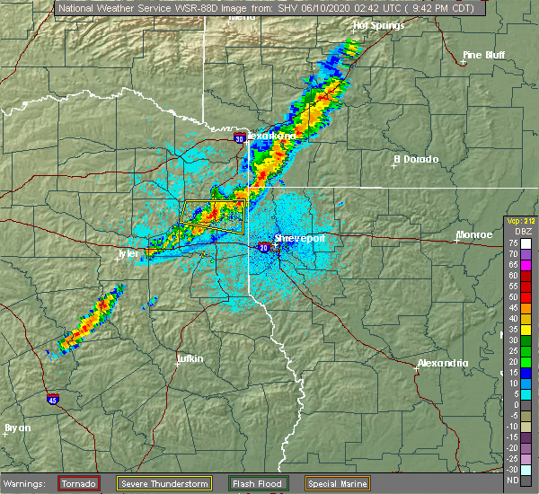 At 943 pm cdt, a severe thunderstorm was located over jefferson, or 15 miles north of marshall, moving east at 30 mph (radar indicated). Hazards include 60 mph wind gusts and quarter size hail. Hail damage to vehicles is expected. expect wind damage to roofs, siding, and trees. Locations impacted include, jefferson, smithland, karnack, berea, lodi, woodlawn, uncertain and leigh. At 943 pm cdt, a severe thunderstorm was located over jefferson, or 15 miles north of marshall, moving east at 30 mph (radar indicated). Hazards include 60 mph wind gusts and quarter size hail. Hail damage to vehicles is expected. expect wind damage to roofs, siding, and trees. Locations impacted include, jefferson, smithland, karnack, berea, lodi, woodlawn, uncertain and leigh.
|
| 6/9/2020 9:12 PM CDT |
 At 912 pm cdt, a severe thunderstorm was located 8 miles north of harleton, or 21 miles northwest of marshall, moving east at 30 mph (radar indicated). Hazards include 60 mph wind gusts and quarter size hail. Hail damage to vehicles is expected. Expect wind damage to roofs, siding, and trees. At 912 pm cdt, a severe thunderstorm was located 8 miles north of harleton, or 21 miles northwest of marshall, moving east at 30 mph (radar indicated). Hazards include 60 mph wind gusts and quarter size hail. Hail damage to vehicles is expected. Expect wind damage to roofs, siding, and trees.
|
| 5/8/2020 5:39 AM CDT |
 A severe thunderstorm warning remains in effect until 600 am cdt for south central lafayette and southwestern columbia counties. northwestern webster. northwestern caddo and northern bossier parishes. southeastern marion and northeastern harrison counties. At 538 am cdt, severe thunderstorms were located along a line extending from near cullen to 7 miles southeast of plain dealing to. A severe thunderstorm warning remains in effect until 600 am cdt for south central lafayette and southwestern columbia counties. northwestern webster. northwestern caddo and northern bossier parishes. southeastern marion and northeastern harrison counties. At 538 am cdt, severe thunderstorms were located along a line extending from near cullen to 7 miles southeast of plain dealing to.
|
| 5/8/2020 5:39 AM CDT |
 At 538 am cdt, severe thunderstorms were located along a line extending from near cullen to 7 miles southeast of plain dealing to near belcher to near oil city, moving southeast at 40 mph (radar indicated). Hazards include 60 mph wind gusts and quarter size hail. Hail damage to vehicles is expected. expect wind damage to roofs, siding, and trees. Locations impacted include, shreveport, springhill, blanchard, waskom, benton, cullen, plain dealing, oil city, sarepta, mooringsport, hosston, belcher, shongaloo, gilliam, welcome, gray, uncertain, alden bridge, cross lake and cavett. At 538 am cdt, severe thunderstorms were located along a line extending from near cullen to 7 miles southeast of plain dealing to near belcher to near oil city, moving southeast at 40 mph (radar indicated). Hazards include 60 mph wind gusts and quarter size hail. Hail damage to vehicles is expected. expect wind damage to roofs, siding, and trees. Locations impacted include, shreveport, springhill, blanchard, waskom, benton, cullen, plain dealing, oil city, sarepta, mooringsport, hosston, belcher, shongaloo, gilliam, welcome, gray, uncertain, alden bridge, cross lake and cavett.
|
| 5/8/2020 5:39 AM CDT |
 At 511 am cdt, severe thunderstorms were located along a line extending from near brightstar to near mcleod to near lone star, moving south at 35 mph (radar indicated). Hazards include 60 mph wind gusts and quarter size hail. Hail damage to vehicles is expected. Expect wind damage to roofs, siding, and trees. At 511 am cdt, severe thunderstorms were located along a line extending from near brightstar to near mcleod to near lone star, moving south at 35 mph (radar indicated). Hazards include 60 mph wind gusts and quarter size hail. Hail damage to vehicles is expected. Expect wind damage to roofs, siding, and trees.
|
| 5/8/2020 5:11 AM CDT |
 At 511 am cdt, severe thunderstorms were located along a line extending from near brightstar to near mcleod to near lone star, moving south at 35 mph (radar indicated). Hazards include 60 mph wind gusts and quarter size hail. Hail damage to vehicles is expected. Expect wind damage to roofs, siding, and trees. At 511 am cdt, severe thunderstorms were located along a line extending from near brightstar to near mcleod to near lone star, moving south at 35 mph (radar indicated). Hazards include 60 mph wind gusts and quarter size hail. Hail damage to vehicles is expected. Expect wind damage to roofs, siding, and trees.
|
| 4/29/2020 12:52 AM CDT |
 At 1252 am cdt, severe thunderstorms were located along a line extending from near longview to near marshall to near mooringsport, moving south at 50 mph (radar indicated). Hazards include 60 mph wind gusts and quarter size hail. Hail damage to vehicles is expected. Expect wind damage to roofs, siding, and trees. At 1252 am cdt, severe thunderstorms were located along a line extending from near longview to near marshall to near mooringsport, moving south at 50 mph (radar indicated). Hazards include 60 mph wind gusts and quarter size hail. Hail damage to vehicles is expected. Expect wind damage to roofs, siding, and trees.
|
| 4/29/2020 12:45 AM CDT |
 At 1245 am cdt, severe thunderstorms were located along a line extending from near hallsville to 6 miles northwest of marshall to near oil city, moving south at 55 mph (radar indicated). Hazards include 60 mph wind gusts and quarter size hail. Hail damage to vehicles is expected. expect wind damage to roofs, siding, and trees. Locations impacted include, longview, marshall, hallsville, jefferson, karnack, woodlawn, smithland, berea, harleton, gray, lakeport, scottsville, uncertain, nesbitt and leigh. At 1245 am cdt, severe thunderstorms were located along a line extending from near hallsville to 6 miles northwest of marshall to near oil city, moving south at 55 mph (radar indicated). Hazards include 60 mph wind gusts and quarter size hail. Hail damage to vehicles is expected. expect wind damage to roofs, siding, and trees. Locations impacted include, longview, marshall, hallsville, jefferson, karnack, woodlawn, smithland, berea, harleton, gray, lakeport, scottsville, uncertain, nesbitt and leigh.
|
| 4/29/2020 12:11 AM CDT |
 At 1211 am cdt, severe thunderstorms were located along a line extending from hughes springs to 7 miles northwest of linden to near brightstar, moving southeast at 45 mph (radar indicated). Hazards include 70 mph wind gusts and quarter size hail. Hail damage to vehicles is expected. expect considerable tree damage. Wind damage is also likely to mobile homes, roofs, and outbuildings. At 1211 am cdt, severe thunderstorms were located along a line extending from hughes springs to 7 miles northwest of linden to near brightstar, moving southeast at 45 mph (radar indicated). Hazards include 70 mph wind gusts and quarter size hail. Hail damage to vehicles is expected. expect considerable tree damage. Wind damage is also likely to mobile homes, roofs, and outbuildings.
|
| 4/28/2020 7:59 AM CDT |
 At 759 am cdt, a severe thunderstorm was located over marshall, moving east at 35 mph (radar indicated). Hazards include quarter size hail. Damage to vehicles is expected. Locations impacted include, marshall, waskom, karnack, woodlawn, scottsville, uncertain, jonesville, nesbitt and leigh. At 759 am cdt, a severe thunderstorm was located over marshall, moving east at 35 mph (radar indicated). Hazards include quarter size hail. Damage to vehicles is expected. Locations impacted include, marshall, waskom, karnack, woodlawn, scottsville, uncertain, jonesville, nesbitt and leigh.
|
| 4/28/2020 7:46 AM CDT |
 At 746 am cdt, a severe thunderstorm was located over hallsville, or 11 miles west of marshall, moving east at 35 mph (radar indicated). Hazards include quarter size hail. damage to vehicles is expected At 746 am cdt, a severe thunderstorm was located over hallsville, or 11 miles west of marshall, moving east at 35 mph (radar indicated). Hazards include quarter size hail. damage to vehicles is expected
|
| 4/24/2020 8:03 PM CDT |
 At 803 pm cdt, a severe thunderstorm was located over mooringsport, or 16 miles northwest of shreveport, moving east at 35 mph (radar indicated). Hazards include 60 mph wind gusts and quarter size hail. Hail damage to vehicles is expected. Expect wind damage to roofs, siding, and trees. At 803 pm cdt, a severe thunderstorm was located over mooringsport, or 16 miles northwest of shreveport, moving east at 35 mph (radar indicated). Hazards include 60 mph wind gusts and quarter size hail. Hail damage to vehicles is expected. Expect wind damage to roofs, siding, and trees.
|
| 4/22/2020 12:36 PM CDT |
 At 1236 pm cdt, a severe thunderstorm was located over smithland, or 20 miles south of atlanta, moving northeast at 65 mph (radar indicated). Hazards include 60 mph wind gusts and quarter size hail. Hail damage to vehicles is expected. Expect wind damage to roofs, siding, and trees. At 1236 pm cdt, a severe thunderstorm was located over smithland, or 20 miles south of atlanta, moving northeast at 65 mph (radar indicated). Hazards include 60 mph wind gusts and quarter size hail. Hail damage to vehicles is expected. Expect wind damage to roofs, siding, and trees.
|
| 4/12/2020 7:50 PM CDT |
 At 749 pm cdt, a severe gust front was located along a line extending from near karnack to waskom to deberry to near carthage to minden, moving east at 60 mph. severe winds will arrive well before any thunderstorms (radar indicated). Hazards include 60 mph wind gusts. Expect damage to roofs, siding, and trees. Locations impacted include, shreveport, bossier city, marshall, carthage, haughton, greenwood, blanchard, waskom, jefferson, benton, stonewall, logansport, tenaha, timpson, oil city, beckville, joaquin, mooringsport, belcher and deberry. At 749 pm cdt, a severe gust front was located along a line extending from near karnack to waskom to deberry to near carthage to minden, moving east at 60 mph. severe winds will arrive well before any thunderstorms (radar indicated). Hazards include 60 mph wind gusts. Expect damage to roofs, siding, and trees. Locations impacted include, shreveport, bossier city, marshall, carthage, haughton, greenwood, blanchard, waskom, jefferson, benton, stonewall, logansport, tenaha, timpson, oil city, beckville, joaquin, mooringsport, belcher and deberry.
|
| 4/12/2020 7:29 PM CDT |
 At 728 pm cdt, a severe gust front was located along a line extending from 7 miles north of berea to woodlawn to 8 miles southwest of marshall to 7 miles southwest of tatum to near turnertown, moving east at 60 mph. these severe winds are arriving well ahead of the thunderstorms (radar indicated). Hazards include 60 mph wind gusts. expect damage to roofs, siding, and trees At 728 pm cdt, a severe gust front was located along a line extending from 7 miles north of berea to woodlawn to 8 miles southwest of marshall to 7 miles southwest of tatum to near turnertown, moving east at 60 mph. these severe winds are arriving well ahead of the thunderstorms (radar indicated). Hazards include 60 mph wind gusts. expect damage to roofs, siding, and trees
|
| 4/12/2020 8:53 AM CDT |
 At 852 am cdt, severe thunderstorms were located along a line extending from near woodlawn to near marshall, moving east at 40 mph (radar indicated). Hazards include 70 mph wind gusts and quarter size hail. Hail damage to vehicles is expected. expect considerable tree damage. wind damage is also likely to mobile homes, roofs, and outbuildings. Locations impacted include, marshall, hallsville, waskom, jefferson, karnack, woodlawn, smithland, harleton, gray, scottsville, uncertain, nesbitt, darco, leigh and jonesville. At 852 am cdt, severe thunderstorms were located along a line extending from near woodlawn to near marshall, moving east at 40 mph (radar indicated). Hazards include 70 mph wind gusts and quarter size hail. Hail damage to vehicles is expected. expect considerable tree damage. wind damage is also likely to mobile homes, roofs, and outbuildings. Locations impacted include, marshall, hallsville, waskom, jefferson, karnack, woodlawn, smithland, harleton, gray, scottsville, uncertain, nesbitt, darco, leigh and jonesville.
|
| 4/12/2020 8:28 AM CDT |
 At 828 am cdt, severe thunderstorms were located along a line extending from 6 miles northeast of longview to near hallsville to 8 miles northwest of tatum, moving east at 45 mph (radar indicated). Hazards include 70 mph wind gusts and nickel size hail. Expect considerable tree damage. Damage is likely to mobile homes, roofs, and outbuildings. At 828 am cdt, severe thunderstorms were located along a line extending from 6 miles northeast of longview to near hallsville to 8 miles northwest of tatum, moving east at 45 mph (radar indicated). Hazards include 70 mph wind gusts and nickel size hail. Expect considerable tree damage. Damage is likely to mobile homes, roofs, and outbuildings.
|
| 1/11/2020 12:34 AM CST |
 At 1234 am cst, a severe thunderstorm capable of producing a tornado was located over karnack, or 11 miles northeast of marshall, moving east at 40 mph (radar indicated rotation). Hazards include tornado. Flying debris will be dangerous to those caught without shelter. mobile homes will be damaged or destroyed. damage to roofs, windows, and vehicles will occur. tree damage is likely. this dangerous storm will be near, oil city and mooringsport around 1255 am cst. blanchard around 100 am cst. belcher around 110 am cst. Other locations impacted by this tornadic thunderstorm include dixie, uncertain, caddo lake, bethany, cavett, leigh and scottsville. At 1234 am cst, a severe thunderstorm capable of producing a tornado was located over karnack, or 11 miles northeast of marshall, moving east at 40 mph (radar indicated rotation). Hazards include tornado. Flying debris will be dangerous to those caught without shelter. mobile homes will be damaged or destroyed. damage to roofs, windows, and vehicles will occur. tree damage is likely. this dangerous storm will be near, oil city and mooringsport around 1255 am cst. blanchard around 100 am cst. belcher around 110 am cst. Other locations impacted by this tornadic thunderstorm include dixie, uncertain, caddo lake, bethany, cavett, leigh and scottsville.
|
| 1/10/2020 11:57 PM CST |
 At 1156 pm cst, severe thunderstorms were located along a line extending from near jenkins to 6 miles north of tatum to 6 miles northeast of nacogdoches, moving northeast at 45 mph (radar indicated). Hazards include 60 mph wind gusts. expect damage to roofs, siding, and trees At 1156 pm cst, severe thunderstorms were located along a line extending from near jenkins to 6 miles north of tatum to 6 miles northeast of nacogdoches, moving northeast at 45 mph (radar indicated). Hazards include 60 mph wind gusts. expect damage to roofs, siding, and trees
|
| 6/23/2019 5:42 PM CDT |
 At 542 pm cdt, severe thunderstorms were located along a line extending from near berea to smithland, moving northeast at 40 mph (radar indicated). Hazards include 60 mph wind gusts. Expect damage to roofs, siding, and trees. Locations impacted include, jefferson, linden, smithland, berea, lodi, kildare, gray, fairview, avinger, uncertain, lassater and pruett. At 542 pm cdt, severe thunderstorms were located along a line extending from near berea to smithland, moving northeast at 40 mph (radar indicated). Hazards include 60 mph wind gusts. Expect damage to roofs, siding, and trees. Locations impacted include, jefferson, linden, smithland, berea, lodi, kildare, gray, fairview, avinger, uncertain, lassater and pruett.
|
| 6/23/2019 5:34 PM CDT |
 At 534 pm cdt, severe thunderstorms were located along a line extending from 7 miles west of berea to near smithland, moving northeast at 40 mph (radar indicated). Hazards include 60 mph wind gusts. Expect damage to roofs, siding, and trees. Locations impacted include, jefferson, linden, lodi, woodlawn, smithland, berea, kildare, gray, fairview, avinger, uncertain, lassater and pruett. At 534 pm cdt, severe thunderstorms were located along a line extending from 7 miles west of berea to near smithland, moving northeast at 40 mph (radar indicated). Hazards include 60 mph wind gusts. Expect damage to roofs, siding, and trees. Locations impacted include, jefferson, linden, lodi, woodlawn, smithland, berea, kildare, gray, fairview, avinger, uncertain, lassater and pruett.
|
| 6/23/2019 5:22 PM CDT |
 At 521 pm cdt, severe thunderstorms were located along a line extending from near harleton to near marshall, moving northeast at 40 mph (radar indicated). Hazards include 60 mph wind gusts. expect damage to roofs, siding, and trees At 521 pm cdt, severe thunderstorms were located along a line extending from near harleton to near marshall, moving northeast at 40 mph (radar indicated). Hazards include 60 mph wind gusts. expect damage to roofs, siding, and trees
|
| 6/23/2019 5:10 PM CDT |
 At 510 pm cdt, severe thunderstorms were located along a line extending from near marshall to 10 miles northeast of logansport, moving northeast at 30 mph (radar indicated). Hazards include 60 mph wind gusts. expect damage to roofs, siding, and trees At 510 pm cdt, severe thunderstorms were located along a line extending from near marshall to 10 miles northeast of logansport, moving northeast at 30 mph (radar indicated). Hazards include 60 mph wind gusts. expect damage to roofs, siding, and trees
|
| 6/19/2019 10:28 PM CDT | Trees reported down in the karnack communit in harrison county TX, 3.4 miles NE of Uncertain, TX |
| 6/19/2019 10:24 PM CDT |
 At 1023 pm cdt, severe thunderstorms were located along a line extending from near ida to near woodlawn, moving east at 40 mph (radar indicated). Hazards include 60 mph wind gusts and quarter size hail. Hail damage to vehicles is expected. Expect wind damage to roofs, siding, and trees. At 1023 pm cdt, severe thunderstorms were located along a line extending from near ida to near woodlawn, moving east at 40 mph (radar indicated). Hazards include 60 mph wind gusts and quarter size hail. Hail damage to vehicles is expected. Expect wind damage to roofs, siding, and trees.
|
| 6/19/2019 10:20 PM CDT |
 At 1019 pm cdt, a severe thunderstorm was located near jefferson, or 17 miles north of marshall, moving east at 40 mph (radar indicated). Hazards include 60 mph wind gusts and quarter size hail. Hail damage to vehicles is expected. expect wind damage to roofs, siding, and trees. Locations impacted include, jefferson, smithland, karnack, mcleod, lodi, woodlawn, kildare, gray, uncertain and leigh. At 1019 pm cdt, a severe thunderstorm was located near jefferson, or 17 miles north of marshall, moving east at 40 mph (radar indicated). Hazards include 60 mph wind gusts and quarter size hail. Hail damage to vehicles is expected. expect wind damage to roofs, siding, and trees. Locations impacted include, jefferson, smithland, karnack, mcleod, lodi, woodlawn, kildare, gray, uncertain and leigh.
|
| 6/19/2019 10:05 PM CDT |
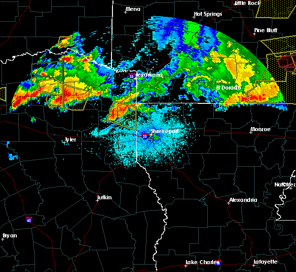 At 1005 pm cdt, a severe thunderstorm was located over berea, or 20 miles north of marshall, moving east at 40 mph (radar indicated). Hazards include 60 mph wind gusts and quarter size hail. Hail damage to vehicles is expected. expect wind damage to roofs, siding, and trees. Locations impacted include, jefferson, linden, karnack, lodi, woodlawn, smithland, mcleod, berea, kildare, gray, fairview, uncertain, lassater, leigh and pruett. At 1005 pm cdt, a severe thunderstorm was located over berea, or 20 miles north of marshall, moving east at 40 mph (radar indicated). Hazards include 60 mph wind gusts and quarter size hail. Hail damage to vehicles is expected. expect wind damage to roofs, siding, and trees. Locations impacted include, jefferson, linden, karnack, lodi, woodlawn, smithland, mcleod, berea, kildare, gray, fairview, uncertain, lassater, leigh and pruett.
|
| 6/19/2019 9:52 PM CDT |
 At 952 pm cdt, a severe thunderstorm was located 9 miles northwest of berea, or 25 miles east of gilmer, moving east at 40 mph (radar indicated). Hazards include 60 mph wind gusts and half dollar size hail. Hail damage to vehicles is expected. Expect wind damage to roofs, siding, and trees. At 952 pm cdt, a severe thunderstorm was located 9 miles northwest of berea, or 25 miles east of gilmer, moving east at 40 mph (radar indicated). Hazards include 60 mph wind gusts and half dollar size hail. Hail damage to vehicles is expected. Expect wind damage to roofs, siding, and trees.
|
| 6/19/2019 9:01 PM CDT |
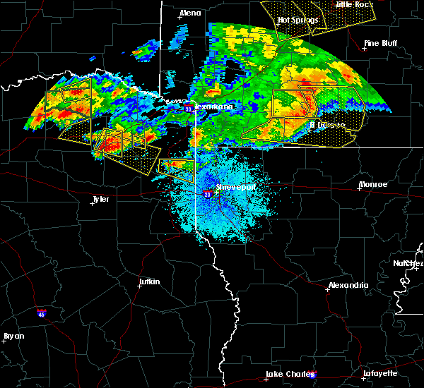 At 900 pm cdt, a severe thunderstorm was located near jefferson, or 17 miles north of marshall, moving east at 35 mph (radar indicated). Hazards include 60 mph wind gusts and quarter size hail. Hail damage to vehicles is expected. expect wind damage to roofs, siding, and trees. Locations impacted include, jefferson, smithland, berea, gray and uncertain. At 900 pm cdt, a severe thunderstorm was located near jefferson, or 17 miles north of marshall, moving east at 35 mph (radar indicated). Hazards include 60 mph wind gusts and quarter size hail. Hail damage to vehicles is expected. expect wind damage to roofs, siding, and trees. Locations impacted include, jefferson, smithland, berea, gray and uncertain.
|
| 6/19/2019 8:44 PM CDT |
 At 844 pm cdt, a severe thunderstorm was located over berea, or 17 miles north of marshall, moving east at 35 mph (radar indicated). Hazards include 60 mph wind gusts. expect damage to roofs, siding, and trees At 844 pm cdt, a severe thunderstorm was located over berea, or 17 miles north of marshall, moving east at 35 mph (radar indicated). Hazards include 60 mph wind gusts. expect damage to roofs, siding, and trees
|
| 6/19/2019 6:29 AM CDT |
 At 629 am cdt, severe thunderstorms were located along a line extending from near mcleod to near karnack to 8 miles north of elysian fields to near tatum, moving east at 70 mph (radar indicated). Hazards include 60 mph wind gusts. expect damage to roofs, siding, and trees At 629 am cdt, severe thunderstorms were located along a line extending from near mcleod to near karnack to 8 miles north of elysian fields to near tatum, moving east at 70 mph (radar indicated). Hazards include 60 mph wind gusts. expect damage to roofs, siding, and trees
|
| 6/19/2019 6:03 AM CDT |
 At 603 am cdt, severe thunderstorms were located along a line extending from near berea to near hallsville, moving east at 55 mph (radar indicated). Hazards include 60 mph wind gusts. Expect damage to roofs, siding, and trees. Locations impacted include, longview, marshall, kilgore, white oak, hallsville, waskom, jefferson, ore city, east mountain, lodi, smithland, harleton, berea, diana, karnack, woodlawn, cedar springs, gray, lakeport and scottsville. At 603 am cdt, severe thunderstorms were located along a line extending from near berea to near hallsville, moving east at 55 mph (radar indicated). Hazards include 60 mph wind gusts. Expect damage to roofs, siding, and trees. Locations impacted include, longview, marshall, kilgore, white oak, hallsville, waskom, jefferson, ore city, east mountain, lodi, smithland, harleton, berea, diana, karnack, woodlawn, cedar springs, gray, lakeport and scottsville.
|
| 6/19/2019 5:48 AM CDT |
 At 548 am cdt, severe thunderstorms were located along a line extending from near cedar springs to near longview, moving east at 55 mph (radar indicated). Hazards include 60 mph wind gusts. expect damage to roofs, siding, and trees At 548 am cdt, severe thunderstorms were located along a line extending from near cedar springs to near longview, moving east at 55 mph (radar indicated). Hazards include 60 mph wind gusts. expect damage to roofs, siding, and trees
|
| 6/3/2019 8:56 PM CDT |
 At 856 pm cdt, a severe thunderstorm was located near karnack, or 12 miles northeast of marshall, moving east southeast at 20 mph (radar indicated). Hazards include 60 mph wind gusts and quarter size hail. Hail damage to vehicles is expected. expect wind damage to roofs, siding, and trees. Locations impacted include, greenwood, waskom, mooringsport, karnack, scottsville, uncertain, jonesville, bethany and leigh. At 856 pm cdt, a severe thunderstorm was located near karnack, or 12 miles northeast of marshall, moving east southeast at 20 mph (radar indicated). Hazards include 60 mph wind gusts and quarter size hail. Hail damage to vehicles is expected. expect wind damage to roofs, siding, and trees. Locations impacted include, greenwood, waskom, mooringsport, karnack, scottsville, uncertain, jonesville, bethany and leigh.
|
| 6/3/2019 8:28 PM CDT |
 At 828 pm cdt, a severe thunderstorm was located 3 miles east of woodlawn, or 8 miles northeast of marshall, moving southeast at 30 mph (radar indicated). Hazards include 60 mph wind gusts and quarter size hail. Hail damage to vehicles is expected. Expect wind damage to roofs, siding, and trees. At 828 pm cdt, a severe thunderstorm was located 3 miles east of woodlawn, or 8 miles northeast of marshall, moving southeast at 30 mph (radar indicated). Hazards include 60 mph wind gusts and quarter size hail. Hail damage to vehicles is expected. Expect wind damage to roofs, siding, and trees.
|
| 5/18/2019 7:41 PM CDT |
 At 741 pm cdt, severe thunderstorms were located along a line extending from near karnack to 7 miles northwest of waskom to near elysian fields, moving northeast at 45 mph (radar indicated). Hazards include 60 mph wind gusts. expect damage to roofs, siding, and trees At 741 pm cdt, severe thunderstorms were located along a line extending from near karnack to 7 miles northwest of waskom to near elysian fields, moving northeast at 45 mph (radar indicated). Hazards include 60 mph wind gusts. expect damage to roofs, siding, and trees
|
| 5/18/2019 7:32 PM CDT |
 At 731 pm cdt, severe thunderstorms were located along a line extending from near woodlawn to 6 miles east of marshall to 6 miles northwest of elysian fields to 8 miles northwest of deberry, moving northeast at 50 mph (radar indicated). Hazards include 70 mph wind gusts. Expect considerable tree damage. damage is likely to mobile homes, roofs, and outbuildings. Locations impacted include, marshall, waskom, tatum, karnack, elysian fields, scottsville, uncertain, jonesville, darco, leigh and nesbitt. At 731 pm cdt, severe thunderstorms were located along a line extending from near woodlawn to 6 miles east of marshall to 6 miles northwest of elysian fields to 8 miles northwest of deberry, moving northeast at 50 mph (radar indicated). Hazards include 70 mph wind gusts. Expect considerable tree damage. damage is likely to mobile homes, roofs, and outbuildings. Locations impacted include, marshall, waskom, tatum, karnack, elysian fields, scottsville, uncertain, jonesville, darco, leigh and nesbitt.
|
| 5/18/2019 7:19 PM CDT |
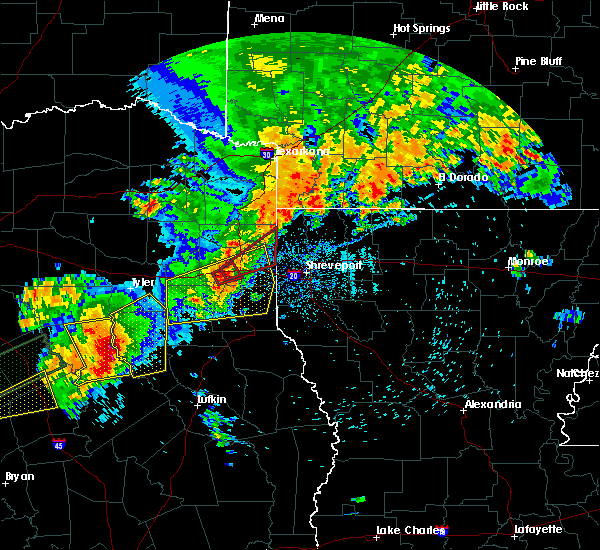 At 719 pm cdt, a severe thunderstorm capable of producing a tornado was located 5 miles southwest of marshall, moving northeast at 45 mph. if you live in or near marshall, take cover immediately! (radar indicated rotation). Hazards include tornado and quarter size hail. Flying debris will be dangerous to those caught without shelter. mobile homes will be damaged or destroyed. damage to roofs, windows, and vehicles will occur. tree damage is likely. this dangerous storm will be near, marshall around 730 pm cdt. karnack around 745 pm cdt. Other locations impacted by this tornadic thunderstorm include uncertain, gray, scottsville, leigh and nesbitt. At 719 pm cdt, a severe thunderstorm capable of producing a tornado was located 5 miles southwest of marshall, moving northeast at 45 mph. if you live in or near marshall, take cover immediately! (radar indicated rotation). Hazards include tornado and quarter size hail. Flying debris will be dangerous to those caught without shelter. mobile homes will be damaged or destroyed. damage to roofs, windows, and vehicles will occur. tree damage is likely. this dangerous storm will be near, marshall around 730 pm cdt. karnack around 745 pm cdt. Other locations impacted by this tornadic thunderstorm include uncertain, gray, scottsville, leigh and nesbitt.
|
| 5/18/2019 6:41 PM CDT |
 The national weather service in shreveport has issued a * severe thunderstorm warning for. harrison county in northeastern texas. central panola county in northeastern texas. northern rusk county in northeastern texas. Southern gregg county in northeastern texas. The national weather service in shreveport has issued a * severe thunderstorm warning for. harrison county in northeastern texas. central panola county in northeastern texas. northern rusk county in northeastern texas. Southern gregg county in northeastern texas.
|
| 5/8/2019 3:02 PM CDT |
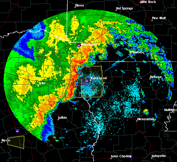 At 301 pm cdt, a severe thunderstorm capable of producing a tornado was located near karnack, or 16 miles northeast of marshall, moving east at 40 mph (radar indicated rotation). Hazards include tornado. Flying debris will be dangerous to those caught without shelter. mobile homes will be damaged or destroyed. damage to roofs, windows, and vehicles will occur. tree damage is likely. This tornadic thunderstorm will remain over mainly rural areas of southeastern marion and northeastern harrison counties, including the following locations, uncertain. At 301 pm cdt, a severe thunderstorm capable of producing a tornado was located near karnack, or 16 miles northeast of marshall, moving east at 40 mph (radar indicated rotation). Hazards include tornado. Flying debris will be dangerous to those caught without shelter. mobile homes will be damaged or destroyed. damage to roofs, windows, and vehicles will occur. tree damage is likely. This tornadic thunderstorm will remain over mainly rural areas of southeastern marion and northeastern harrison counties, including the following locations, uncertain.
|
| 5/8/2019 2:50 PM CDT |
 The national weather service in shreveport has issued a * severe thunderstorm warning for. de soto parish in northwestern louisiana. northwestern red river parish in northwestern louisiana. caddo parish in northwestern louisiana. Bossier parish in northwestern louisiana. The national weather service in shreveport has issued a * severe thunderstorm warning for. de soto parish in northwestern louisiana. northwestern red river parish in northwestern louisiana. caddo parish in northwestern louisiana. Bossier parish in northwestern louisiana.
|
| 5/8/2019 2:50 PM CDT |
 At 249 pm cdt, severe thunderstorms were located along a line extending from kildare to near woodlawn to 7 miles northwest of elysian fields to near carthage to 9 miles north of timpson, moving east at 55 mph (radar indicated). Hazards include 60 mph wind gusts and penny size hail. expect damage to roofs, siding, and trees At 249 pm cdt, severe thunderstorms were located along a line extending from kildare to near woodlawn to 7 miles northwest of elysian fields to near carthage to 9 miles north of timpson, moving east at 55 mph (radar indicated). Hazards include 60 mph wind gusts and penny size hail. expect damage to roofs, siding, and trees
|
| 5/8/2019 2:48 PM CDT |
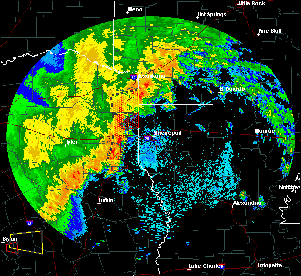 At 247 pm cdt, a severe thunderstorm capable of producing a tornado was located near woodlawn, or 9 miles northeast of marshall, moving northeast at 40 mph (radar indicated rotation). Hazards include tornado. Flying debris will be dangerous to those caught without shelter. mobile homes will be damaged or destroyed. damage to roofs, windows, and vehicles will occur. tree damage is likely. this dangerous storm will be near, karnack around 255 pm cdt. Other locations impacted by this tornadic thunderstorm include uncertain and gray. At 247 pm cdt, a severe thunderstorm capable of producing a tornado was located near woodlawn, or 9 miles northeast of marshall, moving northeast at 40 mph (radar indicated rotation). Hazards include tornado. Flying debris will be dangerous to those caught without shelter. mobile homes will be damaged or destroyed. damage to roofs, windows, and vehicles will occur. tree damage is likely. this dangerous storm will be near, karnack around 255 pm cdt. Other locations impacted by this tornadic thunderstorm include uncertain and gray.
|
| 5/8/2019 2:31 PM CDT |
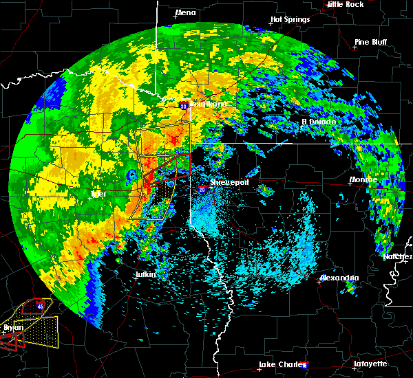 At 231 pm cdt, a severe thunderstorm capable of producing a tornado was located near marshall, moving east at 45 mph (radar indicated rotation). Hazards include tornado. Flying debris will be dangerous to those caught without shelter. mobile homes will be damaged or destroyed. damage to roofs, windows, and vehicles will occur. tree damage is likely. this dangerous storm will be near, woodlawn around 240 pm cdt. karnack around 250 pm cdt. Other locations impacted by this tornadic thunderstorm include uncertain, nesbitt and gray. At 231 pm cdt, a severe thunderstorm capable of producing a tornado was located near marshall, moving east at 45 mph (radar indicated rotation). Hazards include tornado. Flying debris will be dangerous to those caught without shelter. mobile homes will be damaged or destroyed. damage to roofs, windows, and vehicles will occur. tree damage is likely. this dangerous storm will be near, woodlawn around 240 pm cdt. karnack around 250 pm cdt. Other locations impacted by this tornadic thunderstorm include uncertain, nesbitt and gray.
|
| 5/8/2019 2:23 PM CDT |
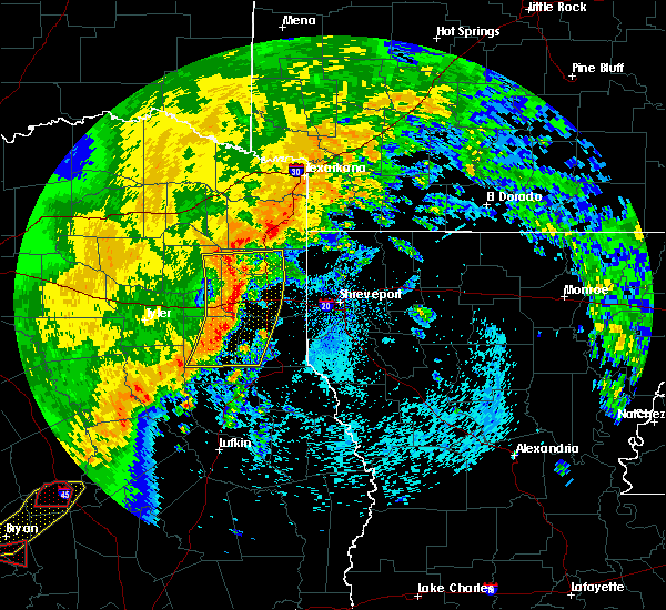 At 222 pm cdt, a severe thunderstorm capable of producing a tornado was located near harleton, or 9 miles northwest of marshall, moving northeast at 50 mph (radar indicated rotation). Hazards include tornado. Flying debris will be dangerous to those caught without shelter. mobile homes will be damaged or destroyed. damage to roofs, windows, and vehicles will occur. tree damage is likely. this dangerous storm will be near, jefferson and woodlawn around 235 pm cdt. karnack around 245 pm cdt. smithland around 250 pm cdt. Other locations impacted by this tornadic thunderstorm include uncertain, nesbitt and gray. At 222 pm cdt, a severe thunderstorm capable of producing a tornado was located near harleton, or 9 miles northwest of marshall, moving northeast at 50 mph (radar indicated rotation). Hazards include tornado. Flying debris will be dangerous to those caught without shelter. mobile homes will be damaged or destroyed. damage to roofs, windows, and vehicles will occur. tree damage is likely. this dangerous storm will be near, jefferson and woodlawn around 235 pm cdt. karnack around 245 pm cdt. smithland around 250 pm cdt. Other locations impacted by this tornadic thunderstorm include uncertain, nesbitt and gray.
|
| 4/13/2019 3:13 PM CDT |
 At 313 pm cdt, severe thunderstorms were located along a line extending from near woodlawn to 6 miles south of joaquin, moving east at 35 mph (radar indicated). Hazards include 70 mph wind gusts. Expect considerable tree damage. Damage is likely to mobile homes, roofs, and outbuildings. At 313 pm cdt, severe thunderstorms were located along a line extending from near woodlawn to 6 miles south of joaquin, moving east at 35 mph (radar indicated). Hazards include 70 mph wind gusts. Expect considerable tree damage. Damage is likely to mobile homes, roofs, and outbuildings.
|
| 4/13/2019 10:27 AM CDT |
 At 1027 am cdt, severe thunderstorms were located along a line extending from near jefferson to near belcher, moving north at 65 mph (radar indicated). Hazards include half dollar size hail. damage to vehicles is expected At 1027 am cdt, severe thunderstorms were located along a line extending from near jefferson to near belcher, moving north at 65 mph (radar indicated). Hazards include half dollar size hail. damage to vehicles is expected
|
| 3/25/2019 2:32 AM CDT |
 At 232 am cdt, severe thunderstorms were located along a line extending from near kildare to near smithland to near karnack to 8 miles southeast of woodlawn to near marshall to near hallsville, moving east at 35 mph (radar indicated). Hazards include 70 mph wind gusts and quarter size hail. Hail damage to vehicles is expected. expect considerable tree damage. wind damage is also likely to mobile homes, roofs, and outbuildings. Locations impacted include, shreveport, longview, bossier city, marshall, vivian, hallsville, greenwood, blanchard, waskom, benton, tatum, oil city, mooringsport, hosston, belcher, gilliam, deberry, elysian fields, eastwood and smithland. At 232 am cdt, severe thunderstorms were located along a line extending from near kildare to near smithland to near karnack to 8 miles southeast of woodlawn to near marshall to near hallsville, moving east at 35 mph (radar indicated). Hazards include 70 mph wind gusts and quarter size hail. Hail damage to vehicles is expected. expect considerable tree damage. wind damage is also likely to mobile homes, roofs, and outbuildings. Locations impacted include, shreveport, longview, bossier city, marshall, vivian, hallsville, greenwood, blanchard, waskom, benton, tatum, oil city, mooringsport, hosston, belcher, gilliam, deberry, elysian fields, eastwood and smithland.
|
| 3/25/2019 2:16 AM CDT |
 At 216 am cdt, severe thunderstorms were located along a line extending from near linden to near lodi to near jefferson to 6 miles southwest of woodlawn to near harleton to near longview, moving southeast at 35 mph (radar indicated). Hazards include 70 mph wind gusts and quarter size hail. Hail damage to vehicles is expected. expect considerable tree damage. Wind damage is also likely to mobile homes, roofs, and outbuildings. At 216 am cdt, severe thunderstorms were located along a line extending from near linden to near lodi to near jefferson to 6 miles southwest of woodlawn to near harleton to near longview, moving southeast at 35 mph (radar indicated). Hazards include 70 mph wind gusts and quarter size hail. Hail damage to vehicles is expected. expect considerable tree damage. Wind damage is also likely to mobile homes, roofs, and outbuildings.
|
| 3/14/2019 4:03 AM CDT |
 At 402 am cdt, severe thunderstorms were located along a line extending from 6 miles south of bradley to near elysian fields, moving east at 40 mph (radar indicated). Hazards include 60 mph wind gusts and penny size hail. Expect damage to roofs, siding, and trees. Locations impacted include, shreveport, bossier city, marshall, vivian, greenwood, blanchard, waskom, benton, plain dealing, oil city, mooringsport, hosston, belcher, ida, gilliam, gray, scottsville, uncertain, alden bridge and ferguson. At 402 am cdt, severe thunderstorms were located along a line extending from 6 miles south of bradley to near elysian fields, moving east at 40 mph (radar indicated). Hazards include 60 mph wind gusts and penny size hail. Expect damage to roofs, siding, and trees. Locations impacted include, shreveport, bossier city, marshall, vivian, greenwood, blanchard, waskom, benton, plain dealing, oil city, mooringsport, hosston, belcher, ida, gilliam, gray, scottsville, uncertain, alden bridge and ferguson.
|
| 3/14/2019 3:42 AM CDT |
 At 342 am cdt, severe thunderstorms were located along a line extending from ida to 8 miles northwest of elysian fields, moving east at 40 mph (radar indicated). Hazards include 60 mph wind gusts and penny size hail. Expect damage to roofs, siding, and trees. Locations impacted include, shreveport, bossier city, marshall, vivian, greenwood, blanchard, waskom, benton, plain dealing, oil city, mooringsport, hosston, rodessa, belcher, ida, gilliam, smithland, mcleod, karnack and gray. At 342 am cdt, severe thunderstorms were located along a line extending from ida to 8 miles northwest of elysian fields, moving east at 40 mph (radar indicated). Hazards include 60 mph wind gusts and penny size hail. Expect damage to roofs, siding, and trees. Locations impacted include, shreveport, bossier city, marshall, vivian, greenwood, blanchard, waskom, benton, plain dealing, oil city, mooringsport, hosston, rodessa, belcher, ida, gilliam, smithland, mcleod, karnack and gray.
|
| 3/14/2019 3:26 AM CDT |
 At 326 am cdt, severe thunderstorms were located along a line extending from near mcleod to near tatum, moving east at 35 mph (radar indicated). Hazards include 60 mph wind gusts and penny size hail. expect damage to roofs, siding, and trees At 326 am cdt, severe thunderstorms were located along a line extending from near mcleod to near tatum, moving east at 35 mph (radar indicated). Hazards include 60 mph wind gusts and penny size hail. expect damage to roofs, siding, and trees
|
| 12/27/2018 1:30 AM CST |
 At 129 am cst, severe thunderstorms were located along a line extending from near fouke to near marshall, moving southeast at 20 mph (radar indicated). Hazards include 60 mph wind gusts. expect damage to roofs, siding, and trees At 129 am cst, severe thunderstorms were located along a line extending from near fouke to near marshall, moving southeast at 20 mph (radar indicated). Hazards include 60 mph wind gusts. expect damage to roofs, siding, and trees
|
| 12/27/2018 1:10 AM CST |
 At 109 am cst, a severe thunderstorm capable of producing a tornado was located near karnack, or 10 miles northeast of marshall, moving northeast at 50 mph (radar indicated rotation). Hazards include tornado. Flying debris will be dangerous to those caught without shelter. mobile homes will be damaged or destroyed. damage to roofs, windows, and vehicles will occur. tree damage is likely. This tornadic thunderstorm will remain over mainly rural areas of southeastern marion and northeastern harrison counties, including the following locations, uncertain, scottsville and leigh. At 109 am cst, a severe thunderstorm capable of producing a tornado was located near karnack, or 10 miles northeast of marshall, moving northeast at 50 mph (radar indicated rotation). Hazards include tornado. Flying debris will be dangerous to those caught without shelter. mobile homes will be damaged or destroyed. damage to roofs, windows, and vehicles will occur. tree damage is likely. This tornadic thunderstorm will remain over mainly rural areas of southeastern marion and northeastern harrison counties, including the following locations, uncertain, scottsville and leigh.
|
| 12/27/2018 12:55 AM CST |
 At 1254 am cst, a severe thunderstorm capable of producing a tornado was located near marshall, moving northeast at 50 mph (radar indicated rotation). Hazards include tornado. Flying debris will be dangerous to those caught without shelter. mobile homes will be damaged or destroyed. damage to roofs, windows, and vehicles will occur. tree damage is likely. this dangerous storm will be near, woodlawn around 105 am cst. karnack around 115 am cst. Other locations impacted by this tornadic thunderstorm include uncertain, nesbitt, scottsville and leigh. At 1254 am cst, a severe thunderstorm capable of producing a tornado was located near marshall, moving northeast at 50 mph (radar indicated rotation). Hazards include tornado. Flying debris will be dangerous to those caught without shelter. mobile homes will be damaged or destroyed. damage to roofs, windows, and vehicles will occur. tree damage is likely. this dangerous storm will be near, woodlawn around 105 am cst. karnack around 115 am cst. Other locations impacted by this tornadic thunderstorm include uncertain, nesbitt, scottsville and leigh.
|
| 12/27/2018 12:53 AM CST |
 At 1252 am cst, severe thunderstorms were located along a line extending from 9 miles south of wake village to 6 miles southwest of woodlawn, moving southeast at 20 mph (radar indicated). Hazards include 60 mph wind gusts. expect damage to roofs, siding, and trees At 1252 am cst, severe thunderstorms were located along a line extending from 9 miles south of wake village to 6 miles southwest of woodlawn, moving southeast at 20 mph (radar indicated). Hazards include 60 mph wind gusts. expect damage to roofs, siding, and trees
|
| 10/31/2018 7:56 PM CDT |
 At 755 pm cdt, severe thunderstorms were located along a line extending from near karnack to 7 miles south of deberry, moving northeast at 40 mph (radar indicated). Hazards include 60 mph wind gusts. expect damage to roofs, siding, and trees At 755 pm cdt, severe thunderstorms were located along a line extending from near karnack to 7 miles south of deberry, moving northeast at 40 mph (radar indicated). Hazards include 60 mph wind gusts. expect damage to roofs, siding, and trees
|
| 7/29/2018 1:41 PM CDT |
 At 140 pm cdt, severe thunderstorms were located along a line extending from lodi to near taylor, moving southeast at 25 mph (radar indicated). Hazards include 70 mph wind gusts and penny size hail. Expect considerable tree damage. damage is likely to mobile homes, roofs, and outbuildings. Locations impacted include, atlanta, vivian, jefferson, linden, plain dealing, oil city, bradley, hosston, rodessa, belcher, ida, gilliam, bivins, lodi, smithland, ravanna, mcleod, brightstar, kildare and canfield. At 140 pm cdt, severe thunderstorms were located along a line extending from lodi to near taylor, moving southeast at 25 mph (radar indicated). Hazards include 70 mph wind gusts and penny size hail. Expect considerable tree damage. damage is likely to mobile homes, roofs, and outbuildings. Locations impacted include, atlanta, vivian, jefferson, linden, plain dealing, oil city, bradley, hosston, rodessa, belcher, ida, gilliam, bivins, lodi, smithland, ravanna, mcleod, brightstar, kildare and canfield.
|
| 7/29/2018 1:41 PM CDT |
 At 113 pm cdt, severe thunderstorms were located along a line extending from near linden to 6 miles northeast of canfield, moving south at 25 mph (radar indicated). Hazards include 70 mph wind gusts and penny size hail. Expect considerable tree damage. Damage is likely to mobile homes, roofs, and outbuildings. At 113 pm cdt, severe thunderstorms were located along a line extending from near linden to 6 miles northeast of canfield, moving south at 25 mph (radar indicated). Hazards include 70 mph wind gusts and penny size hail. Expect considerable tree damage. Damage is likely to mobile homes, roofs, and outbuildings.
|
| 7/29/2018 1:41 PM CDT |
 At 140 pm cdt, severe thunderstorms were located along a line extending from lodi to near taylor, moving southeast at 25 mph (radar indicated). Hazards include 70 mph wind gusts and penny size hail. Expect considerable tree damage. damage is likely to mobile homes, roofs, and outbuildings. Locations impacted include, atlanta, vivian, jefferson, linden, plain dealing, oil city, bradley, hosston, rodessa, belcher, ida, gilliam, bivins, lodi, smithland, ravanna, mcleod, brightstar, kildare and canfield. At 140 pm cdt, severe thunderstorms were located along a line extending from lodi to near taylor, moving southeast at 25 mph (radar indicated). Hazards include 70 mph wind gusts and penny size hail. Expect considerable tree damage. damage is likely to mobile homes, roofs, and outbuildings. Locations impacted include, atlanta, vivian, jefferson, linden, plain dealing, oil city, bradley, hosston, rodessa, belcher, ida, gilliam, bivins, lodi, smithland, ravanna, mcleod, brightstar, kildare and canfield.
|
| 7/29/2018 1:13 PM CDT |
 At 113 pm cdt, severe thunderstorms were located along a line extending from near linden to 6 miles northeast of canfield, moving south at 25 mph (radar indicated). Hazards include 70 mph wind gusts and penny size hail. Expect considerable tree damage. Damage is likely to mobile homes, roofs, and outbuildings. At 113 pm cdt, severe thunderstorms were located along a line extending from near linden to 6 miles northeast of canfield, moving south at 25 mph (radar indicated). Hazards include 70 mph wind gusts and penny size hail. Expect considerable tree damage. Damage is likely to mobile homes, roofs, and outbuildings.
|
| 4/14/2018 12:00 AM CDT |
 At 1159 pm cdt, severe thunderstorms were located along a line extending from near redwater to near queen city to near rodessa to near vivian to near waskom to deberry, moving northeast at 60 mph (radar indicated). Hazards include 60 mph wind gusts and penny size hail. Expect damage to roofs, siding, and trees. locations impacted include, shreveport, texarkana, carthage, atlanta, wake village, new boston, vivian, greenwood, nash, blanchard, hooks, waskom, linden, queen city, redwater, maud, red lick, oil city, fouke and mooringsport. A tornado watch remains in effect until 600 am cdt for southwestern arkansas, northwestern louisiana, and northeastern texas. At 1159 pm cdt, severe thunderstorms were located along a line extending from near redwater to near queen city to near rodessa to near vivian to near waskom to deberry, moving northeast at 60 mph (radar indicated). Hazards include 60 mph wind gusts and penny size hail. Expect damage to roofs, siding, and trees. locations impacted include, shreveport, texarkana, carthage, atlanta, wake village, new boston, vivian, greenwood, nash, blanchard, hooks, waskom, linden, queen city, redwater, maud, red lick, oil city, fouke and mooringsport. A tornado watch remains in effect until 600 am cdt for southwestern arkansas, northwestern louisiana, and northeastern texas.
|
| 4/13/2018 11:30 PM CDT |
 At 1130 pm cdt, severe thunderstorms were located along a line extending from near hughes springs to 8 miles southwest of linden to jefferson to marshall to beckville to near pinehill, moving northeast at 60 mph (radar indicated). Hazards include 60 mph wind gusts and quarter size hail. Hail damage to vehicles is expected. Expect wind damage to roofs, siding, and trees. At 1130 pm cdt, severe thunderstorms were located along a line extending from near hughes springs to 8 miles southwest of linden to jefferson to marshall to beckville to near pinehill, moving northeast at 60 mph (radar indicated). Hazards include 60 mph wind gusts and quarter size hail. Hail damage to vehicles is expected. Expect wind damage to roofs, siding, and trees.
|
| 4/13/2018 11:22 PM CDT |
 At 1122 pm cdt, a severe thunderstorm capable of producing a tornado was located near berea, or 14 miles northwest of marshall, moving northeast at 50 mph (radar indicated rotation). Hazards include tornado and quarter size hail. Flying debris will be dangerous to those caught without shelter. mobile homes will be damaged or destroyed. damage to roofs, windows, and vehicles will occur. tree damage is likely. this dangerous storm will be near, jefferson around 1130 pm cdt. lodi around 1140 pm cdt. smithland and kildare around 1145 pm cdt. Other locations impacted by this tornadic thunderstorm include fairview, lassater, uncertain, pruett and avinger. At 1122 pm cdt, a severe thunderstorm capable of producing a tornado was located near berea, or 14 miles northwest of marshall, moving northeast at 50 mph (radar indicated rotation). Hazards include tornado and quarter size hail. Flying debris will be dangerous to those caught without shelter. mobile homes will be damaged or destroyed. damage to roofs, windows, and vehicles will occur. tree damage is likely. this dangerous storm will be near, jefferson around 1130 pm cdt. lodi around 1140 pm cdt. smithland and kildare around 1145 pm cdt. Other locations impacted by this tornadic thunderstorm include fairview, lassater, uncertain, pruett and avinger.
|
| 4/13/2018 11:19 PM CDT |
 At 1119 pm cdt, severe thunderstorms were located along a line extending from 8 miles north of new boston to near naples to near hughes springs to near jefferson to 6 miles northeast of tatum, moving northeast at 85 mph (radar indicated). Hazards include golf ball size hail and 60 mph wind gusts. People and animals outdoors will be injured. expect hail damage to roofs, siding, windows, and vehicles. expect wind damage to roofs, siding, and trees. locations impacted include, longview, marshall, mount pleasant, henderson, carthage, atlanta, new boston, hallsville, hooks, daingerfield, waskom, jefferson, linden, hughes springs, lone star, queen city, tatum, naples, ore city and redwater. A tornado watch remains in effect until 600 am cdt for northeastern texas. At 1119 pm cdt, severe thunderstorms were located along a line extending from 8 miles north of new boston to near naples to near hughes springs to near jefferson to 6 miles northeast of tatum, moving northeast at 85 mph (radar indicated). Hazards include golf ball size hail and 60 mph wind gusts. People and animals outdoors will be injured. expect hail damage to roofs, siding, windows, and vehicles. expect wind damage to roofs, siding, and trees. locations impacted include, longview, marshall, mount pleasant, henderson, carthage, atlanta, new boston, hallsville, hooks, daingerfield, waskom, jefferson, linden, hughes springs, lone star, queen city, tatum, naples, ore city and redwater. A tornado watch remains in effect until 600 am cdt for northeastern texas.
|
| 4/13/2018 11:17 PM CDT |
 At 1116 pm cdt, a severe thunderstorm capable of producing a tornado was located over harleton, or 17 miles northwest of marshall, moving northeast at 50 mph (radar indicated rotation). Hazards include tornado and quarter size hail. Flying debris will be dangerous to those caught without shelter. mobile homes will be damaged or destroyed. damage to roofs, windows, and vehicles will occur. tree damage is likely. this dangerous storm will be near, jefferson and berea around 1130 pm cdt. lodi around 1140 pm cdt. smithland and kildare around 1145 pm cdt. Other locations impacted by this tornadic thunderstorm include fairview, lassater, uncertain, pruett, avinger and nesbitt. At 1116 pm cdt, a severe thunderstorm capable of producing a tornado was located over harleton, or 17 miles northwest of marshall, moving northeast at 50 mph (radar indicated rotation). Hazards include tornado and quarter size hail. Flying debris will be dangerous to those caught without shelter. mobile homes will be damaged or destroyed. damage to roofs, windows, and vehicles will occur. tree damage is likely. this dangerous storm will be near, jefferson and berea around 1130 pm cdt. lodi around 1140 pm cdt. smithland and kildare around 1145 pm cdt. Other locations impacted by this tornadic thunderstorm include fairview, lassater, uncertain, pruett, avinger and nesbitt.
|
| 4/13/2018 11:10 PM CDT |
 At 1109 pm cdt, a severe thunderstorm capable of producing a tornado was located near harleton, or 12 miles northeast of longview, moving northeast at 55 mph (radar indicated rotation). Hazards include tornado and quarter size hail. Flying debris will be dangerous to those caught without shelter. mobile homes will be damaged or destroyed. damage to roofs, windows, and vehicles will occur. tree damage is likely. this dangerous storm will be near, jefferson and berea around 1130 pm cdt. lodi around 1140 pm cdt. kildare and smithland around 1145 pm cdt. Other locations impacted by this tornadic thunderstorm include fairview, lassater, uncertain, pruett, avinger and nesbitt. At 1109 pm cdt, a severe thunderstorm capable of producing a tornado was located near harleton, or 12 miles northeast of longview, moving northeast at 55 mph (radar indicated rotation). Hazards include tornado and quarter size hail. Flying debris will be dangerous to those caught without shelter. mobile homes will be damaged or destroyed. damage to roofs, windows, and vehicles will occur. tree damage is likely. this dangerous storm will be near, jefferson and berea around 1130 pm cdt. lodi around 1140 pm cdt. kildare and smithland around 1145 pm cdt. Other locations impacted by this tornadic thunderstorm include fairview, lassater, uncertain, pruett, avinger and nesbitt.
|
| 4/13/2018 10:57 PM CDT |
 At 1057 pm cdt, severe thunderstorms were located along a line extending from near wilkerson to near pittsburg to 7 miles north of gilmer to near white oak to near joinerville, moving northeast at 85 mph (radar indicated). Hazards include golf ball size hail and 60 mph wind gusts. People and animals outdoors will be injured. expect hail damage to roofs, siding, windows, and vehicles. Expect wind damage to roofs, siding, and trees. At 1057 pm cdt, severe thunderstorms were located along a line extending from near wilkerson to near pittsburg to 7 miles north of gilmer to near white oak to near joinerville, moving northeast at 85 mph (radar indicated). Hazards include golf ball size hail and 60 mph wind gusts. People and animals outdoors will be injured. expect hail damage to roofs, siding, windows, and vehicles. Expect wind damage to roofs, siding, and trees.
|
| 4/6/2018 6:49 PM CDT |
 At 648 pm cdt, a severe thunderstorm was located over karnack, or 12 miles northeast of marshall, moving east at 15 mph (radar indicated). Hazards include 60 mph wind gusts and quarter size hail. Hail damage to vehicles is expected. Expect wind damage to roofs, siding, and trees. At 648 pm cdt, a severe thunderstorm was located over karnack, or 12 miles northeast of marshall, moving east at 15 mph (radar indicated). Hazards include 60 mph wind gusts and quarter size hail. Hail damage to vehicles is expected. Expect wind damage to roofs, siding, and trees.
|
| 4/6/2018 6:04 PM CDT |
 At 603 pm cdt, a severe thunderstorm was located 8 miles south of karnack, or 9 miles east of marshall, moving east at 45 mph (radar indicated). Hazards include 60 mph wind gusts and quarter size hail. Hail damage to vehicles is expected. Expect wind damage to roofs, siding, and trees. At 603 pm cdt, a severe thunderstorm was located 8 miles south of karnack, or 9 miles east of marshall, moving east at 45 mph (radar indicated). Hazards include 60 mph wind gusts and quarter size hail. Hail damage to vehicles is expected. Expect wind damage to roofs, siding, and trees.
|
| 4/6/2018 5:54 PM CDT |
 At 554 pm cdt, severe thunderstorms were located along a line extending from plain dealing to belcher to near karnack, moving southeast at 45 mph. these are very dangerous storms (radar indicated). Hazards include baseball size hail and 70 mph wind gusts. People and animals outdoors will be severely injured. Expect shattered windows, extensive damage to roofs, siding, and vehicles. At 554 pm cdt, severe thunderstorms were located along a line extending from plain dealing to belcher to near karnack, moving southeast at 45 mph. these are very dangerous storms (radar indicated). Hazards include baseball size hail and 70 mph wind gusts. People and animals outdoors will be severely injured. Expect shattered windows, extensive damage to roofs, siding, and vehicles.
|
| 4/6/2018 5:45 PM CDT |
 At 545 pm cdt, severe thunderstorms were located along a line extending from 6 miles southwest of bradley to near gilliam to near smithland, moving southeast at 35 mph (radar indicated). Hazards include golf ball size hail and 70 mph wind gusts. People and animals outdoors will be injured. expect hail damage to roofs, siding, windows, and vehicles. expect considerable tree damage. wind damage is also likely to mobile homes, roofs, and outbuildings. locations impacted include, vivian, blanchard, benton, plain dealing, oil city, mooringsport, hosston, rodessa, belcher, ida, gilliam, lodi, smithland, mcleod, gray, uncertain, dixie, rocky mount, alden bridge and caddo lake. A tornado watch remains in effect until 1100 pm cdt for southwestern arkansas, northwestern louisiana, and northeastern texas. At 545 pm cdt, severe thunderstorms were located along a line extending from 6 miles southwest of bradley to near gilliam to near smithland, moving southeast at 35 mph (radar indicated). Hazards include golf ball size hail and 70 mph wind gusts. People and animals outdoors will be injured. expect hail damage to roofs, siding, windows, and vehicles. expect considerable tree damage. wind damage is also likely to mobile homes, roofs, and outbuildings. locations impacted include, vivian, blanchard, benton, plain dealing, oil city, mooringsport, hosston, rodessa, belcher, ida, gilliam, lodi, smithland, mcleod, gray, uncertain, dixie, rocky mount, alden bridge and caddo lake. A tornado watch remains in effect until 1100 pm cdt for southwestern arkansas, northwestern louisiana, and northeastern texas.
|
| 4/6/2018 5:26 PM CDT |
 At 525 pm cdt, severe thunderstorms were located along a line extending from 8 miles north of ida to near vivian to near lodi, moving southeast at 70 mph (radar indicated). Hazards include tennis ball size hail and 60 mph wind gusts. People and animals outdoors will be injured. expect hail damage to roofs, siding, windows, and vehicles. expect wind damage to roofs, siding, and trees. locations impacted include, atlanta, vivian, blanchard, linden, benton, plain dealing, oil city, mooringsport, hosston, rodessa, belcher, ida, gilliam, bivins, lodi, smithland, ravanna, mcleod, brightstar and kildare. A tornado watch remains in effect until 1100 pm cdt for southwestern arkansas, northwestern louisiana, and northeastern texas. At 525 pm cdt, severe thunderstorms were located along a line extending from 8 miles north of ida to near vivian to near lodi, moving southeast at 70 mph (radar indicated). Hazards include tennis ball size hail and 60 mph wind gusts. People and animals outdoors will be injured. expect hail damage to roofs, siding, windows, and vehicles. expect wind damage to roofs, siding, and trees. locations impacted include, atlanta, vivian, blanchard, linden, benton, plain dealing, oil city, mooringsport, hosston, rodessa, belcher, ida, gilliam, bivins, lodi, smithland, ravanna, mcleod, brightstar and kildare. A tornado watch remains in effect until 1100 pm cdt for southwestern arkansas, northwestern louisiana, and northeastern texas.
|
| 4/6/2018 5:04 PM CDT |
 At 504 pm cdt, severe thunderstorms were located along a line extending from 9 miles west of fouke to near bivins to 7 miles east of hughes springs, moving southeast at 45 mph (radar indicated). Hazards include 60 mph wind gusts and quarter size hail. Hail damage to vehicles is expected. Expect wind damage to roofs, siding, and trees. At 504 pm cdt, severe thunderstorms were located along a line extending from 9 miles west of fouke to near bivins to 7 miles east of hughes springs, moving southeast at 45 mph (radar indicated). Hazards include 60 mph wind gusts and quarter size hail. Hail damage to vehicles is expected. Expect wind damage to roofs, siding, and trees.
|
| 4/3/2018 3:21 PM CDT |
 At 320 pm cdt, a severe thunderstorm was located over deberry, or 14 miles northeast of carthage, moving northeast at 55 mph (radar indicated). Hazards include 60 mph wind gusts and quarter size hail. Hail damage to vehicles is expected. Expect wind damage to roofs, siding, and trees. At 320 pm cdt, a severe thunderstorm was located over deberry, or 14 miles northeast of carthage, moving northeast at 55 mph (radar indicated). Hazards include 60 mph wind gusts and quarter size hail. Hail damage to vehicles is expected. Expect wind damage to roofs, siding, and trees.
|
| 4/3/2018 3:21 PM CDT |
 The national weather service in shreveport has issued a * severe thunderstorm warning for. northwestern de soto parish in northwestern louisiana. southwestern caddo parish in northwestern louisiana. harrison county in northeastern texas. Panola county in northeastern texas. The national weather service in shreveport has issued a * severe thunderstorm warning for. northwestern de soto parish in northwestern louisiana. southwestern caddo parish in northwestern louisiana. harrison county in northeastern texas. Panola county in northeastern texas.
|
| 3/11/2018 12:26 AM CDT |
 At 1126 pm cst, a severe thunderstorm was located over lone star, or 16 miles east of pittsburg, moving southeast at 35 mph (radar indicated). Hazards include golf ball size hail and 60 mph wind gusts. People and animals outdoors will be injured. expect hail damage to roofs, siding, windows, and vehicles. Expect wind damage to roofs, siding, and trees. At 1126 pm cst, a severe thunderstorm was located over lone star, or 16 miles east of pittsburg, moving southeast at 35 mph (radar indicated). Hazards include golf ball size hail and 60 mph wind gusts. People and animals outdoors will be injured. expect hail damage to roofs, siding, windows, and vehicles. Expect wind damage to roofs, siding, and trees.
|
| 3/1/2018 2:49 AM CST |
 At 249 am cst, severe thunderstorms were located along a line extending from near mooringsport to 9 miles south of marshall to near henderson, moving east at 55 mph (radar indicated). Hazards include 60 mph wind gusts. Expect damage to roofs, siding, and trees. Locations impacted include, shreveport, longview, marshall, henderson, kilgore, carthage, hallsville, greenwood, blanchard, waskom, tatum, new london, beckville, mooringsport, deberry, elysian fields, pinehill, karnack, woodlawn and joinerville. At 249 am cst, severe thunderstorms were located along a line extending from near mooringsport to 9 miles south of marshall to near henderson, moving east at 55 mph (radar indicated). Hazards include 60 mph wind gusts. Expect damage to roofs, siding, and trees. Locations impacted include, shreveport, longview, marshall, henderson, kilgore, carthage, hallsville, greenwood, blanchard, waskom, tatum, new london, beckville, mooringsport, deberry, elysian fields, pinehill, karnack, woodlawn and joinerville.
|
| 3/1/2018 2:28 AM CST |
 The national weather service in shreveport has issued a * severe thunderstorm warning for. southwestern caddo parish in northwestern louisiana. southeastern smith county in northeastern texas. harrison county in northeastern texas. Northern panola county in northeastern texas. The national weather service in shreveport has issued a * severe thunderstorm warning for. southwestern caddo parish in northwestern louisiana. southeastern smith county in northeastern texas. harrison county in northeastern texas. Northern panola county in northeastern texas.
|
| 3/1/2018 2:28 AM CST |
 At 228 am cst, severe thunderstorms were located along a line extending from near woodlawn to 6 miles southwest of hallsville to near arp, moving east at 55 mph (radar indicated). Hazards include 60 mph wind gusts. expect damage to roofs, siding, and trees At 228 am cst, severe thunderstorms were located along a line extending from near woodlawn to 6 miles southwest of hallsville to near arp, moving east at 55 mph (radar indicated). Hazards include 60 mph wind gusts. expect damage to roofs, siding, and trees
|
| 2/24/2018 4:43 PM CST |
 At 442 pm cst, severe thunderstorms were located along a line extending from near oil city to 6 miles south of karnack to 6 miles northwest of elysian fields, moving east at 40 mph (radar indicated). Hazards include 60 mph wind gusts and quarter size hail. Hail damage to vehicles is expected. Expect wind damage to roofs, siding, and trees. At 442 pm cst, severe thunderstorms were located along a line extending from near oil city to 6 miles south of karnack to 6 miles northwest of elysian fields, moving east at 40 mph (radar indicated). Hazards include 60 mph wind gusts and quarter size hail. Hail damage to vehicles is expected. Expect wind damage to roofs, siding, and trees.
|
| 2/24/2018 4:20 PM CST |
 At 420 pm cst, severe thunderstorms were located along a line extending from near jefferson to woodlawn to marshall to 7 miles northeast of tatum, moving east at 40 mph (radar indicated). Hazards include 60 mph wind gusts. Expect damage to roofs, siding, and trees. locations impacted include, marshall, jefferson, karnack, woodlawn, gray, scottsville, uncertain, jonesville, nesbitt, darco and leigh. A tornado watch remains in effect until 600 pm cst for northeastern texas. At 420 pm cst, severe thunderstorms were located along a line extending from near jefferson to woodlawn to marshall to 7 miles northeast of tatum, moving east at 40 mph (radar indicated). Hazards include 60 mph wind gusts. Expect damage to roofs, siding, and trees. locations impacted include, marshall, jefferson, karnack, woodlawn, gray, scottsville, uncertain, jonesville, nesbitt, darco and leigh. A tornado watch remains in effect until 600 pm cst for northeastern texas.
|
| 2/24/2018 3:51 PM CST |
 At 350 pm cst, a severe thunderstorm was located jut west of hallsville, or 8 miles east of longview, moving east at 45 mph (radar indicated). Hazards include 60 mph wind gusts. expect damage to roofs, siding, and trees At 350 pm cst, a severe thunderstorm was located jut west of hallsville, or 8 miles east of longview, moving east at 45 mph (radar indicated). Hazards include 60 mph wind gusts. expect damage to roofs, siding, and trees
|
| 7/8/2017 4:22 PM CDT |
 At 422 pm cdt, a severe thunderstorm was located near karnack, or 16 miles northeast of marshall, moving southeast at 15 mph (radar indicated). Hazards include 60 mph wind gusts and quarter size hail. Hail damage to vehicles is expected. Expect wind damage to roofs, siding, and trees. At 422 pm cdt, a severe thunderstorm was located near karnack, or 16 miles northeast of marshall, moving southeast at 15 mph (radar indicated). Hazards include 60 mph wind gusts and quarter size hail. Hail damage to vehicles is expected. Expect wind damage to roofs, siding, and trees.
|
| 7/1/2017 2:42 PM CDT |
 At 241 pm cdt, severe thunderstorms were located along a line extending from near smithland to near oil city to near blanchard to near greenwood, moving east at 65 mph (radar indicated). Hazards include 60 mph wind gusts and nickel size hail. expect damage to roofs, siding, and trees At 241 pm cdt, severe thunderstorms were located along a line extending from near smithland to near oil city to near blanchard to near greenwood, moving east at 65 mph (radar indicated). Hazards include 60 mph wind gusts and nickel size hail. expect damage to roofs, siding, and trees
|
| 7/1/2017 2:09 PM CDT |
 At 209 pm cdt, a severe thunderstorm was located over marshall, moving northeast at 20 mph (radar indicated). Hazards include 70 mph wind gusts and quarter size hail. Hail damage to vehicles is expected. expect considerable tree damage. Wind damage is also likely to mobile homes, roofs, and outbuildings. At 209 pm cdt, a severe thunderstorm was located over marshall, moving northeast at 20 mph (radar indicated). Hazards include 70 mph wind gusts and quarter size hail. Hail damage to vehicles is expected. expect considerable tree damage. Wind damage is also likely to mobile homes, roofs, and outbuildings.
|
| 5/28/2017 4:53 PM CDT |
 At 453 pm cdt, a severe thunderstorm was located over smithland, or 20 miles northeast of marshall, moving east at 35 mph (radar indicated). Hazards include 60 mph wind gusts and quarter size hail. Hail damage to vehicles is expected. Expect wind damage to roofs, siding, and trees. At 453 pm cdt, a severe thunderstorm was located over smithland, or 20 miles northeast of marshall, moving east at 35 mph (radar indicated). Hazards include 60 mph wind gusts and quarter size hail. Hail damage to vehicles is expected. Expect wind damage to roofs, siding, and trees.
|
| 5/21/2017 9:17 AM CDT |
 At 916 am cdt, severe thunderstorms were located along a line extending from jefferson to near karnack to near waskom to near greenwood, moving northeast at 45 mph (radar indicated). Hazards include 60 mph wind gusts and quarter size hail. Hail damage to vehicles is expected. expect wind damage to roofs, siding, and trees. Locations impacted include, shreveport, marshall, greenwood, blanchard, waskom, jefferson, oil city, mooringsport, belcher, karnack, woodlawn, smithland, gray, scottsville, uncertain, dixie, nesbitt, caddo lake, cross lake and cavett. At 916 am cdt, severe thunderstorms were located along a line extending from jefferson to near karnack to near waskom to near greenwood, moving northeast at 45 mph (radar indicated). Hazards include 60 mph wind gusts and quarter size hail. Hail damage to vehicles is expected. expect wind damage to roofs, siding, and trees. Locations impacted include, shreveport, marshall, greenwood, blanchard, waskom, jefferson, oil city, mooringsport, belcher, karnack, woodlawn, smithland, gray, scottsville, uncertain, dixie, nesbitt, caddo lake, cross lake and cavett.
|
| 5/21/2017 8:54 AM CDT |
 At 853 am cdt, severe thunderstorms were located along a line extending from near hallsville to 6 miles southwest of marshall to near elysian fields, moving northeast at 30 mph (radar indicated). Hazards include 60 mph wind gusts and quarter size hail. Hail damage to vehicles is expected. expect wind damage to roofs, siding, and trees. Locations impacted include, shreveport, marshall, hallsville, greenwood, blanchard, waskom, jefferson, oil city, mooringsport, belcher, deberry, elysian fields, smithland, karnack, woodlawn, gray, scottsville, uncertain, nesbitt and cross lake. At 853 am cdt, severe thunderstorms were located along a line extending from near hallsville to 6 miles southwest of marshall to near elysian fields, moving northeast at 30 mph (radar indicated). Hazards include 60 mph wind gusts and quarter size hail. Hail damage to vehicles is expected. expect wind damage to roofs, siding, and trees. Locations impacted include, shreveport, marshall, hallsville, greenwood, blanchard, waskom, jefferson, oil city, mooringsport, belcher, deberry, elysian fields, smithland, karnack, woodlawn, gray, scottsville, uncertain, nesbitt and cross lake.
|
| 5/21/2017 8:31 AM CDT |
 At 830 am cdt, severe thunderstorms were located along a line extending from 7 miles south of longview to 6 miles south of hallsville to 6 miles east of tatum to near carthage, moving northeast at 45 mph (radar indicated). Hazards include 60 mph wind gusts and quarter size hail. Hail damage to vehicles is expected. Expect wind damage to roofs, siding, and trees. At 830 am cdt, severe thunderstorms were located along a line extending from 7 miles south of longview to 6 miles south of hallsville to 6 miles east of tatum to near carthage, moving northeast at 45 mph (radar indicated). Hazards include 60 mph wind gusts and quarter size hail. Hail damage to vehicles is expected. Expect wind damage to roofs, siding, and trees.
|
| 4/2/2017 12:42 PM CDT |
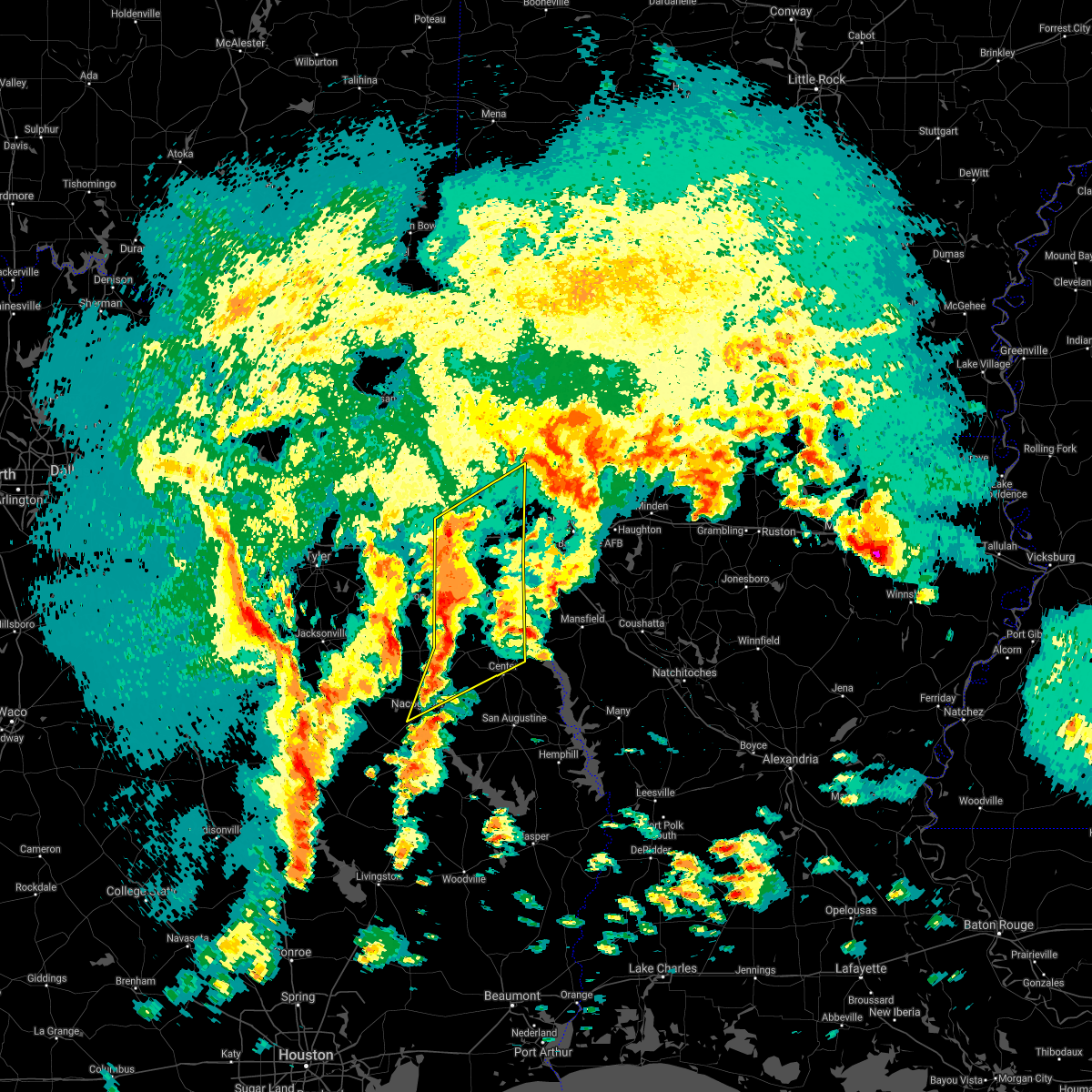 At 1242 pm cdt, severe thunderstorms were located along a line extending from 6 miles northeast of hallsville to 8 miles southeast of pinehill to near nacogdoches, moving northeast at 35 mph (radar indicated). Hazards include 60 mph wind gusts and quarter size hail. Hail damage to vehicles is expected. Expect wind damage to roofs, siding, and trees. At 1242 pm cdt, severe thunderstorms were located along a line extending from 6 miles northeast of hallsville to 8 miles southeast of pinehill to near nacogdoches, moving northeast at 35 mph (radar indicated). Hazards include 60 mph wind gusts and quarter size hail. Hail damage to vehicles is expected. Expect wind damage to roofs, siding, and trees.
|
| 3/24/2017 9:21 PM CDT |
 At 919 pm cdt, severe thunderstorms were located along a line extending from near gilliam to near belcher to near benton to blanchard to 8 miles south of mooringsport to waskom, moving northeast at 40 mph (radar indicated). Hazards include 60 mph wind gusts. Expect damage to roofs, siding, and trees. Locations impacted include, shreveport, bossier city, vivian, haughton, greenwood, blanchard, waskom, benton, oil city, mooringsport, hosston, belcher, gilliam, eastwood, karnack, fosters, gray, scottsville, uncertain and alden bridge. At 919 pm cdt, severe thunderstorms were located along a line extending from near gilliam to near belcher to near benton to blanchard to 8 miles south of mooringsport to waskom, moving northeast at 40 mph (radar indicated). Hazards include 60 mph wind gusts. Expect damage to roofs, siding, and trees. Locations impacted include, shreveport, bossier city, vivian, haughton, greenwood, blanchard, waskom, benton, oil city, mooringsport, hosston, belcher, gilliam, eastwood, karnack, fosters, gray, scottsville, uncertain and alden bridge.
|
| 3/24/2017 9:00 PM CDT |
 At 859 pm cdt, severe thunderstorms were located along a line extending from near smithland to near karnack to near waskom to 6 miles north of elysian fields, moving northeast at 45 mph (radar indicated). Hazards include 60 mph wind gusts. expect damage to roofs, siding, and trees At 859 pm cdt, severe thunderstorms were located along a line extending from near smithland to near karnack to near waskom to 6 miles north of elysian fields, moving northeast at 45 mph (radar indicated). Hazards include 60 mph wind gusts. expect damage to roofs, siding, and trees
|
| 3/24/2017 8:49 PM CDT |
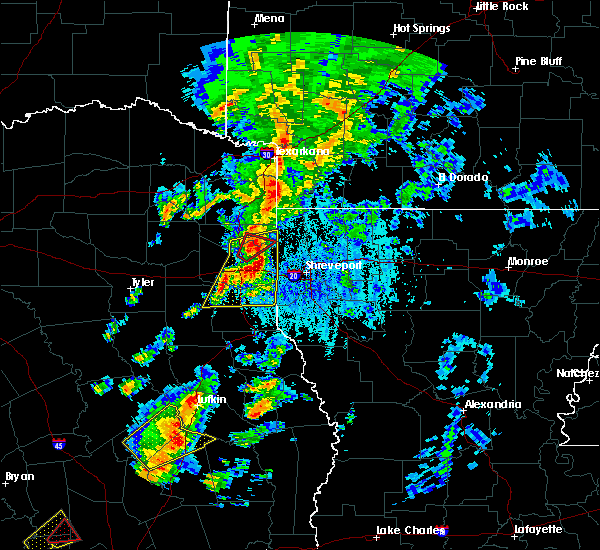 At 849 pm cdt, a severe thunderstorm capable of producing a tornado was located near woodlawn, or 9 miles northeast of marshall, moving northeast at 60 mph (radar indicated rotation). Hazards include tornado. Flying debris will be dangerous to those caught without shelter. mobile homes will be damaged or destroyed. damage to roofs, windows, and vehicles will occur. tree damage is likely. Locations impacted include, karnack, woodlawn and uncertain. At 849 pm cdt, a severe thunderstorm capable of producing a tornado was located near woodlawn, or 9 miles northeast of marshall, moving northeast at 60 mph (radar indicated rotation). Hazards include tornado. Flying debris will be dangerous to those caught without shelter. mobile homes will be damaged or destroyed. damage to roofs, windows, and vehicles will occur. tree damage is likely. Locations impacted include, karnack, woodlawn and uncertain.
|
| 3/24/2017 8:45 PM CDT |
 At 844 pm cdt, severe thunderstorms were located along a line extending from near woodlawn to near marshall to 8 miles northwest of elysian fields to 12 miles northwest of deberry to 7 miles northeast of tatum, moving northeast at 55 mph (radar indicated). Hazards include 60 mph wind gusts and penny size hail. Expect damage to roofs, siding, and trees. Locations impacted include, marshall, waskom, jefferson, tatum, beckville, deberry, karnack, elysian fields, woodlawn, gray, scottsville, uncertain, nesbitt, darco, leigh, jonesville, midyett and church hill. At 844 pm cdt, severe thunderstorms were located along a line extending from near woodlawn to near marshall to 8 miles northwest of elysian fields to 12 miles northwest of deberry to 7 miles northeast of tatum, moving northeast at 55 mph (radar indicated). Hazards include 60 mph wind gusts and penny size hail. Expect damage to roofs, siding, and trees. Locations impacted include, marshall, waskom, jefferson, tatum, beckville, deberry, karnack, elysian fields, woodlawn, gray, scottsville, uncertain, nesbitt, darco, leigh, jonesville, midyett and church hill.
|
| 3/24/2017 8:37 PM CDT |
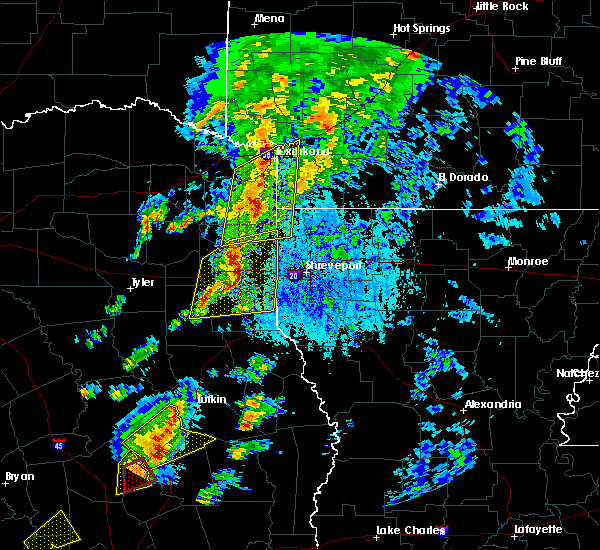 At 837 pm cdt, a severe thunderstorm capable of producing a tornado was located over marshall, moving northeast at 40 mph (radar indicated rotation). Hazards include tornado. Flying debris will be dangerous to those caught without shelter. mobile homes will be damaged or destroyed. damage to roofs, windows, and vehicles will occur. Tree damage is likely. At 837 pm cdt, a severe thunderstorm capable of producing a tornado was located over marshall, moving northeast at 40 mph (radar indicated rotation). Hazards include tornado. Flying debris will be dangerous to those caught without shelter. mobile homes will be damaged or destroyed. damage to roofs, windows, and vehicles will occur. Tree damage is likely.
|
| 3/24/2017 8:16 PM CDT |
 At 815 pm cdt, severe thunderstorms were located along a line extending from hallsville to near tatum to 9 miles northeast of henderson to near pinehill, moving northeast at 45 mph (radar indicated). Hazards include 60 mph wind gusts and penny size hail. expect damage to roofs, siding, and trees At 815 pm cdt, severe thunderstorms were located along a line extending from hallsville to near tatum to 9 miles northeast of henderson to near pinehill, moving northeast at 45 mph (radar indicated). Hazards include 60 mph wind gusts and penny size hail. expect damage to roofs, siding, and trees
|
| 1/21/2017 4:44 PM CST |
 At 444 pm cst, a severe thunderstorm capable of producing a tornado was located near karnack, or 18 miles northeast of marshall, moving northeast at 35 mph (radar indicated rotation). Hazards include tornado and quarter size hail. Flying debris will be dangerous to those caught without shelter. mobile homes will be damaged or destroyed. damage to roofs, windows, and vehicles will occur. tree damage is likely. this dangerous storm will be near, smithland around 450 pm cst. oil city around 455 pm cst. vivian and mcleod around 510 pm cst. hosston and rodessa around 515 pm cst. ida around 525 pm cst. Other locations impacted by this tornadic thunderstorm include uncertain, gray and caddo lake. At 444 pm cst, a severe thunderstorm capable of producing a tornado was located near karnack, or 18 miles northeast of marshall, moving northeast at 35 mph (radar indicated rotation). Hazards include tornado and quarter size hail. Flying debris will be dangerous to those caught without shelter. mobile homes will be damaged or destroyed. damage to roofs, windows, and vehicles will occur. tree damage is likely. this dangerous storm will be near, smithland around 450 pm cst. oil city around 455 pm cst. vivian and mcleod around 510 pm cst. hosston and rodessa around 515 pm cst. ida around 525 pm cst. Other locations impacted by this tornadic thunderstorm include uncertain, gray and caddo lake.
|
| 1/21/2017 4:10 PM CST |
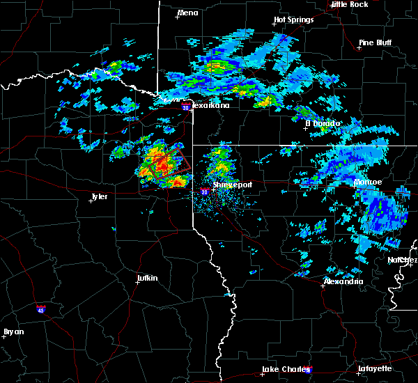 At 410 pm cst, a severe thunderstorm capable of producing a tornado was located near berea, or 14 miles northwest of marshall, moving northeast at 15 mph (radar indicated rotation). Hazards include tornado and quarter size hail. Flying debris will be dangerous to those caught without shelter. mobile homes will be damaged or destroyed. damage to roofs, windows, and vehicles will occur. Tree damage is likely. At 410 pm cst, a severe thunderstorm capable of producing a tornado was located near berea, or 14 miles northwest of marshall, moving northeast at 15 mph (radar indicated rotation). Hazards include tornado and quarter size hail. Flying debris will be dangerous to those caught without shelter. mobile homes will be damaged or destroyed. damage to roofs, windows, and vehicles will occur. Tree damage is likely.
|
| 7/15/2016 6:12 PM CDT |
 At 611 pm cdt, severe thunderstorms were located along a line extending from near oil city to near waskom, moving east at 45 mph (radar indicated). Hazards include 60 mph wind gusts and quarter size hail. Hail damage to vehicles is expected. Expect wind damage to roofs, siding, and trees. At 611 pm cdt, severe thunderstorms were located along a line extending from near oil city to near waskom, moving east at 45 mph (radar indicated). Hazards include 60 mph wind gusts and quarter size hail. Hail damage to vehicles is expected. Expect wind damage to roofs, siding, and trees.
|
| 7/15/2016 6:06 PM CDT |
 At 605 pm cdt, severe thunderstorms were located along a line extending from near smithland to near karnack to 6 miles northwest of waskom to 6 miles southeast of marshall, moving east at 35 mph (radar indicated). Hazards include 60 mph wind gusts and quarter size hail. Hail damage to vehicles is expected. expect wind damage to roofs, siding, and trees. Locations impacted include, marshall, blanchard, waskom, oil city, mooringsport, smithland, karnack, gray, scottsville, uncertain, bethany, jonesville, leigh and caddo lake. At 605 pm cdt, severe thunderstorms were located along a line extending from near smithland to near karnack to 6 miles northwest of waskom to 6 miles southeast of marshall, moving east at 35 mph (radar indicated). Hazards include 60 mph wind gusts and quarter size hail. Hail damage to vehicles is expected. expect wind damage to roofs, siding, and trees. Locations impacted include, marshall, blanchard, waskom, oil city, mooringsport, smithland, karnack, gray, scottsville, uncertain, bethany, jonesville, leigh and caddo lake.
|
| 7/15/2016 5:39 PM CDT |
 At 538 pm cdt, severe thunderstorms were located along a line extending from near berea to near jefferson to near marshall to near hallsville, moving east at 20 mph (radar indicated). Hazards include 60 mph wind gusts and quarter size hail. Hail damage to vehicles is expected. Expect wind damage to roofs, siding, and trees. At 538 pm cdt, severe thunderstorms were located along a line extending from near berea to near jefferson to near marshall to near hallsville, moving east at 20 mph (radar indicated). Hazards include 60 mph wind gusts and quarter size hail. Hail damage to vehicles is expected. Expect wind damage to roofs, siding, and trees.
|
| 4/30/2016 12:58 AM CDT |
 At 1258 am cdt, a severe thunderstorm capable of producing a tornado was located near karnack, or 17 miles northeast of marshall, moving east at 30 mph (radar indicated rotation). Hazards include tornado. Flying debris will be dangerous to those caught without shelter. mobile homes will be damaged or destroyed. damage to roofs, windows, and vehicles will occur. tree damage is likely. this dangerous storm will be near, oil city and mooringsport around 115 am cdt. blanchard around 125 am cdt. belcher around 130 am cdt. shreveport around 135 am cdt. Other locations impacted by this tornadic thunderstorm include bethany, dixie, uncertain, leigh, cavett, caddo lake and gray. At 1258 am cdt, a severe thunderstorm capable of producing a tornado was located near karnack, or 17 miles northeast of marshall, moving east at 30 mph (radar indicated rotation). Hazards include tornado. Flying debris will be dangerous to those caught without shelter. mobile homes will be damaged or destroyed. damage to roofs, windows, and vehicles will occur. tree damage is likely. this dangerous storm will be near, oil city and mooringsport around 115 am cdt. blanchard around 125 am cdt. belcher around 130 am cdt. shreveport around 135 am cdt. Other locations impacted by this tornadic thunderstorm include bethany, dixie, uncertain, leigh, cavett, caddo lake and gray.
|
| 4/30/2016 12:35 AM CDT |
 At 1235 am cdt, a severe thunderstorm capable of producing a tornado was located near woodlawn, or near marshall, moving east at 35 mph (radar indicated rotation). Hazards include tornado. Flying debris will be dangerous to those caught without shelter. mobile homes will be damaged or destroyed. damage to roofs, windows, and vehicles will occur. tree damage is likely. this dangerous storm will be near, karnack around 1255 am cdt. mooringsport around 115 am cdt. blanchard around 120 am cdt. shreveport around 130 am cdt. Other locations impacted by this tornadic thunderstorm include bethany, leigh, caddo lake, scottsville, jonesville and cross lake. At 1235 am cdt, a severe thunderstorm capable of producing a tornado was located near woodlawn, or near marshall, moving east at 35 mph (radar indicated rotation). Hazards include tornado. Flying debris will be dangerous to those caught without shelter. mobile homes will be damaged or destroyed. damage to roofs, windows, and vehicles will occur. tree damage is likely. this dangerous storm will be near, karnack around 1255 am cdt. mooringsport around 115 am cdt. blanchard around 120 am cdt. shreveport around 130 am cdt. Other locations impacted by this tornadic thunderstorm include bethany, leigh, caddo lake, scottsville, jonesville and cross lake.
|
| 4/30/2016 12:13 AM CDT |
 At 1212 am cdt, severe thunderstorms were located along a line extending from 6 miles southeast of hughes springs to 8 miles southeast of longview to 8 miles southeast of kilgore to turnertown, moving east at 30 mph (radar indicated). Hazards include 60 mph wind gusts and penny size hail. Expect damage to roofs. siding. And trees. At 1212 am cdt, severe thunderstorms were located along a line extending from 6 miles southeast of hughes springs to 8 miles southeast of longview to 8 miles southeast of kilgore to turnertown, moving east at 30 mph (radar indicated). Hazards include 60 mph wind gusts and penny size hail. Expect damage to roofs. siding. And trees.
|
| 4/11/2016 7:31 PM CDT |
 At 730 pm cdt, a severe thunderstorm was located over karnack, or 13 miles northeast of marshall, moving east at 40 mph (radar indicated). Hazards include quarter size hail. damage to vehicles is expected At 730 pm cdt, a severe thunderstorm was located over karnack, or 13 miles northeast of marshall, moving east at 40 mph (radar indicated). Hazards include quarter size hail. damage to vehicles is expected
|
| 4/11/2016 7:20 PM CDT |
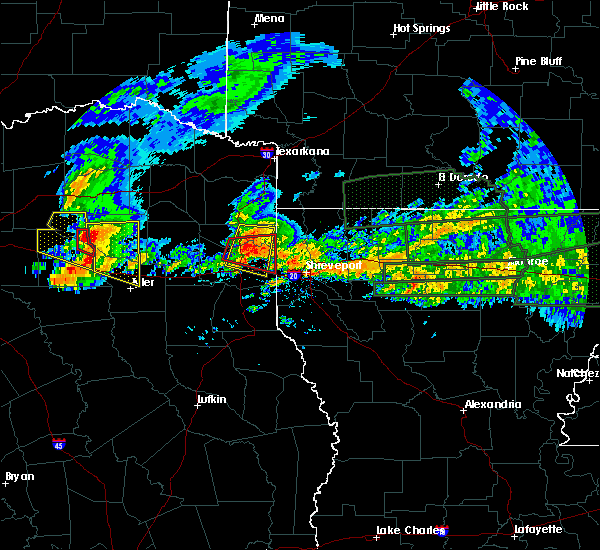 At 720 pm cdt, a severe thunderstorm was located over woodlawn, or 10 miles north of marshall, moving east at 35 mph (radar indicated). Hazards include 60 mph wind gusts and nickel size hail. Expect damage to roofs. siding. and trees. Locations impacted include, marshall, jefferson, woodlawn, karnack, smithland, lodi, scottsville, uncertain, nesbitt, leigh and pruett. At 720 pm cdt, a severe thunderstorm was located over woodlawn, or 10 miles north of marshall, moving east at 35 mph (radar indicated). Hazards include 60 mph wind gusts and nickel size hail. Expect damage to roofs. siding. and trees. Locations impacted include, marshall, jefferson, woodlawn, karnack, smithland, lodi, scottsville, uncertain, nesbitt, leigh and pruett.
|
| 4/11/2016 7:06 PM CDT |
 At 705 pm cdt, a severe thunderstorm capable of producing a tornado was located near woodlawn, or 9 miles north of marshall, moving east at 35 mph (radar indicated rotation). Hazards include tornado and quarter size hail and 70 mph winds.. Flying debris will be dangerous to those caught without shelter. mobile homes will be damaged or destroyed. damage to roofs, windows, and vehicles will occur. tree damage is likely. this dangerous storm will be near, woodlawn around 715 pm cdt. marshall around 720 pm cdt. karnack around 730 pm cdt. Other locations impacted by this tornadic thunderstorm include nesbitt, uncertain, leigh, gray, scottsville and jonesville. At 705 pm cdt, a severe thunderstorm capable of producing a tornado was located near woodlawn, or 9 miles north of marshall, moving east at 35 mph (radar indicated rotation). Hazards include tornado and quarter size hail and 70 mph winds.. Flying debris will be dangerous to those caught without shelter. mobile homes will be damaged or destroyed. damage to roofs, windows, and vehicles will occur. tree damage is likely. this dangerous storm will be near, woodlawn around 715 pm cdt. marshall around 720 pm cdt. karnack around 730 pm cdt. Other locations impacted by this tornadic thunderstorm include nesbitt, uncertain, leigh, gray, scottsville and jonesville.
|
| 4/11/2016 6:55 PM CDT |
 At 654 pm cdt, a severe thunderstorm capable of producing a tornado was located near harleton, or 17 miles northwest of marshall, moving east at 30 mph (radar indicated rotation). Hazards include tornado and quarter size hail and winds to 70 mph. Flying debris will be dangerous to those caught without shelter. mobile homes will be damaged or destroyed. damage to roofs, windows, and vehicles will occur. tree damage is likely. this dangerous storm will be near, jefferson and berea around 710 pm cdt. woodlawn around 720 pm cdt. karnack around 735 pm cdt. Other locations impacted by this tornadic thunderstorm include nesbitt, uncertain, leigh, gray, scottsville and jonesville. At 654 pm cdt, a severe thunderstorm capable of producing a tornado was located near harleton, or 17 miles northwest of marshall, moving east at 30 mph (radar indicated rotation). Hazards include tornado and quarter size hail and winds to 70 mph. Flying debris will be dangerous to those caught without shelter. mobile homes will be damaged or destroyed. damage to roofs, windows, and vehicles will occur. tree damage is likely. this dangerous storm will be near, jefferson and berea around 710 pm cdt. woodlawn around 720 pm cdt. karnack around 735 pm cdt. Other locations impacted by this tornadic thunderstorm include nesbitt, uncertain, leigh, gray, scottsville and jonesville.
|
| 4/11/2016 6:43 PM CDT |
 At 642 pm cdt, a severe thunderstorm was located over ore city, or 14 miles east of gilmer, moving east at 35 mph (radar indicated). Hazards include 60 mph wind gusts and quarter size hail. Hail damage to vehicles is expected. Expect wind damage to roofs, siding, and trees. At 642 pm cdt, a severe thunderstorm was located over ore city, or 14 miles east of gilmer, moving east at 35 mph (radar indicated). Hazards include 60 mph wind gusts and quarter size hail. Hail damage to vehicles is expected. Expect wind damage to roofs, siding, and trees.
|
| 3/24/2016 2:42 AM CDT |
 At 242 am cdt, severe thunderstorms were located along a line extending from near rodessa to near karnack to near marshall, moving east at 45 mph. these showers and isolated thunderstorms containing damaging winds have downed trees in gilmer texas earlier this morning (radar indicated). Hazards include 60 mph wind gusts. Expect damage to roofs. siding. and trees. Locations impacted include, marshall, vivian, waskom, oil city, mooringsport, hosston, rodessa, ida, smithland, kildare, mcleod, woodlawn, karnack, gray, scottsville, uncertain, bethany, jonesville, leigh and caddo lake. At 242 am cdt, severe thunderstorms were located along a line extending from near rodessa to near karnack to near marshall, moving east at 45 mph. these showers and isolated thunderstorms containing damaging winds have downed trees in gilmer texas earlier this morning (radar indicated). Hazards include 60 mph wind gusts. Expect damage to roofs. siding. and trees. Locations impacted include, marshall, vivian, waskom, oil city, mooringsport, hosston, rodessa, ida, smithland, kildare, mcleod, woodlawn, karnack, gray, scottsville, uncertain, bethany, jonesville, leigh and caddo lake.
|
| 3/24/2016 2:14 AM CDT |
 At 214 am cdt, severe thunderstorms were located along a line extending from near linden to 6 miles northeast of harleton to near hallsville, moving east at 45 mph (radar indicated). Hazards include 60 mph wind gusts. Expect damage to roofs. siding. And trees. At 214 am cdt, severe thunderstorms were located along a line extending from near linden to 6 miles northeast of harleton to near hallsville, moving east at 45 mph (radar indicated). Hazards include 60 mph wind gusts. Expect damage to roofs. siding. And trees.
|
| 12/27/2015 6:22 PM CST |
 At 621 pm cst, a severe thunderstorm capable of producing a tornado was located near marshall, moving northeast at 35 mph. another storm capable of producing a tornado was located just south of marshall, moving north northeast near 35 mph (radar indicated rotation). Hazards include tornado. Flying debris will be dangerous to those caught without shelter. mobile homes will be damaged or destroyed. damage to roofs, windows, and vehicles will occur. tree damage is likely. this dangerous storm will be near, marshall around 635 pm cst. jefferson and woodlawn around 645 pm cst. Other locations impacted by this tornadic thunderstorm include nesbitt, uncertain, darco, gray and scottsville. At 621 pm cst, a severe thunderstorm capable of producing a tornado was located near marshall, moving northeast at 35 mph. another storm capable of producing a tornado was located just south of marshall, moving north northeast near 35 mph (radar indicated rotation). Hazards include tornado. Flying debris will be dangerous to those caught without shelter. mobile homes will be damaged or destroyed. damage to roofs, windows, and vehicles will occur. tree damage is likely. this dangerous storm will be near, marshall around 635 pm cst. jefferson and woodlawn around 645 pm cst. Other locations impacted by this tornadic thunderstorm include nesbitt, uncertain, darco, gray and scottsville.
|
| 7/5/2015 8:13 PM CDT |
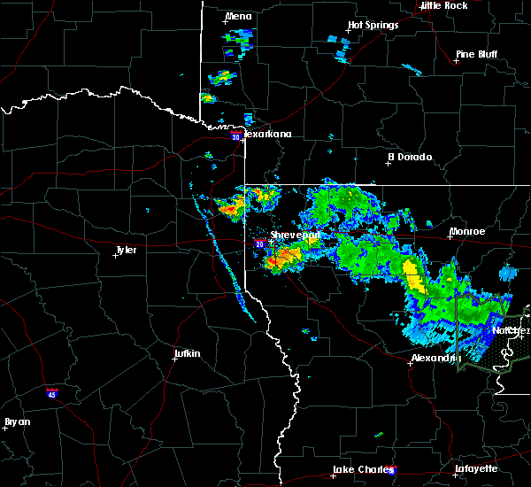 At 812 pm cdt, a severe thunderstorm was located near smithland, or 17 miles northeast of marshall, and is nearly stationary (radar indicated). Hazards include 60 mph wind gusts and quarter size hail. Hail damage to vehicles is expected. Expect wind damage to roofs, siding and trees. At 812 pm cdt, a severe thunderstorm was located near smithland, or 17 miles northeast of marshall, and is nearly stationary (radar indicated). Hazards include 60 mph wind gusts and quarter size hail. Hail damage to vehicles is expected. Expect wind damage to roofs, siding and trees.
|
| 5/30/2015 10:05 AM CDT | At 1004 am cdt, severe thunderstorms were located along a line extending from harleton to 7 miles west of deberry, moving east at 45 mph (radar indicated). Hazards include 60 mph wind gusts. Expect damage to roofs. siding and trees. Locations impacted include, longview, marshall, carthage, hallsville, waskom, tatum, elysian fields, harleton, woodlawn, karnack, deberry, scottsville, uncertain, nesbitt, midyett, jonesville, leigh, darco and front. |
| 5/30/2015 9:24 AM CDT | At 923 am cdt, a severe thunderstorm was located 9 miles northeast of henderson, moving east at 45 mph (radar indicated). Hazards include 60 mph wind gusts and nickel size hail. Expect damage to roofs. Siding and trees. |
| 5/30/2015 9:24 AM CDT | At 923 am cdt, a severe thunderstorm was located 9 miles northeast of henderson, moving east at 45 mph (radar indicated). Hazards include 60 mph wind gusts and nickel size hail. Expect damage to roofs. Siding and trees. |
| 5/26/2015 8:08 PM CDT | At 807 pm cdt, a severe thunderstorm was located 7 miles southwest of marshall, moving northeast at 20 mph (radar indicated). Hazards include 60 mph wind gusts and quarter size hail. Hail damage to vehicles is expected. Expect wind damage to roofs, siding and trees. |
| 5/25/2015 7:52 PM CDT | At 751 pm cdt, severe thunderstorms were located along a line extending from near hosston to near belcher to 7 miles east of deberry to center to near huntington, moving east at 65 mph (radar indicated). Hazards include 70 mph wind gusts and quarter size hail. Hail damage to vehicles is expected. expect considerable tree damage. wind damage is also likely to mobile homes, roofs and outbuildings. locations impacted include, shreveport, bossier city, lufkin, marshall, carthage, center, mansfield, milam, vivian, haughton, greenwood, blanchard, waskom, huntington, san augustine, benton, stonewall, zwolle, logansport and hemphill. a tornado watch remains in effect until 1000 pm cdt for northeastern texas. A tornado watch also remains in effect until 200 am cdt for northwestern louisiana and eastern texas. |
| 5/25/2015 7:52 PM CDT | At 751 pm cdt, severe thunderstorms were located along a line extending from near hosston to near belcher to 7 miles east of deberry to center to near huntington, moving east at 65 mph (radar indicated). Hazards include 70 mph wind gusts and quarter size hail. Hail damage to vehicles is expected. expect considerable tree damage. wind damage is also likely to mobile homes, roofs and outbuildings. locations impacted include, shreveport, bossier city, lufkin, marshall, carthage, center, mansfield, milam, vivian, haughton, greenwood, blanchard, waskom, huntington, san augustine, benton, stonewall, zwolle, logansport and hemphill. a tornado watch remains in effect until 1000 pm cdt for northeastern texas. A tornado watch also remains in effect until 200 am cdt for northwestern louisiana and eastern texas. |
| 5/25/2015 7:27 PM CDT | At 726 pm cdt, severe thunderstorms were located along a line extending from berea to near woodlawn to 8 miles northeast of beckville to near garrison to diboll, moving east at 65 mph (radar indicated). Hazards include 70 mph wind gusts and quarter size hail. Hail damage to vehicles is expected. expect considerable tree damage. Wind damage is also likely to mobile homes, roofs and outbuildings. |
| 5/25/2015 7:27 PM CDT | At 726 pm cdt, severe thunderstorms were located along a line extending from berea to near woodlawn to 8 miles northeast of beckville to near garrison to diboll, moving east at 65 mph (radar indicated). Hazards include 70 mph wind gusts and quarter size hail. Hail damage to vehicles is expected. expect considerable tree damage. Wind damage is also likely to mobile homes, roofs and outbuildings. |
| 5/24/2015 12:11 PM CDT | At 1210 pm cdt, a severe thunderstorm capable of producing a tornado was located over karnack, or 14 miles northeast of marshall, moving north at 45 mph (radar indicated rotation). Hazards include tornado. Flying debris will be dangerous to those caught without shelter. mobile homes will be damaged or destroyed. damage to roofs, windows and vehicles will occur. tree damage is likely. this dangerous storm will be near, smithland around 1225 pm cdt. Other locations impacted by this tornadic thunderstorm include gray, uncertain and leigh. |
| 5/24/2015 11:59 AM CDT | At 1158 am cdt, a severe thunderstorm capable of producing a tornado was located 8 miles northwest of waskom, or 9 miles east of marshall, moving north at 45 mph (radar indicated rotation). Hazards include tornado and quarter size hail. Flying debris will be dangerous to those caught without shelter. mobile homes will be damaged or destroyed. damage to roofs, windows and vehicles will occur. tree damage is likely. this dangerous storm will be near, karnack around 1210 pm cdt. smithland around 1225 pm cdt. lodi around 1230 pm cdt. Other locations impacted by this tornadic thunderstorm include uncertain, leigh, gray, scottsville and jonesville. |
| 5/11/2015 2:44 AM CDT | At 244 am cdt, a severe thunderstorm was located over hallsville, or 10 miles east of longview, moving northeast at 45 mph (radar indicated). Hazards include 60 mph wind gusts. Expect damage to roofs. siding and trees. this severe thunderstorm will be near, marshall around 310 am cdt. woodlawn around 315 am cdt. karnack around 320 am cdt. smithland around 330 am cdt. other locations impacted by this severe thunderstorm include nesbitt, uncertain, gray and easton. a tornado watch remains in effect until 500 am cdt for northwestern louisiana and northeastern texas. Possible. |
| 5/11/2015 2:13 AM CDT | At 212 am cdt, severe thunderstorms were located along a line extending from near bradley to near plain dealing to near mooringsport to near waskom to 8 miles northeast of tatum, moving east at 45 mph (radar indicated). Hazards include 60 mph wind gusts. Expect damage to roofs. siding and trees. locations impacted include, shreveport, bossier city, marshall, vivian, haughton, greenwood, blanchard, waskom, benton, plain dealing, oil city, sarepta, mooringsport, bradley, hosston, rodessa, belcher, ida, gilliam and elysian fields. a tornado watch remains in effect until 500 am cdt for southwestern arkansas, northwestern louisiana and northeastern texas. 75in. |
| 5/11/2015 2:13 AM CDT | At 212 am cdt, severe thunderstorms were located along a line extending from near bradley to near plain dealing to near mooringsport to near waskom to 8 miles northeast of tatum, moving east at 45 mph (radar indicated). Hazards include 60 mph wind gusts. Expect damage to roofs. siding and trees. locations impacted include, shreveport, bossier city, marshall, vivian, haughton, greenwood, blanchard, waskom, benton, plain dealing, oil city, sarepta, mooringsport, bradley, hosston, rodessa, belcher, ida, gilliam and elysian fields. a tornado watch remains in effect until 500 am cdt for southwestern arkansas, northwestern louisiana and northeastern texas. 75in. |
| 5/11/2015 2:13 AM CDT | At 212 am cdt, severe thunderstorms were located along a line extending from near bradley to near plain dealing to near mooringsport to near waskom to 8 miles northeast of tatum, moving east at 45 mph (radar indicated). Hazards include 60 mph wind gusts. Expect damage to roofs. siding and trees. locations impacted include, shreveport, bossier city, marshall, vivian, haughton, greenwood, blanchard, waskom, benton, plain dealing, oil city, sarepta, mooringsport, bradley, hosston, rodessa, belcher, ida, gilliam and elysian fields. a tornado watch remains in effect until 500 am cdt for southwestern arkansas, northwestern louisiana and northeastern texas. 75in. |
| 5/11/2015 1:47 AM CDT | At 147 am cdt, severe thunderstorms were located along a line extending from near ravanna to 6 miles southeast of smithland to 8 miles northeast of tatum, moving east at 45 mph (radar indicated). Hazards include 60 mph wind gusts. Expect damage to roofs. Siding and trees. |
| 5/11/2015 1:47 AM CDT | At 147 am cdt, severe thunderstorms were located along a line extending from near ravanna to 6 miles southeast of smithland to 8 miles northeast of tatum, moving east at 45 mph (radar indicated). Hazards include 60 mph wind gusts. Expect damage to roofs. Siding and trees. |
| 5/11/2015 1:47 AM CDT | At 147 am cdt, severe thunderstorms were located along a line extending from near ravanna to 6 miles southeast of smithland to 8 miles northeast of tatum, moving east at 45 mph (radar indicated). Hazards include 60 mph wind gusts. Expect damage to roofs. Siding and trees. |
| 5/11/2015 1:27 AM CDT | At 126 am cdt, severe thunderstorms were located along a line extending from near linden to near berea to 6 miles west of woodlawn to near hallsville to 9 miles southeast of longview to near kilgore, moving east at 35 mph (radar indicated). Hazards include 60 mph wind gusts. Expect damage to roofs. siding and trees. locations impacted include, longview, marshall, kilgore, white oak, hallsville, jefferson, linden, tatum, elysian fields, diana, smithland, kildare, bivins, woodlawn, lodi, harleton, berea, karnack, fairview and lakeport. a tornado watch remains in effect until 500 am cdt for northeastern texas. 75in. |
| 5/11/2015 12:59 AM CDT | At 1258 am cdt, severe thunderstorms were located along a line extending from near hughes springs to near ore city to near kilgore, moving east at 30 mph (radar indicated). Hazards include 60 mph wind gusts. Expect damage to roofs. Siding and trees. |
| 5/10/2015 10:59 PM CDT | At 1058 pm cdt, a severe thunderstorm capable of producing a tornado was located 7 miles east of harleton, or 8 miles northwest of marshall, moving northeast at 35 mph (radar indicated rotation). Hazards include tornado. Flying debris will be dangerous to those caught without shelter. mobile homes will be damaged or destroyed. damage to roofs, windows and vehicles will occur. tree damage is likely. this dangerous storm will be near, woodlawn around 1110 pm cdt. jefferson around 1115 pm cdt. karnack around 1125 pm cdt. smithland around 1135 pm cdt. other locations impacted by this tornadic thunderstorm include nesbitt, gray and uncertain. Radar indicated. |
| 4/24/2015 9:36 PM CDT | At 935 pm cdt, severe thunderstorms were located along a line extending from near wake village to near ravanna to near karnack, moving east at 60 mph (radar indicated). Hazards include 70 mph wind gusts and quarter size hail. Expect considerable tree damage. wind damage is also likely to mobile homes, roofs and outbuildings. locations impacted include, texarkana, atlanta, wake village, vivian, nash, jefferson, linden, queen city, redwater, maud, oil city, fouke, mooringsport, hosston, rodessa, ida, smithland, brightstar, kildare and mcleod. a tornado watch remains in effect until 1000 pm cdt for southwestern arkansas, northwestern louisiana and northeastern texas. 1. 00in. |
| 4/24/2015 9:36 PM CDT | At 935 pm cdt, severe thunderstorms were located along a line extending from near wake village to near ravanna to near karnack, moving east at 60 mph (radar indicated). Hazards include 70 mph wind gusts and quarter size hail. Expect considerable tree damage. wind damage is also likely to mobile homes, roofs and outbuildings. locations impacted include, texarkana, atlanta, wake village, vivian, nash, jefferson, linden, queen city, redwater, maud, oil city, fouke, mooringsport, hosston, rodessa, ida, smithland, brightstar, kildare and mcleod. a tornado watch remains in effect until 1000 pm cdt for southwestern arkansas, northwestern louisiana and northeastern texas. 1. 00in. |
| 4/24/2015 9:36 PM CDT | At 935 pm cdt, severe thunderstorms were located along a line extending from near wake village to near ravanna to near karnack, moving east at 60 mph (radar indicated). Hazards include 70 mph wind gusts and quarter size hail. Expect considerable tree damage. wind damage is also likely to mobile homes, roofs and outbuildings. locations impacted include, texarkana, atlanta, wake village, vivian, nash, jefferson, linden, queen city, redwater, maud, oil city, fouke, mooringsport, hosston, rodessa, ida, smithland, brightstar, kildare and mcleod. a tornado watch remains in effect until 1000 pm cdt for southwestern arkansas, northwestern louisiana and northeastern texas. 1. 00in. |
| 4/24/2015 9:07 PM CDT | At 906 pm cdt, severe thunderstorms were located along a line extending from 6 miles east of dalby springs to near hughes springs to near ore city, moving east at 65 mph (radar indicated). Hazards include 60 mph wind gusts and quarter size hail. Hail damage to vehicles is expected. Expect wind damage to roofs, siding and trees. |
| 4/24/2015 9:07 PM CDT | At 906 pm cdt, severe thunderstorms were located along a line extending from 6 miles east of dalby springs to near hughes springs to near ore city, moving east at 65 mph (radar indicated). Hazards include 60 mph wind gusts and quarter size hail. Hail damage to vehicles is expected. Expect wind damage to roofs, siding and trees. |
| 4/24/2015 9:07 PM CDT | At 906 pm cdt, severe thunderstorms were located along a line extending from 6 miles east of dalby springs to near hughes springs to near ore city, moving east at 65 mph (radar indicated). Hazards include 60 mph wind gusts and quarter size hail. Hail damage to vehicles is expected. Expect wind damage to roofs, siding and trees. |
| 4/19/2015 12:37 AM CDT | At 1236 am cdt, severe thunderstorms were located along a line extending from near karnack to 9 miles southwest of mooringsport to 8 miles northwest of greenwood to near waskom to near elysian fields, moving east at 30 mph (radar indicated). Hazards include 60 mph wind gusts. expect downed trees and powerlines with this line of severe thunderstorms |
| 4/19/2015 12:37 AM CDT | At 1236 am cdt, severe thunderstorms were located along a line extending from near karnack to 9 miles southwest of mooringsport to 8 miles northwest of greenwood to near waskom to near elysian fields, moving east at 30 mph (radar indicated). Hazards include 60 mph wind gusts. expect downed trees and powerlines with this line of severe thunderstorms |
| 4/9/2015 8:12 PM CDT | The national weather service in shreveport has issued a * severe thunderstorm warning for. northeastern harrison county in northeastern texas. southeastern marion county in northeastern texas. until 845 pm cdt * at 812 pm cdt. A severe thunderstorm was located near woodlawn. |
| 4/9/2015 6:04 PM CDT | A severe thunderstorm warning remains in effect until 615 pm cdt for southwestern miller county. northwestern bossier and northwestern caddo parishes. northeastern harrison. southeastern cass and marion counties. at 604 pm cdt. severe thunderstorms were located along a line extending from near kildare to near mcleod to near oil city. Moving. |
| 4/9/2015 6:04 PM CDT | A severe thunderstorm warning remains in effect until 615 pm cdt for southwestern miller county. northwestern bossier and northwestern caddo parishes. northeastern harrison. southeastern cass and marion counties. at 604 pm cdt. severe thunderstorms were located along a line extending from near kildare to near mcleod to near oil city. Moving. |
| 4/9/2015 6:04 PM CDT | A severe thunderstorm warning remains in effect until 615 pm cdt for southwestern miller county. northwestern bossier and northwestern caddo parishes. northeastern harrison. southeastern cass and marion counties. at 604 pm cdt. severe thunderstorms were located along a line extending from near kildare to near mcleod to near oil city. Moving. |
| 4/9/2015 5:26 PM CDT | The national weather service in shreveport has issued a * severe thunderstorm warning for. southwestern miller county in southwestern arkansas. northern bossier parish in northwestern louisiana. northwestern caddo parish in northwestern louisiana. Northeastern harrison county in northeastern texas. |
| 4/9/2015 5:26 PM CDT | The national weather service in shreveport has issued a * severe thunderstorm warning for. southwestern miller county in southwestern arkansas. northern bossier parish in northwestern louisiana. northwestern caddo parish in northwestern louisiana. Northeastern harrison county in northeastern texas. |
| 4/9/2015 5:26 PM CDT | The national weather service in shreveport has issued a * severe thunderstorm warning for. southwestern miller county in southwestern arkansas. northern bossier parish in northwestern louisiana. northwestern caddo parish in northwestern louisiana. Northeastern harrison county in northeastern texas. |
| 10/12/2014 5:53 PM CDT | Power lines down in harrison county TX, 3.3 miles NW of Uncertain, TX |
| 5/9/2014 4:46 PM CDT | Quarter sized hail reported 2.2 miles ENE of Uncertain, TX |
| 5/9/2014 4:45 PM CDT | Ping Pong Ball sized hail reported 3.8 miles ENE of Uncertain, TX, ping pong ball sized hail on the southwest side of karnack along hwy. 43. |
| 12/20/2012 12:30 AM CST | Strong winds blew the roof off a porch of a home on cr 3300 near the smithland community just north of highway 4 in marion county TX, 8.3 miles S of Uncertain, TX |
| 6/12/2012 4:00 AM CDT | Trees down in karnac in harrison county TX, 2.9 miles NE of Uncertain, TX |
| 4/20/2012 7:10 AM CDT | Quarter sized hail reported 0.3 miles W of Uncertain, TX |
| 1/1/0001 12:00 AM | Tree reported down off of fm 219 in harrison county TX, 0.7 miles NNE of Uncertain, TX |
| 1/1/0001 12:00 AM | A home in karnack had significant roof damag in harrison county TX, 3.8 miles ENE of Uncertain, TX |
| 1/1/0001 12:00 AM | Trees down in the community smithland in marion county TX, 8 miles SSE of Uncertain, TX |
Hail Maps for Uncertain, TX
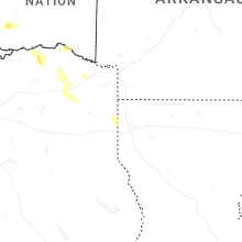
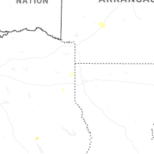
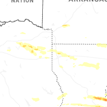
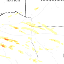
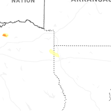


Connect with Interactive Hail Maps