

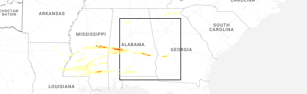
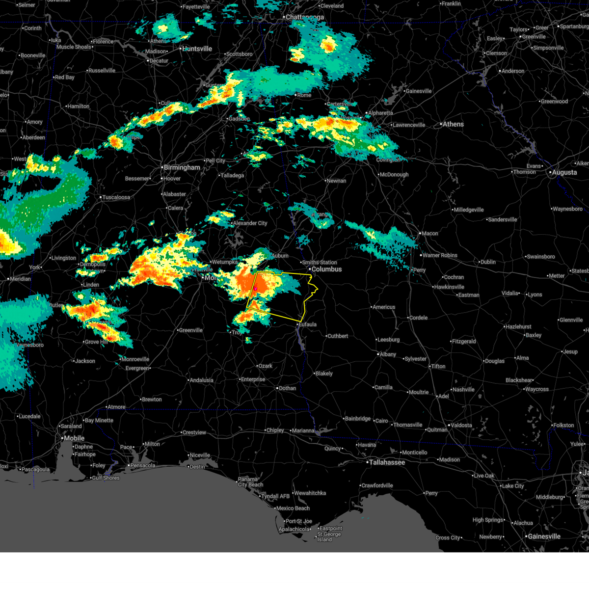
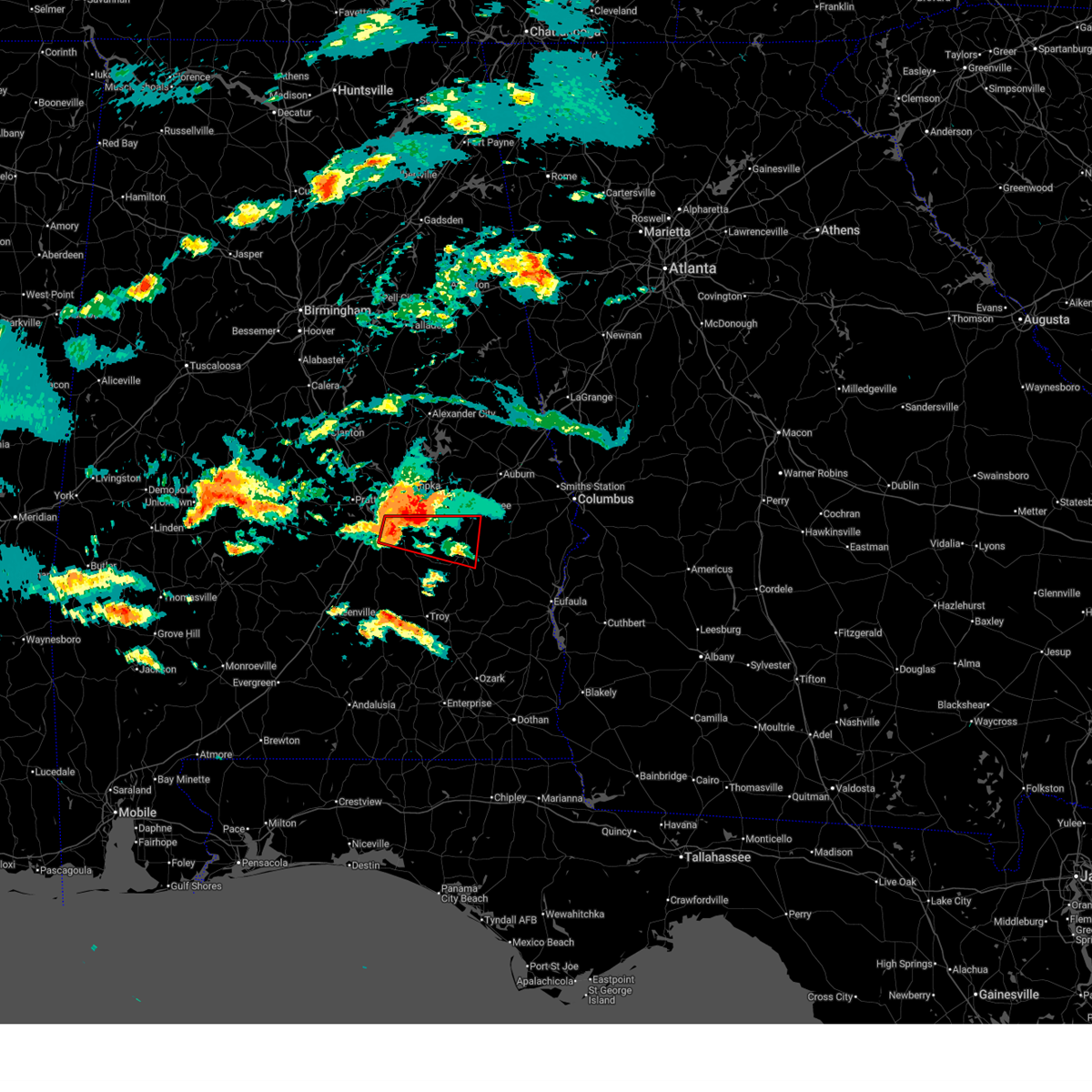
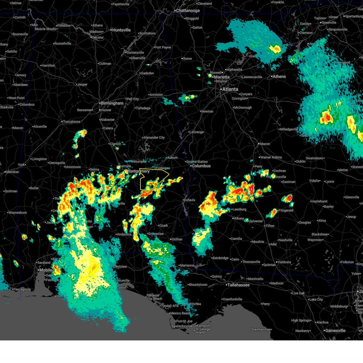
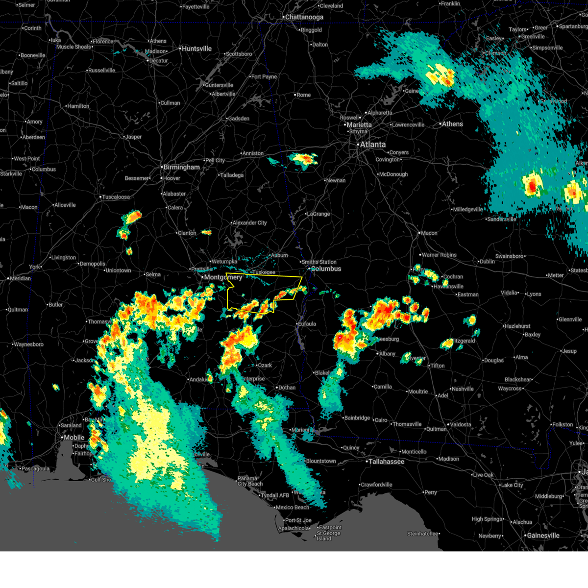
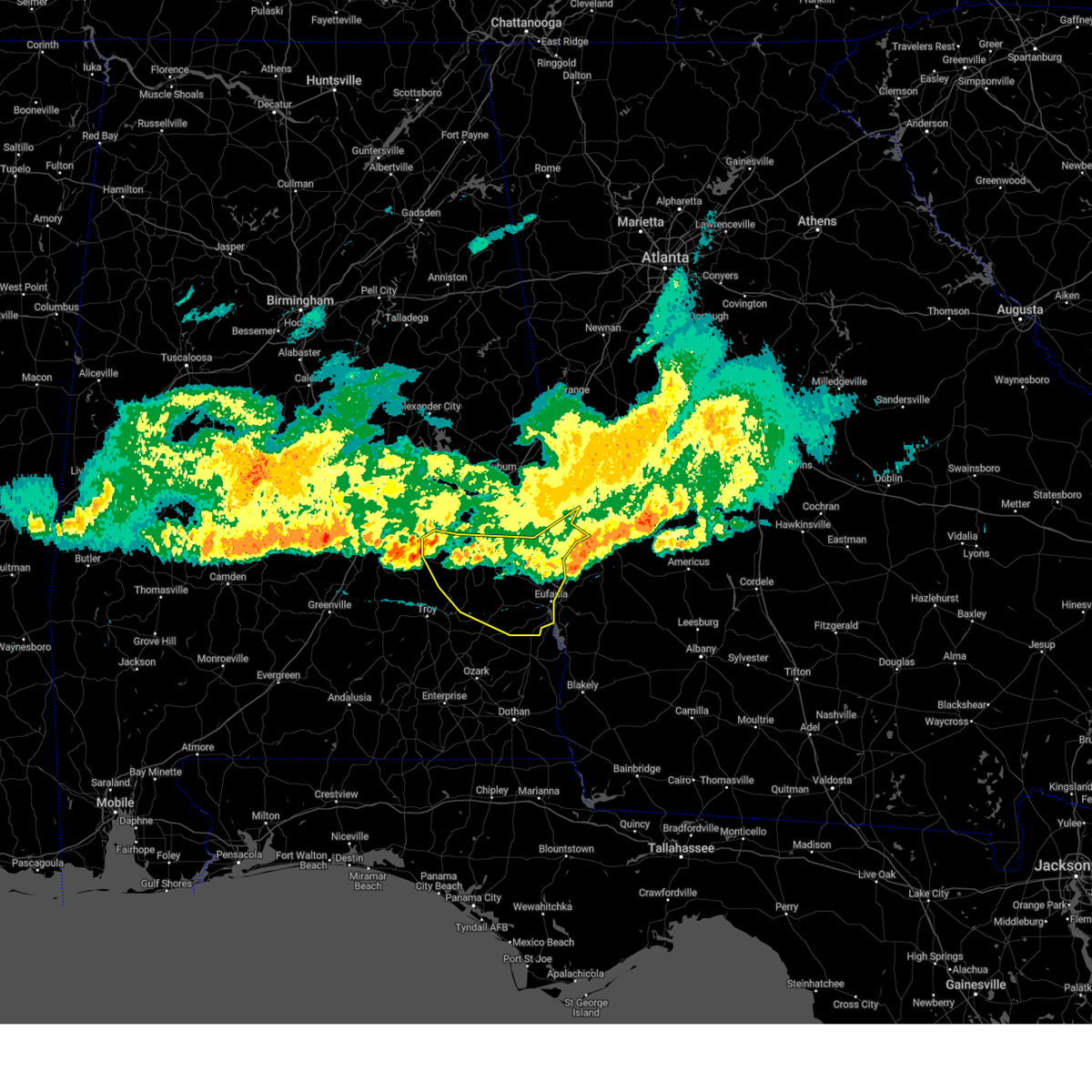
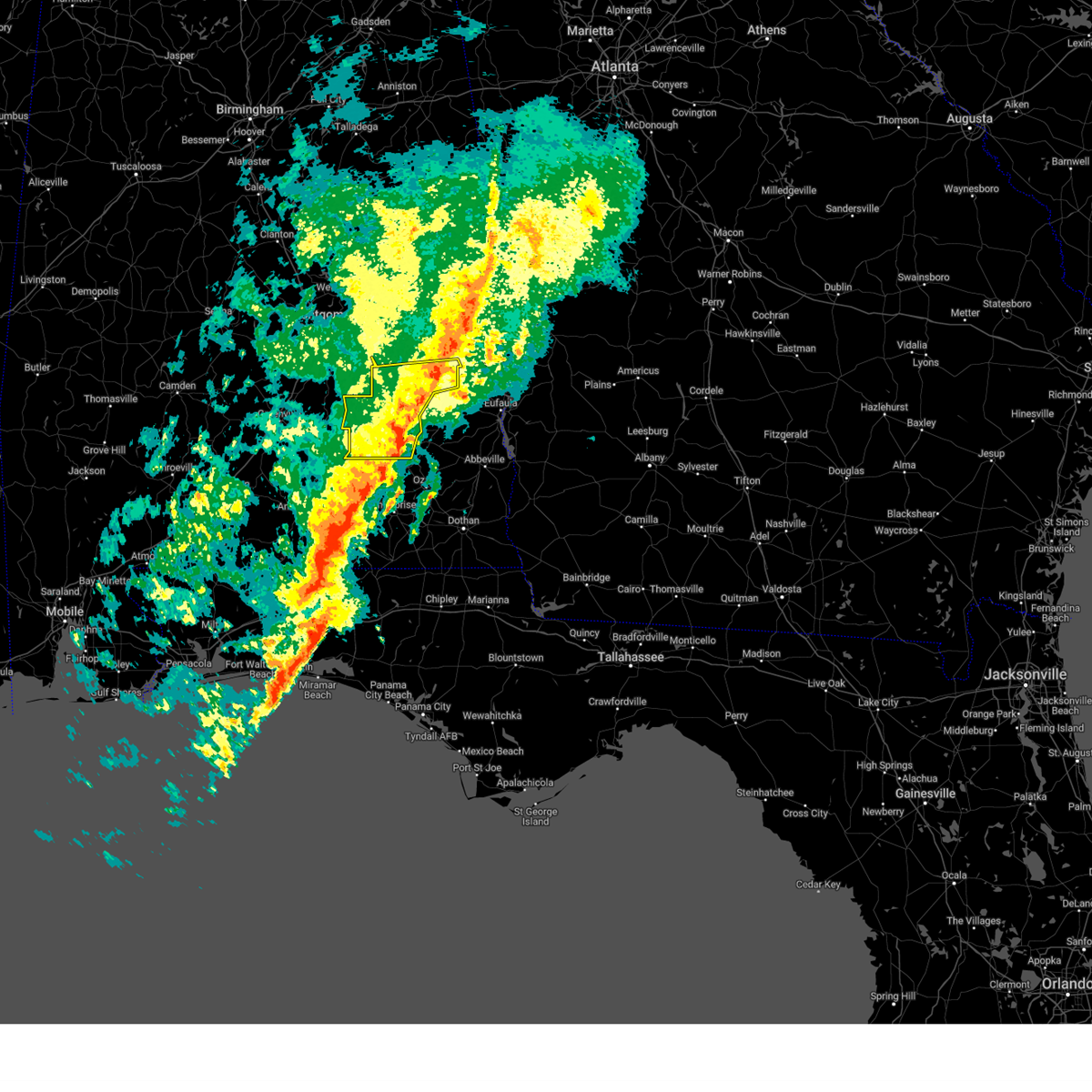
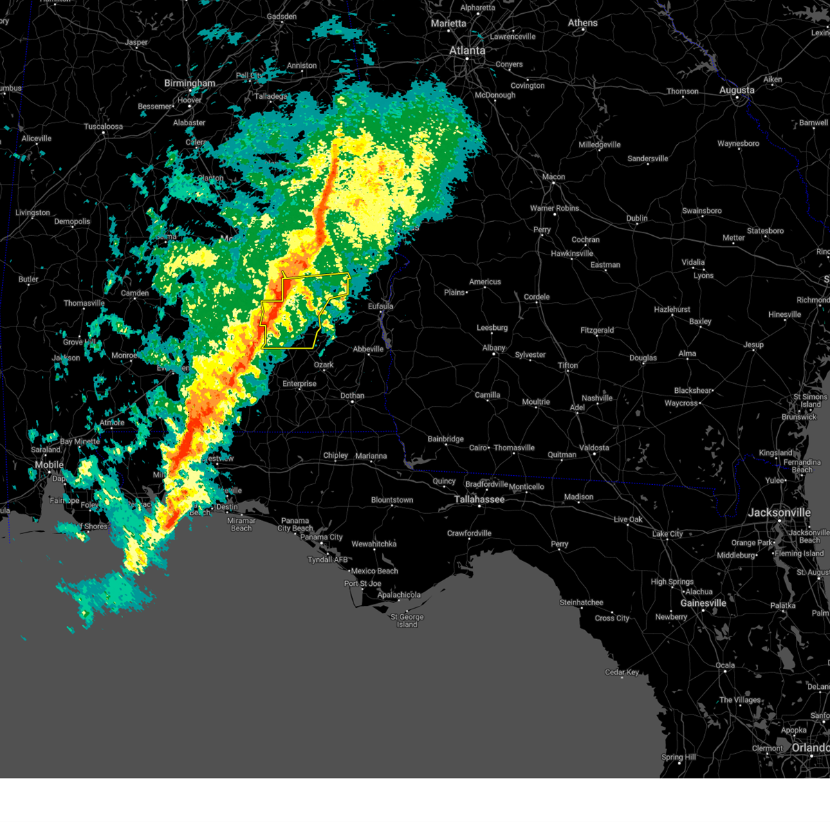
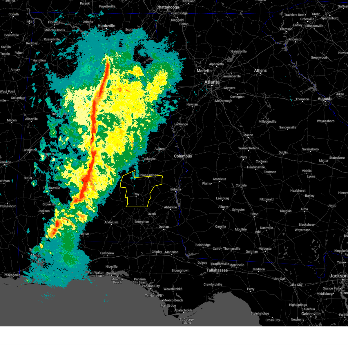
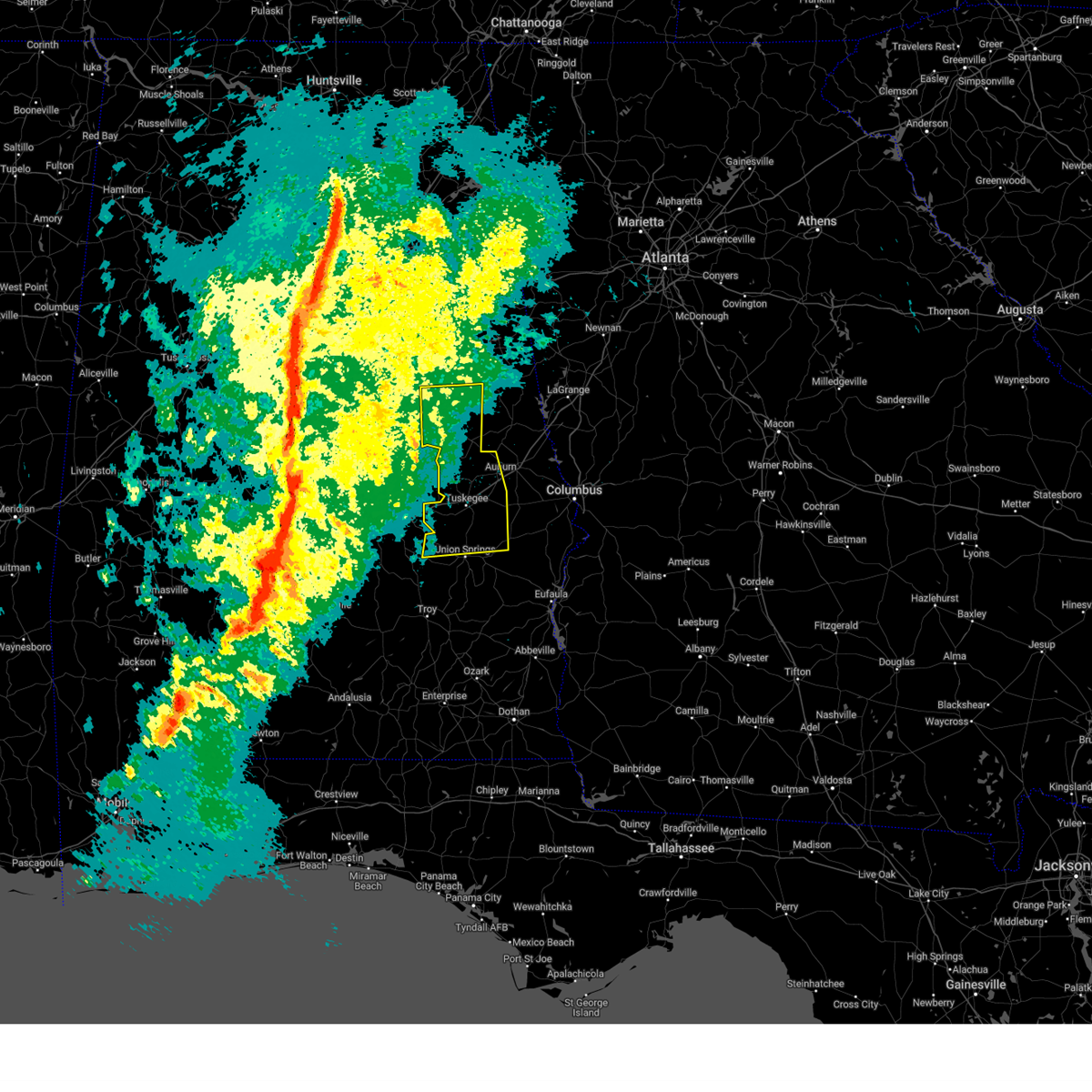
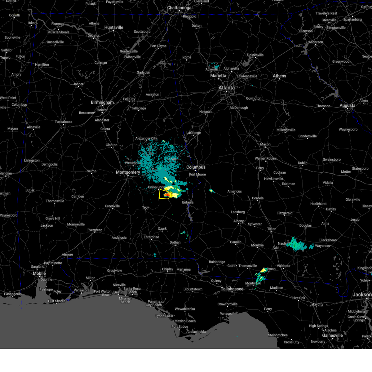
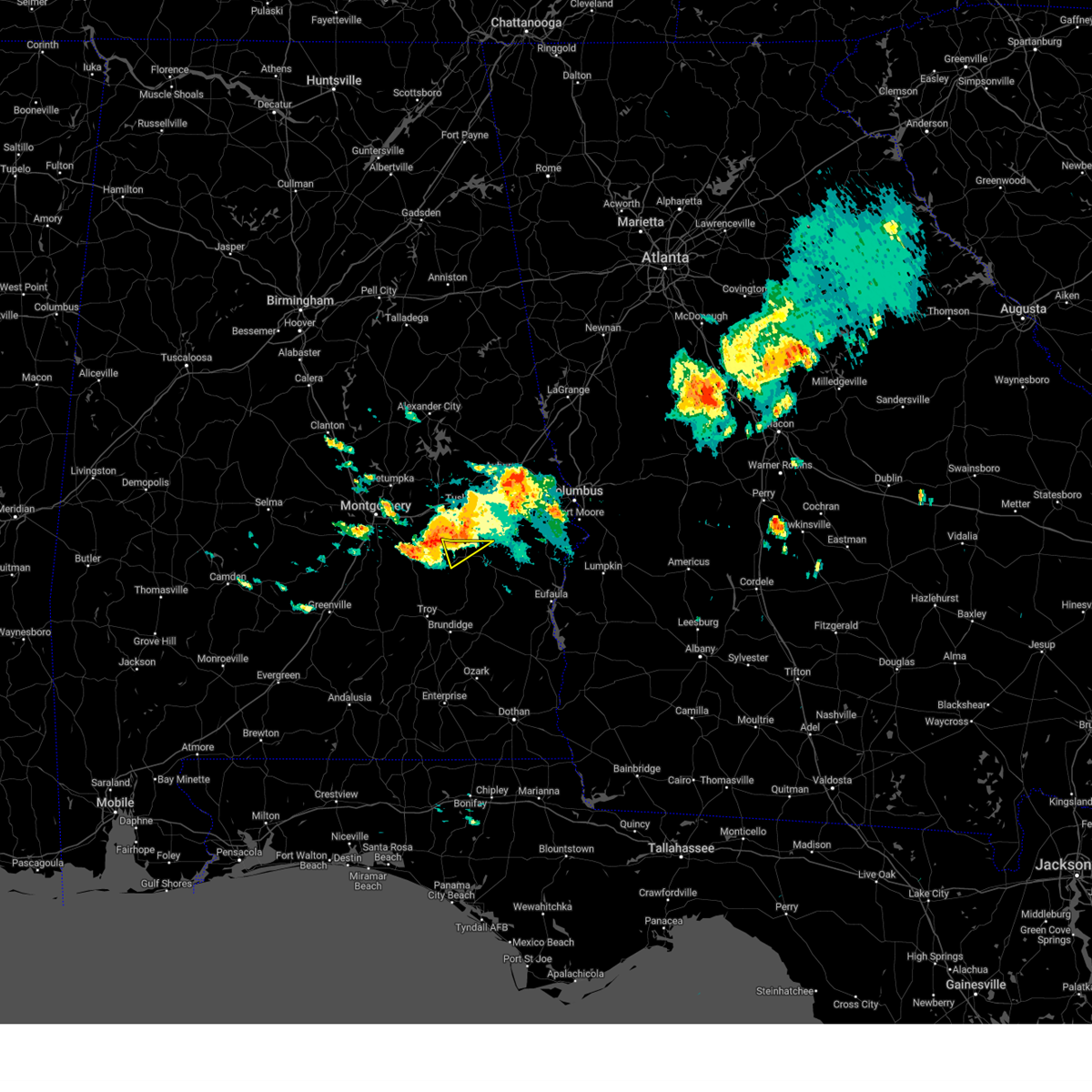
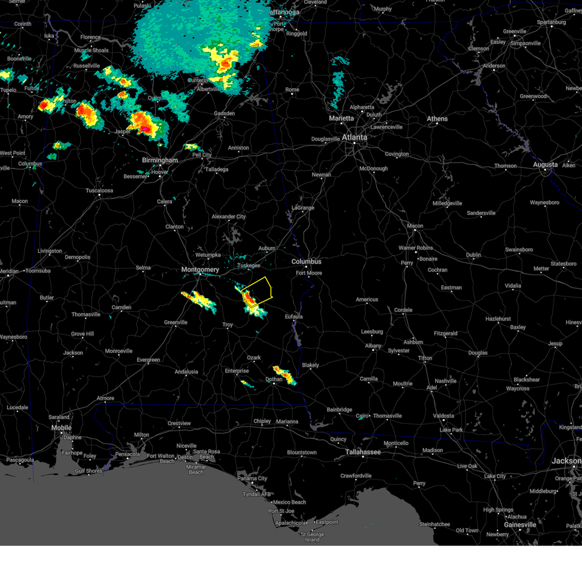
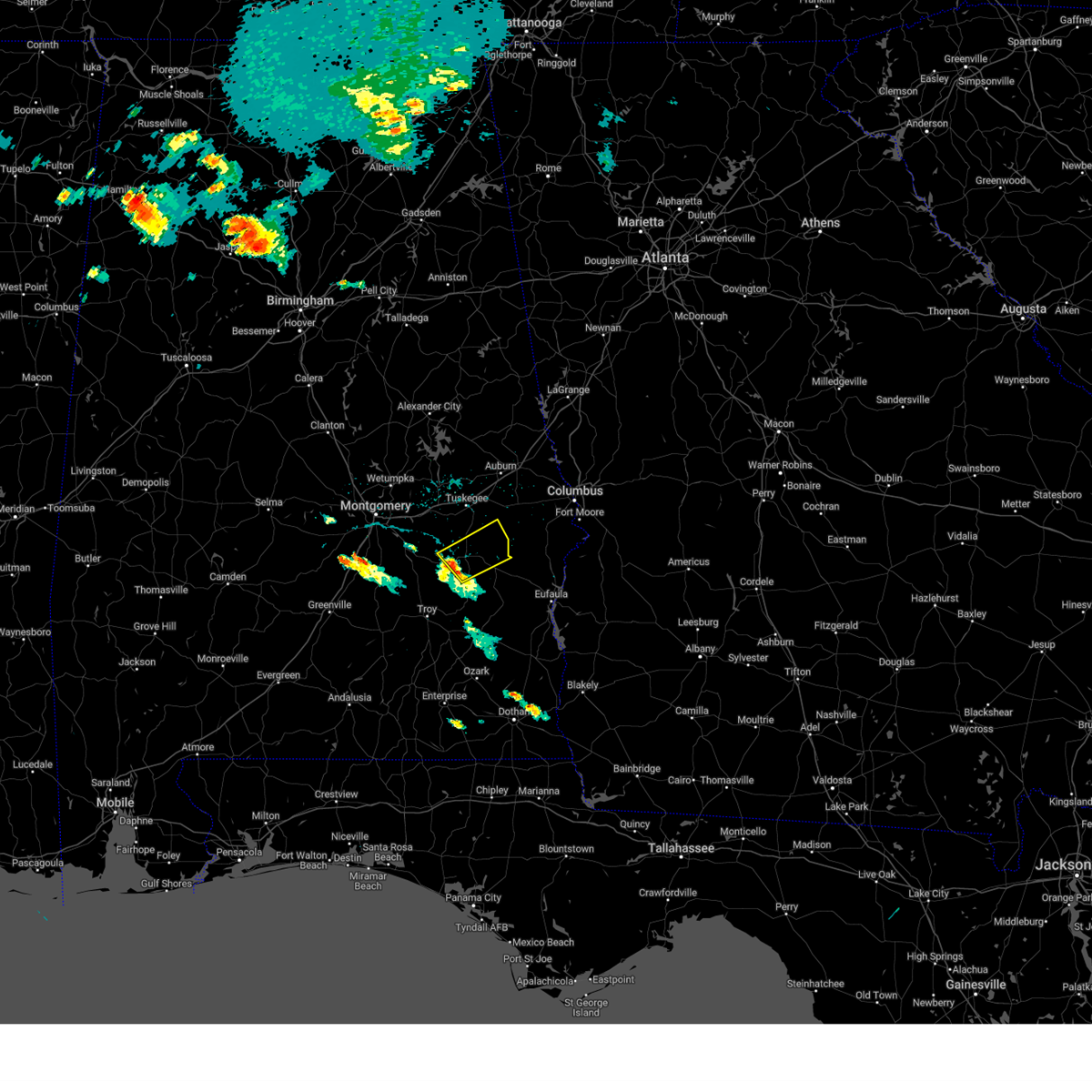
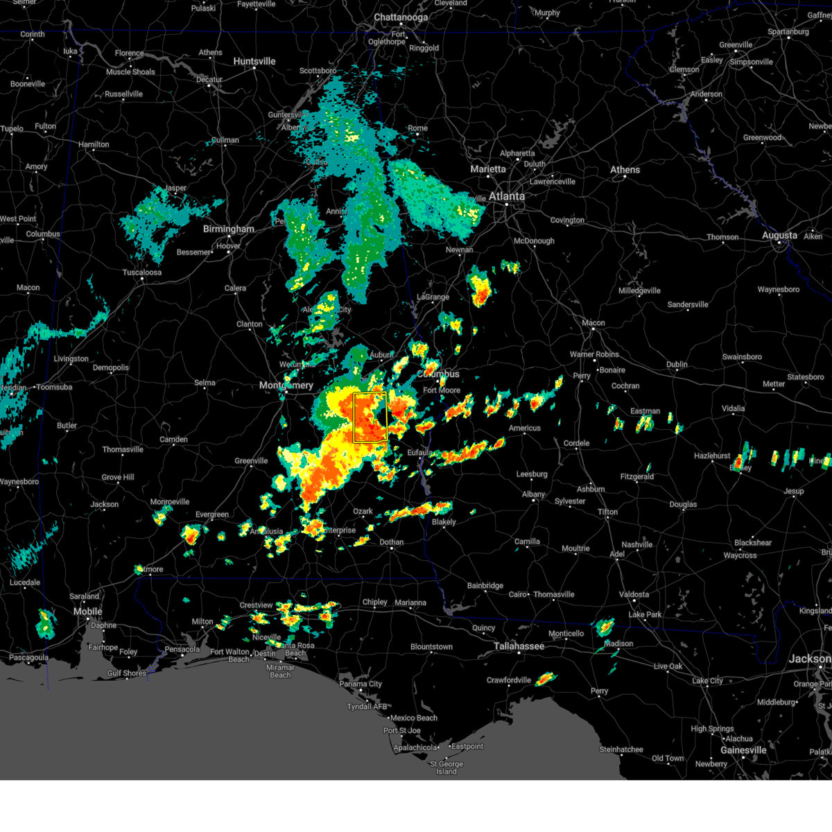
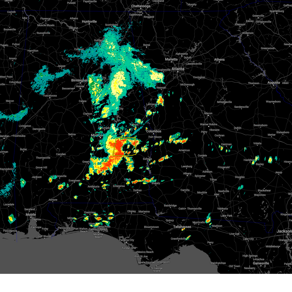
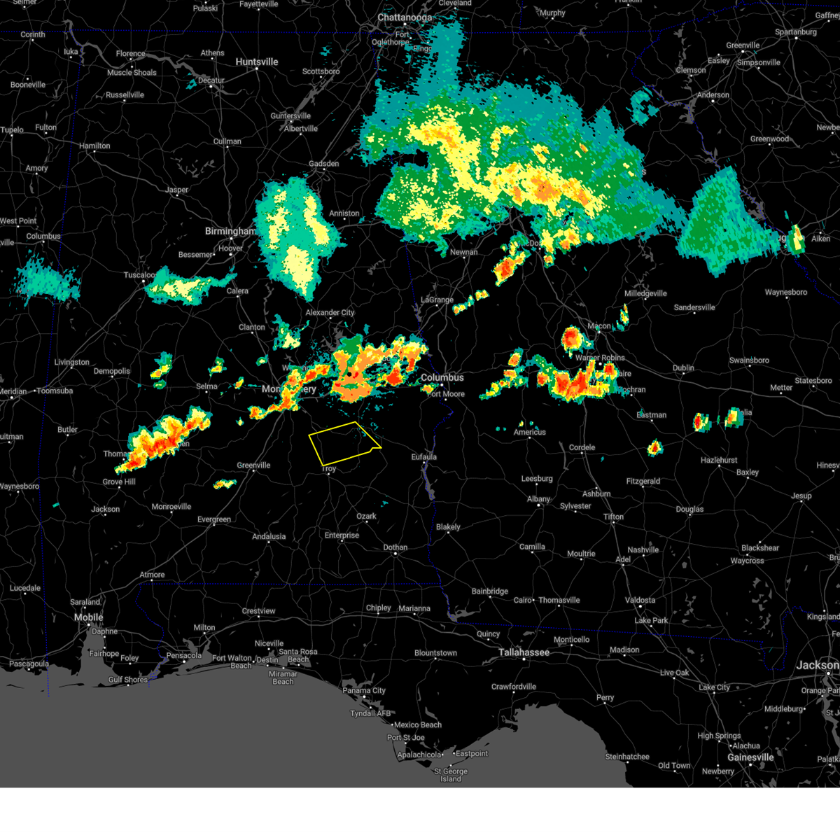
Hail Map for Union Springs, AL
The Union Springs, AL area has had 3 reports of on-the-ground hail by trained spotters, and has been under severe weather warnings 8 times during the past 12 months. Doppler radar has detected hail at or near Union Springs, AL on 48 occasions, including 1 occasion during the past year.
| Name: | Union Springs, AL |
| Where Located: | 35 miles SSW of Auburn, AL |
| Map: | Google Map for Union Springs, AL |
| Population: | 3980 |
| Housing Units: | 1664 |
| More Info: | Search Google for Union Springs, AL |
0
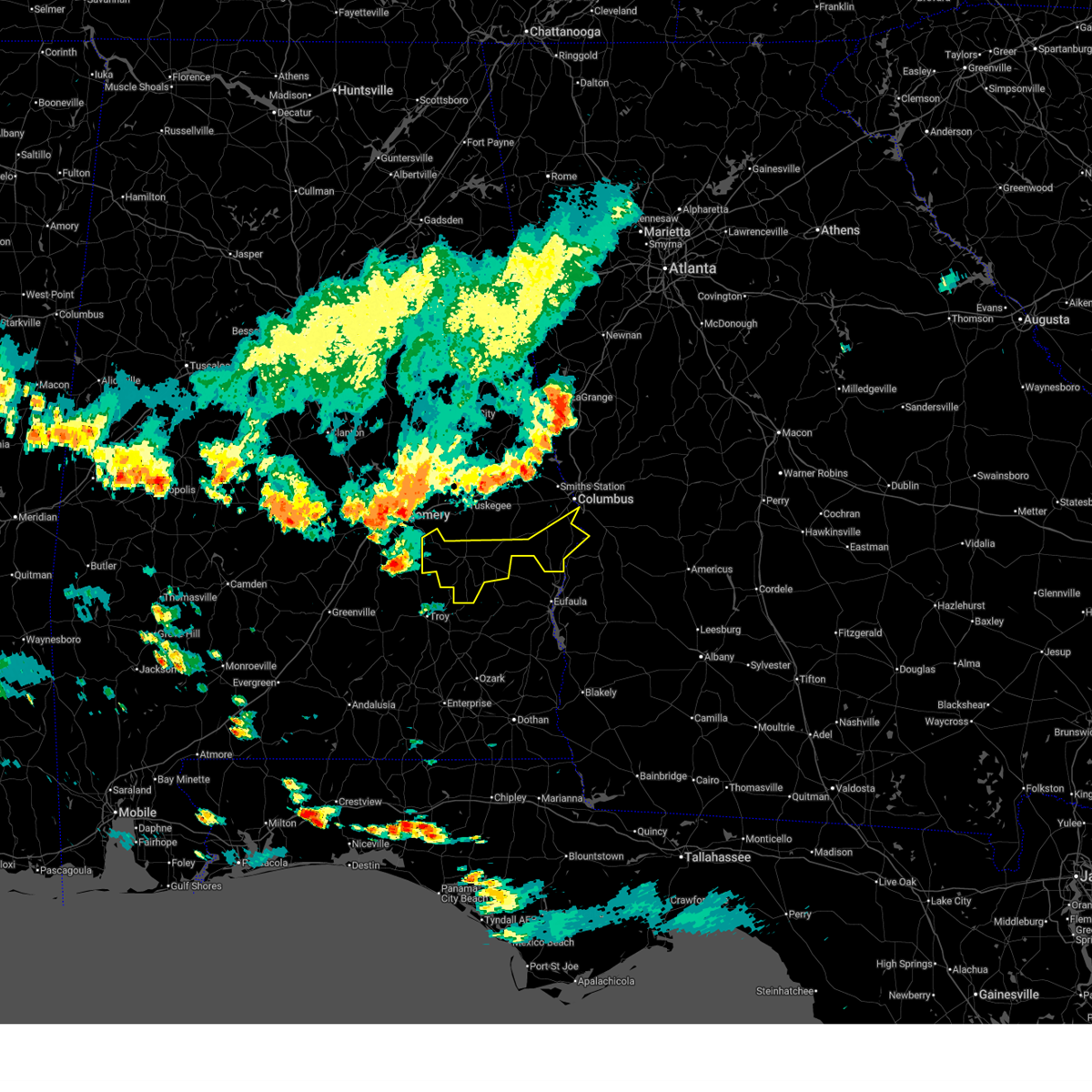
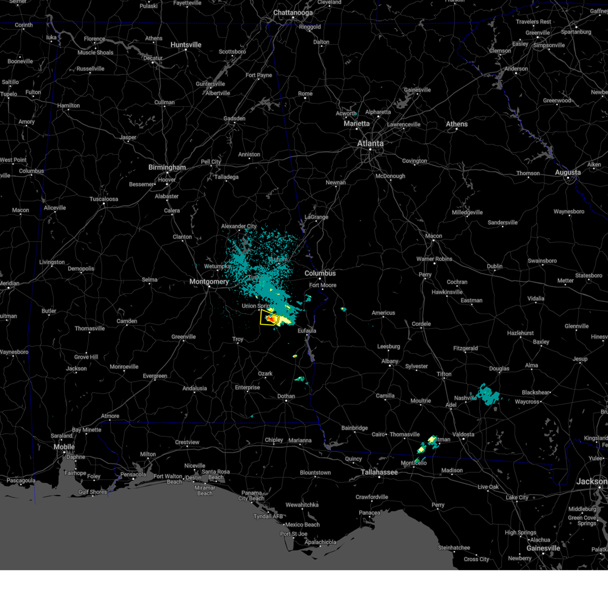
The Top Recent Hail Date for Union Springs, AL is Wednesday, May 6, 2026 (46th out of 48)
Hail and Wind Damage Spotted near Union Springs, AL
| Date / Time | Report Details |
|---|---|
| 6/1/2026 5:57 PM CDT |
 the severe thunderstorm warning has been cancelled and is no longer in effect the severe thunderstorm warning has been cancelled and is no longer in effect
|
| 6/1/2026 5:45 PM CDT |
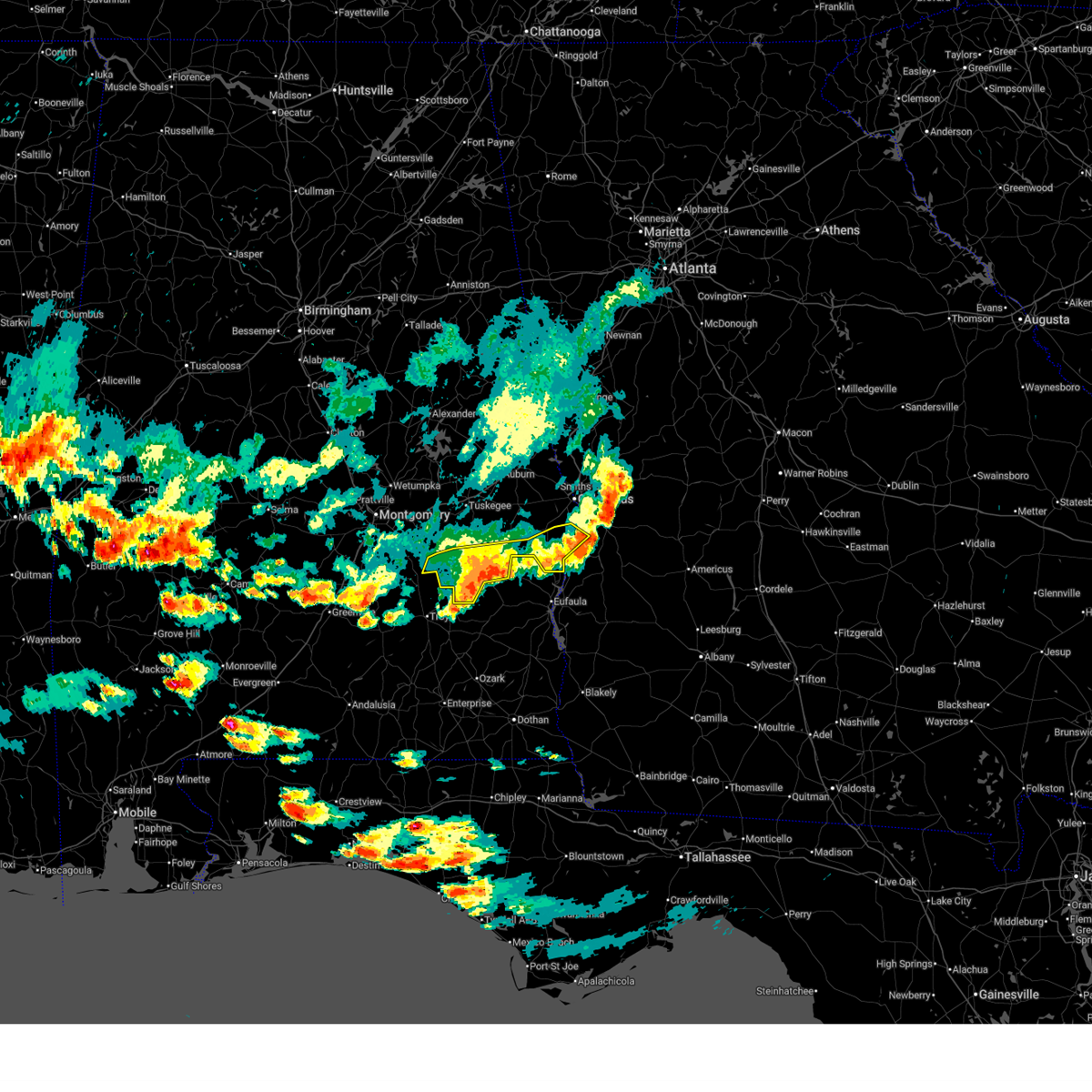
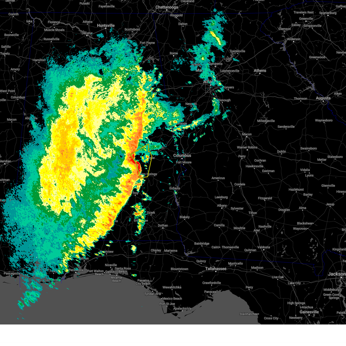
 At 545 pm cdt, severe thunderstorms were located along a line extending from 8 miles southwest of cusseta to near midway to near linwood, moving southeast at 40 mph (radar indicated). Hazards include 60 mph wind gusts and quarter size hail. Hail damage to vehicles is expected. expect wind damage to roofs, siding, and trees. Locations impacted include, union springs, midway, pickett, aberfoil, franklin field, beans crossroads, shopton, tanyard, sedgefield, high ridge, perote, twin springs, rutherford, three notch, simsville, uchee creek, and fort mitchell activity center. At 545 pm cdt, severe thunderstorms were located along a line extending from 8 miles southwest of cusseta to near midway to near linwood, moving southeast at 40 mph (radar indicated). Hazards include 60 mph wind gusts and quarter size hail. Hail damage to vehicles is expected. expect wind damage to roofs, siding, and trees. Locations impacted include, union springs, midway, pickett, aberfoil, franklin field, beans crossroads, shopton, tanyard, sedgefield, high ridge, perote, twin springs, rutherford, three notch, simsville, uchee creek, and fort mitchell activity center.
|
| 6/1/2026 5:21 PM CDT | Multiple trees and power lines down across the county... including along highway 110... highway 82... and highway 2 in bullock county AL, 0.5 miles ESE of Union Springs, AL |
| 6/1/2026 4:57 PM CDT |
 Svrbmx the national weather service in birmingham has issued a * severe thunderstorm warning for, bullock county in southeastern alabama, southern russell county in southeastern alabama, * until 615 pm cdt. * at 457 pm cdt, severe thunderstorms were located along a line extending from near bleecker to near tuskegee to near waugh, moving southeast at 40 mph (radar indicated). Hazards include 60 mph wind gusts and quarter size hail. Hail damage to vehicles is expected. Expect wind damage to roofs, siding, and trees. Svrbmx the national weather service in birmingham has issued a * severe thunderstorm warning for, bullock county in southeastern alabama, southern russell county in southeastern alabama, * until 615 pm cdt. * at 457 pm cdt, severe thunderstorms were located along a line extending from near bleecker to near tuskegee to near waugh, moving southeast at 40 mph (radar indicated). Hazards include 60 mph wind gusts and quarter size hail. Hail damage to vehicles is expected. Expect wind damage to roofs, siding, and trees.
|
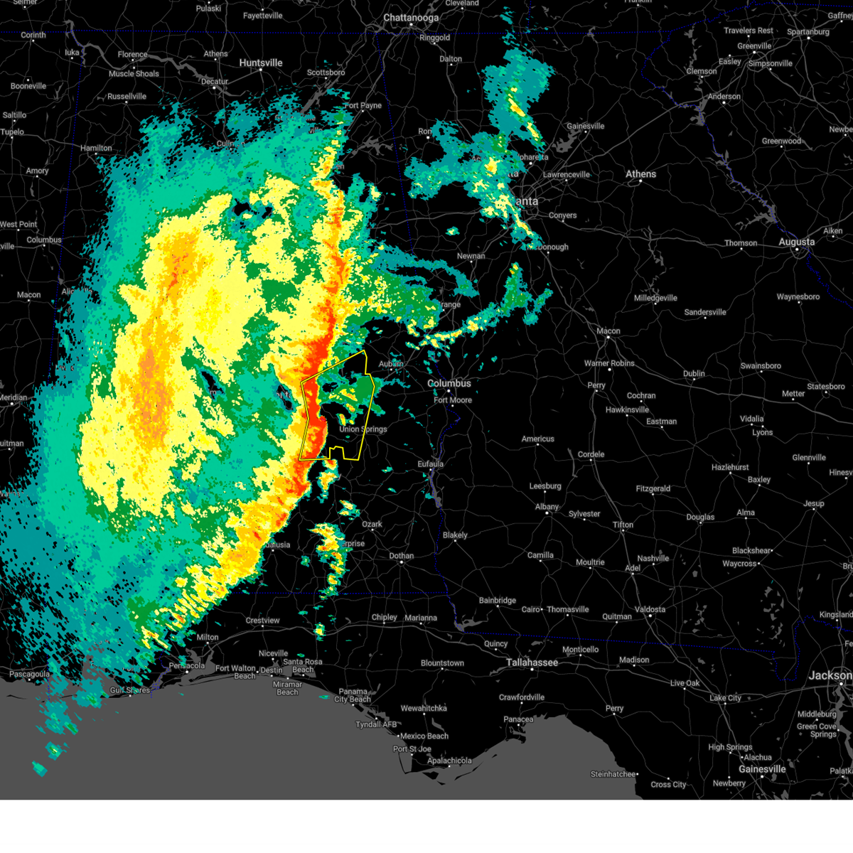
| 5/6/2026 5:56 PM CDT |
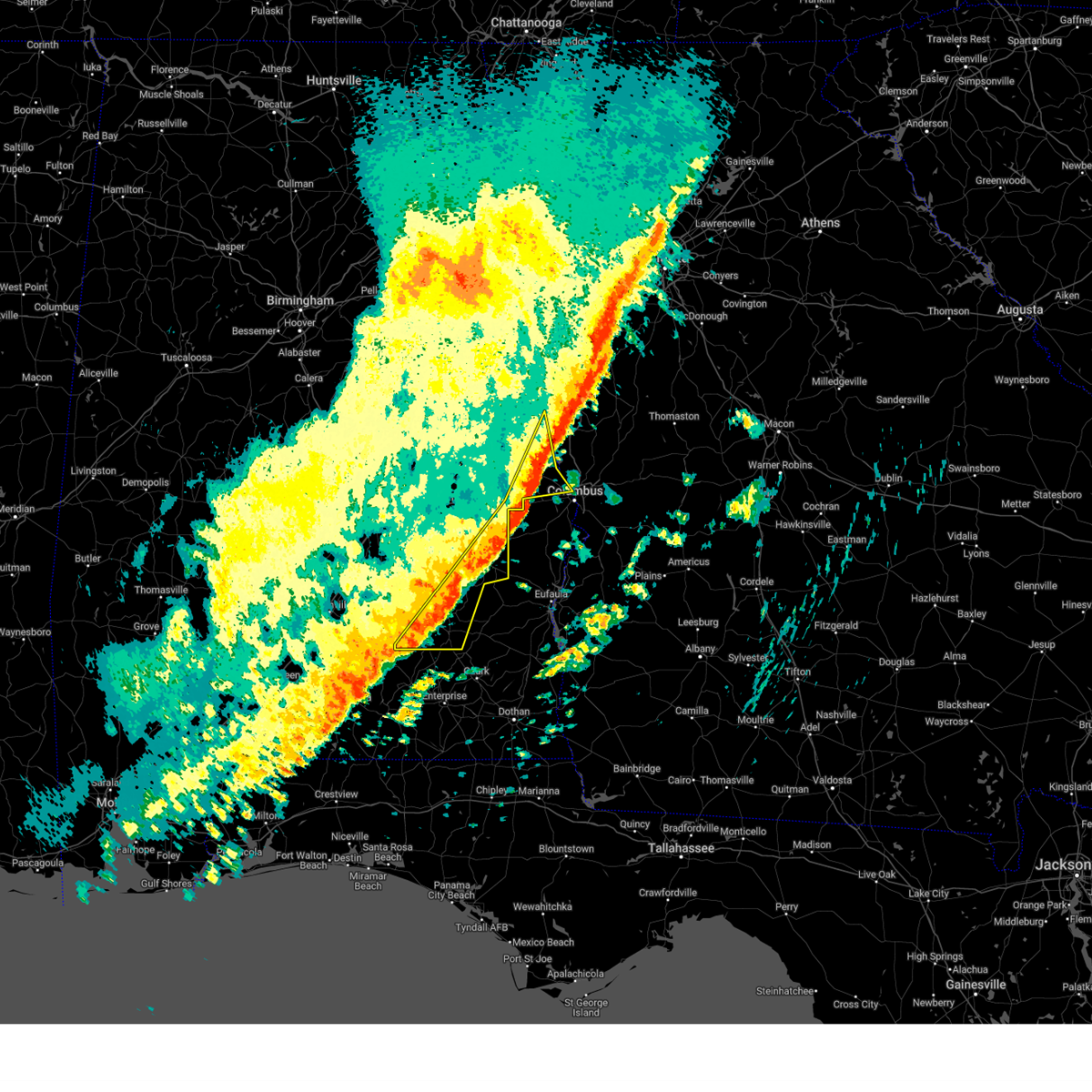
 At 556 pm cdt, a severe thunderstorm was located over guerryton, or 7 miles west of hurtsboro, moving east at 40 mph (broadcast media). Hazards include golf ball size hail and 60 mph wind gusts. People and animals outdoors will be injured. expect hail damage to roofs, siding, windows, and vehicles. expect wind damage to roofs, siding, and trees. Locations impacted include, union springs, hurtsboro, midway, hawkinsville, aberfoil, uchee, spring hill, guerryton, davisville, russell county sports complex, seale, comer, society hill, lakepoint resort state park, warriorstand, twin springs, rutherford, three notch, uchee creek, and sedgefield. At 556 pm cdt, a severe thunderstorm was located over guerryton, or 7 miles west of hurtsboro, moving east at 40 mph (broadcast media). Hazards include golf ball size hail and 60 mph wind gusts. People and animals outdoors will be injured. expect hail damage to roofs, siding, windows, and vehicles. expect wind damage to roofs, siding, and trees. Locations impacted include, union springs, hurtsboro, midway, hawkinsville, aberfoil, uchee, spring hill, guerryton, davisville, russell county sports complex, seale, comer, society hill, lakepoint resort state park, warriorstand, twin springs, rutherford, three notch, uchee creek, and sedgefield.
|
| 5/6/2026 5:45 PM CDT | Quarter sized hail reported 8.4 miles S of Union Springs, AL, hail of at least quarter sized observed by broadcast meteorologist just north of cr 2 in macon county. |
| 5/6/2026 5:45 PM CDT | Quarter sized hail reported 7 miles S of Union Springs, AL, quarter sized hail reported by the public in fort davis around 5:45 pm. time and location approximate. |
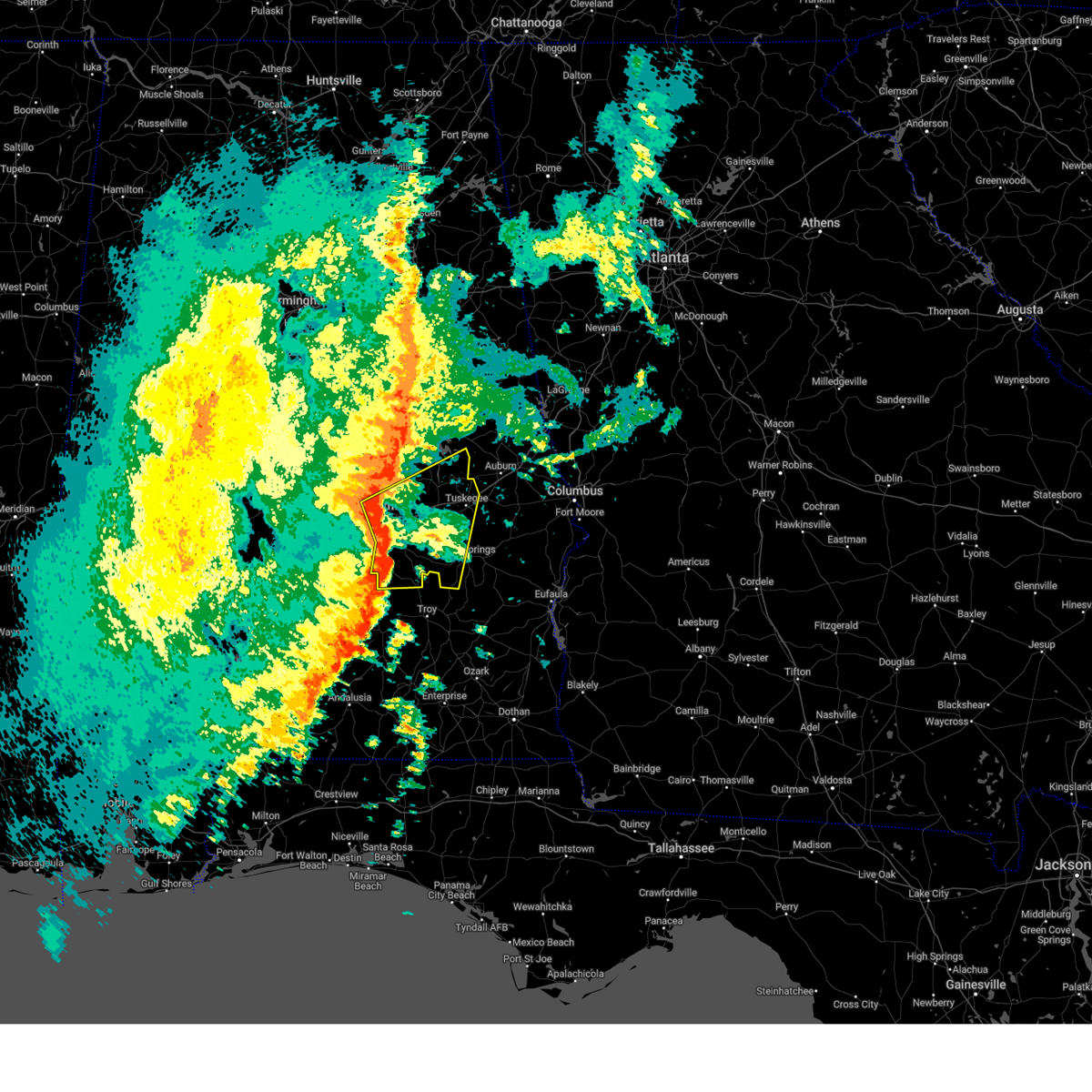
| 5/6/2026 5:38 PM CDT |
 Svrbmx the national weather service in birmingham has issued a * severe thunderstorm warning for, bullock county in southeastern alabama, southeastern macon county in southeastern alabama, northeastern barbour county in southeastern alabama, russell county in southeastern alabama, * until 700 pm cdt. * at 537 pm cdt, a severe thunderstorm was located near franklin field, or 7 miles north of union springs, moving east at 40 mph (broadcast media). Hazards include golf ball size hail and 60 mph wind gusts. People and animals outdoors will be injured. expect hail damage to roofs, siding, windows, and vehicles. Expect wind damage to roofs, siding, and trees. Svrbmx the national weather service in birmingham has issued a * severe thunderstorm warning for, bullock county in southeastern alabama, southeastern macon county in southeastern alabama, northeastern barbour county in southeastern alabama, russell county in southeastern alabama, * until 700 pm cdt. * at 537 pm cdt, a severe thunderstorm was located near franklin field, or 7 miles north of union springs, moving east at 40 mph (broadcast media). Hazards include golf ball size hail and 60 mph wind gusts. People and animals outdoors will be injured. expect hail damage to roofs, siding, windows, and vehicles. Expect wind damage to roofs, siding, and trees.
|
| 5/6/2026 5:29 PM CDT |
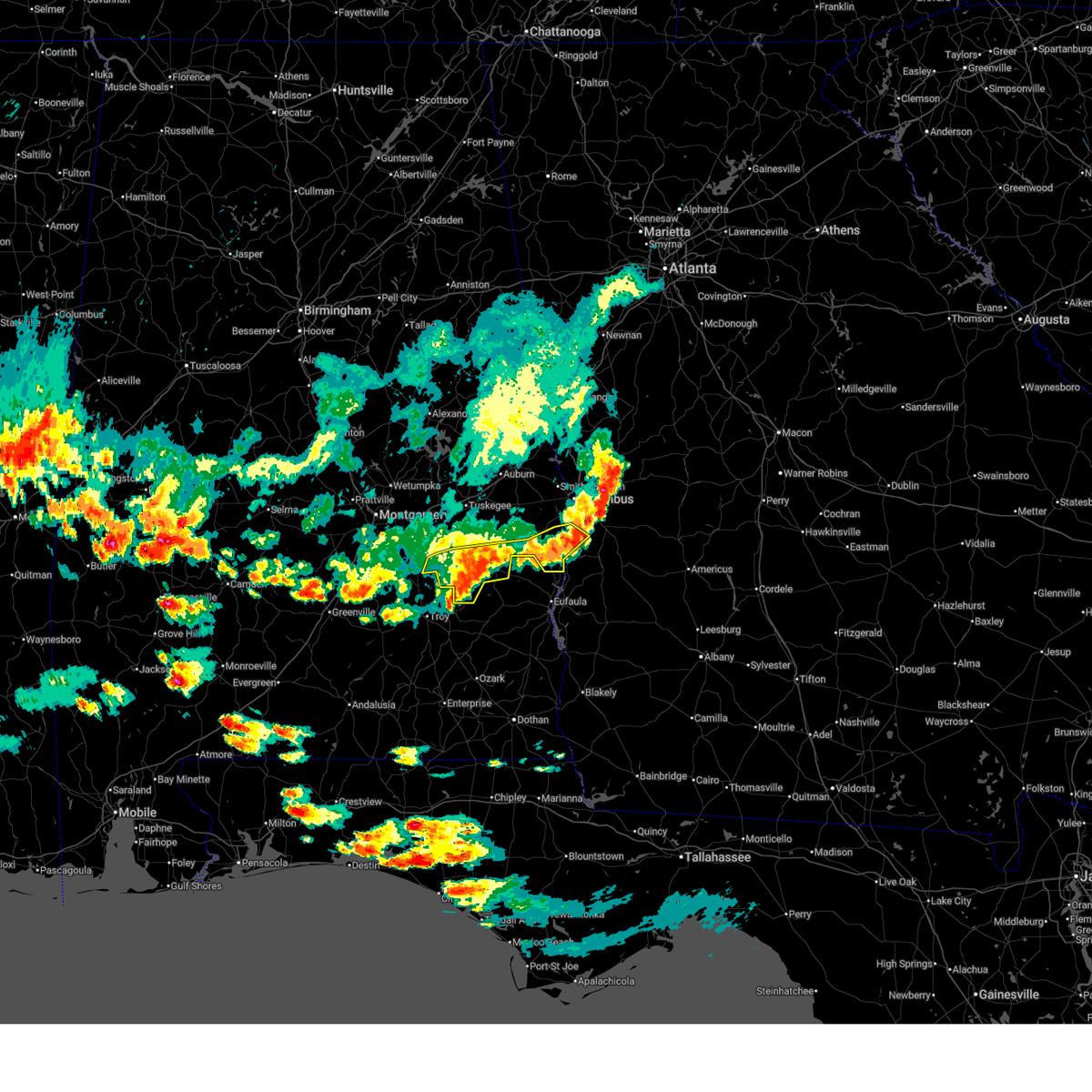
 At 529 pm cdt, a severe thunderstorm capable of producing a tornado was located near pike road, or 13 miles southwest of milstead, moving east at 25 mph (radar indicated rotation). Hazards include tornado and golf ball size hail. Flying debris will be dangerous to those caught without shelter. mobile homes will be damaged or destroyed. damage to roofs, windows, and vehicles will occur. tree damage is likely. Locations impacted include, union springs, hardaway, liverpool, davisville, franklin field, cross keys, sedgefield, mitchell, simsville, carters hill, cecil, and fort davis. At 529 pm cdt, a severe thunderstorm capable of producing a tornado was located near pike road, or 13 miles southwest of milstead, moving east at 25 mph (radar indicated rotation). Hazards include tornado and golf ball size hail. Flying debris will be dangerous to those caught without shelter. mobile homes will be damaged or destroyed. damage to roofs, windows, and vehicles will occur. tree damage is likely. Locations impacted include, union springs, hardaway, liverpool, davisville, franklin field, cross keys, sedgefield, mitchell, simsville, carters hill, cecil, and fort davis.
|
| 5/6/2026 5:20 PM CDT |
 At 519 pm cdt, a severe thunderstorm capable of producing a tornado was located over pike road, or 10 miles southeast of montgomery, moving southeast at 25 mph (radar indicated rotation). Hazards include tornado and ping pong ball size hail. Flying debris will be dangerous to those caught without shelter. mobile homes will be damaged or destroyed. damage to roofs, windows, and vehicles will occur. tree damage is likely. Locations impacted include, southeastern montgomery, union springs, pike road, liverpool, franklin field, hardaway, mount meigs, davisville, waugh, sedgefield, carters hill, fort davis, cross keys, mitchell, simsville, and cecil. At 519 pm cdt, a severe thunderstorm capable of producing a tornado was located over pike road, or 10 miles southeast of montgomery, moving southeast at 25 mph (radar indicated rotation). Hazards include tornado and ping pong ball size hail. Flying debris will be dangerous to those caught without shelter. mobile homes will be damaged or destroyed. damage to roofs, windows, and vehicles will occur. tree damage is likely. Locations impacted include, southeastern montgomery, union springs, pike road, liverpool, franklin field, hardaway, mount meigs, davisville, waugh, sedgefield, carters hill, fort davis, cross keys, mitchell, simsville, and cecil.
|
| 5/6/2026 5:07 PM CDT |
 Torbmx the national weather service in birmingham has issued a * tornado warning for, northwestern bullock county in southeastern alabama, southwestern macon county in southeastern alabama, east central montgomery county in south central alabama, * until 600 pm cdt. * at 506 pm cdt, a severe thunderstorm capable of producing a tornado was located over southeastern montgomery, moving east at 45 mph (radar indicated rotation). Hazards include tornado and ping pong ball size hail. Flying debris will be dangerous to those caught without shelter. mobile homes will be damaged or destroyed. damage to roofs, windows, and vehicles will occur. Tree damage is likely. Torbmx the national weather service in birmingham has issued a * tornado warning for, northwestern bullock county in southeastern alabama, southwestern macon county in southeastern alabama, east central montgomery county in south central alabama, * until 600 pm cdt. * at 506 pm cdt, a severe thunderstorm capable of producing a tornado was located over southeastern montgomery, moving east at 45 mph (radar indicated rotation). Hazards include tornado and ping pong ball size hail. Flying debris will be dangerous to those caught without shelter. mobile homes will be damaged or destroyed. damage to roofs, windows, and vehicles will occur. Tree damage is likely.
|
| 3/12/2026 3:25 AM CDT | Tree down on hwy 51 nort in bullock county AL, 13.1 miles WSW of Union Springs, AL |
| 6/25/2025 9:54 PM CDT |
 the severe thunderstorm warning has been cancelled and is no longer in effect the severe thunderstorm warning has been cancelled and is no longer in effect
|
| 6/25/2025 9:54 PM CDT |
 At 954 pm cdt, severe thunderstorms were located along a line extending from liverpool to shopton, moving northwest at 20 mph (radar indicated). Hazards include 60 mph wind gusts. Expect damage to roofs, siding, and trees. Locations impacted include, tuskegee, union springs, shorter, liverpool, franklin field, hardaway, shopton, tysonville, victoryland, davisville, warriorstand, sedgefield, high ridge, fort davis, cross keys, creek stand, mitchell, and simsville. At 954 pm cdt, severe thunderstorms were located along a line extending from liverpool to shopton, moving northwest at 20 mph (radar indicated). Hazards include 60 mph wind gusts. Expect damage to roofs, siding, and trees. Locations impacted include, tuskegee, union springs, shorter, liverpool, franklin field, hardaway, shopton, tysonville, victoryland, davisville, warriorstand, sedgefield, high ridge, fort davis, cross keys, creek stand, mitchell, and simsville.
|
| 6/25/2025 9:38 PM CDT |
 At 938 pm cdt, severe thunderstorms were located along a line extending from 7 miles southwest of seale to near beans crossroads, moving northwest at 35 mph (radar indicated). Hazards include 60 mph wind gusts. Expect damage to roofs, siding, and trees. Locations impacted include, tuskegee, union springs, hurtsboro, midway, shorter, aberfoil, uchee, franklin field, guerryton, shopton, davisville, liverpool, russell county sports complex, seale, hardaway, tysonville, victoryland, warriorstand, high ridge, and fort davis. At 938 pm cdt, severe thunderstorms were located along a line extending from 7 miles southwest of seale to near beans crossroads, moving northwest at 35 mph (radar indicated). Hazards include 60 mph wind gusts. Expect damage to roofs, siding, and trees. Locations impacted include, tuskegee, union springs, hurtsboro, midway, shorter, aberfoil, uchee, franklin field, guerryton, shopton, davisville, liverpool, russell county sports complex, seale, hardaway, tysonville, victoryland, warriorstand, high ridge, and fort davis.
|
| 6/25/2025 9:30 PM CDT |
 Svrbmx the national weather service in birmingham has issued a * severe thunderstorm warning for, bullock county in southeastern alabama, southern macon county in southeastern alabama, southwestern russell county in southeastern alabama, * until 1030 pm cdt. * at 930 pm cdt, severe thunderstorms were located along a line extending from near seale to near pickett, moving northwest at 30 mph (radar indicated). Hazards include 60 mph wind gusts. expect damage to roofs, siding, and trees Svrbmx the national weather service in birmingham has issued a * severe thunderstorm warning for, bullock county in southeastern alabama, southern macon county in southeastern alabama, southwestern russell county in southeastern alabama, * until 1030 pm cdt. * at 930 pm cdt, severe thunderstorms were located along a line extending from near seale to near pickett, moving northwest at 30 mph (radar indicated). Hazards include 60 mph wind gusts. expect damage to roofs, siding, and trees
|
| 5/21/2025 4:20 AM CDT |
 At 419 am cdt, a severe thunderstorm capable of producing a tornado was located over union springs, moving east at 35 mph (radar indicated rotation). Hazards include tornado. Flying debris will be dangerous to those caught without shelter. mobile homes will be damaged or destroyed. damage to roofs, windows, and vehicles will occur. tree damage is likely. Locations impacted include, union springs, franklin field, aberfoil, and sedgefield. At 419 am cdt, a severe thunderstorm capable of producing a tornado was located over union springs, moving east at 35 mph (radar indicated rotation). Hazards include tornado. Flying debris will be dangerous to those caught without shelter. mobile homes will be damaged or destroyed. damage to roofs, windows, and vehicles will occur. tree damage is likely. Locations impacted include, union springs, franklin field, aberfoil, and sedgefield.
|
| 5/21/2025 4:20 AM CDT |
 the tornado warning has been cancelled and is no longer in effect the tornado warning has been cancelled and is no longer in effect
|
| 5/21/2025 4:09 AM CDT |
 At 409 am cdt, a confirmed tornado was located over franklin field, or 7 miles west of union springs, moving east at 35 mph (radar confirmed tornado). Hazards include damaging tornado. Flying debris will be dangerous to those caught without shelter. mobile homes will be damaged or destroyed. damage to roofs, windows, and vehicles will occur. tree damage is likely. Locations impacted include, union springs, franklin field, aberfoil, sedgefield, simsville, and fort davis. At 409 am cdt, a confirmed tornado was located over franklin field, or 7 miles west of union springs, moving east at 35 mph (radar confirmed tornado). Hazards include damaging tornado. Flying debris will be dangerous to those caught without shelter. mobile homes will be damaged or destroyed. damage to roofs, windows, and vehicles will occur. tree damage is likely. Locations impacted include, union springs, franklin field, aberfoil, sedgefield, simsville, and fort davis.
|
| 5/21/2025 3:57 AM CDT |
 Torbmx the national weather service in birmingham has issued a * tornado warning for, northwestern bullock county in southeastern alabama, south central macon county in southeastern alabama, * until 430 am cdt. * at 357 am cdt, a severe thunderstorm capable of producing a tornado was located near shopton, or 13 miles northeast of meadville, moving east at 35 mph (radar indicated rotation). Hazards include tornado. Flying debris will be dangerous to those caught without shelter. mobile homes will be damaged or destroyed. damage to roofs, windows, and vehicles will occur. Tree damage is likely. Torbmx the national weather service in birmingham has issued a * tornado warning for, northwestern bullock county in southeastern alabama, south central macon county in southeastern alabama, * until 430 am cdt. * at 357 am cdt, a severe thunderstorm capable of producing a tornado was located near shopton, or 13 miles northeast of meadville, moving east at 35 mph (radar indicated rotation). Hazards include tornado. Flying debris will be dangerous to those caught without shelter. mobile homes will be damaged or destroyed. damage to roofs, windows, and vehicles will occur. Tree damage is likely.
|
| 4/10/2025 11:41 PM CDT |
 the severe thunderstorm warning has been cancelled and is no longer in effect the severe thunderstorm warning has been cancelled and is no longer in effect
|
| 4/10/2025 11:26 PM CDT |
 At 1126 pm cdt, severe thunderstorms were located along a line extending from near cusseta to near spring hill to franklin field, moving southeast at 45 mph (radar indicated). Hazards include 60 mph wind gusts. Expect damage to roofs, siding, and trees. Locations impacted include, pickett, hawkinsville, millers ford, aberfoil, spring hill, high ridge, louisville, hurtsboro, franklin field, perote, josie, beans crossroads, fort davis, twin springs, guerryton, rutherford, shopton, osco, three notch, and mitchell. At 1126 pm cdt, severe thunderstorms were located along a line extending from near cusseta to near spring hill to franklin field, moving southeast at 45 mph (radar indicated). Hazards include 60 mph wind gusts. Expect damage to roofs, siding, and trees. Locations impacted include, pickett, hawkinsville, millers ford, aberfoil, spring hill, high ridge, louisville, hurtsboro, franklin field, perote, josie, beans crossroads, fort davis, twin springs, guerryton, rutherford, shopton, osco, three notch, and mitchell.
|
| 4/10/2025 11:11 PM CDT |
 the severe thunderstorm warning has been cancelled and is no longer in effect the severe thunderstorm warning has been cancelled and is no longer in effect
|
| 4/10/2025 11:11 PM CDT |
 At 1110 pm cdt, severe thunderstorms were located along a line extending from near fort moore/lawson army air fld to near midway to near shopton, moving southeast at 45 mph (radar indicated). Hazards include 60 mph wind gusts. Expect damage to roofs, siding, and trees. Locations impacted include, pickett, warriorstand, millers ford, high ridge, josie, beans crossroads, fort davis, guerryton, rutherford, shopton, three notch, richards crossroads, uchee creek, white oak, midway, mount andrew, gaino, clayton municipal airport, seale, and comer. At 1110 pm cdt, severe thunderstorms were located along a line extending from near fort moore/lawson army air fld to near midway to near shopton, moving southeast at 45 mph (radar indicated). Hazards include 60 mph wind gusts. Expect damage to roofs, siding, and trees. Locations impacted include, pickett, warriorstand, millers ford, high ridge, josie, beans crossroads, fort davis, guerryton, rutherford, shopton, three notch, richards crossroads, uchee creek, white oak, midway, mount andrew, gaino, clayton municipal airport, seale, and comer.
|
| 4/10/2025 10:56 PM CDT |
 Svrbmx the national weather service in birmingham has issued a * severe thunderstorm warning for, northeastern pike county in southeastern alabama, southeastern lee county in east central alabama, bullock county in southeastern alabama, southeastern macon county in southeastern alabama, east central montgomery county in south central alabama, barbour county in southeastern alabama, russell county in southeastern alabama, * until midnight cdt. * at 1056 pm cdt, severe thunderstorms were located along a line extending from uchee to near union springs to near pike road, moving southeast at 50 mph (radar indicated). Hazards include 60 mph wind gusts. expect damage to roofs, siding, and trees Svrbmx the national weather service in birmingham has issued a * severe thunderstorm warning for, northeastern pike county in southeastern alabama, southeastern lee county in east central alabama, bullock county in southeastern alabama, southeastern macon county in southeastern alabama, east central montgomery county in south central alabama, barbour county in southeastern alabama, russell county in southeastern alabama, * until midnight cdt. * at 1056 pm cdt, severe thunderstorms were located along a line extending from uchee to near union springs to near pike road, moving southeast at 50 mph (radar indicated). Hazards include 60 mph wind gusts. expect damage to roofs, siding, and trees
|
| 3/4/2025 11:51 PM CST |
 The storms which prompted the warning have weakened below severe limits, and no longer pose an immediate threat to life or property. therefore, the warning will be allowed to expire. however, gusty winds are still possible with these thunderstorms. a severe thunderstorm watch remains in effect until 300 am cst for southeastern alabama. The storms which prompted the warning have weakened below severe limits, and no longer pose an immediate threat to life or property. therefore, the warning will be allowed to expire. however, gusty winds are still possible with these thunderstorms. a severe thunderstorm watch remains in effect until 300 am cst for southeastern alabama.
|
| 3/4/2025 11:12 PM CST |
 At 1112 pm cst, severe thunderstorms were located along a line extending from franklin field to near glenwood, moving east at 40 mph (radar indicated). Hazards include 60 mph wind gusts. Expect damage to roofs, siding, and trees. Locations impacted include, pickett, tennille, aberfoil, high ridge, perote, josie, beans crossroads, linwood, shopton, three notch, banks, midway, kent, tanyard, hamilton crossroads, monticello, orion, springhill, antioch, and troy. At 1112 pm cst, severe thunderstorms were located along a line extending from franklin field to near glenwood, moving east at 40 mph (radar indicated). Hazards include 60 mph wind gusts. Expect damage to roofs, siding, and trees. Locations impacted include, pickett, tennille, aberfoil, high ridge, perote, josie, beans crossroads, linwood, shopton, three notch, banks, midway, kent, tanyard, hamilton crossroads, monticello, orion, springhill, antioch, and troy.
|
| 3/4/2025 11:12 PM CST |
 the severe thunderstorm warning has been cancelled and is no longer in effect the severe thunderstorm warning has been cancelled and is no longer in effect
|
| 3/4/2025 10:43 PM CST |
 Svrbmx the national weather service in birmingham has issued a * severe thunderstorm warning for, pike county in southeastern alabama, bullock county in southeastern alabama, southeastern montgomery county in south central alabama, * until midnight cst. * at 1043 pm cst, severe thunderstorms were located along a line extending from near meadville to 8 miles north of dozier, moving east at 40 mph (radar indicated). Hazards include 60 mph wind gusts. expect damage to roofs, siding, and trees Svrbmx the national weather service in birmingham has issued a * severe thunderstorm warning for, pike county in southeastern alabama, bullock county in southeastern alabama, southeastern montgomery county in south central alabama, * until midnight cst. * at 1043 pm cst, severe thunderstorms were located along a line extending from near meadville to 8 miles north of dozier, moving east at 40 mph (radar indicated). Hazards include 60 mph wind gusts. expect damage to roofs, siding, and trees
|
| 3/4/2025 10:15 PM CST |
 Svrbmx the national weather service in birmingham has issued a * severe thunderstorm warning for, northwestern lee county in east central alabama, northern bullock county in southeastern alabama, macon county in southeastern alabama, tallapoosa county in east central alabama, * until 1130 pm cst. * at 1015 pm cst, severe thunderstorms were located along a line extending from hatchet to near sprague, moving northeast at 45 mph (radar indicated). Hazards include 60 mph wind gusts. expect damage to roofs, siding, and trees Svrbmx the national weather service in birmingham has issued a * severe thunderstorm warning for, northwestern lee county in east central alabama, northern bullock county in southeastern alabama, macon county in southeastern alabama, tallapoosa county in east central alabama, * until 1130 pm cst. * at 1015 pm cst, severe thunderstorms were located along a line extending from hatchet to near sprague, moving northeast at 45 mph (radar indicated). Hazards include 60 mph wind gusts. expect damage to roofs, siding, and trees
|
| 2/16/2025 3:26 AM CST |
 At 326 am cst, severe thunderstorms were located along a line extending from near west point to near uchee to 8 miles southeast of goshen, moving east at 60 mph (radar indicated). Hazards include 70 mph wind gusts. Expect considerable tree damage. damage is likely to mobile homes, roofs, and outbuildings. Locations impacted include, opelika, troy, valley, lanett, union springs, brundidge, midway, goshen, smiths, smiths station, west point, banks, lakeview, pickett, beulah, aberfoil, beans mill, beans crossroads, guerryton, and linwood. At 326 am cst, severe thunderstorms were located along a line extending from near west point to near uchee to 8 miles southeast of goshen, moving east at 60 mph (radar indicated). Hazards include 70 mph wind gusts. Expect considerable tree damage. damage is likely to mobile homes, roofs, and outbuildings. Locations impacted include, opelika, troy, valley, lanett, union springs, brundidge, midway, goshen, smiths, smiths station, west point, banks, lakeview, pickett, beulah, aberfoil, beans mill, beans crossroads, guerryton, and linwood.
|
| 2/16/2025 3:10 AM CST |
 At 309 am cst, severe thunderstorms were located along a line extending from fredonia to 6 miles north of troy municipal airport, moving east at 65 mph (radar indicated). Hazards include 70 mph wind gusts. Expect considerable tree damage. damage is likely to mobile homes, roofs, and outbuildings. Locations impacted include, auburn, opelika, troy, tuskegee, valley, lanett, union springs, brundidge, notasulga, midway, goshen, smiths, smiths station, west point, glenwood, banks, lakeview, cusseta, pickett, and beulah. At 309 am cst, severe thunderstorms were located along a line extending from fredonia to 6 miles north of troy municipal airport, moving east at 65 mph (radar indicated). Hazards include 70 mph wind gusts. Expect considerable tree damage. damage is likely to mobile homes, roofs, and outbuildings. Locations impacted include, auburn, opelika, troy, tuskegee, valley, lanett, union springs, brundidge, notasulga, midway, goshen, smiths, smiths station, west point, glenwood, banks, lakeview, cusseta, pickett, and beulah.
|
| 2/16/2025 2:35 AM CST |
 Svrbmx the national weather service in birmingham has issued a * severe thunderstorm warning for, pike county in southeastern alabama, lee county in east central alabama, bullock county in southeastern alabama, macon county in southeastern alabama, eastern chambers county in east central alabama, * until 400 am cst. * at 234 am cst, severe thunderstorms were located along a line extending from near new site to near logan, moving east at 65 mph (radar indicated). Hazards include 70 mph wind gusts. Expect considerable tree damage. Damage is likely to mobile homes, roofs, and outbuildings. Svrbmx the national weather service in birmingham has issued a * severe thunderstorm warning for, pike county in southeastern alabama, lee county in east central alabama, bullock county in southeastern alabama, macon county in southeastern alabama, eastern chambers county in east central alabama, * until 400 am cst. * at 234 am cst, severe thunderstorms were located along a line extending from near new site to near logan, moving east at 65 mph (radar indicated). Hazards include 70 mph wind gusts. Expect considerable tree damage. Damage is likely to mobile homes, roofs, and outbuildings.
|
| 12/29/2024 1:57 AM CST |
 Svrbmx the national weather service in birmingham has issued a * severe thunderstorm warning for, eastern pike county in southeastern alabama, eastern bullock county in southeastern alabama, barbour county in southeastern alabama, southern russell county in southeastern alabama, * until 315 am cst. * at 157 am cst, severe thunderstorms were located along a line extending from near guerryton to 7 miles southwest of brundidge, moving east at 40 mph (radar indicated). Hazards include 60 mph wind gusts. expect damage to roofs, siding, and trees Svrbmx the national weather service in birmingham has issued a * severe thunderstorm warning for, eastern pike county in southeastern alabama, eastern bullock county in southeastern alabama, barbour county in southeastern alabama, southern russell county in southeastern alabama, * until 315 am cst. * at 157 am cst, severe thunderstorms were located along a line extending from near guerryton to 7 miles southwest of brundidge, moving east at 40 mph (radar indicated). Hazards include 60 mph wind gusts. expect damage to roofs, siding, and trees
|
| 12/29/2024 1:28 AM CST |
 At 128 am cst, severe thunderstorms were located along a line extending from near tallassee to near liverpool to franklin field, moving northeast at 50 mph (radar indicated). Hazards include 60 mph wind gusts. Expect damage to roofs, siding, and trees. Locations impacted include, tuskegee, tallassee, union springs, notasulga, milstead, shorter, franklin, franklin field, reeves airport, lake tuskegee, davisville, liverpool, liberty city, tallapoosa city, hardaway, victoryland, uphapee creek, fort davis, yates reservoir, and sedgefield. At 128 am cst, severe thunderstorms were located along a line extending from near tallassee to near liverpool to franklin field, moving northeast at 50 mph (radar indicated). Hazards include 60 mph wind gusts. Expect damage to roofs, siding, and trees. Locations impacted include, tuskegee, tallassee, union springs, notasulga, milstead, shorter, franklin, franklin field, reeves airport, lake tuskegee, davisville, liverpool, liberty city, tallapoosa city, hardaway, victoryland, uphapee creek, fort davis, yates reservoir, and sedgefield.
|
| 12/29/2024 1:28 AM CST |
 the severe thunderstorm warning has been cancelled and is no longer in effect the severe thunderstorm warning has been cancelled and is no longer in effect
|
| 12/29/2024 1:08 AM CST |
 At 108 am cst, severe thunderstorms were located along a line extending from near wetumpka to near waugh to near dublin, moving northeast at 45 mph (radar indicated). Hazards include 60 mph wind gusts. Expect damage to roofs, siding, and trees. Locations impacted include, eastern montgomery, tuskegee, wetumpka, tallassee, union springs, notasulga, meadville, milstead, pike road, shorter, franklin, auburn university in montgomery, dublin, lake tuskegee, beans crossroads, shopton, ramer, waugh, liverpool, and liberty city. At 108 am cst, severe thunderstorms were located along a line extending from near wetumpka to near waugh to near dublin, moving northeast at 45 mph (radar indicated). Hazards include 60 mph wind gusts. Expect damage to roofs, siding, and trees. Locations impacted include, eastern montgomery, tuskegee, wetumpka, tallassee, union springs, notasulga, meadville, milstead, pike road, shorter, franklin, auburn university in montgomery, dublin, lake tuskegee, beans crossroads, shopton, ramer, waugh, liverpool, and liberty city.
|
| 12/29/2024 12:54 AM CST |
 Svrbmx the national weather service in birmingham has issued a * severe thunderstorm warning for, southern elmore county in east central alabama, western bullock county in southeastern alabama, central macon county in southeastern alabama, south central tallapoosa county in east central alabama, montgomery county in south central alabama, * until 200 am cst. * at 1254 am cst, severe thunderstorms were located along a line extending from near boylston to near pinedale to naftel, moving northeast at 45 mph (radar indicated). Hazards include 60 mph wind gusts. expect damage to roofs, siding, and trees Svrbmx the national weather service in birmingham has issued a * severe thunderstorm warning for, southern elmore county in east central alabama, western bullock county in southeastern alabama, central macon county in southeastern alabama, south central tallapoosa county in east central alabama, montgomery county in south central alabama, * until 200 am cst. * at 1254 am cst, severe thunderstorms were located along a line extending from near boylston to near pinedale to naftel, moving northeast at 45 mph (radar indicated). Hazards include 60 mph wind gusts. expect damage to roofs, siding, and trees
|
| 8/22/2024 4:35 AM CDT |
 At 435 am cdt, a severe thunderstorm was located near aberfoil, or near midway, moving west at 10 mph (radar indicated). Hazards include 60 mph wind gusts and quarter size hail. Hail damage to vehicles is expected. expect wind damage to roofs, siding, and trees. Locations impacted include, union springs, midway, and aberfoil. At 435 am cdt, a severe thunderstorm was located near aberfoil, or near midway, moving west at 10 mph (radar indicated). Hazards include 60 mph wind gusts and quarter size hail. Hail damage to vehicles is expected. expect wind damage to roofs, siding, and trees. Locations impacted include, union springs, midway, and aberfoil.
|
| 8/22/2024 4:19 AM CDT |
 Svrbmx the national weather service in birmingham has issued a * severe thunderstorm warning for, east central bullock county in southeastern alabama, * until 445 am cdt. * at 419 am cdt, a severe thunderstorm was located over midway, moving west at 10 mph (radar indicated). Hazards include 60 mph wind gusts and quarter size hail. Hail damage to vehicles is expected. Expect wind damage to roofs, siding, and trees. Svrbmx the national weather service in birmingham has issued a * severe thunderstorm warning for, east central bullock county in southeastern alabama, * until 445 am cdt. * at 419 am cdt, a severe thunderstorm was located over midway, moving west at 10 mph (radar indicated). Hazards include 60 mph wind gusts and quarter size hail. Hail damage to vehicles is expected. Expect wind damage to roofs, siding, and trees.
|
| 8/18/2024 5:49 PM CDT | Trees were blown down in northeast bullock county per fire dep in bullock county AL, 13.1 miles WSW of Union Springs, AL |
| 5/27/2024 7:12 PM CDT |
 Svrbmx the national weather service in birmingham has issued a * severe thunderstorm warning for, eastern bullock county in southeastern alabama, central barbour county in southeastern alabama, * until 745 pm cdt. * at 712 pm cdt, a severe thunderstorm was located near midway, moving southeast at 30 mph (radar indicated). Hazards include 60 mph wind gusts and nickel size hail. expect damage to roofs, siding, and trees Svrbmx the national weather service in birmingham has issued a * severe thunderstorm warning for, eastern bullock county in southeastern alabama, central barbour county in southeastern alabama, * until 745 pm cdt. * at 712 pm cdt, a severe thunderstorm was located near midway, moving southeast at 30 mph (radar indicated). Hazards include 60 mph wind gusts and nickel size hail. expect damage to roofs, siding, and trees
|
| 5/25/2024 12:07 PM CDT |
 The storm which prompted the warning has moved out of the area. therefore, the warning will be allowed to expire. a severe thunderstorm watch remains in effect until 700 pm cdt for southeastern alabama. The storm which prompted the warning has moved out of the area. therefore, the warning will be allowed to expire. a severe thunderstorm watch remains in effect until 700 pm cdt for southeastern alabama.
|
| 5/25/2024 12:06 PM CDT |
 At 1206 pm cdt, a severe thunderstorm was located over aberfoil, or near union springs, moving southeast at 35 mph (radar indicated). Hazards include 60 mph wind gusts and penny size hail. Expect damage to roofs, siding, and trees. Locations impacted include, union springs, midway, pickett, aberfoil, tanyard, three notch, and perote. At 1206 pm cdt, a severe thunderstorm was located over aberfoil, or near union springs, moving southeast at 35 mph (radar indicated). Hazards include 60 mph wind gusts and penny size hail. Expect damage to roofs, siding, and trees. Locations impacted include, union springs, midway, pickett, aberfoil, tanyard, three notch, and perote.
|
| 5/25/2024 11:55 AM CDT |
 Svrbmx the national weather service in birmingham has issued a * severe thunderstorm warning for, central bullock county in southeastern alabama, * until 100 pm cdt. * at 1155 am cdt, a severe thunderstorm was located over union springs, moving southeast at 25 mph (radar indicated). Hazards include 60 mph wind gusts and penny size hail. expect damage to roofs, siding, and trees Svrbmx the national weather service in birmingham has issued a * severe thunderstorm warning for, central bullock county in southeastern alabama, * until 100 pm cdt. * at 1155 am cdt, a severe thunderstorm was located over union springs, moving southeast at 25 mph (radar indicated). Hazards include 60 mph wind gusts and penny size hail. expect damage to roofs, siding, and trees
|
| 5/25/2024 11:44 AM CDT |
 Svrbmx the national weather service in birmingham has issued a * severe thunderstorm warning for, north central bullock county in southeastern alabama, * until 1215 pm cdt. * at 1144 am cdt, a severe thunderstorm was located near franklin field, or near union springs, moving southeast at 30 mph (radar indicated). Hazards include 60 mph wind gusts and penny size hail. expect damage to roofs, siding, and trees Svrbmx the national weather service in birmingham has issued a * severe thunderstorm warning for, north central bullock county in southeastern alabama, * until 1215 pm cdt. * at 1144 am cdt, a severe thunderstorm was located near franklin field, or near union springs, moving southeast at 30 mph (radar indicated). Hazards include 60 mph wind gusts and penny size hail. expect damage to roofs, siding, and trees
|
| 5/10/2024 3:11 AM CDT |
 Svrbmx the national weather service in birmingham has issued a * severe thunderstorm warning for, eastern pike county in southeastern alabama, southern bullock county in southeastern alabama, barbour county in southeastern alabama, * until 415 am cdt. * at 310 am cdt, severe thunderstorms were located along a line extending from near shopton to 7 miles southwest of brundidge, moving east at 60 mph (radar indicated). Hazards include 60 mph wind gusts and penny size hail. expect damage to roofs, siding, and trees Svrbmx the national weather service in birmingham has issued a * severe thunderstorm warning for, eastern pike county in southeastern alabama, southern bullock county in southeastern alabama, barbour county in southeastern alabama, * until 415 am cdt. * at 310 am cdt, severe thunderstorms were located along a line extending from near shopton to 7 miles southwest of brundidge, moving east at 60 mph (radar indicated). Hazards include 60 mph wind gusts and penny size hail. expect damage to roofs, siding, and trees
|
| 5/9/2024 10:50 PM CDT |
 the severe thunderstorm warning has been cancelled and is no longer in effect the severe thunderstorm warning has been cancelled and is no longer in effect
|
| 5/9/2024 10:26 PM CDT |
 At 1025 pm cdt, severe thunderstorms were located along a line extending from near society hill to near uchee to 6 miles east of union springs to near beans crossroads to near dublin, moving southeast at 50 mph (radar indicated). Hazards include 70 mph wind gusts and quarter size hail. Hail damage to vehicles is expected. expect considerable tree damage. wind damage is also likely to mobile homes, roofs, and outbuildings. Locations impacted include, union springs, hurtsboro, midway, clayton, pickett, hawkinsville, aberfoil, spring hill, uchee, beans crossroads, white oak, boot hill, russell county sports complex, seale, comer, barbour county public lake dam, high ridge, perote, rutherford, and three notch. At 1025 pm cdt, severe thunderstorms were located along a line extending from near society hill to near uchee to 6 miles east of union springs to near beans crossroads to near dublin, moving southeast at 50 mph (radar indicated). Hazards include 70 mph wind gusts and quarter size hail. Hail damage to vehicles is expected. expect considerable tree damage. wind damage is also likely to mobile homes, roofs, and outbuildings. Locations impacted include, union springs, hurtsboro, midway, clayton, pickett, hawkinsville, aberfoil, spring hill, uchee, beans crossroads, white oak, boot hill, russell county sports complex, seale, comer, barbour county public lake dam, high ridge, perote, rutherford, and three notch.
|
| 5/9/2024 10:22 PM CDT |
 At 1021 pm cdt, severe thunderstorms were located along a line extending from near beauregard to near davisville to franklin field, moving southeast at 55 mph (radar indicated). Hazards include 70 mph wind gusts and quarter size hail. Hail damage to vehicles is expected. expect considerable tree damage. wind damage is also likely to mobile homes, roofs, and outbuildings. Locations impacted include, auburn, opelika, tuskegee, union springs, notasulga, shorter, franklin, franklin field, lake tuskegee, auburn university, guerryton, shopton, tuskegee national forest, beauregard, davisville, liverpool, hardaway, society hill, griffen mill, and loachapoka. At 1021 pm cdt, severe thunderstorms were located along a line extending from near beauregard to near davisville to franklin field, moving southeast at 55 mph (radar indicated). Hazards include 70 mph wind gusts and quarter size hail. Hail damage to vehicles is expected. expect considerable tree damage. wind damage is also likely to mobile homes, roofs, and outbuildings. Locations impacted include, auburn, opelika, tuskegee, union springs, notasulga, shorter, franklin, franklin field, lake tuskegee, auburn university, guerryton, shopton, tuskegee national forest, beauregard, davisville, liverpool, hardaway, society hill, griffen mill, and loachapoka.
|
| 5/9/2024 10:22 PM CDT |
 the severe thunderstorm warning has been cancelled and is no longer in effect the severe thunderstorm warning has been cancelled and is no longer in effect
|
| 5/9/2024 10:15 PM CDT |
 Svrbmx the national weather service in birmingham has issued a * severe thunderstorm warning for, southern bullock county in southeastern alabama, northern barbour county in southeastern alabama, russell county in southeastern alabama, * until 1115 pm cdt. * at 1015 pm cdt, severe thunderstorms were located along a line extending from near auburn to 6 miles southwest of society hill to 6 miles north of union springs to near shopton to near ramer, moving southeast at 50 mph (radar indicated). Hazards include 60 mph wind gusts and quarter size hail. Hail damage to vehicles is expected. Expect wind damage to roofs, siding, and trees. Svrbmx the national weather service in birmingham has issued a * severe thunderstorm warning for, southern bullock county in southeastern alabama, northern barbour county in southeastern alabama, russell county in southeastern alabama, * until 1115 pm cdt. * at 1015 pm cdt, severe thunderstorms were located along a line extending from near auburn to 6 miles southwest of society hill to 6 miles north of union springs to near shopton to near ramer, moving southeast at 50 mph (radar indicated). Hazards include 60 mph wind gusts and quarter size hail. Hail damage to vehicles is expected. Expect wind damage to roofs, siding, and trees.
|
| 5/9/2024 9:53 PM CDT |
 At 953 pm cdt, severe thunderstorms were located along a line extending from near still waters resort to tysonville to near dannelly field, moving southeast at 50 mph (radar indicated). Hazards include 70 mph wind gusts. Expect considerable tree damage. damage is likely to mobile homes, roofs, and outbuildings. Locations impacted include, southeastern montgomery, auburn, opelika, tuskegee, union springs, notasulga, meadville, milstead, pike road, shorter, franklin, waverly, lake tuskegee, guerryton, snowdoun, shopton, tuskegee national forest, beauregard, liverpool, and liberty city. At 953 pm cdt, severe thunderstorms were located along a line extending from near still waters resort to tysonville to near dannelly field, moving southeast at 50 mph (radar indicated). Hazards include 70 mph wind gusts. Expect considerable tree damage. damage is likely to mobile homes, roofs, and outbuildings. Locations impacted include, southeastern montgomery, auburn, opelika, tuskegee, union springs, notasulga, meadville, milstead, pike road, shorter, franklin, waverly, lake tuskegee, guerryton, snowdoun, shopton, tuskegee national forest, beauregard, liverpool, and liberty city.
|
| 5/9/2024 9:41 PM CDT |
 Svrbmx the national weather service in birmingham has issued a * severe thunderstorm warning for, lee county in east central alabama, northern bullock county in southeastern alabama, macon county in southeastern alabama, central montgomery county in south central alabama, * until 1100 pm cdt. * at 940 pm cdt, severe thunderstorms were located along a line extending from near kellyton to near jordan lake to near vida junction, moving southeast at 45 mph (radar indicated). Hazards include 70 mph wind gusts. Expect considerable tree damage. Damage is likely to mobile homes, roofs, and outbuildings. Svrbmx the national weather service in birmingham has issued a * severe thunderstorm warning for, lee county in east central alabama, northern bullock county in southeastern alabama, macon county in southeastern alabama, central montgomery county in south central alabama, * until 1100 pm cdt. * at 940 pm cdt, severe thunderstorms were located along a line extending from near kellyton to near jordan lake to near vida junction, moving southeast at 45 mph (radar indicated). Hazards include 70 mph wind gusts. Expect considerable tree damage. Damage is likely to mobile homes, roofs, and outbuildings.
|
| 2/11/2024 3:40 PM CST |
 At 340 pm cst, a severe thunderstorm was located near meadville, moving east at 45 mph (radar indicated). Hazards include 60 mph wind gusts. Expect damage to roofs, siding, and trees. locations impacted include, union springs, meadville, pike road, hardaway, shopton, franklin field, mitchell, simsville, carters hill, and cecil. hail threat, radar indicated max hail size, <. 75 in wind threat, radar indicated max wind gust, 60 mph. At 340 pm cst, a severe thunderstorm was located near meadville, moving east at 45 mph (radar indicated). Hazards include 60 mph wind gusts. Expect damage to roofs, siding, and trees. locations impacted include, union springs, meadville, pike road, hardaway, shopton, franklin field, mitchell, simsville, carters hill, and cecil. hail threat, radar indicated max hail size, <. 75 in wind threat, radar indicated max wind gust, 60 mph.
|
| 2/11/2024 3:33 PM CST |
 At 333 pm cst, a severe thunderstorm was located over sprague, or 7 miles northwest of meadville, moving east at 45 mph (radar indicated). Hazards include 60 mph wind gusts. expect damage to roofs, siding, and trees At 333 pm cst, a severe thunderstorm was located over sprague, or 7 miles northwest of meadville, moving east at 45 mph (radar indicated). Hazards include 60 mph wind gusts. expect damage to roofs, siding, and trees
|
| 8/15/2023 3:04 PM CDT |
 At 304 pm cdt, severe thunderstorms were located along a line extending from near opelika to near tuskegee national forest to near davisville, moving east at 30 mph (radar indicated). Hazards include 60 mph wind gusts. expect damage to roofs, siding, and trees At 304 pm cdt, severe thunderstorms were located along a line extending from near opelika to near tuskegee national forest to near davisville, moving east at 30 mph (radar indicated). Hazards include 60 mph wind gusts. expect damage to roofs, siding, and trees
|
| 8/11/2023 4:38 PM CDT |
 The severe thunderstorm warning for bullock, southwestern macon and east central montgomery counties will expire at 445 pm cdt, the storms which prompted the warning have weakened below severe limits, and no longer pose an immediate threat to life or property. therefore, the warning will be allowed to expire. however gusty winds are still possible with these thunderstorms. a severe thunderstorm watch remains in effect until 700 pm cdt for south central and southeastern alabama. The severe thunderstorm warning for bullock, southwestern macon and east central montgomery counties will expire at 445 pm cdt, the storms which prompted the warning have weakened below severe limits, and no longer pose an immediate threat to life or property. therefore, the warning will be allowed to expire. however gusty winds are still possible with these thunderstorms. a severe thunderstorm watch remains in effect until 700 pm cdt for south central and southeastern alabama.
|
| 8/11/2023 4:28 PM CDT |
 At 428 pm cdt, severe thunderstorms were located along a line extending from 6 miles west of guerryton to near franklin field to near pike road, moving southeast at 30 mph (radar indicated). Hazards include 60 mph wind gusts. Expect damage to roofs, siding, and trees. locations impacted include, union springs, midway, aberfoil, franklin field, beans crossroads, hardaway, shopton, sedgefield, high ridge, fort davis, three notch, mitchell, simsville and cecil. hail threat, radar indicated max hail size, <. 75 in wind threat, radar indicated max wind gust, 60 mph. At 428 pm cdt, severe thunderstorms were located along a line extending from 6 miles west of guerryton to near franklin field to near pike road, moving southeast at 30 mph (radar indicated). Hazards include 60 mph wind gusts. Expect damage to roofs, siding, and trees. locations impacted include, union springs, midway, aberfoil, franklin field, beans crossroads, hardaway, shopton, sedgefield, high ridge, fort davis, three notch, mitchell, simsville and cecil. hail threat, radar indicated max hail size, <. 75 in wind threat, radar indicated max wind gust, 60 mph.
|
| 8/11/2023 4:03 PM CDT |
 At 403 pm cdt, a severe thunderstorm was located near hardaway, or 8 miles south of milstead, moving southeast at 25 mph (radar indicated). Hazards include 60 mph wind gusts. expect damage to roofs, siding, and trees At 403 pm cdt, a severe thunderstorm was located near hardaway, or 8 miles south of milstead, moving southeast at 25 mph (radar indicated). Hazards include 60 mph wind gusts. expect damage to roofs, siding, and trees
|
| 8/11/2023 3:15 PM CDT |
 At 315 pm cdt, severe thunderstorms were located along a line extending from near milstead to near guerryton to near griffen mill, moving southeast at 45 mph (radar indicated). Hazards include 60 mph wind gusts. Expect damage to roofs, siding, and trees. locations impacted include, tuskegee, union springs, hurtsboro, shorter, uchee, franklin field, guerryton, davisville, liverpool, russell county sports complex, seale, hardaway, tysonville, victoryland, society hill, warriorstand, fort davis, rutherford, mitchell and sedgefield. hail threat, radar indicated max hail size, <. 75 in wind threat, radar indicated max wind gust, 60 mph. At 315 pm cdt, severe thunderstorms were located along a line extending from near milstead to near guerryton to near griffen mill, moving southeast at 45 mph (radar indicated). Hazards include 60 mph wind gusts. Expect damage to roofs, siding, and trees. locations impacted include, tuskegee, union springs, hurtsboro, shorter, uchee, franklin field, guerryton, davisville, liverpool, russell county sports complex, seale, hardaway, tysonville, victoryland, society hill, warriorstand, fort davis, rutherford, mitchell and sedgefield. hail threat, radar indicated max hail size, <. 75 in wind threat, radar indicated max wind gust, 60 mph.
|
| 8/11/2023 2:51 PM CDT |
 At 251 pm cdt, severe thunderstorms were located along a line extending from eclectic to near tuskegee to opelika, moving southeast at 35 mph (emergency management). Hazards include 60 mph wind gusts. this storm has a history of blowing down trees. expect damage to roofs, siding, and trees At 251 pm cdt, severe thunderstorms were located along a line extending from eclectic to near tuskegee to opelika, moving southeast at 35 mph (emergency management). Hazards include 60 mph wind gusts. this storm has a history of blowing down trees. expect damage to roofs, siding, and trees
|
| 8/9/2023 5:11 PM CDT |
 At 510 pm cdt, a severe thunderstorm was located near union springs, moving northeast at 25 mph (radar indicated). Hazards include 60 mph wind gusts and quarter size hail. Hail damage to vehicles is expected. expect wind damage to roofs, siding, and trees. locations impacted include, union springs, guerryton, aberfoil, creek stand, warriorstand, sedgefield, three notch and fort davis. hail threat, radar indicated max hail size, 1. 00 in wind threat, radar indicated max wind gust, 60 mph. At 510 pm cdt, a severe thunderstorm was located near union springs, moving northeast at 25 mph (radar indicated). Hazards include 60 mph wind gusts and quarter size hail. Hail damage to vehicles is expected. expect wind damage to roofs, siding, and trees. locations impacted include, union springs, guerryton, aberfoil, creek stand, warriorstand, sedgefield, three notch and fort davis. hail threat, radar indicated max hail size, 1. 00 in wind threat, radar indicated max wind gust, 60 mph.
|
| 8/9/2023 4:58 PM CDT |
 At 458 pm cdt, a severe thunderstorm was located over union springs, moving northeast at 25 mph (radar indicated). Hazards include 60 mph wind gusts and quarter size hail. Hail damage to vehicles is expected. Expect wind damage to roofs, siding, and trees. At 458 pm cdt, a severe thunderstorm was located over union springs, moving northeast at 25 mph (radar indicated). Hazards include 60 mph wind gusts and quarter size hail. Hail damage to vehicles is expected. Expect wind damage to roofs, siding, and trees.
|
| 8/8/2023 2:54 PM CDT |
 At 253 pm cdt, a severe thunderstorm was located near midway, moving east at 50 mph (radar indicated). Hazards include 60 mph wind gusts. Expect damage to roofs, siding, and trees. locations impacted include, union springs, midway, guerryton, aberfoil, davisville, creek stand, warriorstand, sedgefield, three notch and fort davis. hail threat, radar indicated max hail size, <. 75 in wind threat, radar indicated max wind gust, 60 mph. At 253 pm cdt, a severe thunderstorm was located near midway, moving east at 50 mph (radar indicated). Hazards include 60 mph wind gusts. Expect damage to roofs, siding, and trees. locations impacted include, union springs, midway, guerryton, aberfoil, davisville, creek stand, warriorstand, sedgefield, three notch and fort davis. hail threat, radar indicated max hail size, <. 75 in wind threat, radar indicated max wind gust, 60 mph.
|
| 8/8/2023 2:35 PM CDT | Multiple trees down on highway 223 and on highway 2 in bullock county AL, 5.3 miles NE of Union Springs, AL |
| 8/8/2023 2:35 PM CDT |
 At 234 pm cdt, severe thunderstorms were located along a line extending from near milstead to aberfoil, moving east at 45 mph (radar indicated). Hazards include 60 mph wind gusts. Expect damage to roofs, siding, and trees. locations impacted include, union springs, midway, liverpool, aberfoil, franklin field, beans crossroads, guerryton, hardaway, shopton, davisville, warriorstand, sedgefield, high ridge, fort davis, cross keys, creek stand, china grove, three notch, mitchell and simsville. hail threat, radar indicated max hail size, <. 75 in wind threat, radar indicated max wind gust, 60 mph. At 234 pm cdt, severe thunderstorms were located along a line extending from near milstead to aberfoil, moving east at 45 mph (radar indicated). Hazards include 60 mph wind gusts. Expect damage to roofs, siding, and trees. locations impacted include, union springs, midway, liverpool, aberfoil, franklin field, beans crossroads, guerryton, hardaway, shopton, davisville, warriorstand, sedgefield, high ridge, fort davis, cross keys, creek stand, china grove, three notch, mitchell and simsville. hail threat, radar indicated max hail size, <. 75 in wind threat, radar indicated max wind gust, 60 mph.
|
| 8/8/2023 2:09 PM CDT |
 At 209 pm cdt, severe thunderstorms were located along a line extending from montgomery to near pine level, moving east at 45 mph (radar indicated). Hazards include 60 mph wind gusts. expect damage to roofs, siding, and trees At 209 pm cdt, severe thunderstorms were located along a line extending from montgomery to near pine level, moving east at 45 mph (radar indicated). Hazards include 60 mph wind gusts. expect damage to roofs, siding, and trees
|
| 8/6/2023 7:09 PM CDT |
 At 708 pm cdt, severe thunderstorms were located along a line extending from fort benning/lawson army air fld to white oak to near beans crossroads, moving southeast at 35 mph (radar indicated). Hazards include 60 mph wind gusts. Expect damage to roofs, siding, and trees. locations impacted include, eufaula, clayton, louisville, pickett, hawkinsville, aberfoil, beans crossroads, shopton, osco, richards crossroads, white oak, boot hill, gaino, lakepoint resort state park, barbour county public lake dam, millers ford, high ridge, perote, twin springs and mount andrew. hail threat, radar indicated max hail size, <. 75 in wind threat, radar indicated max wind gust, 60 mph. At 708 pm cdt, severe thunderstorms were located along a line extending from fort benning/lawson army air fld to white oak to near beans crossroads, moving southeast at 35 mph (radar indicated). Hazards include 60 mph wind gusts. Expect damage to roofs, siding, and trees. locations impacted include, eufaula, clayton, louisville, pickett, hawkinsville, aberfoil, beans crossroads, shopton, osco, richards crossroads, white oak, boot hill, gaino, lakepoint resort state park, barbour county public lake dam, millers ford, high ridge, perote, twin springs and mount andrew. hail threat, radar indicated max hail size, <. 75 in wind threat, radar indicated max wind gust, 60 mph.
|
| 8/6/2023 7:04 PM CDT |
 At 703 pm cdt, severe thunderstorms were located along a line extending from near bibb city to near spring hill to near aberfoil, moving southeast at 35 mph (radar indicated). Hazards include 60 mph wind gusts. Expect damage to roofs, siding, and trees. locations impacted include, phenix city, union springs, midway, russell county sports complex, spring hill, seale, franklin field, comer, barbour county public lake dam, ladonia, sedgefield, batesville, three notch, uchee creek, fort mitchell, ladonia sports complex, fort mitchell activity center, phenix drag strip and rutherford. hail threat, radar indicated max hail size, <. 75 in wind threat, radar indicated max wind gust, 60 mph. At 703 pm cdt, severe thunderstorms were located along a line extending from near bibb city to near spring hill to near aberfoil, moving southeast at 35 mph (radar indicated). Hazards include 60 mph wind gusts. Expect damage to roofs, siding, and trees. locations impacted include, phenix city, union springs, midway, russell county sports complex, spring hill, seale, franklin field, comer, barbour county public lake dam, ladonia, sedgefield, batesville, three notch, uchee creek, fort mitchell, ladonia sports complex, fort mitchell activity center, phenix drag strip and rutherford. hail threat, radar indicated max hail size, <. 75 in wind threat, radar indicated max wind gust, 60 mph.
|
| 8/6/2023 6:49 PM CDT |
 At 649 pm cdt, severe thunderstorms were located along a line extending from near smiths to near spring hill to near union springs, moving southeast at 35 mph (radar indicated). Hazards include 60 mph wind gusts. Expect damage to roofs, siding, and trees. locations impacted include, phenix city, union springs, hurtsboro, midway, smiths, smiths station, uchee, spring hill, franklin field, guerryton, bleecker, russell county sports complex, seale, comer, barbour county public lake dam, ladonia, aberfoil, rutherford, three notch and uchee creek. hail threat, radar indicated max hail size, <. 75 in wind threat, radar indicated max wind gust, 60 mph. At 649 pm cdt, severe thunderstorms were located along a line extending from near smiths to near spring hill to near union springs, moving southeast at 35 mph (radar indicated). Hazards include 60 mph wind gusts. Expect damage to roofs, siding, and trees. locations impacted include, phenix city, union springs, hurtsboro, midway, smiths, smiths station, uchee, spring hill, franklin field, guerryton, bleecker, russell county sports complex, seale, comer, barbour county public lake dam, ladonia, aberfoil, rutherford, three notch and uchee creek. hail threat, radar indicated max hail size, <. 75 in wind threat, radar indicated max wind gust, 60 mph.
|
| 8/6/2023 6:33 PM CDT |
 At 633 pm cdt, severe thunderstorms were located along a line extending from near beulah to guerryton to near franklin field, moving southeast at 40 mph (radar indicated). Hazards include 60 mph wind gusts. Expect damage to roofs, siding, and trees. locations impacted include, phenix city, union springs, hurtsboro, midway, smiths, smiths station, uchee, spring hill, franklin field, guerryton, bleecker, russell county sports complex, seale, comer, barbour county public lake dam, ladonia, griffen mill, goat rock lake, rutherford and three notch. hail threat, radar indicated max hail size, <. 75 in wind threat, radar indicated max wind gust, 60 mph. At 633 pm cdt, severe thunderstorms were located along a line extending from near beulah to guerryton to near franklin field, moving southeast at 40 mph (radar indicated). Hazards include 60 mph wind gusts. Expect damage to roofs, siding, and trees. locations impacted include, phenix city, union springs, hurtsboro, midway, smiths, smiths station, uchee, spring hill, franklin field, guerryton, bleecker, russell county sports complex, seale, comer, barbour county public lake dam, ladonia, griffen mill, goat rock lake, rutherford and three notch. hail threat, radar indicated max hail size, <. 75 in wind threat, radar indicated max wind gust, 60 mph.
|
| 8/6/2023 6:16 PM CDT |
 At 616 pm cdt, severe thunderstorms were located along a line extending from near beans mill to near hardaway, moving southeast at 35 mph (radar indicated). Hazards include 60 mph wind gusts. expect damage to roofs, siding, and trees At 616 pm cdt, severe thunderstorms were located along a line extending from near beans mill to near hardaway, moving southeast at 35 mph (radar indicated). Hazards include 60 mph wind gusts. expect damage to roofs, siding, and trees
|
| 8/6/2023 4:12 PM CDT | Tree down on power lines on county road 10 near boromville r in macon county AL, 17.2 miles SW of Union Springs, AL |
| 8/3/2023 6:33 PM CDT |
 At 633 pm cdt, severe thunderstorms were located along a line extending from near phenix city to near guerryton to aberfoil to near beans crossroads, moving southeast at 35 mph (radar indicated). Hazards include 60 mph wind gusts. Expect damage to roofs, siding, and trees. locations impacted include, columbus, phenix city, union springs, hurtsboro, midway, clayton, pickett, hawkinsville, aberfoil, uchee, spring hill, beans crossroads, guerryton, boot hill, russell county sports complex, seale, comer, barbour county public lake dam, ladonia and bibb city. hail threat, radar indicated max hail size, <. 75 in wind threat, radar indicated max wind gust, 60 mph. At 633 pm cdt, severe thunderstorms were located along a line extending from near phenix city to near guerryton to aberfoil to near beans crossroads, moving southeast at 35 mph (radar indicated). Hazards include 60 mph wind gusts. Expect damage to roofs, siding, and trees. locations impacted include, columbus, phenix city, union springs, hurtsboro, midway, clayton, pickett, hawkinsville, aberfoil, uchee, spring hill, beans crossroads, guerryton, boot hill, russell county sports complex, seale, comer, barbour county public lake dam, ladonia and bibb city. hail threat, radar indicated max hail size, <. 75 in wind threat, radar indicated max wind gust, 60 mph.
|
| 8/3/2023 6:25 PM CDT |
 At 624 pm cdt, severe thunderstorms were located along a line extending from ladonia to 7 miles east of davisville to union springs to near beans crossroads, moving south at 30 mph (radar indicated). Hazards include 60 mph wind gusts. Expect damage to roofs, siding, and trees. locations impacted include, columbus, phenix city, union springs, hurtsboro, midway, clayton, pickett, hawkinsville, aberfoil, uchee, spring hill, beans crossroads, guerryton, boot hill, russell county sports complex, seale, comer, barbour county public lake dam, ladonia and bibb city. hail threat, radar indicated max hail size, <. 75 in wind threat, radar indicated max wind gust, 60 mph. At 624 pm cdt, severe thunderstorms were located along a line extending from ladonia to 7 miles east of davisville to union springs to near beans crossroads, moving south at 30 mph (radar indicated). Hazards include 60 mph wind gusts. Expect damage to roofs, siding, and trees. locations impacted include, columbus, phenix city, union springs, hurtsboro, midway, clayton, pickett, hawkinsville, aberfoil, uchee, spring hill, beans crossroads, guerryton, boot hill, russell county sports complex, seale, comer, barbour county public lake dam, ladonia and bibb city. hail threat, radar indicated max hail size, <. 75 in wind threat, radar indicated max wind gust, 60 mph.
|
| 8/3/2023 6:23 PM CDT |
 At 623 pm cdt, severe thunderstorms were located along a line extending from near tuskegee national forest to near union springs to near pine level, moving southeast at 35 mph (radar indicated). Hazards include 60 mph wind gusts. Expect damage to roofs, siding, and trees. locations impacted include, union springs, shopton, davisville, society hill, franklin field, warriorstand, sedgefield, simsville and fort davis. hail threat, radar indicated max hail size, <. 75 in wind threat, radar indicated max wind gust, 60 mph. At 623 pm cdt, severe thunderstorms were located along a line extending from near tuskegee national forest to near union springs to near pine level, moving southeast at 35 mph (radar indicated). Hazards include 60 mph wind gusts. Expect damage to roofs, siding, and trees. locations impacted include, union springs, shopton, davisville, society hill, franklin field, warriorstand, sedgefield, simsville and fort davis. hail threat, radar indicated max hail size, <. 75 in wind threat, radar indicated max wind gust, 60 mph.
|
| 8/3/2023 6:07 PM CDT |
 At 607 pm cdt, severe thunderstorms were located along a line extending from near bleecker to near shopton, moving southeast at 35 mph (radar indicated). Hazards include 60 mph wind gusts. Expect damage to roofs, siding, and trees. locations impacted include, columbus, phenix city, union springs, hurtsboro, midway, clayton, pickett, hawkinsville, aberfoil, uchee, spring hill, beans crossroads, guerryton, boot hill, russell county sports complex, seale, comer, barbour county public lake dam, ladonia and bibb city. hail threat, radar indicated max hail size, <. 75 in wind threat, radar indicated max wind gust, 60 mph. At 607 pm cdt, severe thunderstorms were located along a line extending from near bleecker to near shopton, moving southeast at 35 mph (radar indicated). Hazards include 60 mph wind gusts. Expect damage to roofs, siding, and trees. locations impacted include, columbus, phenix city, union springs, hurtsboro, midway, clayton, pickett, hawkinsville, aberfoil, uchee, spring hill, beans crossroads, guerryton, boot hill, russell county sports complex, seale, comer, barbour county public lake dam, ladonia and bibb city. hail threat, radar indicated max hail size, <. 75 in wind threat, radar indicated max wind gust, 60 mph.
|
| 8/3/2023 6:05 PM CDT |
 At 605 pm cdt, severe thunderstorms were located along a line extending from near notasulga to near hardaway to near snowdoun, moving southeast at 35 mph (radar indicated). Hazards include 60 mph wind gusts. Expect damage to roofs, siding, and trees. locations impacted include, tuskegee, union springs, notasulga, pike road, franklin, franklin field, lake tuskegee, shopton, tuskegee national forest, davisville, liverpool, liberty city, hardaway, society hill, warriorstand, carters hill, uphapee creek, fort davis, mitchell and cecil. hail threat, radar indicated max hail size, <. 75 in wind threat, radar indicated max wind gust, 60 mph. At 605 pm cdt, severe thunderstorms were located along a line extending from near notasulga to near hardaway to near snowdoun, moving southeast at 35 mph (radar indicated). Hazards include 60 mph wind gusts. Expect damage to roofs, siding, and trees. locations impacted include, tuskegee, union springs, notasulga, pike road, franklin, franklin field, lake tuskegee, shopton, tuskegee national forest, davisville, liverpool, liberty city, hardaway, society hill, warriorstand, carters hill, uphapee creek, fort davis, mitchell and cecil. hail threat, radar indicated max hail size, <. 75 in wind threat, radar indicated max wind gust, 60 mph.
|
| 8/3/2023 5:57 PM CDT |
 At 557 pm cdt, severe thunderstorms were located along a line extending from near bleecker to near pike road, moving southeast at 35 mph (radar indicated). Hazards include 60 mph wind gusts. expect damage to roofs, siding, and trees At 557 pm cdt, severe thunderstorms were located along a line extending from near bleecker to near pike road, moving southeast at 35 mph (radar indicated). Hazards include 60 mph wind gusts. expect damage to roofs, siding, and trees
|
| 8/3/2023 5:51 PM CDT |
 At 550 pm cdt, severe thunderstorms were located along a line extending from near liberty city to near shorter to montgomery, moving southeast at 30 mph (radar indicated). Hazards include 60 mph wind gusts. Expect damage to roofs, siding, and trees. locations impacted include, montgomery, tuskegee, union springs, notasulga, meadville, milstead, pike road, coosada, shorter, franklin, hyundai motors of alabama, auburn university in montgomery, lake tuskegee, woodcrest, snowdoun, shopton, tuskegee national forest, waugh, lagoon park and hunter. hail threat, radar indicated max hail size, <. 75 in wind threat, radar indicated max wind gust, 60 mph. At 550 pm cdt, severe thunderstorms were located along a line extending from near liberty city to near shorter to montgomery, moving southeast at 30 mph (radar indicated). Hazards include 60 mph wind gusts. Expect damage to roofs, siding, and trees. locations impacted include, montgomery, tuskegee, union springs, notasulga, meadville, milstead, pike road, coosada, shorter, franklin, hyundai motors of alabama, auburn university in montgomery, lake tuskegee, woodcrest, snowdoun, shopton, tuskegee national forest, waugh, lagoon park and hunter. hail threat, radar indicated max hail size, <. 75 in wind threat, radar indicated max wind gust, 60 mph.
|
| 8/3/2023 5:28 PM CDT |
 At 528 pm cdt, severe thunderstorms were located along a line extending from near martin dam to near emerald mountain to near hunter, moving southeast at 35 mph (radar indicated). Hazards include 60 mph wind gusts. expect damage to roofs, siding, and trees At 528 pm cdt, severe thunderstorms were located along a line extending from near martin dam to near emerald mountain to near hunter, moving southeast at 35 mph (radar indicated). Hazards include 60 mph wind gusts. expect damage to roofs, siding, and trees
|
| 7/21/2023 8:54 PM CDT |
 At 854 pm cdt, severe thunderstorms were located along a line extending from near aberfoil to 6 miles southeast of pine level, moving southeast at 45 mph (radar indicated). Hazards include 60 mph wind gusts and penny size hail. Expect damage to roofs, siding, and trees. locations impacted include, union springs, pickett, pine level, aberfoil, franklin field, beans crossroads, linwood, shopton, high ridge, orion, perote, china grove, currys and simsville. hail threat, radar indicated max hail size, 0. 75 in wind threat, radar indicated max wind gust, 60 mph. At 854 pm cdt, severe thunderstorms were located along a line extending from near aberfoil to 6 miles southeast of pine level, moving southeast at 45 mph (radar indicated). Hazards include 60 mph wind gusts and penny size hail. Expect damage to roofs, siding, and trees. locations impacted include, union springs, pickett, pine level, aberfoil, franklin field, beans crossroads, linwood, shopton, high ridge, orion, perote, china grove, currys and simsville. hail threat, radar indicated max hail size, 0. 75 in wind threat, radar indicated max wind gust, 60 mph.
|
| 7/21/2023 8:53 PM CDT |
 The severe thunderstorm warning for southeastern lee, northeastern bullock, southeastern macon and northern russell counties will expire at 900 pm cdt, the storms which prompted the warning have moved out of the area. therefore, the warning will be allowed to expire. a severe thunderstorm watch remains in effect until midnight cdt for southeastern alabama, and southeastern and east central alabama. to report severe weather, contact your nearest law enforcement agency. they will relay your report to the national weather service birmingham. The severe thunderstorm warning for southeastern lee, northeastern bullock, southeastern macon and northern russell counties will expire at 900 pm cdt, the storms which prompted the warning have moved out of the area. therefore, the warning will be allowed to expire. a severe thunderstorm watch remains in effect until midnight cdt for southeastern alabama, and southeastern and east central alabama. to report severe weather, contact your nearest law enforcement agency. they will relay your report to the national weather service birmingham.
|
| 7/21/2023 8:31 PM CDT |
 At 831 pm cdt, severe thunderstorms were located along a line extending from near columbus to near seale to 6 miles west of guerryton, moving east at 30 mph (radar indicated). Hazards include 60 mph wind gusts and penny size hail. Expect damage to roofs, siding, and trees. locations impacted include, phenix city, hurtsboro, smiths, smiths station, russell county sports complex, uchee, guerryton, hardaway, ladonia, davisville, society hill, warriorstand, sedgefield, fort davis, creek stand, monterey heights, ladonia sports complex, marvyn, phenix drag strip and parkmanville. hail threat, radar indicated max hail size, 0. 75 in wind threat, radar indicated max wind gust, 60 mph. At 831 pm cdt, severe thunderstorms were located along a line extending from near columbus to near seale to 6 miles west of guerryton, moving east at 30 mph (radar indicated). Hazards include 60 mph wind gusts and penny size hail. Expect damage to roofs, siding, and trees. locations impacted include, phenix city, hurtsboro, smiths, smiths station, russell county sports complex, uchee, guerryton, hardaway, ladonia, davisville, society hill, warriorstand, sedgefield, fort davis, creek stand, monterey heights, ladonia sports complex, marvyn, phenix drag strip and parkmanville. hail threat, radar indicated max hail size, 0. 75 in wind threat, radar indicated max wind gust, 60 mph.
|
| 7/21/2023 8:26 PM CDT |
 At 825 pm cdt, severe thunderstorms were located along a line extending from 6 miles southwest of hardaway to near pintlala, moving southeast at 20 mph (radar indicated). Hazards include 60 mph wind gusts and penny size hail. expect damage to roofs, siding, and trees At 825 pm cdt, severe thunderstorms were located along a line extending from 6 miles southwest of hardaway to near pintlala, moving southeast at 20 mph (radar indicated). Hazards include 60 mph wind gusts and penny size hail. expect damage to roofs, siding, and trees
|
| 7/21/2023 8:15 PM CDT |
 At 815 pm cdt, severe thunderstorms were located along a line extending from bleecker to near uchee to near liverpool, moving east at 15 mph (radar indicated). Hazards include 60 mph wind gusts and penny size hail. Expect damage to roofs, siding, and trees. locations impacted include, phenix city, tuskegee, hurtsboro, smiths, smiths station, uchee, lake tuskegee, guerryton, beauregard, davisville, bleecker, liverpool, russell county sports complex, ladonia, society hill, griffen mill, hardaway, warriorstand, fort davis and sedgefield. hail threat, radar indicated max hail size, 0. 75 in wind threat, radar indicated max wind gust, 60 mph. At 815 pm cdt, severe thunderstorms were located along a line extending from bleecker to near uchee to near liverpool, moving east at 15 mph (radar indicated). Hazards include 60 mph wind gusts and penny size hail. Expect damage to roofs, siding, and trees. locations impacted include, phenix city, tuskegee, hurtsboro, smiths, smiths station, uchee, lake tuskegee, guerryton, beauregard, davisville, bleecker, liverpool, russell county sports complex, ladonia, society hill, griffen mill, hardaway, warriorstand, fort davis and sedgefield. hail threat, radar indicated max hail size, 0. 75 in wind threat, radar indicated max wind gust, 60 mph.
|
| 7/21/2023 7:57 PM CDT |
 At 757 pm cdt, severe thunderstorms were located along a line extending from near griffen mill to near society hill to near hardaway, moving east at 15 mph (radar indicated). Hazards include 60 mph wind gusts. expect damage to roofs, siding, and trees At 757 pm cdt, severe thunderstorms were located along a line extending from near griffen mill to near society hill to near hardaway, moving east at 15 mph (radar indicated). Hazards include 60 mph wind gusts. expect damage to roofs, siding, and trees
|
| 6/15/2023 6:44 AM CDT |
 At 644 am cdt, a severe thunderstorm was located over guerryton, or near hurtsboro, moving east at 55 mph (radar indicated). Hazards include 60 mph wind gusts and penny size hail. Expect damage to roofs, siding, and trees. locations impacted include, union springs, midway, guerryton, creek stand, warriorstand, sedgefield, three notch and fort davis. hail threat, radar indicated max hail size, 0. 75 in wind threat, radar indicated max wind gust, 60 mph. At 644 am cdt, a severe thunderstorm was located over guerryton, or near hurtsboro, moving east at 55 mph (radar indicated). Hazards include 60 mph wind gusts and penny size hail. Expect damage to roofs, siding, and trees. locations impacted include, union springs, midway, guerryton, creek stand, warriorstand, sedgefield, three notch and fort davis. hail threat, radar indicated max hail size, 0. 75 in wind threat, radar indicated max wind gust, 60 mph.
|
| 6/15/2023 6:33 AM CDT |
 At 633 am cdt, a severe thunderstorm was located near davisville, or 8 miles north of union springs, moving east at 55 mph (radar indicated). Hazards include 60 mph wind gusts and quarter size hail. Hail damage to vehicles is expected. expect wind damage to roofs, siding, and trees. locations impacted include, union springs, midway, guerryton, hardaway, liverpool, davisville, franklin field, creek stand, warriorstand, sedgefield, three notch and fort davis. hail threat, radar indicated max hail size, 1. 00 in wind threat, radar indicated max wind gust, 60 mph. At 633 am cdt, a severe thunderstorm was located near davisville, or 8 miles north of union springs, moving east at 55 mph (radar indicated). Hazards include 60 mph wind gusts and quarter size hail. Hail damage to vehicles is expected. expect wind damage to roofs, siding, and trees. locations impacted include, union springs, midway, guerryton, hardaway, liverpool, davisville, franklin field, creek stand, warriorstand, sedgefield, three notch and fort davis. hail threat, radar indicated max hail size, 1. 00 in wind threat, radar indicated max wind gust, 60 mph.
|
| 6/15/2023 6:26 AM CDT |
 At 625 am cdt, a severe thunderstorm was located over hardaway, or 9 miles south of milstead, moving east at 55 mph (radar indicated). Hazards include 60 mph wind gusts and quarter size hail. Hail damage to vehicles is expected. expect wind damage to roofs, siding, and trees. locations impacted include, union springs, midway, shorter, liverpool, guerryton, hardaway, tysonville, victoryland, davisville, franklin field, warriorstand, sedgefield, fort davis, cross keys, creek stand, three notch and mitchell. hail threat, radar indicated max hail size, 1. 00 in wind threat, radar indicated max wind gust, 60 mph. At 625 am cdt, a severe thunderstorm was located over hardaway, or 9 miles south of milstead, moving east at 55 mph (radar indicated). Hazards include 60 mph wind gusts and quarter size hail. Hail damage to vehicles is expected. expect wind damage to roofs, siding, and trees. locations impacted include, union springs, midway, shorter, liverpool, guerryton, hardaway, tysonville, victoryland, davisville, franklin field, warriorstand, sedgefield, fort davis, cross keys, creek stand, three notch and mitchell. hail threat, radar indicated max hail size, 1. 00 in wind threat, radar indicated max wind gust, 60 mph.
|
| 6/15/2023 6:18 AM CDT |
 At 618 am cdt, a severe thunderstorm was located near waugh, or 9 miles southwest of milstead, moving east at 55 mph (radar indicated). Hazards include 60 mph wind gusts and quarter size hail. Hail damage to vehicles is expected. Expect wind damage to roofs, siding, and trees. At 618 am cdt, a severe thunderstorm was located near waugh, or 9 miles southwest of milstead, moving east at 55 mph (radar indicated). Hazards include 60 mph wind gusts and quarter size hail. Hail damage to vehicles is expected. Expect wind damage to roofs, siding, and trees.
|
| 6/14/2023 5:58 PM CDT |
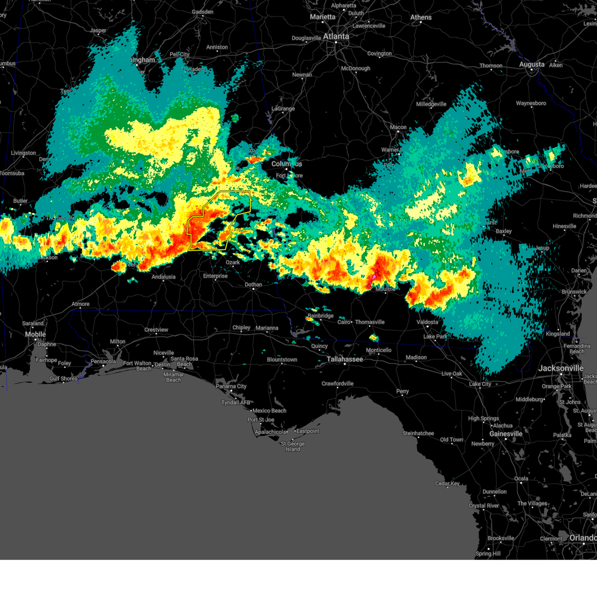 At 557 pm cdt, severe thunderstorms were located along a line extending from 6 miles north of union springs to linwood to near goshen, moving east at 60 mph. these are destructive storms for bullock county and pike county (radar indicated). Hazards include 80 mph wind gusts. Flying debris will be dangerous to those caught without shelter. mobile homes will be heavily damaged. expect considerable damage to roofs, windows, and vehicles. extensive tree damage and power outages are likely. locations impacted include, troy, union springs, brundidge, midway, goshen, banks, pickett, aberfoil, franklin field, beans crossroads, guerryton, linwood, antioch, ansley, troy municipal airport, troy university, high ridge, perote, josie and three notch. thunderstorm damage threat, destructive hail threat, radar indicated max hail size, <. 75 in wind threat, radar indicated max wind gust, 80 mph. At 557 pm cdt, severe thunderstorms were located along a line extending from 6 miles north of union springs to linwood to near goshen, moving east at 60 mph. these are destructive storms for bullock county and pike county (radar indicated). Hazards include 80 mph wind gusts. Flying debris will be dangerous to those caught without shelter. mobile homes will be heavily damaged. expect considerable damage to roofs, windows, and vehicles. extensive tree damage and power outages are likely. locations impacted include, troy, union springs, brundidge, midway, goshen, banks, pickett, aberfoil, franklin field, beans crossroads, guerryton, linwood, antioch, ansley, troy municipal airport, troy university, high ridge, perote, josie and three notch. thunderstorm damage threat, destructive hail threat, radar indicated max hail size, <. 75 in wind threat, radar indicated max wind gust, 80 mph.
|
| 6/14/2023 5:44 PM CDT |
 At 543 pm cdt, severe thunderstorms were located along a line extending from near shorter to near pine level to near rutledge, moving east at 70 mph. these are destructive storms for bullock countyn and pike county (radar indicated). Hazards include 80 mph wind gusts. Flying debris will be dangerous to those caught without shelter. mobile homes will be heavily damaged. expect considerable damage to roofs, windows, and vehicles. extensive tree damage and power outages are likely. locations impacted include, troy, tuskegee, union springs, brundidge, hurtsboro, midway, goshen, milstead, shorter, banks, franklin, pickett, lake tuskegee, beans crossroads, guerryton, shopton, liverpool, hardaway, ansley and troy municipal airport. thunderstorm damage threat, destructive hail threat, radar indicated max hail size, <. 75 in wind threat, radar indicated max wind gust, 80 mph. At 543 pm cdt, severe thunderstorms were located along a line extending from near shorter to near pine level to near rutledge, moving east at 70 mph. these are destructive storms for bullock countyn and pike county (radar indicated). Hazards include 80 mph wind gusts. Flying debris will be dangerous to those caught without shelter. mobile homes will be heavily damaged. expect considerable damage to roofs, windows, and vehicles. extensive tree damage and power outages are likely. locations impacted include, troy, tuskegee, union springs, brundidge, hurtsboro, midway, goshen, milstead, shorter, banks, franklin, pickett, lake tuskegee, beans crossroads, guerryton, shopton, liverpool, hardaway, ansley and troy municipal airport. thunderstorm damage threat, destructive hail threat, radar indicated max hail size, <. 75 in wind threat, radar indicated max wind gust, 80 mph.
|
| 6/14/2023 5:40 PM CDT |
 At 539 pm cdt, severe thunderstorms were located along a line extending from victoryland to near pine level to 8 miles west of rutledge, moving east at 65 mph (radar indicated). Hazards include 70 mph wind gusts. Expect considerable tree damage. damage is likely to mobile homes, roofs, and outbuildings. locations impacted include, troy, tuskegee, union springs, brundidge, hurtsboro, midway, goshen, milstead, shorter, banks, franklin, pickett, lake tuskegee, beans crossroads, guerryton, shopton, liverpool, hardaway, ansley and troy municipal airport. thunderstorm damage threat, considerable hail threat, radar indicated max hail size, <. 75 in wind threat, radar indicated max wind gust, 70 mph. At 539 pm cdt, severe thunderstorms were located along a line extending from victoryland to near pine level to 8 miles west of rutledge, moving east at 65 mph (radar indicated). Hazards include 70 mph wind gusts. Expect considerable tree damage. damage is likely to mobile homes, roofs, and outbuildings. locations impacted include, troy, tuskegee, union springs, brundidge, hurtsboro, midway, goshen, milstead, shorter, banks, franklin, pickett, lake tuskegee, beans crossroads, guerryton, shopton, liverpool, hardaway, ansley and troy municipal airport. thunderstorm damage threat, considerable hail threat, radar indicated max hail size, <. 75 in wind threat, radar indicated max wind gust, 70 mph.
|
| 6/14/2023 5:33 PM CDT |
 At 533 pm cdt, severe thunderstorms were located along a line extending from near emerald mountain to 9 miles southeast of greenville, moving east at 70 mph (radar indicated). Hazards include 70 mph wind gusts. Expect considerable tree damage. Damage is likely to mobile homes, roofs, and outbuildings. At 533 pm cdt, severe thunderstorms were located along a line extending from near emerald mountain to 9 miles southeast of greenville, moving east at 70 mph (radar indicated). Hazards include 70 mph wind gusts. Expect considerable tree damage. Damage is likely to mobile homes, roofs, and outbuildings.
|
| 6/14/2023 4:54 PM CDT |
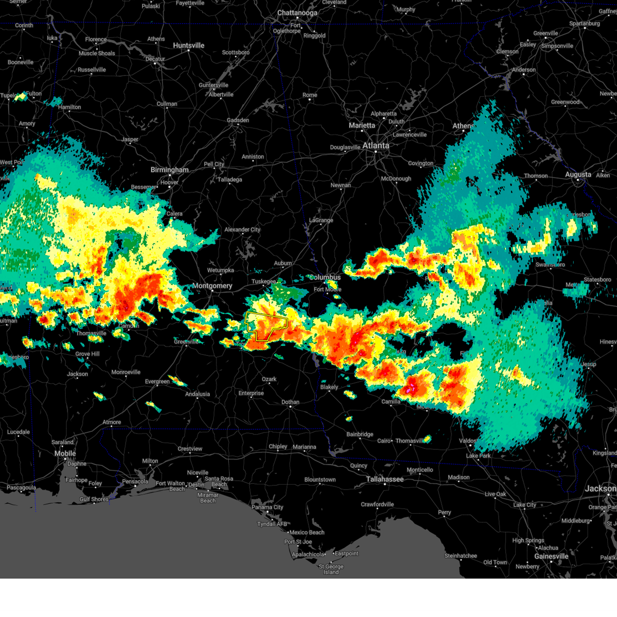 The severe thunderstorm warning for southern bullock county will expire at 500 pm cdt, the storm which prompted the warning has moved out of the area. therefore, the warning will be allowed to expire. a severe thunderstorm watch remains in effect until 1000 pm cdt for southeastern alabama. The severe thunderstorm warning for southern bullock county will expire at 500 pm cdt, the storm which prompted the warning has moved out of the area. therefore, the warning will be allowed to expire. a severe thunderstorm watch remains in effect until 1000 pm cdt for southeastern alabama.
|
| 6/14/2023 4:27 PM CDT |
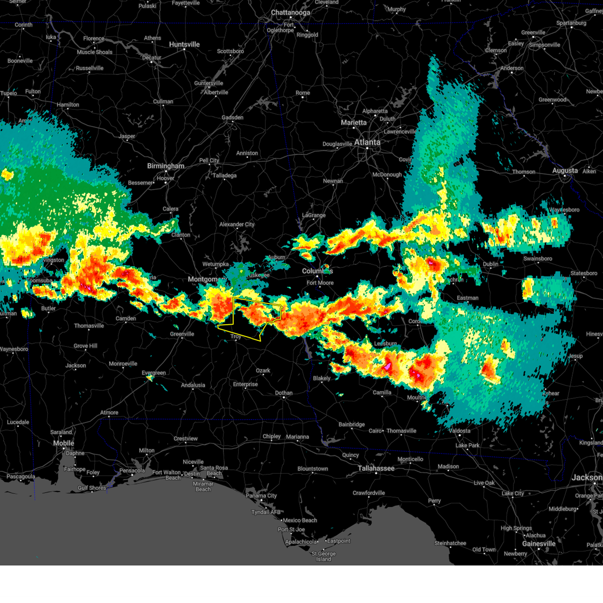 At 426 pm cdt, severe thunderstorms were located along a line extending from near shopton to near kent, moving east at 70 mph. these are destructive storms for bullock county and northern pike county (radar indicated). Hazards include 80 mph wind gusts and quarter size hail. Flying debris will be dangerous to those caught without shelter. mobile homes will be heavily damaged. expect considerable damage to roofs, windows, and vehicles. extensive tree damage and power outages are likely. locations impacted include, union springs, midway, pickett, kent, aberfoil, franklin field, beans crossroads, linwood, shopton, tanyard, sedgefield, high ridge, orion, perote, josie, china grove, sandfield, three notch and simsville. thunderstorm damage threat, destructive hail threat, radar indicated max hail size, 1. 00 in wind threat, radar indicated max wind gust, 80 mph. At 426 pm cdt, severe thunderstorms were located along a line extending from near shopton to near kent, moving east at 70 mph. these are destructive storms for bullock county and northern pike county (radar indicated). Hazards include 80 mph wind gusts and quarter size hail. Flying debris will be dangerous to those caught without shelter. mobile homes will be heavily damaged. expect considerable damage to roofs, windows, and vehicles. extensive tree damage and power outages are likely. locations impacted include, union springs, midway, pickett, kent, aberfoil, franklin field, beans crossroads, linwood, shopton, tanyard, sedgefield, high ridge, orion, perote, josie, china grove, sandfield, three notch and simsville. thunderstorm damage threat, destructive hail threat, radar indicated max hail size, 1. 00 in wind threat, radar indicated max wind gust, 80 mph.
|
| 6/14/2023 4:18 PM CDT |
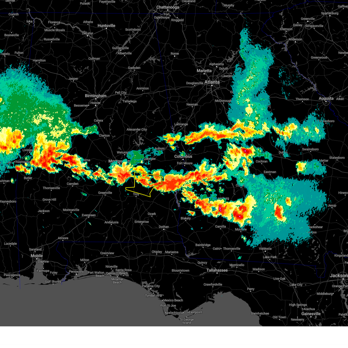 At 417 pm cdt, severe thunderstorms were located along a line extending from near pike road to grady, moving east at 70 mph. these are destructive storms for bullock county and northern pike county (radar indicated). Hazards include 80 mph wind gusts and quarter size hail. Flying debris will be dangerous to those caught without shelter. mobile homes will be heavily damaged. expect considerable damage to roofs, windows, and vehicles. Extensive tree damage and power outages are likely. At 417 pm cdt, severe thunderstorms were located along a line extending from near pike road to grady, moving east at 70 mph. these are destructive storms for bullock county and northern pike county (radar indicated). Hazards include 80 mph wind gusts and quarter size hail. Flying debris will be dangerous to those caught without shelter. mobile homes will be heavily damaged. expect considerable damage to roofs, windows, and vehicles. Extensive tree damage and power outages are likely.
|
| 6/14/2023 4:12 PM CDT |
 At 411 pm cdt, a severe thunderstorm was located near beans crossroads, or 8 miles southwest of union springs, moving east at 50 mph (radar indicated). Hazards include ping pong ball size hail and 60 mph wind gusts. People and animals outdoors will be injured. expect hail damage to roofs, siding, windows, and vehicles. Expect wind damage to roofs, siding, and trees. At 411 pm cdt, a severe thunderstorm was located near beans crossroads, or 8 miles southwest of union springs, moving east at 50 mph (radar indicated). Hazards include ping pong ball size hail and 60 mph wind gusts. People and animals outdoors will be injured. expect hail damage to roofs, siding, windows, and vehicles. Expect wind damage to roofs, siding, and trees.
|
| 6/14/2023 3:49 PM CDT |
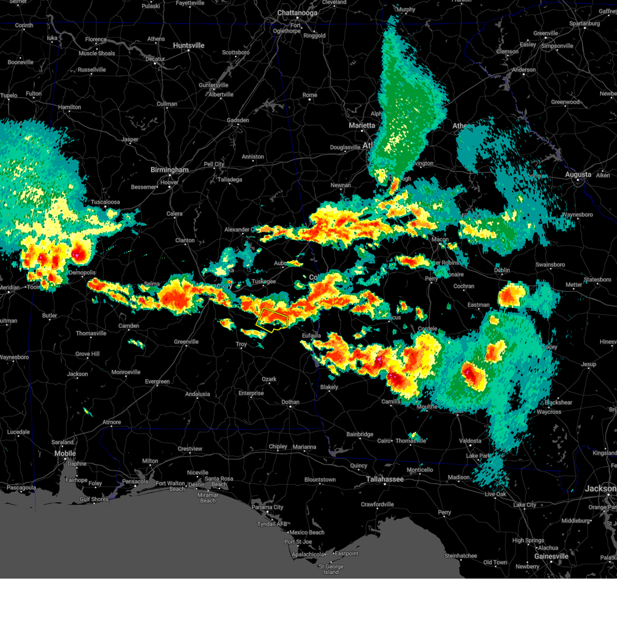 At 349 pm cdt, a severe thunderstorm was located near midway, moving southeast at 45 mph (radar indicated). Hazards include golf ball size hail and 60 mph wind gusts. People and animals outdoors will be injured. expect hail damage to roofs, siding, windows, and vehicles. expect wind damage to roofs, siding, and trees. locations impacted include, union springs, midway, pickett, aberfoil, sedgefield and three notch. thunderstorm damage threat, considerable hail threat, radar indicated max hail size, 1. 75 in wind threat, radar indicated max wind gust, 60 mph. At 349 pm cdt, a severe thunderstorm was located near midway, moving southeast at 45 mph (radar indicated). Hazards include golf ball size hail and 60 mph wind gusts. People and animals outdoors will be injured. expect hail damage to roofs, siding, windows, and vehicles. expect wind damage to roofs, siding, and trees. locations impacted include, union springs, midway, pickett, aberfoil, sedgefield and three notch. thunderstorm damage threat, considerable hail threat, radar indicated max hail size, 1. 75 in wind threat, radar indicated max wind gust, 60 mph.
|
| 6/14/2023 3:42 PM CDT |
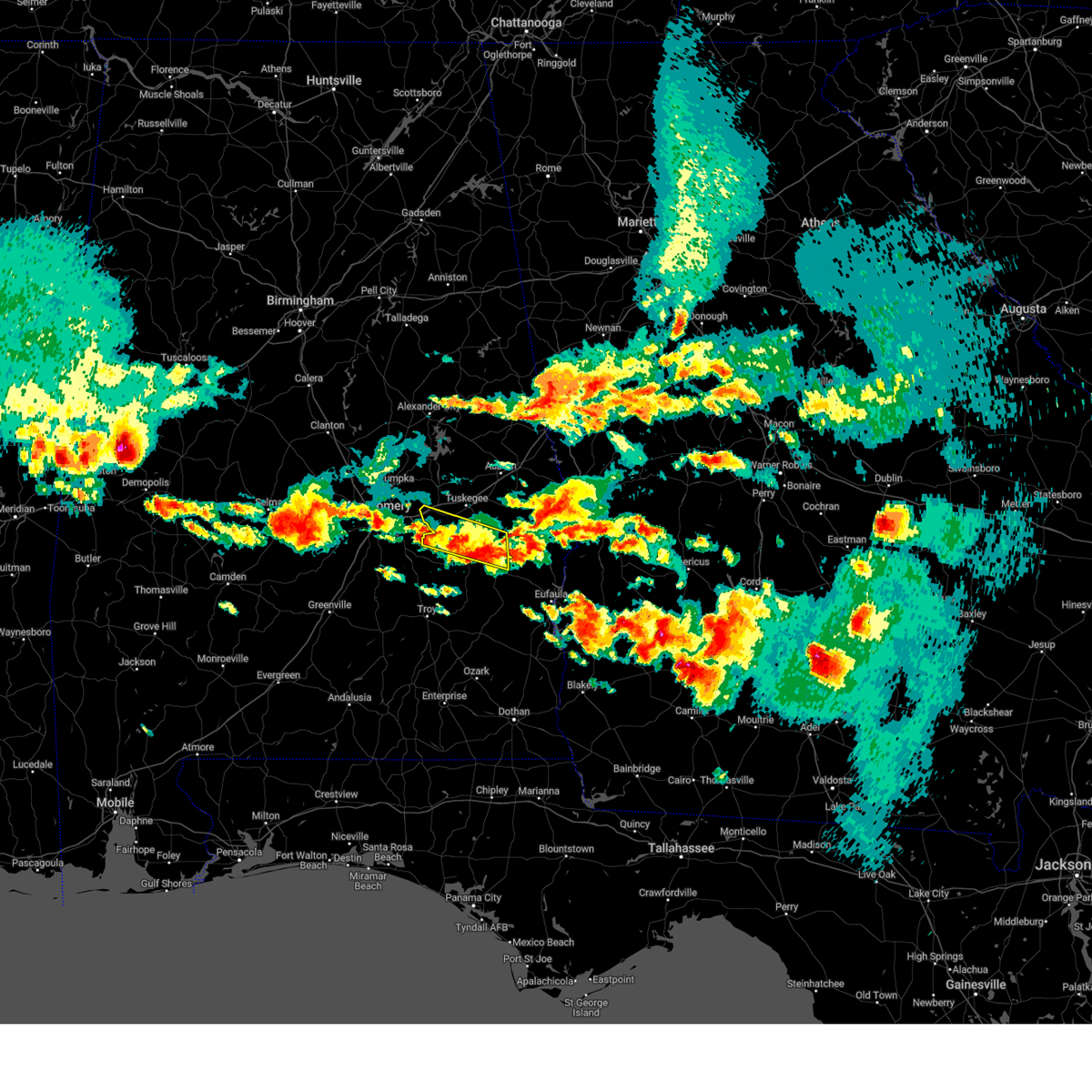 At 342 pm cdt, a severe thunderstorm was located near davisville, or near union springs, moving east at 40 mph (broadcast media). Hazards include 60 mph wind gusts and quarter size hail. Hail damage to vehicles is expected. expect wind damage to roofs, siding, and trees. locations impacted include, union springs, shorter, liverpool, franklin field, guerryton, hardaway, tysonville, victoryland, davisville, sedgefield, fort davis, cross keys, three notch, mitchell and warriorstand. hail threat, radar indicated max hail size, 1. 00 in wind threat, radar indicated max wind gust, 60 mph. At 342 pm cdt, a severe thunderstorm was located near davisville, or near union springs, moving east at 40 mph (broadcast media). Hazards include 60 mph wind gusts and quarter size hail. Hail damage to vehicles is expected. expect wind damage to roofs, siding, and trees. locations impacted include, union springs, shorter, liverpool, franklin field, guerryton, hardaway, tysonville, victoryland, davisville, sedgefield, fort davis, cross keys, three notch, mitchell and warriorstand. hail threat, radar indicated max hail size, 1. 00 in wind threat, radar indicated max wind gust, 60 mph.
|
| 6/14/2023 3:40 PM CDT |
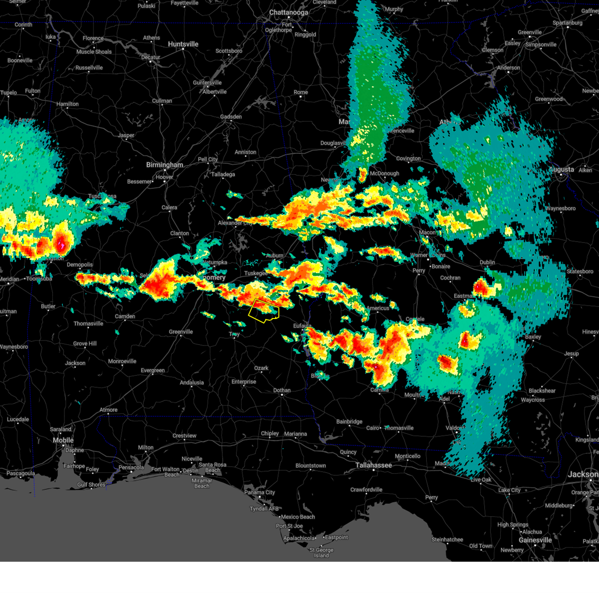 At 339 pm cdt, a severe thunderstorm was located over aberfoil, or near union springs, moving southeast at 45 mph (radar indicated). Hazards include 60 mph wind gusts and quarter size hail. Hail damage to vehicles is expected. Expect wind damage to roofs, siding, and trees. At 339 pm cdt, a severe thunderstorm was located over aberfoil, or near union springs, moving southeast at 45 mph (radar indicated). Hazards include 60 mph wind gusts and quarter size hail. Hail damage to vehicles is expected. Expect wind damage to roofs, siding, and trees.
|
| 6/14/2023 3:17 PM CDT |
 At 317 pm cdt, a severe thunderstorm was located near waugh, or 11 miles southwest of milstead, moving east at 40 mph (radar indicated). Hazards include 60 mph wind gusts and quarter size hail. Hail damage to vehicles is expected. expect wind damage to roofs, siding, and trees. locations impacted include, southeastern montgomery, union springs, pike road, shorter, liverpool, franklin field, guerryton, hardaway, tysonville, victoryland, davisville, waugh, mount meigs, sedgefield, barachias, fort davis, cross keys, three notch, mitchell and cecil. hail threat, radar indicated max hail size, 1. 00 in wind threat, radar indicated max wind gust, 60 mph. At 317 pm cdt, a severe thunderstorm was located near waugh, or 11 miles southwest of milstead, moving east at 40 mph (radar indicated). Hazards include 60 mph wind gusts and quarter size hail. Hail damage to vehicles is expected. expect wind damage to roofs, siding, and trees. locations impacted include, southeastern montgomery, union springs, pike road, shorter, liverpool, franklin field, guerryton, hardaway, tysonville, victoryland, davisville, waugh, mount meigs, sedgefield, barachias, fort davis, cross keys, three notch, mitchell and cecil. hail threat, radar indicated max hail size, 1. 00 in wind threat, radar indicated max wind gust, 60 mph.
|
| 6/14/2023 3:05 PM CDT |
 At 305 pm cdt, a severe thunderstorm was located near pike road, or 9 miles east of montgomery, moving east at 45 mph (radar indicated). Hazards include 60 mph wind gusts and quarter size hail. Hail damage to vehicles is expected. expect wind damage to roofs, siding, and trees. locations impacted include, southeastern montgomery, tuskegee, tallassee, union springs, milstead, pike road, shorter, franklin, auburn university in montgomery, franklin field, guerryton, davisville, waugh, liverpool, hardaway, mount meigs, tysonville, victoryland, pinedale and warriorstand. hail threat, radar indicated max hail size, 1. 00 in wind threat, radar indicated max wind gust, 60 mph. At 305 pm cdt, a severe thunderstorm was located near pike road, or 9 miles east of montgomery, moving east at 45 mph (radar indicated). Hazards include 60 mph wind gusts and quarter size hail. Hail damage to vehicles is expected. expect wind damage to roofs, siding, and trees. locations impacted include, southeastern montgomery, tuskegee, tallassee, union springs, milstead, pike road, shorter, franklin, auburn university in montgomery, franklin field, guerryton, davisville, waugh, liverpool, hardaway, mount meigs, tysonville, victoryland, pinedale and warriorstand. hail threat, radar indicated max hail size, 1. 00 in wind threat, radar indicated max wind gust, 60 mph.
|
| 6/14/2023 2:56 PM CDT |
 At 255 pm cdt, a severe thunderstorm was located over eastern montgomery, moving east at 50 mph (radar indicated). Hazards include ping pong ball size hail and 60 mph wind gusts. People and animals outdoors will be injured. expect hail damage to roofs, siding, windows, and vehicles. expect wind damage to roofs, siding, and trees. locations impacted include, montgomery, tuskegee, tallassee, union springs, midway, milstead, pike road, shorter, franklin, montgomery zoo, boylston, auburn university in montgomery, franklin field, lake tuskegee, woodcrest, guerryton, emerald mountain, davisville, waugh and lagoon park. hail threat, radar indicated max hail size, 1. 50 in wind threat, radar indicated max wind gust, 60 mph. At 255 pm cdt, a severe thunderstorm was located over eastern montgomery, moving east at 50 mph (radar indicated). Hazards include ping pong ball size hail and 60 mph wind gusts. People and animals outdoors will be injured. expect hail damage to roofs, siding, windows, and vehicles. expect wind damage to roofs, siding, and trees. locations impacted include, montgomery, tuskegee, tallassee, union springs, midway, milstead, pike road, shorter, franklin, montgomery zoo, boylston, auburn university in montgomery, franklin field, lake tuskegee, woodcrest, guerryton, emerald mountain, davisville, waugh and lagoon park. hail threat, radar indicated max hail size, 1. 50 in wind threat, radar indicated max wind gust, 60 mph.
|
| 6/14/2023 2:38 PM CDT |
 At 238 pm cdt, a severe thunderstorm was located over boylston, or near millbrook, moving east at 40 mph (radar indicated). Hazards include 60 mph wind gusts and quarter size hail. Hail damage to vehicles is expected. Expect wind damage to roofs, siding, and trees. At 238 pm cdt, a severe thunderstorm was located over boylston, or near millbrook, moving east at 40 mph (radar indicated). Hazards include 60 mph wind gusts and quarter size hail. Hail damage to vehicles is expected. Expect wind damage to roofs, siding, and trees.
|
| 10/12/2022 3:26 PM CDT |
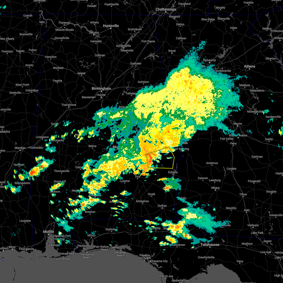 At 326 pm cdt, a severe thunderstorm was located near guerryton, or 7 miles north of midway, moving east at 40 mph (radar indicated). Hazards include 60 mph wind gusts and penny size hail. expect damage to roofs, siding, and trees At 326 pm cdt, a severe thunderstorm was located near guerryton, or 7 miles north of midway, moving east at 40 mph (radar indicated). Hazards include 60 mph wind gusts and penny size hail. expect damage to roofs, siding, and trees
|
| 10/12/2022 3:14 PM CDT |
 At 313 pm cdt, a severe thunderstorm was located near davisville, or 10 miles north of union springs, moving east at 45 mph (radar indicated). Hazards include 60 mph wind gusts and quarter size hail. Hail damage to vehicles is expected. expect wind damage to roofs, siding, and trees. locations impacted include, tuskegee, union springs, hardaway, liverpool, davisville, franklin field, lake tuskegee, warriorstand, sedgefield, three notch and fort davis. hail threat, radar indicated max hail size, 1. 00 in wind threat, radar indicated max wind gust, 60 mph. At 313 pm cdt, a severe thunderstorm was located near davisville, or 10 miles north of union springs, moving east at 45 mph (radar indicated). Hazards include 60 mph wind gusts and quarter size hail. Hail damage to vehicles is expected. expect wind damage to roofs, siding, and trees. locations impacted include, tuskegee, union springs, hardaway, liverpool, davisville, franklin field, lake tuskegee, warriorstand, sedgefield, three notch and fort davis. hail threat, radar indicated max hail size, 1. 00 in wind threat, radar indicated max wind gust, 60 mph.
|
| 10/12/2022 3:08 PM CDT | Several trees down in the area including hwy 110 and hwy 22 in bullock county AL, 0.5 miles ESE of Union Springs, AL |
| 10/12/2022 2:49 PM CDT |
 At 249 pm cdt, a severe thunderstorm was located 7 miles southeast of waugh, or 12 miles southwest of milstead, moving east at 45 mph (radar indicated). Hazards include 60 mph wind gusts and quarter size hail. Hail damage to vehicles is expected. Expect wind damage to roofs, siding, and trees. At 249 pm cdt, a severe thunderstorm was located 7 miles southeast of waugh, or 12 miles southwest of milstead, moving east at 45 mph (radar indicated). Hazards include 60 mph wind gusts and quarter size hail. Hail damage to vehicles is expected. Expect wind damage to roofs, siding, and trees.
|
| 7/21/2022 7:43 PM CDT |
 At 743 pm cdt, severe thunderstorms were located along a line extending from tallassee to montgomery to valley grande, moving south at 35 mph (radar indicated). Hazards include 60 mph wind gusts and quarter size hail. Hail damage to vehicles is expected. expect wind damage to roofs, siding, and trees. locations impacted include, montgomery, union springs, fort deposit, mosses, hayneville, meadville, milstead, pike road, coosada, white hall, shorter, gordonville, franklin, lowndesboro, benton, hyundai motors of alabama, auburn university in montgomery, dublin, woodcrest and snowdoun. hail threat, radar indicated max hail size, 1. 00 in wind threat, radar indicated max wind gust, 60 mph. At 743 pm cdt, severe thunderstorms were located along a line extending from tallassee to montgomery to valley grande, moving south at 35 mph (radar indicated). Hazards include 60 mph wind gusts and quarter size hail. Hail damage to vehicles is expected. expect wind damage to roofs, siding, and trees. locations impacted include, montgomery, union springs, fort deposit, mosses, hayneville, meadville, milstead, pike road, coosada, white hall, shorter, gordonville, franklin, lowndesboro, benton, hyundai motors of alabama, auburn university in montgomery, dublin, woodcrest and snowdoun. hail threat, radar indicated max hail size, 1. 00 in wind threat, radar indicated max wind gust, 60 mph.
|
| 7/21/2022 7:24 PM CDT |
 At 724 pm cdt, severe thunderstorms were located along a line extending from martin dam to near millbrook to near paul m grist state park, moving south at 35 mph (radar indicated). Hazards include 60 mph wind gusts and quarter size hail. Hail damage to vehicles is expected. Expect wind damage to roofs, siding, and trees. At 724 pm cdt, severe thunderstorms were located along a line extending from martin dam to near millbrook to near paul m grist state park, moving south at 35 mph (radar indicated). Hazards include 60 mph wind gusts and quarter size hail. Hail damage to vehicles is expected. Expect wind damage to roofs, siding, and trees.
|
| 6/15/2022 8:35 PM CDT |
 At 835 pm cdt, severe thunderstorms were located along a line extending from near society hill to near guerryton, moving west at 20 mph (radar indicated). Hazards include 60 mph wind gusts. Expect damage to roofs, siding, and trees. locations impacted include, tuskegee, union springs, hurtsboro, uchee, lake tuskegee, guerryton, davisville, society hill, griffen mill, warriorstand, sedgefield, fort davis, creek stand, rutherford, hatchechubbe, marvyn and moton field municipal airport. hail threat, radar indicated max hail size, <. 75 in wind threat, radar indicated max wind gust, 60 mph. At 835 pm cdt, severe thunderstorms were located along a line extending from near society hill to near guerryton, moving west at 20 mph (radar indicated). Hazards include 60 mph wind gusts. Expect damage to roofs, siding, and trees. locations impacted include, tuskegee, union springs, hurtsboro, uchee, lake tuskegee, guerryton, davisville, society hill, griffen mill, warriorstand, sedgefield, fort davis, creek stand, rutherford, hatchechubbe, marvyn and moton field municipal airport. hail threat, radar indicated max hail size, <. 75 in wind threat, radar indicated max wind gust, 60 mph.
|
| 6/15/2022 8:23 PM CDT |
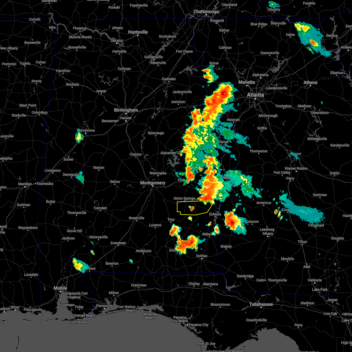 At 823 pm cdt, severe thunderstorms were located along a line extending from near spring hill to pickett, moving west at 15 mph (radar indicated). Hazards include 60 mph wind gusts and quarter size hail. Hail damage to vehicles is expected. Expect wind damage to roofs, siding, and trees. At 823 pm cdt, severe thunderstorms were located along a line extending from near spring hill to pickett, moving west at 15 mph (radar indicated). Hazards include 60 mph wind gusts and quarter size hail. Hail damage to vehicles is expected. Expect wind damage to roofs, siding, and trees.
|
| 6/15/2022 8:17 PM CDT |
 At 816 pm cdt, severe thunderstorms were located along a line extending from near griffen mill to near hurtsboro, moving west at 15 mph (radar indicated). Hazards include 60 mph wind gusts. Expect damage to roofs, siding, and trees. locations impacted include, tuskegee, union springs, hurtsboro, smiths, smiths station, uchee, lake tuskegee, guerryton, davisville, russell county sports complex, seale, ladonia, society hill, griffen mill, warriorstand, fort davis, rutherford, sedgefield, creek stand and monterey heights. hail threat, radar indicated max hail size, <. 75 in wind threat, radar indicated max wind gust, 60 mph. At 816 pm cdt, severe thunderstorms were located along a line extending from near griffen mill to near hurtsboro, moving west at 15 mph (radar indicated). Hazards include 60 mph wind gusts. Expect damage to roofs, siding, and trees. locations impacted include, tuskegee, union springs, hurtsboro, smiths, smiths station, uchee, lake tuskegee, guerryton, davisville, russell county sports complex, seale, ladonia, society hill, griffen mill, warriorstand, fort davis, rutherford, sedgefield, creek stand and monterey heights. hail threat, radar indicated max hail size, <. 75 in wind threat, radar indicated max wind gust, 60 mph.
|
| 6/15/2022 8:07 PM CDT |
 At 807 pm cdt, severe thunderstorms were located along a line extending from near griffen mill to 6 miles north of spring hill, moving west at 15 mph (radar indicated). Hazards include 60 mph wind gusts. expect damage to roofs, siding, and trees At 807 pm cdt, severe thunderstorms were located along a line extending from near griffen mill to 6 miles north of spring hill, moving west at 15 mph (radar indicated). Hazards include 60 mph wind gusts. expect damage to roofs, siding, and trees
|
| 5/22/2022 1:06 PM CDT |
 At 105 pm cdt, a severe thunderstorm was located near davisville, or 7 miles north of union springs, moving north at 35 mph (radar indicated). Hazards include 60 mph wind gusts and nickel size hail. Expect damage to roofs, siding, and trees. locations impacted include, tuskegee, union springs, midway, shorter, aberfoil, franklin field, lake tuskegee, guerryton, shopton, davisville, waugh, liverpool, hardaway, tysonville, victoryland, warriorstand, fort davis, brassell, three notch and mitchell. hail threat, radar indicated max hail size, 0. 88 in wind threat, radar indicated max wind gust, 60 mph. At 105 pm cdt, a severe thunderstorm was located near davisville, or 7 miles north of union springs, moving north at 35 mph (radar indicated). Hazards include 60 mph wind gusts and nickel size hail. Expect damage to roofs, siding, and trees. locations impacted include, tuskegee, union springs, midway, shorter, aberfoil, franklin field, lake tuskegee, guerryton, shopton, davisville, waugh, liverpool, hardaway, tysonville, victoryland, warriorstand, fort davis, brassell, three notch and mitchell. hail threat, radar indicated max hail size, 0. 88 in wind threat, radar indicated max wind gust, 60 mph.
|
| 5/22/2022 12:52 PM CDT | Trees down along hwy 11 in bullock county AL, 4.7 miles E of Union Springs, AL |
| 5/22/2022 12:51 PM CDT |
 At 1250 pm cdt, a severe thunderstorm was located over union springs, moving north at 35 mph (radar indicated). Hazards include 60 mph wind gusts and nickel size hail. Expect damage to roofs, siding, and trees. locations impacted include, tuskegee, union springs, midway, shorter, pine level, aberfoil, franklin field, lake tuskegee, beans crossroads, guerryton, shopton, davisville, waugh, liverpool, hardaway, tysonville, victoryland, warriorstand, high ridge and fort davis. hail threat, radar indicated max hail size, 0. 88 in wind threat, radar indicated max wind gust, 60 mph. At 1250 pm cdt, a severe thunderstorm was located over union springs, moving north at 35 mph (radar indicated). Hazards include 60 mph wind gusts and nickel size hail. Expect damage to roofs, siding, and trees. locations impacted include, tuskegee, union springs, midway, shorter, pine level, aberfoil, franklin field, lake tuskegee, beans crossroads, guerryton, shopton, davisville, waugh, liverpool, hardaway, tysonville, victoryland, warriorstand, high ridge and fort davis. hail threat, radar indicated max hail size, 0. 88 in wind threat, radar indicated max wind gust, 60 mph.
|
| 5/22/2022 12:45 PM CDT | Trees down along hwy 23 in bullock county AL, 4.2 miles NNW of Union Springs, AL |
| 5/22/2022 12:37 PM CDT |
 At 1236 pm cdt, a severe thunderstorm was located near beans crossroads, or 11 miles south of union springs, moving north at 35 mph (radar indicated). Hazards include 60 mph wind gusts and nickel size hail. expect damage to roofs, siding, and trees At 1236 pm cdt, a severe thunderstorm was located near beans crossroads, or 11 miles south of union springs, moving north at 35 mph (radar indicated). Hazards include 60 mph wind gusts and nickel size hail. expect damage to roofs, siding, and trees
|
| 4/5/2022 11:58 AM CDT |
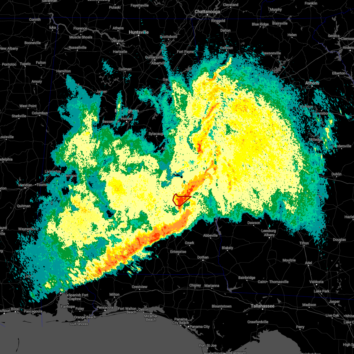 The tornado warning for northwestern bullock county will expire at noon cdt, the storm which prompted the warning has weakened below severe limits, and no longer appears capable of producing a tornado. therefore, the warning will be allowed to expire. a tornado watch remains in effect until 200 pm cdt for southeastern alabama. The tornado warning for northwestern bullock county will expire at noon cdt, the storm which prompted the warning has weakened below severe limits, and no longer appears capable of producing a tornado. therefore, the warning will be allowed to expire. a tornado watch remains in effect until 200 pm cdt for southeastern alabama.
|
| 4/5/2022 11:52 AM CDT | Barn destroyed and 20 or more trees uprooted and snapped. about a quarter mile of damage on bullock cr14. possible tornad in bullock county AL, 9.3 miles NE of Union Springs, AL |
| 4/5/2022 11:52 AM CDT |
 At 1152 am cdt, severe thunderstorms were located along a line extending from 7 miles north of guerryton to near blue springs state park, moving east at 60 mph (radar indicated). Hazards include 60 mph wind gusts and penny size hail. Expect damage to roofs, siding, and trees. locations impacted include, columbus, phenix city, troy, eufaula, tuskegee, union springs, brundidge, clio, hurtsboro, midway, georgetown, clayton, louisville, banks, tyler crossroads, pickett, lake tuskegee, beans crossroads, guerryton and tuskegee national forest. hail threat, radar indicated max hail size, 0. 75 in wind threat, radar indicated max wind gust, 60 mph. At 1152 am cdt, severe thunderstorms were located along a line extending from 7 miles north of guerryton to near blue springs state park, moving east at 60 mph (radar indicated). Hazards include 60 mph wind gusts and penny size hail. Expect damage to roofs, siding, and trees. locations impacted include, columbus, phenix city, troy, eufaula, tuskegee, union springs, brundidge, clio, hurtsboro, midway, georgetown, clayton, louisville, banks, tyler crossroads, pickett, lake tuskegee, beans crossroads, guerryton and tuskegee national forest. hail threat, radar indicated max hail size, 0. 75 in wind threat, radar indicated max wind gust, 60 mph.
|
| 4/5/2022 11:33 AM CDT |
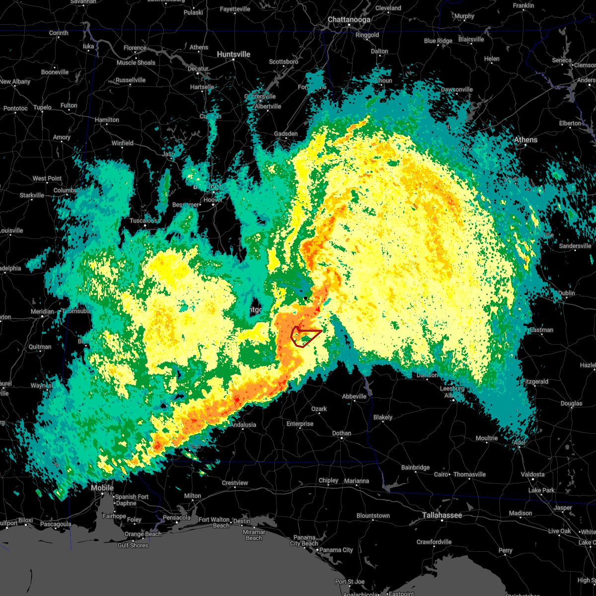 At 1133 am cdt, a severe thunderstorm capable of producing a tornado was located near franklin field, or 8 miles northwest of union springs, moving northeast at 55 mph (radar indicated rotation). Hazards include tornado. Flying debris will be dangerous to those caught without shelter. mobile homes will be damaged or destroyed. damage to roofs, windows, and vehicles will occur. tree damage is likely. Locations impacted include, union springs, franklin field, sedgefield and simsville. At 1133 am cdt, a severe thunderstorm capable of producing a tornado was located near franklin field, or 8 miles northwest of union springs, moving northeast at 55 mph (radar indicated rotation). Hazards include tornado. Flying debris will be dangerous to those caught without shelter. mobile homes will be damaged or destroyed. damage to roofs, windows, and vehicles will occur. tree damage is likely. Locations impacted include, union springs, franklin field, sedgefield and simsville.
|
| 4/5/2022 11:25 AM CDT |
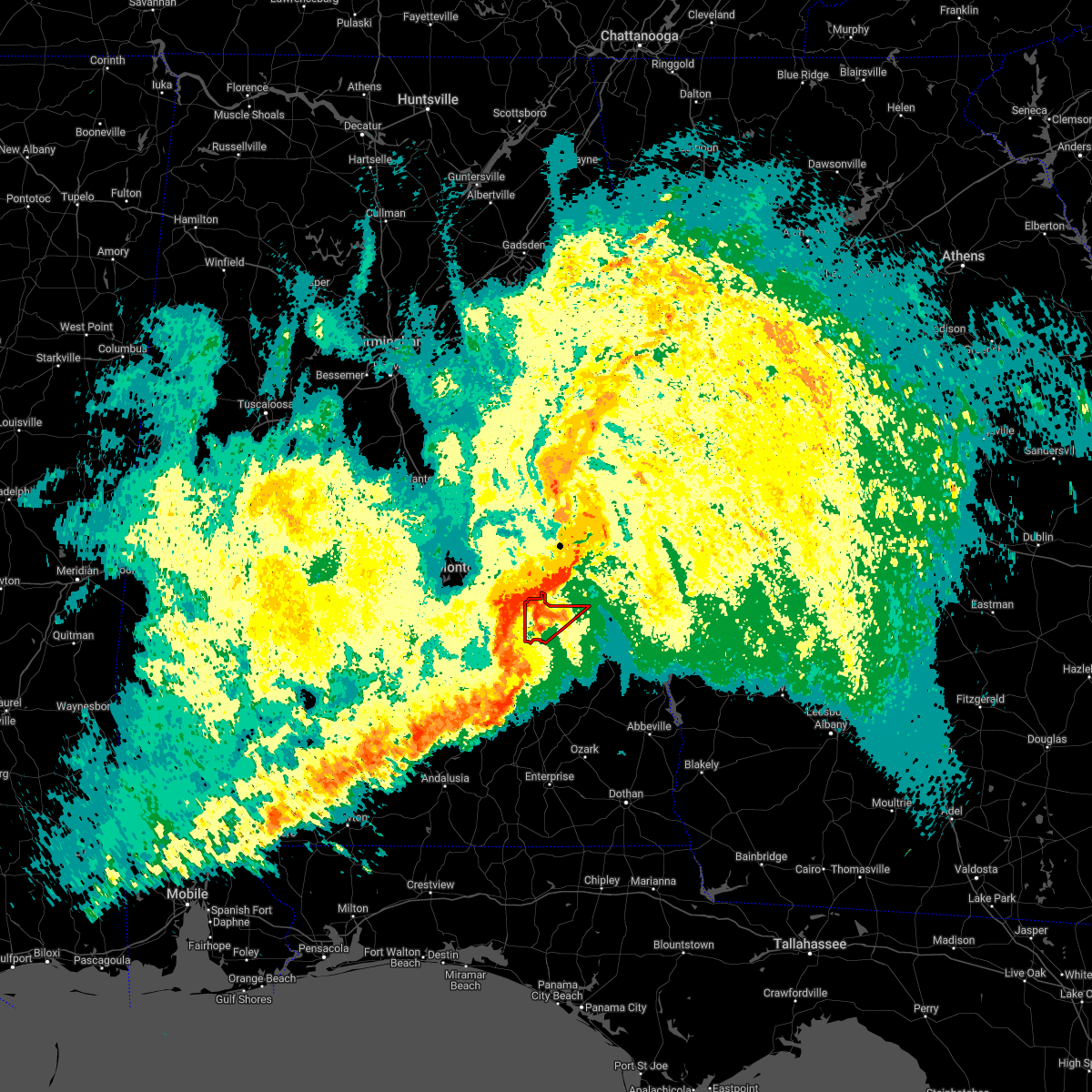 At 1125 am cdt, a confirmed tornado was located over shopton, or 11 miles west of union springs, moving northeast at 55 mph (radar confirmed tornado). Hazards include damaging tornado. Flying debris will be dangerous to those caught without shelter. mobile homes will be damaged or destroyed. damage to roofs, windows, and vehicles will occur. tree damage is likely. Locations impacted include, union springs, shopton, franklin field, sedgefield, mitchell, simsville and high ridge. At 1125 am cdt, a confirmed tornado was located over shopton, or 11 miles west of union springs, moving northeast at 55 mph (radar confirmed tornado). Hazards include damaging tornado. Flying debris will be dangerous to those caught without shelter. mobile homes will be damaged or destroyed. damage to roofs, windows, and vehicles will occur. tree damage is likely. Locations impacted include, union springs, shopton, franklin field, sedgefield, mitchell, simsville and high ridge.
|
| 4/5/2022 11:21 AM CDT | At 1120 am cdt, severe thunderstorms were located along a line extending from near waugh to 8 miles southeast of glenwood, moving east at 60 mph (radar indicated). Hazards include 60 mph wind gusts and penny size hail. expect damage to roofs, siding, and trees |
| 4/5/2022 11:13 AM CDT |
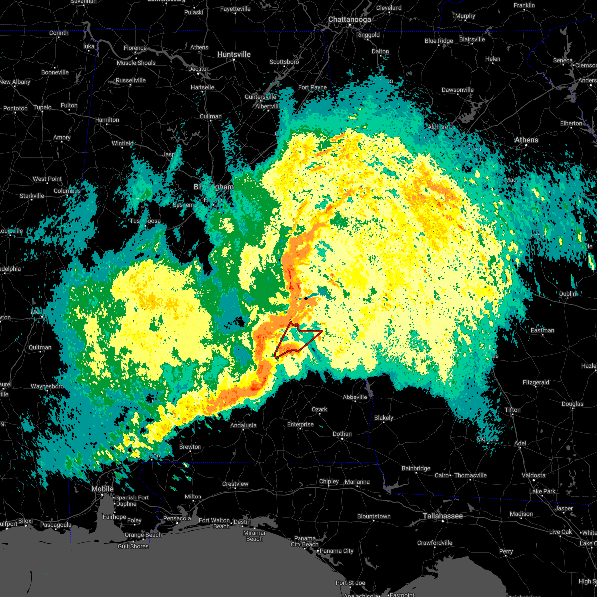 At 1113 am cdt, a tornado producing storm was located near pine level, or 7 miles southeast of meadville, moving northeast at 55 mph (radar confirmed tornado). Hazards include damaging tornado. Flying debris will be dangerous to those caught without shelter. mobile homes will be damaged or destroyed. damage to roofs, windows, and vehicles will occur. Tree damage is likely. At 1113 am cdt, a tornado producing storm was located near pine level, or 7 miles southeast of meadville, moving northeast at 55 mph (radar confirmed tornado). Hazards include damaging tornado. Flying debris will be dangerous to those caught without shelter. mobile homes will be damaged or destroyed. damage to roofs, windows, and vehicles will occur. Tree damage is likely.
|
| 5/4/2021 7:31 PM CDT |
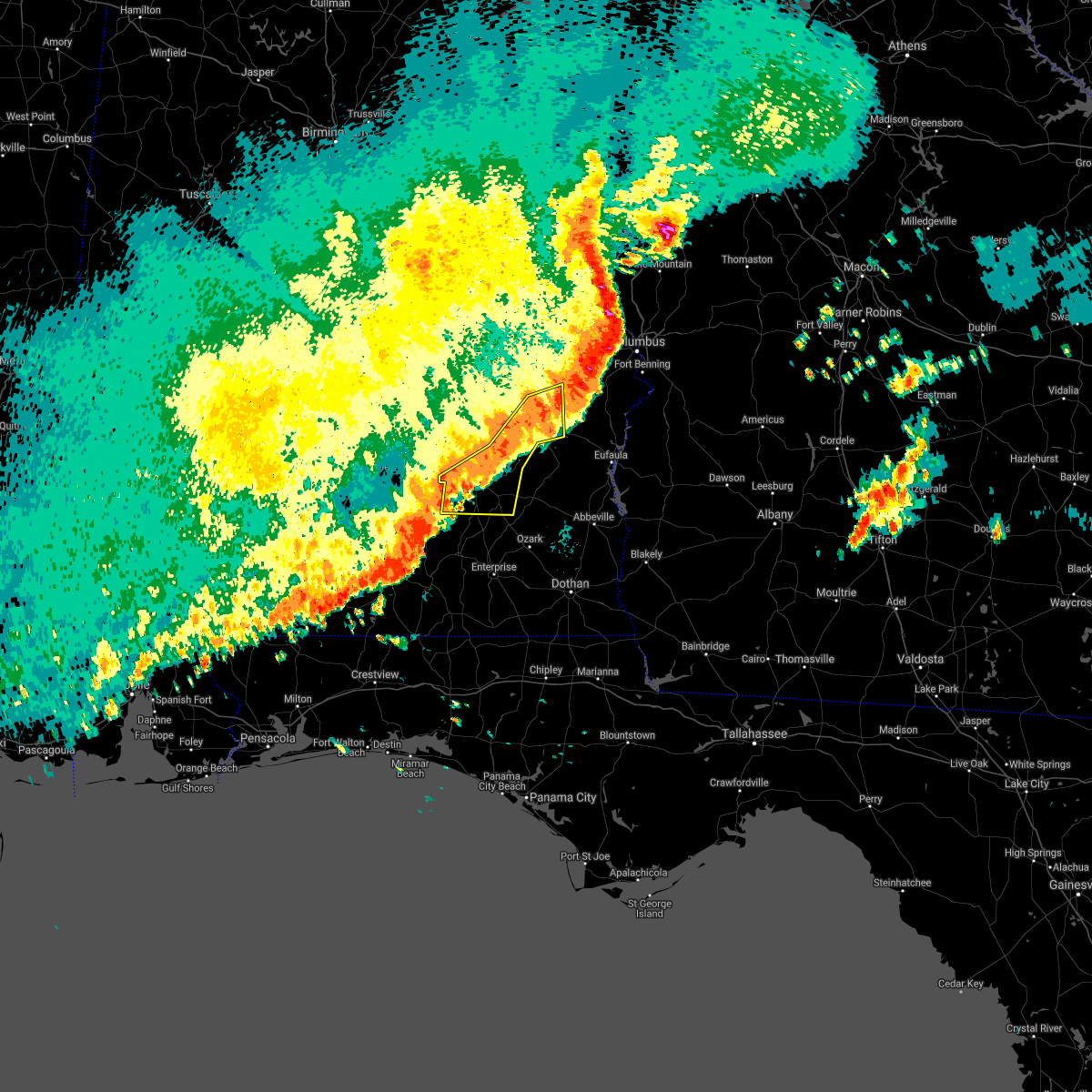 A severe thunderstorm warning remains in effect until 800 pm cdt for pike. bullock and southeastern macon counties. at 730 pm cdt, severe thunderstorms were located along a line extending from near griffen mill to near midway to 7 miles southwest of antioch, moving east at 55 mph. hazard. 60 mph wind gusts. A wind gust to 53 mph was recently. A severe thunderstorm warning remains in effect until 800 pm cdt for pike. bullock and southeastern macon counties. at 730 pm cdt, severe thunderstorms were located along a line extending from near griffen mill to near midway to 7 miles southwest of antioch, moving east at 55 mph. hazard. 60 mph wind gusts. A wind gust to 53 mph was recently.
|
| 5/4/2021 7:15 PM CDT |
 At 714 pm cdt, severe thunderstorms were located along a line extending from near society hill to aberfoil to near goshen, moving east at 50 mph (radar indicated). Hazards include 60 mph wind gusts. Expect damage to roofs, siding, and trees. Locations impacted include, troy, tuskegee, union springs, brundidge, midway, goshen, banks, pickett, aberfoil, franklin field, lake tuskegee, beans crossroads, guerryton, linwood, shopton, tuskegee national forest, davisville, antioch, ansley and troy municipal airport. At 714 pm cdt, severe thunderstorms were located along a line extending from near society hill to aberfoil to near goshen, moving east at 50 mph (radar indicated). Hazards include 60 mph wind gusts. Expect damage to roofs, siding, and trees. Locations impacted include, troy, tuskegee, union springs, brundidge, midway, goshen, banks, pickett, aberfoil, franklin field, lake tuskegee, beans crossroads, guerryton, linwood, shopton, tuskegee national forest, davisville, antioch, ansley and troy municipal airport.
|
| 5/4/2021 6:37 PM CDT |
 At 636 pm cdt, severe thunderstorms were located along a line extending from near southern lake martin to greenville, moving east at 40 mph (radar indicated). Hazards include 60 mph wind gusts. a wind gust to 58 mph was recently recorded at the montgomery airport. wind damage has also been reported with this line of storms. expect damage to roofs, siding, and trees At 636 pm cdt, severe thunderstorms were located along a line extending from near southern lake martin to greenville, moving east at 40 mph (radar indicated). Hazards include 60 mph wind gusts. a wind gust to 58 mph was recently recorded at the montgomery airport. wind damage has also been reported with this line of storms. expect damage to roofs, siding, and trees
|
| 4/24/2021 5:55 PM CDT | A few trees were blown down along cr 1 in bullock county AL, 8.4 miles NNE of Union Springs, AL |
| 4/24/2021 5:43 PM CDT |
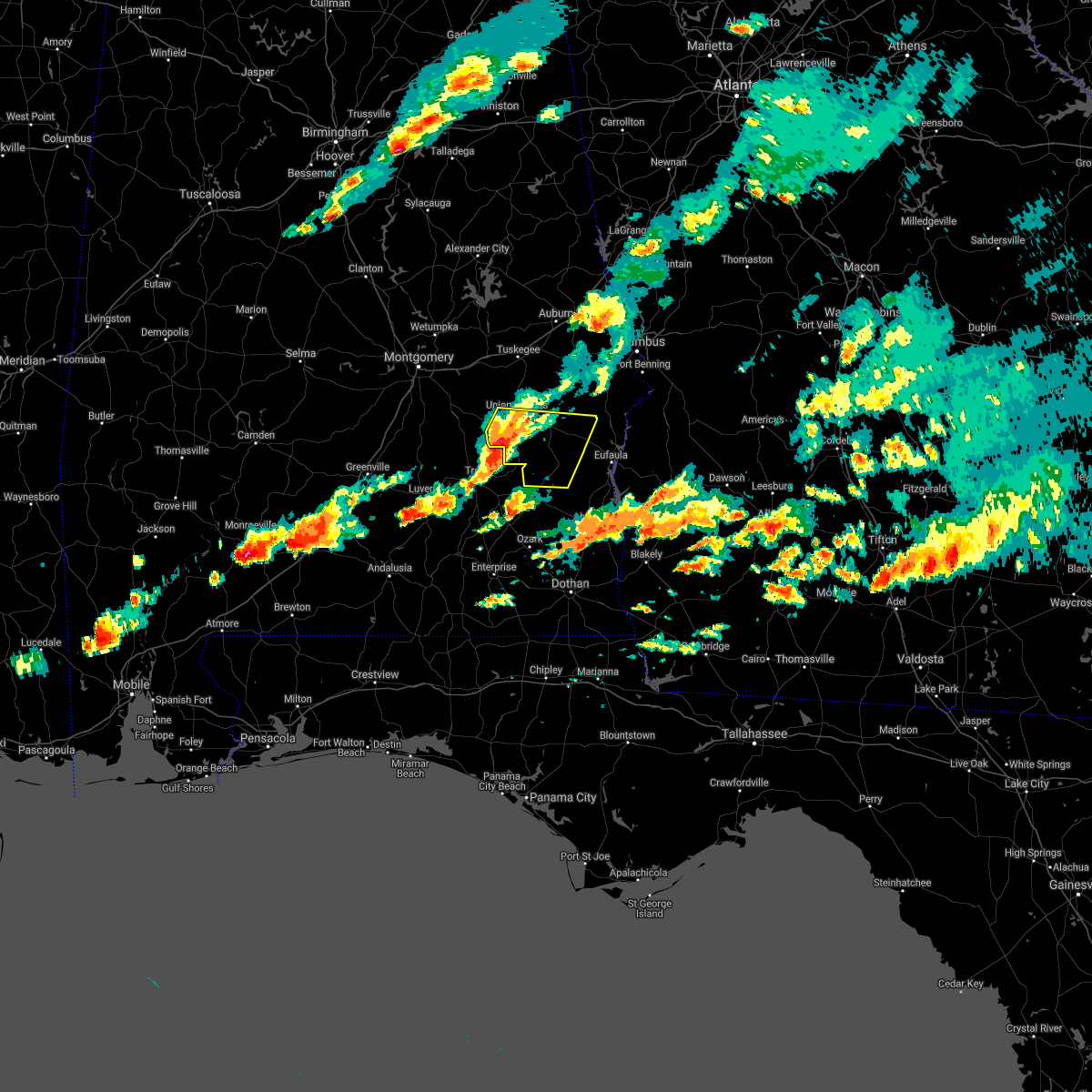 At 543 pm cdt, severe thunderstorms were located along a line extending from near franklin field to near troy, moving east at 55 mph (radar indicated). Hazards include 60 mph wind gusts and penny size hail. expect damage to roofs, siding, and trees At 543 pm cdt, severe thunderstorms were located along a line extending from near franklin field to near troy, moving east at 55 mph (radar indicated). Hazards include 60 mph wind gusts and penny size hail. expect damage to roofs, siding, and trees
|
| 3/17/2021 11:20 PM CDT |
 At 1120 pm cdt, severe thunderstorms were located along a line extending from near waverly to near tuskegee national forest to near pickett, moving east at 50 mph (radar indicated). Hazards include 60 mph wind gusts. Expect damage to roofs, siding, and trees. Locations impacted include, auburn, union springs, midway, waverly, aberfoil, auburn university, guerryton, tuskegee national forest, davisville, society hill, loachapoka, warriorstand, sedgefield, i 85 rest area, creek stand, three notch and chewacla state park. At 1120 pm cdt, severe thunderstorms were located along a line extending from near waverly to near tuskegee national forest to near pickett, moving east at 50 mph (radar indicated). Hazards include 60 mph wind gusts. Expect damage to roofs, siding, and trees. Locations impacted include, auburn, union springs, midway, waverly, aberfoil, auburn university, guerryton, tuskegee national forest, davisville, society hill, loachapoka, warriorstand, sedgefield, i 85 rest area, creek stand, three notch and chewacla state park.
|
| 3/17/2021 11:10 PM CDT |
 At 1110 pm cdt, severe thunderstorms were located along a line extending from near goldville to near tuskegee national forest to inverness, moving east at 50 mph (radar indicated). Hazards include 60 mph wind gusts. Expect damage to roofs, siding, and trees. Locations impacted include, auburn, tuskegee, union springs, dadeville, camp hill, notasulga, midway, jacksons` gap, new site, waverly, goldville, aberfoil, lake tuskegee, auburn university, guerryton, tuskegee national forest, davisville, liverpool, liberty city and society hill. At 1110 pm cdt, severe thunderstorms were located along a line extending from near goldville to near tuskegee national forest to inverness, moving east at 50 mph (radar indicated). Hazards include 60 mph wind gusts. Expect damage to roofs, siding, and trees. Locations impacted include, auburn, tuskegee, union springs, dadeville, camp hill, notasulga, midway, jacksons` gap, new site, waverly, goldville, aberfoil, lake tuskegee, auburn university, guerryton, tuskegee national forest, davisville, liverpool, liberty city and society hill.
|
| 3/17/2021 10:58 PM CDT |
 At 1058 pm cdt, severe thunderstorms were located along a line extending from 6 miles west of goldville to franklin to near beans crossroads, moving east at 55 mph (radar indicated). Hazards include 60 mph wind gusts. Expect damage to roofs, siding, and trees. Locations impacted include, auburn, alexander city, tuskegee, tallassee, union springs, dadeville, camp hill, notasulga, midway, milstead, jacksons` gap, new site, shorter, franklin, waverly, goldville, martin dam, lake tuskegee, beans crossroads and guerryton. At 1058 pm cdt, severe thunderstorms were located along a line extending from 6 miles west of goldville to franklin to near beans crossroads, moving east at 55 mph (radar indicated). Hazards include 60 mph wind gusts. Expect damage to roofs, siding, and trees. Locations impacted include, auburn, alexander city, tuskegee, tallassee, union springs, dadeville, camp hill, notasulga, midway, milstead, jacksons` gap, new site, shorter, franklin, waverly, goldville, martin dam, lake tuskegee, beans crossroads and guerryton.
|
| 3/17/2021 10:30 PM CDT |
 At 1030 pm cdt, severe thunderstorms were located along a line extending from hanover to near lapine, moving east at 50 mph (radar indicated). Hazards include 60 mph wind gusts. expect damage to roofs, siding, and trees At 1030 pm cdt, severe thunderstorms were located along a line extending from hanover to near lapine, moving east at 50 mph (radar indicated). Hazards include 60 mph wind gusts. expect damage to roofs, siding, and trees
|
| 7/15/2020 3:10 PM CDT | A tree and power lines were blown down. appears to be sub-sever in bullock county AL, 0.2 miles SW of Union Springs, AL |
| 7/12/2020 4:36 PM CDT |
 At 436 pm cdt, severe thunderstorms were located along a line extending from near lowndes county airport to near union springs, moving south at 40 mph (radar indicated). Hazards include 60 mph wind gusts. Expect damage to roofs, siding, and trees. Locations impacted include, union springs, fort deposit, meadville, gordonville, pine level, beechwood, aberfoil, dublin, franklin field, beans crossroads, shopton, grady, sellers, davenport, ramer, lowndes county airport, strata, naftel, logan and sprague. At 436 pm cdt, severe thunderstorms were located along a line extending from near lowndes county airport to near union springs, moving south at 40 mph (radar indicated). Hazards include 60 mph wind gusts. Expect damage to roofs, siding, and trees. Locations impacted include, union springs, fort deposit, meadville, gordonville, pine level, beechwood, aberfoil, dublin, franklin field, beans crossroads, shopton, grady, sellers, davenport, ramer, lowndes county airport, strata, naftel, logan and sprague.
|
| 7/12/2020 4:23 PM CDT |
 At 423 pm cdt, severe thunderstorms were located along a line extending from mosses to near hardaway, moving southeast at 35 mph (radar indicated). Hazards include 60 mph wind gusts. Expect damage to roofs, siding, and trees. Locations impacted include, southern montgomery, union springs, fort deposit, mosses, hayneville, meadville, pike road, gordonville, pine level, hyundai motors of alabama, beechwood, aberfoil, dublin, franklin field, beans crossroads, snowdoun, shopton, grady, sellers and davenport. At 423 pm cdt, severe thunderstorms were located along a line extending from mosses to near hardaway, moving southeast at 35 mph (radar indicated). Hazards include 60 mph wind gusts. Expect damage to roofs, siding, and trees. Locations impacted include, southern montgomery, union springs, fort deposit, mosses, hayneville, meadville, pike road, gordonville, pine level, hyundai motors of alabama, beechwood, aberfoil, dublin, franklin field, beans crossroads, snowdoun, shopton, grady, sellers and davenport.
|
| 7/12/2020 4:09 PM CDT |
 At 409 pm cdt, severe thunderstorms were located along a line extending from near gordonville to near liverpool, moving southeast at 35 mph (radar indicated). Hazards include 60 mph wind gusts. Expect damage to roofs, siding, and trees. Locations impacted include, montgomery, union springs, fort deposit, mosses, hayneville, meadville, milstead, pike road, white hall, shorter, gordonville, lowndesboro, benton, hyundai motors of alabama, auburn university in montgomery, dublin, woodcrest, beans crossroads, snowdoun and shopton. At 409 pm cdt, severe thunderstorms were located along a line extending from near gordonville to near liverpool, moving southeast at 35 mph (radar indicated). Hazards include 60 mph wind gusts. Expect damage to roofs, siding, and trees. Locations impacted include, montgomery, union springs, fort deposit, mosses, hayneville, meadville, milstead, pike road, white hall, shorter, gordonville, lowndesboro, benton, hyundai motors of alabama, auburn university in montgomery, dublin, woodcrest, beans crossroads, snowdoun and shopton.
|
| 7/12/2020 4:03 PM CDT |
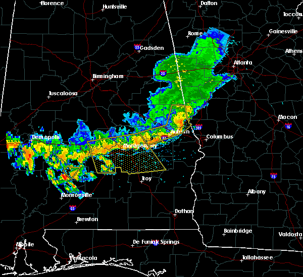 At 403 pm cdt, severe thunderstorms were located along a line extending from near white hall to near milstead, moving southeast at 35 mph (radar indicated). Hazards include 60 mph wind gusts. Expect damage to roofs, siding, and trees. Locations impacted include, montgomery, prattville, millbrook, union springs, fort deposit, mosses, hayneville, meadville, milstead, pike road, white hall, shorter, gordonville, lowndesboro, benton, hyundai motors of alabama, auburn university in montgomery, dublin, woodcrest and beans crossroads. At 403 pm cdt, severe thunderstorms were located along a line extending from near white hall to near milstead, moving southeast at 35 mph (radar indicated). Hazards include 60 mph wind gusts. Expect damage to roofs, siding, and trees. Locations impacted include, montgomery, prattville, millbrook, union springs, fort deposit, mosses, hayneville, meadville, milstead, pike road, white hall, shorter, gordonville, lowndesboro, benton, hyundai motors of alabama, auburn university in montgomery, dublin, woodcrest and beans crossroads.
|
| 7/12/2020 3:49 PM CDT |
 At 349 pm cdt, severe thunderstorms were located along a line extending from near benton to near milstead, moving southeast at 35 mph (radar indicated). Hazards include 60 mph wind gusts. expect damage to roofs, siding, and trees At 349 pm cdt, severe thunderstorms were located along a line extending from near benton to near milstead, moving southeast at 35 mph (radar indicated). Hazards include 60 mph wind gusts. expect damage to roofs, siding, and trees
|
| 6/28/2020 5:44 PM CDT | Trees down in union springs... a few other trees down across bullock count in bullock county AL, 0.5 miles ESE of Union Springs, AL |
| 6/28/2020 5:36 PM CDT |
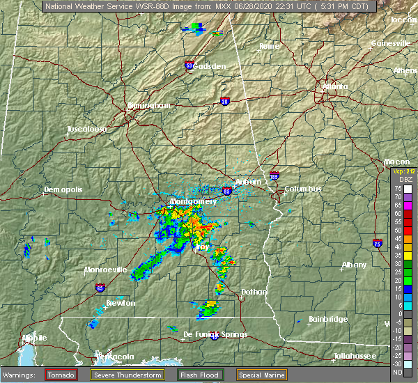 At 536 pm cdt, a severe thunderstorm was located over union springs, moving northeast at 30 mph (radar indicated). Hazards include 60 mph wind gusts and penny size hail. expect damage to roofs, siding, and trees At 536 pm cdt, a severe thunderstorm was located over union springs, moving northeast at 30 mph (radar indicated). Hazards include 60 mph wind gusts and penny size hail. expect damage to roofs, siding, and trees
|
| 4/12/2020 11:51 PM CDT |
 At 1151 pm cdt, severe thunderstorms were located along a line extending from near waverly to near midway, moving east at 60 mph (radar indicated). Hazards include 60 mph wind gusts. Expect damage to roofs, siding, and trees. Locations impacted include, tuskegee, tallassee, union springs, notasulga, midway, milstead, shorter, franklin, aberfoil, franklin field, reeves airport, lake tuskegee, guerryton, shopton, tuskegee national forest, davisville, southern lake martin, liverpool, liberty city and tallapoosa city. At 1151 pm cdt, severe thunderstorms were located along a line extending from near waverly to near midway, moving east at 60 mph (radar indicated). Hazards include 60 mph wind gusts. Expect damage to roofs, siding, and trees. Locations impacted include, tuskegee, tallassee, union springs, notasulga, midway, milstead, shorter, franklin, aberfoil, franklin field, reeves airport, lake tuskegee, guerryton, shopton, tuskegee national forest, davisville, southern lake martin, liverpool, liberty city and tallapoosa city.
|
| 4/12/2020 11:15 PM CDT |
 At 1115 pm cdt, severe thunderstorms were located along a line extending from santuck to grady, moving east at 65 mph (radar indicated). Hazards include 60 mph wind gusts. expect damage to roofs, siding, and trees At 1115 pm cdt, severe thunderstorms were located along a line extending from santuck to grady, moving east at 65 mph (radar indicated). Hazards include 60 mph wind gusts. expect damage to roofs, siding, and trees
|
| 3/4/2020 7:03 AM CST |
 At 702 am cst, a severe thunderstorm was located over midway, moving east at 50 mph (radar indicated). Hazards include 60 mph wind gusts. Expect damage to roofs, siding, and trees. Locations impacted include, union springs, midway, pickett, hawkinsville, aberfoil, spring hill, comer, barbour county public lake dam, lakepoint resort state park, batesville, perote, twin springs, lugo, three notch and mount andrew. At 702 am cst, a severe thunderstorm was located over midway, moving east at 50 mph (radar indicated). Hazards include 60 mph wind gusts. Expect damage to roofs, siding, and trees. Locations impacted include, union springs, midway, pickett, hawkinsville, aberfoil, spring hill, comer, barbour county public lake dam, lakepoint resort state park, batesville, perote, twin springs, lugo, three notch and mount andrew.
|
| 3/4/2020 6:42 AM CST |
 At 641 am cst, a severe thunderstorm was located over beans crossroads, or 11 miles southwest of union springs, moving east at 50 mph (radar indicated). Hazards include 60 mph wind gusts. expect damage to roofs, siding, and trees At 641 am cst, a severe thunderstorm was located over beans crossroads, or 11 miles southwest of union springs, moving east at 50 mph (radar indicated). Hazards include 60 mph wind gusts. expect damage to roofs, siding, and trees
|
| 2/6/2020 10:18 AM CST |
 At 1018 am cst, a severe thunderstorm was located near hardaway, or 9 miles northwest of union springs, moving northeast at 55 mph (radar indicated). Hazards include 60 mph wind gusts. Expect damage to roofs, siding, and trees. Locations impacted include, tuskegee, union springs, franklin, liverpool, franklin field, lake tuskegee, hardaway, tuskegee national forest, davisville, society hill, warriorstand, sedgefield, i 85 rest area, uphapee creek, fort davis, cross keys, creek stand and moton field municipal airport. At 1018 am cst, a severe thunderstorm was located near hardaway, or 9 miles northwest of union springs, moving northeast at 55 mph (radar indicated). Hazards include 60 mph wind gusts. Expect damage to roofs, siding, and trees. Locations impacted include, tuskegee, union springs, franklin, liverpool, franklin field, lake tuskegee, hardaway, tuskegee national forest, davisville, society hill, warriorstand, sedgefield, i 85 rest area, uphapee creek, fort davis, cross keys, creek stand and moton field municipal airport.
|
| 2/6/2020 10:06 AM CST |
 At 1006 am cst, a severe thunderstorm was located near shopton, or 13 miles west of union springs, moving northeast at 55 mph (radar indicated). Hazards include 60 mph wind gusts. expect damage to roofs, siding, and trees At 1006 am cst, a severe thunderstorm was located near shopton, or 13 miles west of union springs, moving northeast at 55 mph (radar indicated). Hazards include 60 mph wind gusts. expect damage to roofs, siding, and trees
|
| 1/11/2020 3:26 PM CST |
 At 326 pm cst, severe thunderstorms were located along a line extending from near auburn university to guerryton to 9 miles southwest of antioch, moving northeast at 55 mph (radar indicated). Hazards include 70 mph wind gusts. Expect considerable tree damage. damage is likely to mobile homes, roofs, and outbuildings. Locations impacted include, troy, tuskegee, union springs, brundidge, notasulga, midway, goshen, banks, pickett, aberfoil, lake tuskegee, beans crossroads, guerryton, linwood, tuskegee national forest, davisville, antioch, troy municipal airport, society hill and troy university. At 326 pm cst, severe thunderstorms were located along a line extending from near auburn university to guerryton to 9 miles southwest of antioch, moving northeast at 55 mph (radar indicated). Hazards include 70 mph wind gusts. Expect considerable tree damage. damage is likely to mobile homes, roofs, and outbuildings. Locations impacted include, troy, tuskegee, union springs, brundidge, notasulga, midway, goshen, banks, pickett, aberfoil, lake tuskegee, beans crossroads, guerryton, linwood, tuskegee national forest, davisville, antioch, troy municipal airport, society hill and troy university.
|
| 1/11/2020 3:10 PM CST |
 At 310 pm cst, severe thunderstorms were located along a line extending from near liberty city to union springs to near goshen, moving east at 55 mph (radar indicated). Hazards include 60 mph wind gusts. Expect damage to roofs, siding, and trees. Locations impacted include, troy, tuskegee, union springs, brundidge, notasulga, midway, goshen, milstead, shorter, banks, franklin, pickett, lake tuskegee, beans crossroads, guerryton, tuskegee national forest, liverpool, liberty city, hardaway and troy municipal airport. At 310 pm cst, severe thunderstorms were located along a line extending from near liberty city to union springs to near goshen, moving east at 55 mph (radar indicated). Hazards include 60 mph wind gusts. Expect damage to roofs, siding, and trees. Locations impacted include, troy, tuskegee, union springs, brundidge, notasulga, midway, goshen, milstead, shorter, banks, franklin, pickett, lake tuskegee, beans crossroads, guerryton, tuskegee national forest, liverpool, liberty city, hardaway and troy municipal airport.
|
| 1/11/2020 2:40 PM CST |
 At 240 pm cst, severe thunderstorms were located along a line extending from near mount meigs to brantley, moving northeast at 55 mph (radar indicated). Hazards include 60 mph wind gusts. expect damage to roofs, siding, and trees At 240 pm cst, severe thunderstorms were located along a line extending from near mount meigs to brantley, moving northeast at 55 mph (radar indicated). Hazards include 60 mph wind gusts. expect damage to roofs, siding, and trees
|
| 5/9/2019 4:01 PM CDT |
 At 400 pm cdt, severe thunderstorms were located along a line extending from tallassee to 6 miles east of pike road to grady, moving east at 50 mph (radar indicated). Hazards include 60 mph wind gusts. Expect damage to roofs, siding, and trees. Locations impacted include, southeastern montgomery, tuskegee, tallassee, union springs, notasulga, milstead, meadville, pike road, shorter, franklin, pine level, dublin, franklin field, lake tuskegee, beans crossroads, shopton, grady, sellers, davisville and ramer. At 400 pm cdt, severe thunderstorms were located along a line extending from tallassee to 6 miles east of pike road to grady, moving east at 50 mph (radar indicated). Hazards include 60 mph wind gusts. Expect damage to roofs, siding, and trees. Locations impacted include, southeastern montgomery, tuskegee, tallassee, union springs, notasulga, milstead, meadville, pike road, shorter, franklin, pine level, dublin, franklin field, lake tuskegee, beans crossroads, shopton, grady, sellers, davisville and ramer.
|
| 5/9/2019 3:48 PM CDT |
 At 348 pm cdt, severe thunderstorms were located along a line extending from 6 miles southwest of kent to pike road to near ramer, moving east at 50 mph (radar indicated). Hazards include 60 mph wind gusts. Expect damage to roofs, siding, and trees. Locations impacted include, montgomery, tuskegee, tallassee, union springs, notasulga, meadville, milstead, pike road, shorter, franklin, hyundai motors of alabama, auburn university in montgomery, dublin, lake tuskegee, woodcrest, beans crossroads, snowdoun, shopton, sellers and ramer. At 348 pm cdt, severe thunderstorms were located along a line extending from 6 miles southwest of kent to pike road to near ramer, moving east at 50 mph (radar indicated). Hazards include 60 mph wind gusts. Expect damage to roofs, siding, and trees. Locations impacted include, montgomery, tuskegee, tallassee, union springs, notasulga, meadville, milstead, pike road, shorter, franklin, hyundai motors of alabama, auburn university in montgomery, dublin, lake tuskegee, woodcrest, beans crossroads, snowdoun, shopton, sellers and ramer.
|
| 5/9/2019 3:32 PM CDT |
 The national weather service in birmingham has issued a * severe thunderstorm warning for. northwestern pike county in southeastern alabama. southern elmore county in east central alabama. western bullock county in southeastern alabama. Southeastern lowndes county in south central alabama. The national weather service in birmingham has issued a * severe thunderstorm warning for. northwestern pike county in southeastern alabama. southern elmore county in east central alabama. western bullock county in southeastern alabama. Southeastern lowndes county in south central alabama.
|
| 4/14/2019 7:38 AM CDT |
 At 738 am cdt, a severe thunderstorm capable of producing a tornado was located near aberfoil, or 8 miles south of union springs, moving northeast at 55 mph (radar indicated rotation). Hazards include tornado. Flying debris will be dangerous to those caught without shelter. mobile homes will be damaged or destroyed. damage to roofs, windows, and vehicles will occur. tree damage is likely. Locations impacted include, union springs, midway, pickett, aberfoil, beans crossroads, tanyard, sedgefield, three notch and perote. At 738 am cdt, a severe thunderstorm capable of producing a tornado was located near aberfoil, or 8 miles south of union springs, moving northeast at 55 mph (radar indicated rotation). Hazards include tornado. Flying debris will be dangerous to those caught without shelter. mobile homes will be damaged or destroyed. damage to roofs, windows, and vehicles will occur. tree damage is likely. Locations impacted include, union springs, midway, pickett, aberfoil, beans crossroads, tanyard, sedgefield, three notch and perote.
|
| 4/14/2019 7:27 AM CDT |
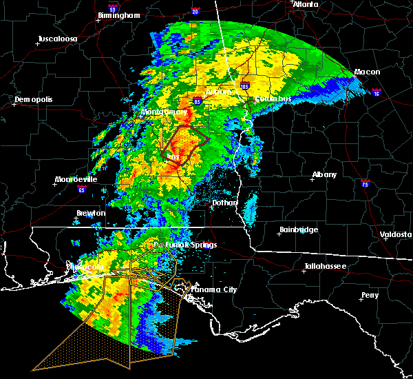 At 727 am cdt, a confirmed tornado was located over linwood, or 11 miles northeast of troy, moving northeast at 40 mph (radar confirmed tornado). Hazards include damaging tornado. Flying debris will be dangerous to those caught without shelter. mobile homes will be damaged or destroyed. damage to roofs, windows, and vehicles will occur. tree damage is likely. Locations impacted include, troy, union springs, midway, banks, pickett, aberfoil, franklin field, beans crossroads, linwood, tanyard, sedgefield, high ridge, monticello, perote, josie, sandfield and three notch. At 727 am cdt, a confirmed tornado was located over linwood, or 11 miles northeast of troy, moving northeast at 40 mph (radar confirmed tornado). Hazards include damaging tornado. Flying debris will be dangerous to those caught without shelter. mobile homes will be damaged or destroyed. damage to roofs, windows, and vehicles will occur. tree damage is likely. Locations impacted include, troy, union springs, midway, banks, pickett, aberfoil, franklin field, beans crossroads, linwood, tanyard, sedgefield, high ridge, monticello, perote, josie, sandfield and three notch.
|
| 4/14/2019 7:18 AM CDT |
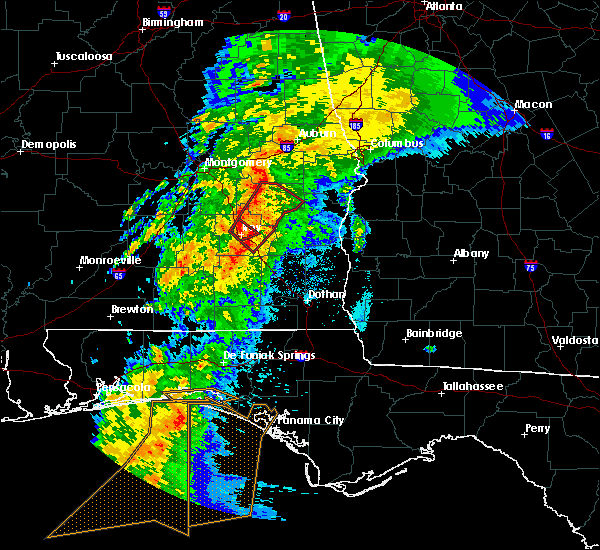 At 718 am cdt, a tornado producing storm was located near troy municipal airport, or near troy, moving northeast at 40 mph (radar confirmed tornado). Hazards include damaging tornado. Flying debris will be dangerous to those caught without shelter. mobile homes will be damaged or destroyed. damage to roofs, windows, and vehicles will occur. Tree damage is likely. At 718 am cdt, a tornado producing storm was located near troy municipal airport, or near troy, moving northeast at 40 mph (radar confirmed tornado). Hazards include damaging tornado. Flying debris will be dangerous to those caught without shelter. mobile homes will be damaged or destroyed. damage to roofs, windows, and vehicles will occur. Tree damage is likely.
|
| 3/3/2019 3:12 PM CST |
 At 312 pm cst, severe thunderstorms were located along a line extending from near guerryton to near brantley, moving east at 40 mph (radar indicated). Hazards include 60 mph wind gusts and nickel size hail. expect damage to roofs, siding, and trees At 312 pm cst, severe thunderstorms were located along a line extending from near guerryton to near brantley, moving east at 40 mph (radar indicated). Hazards include 60 mph wind gusts and nickel size hail. expect damage to roofs, siding, and trees
|
| 6/28/2018 4:25 PM CDT |
 At 425 pm cdt, severe thunderstorms were located along a line extending from near smiths to near uchee to montgomery, moving southeast at 35 mph (radar indicated). Hazards include 60 mph wind gusts. expect damage to roofs, siding, and trees At 425 pm cdt, severe thunderstorms were located along a line extending from near smiths to near uchee to montgomery, moving southeast at 35 mph (radar indicated). Hazards include 60 mph wind gusts. expect damage to roofs, siding, and trees
|
| 5/1/2017 6:33 AM CDT |
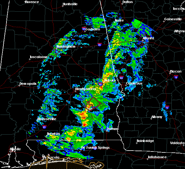 At 632 am cdt, a severe thunderstorm capable of producing a tornado was located over linwood, or 7 miles northeast of troy, moving northeast at 35 mph (radar indicated rotation). Hazards include tornado. Flying debris will be dangerous to those caught without shelter. mobile homes will be damaged or destroyed. damage to roofs, windows, and vehicles will occur. Tree damage is likely. At 632 am cdt, a severe thunderstorm capable of producing a tornado was located over linwood, or 7 miles northeast of troy, moving northeast at 35 mph (radar indicated rotation). Hazards include tornado. Flying debris will be dangerous to those caught without shelter. mobile homes will be damaged or destroyed. damage to roofs, windows, and vehicles will occur. Tree damage is likely.
|
| 4/3/2017 9:40 AM CDT |
 At 940 am cdt, severe thunderstorms were located along a line extending from near beans crossroads to 7 miles northeast of linwood to near ariton, moving east at 40 mph (radar indicated). Hazards include 60 mph wind gusts. expect damage to roofs, siding, and trees At 940 am cdt, severe thunderstorms were located along a line extending from near beans crossroads to 7 miles northeast of linwood to near ariton, moving east at 40 mph (radar indicated). Hazards include 60 mph wind gusts. expect damage to roofs, siding, and trees
|
| 2/7/2017 2:12 PM CST |
 At 212 pm cst, severe thunderstorms were located along a line extending from near liberty city to near davisville, moving northeast at 45 mph (radar indicated). Hazards include 60 mph wind gusts. Expect damage to roofs, siding, and trees. Locations impacted include, tuskegee, union springs, notasulga, franklin, guerryton, lake tuskegee, davisville, society hill, tuskegee national forest, liberty city, creek stand, warriorstand, moton field municipal airport, uphapee creek, sedgefield, fort davis and i 85 rest area. At 212 pm cst, severe thunderstorms were located along a line extending from near liberty city to near davisville, moving northeast at 45 mph (radar indicated). Hazards include 60 mph wind gusts. Expect damage to roofs, siding, and trees. Locations impacted include, tuskegee, union springs, notasulga, franklin, guerryton, lake tuskegee, davisville, society hill, tuskegee national forest, liberty city, creek stand, warriorstand, moton field municipal airport, uphapee creek, sedgefield, fort davis and i 85 rest area.
|
| 2/7/2017 2:00 PM CST |
 At 200 pm cst, severe thunderstorms were located along a line extending from reeves airport to near franklin field, moving northeast at 45 mph (radar indicated). Hazards include 60 mph wind gusts. Expect damage to roofs, siding, and trees. Locations impacted include, tuskegee, union springs, notasulga, milstead, shorter, franklin, lake tuskegee, davisville, society hill, tuskegee national forest, hardaway, liverpool, franklin field, guerryton, victoryland, tysonville, liberty city, creek stand, moton field municipal airport and simsville. At 200 pm cst, severe thunderstorms were located along a line extending from reeves airport to near franklin field, moving northeast at 45 mph (radar indicated). Hazards include 60 mph wind gusts. Expect damage to roofs, siding, and trees. Locations impacted include, tuskegee, union springs, notasulga, milstead, shorter, franklin, lake tuskegee, davisville, society hill, tuskegee national forest, hardaway, liverpool, franklin field, guerryton, victoryland, tysonville, liberty city, creek stand, moton field municipal airport and simsville.
|
| 2/7/2017 1:46 PM CST |
 At 146 pm cst, severe thunderstorms were located along a line extending from tysonville to near shopton, moving northeast at 45 mph (radar indicated). Hazards include 60 mph wind gusts. expect damage to roofs, siding, and trees At 146 pm cst, severe thunderstorms were located along a line extending from tysonville to near shopton, moving northeast at 45 mph (radar indicated). Hazards include 60 mph wind gusts. expect damage to roofs, siding, and trees
|
| 1/22/2017 1:11 PM CST |
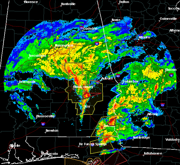 At 111 pm cst, a confirmed tornado was located near shopton, or 10 miles west of union springs, moving northeast at 45 mph (radar confirmed tornado). Hazards include damaging tornado. Flying debris will be dangerous to those caught without shelter. mobile homes will be damaged or destroyed. damage to roofs, windows, and vehicles will occur. tree damage is likely. Locations impacted include, union springs, franklin field, shopton, sedgefield and simsville. At 111 pm cst, a confirmed tornado was located near shopton, or 10 miles west of union springs, moving northeast at 45 mph (radar confirmed tornado). Hazards include damaging tornado. Flying debris will be dangerous to those caught without shelter. mobile homes will be damaged or destroyed. damage to roofs, windows, and vehicles will occur. tree damage is likely. Locations impacted include, union springs, franklin field, shopton, sedgefield and simsville.
|
| 1/22/2017 1:08 PM CST |
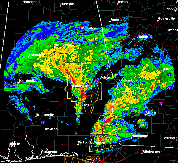 At 108 pm cst, a severe thunderstorm capable of producing a tornado was located over shopton, or 12 miles west of union springs, moving northeast at 45 mph (radar indicated rotation). Hazards include tornado. Flying debris will be dangerous to those caught without shelter. mobile homes will be damaged or destroyed. damage to roofs, windows, and vehicles will occur. Tree damage is likely. At 108 pm cst, a severe thunderstorm capable of producing a tornado was located over shopton, or 12 miles west of union springs, moving northeast at 45 mph (radar indicated rotation). Hazards include tornado. Flying debris will be dangerous to those caught without shelter. mobile homes will be damaged or destroyed. damage to roofs, windows, and vehicles will occur. Tree damage is likely.
|
| 1/22/2017 12:56 PM CST |
 At 1255 pm cst, severe thunderstorms were located along a line extending from emerald mountain to near pine level to near brantley, moving northeast at 70 mph (radar indicated). Hazards include 60 mph wind gusts. expect damage to roofs, siding, and trees At 1255 pm cst, severe thunderstorms were located along a line extending from emerald mountain to near pine level to near brantley, moving northeast at 70 mph (radar indicated). Hazards include 60 mph wind gusts. expect damage to roofs, siding, and trees
|
| 1/2/2017 4:50 PM CST |
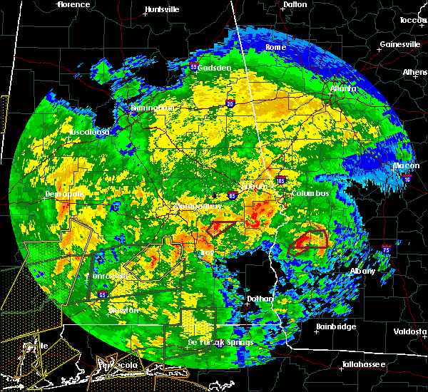 At 450 pm cst, a severe thunderstorm capable of producing a tornado was located over union springs, moving northeast at 30 mph (radar indicated rotation). Hazards include tornado. Flying debris will be dangerous to those caught without shelter. mobile homes will be damaged or destroyed. damage to roofs, windows, and vehicles will occur. tree damage is likely. Locations impacted include, union springs, franklin field and sedgefield. At 450 pm cst, a severe thunderstorm capable of producing a tornado was located over union springs, moving northeast at 30 mph (radar indicated rotation). Hazards include tornado. Flying debris will be dangerous to those caught without shelter. mobile homes will be damaged or destroyed. damage to roofs, windows, and vehicles will occur. tree damage is likely. Locations impacted include, union springs, franklin field and sedgefield.
|
| 1/2/2017 4:38 PM CST |
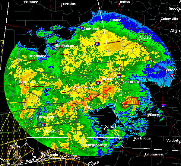 At 437 pm cst, a severe thunderstorm capable of producing a tornado was located near franklin field, or near union springs, moving northeast at 30 mph (radar indicated rotation). Hazards include tornado. Flying debris will be dangerous to those caught without shelter. mobile homes will be damaged or destroyed. damage to roofs, windows, and vehicles will occur. tree damage is likely. Locations impacted include, union springs, franklin field, sedgefield and simsville. At 437 pm cst, a severe thunderstorm capable of producing a tornado was located near franklin field, or near union springs, moving northeast at 30 mph (radar indicated rotation). Hazards include tornado. Flying debris will be dangerous to those caught without shelter. mobile homes will be damaged or destroyed. damage to roofs, windows, and vehicles will occur. tree damage is likely. Locations impacted include, union springs, franklin field, sedgefield and simsville.
|
| 1/2/2017 4:29 PM CST |
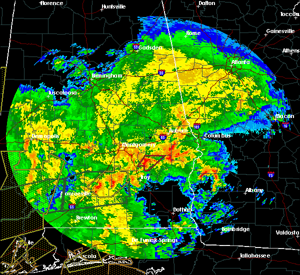 At 428 pm cst, a confirmed tornado was located near beans crossroads, or 9 miles southwest of union springs, moving northeast at 30 mph (radar confirmed tornado). Hazards include damaging tornado. Flying debris will be dangerous to those caught without shelter. mobile homes will be damaged or destroyed. damage to roofs, windows, and vehicles will occur. tree damage is likely. Locations impacted include, union springs, franklin field, beans crossroads, sedgefield, simsville and high ridge. At 428 pm cst, a confirmed tornado was located near beans crossroads, or 9 miles southwest of union springs, moving northeast at 30 mph (radar confirmed tornado). Hazards include damaging tornado. Flying debris will be dangerous to those caught without shelter. mobile homes will be damaged or destroyed. damage to roofs, windows, and vehicles will occur. tree damage is likely. Locations impacted include, union springs, franklin field, beans crossroads, sedgefield, simsville and high ridge.
|
| 1/2/2017 4:11 PM CST |
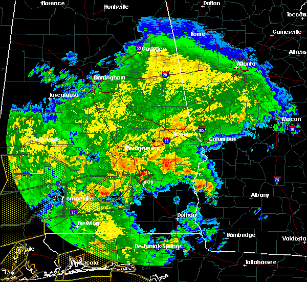 At 410 pm cst, a severe thunderstorm capable of producing a tornado was located near linwood, or 9 miles north of troy, moving northeast at 30 mph (radar indicated rotation). Hazards include tornado. Flying debris will be dangerous to those caught without shelter. mobile homes will be damaged or destroyed. damage to roofs, windows, and vehicles will occur. Tree damage is likely. At 410 pm cst, a severe thunderstorm capable of producing a tornado was located near linwood, or 9 miles north of troy, moving northeast at 30 mph (radar indicated rotation). Hazards include tornado. Flying debris will be dangerous to those caught without shelter. mobile homes will be damaged or destroyed. damage to roofs, windows, and vehicles will occur. Tree damage is likely.
|
| 7/11/2016 2:13 PM CDT |
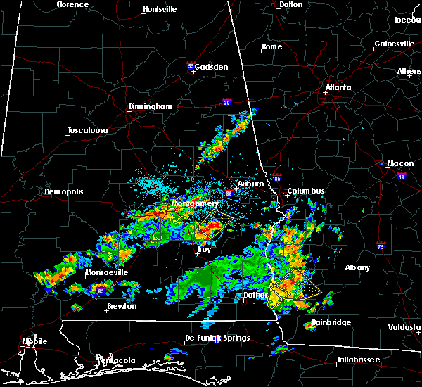 At 212 pm cdt, a severe thunderstorm was located over franklin field, or near union springs, moving northeast at 30 mph (radar indicated). Hazards include 70 mph wind gusts and quarter size hail. Hail damage to vehicles is expected. expect considerable tree damage. wind damage is also likely to mobile homes, roofs, and outbuildings. Locations impacted include, union springs, franklin field, shopton, sedgefield, simsville and fort davis. At 212 pm cdt, a severe thunderstorm was located over franklin field, or near union springs, moving northeast at 30 mph (radar indicated). Hazards include 70 mph wind gusts and quarter size hail. Hail damage to vehicles is expected. expect considerable tree damage. wind damage is also likely to mobile homes, roofs, and outbuildings. Locations impacted include, union springs, franklin field, shopton, sedgefield, simsville and fort davis.
|
| 7/11/2016 2:08 PM CDT | Trees down across hwy 82 near a church in simsville. winds est at 65mph by rada in bullock county AL, 9.3 miles E of Union Springs, AL |
| 7/11/2016 2:03 PM CDT |
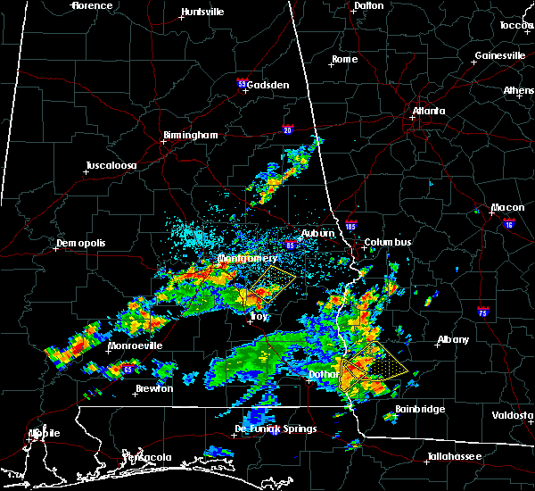 At 203 pm cdt, a severe thunderstorm was located over franklin field, or near union springs, moving northeast at 30 mph (radar indicated). Hazards include 60 mph wind gusts. Expect damage to roofs. siding. And trees. At 203 pm cdt, a severe thunderstorm was located over franklin field, or near union springs, moving northeast at 30 mph (radar indicated). Hazards include 60 mph wind gusts. Expect damage to roofs. siding. And trees.
|
| 6/17/2016 6:18 PM CDT |
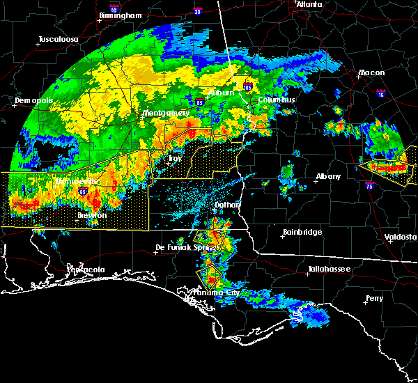 At 618 pm cdt, severe thunderstorms were located along a line extending from midway to near goshen, moving southeast at 40 mph (radar indicated). Hazards include 60 mph wind gusts. Expect damage to roofs. siding. and trees. Locations impacted include, troy, union springs, brundidge, midway, goshen, banks, beans crossroads, pickett, troy municipal airport, troy university, antioch, guerryton, ansley, aberfoil, linwood, josie, tennille, henderson, tarentum and monticello. At 618 pm cdt, severe thunderstorms were located along a line extending from midway to near goshen, moving southeast at 40 mph (radar indicated). Hazards include 60 mph wind gusts. Expect damage to roofs. siding. and trees. Locations impacted include, troy, union springs, brundidge, midway, goshen, banks, beans crossroads, pickett, troy municipal airport, troy university, antioch, guerryton, ansley, aberfoil, linwood, josie, tennille, henderson, tarentum and monticello.
|
| 6/17/2016 6:09 PM CDT |
 At 609 pm cdt, severe thunderstorms were located along a line extending from near davisville to near goshen, moving southeast at 40 mph (radar indicated). Hazards include 60 mph wind gusts. Expect damage to roofs. siding. and trees. Locations impacted include, troy, union springs, brundidge, midway, goshen, banks, beans crossroads, pickett, troy municipal airport, troy university, antioch, shopton, franklin field, guerryton, ansley, aberfoil, linwood, josie, tennille and simsville. At 609 pm cdt, severe thunderstorms were located along a line extending from near davisville to near goshen, moving southeast at 40 mph (radar indicated). Hazards include 60 mph wind gusts. Expect damage to roofs. siding. and trees. Locations impacted include, troy, union springs, brundidge, midway, goshen, banks, beans crossroads, pickett, troy municipal airport, troy university, antioch, shopton, franklin field, guerryton, ansley, aberfoil, linwood, josie, tennille and simsville.
|
| 6/17/2016 5:46 PM CDT |
 At 546 pm cdt, severe thunderstorms were located along a line extending from near shorter to 6 miles south of logan, moving southeast at 35 mph (radar indicated). Hazards include 60 mph wind gusts. Expect damage to roofs. siding. And trees. At 546 pm cdt, severe thunderstorms were located along a line extending from near shorter to 6 miles south of logan, moving southeast at 35 mph (radar indicated). Hazards include 60 mph wind gusts. Expect damage to roofs. siding. And trees.
|
| 4/6/2016 11:46 PM CDT |
 At 1146 pm cdt, a severe thunderstorm was located near guerryton, or 8 miles north of midway, moving east at 45 mph (radar indicated). Hazards include 60 mph wind gusts and penny size hail. Expect damage to roofs. siding. and trees. Locations impacted include, union springs, midway, aberfoil, guerryton, sedgefield and three notch. At 1146 pm cdt, a severe thunderstorm was located near guerryton, or 8 miles north of midway, moving east at 45 mph (radar indicated). Hazards include 60 mph wind gusts and penny size hail. Expect damage to roofs. siding. and trees. Locations impacted include, union springs, midway, aberfoil, guerryton, sedgefield and three notch.
|
| 4/6/2016 11:36 PM CDT |
 At 1136 pm cdt, a severe thunderstorm was located near union springs, moving east at 45 mph (radar indicated). Hazards include 60 mph wind gusts and penny size hail. Expect damage to roofs. siding. and trees. Locations impacted include, union springs, midway, franklin field, aberfoil, guerryton, shopton, sedgefield, high ridge, creek stand, fort davis, simsville and three notch. At 1136 pm cdt, a severe thunderstorm was located near union springs, moving east at 45 mph (radar indicated). Hazards include 60 mph wind gusts and penny size hail. Expect damage to roofs. siding. and trees. Locations impacted include, union springs, midway, franklin field, aberfoil, guerryton, shopton, sedgefield, high ridge, creek stand, fort davis, simsville and three notch.
|
| 4/6/2016 11:26 PM CDT |
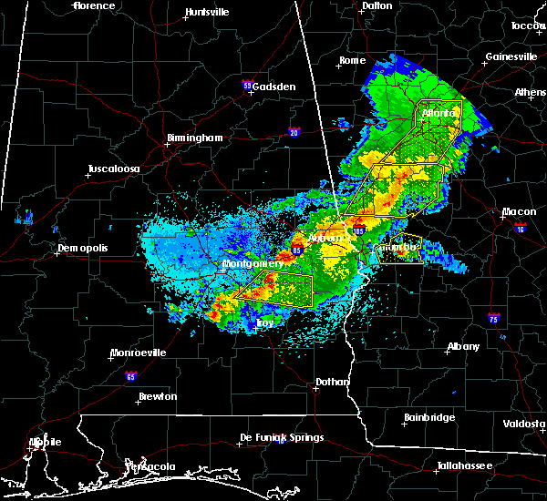 At 1125 pm cdt, a severe thunderstorm was located near franklin field, or 8 miles northwest of union springs, moving east at 45 mph (radar indicated). Hazards include 60 mph wind gusts and penny size hail. Expect damage to roofs. siding. and trees. Locations impacted include, union springs, midway, franklin field, guerryton, aberfoil, hardaway, shopton, creek stand, simsville, three notch, sedgefield, high ridge, fort davis, mitchell and cross keys. At 1125 pm cdt, a severe thunderstorm was located near franklin field, or 8 miles northwest of union springs, moving east at 45 mph (radar indicated). Hazards include 60 mph wind gusts and penny size hail. Expect damage to roofs. siding. and trees. Locations impacted include, union springs, midway, franklin field, guerryton, aberfoil, hardaway, shopton, creek stand, simsville, three notch, sedgefield, high ridge, fort davis, mitchell and cross keys.
|
| 4/6/2016 11:09 PM CDT |
 At 1109 pm cdt, a severe thunderstorm was located near pike road, or 14 miles southwest of milstead, moving east at 45 mph (radar indicated). Hazards include 60 mph wind gusts and penny size hail. Expect damage to roofs. siding. and trees. Locations impacted include, southeastern montgomery, union springs, midway, pike road, franklin field, mount meigs, guerryton, waugh, aberfoil, hardaway, sprague, shopton, creek stand, simsville, three notch, sedgefield, fort davis, cecil, mitchell and cross keys. At 1109 pm cdt, a severe thunderstorm was located near pike road, or 14 miles southwest of milstead, moving east at 45 mph (radar indicated). Hazards include 60 mph wind gusts and penny size hail. Expect damage to roofs. siding. and trees. Locations impacted include, southeastern montgomery, union springs, midway, pike road, franklin field, mount meigs, guerryton, waugh, aberfoil, hardaway, sprague, shopton, creek stand, simsville, three notch, sedgefield, fort davis, cecil, mitchell and cross keys.
|
| 4/6/2016 10:53 PM CDT |
 At 1053 pm cdt, a severe thunderstorm was located over pinedale, or near montgomery, moving east at 40 mph (radar indicated). Hazards include 60 mph wind gusts and penny size hail. Expect damage to roofs. siding. And trees. At 1053 pm cdt, a severe thunderstorm was located over pinedale, or near montgomery, moving east at 40 mph (radar indicated). Hazards include 60 mph wind gusts and penny size hail. Expect damage to roofs. siding. And trees.
|
| 2/15/2016 6:30 PM CST |
 At 630 pm cst, severe thunderstorms were located along a line extending from tuskegee national forest to near aberfoil to near brundidge, moving east at 50 mph (radar indicated). Hazards include 60 mph wind gusts. Expect damage to roofs. siding and trees. locations impacted include, tuskegee, union springs, brundidge, notasulga, midway, banks, pickett, lake tuskegee, davisville, society hill, tuskegee national forest, guerryton, aberfoil, creek stand, moton field municipal airport, josie, monticello, sedgefield, perote and hamilton crossroads. this includes interstate 85 near mile marker 42. A tornado watch remains in effect until 900 pm cst for southeastern alabama. At 630 pm cst, severe thunderstorms were located along a line extending from tuskegee national forest to near aberfoil to near brundidge, moving east at 50 mph (radar indicated). Hazards include 60 mph wind gusts. Expect damage to roofs. siding and trees. locations impacted include, tuskegee, union springs, brundidge, notasulga, midway, banks, pickett, lake tuskegee, davisville, society hill, tuskegee national forest, guerryton, aberfoil, creek stand, moton field municipal airport, josie, monticello, sedgefield, perote and hamilton crossroads. this includes interstate 85 near mile marker 42. A tornado watch remains in effect until 900 pm cst for southeastern alabama.
|
| 2/15/2016 6:23 PM CST |
 At 623 pm cst, severe thunderstorms were located along a line extending from tuskegee national forest to near franklin field to 7 miles south of brundidge, moving northeast at 55 mph (radar indicated). Hazards include 60 mph wind gusts. Expect damage to roofs. siding and trees. locations impacted include, troy, tuskegee, union springs, brundidge, notasulga, midway, banks, beans crossroads, pickett, lake tuskegee, davisville, society hill, troy university, tuskegee national forest, liverpool, antioch, franklin field, guerryton, aberfoil and linwood. this includes interstate 85 between mile markers 38 and 42. A tornado watch remains in effect until 900 pm cst for southeastern alabama. At 623 pm cst, severe thunderstorms were located along a line extending from tuskegee national forest to near franklin field to 7 miles south of brundidge, moving northeast at 55 mph (radar indicated). Hazards include 60 mph wind gusts. Expect damage to roofs. siding and trees. locations impacted include, troy, tuskegee, union springs, brundidge, notasulga, midway, banks, beans crossroads, pickett, lake tuskegee, davisville, society hill, troy university, tuskegee national forest, liverpool, antioch, franklin field, guerryton, aberfoil and linwood. this includes interstate 85 between mile markers 38 and 42. A tornado watch remains in effect until 900 pm cst for southeastern alabama.
|
| 2/15/2016 6:12 PM CST |
 At 612 pm cst, severe thunderstorms were located along a line extending from near tuskegee national forest to near shopton to 8 miles southeast of goshen, moving east at 50 mph (radar indicated). Hazards include 60 mph wind gusts. Expect damage to roofs. siding and trees. locations impacted include, troy, tuskegee, union springs, brundidge, notasulga, midway, banks, franklin, beans crossroads, pickett, lake tuskegee, davisville, troy municipal airport, society hill, troy university, tuskegee national forest, hardaway, liverpool, antioch and shopton. this includes interstate 85 between mile markers 32 and 42. A tornado watch remains in effect until 900 pm cst for southeastern alabama. At 612 pm cst, severe thunderstorms were located along a line extending from near tuskegee national forest to near shopton to 8 miles southeast of goshen, moving east at 50 mph (radar indicated). Hazards include 60 mph wind gusts. Expect damage to roofs. siding and trees. locations impacted include, troy, tuskegee, union springs, brundidge, notasulga, midway, banks, franklin, beans crossroads, pickett, lake tuskegee, davisville, troy municipal airport, society hill, troy university, tuskegee national forest, hardaway, liverpool, antioch and shopton. this includes interstate 85 between mile markers 32 and 42. A tornado watch remains in effect until 900 pm cst for southeastern alabama.
|
| 2/15/2016 5:59 PM CST |
 At 559 pm cst, severe thunderstorms were located along a line extending from tuskegee to near pine level to near brantley, moving east at 50 mph (radar indicated). Hazards include 60 mph wind gusts. Expect damage to roofs. siding and trees. locations impacted include, troy, tuskegee, union springs, brundidge, notasulga, midway, goshen, meadville, banks, franklin, troy university, liverpool, antioch, shopton, guerryton, linwood, pine level, beans crossroads, pickett and lake tuskegee. this includes interstate 85 between mile markers 32 and 42. A tornado watch remains in effect until 900 pm cst for southeastern alabama. At 559 pm cst, severe thunderstorms were located along a line extending from tuskegee to near pine level to near brantley, moving east at 50 mph (radar indicated). Hazards include 60 mph wind gusts. Expect damage to roofs. siding and trees. locations impacted include, troy, tuskegee, union springs, brundidge, notasulga, midway, goshen, meadville, banks, franklin, troy university, liverpool, antioch, shopton, guerryton, linwood, pine level, beans crossroads, pickett and lake tuskegee. this includes interstate 85 between mile markers 32 and 42. A tornado watch remains in effect until 900 pm cst for southeastern alabama.
|
| 2/15/2016 5:50 PM CST |
 At 550 pm cst, severe thunderstorms were located along a line extending from near pike road to near brantley, moving northeast at 60 mph (radar indicated). Hazards include 60 mph wind gusts. Expect damage to roofs. Siding and trees. At 550 pm cst, severe thunderstorms were located along a line extending from near pike road to near brantley, moving northeast at 60 mph (radar indicated). Hazards include 60 mph wind gusts. Expect damage to roofs. Siding and trees.
|
| 8/6/2015 8:57 PM CDT |
 At 857 pm cdt, severe thunderstorms were located along a line extending from 7 miles south of society hill to near midway to aberfoil to near sprague, moving southeast at 45 mph (radar indicated). Hazards include 60 mph wind gusts. Expect damage to roofs. siding and trees. Locations impacted include, union springs, midway, meadville, franklin field, beans crossroads, guerryton, pickett, aberfoil, dublin, pine level, shopton, currys, simsville, three notch, tanyard, sedgefield, high ridge, perote and carters hill. At 857 pm cdt, severe thunderstorms were located along a line extending from 7 miles south of society hill to near midway to aberfoil to near sprague, moving southeast at 45 mph (radar indicated). Hazards include 60 mph wind gusts. Expect damage to roofs. siding and trees. Locations impacted include, union springs, midway, meadville, franklin field, beans crossroads, guerryton, pickett, aberfoil, dublin, pine level, shopton, currys, simsville, three notch, tanyard, sedgefield, high ridge, perote and carters hill.
|
| 8/6/2015 8:44 PM CDT |
 At 843 pm cdt, severe thunderstorms were located along a line extending from near society hill to davisville to near franklin field to near snowdoun, moving southeast at 50 mph (radar indicated). Hazards include 60 mph wind gusts. Expect damage to roofs. siding and trees. Locations impacted include, union springs, hurtsboro, midway, meadville, pike road, beans crossroads, pickett, davisville, society hill, dublin, shopton, franklin field, guerryton, aberfoil, pine level, creek stand, simsville, sedgefield, high ridge and mitchell. At 843 pm cdt, severe thunderstorms were located along a line extending from near society hill to davisville to near franklin field to near snowdoun, moving southeast at 50 mph (radar indicated). Hazards include 60 mph wind gusts. Expect damage to roofs. siding and trees. Locations impacted include, union springs, hurtsboro, midway, meadville, pike road, beans crossroads, pickett, davisville, society hill, dublin, shopton, franklin field, guerryton, aberfoil, pine level, creek stand, simsville, sedgefield, high ridge and mitchell.
|
| 8/6/2015 8:21 PM CDT |
 At 821 pm cdt, severe thunderstorms were located along a line extending from near notasulga to near pike road to montgomery, moving southeast at 35 mph (radar indicated). Hazards include 60 mph wind gusts. Expect damage to roofs. Siding and trees. At 821 pm cdt, severe thunderstorms were located along a line extending from near notasulga to near pike road to montgomery, moving southeast at 35 mph (radar indicated). Hazards include 60 mph wind gusts. Expect damage to roofs. Siding and trees.
|
| 7/15/2015 6:01 PM CDT |
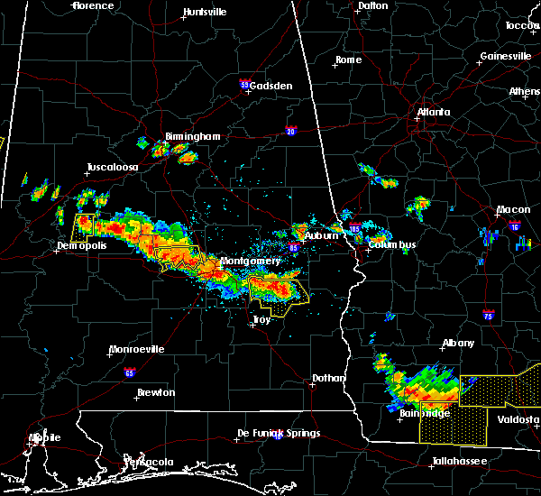 At 600 pm cdt, severe thunderstorms were located along a line extending from near franklin field to near union springs to aberfoil to 7 miles northwest of midway, moving southeast at 30 mph (radar indicated). Hazards include 60 mph wind gusts and penny size hail. Expect damage to roofs. siding and trees. Locations impacted include, union springs, midway, franklin field, beans crossroads, pickett, aberfoil, shopton, simsville, three notch, tanyard, sedgefield, high ridge, mitchell and perote. At 600 pm cdt, severe thunderstorms were located along a line extending from near franklin field to near union springs to aberfoil to 7 miles northwest of midway, moving southeast at 30 mph (radar indicated). Hazards include 60 mph wind gusts and penny size hail. Expect damage to roofs. siding and trees. Locations impacted include, union springs, midway, franklin field, beans crossroads, pickett, aberfoil, shopton, simsville, three notch, tanyard, sedgefield, high ridge, mitchell and perote.
|
| 7/15/2015 5:52 PM CDT | Multiple trees down in union springs in bullock county AL, 0.2 miles SW of Union Springs, AL |
| 7/15/2015 5:42 PM CDT |
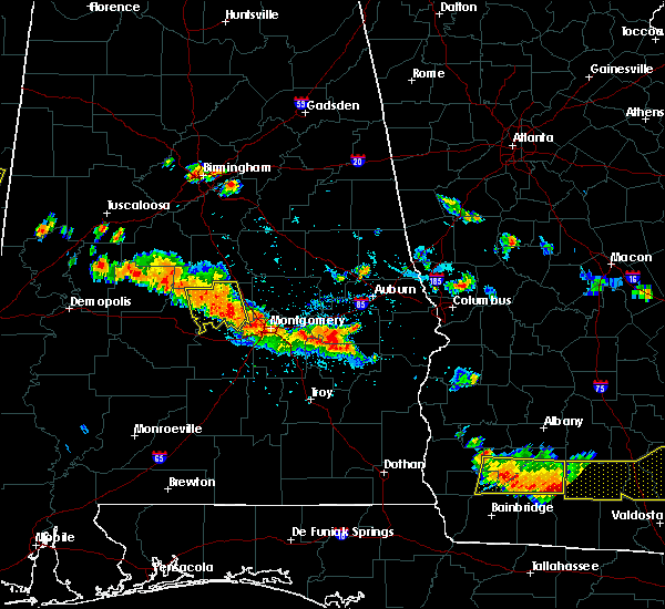 At 541 pm cdt, severe thunderstorms were located along a line extending from near hardaway to franklin field to near union springs, moving southeast at 40 mph (radar indicated). Hazards include 60 mph wind gusts and penny size hail. Expect damage to roofs. Siding and trees. At 541 pm cdt, severe thunderstorms were located along a line extending from near hardaway to franklin field to near union springs, moving southeast at 40 mph (radar indicated). Hazards include 60 mph wind gusts and penny size hail. Expect damage to roofs. Siding and trees.
|
| 6/24/2015 8:49 PM CDT |
 At 846 pm cdt, severe thunderstorms were located along a line extending from shopton to mount meigs to blue ridge, moving southwest at 30 mph (radar indicated). Hazards include 70 mph wind gusts and quarter size hail. Hail damage to vehicles is expected. expect considerable tree damage. wind damage is also likely to mobile homes, roofs and outbuildings. Locations impacted include, montgomery, prattville, millbrook, wetumpka, tallassee, union springs, milstead, meadville, pike road, coosada, shorter, emerald mountain, boylston, waugh, alabama state university, woodcrest, ramer, snowdoun, lagoon park and liverpool. At 846 pm cdt, severe thunderstorms were located along a line extending from shopton to mount meigs to blue ridge, moving southwest at 30 mph (radar indicated). Hazards include 70 mph wind gusts and quarter size hail. Hail damage to vehicles is expected. expect considerable tree damage. wind damage is also likely to mobile homes, roofs and outbuildings. Locations impacted include, montgomery, prattville, millbrook, wetumpka, tallassee, union springs, milstead, meadville, pike road, coosada, shorter, emerald mountain, boylston, waugh, alabama state university, woodcrest, ramer, snowdoun, lagoon park and liverpool.
|
| 6/24/2015 8:20 PM CDT |
 At 819 pm cdt, severe thunderstorms were located along a line extending from near franklin field to near victoryland to near eclectic, moving southwest at 25 mph (radar indicated). Hazards include 60 mph wind gusts and quarter size hail. Hail damage to vehicles is expected. Expect wind damage to roofs, siding and trees. At 819 pm cdt, severe thunderstorms were located along a line extending from near franklin field to near victoryland to near eclectic, moving southwest at 25 mph (radar indicated). Hazards include 60 mph wind gusts and quarter size hail. Hail damage to vehicles is expected. Expect wind damage to roofs, siding and trees.
|
| 4/19/2015 7:15 AM CDT | The national weather service in birmingham has issued a * tornado warning for. northeastern bullock county in southeastern alabama. southeastern macon county in southeastern alabama. until 745 am cdt * at 714 am cdt. A severe thunderstorm capable of producing a. |
| 6/8/2014 5:27 PM CDT | Quarter sized hail reported 7 miles S of Union Springs, AL, at black bear farms |
| 4/7/2014 8:21 AM CDT | A few trees were blown down along highway 239 in the smuteye communit in bullock county AL, 8.3 miles NNE of Union Springs, AL |
Hail Maps for Union Springs, AL
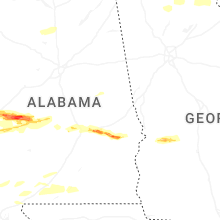


Connect with Interactive Hail Maps