

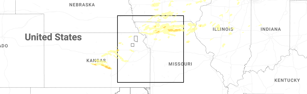
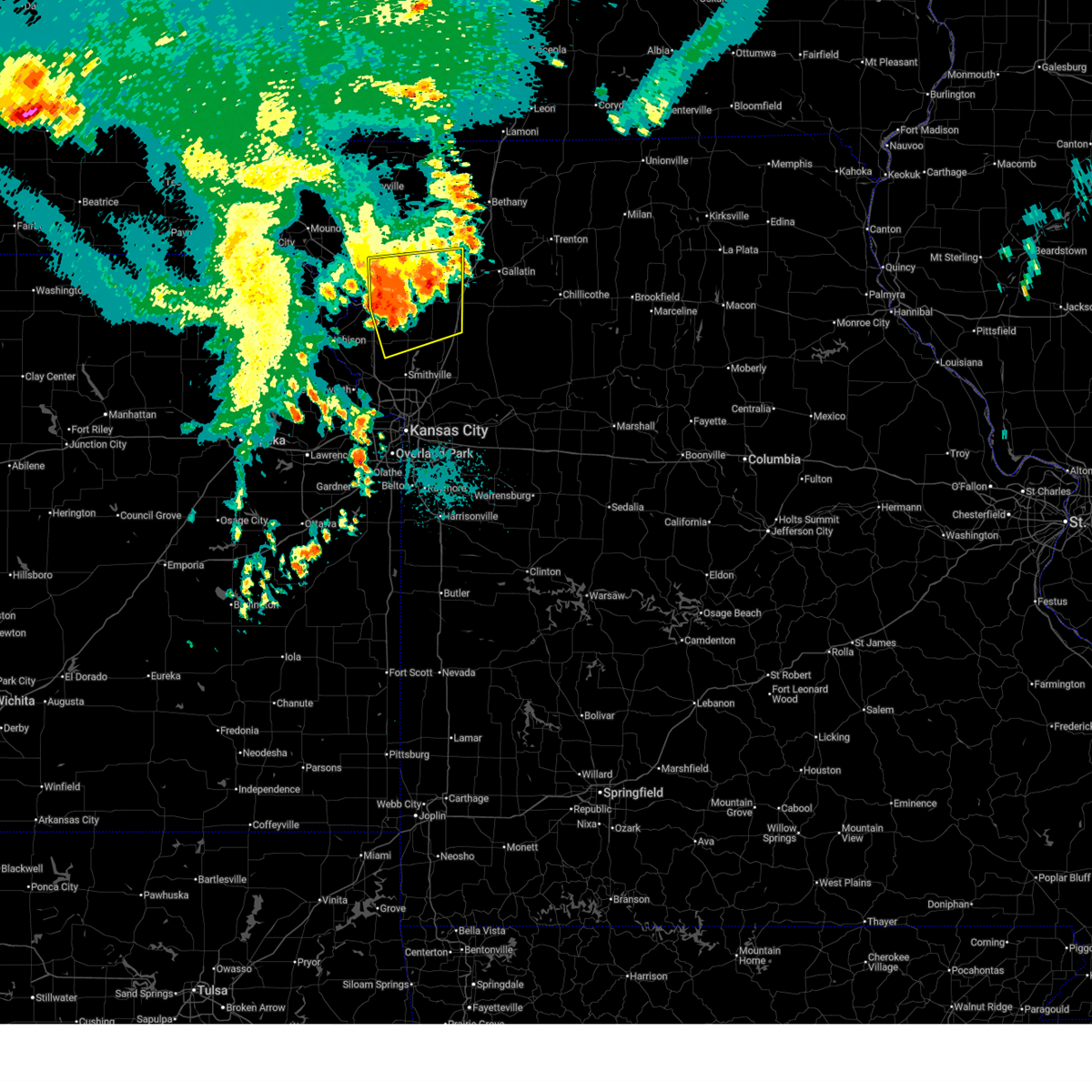
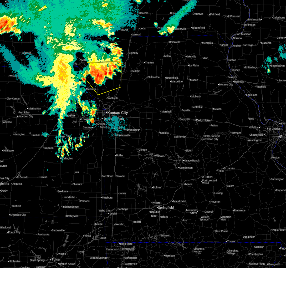
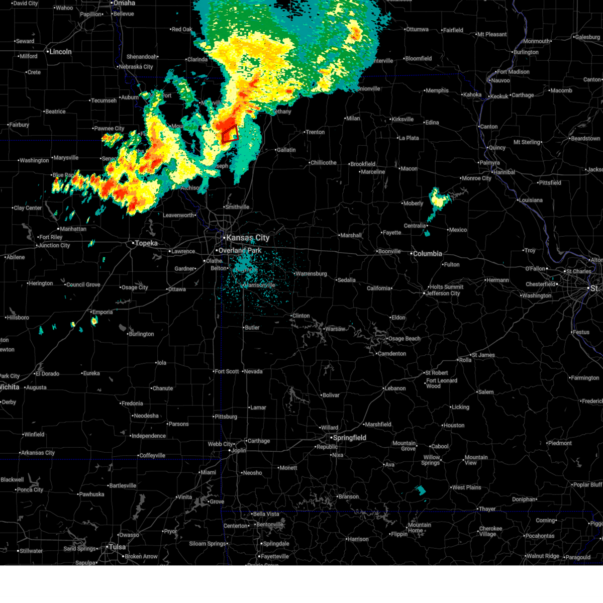
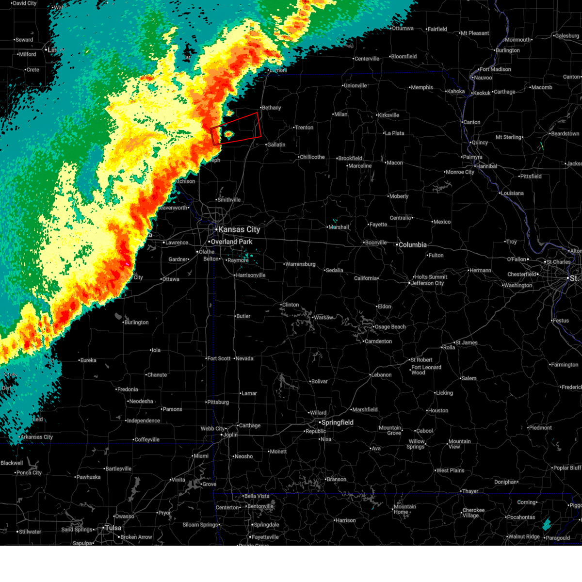
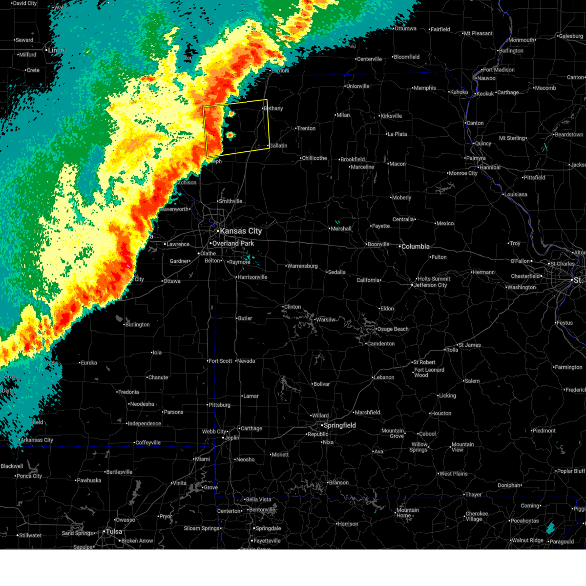
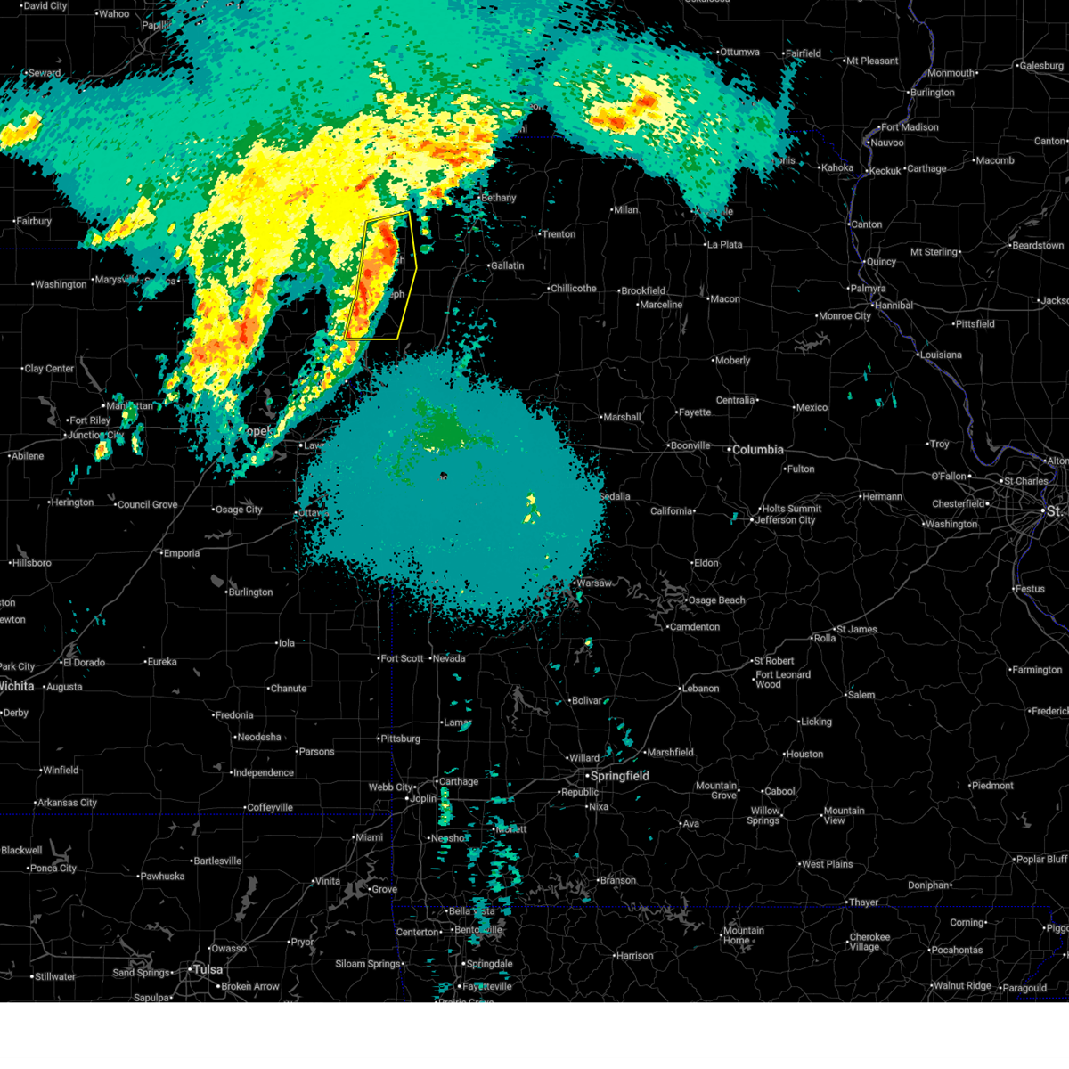
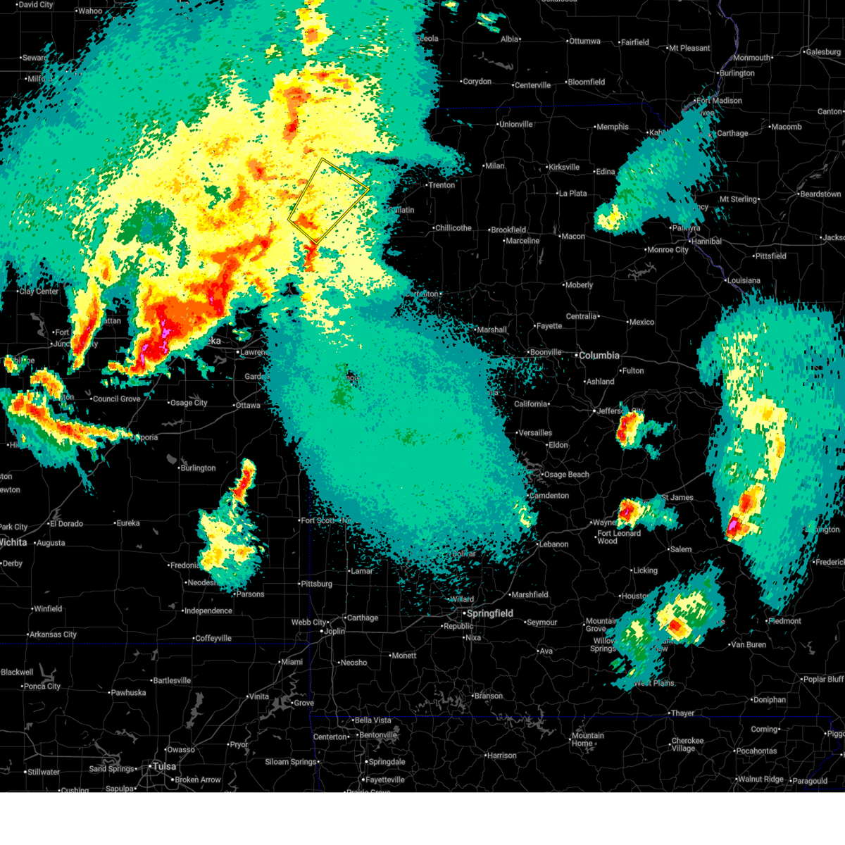
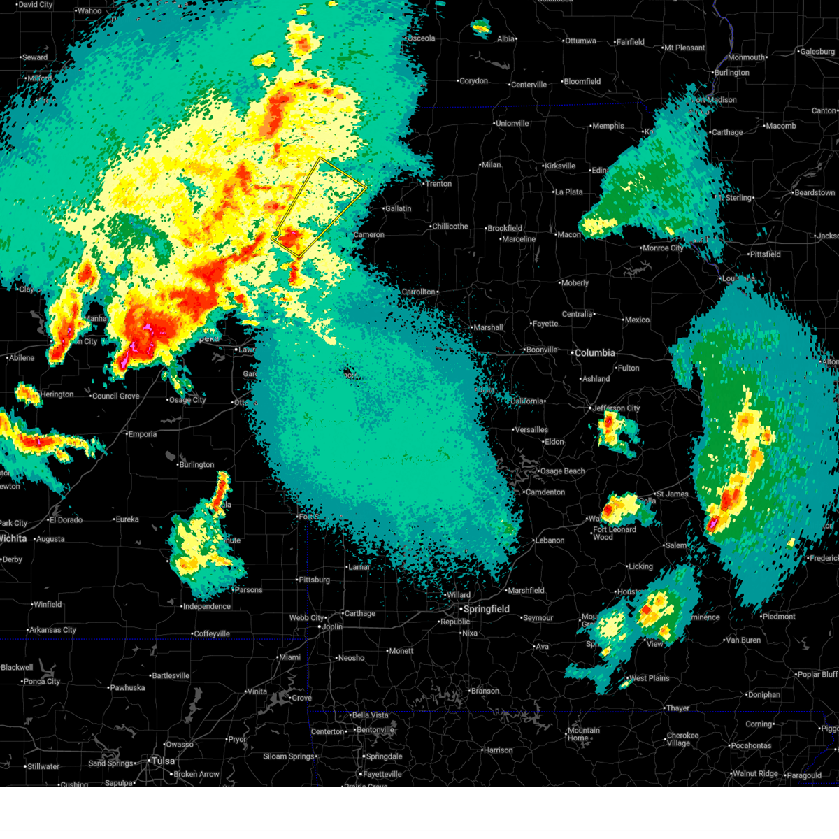
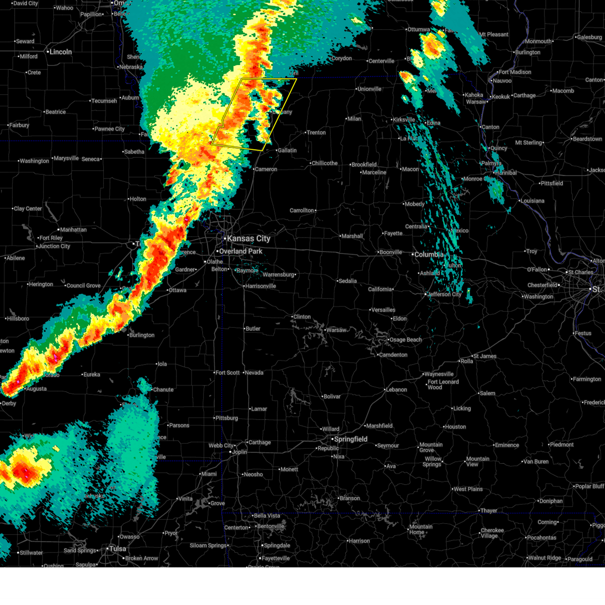
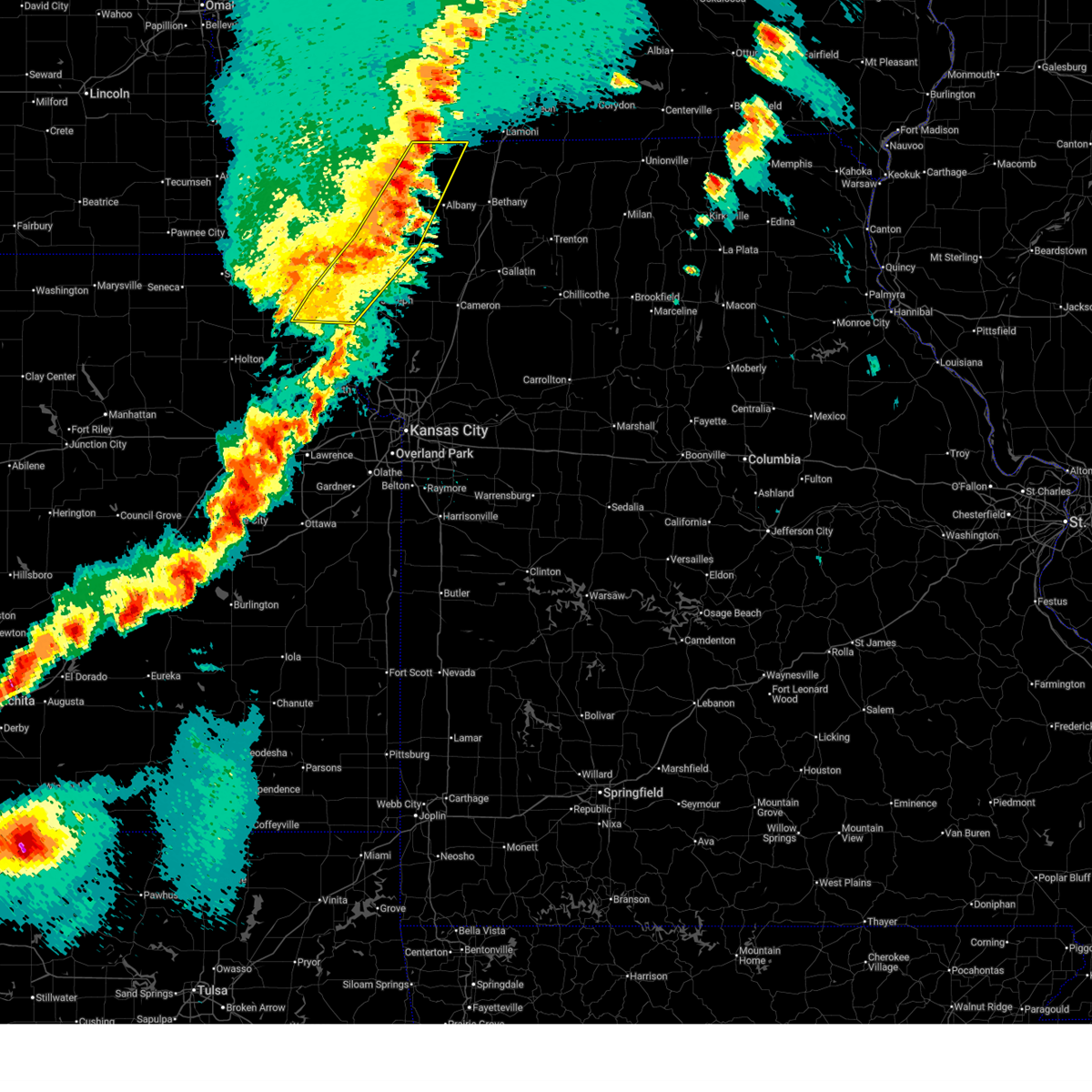
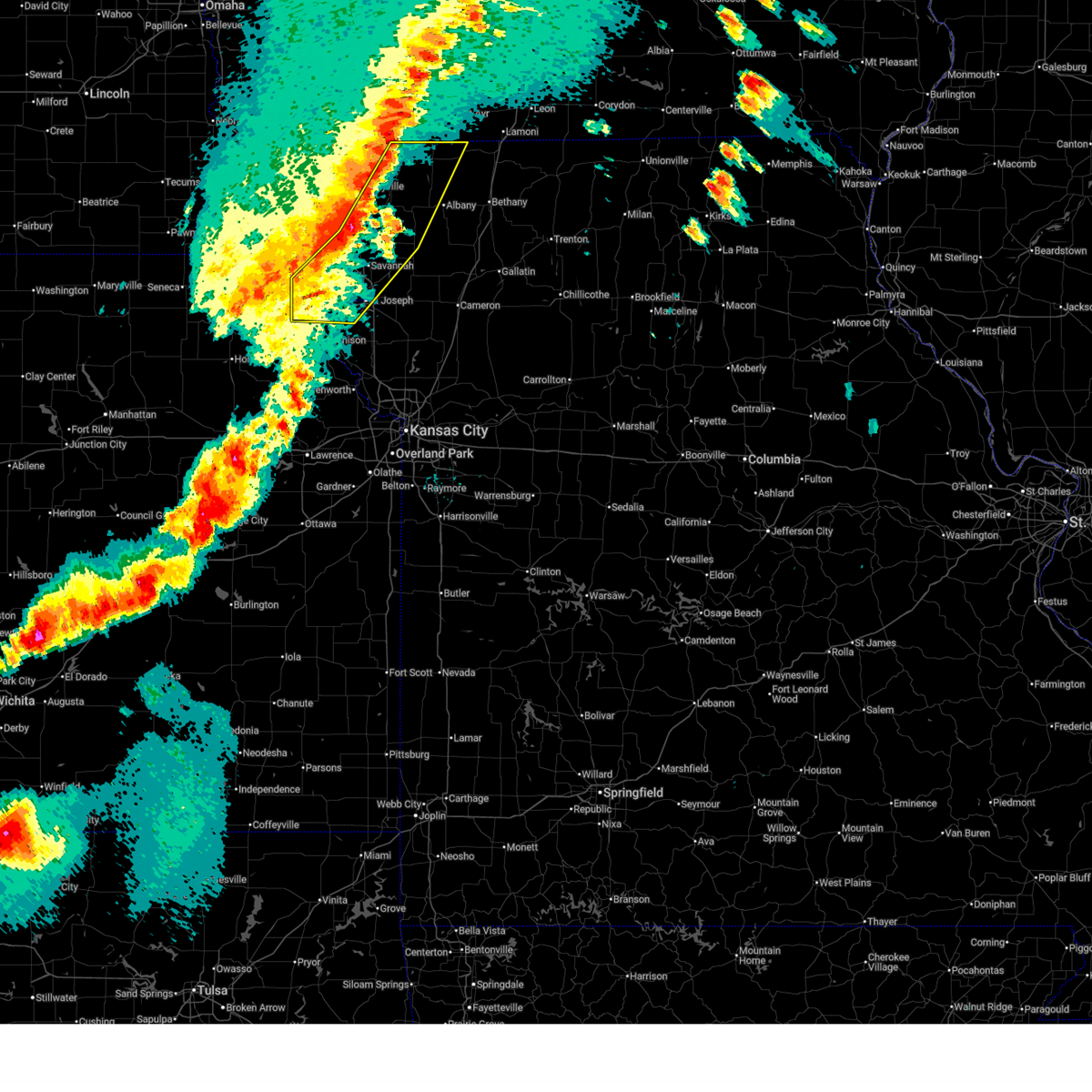
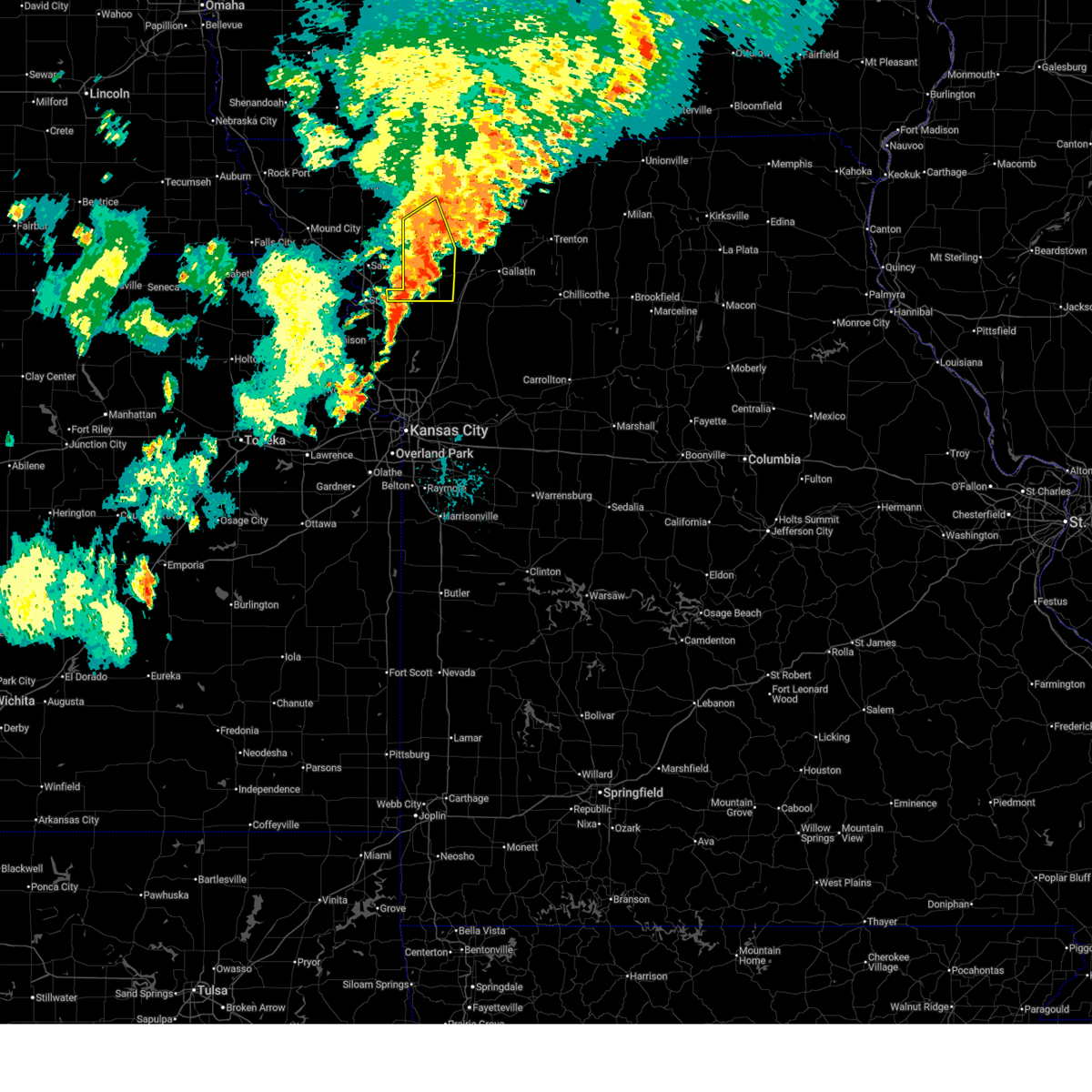
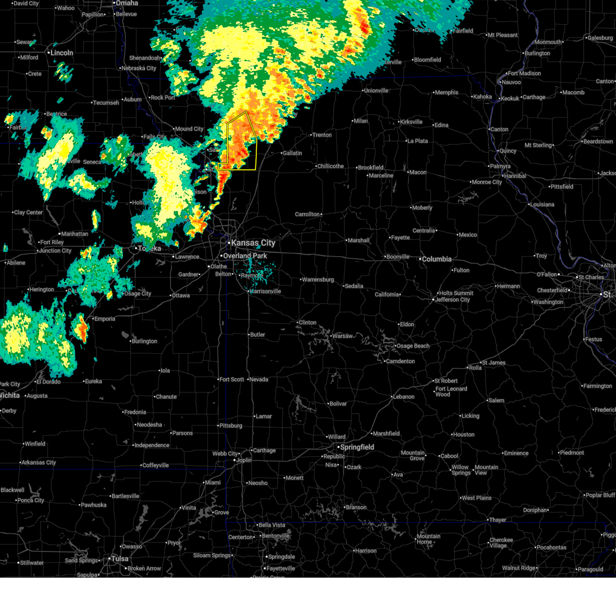
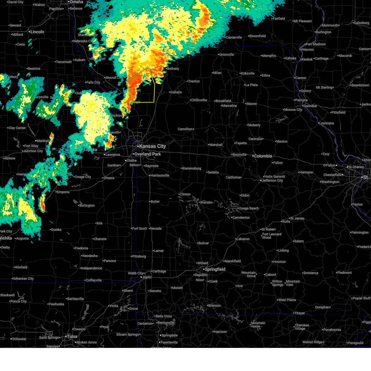
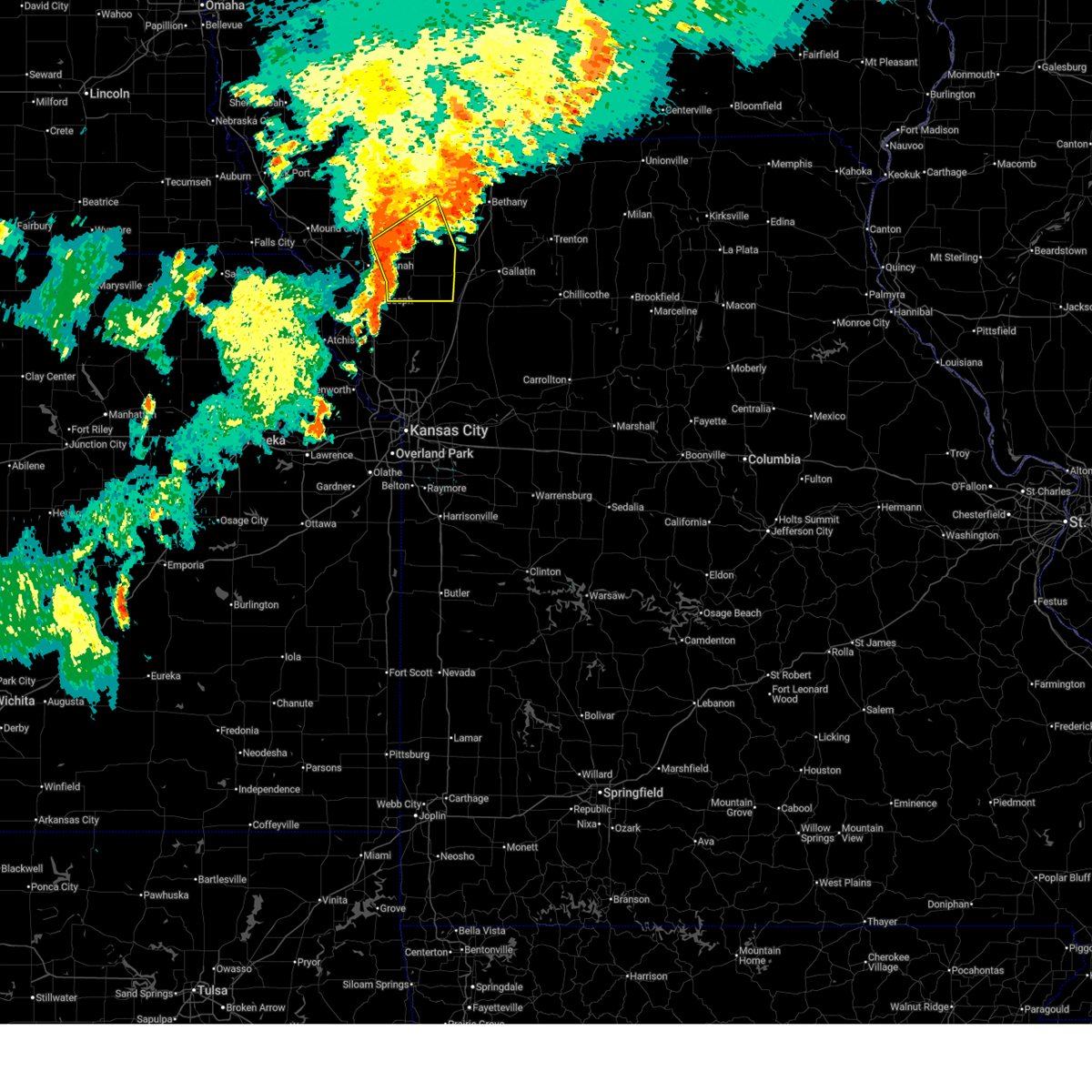
Hail Map for Union Star, MO
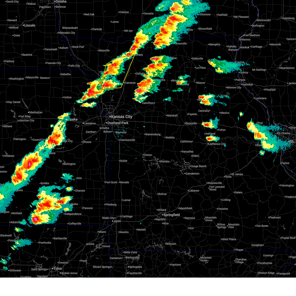
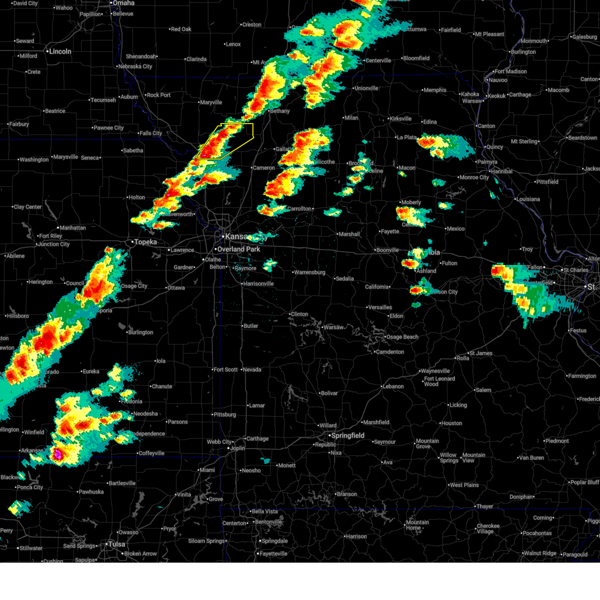
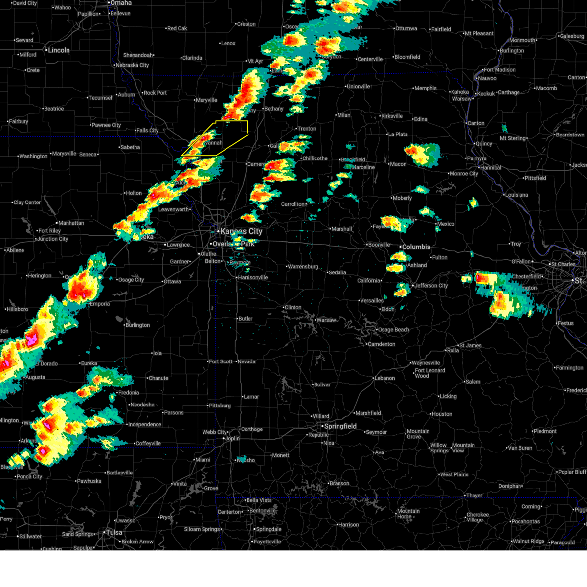
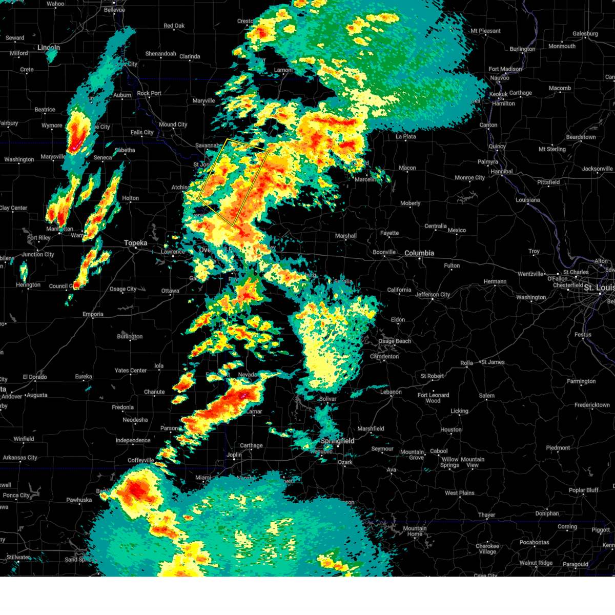
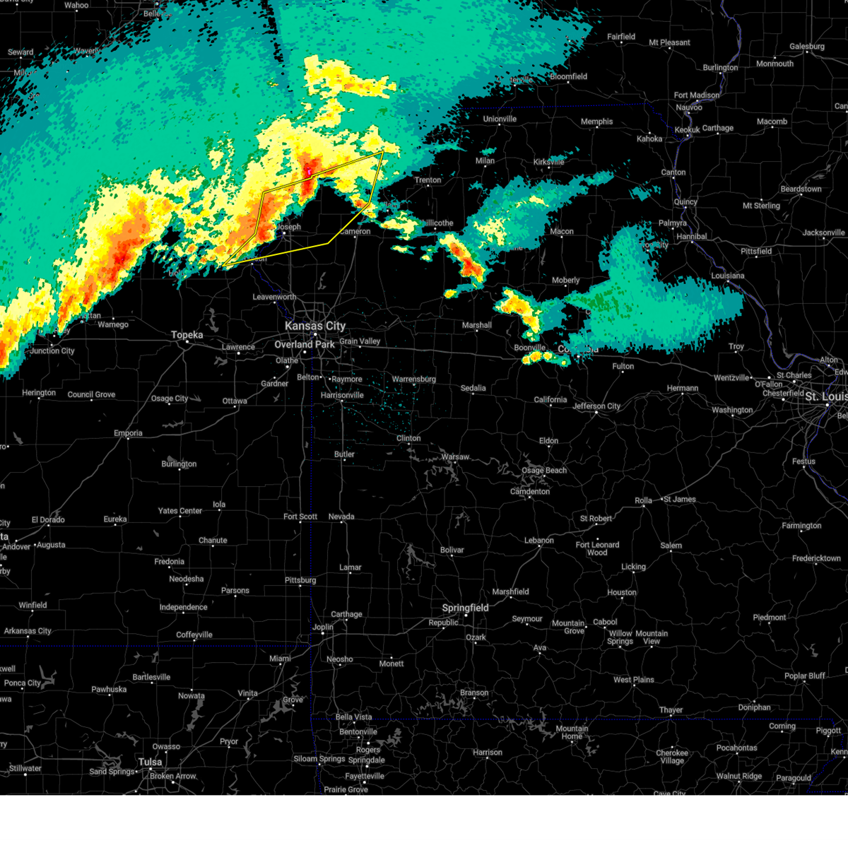
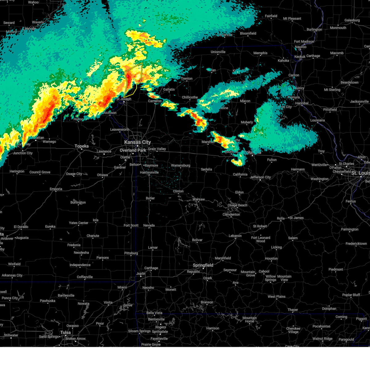
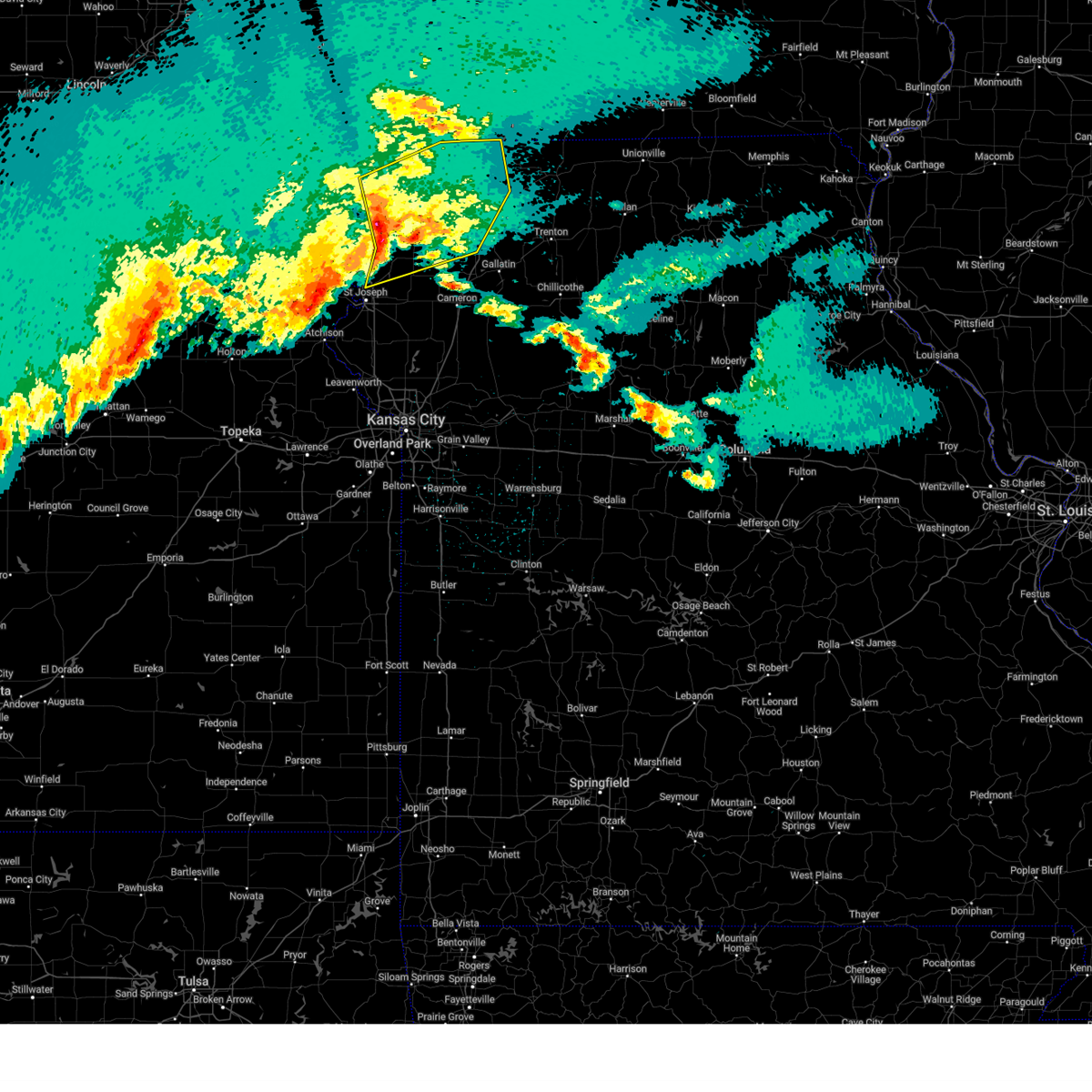
The Union Star, MO area has had 1 report of on-the-ground hail by trained spotters, and has been under severe weather warnings 31 times during the past 12 months. Doppler radar has detected hail at or near Union Star, MO on 72 occasions, including 5 occasions during the past year.
| Name: | Union Star, MO |
| Where Located: | 60.4 miles N of Kansas City, MO |
| Map: | Google Map for Union Star, MO |
| Population: | 437 |
| Housing Units: | 203 |
| More Info: | Search Google for Union Star, MO |
2
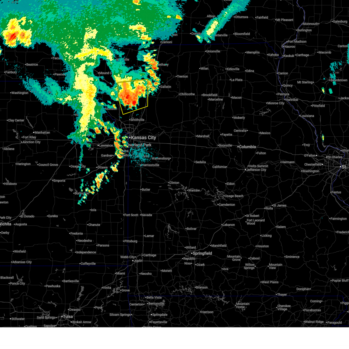
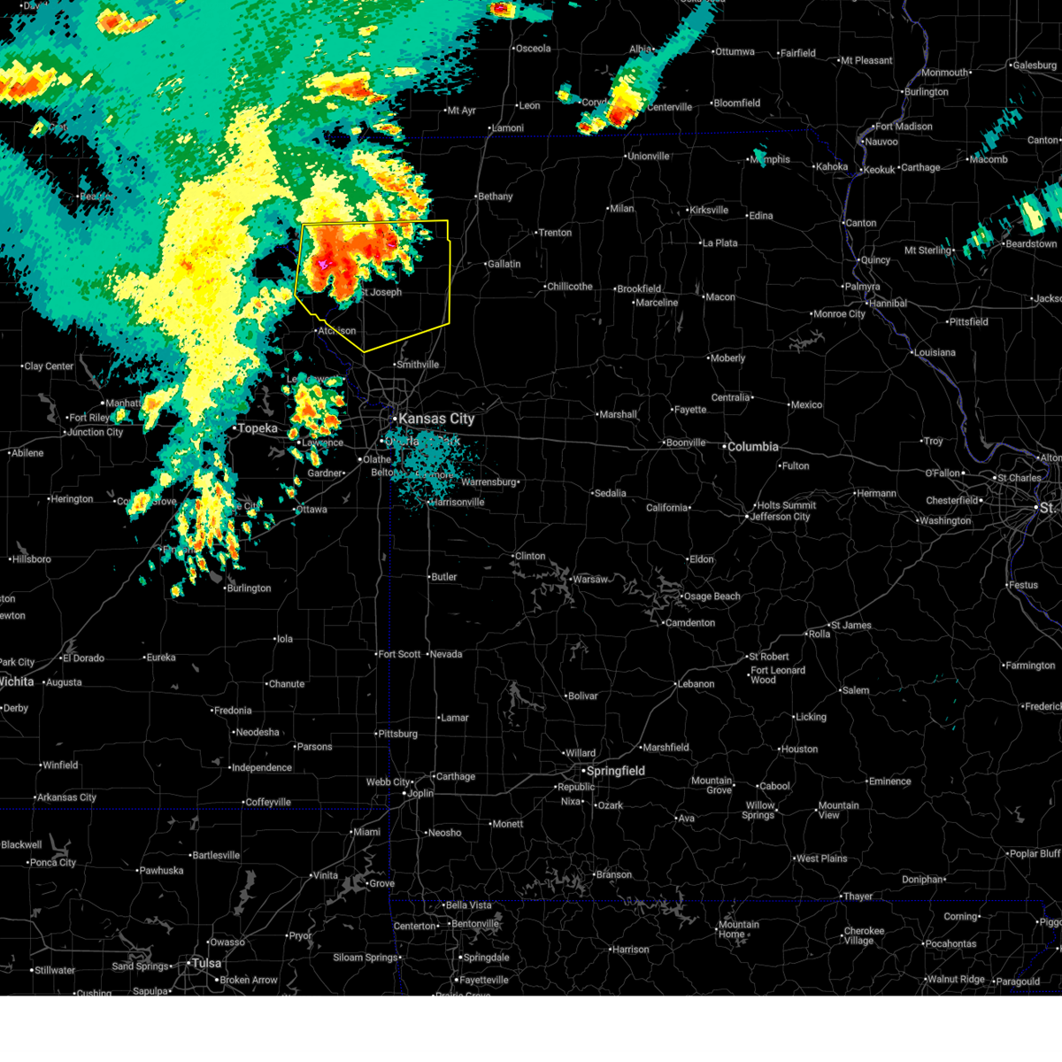
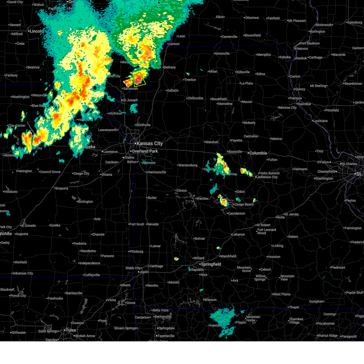
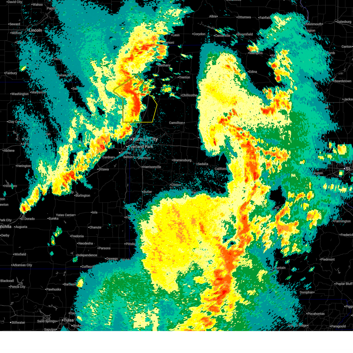
The Top Recent Hail Date for Union Star, MO is Wednesday, June 10, 2026 (12th out of 72)
Hail and Wind Damage Spotted near Union Star, MO
| Date / Time | Report Details |
|---|---|
| 7/4/2026 1:06 AM CDT |
 The storm which prompted the warning has weakened below severe limits, and no longer poses an immediate threat to life or property. therefore, the warning will be allowed to expire. however, gusty winds and heavy rain are still possible with this thunderstorm. The storm which prompted the warning has weakened below severe limits, and no longer poses an immediate threat to life or property. therefore, the warning will be allowed to expire. however, gusty winds and heavy rain are still possible with this thunderstorm.
|
| 7/4/2026 1:00 AM CDT |
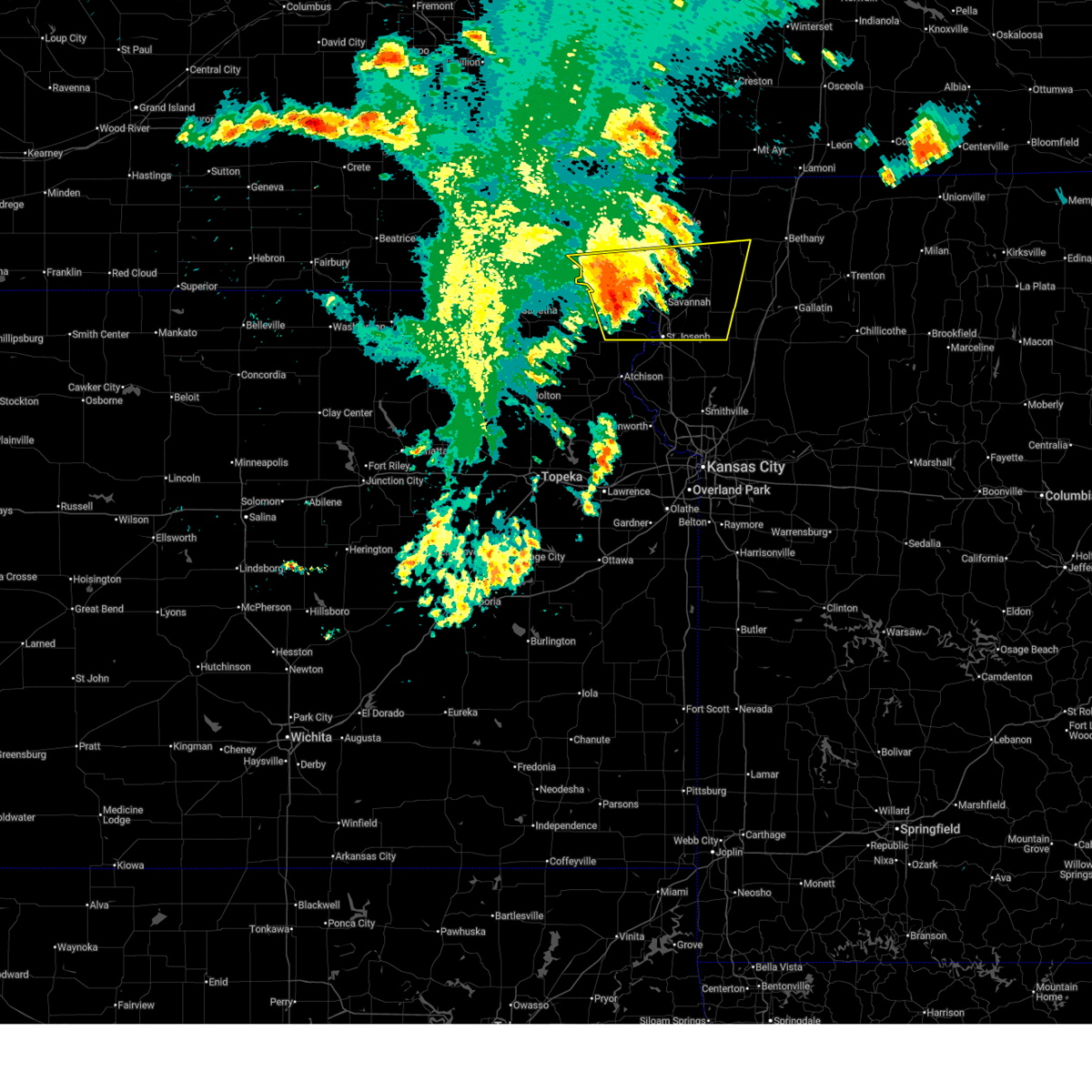
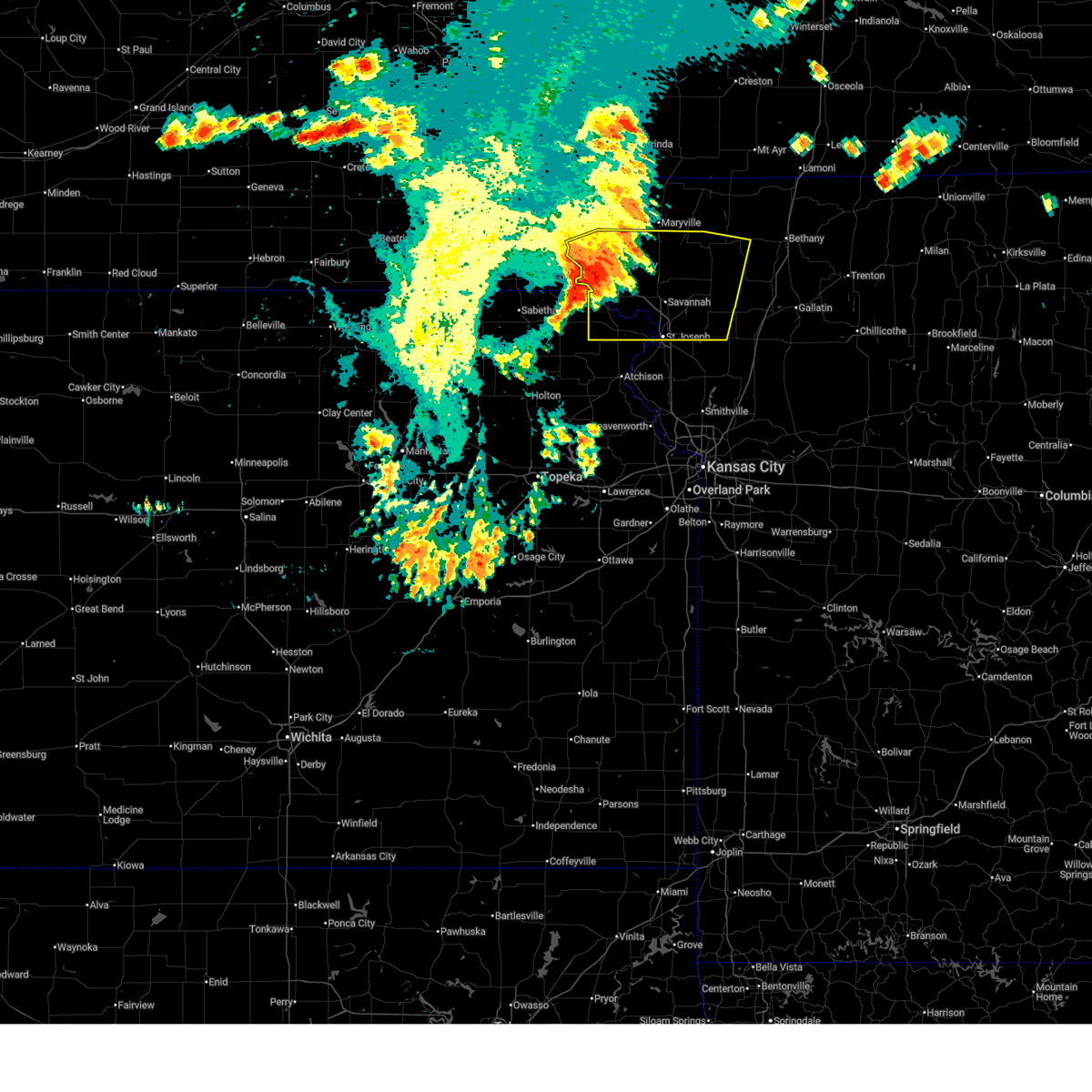
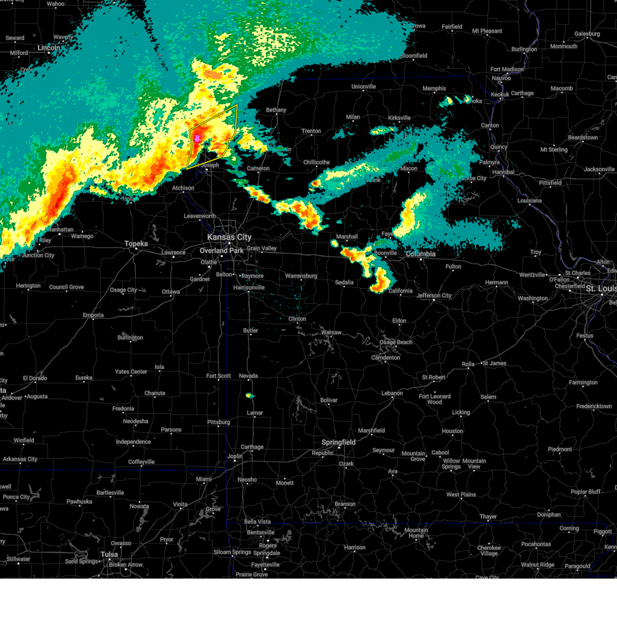
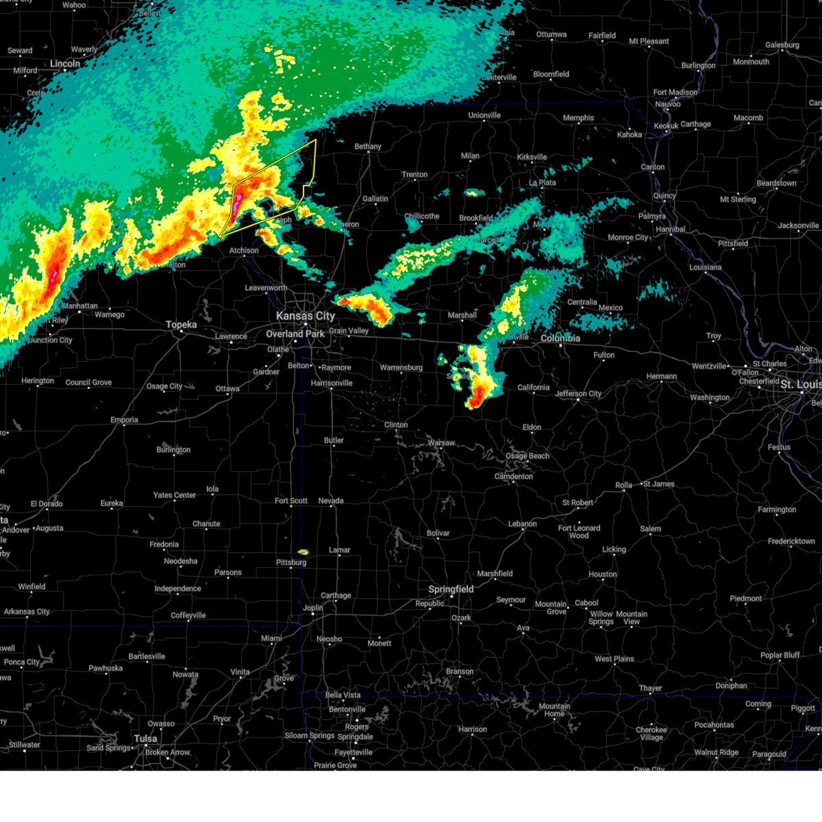
 At 100 am cdt, a severe thunderstorm was located near maysville, moving east at 40 mph (radar indicated). Hazards include 60 mph wind gusts and nickel size hail. Expect damage to roofs, siding, and trees. locations impacted include, st. joseph, cameron, savannah, plattsburg, gower, maysville, country club villa, country club, stewartsville, agency, edgerton, union star, osborn, clarksdale, easton, turney, cosby, weatherby, amity, and fairport. this includes the following highways, interstate 35 in missouri between mile markers 43 and 56. interstate 29 between mile markers 39 and 54. Interstate 229 between mile markers 0 and 1. At 100 am cdt, a severe thunderstorm was located near maysville, moving east at 40 mph (radar indicated). Hazards include 60 mph wind gusts and nickel size hail. Expect damage to roofs, siding, and trees. locations impacted include, st. joseph, cameron, savannah, plattsburg, gower, maysville, country club villa, country club, stewartsville, agency, edgerton, union star, osborn, clarksdale, easton, turney, cosby, weatherby, amity, and fairport. this includes the following highways, interstate 35 in missouri between mile markers 43 and 56. interstate 29 between mile markers 39 and 54. Interstate 229 between mile markers 0 and 1.
|
| 7/4/2026 12:46 AM CDT |
 At 1246 am cdt, a severe thunderstorm was located near maysville, moving east at 40 mph (radar indicated). Hazards include 60 mph wind gusts and nickel size hail. Expect damage to roofs, siding, and trees. locations impacted include, st. joseph, cameron, savannah, plattsburg, gower, wathena, elwood, maysville, country club villa, country club, king city, stewartsville, agency, edgerton, dearborn, camden point, union star, osborn, amazonia, and clarksdale. this includes the following highways, interstate 35 in missouri between mile markers 43 and 56. interstate 29 between mile markers 26 and 71. Interstate 229 between mile markers 0 and 14. At 1246 am cdt, a severe thunderstorm was located near maysville, moving east at 40 mph (radar indicated). Hazards include 60 mph wind gusts and nickel size hail. Expect damage to roofs, siding, and trees. locations impacted include, st. joseph, cameron, savannah, plattsburg, gower, wathena, elwood, maysville, country club villa, country club, king city, stewartsville, agency, edgerton, dearborn, camden point, union star, osborn, amazonia, and clarksdale. this includes the following highways, interstate 35 in missouri between mile markers 43 and 56. interstate 29 between mile markers 26 and 71. Interstate 229 between mile markers 0 and 14.
|
| 7/4/2026 12:28 AM CDT |
 Svreax the national weather service in pleasant hill has issued a * severe thunderstorm warning for, doniphan county in northeastern kansas, buchanan county in northwestern missouri, clinton county in northwestern missouri, southern gentry county in northwestern missouri, southeastern holt county in northwestern missouri, northeastern platte county in west central missouri, andrew county in northwestern missouri, dekalb county in northwestern missouri, * until 115 am cdt. * at 1228 am cdt, a severe thunderstorm was located near union star, or near savannah, moving east at 40 mph (radar indicated). Hazards include 60 mph wind gusts and nickel size hail. expect damage to roofs, siding, and trees Svreax the national weather service in pleasant hill has issued a * severe thunderstorm warning for, doniphan county in northeastern kansas, buchanan county in northwestern missouri, clinton county in northwestern missouri, southern gentry county in northwestern missouri, southeastern holt county in northwestern missouri, northeastern platte county in west central missouri, andrew county in northwestern missouri, dekalb county in northwestern missouri, * until 115 am cdt. * at 1228 am cdt, a severe thunderstorm was located near union star, or near savannah, moving east at 40 mph (radar indicated). Hazards include 60 mph wind gusts and nickel size hail. expect damage to roofs, siding, and trees
|
| 7/4/2026 12:16 AM CDT |
 the severe thunderstorm warning has been cancelled and is no longer in effect the severe thunderstorm warning has been cancelled and is no longer in effect
|
| 7/4/2026 12:16 AM CDT |
 At 1215 am cdt, severe thunderstorms were located along a line extending from irena to 6 miles west of king city to 6 miles northeast of troy, moving east at 45 mph (radar indicated). Hazards include 60 mph wind gusts and nickel size hail. Expect damage to roofs, siding, and trees. locations impacted include, st. joseph, savannah, albany, wathena, elwood, stanberry, mound city, highland, troy, country club villa, country club, king city, oregon, stewartsville, union star, maitland, amazonia, clarksdale, forest city, and craig. this includes the following highways, interstate 29 between mile markers 47 and 91. Interstate 229 between mile markers 5 and 14. At 1215 am cdt, severe thunderstorms were located along a line extending from irena to 6 miles west of king city to 6 miles northeast of troy, moving east at 45 mph (radar indicated). Hazards include 60 mph wind gusts and nickel size hail. Expect damage to roofs, siding, and trees. locations impacted include, st. joseph, savannah, albany, wathena, elwood, stanberry, mound city, highland, troy, country club villa, country club, king city, oregon, stewartsville, union star, maitland, amazonia, clarksdale, forest city, and craig. this includes the following highways, interstate 29 between mile markers 47 and 91. Interstate 229 between mile markers 5 and 14.
|
| 7/3/2026 11:50 PM CDT |
 Svreax the national weather service in pleasant hill has issued a * severe thunderstorm warning for, doniphan county in northeastern kansas, northeastern buchanan county in northwestern missouri, southern gentry county in northwestern missouri, southeastern atchison county in northwestern missouri, holt county in northwestern missouri, southern nodaway county in northwestern missouri, andrew county in northwestern missouri, western dekalb county in northwestern missouri, * until 1230 am cdt. * at 1150 pm cdt, severe thunderstorms were located along a line extending from 7 miles east of hopkins to near fillmore to near highland, moving east at 45 mph (radar indicated). Hazards include 60 mph wind gusts and nickel size hail. expect damage to roofs, siding, and trees Svreax the national weather service in pleasant hill has issued a * severe thunderstorm warning for, doniphan county in northeastern kansas, northeastern buchanan county in northwestern missouri, southern gentry county in northwestern missouri, southeastern atchison county in northwestern missouri, holt county in northwestern missouri, southern nodaway county in northwestern missouri, andrew county in northwestern missouri, western dekalb county in northwestern missouri, * until 1230 am cdt. * at 1150 pm cdt, severe thunderstorms were located along a line extending from 7 miles east of hopkins to near fillmore to near highland, moving east at 45 mph (radar indicated). Hazards include 60 mph wind gusts and nickel size hail. expect damage to roofs, siding, and trees
|
| 6/10/2026 3:11 PM CDT |
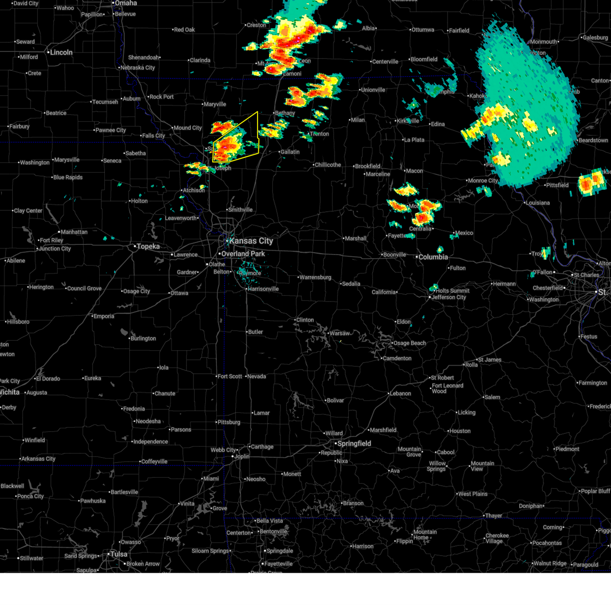 Svreax the national weather service in pleasant hill has issued a * severe thunderstorm warning for, southern gentry county in northwestern missouri, southeastern andrew county in northwestern missouri, dekalb county in northwestern missouri, * until 400 pm cdt. * at 311 pm cdt, a severe thunderstorm was located over union star, or 11 miles east of savannah, moving northeast at 45 mph (radar indicated). Hazards include 60 mph wind gusts and quarter size hail. Hail damage to vehicles is expected. Expect wind damage to roofs, siding, and trees. Svreax the national weather service in pleasant hill has issued a * severe thunderstorm warning for, southern gentry county in northwestern missouri, southeastern andrew county in northwestern missouri, dekalb county in northwestern missouri, * until 400 pm cdt. * at 311 pm cdt, a severe thunderstorm was located over union star, or 11 miles east of savannah, moving northeast at 45 mph (radar indicated). Hazards include 60 mph wind gusts and quarter size hail. Hail damage to vehicles is expected. Expect wind damage to roofs, siding, and trees.
|
| 6/4/2026 9:30 PM CDT |
 At 930 pm cdt, a severe thunderstorm capable of producing a tornado was located over king city, or 12 miles south of stanberry, moving northeast at 25 mph (radar indicated rotation). Hazards include tornado. Flying debris will be dangerous to those caught without shelter. mobile homes will be damaged or destroyed. damage to roofs, windows, and vehicles will occur. tree damage is likely. Locations impacted include, king city, union star, and ford city. At 930 pm cdt, a severe thunderstorm capable of producing a tornado was located over king city, or 12 miles south of stanberry, moving northeast at 25 mph (radar indicated rotation). Hazards include tornado. Flying debris will be dangerous to those caught without shelter. mobile homes will be damaged or destroyed. damage to roofs, windows, and vehicles will occur. tree damage is likely. Locations impacted include, king city, union star, and ford city.
|
| 6/4/2026 9:21 PM CDT |
 Toreax the national weather service in pleasant hill has issued a * tornado warning for, southwestern gentry county in northwestern missouri, eastern andrew county in northwestern missouri, northwestern dekalb county in northwestern missouri, * until 945 pm cdt. * at 921 pm cdt, a severe thunderstorm capable of producing a tornado was located over union star, or 13 miles northeast of savannah, moving northeast at 25 mph (radar indicated rotation). Hazards include tornado. Flying debris will be dangerous to those caught without shelter. mobile homes will be damaged or destroyed. damage to roofs, windows, and vehicles will occur. Tree damage is likely. Toreax the national weather service in pleasant hill has issued a * tornado warning for, southwestern gentry county in northwestern missouri, eastern andrew county in northwestern missouri, northwestern dekalb county in northwestern missouri, * until 945 pm cdt. * at 921 pm cdt, a severe thunderstorm capable of producing a tornado was located over union star, or 13 miles northeast of savannah, moving northeast at 25 mph (radar indicated rotation). Hazards include tornado. Flying debris will be dangerous to those caught without shelter. mobile homes will be damaged or destroyed. damage to roofs, windows, and vehicles will occur. Tree damage is likely.
|
| 6/4/2026 6:59 PM CDT |
 At 658 pm cdt, a severe thunderstorm was located over king city, or 11 miles south of stanberry, moving northeast at 25 mph (radar indicated. local emergency management also reported 60 mph winds and quarter size hail in king city). Hazards include golf ball size hail and 60 mph wind gusts. People and animals outdoors will be injured. expect hail damage to roofs, siding, windows, and vehicles. expect wind damage to roofs, siding, and trees. Locations impacted include, king city, union star, and ford city. At 658 pm cdt, a severe thunderstorm was located over king city, or 11 miles south of stanberry, moving northeast at 25 mph (radar indicated. local emergency management also reported 60 mph winds and quarter size hail in king city). Hazards include golf ball size hail and 60 mph wind gusts. People and animals outdoors will be injured. expect hail damage to roofs, siding, windows, and vehicles. expect wind damage to roofs, siding, and trees. Locations impacted include, king city, union star, and ford city.
|
| 6/4/2026 6:50 PM CDT |
 At 650 pm cdt, a severe thunderstorm was located near king city, or 13 miles south of stanberry, moving northeast at 25 mph (radar indicated). Hazards include two inch hail and 60 mph wind gusts. People and animals outdoors will be injured. expect hail damage to roofs, siding, windows, and vehicles. expect wind damage to roofs, siding, and trees. Locations impacted include, king city, union star, and ford city. At 650 pm cdt, a severe thunderstorm was located near king city, or 13 miles south of stanberry, moving northeast at 25 mph (radar indicated). Hazards include two inch hail and 60 mph wind gusts. People and animals outdoors will be injured. expect hail damage to roofs, siding, windows, and vehicles. expect wind damage to roofs, siding, and trees. Locations impacted include, king city, union star, and ford city.
|
| 6/4/2026 6:34 PM CDT |
 Svreax the national weather service in pleasant hill has issued a * severe thunderstorm warning for, southwestern gentry county in northwestern missouri, northeastern andrew county in northwestern missouri, northwestern dekalb county in northwestern missouri, * until 715 pm cdt. * at 634 pm cdt, a severe thunderstorm was located near union star, or 8 miles northeast of savannah, moving northeast at 25 mph (radar indicated). Hazards include 60 mph wind gusts and quarter size hail. Hail damage to vehicles is expected. Expect wind damage to roofs, siding, and trees. Svreax the national weather service in pleasant hill has issued a * severe thunderstorm warning for, southwestern gentry county in northwestern missouri, northeastern andrew county in northwestern missouri, northwestern dekalb county in northwestern missouri, * until 715 pm cdt. * at 634 pm cdt, a severe thunderstorm was located near union star, or 8 miles northeast of savannah, moving northeast at 25 mph (radar indicated). Hazards include 60 mph wind gusts and quarter size hail. Hail damage to vehicles is expected. Expect wind damage to roofs, siding, and trees.
|
| 5/18/2026 8:36 PM CDT |
 Toreax the national weather service in pleasant hill has issued a * tornado warning for, northwestern daviess county in north central missouri, southern gentry county in northwestern missouri, southwestern harrison county in north central missouri, east central andrew county in northwestern missouri, northern dekalb county in northwestern missouri, * until 900 pm cdt. * at 836 pm cdt, a severe thunderstorm capable of producing a tornado was located near union star, or 12 miles northwest of maysville, moving east at 60 mph (radar indicated rotation). Hazards include tornado. Flying debris will be dangerous to those caught without shelter. mobile homes will be damaged or destroyed. damage to roofs, windows, and vehicles will occur. Tree damage is likely. Toreax the national weather service in pleasant hill has issued a * tornado warning for, northwestern daviess county in north central missouri, southern gentry county in northwestern missouri, southwestern harrison county in north central missouri, east central andrew county in northwestern missouri, northern dekalb county in northwestern missouri, * until 900 pm cdt. * at 836 pm cdt, a severe thunderstorm capable of producing a tornado was located near union star, or 12 miles northwest of maysville, moving east at 60 mph (radar indicated rotation). Hazards include tornado. Flying debris will be dangerous to those caught without shelter. mobile homes will be damaged or destroyed. damage to roofs, windows, and vehicles will occur. Tree damage is likely.
|
| 5/18/2026 8:35 PM CDT |
 Svreax the national weather service in pleasant hill has issued a * severe thunderstorm warning for, northeastern buchanan county in northwestern missouri, northwestern daviess county in north central missouri, gentry county in northwestern missouri, southwestern harrison county in north central missouri, southeastern nodaway county in northwestern missouri, eastern andrew county in northwestern missouri, dekalb county in northwestern missouri, * until 915 pm cdt. * at 834 pm cdt, a severe thunderstorm was located near stanberry, moving east at 60 mph (radar indicated). Hazards include 60 mph wind gusts and quarter size hail. Hail damage to vehicles is expected. Expect wind damage to roofs, siding, and trees. Svreax the national weather service in pleasant hill has issued a * severe thunderstorm warning for, northeastern buchanan county in northwestern missouri, northwestern daviess county in north central missouri, gentry county in northwestern missouri, southwestern harrison county in north central missouri, southeastern nodaway county in northwestern missouri, eastern andrew county in northwestern missouri, dekalb county in northwestern missouri, * until 915 pm cdt. * at 834 pm cdt, a severe thunderstorm was located near stanberry, moving east at 60 mph (radar indicated). Hazards include 60 mph wind gusts and quarter size hail. Hail damage to vehicles is expected. Expect wind damage to roofs, siding, and trees.
|
| 5/18/2026 8:17 PM CDT |
 At 816 pm cdt, severe thunderstorms were located along a line extending from near savannah to elwood to rushville, moving east at 65 mph (automated weather station. at 813 pm, the st. joseph airport reported a 61 mph wind gust). Hazards include 70 mph wind gusts and quarter size hail. Hail damage to vehicles is expected. expect considerable tree damage. wind damage is also likely to mobile homes, roofs, and outbuildings. locations impacted include, st. joseph, cameron, savannah, plattsburg, lathrop, gower, wathena, elwood, maysville, country club villa, country club, stewartsville, agency, union star, osborn, amazonia, rushville, clarksdale, lewis and clark village, and easton. this includes the following highways, interstate 35 in missouri between mile markers 39 and 56. interstate 29 between mile markers 32 and 59. Interstate 229 between mile markers 0 and 14. At 816 pm cdt, severe thunderstorms were located along a line extending from near savannah to elwood to rushville, moving east at 65 mph (automated weather station. at 813 pm, the st. joseph airport reported a 61 mph wind gust). Hazards include 70 mph wind gusts and quarter size hail. Hail damage to vehicles is expected. expect considerable tree damage. wind damage is also likely to mobile homes, roofs, and outbuildings. locations impacted include, st. joseph, cameron, savannah, plattsburg, lathrop, gower, wathena, elwood, maysville, country club villa, country club, stewartsville, agency, union star, osborn, amazonia, rushville, clarksdale, lewis and clark village, and easton. this includes the following highways, interstate 35 in missouri between mile markers 39 and 56. interstate 29 between mile markers 32 and 59. Interstate 229 between mile markers 0 and 14.
|
| 5/18/2026 8:04 PM CDT |
 Svreax the national weather service in pleasant hill has issued a * severe thunderstorm warning for, southeastern doniphan county in northeastern kansas, buchanan county in northwestern missouri, clinton county in northwestern missouri, southeastern andrew county in northwestern missouri, dekalb county in northwestern missouri, * until 845 pm cdt. * at 804 pm cdt, severe thunderstorms were located along a line extending from 6 miles southeast of oregon to 6 miles northwest of rushville to near atchison, moving east at 65 mph (radar indicated). Hazards include 70 mph wind gusts and quarter size hail. Hail damage to vehicles is expected. expect considerable tree damage. Wind damage is also likely to mobile homes, roofs, and outbuildings. Svreax the national weather service in pleasant hill has issued a * severe thunderstorm warning for, southeastern doniphan county in northeastern kansas, buchanan county in northwestern missouri, clinton county in northwestern missouri, southeastern andrew county in northwestern missouri, dekalb county in northwestern missouri, * until 845 pm cdt. * at 804 pm cdt, severe thunderstorms were located along a line extending from 6 miles southeast of oregon to 6 miles northwest of rushville to near atchison, moving east at 65 mph (radar indicated). Hazards include 70 mph wind gusts and quarter size hail. Hail damage to vehicles is expected. expect considerable tree damage. Wind damage is also likely to mobile homes, roofs, and outbuildings.
|
| 5/17/2026 2:45 AM CDT |
 At 244 am cdt, severe thunderstorms were located along a line extending from near king city to 7 miles east of st. joseph to near dearborn, moving east at 35 mph (radar indicated). Hazards include 60 mph wind gusts and penny size hail. Expect damage to roofs, siding, and trees. locations impacted include, st. joseph, savannah, gower, country club villa, country club, king city, stewartsville, agency, dearborn, union star, clarksdale, easton, de kalb, cosby, rea, faucett, and helena. this includes the following highways, interstate 29 between mile markers 31 and 55. Interstate 229 between mile markers 0 and 5. At 244 am cdt, severe thunderstorms were located along a line extending from near king city to 7 miles east of st. joseph to near dearborn, moving east at 35 mph (radar indicated). Hazards include 60 mph wind gusts and penny size hail. Expect damage to roofs, siding, and trees. locations impacted include, st. joseph, savannah, gower, country club villa, country club, king city, stewartsville, agency, dearborn, union star, clarksdale, easton, de kalb, cosby, rea, faucett, and helena. this includes the following highways, interstate 29 between mile markers 31 and 55. Interstate 229 between mile markers 0 and 5.
|
| 5/17/2026 2:35 AM CDT |
 the severe thunderstorm warning has been cancelled and is no longer in effect the severe thunderstorm warning has been cancelled and is no longer in effect
|
| 5/17/2026 2:35 AM CDT |
 At 234 am cdt, severe thunderstorms were located along a line extending from near savannah to st. joseph to near lewis and clark village, moving east at 40 mph (radar indicated). Hazards include 60 mph wind gusts and penny size hail. Expect damage to roofs, siding, and trees. locations impacted include, st. joseph, savannah, gower, wathena, elwood, country club villa, country club, king city, stewartsville, agency, dearborn, union star, amazonia, rushville, clarksdale, lewis and clark village, easton, de kalb, bolckow, and rosendale. this includes the following highways, interstate 29 between mile markers 31 and 61. Interstate 229 between mile markers 0 and 14. At 234 am cdt, severe thunderstorms were located along a line extending from near savannah to st. joseph to near lewis and clark village, moving east at 40 mph (radar indicated). Hazards include 60 mph wind gusts and penny size hail. Expect damage to roofs, siding, and trees. locations impacted include, st. joseph, savannah, gower, wathena, elwood, country club villa, country club, king city, stewartsville, agency, dearborn, union star, amazonia, rushville, clarksdale, lewis and clark village, easton, de kalb, bolckow, and rosendale. this includes the following highways, interstate 29 between mile markers 31 and 61. Interstate 229 between mile markers 0 and 14.
|
| 5/17/2026 2:24 AM CDT |
 At 224 am cdt, severe thunderstorms were located along a line extending from near savannah to elwood to near lewis and clark village, moving east at 40 mph (radar indicated). Hazards include 60 mph wind gusts and penny size hail. Expect damage to roofs, siding, and trees. locations impacted include, st. joseph, atchison, savannah, gower, wathena, elwood, troy, country club villa, country club, king city, stewartsville, agency, dearborn, union star, amazonia, rushville, clarksdale, fillmore, lewis and clark village, and doniphan. this includes the following highways, interstate 29 between mile markers 31 and 70. Interstate 229 between mile markers 0 and 14. At 224 am cdt, severe thunderstorms were located along a line extending from near savannah to elwood to near lewis and clark village, moving east at 40 mph (radar indicated). Hazards include 60 mph wind gusts and penny size hail. Expect damage to roofs, siding, and trees. locations impacted include, st. joseph, atchison, savannah, gower, wathena, elwood, troy, country club villa, country club, king city, stewartsville, agency, dearborn, union star, amazonia, rushville, clarksdale, fillmore, lewis and clark village, and doniphan. this includes the following highways, interstate 29 between mile markers 31 and 70. Interstate 229 between mile markers 0 and 14.
|
| 5/17/2026 2:10 AM CDT |
 Svreax the national weather service in pleasant hill has issued a * severe thunderstorm warning for, southeastern doniphan county in northeastern kansas, northeastern atchison county in northeastern kansas, buchanan county in northwestern missouri, northwestern clinton county in northwestern missouri, western gentry county in northwestern missouri, eastern holt county in northwestern missouri, southern nodaway county in northwestern missouri, andrew county in northwestern missouri, western dekalb county in northwestern missouri, * until 300 am cdt. * at 210 am cdt, severe thunderstorms were located along a line extending from near maitland to near troy to near atchison, moving east at 40 mph (radar indicated). Hazards include 60 mph wind gusts and penny size hail. expect damage to roofs, siding, and trees Svreax the national weather service in pleasant hill has issued a * severe thunderstorm warning for, southeastern doniphan county in northeastern kansas, northeastern atchison county in northeastern kansas, buchanan county in northwestern missouri, northwestern clinton county in northwestern missouri, western gentry county in northwestern missouri, eastern holt county in northwestern missouri, southern nodaway county in northwestern missouri, andrew county in northwestern missouri, western dekalb county in northwestern missouri, * until 300 am cdt. * at 210 am cdt, severe thunderstorms were located along a line extending from near maitland to near troy to near atchison, moving east at 40 mph (radar indicated). Hazards include 60 mph wind gusts and penny size hail. expect damage to roofs, siding, and trees
|
| 4/27/2026 2:47 AM CDT |
 the severe thunderstorm warning has been cancelled and is no longer in effect the severe thunderstorm warning has been cancelled and is no longer in effect
|
| 4/27/2026 2:42 AM CDT |
 At 241 am cdt, a severe thunderstorm was located near clarksdale, or 12 miles east of country club villa, moving northeast at 45 mph (radar indicated). Hazards include 60 mph wind gusts and quarter size hail. Hail damage to vehicles is expected. expect wind damage to roofs, siding, and trees. Locations impacted include, stanberry, maysville, king city, stewartsville, union star, pattonsburg, clarksdale, cosby, darlington, mcfall, amity, fairport, ford city, helena, and santa rosa. At 241 am cdt, a severe thunderstorm was located near clarksdale, or 12 miles east of country club villa, moving northeast at 45 mph (radar indicated). Hazards include 60 mph wind gusts and quarter size hail. Hail damage to vehicles is expected. expect wind damage to roofs, siding, and trees. Locations impacted include, stanberry, maysville, king city, stewartsville, union star, pattonsburg, clarksdale, cosby, darlington, mcfall, amity, fairport, ford city, helena, and santa rosa.
|
| 4/27/2026 2:28 AM CDT |
 Svreax the national weather service in pleasant hill has issued a * severe thunderstorm warning for, northeastern buchanan county in northwestern missouri, west central daviess county in north central missouri, northwestern clinton county in northwestern missouri, southern gentry county in northwestern missouri, southeastern andrew county in northwestern missouri, dekalb county in northwestern missouri, * until 315 am cdt. * at 228 am cdt, a severe thunderstorm was located near st. joseph, moving northeast at 45 mph (radar indicated). Hazards include 60 mph wind gusts and quarter size hail. Hail damage to vehicles is expected. Expect wind damage to roofs, siding, and trees. Svreax the national weather service in pleasant hill has issued a * severe thunderstorm warning for, northeastern buchanan county in northwestern missouri, west central daviess county in north central missouri, northwestern clinton county in northwestern missouri, southern gentry county in northwestern missouri, southeastern andrew county in northwestern missouri, dekalb county in northwestern missouri, * until 315 am cdt. * at 228 am cdt, a severe thunderstorm was located near st. joseph, moving northeast at 45 mph (radar indicated). Hazards include 60 mph wind gusts and quarter size hail. Hail damage to vehicles is expected. Expect wind damage to roofs, siding, and trees.
|
| 4/23/2026 8:19 PM CDT |
 Svreax the national weather service in pleasant hill has issued a * severe thunderstorm warning for, eastern worth county in northwestern missouri, northwestern daviess county in north central missouri, gentry county in northwestern missouri, northwestern mercer county in north central missouri, harrison county in north central missouri, northeastern andrew county in northwestern missouri, northern dekalb county in northwestern missouri, * until 900 pm cdt. * at 819 pm cdt, a severe thunderstorm was located over albany, moving northeast at 55 mph (radar indicated). Hazards include 60 mph wind gusts and nickel size hail. expect damage to roofs, siding, and trees Svreax the national weather service in pleasant hill has issued a * severe thunderstorm warning for, eastern worth county in northwestern missouri, northwestern daviess county in north central missouri, gentry county in northwestern missouri, northwestern mercer county in north central missouri, harrison county in north central missouri, northeastern andrew county in northwestern missouri, northern dekalb county in northwestern missouri, * until 900 pm cdt. * at 819 pm cdt, a severe thunderstorm was located over albany, moving northeast at 55 mph (radar indicated). Hazards include 60 mph wind gusts and nickel size hail. expect damage to roofs, siding, and trees
|
| 4/23/2026 8:00 PM CDT |
 At 800 pm cdt, severe thunderstorms were located along a line extending from near irena to near union star to near wathena, moving east at 45 mph (radar indicated). Hazards include 60 mph wind gusts and nickel size hail. Expect damage to roofs, siding, and trees. locations impacted include, st. joseph, savannah, wathena, elwood, stanberry, troy, country club villa, country club, king city, grant city, ravenwood, union star, amazonia, fillmore, denton, irena, barnard, conception junction, parnell, and bolckow. this includes the following highways, interstate 29 between mile markers 48 and 68. Interstate 229 between mile markers 3 and 14. At 800 pm cdt, severe thunderstorms were located along a line extending from near irena to near union star to near wathena, moving east at 45 mph (radar indicated). Hazards include 60 mph wind gusts and nickel size hail. Expect damage to roofs, siding, and trees. locations impacted include, st. joseph, savannah, wathena, elwood, stanberry, troy, country club villa, country club, king city, grant city, ravenwood, union star, amazonia, fillmore, denton, irena, barnard, conception junction, parnell, and bolckow. this includes the following highways, interstate 29 between mile markers 48 and 68. Interstate 229 between mile markers 3 and 14.
|
| 4/23/2026 7:36 PM CDT |
 Svreax the national weather service in pleasant hill has issued a * severe thunderstorm warning for, doniphan county in northeastern kansas, northwestern buchanan county in northwestern missouri, worth county in northwestern missouri, western gentry county in northwestern missouri, northwestern harrison county in north central missouri, southeastern holt county in northwestern missouri, eastern nodaway county in northwestern missouri, andrew county in northwestern missouri, northwestern dekalb county in northwestern missouri, * until 815 pm cdt. * at 735 pm cdt, severe thunderstorms were located along a line extending from near athelstan to 7 miles northeast of fillmore to near highland, moving east at 30 mph (radar indicated). Hazards include 60 mph wind gusts and quarter size hail. Hail damage to vehicles is expected. Expect wind damage to roofs, siding, and trees. Svreax the national weather service in pleasant hill has issued a * severe thunderstorm warning for, doniphan county in northeastern kansas, northwestern buchanan county in northwestern missouri, worth county in northwestern missouri, western gentry county in northwestern missouri, northwestern harrison county in north central missouri, southeastern holt county in northwestern missouri, eastern nodaway county in northwestern missouri, andrew county in northwestern missouri, northwestern dekalb county in northwestern missouri, * until 815 pm cdt. * at 735 pm cdt, severe thunderstorms were located along a line extending from near athelstan to 7 miles northeast of fillmore to near highland, moving east at 30 mph (radar indicated). Hazards include 60 mph wind gusts and quarter size hail. Hail damage to vehicles is expected. Expect wind damage to roofs, siding, and trees.
|
| 4/17/2026 3:17 PM CDT |
 At 317 pm cdt, severe thunderstorms were located along a line extending from near king city to agency, moving northeast at 30 mph (public). Hazards include golf ball size hail and 60 mph wind gusts. People and animals outdoors will be injured. expect hail damage to roofs, siding, windows, and vehicles. expect wind damage to roofs, siding, and trees. locations impacted include, st. joseph, cameron, bethany, maysville, king city, stewartsville, agency, union star, osborn, pattonsburg, clarksdale, easton, cosby, darlington, weatherby, mcfall, amity, fairport, ford city, and helena. this includes the following highways, interstate 35 in missouri between mile markers 76 and 84, and between mile markers 87 and 91. interstate 29 between mile markers 37 and 46. Interstate 229 near mile marker 0. At 317 pm cdt, severe thunderstorms were located along a line extending from near king city to agency, moving northeast at 30 mph (public). Hazards include golf ball size hail and 60 mph wind gusts. People and animals outdoors will be injured. expect hail damage to roofs, siding, windows, and vehicles. expect wind damage to roofs, siding, and trees. locations impacted include, st. joseph, cameron, bethany, maysville, king city, stewartsville, agency, union star, osborn, pattonsburg, clarksdale, easton, cosby, darlington, weatherby, mcfall, amity, fairport, ford city, and helena. this includes the following highways, interstate 35 in missouri between mile markers 76 and 84, and between mile markers 87 and 91. interstate 29 between mile markers 37 and 46. Interstate 229 near mile marker 0.
|
| 4/17/2026 3:00 PM CDT |
 At 300 pm cdt, a severe thunderstorm was located over king city, or 11 miles south of stanberry, moving northeast at 40 mph (radar indicated). Hazards include ping pong ball size hail and 60 mph wind gusts. People and animals outdoors will be injured. expect hail damage to roofs, siding, windows, and vehicles. expect wind damage to roofs, siding, and trees. locations impacted include, savannah, country club villa, country club, king city, union star, cosby, mcfall, fairport, ford city, and helena. this includes the following highways, interstate 29 between mile markers 52 and 57. Interstate 229 between mile markers 10 and 14. At 300 pm cdt, a severe thunderstorm was located over king city, or 11 miles south of stanberry, moving northeast at 40 mph (radar indicated). Hazards include ping pong ball size hail and 60 mph wind gusts. People and animals outdoors will be injured. expect hail damage to roofs, siding, windows, and vehicles. expect wind damage to roofs, siding, and trees. locations impacted include, savannah, country club villa, country club, king city, union star, cosby, mcfall, fairport, ford city, and helena. this includes the following highways, interstate 29 between mile markers 52 and 57. Interstate 229 between mile markers 10 and 14.
|
| 4/17/2026 2:54 PM CDT | Quarter sized hail reported 0.8 miles S of Union Star, MO |
| 4/17/2026 2:47 PM CDT |
 Svreax the national weather service in pleasant hill has issued a * severe thunderstorm warning for, east central doniphan county in northeastern kansas, southern gentry county in northwestern missouri, eastern andrew county in northwestern missouri, northern dekalb county in northwestern missouri, * until 315 pm cdt. * at 246 pm cdt, a severe thunderstorm was located near union star, or 8 miles northeast of savannah, moving northeast at 45 mph (radar indicated). Hazards include 60 mph wind gusts and quarter size hail. Hail damage to vehicles is expected. Expect wind damage to roofs, siding, and trees. Svreax the national weather service in pleasant hill has issued a * severe thunderstorm warning for, east central doniphan county in northeastern kansas, southern gentry county in northwestern missouri, eastern andrew county in northwestern missouri, northern dekalb county in northwestern missouri, * until 315 pm cdt. * at 246 pm cdt, a severe thunderstorm was located near union star, or 8 miles northeast of savannah, moving northeast at 45 mph (radar indicated). Hazards include 60 mph wind gusts and quarter size hail. Hail damage to vehicles is expected. Expect wind damage to roofs, siding, and trees.
|
| 6/23/2025 9:19 PM CDT |
 At 918 pm cdt, severe thunderstorms were located along a line extending from near stanberry to 6 miles northwest of maysville to near clarksdale, moving east at 30 mph (radar indicated). Hazards include 60 mph wind gusts and penny size hail. Expect damage to roofs, siding, and trees. Locations impacted include, stanberry, maysville, king city, stewartsville, union star, clarksdale, darlington, amity, fairport, and ford city. At 918 pm cdt, severe thunderstorms were located along a line extending from near stanberry to 6 miles northwest of maysville to near clarksdale, moving east at 30 mph (radar indicated). Hazards include 60 mph wind gusts and penny size hail. Expect damage to roofs, siding, and trees. Locations impacted include, stanberry, maysville, king city, stewartsville, union star, clarksdale, darlington, amity, fairport, and ford city.
|
| 6/23/2025 9:19 PM CDT |
 the severe thunderstorm warning has been cancelled and is no longer in effect the severe thunderstorm warning has been cancelled and is no longer in effect
|
| 6/23/2025 9:00 PM CDT |
 At 900 pm cdt, severe thunderstorms were located along a line extending from 8 miles northwest of king city to near union star to near clarksdale, moving east at 30 mph (personal weather station measured 59 mph gust in eastern andrew county). Hazards include 60 mph wind gusts and penny size hail. Expect damage to roofs, siding, and trees. Locations impacted include, stanberry, maysville, king city, stewartsville, union star, clarksdale, cosby, darlington, amity, rea, fairport, ford city, and helena. At 900 pm cdt, severe thunderstorms were located along a line extending from 8 miles northwest of king city to near union star to near clarksdale, moving east at 30 mph (personal weather station measured 59 mph gust in eastern andrew county). Hazards include 60 mph wind gusts and penny size hail. Expect damage to roofs, siding, and trees. Locations impacted include, stanberry, maysville, king city, stewartsville, union star, clarksdale, cosby, darlington, amity, rea, fairport, ford city, and helena.
|
| 6/23/2025 8:51 PM CDT | Personal weather station measured 59 mph wind gust as storms moved through union star... m in dekalb county MO, 0.1 miles SW of Union Star, MO |
| 6/23/2025 8:50 PM CDT |
 Svreax the national weather service in pleasant hill has issued a * severe thunderstorm warning for, northeastern buchanan county in northwestern missouri, southern gentry county in northwestern missouri, southeastern nodaway county in northwestern missouri, eastern andrew county in northwestern missouri, dekalb county in northwestern missouri, * until 930 pm cdt. * at 849 pm cdt, severe thunderstorms were located along a line extending from 11 miles northeast of savannah to 6 miles southwest of union star to near country club villa, moving east at 30 mph (radar indicated). Hazards include 60 mph wind gusts and penny size hail. expect damage to roofs, siding, and trees Svreax the national weather service in pleasant hill has issued a * severe thunderstorm warning for, northeastern buchanan county in northwestern missouri, southern gentry county in northwestern missouri, southeastern nodaway county in northwestern missouri, eastern andrew county in northwestern missouri, dekalb county in northwestern missouri, * until 930 pm cdt. * at 849 pm cdt, severe thunderstorms were located along a line extending from 11 miles northeast of savannah to 6 miles southwest of union star to near country club villa, moving east at 30 mph (radar indicated). Hazards include 60 mph wind gusts and penny size hail. expect damage to roofs, siding, and trees
|
| 5/19/2025 9:10 PM CDT |
 the severe thunderstorm warning has been cancelled and is no longer in effect the severe thunderstorm warning has been cancelled and is no longer in effect
|
| 5/19/2025 9:10 PM CDT |
 At 909 pm cdt, severe thunderstorms were located along a line extending from near clarksdale to near osborn to near smithville, moving east at 35 mph (radar indicated). Hazards include 70 mph wind gusts and nickel size hail. Expect considerable tree damage. damage is likely to mobile homes, roofs, and outbuildings. locations impacted include, st. joseph, excelsior springs, cameron, smithville, kearney, savannah, lawson, plattsburg, lathrop, gower, maysville, country club villa, country club, king city, stewartsville, agency, trimble, edgerton, camden point, and holt. this includes the following highways, interstate 35 in missouri between mile markers 26 and 56. interstate 29 between mile markers 47 and 58. Interstate 229 between mile markers 10 and 14. At 909 pm cdt, severe thunderstorms were located along a line extending from near clarksdale to near osborn to near smithville, moving east at 35 mph (radar indicated). Hazards include 70 mph wind gusts and nickel size hail. Expect considerable tree damage. damage is likely to mobile homes, roofs, and outbuildings. locations impacted include, st. joseph, excelsior springs, cameron, smithville, kearney, savannah, lawson, plattsburg, lathrop, gower, maysville, country club villa, country club, king city, stewartsville, agency, trimble, edgerton, camden point, and holt. this includes the following highways, interstate 35 in missouri between mile markers 26 and 56. interstate 29 between mile markers 47 and 58. Interstate 229 between mile markers 10 and 14.
|
| 5/19/2025 8:51 PM CDT |
 Svreax the national weather service in pleasant hill has issued a * severe thunderstorm warning for, east central doniphan county in northeastern kansas, buchanan county in northwestern missouri, clinton county in northwestern missouri, northern clay county in west central missouri, southwestern gentry county in northwestern missouri, northwestern ray county in west central missouri, western caldwell county in north central missouri, northeastern platte county in west central missouri, southeastern andrew county in northwestern missouri, dekalb county in northwestern missouri, * until 930 pm cdt. * at 851 pm cdt, severe thunderstorms were located along a line extending from near country club villa to near gower to near smithville, moving east at 35 mph (radar indicated). Hazards include 70 mph wind gusts and nickel size hail. Expect considerable tree damage. Damage is likely to mobile homes, roofs, and outbuildings. Svreax the national weather service in pleasant hill has issued a * severe thunderstorm warning for, east central doniphan county in northeastern kansas, buchanan county in northwestern missouri, clinton county in northwestern missouri, northern clay county in west central missouri, southwestern gentry county in northwestern missouri, northwestern ray county in west central missouri, western caldwell county in north central missouri, northeastern platte county in west central missouri, southeastern andrew county in northwestern missouri, dekalb county in northwestern missouri, * until 930 pm cdt. * at 851 pm cdt, severe thunderstorms were located along a line extending from near country club villa to near gower to near smithville, moving east at 35 mph (radar indicated). Hazards include 70 mph wind gusts and nickel size hail. Expect considerable tree damage. Damage is likely to mobile homes, roofs, and outbuildings.
|
| 5/19/2025 8:45 PM CDT |
 At 845 pm cdt, severe thunderstorms were located along a line extending from savannah to near gower to near camden point, moving east at 35 mph (radar indicated). Hazards include 70 mph wind gusts and nickel size hail. Expect considerable tree damage. damage is likely to mobile homes, roofs, and outbuildings. locations impacted include, st. joseph, smithville, savannah, plattsburg, weston, gower, wathena, elwood, country club villa, country club, stewartsville, agency, trimble, edgerton, dearborn, camden point, union star, amazonia, clarksdale, and fillmore. this includes the following highways, interstate 29 between mile markers 22 and 67. Interstate 229 between mile markers 0 and 14. At 845 pm cdt, severe thunderstorms were located along a line extending from savannah to near gower to near camden point, moving east at 35 mph (radar indicated). Hazards include 70 mph wind gusts and nickel size hail. Expect considerable tree damage. damage is likely to mobile homes, roofs, and outbuildings. locations impacted include, st. joseph, smithville, savannah, plattsburg, weston, gower, wathena, elwood, country club villa, country club, stewartsville, agency, trimble, edgerton, dearborn, camden point, union star, amazonia, clarksdale, and fillmore. this includes the following highways, interstate 29 between mile markers 22 and 67. Interstate 229 between mile markers 0 and 14.
|
| 5/19/2025 8:22 PM CDT |
 Svreax the national weather service in pleasant hill has issued a * severe thunderstorm warning for, southeastern doniphan county in northeastern kansas, buchanan county in northwestern missouri, western clinton county in northwestern missouri, northwestern clay county in west central missouri, southeastern holt county in northwestern missouri, south central nodaway county in northwestern missouri, northern platte county in west central missouri, andrew county in northwestern missouri, southwestern dekalb county in northwestern missouri, * until 900 pm cdt. * at 821 pm cdt, severe thunderstorms were located along a line extending from 7 miles southwest of fillmore to 6 miles west of agency to near weston, moving east at 35 mph (radar indicated). Hazards include 60 mph wind gusts and quarter size hail. Hail damage to vehicles is expected. Expect wind damage to roofs, siding, and trees. Svreax the national weather service in pleasant hill has issued a * severe thunderstorm warning for, southeastern doniphan county in northeastern kansas, buchanan county in northwestern missouri, western clinton county in northwestern missouri, northwestern clay county in west central missouri, southeastern holt county in northwestern missouri, south central nodaway county in northwestern missouri, northern platte county in west central missouri, andrew county in northwestern missouri, southwestern dekalb county in northwestern missouri, * until 900 pm cdt. * at 821 pm cdt, severe thunderstorms were located along a line extending from 7 miles southwest of fillmore to 6 miles west of agency to near weston, moving east at 35 mph (radar indicated). Hazards include 60 mph wind gusts and quarter size hail. Hail damage to vehicles is expected. Expect wind damage to roofs, siding, and trees.
|
| 5/19/2025 5:25 PM CDT |
 The storms which prompted the warning have moved out of the area. therefore, the warning will be allowed to expire. a tornado watch remains in effect until 900 pm cdt for north central, northwestern and west central missouri. to report severe weather, contact your nearest law enforcement agency. they will relay your report to the national weather service pleasant hill. The storms which prompted the warning have moved out of the area. therefore, the warning will be allowed to expire. a tornado watch remains in effect until 900 pm cdt for north central, northwestern and west central missouri. to report severe weather, contact your nearest law enforcement agency. they will relay your report to the national weather service pleasant hill.
|
| 5/19/2025 4:48 PM CDT |
 Svreax the national weather service in pleasant hill has issued a * severe thunderstorm warning for, eastern buchanan county in northwestern missouri, southwestern daviess county in north central missouri, clinton county in northwestern missouri, northwestern clay county in west central missouri, northeastern platte county in west central missouri, southeastern andrew county in northwestern missouri, dekalb county in northwestern missouri, * until 530 pm cdt. * at 447 pm cdt, severe thunderstorms were located along a line extending from near agency to near ferrelview, moving northeast at 45 mph (radar indicated). Hazards include 60 mph wind gusts and penny size hail. expect damage to roofs, siding, and trees Svreax the national weather service in pleasant hill has issued a * severe thunderstorm warning for, eastern buchanan county in northwestern missouri, southwestern daviess county in north central missouri, clinton county in northwestern missouri, northwestern clay county in west central missouri, northeastern platte county in west central missouri, southeastern andrew county in northwestern missouri, dekalb county in northwestern missouri, * until 530 pm cdt. * at 447 pm cdt, severe thunderstorms were located along a line extending from near agency to near ferrelview, moving northeast at 45 mph (radar indicated). Hazards include 60 mph wind gusts and penny size hail. expect damage to roofs, siding, and trees
|
| 4/2/2025 12:56 AM CDT |
 Svreax the national weather service in pleasant hill has issued a * severe thunderstorm warning for, southeastern doniphan county in northeastern kansas, northeastern atchison county in northeastern kansas, northern buchanan county in northwestern missouri, northwestern daviess county in north central missouri, northwestern clinton county in northwestern missouri, southern gentry county in northwestern missouri, southwestern harrison county in north central missouri, southeastern holt county in northwestern missouri, andrew county in northwestern missouri, dekalb county in northwestern missouri, * until 145 am cdt. * at 1255 am cdt, severe thunderstorms were located along a line extending from fillmore to near troy to near lancaster, moving east at 50 mph (radar indicated). Hazards include 60 mph wind gusts and penny size hail. expect damage to roofs, siding, and trees Svreax the national weather service in pleasant hill has issued a * severe thunderstorm warning for, southeastern doniphan county in northeastern kansas, northeastern atchison county in northeastern kansas, northern buchanan county in northwestern missouri, northwestern daviess county in north central missouri, northwestern clinton county in northwestern missouri, southern gentry county in northwestern missouri, southwestern harrison county in north central missouri, southeastern holt county in northwestern missouri, andrew county in northwestern missouri, dekalb county in northwestern missouri, * until 145 am cdt. * at 1255 am cdt, severe thunderstorms were located along a line extending from fillmore to near troy to near lancaster, moving east at 50 mph (radar indicated). Hazards include 60 mph wind gusts and penny size hail. expect damage to roofs, siding, and trees
|
| 4/2/2025 12:51 AM CDT |
 At 1251 am cdt, severe thunderstorms were located along a line extending from 7 miles west of stanberry to 6 miles west of union star to near country club villa, moving east at 50 mph (automated weather station). Hazards include 70 mph wind gusts and nickel size hail. Expect considerable tree damage. damage is likely to mobile homes, roofs, and outbuildings. locations impacted include, clyde, barnard, stanberry, helena, guilford, conception, conception junction, rea, union star, and savannah. This includes interstate 29 between mile markers 53 and 55. At 1251 am cdt, severe thunderstorms were located along a line extending from 7 miles west of stanberry to 6 miles west of union star to near country club villa, moving east at 50 mph (automated weather station). Hazards include 70 mph wind gusts and nickel size hail. Expect considerable tree damage. damage is likely to mobile homes, roofs, and outbuildings. locations impacted include, clyde, barnard, stanberry, helena, guilford, conception, conception junction, rea, union star, and savannah. This includes interstate 29 between mile markers 53 and 55.
|
| 4/2/2025 12:51 AM CDT |
 the severe thunderstorm warning has been cancelled and is no longer in effect the severe thunderstorm warning has been cancelled and is no longer in effect
|
| 4/2/2025 12:50 AM CDT |
 Svreax the national weather service in pleasant hill has issued a * severe thunderstorm warning for, worth county in northwestern missouri, northwestern daviess county in north central missouri, gentry county in northwestern missouri, harrison county in north central missouri, southeastern nodaway county in northwestern missouri, eastern andrew county in northwestern missouri, northern dekalb county in northwestern missouri, * until 130 am cdt. * at 1250 am cdt, severe thunderstorms were located along a line extending from near ravenwood to 7 miles northwest of union star to near country club villa, moving northeast at 50 mph (automated weather station). Hazards include 70 mph wind gusts and nickel size hail. Expect considerable tree damage. Damage is likely to mobile homes, roofs, and outbuildings. Svreax the national weather service in pleasant hill has issued a * severe thunderstorm warning for, worth county in northwestern missouri, northwestern daviess county in north central missouri, gentry county in northwestern missouri, harrison county in north central missouri, southeastern nodaway county in northwestern missouri, eastern andrew county in northwestern missouri, northern dekalb county in northwestern missouri, * until 130 am cdt. * at 1250 am cdt, severe thunderstorms were located along a line extending from near ravenwood to 7 miles northwest of union star to near country club villa, moving northeast at 50 mph (automated weather station). Hazards include 70 mph wind gusts and nickel size hail. Expect considerable tree damage. Damage is likely to mobile homes, roofs, and outbuildings.
|
| 4/2/2025 12:35 AM CDT |
 At 1235 am cdt, severe thunderstorms were located along a line extending from 8 miles northeast of fillmore to near amazonia to near wathena, moving east at 50 mph (radar indicated). Hazards include 70 mph wind gusts and quarter size hail. Hail damage to vehicles is expected. expect considerable tree damage. wind damage is also likely to mobile homes, roofs, and outbuildings. locations impacted include, barnard, savannah, rosendale, fillmore, conception, bolckow, rea, clyde, stanberry, helena, guilford, amazonia, conception junction, and union star. this includes the following highways, interstate 29 between mile markers 53 and 67. Interstate 229 between mile markers 11 and 14. At 1235 am cdt, severe thunderstorms were located along a line extending from 8 miles northeast of fillmore to near amazonia to near wathena, moving east at 50 mph (radar indicated). Hazards include 70 mph wind gusts and quarter size hail. Hail damage to vehicles is expected. expect considerable tree damage. wind damage is also likely to mobile homes, roofs, and outbuildings. locations impacted include, barnard, savannah, rosendale, fillmore, conception, bolckow, rea, clyde, stanberry, helena, guilford, amazonia, conception junction, and union star. this includes the following highways, interstate 29 between mile markers 53 and 67. Interstate 229 between mile markers 11 and 14.
|
| 4/2/2025 12:30 AM CDT |
 At 1229 am cdt, severe thunderstorms were located along a line extending from near fillmore to near amazonia to troy, moving east at 50 mph (radar indicated). Hazards include 60 mph wind gusts and quarter size hail. Hail damage to vehicles is expected. expect wind damage to roofs, siding, and trees. locations impacted include, barnard, savannah, rosendale, fillmore, conception, bolckow, rea, troy, clyde, stanberry, helena, guilford, amazonia, union star, and conception junction. this includes the following highways, interstate 29 between mile markers 53 and 72. Interstate 229 between mile markers 11 and 14. At 1229 am cdt, severe thunderstorms were located along a line extending from near fillmore to near amazonia to troy, moving east at 50 mph (radar indicated). Hazards include 60 mph wind gusts and quarter size hail. Hail damage to vehicles is expected. expect wind damage to roofs, siding, and trees. locations impacted include, barnard, savannah, rosendale, fillmore, conception, bolckow, rea, troy, clyde, stanberry, helena, guilford, amazonia, union star, and conception junction. this includes the following highways, interstate 29 between mile markers 53 and 72. Interstate 229 between mile markers 11 and 14.
|
| 4/2/2025 12:18 AM CDT |
 Svreax the national weather service in pleasant hill has issued a * severe thunderstorm warning for, central doniphan county in northeastern kansas, western gentry county in northwestern missouri, southeastern holt county in northwestern missouri, southeastern nodaway county in northwestern missouri, andrew county in northwestern missouri, * until 100 am cdt. * at 1217 am cdt, severe thunderstorms were located along a line extending from near oregon to 7 miles north of troy to denton, moving northeast at 50 mph (radar indicated). Hazards include 60 mph wind gusts. expect damage to roofs, siding, and trees Svreax the national weather service in pleasant hill has issued a * severe thunderstorm warning for, central doniphan county in northeastern kansas, western gentry county in northwestern missouri, southeastern holt county in northwestern missouri, southeastern nodaway county in northwestern missouri, andrew county in northwestern missouri, * until 100 am cdt. * at 1217 am cdt, severe thunderstorms were located along a line extending from near oregon to 7 miles north of troy to denton, moving northeast at 50 mph (radar indicated). Hazards include 60 mph wind gusts. expect damage to roofs, siding, and trees
|
| 3/14/2025 3:51 PM CDT |
 Svreax the national weather service in pleasant hill has issued a * severe thunderstorm warning for, gentry county in northwestern missouri, dekalb county in northwestern missouri, * until 430 pm cdt. * at 351 pm cdt, a cluster of severe thunderstorms were located near clarksdale, or 9 miles north of gower, moving north at 55 mph (radar indicated). Hazards include 70 mph wind gusts and penny size hail. Expect considerable tree damage. Damage is likely to mobile homes, roofs, and outbuildings. Svreax the national weather service in pleasant hill has issued a * severe thunderstorm warning for, gentry county in northwestern missouri, dekalb county in northwestern missouri, * until 430 pm cdt. * at 351 pm cdt, a cluster of severe thunderstorms were located near clarksdale, or 9 miles north of gower, moving north at 55 mph (radar indicated). Hazards include 70 mph wind gusts and penny size hail. Expect considerable tree damage. Damage is likely to mobile homes, roofs, and outbuildings.
|
| 10/30/2024 6:55 PM CDT |
 the severe thunderstorm warning has been cancelled and is no longer in effect the severe thunderstorm warning has been cancelled and is no longer in effect
|
| 10/30/2024 6:50 PM CDT |
 the severe thunderstorm warning has been cancelled and is no longer in effect the severe thunderstorm warning has been cancelled and is no longer in effect
|
| 10/30/2024 6:50 PM CDT |
 At 649 pm cdt, severe thunderstorms were located along a line extending from near king city to near clarksdale to near stewartsville, moving northeast at 45 mph (radar indicated). Hazards include 60 mph wind gusts and penny size hail. Expect damage to roofs, siding, and trees. Locations impacted include, cameron, maysville, king city, stewartsville, union star, osborn, clarksdale, easton, cosby, weatherby, amity, fairport, and helena. At 649 pm cdt, severe thunderstorms were located along a line extending from near king city to near clarksdale to near stewartsville, moving northeast at 45 mph (radar indicated). Hazards include 60 mph wind gusts and penny size hail. Expect damage to roofs, siding, and trees. Locations impacted include, cameron, maysville, king city, stewartsville, union star, osborn, clarksdale, easton, cosby, weatherby, amity, fairport, and helena.
|
| 10/30/2024 6:37 PM CDT |
 the severe thunderstorm warning has been cancelled and is no longer in effect the severe thunderstorm warning has been cancelled and is no longer in effect
|
| 10/30/2024 6:37 PM CDT |
 At 637 pm cdt, severe thunderstorms were located along a line extending from near savannah to 6 miles east of country club villa to agency, moving northeast at 45 mph (radar indicated). Hazards include 60 mph wind gusts and quarter size hail. Hail damage to vehicles is expected. expect wind damage to roofs, siding, and trees. locations impacted include, st. joseph, cameron, savannah, gower, wathena, elwood, maysville, country club villa, country club, king city, stewartsville, agency, union star, osborn, amazonia, clarksdale, easton, de kalb, cosby, and weatherby. this includes the following highways, interstate 35 in missouri near mile marker 49. interstate 29 between mile markers 34 and 59. Interstate 229 between mile markers 0 and 14. At 637 pm cdt, severe thunderstorms were located along a line extending from near savannah to 6 miles east of country club villa to agency, moving northeast at 45 mph (radar indicated). Hazards include 60 mph wind gusts and quarter size hail. Hail damage to vehicles is expected. expect wind damage to roofs, siding, and trees. locations impacted include, st. joseph, cameron, savannah, gower, wathena, elwood, maysville, country club villa, country club, king city, stewartsville, agency, union star, osborn, amazonia, clarksdale, easton, de kalb, cosby, and weatherby. this includes the following highways, interstate 35 in missouri near mile marker 49. interstate 29 between mile markers 34 and 59. Interstate 229 between mile markers 0 and 14.
|
| 10/30/2024 6:23 PM CDT |
 Svreax the national weather service in pleasant hill has issued a * severe thunderstorm warning for, southeastern doniphan county in northeastern kansas, buchanan county in northwestern missouri, northern clinton county in northwestern missouri, southern gentry county in northwestern missouri, north central platte county in west central missouri, southeastern andrew county in northwestern missouri, dekalb county in northwestern missouri, * until 715 pm cdt. * at 622 pm cdt, severe thunderstorms were located along a line extending from near country club to near st. joseph to near dearborn, moving northeast at 55 mph (radar indicated). Hazards include 60 mph wind gusts and quarter size hail. Hail damage to vehicles is expected. Expect wind damage to roofs, siding, and trees. Svreax the national weather service in pleasant hill has issued a * severe thunderstorm warning for, southeastern doniphan county in northeastern kansas, buchanan county in northwestern missouri, northern clinton county in northwestern missouri, southern gentry county in northwestern missouri, north central platte county in west central missouri, southeastern andrew county in northwestern missouri, dekalb county in northwestern missouri, * until 715 pm cdt. * at 622 pm cdt, severe thunderstorms were located along a line extending from near country club to near st. joseph to near dearborn, moving northeast at 55 mph (radar indicated). Hazards include 60 mph wind gusts and quarter size hail. Hail damage to vehicles is expected. Expect wind damage to roofs, siding, and trees.
|
| 10/24/2024 8:31 PM CDT |
 At 830 pm cdt, severe thunderstorms were located along a line extending from 7 miles east of king city to gower to near weston, moving east at 50 mph (radar indicated). Hazards include 70 mph wind gusts and quarter size hail. Hail damage to vehicles is expected. expect considerable tree damage. wind damage is also likely to mobile homes, roofs, and outbuildings. locations impacted include, st. joseph, savannah, plattsburg, lathrop, weston, gower, elwood, maysville, country club villa, country club, stewartsville, agency, trimble, edgerton, dearborn, camden point, union star, osborn, clarksdale, and easton. this includes the following highways, interstate 29 between mile markers 24 and 56. Interstate 229 between mile markers 0 and 12. At 830 pm cdt, severe thunderstorms were located along a line extending from 7 miles east of king city to gower to near weston, moving east at 50 mph (radar indicated). Hazards include 70 mph wind gusts and quarter size hail. Hail damage to vehicles is expected. expect considerable tree damage. wind damage is also likely to mobile homes, roofs, and outbuildings. locations impacted include, st. joseph, savannah, plattsburg, lathrop, weston, gower, elwood, maysville, country club villa, country club, stewartsville, agency, trimble, edgerton, dearborn, camden point, union star, osborn, clarksdale, and easton. this includes the following highways, interstate 29 between mile markers 24 and 56. Interstate 229 between mile markers 0 and 12.
|
| 10/24/2024 8:18 PM CDT |
 At 818 pm cdt, severe thunderstorms were located along a line extending from near king city to near gower to near weston, moving east at 45 mph (radar indicated). Hazards include 70 mph wind gusts and quarter size hail. Hail damage to vehicles is expected. expect considerable tree damage. wind damage is also likely to mobile homes, roofs, and outbuildings. locations impacted include, st. joseph, atchison, savannah, plattsburg, lathrop, weston, gower, wathena, elwood, maysville, country club villa, country club, stewartsville, agency, trimble, edgerton, dearborn, camden point, union star, and osborn. this includes the following highways, interstate 29 between mile markers 24 and 59. Interstate 229 between mile markers 0 and 14. At 818 pm cdt, severe thunderstorms were located along a line extending from near king city to near gower to near weston, moving east at 45 mph (radar indicated). Hazards include 70 mph wind gusts and quarter size hail. Hail damage to vehicles is expected. expect considerable tree damage. wind damage is also likely to mobile homes, roofs, and outbuildings. locations impacted include, st. joseph, atchison, savannah, plattsburg, lathrop, weston, gower, wathena, elwood, maysville, country club villa, country club, stewartsville, agency, trimble, edgerton, dearborn, camden point, union star, and osborn. this includes the following highways, interstate 29 between mile markers 24 and 59. Interstate 229 between mile markers 0 and 14.
|
| 10/24/2024 8:08 PM CDT |
 Svreax the national weather service in pleasant hill has issued a * severe thunderstorm warning for, east central doniphan county in northeastern kansas, southeastern atchison county in northeastern kansas, buchanan county in northwestern missouri, clinton county in northwestern missouri, northern platte county in west central missouri, southeastern andrew county in northwestern missouri, dekalb county in northwestern missouri, * until 845 pm cdt. * at 808 pm cdt, severe thunderstorms were located along a line extending from near union star to near dearborn to near easton, moving east at 45 mph (radar indicated). Hazards include 60 mph wind gusts and quarter size hail. Hail damage to vehicles is expected. Expect wind damage to roofs, siding, and trees. Svreax the national weather service in pleasant hill has issued a * severe thunderstorm warning for, east central doniphan county in northeastern kansas, southeastern atchison county in northeastern kansas, buchanan county in northwestern missouri, clinton county in northwestern missouri, northern platte county in west central missouri, southeastern andrew county in northwestern missouri, dekalb county in northwestern missouri, * until 845 pm cdt. * at 808 pm cdt, severe thunderstorms were located along a line extending from near union star to near dearborn to near easton, moving east at 45 mph (radar indicated). Hazards include 60 mph wind gusts and quarter size hail. Hail damage to vehicles is expected. Expect wind damage to roofs, siding, and trees.
|
| 8/15/2024 5:29 PM CDT |
 The storm which prompted the warning has moved out of the area. therefore, the warning will be allowed to expire. however, small hail and gusty winds are still possible with this thunderstorm. please see severe thunderstorm warning 369 in effect for dekalb county. this storm is storm can produce hail to half-dollar size in dekalb county. a severe thunderstorm watch remains in effect until 1100 pm cdt for northwestern missouri. The storm which prompted the warning has moved out of the area. therefore, the warning will be allowed to expire. however, small hail and gusty winds are still possible with this thunderstorm. please see severe thunderstorm warning 369 in effect for dekalb county. this storm is storm can produce hail to half-dollar size in dekalb county. a severe thunderstorm watch remains in effect until 1100 pm cdt for northwestern missouri.
|
| 8/15/2024 5:02 PM CDT |
 Svreax the national weather service in pleasant hill has issued a * severe thunderstorm warning for, northeastern buchanan county in northwestern missouri, northwestern clinton county in northwestern missouri, southeastern andrew county in northwestern missouri, western dekalb county in northwestern missouri, * until 530 pm cdt. * at 502 pm cdt, a severe thunderstorm was located 4 miles east of country club villa, moving east at 40 mph (radar indicated). Hazards include 60 mph wind gusts and quarter size hail. Hail damage to vehicles is expected. Expect wind damage to roofs, siding, and trees. Svreax the national weather service in pleasant hill has issued a * severe thunderstorm warning for, northeastern buchanan county in northwestern missouri, northwestern clinton county in northwestern missouri, southeastern andrew county in northwestern missouri, western dekalb county in northwestern missouri, * until 530 pm cdt. * at 502 pm cdt, a severe thunderstorm was located 4 miles east of country club villa, moving east at 40 mph (radar indicated). Hazards include 60 mph wind gusts and quarter size hail. Hail damage to vehicles is expected. Expect wind damage to roofs, siding, and trees.
|
| 7/31/2024 10:22 PM CDT |
 Svreax the national weather service in pleasant hill has issued a * severe thunderstorm warning for, leavenworth county in northeastern kansas, central atchison county in northeastern kansas, wyandotte county in northeastern kansas, northeastern miami county in east central kansas, doniphan county in northeastern kansas, johnson county in east central kansas, buchanan county in northwestern missouri, southeastern holt county in northwestern missouri, southern andrew county in northwestern missouri, western jackson county in west central missouri, northwestern cass county in west central missouri, clinton county in northwestern missouri, clay county in west central missouri, west central ray county in west central missouri, platte county in west central missouri, western dekalb county in northwestern missouri, * until 1115 pm cdt. * at 1022 pm cdt, severe thunderstorms were located along a line extending from 7 miles northwest of rushville to near lansing to near lawrence, moving east at 55 mph (radar indicated). Hazards include 70 mph wind gusts. Expect considerable tree damage. Damage is likely to mobile homes, roofs, and outbuildings. Svreax the national weather service in pleasant hill has issued a * severe thunderstorm warning for, leavenworth county in northeastern kansas, central atchison county in northeastern kansas, wyandotte county in northeastern kansas, northeastern miami county in east central kansas, doniphan county in northeastern kansas, johnson county in east central kansas, buchanan county in northwestern missouri, southeastern holt county in northwestern missouri, southern andrew county in northwestern missouri, western jackson county in west central missouri, northwestern cass county in west central missouri, clinton county in northwestern missouri, clay county in west central missouri, west central ray county in west central missouri, platte county in west central missouri, western dekalb county in northwestern missouri, * until 1115 pm cdt. * at 1022 pm cdt, severe thunderstorms were located along a line extending from 7 miles northwest of rushville to near lansing to near lawrence, moving east at 55 mph (radar indicated). Hazards include 70 mph wind gusts. Expect considerable tree damage. Damage is likely to mobile homes, roofs, and outbuildings.
|
| 7/2/2024 5:12 PM CDT |
 The storm which prompted the warning has moved out of the area. therefore, the warning will be allowed to expire. a tornado watch remains in effect until 900 pm cdt for northwestern missouri. a severe thunderstorm watch remains in effect until midnight cdt for northwestern missouri. remember, a severe thunderstorm warning still remains in effect for eastern and southern gentry county. The storm which prompted the warning has moved out of the area. therefore, the warning will be allowed to expire. a tornado watch remains in effect until 900 pm cdt for northwestern missouri. a severe thunderstorm watch remains in effect until midnight cdt for northwestern missouri. remember, a severe thunderstorm warning still remains in effect for eastern and southern gentry county.
|
| 7/2/2024 4:56 PM CDT |
 At 455 pm cdt, a severe thunderstorm was located near king city, or 8 miles south of stanberry, moving northeast at 30 mph (radar indicated). Hazards include 60 mph wind gusts and half dollar size hail. Hail damage to vehicles is expected. expect wind damage to roofs, siding, and trees. Locations impacted include, stanberry, king city, union star, darlington, and ford city. At 455 pm cdt, a severe thunderstorm was located near king city, or 8 miles south of stanberry, moving northeast at 30 mph (radar indicated). Hazards include 60 mph wind gusts and half dollar size hail. Hail damage to vehicles is expected. expect wind damage to roofs, siding, and trees. Locations impacted include, stanberry, king city, union star, darlington, and ford city.
|
| 7/2/2024 4:56 PM CDT |
 the severe thunderstorm warning has been cancelled and is no longer in effect the severe thunderstorm warning has been cancelled and is no longer in effect
|
| 7/2/2024 4:45 PM CDT |
 Svreax the national weather service in pleasant hill has issued a * severe thunderstorm warning for, southwestern gentry county in northwestern missouri, northeastern andrew county in northwestern missouri, northwestern dekalb county in northwestern missouri, * until 515 pm cdt. * at 445 pm cdt, a severe thunderstorm was located near union star, or 12 miles southwest of stanberry, moving northeast at 30 mph (radar indicated). Hazards include 60 mph wind gusts and half dollar size hail. Hail damage to vehicles is expected. Expect wind damage to roofs, siding, and trees. Svreax the national weather service in pleasant hill has issued a * severe thunderstorm warning for, southwestern gentry county in northwestern missouri, northeastern andrew county in northwestern missouri, northwestern dekalb county in northwestern missouri, * until 515 pm cdt. * at 445 pm cdt, a severe thunderstorm was located near union star, or 12 miles southwest of stanberry, moving northeast at 30 mph (radar indicated). Hazards include 60 mph wind gusts and half dollar size hail. Hail damage to vehicles is expected. Expect wind damage to roofs, siding, and trees.
|
| 6/26/2024 12:41 AM CDT |
 The storms which prompted the warning have weakened below severe limits, and no longer pose an immediate threat to life or property. therefore, the warning will be allowed to expire. however, gusty winds and heavy rain are still possible with these thunderstorms. a severe thunderstorm watch remains in effect until 700 am cdt for north central and northwestern missouri. The storms which prompted the warning have weakened below severe limits, and no longer pose an immediate threat to life or property. therefore, the warning will be allowed to expire. however, gusty winds and heavy rain are still possible with these thunderstorms. a severe thunderstorm watch remains in effect until 700 am cdt for north central and northwestern missouri.
|
| 6/26/2024 12:06 AM CDT |
 Svreax the national weather service in pleasant hill has issued a * severe thunderstorm warning for, northeastern buchanan county in northwestern missouri, daviess county in north central missouri, southwestern gentry county in northwestern missouri, northern caldwell county in north central missouri, andrew county in northwestern missouri, dekalb county in northwestern missouri, * until 1245 am cdt. * at 1206 am cdt, severe thunderstorms were located along a line extending from 7 miles northeast of pattonsburg to 8 miles north of maysville to 9 miles northeast of fillmore, moving southeast at 25 mph (radar indicated). Hazards include 70 mph wind gusts and nickel size hail. Expect considerable tree damage. Damage is likely to mobile homes, roofs, and outbuildings. Svreax the national weather service in pleasant hill has issued a * severe thunderstorm warning for, northeastern buchanan county in northwestern missouri, daviess county in north central missouri, southwestern gentry county in northwestern missouri, northern caldwell county in north central missouri, andrew county in northwestern missouri, dekalb county in northwestern missouri, * until 1245 am cdt. * at 1206 am cdt, severe thunderstorms were located along a line extending from 7 miles northeast of pattonsburg to 8 miles north of maysville to 9 miles northeast of fillmore, moving southeast at 25 mph (radar indicated). Hazards include 70 mph wind gusts and nickel size hail. Expect considerable tree damage. Damage is likely to mobile homes, roofs, and outbuildings.
|
| 5/24/2024 5:19 AM CDT |
 the severe thunderstorm warning has been cancelled and is no longer in effect the severe thunderstorm warning has been cancelled and is no longer in effect
|
| 5/24/2024 4:59 AM CDT |
 the severe thunderstorm warning has been cancelled and is no longer in effect the severe thunderstorm warning has been cancelled and is no longer in effect
|
| 5/24/2024 4:59 AM CDT |
 At 459 am cdt, a severe thunderstorm was located 7 miles northwest of clarksdale, or 8 miles east of country club villa, moving east at 35 mph (radar indicated). Hazards include 60 mph wind gusts. Expect damage to roofs, siding, and trees. locations impacted include, st. joseph, cameron, savannah, elwood, maysville, country club villa, country club, stewartsville, union star, osborn, amazonia, clarksdale, easton, turney, rosendale, cosby, weatherby, amity, st. joseph airport, and fairport. this includes the following highways, interstate 35 in missouri between mile markers 45 and 55. interstate 29 between mile markers 43 and 59. Interstate 229 between mile markers 0 and 14. At 459 am cdt, a severe thunderstorm was located 7 miles northwest of clarksdale, or 8 miles east of country club villa, moving east at 35 mph (radar indicated). Hazards include 60 mph wind gusts. Expect damage to roofs, siding, and trees. locations impacted include, st. joseph, cameron, savannah, elwood, maysville, country club villa, country club, stewartsville, union star, osborn, amazonia, clarksdale, easton, turney, rosendale, cosby, weatherby, amity, st. joseph airport, and fairport. this includes the following highways, interstate 35 in missouri between mile markers 45 and 55. interstate 29 between mile markers 43 and 59. Interstate 229 between mile markers 0 and 14.
|
| 5/24/2024 4:42 AM CDT |
 Svreax the national weather service in pleasant hill has issued a * severe thunderstorm warning for, southeastern doniphan county in northeastern kansas, northeastern buchanan county in northwestern missouri, northern clinton county in northwestern missouri, andrew county in northwestern missouri, dekalb county in northwestern missouri, * until 530 am cdt. * at 441 am cdt, a severe thunderstorm was located over savannah, moving east at 40 mph (radar indicated). Hazards include 60 mph wind gusts. expect damage to roofs, siding, and trees Svreax the national weather service in pleasant hill has issued a * severe thunderstorm warning for, southeastern doniphan county in northeastern kansas, northeastern buchanan county in northwestern missouri, northern clinton county in northwestern missouri, andrew county in northwestern missouri, dekalb county in northwestern missouri, * until 530 am cdt. * at 441 am cdt, a severe thunderstorm was located over savannah, moving east at 40 mph (radar indicated). Hazards include 60 mph wind gusts. expect damage to roofs, siding, and trees
|
| 5/20/2024 12:04 AM CDT |
 the severe thunderstorm warning has been cancelled and is no longer in effect the severe thunderstorm warning has been cancelled and is no longer in effect
|
| 5/19/2024 11:38 PM CDT |
 Svreax the national weather service in pleasant hill has issued a * severe thunderstorm warning for, southern gentry county in northwestern missouri, andrew county in northwestern missouri, dekalb county in northwestern missouri, * until 1215 am cdt. * at 1138 pm cdt, a severe thunderstorm was located near clarksdale, or 11 miles west of maysville, moving north at 60 mph (radar indicated). Hazards include 60 mph wind gusts. expect damage to roofs, siding, and trees Svreax the national weather service in pleasant hill has issued a * severe thunderstorm warning for, southern gentry county in northwestern missouri, andrew county in northwestern missouri, dekalb county in northwestern missouri, * until 1215 am cdt. * at 1138 pm cdt, a severe thunderstorm was located near clarksdale, or 11 miles west of maysville, moving north at 60 mph (radar indicated). Hazards include 60 mph wind gusts. expect damage to roofs, siding, and trees
|
| 4/1/2024 3:43 PM CDT |
 The storm which prompted the warning has weakened below severe limits, and no longer poses an immediate threat to life or property. therefore, the warning will be allowed to expire. however, small hail is still possible with this thunderstorm. a tornado watch remains in effect until 1100 pm cdt for northwestern and west central missouri. The storm which prompted the warning has weakened below severe limits, and no longer poses an immediate threat to life or property. therefore, the warning will be allowed to expire. however, small hail is still possible with this thunderstorm. a tornado watch remains in effect until 1100 pm cdt for northwestern and west central missouri.
|
| 4/1/2024 3:21 PM CDT |
 Svreax the national weather service in pleasant hill has issued a * severe thunderstorm warning for, buchanan county in northwestern missouri, northwestern clinton county in northwestern missouri, southwestern gentry county in northwestern missouri, southeastern andrew county in northwestern missouri, dekalb county in northwestern missouri, * until 345 pm cdt. * at 320 pm cdt, a severe thunderstorm was located near clarksdale, or 9 miles north of gower, moving northeast at 50 mph (radar indicated). Hazards include 60 mph wind gusts and quarter size hail. Hail damage to vehicles is expected. Expect wind damage to roofs, siding, and trees. Svreax the national weather service in pleasant hill has issued a * severe thunderstorm warning for, buchanan county in northwestern missouri, northwestern clinton county in northwestern missouri, southwestern gentry county in northwestern missouri, southeastern andrew county in northwestern missouri, dekalb county in northwestern missouri, * until 345 pm cdt. * at 320 pm cdt, a severe thunderstorm was located near clarksdale, or 9 miles north of gower, moving northeast at 50 mph (radar indicated). Hazards include 60 mph wind gusts and quarter size hail. Hail damage to vehicles is expected. Expect wind damage to roofs, siding, and trees.
|
| 7/29/2023 11:06 AM CDT |
 At 1106 am cdt, severe thunderstorms were located along a line extending from 9 miles west of pattonsburg to near cameron to near kearney, moving southeast at 50 mph (trained weather spotters). Hazards include 70 mph wind gusts and nickel size hail. Expect considerable tree damage. damage is likely to mobile homes, roofs, and outbuildings. locations impacted include, liberty, excelsior springs, cameron, smithville, kearney, lawson, plattsburg, lathrop, albany, gower, stanberry, maysville, king city, stewartsville, trimble, edgerton, dearborn, camden point, holt and union star. this includes the following highways, interstate 35 in missouri between mile markers 19 and 56. interstate 29 between mile markers 22 and 28. interstate 435 between mile markers 42 and 45. thunderstorm damage threat, considerable hail threat, radar indicated max hail size, 0. 88 in wind threat, observed max wind gust, 70 mph. At 1106 am cdt, severe thunderstorms were located along a line extending from 9 miles west of pattonsburg to near cameron to near kearney, moving southeast at 50 mph (trained weather spotters). Hazards include 70 mph wind gusts and nickel size hail. Expect considerable tree damage. damage is likely to mobile homes, roofs, and outbuildings. locations impacted include, liberty, excelsior springs, cameron, smithville, kearney, lawson, plattsburg, lathrop, albany, gower, stanberry, maysville, king city, stewartsville, trimble, edgerton, dearborn, camden point, holt and union star. this includes the following highways, interstate 35 in missouri between mile markers 19 and 56. interstate 29 between mile markers 22 and 28. interstate 435 between mile markers 42 and 45. thunderstorm damage threat, considerable hail threat, radar indicated max hail size, 0. 88 in wind threat, observed max wind gust, 70 mph.
|
| 7/29/2023 10:58 AM CDT |
 At 1058 am cdt, severe thunderstorms were located along a line extending from 9 miles northeast of king city to near cameron to near smithville, moving southeast at 50 mph (trained weather spotters). Hazards include 70 mph wind gusts and nickel size hail. Expect considerable tree damage. damage is likely to mobile homes, roofs, and outbuildings. locations impacted include, liberty, excelsior springs, cameron, smithville, kearney, lawson, plattsburg, lathrop, albany, gower, stanberry, maysville, king city, stewartsville, agency, trimble, edgerton, dearborn, camden point and holt. this includes the following highways, interstate 35 in missouri between mile markers 19 and 56. interstate 29 between mile markers 22 and 28. interstate 435 between mile markers 42 and 45. thunderstorm damage threat, considerable hail threat, radar indicated max hail size, 0. 88 in wind threat, observed max wind gust, 70 mph. At 1058 am cdt, severe thunderstorms were located along a line extending from 9 miles northeast of king city to near cameron to near smithville, moving southeast at 50 mph (trained weather spotters). Hazards include 70 mph wind gusts and nickel size hail. Expect considerable tree damage. damage is likely to mobile homes, roofs, and outbuildings. locations impacted include, liberty, excelsior springs, cameron, smithville, kearney, lawson, plattsburg, lathrop, albany, gower, stanberry, maysville, king city, stewartsville, agency, trimble, edgerton, dearborn, camden point and holt. this includes the following highways, interstate 35 in missouri between mile markers 19 and 56. interstate 29 between mile markers 22 and 28. interstate 435 between mile markers 42 and 45. thunderstorm damage threat, considerable hail threat, radar indicated max hail size, 0. 88 in wind threat, observed max wind gust, 70 mph.
|
| 7/29/2023 10:49 AM CDT |
 At 1049 am cdt, severe thunderstorms were located along a line extending from near stanberry to near maysville to near edgerton, moving east at 55 mph (trained weather spotters). Hazards include 70 mph wind gusts and nickel size hail. Expect considerable tree damage. damage is likely to mobile homes, roofs, and outbuildings. locations impacted include, st. joseph, liberty, excelsior springs, cameron, smithville, kearney, lawson, plattsburg, lathrop, albany, gower, stanberry, maysville, country club villa, country club, king city, stewartsville, agency, trimble and edgerton. this includes the following highways, interstate 35 in missouri between mile markers 18 and 56. interstate 29 between mile markers 22 and 54. interstate 435 between mile markers 42 and 45. interstate 229 between mile markers 0 and 4. thunderstorm damage threat, considerable hail threat, radar indicated max hail size, 0. 88 in wind threat, observed max wind gust, 70 mph. At 1049 am cdt, severe thunderstorms were located along a line extending from near stanberry to near maysville to near edgerton, moving east at 55 mph (trained weather spotters). Hazards include 70 mph wind gusts and nickel size hail. Expect considerable tree damage. damage is likely to mobile homes, roofs, and outbuildings. locations impacted include, st. joseph, liberty, excelsior springs, cameron, smithville, kearney, lawson, plattsburg, lathrop, albany, gower, stanberry, maysville, country club villa, country club, king city, stewartsville, agency, trimble and edgerton. this includes the following highways, interstate 35 in missouri between mile markers 18 and 56. interstate 29 between mile markers 22 and 54. interstate 435 between mile markers 42 and 45. interstate 229 between mile markers 0 and 4. thunderstorm damage threat, considerable hail threat, radar indicated max hail size, 0. 88 in wind threat, observed max wind gust, 70 mph.
|
| 7/29/2023 10:28 AM CDT |
 At 1028 am cdt, severe thunderstorms were located along a line extending from 7 miles south of maryville to 6 miles southwest of union star to near lewis and clark village, moving southeast at 50 mph (radar indicated). Hazards include 60 mph wind gusts and nickel size hail. expect damage to roofs, siding, and trees At 1028 am cdt, severe thunderstorms were located along a line extending from 7 miles south of maryville to 6 miles southwest of union star to near lewis and clark village, moving southeast at 50 mph (radar indicated). Hazards include 60 mph wind gusts and nickel size hail. expect damage to roofs, siding, and trees
|
| 7/5/2023 12:29 AM CDT |
 At 1229 am cdt, severe thunderstorms were located along a line extending from near king city to near smithville, moving east at 30 mph (radar indicated). Hazards include 60 mph wind gusts. Expect damage to roofs, siding, and trees. locations impacted include, st. joseph, smithville, plattsburg, lathrop, weston, gower, maysville, stewartsville, agency, trimble, edgerton, dearborn, camden point, holt, union star, osborn, clarksdale, easton, turney and cosby. this includes the following highways, interstate 35 in missouri near mile marker 30. interstate 29 between mile markers 24 and 50. interstate 229 between mile markers 0 and 2. hail threat, radar indicated max hail size, <. 75 in wind threat, radar indicated max wind gust, 60 mph. At 1229 am cdt, severe thunderstorms were located along a line extending from near king city to near smithville, moving east at 30 mph (radar indicated). Hazards include 60 mph wind gusts. Expect damage to roofs, siding, and trees. locations impacted include, st. joseph, smithville, plattsburg, lathrop, weston, gower, maysville, stewartsville, agency, trimble, edgerton, dearborn, camden point, holt, union star, osborn, clarksdale, easton, turney and cosby. this includes the following highways, interstate 35 in missouri near mile marker 30. interstate 29 between mile markers 24 and 50. interstate 229 between mile markers 0 and 2. hail threat, radar indicated max hail size, <. 75 in wind threat, radar indicated max wind gust, 60 mph.
|
| 7/4/2023 11:58 PM CDT |
 At 1157 pm cdt, severe thunderstorms were located along a line extending from 6 miles northeast of savannah to near weston, moving east at 35 mph (radar indicated). Hazards include 70 mph wind gusts. Expect considerable tree damage. Damage is likely to mobile homes, roofs, and outbuildings. At 1157 pm cdt, severe thunderstorms were located along a line extending from 6 miles northeast of savannah to near weston, moving east at 35 mph (radar indicated). Hazards include 70 mph wind gusts. Expect considerable tree damage. Damage is likely to mobile homes, roofs, and outbuildings.
|
| 6/30/2023 10:05 PM CDT |
 At 1005 pm cdt, severe thunderstorms were located along a line extending from near savannah to 6 miles west of clarksdale to near gower, moving northeast at 50 mph (radar indicated). Hazards include 70 mph wind gusts. Expect considerable tree damage. damage is likely to mobile homes, roofs, and outbuildings. locations impacted include, st. joseph, cameron, savannah, plattsburg, gower, elwood, maysville, country club villa, country club, king city, stewartsville, agency, union star, osborn, amazonia, clarksdale, easton, turney, cosby and weatherby. this includes the following highways, interstate 35 in missouri between mile markers 42 and 55. interstate 29 between mile markers 44 and 58. interstate 229 between mile markers 5 and 14. thunderstorm damage threat, considerable hail threat, radar indicated max hail size, <. 75 in wind threat, observed max wind gust, 70 mph. At 1005 pm cdt, severe thunderstorms were located along a line extending from near savannah to 6 miles west of clarksdale to near gower, moving northeast at 50 mph (radar indicated). Hazards include 70 mph wind gusts. Expect considerable tree damage. damage is likely to mobile homes, roofs, and outbuildings. locations impacted include, st. joseph, cameron, savannah, plattsburg, gower, elwood, maysville, country club villa, country club, king city, stewartsville, agency, union star, osborn, amazonia, clarksdale, easton, turney, cosby and weatherby. this includes the following highways, interstate 35 in missouri between mile markers 42 and 55. interstate 29 between mile markers 44 and 58. interstate 229 between mile markers 5 and 14. thunderstorm damage threat, considerable hail threat, radar indicated max hail size, <. 75 in wind threat, observed max wind gust, 70 mph.
|
| 6/30/2023 10:00 PM CDT |
 At 959 pm cdt, severe thunderstorms were located along a line extending from amazonia to near st. joseph to near edgerton, moving northeast at 50 mph (radar indicated). Hazards include 60 mph wind gusts. expect damage to roofs, siding, and trees At 959 pm cdt, severe thunderstorms were located along a line extending from amazonia to near st. joseph to near edgerton, moving northeast at 50 mph (radar indicated). Hazards include 60 mph wind gusts. expect damage to roofs, siding, and trees
|
| 6/29/2023 9:00 AM CDT |
 At 900 am cdt, severe thunderstorms were located along a line extending from king city to near osborn to plattsburg, moving east at 60 mph (radar indicated). Hazards include 70 mph wind gusts. Expect considerable tree damage. damage is likely to mobile homes, roofs, and outbuildings. locations impacted include, cameron, plattsburg, lathrop, hamilton, gallatin, gower, maysville, king city, braymer, stewartsville, polo, jamesport, union star, osborn, breckenridge, gilman city, kingston, pattonsburg, clarksdale and cowgill. this includes interstate 35 in missouri between mile markers 39 and 88. thunderstorm damage threat, considerable hail threat, radar indicated max hail size, <. 75 in wind threat, radar indicated max wind gust, 70 mph. At 900 am cdt, severe thunderstorms were located along a line extending from king city to near osborn to plattsburg, moving east at 60 mph (radar indicated). Hazards include 70 mph wind gusts. Expect considerable tree damage. damage is likely to mobile homes, roofs, and outbuildings. locations impacted include, cameron, plattsburg, lathrop, hamilton, gallatin, gower, maysville, king city, braymer, stewartsville, polo, jamesport, union star, osborn, breckenridge, gilman city, kingston, pattonsburg, clarksdale and cowgill. this includes interstate 35 in missouri between mile markers 39 and 88. thunderstorm damage threat, considerable hail threat, radar indicated max hail size, <. 75 in wind threat, radar indicated max wind gust, 70 mph.
|
| 6/29/2023 8:38 AM CDT |
 At 837 am cdt, severe thunderstorms were located along a line extending from near fillmore to 6 miles east of st. joseph to dearborn, moving east at 60 mph (radar indicated). Hazards include 70 mph wind gusts. Expect considerable tree damage. Damage is likely to mobile homes, roofs, and outbuildings. At 837 am cdt, severe thunderstorms were located along a line extending from near fillmore to 6 miles east of st. joseph to dearborn, moving east at 60 mph (radar indicated). Hazards include 70 mph wind gusts. Expect considerable tree damage. Damage is likely to mobile homes, roofs, and outbuildings.
|
| 6/29/2023 7:54 AM CDT |
 At 753 am cdt, severe thunderstorms were located along a line extending from 7 miles northeast of ravenwood to stanberry to near king city, moving east at 40 mph (trained weather spotters). Hazards include 70 mph wind gusts and penny size hail. Expect considerable tree damage. damage is likely to mobile homes, roofs, and outbuildings. locations impacted include, maryville, bethany, gallatin, albany, stanberry, king city, grant city, ridgeway, ravenwood, union star, gilman city, pattonsburg, eagleville, new hampton, cainsville, irena, altamont, conception junction, sheridan and blythedale. this includes interstate 35 in missouri between mile markers 65 and 113. thunderstorm damage threat, considerable hail threat, radar indicated max hail size, 0. 75 in wind threat, observed max wind gust, 70 mph. At 753 am cdt, severe thunderstorms were located along a line extending from 7 miles northeast of ravenwood to stanberry to near king city, moving east at 40 mph (trained weather spotters). Hazards include 70 mph wind gusts and penny size hail. Expect considerable tree damage. damage is likely to mobile homes, roofs, and outbuildings. locations impacted include, maryville, bethany, gallatin, albany, stanberry, king city, grant city, ridgeway, ravenwood, union star, gilman city, pattonsburg, eagleville, new hampton, cainsville, irena, altamont, conception junction, sheridan and blythedale. this includes interstate 35 in missouri between mile markers 65 and 113. thunderstorm damage threat, considerable hail threat, radar indicated max hail size, 0. 75 in wind threat, observed max wind gust, 70 mph.
|
| 6/29/2023 7:42 AM CDT |
 At 741 am cdt, severe thunderstorms were located along a line extending from near ravenwood to 6 miles west of stanberry to 8 miles northwest of union star, moving east at 45 mph. these are destructive storms for areas east of maryville to conception junction to stanberry (trained weather spotters). Hazards include 80 mph wind gusts and penny size hail. Flying debris will be dangerous to those caught without shelter. mobile homes will be heavily damaged. expect considerable damage to roofs, windows, and vehicles. Extensive tree damage and power outages are likely. At 741 am cdt, severe thunderstorms were located along a line extending from near ravenwood to 6 miles west of stanberry to 8 miles northwest of union star, moving east at 45 mph. these are destructive storms for areas east of maryville to conception junction to stanberry (trained weather spotters). Hazards include 80 mph wind gusts and penny size hail. Flying debris will be dangerous to those caught without shelter. mobile homes will be heavily damaged. expect considerable damage to roofs, windows, and vehicles. Extensive tree damage and power outages are likely.
|
| 6/29/2023 7:33 AM CDT |
 At 732 am cdt, severe thunderstorms were located along a line extending from maryville to 12 miles east of maitland to near fillmore, moving east at 45 mph (trained weather spotters). Hazards include 60 mph wind gusts and nickel size hail. Expect damage to roofs, siding, and trees. locations impacted include, maryville, savannah, bethany, albany, stanberry, mound city, king city, grant city, oregon, ravenwood, union star, pattonsburg, maitland, new hampton, skidmore, forest city, fillmore, barnard, altamont and conception junction. this includes the following highways, interstate 35 in missouri between mile markers 65 and 100. interstate 29 between mile markers 66 and 89. hail threat, radar indicated max hail size, 0. 88 in wind threat, observed max wind gust, 60 mph. At 732 am cdt, severe thunderstorms were located along a line extending from maryville to 12 miles east of maitland to near fillmore, moving east at 45 mph (trained weather spotters). Hazards include 60 mph wind gusts and nickel size hail. Expect damage to roofs, siding, and trees. locations impacted include, maryville, savannah, bethany, albany, stanberry, mound city, king city, grant city, oregon, ravenwood, union star, pattonsburg, maitland, new hampton, skidmore, forest city, fillmore, barnard, altamont and conception junction. this includes the following highways, interstate 35 in missouri between mile markers 65 and 100. interstate 29 between mile markers 66 and 89. hail threat, radar indicated max hail size, 0. 88 in wind threat, observed max wind gust, 60 mph.
|
| 6/29/2023 7:31 AM CDT |
 At 731 am cdt, severe thunderstorms were located along a line extending from maryville to 11 miles southwest of ravenwood to 6 miles northeast of fillmore, moving east at 45 mph (trained weather spotters). Hazards include 60 mph wind gusts and nickel size hail. Expect damage to roofs, siding, and trees. locations impacted include, maryville, savannah, bethany, albany, stanberry, mound city, king city, grant city, oregon, ravenwood, union star, pattonsburg, maitland, new hampton, skidmore, forest city, fillmore, barnard, altamont and conception junction. this includes the following highways, interstate 35 in missouri between mile markers 65 and 100. interstate 29 between mile markers 66 and 89. hail threat, radar indicated max hail size, 0. 88 in wind threat, radar indicated max wind gust, 60 mph. At 731 am cdt, severe thunderstorms were located along a line extending from maryville to 11 miles southwest of ravenwood to 6 miles northeast of fillmore, moving east at 45 mph (trained weather spotters). Hazards include 60 mph wind gusts and nickel size hail. Expect damage to roofs, siding, and trees. locations impacted include, maryville, savannah, bethany, albany, stanberry, mound city, king city, grant city, oregon, ravenwood, union star, pattonsburg, maitland, new hampton, skidmore, forest city, fillmore, barnard, altamont and conception junction. this includes the following highways, interstate 35 in missouri between mile markers 65 and 100. interstate 29 between mile markers 66 and 89. hail threat, radar indicated max hail size, 0. 88 in wind threat, radar indicated max wind gust, 60 mph.
|
| 6/29/2023 7:29 AM CDT |
 At 729 am cdt, severe thunderstorms were located along a line extending from maryville to 11 miles southwest of ravenwood to 6 miles northeast of fillmore, moving east at 45 mph (radar indicated). Hazards include 60 mph wind gusts and nickel size hail. expect damage to roofs, siding, and trees At 729 am cdt, severe thunderstorms were located along a line extending from maryville to 11 miles southwest of ravenwood to 6 miles northeast of fillmore, moving east at 45 mph (radar indicated). Hazards include 60 mph wind gusts and nickel size hail. expect damage to roofs, siding, and trees
|
| 4/20/2023 5:35 AM CDT |
 The severe thunderstorm warning for southeastern atchison, buchanan, clinton, gentry, northern platte, andrew and dekalb counties will expire at 545 am cdt, the storms which prompted the warning have weakened below severe limits, and no longer pose an immediate threat to life or property. therefore, the warning will be allowed to expire. however gusty winds to 50 mph are still possible with these thunderstorms. a severe thunderstorm watch remains in effect until 600 am cdt for northeastern kansas, and north central, northwestern and west central missouri. The severe thunderstorm warning for southeastern atchison, buchanan, clinton, gentry, northern platte, andrew and dekalb counties will expire at 545 am cdt, the storms which prompted the warning have weakened below severe limits, and no longer pose an immediate threat to life or property. therefore, the warning will be allowed to expire. however gusty winds to 50 mph are still possible with these thunderstorms. a severe thunderstorm watch remains in effect until 600 am cdt for northeastern kansas, and north central, northwestern and west central missouri.
|
| 4/20/2023 5:18 AM CDT |
 At 517 am cdt, severe thunderstorms were located along a line extending from near stanberry to near union star to near clarksdale to 6 miles east of rushville, moving east at 40 mph (radar indicated). Hazards include 60 mph wind gusts. Expect damage to roofs, siding, and trees. locations impacted include, st. joseph, cameron, savannah, plattsburg, lathrop, albany, gower, elwood, stanberry, maysville, country club villa, country club, king city, stewartsville, agency, trimble, edgerton, dearborn, camden point and union star. this includes the following highways, interstate 35 in missouri between mile markers 52 and 55. interstate 29 between mile markers 26 and 59. interstate 229 between mile markers 0 and 14. hail threat, radar indicated max hail size, <. 75 in wind threat, radar indicated max wind gust, 60 mph. At 517 am cdt, severe thunderstorms were located along a line extending from near stanberry to near union star to near clarksdale to 6 miles east of rushville, moving east at 40 mph (radar indicated). Hazards include 60 mph wind gusts. Expect damage to roofs, siding, and trees. locations impacted include, st. joseph, cameron, savannah, plattsburg, lathrop, albany, gower, elwood, stanberry, maysville, country club villa, country club, king city, stewartsville, agency, trimble, edgerton, dearborn, camden point and union star. this includes the following highways, interstate 35 in missouri between mile markers 52 and 55. interstate 29 between mile markers 26 and 59. interstate 229 between mile markers 0 and 14. hail threat, radar indicated max hail size, <. 75 in wind threat, radar indicated max wind gust, 60 mph.
|
| 4/20/2023 4:57 AM CDT |
 At 457 am cdt, severe thunderstorms were located along a line extending from 9 miles south of maryville to near savannah to near st. joseph to near atchison, moving east at 50 mph (radar indicated). Hazards include 60 mph wind gusts. expect damage to roofs, siding, and trees At 457 am cdt, severe thunderstorms were located along a line extending from 9 miles south of maryville to near savannah to near st. joseph to near atchison, moving east at 50 mph (radar indicated). Hazards include 60 mph wind gusts. expect damage to roofs, siding, and trees
|
| 4/20/2023 12:23 AM CDT |
 The severe thunderstorm warning for doniphan, southeastern holt and andrew counties will expire at 1230 am cdt, the storm which prompted the warning has weakened below severe limits, and no longer poses an immediate threat to life or property. therefore, the warning will be allowed to expire. however gusty winds and heavy rain are still possible with this thunderstorm. a severe thunderstorm watch remains in effect until 600 am cdt for northeastern kansas, and northwestern missouri. The severe thunderstorm warning for doniphan, southeastern holt and andrew counties will expire at 1230 am cdt, the storm which prompted the warning has weakened below severe limits, and no longer poses an immediate threat to life or property. therefore, the warning will be allowed to expire. however gusty winds and heavy rain are still possible with this thunderstorm. a severe thunderstorm watch remains in effect until 600 am cdt for northeastern kansas, and northwestern missouri.
|
| 4/20/2023 12:07 AM CDT |
 At 1206 am cdt, a severe thunderstorm was located near amazonia, or 8 miles northeast of troy, moving northeast at 55 mph (radar indicated). Hazards include 60 mph wind gusts and quarter size hail. Hail damage to vehicles is expected. Expect wind damage to roofs, siding, and trees. At 1206 am cdt, a severe thunderstorm was located near amazonia, or 8 miles northeast of troy, moving northeast at 55 mph (radar indicated). Hazards include 60 mph wind gusts and quarter size hail. Hail damage to vehicles is expected. Expect wind damage to roofs, siding, and trees.
|
| 4/4/2023 9:15 PM CDT |
 At 914 pm cdt, severe thunderstorms were located along a line extending from country club villa to near oskaloosa, moving northeast at 55 mph (emergency management). Hazards include 60 mph wind gusts and quarter size hail. Hail damage to vehicles is expected. expect wind damage to roofs, siding, and trees. locations impacted include, st. joseph, atchison, savannah, wathena, elwood, country club villa, country club, agency, union star, amazonia, rushville, easton, lewis and clark village, doniphan, de kalb, cosby, iatan, faucett, helena and lowemont. this includes the following highways, interstate 29 between mile markers 35 and 59. interstate 229 between mile markers 0 and 14. hail threat, observed max hail size, 1. 00 in wind threat, radar indicated max wind gust, 60 mph. At 914 pm cdt, severe thunderstorms were located along a line extending from country club villa to near oskaloosa, moving northeast at 55 mph (emergency management). Hazards include 60 mph wind gusts and quarter size hail. Hail damage to vehicles is expected. expect wind damage to roofs, siding, and trees. locations impacted include, st. joseph, atchison, savannah, wathena, elwood, country club villa, country club, agency, union star, amazonia, rushville, easton, lewis and clark village, doniphan, de kalb, cosby, iatan, faucett, helena and lowemont. this includes the following highways, interstate 29 between mile markers 35 and 59. interstate 229 between mile markers 0 and 14. hail threat, observed max hail size, 1. 00 in wind threat, radar indicated max wind gust, 60 mph.
|
| 4/4/2023 9:01 PM CDT |
 At 901 pm cdt, severe thunderstorms were located along a line extending from near troy to grantville, moving northeast at 45 mph (radar indicated). Hazards include 60 mph wind gusts and quarter size hail. Hail damage to vehicles is expected. Expect wind damage to roofs, siding, and trees. At 901 pm cdt, severe thunderstorms were located along a line extending from near troy to grantville, moving northeast at 45 mph (radar indicated). Hazards include 60 mph wind gusts and quarter size hail. Hail damage to vehicles is expected. Expect wind damage to roofs, siding, and trees.
|
| 2/27/2023 2:22 AM CST |
 The severe thunderstorm warning for eastern buchanan, worth, northwestern clinton, gentry, eastern nodaway, eastern andrew and dekalb counties will expire at 230 am cst, the storms which prompted the warning have weakened below severe limits, and have exited the warned area. therefore, the warning will be allowed to expire. however gusty winds are still possible with these thunderstorms. The severe thunderstorm warning for eastern buchanan, worth, northwestern clinton, gentry, eastern nodaway, eastern andrew and dekalb counties will expire at 230 am cst, the storms which prompted the warning have weakened below severe limits, and have exited the warned area. therefore, the warning will be allowed to expire. however gusty winds are still possible with these thunderstorms.
|
| 2/27/2023 1:44 AM CST |
 At 144 am cst, severe thunderstorms were located along a line extending from ravenwood to 6 miles northwest of king city to agency, moving northeast at 65 mph (radar indicated). Hazards include 60 mph wind gusts. expect damage to roofs, siding, and trees At 144 am cst, severe thunderstorms were located along a line extending from ravenwood to 6 miles northwest of king city to agency, moving northeast at 65 mph (radar indicated). Hazards include 60 mph wind gusts. expect damage to roofs, siding, and trees
|
| 2/27/2023 1:22 AM CST |
 At 121 am cst, severe thunderstorms were located along a line extending from near fillmore to amazonia to 6 miles south of elwood, moving northeast at 70 mph (radar indicated). Hazards include 60 mph wind gusts. expect damage to roofs, siding, and trees At 121 am cst, severe thunderstorms were located along a line extending from near fillmore to amazonia to 6 miles south of elwood, moving northeast at 70 mph (radar indicated). Hazards include 60 mph wind gusts. expect damage to roofs, siding, and trees
|
| 8/27/2022 7:26 PM CDT | The severe thunderstorm warning for southwestern gentry, southeastern nodaway, northeastern andrew and northwestern dekalb counties will expire at 730 pm cdt, the storm which prompted the warning has weakened below severe limits, and no longer poses an immediate threat to life or property. therefore, the warning will be allowed to expire. however small hail and gusty winds of 50 mph are still possible with this thunderstorm. |
| 8/27/2022 7:16 PM CDT | At 715 pm cdt, a severe thunderstorm was located near union star, or 12 miles southwest of stanberry, moving north at 40 mph (radar indicated). Hazards include 60 mph wind gusts and penny size hail. Expect damage to roofs, siding, and trees. locations impacted include, stanberry, king city, union star, guilford, rea, ford city and conception. hail threat, radar indicated max hail size, 0. 75 in wind threat, radar indicated max wind gust, 60 mph. |
| 8/27/2022 7:01 PM CDT | At 700 pm cdt, a severe thunderstorm was located near union star, or 9 miles east of savannah, moving north at 45 mph (radar indicated). Hazards include 60 mph wind gusts and penny size hail. Expect damage to roofs, siding, and trees. locations impacted include, stanberry, king city, union star, cosby, guilford, rea, ford city, helena and conception. hail threat, radar indicated max hail size, 0. 75 in wind threat, radar indicated max wind gust, 60 mph. |
| 8/27/2022 6:56 PM CDT | At 655 pm cdt, a severe thunderstorm was located 7 miles northwest of clarksdale, or 8 miles east of country club villa, moving north at 40 mph (radar indicated). Hazards include 60 mph wind gusts and penny size hail. expect damage to roofs, siding, and trees |
| 7/8/2022 12:30 AM CDT |
 At 1229 am cdt, severe thunderstorms were located along a line extending from 7 miles east of maysville to cameron to near osborn to 6 miles north of lathrop to near plattsburg, moving east at 35 mph (law enforcement). Hazards include 60 mph wind gusts and penny size hail. Expect damage to roofs, siding, and trees. locations impacted include, cameron, plattsburg, lathrop, gower, maysville, stewartsville, trimble, union star, osborn, clarksdale, kidder, winston, altamont, turney, weatherby, amity, fairport and santa rosa. this includes interstate 35 in missouri between mile markers 36 and 71. hail threat, radar indicated max hail size, 0. 75 in wind threat, observed max wind gust, 60 mph. At 1229 am cdt, severe thunderstorms were located along a line extending from 7 miles east of maysville to cameron to near osborn to 6 miles north of lathrop to near plattsburg, moving east at 35 mph (law enforcement). Hazards include 60 mph wind gusts and penny size hail. Expect damage to roofs, siding, and trees. locations impacted include, cameron, plattsburg, lathrop, gower, maysville, stewartsville, trimble, union star, osborn, clarksdale, kidder, winston, altamont, turney, weatherby, amity, fairport and santa rosa. this includes interstate 35 in missouri between mile markers 36 and 71. hail threat, radar indicated max hail size, 0. 75 in wind threat, observed max wind gust, 60 mph.
|
| 7/8/2022 12:05 AM CDT |
 At 1205 am cdt, severe thunderstorms were located along a line extending from near union star to near clarksdale to near stewartsville to near gower to near dearborn, moving east at 35 mph (automated surface observing system). Hazards include 60 mph wind gusts and penny size hail. expect damage to roofs, siding, and trees At 1205 am cdt, severe thunderstorms were located along a line extending from near union star to near clarksdale to near stewartsville to near gower to near dearborn, moving east at 35 mph (automated surface observing system). Hazards include 60 mph wind gusts and penny size hail. expect damage to roofs, siding, and trees
|
| 7/7/2022 2:34 AM CDT |
 At 234 am cdt, severe thunderstorms were located along a line extending from near villisca to near ravenwood to near dearborn, moving northeast at 50 mph (radar indicated). Hazards include 60 mph wind gusts and quarter size hail. Hail damage to vehicles is expected. expect wind damage to roofs, siding, and trees. locations impacted include, st. joseph, maryville, savannah, albany, wathena, elwood, stanberry, maysville, highland, troy, country club villa, country club, king city, grant city, oregon, stewartsville, burlington junction, hopkins, ravenwood and union star. this includes the following highways, interstate 29 between mile markers 44 and 79. interstate 229 between mile markers 2 and 14. hail threat, radar indicated max hail size, 1. 00 in wind threat, radar indicated max wind gust, 60 mph. At 234 am cdt, severe thunderstorms were located along a line extending from near villisca to near ravenwood to near dearborn, moving northeast at 50 mph (radar indicated). Hazards include 60 mph wind gusts and quarter size hail. Hail damage to vehicles is expected. expect wind damage to roofs, siding, and trees. locations impacted include, st. joseph, maryville, savannah, albany, wathena, elwood, stanberry, maysville, highland, troy, country club villa, country club, king city, grant city, oregon, stewartsville, burlington junction, hopkins, ravenwood and union star. this includes the following highways, interstate 29 between mile markers 44 and 79. interstate 229 between mile markers 2 and 14. hail threat, radar indicated max hail size, 1. 00 in wind threat, radar indicated max wind gust, 60 mph.
|
| 7/7/2022 2:07 AM CDT |
 At 206 am cdt, severe thunderstorms were located along a line extending from near shenandoah to near skidmore to near nortonville, moving northeast at 50 mph (radar indicated). Hazards include 60 mph wind gusts and nickel size hail. expect damage to roofs, siding, and trees At 206 am cdt, severe thunderstorms were located along a line extending from near shenandoah to near skidmore to near nortonville, moving northeast at 50 mph (radar indicated). Hazards include 60 mph wind gusts and nickel size hail. expect damage to roofs, siding, and trees
|
| 6/17/2022 12:56 AM CDT |
 The severe thunderstorm warning for central doniphan, northeastern buchanan, northwestern clinton, southern gentry, southeastern holt, andrew and dekalb counties will expire at 100 am cdt, the storms which prompted the warning have weakened below severe limits, or have exited the warned area. therefore, the warning will be allowed to expire. however gusty winds and heavy rain are still possible with these thunderstorms. a severe thunderstorm watch remains in effect until 400 am cdt for northeastern kansas, and north central and northwestern missouri. The severe thunderstorm warning for central doniphan, northeastern buchanan, northwestern clinton, southern gentry, southeastern holt, andrew and dekalb counties will expire at 100 am cdt, the storms which prompted the warning have weakened below severe limits, or have exited the warned area. therefore, the warning will be allowed to expire. however gusty winds and heavy rain are still possible with these thunderstorms. a severe thunderstorm watch remains in effect until 400 am cdt for northeastern kansas, and north central and northwestern missouri.
|
| 6/17/2022 12:21 AM CDT |
 At 1220 am cdt, severe thunderstorms were located along a line extending from 12 miles north of savannah to near fillmore to near highland, moving east at 60 mph (radar indicated). Hazards include 60 mph wind gusts and penny size hail. expect damage to roofs, siding, and trees At 1220 am cdt, severe thunderstorms were located along a line extending from 12 miles north of savannah to near fillmore to near highland, moving east at 60 mph (radar indicated). Hazards include 60 mph wind gusts and penny size hail. expect damage to roofs, siding, and trees
|
| 6/11/2022 9:28 PM CDT |
 At 928 pm cdt, a severe thunderstorm was located near clarksdale, or 8 miles west of maysville, moving southeast at 50 mph (radar indicated). Hazards include 60 mph wind gusts and quarter size hail. Hail damage to vehicles is expected. Expect wind damage to roofs, siding, and trees. At 928 pm cdt, a severe thunderstorm was located near clarksdale, or 8 miles west of maysville, moving southeast at 50 mph (radar indicated). Hazards include 60 mph wind gusts and quarter size hail. Hail damage to vehicles is expected. Expect wind damage to roofs, siding, and trees.
|
| 6/11/2022 9:15 PM CDT |
 At 915 pm cdt, a severe thunderstorm capable of producing a tornado was located near union star, or 10 miles northeast of savannah, moving southeast at 35 mph (radar indicated rotation). Hazards include tornado and quarter size hail. Flying debris will be dangerous to those caught without shelter. mobile homes will be damaged or destroyed. damage to roofs, windows, and vehicles will occur. Tree damage is likely. At 915 pm cdt, a severe thunderstorm capable of producing a tornado was located near union star, or 10 miles northeast of savannah, moving southeast at 35 mph (radar indicated rotation). Hazards include tornado and quarter size hail. Flying debris will be dangerous to those caught without shelter. mobile homes will be damaged or destroyed. damage to roofs, windows, and vehicles will occur. Tree damage is likely.
|
| 6/11/2022 8:56 PM CDT |
 At 856 pm cdt, a severe thunderstorm was located 7 miles southwest of stanberry, moving southeast at 35 mph (radar indicated). Hazards include 60 mph wind gusts and quarter size hail. Hail damage to vehicles is expected. Expect wind damage to roofs, siding, and trees. At 856 pm cdt, a severe thunderstorm was located 7 miles southwest of stanberry, moving southeast at 35 mph (radar indicated). Hazards include 60 mph wind gusts and quarter size hail. Hail damage to vehicles is expected. Expect wind damage to roofs, siding, and trees.
|
| 6/8/2022 12:36 AM CDT |
 At 1235 am cdt, severe thunderstorms were located along a line extending from near albany to 9 miles west of pattonsburg to near clarksdale, moving east at 45 mph (radar indicated). Hazards include 60 mph wind gusts and penny size hail. Expect damage to roofs, siding, and trees. locations impacted include, cameron, albany, stanberry, maysville, king city, union star, pattonsburg, new hampton, clarksdale, cosby, darlington, weatherby, mcfall, gentry, worth, amity, denver, fairport, ford city and helena. this includes interstate 35 in missouri between mile markers 62 and 67, and between mile markers 72 and 79. hail threat, radar indicated max hail size, 0. 75 in wind threat, radar indicated max wind gust, 60 mph. At 1235 am cdt, severe thunderstorms were located along a line extending from near albany to 9 miles west of pattonsburg to near clarksdale, moving east at 45 mph (radar indicated). Hazards include 60 mph wind gusts and penny size hail. Expect damage to roofs, siding, and trees. locations impacted include, cameron, albany, stanberry, maysville, king city, union star, pattonsburg, new hampton, clarksdale, cosby, darlington, weatherby, mcfall, gentry, worth, amity, denver, fairport, ford city and helena. this includes interstate 35 in missouri between mile markers 62 and 67, and between mile markers 72 and 79. hail threat, radar indicated max hail size, 0. 75 in wind threat, radar indicated max wind gust, 60 mph.
|
| 6/8/2022 12:11 AM CDT |
 At 1209 am cdt, severe thunderstorms were located along a line extending from near ravenwood to 9 miles southwest of stanberry to savannah, moving east at 45 mph. another severe storm was in gentry county near ford city. this storm is moving east at 20 mph (radar indicated). Hazards include 60 mph wind gusts and penny size hail. expect damage to roofs, siding, and trees At 1209 am cdt, severe thunderstorms were located along a line extending from near ravenwood to 9 miles southwest of stanberry to savannah, moving east at 45 mph. another severe storm was in gentry county near ford city. this storm is moving east at 20 mph (radar indicated). Hazards include 60 mph wind gusts and penny size hail. expect damage to roofs, siding, and trees
|
| 6/6/2022 4:41 PM CDT |
 At 440 pm cdt, a severe thunderstorm was located near savannah, moving southeast at 40 mph (radar indicated). Hazards include 60 mph wind gusts and quarter size hail. Hail damage to vehicles is expected. Expect wind damage to roofs, siding, and trees. At 440 pm cdt, a severe thunderstorm was located near savannah, moving southeast at 40 mph (radar indicated). Hazards include 60 mph wind gusts and quarter size hail. Hail damage to vehicles is expected. Expect wind damage to roofs, siding, and trees.
|
| 4/29/2022 10:55 PM CDT |
 The severe thunderstorm warning for southeastern buchanan, worth, western daviess, clinton, gentry, western harrison, western caldwell, northeastern platte and dekalb counties will expire at 1100 pm cdt, the storms which prompted the warning have weakened below severe limits, and no longer pose an immediate threat to life or property. therefore, the warning will be allowed to expire. however gusty winds are still possible with these thunderstorms. a severe thunderstorm watch remains in effect until 400 am cdt for north central, northwestern and west central missouri. The severe thunderstorm warning for southeastern buchanan, worth, western daviess, clinton, gentry, western harrison, western caldwell, northeastern platte and dekalb counties will expire at 1100 pm cdt, the storms which prompted the warning have weakened below severe limits, and no longer pose an immediate threat to life or property. therefore, the warning will be allowed to expire. however gusty winds are still possible with these thunderstorms. a severe thunderstorm watch remains in effect until 400 am cdt for north central, northwestern and west central missouri.
|
| 4/29/2022 10:27 PM CDT |
 At 1027 pm cdt, severe thunderstorms were located along a line extending from near stanberry to near clarksdale to camden point, moving east at 35 mph (radar indicated). Hazards include 60 mph wind gusts and nickel size hail. Expect damage to roofs, siding, and trees. locations impacted include, cameron, bethany, plattsburg, lathrop, hamilton, gallatin, albany, gower, stanberry, maysville, king city, grant city, stewartsville, trimble, edgerton, dearborn, camden point, holt, union star and osborn. this includes the following highways, interstate 35 in missouri between mile markers 33 and 86. interstate 29 between mile markers 25 and 27. hail threat, radar indicated max hail size, 0. 88 in wind threat, radar indicated max wind gust, 60 mph. At 1027 pm cdt, severe thunderstorms were located along a line extending from near stanberry to near clarksdale to camden point, moving east at 35 mph (radar indicated). Hazards include 60 mph wind gusts and nickel size hail. Expect damage to roofs, siding, and trees. locations impacted include, cameron, bethany, plattsburg, lathrop, hamilton, gallatin, albany, gower, stanberry, maysville, king city, grant city, stewartsville, trimble, edgerton, dearborn, camden point, holt, union star and osborn. this includes the following highways, interstate 35 in missouri between mile markers 33 and 86. interstate 29 between mile markers 25 and 27. hail threat, radar indicated max hail size, 0. 88 in wind threat, radar indicated max wind gust, 60 mph.
|
| 4/29/2022 10:08 PM CDT |
 At 1007 pm cdt, severe thunderstorms were located along a line extending from 6 miles south of ravenwood to 7 miles east of st. joseph to weston, moving east at 35 mph (radar indicated). Hazards include 60 mph wind gusts and nickel size hail. expect damage to roofs, siding, and trees At 1007 pm cdt, severe thunderstorms were located along a line extending from 6 miles south of ravenwood to 7 miles east of st. joseph to weston, moving east at 35 mph (radar indicated). Hazards include 60 mph wind gusts and nickel size hail. expect damage to roofs, siding, and trees
|
| 3/29/2022 9:00 PM CDT |
 At 859 pm cdt, severe thunderstorms were located along a line extending from 10 miles northwest of union star to near country club villa to near gower to near ferrelview to near shawnee, moving east at 55 mph (radar indicated). Hazards include 60 mph wind gusts and quarter size hail. Hail damage to vehicles is expected. expect wind damage to roofs, siding, and trees. locations impacted include, kansas city, overland park, olathe, independence, lee`s summit, st. joseph, shawnee, blue springs, lenexa, leawood, raytown, liberty, gladstone, prairie village, grain valley, lansing, excelsior springs, merriam, cameron and mission. this includes the following highways, interstate 70 in missouri between mile markers 0 and 29. interstate 70 in kansas between mile markers 410 and 423. interstate 35 in missouri between mile markers 0 and 54. interstate 35 in kansas between mile markers 220 and 235. interstate 29 between mile markers 0 and 54. interstate 635 between mile markers 0 and 12. interstate 470 between mile markers 0 and 5, and between mile markers 9 and 16. interstate 435 between mile markers 0 and 83. interstate 229 between mile markers 0 and 2. kansas turnpike between mile markers 219 and 226. hail threat, radar indicated max hail size, 1. 00 in wind threat, radar indicated max wind gust, 60 mph. At 859 pm cdt, severe thunderstorms were located along a line extending from 10 miles northwest of union star to near country club villa to near gower to near ferrelview to near shawnee, moving east at 55 mph (radar indicated). Hazards include 60 mph wind gusts and quarter size hail. Hail damage to vehicles is expected. expect wind damage to roofs, siding, and trees. locations impacted include, kansas city, overland park, olathe, independence, lee`s summit, st. joseph, shawnee, blue springs, lenexa, leawood, raytown, liberty, gladstone, prairie village, grain valley, lansing, excelsior springs, merriam, cameron and mission. this includes the following highways, interstate 70 in missouri between mile markers 0 and 29. interstate 70 in kansas between mile markers 410 and 423. interstate 35 in missouri between mile markers 0 and 54. interstate 35 in kansas between mile markers 220 and 235. interstate 29 between mile markers 0 and 54. interstate 635 between mile markers 0 and 12. interstate 470 between mile markers 0 and 5, and between mile markers 9 and 16. interstate 435 between mile markers 0 and 83. interstate 229 between mile markers 0 and 2. kansas turnpike between mile markers 219 and 226. hail threat, radar indicated max hail size, 1. 00 in wind threat, radar indicated max wind gust, 60 mph.
|
| 3/29/2022 8:47 PM CDT |
 At 847 pm cdt, severe thunderstorms were located along a line extending from 7 miles northeast of savannah to lenexa, moving east at 80 mph (radar indicated). Hazards include 60 mph wind gusts and quarter size hail. Hail damage to vehicles is expected. Expect wind damage to roofs, siding, and trees. At 847 pm cdt, severe thunderstorms were located along a line extending from 7 miles northeast of savannah to lenexa, moving east at 80 mph (radar indicated). Hazards include 60 mph wind gusts and quarter size hail. Hail damage to vehicles is expected. Expect wind damage to roofs, siding, and trees.
|
| 10/24/2021 2:40 PM CDT |
 At 240 pm cdt, a severe thunderstorm capable of producing a tornado was located near country club villa, moving northeast at 45 mph (radar indicated rotation). Hazards include tornado and quarter size hail. Flying debris will be dangerous to those caught without shelter. mobile homes will be damaged or destroyed. damage to roofs, windows, and vehicles will occur. tree damage is likely. locations impacted include, st. joseph, savannah, elwood, maysville, country club villa, country club, union star, amazonia, clarksdale, cosby, amity, st. joseph airport, fairport and helena. this includes the following highways, interstate 29 between mile markers 45 and 58. Interstate 229 between mile markers 2 and 14. At 240 pm cdt, a severe thunderstorm capable of producing a tornado was located near country club villa, moving northeast at 45 mph (radar indicated rotation). Hazards include tornado and quarter size hail. Flying debris will be dangerous to those caught without shelter. mobile homes will be damaged or destroyed. damage to roofs, windows, and vehicles will occur. tree damage is likely. locations impacted include, st. joseph, savannah, elwood, maysville, country club villa, country club, union star, amazonia, clarksdale, cosby, amity, st. joseph airport, fairport and helena. this includes the following highways, interstate 29 between mile markers 45 and 58. Interstate 229 between mile markers 2 and 14.
|
| 10/24/2021 2:31 PM CDT |
 At 230 pm cdt, a severe thunderstorm capable of producing a tornado was located over country club, or over country club villa, moving northeast at 40 mph (radar indicated rotation). Hazards include tornado. Flying debris will be dangerous to those caught without shelter. mobile homes will be damaged or destroyed. damage to roofs, windows, and vehicles will occur. Tree damage is likely. At 230 pm cdt, a severe thunderstorm capable of producing a tornado was located over country club, or over country club villa, moving northeast at 40 mph (radar indicated rotation). Hazards include tornado. Flying debris will be dangerous to those caught without shelter. mobile homes will be damaged or destroyed. damage to roofs, windows, and vehicles will occur. Tree damage is likely.
|
| 8/20/2021 9:04 PM CDT |
 At 904 pm cdt, severe thunderstorms were located along a line extending from 12 miles west of stanberry to near union star to near elwood, moving east at 55 mph (radar indicated). Hazards include 60 mph wind gusts and penny size hail. Expect damage to roofs, siding, and trees. locations impacted include, st. joseph, savannah, wathena, elwood, maysville, country club villa, country club, king city, stewartsville, agency, union star, amazonia, clarksdale, easton, cosby, amity, rea, st. joseph airport and helena. this includes the following highways, interstate 29 between mile markers 40 and 58. interstate 229 between mile markers 0 and 14. hail threat, radar indicated max hail size, 0. 75 in wind threat, radar indicated max wind gust, 60 mph. At 904 pm cdt, severe thunderstorms were located along a line extending from 12 miles west of stanberry to near union star to near elwood, moving east at 55 mph (radar indicated). Hazards include 60 mph wind gusts and penny size hail. Expect damage to roofs, siding, and trees. locations impacted include, st. joseph, savannah, wathena, elwood, maysville, country club villa, country club, king city, stewartsville, agency, union star, amazonia, clarksdale, easton, cosby, amity, rea, st. joseph airport and helena. this includes the following highways, interstate 29 between mile markers 40 and 58. interstate 229 between mile markers 0 and 14. hail threat, radar indicated max hail size, 0. 75 in wind threat, radar indicated max wind gust, 60 mph.
|
| 8/20/2021 8:52 PM CDT |
 At 852 pm cdt, severe thunderstorms were located along a line extending from 7 miles east of maitland to savannah to near troy, moving east at 55 mph (radar indicated). Hazards include 60 mph wind gusts and penny size hail. Expect damage to roofs, siding, and trees. locations impacted include, st. joseph, savannah, wathena, elwood, maysville, highland, troy, country club villa, country club, king city, oregon, stewartsville, agency, union star, maitland, amazonia, clarksdale, forest city, fillmore and easton. this includes the following highways, interstate 29 between mile markers 40 and 77. interstate 229 between mile markers 0 and 14. hail threat, radar indicated max hail size, 0. 75 in wind threat, radar indicated max wind gust, 60 mph. At 852 pm cdt, severe thunderstorms were located along a line extending from 7 miles east of maitland to savannah to near troy, moving east at 55 mph (radar indicated). Hazards include 60 mph wind gusts and penny size hail. Expect damage to roofs, siding, and trees. locations impacted include, st. joseph, savannah, wathena, elwood, maysville, highland, troy, country club villa, country club, king city, oregon, stewartsville, agency, union star, maitland, amazonia, clarksdale, forest city, fillmore and easton. this includes the following highways, interstate 29 between mile markers 40 and 77. interstate 229 between mile markers 0 and 14. hail threat, radar indicated max hail size, 0. 75 in wind threat, radar indicated max wind gust, 60 mph.
|
| 8/20/2021 8:31 PM CDT |
 At 831 pm cdt, severe thunderstorms were located along a line extending from 6 miles north of mound city to near oregon to near denton, moving east at 50 mph (radar indicated). Hazards include 60 mph wind gusts and half dollar size hail. Hail damage to vehicles is expected. Expect wind damage to roofs, siding, and trees. At 831 pm cdt, severe thunderstorms were located along a line extending from 6 miles north of mound city to near oregon to near denton, moving east at 50 mph (radar indicated). Hazards include 60 mph wind gusts and half dollar size hail. Hail damage to vehicles is expected. Expect wind damage to roofs, siding, and trees.
|
| 7/31/2021 12:13 AM CDT |
 At 1213 am cdt, severe thunderstorms were located along a line extending from near jamesport to 8 miles west of gallatin to 6 miles northwest of maysville, moving southeast at 30 mph (radar indicated). Hazards include 60 mph wind gusts and quarter size hail. Hail damage to vehicles is expected. expect wind damage to roofs, siding, and trees. Locations impacted include, trenton, gallatin, maysville, jamesport, union star, clarksdale, winston, chula, altamont, jameson, weatherby, lock springs, amity, spring hill, fairport and santa rosa. At 1213 am cdt, severe thunderstorms were located along a line extending from near jamesport to 8 miles west of gallatin to 6 miles northwest of maysville, moving southeast at 30 mph (radar indicated). Hazards include 60 mph wind gusts and quarter size hail. Hail damage to vehicles is expected. expect wind damage to roofs, siding, and trees. Locations impacted include, trenton, gallatin, maysville, jamesport, union star, clarksdale, winston, chula, altamont, jameson, weatherby, lock springs, amity, spring hill, fairport and santa rosa.
|
| 7/31/2021 12:04 AM CDT |
 At 1203 am cdt, severe thunderstorms were located along a line extending from near gilman city to 6 miles south of pattonsburg to near union star, moving southeast at 30 mph (radar indicated). Hazards include 60 mph wind gusts and quarter size hail. Hail damage to vehicles is expected. expect wind damage to roofs, siding, and trees. Locations impacted include, trenton, gallatin, maysville, jamesport, union star, gilman city, pattonsburg, clarksdale, winston, chula, altamont, coffey, jameson, weatherby, brimson, lock springs, amity, spring hill, fairport and santa rosa. At 1203 am cdt, severe thunderstorms were located along a line extending from near gilman city to 6 miles south of pattonsburg to near union star, moving southeast at 30 mph (radar indicated). Hazards include 60 mph wind gusts and quarter size hail. Hail damage to vehicles is expected. expect wind damage to roofs, siding, and trees. Locations impacted include, trenton, gallatin, maysville, jamesport, union star, gilman city, pattonsburg, clarksdale, winston, chula, altamont, coffey, jameson, weatherby, brimson, lock springs, amity, spring hill, fairport and santa rosa.
|
| 7/30/2021 11:45 PM CDT |
 At 1145 pm cdt, severe thunderstorms were located along a line extending from near bethany to 7 miles west of pattonsburg to 11 miles north of savannah, moving southeast at 30 mph (radar indicated). Hazards include 60 mph wind gusts and quarter size hail. Hail damage to vehicles is expected. expect wind damage to roofs, siding, and trees. severe thunderstorms will be near, bethany around 1150 pm cdt. pattonsburg around 1155 pm cdt. king city and gilman city around 1205 am cdt. other locations in the path of these severe thunderstorms include union star, gallatin, trenton, jamesport and clarksdale. This includes interstate 35 in missouri between mile markers 58 and 95. At 1145 pm cdt, severe thunderstorms were located along a line extending from near bethany to 7 miles west of pattonsburg to 11 miles north of savannah, moving southeast at 30 mph (radar indicated). Hazards include 60 mph wind gusts and quarter size hail. Hail damage to vehicles is expected. expect wind damage to roofs, siding, and trees. severe thunderstorms will be near, bethany around 1150 pm cdt. pattonsburg around 1155 pm cdt. king city and gilman city around 1205 am cdt. other locations in the path of these severe thunderstorms include union star, gallatin, trenton, jamesport and clarksdale. This includes interstate 35 in missouri between mile markers 58 and 95.
|
| 7/10/2021 2:32 AM CDT |
 At 232 am cdt, severe thunderstorms were located along a line extending from 9 miles south of mount ayr to stewartsville, moving east at 40 mph (radar indicated). Hazards include 60 mph wind gusts. expect damage to roofs, siding, and trees At 232 am cdt, severe thunderstorms were located along a line extending from 9 miles south of mount ayr to stewartsville, moving east at 40 mph (radar indicated). Hazards include 60 mph wind gusts. expect damage to roofs, siding, and trees
|
| 7/10/2021 2:05 AM CDT |
 At 205 am cdt, severe thunderstorms were located along a line extending from irena to near troy, moving southeast at 45 mph (radar indicated). Hazards include 70 mph wind gusts and penny size hail. Expect considerable tree damage. damage is likely to mobile homes, roofs, and outbuildings. Locations impacted include, maryville, savannah, albany, stanberry, mound city, maysville, country club villa, country club, king city, grant city, oregon, burlington junction, hopkins, ravenwood, union star, maitland, amazonia, skidmore, forest city and fillmore. At 205 am cdt, severe thunderstorms were located along a line extending from irena to near troy, moving southeast at 45 mph (radar indicated). Hazards include 70 mph wind gusts and penny size hail. Expect considerable tree damage. damage is likely to mobile homes, roofs, and outbuildings. Locations impacted include, maryville, savannah, albany, stanberry, mound city, maysville, country club villa, country club, king city, grant city, oregon, burlington junction, hopkins, ravenwood, union star, maitland, amazonia, skidmore, forest city and fillmore.
|
| 7/10/2021 1:40 AM CDT |
 At 139 am cdt, severe thunderstorms were located along a line extending from near athelstan to hiawatha, moving southeast at 45 mph (radar indicated). Hazards include 70 mph wind gusts and penny size hail. Expect considerable tree damage. Damage is likely to mobile homes, roofs, and outbuildings. At 139 am cdt, severe thunderstorms were located along a line extending from near athelstan to hiawatha, moving southeast at 45 mph (radar indicated). Hazards include 70 mph wind gusts and penny size hail. Expect considerable tree damage. Damage is likely to mobile homes, roofs, and outbuildings.
|
| 6/24/2021 8:12 PM CDT |
 At 812 pm cdt, severe thunderstorms were located along a line extending from 9 miles south of grant city to albany to 7 miles northeast of king city to near union star, moving east at 55 mph (radar indicated). Hazards include 60 mph wind gusts and penny size hail. expect damage to roofs, siding, and trees At 812 pm cdt, severe thunderstorms were located along a line extending from 9 miles south of grant city to albany to 7 miles northeast of king city to near union star, moving east at 55 mph (radar indicated). Hazards include 60 mph wind gusts and penny size hail. expect damage to roofs, siding, and trees
|
| 6/11/2021 3:10 PM CDT |
 The severe thunderstorm warning for east central doniphan, leavenworth, southeastern atchison, buchanan, northwestern platte, southeastern andrew and northwestern dekalb counties will expire at 315 pm cdt, the storms which prompted the warning have weakened below severe limits, and have exited the warned area. therefore, the warning will be allowed to expire. however small hail and gusty winds are still possible with these thunderstorms. a severe thunderstorm watch remains in effect until 500 pm cdt for northeastern kansas, and northwestern missouri. a severe thunderstorm watch also remains in effect until 700 pm cdt for northeastern kansas, and northwestern and west central missouri. The severe thunderstorm warning for east central doniphan, leavenworth, southeastern atchison, buchanan, northwestern platte, southeastern andrew and northwestern dekalb counties will expire at 315 pm cdt, the storms which prompted the warning have weakened below severe limits, and have exited the warned area. therefore, the warning will be allowed to expire. however small hail and gusty winds are still possible with these thunderstorms. a severe thunderstorm watch remains in effect until 500 pm cdt for northeastern kansas, and northwestern missouri. a severe thunderstorm watch also remains in effect until 700 pm cdt for northeastern kansas, and northwestern and west central missouri.
|
| 6/11/2021 2:56 PM CDT |
 At 256 pm cdt, severe thunderstorms were located along a line extending from clarksdale to camden point to near tonganoxie, moving southeast at 25 mph (radar indicated). Hazards include 70 mph wind gusts and half dollar size hail. Hail damage to vehicles is expected. expect considerable tree damage. wind damage is also likely to mobile homes, roofs, and outbuildings. locations impacted include, st. Joseph, leavenworth, lansing, savannah, tonganoxie, weston, wathena, elwood, country club villa, country club, agency, dearborn, camden point, union star, amazonia, rushville, easton, tracy, lewis and clark village and reno. At 256 pm cdt, severe thunderstorms were located along a line extending from clarksdale to camden point to near tonganoxie, moving southeast at 25 mph (radar indicated). Hazards include 70 mph wind gusts and half dollar size hail. Hail damage to vehicles is expected. expect considerable tree damage. wind damage is also likely to mobile homes, roofs, and outbuildings. locations impacted include, st. Joseph, leavenworth, lansing, savannah, tonganoxie, weston, wathena, elwood, country club villa, country club, agency, dearborn, camden point, union star, amazonia, rushville, easton, tracy, lewis and clark village and reno.
|
| 6/11/2021 2:44 PM CDT |
 At 243 pm cdt, a severe thunderstorm was located near clarksdale, or 9 miles north of gower, moving southeast at 35 mph (trained weather spotters). Hazards include two inch hail and 70 mph wind gusts. People and animals outdoors will be injured. expect hail damage to roofs, siding, windows, and vehicles. expect considerable tree damage. wind damage is also likely to mobile homes, roofs, and outbuildings. this severe thunderstorm will be near, stewartsville around 250 pm cdt. gower around 255 pm cdt. osborn around 300 pm cdt. other locations in the path of this severe thunderstorm include plattsburg, lathrop and lawson. This includes interstate 35 in missouri between mile markers 32 and 56. At 243 pm cdt, a severe thunderstorm was located near clarksdale, or 9 miles north of gower, moving southeast at 35 mph (trained weather spotters). Hazards include two inch hail and 70 mph wind gusts. People and animals outdoors will be injured. expect hail damage to roofs, siding, windows, and vehicles. expect considerable tree damage. wind damage is also likely to mobile homes, roofs, and outbuildings. this severe thunderstorm will be near, stewartsville around 250 pm cdt. gower around 255 pm cdt. osborn around 300 pm cdt. other locations in the path of this severe thunderstorm include plattsburg, lathrop and lawson. This includes interstate 35 in missouri between mile markers 32 and 56.
|
| 6/11/2021 2:40 PM CDT |
 At 240 pm cdt, severe thunderstorms were located along a line extending from 7 miles northwest of clarksdale to near weston to mclouth, moving east at 25 mph (trained weather spotters). Hazards include two inch hail and 70 mph wind gusts. People and animals outdoors will be injured. expect hail damage to roofs, siding, windows, and vehicles. expect considerable tree damage. wind damage is also likely to mobile homes, roofs, and outbuildings. Locations impacted include, dearborn, tracy, camden point, leavenworth and lansing. At 240 pm cdt, severe thunderstorms were located along a line extending from 7 miles northwest of clarksdale to near weston to mclouth, moving east at 25 mph (trained weather spotters). Hazards include two inch hail and 70 mph wind gusts. People and animals outdoors will be injured. expect hail damage to roofs, siding, windows, and vehicles. expect considerable tree damage. wind damage is also likely to mobile homes, roofs, and outbuildings. Locations impacted include, dearborn, tracy, camden point, leavenworth and lansing.
|
| 6/11/2021 2:12 PM CDT |
 At 212 pm cdt, severe thunderstorms were located along a line extending from near savannah to lewis and clark village to near ozawkie, moving southeast at 25 mph (radar indicated). Hazards include 70 mph wind gusts and quarter size hail. Hail damage to vehicles is expected. expect considerable tree damage. wind damage is also likely to mobile homes, roofs, and outbuildings. severe thunderstorms will be near, amazonia and rushville around 215 pm cdt. savannah and lewis and clark village around 220 pm cdt. st. joseph, country club villa and country club around 225 pm cdt. other locations in the path of these severe thunderstorms include weston, dearborn, tonganoxie, camden point and tracy. this includes the following highways, interstate 29 between mile markers 21 and 69. interstate 229 between mile markers 0 and 14. Kansas turnpike between mile markers 206 and 209. At 212 pm cdt, severe thunderstorms were located along a line extending from near savannah to lewis and clark village to near ozawkie, moving southeast at 25 mph (radar indicated). Hazards include 70 mph wind gusts and quarter size hail. Hail damage to vehicles is expected. expect considerable tree damage. wind damage is also likely to mobile homes, roofs, and outbuildings. severe thunderstorms will be near, amazonia and rushville around 215 pm cdt. savannah and lewis and clark village around 220 pm cdt. st. joseph, country club villa and country club around 225 pm cdt. other locations in the path of these severe thunderstorms include weston, dearborn, tonganoxie, camden point and tracy. this includes the following highways, interstate 29 between mile markers 21 and 69. interstate 229 between mile markers 0 and 14. Kansas turnpike between mile markers 206 and 209.
|
| 6/5/2020 3:26 AM CDT |
 The severe thunderstorm warning for southeastern doniphan, eastern atchison, buchanan, gentry, eastern andrew and northwestern dekalb counties will expire at 330 am cdt, the storms which prompted the warning have moved out of the area. therefore, the warning will be allowed to expire. however gusty winds are still possible with these thunderstorms. a severe thunderstorm watch remains in effect until 500 am cdt for northeastern kansas, and northwestern and west central missouri. remember, a severe thunderstorm warning still remains in effect for gentry, dekalb, buchanan, and atchison ks counties. The severe thunderstorm warning for southeastern doniphan, eastern atchison, buchanan, gentry, eastern andrew and northwestern dekalb counties will expire at 330 am cdt, the storms which prompted the warning have moved out of the area. therefore, the warning will be allowed to expire. however gusty winds are still possible with these thunderstorms. a severe thunderstorm watch remains in effect until 500 am cdt for northeastern kansas, and northwestern and west central missouri. remember, a severe thunderstorm warning still remains in effect for gentry, dekalb, buchanan, and atchison ks counties.
|
| 6/5/2020 3:14 AM CDT |
 At 313 am cdt, severe thunderstorms were located along a line extending from near king city to near country club villa to 6 miles northwest of rushville, moving east at 30 mph (radar indicated). Hazards include 70 mph wind gusts and quarter size hail. Hail damage to vehicles is expected. expect considerable tree damage. wind damage is also likely to mobile homes, roofs, and outbuildings. locations impacted include, st. Joseph, atchison, savannah, albany, wathena, elwood, stanberry, country club villa, country club, king city, agency, union star, rushville, clarksdale, lewis and clark village, doniphan, easton, de kalb, cosby and darlington. At 313 am cdt, severe thunderstorms were located along a line extending from near king city to near country club villa to 6 miles northwest of rushville, moving east at 30 mph (radar indicated). Hazards include 70 mph wind gusts and quarter size hail. Hail damage to vehicles is expected. expect considerable tree damage. wind damage is also likely to mobile homes, roofs, and outbuildings. locations impacted include, st. Joseph, atchison, savannah, albany, wathena, elwood, stanberry, country club villa, country club, king city, agency, union star, rushville, clarksdale, lewis and clark village, doniphan, easton, de kalb, cosby and darlington.
|
| 6/5/2020 3:00 AM CDT |
 At 259 am cdt, severe thunderstorms were located along a line extending from near stanberry to near amazonia to near denton, moving east at 30 mph (radar indicated). Hazards include 70 mph wind gusts and quarter size hail. Hail damage to vehicles is expected. expect considerable tree damage. wind damage is also likely to mobile homes, roofs, and outbuildings. locations impacted include, st. Joseph, atchison, savannah, albany, wathena, elwood, stanberry, troy, country club villa, country club, king city, agency, ravenwood, union star, amazonia, rushville, lancaster, clarksdale, fillmore and lewis and clark village. At 259 am cdt, severe thunderstorms were located along a line extending from near stanberry to near amazonia to near denton, moving east at 30 mph (radar indicated). Hazards include 70 mph wind gusts and quarter size hail. Hail damage to vehicles is expected. expect considerable tree damage. wind damage is also likely to mobile homes, roofs, and outbuildings. locations impacted include, st. Joseph, atchison, savannah, albany, wathena, elwood, stanberry, troy, country club villa, country club, king city, agency, ravenwood, union star, amazonia, rushville, lancaster, clarksdale, fillmore and lewis and clark village.
|
| 6/5/2020 2:30 AM CDT |
 At 229 am cdt, severe thunderstorms were located along a line extending from near maryville to near oregon to robinson, moving southeast at 30 mph (radar indicated). Hazards include 70 mph wind gusts and quarter size hail. Hail damage to vehicles is expected. expect considerable tree damage. Wind damage is also likely to mobile homes, roofs, and outbuildings. At 229 am cdt, severe thunderstorms were located along a line extending from near maryville to near oregon to robinson, moving southeast at 30 mph (radar indicated). Hazards include 70 mph wind gusts and quarter size hail. Hail damage to vehicles is expected. expect considerable tree damage. Wind damage is also likely to mobile homes, roofs, and outbuildings.
|
| 6/4/2020 1:54 AM CDT |
 The severe thunderstorm warning for east central doniphan, northeastern buchanan, western daviess, northern clinton, southern gentry, southeastern holt, andrew and dekalb counties will expire at 200 am cdt, the storm which prompted the warning has weakened below severe limits, and has exited the warned area. therefore, the warning will be allowed to expire. however heavy rain is still possible with this thunderstorm. a severe thunderstorm watch remains in effect until 300 am cdt for northeastern kansas, and northwestern missouri. The severe thunderstorm warning for east central doniphan, northeastern buchanan, western daviess, northern clinton, southern gentry, southeastern holt, andrew and dekalb counties will expire at 200 am cdt, the storm which prompted the warning has weakened below severe limits, and has exited the warned area. therefore, the warning will be allowed to expire. however heavy rain is still possible with this thunderstorm. a severe thunderstorm watch remains in effect until 300 am cdt for northeastern kansas, and northwestern missouri.
|
| 6/4/2020 1:26 AM CDT |
 At 126 am cdt, a severe thunderstorm was located 7 miles northwest of clarksdale, or 8 miles east of country club villa, moving east at 55 mph (radar indicated). Hazards include 60 mph wind gusts and quarter size hail. Hail damage to vehicles is expected. Expect wind damage to roofs, siding, and trees. At 126 am cdt, a severe thunderstorm was located 7 miles northwest of clarksdale, or 8 miles east of country club villa, moving east at 55 mph (radar indicated). Hazards include 60 mph wind gusts and quarter size hail. Hail damage to vehicles is expected. Expect wind damage to roofs, siding, and trees.
|
| 5/14/2020 9:47 PM CDT |
 At 947 pm cdt, a severe thunderstorm was located over king city, or 11 miles south of stanberry, moving east at 30 mph (radar indicated). Hazards include 60 mph wind gusts and quarter size hail. Hail damage to vehicles is expected. Expect wind damage to roofs, siding, and trees. At 947 pm cdt, a severe thunderstorm was located over king city, or 11 miles south of stanberry, moving east at 30 mph (radar indicated). Hazards include 60 mph wind gusts and quarter size hail. Hail damage to vehicles is expected. Expect wind damage to roofs, siding, and trees.
|
| 4/11/2020 9:23 PM CDT |
 At 922 pm cdt, a severe thunderstorm was located over clarksdale, or 9 miles southwest of maysville, moving northeast at 45 mph (radar indicated). Hazards include golf ball size hail. People and animals outdoors will be injured. expect damage to roofs, siding, windows, and vehicles. Locations impacted include, maysville, union star, clarksdale, easton, cosby, amity and helena. At 922 pm cdt, a severe thunderstorm was located over clarksdale, or 9 miles southwest of maysville, moving northeast at 45 mph (radar indicated). Hazards include golf ball size hail. People and animals outdoors will be injured. expect damage to roofs, siding, windows, and vehicles. Locations impacted include, maysville, union star, clarksdale, easton, cosby, amity and helena.
|
| 4/11/2020 9:07 PM CDT |
 At 906 pm cdt, a severe thunderstorm was located near st. joseph, moving northeast at 35 mph (radar indicated). Hazards include quarter size hail. damage to vehicles is expected At 906 pm cdt, a severe thunderstorm was located near st. joseph, moving northeast at 35 mph (radar indicated). Hazards include quarter size hail. damage to vehicles is expected
|
| 10/20/2019 10:55 PM CDT |
 At 1055 pm cdt, severe thunderstorms were located along a line extending from near union star to 6 miles northeast of agency, moving east at 35 mph (radar indicated). Hazards include 60 mph wind gusts and quarter size hail. Hail damage to vehicles is expected. expect wind damage to roofs, siding, and trees. locations impacted include, st. joseph, wathena, elwood, country club villa, country club, king city, stewartsville, agency, union star, clarksdale, easton, cosby, st. Joseph airport, ford city and helena. At 1055 pm cdt, severe thunderstorms were located along a line extending from near union star to 6 miles northeast of agency, moving east at 35 mph (radar indicated). Hazards include 60 mph wind gusts and quarter size hail. Hail damage to vehicles is expected. expect wind damage to roofs, siding, and trees. locations impacted include, st. joseph, wathena, elwood, country club villa, country club, king city, stewartsville, agency, union star, clarksdale, easton, cosby, st. Joseph airport, ford city and helena.
|
| 10/20/2019 10:30 PM CDT |
 At 1029 pm cdt, severe thunderstorms were located along a line extending from near savannah to 6 miles south of wathena, moving east at 35 mph (radar indicated). Hazards include 60 mph wind gusts and quarter size hail. Hail damage to vehicles is expected. Expect wind damage to roofs, siding, and trees. At 1029 pm cdt, severe thunderstorms were located along a line extending from near savannah to 6 miles south of wathena, moving east at 35 mph (radar indicated). Hazards include 60 mph wind gusts and quarter size hail. Hail damage to vehicles is expected. Expect wind damage to roofs, siding, and trees.
|
| 8/29/2019 9:57 PM CDT |
 At 956 pm cdt, severe thunderstorms were located along a line extending from near highland to near clarksdale, moving south at 15 mph (radar indicated). Hazards include 60 mph wind gusts and quarter size hail. Hail damage to vehicles is expected. Expect wind damage to roofs, siding, and trees. At 956 pm cdt, severe thunderstorms were located along a line extending from near highland to near clarksdale, moving south at 15 mph (radar indicated). Hazards include 60 mph wind gusts and quarter size hail. Hail damage to vehicles is expected. Expect wind damage to roofs, siding, and trees.
|
| 8/29/2019 9:40 PM CDT |
 At 940 pm cdt, severe thunderstorms were located along a line extending from near maysville to white cloud, moving southeast at 20 mph (radar indicated). Hazards include 60 mph wind gusts and half dollar size hail. Hail damage to vehicles is expected. expect wind damage to roofs, siding, and trees. locations impacted include, st. Joseph, savannah, wathena, elwood, maysville, highland, troy, country club villa, country club, oregon, stewartsville, union star, osborn, amazonia, clarksdale, forest city, fillmore, white cloud, denton and easton. At 940 pm cdt, severe thunderstorms were located along a line extending from near maysville to white cloud, moving southeast at 20 mph (radar indicated). Hazards include 60 mph wind gusts and half dollar size hail. Hail damage to vehicles is expected. expect wind damage to roofs, siding, and trees. locations impacted include, st. Joseph, savannah, wathena, elwood, maysville, highland, troy, country club villa, country club, oregon, stewartsville, union star, osborn, amazonia, clarksdale, forest city, fillmore, white cloud, denton and easton.
|
| 8/29/2019 9:16 PM CDT |
 At 916 pm cdt, severe thunderstorms were located along a line extending from 6 miles northwest of maysville to white cloud, moving southeast at 30 mph (radar indicated). Hazards include 60 mph wind gusts and quarter size hail. Hail damage to vehicles is expected. Expect wind damage to roofs, siding, and trees. At 916 pm cdt, severe thunderstorms were located along a line extending from 6 miles northwest of maysville to white cloud, moving southeast at 30 mph (radar indicated). Hazards include 60 mph wind gusts and quarter size hail. Hail damage to vehicles is expected. Expect wind damage to roofs, siding, and trees.
|
| 6/22/2019 5:29 PM CDT |
 The national weather service in pleasant hill has issued a * severe thunderstorm warning for. southeastern doniphan county in northeastern kansas. central buchanan county in northwestern missouri. south central worth county in northwestern missouri. Gentry county in northwestern missouri. The national weather service in pleasant hill has issued a * severe thunderstorm warning for. southeastern doniphan county in northeastern kansas. central buchanan county in northwestern missouri. south central worth county in northwestern missouri. Gentry county in northwestern missouri.
|
| 6/22/2019 5:29 PM CDT |
 At 529 pm cdt, severe thunderstorms were located along a line extending from near albany to near rushville, moving northeast at 35 mph (radar indicated). Hazards include 60 mph wind gusts and quarter size hail. Hail damage to vehicles is expected. Expect wind damage to roofs, siding, and trees. At 529 pm cdt, severe thunderstorms were located along a line extending from near albany to near rushville, moving northeast at 35 mph (radar indicated). Hazards include 60 mph wind gusts and quarter size hail. Hail damage to vehicles is expected. Expect wind damage to roofs, siding, and trees.
|
| 6/21/2019 8:50 AM CDT |
 At 849 am cdt, a severe thunderstorm was located near fillmore, or near savannah, moving east at 50 mph (radar indicated). Hazards include 60 mph wind gusts. expect damage to roofs, siding, and trees At 849 am cdt, a severe thunderstorm was located near fillmore, or near savannah, moving east at 50 mph (radar indicated). Hazards include 60 mph wind gusts. expect damage to roofs, siding, and trees
|
| 6/21/2019 8:50 AM CDT |
 The national weather service in pleasant hill has issued a * severe thunderstorm warning for. east central doniphan county in northeastern kansas. northeastern buchanan county in northwestern missouri. gentry county in northwestern missouri. Southeastern nodaway county in northwestern missouri. The national weather service in pleasant hill has issued a * severe thunderstorm warning for. east central doniphan county in northeastern kansas. northeastern buchanan county in northwestern missouri. gentry county in northwestern missouri. Southeastern nodaway county in northwestern missouri.
|
| 6/5/2019 5:31 PM CDT |
 At 530 pm cdt, a severe thunderstorm was located 10 miles northeast of fillmore, or 11 miles north of savannah, moving southeast at 10 mph (radar indicated). Hazards include 60 mph wind gusts and quarter size hail. Hail damage to vehicles is expected. Expect wind damage to roofs, siding, and trees. At 530 pm cdt, a severe thunderstorm was located 10 miles northeast of fillmore, or 11 miles north of savannah, moving southeast at 10 mph (radar indicated). Hazards include 60 mph wind gusts and quarter size hail. Hail damage to vehicles is expected. Expect wind damage to roofs, siding, and trees.
|
| 5/28/2019 3:42 PM CDT |
 At 342 pm cdt, severe thunderstorms were located along a line extending from near maryville to 10 miles west of stanberry to near king city, moving northeast at 60 mph (radar indicated). Hazards include ping pong ball size hail and 60 mph wind gusts. People and animals outdoors will be injured. expect hail damage to roofs, siding, windows, and vehicles. expect wind damage to roofs, siding, and trees. Locations impacted include, maryville, albany, stanberry, king city, grant city, ravenwood, union star, irena, barnard, conception junction, sheridan, parnell, bolckow, rosendale, darlington, guilford, clyde, gentry, arkoe and worth. At 342 pm cdt, severe thunderstorms were located along a line extending from near maryville to 10 miles west of stanberry to near king city, moving northeast at 60 mph (radar indicated). Hazards include ping pong ball size hail and 60 mph wind gusts. People and animals outdoors will be injured. expect hail damage to roofs, siding, windows, and vehicles. expect wind damage to roofs, siding, and trees. Locations impacted include, maryville, albany, stanberry, king city, grant city, ravenwood, union star, irena, barnard, conception junction, sheridan, parnell, bolckow, rosendale, darlington, guilford, clyde, gentry, arkoe and worth.
|
| 5/28/2019 3:28 PM CDT |
 At 328 pm cdt, severe thunderstorms were located along a line extending from maitland to near fillmore to 6 miles southwest of union star, moving northeast at 60 mph (radar indicated). Hazards include 60 mph wind gusts and quarter size hail. Hail damage to vehicles is expected. Expect wind damage to roofs, siding, and trees. At 328 pm cdt, severe thunderstorms were located along a line extending from maitland to near fillmore to 6 miles southwest of union star, moving northeast at 60 mph (radar indicated). Hazards include 60 mph wind gusts and quarter size hail. Hail damage to vehicles is expected. Expect wind damage to roofs, siding, and trees.
|
| 5/28/2019 3:23 PM CDT |
 At 323 pm cdt, severe thunderstorms were located along a line extending from skidmore to 9 miles northeast of fillmore to near union star, moving northeast at 75 mph (radar indicated). Hazards include 60 mph wind gusts and quarter size hail. Hail damage to vehicles is expected. expect wind damage to roofs, siding, and trees. Locations impacted include, maryville, savannah, stanberry, mound city, country club villa, country club, king city, oregon, union star, maitland, amazonia, skidmore, forest city, fillmore, barnard, conception junction, bolckow, graham, big lake and rosendale. At 323 pm cdt, severe thunderstorms were located along a line extending from skidmore to 9 miles northeast of fillmore to near union star, moving northeast at 75 mph (radar indicated). Hazards include 60 mph wind gusts and quarter size hail. Hail damage to vehicles is expected. expect wind damage to roofs, siding, and trees. Locations impacted include, maryville, savannah, stanberry, mound city, country club villa, country club, king city, oregon, union star, maitland, amazonia, skidmore, forest city, fillmore, barnard, conception junction, bolckow, graham, big lake and rosendale.
|
| 5/28/2019 3:07 PM CDT |
 At 307 pm cdt, severe thunderstorms were located along a line extending from 6 miles southwest of mound city to near oregon to near wathena, moving northeast at 70 mph (radar indicated). Hazards include 60 mph wind gusts and quarter size hail. Hail damage to vehicles is expected. Expect wind damage to roofs, siding, and trees. At 307 pm cdt, severe thunderstorms were located along a line extending from 6 miles southwest of mound city to near oregon to near wathena, moving northeast at 70 mph (radar indicated). Hazards include 60 mph wind gusts and quarter size hail. Hail damage to vehicles is expected. Expect wind damage to roofs, siding, and trees.
|
| 5/27/2019 5:16 AM CDT |
 At 516 am cdt, a severe thunderstorm was located near union star, or 12 miles northeast of savannah, moving northeast at 80 mph (radar indicated). Hazards include 60 mph wind gusts and penny size hail. expect damage to roofs, siding, and trees At 516 am cdt, a severe thunderstorm was located near union star, or 12 miles northeast of savannah, moving northeast at 80 mph (radar indicated). Hazards include 60 mph wind gusts and penny size hail. expect damage to roofs, siding, and trees
|
| 5/25/2019 11:48 PM CDT |
 At 1147 pm cdt, a severe thunderstorm was located over king city, or 9 miles south of stanberry, moving north at 40 mph (radar indicated). Hazards include 60 mph wind gusts and nickel size hail. expect damage to roofs, siding, and trees At 1147 pm cdt, a severe thunderstorm was located over king city, or 9 miles south of stanberry, moving north at 40 mph (radar indicated). Hazards include 60 mph wind gusts and nickel size hail. expect damage to roofs, siding, and trees
|
| 6/11/2018 9:51 PM CDT |
 At 950 pm cdt, severe thunderstorms were located along a line extending from 6 miles north of pattonsburg to robinson, moving southeast at 30 mph (radar indicated). Hazards include 60 mph wind gusts and nickel size hail. expect damage to roofs, siding, and trees At 950 pm cdt, severe thunderstorms were located along a line extending from 6 miles north of pattonsburg to robinson, moving southeast at 30 mph (radar indicated). Hazards include 60 mph wind gusts and nickel size hail. expect damage to roofs, siding, and trees
|
| 6/11/2018 9:28 PM CDT |
 At 927 pm cdt, severe thunderstorms were located along a line extending from near stanberry to 6 miles northeast of hiawatha, moving southeast at 40 mph (radar indicated). Hazards include 60 mph wind gusts and nickel size hail. expect damage to roofs, siding, and trees At 927 pm cdt, severe thunderstorms were located along a line extending from near stanberry to 6 miles northeast of hiawatha, moving southeast at 40 mph (radar indicated). Hazards include 60 mph wind gusts and nickel size hail. expect damage to roofs, siding, and trees
|
| 5/2/2018 8:41 PM CDT |
 The severe thunderstorm warning for buchanan, worth, clinton, gentry, eastern nodaway, northern platte, eastern andrew and dekalb counties will expire at 845 pm cdt, the storms which prompted the warning have weakened below severe limits, and no longer pose an immediate threat to life or property. therefore, the warning will be allowed to expire. however gusty winds are still possible with these thunderstorms. a tornado watch remains in effect until 100 am cdt for northeastern kansas, and north central, northwestern and west central missouri. The severe thunderstorm warning for buchanan, worth, clinton, gentry, eastern nodaway, northern platte, eastern andrew and dekalb counties will expire at 845 pm cdt, the storms which prompted the warning have weakened below severe limits, and no longer pose an immediate threat to life or property. therefore, the warning will be allowed to expire. however gusty winds are still possible with these thunderstorms. a tornado watch remains in effect until 100 am cdt for northeastern kansas, and north central, northwestern and west central missouri.
|
| 5/2/2018 8:28 PM CDT |
 At 828 pm cdt, severe thunderstorms were located along a line extending from near athelstan to 7 miles northeast of stanberry to near edgerton, moving east at 45 mph (radar indicated). Hazards include 60 mph wind gusts and quarter size hail. Hail damage to vehicles is expected. expect wind damage to roofs, siding, and trees. locations impacted include, st. joseph, plattsburg, albany, weston, gower, elwood, stanberry, maysville, country club villa, country club, king city, grant city, stewartsville, agency, trimble, edgerton, dearborn, camden point, ravenwood and union star. this includes the following highways, interstate 29 between mile markers 24 and 54. interstate 229 between mile markers 0 and 6. A tornado watch remains in effect until 100 am cdt for northeastern kansas, and north central, northwestern and west central missouri. At 828 pm cdt, severe thunderstorms were located along a line extending from near athelstan to 7 miles northeast of stanberry to near edgerton, moving east at 45 mph (radar indicated). Hazards include 60 mph wind gusts and quarter size hail. Hail damage to vehicles is expected. expect wind damage to roofs, siding, and trees. locations impacted include, st. joseph, plattsburg, albany, weston, gower, elwood, stanberry, maysville, country club villa, country club, king city, grant city, stewartsville, agency, trimble, edgerton, dearborn, camden point, ravenwood and union star. this includes the following highways, interstate 29 between mile markers 24 and 54. interstate 229 between mile markers 0 and 6. A tornado watch remains in effect until 100 am cdt for northeastern kansas, and north central, northwestern and west central missouri.
|
| 5/2/2018 8:04 PM CDT |
 The national weather service in pleasant hill has issued a * severe thunderstorm warning for. east central doniphan county in northeastern kansas. buchanan county in northwestern missouri. worth county in northwestern missouri. Clinton county in northwestern missouri. The national weather service in pleasant hill has issued a * severe thunderstorm warning for. east central doniphan county in northeastern kansas. buchanan county in northwestern missouri. worth county in northwestern missouri. Clinton county in northwestern missouri.
|
| 5/2/2018 8:04 PM CDT |
 At 803 pm cdt, severe thunderstorms were located along a line extending from near maryville to 10 miles southwest of ravenwood to near weston, moving east at 45 mph. this line of storms has a history of producing winds of 60 to 70 mph (radar indicated). Hazards include 70 mph wind gusts and quarter size hail. Hail damage to vehicles is expected. expect considerable tree damage. Wind damage is also likely to mobile homes, roofs, and outbuildings. At 803 pm cdt, severe thunderstorms were located along a line extending from near maryville to 10 miles southwest of ravenwood to near weston, moving east at 45 mph. this line of storms has a history of producing winds of 60 to 70 mph (radar indicated). Hazards include 70 mph wind gusts and quarter size hail. Hail damage to vehicles is expected. expect considerable tree damage. Wind damage is also likely to mobile homes, roofs, and outbuildings.
|
| 6/28/2017 7:03 PM CDT |
 At 1203 am cdt, a severe thunderstorm was located near king city, or 11 miles northwest of maysville, moving east at 40 mph (radar indicated). Hazards include 60 mph wind gusts and half dollar size hail. Hail damage to vehicles is expected. expect wind damage to roofs, siding, and trees. Locations impacted include, stanberry, king city, union star, bolckow, darlington, guilford, rea, ford city and fairport. At 1203 am cdt, a severe thunderstorm was located near king city, or 11 miles northwest of maysville, moving east at 40 mph (radar indicated). Hazards include 60 mph wind gusts and half dollar size hail. Hail damage to vehicles is expected. expect wind damage to roofs, siding, and trees. Locations impacted include, stanberry, king city, union star, bolckow, darlington, guilford, rea, ford city and fairport.
|
| 6/28/2017 6:38 PM CDT |
 At 1138 pm cdt, a severe thunderstorm was located 11 miles northwest of union star, or 12 miles northeast of savannah, moving east at 40 mph (radar indicated). Hazards include 60 mph wind gusts and quarter size hail. Hail damage to vehicles is expected. Expect wind damage to roofs, siding, and trees. At 1138 pm cdt, a severe thunderstorm was located 11 miles northwest of union star, or 12 miles northeast of savannah, moving east at 40 mph (radar indicated). Hazards include 60 mph wind gusts and quarter size hail. Hail damage to vehicles is expected. Expect wind damage to roofs, siding, and trees.
|
| 6/16/2017 10:56 PM CDT |
 At 1056 pm cdt, severe thunderstorms were located along a line extending from near elwood to near clarksdale to 6 miles northeast of maysville, moving southeast at 70 mph. these are very dangerous storms (radar indicated). Hazards include 80 mph wind gusts. Flying debris will be dangerous to those caught without shelter. mobile homes will be heavily damaged. expect considerable damage to roofs, windows, and vehicles. Extensive tree damage and power outages are likely. At 1056 pm cdt, severe thunderstorms were located along a line extending from near elwood to near clarksdale to 6 miles northeast of maysville, moving southeast at 70 mph. these are very dangerous storms (radar indicated). Hazards include 80 mph wind gusts. Flying debris will be dangerous to those caught without shelter. mobile homes will be heavily damaged. expect considerable damage to roofs, windows, and vehicles. Extensive tree damage and power outages are likely.
|
| 6/16/2017 10:52 PM CDT |
 At 1051 pm cdt, severe thunderstorms were located along a line extending from near st. joseph to near union star, moving east at 65 mph. at 10:48 pm the st. joseph airport recorded a 76 mph wind gust. these are very dangerous storms (trained weather spotters). Hazards include 80 mph wind gusts. Flying debris will be dangerous to those caught without shelter. mobile homes will be heavily damaged. expect considerable damage to roofs, windows, and vehicles. extensive tree damage and power outages are likely. locations impacted include, st. joseph, cameron, savannah, wathena, elwood, maysville, highland, troy, country club villa, country club, king city, oregon, stewartsville, agency, union star, osborn, amazonia, clarksdale, forest city and fillmore. this includes the following highways, interstate 35 in missouri between mile markers 52 and 66. Interstate 29 between mile markers 39 and 73. At 1051 pm cdt, severe thunderstorms were located along a line extending from near st. joseph to near union star, moving east at 65 mph. at 10:48 pm the st. joseph airport recorded a 76 mph wind gust. these are very dangerous storms (trained weather spotters). Hazards include 80 mph wind gusts. Flying debris will be dangerous to those caught without shelter. mobile homes will be heavily damaged. expect considerable damage to roofs, windows, and vehicles. extensive tree damage and power outages are likely. locations impacted include, st. joseph, cameron, savannah, wathena, elwood, maysville, highland, troy, country club villa, country club, king city, oregon, stewartsville, agency, union star, osborn, amazonia, clarksdale, forest city and fillmore. this includes the following highways, interstate 35 in missouri between mile markers 52 and 66. Interstate 29 between mile markers 39 and 73.
|
| 6/16/2017 10:36 PM CDT |
 At 1036 pm cdt, severe thunderstorms were located along a line extending from 7 miles west of amazonia to near savannah, moving southeast at 65 mph. these are very dangerous storms (radar indicated). Hazards include 80 mph wind gusts. Flying debris will be dangerous to those caught without shelter. mobile homes will be heavily damaged. expect considerable damage to roofs, windows, and vehicles. extensive tree damage and power outages are likely. locations impacted include, st. joseph, cameron, savannah, wathena, elwood, maysville, highland, troy, country club villa, country club, king city, oregon, stewartsville, agency, union star, osborn, amazonia, clarksdale, forest city and fillmore. this includes the following highways, interstate 35 in missouri between mile markers 52 and 66. Interstate 29 between mile markers 39 and 76. At 1036 pm cdt, severe thunderstorms were located along a line extending from 7 miles west of amazonia to near savannah, moving southeast at 65 mph. these are very dangerous storms (radar indicated). Hazards include 80 mph wind gusts. Flying debris will be dangerous to those caught without shelter. mobile homes will be heavily damaged. expect considerable damage to roofs, windows, and vehicles. extensive tree damage and power outages are likely. locations impacted include, st. joseph, cameron, savannah, wathena, elwood, maysville, highland, troy, country club villa, country club, king city, oregon, stewartsville, agency, union star, osborn, amazonia, clarksdale, forest city and fillmore. this includes the following highways, interstate 35 in missouri between mile markers 52 and 66. Interstate 29 between mile markers 39 and 76.
|
| 6/16/2017 10:14 PM CDT |
 At 1014 pm cdt, severe thunderstorms were located along a line extending from near white cloud to 7 miles southeast of maryville, moving east at 65 mph. these are very dangerous storms (radar indicated). Hazards include 80 mph wind gusts. Flying debris will be dangerous to those caught without shelter. mobile homes will be heavily damaged. expect considerable damage to roofs, windows, and vehicles. Extensive tree damage and power outages are likely. At 1014 pm cdt, severe thunderstorms were located along a line extending from near white cloud to 7 miles southeast of maryville, moving east at 65 mph. these are very dangerous storms (radar indicated). Hazards include 80 mph wind gusts. Flying debris will be dangerous to those caught without shelter. mobile homes will be heavily damaged. expect considerable damage to roofs, windows, and vehicles. Extensive tree damage and power outages are likely.
|
| 3/6/2017 7:17 PM CST |
 At 716 pm cst, a severe thunderstorm capable of producing a tornado was located near clarksdale, or 9 miles east of country club villa, moving northeast at 40 mph (radar indicated rotation). Hazards include tornado and half dollar size hail. Flying debris will be dangerous to those caught without shelter. mobile homes will be damaged or destroyed. damage to roofs, windows, and vehicles will occur. tree damage is likely. Locations impacted include, maysville, king city, union star, clarksdale, amity and fairport. At 716 pm cst, a severe thunderstorm capable of producing a tornado was located near clarksdale, or 9 miles east of country club villa, moving northeast at 40 mph (radar indicated rotation). Hazards include tornado and half dollar size hail. Flying debris will be dangerous to those caught without shelter. mobile homes will be damaged or destroyed. damage to roofs, windows, and vehicles will occur. tree damage is likely. Locations impacted include, maysville, king city, union star, clarksdale, amity and fairport.
|
| 3/6/2017 7:03 PM CST |
 At 703 pm cst, a severe thunderstorm capable of producing a tornado was located near st. joseph, moving northeast at 40 mph (radar indicated rotation). Hazards include tornado and half dollar size hail. Flying debris will be dangerous to those caught without shelter. mobile homes will be damaged or destroyed. damage to roofs, windows, and vehicles will occur. Tree damage is likely. At 703 pm cst, a severe thunderstorm capable of producing a tornado was located near st. joseph, moving northeast at 40 mph (radar indicated rotation). Hazards include tornado and half dollar size hail. Flying debris will be dangerous to those caught without shelter. mobile homes will be damaged or destroyed. damage to roofs, windows, and vehicles will occur. Tree damage is likely.
|
| 3/6/2017 6:43 PM CST |
 At 642 pm cst, a severe thunderstorm was located near rushville, or near wathena, moving northeast at 50 mph (radar indicated). Hazards include 60 mph wind gusts and quarter size hail. Hail damage to vehicles is expected. Expect wind damage to roofs, siding, and trees. At 642 pm cst, a severe thunderstorm was located near rushville, or near wathena, moving northeast at 50 mph (radar indicated). Hazards include 60 mph wind gusts and quarter size hail. Hail damage to vehicles is expected. Expect wind damage to roofs, siding, and trees.
|
| 8/24/2016 8:26 PM CDT |
 The severe thunderstorm warning for northeastern andrew, southwestern gentry, northwestern dekalb and southeastern nodaway counties will expire at 830 pm cdt, the storm which prompted the warning has weakened below severe limits, and no longer pose an immediate threat to life or property. therefore the warning will be allowed to expire. however gusty winds and heavy rain are still possible with this thunderstorm. a severe thunderstorm watch remains in effect until 1100 pm cdt for northwestern missouri. to report severe weather, contact your nearest law enforcement agency. they will relay your report to the national weather service pleasant hill. The severe thunderstorm warning for northeastern andrew, southwestern gentry, northwestern dekalb and southeastern nodaway counties will expire at 830 pm cdt, the storm which prompted the warning has weakened below severe limits, and no longer pose an immediate threat to life or property. therefore the warning will be allowed to expire. however gusty winds and heavy rain are still possible with this thunderstorm. a severe thunderstorm watch remains in effect until 1100 pm cdt for northwestern missouri. to report severe weather, contact your nearest law enforcement agency. they will relay your report to the national weather service pleasant hill.
|
| 8/24/2016 8:00 PM CDT |
 At 800 pm cdt, a severe thunderstorm was located near savannah, moving east at 35 mph (radar indicated). Hazards include 60 mph wind gusts and quarter size hail. Hail damage to vehicles is expected. Expect wind damage to roofs, siding, and trees. At 800 pm cdt, a severe thunderstorm was located near savannah, moving east at 35 mph (radar indicated). Hazards include 60 mph wind gusts and quarter size hail. Hail damage to vehicles is expected. Expect wind damage to roofs, siding, and trees.
|
| 7/7/2016 4:17 AM CDT |
 At 416 am cdt, severe thunderstorms were located along a line extending from near athelstan to near ravenwood to near stanberry to near union star, moving east at 45 mph (radar indicated). Hazards include 60 mph wind gusts. Expect damage to roofs. siding. and trees. Locations impacted include, maryville, savannah, albany, stanberry, maysville, king city, grant city, hopkins, ravenwood, union star, irena, barnard, conception junction, sheridan, parnell, bolckow, rosendale, darlington, weatherby and mcfall. At 416 am cdt, severe thunderstorms were located along a line extending from near athelstan to near ravenwood to near stanberry to near union star, moving east at 45 mph (radar indicated). Hazards include 60 mph wind gusts. Expect damage to roofs. siding. and trees. Locations impacted include, maryville, savannah, albany, stanberry, maysville, king city, grant city, hopkins, ravenwood, union star, irena, barnard, conception junction, sheridan, parnell, bolckow, rosendale, darlington, weatherby and mcfall.
|
| 7/7/2016 3:58 AM CDT |
 At 358 am cdt, severe thunderstorms were located along a line extending from hopkins to near maryville to 12 miles east of maitland to near savannah, moving east at 50 mph (radar indicated). Hazards include 70 mph wind gusts. Expect considerable tree damage. Damage is likely to mobile homes, roofs, and outbuildings. At 358 am cdt, severe thunderstorms were located along a line extending from hopkins to near maryville to 12 miles east of maitland to near savannah, moving east at 50 mph (radar indicated). Hazards include 70 mph wind gusts. Expect considerable tree damage. Damage is likely to mobile homes, roofs, and outbuildings.
|
| 5/30/2016 4:04 PM CDT |
 At 404 pm cdt, a severe thunderstorm was located over clarksdale, or 12 miles east of country club villa, moving north at 25 mph (radar indicated). Hazards include 60 mph wind gusts and quarter size hail. Hail damage to vehicles is expected. Expect wind damage to roofs, siding, and trees. At 404 pm cdt, a severe thunderstorm was located over clarksdale, or 12 miles east of country club villa, moving north at 25 mph (radar indicated). Hazards include 60 mph wind gusts and quarter size hail. Hail damage to vehicles is expected. Expect wind damage to roofs, siding, and trees.
|
| 5/26/2016 12:22 AM CDT |
 At 1219 am cdt, a severe thunderstorm was located near union star, or 7 miles east of savannah, moving east at 35 mph (radar indicated. at 1210 am nickel size hail was reported in savannah). Hazards include quarter size hail. Damage to vehicles is expected. locations impacted include, savannah, union star and amazonia. This includes interstate 29 between mile markers 57 and 60. At 1219 am cdt, a severe thunderstorm was located near union star, or 7 miles east of savannah, moving east at 35 mph (radar indicated. at 1210 am nickel size hail was reported in savannah). Hazards include quarter size hail. Damage to vehicles is expected. locations impacted include, savannah, union star and amazonia. This includes interstate 29 between mile markers 57 and 60.
|
| 5/26/2016 12:08 AM CDT |
 At 1207 am cdt, a severe thunderstorm was located 7 miles northeast of savannah, moving east at 40 mph (radar indicated). Hazards include ping pong ball size hail and 60 mph wind gusts. People and animals outdoors will be injured. expect hail damage to roofs, siding, windows, and vehicles. expect wind damage to roofs, siding, and trees. locations impacted include, savannah, union star, amazonia, fillmore, barnard, conception junction, bolckow, rosendale, guilford, clyde, rea and conception. This includes interstate 29 between mile markers 57 and 66. At 1207 am cdt, a severe thunderstorm was located 7 miles northeast of savannah, moving east at 40 mph (radar indicated). Hazards include ping pong ball size hail and 60 mph wind gusts. People and animals outdoors will be injured. expect hail damage to roofs, siding, windows, and vehicles. expect wind damage to roofs, siding, and trees. locations impacted include, savannah, union star, amazonia, fillmore, barnard, conception junction, bolckow, rosendale, guilford, clyde, rea and conception. This includes interstate 29 between mile markers 57 and 66.
|
| 5/26/2016 12:05 AM CDT | Tree limbs down in neighbors yard. largest was 2 feet in diameter. estimated wind speed 50 to 60 mp in andrew county MO, 4.2 miles NE of Union Star, MO |
| 5/25/2016 11:42 PM CDT |
 At 1142 pm cdt, a severe thunderstorm was located near oregon, or 12 miles west of savannah, moving east at 40 mph (radar indicated). Hazards include ping pong ball size hail and 60 mph wind gusts. People and animals outdoors will be injured. expect hail damage to roofs, siding, windows, and vehicles. Expect wind damage to roofs, siding, and trees. At 1142 pm cdt, a severe thunderstorm was located near oregon, or 12 miles west of savannah, moving east at 40 mph (radar indicated). Hazards include ping pong ball size hail and 60 mph wind gusts. People and animals outdoors will be injured. expect hail damage to roofs, siding, windows, and vehicles. Expect wind damage to roofs, siding, and trees.
|
| 4/27/2016 4:36 PM CDT |
 At 436 pm cdt, severe thunderstorms were located along a line extending from 7 miles west of king city to near union star to near gower, moving northeast at 40 mph (radar indicated). Hazards include ping pong ball size hail and 60 mph wind gusts. People and animals outdoors will be injured. expect hail damage to roofs, siding, windows, and vehicles. Expect wind damage to roofs, siding, and trees. At 436 pm cdt, severe thunderstorms were located along a line extending from 7 miles west of king city to near union star to near gower, moving northeast at 40 mph (radar indicated). Hazards include ping pong ball size hail and 60 mph wind gusts. People and animals outdoors will be injured. expect hail damage to roofs, siding, windows, and vehicles. Expect wind damage to roofs, siding, and trees.
|
| 4/26/2016 8:28 AM CDT |
 At 828 am cdt, severe thunderstorms were located along a line extending from near king city to ferrelview, moving east at 60 mph (trained weather spotters). Hazards include 70 mph wind gusts and ping pong ball size hail. People and animals outdoors will be injured. expect hail damage to roofs, siding, windows, and vehicles. expect considerable tree damage. wind damage is also likely to mobile homes, roofs, and outbuildings. locations impacted include, kansas city, independence, st. joseph, leavenworth, liberty, gladstone, lansing, cameron, smithville, kearney, parkville, savannah, platte city, north kansas city, sugar creek, riverside, plattsburg, lathrop, weatherby lake and weston. this includes the following highways, interstate 35 in missouri between mile markers 6 and 67. interstate 29 between mile markers 0 and 58. interstate 635 between mile markers 10 and 12. interstate 435 between mile markers 20 and 57. Interstate 229 between mile markers 0 and 14. At 828 am cdt, severe thunderstorms were located along a line extending from near king city to ferrelview, moving east at 60 mph (trained weather spotters). Hazards include 70 mph wind gusts and ping pong ball size hail. People and animals outdoors will be injured. expect hail damage to roofs, siding, windows, and vehicles. expect considerable tree damage. wind damage is also likely to mobile homes, roofs, and outbuildings. locations impacted include, kansas city, independence, st. joseph, leavenworth, liberty, gladstone, lansing, cameron, smithville, kearney, parkville, savannah, platte city, north kansas city, sugar creek, riverside, plattsburg, lathrop, weatherby lake and weston. this includes the following highways, interstate 35 in missouri between mile markers 6 and 67. interstate 29 between mile markers 0 and 58. interstate 635 between mile markers 10 and 12. interstate 435 between mile markers 20 and 57. Interstate 229 between mile markers 0 and 14.
|
| 4/26/2016 8:17 AM CDT |
 At 816 am cdt, severe thunderstorms were located along a line extending from near union star to near leavenworth, moving east at 55 mph (trained weather spotters). Hazards include 70 mph wind gusts and ping pong ball size hail. People and animals outdoors will be injured. expect hail damage to roofs, siding, windows, and vehicles. expect considerable tree damage. wind damage is also likely to mobile homes, roofs, and outbuildings. locations impacted include, kansas city, independence, st. joseph, leavenworth, liberty, gladstone, lansing, cameron, smithville, kearney, parkville, savannah, platte city, north kansas city, sugar creek, riverside, plattsburg, lathrop, weatherby lake and weston. this includes the following highways, interstate 35 in missouri between mile markers 6 and 67. interstate 29 between mile markers 0 and 59. interstate 635 between mile markers 10 and 12. interstate 435 between mile markers 20 and 57. Interstate 229 between mile markers 0 and 14. At 816 am cdt, severe thunderstorms were located along a line extending from near union star to near leavenworth, moving east at 55 mph (trained weather spotters). Hazards include 70 mph wind gusts and ping pong ball size hail. People and animals outdoors will be injured. expect hail damage to roofs, siding, windows, and vehicles. expect considerable tree damage. wind damage is also likely to mobile homes, roofs, and outbuildings. locations impacted include, kansas city, independence, st. joseph, leavenworth, liberty, gladstone, lansing, cameron, smithville, kearney, parkville, savannah, platte city, north kansas city, sugar creek, riverside, plattsburg, lathrop, weatherby lake and weston. this includes the following highways, interstate 35 in missouri between mile markers 6 and 67. interstate 29 between mile markers 0 and 59. interstate 635 between mile markers 10 and 12. interstate 435 between mile markers 20 and 57. Interstate 229 between mile markers 0 and 14.
|
| 4/26/2016 8:06 AM CDT |
 At 806 am cdt, severe thunderstorms were located along a line extending from near savannah to near leavenworth, moving east at 55 mph (trained weather spotters). Hazards include 70 mph wind gusts and ping pong ball size hail. People and animals outdoors will be injured. expect hail damage to roofs, siding, windows, and vehicles. expect considerable tree damage. wind damage is also likely to mobile homes, roofs, and outbuildings. locations impacted include, kansas city, independence, st. joseph, leavenworth, liberty, gladstone, lansing, atchison, cameron, smithville, kearney, parkville, savannah, platte city, north kansas city, sugar creek, riverside, plattsburg, lathrop and weatherby lake. this includes the following highways, interstate 35 in missouri between mile markers 6 and 67. interstate 29 between mile markers 0 and 67. interstate 635 between mile markers 10 and 12. interstate 435 between mile markers 20 and 57. Interstate 229 between mile markers 0 and 14. At 806 am cdt, severe thunderstorms were located along a line extending from near savannah to near leavenworth, moving east at 55 mph (trained weather spotters). Hazards include 70 mph wind gusts and ping pong ball size hail. People and animals outdoors will be injured. expect hail damage to roofs, siding, windows, and vehicles. expect considerable tree damage. wind damage is also likely to mobile homes, roofs, and outbuildings. locations impacted include, kansas city, independence, st. joseph, leavenworth, liberty, gladstone, lansing, atchison, cameron, smithville, kearney, parkville, savannah, platte city, north kansas city, sugar creek, riverside, plattsburg, lathrop and weatherby lake. this includes the following highways, interstate 35 in missouri between mile markers 6 and 67. interstate 29 between mile markers 0 and 67. interstate 635 between mile markers 10 and 12. interstate 435 between mile markers 20 and 57. Interstate 229 between mile markers 0 and 14.
|
| 4/26/2016 7:51 AM CDT |
 At 750 am cdt, severe thunderstorms were located along a line extending from near fillmore to near easton, moving east at 65 mph (radar indicated). Hazards include golf ball size hail and 70 mph wind gusts. People and animals outdoors will be injured. expect hail damage to roofs, siding, windows, and vehicles. expect considerable tree damage. Wind damage is also likely to mobile homes, roofs, and outbuildings. At 750 am cdt, severe thunderstorms were located along a line extending from near fillmore to near easton, moving east at 65 mph (radar indicated). Hazards include golf ball size hail and 70 mph wind gusts. People and animals outdoors will be injured. expect hail damage to roofs, siding, windows, and vehicles. expect considerable tree damage. Wind damage is also likely to mobile homes, roofs, and outbuildings.
|
| 8/9/2015 12:49 AM CDT |
 At 1248 am cdt, a severe thunderstorm was located near stanberry, moving east at 45 mph (radar indicated). Hazards include 60 mph wind gusts and penny size hail. Expect damage to roofs. Siding and trees. At 1248 am cdt, a severe thunderstorm was located near stanberry, moving east at 45 mph (radar indicated). Hazards include 60 mph wind gusts and penny size hail. Expect damage to roofs. Siding and trees.
|
| 8/9/2015 12:24 AM CDT |
 At 1223 am cdt, a severe thunderstorm was located 8 miles northwest of union star, or 9 miles northeast of savannah, moving east at 30 mph (law enforcement. wind gusts to 60 mph and quarter size hail have been reported). Hazards include 60 mph wind gusts and quarter size hail. Hail damage to vehicles is expected. expect wind damage to roofs, siding and trees. locations impacted include, savannah, union star, fillmore, barnard, conception junction, bolckow, rosendale, guilford, clyde, arkoe, rea, conception and helena. This includes interstate 29 between mile markers 61 and 66. At 1223 am cdt, a severe thunderstorm was located 8 miles northwest of union star, or 9 miles northeast of savannah, moving east at 30 mph (law enforcement. wind gusts to 60 mph and quarter size hail have been reported). Hazards include 60 mph wind gusts and quarter size hail. Hail damage to vehicles is expected. expect wind damage to roofs, siding and trees. locations impacted include, savannah, union star, fillmore, barnard, conception junction, bolckow, rosendale, guilford, clyde, arkoe, rea, conception and helena. This includes interstate 29 between mile markers 61 and 66.
|
| 8/8/2015 11:43 PM CDT |
 At 1142 pm cdt, a severe thunderstorm was located near maitland, or 9 miles east of mound city, moving east at 30 mph (radar indicated). Hazards include 60 mph wind gusts and quarter size hail. Hail damage to vehicles is expected. Expect wind damage to roofs, siding and trees. At 1142 pm cdt, a severe thunderstorm was located near maitland, or 9 miles east of mound city, moving east at 30 mph (radar indicated). Hazards include 60 mph wind gusts and quarter size hail. Hail damage to vehicles is expected. Expect wind damage to roofs, siding and trees.
|
| 8/3/2015 12:05 PM CDT |
 The severe thunderstorm warning for west central daviess and dekalb counties will expire at 1215 pm cdt, the storms which prompted the warning have weakened below severe limits, and no longer pose an immediate threat to life or property. therefore the warning will be allowed to expire. The severe thunderstorm warning for west central daviess and dekalb counties will expire at 1215 pm cdt, the storms which prompted the warning have weakened below severe limits, and no longer pose an immediate threat to life or property. therefore the warning will be allowed to expire.
|
| 8/3/2015 11:52 AM CDT |
 At 1151 am cdt, severe thunderstorms were located along a line extending from 6 miles northeast of maysville to near union star, moving east at 35 mph (radar indicated). Hazards include 60 mph wind gusts and quarter size hail. Hail damage to vehicles is expected. expect wind damage to roofs, siding and trees. locations impacted include, gallatin, maysville, union star, clarksdale, winston, altamont, weatherby, amity, fairport and santa rosa. This includes interstate 35 in missouri between mile markers 62 and 69. At 1151 am cdt, severe thunderstorms were located along a line extending from 6 miles northeast of maysville to near union star, moving east at 35 mph (radar indicated). Hazards include 60 mph wind gusts and quarter size hail. Hail damage to vehicles is expected. expect wind damage to roofs, siding and trees. locations impacted include, gallatin, maysville, union star, clarksdale, winston, altamont, weatherby, amity, fairport and santa rosa. This includes interstate 35 in missouri between mile markers 62 and 69.
|
| 8/3/2015 11:38 AM CDT |
 At 1138 am cdt, severe thunderstorms were located along a line extending from 6 miles northwest of maysville to near union star, moving east at 35 mph (radar indicated). Hazards include 60 mph wind gusts and quarter size hail. Hail damage to vehicles is expected. Expect wind damage to roofs, siding and trees. At 1138 am cdt, severe thunderstorms were located along a line extending from 6 miles northwest of maysville to near union star, moving east at 35 mph (radar indicated). Hazards include 60 mph wind gusts and quarter size hail. Hail damage to vehicles is expected. Expect wind damage to roofs, siding and trees.
|
| 7/15/2015 11:01 PM CDT |
 At 1101 pm cdt, a severe thunderstorm was located near union star, or 7 miles east of savannah, moving northeast at 10 mph (radar indicated). Hazards include 60 mph wind gusts and quarter size hail. Hail damage to vehicles is expected. Expect wind damage to roofs, siding and trees. At 1101 pm cdt, a severe thunderstorm was located near union star, or 7 miles east of savannah, moving northeast at 10 mph (radar indicated). Hazards include 60 mph wind gusts and quarter size hail. Hail damage to vehicles is expected. Expect wind damage to roofs, siding and trees.
|
| 6/11/2015 7:57 PM CDT | The severe thunderstorm warning for southeastern andrew and dekalb counties will expire at 800 pm cdt, the storm which prompted the warning has moved out of the warned area. the severe thunderstorm warning for portions of caldwell, daviess, eastern dekalb, southwestern grundy, and western livingston counties remains in effect through 830 pm cdt. |
| 6/11/2015 7:46 PM CDT |
 At 733 pm, the public reported an estimated 60 mph wind gust in weatherby. at 742 pm cdt, a severe thunderstorm was located 5 miles north of clarksdale, and moving east at 50 mph (radar indicated). Hazards include 60 mph wind gusts and quarter size hail. Hail damage to vehicles is expected. expect wind damage to roofs, siding and trees. Locations impacted include, maysville, amity and weatherby. At 733 pm, the public reported an estimated 60 mph wind gust in weatherby. at 742 pm cdt, a severe thunderstorm was located 5 miles north of clarksdale, and moving east at 50 mph (radar indicated). Hazards include 60 mph wind gusts and quarter size hail. Hail damage to vehicles is expected. expect wind damage to roofs, siding and trees. Locations impacted include, maysville, amity and weatherby.
|
| 6/11/2015 6:51 PM CDT |
 The national weather service in pleasant hill has issued a * severe thunderstorm warning for. east central andrew county in northwest missouri. northern dekalb county in northwest missouri. southern gentry county in northwest missouri. Until 730 pm cdt. The national weather service in pleasant hill has issued a * severe thunderstorm warning for. east central andrew county in northwest missouri. northern dekalb county in northwest missouri. southern gentry county in northwest missouri. Until 730 pm cdt.
|
| 6/3/2014 11:15 PM CDT | 8 to 12 inch tree fell on a garage at a residence in union sta in dekalb county MO, 0.1 miles SW of Union Star, MO |
Hail Maps for Union Star, MO
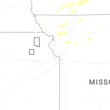


Connect with Interactive Hail Maps