

Hail Map for University of California Davis, CA
The University of California Davis, CA area has had 0 reports of on-the-ground hail by trained spotters, and has been under severe weather warnings 0 times during the past 12 months. Doppler radar has detected hail at or near University of California Davis, CA on 1 occasion.
| Name: | University of California Davis, CA |
| Where Located: | 28.4 miles WSW of Citrus Heights, CA |
| Map: | Google Map for University of California Davis, CA |
| Population: | 5786 |
| Housing Units: | 1125 |
| More Info: | Search Google for University of California Davis, CA |
0
The Top Recent Hail Date for University of California Davis, CA is Saturday, September 28, 2019 (1st out of 1)

Hail and Wind Damage Spotted near University of California Davis, CA
| Date / Time | Report Details |
|---|---|
| 9/28/2019 6:42 PM PDT |
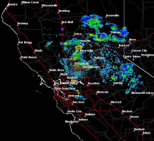 At 639 pm pdt, a severe thunderstorm was located near davis, and is moving slowly to the southeast at 10 to 15 mph towards el macero and west sacramento. this storm has also prompted the issuance of a tornado warning due to radar indicating strong circulation just north of davis and el macero (radar indicated). Hazards include hail up to nickels or quarter size. Damage to vehicles is expected. Locations impacted include, davis, woodland, west sacramento, and el macero. At 639 pm pdt, a severe thunderstorm was located near davis, and is moving slowly to the southeast at 10 to 15 mph towards el macero and west sacramento. this storm has also prompted the issuance of a tornado warning due to radar indicating strong circulation just north of davis and el macero (radar indicated). Hazards include hail up to nickels or quarter size. Damage to vehicles is expected. Locations impacted include, davis, woodland, west sacramento, and el macero.
|
| 9/28/2019 6:08 PM PDT |
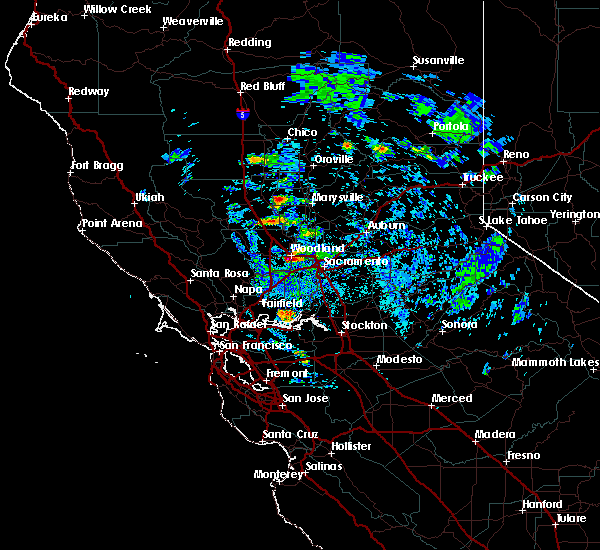 At 604 pm pdt, a severe thunderstorm was located over woodland, moving southeast at 10 to 15 mph towards davis and west sacramento (radar indicated). Hazards include nickel to quarter size hail. Damage to vehicles is expected. Hail may accumulate on roadways. At 604 pm pdt, a severe thunderstorm was located over woodland, moving southeast at 10 to 15 mph towards davis and west sacramento (radar indicated). Hazards include nickel to quarter size hail. Damage to vehicles is expected. Hail may accumulate on roadways.
|
Hail Maps for University of California Davis, CA

Connect with Interactive Hail Maps