

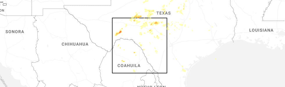
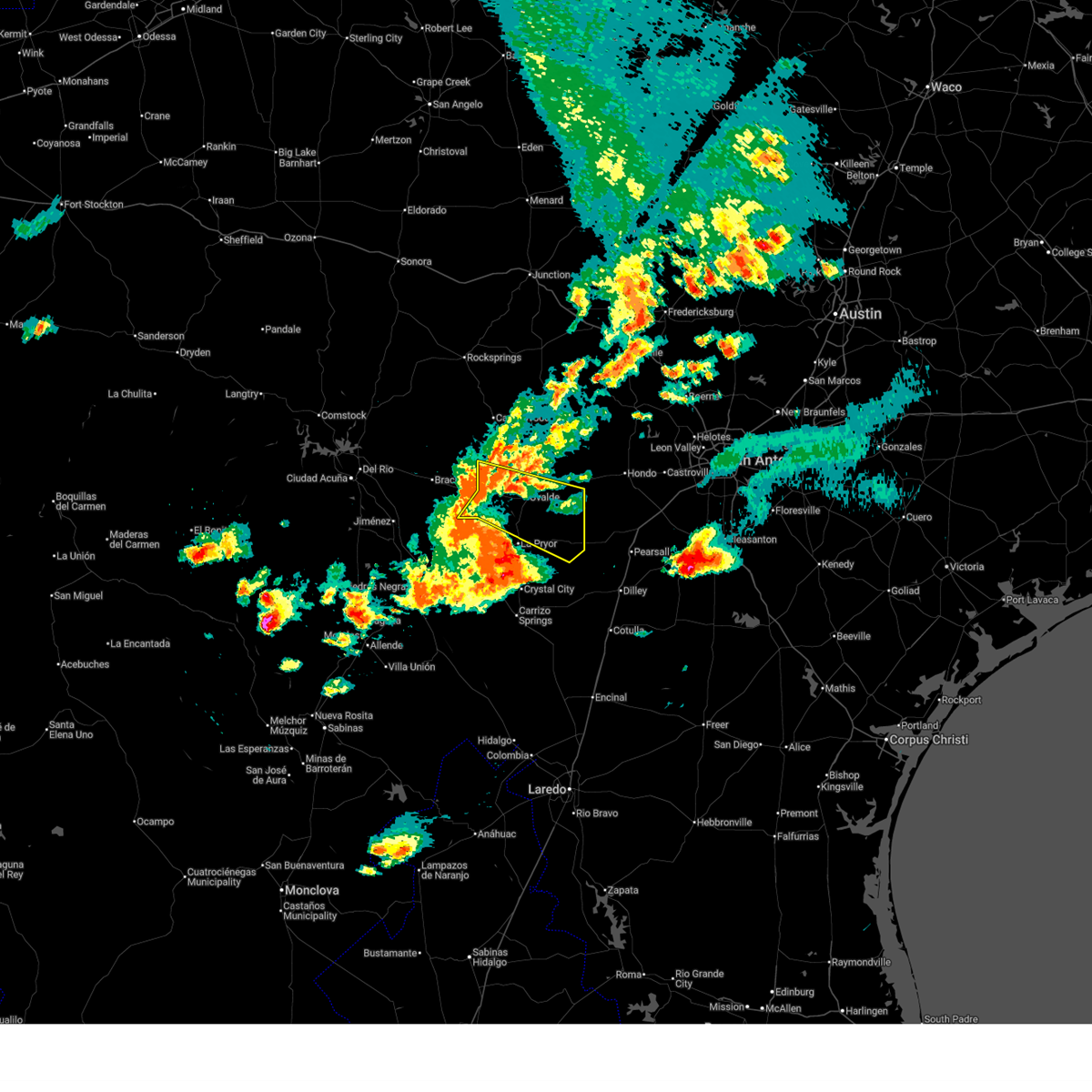
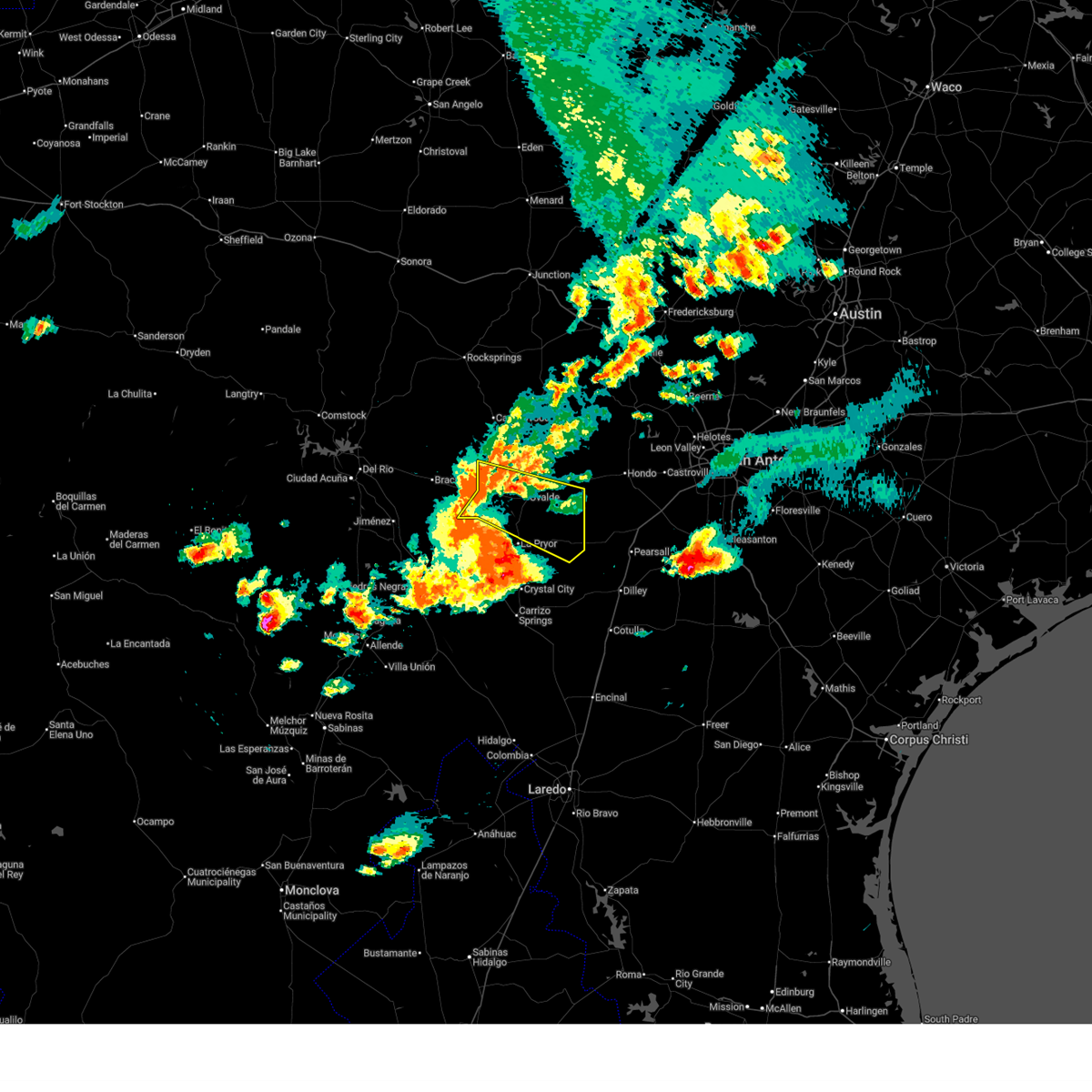
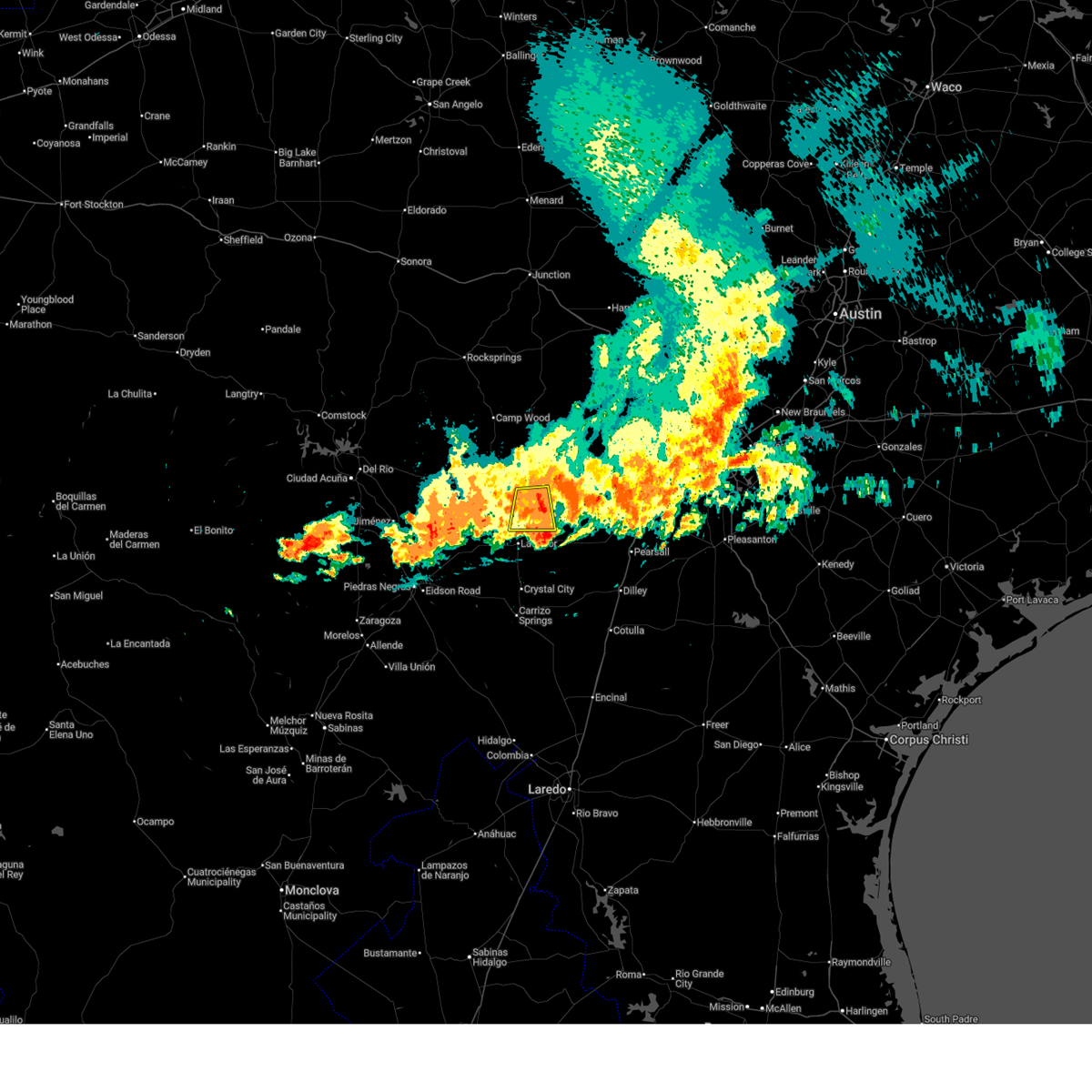
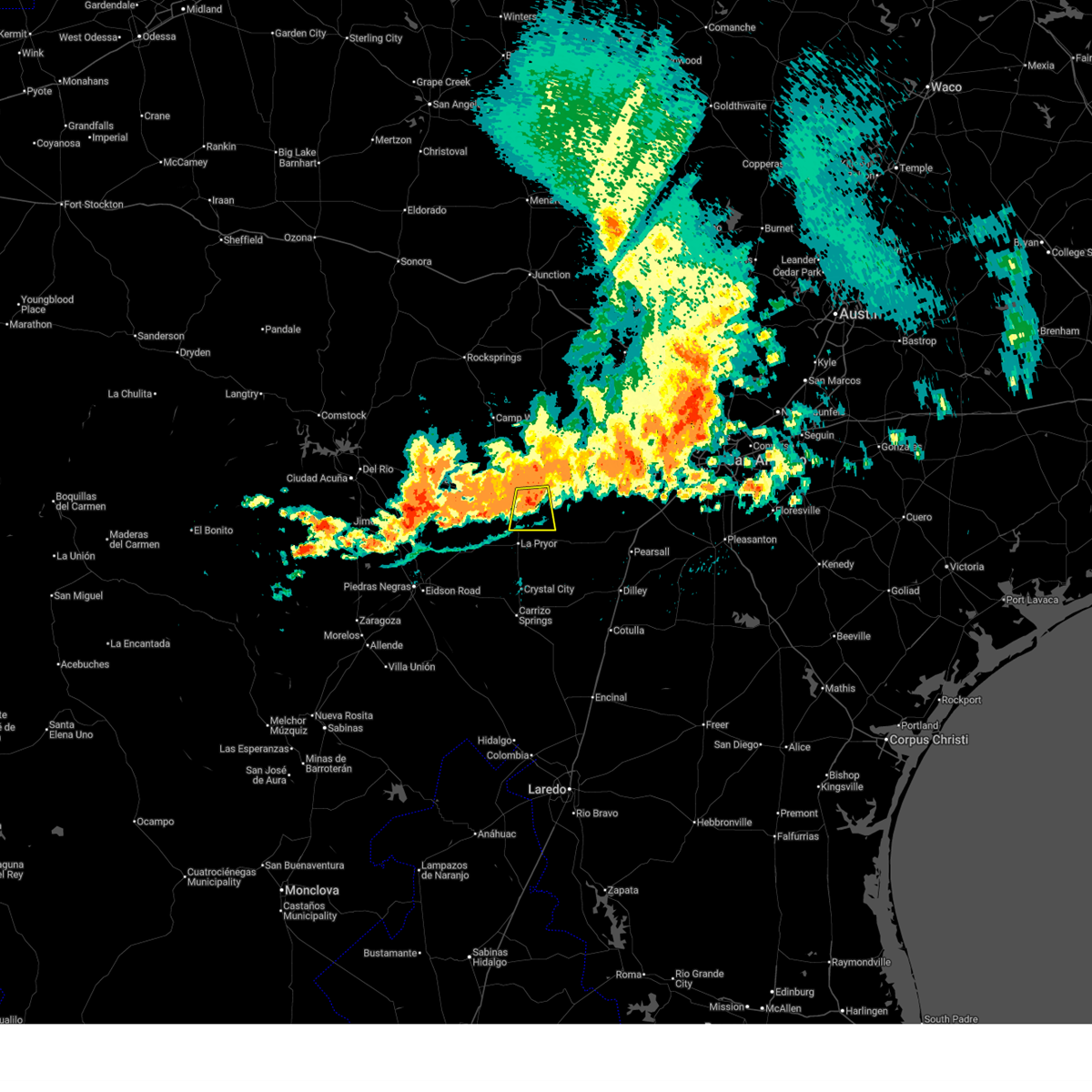
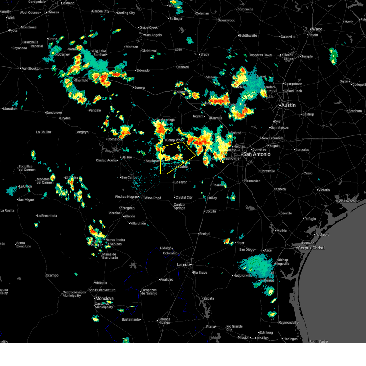
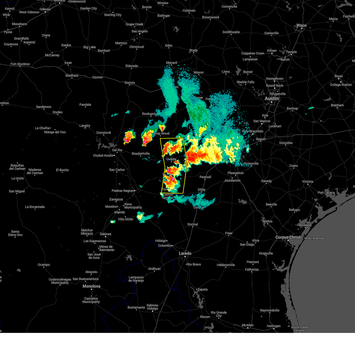
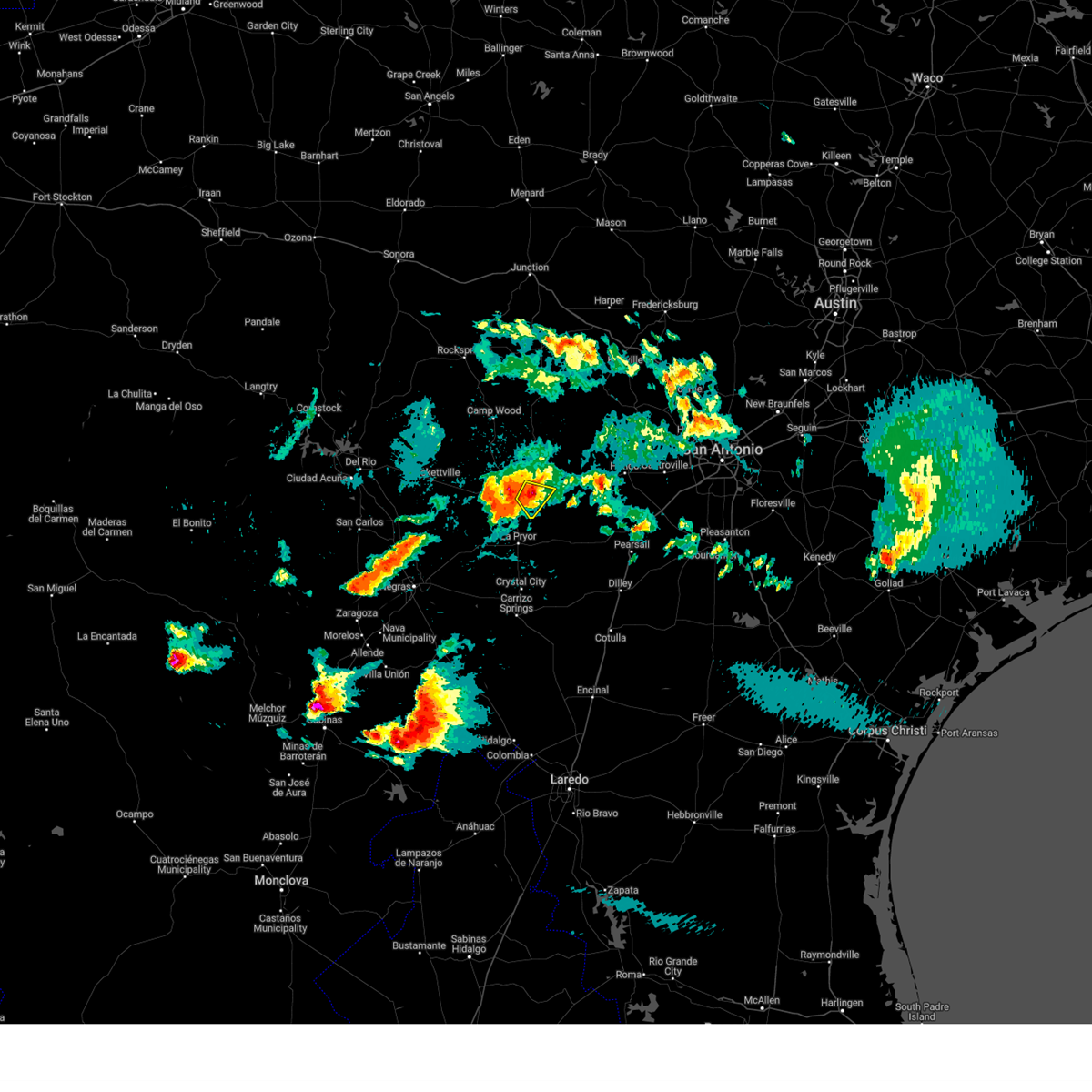
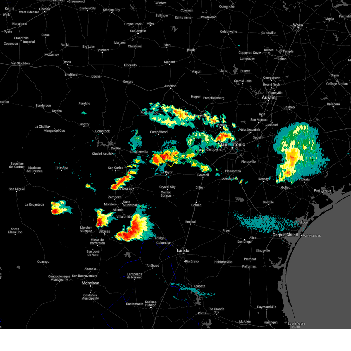
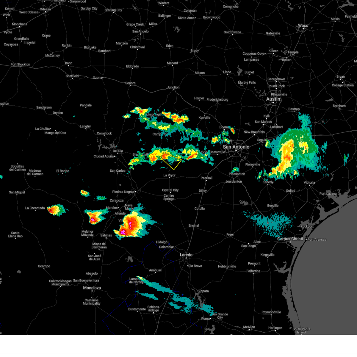
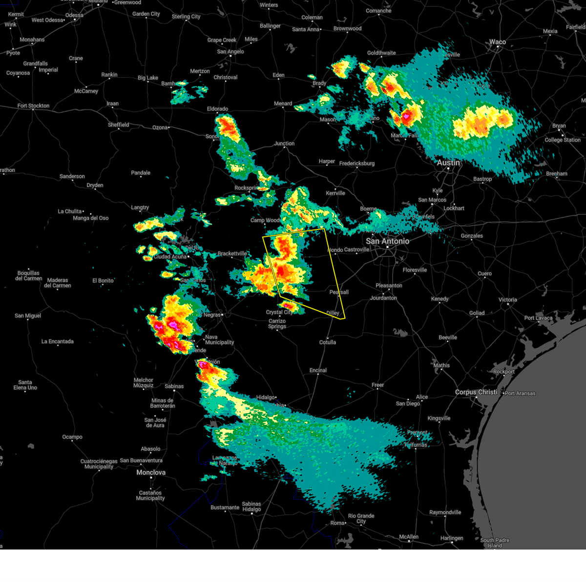
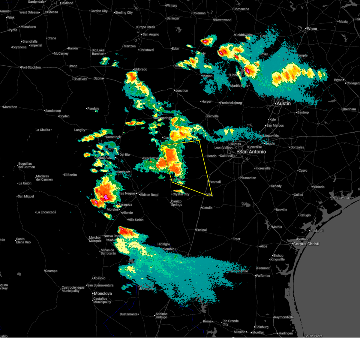
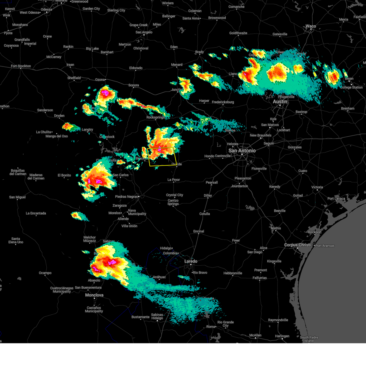
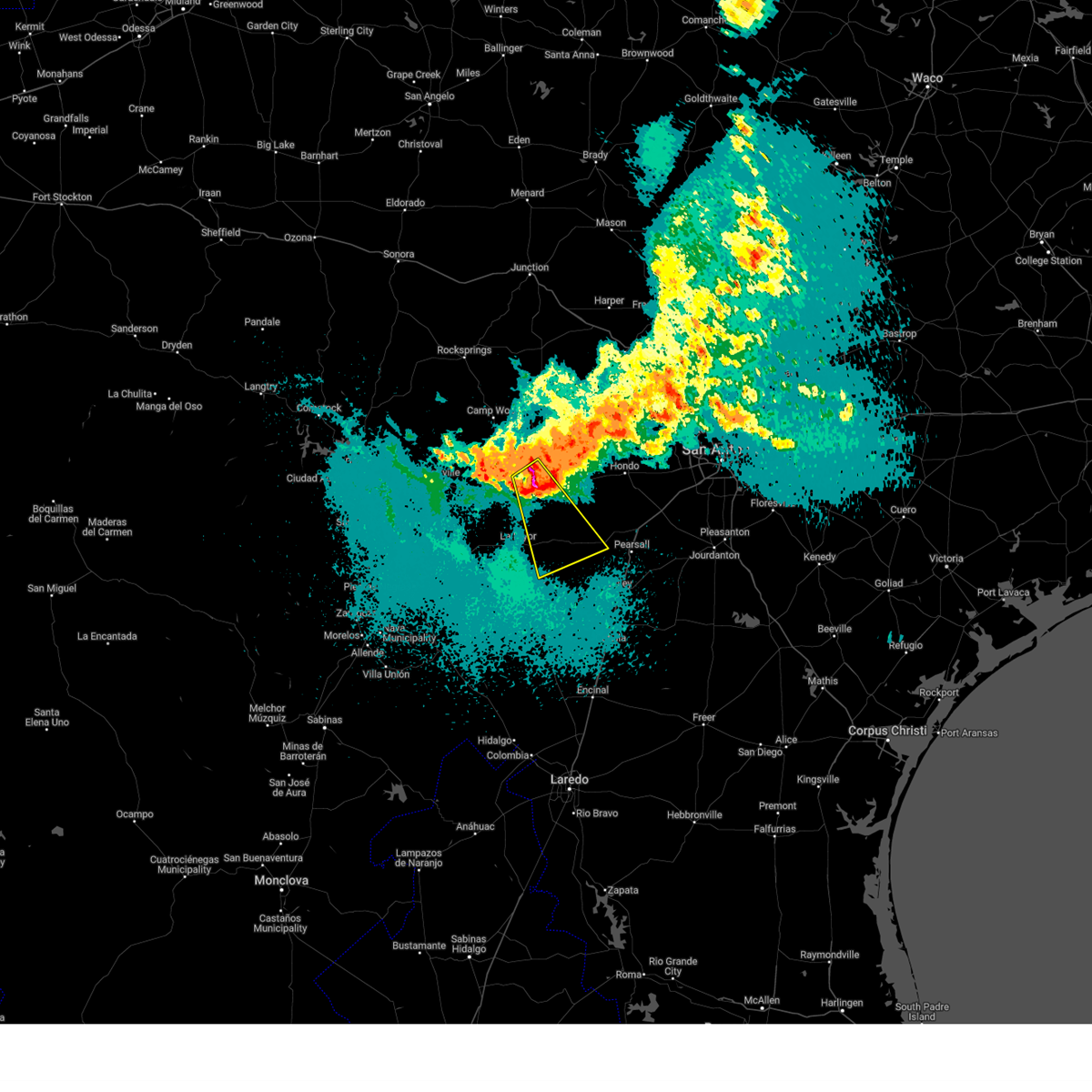
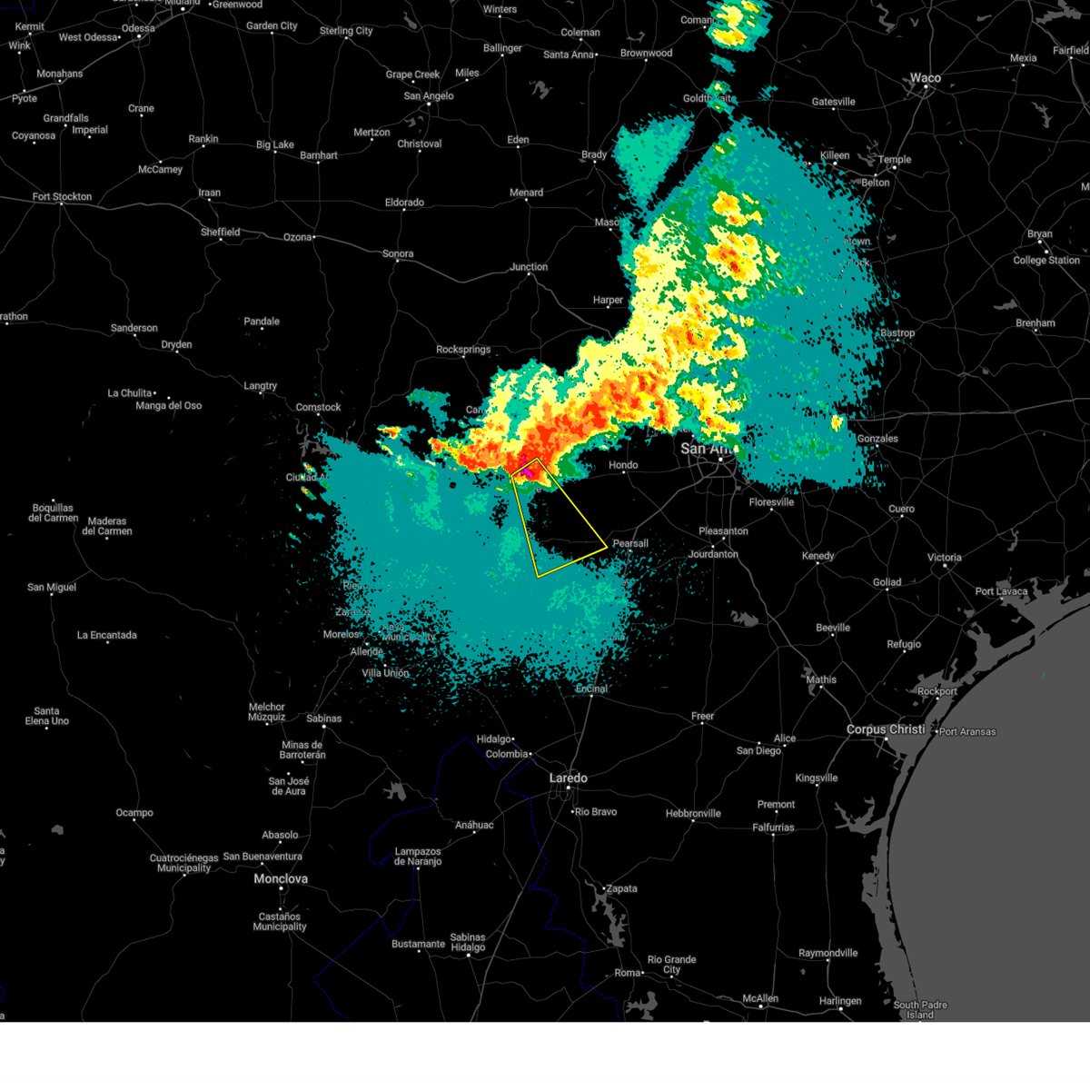
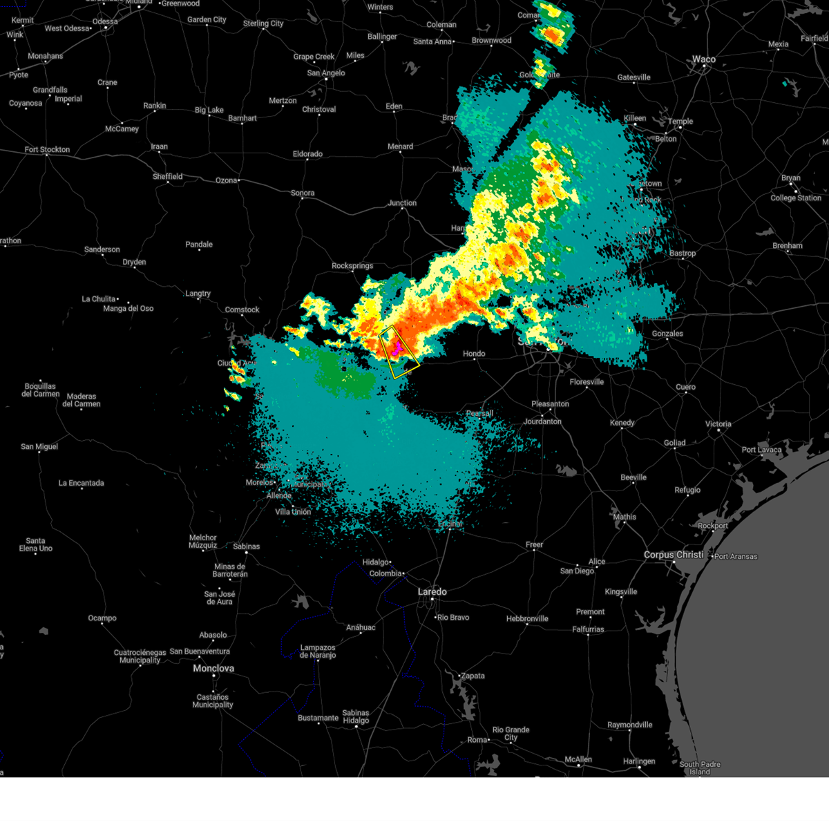
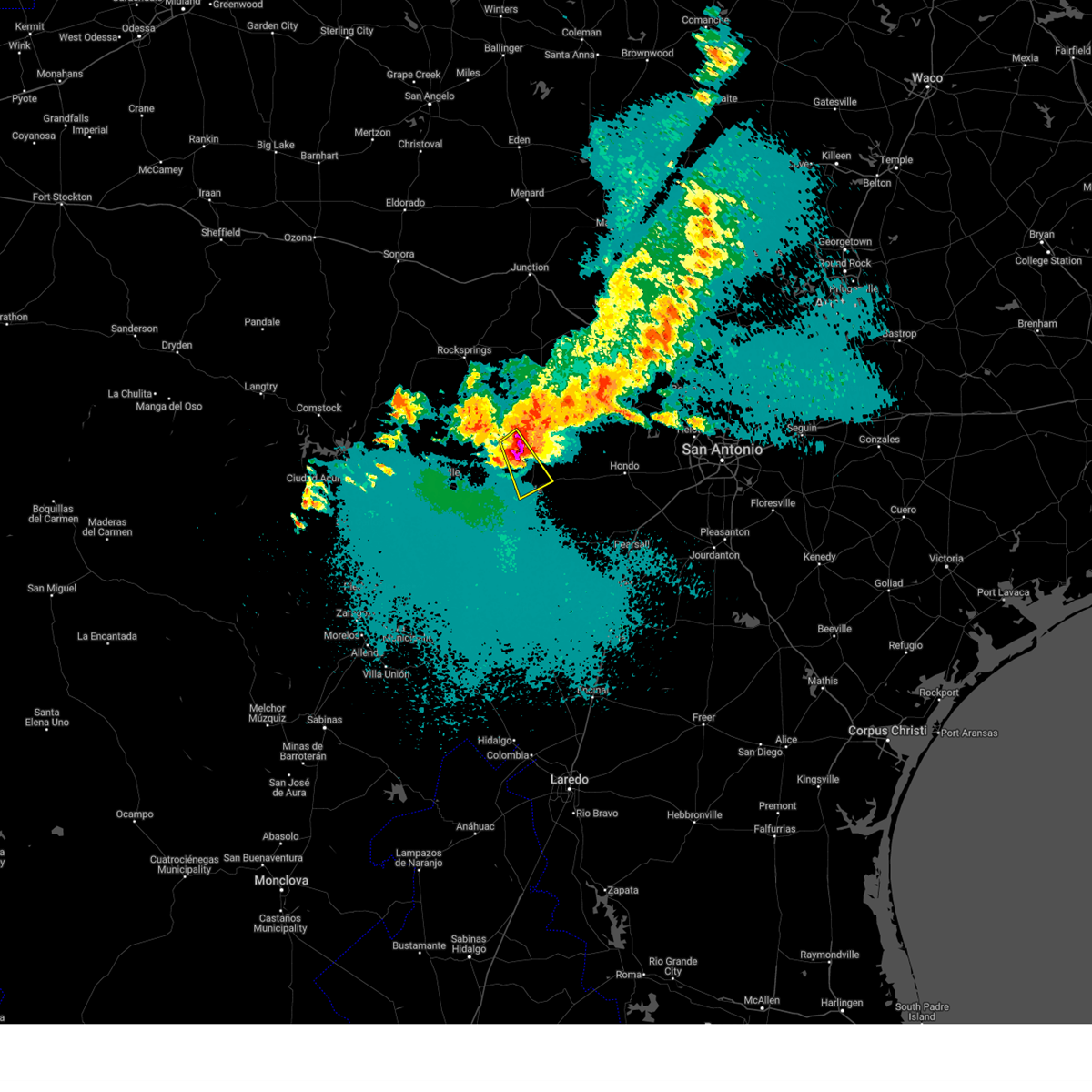
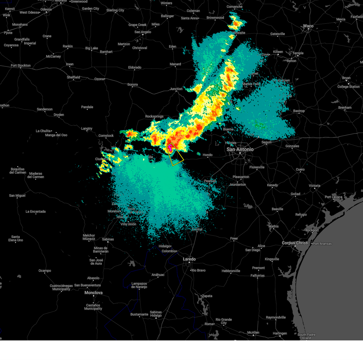
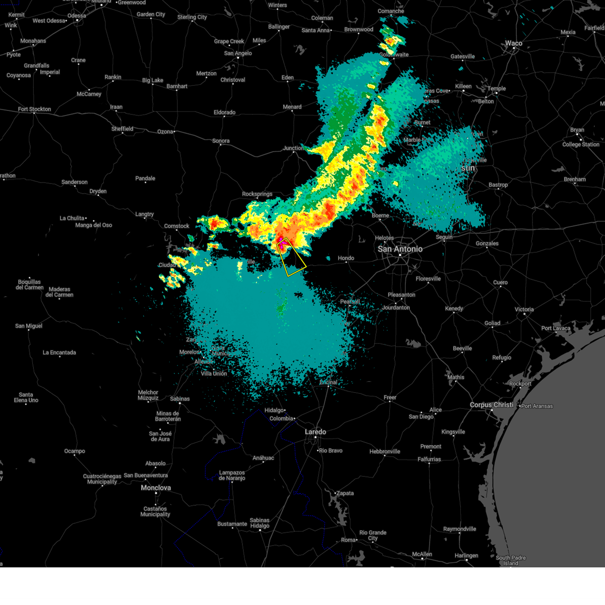
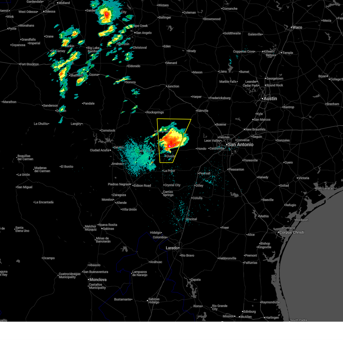
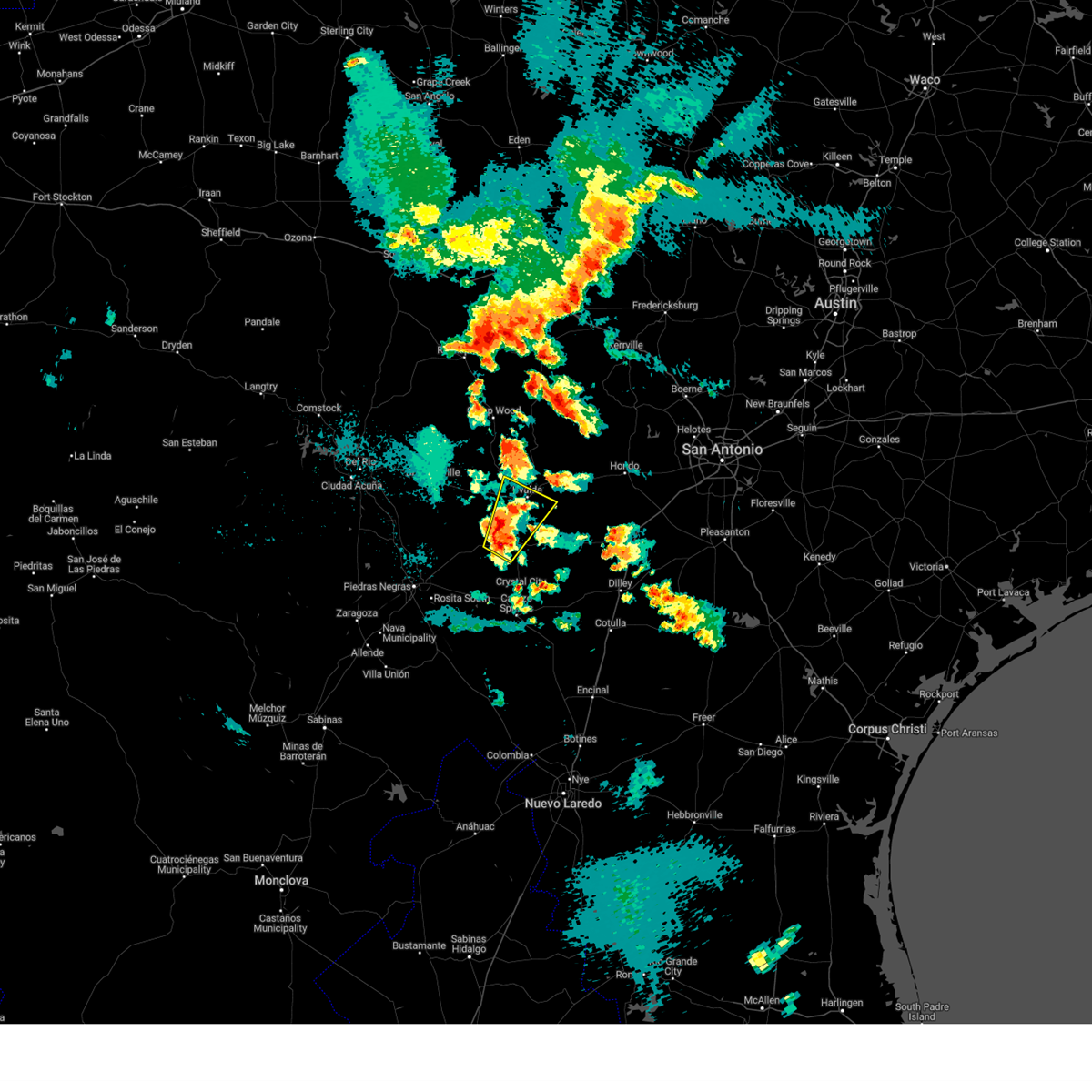
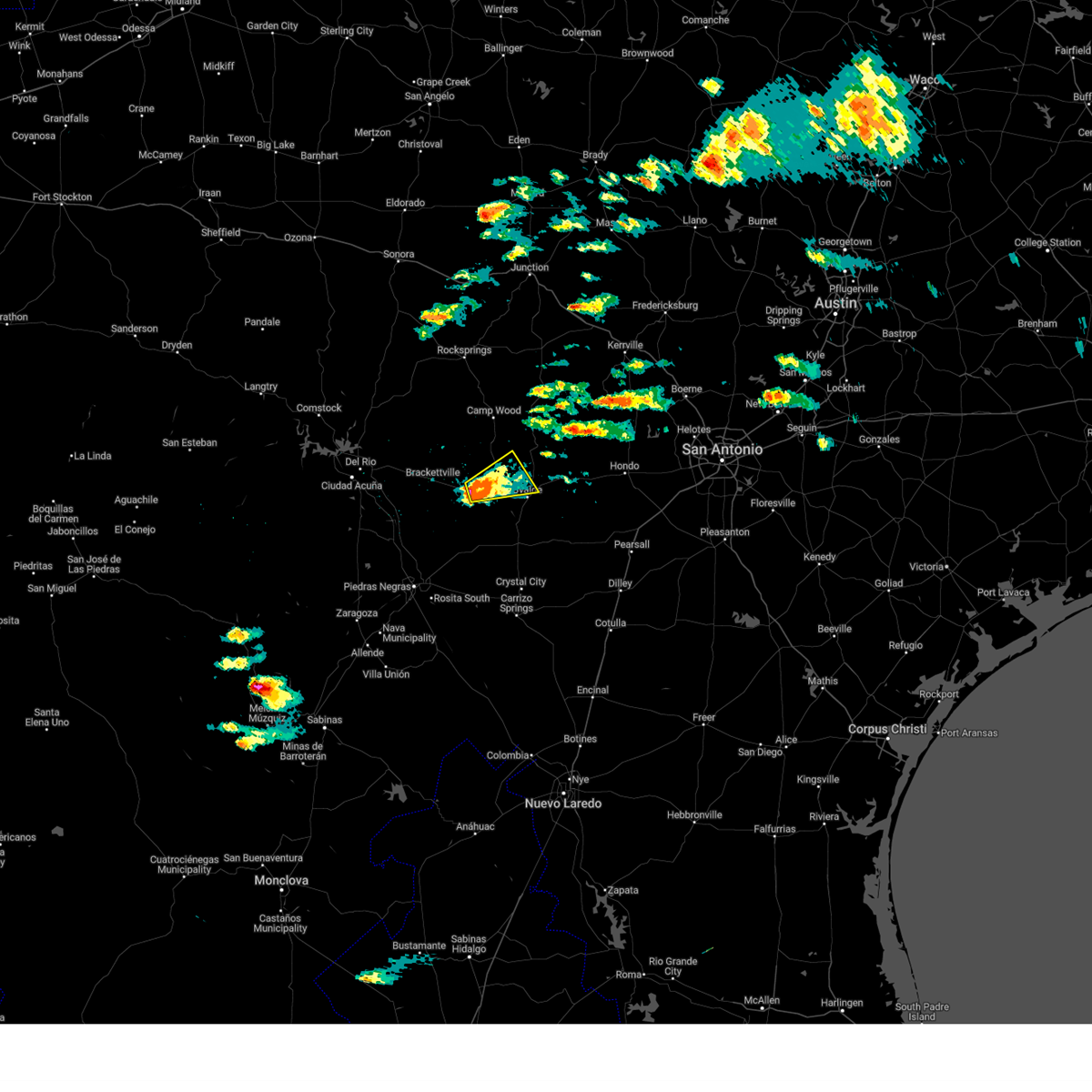
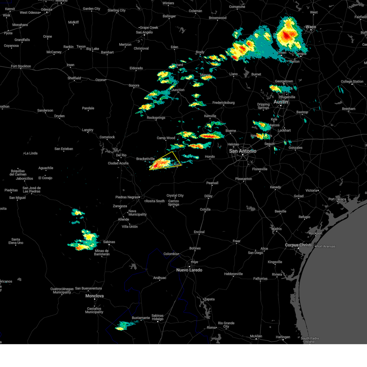
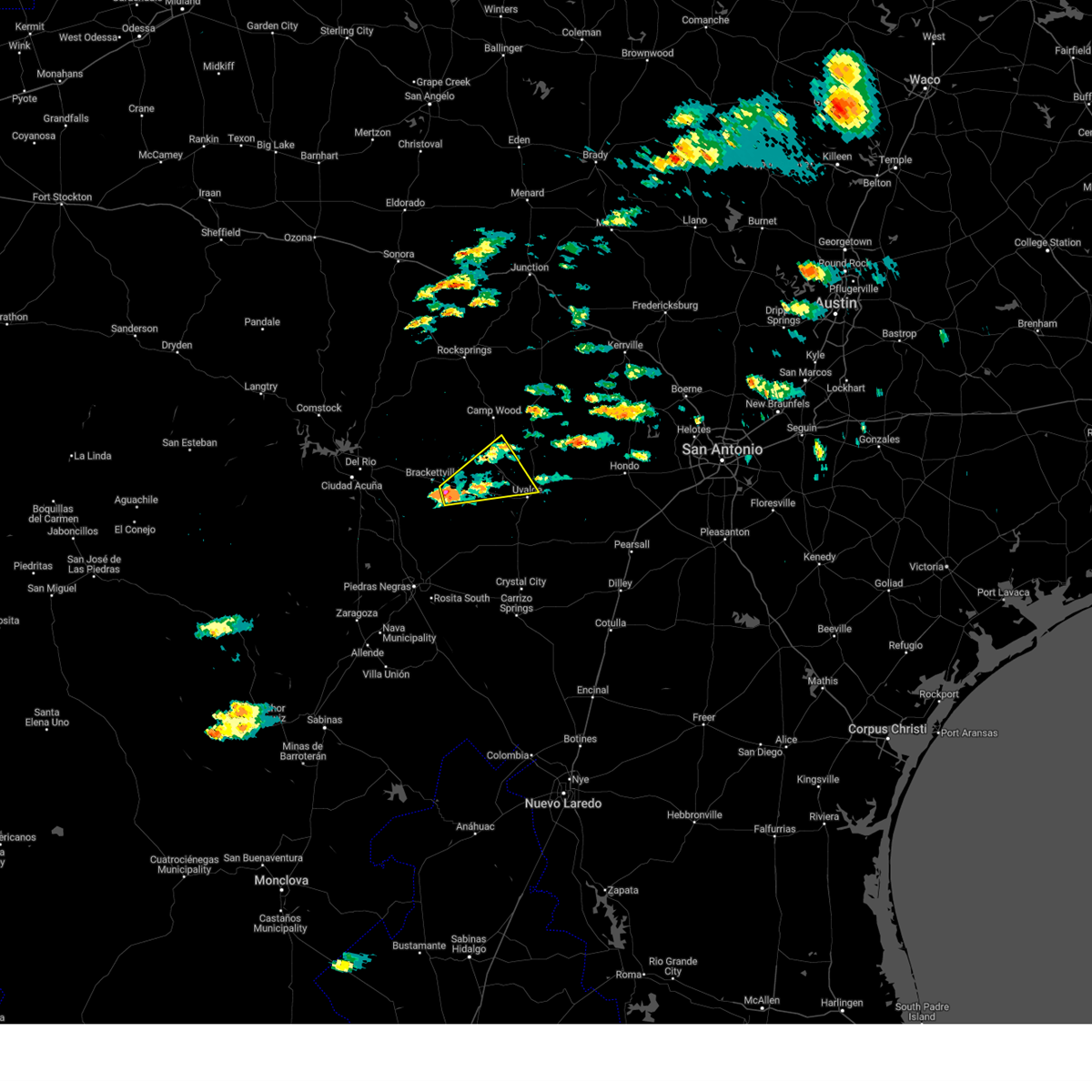
Hail Map for Uvalde, TX
The Uvalde, TX area has had 21 reports of on-the-ground hail by trained spotters, and has been under severe weather warnings 8 times during the past 12 months. Doppler radar has detected hail at or near Uvalde, TX on 62 occasions, including 2 occasions during the past year.
| Name: | Uvalde, TX |
| Where Located: | 68.3 miles E of Del Rio, TX |
| Map: | Google Map for Uvalde, TX |
| Population: | 15751 |
| Housing Units: | 5867 |
| More Info: | Search Google for Uvalde, TX |
1
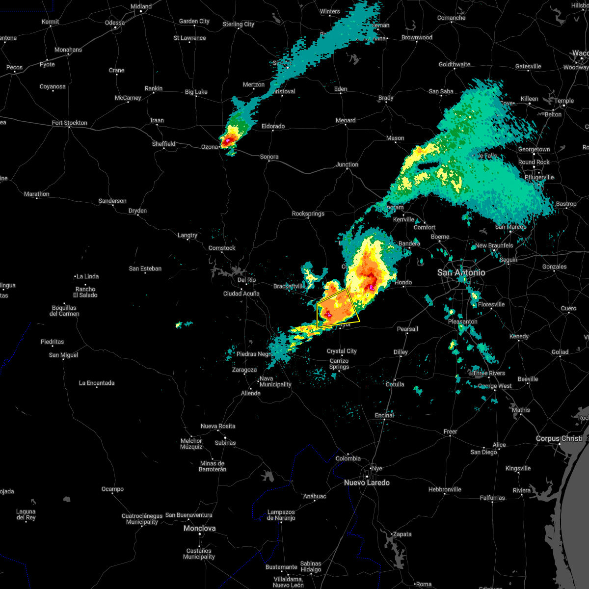
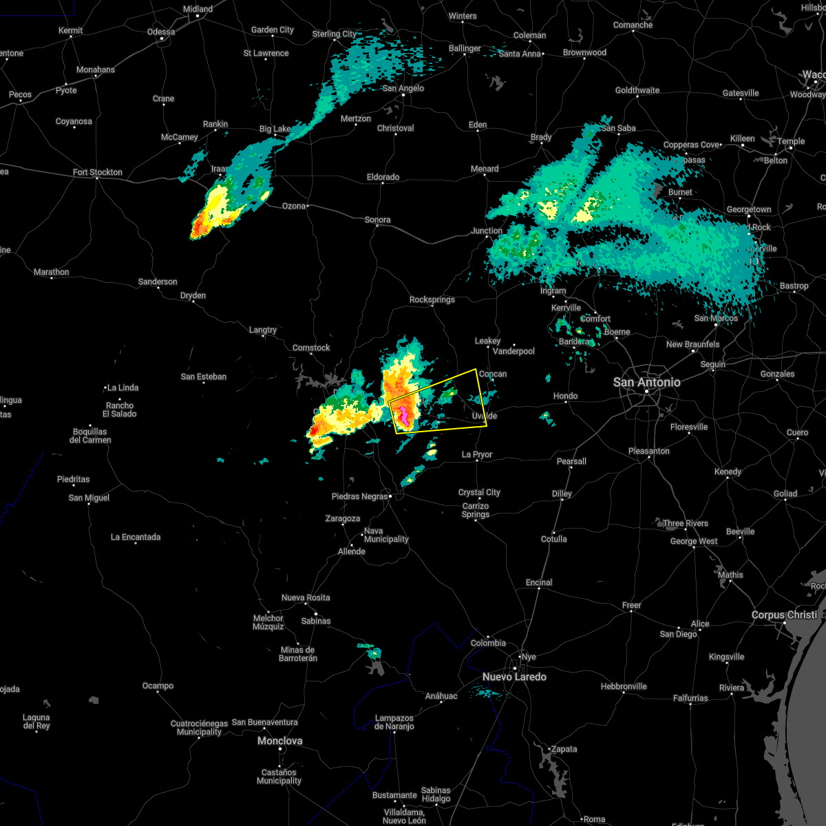
The Top Recent Hail Date for Uvalde, TX is Tuesday, May 19, 2026 (24th out of 62)
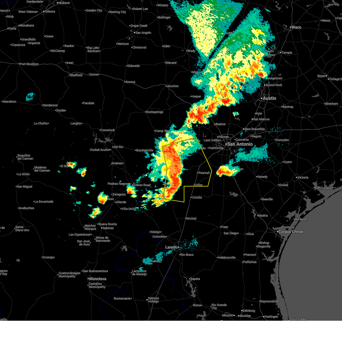
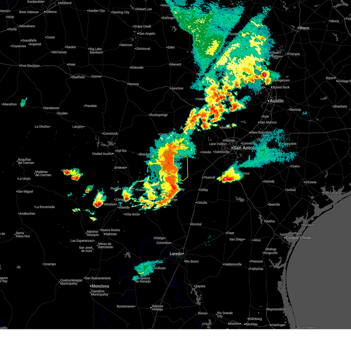
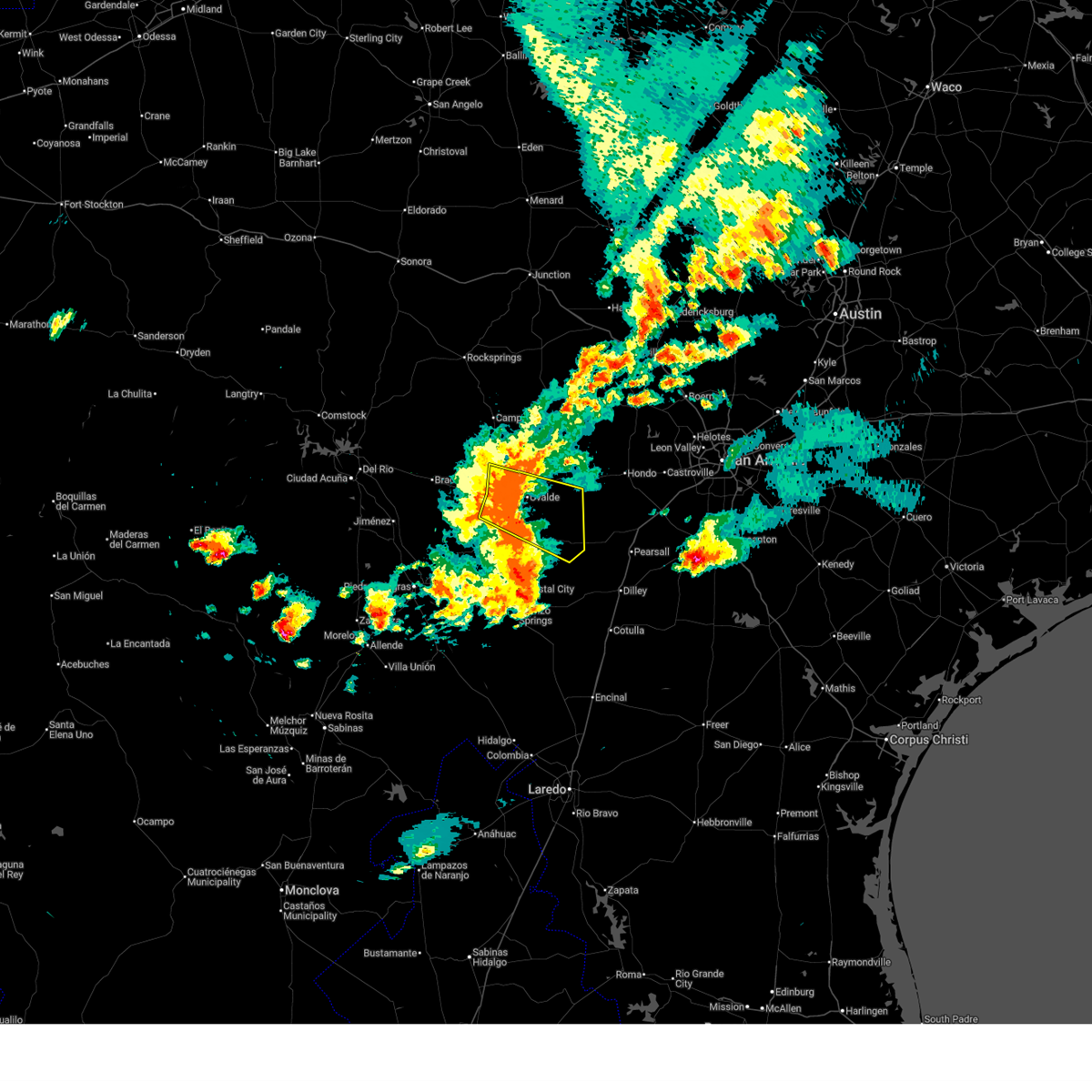
Hail and Wind Damage Spotted near Uvalde, TX
| Date / Time | Report Details |
|---|---|
| 5/26/2026 7:46 PM CDT |
 Svrewx the national weather service in austin san antonio has issued a * severe thunderstorm warning for, southwestern medina county in south central texas, northeastern dimmit county in south central texas, southeastern uvalde county in south central texas, eastern zavala county in south central texas, frio county in south central texas, * until 845 pm cdt. * at 746 pm cdt, severe thunderstorms were located along a line extending from near knippa to 9 miles southwest of frio town to 7 miles south of big wells, moving east at 30 mph (radar indicated). Hazards include 70 mph wind gusts and quarter size hail. Hail damage to vehicles is expected. expect considerable tree damage. Wind damage is also likely to mobile homes, roofs, and outbuildings. Svrewx the national weather service in austin san antonio has issued a * severe thunderstorm warning for, southwestern medina county in south central texas, northeastern dimmit county in south central texas, southeastern uvalde county in south central texas, eastern zavala county in south central texas, frio county in south central texas, * until 845 pm cdt. * at 746 pm cdt, severe thunderstorms were located along a line extending from near knippa to 9 miles southwest of frio town to 7 miles south of big wells, moving east at 30 mph (radar indicated). Hazards include 70 mph wind gusts and quarter size hail. Hail damage to vehicles is expected. expect considerable tree damage. Wind damage is also likely to mobile homes, roofs, and outbuildings.
|
| 5/26/2026 7:29 PM CDT |
 At 728 pm cdt, severe thunderstorms were located along a line extending from near uvalde to 6 miles southeast of uvalde estates to near washer, moving southeast at 35 mph. these are destructive storms for us highway 83 south of uvalde (radar indicated. large tree branches were reported down in uvalde). Hazards include 80 mph wind gusts. Flying debris will be dangerous to those caught without shelter. mobile homes will be heavily damaged. expect considerable damage to roofs, windows, and vehicles. extensive tree damage and power outages are likely. Locations impacted include, uvalde, batesville, knippa, uvalde estates, and washer. At 728 pm cdt, severe thunderstorms were located along a line extending from near uvalde to 6 miles southeast of uvalde estates to near washer, moving southeast at 35 mph. these are destructive storms for us highway 83 south of uvalde (radar indicated. large tree branches were reported down in uvalde). Hazards include 80 mph wind gusts. Flying debris will be dangerous to those caught without shelter. mobile homes will be heavily damaged. expect considerable damage to roofs, windows, and vehicles. extensive tree damage and power outages are likely. Locations impacted include, uvalde, batesville, knippa, uvalde estates, and washer.
|
| 5/26/2026 7:25 PM CDT | Spotter reported 2.5 inch diameter branches down in city uvald in uvalde county TX, 0.7 miles ENE of Uvalde, TX |
| 5/26/2026 7:25 PM CDT | Downed tree in uvalde. time estimated via rada in uvalde county TX, 0.3 miles N of Uvalde, TX |
| 5/26/2026 7:17 PM CDT |
 At 717 pm cdt, severe thunderstorms were located along a line extending from 6 miles northwest of uvalde to uvalde estates to near washer, moving southeast at 40 mph (radar indicated). Hazards include 70 mph wind gusts. Expect considerable tree damage. damage is likely to mobile homes, roofs, and outbuildings. Locations impacted include, uvalde, batesville, knippa, uvalde estates, blewett, and washer. At 717 pm cdt, severe thunderstorms were located along a line extending from 6 miles northwest of uvalde to uvalde estates to near washer, moving southeast at 40 mph (radar indicated). Hazards include 70 mph wind gusts. Expect considerable tree damage. damage is likely to mobile homes, roofs, and outbuildings. Locations impacted include, uvalde, batesville, knippa, uvalde estates, blewett, and washer.
|
| 5/26/2026 7:01 PM CDT |
 Svrewx the national weather service in austin san antonio has issued a * severe thunderstorm warning for, southeastern kinney county in south central texas, southern uvalde county in south central texas, northeastern zavala county in south central texas, * until 800 pm cdt. * at 701 pm cdt, severe thunderstorms were located along a line extending from near cline to blewett to near dabney, moving southeast at 35 mph (radar indicated). Hazards include 70 mph wind gusts. Expect considerable tree damage. Damage is likely to mobile homes, roofs, and outbuildings. Svrewx the national weather service in austin san antonio has issued a * severe thunderstorm warning for, southeastern kinney county in south central texas, southern uvalde county in south central texas, northeastern zavala county in south central texas, * until 800 pm cdt. * at 701 pm cdt, severe thunderstorms were located along a line extending from near cline to blewett to near dabney, moving southeast at 35 mph (radar indicated). Hazards include 70 mph wind gusts. Expect considerable tree damage. Damage is likely to mobile homes, roofs, and outbuildings.
|
| 5/26/2026 7:00 PM CDT |
 Svrewx the national weather service in austin san antonio has issued a * severe thunderstorm warning for, southeastern kinney county in south central texas, southern uvalde county in south central texas, northeastern zavala county in south central texas, * until 800 pm cdt. * at 700 pm cdt, severe thunderstorms were located along a line extending from near cline to blewett to near dabney, moving southeast at 35 mph (radar indicated). Hazards include 60 mph wind gusts. expect damage to roofs, siding, and trees Svrewx the national weather service in austin san antonio has issued a * severe thunderstorm warning for, southeastern kinney county in south central texas, southern uvalde county in south central texas, northeastern zavala county in south central texas, * until 800 pm cdt. * at 700 pm cdt, severe thunderstorms were located along a line extending from near cline to blewett to near dabney, moving southeast at 35 mph (radar indicated). Hazards include 60 mph wind gusts. expect damage to roofs, siding, and trees
|
| 5/26/2026 3:12 PM CDT | Half Dollar sized hail reported 16.2 miles SE of Uvalde, TX |
| 5/20/2026 12:20 AM CDT |
 The storm which prompted the warning has moved out of the area. therefore, the warning will be allowed to expire. however small hail, gusty winds and heavy rain are still possible with this thunderstorm. The storm which prompted the warning has moved out of the area. therefore, the warning will be allowed to expire. however small hail, gusty winds and heavy rain are still possible with this thunderstorm.
|
| 5/19/2026 11:54 PM CDT |
 Svrewx the national weather service in austin san antonio has issued a * severe thunderstorm warning for, south central uvalde county in south central texas, north central zavala county in south central texas, * until 1230 am cdt. * at 1154 pm cdt, a severe thunderstorm was located near uvalde, and is nearly stationary (radar indicated). Hazards include 60 mph wind gusts and quarter size hail. Hail damage to vehicles is expected. Expect wind damage to roofs, siding, and trees. Svrewx the national weather service in austin san antonio has issued a * severe thunderstorm warning for, south central uvalde county in south central texas, north central zavala county in south central texas, * until 1230 am cdt. * at 1154 pm cdt, a severe thunderstorm was located near uvalde, and is nearly stationary (radar indicated). Hazards include 60 mph wind gusts and quarter size hail. Hail damage to vehicles is expected. Expect wind damage to roofs, siding, and trees.
|
| 4/29/2026 7:22 PM CDT | Tea Cup sized hail reported 30 miles SSE of Uvalde, TX, report from mping baseball++ (3.50 in.). |
| 4/29/2026 7:21 PM CDT | Tea Cup sized hail reported 30.6 miles SSE of Uvalde, TX, report from mping tea cup (3.00 in.). |
| 3/10/2026 6:45 PM CDT | Mesonet station ea002 3.9 n montell (eaa in uvalde county TX, 29.4 miles SSE of Uvalde, TX |
| 8/19/2025 3:36 PM CDT |
 Svrewx the national weather service in austin san antonio has issued a * severe thunderstorm warning for, uvalde county in south central texas, * until 415 pm cdt. * at 336 pm cdt, a severe thunderstorm was located near concan, or 17 miles south of vanderpool, moving southwest at 40 mph (radar indicated). Hazards include 60 mph wind gusts. expect damage to roofs, siding, and trees Svrewx the national weather service in austin san antonio has issued a * severe thunderstorm warning for, uvalde county in south central texas, * until 415 pm cdt. * at 336 pm cdt, a severe thunderstorm was located near concan, or 17 miles south of vanderpool, moving southwest at 40 mph (radar indicated). Hazards include 60 mph wind gusts. expect damage to roofs, siding, and trees
|
| 6/10/2025 11:00 PM CDT |
 At 1100 pm cdt, severe thunderstorms were located along a line extending from 8 miles west of medina to 8 miles south of sabinal to near asherton, moving east at 35 mph (radar indicated). Hazards include 60 mph wind gusts and half dollar size hail. Hail damage to vehicles is expected. expect wind damage to roofs, siding, and trees. Locations impacted include, medina, kerrville, uvalde, pearsall, hondo, crystal city, carrizo springs, dilley, bandera, big wells, leakey, la pryor, tarpley, vanderpool, batesville, sabinal, asherton, north pearsall, chula vista-river spur, and d'hanis. At 1100 pm cdt, severe thunderstorms were located along a line extending from 8 miles west of medina to 8 miles south of sabinal to near asherton, moving east at 35 mph (radar indicated). Hazards include 60 mph wind gusts and half dollar size hail. Hail damage to vehicles is expected. expect wind damage to roofs, siding, and trees. Locations impacted include, medina, kerrville, uvalde, pearsall, hondo, crystal city, carrizo springs, dilley, bandera, big wells, leakey, la pryor, tarpley, vanderpool, batesville, sabinal, asherton, north pearsall, chula vista-river spur, and d'hanis.
|
| 6/10/2025 10:40 PM CDT |
 Svrewx the national weather service in austin san antonio has issued a * severe thunderstorm warning for, medina county in south central texas, bandera county in south central texas, southern kerr county in south central texas, eastern maverick county in south central texas, dimmit county in south central texas, uvalde county in south central texas, zavala county in south central texas, western frio county in south central texas, real county in south central texas, * until 1130 pm cdt. * at 1039 pm cdt, severe thunderstorms were located along a line extending from lost maples state natural area to 6 miles southeast of knippa to 6 miles southwest of carrizo hill, moving east at 35 mph (radar indicated). Hazards include ping pong ball size hail and 60 mph wind gusts. People and animals outdoors will be injured. expect hail damage to roofs, siding, windows, and vehicles. Expect wind damage to roofs, siding, and trees. Svrewx the national weather service in austin san antonio has issued a * severe thunderstorm warning for, medina county in south central texas, bandera county in south central texas, southern kerr county in south central texas, eastern maverick county in south central texas, dimmit county in south central texas, uvalde county in south central texas, zavala county in south central texas, western frio county in south central texas, real county in south central texas, * until 1130 pm cdt. * at 1039 pm cdt, severe thunderstorms were located along a line extending from lost maples state natural area to 6 miles southeast of knippa to 6 miles southwest of carrizo hill, moving east at 35 mph (radar indicated). Hazards include ping pong ball size hail and 60 mph wind gusts. People and animals outdoors will be injured. expect hail damage to roofs, siding, windows, and vehicles. Expect wind damage to roofs, siding, and trees.
|
| 6/10/2025 10:14 PM CDT |
 At 1014 pm cdt, severe thunderstorms were located along a line extending from near uvalde to washer to near cometa, moving southeast at 35 mph (radar indicated). Hazards include ping pong ball size hail and 60 mph wind gusts. People and animals outdoors will be injured. expect hail damage to roofs, siding, windows, and vehicles. expect wind damage to roofs, siding, and trees. Locations impacted include, uvalde, crystal city, carrizo springs, big wells, la pryor, batesville, el indio, asherton, chula vista-river spur, las colonias, uvalde estates, brundage, dabney, cline, carrizo hill, loma vista, knippa, blewett, washer, and winter haven. At 1014 pm cdt, severe thunderstorms were located along a line extending from near uvalde to washer to near cometa, moving southeast at 35 mph (radar indicated). Hazards include ping pong ball size hail and 60 mph wind gusts. People and animals outdoors will be injured. expect hail damage to roofs, siding, windows, and vehicles. expect wind damage to roofs, siding, and trees. Locations impacted include, uvalde, crystal city, carrizo springs, big wells, la pryor, batesville, el indio, asherton, chula vista-river spur, las colonias, uvalde estates, brundage, dabney, cline, carrizo hill, loma vista, knippa, blewett, washer, and winter haven.
|
| 6/10/2025 9:52 PM CDT |
 Svrewx the national weather service in austin san antonio has issued a * severe thunderstorm warning for, southwestern medina county in south central texas, southeastern kinney county in south central texas, maverick county in south central texas, western dimmit county in south central texas, southern uvalde county in south central texas, zavala county in south central texas, northwestern frio county in south central texas, * until 1045 pm cdt. * at 951 pm cdt, severe thunderstorms were located along a line extending from 8 miles southeast of laguna to near blewett to 14 miles northwest of cometa, moving southeast at 35 mph (radar indicated). Hazards include ping pong ball size hail and 60 mph wind gusts. People and animals outdoors will be injured. expect hail damage to roofs, siding, windows, and vehicles. Expect wind damage to roofs, siding, and trees. Svrewx the national weather service in austin san antonio has issued a * severe thunderstorm warning for, southwestern medina county in south central texas, southeastern kinney county in south central texas, maverick county in south central texas, western dimmit county in south central texas, southern uvalde county in south central texas, zavala county in south central texas, northwestern frio county in south central texas, * until 1045 pm cdt. * at 951 pm cdt, severe thunderstorms were located along a line extending from 8 miles southeast of laguna to near blewett to 14 miles northwest of cometa, moving southeast at 35 mph (radar indicated). Hazards include ping pong ball size hail and 60 mph wind gusts. People and animals outdoors will be injured. expect hail damage to roofs, siding, windows, and vehicles. Expect wind damage to roofs, siding, and trees.
|
| 5/26/2025 11:28 PM CDT |
 The storms which prompted the warning have weakened below severe limits, and no longer pose an immediate threat to life or property. therefore, the warning will be allowed to expire. a tornado watch remains in effect until midnight cdt for south central texas. The storms which prompted the warning have weakened below severe limits, and no longer pose an immediate threat to life or property. therefore, the warning will be allowed to expire. a tornado watch remains in effect until midnight cdt for south central texas.
|
| 5/26/2025 11:07 PM CDT |
 At 1107 pm cdt, severe thunderstorms were located along a line extending from near garner state park to near uvalde to near crystal city, moving east at 20 mph (radar indicated). Hazards include 60 mph wind gusts and quarter size hail. Hail damage to vehicles is expected. expect wind damage to roofs, siding, and trees. Locations impacted include, uvalde, batesville, la pryor, knippa, uvalde estates, and concan. At 1107 pm cdt, severe thunderstorms were located along a line extending from near garner state park to near uvalde to near crystal city, moving east at 20 mph (radar indicated). Hazards include 60 mph wind gusts and quarter size hail. Hail damage to vehicles is expected. expect wind damage to roofs, siding, and trees. Locations impacted include, uvalde, batesville, la pryor, knippa, uvalde estates, and concan.
|
| 5/26/2025 10:42 PM CDT |
 Svrewx the national weather service in austin san antonio has issued a * severe thunderstorm warning for, uvalde county in south central texas, zavala county in south central texas, * until 1130 pm cdt. * at 1042 pm cdt, severe thunderstorms were located along a line extending from 6 miles northwest of reagan wells to near uvalde estates to near crystal city, moving east at 20 mph (radar indicated). Hazards include 60 mph wind gusts and quarter size hail. Hail damage to vehicles is expected. Expect wind damage to roofs, siding, and trees. Svrewx the national weather service in austin san antonio has issued a * severe thunderstorm warning for, uvalde county in south central texas, zavala county in south central texas, * until 1130 pm cdt. * at 1042 pm cdt, severe thunderstorms were located along a line extending from 6 miles northwest of reagan wells to near uvalde estates to near crystal city, moving east at 20 mph (radar indicated). Hazards include 60 mph wind gusts and quarter size hail. Hail damage to vehicles is expected. Expect wind damage to roofs, siding, and trees.
|
| 5/26/2025 5:29 AM CDT |
 the severe thunderstorm warning has been cancelled and is no longer in effect the severe thunderstorm warning has been cancelled and is no longer in effect
|
| 5/26/2025 4:56 AM CDT |
 Svrewx the national weather service in austin san antonio has issued a * severe thunderstorm warning for, southwestern medina county in south central texas, southern uvalde county in south central texas, northern zavala county in south central texas, northwestern frio county in south central texas, * until 600 am cdt. * at 456 am cdt, a severe thunderstorm was located near blewett, or 16 miles northwest of la pryor, moving east at 35 mph (radar indicated). Hazards include 60 mph wind gusts. expect damage to roofs, siding, and trees Svrewx the national weather service in austin san antonio has issued a * severe thunderstorm warning for, southwestern medina county in south central texas, southern uvalde county in south central texas, northern zavala county in south central texas, northwestern frio county in south central texas, * until 600 am cdt. * at 456 am cdt, a severe thunderstorm was located near blewett, or 16 miles northwest of la pryor, moving east at 35 mph (radar indicated). Hazards include 60 mph wind gusts. expect damage to roofs, siding, and trees
|
| 5/2/2025 9:08 PM CDT |
 The storm which prompted the warning has weakened below severe limits, and no longer poses an immediate threat to life or property. therefore, the warning will be allowed to expire. however small hail and gusty winds are still possible with this thunderstorm. a severe thunderstorm watch remains in effect until 1000 pm cdt for south central texas. The storm which prompted the warning has weakened below severe limits, and no longer poses an immediate threat to life or property. therefore, the warning will be allowed to expire. however small hail and gusty winds are still possible with this thunderstorm. a severe thunderstorm watch remains in effect until 1000 pm cdt for south central texas.
|
| 5/2/2025 8:53 PM CDT |
 At 852 pm cdt, a severe thunderstorm was located over uvalde, moving east at 35 mph (radar indicated). Hazards include ping pong ball size hail and 60 mph wind gusts. People and animals outdoors will be injured. expect hail damage to roofs, siding, windows, and vehicles. expect wind damage to roofs, siding, and trees. This severe thunderstorm will remain over mainly rural areas of south central uvalde county. At 852 pm cdt, a severe thunderstorm was located over uvalde, moving east at 35 mph (radar indicated). Hazards include ping pong ball size hail and 60 mph wind gusts. People and animals outdoors will be injured. expect hail damage to roofs, siding, windows, and vehicles. expect wind damage to roofs, siding, and trees. This severe thunderstorm will remain over mainly rural areas of south central uvalde county.
|
| 5/2/2025 8:50 PM CDT | Quarter sized hail reported 0.7 miles ENE of Uvalde, TX, nickel to quarter size hail. |
| 5/2/2025 8:42 PM CDT |
 At 842 pm cdt, a severe thunderstorm was located 7 miles northwest of uvalde estates, or 8 miles west of uvalde, moving southeast at 15 mph (radar indicated). Hazards include tennis ball size hail and 60 mph wind gusts. People and animals outdoors will be injured. expect hail damage to roofs, siding, windows, and vehicles. expect wind damage to roofs, siding, and trees. This severe storm will be near, uvalde and uvalde estates around 850 pm cdt. At 842 pm cdt, a severe thunderstorm was located 7 miles northwest of uvalde estates, or 8 miles west of uvalde, moving southeast at 15 mph (radar indicated). Hazards include tennis ball size hail and 60 mph wind gusts. People and animals outdoors will be injured. expect hail damage to roofs, siding, windows, and vehicles. expect wind damage to roofs, siding, and trees. This severe storm will be near, uvalde and uvalde estates around 850 pm cdt.
|
| 5/2/2025 8:21 PM CDT |
 Svrewx the national weather service in austin san antonio has issued a * severe thunderstorm warning for, southwestern uvalde county in south central texas, * until 915 pm cdt. * at 821 pm cdt, a severe thunderstorm was located 8 miles east of cline, or 11 miles northwest of uvalde, moving southeast at 20 mph (radar indicated). Hazards include ping pong ball size hail and 60 mph wind gusts. People and animals outdoors will be injured. expect hail damage to roofs, siding, windows, and vehicles. expect wind damage to roofs, siding, and trees. This severe thunderstorm will be near, uvalde and uvalde estates around 840 pm cdt. Svrewx the national weather service in austin san antonio has issued a * severe thunderstorm warning for, southwestern uvalde county in south central texas, * until 915 pm cdt. * at 821 pm cdt, a severe thunderstorm was located 8 miles east of cline, or 11 miles northwest of uvalde, moving southeast at 20 mph (radar indicated). Hazards include ping pong ball size hail and 60 mph wind gusts. People and animals outdoors will be injured. expect hail damage to roofs, siding, windows, and vehicles. expect wind damage to roofs, siding, and trees. This severe thunderstorm will be near, uvalde and uvalde estates around 840 pm cdt.
|
| 5/1/2025 7:54 PM CDT |
 At 754 pm cdt, severe thunderstorms were located along a line extending from 6 miles south of reagan wells to near uvalde estates to near batesville, moving southeast at 10 mph (radar indicated). Hazards include 60 mph wind gusts and quarter size hail. Hail damage to vehicles is expected. expect wind damage to roofs, siding, and trees. Locations impacted include, uvalde, pearsall, dilley, batesville, la pryor, sabinal, north pearsall, knippa, d'hanis, derby, hilltop, concan, washer, uvalde estates, divot, reagan wells, bluff, frio town, and montell. At 754 pm cdt, severe thunderstorms were located along a line extending from 6 miles south of reagan wells to near uvalde estates to near batesville, moving southeast at 10 mph (radar indicated). Hazards include 60 mph wind gusts and quarter size hail. Hail damage to vehicles is expected. expect wind damage to roofs, siding, and trees. Locations impacted include, uvalde, pearsall, dilley, batesville, la pryor, sabinal, north pearsall, knippa, d'hanis, derby, hilltop, concan, washer, uvalde estates, divot, reagan wells, bluff, frio town, and montell.
|
| 5/1/2025 7:37 PM CDT |
 Svrewx the national weather service in austin san antonio has issued a * severe thunderstorm warning for, western medina county in south central texas, uvalde county in south central texas, northeastern zavala county in south central texas, western frio county in south central texas, * until 830 pm cdt. * at 736 pm cdt, severe thunderstorms were located along a line extending from 6 miles south of reagan wells to near batesville, moving southeast at 30 mph (radar indicated). Hazards include 60 mph wind gusts and quarter size hail. Hail damage to vehicles is expected. Expect wind damage to roofs, siding, and trees. Svrewx the national weather service in austin san antonio has issued a * severe thunderstorm warning for, western medina county in south central texas, uvalde county in south central texas, northeastern zavala county in south central texas, western frio county in south central texas, * until 830 pm cdt. * at 736 pm cdt, severe thunderstorms were located along a line extending from 6 miles south of reagan wells to near batesville, moving southeast at 30 mph (radar indicated). Hazards include 60 mph wind gusts and quarter size hail. Hail damage to vehicles is expected. Expect wind damage to roofs, siding, and trees.
|
| 5/1/2025 6:25 PM CDT |
 Svrewx the national weather service in austin san antonio has issued a * severe thunderstorm warning for, northeastern kinney county in south central texas, northwestern uvalde county in south central texas, * until 700 pm cdt. * at 623 pm cdt, a severe thunderstorm was located 10 miles northwest of cline, or 11 miles east of brackettville, moving southeast at 20 mph. this is a destructive storm for areas east of brackettville (radar indicated). Hazards include baseball size hail and 70 mph wind gusts. People and animals outdoors will be severely injured. Expect shattered windows, extensive damage to roofs, siding, and vehicles. Svrewx the national weather service in austin san antonio has issued a * severe thunderstorm warning for, northeastern kinney county in south central texas, northwestern uvalde county in south central texas, * until 700 pm cdt. * at 623 pm cdt, a severe thunderstorm was located 10 miles northwest of cline, or 11 miles east of brackettville, moving southeast at 20 mph. this is a destructive storm for areas east of brackettville (radar indicated). Hazards include baseball size hail and 70 mph wind gusts. People and animals outdoors will be severely injured. Expect shattered windows, extensive damage to roofs, siding, and vehicles.
|
| 4/23/2025 2:27 AM CDT |
 At 227 am cdt, a severe thunderstorm was located near uvalde, moving southeast at 30 mph (radar indicated). Hazards include two inch hail and 60 mph wind gusts. People and animals outdoors will be injured. expect hail damage to roofs, siding, windows, and vehicles. expect wind damage to roofs, siding, and trees. Locations impacted include, knippa, uvalde estates, uvalde, and batesville. At 227 am cdt, a severe thunderstorm was located near uvalde, moving southeast at 30 mph (radar indicated). Hazards include two inch hail and 60 mph wind gusts. People and animals outdoors will be injured. expect hail damage to roofs, siding, windows, and vehicles. expect wind damage to roofs, siding, and trees. Locations impacted include, knippa, uvalde estates, uvalde, and batesville.
|
| 4/23/2025 2:11 AM CDT |
 Svrewx the national weather service in austin san antonio has issued a * severe thunderstorm warning for, southeastern uvalde county in south central texas, northeastern zavala county in south central texas, west central frio county in south central texas, * until 315 am cdt. * at 209 am cdt, a severe thunderstorm was located 7 miles north of uvalde, moving southeast at 30 mph. this is a destructive storm for uvalde (radar indicated). Hazards include softball size hail and 60 mph wind gusts. People and animals outdoors will be severely injured. Expect shattered windows, extensive damage to roofs, siding, and vehicles. Svrewx the national weather service in austin san antonio has issued a * severe thunderstorm warning for, southeastern uvalde county in south central texas, northeastern zavala county in south central texas, west central frio county in south central texas, * until 315 am cdt. * at 209 am cdt, a severe thunderstorm was located 7 miles north of uvalde, moving southeast at 30 mph. this is a destructive storm for uvalde (radar indicated). Hazards include softball size hail and 60 mph wind gusts. People and animals outdoors will be severely injured. Expect shattered windows, extensive damage to roofs, siding, and vehicles.
|
| 4/23/2025 1:58 AM CDT |
 At 156 am cdt, a severe thunderstorm was located 8 miles west of knippa, or 8 miles north of uvalde, moving southeast at 30 mph. this is a destructive storm for southern reagan wells, west of concan and the city of uvalde (radar indicated). Hazards include softball size hail and 60 mph wind gusts. People and animals outdoors will be severely injured. expect shattered windows, extensive damage to roofs, siding, and vehicles. Locations impacted include, knippa, reagan wells, and uvalde. At 156 am cdt, a severe thunderstorm was located 8 miles west of knippa, or 8 miles north of uvalde, moving southeast at 30 mph. this is a destructive storm for southern reagan wells, west of concan and the city of uvalde (radar indicated). Hazards include softball size hail and 60 mph wind gusts. People and animals outdoors will be severely injured. expect shattered windows, extensive damage to roofs, siding, and vehicles. Locations impacted include, knippa, reagan wells, and uvalde.
|
| 4/23/2025 1:47 AM CDT |
 At 146 am cdt, a severe thunderstorm was located 9 miles southwest of concan, or 13 miles north of uvalde, moving southeast at 30 mph. this is a destructive storm for reagan wells and vicinity (radar indicated). Hazards include three inch hail and 60 mph wind gusts. People and animals outdoors will be severely injured. expect shattered windows, extensive damage to roofs, siding, and vehicles. Locations impacted include, knippa, reagan wells, and uvalde. At 146 am cdt, a severe thunderstorm was located 9 miles southwest of concan, or 13 miles north of uvalde, moving southeast at 30 mph. this is a destructive storm for reagan wells and vicinity (radar indicated). Hazards include three inch hail and 60 mph wind gusts. People and animals outdoors will be severely injured. expect shattered windows, extensive damage to roofs, siding, and vehicles. Locations impacted include, knippa, reagan wells, and uvalde.
|
| 4/23/2025 1:39 AM CDT |
 At 137 am cdt, a severe thunderstorm was located near reagan wells, or 17 miles north of uvalde, moving southeast at 30 mph. this is a destructive storm for areas near reagan wells and vicinity (radar indicated). Hazards include baseball size hail and 60 mph wind gusts. People and animals outdoors will be severely injured. expect shattered windows, extensive damage to roofs, siding, and vehicles. Locations impacted include, knippa, reagan wells, and uvalde. At 137 am cdt, a severe thunderstorm was located near reagan wells, or 17 miles north of uvalde, moving southeast at 30 mph. this is a destructive storm for areas near reagan wells and vicinity (radar indicated). Hazards include baseball size hail and 60 mph wind gusts. People and animals outdoors will be severely injured. expect shattered windows, extensive damage to roofs, siding, and vehicles. Locations impacted include, knippa, reagan wells, and uvalde.
|
| 4/23/2025 1:32 AM CDT |
 Svrewx the national weather service in austin san antonio has issued a * severe thunderstorm warning for, central uvalde county in south central texas, * until 215 am cdt. * at 132 am cdt, a severe thunderstorm was located near reagan wells, or 17 miles southwest of leakey, moving southeast at 30 mph (radar indicated). Hazards include ping pong ball size hail and 60 mph wind gusts. People and animals outdoors will be injured. expect hail damage to roofs, siding, windows, and vehicles. Expect wind damage to roofs, siding, and trees. Svrewx the national weather service in austin san antonio has issued a * severe thunderstorm warning for, central uvalde county in south central texas, * until 215 am cdt. * at 132 am cdt, a severe thunderstorm was located near reagan wells, or 17 miles southwest of leakey, moving southeast at 30 mph (radar indicated). Hazards include ping pong ball size hail and 60 mph wind gusts. People and animals outdoors will be injured. expect hail damage to roofs, siding, windows, and vehicles. Expect wind damage to roofs, siding, and trees.
|
| 4/4/2025 11:30 PM CDT |
 At 1129 pm cdt, a severe thunderstorm was located near concan, or 16 miles northeast of uvalde, moving northeast at 35 mph (radar indicated). Hazards include quarter size hail. Damage to vehicles is expected. Locations impacted include, knippa, uvalde estates, vanderpool, uvalde, tuff, garner state park, rio frio, reagan wells, utopia, leakey, concan, and lost maples state natural area. At 1129 pm cdt, a severe thunderstorm was located near concan, or 16 miles northeast of uvalde, moving northeast at 35 mph (radar indicated). Hazards include quarter size hail. Damage to vehicles is expected. Locations impacted include, knippa, uvalde estates, vanderpool, uvalde, tuff, garner state park, rio frio, reagan wells, utopia, leakey, concan, and lost maples state natural area.
|
| 4/4/2025 11:03 PM CDT |
 At 1102 pm cdt, a severe thunderstorm was located near uvalde, moving north at 55 mph (radar indicated). Hazards include half dollar size hail. Damage to vehicles is expected. Locations impacted include, knippa, uvalde estates, vanderpool, uvalde, tuff, garner state park, rio frio, reagan wells, utopia, leakey, concan, and lost maples state natural area. At 1102 pm cdt, a severe thunderstorm was located near uvalde, moving north at 55 mph (radar indicated). Hazards include half dollar size hail. Damage to vehicles is expected. Locations impacted include, knippa, uvalde estates, vanderpool, uvalde, tuff, garner state park, rio frio, reagan wells, utopia, leakey, concan, and lost maples state natural area.
|
| 4/4/2025 11:01 PM CDT | Half Dollar sized hail reported 0.4 miles S of Uvalde, TX, quarter to half dollar sized hail. |
| 4/4/2025 10:49 PM CDT |
 Svrewx the national weather service in austin san antonio has issued a * severe thunderstorm warning for, western bandera county in south central texas, central uvalde county in south central texas, southern real county in south central texas, * until 1145 pm cdt. * at 1049 pm cdt, a severe thunderstorm was located near uvalde estates, or near uvalde, moving north at 55 mph (radar indicated). Hazards include quarter size hail. damage to vehicles is expected Svrewx the national weather service in austin san antonio has issued a * severe thunderstorm warning for, western bandera county in south central texas, central uvalde county in south central texas, southern real county in south central texas, * until 1145 pm cdt. * at 1049 pm cdt, a severe thunderstorm was located near uvalde estates, or near uvalde, moving north at 55 mph (radar indicated). Hazards include quarter size hail. damage to vehicles is expected
|
| 6/10/2024 4:55 AM CDT | Awos station kuva garner field airpor in uvalde county TX, 1.9 miles WSW of Uvalde, TX |
| 6/2/2023 11:56 PM CDT |
 At 1155 pm cdt, a severe thunderstorm was located 7 miles northwest of frio town, or 14 miles northeast of batesville, moving east at 35 mph (radar indicated). Hazards include tennis ball size hail and 60 mph wind gusts. People and animals outdoors will be injured. expect hail damage to roofs, siding, windows, and vehicles. Expect wind damage to roofs, siding, and trees. At 1155 pm cdt, a severe thunderstorm was located 7 miles northwest of frio town, or 14 miles northeast of batesville, moving east at 35 mph (radar indicated). Hazards include tennis ball size hail and 60 mph wind gusts. People and animals outdoors will be injured. expect hail damage to roofs, siding, windows, and vehicles. Expect wind damage to roofs, siding, and trees.
|
| 6/2/2023 11:20 PM CDT | At 11:20 pm... a 62 mph wind gust was reported at the weather station of southeast uvalde (eaa in uvalde county TX, 3.3 miles NNW of Uvalde, TX |
| 6/2/2023 11:15 PM CDT |
 At 1114 pm cdt, a severe thunderstorm was located near uvalde, moving southeast at 35 mph (radar indicated). Hazards include tennis ball size hail and 60 mph wind gusts. People and animals outdoors will be injured. expect hail damage to roofs, siding, windows, and vehicles. Expect wind damage to roofs, siding, and trees. At 1114 pm cdt, a severe thunderstorm was located near uvalde, moving southeast at 35 mph (radar indicated). Hazards include tennis ball size hail and 60 mph wind gusts. People and animals outdoors will be injured. expect hail damage to roofs, siding, windows, and vehicles. Expect wind damage to roofs, siding, and trees.
|
| 6/2/2023 10:43 PM CDT |
 At 1042 pm cdt, severe thunderstorms were located along a line extending from near vanderpool to near concan to blewett, moving east at 45 mph (radar indicated). Hazards include two inch hail and 70 mph wind gusts. People and animals outdoors will be injured. expect hail damage to roofs, siding, windows, and vehicles. expect considerable tree damage. wind damage is also likely to mobile homes, roofs, and outbuildings. locations impacted include, uvalde, hondo, bandera, leakey, vanderpool, tarpley, sabinal, laguna, knippa, blewett, d`hanis, bandera falls, rio frio, concan, uvalde estates, pipe creek, cline, garner state park, reagan wells and utopia. thunderstorm damage threat, considerable hail threat, radar indicated max hail size, 2. 00 in wind threat, radar indicated max wind gust, 70 mph. At 1042 pm cdt, severe thunderstorms were located along a line extending from near vanderpool to near concan to blewett, moving east at 45 mph (radar indicated). Hazards include two inch hail and 70 mph wind gusts. People and animals outdoors will be injured. expect hail damage to roofs, siding, windows, and vehicles. expect considerable tree damage. wind damage is also likely to mobile homes, roofs, and outbuildings. locations impacted include, uvalde, hondo, bandera, leakey, vanderpool, tarpley, sabinal, laguna, knippa, blewett, d`hanis, bandera falls, rio frio, concan, uvalde estates, pipe creek, cline, garner state park, reagan wells and utopia. thunderstorm damage threat, considerable hail threat, radar indicated max hail size, 2. 00 in wind threat, radar indicated max wind gust, 70 mph.
|
| 6/2/2023 10:41 PM CDT |
 At 1041 pm cdt, severe thunderstorms were located along a line extending from near vanderpool to near concan to blewett, moving east at 45 mph (radar indicated). Hazards include golf ball size hail and 70 mph wind gusts. People and animals outdoors will be injured. expect hail damage to roofs, siding, windows, and vehicles. expect considerable tree damage. Wind damage is also likely to mobile homes, roofs, and outbuildings. At 1041 pm cdt, severe thunderstorms were located along a line extending from near vanderpool to near concan to blewett, moving east at 45 mph (radar indicated). Hazards include golf ball size hail and 70 mph wind gusts. People and animals outdoors will be injured. expect hail damage to roofs, siding, windows, and vehicles. expect considerable tree damage. Wind damage is also likely to mobile homes, roofs, and outbuildings.
|
| 5/28/2023 12:53 AM CDT |
 At 1253 am cdt, severe thunderstorms were located along a line extending from 15 miles north of alamo village to 8 miles northwest of cline to near uvalde estates to near la pryor to 11 miles southeast of el indio, moving east at 35 mph (radar indicated). Hazards include 60 mph wind gusts. Expect damage to roofs, siding, and trees. Locations impacted include, uvalde, crystal city, carrizo springs, brackettville, la pryor, batesville, laguna, chula vista-river spur, concan, las colonias, uvalde estates, brundage, dabney, cline, carrizo hill, anacacho, reagan wells, loma vista, alamo village and blewett. At 1253 am cdt, severe thunderstorms were located along a line extending from 15 miles north of alamo village to 8 miles northwest of cline to near uvalde estates to near la pryor to 11 miles southeast of el indio, moving east at 35 mph (radar indicated). Hazards include 60 mph wind gusts. Expect damage to roofs, siding, and trees. Locations impacted include, uvalde, crystal city, carrizo springs, brackettville, la pryor, batesville, laguna, chula vista-river spur, concan, las colonias, uvalde estates, brundage, dabney, cline, carrizo hill, anacacho, reagan wells, loma vista, alamo village and blewett.
|
| 5/28/2023 12:34 AM CDT |
 At 1234 am cdt, severe thunderstorms were located along a line extending from 16 miles north of alamo village to 8 miles south of dabney to 12 miles southwest of el indio, moving east at 45 mph (radar indicated). Hazards include 60 mph wind gusts. Expect damage to roofs, siding, and trees. Locations impacted include, eagle pass, uvalde, crystal city, carrizo springs, brackettville, spofford, la pryor, batesville, el indio, chula vista, laguna, chula vista-river spur, concan, darling, las colonias, uvalde estates, brundage, dabney, cline and carrizo hill. At 1234 am cdt, severe thunderstorms were located along a line extending from 16 miles north of alamo village to 8 miles south of dabney to 12 miles southwest of el indio, moving east at 45 mph (radar indicated). Hazards include 60 mph wind gusts. Expect damage to roofs, siding, and trees. Locations impacted include, eagle pass, uvalde, crystal city, carrizo springs, brackettville, spofford, la pryor, batesville, el indio, chula vista, laguna, chula vista-river spur, concan, darling, las colonias, uvalde estates, brundage, dabney, cline and carrizo hill.
|
| 5/28/2023 12:08 AM CDT |
 At 1208 am cdt, severe thunderstorms were located along a line extending from 9 miles northwest of alamo village to darling to 22 miles southwest of el indio, moving east at 45 mph (radar indicated). Hazards include 60 mph wind gusts. expect damage to roofs, siding, and trees At 1208 am cdt, severe thunderstorms were located along a line extending from 9 miles northwest of alamo village to darling to 22 miles southwest of el indio, moving east at 45 mph (radar indicated). Hazards include 60 mph wind gusts. expect damage to roofs, siding, and trees
|
| 5/12/2023 10:15 PM CDT |
 At 1014 pm cdt, severe thunderstorms were located along a line extending from 6 miles southwest of washer to near big wells, moving east at 45 mph (radar indicated). Hazards include 60 mph wind gusts and penny size hail. expect damage to roofs, siding, and trees At 1014 pm cdt, severe thunderstorms were located along a line extending from 6 miles southwest of washer to near big wells, moving east at 45 mph (radar indicated). Hazards include 60 mph wind gusts and penny size hail. expect damage to roofs, siding, and trees
|
| 5/12/2023 9:21 PM CDT |
 At 921 pm cdt, severe thunderstorms were located along a line extending from near kerr wildlife management area to near utopia to 10 miles southeast of uvalde, moving east at 25 mph (radar indicated). Hazards include 60 mph wind gusts and penny size hail. Expect damage to roofs, siding, and trees. locations impacted include, medina, uvalde, leakey, vanderpool, tarpley, sabinal, hunt, knippa, d`hanis, tuff, rio frio, concan, kerr wildlife management area, washer, uvalde estates, garner state park, reagan wells, utopia, hill country state natural area and lost maples state natural area. hail threat, radar indicated max hail size, 0. 75 in wind threat, radar indicated max wind gust, 60 mph. At 921 pm cdt, severe thunderstorms were located along a line extending from near kerr wildlife management area to near utopia to 10 miles southeast of uvalde, moving east at 25 mph (radar indicated). Hazards include 60 mph wind gusts and penny size hail. Expect damage to roofs, siding, and trees. locations impacted include, medina, uvalde, leakey, vanderpool, tarpley, sabinal, hunt, knippa, d`hanis, tuff, rio frio, concan, kerr wildlife management area, washer, uvalde estates, garner state park, reagan wells, utopia, hill country state natural area and lost maples state natural area. hail threat, radar indicated max hail size, 0. 75 in wind threat, radar indicated max wind gust, 60 mph.
|
| 5/12/2023 9:07 PM CDT |
 At 907 pm cdt, severe thunderstorms were located along a line extending from 9 miles west of kerr wildlife management area to near utopia to 7 miles southeast of uvalde estates, moving east at 25 mph (radar indicated). Hazards include 60 mph wind gusts and penny size hail. expect damage to roofs, siding, and trees At 907 pm cdt, severe thunderstorms were located along a line extending from 9 miles west of kerr wildlife management area to near utopia to 7 miles southeast of uvalde estates, moving east at 25 mph (radar indicated). Hazards include 60 mph wind gusts and penny size hail. expect damage to roofs, siding, and trees
|
| 5/12/2023 8:50 PM CDT |
 At 850 pm cdt, severe thunderstorms were located along a line extending from 16 miles west of kerr wildlife management area to 6 miles east of leakey to uvalde, moving east at 35 mph (radar indicated). Hazards include 60 mph wind gusts and penny size hail. Expect damage to roofs, siding, and trees. locations impacted include, uvalde, leakey, vanderpool, sabinal, camp wood, laguna, knippa, blewett, barksdale, tuff, rio frio, concan, vance, uvalde estates, montell, dabney, cline, garner state park, reagan wells and utopia. hail threat, radar indicated max hail size, 0. 75 in wind threat, radar indicated max wind gust, 60 mph. At 850 pm cdt, severe thunderstorms were located along a line extending from 16 miles west of kerr wildlife management area to 6 miles east of leakey to uvalde, moving east at 35 mph (radar indicated). Hazards include 60 mph wind gusts and penny size hail. Expect damage to roofs, siding, and trees. locations impacted include, uvalde, leakey, vanderpool, sabinal, camp wood, laguna, knippa, blewett, barksdale, tuff, rio frio, concan, vance, uvalde estates, montell, dabney, cline, garner state park, reagan wells and utopia. hail threat, radar indicated max hail size, 0. 75 in wind threat, radar indicated max wind gust, 60 mph.
|
| 5/12/2023 8:17 PM CDT |
 At 817 pm cdt, severe thunderstorms were located along a line extending from 8 miles east of rocksprings to near camp wood to near blewett, moving east at 35 mph (radar indicated). Hazards include 70 mph wind gusts and penny size hail. Expect considerable tree damage. Damage is likely to mobile homes, roofs, and outbuildings. At 817 pm cdt, severe thunderstorms were located along a line extending from 8 miles east of rocksprings to near camp wood to near blewett, moving east at 35 mph (radar indicated). Hazards include 70 mph wind gusts and penny size hail. Expect considerable tree damage. Damage is likely to mobile homes, roofs, and outbuildings.
|
| 5/8/2023 11:52 PM CDT |
 At 1152 pm cdt, a severe thunderstorm was located near washer, or 9 miles north of la pryor, moving north at 20 mph (radar indicated). Hazards include quarter size hail. Damage to vehicles is expected. locations impacted include, uvalde, la pryor, uvalde estates and washer. hail threat, radar indicated max hail size, 1. 00 in wind threat, radar indicated max wind gust, <50 mph. At 1152 pm cdt, a severe thunderstorm was located near washer, or 9 miles north of la pryor, moving north at 20 mph (radar indicated). Hazards include quarter size hail. Damage to vehicles is expected. locations impacted include, uvalde, la pryor, uvalde estates and washer. hail threat, radar indicated max hail size, 1. 00 in wind threat, radar indicated max wind gust, <50 mph.
|
| 5/8/2023 11:36 PM CDT |
 At 1136 pm cdt, a severe thunderstorm was located over washer, or near la pryor, moving northeast at 25 mph (radar indicated). Hazards include quarter size hail. Damage to vehicles is expected. locations impacted include, uvalde, la pryor, uvalde estates and washer. hail threat, radar indicated max hail size, 1. 00 in wind threat, radar indicated max wind gust, <50 mph. At 1136 pm cdt, a severe thunderstorm was located over washer, or near la pryor, moving northeast at 25 mph (radar indicated). Hazards include quarter size hail. Damage to vehicles is expected. locations impacted include, uvalde, la pryor, uvalde estates and washer. hail threat, radar indicated max hail size, 1. 00 in wind threat, radar indicated max wind gust, <50 mph.
|
| 5/8/2023 11:21 PM CDT |
 At 1120 pm cdt, a severe thunderstorm was located near la pryor, moving northeast at 25 mph (radar indicated). Hazards include quarter size hail. damage to vehicles is expected At 1120 pm cdt, a severe thunderstorm was located near la pryor, moving northeast at 25 mph (radar indicated). Hazards include quarter size hail. damage to vehicles is expected
|
| 5/7/2023 5:38 AM CDT |
 At 538 am cdt, a severe thunderstorm was located near knippa, or near uvalde, moving northeast at 30 mph (radar indicated). Hazards include 60 mph wind gusts and quarter size hail. Hail damage to vehicles is expected. expect wind damage to roofs, siding, and trees. locations impacted include, uvalde and knippa. hail threat, radar indicated max hail size, 1. 00 in wind threat, radar indicated max wind gust, 60 mph. At 538 am cdt, a severe thunderstorm was located near knippa, or near uvalde, moving northeast at 30 mph (radar indicated). Hazards include 60 mph wind gusts and quarter size hail. Hail damage to vehicles is expected. expect wind damage to roofs, siding, and trees. locations impacted include, uvalde and knippa. hail threat, radar indicated max hail size, 1. 00 in wind threat, radar indicated max wind gust, 60 mph.
|
| 5/7/2023 5:31 AM CDT |
 At 531 am cdt, a severe thunderstorm was located over uvalde, moving east at 25 mph (radar indicated). Hazards include 60 mph wind gusts and quarter size hail. Hail damage to vehicles is expected. Expect wind damage to roofs, siding, and trees. At 531 am cdt, a severe thunderstorm was located over uvalde, moving east at 25 mph (radar indicated). Hazards include 60 mph wind gusts and quarter size hail. Hail damage to vehicles is expected. Expect wind damage to roofs, siding, and trees.
|
| 4/28/2023 4:42 PM CDT |
 At 441 pm cdt, a severe thunderstorm was located near blewett, or 13 miles northwest of la pryor, moving east at 25 mph (radar indicated). Hazards include 60 mph wind gusts and half dollar size hail. Hail damage to vehicles is expected. Expect wind damage to roofs, siding, and trees. At 441 pm cdt, a severe thunderstorm was located near blewett, or 13 miles northwest of la pryor, moving east at 25 mph (radar indicated). Hazards include 60 mph wind gusts and half dollar size hail. Hail damage to vehicles is expected. Expect wind damage to roofs, siding, and trees.
|
| 4/20/2023 5:20 PM CDT |
 At 519 pm cdt, a severe thunderstorm was located near uvalde, moving east at 35 mph (radar indicated). Hazards include ping pong ball size hail and 60 mph wind gusts. People and animals outdoors will be injured. expect hail damage to roofs, siding, windows, and vehicles. expect wind damage to roofs, siding, and trees. locations impacted include, uvalde, knippa and uvalde estates. hail threat, radar indicated max hail size, 1. 50 in wind threat, radar indicated max wind gust, 60 mph. At 519 pm cdt, a severe thunderstorm was located near uvalde, moving east at 35 mph (radar indicated). Hazards include ping pong ball size hail and 60 mph wind gusts. People and animals outdoors will be injured. expect hail damage to roofs, siding, windows, and vehicles. expect wind damage to roofs, siding, and trees. locations impacted include, uvalde, knippa and uvalde estates. hail threat, radar indicated max hail size, 1. 50 in wind threat, radar indicated max wind gust, 60 mph.
|
| 4/20/2023 5:16 PM CDT | Ping Pong Ball sized hail reported 2 miles ENE of Uvalde, TX, ping pong ball size hail in uvalde. |
| 4/20/2023 5:03 PM CDT |
 At 503 pm cdt, a severe thunderstorm was located near uvalde estates, or near uvalde, moving east at 20 mph (radar indicated). Hazards include golf ball size hail and 60 mph wind gusts. People and animals outdoors will be injured. expect hail damage to roofs, siding, windows, and vehicles. expect wind damage to roofs, siding, and trees. locations impacted include, uvalde, knippa and uvalde estates. thunderstorm damage threat, considerable hail threat, radar indicated max hail size, 1. 75 in wind threat, radar indicated max wind gust, 60 mph. At 503 pm cdt, a severe thunderstorm was located near uvalde estates, or near uvalde, moving east at 20 mph (radar indicated). Hazards include golf ball size hail and 60 mph wind gusts. People and animals outdoors will be injured. expect hail damage to roofs, siding, windows, and vehicles. expect wind damage to roofs, siding, and trees. locations impacted include, uvalde, knippa and uvalde estates. thunderstorm damage threat, considerable hail threat, radar indicated max hail size, 1. 75 in wind threat, radar indicated max wind gust, 60 mph.
|
| 4/20/2023 4:49 PM CDT |
 At 449 pm cdt, a severe thunderstorm was located near blewett, or 9 miles west of uvalde, moving east at 25 mph (radar indicated). Hazards include two inch hail and 60 mph wind gusts. People and animals outdoors will be injured. expect hail damage to roofs, siding, windows, and vehicles. expect wind damage to roofs, siding, and trees. locations impacted include, uvalde, knippa, uvalde estates, blewett and cline. thunderstorm damage threat, considerable hail threat, radar indicated max hail size, 2. 00 in wind threat, radar indicated max wind gust, 60 mph. At 449 pm cdt, a severe thunderstorm was located near blewett, or 9 miles west of uvalde, moving east at 25 mph (radar indicated). Hazards include two inch hail and 60 mph wind gusts. People and animals outdoors will be injured. expect hail damage to roofs, siding, windows, and vehicles. expect wind damage to roofs, siding, and trees. locations impacted include, uvalde, knippa, uvalde estates, blewett and cline. thunderstorm damage threat, considerable hail threat, radar indicated max hail size, 2. 00 in wind threat, radar indicated max wind gust, 60 mph.
|
| 4/20/2023 4:42 PM CDT |
 At 441 pm cdt, a severe thunderstorm was located near blewett, or 13 miles west of uvalde, moving east at 25 mph (radar indicated). Hazards include ping pong ball size hail and 60 mph wind gusts. People and animals outdoors will be injured. expect hail damage to roofs, siding, windows, and vehicles. Expect wind damage to roofs, siding, and trees. At 441 pm cdt, a severe thunderstorm was located near blewett, or 13 miles west of uvalde, moving east at 25 mph (radar indicated). Hazards include ping pong ball size hail and 60 mph wind gusts. People and animals outdoors will be injured. expect hail damage to roofs, siding, windows, and vehicles. Expect wind damage to roofs, siding, and trees.
|
| 4/20/2023 4:27 PM CDT |
 At 427 pm cdt, a severe thunderstorm was located near cline, or 17 miles east of spofford, moving east at 25 mph (radar indicated). Hazards include ping pong ball size hail and 60 mph wind gusts. People and animals outdoors will be injured. expect hail damage to roofs, siding, windows, and vehicles. expect wind damage to roofs, siding, and trees. locations impacted include, uvalde and cline. hail threat, radar indicated max hail size, 1. 50 in wind threat, radar indicated max wind gust, 60 mph. At 427 pm cdt, a severe thunderstorm was located near cline, or 17 miles east of spofford, moving east at 25 mph (radar indicated). Hazards include ping pong ball size hail and 60 mph wind gusts. People and animals outdoors will be injured. expect hail damage to roofs, siding, windows, and vehicles. expect wind damage to roofs, siding, and trees. locations impacted include, uvalde and cline. hail threat, radar indicated max hail size, 1. 50 in wind threat, radar indicated max wind gust, 60 mph.
|
| 4/20/2023 4:12 PM CDT |
 At 412 pm cdt, a severe thunderstorm was located near anacacho, or 13 miles east of spofford, moving east at 20 mph (radar indicated). Hazards include ping pong ball size hail and 60 mph wind gusts. People and animals outdoors will be injured. expect hail damage to roofs, siding, windows, and vehicles. expect wind damage to roofs, siding, and trees. locations impacted include, uvalde, anacacho, laguna and cline. hail threat, radar indicated max hail size, 1. 50 in wind threat, radar indicated max wind gust, 60 mph. At 412 pm cdt, a severe thunderstorm was located near anacacho, or 13 miles east of spofford, moving east at 20 mph (radar indicated). Hazards include ping pong ball size hail and 60 mph wind gusts. People and animals outdoors will be injured. expect hail damage to roofs, siding, windows, and vehicles. expect wind damage to roofs, siding, and trees. locations impacted include, uvalde, anacacho, laguna and cline. hail threat, radar indicated max hail size, 1. 50 in wind threat, radar indicated max wind gust, 60 mph.
|
| 4/20/2023 3:56 PM CDT |
 At 356 pm cdt, a severe thunderstorm was located near anacacho, or 9 miles southeast of brackettville, moving east at 35 mph (radar indicated). Hazards include 60 mph wind gusts and quarter size hail. Hail damage to vehicles is expected. Expect wind damage to roofs, siding, and trees. At 356 pm cdt, a severe thunderstorm was located near anacacho, or 9 miles southeast of brackettville, moving east at 35 mph (radar indicated). Hazards include 60 mph wind gusts and quarter size hail. Hail damage to vehicles is expected. Expect wind damage to roofs, siding, and trees.
|
| 5/25/2022 1:07 AM CDT |
 At 107 am cdt, severe thunderstorms were located along a line extending from near bluff to 7 miles west of cometa, moving south at 35 mph (radar indicated). Hazards include ping pong ball size hail and 60 mph wind gusts. People and animals outdoors will be injured. expect hail damage to roofs, siding, windows, and vehicles. expect wind damage to roofs, siding, and trees. locations impacted include, uvalde, crystal city, carrizo springs, dilley, big wells, la pryor, batesville, asherton, chula vista-river spur, blewett, washer, las colonias, winter haven, uvalde estates, cometa, brundage, dabney, carrizo hill, divot and loma vista. hail threat, radar indicated max hail size, 1. 50 in wind threat, radar indicated max wind gust, 60 mph. At 107 am cdt, severe thunderstorms were located along a line extending from near bluff to 7 miles west of cometa, moving south at 35 mph (radar indicated). Hazards include ping pong ball size hail and 60 mph wind gusts. People and animals outdoors will be injured. expect hail damage to roofs, siding, windows, and vehicles. expect wind damage to roofs, siding, and trees. locations impacted include, uvalde, crystal city, carrizo springs, dilley, big wells, la pryor, batesville, asherton, chula vista-river spur, blewett, washer, las colonias, winter haven, uvalde estates, cometa, brundage, dabney, carrizo hill, divot and loma vista. hail threat, radar indicated max hail size, 1. 50 in wind threat, radar indicated max wind gust, 60 mph.
|
| 5/25/2022 12:41 AM CDT |
 At 1240 am cdt, severe thunderstorms were located along a line extending from 7 miles northwest of frio town to 16 miles east of darling, moving south at 35 mph (radar indicated). Hazards include golf ball size hail and 60 mph wind gusts. People and animals outdoors will be injured. expect hail damage to roofs, siding, windows, and vehicles. Expect wind damage to roofs, siding, and trees. At 1240 am cdt, severe thunderstorms were located along a line extending from 7 miles northwest of frio town to 16 miles east of darling, moving south at 35 mph (radar indicated). Hazards include golf ball size hail and 60 mph wind gusts. People and animals outdoors will be injured. expect hail damage to roofs, siding, windows, and vehicles. Expect wind damage to roofs, siding, and trees.
|
| 5/25/2022 12:29 AM CDT |
 At 1229 am cdt, severe thunderstorms were located along a line extending from 10 miles south of sabinal to near anacacho, moving southeast at 45 mph (radar indicated). Hazards include golf ball size hail and 60 mph wind gusts. People and animals outdoors will be injured. expect hail damage to roofs, siding, windows, and vehicles. expect wind damage to roofs, siding, and trees. locations impacted include, uvalde, crystal city, brackettville, la pryor, batesville, knippa, blewett, washer, las colonias, uvalde estates, dabney, cline, anacacho, divot, loma vista, turkey mountain and fort clark springs. thunderstorm damage threat, considerable hail threat, radar indicated max hail size, 1. 75 in wind threat, radar indicated max wind gust, 60 mph. At 1229 am cdt, severe thunderstorms were located along a line extending from 10 miles south of sabinal to near anacacho, moving southeast at 45 mph (radar indicated). Hazards include golf ball size hail and 60 mph wind gusts. People and animals outdoors will be injured. expect hail damage to roofs, siding, windows, and vehicles. expect wind damage to roofs, siding, and trees. locations impacted include, uvalde, crystal city, brackettville, la pryor, batesville, knippa, blewett, washer, las colonias, uvalde estates, dabney, cline, anacacho, divot, loma vista, turkey mountain and fort clark springs. thunderstorm damage threat, considerable hail threat, radar indicated max hail size, 1. 75 in wind threat, radar indicated max wind gust, 60 mph.
|
| 5/25/2022 12:26 AM CDT |
 At 1225 am cdt, severe thunderstorms were located along a line extending from 9 miles south of sabinal to near anacacho, moving southeast at 45 mph (radar indicated). Hazards include 60 mph wind gusts and half dollar size hail. Hail damage to vehicles is expected. expect wind damage to roofs, siding, and trees. locations impacted include, uvalde, crystal city, brackettville, la pryor, batesville, knippa, blewett, washer, las colonias, uvalde estates, dabney, cline, anacacho, divot, loma vista, turkey mountain and fort clark springs. hail threat, radar indicated max hail size, 1. 25 in wind threat, radar indicated max wind gust, 60 mph. At 1225 am cdt, severe thunderstorms were located along a line extending from 9 miles south of sabinal to near anacacho, moving southeast at 45 mph (radar indicated). Hazards include 60 mph wind gusts and half dollar size hail. Hail damage to vehicles is expected. expect wind damage to roofs, siding, and trees. locations impacted include, uvalde, crystal city, brackettville, la pryor, batesville, knippa, blewett, washer, las colonias, uvalde estates, dabney, cline, anacacho, divot, loma vista, turkey mountain and fort clark springs. hail threat, radar indicated max hail size, 1. 25 in wind threat, radar indicated max wind gust, 60 mph.
|
| 5/25/2022 12:09 AM CDT |
 At 1208 am cdt, severe thunderstorms were located along a line extending from near knippa to near brackettville, moving southeast at 40 mph (radar indicated). Hazards include 60 mph wind gusts and nickel size hail. Expect damage to roofs, siding, and trees. locations impacted include, uvalde, crystal city, brackettville, la pryor, batesville, knippa, blewett, washer, las colonias, uvalde estates, dabney, cline, anacacho, divot, loma vista, turkey mountain and fort clark springs. hail threat, radar indicated max hail size, 0. 88 in wind threat, radar indicated max wind gust, 60 mph. At 1208 am cdt, severe thunderstorms were located along a line extending from near knippa to near brackettville, moving southeast at 40 mph (radar indicated). Hazards include 60 mph wind gusts and nickel size hail. Expect damage to roofs, siding, and trees. locations impacted include, uvalde, crystal city, brackettville, la pryor, batesville, knippa, blewett, washer, las colonias, uvalde estates, dabney, cline, anacacho, divot, loma vista, turkey mountain and fort clark springs. hail threat, radar indicated max hail size, 0. 88 in wind threat, radar indicated max wind gust, 60 mph.
|
| 5/24/2022 11:51 PM CDT |
 At 1151 pm cdt, severe thunderstorms were located along a line extending from near concan to near standart, moving southeast at 45 mph (radar indicated). Hazards include 60 mph wind gusts and quarter size hail. Hail damage to vehicles is expected. Expect wind damage to roofs, siding, and trees. At 1151 pm cdt, severe thunderstorms were located along a line extending from near concan to near standart, moving southeast at 45 mph (radar indicated). Hazards include 60 mph wind gusts and quarter size hail. Hail damage to vehicles is expected. Expect wind damage to roofs, siding, and trees.
|
| 5/24/2022 11:37 PM CDT |
 At 1137 pm cdt, severe thunderstorms were located along a line extending from near concan to near brackettville, moving southeast at 45 mph (radar indicated). Hazards include 60 mph wind gusts and quarter size hail. Hail damage to vehicles is expected. expect wind damage to roofs, siding, and trees. locations impacted include, uvalde, brackettville, spofford, laguna, knippa, blewett, concan, amanda, uvalde estates, dabney, montell, cline, garner state park, anacacho, reagan wells, standart, alamo village, laughlin afb aux field, kickapoo cavern state park and turkey mountain. hail threat, radar indicated max hail size, 1. 00 in wind threat, radar indicated max wind gust, 60 mph. At 1137 pm cdt, severe thunderstorms were located along a line extending from near concan to near brackettville, moving southeast at 45 mph (radar indicated). Hazards include 60 mph wind gusts and quarter size hail. Hail damage to vehicles is expected. expect wind damage to roofs, siding, and trees. locations impacted include, uvalde, brackettville, spofford, laguna, knippa, blewett, concan, amanda, uvalde estates, dabney, montell, cline, garner state park, anacacho, reagan wells, standart, alamo village, laughlin afb aux field, kickapoo cavern state park and turkey mountain. hail threat, radar indicated max hail size, 1. 00 in wind threat, radar indicated max wind gust, 60 mph.
|
| 5/24/2022 11:17 PM CDT |
 At 1117 pm cdt, severe thunderstorms were located along a line extending from reagan wells to 8 miles northeast of amanda, moving southeast at 45 mph (radar indicated). Hazards include 60 mph wind gusts and half dollar size hail. Hail damage to vehicles is expected. expect wind damage to roofs, siding, and trees. locations impacted include, del rio, uvalde, brackettville, spofford, camp wood, laguna, barksdale, concan, laughlin afb, uvalde estates, dabney, cline, anacacho, reagan wells, alamo village, knippa, blewett, rio frio, amanda and montell. hail threat, radar indicated max hail size, 1. 25 in wind threat, radar indicated max wind gust, 60 mph. At 1117 pm cdt, severe thunderstorms were located along a line extending from reagan wells to 8 miles northeast of amanda, moving southeast at 45 mph (radar indicated). Hazards include 60 mph wind gusts and half dollar size hail. Hail damage to vehicles is expected. expect wind damage to roofs, siding, and trees. locations impacted include, del rio, uvalde, brackettville, spofford, camp wood, laguna, barksdale, concan, laughlin afb, uvalde estates, dabney, cline, anacacho, reagan wells, alamo village, knippa, blewett, rio frio, amanda and montell. hail threat, radar indicated max hail size, 1. 25 in wind threat, radar indicated max wind gust, 60 mph.
|
| 5/24/2022 10:55 PM CDT |
 At 1055 pm cdt, severe thunderstorms were located along a line extending from near camp wood to 12 miles northeast of long point, moving southeast at 45 mph (radar indicated). Hazards include 60 mph wind gusts and half dollar size hail. Hail damage to vehicles is expected. Expect wind damage to roofs, siding, and trees. At 1055 pm cdt, severe thunderstorms were located along a line extending from near camp wood to 12 miles northeast of long point, moving southeast at 45 mph (radar indicated). Hazards include 60 mph wind gusts and half dollar size hail. Hail damage to vehicles is expected. Expect wind damage to roofs, siding, and trees.
|
| 5/4/2022 10:37 PM CDT |
 At 1036 pm cdt, a severe thunderstorm was located near uvalde, moving east at 40 mph (radar indicated). Hazards include ping pong ball size hail and 60 mph wind gusts. People and animals outdoors will be injured. expect hail damage to roofs, siding, windows, and vehicles. expect wind damage to roofs, siding, and trees. locations impacted include, uvalde, uvalde estates, and washer. hail threat, radar indicated max hail size, 1. 50 in wind threat, radar indicated max wind gust, 60 mph. At 1036 pm cdt, a severe thunderstorm was located near uvalde, moving east at 40 mph (radar indicated). Hazards include ping pong ball size hail and 60 mph wind gusts. People and animals outdoors will be injured. expect hail damage to roofs, siding, windows, and vehicles. expect wind damage to roofs, siding, and trees. locations impacted include, uvalde, uvalde estates, and washer. hail threat, radar indicated max hail size, 1. 50 in wind threat, radar indicated max wind gust, 60 mph.
|
| 5/4/2022 10:17 PM CDT |
 At 1016 pm cdt, a severe thunderstorm was located near uvalde estates, or 10 miles southwest of uvalde, moving east at 40 mph (radar indicated). Hazards include ping pong ball size hail and 60 mph wind gusts. People and animals outdoors will be injured. expect hail damage to roofs, siding, windows, and vehicles. expect wind damage to roofs, siding, and trees. locations impacted include, uvalde, uvalde estates, dabney, blewett, and washer. hail threat, radar indicated max hail size, 1. 50 in wind threat, radar indicated max wind gust, 60 mph. At 1016 pm cdt, a severe thunderstorm was located near uvalde estates, or 10 miles southwest of uvalde, moving east at 40 mph (radar indicated). Hazards include ping pong ball size hail and 60 mph wind gusts. People and animals outdoors will be injured. expect hail damage to roofs, siding, windows, and vehicles. expect wind damage to roofs, siding, and trees. locations impacted include, uvalde, uvalde estates, dabney, blewett, and washer. hail threat, radar indicated max hail size, 1. 50 in wind threat, radar indicated max wind gust, 60 mph.
|
| 5/4/2022 9:55 PM CDT |
 At 955 pm cdt, a severe thunderstorm was located 8 miles south of dabney, or 17 miles southeast of spofford, moving east at 40 mph (radar indicated). Hazards include 60 mph wind gusts and quarter size hail. Hail damage to vehicles is expected. Expect wind damage to roofs, siding, and trees. At 955 pm cdt, a severe thunderstorm was located 8 miles south of dabney, or 17 miles southeast of spofford, moving east at 40 mph (radar indicated). Hazards include 60 mph wind gusts and quarter size hail. Hail damage to vehicles is expected. Expect wind damage to roofs, siding, and trees.
|
| 5/4/2022 9:47 PM CDT |
 At 947 pm cdt, a severe thunderstorm was located near knippa, or 13 miles northeast of uvalde, moving east at 40 mph (radar indicated). Hazards include two inch hail and 70 mph wind gusts. People and animals outdoors will be injured. expect hail damage to roofs, siding, windows, and vehicles. expect considerable tree damage. wind damage is also likely to mobile homes, roofs, and outbuildings. locations impacted include, uvalde, sabinal, knippa, uvalde estates, reagan wells, concan, and garner state park. thunderstorm damage threat, considerable hail threat, radar indicated max hail size, 2. 00 in wind threat, radar indicated max wind gust, 70 mph. At 947 pm cdt, a severe thunderstorm was located near knippa, or 13 miles northeast of uvalde, moving east at 40 mph (radar indicated). Hazards include two inch hail and 70 mph wind gusts. People and animals outdoors will be injured. expect hail damage to roofs, siding, windows, and vehicles. expect considerable tree damage. wind damage is also likely to mobile homes, roofs, and outbuildings. locations impacted include, uvalde, sabinal, knippa, uvalde estates, reagan wells, concan, and garner state park. thunderstorm damage threat, considerable hail threat, radar indicated max hail size, 2. 00 in wind threat, radar indicated max wind gust, 70 mph.
|
| 5/4/2022 9:45 PM CDT | Quarter sized hail reported 1.9 miles SSE of Uvalde, TX, time estimated via radar. |
| 5/4/2022 9:32 PM CDT | Golf Ball sized hail reported 11.6 miles SE of Uvalde, TX, golfball size hail reported between uvalde and camp wood on hwy 55. time estimated via radar. |
| 5/4/2022 9:23 PM CDT |
 At 922 pm cdt, a severe thunderstorm was located 8 miles southeast of laguna, or 11 miles northwest of uvalde, moving east at 40 mph (radar indicated). Hazards include two inch hail and 70 mph wind gusts. People and animals outdoors will be injured. expect hail damage to roofs, siding, windows, and vehicles. expect considerable tree damage. Wind damage is also likely to mobile homes, roofs, and outbuildings. At 922 pm cdt, a severe thunderstorm was located 8 miles southeast of laguna, or 11 miles northwest of uvalde, moving east at 40 mph (radar indicated). Hazards include two inch hail and 70 mph wind gusts. People and animals outdoors will be injured. expect hail damage to roofs, siding, windows, and vehicles. expect considerable tree damage. Wind damage is also likely to mobile homes, roofs, and outbuildings.
|
| 5/4/2022 9:05 PM CDT |
 At 903 pm cdt, a severe thunderstorm was located over cline, or 19 miles east of brackettville, moving east at 45 mph. this is a destructive storm for western uvalde county (radar indicated). Hazards include baseball size hail and 70 mph wind gusts. People and animals outdoors will be severely injured. expect shattered windows, extensive damage to roofs, siding, and vehicles. locations impacted include, uvalde, laguna, dabney, blewett, cline, uvalde estates, and turkey mountain. thunderstorm damage threat, destructive hail threat, radar indicated max hail size, 2. 75 in wind threat, radar indicated max wind gust, 70 mph. At 903 pm cdt, a severe thunderstorm was located over cline, or 19 miles east of brackettville, moving east at 45 mph. this is a destructive storm for western uvalde county (radar indicated). Hazards include baseball size hail and 70 mph wind gusts. People and animals outdoors will be severely injured. expect shattered windows, extensive damage to roofs, siding, and vehicles. locations impacted include, uvalde, laguna, dabney, blewett, cline, uvalde estates, and turkey mountain. thunderstorm damage threat, destructive hail threat, radar indicated max hail size, 2. 75 in wind threat, radar indicated max wind gust, 70 mph.
|
| 5/4/2022 8:36 PM CDT |
 At 835 pm cdt, a severe thunderstorm was located near spofford, moving east at 45 mph. this is a destructive storm for brackettville (radar indicated). Hazards include baseball size hail and 70 mph wind gusts. People and animals outdoors will be severely injured. Expect shattered windows, extensive damage to roofs, siding, and vehicles. At 835 pm cdt, a severe thunderstorm was located near spofford, moving east at 45 mph. this is a destructive storm for brackettville (radar indicated). Hazards include baseball size hail and 70 mph wind gusts. People and animals outdoors will be severely injured. Expect shattered windows, extensive damage to roofs, siding, and vehicles.
|
| 10/13/2021 5:07 PM CDT |
 At 506 pm cdt, severe thunderstorms were located along a line extending from tuff to near rio frio to near concan, moving northeast at 45 mph (radar indicated). Hazards include 60 mph wind gusts. Expect damage to roofs, siding, and trees. locations impacted include, uvalde, leakey, vanderpool, sabinal, camp wood, knippa, tuff, rio frio, concan, garner state park, reagan wells, utopia, lost maples state natural area and uvalde estates. hail threat, radar indicated max hail size, <. 75 in wind threat, radar indicated max wind gust, 60 mph. At 506 pm cdt, severe thunderstorms were located along a line extending from tuff to near rio frio to near concan, moving northeast at 45 mph (radar indicated). Hazards include 60 mph wind gusts. Expect damage to roofs, siding, and trees. locations impacted include, uvalde, leakey, vanderpool, sabinal, camp wood, knippa, tuff, rio frio, concan, garner state park, reagan wells, utopia, lost maples state natural area and uvalde estates. hail threat, radar indicated max hail size, <. 75 in wind threat, radar indicated max wind gust, 60 mph.
|
| 10/13/2021 4:48 PM CDT |
 At 448 pm cdt, severe thunderstorms were located along a line extending from 6 miles northwest of reagan wells to 6 miles southwest of concan to near uvalde estates, moving northeast at 40 mph (radar indicated). Hazards include 60 mph wind gusts. expect damage to roofs, siding, and trees At 448 pm cdt, severe thunderstorms were located along a line extending from 6 miles northwest of reagan wells to 6 miles southwest of concan to near uvalde estates, moving northeast at 40 mph (radar indicated). Hazards include 60 mph wind gusts. expect damage to roofs, siding, and trees
|
| 6/15/2021 10:50 PM CDT |
 At 1049 pm cdt, a severe thunderstorm was located near laguna, or 20 miles northwest of uvalde, moving south at 15 mph (radar indicated). Hazards include 60 mph wind gusts and quarter size hail. Hail damage to vehicles is expected. Expect wind damage to roofs, siding, and trees. At 1049 pm cdt, a severe thunderstorm was located near laguna, or 20 miles northwest of uvalde, moving south at 15 mph (radar indicated). Hazards include 60 mph wind gusts and quarter size hail. Hail damage to vehicles is expected. Expect wind damage to roofs, siding, and trees.
|
| 5/10/2021 9:17 PM CDT |
 At 917 pm cdt, severe thunderstorms were located along a line extending from reagan wells to near knippa, moving northeast at 35 mph (radar indicated). Hazards include 60 mph wind gusts and nickel size hail. Expect damage to roofs, siding, and trees. Locations impacted include, medina, uvalde, bandera, leakey, vanderpool, tarpley, sabinal, knippa, tuff, rio frio, concan, montell, garner state park, reagan wells, utopia, hill country state natural area, lost maples state natural area and prade ranch. At 917 pm cdt, severe thunderstorms were located along a line extending from reagan wells to near knippa, moving northeast at 35 mph (radar indicated). Hazards include 60 mph wind gusts and nickel size hail. Expect damage to roofs, siding, and trees. Locations impacted include, medina, uvalde, bandera, leakey, vanderpool, tarpley, sabinal, knippa, tuff, rio frio, concan, montell, garner state park, reagan wells, utopia, hill country state natural area, lost maples state natural area and prade ranch.
|
| 5/10/2021 8:58 PM CDT |
 At 858 pm cdt, severe thunderstorms were located along a line extending from 6 miles northwest of laguna to near uvalde, moving northeast at 55 mph (radar indicated). Hazards include 60 mph wind gusts and nickel size hail. expect damage to roofs, siding, and trees At 858 pm cdt, severe thunderstorms were located along a line extending from 6 miles northwest of laguna to near uvalde, moving northeast at 55 mph (radar indicated). Hazards include 60 mph wind gusts and nickel size hail. expect damage to roofs, siding, and trees
|
| 5/10/2021 8:43 PM CDT |
 A severe thunderstorm warning remains in effect until 900 pm cdt for eastern kinney. uvalde. northwestern zavala. south central edwards and southern real counties. At 842 pm cdt, severe thunderstorms were located along a line extending from 11 miles northwest of cline to uvalde, moving northeast at 45 mph. A severe thunderstorm warning remains in effect until 900 pm cdt for eastern kinney. uvalde. northwestern zavala. south central edwards and southern real counties. At 842 pm cdt, severe thunderstorms were located along a line extending from 11 miles northwest of cline to uvalde, moving northeast at 45 mph.
|
| 5/10/2021 8:06 PM CDT |
 At 806 pm cdt, severe thunderstorms were located along a line extending from near darling to 14 miles northwest of cometa, moving northeast at 50 mph (radar indicated). Hazards include 60 mph wind gusts and quarter size hail. Hail damage to vehicles is expected. Expect wind damage to roofs, siding, and trees. At 806 pm cdt, severe thunderstorms were located along a line extending from near darling to 14 miles northwest of cometa, moving northeast at 50 mph (radar indicated). Hazards include 60 mph wind gusts and quarter size hail. Hail damage to vehicles is expected. Expect wind damage to roofs, siding, and trees.
|
| 4/29/2021 12:49 AM CDT |
 At 1249 am cdt, severe thunderstorms were located along a line extending from 7 miles south of knippa to near batesville to near loma vista, moving east at 55 mph (radar indicated). Hazards include ping pong ball size hail and 60 mph wind gusts. People and animals outdoors will be injured. expect hail damage to roofs, siding, windows, and vehicles. expect wind damage to roofs, siding, and trees. Locations impacted include, uvalde, pearsall, dilley, batesville, north pearsall, moore, derby, hilltop, yancey, divot, loma vista, bluff, frio town and three oaks. At 1249 am cdt, severe thunderstorms were located along a line extending from 7 miles south of knippa to near batesville to near loma vista, moving east at 55 mph (radar indicated). Hazards include ping pong ball size hail and 60 mph wind gusts. People and animals outdoors will be injured. expect hail damage to roofs, siding, windows, and vehicles. expect wind damage to roofs, siding, and trees. Locations impacted include, uvalde, pearsall, dilley, batesville, north pearsall, moore, derby, hilltop, yancey, divot, loma vista, bluff, frio town and three oaks.
|
| 4/29/2021 12:36 AM CDT |
 At 1236 am cdt, severe thunderstorms were located along a line extending from near uvalde to 6 miles northwest of batesville to near las colonias, moving east at 55 mph (radar indicated). Hazards include tennis ball size hail and 70 mph wind gusts. People and animals outdoors will be injured. expect hail damage to roofs, siding, windows, and vehicles. expect considerable tree damage. Wind damage is also likely to mobile homes, roofs, and outbuildings. At 1236 am cdt, severe thunderstorms were located along a line extending from near uvalde to 6 miles northwest of batesville to near las colonias, moving east at 55 mph (radar indicated). Hazards include tennis ball size hail and 70 mph wind gusts. People and animals outdoors will be injured. expect hail damage to roofs, siding, windows, and vehicles. expect considerable tree damage. Wind damage is also likely to mobile homes, roofs, and outbuildings.
|
| 4/28/2021 8:50 PM CDT | Golf Ball sized hail reported 0.7 miles ENE of Uvalde, TX |
| 4/28/2021 8:49 PM CDT |
 At 849 pm cdt, a severe thunderstorm was located 7 miles southeast of uvalde, moving east at 45 mph (radar indicated). Hazards include golf ball size hail and 60 mph wind gusts. People and animals outdoors will be injured. expect hail damage to roofs, siding, windows, and vehicles. Expect wind damage to roofs, siding, and trees. At 849 pm cdt, a severe thunderstorm was located 7 miles southeast of uvalde, moving east at 45 mph (radar indicated). Hazards include golf ball size hail and 60 mph wind gusts. People and animals outdoors will be injured. expect hail damage to roofs, siding, windows, and vehicles. Expect wind damage to roofs, siding, and trees.
|
| 4/28/2021 8:26 PM CDT |
 At 825 pm cdt, a severe thunderstorm was located near blewett, or 13 miles southwest of uvalde, moving northeast at 40 mph (radar indicated). Hazards include tennis ball size hail and 60 mph wind gusts. People and animals outdoors will be injured. expect hail damage to roofs, siding, windows, and vehicles. expect wind damage to roofs, siding, and trees. Locations impacted include, uvalde, knippa, uvalde estates, dabney, blewett, washer and concan. At 825 pm cdt, a severe thunderstorm was located near blewett, or 13 miles southwest of uvalde, moving northeast at 40 mph (radar indicated). Hazards include tennis ball size hail and 60 mph wind gusts. People and animals outdoors will be injured. expect hail damage to roofs, siding, windows, and vehicles. expect wind damage to roofs, siding, and trees. Locations impacted include, uvalde, knippa, uvalde estates, dabney, blewett, washer and concan.
|
| 4/28/2021 8:07 PM CDT |
 At 806 pm cdt, a severe thunderstorm was located 9 miles south of dabney, or 18 miles west of la pryor, moving northeast at 45 mph (radar indicated). Hazards include 60 mph wind gusts and quarter size hail. Hail damage to vehicles is expected. Expect wind damage to roofs, siding, and trees. At 806 pm cdt, a severe thunderstorm was located 9 miles south of dabney, or 18 miles west of la pryor, moving northeast at 45 mph (radar indicated). Hazards include 60 mph wind gusts and quarter size hail. Hail damage to vehicles is expected. Expect wind damage to roofs, siding, and trees.
|
| 4/28/2021 7:29 PM CDT |
 At 729 pm cdt, a severe thunderstorm was located near standart, or 7 miles west of brackettville, moving east at 45 mph (radar indicated). Hazards include two inch hail and 60 mph wind gusts. People and animals outdoors will be injured. expect hail damage to roofs, siding, windows, and vehicles. Expect wind damage to roofs, siding, and trees. At 729 pm cdt, a severe thunderstorm was located near standart, or 7 miles west of brackettville, moving east at 45 mph (radar indicated). Hazards include two inch hail and 60 mph wind gusts. People and animals outdoors will be injured. expect hail damage to roofs, siding, windows, and vehicles. Expect wind damage to roofs, siding, and trees.
|
| 4/28/2021 6:52 PM CDT |
 At 651 pm cdt, a pair of severe thunderstorms were located 8 miles northwest of uvalde and 13 miles northeast of uvalde, moving east at 40 mph. these are very dangerous storms (public). Hazards include softball size hail and 70 mph wind gusts. People and animals outdoors will be severely injured. expect shattered windows, extensive damage to roofs, siding, and vehicles. Locations impacted include, uvalde, sabinal, knippa, uvalde estates, garner state park, rio frio, reagan wells, utopia, concan and d`hanis. At 651 pm cdt, a pair of severe thunderstorms were located 8 miles northwest of uvalde and 13 miles northeast of uvalde, moving east at 40 mph. these are very dangerous storms (public). Hazards include softball size hail and 70 mph wind gusts. People and animals outdoors will be severely injured. expect shattered windows, extensive damage to roofs, siding, and vehicles. Locations impacted include, uvalde, sabinal, knippa, uvalde estates, garner state park, rio frio, reagan wells, utopia, concan and d`hanis.
|
| 4/28/2021 6:40 PM CDT |
 At 639 pm cdt, a pair of severe thunderstorms were located 7 miles east of cline, or 13 miles northwest of uvalde, and 5 miles north-northeast of uvalde, moving east at 50 mph. these are very dangerous storms (public). Hazards include baseball size hail and 70 mph wind gusts. People and animals outdoors will be severely injured. expect shattered windows, extensive damage to roofs, siding, and vehicles. Locations impacted include, uvalde, sabinal, knippa, laguna, blewett, rio frio, concan, uvalde estates, montell, cline, garner state park, reagan wells, utopia and d`hanis. At 639 pm cdt, a pair of severe thunderstorms were located 7 miles east of cline, or 13 miles northwest of uvalde, and 5 miles north-northeast of uvalde, moving east at 50 mph. these are very dangerous storms (public). Hazards include baseball size hail and 70 mph wind gusts. People and animals outdoors will be severely injured. expect shattered windows, extensive damage to roofs, siding, and vehicles. Locations impacted include, uvalde, sabinal, knippa, laguna, blewett, rio frio, concan, uvalde estates, montell, cline, garner state park, reagan wells, utopia and d`hanis.
|
| 4/28/2021 6:26 PM CDT |
 At 626 pm cdt, a pair of severe thunderstorms were located near cline, or 13 miles east of brackettville, and 6 miles northwest of uvalde, moving east at 40 mph. these are very dangerous storms (public). Hazards include baseball size hail and 70 mph wind gusts. People and animals outdoors will be severely injured. expect shattered windows, extensive damage to roofs, siding, and vehicles. Locations impacted include, uvalde, sabinal, knippa, laguna, blewett, rio frio, concan, uvalde estates, montell, cline, garner state park, anacacho, reagan wells, utopia, d`hanis and turkey mountain. At 626 pm cdt, a pair of severe thunderstorms were located near cline, or 13 miles east of brackettville, and 6 miles northwest of uvalde, moving east at 40 mph. these are very dangerous storms (public). Hazards include baseball size hail and 70 mph wind gusts. People and animals outdoors will be severely injured. expect shattered windows, extensive damage to roofs, siding, and vehicles. Locations impacted include, uvalde, sabinal, knippa, laguna, blewett, rio frio, concan, uvalde estates, montell, cline, garner state park, anacacho, reagan wells, utopia, d`hanis and turkey mountain.
|
| 4/28/2021 6:19 PM CDT | Baseball sized hail reported 6.2 miles SE of Uvalde, TX, report from mping of baseball sized hail to the northwest of uvalde. |
| 4/28/2021 6:09 PM CDT |
 At 608 pm cdt, a pair of severe thunderstorms were located over brackettville and a few miles north of cline, moving east at 40 mph (radar indicated). Hazards include two inch hail and 70 mph wind gusts. People and animals outdoors will be injured. expect hail damage to roofs, siding, windows, and vehicles. expect considerable tree damage. Wind damage is also likely to mobile homes, roofs, and outbuildings. At 608 pm cdt, a pair of severe thunderstorms were located over brackettville and a few miles north of cline, moving east at 40 mph (radar indicated). Hazards include two inch hail and 70 mph wind gusts. People and animals outdoors will be injured. expect hail damage to roofs, siding, windows, and vehicles. expect considerable tree damage. Wind damage is also likely to mobile homes, roofs, and outbuildings.
|
| 4/28/2021 6:07 PM CDT | Baseball sized hail reported 19.8 miles SE of Uvalde, TX, public report of baseball sized hail via twitter on hwy 55 nw of uvalde. this is the lead supercell. |
| 5/28/2020 1:34 AM CDT |
 At 134 am cdt, a severe thunderstorm was located near uvalde estates, or 7 miles west of uvalde, moving south at 25 mph (radar indicated). Hazards include golf ball size hail and 60 mph wind gusts. People and animals outdoors will be injured. expect hail damage to roofs, siding, windows, and vehicles. expect wind damage to roofs, siding, and trees. Locations impacted include, uvalde and uvalde estates. At 134 am cdt, a severe thunderstorm was located near uvalde estates, or 7 miles west of uvalde, moving south at 25 mph (radar indicated). Hazards include golf ball size hail and 60 mph wind gusts. People and animals outdoors will be injured. expect hail damage to roofs, siding, windows, and vehicles. expect wind damage to roofs, siding, and trees. Locations impacted include, uvalde and uvalde estates.
|
| 5/28/2020 1:03 AM CDT |
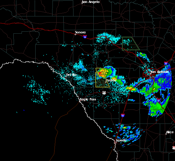 At 102 am cdt, a severe thunderstorm was located near laguna, or 18 miles northwest of uvalde, moving south at 25 mph (radar indicated). Hazards include tennis ball size hail and 60 mph wind gusts. People and animals outdoors will be injured. expect hail damage to roofs, siding, windows, and vehicles. Expect wind damage to roofs, siding, and trees. At 102 am cdt, a severe thunderstorm was located near laguna, or 18 miles northwest of uvalde, moving south at 25 mph (radar indicated). Hazards include tennis ball size hail and 60 mph wind gusts. People and animals outdoors will be injured. expect hail damage to roofs, siding, windows, and vehicles. Expect wind damage to roofs, siding, and trees.
|
| 5/25/2020 11:11 PM CDT |
 At 1111 pm cdt, a severe thunderstorm was located near uvalde, moving east at 35 mph (public). Hazards include quarter size hail. damage to vehicles is expected At 1111 pm cdt, a severe thunderstorm was located near uvalde, moving east at 35 mph (public). Hazards include quarter size hail. damage to vehicles is expected
|
| 5/23/2020 8:40 PM CDT | We received pictures and video of a large tree blown down onto a carport in uvald in uvalde county TX, 0.7 miles SE of Uvalde, TX |
| 5/23/2020 8:29 PM CDT |
 At 828 pm cdt, a severe thunderstorm was located near uvalde, moving east at 35 mph (radar indicated). Hazards include 60 mph wind gusts and penny size hail. Expect damage to roofs, siding, and trees. Locations impacted include, uvalde, uvalde estates, knippa and washer. At 828 pm cdt, a severe thunderstorm was located near uvalde, moving east at 35 mph (radar indicated). Hazards include 60 mph wind gusts and penny size hail. Expect damage to roofs, siding, and trees. Locations impacted include, uvalde, uvalde estates, knippa and washer.
|
| 5/23/2020 7:57 PM CDT |
 At 757 pm cdt, a severe thunderstorm was located over blewett, or 14 miles west of uvalde, moving east at 35 mph (radar indicated). Hazards include 60 mph wind gusts and penny size hail. expect damage to roofs, siding, and trees At 757 pm cdt, a severe thunderstorm was located over blewett, or 14 miles west of uvalde, moving east at 35 mph (radar indicated). Hazards include 60 mph wind gusts and penny size hail. expect damage to roofs, siding, and trees
|
| 5/23/2020 7:51 PM CDT |
 At 751 pm cdt, a severe thunderstorm was located 8 miles northwest of uvalde, moving east at 30 mph (radar indicated). Hazards include 60 mph wind gusts and penny size hail. Expect damage to roofs, siding, and trees. Locations impacted include, uvalde, uvalde estates, dabney, blewett, cline, anacacho and turkey mountain. At 751 pm cdt, a severe thunderstorm was located 8 miles northwest of uvalde, moving east at 30 mph (radar indicated). Hazards include 60 mph wind gusts and penny size hail. Expect damage to roofs, siding, and trees. Locations impacted include, uvalde, uvalde estates, dabney, blewett, cline, anacacho and turkey mountain.
|
| 5/23/2020 7:16 PM CDT |
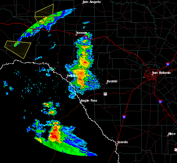 At 716 pm cdt, a severe thunderstorm was located 7 miles west of cline, or 13 miles east of brackettville, moving east at 30 mph (radar indicated). Hazards include 60 mph wind gusts and penny size hail. expect damage to roofs, siding, and trees At 716 pm cdt, a severe thunderstorm was located 7 miles west of cline, or 13 miles east of brackettville, moving east at 30 mph (radar indicated). Hazards include 60 mph wind gusts and penny size hail. expect damage to roofs, siding, and trees
|
| 5/15/2020 9:38 PM CDT |
 At 938 pm cdt, a severe thunderstorm was located 9 miles northwest of frio town, or 14 miles northeast of batesville, moving east at 40 mph (radar indicated). Hazards include 60 mph wind gusts and penny size hail. Expect damage to roofs, siding, and trees. Locations impacted include, uvalde, la pryor, batesville, sabinal, uvalde estates, knippa, d`hanis, loma vista, and washer. At 938 pm cdt, a severe thunderstorm was located 9 miles northwest of frio town, or 14 miles northeast of batesville, moving east at 40 mph (radar indicated). Hazards include 60 mph wind gusts and penny size hail. Expect damage to roofs, siding, and trees. Locations impacted include, uvalde, la pryor, batesville, sabinal, uvalde estates, knippa, d`hanis, loma vista, and washer.
|
| 5/15/2020 9:15 PM CDT | Uvalde county emergency management reports tree limbs down around town as well as power lines dow in uvalde county TX, 0.7 miles ENE of Uvalde, TX |
| 5/15/2020 8:56 PM CDT |
 At 855 pm cdt, a severe thunderstorm was located near uvalde estates, or 7 miles west of uvalde, moving east at 40 mph (radar indicated). Hazards include 60 mph wind gusts and nickel size hail. expect damage to roofs, siding, and trees At 855 pm cdt, a severe thunderstorm was located near uvalde estates, or 7 miles west of uvalde, moving east at 40 mph (radar indicated). Hazards include 60 mph wind gusts and nickel size hail. expect damage to roofs, siding, and trees
|
| 5/15/2020 8:41 PM CDT |
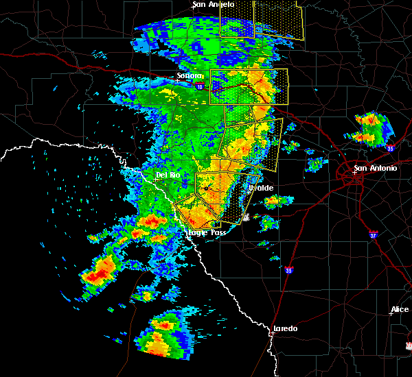 At 841 pm cdt, a severe thunderstorm was located near blewett, or 11 miles west of uvalde, moving east at 40 mph (radar indicated). Hazards include 60 mph wind gusts and nickel size hail. Expect damage to roofs, siding, and trees. Locations impacted include, uvalde, la pryor, uvalde estates, laguna, dabney, blewett, cline, washer, and turkey mountain. At 841 pm cdt, a severe thunderstorm was located near blewett, or 11 miles west of uvalde, moving east at 40 mph (radar indicated). Hazards include 60 mph wind gusts and nickel size hail. Expect damage to roofs, siding, and trees. Locations impacted include, uvalde, la pryor, uvalde estates, laguna, dabney, blewett, cline, washer, and turkey mountain.
|
| 5/15/2020 8:24 PM CDT |
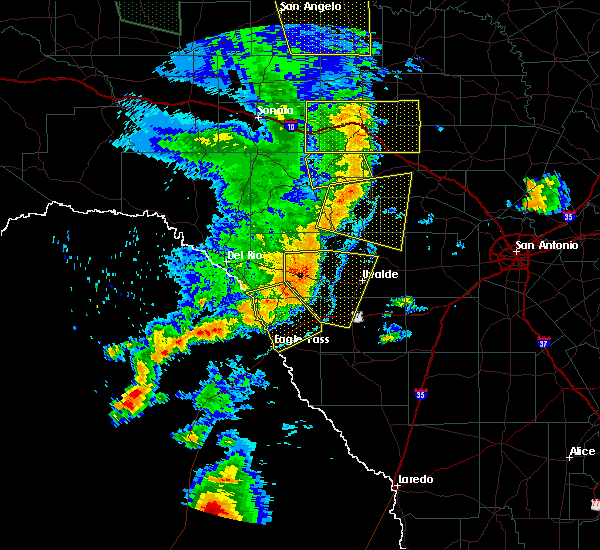 At 824 pm cdt, a severe thunderstorm was located near cline, or 17 miles east of brackettville, moving east at 40 mph (radar indicated). Hazards include 60 mph wind gusts and nickel size hail. Expect damage to roofs, siding, and trees. Locations impacted include, uvalde, brackettville, la pryor, uvalde estates, laguna, dabney, blewett, cline, anacacho, alamo village, washer, and turkey mountain. At 824 pm cdt, a severe thunderstorm was located near cline, or 17 miles east of brackettville, moving east at 40 mph (radar indicated). Hazards include 60 mph wind gusts and nickel size hail. Expect damage to roofs, siding, and trees. Locations impacted include, uvalde, brackettville, la pryor, uvalde estates, laguna, dabney, blewett, cline, anacacho, alamo village, washer, and turkey mountain.
|
| 5/15/2020 8:04 PM CDT |
 At 804 pm cdt, a severe thunderstorm was located near brackettville, moving east at 40 mph (radar indicated). Hazards include 60 mph wind gusts and nickel size hail. expect damage to roofs, siding, and trees At 804 pm cdt, a severe thunderstorm was located near brackettville, moving east at 40 mph (radar indicated). Hazards include 60 mph wind gusts and nickel size hail. expect damage to roofs, siding, and trees
|
| 4/27/2020 10:39 PM CDT |
 The severe thunderstorm warning for southeastern kinney and southwestern uvalde counties will expire at 1045 pm cdt, the storms which prompted the warning have weakened below severe limits, and no longer pose an immediate threat to life or property. therefore, the warning will be allowed to expire. gusty winds up to 45 mph will remain possible through 1045 pm cdt for people living south and east of the town of uvalde. The severe thunderstorm warning for southeastern kinney and southwestern uvalde counties will expire at 1045 pm cdt, the storms which prompted the warning have weakened below severe limits, and no longer pose an immediate threat to life or property. therefore, the warning will be allowed to expire. gusty winds up to 45 mph will remain possible through 1045 pm cdt for people living south and east of the town of uvalde.
|
| 4/27/2020 10:11 PM CDT |
 At 1011 pm cdt, severe thunderstorms were located along a line extending from 6 miles northwest of uvalde to near washer, moving east at 40 mph (radar indicated). Hazards include 60 mph wind gusts and penny size hail. Expect damage to roofs, siding, and trees. Locations impacted include, uvalde, uvalde estates, laguna, dabney, blewett and cline. At 1011 pm cdt, severe thunderstorms were located along a line extending from 6 miles northwest of uvalde to near washer, moving east at 40 mph (radar indicated). Hazards include 60 mph wind gusts and penny size hail. Expect damage to roofs, siding, and trees. Locations impacted include, uvalde, uvalde estates, laguna, dabney, blewett and cline.
|
| 4/27/2020 9:59 PM CDT |
 At 943 pm cdt, severe thunderstorms were located along a line extending from 7 miles west of laguna to near dabney, moving east at 40 mph (radar indicated). Hazards include 60 mph wind gusts and penny size hail. expect damage to roofs, siding, and trees At 943 pm cdt, severe thunderstorms were located along a line extending from 7 miles west of laguna to near dabney, moving east at 40 mph (radar indicated). Hazards include 60 mph wind gusts and penny size hail. expect damage to roofs, siding, and trees
|
| 4/27/2020 9:43 PM CDT |
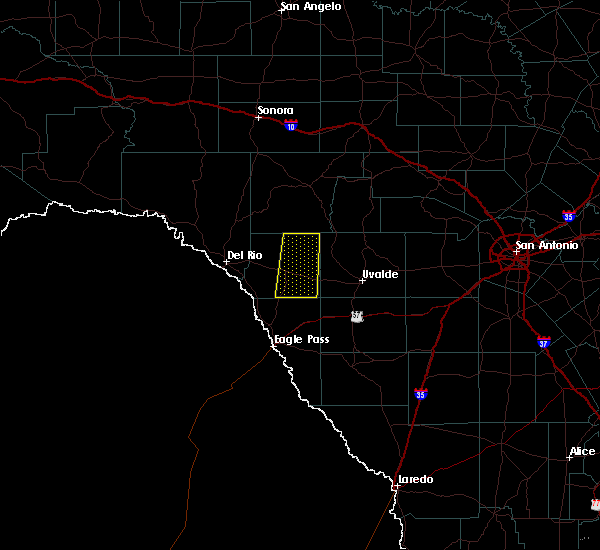 At 943 pm cdt, severe thunderstorms were located along a line extending from 7 miles west of laguna to near dabney, moving east at 40 mph (radar indicated). Hazards include 60 mph wind gusts and penny size hail. expect damage to roofs, siding, and trees At 943 pm cdt, severe thunderstorms were located along a line extending from 7 miles west of laguna to near dabney, moving east at 40 mph (radar indicated). Hazards include 60 mph wind gusts and penny size hail. expect damage to roofs, siding, and trees
|
| 4/11/2020 11:12 PM CDT |
 The severe thunderstorm warning for central uvalde county will expire at 1115 pm cdt, the storm which prompted the warning has weakened below severe limits, and no longer poses an immediate threat to life or property. therefore, the warning will be allowed to expire. however small hail, gusty winds, and heavy rain are still possible with this thunderstorm. a tornado watch remains in effect until 400 am cdt for south central texas. The severe thunderstorm warning for central uvalde county will expire at 1115 pm cdt, the storm which prompted the warning has weakened below severe limits, and no longer poses an immediate threat to life or property. therefore, the warning will be allowed to expire. however small hail, gusty winds, and heavy rain are still possible with this thunderstorm. a tornado watch remains in effect until 400 am cdt for south central texas.
|
| 4/11/2020 10:57 PM CDT |
 At 1056 pm cdt, a severe thunderstorm was located 8 miles northwest of sabinal, or 20 miles northeast of uvalde, moving east at 35 mph (radar indicated. at 10:50 pm, one inch hail was reported south of concan). Hazards include 60 mph wind gusts and half dollar size hail. Hail damage to vehicles is expected. expect wind damage to roofs, siding, and trees. Locations impacted include, uvalde, sabinal, knippa, and concan. At 1056 pm cdt, a severe thunderstorm was located 8 miles northwest of sabinal, or 20 miles northeast of uvalde, moving east at 35 mph (radar indicated. at 10:50 pm, one inch hail was reported south of concan). Hazards include 60 mph wind gusts and half dollar size hail. Hail damage to vehicles is expected. expect wind damage to roofs, siding, and trees. Locations impacted include, uvalde, sabinal, knippa, and concan.
|
| 4/11/2020 10:52 PM CDT | Quarter sized hail reported 7.7 miles SSW of Uvalde, TX, trained weather spotter reports quarter size hail near highway 83 and f.m. 2690. |
| 4/11/2020 10:31 PM CDT |
 At 1031 pm cdt, a severe thunderstorm was located 9 miles northwest of knippa, or 11 miles north of uvalde, moving east at 35 mph (radar indicated). Hazards include ping pong ball size hail and 60 mph wind gusts. People and animals outdoors will be injured. expect hail damage to roofs, siding, windows, and vehicles. expect wind damage to roofs, siding, and trees. Locations impacted include, uvalde, sabinal, knippa, and concan. At 1031 pm cdt, a severe thunderstorm was located 9 miles northwest of knippa, or 11 miles north of uvalde, moving east at 35 mph (radar indicated). Hazards include ping pong ball size hail and 60 mph wind gusts. People and animals outdoors will be injured. expect hail damage to roofs, siding, windows, and vehicles. expect wind damage to roofs, siding, and trees. Locations impacted include, uvalde, sabinal, knippa, and concan.
|
| 4/11/2020 10:11 PM CDT |
 At 1010 pm cdt, a severe thunderstorm was located 7 miles southeast of laguna, or 12 miles northwest of uvalde, moving east at 35 mph (radar indicated). Hazards include ping pong ball size hail and 60 mph wind gusts. People and animals outdoors will be injured. expect hail damage to roofs, siding, windows, and vehicles. Expect wind damage to roofs, siding, and trees. At 1010 pm cdt, a severe thunderstorm was located 7 miles southeast of laguna, or 12 miles northwest of uvalde, moving east at 35 mph (radar indicated). Hazards include ping pong ball size hail and 60 mph wind gusts. People and animals outdoors will be injured. expect hail damage to roofs, siding, windows, and vehicles. Expect wind damage to roofs, siding, and trees.
|
| 3/4/2020 3:40 AM CST |
 At 340 am cst, severe thunderstorms were located along a line extending from 9 miles west of kerr wildlife management area to near lost maples state natural area to near concan to near uvalde, moving east at 50 mph (radar indicated). Hazards include 60 mph wind gusts and penny size hail. Expect damage to roofs, siding, and trees. Locations impacted include, uvalde, leakey, vanderpool, knippa, tuff, garner state park, rio frio, reagan wells, concan, utopia, lost maples state natural area and kerr wildlife management area. At 340 am cst, severe thunderstorms were located along a line extending from 9 miles west of kerr wildlife management area to near lost maples state natural area to near concan to near uvalde, moving east at 50 mph (radar indicated). Hazards include 60 mph wind gusts and penny size hail. Expect damage to roofs, siding, and trees. Locations impacted include, uvalde, leakey, vanderpool, knippa, tuff, garner state park, rio frio, reagan wells, concan, utopia, lost maples state natural area and kerr wildlife management area.
|
| 3/4/2020 3:13 AM CST |
 At 312 am cst, severe thunderstorms were located along a line extending from 13 miles east of rocksprings to 6 miles southeast of vance to near cline to near dabney, moving east at 40 mph (radar indicated). Hazards include 60 mph wind gusts and penny size hail. expect damage to roofs, siding, and trees At 312 am cst, severe thunderstorms were located along a line extending from 13 miles east of rocksprings to 6 miles southeast of vance to near cline to near dabney, moving east at 40 mph (radar indicated). Hazards include 60 mph wind gusts and penny size hail. expect damage to roofs, siding, and trees
|
| 5/3/2019 8:40 PM CDT |
 The severe thunderstorm warning for medina, southern uvalde, northeastern zavala and northwestern frio counties will expire at 845 pm cdt, the storms which prompted the warning have weakened below severe limits, and no longer pose an immediate threat to life or property. therefore, the warning will be allowed to expire. however small hail, gusty winds and heavy rain are still possible with these thunderstorms. a severe thunderstorm watch remains in effect until 1100 pm cdt for south central texas. to report severe weather, contact your nearest law enforcement agency. they will relay your report to the national weather service austin san antonio. The severe thunderstorm warning for medina, southern uvalde, northeastern zavala and northwestern frio counties will expire at 845 pm cdt, the storms which prompted the warning have weakened below severe limits, and no longer pose an immediate threat to life or property. therefore, the warning will be allowed to expire. however small hail, gusty winds and heavy rain are still possible with these thunderstorms. a severe thunderstorm watch remains in effect until 1100 pm cdt for south central texas. to report severe weather, contact your nearest law enforcement agency. they will relay your report to the national weather service austin san antonio.
|
| 5/3/2019 8:10 PM CDT |
 At 810 pm cdt, severe thunderstorms were located along a line extending from 11 miles southeast of utopia to sabinal to near uvalde, moving southeast at 30 mph (radar indicated). Hazards include 60 mph wind gusts and quarter size hail. Hail damage to vehicles is expected. expect wind damage to roofs, siding, and trees. Locations impacted include, uvalde, hondo, devine, castroville, batesville, sabinal, moore, knippa, d`hanis, noonan, new fountain, quihi, dunlay, mico, uvalde estates, biry, yancey, rio medina, bader and frio town. At 810 pm cdt, severe thunderstorms were located along a line extending from 11 miles southeast of utopia to sabinal to near uvalde, moving southeast at 30 mph (radar indicated). Hazards include 60 mph wind gusts and quarter size hail. Hail damage to vehicles is expected. expect wind damage to roofs, siding, and trees. Locations impacted include, uvalde, hondo, devine, castroville, batesville, sabinal, moore, knippa, d`hanis, noonan, new fountain, quihi, dunlay, mico, uvalde estates, biry, yancey, rio medina, bader and frio town.
|
| 5/3/2019 7:43 PM CDT |
 At 742 pm cdt, severe thunderstorms were located along a line extending from near utopia to 7 miles south of concan to 8 miles northeast of blewett, moving southeast at 30 mph (radar indicated). Hazards include 60 mph wind gusts and quarter size hail. Hail damage to vehicles is expected. Expect wind damage to roofs, siding, and trees. At 742 pm cdt, severe thunderstorms were located along a line extending from near utopia to 7 miles south of concan to 8 miles northeast of blewett, moving southeast at 30 mph (radar indicated). Hazards include 60 mph wind gusts and quarter size hail. Hail damage to vehicles is expected. Expect wind damage to roofs, siding, and trees.
|
| 4/17/2019 11:41 PM CDT |
 At 1141 pm cdt, a severe thunderstorm was located near d`hanis, or miles southwest of hondo, moving east at 40 mph (radar indicated). Hazards include 60 mph wind gusts and penny size hail. Expect damage to roofs, siding, and trees. Locations impacted include, uvalde, batesville, la pryor, sabinal, knippa, loma vista, utopia, concan and garner state park. At 1141 pm cdt, a severe thunderstorm was located near d`hanis, or miles southwest of hondo, moving east at 40 mph (radar indicated). Hazards include 60 mph wind gusts and penny size hail. Expect damage to roofs, siding, and trees. Locations impacted include, uvalde, batesville, la pryor, sabinal, knippa, loma vista, utopia, concan and garner state park.
|
| 4/17/2019 11:23 PM CDT |
 At 1122 pm cdt, a severe thunderstorm was located over uvalde, moving east at 40 mph (radar indicated). Hazards include 70 mph wind gusts and nickel size hail. Expect considerable tree damage. damage is likely to mobile homes, roofs, and outbuildings. Locations impacted include, uvalde, la pryor, batesville, sabinal, knippa, laguna, blewett, concan, washer, uvalde estates, garner state park, reagan wells, loma vista and utopia. At 1122 pm cdt, a severe thunderstorm was located over uvalde, moving east at 40 mph (radar indicated). Hazards include 70 mph wind gusts and nickel size hail. Expect considerable tree damage. damage is likely to mobile homes, roofs, and outbuildings. Locations impacted include, uvalde, la pryor, batesville, sabinal, knippa, laguna, blewett, concan, washer, uvalde estates, garner state park, reagan wells, loma vista and utopia.
|
| 4/17/2019 10:56 PM CDT |
 At 1055 pm cdt, a severe thunderstorm was located over dabney, or 16 miles east of spofford, moving east at 40 mph (radar indicated). Hazards include 70 mph wind gusts and quarter size hail. Hail damage to vehicles is expected. expect considerable tree damage. Wind damage is also likely to mobile homes, roofs, and outbuildings. At 1055 pm cdt, a severe thunderstorm was located over dabney, or 16 miles east of spofford, moving east at 40 mph (radar indicated). Hazards include 70 mph wind gusts and quarter size hail. Hail damage to vehicles is expected. expect considerable tree damage. Wind damage is also likely to mobile homes, roofs, and outbuildings.
|
| 4/13/2019 7:08 AM CDT |
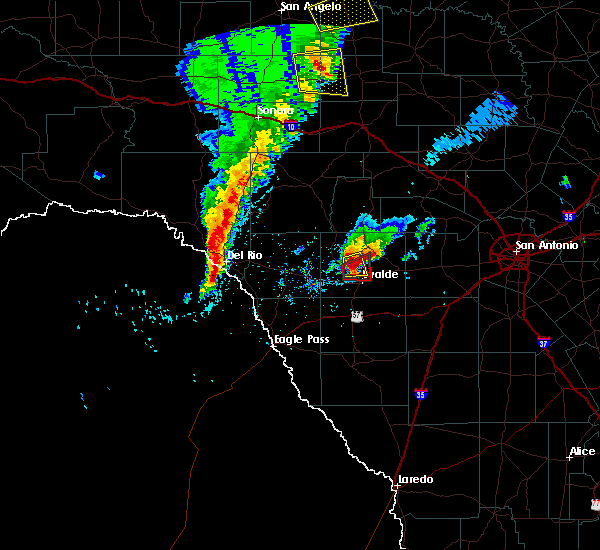 At 707 am cdt, a severe thunderstorm capable of producing a tornado was located near uvalde, moving east at 25 mph (radar indicated rotation). Hazards include tornado and quarter size hail. Flying debris will be dangerous to those caught without shelter. mobile homes will be damaged or destroyed. damage to roofs, windows, and vehicles will occur. tree damage is likely. Locations impacted include, uvalde. At 707 am cdt, a severe thunderstorm capable of producing a tornado was located near uvalde, moving east at 25 mph (radar indicated rotation). Hazards include tornado and quarter size hail. Flying debris will be dangerous to those caught without shelter. mobile homes will be damaged or destroyed. damage to roofs, windows, and vehicles will occur. tree damage is likely. Locations impacted include, uvalde.
|
| 4/13/2019 6:50 AM CDT |
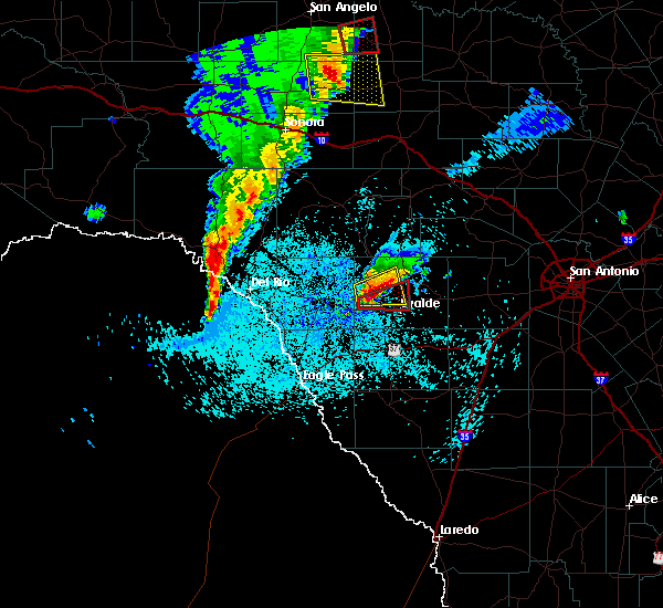 At 650 am cdt, a severe thunderstorm capable of producing a tornado was located near cline, or 12 miles northwest of uvalde, moving east at 25 mph (radar indicated rotation). Hazards include tornado and quarter size hail. Flying debris will be dangerous to those caught without shelter. mobile homes will be damaged or destroyed. damage to roofs, windows, and vehicles will occur. Tree damage is likely. At 650 am cdt, a severe thunderstorm capable of producing a tornado was located near cline, or 12 miles northwest of uvalde, moving east at 25 mph (radar indicated rotation). Hazards include tornado and quarter size hail. Flying debris will be dangerous to those caught without shelter. mobile homes will be damaged or destroyed. damage to roofs, windows, and vehicles will occur. Tree damage is likely.
|
| 4/7/2019 5:00 AM CDT |
 At 459 am cdt, severe thunderstorms were located along a line extending from garner state park to near yancey, moving east northeast at 35 mph (radar indicated). Hazards include 60 mph wind gusts and penny size hail. Expect damage to roofs, siding, and trees. Locations impacted include, uvalde, hondo, leakey, tarpley, vanderpool, sabinal, knippa, d`hanis, rio frio, concan, garner state park, reagan wells, utopia and hill country state natural area. At 459 am cdt, severe thunderstorms were located along a line extending from garner state park to near yancey, moving east northeast at 35 mph (radar indicated). Hazards include 60 mph wind gusts and penny size hail. Expect damage to roofs, siding, and trees. Locations impacted include, uvalde, hondo, leakey, tarpley, vanderpool, sabinal, knippa, d`hanis, rio frio, concan, garner state park, reagan wells, utopia and hill country state natural area.
|
| 4/7/2019 4:32 AM CDT |
 At 432 am cdt, severe thunderstorms were located along a line extending from montell to 11 miles northwest of frio town, moving northeast at 50 mph (radar indicated). Hazards include 60 mph wind gusts and nickel size hail. expect damage to roofs, siding, and trees At 432 am cdt, severe thunderstorms were located along a line extending from montell to 11 miles northwest of frio town, moving northeast at 50 mph (radar indicated). Hazards include 60 mph wind gusts and nickel size hail. expect damage to roofs, siding, and trees
|
| 10/9/2018 10:08 AM CDT |
 At 1008 am cdt, a severe thunderstorm capable of producing a tornado was located near uvalde, moving east at 20 mph (radar indicated rotation). Hazards include tornado. Flying debris will be dangerous to those caught without shelter. mobile homes will be damaged or destroyed. damage to roofs, windows, and vehicles will occur. tree damage is likely. Locations impacted include, knippa. At 1008 am cdt, a severe thunderstorm capable of producing a tornado was located near uvalde, moving east at 20 mph (radar indicated rotation). Hazards include tornado. Flying debris will be dangerous to those caught without shelter. mobile homes will be damaged or destroyed. damage to roofs, windows, and vehicles will occur. tree damage is likely. Locations impacted include, knippa.
|
| 10/9/2018 9:44 AM CDT |
 At 944 am cdt, a severe thunderstorm capable of producing a tornado was located near uvalde, moving northeast at 50 mph (radar indicated rotation). Hazards include tornado. Flying debris will be dangerous to those caught without shelter. mobile homes will be damaged or destroyed. damage to roofs, windows, and vehicles will occur. Tree damage is likely. At 944 am cdt, a severe thunderstorm capable of producing a tornado was located near uvalde, moving northeast at 50 mph (radar indicated rotation). Hazards include tornado. Flying debris will be dangerous to those caught without shelter. mobile homes will be damaged or destroyed. damage to roofs, windows, and vehicles will occur. Tree damage is likely.
|
| 5/20/2018 3:09 PM CDT |
 At 309 pm cdt, a severe thunderstorm was located 7 miles northwest of knippa, or 12 miles north of uvalde, moving east at 25 mph (radar indicated). Hazards include 60 mph wind gusts and quarter size hail. Hail damage to vehicles is expected. expect wind damage to roofs, siding, and trees. Locations impacted include, uvalde, knippa and concan. At 309 pm cdt, a severe thunderstorm was located 7 miles northwest of knippa, or 12 miles north of uvalde, moving east at 25 mph (radar indicated). Hazards include 60 mph wind gusts and quarter size hail. Hail damage to vehicles is expected. expect wind damage to roofs, siding, and trees. Locations impacted include, uvalde, knippa and concan.
|
| 5/20/2018 2:52 PM CDT |
 At 251 pm cdt, a severe thunderstorm was located 7 miles east of laguna, or 14 miles northwest of uvalde, moving east at 20 mph (radar indicated). Hazards include 60 mph wind gusts and quarter size hail. Hail damage to vehicles is expected. expect wind damage to roofs, siding, and trees. Locations impacted include, uvalde, knippa, laguna and concan. At 251 pm cdt, a severe thunderstorm was located 7 miles east of laguna, or 14 miles northwest of uvalde, moving east at 20 mph (radar indicated). Hazards include 60 mph wind gusts and quarter size hail. Hail damage to vehicles is expected. expect wind damage to roofs, siding, and trees. Locations impacted include, uvalde, knippa, laguna and concan.
|
| 5/20/2018 2:31 PM CDT |
 At 230 pm cdt, a severe thunderstorm was located near laguna, or 16 miles northwest of uvalde, moving east at 25 mph (radar indicated). Hazards include 60 mph wind gusts and quarter size hail. Hail damage to vehicles is expected. Expect wind damage to roofs, siding, and trees. At 230 pm cdt, a severe thunderstorm was located near laguna, or 16 miles northwest of uvalde, moving east at 25 mph (radar indicated). Hazards include 60 mph wind gusts and quarter size hail. Hail damage to vehicles is expected. Expect wind damage to roofs, siding, and trees.
|
| 5/28/2017 7:45 PM CDT |
 At 744 pm cdt, a severe thunderstorm was located near frio town, or 14 miles east of batesville, moving southeast at 20 mph. in addition, another severe thunderstorm was located 3 miles south of knippa and is moving north at 15 mph (radar indicated). Hazards include two inch hail and 70 mph wind gusts. People and animals outdoors will be injured. expect hail damage to roofs, siding, windows, and vehicles. expect considerable tree damage. Wind damage is also likely to mobile homes, roofs, and outbuildings. At 744 pm cdt, a severe thunderstorm was located near frio town, or 14 miles east of batesville, moving southeast at 20 mph. in addition, another severe thunderstorm was located 3 miles south of knippa and is moving north at 15 mph (radar indicated). Hazards include two inch hail and 70 mph wind gusts. People and animals outdoors will be injured. expect hail damage to roofs, siding, windows, and vehicles. expect considerable tree damage. Wind damage is also likely to mobile homes, roofs, and outbuildings.
|
| 5/28/2017 7:32 PM CDT |
 At 731 pm cdt, a severe thunderstorm was located 7 miles west of frio town, or 11 miles east of batesville, moving southeast at 10 mph (radar indicated). Hazards include golf ball size hail and 70 mph wind gusts. People and animals outdoors will be injured. expect hail damage to roofs, siding, windows, and vehicles. expect considerable tree damage. wind damage is also likely to mobile homes, roofs, and outbuildings. Locations impacted include, uvalde, hondo, batesville, sabinal, knippa, d`hanis and frio town. At 731 pm cdt, a severe thunderstorm was located 7 miles west of frio town, or 11 miles east of batesville, moving southeast at 10 mph (radar indicated). Hazards include golf ball size hail and 70 mph wind gusts. People and animals outdoors will be injured. expect hail damage to roofs, siding, windows, and vehicles. expect considerable tree damage. wind damage is also likely to mobile homes, roofs, and outbuildings. Locations impacted include, uvalde, hondo, batesville, sabinal, knippa, d`hanis and frio town.
|
| 5/28/2017 7:17 PM CDT |
 At 717 pm cdt, a severe thunderstorm was located 9 miles northeast of batesville, and is nearly stationary (radar indicated). Hazards include golf ball size hail and 60 mph wind gusts. People and animals outdoors will be injured. expect hail damage to roofs, siding, windows, and vehicles. expect wind damage to roofs, siding, and trees. Locations impacted include, uvalde, hondo, batesville, sabinal, knippa, d`hanis and frio town. At 717 pm cdt, a severe thunderstorm was located 9 miles northeast of batesville, and is nearly stationary (radar indicated). Hazards include golf ball size hail and 60 mph wind gusts. People and animals outdoors will be injured. expect hail damage to roofs, siding, windows, and vehicles. expect wind damage to roofs, siding, and trees. Locations impacted include, uvalde, hondo, batesville, sabinal, knippa, d`hanis and frio town.
|
| 5/28/2017 7:00 PM CDT |
 At 700 pm cdt, a severe thunderstorm was located 7 miles north of batesville, moving southwest at 5 mph (radar indicated). Hazards include golf ball size hail and 60 mph wind gusts. People and animals outdoors will be injured. expect hail damage to roofs, siding, windows, and vehicles. expect wind damage to roofs, siding, and trees. Locations impacted include, uvalde, pearsall, hondo, la pryor, batesville, moore, sabinal, knippa, d`hanis, uvalde estates, yancey, frio town, north pearsall and west pearsall. At 700 pm cdt, a severe thunderstorm was located 7 miles north of batesville, moving southwest at 5 mph (radar indicated). Hazards include golf ball size hail and 60 mph wind gusts. People and animals outdoors will be injured. expect hail damage to roofs, siding, windows, and vehicles. expect wind damage to roofs, siding, and trees. Locations impacted include, uvalde, pearsall, hondo, la pryor, batesville, moore, sabinal, knippa, d`hanis, uvalde estates, yancey, frio town, north pearsall and west pearsall.
|
| 5/28/2017 6:36 PM CDT |
 At 636 pm cdt, a severe thunderstorm was located 12 miles northeast of batesville, moving northeast at 10 mph (radar indicated). Hazards include ping pong ball size hail and 60 mph wind gusts. People and animals outdoors will be injured. expect hail damage to roofs, siding, windows, and vehicles. Expect wind damage to roofs, siding, and trees. At 636 pm cdt, a severe thunderstorm was located 12 miles northeast of batesville, moving northeast at 10 mph (radar indicated). Hazards include ping pong ball size hail and 60 mph wind gusts. People and animals outdoors will be injured. expect hail damage to roofs, siding, windows, and vehicles. Expect wind damage to roofs, siding, and trees.
|
| 5/23/2017 4:34 PM CDT | Emergency manager reports power lines down across highway 83 south of uvalde. time estimated from rada in uvalde county TX, 4.4 miles NNE of Uvalde, TX |
| 5/23/2017 4:31 PM CDT |
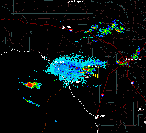 At 430 pm cdt, a severe thunderstorm was located over uvalde estates, or near uvalde, moving east at 35 mph (radar indicated). Hazards include 60 mph wind gusts and quarter size hail. Hail damage to vehicles is expected. Expect wind damage to roofs, siding, and trees. At 430 pm cdt, a severe thunderstorm was located over uvalde estates, or near uvalde, moving east at 35 mph (radar indicated). Hazards include 60 mph wind gusts and quarter size hail. Hail damage to vehicles is expected. Expect wind damage to roofs, siding, and trees.
|
| 5/20/2017 10:28 AM CDT |
 The severe thunderstorm warning for southwestern medina, southeastern uvalde and northern zavala counties will expire at 1030 am cdt, the storm which prompted the warning has weakened below severe limits, and no longer poses an immediate threat to life or property. therefore the warning will be allowed to expire. however heavy rain is still possible with this thunderstorm. a severe thunderstorm watch remains in effect until 500 pm cdt for south central texas. The severe thunderstorm warning for southwestern medina, southeastern uvalde and northern zavala counties will expire at 1030 am cdt, the storm which prompted the warning has weakened below severe limits, and no longer poses an immediate threat to life or property. therefore the warning will be allowed to expire. however heavy rain is still possible with this thunderstorm. a severe thunderstorm watch remains in effect until 500 pm cdt for south central texas.
|
| 5/20/2017 9:41 AM CDT |
 At 941 am cdt, a severe thunderstorm was located near sabinal, or 18 miles east of uvalde, moving southeast at 20 mph (public). Hazards include golf ball size hail and 60 mph wind gusts. People and animals outdoors will be injured. expect hail damage to roofs, siding, windows, and vehicles. expect wind damage to roofs, siding, and trees. Locations impacted include, uvalde, hondo, la pryor, batesville, sabinal, knippa, uvalde estates, d`hanis and washer. At 941 am cdt, a severe thunderstorm was located near sabinal, or 18 miles east of uvalde, moving southeast at 20 mph (public). Hazards include golf ball size hail and 60 mph wind gusts. People and animals outdoors will be injured. expect hail damage to roofs, siding, windows, and vehicles. expect wind damage to roofs, siding, and trees. Locations impacted include, uvalde, hondo, la pryor, batesville, sabinal, knippa, uvalde estates, d`hanis and washer.
|
| 5/20/2017 9:28 AM CDT |
 At 928 am cdt, a severe thunderstorm was located near knippa, or 14 miles northeast of uvalde, moving southeast at 15 mph (radar indicated). Hazards include golf ball size hail and 60 mph wind gusts. People and animals outdoors will be injured. expect hail damage to roofs, siding, windows, and vehicles. Expect wind damage to roofs, siding, and trees. At 928 am cdt, a severe thunderstorm was located near knippa, or 14 miles northeast of uvalde, moving southeast at 15 mph (radar indicated). Hazards include golf ball size hail and 60 mph wind gusts. People and animals outdoors will be injured. expect hail damage to roofs, siding, windows, and vehicles. Expect wind damage to roofs, siding, and trees.
|
| 5/20/2017 8:59 AM CDT |
 At 859 am cdt, a severe thunderstorm was located near knippa, or 11 miles northeast of uvalde, moving southeast at 25 mph (radar indicated). Hazards include 60 mph wind gusts and half dollar size hail. Hail damage to vehicles is expected. expect wind damage to roofs, siding, and trees. Locations impacted include, uvalde and knippa. At 859 am cdt, a severe thunderstorm was located near knippa, or 11 miles northeast of uvalde, moving southeast at 25 mph (radar indicated). Hazards include 60 mph wind gusts and half dollar size hail. Hail damage to vehicles is expected. expect wind damage to roofs, siding, and trees. Locations impacted include, uvalde and knippa.
|
| 5/20/2017 8:29 AM CDT |
 At 828 am cdt, a severe thunderstorm was located 8 miles southwest of reagan wells, or 17 miles north of uvalde, moving southeast at 20 mph (radar indicated). Hazards include 60 mph wind gusts and half dollar size hail. Hail damage to vehicles is expected. Expect wind damage to roofs, siding, and trees. At 828 am cdt, a severe thunderstorm was located 8 miles southwest of reagan wells, or 17 miles north of uvalde, moving southeast at 20 mph (radar indicated). Hazards include 60 mph wind gusts and half dollar size hail. Hail damage to vehicles is expected. Expect wind damage to roofs, siding, and trees.
|
| 5/10/2017 10:06 PM CDT |
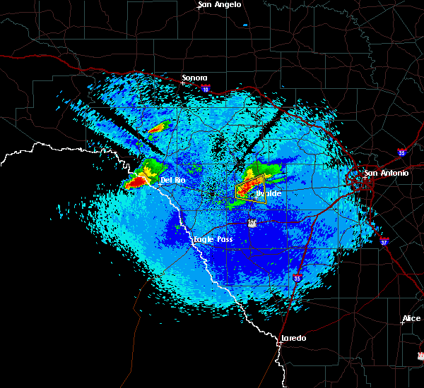 At 1005 pm cdt, a severe thunderstorm was located 9 miles northwest of uvalde, moving east at 20 mph (radar indicated). Hazards include 60 mph wind gusts and half dollar size hail. Hail damage to vehicles is expected. expect wind damage to roofs, siding, and trees. Locations impacted include, uvalde and knippa. At 1005 pm cdt, a severe thunderstorm was located 9 miles northwest of uvalde, moving east at 20 mph (radar indicated). Hazards include 60 mph wind gusts and half dollar size hail. Hail damage to vehicles is expected. expect wind damage to roofs, siding, and trees. Locations impacted include, uvalde and knippa.
|
| 5/10/2017 9:43 PM CDT |
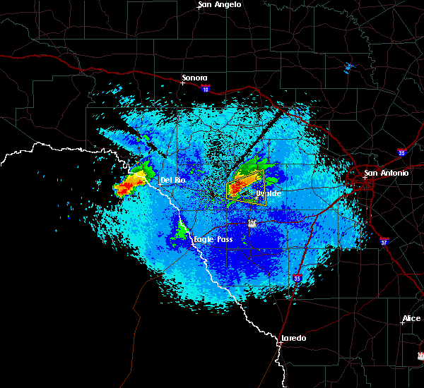 At 943 pm cdt, a severe thunderstorm was located over cline, or 16 miles northwest of uvalde, moving east at 20 mph (radar indicated). Hazards include tennis ball size hail and 60 mph wind gusts. People and animals outdoors will be injured. expect hail damage to roofs, siding, windows, and vehicles. Expect wind damage to roofs, siding, and trees. At 943 pm cdt, a severe thunderstorm was located over cline, or 16 miles northwest of uvalde, moving east at 20 mph (radar indicated). Hazards include tennis ball size hail and 60 mph wind gusts. People and animals outdoors will be injured. expect hail damage to roofs, siding, windows, and vehicles. Expect wind damage to roofs, siding, and trees.
|
| 4/2/2017 7:23 AM CDT |
 The severe thunderstorm warning for west central medina, southwestern bandera and northeastern uvalde counties will expire at 730 am cdt, the storm which prompted the warning has moved out of the area. therefore the warning will be allowed to expire. however small hail is still possible with this thunderstorm. a tornado watch remains in effect until 100 pm cdt for south central texas. remember, a severe thunderstorm warning still remains in effect for 730 am cdt. The severe thunderstorm warning for west central medina, southwestern bandera and northeastern uvalde counties will expire at 730 am cdt, the storm which prompted the warning has moved out of the area. therefore the warning will be allowed to expire. however small hail is still possible with this thunderstorm. a tornado watch remains in effect until 100 pm cdt for south central texas. remember, a severe thunderstorm warning still remains in effect for 730 am cdt.
|
| 4/2/2017 6:40 AM CDT |
 At 640 am cdt, a severe thunderstorm was located near concan, or 14 miles north of uvalde, moving northeast at 25 mph (radar indicated). Hazards include two inch hail and 60 mph wind gusts. People and animals outdoors will be injured. expect hail damage to roofs, siding, windows, and vehicles. expect wind damage to roofs, siding, and trees. locations impacted include, knippa, utopia and concan. A tornado watch remains in effect until 100 pm cdt for south central texas. At 640 am cdt, a severe thunderstorm was located near concan, or 14 miles north of uvalde, moving northeast at 25 mph (radar indicated). Hazards include two inch hail and 60 mph wind gusts. People and animals outdoors will be injured. expect hail damage to roofs, siding, windows, and vehicles. expect wind damage to roofs, siding, and trees. locations impacted include, knippa, utopia and concan. A tornado watch remains in effect until 100 pm cdt for south central texas.
|
| 4/2/2017 6:32 AM CDT |
 At 632 am cdt, a severe thunderstorm was located 9 miles south of concan, or 12 miles north of uvalde, moving northeast at 25 mph (radar indicated). Hazards include 60 mph wind gusts and quarter size hail. Hail damage to vehicles is expected. Expect wind damage to roofs, siding, and trees. At 632 am cdt, a severe thunderstorm was located 9 miles south of concan, or 12 miles north of uvalde, moving northeast at 25 mph (radar indicated). Hazards include 60 mph wind gusts and quarter size hail. Hail damage to vehicles is expected. Expect wind damage to roofs, siding, and trees.
|
| 3/29/2017 12:41 AM CDT |
 At 1240 am cdt, severe thunderstorms were located along a line extending from near tarpley to near sabinal to 8 miles southeast of uvalde, moving east at 40 mph (radar indicated). Hazards include 60 mph wind gusts and quarter size hail. Hail damage to vehicles is expected. expect wind damage to roofs, siding, and trees. Locations impacted include, uvalde, hondo, tarpley, sabinal, knippa, uvalde estates, blewett, d`hanis and utopia. At 1240 am cdt, severe thunderstorms were located along a line extending from near tarpley to near sabinal to 8 miles southeast of uvalde, moving east at 40 mph (radar indicated). Hazards include 60 mph wind gusts and quarter size hail. Hail damage to vehicles is expected. expect wind damage to roofs, siding, and trees. Locations impacted include, uvalde, hondo, tarpley, sabinal, knippa, uvalde estates, blewett, d`hanis and utopia.
|
| 3/29/2017 12:12 AM CDT |
 At 1211 am cdt, a severe thunderstorm was located 7 miles southeast of laguna, or 11 miles northwest of uvalde, moving east at 45 mph (radar indicated). Hazards include 60 mph wind gusts and quarter size hail. Hail damage to vehicles is expected. Expect wind damage to roofs, siding, and trees. At 1211 am cdt, a severe thunderstorm was located 7 miles southeast of laguna, or 11 miles northwest of uvalde, moving east at 45 mph (radar indicated). Hazards include 60 mph wind gusts and quarter size hail. Hail damage to vehicles is expected. Expect wind damage to roofs, siding, and trees.
|
| 3/28/2017 11:58 PM CDT |
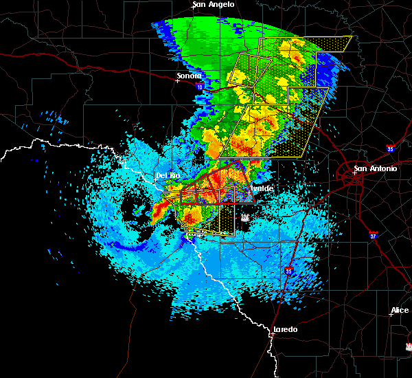 At 1158 pm cdt, a severe thunderstorm capable of producing a tornado was located over cline, or 17 miles west of uvalde, moving east at 50 mph (radar indicated rotation). Hazards include tornado and quarter size hail. Flying debris will be dangerous to those caught without shelter. mobile homes will be damaged or destroyed. damage to roofs, windows, and vehicles will occur. tree damage is likely. Locations impacted include, uvalde, brackettville, laguna, uvalde estates, montell, dabney, blewett, cline, anacacho and turkey mountain. At 1158 pm cdt, a severe thunderstorm capable of producing a tornado was located over cline, or 17 miles west of uvalde, moving east at 50 mph (radar indicated rotation). Hazards include tornado and quarter size hail. Flying debris will be dangerous to those caught without shelter. mobile homes will be damaged or destroyed. damage to roofs, windows, and vehicles will occur. tree damage is likely. Locations impacted include, uvalde, brackettville, laguna, uvalde estates, montell, dabney, blewett, cline, anacacho and turkey mountain.
|
| 3/28/2017 11:47 PM CDT |
 At 1147 pm cdt, a severe thunderstorm capable of producing a tornado was located 7 miles west of cline, or 12 miles east of brackettville, moving northeast at 55 mph (radar indicated rotation). Hazards include tornado and quarter size hail. Flying debris will be dangerous to those caught without shelter. mobile homes will be damaged or destroyed. damage to roofs, windows, and vehicles will occur. Tree damage is likely. At 1147 pm cdt, a severe thunderstorm capable of producing a tornado was located 7 miles west of cline, or 12 miles east of brackettville, moving northeast at 55 mph (radar indicated rotation). Hazards include tornado and quarter size hail. Flying debris will be dangerous to those caught without shelter. mobile homes will be damaged or destroyed. damage to roofs, windows, and vehicles will occur. Tree damage is likely.
|
| 2/19/2017 8:35 PM CST |
 At 835 pm cst, severe thunderstorms were located along a line extending from concan to 9 miles west of bluff, moving northeast at 40 mph (radar indicated). Hazards include 60 mph wind gusts and penny size hail. Expect damage to roofs, siding, and trees. Locations impacted include, uvalde, crystal city, la pryor, batesville, sabinal, knippa, chula vista-river spur, concan, washer, las colonias, uvalde estates, garner state park, reagan wells, utopia, loma vista and brundage. At 835 pm cst, severe thunderstorms were located along a line extending from concan to 9 miles west of bluff, moving northeast at 40 mph (radar indicated). Hazards include 60 mph wind gusts and penny size hail. Expect damage to roofs, siding, and trees. Locations impacted include, uvalde, crystal city, la pryor, batesville, sabinal, knippa, chula vista-river spur, concan, washer, las colonias, uvalde estates, garner state park, reagan wells, utopia, loma vista and brundage.
|
| 2/19/2017 8:24 PM CST |
 At 824 pm cst, severe thunderstorms were located along a line extending from 6 miles south of reagan wells to near loma vista, moving northeast at 35 mph (radar indicated). Hazards include 60 mph wind gusts and penny size hail. Expect damage to roofs, siding, and trees. Locations impacted include, uvalde, crystal city, la pryor, batesville, sabinal, laguna, knippa, chula vista-river spur, blewett, concan, washer, las colonias, uvalde estates, cometa, dabney, montell, cline, garner state park, reagan wells and utopia. At 824 pm cst, severe thunderstorms were located along a line extending from 6 miles south of reagan wells to near loma vista, moving northeast at 35 mph (radar indicated). Hazards include 60 mph wind gusts and penny size hail. Expect damage to roofs, siding, and trees. Locations impacted include, uvalde, crystal city, la pryor, batesville, sabinal, laguna, knippa, chula vista-river spur, blewett, concan, washer, las colonias, uvalde estates, cometa, dabney, montell, cline, garner state park, reagan wells and utopia.
|
| 2/19/2017 8:06 PM CST |
 At 806 pm cst, severe thunderstorms were located along a line extending from near reagan wells to near winter haven, moving northeast at 35 mph (radar indicated). Hazards include 60 mph wind gusts and penny size hail. expect damage to roofs, siding, and trees At 806 pm cst, severe thunderstorms were located along a line extending from near reagan wells to near winter haven, moving northeast at 35 mph (radar indicated). Hazards include 60 mph wind gusts and penny size hail. expect damage to roofs, siding, and trees
|
| 1/15/2017 8:24 PM CST |
 At 823 pm cst, a severe thunderstorm was located near cline, or 14 miles west of uvalde, moving east at 40 mph (radar indicated). Hazards include 60 mph wind gusts and quarter size hail. Hail damage to vehicles is expected. expect wind damage to roofs, siding, and trees. Locations impacted include, uvalde, knippa, dabney, blewett, cline, garner state park, reagan wells, concan and uvalde estates. At 823 pm cst, a severe thunderstorm was located near cline, or 14 miles west of uvalde, moving east at 40 mph (radar indicated). Hazards include 60 mph wind gusts and quarter size hail. Hail damage to vehicles is expected. expect wind damage to roofs, siding, and trees. Locations impacted include, uvalde, knippa, dabney, blewett, cline, garner state park, reagan wells, concan and uvalde estates.
|
| 1/15/2017 7:59 PM CST |
 At 759 pm cst, a severe thunderstorm was located over cline, or 17 miles northwest of uvalde, moving east at 30 mph (radar indicated). Hazards include 60 mph wind gusts and quarter size hail. Hail damage to vehicles is expected. Expect wind damage to roofs, siding, and trees. At 759 pm cst, a severe thunderstorm was located over cline, or 17 miles northwest of uvalde, moving east at 30 mph (radar indicated). Hazards include 60 mph wind gusts and quarter size hail. Hail damage to vehicles is expected. Expect wind damage to roofs, siding, and trees.
|
| 6/1/2016 11:51 PM CDT |
 At 1150 pm cdt, a severe thunderstorm was located near cline, or 12 miles west of uvalde, moving east at 30 mph (radar indicated). Hazards include 60 mph wind gusts and quarter size hail. Hail damage to vehicles is expected. Expect wind damage to roofs, siding, and trees. At 1150 pm cdt, a severe thunderstorm was located near cline, or 12 miles west of uvalde, moving east at 30 mph (radar indicated). Hazards include 60 mph wind gusts and quarter size hail. Hail damage to vehicles is expected. Expect wind damage to roofs, siding, and trees.
|
| 4/30/2016 3:43 AM CDT |
 At 343 am cdt, a severe thunderstorm was located near uvalde, moving east at 35 mph (radar indicated). Hazards include 60 mph wind gusts and quarter size hail. Hail damage to vehicles is expected. expect wind damage to roofs, siding, and trees. Locations impacted include, uvalde, uvalde estates and knippa. At 343 am cdt, a severe thunderstorm was located near uvalde, moving east at 35 mph (radar indicated). Hazards include 60 mph wind gusts and quarter size hail. Hail damage to vehicles is expected. expect wind damage to roofs, siding, and trees. Locations impacted include, uvalde, uvalde estates and knippa.
|
| 4/30/2016 3:26 AM CDT |
 At 325 am cdt, a severe thunderstorm was located 8 miles northeast of blewett, or 8 miles west of uvalde, moving east at 45 mph (radar indicated). Hazards include golf ball size hail and 60 mph wind gusts. People and animals outdoors will be injured. expect hail damage to roofs, siding, windows, and vehicles. expect wind damage to roofs, siding, and trees. Locations impacted include, uvalde, blewett, uvalde estates and knippa. At 325 am cdt, a severe thunderstorm was located 8 miles northeast of blewett, or 8 miles west of uvalde, moving east at 45 mph (radar indicated). Hazards include golf ball size hail and 60 mph wind gusts. People and animals outdoors will be injured. expect hail damage to roofs, siding, windows, and vehicles. expect wind damage to roofs, siding, and trees. Locations impacted include, uvalde, blewett, uvalde estates and knippa.
|
| 4/30/2016 3:06 AM CDT |
 At 306 am cdt, a severe thunderstorm was located near cline, or 15 miles east of spofford, moving east at 35 mph (radar indicated). Hazards include golf ball size hail and 60 mph wind gusts. People and animals outdoors will be injured. expect hail damage to roofs, siding, windows, and vehicles. Expect wind damage to roofs, siding, and trees. At 306 am cdt, a severe thunderstorm was located near cline, or 15 miles east of spofford, moving east at 35 mph (radar indicated). Hazards include golf ball size hail and 60 mph wind gusts. People and animals outdoors will be injured. expect hail damage to roofs, siding, windows, and vehicles. Expect wind damage to roofs, siding, and trees.
|
| 4/30/2016 2:40 AM CDT |
 At 240 am cdt, severe thunderstorms were located along a line extending from 6 miles west of nelson city to near tarpley to 9 miles southeast of utopia to 7 miles northwest of knippa to 8 miles northwest of uvalde to near brackettville, moving east at 40 mph. these are very dangerous storms (radar indicated). Hazards include baseball size hail and 60 mph wind gusts. People and animals outdoors will be severely injured. expect shattered windows, extensive damage to roofs, siding, and vehicles. Locations impacted include, medina, kerrville, uvalde, boerne, hondo, comfort, brackettville, bandera, spofford, tarpley, sabinal, laguna, d`hanis, waring, blewett, alamo village, concan, pipe creek, standart and walnut grove. At 240 am cdt, severe thunderstorms were located along a line extending from 6 miles west of nelson city to near tarpley to 9 miles southeast of utopia to 7 miles northwest of knippa to 8 miles northwest of uvalde to near brackettville, moving east at 40 mph. these are very dangerous storms (radar indicated). Hazards include baseball size hail and 60 mph wind gusts. People and animals outdoors will be severely injured. expect shattered windows, extensive damage to roofs, siding, and vehicles. Locations impacted include, medina, kerrville, uvalde, boerne, hondo, comfort, brackettville, bandera, spofford, tarpley, sabinal, laguna, d`hanis, waring, blewett, alamo village, concan, pipe creek, standart and walnut grove.
|
| 4/30/2016 2:27 AM CDT |
 At 226 am cdt, severe thunderstorms were located along a line extending from near camp verde to near tarpley to 8 miles south of utopia to 10 miles southwest of concan to near cline to 7 miles south of standart, moving east at 35 mph (radar indicated). Hazards include quarter size hail. damage to vehicles is expected At 226 am cdt, severe thunderstorms were located along a line extending from near camp verde to near tarpley to 8 miles south of utopia to 10 miles southwest of concan to near cline to 7 miles south of standart, moving east at 35 mph (radar indicated). Hazards include quarter size hail. damage to vehicles is expected
|
| 4/12/2016 8:37 PM CDT | Quarter sized hail reported 23.2 miles S of Uvalde, TX, quarter sized hail reported in the city of reagan wells |
| 3/8/2016 7:56 PM CST |
 At 755 pm cst, a severe thunderstorm was located near concan, or 15 miles north of uvalde, moving north at 20 mph (radar indicated). Hazards include 60 mph wind gusts and quarter size hail. Hail damage to vehicles is expected. expect wind damage to roofs, siding, and trees. This storm has had a history of producing quarter sized hail based on reports from an emergency manager. At 755 pm cst, a severe thunderstorm was located near concan, or 15 miles north of uvalde, moving north at 20 mph (radar indicated). Hazards include 60 mph wind gusts and quarter size hail. Hail damage to vehicles is expected. expect wind damage to roofs, siding, and trees. This storm has had a history of producing quarter sized hail based on reports from an emergency manager.
|
| 3/8/2016 7:42 PM CST |
 At 742 pm cst, a severe thunderstorm was located near concan, or 16 miles north of uvalde, moving northeast at 15 to 20 mph (radar indicated). Hazards include 60 mph wind gusts and half dollar size hail. Hail damage to vehicles is expected. expect wind damage to roofs, siding, and trees. Locations impacted include, uvalde, concan, knippa, garner state park, utopia, uvalde estates and reagan wells. At 742 pm cst, a severe thunderstorm was located near concan, or 16 miles north of uvalde, moving northeast at 15 to 20 mph (radar indicated). Hazards include 60 mph wind gusts and half dollar size hail. Hail damage to vehicles is expected. expect wind damage to roofs, siding, and trees. Locations impacted include, uvalde, concan, knippa, garner state park, utopia, uvalde estates and reagan wells.
|
| 3/8/2016 7:30 PM CST | Quarter sized hail reported 8 miles S of Uvalde, TX, around the rancho encino sub division |
| 3/8/2016 7:10 PM CST |
 At 710 pm cst, a severe thunderstorm was located 9 miles northwest of knippa, or 9 miles north of uvalde, moving northeast at 15 mph (radar indicated). Hazards include 60 mph wind gusts and quarter size hail. Hail damage to vehicles is expected. Expect wind damage to roofs, siding, and trees. At 710 pm cst, a severe thunderstorm was located 9 miles northwest of knippa, or 9 miles north of uvalde, moving northeast at 15 mph (radar indicated). Hazards include 60 mph wind gusts and quarter size hail. Hail damage to vehicles is expected. Expect wind damage to roofs, siding, and trees.
|
| 2/23/2016 12:36 AM CST |
 At 1234 am cst, severe thunderstorms were located along a line extending from near yancey to near west pearsall to near divot to 9 miles west of dilley, moving southeast at 55 mph. another severe thunderstorm was 15 miles northwest of la pryor, moving southeast at 50 mph (radar indicated). Hazards include 70 mph wind gusts and quarter size hail. Hail damage to vehicles is expected. expect considerable tree damage. wind damage is also likely to mobile homes, roofs, and outbuildings. Locations impacted include, uvalde, pearsall, hondo, crystal city, dilley, big wells, la pryor, batesville, moore, sabinal, frio town, d`hanis, north pearsall, loma vista, west pearsall, knippa, las vegas, divot, yancey and washer. At 1234 am cst, severe thunderstorms were located along a line extending from near yancey to near west pearsall to near divot to 9 miles west of dilley, moving southeast at 55 mph. another severe thunderstorm was 15 miles northwest of la pryor, moving southeast at 50 mph (radar indicated). Hazards include 70 mph wind gusts and quarter size hail. Hail damage to vehicles is expected. expect considerable tree damage. wind damage is also likely to mobile homes, roofs, and outbuildings. Locations impacted include, uvalde, pearsall, hondo, crystal city, dilley, big wells, la pryor, batesville, moore, sabinal, frio town, d`hanis, north pearsall, loma vista, west pearsall, knippa, las vegas, divot, yancey and washer.
|
| 2/22/2016 11:54 PM CST |
 At 1153 pm cst, severe thunderstorms were located along a line extending from near uvalde estates to 7 miles southeast of washer to near la pryor, moving southeast at 45 mph (radar indicated). Hazards include 70 mph wind gusts and quarter size hail. Hail damage to vehicles is expected. expect considerable tree damage. Wind damage is also likely to mobile homes, roofs, and outbuildings. At 1153 pm cst, severe thunderstorms were located along a line extending from near uvalde estates to 7 miles southeast of washer to near la pryor, moving southeast at 45 mph (radar indicated). Hazards include 70 mph wind gusts and quarter size hail. Hail damage to vehicles is expected. expect considerable tree damage. Wind damage is also likely to mobile homes, roofs, and outbuildings.
|
| 2/22/2016 11:29 PM CST |
 At 1129 pm cst, severe thunderstorms were located along a line extending from 6 miles northwest of laguna to dabney to 14 miles southeast of anacacho to 7 miles northeast of darling, moving southeast at 50 mph (radar indicated). Hazards include 70 mph wind gusts and quarter size hail. Hail damage to vehicles is expected. expect considerable tree damage. wind damage is also likely to mobile homes, roofs, and outbuildings. Locations impacted include, uvalde, spofford, la pryor, batesville, laguna, garner state park, darling, washer, montell, uvalde estates, blewett, concan, knippa, utopia, dabney, anacacho, reagan wells, cline and turkey mountain. At 1129 pm cst, severe thunderstorms were located along a line extending from 6 miles northwest of laguna to dabney to 14 miles southeast of anacacho to 7 miles northeast of darling, moving southeast at 50 mph (radar indicated). Hazards include 70 mph wind gusts and quarter size hail. Hail damage to vehicles is expected. expect considerable tree damage. wind damage is also likely to mobile homes, roofs, and outbuildings. Locations impacted include, uvalde, spofford, la pryor, batesville, laguna, garner state park, darling, washer, montell, uvalde estates, blewett, concan, knippa, utopia, dabney, anacacho, reagan wells, cline and turkey mountain.
|
| 2/22/2016 10:58 PM CST |
 At 1057 pm cst, a severe thunderstorm was located over brackettville, moving east at 45 mph (radar indicated). Hazards include 70 mph wind gusts and quarter size hail. Hail damage to vehicles is expected. expect considerable tree damage. Wind damage is also likely to mobile homes, roofs, and outbuildings. At 1057 pm cst, a severe thunderstorm was located over brackettville, moving east at 45 mph (radar indicated). Hazards include 70 mph wind gusts and quarter size hail. Hail damage to vehicles is expected. expect considerable tree damage. Wind damage is also likely to mobile homes, roofs, and outbuildings.
|
| 12/12/2015 11:49 PM CST |
 At 1149 pm cst, severe thunderstorms were located along a line extending from 17 miles south of telegraph to 6 miles west of leakey to 7 miles northeast of blewett, moving east at 35 mph (radar indicated). Hazards include 60 mph wind gusts and nickel size hail. Expect damage to roofs. siding and trees. Locations impacted include, leakey, camp wood, laguna, concan, garner state park, vance, montell, rio frio, reagan wells, tuff, barksdale, cline and prade ranch. At 1149 pm cst, severe thunderstorms were located along a line extending from 17 miles south of telegraph to 6 miles west of leakey to 7 miles northeast of blewett, moving east at 35 mph (radar indicated). Hazards include 60 mph wind gusts and nickel size hail. Expect damage to roofs. siding and trees. Locations impacted include, leakey, camp wood, laguna, concan, garner state park, vance, montell, rio frio, reagan wells, tuff, barksdale, cline and prade ranch.
|
| 12/12/2015 11:38 PM CST |
 At 1134 pm cst, severe thunderstorms were located along a line extending from 16 miles east of rocksprings to barksdale to near cline, moving east at 25 mph (radar indicated). Hazards include 60 mph wind gusts. Expect damage to roofs. siding and trees. Locations impacted include, leakey, camp wood, laguna, concan, garner state park, vance, montell, rio frio, reagan wells, tuff, barksdale, cline and prade ranch. At 1134 pm cst, severe thunderstorms were located along a line extending from 16 miles east of rocksprings to barksdale to near cline, moving east at 25 mph (radar indicated). Hazards include 60 mph wind gusts. Expect damage to roofs. siding and trees. Locations impacted include, leakey, camp wood, laguna, concan, garner state park, vance, montell, rio frio, reagan wells, tuff, barksdale, cline and prade ranch.
|
| 12/12/2015 10:59 PM CST |
 At 1059 pm cst, severe thunderstorms were located along a line extending from 16 miles north of rocksprings to 13 miles west of vance to near brackettville, moving east at 35 mph (radar indicated). Hazards include 60 mph wind gusts. Expect damage to roofs. Siding and trees. At 1059 pm cst, severe thunderstorms were located along a line extending from 16 miles north of rocksprings to 13 miles west of vance to near brackettville, moving east at 35 mph (radar indicated). Hazards include 60 mph wind gusts. Expect damage to roofs. Siding and trees.
|
| 8/13/2015 5:22 PM CDT |
 At 521 pm cdt, severe thunderstorm winds were located along a line extending from 8 miles east of alamo village to near blewett, moving southwest at 25 mph (radar indicated). Hazards include 60 mph wind gusts. Expect damage to roofs. siding and trees. Locations impacted include, brackettville, blewett, dabney, anacacho, cline, uvalde estates and turkey mountain. At 521 pm cdt, severe thunderstorm winds were located along a line extending from 8 miles east of alamo village to near blewett, moving southwest at 25 mph (radar indicated). Hazards include 60 mph wind gusts. Expect damage to roofs. siding and trees. Locations impacted include, brackettville, blewett, dabney, anacacho, cline, uvalde estates and turkey mountain.
|
| 8/13/2015 5:07 PM CDT |
 At 505 pm cdt, a cluster of severe thunderstorms was located along a line extending from 11 miles east of alamo village to near blewett, moving southwest at 25 mph. these storms were producing strong outflow winds at 50-60 mph well ahead of the storms as well (radar indicated). Hazards include 60 mph wind gusts. Expect damage to roofs. Siding and trees. At 505 pm cdt, a cluster of severe thunderstorms was located along a line extending from 11 miles east of alamo village to near blewett, moving southwest at 25 mph. these storms were producing strong outflow winds at 50-60 mph well ahead of the storms as well (radar indicated). Hazards include 60 mph wind gusts. Expect damage to roofs. Siding and trees.
|
| 4/27/2015 12:37 AM CDT | At 1233 am cdt, severe thunderstorms were located along a line extending from near bandera falls to near d`hanis to near sabinal to 9 miles south of knippa, moving east at 45 mph (radar indicated). Hazards include 70 mph wind gusts and penny size hail. Expect considerable tree damage. damage is likely to mobile homes, roofs and outbuildings. locations impacted include, uvalde, hondo, devine, castroville, bandera, tarpley, lytle, sabinal, natalia, lacoste, d`hanis, pearson, bader, noonan, pipe creek, knippa, utopia, quihi, bandera falls and mico. 0. 75in. |
| 4/27/2015 12:14 AM CDT | At 1214 am cdt, severe thunderstorms were located along a line extending from near medina to 6 miles north of knippa to 7 miles east of washer, moving east at 70 mph (radar indicated). Hazards include 60 mph wind gusts and penny size hail. Expect damage to roofs. Siding and trees. |
| 4/26/2015 11:40 PM CDT | At 1139 pm cdt, severe thunderstorms were located along a line extending from 7 miles northwest of tuff to 7 miles northwest of darling, moving southeast at 60 mph (radar indicated). Hazards include 70 mph wind gusts and quarter size hail. Hail damage to vehicles is expected. expect considerable tree damage. Wind damage is also likely to mobile homes, roofs and outbuildings. |
| 4/25/2015 3:24 AM CDT | At 323 am cdt, a severe thunderstorm was located over knippa, or 10 miles east of uvalde, moving east at 45 mph (radar indicated). Hazards include 60 mph wind gusts and quarter size hail. Hail damage to vehicles is expected. expect wind damage to roofs, siding and trees. locations impacted include, uvalde, sabinal, knippa and uvalde estates. Possible. |
| 4/25/2015 3:09 AM CDT | At 308 am cdt, a severe thunderstorm was located near uvalde, moving east at 45 mph (radar indicated). Hazards include 60 mph wind gusts and quarter size hail. Hail damage to vehicles is expected. Expect wind damage to roofs, siding and trees. |
| 4/25/2015 3:02 AM CDT | At 301 am cdt, a severe thunderstorm was located near uvalde, moving east at 30 mph (radar indicated). Hazards include 60 mph wind gusts and quarter size hail. Hail damage to vehicles is expected. expect wind damage to roofs, siding and trees. locations impacted include, uvalde, blewett and uvalde estates. 1. 00in. |
| 4/25/2015 2:38 AM CDT | At 238 am cdt, a severe thunderstorm was located near cline, or 17 miles east of brackettville, moving east at 30 mph (radar indicated). Hazards include 60 mph wind gusts and quarter size hail. Hail damage to vehicles is expected. Expect wind damage to roofs, siding and trees. |
| 6/12/2014 9:38 PM CDT | Loss of power for most of uvalde... planes overturned... lots of half inch size hail and very high wind in uvalde county TX, 1.1 miles NNE of Uvalde, TX |
| 5/10/2013 6:15 PM CDT | 6 power poles snapped...large trees down in uvalde county TX, 1.8 miles S of Uvalde, TX |
| 5/10/2013 6:15 PM CDT | 6 power poles snapped...large trees down in uvalde county TX, 5.9 miles S of Uvalde, TX |
| 7/18/2012 5:50 PM CDT | Golf Ball sized hail reported 0.4 miles S of Uvalde, TX |
| 7/18/2012 5:50 PM CDT | Trees blown down along with power outages in uvalde in uvalde county TX, 0.4 miles S of Uvalde, TX |
| 7/18/2012 5:43 PM CDT | Golf Ball sized hail reported 0.4 miles S of Uvalde, TX, golf ball sized hail broke windows at uvalde memorial hospital |
| 7/18/2012 5:34 PM CDT | Ping Pong Ball sized hail reported 0.4 miles S of Uvalde, TX |
| 3/19/2012 9:05 PM CDT | Half Dollar sized hail reported 17.9 miles S of Uvalde, TX |
| 1/1/0001 12:00 AM | Power line poles blown dow in uvalde county TX, 1.3 miles WSW of Uvalde, TX |
| 1/1/0001 12:00 AM | Livestock barm was damage in uvalde county TX, 2.6 miles ENE of Uvalde, TX |
| 1/1/0001 12:00 AM | Livestock barn was damage in uvalde county TX, 2.6 miles ENE of Uvalde, TX |
| 1/1/0001 12:00 AM | Wind gusts to 45 mph... numerous lightning... some tree branches blown into power line in uvalde county TX, 0.4 miles S of Uvalde, TX |
| 1/1/0001 12:00 AM | Quarter sized hail reported 0.4 miles S of Uvalde, TX |
| 1/1/0001 12:00 AM | Half Dollar sized hail reported 26.1 miles SSE of Uvalde, TX |
| 1/1/0001 12:00 AM | Tennis Ball sized hail reported 5.4 miles SSW of Uvalde, TX, driver along highway 83 north of uvalde experienced golfball to tennis ball size hail. |
Hail Maps for Uvalde, TX
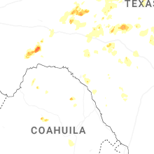
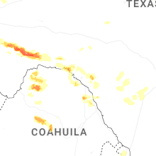
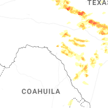
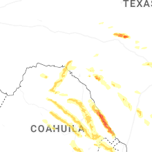

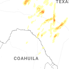


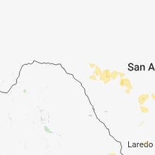


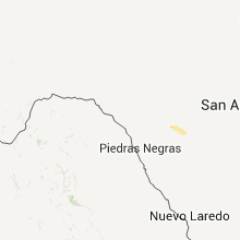
Connect with Interactive Hail Maps