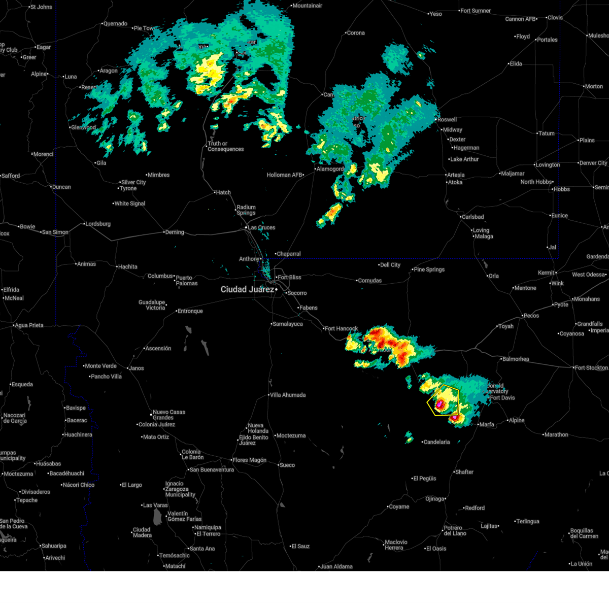
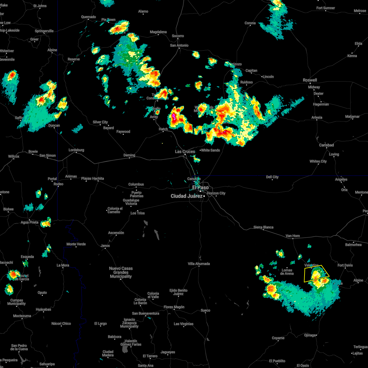
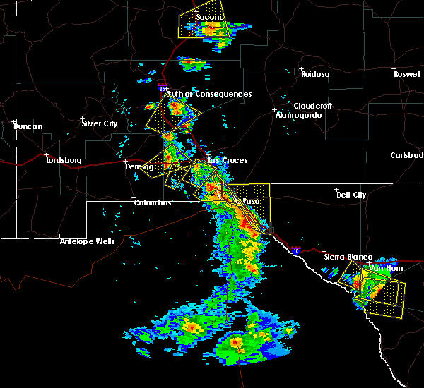
| 6/2/2026 5:20 PM CDT |
 At 520 pm cdt, a severe thunderstorm was located near valentine, or 29 miles northeast of candelaria, moving northeast at 10 mph (radar indicated). Hazards include 60 mph wind gusts and quarter size hail. Hail damage to vehicles is expected. expect wind damage to roofs, siding, and trees. Locations impacted include, valentine. At 520 pm cdt, a severe thunderstorm was located near valentine, or 29 miles northeast of candelaria, moving northeast at 10 mph (radar indicated). Hazards include 60 mph wind gusts and quarter size hail. Hail damage to vehicles is expected. expect wind damage to roofs, siding, and trees. Locations impacted include, valentine.
|
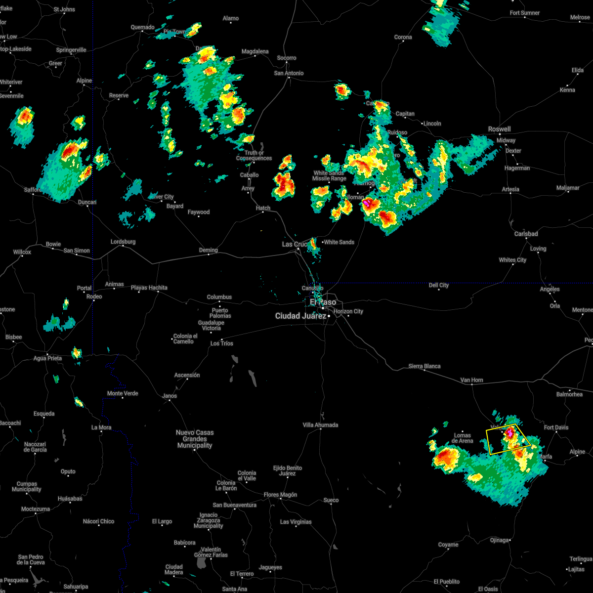
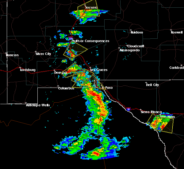
| 6/2/2026 5:20 PM CDT |
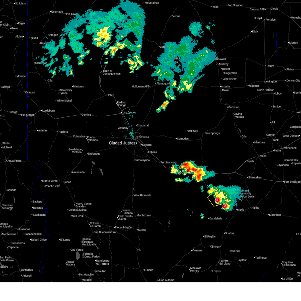 At 519 pm cdt, a severe thunderstorm was located near valentine, or 29 miles northeast of candelaria, and is nearly stationary (radar indicated). Hazards include 60 mph wind gusts and quarter size hail. Hail damage to vehicles is expected. expect wind damage to roofs, siding, and trees. Locations impacted include, valentine. At 519 pm cdt, a severe thunderstorm was located near valentine, or 29 miles northeast of candelaria, and is nearly stationary (radar indicated). Hazards include 60 mph wind gusts and quarter size hail. Hail damage to vehicles is expected. expect wind damage to roofs, siding, and trees. Locations impacted include, valentine.
|
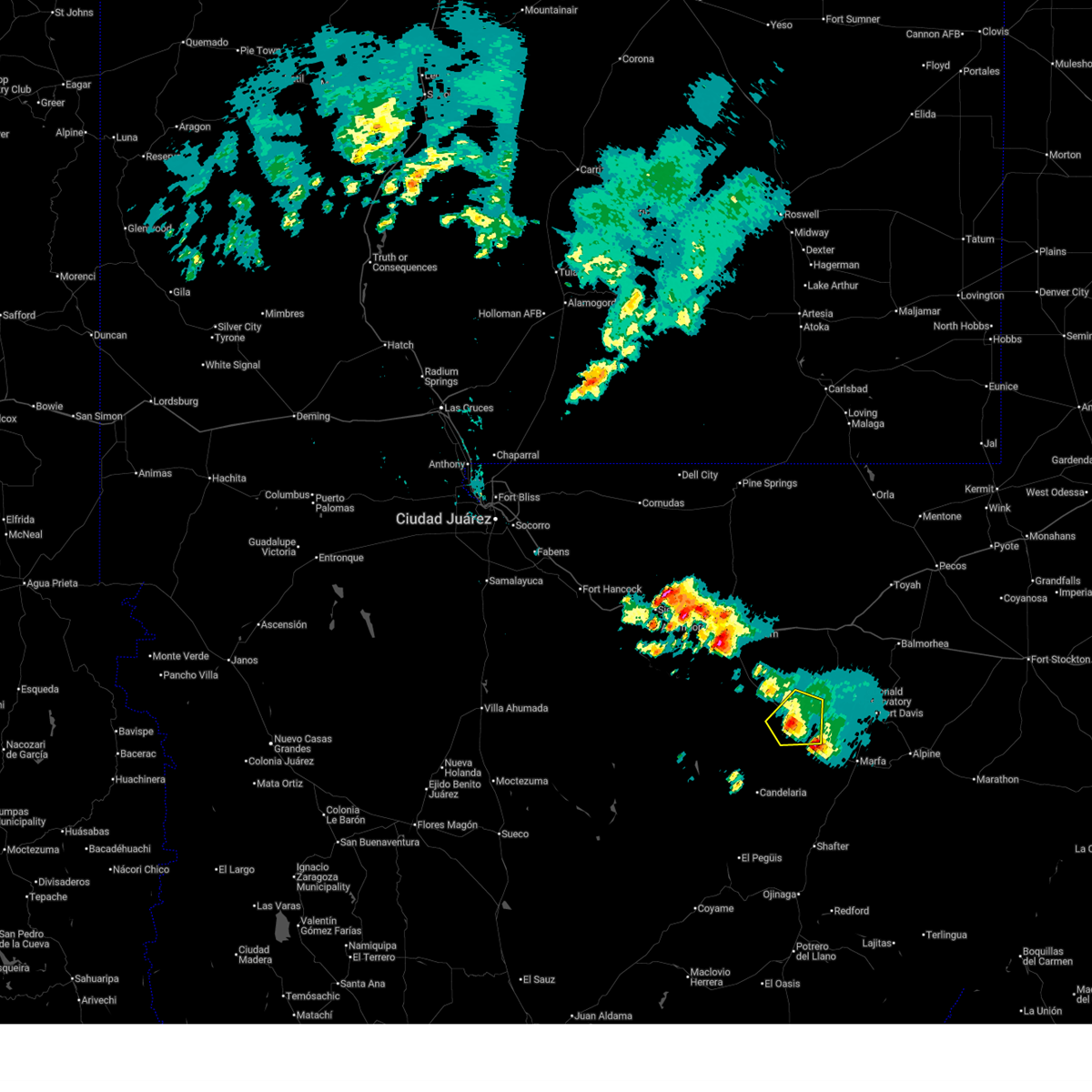
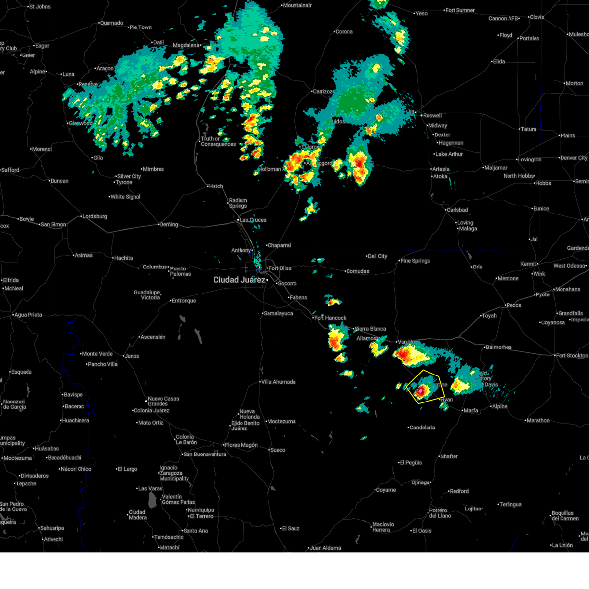
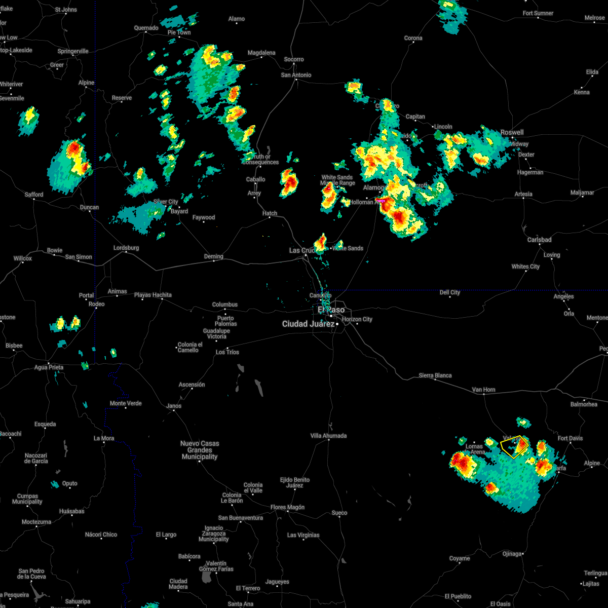
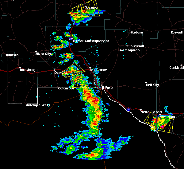
| 6/2/2026 5:12 PM CDT |
 At 512 pm cdt, a severe thunderstorm was located near valentine, or 29 miles northeast of candelaria, moving northeast at 10 mph (radar indicated). Hazards include golf ball size hail and 60 mph wind gusts. People and animals outdoors will be injured. expect hail damage to roofs, siding, windows, and vehicles. expect wind damage to roofs, siding, and trees. Locations impacted include, valentine. At 512 pm cdt, a severe thunderstorm was located near valentine, or 29 miles northeast of candelaria, moving northeast at 10 mph (radar indicated). Hazards include golf ball size hail and 60 mph wind gusts. People and animals outdoors will be injured. expect hail damage to roofs, siding, windows, and vehicles. expect wind damage to roofs, siding, and trees. Locations impacted include, valentine.
|
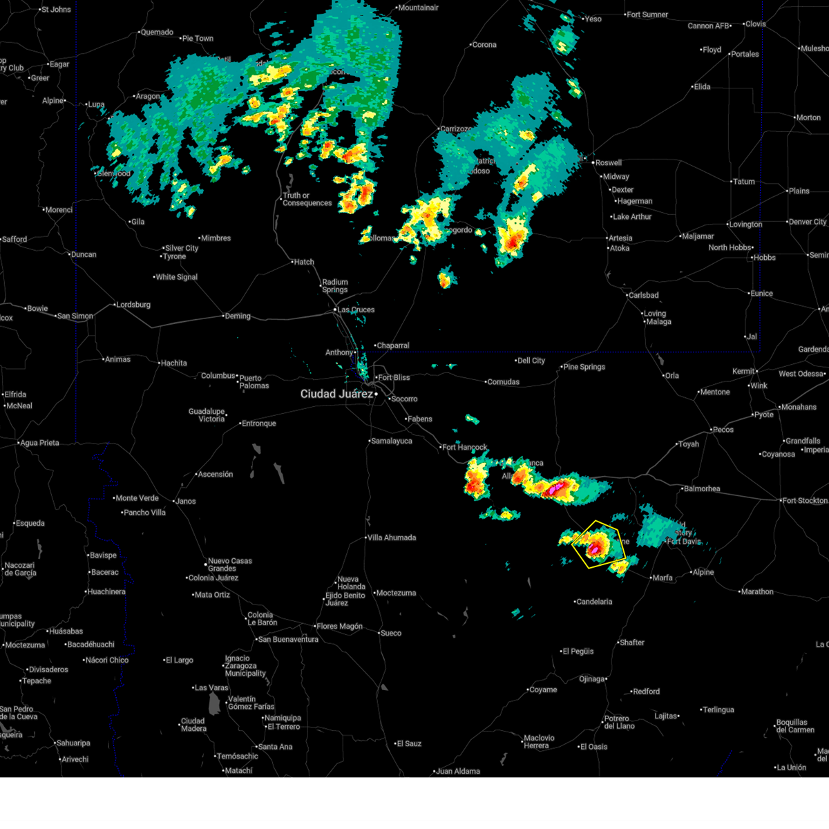
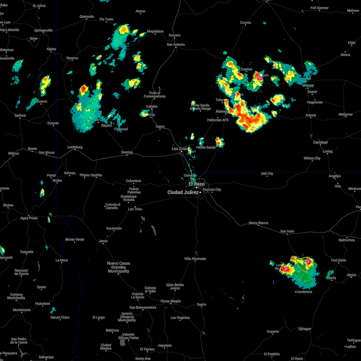
| 6/2/2026 5:08 PM CDT |
 Svrmaf the national weather service in midland has issued a * severe thunderstorm warning for, southwestern jeff davis county in southwestern texas, north central presidio county in southwestern texas, * until 615 pm cdt. * at 508 pm cdt, a severe thunderstorm was located near valentine, or 28 miles north of candelaria, and is nearly stationary (radar indicated). Hazards include golf ball size hail and 60 mph wind gusts. People and animals outdoors will be injured. expect hail damage to roofs, siding, windows, and vehicles. Expect wind damage to roofs, siding, and trees. Svrmaf the national weather service in midland has issued a * severe thunderstorm warning for, southwestern jeff davis county in southwestern texas, north central presidio county in southwestern texas, * until 615 pm cdt. * at 508 pm cdt, a severe thunderstorm was located near valentine, or 28 miles north of candelaria, and is nearly stationary (radar indicated). Hazards include golf ball size hail and 60 mph wind gusts. People and animals outdoors will be injured. expect hail damage to roofs, siding, windows, and vehicles. Expect wind damage to roofs, siding, and trees.
|
| 6/2/2026 4:59 PM CDT |
 Svrmaf the national weather service in midland has issued a * severe thunderstorm warning for, south central jeff davis county in southwestern texas, north central presidio county in southwestern texas, * until 545 pm cdt. * at 459 pm cdt, a severe thunderstorm was located near valentine, or 28 miles northeast of candelaria, moving northeast at 15 mph (radar indicated). Hazards include 60 mph wind gusts and quarter size hail. Hail damage to vehicles is expected. Expect wind damage to roofs, siding, and trees. Svrmaf the national weather service in midland has issued a * severe thunderstorm warning for, south central jeff davis county in southwestern texas, north central presidio county in southwestern texas, * until 545 pm cdt. * at 459 pm cdt, a severe thunderstorm was located near valentine, or 28 miles northeast of candelaria, moving northeast at 15 mph (radar indicated). Hazards include 60 mph wind gusts and quarter size hail. Hail damage to vehicles is expected. Expect wind damage to roofs, siding, and trees.
|
| 6/2/2026 4:43 PM CDT |
 At 443 pm cdt, a severe thunderstorm was located near valentine, or 28 miles north of candelaria, moving northeast at 10 mph (radar indicated). Hazards include 60 mph wind gusts and half dollar size hail. Hail damage to vehicles is expected. expect wind damage to roofs, siding, and trees. Locations impacted include, valentine. At 443 pm cdt, a severe thunderstorm was located near valentine, or 28 miles north of candelaria, moving northeast at 10 mph (radar indicated). Hazards include 60 mph wind gusts and half dollar size hail. Hail damage to vehicles is expected. expect wind damage to roofs, siding, and trees. Locations impacted include, valentine.
|
| 6/2/2026 4:21 PM CDT |
 Svrmaf the national weather service in midland has issued a * severe thunderstorm warning for, southwestern jeff davis county in southwestern texas, north central presidio county in southwestern texas, * until 500 pm cdt. * at 421 pm cdt, a severe thunderstorm was located near valentine, or 27 miles north of candelaria, moving northeast at 15 mph (radar indicated). Hazards include 60 mph wind gusts and quarter size hail. Hail damage to vehicles is expected. Expect wind damage to roofs, siding, and trees. Svrmaf the national weather service in midland has issued a * severe thunderstorm warning for, southwestern jeff davis county in southwestern texas, north central presidio county in southwestern texas, * until 500 pm cdt. * at 421 pm cdt, a severe thunderstorm was located near valentine, or 27 miles north of candelaria, moving northeast at 15 mph (radar indicated). Hazards include 60 mph wind gusts and quarter size hail. Hail damage to vehicles is expected. Expect wind damage to roofs, siding, and trees.
|
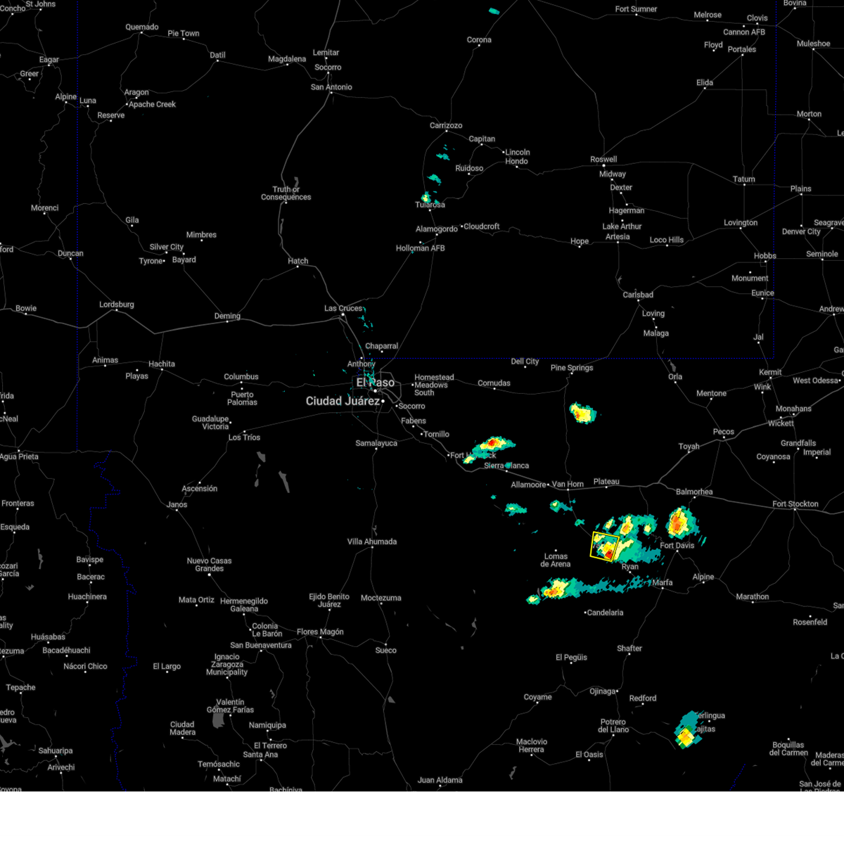
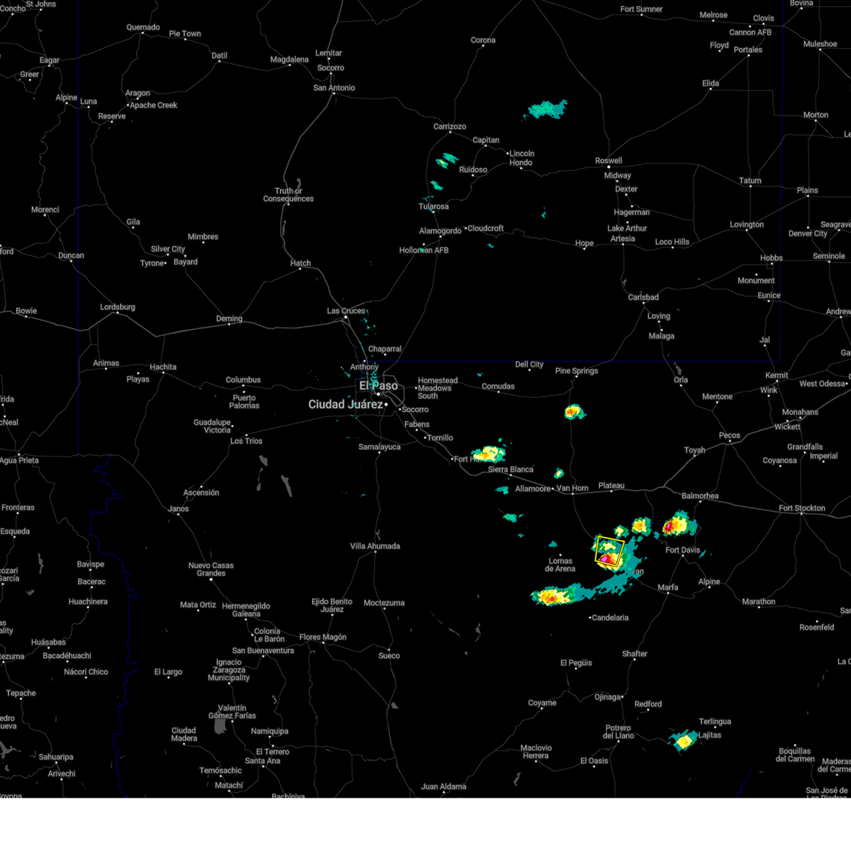
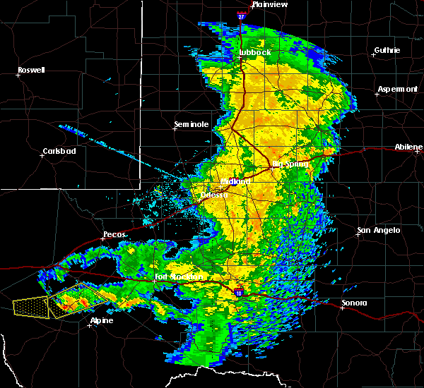
| 10/24/2025 10:52 AM CDT |
Svrmaf the national weather service in midland has issued a * severe thunderstorm warning for, southwestern jeff davis county in southwestern texas, northern presidio county in southwestern texas, * until 1130 am cdt. * at 1051 am cdt, a severe thunderstorm was located 14 miles southeast of indio mountains research station, or 27 miles south of van horn, moving east at 45 mph (radar indicated). Hazards include 60 mph wind gusts and quarter size hail. Hail damage to vehicles is expected. Expect wind damage to roofs, siding, and trees.
|
| 6/1/2024 4:55 PM CDT |
 the severe thunderstorm warning has been cancelled and is no longer in effect the severe thunderstorm warning has been cancelled and is no longer in effect
|
| 6/1/2024 4:38 PM CDT |
 Svrmaf the national weather service in midland has issued a * severe thunderstorm warning for, southwestern jeff davis county in southwestern texas, north central presidio county in southwestern texas, * until 515 pm cdt. * at 438 pm cdt, a severe thunderstorm was located near valentine, or 31 miles north of candelaria, moving north at 15 mph (radar indicated). Hazards include golf ball size hail and 60 mph wind gusts. People and animals outdoors will be injured. expect hail damage to roofs, siding, windows, and vehicles. Expect wind damage to roofs, siding, and trees. Svrmaf the national weather service in midland has issued a * severe thunderstorm warning for, southwestern jeff davis county in southwestern texas, north central presidio county in southwestern texas, * until 515 pm cdt. * at 438 pm cdt, a severe thunderstorm was located near valentine, or 31 miles north of candelaria, moving north at 15 mph (radar indicated). Hazards include golf ball size hail and 60 mph wind gusts. People and animals outdoors will be injured. expect hail damage to roofs, siding, windows, and vehicles. Expect wind damage to roofs, siding, and trees.
|
| 7/11/2021 7:18 PM CDT |
 At 717 pm cdt, a severe thunderstorm was located near valentine, or 27 miles northwest of marfa, moving southeast at 5 mph (radar indicated). Hazards include 60 mph wind gusts and quarter size hail. Hail damage to vehicles is expected. expect wind damage to roofs, siding, and trees. Locations impacted include, valentine. At 717 pm cdt, a severe thunderstorm was located near valentine, or 27 miles northwest of marfa, moving southeast at 5 mph (radar indicated). Hazards include 60 mph wind gusts and quarter size hail. Hail damage to vehicles is expected. expect wind damage to roofs, siding, and trees. Locations impacted include, valentine.
|
| 7/11/2021 6:59 PM CDT |
 At 658 pm cdt, a severe thunderstorm was located near valentine, or 30 miles northwest of marfa, and is nearly stationary (radar indicated). Hazards include 60 mph wind gusts and quarter size hail. Hail damage to vehicles is expected. Expect wind damage to roofs, siding, and trees. At 658 pm cdt, a severe thunderstorm was located near valentine, or 30 miles northwest of marfa, and is nearly stationary (radar indicated). Hazards include 60 mph wind gusts and quarter size hail. Hail damage to vehicles is expected. Expect wind damage to roofs, siding, and trees.
|
| 7/11/2021 6:37 PM CDT |
 At 636 pm cdt, a severe thunderstorm was located near valentine, or 30 miles northwest of marfa, moving southeast at 5 mph (radar indicated). Hazards include 60 mph wind gusts and quarter size hail. Hail damage to vehicles is expected. expect wind damage to roofs, siding, and trees. Locations impacted include, valentine. At 636 pm cdt, a severe thunderstorm was located near valentine, or 30 miles northwest of marfa, moving southeast at 5 mph (radar indicated). Hazards include 60 mph wind gusts and quarter size hail. Hail damage to vehicles is expected. expect wind damage to roofs, siding, and trees. Locations impacted include, valentine.
|
| 7/11/2021 6:01 PM CDT |
 At 601 pm cdt, a severe thunderstorm was located over valentine, or 33 miles northwest of marfa, moving southwest at 5 mph (radar indicated). Hazards include 60 mph wind gusts and quarter size hail. Hail damage to vehicles is expected. Expect wind damage to roofs, siding, and trees. At 601 pm cdt, a severe thunderstorm was located over valentine, or 33 miles northwest of marfa, moving southwest at 5 mph (radar indicated). Hazards include 60 mph wind gusts and quarter size hail. Hail damage to vehicles is expected. Expect wind damage to roofs, siding, and trees.
|
| 7/18/2020 4:31 PM CDT |
 At 431 pm cdt, a severe thunderstorm was located 7 miles southeast of valentine, or 26 miles northwest of marfa, moving southwest at 15 mph (radar indicated). Hazards include 60 mph wind gusts and quarter size hail. Expect wind damage to roofs, siding, and trees. Locations impacted include, valentine. At 431 pm cdt, a severe thunderstorm was located 7 miles southeast of valentine, or 26 miles northwest of marfa, moving southwest at 15 mph (radar indicated). Hazards include 60 mph wind gusts and quarter size hail. Expect wind damage to roofs, siding, and trees. Locations impacted include, valentine.
|
| 7/18/2020 4:09 PM CDT |
 At 407 pm cdt, a severe thunderstorm was located 10 miles east of valentine, or 25 miles west of fort davis, moving southwest at 15 mph (radar indicated). Hazards include 60 mph wind gusts and quarter size hail. expect wind damage to roofs, siding, and trees At 407 pm cdt, a severe thunderstorm was located 10 miles east of valentine, or 25 miles west of fort davis, moving southwest at 15 mph (radar indicated). Hazards include 60 mph wind gusts and quarter size hail. expect wind damage to roofs, siding, and trees
|
| 5/30/2019 4:04 PM CDT |
 At 403 pm cdt, a severe thunderstorm was located near valentine, or 27 miles northwest of marfa, moving east at 30 mph (radar indicated). Hazards include 60 mph wind gusts and quarter size hail. Hail damage to vehicles is expected. Expect wind damage to roofs, siding, and trees. At 403 pm cdt, a severe thunderstorm was located near valentine, or 27 miles northwest of marfa, moving east at 30 mph (radar indicated). Hazards include 60 mph wind gusts and quarter size hail. Hail damage to vehicles is expected. Expect wind damage to roofs, siding, and trees.
|
| 6/3/2018 8:07 PM CDT |
 At 752 pm cdt, a severe thunderstorm was located 10 miles south of valentine, or 23 miles northeast of candelaria, and is nearly stationary (radar indicated). Hazards include golf ball size hail and 60 mph wind gusts. People and animals outdoors will be injured. expect hail damage to roofs, siding, windows, and vehicles. expect wind damage to roofs, siding, and trees. Locations impacted include, valentine. At 752 pm cdt, a severe thunderstorm was located 10 miles south of valentine, or 23 miles northeast of candelaria, and is nearly stationary (radar indicated). Hazards include golf ball size hail and 60 mph wind gusts. People and animals outdoors will be injured. expect hail damage to roofs, siding, windows, and vehicles. expect wind damage to roofs, siding, and trees. Locations impacted include, valentine.
|
| 6/3/2018 7:52 PM CDT |
 At 752 pm cdt, a severe thunderstorm was located 10 miles south of valentine, or 23 miles northeast of candelaria, and is nearly stationary (radar indicated). Hazards include golf ball size hail and 60 mph wind gusts. People and animals outdoors will be injured. expect hail damage to roofs, siding, windows, and vehicles. expect wind damage to roofs, siding, and trees. Locations impacted include, valentine. At 752 pm cdt, a severe thunderstorm was located 10 miles south of valentine, or 23 miles northeast of candelaria, and is nearly stationary (radar indicated). Hazards include golf ball size hail and 60 mph wind gusts. People and animals outdoors will be injured. expect hail damage to roofs, siding, windows, and vehicles. expect wind damage to roofs, siding, and trees. Locations impacted include, valentine.
|
| 6/3/2018 7:28 PM CDT |
 At 728 pm cdt, a severe thunderstorm was located 16 miles northeast of candelaria, moving north at 30 mph (radar indicated). Hazards include golf ball size hail and 60 mph wind gusts. People and animals outdoors will be injured. expect hail damage to roofs, siding, windows, and vehicles. Expect wind damage to roofs, siding, and trees. At 728 pm cdt, a severe thunderstorm was located 16 miles northeast of candelaria, moving north at 30 mph (radar indicated). Hazards include golf ball size hail and 60 mph wind gusts. People and animals outdoors will be injured. expect hail damage to roofs, siding, windows, and vehicles. Expect wind damage to roofs, siding, and trees.
|
| 6/3/2018 6:59 PM CDT |
 At 659 pm cdt, a severe thunderstorm was located 7 miles southwest of valentine, moving southeast at 5 mph (radar indicated). Hazards include two inch hail and 60 mph wind gusts. People and animals outdoors will be injured. expect hail damage to roofs, siding, windows, and vehicles. expect wind damage to roofs, siding, and trees. Locations impacted include, valentine. At 659 pm cdt, a severe thunderstorm was located 7 miles southwest of valentine, moving southeast at 5 mph (radar indicated). Hazards include two inch hail and 60 mph wind gusts. People and animals outdoors will be injured. expect hail damage to roofs, siding, windows, and vehicles. expect wind damage to roofs, siding, and trees. Locations impacted include, valentine.
|
| 6/3/2018 6:51 PM CDT |
Quarter sized hail reported 10 miles ENE of Valentine, TX
|
| 6/3/2018 6:44 PM CDT |
 At 643 pm cdt, a severe thunderstorm was located 11 miles west of valentine, and is nearly stationary (radar indicated). Hazards include two inch hail and 60 mph wind gusts. People and animals outdoors will be injured. expect hail damage to roofs, siding, windows, and vehicles. Expect wind damage to roofs, siding, and trees. At 643 pm cdt, a severe thunderstorm was located 11 miles west of valentine, and is nearly stationary (radar indicated). Hazards include two inch hail and 60 mph wind gusts. People and animals outdoors will be injured. expect hail damage to roofs, siding, windows, and vehicles. Expect wind damage to roofs, siding, and trees.
|
| 6/3/2018 6:15 PM CDT |
 At 614 pm cdt, a severe thunderstorm was located 10 miles west of valentine, and is nearly stationary (radar indicated). Hazards include two inch hail and 60 mph wind gusts. People and animals outdoors will be injured. expect hail damage to roofs, siding, windows, and vehicles. expect wind damage to roofs, siding, and trees. Locations impacted include, valentine and lobo. At 614 pm cdt, a severe thunderstorm was located 10 miles west of valentine, and is nearly stationary (radar indicated). Hazards include two inch hail and 60 mph wind gusts. People and animals outdoors will be injured. expect hail damage to roofs, siding, windows, and vehicles. expect wind damage to roofs, siding, and trees. Locations impacted include, valentine and lobo.
|
| 6/3/2018 5:57 PM CDT |
 The national weather service in midland has issued a * severe thunderstorm warning for. southwestern jeff davis county in southwestern texas. northwestern presidio county in southwestern texas. southwestern culberson county in southwestern texas. Until 645 pm cdt. The national weather service in midland has issued a * severe thunderstorm warning for. southwestern jeff davis county in southwestern texas. northwestern presidio county in southwestern texas. southwestern culberson county in southwestern texas. Until 645 pm cdt.
|
|
|
| 6/3/2018 5:37 PM CDT |
 At 536 pm cdt, a severe thunderstorm was located 13 miles northwest of valentine, or 27 miles south of van horn, moving southeast at 5 mph (radar indicated). Hazards include two inch hail and 60 mph wind gusts. People and animals outdoors will be injured. expect hail damage to roofs, siding, windows, and vehicles. expect wind damage to roofs, siding, and trees. Locations impacted include, valentine and lobo. At 536 pm cdt, a severe thunderstorm was located 13 miles northwest of valentine, or 27 miles south of van horn, moving southeast at 5 mph (radar indicated). Hazards include two inch hail and 60 mph wind gusts. People and animals outdoors will be injured. expect hail damage to roofs, siding, windows, and vehicles. expect wind damage to roofs, siding, and trees. Locations impacted include, valentine and lobo.
|
| 6/3/2018 5:20 PM CDT |
 At 519 pm cdt, a severe thunderstorm was located 17 miles northwest of valentine, or 24 miles south of van horn, and is nearly stationary (radar indicated). Hazards include golf ball size hail and 60 mph wind gusts. People and animals outdoors will be injured. expect hail damage to roofs, siding, windows, and vehicles. Expect wind damage to roofs, siding, and trees. At 519 pm cdt, a severe thunderstorm was located 17 miles northwest of valentine, or 24 miles south of van horn, and is nearly stationary (radar indicated). Hazards include golf ball size hail and 60 mph wind gusts. People and animals outdoors will be injured. expect hail damage to roofs, siding, windows, and vehicles. Expect wind damage to roofs, siding, and trees.
|
| 4/13/2017 12:39 AM CDT |
 At 1238 am cdt, a severe thunderstorm was located over valentine, or 31 miles northwest of marfa, moving east at 25 mph (radar indicated). Hazards include quarter size hail. damage to vehicles is expected At 1238 am cdt, a severe thunderstorm was located over valentine, or 31 miles northwest of marfa, moving east at 25 mph (radar indicated). Hazards include quarter size hail. damage to vehicles is expected
|
| 1/1/0001 12:00 AM |
Half Dollar sized hail reported 0.3 miles SE of Valentine, TX
|
| 1/1/0001 12:00 AM |
Baseball sized hail reported 3.3 miles W of Valentine, TX, hardball sized hail reported on hw 90 3 miles east of valentine.
|


Connect with Interactive Hail Maps