

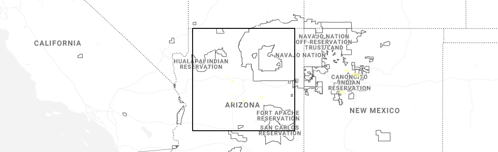
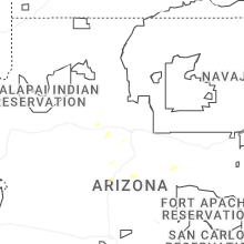
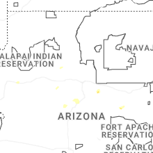
Hail Map for Valle, AZ
The Valle, AZ area has had 0 reports of on-the-ground hail by trained spotters, and has been under severe weather warnings 0 times during the past 12 months. Doppler radar has detected hail at or near Valle, AZ on 31 occasions, including 1 occasion during the past year.
| Name: | Valle, AZ |
| Where Located: | 40.1 miles NW of Flagstaff, AZ |
| Map: | Google Map for Valle, AZ |
| Population: | 832 |
| Housing Units: | 583 |
| More Info: | Search Google for Valle, AZ |
1
The Top Recent Hail Date for Valle, AZ is Sunday, June 14, 2026 (13th out of 31)
Hail and Wind Damage Spotted near Valle, AZ
| Date / Time | Report Details |
|---|---|
| 9/6/2022 2:11 PM MST |
 The severe thunderstorm warning for coconino county will expire at 215 pm mst, the storm which prompted the warning norther of williams has weakened below severe limits, and no longer poses an immediate threat to life or property. therefore, the warning will be allowed to expire. The severe thunderstorm warning for coconino county will expire at 215 pm mst, the storm which prompted the warning norther of williams has weakened below severe limits, and no longer poses an immediate threat to life or property. therefore, the warning will be allowed to expire.
|
| 9/6/2022 1:41 PM MST |
 At 140 pm mst, a severe thunderstorm was located 9 miles north of williams, moving west at 15 mph (radar indicated). Hazards include 60 mph wind gusts and quarter size hail. Hail damage to vehicles is expected. expect wind damage to roofs, siding, and trees. this severe thunderstorm will remain over mainly rural areas of coconino county. this includes state route 64 between mile markers 188 and 202. hail threat, radar indicated max hail size, 1. 00 in wind threat, radar indicated max wind gust, 60 mph. At 140 pm mst, a severe thunderstorm was located 9 miles north of williams, moving west at 15 mph (radar indicated). Hazards include 60 mph wind gusts and quarter size hail. Hail damage to vehicles is expected. expect wind damage to roofs, siding, and trees. this severe thunderstorm will remain over mainly rural areas of coconino county. this includes state route 64 between mile markers 188 and 202. hail threat, radar indicated max hail size, 1. 00 in wind threat, radar indicated max wind gust, 60 mph.
|
| 8/26/2018 2:45 PM MST |
 At 245 pm mst, a severe thunderstorm was located 8 miles south of tusayan, or 22 miles southwest of desert view at grand canyon, moving northeast at 10 mph (radar indicated). Hazards include 60 mph wind gusts and quarter size hail. Hail damage to vehicles is expected. expect wind damage to roofs, siding, and trees. locations impacted include, moran point at grand canyon, tusayan, shoshone point at grand canyon, grandview point at grand canyon and ten-x campground. This includes state route 64 between mile markers 220 and 237. At 245 pm mst, a severe thunderstorm was located 8 miles south of tusayan, or 22 miles southwest of desert view at grand canyon, moving northeast at 10 mph (radar indicated). Hazards include 60 mph wind gusts and quarter size hail. Hail damage to vehicles is expected. expect wind damage to roofs, siding, and trees. locations impacted include, moran point at grand canyon, tusayan, shoshone point at grand canyon, grandview point at grand canyon and ten-x campground. This includes state route 64 between mile markers 220 and 237.
|
| 8/26/2018 2:31 PM MST |
 At 231 pm mst, a severe thunderstorm was located 7 miles south of tusayan, or 18 miles southwest of desert view at grand canyon, moving northeast at 15 mph (radar indicated). Hazards include 60 mph wind gusts and quarter size hail. Hail damage to vehicles is expected. Expect wind damage to roofs, siding, and trees. At 231 pm mst, a severe thunderstorm was located 7 miles south of tusayan, or 18 miles southwest of desert view at grand canyon, moving northeast at 15 mph (radar indicated). Hazards include 60 mph wind gusts and quarter size hail. Hail damage to vehicles is expected. Expect wind damage to roofs, siding, and trees.
|
| 8/10/2018 7:28 PM MST |
 At 727 pm mst, a severe thunderstorm was located 19 miles west of valle, or 48 miles southwest of desert view at grand canyon, moving west at 20 mph (radar indicated). Hazards include 60 mph wind gusts and half dollar size hail. Hail damage to vehicles is expected. expect wind damage to roofs, siding, and trees. This severe thunderstorm will remain over mainly rural areas of coconino county. At 727 pm mst, a severe thunderstorm was located 19 miles west of valle, or 48 miles southwest of desert view at grand canyon, moving west at 20 mph (radar indicated). Hazards include 60 mph wind gusts and half dollar size hail. Hail damage to vehicles is expected. expect wind damage to roofs, siding, and trees. This severe thunderstorm will remain over mainly rural areas of coconino county.
|
| 8/10/2018 5:59 PM MST |
 At 543 pm mst, a severe thunderstorm was located 16 miles north of ash fork, or 47 miles north of chino valley, moving west at 15 mph (radar indicated). Hazards include half dollar size hail. Damage to vehicles is expected. This severe thunderstorm will remain over mainly rural areas of coconino county. At 543 pm mst, a severe thunderstorm was located 16 miles north of ash fork, or 47 miles north of chino valley, moving west at 15 mph (radar indicated). Hazards include half dollar size hail. Damage to vehicles is expected. This severe thunderstorm will remain over mainly rural areas of coconino county.
|
| 8/10/2018 5:44 PM MST |
 At 523 pm mst, a severe thunderstorm was located 14 miles northeast of ash fork, or 44 miles west of flagstaff, moving northwest at 10 mph (radar indicated). Hazards include half dollar size hail. Damage to vehicles is expected. This severe thunderstorm will remain over mainly rural areas of coconino county northwest of williams. At 523 pm mst, a severe thunderstorm was located 14 miles northeast of ash fork, or 44 miles west of flagstaff, moving northwest at 10 mph (radar indicated). Hazards include half dollar size hail. Damage to vehicles is expected. This severe thunderstorm will remain over mainly rural areas of coconino county northwest of williams.
|
| 8/10/2018 5:24 PM MST |
 At 523 pm mst, a severe thunderstorm was located 14 miles northeast of ash fork, or 44 miles west of flagstaff, moving northwest at 10 mph (radar indicated). Hazards include half dollar size hail. Damage to vehicles is expected. This severe thunderstorm will remain over mainly rural areas of coconino county northwest of williams. At 523 pm mst, a severe thunderstorm was located 14 miles northeast of ash fork, or 44 miles west of flagstaff, moving northwest at 10 mph (radar indicated). Hazards include half dollar size hail. Damage to vehicles is expected. This severe thunderstorm will remain over mainly rural areas of coconino county northwest of williams.
|
| 8/9/2018 4:08 PM MST |
 At 408 pm mst, severe thunderstorms were located along a line extending from 14 miles northwest of williams to 12 miles southwest of seligman, moving south at 20 mph (radar indicated). Hazards include 60 mph wind gusts and half dollar size hail. Hail damage to vehicles is expected. Expect wind damage to roofs, siding, and trees. At 408 pm mst, severe thunderstorms were located along a line extending from 14 miles northwest of williams to 12 miles southwest of seligman, moving south at 20 mph (radar indicated). Hazards include 60 mph wind gusts and half dollar size hail. Hail damage to vehicles is expected. Expect wind damage to roofs, siding, and trees.
|
| 8/9/2018 4:03 PM MST |
 At 403 pm mst, a severe thunderstorm was located just south of parks, or 18 miles west of flagstaff, moving west at 10 mph (radar indicated). Hazards include 60 mph wind gusts and half dollar size hail. Hail damage to vehicles is expected. Expect wind damage to roofs, siding, and trees. At 403 pm mst, a severe thunderstorm was located just south of parks, or 18 miles west of flagstaff, moving west at 10 mph (radar indicated). Hazards include 60 mph wind gusts and half dollar size hail. Hail damage to vehicles is expected. Expect wind damage to roofs, siding, and trees.
|
| 7/16/2018 3:24 PM MST |
 The severe thunderstorm warning for coconino county will expire at 330 pm mst, the storm near valle that prompted the warning has weakened below severe limits, and no longer pose an immediate threat to life or property. therefore the warning will be allowed to expire. however heavy rain is still possible with this thunderstorm. The severe thunderstorm warning for coconino county will expire at 330 pm mst, the storm near valle that prompted the warning has weakened below severe limits, and no longer pose an immediate threat to life or property. therefore the warning will be allowed to expire. however heavy rain is still possible with this thunderstorm.
|
| 7/16/2018 3:02 PM MST |
 At 253 pm mst, a severe thunderstorm was located over valle, or 30 miles southwest of desert view at grand canyon, moving south at 20 mph (radar indicated). Hazards include quarter size hail. damage to vehicles is expected At 253 pm mst, a severe thunderstorm was located over valle, or 30 miles southwest of desert view at grand canyon, moving south at 20 mph (radar indicated). Hazards include quarter size hail. damage to vehicles is expected
|
| 7/16/2018 2:53 PM MST |
 At 253 pm mst, a severe thunderstorm was located over valle, or 30 miles southwest of desert view at grand canyon, moving south at 20 mph (radar indicated). Hazards include quarter size hail. damage to vehicles is expected At 253 pm mst, a severe thunderstorm was located over valle, or 30 miles southwest of desert view at grand canyon, moving south at 20 mph (radar indicated). Hazards include quarter size hail. damage to vehicles is expected
|
| 7/18/2017 3:05 PM MST |
 At 304 pm mst, a severe thunderstorm was located 14 miles west of valle, moving west at 10 mph (radar indicated). Hazards include 60 mph wind gusts and quarter size hail. Hail damage to vehicles is expected. expect wind damage to roofs, siding, and trees. This severe thunderstorm will remain over mainly rural areas of coconino county. At 304 pm mst, a severe thunderstorm was located 14 miles west of valle, moving west at 10 mph (radar indicated). Hazards include 60 mph wind gusts and quarter size hail. Hail damage to vehicles is expected. expect wind damage to roofs, siding, and trees. This severe thunderstorm will remain over mainly rural areas of coconino county.
|
| 8/30/2015 5:20 PM MST |
 At 519 pm mst, doppler radar indicated a severe thunderstorm capable of producing large hail up to ping pong ball size and damaging winds in excess of 60 mph. this storm was located 15 miles east of valle, moving southeast at 20 mph. this severe thunderstorm will remain over mainly rural areas of central coconino county. At 519 pm mst, doppler radar indicated a severe thunderstorm capable of producing large hail up to ping pong ball size and damaging winds in excess of 60 mph. this storm was located 15 miles east of valle, moving southeast at 20 mph. this severe thunderstorm will remain over mainly rural areas of central coconino county.
|
| 8/30/2015 5:16 PM MST |
 At 515 pm mst, doppler radar indicated a severe thunderstorm capable of producing quarter size hail and damaging winds in excess of 60 mph. this storm was located 14 miles east of valle and moving southeast at 20 mph. * this severe thunderstorm will remain over mainly rural areas of central coconino county. At 515 pm mst, doppler radar indicated a severe thunderstorm capable of producing quarter size hail and damaging winds in excess of 60 mph. this storm was located 14 miles east of valle and moving southeast at 20 mph. * this severe thunderstorm will remain over mainly rural areas of central coconino county.
|
| 8/30/2015 4:44 PM MST |
 At 443 pm mst, doppler radar indicated a severe thunderstorm capable of producing quarter size hail and damaging winds in excess of 60 mph. this storm was located 10 miles northeast of valle and moving east at 20 mph. * this severe thunderstorm will remain over mainly rural areas of southwestern coconino county. At 443 pm mst, doppler radar indicated a severe thunderstorm capable of producing quarter size hail and damaging winds in excess of 60 mph. this storm was located 10 miles northeast of valle and moving east at 20 mph. * this severe thunderstorm will remain over mainly rural areas of southwestern coconino county.
|
| 7/1/2015 3:57 PM MST | The severe thunderstorm warning for western coconino county will expire at 400 pm mst, the storm which prompted the warning (now 8 miles southwest of tusayan) has weakened below severe limits. therefore the warning will be allowed to expire. however small hail and heavy rain are still possible with this thunderstorm. |
| 7/1/2015 3:12 PM MST |
 At 312 pm mst, doppler radar indicated a severe thunderstorm capable of producing half dollar size hail. this storm was located 10 miles southwest of tusayan, or 25 miles southwest of desert view at gra, and moving west at 10 mph. * this severe thunderstorm will remain over mainly rural areas of western coconino county. this includes state route 64 between mile markers 221 and 231. At 312 pm mst, doppler radar indicated a severe thunderstorm capable of producing half dollar size hail. this storm was located 10 miles southwest of tusayan, or 25 miles southwest of desert view at gra, and moving west at 10 mph. * this severe thunderstorm will remain over mainly rural areas of western coconino county. this includes state route 64 between mile markers 221 and 231.
|
| 7/1/2015 2:43 PM MST |
 At 241 pm mst, doppler radar indicated a severe thunderstorm capable of producing large hail up to golf ball size and damaging winds in excess of 60 mph. this storm was located near parks, or 23 miles west of flagstaff, and moving west at 15 mph. At 241 pm mst, doppler radar indicated a severe thunderstorm capable of producing large hail up to golf ball size and damaging winds in excess of 60 mph. this storm was located near parks, or 23 miles west of flagstaff, and moving west at 15 mph.
|
Hail Maps for Valle, AZ


Connect with Interactive Hail Maps