

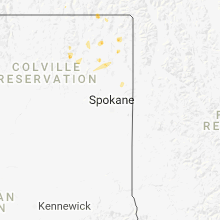
Hail Map for Valley, WA
The Valley, WA area has had 0 reports of on-the-ground hail by trained spotters, and has been under severe weather warnings 0 times during the past 12 months. Doppler radar has detected hail at or near Valley, WA on 4 occasions.
| Name: | Valley, WA |
| Where Located: | 38.3 miles NNW of Spokane, WA |
| Map: | Google Map for Valley, WA |
| Population: | 146 |
| Housing Units: | 59 |
| More Info: | Search Google for Valley, WA |
5
The Top Recent Hail Date for Valley, WA is Saturday, August 2, 2014 (1st out of 4)
Hail and Wind Damage Spotted near Valley, WA
| Date / Time | Report Details |
|---|---|
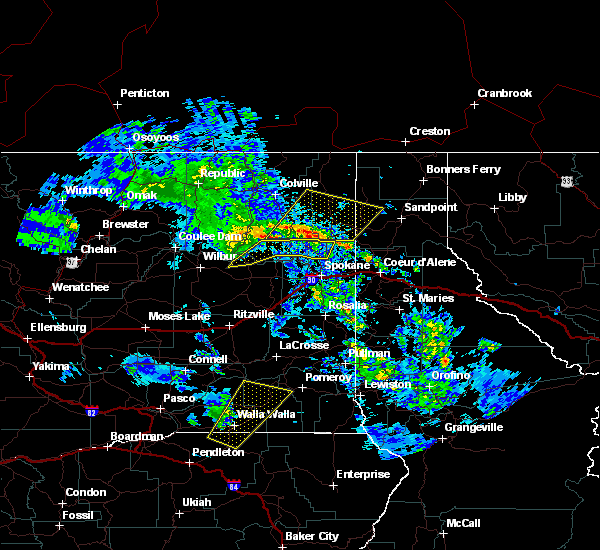
| 8/24/2022 4:30 PM PDT | At 430 pm pdt, a severe thunderstorm was located over chewelah, or 41 miles west of priest river, moving southeast at 10 mph (radar indicated). Hazards include half dollar size hail. damage to vehicles is expected |
| 5/30/2020 8:10 PM PDT |
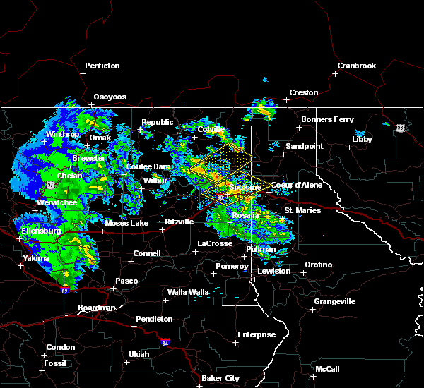
 At 809 pm pdt, severe thunderstorms were located along a line extending from 7 miles southwest of chewelah to 12 miles west of spirit lake, moving northeast at 50 mph (radar indicated). Hazards include 60 mph wind gusts and penny size hail. expect damage to roofs, siding, and trees At 809 pm pdt, severe thunderstorms were located along a line extending from 7 miles southwest of chewelah to 12 miles west of spirit lake, moving northeast at 50 mph (radar indicated). Hazards include 60 mph wind gusts and penny size hail. expect damage to roofs, siding, and trees
|
| 5/30/2020 8:10 PM PDT |
 At 809 pm pdt, severe thunderstorms were located along a line extending from 7 miles southwest of chewelah to 12 miles west of spirit lake, moving northeast at 50 mph (radar indicated). Hazards include 60 mph wind gusts and penny size hail. expect damage to roofs, siding, and trees At 809 pm pdt, severe thunderstorms were located along a line extending from 7 miles southwest of chewelah to 12 miles west of spirit lake, moving northeast at 50 mph (radar indicated). Hazards include 60 mph wind gusts and penny size hail. expect damage to roofs, siding, and trees
|
| 7/23/2019 9:18 PM PDT |
 At 917 pm pdt, severe thunderstorms were located along a line extending from 16 miles south of chewelah to near deer park, moving northeast at 25 mph (radar indicated). Hazards include 60 mph wind gusts and penny size hail. expect damage to roofs, siding, and trees At 917 pm pdt, severe thunderstorms were located along a line extending from 16 miles south of chewelah to near deer park, moving northeast at 25 mph (radar indicated). Hazards include 60 mph wind gusts and penny size hail. expect damage to roofs, siding, and trees
|
| 5/4/2016 11:04 PM PDT |
 At 1104 pm pdt, the public reported a line of severe thunderstorms producing damaging winds in excess of 60 mph. these storms were located along a line extending from 11 miles east of davenport to green acres, and moving north at 40 mph. At 1104 pm pdt, the public reported a line of severe thunderstorms producing damaging winds in excess of 60 mph. these storms were located along a line extending from 11 miles east of davenport to green acres, and moving north at 40 mph.
|
Hail Maps for Valley, WA


Connect with Interactive Hail Maps