

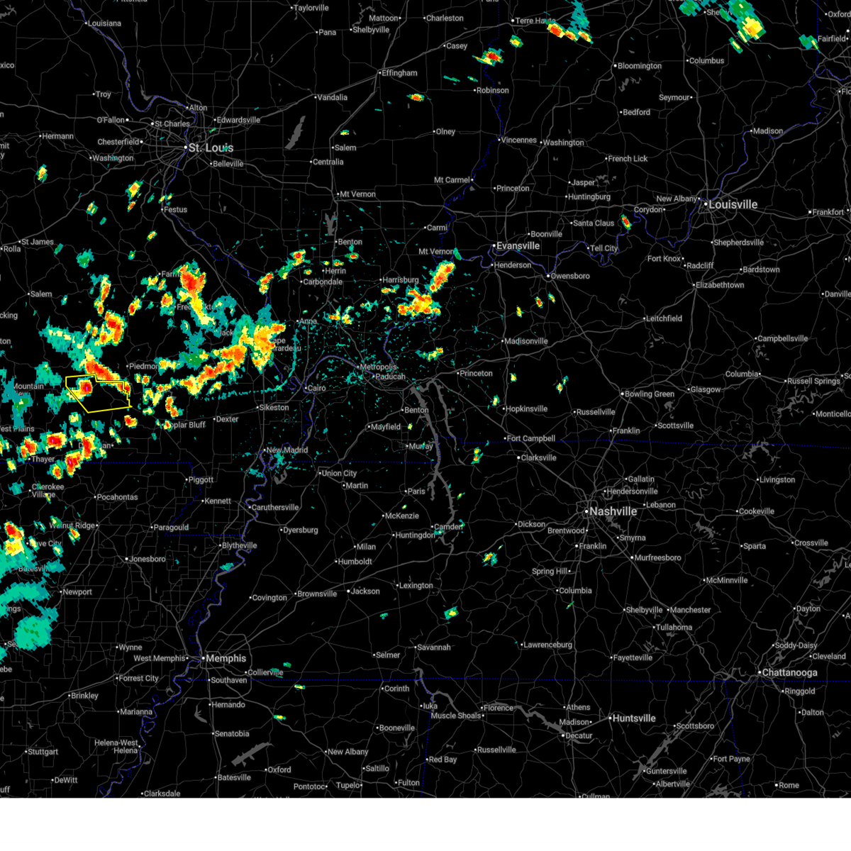
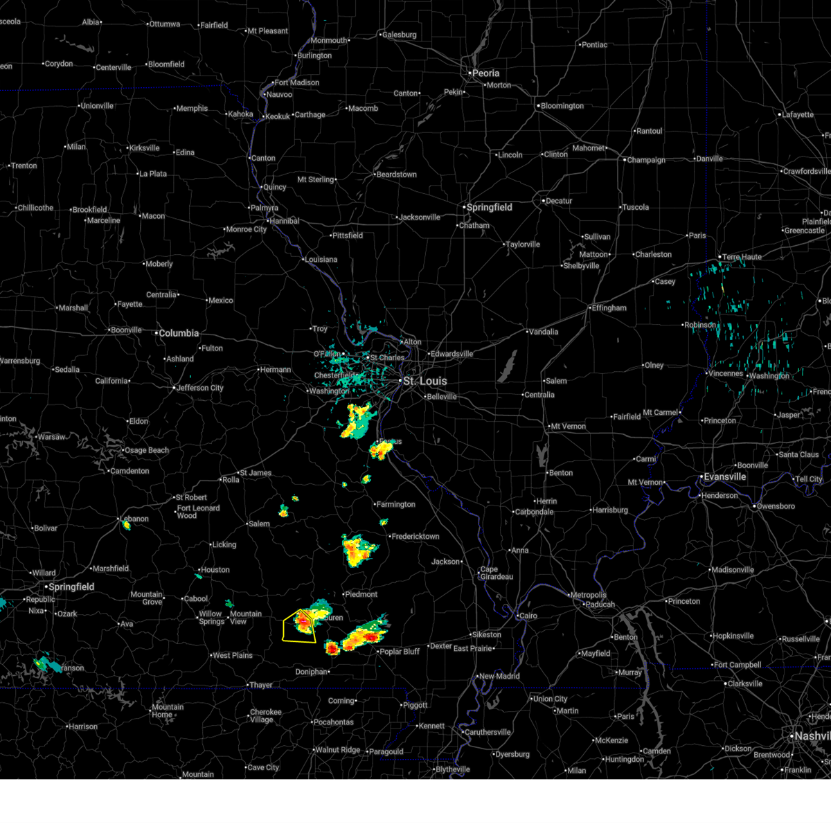
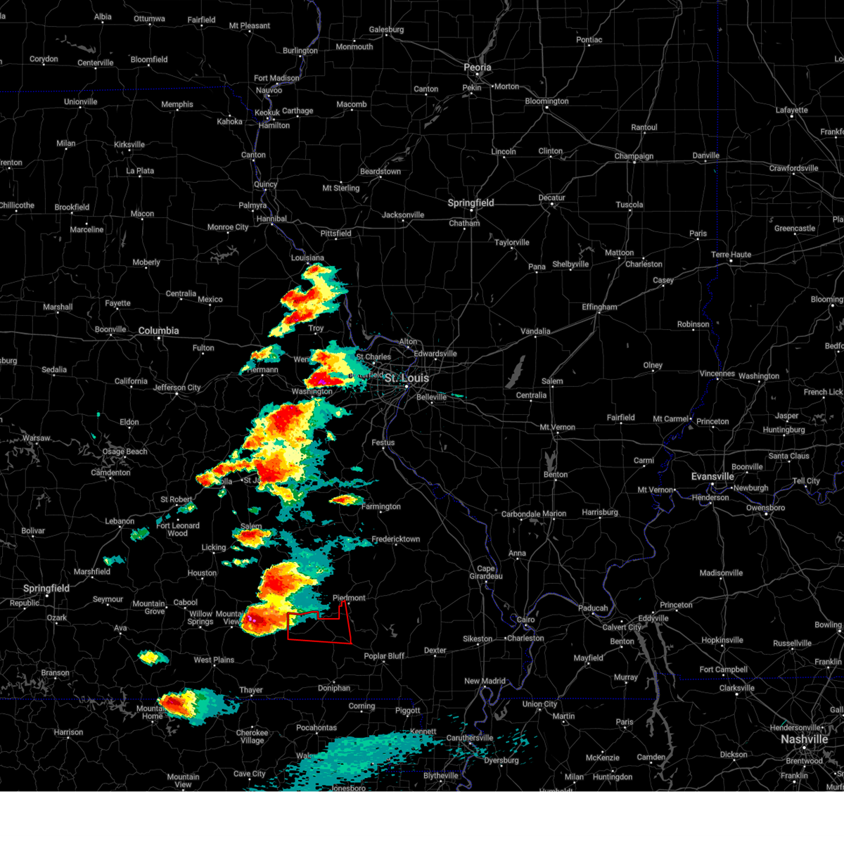
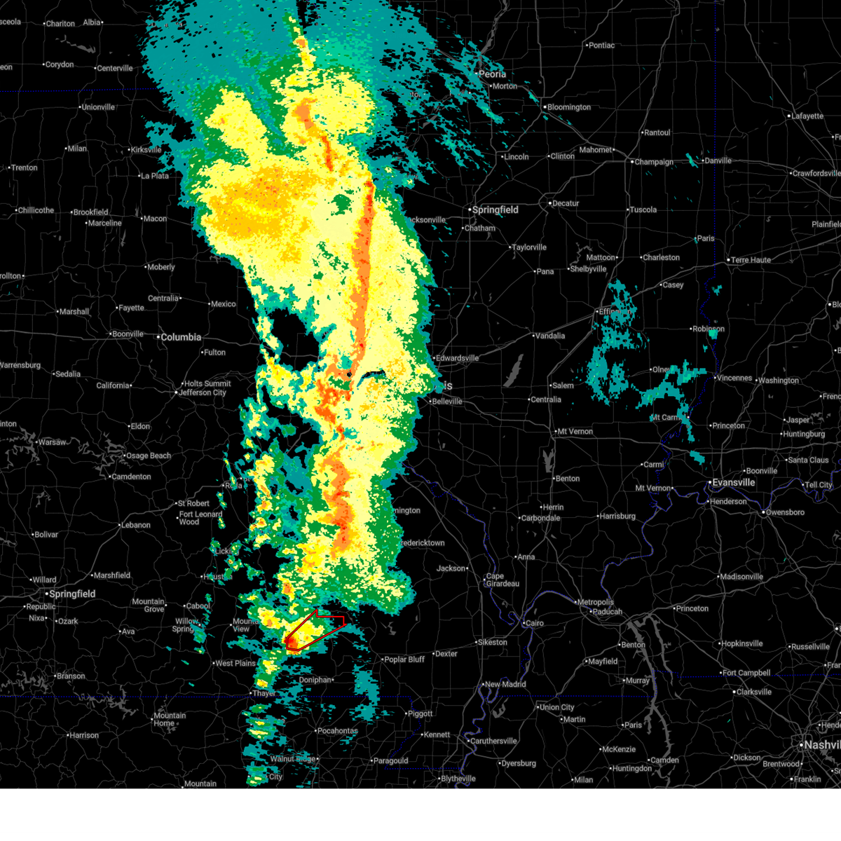
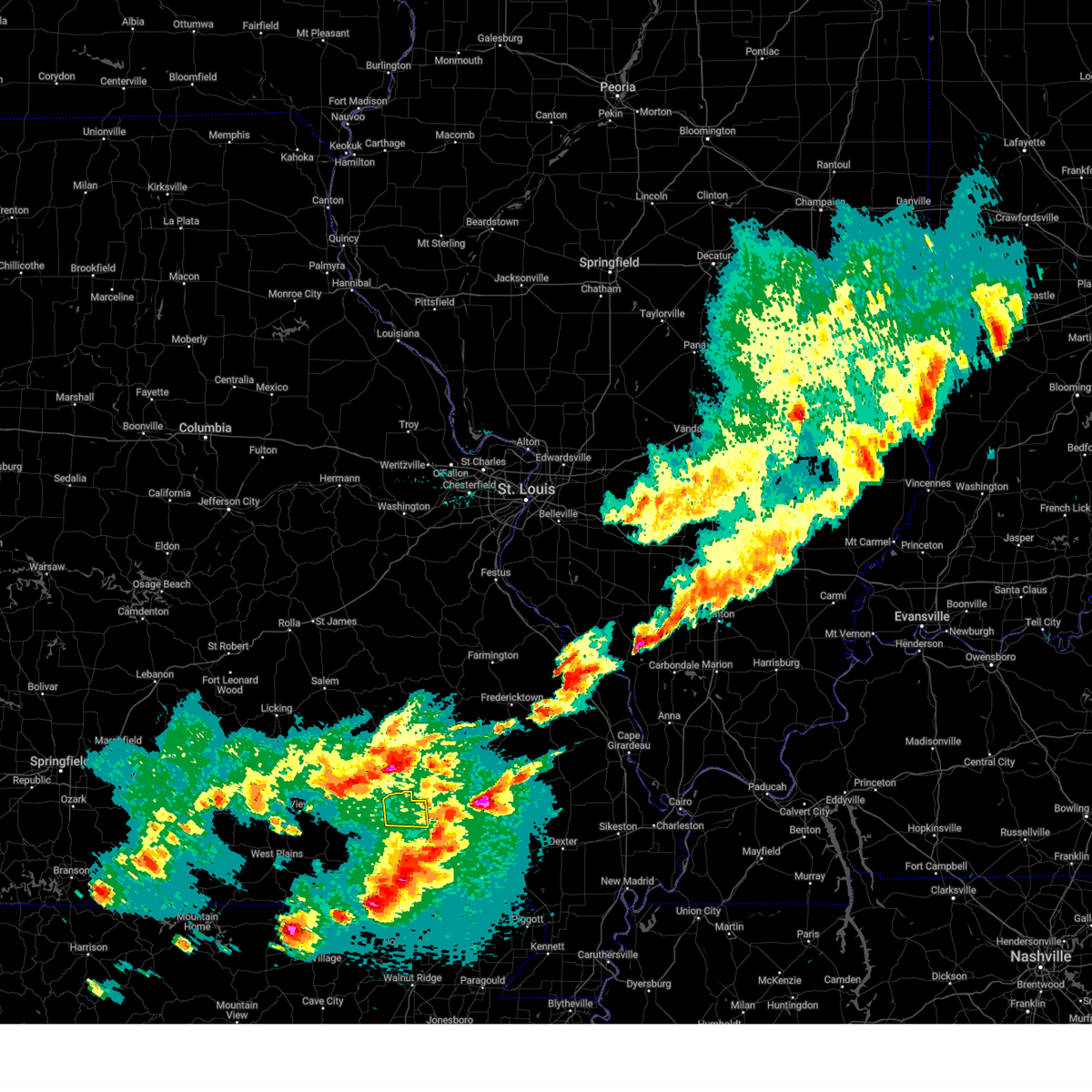
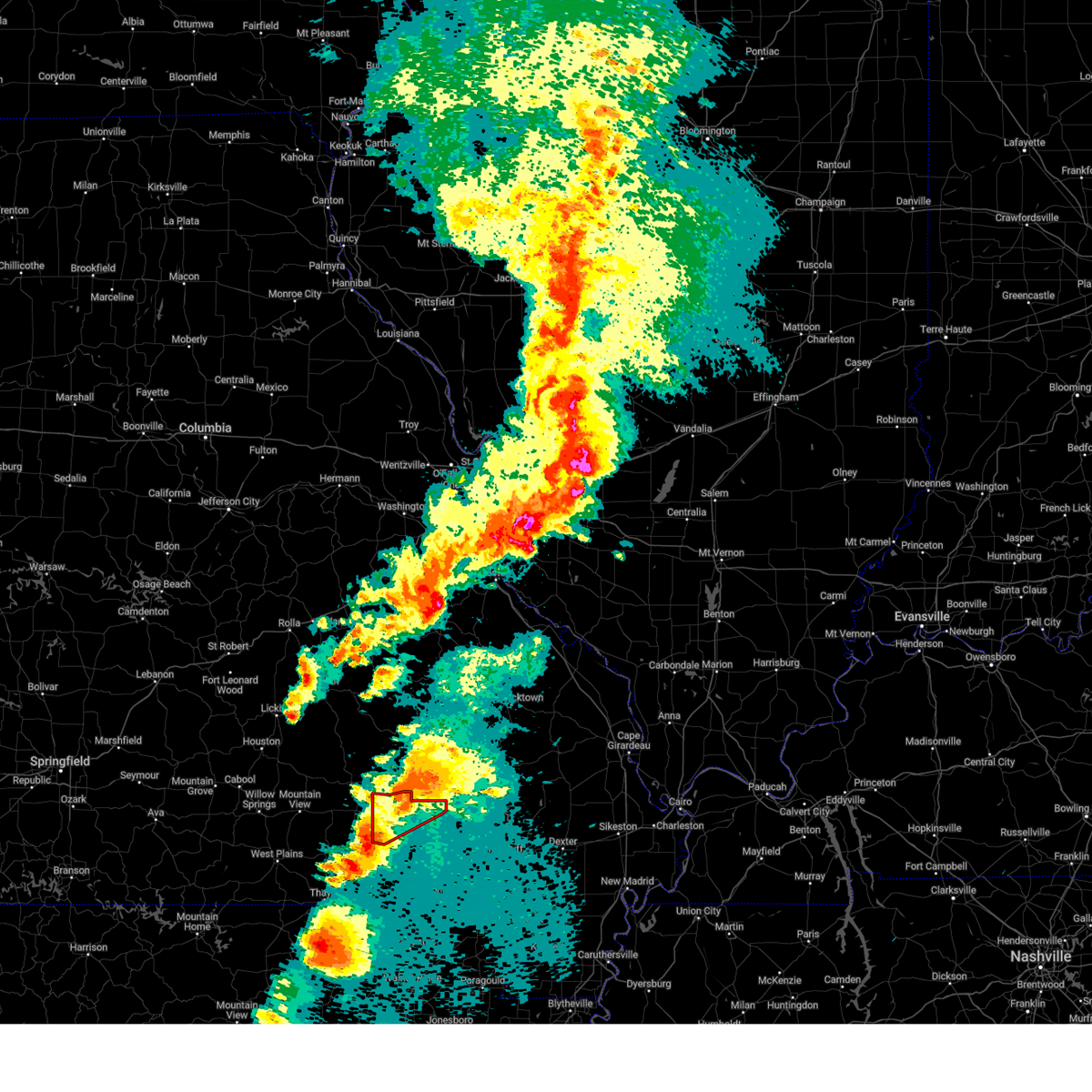
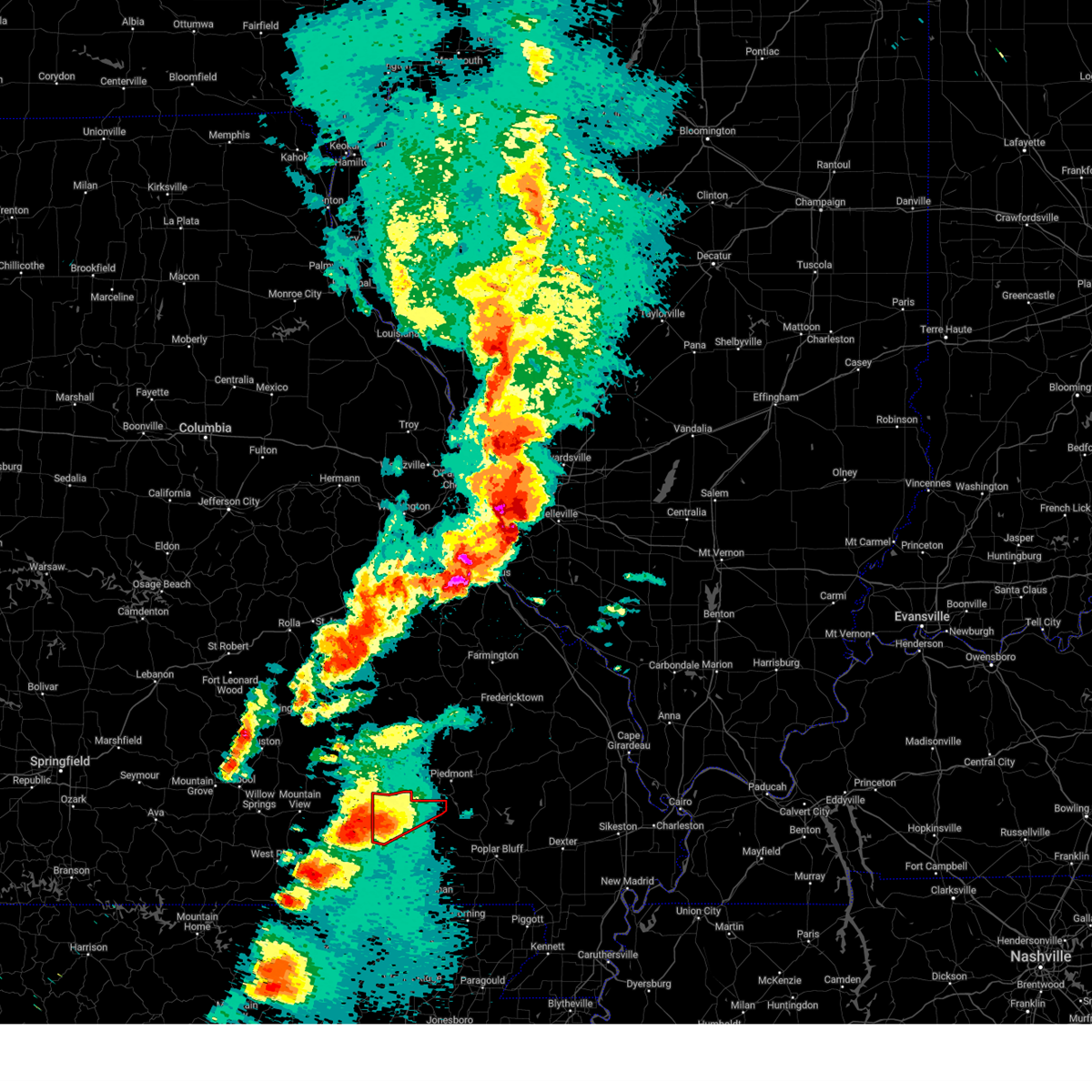
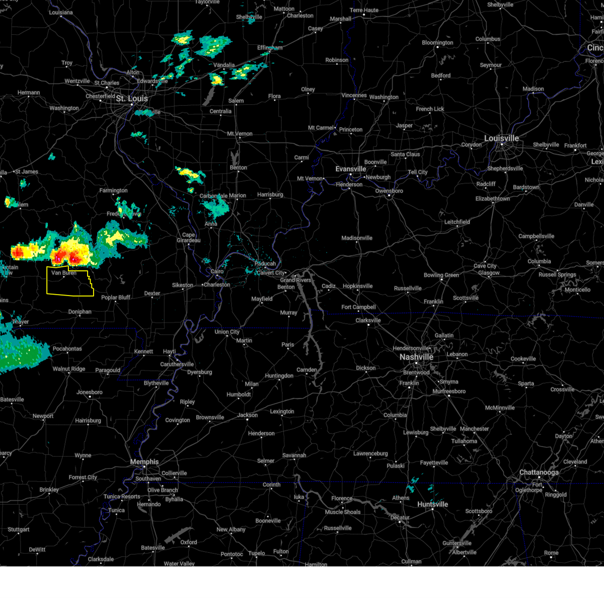
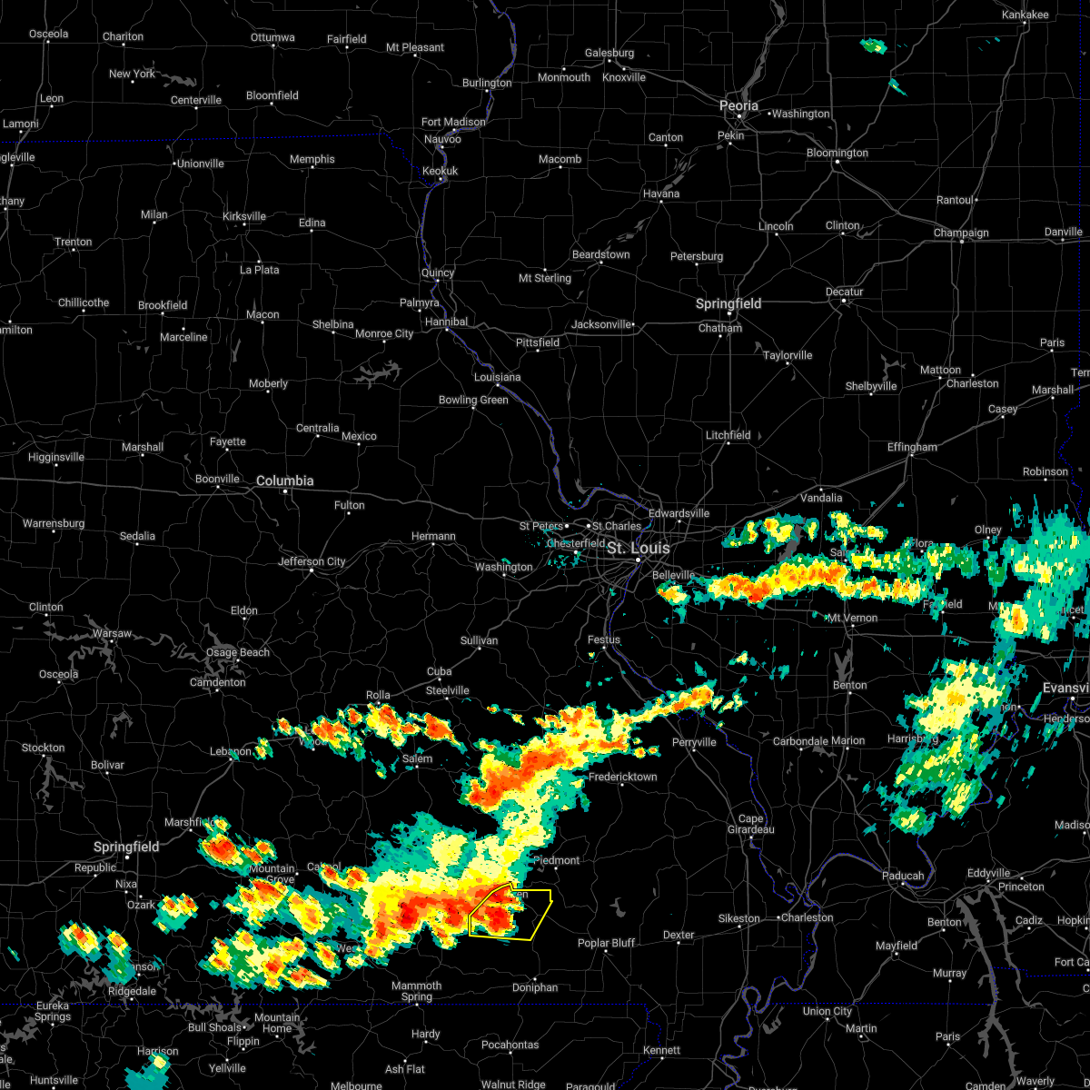
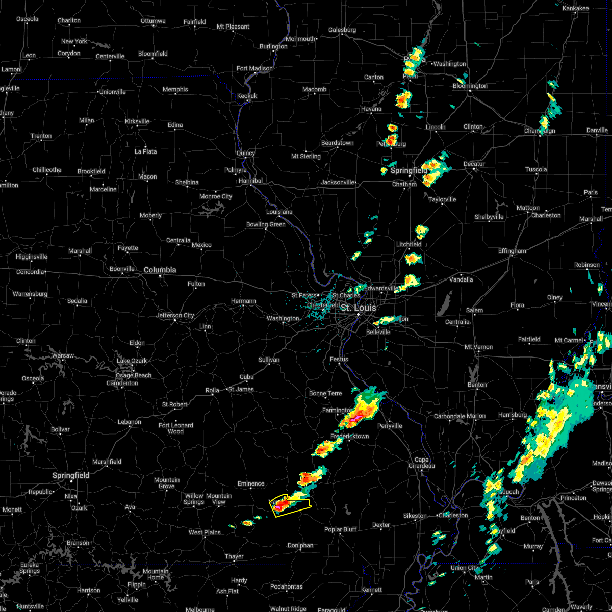
Hail Map for Van Buren, MO
The Van Buren, MO area has had 13 reports of on-the-ground hail by trained spotters, and has been under severe weather warnings 16 times during the past 12 months. Doppler radar has detected hail at or near Van Buren, MO on 77 occasions, including 4 occasions during the past year.
| Name: | Van Buren, MO |
| Where Located: | 52.4 miles SSE of Salem, MO |
| Map: | Google Map for Van Buren, MO |
| Population: | 819 |
| Housing Units: | 431 |
| More Info: | Search Google for Van Buren, MO |
2
The Top Recent Hail Date for Van Buren, MO is Tuesday, August 19, 2025 (8th out of 77)
Hail and Wind Damage Spotted near Van Buren, MO
| Date / Time | Report Details |
|---|---|
| 4/28/2026 3:58 PM CDT |
 Svrpah the national weather service in paducah has issued a * severe thunderstorm warning for, carter county in southeastern missouri, northern ripley county in southeastern missouri, southwestern wayne county in southeastern missouri, * until 445 pm cdt. * at 358 pm cdt, a severe thunderstorm was located 9 miles north of alton, or 21 miles southeast of mountain view, moving east at 60 mph (radar indicated). Hazards include golf ball size hail and 70 mph wind gusts. People and animals outdoors will be injured. expect hail damage to roofs, siding, windows, and vehicles. expect considerable tree damage. Wind damage is also likely to mobile homes, roofs, and outbuildings. Svrpah the national weather service in paducah has issued a * severe thunderstorm warning for, carter county in southeastern missouri, northern ripley county in southeastern missouri, southwestern wayne county in southeastern missouri, * until 445 pm cdt. * at 358 pm cdt, a severe thunderstorm was located 9 miles north of alton, or 21 miles southeast of mountain view, moving east at 60 mph (radar indicated). Hazards include golf ball size hail and 70 mph wind gusts. People and animals outdoors will be injured. expect hail damage to roofs, siding, windows, and vehicles. expect considerable tree damage. Wind damage is also likely to mobile homes, roofs, and outbuildings.
|
| 4/16/2026 2:52 PM CDT |
 At 251 pm cdt, a severe thunderstorm was located near van buren, moving northeast at 25 mph (radar indicated). Hazards include 60 mph wind gusts and quarter size hail. Hail damage to vehicles is expected. expect wind damage to roofs, siding, and trees. Locations impacted include, van buren. At 251 pm cdt, a severe thunderstorm was located near van buren, moving northeast at 25 mph (radar indicated). Hazards include 60 mph wind gusts and quarter size hail. Hail damage to vehicles is expected. expect wind damage to roofs, siding, and trees. Locations impacted include, van buren.
|
| 4/16/2026 2:33 PM CDT |
 Svrpah the national weather service in paducah has issued a * severe thunderstorm warning for, northern carter county in southeastern missouri, * until 315 pm cdt. * at 233 pm cdt, a severe thunderstorm was located near fremont, or 11 miles west of van buren, moving east at 35 mph (radar indicated). Hazards include 60 mph wind gusts and half dollar size hail. Hail damage to vehicles is expected. Expect wind damage to roofs, siding, and trees. Svrpah the national weather service in paducah has issued a * severe thunderstorm warning for, northern carter county in southeastern missouri, * until 315 pm cdt. * at 233 pm cdt, a severe thunderstorm was located near fremont, or 11 miles west of van buren, moving east at 35 mph (radar indicated). Hazards include 60 mph wind gusts and half dollar size hail. Hail damage to vehicles is expected. Expect wind damage to roofs, siding, and trees.
|
| 3/15/2026 5:26 PM CDT |
 At 526 pm cdt, severe thunderstorms were located along a line extending from 6 miles northeast of garwood to 6 miles south of hunter to near maynard, moving east at 50 mph (radar indicated). Hazards include 70 mph wind gusts. Expect considerable tree damage. damage is likely to mobile homes, roofs, and outbuildings. Locations impacted include, doniphan, van buren, naylor, ellsinore, budapest, hunter, gatewood, oxly, fairdealing, grandin, and briar. At 526 pm cdt, severe thunderstorms were located along a line extending from 6 miles northeast of garwood to 6 miles south of hunter to near maynard, moving east at 50 mph (radar indicated). Hazards include 70 mph wind gusts. Expect considerable tree damage. damage is likely to mobile homes, roofs, and outbuildings. Locations impacted include, doniphan, van buren, naylor, ellsinore, budapest, hunter, gatewood, oxly, fairdealing, grandin, and briar.
|
| 3/15/2026 5:24 PM CDT |
 At 524 pm cdt, a severe squall line capable of producing both tornadoes and extensive straight line wind damage was located along a line extending from near ellington to near garwood to near gatewood, moving northeast at 50 mph (radar indicated rotation). Hazards include tornado. Flying debris will be dangerous to those caught without shelter. mobile homes will be damaged or destroyed. damage to roofs, windows, and vehicles will occur. tree damage is likely. these dangerous storms will be near, hunter around 530 pm cdt. doniphan and ellsinore around 535 pm cdt. budapest around 545 pm cdt. Other locations impacted by these tornadic storms include grandin and briar. At 524 pm cdt, a severe squall line capable of producing both tornadoes and extensive straight line wind damage was located along a line extending from near ellington to near garwood to near gatewood, moving northeast at 50 mph (radar indicated rotation). Hazards include tornado. Flying debris will be dangerous to those caught without shelter. mobile homes will be damaged or destroyed. damage to roofs, windows, and vehicles will occur. tree damage is likely. these dangerous storms will be near, hunter around 530 pm cdt. doniphan and ellsinore around 535 pm cdt. budapest around 545 pm cdt. Other locations impacted by these tornadic storms include grandin and briar.
|
| 3/15/2026 5:19 PM CDT | Couple trees down at the junction of hwy c and hwy f near eastwoo in carter county MO, 7.7 miles N of Van Buren, MO |
| 3/15/2026 5:09 PM CDT |
 At 509 pm cdt, severe thunderstorms were located along a line extending from near fremont to near handy to near ravenden springs, moving east at 60 mph (radar indicated). Hazards include 70 mph wind gusts and penny size hail. Expect considerable tree damage. damage is likely to mobile homes, roofs, and outbuildings. Locations impacted include, doniphan, van buren, naylor, ellsinore, hunter, handy, budapest, gatewood, oxly, fairdealing, fremont, grandin, and briar. At 509 pm cdt, severe thunderstorms were located along a line extending from near fremont to near handy to near ravenden springs, moving east at 60 mph (radar indicated). Hazards include 70 mph wind gusts and penny size hail. Expect considerable tree damage. damage is likely to mobile homes, roofs, and outbuildings. Locations impacted include, doniphan, van buren, naylor, ellsinore, hunter, handy, budapest, gatewood, oxly, fairdealing, fremont, grandin, and briar.
|
| 3/15/2026 4:57 PM CDT |
 Torpah the national weather service in paducah has issued a * tornado warning for, carter county in southeastern missouri, ripley county in southeastern missouri, * until 545 pm cdt. * at 457 pm cdt, severe thunderstorms capable of producing both tornadoes and extensive straight line wind damage were located along a line extending from near winona to 7 miles west of handy to near highland in sharp county, moving northeast at 65 mph (radar indicated rotation). Hazards include tornado. Flying debris will be dangerous to those caught without shelter. mobile homes will be damaged or destroyed. damage to roofs, windows, and vehicles will occur. tree damage is likely. these dangerous storms will be near, fremont and handy around 500 pm cdt. van buren around 510 pm cdt. gatewood around 515 pm cdt. hunter around 525 pm cdt. ellsinore around 530 pm cdt. doniphan around 535 pm cdt. Other locations impacted by these tornadic storms include grandin and briar. Torpah the national weather service in paducah has issued a * tornado warning for, carter county in southeastern missouri, ripley county in southeastern missouri, * until 545 pm cdt. * at 457 pm cdt, severe thunderstorms capable of producing both tornadoes and extensive straight line wind damage were located along a line extending from near winona to 7 miles west of handy to near highland in sharp county, moving northeast at 65 mph (radar indicated rotation). Hazards include tornado. Flying debris will be dangerous to those caught without shelter. mobile homes will be damaged or destroyed. damage to roofs, windows, and vehicles will occur. tree damage is likely. these dangerous storms will be near, fremont and handy around 500 pm cdt. van buren around 510 pm cdt. gatewood around 515 pm cdt. hunter around 525 pm cdt. ellsinore around 530 pm cdt. doniphan around 535 pm cdt. Other locations impacted by these tornadic storms include grandin and briar.
|
| 3/15/2026 4:42 PM CDT |
 Svrpah the national weather service in paducah has issued a * severe thunderstorm warning for, carter county in southeastern missouri, ripley county in southeastern missouri, * until 545 pm cdt. * at 441 pm cdt, severe thunderstorms were located along a line extending from 10 miles south of mountain view to 6 miles west of alton to near ballard, moving east at 60 mph (radar indicated). Hazards include 70 mph wind gusts and penny size hail. Expect considerable tree damage. Damage is likely to mobile homes, roofs, and outbuildings. Svrpah the national weather service in paducah has issued a * severe thunderstorm warning for, carter county in southeastern missouri, ripley county in southeastern missouri, * until 545 pm cdt. * at 441 pm cdt, severe thunderstorms were located along a line extending from 10 miles south of mountain view to 6 miles west of alton to near ballard, moving east at 60 mph (radar indicated). Hazards include 70 mph wind gusts and penny size hail. Expect considerable tree damage. Damage is likely to mobile homes, roofs, and outbuildings.
|
| 1/8/2026 10:22 PM CST |
 The storm which prompted the warning has weakened below severe limits, and no longer poses an immediate threat to life or property. therefore, the warning will be allowed to expire. however, gusty winds are still possible with this thunderstorm. to report severe weather, contact your nearest law enforcement agency. they will relay your report to the national weather service paducah. The storm which prompted the warning has weakened below severe limits, and no longer poses an immediate threat to life or property. therefore, the warning will be allowed to expire. however, gusty winds are still possible with this thunderstorm. to report severe weather, contact your nearest law enforcement agency. they will relay your report to the national weather service paducah.
|
| 1/8/2026 10:05 PM CST |
 At 1005 pm cst, a severe thunderstorm was located near van buren, moving northeast at 55 mph (radar indicated). Hazards include 60 mph wind gusts. Expect damage to roofs, siding, and trees. Locations impacted include, van buren and fremont. At 1005 pm cst, a severe thunderstorm was located near van buren, moving northeast at 55 mph (radar indicated). Hazards include 60 mph wind gusts. Expect damage to roofs, siding, and trees. Locations impacted include, van buren and fremont.
|
| 1/8/2026 9:48 PM CST |
 Svrpah the national weather service in paducah has issued a * severe thunderstorm warning for, carter county in southeastern missouri, * until 1030 pm cst. * at 948 pm cst, a severe thunderstorm was located 9 miles west of handy, or 18 miles southwest of van buren, moving northeast at 55 mph (radar indicated). Hazards include 60 mph wind gusts and nickel size hail. expect damage to roofs, siding, and trees Svrpah the national weather service in paducah has issued a * severe thunderstorm warning for, carter county in southeastern missouri, * until 1030 pm cst. * at 948 pm cst, a severe thunderstorm was located 9 miles west of handy, or 18 miles southwest of van buren, moving northeast at 55 mph (radar indicated). Hazards include 60 mph wind gusts and nickel size hail. expect damage to roofs, siding, and trees
|
| 8/19/2025 2:52 PM CDT |
 The storm which prompted the warning has weakened below severe limits, and no longer poses an immediate threat to life or property. therefore, the warning will be allowed to expire. however, heavy rain is still possible with this thunderstorm. The storm which prompted the warning has weakened below severe limits, and no longer poses an immediate threat to life or property. therefore, the warning will be allowed to expire. however, heavy rain is still possible with this thunderstorm.
|
| 8/19/2025 2:45 PM CDT | Movie theater screen damaged at the 21 drive inn northeast of van buren due to strong wind in carter county MO, 6.4 miles WSW of Van Buren, MO |
| 8/19/2025 2:33 PM CDT |
 At 233 pm cdt, a severe thunderstorm was located over van buren, moving southeast at 15 mph (trained weather spotters). Hazards include 60 mph wind gusts and quarter size hail. Hail damage to vehicles is expected. expect wind damage to roofs, siding, and trees. Locations impacted include, van buren, ellsinore, and hunter. At 233 pm cdt, a severe thunderstorm was located over van buren, moving southeast at 15 mph (trained weather spotters). Hazards include 60 mph wind gusts and quarter size hail. Hail damage to vehicles is expected. expect wind damage to roofs, siding, and trees. Locations impacted include, van buren, ellsinore, and hunter.
|
| 8/19/2025 2:31 PM CDT | Quarter sized hail reported 0.7 miles SSW of Van Buren, MO, 50-55 mph wind gusts also reported. |
| 8/19/2025 2:22 PM CDT |
 Svrpah the national weather service in paducah has issued a * severe thunderstorm warning for, carter county in southeastern missouri, * until 300 pm cdt. * at 222 pm cdt, a severe thunderstorm was located near van buren, moving southeast at 20 mph (radar indicated). Hazards include 60 mph wind gusts. expect damage to roofs, siding, and trees Svrpah the national weather service in paducah has issued a * severe thunderstorm warning for, carter county in southeastern missouri, * until 300 pm cdt. * at 222 pm cdt, a severe thunderstorm was located near van buren, moving southeast at 20 mph (radar indicated). Hazards include 60 mph wind gusts. expect damage to roofs, siding, and trees
|
| 7/29/2025 7:02 PM CDT |
 the severe thunderstorm warning has been cancelled and is no longer in effect the severe thunderstorm warning has been cancelled and is no longer in effect
|
| 7/29/2025 6:20 PM CDT | Trees and power lines down near intersection of hwy c and hwy 6 in carter county MO, 5 miles NE of Van Buren, MO |
| 7/29/2025 6:20 PM CDT |
 Svrpah the national weather service in paducah has issued a * severe thunderstorm warning for, western carter county in southeastern missouri, * until 715 pm cdt. * at 619 pm cdt, a severe thunderstorm was located near fremont, or near van buren, moving southwest at 15 mph (radar indicated). Hazards include 60 mph wind gusts and penny size hail. expect damage to roofs, siding, and trees Svrpah the national weather service in paducah has issued a * severe thunderstorm warning for, western carter county in southeastern missouri, * until 715 pm cdt. * at 619 pm cdt, a severe thunderstorm was located near fremont, or near van buren, moving southwest at 15 mph (radar indicated). Hazards include 60 mph wind gusts and penny size hail. expect damage to roofs, siding, and trees
|
| 7/29/2025 6:08 PM CDT | 3 trees down at highway d and jason avenu in carter county MO, 1.4 miles SSW of Van Buren, MO |
| 6/9/2025 12:02 AM CDT |
 At 1202 am cdt, severe thunderstorms were located along a line extending from near garwood to near handy, moving east at 40 mph (radar indicated). Hazards include 60 mph wind gusts and quarter size hail. Hail damage to vehicles is expected. expect wind damage to roofs, siding, and trees. Locations impacted include, van buren, ellsinore, hunter, brush arbor, grandin, and mill spring. At 1202 am cdt, severe thunderstorms were located along a line extending from near garwood to near handy, moving east at 40 mph (radar indicated). Hazards include 60 mph wind gusts and quarter size hail. Hail damage to vehicles is expected. expect wind damage to roofs, siding, and trees. Locations impacted include, van buren, ellsinore, hunter, brush arbor, grandin, and mill spring.
|
| 6/8/2025 11:58 PM CDT |
 At 1158 pm cdt, severe thunderstorms were located along a line extending from near garwood to handy, moving east at 40 mph (radar indicated). Hazards include 60 mph wind gusts and quarter size hail. Hail damage to vehicles is expected. expect wind damage to roofs, siding, and trees. Locations impacted include, van buren, ellsinore, hunter, brush arbor, grandin, and mill spring. At 1158 pm cdt, severe thunderstorms were located along a line extending from near garwood to handy, moving east at 40 mph (radar indicated). Hazards include 60 mph wind gusts and quarter size hail. Hail damage to vehicles is expected. expect wind damage to roofs, siding, and trees. Locations impacted include, van buren, ellsinore, hunter, brush arbor, grandin, and mill spring.
|
| 6/8/2025 11:45 PM CDT |
 Svrpah the national weather service in paducah has issued a * severe thunderstorm warning for, carter county in southeastern missouri, southwestern wayne county in southeastern missouri, northwestern butler county in southeastern missouri, * until 1230 am cdt. * at 1145 pm cdt, severe thunderstorms were located along a line extending from near garwood to near handy, moving east at 40 mph (radar indicated). Hazards include 60 mph wind gusts and quarter size hail. Hail damage to vehicles is expected. Expect wind damage to roofs, siding, and trees. Svrpah the national weather service in paducah has issued a * severe thunderstorm warning for, carter county in southeastern missouri, southwestern wayne county in southeastern missouri, northwestern butler county in southeastern missouri, * until 1230 am cdt. * at 1145 pm cdt, severe thunderstorms were located along a line extending from near garwood to near handy, moving east at 40 mph (radar indicated). Hazards include 60 mph wind gusts and quarter size hail. Hail damage to vehicles is expected. Expect wind damage to roofs, siding, and trees.
|
| 5/19/2025 11:22 PM CDT |
 The storms which prompted the warning have weakened below severe limits, and no longer pose an immediate threat to life or property. therefore, the warning will be allowed to expire. however, heavy rain is still possible with these thunderstorms. a tornado watch remains in effect until 300 am cdt for southeastern missouri. The storms which prompted the warning have weakened below severe limits, and no longer pose an immediate threat to life or property. therefore, the warning will be allowed to expire. however, heavy rain is still possible with these thunderstorms. a tornado watch remains in effect until 300 am cdt for southeastern missouri.
|
| 5/19/2025 11:09 PM CDT |
 At 1109 pm cdt, severe thunderstorms were located along a line extending from near ellington to handy, moving east at 45 mph (radar indicated). Hazards include 60 mph wind gusts. Expect damage to roofs, siding, and trees. Locations impacted include, van buren, ellsinore, hunter, handy, fremont, grandin, and briar. At 1109 pm cdt, severe thunderstorms were located along a line extending from near ellington to handy, moving east at 45 mph (radar indicated). Hazards include 60 mph wind gusts. Expect damage to roofs, siding, and trees. Locations impacted include, van buren, ellsinore, hunter, handy, fremont, grandin, and briar.
|
| 5/19/2025 10:38 PM CDT |
 Svrpah the national weather service in paducah has issued a * severe thunderstorm warning for, carter county in southeastern missouri, northwestern ripley county in southeastern missouri, * until 1130 pm cdt. * at 1038 pm cdt, severe thunderstorms were located along a line extending from near eminence to near alton, moving east at 45 mph (radar indicated). Hazards include 60 mph wind gusts. expect damage to roofs, siding, and trees Svrpah the national weather service in paducah has issued a * severe thunderstorm warning for, carter county in southeastern missouri, northwestern ripley county in southeastern missouri, * until 1130 pm cdt. * at 1038 pm cdt, severe thunderstorms were located along a line extending from near eminence to near alton, moving east at 45 mph (radar indicated). Hazards include 60 mph wind gusts. expect damage to roofs, siding, and trees
|
| 5/16/2025 5:09 PM CDT |
 Svrpah the national weather service in paducah has issued a * severe thunderstorm warning for, west central bollinger county in southeastern missouri, northeastern carter county in southeastern missouri, wayne county in southeastern missouri, * until 600 pm cdt. * at 509 pm cdt, severe thunderstorms were located along a line extending from near sam a. baker state park to near van buren, moving east at 45 mph (radar indicated). Hazards include 60 mph wind gusts and quarter size hail. Hail damage to vehicles is expected. Expect wind damage to roofs, siding, and trees. Svrpah the national weather service in paducah has issued a * severe thunderstorm warning for, west central bollinger county in southeastern missouri, northeastern carter county in southeastern missouri, wayne county in southeastern missouri, * until 600 pm cdt. * at 509 pm cdt, severe thunderstorms were located along a line extending from near sam a. baker state park to near van buren, moving east at 45 mph (radar indicated). Hazards include 60 mph wind gusts and quarter size hail. Hail damage to vehicles is expected. Expect wind damage to roofs, siding, and trees.
|
| 5/16/2025 2:36 PM CDT | Tennis Ball sized hail reported 1.9 miles SE of Van Buren, MO |
| 5/16/2025 2:32 PM CDT |
 At 232 pm cdt, a severe thunderstorm capable of producing a tornado was located near van buren, moving east at 50 mph (radar indicated rotation). Hazards include tornado and softball size hail. Flying debris will be dangerous to those caught without shelter. mobile homes will be damaged or destroyed. damage to roofs, windows, and vehicles will occur. tree damage is likely. This dangerous storm will be near, ellsinore around 240 pm cdt. At 232 pm cdt, a severe thunderstorm capable of producing a tornado was located near van buren, moving east at 50 mph (radar indicated rotation). Hazards include tornado and softball size hail. Flying debris will be dangerous to those caught without shelter. mobile homes will be damaged or destroyed. damage to roofs, windows, and vehicles will occur. tree damage is likely. This dangerous storm will be near, ellsinore around 240 pm cdt.
|
| 5/16/2025 2:05 PM CDT |
 Torpah the national weather service in paducah has issued a * tornado warning for, carter county in southeastern missouri, southwestern wayne county in southeastern missouri, * until 300 pm cdt. * at 204 pm cdt, a severe thunderstorm capable of producing a tornado was located over winona, or 19 miles west of van buren, moving east at 55 mph (radar indicated rotation). Hazards include tornado and hail up to three inches in diameter. Flying debris will be dangerous to those caught without shelter. mobile homes will be damaged or destroyed. damage to roofs, windows, and vehicles will occur. tree damage is likely. this dangerous storm will be near, fremont around 210 pm cdt. van buren around 215 pm cdt. Ellsinore around 235 pm cdt. Torpah the national weather service in paducah has issued a * tornado warning for, carter county in southeastern missouri, southwestern wayne county in southeastern missouri, * until 300 pm cdt. * at 204 pm cdt, a severe thunderstorm capable of producing a tornado was located over winona, or 19 miles west of van buren, moving east at 55 mph (radar indicated rotation). Hazards include tornado and hail up to three inches in diameter. Flying debris will be dangerous to those caught without shelter. mobile homes will be damaged or destroyed. damage to roofs, windows, and vehicles will occur. tree damage is likely. this dangerous storm will be near, fremont around 210 pm cdt. van buren around 215 pm cdt. Ellsinore around 235 pm cdt.
|
| 5/1/2025 6:15 PM CDT | Quarter sized hail reported 0.3 miles W of Van Buren, MO |
| 5/1/2025 6:15 PM CDT |
 At 615 pm cdt, a severe thunderstorm was located over van buren, moving east at 30 mph (emergency management). Hazards include quarter size hail. Damage to vehicles is expected. Locations impacted include, van buren, ellsinore, and hunter. At 615 pm cdt, a severe thunderstorm was located over van buren, moving east at 30 mph (emergency management). Hazards include quarter size hail. Damage to vehicles is expected. Locations impacted include, van buren, ellsinore, and hunter.
|
| 5/1/2025 6:04 PM CDT |
 Svrpah the national weather service in paducah has issued a * severe thunderstorm warning for, carter county in southeastern missouri, * until 645 pm cdt. * at 604 pm cdt, a severe thunderstorm was located over fremont, or 7 miles southwest of van buren, moving east at 30 mph (emergency management). Hazards include quarter size hail. damage to vehicles is expected Svrpah the national weather service in paducah has issued a * severe thunderstorm warning for, carter county in southeastern missouri, * until 645 pm cdt. * at 604 pm cdt, a severe thunderstorm was located over fremont, or 7 miles southwest of van buren, moving east at 30 mph (emergency management). Hazards include quarter size hail. damage to vehicles is expected
|
| 4/20/2025 7:42 PM CDT |
 The storm which prompted the warning has weakened below severe limits, and no longer appears capable of producing a tornado. therefore, the warning will be allowed to expire. however, gusty winds to 50 mph are still possible with this thunderstorm. a tornado watch remains in effect until 1100 pm cdt for southeastern missouri. The storm which prompted the warning has weakened below severe limits, and no longer appears capable of producing a tornado. therefore, the warning will be allowed to expire. however, gusty winds to 50 mph are still possible with this thunderstorm. a tornado watch remains in effect until 1100 pm cdt for southeastern missouri.
|
| 4/20/2025 7:26 PM CDT |
 At 725 pm cdt, a severe thunderstorm capable of producing a tornado was located near fremont, or 10 miles southwest of van buren, moving northeast at 50 mph (radar indicated rotation). Hazards include tornado. Flying debris will be dangerous to those caught without shelter. mobile homes will be damaged or destroyed. damage to roofs, windows, and vehicles will occur. tree damage is likely. This dangerous storm will be near, fremont and van buren around 730 pm cdt. At 725 pm cdt, a severe thunderstorm capable of producing a tornado was located near fremont, or 10 miles southwest of van buren, moving northeast at 50 mph (radar indicated rotation). Hazards include tornado. Flying debris will be dangerous to those caught without shelter. mobile homes will be damaged or destroyed. damage to roofs, windows, and vehicles will occur. tree damage is likely. This dangerous storm will be near, fremont and van buren around 730 pm cdt.
|
| 4/20/2025 7:26 PM CDT |
 the tornado warning has been cancelled and is no longer in effect the tornado warning has been cancelled and is no longer in effect
|
| 4/20/2025 7:06 PM CDT |
 Torpah the national weather service in paducah has issued a * tornado warning for, carter county in southeastern missouri, northwestern ripley county in southeastern missouri, * until 745 pm cdt. * at 706 pm cdt, a severe thunderstorm capable of producing a tornado was located near alton, or 18 miles northeast of thayer, moving northeast at 60 mph (radar indicated rotation). Hazards include tornado and quarter size hail. Flying debris will be dangerous to those caught without shelter. mobile homes will be damaged or destroyed. damage to roofs, windows, and vehicles will occur. tree damage is likely. this dangerous storm will be near, fremont and handy around 715 pm cdt. Van buren around 725 pm cdt. Torpah the national weather service in paducah has issued a * tornado warning for, carter county in southeastern missouri, northwestern ripley county in southeastern missouri, * until 745 pm cdt. * at 706 pm cdt, a severe thunderstorm capable of producing a tornado was located near alton, or 18 miles northeast of thayer, moving northeast at 60 mph (radar indicated rotation). Hazards include tornado and quarter size hail. Flying debris will be dangerous to those caught without shelter. mobile homes will be damaged or destroyed. damage to roofs, windows, and vehicles will occur. tree damage is likely. this dangerous storm will be near, fremont and handy around 715 pm cdt. Van buren around 725 pm cdt.
|
| 4/2/2025 5:03 PM CDT |
 At 503 pm cdt, severe thunderstorms were located along a line extending from 11 miles southwest of ellington to 9 miles west of garwood to near van buren, moving northeast at 65 mph (radar indicated). Hazards include 60 mph wind gusts. Expect damage to roofs, siding, and trees. These severe thunderstorms will remain over mainly rural areas of northwestern carter county. At 503 pm cdt, severe thunderstorms were located along a line extending from 11 miles southwest of ellington to 9 miles west of garwood to near van buren, moving northeast at 65 mph (radar indicated). Hazards include 60 mph wind gusts. Expect damage to roofs, siding, and trees. These severe thunderstorms will remain over mainly rural areas of northwestern carter county.
|
| 4/2/2025 4:41 PM CDT |
 Svrpah the national weather service in paducah has issued a * severe thunderstorm warning for, northwestern carter county in southeastern missouri, * until 515 pm cdt. * at 440 pm cdt, severe thunderstorms were located along a line extending from near birch tree to 8 miles southwest of winona to 9 miles north of alton, moving northeast at 70 mph (radar indicated). Hazards include 60 mph wind gusts. Expect damage to roofs, siding, and trees. severe thunderstorms will be near, fremont around 455 pm cdt. Van buren around 500 pm cdt. Svrpah the national weather service in paducah has issued a * severe thunderstorm warning for, northwestern carter county in southeastern missouri, * until 515 pm cdt. * at 440 pm cdt, severe thunderstorms were located along a line extending from near birch tree to 8 miles southwest of winona to 9 miles north of alton, moving northeast at 70 mph (radar indicated). Hazards include 60 mph wind gusts. Expect damage to roofs, siding, and trees. severe thunderstorms will be near, fremont around 455 pm cdt. Van buren around 500 pm cdt.
|
| 4/2/2025 3:58 PM CDT |
 the severe thunderstorm warning has been cancelled and is no longer in effect the severe thunderstorm warning has been cancelled and is no longer in effect
|
| 4/2/2025 3:42 PM CDT |
 At 342 pm cdt, severe thunderstorms were located along a line extending from 9 miles northeast of eminence to near fremont, moving northeast at 55 mph (radar indicated). Hazards include 60 mph wind gusts and penny size hail. Expect damage to roofs, siding, and trees. These severe storms will be near, van buren around 350 pm cdt. At 342 pm cdt, severe thunderstorms were located along a line extending from 9 miles northeast of eminence to near fremont, moving northeast at 55 mph (radar indicated). Hazards include 60 mph wind gusts and penny size hail. Expect damage to roofs, siding, and trees. These severe storms will be near, van buren around 350 pm cdt.
|
| 4/2/2025 3:32 PM CDT |
 At 330 pm cdt, severe thunderstorms were located along a line extending from eminence to 9 miles north of alton, moving northeast at 55 mph (radar indicated). Hazards include 60 mph wind gusts and quarter size hail. Hail damage to vehicles is expected. expect wind damage to roofs, siding, and trees. these severe storms will be near, fremont around 345 pm cdt. Van buren around 355 pm cdt. At 330 pm cdt, severe thunderstorms were located along a line extending from eminence to 9 miles north of alton, moving northeast at 55 mph (radar indicated). Hazards include 60 mph wind gusts and quarter size hail. Hail damage to vehicles is expected. expect wind damage to roofs, siding, and trees. these severe storms will be near, fremont around 345 pm cdt. Van buren around 355 pm cdt.
|
| 4/2/2025 3:09 PM CDT |
 Svrpah the national weather service in paducah has issued a * severe thunderstorm warning for, carter county in southeastern missouri, * until 430 pm cdt. * at 309 pm cdt, severe thunderstorms were located along a line extending from near mountain view to 8 miles east of west plains, moving northeast at 45 mph (radar indicated). Hazards include 60 mph wind gusts and quarter size hail. Hail damage to vehicles is expected. expect wind damage to roofs, siding, and trees. severe thunderstorms will be near, fremont around 345 pm cdt. Van buren around 355 pm cdt. Svrpah the national weather service in paducah has issued a * severe thunderstorm warning for, carter county in southeastern missouri, * until 430 pm cdt. * at 309 pm cdt, severe thunderstorms were located along a line extending from near mountain view to 8 miles east of west plains, moving northeast at 45 mph (radar indicated). Hazards include 60 mph wind gusts and quarter size hail. Hail damage to vehicles is expected. expect wind damage to roofs, siding, and trees. severe thunderstorms will be near, fremont around 345 pm cdt. Van buren around 355 pm cdt.
|
| 3/30/2025 4:33 PM CDT |
 the severe thunderstorm warning has been cancelled and is no longer in effect the severe thunderstorm warning has been cancelled and is no longer in effect
|
| 3/30/2025 4:23 PM CDT | Quarter sized hail reported 4 miles SE of Van Buren, MO, reported on m hwy... 4 miles north of van buren. |
| 3/30/2025 4:20 PM CDT |
 At 419 pm cdt, a severe thunderstorm was located near van buren, moving east at 35 mph (radar indicated). Hazards include ping pong ball size hail and 60 mph wind gusts. People and animals outdoors will be injured. expect hail damage to roofs, siding, windows, and vehicles. expect wind damage to roofs, siding, and trees. Locations impacted include, van buren. At 419 pm cdt, a severe thunderstorm was located near van buren, moving east at 35 mph (radar indicated). Hazards include ping pong ball size hail and 60 mph wind gusts. People and animals outdoors will be injured. expect hail damage to roofs, siding, windows, and vehicles. expect wind damage to roofs, siding, and trees. Locations impacted include, van buren.
|
| 3/30/2025 4:00 PM CDT |
 Svrpah the national weather service in paducah has issued a * severe thunderstorm warning for, northwestern carter county in southeastern missouri, * until 445 pm cdt. * at 359 pm cdt, a severe thunderstorm was located over winona, or 16 miles west of van buren, moving east at 30 mph (radar indicated). Hazards include two inch hail and 60 mph wind gusts. People and animals outdoors will be injured. expect hail damage to roofs, siding, windows, and vehicles. Expect wind damage to roofs, siding, and trees. Svrpah the national weather service in paducah has issued a * severe thunderstorm warning for, northwestern carter county in southeastern missouri, * until 445 pm cdt. * at 359 pm cdt, a severe thunderstorm was located over winona, or 16 miles west of van buren, moving east at 30 mph (radar indicated). Hazards include two inch hail and 60 mph wind gusts. People and animals outdoors will be injured. expect hail damage to roofs, siding, windows, and vehicles. Expect wind damage to roofs, siding, and trees.
|
| 3/14/2025 10:28 PM CDT |
 the tornado warning has been cancelled and is no longer in effect the tornado warning has been cancelled and is no longer in effect
|
| 3/14/2025 10:28 PM CDT |
 At 1027 pm cdt, a severe thunderstorm capable of producing a tornado was located near van buren, moving northeast at 50 mph (radar indicated rotation). Hazards include tornado and two inch hail. Flying debris will be dangerous to those caught without shelter. mobile homes will be damaged or destroyed. damage to roofs, windows, and vehicles will occur. tree damage is likely. this dangerous storm will be near, piedmont around 1045 pm cdt. Other locations impacted by this tornadic thunderstorm include mill spring. At 1027 pm cdt, a severe thunderstorm capable of producing a tornado was located near van buren, moving northeast at 50 mph (radar indicated rotation). Hazards include tornado and two inch hail. Flying debris will be dangerous to those caught without shelter. mobile homes will be damaged or destroyed. damage to roofs, windows, and vehicles will occur. tree damage is likely. this dangerous storm will be near, piedmont around 1045 pm cdt. Other locations impacted by this tornadic thunderstorm include mill spring.
|
| 3/14/2025 10:14 PM CDT |
 The storm which prompted the warning has moved out of the area. therefore, the warning will be allowed to expire. a tornado watch remains in effect until 300 am cdt for southeastern missouri. remember, a tornado warning still remains in effect for carter county until 11 pm cdt. The storm which prompted the warning has moved out of the area. therefore, the warning will be allowed to expire. a tornado watch remains in effect until 300 am cdt for southeastern missouri. remember, a tornado warning still remains in effect for carter county until 11 pm cdt.
|
| 3/14/2025 10:12 PM CDT |
 Torpah the national weather service in paducah has issued a * tornado warning for, carter county in southeastern missouri, northwestern ripley county in southeastern missouri, western wayne county in southeastern missouri, * until 1100 pm cdt. * at 1012 pm cdt, a severe thunderstorm capable of producing a tornado was located near handy, or 14 miles southwest of van buren, moving northeast at 80 mph (radar indicated rotation). Hazards include tornado and hail up to two inches in diameter. Flying debris will be dangerous to those caught without shelter. mobile homes will be damaged or destroyed. damage to roofs, windows, and vehicles will occur. tree damage is likely. this dangerous storm will be near, hunter and van buren around 1020 pm cdt. ellsinore around 1025 pm cdt. piedmont around 1030 pm cdt. Other locations impacted by this tornadic thunderstorm include mill spring. Torpah the national weather service in paducah has issued a * tornado warning for, carter county in southeastern missouri, northwestern ripley county in southeastern missouri, western wayne county in southeastern missouri, * until 1100 pm cdt. * at 1012 pm cdt, a severe thunderstorm capable of producing a tornado was located near handy, or 14 miles southwest of van buren, moving northeast at 80 mph (radar indicated rotation). Hazards include tornado and hail up to two inches in diameter. Flying debris will be dangerous to those caught without shelter. mobile homes will be damaged or destroyed. damage to roofs, windows, and vehicles will occur. tree damage is likely. this dangerous storm will be near, hunter and van buren around 1020 pm cdt. ellsinore around 1025 pm cdt. piedmont around 1030 pm cdt. Other locations impacted by this tornadic thunderstorm include mill spring.
|
| 3/14/2025 10:06 PM CDT |
 At 1006 pm cdt, a confirmed large and destructive tornado was located near van buren, moving northeast at 55 mph. tornado emergency for van buren. this is a particularly dangerous situation. take cover now! (emergency management confirmed tornado). Hazards include deadly tornado. You are in a life-threatening situation. flying debris may be deadly to those caught without shelter. mobile homes will be destroyed. considerable damage to homes, businesses, and vehicles is likely and complete destruction is possible. This tornadic thunderstorm will remain over mainly rural areas of northwestern carter county. At 1006 pm cdt, a confirmed large and destructive tornado was located near van buren, moving northeast at 55 mph. tornado emergency for van buren. this is a particularly dangerous situation. take cover now! (emergency management confirmed tornado). Hazards include deadly tornado. You are in a life-threatening situation. flying debris may be deadly to those caught without shelter. mobile homes will be destroyed. considerable damage to homes, businesses, and vehicles is likely and complete destruction is possible. This tornadic thunderstorm will remain over mainly rural areas of northwestern carter county.
|
| 3/14/2025 10:00 PM CDT |
 Torpah the national weather service in paducah has issued a * tornado warning for, northwestern carter county in southeastern missouri, * until 1015 pm cdt. * at 959 pm cdt, a confirmed large and destructive tornado was observed near fremont, or near van buren, moving northeast at 60 mph. tornado emergency for van buren and fremont. this is a particularly dangerous situation. take cover now! (emergency management confirmed tornado). Hazards include deadly tornado. You are in a life-threatening situation. flying debris may be deadly to those caught without shelter. mobile homes will be destroyed. considerable damage to homes, businesses, and vehicles is likely and complete destruction is possible. The tornado will be near, van buren around 1005 pm cdt. Torpah the national weather service in paducah has issued a * tornado warning for, northwestern carter county in southeastern missouri, * until 1015 pm cdt. * at 959 pm cdt, a confirmed large and destructive tornado was observed near fremont, or near van buren, moving northeast at 60 mph. tornado emergency for van buren and fremont. this is a particularly dangerous situation. take cover now! (emergency management confirmed tornado). Hazards include deadly tornado. You are in a life-threatening situation. flying debris may be deadly to those caught without shelter. mobile homes will be destroyed. considerable damage to homes, businesses, and vehicles is likely and complete destruction is possible. The tornado will be near, van buren around 1005 pm cdt.
|
| 3/14/2025 9:58 PM CDT |
 At 957 pm cdt, a confirmed large and extremely dangerous tornado was located near fremont, or near van buren, moving northeast at 60 mph. this is a particularly dangerous situation. take cover now! (emergency management has confirmed damage southwest of fremont). Hazards include damaging tornado. You are in a life-threatening situation. flying debris may be deadly to those caught without shelter. mobile homes will be destroyed. considerable damage to homes, businesses, and vehicles is likely and complete destruction is possible. The tornado will be near, van buren around 1005 pm cdt. At 957 pm cdt, a confirmed large and extremely dangerous tornado was located near fremont, or near van buren, moving northeast at 60 mph. this is a particularly dangerous situation. take cover now! (emergency management has confirmed damage southwest of fremont). Hazards include damaging tornado. You are in a life-threatening situation. flying debris may be deadly to those caught without shelter. mobile homes will be destroyed. considerable damage to homes, businesses, and vehicles is likely and complete destruction is possible. The tornado will be near, van buren around 1005 pm cdt.
|
| 3/14/2025 9:46 PM CDT |
 At 944 pm cdt, a confirmed large and extremely dangerous tornado was located near fremont, or 14 miles west of van buren, moving northeast at 60 mph. this is a particularly dangerous situation. take cover now! (emergency management reported a tornado near rover earlier and radar now places this tornado near fremont). Hazards include damaging tornado. You are in a life-threatening situation. flying debris may be deadly to those caught without shelter. mobile homes will be destroyed. considerable damage to homes, businesses, and vehicles is likely and complete destruction is possible. The tornado will be near, fremont and van buren around 950 pm cdt. At 944 pm cdt, a confirmed large and extremely dangerous tornado was located near fremont, or 14 miles west of van buren, moving northeast at 60 mph. this is a particularly dangerous situation. take cover now! (emergency management reported a tornado near rover earlier and radar now places this tornado near fremont). Hazards include damaging tornado. You are in a life-threatening situation. flying debris may be deadly to those caught without shelter. mobile homes will be destroyed. considerable damage to homes, businesses, and vehicles is likely and complete destruction is possible. The tornado will be near, fremont and van buren around 950 pm cdt.
|
| 3/14/2025 9:24 PM CDT |
 Torpah the national weather service in paducah has issued a * tornado warning for, carter county in southeastern missouri, * until 1015 pm cdt. * at 922 pm cdt, a confirmed large and extremely dangerous tornado was located 8 miles southeast of west plains, moving northeast at 50 mph. this is a particularly dangerous situation. take cover now! (emergency management reported a tornado near rover). Hazards include damaging tornado. You are in a life-threatening situation. flying debris may be deadly to those caught without shelter. mobile homes will be destroyed. considerable damage to homes, businesses, and vehicles is likely and complete destruction is possible. The tornado will be near, fremont around 1000 pm cdt. Torpah the national weather service in paducah has issued a * tornado warning for, carter county in southeastern missouri, * until 1015 pm cdt. * at 922 pm cdt, a confirmed large and extremely dangerous tornado was located 8 miles southeast of west plains, moving northeast at 50 mph. this is a particularly dangerous situation. take cover now! (emergency management reported a tornado near rover). Hazards include damaging tornado. You are in a life-threatening situation. flying debris may be deadly to those caught without shelter. mobile homes will be destroyed. considerable damage to homes, businesses, and vehicles is likely and complete destruction is possible. The tornado will be near, fremont around 1000 pm cdt.
|
| 5/26/2024 7:05 PM CDT | Quarter sized hail reported 1.6 miles WSW of Van Buren, MO, 1 hail and trees down. |
| 5/26/2024 7:00 PM CDT | Trees down in van bure in carter county MO, 0.7 miles SSW of Van Buren, MO |
| 5/26/2024 6:58 PM CDT |
 Torpah the national weather service in paducah has issued a * tornado warning for, central carter county in southeastern missouri, * until 800 pm cdt. * at 657 pm cdt, a confirmed large and extremely dangerous tornado was located near van buren, moving east at 25 mph. this is a particularly dangerous situation. take cover now! (weather spotters confirmed tornado. this storms has a history of producing tornadoes!). Hazards include damaging tornado. You are in a life-threatening situation. flying debris may be deadly to those caught without shelter. mobile homes will be destroyed. considerable damage to homes, businesses, and vehicles is likely and complete destruction is possible. the tornado will be near, van buren around 705 pm cdt. Ellsinore around 725 pm cdt. Torpah the national weather service in paducah has issued a * tornado warning for, central carter county in southeastern missouri, * until 800 pm cdt. * at 657 pm cdt, a confirmed large and extremely dangerous tornado was located near van buren, moving east at 25 mph. this is a particularly dangerous situation. take cover now! (weather spotters confirmed tornado. this storms has a history of producing tornadoes!). Hazards include damaging tornado. You are in a life-threatening situation. flying debris may be deadly to those caught without shelter. mobile homes will be destroyed. considerable damage to homes, businesses, and vehicles is likely and complete destruction is possible. the tornado will be near, van buren around 705 pm cdt. Ellsinore around 725 pm cdt.
|
| 5/26/2024 6:49 PM CDT |
 At 648 pm cdt, a confirmed large and extremely dangerous tornado was located over fremont, or 7 miles west of van buren, moving east at 25 mph. this is a particularly dangerous situation. take cover now! (weather spotters confirmed tornado. this storm has a history of producing tornadoes!). Hazards include damaging tornado. You are in a life-threatening situation. flying debris may be deadly to those caught without shelter. mobile homes will be destroyed. considerable damage to homes, businesses, and vehicles is likely and complete destruction is possible. The tornado will be near, van buren around 655 pm cdt. At 648 pm cdt, a confirmed large and extremely dangerous tornado was located over fremont, or 7 miles west of van buren, moving east at 25 mph. this is a particularly dangerous situation. take cover now! (weather spotters confirmed tornado. this storm has a history of producing tornadoes!). Hazards include damaging tornado. You are in a life-threatening situation. flying debris may be deadly to those caught without shelter. mobile homes will be destroyed. considerable damage to homes, businesses, and vehicles is likely and complete destruction is possible. The tornado will be near, van buren around 655 pm cdt.
|
| 5/26/2024 6:38 PM CDT |
 At 637 pm cdt, a confirmed tornado was located just west of fremont, or 11 miles west of van buren, moving east at 45 mph (weather spotters confirmed tornado). Hazards include damaging tornado. Flying debris will be dangerous to those caught without shelter. mobile homes will be damaged or destroyed. damage to roofs, windows, and vehicles will occur. tree damage is likely. this tornado will be near, fremont around 645 pm cdt. Van buren around 700 pm cdt. At 637 pm cdt, a confirmed tornado was located just west of fremont, or 11 miles west of van buren, moving east at 45 mph (weather spotters confirmed tornado). Hazards include damaging tornado. Flying debris will be dangerous to those caught without shelter. mobile homes will be damaged or destroyed. damage to roofs, windows, and vehicles will occur. tree damage is likely. this tornado will be near, fremont around 645 pm cdt. Van buren around 700 pm cdt.
|
| 5/26/2024 6:11 PM CDT |
 Torpah the national weather service in paducah has issued a * tornado warning for, western carter county in southeastern missouri, * until 715 pm cdt. * at 609 pm cdt, a confirmed tornado was located over birch tree, or 11 miles east of mountain view, moving east at 30 mph (weather spotters confirmed tornado). Hazards include damaging tornado and quarter size hail. Flying debris will be dangerous to those caught without shelter. mobile homes will be damaged or destroyed. damage to roofs, windows, and vehicles will occur. tree damage is likely. the tornado will be near, fremont around 630 pm cdt. Van buren around 645 pm cdt. Torpah the national weather service in paducah has issued a * tornado warning for, western carter county in southeastern missouri, * until 715 pm cdt. * at 609 pm cdt, a confirmed tornado was located over birch tree, or 11 miles east of mountain view, moving east at 30 mph (weather spotters confirmed tornado). Hazards include damaging tornado and quarter size hail. Flying debris will be dangerous to those caught without shelter. mobile homes will be damaged or destroyed. damage to roofs, windows, and vehicles will occur. tree damage is likely. the tornado will be near, fremont around 630 pm cdt. Van buren around 645 pm cdt.
|
| 5/26/2024 6:03 AM CDT |
 The storm which prompted the warning has weakened below severe limits, and has exited the warned area. therefore, the warning has been allowed to expire. a tornado watch remains in effect until 1000 am cdt for southeastern missouri. The storm which prompted the warning has weakened below severe limits, and has exited the warned area. therefore, the warning has been allowed to expire. a tornado watch remains in effect until 1000 am cdt for southeastern missouri.
|
| 5/26/2024 5:30 AM CDT |
 Svrpah the national weather service in paducah has issued a * severe thunderstorm warning for, northwestern carter county in southeastern missouri, * until 600 am cdt. * at 529 am cdt, a severe thunderstorm was located over fremont, or 10 miles west of van buren, moving northeast at 55 mph (radar indicated). Hazards include 60 mph wind gusts and quarter size hail. Hail damage to vehicles is expected. Expect wind damage to roofs, siding, and trees. Svrpah the national weather service in paducah has issued a * severe thunderstorm warning for, northwestern carter county in southeastern missouri, * until 600 am cdt. * at 529 am cdt, a severe thunderstorm was located over fremont, or 10 miles west of van buren, moving northeast at 55 mph (radar indicated). Hazards include 60 mph wind gusts and quarter size hail. Hail damage to vehicles is expected. Expect wind damage to roofs, siding, and trees.
|
| 5/25/2024 12:36 AM CDT |
 The storm which prompted the warning has weakened below severe limits, and no longer poses an immediate threat to life or property. therefore, the warning will be allowed to expire. The storm which prompted the warning has weakened below severe limits, and no longer poses an immediate threat to life or property. therefore, the warning will be allowed to expire.
|
| 5/25/2024 12:25 AM CDT |
 At 1225 am cdt, a severe thunderstorm was located near winona, or 13 miles west of van buren, moving southeast at 15 mph (radar indicated). Hazards include 60 mph wind gusts and quarter size hail. Hail damage to vehicles is expected. expect wind damage to roofs, siding, and trees. Locations impacted include, van buren and fremont. At 1225 am cdt, a severe thunderstorm was located near winona, or 13 miles west of van buren, moving southeast at 15 mph (radar indicated). Hazards include 60 mph wind gusts and quarter size hail. Hail damage to vehicles is expected. expect wind damage to roofs, siding, and trees. Locations impacted include, van buren and fremont.
|
| 5/24/2024 11:55 PM CDT |
 Svrpah the national weather service in paducah has issued a * severe thunderstorm warning for, western carter county in southeastern missouri, * until 1245 am cdt. * at 1154 pm cdt, a severe thunderstorm was located near winona, or 17 miles west of van buren, moving southeast at 25 mph (radar indicated). Hazards include 60 mph wind gusts and quarter size hail. Hail damage to vehicles is expected. expect wind damage to roofs, siding, and trees. this severe thunderstorm will be near, fremont around 1205 am cdt. Van buren around 1220 am cdt. Svrpah the national weather service in paducah has issued a * severe thunderstorm warning for, western carter county in southeastern missouri, * until 1245 am cdt. * at 1154 pm cdt, a severe thunderstorm was located near winona, or 17 miles west of van buren, moving southeast at 25 mph (radar indicated). Hazards include 60 mph wind gusts and quarter size hail. Hail damage to vehicles is expected. expect wind damage to roofs, siding, and trees. this severe thunderstorm will be near, fremont around 1205 am cdt. Van buren around 1220 am cdt.
|
| 3/14/2024 6:10 PM CDT |
 At 609 pm cdt, severe thunderstorms were located along a line extending from near ellington to near cherokee village, moving east at 40 mph (radar indicated). Hazards include 60 mph wind gusts and penny size hail. Expect damage to roofs, siding, and trees. Locations impacted include, piedmont, van buren, ellsinore, gatewood, hunter, handy, fremont, grandin, mill spring, and briar. At 609 pm cdt, severe thunderstorms were located along a line extending from near ellington to near cherokee village, moving east at 40 mph (radar indicated). Hazards include 60 mph wind gusts and penny size hail. Expect damage to roofs, siding, and trees. Locations impacted include, piedmont, van buren, ellsinore, gatewood, hunter, handy, fremont, grandin, mill spring, and briar.
|
| 3/14/2024 5:45 PM CDT |
 Svrpah the national weather service in paducah has issued a * severe thunderstorm warning for, carter county in southeastern missouri, western ripley county in southeastern missouri, northwestern wayne county in southeastern missouri, * until 645 pm cdt. * at 544 pm cdt, severe thunderstorms were located along a line extending from near eminence to bexar, moving east at 45 mph (radar indicated). Hazards include 60 mph wind gusts and penny size hail. expect damage to roofs, siding, and trees Svrpah the national weather service in paducah has issued a * severe thunderstorm warning for, carter county in southeastern missouri, western ripley county in southeastern missouri, northwestern wayne county in southeastern missouri, * until 645 pm cdt. * at 544 pm cdt, severe thunderstorms were located along a line extending from near eminence to bexar, moving east at 45 mph (radar indicated). Hazards include 60 mph wind gusts and penny size hail. expect damage to roofs, siding, and trees
|
| 8/3/2023 12:58 AM CDT |
 At 1258 am cdt, severe thunderstorms were located along a line extending from saco to near piedmont to 9 miles northeast of winona, moving southeast at 35 mph (radar indicated). Hazards include 60 mph wind gusts and penny size hail. expect damage to roofs, siding, and trees At 1258 am cdt, severe thunderstorms were located along a line extending from saco to near piedmont to 9 miles northeast of winona, moving southeast at 35 mph (radar indicated). Hazards include 60 mph wind gusts and penny size hail. expect damage to roofs, siding, and trees
|
| 8/3/2023 12:36 AM CDT |
 At 1236 am cdt, severe thunderstorms were located along a line extending from near annapolis to near eminence, moving southeast at 55 mph (radar indicated). Hazards include 60 mph wind gusts and nickel size hail. expect damage to roofs, siding, and trees At 1236 am cdt, severe thunderstorms were located along a line extending from near annapolis to near eminence, moving southeast at 55 mph (radar indicated). Hazards include 60 mph wind gusts and nickel size hail. expect damage to roofs, siding, and trees
|
| 7/7/2023 10:37 PM CDT |
 At 1036 pm cdt, a severe thunderstorm was located near van buren, moving southeast at 20 mph (radar indicated). Hazards include 60 mph wind gusts and half dollar size hail. Hail damage to vehicles is expected. Expect wind damage to roofs, siding, and trees. At 1036 pm cdt, a severe thunderstorm was located near van buren, moving southeast at 20 mph (radar indicated). Hazards include 60 mph wind gusts and half dollar size hail. Hail damage to vehicles is expected. Expect wind damage to roofs, siding, and trees.
|
| 7/7/2023 10:17 PM CDT |
 At 1017 pm cdt, a severe thunderstorm was located over van buren, moving southeast at 20 mph (radar indicated). Hazards include ping pong ball size hail and 60 mph wind gusts. People and animals outdoors will be injured. expect hail damage to roofs, siding, windows, and vehicles. expect wind damage to roofs, siding, and trees. locations impacted include, van buren, ellsinore, hunter and grandin. hail threat, radar indicated max hail size, 1. 50 in wind threat, radar indicated max wind gust, 60 mph. At 1017 pm cdt, a severe thunderstorm was located over van buren, moving southeast at 20 mph (radar indicated). Hazards include ping pong ball size hail and 60 mph wind gusts. People and animals outdoors will be injured. expect hail damage to roofs, siding, windows, and vehicles. expect wind damage to roofs, siding, and trees. locations impacted include, van buren, ellsinore, hunter and grandin. hail threat, radar indicated max hail size, 1. 50 in wind threat, radar indicated max wind gust, 60 mph.
|
| 7/7/2023 9:52 PM CDT |
 At 952 pm cdt, severe thunderstorms were located along a line extending from near garwood to 7 miles south of ellington to 10 miles northwest of van buren, moving south at 20 mph (radar indicated). Hazards include 60 mph wind gusts and quarter size hail. Hail damage to vehicles is expected. Expect wind damage to roofs, siding, and trees. At 952 pm cdt, severe thunderstorms were located along a line extending from near garwood to 7 miles south of ellington to 10 miles northwest of van buren, moving south at 20 mph (radar indicated). Hazards include 60 mph wind gusts and quarter size hail. Hail damage to vehicles is expected. Expect wind damage to roofs, siding, and trees.
|
| 4/20/2023 5:09 PM CDT |
 At 508 pm cdt, a severe thunderstorm was located near garwood, or near van buren, moving northeast at 40 mph (trained weather spotters. multiple reports of nickel to quarter sized hail have been received in van buren). Hazards include 60 mph wind gusts and quarter size hail. Hail damage to vehicles is expected. expect wind damage to roofs, siding, and trees. locations impacted include, piedmont, van buren and mill spring. hail threat, radar indicated max hail size, 1. 00 in wind threat, radar indicated max wind gust, 60 mph. At 508 pm cdt, a severe thunderstorm was located near garwood, or near van buren, moving northeast at 40 mph (trained weather spotters. multiple reports of nickel to quarter sized hail have been received in van buren). Hazards include 60 mph wind gusts and quarter size hail. Hail damage to vehicles is expected. expect wind damage to roofs, siding, and trees. locations impacted include, piedmont, van buren and mill spring. hail threat, radar indicated max hail size, 1. 00 in wind threat, radar indicated max wind gust, 60 mph.
|
| 4/20/2023 5:07 PM CDT | Quarter sized hail reported 0.3 miles W of Van Buren, MO, two separate reports of dime to quarter size hail in van buren. report relayed by emergency management. |
| 4/20/2023 5:02 PM CDT |
 At 502 pm cdt, a severe thunderstorm was located over van buren, moving northeast at 45 mph (radar indicated). Hazards include 60 mph wind gusts and quarter size hail. Hail damage to vehicles is expected. Expect wind damage to roofs, siding, and trees. At 502 pm cdt, a severe thunderstorm was located over van buren, moving northeast at 45 mph (radar indicated). Hazards include 60 mph wind gusts and quarter size hail. Hail damage to vehicles is expected. Expect wind damage to roofs, siding, and trees.
|
| 4/5/2023 1:56 AM CDT |
 At 156 am cdt, severe thunderstorms were located along a line extending from near ellsinore to near alton, moving northeast at 50 mph (radar indicated). Hazards include 60 mph wind gusts and quarter size hail. Hail damage to vehicles is expected. Expect wind damage to roofs, siding, and trees. At 156 am cdt, severe thunderstorms were located along a line extending from near ellsinore to near alton, moving northeast at 50 mph (radar indicated). Hazards include 60 mph wind gusts and quarter size hail. Hail damage to vehicles is expected. Expect wind damage to roofs, siding, and trees.
|
| 7/17/2022 7:39 PM CDT |
 The severe thunderstorm warning for carter county will expire at 745 pm cdt, the storm which prompted the warning has moved out of the area. therefore, the warning will be allowed to expire. however heavy rain is still possible with this thunderstorm. to report severe weather, contact your nearest law enforcement agency. they will relay your report to the national weather service paducah. The severe thunderstorm warning for carter county will expire at 745 pm cdt, the storm which prompted the warning has moved out of the area. therefore, the warning will be allowed to expire. however heavy rain is still possible with this thunderstorm. to report severe weather, contact your nearest law enforcement agency. they will relay your report to the national weather service paducah.
|
| 7/17/2022 7:16 PM CDT |
 At 715 pm cdt, a severe thunderstorm was located near van buren, moving east at 25 mph (emergency management reported two trees down northwest of van buren around 7 pm cdt). Hazards include 60 mph wind gusts and penny size hail. Expect damage to roofs, siding, and trees. locations impacted include, van buren and hunter. hail threat, radar indicated max hail size, 0. 75 in wind threat, radar indicated max wind gust, 60 mph. At 715 pm cdt, a severe thunderstorm was located near van buren, moving east at 25 mph (emergency management reported two trees down northwest of van buren around 7 pm cdt). Hazards include 60 mph wind gusts and penny size hail. Expect damage to roofs, siding, and trees. locations impacted include, van buren and hunter. hail threat, radar indicated max hail size, 0. 75 in wind threat, radar indicated max wind gust, 60 mph.
|
| 7/17/2022 7:06 PM CDT |
 At 705 pm cdt, a severe thunderstorm was located near van buren, moving southeast at 25 mph (radar indicated). Hazards include 60 mph wind gusts and penny size hail. Expect damage to roofs, siding, and trees. locations impacted include, van buren, hunter and fremont. hail threat, radar indicated max hail size, 0. 75 in wind threat, radar indicated max wind gust, 60 mph. At 705 pm cdt, a severe thunderstorm was located near van buren, moving southeast at 25 mph (radar indicated). Hazards include 60 mph wind gusts and penny size hail. Expect damage to roofs, siding, and trees. locations impacted include, van buren, hunter and fremont. hail threat, radar indicated max hail size, 0. 75 in wind threat, radar indicated max wind gust, 60 mph.
|
| 7/17/2022 7:02 PM CDT | Roof damage to a business in van bure in carter county MO, 0.3 miles W of Van Buren, MO |
| 7/17/2022 7:00 PM CDT | Multiple trees down along route m nw of van bure in carter county MO, 4 miles SE of Van Buren, MO |
| 7/17/2022 6:48 PM CDT |
 At 647 pm cdt, a severe thunderstorm was located near fremont, or 8 miles west of van buren, moving east at 25 mph (radar indicated). Hazards include 60 mph wind gusts and nickel size hail. expect damage to roofs, siding, and trees At 647 pm cdt, a severe thunderstorm was located near fremont, or 8 miles west of van buren, moving east at 25 mph (radar indicated). Hazards include 60 mph wind gusts and nickel size hail. expect damage to roofs, siding, and trees
|
| 7/16/2022 8:12 PM CDT | Trees and powerlines down on county road 125 south of u.s. highway 60 and west of state route c. large tree blocking another part of state route c... plus other tree da in carter county MO, 5.4 miles NE of Van Buren, MO |
| 5/19/2022 4:13 PM CDT |
 At 411 pm cdt, a severe thunderstorm capable of producing a tornado was located near eminence, or 19 miles east of mountain view, moving east at 50 mph (radar indicated rotation). Hazards include tornado and hail up to two inches in diameter. Flying debris will be dangerous to those caught without shelter. mobile homes will be damaged or destroyed. damage to roofs, windows, and vehicles will occur. Tree damage is likely. At 411 pm cdt, a severe thunderstorm capable of producing a tornado was located near eminence, or 19 miles east of mountain view, moving east at 50 mph (radar indicated rotation). Hazards include tornado and hail up to two inches in diameter. Flying debris will be dangerous to those caught without shelter. mobile homes will be damaged or destroyed. damage to roofs, windows, and vehicles will occur. Tree damage is likely.
|
| 5/15/2022 2:43 PM CDT | Quarter sized hail reported 7.5 miles WSW of Van Buren, MO |
| 4/30/2022 4:45 PM CDT | Golf Ball sized hail reported 5.7 miles WSW of Van Buren, MO, golfball size hail observed near junction of us 60 and hwy 21n. |
| 4/30/2022 4:39 PM CDT |
 At 439 pm cdt, a severe thunderstorm capable of producing a tornado was located near van buren, moving northeast at 35 mph (radar indicated rotation). Hazards include tornado and ping pong ball size hail. Flying debris will be dangerous to those caught without shelter. mobile homes will be damaged or destroyed. damage to roofs, windows, and vehicles will occur. tree damage is likely. This tornadic thunderstorm will remain over mainly rural areas of northeastern carter and west central wayne counties. At 439 pm cdt, a severe thunderstorm capable of producing a tornado was located near van buren, moving northeast at 35 mph (radar indicated rotation). Hazards include tornado and ping pong ball size hail. Flying debris will be dangerous to those caught without shelter. mobile homes will be damaged or destroyed. damage to roofs, windows, and vehicles will occur. tree damage is likely. This tornadic thunderstorm will remain over mainly rural areas of northeastern carter and west central wayne counties.
|
| 4/30/2022 4:38 PM CDT | 2-3 inch diameter limbs down. flash flooding occurring on road in carter county MO, 0.7 miles SSW of Van Buren, MO |
| 4/30/2022 4:34 PM CDT | Quarter sized hail reported 0.7 miles SSW of Van Buren, MO, estimated 45-50 mph winds. |
| 4/30/2022 4:30 PM CDT |
 At 429 pm cdt, a severe thunderstorm was located over van buren, moving northeast at 35 mph (radar indicated). Hazards include 60 mph wind gusts and half dollar size hail. Hail damage to vehicles is expected. expect wind damage to roofs, siding, and trees. This severe thunderstorm will remain over mainly rural areas of northern carter county. At 429 pm cdt, a severe thunderstorm was located over van buren, moving northeast at 35 mph (radar indicated). Hazards include 60 mph wind gusts and half dollar size hail. Hail damage to vehicles is expected. expect wind damage to roofs, siding, and trees. This severe thunderstorm will remain over mainly rural areas of northern carter county.
|
| 4/24/2022 8:07 PM CDT |
 At 806 pm cdt, a severe thunderstorm was located just northeast of van buren, moving northeast at 25 mph (radar indicated). Hazards include quarter size hail. Damage to vehicles is expected. this severe thunderstorm will remain over mainly rural areas of northeastern carter county. hail threat, radar indicated max hail size, 1. 00 in wind threat, radar indicated max wind gust, <50 mph. At 806 pm cdt, a severe thunderstorm was located just northeast of van buren, moving northeast at 25 mph (radar indicated). Hazards include quarter size hail. Damage to vehicles is expected. this severe thunderstorm will remain over mainly rural areas of northeastern carter county. hail threat, radar indicated max hail size, 1. 00 in wind threat, radar indicated max wind gust, <50 mph.
|
| 4/24/2022 7:52 PM CDT |
 At 751 pm cdt, a severe thunderstorm was located near van buren, moving northeast at 25 mph (radar indicated). Hazards include quarter size hail. Damage to vehicles is expected. this severe thunderstorm will be near, van buren around 800 pm cdt. hail threat, radar indicated max hail size, 1. 00 in wind threat, radar indicated max wind gust, <50 mph. At 751 pm cdt, a severe thunderstorm was located near van buren, moving northeast at 25 mph (radar indicated). Hazards include quarter size hail. Damage to vehicles is expected. this severe thunderstorm will be near, van buren around 800 pm cdt. hail threat, radar indicated max hail size, 1. 00 in wind threat, radar indicated max wind gust, <50 mph.
|
| 3/6/2022 11:38 PM CST |
 At 1137 pm cst, severe thunderstorms were located along a line extending from near garwood to 6 miles south of van buren to near handy, moving east at 45 mph (radar indicated). Hazards include 60 mph wind gusts. Expect damage to roofs, siding, and trees. locations impacted include, ellsinore, hunter, gatewood, handy, grandin and briar. hail threat, radar indicated max hail size, <. 75 in wind threat, radar indicated max wind gust, 60 mph. At 1137 pm cst, severe thunderstorms were located along a line extending from near garwood to 6 miles south of van buren to near handy, moving east at 45 mph (radar indicated). Hazards include 60 mph wind gusts. Expect damage to roofs, siding, and trees. locations impacted include, ellsinore, hunter, gatewood, handy, grandin and briar. hail threat, radar indicated max hail size, <. 75 in wind threat, radar indicated max wind gust, 60 mph.
|
| 3/6/2022 11:09 PM CST |
 At 1108 pm cst, severe thunderstorms were located along a line extending from 10 miles northwest of van buren to near winona to near alton, moving east at 50 mph (radar indicated). Hazards include 60 mph wind gusts. Expect damage to roofs, siding, and trees. Locations impacted include, fremont, van buren, handy, ellsinore and hunter. At 1108 pm cst, severe thunderstorms were located along a line extending from 10 miles northwest of van buren to near winona to near alton, moving east at 50 mph (radar indicated). Hazards include 60 mph wind gusts. Expect damage to roofs, siding, and trees. Locations impacted include, fremont, van buren, handy, ellsinore and hunter.
|
| 3/6/2022 10:55 PM CST |
 At 1055 pm cst, severe thunderstorms were located along a line extending from 10 miles east of eminence to 6 miles southeast of birch tree to 11 miles west of thayer, moving east at 50 mph (radar indicated). Hazards include 60 mph wind gusts. Expect damage to roofs, siding, and trees. severe thunderstorms will be near, fremont around 1115 pm cst. other locations in the path of these severe thunderstorms include van buren and handy. hail threat, radar indicated max hail size, <. 75 in wind threat, radar indicated max wind gust, 60 mph. At 1055 pm cst, severe thunderstorms were located along a line extending from 10 miles east of eminence to 6 miles southeast of birch tree to 11 miles west of thayer, moving east at 50 mph (radar indicated). Hazards include 60 mph wind gusts. Expect damage to roofs, siding, and trees. severe thunderstorms will be near, fremont around 1115 pm cst. other locations in the path of these severe thunderstorms include van buren and handy. hail threat, radar indicated max hail size, <. 75 in wind threat, radar indicated max wind gust, 60 mph.
|
| 8/12/2021 10:00 PM CDT | Trees downed on d highway north of van bure in carter county MO, 2 miles S of Van Buren, MO |
| 5/27/2021 4:00 PM CDT | Tree down. photo relayed via twitter. time estimated from rada in carter county MO, 5.5 miles S of Van Buren, MO |
| 5/4/2021 2:41 AM CDT |
 At 224 am cdt, severe thunderstorms were located along a line extending from 7 miles north of fremont to budapest to near chalk bluff natural area, moving northeast at 40 mph (radar indicated). Hazards include 60 mph wind gusts and quarter size hail. Hail damage to vehicles is expected. expect wind damage to roofs, siding, and trees. Locations impacted include, poplar bluff, doniphan, piedmont, van buren, lake wappapello state park, naylor, neelyville, qulin, ellsinore, williamsville, fisk, hendrickson, hunter, brush arbor, harviell, budapest, milltown, oxly, fairdealing and fremont. At 224 am cdt, severe thunderstorms were located along a line extending from 7 miles north of fremont to budapest to near chalk bluff natural area, moving northeast at 40 mph (radar indicated). Hazards include 60 mph wind gusts and quarter size hail. Hail damage to vehicles is expected. expect wind damage to roofs, siding, and trees. Locations impacted include, poplar bluff, doniphan, piedmont, van buren, lake wappapello state park, naylor, neelyville, qulin, ellsinore, williamsville, fisk, hendrickson, hunter, brush arbor, harviell, budapest, milltown, oxly, fairdealing and fremont.
|
| 5/4/2021 2:24 AM CDT |
 At 224 am cdt, severe thunderstorms were located along a line extending from 7 miles north of fremont to budapest to near chalk bluff natural area, moving northeast at 40 mph (radar indicated). Hazards include 60 mph wind gusts and quarter size hail. Hail damage to vehicles is expected. expect wind damage to roofs, siding, and trees. Locations impacted include, poplar bluff, doniphan, piedmont, van buren, lake wappapello state park, naylor, neelyville, qulin, ellsinore, williamsville, fisk, hendrickson, hunter, brush arbor, harviell, budapest, milltown, oxly, fairdealing and fremont. At 224 am cdt, severe thunderstorms were located along a line extending from 7 miles north of fremont to budapest to near chalk bluff natural area, moving northeast at 40 mph (radar indicated). Hazards include 60 mph wind gusts and quarter size hail. Hail damage to vehicles is expected. expect wind damage to roofs, siding, and trees. Locations impacted include, poplar bluff, doniphan, piedmont, van buren, lake wappapello state park, naylor, neelyville, qulin, ellsinore, williamsville, fisk, hendrickson, hunter, brush arbor, harviell, budapest, milltown, oxly, fairdealing and fremont.
|
| 5/4/2021 1:43 AM CDT |
 At 142 am cdt, severe thunderstorms were located along a line extending from 10 miles north of alton to near dalton to near delaplaine, moving northeast at 45 mph (radar indicated). Hazards include 60 mph wind gusts and quarter size hail. Hail damage to vehicles is expected. Expect wind damage to roofs, siding, and trees. At 142 am cdt, severe thunderstorms were located along a line extending from 10 miles north of alton to near dalton to near delaplaine, moving northeast at 45 mph (radar indicated). Hazards include 60 mph wind gusts and quarter size hail. Hail damage to vehicles is expected. Expect wind damage to roofs, siding, and trees.
|
| 4/28/2021 1:14 PM CDT |
 At 113 pm cdt, severe thunderstorms were located along a line extending from near ellington to 6 miles west of hunter to near handy to 8 miles northwest of doniphan, moving east at 30 mph (radar indicated). Hazards include 60 mph wind gusts and penny size hail. expect damage to roofs, siding, and trees At 113 pm cdt, severe thunderstorms were located along a line extending from near ellington to 6 miles west of hunter to near handy to 8 miles northwest of doniphan, moving east at 30 mph (radar indicated). Hazards include 60 mph wind gusts and penny size hail. expect damage to roofs, siding, and trees
|
| 4/28/2021 1:01 PM CDT |
 At 100 pm cdt, severe thunderstorms were located along a line extending from 6 miles southwest of reynolds to near van buren to near hunter to 8 miles east of handy to near gatewood, moving northeast at 50 mph. the most intense part of the storm was located just south of fremont. this area may also be producing intense rainfall, capable of flash flooding (radar indicated). Hazards include 60 mph wind gusts and penny size hail. Expect damage to roofs, siding, and trees. Locations impacted include, van buren, ellsinore, budapest, hunter, handy, fremont, grandin and briar. At 100 pm cdt, severe thunderstorms were located along a line extending from 6 miles southwest of reynolds to near van buren to near hunter to 8 miles east of handy to near gatewood, moving northeast at 50 mph. the most intense part of the storm was located just south of fremont. this area may also be producing intense rainfall, capable of flash flooding (radar indicated). Hazards include 60 mph wind gusts and penny size hail. Expect damage to roofs, siding, and trees. Locations impacted include, van buren, ellsinore, budapest, hunter, handy, fremont, grandin and briar.
|
| 4/28/2021 12:35 PM CDT |
 At 1234 pm cdt, severe thunderstorms were located along a line extending from 7 miles northwest of eminence to 10 miles south of winona to 8 miles east of alton to 10 miles northwest of gatewood to near dalton, moving northeast at 50 mph (radar indicated). Hazards include 60 mph wind gusts and penny size hail. expect damage to roofs, siding, and trees At 1234 pm cdt, severe thunderstorms were located along a line extending from 7 miles northwest of eminence to 10 miles south of winona to 8 miles east of alton to 10 miles northwest of gatewood to near dalton, moving northeast at 50 mph (radar indicated). Hazards include 60 mph wind gusts and penny size hail. expect damage to roofs, siding, and trees
|
| 5/4/2020 4:04 PM CDT | Corrects previous tstm wnd dmg report from 5 sw chicopee. trees down across c highway south of us 60. corrected tim in carter county MO, 5.5 miles NNE of Van Buren, MO |
| 5/4/2020 3:55 PM CDT |
 At 354 pm cdt, severe thunderstorms were located along a line extending from 10 miles east of eminence to near winona to 9 miles south of birch tree, moving east at 60 mph (radar indicated). Hazards include 60 mph wind gusts and quarter size hail. Hail damage to vehicles is expected. Expect wind damage to roofs, siding, and trees. At 354 pm cdt, severe thunderstorms were located along a line extending from 10 miles east of eminence to near winona to 9 miles south of birch tree, moving east at 60 mph (radar indicated). Hazards include 60 mph wind gusts and quarter size hail. Hail damage to vehicles is expected. Expect wind damage to roofs, siding, and trees.
|
| 5/4/2020 3:19 PM CDT | Trees down across c highway south of us 6 in carter county MO, 5.5 miles NNE of Van Buren, MO |
| 5/4/2020 2:59 PM CDT |
 At 258 pm cdt, severe thunderstorms were located along a line extending from near winona to 7 miles northwest of alton, moving southeast at 50 mph (trained weather spotters. this storm has a history of producing damaging winds across south central missouri). Hazards include 60 mph wind gusts and nickel size hail. expect damage to roofs, siding, and trees At 258 pm cdt, severe thunderstorms were located along a line extending from near winona to 7 miles northwest of alton, moving southeast at 50 mph (trained weather spotters. this storm has a history of producing damaging winds across south central missouri). Hazards include 60 mph wind gusts and nickel size hail. expect damage to roofs, siding, and trees
|
| 5/3/2020 12:50 PM CDT |
 At 1249 pm cdt, severe thunderstorms were located along a line extending from garwood to near hunter to 8 miles east of handy, moving east at 55 mph (radar indicated. 45 mph and greater winds reported along with limbs down across the county). Hazards include 60 mph wind gusts and quarter size hail. Hail damage to vehicles is expected. expect wind damage to roofs, siding, and trees. Locations impacted include, van buren, ellsinore, budapest, hunter, handy, fremont and grandin. At 1249 pm cdt, severe thunderstorms were located along a line extending from garwood to near hunter to 8 miles east of handy, moving east at 55 mph (radar indicated. 45 mph and greater winds reported along with limbs down across the county). Hazards include 60 mph wind gusts and quarter size hail. Hail damage to vehicles is expected. expect wind damage to roofs, siding, and trees. Locations impacted include, van buren, ellsinore, budapest, hunter, handy, fremont and grandin.
|
| 5/3/2020 12:44 PM CDT | Tree limbs down. 1/4 inch hai in carter county MO, 0.3 miles W of Van Buren, MO |
| 5/3/2020 12:40 PM CDT | Numerous trees down across carter county. people trapped by falling trees in a campground near van bure in carter county MO, 0.3 miles W of Van Buren, MO |
| 5/3/2020 12:20 PM CDT |
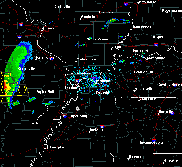 At 1219 pm cdt, severe thunderstorms were located along a line extending from near eminence to near winona to 8 miles north of alton, moving east at 55 mph (radar indicated). Hazards include 60 mph wind gusts and quarter size hail. Hail damage to vehicles is expected. Expect wind damage to roofs, siding, and trees. At 1219 pm cdt, severe thunderstorms were located along a line extending from near eminence to near winona to 8 miles north of alton, moving east at 55 mph (radar indicated). Hazards include 60 mph wind gusts and quarter size hail. Hail damage to vehicles is expected. Expect wind damage to roofs, siding, and trees.
|
| 4/28/2020 9:46 PM CDT |
 At 946 pm cdt, severe thunderstorms were located along a line extending from 6 miles southwest of fremont to 7 miles southwest of handy to 8 miles northwest of dalton, moving east at 40 mph (radar indicated). Hazards include 60 mph wind gusts. Expect damage to roofs, siding, and trees. Locations impacted include, doniphan, van buren, naylor, ellsinore, hunter, handy, budapest, gatewood, oxly, fairdealing, fremont, grandin and briar. At 946 pm cdt, severe thunderstorms were located along a line extending from 6 miles southwest of fremont to 7 miles southwest of handy to 8 miles northwest of dalton, moving east at 40 mph (radar indicated). Hazards include 60 mph wind gusts. Expect damage to roofs, siding, and trees. Locations impacted include, doniphan, van buren, naylor, ellsinore, hunter, handy, budapest, gatewood, oxly, fairdealing, fremont, grandin and briar.
|
| 4/28/2020 9:25 PM CDT |
 At 924 pm cdt, severe thunderstorms were located along a line extending from near birch tree to near alton to near thayer, moving east at 55 mph (radar indicated). Hazards include 70 mph wind gusts. Expect considerable tree damage. Damage is likely to mobile homes, roofs, and outbuildings. At 924 pm cdt, severe thunderstorms were located along a line extending from near birch tree to near alton to near thayer, moving east at 55 mph (radar indicated). Hazards include 70 mph wind gusts. Expect considerable tree damage. Damage is likely to mobile homes, roofs, and outbuildings.
|
| 3/12/2020 5:38 PM CDT |
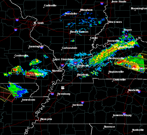 At 538 pm cdt, a severe thunderstorm was located near van buren, moving east at 45 mph (law enforcement). Hazards include 60 mph wind gusts and quarter size hail. Hail damage to vehicles is expected. expect wind damage to roofs, siding, and trees. Locations impacted include, van buren, ellsinore and hunter. At 538 pm cdt, a severe thunderstorm was located near van buren, moving east at 45 mph (law enforcement). Hazards include 60 mph wind gusts and quarter size hail. Hail damage to vehicles is expected. expect wind damage to roofs, siding, and trees. Locations impacted include, van buren, ellsinore and hunter.
|
| 3/12/2020 5:36 PM CDT | Quarter sized hail reported 0.2 miles ENE of Van Buren, MO |
| 3/12/2020 5:29 PM CDT |
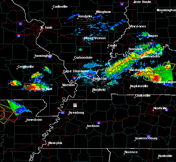 At 529 pm cdt, a severe thunderstorm was located near van buren, moving east at 45 mph (radar indicated). Hazards include 60 mph wind gusts and quarter size hail. Hail damage to vehicles is expected. Expect wind damage to roofs, siding, and trees. At 529 pm cdt, a severe thunderstorm was located near van buren, moving east at 45 mph (radar indicated). Hazards include 60 mph wind gusts and quarter size hail. Hail damage to vehicles is expected. Expect wind damage to roofs, siding, and trees.
|
| 3/12/2020 4:52 PM CDT |
 The severe thunderstorm warning for northwestern carter county will expire at 500 pm cdt, the storm which prompted the warning has moved out of the area. therefore, the warning will be allowed to expire. a tornado watch remains in effect until 1100 pm cdt for southeastern missouri. remember, a tornado warning still remains in effect for eastern portions of carter county. The severe thunderstorm warning for northwestern carter county will expire at 500 pm cdt, the storm which prompted the warning has moved out of the area. therefore, the warning will be allowed to expire. a tornado watch remains in effect until 1100 pm cdt for southeastern missouri. remember, a tornado warning still remains in effect for eastern portions of carter county.
|
| 3/12/2020 4:50 PM CDT |
 At 450 pm cdt, a severe thunderstorm capable of producing a tornado was located near van buren, moving east at 55 mph (radar indicated rotation). Hazards include tornado and ping pong ball size hail. Flying debris will be dangerous to those caught without shelter. mobile homes will be damaged or destroyed. damage to roofs, windows, and vehicles will occur. tree damage is likely. this dangerous storm will be near, hunter around 500 pm cdt. ellsinore around 505 pm cdt. brush arbor around 510 pm cdt. Williamsville around 515 pm cdt. At 450 pm cdt, a severe thunderstorm capable of producing a tornado was located near van buren, moving east at 55 mph (radar indicated rotation). Hazards include tornado and ping pong ball size hail. Flying debris will be dangerous to those caught without shelter. mobile homes will be damaged or destroyed. damage to roofs, windows, and vehicles will occur. tree damage is likely. this dangerous storm will be near, hunter around 500 pm cdt. ellsinore around 505 pm cdt. brush arbor around 510 pm cdt. Williamsville around 515 pm cdt.
|
| 3/12/2020 4:28 PM CDT |
 At 428 pm cdt, a severe thunderstorm was located near fremont, or 12 miles west of van buren, moving east at 45 mph (radar indicated). Hazards include 60 mph wind gusts and half dollar size hail. Hail damage to vehicles is expected. expect wind damage to roofs, siding, and trees. Locations impacted include, van buren and fremont. At 428 pm cdt, a severe thunderstorm was located near fremont, or 12 miles west of van buren, moving east at 45 mph (radar indicated). Hazards include 60 mph wind gusts and half dollar size hail. Hail damage to vehicles is expected. expect wind damage to roofs, siding, and trees. Locations impacted include, van buren and fremont.
|
| 3/12/2020 4:15 PM CDT |
 At 415 pm cdt, a severe thunderstorm was located near birch tree, or 16 miles east of mountain view, moving east at 45 mph (radar indicated). Hazards include 60 mph wind gusts and quarter size hail. Hail damage to vehicles is expected. Expect wind damage to roofs, siding, and trees. At 415 pm cdt, a severe thunderstorm was located near birch tree, or 16 miles east of mountain view, moving east at 45 mph (radar indicated). Hazards include 60 mph wind gusts and quarter size hail. Hail damage to vehicles is expected. Expect wind damage to roofs, siding, and trees.
|
| 10/21/2019 3:11 AM CDT |
 At 310 am cdt, severe thunderstorms were located along a line extending from 13 miles southwest of bunker to 9 miles south of winona to near mammoth spring, moving east at 55 mph (radar indicated). Hazards include 60 mph wind gusts and quarter size hail. Hail damage to vehicles is expected. Expect wind damage to roofs, siding, and trees. At 310 am cdt, severe thunderstorms were located along a line extending from 13 miles southwest of bunker to 9 miles south of winona to near mammoth spring, moving east at 55 mph (radar indicated). Hazards include 60 mph wind gusts and quarter size hail. Hail damage to vehicles is expected. Expect wind damage to roofs, siding, and trees.
|
| 8/20/2019 4:05 PM CDT | Tall narrow tree down on a home. non-shingle protective layer lifted from the current river inn. reported wind speed with this event was measured 46 mph by em offic in carter county MO, 0.7 miles SSW of Van Buren, MO |
| 6/23/2019 1:54 PM CDT |
 At 154 pm cdt, a severe thunderstorm was located near hunter, or 14 miles southeast of van buren, moving east at 40 mph (radar indicated). Hazards include 60 mph wind gusts. Expect damage to roofs, siding, and trees. Locations impacted include, doniphan, van buren, naylor, ellsinore, hunter, handy, budapest, gatewood, oxly, fairdealing, fremont, grandin and briar. At 154 pm cdt, a severe thunderstorm was located near hunter, or 14 miles southeast of van buren, moving east at 40 mph (radar indicated). Hazards include 60 mph wind gusts. Expect damage to roofs, siding, and trees. Locations impacted include, doniphan, van buren, naylor, ellsinore, hunter, handy, budapest, gatewood, oxly, fairdealing, fremont, grandin and briar.
|
| 6/23/2019 1:19 PM CDT |
 The national weather service in paducah has issued a * severe thunderstorm warning for. carter county in southeastern missouri. ripley county in southeastern missouri. southwestern wayne county in southeastern missouri. Until 200 pm cdt. The national weather service in paducah has issued a * severe thunderstorm warning for. carter county in southeastern missouri. ripley county in southeastern missouri. southwestern wayne county in southeastern missouri. Until 200 pm cdt.
|
| 6/21/2019 3:51 PM CDT |
 At 350 pm cdt, a severe thunderstorm was located near fremont, or 11 miles west of van buren, moving east at 35 mph (radar indicated). Hazards include 60 mph wind gusts and quarter size hail. Hail damage to vehicles is expected. Expect wind damage to roofs, siding, and trees. At 350 pm cdt, a severe thunderstorm was located near fremont, or 11 miles west of van buren, moving east at 35 mph (radar indicated). Hazards include 60 mph wind gusts and quarter size hail. Hail damage to vehicles is expected. Expect wind damage to roofs, siding, and trees.
|
| 6/21/2019 3:45 PM CDT | Large limbs down on north end of m highwa in carter county MO, 5.1 miles SSE of Van Buren, MO |
| 6/21/2019 3:43 PM CDT | *** 1 fatal... 2 inj *** tree fell on boat on the current river in the vicinity of the waymeyer shute national park service river access. driver of the boat was killed in carter county MO, 4.2 miles SE of Van Buren, MO |
| 5/21/2019 5:21 PM CDT |
 The national weather service in paducah has issued a * severe thunderstorm warning for. western carter county in southeastern missouri. western ripley county in southeastern missouri. until 615 pm cdt. At 520 pm cdt, severe thunderstorms were located along a line. The national weather service in paducah has issued a * severe thunderstorm warning for. western carter county in southeastern missouri. western ripley county in southeastern missouri. until 615 pm cdt. At 520 pm cdt, severe thunderstorms were located along a line.
|
| 5/21/2019 12:45 PM CDT |
 At 520 pm cdt, severe thunderstorms were located along a line extending from near winona to near alton to near mammoth spring, moving northeast at 40 mph (radar indicated). Hazards include 60 mph wind gusts and penny size hail. expect damage to roofs, siding, and trees At 520 pm cdt, severe thunderstorms were located along a line extending from near winona to near alton to near mammoth spring, moving northeast at 40 mph (radar indicated). Hazards include 60 mph wind gusts and penny size hail. expect damage to roofs, siding, and trees
|
| 5/18/2019 6:17 PM CDT |
 At 616 pm cdt, a line of severe thunderstorms was located from fremont to gatewood, moving northeast at 45 mph (radar indicated). Hazards include 60 mph wind gusts and penny size hail. Expect damage to roofs, siding, and trees. Locations impacted include, doniphan, van buren, naylor, ellsinore, hunter, handy, budapest, gatewood, oxly, fairdealing, fremont, grandin and briar. At 616 pm cdt, a line of severe thunderstorms was located from fremont to gatewood, moving northeast at 45 mph (radar indicated). Hazards include 60 mph wind gusts and penny size hail. Expect damage to roofs, siding, and trees. Locations impacted include, doniphan, van buren, naylor, ellsinore, hunter, handy, budapest, gatewood, oxly, fairdealing, fremont, grandin and briar.
|
| 5/18/2019 5:49 PM CDT |
 At 546 pm cdt, a line of severe thunderstorms was located from thayer to birch tree moving northeast at 45 mph (radar indicated). Hazards include 60 mph wind gusts and penny size hail. expect damage to roofs, siding, and trees At 546 pm cdt, a line of severe thunderstorms was located from thayer to birch tree moving northeast at 45 mph (radar indicated). Hazards include 60 mph wind gusts and penny size hail. expect damage to roofs, siding, and trees
|
| 5/2/2019 2:26 AM CDT |
 At 226 am cdt, a severe thunderstorm was located near van buren, moving northeast at 30 mph (radar indicated). Hazards include 60 mph wind gusts and quarter size hail. Hail damage to vehicles is expected. expect wind damage to roofs, siding, and trees. Locations impacted include, van buren, ellsinore, hunter and fremont. At 226 am cdt, a severe thunderstorm was located near van buren, moving northeast at 30 mph (radar indicated). Hazards include 60 mph wind gusts and quarter size hail. Hail damage to vehicles is expected. expect wind damage to roofs, siding, and trees. Locations impacted include, van buren, ellsinore, hunter and fremont.
|
| 5/2/2019 2:08 AM CDT |
 The national weather service in paducah has issued a * severe thunderstorm warning for. carter county in southeastern missouri. until 245 am cdt. At 208 am cdt, a severe thunderstorm was located near fremont, or 8 miles southwest of van buren, moving northeast at 30 mph. The national weather service in paducah has issued a * severe thunderstorm warning for. carter county in southeastern missouri. until 245 am cdt. At 208 am cdt, a severe thunderstorm was located near fremont, or 8 miles southwest of van buren, moving northeast at 30 mph.
|
| 8/17/2018 12:02 AM CDT |
 At 1201 am cdt, severe thunderstorms were located along a line extending from near ellington to van buren to 8 miles northwest of hunter to 8 miles east of handy, moving east at 35 mph (radar indicated). Hazards include 60 mph wind gusts and quarter size hail. Hail damage to vehicles is expected. expect wind damage to roofs, siding, and trees. Locations impacted include, van buren, ellsinore, hunter and grandin. At 1201 am cdt, severe thunderstorms were located along a line extending from near ellington to van buren to 8 miles northwest of hunter to 8 miles east of handy, moving east at 35 mph (radar indicated). Hazards include 60 mph wind gusts and quarter size hail. Hail damage to vehicles is expected. expect wind damage to roofs, siding, and trees. Locations impacted include, van buren, ellsinore, hunter and grandin.
|
| 8/16/2018 11:25 PM CDT |
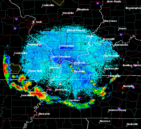 At 1124 pm cdt, severe thunderstorms were located along a line extending from near eminence to near van buren to near winona to 10 miles southwest of fremont to alton, moving east at 35 mph (radar indicated). Hazards include 60 mph wind gusts and quarter size hail. Hail damage to vehicles is expected. Expect wind damage to roofs, siding, and trees. At 1124 pm cdt, severe thunderstorms were located along a line extending from near eminence to near van buren to near winona to 10 miles southwest of fremont to alton, moving east at 35 mph (radar indicated). Hazards include 60 mph wind gusts and quarter size hail. Hail damage to vehicles is expected. Expect wind damage to roofs, siding, and trees.
|
| 7/20/2018 5:33 PM CDT | Tree damage and power outages reported throughout the communit in carter county MO, 0.7 miles SSW of Van Buren, MO |
| 7/20/2018 5:21 PM CDT |
 At 520 pm cdt, a severe thunderstorm was located near hunter, or 9 miles southeast of van buren, moving east at 35 mph. a second storm was just west of van buren (radar indicated. at 518 pm, law enforcement reported 60 mph winds just southeast of van buren). Hazards include 60 mph wind gusts and nickel size hail. Expect damage to roofs, siding, and trees. Locations impacted include, van buren, ellsinore, hunter, fremont and grandin. At 520 pm cdt, a severe thunderstorm was located near hunter, or 9 miles southeast of van buren, moving east at 35 mph. a second storm was just west of van buren (radar indicated. at 518 pm, law enforcement reported 60 mph winds just southeast of van buren). Hazards include 60 mph wind gusts and nickel size hail. Expect damage to roofs, siding, and trees. Locations impacted include, van buren, ellsinore, hunter, fremont and grandin.
|
| 7/20/2018 5:20 PM CDT | Tree damage and power outages reported throughout the community. corrention for tim in carter county MO, 0.7 miles SSW of Van Buren, MO |
| 7/20/2018 5:19 PM CDT | Storm damage reported in carter county MO, 1.6 miles WNW of Van Buren, MO |
| 7/20/2018 5:07 PM CDT |
 At 507 pm cdt, a severe thunderstorm was located near fremont, or just west of van buren, moving east, southeast at 25 mph. a second severe storm was over southern shannon county. it may hold together and move into southwest carter county (radar indicated). Hazards include 60 mph wind gusts and half dollar size hail. Hail damage to vehicles is expected. Expect wind damage to roofs, siding, and trees. At 507 pm cdt, a severe thunderstorm was located near fremont, or just west of van buren, moving east, southeast at 25 mph. a second severe storm was over southern shannon county. it may hold together and move into southwest carter county (radar indicated). Hazards include 60 mph wind gusts and half dollar size hail. Hail damage to vehicles is expected. Expect wind damage to roofs, siding, and trees.
|
| 6/26/2018 6:00 PM CDT |
 At 600 pm cdt, a severe thunderstorm was located near ellsinore, or 10 miles east of van buren, moving east at 30 mph (radar indicated). Hazards include 60 mph wind gusts and quarter size hail. Hail damage to vehicles is expected. expect wind damage to roofs, siding, and trees. Locations impacted include, ellsinore. At 600 pm cdt, a severe thunderstorm was located near ellsinore, or 10 miles east of van buren, moving east at 30 mph (radar indicated). Hazards include 60 mph wind gusts and quarter size hail. Hail damage to vehicles is expected. expect wind damage to roofs, siding, and trees. Locations impacted include, ellsinore.
|
| 6/26/2018 5:36 PM CDT | Ping Pong Ball sized hail reported 0.7 miles SSW of Van Buren, MO, ping pong ball size hail on the north side of van buren. |
| 6/26/2018 5:28 PM CDT |
 At 527 pm cdt, a severe thunderstorm was located near van buren, moving east at 25 mph (radar indicated). Hazards include 60 mph wind gusts and quarter size hail. Hail damage to vehicles is expected. Expect wind damage to roofs, siding, and trees. At 527 pm cdt, a severe thunderstorm was located near van buren, moving east at 25 mph (radar indicated). Hazards include 60 mph wind gusts and quarter size hail. Hail damage to vehicles is expected. Expect wind damage to roofs, siding, and trees.
|
| 5/31/2018 8:52 PM CDT |
 The severe thunderstorm warning for northwestern carter county will expire at 900 pm cdt, the storm which prompted the warning will move out of the area. therefore, the warning will be allowed to expire. a severe thunderstorm watch remains in effect until 200 am cdt for southeastern missouri. The severe thunderstorm warning for northwestern carter county will expire at 900 pm cdt, the storm which prompted the warning will move out of the area. therefore, the warning will be allowed to expire. a severe thunderstorm watch remains in effect until 200 am cdt for southeastern missouri.
|
| 5/31/2018 8:40 PM CDT |
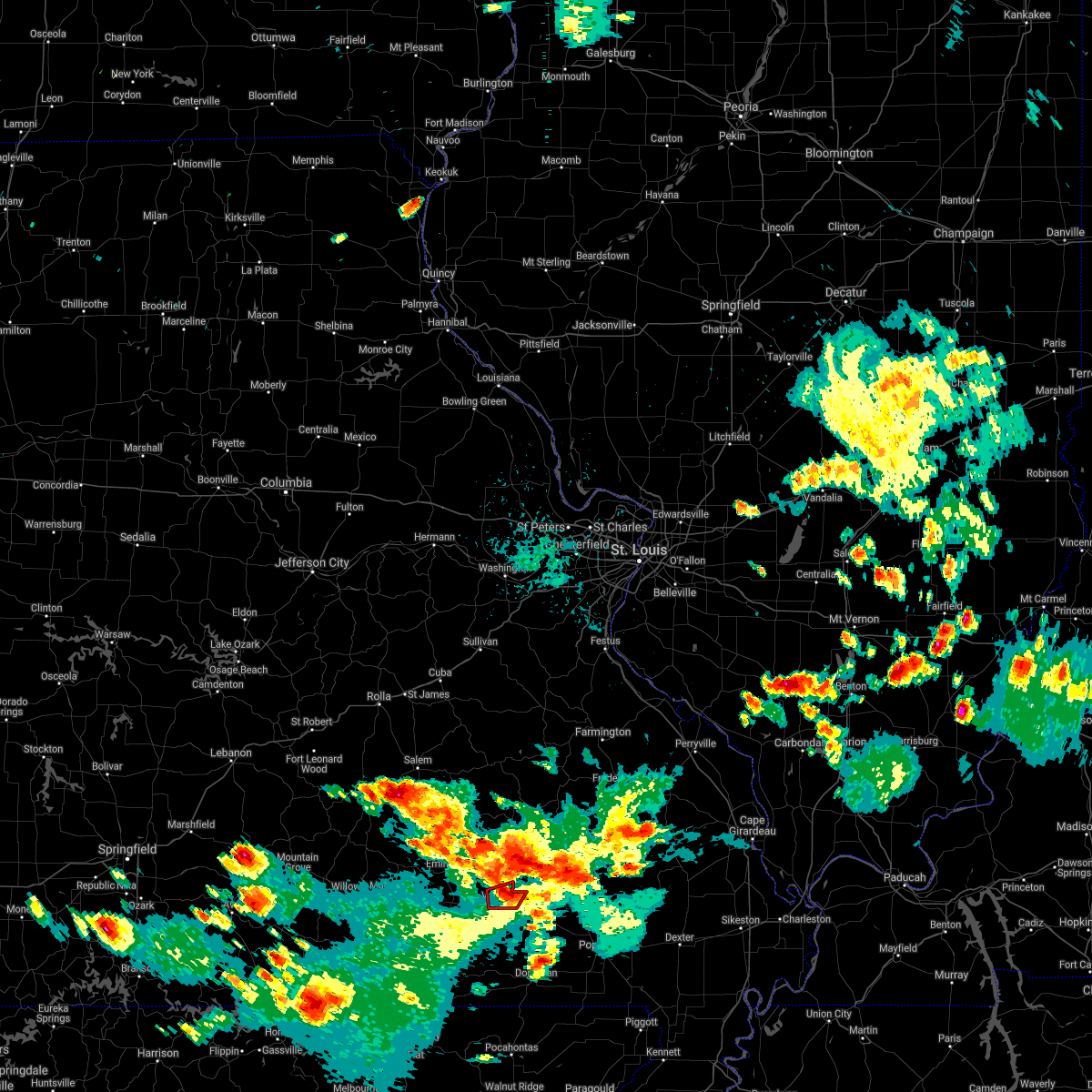 At 840 pm cdt, a severe thunderstorm capable of producing a tornado was located over van buren, moving east at 25 mph (radar indicated rotation). Hazards include tornado. Flying debris will be dangerous to those caught without shelter. mobile homes will be damaged or destroyed. damage to roofs, windows, and vehicles will occur. tree damage is likely. This tornadic thunderstorm will remain over mainly rural areas of northwestern carter county. At 840 pm cdt, a severe thunderstorm capable of producing a tornado was located over van buren, moving east at 25 mph (radar indicated rotation). Hazards include tornado. Flying debris will be dangerous to those caught without shelter. mobile homes will be damaged or destroyed. damage to roofs, windows, and vehicles will occur. tree damage is likely. This tornadic thunderstorm will remain over mainly rural areas of northwestern carter county.
|
| 5/31/2018 8:31 PM CDT |
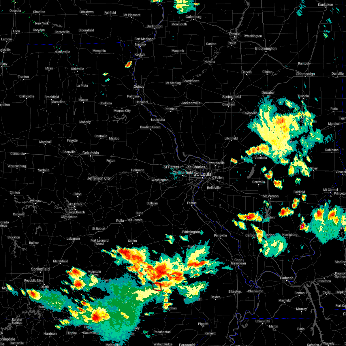 At 831 pm cdt, a severe thunderstorm capable of producing a tornado was located near fremont, or near van buren, moving east at 25 mph (radar indicated rotation). Hazards include tornado and half dollar size hail. Flying debris will be dangerous to those caught without shelter. mobile homes will be damaged or destroyed. damage to roofs, windows, and vehicles will occur. tree damage is likely. This dangerous storm will be near, van buren around 840 pm cdt. At 831 pm cdt, a severe thunderstorm capable of producing a tornado was located near fremont, or near van buren, moving east at 25 mph (radar indicated rotation). Hazards include tornado and half dollar size hail. Flying debris will be dangerous to those caught without shelter. mobile homes will be damaged or destroyed. damage to roofs, windows, and vehicles will occur. tree damage is likely. This dangerous storm will be near, van buren around 840 pm cdt.
|
| 5/31/2018 8:18 PM CDT |
 At 818 pm cdt, a severe thunderstorm capable of producing a tornado was located near fremont, or 9 miles west of van buren, moving east at 25 mph (radar indicated rotation). Hazards include tornado and half dollar size hail. Flying debris will be dangerous to those caught without shelter. mobile homes will be damaged or destroyed. damage to roofs, windows, and vehicles will occur. tree damage is likely. This dangerous storm will be near, van buren around 840 pm cdt. At 818 pm cdt, a severe thunderstorm capable of producing a tornado was located near fremont, or 9 miles west of van buren, moving east at 25 mph (radar indicated rotation). Hazards include tornado and half dollar size hail. Flying debris will be dangerous to those caught without shelter. mobile homes will be damaged or destroyed. damage to roofs, windows, and vehicles will occur. tree damage is likely. This dangerous storm will be near, van buren around 840 pm cdt.
|
| 5/31/2018 8:13 PM CDT |
 At 812 pm cdt, a severe thunderstorm was located near fremont, or 9 miles west of van buren, moving east at 25 mph (radar indicated). Hazards include 60 mph wind gusts and quarter size hail. Hail damage to vehicles is expected. Expect wind damage to roofs, siding, and trees. At 812 pm cdt, a severe thunderstorm was located near fremont, or 9 miles west of van buren, moving east at 25 mph (radar indicated). Hazards include 60 mph wind gusts and quarter size hail. Hail damage to vehicles is expected. Expect wind damage to roofs, siding, and trees.
|
| 5/31/2018 5:10 PM CDT |
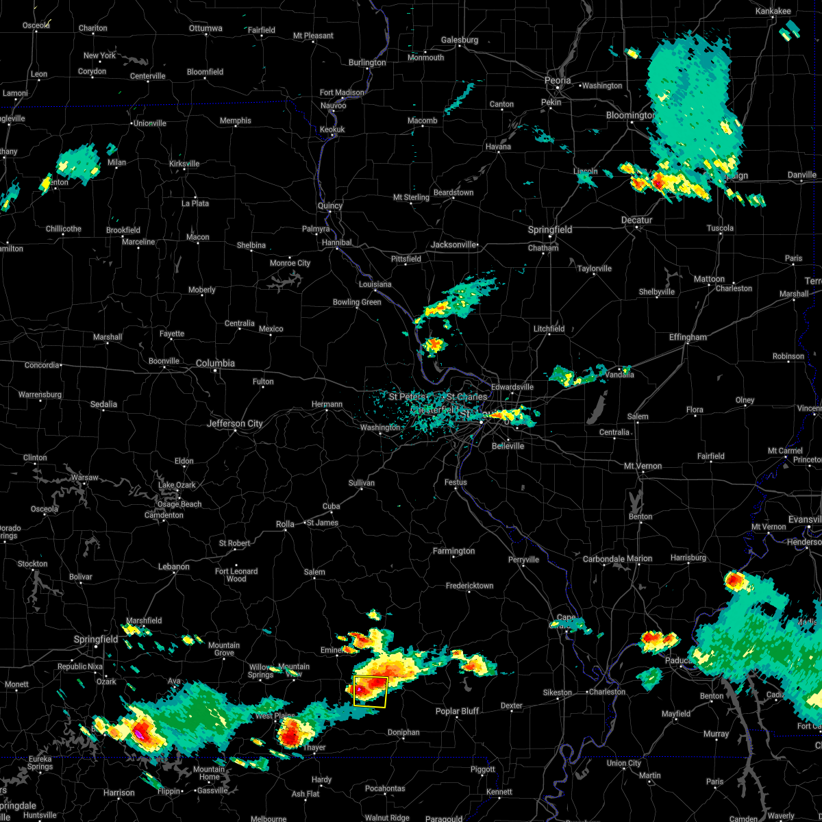 At 510 pm cdt, a severe thunderstorm was located over fremont, or 8 miles southwest of van buren, moving east at 30 mph (radar indicated). Hazards include 60 mph wind gusts and quarter size hail. Hail damage to vehicles is expected. expect wind damage to roofs, siding, and trees. locations impacted include, van buren and fremont. A tornado watch remains in effect until 800 pm cdt for southeastern missouri. At 510 pm cdt, a severe thunderstorm was located over fremont, or 8 miles southwest of van buren, moving east at 30 mph (radar indicated). Hazards include 60 mph wind gusts and quarter size hail. Hail damage to vehicles is expected. expect wind damage to roofs, siding, and trees. locations impacted include, van buren and fremont. A tornado watch remains in effect until 800 pm cdt for southeastern missouri.
|
| 5/31/2018 4:49 PM CDT |
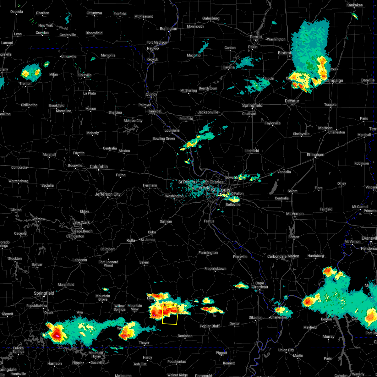 At 448 pm cdt, a severe thunderstorm was located near fremont, or 13 miles west of van buren, moving east, southeast at 25 mph (radar indicated). Hazards include 60 mph wind gusts and half dollar size hail. Hail damage to vehicles is expected. Expect wind damage to roofs, siding, and trees. At 448 pm cdt, a severe thunderstorm was located near fremont, or 13 miles west of van buren, moving east, southeast at 25 mph (radar indicated). Hazards include 60 mph wind gusts and half dollar size hail. Hail damage to vehicles is expected. Expect wind damage to roofs, siding, and trees.
|
| 4/13/2018 10:13 PM CDT |
 At 1011 pm cdt, severe thunderstorms were located along a line extending from winona to 8 miles northeast of alton, moving northeast at 60 mph (radar indicated). Hazards include 60 mph wind gusts. expect damage to roofs, siding, and trees At 1011 pm cdt, severe thunderstorms were located along a line extending from winona to 8 miles northeast of alton, moving northeast at 60 mph (radar indicated). Hazards include 60 mph wind gusts. expect damage to roofs, siding, and trees
|
| 1/22/2018 2:28 AM CST |
 At 228 am cst, severe thunderstorms were located along a line extending from 6 miles northwest of garwood to near handy to near ravenden springs, moving east at 40 mph (radar indicated). Hazards include 60 mph wind gusts. Expect damage to roofs, siding, and trees. Locations impacted include, doniphan, van buren, naylor, ellsinore, hunter, handy, budapest, gatewood, oxly, fairdealing, fremont, grandin, and briar. At 228 am cst, severe thunderstorms were located along a line extending from 6 miles northwest of garwood to near handy to near ravenden springs, moving east at 40 mph (radar indicated). Hazards include 60 mph wind gusts. Expect damage to roofs, siding, and trees. Locations impacted include, doniphan, van buren, naylor, ellsinore, hunter, handy, budapest, gatewood, oxly, fairdealing, fremont, grandin, and briar.
|
| 1/22/2018 2:04 AM CST |
 At 204 am cst, severe thunderstorms were located along a line extending from near winona to 7 miles west of ravenden, moving northeast at 40 mph (radar indicated). Hazards include 60 mph wind gusts. expect damage to roofs, siding, and trees At 204 am cst, severe thunderstorms were located along a line extending from near winona to 7 miles west of ravenden, moving northeast at 40 mph (radar indicated). Hazards include 60 mph wind gusts. expect damage to roofs, siding, and trees
|
| 5/27/2017 7:56 PM CDT | Hen Egg sized hail reported 7.7 miles N of Van Buren, MO, hail slightly larger than golfballs. |
| 5/27/2017 5:05 PM CDT | Several trees down around town. power out to several homes and businesses including carter county sheriffs dep in carter county MO, 0.7 miles SSW of Van Buren, MO |
| 3/9/2017 6:07 PM CST |
 At 606 pm cst, severe thunderstorms were located along a line extending from 6 miles south of piedmont to 7 miles southeast of van buren to near hunter to near budapest to 6 miles southeast of handy, moving southeast at 30 mph (radar indicated). Hazards include 60 mph wind gusts and half dollar size hail. Hail damage to vehicles is expected. expect wind damage to roofs, siding, and trees. Locations impacted include, doniphan, van buren, naylor, ellsinore, williamsville, hunter, handy, budapest, oxly, fairdealing, grandin, mill spring and freemont. At 606 pm cst, severe thunderstorms were located along a line extending from 6 miles south of piedmont to 7 miles southeast of van buren to near hunter to near budapest to 6 miles southeast of handy, moving southeast at 30 mph (radar indicated). Hazards include 60 mph wind gusts and half dollar size hail. Hail damage to vehicles is expected. expect wind damage to roofs, siding, and trees. Locations impacted include, doniphan, van buren, naylor, ellsinore, williamsville, hunter, handy, budapest, oxly, fairdealing, grandin, mill spring and freemont.
|
| 3/9/2017 5:32 PM CST |
 At 531 pm cst, severe thunderstorms were located along a line extending from 6 miles northeast of ellington to 7 miles northwest of van buren to near hunter to handy, moving east at 50 mph. at 530 pm cst, dime size hail was reported 5 miles west of van buren missouri (radar indicated). Hazards include 70 mph wind gusts and ping pong ball size hail. People and animals outdoors will be injured. expect hail damage to roofs, siding, windows, and vehicles. expect considerable tree damage. wind damage is also likely to mobile homes, roofs, and outbuildings. Locations impacted include, doniphan, piedmont, van buren, greenville, sam a baker state park, naylor, ellsinore, williamsville, hunter, lodi, handy, budapest, oxly, fairdealing, fremont, grandin, mill spring and freemont. At 531 pm cst, severe thunderstorms were located along a line extending from 6 miles northeast of ellington to 7 miles northwest of van buren to near hunter to handy, moving east at 50 mph. at 530 pm cst, dime size hail was reported 5 miles west of van buren missouri (radar indicated). Hazards include 70 mph wind gusts and ping pong ball size hail. People and animals outdoors will be injured. expect hail damage to roofs, siding, windows, and vehicles. expect considerable tree damage. wind damage is also likely to mobile homes, roofs, and outbuildings. Locations impacted include, doniphan, piedmont, van buren, greenville, sam a baker state park, naylor, ellsinore, williamsville, hunter, lodi, handy, budapest, oxly, fairdealing, fremont, grandin, mill spring and freemont.
|
| 3/9/2017 5:08 PM CST |
 At 507 pm cst, severe thunderstorms were located along a line extending from near reynolds to near eminence to near winona to 8 miles southwest of fremont to 9 miles west of handy, moving east at 50 mph (radar indicated). Hazards include 70 mph wind gusts and ping pong ball size hail. People and animals outdoors will be injured. expect hail damage to roofs, siding, windows, and vehicles. expect considerable tree damage. Wind damage is also likely to mobile homes, roofs, and outbuildings. At 507 pm cst, severe thunderstorms were located along a line extending from near reynolds to near eminence to near winona to 8 miles southwest of fremont to 9 miles west of handy, moving east at 50 mph (radar indicated). Hazards include 70 mph wind gusts and ping pong ball size hail. People and animals outdoors will be injured. expect hail damage to roofs, siding, windows, and vehicles. expect considerable tree damage. Wind damage is also likely to mobile homes, roofs, and outbuildings.
|
| 3/7/2017 1:55 AM CST |
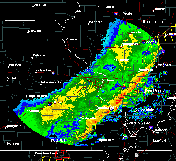 At 154 am cst, severe thunderstorms were located along a line extending from near sam a baker state park to near piedmont to near hunter, moving east at 45 mph (radar indicated). Hazards include 60 mph wind gusts and penny size hail. Expect damage to roofs, siding, and trees. locations impacted include, piedmont, van buren, sam a baker state park, fremont, lodi and mill spring. A tornado watch remains in effect until 500 am cst for southeastern missouri. At 154 am cst, severe thunderstorms were located along a line extending from near sam a baker state park to near piedmont to near hunter, moving east at 45 mph (radar indicated). Hazards include 60 mph wind gusts and penny size hail. Expect damage to roofs, siding, and trees. locations impacted include, piedmont, van buren, sam a baker state park, fremont, lodi and mill spring. A tornado watch remains in effect until 500 am cst for southeastern missouri.
|
| 3/7/2017 1:28 AM CST |
 At 127 am cst, severe thunderstorms were located along a line extending from ellington to near van buren to 7 miles south of winona, moving east at 40 mph (radar indicated). Hazards include 60 mph wind gusts and nickel size hail. expect damage to roofs, siding, and trees At 127 am cst, severe thunderstorms were located along a line extending from ellington to near van buren to 7 miles south of winona, moving east at 40 mph (radar indicated). Hazards include 60 mph wind gusts and nickel size hail. expect damage to roofs, siding, and trees
|
| 3/7/2017 1:21 AM CST |
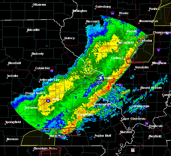 At 121 am cst, a severe thunderstorm capable of producing a tornado was located over fremont, or 10 miles southwest of van buren, moving east at 50 mph (radar indicated rotation). Hazards include tornado and quarter size hail. Flying debris will be dangerous to those caught without shelter. mobile homes will be damaged or destroyed. damage to roofs, windows, and vehicles will occur. tree damage is likely. Locations impacted include, van buren, fremont and freemont. At 121 am cst, a severe thunderstorm capable of producing a tornado was located over fremont, or 10 miles southwest of van buren, moving east at 50 mph (radar indicated rotation). Hazards include tornado and quarter size hail. Flying debris will be dangerous to those caught without shelter. mobile homes will be damaged or destroyed. damage to roofs, windows, and vehicles will occur. tree damage is likely. Locations impacted include, van buren, fremont and freemont.
|
| 3/7/2017 12:55 AM CST |
 At 1254 am cst, a severe thunderstorm capable of producing a tornado was located 9 miles southwest of birch tree, or 11 miles southeast of mountain view, moving east at 55 mph (radar indicated rotation). Hazards include tornado and half dollar size hail. Flying debris will be dangerous to those caught without shelter. mobile homes will be damaged or destroyed. damage to roofs, windows, and vehicles will occur. Tree damage is likely. At 1254 am cst, a severe thunderstorm capable of producing a tornado was located 9 miles southwest of birch tree, or 11 miles southeast of mountain view, moving east at 55 mph (radar indicated rotation). Hazards include tornado and half dollar size hail. Flying debris will be dangerous to those caught without shelter. mobile homes will be damaged or destroyed. damage to roofs, windows, and vehicles will occur. Tree damage is likely.
|
| 2/28/2017 8:25 PM CST |
 At 825 pm cst, a severe thunderstorm was located over garwood, or 7 miles east of van buren, moving northeast at 45 mph (radar indicated). Hazards include 60 mph wind gusts and half dollar size hail. Hail damage to vehicles is expected. expect wind damage to roofs, siding, and trees. locations impacted include, piedmont, van buren, ellsinore and mill spring. A tornado watch remains in effect until 900 pm cst for southeastern missouri. At 825 pm cst, a severe thunderstorm was located over garwood, or 7 miles east of van buren, moving northeast at 45 mph (radar indicated). Hazards include 60 mph wind gusts and half dollar size hail. Hail damage to vehicles is expected. expect wind damage to roofs, siding, and trees. locations impacted include, piedmont, van buren, ellsinore and mill spring. A tornado watch remains in effect until 900 pm cst for southeastern missouri.
|
| 2/28/2017 8:13 PM CST |
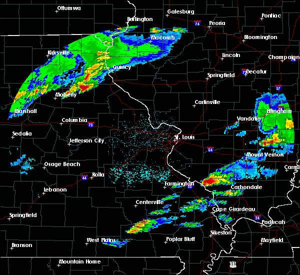 At 813 pm cst, a severe thunderstorm was located near van buren, moving northeast at 50 mph (radar indicated). Hazards include 60 mph wind gusts and half dollar size hail. Hail damage to vehicles is expected. Expect wind damage to roofs, siding, and trees. At 813 pm cst, a severe thunderstorm was located near van buren, moving northeast at 50 mph (radar indicated). Hazards include 60 mph wind gusts and half dollar size hail. Hail damage to vehicles is expected. Expect wind damage to roofs, siding, and trees.
|
| 7/8/2016 4:35 PM CDT | Numerous trees down and a power line dow in carter county MO, 0.7 miles SSW of Van Buren, MO |
| 7/8/2016 4:05 PM CDT |
 At 404 pm cdt, severe thunderstorms were located along a line extending from 6 miles southwest of eminence to 10 miles south of winona to near thayer, moving east at 45 mph (radar indicated). Hazards include 60 mph wind gusts. Expect damage to roofs. siding. And trees. At 404 pm cdt, severe thunderstorms were located along a line extending from 6 miles southwest of eminence to 10 miles south of winona to near thayer, moving east at 45 mph (radar indicated). Hazards include 60 mph wind gusts. Expect damage to roofs. siding. And trees.
|
| 7/6/2016 11:19 AM CDT |
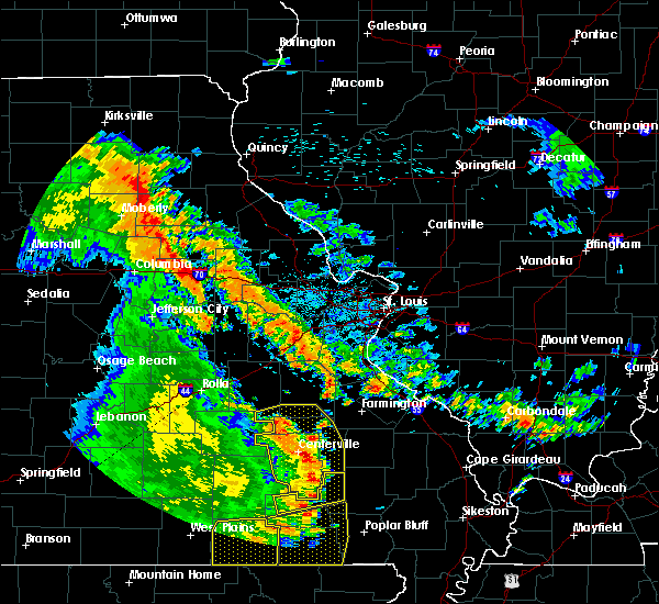 At 1119 am cdt, severe thunderstorms were located along a line extending from near viburnum to 6 miles southwest of annapolis to near hunter, moving southeast at 50 mph. this line of storms produced wind damage when they moved through oregon county missouri (radar indicated). Hazards include 60 mph wind gusts. Expect damage to roofs. siding. and trees. Locations impacted include, piedmont, van buren and mill spring. At 1119 am cdt, severe thunderstorms were located along a line extending from near viburnum to 6 miles southwest of annapolis to near hunter, moving southeast at 50 mph. this line of storms produced wind damage when they moved through oregon county missouri (radar indicated). Hazards include 60 mph wind gusts. Expect damage to roofs. siding. and trees. Locations impacted include, piedmont, van buren and mill spring.
|
| 7/6/2016 10:49 AM CDT |
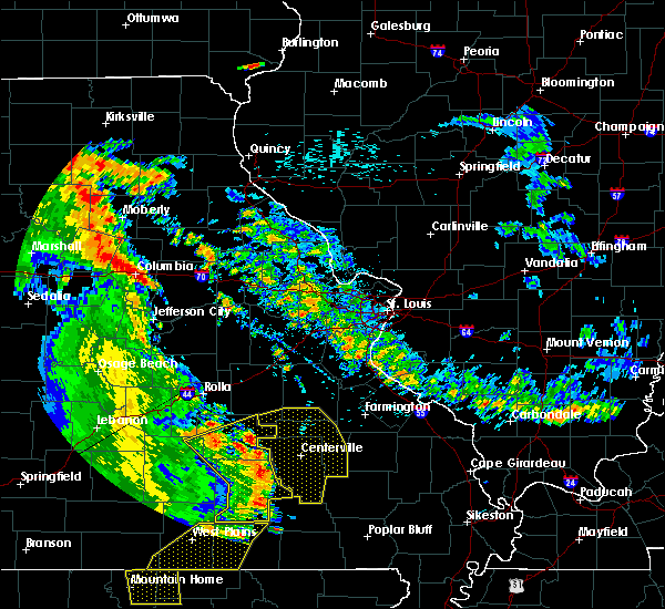 At 1049 am cdt, severe thunderstorms were located along a line extending from 11 miles southwest of viburnum to 11 miles west of ellington to near fremont, moving east at 40 mph (radar indicated). Hazards include 60 mph wind gusts. Expect damage to roofs. siding. And trees. At 1049 am cdt, severe thunderstorms were located along a line extending from 11 miles southwest of viburnum to 11 miles west of ellington to near fremont, moving east at 40 mph (radar indicated). Hazards include 60 mph wind gusts. Expect damage to roofs. siding. And trees.
|
| 6/30/2016 4:23 PM CDT |
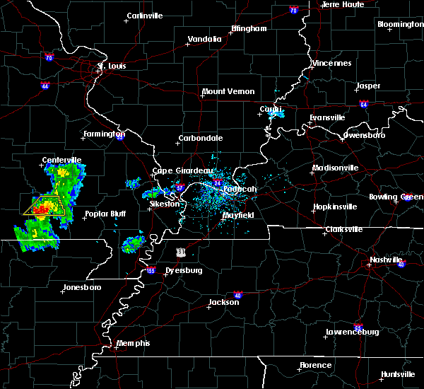 At 423 pm cdt, a severe thunderstorm was located near hunter, or 9 miles southeast of van buren, moving southeast at 30 mph (radar indicated). Hazards include 60 mph wind gusts and quarter size hail. Hail damage to vehicles is expected. expect wind damage to roofs, siding, and trees. Locations impacted include, van buren, ellsinore, hunter, grandin and freemont. At 423 pm cdt, a severe thunderstorm was located near hunter, or 9 miles southeast of van buren, moving southeast at 30 mph (radar indicated). Hazards include 60 mph wind gusts and quarter size hail. Hail damage to vehicles is expected. expect wind damage to roofs, siding, and trees. Locations impacted include, van buren, ellsinore, hunter, grandin and freemont.
|
| 6/30/2016 4:15 PM CDT |
 At 415 pm cdt, a severe thunderstorm was located near van buren, moving southeast at 30 mph (radar indicated). Hazards include 60 mph wind gusts and quarter size hail. Hail damage to vehicles is expected. Expect wind damage to roofs, siding, and trees. At 415 pm cdt, a severe thunderstorm was located near van buren, moving southeast at 30 mph (radar indicated). Hazards include 60 mph wind gusts and quarter size hail. Hail damage to vehicles is expected. Expect wind damage to roofs, siding, and trees.
|
| 5/9/2016 8:30 PM CDT | A few large limbs down with much of van buren without power in carter county MO, 0.7 miles SSW of Van Buren, MO |
| 12/23/2015 9:46 AM CST | At 946 am cst, a severe thunderstorm capable of producing a tornado was located near hunter, or 7 miles southeast of van buren, moving northeast at 55 mph (radar indicated rotation). Hazards include tornado and quarter size hail. Flying debris will be dangerous to those caught without shelter. mobile homes will be damaged or destroyed. damage to roofs, windows and vehicles will occur. tree damage is likely. This dangerous storm will be near, ellsinore around 955 am cst. |
| 12/23/2015 9:45 AM CST | Late report. numerous trees down in a defined path near big springs along hwy in carter county MO, 5.6 miles N of Van Buren, MO |
| 12/23/2015 9:36 AM CST | At 936 am cst, severe thunderstorms were located along a line extending from near fremont to near handy to near dalton, moving northeast at 55 mph (radar indicated). Hazards include 60 mph wind gusts and penny size hail. Expect damage to roofs. siding and trees. locations impacted include, doniphan, van buren, naylor, ellsinore, fremont, fairdealing, hunter, oxly, gatewood, handy, budapest, grandin, freemont and briar. A tornado watch remains in effect until 500 pm cst for southeastern missouri. |
| 12/23/2015 9:21 AM CST | At 920 am cst, severe thunderstorms were located along a line extending from near winona to near alton to 14 miles south of thayer, moving northeast at 60 mph (radar indicated). Hazards include 60 mph wind gusts. Expect damage to roofs. Siding and trees. |
| 7/9/2015 4:39 PM CDT |
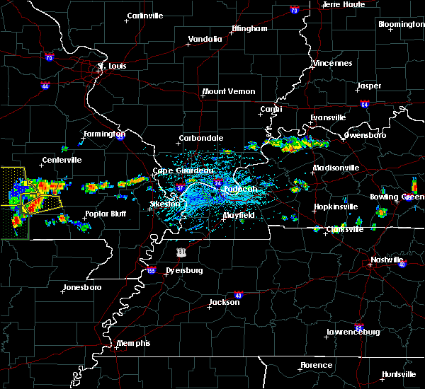 At 438 pm cdt, a severe thunderstorm was located near fremont, or 7 miles south of van buren, moving northeast at 30 mph (radar indicated). Hazards include 60 mph wind gusts and quarter size hail. Hail damage to vehicles is expected. Expect wind damage to roofs, siding and trees. At 438 pm cdt, a severe thunderstorm was located near fremont, or 7 miles south of van buren, moving northeast at 30 mph (radar indicated). Hazards include 60 mph wind gusts and quarter size hail. Hail damage to vehicles is expected. Expect wind damage to roofs, siding and trees.
|
| 6/28/2013 3:45 AM CDT | Late report. a few trees and numerous tree limbs were blown down countywide. m highway blocked by a tre in carter county MO, 0.7 miles SSW of Van Buren, MO |
| 9/6/2012 4:31 PM CDT | Power lines and tree limbs down in carter county MO, 0.7 miles SSW of Van Buren, MO |
| 1/1/0001 12:00 AM | Trees reported down in the communit in carter county MO, 0.7 miles SSW of Van Buren, MO |
| 1/1/0001 12:00 AM | Quarter sized hail reported 0.7 miles SSW of Van Buren, MO |
Hail Maps for Van Buren, MO
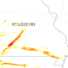
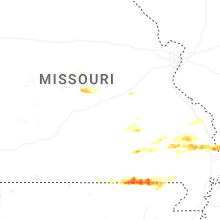
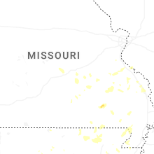
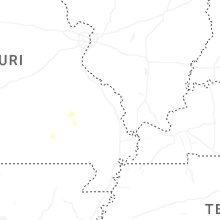
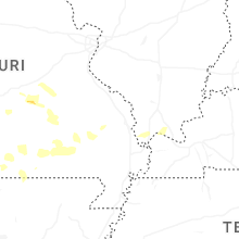

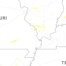
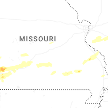
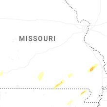
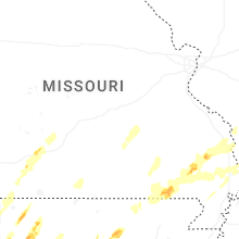


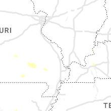


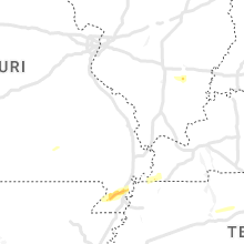

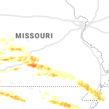


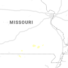


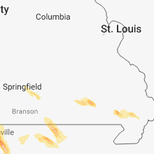


Connect with Interactive Hail Maps