

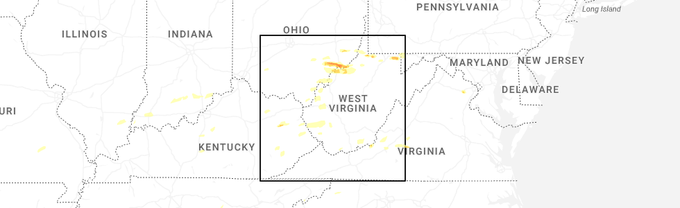
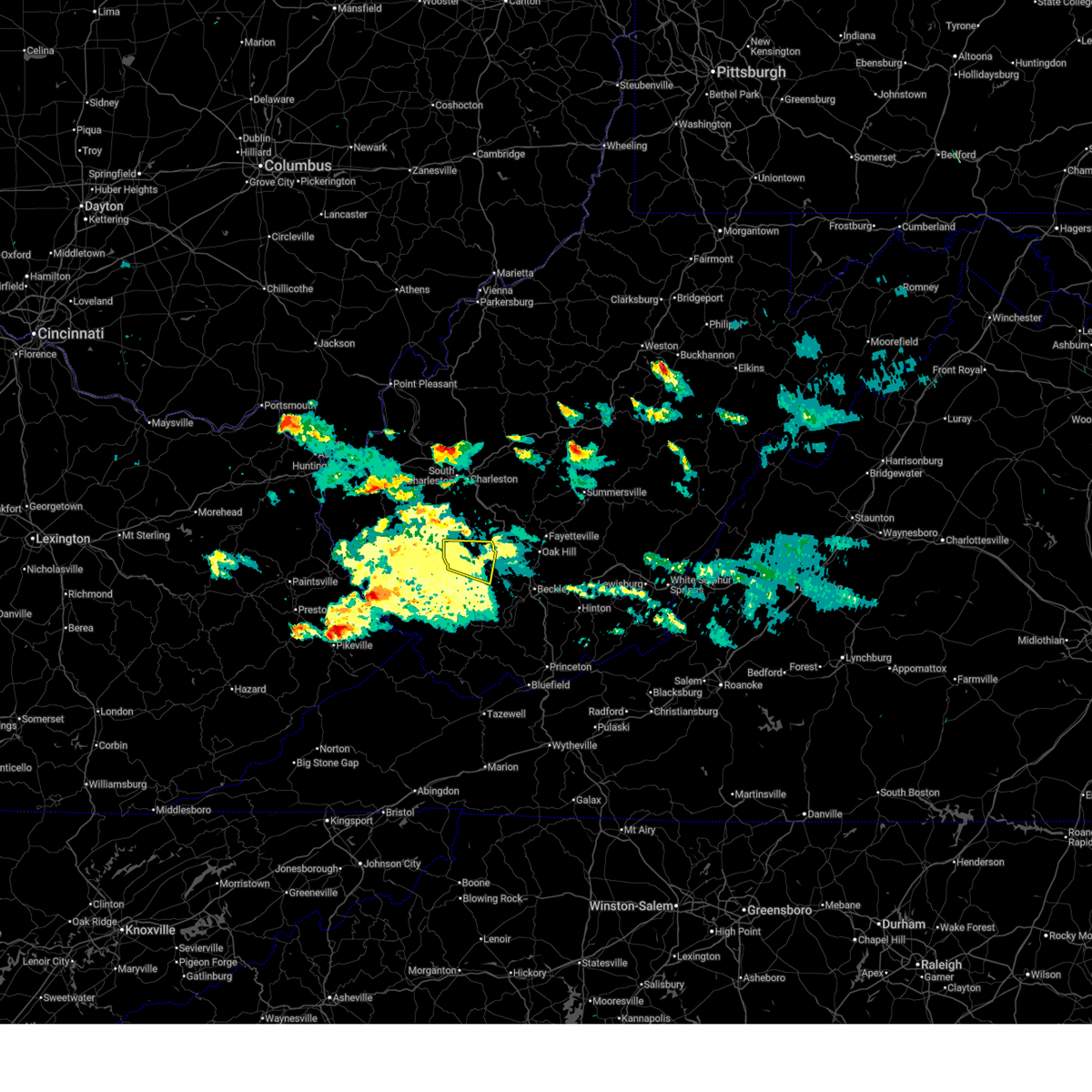
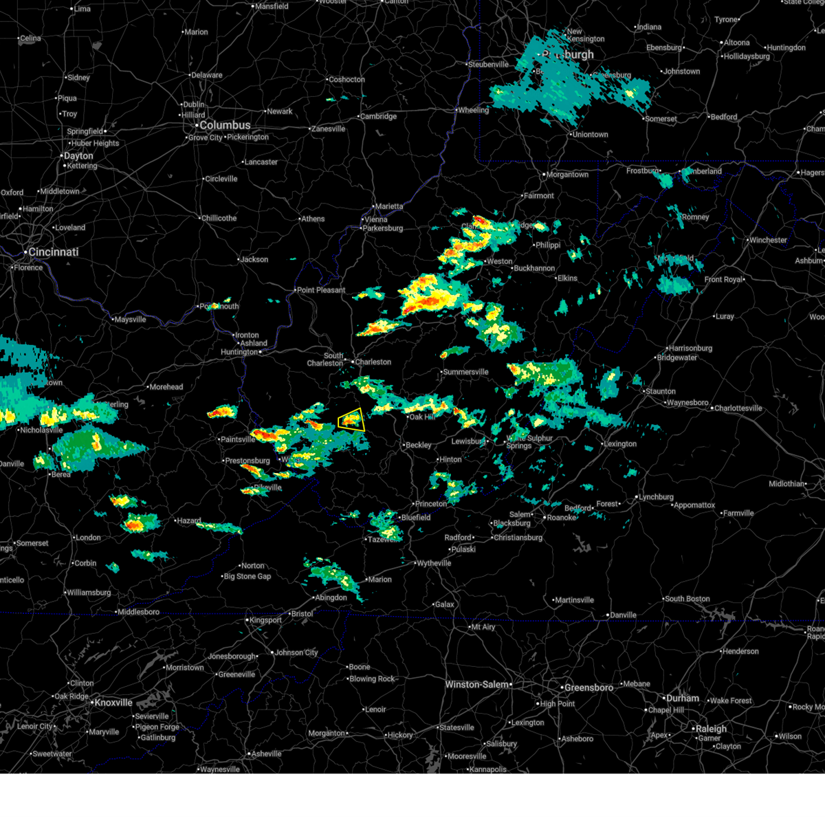
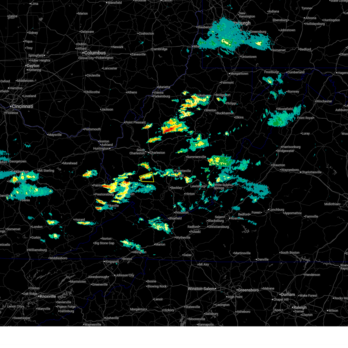
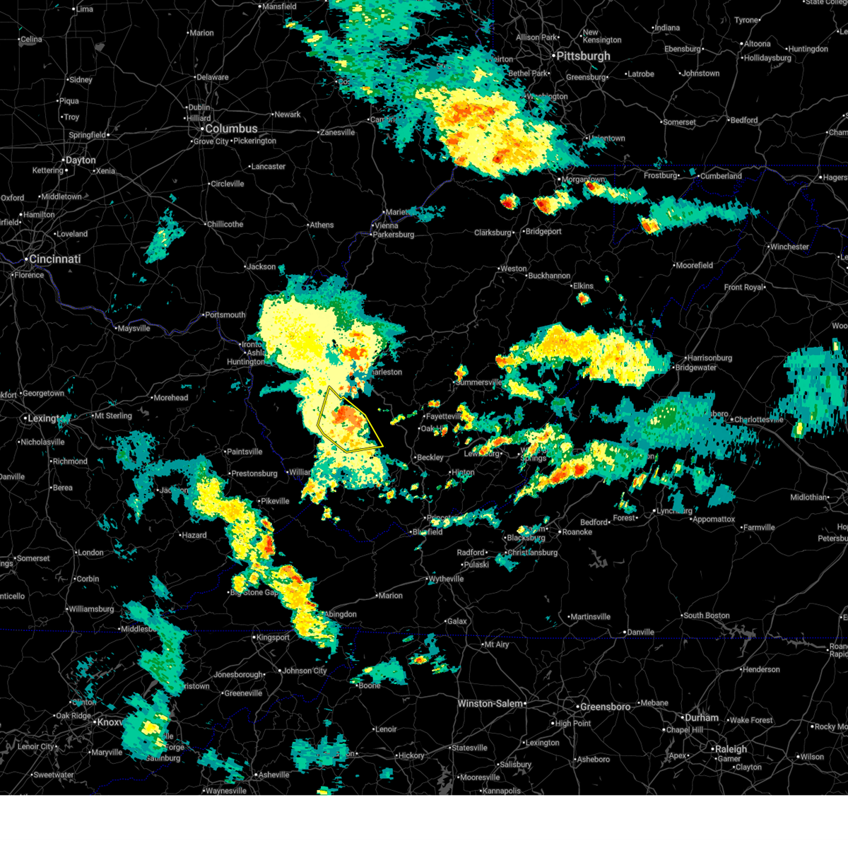
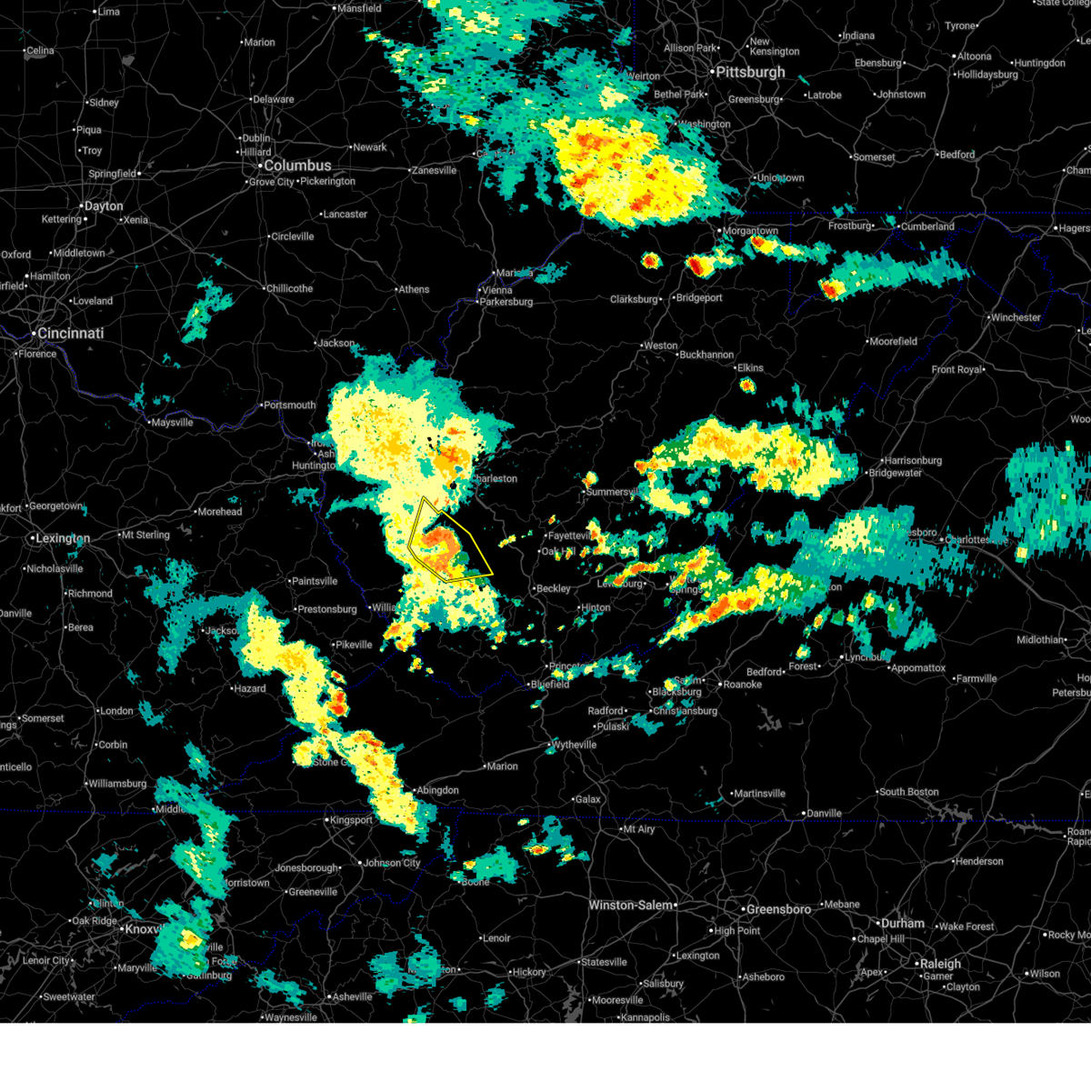
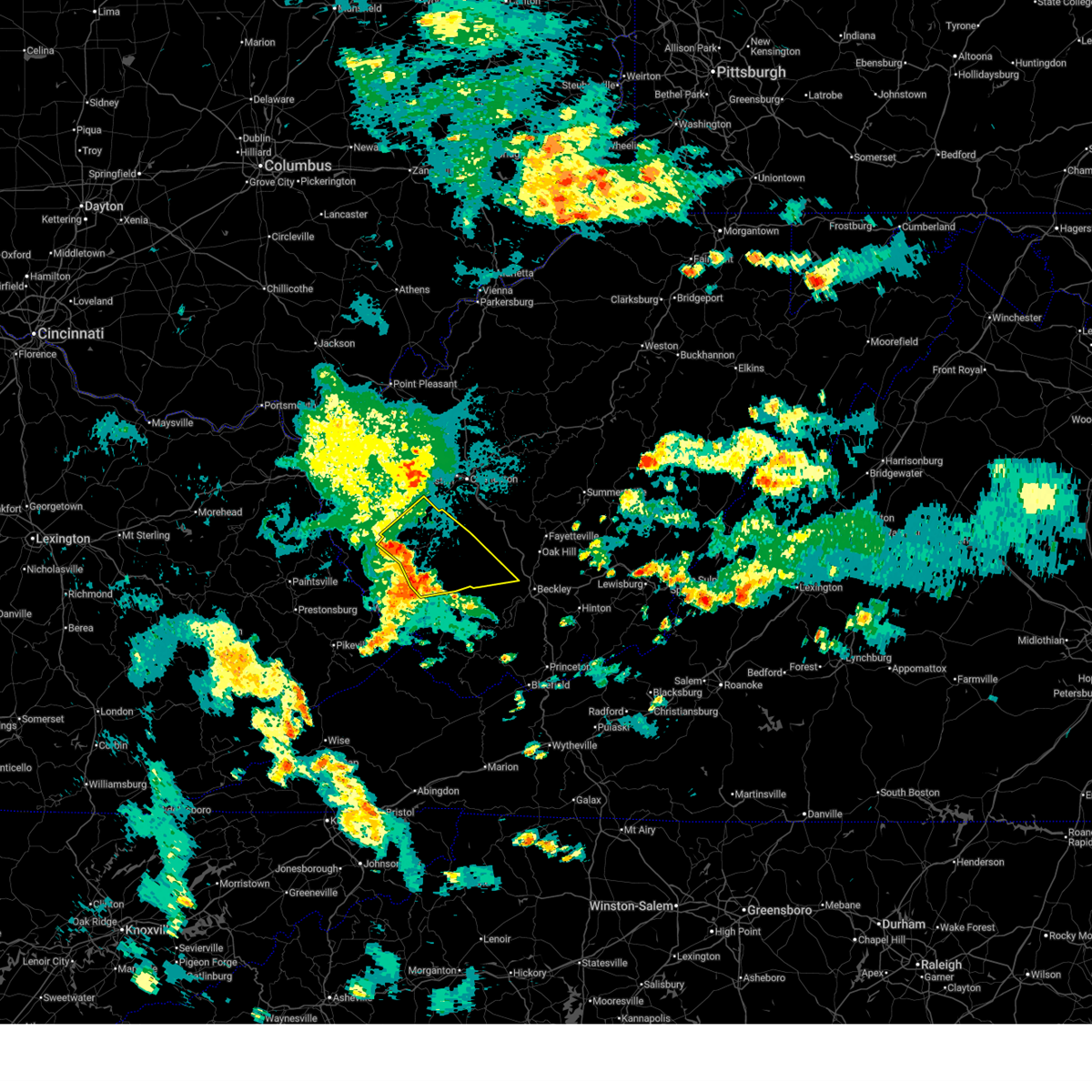
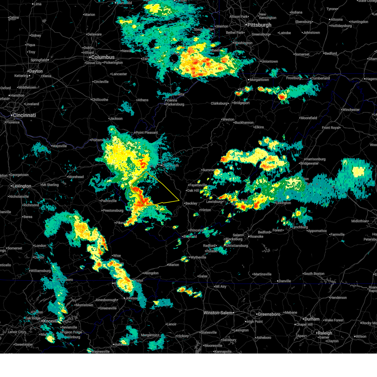
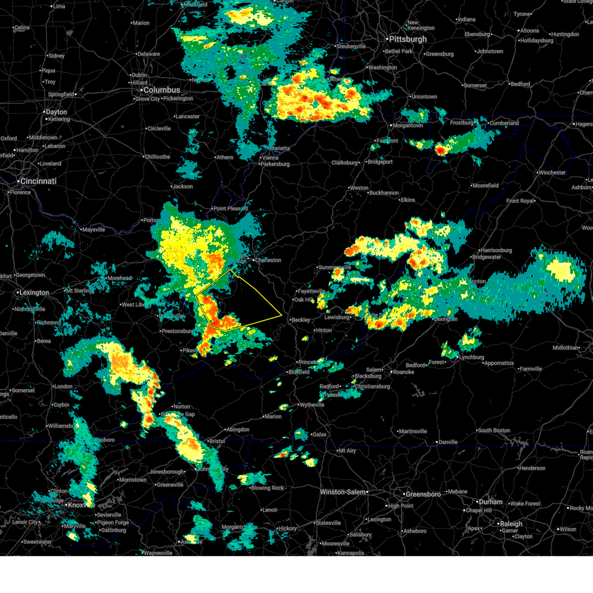
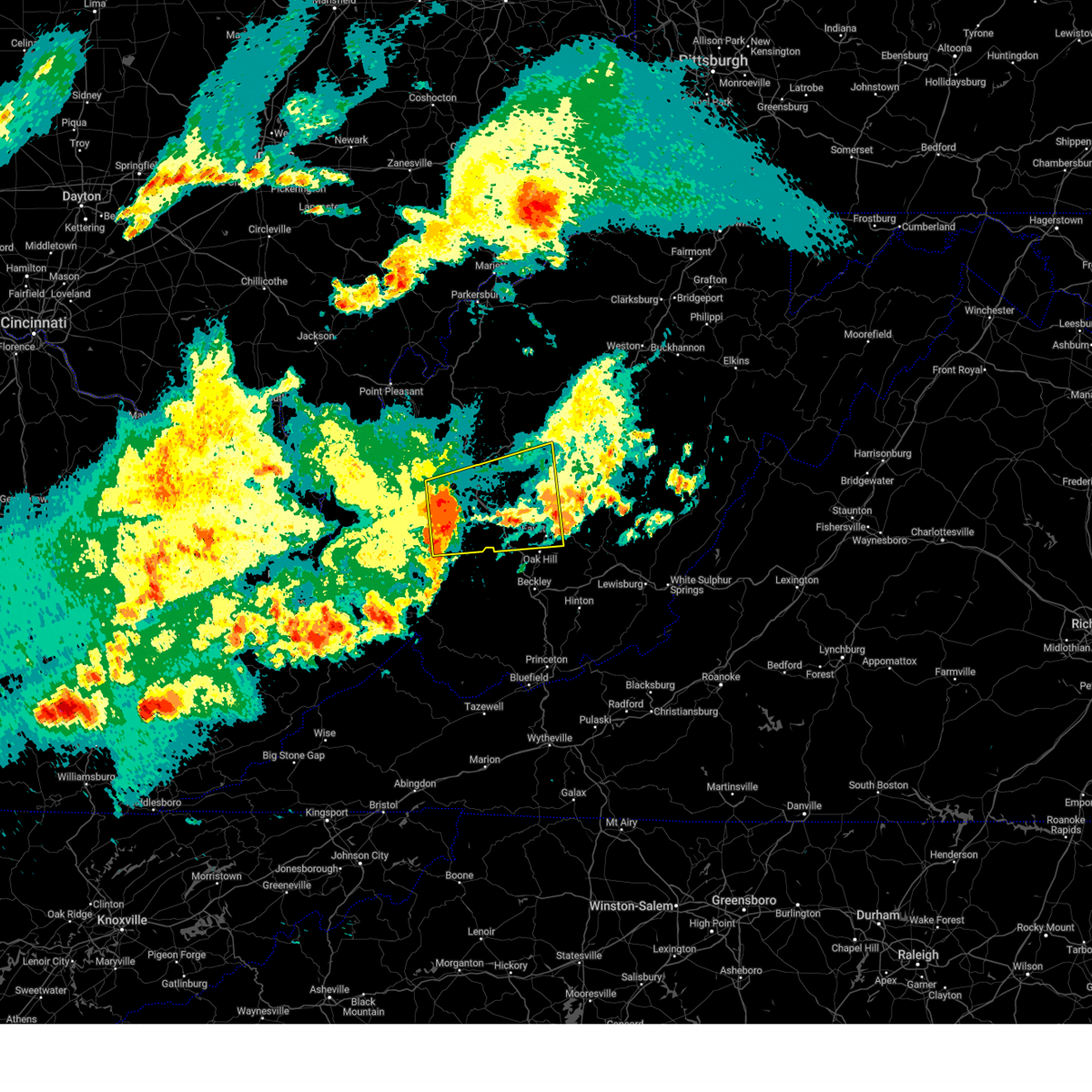
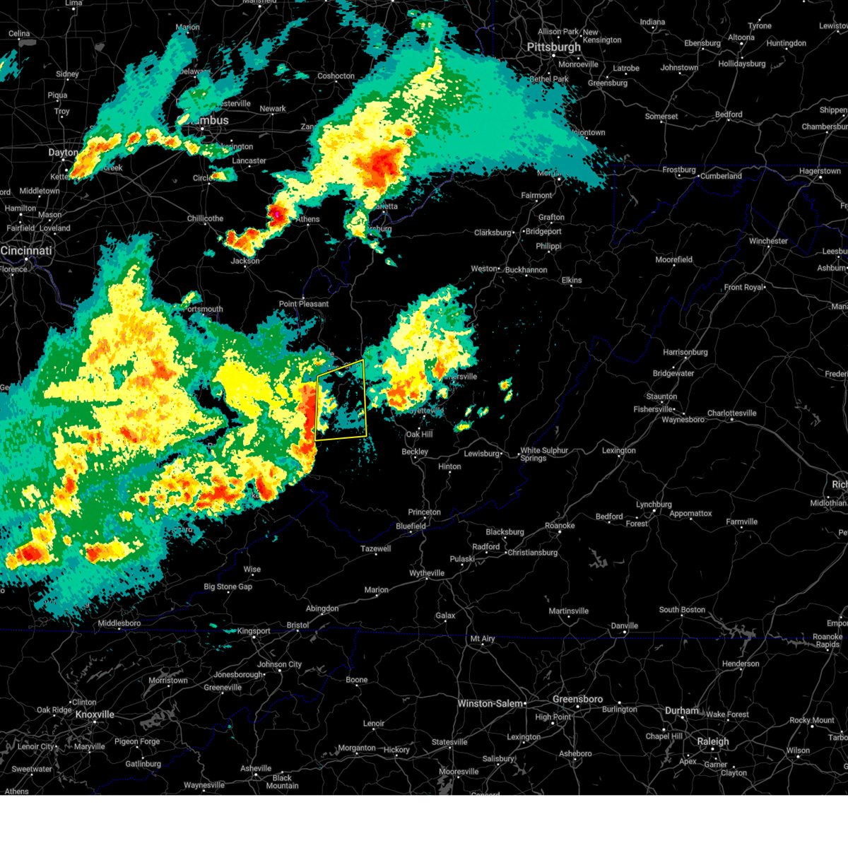
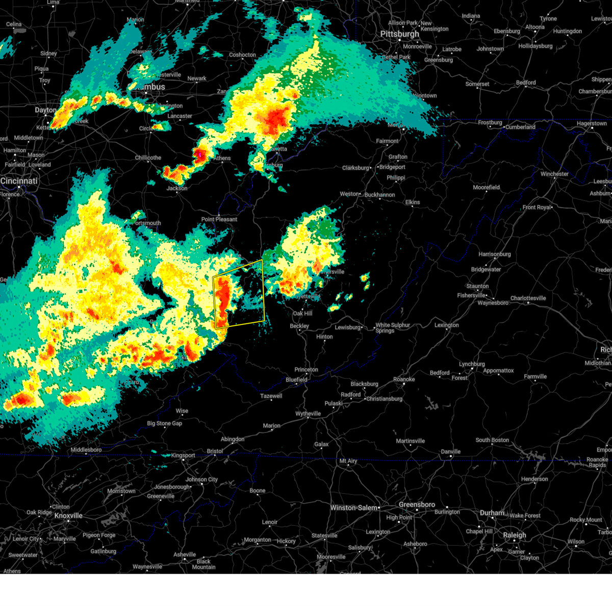
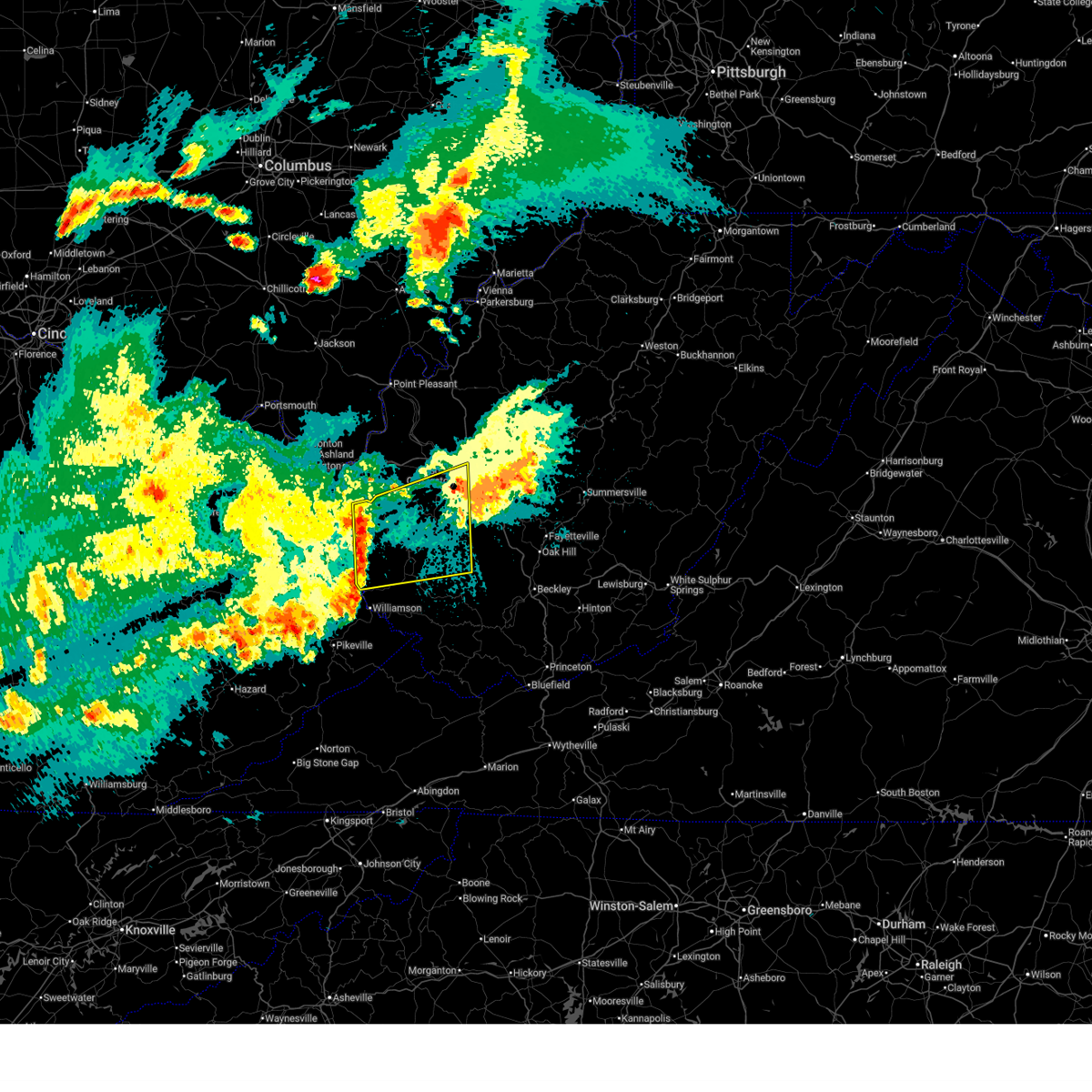
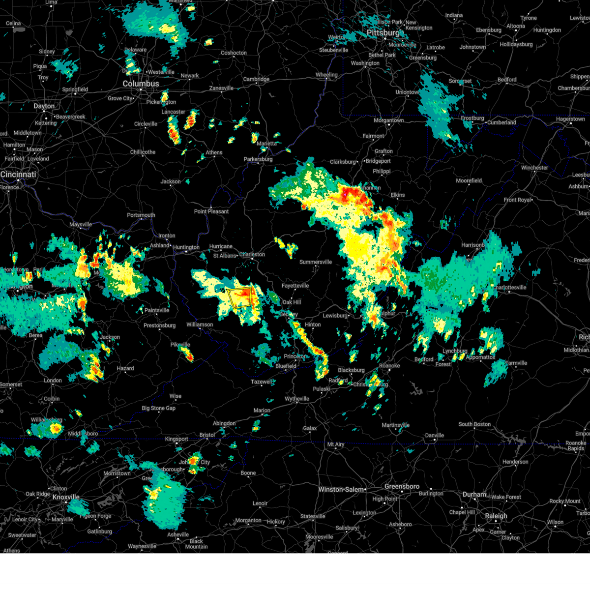
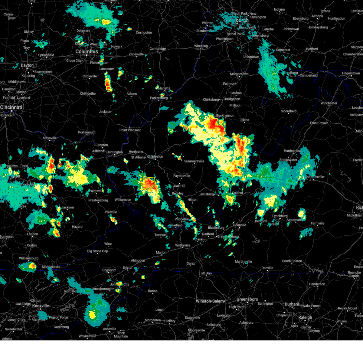
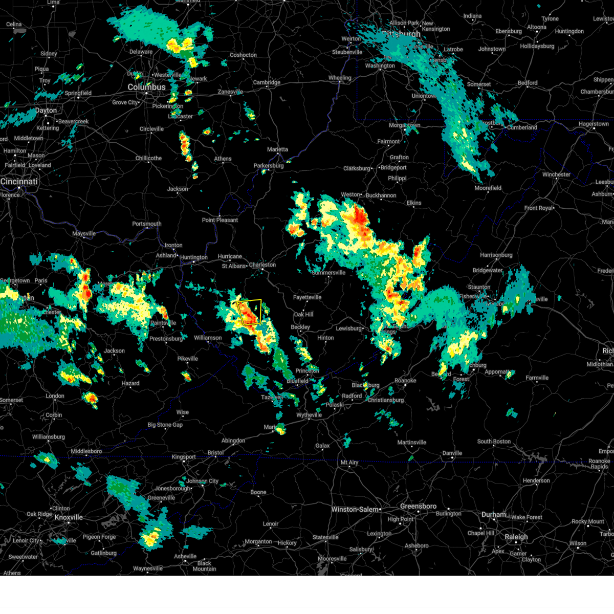
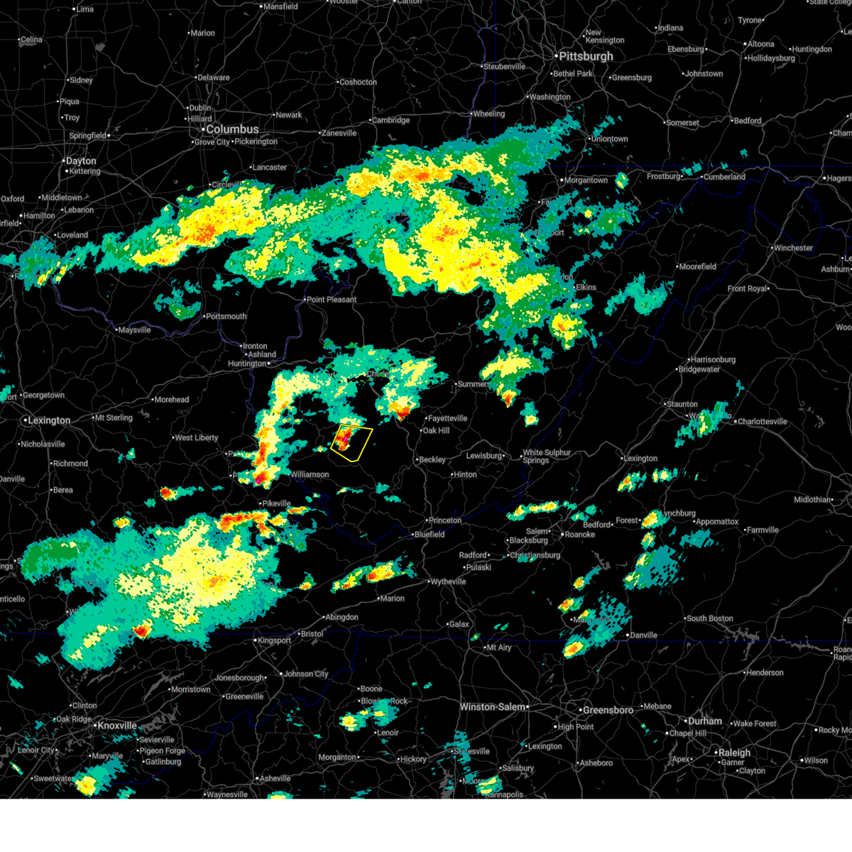
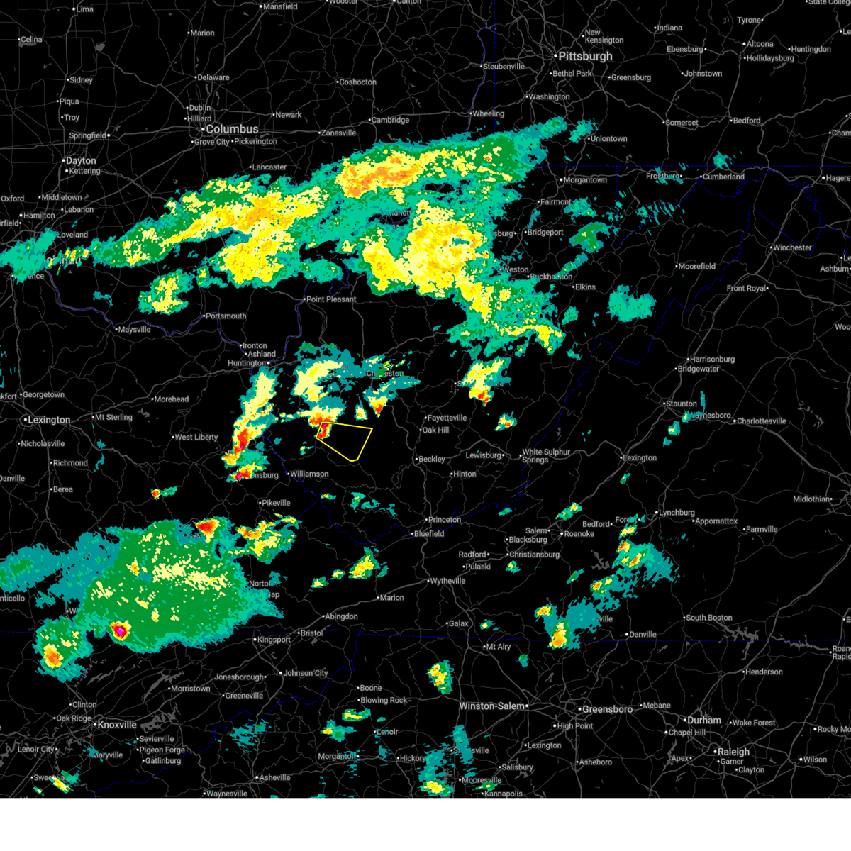
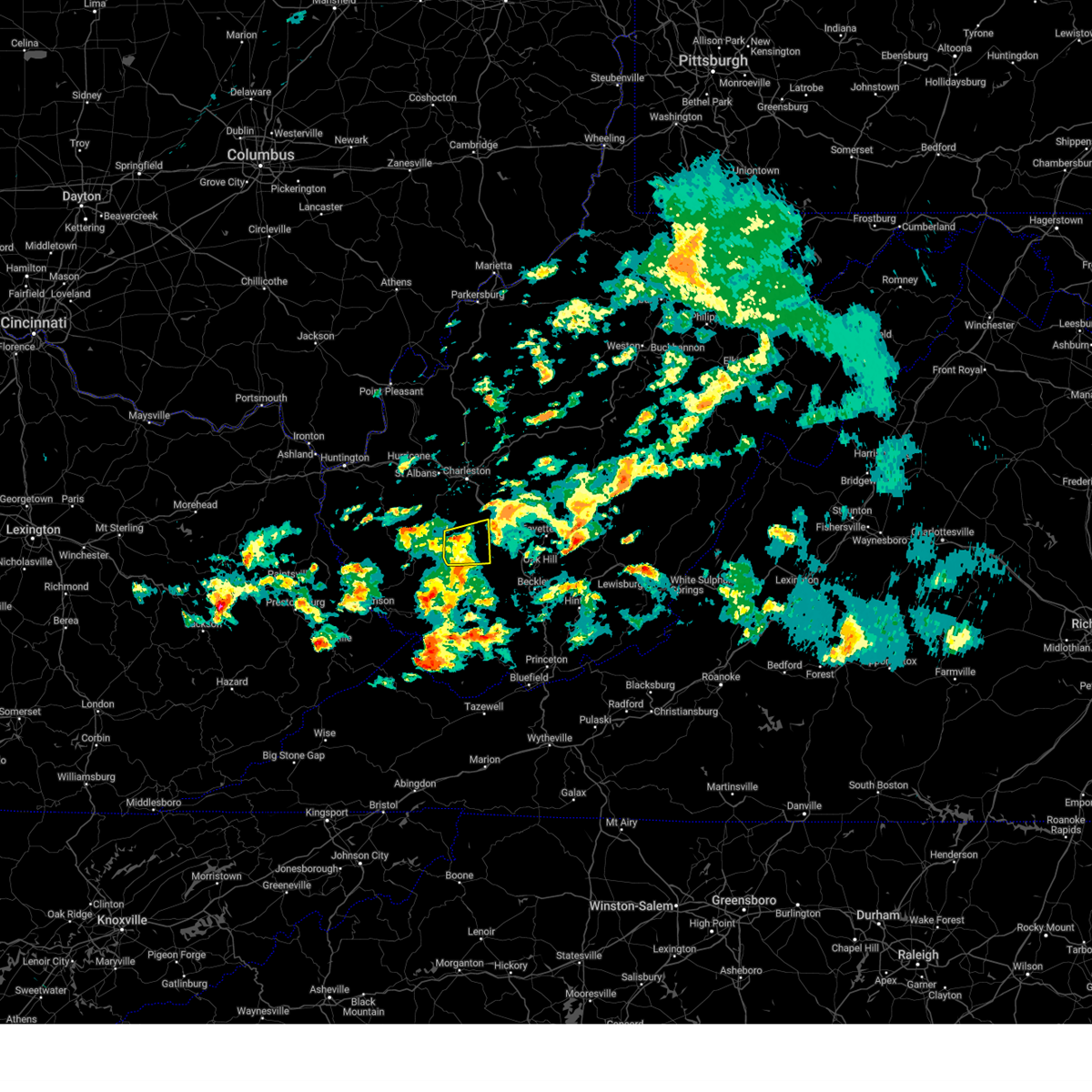
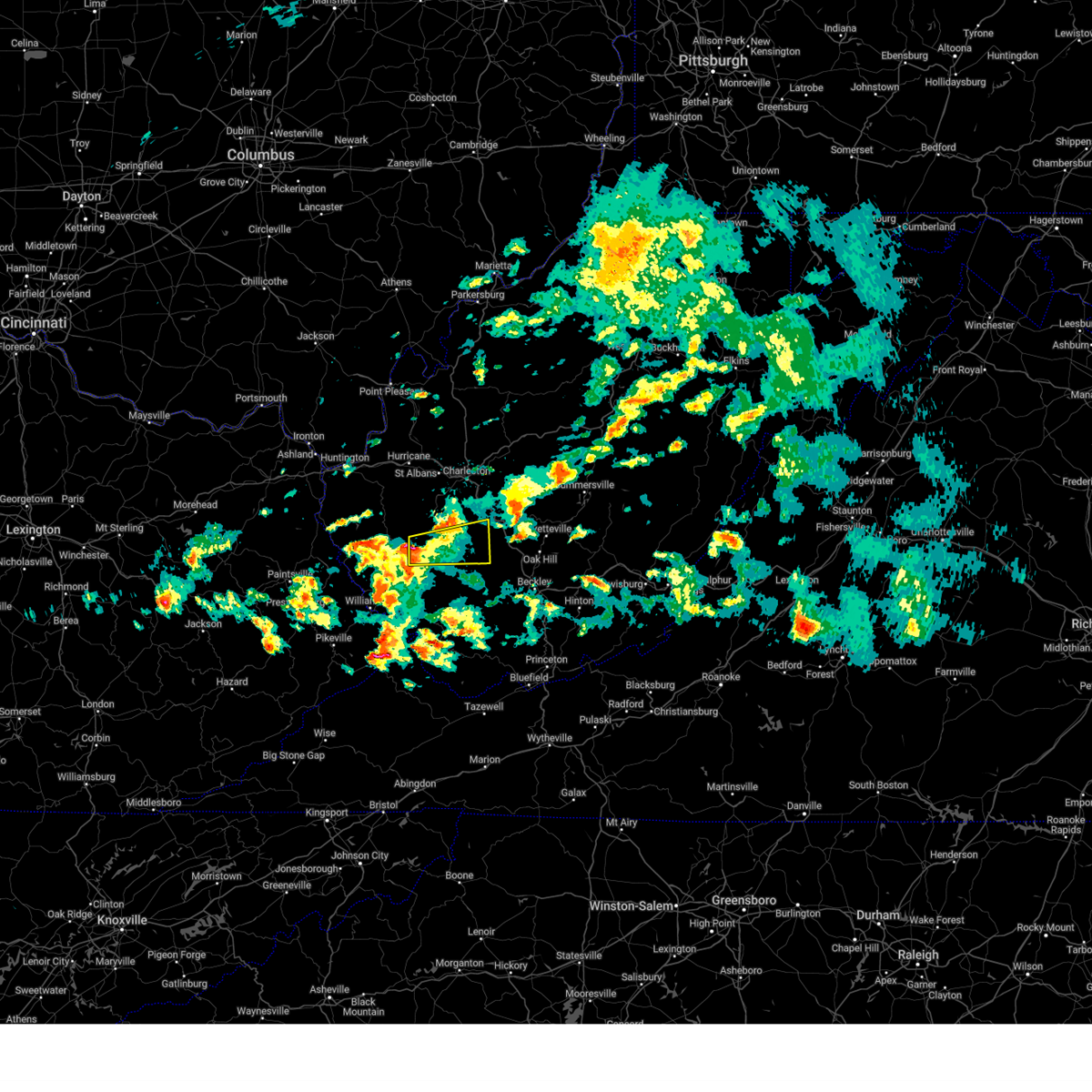
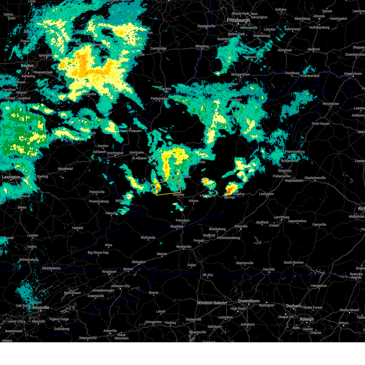
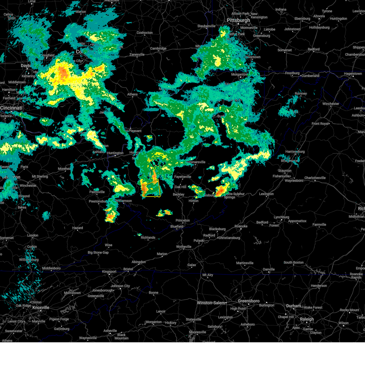
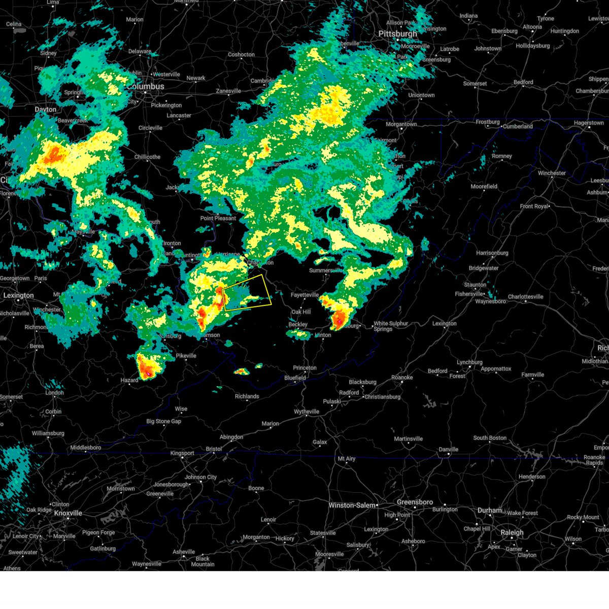
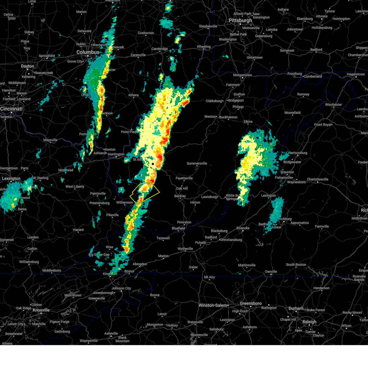
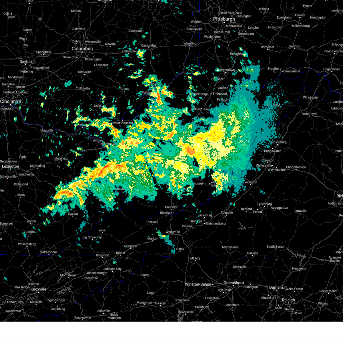
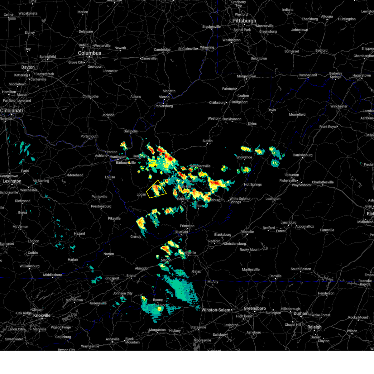
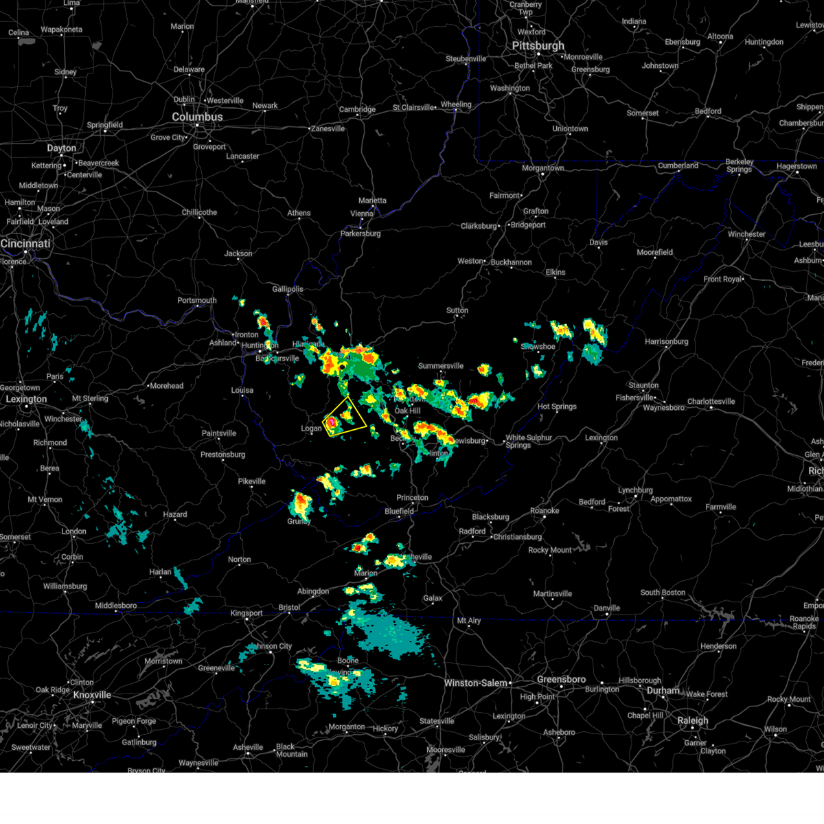
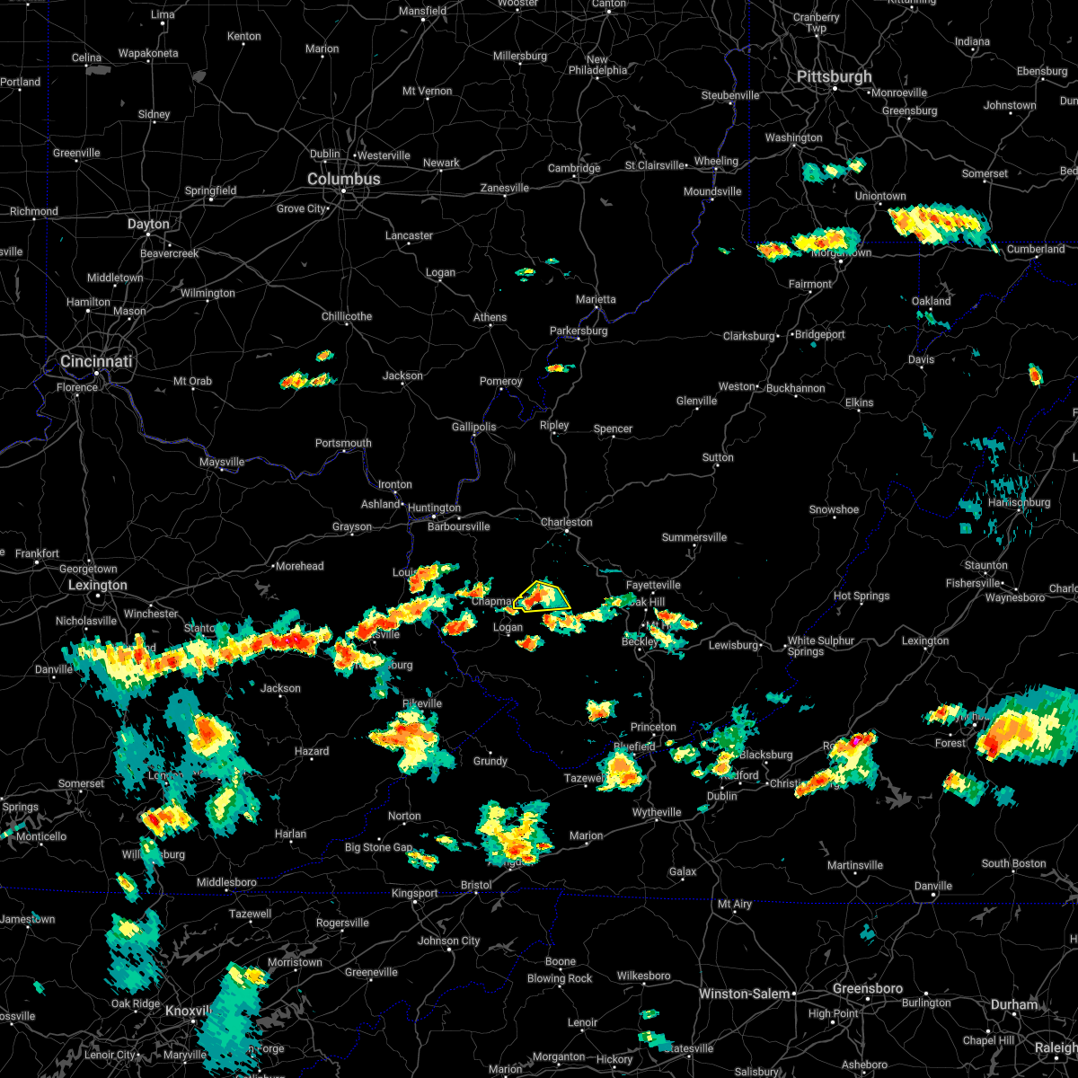
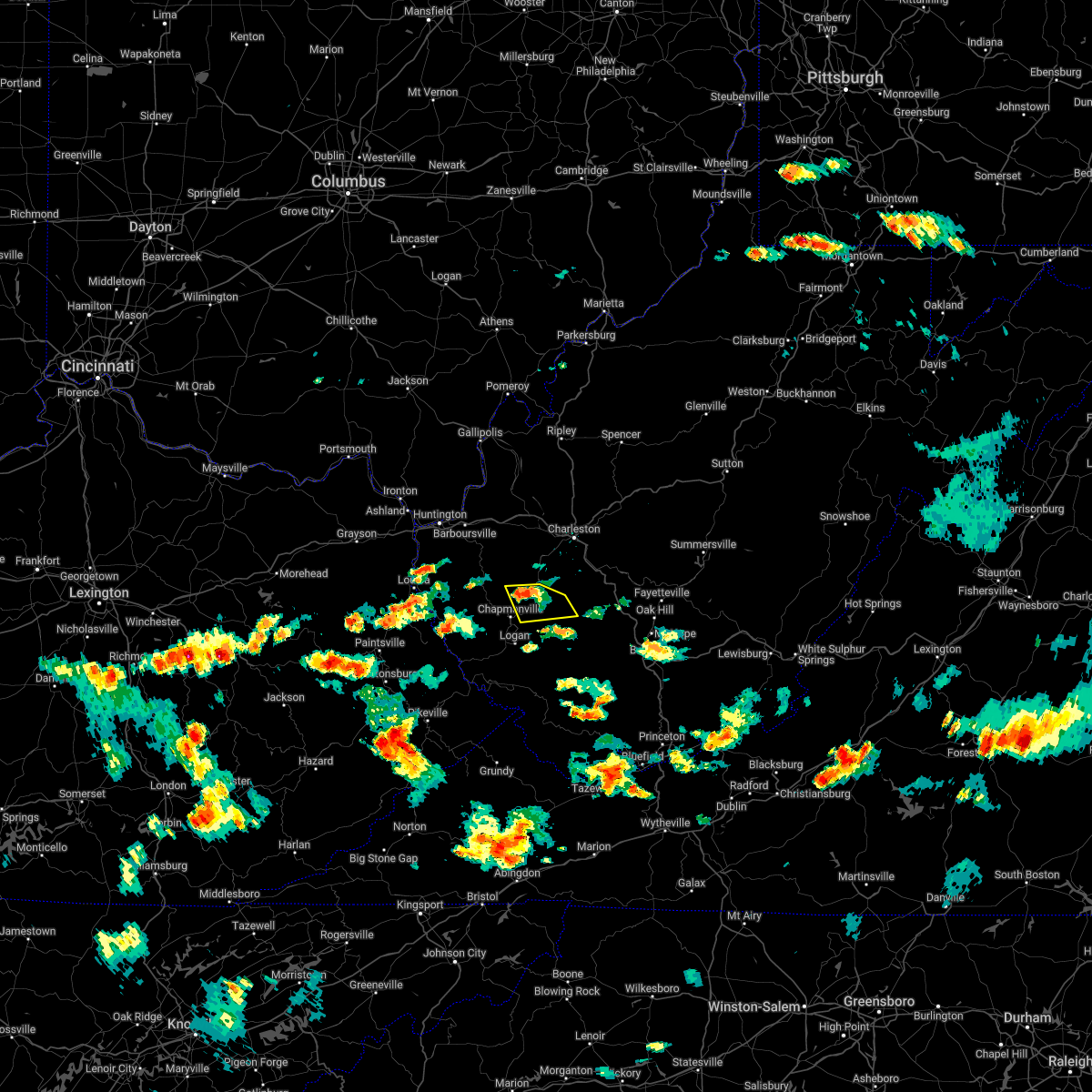
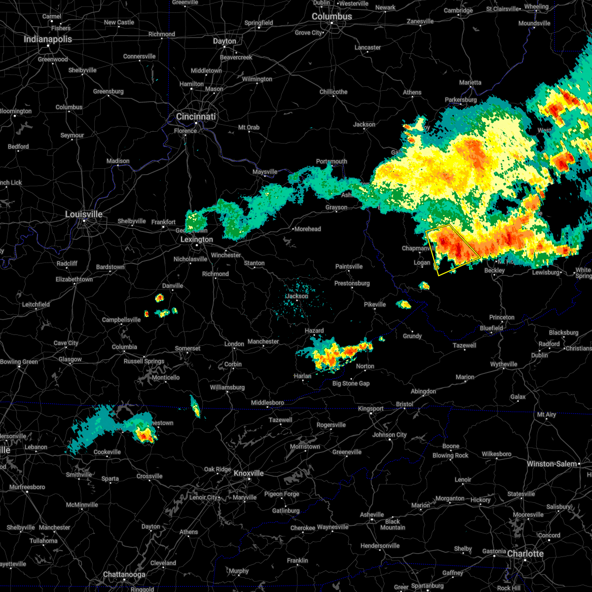
Hail Map for Van, WV
The Van, WV area has had 0 reports of on-the-ground hail by trained spotters, and has been under severe weather warnings 26 times during the past 12 months. Doppler radar has detected hail at or near Van, WV on 34 occasions, including 2 occasions during the past year.
| Name: | Van, WV |
| Where Located: | 26.5 miles S of Charleston, WV |
| Map: | Google Map for Van, WV |
| Population: | 211 |
| Housing Units: | 102 |
| More Info: | Search Google for Van, WV |
1
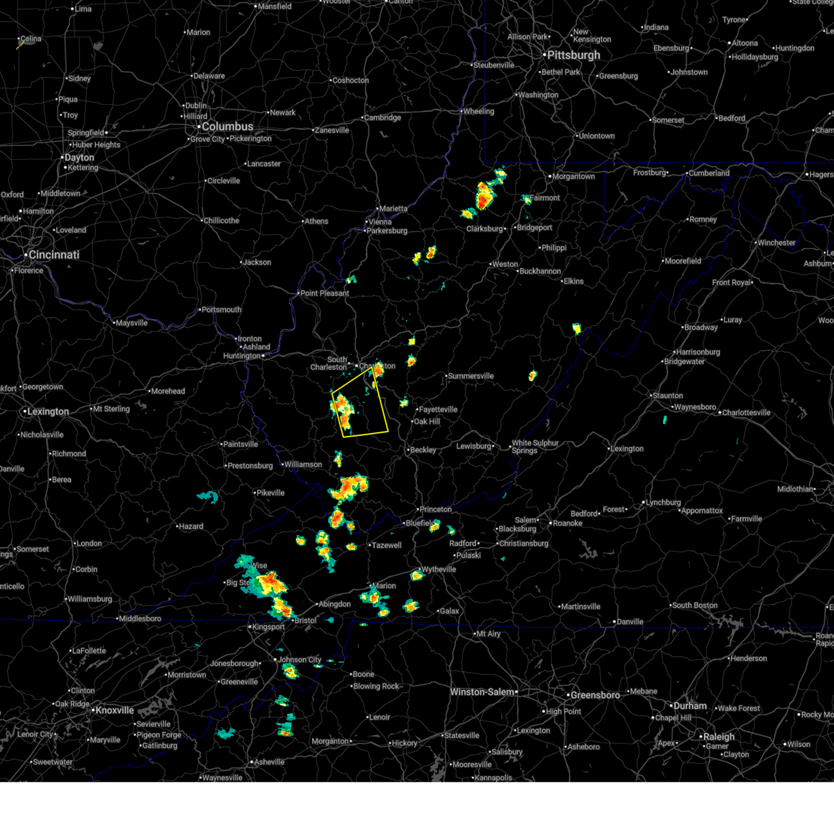
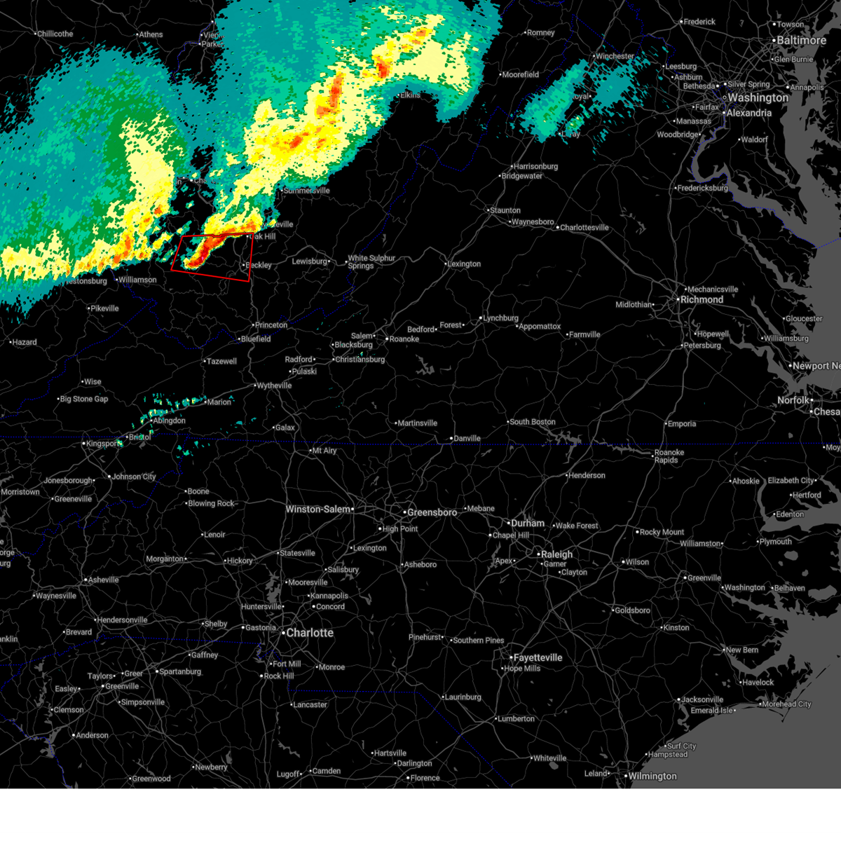
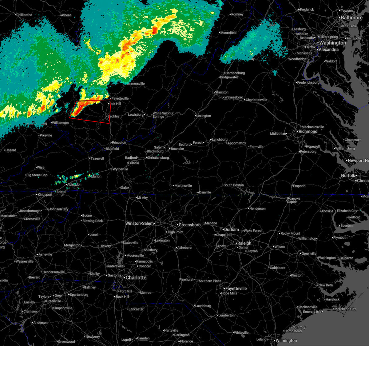
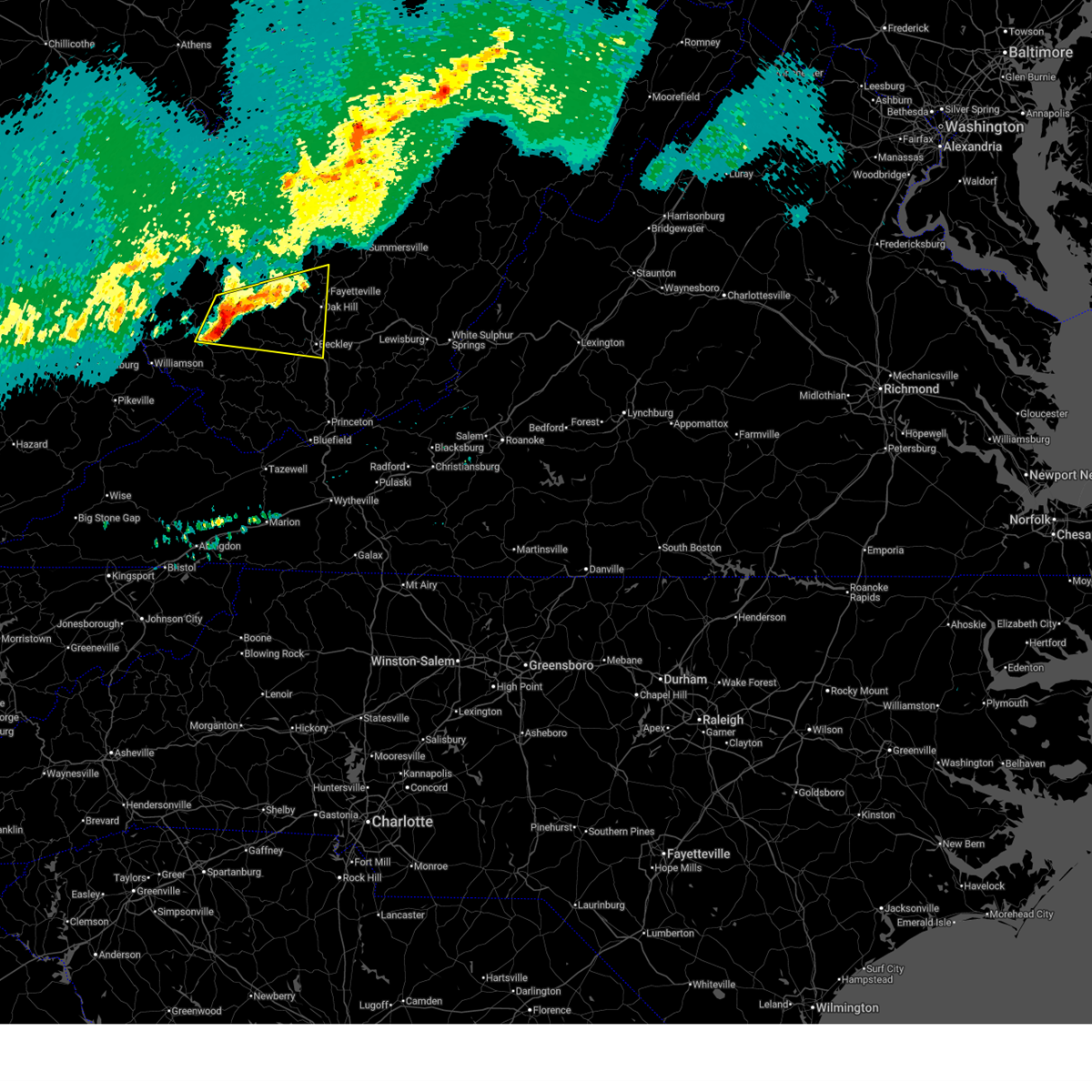
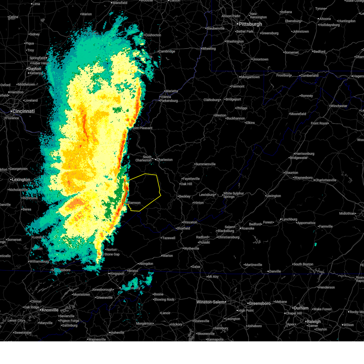
The Top Recent Hail Date for Van, WV is Wednesday, April 1, 2026 (6th out of 34)
Hail and Wind Damage Spotted near Van, WV
| Date / Time | Report Details |
|---|---|
| 7/4/2026 12:39 PM EDT |
 Svrrlx the national weather service in charleston west virginia has issued a * severe thunderstorm warning for, southwestern kanawha county in central west virginia, northwestern raleigh county in southeastern west virginia, boone county in central west virginia, * until 115 pm edt. * at 1238 pm edt, severe thunderstorms were located along a line extending from near madison to van, moving east at 15 mph (radar indicated). Hazards include 60 mph wind gusts and quarter size hail. Hail damage to vehicles is expected. Expect wind damage to roofs, siding, and trees. Svrrlx the national weather service in charleston west virginia has issued a * severe thunderstorm warning for, southwestern kanawha county in central west virginia, northwestern raleigh county in southeastern west virginia, boone county in central west virginia, * until 115 pm edt. * at 1238 pm edt, severe thunderstorms were located along a line extending from near madison to van, moving east at 15 mph (radar indicated). Hazards include 60 mph wind gusts and quarter size hail. Hail damage to vehicles is expected. Expect wind damage to roofs, siding, and trees.
|
| 6/18/2026 7:26 AM EDT |
 At 725 am edt, a severe thunderstorm capable of producing a tornado was located near bald knob, or 18 miles southeast of madison, moving east at 50 mph (radar indicated rotation). Hazards include tornado. Flying debris will be dangerous to those caught without shelter. mobile homes will be damaged or destroyed. damage to roofs, windows, and vehicles will occur. tree damage is likely. this dangerous storm will be near, bradley around 735 am edt. beckley, oak hill, mount hope, piney view, and prosperity around 740 am edt. stanaford around 745 am edt. Other locations impacted by this tornadic thunderstorm include pax, cyclone, naoma, bolt, arnett, dorothy, lester, kopperston, glen daniel, and stickney. At 725 am edt, a severe thunderstorm capable of producing a tornado was located near bald knob, or 18 miles southeast of madison, moving east at 50 mph (radar indicated rotation). Hazards include tornado. Flying debris will be dangerous to those caught without shelter. mobile homes will be damaged or destroyed. damage to roofs, windows, and vehicles will occur. tree damage is likely. this dangerous storm will be near, bradley around 735 am edt. beckley, oak hill, mount hope, piney view, and prosperity around 740 am edt. stanaford around 745 am edt. Other locations impacted by this tornadic thunderstorm include pax, cyclone, naoma, bolt, arnett, dorothy, lester, kopperston, glen daniel, and stickney.
|
| 6/18/2026 7:17 AM EDT |
 Torrlx the national weather service in charleston west virginia has issued a * tornado warning for, south central kanawha county in central west virginia, northwestern raleigh county in southeastern west virginia, north central wyoming county in southern west virginia, northeastern logan county in southern west virginia, southwestern fayette county in southeastern west virginia, southeastern boone county in central west virginia, * until 745 am edt. * at 716 am edt, a severe thunderstorm capable of producing a tornado was located over wharton, or 12 miles southeast of madison, moving east at 50 mph (radar indicated rotation). Hazards include tornado. Flying debris will be dangerous to those caught without shelter. mobile homes will be damaged or destroyed. damage to roofs, windows, and vehicles will occur. tree damage is likely. this dangerous storm will be near, bald knob around 720 am edt. bradley and powellton around 735 am edt. Other locations impacted by this tornadic thunderstorm include whitesville, sylvester, pax, cyclone, naoma, prenter, bolt, arnett, dorothy, and lester. Torrlx the national weather service in charleston west virginia has issued a * tornado warning for, south central kanawha county in central west virginia, northwestern raleigh county in southeastern west virginia, north central wyoming county in southern west virginia, northeastern logan county in southern west virginia, southwestern fayette county in southeastern west virginia, southeastern boone county in central west virginia, * until 745 am edt. * at 716 am edt, a severe thunderstorm capable of producing a tornado was located over wharton, or 12 miles southeast of madison, moving east at 50 mph (radar indicated rotation). Hazards include tornado. Flying debris will be dangerous to those caught without shelter. mobile homes will be damaged or destroyed. damage to roofs, windows, and vehicles will occur. tree damage is likely. this dangerous storm will be near, bald knob around 720 am edt. bradley and powellton around 735 am edt. Other locations impacted by this tornadic thunderstorm include whitesville, sylvester, pax, cyclone, naoma, prenter, bolt, arnett, dorothy, and lester.
|
| 6/18/2026 7:11 AM EDT |
 Svrrlx the national weather service in charleston west virginia has issued a * severe thunderstorm warning for, southeastern kanawha county in central west virginia, northwestern raleigh county in southeastern west virginia, north central wyoming county in southern west virginia, central logan county in southern west virginia, western fayette county in southeastern west virginia, central boone county in central west virginia, * until 745 am edt. * at 711 am edt, a severe thunderstorm was located near wharton, or 11 miles east of logan, moving east at 55 mph (radar indicated). Hazards include 60 mph wind gusts. expect damage to roofs, siding, and trees Svrrlx the national weather service in charleston west virginia has issued a * severe thunderstorm warning for, southeastern kanawha county in central west virginia, northwestern raleigh county in southeastern west virginia, north central wyoming county in southern west virginia, central logan county in southern west virginia, western fayette county in southeastern west virginia, central boone county in central west virginia, * until 745 am edt. * at 711 am edt, a severe thunderstorm was located near wharton, or 11 miles east of logan, moving east at 55 mph (radar indicated). Hazards include 60 mph wind gusts. expect damage to roofs, siding, and trees
|
| 6/18/2026 6:44 AM EDT |
 Svrrlx the national weather service in charleston west virginia has issued a * severe thunderstorm warning for, south central calhoun county in north central west virginia, west central nicholas county in southeastern west virginia, kanawha county in central west virginia, eastern putnam county in western west virginia, eastern lincoln county in central west virginia, southern roane county in central west virginia, northwestern raleigh county in southeastern west virginia, clay county in north central west virginia, southeastern jackson county in northwestern west virginia, western fayette county in southeastern west virginia, boone county in central west virginia, * until 715 am edt. * at 644 am edt, severe thunderstorms were located along a line extending from kenna to near charleston to near madison, moving east at 70 mph (radar indicated). Hazards include 60 mph wind gusts. expect damage to roofs, siding, and trees Svrrlx the national weather service in charleston west virginia has issued a * severe thunderstorm warning for, south central calhoun county in north central west virginia, west central nicholas county in southeastern west virginia, kanawha county in central west virginia, eastern putnam county in western west virginia, eastern lincoln county in central west virginia, southern roane county in central west virginia, northwestern raleigh county in southeastern west virginia, clay county in north central west virginia, southeastern jackson county in northwestern west virginia, western fayette county in southeastern west virginia, boone county in central west virginia, * until 715 am edt. * at 644 am edt, severe thunderstorms were located along a line extending from kenna to near charleston to near madison, moving east at 70 mph (radar indicated). Hazards include 60 mph wind gusts. expect damage to roofs, siding, and trees
|
| 6/18/2026 6:39 AM EDT |
 Svrrlx the national weather service in charleston west virginia has issued a * severe thunderstorm warning for, northern mingo county in southern west virginia, southwestern lincoln county in central west virginia, northwestern wyoming county in southern west virginia, logan county in southern west virginia, southeastern wayne county in western west virginia, central boone county in central west virginia, * until 715 am edt. * at 639 am edt, a severe thunderstorm was located near hode, or 11 miles east of inez, moving east at 55 mph (radar indicated). Hazards include 60 mph wind gusts. expect damage to roofs, siding, and trees Svrrlx the national weather service in charleston west virginia has issued a * severe thunderstorm warning for, northern mingo county in southern west virginia, southwestern lincoln county in central west virginia, northwestern wyoming county in southern west virginia, logan county in southern west virginia, southeastern wayne county in western west virginia, central boone county in central west virginia, * until 715 am edt. * at 639 am edt, a severe thunderstorm was located near hode, or 11 miles east of inez, moving east at 55 mph (radar indicated). Hazards include 60 mph wind gusts. expect damage to roofs, siding, and trees
|
| 4/1/2026 3:30 PM EDT |
 The storm which prompted the warning has weakened below severe limits, and no longer poses an immediate threat to life or property. therefore, the warning has been allowed to expire. however, small hail, gusty winds and heavy rain are still possible with this thunderstorm. a severe thunderstorm watch remains in effect until 800 pm edt for central, southern and southeastern west virginia. The storm which prompted the warning has weakened below severe limits, and no longer poses an immediate threat to life or property. therefore, the warning has been allowed to expire. however, small hail, gusty winds and heavy rain are still possible with this thunderstorm. a severe thunderstorm watch remains in effect until 800 pm edt for central, southern and southeastern west virginia.
|
| 4/1/2026 3:00 PM EDT |
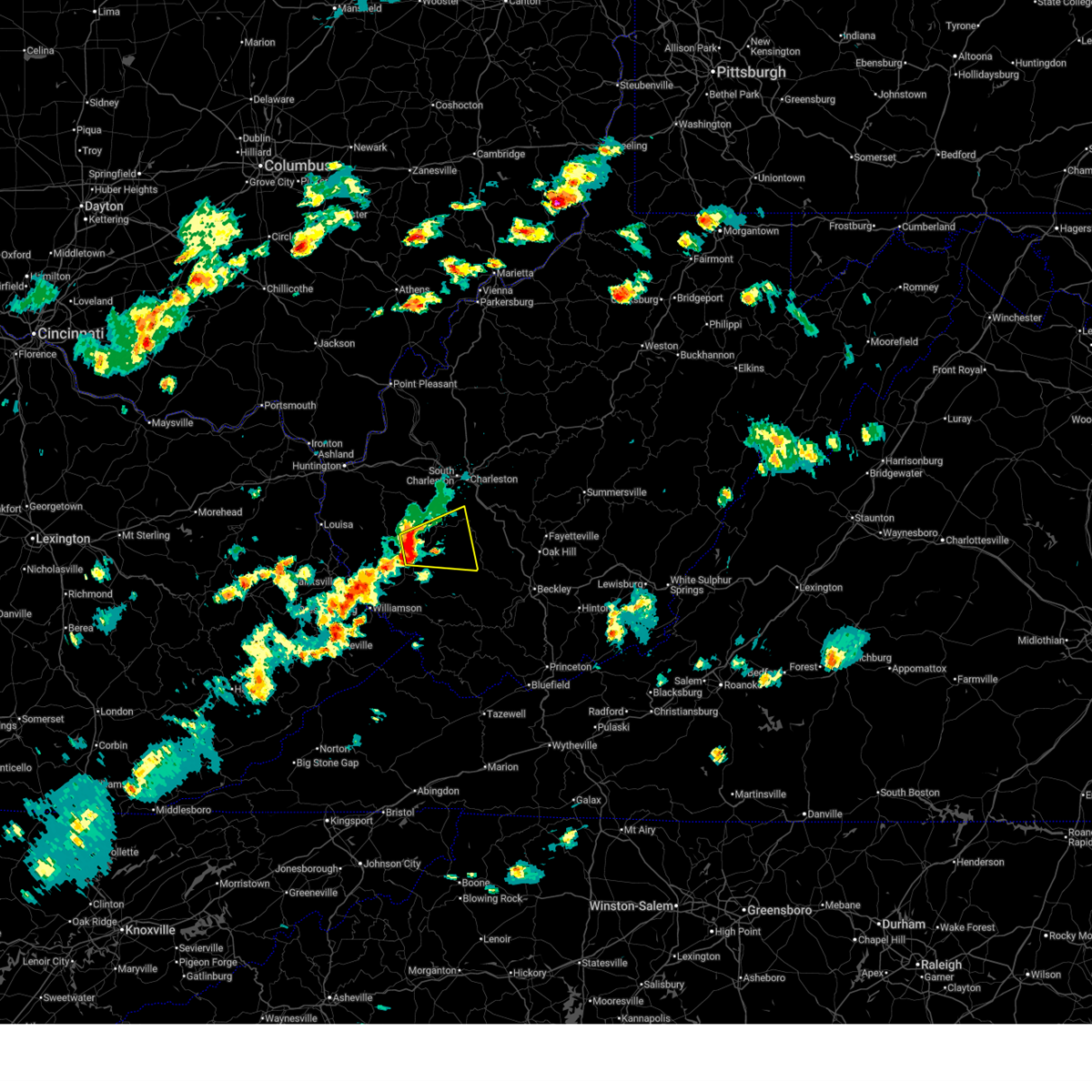 Svrrlx the national weather service in charleston west virginia has issued a * severe thunderstorm warning for, south central lincoln county in central west virginia, north central logan county in southern west virginia, boone county in central west virginia, * until 330 pm edt. * at 259 pm edt, a severe thunderstorm was located near chapmanville, or 7 miles southwest of madison, moving east at 30 mph (radar indicated). Hazards include 60 mph wind gusts and quarter size hail. Hail damage to vehicles is expected. Expect wind damage to roofs, siding, and trees. Svrrlx the national weather service in charleston west virginia has issued a * severe thunderstorm warning for, south central lincoln county in central west virginia, north central logan county in southern west virginia, boone county in central west virginia, * until 330 pm edt. * at 259 pm edt, a severe thunderstorm was located near chapmanville, or 7 miles southwest of madison, moving east at 30 mph (radar indicated). Hazards include 60 mph wind gusts and quarter size hail. Hail damage to vehicles is expected. Expect wind damage to roofs, siding, and trees.
|
| 3/16/2026 5:41 AM EDT |
 The storms which prompted the warning have moved out of the area. therefore, the warning will be allowed to expire. however, gusty winds and heavy rain are still possible with these thunderstorms. a severe thunderstorm watch remains in effect until 700 am edt for central, southern and southeastern west virginia. The storms which prompted the warning have moved out of the area. therefore, the warning will be allowed to expire. however, gusty winds and heavy rain are still possible with these thunderstorms. a severe thunderstorm watch remains in effect until 700 am edt for central, southern and southeastern west virginia.
|
| 3/16/2026 5:31 AM EDT |
 At 531 am edt, severe thunderstorms were located along a line extending from 7 miles east of madison to near van to near amherstdale-robinette to near gilbert creek, moving northeast at 50 mph (radar indicated). Hazards include 60 mph wind gusts. Expect damage to roofs, siding, and trees. Locations impacted include, man, van, mallory, amherstdale-robinette, wharton, hinch, bald knob, gilbert creek, gilbert, seth, cyclone, prenter, hampden, bruno, blair, and amherstdale-robine. At 531 am edt, severe thunderstorms were located along a line extending from 7 miles east of madison to near van to near amherstdale-robinette to near gilbert creek, moving northeast at 50 mph (radar indicated). Hazards include 60 mph wind gusts. Expect damage to roofs, siding, and trees. Locations impacted include, man, van, mallory, amherstdale-robinette, wharton, hinch, bald knob, gilbert creek, gilbert, seth, cyclone, prenter, hampden, bruno, blair, and amherstdale-robine.
|
| 3/16/2026 5:19 AM EDT |
 At 519 am edt, severe thunderstorms were located along a line extending from near julian to near van to near man to near woodman, moving east at 45 mph (radar indicated). Hazards include 60 mph wind gusts. Expect damage to roofs, siding, and trees. Locations impacted include, madison, logan, man, van, bald knob, mallory, amherstdale-robinette, wharton, hinch, gilbert creek, red jacket, danville, gilbert, seth, chauncey, turtle creek, prenter, bruno, sharples, and sarah ann. At 519 am edt, severe thunderstorms were located along a line extending from near julian to near van to near man to near woodman, moving east at 45 mph (radar indicated). Hazards include 60 mph wind gusts. Expect damage to roofs, siding, and trees. Locations impacted include, madison, logan, man, van, bald knob, mallory, amherstdale-robinette, wharton, hinch, gilbert creek, red jacket, danville, gilbert, seth, chauncey, turtle creek, prenter, bruno, sharples, and sarah ann.
|
| 3/16/2026 5:19 AM EDT |
 the severe thunderstorm warning has been cancelled and is no longer in effect the severe thunderstorm warning has been cancelled and is no longer in effect
|
| 3/16/2026 4:54 AM EDT |
 Svrrlx the national weather service in charleston west virginia has issued a * severe thunderstorm warning for, mingo county in southern west virginia, southwestern lincoln county in central west virginia, northwestern wyoming county in southern west virginia, logan county in southern west virginia, boone county in central west virginia, * until 545 am edt. * at 454 am edt, severe thunderstorms were located along a line extending from 6 miles southwest of harts to near holden to near delbarton to canada, moving northeast at 45 mph (radar indicated). Hazards include 60 mph wind gusts. expect damage to roofs, siding, and trees Svrrlx the national weather service in charleston west virginia has issued a * severe thunderstorm warning for, mingo county in southern west virginia, southwestern lincoln county in central west virginia, northwestern wyoming county in southern west virginia, logan county in southern west virginia, boone county in central west virginia, * until 545 am edt. * at 454 am edt, severe thunderstorms were located along a line extending from 6 miles southwest of harts to near holden to near delbarton to canada, moving northeast at 45 mph (radar indicated). Hazards include 60 mph wind gusts. expect damage to roofs, siding, and trees
|
| 2/20/2026 3:16 AM EST |
 the severe thunderstorm warning has been cancelled and is no longer in effect the severe thunderstorm warning has been cancelled and is no longer in effect
|
| 2/20/2026 3:14 AM EST |
 Svrrlx the national weather service in charleston west virginia has issued a * severe thunderstorm warning for, southeastern kanawha county in central west virginia, northwestern raleigh county in southeastern west virginia, northwestern fayette county in southeastern west virginia, east central boone county in central west virginia, * until 400 am est. * at 314 am est, a severe thunderstorm was located near van, or 10 miles southeast of madison, moving east at 50 mph (radar indicated). Hazards include 60 mph wind gusts and nickel size hail. expect damage to roofs, siding, and trees Svrrlx the national weather service in charleston west virginia has issued a * severe thunderstorm warning for, southeastern kanawha county in central west virginia, northwestern raleigh county in southeastern west virginia, northwestern fayette county in southeastern west virginia, east central boone county in central west virginia, * until 400 am est. * at 314 am est, a severe thunderstorm was located near van, or 10 miles southeast of madison, moving east at 50 mph (radar indicated). Hazards include 60 mph wind gusts and nickel size hail. expect damage to roofs, siding, and trees
|
| 2/20/2026 2:55 AM EST |
 the severe thunderstorm warning has been cancelled and is no longer in effect the severe thunderstorm warning has been cancelled and is no longer in effect
|
| 2/20/2026 2:55 AM EST |
 At 255 am est, a severe thunderstorm was located near logan, moving east at 50 mph (radar indicated). Hazards include 60 mph wind gusts and quarter size hail. Hail damage to vehicles is expected. expect wind damage to roofs, siding, and trees. Locations impacted include, madison, logan, chapmanville, van, chief logan state park, wharton, bald knob, mount gay-shamrock, amherstdale-robinette, west logan, mitchell heights, mount gay, blair, sharples, jeffrey, and switzer. At 255 am est, a severe thunderstorm was located near logan, moving east at 50 mph (radar indicated). Hazards include 60 mph wind gusts and quarter size hail. Hail damage to vehicles is expected. expect wind damage to roofs, siding, and trees. Locations impacted include, madison, logan, chapmanville, van, chief logan state park, wharton, bald knob, mount gay-shamrock, amherstdale-robinette, west logan, mitchell heights, mount gay, blair, sharples, jeffrey, and switzer.
|
| 2/20/2026 2:44 AM EST |
 Svrrlx the national weather service in charleston west virginia has issued a * severe thunderstorm warning for, north central mingo county in southern west virginia, central logan county in southern west virginia, southern boone county in central west virginia, * until 330 am est. * at 244 am est, a severe thunderstorm was located over mount gay-shamrock, or near logan, moving east at 50 mph (radar indicated). Hazards include 60 mph wind gusts and quarter size hail. Hail damage to vehicles is expected. Expect wind damage to roofs, siding, and trees. Svrrlx the national weather service in charleston west virginia has issued a * severe thunderstorm warning for, north central mingo county in southern west virginia, central logan county in southern west virginia, southern boone county in central west virginia, * until 330 am est. * at 244 am est, a severe thunderstorm was located over mount gay-shamrock, or near logan, moving east at 50 mph (radar indicated). Hazards include 60 mph wind gusts and quarter size hail. Hail damage to vehicles is expected. Expect wind damage to roofs, siding, and trees.
|
| 2/19/2026 6:08 PM EST |
 The storm which prompted the warning has weakened below severe limits, and no longer poses an immediate threat to life or property. therefore, the warning will be allowed to expire. however, gusty winds are still possible with this thunderstorm. The storm which prompted the warning has weakened below severe limits, and no longer poses an immediate threat to life or property. therefore, the warning will be allowed to expire. however, gusty winds are still possible with this thunderstorm.
|
| 2/19/2026 5:50 PM EST |
 At 550 pm est, a severe thunderstorm was located over van, or 10 miles southeast of madison, moving east at 25 mph (radar indicated). Hazards include two inch hail and 70 mph wind gusts. People and animals outdoors will be injured. expect hail damage to roofs, siding, windows, and vehicles. expect considerable tree damage. wind damage is also likely to mobile homes, roofs, and outbuildings. Locations impacted include, van, wharton, bald knob, whitesville, sylvester, dorothy, stickney, naoma, and prenter. At 550 pm est, a severe thunderstorm was located over van, or 10 miles southeast of madison, moving east at 25 mph (radar indicated). Hazards include two inch hail and 70 mph wind gusts. People and animals outdoors will be injured. expect hail damage to roofs, siding, windows, and vehicles. expect considerable tree damage. wind damage is also likely to mobile homes, roofs, and outbuildings. Locations impacted include, van, wharton, bald knob, whitesville, sylvester, dorothy, stickney, naoma, and prenter.
|
| 2/19/2026 5:50 PM EST |
 the severe thunderstorm warning has been cancelled and is no longer in effect the severe thunderstorm warning has been cancelled and is no longer in effect
|
| 2/19/2026 5:36 PM EST |
 Svrrlx the national weather service in charleston west virginia has issued a * severe thunderstorm warning for, northwestern raleigh county in southeastern west virginia, north central logan county in southern west virginia, central boone county in central west virginia, * until 615 pm est. * at 535 pm est, a severe thunderstorm was located near van, or 7 miles south of madison, moving east at 25 mph (radar indicated). Hazards include 60 mph wind gusts and quarter size hail. Hail damage to vehicles is expected. Expect wind damage to roofs, siding, and trees. Svrrlx the national weather service in charleston west virginia has issued a * severe thunderstorm warning for, northwestern raleigh county in southeastern west virginia, north central logan county in southern west virginia, central boone county in central west virginia, * until 615 pm est. * at 535 pm est, a severe thunderstorm was located near van, or 7 miles south of madison, moving east at 25 mph (radar indicated). Hazards include 60 mph wind gusts and quarter size hail. Hail damage to vehicles is expected. Expect wind damage to roofs, siding, and trees.
|
| 2/19/2026 3:37 PM EST |
 The storm which prompted the warning has weakened below severe limits, and no longer poses an immediate threat to life or property. therefore, the warning will be allowed to expire. The storm which prompted the warning has weakened below severe limits, and no longer poses an immediate threat to life or property. therefore, the warning will be allowed to expire.
|
| 2/19/2026 3:30 PM EST |
 the severe thunderstorm warning has been cancelled and is no longer in effect the severe thunderstorm warning has been cancelled and is no longer in effect
|
| 2/19/2026 3:30 PM EST |
 At 329 pm est, a severe thunderstorm was located over wharton, or 10 miles southeast of madison, moving east at 25 mph (radar indicated). Hazards include quarter size hail. Damage to vehicles is expected. Locations impacted include, van, wharton, and sylvester. At 329 pm est, a severe thunderstorm was located over wharton, or 10 miles southeast of madison, moving east at 25 mph (radar indicated). Hazards include quarter size hail. Damage to vehicles is expected. Locations impacted include, van, wharton, and sylvester.
|
| 2/19/2026 3:16 PM EST |
 Svrrlx the national weather service in charleston west virginia has issued a * severe thunderstorm warning for, western raleigh county in southeastern west virginia, north central logan county in southern west virginia, central boone county in central west virginia, * until 345 pm est. * at 316 pm est, a severe thunderstorm was located near van, or 9 miles south of madison, moving east at 25 mph (radar indicated). Hazards include quarter size hail. damage to vehicles is expected Svrrlx the national weather service in charleston west virginia has issued a * severe thunderstorm warning for, western raleigh county in southeastern west virginia, north central logan county in southern west virginia, central boone county in central west virginia, * until 345 pm est. * at 316 pm est, a severe thunderstorm was located near van, or 9 miles south of madison, moving east at 25 mph (radar indicated). Hazards include quarter size hail. damage to vehicles is expected
|
| 6/13/2025 9:28 PM EDT |
 The storms which prompted the warning have moved out of the area. therefore, the warning will be allowed to expire. however, gusty winds and heavy rain are still possible with these thunderstorms. remember, a severe thunderstorm warning still remains in effect for most of boone county until 1015 pm. The storms which prompted the warning have moved out of the area. therefore, the warning will be allowed to expire. however, gusty winds and heavy rain are still possible with these thunderstorms. remember, a severe thunderstorm warning still remains in effect for most of boone county until 1015 pm.
|
| 6/13/2025 9:27 PM EDT |
 Svrrlx the national weather service in charleston west virginia has issued a * severe thunderstorm warning for, southern kanawha county in central west virginia, boone county in central west virginia, * until 1015 pm edt. * at 926 pm edt, a severe thunderstorm was located near madison, moving northeast at 25 mph (radar indicated). Hazards include 60 mph wind gusts. expect damage to roofs, siding, and trees Svrrlx the national weather service in charleston west virginia has issued a * severe thunderstorm warning for, southern kanawha county in central west virginia, boone county in central west virginia, * until 1015 pm edt. * at 926 pm edt, a severe thunderstorm was located near madison, moving northeast at 25 mph (radar indicated). Hazards include 60 mph wind gusts. expect damage to roofs, siding, and trees
|
| 6/13/2025 9:24 PM EDT |
 At 924 pm edt, severe thunderstorms were located along a line extending from near spurlockville to near julian to near madison to van to bald knob, moving northeast at 30 mph (radar indicated). Hazards include 60 mph wind gusts. Expect damage to roofs, siding, and trees. Locations impacted include, madison, van, wharton, bald knob, julian, danville, turtle creek, naoma, prenter, woodville, foster, blair, stickney, sharples, alkol, and jeffrey. At 924 pm edt, severe thunderstorms were located along a line extending from near spurlockville to near julian to near madison to van to bald knob, moving northeast at 30 mph (radar indicated). Hazards include 60 mph wind gusts. Expect damage to roofs, siding, and trees. Locations impacted include, madison, van, wharton, bald knob, julian, danville, turtle creek, naoma, prenter, woodville, foster, blair, stickney, sharples, alkol, and jeffrey.
|
| 6/13/2025 8:59 PM EDT |
 At 859 pm edt, severe thunderstorms were located along a line extending from near harts to near chapmanville to 7 miles northeast of logan to amherstdale-robinette, moving northeast at 30 mph (radar indicated). Hazards include 60 mph wind gusts. Expect damage to roofs, siding, and trees. Locations impacted include, madison, logan, chapmanville, man, van, mount gay-shamrock, spurlockville, harts, bald knob, chief logan state, gill, amherstdale-robinette, wharton, julian, mallory, danville, whitesville, west logan, mitchell heights, and sylvester. At 859 pm edt, severe thunderstorms were located along a line extending from near harts to near chapmanville to 7 miles northeast of logan to amherstdale-robinette, moving northeast at 30 mph (radar indicated). Hazards include 60 mph wind gusts. Expect damage to roofs, siding, and trees. Locations impacted include, madison, logan, chapmanville, man, van, mount gay-shamrock, spurlockville, harts, bald knob, chief logan state, gill, amherstdale-robinette, wharton, julian, mallory, danville, whitesville, west logan, mitchell heights, and sylvester.
|
| 6/13/2025 8:59 PM EDT |
 the severe thunderstorm warning has been cancelled and is no longer in effect the severe thunderstorm warning has been cancelled and is no longer in effect
|
| 6/13/2025 8:45 PM EDT |
 Svrrlx the national weather service in charleston west virginia has issued a * severe thunderstorm warning for, northeastern mingo county in southern west virginia, southern lincoln county in central west virginia, northwestern raleigh county in southeastern west virginia, north central wyoming county in southern west virginia, logan county in southern west virginia, southeastern wayne county in western west virginia, boone county in central west virginia, * until 930 pm edt. * at 845 pm edt, severe thunderstorms were located along a line extending from 7 miles southeast of kiahsville to logan to near man, moving northeast at 20 mph (radar indicated). Hazards include 60 mph wind gusts. expect damage to roofs, siding, and trees Svrrlx the national weather service in charleston west virginia has issued a * severe thunderstorm warning for, northeastern mingo county in southern west virginia, southern lincoln county in central west virginia, northwestern raleigh county in southeastern west virginia, north central wyoming county in southern west virginia, logan county in southern west virginia, southeastern wayne county in western west virginia, boone county in central west virginia, * until 930 pm edt. * at 845 pm edt, severe thunderstorms were located along a line extending from 7 miles southeast of kiahsville to logan to near man, moving northeast at 20 mph (radar indicated). Hazards include 60 mph wind gusts. expect damage to roofs, siding, and trees
|
| 5/17/2025 12:15 AM EDT | Tree down. time estimated by rada in boone county WV, 2 miles SSE of Van, WV |
| 5/17/2025 12:13 AM EDT |
 Svrrlx the national weather service in charleston west virginia has issued a * severe thunderstorm warning for, west central nicholas county in southeastern west virginia, kanawha county in central west virginia, northeastern lincoln county in central west virginia, southwestern clay county in north central west virginia, northwestern fayette county in southeastern west virginia, boone county in central west virginia, * until 1245 am edt. * at 1212 am edt, severe thunderstorms were located along a line extending from near alum creek to near madison, moving east at 65 mph (radar indicated). Hazards include 60 mph wind gusts and penny size hail. expect damage to roofs, siding, and trees Svrrlx the national weather service in charleston west virginia has issued a * severe thunderstorm warning for, west central nicholas county in southeastern west virginia, kanawha county in central west virginia, northeastern lincoln county in central west virginia, southwestern clay county in north central west virginia, northwestern fayette county in southeastern west virginia, boone county in central west virginia, * until 1245 am edt. * at 1212 am edt, severe thunderstorms were located along a line extending from near alum creek to near madison, moving east at 65 mph (radar indicated). Hazards include 60 mph wind gusts and penny size hail. expect damage to roofs, siding, and trees
|
| 5/17/2025 12:05 AM EDT |
 the severe thunderstorm warning has been cancelled and is no longer in effect the severe thunderstorm warning has been cancelled and is no longer in effect
|
| 5/17/2025 12:05 AM EDT |
 At 1205 am edt, severe thunderstorms were located along a line extending from near alum creek to near chapmanville, moving east at 55 mph (radar indicated). Hazards include 70 mph wind gusts and penny size hail. Expect considerable tree damage. damage is likely to mobile homes, roofs, and outbuildings. locations impacted include, charleston, madison, jefferson, south charleston, st. Albans, dunbar, chapmanville, van, spurlockville, institute, tornado, chief logan state, alum creek, julian, danville, mitchell heights, seth, turtle creek, prenter, and ashford. At 1205 am edt, severe thunderstorms were located along a line extending from near alum creek to near chapmanville, moving east at 55 mph (radar indicated). Hazards include 70 mph wind gusts and penny size hail. Expect considerable tree damage. damage is likely to mobile homes, roofs, and outbuildings. locations impacted include, charleston, madison, jefferson, south charleston, st. Albans, dunbar, chapmanville, van, spurlockville, institute, tornado, chief logan state, alum creek, julian, danville, mitchell heights, seth, turtle creek, prenter, and ashford.
|
| 5/16/2025 11:56 PM EDT |
 At 1155 pm edt, severe thunderstorms were located along a line extending from near ranger to near mount gay-shamrock, moving east at 55 mph (radar indicated). Hazards include 70 mph wind gusts and penny size hail. Expect considerable tree damage. damage is likely to mobile homes, roofs, and outbuildings. locations impacted include, charleston, madison, logan, hamlin, jefferson, south charleston, st. Albans, dunbar, chapmanville, van, ranger, mount gay-shamrock, harts, gill, julian, spurlockville, institute, tornado, bald knob, and chief logan state. At 1155 pm edt, severe thunderstorms were located along a line extending from near ranger to near mount gay-shamrock, moving east at 55 mph (radar indicated). Hazards include 70 mph wind gusts and penny size hail. Expect considerable tree damage. damage is likely to mobile homes, roofs, and outbuildings. locations impacted include, charleston, madison, logan, hamlin, jefferson, south charleston, st. Albans, dunbar, chapmanville, van, ranger, mount gay-shamrock, harts, gill, julian, spurlockville, institute, tornado, bald knob, and chief logan state.
|
| 5/16/2025 11:56 PM EDT |
 the severe thunderstorm warning has been cancelled and is no longer in effect the severe thunderstorm warning has been cancelled and is no longer in effect
|
| 5/16/2025 11:45 PM EDT |
 Svrrlx the national weather service in charleston west virginia has issued a * severe thunderstorm warning for, northwestern mingo county in southern west virginia, southwestern putnam county in western west virginia, west central kanawha county in central west virginia, lincoln county in central west virginia, northwestern logan county in southern west virginia, southeastern wayne county in western west virginia, boone county in central west virginia, * until 1215 am edt. * at 1144 pm edt, severe thunderstorms were located along a line extending from near kiahsville to 7 miles northeast of oppy, moving east at 55 mph (radar indicated). Hazards include 60 mph wind gusts and penny size hail. expect damage to roofs, siding, and trees Svrrlx the national weather service in charleston west virginia has issued a * severe thunderstorm warning for, northwestern mingo county in southern west virginia, southwestern putnam county in western west virginia, west central kanawha county in central west virginia, lincoln county in central west virginia, northwestern logan county in southern west virginia, southeastern wayne county in western west virginia, boone county in central west virginia, * until 1215 am edt. * at 1144 pm edt, severe thunderstorms were located along a line extending from near kiahsville to 7 miles northeast of oppy, moving east at 55 mph (radar indicated). Hazards include 60 mph wind gusts and penny size hail. expect damage to roofs, siding, and trees
|
| 5/13/2025 3:42 PM EDT |
 The storm which prompted the warning has weakened below severe limits, and no longer poses an immediate threat to life or property. therefore, the warning will be allowed to expire. however, small hail is still possible with this thunderstorm. The storm which prompted the warning has weakened below severe limits, and no longer poses an immediate threat to life or property. therefore, the warning will be allowed to expire. however, small hail is still possible with this thunderstorm.
|
| 5/13/2025 3:31 PM EDT | Tree reported down. time is estimated by rada in boone county WV, 0.2 miles WNW of Van, WV |
| 5/13/2025 3:31 PM EDT |
 At 330 pm edt, a severe thunderstorm was located near van, or near madison, moving north at 10 mph (radar indicated). Hazards include quarter size hail. Damage to vehicles is expected. Locations impacted include, madison, van, wharton, turtle creek, blair, sharples, and jeffrey. At 330 pm edt, a severe thunderstorm was located near van, or near madison, moving north at 10 mph (radar indicated). Hazards include quarter size hail. Damage to vehicles is expected. Locations impacted include, madison, van, wharton, turtle creek, blair, sharples, and jeffrey.
|
| 5/13/2025 3:25 PM EDT | Tree down on county route 5. time estimated from rada in boone county WV, 0.9 miles SW of Van, WV |
| 5/13/2025 3:25 PM EDT | Tree reported down near the intersection of pond fork road and millwood road. time is estimated by rada in boone county WV, 2.9 miles NNW of Van, WV |
| 5/13/2025 3:20 PM EDT | Tree down at lambert btm... bob white... wv. time estimated from rada in boone county WV, 1.5 miles N of Van, WV |
| 5/13/2025 3:11 PM EDT |
 Svrrlx the national weather service in charleston west virginia has issued a * severe thunderstorm warning for, northeastern logan county in southern west virginia, central boone county in central west virginia, * until 345 pm edt. * at 310 pm edt, a severe thunderstorm was located near van, or 9 miles south of madison, moving north at 10 mph (radar indicated). Hazards include quarter size hail. damage to vehicles is expected Svrrlx the national weather service in charleston west virginia has issued a * severe thunderstorm warning for, northeastern logan county in southern west virginia, central boone county in central west virginia, * until 345 pm edt. * at 310 pm edt, a severe thunderstorm was located near van, or 9 miles south of madison, moving north at 10 mph (radar indicated). Hazards include quarter size hail. damage to vehicles is expected
|
| 1/1/0001 12:00 AM | Tree down blocking spruce laurel road in clothier. time estimated from rada in boone county WV, 3.8 miles NE of Van, WV |
| 5/8/2025 7:32 PM EDT |
 At 732 pm edt, a severe thunderstorm was located near van, or 9 miles south of madison, moving southeast at 25 mph (radar indicated). Hazards include 60 mph wind gusts and half dollar size hail. Hail damage to vehicles is expected. expect wind damage to roofs, siding, and trees. Locations impacted include, van, wharton, amherstdale-robinette, bald knob, blair, amherstdale-robine, sharples, and jeffrey. At 732 pm edt, a severe thunderstorm was located near van, or 9 miles south of madison, moving southeast at 25 mph (radar indicated). Hazards include 60 mph wind gusts and half dollar size hail. Hail damage to vehicles is expected. expect wind damage to roofs, siding, and trees. Locations impacted include, van, wharton, amherstdale-robinette, bald knob, blair, amherstdale-robine, sharples, and jeffrey.
|
| 5/8/2025 7:12 PM EDT |
 Svrrlx the national weather service in charleston west virginia has issued a * severe thunderstorm warning for, central logan county in southern west virginia, southern boone county in central west virginia, * until 745 pm edt. * at 712 pm edt, a severe thunderstorm was located near chapmanville, or 8 miles southwest of madison, moving southeast at 25 mph (radar indicated). Hazards include 60 mph wind gusts and quarter size hail. Hail damage to vehicles is expected. Expect wind damage to roofs, siding, and trees. Svrrlx the national weather service in charleston west virginia has issued a * severe thunderstorm warning for, central logan county in southern west virginia, southern boone county in central west virginia, * until 745 pm edt. * at 712 pm edt, a severe thunderstorm was located near chapmanville, or 8 miles southwest of madison, moving southeast at 25 mph (radar indicated). Hazards include 60 mph wind gusts and quarter size hail. Hail damage to vehicles is expected. Expect wind damage to roofs, siding, and trees.
|
| 4/14/2025 10:06 PM EDT |
 The storm which prompted the warning has weakened below severe limits, and has exited the warned area. therefore, the warning will be allowed to expire. a severe thunderstorm watch remains in effect until 1100 pm edt for central, southern and southeastern west virginia. The storm which prompted the warning has weakened below severe limits, and has exited the warned area. therefore, the warning will be allowed to expire. a severe thunderstorm watch remains in effect until 1100 pm edt for central, southern and southeastern west virginia.
|
| 4/14/2025 9:53 PM EDT |
 At 952 pm edt, a severe thunderstorm was located near van, or near madison, moving east at 50 mph (radar indicated). Hazards include 60 mph wind gusts and quarter size hail. Hail damage to vehicles is expected. expect wind damage to roofs, siding, and trees. Locations impacted include, seth, van, whitesville, sylvester, prenter, wharton, and madison. At 952 pm edt, a severe thunderstorm was located near van, or near madison, moving east at 50 mph (radar indicated). Hazards include 60 mph wind gusts and quarter size hail. Hail damage to vehicles is expected. expect wind damage to roofs, siding, and trees. Locations impacted include, seth, van, whitesville, sylvester, prenter, wharton, and madison.
|
| 4/14/2025 9:53 PM EDT |
 the severe thunderstorm warning has been cancelled and is no longer in effect the severe thunderstorm warning has been cancelled and is no longer in effect
|
| 4/14/2025 9:38 PM EDT |
 Svrrlx the national weather service in charleston west virginia has issued a * severe thunderstorm warning for, south central kanawha county in central west virginia, south central lincoln county in central west virginia, northwestern raleigh county in southeastern west virginia, north central logan county in southern west virginia, central boone county in central west virginia, * until 1015 pm edt. * at 938 pm edt, a severe thunderstorm was located near chapmanville, or 7 miles southwest of madison, moving east at 50 mph (radar indicated). Hazards include 60 mph wind gusts and quarter size hail. Hail damage to vehicles is expected. Expect wind damage to roofs, siding, and trees. Svrrlx the national weather service in charleston west virginia has issued a * severe thunderstorm warning for, south central kanawha county in central west virginia, south central lincoln county in central west virginia, northwestern raleigh county in southeastern west virginia, north central logan county in southern west virginia, central boone county in central west virginia, * until 1015 pm edt. * at 938 pm edt, a severe thunderstorm was located near chapmanville, or 7 miles southwest of madison, moving east at 50 mph (radar indicated). Hazards include 60 mph wind gusts and quarter size hail. Hail damage to vehicles is expected. Expect wind damage to roofs, siding, and trees.
|
| 4/3/2025 6:44 PM EDT |
 Svrrlx the national weather service in charleston west virginia has issued a * severe thunderstorm warning for, south central kanawha county in central west virginia, northwestern raleigh county in southeastern west virginia, southwestern fayette county in southeastern west virginia, southeastern boone county in central west virginia, * until 715 pm edt. * at 644 pm edt, a severe thunderstorm was located near bald knob, or 16 miles southeast of madison, moving east at 50 mph (radar indicated). Hazards include 60 mph wind gusts and quarter size hail. Hail damage to vehicles is expected. Expect wind damage to roofs, siding, and trees. Svrrlx the national weather service in charleston west virginia has issued a * severe thunderstorm warning for, south central kanawha county in central west virginia, northwestern raleigh county in southeastern west virginia, southwestern fayette county in southeastern west virginia, southeastern boone county in central west virginia, * until 715 pm edt. * at 644 pm edt, a severe thunderstorm was located near bald knob, or 16 miles southeast of madison, moving east at 50 mph (radar indicated). Hazards include 60 mph wind gusts and quarter size hail. Hail damage to vehicles is expected. Expect wind damage to roofs, siding, and trees.
|
| 4/3/2025 6:29 PM EDT |
 Svrrlx the national weather service in charleston west virginia has issued a * severe thunderstorm warning for, northeastern logan county in southern west virginia, southern boone county in central west virginia, * until 645 pm edt. * at 629 pm edt, a severe thunderstorm was located 7 miles east of logan, moving east at 45 mph (radar indicated). Hazards include quarter size hail. damage to vehicles is expected Svrrlx the national weather service in charleston west virginia has issued a * severe thunderstorm warning for, northeastern logan county in southern west virginia, southern boone county in central west virginia, * until 645 pm edt. * at 629 pm edt, a severe thunderstorm was located 7 miles east of logan, moving east at 45 mph (radar indicated). Hazards include quarter size hail. damage to vehicles is expected
|
| 4/3/2025 6:05 PM EDT |
 Svrrlx the national weather service in charleston west virginia has issued a * severe thunderstorm warning for, southwestern kanawha county in central west virginia, central lincoln county in central west virginia, north central logan county in southern west virginia, boone county in central west virginia, * until 630 pm edt. * at 605 pm edt, a severe thunderstorm was located near spurlockville, or 7 miles west of madison, moving east at 65 mph (radar indicated). Hazards include quarter size hail. damage to vehicles is expected Svrrlx the national weather service in charleston west virginia has issued a * severe thunderstorm warning for, southwestern kanawha county in central west virginia, central lincoln county in central west virginia, north central logan county in southern west virginia, boone county in central west virginia, * until 630 pm edt. * at 605 pm edt, a severe thunderstorm was located near spurlockville, or 7 miles west of madison, moving east at 65 mph (radar indicated). Hazards include quarter size hail. damage to vehicles is expected
|
| 4/3/2025 5:01 PM EDT |
 The storm which prompted the warning has weakened below severe limits, and no longer poses an immediate threat to life or property. therefore, the warning will be allowed to expire. however, gusty winds are still possible with this thunderstorm. to report severe weather, contact your nearest law enforcement agency. they will relay your report to the national weather service charleston west virginia. The storm which prompted the warning has weakened below severe limits, and no longer poses an immediate threat to life or property. therefore, the warning will be allowed to expire. however, gusty winds are still possible with this thunderstorm. to report severe weather, contact your nearest law enforcement agency. they will relay your report to the national weather service charleston west virginia.
|
| 4/3/2025 4:31 PM EDT |
 Svrrlx the national weather service in charleston west virginia has issued a * severe thunderstorm warning for, northwestern raleigh county in southeastern west virginia, north central wyoming county in southern west virginia, central logan county in southern west virginia, southeastern boone county in central west virginia, * until 500 pm edt. * at 430 pm edt, a severe thunderstorm was located near man, or near logan, moving east at 45 mph (radar indicated). Hazards include 60 mph wind gusts and penny size hail. expect damage to roofs, siding, and trees Svrrlx the national weather service in charleston west virginia has issued a * severe thunderstorm warning for, northwestern raleigh county in southeastern west virginia, north central wyoming county in southern west virginia, central logan county in southern west virginia, southeastern boone county in central west virginia, * until 500 pm edt. * at 430 pm edt, a severe thunderstorm was located near man, or near logan, moving east at 45 mph (radar indicated). Hazards include 60 mph wind gusts and penny size hail. expect damage to roofs, siding, and trees
|
| 4/3/2025 5:45 AM EDT |
 the severe thunderstorm warning has been cancelled and is no longer in effect the severe thunderstorm warning has been cancelled and is no longer in effect
|
| 4/3/2025 5:45 AM EDT |
 At 544 am edt, a severe thunderstorm was located over jefferson, or near nitro, moving east at 50 mph (radar indicated). Hazards include 60 mph wind gusts. Expect damage to roofs, siding, and trees. Locations impacted include, charleston, van, pinch, glasgow, nitro, ashford, south charleston, alkol, mud, racine, cross lanes, pratt, montgomery, burnwell, woodville, marmet, handley, dunbar, julian, and seth. At 544 am edt, a severe thunderstorm was located over jefferson, or near nitro, moving east at 50 mph (radar indicated). Hazards include 60 mph wind gusts. Expect damage to roofs, siding, and trees. Locations impacted include, charleston, van, pinch, glasgow, nitro, ashford, south charleston, alkol, mud, racine, cross lanes, pratt, montgomery, burnwell, woodville, marmet, handley, dunbar, julian, and seth.
|
| 4/3/2025 5:27 AM EDT |
 Svrrlx the national weather service in charleston west virginia has issued a * severe thunderstorm warning for, north central mingo county in southern west virginia, southern putnam county in western west virginia, kanawha county in central west virginia, lincoln county in central west virginia, northwestern logan county in southern west virginia, east central wayne county in western west virginia, west central clay county in north central west virginia, northwestern fayette county in southeastern west virginia, boone county in central west virginia, * until 615 am edt. * at 526 am edt, a cluster of severe thunderstorms were located near hamlin, harts, and ranger, moving east at 50 mph (radar indicated). Hazards include 60 mph wind gusts. expect damage to roofs, siding, and trees Svrrlx the national weather service in charleston west virginia has issued a * severe thunderstorm warning for, north central mingo county in southern west virginia, southern putnam county in western west virginia, kanawha county in central west virginia, lincoln county in central west virginia, northwestern logan county in southern west virginia, east central wayne county in western west virginia, west central clay county in north central west virginia, northwestern fayette county in southeastern west virginia, boone county in central west virginia, * until 615 am edt. * at 526 am edt, a cluster of severe thunderstorms were located near hamlin, harts, and ranger, moving east at 50 mph (radar indicated). Hazards include 60 mph wind gusts. expect damage to roofs, siding, and trees
|
| 3/16/2025 11:01 AM EDT |
 The storm which prompted the warning has weakened below severe limits, and has exited the warned area. therefore, the warning has been allowed to expire. however, gusty winds and heavy rain are still possible with this thunderstorm. a tornado watch remains in effect until 400 pm edt for central and southern west virginia. The storm which prompted the warning has weakened below severe limits, and has exited the warned area. therefore, the warning has been allowed to expire. however, gusty winds and heavy rain are still possible with this thunderstorm. a tornado watch remains in effect until 400 pm edt for central and southern west virginia.
|
| 3/16/2025 10:44 AM EDT |
 At 1043 am edt, a severe thunderstorm was located over logan, moving northeast at 50 mph (radar indicated). Hazards include 60 mph wind gusts. Expect damage to roofs, siding, and trees. Locations impacted include, mount gay, chief logan state, van, verdunville, holden, chauncey, switzer, west logan, mount gay-shamrock, wharton, logan, blair, mitchell heights, sharples, sarah ann, bald knob, jeffrey, man, chapmanville, and amherstdale-robinette. At 1043 am edt, a severe thunderstorm was located over logan, moving northeast at 50 mph (radar indicated). Hazards include 60 mph wind gusts. Expect damage to roofs, siding, and trees. Locations impacted include, mount gay, chief logan state, van, verdunville, holden, chauncey, switzer, west logan, mount gay-shamrock, wharton, logan, blair, mitchell heights, sharples, sarah ann, bald knob, jeffrey, man, chapmanville, and amherstdale-robinette.
|
| 3/16/2025 10:19 AM EDT |
 Svrrlx the national weather service in charleston west virginia has issued a * severe thunderstorm warning for, central mingo county in southern west virginia, logan county in southern west virginia, central boone county in central west virginia, * until 1100 am edt. * at 1018 am edt, a severe thunderstorm was located over chattaroy, or over williamson, moving northeast at 50 mph (radar indicated). Hazards include 60 mph wind gusts and quarter size hail. Hail damage to vehicles is expected. Expect wind damage to roofs, siding, and trees. Svrrlx the national weather service in charleston west virginia has issued a * severe thunderstorm warning for, central mingo county in southern west virginia, logan county in southern west virginia, central boone county in central west virginia, * until 1100 am edt. * at 1018 am edt, a severe thunderstorm was located over chattaroy, or over williamson, moving northeast at 50 mph (radar indicated). Hazards include 60 mph wind gusts and quarter size hail. Hail damage to vehicles is expected. Expect wind damage to roofs, siding, and trees.
|
| 2/6/2025 4:35 AM EST |
 The storm which prompted the warning has moved out of the area. therefore, the warning will be allowed to expire. however, heavy rain is still possible with this thunderstorm. The storm which prompted the warning has moved out of the area. therefore, the warning will be allowed to expire. however, heavy rain is still possible with this thunderstorm.
|
| 2/6/2025 4:28 AM EST |
 the severe thunderstorm warning has been cancelled and is no longer in effect the severe thunderstorm warning has been cancelled and is no longer in effect
|
| 2/6/2025 4:28 AM EST |
 At 427 am est, a severe thunderstorm was located near glasgow, or 17 miles southeast of charleston, moving east at 50 mph (radar indicated). Hazards include 60 mph wind gusts and nickel size hail. Expect damage to roofs, siding, and trees. Locations impacted include, seth, van, whitesville, sylvester, leewood, dawes, prenter, sharon, eskdale, and racine. At 427 am est, a severe thunderstorm was located near glasgow, or 17 miles southeast of charleston, moving east at 50 mph (radar indicated). Hazards include 60 mph wind gusts and nickel size hail. Expect damage to roofs, siding, and trees. Locations impacted include, seth, van, whitesville, sylvester, leewood, dawes, prenter, sharon, eskdale, and racine.
|
| 2/6/2025 4:08 AM EST |
 Svrrlx the national weather service in charleston west virginia has issued a * severe thunderstorm warning for, southwestern kanawha county in central west virginia, east central lincoln county in central west virginia, northwestern raleigh county in southeastern west virginia, boone county in central west virginia, * until 445 am est. * at 408 am est, a severe thunderstorm was located near julian, or near madison, moving east at 45 mph (radar indicated). Hazards include 60 mph wind gusts and nickel size hail. expect damage to roofs, siding, and trees Svrrlx the national weather service in charleston west virginia has issued a * severe thunderstorm warning for, southwestern kanawha county in central west virginia, east central lincoln county in central west virginia, northwestern raleigh county in southeastern west virginia, boone county in central west virginia, * until 445 am est. * at 408 am est, a severe thunderstorm was located near julian, or near madison, moving east at 45 mph (radar indicated). Hazards include 60 mph wind gusts and nickel size hail. expect damage to roofs, siding, and trees
|
| 6/26/2024 5:28 PM EDT |
 The storm which prompted the warning has weakened below severe limits, and no longer poses an immediate threat to life or property. therefore, the warning will be allowed to expire. however, small hail, gusty winds and heavy rain are still possible with this thunderstorm. a severe thunderstorm watch remains in effect until 1000 pm edt for central, southern and southeastern west virginia. to report severe weather, contact your nearest law enforcement agency. they will relay your report to the national weather service charleston west virginia. The storm which prompted the warning has weakened below severe limits, and no longer poses an immediate threat to life or property. therefore, the warning will be allowed to expire. however, small hail, gusty winds and heavy rain are still possible with this thunderstorm. a severe thunderstorm watch remains in effect until 1000 pm edt for central, southern and southeastern west virginia. to report severe weather, contact your nearest law enforcement agency. they will relay your report to the national weather service charleston west virginia.
|
| 6/26/2024 5:09 PM EDT |
 the severe thunderstorm warning has been cancelled and is no longer in effect the severe thunderstorm warning has been cancelled and is no longer in effect
|
| 6/26/2024 5:09 PM EDT |
 At 508 pm edt, a severe thunderstorm was located over van, or 10 miles southeast of madison, moving northeast at 30 mph (radar indicated). Hazards include 60 mph wind gusts and nickel size hail. Expect damage to roofs, siding, and trees. Locations impacted include, van, wharton, bald knob, whitesville, sylvester, seth, dorothy, stickney, prenter, and racine. At 508 pm edt, a severe thunderstorm was located over van, or 10 miles southeast of madison, moving northeast at 30 mph (radar indicated). Hazards include 60 mph wind gusts and nickel size hail. Expect damage to roofs, siding, and trees. Locations impacted include, van, wharton, bald knob, whitesville, sylvester, seth, dorothy, stickney, prenter, and racine.
|
| 6/26/2024 5:08 PM EDT | Tree reported down on foxview ln in bob whit in boone county WV, 1.5 miles NNE of Van, WV |
| 6/26/2024 5:06 PM EDT | Tree down in the 30000 block of pond fork roa in boone county WV, 3.7 miles NNW of Van, WV |
| 6/26/2024 5:06 PM EDT | Tree down in the 30000 block of pond fork roa in boone county WV, 3.7 miles NNW of Van, WV |
| 6/26/2024 4:56 PM EDT |
 Svrrlx the national weather service in charleston west virginia has issued a * severe thunderstorm warning for, south central kanawha county in central west virginia, northwestern raleigh county in southeastern west virginia, northwestern wyoming county in southern west virginia, eastern logan county in southern west virginia, central boone county in central west virginia, * until 530 pm edt. * at 455 pm edt, a severe thunderstorm was located near amherstdale-robinette, or 11 miles east of logan, moving northeast at 30 mph (radar indicated). Hazards include 60 mph wind gusts. expect damage to roofs, siding, and trees Svrrlx the national weather service in charleston west virginia has issued a * severe thunderstorm warning for, south central kanawha county in central west virginia, northwestern raleigh county in southeastern west virginia, northwestern wyoming county in southern west virginia, eastern logan county in southern west virginia, central boone county in central west virginia, * until 530 pm edt. * at 455 pm edt, a severe thunderstorm was located near amherstdale-robinette, or 11 miles east of logan, moving northeast at 30 mph (radar indicated). Hazards include 60 mph wind gusts. expect damage to roofs, siding, and trees
|
| 5/26/2024 8:12 PM EDT | Tree dow in boone county WV, 0.9 miles SW of Van, WV |
| 5/26/2024 5:05 PM EDT |
 The storms which prompted the warning have weakened below severe limits, and have exited the warned area. therefore, the warning will be allowed to expire. a severe thunderstorm watch remains in effect until 800 pm edt for central west virginia. a severe thunderstorm watch also remains in effect until 900 pm edt for central, southern and southeastern west virginia. The storms which prompted the warning have weakened below severe limits, and have exited the warned area. therefore, the warning will be allowed to expire. a severe thunderstorm watch remains in effect until 800 pm edt for central west virginia. a severe thunderstorm watch also remains in effect until 900 pm edt for central, southern and southeastern west virginia.
|
| 5/26/2024 4:47 PM EDT |
 At 447 pm edt, severe thunderstorms were located along a line extending from near alum creek to near bald knob to near northfork, moving east at 65 mph (radar indicated). Hazards include 60 mph wind gusts and penny size hail. Expect damage to roofs, siding, and trees. Locations impacted include, charleston, madison, pineville, south charleston, mullens, chesapeake, marmet, oceana, belle, cedar grove, east bank, van, julian, coal fork, bald knob, twin falls state park, wharton, pinch, alum creek, and amherstdale-robinette. At 447 pm edt, severe thunderstorms were located along a line extending from near alum creek to near bald knob to near northfork, moving east at 65 mph (radar indicated). Hazards include 60 mph wind gusts and penny size hail. Expect damage to roofs, siding, and trees. Locations impacted include, charleston, madison, pineville, south charleston, mullens, chesapeake, marmet, oceana, belle, cedar grove, east bank, van, julian, coal fork, bald knob, twin falls state park, wharton, pinch, alum creek, and amherstdale-robinette.
|
| 5/26/2024 4:22 PM EDT |
 Svrrlx the national weather service in charleston west virginia has issued a * severe thunderstorm warning for, central kanawha county in central west virginia, southeastern lincoln county in central west virginia, northwestern raleigh county in southeastern west virginia, wyoming county in southern west virginia, eastern logan county in southern west virginia, boone county in central west virginia, * until 515 pm edt. * at 422 pm edt, a severe thunderstorm was located near holden, or 8 miles south of logan, moving east at 40 mph (radar indicated). Hazards include 60 mph wind gusts and penny size hail. expect damage to roofs, siding, and trees Svrrlx the national weather service in charleston west virginia has issued a * severe thunderstorm warning for, central kanawha county in central west virginia, southeastern lincoln county in central west virginia, northwestern raleigh county in southeastern west virginia, wyoming county in southern west virginia, eastern logan county in southern west virginia, boone county in central west virginia, * until 515 pm edt. * at 422 pm edt, a severe thunderstorm was located near holden, or 8 miles south of logan, moving east at 40 mph (radar indicated). Hazards include 60 mph wind gusts and penny size hail. expect damage to roofs, siding, and trees
|
| 4/16/2024 3:29 PM EDT |
 the severe thunderstorm warning has been cancelled and is no longer in effect the severe thunderstorm warning has been cancelled and is no longer in effect
|
| 4/16/2024 3:11 PM EDT |
 Svrrlx the national weather service in charleston west virginia has issued a * severe thunderstorm warning for, northwestern raleigh county in southeastern west virginia, north central logan county in southern west virginia, central boone county in central west virginia, * until 345 pm edt. * at 311 pm edt, a severe thunderstorm was located near van, or 8 miles south of madison, moving northeast at 35 mph (radar indicated). Hazards include 60 mph wind gusts and quarter size hail. Hail damage to vehicles is expected. Expect wind damage to roofs, siding, and trees. Svrrlx the national weather service in charleston west virginia has issued a * severe thunderstorm warning for, northwestern raleigh county in southeastern west virginia, north central logan county in southern west virginia, central boone county in central west virginia, * until 345 pm edt. * at 311 pm edt, a severe thunderstorm was located near van, or 8 miles south of madison, moving northeast at 35 mph (radar indicated). Hazards include 60 mph wind gusts and quarter size hail. Hail damage to vehicles is expected. Expect wind damage to roofs, siding, and trees.
|
| 4/2/2024 11:20 AM EDT |
 At 1119 am edt, severe thunderstorms were located along a line extending from 6 miles east of julian to chief logan state, moving east at 60 mph (radar indicated). Hazards include 70 mph wind gusts. Expect considerable tree damage. damage is likely to mobile homes, roofs, and outbuildings. Locations impacted include, madison, fayetteville, logan, oak hill, ansted, gauley bridge, van, powellton, mount gay-shamrock, hawks nest state park, bald knob, chief logan state, burnwell, wharton, danville, whitesville, west logan, mitchell heights, pax, and sylvester. At 1119 am edt, severe thunderstorms were located along a line extending from 6 miles east of julian to chief logan state, moving east at 60 mph (radar indicated). Hazards include 70 mph wind gusts. Expect considerable tree damage. damage is likely to mobile homes, roofs, and outbuildings. Locations impacted include, madison, fayetteville, logan, oak hill, ansted, gauley bridge, van, powellton, mount gay-shamrock, hawks nest state park, bald knob, chief logan state, burnwell, wharton, danville, whitesville, west logan, mitchell heights, pax, and sylvester.
|
| 4/2/2024 11:20 AM EDT |
 the severe thunderstorm warning has been cancelled and is no longer in effect the severe thunderstorm warning has been cancelled and is no longer in effect
|
| 4/2/2024 11:00 AM EDT |
 Svrrlx the national weather service in charleston west virginia has issued a * severe thunderstorm warning for, northwestern mingo county in southern west virginia, southeastern kanawha county in central west virginia, southern lincoln county in central west virginia, northwestern raleigh county in southeastern west virginia, northern logan county in southern west virginia, southern wayne county in western west virginia, southwestern fayette county in southeastern west virginia, boone county in central west virginia, * until 1145 am edt. * at 1100 am edt, severe thunderstorms were located along a line extending from near spurlockville to 8 miles east of hode, moving east at 65 mph (radar indicated). Hazards include 70 mph wind gusts. Expect considerable tree damage. Damage is likely to mobile homes, roofs, and outbuildings. Svrrlx the national weather service in charleston west virginia has issued a * severe thunderstorm warning for, northwestern mingo county in southern west virginia, southeastern kanawha county in central west virginia, southern lincoln county in central west virginia, northwestern raleigh county in southeastern west virginia, northern logan county in southern west virginia, southern wayne county in western west virginia, southwestern fayette county in southeastern west virginia, boone county in central west virginia, * until 1145 am edt. * at 1100 am edt, severe thunderstorms were located along a line extending from near spurlockville to 8 miles east of hode, moving east at 65 mph (radar indicated). Hazards include 70 mph wind gusts. Expect considerable tree damage. Damage is likely to mobile homes, roofs, and outbuildings.
|
| 8/7/2023 4:30 PM EDT | Power pole fell along steward street in bi in boone county WV, 3.1 miles NNW of Van, WV |
| 7/28/2023 3:30 PM EDT | Tree dow in boone county WV, 0.2 miles WNW of Van, WV |
| 7/2/2023 8:12 PM EDT | Tree down along bigson driv in boone county WV, 1.4 miles SSE of Van, WV |
| 7/2/2023 8:11 PM EDT | Tree down on bull creek roa in boone county WV, 2 miles SE of Van, WV |
| 7/2/2023 8:06 PM EDT |
 At 805 pm edt, a severe thunderstorm was located near wharton, or 13 miles south of madison, moving east at 45 mph (radar indicated). Hazards include 60 mph wind gusts and penny size hail. Expect damage to roofs, siding, and trees. locations impacted include, logan, oceana, man, van, mount gay-shamrock, bald knob, chief logan state, holden, mallory, amherstdale-robinette, wharton, red jacket, whitesville, west logan, mitchell heights, sylvester, mount gay, chauncey, prenter and coal mountain. hail threat, radar indicated max hail size, 0. 75 in wind threat, radar indicated max wind gust, 60 mph. At 805 pm edt, a severe thunderstorm was located near wharton, or 13 miles south of madison, moving east at 45 mph (radar indicated). Hazards include 60 mph wind gusts and penny size hail. Expect damage to roofs, siding, and trees. locations impacted include, logan, oceana, man, van, mount gay-shamrock, bald knob, chief logan state, holden, mallory, amherstdale-robinette, wharton, red jacket, whitesville, west logan, mitchell heights, sylvester, mount gay, chauncey, prenter and coal mountain. hail threat, radar indicated max hail size, 0. 75 in wind threat, radar indicated max wind gust, 60 mph.
|
| 7/2/2023 7:39 PM EDT |
 At 738 pm edt, a severe thunderstorm was located near holden, or 10 miles northeast of williamson, moving east at 55 mph (radar indicated). Hazards include 60 mph wind gusts and penny size hail. expect damage to roofs, siding, and trees At 738 pm edt, a severe thunderstorm was located near holden, or 10 miles northeast of williamson, moving east at 55 mph (radar indicated). Hazards include 60 mph wind gusts and penny size hail. expect damage to roofs, siding, and trees
|
| 7/6/2022 6:15 PM EDT |
 At 615 pm edt, a severe thunderstorm was located over alum creek, or 8 miles south of nitro, moving southeast at 40 mph (radar indicated). Hazards include 60 mph wind gusts. expect damage to roofs, siding, and trees At 615 pm edt, a severe thunderstorm was located over alum creek, or 8 miles south of nitro, moving southeast at 40 mph (radar indicated). Hazards include 60 mph wind gusts. expect damage to roofs, siding, and trees
|
| 7/2/2022 5:04 PM EDT |
 At 503 pm edt, a severe thunderstorm was located near oceana, or 11 miles north of pineville, moving southeast at 35 mph (radar indicated). Hazards include 60 mph wind gusts and quarter size hail. Hail damage to vehicles is expected. expect wind damage to roofs, siding, and trees. locations impacted include, logan, chief logan state, van, amherstdale-robinette, mount gay-shamrock, wharton, bald knob, holden, whitesville, west logan, mitchell heights, mount gay, verdunville, naoma, switzer, arnett, stickney, blair, amherstdale-robine and sharples. hail threat, radar indicated max hail size, 1. 00 in wind threat, radar indicated max wind gust, 60 mph. At 503 pm edt, a severe thunderstorm was located near oceana, or 11 miles north of pineville, moving southeast at 35 mph (radar indicated). Hazards include 60 mph wind gusts and quarter size hail. Hail damage to vehicles is expected. expect wind damage to roofs, siding, and trees. locations impacted include, logan, chief logan state, van, amherstdale-robinette, mount gay-shamrock, wharton, bald knob, holden, whitesville, west logan, mitchell heights, mount gay, verdunville, naoma, switzer, arnett, stickney, blair, amherstdale-robine and sharples. hail threat, radar indicated max hail size, 1. 00 in wind threat, radar indicated max wind gust, 60 mph.
|
| 7/2/2022 4:45 PM EDT |
 At 444 pm edt, a cluster of severe thunderstorms was located near bald knob, or 15 miles east of logan, moving southeast at 35 mph (radar indicated). Hazards include 60 mph wind gusts and quarter size hail. Hail damage to vehicles is expected. Expect wind damage to roofs, siding, and trees. At 444 pm edt, a cluster of severe thunderstorms was located near bald knob, or 15 miles east of logan, moving southeast at 35 mph (radar indicated). Hazards include 60 mph wind gusts and quarter size hail. Hail damage to vehicles is expected. Expect wind damage to roofs, siding, and trees.
|
| 7/2/2022 4:35 PM EDT |
 At 434 pm edt, a severe thunderstorm was located near bald knob, or 13 miles north of pineville, moving southeast at 35 mph (radar indicated). Hazards include 60 mph wind gusts and quarter size hail. Hail damage to vehicles is expected. expect wind damage to roofs, siding, and trees. locations impacted include, logan, chief logan state, van, wharton, bald knob, amherstdale-robinette, mount gay-shamrock, west logan, mitchell heights, naoma, arnett, stickney, blair, sharples, jeffrey, prenter and amherstdale-robine. hail threat, radar indicated max hail size, 1. 00 in wind threat, radar indicated max wind gust, 60 mph. At 434 pm edt, a severe thunderstorm was located near bald knob, or 13 miles north of pineville, moving southeast at 35 mph (radar indicated). Hazards include 60 mph wind gusts and quarter size hail. Hail damage to vehicles is expected. expect wind damage to roofs, siding, and trees. locations impacted include, logan, chief logan state, van, wharton, bald knob, amherstdale-robinette, mount gay-shamrock, west logan, mitchell heights, naoma, arnett, stickney, blair, sharples, jeffrey, prenter and amherstdale-robine. hail threat, radar indicated max hail size, 1. 00 in wind threat, radar indicated max wind gust, 60 mph.
|
| 7/2/2022 4:11 PM EDT |
 At 408 pm edt, a severe thunderstorm was located over van, or 8 miles southeast of madison, moving southeast at 35 mph (radar indicated). Hazards include 60 mph wind gusts and quarter size hail. Hail damage to vehicles is expected. Expect wind damage to roofs, siding, and trees. At 408 pm edt, a severe thunderstorm was located over van, or 8 miles southeast of madison, moving southeast at 35 mph (radar indicated). Hazards include 60 mph wind gusts and quarter size hail. Hail damage to vehicles is expected. Expect wind damage to roofs, siding, and trees.
|
| 7/2/2022 4:00 PM EDT |
 At 358 pm edt, a severe thunderstorm was located over madison, moving east at 20 mph (radar indicated). Hazards include 60 mph wind gusts and quarter size hail. Hail damage to vehicles is expected. expect wind damage to roofs, siding, and trees. locations impacted include, madison, danville, foster, turtle creek and jeffrey. hail threat, radar indicated max hail size, 1. 00 in wind threat, radar indicated max wind gust, 60 mph. At 358 pm edt, a severe thunderstorm was located over madison, moving east at 20 mph (radar indicated). Hazards include 60 mph wind gusts and quarter size hail. Hail damage to vehicles is expected. expect wind damage to roofs, siding, and trees. locations impacted include, madison, danville, foster, turtle creek and jeffrey. hail threat, radar indicated max hail size, 1. 00 in wind threat, radar indicated max wind gust, 60 mph.
|
| 7/2/2022 3:40 PM EDT |
 At 339 pm edt, a severe thunderstorm was located near madison, moving southeast at 20 mph (radar indicated). Hazards include 60 mph wind gusts and quarter size hail. Hail damage to vehicles is expected. Expect wind damage to roofs, siding, and trees. At 339 pm edt, a severe thunderstorm was located near madison, moving southeast at 20 mph (radar indicated). Hazards include 60 mph wind gusts and quarter size hail. Hail damage to vehicles is expected. Expect wind damage to roofs, siding, and trees.
|
| 6/22/2022 9:10 PM EDT |
 At 910 pm edt, a severe thunderstorm was located near madison, moving southeast at 20 mph (radar indicated). Hazards include 60 mph wind gusts and quarter size hail. Hail damage to vehicles is expected. Expect wind damage to roofs, siding, and trees. At 910 pm edt, a severe thunderstorm was located near madison, moving southeast at 20 mph (radar indicated). Hazards include 60 mph wind gusts and quarter size hail. Hail damage to vehicles is expected. Expect wind damage to roofs, siding, and trees.
|
| 6/22/2022 8:54 PM EDT |
 At 854 pm edt, a severe thunderstorm was located 8 miles northeast of madison, moving southeast at 15 mph (radar indicated). Hazards include 60 mph wind gusts and quarter size hail. Hail damage to vehicles is expected. Expect wind damage to roofs, siding, and trees. At 854 pm edt, a severe thunderstorm was located 8 miles northeast of madison, moving southeast at 15 mph (radar indicated). Hazards include 60 mph wind gusts and quarter size hail. Hail damage to vehicles is expected. Expect wind damage to roofs, siding, and trees.
|
| 6/17/2022 1:59 PM EDT |
 At 158 pm edt, severe thunderstorms were located along a line extending from near madison to 8 miles northwest of holden to threeforks, moving east at 45 mph (radar indicated). Hazards include 60 mph wind gusts. expect damage to roofs, siding, and trees At 158 pm edt, severe thunderstorms were located along a line extending from near madison to 8 miles northwest of holden to threeforks, moving east at 45 mph (radar indicated). Hazards include 60 mph wind gusts. expect damage to roofs, siding, and trees
|
| 6/13/2022 9:12 PM EDT |
 At 911 pm edt, severe thunderstorms were located along a line extending from near arnoldsburg to 6 miles southeast of pinch to near alum creek, moving east at 45 mph (radar indicated). Hazards include 70 mph wind gusts and nickel size hail. Expect considerable tree damage. Damage is likely to mobile homes, roofs, and outbuildings. At 911 pm edt, severe thunderstorms were located along a line extending from near arnoldsburg to 6 miles southeast of pinch to near alum creek, moving east at 45 mph (radar indicated). Hazards include 70 mph wind gusts and nickel size hail. Expect considerable tree damage. Damage is likely to mobile homes, roofs, and outbuildings.
|
| 3/23/2022 4:43 PM EDT |
 At 442 pm edt, a severe thunderstorm was located 9 miles south of chesapeake, or 11 miles east of madison, moving northeast at 65 mph (radar indicated). Hazards include 70 mph wind gusts and quarter size hail. Hail damage to vehicles is expected. expect considerable tree damage. wind damage is also likely to mobile homes, roofs, and outbuildings. locations impacted include, montgomery, chesapeake, marmet, belle, cedar grove, east bank, glasgow, smithers, gauley bridge, pratt, van, powellton, burnwell, wharton, coal fork, whitesville, handley, sylvester, seth and dawes. thunderstorm damage threat, considerable hail threat, radar indicated max hail size, 1. 00 in wind threat, radar indicated max wind gust, 70 mph. At 442 pm edt, a severe thunderstorm was located 9 miles south of chesapeake, or 11 miles east of madison, moving northeast at 65 mph (radar indicated). Hazards include 70 mph wind gusts and quarter size hail. Hail damage to vehicles is expected. expect considerable tree damage. wind damage is also likely to mobile homes, roofs, and outbuildings. locations impacted include, montgomery, chesapeake, marmet, belle, cedar grove, east bank, glasgow, smithers, gauley bridge, pratt, van, powellton, burnwell, wharton, coal fork, whitesville, handley, sylvester, seth and dawes. thunderstorm damage threat, considerable hail threat, radar indicated max hail size, 1. 00 in wind threat, radar indicated max wind gust, 70 mph.
|
| 3/23/2022 4:22 PM EDT |
 At 420 pm edt, a severe thunderstorm was located near logan, moving northeast at 65 mph (radar indicated). Hazards include 70 mph wind gusts and quarter size hail. Hail damage to vehicles is expected. expect considerable tree damage. Wind damage is also likely to mobile homes, roofs, and outbuildings. At 420 pm edt, a severe thunderstorm was located near logan, moving northeast at 65 mph (radar indicated). Hazards include 70 mph wind gusts and quarter size hail. Hail damage to vehicles is expected. expect considerable tree damage. Wind damage is also likely to mobile homes, roofs, and outbuildings.
|
| 8/15/2021 7:37 PM EDT |
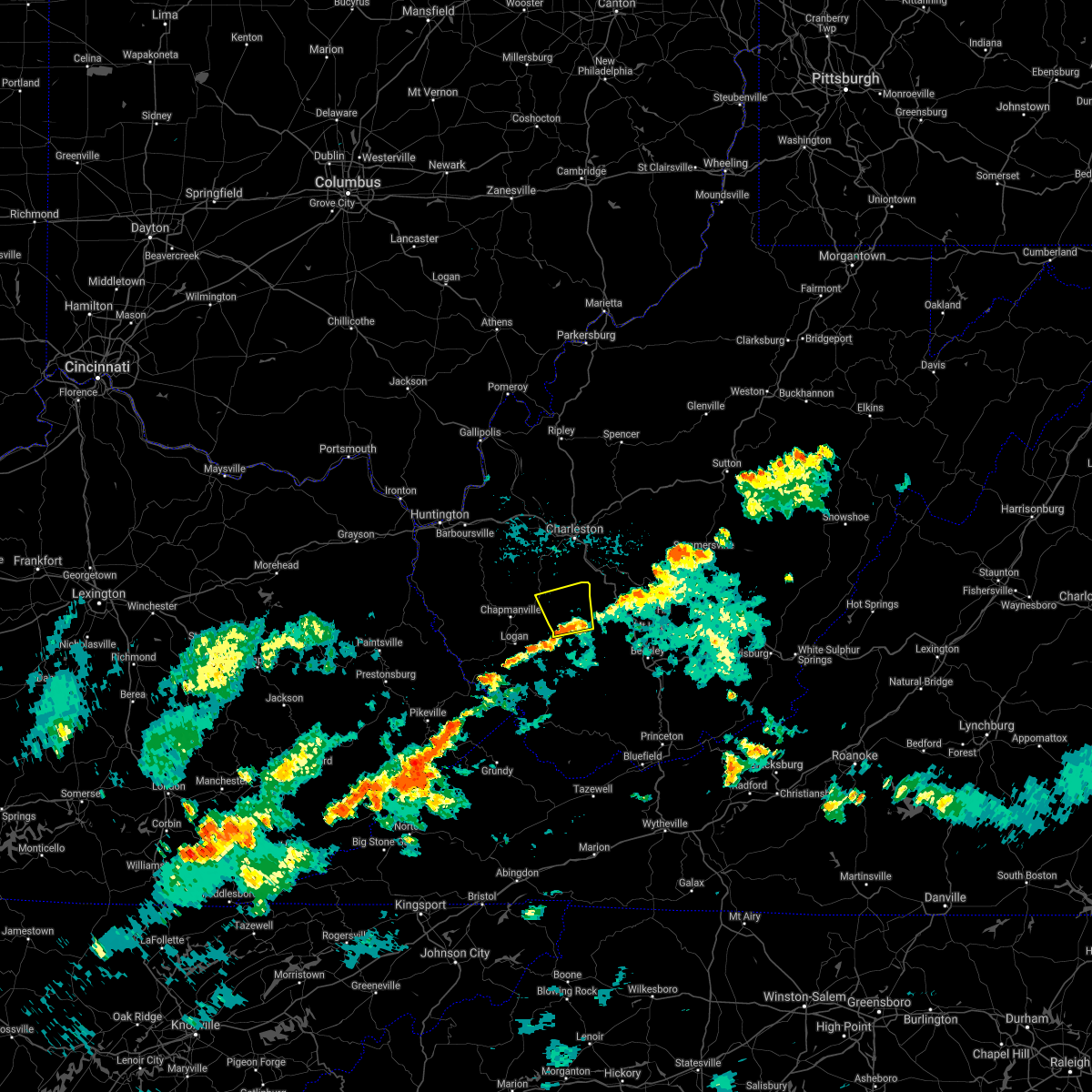 At 737 pm edt, a severe thunderstorm was located near van, or 10 miles southeast of madison, moving north at 15 mph (radar indicated). Hazards include 60 mph wind gusts. Expect damage to roofs, siding, and trees. locations impacted include, madison, van, wharton, danville, whitesville, sylvester, seth, foster and prenter. hail threat, radar indicated max hail size, <. 75 in wind threat, radar indicated max wind gust, 60 mph. At 737 pm edt, a severe thunderstorm was located near van, or 10 miles southeast of madison, moving north at 15 mph (radar indicated). Hazards include 60 mph wind gusts. Expect damage to roofs, siding, and trees. locations impacted include, madison, van, wharton, danville, whitesville, sylvester, seth, foster and prenter. hail threat, radar indicated max hail size, <. 75 in wind threat, radar indicated max wind gust, 60 mph.
|
| 8/15/2021 7:24 PM EDT |
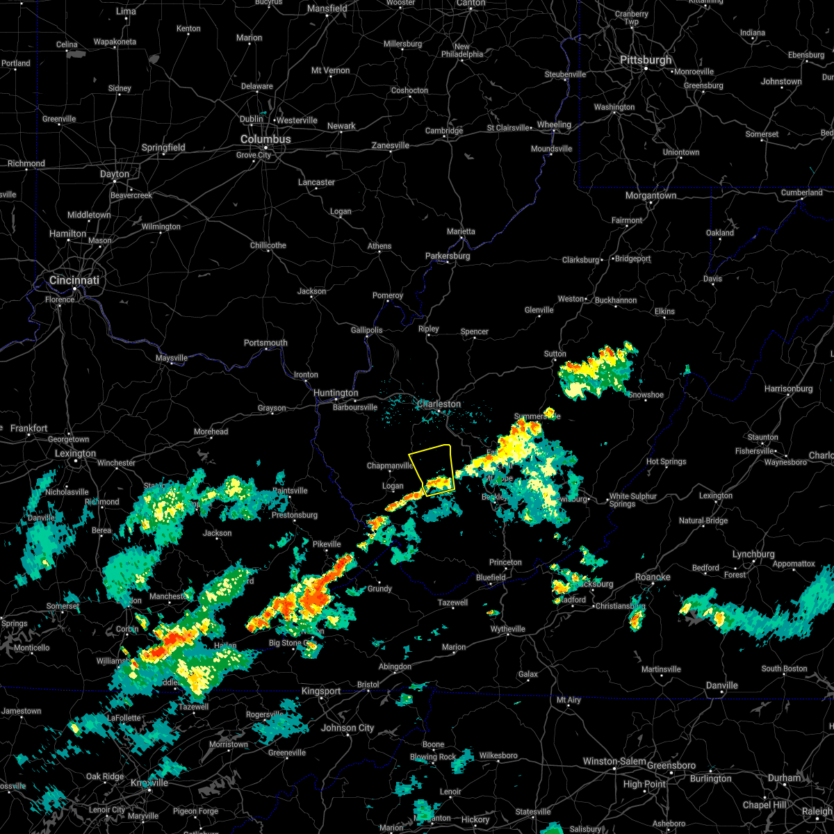 At 724 pm edt, a severe thunderstorm was located over wharton, or 12 miles southeast of madison, moving north at 15 mph (radar indicated). Hazards include 60 mph wind gusts. expect damage to roofs, siding, and trees At 724 pm edt, a severe thunderstorm was located over wharton, or 12 miles southeast of madison, moving north at 15 mph (radar indicated). Hazards include 60 mph wind gusts. expect damage to roofs, siding, and trees
|
| 8/13/2021 2:55 PM EDT |
 At 254 pm edt, a severe thunderstorm was located over madison, moving east at 55 mph (radar indicated). Hazards include 60 mph wind gusts. expect damage to roofs, siding, and trees At 254 pm edt, a severe thunderstorm was located over madison, moving east at 55 mph (radar indicated). Hazards include 60 mph wind gusts. expect damage to roofs, siding, and trees
|
| 6/13/2021 7:10 PM EDT |
 The severe thunderstorm warning for west central kanawha, eastern lincoln, northern logan and boone counties will expire at 715 pm edt, the storms which prompted the warning have moved out of the area. therefore, the warning will be allowed to expire. a severe thunderstorm watch remains in effect until 800 pm edt for central west virginia. a severe thunderstorm watch also remains in effect until 1000 pm edt for central and southern west virginia. remember, a severe thunderstorm warning still remains in effect for portions of boone, logan, and southern kanawha counties. The severe thunderstorm warning for west central kanawha, eastern lincoln, northern logan and boone counties will expire at 715 pm edt, the storms which prompted the warning have moved out of the area. therefore, the warning will be allowed to expire. a severe thunderstorm watch remains in effect until 800 pm edt for central west virginia. a severe thunderstorm watch also remains in effect until 1000 pm edt for central and southern west virginia. remember, a severe thunderstorm warning still remains in effect for portions of boone, logan, and southern kanawha counties.
|
| 6/13/2021 7:08 PM EDT |
 At 708 pm edt, severe thunderstorms were located along a line extending from powellton to 9 miles east of madison to near amherstdale-robinette, moving southeast at 30 mph (radar indicated). Hazards include 60 mph wind gusts and quarter size hail. Hail damage to vehicles is expected. Expect wind damage to roofs, siding, and trees. At 708 pm edt, severe thunderstorms were located along a line extending from powellton to 9 miles east of madison to near amherstdale-robinette, moving southeast at 30 mph (radar indicated). Hazards include 60 mph wind gusts and quarter size hail. Hail damage to vehicles is expected. Expect wind damage to roofs, siding, and trees.
|
| 6/13/2021 6:56 PM EDT |
 At 656 pm edt, severe thunderstorms were located along a line extending from st. albans to near madison to near chapmanville, moving east at 30 mph (radar indicated). Hazards include 60 mph wind gusts and quarter size hail. Hail damage to vehicles is expected. expect wind damage to roofs, siding, and trees. locations impacted include, charleston, madison, jefferson, south charleston, st. Albans, dunbar, chapmanville, van, tornado, amherstdale-robinette, alum creek, julian, wharton, chief logan state, danville, mitchell heights, seth, turtle creek, prenter and ashford. At 656 pm edt, severe thunderstorms were located along a line extending from st. albans to near madison to near chapmanville, moving east at 30 mph (radar indicated). Hazards include 60 mph wind gusts and quarter size hail. Hail damage to vehicles is expected. expect wind damage to roofs, siding, and trees. locations impacted include, charleston, madison, jefferson, south charleston, st. Albans, dunbar, chapmanville, van, tornado, amherstdale-robinette, alum creek, julian, wharton, chief logan state, danville, mitchell heights, seth, turtle creek, prenter and ashford.
|
| 6/13/2021 6:36 PM EDT |
 At 635 pm edt, severe thunderstorms were located along a line extending from near hurricane to near spurlockville to near harts, moving east at 30 mph (radar indicated). Hazards include 60 mph wind gusts and quarter size hail. Hail damage to vehicles is expected. Expect wind damage to roofs, siding, and trees. At 635 pm edt, severe thunderstorms were located along a line extending from near hurricane to near spurlockville to near harts, moving east at 30 mph (radar indicated). Hazards include 60 mph wind gusts and quarter size hail. Hail damage to vehicles is expected. Expect wind damage to roofs, siding, and trees.
|
| 8/25/2020 8:09 PM EDT |
 At 808 pm edt, a severe thunderstorm was located near burnwell, or 16 miles east of madison, moving southeast at 30 mph (radar indicated). Hazards include 60 mph wind gusts. expect damage to roofs, siding, and trees At 808 pm edt, a severe thunderstorm was located near burnwell, or 16 miles east of madison, moving southeast at 30 mph (radar indicated). Hazards include 60 mph wind gusts. expect damage to roofs, siding, and trees
|
| 4/9/2020 1:46 AM EDT |
 At 146 am edt, severe thunderstorms were located along a line extending from near arnoldsburg to near glen to 6 miles north of gauley bridge to 7 miles northeast of bald knob, moving east at 60 mph (radar indicated). Hazards include 70 mph wind gusts and quarter size hail. Hail damage to vehicles is expected. expect considerable tree damage. wind damage is also likely to mobile homes, roofs, and outbuildings. Locations impacted include, beckley, summersville, madison, fayetteville, sutton, clay, babcock state park, oak hill, montgomery, chesapeake, marmet, mount hope, mabscott, ansted, sophia, belle, clendenin, cedar grove, east bank and gassaway. At 146 am edt, severe thunderstorms were located along a line extending from near arnoldsburg to near glen to 6 miles north of gauley bridge to 7 miles northeast of bald knob, moving east at 60 mph (radar indicated). Hazards include 70 mph wind gusts and quarter size hail. Hail damage to vehicles is expected. expect considerable tree damage. wind damage is also likely to mobile homes, roofs, and outbuildings. Locations impacted include, beckley, summersville, madison, fayetteville, sutton, clay, babcock state park, oak hill, montgomery, chesapeake, marmet, mount hope, mabscott, ansted, sophia, belle, clendenin, cedar grove, east bank and gassaway.
|
| 4/9/2020 1:23 AM EDT |
 At 122 am edt, severe thunderstorms were located along a line extending from 6 miles south of spencer to marmet to near chesapeake to near logan, moving southeast at 85 mph (radar indicated). Hazards include 70 mph wind gusts and quarter size hail. Hail damage to vehicles is expected. expect considerable tree damage. Wind damage is also likely to mobile homes, roofs, and outbuildings. At 122 am edt, severe thunderstorms were located along a line extending from 6 miles south of spencer to marmet to near chesapeake to near logan, moving southeast at 85 mph (radar indicated). Hazards include 70 mph wind gusts and quarter size hail. Hail damage to vehicles is expected. expect considerable tree damage. Wind damage is also likely to mobile homes, roofs, and outbuildings.
|
| 4/9/2020 1:20 AM EDT |
 At 119 am edt, severe thunderstorms were located along a line extending from 7 miles southeast of kenna to near gill, moving southeast at 55 mph (radar indicated). Hazards include 70 mph wind gusts and quarter size hail. Hail damage to vehicles is expected. expect considerable tree damage. wind damage is also likely to mobile homes, roofs, and outbuildings. locations impacted include, charleston, nitro, madison, spencer, hamlin, jefferson, south charleston, st. Albans, dunbar, sissonville, montgomery, chesapeake, marmet, belle, clendenin, cedar grove, poca, east bank, glasgow and smithers. At 119 am edt, severe thunderstorms were located along a line extending from 7 miles southeast of kenna to near gill, moving southeast at 55 mph (radar indicated). Hazards include 70 mph wind gusts and quarter size hail. Hail damage to vehicles is expected. expect considerable tree damage. wind damage is also likely to mobile homes, roofs, and outbuildings. locations impacted include, charleston, nitro, madison, spencer, hamlin, jefferson, south charleston, st. Albans, dunbar, sissonville, montgomery, chesapeake, marmet, belle, clendenin, cedar grove, poca, east bank, glasgow and smithers.
|
| 4/9/2020 1:08 AM EDT |
 At 108 am edt, severe thunderstorms were located along a line extending from near kenna to near ranger, moving southeast at 55 mph (radar indicated). Hazards include 70 mph wind gusts and quarter size hail. Hail damage to vehicles is expected. expect considerable tree damage. wind damage is also likely to mobile homes, roofs, and outbuildings. locations impacted include, charleston, nitro, madison, spencer, winfield, hamlin, jefferson, south charleston, st. Albans, dunbar, hurricane, sissonville, milton, montgomery, chesapeake, eleanor, marmet, belle, buffalo and clendenin. At 108 am edt, severe thunderstorms were located along a line extending from near kenna to near ranger, moving southeast at 55 mph (radar indicated). Hazards include 70 mph wind gusts and quarter size hail. Hail damage to vehicles is expected. expect considerable tree damage. wind damage is also likely to mobile homes, roofs, and outbuildings. locations impacted include, charleston, nitro, madison, spencer, winfield, hamlin, jefferson, south charleston, st. Albans, dunbar, hurricane, sissonville, milton, montgomery, chesapeake, eleanor, marmet, belle, buffalo and clendenin.
|
| 4/9/2020 12:41 AM EDT |
 At 1241 am edt, severe thunderstorms were located along a line extending from near point pleasant to near durbin, moving southeast at 55 mph (radar indicated). Hazards include 70 mph wind gusts and quarter size hail. Hail damage to vehicles is expected. expect considerable tree damage. Wind damage is also likely to mobile homes, roofs, and outbuildings. At 1241 am edt, severe thunderstorms were located along a line extending from near point pleasant to near durbin, moving southeast at 55 mph (radar indicated). Hazards include 70 mph wind gusts and quarter size hail. Hail damage to vehicles is expected. expect considerable tree damage. Wind damage is also likely to mobile homes, roofs, and outbuildings.
|
| 4/8/2020 3:10 PM EDT |
 At 310 pm edt, a severe thunderstorm was located near madison, moving southeast at 30 mph (radar indicated). Hazards include 60 mph wind gusts and nickel size hail. expect damage to roofs, siding, and trees At 310 pm edt, a severe thunderstorm was located near madison, moving southeast at 30 mph (radar indicated). Hazards include 60 mph wind gusts and nickel size hail. expect damage to roofs, siding, and trees
|
| 10/31/2019 1:41 PM EDT |
 At 140 pm edt, severe thunderstorms were located along a line extending from near sissonville to near van, moving east at 50 mph (radar indicated). Hazards include 60 mph wind gusts. Expect damage to roofs, siding, and trees. locations impacted include, charleston, nitro, madison, jefferson, south charleston, st. Albans, dunbar, sissonville, chesapeake, marmet, belle, cedar grove, poca, east bank, glasgow, van, pinch, institute, coal fork and elkview. At 140 pm edt, severe thunderstorms were located along a line extending from near sissonville to near van, moving east at 50 mph (radar indicated). Hazards include 60 mph wind gusts. Expect damage to roofs, siding, and trees. locations impacted include, charleston, nitro, madison, jefferson, south charleston, st. Albans, dunbar, sissonville, chesapeake, marmet, belle, cedar grove, poca, east bank, glasgow, van, pinch, institute, coal fork and elkview.
|
| 10/31/2019 1:31 PM EDT |
 At 130 pm edt, severe thunderstorms were located along a line extending from near poca to near van, moving east at 50 mph (radar indicated). Hazards include 60 mph wind gusts. Expect damage to roofs, siding, and trees. locations impacted include, charleston, nitro, madison, jefferson, south charleston, st. Albans, dunbar, sissonville, chesapeake, marmet, belle, cedar grove, poca, east bank, glasgow, van, pinch, institute, tornado and coal fork. At 130 pm edt, severe thunderstorms were located along a line extending from near poca to near van, moving east at 50 mph (radar indicated). Hazards include 60 mph wind gusts. Expect damage to roofs, siding, and trees. locations impacted include, charleston, nitro, madison, jefferson, south charleston, st. Albans, dunbar, sissonville, chesapeake, marmet, belle, cedar grove, poca, east bank, glasgow, van, pinch, institute, tornado and coal fork.
|
| 10/31/2019 1:10 PM EDT |
 At 110 pm edt, severe thunderstorms were located along a line extending from culloden to near mount gay-shamrock, moving east at 50 mph (radar indicated). Hazards include 60 mph wind gusts. expect damage to roofs, siding, and trees At 110 pm edt, severe thunderstorms were located along a line extending from culloden to near mount gay-shamrock, moving east at 50 mph (radar indicated). Hazards include 60 mph wind gusts. expect damage to roofs, siding, and trees
|
| 6/24/2019 6:39 PM EDT |
 At 639 pm edt, severe thunderstorms were located along a line extending from near teays valley to near julian to near logan, moving east at 40 mph (radar indicated). Hazards include 60 mph wind gusts. expect damage to roofs, siding, and trees At 639 pm edt, severe thunderstorms were located along a line extending from near teays valley to near julian to near logan, moving east at 40 mph (radar indicated). Hazards include 60 mph wind gusts. expect damage to roofs, siding, and trees
|
| 5/29/2019 2:23 PM EDT |
 At 223 pm edt, a severe thunderstorm was located near harts, or 12 miles northwest of logan, moving east at 20 mph (radar indicated). Hazards include 60 mph wind gusts and half dollar size hail. Hail damage to vehicles is expected. Expect wind damage to roofs, siding, and trees. At 223 pm edt, a severe thunderstorm was located near harts, or 12 miles northwest of logan, moving east at 20 mph (radar indicated). Hazards include 60 mph wind gusts and half dollar size hail. Hail damage to vehicles is expected. Expect wind damage to roofs, siding, and trees.
|
| 5/2/2019 8:55 PM EDT |
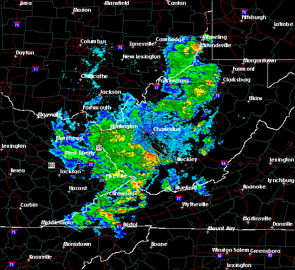 The severe thunderstorm warning for northwestern raleigh, southeastern logan, northwestern wyoming and southeastern boone counties will expire at 900 pm edt, the storm which prompted the warning has weakened below severe limits, and no longer poses an immediate threat to life or property. therefore, the warning will be allowed to expire. however gusty winds are still possible with this thunderstorm. The severe thunderstorm warning for northwestern raleigh, southeastern logan, northwestern wyoming and southeastern boone counties will expire at 900 pm edt, the storm which prompted the warning has weakened below severe limits, and no longer poses an immediate threat to life or property. therefore, the warning will be allowed to expire. however gusty winds are still possible with this thunderstorm.
|
| 5/2/2019 8:22 PM EDT |
 At 822 pm edt, a severe thunderstorm was located over amherstdale-robinette, or 13 miles east of logan, moving northeast at 25 mph (radar indicated). Hazards include 60 mph wind gusts and quarter size hail. Hail damage to vehicles is expected. Expect wind damage to roofs, siding, and trees. At 822 pm edt, a severe thunderstorm was located over amherstdale-robinette, or 13 miles east of logan, moving northeast at 25 mph (radar indicated). Hazards include 60 mph wind gusts and quarter size hail. Hail damage to vehicles is expected. Expect wind damage to roofs, siding, and trees.
|
| 4/14/2019 7:22 PM EDT |
 The severe thunderstorm warning for central kanawha, north central logan, northwestern fayette and boone counties will expire at 730 pm edt, the storm which prompted the warning has weakened below severe limits, and no longer poses an immediate threat to life or property. therefore, the warning will be allowed to expire. a tornado watch remains in effect until 900 pm edt for central and southern west virginia. a severe thunderstorm watch remains in effect until 200 am edt for southeastern west virginia. The severe thunderstorm warning for central kanawha, north central logan, northwestern fayette and boone counties will expire at 730 pm edt, the storm which prompted the warning has weakened below severe limits, and no longer poses an immediate threat to life or property. therefore, the warning will be allowed to expire. a tornado watch remains in effect until 900 pm edt for central and southern west virginia. a severe thunderstorm watch remains in effect until 200 am edt for southeastern west virginia.
|
| 4/14/2019 7:07 PM EDT |
 At 706 pm edt, a severe thunderstorm was located near madison, moving northeast at 55 mph (radar indicated). Hazards include 60 mph wind gusts. expect damage to roofs, siding, and trees At 706 pm edt, a severe thunderstorm was located near madison, moving northeast at 55 mph (radar indicated). Hazards include 60 mph wind gusts. expect damage to roofs, siding, and trees
|
| 5/20/2017 7:23 PM EDT |
 At 723 pm edt, severe thunderstorms were located along a line extending from 6 miles north of babcock state park to powellton to 7 miles northeast of van to near chief logan state, moving northwest at 10 mph (radar indicated). Hazards include 60 mph wind gusts and quarter size hail. Hail damage to vehicles is expected. Expect wind damage to roofs, siding, and trees. At 723 pm edt, severe thunderstorms were located along a line extending from 6 miles north of babcock state park to powellton to 7 miles northeast of van to near chief logan state, moving northwest at 10 mph (radar indicated). Hazards include 60 mph wind gusts and quarter size hail. Hail damage to vehicles is expected. Expect wind damage to roofs, siding, and trees.
|
| 5/20/2017 7:21 PM EDT |
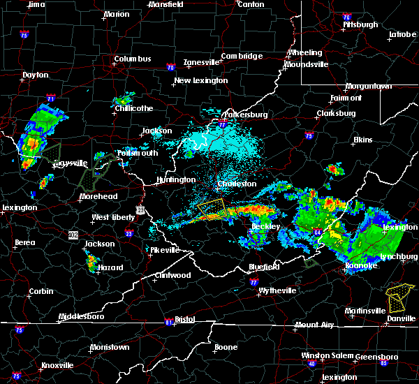 At 721 pm edt, a severe thunderstorm was located near van, or 7 miles east of madison, moving north at 20 mph (radar indicated). Hazards include 60 mph wind gusts and quarter size hail. Hail damage to vehicles is expected. expect wind damage to roofs, siding, and trees. locations impacted include, madison, van, danville, whitesville, sylvester, seth, foster, prenter and racine. This includes route 119 between mile markers 52 and 56. At 721 pm edt, a severe thunderstorm was located near van, or 7 miles east of madison, moving north at 20 mph (radar indicated). Hazards include 60 mph wind gusts and quarter size hail. Hail damage to vehicles is expected. expect wind damage to roofs, siding, and trees. locations impacted include, madison, van, danville, whitesville, sylvester, seth, foster, prenter and racine. This includes route 119 between mile markers 52 and 56.
|
| 5/20/2017 7:02 PM EDT |
 At 701 pm edt, a severe thunderstorm was located near van, or 11 miles southeast of madison, moving north at 20 mph (radar indicated). Hazards include 60 mph wind gusts and quarter size hail. Hail damage to vehicles is expected. Expect wind damage to roofs, siding, and trees. At 701 pm edt, a severe thunderstorm was located near van, or 11 miles southeast of madison, moving north at 20 mph (radar indicated). Hazards include 60 mph wind gusts and quarter size hail. Hail damage to vehicles is expected. Expect wind damage to roofs, siding, and trees.
|
| 3/1/2017 10:05 AM EST | Trailer flipped near bigson d in boone county WV, 0.9 miles SW of Van, WV |
| 3/1/2017 9:48 AM EST |
 At 948 am est, severe thunderstorms were located along a line extending from near st. albans to oppy, moving east at 60 mph (radar indicated). Hazards include 70 mph wind gusts and penny size hail. Expect considerable tree damage. Damage is likely to mobile homes, roofs, and outbuildings. At 948 am est, severe thunderstorms were located along a line extending from near st. albans to oppy, moving east at 60 mph (radar indicated). Hazards include 70 mph wind gusts and penny size hail. Expect considerable tree damage. Damage is likely to mobile homes, roofs, and outbuildings.
|
| 7/28/2016 3:14 PM EDT |
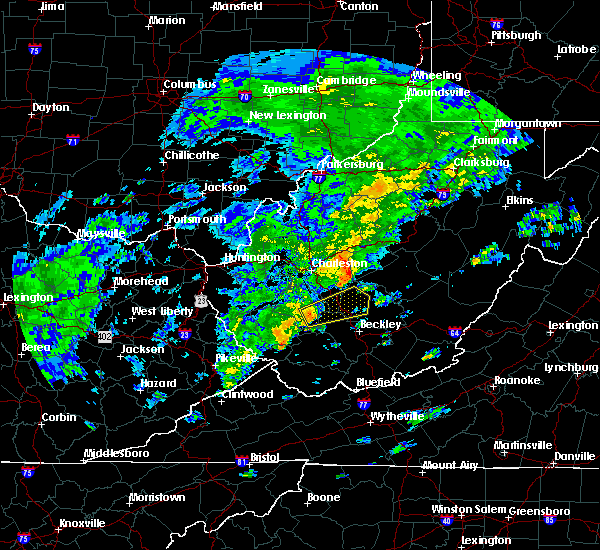 At 313 pm edt, a severe thunderstorm was located near wharton, or 13 miles southeast of madison, moving east at 35 mph (radar indicated). Hazards include 60 mph wind gusts and quarter size hail. Hail damage to vehicles is expected. Expect wind damage to roofs, siding, and trees. At 313 pm edt, a severe thunderstorm was located near wharton, or 13 miles southeast of madison, moving east at 35 mph (radar indicated). Hazards include 60 mph wind gusts and quarter size hail. Hail damage to vehicles is expected. Expect wind damage to roofs, siding, and trees.
|
| 7/14/2016 6:21 PM EDT |
 The severe thunderstorm warning for west central fayette, boone and southeastern kanawha counties will expire at 630 pm edt, the storm which prompted the warning weakened below severe limits and exited the warned area. therefore, the warning will be allowed to expire. The severe thunderstorm warning for west central fayette, boone and southeastern kanawha counties will expire at 630 pm edt, the storm which prompted the warning weakened below severe limits and exited the warned area. therefore, the warning will be allowed to expire.
|
| 7/14/2016 5:31 PM EDT |
 At 531 pm edt, a severe thunderstorm was located over madison, moving east at 35 mph (radar indicated). Hazards include 60 mph wind gusts. Expect damage to roofs. siding. And trees. At 531 pm edt, a severe thunderstorm was located over madison, moving east at 35 mph (radar indicated). Hazards include 60 mph wind gusts. Expect damage to roofs. siding. And trees.
|
| 7/8/2016 3:01 PM EDT |
 At 301 pm edt, severe thunderstorms were located along a line extending from 6 miles south of madison to hanover, moving east at 50 mph (radar indicated). Hazards include 60 mph wind gusts. Expect damage to roofs. siding. And trees. At 301 pm edt, severe thunderstorms were located along a line extending from 6 miles south of madison to hanover, moving east at 50 mph (radar indicated). Hazards include 60 mph wind gusts. Expect damage to roofs. siding. And trees.
|
| 6/23/2016 7:47 AM EDT |
 At 746 am edt, severe thunderstorms were located along a line extending from 8 miles south of chesapeake to coalpoint, moving southeast at 45 mph (radar indicated). Hazards include 60 mph wind gusts. Expect damage to roofs. siding. And trees. At 746 am edt, severe thunderstorms were located along a line extending from 8 miles south of chesapeake to coalpoint, moving southeast at 45 mph (radar indicated). Hazards include 60 mph wind gusts. Expect damage to roofs. siding. And trees.
|
| 5/2/2016 3:06 PM EDT |
 At 305 pm edt, a severe thunderstorm was located over holden, or over logan, moving northeast at 30 mph (radar indicated). Hazards include 60 mph wind gusts and half dollar size hail. Hail damage to vehicles is expected. expect wind damage to roofs, siding, and trees. Locations impacted include, madison, logan, chapmanville, delbarton, mount gay-shamrock, chief logan state, wharton, bald knob, holden, van, west logan, mitchell heights, jeffrey, chauncey, mount gay, switzer, blair, sharples and verdunville. At 305 pm edt, a severe thunderstorm was located over holden, or over logan, moving northeast at 30 mph (radar indicated). Hazards include 60 mph wind gusts and half dollar size hail. Hail damage to vehicles is expected. expect wind damage to roofs, siding, and trees. Locations impacted include, madison, logan, chapmanville, delbarton, mount gay-shamrock, chief logan state, wharton, bald knob, holden, van, west logan, mitchell heights, jeffrey, chauncey, mount gay, switzer, blair, sharples and verdunville.
|
| 5/2/2016 2:37 PM EDT |
 At 237 pm edt, a severe thunderstorm was located over whitepost, or 7 miles northwest of williamson, moving northeast at 45 mph (radar indicated). Hazards include 60 mph wind gusts and half dollar size hail. Hail damage to vehicles is expected. Expect wind damage to roofs, siding, and trees. At 237 pm edt, a severe thunderstorm was located over whitepost, or 7 miles northwest of williamson, moving northeast at 45 mph (radar indicated). Hazards include 60 mph wind gusts and half dollar size hail. Hail damage to vehicles is expected. Expect wind damage to roofs, siding, and trees.
|
| 5/1/2016 7:38 PM EDT |
 At 738 pm edt, a severe thunderstorm was located near logan, moving east at 25 mph (radar indicated). Hazards include ping pong ball size hail. People and animals outdoors will be injured. Expect damage to roofs, siding, windows, and vehicles. At 738 pm edt, a severe thunderstorm was located near logan, moving east at 25 mph (radar indicated). Hazards include ping pong ball size hail. People and animals outdoors will be injured. Expect damage to roofs, siding, windows, and vehicles.
|
| 7/14/2015 7:14 PM EDT |
 At 712 pm edt, doppler radar indicated a line of severe thunderstorms capable of producing damaging winds in excess of 60 mph. these storms were located along a line extending from near oak hill to bald knob to odds, moving south at 65 mph. locations impacted include, beckley, williamson, fayetteville, logan, rainelle, babcock state park, oak hill, mount hope, mabscott, oceana, chapmanville, man, delbarton, prosperity, wharton, bald knob, holden, south williamson, aflex and dry creek. At 712 pm edt, doppler radar indicated a line of severe thunderstorms capable of producing damaging winds in excess of 60 mph. these storms were located along a line extending from near oak hill to bald knob to odds, moving south at 65 mph. locations impacted include, beckley, williamson, fayetteville, logan, rainelle, babcock state park, oak hill, mount hope, mabscott, oceana, chapmanville, man, delbarton, prosperity, wharton, bald knob, holden, south williamson, aflex and dry creek.
|
| 7/14/2015 6:35 PM EDT |
 At 634 pm edt, doppler radar indicated a line of severe thunderstorms capable of producing damaging winds in excess of 60 mph. these storms were located along a line extending from near gauley bridge to near madison to blaine, and moving southeast at 30 mph. At 634 pm edt, doppler radar indicated a line of severe thunderstorms capable of producing damaging winds in excess of 60 mph. these storms were located along a line extending from near gauley bridge to near madison to blaine, and moving southeast at 30 mph.
|
| 7/14/2015 6:25 PM EDT |
 At 624 pm edt, doppler radar indicated a line of severe thunderstorms capable of producing damaging winds in excess of 60 mph. these storms were located along a line extending from near chesapeake to near ranger to near webbville, moving southeast at 35 mph. locations impacted include, madison, louisa, blaine, yatesville lake state park, oak hill, chesapeake, marmet, mount hope, belle, chapmanville, east bank, fort gay, wharton, ulysses, kiahsville, charley, east lynn lake, chief logan state, powellton and spurlockville. At 624 pm edt, doppler radar indicated a line of severe thunderstorms capable of producing damaging winds in excess of 60 mph. these storms were located along a line extending from near chesapeake to near ranger to near webbville, moving southeast at 35 mph. locations impacted include, madison, louisa, blaine, yatesville lake state park, oak hill, chesapeake, marmet, mount hope, belle, chapmanville, east bank, fort gay, wharton, ulysses, kiahsville, charley, east lynn lake, chief logan state, powellton and spurlockville.
|
| 7/14/2015 5:43 PM EDT |
 At 542 pm edt, doppler radar indicated a line of severe thunderstorms capable of producing damaging winds in excess of 70 mph. these storms were located along a line extending from near culloden to near catlettsburg to carter caves state park, and moving southeast at 60 mph. At 542 pm edt, doppler radar indicated a line of severe thunderstorms capable of producing damaging winds in excess of 70 mph. these storms were located along a line extending from near culloden to near catlettsburg to carter caves state park, and moving southeast at 60 mph.
|
| 7/13/2015 4:48 PM EDT |
 At 447 pm edt, doppler radar indicated a line of severe thunderstorms capable of producing damaging winds in excess of 60 mph. these storms were located along a line extending from near madison to red jacket, moving southeast at 40 mph. locations impacted include, williamson, madison, logan, chapmanville, man, delbarton, wharton, holden, south williamson, aflex, mallory, mount gay-shamrock, chief logan state, red jacket, chattaroy, hinch, van, buskirk, amherstdale-robinette and gilbert creek. At 447 pm edt, doppler radar indicated a line of severe thunderstorms capable of producing damaging winds in excess of 60 mph. these storms were located along a line extending from near madison to red jacket, moving southeast at 40 mph. locations impacted include, williamson, madison, logan, chapmanville, man, delbarton, wharton, holden, south williamson, aflex, mallory, mount gay-shamrock, chief logan state, red jacket, chattaroy, hinch, van, buskirk, amherstdale-robinette and gilbert creek.
|
| 7/13/2015 4:22 PM EDT |
 At 421 pm edt, doppler radar indicated a severe thunderstorm capable of producing damaging winds in excess of 60 mph. this storm was located over kiahsville, or 12 miles southeast of wayne, and moving southeast at 40 mph. At 421 pm edt, doppler radar indicated a severe thunderstorm capable of producing damaging winds in excess of 60 mph. this storm was located over kiahsville, or 12 miles southeast of wayne, and moving southeast at 40 mph.
|
| 7/9/2015 5:30 PM EDT | Tree down in gordo in boone county WV, 1.8 miles W of Van, WV |
| 7/9/2015 5:19 PM EDT |
 At 519 pm edt, radar indicates a line of severe thunderstorms producing damaging winds in excess of 60 mph. these storms were located along a line extending from near madison to near pineville, moving east at 45 mph. trees have already been downed in mingo and logan counties with these storms. locations impacted include, beckley, madison, pineville, mullens, mabscott, oceana, sophia, wharton, bald knob, macarthur, crab orchard, dry creek, twin falls state park, coal city, burnwell, van, amherstdale-robinette, mallory, danville and whitesville. At 519 pm edt, radar indicates a line of severe thunderstorms producing damaging winds in excess of 60 mph. these storms were located along a line extending from near madison to near pineville, moving east at 45 mph. trees have already been downed in mingo and logan counties with these storms. locations impacted include, beckley, madison, pineville, mullens, mabscott, oceana, sophia, wharton, bald knob, macarthur, crab orchard, dry creek, twin falls state park, coal city, burnwell, van, amherstdale-robinette, mallory, danville and whitesville.
|
| 7/9/2015 4:48 PM EDT |
 At 448 pm edt, doppler radar indicated a line of severe thunderstorms capable of producing damaging winds in excess of 60 mph. these storms were located along a line extending from 6 miles southwest of harts to near woodman, and moving east at 50 mph. At 448 pm edt, doppler radar indicated a line of severe thunderstorms capable of producing damaging winds in excess of 60 mph. these storms were located along a line extending from 6 miles southwest of harts to near woodman, and moving east at 50 mph.
|
| 7/9/2015 2:07 PM EDT |
 At 206 pm edt, doppler radar indicated a severe thunderstorm capable of producing damaging winds in excess of 60 mph. this storm was located near logan, moving east at 40 mph. locations impacted include, williamson, logan, chapmanville, man, delbarton, r.d. bailey lake, wharton, bald knob, holden, south williamson, mallory, mount gay-shamrock, gilbert creek, chief logan state, red jacket, chattaroy, hanover, hinch, van and amherstdale-robinette. At 206 pm edt, doppler radar indicated a severe thunderstorm capable of producing damaging winds in excess of 60 mph. this storm was located near logan, moving east at 40 mph. locations impacted include, williamson, logan, chapmanville, man, delbarton, r.d. bailey lake, wharton, bald knob, holden, south williamson, mallory, mount gay-shamrock, gilbert creek, chief logan state, red jacket, chattaroy, hanover, hinch, van and amherstdale-robinette.
|
| 7/9/2015 1:47 PM EDT |
 At 146 pm edt, doppler radar indicated a severe thunderstorm capable of producing damaging winds in excess of 60 mph. this storm was located near mount gay-shamrock, or 9 miles west of logan, and moving east at 40 mph. At 146 pm edt, doppler radar indicated a severe thunderstorm capable of producing damaging winds in excess of 60 mph. this storm was located near mount gay-shamrock, or 9 miles west of logan, and moving east at 40 mph.
|
| 5/11/2015 4:45 PM EDT | At 443 pm edt, national weather service doppler radar indicated a severe thunderstorm capable of producing quarter size hail, and damaging winds in excess of 60 mph. this storm was located near van, or 8 miles southeast of madison, moving northeast at 30 mph. * other locations in the warning include but are not limited to smithers, montgomery, gauley bridge, pratt, glasgow, east bank, chesapeake and cedar grove. this will impact the following interstate, the west virginia turnpike between mile markers 70 and 87. a severe thunderstorm watch remains in effect until 1000 pm edt monday evening for central kentucky and southeast ohio and central west virginia. please report hail or strong wind to the national weather service by calling toll free, 800-401-9535, when you can do so safely. you may also report severe weather by posting your report to the charleston west virginia national weather service facebook page, or by using the twitter hashtag, nwsrlx. |
| 7/5/2012 12:30 PM EDT | Multiple trees and lines down along rt. 85 in boone county WV, 3.1 miles SSE of Van, WV |
Hail Maps for Van, WV
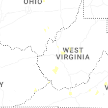
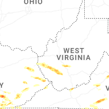


Connect with Interactive Hail Maps