

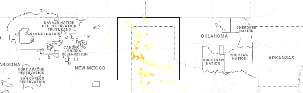
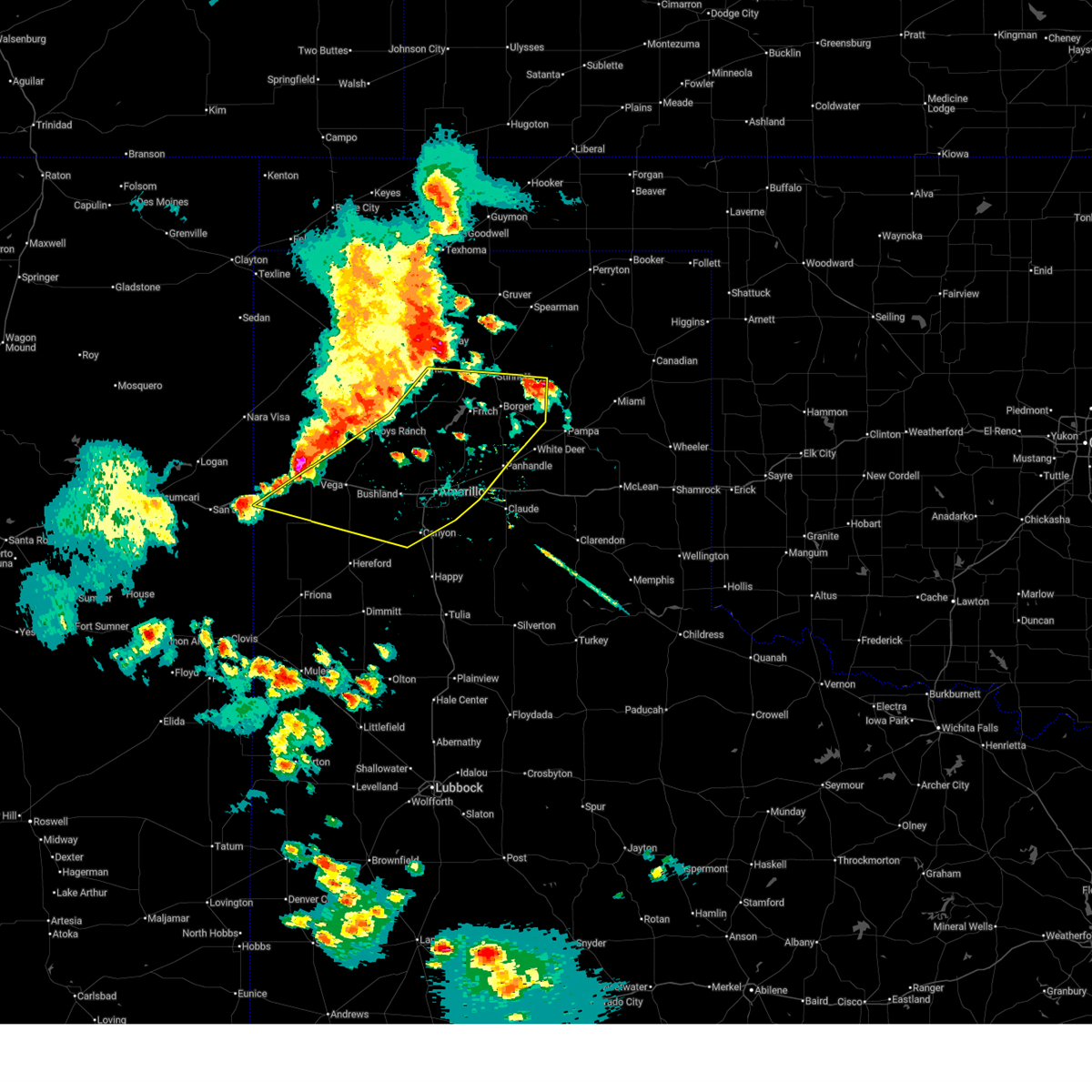
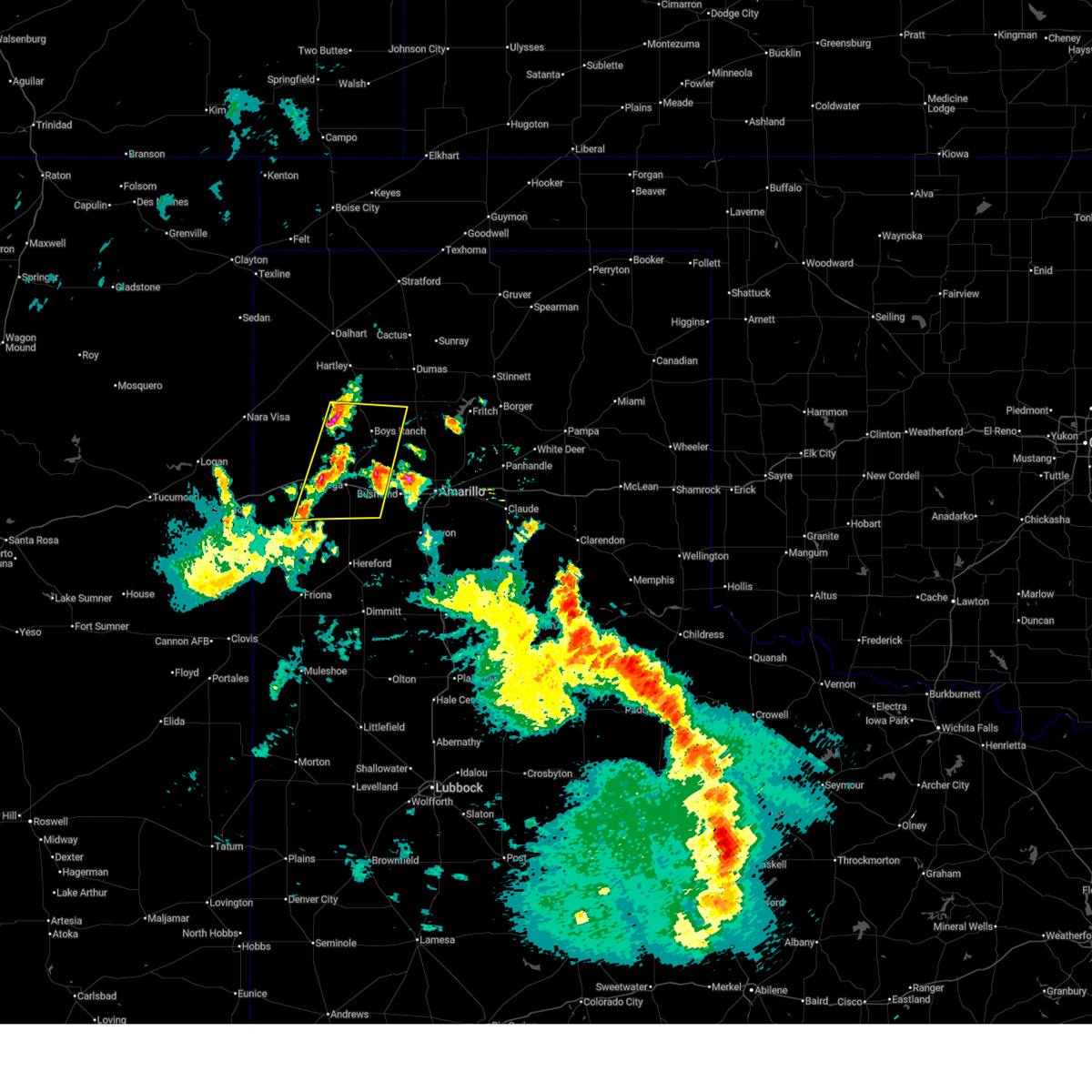
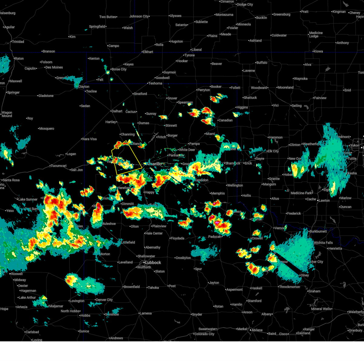
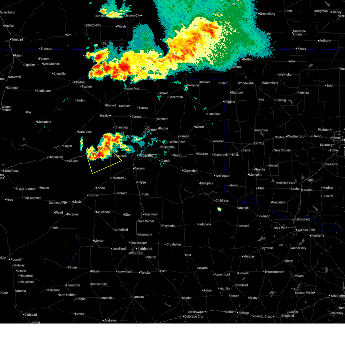
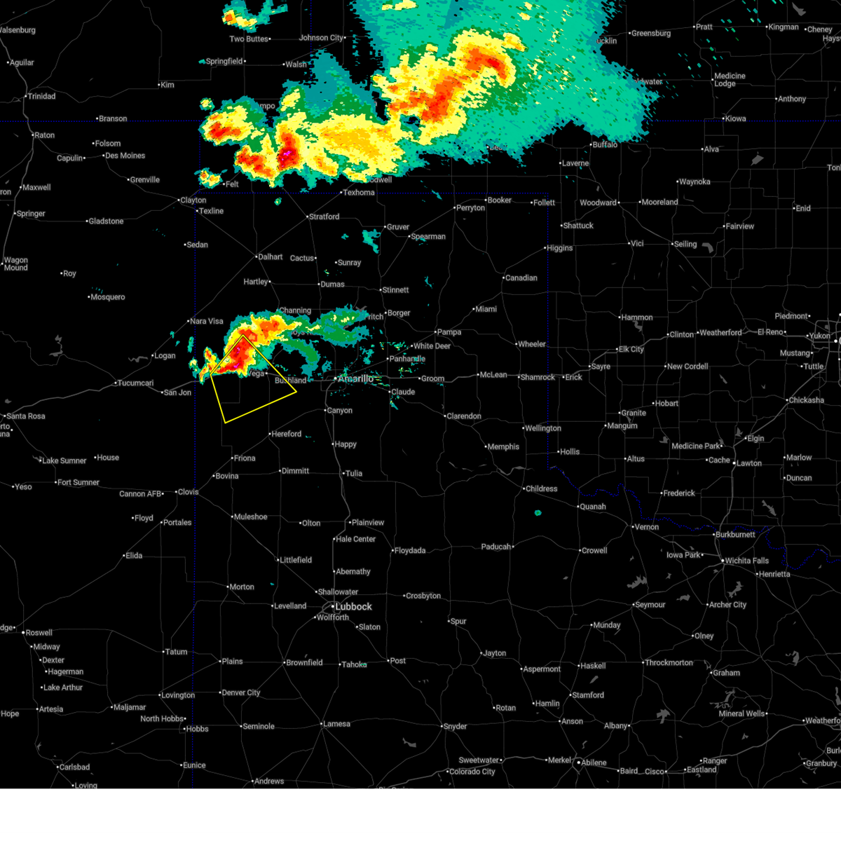
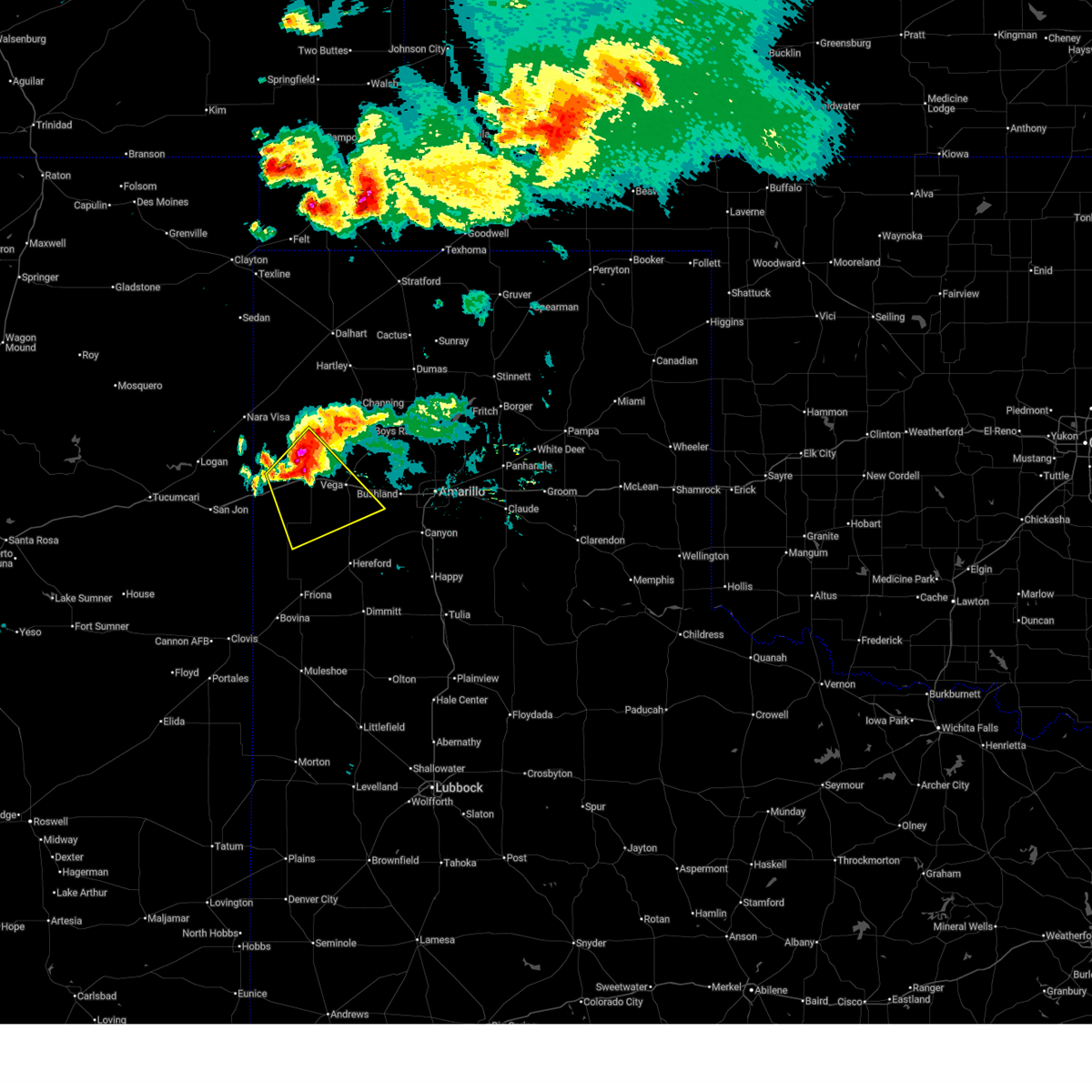
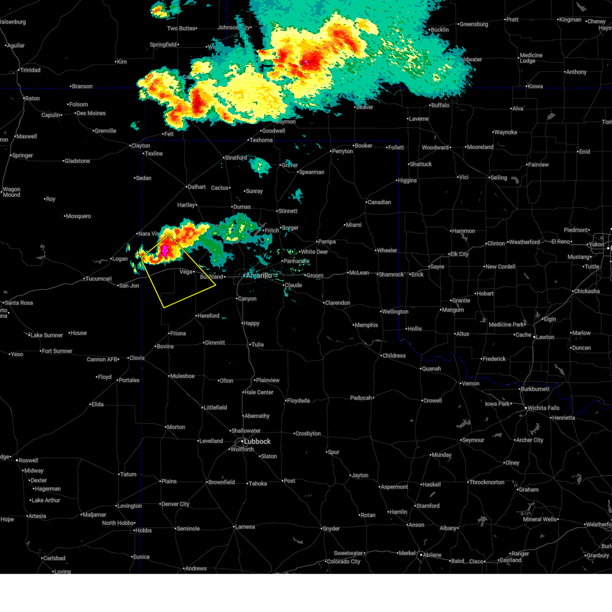
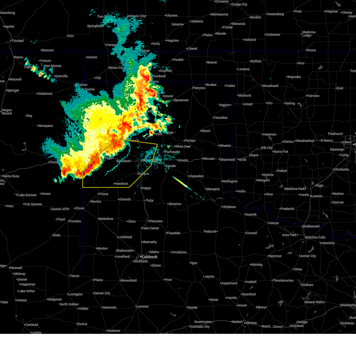
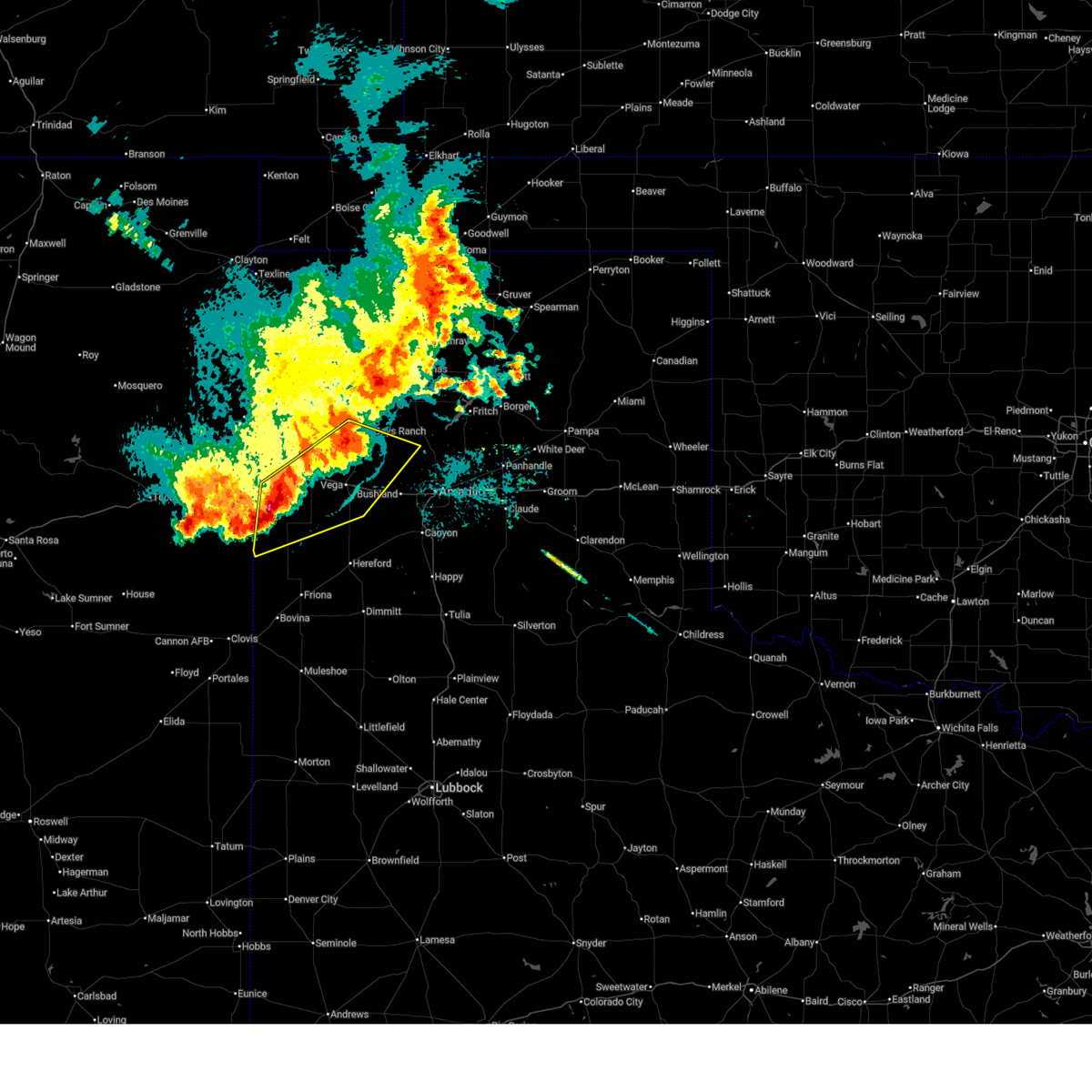
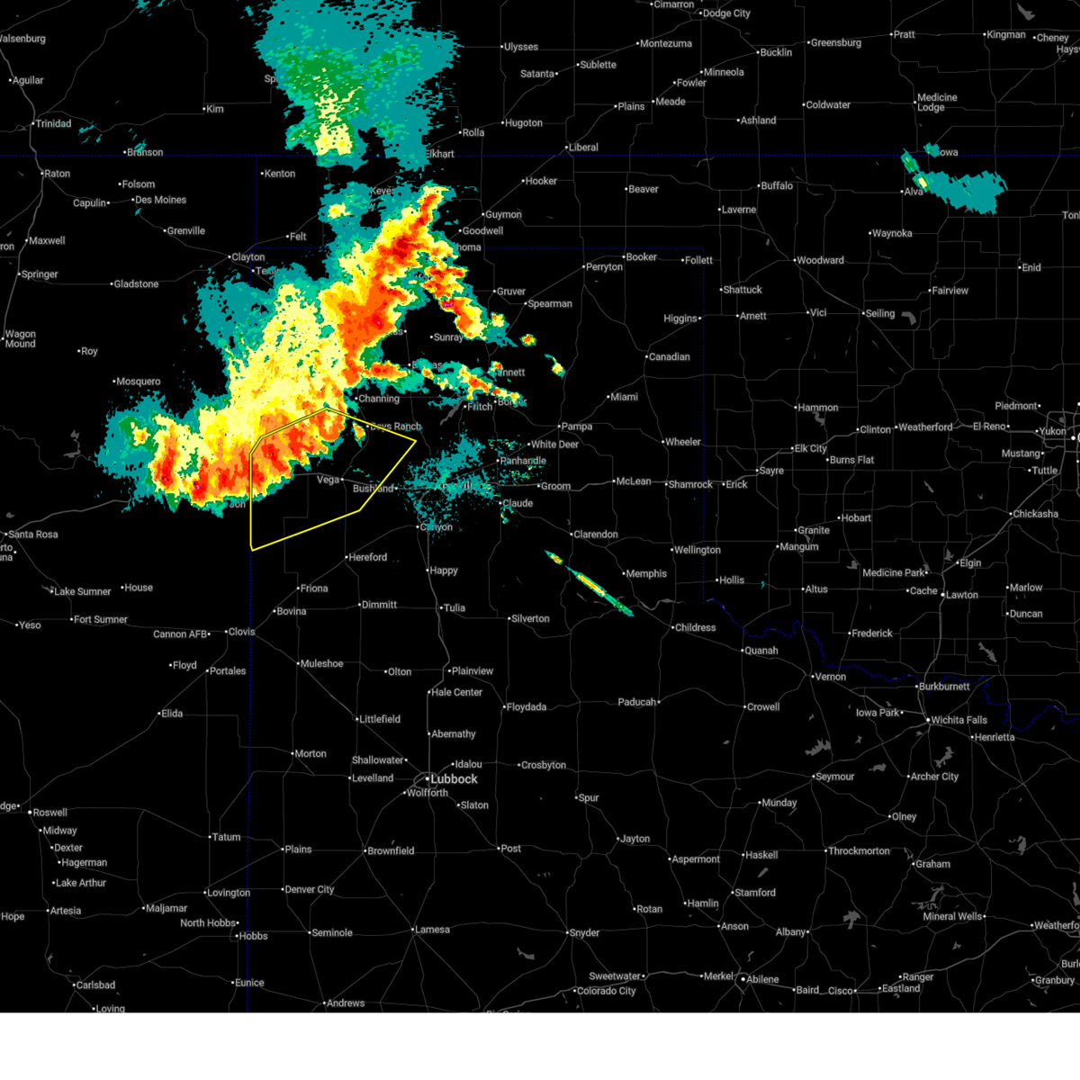
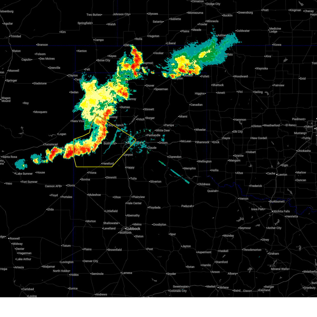
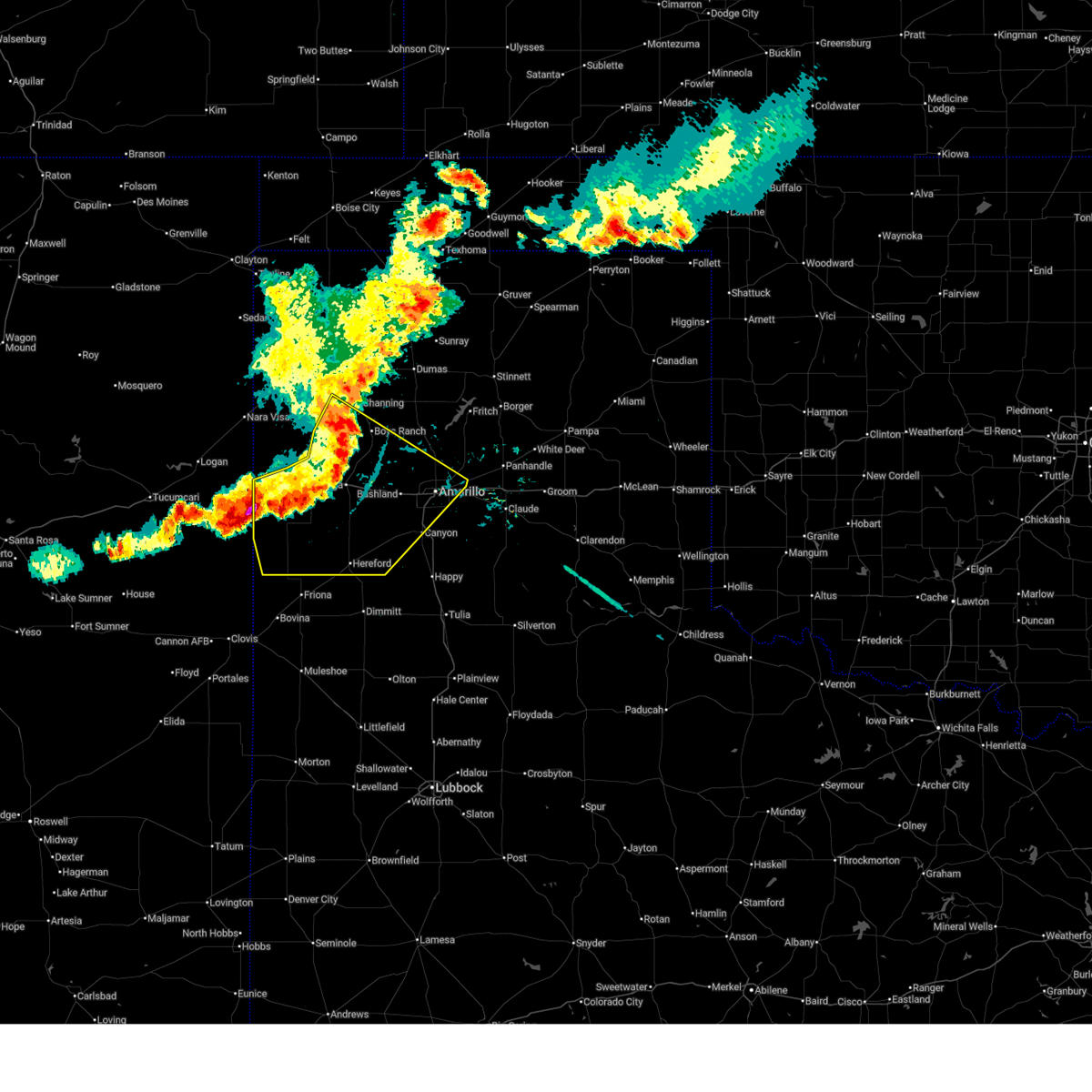
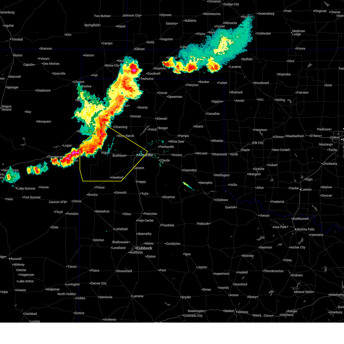
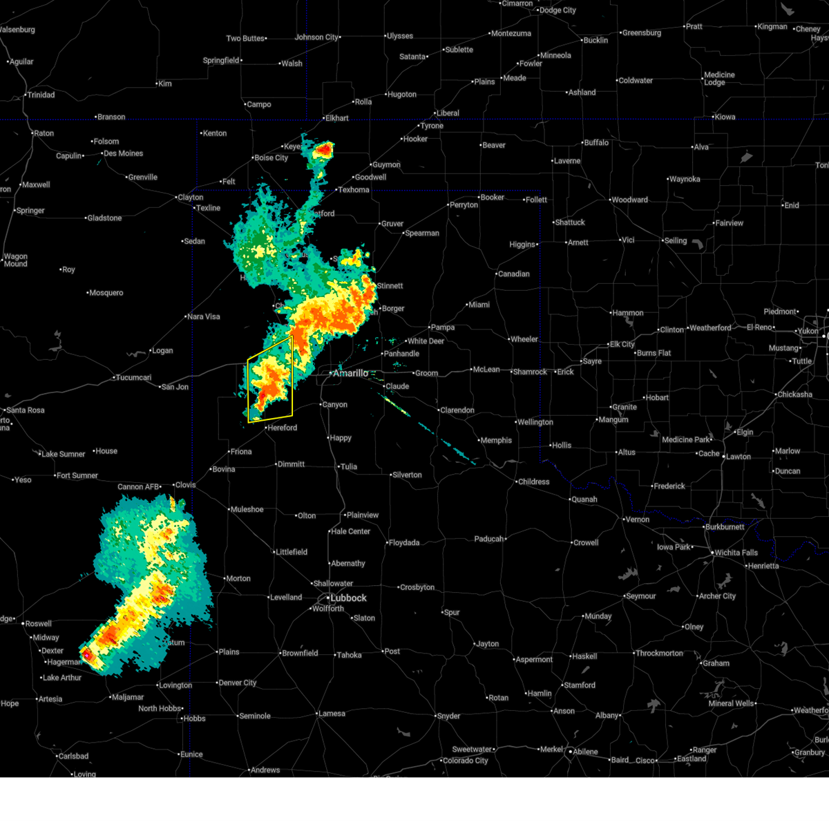
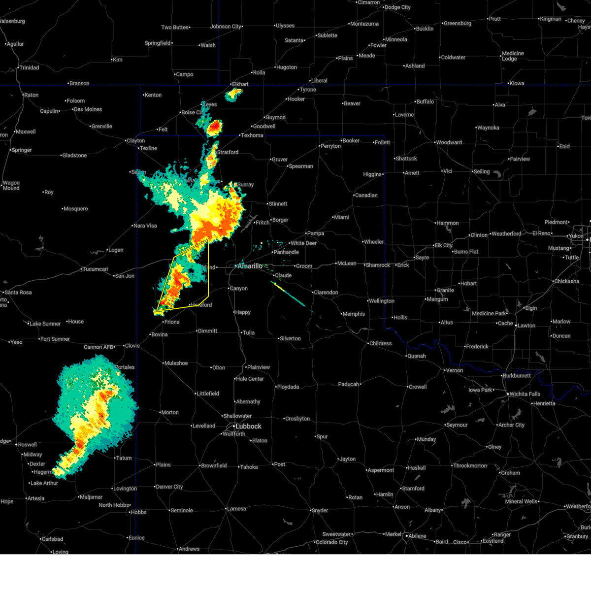
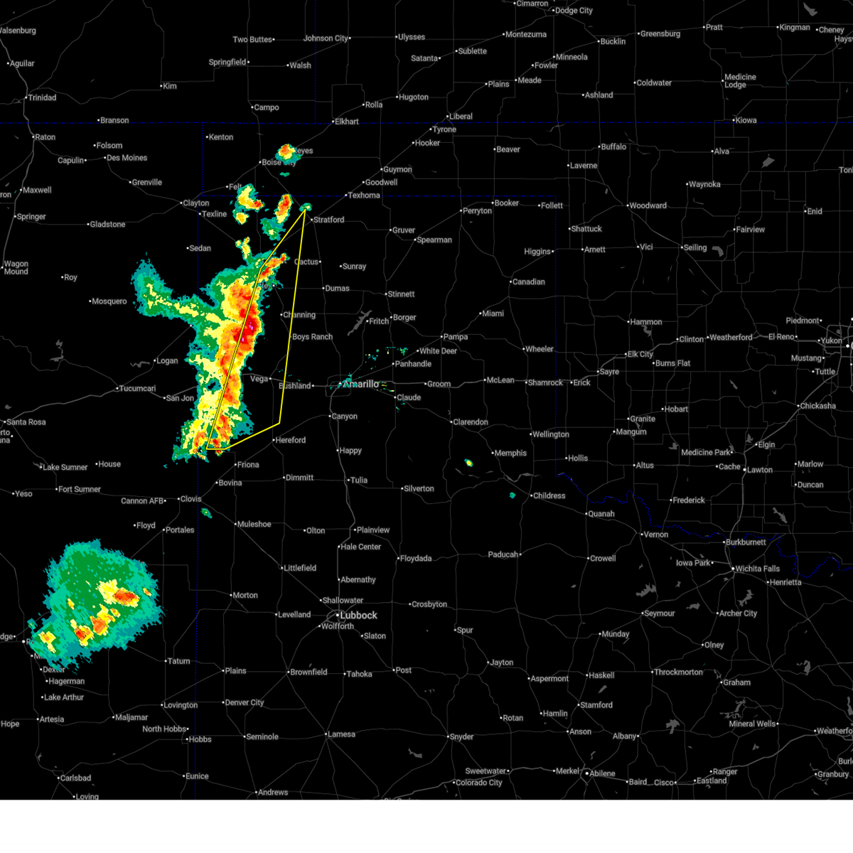
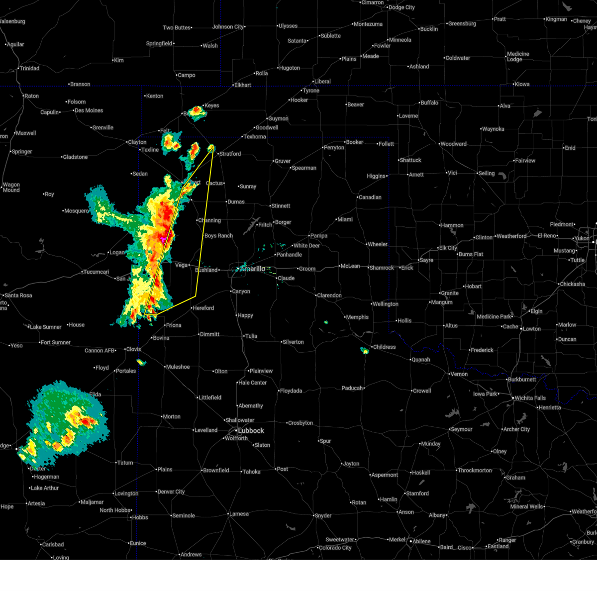
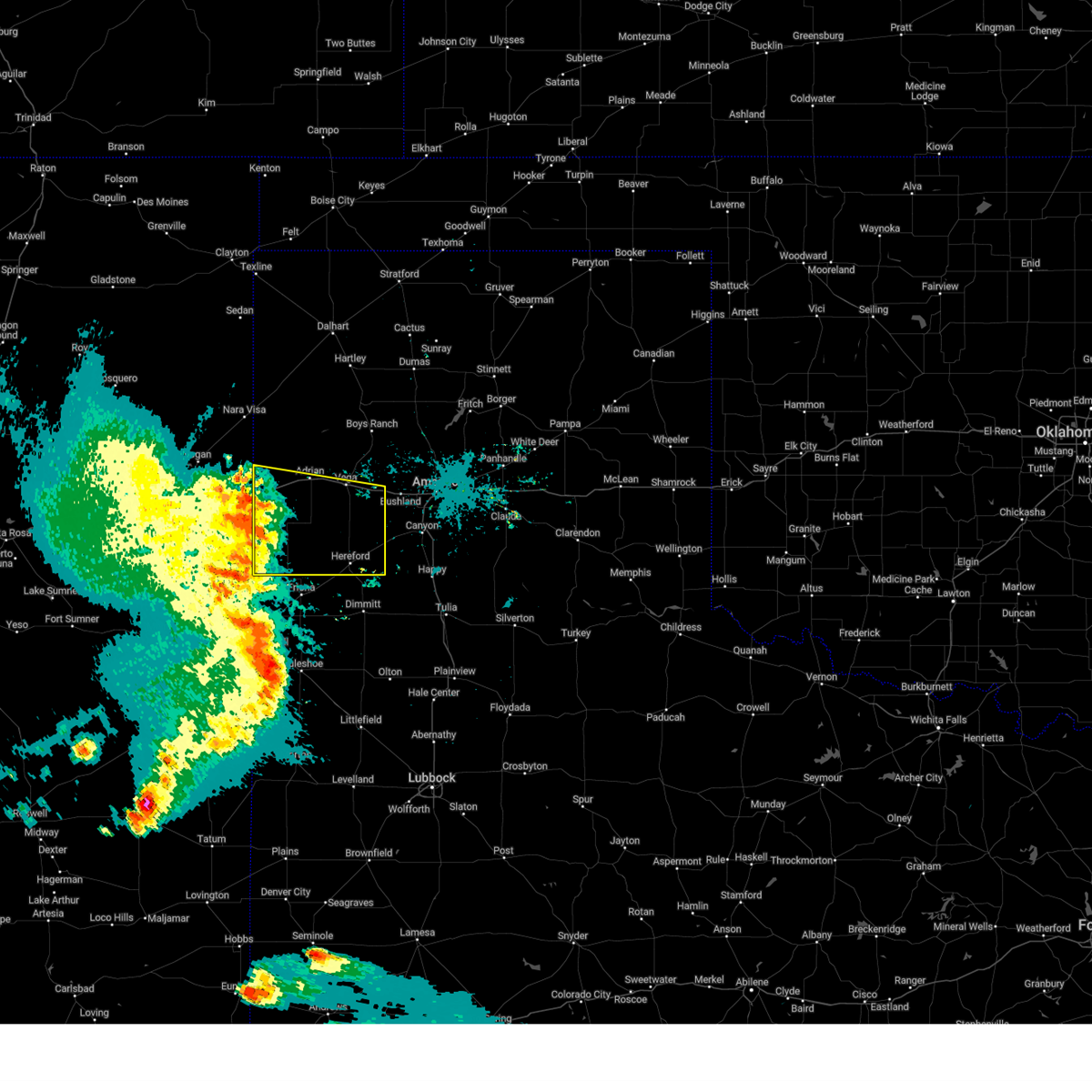
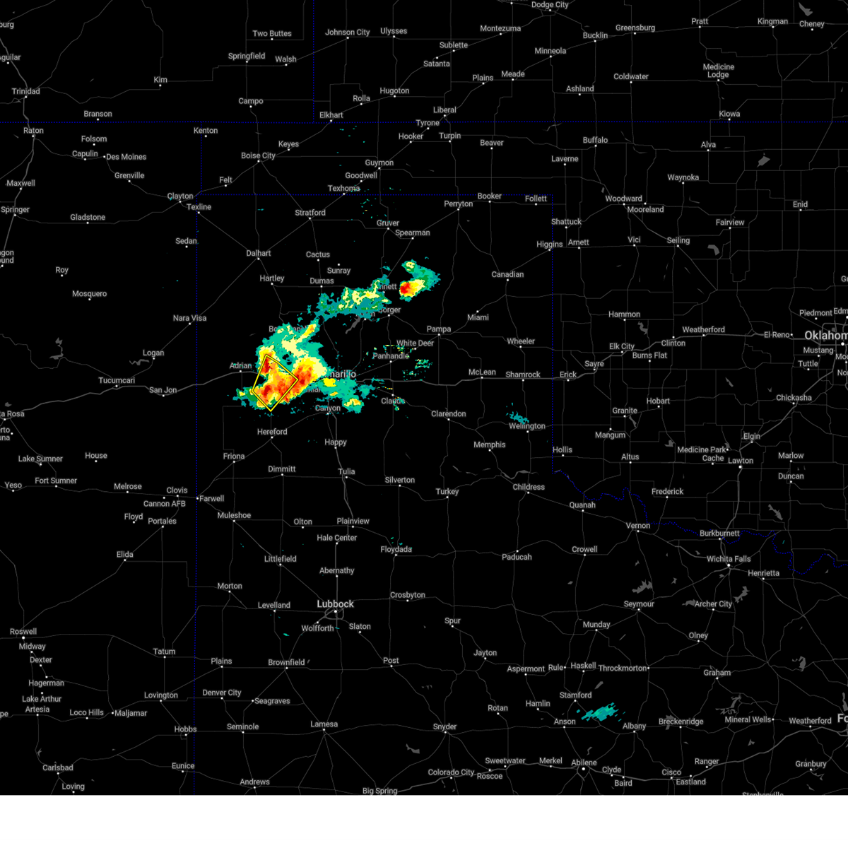
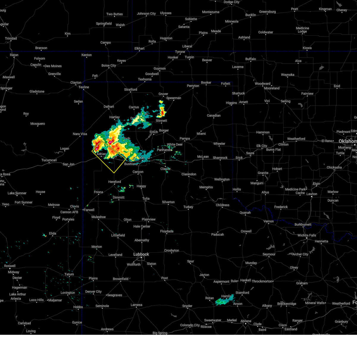
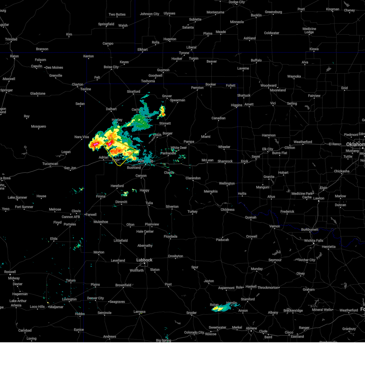
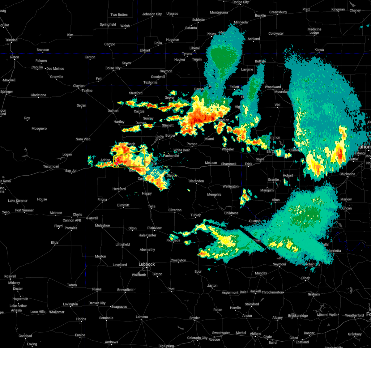
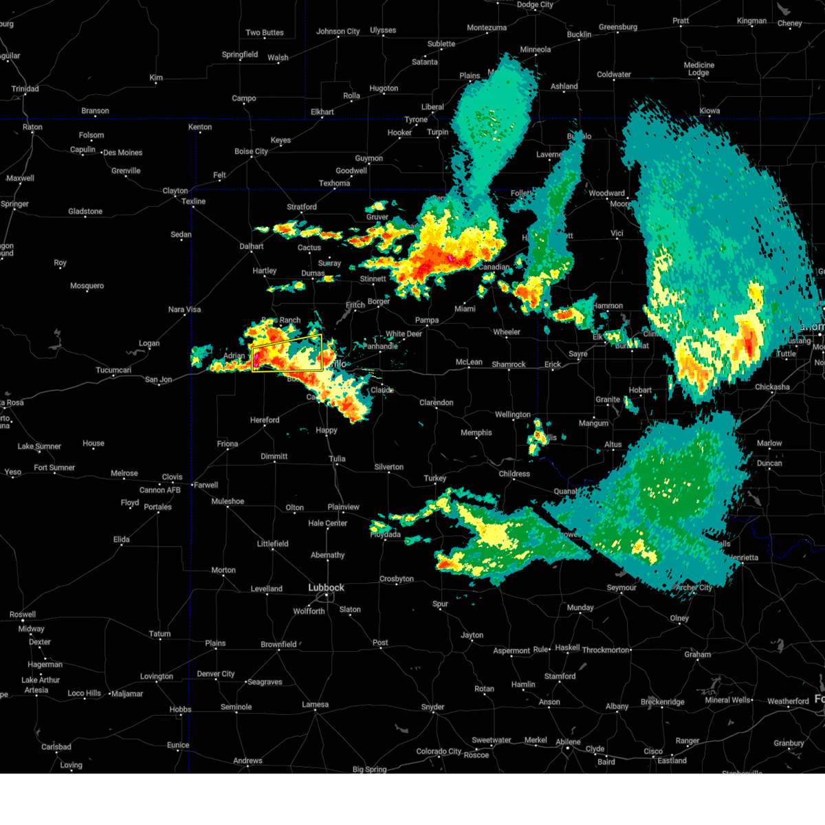
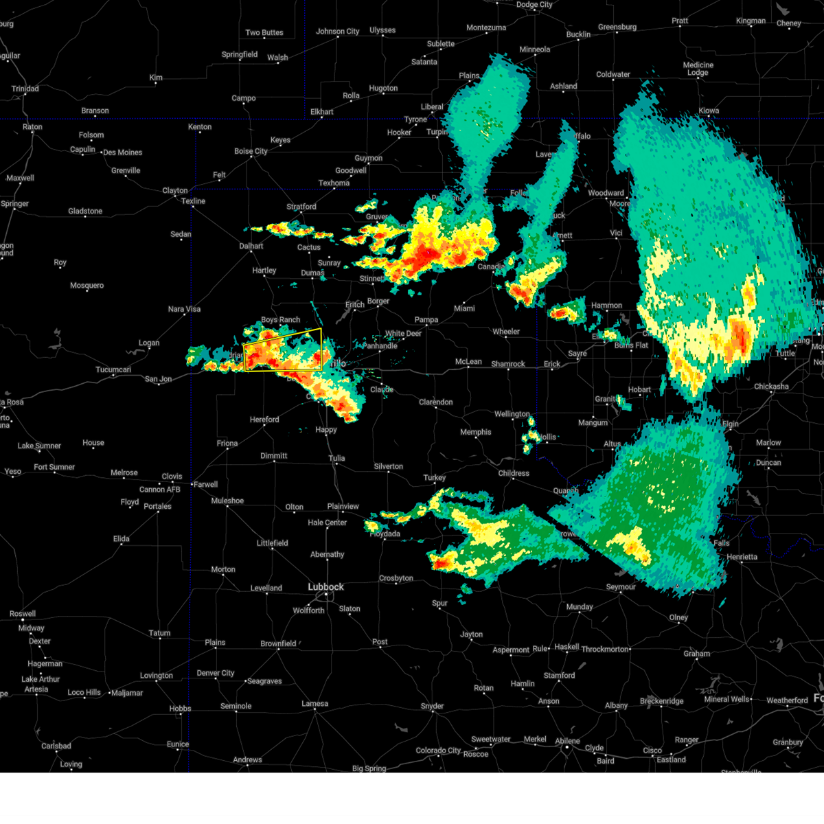
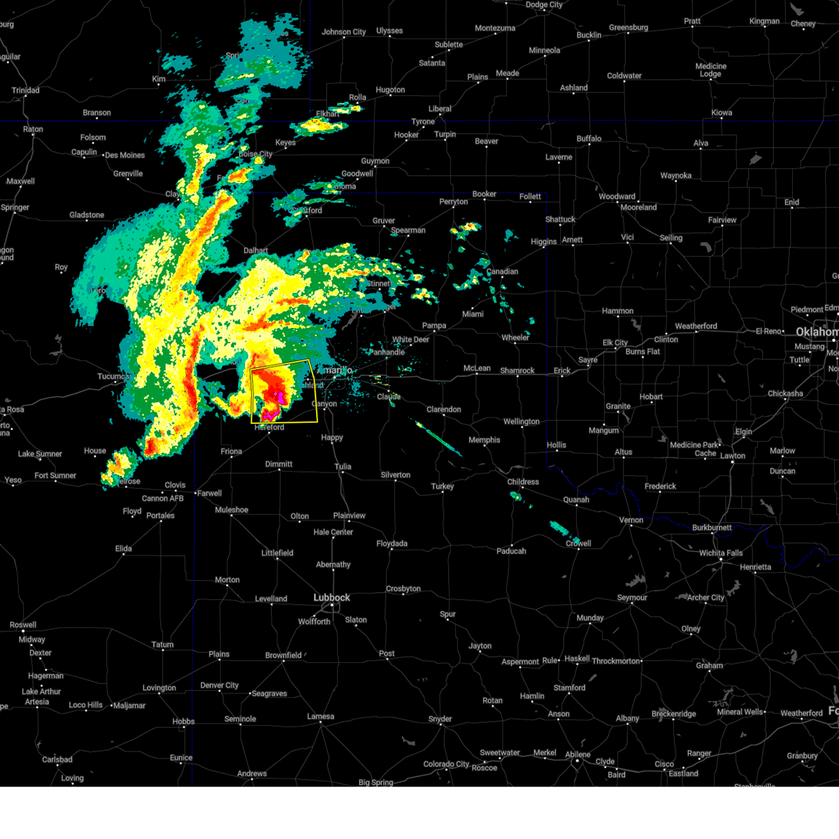
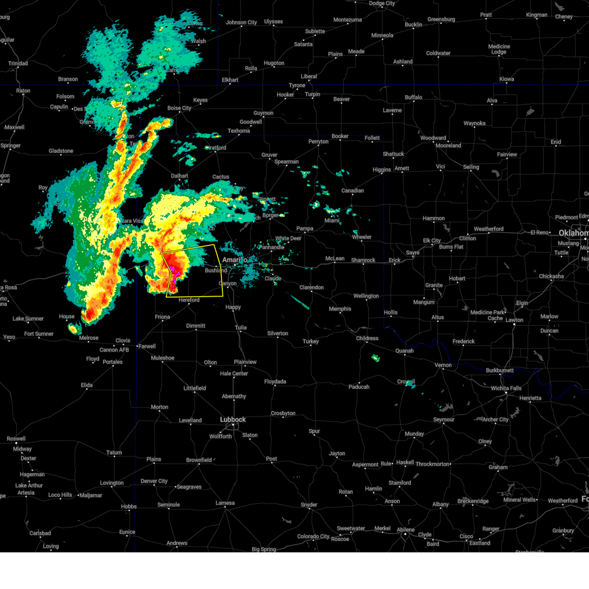
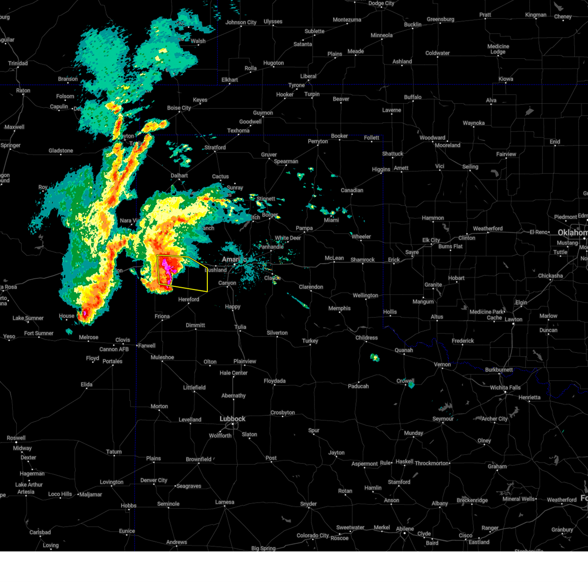
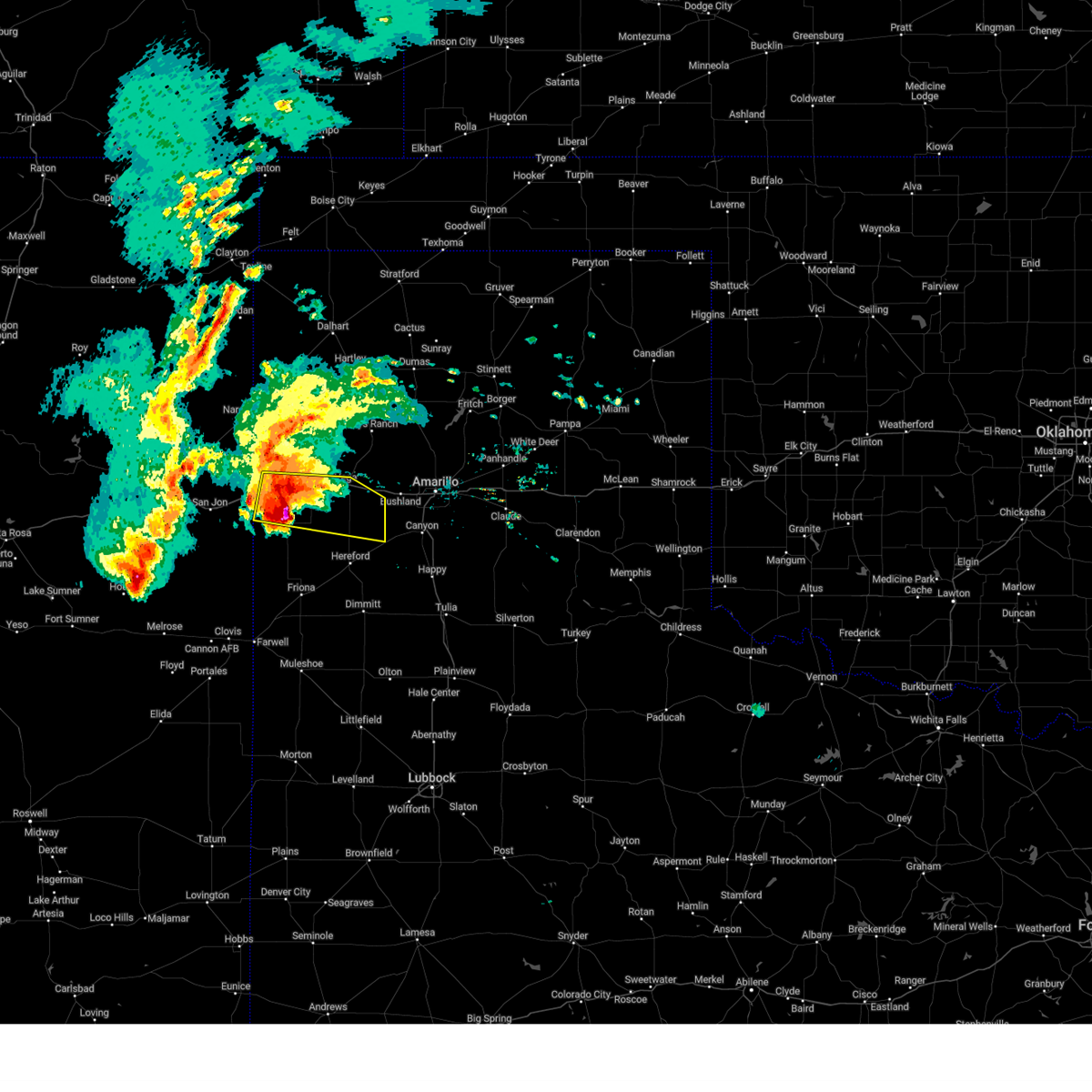
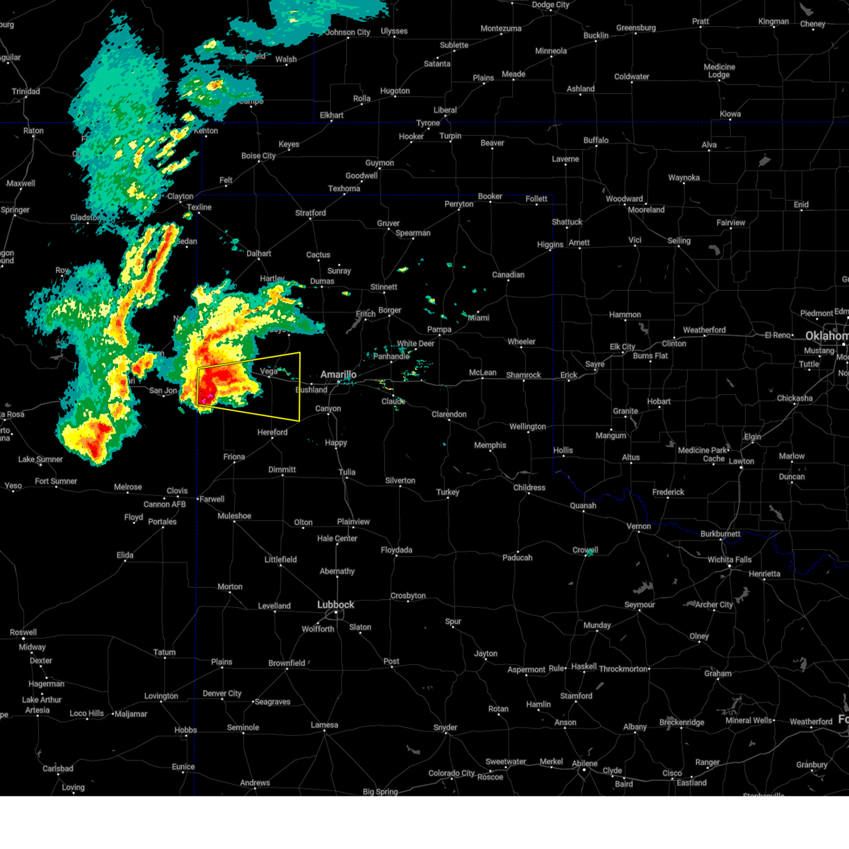
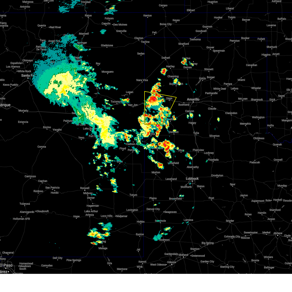
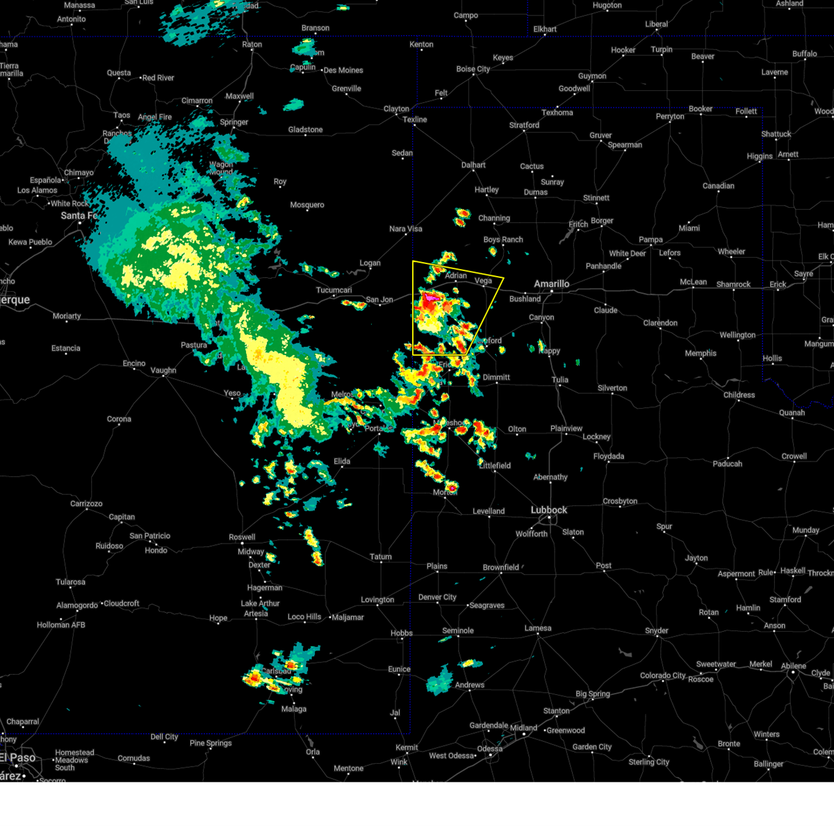
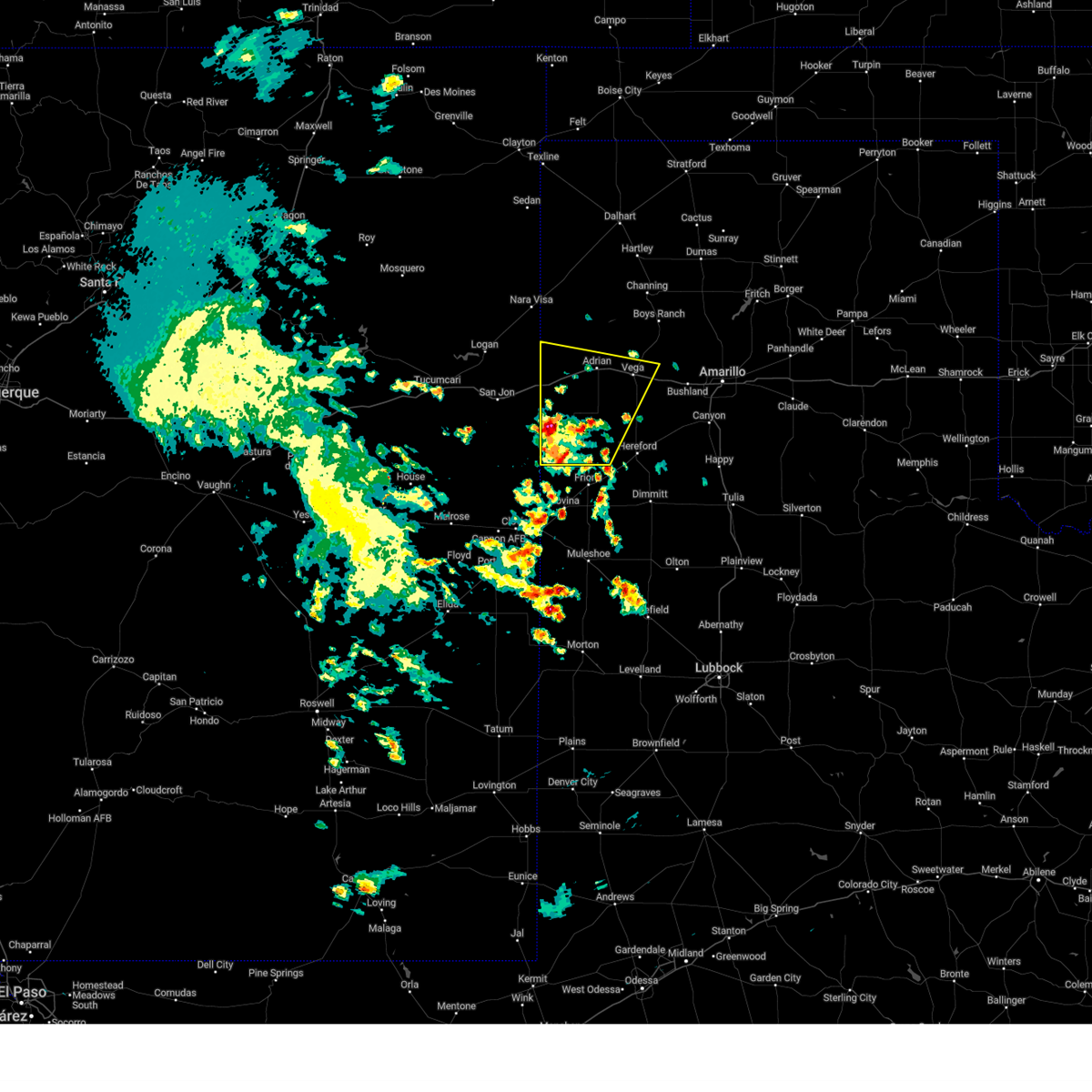
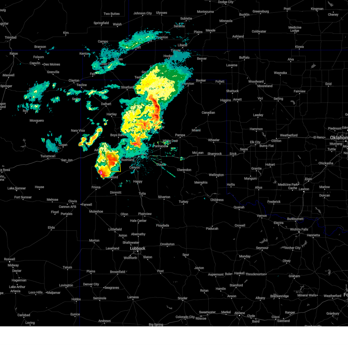
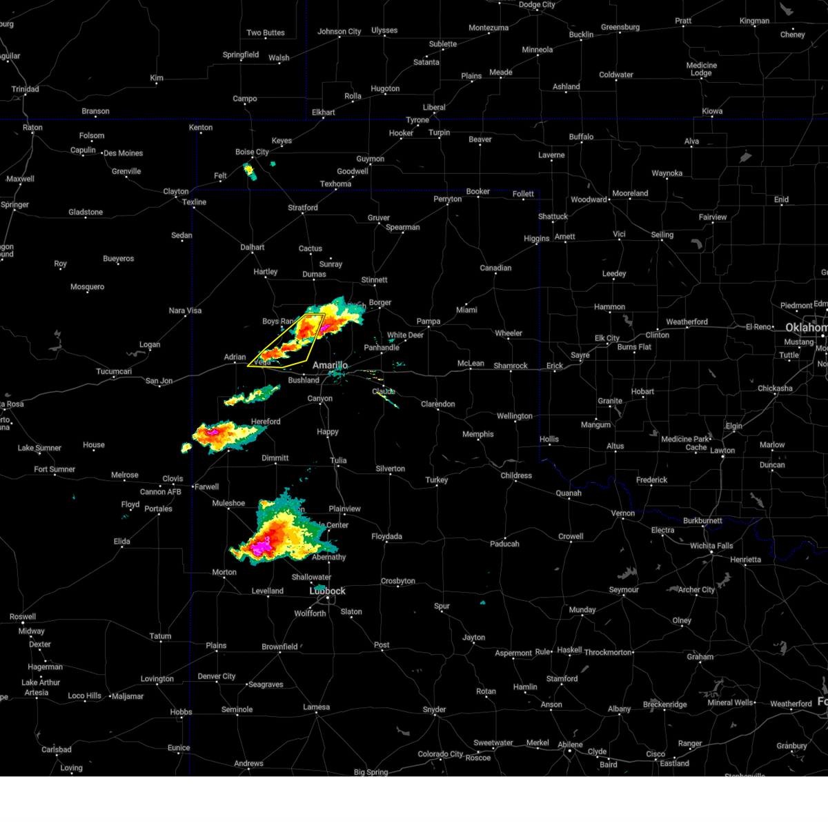
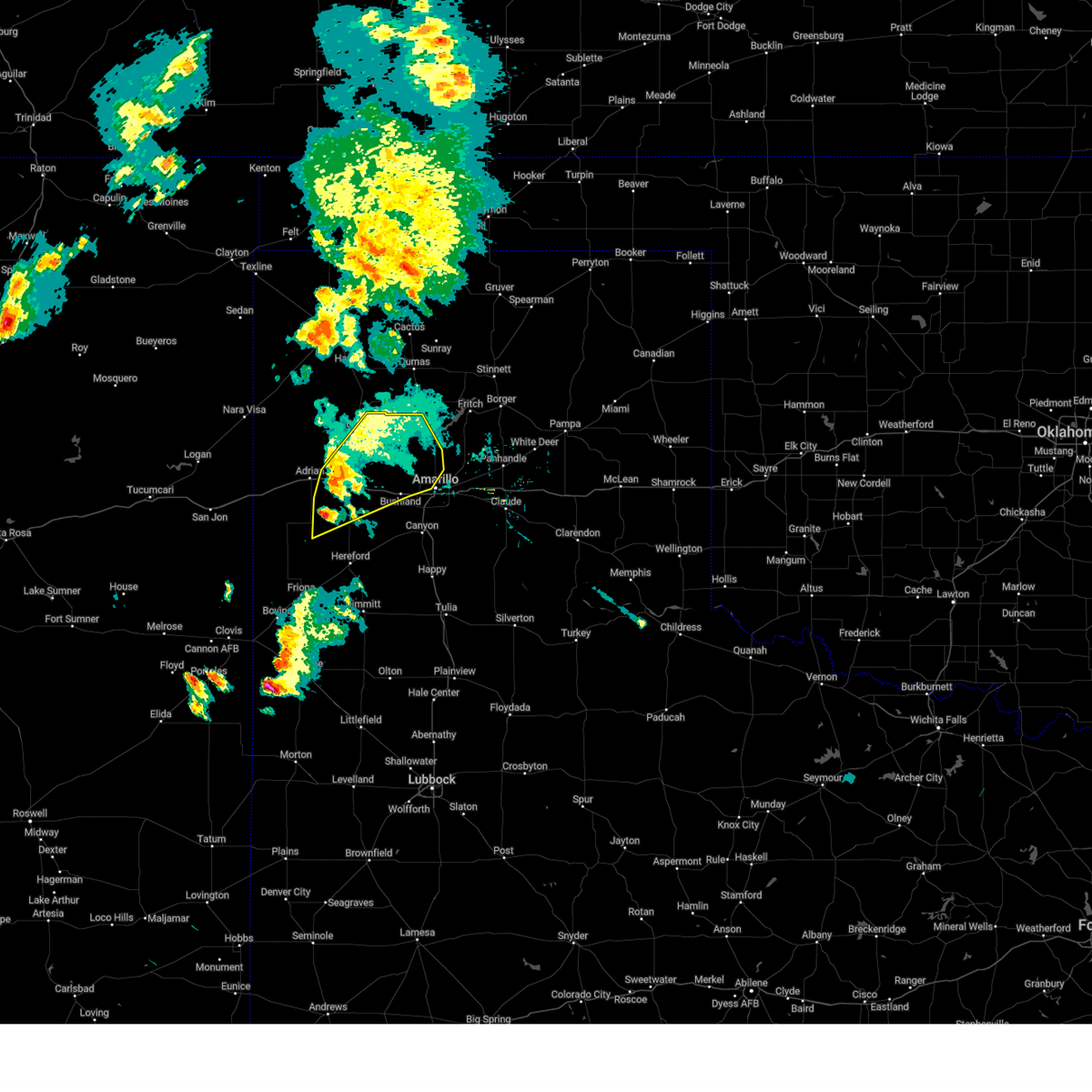
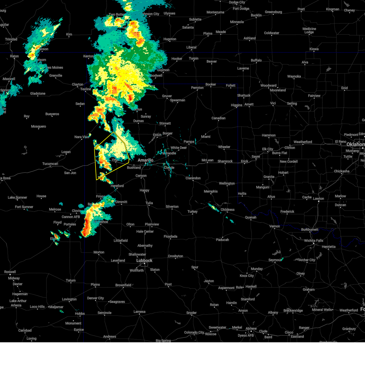
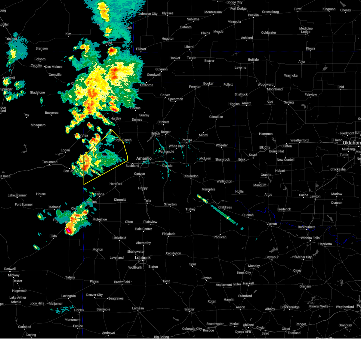
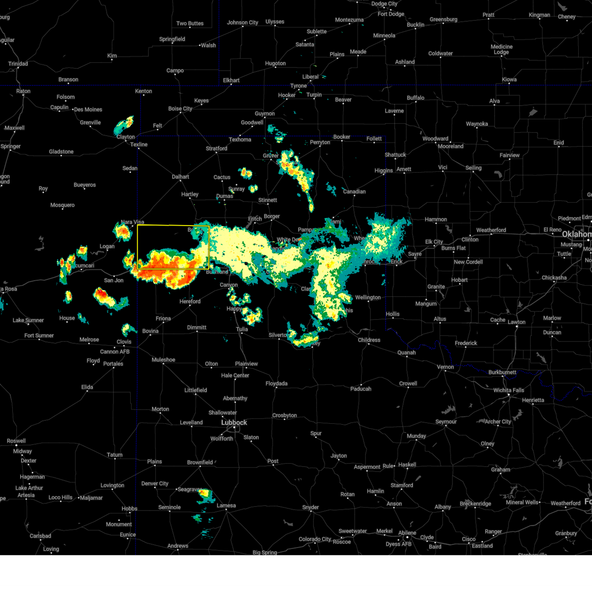
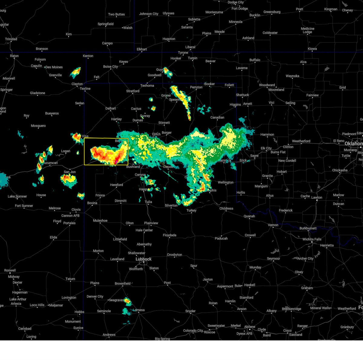
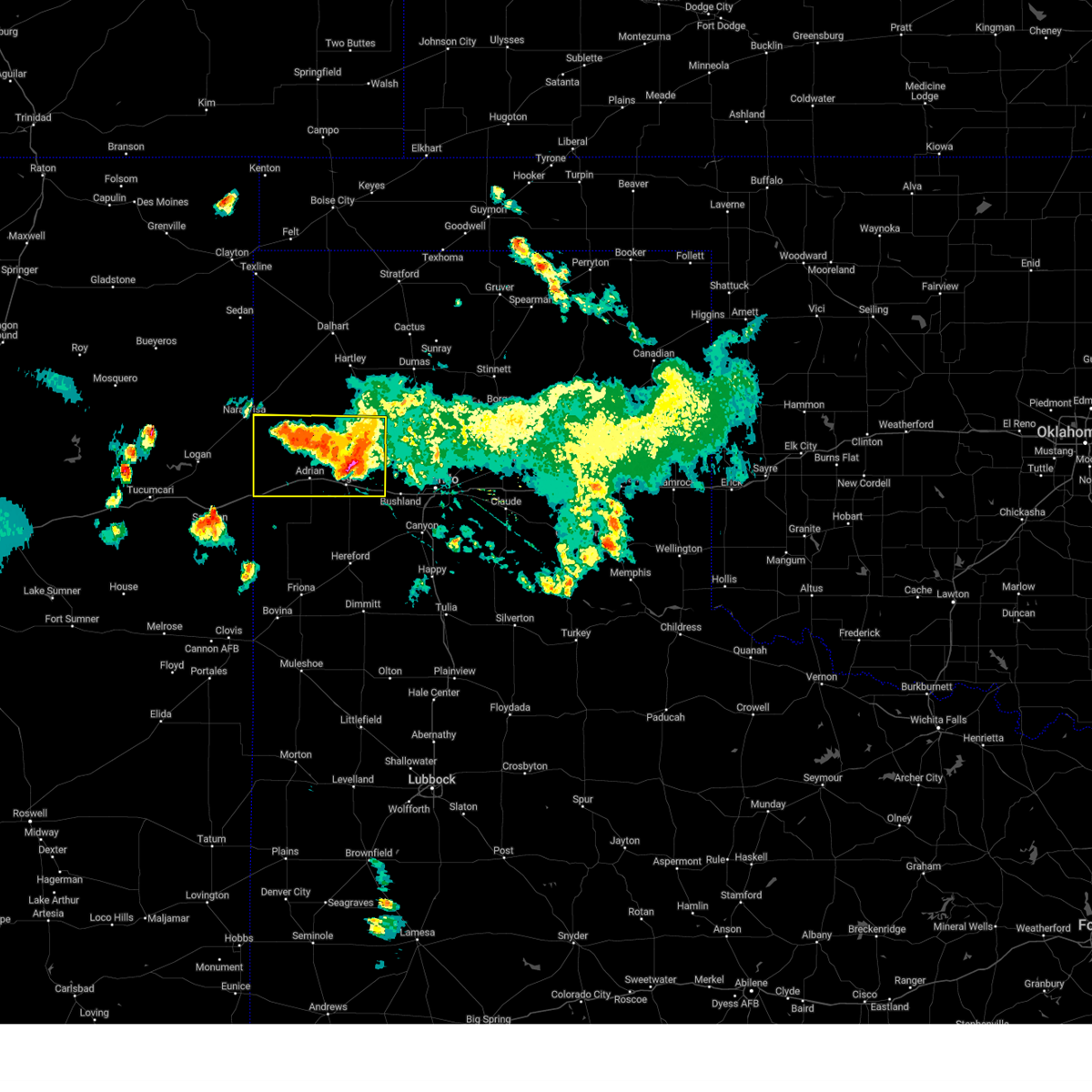
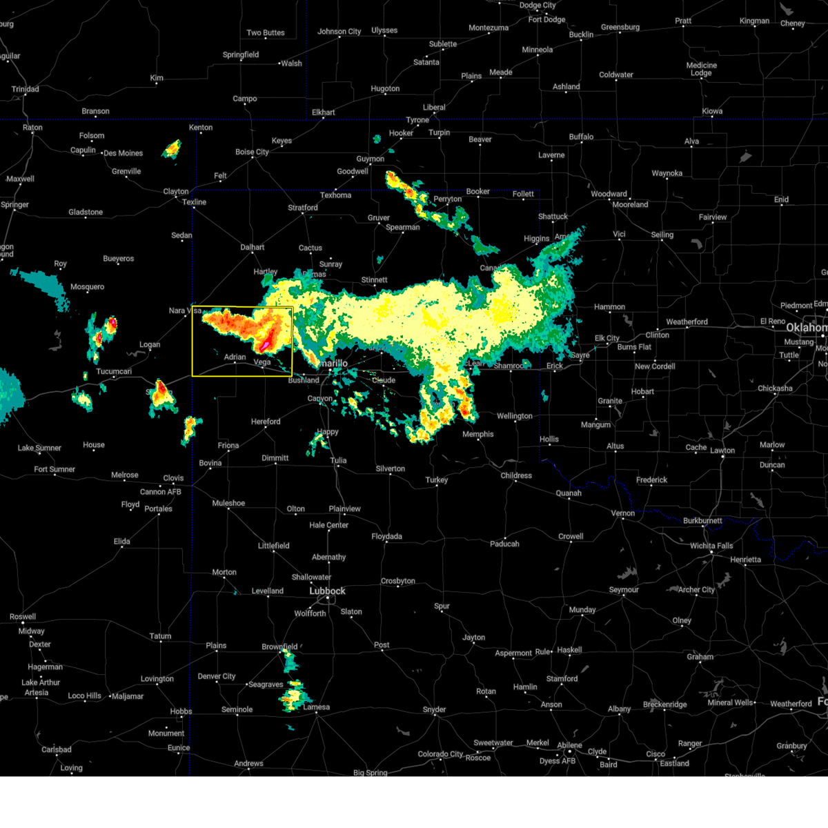
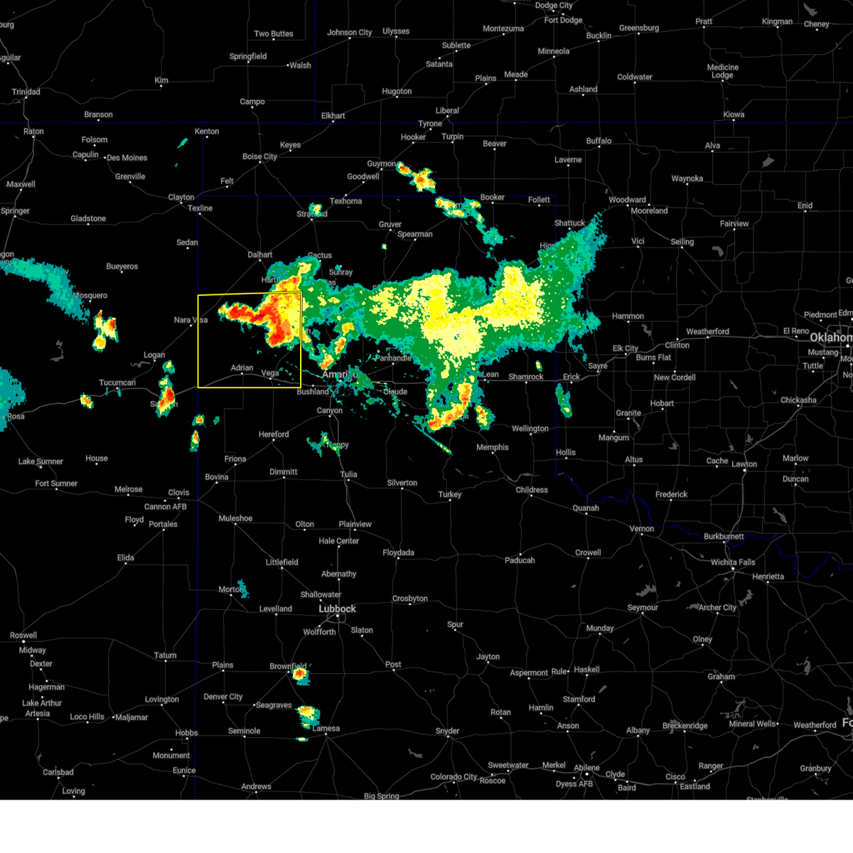
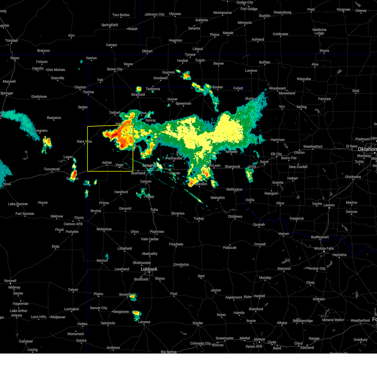
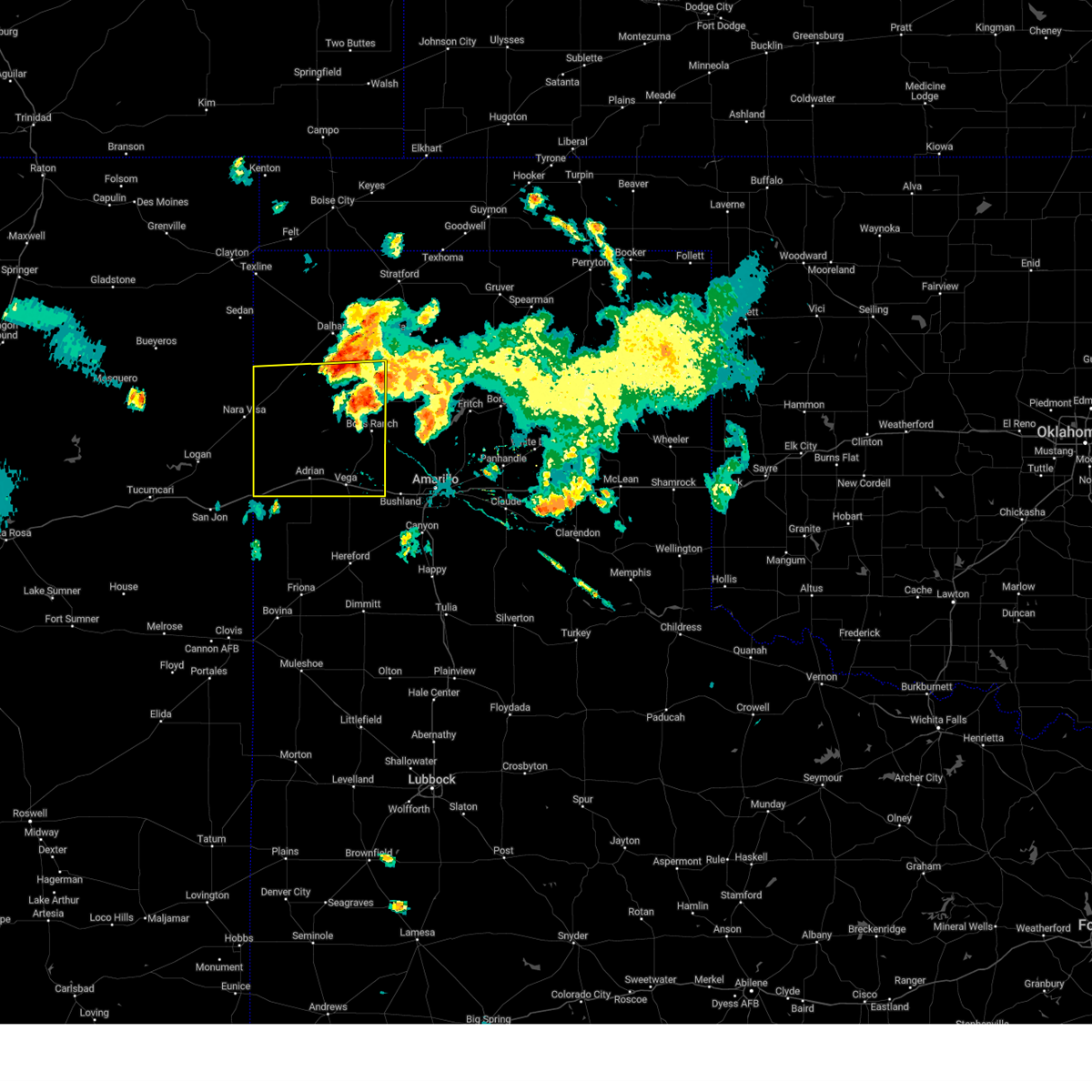
Hail Map for Vega, TX
The Vega, TX area has had 44 reports of on-the-ground hail by trained spotters, and has been under severe weather warnings 30 times during the past 12 months. Doppler radar has detected hail at or near Vega, TX on 97 occasions, including 6 occasions during the past year.
| Name: | Vega, TX |
| Where Located: | 33.7 miles W of Amarillo, TX |
| Map: | Google Map for Vega, TX |
| Population: | 884 |
| Housing Units: | 420 |
| More Info: | Search Google for Vega, TX |
1
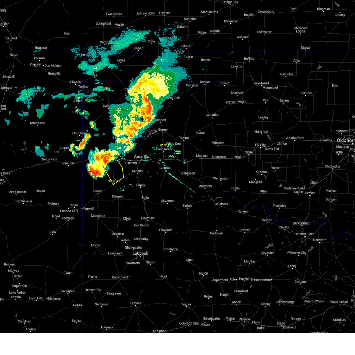
The Top Recent Hail Date for Vega, TX is Saturday, May 23, 2026 (23rd out of 97)
Hail and Wind Damage Spotted near Vega, TX
| Date / Time | Report Details |
|---|---|
| 6/12/2026 10:44 PM CDT |
 Svrama the national weather service in amarillo has issued a * severe thunderstorm warning for, oldham county in the panhandle of texas, northwestern potter county in the panhandle of texas, western moore county in the panhandle of texas, hartley county in the panhandle of texas, * until 1145 pm cdt. * at 1043 pm cdt, severe thunderstorms were located along a line extending from 8 miles northwest of hartley to 16 miles east of romero to 8 miles southeast of nara visa, moving southeast at 40 mph (radar indicated). Hazards include 70 mph wind gusts. Expect some tree damage. Damage is likely to mobile homes, roofs, and outbuildings. Svrama the national weather service in amarillo has issued a * severe thunderstorm warning for, oldham county in the panhandle of texas, northwestern potter county in the panhandle of texas, western moore county in the panhandle of texas, hartley county in the panhandle of texas, * until 1145 pm cdt. * at 1043 pm cdt, severe thunderstorms were located along a line extending from 8 miles northwest of hartley to 16 miles east of romero to 8 miles southeast of nara visa, moving southeast at 40 mph (radar indicated). Hazards include 70 mph wind gusts. Expect some tree damage. Damage is likely to mobile homes, roofs, and outbuildings.
|
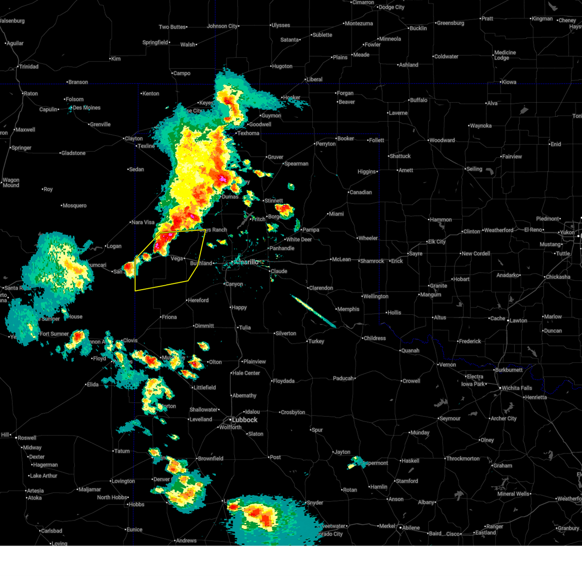
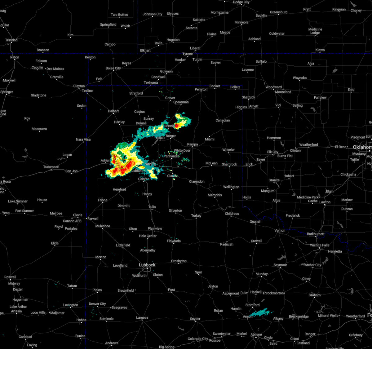
| 5/23/2026 8:14 PM CDT |
 Svrama the national weather service in amarillo has issued a * severe thunderstorm warning for, southwestern armstrong county in the panhandle of texas, randall county in the panhandle of texas, southeastern oldham county in the panhandle of texas, deaf smith county in the panhandle of texas, southwestern potter county in the panhandle of texas, * until 915 pm cdt. * at 813 pm cdt, severe thunderstorms were located along a line extending from 6 miles northeast of wildorado to 6 miles north of bellview, moving southeast at 25 mph (radar indicated). Hazards include 70 mph wind gusts and quarter size hail. Expect some tree damage. damage is likely to mobile homes, roofs, and outbuildings. Hail damage to vehicles is expected. Svrama the national weather service in amarillo has issued a * severe thunderstorm warning for, southwestern armstrong county in the panhandle of texas, randall county in the panhandle of texas, southeastern oldham county in the panhandle of texas, deaf smith county in the panhandle of texas, southwestern potter county in the panhandle of texas, * until 915 pm cdt. * at 813 pm cdt, severe thunderstorms were located along a line extending from 6 miles northeast of wildorado to 6 miles north of bellview, moving southeast at 25 mph (radar indicated). Hazards include 70 mph wind gusts and quarter size hail. Expect some tree damage. damage is likely to mobile homes, roofs, and outbuildings. Hail damage to vehicles is expected.
|
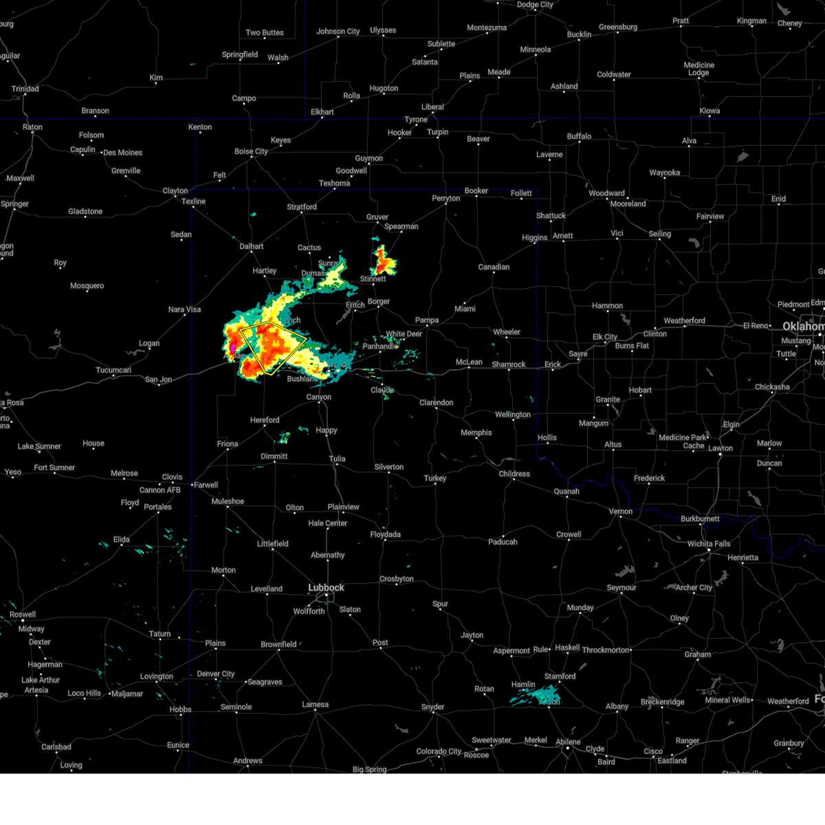
| 5/23/2026 8:02 PM CDT |
 At 802 pm cdt, severe thunderstorms were located along a line extending from 11 miles east of stinnett to 9 miles northeast of amarillo to 5 miles northwest of simms, moving southeast at 30 mph (radar indicated). Hazards include 70 mph wind gusts and quarter size hail. Expect some tree damage. damage is likely to mobile homes, roofs, and outbuildings. hail damage to vehicles is expected. Locations impacted include, amarillo, canyon, borger, panhandle, vega, fritch, stinnett, lake tanglewood, skellytown, sanford, bushland, valley de oro, washburn, umbarger, wildorado, mescalero park, lake meredith, timbercreek canyon, and pantex. At 802 pm cdt, severe thunderstorms were located along a line extending from 11 miles east of stinnett to 9 miles northeast of amarillo to 5 miles northwest of simms, moving southeast at 30 mph (radar indicated). Hazards include 70 mph wind gusts and quarter size hail. Expect some tree damage. damage is likely to mobile homes, roofs, and outbuildings. hail damage to vehicles is expected. Locations impacted include, amarillo, canyon, borger, panhandle, vega, fritch, stinnett, lake tanglewood, skellytown, sanford, bushland, valley de oro, washburn, umbarger, wildorado, mescalero park, lake meredith, timbercreek canyon, and pantex.
|
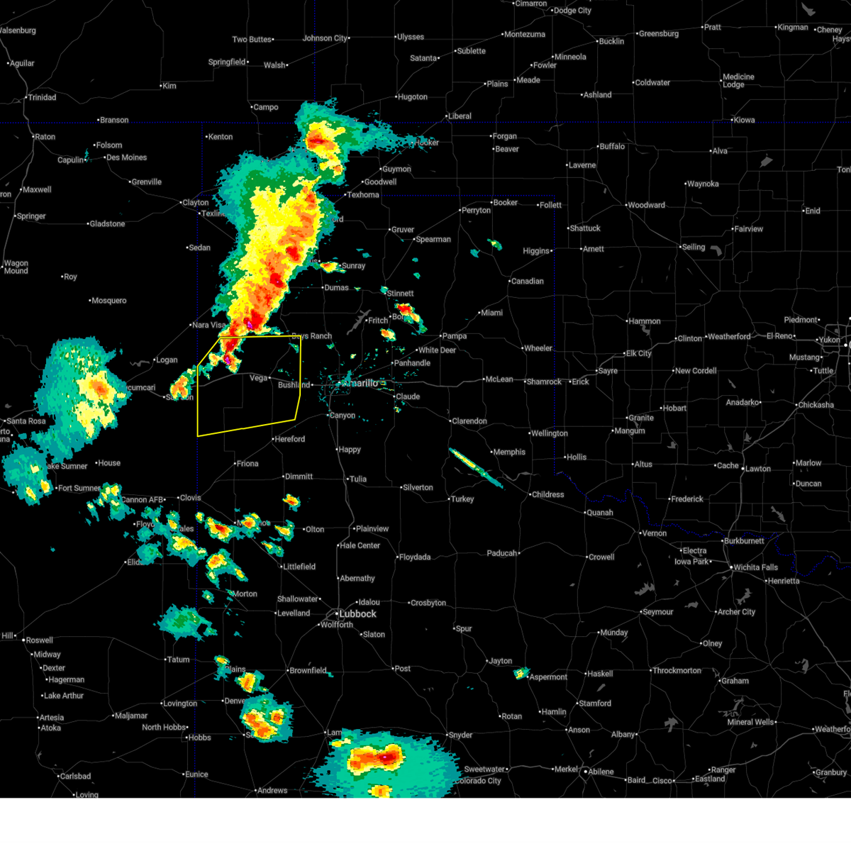
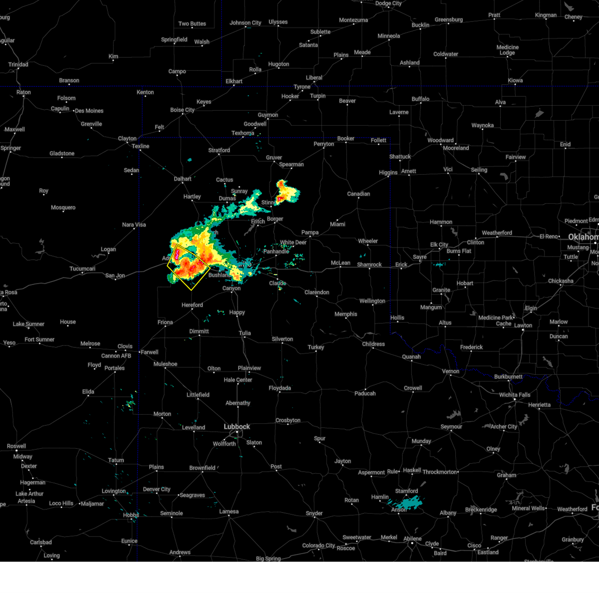
| 5/23/2026 7:22 PM CDT |
 Svrama the national weather service in amarillo has issued a * severe thunderstorm warning for, northwestern armstrong county in the panhandle of texas, northern randall county in the panhandle of texas, southeastern oldham county in the panhandle of texas, carson county in the panhandle of texas, southern hutchinson county in the panhandle of texas, northern deaf smith county in the panhandle of texas, potter county in the panhandle of texas, southeastern moore county in the panhandle of texas, * until 815 pm cdt. * at 722 pm cdt, severe thunderstorms were located along a line extending from 11 miles southeast of sunray to 9 miles east of valley de oro to 6 miles south of adrian, moving east at 40 mph (radar indicated). Hazards include 70 mph wind gusts and ping pong ball size hail. Expect some tree damage. damage is likely to mobile homes, roofs, and outbuildings. people and animals outdoors will be injured. Expect hail damage to roofs, siding, windows, and vehicles. Svrama the national weather service in amarillo has issued a * severe thunderstorm warning for, northwestern armstrong county in the panhandle of texas, northern randall county in the panhandle of texas, southeastern oldham county in the panhandle of texas, carson county in the panhandle of texas, southern hutchinson county in the panhandle of texas, northern deaf smith county in the panhandle of texas, potter county in the panhandle of texas, southeastern moore county in the panhandle of texas, * until 815 pm cdt. * at 722 pm cdt, severe thunderstorms were located along a line extending from 11 miles southeast of sunray to 9 miles east of valley de oro to 6 miles south of adrian, moving east at 40 mph (radar indicated). Hazards include 70 mph wind gusts and ping pong ball size hail. Expect some tree damage. damage is likely to mobile homes, roofs, and outbuildings. people and animals outdoors will be injured. Expect hail damage to roofs, siding, windows, and vehicles.
|
| 5/23/2026 7:15 PM CDT |
 At 715 pm cdt, severe thunderstorms were located along a line extending from 13 miles west of boys ranch to 8 miles south of glenrio, moving east at 30 mph (radar indicated). Hazards include 60 mph wind gusts and quarter size hail. Minor damage to roofs, siding, and trees is possible. hail damage to vehicles is expected. Locations impacted include, vega, adrian, boys ranch, glenrio, and simms. At 715 pm cdt, severe thunderstorms were located along a line extending from 13 miles west of boys ranch to 8 miles south of glenrio, moving east at 30 mph (radar indicated). Hazards include 60 mph wind gusts and quarter size hail. Minor damage to roofs, siding, and trees is possible. hail damage to vehicles is expected. Locations impacted include, vega, adrian, boys ranch, glenrio, and simms.
|
| 5/23/2026 6:51 PM CDT |
 Svrama the national weather service in amarillo has issued a * severe thunderstorm warning for, oldham county in the panhandle of texas, deaf smith county in the panhandle of texas, * until 730 pm cdt. * at 650 pm cdt, severe thunderstorms were located along a line extending from 14 miles north of adrian to 9 miles east of san jon, moving east at 30 mph (radar indicated). Hazards include 60 mph wind gusts and quarter size hail. Minor damage to roofs, siding, and trees is possible. Hail damage to vehicles is expected. Svrama the national weather service in amarillo has issued a * severe thunderstorm warning for, oldham county in the panhandle of texas, deaf smith county in the panhandle of texas, * until 730 pm cdt. * at 650 pm cdt, severe thunderstorms were located along a line extending from 14 miles north of adrian to 9 miles east of san jon, moving east at 30 mph (radar indicated). Hazards include 60 mph wind gusts and quarter size hail. Minor damage to roofs, siding, and trees is possible. Hail damage to vehicles is expected.
|
| 5/22/2026 9:01 PM CDT |
 At 901 pm cdt, severe thunderstorms were located along a line extending from near channing to 6 miles southwest of vega, moving east at 15 mph (radar indicated). Hazards include golf ball size hail and 60 mph wind gusts. Minor damage to roofs, siding, and trees is possible. people and animals outdoors will be injured. expect hail damage to roofs, siding, windows, and vehicles. Locations impacted include, vega, boys ranch, wildorado, and valley de oro. At 901 pm cdt, severe thunderstorms were located along a line extending from near channing to 6 miles southwest of vega, moving east at 15 mph (radar indicated). Hazards include golf ball size hail and 60 mph wind gusts. Minor damage to roofs, siding, and trees is possible. people and animals outdoors will be injured. expect hail damage to roofs, siding, windows, and vehicles. Locations impacted include, vega, boys ranch, wildorado, and valley de oro.
|
| 5/22/2026 8:37 PM CDT |
 Svrama the national weather service in amarillo has issued a * severe thunderstorm warning for, eastern oldham county in the panhandle of texas, northeastern deaf smith county in the panhandle of texas, western potter county in the panhandle of texas, southwestern moore county in the panhandle of texas, southeastern hartley county in the panhandle of texas, * until 930 pm cdt. * at 837 pm cdt, severe thunderstorms were located along a line extending from 6 miles west of channing to 5 miles southeast of adrian, moving east at 5 mph (radar indicated). Hazards include ping pong ball size hail and 60 mph wind gusts. Minor damage to roofs, siding, and trees is possible. people and animals outdoors will be injured. Expect hail damage to roofs, siding, windows, and vehicles. Svrama the national weather service in amarillo has issued a * severe thunderstorm warning for, eastern oldham county in the panhandle of texas, northeastern deaf smith county in the panhandle of texas, western potter county in the panhandle of texas, southwestern moore county in the panhandle of texas, southeastern hartley county in the panhandle of texas, * until 930 pm cdt. * at 837 pm cdt, severe thunderstorms were located along a line extending from 6 miles west of channing to 5 miles southeast of adrian, moving east at 5 mph (radar indicated). Hazards include ping pong ball size hail and 60 mph wind gusts. Minor damage to roofs, siding, and trees is possible. people and animals outdoors will be injured. Expect hail damage to roofs, siding, windows, and vehicles.
|
| 5/14/2026 4:02 PM CDT |
 At 402 pm cdt, a severe thunderstorm was located 7 miles northwest of vega, moving east at 30 mph (radar indicated). Hazards include 60 mph wind gusts. Minor damage to roofs, siding, and trees is possible. Locations impacted include, vega. At 402 pm cdt, a severe thunderstorm was located 7 miles northwest of vega, moving east at 30 mph (radar indicated). Hazards include 60 mph wind gusts. Minor damage to roofs, siding, and trees is possible. Locations impacted include, vega.
|
| 5/14/2026 3:50 PM CDT |
 Svrama the national weather service in amarillo has issued a * severe thunderstorm warning for, southeastern oldham county in the panhandle of texas, * until 445 pm cdt. * at 349 pm cdt, severe thunderstorms was located over adrian, or 12 miles west of vega, moving east at 30 mph (radar indicated). Hazards include 60 mph wind gusts. minor damage to roofs, siding, and trees is possible Svrama the national weather service in amarillo has issued a * severe thunderstorm warning for, southeastern oldham county in the panhandle of texas, * until 445 pm cdt. * at 349 pm cdt, severe thunderstorms was located over adrian, or 12 miles west of vega, moving east at 30 mph (radar indicated). Hazards include 60 mph wind gusts. minor damage to roofs, siding, and trees is possible
|
| 9/22/2025 9:27 PM CDT | Svrama the national weather service in amarillo has issued a * severe thunderstorm warning for, randall county in the panhandle of texas, southeastern oldham county in the panhandle of texas, eastern deaf smith county in the panhandle of texas, southern potter county in the panhandle of texas, * until 1030 pm cdt. * at 927 pm cdt, severe thunderstorms were located along a line extending from 4 miles northeast of vega to 5 miles west of dawn, moving east at 40 mph (radar indicated). Hazards include 60 mph wind gusts. minor damage to roofs, siding, and trees is possible |
| 9/22/2025 9:01 PM CDT | At 901 pm cdt, severe thunderstorms were located along a line extending from 13 miles southeast of romero to near adrian to 8 miles southwest of simms, moving east at 50 mph (radar indicated). Hazards include 60 mph wind gusts and penny size hail. Minor damage to roofs, siding, and trees is possible. Locations impacted include, hereford, vega, adrian, dawn, boys ranch, bootleg, wildorado, and simms. |
| 9/22/2025 8:48 PM CDT | Svrama the national weather service in amarillo has issued a * severe thunderstorm warning for, oldham county in the panhandle of texas, deaf smith county in the panhandle of texas, * until 930 pm cdt. * at 848 pm cdt, severe thunderstorms were located along a line extending from 10 miles south of romero to 10 miles west of adrian to 8 miles northwest of bootleg, moving east at 50 mph (radar indicated). Hazards include 60 mph wind gusts and penny size hail. minor damage to roofs, siding, and trees is possible |
| 8/11/2025 9:37 PM CDT |
 the severe thunderstorm warning has been cancelled and is no longer in effect the severe thunderstorm warning has been cancelled and is no longer in effect
|
| 8/11/2025 9:30 PM CDT |
 At 930 pm cdt, a severe thunderstorm was located over wildorado, or 10 miles east of vega, moving southeast at 25 mph (radar indicated). Hazards include 60 mph wind gusts and penny size hail. Minor damage to roofs, siding, and trees is possible. Locations impacted include, amarillo, vega, wildorado, and bushland. At 930 pm cdt, a severe thunderstorm was located over wildorado, or 10 miles east of vega, moving southeast at 25 mph (radar indicated). Hazards include 60 mph wind gusts and penny size hail. Minor damage to roofs, siding, and trees is possible. Locations impacted include, amarillo, vega, wildorado, and bushland.
|
| 8/11/2025 8:55 PM CDT |
 Svrama the national weather service in amarillo has issued a * severe thunderstorm warning for, northwestern randall county in the panhandle of texas, southeastern oldham county in the panhandle of texas, northeastern deaf smith county in the panhandle of texas, southwestern potter county in the panhandle of texas, * until 1000 pm cdt. * at 854 pm cdt, a severe thunderstorm was located 9 miles southwest of boys ranch, or 11 miles north of vega, moving southeast at 25 mph (radar indicated). Hazards include 60 mph wind gusts and quarter size hail. Minor damage to roofs, siding, and trees is possible. Hail damage to vehicles is expected. Svrama the national weather service in amarillo has issued a * severe thunderstorm warning for, northwestern randall county in the panhandle of texas, southeastern oldham county in the panhandle of texas, northeastern deaf smith county in the panhandle of texas, southwestern potter county in the panhandle of texas, * until 1000 pm cdt. * at 854 pm cdt, a severe thunderstorm was located 9 miles southwest of boys ranch, or 11 miles north of vega, moving southeast at 25 mph (radar indicated). Hazards include 60 mph wind gusts and quarter size hail. Minor damage to roofs, siding, and trees is possible. Hail damage to vehicles is expected.
|
| 8/3/2025 12:52 AM CDT |
 At 1252 am cdt, a severe thunderstorm was located 9 miles southeast of adrian, or 11 miles southwest of vega, moving southeast at 30 mph (radar indicated). Hazards include 60 mph wind gusts and penny size hail. Minor damage to roofs, siding, and trees is possible. Locations impacted include, vega, adrian, and simms. At 1252 am cdt, a severe thunderstorm was located 9 miles southeast of adrian, or 11 miles southwest of vega, moving southeast at 30 mph (radar indicated). Hazards include 60 mph wind gusts and penny size hail. Minor damage to roofs, siding, and trees is possible. Locations impacted include, vega, adrian, and simms.
|
| 8/3/2025 12:34 AM CDT |
 At 1234 am cdt, a severe thunderstorm was located over adrian, or 14 miles west of vega, moving southeast at 30 mph (radar indicated). Hazards include 70 mph wind gusts and half dollar size hail. Expect some tree damage. damage is likely to mobile homes, roofs, and outbuildings. hail damage to vehicles is expected. Locations impacted include, vega, adrian, and simms. At 1234 am cdt, a severe thunderstorm was located over adrian, or 14 miles west of vega, moving southeast at 30 mph (radar indicated). Hazards include 70 mph wind gusts and half dollar size hail. Expect some tree damage. damage is likely to mobile homes, roofs, and outbuildings. hail damage to vehicles is expected. Locations impacted include, vega, adrian, and simms.
|
| 8/3/2025 12:27 AM CDT |
 At 1227 am cdt, a severe thunderstorm was located 4 miles west of adrian, or 17 miles west of vega, moving southeast at 30 mph (radar indicated). Hazards include golf ball size hail and 70 mph wind gusts. Expect some tree damage. damage is likely to mobile homes, roofs, and outbuildings. people and animals outdoors will be injured. expect hail damage to roofs, siding, windows, and vehicles. Locations impacted include, vega, adrian, and simms. At 1227 am cdt, a severe thunderstorm was located 4 miles west of adrian, or 17 miles west of vega, moving southeast at 30 mph (radar indicated). Hazards include golf ball size hail and 70 mph wind gusts. Expect some tree damage. damage is likely to mobile homes, roofs, and outbuildings. people and animals outdoors will be injured. expect hail damage to roofs, siding, windows, and vehicles. Locations impacted include, vega, adrian, and simms.
|
| 8/3/2025 12:15 AM CDT |
 Svrama the national weather service in amarillo has issued a * severe thunderstorm warning for, western oldham county in the panhandle of texas, northern deaf smith county in the panhandle of texas, * until 115 am cdt. * at 1215 am cdt, a severe thunderstorm was located 10 miles northwest of adrian, or 23 miles southeast of nara visa, moving southeast at 30 mph. this is a destructive storm for adrian (radar indicated). Hazards include baseball size hail and 70 mph wind gusts. People and animals outdoors will be severely injured. Expect shattered windows, extensive damage to roofs, siding, and vehicles. Svrama the national weather service in amarillo has issued a * severe thunderstorm warning for, western oldham county in the panhandle of texas, northern deaf smith county in the panhandle of texas, * until 115 am cdt. * at 1215 am cdt, a severe thunderstorm was located 10 miles northwest of adrian, or 23 miles southeast of nara visa, moving southeast at 30 mph. this is a destructive storm for adrian (radar indicated). Hazards include baseball size hail and 70 mph wind gusts. People and animals outdoors will be severely injured. Expect shattered windows, extensive damage to roofs, siding, and vehicles.
|
| 7/11/2025 11:25 PM CDT |
 Svrama the national weather service in amarillo has issued a * severe thunderstorm warning for, randall county in the panhandle of texas, eastern oldham county in the panhandle of texas, west central carson county in the panhandle of texas, deaf smith county in the panhandle of texas, potter county in the panhandle of texas, * until 1215 am cdt. * at 1125 pm cdt, severe thunderstorms were located along a line extending from near valley de oro to 7 miles northwest of bushland to near wildorado to 8 miles east of bootleg, moving southeast at 35 mph (radar indicated). Hazards include 60 mph wind gusts and penny size hail. minor damage to roofs, siding, and trees is possible Svrama the national weather service in amarillo has issued a * severe thunderstorm warning for, randall county in the panhandle of texas, eastern oldham county in the panhandle of texas, west central carson county in the panhandle of texas, deaf smith county in the panhandle of texas, potter county in the panhandle of texas, * until 1215 am cdt. * at 1125 pm cdt, severe thunderstorms were located along a line extending from near valley de oro to 7 miles northwest of bushland to near wildorado to 8 miles east of bootleg, moving southeast at 35 mph (radar indicated). Hazards include 60 mph wind gusts and penny size hail. minor damage to roofs, siding, and trees is possible
|
| 7/11/2025 11:16 PM CDT |
 At 1115 pm cdt, automated weather equipment reported severe thunderstorms were located along a line extending from 7 miles southwest of valley de oro to 7 miles south of vega to 6 miles west of simms, moving southeast at 30 mph (automated weather equipment in bootleg reported 67 miles per hour wind gust). Hazards include 70 mph wind gusts and penny size hail. Expect some tree damage. damage is likely to mobile homes, roofs, and outbuildings. Locations impacted include, vega, adrian, boys ranch, wildorado, valley de oro, and simms. At 1115 pm cdt, automated weather equipment reported severe thunderstorms were located along a line extending from 7 miles southwest of valley de oro to 7 miles south of vega to 6 miles west of simms, moving southeast at 30 mph (automated weather equipment in bootleg reported 67 miles per hour wind gust). Hazards include 70 mph wind gusts and penny size hail. Expect some tree damage. damage is likely to mobile homes, roofs, and outbuildings. Locations impacted include, vega, adrian, boys ranch, wildorado, valley de oro, and simms.
|
| 7/11/2025 10:45 PM CDT |
 Svrama the national weather service in amarillo has issued a * severe thunderstorm warning for, oldham county in the panhandle of texas, northern deaf smith county in the panhandle of texas, west central potter county in the panhandle of texas, * until 1130 pm cdt. * at 1045 pm cdt, severe thunderstorms were located along a line extending from 14 miles southwest of channing to 4 miles west of adrian to near glenrio, moving southeast at 30 mph (radar indicated). Hazards include 60 mph wind gusts and penny size hail. minor damage to roofs, siding, and trees is possible Svrama the national weather service in amarillo has issued a * severe thunderstorm warning for, oldham county in the panhandle of texas, northern deaf smith county in the panhandle of texas, west central potter county in the panhandle of texas, * until 1130 pm cdt. * at 1045 pm cdt, severe thunderstorms were located along a line extending from 14 miles southwest of channing to 4 miles west of adrian to near glenrio, moving southeast at 30 mph (radar indicated). Hazards include 60 mph wind gusts and penny size hail. minor damage to roofs, siding, and trees is possible
|
| 7/5/2025 9:48 PM CDT |
 the severe thunderstorm warning has been cancelled and is no longer in effect the severe thunderstorm warning has been cancelled and is no longer in effect
|
| 7/5/2025 9:38 PM CDT |
 At 938 pm cdt, severe thunderstorms were located along a line extending from 5 miles south of valley de oro to 8 miles northwest of summerfield, moving east at 35 mph (radar indicated). Hazards include 60 mph wind gusts. Minor damage to roofs, siding, and trees is possible. Locations impacted include, amarillo, hereford, canyon, vega, adrian, glenrio, buffalo lake, bushland, valley de oro, boys ranch, umbarger, bootleg, wildorado, mescalero park, dawn, and simms. At 938 pm cdt, severe thunderstorms were located along a line extending from 5 miles south of valley de oro to 8 miles northwest of summerfield, moving east at 35 mph (radar indicated). Hazards include 60 mph wind gusts. Minor damage to roofs, siding, and trees is possible. Locations impacted include, amarillo, hereford, canyon, vega, adrian, glenrio, buffalo lake, bushland, valley de oro, boys ranch, umbarger, bootleg, wildorado, mescalero park, dawn, and simms.
|
| 7/5/2025 9:17 PM CDT |
 Svrama the national weather service in amarillo has issued a * severe thunderstorm warning for, northwestern randall county in the panhandle of texas, oldham county in the panhandle of texas, deaf smith county in the panhandle of texas, southern potter county in the panhandle of texas, south central hartley county in the panhandle of texas, * until 1015 pm cdt. * at 917 pm cdt, severe thunderstorms were located along a line extending from boys ranch to 7 miles southwest of simms, moving southeast at 35 mph (radar indicated). Hazards include 70 mph wind gusts. Expect some tree damage. Damage is likely to mobile homes, roofs, and outbuildings. Svrama the national weather service in amarillo has issued a * severe thunderstorm warning for, northwestern randall county in the panhandle of texas, oldham county in the panhandle of texas, deaf smith county in the panhandle of texas, southern potter county in the panhandle of texas, south central hartley county in the panhandle of texas, * until 1015 pm cdt. * at 917 pm cdt, severe thunderstorms were located along a line extending from boys ranch to 7 miles southwest of simms, moving southeast at 35 mph (radar indicated). Hazards include 70 mph wind gusts. Expect some tree damage. Damage is likely to mobile homes, roofs, and outbuildings.
|
| 6/22/2025 9:13 PM CDT |
 At 913 pm cdt, a severe thunderstorm was located 13 miles south of vega, moving northeast at 20 mph (radar indicated). Hazards include 60 mph wind gusts and penny size hail. Minor damage to roofs, siding, and trees is possible. Locations impacted include, vega, dawn, and wildorado. At 913 pm cdt, a severe thunderstorm was located 13 miles south of vega, moving northeast at 20 mph (radar indicated). Hazards include 60 mph wind gusts and penny size hail. Minor damage to roofs, siding, and trees is possible. Locations impacted include, vega, dawn, and wildorado.
|
| 6/22/2025 8:44 PM CDT |
 Svrama the national weather service in amarillo has issued a * severe thunderstorm warning for, southeastern oldham county in the panhandle of texas, eastern deaf smith county in the panhandle of texas, * until 945 pm cdt. * at 843 pm cdt, a severe thunderstorm was located 6 miles east of simms, or 15 miles northwest of hereford, moving northeast at 35 mph (radar indicated). Hazards include 60 mph wind gusts and penny size hail. minor damage to roofs, siding, and trees is possible Svrama the national weather service in amarillo has issued a * severe thunderstorm warning for, southeastern oldham county in the panhandle of texas, eastern deaf smith county in the panhandle of texas, * until 945 pm cdt. * at 843 pm cdt, a severe thunderstorm was located 6 miles east of simms, or 15 miles northwest of hereford, moving northeast at 35 mph (radar indicated). Hazards include 60 mph wind gusts and penny size hail. minor damage to roofs, siding, and trees is possible
|
| 6/22/2025 7:46 PM CDT |
 At 746 pm cdt, severe thunderstorms were located along a line extending from 6 miles northwest of hartley to 6 miles northeast of bootleg, moving northeast at 45 mph (radar indicated). Hazards include 70 mph wind gusts and quarter size hail. Expect some tree damage. damage is likely to mobile homes, roofs, and outbuildings. hail damage to vehicles is expected. Locations impacted include, vega, hartley, channing, adrian, conlen, bootleg, and simms. At 746 pm cdt, severe thunderstorms were located along a line extending from 6 miles northwest of hartley to 6 miles northeast of bootleg, moving northeast at 45 mph (radar indicated). Hazards include 70 mph wind gusts and quarter size hail. Expect some tree damage. damage is likely to mobile homes, roofs, and outbuildings. hail damage to vehicles is expected. Locations impacted include, vega, hartley, channing, adrian, conlen, bootleg, and simms.
|
| 6/22/2025 7:31 PM CDT |
 Svrama the national weather service in amarillo has issued a * severe thunderstorm warning for, central oldham county in the panhandle of texas, central deaf smith county in the panhandle of texas, west central sherman county in the panhandle of texas, southeastern dallam county in the panhandle of texas, eastern hartley county in the panhandle of texas, * until 830 pm cdt. * at 731 pm cdt, severe thunderstorms were located along a line extending from 10 miles west of hartley to near bootleg, moving northeast at 30 mph (radar indicated). Hazards include 60 mph wind gusts and quarter size hail. Minor damage to roofs, siding, and trees is possible. Hail damage to vehicles is expected. Svrama the national weather service in amarillo has issued a * severe thunderstorm warning for, central oldham county in the panhandle of texas, central deaf smith county in the panhandle of texas, west central sherman county in the panhandle of texas, southeastern dallam county in the panhandle of texas, eastern hartley county in the panhandle of texas, * until 830 pm cdt. * at 731 pm cdt, severe thunderstorms were located along a line extending from 10 miles west of hartley to near bootleg, moving northeast at 30 mph (radar indicated). Hazards include 60 mph wind gusts and quarter size hail. Minor damage to roofs, siding, and trees is possible. Hail damage to vehicles is expected.
|
| 6/9/2025 10:12 PM CDT |
 Svrama the national weather service in amarillo has issued a * severe thunderstorm warning for, southern oldham county in the panhandle of texas, deaf smith county in the panhandle of texas, * until 1115 pm cdt. * at 1011 pm cdt, severe thunderstorms were located along a line extending from 9 miles northeast of glenrio to 7 miles southeast of bellview, moving east at 45 mph (radar indicated). Hazards include 60 mph wind gusts. minor damage to roofs, siding, and trees is possible Svrama the national weather service in amarillo has issued a * severe thunderstorm warning for, southern oldham county in the panhandle of texas, deaf smith county in the panhandle of texas, * until 1115 pm cdt. * at 1011 pm cdt, severe thunderstorms were located along a line extending from 9 miles northeast of glenrio to 7 miles southeast of bellview, moving east at 45 mph (radar indicated). Hazards include 60 mph wind gusts. minor damage to roofs, siding, and trees is possible
|
| 6/8/2025 2:08 AM CDT |
 At 208 am cdt, a severe thunderstorm was located over vega, moving southeast at 40 mph (radar indicated). Hazards include 60 mph wind gusts and nickel size hail. Minor damage to roofs, siding, and trees is possible. Locations impacted include, vega and wildorado. At 208 am cdt, a severe thunderstorm was located over vega, moving southeast at 40 mph (radar indicated). Hazards include 60 mph wind gusts and nickel size hail. Minor damage to roofs, siding, and trees is possible. Locations impacted include, vega and wildorado.
|
| 6/8/2025 2:05 AM CDT |
 The storm which prompted the warning has weakened below severe limits, and no longer poses an immediate threat to life or property. therefore, the warning will be allowed to expire. The storm which prompted the warning has weakened below severe limits, and no longer poses an immediate threat to life or property. therefore, the warning will be allowed to expire.
|
| 6/8/2025 2:02 AM CDT |
 the severe thunderstorm warning has been cancelled and is no longer in effect the severe thunderstorm warning has been cancelled and is no longer in effect
|
| 6/8/2025 2:02 AM CDT |
 At 201 am cdt, a severe thunderstorm was located over wildorado, or 11 miles east of vega, moving southeast at 30 mph (radar indicated). Hazards include 60 mph wind gusts. Minor damage to roofs, siding, and trees is possible. Locations impacted include, vega. At 201 am cdt, a severe thunderstorm was located over wildorado, or 11 miles east of vega, moving southeast at 30 mph (radar indicated). Hazards include 60 mph wind gusts. Minor damage to roofs, siding, and trees is possible. Locations impacted include, vega.
|
| 6/8/2025 1:56 AM CDT |
 At 155 am cdt, a severe thunderstorm was located 6 miles east of adrian, or 7 miles northwest of vega, moving southeast at 40 mph (radar indicated). Hazards include 60 mph wind gusts and quarter size hail. Minor damage to roofs, siding, and trees is possible. hail damage to vehicles is expected. Locations impacted include, vega, adrian, and wildorado. At 155 am cdt, a severe thunderstorm was located 6 miles east of adrian, or 7 miles northwest of vega, moving southeast at 40 mph (radar indicated). Hazards include 60 mph wind gusts and quarter size hail. Minor damage to roofs, siding, and trees is possible. hail damage to vehicles is expected. Locations impacted include, vega, adrian, and wildorado.
|
| 6/8/2025 1:46 AM CDT |
 At 146 am cdt, a severe thunderstorm was located 8 miles west of boys ranch, or 15 miles north of vega, moving southeast at 25 mph (radar indicated). Hazards include 60 mph wind gusts and quarter size hail. Minor damage to roofs, siding, and trees is possible. hail damage to vehicles is expected. Locations impacted include, vega, boys ranch, and valley de oro. At 146 am cdt, a severe thunderstorm was located 8 miles west of boys ranch, or 15 miles north of vega, moving southeast at 25 mph (radar indicated). Hazards include 60 mph wind gusts and quarter size hail. Minor damage to roofs, siding, and trees is possible. hail damage to vehicles is expected. Locations impacted include, vega, boys ranch, and valley de oro.
|
| 6/8/2025 1:40 AM CDT |
 Svrama the national weather service in amarillo has issued a * severe thunderstorm warning for, southwestern oldham county in the panhandle of texas, northeastern deaf smith county in the panhandle of texas, * until 230 am cdt. * at 139 am cdt, a severe thunderstorm was located 9 miles north of adrian, or 19 miles northwest of vega, moving southeast at 40 mph (radar indicated). Hazards include 60 mph wind gusts and half dollar size hail. Minor damage to roofs, siding, and trees is possible. Hail damage to vehicles is expected. Svrama the national weather service in amarillo has issued a * severe thunderstorm warning for, southwestern oldham county in the panhandle of texas, northeastern deaf smith county in the panhandle of texas, * until 230 am cdt. * at 139 am cdt, a severe thunderstorm was located 9 miles north of adrian, or 19 miles northwest of vega, moving southeast at 40 mph (radar indicated). Hazards include 60 mph wind gusts and half dollar size hail. Minor damage to roofs, siding, and trees is possible. Hail damage to vehicles is expected.
|
| 6/8/2025 1:29 AM CDT |
 Svrama the national weather service in amarillo has issued a * severe thunderstorm warning for, eastern oldham county in the panhandle of texas, west central potter county in the panhandle of texas, * until 215 am cdt. * at 129 am cdt, a severe thunderstorm was located 14 miles west of boys ranch, or 18 miles north of vega, moving southeast at 35 mph (radar indicated). Hazards include ping pong ball size hail and 60 mph wind gusts. Minor damage to roofs, siding, and trees is possible. people and animals outdoors will be injured. Expect hail damage to roofs, siding, windows, and vehicles. Svrama the national weather service in amarillo has issued a * severe thunderstorm warning for, eastern oldham county in the panhandle of texas, west central potter county in the panhandle of texas, * until 215 am cdt. * at 129 am cdt, a severe thunderstorm was located 14 miles west of boys ranch, or 18 miles north of vega, moving southeast at 35 mph (radar indicated). Hazards include ping pong ball size hail and 60 mph wind gusts. Minor damage to roofs, siding, and trees is possible. people and animals outdoors will be injured. Expect hail damage to roofs, siding, windows, and vehicles.
|
| 6/7/2025 4:38 AM CDT | Quarter sized hail reported 13.1 miles W of Vega, TX |
| 6/7/2025 3:52 AM CDT |
 At 352 am cdt, a severe thunderstorm was located near vega, moving east at 35 mph (radar indicated). Hazards include two inch hail and 60 mph wind gusts. Minor damage to roofs, siding, and trees is possible. people and animals outdoors will be injured. expect hail damage to roofs, siding, windows, and vehicles. Locations impacted include, vega, wildorado, and amarillo. At 352 am cdt, a severe thunderstorm was located near vega, moving east at 35 mph (radar indicated). Hazards include two inch hail and 60 mph wind gusts. Minor damage to roofs, siding, and trees is possible. people and animals outdoors will be injured. expect hail damage to roofs, siding, windows, and vehicles. Locations impacted include, vega, wildorado, and amarillo.
|
| 6/7/2025 3:50 AM CDT | Ping Pong Ball sized hail reported 0.4 miles S of Vega, TX |
| 6/7/2025 3:50 AM CDT | Large tree blown down in front yar in oldham county TX, 0.4 miles S of Vega, TX |
| 6/7/2025 3:49 AM CDT |
 Svrama the national weather service in amarillo has issued a * severe thunderstorm warning for, southeastern oldham county in the panhandle of texas, southwestern potter county in the panhandle of texas, * until 430 am cdt. * at 349 am cdt, a severe thunderstorm was located near vega, moving east at 30 mph (radar indicated). Hazards include two inch hail and 60 mph wind gusts. Minor damage to roofs, siding, and trees is possible. people and animals outdoors will be injured. Expect hail damage to roofs, siding, windows, and vehicles. Svrama the national weather service in amarillo has issued a * severe thunderstorm warning for, southeastern oldham county in the panhandle of texas, southwestern potter county in the panhandle of texas, * until 430 am cdt. * at 349 am cdt, a severe thunderstorm was located near vega, moving east at 30 mph (radar indicated). Hazards include two inch hail and 60 mph wind gusts. Minor damage to roofs, siding, and trees is possible. people and animals outdoors will be injured. Expect hail damage to roofs, siding, windows, and vehicles.
|
| 6/7/2025 3:42 AM CDT |
 Svrama the national weather service in amarillo has issued a * severe thunderstorm warning for, southeastern oldham county in the panhandle of texas, southwestern potter county in the panhandle of texas, * until 430 am cdt. * at 341 am cdt, a severe thunderstorm was located 4 miles northwest of vega, moving east at 40 mph (radar indicated). Hazards include 60 mph wind gusts and quarter size hail. Minor damage to roofs, siding, and trees is possible. Hail damage to vehicles is expected. Svrama the national weather service in amarillo has issued a * severe thunderstorm warning for, southeastern oldham county in the panhandle of texas, southwestern potter county in the panhandle of texas, * until 430 am cdt. * at 341 am cdt, a severe thunderstorm was located 4 miles northwest of vega, moving east at 40 mph (radar indicated). Hazards include 60 mph wind gusts and quarter size hail. Minor damage to roofs, siding, and trees is possible. Hail damage to vehicles is expected.
|
| 6/4/2025 10:16 PM CDT |
 At 1014 pm cdt, a severe thunderstorm was located 8 miles southwest of wildorado, or 11 miles southeast of vega, moving east at 40 mph (radar indicated). Hazards include 70 mph wind gusts and ping pong ball size hail. Expect some tree damage. damage is likely to mobile homes, roofs, and outbuildings. people and animals outdoors will be injured. expect hail damage to roofs, siding, windows, and vehicles. Locations impacted include, vega, umbarger, bushland, wildorado, buffalo lake, and dawn. At 1014 pm cdt, a severe thunderstorm was located 8 miles southwest of wildorado, or 11 miles southeast of vega, moving east at 40 mph (radar indicated). Hazards include 70 mph wind gusts and ping pong ball size hail. Expect some tree damage. damage is likely to mobile homes, roofs, and outbuildings. people and animals outdoors will be injured. expect hail damage to roofs, siding, windows, and vehicles. Locations impacted include, vega, umbarger, bushland, wildorado, buffalo lake, and dawn.
|
| 6/4/2025 9:57 PM CDT |
 Svrama the national weather service in amarillo has issued a * severe thunderstorm warning for, northwestern randall county in the panhandle of texas, southeastern oldham county in the panhandle of texas, northeastern deaf smith county in the panhandle of texas, southwestern potter county in the panhandle of texas, * until 1100 pm cdt. * at 957 pm cdt, severe thunderstorms were located along a line extending from near adrian to 9 miles southwest of vega to 6 miles southeast of simms, moving east at 40 mph (radar indicated). Hazards include ping pong ball size hail and 60 mph wind gusts. Minor damage to roofs, siding, and trees is possible. people and animals outdoors will be injured. Expect hail damage to roofs, siding, windows, and vehicles. Svrama the national weather service in amarillo has issued a * severe thunderstorm warning for, northwestern randall county in the panhandle of texas, southeastern oldham county in the panhandle of texas, northeastern deaf smith county in the panhandle of texas, southwestern potter county in the panhandle of texas, * until 1100 pm cdt. * at 957 pm cdt, severe thunderstorms were located along a line extending from near adrian to 9 miles southwest of vega to 6 miles southeast of simms, moving east at 40 mph (radar indicated). Hazards include ping pong ball size hail and 60 mph wind gusts. Minor damage to roofs, siding, and trees is possible. people and animals outdoors will be injured. Expect hail damage to roofs, siding, windows, and vehicles.
|
| 6/4/2025 9:48 PM CDT |
 At 948 pm cdt, a severe thunderstorm was located 7 miles north of simms, or 14 miles southwest of vega, moving east at 35 mph (radar indicated). Hazards include 60 mph wind gusts and half dollar size hail. Minor damage to roofs, siding, and trees is possible. hail damage to vehicles is expected. Locations impacted include, vega, simms, and adrian. At 948 pm cdt, a severe thunderstorm was located 7 miles north of simms, or 14 miles southwest of vega, moving east at 35 mph (radar indicated). Hazards include 60 mph wind gusts and half dollar size hail. Minor damage to roofs, siding, and trees is possible. hail damage to vehicles is expected. Locations impacted include, vega, simms, and adrian.
|
| 6/4/2025 9:33 PM CDT |
 At 932 pm cdt, a severe thunderstorm was located 10 miles northwest of simms, or 23 miles southwest of vega, moving east at 25 mph (radar indicated). Hazards include 60 mph wind gusts and half dollar size hail. Minor damage to roofs, siding, and trees is possible. hail damage to vehicles is expected. Locations impacted include, vega, simms, and adrian. At 932 pm cdt, a severe thunderstorm was located 10 miles northwest of simms, or 23 miles southwest of vega, moving east at 25 mph (radar indicated). Hazards include 60 mph wind gusts and half dollar size hail. Minor damage to roofs, siding, and trees is possible. hail damage to vehicles is expected. Locations impacted include, vega, simms, and adrian.
|
| 6/4/2025 9:26 PM CDT |
 At 926 pm cdt, a severe thunderstorm was located 11 miles northwest of simms, or 22 miles west of vega, moving east at 35 mph (radar indicated). Hazards include 60 mph wind gusts and half dollar size hail. Minor damage to roofs, siding, and trees is possible. hail damage to vehicles is expected. Locations impacted include, vega, adrian, glenrio, wildorado, and simms. At 926 pm cdt, a severe thunderstorm was located 11 miles northwest of simms, or 22 miles west of vega, moving east at 35 mph (radar indicated). Hazards include 60 mph wind gusts and half dollar size hail. Minor damage to roofs, siding, and trees is possible. hail damage to vehicles is expected. Locations impacted include, vega, adrian, glenrio, wildorado, and simms.
|
| 6/2/2025 2:30 PM CDT |
 At 230 pm cdt, automated weather equipment reported a severe thunderstorm was located 7 miles west of adrian, or 20 miles west of vega, moving north at 30 mph (automated weather equipment). Hazards include 60 mph wind gusts and penny size hail. Minor damage to roofs, siding, and trees is possible. Locations impacted include, vega, glenrio, bootleg, simms, and adrian. At 230 pm cdt, automated weather equipment reported a severe thunderstorm was located 7 miles west of adrian, or 20 miles west of vega, moving north at 30 mph (automated weather equipment). Hazards include 60 mph wind gusts and penny size hail. Minor damage to roofs, siding, and trees is possible. Locations impacted include, vega, glenrio, bootleg, simms, and adrian.
|
| 6/2/2025 2:15 PM CDT |
 At 215 pm cdt, a severe thunderstorm was located 9 miles southwest of adrian, or 19 miles west of vega, moving north at 30 mph (radar indicated). Hazards include 60 mph wind gusts and quarter size hail. Minor damage to roofs, siding, and trees is possible. hail damage to vehicles is expected. Locations impacted include, vega, glenrio, bootleg, simms, and adrian. At 215 pm cdt, a severe thunderstorm was located 9 miles southwest of adrian, or 19 miles west of vega, moving north at 30 mph (radar indicated). Hazards include 60 mph wind gusts and quarter size hail. Minor damage to roofs, siding, and trees is possible. hail damage to vehicles is expected. Locations impacted include, vega, glenrio, bootleg, simms, and adrian.
|
| 6/2/2025 1:56 PM CDT |
 Svrama the national weather service in amarillo has issued a * severe thunderstorm warning for, southern oldham county in the panhandle of texas, deaf smith county in the panhandle of texas, * until 300 pm cdt. * at 155 pm cdt, a severe thunderstorm was located 7 miles west of simms, or 26 miles southwest of vega, moving north at 30 mph (automated weather equipment). Hazards include 60 mph wind gusts and penny size hail. minor damage to roofs, siding, and trees is possible Svrama the national weather service in amarillo has issued a * severe thunderstorm warning for, southern oldham county in the panhandle of texas, deaf smith county in the panhandle of texas, * until 300 pm cdt. * at 155 pm cdt, a severe thunderstorm was located 7 miles west of simms, or 26 miles southwest of vega, moving north at 30 mph (automated weather equipment). Hazards include 60 mph wind gusts and penny size hail. minor damage to roofs, siding, and trees is possible
|
| 5/26/2025 8:55 PM CDT |
 At 855 pm cdt, automated weather equipment reported severe thunderstorms were located along a line extending from 7 miles northwest of boys ranch to 4 miles south of hereford, moving east at 35 mph (automated weather equipment). Hazards include 70 mph wind gusts and penny size hail. Expect some tree damage. damage is likely to mobile homes, roofs, and outbuildings. Locations impacted include, vega, boys ranch, hereford, wildorado, and dawn. At 855 pm cdt, automated weather equipment reported severe thunderstorms were located along a line extending from 7 miles northwest of boys ranch to 4 miles south of hereford, moving east at 35 mph (automated weather equipment). Hazards include 70 mph wind gusts and penny size hail. Expect some tree damage. damage is likely to mobile homes, roofs, and outbuildings. Locations impacted include, vega, boys ranch, hereford, wildorado, and dawn.
|
| 5/26/2025 8:43 PM CDT | Storm damage reported in oldham county TX, 4.5 miles W of Vega, TX |
| 5/26/2025 8:25 PM CDT |
 Svrama the national weather service in amarillo has issued a * severe thunderstorm warning for, oldham county in the panhandle of texas, deaf smith county in the panhandle of texas, * until 915 pm cdt. * at 824 pm cdt, severe thunderstorms were located along a line extending from 18 miles southwest of channing to 6 miles northwest of black, moving east at 35 mph (radar indicated). Hazards include 60 mph wind gusts and penny size hail. minor damage to roofs, siding, and trees is possible Svrama the national weather service in amarillo has issued a * severe thunderstorm warning for, oldham county in the panhandle of texas, deaf smith county in the panhandle of texas, * until 915 pm cdt. * at 824 pm cdt, severe thunderstorms were located along a line extending from 18 miles southwest of channing to 6 miles northwest of black, moving east at 35 mph (radar indicated). Hazards include 60 mph wind gusts and penny size hail. minor damage to roofs, siding, and trees is possible
|
| 5/25/2025 8:05 PM CDT |
 Svrama the national weather service in amarillo has issued a * severe thunderstorm warning for, southeastern oldham county in the panhandle of texas, northeastern deaf smith county in the panhandle of texas, southwestern potter county in the panhandle of texas, * until 900 pm cdt. * at 805 pm cdt, a severe thunderstorm was located near vega, moving northeast at 20 mph (radar indicated). Hazards include half dollar size hail. damage to vehicles is expected Svrama the national weather service in amarillo has issued a * severe thunderstorm warning for, southeastern oldham county in the panhandle of texas, northeastern deaf smith county in the panhandle of texas, southwestern potter county in the panhandle of texas, * until 900 pm cdt. * at 805 pm cdt, a severe thunderstorm was located near vega, moving northeast at 20 mph (radar indicated). Hazards include half dollar size hail. damage to vehicles is expected
|
| 5/1/2025 9:05 PM CDT |
 At 905 pm cdt, a severe thunderstorm was located 11 miles southwest of wildorado, or 13 miles south of vega, moving southeast at 30 mph (radar indicated). Hazards include 60 mph wind gusts and penny size hail. Minor damage to roofs, siding, and trees is possible. Locations impacted include, vega. At 905 pm cdt, a severe thunderstorm was located 11 miles southwest of wildorado, or 13 miles south of vega, moving southeast at 30 mph (radar indicated). Hazards include 60 mph wind gusts and penny size hail. Minor damage to roofs, siding, and trees is possible. Locations impacted include, vega.
|
| 5/1/2025 8:44 PM CDT |
 Svrama the national weather service in amarillo has issued a * severe thunderstorm warning for, south central oldham county in the panhandle of texas, eastern deaf smith county in the panhandle of texas, * until 930 pm cdt. * at 844 pm cdt, a severe thunderstorm was located 9 miles northeast of simms, or 10 miles southwest of vega, moving southeast at 35 mph (radar indicated). Hazards include 60 mph wind gusts and nickel size hail. minor damage to roofs, siding, and trees is possible Svrama the national weather service in amarillo has issued a * severe thunderstorm warning for, south central oldham county in the panhandle of texas, eastern deaf smith county in the panhandle of texas, * until 930 pm cdt. * at 844 pm cdt, a severe thunderstorm was located 9 miles northeast of simms, or 10 miles southwest of vega, moving southeast at 35 mph (radar indicated). Hazards include 60 mph wind gusts and nickel size hail. minor damage to roofs, siding, and trees is possible
|
| 4/25/2025 5:45 PM CDT |
 At 545 pm cdt, a severe thunderstorm was located 8 miles southwest of adrian, or 20 miles west of vega, moving north at 35 mph (radar indicated). Hazards include two inch hail and 60 mph wind gusts. Minor damage to roofs, siding, and trees is possible. people and animals outdoors will be injured. expect hail damage to roofs, siding, windows, and vehicles. Locations impacted include, vega, glenrio, wildorado, simms, and adrian. At 545 pm cdt, a severe thunderstorm was located 8 miles southwest of adrian, or 20 miles west of vega, moving north at 35 mph (radar indicated). Hazards include two inch hail and 60 mph wind gusts. Minor damage to roofs, siding, and trees is possible. people and animals outdoors will be injured. expect hail damage to roofs, siding, windows, and vehicles. Locations impacted include, vega, glenrio, wildorado, simms, and adrian.
|
| 4/25/2025 5:24 PM CDT |
 Svrama the national weather service in amarillo has issued a * severe thunderstorm warning for, southern oldham county in the panhandle of texas, deaf smith county in the panhandle of texas, * until 630 pm cdt. * at 524 pm cdt, a severe thunderstorm was located 9 miles west of simms, or 26 miles southwest of vega, moving north at 35 mph (radar indicated). Hazards include two inch hail and 60 mph wind gusts. Minor damage to roofs, siding, and trees is possible. people and animals outdoors will be injured. Expect hail damage to roofs, siding, windows, and vehicles. Svrama the national weather service in amarillo has issued a * severe thunderstorm warning for, southern oldham county in the panhandle of texas, deaf smith county in the panhandle of texas, * until 630 pm cdt. * at 524 pm cdt, a severe thunderstorm was located 9 miles west of simms, or 26 miles southwest of vega, moving north at 35 mph (radar indicated). Hazards include two inch hail and 60 mph wind gusts. Minor damage to roofs, siding, and trees is possible. people and animals outdoors will be injured. Expect hail damage to roofs, siding, windows, and vehicles.
|
| 4/25/2025 4:56 PM CDT |
 Svrama the national weather service in amarillo has issued a * severe thunderstorm warning for, southeastern oldham county in the panhandle of texas, northwestern potter county in the panhandle of texas, * until 600 pm cdt. * at 456 pm cdt, severe thunderstorms were located along a line extending from 8 miles south of masterson to 4 miles south of valley de oro to 8 miles northwest of wildorado, moving east at 25 mph (radar indicated). Hazards include golf ball size hail and 60 mph wind gusts. Minor damage to roofs, siding, and trees is possible. people and animals outdoors will be injured. Expect hail damage to roofs, siding, windows, and vehicles. Svrama the national weather service in amarillo has issued a * severe thunderstorm warning for, southeastern oldham county in the panhandle of texas, northwestern potter county in the panhandle of texas, * until 600 pm cdt. * at 456 pm cdt, severe thunderstorms were located along a line extending from 8 miles south of masterson to 4 miles south of valley de oro to 8 miles northwest of wildorado, moving east at 25 mph (radar indicated). Hazards include golf ball size hail and 60 mph wind gusts. Minor damage to roofs, siding, and trees is possible. people and animals outdoors will be injured. Expect hail damage to roofs, siding, windows, and vehicles.
|
| 9/17/2024 7:44 PM CDT |
 Svrama the national weather service in amarillo has issued a * severe thunderstorm warning for, northwestern randall county in the panhandle of texas, eastern oldham county in the panhandle of texas, northeastern deaf smith county in the panhandle of texas, potter county in the panhandle of texas, * until 845 pm cdt. * at 743 pm cdt, severe thunderstorms were located along a line extending from 13 miles northeast of adrian to 3 miles north of vega to 7 miles northeast of simms, moving northeast at 30 mph (radar indicated). Hazards include 60 mph wind gusts. minor damage to roofs, siding, and trees is possible Svrama the national weather service in amarillo has issued a * severe thunderstorm warning for, northwestern randall county in the panhandle of texas, eastern oldham county in the panhandle of texas, northeastern deaf smith county in the panhandle of texas, potter county in the panhandle of texas, * until 845 pm cdt. * at 743 pm cdt, severe thunderstorms were located along a line extending from 13 miles northeast of adrian to 3 miles north of vega to 7 miles northeast of simms, moving northeast at 30 mph (radar indicated). Hazards include 60 mph wind gusts. minor damage to roofs, siding, and trees is possible
|
| 9/17/2024 7:17 PM CDT |
 At 717 pm cdt, a severe thunderstorm was located over adrian, or 16 miles west of vega, moving northeast at 25 mph (radar indicated). Hazards include 60 mph wind gusts. Minor damage to roofs, siding, and trees is possible. Locations impacted include, vega, adrian, boys ranch, wildorado, and simms. At 717 pm cdt, a severe thunderstorm was located over adrian, or 16 miles west of vega, moving northeast at 25 mph (radar indicated). Hazards include 60 mph wind gusts. Minor damage to roofs, siding, and trees is possible. Locations impacted include, vega, adrian, boys ranch, wildorado, and simms.
|
| 9/17/2024 6:39 PM CDT |
 Svrama the national weather service in amarillo has issued a * severe thunderstorm warning for, oldham county in the panhandle of texas, northwestern deaf smith county in the panhandle of texas, south central hartley county in the panhandle of texas, * until 745 pm cdt. * at 639 pm cdt, a severe thunderstorm was located 5 miles east of glenrio, or 29 miles west of vega, moving northeast at 40 mph (radar indicated). Hazards include 70 mph wind gusts. Expect some tree damage. Damage is likely to mobile homes, roofs, and outbuildings. Svrama the national weather service in amarillo has issued a * severe thunderstorm warning for, oldham county in the panhandle of texas, northwestern deaf smith county in the panhandle of texas, south central hartley county in the panhandle of texas, * until 745 pm cdt. * at 639 pm cdt, a severe thunderstorm was located 5 miles east of glenrio, or 29 miles west of vega, moving northeast at 40 mph (radar indicated). Hazards include 70 mph wind gusts. Expect some tree damage. Damage is likely to mobile homes, roofs, and outbuildings.
|
| 8/3/2024 8:46 PM CDT |
 The storms which prompted the warning have moved out of the area. therefore, the warning has been allowed to expire. however, gusty winds are still possible with these thunderstorms. The storms which prompted the warning have moved out of the area. therefore, the warning has been allowed to expire. however, gusty winds are still possible with these thunderstorms.
|
| 8/3/2024 8:30 PM CDT |
 At 830 pm cdt, severe thunderstorms were located along a line extending from near wildorado to 4 miles northeast of glenrio, moving south at 25 mph (radar indicated). Hazards include 70 mph wind gusts. Expect some tree damage. damage is likely to mobile homes, roofs, and outbuildings. Locations impacted include, vega, adrian, boys ranch, and wildorado. At 830 pm cdt, severe thunderstorms were located along a line extending from near wildorado to 4 miles northeast of glenrio, moving south at 25 mph (radar indicated). Hazards include 70 mph wind gusts. Expect some tree damage. damage is likely to mobile homes, roofs, and outbuildings. Locations impacted include, vega, adrian, boys ranch, and wildorado.
|
| 8/3/2024 8:20 PM CDT | Severe wind gusts occurred for 3 minutes with the strongest gust at 821 p in oldham county TX, 4.5 miles W of Vega, TX |
| 8/3/2024 8:15 PM CDT |
 At 814 pm cdt, severe thunderstorms were located along a line extending from near vega to 12 miles southeast of nara visa, moving south at 30 mph (radar indicated). Hazards include 60 mph wind gusts. Minor damage to roofs, siding, and trees is possible. Locations impacted include, vega, adrian, boys ranch, and wildorado. At 814 pm cdt, severe thunderstorms were located along a line extending from near vega to 12 miles southeast of nara visa, moving south at 30 mph (radar indicated). Hazards include 60 mph wind gusts. Minor damage to roofs, siding, and trees is possible. Locations impacted include, vega, adrian, boys ranch, and wildorado.
|
| 8/3/2024 8:15 PM CDT |
 the severe thunderstorm warning has been cancelled and is no longer in effect the severe thunderstorm warning has been cancelled and is no longer in effect
|
| 8/3/2024 8:06 PM CDT |
 At 806 pm cdt, severe thunderstorms were located along a line extending from 5 miles north of vega to 11 miles east of nara visa, moving southwest at 35 mph (radar indicated). Hazards include 60 mph wind gusts. Minor damage to roofs, siding, and trees is possible. Locations impacted include, vega, adrian, boys ranch, and wildorado. At 806 pm cdt, severe thunderstorms were located along a line extending from 5 miles north of vega to 11 miles east of nara visa, moving southwest at 35 mph (radar indicated). Hazards include 60 mph wind gusts. Minor damage to roofs, siding, and trees is possible. Locations impacted include, vega, adrian, boys ranch, and wildorado.
|
| 8/3/2024 7:48 PM CDT |
 At 748 pm cdt, a severe thunderstorm was located 13 miles southwest of channing, or 23 miles north of vega, moving south at 35 mph (radar indicated). Hazards include 60 mph wind gusts. Minor damage to roofs, siding, and trees is possible. Locations impacted include, vega, channing, adrian, boys ranch, wildorado, and romero. At 748 pm cdt, a severe thunderstorm was located 13 miles southwest of channing, or 23 miles north of vega, moving south at 35 mph (radar indicated). Hazards include 60 mph wind gusts. Minor damage to roofs, siding, and trees is possible. Locations impacted include, vega, channing, adrian, boys ranch, wildorado, and romero.
|
| 8/3/2024 7:36 PM CDT |
 At 735 pm cdt, a severe thunderstorm was located 11 miles west of channing, or 25 miles south of dalhart, moving south at 35 mph (radar indicated). Hazards include 60 mph wind gusts. Minor damage to roofs, siding, and trees is possible. Locations impacted include, vega, hartley, channing, adrian, boys ranch, wildorado, and romero. At 735 pm cdt, a severe thunderstorm was located 11 miles west of channing, or 25 miles south of dalhart, moving south at 35 mph (radar indicated). Hazards include 60 mph wind gusts. Minor damage to roofs, siding, and trees is possible. Locations impacted include, vega, hartley, channing, adrian, boys ranch, wildorado, and romero.
|
| 8/3/2024 7:19 PM CDT |
 Svrama the national weather service in amarillo has issued a * severe thunderstorm warning for, oldham county in the panhandle of texas, hartley county in the panhandle of texas, * until 845 pm cdt. * at 719 pm cdt, a severe thunderstorm was located 4 miles south of hartley, or 17 miles south of dalhart, moving south at 35 mph (radar indicated). Hazards include 60 mph wind gusts. minor damage to roofs, siding, and trees is possible Svrama the national weather service in amarillo has issued a * severe thunderstorm warning for, oldham county in the panhandle of texas, hartley county in the panhandle of texas, * until 845 pm cdt. * at 719 pm cdt, a severe thunderstorm was located 4 miles south of hartley, or 17 miles south of dalhart, moving south at 35 mph (radar indicated). Hazards include 60 mph wind gusts. minor damage to roofs, siding, and trees is possible
|
| 7/19/2024 6:13 PM CDT |
 At 612 pm cdt, a severe thunderstorm was located 9 miles south of vega, moving southwest at 15 mph (radar indicated). Hazards include ping pong ball size hail and 60 mph wind gusts. Minor damage to roofs, siding, and trees is possible. people and animals outdoors will be injured. expect hail damage to roofs, siding, windows, and vehicles. Locations impacted include, vega, simms, and wildorado. At 612 pm cdt, a severe thunderstorm was located 9 miles south of vega, moving southwest at 15 mph (radar indicated). Hazards include ping pong ball size hail and 60 mph wind gusts. Minor damage to roofs, siding, and trees is possible. people and animals outdoors will be injured. expect hail damage to roofs, siding, windows, and vehicles. Locations impacted include, vega, simms, and wildorado.
|
| 7/19/2024 6:07 PM CDT |
 At 606 pm cdt, a severe thunderstorm was located near vega, moving west at 10 mph (radar indicated). Hazards include 60 mph wind gusts and quarter size hail. Minor damage to roofs, siding, and trees is possible. hail damage to vehicles is expected. Locations impacted include, vega and wildorado. At 606 pm cdt, a severe thunderstorm was located near vega, moving west at 10 mph (radar indicated). Hazards include 60 mph wind gusts and quarter size hail. Minor damage to roofs, siding, and trees is possible. hail damage to vehicles is expected. Locations impacted include, vega and wildorado.
|
| 7/19/2024 6:04 PM CDT |
 Svrama the national weather service in amarillo has issued a * severe thunderstorm warning for, southeastern oldham county in the panhandle of texas, eastern deaf smith county in the panhandle of texas, * until 715 pm cdt. * at 604 pm cdt, a severe thunderstorm was located 6 miles south of vega, moving southwest at 15 mph (radar indicated). Hazards include 60 mph wind gusts and quarter size hail. Minor damage to roofs, siding, and trees is possible. Hail damage to vehicles is expected. Svrama the national weather service in amarillo has issued a * severe thunderstorm warning for, southeastern oldham county in the panhandle of texas, eastern deaf smith county in the panhandle of texas, * until 715 pm cdt. * at 604 pm cdt, a severe thunderstorm was located 6 miles south of vega, moving southwest at 15 mph (radar indicated). Hazards include 60 mph wind gusts and quarter size hail. Minor damage to roofs, siding, and trees is possible. Hail damage to vehicles is expected.
|
| 7/19/2024 5:59 PM CDT |
 At 559 pm cdt, a severe thunderstorm was located near vega, moving southwest at 15 mph (radar indicated). Hazards include 70 mph wind gusts and quarter size hail. Expect some tree damage. damage is likely to mobile homes, roofs, and outbuildings. hail damage to vehicles is expected. Locations impacted include, vega and wildorado. At 559 pm cdt, a severe thunderstorm was located near vega, moving southwest at 15 mph (radar indicated). Hazards include 70 mph wind gusts and quarter size hail. Expect some tree damage. damage is likely to mobile homes, roofs, and outbuildings. hail damage to vehicles is expected. Locations impacted include, vega and wildorado.
|
| 7/19/2024 5:49 PM CDT |
 At 548 pm cdt, a severe thunderstorm was located 4 miles northeast of vega, moving west at 10 mph (radar indicated). Hazards include 70 mph wind gusts and quarter size hail. Expect some tree damage. damage is likely to mobile homes, roofs, and outbuildings. hail damage to vehicles is expected. Locations impacted include, vega and wildorado. At 548 pm cdt, a severe thunderstorm was located 4 miles northeast of vega, moving west at 10 mph (radar indicated). Hazards include 70 mph wind gusts and quarter size hail. Expect some tree damage. damage is likely to mobile homes, roofs, and outbuildings. hail damage to vehicles is expected. Locations impacted include, vega and wildorado.
|
| 7/19/2024 5:38 PM CDT |
 At 538 pm cdt, a severe thunderstorm was located 6 miles northeast of vega, moving west at 10 mph (radar indicated). Hazards include 70 mph wind gusts and ping pong ball size hail. Expect some tree damage. damage is likely to mobile homes, roofs, and outbuildings. people and animals outdoors will be injured. expect hail damage to roofs, siding, windows, and vehicles. Locations impacted include, vega and wildorado. At 538 pm cdt, a severe thunderstorm was located 6 miles northeast of vega, moving west at 10 mph (radar indicated). Hazards include 70 mph wind gusts and ping pong ball size hail. Expect some tree damage. damage is likely to mobile homes, roofs, and outbuildings. people and animals outdoors will be injured. expect hail damage to roofs, siding, windows, and vehicles. Locations impacted include, vega and wildorado.
|
| 7/19/2024 5:17 PM CDT |
 Svrama the national weather service in amarillo has issued a * severe thunderstorm warning for, southeastern oldham county in the panhandle of texas, northeastern deaf smith county in the panhandle of texas, * until 615 pm cdt. * at 517 pm cdt, a severe thunderstorm was located 5 miles north of wildorado, or 9 miles east of vega, moving west at 10 mph (radar indicated). Hazards include 70 mph wind gusts and half dollar size hail. Expect some tree damage. damage is likely to mobile homes, roofs, and outbuildings. Hail damage to vehicles is expected. Svrama the national weather service in amarillo has issued a * severe thunderstorm warning for, southeastern oldham county in the panhandle of texas, northeastern deaf smith county in the panhandle of texas, * until 615 pm cdt. * at 517 pm cdt, a severe thunderstorm was located 5 miles north of wildorado, or 9 miles east of vega, moving west at 10 mph (radar indicated). Hazards include 70 mph wind gusts and half dollar size hail. Expect some tree damage. damage is likely to mobile homes, roofs, and outbuildings. Hail damage to vehicles is expected.
|
| 7/5/2024 5:16 AM CDT |
 the severe thunderstorm warning has been cancelled and is no longer in effect the severe thunderstorm warning has been cancelled and is no longer in effect
|
| 7/5/2024 5:01 AM CDT |
 At 500 am cdt, a severe thunderstorm was located 10 miles west of adrian, or 24 miles west of vega, moving southeast at 15 mph (radar indicated). Hazards include 70 mph wind gusts. Expect some tree damage. damage is likely to mobile homes, roofs, and outbuildings. Locations impacted include, vega, adrian, glenrio, and simms. At 500 am cdt, a severe thunderstorm was located 10 miles west of adrian, or 24 miles west of vega, moving southeast at 15 mph (radar indicated). Hazards include 70 mph wind gusts. Expect some tree damage. damage is likely to mobile homes, roofs, and outbuildings. Locations impacted include, vega, adrian, glenrio, and simms.
|
| 7/5/2024 4:33 AM CDT |
 At 433 am cdt, a severe thunderstorm was located 13 miles northwest of adrian, or 20 miles southeast of nara visa, moving southeast at 15 mph (radar indicated). Hazards include 70 mph wind gusts. Expect some tree damage. damage is likely to mobile homes, roofs, and outbuildings. Locations impacted include, vega, adrian, glenrio, and simms. At 433 am cdt, a severe thunderstorm was located 13 miles northwest of adrian, or 20 miles southeast of nara visa, moving southeast at 15 mph (radar indicated). Hazards include 70 mph wind gusts. Expect some tree damage. damage is likely to mobile homes, roofs, and outbuildings. Locations impacted include, vega, adrian, glenrio, and simms.
|
| 7/5/2024 4:18 AM CDT |
 Svrama the national weather service in amarillo has issued a * severe thunderstorm warning for, oldham county in the panhandle of texas, northwestern deaf smith county in the panhandle of texas, * until 545 am cdt. * at 416 am cdt, a severe thunderstorm was located 14 miles southeast of nara visa, moving southeast at 20 mph (radar indicated). Hazards include 70 mph wind gusts. Expect some tree damage. Damage is likely to mobile homes, roofs, and outbuildings. Svrama the national weather service in amarillo has issued a * severe thunderstorm warning for, oldham county in the panhandle of texas, northwestern deaf smith county in the panhandle of texas, * until 545 am cdt. * at 416 am cdt, a severe thunderstorm was located 14 miles southeast of nara visa, moving southeast at 20 mph (radar indicated). Hazards include 70 mph wind gusts. Expect some tree damage. Damage is likely to mobile homes, roofs, and outbuildings.
|
| 6/13/2024 9:22 PM CDT |
 the severe thunderstorm warning has been cancelled and is no longer in effect the severe thunderstorm warning has been cancelled and is no longer in effect
|
| 6/13/2024 9:12 PM CDT |
 At 912 pm cdt, a severe thunderstorm was located 5 miles northeast of adrian, or 11 miles northwest of vega, moving east at 20 mph (radar indicated). Hazards include 60 mph wind gusts. Minor damage to roofs, siding, and trees is possible. Locations impacted include, vega and adrian. At 912 pm cdt, a severe thunderstorm was located 5 miles northeast of adrian, or 11 miles northwest of vega, moving east at 20 mph (radar indicated). Hazards include 60 mph wind gusts. Minor damage to roofs, siding, and trees is possible. Locations impacted include, vega and adrian.
|
| 6/13/2024 8:56 PM CDT |
 At 855 pm cdt, a severe thunderstorm was located 6 miles north of adrian, or 17 miles northwest of vega, moving east at 10 mph (radar indicated). Hazards include 70 mph wind gusts and nickel size hail. Expect some tree damage. damage is likely to mobile homes, roofs, and outbuildings. Locations impacted include, vega and adrian. At 855 pm cdt, a severe thunderstorm was located 6 miles north of adrian, or 17 miles northwest of vega, moving east at 10 mph (radar indicated). Hazards include 70 mph wind gusts and nickel size hail. Expect some tree damage. damage is likely to mobile homes, roofs, and outbuildings. Locations impacted include, vega and adrian.
|
| 6/13/2024 8:42 PM CDT |
 Svrama the national weather service in amarillo has issued a * severe thunderstorm warning for, central oldham county in the panhandle of texas, * until 945 pm cdt. * at 842 pm cdt, a severe thunderstorm was located 6 miles northwest of adrian, or 19 miles west of vega, moving southeast at 15 mph (radar indicated). Hazards include 70 mph wind gusts and half dollar size hail. Expect some tree damage. damage is likely to mobile homes, roofs, and outbuildings. Hail damage to vehicles is expected. Svrama the national weather service in amarillo has issued a * severe thunderstorm warning for, central oldham county in the panhandle of texas, * until 945 pm cdt. * at 842 pm cdt, a severe thunderstorm was located 6 miles northwest of adrian, or 19 miles west of vega, moving southeast at 15 mph (radar indicated). Hazards include 70 mph wind gusts and half dollar size hail. Expect some tree damage. damage is likely to mobile homes, roofs, and outbuildings. Hail damage to vehicles is expected.
|
| 5/31/2024 8:57 PM CDT |
 At 856 pm cdt, severe thunderstorms were located along a line extending from 10 miles southwest of dumas to 12 miles north of adrian to 19 miles northeast of glenrio, moving southeast at 40 mph (radar indicated). Hazards include 60 mph wind gusts and quarter size hail. Minor damage to roofs, siding, and trees is possible. hail damage to vehicles is expected. Locations impacted include, vega, channing, adrian, four way, valley de oro, boys ranch, masterson, and wildorado. At 856 pm cdt, severe thunderstorms were located along a line extending from 10 miles southwest of dumas to 12 miles north of adrian to 19 miles northeast of glenrio, moving southeast at 40 mph (radar indicated). Hazards include 60 mph wind gusts and quarter size hail. Minor damage to roofs, siding, and trees is possible. hail damage to vehicles is expected. Locations impacted include, vega, channing, adrian, four way, valley de oro, boys ranch, masterson, and wildorado.
|
| 5/31/2024 8:38 PM CDT |
 Svrama the national weather service in amarillo has issued a * severe thunderstorm warning for, oldham county in the panhandle of texas, northwestern potter county in the panhandle of texas, southwestern moore county in the panhandle of texas, southeastern hartley county in the panhandle of texas, * until 930 pm cdt. * at 838 pm cdt, severe thunderstorms were located along a line extending from 4 miles north of channing to 16 miles southeast of romero to 11 miles south of nara visa, moving southeast at 45 mph (radar indicated). Hazards include 60 mph wind gusts and half dollar size hail. Minor damage to roofs, siding, and trees is possible. Hail damage to vehicles is expected. Svrama the national weather service in amarillo has issued a * severe thunderstorm warning for, oldham county in the panhandle of texas, northwestern potter county in the panhandle of texas, southwestern moore county in the panhandle of texas, southeastern hartley county in the panhandle of texas, * until 930 pm cdt. * at 838 pm cdt, severe thunderstorms were located along a line extending from 4 miles north of channing to 16 miles southeast of romero to 11 miles south of nara visa, moving southeast at 45 mph (radar indicated). Hazards include 60 mph wind gusts and half dollar size hail. Minor damage to roofs, siding, and trees is possible. Hail damage to vehicles is expected.
|
| 5/30/2024 5:14 AM CDT |
 The storm which prompted the warning has weakened below severe limits, and no longer poses an immediate threat to life or property. therefore, the warning will be allowed to expire. however, small hail, gusty winds and heavy rain are still possible with this thunderstorm. The storm which prompted the warning has weakened below severe limits, and no longer poses an immediate threat to life or property. therefore, the warning will be allowed to expire. however, small hail, gusty winds and heavy rain are still possible with this thunderstorm.
|
| 5/30/2024 5:04 AM CDT |
 At 503 am cdt, a severe thunderstorm was located 8 miles south of vega, moving east at 30 mph (radar indicated). Hazards include 60 mph wind gusts and quarter size hail. Minor damage to roofs, siding, and trees is possible. hail damage to vehicles is expected. Locations impacted include, vega. At 503 am cdt, a severe thunderstorm was located 8 miles south of vega, moving east at 30 mph (radar indicated). Hazards include 60 mph wind gusts and quarter size hail. Minor damage to roofs, siding, and trees is possible. hail damage to vehicles is expected. Locations impacted include, vega.
|
| 5/30/2024 4:44 AM CDT |
 At 444 am cdt, a severe thunderstorm was located 7 miles north of simms, or 13 miles southwest of vega, moving east at 30 mph (radar indicated). Hazards include 60 mph wind gusts and quarter size hail. Minor damage to roofs, siding, and trees is possible. hail damage to vehicles is expected. Locations impacted include, vega, adrian, and simms. At 444 am cdt, a severe thunderstorm was located 7 miles north of simms, or 13 miles southwest of vega, moving east at 30 mph (radar indicated). Hazards include 60 mph wind gusts and quarter size hail. Minor damage to roofs, siding, and trees is possible. hail damage to vehicles is expected. Locations impacted include, vega, adrian, and simms.
|
| 5/30/2024 4:28 AM CDT |
 Svrama the national weather service in amarillo has issued a * severe thunderstorm warning for, southern oldham county in the panhandle of texas, northern deaf smith county in the panhandle of texas, * until 515 am cdt. * at 428 am cdt, a severe thunderstorm was located 8 miles northwest of simms, or 19 miles southwest of vega, moving east at 25 mph (radar indicated). Hazards include 60 mph wind gusts and half dollar size hail. Minor damage to roofs, siding, and trees is possible. Hail damage to vehicles is expected. Svrama the national weather service in amarillo has issued a * severe thunderstorm warning for, southern oldham county in the panhandle of texas, northern deaf smith county in the panhandle of texas, * until 515 am cdt. * at 428 am cdt, a severe thunderstorm was located 8 miles northwest of simms, or 19 miles southwest of vega, moving east at 25 mph (radar indicated). Hazards include 60 mph wind gusts and half dollar size hail. Minor damage to roofs, siding, and trees is possible. Hail damage to vehicles is expected.
|
| 5/28/2024 4:04 PM CDT |
 At 404 pm cdt, a severe thunderstorm was located 6 miles northwest of vega, moving north at 35 mph (radar indicated). Hazards include 60 mph wind gusts and half dollar size hail. Minor damage to roofs, siding, and trees is possible. hail damage to vehicles is expected. Locations impacted include, vega, adrian, and simms. At 404 pm cdt, a severe thunderstorm was located 6 miles northwest of vega, moving north at 35 mph (radar indicated). Hazards include 60 mph wind gusts and half dollar size hail. Minor damage to roofs, siding, and trees is possible. hail damage to vehicles is expected. Locations impacted include, vega, adrian, and simms.
|
| 5/28/2024 3:40 PM CDT |
 Svrama the national weather service in amarillo has issued a * severe thunderstorm warning for, central oldham county in the panhandle of texas, north central deaf smith county in the panhandle of texas, * until 445 pm cdt. * at 340 pm cdt, a severe thunderstorm was located 5 miles northeast of simms, or 14 miles southwest of vega, moving north at 30 mph (radar indicated). Hazards include golf ball size hail and 60 mph wind gusts. Minor damage to roofs, siding, and trees is possible. people and animals outdoors will be injured. Expect hail damage to roofs, siding, windows, and vehicles. Svrama the national weather service in amarillo has issued a * severe thunderstorm warning for, central oldham county in the panhandle of texas, north central deaf smith county in the panhandle of texas, * until 445 pm cdt. * at 340 pm cdt, a severe thunderstorm was located 5 miles northeast of simms, or 14 miles southwest of vega, moving north at 30 mph (radar indicated). Hazards include golf ball size hail and 60 mph wind gusts. Minor damage to roofs, siding, and trees is possible. people and animals outdoors will be injured. Expect hail damage to roofs, siding, windows, and vehicles.
|
| 5/15/2024 7:06 PM CDT |
 Svrama the national weather service in amarillo has issued a * severe thunderstorm warning for, northwestern randall county in the panhandle of texas, southeastern oldham county in the panhandle of texas, northwestern carson county in the panhandle of texas, southwestern hutchinson county in the panhandle of texas, deaf smith county in the panhandle of texas, potter county in the panhandle of texas, southeastern moore county in the panhandle of texas, * until 800 pm cdt. * at 706 pm cdt, severe thunderstorms were located along a line extending from 8 miles southwest of borger to 10 miles northwest of dawn, storms are nearly stationary (radar indicated). Hazards include 60 mph wind gusts and quarter size hail. Minor damage to roofs, siding, and trees is possible. Hail damage to vehicles is expected. Svrama the national weather service in amarillo has issued a * severe thunderstorm warning for, northwestern randall county in the panhandle of texas, southeastern oldham county in the panhandle of texas, northwestern carson county in the panhandle of texas, southwestern hutchinson county in the panhandle of texas, deaf smith county in the panhandle of texas, potter county in the panhandle of texas, southeastern moore county in the panhandle of texas, * until 800 pm cdt. * at 706 pm cdt, severe thunderstorms were located along a line extending from 8 miles southwest of borger to 10 miles northwest of dawn, storms are nearly stationary (radar indicated). Hazards include 60 mph wind gusts and quarter size hail. Minor damage to roofs, siding, and trees is possible. Hail damage to vehicles is expected.
|
| 7/15/2023 11:56 PM CDT |
 The severe thunderstorm warning for northwestern randall, southeastern oldham, northeastern deaf smith and southwestern potter counties will expire at midnight cdt, the storm which prompted the warning has moved out of the area. therefore, the warning will be allowed to expire. a severe thunderstorm watch remains in effect until 400 am cdt for the panhandle of texas. remember, a severe thunderstorm warning still remains in effect for potter, randall, and deaf smith counties until 12:45 am. The severe thunderstorm warning for northwestern randall, southeastern oldham, northeastern deaf smith and southwestern potter counties will expire at midnight cdt, the storm which prompted the warning has moved out of the area. therefore, the warning will be allowed to expire. a severe thunderstorm watch remains in effect until 400 am cdt for the panhandle of texas. remember, a severe thunderstorm warning still remains in effect for potter, randall, and deaf smith counties until 12:45 am.
|
| 7/15/2023 11:40 PM CDT |
 At 1140 pm cdt, a severe thunderstorm was located over umbarger, or 10 miles west of canyon, moving southeast at 30 mph (radar indicated). Hazards include 70 mph wind gusts. Expect some tree damage. damage is likely to mobile homes, roofs, and outbuildings. locations impacted include, amarillo, vega, umbarger, bushland and wildorado. thunderstorm damage threat, considerable hail threat, radar indicated max hail size, <. 75 in wind threat, radar indicated max wind gust, 70 mph. At 1140 pm cdt, a severe thunderstorm was located over umbarger, or 10 miles west of canyon, moving southeast at 30 mph (radar indicated). Hazards include 70 mph wind gusts. Expect some tree damage. damage is likely to mobile homes, roofs, and outbuildings. locations impacted include, amarillo, vega, umbarger, bushland and wildorado. thunderstorm damage threat, considerable hail threat, radar indicated max hail size, <. 75 in wind threat, radar indicated max wind gust, 70 mph.
|
| 7/15/2023 11:21 PM CDT |
 At 1120 pm cdt, a severe thunderstorm was located 5 miles northwest of umbarger, or 14 miles west of canyon, moving southeast at 45 mph (radar indicated). Hazards include 70 mph wind gusts and quarter size hail. Expect some tree damage. damage is likely to mobile homes, roofs, and outbuildings. hail damage to vehicles is expected. locations impacted include, amarillo, vega, adrian, bushland, valley de oro, umbarger and wildorado. thunderstorm damage threat, considerable hail threat, radar indicated max hail size, 1. 00in wind threat, radar indicated max wind gust, 70 mph. At 1120 pm cdt, a severe thunderstorm was located 5 miles northwest of umbarger, or 14 miles west of canyon, moving southeast at 45 mph (radar indicated). Hazards include 70 mph wind gusts and quarter size hail. Expect some tree damage. damage is likely to mobile homes, roofs, and outbuildings. hail damage to vehicles is expected. locations impacted include, amarillo, vega, adrian, bushland, valley de oro, umbarger and wildorado. thunderstorm damage threat, considerable hail threat, radar indicated max hail size, 1. 00in wind threat, radar indicated max wind gust, 70 mph.
|
| 7/15/2023 10:58 PM CDT |
 At 1058 pm cdt, a severe thunderstorm was located 4 miles southeast of vega, moving southeast at 20 mph (radar indicated). Hazards include 70 mph wind gusts and half dollar size hail. Expect some tree damage. damage is likely to mobile homes, roofs, and outbuildings. hail damage to vehicles is expected. locations impacted include, amarillo, vega, adrian, bushland, valley de oro, boys ranch, umbarger and wildorado. thunderstorm damage threat, considerable hail threat, radar indicated max hail size, 1. 25 in wind threat, radar indicated max wind gust, 70 mph. At 1058 pm cdt, a severe thunderstorm was located 4 miles southeast of vega, moving southeast at 20 mph (radar indicated). Hazards include 70 mph wind gusts and half dollar size hail. Expect some tree damage. damage is likely to mobile homes, roofs, and outbuildings. hail damage to vehicles is expected. locations impacted include, amarillo, vega, adrian, bushland, valley de oro, boys ranch, umbarger and wildorado. thunderstorm damage threat, considerable hail threat, radar indicated max hail size, 1. 25 in wind threat, radar indicated max wind gust, 70 mph.
|
| 7/15/2023 10:51 PM CDT | Storm damage reported in oldham county TX, 3.9 miles W of Vega, TX |
| 7/15/2023 10:50 PM CDT |
 At 1050 pm cdt, a severe thunderstorm was located over vega, moving south at 35 mph (radar indicated). Hazards include tennis ball size hail and 70 mph wind gusts. Expect some tree damage. damage is likely to mobile homes, roofs, and outbuildings. people and animals outdoors will be injured. expect hail damage to roofs, siding, windows, and vehicles. locations impacted include, amarillo, vega, adrian, bushland, valley de oro, boys ranch, umbarger and wildorado. thunderstorm damage threat, considerable hail threat, radar indicated max hail size, 2. 50 in wind threat, radar indicated max wind gust, 70 mph. At 1050 pm cdt, a severe thunderstorm was located over vega, moving south at 35 mph (radar indicated). Hazards include tennis ball size hail and 70 mph wind gusts. Expect some tree damage. damage is likely to mobile homes, roofs, and outbuildings. people and animals outdoors will be injured. expect hail damage to roofs, siding, windows, and vehicles. locations impacted include, amarillo, vega, adrian, bushland, valley de oro, boys ranch, umbarger and wildorado. thunderstorm damage threat, considerable hail threat, radar indicated max hail size, 2. 50 in wind threat, radar indicated max wind gust, 70 mph.
|
| 7/15/2023 10:43 PM CDT |
 At 1043 pm cdt, a severe thunderstorm was located over vega, moving southeast at 30 mph (radar indicated). Hazards include two inch hail and 70 mph wind gusts. Expect some tree damage. damage is likely to mobile homes, roofs, and outbuildings. people and animals outdoors will be injured. expect hail damage to roofs, siding, windows, and vehicles. locations impacted include, amarillo, vega, adrian, bushland, valley de oro, boys ranch, umbarger and wildorado. thunderstorm damage threat, considerable hail threat, radar indicated max hail size, 2. 00 in wind threat, radar indicated max wind gust, 70 mph. At 1043 pm cdt, a severe thunderstorm was located over vega, moving southeast at 30 mph (radar indicated). Hazards include two inch hail and 70 mph wind gusts. Expect some tree damage. damage is likely to mobile homes, roofs, and outbuildings. people and animals outdoors will be injured. expect hail damage to roofs, siding, windows, and vehicles. locations impacted include, amarillo, vega, adrian, bushland, valley de oro, boys ranch, umbarger and wildorado. thunderstorm damage threat, considerable hail threat, radar indicated max hail size, 2. 00 in wind threat, radar indicated max wind gust, 70 mph.
|
| 7/15/2023 10:36 PM CDT |
 At 1036 pm cdt, a severe thunderstorm was located 7 miles north of vega, moving south at 15 mph (radar indicated). Hazards include two inch hail and 70 mph wind gusts. Expect some tree damage. damage is likely to mobile homes, roofs, and outbuildings. people and animals outdoors will be injured. expect hail damage to roofs, siding, windows, and vehicles. locations impacted include, amarillo, vega, channing, adrian, bushland, valley de oro, boys ranch, umbarger and wildorado. thunderstorm damage threat, considerable hail threat, radar indicated max hail size, 2. 00 in wind threat, radar indicated max wind gust, 70 mph. At 1036 pm cdt, a severe thunderstorm was located 7 miles north of vega, moving south at 15 mph (radar indicated). Hazards include two inch hail and 70 mph wind gusts. Expect some tree damage. damage is likely to mobile homes, roofs, and outbuildings. people and animals outdoors will be injured. expect hail damage to roofs, siding, windows, and vehicles. locations impacted include, amarillo, vega, channing, adrian, bushland, valley de oro, boys ranch, umbarger and wildorado. thunderstorm damage threat, considerable hail threat, radar indicated max hail size, 2. 00 in wind threat, radar indicated max wind gust, 70 mph.
|
| 7/15/2023 10:31 PM CDT |
 At 1031 pm cdt, a severe thunderstorm was located 9 miles north of vega, moving south at 15 mph (radar indicated). Hazards include 60 mph wind gusts and quarter size hail. Minor damage to roofs, siding, and trees is possible. Hail damage to vehicles is expected. At 1031 pm cdt, a severe thunderstorm was located 9 miles north of vega, moving south at 15 mph (radar indicated). Hazards include 60 mph wind gusts and quarter size hail. Minor damage to roofs, siding, and trees is possible. Hail damage to vehicles is expected.
|
| 1/1/0001 12:00 AM | Half Dollar sized hail reported 6.7 miles NNW of Vega, TX |
| 7/13/2023 4:12 PM CDT |
 At 412 pm cdt, a severe thunderstorm was located 8 miles south of vega, moving east at 10 mph (radar indicated). Hazards include ping pong ball size hail and 60 mph wind gusts. Minor damage to roofs, siding, and trees is possible. people and animals outdoors will be injured. expect hail damage to roofs, siding, windows, and vehicles. locations impacted include, wildorado. hail threat, radar indicated max hail size, 1. 50 in wind threat, radar indicated max wind gust, 60 mph. At 412 pm cdt, a severe thunderstorm was located 8 miles south of vega, moving east at 10 mph (radar indicated). Hazards include ping pong ball size hail and 60 mph wind gusts. Minor damage to roofs, siding, and trees is possible. people and animals outdoors will be injured. expect hail damage to roofs, siding, windows, and vehicles. locations impacted include, wildorado. hail threat, radar indicated max hail size, 1. 50 in wind threat, radar indicated max wind gust, 60 mph.
|
| 7/13/2023 4:07 PM CDT |
 At 407 pm cdt, a severe thunderstorm was located 8 miles south of vega, moving east at 10 mph (radar indicated). Hazards include 60 mph wind gusts and half dollar size hail. Minor damage to roofs, siding, and trees is possible. hail damage to vehicles is expected. locations impacted include, wildorado. hail threat, radar indicated max hail size, 1. 25 in wind threat, radar indicated max wind gust, 60 mph. At 407 pm cdt, a severe thunderstorm was located 8 miles south of vega, moving east at 10 mph (radar indicated). Hazards include 60 mph wind gusts and half dollar size hail. Minor damage to roofs, siding, and trees is possible. hail damage to vehicles is expected. locations impacted include, wildorado. hail threat, radar indicated max hail size, 1. 25 in wind threat, radar indicated max wind gust, 60 mph.
|
| 7/13/2023 3:49 PM CDT | At 349 pm cdt, a severe thunderstorm was located 5 miles southeast of vega, moving east at 10 mph (radar indicated). Hazards include ping pong ball size hail and 60 mph wind gusts. Minor damage to roofs, siding, and trees is possible. people and animals outdoors will be injured. expect hail damage to roofs, siding, windows, and vehicles. locations impacted include, vega and wildorado. hail threat, radar indicated max hail size, 1. 50 in wind threat, radar indicated max wind gust, 60 mph. |
| 7/13/2023 3:41 PM CDT |
 At 341 pm cdt, a severe thunderstorm was located 5 miles southeast of vega, moving east at 10 mph (radar indicated). Hazards include 60 mph wind gusts and quarter size hail. Minor damage to roofs, siding, and trees is possible. Hail damage to vehicles is expected. At 341 pm cdt, a severe thunderstorm was located 5 miles southeast of vega, moving east at 10 mph (radar indicated). Hazards include 60 mph wind gusts and quarter size hail. Minor damage to roofs, siding, and trees is possible. Hail damage to vehicles is expected.
|
| 7/7/2023 6:21 PM CDT |
 The severe thunderstorm warning for eastern oldham, western potter, southern moore and southeastern hartley counties will expire at 630 pm cdt, the storms which prompted the warning have moved out of the area. therefore, the warning will be allowed to expire. a severe thunderstorm watch remains in effect until 900 pm cdt for the panhandle of texas. to report severe weather, contact your nearest law enforcement agency. they will relay your report to the national weather service amarillo. remember, a severe thunderstorm warning still remains in effect for central and eastern potter county!. The severe thunderstorm warning for eastern oldham, western potter, southern moore and southeastern hartley counties will expire at 630 pm cdt, the storms which prompted the warning have moved out of the area. therefore, the warning will be allowed to expire. a severe thunderstorm watch remains in effect until 900 pm cdt for the panhandle of texas. to report severe weather, contact your nearest law enforcement agency. they will relay your report to the national weather service amarillo. remember, a severe thunderstorm warning still remains in effect for central and eastern potter county!.
|
| 7/7/2023 5:52 PM CDT |
 At 552 pm cdt, severe thunderstorms were located along a line extending from 9 miles east of channing to valley de oro to 4 miles north of wildorado, moving east at 45 mph (radar indicated). Hazards include 70 mph wind gusts and ping pong ball size hail. Expect some tree damage. damage is likely to mobile homes, roofs, and outbuildings. people and animals outdoors will be injured. expect hail damage to roofs, siding, windows, and vehicles. Locations impacted include, vega, channing, bushland, four way, valley de oro, boys ranch, masterson and wildorado. At 552 pm cdt, severe thunderstorms were located along a line extending from 9 miles east of channing to valley de oro to 4 miles north of wildorado, moving east at 45 mph (radar indicated). Hazards include 70 mph wind gusts and ping pong ball size hail. Expect some tree damage. damage is likely to mobile homes, roofs, and outbuildings. people and animals outdoors will be injured. expect hail damage to roofs, siding, windows, and vehicles. Locations impacted include, vega, channing, bushland, four way, valley de oro, boys ranch, masterson and wildorado.
|
| 7/7/2023 5:22 PM CDT |
 At 522 pm cdt, severe thunderstorms were located along a line extending from channing to 9 miles north of adrian, moving east at 40 mph (radar indicated). Hazards include golf ball size hail and 70 mph wind gusts. Expect some tree damage. damage is likely to mobile homes, roofs, and outbuildings. people and animals outdoors will be injured. Expect hail damage to roofs, siding, windows, and vehicles. At 522 pm cdt, severe thunderstorms were located along a line extending from channing to 9 miles north of adrian, moving east at 40 mph (radar indicated). Hazards include golf ball size hail and 70 mph wind gusts. Expect some tree damage. damage is likely to mobile homes, roofs, and outbuildings. people and animals outdoors will be injured. Expect hail damage to roofs, siding, windows, and vehicles.
|
| 7/5/2023 10:59 PM CDT |
 At 1059 pm cdt, severe thunderstorms were located along a line extending from 7 miles northeast of wildorado to 12 miles southeast of vega to 4 miles southwest of simms, moving southeast at 15 mph (radar indicated). Hazards include 60 mph wind gusts and quarter size hail. Minor damage to roofs, siding, and trees is possible. Hail damage to vehicles is expected. At 1059 pm cdt, severe thunderstorms were located along a line extending from 7 miles northeast of wildorado to 12 miles southeast of vega to 4 miles southwest of simms, moving southeast at 15 mph (radar indicated). Hazards include 60 mph wind gusts and quarter size hail. Minor damage to roofs, siding, and trees is possible. Hail damage to vehicles is expected.
|
| 7/5/2023 10:38 PM CDT |
 At 1038 pm cdt, severe thunderstorms were located along a line extending from 11 miles northeast of vega to 4 miles west of wildorado to 8 miles northeast of simms, moving south at 35 mph (radar indicated). Hazards include 60 mph wind gusts and half dollar size hail. Minor damage to roofs, siding, and trees is possible. hail damage to vehicles is expected. locations impacted include, vega and wildorado. hail threat, radar indicated max hail size, 1. 25 in wind threat, radar indicated max wind gust, 60 mph. At 1038 pm cdt, severe thunderstorms were located along a line extending from 11 miles northeast of vega to 4 miles west of wildorado to 8 miles northeast of simms, moving south at 35 mph (radar indicated). Hazards include 60 mph wind gusts and half dollar size hail. Minor damage to roofs, siding, and trees is possible. hail damage to vehicles is expected. locations impacted include, vega and wildorado. hail threat, radar indicated max hail size, 1. 25 in wind threat, radar indicated max wind gust, 60 mph.
|
| 7/5/2023 10:21 PM CDT |
 At 1020 pm cdt, severe thunderstorms were located along a line extending from 3 miles west of boys ranch to 10 miles northwest of wildorado to 6 miles west of vega, moving southeast at 30 mph (radar indicated). Hazards include 70 mph wind gusts and quarter size hail. Expect some tree damage. damage is likely to mobile homes, roofs, and outbuildings. hail damage to vehicles is expected. locations impacted include, vega, adrian, boys ranch and wildorado. thunderstorm damage threat, considerable hail threat, radar indicated max hail size, 1. 00in wind threat, radar indicated max wind gust, 70 mph. At 1020 pm cdt, severe thunderstorms were located along a line extending from 3 miles west of boys ranch to 10 miles northwest of wildorado to 6 miles west of vega, moving southeast at 30 mph (radar indicated). Hazards include 70 mph wind gusts and quarter size hail. Expect some tree damage. damage is likely to mobile homes, roofs, and outbuildings. hail damage to vehicles is expected. locations impacted include, vega, adrian, boys ranch and wildorado. thunderstorm damage threat, considerable hail threat, radar indicated max hail size, 1. 00in wind threat, radar indicated max wind gust, 70 mph.
|
| 7/5/2023 9:54 PM CDT |
 At 954 pm cdt, severe thunderstorms were located along a line extending from 13 miles southwest of channing to 12 miles northwest of vega to 3 miles northwest of adrian, moving southeast at 30 mph (radar indicated). Hazards include 70 mph wind gusts and quarter size hail. Expect some tree damage. damage is likely to mobile homes, roofs, and outbuildings. Hail damage to vehicles is expected. At 954 pm cdt, severe thunderstorms were located along a line extending from 13 miles southwest of channing to 12 miles northwest of vega to 3 miles northwest of adrian, moving southeast at 30 mph (radar indicated). Hazards include 70 mph wind gusts and quarter size hail. Expect some tree damage. damage is likely to mobile homes, roofs, and outbuildings. Hail damage to vehicles is expected.
|
| 7/2/2023 7:04 PM CDT |
 At 704 pm cdt, severe thunderstorms were located along a line extending from 4 miles northwest of lake meredith to 12 miles east of valley de oro to 6 miles northwest of bushland to 4 miles southwest of vega, moving southeast at 35 mph (radar indicated). Hazards include 70 mph wind gusts and nickel size hail. Expect some tree damage. damage is likely to mobile homes, roofs, and outbuildings. locations impacted include, amarillo, canyon, panhandle, vega, fritch, white deer, lake tanglewood, buffalo lake, bushland, washburn, umbarger, wildorado, palo duro canyon, mescalero park, dawn, lake meredith, timbercreek canyon and pantex. thunderstorm damage threat, considerable hail threat, radar indicated max hail size, 0. 88in wind threat, radar indicated max wind gust, 70 mph. At 704 pm cdt, severe thunderstorms were located along a line extending from 4 miles northwest of lake meredith to 12 miles east of valley de oro to 6 miles northwest of bushland to 4 miles southwest of vega, moving southeast at 35 mph (radar indicated). Hazards include 70 mph wind gusts and nickel size hail. Expect some tree damage. damage is likely to mobile homes, roofs, and outbuildings. locations impacted include, amarillo, canyon, panhandle, vega, fritch, white deer, lake tanglewood, buffalo lake, bushland, washburn, umbarger, wildorado, palo duro canyon, mescalero park, dawn, lake meredith, timbercreek canyon and pantex. thunderstorm damage threat, considerable hail threat, radar indicated max hail size, 0. 88in wind threat, radar indicated max wind gust, 70 mph.
|
| 7/2/2023 6:59 PM CDT |
 At 658 pm cdt, severe thunderstorms were located along a line extending from 6 miles northwest of lake meredith to 11 miles east of valley de oro to 6 miles northeast of wildorado to 4 miles southwest of vega, moving southeast at 35 mph (radar indicated). Hazards include 60 mph wind gusts and nickel size hail. minor damage to roofs, siding, and trees is possible At 658 pm cdt, severe thunderstorms were located along a line extending from 6 miles northwest of lake meredith to 11 miles east of valley de oro to 6 miles northeast of wildorado to 4 miles southwest of vega, moving southeast at 35 mph (radar indicated). Hazards include 60 mph wind gusts and nickel size hail. minor damage to roofs, siding, and trees is possible
|
| 7/2/2023 6:52 PM CDT | Storm damage reported in oldham county TX, 4.5 miles W of Vega, TX |
| 6/11/2023 8:25 PM CDT | Ping Pong Ball sized hail reported 12.9 miles WNW of Vega, TX, photo was submitted via social media. |
| 6/11/2023 8:09 PM CDT |
 At 809 pm cdt, a severe thunderstorm was located 6 miles south of wildorado, or 14 miles southeast of vega, moving east at 25 mph (radar indicated). Hazards include tennis ball size hail and 60 mph wind gusts. Minor damage to roofs, siding, and trees is possible. people and animals outdoors will be injured. expect hail damage to roofs, siding, windows, and vehicles. locations impacted include, amarillo, canyon, mescalero park, bushland and wildorado. thunderstorm damage threat, considerable hail threat, radar indicated max hail size, 2. 50 in wind threat, radar indicated max wind gust, 60 mph. At 809 pm cdt, a severe thunderstorm was located 6 miles south of wildorado, or 14 miles southeast of vega, moving east at 25 mph (radar indicated). Hazards include tennis ball size hail and 60 mph wind gusts. Minor damage to roofs, siding, and trees is possible. people and animals outdoors will be injured. expect hail damage to roofs, siding, windows, and vehicles. locations impacted include, amarillo, canyon, mescalero park, bushland and wildorado. thunderstorm damage threat, considerable hail threat, radar indicated max hail size, 2. 50 in wind threat, radar indicated max wind gust, 60 mph.
|
| 6/11/2023 7:57 PM CDT |
 At 757 pm cdt, a severe thunderstorm was located 5 miles southwest of wildorado, or 10 miles southeast of vega, moving east at 25 mph (radar indicated). Hazards include ping pong ball size hail and 60 mph wind gusts. Minor damage to roofs, siding, and trees is possible. people and animals outdoors will be injured. Expect hail damage to roofs, siding, windows, and vehicles. At 757 pm cdt, a severe thunderstorm was located 5 miles southwest of wildorado, or 10 miles southeast of vega, moving east at 25 mph (radar indicated). Hazards include ping pong ball size hail and 60 mph wind gusts. Minor damage to roofs, siding, and trees is possible. people and animals outdoors will be injured. Expect hail damage to roofs, siding, windows, and vehicles.
|
| 6/11/2023 7:45 PM CDT | Quarter sized hail reported 1.5 miles NE of Vega, TX |
| 6/11/2023 7:36 PM CDT |
 At 736 pm cdt, a severe thunderstorm was located near vega, moving east at 30 mph (radar indicated). Hazards include 60 mph wind gusts and quarter size hail. Minor damage to roofs, siding, and trees is possible. hail damage to vehicles is expected. locations impacted include, vega. hail threat, radar indicated max hail size, 1. 00in wind threat, radar indicated max wind gust, 60 mph. At 736 pm cdt, a severe thunderstorm was located near vega, moving east at 30 mph (radar indicated). Hazards include 60 mph wind gusts and quarter size hail. Minor damage to roofs, siding, and trees is possible. hail damage to vehicles is expected. locations impacted include, vega. hail threat, radar indicated max hail size, 1. 00in wind threat, radar indicated max wind gust, 60 mph.
|
| 6/11/2023 7:17 PM CDT |
 At 717 pm cdt, a severe thunderstorm was located near adrian, or 11 miles west of vega, moving east at 25 mph (radar indicated). Hazards include 60 mph wind gusts and half dollar size hail. Minor damage to roofs, siding, and trees is possible. hail damage to vehicles is expected. locations impacted include, vega and adrian. hail threat, radar indicated max hail size, 1. 25 in wind threat, radar indicated max wind gust, 60 mph. At 717 pm cdt, a severe thunderstorm was located near adrian, or 11 miles west of vega, moving east at 25 mph (radar indicated). Hazards include 60 mph wind gusts and half dollar size hail. Minor damage to roofs, siding, and trees is possible. hail damage to vehicles is expected. locations impacted include, vega and adrian. hail threat, radar indicated max hail size, 1. 25 in wind threat, radar indicated max wind gust, 60 mph.
|
| 6/11/2023 6:56 PM CDT |
 At 655 pm cdt, a severe thunderstorm was located 6 miles southwest of adrian, or 19 miles west of vega, moving east at 30 mph (radar indicated). Hazards include 60 mph wind gusts and half dollar size hail. Minor damage to roofs, siding, and trees is possible. Hail damage to vehicles is expected. At 655 pm cdt, a severe thunderstorm was located 6 miles southwest of adrian, or 19 miles west of vega, moving east at 30 mph (radar indicated). Hazards include 60 mph wind gusts and half dollar size hail. Minor damage to roofs, siding, and trees is possible. Hail damage to vehicles is expected.
|
| 6/3/2023 7:04 PM CDT | Quarter sized hail reported 14.6 miles NW of Vega, TX, quarter size hail reported approx 8 miles south of wildorado relayed by local media. |
| 6/2/2023 1:21 PM CDT |
 At 120 pm cdt, a severe thunderstorm was located 17 miles southeast of romero, or 23 miles east of nara visa, moving northeast at 50 mph (radar indicated). Hazards include 60 mph wind gusts and quarter size hail. Minor damage to roofs, siding, and trees is possible. hail damage to vehicles is expected. hail may accumulate on roadways causing hazardous travel. locations impacted include, vega, hartley, channing, adrian and romero. hail threat, radar indicated max hail size, 1. 00in wind threat, radar indicated max wind gust, 60 mph. At 120 pm cdt, a severe thunderstorm was located 17 miles southeast of romero, or 23 miles east of nara visa, moving northeast at 50 mph (radar indicated). Hazards include 60 mph wind gusts and quarter size hail. Minor damage to roofs, siding, and trees is possible. hail damage to vehicles is expected. hail may accumulate on roadways causing hazardous travel. locations impacted include, vega, hartley, channing, adrian and romero. hail threat, radar indicated max hail size, 1. 00in wind threat, radar indicated max wind gust, 60 mph.
|
| 6/2/2023 1:03 PM CDT |
 At 103 pm cdt, a severe thunderstorm was located 10 miles west of adrian, or 23 miles west of vega, moving north at 30 mph (radar indicated). Hazards include 60 mph wind gusts and quarter size hail. Minor damage to roofs, siding, and trees is possible. hail damage to vehicles is expected. Hail may accumulate on roadways causing hazardous travel. At 103 pm cdt, a severe thunderstorm was located 10 miles west of adrian, or 23 miles west of vega, moving north at 30 mph (radar indicated). Hazards include 60 mph wind gusts and quarter size hail. Minor damage to roofs, siding, and trees is possible. hail damage to vehicles is expected. Hail may accumulate on roadways causing hazardous travel.
|
| 5/31/2023 7:51 PM CDT |
 At 750 pm cdt, a severe thunderstorm was located 10 miles north of vega, moving northeast at 35 mph (radar indicated). Hazards include 60 mph wind gusts. Minor damage to roofs, siding, and trees is possible. locations impacted include, vega, adrian and boys ranch. hail threat, radar indicated max hail size, <. 75 in wind threat, radar indicated max wind gust, 60 mph. At 750 pm cdt, a severe thunderstorm was located 10 miles north of vega, moving northeast at 35 mph (radar indicated). Hazards include 60 mph wind gusts. Minor damage to roofs, siding, and trees is possible. locations impacted include, vega, adrian and boys ranch. hail threat, radar indicated max hail size, <. 75 in wind threat, radar indicated max wind gust, 60 mph.
|
| 5/31/2023 7:50 PM CDT | Observed by wt mesone in oldham county TX, 4.5 miles W of Vega, TX |
| 5/31/2023 7:15 PM CDT |
 At 715 pm cdt, a severe thunderstorm was located 7 miles southwest of adrian, or 18 miles west of vega, moving northeast at 50 mph (radar indicated). Hazards include 60 mph wind gusts. minor damage to roofs, siding, and trees is possible At 715 pm cdt, a severe thunderstorm was located 7 miles southwest of adrian, or 18 miles west of vega, moving northeast at 50 mph (radar indicated). Hazards include 60 mph wind gusts. minor damage to roofs, siding, and trees is possible
|
| 5/31/2023 4:19 AM CDT |
 At 419 am cdt, a severe thunderstorm was located 4 miles west of wildorado, or 5 miles east of vega, moving east at 30 mph (radar indicated). Hazards include 60 mph wind gusts and half dollar size hail. Minor damage to roofs, siding, and trees is possible. hail damage to vehicles is expected. locations impacted include, vega, bushland and wildorado. hail threat, radar indicated max hail size, 1. 25 in wind threat, radar indicated max wind gust, 60 mph. At 419 am cdt, a severe thunderstorm was located 4 miles west of wildorado, or 5 miles east of vega, moving east at 30 mph (radar indicated). Hazards include 60 mph wind gusts and half dollar size hail. Minor damage to roofs, siding, and trees is possible. hail damage to vehicles is expected. locations impacted include, vega, bushland and wildorado. hail threat, radar indicated max hail size, 1. 25 in wind threat, radar indicated max wind gust, 60 mph.
|
| 5/31/2023 4:09 AM CDT |
 At 409 am cdt, a severe thunderstorm was located over vega, moving east at 30 mph (radar indicated). Hazards include 60 mph wind gusts and quarter size hail. Minor damage to roofs, siding, and trees is possible. Hail damage to vehicles is expected. At 409 am cdt, a severe thunderstorm was located over vega, moving east at 30 mph (radar indicated). Hazards include 60 mph wind gusts and quarter size hail. Minor damage to roofs, siding, and trees is possible. Hail damage to vehicles is expected.
|
| 5/10/2023 10:10 PM CDT |
 At 1010 pm cdt, a severe thunderstorm was located near vega, moving northeast at 20 mph (radar indicated). Hazards include 60 mph wind gusts and half dollar size hail. Minor damage to roofs, siding, and trees is possible. Hail damage to vehicles is expected. At 1010 pm cdt, a severe thunderstorm was located near vega, moving northeast at 20 mph (radar indicated). Hazards include 60 mph wind gusts and half dollar size hail. Minor damage to roofs, siding, and trees is possible. Hail damage to vehicles is expected.
|
| 5/10/2023 10:04 PM CDT | Quarter sized hail reported 3.7 miles NE of Vega, TX |
| 5/10/2023 10:02 PM CDT |
 At 1002 pm cdt, a severe thunderstorm was located 5 miles west of vega, moving northeast at 20 mph (trained weather spotters). Hazards include 60 mph wind gusts and half dollar size hail. Minor damage to roofs, siding, and trees is possible. hail damage to vehicles is expected. locations impacted include, vega. hail threat, radar indicated max hail size, 1. 25 in wind threat, radar indicated max wind gust, 60 mph. At 1002 pm cdt, a severe thunderstorm was located 5 miles west of vega, moving northeast at 20 mph (trained weather spotters). Hazards include 60 mph wind gusts and half dollar size hail. Minor damage to roofs, siding, and trees is possible. hail damage to vehicles is expected. locations impacted include, vega. hail threat, radar indicated max hail size, 1. 25 in wind threat, radar indicated max wind gust, 60 mph.
|
| 5/10/2023 9:47 PM CDT |
 At 946 pm cdt, a severe thunderstorm was located over adrian, or 14 miles west of vega, moving north at 20 mph (trained weather spotters). Hazards include 60 mph wind gusts and quarter size hail. Minor damage to roofs, siding, and trees is possible. hail damage to vehicles is expected. locations impacted include, vega and adrian. hail threat, observed max hail size, 1. 00in wind threat, radar indicated max wind gust, 60 mph. At 946 pm cdt, a severe thunderstorm was located over adrian, or 14 miles west of vega, moving north at 20 mph (trained weather spotters). Hazards include 60 mph wind gusts and quarter size hail. Minor damage to roofs, siding, and trees is possible. hail damage to vehicles is expected. locations impacted include, vega and adrian. hail threat, observed max hail size, 1. 00in wind threat, radar indicated max wind gust, 60 mph.
|
| 5/10/2023 9:33 PM CDT |
 At 932 pm cdt, a severe thunderstorm was located 8 miles south of adrian, or 16 miles west of vega, moving north at 25 mph (radar indicated). Hazards include 60 mph wind gusts and quarter size hail. Minor damage to roofs, siding, and trees is possible. hail damage to vehicles is expected. locations impacted include, vega, adrian and simms. hail threat, radar indicated max hail size, 1. 00in wind threat, radar indicated max wind gust, 60 mph. At 932 pm cdt, a severe thunderstorm was located 8 miles south of adrian, or 16 miles west of vega, moving north at 25 mph (radar indicated). Hazards include 60 mph wind gusts and quarter size hail. Minor damage to roofs, siding, and trees is possible. hail damage to vehicles is expected. locations impacted include, vega, adrian and simms. hail threat, radar indicated max hail size, 1. 00in wind threat, radar indicated max wind gust, 60 mph.
|
| 5/10/2023 9:24 PM CDT |
 At 924 pm cdt, a severe thunderstorm was located 5 miles west of simms, or 23 miles southwest of vega, moving north at 20 mph (radar indicated). Hazards include golf ball size hail and 60 mph wind gusts. Minor damage to roofs, siding, and trees is possible. people and animals outdoors will be injured. expect hail damage to roofs, siding, windows, and vehicles. locations impacted include, vega, adrian and simms. thunderstorm damage threat, considerable hail threat, radar indicated max hail size, 1. 75 in wind threat, radar indicated max wind gust, 60 mph. At 924 pm cdt, a severe thunderstorm was located 5 miles west of simms, or 23 miles southwest of vega, moving north at 20 mph (radar indicated). Hazards include golf ball size hail and 60 mph wind gusts. Minor damage to roofs, siding, and trees is possible. people and animals outdoors will be injured. expect hail damage to roofs, siding, windows, and vehicles. locations impacted include, vega, adrian and simms. thunderstorm damage threat, considerable hail threat, radar indicated max hail size, 1. 75 in wind threat, radar indicated max wind gust, 60 mph.
|
| 5/10/2023 9:23 PM CDT |
 At 922 pm cdt, a severe thunderstorm was located 5 miles west of simms, or 23 miles southwest of vega, moving north at 15 mph (radar indicated). Hazards include ping pong ball size hail and 60 mph wind gusts. Minor damage to roofs, siding, and trees is possible. people and animals outdoors will be injured. expect hail damage to roofs, siding, windows, and vehicles. locations impacted include, vega, adrian and simms. hail threat, radar indicated max hail size, 1. 50 in wind threat, radar indicated max wind gust, 60 mph. At 922 pm cdt, a severe thunderstorm was located 5 miles west of simms, or 23 miles southwest of vega, moving north at 15 mph (radar indicated). Hazards include ping pong ball size hail and 60 mph wind gusts. Minor damage to roofs, siding, and trees is possible. people and animals outdoors will be injured. expect hail damage to roofs, siding, windows, and vehicles. locations impacted include, vega, adrian and simms. hail threat, radar indicated max hail size, 1. 50 in wind threat, radar indicated max wind gust, 60 mph.
|
| 5/10/2023 9:12 PM CDT |
 At 912 pm cdt, a severe thunderstorm was located 7 miles west of simms, or 24 miles southwest of vega, moving north at 20 mph (radar indicated). Hazards include 60 mph wind gusts and quarter size hail. Minor damage to roofs, siding, and trees is possible. Hail damage to vehicles is expected. At 912 pm cdt, a severe thunderstorm was located 7 miles west of simms, or 24 miles southwest of vega, moving north at 20 mph (radar indicated). Hazards include 60 mph wind gusts and quarter size hail. Minor damage to roofs, siding, and trees is possible. Hail damage to vehicles is expected.
|
| 7/29/2022 6:08 PM CDT |
 At 607 pm cdt, severe thunderstorms were located along a line extending from near glenrio to 14 miles southwest of adrian to 4 miles northwest of simms to 11 miles southwest of vega to 8 miles northwest of dawn, moving north at 20 mph (radar indicated). Hazards include 60 mph wind gusts. minor damage to roofs, siding, and trees is possible At 607 pm cdt, severe thunderstorms were located along a line extending from near glenrio to 14 miles southwest of adrian to 4 miles northwest of simms to 11 miles southwest of vega to 8 miles northwest of dawn, moving north at 20 mph (radar indicated). Hazards include 60 mph wind gusts. minor damage to roofs, siding, and trees is possible
|
| 6/9/2022 8:44 PM CDT | West texas mesone in oldham county TX, 4.5 miles W of Vega, TX |
| 6/3/2022 7:14 PM CDT |
 At 714 pm cdt, severe thunderstorms were located along a line extending from 8 miles southwest of ware to near romero to 15 miles southeast of nara visa, moving east at 30 mph (radar indicated). Hazards include 60 mph wind gusts and quarter size hail. Minor damage to roofs, siding, and trees is possible. hail damage to vehicles is expected. locations impacted include, dalhart, hartley, adrian and romero. hail threat, radar indicated max hail size, 1. 00in wind threat, radar indicated max wind gust, 60 mph. At 714 pm cdt, severe thunderstorms were located along a line extending from 8 miles southwest of ware to near romero to 15 miles southeast of nara visa, moving east at 30 mph (radar indicated). Hazards include 60 mph wind gusts and quarter size hail. Minor damage to roofs, siding, and trees is possible. hail damage to vehicles is expected. locations impacted include, dalhart, hartley, adrian and romero. hail threat, radar indicated max hail size, 1. 00in wind threat, radar indicated max wind gust, 60 mph.
|
| 6/3/2022 7:00 PM CDT |
 At 700 pm cdt, severe thunderstorms were located along a line extending from 3 miles west of romero to 12 miles north of glenrio, moving northeast at 25 mph (radar indicated). Hazards include golf ball size hail and 60 mph wind gusts. Minor damage to roofs, siding, and trees is possible. people and animals outdoors will be injured. expect hail damage to roofs, siding, windows, and vehicles. locations impacted include, dalhart, hartley, adrian and romero. thunderstorm damage threat, considerable hail threat, radar indicated max hail size, 1. 75 in wind threat, radar indicated max wind gust, 60 mph. At 700 pm cdt, severe thunderstorms were located along a line extending from 3 miles west of romero to 12 miles north of glenrio, moving northeast at 25 mph (radar indicated). Hazards include golf ball size hail and 60 mph wind gusts. Minor damage to roofs, siding, and trees is possible. people and animals outdoors will be injured. expect hail damage to roofs, siding, windows, and vehicles. locations impacted include, dalhart, hartley, adrian and romero. thunderstorm damage threat, considerable hail threat, radar indicated max hail size, 1. 75 in wind threat, radar indicated max wind gust, 60 mph.
|
| 6/3/2022 6:53 PM CDT |
 At 652 pm cdt, severe thunderstorms were located along a line extending from 4 miles west of romero to 10 miles north of glenrio, moving northeast at 25 mph (radar indicated). Hazards include 60 mph wind gusts and half dollar size hail. Minor damage to roofs, siding, and trees is possible. Hail damage to vehicles is expected. At 652 pm cdt, severe thunderstorms were located along a line extending from 4 miles west of romero to 10 miles north of glenrio, moving northeast at 25 mph (radar indicated). Hazards include 60 mph wind gusts and half dollar size hail. Minor damage to roofs, siding, and trees is possible. Hail damage to vehicles is expected.
|
| 5/18/2022 9:22 PM CDT |
 At 920 pm cdt, severe thunderstorms were located along a line extending from 7 miles north of umbarger to 11 miles east of simms, moving southeast at 25 mph. these are destructive storms for highway 60 between hereford and umbarger (radar indicated). Hazards include baseball size hail and 60 mph wind gusts. People and animals outdoors will be severely injured. expect shattered windows, extensive damage to roofs, siding, and vehicles. locations impacted include, hereford, canyon, vega, buffalo lake, dawn, umbarger and wildorado. thunderstorm damage threat, destructive hail threat, radar indicated max hail size, 2. 75 in wind threat, radar indicated max wind gust, 60 mph. At 920 pm cdt, severe thunderstorms were located along a line extending from 7 miles north of umbarger to 11 miles east of simms, moving southeast at 25 mph. these are destructive storms for highway 60 between hereford and umbarger (radar indicated). Hazards include baseball size hail and 60 mph wind gusts. People and animals outdoors will be severely injured. expect shattered windows, extensive damage to roofs, siding, and vehicles. locations impacted include, hereford, canyon, vega, buffalo lake, dawn, umbarger and wildorado. thunderstorm damage threat, destructive hail threat, radar indicated max hail size, 2. 75 in wind threat, radar indicated max wind gust, 60 mph.
|
| 5/18/2022 9:15 PM CDT |
 At 915 pm cdt, severe thunderstorms were located along a line extending from 8 miles north of umbarger to 10 miles east of simms, moving southeast at 25 mph (radar indicated). Hazards include two inch hail and 60 mph wind gusts. Minor damage to roofs, siding, and trees is possible. people and animals outdoors will be injured. Expect hail damage to roofs, siding, windows, and vehicles. At 915 pm cdt, severe thunderstorms were located along a line extending from 8 miles north of umbarger to 10 miles east of simms, moving southeast at 25 mph (radar indicated). Hazards include two inch hail and 60 mph wind gusts. Minor damage to roofs, siding, and trees is possible. people and animals outdoors will be injured. Expect hail damage to roofs, siding, windows, and vehicles.
|
| 5/18/2022 9:05 PM CDT |
 At 905 pm cdt, a severe thunderstorm was located 10 miles south of vega, moving south at 20 mph (public). Hazards include two inch hail and 60 mph wind gusts. Minor damage to roofs, siding, and trees is possible. people and animals outdoors will be injured. expect hail damage to roofs, siding, windows, and vehicles. locations impacted include, vega and wildorado. thunderstorm damage threat, considerable hail threat, radar indicated max hail size, 2. 00 in wind threat, radar indicated max wind gust, 60 mph. At 905 pm cdt, a severe thunderstorm was located 10 miles south of vega, moving south at 20 mph (public). Hazards include two inch hail and 60 mph wind gusts. Minor damage to roofs, siding, and trees is possible. people and animals outdoors will be injured. expect hail damage to roofs, siding, windows, and vehicles. locations impacted include, vega and wildorado. thunderstorm damage threat, considerable hail threat, radar indicated max hail size, 2. 00 in wind threat, radar indicated max wind gust, 60 mph.
|
| 5/18/2022 8:50 PM CDT |
 At 850 pm cdt, a severe thunderstorm was located 5 miles southwest of wildorado, or 7 miles southeast of vega, moving southeast at 25 mph. this is a destructive storm for just south of vega on highway 385 (public). Hazards include baseball size hail and 60 mph wind gusts. People and animals outdoors will be severely injured. expect shattered windows, extensive damage to roofs, siding, and vehicles. locations impacted include, vega, adrian and wildorado. thunderstorm damage threat, destructive hail threat, radar indicated max hail size, 2. 75 in wind threat, radar indicated max wind gust, 60 mph. At 850 pm cdt, a severe thunderstorm was located 5 miles southwest of wildorado, or 7 miles southeast of vega, moving southeast at 25 mph. this is a destructive storm for just south of vega on highway 385 (public). Hazards include baseball size hail and 60 mph wind gusts. People and animals outdoors will be severely injured. expect shattered windows, extensive damage to roofs, siding, and vehicles. locations impacted include, vega, adrian and wildorado. thunderstorm damage threat, destructive hail threat, radar indicated max hail size, 2. 75 in wind threat, radar indicated max wind gust, 60 mph.
|
| 5/18/2022 8:42 PM CDT |
 At 841 pm cdt, a severe thunderstorm was located 4 miles southeast of vega, moving southeast at 25 mph (trained weather spotters). Hazards include tennis ball size hail and 60 mph wind gusts. Minor damage to roofs, siding, and trees is possible. people and animals outdoors will be injured. expect hail damage to roofs, siding, windows, and vehicles. locations impacted include, vega, adrian and wildorado. thunderstorm damage threat, considerable hail threat, radar indicated max hail size, 2. 50 in wind threat, radar indicated max wind gust, 60 mph. At 841 pm cdt, a severe thunderstorm was located 4 miles southeast of vega, moving southeast at 25 mph (trained weather spotters). Hazards include tennis ball size hail and 60 mph wind gusts. Minor damage to roofs, siding, and trees is possible. people and animals outdoors will be injured. expect hail damage to roofs, siding, windows, and vehicles. locations impacted include, vega, adrian and wildorado. thunderstorm damage threat, considerable hail threat, radar indicated max hail size, 2. 50 in wind threat, radar indicated max wind gust, 60 mph.
|
| 5/18/2022 8:39 PM CDT |
 At 839 pm cdt, a severe thunderstorm was located near vega, moving southeast at 25 mph (radar indicated). Hazards include golf ball size hail and 60 mph wind gusts. Minor damage to roofs, siding, and trees is possible. people and animals outdoors will be injured. expect hail damage to roofs, siding, windows, and vehicles. locations impacted include, vega, adrian and wildorado. thunderstorm damage threat, considerable hail threat, radar indicated max hail size, 1. 75 in wind threat, radar indicated max wind gust, 60 mph. At 839 pm cdt, a severe thunderstorm was located near vega, moving southeast at 25 mph (radar indicated). Hazards include golf ball size hail and 60 mph wind gusts. Minor damage to roofs, siding, and trees is possible. people and animals outdoors will be injured. expect hail damage to roofs, siding, windows, and vehicles. locations impacted include, vega, adrian and wildorado. thunderstorm damage threat, considerable hail threat, radar indicated max hail size, 1. 75 in wind threat, radar indicated max wind gust, 60 mph.
|
| 5/18/2022 8:37 PM CDT | Tennis Ball sized hail reported 0.6 miles WNW of Vega, TX |
| 5/18/2022 8:36 PM CDT | Hen Egg sized hail reported 0.3 miles NNE of Vega, TX |
| 5/18/2022 8:36 PM CDT | Baseball sized hail reported 0.3 miles NNE of Vega, TX |
| 5/18/2022 8:26 PM CDT |
 At 826 pm cdt, a severe thunderstorm was located over vega, moving southeast at 25 mph (radar indicated). Hazards include 60 mph wind gusts and quarter size hail. Minor damage to roofs, siding, and trees is possible. hail damage to vehicles is expected. locations impacted include, vega, adrian and wildorado. hail threat, radar indicated max hail size, 1. 00in wind threat, radar indicated max wind gust, 60 mph. At 826 pm cdt, a severe thunderstorm was located over vega, moving southeast at 25 mph (radar indicated). Hazards include 60 mph wind gusts and quarter size hail. Minor damage to roofs, siding, and trees is possible. hail damage to vehicles is expected. locations impacted include, vega, adrian and wildorado. hail threat, radar indicated max hail size, 1. 00in wind threat, radar indicated max wind gust, 60 mph.
|
| 5/18/2022 8:15 PM CDT |
 At 815 pm cdt, a severe thunderstorm was located 6 miles northwest of vega, moving southeast at 25 mph (radar indicated). Hazards include ping pong ball size hail and 60 mph wind gusts. Minor damage to roofs, siding, and trees is possible. people and animals outdoors will be injured. Expect hail damage to roofs, siding, windows, and vehicles. At 815 pm cdt, a severe thunderstorm was located 6 miles northwest of vega, moving southeast at 25 mph (radar indicated). Hazards include ping pong ball size hail and 60 mph wind gusts. Minor damage to roofs, siding, and trees is possible. people and animals outdoors will be injured. Expect hail damage to roofs, siding, windows, and vehicles.
|
| 5/10/2022 7:34 PM CDT | Storm damage reported in oldham county TX, 3.9 miles W of Vega, TX |
| 5/10/2022 6:44 PM CDT |
 At 643 pm cdt, severe thunderstorms were located along a line extending from 4 miles east of vega to 4 miles south of washburn, moving northeast at 50 mph (radar indicated). Hazards include golf ball size hail and 70 mph wind gusts. Expect some tree damage. damage is likely to mobile homes, roofs, and outbuildings. people and animals outdoors will be injured. expect hail damage to roofs, siding, windows, and vehicles. locations impacted include, amarillo, canyon, panhandle, vega, lake tanglewood, bushland, valley de oro, washburn, boys ranch, umbarger, wildorado, palo duro canyon, mescalero park, timbercreek canyon and pantex. thunderstorm damage threat, considerable hail threat, radar indicated max hail size, 1. 75 in wind threat, radar indicated max wind gust, 70 mph. At 643 pm cdt, severe thunderstorms were located along a line extending from 4 miles east of vega to 4 miles south of washburn, moving northeast at 50 mph (radar indicated). Hazards include golf ball size hail and 70 mph wind gusts. Expect some tree damage. damage is likely to mobile homes, roofs, and outbuildings. people and animals outdoors will be injured. expect hail damage to roofs, siding, windows, and vehicles. locations impacted include, amarillo, canyon, panhandle, vega, lake tanglewood, bushland, valley de oro, washburn, boys ranch, umbarger, wildorado, palo duro canyon, mescalero park, timbercreek canyon and pantex. thunderstorm damage threat, considerable hail threat, radar indicated max hail size, 1. 75 in wind threat, radar indicated max wind gust, 70 mph.
|
| 5/10/2022 6:33 PM CDT | West texas mesonet 4 e veg in oldham county TX, 4.5 miles W of Vega, TX |
| 5/10/2022 6:33 PM CDT | Corrects previous tstm wnd gst report from 4 e veg in oldham county TX, 3.9 miles W of Vega, TX |
| 5/10/2022 6:29 PM CDT |
 At 629 pm cdt, severe thunderstorms were located along a line extending from 10 miles northeast of simms to palo duro canyon, moving northeast at 50 mph (radar indicated). Hazards include 70 mph wind gusts and ping pong ball size hail. Expect some tree damage. damage is likely to mobile homes, roofs, and outbuildings. people and animals outdoors will be injured. Expect hail damage to roofs, siding, windows, and vehicles. At 629 pm cdt, severe thunderstorms were located along a line extending from 10 miles northeast of simms to palo duro canyon, moving northeast at 50 mph (radar indicated). Hazards include 70 mph wind gusts and ping pong ball size hail. Expect some tree damage. damage is likely to mobile homes, roofs, and outbuildings. people and animals outdoors will be injured. Expect hail damage to roofs, siding, windows, and vehicles.
|
| 5/1/2022 7:27 PM CDT |
 The severe thunderstorm warning for southeastern oldham and northeastern deaf smith counties will expire at 730 pm cdt, the severe thunderstorm which prompted the warning has weakened. therefore, the warning will be allowed to expire. however small hail is still possible with this thunderstorm. a severe thunderstorm watch remains in effect until 1100 pm cdt for the panhandle of texas. The severe thunderstorm warning for southeastern oldham and northeastern deaf smith counties will expire at 730 pm cdt, the severe thunderstorm which prompted the warning has weakened. therefore, the warning will be allowed to expire. however small hail is still possible with this thunderstorm. a severe thunderstorm watch remains in effect until 1100 pm cdt for the panhandle of texas.
|
| 5/1/2022 7:15 PM CDT |
 At 715 pm cdt, a severe thunderstorm was located 6 miles southwest of wildorado, or 8 miles southeast of vega, moving northeast at 30 mph (radar indicated). Hazards include 60 mph wind gusts and quarter size hail. Minor damage to roofs, siding, and trees is possible. hail damage to vehicles is expected. locations impacted include, vega and wildorado. hail threat, radar indicated max hail size, 1. 00in wind threat, radar indicated max wind gust, 60 mph. At 715 pm cdt, a severe thunderstorm was located 6 miles southwest of wildorado, or 8 miles southeast of vega, moving northeast at 30 mph (radar indicated). Hazards include 60 mph wind gusts and quarter size hail. Minor damage to roofs, siding, and trees is possible. hail damage to vehicles is expected. locations impacted include, vega and wildorado. hail threat, radar indicated max hail size, 1. 00in wind threat, radar indicated max wind gust, 60 mph.
|
| 5/1/2022 6:55 PM CDT |
 At 655 pm cdt, a severe thunderstorm was located 9 miles east of simms, or 12 miles south of vega, moving northeast at 30 mph (radar indicated). Hazards include 60 mph wind gusts and quarter size hail. Minor damage to roofs, siding, and trees is possible. hail damage to vehicles is expected. locations impacted include, vega, simms and wildorado. hail threat, observed max hail size, 1. 00in wind threat, radar indicated max wind gust, 60 mph. At 655 pm cdt, a severe thunderstorm was located 9 miles east of simms, or 12 miles south of vega, moving northeast at 30 mph (radar indicated). Hazards include 60 mph wind gusts and quarter size hail. Minor damage to roofs, siding, and trees is possible. hail damage to vehicles is expected. locations impacted include, vega, simms and wildorado. hail threat, observed max hail size, 1. 00in wind threat, radar indicated max wind gust, 60 mph.
|
| 5/1/2022 6:29 PM CDT |
 At 629 pm cdt, a severe thunderstorm was located 5 miles southwest of simms, or 19 miles northwest of hereford, moving northeast at 30 mph (trained weather spotters). Hazards include 60 mph wind gusts and half dollar size hail. Minor damage to roofs, siding, and trees is possible. Hail damage to vehicles is expected. At 629 pm cdt, a severe thunderstorm was located 5 miles southwest of simms, or 19 miles northwest of hereford, moving northeast at 30 mph (trained weather spotters). Hazards include 60 mph wind gusts and half dollar size hail. Minor damage to roofs, siding, and trees is possible. Hail damage to vehicles is expected.
|
| 8/7/2021 6:09 PM CDT |
 The severe thunderstorm warning for southeastern oldham and northeastern deaf smith counties will expire at 615 pm cdt, the storm which prompted the warning has weakened below severe limits, and no longer poses an immediate threat to life or property. therefore, the warning will be allowed to expire. however small hail and gusty winds are still possible with this thunderstorm. The severe thunderstorm warning for southeastern oldham and northeastern deaf smith counties will expire at 615 pm cdt, the storm which prompted the warning has weakened below severe limits, and no longer poses an immediate threat to life or property. therefore, the warning will be allowed to expire. however small hail and gusty winds are still possible with this thunderstorm.
|
| 8/7/2021 5:58 PM CDT |
 At 558 pm cdt, a severe thunderstorm was located near wildorado, or 7 miles east of vega, moving east at 30 mph (radar indicated). Hazards include 60 mph wind gusts and nickel size hail. Minor damage to roofs, siding, and trees is possible. locations impacted include, vega, simms and wildorado. hail threat, radar indicated max hail size, 0. 88in wind threat, radar indicated max wind gust, 60 mph. At 558 pm cdt, a severe thunderstorm was located near wildorado, or 7 miles east of vega, moving east at 30 mph (radar indicated). Hazards include 60 mph wind gusts and nickel size hail. Minor damage to roofs, siding, and trees is possible. locations impacted include, vega, simms and wildorado. hail threat, radar indicated max hail size, 0. 88in wind threat, radar indicated max wind gust, 60 mph.
|
| 8/7/2021 5:35 PM CDT |
 At 535 pm cdt, a severe thunderstorm was located 7 miles southwest of vega, moving east at 25 mph (radar indicated). Hazards include 60 mph wind gusts and quarter size hail. Minor damage to roofs, siding, and trees is possible. Hail damage to vehicles is expected. At 535 pm cdt, a severe thunderstorm was located 7 miles southwest of vega, moving east at 25 mph (radar indicated). Hazards include 60 mph wind gusts and quarter size hail. Minor damage to roofs, siding, and trees is possible. Hail damage to vehicles is expected.
|
| 7/4/2021 11:58 PM CDT |
 The severe thunderstorm warning for northwestern randall, southeastern oldham, northeastern deaf smith and southwestern potter counties will expire at midnight cdt, the storm which prompted the warning has weakened below severe limits, and no longer poses an immediate threat to life or property. therefore, the warning will be allowed to expire. however gusty winds and heavy rain are still possible with this thunderstorm. The severe thunderstorm warning for northwestern randall, southeastern oldham, northeastern deaf smith and southwestern potter counties will expire at midnight cdt, the storm which prompted the warning has weakened below severe limits, and no longer poses an immediate threat to life or property. therefore, the warning will be allowed to expire. however gusty winds and heavy rain are still possible with this thunderstorm.
|
| 7/4/2021 11:22 PM CDT |
 At 1122 pm cdt, a severe thunderstorm was located over vega, moving south at 30 mph (radar indicated). Hazards include 60 mph wind gusts. Minor damage to roofs, siding, and trees is possible. Locations impacted include, vega, wildorado and bushland. At 1122 pm cdt, a severe thunderstorm was located over vega, moving south at 30 mph (radar indicated). Hazards include 60 mph wind gusts. Minor damage to roofs, siding, and trees is possible. Locations impacted include, vega, wildorado and bushland.
|
| 7/4/2021 11:05 PM CDT |
 At 1105 pm cdt, a severe thunderstorm was located 9 miles north of vega, moving south at 30 mph (radar indicated). Hazards include 70 mph wind gusts and nickel size hail. Expect some tree damage. Damage is likely to mobile homes, roofs, and outbuildings. At 1105 pm cdt, a severe thunderstorm was located 9 miles north of vega, moving south at 30 mph (radar indicated). Hazards include 70 mph wind gusts and nickel size hail. Expect some tree damage. Damage is likely to mobile homes, roofs, and outbuildings.
|
| 7/4/2021 8:16 PM CDT |
 At 816 pm cdt, a severe thunderstorm was located 12 miles southeast of glenrio, or 28 miles north of friona, moving south at 45 mph (radar indicated). Hazards include golf ball size hail and 60 mph wind gusts. Minor damage to roofs, siding, and trees is possible. people and animals outdoors will be injured. expect hail damage to roofs, siding, windows, and vehicles. Locations impacted include, vega, glenrio, bootleg and simms. At 816 pm cdt, a severe thunderstorm was located 12 miles southeast of glenrio, or 28 miles north of friona, moving south at 45 mph (radar indicated). Hazards include golf ball size hail and 60 mph wind gusts. Minor damage to roofs, siding, and trees is possible. people and animals outdoors will be injured. expect hail damage to roofs, siding, windows, and vehicles. Locations impacted include, vega, glenrio, bootleg and simms.
|
| 7/4/2021 7:52 PM CDT |
 At 752 pm cdt, a severe thunderstorm was located 10 miles northeast of glenrio, or 24 miles west of vega, moving south at 30 mph (radar indicated). Hazards include golf ball size hail and 60 mph wind gusts. Minor damage to roofs, siding, and trees is possible. people and animals outdoors will be injured. Expect hail damage to roofs, siding, windows, and vehicles. At 752 pm cdt, a severe thunderstorm was located 10 miles northeast of glenrio, or 24 miles west of vega, moving south at 30 mph (radar indicated). Hazards include golf ball size hail and 60 mph wind gusts. Minor damage to roofs, siding, and trees is possible. people and animals outdoors will be injured. Expect hail damage to roofs, siding, windows, and vehicles.
|
| 7/4/2021 7:48 PM CDT |
 At 748 pm cdt, a severe thunderstorm was located 10 miles west of adrian, or 23 miles west of vega, moving south at 35 mph (radar indicated). Hazards include golf ball size hail and 60 mph wind gusts. Minor damage to roofs, siding, and trees is possible. people and animals outdoors will be injured. expect hail damage to roofs, siding, windows, and vehicles. Locations impacted include, vega and adrian. At 748 pm cdt, a severe thunderstorm was located 10 miles west of adrian, or 23 miles west of vega, moving south at 35 mph (radar indicated). Hazards include golf ball size hail and 60 mph wind gusts. Minor damage to roofs, siding, and trees is possible. people and animals outdoors will be injured. expect hail damage to roofs, siding, windows, and vehicles. Locations impacted include, vega and adrian.
|
| 7/4/2021 7:24 PM CDT |
 At 724 pm cdt, a severe thunderstorm was located 16 miles northwest of adrian, or 19 miles southeast of nara visa, moving south at 30 mph (radar indicated). Hazards include golf ball size hail and 60 mph wind gusts. Minor damage to roofs, siding, and trees is possible. people and animals outdoors will be injured. expect hail damage to roofs, siding, windows, and vehicles. Locations impacted include, vega, adrian and romero. At 724 pm cdt, a severe thunderstorm was located 16 miles northwest of adrian, or 19 miles southeast of nara visa, moving south at 30 mph (radar indicated). Hazards include golf ball size hail and 60 mph wind gusts. Minor damage to roofs, siding, and trees is possible. people and animals outdoors will be injured. expect hail damage to roofs, siding, windows, and vehicles. Locations impacted include, vega, adrian and romero.
|
| 7/4/2021 7:06 PM CDT |
 At 705 pm cdt, a severe thunderstorm was located 8 miles southeast of romero, or 16 miles east of nara visa, moving southwest at 25 mph (radar indicated). Hazards include golf ball size hail and 60 mph wind gusts. Minor damage to roofs, siding, and trees is possible. people and animals outdoors will be injured. Expect hail damage to roofs, siding, windows, and vehicles. At 705 pm cdt, a severe thunderstorm was located 8 miles southeast of romero, or 16 miles east of nara visa, moving southwest at 25 mph (radar indicated). Hazards include golf ball size hail and 60 mph wind gusts. Minor damage to roofs, siding, and trees is possible. people and animals outdoors will be injured. Expect hail damage to roofs, siding, windows, and vehicles.
|
| 6/26/2021 6:04 PM CDT |
 At 604 pm cdt, a severe thunderstorm was located 4 miles southeast of glenrio, or 30 miles west of vega, moving southeast at 15 mph (radar indicated). Hazards include 60 mph wind gusts and half dollar size hail. Minor damage to roofs, siding, and trees is possible. hail damage to vehicles is expected. Locations impacted include, adrian, glenrio, bootleg and simms. At 604 pm cdt, a severe thunderstorm was located 4 miles southeast of glenrio, or 30 miles west of vega, moving southeast at 15 mph (radar indicated). Hazards include 60 mph wind gusts and half dollar size hail. Minor damage to roofs, siding, and trees is possible. hail damage to vehicles is expected. Locations impacted include, adrian, glenrio, bootleg and simms.
|
| 6/26/2021 5:53 PM CDT |
 At 553 pm cdt, a severe thunderstorm was located over glenrio, or 29 miles south of nara visa, moving east at 20 mph (radar indicated). Hazards include 60 mph wind gusts and quarter size hail. Minor damage to roofs, siding, and trees is possible. hail damage to vehicles is expected. Locations impacted include, adrian, glenrio, bootleg and simms. At 553 pm cdt, a severe thunderstorm was located over glenrio, or 29 miles south of nara visa, moving east at 20 mph (radar indicated). Hazards include 60 mph wind gusts and quarter size hail. Minor damage to roofs, siding, and trees is possible. hail damage to vehicles is expected. Locations impacted include, adrian, glenrio, bootleg and simms.
|
| 6/26/2021 5:45 PM CDT |
 At 545 pm cdt, a severe thunderstorm was located over glenrio, or 27 miles south of nara visa, moving east at 30 mph (radar indicated). Hazards include 60 mph wind gusts and half dollar size hail. Minor damage to roofs, siding, and trees is possible. hail damage to vehicles is expected. Locations impacted include, adrian, glenrio, bootleg and simms. At 545 pm cdt, a severe thunderstorm was located over glenrio, or 27 miles south of nara visa, moving east at 30 mph (radar indicated). Hazards include 60 mph wind gusts and half dollar size hail. Minor damage to roofs, siding, and trees is possible. hail damage to vehicles is expected. Locations impacted include, adrian, glenrio, bootleg and simms.
|
| 6/26/2021 5:31 PM CDT |
 At 531 pm cdt, a severe thunderstorm was located 9 miles northwest of glenrio, or 23 miles south of nara visa, moving southeast at 20 mph (radar indicated). Hazards include 60 mph wind gusts and half dollar size hail. Minor damage to roofs, siding, and trees is possible. Hail damage to vehicles is expected. At 531 pm cdt, a severe thunderstorm was located 9 miles northwest of glenrio, or 23 miles south of nara visa, moving southeast at 20 mph (radar indicated). Hazards include 60 mph wind gusts and half dollar size hail. Minor damage to roofs, siding, and trees is possible. Hail damage to vehicles is expected.
|
| 6/12/2021 11:30 PM CDT |
 At 1129 pm cdt, severe thunderstorms were located along a line extending from 12 miles southeast of romero to 4 miles south of bootleg, moving northeast at 15 mph (radar indicated). Hazards include 60 mph wind gusts and quarter size hail. Minor damage to roofs, siding, and trees is possible. hail damage to vehicles is expected. Locations impacted include, hereford, vega, adrian, bootleg and simms. At 1129 pm cdt, severe thunderstorms were located along a line extending from 12 miles southeast of romero to 4 miles south of bootleg, moving northeast at 15 mph (radar indicated). Hazards include 60 mph wind gusts and quarter size hail. Minor damage to roofs, siding, and trees is possible. hail damage to vehicles is expected. Locations impacted include, hereford, vega, adrian, bootleg and simms.
|
| 6/12/2021 11:07 PM CDT |
 At 1107 pm cdt, severe thunderstorms were located along a line extending from 11 miles southeast of nara visa to 6 miles southwest of bootleg, moving northeast at 15 mph (radar indicated). Hazards include 60 mph wind gusts and quarter size hail. Minor damage to roofs, siding, and trees is possible. Hail damage to vehicles is expected. At 1107 pm cdt, severe thunderstorms were located along a line extending from 11 miles southeast of nara visa to 6 miles southwest of bootleg, moving northeast at 15 mph (radar indicated). Hazards include 60 mph wind gusts and quarter size hail. Minor damage to roofs, siding, and trees is possible. Hail damage to vehicles is expected.
|
| 5/25/2021 2:38 AM CDT | Storm damage reported in oldham county TX, 3.9 miles W of Vega, TX |
| 5/18/2021 5:12 PM CDT |
 At 512 pm cdt, a severe thunderstorm was located 8 miles south of boys ranch, or 14 miles northeast of vega, moving northeast at 20 mph (radar indicated). Hazards include 60 mph wind gusts and half dollar size hail. Minor damage to roofs, siding, and trees is possible. hail damage to vehicles is expected. Locations impacted include, vega, boys ranch, wildorado and valley de oro. At 512 pm cdt, a severe thunderstorm was located 8 miles south of boys ranch, or 14 miles northeast of vega, moving northeast at 20 mph (radar indicated). Hazards include 60 mph wind gusts and half dollar size hail. Minor damage to roofs, siding, and trees is possible. hail damage to vehicles is expected. Locations impacted include, vega, boys ranch, wildorado and valley de oro.
|
| 5/18/2021 5:06 PM CDT |
 At 505 pm cdt, a severe thunderstorm was located 8 miles north of wildorado, or 13 miles northeast of vega, moving east at 20 mph (radar indicated). Hazards include 60 mph wind gusts and half dollar size hail. Minor damage to roofs, siding, and trees is possible. hail damage to vehicles is expected. Locations impacted include, vega, boys ranch, wildorado and valley de oro. At 505 pm cdt, a severe thunderstorm was located 8 miles north of wildorado, or 13 miles northeast of vega, moving east at 20 mph (radar indicated). Hazards include 60 mph wind gusts and half dollar size hail. Minor damage to roofs, siding, and trees is possible. hail damage to vehicles is expected. Locations impacted include, vega, boys ranch, wildorado and valley de oro.
|
| 5/18/2021 4:54 PM CDT |
 At 454 pm cdt, a severe thunderstorm was located 7 miles north of wildorado, or 10 miles northeast of vega, moving east at 20 mph (radar indicated). Hazards include 60 mph wind gusts and half dollar size hail. Minor damage to roofs, siding, and trees is possible. hail damage to vehicles is expected. Locations impacted include, vega, boys ranch, wildorado and valley de oro. At 454 pm cdt, a severe thunderstorm was located 7 miles north of wildorado, or 10 miles northeast of vega, moving east at 20 mph (radar indicated). Hazards include 60 mph wind gusts and half dollar size hail. Minor damage to roofs, siding, and trees is possible. hail damage to vehicles is expected. Locations impacted include, vega, boys ranch, wildorado and valley de oro.
|
| 5/18/2021 4:46 PM CDT |
 At 446 pm cdt, a severe thunderstorm was located 6 miles northwest of wildorado, or 7 miles northeast of vega, moving east at 25 mph (radar indicated). Hazards include 60 mph wind gusts and quarter size hail. Minor damage to roofs, siding, and trees is possible. hail damage to vehicles is expected. Locations impacted include, vega, boys ranch, wildorado and valley de oro. At 446 pm cdt, a severe thunderstorm was located 6 miles northwest of wildorado, or 7 miles northeast of vega, moving east at 25 mph (radar indicated). Hazards include 60 mph wind gusts and quarter size hail. Minor damage to roofs, siding, and trees is possible. hail damage to vehicles is expected. Locations impacted include, vega, boys ranch, wildorado and valley de oro.
|
| 5/18/2021 4:39 PM CDT |
 At 439 pm cdt, a severe thunderstorm was located 5 miles northeast of vega, moving northeast at 25 mph (radar indicated). Hazards include 60 mph wind gusts and quarter size hail. Minor damage to roofs, siding, and trees is possible. hail damage to vehicles is expected. Locations impacted include, vega, boys ranch, wildorado and valley de oro. At 439 pm cdt, a severe thunderstorm was located 5 miles northeast of vega, moving northeast at 25 mph (radar indicated). Hazards include 60 mph wind gusts and quarter size hail. Minor damage to roofs, siding, and trees is possible. hail damage to vehicles is expected. Locations impacted include, vega, boys ranch, wildorado and valley de oro.
|
| 5/18/2021 4:29 PM CDT |
 At 429 pm cdt, a severe thunderstorm was located near vega, moving northeast at 20 mph (radar indicated). Hazards include 60 mph wind gusts and quarter size hail. Minor damage to roofs, siding, and trees is possible. hail damage to vehicles is expected. Locations impacted include, vega, boys ranch, wildorado and valley de oro. At 429 pm cdt, a severe thunderstorm was located near vega, moving northeast at 20 mph (radar indicated). Hazards include 60 mph wind gusts and quarter size hail. Minor damage to roofs, siding, and trees is possible. hail damage to vehicles is expected. Locations impacted include, vega, boys ranch, wildorado and valley de oro.
|
| 5/18/2021 4:23 PM CDT | Quarter sized hail reported 3.6 miles ESE of Vega, TX, report from mping: quarter (1.00 in.). |
| 5/18/2021 4:19 PM CDT |
 At 419 pm cdt, a severe thunderstorm was located 4 miles northwest of vega, moving northeast at 20 mph (radar indicated). Hazards include 70 mph wind gusts and ping pong ball size hail. Expect some tree damage. damage is likely to mobile homes, roofs, and outbuildings. people and animals outdoors will be injured. expect hail damage to roofs, siding, windows, and vehicles. Locations impacted include, vega, boys ranch, wildorado and valley de oro. At 419 pm cdt, a severe thunderstorm was located 4 miles northwest of vega, moving northeast at 20 mph (radar indicated). Hazards include 70 mph wind gusts and ping pong ball size hail. Expect some tree damage. damage is likely to mobile homes, roofs, and outbuildings. people and animals outdoors will be injured. expect hail damage to roofs, siding, windows, and vehicles. Locations impacted include, vega, boys ranch, wildorado and valley de oro.
|
| 5/18/2021 4:10 PM CDT |
 At 409 pm cdt, a severe thunderstorm was located 6 miles east of adrian, or 7 miles west of vega, moving northeast at 20 mph (radar indicated). Hazards include 70 mph wind gusts and half dollar size hail. Expect some tree damage. damage is likely to mobile homes, roofs, and outbuildings. hail damage to vehicles is expected. Locations impacted include, vega, boys ranch, wildorado and valley de oro. At 409 pm cdt, a severe thunderstorm was located 6 miles east of adrian, or 7 miles west of vega, moving northeast at 20 mph (radar indicated). Hazards include 70 mph wind gusts and half dollar size hail. Expect some tree damage. damage is likely to mobile homes, roofs, and outbuildings. hail damage to vehicles is expected. Locations impacted include, vega, boys ranch, wildorado and valley de oro.
|
| 5/18/2021 4:00 PM CDT |
 At 359 pm cdt, a severe thunderstorm was located 7 miles southeast of adrian, or 8 miles west of vega, moving northeast at 25 mph (radar indicated). Hazards include 60 mph wind gusts and quarter size hail. Minor damage to roofs, siding, and trees is possible. Hail damage to vehicles is expected. At 359 pm cdt, a severe thunderstorm was located 7 miles southeast of adrian, or 8 miles west of vega, moving northeast at 25 mph (radar indicated). Hazards include 60 mph wind gusts and quarter size hail. Minor damage to roofs, siding, and trees is possible. Hail damage to vehicles is expected.
|
| 5/17/2021 7:29 PM CDT | Golf Ball sized hail reported 12.5 miles W of Vega, TX, golf ball size hail reported east of wildorado on i-40. |
| 5/17/2021 7:22 PM CDT | Quarter sized hail reported 13.7 miles W of Vega, TX |
| 5/16/2021 7:02 PM CDT | Quarter sized hail reported 8.7 miles N of Vega, TX, report from mping: quarter (1.00 in.). |
| 5/16/2021 6:59 PM CDT | Golf Ball sized hail reported 8.7 miles N of Vega, TX |
| 5/16/2021 6:37 PM CDT |
 At 636 pm cdt, a severe thunderstorm was located 9 miles southwest of vega, and is nearly stationary (radar indicated). Hazards include ping pong ball size hail and 60 mph wind gusts. Minor damage to roofs, siding, and trees is possible. people and animals outdoors will be injured. expect hail damage to roofs, siding, windows, and vehicles. hail may accumulate on roadways causing hazardous travel. This severe thunderstorm will remain over mainly rural areas of south central oldham and northeastern deaf smith counties. At 636 pm cdt, a severe thunderstorm was located 9 miles southwest of vega, and is nearly stationary (radar indicated). Hazards include ping pong ball size hail and 60 mph wind gusts. Minor damage to roofs, siding, and trees is possible. people and animals outdoors will be injured. expect hail damage to roofs, siding, windows, and vehicles. hail may accumulate on roadways causing hazardous travel. This severe thunderstorm will remain over mainly rural areas of south central oldham and northeastern deaf smith counties.
|
| 5/16/2021 6:12 PM CDT |
 At 612 pm cdt, a severe thunderstorm was located 9 miles southwest of vega, and is nearly stationary (radar indicated). Hazards include ping pong ball size hail and 60 mph wind gusts. Minor damage to roofs, siding, and trees is possible. people and animals outdoors will be injured. expect hail damage to roofs, siding, windows, and vehicles. hail may accumulate on roadways causing hazardous travel. This severe thunderstorm will remain over mainly rural areas of south central oldham and northeastern deaf smith counties. At 612 pm cdt, a severe thunderstorm was located 9 miles southwest of vega, and is nearly stationary (radar indicated). Hazards include ping pong ball size hail and 60 mph wind gusts. Minor damage to roofs, siding, and trees is possible. people and animals outdoors will be injured. expect hail damage to roofs, siding, windows, and vehicles. hail may accumulate on roadways causing hazardous travel. This severe thunderstorm will remain over mainly rural areas of south central oldham and northeastern deaf smith counties.
|
| 5/16/2021 5:57 PM CDT | Quarter sized hail reported 8.8 miles NE of Vega, TX, nickel to quarter size hail reported. |
| 5/14/2021 7:06 PM CDT |
 At 705 pm cdt, severe thunderstorms were located along a line extending from 3 miles south of vega to bushland to 8 miles south of buffalo lake, moving east at 20 mph (automated weather equipment 4 miles east of vega reported 70 mph wind gust at 700 pm cdt). Hazards include 70 mph wind gusts and quarter size hail. Expect some tree damage. damage is likely to mobile homes, roofs, and outbuildings. Hail damage to vehicles is expected. At 705 pm cdt, severe thunderstorms were located along a line extending from 3 miles south of vega to bushland to 8 miles south of buffalo lake, moving east at 20 mph (automated weather equipment 4 miles east of vega reported 70 mph wind gust at 700 pm cdt). Hazards include 70 mph wind gusts and quarter size hail. Expect some tree damage. damage is likely to mobile homes, roofs, and outbuildings. Hail damage to vehicles is expected.
|
| 5/14/2021 7:00 PM CDT | The west texas mesonet site at vega gusted to 70 mp in oldham county TX, 4.5 miles W of Vega, TX |
| 5/14/2021 6:46 PM CDT |
 At 645 pm cdt, severe thunderstorms were located along a line extending from 12 miles north of vega to 4 miles northwest of bushland to 4 miles north of hereford, moving northeast at 20 mph (radar indicated). Hazards include 60 mph wind gusts and quarter size hail. Minor damage to roofs, siding, and trees is possible. hail damage to vehicles is expected. Locations impacted include, amarillo, hereford, canyon, vega, adrian, bushland, buffalo lake, dawn, umbarger, wildorado, simms and mescalero park. At 645 pm cdt, severe thunderstorms were located along a line extending from 12 miles north of vega to 4 miles northwest of bushland to 4 miles north of hereford, moving northeast at 20 mph (radar indicated). Hazards include 60 mph wind gusts and quarter size hail. Minor damage to roofs, siding, and trees is possible. hail damage to vehicles is expected. Locations impacted include, amarillo, hereford, canyon, vega, adrian, bushland, buffalo lake, dawn, umbarger, wildorado, simms and mescalero park.
|
| 5/14/2021 6:38 PM CDT | Quarter sized hail reported 10.2 miles W of Vega, TX |
| 5/14/2021 5:55 PM CDT |
 At 555 pm cdt, severe thunderstorms were located along a line extending from adrian to 8 miles south of wildorado to near summerfield, moving northeast at 20 mph (radar indicated). Hazards include 70 mph wind gusts and half dollar size hail. Expect some tree damage. damage is likely to mobile homes, roofs, and outbuildings. Hail damage to vehicles is expected. At 555 pm cdt, severe thunderstorms were located along a line extending from adrian to 8 miles south of wildorado to near summerfield, moving northeast at 20 mph (radar indicated). Hazards include 70 mph wind gusts and half dollar size hail. Expect some tree damage. damage is likely to mobile homes, roofs, and outbuildings. Hail damage to vehicles is expected.
|
| 5/14/2021 5:27 PM CDT |
 At 527 pm cdt, a severe thunderstorm was located 5 miles south of adrian, or 15 miles west of vega, moving northeast at 15 mph (radar indicated). Hazards include 70 mph wind gusts and quarter size hail. Expect some tree damage. damage is likely to mobile homes, roofs, and outbuildings. Hail damage to vehicles is expected. At 527 pm cdt, a severe thunderstorm was located 5 miles south of adrian, or 15 miles west of vega, moving northeast at 15 mph (radar indicated). Hazards include 70 mph wind gusts and quarter size hail. Expect some tree damage. damage is likely to mobile homes, roofs, and outbuildings. Hail damage to vehicles is expected.
|
| 5/7/2021 6:40 PM CDT |
 At 640 pm cdt, severe thunderstorms were located along a line extending from 3 miles north of panhandle to 3 miles north of claude to 3 miles southeast of palo duro canyon, moving east at 45 mph (radar indicated). Hazards include 60 mph wind gusts and quarter size hail. Minor damage to roofs, siding, and trees is possible. hail damage to vehicles is expected. Locations impacted include, amarillo, hereford, canyon, panhandle, claude, vega, fritch, lake tanglewood, bushland, buffalo lake, washburn, umbarger, wildorado, palo duro canyon, mescalero park, dawn, timbercreek canyon and pantex. At 640 pm cdt, severe thunderstorms were located along a line extending from 3 miles north of panhandle to 3 miles north of claude to 3 miles southeast of palo duro canyon, moving east at 45 mph (radar indicated). Hazards include 60 mph wind gusts and quarter size hail. Minor damage to roofs, siding, and trees is possible. hail damage to vehicles is expected. Locations impacted include, amarillo, hereford, canyon, panhandle, claude, vega, fritch, lake tanglewood, bushland, buffalo lake, washburn, umbarger, wildorado, palo duro canyon, mescalero park, dawn, timbercreek canyon and pantex.
|
| 5/7/2021 5:38 PM CDT |
 At 538 pm cdt, severe thunderstorms were located along a line extending from 5 miles southwest of valley de oro to 5 miles southeast of wildorado to 6 miles north of hereford, moving east at 45 mph (radar indicated). Hazards include 60 mph wind gusts and quarter size hail. Minor damage to roofs, siding, and trees is possible. Hail damage to vehicles is expected. At 538 pm cdt, severe thunderstorms were located along a line extending from 5 miles southwest of valley de oro to 5 miles southeast of wildorado to 6 miles north of hereford, moving east at 45 mph (radar indicated). Hazards include 60 mph wind gusts and quarter size hail. Minor damage to roofs, siding, and trees is possible. Hail damage to vehicles is expected.
|
| 5/7/2021 4:52 PM CDT |
 At 452 pm cdt, a severe thunderstorm was located 15 miles northwest of adrian, or 18 miles southeast of nara visa, moving east at 35 mph (radar indicated). Hazards include 60 mph wind gusts. minor damage to roofs, siding, and trees is possible At 452 pm cdt, a severe thunderstorm was located 15 miles northwest of adrian, or 18 miles southeast of nara visa, moving east at 35 mph (radar indicated). Hazards include 60 mph wind gusts. minor damage to roofs, siding, and trees is possible
|
| 3/13/2021 2:53 PM CST |
 At 253 pm cst, severe thunderstorms were located along a line extending from 13 miles southwest of boys ranch to 8 miles southwest of vega to 4 miles southeast of simms, moving northeast at 50 mph (radar indicated). Hazards include ping pong ball size hail and 60 mph wind gusts. Minor damage to roofs, siding, and trees is possible. people and animals outdoors will be injured. expect hail damage to roofs, siding, windows, and vehicles. locations impacted include, vega, adrian, boys ranch and simms. A tornado watch remains in effect until 600 pm cst for the panhandle of texas. At 253 pm cst, severe thunderstorms were located along a line extending from 13 miles southwest of boys ranch to 8 miles southwest of vega to 4 miles southeast of simms, moving northeast at 50 mph (radar indicated). Hazards include ping pong ball size hail and 60 mph wind gusts. Minor damage to roofs, siding, and trees is possible. people and animals outdoors will be injured. expect hail damage to roofs, siding, windows, and vehicles. locations impacted include, vega, adrian, boys ranch and simms. A tornado watch remains in effect until 600 pm cst for the panhandle of texas.
|
| 3/13/2021 2:24 PM CST |
 At 224 pm cst, a severe thunderstorm was located near simms, or 20 miles southwest of vega, moving northeast at 40 mph (radar indicated). Hazards include 60 mph wind gusts and half dollar size hail. Minor damage to roofs, siding, and trees is possible. Hail damage to vehicles is expected. At 224 pm cst, a severe thunderstorm was located near simms, or 20 miles southwest of vega, moving northeast at 40 mph (radar indicated). Hazards include 60 mph wind gusts and half dollar size hail. Minor damage to roofs, siding, and trees is possible. Hail damage to vehicles is expected.
|
| 3/12/2021 6:39 PM CST |
 At 628 pm cst, a severe thunderstorm was located 5 miles northeast of adrian, or 11 miles northwest of vega, moving northeast at 25 mph (radar indicated). Hazards include 60 mph wind gusts and quarter size hail. Minor damage to roofs, siding, and trees is possible. hail damage to vehicles is expected. locations impacted include, vega and adrian. A tornado watch remains in effect until 900 pm cst for the panhandle of texas. At 628 pm cst, a severe thunderstorm was located 5 miles northeast of adrian, or 11 miles northwest of vega, moving northeast at 25 mph (radar indicated). Hazards include 60 mph wind gusts and quarter size hail. Minor damage to roofs, siding, and trees is possible. hail damage to vehicles is expected. locations impacted include, vega and adrian. A tornado watch remains in effect until 900 pm cst for the panhandle of texas.
|
| 3/12/2021 6:28 PM CST |
 At 628 pm cst, a severe thunderstorm was located 5 miles northeast of adrian, or 11 miles northwest of vega, moving northeast at 25 mph (radar indicated). Hazards include 60 mph wind gusts and quarter size hail. Minor damage to roofs, siding, and trees is possible. hail damage to vehicles is expected. locations impacted include, vega and adrian. A tornado watch remains in effect until 900 pm cst for the panhandle of texas. At 628 pm cst, a severe thunderstorm was located 5 miles northeast of adrian, or 11 miles northwest of vega, moving northeast at 25 mph (radar indicated). Hazards include 60 mph wind gusts and quarter size hail. Minor damage to roofs, siding, and trees is possible. hail damage to vehicles is expected. locations impacted include, vega and adrian. A tornado watch remains in effect until 900 pm cst for the panhandle of texas.
|
| 3/12/2021 6:19 PM CST |
 At 619 pm cst, a severe thunderstorm was located over adrian, or 13 miles west of vega, moving northeast at 25 mph (radar indicated). Hazards include 60 mph wind gusts and quarter size hail. Minor damage to roofs, siding, and trees is possible. hail damage to vehicles is expected. locations impacted include, vega and adrian. A tornado watch remains in effect until 900 pm cst for the panhandle of texas. At 619 pm cst, a severe thunderstorm was located over adrian, or 13 miles west of vega, moving northeast at 25 mph (radar indicated). Hazards include 60 mph wind gusts and quarter size hail. Minor damage to roofs, siding, and trees is possible. hail damage to vehicles is expected. locations impacted include, vega and adrian. A tornado watch remains in effect until 900 pm cst for the panhandle of texas.
|
| 3/12/2021 6:11 PM CST |
 At 610 pm cst, a severe thunderstorm was located over adrian, or 16 miles west of vega, moving northeast at 25 mph (radar indicated). Hazards include 60 mph wind gusts and quarter size hail. Minor damage to roofs, siding, and trees is possible. Hail damage to vehicles is expected. At 610 pm cst, a severe thunderstorm was located over adrian, or 16 miles west of vega, moving northeast at 25 mph (radar indicated). Hazards include 60 mph wind gusts and quarter size hail. Minor damage to roofs, siding, and trees is possible. Hail damage to vehicles is expected.
|
| 9/1/2020 5:31 PM CDT |
 At 531 pm cdt, a severe thunderstorm was located near wildorado, or 13 miles east of vega, moving southeast at 45 mph (radar indicated). Hazards include 60 mph wind gusts and quarter size hail. Minor damage to roofs, siding, and trees is possible. hail damage to vehicles is expected. Locations impacted include, vega, wildorado and bushland. At 531 pm cdt, a severe thunderstorm was located near wildorado, or 13 miles east of vega, moving southeast at 45 mph (radar indicated). Hazards include 60 mph wind gusts and quarter size hail. Minor damage to roofs, siding, and trees is possible. hail damage to vehicles is expected. Locations impacted include, vega, wildorado and bushland.
|
| 9/1/2020 5:09 PM CDT |
 At 508 pm cdt, a severe thunderstorm was located 6 miles north of vega, moving southeast at 45 mph (radar indicated). Hazards include 60 mph wind gusts and quarter size hail. Minor damage to roofs, siding, and trees is possible. Hail damage to vehicles is expected. At 508 pm cdt, a severe thunderstorm was located 6 miles north of vega, moving southeast at 45 mph (radar indicated). Hazards include 60 mph wind gusts and quarter size hail. Minor damage to roofs, siding, and trees is possible. Hail damage to vehicles is expected.
|
| 8/9/2020 9:38 PM CDT |
 At 938 pm cdt, severe thunderstorms were located along a line extending from 18 miles northwest of vega to near adrian, moving east at 10 mph (radar indicated). Hazards include 60 mph wind gusts and penny size hail. Minor damage to roofs, siding, and trees is possible. Locations impacted include, vega and adrian. At 938 pm cdt, severe thunderstorms were located along a line extending from 18 miles northwest of vega to near adrian, moving east at 10 mph (radar indicated). Hazards include 60 mph wind gusts and penny size hail. Minor damage to roofs, siding, and trees is possible. Locations impacted include, vega and adrian.
|
| 8/9/2020 9:28 PM CDT |
 At 928 pm cdt, severe thunderstorms were located along a line extending from 18 miles northwest of vega to 3 miles west of adrian, moving east at 10 mph (radar indicated). Hazards include 70 mph wind gusts and quarter size hail. Expect some tree damage. damage is likely to mobile homes, roofs, and outbuildings. hail damage to vehicles is expected. Locations impacted include, vega and adrian. At 928 pm cdt, severe thunderstorms were located along a line extending from 18 miles northwest of vega to 3 miles west of adrian, moving east at 10 mph (radar indicated). Hazards include 70 mph wind gusts and quarter size hail. Expect some tree damage. damage is likely to mobile homes, roofs, and outbuildings. hail damage to vehicles is expected. Locations impacted include, vega and adrian.
|
| 8/9/2020 9:24 PM CDT |
 At 923 pm cdt, severe thunderstorms were located along a line extending from 19 miles northwest of vega to 4 miles west of adrian, moving east at 10 mph (radar indicated). Hazards include 70 mph wind gusts and quarter size hail. Expect some tree damage. damage is likely to mobile homes, roofs, and outbuildings. hail damage to vehicles is expected. Locations impacted include, vega, adrian and boys ranch. At 923 pm cdt, severe thunderstorms were located along a line extending from 19 miles northwest of vega to 4 miles west of adrian, moving east at 10 mph (radar indicated). Hazards include 70 mph wind gusts and quarter size hail. Expect some tree damage. damage is likely to mobile homes, roofs, and outbuildings. hail damage to vehicles is expected. Locations impacted include, vega, adrian and boys ranch.
|
| 8/9/2020 9:16 PM CDT |
 At 916 pm cdt, severe thunderstorms were located along a line extending from 19 miles northwest of vega to 5 miles west of adrian, moving southeast at 10 mph (radar indicated). Hazards include 70 mph wind gusts and quarter size hail. Expect some tree damage. damage is likely to mobile homes, roofs, and outbuildings. hail damage to vehicles is expected. Locations impacted include, vega, channing, adrian and boys ranch. At 916 pm cdt, severe thunderstorms were located along a line extending from 19 miles northwest of vega to 5 miles west of adrian, moving southeast at 10 mph (radar indicated). Hazards include 70 mph wind gusts and quarter size hail. Expect some tree damage. damage is likely to mobile homes, roofs, and outbuildings. hail damage to vehicles is expected. Locations impacted include, vega, channing, adrian and boys ranch.
|
| 8/9/2020 9:01 PM CDT |
 At 845 pm cdt, severe thunderstorms were located along a line extending from 17 miles southeast of romero to 10 miles northwest of adrian, moving east at 10 mph (radar indicated). Hazards include 70 mph wind gusts and ping pong ball size hail. Expect some tree damage. damage is likely to mobile homes, roofs, and outbuildings. people and animals outdoors will be injured. Expect hail damage to roofs, siding, windows, and vehicles. At 845 pm cdt, severe thunderstorms were located along a line extending from 17 miles southeast of romero to 10 miles northwest of adrian, moving east at 10 mph (radar indicated). Hazards include 70 mph wind gusts and ping pong ball size hail. Expect some tree damage. damage is likely to mobile homes, roofs, and outbuildings. people and animals outdoors will be injured. Expect hail damage to roofs, siding, windows, and vehicles.
|
| 8/9/2020 8:46 PM CDT |
 At 845 pm cdt, severe thunderstorms were located along a line extending from 17 miles southeast of romero to 10 miles northwest of adrian, moving east at 10 mph (radar indicated). Hazards include 70 mph wind gusts and ping pong ball size hail. Expect some tree damage. damage is likely to mobile homes, roofs, and outbuildings. people and animals outdoors will be injured. Expect hail damage to roofs, siding, windows, and vehicles. At 845 pm cdt, severe thunderstorms were located along a line extending from 17 miles southeast of romero to 10 miles northwest of adrian, moving east at 10 mph (radar indicated). Hazards include 70 mph wind gusts and ping pong ball size hail. Expect some tree damage. damage is likely to mobile homes, roofs, and outbuildings. people and animals outdoors will be injured. Expect hail damage to roofs, siding, windows, and vehicles.
|
| 7/28/2020 10:39 PM CDT |
 At 1039 pm cdt, a severe thunderstorm was located 11 miles northwest of adrian, or 22 miles southeast of nara visa, moving southeast at 15 mph (radar indicated). Hazards include 60 mph wind gusts and quarter size hail. Minor damage to roofs, siding, and trees is possible. hail damage to vehicles is expected. Locations impacted include, vega and adrian. At 1039 pm cdt, a severe thunderstorm was located 11 miles northwest of adrian, or 22 miles southeast of nara visa, moving southeast at 15 mph (radar indicated). Hazards include 60 mph wind gusts and quarter size hail. Minor damage to roofs, siding, and trees is possible. hail damage to vehicles is expected. Locations impacted include, vega and adrian.
|
| 7/28/2020 10:32 PM CDT |
 At 1031 pm cdt, a severe thunderstorm was located 10 miles northwest of adrian, or 22 miles northwest of vega, moving southeast at 20 mph (radar indicated). Hazards include golf ball size hail and 60 mph wind gusts. Minor damage to roofs, siding, and trees is possible. people and animals outdoors will be injured. Expect hail damage to roofs, siding, windows, and vehicles. At 1031 pm cdt, a severe thunderstorm was located 10 miles northwest of adrian, or 22 miles northwest of vega, moving southeast at 20 mph (radar indicated). Hazards include golf ball size hail and 60 mph wind gusts. Minor damage to roofs, siding, and trees is possible. people and animals outdoors will be injured. Expect hail damage to roofs, siding, windows, and vehicles.
|
| 7/22/2020 7:06 PM CDT |
 The severe thunderstorm warning for southeastern oldham and northeastern deaf smith counties will expire at 715 pm cdt, the storm which prompted the warning has weakened below severe limits, and no longer poses an immediate threat to life or property. therefore, the warning will be allowed to expire. however small hail is still possible with this thunderstorm. The severe thunderstorm warning for southeastern oldham and northeastern deaf smith counties will expire at 715 pm cdt, the storm which prompted the warning has weakened below severe limits, and no longer poses an immediate threat to life or property. therefore, the warning will be allowed to expire. however small hail is still possible with this thunderstorm.
|
| 7/22/2020 6:55 PM CDT |
 At 654 pm cdt, a severe thunderstorm was located over vega, moving north at 20 mph (radar indicated). Hazards include 60 mph wind gusts and quarter size hail. Minor damage to roofs, siding, and trees is possible. hail damage to vehicles is expected. Locations impacted include, vega and wildorado. At 654 pm cdt, a severe thunderstorm was located over vega, moving north at 20 mph (radar indicated). Hazards include 60 mph wind gusts and quarter size hail. Minor damage to roofs, siding, and trees is possible. hail damage to vehicles is expected. Locations impacted include, vega and wildorado.
|
| 7/22/2020 6:41 PM CDT |
 A severe thunderstorm warning remains in effect until 715 pm cdt for northwestern randall. southeastern oldham and northeastern deaf smith counties. at 640 pm cdt, a severe thunderstorm was located 6 miles southeast of vega, moving northwest at 20 mph. hazard. 60 mph wind gusts and quarter size hail. A severe thunderstorm warning remains in effect until 715 pm cdt for northwestern randall. southeastern oldham and northeastern deaf smith counties. at 640 pm cdt, a severe thunderstorm was located 6 miles southeast of vega, moving northwest at 20 mph. hazard. 60 mph wind gusts and quarter size hail.
|
| 7/22/2020 6:10 PM CDT |
 At 610 pm cdt, a severe thunderstorm was located 9 miles north of dawn, or 17 miles southeast of vega, moving north at 20 mph (radar indicated). Hazards include 60 mph wind gusts and quarter size hail. Minor damage to roofs, siding, and trees is possible. Hail damage to vehicles is expected. At 610 pm cdt, a severe thunderstorm was located 9 miles north of dawn, or 17 miles southeast of vega, moving north at 20 mph (radar indicated). Hazards include 60 mph wind gusts and quarter size hail. Minor damage to roofs, siding, and trees is possible. Hail damage to vehicles is expected.
|
| 7/18/2020 7:12 PM CDT |
 At 712 pm cdt, a severe thunderstorm was located 4 miles northwest of vega, moving northeast at 15 mph (radar indicated). Hazards include 60 mph wind gusts and quarter size hail. Minor damage to roofs, siding, and trees is possible. hail damage to vehicles is expected. Locations impacted include, vega and adrian. At 712 pm cdt, a severe thunderstorm was located 4 miles northwest of vega, moving northeast at 15 mph (radar indicated). Hazards include 60 mph wind gusts and quarter size hail. Minor damage to roofs, siding, and trees is possible. hail damage to vehicles is expected. Locations impacted include, vega and adrian.
|
| 7/18/2020 6:54 PM CDT |
 At 653 pm cdt, a severe thunderstorm was located 5 miles east of adrian, or 7 miles west of vega, moving northeast at 15 mph (radar indicated). Hazards include 60 mph wind gusts and quarter size hail. a landspout tornado may be possible in this storm to the northwest of vega. Minor damage to roofs, siding, and trees is possible. hail damage to vehicles is expected. Locations impacted include, vega and adrian. At 653 pm cdt, a severe thunderstorm was located 5 miles east of adrian, or 7 miles west of vega, moving northeast at 15 mph (radar indicated). Hazards include 60 mph wind gusts and quarter size hail. a landspout tornado may be possible in this storm to the northwest of vega. Minor damage to roofs, siding, and trees is possible. hail damage to vehicles is expected. Locations impacted include, vega and adrian.
|
| 7/18/2020 6:47 PM CDT |
 At 647 pm cdt, a severe thunderstorm was located 4 miles southeast of adrian, or 9 miles west of vega, moving northeast at 15 mph (radar indicated). Hazards include 60 mph wind gusts and quarter size hail. Minor damage to roofs, siding, and trees is possible. Hail damage to vehicles is expected. At 647 pm cdt, a severe thunderstorm was located 4 miles southeast of adrian, or 9 miles west of vega, moving northeast at 15 mph (radar indicated). Hazards include 60 mph wind gusts and quarter size hail. Minor damage to roofs, siding, and trees is possible. Hail damage to vehicles is expected.
|
| 7/4/2020 10:54 PM CDT |
 At 1054 pm cdt, severe thunderstorms were located along a line extending from 5 miles south of hartley to 4 miles northwest of vega, moving east at 30 mph (radar indicated). Hazards include 60 mph wind gusts. Minor damage to roofs, siding, and trees is possible. Locations impacted include, vega, hartley, channing, adrian, boys ranch and wildorado. At 1054 pm cdt, severe thunderstorms were located along a line extending from 5 miles south of hartley to 4 miles northwest of vega, moving east at 30 mph (radar indicated). Hazards include 60 mph wind gusts. Minor damage to roofs, siding, and trees is possible. Locations impacted include, vega, hartley, channing, adrian, boys ranch and wildorado.
|
| 7/4/2020 10:26 PM CDT |
 At 1025 pm cdt, a severe thunderstorm was located 16 miles southwest of channing, or 25 miles northwest of vega, moving east at 40 mph (radar indicated). Hazards include 70 mph wind gusts. Expect some tree damage. damage is likely to mobile homes, roofs, and outbuildings. Locations impacted include, vega, hartley, channing, adrian, boys ranch, wildorado and romero. At 1025 pm cdt, a severe thunderstorm was located 16 miles southwest of channing, or 25 miles northwest of vega, moving east at 40 mph (radar indicated). Hazards include 70 mph wind gusts. Expect some tree damage. damage is likely to mobile homes, roofs, and outbuildings. Locations impacted include, vega, hartley, channing, adrian, boys ranch, wildorado and romero.
|
| 7/4/2020 10:14 PM CDT |
 At 1013 pm cdt, a severe thunderstorm was located 14 miles southeast of romero, or 18 miles east of nara visa, moving east at 40 mph (radar indicated). Hazards include 60 mph wind gusts. minor damage to roofs, siding, and trees is possible At 1013 pm cdt, a severe thunderstorm was located 14 miles southeast of romero, or 18 miles east of nara visa, moving east at 40 mph (radar indicated). Hazards include 60 mph wind gusts. minor damage to roofs, siding, and trees is possible
|
| 6/22/2020 9:22 PM CDT |
 The severe thunderstorm warning for eastern oldham county will expire at 930 pm cdt, the storms which prompted the warning have moved out of the area. therefore, the warning will be allowed to expire. a severe thunderstorm watch remains in effect until 1100 pm cdt for the panhandle of texas. The severe thunderstorm warning for eastern oldham county will expire at 930 pm cdt, the storms which prompted the warning have moved out of the area. therefore, the warning will be allowed to expire. a severe thunderstorm watch remains in effect until 1100 pm cdt for the panhandle of texas.
|
| 6/22/2020 8:05 PM CDT |
 At 804 pm cdt, severe thunderstorms were located along a line extending from boys ranch to 4 miles southwest of adrian, moving southeast at 40 mph. these are very dangerous storms (trained weather spotters). Hazards include 80 mph wind gusts and golf ball size hail. Flying debris will be dangerous to those caught without shelter. mobile homes could be heavily damaged. expect considerable damage to roofs, windows, and vehicles. tree damage and power outages are possible. people and animals outdoors will be injured. Expect hail damage to roofs, siding, windows, and vehicles. At 804 pm cdt, severe thunderstorms were located along a line extending from boys ranch to 4 miles southwest of adrian, moving southeast at 40 mph. these are very dangerous storms (trained weather spotters). Hazards include 80 mph wind gusts and golf ball size hail. Flying debris will be dangerous to those caught without shelter. mobile homes could be heavily damaged. expect considerable damage to roofs, windows, and vehicles. tree damage and power outages are possible. people and animals outdoors will be injured. Expect hail damage to roofs, siding, windows, and vehicles.
|
| 6/22/2020 7:56 PM CDT | Multiple semi trucks flipped at mile marker 35 on interstate 40. time of event estimated from rada in oldham county TX, 1.3 miles ESE of Vega, TX |
| 6/22/2020 7:54 PM CDT | Hen Egg sized hail reported 5.7 miles W of Vega, TX |
| 6/22/2020 7:54 PM CDT | Semi truck flipped on interstate 40 at mile marker 42 in oldham county TX, 5.7 miles W of Vega, TX |
| 6/22/2020 7:51 PM CDT | Half Dollar sized hail reported 0.4 miles S of Vega, TX |
| 6/22/2020 7:50 PM CDT | Tennis Ball sized hail reported 2.2 miles W of Vega, TX |
| 6/22/2020 7:39 PM CDT |
 At 739 pm cdt, a severe thunderstorm was located 7 miles northeast of vega, moving southeast at 10 mph. this is a very dangerous storm (trained weather spotters). Hazards include three inch hail and 60 mph wind gusts. People and animals outdoors will be severely injured. expect shattered windows, extensive damage to roofs, siding, and vehicles. Locations impacted include, vega, boys ranch and wildorado. At 739 pm cdt, a severe thunderstorm was located 7 miles northeast of vega, moving southeast at 10 mph. this is a very dangerous storm (trained weather spotters). Hazards include three inch hail and 60 mph wind gusts. People and animals outdoors will be severely injured. expect shattered windows, extensive damage to roofs, siding, and vehicles. Locations impacted include, vega, boys ranch and wildorado.
|
| 6/22/2020 7:37 PM CDT | Tea Cup sized hail reported 2.9 miles WNW of Vega, TX |
| 6/22/2020 6:57 PM CDT |
 At 656 pm cdt, a severe thunderstorm was located 11 miles north of vega, moving east at 5 mph (radar indicated). Hazards include ping pong ball size hail and 60 mph wind gusts. Minor damage to roofs, siding, and trees is possible. people and animals outdoors will be injured. Expect hail damage to roofs, siding, windows, and vehicles. At 656 pm cdt, a severe thunderstorm was located 11 miles north of vega, moving east at 5 mph (radar indicated). Hazards include ping pong ball size hail and 60 mph wind gusts. Minor damage to roofs, siding, and trees is possible. people and animals outdoors will be injured. Expect hail damage to roofs, siding, windows, and vehicles.
|
| 5/20/2020 3:33 PM CDT |
 At 332 pm cdt, a severe thunderstorm was located 8 miles northwest of hereford, moving northeast at 35 mph (radar indicated). Hazards include quarter size hail. damage to vehicles is expected At 332 pm cdt, a severe thunderstorm was located 8 miles northwest of hereford, moving northeast at 35 mph (radar indicated). Hazards include quarter size hail. damage to vehicles is expected
|
| 5/11/2020 8:32 PM CDT |
 At 832 pm cdt, severe thunderstorms were located along a line extending from 6 miles southwest of bushland to buffalo lake to 12 miles south of dawn, moving east at 45 mph (radar indicated). Hazards include 60 mph wind gusts and quarter size hail. Minor damage to roofs, siding, and trees is possible. hail damage to vehicles is expected. Locations impacted include, amarillo, hereford, canyon, vega, lake tanglewood, buffalo lake, bushland, wayside, umbarger, wildorado, palo duro canyon, mescalero park, dawn and timbercreek canyon. At 832 pm cdt, severe thunderstorms were located along a line extending from 6 miles southwest of bushland to buffalo lake to 12 miles south of dawn, moving east at 45 mph (radar indicated). Hazards include 60 mph wind gusts and quarter size hail. Minor damage to roofs, siding, and trees is possible. hail damage to vehicles is expected. Locations impacted include, amarillo, hereford, canyon, vega, lake tanglewood, buffalo lake, bushland, wayside, umbarger, wildorado, palo duro canyon, mescalero park, dawn and timbercreek canyon.
|
| 5/11/2020 8:15 PM CDT |
 At 815 pm cdt, severe thunderstorms were located along a line extending from 6 miles southeast of vega to 8 miles northwest of dawn to near hereford, moving east at 45 mph (radar indicated). Hazards include 60 mph wind gusts and quarter size hail. Minor damage to roofs, siding, and trees is possible. Hail damage to vehicles is expected. At 815 pm cdt, severe thunderstorms were located along a line extending from 6 miles southeast of vega to 8 miles northwest of dawn to near hereford, moving east at 45 mph (radar indicated). Hazards include 60 mph wind gusts and quarter size hail. Minor damage to roofs, siding, and trees is possible. Hail damage to vehicles is expected.
|
| 5/11/2020 8:00 PM CDT |
 At 800 pm cdt, severe thunderstorms were located along a line extending from 4 miles southeast of adrian to near simms to 3 miles east of bootleg, moving southeast at 40 mph (radar indicated). Hazards include 60 mph wind gusts and quarter size hail. Minor damage to roofs, siding, and trees is possible. hail damage to vehicles is expected. Locations impacted include, hereford, vega, adrian, bootleg, wildorado and simms. At 800 pm cdt, severe thunderstorms were located along a line extending from 4 miles southeast of adrian to near simms to 3 miles east of bootleg, moving southeast at 40 mph (radar indicated). Hazards include 60 mph wind gusts and quarter size hail. Minor damage to roofs, siding, and trees is possible. hail damage to vehicles is expected. Locations impacted include, hereford, vega, adrian, bootleg, wildorado and simms.
|
| 5/11/2020 7:21 PM CDT |
 At 720 pm cdt, severe thunderstorms were located along a line extending from 16 miles southeast of nara visa to glenrio to 12 miles north of bellview, moving southeast at 40 mph (radar indicated). Hazards include 60 mph wind gusts and quarter size hail. Minor damage to roofs, siding, and trees is possible. Hail damage to vehicles is expected. At 720 pm cdt, severe thunderstorms were located along a line extending from 16 miles southeast of nara visa to glenrio to 12 miles north of bellview, moving southeast at 40 mph (radar indicated). Hazards include 60 mph wind gusts and quarter size hail. Minor damage to roofs, siding, and trees is possible. Hail damage to vehicles is expected.
|
| 8/31/2019 9:30 PM CDT |
 A severe thunderstorm warning remains in effect until 1015 pm cdt for eastern oldham county. at 928 pm cdt, a severe thunderstorm was located 9 miles north of vega, moving east at 10 mph. hazard. 60 mph wind gusts and half dollar size hail. source. Radar indicated. A severe thunderstorm warning remains in effect until 1015 pm cdt for eastern oldham county. at 928 pm cdt, a severe thunderstorm was located 9 miles north of vega, moving east at 10 mph. hazard. 60 mph wind gusts and half dollar size hail. source. Radar indicated.
|
| 8/31/2019 9:15 PM CDT |
 The national weather service in amarillo has issued a * severe thunderstorm warning for. eastern oldham county in the panhandle of texas. northwestern potter county in the panhandle of texas. until 1015 pm cdt. At 915 pm cdt, a severe thunderstorm was located 9 miles north of. The national weather service in amarillo has issued a * severe thunderstorm warning for. eastern oldham county in the panhandle of texas. northwestern potter county in the panhandle of texas. until 1015 pm cdt. At 915 pm cdt, a severe thunderstorm was located 9 miles north of.
|
| 8/31/2019 7:38 PM CDT |
 At 737 pm cdt, a severe thunderstorm was located 5 miles east of adrian, or 7 miles west of vega, moving south at 5 mph (radar indicated). Hazards include 60 mph wind gusts and quarter size hail. Minor damage to roofs, siding, and trees is possible. hail damage to vehicles is expected. Locations impacted include, vega. At 737 pm cdt, a severe thunderstorm was located 5 miles east of adrian, or 7 miles west of vega, moving south at 5 mph (radar indicated). Hazards include 60 mph wind gusts and quarter size hail. Minor damage to roofs, siding, and trees is possible. hail damage to vehicles is expected. Locations impacted include, vega.
|
| 8/31/2019 7:22 PM CDT |
 At 722 pm cdt, a severe thunderstorm was located 4 miles west of vega, moving southeast at 5 mph (radar indicated). Hazards include 60 mph wind gusts and quarter size hail. Minor damage to roofs, siding, and trees is possible. Hail damage to vehicles is expected. At 722 pm cdt, a severe thunderstorm was located 4 miles west of vega, moving southeast at 5 mph (radar indicated). Hazards include 60 mph wind gusts and quarter size hail. Minor damage to roofs, siding, and trees is possible. Hail damage to vehicles is expected.
|
| 8/23/2019 8:10 PM CDT |
 At 810 pm cdt, severe thunderstorms were located along a line extending from 4 miles north of sunray to 7 miles west of dumas to 5 miles west of channing, moving south at 35 mph (radar indicated). Hazards include 60 mph wind gusts and quarter size hail. Minor damage to roofs, siding, and trees is possible. Hail damage to vehicles is expected. At 810 pm cdt, severe thunderstorms were located along a line extending from 4 miles north of sunray to 7 miles west of dumas to 5 miles west of channing, moving south at 35 mph (radar indicated). Hazards include 60 mph wind gusts and quarter size hail. Minor damage to roofs, siding, and trees is possible. Hail damage to vehicles is expected.
|
| 7/10/2019 5:35 PM CDT |
 At 534 pm cdt, a severe thunderstorm was located 5 miles southwest of valley de oro, or 17 miles northeast of vega, moving west at 25 mph (public reported quarter size hail falling in valley de oro that was getting larger). Hazards include golf ball size hail and 60 mph wind gusts. Minor damage to roofs, siding, and trees is possible. people and animals outdoors will be injured. expect hail damage to roofs, siding, windows, and vehicles. Locations impacted include, vega, boys ranch and valley de oro. At 534 pm cdt, a severe thunderstorm was located 5 miles southwest of valley de oro, or 17 miles northeast of vega, moving west at 25 mph (public reported quarter size hail falling in valley de oro that was getting larger). Hazards include golf ball size hail and 60 mph wind gusts. Minor damage to roofs, siding, and trees is possible. people and animals outdoors will be injured. expect hail damage to roofs, siding, windows, and vehicles. Locations impacted include, vega, boys ranch and valley de oro.
|
| 7/10/2019 5:21 PM CDT |
 At 521 pm cdt, a severe thunderstorm was located near valley de oro, or 19 miles northwest of amarillo, moving west at 25 mph (radar indicated). Hazards include golf ball size hail and 60 mph wind gusts. Minor damage to roofs, siding, and trees is possible. people and animals outdoors will be injured. expect hail damage to roofs, siding, windows, and vehicles. Locations impacted include, vega, boys ranch and valley de oro. At 521 pm cdt, a severe thunderstorm was located near valley de oro, or 19 miles northwest of amarillo, moving west at 25 mph (radar indicated). Hazards include golf ball size hail and 60 mph wind gusts. Minor damage to roofs, siding, and trees is possible. people and animals outdoors will be injured. expect hail damage to roofs, siding, windows, and vehicles. Locations impacted include, vega, boys ranch and valley de oro.
|
| 7/10/2019 5:18 PM CDT |
 At 517 pm cdt, a severe thunderstorm was located near valley de oro, or 19 miles northwest of amarillo, moving west at 25 mph (radar indicated). Hazards include 60 mph wind gusts and quarter size hail. Minor damage to roofs, siding, and trees is possible. Hail damage to vehicles is expected. At 517 pm cdt, a severe thunderstorm was located near valley de oro, or 19 miles northwest of amarillo, moving west at 25 mph (radar indicated). Hazards include 60 mph wind gusts and quarter size hail. Minor damage to roofs, siding, and trees is possible. Hail damage to vehicles is expected.
|
| 7/3/2019 8:17 PM CDT | Quarter sized hail reported 10.9 miles SSW of Vega, TX, spotter network report of quarter sized hail approximately 10 miles south of boys ranch along us385. there may have been a few hailstones of 1.25" in diameter. |
| 6/17/2019 9:21 PM CDT |
 At 920 pm cdt, severe thunderstorms were located along a line extending from 8 miles north of valley de oro to 4 miles west of wildorado to 9 miles northwest of summerfield, moving southeast at 40 mph (trained weather spotters. at 915 pm cdt, storm chasers reported at least 60 mph gusts and blowing dust in vega). Hazards include 60 mph wind gusts. Minor damage to roofs, siding, and trees is possible. Locations impacted include, amarillo, hereford, canyon, vega, lake tanglewood, adrian, buffalo lake, bushland, valley de oro, boys ranch, umbarger, bootleg, wildorado, mescalero park, dawn, simms and timbercreek canyon. At 920 pm cdt, severe thunderstorms were located along a line extending from 8 miles north of valley de oro to 4 miles west of wildorado to 9 miles northwest of summerfield, moving southeast at 40 mph (trained weather spotters. at 915 pm cdt, storm chasers reported at least 60 mph gusts and blowing dust in vega). Hazards include 60 mph wind gusts. Minor damage to roofs, siding, and trees is possible. Locations impacted include, amarillo, hereford, canyon, vega, lake tanglewood, adrian, buffalo lake, bushland, valley de oro, boys ranch, umbarger, bootleg, wildorado, mescalero park, dawn, simms and timbercreek canyon.
|
| 6/17/2019 9:12 PM CDT | Winds of 60 to possibly 70 mph with blowing dus in oldham county TX, 0.4 miles S of Vega, TX |
| 6/17/2019 9:09 PM CDT |
 At 907 pm cdt, severe thunderstorms were located along a line extending from 5 miles northeast of boys ranch to vega to 3 miles northeast of bootleg, moving southeast at 30 mph (automated weather equipment. at 857 pm cdt, a 67 mph gust was recorded 11 miles west northwest of bootleg). Hazards include 60 mph wind gusts. minor damage to roofs, siding, and trees is possible At 907 pm cdt, severe thunderstorms were located along a line extending from 5 miles northeast of boys ranch to vega to 3 miles northeast of bootleg, moving southeast at 30 mph (automated weather equipment. at 857 pm cdt, a 67 mph gust was recorded 11 miles west northwest of bootleg). Hazards include 60 mph wind gusts. minor damage to roofs, siding, and trees is possible
|
| 6/15/2019 8:54 PM CDT |
 At 853 pm cdt, severe thunderstorms were located along a line extending from 9 miles east of dalhart to 7 miles northeast of channing to 5 miles west of adrian, moving northeast at 50 mph (radar indicated). Hazards include 60 mph wind gusts and quarter size hail. Minor damage to roofs, siding, and trees is possible. Hail damage to vehicles is expected. At 853 pm cdt, severe thunderstorms were located along a line extending from 9 miles east of dalhart to 7 miles northeast of channing to 5 miles west of adrian, moving northeast at 50 mph (radar indicated). Hazards include 60 mph wind gusts and quarter size hail. Minor damage to roofs, siding, and trees is possible. Hail damage to vehicles is expected.
|
| 6/15/2019 7:17 PM CDT |
 At 716 pm cdt, a severe thunderstorm was located over simms, or 17 miles southwest of vega, moving northeast at 20 mph (trained weather spotters. at 712 pm cdt, research meteorologists reported 2 inch hail 3 miles west of simms). Hazards include 60 mph wind gusts and quarter size hail. Minor damage to roofs, siding, and trees is possible. hail damage to vehicles is expected. Locations impacted include, vega, simms and wildorado. At 716 pm cdt, a severe thunderstorm was located over simms, or 17 miles southwest of vega, moving northeast at 20 mph (trained weather spotters. at 712 pm cdt, research meteorologists reported 2 inch hail 3 miles west of simms). Hazards include 60 mph wind gusts and quarter size hail. Minor damage to roofs, siding, and trees is possible. hail damage to vehicles is expected. Locations impacted include, vega, simms and wildorado.
|
| 6/15/2019 7:09 PM CDT |
 At 709 pm cdt, a severe thunderstorm was located over simms, or 19 miles southwest of vega, moving northeast at 20 mph (radar indicated). Hazards include 60 mph wind gusts and quarter size hail. Minor damage to roofs, siding, and trees is possible. Hail damage to vehicles is expected. At 709 pm cdt, a severe thunderstorm was located over simms, or 19 miles southwest of vega, moving northeast at 20 mph (radar indicated). Hazards include 60 mph wind gusts and quarter size hail. Minor damage to roofs, siding, and trees is possible. Hail damage to vehicles is expected.
|
| 5/26/2019 11:22 PM CDT |
 At 1121 pm cdt, a severe thunderstorm was located 6 miles northwest of wildorado, or 6 miles northeast of vega, moving northeast at 40 mph (radar indicated). Hazards include two inch hail and 60 mph wind gusts. Minor damage to roofs, siding, and trees is possible. people and animals outdoors will be injured. expect hail damage to roofs, siding, windows, and vehicles. locations impacted include, amarillo, vega, boys ranch, wildorado and valley de oro. A tornado watch remains in effect until 200 am cdt for the panhandle of texas. At 1121 pm cdt, a severe thunderstorm was located 6 miles northwest of wildorado, or 6 miles northeast of vega, moving northeast at 40 mph (radar indicated). Hazards include two inch hail and 60 mph wind gusts. Minor damage to roofs, siding, and trees is possible. people and animals outdoors will be injured. expect hail damage to roofs, siding, windows, and vehicles. locations impacted include, amarillo, vega, boys ranch, wildorado and valley de oro. A tornado watch remains in effect until 200 am cdt for the panhandle of texas.
|
| 5/26/2019 11:20 PM CDT | Half Dollar sized hail reported 0.4 miles S of Vega, TX, sheriff reported half dollar size hail. |
| 5/26/2019 11:15 PM CDT | Golf Ball sized hail reported 0.4 miles S of Vega, TX, report received via facebook. |
| 5/26/2019 11:14 PM CDT |
 At 1113 pm cdt, a severe thunderstorm was located over vega, moving northeast at 40 mph (radar indicated). Hazards include 60 mph wind gusts and half dollar size hail. Minor damage to roofs, siding, and trees is possible. Hail damage to vehicles is expected. At 1113 pm cdt, a severe thunderstorm was located over vega, moving northeast at 40 mph (radar indicated). Hazards include 60 mph wind gusts and half dollar size hail. Minor damage to roofs, siding, and trees is possible. Hail damage to vehicles is expected.
|
| 5/26/2019 11:01 PM CDT |
 At 1101 pm cdt, a severe thunderstorm was located 8 miles south of adrian, or 17 miles west of vega, moving northeast at 35 mph (radar indicated). Hazards include 60 mph wind gusts and half dollar size hail. Minor damage to roofs, siding, and trees is possible. hail damage to vehicles is expected. Locations impacted include, vega and adrian. At 1101 pm cdt, a severe thunderstorm was located 8 miles south of adrian, or 17 miles west of vega, moving northeast at 35 mph (radar indicated). Hazards include 60 mph wind gusts and half dollar size hail. Minor damage to roofs, siding, and trees is possible. hail damage to vehicles is expected. Locations impacted include, vega and adrian.
|
| 5/26/2019 10:51 PM CDT |
 At 1051 pm cdt, a severe thunderstorm was located 10 miles northwest of simms, or 24 miles southwest of vega, moving northeast at 30 mph (radar indicated). Hazards include 60 mph wind gusts and half dollar size hail. Minor damage to roofs, siding, and trees is possible. Hail damage to vehicles is expected. At 1051 pm cdt, a severe thunderstorm was located 10 miles northwest of simms, or 24 miles southwest of vega, moving northeast at 30 mph (radar indicated). Hazards include 60 mph wind gusts and half dollar size hail. Minor damage to roofs, siding, and trees is possible. Hail damage to vehicles is expected.
|
| 5/26/2019 8:29 PM CDT |
 At 828 pm cdt, severe thunderstorms were located along a line extending from 8 miles south of channing to 8 miles southwest of vega to 7 miles east of bootleg, moving east at 40 mph (trained weather spotters. at 825 pm cdt, trained spotters estimated a 70 mph wind gust 7 miles south southwest of vega). Hazards include 70 mph wind gusts and quarter size hail. Expect some tree damage. damage is likely to mobile homes, roofs, and outbuildings. hail damage to vehicles is expected. locations impacted include, hereford, vega, adrian, buffalo lake, bushland, dawn, valley de oro, boys ranch, umbarger, bootleg, wildorado and simms. a tornado watch remains in effect until 1000 pm cdt for the panhandle of texas. A tornado watch also remains in effect until 200 am cdt for the panhandle of texas. At 828 pm cdt, severe thunderstorms were located along a line extending from 8 miles south of channing to 8 miles southwest of vega to 7 miles east of bootleg, moving east at 40 mph (trained weather spotters. at 825 pm cdt, trained spotters estimated a 70 mph wind gust 7 miles south southwest of vega). Hazards include 70 mph wind gusts and quarter size hail. Expect some tree damage. damage is likely to mobile homes, roofs, and outbuildings. hail damage to vehicles is expected. locations impacted include, hereford, vega, adrian, buffalo lake, bushland, dawn, valley de oro, boys ranch, umbarger, bootleg, wildorado and simms. a tornado watch remains in effect until 1000 pm cdt for the panhandle of texas. A tornado watch also remains in effect until 200 am cdt for the panhandle of texas.
|
| 5/26/2019 8:25 PM CDT | Storm damage reported in deaf smith county TX, 6 miles NNE of Vega, TX |
| 5/26/2019 8:05 PM CDT |
 At 805 pm cdt, severe thunderstorms were located along a line extending from 19 miles southeast of romero to 10 miles southwest of adrian to 8 miles west of bootleg, moving east at 40 mph (radar indicated). Hazards include 60 mph wind gusts and quarter size hail. Minor damage to roofs, siding, and trees is possible. Hail damage to vehicles is expected. At 805 pm cdt, severe thunderstorms were located along a line extending from 19 miles southeast of romero to 10 miles southwest of adrian to 8 miles west of bootleg, moving east at 40 mph (radar indicated). Hazards include 60 mph wind gusts and quarter size hail. Minor damage to roofs, siding, and trees is possible. Hail damage to vehicles is expected.
|
| 5/26/2019 7:19 PM CDT |
 At 709 pm cdt, severe thunderstorms were located along a line extending from 6 miles north of san jon to near grady to 8 miles north of saint vrain, moving northeast at 60 mph (automated weather equipment. at 654 pm cdt, a 72 mph wind gust was reported in tucumcari new mexico). Hazards include 70 mph wind gusts and quarter size hail. Expect some tree damage. damage is likely to mobile homes, roofs, and outbuildings. Hail damage to vehicles is expected. At 709 pm cdt, severe thunderstorms were located along a line extending from 6 miles north of san jon to near grady to 8 miles north of saint vrain, moving northeast at 60 mph (automated weather equipment. at 654 pm cdt, a 72 mph wind gust was reported in tucumcari new mexico). Hazards include 70 mph wind gusts and quarter size hail. Expect some tree damage. damage is likely to mobile homes, roofs, and outbuildings. Hail damage to vehicles is expected.
|
| 5/26/2019 7:09 PM CDT |
 At 709 pm cdt, severe thunderstorms were located along a line extending from 6 miles north of san jon to near grady to 8 miles north of saint vrain, moving northeast at 60 mph (automated weather equipment. at 654 pm cdt, a 72 mph wind gust was reported in tucumcari new mexico). Hazards include 70 mph wind gusts and quarter size hail. Expect some tree damage. damage is likely to mobile homes, roofs, and outbuildings. Hail damage to vehicles is expected. At 709 pm cdt, severe thunderstorms were located along a line extending from 6 miles north of san jon to near grady to 8 miles north of saint vrain, moving northeast at 60 mph (automated weather equipment. at 654 pm cdt, a 72 mph wind gust was reported in tucumcari new mexico). Hazards include 70 mph wind gusts and quarter size hail. Expect some tree damage. damage is likely to mobile homes, roofs, and outbuildings. Hail damage to vehicles is expected.
|
| 5/25/2019 2:36 PM CDT |
 At 236 pm cdt, a severe thunderstorm was located near valley de oro, or 24 miles northwest of amarillo, moving northeast at 20 mph (radar indicated). Hazards include ping pong ball size hail and 60 mph wind gusts. Minor damage to roofs, siding, and trees is possible. people and animals outdoors will be injured. expect hail damage to roofs, siding, windows, and vehicles. Locations impacted include, amarillo, vega, boys ranch, wildorado and valley de oro. At 236 pm cdt, a severe thunderstorm was located near valley de oro, or 24 miles northwest of amarillo, moving northeast at 20 mph (radar indicated). Hazards include ping pong ball size hail and 60 mph wind gusts. Minor damage to roofs, siding, and trees is possible. people and animals outdoors will be injured. expect hail damage to roofs, siding, windows, and vehicles. Locations impacted include, amarillo, vega, boys ranch, wildorado and valley de oro.
|
| 5/25/2019 2:05 PM CDT |
 At 204 pm cdt, a severe thunderstorm was located 5 miles north of wildorado, or 9 miles east of vega, moving northeast at 20 mph (radar indicated). Hazards include ping pong ball size hail and 60 mph wind gusts. Minor damage to roofs, siding, and trees is possible. people and animals outdoors will be injured. Expect hail damage to roofs, siding, windows, and vehicles. At 204 pm cdt, a severe thunderstorm was located 5 miles north of wildorado, or 9 miles east of vega, moving northeast at 20 mph (radar indicated). Hazards include ping pong ball size hail and 60 mph wind gusts. Minor damage to roofs, siding, and trees is possible. people and animals outdoors will be injured. Expect hail damage to roofs, siding, windows, and vehicles.
|
| 5/23/2019 4:51 PM CDT |
 At 450 pm cdt, a severe thunderstorm was located 11 miles northwest of dawn, or 12 miles north of hereford, moving northeast at 55 mph (radar indicated). Hazards include 60 mph wind gusts and half dollar size hail. Minor damage to roofs, siding, and trees is possible. hail damage to vehicles is expected. locations impacted include, amarillo, hereford, canyon, vega, mescalero park, bushland, dawn, umbarger, wildorado and timbercreek canyon. A tornado watch remains in effect until 1000 pm cdt for the panhandle of texas. At 450 pm cdt, a severe thunderstorm was located 11 miles northwest of dawn, or 12 miles north of hereford, moving northeast at 55 mph (radar indicated). Hazards include 60 mph wind gusts and half dollar size hail. Minor damage to roofs, siding, and trees is possible. hail damage to vehicles is expected. locations impacted include, amarillo, hereford, canyon, vega, mescalero park, bushland, dawn, umbarger, wildorado and timbercreek canyon. A tornado watch remains in effect until 1000 pm cdt for the panhandle of texas.
|
| 5/23/2019 4:40 PM CDT |
 At 440 pm cdt, a severe thunderstorm was located 5 miles northwest of hereford, moving northeast at 55 mph (radar indicated). Hazards include 60 mph wind gusts and quarter size hail. Minor damage to roofs, siding, and trees is possible. Hail damage to vehicles is expected. At 440 pm cdt, a severe thunderstorm was located 5 miles northwest of hereford, moving northeast at 55 mph (radar indicated). Hazards include 60 mph wind gusts and quarter size hail. Minor damage to roofs, siding, and trees is possible. Hail damage to vehicles is expected.
|
| 5/23/2019 4:36 PM CDT |
 At 435 pm cdt, a severe thunderstorm was located over wildorado, or 10 miles east of vega, moving northeast at 45 mph (radar indicated). Hazards include 60 mph wind gusts and half dollar size hail. Minor damage to roofs, siding, and trees is possible. hail damage to vehicles is expected. locations impacted include, amarillo, vega, channing, bushland, valley de oro, boys ranch and wildorado. A tornado watch remains in effect until 1000 pm cdt for the panhandle of texas. At 435 pm cdt, a severe thunderstorm was located over wildorado, or 10 miles east of vega, moving northeast at 45 mph (radar indicated). Hazards include 60 mph wind gusts and half dollar size hail. Minor damage to roofs, siding, and trees is possible. hail damage to vehicles is expected. locations impacted include, amarillo, vega, channing, bushland, valley de oro, boys ranch and wildorado. A tornado watch remains in effect until 1000 pm cdt for the panhandle of texas.
|
| 5/23/2019 4:26 PM CDT |
 At 426 pm cdt, a severe thunderstorm was located 8 miles southwest of wildorado, or 11 miles southeast of vega, moving northeast at 45 mph (radar indicated). Hazards include 60 mph wind gusts and half dollar size hail. Minor damage to roofs, siding, and trees is possible. Hail damage to vehicles is expected. At 426 pm cdt, a severe thunderstorm was located 8 miles southwest of wildorado, or 11 miles southeast of vega, moving northeast at 45 mph (radar indicated). Hazards include 60 mph wind gusts and half dollar size hail. Minor damage to roofs, siding, and trees is possible. Hail damage to vehicles is expected.
|
| 5/23/2019 4:11 PM CDT |
 At 411 pm cdt, a severe thunderstorm was located 12 miles northwest of dawn, or 14 miles north of hereford, moving northeast at 60 mph (radar indicated). Hazards include golf ball size hail and 60 mph wind gusts. Minor damage to roofs, siding, and trees is possible. people and animals outdoors will be injured. expect hail damage to roofs, siding, windows, and vehicles. locations impacted include, amarillo, hereford, vega, bushland, dawn, umbarger, wildorado and mescalero park. A tornado watch remains in effect until 1000 pm cdt for the panhandle of texas. At 411 pm cdt, a severe thunderstorm was located 12 miles northwest of dawn, or 14 miles north of hereford, moving northeast at 60 mph (radar indicated). Hazards include golf ball size hail and 60 mph wind gusts. Minor damage to roofs, siding, and trees is possible. people and animals outdoors will be injured. expect hail damage to roofs, siding, windows, and vehicles. locations impacted include, amarillo, hereford, vega, bushland, dawn, umbarger, wildorado and mescalero park. A tornado watch remains in effect until 1000 pm cdt for the panhandle of texas.
|
| 5/23/2019 3:49 PM CDT |
 The national weather service in amarillo has issued a * severe thunderstorm warning for. northwestern randall county in the panhandle of texas. southeastern oldham county in the panhandle of texas. eastern deaf smith county in the panhandle of texas. Southwestern potter county in the panhandle of texas. The national weather service in amarillo has issued a * severe thunderstorm warning for. northwestern randall county in the panhandle of texas. southeastern oldham county in the panhandle of texas. eastern deaf smith county in the panhandle of texas. Southwestern potter county in the panhandle of texas.
|
| 5/20/2019 12:36 PM CDT |
 The severe thunderstorm warning for southeastern oldham county will expire at 1245 pm cdt, the storm which prompted the warning has moved out of the area. therefore, the warning will be allowed to expire. remember, a severe thunderstorm warning still remains in effect for 115 pm cdt for portions of northeastern oldham county. The severe thunderstorm warning for southeastern oldham county will expire at 1245 pm cdt, the storm which prompted the warning has moved out of the area. therefore, the warning will be allowed to expire. remember, a severe thunderstorm warning still remains in effect for 115 pm cdt for portions of northeastern oldham county.
|
| 5/20/2019 12:20 PM CDT |
 At 1220 pm cdt, a severe thunderstorm was located 6 miles north of vega, moving northeast at 30 mph (radar indicated). Hazards include ping pong ball size hail and 60 mph wind gusts. Minor damage to roofs, siding, and trees is possible. people and animals outdoors will be injured. expect hail damage to roofs, siding, windows, and vehicles. This severe thunderstorm will remain over mainly rural areas of southeastern oldham county. At 1220 pm cdt, a severe thunderstorm was located 6 miles north of vega, moving northeast at 30 mph (radar indicated). Hazards include ping pong ball size hail and 60 mph wind gusts. Minor damage to roofs, siding, and trees is possible. people and animals outdoors will be injured. expect hail damage to roofs, siding, windows, and vehicles. This severe thunderstorm will remain over mainly rural areas of southeastern oldham county.
|
| 5/20/2019 12:10 PM CDT |
 At 1158 am cdt, a severe thunderstorm was located 4 miles south of adrian, or 13 miles west of vega, moving northeast at 35 mph (radar indicated). Hazards include 60 mph wind gusts and quarter size hail. Minor damage to roofs, siding, and trees is possible. Hail damage to vehicles is expected. At 1158 am cdt, a severe thunderstorm was located 4 miles south of adrian, or 13 miles west of vega, moving northeast at 35 mph (radar indicated). Hazards include 60 mph wind gusts and quarter size hail. Minor damage to roofs, siding, and trees is possible. Hail damage to vehicles is expected.
|
| 5/20/2019 11:59 AM CDT |
 At 1158 am cdt, a severe thunderstorm was located 4 miles south of adrian, or 13 miles west of vega, moving northeast at 35 mph (radar indicated). Hazards include 60 mph wind gusts and quarter size hail. Minor damage to roofs, siding, and trees is possible. Hail damage to vehicles is expected. At 1158 am cdt, a severe thunderstorm was located 4 miles south of adrian, or 13 miles west of vega, moving northeast at 35 mph (radar indicated). Hazards include 60 mph wind gusts and quarter size hail. Minor damage to roofs, siding, and trees is possible. Hail damage to vehicles is expected.
|
| 5/20/2019 11:50 AM CDT |
 At 1149 am cdt, a severe thunderstorm was located 8 miles north of simms, or 17 miles west of vega, moving northeast at 35 mph (radar indicated). Hazards include 60 mph wind gusts and quarter size hail. Minor damage to roofs, siding, and trees is possible. Hail damage to vehicles is expected. At 1149 am cdt, a severe thunderstorm was located 8 miles north of simms, or 17 miles west of vega, moving northeast at 35 mph (radar indicated). Hazards include 60 mph wind gusts and quarter size hail. Minor damage to roofs, siding, and trees is possible. Hail damage to vehicles is expected.
|
| 5/7/2019 3:14 PM CDT |
 At 314 pm cdt, a severe thunderstorm was located 8 miles southwest of adrian, or 19 miles west of vega, moving northeast at 35 mph (radar indicated). Hazards include two inch hail and 60 mph wind gusts. Minor damage to roofs, siding, and trees is possible. people and animals outdoors will be injured. expect hail damage to roofs, siding, windows, and vehicles. locations impacted include, vega and adrian. A tornado watch remains in effect until 1000 pm cdt for the panhandle of texas. At 314 pm cdt, a severe thunderstorm was located 8 miles southwest of adrian, or 19 miles west of vega, moving northeast at 35 mph (radar indicated). Hazards include two inch hail and 60 mph wind gusts. Minor damage to roofs, siding, and trees is possible. people and animals outdoors will be injured. expect hail damage to roofs, siding, windows, and vehicles. locations impacted include, vega and adrian. A tornado watch remains in effect until 1000 pm cdt for the panhandle of texas.
|
| 5/7/2019 3:10 PM CDT |
 At 310 pm cdt, a severe thunderstorm was located 10 miles southwest of adrian, or 21 miles west of vega, moving northeast at 20 mph (radar indicated). Hazards include ping pong ball size hail and 60 mph wind gusts. Minor damage to roofs, siding, and trees is possible. people and animals outdoors will be injured. expect hail damage to roofs, siding, windows, and vehicles. locations impacted include, vega and adrian. A tornado watch remains in effect until 1000 pm cdt for the panhandle of texas. At 310 pm cdt, a severe thunderstorm was located 10 miles southwest of adrian, or 21 miles west of vega, moving northeast at 20 mph (radar indicated). Hazards include ping pong ball size hail and 60 mph wind gusts. Minor damage to roofs, siding, and trees is possible. people and animals outdoors will be injured. expect hail damage to roofs, siding, windows, and vehicles. locations impacted include, vega and adrian. A tornado watch remains in effect until 1000 pm cdt for the panhandle of texas.
|
| 5/7/2019 2:56 PM CDT |
 At 255 pm cdt, a severe thunderstorm was located 10 miles east of glenrio, or 24 miles west of vega, moving northeast at 15 mph (radar indicated). Hazards include tennis ball size hail and 60 mph wind gusts. Minor damage to roofs, siding, and trees is possible. people and animals outdoors will be injured. expect hail damage to roofs, siding, windows, and vehicles. locations impacted include, vega and adrian. A tornado watch remains in effect until 1000 pm cdt for the panhandle of texas. At 255 pm cdt, a severe thunderstorm was located 10 miles east of glenrio, or 24 miles west of vega, moving northeast at 15 mph (radar indicated). Hazards include tennis ball size hail and 60 mph wind gusts. Minor damage to roofs, siding, and trees is possible. people and animals outdoors will be injured. expect hail damage to roofs, siding, windows, and vehicles. locations impacted include, vega and adrian. A tornado watch remains in effect until 1000 pm cdt for the panhandle of texas.
|
| 5/7/2019 2:49 PM CDT |
 At 249 pm cdt, a severe thunderstorm was located 9 miles east of glenrio, or 24 miles west of vega, moving northeast at 35 mph (radar indicated). Hazards include 60 mph wind gusts and half dollar size hail. Minor damage to roofs, siding, and trees is possible. Hail damage to vehicles is expected. At 249 pm cdt, a severe thunderstorm was located 9 miles east of glenrio, or 24 miles west of vega, moving northeast at 35 mph (radar indicated). Hazards include 60 mph wind gusts and half dollar size hail. Minor damage to roofs, siding, and trees is possible. Hail damage to vehicles is expected.
|
| 5/7/2019 2:21 PM CDT |
 At 221 pm cdt, a severe thunderstorm was located 6 miles northeast of vega, moving northeast at 20 mph (radar indicated). Hazards include two inch hail and 60 mph wind gusts. Minor damage to roofs, siding, and trees is possible. people and animals outdoors will be injured. expect hail damage to roofs, siding, windows, and vehicles. locations impacted include, vega and valley de oro. A tornado watch remains in effect until 1000 pm cdt for the panhandle of texas. At 221 pm cdt, a severe thunderstorm was located 6 miles northeast of vega, moving northeast at 20 mph (radar indicated). Hazards include two inch hail and 60 mph wind gusts. Minor damage to roofs, siding, and trees is possible. people and animals outdoors will be injured. expect hail damage to roofs, siding, windows, and vehicles. locations impacted include, vega and valley de oro. A tornado watch remains in effect until 1000 pm cdt for the panhandle of texas.
|
| 5/7/2019 2:13 PM CDT |
 At 213 pm cdt, a severe thunderstorm was located near vega, moving north at 20 mph (radar indicated). Hazards include golf ball size hail and 60 mph wind gusts. Minor damage to roofs, siding, and trees is possible. people and animals outdoors will be injured. Expect hail damage to roofs, siding, windows, and vehicles. At 213 pm cdt, a severe thunderstorm was located near vega, moving north at 20 mph (radar indicated). Hazards include golf ball size hail and 60 mph wind gusts. Minor damage to roofs, siding, and trees is possible. people and animals outdoors will be injured. Expect hail damage to roofs, siding, windows, and vehicles.
|
| 5/6/2019 6:03 PM CDT | Ping Pong Ball sized hail reported 15.4 miles NW of Vega, TX |
| 5/4/2019 8:27 PM CDT |
 At 827 pm cdt, severe thunderstorms were located along a line extending from 7 miles south of wildorado to near bootleg, moving southeast at 25 mph (radar indicated). Hazards include ping pong ball size hail and 60 mph wind gusts. Minor damage to roofs, siding, and trees is possible. people and animals outdoors will be injured. expect hail damage to roofs, siding, windows, and vehicles. Locations impacted include, vega, bootleg, wildorado and simms. At 827 pm cdt, severe thunderstorms were located along a line extending from 7 miles south of wildorado to near bootleg, moving southeast at 25 mph (radar indicated). Hazards include ping pong ball size hail and 60 mph wind gusts. Minor damage to roofs, siding, and trees is possible. people and animals outdoors will be injured. expect hail damage to roofs, siding, windows, and vehicles. Locations impacted include, vega, bootleg, wildorado and simms.
|
| 5/4/2019 8:02 PM CDT |
 At 801 pm cdt, severe thunderstorms were located along a line extending from 4 miles northeast of vega to 9 miles southeast of glenrio, moving southeast at 25 mph (radar indicated). Hazards include golf ball size hail and 70 mph wind gusts. Expect some tree damage. damage is likely to mobile homes, roofs, and outbuildings. people and animals outdoors will be injured. expect hail damage to roofs, siding, windows, and vehicles. Locations impacted include, vega, adrian, bootleg, wildorado, simms and glenrio. At 801 pm cdt, severe thunderstorms were located along a line extending from 4 miles northeast of vega to 9 miles southeast of glenrio, moving southeast at 25 mph (radar indicated). Hazards include golf ball size hail and 70 mph wind gusts. Expect some tree damage. damage is likely to mobile homes, roofs, and outbuildings. people and animals outdoors will be injured. expect hail damage to roofs, siding, windows, and vehicles. Locations impacted include, vega, adrian, bootleg, wildorado, simms and glenrio.
|
| 5/4/2019 7:59 PM CDT |
 At 758 pm cdt, a severe thunderstorm capable of producing a tornado was located near vega, moving southeast at 20 mph (radar indicated rotation. history of funnel clouds). Hazards include tornado and golf ball size hail. Flying debris will be dangerous to those caught without shelter. mobile homes will be damaged or destroyed. damage to roofs, windows, and vehicles will occur. tree damage is likely. Locations impacted include, vega. At 758 pm cdt, a severe thunderstorm capable of producing a tornado was located near vega, moving southeast at 20 mph (radar indicated rotation. history of funnel clouds). Hazards include tornado and golf ball size hail. Flying debris will be dangerous to those caught without shelter. mobile homes will be damaged or destroyed. damage to roofs, windows, and vehicles will occur. tree damage is likely. Locations impacted include, vega.
|
| 5/4/2019 7:58 PM CDT | Half Dollar sized hail reported 0.4 miles S of Vega, TX |
| 5/4/2019 7:50 PM CDT | Golf Ball sized hail reported 8 miles E of Vega, TX, golf ball sized hail reported west of vega on i-40. |
| 5/4/2019 7:43 PM CDT |
 At 742 pm cdt, a severe thunderstorm capable of producing a tornado was located 5 miles northeast of adrian, or 9 miles northwest of vega, moving southeast at 20 mph (radar indicated rotation). Hazards include tornado and quarter size hail. Flying debris will be dangerous to those caught without shelter. mobile homes will be damaged or destroyed. damage to roofs, windows, and vehicles will occur. Tree damage is likely. At 742 pm cdt, a severe thunderstorm capable of producing a tornado was located 5 miles northeast of adrian, or 9 miles northwest of vega, moving southeast at 20 mph (radar indicated rotation). Hazards include tornado and quarter size hail. Flying debris will be dangerous to those caught without shelter. mobile homes will be damaged or destroyed. damage to roofs, windows, and vehicles will occur. Tree damage is likely.
|
| 5/4/2019 7:39 PM CDT |
 At 739 pm cdt, severe thunderstorms were located along a line extending from 11 miles north of vega to glenrio, moving southeast at 25 mph (radar indicated). Hazards include 70 mph wind gusts and half dollar size hail. Expect some tree damage. damage is likely to mobile homes, roofs, and outbuildings. Hail damage to vehicles is expected. At 739 pm cdt, severe thunderstorms were located along a line extending from 11 miles north of vega to glenrio, moving southeast at 25 mph (radar indicated). Hazards include 70 mph wind gusts and half dollar size hail. Expect some tree damage. damage is likely to mobile homes, roofs, and outbuildings. Hail damage to vehicles is expected.
|
| 4/27/2019 6:01 PM CDT |
 At 601 pm cdt, a severe thunderstorm was located 4 miles northeast of vega, moving southeast at 25 mph (radar indicated). Hazards include 60 mph wind gusts and quarter size hail. Minor damage to roofs, siding, and trees is possible. Hail damage to vehicles is expected. At 601 pm cdt, a severe thunderstorm was located 4 miles northeast of vega, moving southeast at 25 mph (radar indicated). Hazards include 60 mph wind gusts and quarter size hail. Minor damage to roofs, siding, and trees is possible. Hail damage to vehicles is expected.
|
| 3/22/2019 6:21 PM CDT | Quarter sized hail reported 13.4 miles WNW of Vega, TX |
| 3/22/2019 6:10 PM CDT |
 At 608 pm cdt, severe thunderstorms were located along a line extending from boys ranch to wildorado to 5 miles northeast of hereford, moving east at 25 mph (radar indicated and reported by trained spotters). Hazards include golf ball size hail and 60 mph wind gusts. a trained spotter reported golf ball size hail 10 miles south of vega at 5:51 pm cdt. Minor damage to roofs, siding, and trees is possible. people and animals outdoors will be injured. expect hail damage to roofs, siding, windows, and vehicles. Locations impacted include, hereford, buffalo lake, bushland, dawn, valley de oro, boys ranch, umbarger and wildorado. At 608 pm cdt, severe thunderstorms were located along a line extending from boys ranch to wildorado to 5 miles northeast of hereford, moving east at 25 mph (radar indicated and reported by trained spotters). Hazards include golf ball size hail and 60 mph wind gusts. a trained spotter reported golf ball size hail 10 miles south of vega at 5:51 pm cdt. Minor damage to roofs, siding, and trees is possible. people and animals outdoors will be injured. expect hail damage to roofs, siding, windows, and vehicles. Locations impacted include, hereford, buffalo lake, bushland, dawn, valley de oro, boys ranch, umbarger and wildorado.
|
| 3/22/2019 6:06 PM CDT |
 At 604 pm cdt, severe thunderstorms were located along a line extending from 3 miles northeast of boys ranch to 6 miles north of wildorado to 12 miles south of vega, moving northeast at 30 mph (radar indicated and reported by trained spotters). Hazards include golf ball size hail and 60 mph wind gusts. a trained spotter reported golf ball size hail 10 miles south of vega at 5:51 pm cdt. Minor damage to roofs, siding, and trees is possible. people and animals outdoors will be injured. expect hail damage to roofs, siding, windows, and vehicles. Locations impacted include, hereford. At 604 pm cdt, severe thunderstorms were located along a line extending from 3 miles northeast of boys ranch to 6 miles north of wildorado to 12 miles south of vega, moving northeast at 30 mph (radar indicated and reported by trained spotters). Hazards include golf ball size hail and 60 mph wind gusts. a trained spotter reported golf ball size hail 10 miles south of vega at 5:51 pm cdt. Minor damage to roofs, siding, and trees is possible. people and animals outdoors will be injured. expect hail damage to roofs, siding, windows, and vehicles. Locations impacted include, hereford.
|
| 3/22/2019 5:57 PM CDT |
 At 557 pm cdt, severe thunderstorms were located along a line extending from 5 miles west of boys ranch to 3 miles northwest of wildorado to 6 miles north of hereford, moving east at 25 mph (radar indicated). Hazards include 60 mph wind gusts and half dollar size hail. Minor damage to roofs, siding, and trees is possible. Hail damage to vehicles is expected. At 557 pm cdt, severe thunderstorms were located along a line extending from 5 miles west of boys ranch to 3 miles northwest of wildorado to 6 miles north of hereford, moving east at 25 mph (radar indicated). Hazards include 60 mph wind gusts and half dollar size hail. Minor damage to roofs, siding, and trees is possible. Hail damage to vehicles is expected.
|
| 3/22/2019 5:51 PM CDT | Golf Ball sized hail reported 9.9 miles N of Vega, TX |
| 3/22/2019 5:50 PM CDT |
 At 549 pm cdt, a severe thunderstorm capable of producing a tornado was located near vega, moving northeast at 35 mph (weather spotters reported skinny funnel cloud. funnel also confirmed via live chaser video). Hazards include tornado and quarter size hail. Flying debris will be dangerous to those caught without shelter. mobile homes will be damaged or destroyed. damage to roofs, windows, and vehicles will occur. Tree damage is likely. At 549 pm cdt, a severe thunderstorm capable of producing a tornado was located near vega, moving northeast at 35 mph (weather spotters reported skinny funnel cloud. funnel also confirmed via live chaser video). Hazards include tornado and quarter size hail. Flying debris will be dangerous to those caught without shelter. mobile homes will be damaged or destroyed. damage to roofs, windows, and vehicles will occur. Tree damage is likely.
|
| 3/22/2019 5:42 PM CDT |
 At 539 pm cdt, a severe thunderstorm capable of producing a tornado was located near vega, moving northeast at 45 mph. the area of rotation will cross interstate 40 between mile marker 36 and mile marker 42 (radar indicated rotation). Hazards include tornado and quarter size hail. Flying debris will be dangerous to those caught without shelter. mobile homes will be damaged or destroyed. damage to roofs, windows, and vehicles will occur. tree damage is likely. Locations impacted include, vega. At 539 pm cdt, a severe thunderstorm capable of producing a tornado was located near vega, moving northeast at 45 mph. the area of rotation will cross interstate 40 between mile marker 36 and mile marker 42 (radar indicated rotation). Hazards include tornado and quarter size hail. Flying debris will be dangerous to those caught without shelter. mobile homes will be damaged or destroyed. damage to roofs, windows, and vehicles will occur. tree damage is likely. Locations impacted include, vega.
|
| 3/22/2019 5:36 PM CDT |
 At 534 pm cdt, a severe thunderstorm capable of producing a tornado was located 5 miles southwest of vega, moving northeast at 35 mph (radar indicated rotation). Hazards include tornado and quarter size hail. a funnel cloud was reported by a trained spotters 9 miles southwest of vega at around 5:25 pm cdt. Flying debris will be dangerous to those caught without shelter. mobile homes will be damaged or destroyed. damage to roofs, windows, and vehicles will occur. tree damage is likely. Locations impacted include, vega. At 534 pm cdt, a severe thunderstorm capable of producing a tornado was located 5 miles southwest of vega, moving northeast at 35 mph (radar indicated rotation). Hazards include tornado and quarter size hail. a funnel cloud was reported by a trained spotters 9 miles southwest of vega at around 5:25 pm cdt. Flying debris will be dangerous to those caught without shelter. mobile homes will be damaged or destroyed. damage to roofs, windows, and vehicles will occur. tree damage is likely. Locations impacted include, vega.
|
| 3/22/2019 5:27 PM CDT |
 At 526 pm cdt, a severe thunderstorm capable of producing a tornado was located 9 miles northeast of simms, or 9 miles southwest of vega, moving northeast at 40 mph (radar indicated rotation). Hazards include tornado and quarter size hail. Flying debris will be dangerous to those caught without shelter. mobile homes will be damaged or destroyed. damage to roofs, windows, and vehicles will occur. Tree damage is likely. At 526 pm cdt, a severe thunderstorm capable of producing a tornado was located 9 miles northeast of simms, or 9 miles southwest of vega, moving northeast at 40 mph (radar indicated rotation). Hazards include tornado and quarter size hail. Flying debris will be dangerous to those caught without shelter. mobile homes will be damaged or destroyed. damage to roofs, windows, and vehicles will occur. Tree damage is likely.
|
| 3/22/2019 5:18 PM CDT |
 At 518 pm cdt, severe thunderstorms were located along a line extending from 6 miles north of adrian to 5 miles north of simms to 4 miles northeast of bootleg, moving northeast at 35 mph (radar indicated). Hazards include 70 mph wind gusts and quarter size hail. Expect some tree damage. damage is likely to mobile homes, roofs, and outbuildings. hail damage to vehicles is expected. Locations impacted include, hereford, vega, adrian, bootleg and simms. At 518 pm cdt, severe thunderstorms were located along a line extending from 6 miles north of adrian to 5 miles north of simms to 4 miles northeast of bootleg, moving northeast at 35 mph (radar indicated). Hazards include 70 mph wind gusts and quarter size hail. Expect some tree damage. damage is likely to mobile homes, roofs, and outbuildings. hail damage to vehicles is expected. Locations impacted include, hereford, vega, adrian, bootleg and simms.
|
| 3/22/2019 4:49 PM CDT |
 At 449 pm cdt, severe thunderstorms were located along a line extending from 9 miles east of glenrio to 10 miles northwest of bootleg to 7 miles west of rhea, moving northeast at 50 mph (radar indicated). Hazards include 60 mph wind gusts and quarter size hail. Minor damage to roofs, siding, and trees is possible. Hail damage to vehicles is expected. At 449 pm cdt, severe thunderstorms were located along a line extending from 9 miles east of glenrio to 10 miles northwest of bootleg to 7 miles west of rhea, moving northeast at 50 mph (radar indicated). Hazards include 60 mph wind gusts and quarter size hail. Minor damage to roofs, siding, and trees is possible. Hail damage to vehicles is expected.
|
| 3/22/2019 2:55 PM CDT |
 At 255 pm cdt, a severe thunderstorm was located 7 miles northeast of glenrio, or 27 miles west of vega, moving northeast at 40 mph (radar indicated). Hazards include 60 mph wind gusts and quarter size hail. Minor damage to roofs, siding, and trees is possible. Hail damage to vehicles is expected. At 255 pm cdt, a severe thunderstorm was located 7 miles northeast of glenrio, or 27 miles west of vega, moving northeast at 40 mph (radar indicated). Hazards include 60 mph wind gusts and quarter size hail. Minor damage to roofs, siding, and trees is possible. Hail damage to vehicles is expected.
|
| 12/26/2018 2:46 PM CST |
 At 245 pm cst, a severe thunderstorm was located 8 miles north of vega, moving north at 25 mph (radar indicated). Hazards include quarter size hail. Damage to vehicles is expected. Locations impacted include, vega and boys ranch. At 245 pm cst, a severe thunderstorm was located 8 miles north of vega, moving north at 25 mph (radar indicated). Hazards include quarter size hail. Damage to vehicles is expected. Locations impacted include, vega and boys ranch.
|
| 12/26/2018 2:31 PM CST |
 At 230 pm cst, a severe thunderstorm was located over vega, moving north at 25 mph (radar indicated). Hazards include half dollar size hail. damage to vehicles is expected At 230 pm cst, a severe thunderstorm was located over vega, moving north at 25 mph (radar indicated). Hazards include half dollar size hail. damage to vehicles is expected
|
| 10/7/2018 6:04 PM CDT |
 At 603 pm cdt, a severe thunderstorm was located over vega, moving north at 25 mph (radar indicated). Hazards include 60 mph wind gusts and quarter size hail. Minor damage to roofs, siding, and trees is possible. hail damage to vehicles is expected. Locations impacted include, vega and adrian. At 603 pm cdt, a severe thunderstorm was located over vega, moving north at 25 mph (radar indicated). Hazards include 60 mph wind gusts and quarter size hail. Minor damage to roofs, siding, and trees is possible. hail damage to vehicles is expected. Locations impacted include, vega and adrian.
|
| 10/7/2018 5:41 PM CDT |
 At 541 pm cdt, a severe thunderstorm was located 10 miles south of vega, moving north at 25 mph (radar indicated). Hazards include 60 mph wind gusts and quarter size hail. Minor damage to roofs, siding, and trees is possible. hail damage to vehicles is expected. Locations impacted include, vega, adrian, wildorado and simms. At 541 pm cdt, a severe thunderstorm was located 10 miles south of vega, moving north at 25 mph (radar indicated). Hazards include 60 mph wind gusts and quarter size hail. Minor damage to roofs, siding, and trees is possible. hail damage to vehicles is expected. Locations impacted include, vega, adrian, wildorado and simms.
|
| 10/7/2018 5:14 PM CDT |
 At 513 pm cdt, a severe thunderstorm was located 7 miles northwest of hereford, moving north at 25 mph (radar indicated). Hazards include 60 mph wind gusts and quarter size hail. Minor damage to roofs, siding, and trees is possible. Hail damage to vehicles is expected. At 513 pm cdt, a severe thunderstorm was located 7 miles northwest of hereford, moving north at 25 mph (radar indicated). Hazards include 60 mph wind gusts and quarter size hail. Minor damage to roofs, siding, and trees is possible. Hail damage to vehicles is expected.
|
| 9/9/2018 8:12 PM CDT |
 At 811 pm cdt, severe thunderstorms were located along a line extending from 12 miles southwest of channing to adrian to 5 miles southwest of glenrio, moving southeast at 25 mph (radar indicated). Hazards include 60 mph wind gusts and penny size hail. Minor damage to roofs, siding, and trees is possible. high profile vehicles and 18 wheelers along i-40 could become difficult to control. Locations impacted include, vega, adrian, glenrio, boys ranch, bootleg, wildorado and simms. At 811 pm cdt, severe thunderstorms were located along a line extending from 12 miles southwest of channing to adrian to 5 miles southwest of glenrio, moving southeast at 25 mph (radar indicated). Hazards include 60 mph wind gusts and penny size hail. Minor damage to roofs, siding, and trees is possible. high profile vehicles and 18 wheelers along i-40 could become difficult to control. Locations impacted include, vega, adrian, glenrio, boys ranch, bootleg, wildorado and simms.
|
| 9/9/2018 7:49 PM CDT |
 At 748 pm cdt, severe thunderstorms were located along a line extending from 12 miles southwest of channing to 4 miles north of glenrio, moving southeast at 30 mph (radar indicated). Hazards include 60 mph wind gusts and quarter size hail. Minor damage to roofs, siding, and trees is possible. Hail damage to vehicles is expected. At 748 pm cdt, severe thunderstorms were located along a line extending from 12 miles southwest of channing to 4 miles north of glenrio, moving southeast at 30 mph (radar indicated). Hazards include 60 mph wind gusts and quarter size hail. Minor damage to roofs, siding, and trees is possible. Hail damage to vehicles is expected.
|
| 8/1/2018 9:33 PM CDT |
 At 933 pm cdt, a severe thunderstorm was located 9 miles northeast of adrian, or 13 miles northwest of vega, moving south at 20 mph (radar indicated). Hazards include 60 mph wind gusts and quarter size hail. Minor damage to roofs, siding, and trees is possible. hail damage to vehicles is expected. Locations impacted include, vega and adrian. At 933 pm cdt, a severe thunderstorm was located 9 miles northeast of adrian, or 13 miles northwest of vega, moving south at 20 mph (radar indicated). Hazards include 60 mph wind gusts and quarter size hail. Minor damage to roofs, siding, and trees is possible. hail damage to vehicles is expected. Locations impacted include, vega and adrian.
|
| 8/1/2018 9:09 PM CDT |
 At 908 pm cdt, a severe thunderstorm was located 15 miles west of boys ranch, or 19 miles north of vega, moving south at 20 mph (radar indicated). Hazards include ping pong ball size hail and 60 mph wind gusts. Minor damage to roofs, siding, and trees is possible. people and animals outdoors will be injured. Expect hail damage to roofs, siding, windows, and vehicles. At 908 pm cdt, a severe thunderstorm was located 15 miles west of boys ranch, or 19 miles north of vega, moving south at 20 mph (radar indicated). Hazards include ping pong ball size hail and 60 mph wind gusts. Minor damage to roofs, siding, and trees is possible. people and animals outdoors will be injured. Expect hail damage to roofs, siding, windows, and vehicles.
|
| 6/25/2018 3:10 AM CDT | Half Dollar sized hail reported 0.4 miles S of Vega, TX, mostly dime to nickel size with a few larger than quarters. |
| 6/25/2018 3:09 AM CDT |
 The national weather service in amarillo has issued a * severe thunderstorm warning for. southeastern oldham county in the panhandle of texas. Until 400 am cdt * at 309 am cdt, a severe thunderstorm was located over vega, moving east at 30 mph. The national weather service in amarillo has issued a * severe thunderstorm warning for. southeastern oldham county in the panhandle of texas. Until 400 am cdt * at 309 am cdt, a severe thunderstorm was located over vega, moving east at 30 mph.
|
| 6/25/2018 1:02 AM CDT |
 At 102 am cdt, a severe thunderstorm was located 15 miles southeast of nara visa, moving east at 35 mph (radar indicated). Hazards include ping pong ball size hail and 60 mph wind gusts. Minor damage to roofs, siding, and trees is possible. people and animals outdoors will be injured. Expect hail damage to roofs, siding, windows, and vehicles. At 102 am cdt, a severe thunderstorm was located 15 miles southeast of nara visa, moving east at 35 mph (radar indicated). Hazards include ping pong ball size hail and 60 mph wind gusts. Minor damage to roofs, siding, and trees is possible. people and animals outdoors will be injured. Expect hail damage to roofs, siding, windows, and vehicles.
|
| 5/17/2018 5:04 PM CDT |
 At 503 pm cdt, a severe thunderstorm was located 12 miles north of hereford, moving northeast at 20 mph (radar indicated. the original severe storm has weakened and moved northeast but another strong storm has formed in its wake). Hazards include quarter size hail. Damage to vehicles is expected. Locations impacted include, vega and wildorado. At 503 pm cdt, a severe thunderstorm was located 12 miles north of hereford, moving northeast at 20 mph (radar indicated. the original severe storm has weakened and moved northeast but another strong storm has formed in its wake). Hazards include quarter size hail. Damage to vehicles is expected. Locations impacted include, vega and wildorado.
|
| 5/17/2018 4:42 PM CDT |
 At 442 pm cdt, a severe thunderstorm was located 11 miles southwest of wildorado, or 12 miles south of vega, moving northeast at 25 mph (radar indicated). Hazards include quarter size hail. Damage to vehicles is expected. Locations impacted include, vega and wildorado. At 442 pm cdt, a severe thunderstorm was located 11 miles southwest of wildorado, or 12 miles south of vega, moving northeast at 25 mph (radar indicated). Hazards include quarter size hail. Damage to vehicles is expected. Locations impacted include, vega and wildorado.
|
| 5/17/2018 4:26 PM CDT |
 At 426 pm cdt, a severe thunderstorm was located 11 miles north of hereford, moving northeast at 25 mph (radar indicated). Hazards include 60 mph wind gusts and half dollar size hail. Minor damage to roofs, siding, and trees is possible. Hail damage to vehicles is expected. At 426 pm cdt, a severe thunderstorm was located 11 miles north of hereford, moving northeast at 25 mph (radar indicated). Hazards include 60 mph wind gusts and half dollar size hail. Minor damage to roofs, siding, and trees is possible. Hail damage to vehicles is expected.
|
| 5/15/2018 7:36 PM CDT | Quarter sized hail reported 11.9 miles NW of Vega, TX, nickle to quarter size hail... with some accumulation on the ground. |
| 9/17/2017 5:43 PM CDT |
 At 542 pm cdt, a severe thunderstorm was located 10 miles northwest of vega, moving northeast at 30 mph (radar indicated). Hazards include two inch hail and 70 mph wind gusts. accumulating hail was reported with this storm. Expect some tree damage. damage is likely to mobile homes, roofs, and outbuildings. people and animals outdoors will be injured. expect hail damage to roofs, siding, windows, and vehicles. hail may accumulate on roadways causing hazardous travel. Locations impacted include, vega and adrian. At 542 pm cdt, a severe thunderstorm was located 10 miles northwest of vega, moving northeast at 30 mph (radar indicated). Hazards include two inch hail and 70 mph wind gusts. accumulating hail was reported with this storm. Expect some tree damage. damage is likely to mobile homes, roofs, and outbuildings. people and animals outdoors will be injured. expect hail damage to roofs, siding, windows, and vehicles. hail may accumulate on roadways causing hazardous travel. Locations impacted include, vega and adrian.
|
| 9/17/2017 5:32 PM CDT |
 At 530 pm cdt, a severe thunderstorm was located 5 miles east of adrian, or 9 miles northwest of vega, moving northeast at 30 mph. this is a very dangerous storm (radar indicated and public). Hazards include baseball size hail and 70 mph wind gusts. accumulating ping pong ball hail east of the main hail core was reported by the public. People and animals outdoors will be severely injured. expect shattered windows, extensive damage to roofs, siding, and vehicles. hail may accumulate on roadways causing hazardous travel. Locations impacted include, vega and adrian. At 530 pm cdt, a severe thunderstorm was located 5 miles east of adrian, or 9 miles northwest of vega, moving northeast at 30 mph. this is a very dangerous storm (radar indicated and public). Hazards include baseball size hail and 70 mph wind gusts. accumulating ping pong ball hail east of the main hail core was reported by the public. People and animals outdoors will be severely injured. expect shattered windows, extensive damage to roofs, siding, and vehicles. hail may accumulate on roadways causing hazardous travel. Locations impacted include, vega and adrian.
|
| 9/17/2017 5:18 PM CDT |
 At 517 pm cdt, a severe thunderstorm was located 4 miles southeast of adrian, or 11 miles west of vega, moving northeast at 30 mph (radar indicated). Hazards include tennis ball size hail and 70 mph wind gusts. Expect some tree damage. damage is likely to mobile homes, roofs, and outbuildings. people and animals outdoors will be injured. expect hail damage to roofs, siding, windows, and vehicles. Locations impacted include, vega and adrian. At 517 pm cdt, a severe thunderstorm was located 4 miles southeast of adrian, or 11 miles west of vega, moving northeast at 30 mph (radar indicated). Hazards include tennis ball size hail and 70 mph wind gusts. Expect some tree damage. damage is likely to mobile homes, roofs, and outbuildings. people and animals outdoors will be injured. expect hail damage to roofs, siding, windows, and vehicles. Locations impacted include, vega and adrian.
|
| 9/17/2017 5:14 PM CDT |
 At 514 pm cdt, a severe thunderstorm was located 5 miles south of adrian, or 12 miles west of vega, moving northeast at 30 mph (radar indicated). Hazards include two inch hail and 70 mph wind gusts. Expect some tree damage. damage is likely to mobile homes, roofs, and outbuildings. people and animals outdoors will be injured. expect hail damage to roofs, siding, windows, and vehicles. Locations impacted include, vega and adrian. At 514 pm cdt, a severe thunderstorm was located 5 miles south of adrian, or 12 miles west of vega, moving northeast at 30 mph (radar indicated). Hazards include two inch hail and 70 mph wind gusts. Expect some tree damage. damage is likely to mobile homes, roofs, and outbuildings. people and animals outdoors will be injured. expect hail damage to roofs, siding, windows, and vehicles. Locations impacted include, vega and adrian.
|
| 9/17/2017 5:08 PM CDT |
 At 507 pm cdt, a severe thunderstorm was located 8 miles south of adrian, or 15 miles southwest of vega, moving northeast at 30 mph (radar indicated). Hazards include 60 mph wind gusts and half dollar size hail. Minor damage to roofs, siding, and trees is possible. Hail damage to vehicles is expected. At 507 pm cdt, a severe thunderstorm was located 8 miles south of adrian, or 15 miles southwest of vega, moving northeast at 30 mph (radar indicated). Hazards include 60 mph wind gusts and half dollar size hail. Minor damage to roofs, siding, and trees is possible. Hail damage to vehicles is expected.
|
| 9/17/2017 4:56 PM CDT |
 The severe thunderstorm warning for northwestern randall, southeastern oldham, eastern deaf smith and southwestern potter counties will expire at 500 pm cdt, the storm which prompted the warning has weakened below severe limits, and no longer poses an immediate threat to life or property. therefore the warning will be allowed to expire. a severe thunderstorm watch remains in effect until 1100 pm cdt for the panhandle of texas. The severe thunderstorm warning for northwestern randall, southeastern oldham, eastern deaf smith and southwestern potter counties will expire at 500 pm cdt, the storm which prompted the warning has weakened below severe limits, and no longer poses an immediate threat to life or property. therefore the warning will be allowed to expire. a severe thunderstorm watch remains in effect until 1100 pm cdt for the panhandle of texas.
|
| 9/17/2017 4:27 PM CDT |
 At 424 pm cdt, a severe thunderstorm was located 14 miles south of vega, moving northeast at 30 mph. another severe thunderstorm just southeast of bootleg is moving north northeast at about 20 mph (radar indicated). Hazards include 60 mph wind gusts and quarter to half dollar sized hail. Minor damage to roofs, siding, and trees is possible. hail damage to vehicles is expected. Locations impacted include, hereford, vega, wildorado, bushland and dawn. At 424 pm cdt, a severe thunderstorm was located 14 miles south of vega, moving northeast at 30 mph. another severe thunderstorm just southeast of bootleg is moving north northeast at about 20 mph (radar indicated). Hazards include 60 mph wind gusts and quarter to half dollar sized hail. Minor damage to roofs, siding, and trees is possible. hail damage to vehicles is expected. Locations impacted include, hereford, vega, wildorado, bushland and dawn.
|
| 9/17/2017 3:59 PM CDT |
 At 357 pm cdt, a severe thunderstorm was located 7 miles northwest of hereford, moving northeast at 30 mph. another storm just east of simms is included in this warning and is severe as well. this storm is fairly stationary and moving slightly east about 5 mph (radar indicated). Hazards include 60 mph wind gusts and half dollar size hail. Minor damage to roofs, siding, and trees is possible. Hail damage to vehicles is expected. At 357 pm cdt, a severe thunderstorm was located 7 miles northwest of hereford, moving northeast at 30 mph. another storm just east of simms is included in this warning and is severe as well. this storm is fairly stationary and moving slightly east about 5 mph (radar indicated). Hazards include 60 mph wind gusts and half dollar size hail. Minor damage to roofs, siding, and trees is possible. Hail damage to vehicles is expected.
|
| 8/27/2017 10:42 PM CDT |
 The severe thunderstorm warning for eastern oldham, western potter, southeastern hartley and southwestern moore counties will expire at 1045 pm cdt, the storm which prompted the warning has weakened below severe limits, and no longer poses an immediate threat to life or property. therefore the warning will be allowed to expire. however gusty winds are still possible with this thunderstorm. a severe thunderstorm watch remains in effect until 1100 pm cdt for the panhandle of texas. The severe thunderstorm warning for eastern oldham, western potter, southeastern hartley and southwestern moore counties will expire at 1045 pm cdt, the storm which prompted the warning has weakened below severe limits, and no longer poses an immediate threat to life or property. therefore the warning will be allowed to expire. however gusty winds are still possible with this thunderstorm. a severe thunderstorm watch remains in effect until 1100 pm cdt for the panhandle of texas.
|
| 8/27/2017 10:37 PM CDT |
 At 1037 pm cdt, a severe thunderstorm was located 6 miles northeast of wildorado, or 14 miles east of vega, moving south at 20 mph (radar indicated). Hazards include 60 mph wind gusts. minor damage to roofs, siding, and trees is possible At 1037 pm cdt, a severe thunderstorm was located 6 miles northeast of wildorado, or 14 miles east of vega, moving south at 20 mph (radar indicated). Hazards include 60 mph wind gusts. minor damage to roofs, siding, and trees is possible
|
| 8/27/2017 9:50 PM CDT |
 At 950 pm cdt, a severe thunderstorm was located 7 miles northeast of boys ranch, or 21 miles southwest of dumas, moving south at 50 mph (radar indicated). Hazards include 60 mph wind gusts and nickel size hail. minor damage to roofs, siding, and trees is possible At 950 pm cdt, a severe thunderstorm was located 7 miles northeast of boys ranch, or 21 miles southwest of dumas, moving south at 50 mph (radar indicated). Hazards include 60 mph wind gusts and nickel size hail. minor damage to roofs, siding, and trees is possible
|
| 8/14/2017 10:35 PM CDT |
 At 1035 pm cdt, severe thunderstorms were located along a line extending from 11 miles east of valley de oro to 8 miles south of vega, moving southeast at 25 mph (radar indicated). Hazards include 60 mph wind gusts. Minor damage to roofs, siding, and trees is possible. Locations impacted include, amarillo, hereford, vega, fritch, bushland, valley de oro, umbarger, bootleg, wildorado, mescalero park, dawn, simms and pantex. At 1035 pm cdt, severe thunderstorms were located along a line extending from 11 miles east of valley de oro to 8 miles south of vega, moving southeast at 25 mph (radar indicated). Hazards include 60 mph wind gusts. Minor damage to roofs, siding, and trees is possible. Locations impacted include, amarillo, hereford, vega, fritch, bushland, valley de oro, umbarger, bootleg, wildorado, mescalero park, dawn, simms and pantex.
|
| 8/14/2017 9:59 PM CDT |
 At 959 pm cdt, severe thunderstorms were located along a line extending from 6 miles north of valley de oro to 3 miles southeast of adrian, moving southeast at 25 mph (radar indicated). Hazards include 60 mph wind gusts and penny size hail. Minor damage to roofs, siding, and trees is possible. Locations impacted include, amarillo, hereford, vega, fritch, adrian, glenrio, bushland, valley de oro, boys ranch, umbarger, bootleg, wildorado, mescalero park, dawn, four way, masterson, simms, lake meredith and pantex. At 959 pm cdt, severe thunderstorms were located along a line extending from 6 miles north of valley de oro to 3 miles southeast of adrian, moving southeast at 25 mph (radar indicated). Hazards include 60 mph wind gusts and penny size hail. Minor damage to roofs, siding, and trees is possible. Locations impacted include, amarillo, hereford, vega, fritch, adrian, glenrio, bushland, valley de oro, boys ranch, umbarger, bootleg, wildorado, mescalero park, dawn, four way, masterson, simms, lake meredith and pantex.
|
| 8/14/2017 9:43 PM CDT |
 At 943 pm cdt, severe thunderstorms were located along a line extending from 5 miles north of boys ranch to 4 miles west of adrian, moving southeast at 25 mph (radar indicated). Hazards include 60 mph wind gusts and penny size hail. minor damage to roofs, siding, and trees is possible At 943 pm cdt, severe thunderstorms were located along a line extending from 5 miles north of boys ranch to 4 miles west of adrian, moving southeast at 25 mph (radar indicated). Hazards include 60 mph wind gusts and penny size hail. minor damage to roofs, siding, and trees is possible
|
| 8/14/2017 9:32 PM CDT |
 At 932 pm cdt, severe thunderstorms were located along a line extending from 7 miles east of channing to 6 miles northwest of adrian, moving southeast at 40 mph (radar indicated). Hazards include 60 mph wind gusts and nickel size hail. Minor damage to roofs, siding, and trees is possible. Locations impacted include, vega, channing, adrian, four way, valley de oro, boys ranch, masterson and simms. At 932 pm cdt, severe thunderstorms were located along a line extending from 7 miles east of channing to 6 miles northwest of adrian, moving southeast at 40 mph (radar indicated). Hazards include 60 mph wind gusts and nickel size hail. Minor damage to roofs, siding, and trees is possible. Locations impacted include, vega, channing, adrian, four way, valley de oro, boys ranch, masterson and simms.
|
| 8/14/2017 9:13 PM CDT |
 At 913 pm cdt, severe thunderstorms were located along a line extending from 6 miles southeast of hartley to 16 miles southeast of nara visa, moving southeast at 35 mph (radar indicated). Hazards include 60 mph wind gusts and nickel size hail. Minor damage to roofs, siding, and trees is possible. Locations impacted include, vega, hartley, channing, adrian, four way, valley de oro, boys ranch, masterson and simms. At 913 pm cdt, severe thunderstorms were located along a line extending from 6 miles southeast of hartley to 16 miles southeast of nara visa, moving southeast at 35 mph (radar indicated). Hazards include 60 mph wind gusts and nickel size hail. Minor damage to roofs, siding, and trees is possible. Locations impacted include, vega, hartley, channing, adrian, four way, valley de oro, boys ranch, masterson and simms.
|
| 8/14/2017 8:50 PM CDT |
 At 848 pm cdt, severe thunderstorms were located along a line extending from 7 miles north of hartley to 8 miles south of romero, moving southeast at 35 mph (asos reported 60 mph winds at dalhart). Hazards include 60 mph wind gusts and nickel size hail. Minor damage to roofs, siding, and trees is possible. Locations impacted include, dumas, dalhart, vega, hartley, cactus, sunray, channing, adrian, valley de oro, boys ranch, romero, four way, masterson and simms. At 848 pm cdt, severe thunderstorms were located along a line extending from 7 miles north of hartley to 8 miles south of romero, moving southeast at 35 mph (asos reported 60 mph winds at dalhart). Hazards include 60 mph wind gusts and nickel size hail. Minor damage to roofs, siding, and trees is possible. Locations impacted include, dumas, dalhart, vega, hartley, cactus, sunray, channing, adrian, valley de oro, boys ranch, romero, four way, masterson and simms.
|
| 8/14/2017 8:23 PM CDT |
 At 823 pm cdt, severe thunderstorms were located along a line extending from 5 miles north of dalhart to 4 miles southwest of romero, moving southeast at 40 mph (radar indicated). Hazards include 60 mph wind gusts and nickel size hail. minor damage to roofs, siding, and trees is possible At 823 pm cdt, severe thunderstorms were located along a line extending from 5 miles north of dalhart to 4 miles southwest of romero, moving southeast at 40 mph (radar indicated). Hazards include 60 mph wind gusts and nickel size hail. minor damage to roofs, siding, and trees is possible
|
| 8/13/2017 8:24 PM CDT |
 The severe thunderstorm warning for northwestern randall, southeastern oldham, northeastern deaf smith and southwestern potter counties will expire at 830 pm cdt, the storms which prompted the warning have weakened below severe limits, and no longer pose an immediate threat to life or property. therefore the warning will be allowed to expire. however heavy rain is still possible with these thunderstorms. a severe thunderstorm watch remains in effect until midnight cdt for the panhandle of texas. The severe thunderstorm warning for northwestern randall, southeastern oldham, northeastern deaf smith and southwestern potter counties will expire at 830 pm cdt, the storms which prompted the warning have weakened below severe limits, and no longer pose an immediate threat to life or property. therefore the warning will be allowed to expire. however heavy rain is still possible with these thunderstorms. a severe thunderstorm watch remains in effect until midnight cdt for the panhandle of texas.
|
| 8/13/2017 8:11 PM CDT |
 At 811 pm cdt, severe thunderstorms were located along a line extending from 7 miles southwest of lake meredith to 10 miles northwest of dawn, moving southeast at 20 mph (radar indicated). Hazards include 60 mph wind gusts and penny size hail. Minor damage to roofs, siding, and trees is possible. Locations impacted include, amarillo, vega, bushland, buffalo lake, valley de oro, umbarger and wildorado. At 811 pm cdt, severe thunderstorms were located along a line extending from 7 miles southwest of lake meredith to 10 miles northwest of dawn, moving southeast at 20 mph (radar indicated). Hazards include 60 mph wind gusts and penny size hail. Minor damage to roofs, siding, and trees is possible. Locations impacted include, amarillo, vega, bushland, buffalo lake, valley de oro, umbarger and wildorado.
|
| 8/13/2017 7:45 PM CDT |
 At 744 pm cdt, severe thunderstorms were located along a line extending from 6 miles east of masterson to 7 miles southeast of vega, moving southeast at 30 mph. these are very dangerous storms (radar indicated). Hazards include 80 mph wind gusts and penny size hail. Flying debris will be dangerous to those caught without shelter. mobile homes will be heavily damaged. expect considerable damage to roofs, windows, and vehicles. tree damage and power outages are likely. Locations impacted include, amarillo, vega, bushland, buffalo lake, four way, valley de oro, boys ranch, masterson, umbarger and wildorado. At 744 pm cdt, severe thunderstorms were located along a line extending from 6 miles east of masterson to 7 miles southeast of vega, moving southeast at 30 mph. these are very dangerous storms (radar indicated). Hazards include 80 mph wind gusts and penny size hail. Flying debris will be dangerous to those caught without shelter. mobile homes will be heavily damaged. expect considerable damage to roofs, windows, and vehicles. tree damage and power outages are likely. Locations impacted include, amarillo, vega, bushland, buffalo lake, four way, valley de oro, boys ranch, masterson, umbarger and wildorado.
|
| 8/13/2017 7:26 PM CDT |
 At 725 pm cdt, severe thunderstorms were located along a line extending from 7 miles west of dumas to vega, moving southeast at 20 mph. these are very dangerous storms (radar indicated). Hazards include 80 mph wind gusts and penny size hail. Flying debris will be dangerous to those caught without shelter. mobile homes will be heavily damaged. expect considerable damage to roofs, windows, and vehicles. Tree damage and power outages are likely. At 725 pm cdt, severe thunderstorms were located along a line extending from 7 miles west of dumas to vega, moving southeast at 20 mph. these are very dangerous storms (radar indicated). Hazards include 80 mph wind gusts and penny size hail. Flying debris will be dangerous to those caught without shelter. mobile homes will be heavily damaged. expect considerable damage to roofs, windows, and vehicles. Tree damage and power outages are likely.
|
| 8/7/2017 1:44 PM CDT |
 At 144 pm cdt, a severe thunderstorm was located over vega, moving southeast at 20 mph (radar indicated). Hazards include 60 mph wind gusts and penny size hail. minor damage to roofs, siding, and trees is possible At 144 pm cdt, a severe thunderstorm was located over vega, moving southeast at 20 mph (radar indicated). Hazards include 60 mph wind gusts and penny size hail. minor damage to roofs, siding, and trees is possible
|
| 7/4/2017 6:22 PM CDT |
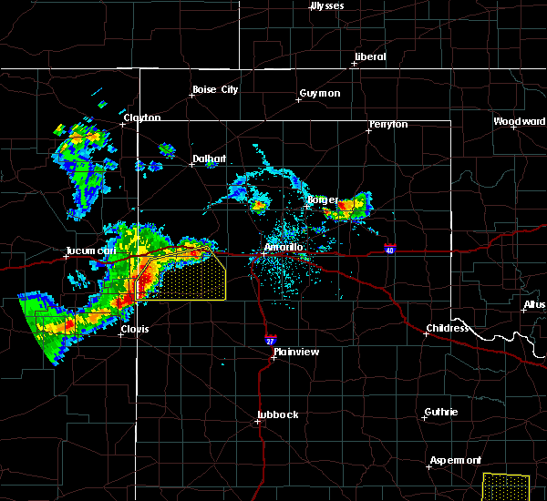 At 621 pm cdt, severe thunderstorms were located along a line extending from near vega to 9 miles southeast of glenrio to bellview, moving southeast at 30 mph (radar indicated. history of 60 mph winds). Hazards include 60 mph wind gusts and quarter size hail. Minor damage to roofs, siding, and trees is possible. Hail damage to vehicles is expected. At 621 pm cdt, severe thunderstorms were located along a line extending from near vega to 9 miles southeast of glenrio to bellview, moving southeast at 30 mph (radar indicated. history of 60 mph winds). Hazards include 60 mph wind gusts and quarter size hail. Minor damage to roofs, siding, and trees is possible. Hail damage to vehicles is expected.
|
| 7/3/2017 6:35 PM CDT | Quarter sized hail reported 13.8 miles WNW of Vega, TX, estimated dime to quarter sized hail falling at this time. |
| 7/3/2017 6:21 PM CDT |
 At 621 pm cdt, a severe thunderstorm was located 4 miles south of wildorado, or 12 miles southeast of vega, moving northeast at 30 mph (radar indicated). Hazards include golf ball size hail and 70 mph wind gusts. Expect some tree damage. damage is likely to mobile homes, roofs, and outbuildings. people and animals outdoors will be injured. Expect hail damage to roofs, siding, windows, and vehicles. At 621 pm cdt, a severe thunderstorm was located 4 miles south of wildorado, or 12 miles southeast of vega, moving northeast at 30 mph (radar indicated). Hazards include golf ball size hail and 70 mph wind gusts. Expect some tree damage. damage is likely to mobile homes, roofs, and outbuildings. people and animals outdoors will be injured. Expect hail damage to roofs, siding, windows, and vehicles.
|
| 7/3/2017 5:32 PM CDT |
 At 531 pm cdt, severe thunderstorms were located along a line extending from 10 miles southwest of adrian to 7 miles east of bootleg, moving east at 20 mph (radar indicated and emergency management reported golf ball size hail in bootleg around 5:21 pm cdt). Hazards include golf ball size hail and 70 mph wind gusts. Expect some tree damage. damage is likely to mobile homes, roofs, and outbuildings. people and animals outdoors will be injured. expect hail damage to roofs, siding, windows, and vehicles. Locations impacted include, hereford, vega, adrian, glenrio, bootleg and simms. At 531 pm cdt, severe thunderstorms were located along a line extending from 10 miles southwest of adrian to 7 miles east of bootleg, moving east at 20 mph (radar indicated and emergency management reported golf ball size hail in bootleg around 5:21 pm cdt). Hazards include golf ball size hail and 70 mph wind gusts. Expect some tree damage. damage is likely to mobile homes, roofs, and outbuildings. people and animals outdoors will be injured. expect hail damage to roofs, siding, windows, and vehicles. Locations impacted include, hereford, vega, adrian, glenrio, bootleg and simms.
|
| 7/3/2017 5:19 PM CDT |
 At 519 pm cdt, severe thunderstorms were located along a line extending from 7 miles east of glenrio to 4 miles east of bootleg, moving east at 20 mph (radar indicated). Hazards include 70 mph wind gusts and quarter size hail. Expect some tree damage. damage is likely to mobile homes, roofs, and outbuildings. Hail damage to vehicles is expected. At 519 pm cdt, severe thunderstorms were located along a line extending from 7 miles east of glenrio to 4 miles east of bootleg, moving east at 20 mph (radar indicated). Hazards include 70 mph wind gusts and quarter size hail. Expect some tree damage. damage is likely to mobile homes, roofs, and outbuildings. Hail damage to vehicles is expected.
|
| 7/1/2017 11:00 PM CDT |
 At 1059 pm cdt, severe thunderstorms were located along a line extending from near adrian to near friona, moving southeast at 30 mph (radar indicated). Hazards include 70 mph wind gusts. Expect some tree damage. Damage is likely to mobile homes, roofs, and outbuildings. At 1059 pm cdt, severe thunderstorms were located along a line extending from near adrian to near friona, moving southeast at 30 mph (radar indicated). Hazards include 70 mph wind gusts. Expect some tree damage. Damage is likely to mobile homes, roofs, and outbuildings.
|
| 6/25/2017 10:27 PM CDT |
 The severe thunderstorm warning for central oldham county will expire at 1030 pm cdt, the storms which prompted the warning have weakened below severe limits, and no longer pose an immediate threat to life or property. therefore the warning will be allowed to expire. however heavy rain is still possible with these thunderstorms. a severe thunderstorm watch remains in effect until 1100 pm cdt for the panhandle of texas. The severe thunderstorm warning for central oldham county will expire at 1030 pm cdt, the storms which prompted the warning have weakened below severe limits, and no longer pose an immediate threat to life or property. therefore the warning will be allowed to expire. however heavy rain is still possible with these thunderstorms. a severe thunderstorm watch remains in effect until 1100 pm cdt for the panhandle of texas.
|
| 6/25/2017 10:25 PM CDT | Storm damage reported in oldham county TX, 12.6 miles W of Vega, TX |
| 6/25/2017 10:14 PM CDT |
 At 1014 pm cdt, severe thunderstorms were located along a line extending from near adrian to 3 miles northwest of wildorado, moving south at 40 mph (public). Hazards include 70 mph wind gusts and quarter size hail. Expect some tree damage. damage is likely to mobile homes, roofs, and outbuildings. hail damage to vehicles is expected. Locations impacted include, vega, adrian and wildorado. At 1014 pm cdt, severe thunderstorms were located along a line extending from near adrian to 3 miles northwest of wildorado, moving south at 40 mph (public). Hazards include 70 mph wind gusts and quarter size hail. Expect some tree damage. damage is likely to mobile homes, roofs, and outbuildings. hail damage to vehicles is expected. Locations impacted include, vega, adrian and wildorado.
|
| 6/25/2017 10:04 PM CDT | Storm damage reported in oldham county TX, 0.6 miles WNW of Vega, TX |
| 6/25/2017 9:53 PM CDT |
 At 953 pm cdt, severe thunderstorms were located along a line extending from 11 miles north of adrian to 8 miles northeast of vega, moving south at 40 mph (radar indicated). Hazards include 60 mph wind gusts and quarter size hail. Minor damage to roofs, siding, and trees is possible. hail damage to vehicles is expected. Locations impacted include, vega, adrian, boys ranch and wildorado. At 953 pm cdt, severe thunderstorms were located along a line extending from 11 miles north of adrian to 8 miles northeast of vega, moving south at 40 mph (radar indicated). Hazards include 60 mph wind gusts and quarter size hail. Minor damage to roofs, siding, and trees is possible. hail damage to vehicles is expected. Locations impacted include, vega, adrian, boys ranch and wildorado.
|
| 6/25/2017 9:41 PM CDT |
 At 941 pm cdt, severe thunderstorms were located along a line extending from 10 miles southeast of romero to 3 miles west of boys ranch, moving south at 30 mph (radar indicated). Hazards include 60 mph wind gusts and quarter size hail. Minor damage to roofs, siding, and trees is possible. hail damage to vehicles is expected. Locations impacted include, vega, channing, adrian, boys ranch and wildorado. At 941 pm cdt, severe thunderstorms were located along a line extending from 10 miles southeast of romero to 3 miles west of boys ranch, moving south at 30 mph (radar indicated). Hazards include 60 mph wind gusts and quarter size hail. Minor damage to roofs, siding, and trees is possible. hail damage to vehicles is expected. Locations impacted include, vega, channing, adrian, boys ranch and wildorado.
|
| 6/25/2017 9:22 PM CDT |
 At 922 pm cdt, severe thunderstorms were located along a line extending from 10 miles east of romero to 5 miles southeast of channing, moving south at 30 mph (radar indicated). Hazards include 70 mph wind gusts and ping pong ball size hail. Expect some tree damage. damage is likely to mobile homes, roofs, and outbuildings. people and animals outdoors will be injured. expect hail damage to roofs, siding, windows, and vehicles. Locations impacted include, vega, channing, adrian, boys ranch, wildorado and romero. At 922 pm cdt, severe thunderstorms were located along a line extending from 10 miles east of romero to 5 miles southeast of channing, moving south at 30 mph (radar indicated). Hazards include 70 mph wind gusts and ping pong ball size hail. Expect some tree damage. damage is likely to mobile homes, roofs, and outbuildings. people and animals outdoors will be injured. expect hail damage to roofs, siding, windows, and vehicles. Locations impacted include, vega, channing, adrian, boys ranch, wildorado and romero.
|
| 6/25/2017 8:55 PM CDT |
 At 855 pm cdt, severe thunderstorms were located along a line extending from 14 miles southwest of dalhart to 10 miles northeast of channing, moving south at 30 mph. these are very dangerous storms (radar indicated). Hazards include baseball size hail and 70 mph wind gusts. People and animals outdoors will be severely injured. Expect shattered windows, extensive damage to roofs, siding, and vehicles. At 855 pm cdt, severe thunderstorms were located along a line extending from 14 miles southwest of dalhart to 10 miles northeast of channing, moving south at 30 mph. these are very dangerous storms (radar indicated). Hazards include baseball size hail and 70 mph wind gusts. People and animals outdoors will be severely injured. Expect shattered windows, extensive damage to roofs, siding, and vehicles.
|
| 6/22/2017 8:51 PM CDT |
 The severe thunderstorm warning for southeastern oldham and north central deaf smith counties will expire at 900 pm cdt, the storm which prompted the warning has weakened below severe limits, and no longer poses an immediate threat to life or property. therefore the warning will be allowed to expire. to report severe weather, contact your nearest law enforcement agency. they will relay your report to the national weather service amarillo. The severe thunderstorm warning for southeastern oldham and north central deaf smith counties will expire at 900 pm cdt, the storm which prompted the warning has weakened below severe limits, and no longer poses an immediate threat to life or property. therefore the warning will be allowed to expire. to report severe weather, contact your nearest law enforcement agency. they will relay your report to the national weather service amarillo.
|
| 6/22/2017 8:41 PM CDT |
 At 841 pm cdt, a severe thunderstorm was located 9 miles northeast of simms, or 10 miles southwest of vega, moving southeast at 25 mph (radar indicated). Hazards include 60 mph wind gusts and half dollar size hail. Minor damage to roofs, siding, and trees is possible. hail damage to vehicles is expected. Locations impacted include, vega. At 841 pm cdt, a severe thunderstorm was located 9 miles northeast of simms, or 10 miles southwest of vega, moving southeast at 25 mph (radar indicated). Hazards include 60 mph wind gusts and half dollar size hail. Minor damage to roofs, siding, and trees is possible. hail damage to vehicles is expected. Locations impacted include, vega.
|
| 6/22/2017 8:22 PM CDT |
 At 822 pm cdt, a severe thunderstorm was located near adrian, or 12 miles west of vega, moving southeast at 30 mph (radar indicated). Hazards include 60 mph wind gusts and half dollar size hail. Minor damage to roofs, siding, and trees is possible. hail damage to vehicles is expected. Locations impacted include, vega and adrian. At 822 pm cdt, a severe thunderstorm was located near adrian, or 12 miles west of vega, moving southeast at 30 mph (radar indicated). Hazards include 60 mph wind gusts and half dollar size hail. Minor damage to roofs, siding, and trees is possible. hail damage to vehicles is expected. Locations impacted include, vega and adrian.
|
| 6/22/2017 7:59 PM CDT |
 At 759 pm cdt, a severe thunderstorm was located 7 miles northwest of adrian, or 20 miles west of vega, moving southeast at 25 mph (radar indicated). Hazards include 60 mph wind gusts and half dollar size hail. Minor damage to roofs, siding, and trees is possible. Hail damage to vehicles is expected. At 759 pm cdt, a severe thunderstorm was located 7 miles northwest of adrian, or 20 miles west of vega, moving southeast at 25 mph (radar indicated). Hazards include 60 mph wind gusts and half dollar size hail. Minor damage to roofs, siding, and trees is possible. Hail damage to vehicles is expected.
|
| 6/21/2017 7:48 PM CDT |
 At 748 pm cdt, severe thunderstorms were located along a line extending from 3 miles northwest of wildorado to 6 miles south of simms, moving southeast at 20 mph (radar indicated). Hazards include golf ball size hail and 60 mph wind gusts. Minor damage to roofs, siding, and trees is possible. people and animals outdoors will be injured. expect hail damage to roofs, siding, windows, and vehicles. Locations impacted include, vega, simms and wildorado. At 748 pm cdt, severe thunderstorms were located along a line extending from 3 miles northwest of wildorado to 6 miles south of simms, moving southeast at 20 mph (radar indicated). Hazards include golf ball size hail and 60 mph wind gusts. Minor damage to roofs, siding, and trees is possible. people and animals outdoors will be injured. expect hail damage to roofs, siding, windows, and vehicles. Locations impacted include, vega, simms and wildorado.
|
| 6/21/2017 7:23 PM CDT |
 At 723 pm cdt, severe thunderstorms were located along a line extending from 7 miles northeast of vega to 4 miles west of simms, moving southeast at 20 mph (radar indicated). Hazards include 60 mph wind gusts and half dollar size hail. Minor damage to roofs, siding, and trees is possible. hail damage to vehicles is expected. Locations impacted include, vega, simms and wildorado. At 723 pm cdt, severe thunderstorms were located along a line extending from 7 miles northeast of vega to 4 miles west of simms, moving southeast at 20 mph (radar indicated). Hazards include 60 mph wind gusts and half dollar size hail. Minor damage to roofs, siding, and trees is possible. hail damage to vehicles is expected. Locations impacted include, vega, simms and wildorado.
|
| 6/21/2017 6:48 PM CDT |
 At 648 pm cdt, a severe thunderstorm was located over adrian, or 14 miles west of vega, moving southeast at 15 mph (radar indicated). Hazards include 60 mph wind gusts and quarter size hail. Minor damage to roofs, siding, and trees is possible. Hail damage to vehicles is expected. At 648 pm cdt, a severe thunderstorm was located over adrian, or 14 miles west of vega, moving southeast at 15 mph (radar indicated). Hazards include 60 mph wind gusts and quarter size hail. Minor damage to roofs, siding, and trees is possible. Hail damage to vehicles is expected.
|
| 4/14/2017 5:42 PM CDT |
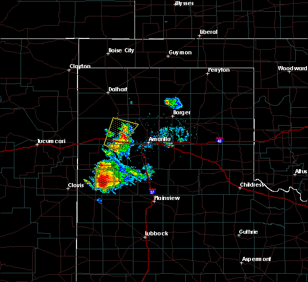 At 542 pm cdt, a severe thunderstorm was located 8 miles northeast of vega, moving northeast at 35 mph (radar indicated). Hazards include half dollar size hail. Damage to vehicles is expected. Locations impacted include, vega, boys ranch, wildorado and valley de oro. At 542 pm cdt, a severe thunderstorm was located 8 miles northeast of vega, moving northeast at 35 mph (radar indicated). Hazards include half dollar size hail. Damage to vehicles is expected. Locations impacted include, vega, boys ranch, wildorado and valley de oro.
|
| 4/14/2017 5:25 PM CDT |
 At 525 pm cdt, a severe thunderstorm was located over vega, moving northeast at 35 mph (radar indicated). Hazards include ping pong ball size hail and 60 mph wind gusts. Minor damage to roofs, siding, and trees is possible. people and animals outdoors will be injured. Expect hail damage to roofs, siding, windows, and vehicles. At 525 pm cdt, a severe thunderstorm was located over vega, moving northeast at 35 mph (radar indicated). Hazards include ping pong ball size hail and 60 mph wind gusts. Minor damage to roofs, siding, and trees is possible. people and animals outdoors will be injured. Expect hail damage to roofs, siding, windows, and vehicles.
|
| 3/23/2017 7:23 PM CDT |
 The severe thunderstorm warning for western randall, eastern oldham, eastern deaf smith and western potter counties will expire at 730 pm cdt, the storms which prompted the warning have moved out of the warned area. therefore the warning will be allowed to expire. a severe thunderstorm watch remains in effect until 1000 pm cdt for the panhandle of texas. The severe thunderstorm warning for western randall, eastern oldham, eastern deaf smith and western potter counties will expire at 730 pm cdt, the storms which prompted the warning have moved out of the warned area. therefore the warning will be allowed to expire. a severe thunderstorm watch remains in effect until 1000 pm cdt for the panhandle of texas.
|
| 3/23/2017 7:20 PM CDT | Time estimated by radar. time corrected in oldham county TX, 7.5 miles WNW of Vega, TX |
| 3/23/2017 7:03 PM CDT |
 At 700 pm cdt, severe thunderstorms were located along a line extending from 4 miles west of cactus to 4 miles northwest of wildorado, moving north at 60 mph (trained weather spotters, with one inch hail reported 3 miles east of vega). Hazards include quarter size hail. Damage to vehicles is expected. Locations impacted include, hereford, vega, bushland, buffalo lake, dawn, valley de oro, boys ranch, umbarger and wildorado. At 700 pm cdt, severe thunderstorms were located along a line extending from 4 miles west of cactus to 4 miles northwest of wildorado, moving north at 60 mph (trained weather spotters, with one inch hail reported 3 miles east of vega). Hazards include quarter size hail. Damage to vehicles is expected. Locations impacted include, hereford, vega, bushland, buffalo lake, dawn, valley de oro, boys ranch, umbarger and wildorado.
|
| 3/23/2017 6:53 PM CDT | Quarter sized hail reported 3.3 miles W of Vega, TX, reporting quarter hail 3 miles east of vega on i-40... hail now shifting north of hwy |
| 3/23/2017 6:33 PM CDT |
 At 633 pm cdt, severe thunderstorms were located along a line extending from 6 miles southeast of channing to 4 miles northwest of hereford, moving north at 60 mph (radar indicated). Hazards include 70 mph wind gusts and quarter size hail. Expect some tree damage. damage is likely to mobile homes, roofs, and outbuildings. Hail damage to vehicles is expected. At 633 pm cdt, severe thunderstorms were located along a line extending from 6 miles southeast of channing to 4 miles northwest of hereford, moving north at 60 mph (radar indicated). Hazards include 70 mph wind gusts and quarter size hail. Expect some tree damage. damage is likely to mobile homes, roofs, and outbuildings. Hail damage to vehicles is expected.
|
| 3/23/2017 6:26 PM CDT | Time estimated by rada in oldham county TX, 7.5 miles WNW of Vega, TX |
| 3/23/2017 6:19 PM CDT |
 At 619 pm cdt, severe thunderstorms were located along a line extending from 5 miles west of boys ranch to 8 miles east of bootleg, moving northeast at 50 mph (radar indicated). Hazards include 70 mph wind gusts and quarter size hail. Expect some tree damage. damage is likely to mobile homes, roofs, and outbuildings. hail damage to vehicles is expected. Locations impacted include, hereford, vega, adrian and simms. At 619 pm cdt, severe thunderstorms were located along a line extending from 5 miles west of boys ranch to 8 miles east of bootleg, moving northeast at 50 mph (radar indicated). Hazards include 70 mph wind gusts and quarter size hail. Expect some tree damage. damage is likely to mobile homes, roofs, and outbuildings. hail damage to vehicles is expected. Locations impacted include, hereford, vega, adrian and simms.
|
| 3/23/2017 5:55 PM CDT |
 At 554 pm cdt, a severe thunderstorm was located 6 miles south of simms, or 15 miles northwest of hereford, moving northeast at 60 mph. another storm was moving toward adrian (radar indicated). Hazards include 70 mph wind gusts and quarter size hail. Expect some tree damage. damage is likely to mobile homes, roofs, and outbuildings. Hail damage to vehicles is expected. At 554 pm cdt, a severe thunderstorm was located 6 miles south of simms, or 15 miles northwest of hereford, moving northeast at 60 mph. another storm was moving toward adrian (radar indicated). Hazards include 70 mph wind gusts and quarter size hail. Expect some tree damage. damage is likely to mobile homes, roofs, and outbuildings. Hail damage to vehicles is expected.
|
| 5/29/2016 4:48 PM CDT |
 At 448 pm cdt, severe thunderstorms were located along a line extending from 8 miles northwest of washburn to 10 miles northwest of hereford, moving east at 15 mph (radar indicated). Hazards include 60 mph wind gusts and half dollar size hail. Minor damage to roofs. siding. and trees is possible. hail damage to vehicles is expected. locations impacted include, amarillo, vega, lake tanglewood, wildorado, bushland, mescalero park, dawn and timbercreek canyon. this includes the following highways, interstate 27 between mile markers 113 and 123. Interstate 40 between mile markers 36 and 82. At 448 pm cdt, severe thunderstorms were located along a line extending from 8 miles northwest of washburn to 10 miles northwest of hereford, moving east at 15 mph (radar indicated). Hazards include 60 mph wind gusts and half dollar size hail. Minor damage to roofs. siding. and trees is possible. hail damage to vehicles is expected. locations impacted include, amarillo, vega, lake tanglewood, wildorado, bushland, mescalero park, dawn and timbercreek canyon. this includes the following highways, interstate 27 between mile markers 113 and 123. Interstate 40 between mile markers 36 and 82.
|
| 5/29/2016 4:29 PM CDT |
 At 429 pm cdt, severe thunderstorms were located along a line extending from 5 miles northwest of amarillo to 3 miles west of bootleg, moving east at 15 mph (radar indicated). Hazards include ping pong ball size hail and 60 mph wind gusts. Minor damage to roofs. siding. and trees is possible. people and animals outdoors will be injured. Expect hail damage to roofs, siding, windows, and vehicles. At 429 pm cdt, severe thunderstorms were located along a line extending from 5 miles northwest of amarillo to 3 miles west of bootleg, moving east at 15 mph (radar indicated). Hazards include ping pong ball size hail and 60 mph wind gusts. Minor damage to roofs. siding. and trees is possible. people and animals outdoors will be injured. Expect hail damage to roofs, siding, windows, and vehicles.
|
| 5/29/2016 4:05 PM CDT |
 At 405 pm cdt, severe thunderstorms were located along a line extending from 7 miles north of wildorado to 6 miles north of bootleg, moving east at 15 mph (radar indicated). Hazards include golf ball size hail and 60 mph wind gusts. Minor damage to roofs. siding. and trees is possible. people and animals outdoors will be injured. expect hail damage to roofs, siding, windows, and vehicles. locations impacted include, vega, adrian, boys ranch, wildorado, simms, bootleg and dawn. This includes interstate 40 between mile markers 9 and 51. At 405 pm cdt, severe thunderstorms were located along a line extending from 7 miles north of wildorado to 6 miles north of bootleg, moving east at 15 mph (radar indicated). Hazards include golf ball size hail and 60 mph wind gusts. Minor damage to roofs. siding. and trees is possible. people and animals outdoors will be injured. expect hail damage to roofs, siding, windows, and vehicles. locations impacted include, vega, adrian, boys ranch, wildorado, simms, bootleg and dawn. This includes interstate 40 between mile markers 9 and 51.
|
| 5/29/2016 3:26 PM CDT |
 At 326 pm cdt, severe thunderstorms were located along a line extending from 15 miles northwest of adrian to bootleg, moving northeast at 20 mph (radar indicated). Hazards include golf ball size hail and 60 mph wind gusts. Minor damage to roofs. siding. and trees is possible. people and animals outdoors will be injured. Expect hail damage to roofs, siding, windows, and vehicles. At 326 pm cdt, severe thunderstorms were located along a line extending from 15 miles northwest of adrian to bootleg, moving northeast at 20 mph (radar indicated). Hazards include golf ball size hail and 60 mph wind gusts. Minor damage to roofs. siding. and trees is possible. people and animals outdoors will be injured. Expect hail damage to roofs, siding, windows, and vehicles.
|
| 5/21/2016 11:19 PM CDT | A severe thunderstorm warning remains in effect until 1145 pm cdt for northeastern deaf smith and south central oldham counties. at 1119 pm cdt. a severe thunderstorm was located 6 miles west of vega. moving north at 15 mph. hazard. quarter size hail. source. Radar indicated. |
| 5/21/2016 11:08 PM CDT |
 At 1107 pm cdt, a severe thunderstorm was located 8 miles southeast of adrian, or 8 miles southwest of vega, moving north at 15 mph (trained weather spotters). Hazards include quarter size hail. Damage to vehicles is expected. hail may accumulate on roadways causing hazardous travel. Locations impacted include, vega. At 1107 pm cdt, a severe thunderstorm was located 8 miles southeast of adrian, or 8 miles southwest of vega, moving north at 15 mph (trained weather spotters). Hazards include quarter size hail. Damage to vehicles is expected. hail may accumulate on roadways causing hazardous travel. Locations impacted include, vega.
|
| 5/21/2016 9:33 PM CDT | A severe thunderstorm warning remains in effect until 1030 pm cdt for northeastern deaf smith and south central oldham counties. at 932 pm cdt. a severe thunderstorm was located 11 miles east of simms. or 13 miles north of hereford. moving northeast at 15 mph. hazard. quarter size hail. source. Trained weather spotters reported quarter size hail with. |
| 5/21/2016 9:09 PM CDT |
 At 932 pm cdt, a severe thunderstorm was located 11 miles east of simms, or 13 miles north of hereford, moving northeast at 15 mph (trained weather spotters reported quarter size hail with this storm). Hazards include quarter size hail. Damage to vehicles is expected. Locations impacted include, vega. At 932 pm cdt, a severe thunderstorm was located 11 miles east of simms, or 13 miles north of hereford, moving northeast at 15 mph (trained weather spotters reported quarter size hail with this storm). Hazards include quarter size hail. Damage to vehicles is expected. Locations impacted include, vega.
|
| 5/21/2016 8:25 PM CDT | A severe thunderstorm warning remains in effect until 900 pm cdt for northeastern deaf smith and south central oldham counties. at 824 pm cdt. a severe thunderstorm was located 12 miles east of simms. or 14 miles south of vega. moving northeast at 15 mph. hazard. quarter size hail. source. Trained weather spotters reported dime to quarter size. |
| 4/20/2016 7:53 PM CDT |
 The severe thunderstorm warning for northeastern deaf smith and southeastern oldham counties will expire at 800 pm cdt, the storms which prompted the warning have moved out of the area. therefore the warning will be allowed to expire. The severe thunderstorm warning for northeastern deaf smith and southeastern oldham counties will expire at 800 pm cdt, the storms which prompted the warning have moved out of the area. therefore the warning will be allowed to expire.
|
| 4/20/2016 7:22 PM CDT |
 At 721 pm cdt, severe thunderstorms were located along a line extending from 12 miles northeast of adrian to 4 miles west of vega to 10 miles northeast of simms, moving east at 35 mph (trained weather spotters. at 704 pm cdt...1.25 inch hail was reported 5 nne of adrian). Hazards include half dollar size hail. Damage to vehicles is expected. hail may accumulate on roadways causing hazardous travel. Locations impacted include, vega and wildorado. At 721 pm cdt, severe thunderstorms were located along a line extending from 12 miles northeast of adrian to 4 miles west of vega to 10 miles northeast of simms, moving east at 35 mph (trained weather spotters. at 704 pm cdt...1.25 inch hail was reported 5 nne of adrian). Hazards include half dollar size hail. Damage to vehicles is expected. hail may accumulate on roadways causing hazardous travel. Locations impacted include, vega and wildorado.
|
| 4/20/2016 7:09 PM CDT |
 At 709 pm cdt, severe thunderstorms were located along a line extending from 17 miles northwest of vega to near adrian to 9 miles north of simms, moving east at 35 mph (trained weather spotters). Hazards include 60 mph wind gusts and half dollar size hail. Minor damage to roofs. siding. and trees is possible. Hail damage to vehicles is expected. At 709 pm cdt, severe thunderstorms were located along a line extending from 17 miles northwest of vega to near adrian to 9 miles north of simms, moving east at 35 mph (trained weather spotters). Hazards include 60 mph wind gusts and half dollar size hail. Minor damage to roofs. siding. and trees is possible. Hail damage to vehicles is expected.
|
| 4/15/2016 5:36 PM CDT |
 At 536 pm cdt, a severe thunderstorm was located over vega, moving northeast at 35 mph (radar indicated). Hazards include 60 mph wind gusts and half dollar size hail. Minor damage to roofs. siding. and trees is possible. Hail damage to vehicles is expected. At 536 pm cdt, a severe thunderstorm was located over vega, moving northeast at 35 mph (radar indicated). Hazards include 60 mph wind gusts and half dollar size hail. Minor damage to roofs. siding. and trees is possible. Hail damage to vehicles is expected.
|
| 8/19/2015 1:26 AM CDT |
 At 126 am cdt, severe thunderstorms were located along a line extending from near wildorado to 9 miles north of hereford, moving southeast at 35 mph (radar indicated). Hazards include two inch hail and 60 mph wind gusts. People and animals outdoors will be injured. expect hail damage to roofs, siding, windows and vehicles. minor wind damage to roofs, siding and trees is possible. Locations impacted include, hereford, vega and wildorado. At 126 am cdt, severe thunderstorms were located along a line extending from near wildorado to 9 miles north of hereford, moving southeast at 35 mph (radar indicated). Hazards include two inch hail and 60 mph wind gusts. People and animals outdoors will be injured. expect hail damage to roofs, siding, windows and vehicles. minor wind damage to roofs, siding and trees is possible. Locations impacted include, hereford, vega and wildorado.
|
| 8/19/2015 1:12 AM CDT |
 At 111 am cdt, severe thunderstorms were located along a line extending from 9 miles northeast of vega to 7 miles east of simms, moving southeast at 35 mph (radar indicated). Hazards include two inch hail and 60 mph wind gusts. People and animals outdoors will be injured. expect hail damage to roofs, siding, windows and vehicles. minor wind damage to roofs, siding and trees is possible. Locations impacted include, hereford, vega, adrian, wildorado and simms. At 111 am cdt, severe thunderstorms were located along a line extending from 9 miles northeast of vega to 7 miles east of simms, moving southeast at 35 mph (radar indicated). Hazards include two inch hail and 60 mph wind gusts. People and animals outdoors will be injured. expect hail damage to roofs, siding, windows and vehicles. minor wind damage to roofs, siding and trees is possible. Locations impacted include, hereford, vega, adrian, wildorado and simms.
|
| 8/19/2015 12:59 AM CDT |
 At 1259 am cdt, severe thunderstorms were located along a line extending from 11 miles north of vega to near simms, moving southeast at 35 mph (radar indicated). Hazards include two inch hail and 60 mph wind gusts. People and animals outdoors will be injured. expect hail damage to roofs, siding, windows and vehicles. minor wind damage to roofs, siding and trees is possible. Locations impacted include, hereford, vega, adrian, wildorado and simms. At 1259 am cdt, severe thunderstorms were located along a line extending from 11 miles north of vega to near simms, moving southeast at 35 mph (radar indicated). Hazards include two inch hail and 60 mph wind gusts. People and animals outdoors will be injured. expect hail damage to roofs, siding, windows and vehicles. minor wind damage to roofs, siding and trees is possible. Locations impacted include, hereford, vega, adrian, wildorado and simms.
|
| 8/19/2015 12:40 AM CDT |
 At 1238 am cdt, severe thunderstorms were located along a line extending from 19 miles southwest of channing to 8 miles southwest of adrian, moving southeast at 35 mph (radar indicated). Hazards include two inch hail and 60 mph wind gusts. People and animals outdoors will be injured. expect hail damage to roofs, siding, windows and vehicles. Minor wind damage to roofs, siding and trees is possible. At 1238 am cdt, severe thunderstorms were located along a line extending from 19 miles southwest of channing to 8 miles southwest of adrian, moving southeast at 35 mph (radar indicated). Hazards include two inch hail and 60 mph wind gusts. People and animals outdoors will be injured. expect hail damage to roofs, siding, windows and vehicles. Minor wind damage to roofs, siding and trees is possible.
|
| 8/18/2015 10:55 PM CDT |
 At 1055 pm cdt, a severe thunderstorm was located 13 miles northwest of dawn, or 14 miles south of vega, moving southeast at 35 mph (radar indicated). Hazards include 60 mph wind gusts and half dollar size hail. Hail damage to vehicles is expected. Minor wind damage to roofs, siding and trees is possible. At 1055 pm cdt, a severe thunderstorm was located 13 miles northwest of dawn, or 14 miles south of vega, moving southeast at 35 mph (radar indicated). Hazards include 60 mph wind gusts and half dollar size hail. Hail damage to vehicles is expected. Minor wind damage to roofs, siding and trees is possible.
|
| 8/18/2015 10:39 PM CDT |
 At 1039 pm cdt, a severe thunderstorm was located near vega, moving southeast at 35 mph (radar indicated). Hazards include 60 mph wind gusts and half dollar size hail. Hail damage to vehicles is expected. minor wind damage to roofs, siding and trees is possible. Locations impacted include, hereford, vega, wildorado and simms. At 1039 pm cdt, a severe thunderstorm was located near vega, moving southeast at 35 mph (radar indicated). Hazards include 60 mph wind gusts and half dollar size hail. Hail damage to vehicles is expected. minor wind damage to roofs, siding and trees is possible. Locations impacted include, hereford, vega, wildorado and simms.
|
| 8/18/2015 10:26 PM CDT |
 At 1026 pm cdt, a severe thunderstorm was located 7 miles west of vega, moving southeast at 35 mph (radar indicated). Hazards include ping pong ball size hail and 60 mph wind gusts. People and animals outdoors will be injured. expect hail damage to roofs, siding, windows and vehicles. minor wind damage to roofs, siding and trees is possible. Locations impacted include, hereford, vega, adrian, wildorado and simms. At 1026 pm cdt, a severe thunderstorm was located 7 miles west of vega, moving southeast at 35 mph (radar indicated). Hazards include ping pong ball size hail and 60 mph wind gusts. People and animals outdoors will be injured. expect hail damage to roofs, siding, windows and vehicles. minor wind damage to roofs, siding and trees is possible. Locations impacted include, hereford, vega, adrian, wildorado and simms.
|
| 8/18/2015 10:11 PM CDT |
 At 1010 pm cdt, a severe thunderstorm was located over adrian, or 12 miles west of vega, moving southeast at 35 mph (radar indicated). Hazards include ping pong ball size hail and 60 mph wind gusts. People and animals outdoors will be injured. expect hail damage to roofs, siding, windows and vehicles. Minor wind damage to roofs, siding and trees is possible. At 1010 pm cdt, a severe thunderstorm was located over adrian, or 12 miles west of vega, moving southeast at 35 mph (radar indicated). Hazards include ping pong ball size hail and 60 mph wind gusts. People and animals outdoors will be injured. expect hail damage to roofs, siding, windows and vehicles. Minor wind damage to roofs, siding and trees is possible.
|
| 7/8/2015 9:49 PM CDT |
 At 948 pm cdt, a severe thunderstorm was located near vega, and moving southeast at 25 mph (radar indicated). Hazards include ping pong ball size hail and 60 mph wind gusts. People and animals outdoors will be injured. expect hail damage to roofs, siding, windows and vehicles. Minor wind damage to roofs, siding and trees is possible. At 948 pm cdt, a severe thunderstorm was located near vega, and moving southeast at 25 mph (radar indicated). Hazards include ping pong ball size hail and 60 mph wind gusts. People and animals outdoors will be injured. expect hail damage to roofs, siding, windows and vehicles. Minor wind damage to roofs, siding and trees is possible.
|
| 7/8/2015 8:40 PM CDT |
 At 837 pm cdt, a severe thunderstorm was located 9 miles southwest of boys ranch, and moving southeast at 25 mph (radar indicated). Hazards include golf ball size hail and 60 mph wind gusts. People and animals outdoors will be injured. expect hail damage to roofs, siding, windows and vehicles. Minor wind damage to roofs, siding and trees is possible. At 837 pm cdt, a severe thunderstorm was located 9 miles southwest of boys ranch, and moving southeast at 25 mph (radar indicated). Hazards include golf ball size hail and 60 mph wind gusts. People and animals outdoors will be injured. expect hail damage to roofs, siding, windows and vehicles. Minor wind damage to roofs, siding and trees is possible.
|
| 7/6/2015 4:10 PM CDT |
 At 407 pm cdt, a severe thunderstorm was located 7 miles northeast of vega, and moving southeast at 15 mph (radar indicated). Hazards include 60 mph wind gusts and quarter size hail. Hail damage to vehicles is expected. Minor wind damage to roofs, siding and trees is possible. At 407 pm cdt, a severe thunderstorm was located 7 miles northeast of vega, and moving southeast at 15 mph (radar indicated). Hazards include 60 mph wind gusts and quarter size hail. Hail damage to vehicles is expected. Minor wind damage to roofs, siding and trees is possible.
|
| 6/14/2015 6:35 PM CDT |
 At 633 pm cdt, a severe thunderstorm was located near bushland, and moving northeast at 30 mph. this is a very dangerous storm (radar indicated). Hazards include 80 mph wind gusts and quarter size hail. Flying debris will be dangerous to those caught without shelter. mobile homes will be heavily damaged. expect considerable damage to roofs, windows and vehicles. Tree damage and power outages are likely. At 633 pm cdt, a severe thunderstorm was located near bushland, and moving northeast at 30 mph. this is a very dangerous storm (radar indicated). Hazards include 80 mph wind gusts and quarter size hail. Flying debris will be dangerous to those caught without shelter. mobile homes will be heavily damaged. expect considerable damage to roofs, windows and vehicles. Tree damage and power outages are likely.
|
| 6/14/2015 6:28 PM CDT |
 At 625 pm cdt, a severe thunderstorm was located near bushland, and moving northeast at 30 mph (radar indicated). Hazards include 75 mph wind gusts and quarter size hail. Hail damage to vehicles is expected. expect some tree damage. Wind damage is also likely to mobile homes, roofs and outbuildings. At 625 pm cdt, a severe thunderstorm was located near bushland, and moving northeast at 30 mph (radar indicated). Hazards include 75 mph wind gusts and quarter size hail. Hail damage to vehicles is expected. expect some tree damage. Wind damage is also likely to mobile homes, roofs and outbuildings.
|
| 6/14/2015 6:14 PM CDT |
 At 612 pm cdt, a severe thunderstorm was located 10 miles northwest of umbarger, and moving northeast at 30 mph (radar indicated). Hazards include 70 mph wind gusts and quarter size hail. Hail damage to vehicles is expected. expect some tree damage. Wind damage is also likely to mobile homes, roofs and outbuildings. At 612 pm cdt, a severe thunderstorm was located 10 miles northwest of umbarger, and moving northeast at 30 mph (radar indicated). Hazards include 70 mph wind gusts and quarter size hail. Hail damage to vehicles is expected. expect some tree damage. Wind damage is also likely to mobile homes, roofs and outbuildings.
|
| 5/23/2015 4:43 AM CDT | At 442 am cdt, a severe thunderstorm was located 6 miles southwest of wildorado, and moving north at 60 mph (radar indicated). Hazards include 60 mph wind gusts and quarter size hail. Hail damage to vehicles is expected. Minor wind damage to roofs, siding and trees is possible. |
| 5/9/2015 5:10 AM CDT | At 507 am cdt, a severe thunderstorm was located 6 miles northeast of vega, and moving north at 50 mph (radar indicated). Hazards include 70 mph wind gusts and ping pong ball size hail. People and animals outdoors will be injured. expect hail damage to roofs, siding, windows and vehicles. expect some tree damage. Wind damage is also likely to mobile homes, roofs and outbuildings. |
| 5/9/2015 4:55 AM CDT | At 453 am cdt, a severe thunderstorm was located 9 miles southeast of vega, and moving north at 50 mph (radar indicated). Hazards include golf ball size hail and 70 mph wind gusts. People and animals outdoors will be injured. expect hail damage to roofs, siding, windows and vehicles. expect some tree damage. Wind damage is also likely to mobile homes, roofs and outbuildings. |
| 5/7/2015 5:24 PM CDT | The severe thunderstorm warning for southwestern potter, southeastern oldham and north central deaf smith counties will expire at 530 pm cdt, the storm which prompted the warning has weakened below severe limits, and no longer poses an immediate threat to life or property. however, heavy rain is still possible with this thunderstorm. |
| 5/7/2015 5:16 PM CDT | At 514 pm cdt, a severe thunderstorm was located near wildorado, and moving east at 25 mph (radar indicated). Hazards include 60 mph wind gusts and quarter size hail. Hail damage to vehicles is expected. Minor wind damage to roofs, siding and trees is possible. |
| 5/7/2015 4:59 PM CDT | At 456 pm cdt, a severe thunderstorm was located near wildorado, and moving east at 25 mph (radar indicated). Hazards include 60 mph wind gusts and quarter size hail. Hail damage to vehicles is expected. Minor wind damage to roofs, siding and trees is possible. |
| 5/7/2015 4:46 PM CDT | At 444 pm cdt, a severe thunderstorm was located near vega, and moving east at 25 mph (radar indicated). Hazards include 60 mph wind gusts and quarter size hail. Hail damage to vehicles is expected. Minor wind damage to roofs, siding and trees is possible. |
| 5/7/2015 4:35 PM CDT | At 431 pm cdt, a severe thunderstorm was located near vega, and moving east at 25 mph (radar indicated). Hazards include 60 mph wind gusts and quarter size hail. Hail damage to vehicles is expected. Minor wind damage to roofs, siding and trees is possible. |
| 9/24/2014 1:44 PM CDT | Quarter sized hail reported 6.9 miles WNW of Vega, TX, very heavy rain also occurring with visibility less than 100 yards. |
| 7/16/2014 10:16 PM CDT | Golf Ball sized hail reported 10.1 miles S of Vega, TX |
| 5/28/2013 11:09 PM CDT | Golf Ball sized hail reported 10.8 miles W of Vega, TX, storm is also reporting a lot of pea to marble size hail. |
| 5/28/2013 11:03 PM CDT | Golf Ball sized hail reported 10.8 miles W of Vega, TX |
| 5/28/2013 10:36 PM CDT | Golf Ball sized hail reported 5.8 miles N of Vega, TX |
| 12/14/2012 3:29 PM CST | Via schoolnet in oldham county TX, 12.6 miles W of Vega, TX |
| 12/14/2012 3:29 PM CST | Quarter sized hail reported 20.9 miles SSW of Vega, TX |
| 12/14/2012 3:20 PM CST | Center pivots blown over with pea size hail. winds estimated between 60 and 70 mph in deaf smith county TX, 11.6 miles NNE of Vega, TX |
| 9/4/2012 6:14 PM CDT | Storm damage reported in oldham county TX, 0.6 miles WNW of Vega, TX |
| 8/20/2012 6:55 PM CDT | Damage to a gas station roof and a trailer overturned. winds estimated at 70 mph in oldham county TX, 0.4 miles S of Vega, TX |
| 6/21/2012 1:48 AM CDT | Storm damage reported in oldham county TX, 10.8 miles W of Vega, TX |
| 6/14/2012 6:11 PM CDT | Quarter sized hail reported 13.6 miles W of Vega, TX |
| 6/14/2012 6:06 PM CDT | Quarter sized hail reported 13.8 miles WNW of Vega, TX, relayed by nssl |
| 5/21/2012 8:18 PM CDT | Quarter sized hail reported 19.3 miles SE of Vega, TX, hail completely covering the ground. 0.64 inches of rain |
| 4/29/2012 3:33 AM CDT | Quarter sized hail reported 10.7 miles W of Vega, TX, quarter size hail reported north of wildorado |
| 4/29/2012 3:15 AM CDT | Golf Ball sized hail reported 0.4 miles S of Vega, TX, golf ball size hail reported near vega |
| 1/1/0001 12:00 AM | Storm damage reported in oldham county TX, 1.1 miles WSW of Vega, TX |
| 1/1/0001 12:00 AM | Storm damage reported in oldham county TX, 0.4 miles S of Vega, TX |
Hail Maps for Vega, TX
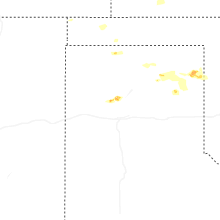
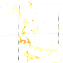
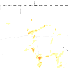
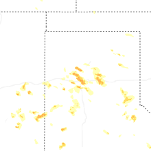
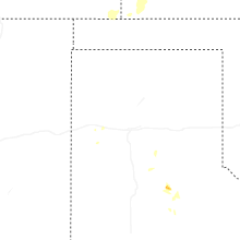
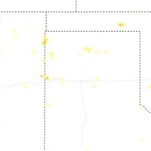
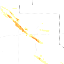
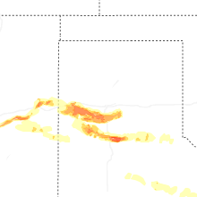
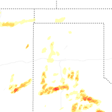
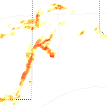


Connect with Interactive Hail Maps