

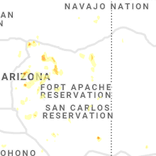
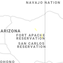
Hail Map for Vernon, AZ
The Vernon, AZ area has had 0 reports of on-the-ground hail by trained spotters, and has been under severe weather warnings 2 times during the past 12 months. Doppler radar has detected hail at or near Vernon, AZ on 7 occasions.
| Name: | Vernon, AZ |
| Where Located: | 20.1 miles E of Show Low, AZ |
| Map: | Google Map for Vernon, AZ |
| Population: | 122 |
| Housing Units: | 61 |
| More Info: | Search Google for Vernon, AZ |
5
The Top Recent Hail Date for Vernon, AZ is Tuesday, August 16, 2022 (1st out of 7)

Hail and Wind Damage Spotted near Vernon, AZ
| Date / Time | Report Details |
|---|---|
| 9/12/2025 9:17 PM MST | the severe thunderstorm warning has been cancelled and is no longer in effect |
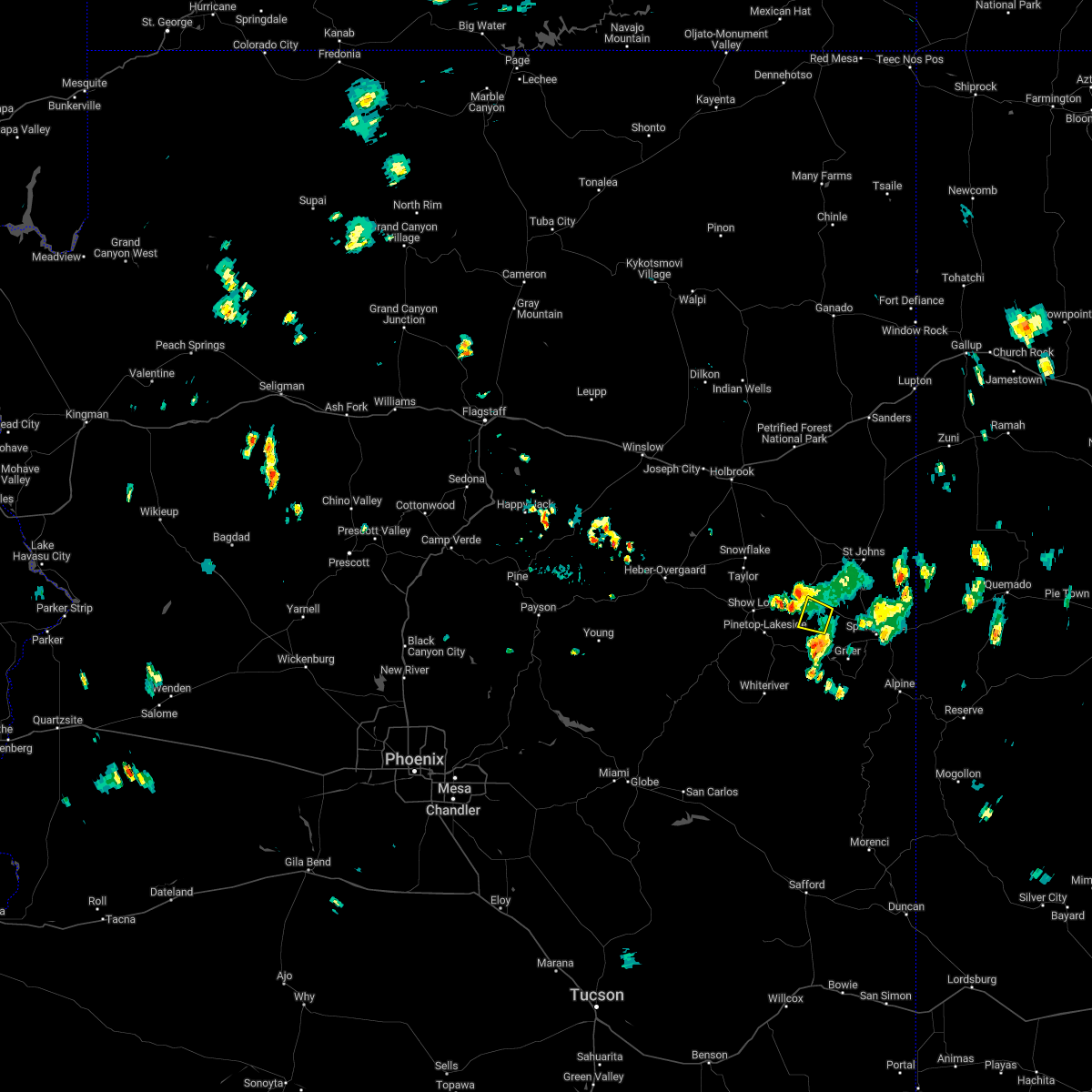
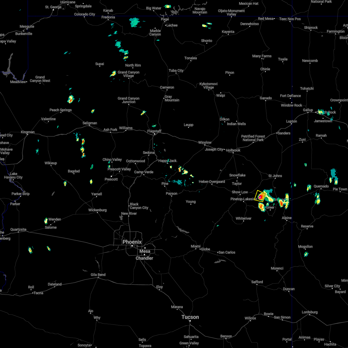
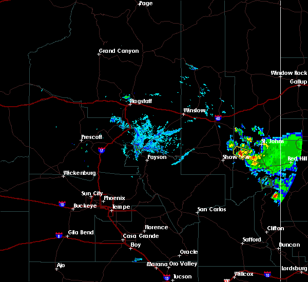
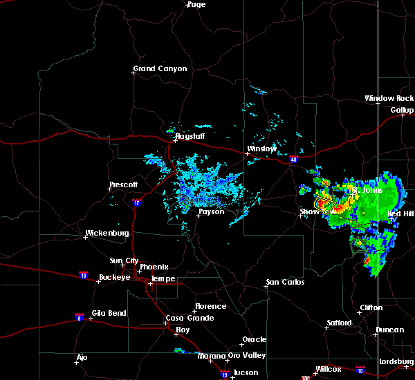
| 9/12/2025 8:57 PM MST | Svrfgz the national weather service in flagstaff has issued a * severe thunderstorm warning for, apache county in northeastern arizona, * until 930 pm mst. * at 857 pm mst, a severe thunderstorm was located 6 miles south of vernon, or 20 miles east of show low, moving northeast at 40 mph (radar indicated). Hazards include 60 mph wind gusts and quarter size hail. Hail damage to vehicles is expected. Expect wind damage to roofs, siding, and trees. |
| 8/16/2022 12:41 PM MST |
 The severe thunderstorm warning for apache county will expire at 1245 pm mst, the storm which prompted the warning has weakened below severe limits, and no longer poses an immediate threat to life or property. therefore, the warning will be allowed to expire. heavy rain that fell with this storm will contiue to drain through the washes, creeks, and rivers in the area. The severe thunderstorm warning for apache county will expire at 1245 pm mst, the storm which prompted the warning has weakened below severe limits, and no longer poses an immediate threat to life or property. therefore, the warning will be allowed to expire. heavy rain that fell with this storm will contiue to drain through the washes, creeks, and rivers in the area.
|
| 8/16/2022 11:54 AM MST |
 At 1153 am mst, a severe thunderstorm was located over vernon, or 21 miles east of show low, moving northwest at 10 mph (radar indicated). Hazards include quarter size hail. damage to vehicles is expected At 1153 am mst, a severe thunderstorm was located over vernon, or 21 miles east of show low, moving northwest at 10 mph (radar indicated). Hazards include quarter size hail. damage to vehicles is expected
|
| 6/10/2019 6:45 PM MST |
 At 630 pm mst, a severe thunderstorm was located 11 miles southwest of concho, or 18 miles northeast of show low, moving southeast at 15 mph (radar indicated). Hazards include quarter size hail. damage to vehicles is expected At 630 pm mst, a severe thunderstorm was located 11 miles southwest of concho, or 18 miles northeast of show low, moving southeast at 15 mph (radar indicated). Hazards include quarter size hail. damage to vehicles is expected
|
| 6/10/2019 6:30 PM MST |
 At 630 pm mst, a severe thunderstorm was located 11 miles southwest of concho, or 18 miles northeast of show low, moving southeast at 15 mph (radar indicated). Hazards include quarter size hail. damage to vehicles is expected At 630 pm mst, a severe thunderstorm was located 11 miles southwest of concho, or 18 miles northeast of show low, moving southeast at 15 mph (radar indicated). Hazards include quarter size hail. damage to vehicles is expected
|
Hail Maps for Vernon, AZ


Connect with Interactive Hail Maps