

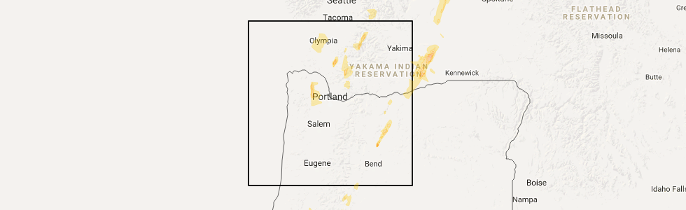
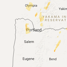
Hail Map for Vernonia, OR
The Vernonia, OR area has had 1 report of on-the-ground hail by trained spotters, and has been under severe weather warnings 0 times during the past 12 months. Doppler radar has detected hail at or near Vernonia, OR on 1 occasion.
| Name: | Vernonia, OR |
| Where Located: | 34.4 miles NW of Portland, OR |
| Map: | Google Map for Vernonia, OR |
| Population: | 2151 |
| Housing Units: | 962 |
| More Info: | Search Google for Vernonia, OR |
5
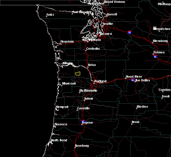
The Top Recent Hail Date for Vernonia, OR is Thursday, May 4, 2017 (1st out of 1)
Hail and Wind Damage Spotted near Vernonia, OR
| Date / Time | Report Details |
|---|---|
| 5/4/2017 7:25 PM PDT | Winds brought down power lines... and with trees smoking. this along highway 47... between top hill and johnson roa in washington county OR, 6.9 miles N of Vernonia, OR |
| 5/4/2017 7:12 PM PDT |
 At 711 pm pdt, doppler radar indicated a severe thunderstorm capable of producing quarter size hail. this storm was located near vernonia, moving north at 40 mph. locations impacted include, vernonia. At 711 pm pdt, doppler radar indicated a severe thunderstorm capable of producing quarter size hail. this storm was located near vernonia, moving north at 40 mph. locations impacted include, vernonia.
|
| 5/4/2017 7:00 PM PDT | Quarter sized hail reported 5.2 miles NNE of Vernonia, OR, picture of hail in excess of 1 inch in diameter. |
| 5/4/2017 6:54 PM PDT |
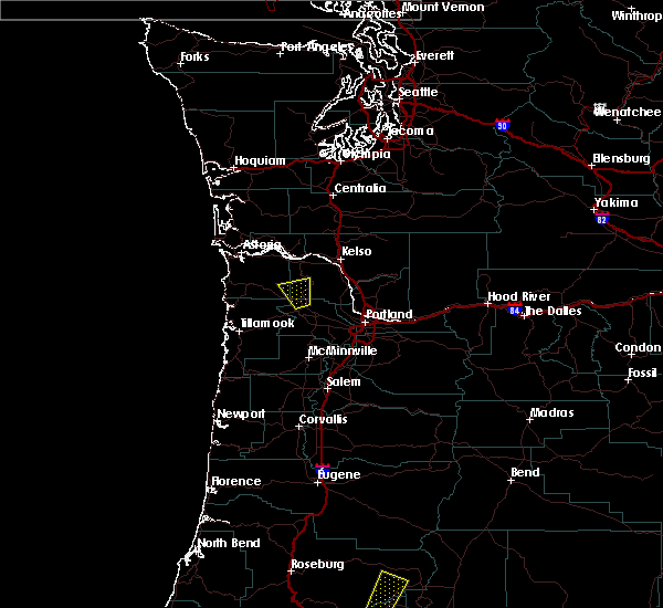 At 654 pm pdt, doppler radar indicated a severe thunderstorm capable of producing quarter size hail. this storm was located 7 miles southwest of vernonia, and moving north at 30 mph. At 654 pm pdt, doppler radar indicated a severe thunderstorm capable of producing quarter size hail. this storm was located 7 miles southwest of vernonia, and moving north at 30 mph.
|
Hail Maps for Vernonia, OR
Connect with Interactive Hail Maps