

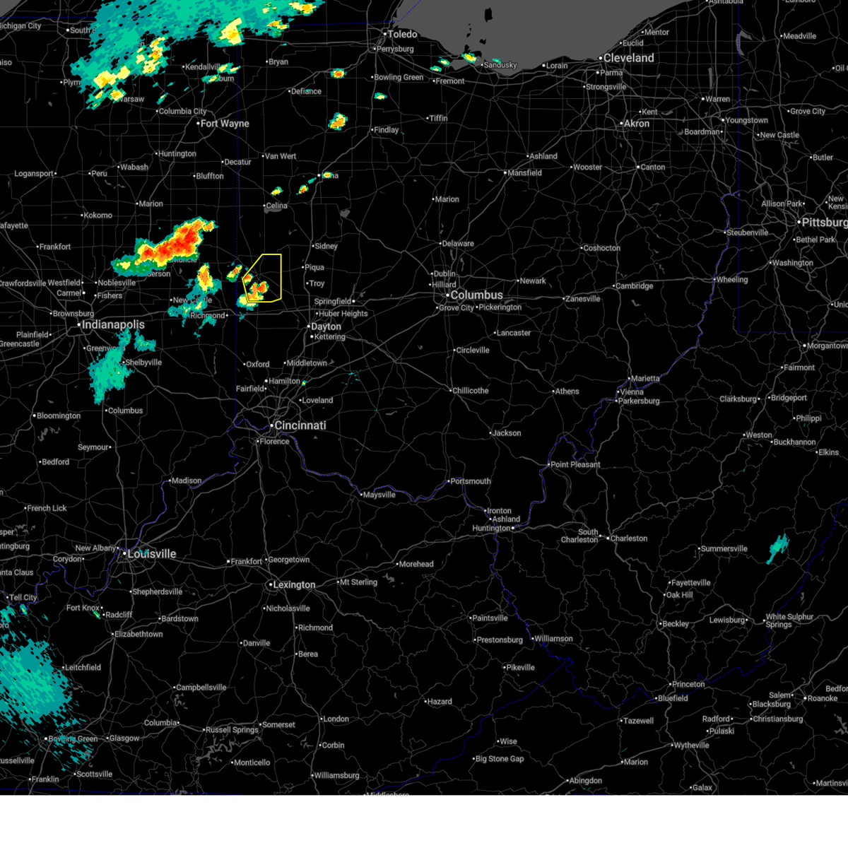
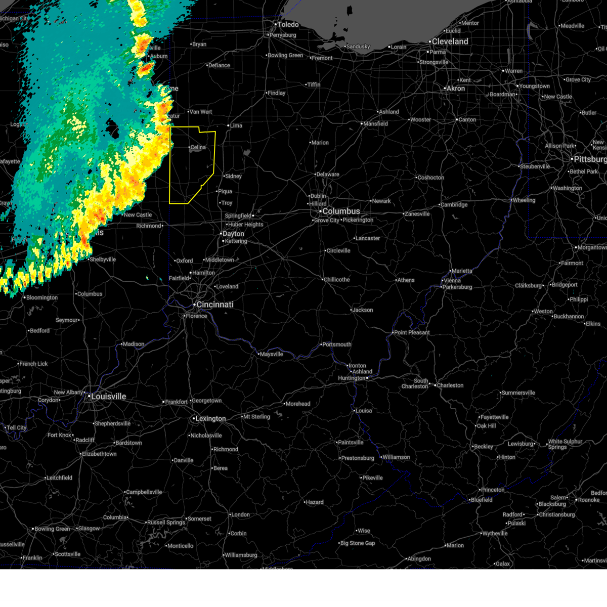
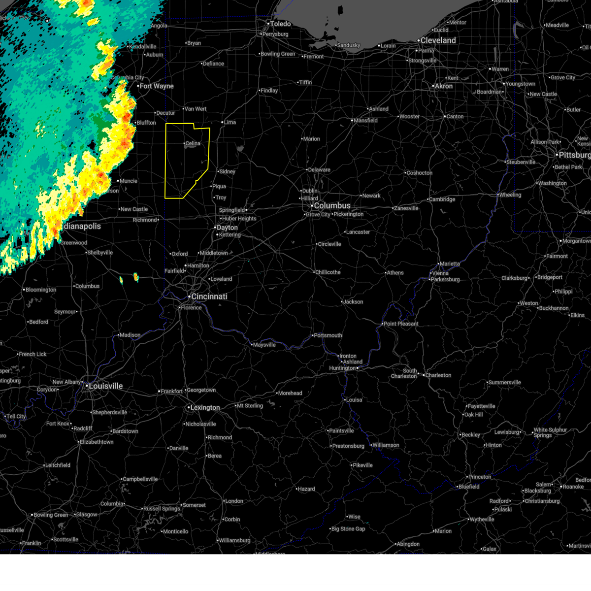
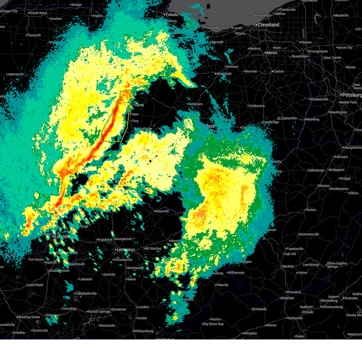
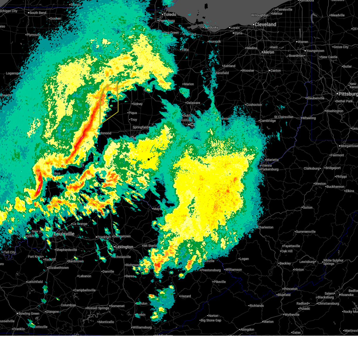
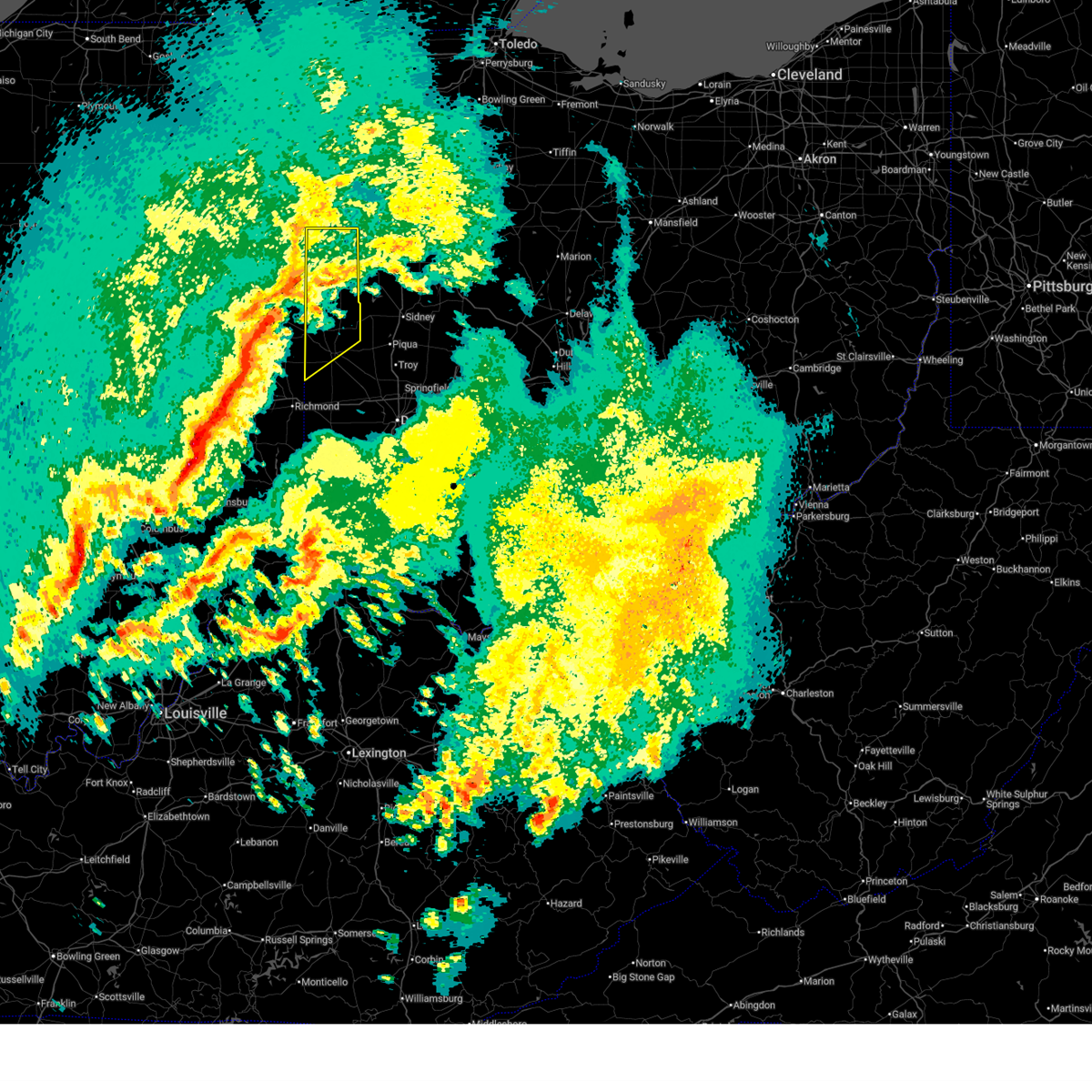
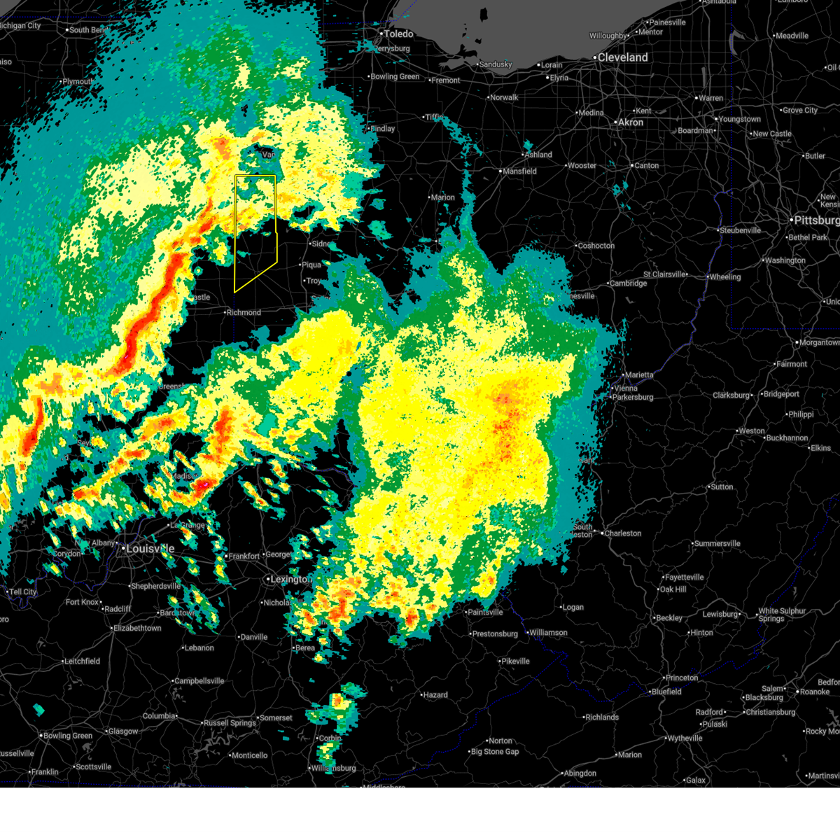
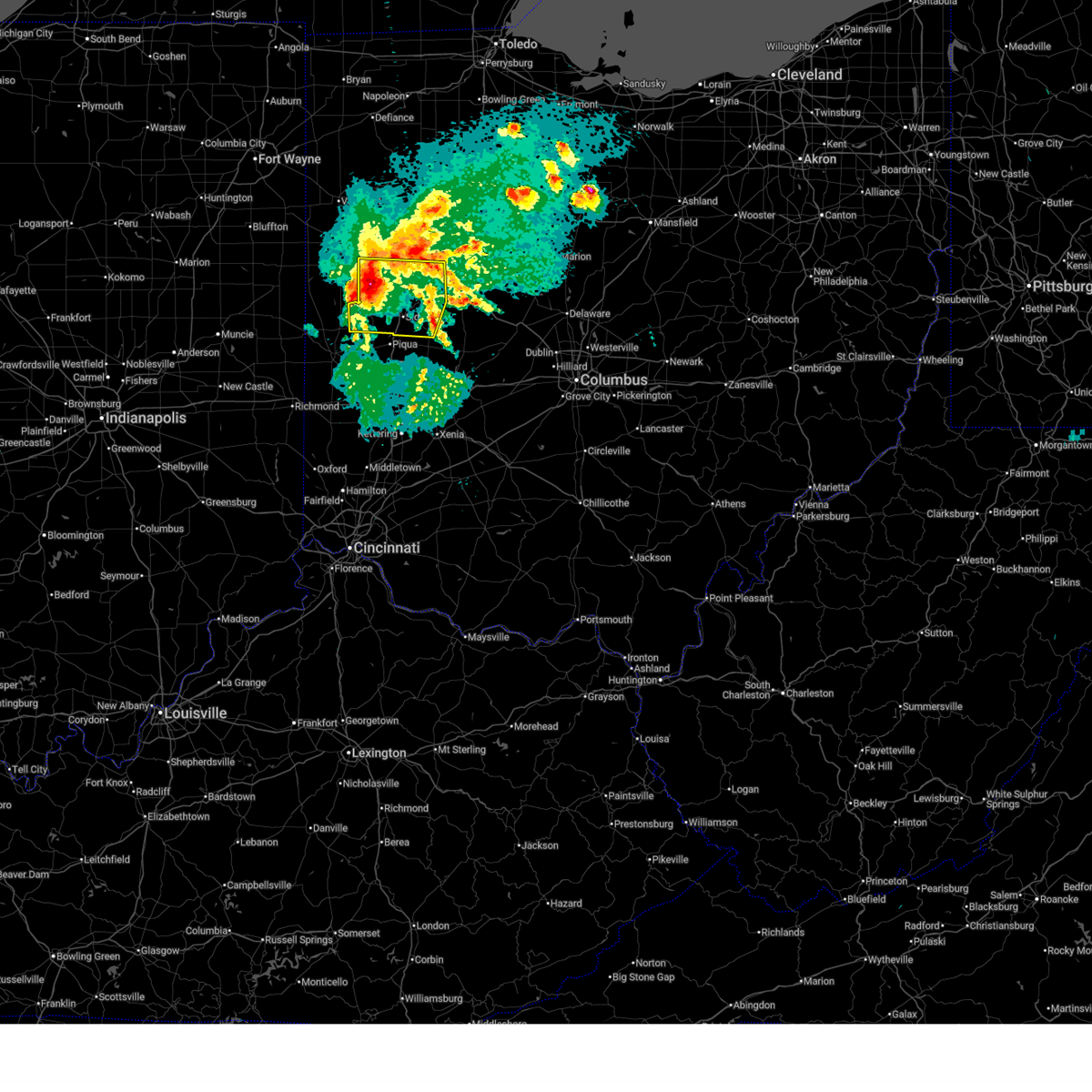
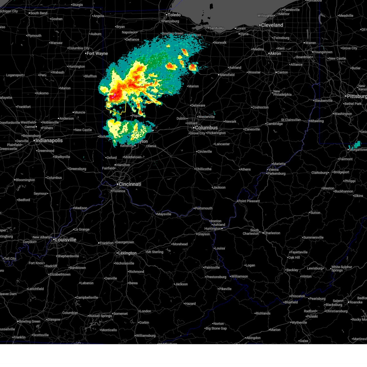
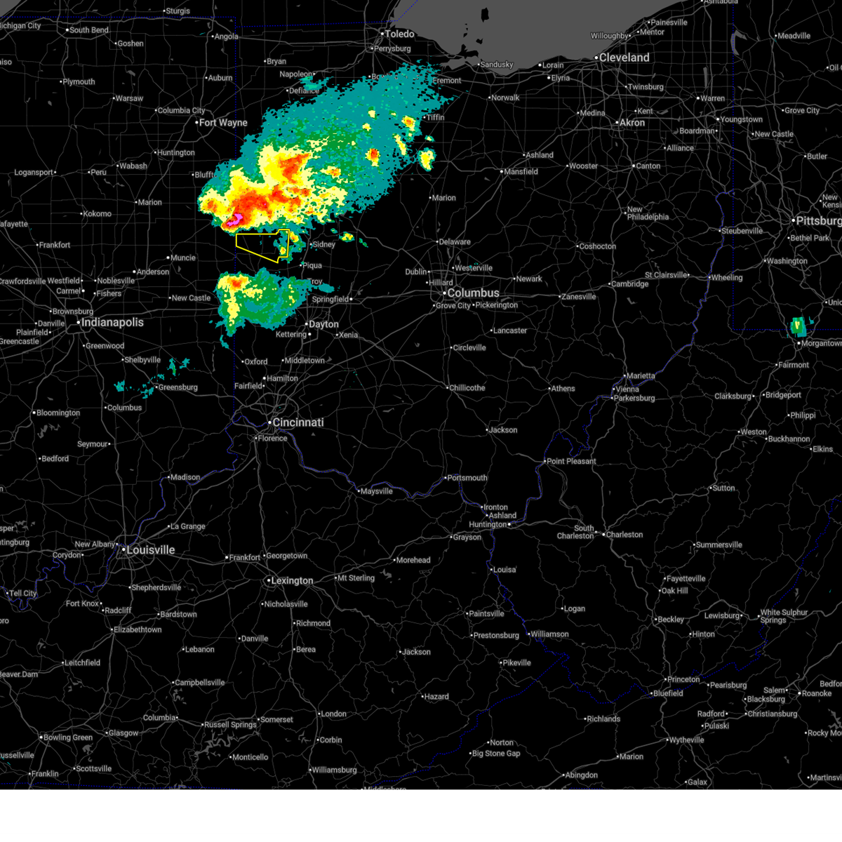
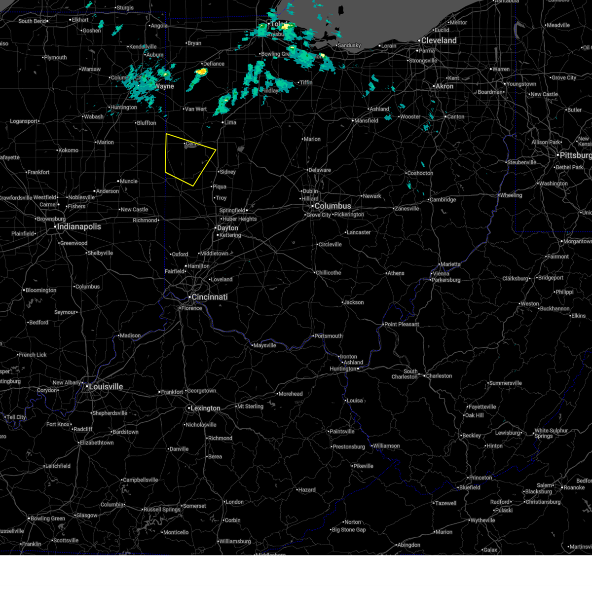
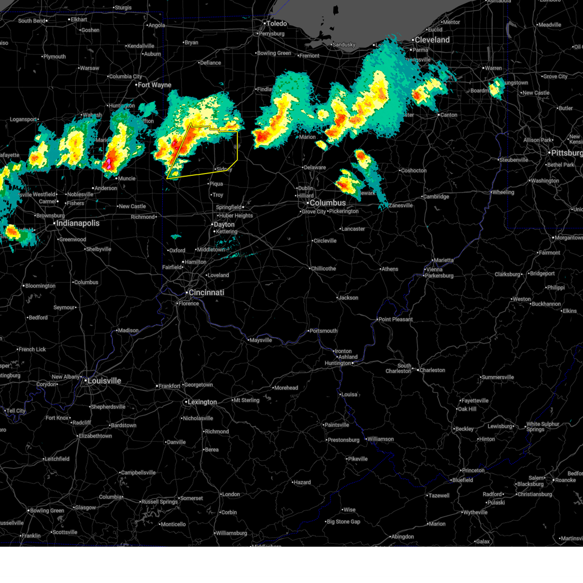
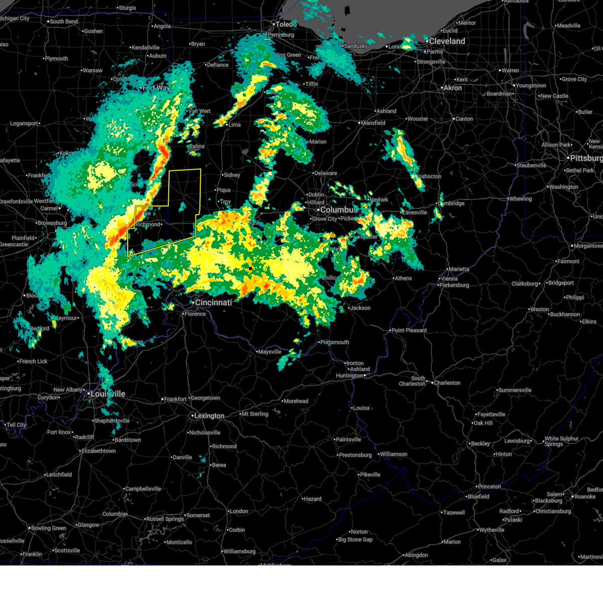
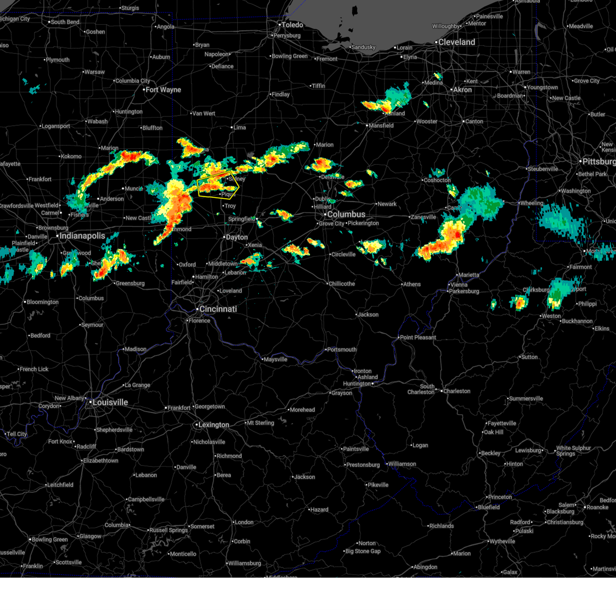
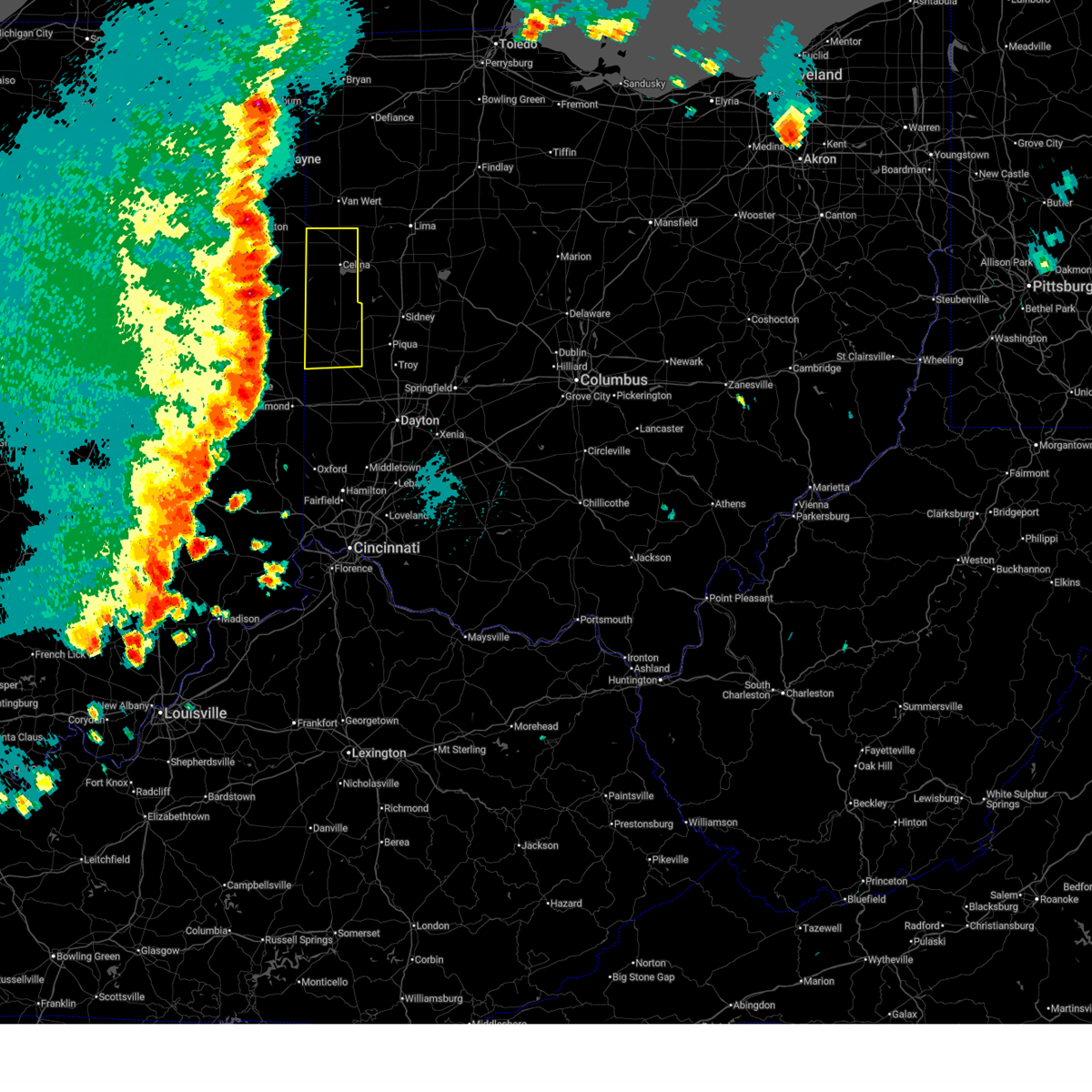
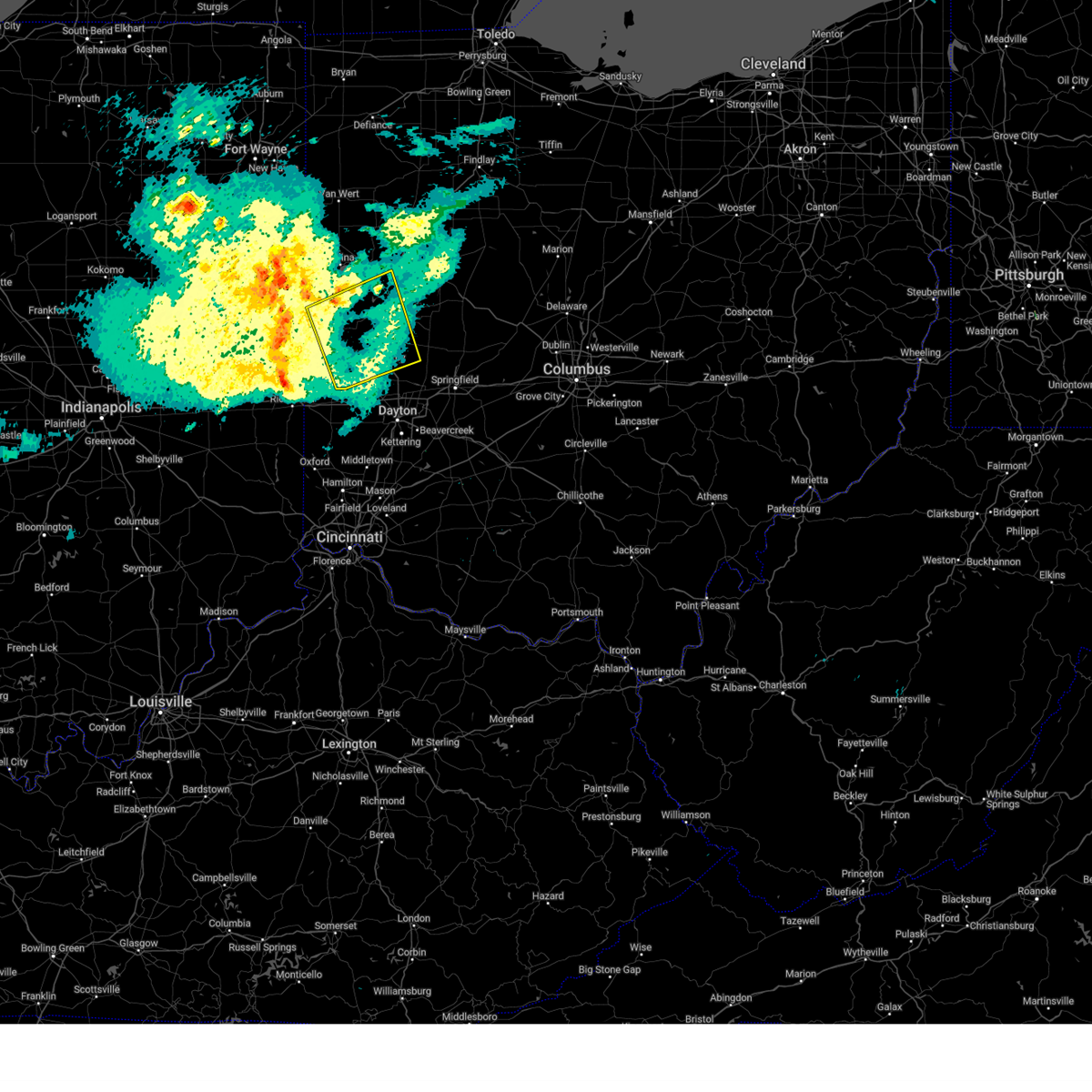
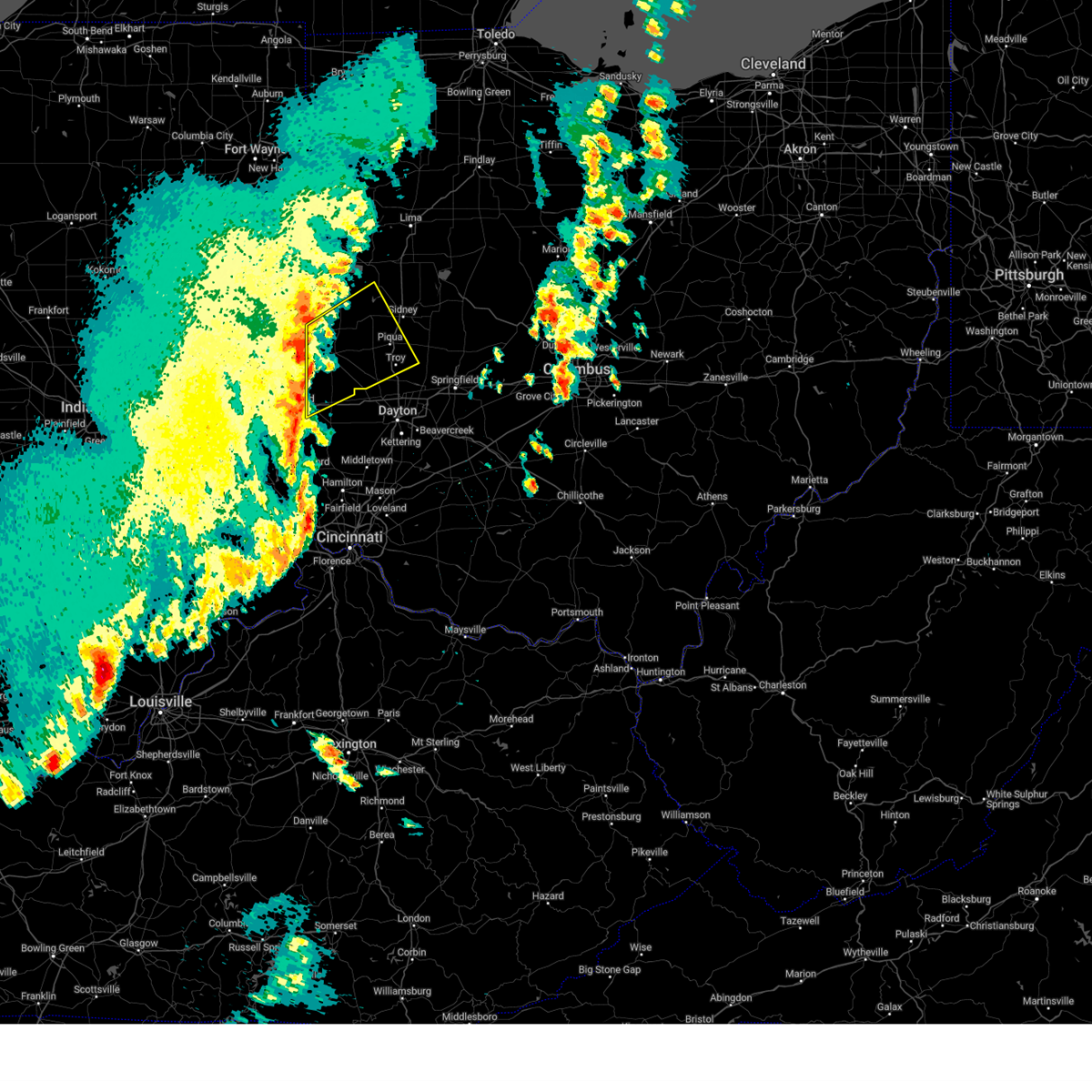
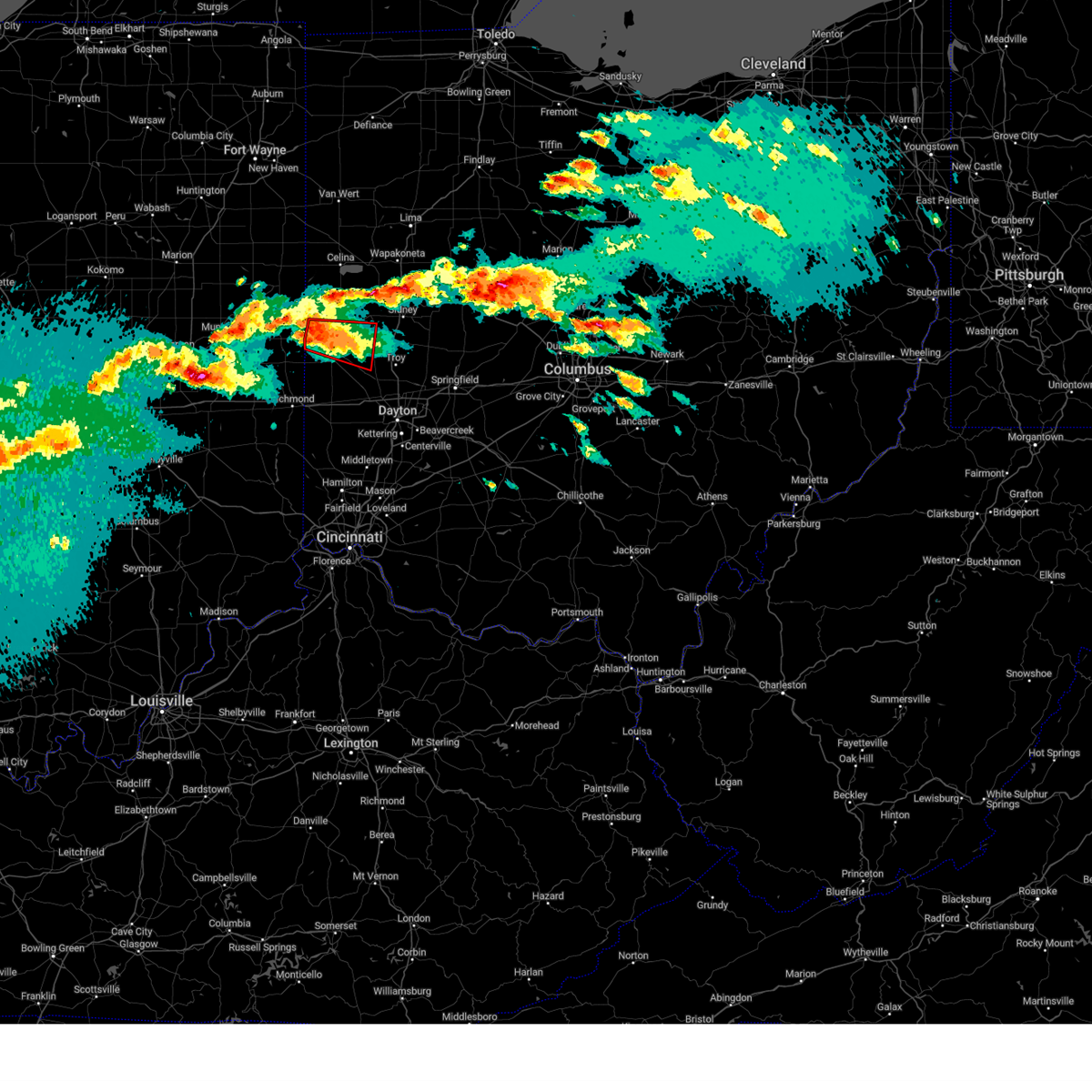
Hail Map for Versailles, OH
The Versailles, OH area has had 0 reports of on-the-ground hail by trained spotters, and has been under severe weather warnings 34 times during the past 12 months. Doppler radar has detected hail at or near Versailles, OH on 37 occasions, including 2 occasions during the past year.
| Name: | Versailles, OH |
| Where Located: | 67.1 miles SSE of Fort Wayne, IN |
| Map: | Google Map for Versailles, OH |
| Population: | 2687 |
| Housing Units: | 1150 |
| More Info: | Search Google for Versailles, OH |
1
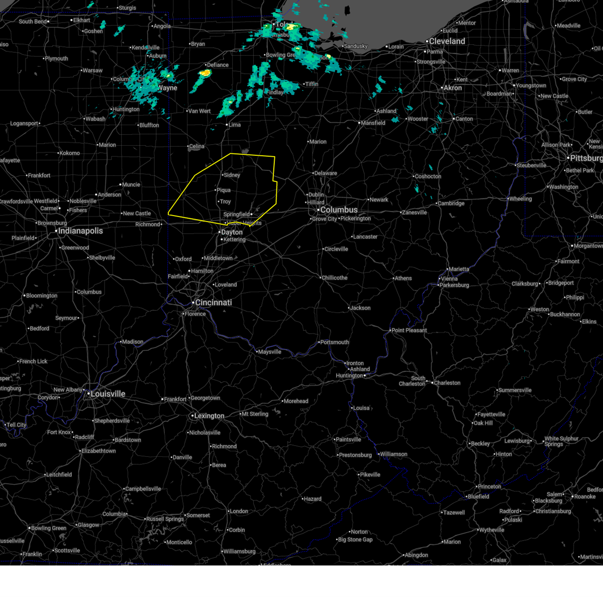
The Top Recent Hail Date for Versailles, OH is Sunday, March 22, 2026 (16th out of 37)

Hail and Wind Damage Spotted near Versailles, OH
| Date / Time | Report Details |
|---|---|
| 7/3/2026 5:53 PM EDT |
 At 553 pm edt, a severe thunderstorm was located over arcanum, moving northeast at 25 mph (radar indicated). Hazards include 60 mph wind gusts. Expect damage to trees and power lines. Locations impacted include, greenville, versailles, arcanum, bradford, new madison, webster, wayne lakes, gettysburg, pitsburg, gordon, palestine, ithaca, castine, darke county airport, abbottsville, horatio, and pikeville. At 553 pm edt, a severe thunderstorm was located over arcanum, moving northeast at 25 mph (radar indicated). Hazards include 60 mph wind gusts. Expect damage to trees and power lines. Locations impacted include, greenville, versailles, arcanum, bradford, new madison, webster, wayne lakes, gettysburg, pitsburg, gordon, palestine, ithaca, castine, darke county airport, abbottsville, horatio, and pikeville.
|
| 7/3/2026 5:45 PM EDT |
 At 544 pm edt, a severe thunderstorm was located near new madison, moving northeast at 20 mph (radar indicated). Hazards include 60 mph wind gusts. Expect damage to trees and power lines. Locations impacted include, greenville, versailles, arcanum, bradford, new madison, webster, wayne lakes, gettysburg, eldorado, west manchester, pitsburg, gordon, palestine, ithaca, castine, union corners, darke county airport, abbottsville, and horatio. At 544 pm edt, a severe thunderstorm was located near new madison, moving northeast at 20 mph (radar indicated). Hazards include 60 mph wind gusts. Expect damage to trees and power lines. Locations impacted include, greenville, versailles, arcanum, bradford, new madison, webster, wayne lakes, gettysburg, eldorado, west manchester, pitsburg, gordon, palestine, ithaca, castine, union corners, darke county airport, abbottsville, and horatio.
|
| 7/3/2026 5:36 PM EDT |
 Svriln the national weather service in wilmington has issued a * severe thunderstorm warning for, northwestern preble county in west central ohio, southern darke county in west central ohio, * until 615 pm edt. * at 536 pm edt, a severe thunderstorm was located over new madison, moving northeast at 30 mph (radar indicated). Hazards include 60 mph wind gusts. expect damage to trees and power lines Svriln the national weather service in wilmington has issued a * severe thunderstorm warning for, northwestern preble county in west central ohio, southern darke county in west central ohio, * until 615 pm edt. * at 536 pm edt, a severe thunderstorm was located over new madison, moving northeast at 30 mph (radar indicated). Hazards include 60 mph wind gusts. expect damage to trees and power lines
|
| 6/11/2026 11:43 PM EDT |
 At 1142 pm edt, severe thunderstorms were located along a line extending from 7 miles northwest of ottoville to near st. marys to near ansonia, moving east at 60 mph (radar indicated). Hazards include 60 mph wind gusts. Expect damage to trees and power lines. locations impacted include, greenville, celina, st. marys, coldwater, new bremen, minster, versailles, st. Henry, newport, union city, fort loramie, fort recovery, ansonia, rockford, new knoxville, moulton, webster, wayne lakes, mendon, and russia. At 1142 pm edt, severe thunderstorms were located along a line extending from 7 miles northwest of ottoville to near st. marys to near ansonia, moving east at 60 mph (radar indicated). Hazards include 60 mph wind gusts. Expect damage to trees and power lines. locations impacted include, greenville, celina, st. marys, coldwater, new bremen, minster, versailles, st. Henry, newport, union city, fort loramie, fort recovery, ansonia, rockford, new knoxville, moulton, webster, wayne lakes, mendon, and russia.
|
| 6/11/2026 11:22 PM EDT |
 At 1122 pm edt, severe thunderstorms were located along a line extending from near monroeville to 6 miles northwest of fort recovery to near winchester, moving east at 60 mph (radar indicated). Hazards include 60 mph wind gusts. Expect damage to trees and power lines. locations impacted include, greenville, celina, st. marys, coldwater, new bremen, minster, versailles, st. Henry, newport, union city, fort loramie, fort recovery, ansonia, rockford, new knoxville, moulton, webster, wabash, wayne lakes, and mendon. At 1122 pm edt, severe thunderstorms were located along a line extending from near monroeville to 6 miles northwest of fort recovery to near winchester, moving east at 60 mph (radar indicated). Hazards include 60 mph wind gusts. Expect damage to trees and power lines. locations impacted include, greenville, celina, st. marys, coldwater, new bremen, minster, versailles, st. Henry, newport, union city, fort loramie, fort recovery, ansonia, rockford, new knoxville, moulton, webster, wabash, wayne lakes, and mendon.
|
| 6/11/2026 11:04 PM EDT |
 Svriln the national weather service in wilmington has issued a * severe thunderstorm warning for, western shelby county in west central ohio, darke county in west central ohio, western auglaize county in west central ohio, mercer county in west central ohio, * until midnight edt. * at 1104 pm edt, severe thunderstorms were located along a line extending from 6 miles south of fort wayne to pennville to near muncie, moving east at 60 mph (radar indicated). Hazards include 60 mph wind gusts. expect damage to trees and power lines Svriln the national weather service in wilmington has issued a * severe thunderstorm warning for, western shelby county in west central ohio, darke county in west central ohio, western auglaize county in west central ohio, mercer county in west central ohio, * until midnight edt. * at 1104 pm edt, severe thunderstorms were located along a line extending from 6 miles south of fort wayne to pennville to near muncie, moving east at 60 mph (radar indicated). Hazards include 60 mph wind gusts. expect damage to trees and power lines
|
| 4/28/2026 12:25 AM EDT |
 At 1225 am edt, severe thunderstorms were located along a line extending from near newport to near eaton, moving northeast at 70 mph (radar indicated). Hazards include 60 mph wind gusts. Expect damage to trees and power lines. locations impacted include, trotwood, piqua, englewood, greenville, eaton, west milton, new bremen, minster, versailles, covington, arcanum, newport, bradford, lewisburg, new paris, fort loramie, west alexandria, pleasant hill, new madison, and new knoxville. This includes i-70 in ohio between mile markers 1 and 26. At 1225 am edt, severe thunderstorms were located along a line extending from near newport to near eaton, moving northeast at 70 mph (radar indicated). Hazards include 60 mph wind gusts. Expect damage to trees and power lines. locations impacted include, trotwood, piqua, englewood, greenville, eaton, west milton, new bremen, minster, versailles, covington, arcanum, newport, bradford, lewisburg, new paris, fort loramie, west alexandria, pleasant hill, new madison, and new knoxville. This includes i-70 in ohio between mile markers 1 and 26.
|
| 4/28/2026 12:03 AM EDT |
 At 1203 am edt, severe thunderstorms were located along a line extending from coldwater to fountain city, moving east at 45 mph (radar indicated). Hazards include 60 mph wind gusts. Expect damage to trees and power lines. locations impacted include, greenville, celina, coldwater, versailles, st. Henry, union city, fort recovery, ansonia, webster, osgood, chickasaw, burkettsville, north star, hollansburg, rossburg, palestine, montezuma, new weston, yorkshire, and darke county airport. At 1203 am edt, severe thunderstorms were located along a line extending from coldwater to fountain city, moving east at 45 mph (radar indicated). Hazards include 60 mph wind gusts. Expect damage to trees and power lines. locations impacted include, greenville, celina, coldwater, versailles, st. Henry, union city, fort recovery, ansonia, webster, osgood, chickasaw, burkettsville, north star, hollansburg, rossburg, palestine, montezuma, new weston, yorkshire, and darke county airport.
|
| 4/27/2026 11:56 PM EDT |
 Svriln the national weather service in wilmington has issued a * severe thunderstorm warning for, eastern wayne county in east central indiana, western shelby county in west central ohio, northern preble county in west central ohio, darke county in west central ohio, northwestern montgomery county in west central ohio, southwestern auglaize county in west central ohio, western miami county in west central ohio, * until 100 am edt. * at 1156 pm edt, severe thunderstorms were located along a line extending from near winchester to glenwood, moving east at 50 mph (radar indicated). Hazards include 60 mph wind gusts. expect damage to trees and power lines Svriln the national weather service in wilmington has issued a * severe thunderstorm warning for, eastern wayne county in east central indiana, western shelby county in west central ohio, northern preble county in west central ohio, darke county in west central ohio, northwestern montgomery county in west central ohio, southwestern auglaize county in west central ohio, western miami county in west central ohio, * until 100 am edt. * at 1156 pm edt, severe thunderstorms were located along a line extending from near winchester to glenwood, moving east at 50 mph (radar indicated). Hazards include 60 mph wind gusts. expect damage to trees and power lines
|
| 4/27/2026 11:48 PM EDT |
 At 1148 pm edt, severe thunderstorms were located along a line extending from 6 miles east of geneva to 7 miles south of winchester, moving east at 60 mph (radar indicated). Hazards include 60 mph wind gusts. Expect damage to trees and power lines. locations impacted include, greenville, celina, coldwater, versailles, st. Henry, union city, fort recovery, ansonia, rockford, webster, wabash, mendon, osgood, chickasaw, burkettsville, north star, hollansburg, rossburg, palestine, and montezuma. At 1148 pm edt, severe thunderstorms were located along a line extending from 6 miles east of geneva to 7 miles south of winchester, moving east at 60 mph (radar indicated). Hazards include 60 mph wind gusts. Expect damage to trees and power lines. locations impacted include, greenville, celina, coldwater, versailles, st. Henry, union city, fort recovery, ansonia, rockford, webster, wabash, mendon, osgood, chickasaw, burkettsville, north star, hollansburg, rossburg, palestine, and montezuma.
|
| 4/27/2026 11:32 PM EDT |
 Svriln the national weather service in wilmington has issued a * severe thunderstorm warning for, darke county in west central ohio, mercer county in west central ohio, * until 1215 am edt. * at 1132 pm edt, severe thunderstorms were located along a line extending from decatur to near redkey, moving northeast at 40 mph (radar indicated). Hazards include 60 mph wind gusts. expect damage to trees and power lines Svriln the national weather service in wilmington has issued a * severe thunderstorm warning for, darke county in west central ohio, mercer county in west central ohio, * until 1215 am edt. * at 1132 pm edt, severe thunderstorms were located along a line extending from decatur to near redkey, moving northeast at 40 mph (radar indicated). Hazards include 60 mph wind gusts. expect damage to trees and power lines
|
| 4/14/2026 7:46 PM EDT |
 At 746 pm edt, a severe thunderstorm was located near new bremen, moving east at 40 mph (radar indicated). Hazards include 70 mph wind gusts and quarter size hail. Minor hail damage to vehicles is possible. expect considerable tree damage. wind damage is also likely to mobile homes, roofs, and outbuildings. locations impacted include, sidney, wapakoneta, st. marys, new bremen, minster, versailles, newport, anna, fort loramie, jackson center, russells point, de graff, botkins, lakeview, new knoxville, chippewa park, hardin, moulton, quincy, and russia. This includes i-75 in ohio between mile markers 85 and 111. At 746 pm edt, a severe thunderstorm was located near new bremen, moving east at 40 mph (radar indicated). Hazards include 70 mph wind gusts and quarter size hail. Minor hail damage to vehicles is possible. expect considerable tree damage. wind damage is also likely to mobile homes, roofs, and outbuildings. locations impacted include, sidney, wapakoneta, st. marys, new bremen, minster, versailles, newport, anna, fort loramie, jackson center, russells point, de graff, botkins, lakeview, new knoxville, chippewa park, hardin, moulton, quincy, and russia. This includes i-75 in ohio between mile markers 85 and 111.
|
| 4/14/2026 7:36 PM EDT |
 Svriln the national weather service in wilmington has issued a * severe thunderstorm warning for, shelby county in west central ohio, northwestern champaign county in west central ohio, western logan county in west central ohio, northeastern darke county in west central ohio, southern auglaize county in west central ohio, southeastern mercer county in west central ohio, * until 830 pm edt. * at 736 pm edt, a severe thunderstorm was located near new bremen, moving east at 40 mph (radar indicated). Hazards include 70 mph wind gusts and half dollar size hail. Minor hail damage to vehicles is possible. expect considerable tree damage. Wind damage is also likely to mobile homes, roofs, and outbuildings. Svriln the national weather service in wilmington has issued a * severe thunderstorm warning for, shelby county in west central ohio, northwestern champaign county in west central ohio, western logan county in west central ohio, northeastern darke county in west central ohio, southern auglaize county in west central ohio, southeastern mercer county in west central ohio, * until 830 pm edt. * at 736 pm edt, a severe thunderstorm was located near new bremen, moving east at 40 mph (radar indicated). Hazards include 70 mph wind gusts and half dollar size hail. Minor hail damage to vehicles is possible. expect considerable tree damage. Wind damage is also likely to mobile homes, roofs, and outbuildings.
|
| 4/14/2026 7:32 PM EDT |
 At 732 pm edt, a severe thunderstorm was located near st. henry, moving southeast at 35 mph (radar indicated). Hazards include 60 mph wind gusts and half dollar size hail. Minor hail damage to vehicles is possible. expect wind damage to trees and power lines. Locations impacted include, versailles, newport, fort loramie, ansonia, webster, russia, osgood, north star, rossburg, new weston, yorkshire, darke county airport, rose hill, brock and willowdell. At 732 pm edt, a severe thunderstorm was located near st. henry, moving southeast at 35 mph (radar indicated). Hazards include 60 mph wind gusts and half dollar size hail. Minor hail damage to vehicles is possible. expect wind damage to trees and power lines. Locations impacted include, versailles, newport, fort loramie, ansonia, webster, russia, osgood, north star, rossburg, new weston, yorkshire, darke county airport, rose hill, brock and willowdell.
|
| 4/14/2026 7:19 PM EDT |
 Svriln the national weather service in wilmington has issued a * severe thunderstorm warning for, southwestern shelby county in west central ohio, northern darke county in west central ohio, * until 745 pm edt. * at 719 pm edt, a severe thunderstorm was located over fort recovery, moving east at 30 mph (radar indicated). Hazards include 60 mph wind gusts and half dollar size hail. Minor hail damage to vehicles is possible. Expect wind damage to trees and power lines. Svriln the national weather service in wilmington has issued a * severe thunderstorm warning for, southwestern shelby county in west central ohio, northern darke county in west central ohio, * until 745 pm edt. * at 719 pm edt, a severe thunderstorm was located over fort recovery, moving east at 30 mph (radar indicated). Hazards include 60 mph wind gusts and half dollar size hail. Minor hail damage to vehicles is possible. Expect wind damage to trees and power lines.
|
| 3/26/2026 8:54 PM EDT |
 Svriln the national weather service in wilmington has issued a * severe thunderstorm warning for, shelby county in west central ohio, champaign county in west central ohio, northeastern preble county in west central ohio, logan county in west central ohio, southern darke county in west central ohio, clark county in west central ohio, northern montgomery county in west central ohio, miami county in west central ohio, * until 945 pm edt. * at 854 pm edt, severe thunderstorms were located along a line extending from near de graff to near bradford to near new madison, moving east at 55 mph (radar indicated). Hazards include 60 mph wind gusts and quarter size hail. Minor hail damage to vehicles is possible. Expect wind damage to trees and power lines. Svriln the national weather service in wilmington has issued a * severe thunderstorm warning for, shelby county in west central ohio, champaign county in west central ohio, northeastern preble county in west central ohio, logan county in west central ohio, southern darke county in west central ohio, clark county in west central ohio, northern montgomery county in west central ohio, miami county in west central ohio, * until 945 pm edt. * at 854 pm edt, severe thunderstorms were located along a line extending from near de graff to near bradford to near new madison, moving east at 55 mph (radar indicated). Hazards include 60 mph wind gusts and quarter size hail. Minor hail damage to vehicles is possible. Expect wind damage to trees and power lines.
|
| 3/26/2026 8:39 PM EDT |
 At 838 pm edt, severe thunderstorms were located along a line extending from near ansonia to near fountain city, moving east at 45 mph (radar indicated). Hazards include 60 mph wind gusts and quarter size hail. Minor hail damage to vehicles is possible. expect wind damage to trees and power lines. Locations impacted include, richmond, greenville, versailles, arcanum, bradford, lewisburg, union city, new paris, ansonia, new madison, fountain city, webster, wayne lakes, gettysburg, eldorado, verona, west manchester, greens fork, pitsburg, and bethel. At 838 pm edt, severe thunderstorms were located along a line extending from near ansonia to near fountain city, moving east at 45 mph (radar indicated). Hazards include 60 mph wind gusts and quarter size hail. Minor hail damage to vehicles is possible. expect wind damage to trees and power lines. Locations impacted include, richmond, greenville, versailles, arcanum, bradford, lewisburg, union city, new paris, ansonia, new madison, fountain city, webster, wayne lakes, gettysburg, eldorado, verona, west manchester, greens fork, pitsburg, and bethel.
|
| 3/26/2026 8:22 PM EDT |
 At 822 pm edt, a severe thunderstorm was located near st. henry, moving east at 35 mph (radar indicated). Hazards include golf ball size hail and 60 mph wind gusts. People and animals outdoors will be injured. expect hail damage to roofs, siding, windows, and vehicles. expect wind damage to trees and power lines. locations impacted include, celina, st. marys, coldwater, new bremen, minster, versailles, st. Henry, newport, fort loramie, fort recovery, ansonia, new knoxville, webster, russia, osgood, chickasaw, burkettsville, north star, rossburg, and kettlersville. At 822 pm edt, a severe thunderstorm was located near st. henry, moving east at 35 mph (radar indicated). Hazards include golf ball size hail and 60 mph wind gusts. People and animals outdoors will be injured. expect hail damage to roofs, siding, windows, and vehicles. expect wind damage to trees and power lines. locations impacted include, celina, st. marys, coldwater, new bremen, minster, versailles, st. Henry, newport, fort loramie, fort recovery, ansonia, new knoxville, webster, russia, osgood, chickasaw, burkettsville, north star, rossburg, and kettlersville.
|
| 3/26/2026 8:20 PM EDT |
 Svriln the national weather service in wilmington has issued a * severe thunderstorm warning for, northern wayne county in east central indiana, northern preble county in west central ohio, darke county in west central ohio, * until 900 pm edt. * at 820 pm edt, severe thunderstorms were located along a line extending from 6 miles southeast of portland to 8 miles southwest of winchester, moving east at 55 mph (radar indicated). Hazards include 60 mph wind gusts and quarter size hail. Minor hail damage to vehicles is possible. Expect wind damage to trees and power lines. Svriln the national weather service in wilmington has issued a * severe thunderstorm warning for, northern wayne county in east central indiana, northern preble county in west central ohio, darke county in west central ohio, * until 900 pm edt. * at 820 pm edt, severe thunderstorms were located along a line extending from 6 miles southeast of portland to 8 miles southwest of winchester, moving east at 55 mph (radar indicated). Hazards include 60 mph wind gusts and quarter size hail. Minor hail damage to vehicles is possible. Expect wind damage to trees and power lines.
|
| 3/26/2026 7:44 PM EDT |
 Svriln the national weather service in wilmington has issued a * severe thunderstorm warning for, northwestern shelby county in west central ohio, northern darke county in west central ohio, southwestern auglaize county in west central ohio, mercer county in west central ohio, * until 830 pm edt. * at 743 pm edt, a severe thunderstorm was located near geneva, moving east at 55 mph (radar indicated). Hazards include ping pong ball size hail and 60 mph wind gusts. People and animals outdoors will be injured. expect hail damage to roofs, siding, windows, and vehicles. Expect wind damage to trees and power lines. Svriln the national weather service in wilmington has issued a * severe thunderstorm warning for, northwestern shelby county in west central ohio, northern darke county in west central ohio, southwestern auglaize county in west central ohio, mercer county in west central ohio, * until 830 pm edt. * at 743 pm edt, a severe thunderstorm was located near geneva, moving east at 55 mph (radar indicated). Hazards include ping pong ball size hail and 60 mph wind gusts. People and animals outdoors will be injured. expect hail damage to roofs, siding, windows, and vehicles. Expect wind damage to trees and power lines.
|
| 3/22/2026 9:42 PM EDT |
 At 941 pm edt, severe thunderstorms were located along a line extending from botkins to new madison, moving east at 55 mph (law enforcement). Hazards include quarter size hail. Minor damage to vehicles is possible. locations impacted include, troy, sidney, piqua, bellefontaine, tipp city, west milton, new bremen, minster, versailles, covington, arcanum, newport, bradford, anna, fort loramie, jackson center, russells point, de graff, pleasant hill, and botkins. This includes i-75 in ohio between mile markers 67 and 106. At 941 pm edt, severe thunderstorms were located along a line extending from botkins to new madison, moving east at 55 mph (law enforcement). Hazards include quarter size hail. Minor damage to vehicles is possible. locations impacted include, troy, sidney, piqua, bellefontaine, tipp city, west milton, new bremen, minster, versailles, covington, arcanum, newport, bradford, anna, fort loramie, jackson center, russells point, de graff, pleasant hill, and botkins. This includes i-75 in ohio between mile markers 67 and 106.
|
| 3/22/2026 9:42 PM EDT |
 the severe thunderstorm warning has been cancelled and is no longer in effect the severe thunderstorm warning has been cancelled and is no longer in effect
|
| 3/22/2026 9:27 PM EDT |
 Svriln the national weather service in wilmington has issued a * severe thunderstorm warning for, shelby county in west central ohio, northwestern champaign county in west central ohio, western logan county in west central ohio, darke county in west central ohio, southern auglaize county in west central ohio, southeastern mercer county in west central ohio, miami county in west central ohio, * until 1015 pm edt. * at 927 pm edt, severe thunderstorms were located along a line extending from near new bremen to near fountain city, moving east at 55 mph (law enforcement). Hazards include quarter size hail. minor damage to vehicles is possible Svriln the national weather service in wilmington has issued a * severe thunderstorm warning for, shelby county in west central ohio, northwestern champaign county in west central ohio, western logan county in west central ohio, darke county in west central ohio, southern auglaize county in west central ohio, southeastern mercer county in west central ohio, miami county in west central ohio, * until 1015 pm edt. * at 927 pm edt, severe thunderstorms were located along a line extending from near new bremen to near fountain city, moving east at 55 mph (law enforcement). Hazards include quarter size hail. minor damage to vehicles is possible
|
| 3/22/2026 9:05 PM EDT |
 Svriln the national weather service in wilmington has issued a * severe thunderstorm warning for, northwestern shelby county in west central ohio, darke county in west central ohio, southwestern auglaize county in west central ohio, southern mercer county in west central ohio, * until 930 pm edt. * at 905 pm edt, severe thunderstorms were located along a line extending from 6 miles north of fort recovery to near union city to 6 miles southwest of winchester, moving east at 70 mph (radar indicated). Hazards include ping pong ball size hail. People and animals outdoors will be injured. Expect damage to roofs, siding, windows, and vehicles. Svriln the national weather service in wilmington has issued a * severe thunderstorm warning for, northwestern shelby county in west central ohio, darke county in west central ohio, southwestern auglaize county in west central ohio, southern mercer county in west central ohio, * until 930 pm edt. * at 905 pm edt, severe thunderstorms were located along a line extending from 6 miles north of fort recovery to near union city to 6 miles southwest of winchester, moving east at 70 mph (radar indicated). Hazards include ping pong ball size hail. People and animals outdoors will be injured. Expect damage to roofs, siding, windows, and vehicles.
|
| 3/22/2026 8:44 PM EDT |
 Svriln the national weather service in wilmington has issued a * severe thunderstorm warning for, shelby county in west central ohio, northwestern logan county in west central ohio, northern darke county in west central ohio, auglaize county in west central ohio, southeastern mercer county in west central ohio, * until 915 pm edt. * at 843 pm edt, severe thunderstorms were located along a line extending from near spencerville in allen county to 6 miles northwest of ansonia, moving east at 70 mph (radar indicated). Hazards include half dollar size hail. minor damage to vehicles is possible Svriln the national weather service in wilmington has issued a * severe thunderstorm warning for, shelby county in west central ohio, northwestern logan county in west central ohio, northern darke county in west central ohio, auglaize county in west central ohio, southeastern mercer county in west central ohio, * until 915 pm edt. * at 843 pm edt, severe thunderstorms were located along a line extending from near spencerville in allen county to 6 miles northwest of ansonia, moving east at 70 mph (radar indicated). Hazards include half dollar size hail. minor damage to vehicles is possible
|
| 3/11/2026 10:09 AM EDT |
 At 1009 am edt, a severe thunderstorm was located over piqua, moving east at 80 mph (radar indicated). Hazards include 60 mph wind gusts. Expect damage to trees and power lines. locations impacted include, eaton, versailles, arcanum, bradford, lewisburg, west alexandria, webster, gettysburg, eldorado, verona, west manchester, pitsburg, gordon, ithaca, castine, union corners, oklahoma, west florence, interstate 70 at us route 127, and willowdell. This includes i-70 in ohio between mile markers 6 and 17. At 1009 am edt, a severe thunderstorm was located over piqua, moving east at 80 mph (radar indicated). Hazards include 60 mph wind gusts. Expect damage to trees and power lines. locations impacted include, eaton, versailles, arcanum, bradford, lewisburg, west alexandria, webster, gettysburg, eldorado, verona, west manchester, pitsburg, gordon, ithaca, castine, union corners, oklahoma, west florence, interstate 70 at us route 127, and willowdell. This includes i-70 in ohio between mile markers 6 and 17.
|
| 3/11/2026 10:09 AM EDT |
 the severe thunderstorm warning has been cancelled and is no longer in effect the severe thunderstorm warning has been cancelled and is no longer in effect
|
| 3/11/2026 9:59 AM EDT |
 At 959 am edt, a severe thunderstorm was located near greenville, moving east at 80 mph (radar indicated). Hazards include 60 mph wind gusts. Expect damage to trees and power lines. locations impacted include, richmond, connersville, greenville, eaton, centerville, versailles, liberty, arcanum, bradford, lewisburg, new paris, west alexandria, ansonia, new madison, waterloo, webster, abington, brownsville, wayne lakes, and russia. this includes the following interstates, i-70 in indiana between mile markers 148 and 156. I-70 in ohio between mile markers 0 and 17. At 959 am edt, a severe thunderstorm was located near greenville, moving east at 80 mph (radar indicated). Hazards include 60 mph wind gusts. Expect damage to trees and power lines. locations impacted include, richmond, connersville, greenville, eaton, centerville, versailles, liberty, arcanum, bradford, lewisburg, new paris, west alexandria, ansonia, new madison, waterloo, webster, abington, brownsville, wayne lakes, and russia. this includes the following interstates, i-70 in indiana between mile markers 148 and 156. I-70 in ohio between mile markers 0 and 17.
|
| 3/11/2026 9:45 AM EDT |
 At 945 am edt, a severe thunderstorm was located near fountain city, moving east at 75 mph (radar indicated). Hazards include 60 mph wind gusts. Expect damage to trees and power lines. locations impacted include, richmond, connersville, greenville, eaton, centerville, cambridge city, versailles, liberty, arcanum, bradford, lewisburg, hagerstown, union city, new paris, west alexandria, ansonia, new madison, fountain city, dublin, and franklin. this includes the following interstates, i-70 in indiana between mile markers 134 and 156. I-70 in ohio between mile markers 0 and 17. At 945 am edt, a severe thunderstorm was located near fountain city, moving east at 75 mph (radar indicated). Hazards include 60 mph wind gusts. Expect damage to trees and power lines. locations impacted include, richmond, connersville, greenville, eaton, centerville, cambridge city, versailles, liberty, arcanum, bradford, lewisburg, hagerstown, union city, new paris, west alexandria, ansonia, new madison, fountain city, dublin, and franklin. this includes the following interstates, i-70 in indiana between mile markers 134 and 156. I-70 in ohio between mile markers 0 and 17.
|
| 3/11/2026 9:32 AM EDT |
 At 931 am edt, a severe thunderstorm was located over hagerstown, moving east at 80 mph (radar indicated). Hazards include 60 mph wind gusts. Expect damage to trees and power lines. locations impacted include, richmond, connersville, greenville, eaton, centerville, cambridge city, versailles, liberty, arcanum, bradford, lewisburg, hagerstown, union city, new paris, west alexandria, ansonia, new madison, fountain city, dublin, and glenwood. this includes the following interstates, i-70 in indiana between mile markers 134 and 156. I-70 in ohio between mile markers 0 and 17. At 931 am edt, a severe thunderstorm was located over hagerstown, moving east at 80 mph (radar indicated). Hazards include 60 mph wind gusts. Expect damage to trees and power lines. locations impacted include, richmond, connersville, greenville, eaton, centerville, cambridge city, versailles, liberty, arcanum, bradford, lewisburg, hagerstown, union city, new paris, west alexandria, ansonia, new madison, fountain city, dublin, and glenwood. this includes the following interstates, i-70 in indiana between mile markers 134 and 156. I-70 in ohio between mile markers 0 and 17.
|
| 3/11/2026 9:26 AM EDT |
 Svriln the national weather service in wilmington has issued a * severe thunderstorm warning for, wayne county in east central indiana, northern union county in east central indiana, fayette county in east central indiana, west central shelby county in west central ohio, preble county in west central ohio, darke county in west central ohio, * until 1015 am edt. * at 926 am edt, a severe thunderstorm was located near hagerstown, moving east at 90 mph (radar indicated). Hazards include 60 mph wind gusts. expect damage to trees and power lines Svriln the national weather service in wilmington has issued a * severe thunderstorm warning for, wayne county in east central indiana, northern union county in east central indiana, fayette county in east central indiana, west central shelby county in west central ohio, preble county in west central ohio, darke county in west central ohio, * until 1015 am edt. * at 926 am edt, a severe thunderstorm was located near hagerstown, moving east at 90 mph (radar indicated). Hazards include 60 mph wind gusts. expect damage to trees and power lines
|
| 12/28/2025 9:29 PM EST |
 At 928 pm est, a severe thunderstorm was located over bradford, moving northeast at 55 mph (radar indicated). Hazards include 60 mph wind gusts. Expect damage to trees and power lines. locations impacted include, sidney, piqua, versailles, covington, bradford, hardin, webster, russia, gettysburg, fletcher, port jefferson, lockington, polo, newbern, bloomer, ballou, plattsville, swanders, horatio, and houston. This includes i-75 in ohio between mile markers 80 and 97. At 928 pm est, a severe thunderstorm was located over bradford, moving northeast at 55 mph (radar indicated). Hazards include 60 mph wind gusts. Expect damage to trees and power lines. locations impacted include, sidney, piqua, versailles, covington, bradford, hardin, webster, russia, gettysburg, fletcher, port jefferson, lockington, polo, newbern, bloomer, ballou, plattsville, swanders, horatio, and houston. This includes i-75 in ohio between mile markers 80 and 97.
|
| 12/28/2025 9:23 PM EST |
 Svriln the national weather service in wilmington has issued a * severe thunderstorm warning for, southern shelby county in west central ohio, east central darke county in west central ohio, northern miami county in west central ohio, * until 1000 pm est. * at 923 pm est, a severe thunderstorm was located over greenville, moving northeast at 60 mph (radar indicated). Hazards include 60 mph wind gusts. expect damage to trees and power lines Svriln the national weather service in wilmington has issued a * severe thunderstorm warning for, southern shelby county in west central ohio, east central darke county in west central ohio, northern miami county in west central ohio, * until 1000 pm est. * at 923 pm est, a severe thunderstorm was located over greenville, moving northeast at 60 mph (radar indicated). Hazards include 60 mph wind gusts. expect damage to trees and power lines
|
| 7/25/2025 4:13 PM EDT |
 Svriln the national weather service in wilmington has issued a * severe thunderstorm warning for, southern shelby county in west central ohio, east central darke county in west central ohio, northern miami county in west central ohio, * until 500 pm edt. * at 412 pm edt, a severe thunderstorm was located near versailles, moving east at 20 mph (radar indicated). Hazards include 60 mph wind gusts. expect damage to trees and power lines Svriln the national weather service in wilmington has issued a * severe thunderstorm warning for, southern shelby county in west central ohio, east central darke county in west central ohio, northern miami county in west central ohio, * until 500 pm edt. * at 412 pm edt, a severe thunderstorm was located near versailles, moving east at 20 mph (radar indicated). Hazards include 60 mph wind gusts. expect damage to trees and power lines
|
| 6/25/2025 3:17 PM EDT |
 Svriln the national weather service in wilmington has issued a * severe thunderstorm warning for, southwestern shelby county in west central ohio, northeastern darke county in west central ohio, * until 345 pm edt. * at 317 pm edt, a severe thunderstorm was located near versailles, moving east at 15 mph (radar indicated). Hazards include 60 mph wind gusts. expect damage to trees and power lines Svriln the national weather service in wilmington has issued a * severe thunderstorm warning for, southwestern shelby county in west central ohio, northeastern darke county in west central ohio, * until 345 pm edt. * at 317 pm edt, a severe thunderstorm was located near versailles, moving east at 15 mph (radar indicated). Hazards include 60 mph wind gusts. expect damage to trees and power lines
|
| 6/18/2025 6:39 PM EDT |
 At 638 pm edt, severe thunderstorms were located along a line extending from near delphos to pleasant hill, moving east at 55 mph (emergency manager). Hazards include 60 mph wind gusts. Expect damage to trees and power lines. locations impacted include, troy, sidney, piqua, greenville, wapakoneta, st. marys, west milton, fort shawnee, new bremen, minster, versailles, covington, arcanum, newport, cridersville, bradford, anna, fort loramie, jackson center, and pleasant hill. This includes i-75 in ohio between mile markers 71 and 118. At 638 pm edt, severe thunderstorms were located along a line extending from near delphos to pleasant hill, moving east at 55 mph (emergency manager). Hazards include 60 mph wind gusts. Expect damage to trees and power lines. locations impacted include, troy, sidney, piqua, greenville, wapakoneta, st. marys, west milton, fort shawnee, new bremen, minster, versailles, covington, arcanum, newport, cridersville, bradford, anna, fort loramie, jackson center, and pleasant hill. This includes i-75 in ohio between mile markers 71 and 118.
|
| 6/18/2025 6:15 PM EDT | Storm damage reported in darke county OH, 3 miles NE of Versailles, OH |
| 6/18/2025 6:13 PM EDT |
 Svriln the national weather service in wilmington has issued a * severe thunderstorm warning for, shelby county in west central ohio, darke county in west central ohio, auglaize county in west central ohio, eastern mercer county in west central ohio, miami county in west central ohio, * until 700 pm edt. * at 613 pm edt, severe thunderstorms were located along a line extending from near rockford to new madison, moving east at 55 mph (public). Hazards include 60 mph wind gusts. expect damage to trees and power lines Svriln the national weather service in wilmington has issued a * severe thunderstorm warning for, shelby county in west central ohio, darke county in west central ohio, auglaize county in west central ohio, eastern mercer county in west central ohio, miami county in west central ohio, * until 700 pm edt. * at 613 pm edt, severe thunderstorms were located along a line extending from near rockford to new madison, moving east at 55 mph (public). Hazards include 60 mph wind gusts. expect damage to trees and power lines
|
| 6/18/2025 5:46 PM EDT |
 Svriln the national weather service in wilmington has issued a * severe thunderstorm warning for, darke county in west central ohio, mercer county in west central ohio, * until 630 pm edt. * at 545 pm edt, severe thunderstorms were located along a line extending from 6 miles southeast of bluffton to 10 miles north of hagerstown, moving northeast at 60 mph (emergency management). Hazards include 70 mph wind gusts and penny size hail. Expect considerable tree damage. Damage is likely to mobile homes, roofs, and outbuildings. Svriln the national weather service in wilmington has issued a * severe thunderstorm warning for, darke county in west central ohio, mercer county in west central ohio, * until 630 pm edt. * at 545 pm edt, severe thunderstorms were located along a line extending from 6 miles southeast of bluffton to 10 miles north of hagerstown, moving northeast at 60 mph (emergency management). Hazards include 70 mph wind gusts and penny size hail. Expect considerable tree damage. Damage is likely to mobile homes, roofs, and outbuildings.
|
| 5/16/2025 8:13 PM EDT |
 Svriln the national weather service in wilmington has issued a * severe thunderstorm warning for, east central wayne county in east central indiana, shelby county in west central ohio, western champaign county in west central ohio, northern preble county in west central ohio, western logan county in west central ohio, darke county in west central ohio, western clark county in west central ohio, auglaize county in west central ohio, mercer county in west central ohio, northwestern greene county in west central ohio, northern montgomery county in west central ohio, western hardin county in west central ohio, miami county in west central ohio, * until 900 pm edt. * at 813 pm edt, severe thunderstorms were located along a line extending from near fort recovery to 6 miles west of new madison, moving east at 65 mph (radar indicated). Hazards include 60 mph wind gusts. expect damage to trees and power lines Svriln the national weather service in wilmington has issued a * severe thunderstorm warning for, east central wayne county in east central indiana, shelby county in west central ohio, western champaign county in west central ohio, northern preble county in west central ohio, western logan county in west central ohio, darke county in west central ohio, western clark county in west central ohio, auglaize county in west central ohio, mercer county in west central ohio, northwestern greene county in west central ohio, northern montgomery county in west central ohio, western hardin county in west central ohio, miami county in west central ohio, * until 900 pm edt. * at 813 pm edt, severe thunderstorms were located along a line extending from near fort recovery to 6 miles west of new madison, moving east at 65 mph (radar indicated). Hazards include 60 mph wind gusts. expect damage to trees and power lines
|
| 4/19/2025 6:55 AM EDT |
 The storm which prompted the warning has weakened below severe limits and no longer poses an immediate threat to life or property. therefore, the warning will be allowed to expire. please report previous wind damage or hail to the national weather service by going to our website at weather.gov/iln and submitting your report via social media. The storm which prompted the warning has weakened below severe limits and no longer poses an immediate threat to life or property. therefore, the warning will be allowed to expire. please report previous wind damage or hail to the national weather service by going to our website at weather.gov/iln and submitting your report via social media.
|
| 4/19/2025 6:50 AM EDT |
 At 650 am edt, a severe thunderstorm was located over minster, moving northeast at 75 mph (radar indicated). Hazards include 60 mph wind gusts and penny size hail. Expect damage to trees and power lines. locations impacted include, new weston, casstown, union corners, newbern, bradford, lockington, new bremen, darke county airport, covington, state route 47 at us route 127, eldora speedway, fort loramie, osgood, hardin, piqua, bloomer, lake loramie state park, sidney, troy, and minster. This includes i-75 in ohio between mile markers 74 and 96. At 650 am edt, a severe thunderstorm was located over minster, moving northeast at 75 mph (radar indicated). Hazards include 60 mph wind gusts and penny size hail. Expect damage to trees and power lines. locations impacted include, new weston, casstown, union corners, newbern, bradford, lockington, new bremen, darke county airport, covington, state route 47 at us route 127, eldora speedway, fort loramie, osgood, hardin, piqua, bloomer, lake loramie state park, sidney, troy, and minster. This includes i-75 in ohio between mile markers 74 and 96.
|
| 4/19/2025 6:31 AM EDT |
 Svriln the national weather service in wilmington has issued a * severe thunderstorm warning for, shelby county in west central ohio, darke county in west central ohio, southwestern auglaize county in west central ohio, southeastern mercer county in west central ohio, miami county in west central ohio, * until 700 am edt. * at 631 am edt, a severe thunderstorm was located over union city, moving northeast at 75 mph (radar indicated). Hazards include 60 mph wind gusts and penny size hail. expect damage to trees and power lines Svriln the national weather service in wilmington has issued a * severe thunderstorm warning for, shelby county in west central ohio, darke county in west central ohio, southwestern auglaize county in west central ohio, southeastern mercer county in west central ohio, miami county in west central ohio, * until 700 am edt. * at 631 am edt, a severe thunderstorm was located over union city, moving northeast at 75 mph (radar indicated). Hazards include 60 mph wind gusts and penny size hail. expect damage to trees and power lines
|
| 4/3/2025 12:00 AM EDT |
 Svriln the national weather service in wilmington has issued a * severe thunderstorm warning for, shelby county in west central ohio, western logan county in west central ohio, northeastern darke county in west central ohio, southern auglaize county in west central ohio, northwestern miami county in west central ohio, * until 1245 am edt. * at 1200 am edt, a severe thunderstorm was located near newport, moving northeast at 60 mph (radar indicated). Hazards include 60 mph wind gusts. expect damage to trees and power lines Svriln the national weather service in wilmington has issued a * severe thunderstorm warning for, shelby county in west central ohio, western logan county in west central ohio, northeastern darke county in west central ohio, southern auglaize county in west central ohio, northwestern miami county in west central ohio, * until 1245 am edt. * at 1200 am edt, a severe thunderstorm was located near newport, moving northeast at 60 mph (radar indicated). Hazards include 60 mph wind gusts. expect damage to trees and power lines
|
| 4/2/2025 11:09 PM EDT |
 The storm which prompted the warning has moved out of the area. therefore, the warning will be allowed to expire. however, a new severe thunderstorm warning has been issued for parts of auglaize and shelby counties. a tornado watch remains in effect until 400 am edt for west central ohio. please report previous wind damage or hail to the national weather service by going to our website at weather.gov/iln and submitting your report via social media. The storm which prompted the warning has moved out of the area. therefore, the warning will be allowed to expire. however, a new severe thunderstorm warning has been issued for parts of auglaize and shelby counties. a tornado watch remains in effect until 400 am edt for west central ohio. please report previous wind damage or hail to the national weather service by going to our website at weather.gov/iln and submitting your report via social media.
|
| 4/2/2025 10:50 PM EDT |
 At 1050 pm edt, a severe thunderstorm was located over new bremen, moving northeast at 70 mph (radar indicated). Hazards include 60 mph wind gusts and quarter size hail. Minor hail damage to vehicles is possible. expect wind damage to trees and power lines. locations impacted include, new weston, fryburg, montra, union corners, newbern, bradford, chickasaw, lockington, new bremen, darke county airport, fort recovery, covington, botkins, new knoxville, state route 47 at us route 127, eldora speedway, neptune, fort loramie, osgood, and moulton. This includes i-75 in ohio between mile markers 78 and 118. At 1050 pm edt, a severe thunderstorm was located over new bremen, moving northeast at 70 mph (radar indicated). Hazards include 60 mph wind gusts and quarter size hail. Minor hail damage to vehicles is possible. expect wind damage to trees and power lines. locations impacted include, new weston, fryburg, montra, union corners, newbern, bradford, chickasaw, lockington, new bremen, darke county airport, fort recovery, covington, botkins, new knoxville, state route 47 at us route 127, eldora speedway, neptune, fort loramie, osgood, and moulton. This includes i-75 in ohio between mile markers 78 and 118.
|
| 4/2/2025 10:50 PM EDT |
 the severe thunderstorm warning has been cancelled and is no longer in effect the severe thunderstorm warning has been cancelled and is no longer in effect
|
| 4/2/2025 10:32 PM EDT |
 At 1032 pm edt, a severe thunderstorm was located near fort recovery, moving northeast at 70 mph (radar indicated). Hazards include 70 mph wind gusts and quarter size hail. Minor hail damage to vehicles is possible. expect considerable tree damage. wind damage is also likely to mobile homes, roofs, and outbuildings. locations impacted include, fryburg, union corners, newbern, bradford, chickasaw, lockington, darke county airport, new madison, covington, new knoxville, neptune, fort loramie, sharps crossing, hardin, pemberton, kossuth, bloomer, lake loramie state park, arcanum, and north dayton. This includes i-75 in ohio between mile markers 76 and 118. At 1032 pm edt, a severe thunderstorm was located near fort recovery, moving northeast at 70 mph (radar indicated). Hazards include 70 mph wind gusts and quarter size hail. Minor hail damage to vehicles is possible. expect considerable tree damage. wind damage is also likely to mobile homes, roofs, and outbuildings. locations impacted include, fryburg, union corners, newbern, bradford, chickasaw, lockington, darke county airport, new madison, covington, new knoxville, neptune, fort loramie, sharps crossing, hardin, pemberton, kossuth, bloomer, lake loramie state park, arcanum, and north dayton. This includes i-75 in ohio between mile markers 76 and 118.
|
| 4/2/2025 10:18 PM EDT |
 Svriln the national weather service in wilmington has issued a * severe thunderstorm warning for, shelby county in west central ohio, northwestern preble county in west central ohio, darke county in west central ohio, auglaize county in west central ohio, mercer county in west central ohio, northern miami county in west central ohio, * until 1115 pm edt. * at 1018 pm edt, a severe thunderstorm was located near winchester, moving northeast at 70 mph (radar indicated). Hazards include 70 mph wind gusts and quarter size hail. Minor hail damage to vehicles is possible. expect considerable tree damage. Wind damage is also likely to mobile homes, roofs, and outbuildings. Svriln the national weather service in wilmington has issued a * severe thunderstorm warning for, shelby county in west central ohio, northwestern preble county in west central ohio, darke county in west central ohio, auglaize county in west central ohio, mercer county in west central ohio, northern miami county in west central ohio, * until 1115 pm edt. * at 1018 pm edt, a severe thunderstorm was located near winchester, moving northeast at 70 mph (radar indicated). Hazards include 70 mph wind gusts and quarter size hail. Minor hail damage to vehicles is possible. expect considerable tree damage. Wind damage is also likely to mobile homes, roofs, and outbuildings.
|
| 3/15/2025 7:10 AM EDT |
 The storm which prompted the warning has weakened below severe limits and no longer poses an immediate threat to life or property. therefore, the warning will be allowed to expire. however, gusty winds are still possible with this thunderstorm. a tornado watch remains in effect until 1000 am edt for west central ohio. please report previous wind damage or hail to the national weather service by going to our website at weather.gov/iln and submitting your report via social media. The storm which prompted the warning has weakened below severe limits and no longer poses an immediate threat to life or property. therefore, the warning will be allowed to expire. however, gusty winds are still possible with this thunderstorm. a tornado watch remains in effect until 1000 am edt for west central ohio. please report previous wind damage or hail to the national weather service by going to our website at weather.gov/iln and submitting your report via social media.
|
| 3/15/2025 6:54 AM EDT |
 At 654 am edt, a severe thunderstorm was located over bradford, moving northeast at 65 mph (radar indicated). Hazards include 60 mph wind gusts and penny size hail. Expect damage to trees and power lines. locations impacted include, newport, casstown, union corners, polo, newbern, bradford, potsdam, egypt, ithaca, lockington, new bremen, darke county airport, north star, west milton, covington, russia, state route 47 at us route 127, fort loramie, osgood, and gettysburg. This includes i-75 in ohio between mile markers 71 and 88. At 654 am edt, a severe thunderstorm was located over bradford, moving northeast at 65 mph (radar indicated). Hazards include 60 mph wind gusts and penny size hail. Expect damage to trees and power lines. locations impacted include, newport, casstown, union corners, polo, newbern, bradford, potsdam, egypt, ithaca, lockington, new bremen, darke county airport, north star, west milton, covington, russia, state route 47 at us route 127, fort loramie, osgood, and gettysburg. This includes i-75 in ohio between mile markers 71 and 88.
|
| 3/15/2025 6:39 AM EDT |
 Svriln the national weather service in wilmington has issued a * severe thunderstorm warning for, western shelby county in west central ohio, northern preble county in west central ohio, darke county in west central ohio, southwestern auglaize county in west central ohio, southeastern mercer county in west central ohio, miami county in west central ohio, * until 715 am edt. * at 638 am edt, a severe thunderstorm was located near new madison, moving northeast at 65 mph (radar indicated). Hazards include 60 mph wind gusts and penny size hail. expect damage to trees and power lines Svriln the national weather service in wilmington has issued a * severe thunderstorm warning for, western shelby county in west central ohio, northern preble county in west central ohio, darke county in west central ohio, southwestern auglaize county in west central ohio, southeastern mercer county in west central ohio, miami county in west central ohio, * until 715 am edt. * at 638 am edt, a severe thunderstorm was located near new madison, moving northeast at 65 mph (radar indicated). Hazards include 60 mph wind gusts and penny size hail. expect damage to trees and power lines
|
| 5/7/2024 8:34 PM EDT |
 Toriln the national weather service in wilmington has issued a * tornado warning for, southern shelby county in west central ohio, east central darke county in west central ohio, northern miami county in west central ohio, * until 915 pm edt. * at 833 pm edt, a severe thunderstorm capable of producing a tornado was located over greenville, moving east at 45 mph (radar indicated rotation). Hazards include tornado. Flying debris will be dangerous to those caught without shelter. mobile homes will be damaged or destroyed. damage to roofs, windows, and vehicles will occur. Tree damage is likely. Toriln the national weather service in wilmington has issued a * tornado warning for, southern shelby county in west central ohio, east central darke county in west central ohio, northern miami county in west central ohio, * until 915 pm edt. * at 833 pm edt, a severe thunderstorm capable of producing a tornado was located over greenville, moving east at 45 mph (radar indicated rotation). Hazards include tornado. Flying debris will be dangerous to those caught without shelter. mobile homes will be damaged or destroyed. damage to roofs, windows, and vehicles will occur. Tree damage is likely.
|
| 4/17/2024 2:36 PM EDT |
 Svriln the national weather service in wilmington has issued a * severe thunderstorm warning for, shelby county in west central ohio, northeastern darke county in west central ohio, northern miami county in west central ohio, * until 315 pm edt. * at 236 pm edt, a severe thunderstorm was located over ansonia, moving east at 45 mph (radar indicated). Hazards include 60 mph wind gusts and quarter size hail. Minor hail damage to vehicles is possible. Expect wind damage to trees and power lines. Svriln the national weather service in wilmington has issued a * severe thunderstorm warning for, shelby county in west central ohio, northeastern darke county in west central ohio, northern miami county in west central ohio, * until 315 pm edt. * at 236 pm edt, a severe thunderstorm was located over ansonia, moving east at 45 mph (radar indicated). Hazards include 60 mph wind gusts and quarter size hail. Minor hail damage to vehicles is possible. Expect wind damage to trees and power lines.
|
| 4/2/2024 6:09 PM EDT |
 the severe thunderstorm warning has been cancelled and is no longer in effect the severe thunderstorm warning has been cancelled and is no longer in effect
|
| 4/2/2024 6:04 PM EDT |
 the severe thunderstorm warning has been cancelled and is no longer in effect the severe thunderstorm warning has been cancelled and is no longer in effect
|
| 4/2/2024 6:04 PM EDT |
 At 604 pm edt, a severe thunderstorm was located over new madison, moving northeast at 55 mph (radar indicated). Hazards include 60 mph wind gusts and quarter size hail. Minor hail damage to vehicles is possible. expect wind damage to trees and power lines. locations impacted include, troy, piqua, greenville, tipp city, west milton, versailles, covington, arcanum, newport, bradford, new paris, pleasant hill, new madison, webster, wayne lakes, russia, gettysburg, eldorado, west manchester, and laura. This includes i-75 in ohio between mile markers 70 and 84. At 604 pm edt, a severe thunderstorm was located over new madison, moving northeast at 55 mph (radar indicated). Hazards include 60 mph wind gusts and quarter size hail. Minor hail damage to vehicles is possible. expect wind damage to trees and power lines. locations impacted include, troy, piqua, greenville, tipp city, west milton, versailles, covington, arcanum, newport, bradford, new paris, pleasant hill, new madison, webster, wayne lakes, russia, gettysburg, eldorado, west manchester, and laura. This includes i-75 in ohio between mile markers 70 and 84.
|
| 4/2/2024 5:54 PM EDT |
 Svriln the national weather service in wilmington has issued a * severe thunderstorm warning for, northeastern wayne county in east central indiana, southwestern shelby county in west central ohio, northern preble county in west central ohio, southern darke county in west central ohio, miami county in west central ohio, * until 645 pm edt. * at 554 pm edt, a severe thunderstorm was located near new paris, moving northeast at 55 mph (radar indicated). Hazards include 60 mph wind gusts and quarter size hail. Minor hail damage to vehicles is possible. Expect wind damage to trees and power lines. Svriln the national weather service in wilmington has issued a * severe thunderstorm warning for, northeastern wayne county in east central indiana, southwestern shelby county in west central ohio, northern preble county in west central ohio, southern darke county in west central ohio, miami county in west central ohio, * until 645 pm edt. * at 554 pm edt, a severe thunderstorm was located near new paris, moving northeast at 55 mph (radar indicated). Hazards include 60 mph wind gusts and quarter size hail. Minor hail damage to vehicles is possible. Expect wind damage to trees and power lines.
|
| 3/14/2024 8:57 PM EDT |
 The storm which prompted the warning has moved out of the area. therefore, the warning will be allowed to expire. a tornado watch remains in effect until midnight edt for west central ohio. please report previous tornadoes, wind damage or hail to the national weather service by going to our website at weather.gov/iln and submitting your report via social media. remember, a tornado warning still remains in effect for portions of miami and shelby counties!. The storm which prompted the warning has moved out of the area. therefore, the warning will be allowed to expire. a tornado watch remains in effect until midnight edt for west central ohio. please report previous tornadoes, wind damage or hail to the national weather service by going to our website at weather.gov/iln and submitting your report via social media. remember, a tornado warning still remains in effect for portions of miami and shelby counties!.
|
| 3/14/2024 8:52 PM EDT |
 At 852 pm edt, a confirmed tornado was located over bradford, moving east at 40 mph (radar confirmed tornado. radar shows tornado debris in the air). Hazards include damaging tornado and half dollar size hail. Flying debris will be dangerous to those caught without shelter. mobile homes will be damaged or destroyed. damage to roofs, windows, and vehicles will occur. tree damage is likely. Locations impacted include, versailles, covington, bradford, webster, russia, gettysburg, union corners, polo, circle hill, bloomer, horatio, and darke county airport. At 852 pm edt, a confirmed tornado was located over bradford, moving east at 40 mph (radar confirmed tornado. radar shows tornado debris in the air). Hazards include damaging tornado and half dollar size hail. Flying debris will be dangerous to those caught without shelter. mobile homes will be damaged or destroyed. damage to roofs, windows, and vehicles will occur. tree damage is likely. Locations impacted include, versailles, covington, bradford, webster, russia, gettysburg, union corners, polo, circle hill, bloomer, horatio, and darke county airport.
|
| 3/14/2024 8:43 PM EDT |
 At 843 pm edt, radar indicated that a tornado-producing storm was located near versailles, moving east at 40 mph (public confirmed tornado). Hazards include damaging tornado and half dollar size hail. Flying debris will be dangerous to those caught without shelter. mobile homes will be damaged or destroyed. damage to roofs, windows, and vehicles will occur. tree damage is likely. Locations impacted include, greenville, versailles, covington, bradford, ansonia, webster, russia, gettysburg, union corners, polo, bloomer, darke county airport, state route 47 at us route 127, circle hill, horatio, and pikeville. At 843 pm edt, radar indicated that a tornado-producing storm was located near versailles, moving east at 40 mph (public confirmed tornado). Hazards include damaging tornado and half dollar size hail. Flying debris will be dangerous to those caught without shelter. mobile homes will be damaged or destroyed. damage to roofs, windows, and vehicles will occur. tree damage is likely. Locations impacted include, greenville, versailles, covington, bradford, ansonia, webster, russia, gettysburg, union corners, polo, bloomer, darke county airport, state route 47 at us route 127, circle hill, horatio, and pikeville.
|
| 3/14/2024 8:37 PM EDT |
 At 837 pm edt, a severe thunderstorm capable of producing a tornado was located near ansonia, moving east at 35 mph (radar indicated rotation). Hazards include tornado and half dollar size hail. Flying debris will be dangerous to those caught without shelter. mobile homes will be damaged or destroyed. damage to roofs, windows, and vehicles will occur. tree damage is likely. Locations impacted include, greenville, versailles, covington, bradford, ansonia, webster, russia, gettysburg, union corners, polo, bloomer, darke county airport, state route 47 at us route 127, circle hill, horatio, and pikeville. At 837 pm edt, a severe thunderstorm capable of producing a tornado was located near ansonia, moving east at 35 mph (radar indicated rotation). Hazards include tornado and half dollar size hail. Flying debris will be dangerous to those caught without shelter. mobile homes will be damaged or destroyed. damage to roofs, windows, and vehicles will occur. tree damage is likely. Locations impacted include, greenville, versailles, covington, bradford, ansonia, webster, russia, gettysburg, union corners, polo, bloomer, darke county airport, state route 47 at us route 127, circle hill, horatio, and pikeville.
|
| 3/14/2024 8:26 PM EDT |
 Toriln the national weather service in wilmington has issued a * tornado warning for, southwestern shelby county in west central ohio, central darke county in west central ohio, northwestern miami county in west central ohio, * until 900 pm edt. * at 826 pm edt, a tornado-producing storm was located near union city, moving east at 40 mph (radar confirmed tornado. radar shows tornado debris in the air). Hazards include damaging tornado and half dollar size hail. Flying debris will be dangerous to those caught without shelter. mobile homes will be damaged or destroyed. damage to roofs, windows, and vehicles will occur. Tree damage is likely. Toriln the national weather service in wilmington has issued a * tornado warning for, southwestern shelby county in west central ohio, central darke county in west central ohio, northwestern miami county in west central ohio, * until 900 pm edt. * at 826 pm edt, a tornado-producing storm was located near union city, moving east at 40 mph (radar confirmed tornado. radar shows tornado debris in the air). Hazards include damaging tornado and half dollar size hail. Flying debris will be dangerous to those caught without shelter. mobile homes will be damaged or destroyed. damage to roofs, windows, and vehicles will occur. Tree damage is likely.
|
| 7/29/2023 4:12 AM EDT |
 At 411 am edt, severe thunderstorms were located along a line extending from fort loramie to near bradford, moving east at 40 mph (radar indicated). Hazards include 60 mph wind gusts. expect damage to trees and power lines At 411 am edt, severe thunderstorms were located along a line extending from fort loramie to near bradford, moving east at 40 mph (radar indicated). Hazards include 60 mph wind gusts. expect damage to trees and power lines
|
| 7/29/2023 3:50 AM EDT |
 At 350 am edt, a severe thunderstorm was located near union city, moving east at 35 mph (radar indicated). Hazards include 60 mph wind gusts and penny size hail. Expect damage to trees and power lines. Locations impacted include, greenville, versailles, bradford, union city, ansonia, webster, gettysburg, osgood, north star, rossburg, new weston, yorkshire, union corners, darke county airport, rose hill, eldora speedway, willowdell, sharps crossing and horatio. At 350 am edt, a severe thunderstorm was located near union city, moving east at 35 mph (radar indicated). Hazards include 60 mph wind gusts and penny size hail. Expect damage to trees and power lines. Locations impacted include, greenville, versailles, bradford, union city, ansonia, webster, gettysburg, osgood, north star, rossburg, new weston, yorkshire, union corners, darke county airport, rose hill, eldora speedway, willowdell, sharps crossing and horatio.
|
| 7/29/2023 3:46 AM EDT |
 At 346 am edt, a severe thunderstorm capable of producing a tornado was located over st. henry, moving east at 40 mph (radar indicated rotation). Hazards include tornado. Flying debris will be dangerous to those caught without shelter. mobile homes will be damaged or destroyed. damage to roofs, windows, and vehicles will occur. tree damage is likely. locations impacted include, coldwater, versailles, st. Henry, osgood, chickasaw, burkettsville, north star, rossburg, new weston, yorkshire, rose hill, maria stein, brock, eldora speedway, carthagena and willowdell. At 346 am edt, a severe thunderstorm capable of producing a tornado was located over st. henry, moving east at 40 mph (radar indicated rotation). Hazards include tornado. Flying debris will be dangerous to those caught without shelter. mobile homes will be damaged or destroyed. damage to roofs, windows, and vehicles will occur. tree damage is likely. locations impacted include, coldwater, versailles, st. Henry, osgood, chickasaw, burkettsville, north star, rossburg, new weston, yorkshire, rose hill, maria stein, brock, eldora speedway, carthagena and willowdell.
|
| 7/29/2023 3:39 AM EDT |
 At 339 am edt, a severe thunderstorm capable of producing a tornado was located near fort recovery, moving east at 40 mph (radar indicated rotation). Hazards include tornado. Flying debris will be dangerous to those caught without shelter. mobile homes will be damaged or destroyed. damage to roofs, windows, and vehicles will occur. Tree damage is likely. At 339 am edt, a severe thunderstorm capable of producing a tornado was located near fort recovery, moving east at 40 mph (radar indicated rotation). Hazards include tornado. Flying debris will be dangerous to those caught without shelter. mobile homes will be damaged or destroyed. damage to roofs, windows, and vehicles will occur. Tree damage is likely.
|
| 7/29/2023 3:36 AM EDT |
 At 336 am edt, a severe thunderstorm was located near portland, moving east at 40 mph (radar indicated). Hazards include 60 mph wind gusts and penny size hail. expect damage to trees and power lines At 336 am edt, a severe thunderstorm was located near portland, moving east at 40 mph (radar indicated). Hazards include 60 mph wind gusts and penny size hail. expect damage to trees and power lines
|
| 7/20/2023 7:58 PM EDT |
 At 758 pm edt, a severe thunderstorm was located over versailles, moving east at 25 mph (radar indicated). Hazards include 60 mph wind gusts and quarter size hail. Minor hail damage to vehicles is possible. expect wind damage to trees and power lines. locations impacted include, minster, versailles, newport, fort loramie, russia, osgood, yorkshire, egypt, lake loramie state park, mccartyville, willowdell, houston and brock. hail threat, radar indicated max hail size, 1. 00 in wind threat, radar indicated max wind gust, 60 mph. At 758 pm edt, a severe thunderstorm was located over versailles, moving east at 25 mph (radar indicated). Hazards include 60 mph wind gusts and quarter size hail. Minor hail damage to vehicles is possible. expect wind damage to trees and power lines. locations impacted include, minster, versailles, newport, fort loramie, russia, osgood, yorkshire, egypt, lake loramie state park, mccartyville, willowdell, houston and brock. hail threat, radar indicated max hail size, 1. 00 in wind threat, radar indicated max wind gust, 60 mph.
|
| 7/20/2023 7:55 PM EDT | Tree down. time estimated from rada in darke county OH, 5.8 miles SSE of Versailles, OH |
| 7/20/2023 7:54 PM EDT |
 At 754 pm edt, a severe thunderstorm was located near versailles, moving east at 25 mph (radar indicated). Hazards include 60 mph wind gusts and quarter size hail. Minor hail damage to vehicles is possible. expect wind damage to trees and power lines. locations impacted include, minster, versailles, newport, fort loramie, russia, osgood, burkettsville, north star, rossburg, new weston, yorkshire, egypt, lake loramie state park, brock, eldora speedway, mccartyville, willowdell and houston. hail threat, radar indicated max hail size, 1. 00 in wind threat, radar indicated max wind gust, 60 mph. At 754 pm edt, a severe thunderstorm was located near versailles, moving east at 25 mph (radar indicated). Hazards include 60 mph wind gusts and quarter size hail. Minor hail damage to vehicles is possible. expect wind damage to trees and power lines. locations impacted include, minster, versailles, newport, fort loramie, russia, osgood, burkettsville, north star, rossburg, new weston, yorkshire, egypt, lake loramie state park, brock, eldora speedway, mccartyville, willowdell and houston. hail threat, radar indicated max hail size, 1. 00 in wind threat, radar indicated max wind gust, 60 mph.
|
| 7/20/2023 7:46 PM EDT |
 At 746 pm edt, a severe thunderstorm was located 7 miles southeast of st. henry, moving east at 25 mph (radar indicated). Hazards include 60 mph wind gusts and quarter size hail. Minor hail damage to vehicles is possible. Expect wind damage to trees and power lines. At 746 pm edt, a severe thunderstorm was located 7 miles southeast of st. henry, moving east at 25 mph (radar indicated). Hazards include 60 mph wind gusts and quarter size hail. Minor hail damage to vehicles is possible. Expect wind damage to trees and power lines.
|
| 7/17/2023 6:51 PM EDT |
 At 651 pm edt, a severe thunderstorm was located near union city, moving east at 30 mph (radar indicated). Hazards include 60 mph wind gusts and quarter size hail. Minor hail damage to vehicles is possible. expect wind damage to trees and power lines. locations impacted include, greenville, versailles, arcanum, bradford, union city, ansonia, new madison, webster, wayne lakes, gettysburg, pitsburg, hollansburg, palestine, union corners, darke county airport, sharpeye, abbottsville, sharps crossing, horatio and pikeville. hail threat, radar indicated max hail size, 1. 00 in wind threat, radar indicated max wind gust, 60 mph. At 651 pm edt, a severe thunderstorm was located near union city, moving east at 30 mph (radar indicated). Hazards include 60 mph wind gusts and quarter size hail. Minor hail damage to vehicles is possible. expect wind damage to trees and power lines. locations impacted include, greenville, versailles, arcanum, bradford, union city, ansonia, new madison, webster, wayne lakes, gettysburg, pitsburg, hollansburg, palestine, union corners, darke county airport, sharpeye, abbottsville, sharps crossing, horatio and pikeville. hail threat, radar indicated max hail size, 1. 00 in wind threat, radar indicated max wind gust, 60 mph.
|
| 7/17/2023 6:39 PM EDT |
 At 639 pm edt, a severe thunderstorm was located near winchester, moving east at 25 mph (radar indicated). Hazards include 60 mph wind gusts and quarter size hail. Minor hail damage to vehicles is possible. Expect wind damage to trees and power lines. At 639 pm edt, a severe thunderstorm was located near winchester, moving east at 25 mph (radar indicated). Hazards include 60 mph wind gusts and quarter size hail. Minor hail damage to vehicles is possible. Expect wind damage to trees and power lines.
|
| 7/2/2023 6:15 PM EDT |
 At 615 pm edt, severe thunderstorms were located along a line extending from near versailles to englewood, moving east at 40 mph (radar indicated). Hazards include 60 mph wind gusts. Expect damage to trees and power lines. locations impacted include, greenville, arcanum, bradford, webster, gettysburg, pitsburg, gordon, ithaca, union corners, abbottsville, horatio and pikeville. hail threat, radar indicated max hail size, <. 75 in wind threat, radar indicated max wind gust, 60 mph. At 615 pm edt, severe thunderstorms were located along a line extending from near versailles to englewood, moving east at 40 mph (radar indicated). Hazards include 60 mph wind gusts. Expect damage to trees and power lines. locations impacted include, greenville, arcanum, bradford, webster, gettysburg, pitsburg, gordon, ithaca, union corners, abbottsville, horatio and pikeville. hail threat, radar indicated max hail size, <. 75 in wind threat, radar indicated max wind gust, 60 mph.
|
| 7/2/2023 6:03 PM EDT |
 At 603 pm edt, severe thunderstorms were located along a line extending from near greenville to near lewisburg, moving east at 40 mph (radar indicated). Hazards include 60 mph wind gusts. Expect damage to trees and power lines. locations impacted include, greenville, arcanum, bradford, lewisburg, new madison, webster, wayne lakes, gettysburg, eldorado, verona, west manchester, pitsburg, gordon, ithaca, castine, union corners, interstate 70 at us route 127, abbottsville, horatio and pikeville. this includes i-70 in ohio between mile markers 6 and 17. hail threat, radar indicated max hail size, <. 75 in wind threat, radar indicated max wind gust, 60 mph. At 603 pm edt, severe thunderstorms were located along a line extending from near greenville to near lewisburg, moving east at 40 mph (radar indicated). Hazards include 60 mph wind gusts. Expect damage to trees and power lines. locations impacted include, greenville, arcanum, bradford, lewisburg, new madison, webster, wayne lakes, gettysburg, eldorado, verona, west manchester, pitsburg, gordon, ithaca, castine, union corners, interstate 70 at us route 127, abbottsville, horatio and pikeville. this includes i-70 in ohio between mile markers 6 and 17. hail threat, radar indicated max hail size, <. 75 in wind threat, radar indicated max wind gust, 60 mph.
|
| 7/2/2023 5:40 PM EDT |
 At 540 pm edt, severe thunderstorms were located along a line extending from 7 miles south of winchester to near richmond, moving east at 40 mph (radar indicated). Hazards include 60 mph wind gusts. expect damage to trees and power lines At 540 pm edt, severe thunderstorms were located along a line extending from 7 miles south of winchester to near richmond, moving east at 40 mph (radar indicated). Hazards include 60 mph wind gusts. expect damage to trees and power lines
|
| 7/23/2022 10:41 AM EDT |
 At 1040 am edt, severe thunderstorms were located along a line extending from near piqua to near west milton to near eaton, moving southeast at 60 mph (radar indicated). Hazards include 60 mph wind gusts. Expect damage to trees and power lines. locations impacted include, greenville, versailles, arcanum, webster, gettysburg, eldorado, verona, west manchester, pitsburg, gordon, ithaca, castine, union corners, interstate 70 at us route 127, abbottsville, horatio and new hope. this includes i-70 in ohio between mile markers 2 and 11. hail threat, radar indicated max hail size, <. 75 in wind threat, radar indicated max wind gust, 60 mph. At 1040 am edt, severe thunderstorms were located along a line extending from near piqua to near west milton to near eaton, moving southeast at 60 mph (radar indicated). Hazards include 60 mph wind gusts. Expect damage to trees and power lines. locations impacted include, greenville, versailles, arcanum, webster, gettysburg, eldorado, verona, west manchester, pitsburg, gordon, ithaca, castine, union corners, interstate 70 at us route 127, abbottsville, horatio and new hope. this includes i-70 in ohio between mile markers 2 and 11. hail threat, radar indicated max hail size, <. 75 in wind threat, radar indicated max wind gust, 60 mph.
|
| 7/23/2022 10:28 AM EDT |
 At 1028 am edt, severe thunderstorms were located along a line extending from near covington to arcanum to near richmond, moving southeast at 55 mph (radar indicated). Hazards include 60 mph wind gusts. Expect damage to trees and power lines. locations impacted include, richmond, greenville, centerville, cambridge city, versailles, arcanum, hagerstown, new paris, ansonia, new madison, fountain city, dublin, franklin, webster, wayne lakes, gettysburg, eldorado, verona, west manchester and greens fork. this includes the following interstates, i-70 in indiana between mile markers 134 and 156. i-70 in ohio between mile markers 0 and 11. hail threat, radar indicated max hail size, <. 75 in wind threat, radar indicated max wind gust, 60 mph. At 1028 am edt, severe thunderstorms were located along a line extending from near covington to arcanum to near richmond, moving southeast at 55 mph (radar indicated). Hazards include 60 mph wind gusts. Expect damage to trees and power lines. locations impacted include, richmond, greenville, centerville, cambridge city, versailles, arcanum, hagerstown, new paris, ansonia, new madison, fountain city, dublin, franklin, webster, wayne lakes, gettysburg, eldorado, verona, west manchester and greens fork. this includes the following interstates, i-70 in indiana between mile markers 134 and 156. i-70 in ohio between mile markers 0 and 11. hail threat, radar indicated max hail size, <. 75 in wind threat, radar indicated max wind gust, 60 mph.
|
| 7/23/2022 10:14 AM EDT |
 At 1014 am edt, severe thunderstorms were located along a line extending from 7 miles north of ansonia to 6 miles south of union city to near hagerstown, moving southeast at 55 mph (radar indicated). Hazards include 60 mph wind gusts and penny size hail. Expect damage to trees and power lines. locations impacted include, richmond, greenville, coldwater, centerville, cambridge city, versailles, st. henry, arcanum, hagerstown, union city, new paris, fort recovery, ansonia, new madison, fountain city, dublin, franklin, webster, wayne lakes and gettysburg. this includes the following interstates, i-70 in indiana between mile markers 134 and 156. i-70 in ohio between mile markers 0 and 11. hail threat, radar indicated max hail size, 0. 75 in wind threat, radar indicated max wind gust, 60 mph. At 1014 am edt, severe thunderstorms were located along a line extending from 7 miles north of ansonia to 6 miles south of union city to near hagerstown, moving southeast at 55 mph (radar indicated). Hazards include 60 mph wind gusts and penny size hail. Expect damage to trees and power lines. locations impacted include, richmond, greenville, coldwater, centerville, cambridge city, versailles, st. henry, arcanum, hagerstown, union city, new paris, fort recovery, ansonia, new madison, fountain city, dublin, franklin, webster, wayne lakes and gettysburg. this includes the following interstates, i-70 in indiana between mile markers 134 and 156. i-70 in ohio between mile markers 0 and 11. hail threat, radar indicated max hail size, 0. 75 in wind threat, radar indicated max wind gust, 60 mph.
|
| 7/23/2022 9:59 AM EDT |
 At 959 am edt, severe thunderstorms were located along a line extending from near portland to 7 miles west of winchester to 8 miles south of muncie, moving southeast at 60 mph (radar indicated). Hazards include 60 mph wind gusts and penny size hail. expect damage to trees and power lines At 959 am edt, severe thunderstorms were located along a line extending from near portland to 7 miles west of winchester to 8 miles south of muncie, moving southeast at 60 mph (radar indicated). Hazards include 60 mph wind gusts and penny size hail. expect damage to trees and power lines
|
| 6/8/2022 7:42 PM EDT |
 The severe thunderstorm warning for shelby, northern darke, southwestern auglaize, southeastern mercer and northern miami counties will expire at 745 pm edt, the storm which prompted the warning has weakened below severe limits, and no longer poses an immediate threat to life or property. therefore, the warning will be allowed to expire. a tornado watch remains in effect until 1000 pm edt for west central ohio. please report previous wind damage or hail to the national weather service by going to our website at weather.gov/iln and submitting your report via social media. The severe thunderstorm warning for shelby, northern darke, southwestern auglaize, southeastern mercer and northern miami counties will expire at 745 pm edt, the storm which prompted the warning has weakened below severe limits, and no longer poses an immediate threat to life or property. therefore, the warning will be allowed to expire. a tornado watch remains in effect until 1000 pm edt for west central ohio. please report previous wind damage or hail to the national weather service by going to our website at weather.gov/iln and submitting your report via social media.
|
| 6/8/2022 7:16 PM EDT |
 At 716 pm edt, a severe thunderstorm was located near ansonia, moving east at 45 mph (radar indicated). Hazards include 60 mph wind gusts. Expect damage to trees and power lines. locations impacted include, troy, sidney, piqua, greenville, minster, versailles, covington, st. henry, newport, bradford, union city, anna, fort loramie, ansonia, hardin, webster, russia, gettysburg, fletcher and port jefferson. this includes i-75 in ohio between mile markers 76 and 100. hail threat, radar indicated max hail size, <. 75 in wind threat, radar indicated max wind gust, 60 mph. At 716 pm edt, a severe thunderstorm was located near ansonia, moving east at 45 mph (radar indicated). Hazards include 60 mph wind gusts. Expect damage to trees and power lines. locations impacted include, troy, sidney, piqua, greenville, minster, versailles, covington, st. henry, newport, bradford, union city, anna, fort loramie, ansonia, hardin, webster, russia, gettysburg, fletcher and port jefferson. this includes i-75 in ohio between mile markers 76 and 100. hail threat, radar indicated max hail size, <. 75 in wind threat, radar indicated max wind gust, 60 mph.
|
| 6/8/2022 7:02 PM EDT |
 At 701 pm edt, a severe thunderstorm was located near union city, moving east at 60 mph (radar indicated). Hazards include 60 mph wind gusts. expect damage to trees and power lines At 701 pm edt, a severe thunderstorm was located near union city, moving east at 60 mph (radar indicated). Hazards include 60 mph wind gusts. expect damage to trees and power lines
|
| 6/8/2022 5:33 PM EDT |
 At 532 pm edt, a severe thunderstorm was located near bradford, moving east at 35 mph (radar indicated). Hazards include 60 mph wind gusts and penny size hail. Expect damage to trees and power lines. locations impacted include, troy, sidney, piqua, greenville, tipp city, west milton, versailles, covington, arcanum, bradford, pleasant hill, hardin, webster, russia, gettysburg, laura, fletcher, pitsburg, casstown and ludlow falls. this includes i-75 in ohio between mile markers 69 and 93. hail threat, radar indicated max hail size, 0. 75 in wind threat, radar indicated max wind gust, 60 mph. At 532 pm edt, a severe thunderstorm was located near bradford, moving east at 35 mph (radar indicated). Hazards include 60 mph wind gusts and penny size hail. Expect damage to trees and power lines. locations impacted include, troy, sidney, piqua, greenville, tipp city, west milton, versailles, covington, arcanum, bradford, pleasant hill, hardin, webster, russia, gettysburg, laura, fletcher, pitsburg, casstown and ludlow falls. this includes i-75 in ohio between mile markers 69 and 93. hail threat, radar indicated max hail size, 0. 75 in wind threat, radar indicated max wind gust, 60 mph.
|
| 6/8/2022 5:19 PM EDT |
 At 519 pm edt, a severe thunderstorm was located over greenville, moving east at 35 mph (radar indicated). Hazards include 60 mph wind gusts and penny size hail. expect damage to trees and power lines At 519 pm edt, a severe thunderstorm was located over greenville, moving east at 35 mph (radar indicated). Hazards include 60 mph wind gusts and penny size hail. expect damage to trees and power lines
|
| 5/21/2022 4:09 PM EDT |
 At 409 pm edt, a severe thunderstorm was located near greenville, moving northeast at 35 mph (radar indicated). Hazards include 70 mph wind gusts and quarter size hail. Minor hail damage to vehicles is possible. expect considerable tree damage. wind damage is also likely to mobile homes, roofs, and outbuildings. locations impacted include, greenville, versailles, covington, bradford, ansonia, webster, wayne lakes, russia, gettysburg, osgood, north star, yorkshire, union corners, polo, bloomer, darke county airport, brock, state route 47 at us route 127, abbottsville and willowdell. thunderstorm damage threat, considerable hail threat, radar indicated max hail size, 1. 00 in wind threat, radar indicated max wind gust, 70 mph. At 409 pm edt, a severe thunderstorm was located near greenville, moving northeast at 35 mph (radar indicated). Hazards include 70 mph wind gusts and quarter size hail. Minor hail damage to vehicles is possible. expect considerable tree damage. wind damage is also likely to mobile homes, roofs, and outbuildings. locations impacted include, greenville, versailles, covington, bradford, ansonia, webster, wayne lakes, russia, gettysburg, osgood, north star, yorkshire, union corners, polo, bloomer, darke county airport, brock, state route 47 at us route 127, abbottsville and willowdell. thunderstorm damage threat, considerable hail threat, radar indicated max hail size, 1. 00 in wind threat, radar indicated max wind gust, 70 mph.
|
| 5/21/2022 3:55 PM EDT |
 At 355 pm edt, a severe thunderstorm was located near new madison, moving northeast at 35 mph (radar indicated). Hazards include 60 mph wind gusts and quarter size hail. Minor hail damage to vehicles is possible. Expect wind damage to trees and power lines. At 355 pm edt, a severe thunderstorm was located near new madison, moving northeast at 35 mph (radar indicated). Hazards include 60 mph wind gusts and quarter size hail. Minor hail damage to vehicles is possible. Expect wind damage to trees and power lines.
|
| 3/6/2022 4:39 AM EST |
 The severe thunderstorm warning for shelby, northeastern darke, central auglaize and northern miami counties will expire at 445 am est, the storms which prompted the warning have weakened below severe limits, and no longer pose an immediate threat to life or property. therefore, the warning will be allowed to expire. however gusty winds are still possible with these thunderstorms. a severe thunderstorm watch remains in effect until 700 am est for west central ohio. please report previous wind damage or hail to the national weather service by going to our website at weather.gov/iln and submitting your report via social media. The severe thunderstorm warning for shelby, northeastern darke, central auglaize and northern miami counties will expire at 445 am est, the storms which prompted the warning have weakened below severe limits, and no longer pose an immediate threat to life or property. therefore, the warning will be allowed to expire. however gusty winds are still possible with these thunderstorms. a severe thunderstorm watch remains in effect until 700 am est for west central ohio. please report previous wind damage or hail to the national weather service by going to our website at weather.gov/iln and submitting your report via social media.
|
| 3/6/2022 4:27 AM EST |
 At 426 am est, severe thunderstorms were located along a line extending from near lima to near arcanum, moving east at 55 mph (radar indicated. a recent wind gust of 56 mph was observed at versailles darke county airport). Hazards include 60 mph wind gusts. Expect damage to trees and power lines. locations impacted include, troy, sidney, piqua, greenville, wapakoneta, new bremen, minster, versailles, covington, newport, cridersville, bradford, anna, fort loramie, jackson center, pleasant hill, botkins, new knoxville, waynesfield and hardin. this includes i-75 in ohio between mile markers 76 and 118. hail threat, radar indicated max hail size, <. 75 in wind threat, radar indicated max wind gust, 60 mph. At 426 am est, severe thunderstorms were located along a line extending from near lima to near arcanum, moving east at 55 mph (radar indicated. a recent wind gust of 56 mph was observed at versailles darke county airport). Hazards include 60 mph wind gusts. Expect damage to trees and power lines. locations impacted include, troy, sidney, piqua, greenville, wapakoneta, new bremen, minster, versailles, covington, newport, cridersville, bradford, anna, fort loramie, jackson center, pleasant hill, botkins, new knoxville, waynesfield and hardin. this includes i-75 in ohio between mile markers 76 and 118. hail threat, radar indicated max hail size, <. 75 in wind threat, radar indicated max wind gust, 60 mph.
|
| 3/6/2022 4:22 AM EST | Several trees downed along reed road north of versailles. time estimated by rada in darke county OH, 1.8 miles S of Versailles, OH |
| 3/6/2022 4:21 AM EST | Several trees downed along burns road. time estimated by rada in darke county OH, 2 miles SSE of Versailles, OH |
| 3/6/2022 4:09 AM EST |
 At 409 am est, severe thunderstorms were located along a line extending from near elida to 7 miles west of greenville, moving east at 55 mph (radar indicated). Hazards include 60 mph wind gusts. Expect damage to trees and power lines. locations impacted include, troy, sidney, piqua, greenville, celina, wapakoneta, st. marys, coldwater, new bremen, minster, versailles, covington, st. henry, newport, cridersville, bradford, union city, anna, fort loramie and jackson center. this includes i-75 in ohio between mile markers 76 and 117. hail threat, radar indicated max hail size, <. 75 in wind threat, radar indicated max wind gust, 60 mph. At 409 am est, severe thunderstorms were located along a line extending from near elida to 7 miles west of greenville, moving east at 55 mph (radar indicated). Hazards include 60 mph wind gusts. Expect damage to trees and power lines. locations impacted include, troy, sidney, piqua, greenville, celina, wapakoneta, st. marys, coldwater, new bremen, minster, versailles, covington, st. henry, newport, cridersville, bradford, union city, anna, fort loramie and jackson center. this includes i-75 in ohio between mile markers 76 and 117. hail threat, radar indicated max hail size, <. 75 in wind threat, radar indicated max wind gust, 60 mph.
|
| 3/6/2022 4:02 AM EST |
 At 402 am est, severe thunderstorms were located along a line extending from near spencerville to 8 miles south of union city, moving east at 55 mph (radar indicated). Hazards include 60 mph wind gusts. Expect damage to trees and power lines. locations impacted include, troy, sidney, piqua, greenville, celina, wapakoneta, st. marys, coldwater, new bremen, minster, versailles, covington, st. henry, newport, cridersville, bradford, union city, anna, fort loramie and jackson center. this includes i-75 in ohio between mile markers 76 and 117. hail threat, radar indicated max hail size, <. 75 in wind threat, radar indicated max wind gust, 60 mph. At 402 am est, severe thunderstorms were located along a line extending from near spencerville to 8 miles south of union city, moving east at 55 mph (radar indicated). Hazards include 60 mph wind gusts. Expect damage to trees and power lines. locations impacted include, troy, sidney, piqua, greenville, celina, wapakoneta, st. marys, coldwater, new bremen, minster, versailles, covington, st. henry, newport, cridersville, bradford, union city, anna, fort loramie and jackson center. this includes i-75 in ohio between mile markers 76 and 117. hail threat, radar indicated max hail size, <. 75 in wind threat, radar indicated max wind gust, 60 mph.
|
| 3/6/2022 3:38 AM EST |
 At 338 am est, severe thunderstorms were located along a line extending from near decatur to near albany, moving east at 55 mph (radar indicated). Hazards include 70 mph wind gusts. Expect considerable tree damage. damage is likely to mobile homes, roofs, and outbuildings. locations impacted include, troy, sidney, piqua, greenville, celina, wapakoneta, st. marys, coldwater, new bremen, minster, versailles, covington, st. henry, newport, cridersville, bradford, union city, anna, fort loramie and jackson center. this includes i-75 in ohio between mile markers 76 and 117. thunderstorm damage threat, considerable hail threat, radar indicated max hail size, <. 75 in wind threat, radar indicated max wind gust, 70 mph. At 338 am est, severe thunderstorms were located along a line extending from near decatur to near albany, moving east at 55 mph (radar indicated). Hazards include 70 mph wind gusts. Expect considerable tree damage. damage is likely to mobile homes, roofs, and outbuildings. locations impacted include, troy, sidney, piqua, greenville, celina, wapakoneta, st. marys, coldwater, new bremen, minster, versailles, covington, st. henry, newport, cridersville, bradford, union city, anna, fort loramie and jackson center. this includes i-75 in ohio between mile markers 76 and 117. thunderstorm damage threat, considerable hail threat, radar indicated max hail size, <. 75 in wind threat, radar indicated max wind gust, 70 mph.
|
| 3/6/2022 3:25 AM EST |
 At 325 am est, severe thunderstorms were located along a line extending from 6 miles west of decatur to near muncie, moving east at 55 mph (radar indicated). Hazards include 60 mph wind gusts. expect damage to trees and power lines At 325 am est, severe thunderstorms were located along a line extending from 6 miles west of decatur to near muncie, moving east at 55 mph (radar indicated). Hazards include 60 mph wind gusts. expect damage to trees and power lines
|
| 8/11/2021 4:10 PM EDT |
 At 410 pm edt, severe thunderstorms were located along a line extending from de graff to arcanum, moving southeast at 60 mph (radar indicated). Hazards include 60 mph wind gusts. Expect damage to trees and power lines. locations impacted include, sidney, piqua, greenville, versailles, covington, bradford, hardin, webster, wayne lakes, russia, gettysburg, fletcher, port jefferson, hollansburg, palestine, lockington, union corners, polo, newbern and maplewood. this includes i-75 in ohio between mile markers 78 and 95. hail threat, radar indicated max hail size, <. 75 in wind threat, radar indicated max wind gust, 60 mph. At 410 pm edt, severe thunderstorms were located along a line extending from de graff to arcanum, moving southeast at 60 mph (radar indicated). Hazards include 60 mph wind gusts. Expect damage to trees and power lines. locations impacted include, sidney, piqua, greenville, versailles, covington, bradford, hardin, webster, wayne lakes, russia, gettysburg, fletcher, port jefferson, hollansburg, palestine, lockington, union corners, polo, newbern and maplewood. this includes i-75 in ohio between mile markers 78 and 95. hail threat, radar indicated max hail size, <. 75 in wind threat, radar indicated max wind gust, 60 mph.
|
| 8/11/2021 4:01 PM EDT |
 At 400 pm edt, severe thunderstorms were located along a line extending from lakeview to bradford, moving east at 30 mph (radar indicated). Hazards include 60 mph wind gusts. Expect damage to trees and power lines. locations impacted include, sidney, greenville, versailles, newport, union city, anna, fort loramie, ansonia, hardin, webster, russia, port jefferson, darke county airport, lake loramie state park, sharpeye, brock, maplewood, willowdell and sharps crossing. this includes i-75 in ohio between mile markers 92 and 99. hail threat, radar indicated max hail size, <. 75 in wind threat, radar indicated max wind gust, 60 mph. At 400 pm edt, severe thunderstorms were located along a line extending from lakeview to bradford, moving east at 30 mph (radar indicated). Hazards include 60 mph wind gusts. Expect damage to trees and power lines. locations impacted include, sidney, greenville, versailles, newport, union city, anna, fort loramie, ansonia, hardin, webster, russia, port jefferson, darke county airport, lake loramie state park, sharpeye, brock, maplewood, willowdell and sharps crossing. this includes i-75 in ohio between mile markers 92 and 99. hail threat, radar indicated max hail size, <. 75 in wind threat, radar indicated max wind gust, 60 mph.
|
| 8/11/2021 3:50 PM EDT |
 At 350 pm edt, severe thunderstorms were located along a line extending from jackson center to greenville, moving southeast at 35 mph (radar indicated). Hazards include 60 mph wind gusts. Expect damage to trees and power lines. locations impacted include, sidney, greenville, new bremen, minster, versailles, newport, union city, anna, fort loramie, jackson center, ansonia, botkins, lakeview, chippewa park, hardin, webster, russia, port jefferson, osgood and north star. this includes i-75 in ohio between mile markers 92 and 107. hail threat, radar indicated max hail size, <. 75 in wind threat, radar indicated max wind gust, 60 mph. At 350 pm edt, severe thunderstorms were located along a line extending from jackson center to greenville, moving southeast at 35 mph (radar indicated). Hazards include 60 mph wind gusts. Expect damage to trees and power lines. locations impacted include, sidney, greenville, new bremen, minster, versailles, newport, union city, anna, fort loramie, jackson center, ansonia, botkins, lakeview, chippewa park, hardin, webster, russia, port jefferson, osgood and north star. this includes i-75 in ohio between mile markers 92 and 107. hail threat, radar indicated max hail size, <. 75 in wind threat, radar indicated max wind gust, 60 mph.
|
| 8/11/2021 3:47 PM EDT |
 At 346 pm edt, severe thunderstorms were located along a line extending from anna to union city, moving southeast at 35 mph (radar indicated). Hazards include 60 mph wind gusts. expect damage to trees and power lines At 346 pm edt, severe thunderstorms were located along a line extending from anna to union city, moving southeast at 35 mph (radar indicated). Hazards include 60 mph wind gusts. expect damage to trees and power lines
|
| 8/11/2021 3:33 PM EDT |
 At 331 pm edt, severe thunderstorms were located along a line extending from wapakoneta to ansonia, moving east at 35 mph (radar indicated). Hazards include 60 mph wind gusts. Expect damage to trees and power lines. locations impacted include, osgood, fort loramie, willowdell, sidney, greenville, st. marys, new bremen, minster, versailles, st. henry, newport, union city, anna, jackson center, fort recovery, ansonia, botkins, new knoxville and waynesfield. this includes i-75 in ohio between mile markers 92 and 116. hail threat, radar indicated max hail size, <. 75 in wind threat, radar indicated max wind gust, 60 mph. At 331 pm edt, severe thunderstorms were located along a line extending from wapakoneta to ansonia, moving east at 35 mph (radar indicated). Hazards include 60 mph wind gusts. Expect damage to trees and power lines. locations impacted include, osgood, fort loramie, willowdell, sidney, greenville, st. marys, new bremen, minster, versailles, st. henry, newport, union city, anna, jackson center, fort recovery, ansonia, botkins, new knoxville and waynesfield. this includes i-75 in ohio between mile markers 92 and 116. hail threat, radar indicated max hail size, <. 75 in wind threat, radar indicated max wind gust, 60 mph.
|
| 8/11/2021 3:21 PM EDT |
 At 320 pm edt, severe thunderstorms were located along a line extending from wapakoneta to winchester, moving southeast at 35 mph (radar indicated). Hazards include 60 mph wind gusts. Expect damage to trees and power lines. locations impacted include, sidney, greenville, celina, wapakoneta, st. marys, coldwater, fort shawnee, new bremen, minster, versailles, st. henry, newport, cridersville, union city, anna, fort loramie, jackson center, fort recovery, ansonia and botkins. this includes i-75 in ohio between mile markers 92 and 118. hail threat, radar indicated max hail size, <. 75 in wind threat, radar indicated max wind gust, 60 mph. At 320 pm edt, severe thunderstorms were located along a line extending from wapakoneta to winchester, moving southeast at 35 mph (radar indicated). Hazards include 60 mph wind gusts. Expect damage to trees and power lines. locations impacted include, sidney, greenville, celina, wapakoneta, st. marys, coldwater, fort shawnee, new bremen, minster, versailles, st. henry, newport, cridersville, union city, anna, fort loramie, jackson center, fort recovery, ansonia and botkins. this includes i-75 in ohio between mile markers 92 and 118. hail threat, radar indicated max hail size, <. 75 in wind threat, radar indicated max wind gust, 60 mph.
|
| 8/11/2021 3:10 PM EDT |
 At 310 pm edt, severe thunderstorms were located along a line extending from celina to farmland, moving east at 35 mph (radar indicated). Hazards include 60 mph wind gusts. expect damage to trees and power lines At 310 pm edt, severe thunderstorms were located along a line extending from celina to farmland, moving east at 35 mph (radar indicated). Hazards include 60 mph wind gusts. expect damage to trees and power lines
|
| 6/19/2021 12:16 AM EDT |
 At 1216 am edt, a severe thunderstorm was located near greenville, moving east at 35 mph (radar indicated). Hazards include quarter size hail. Minor damage to vehicles is possible. Locations impacted include, greenville, versailles, arcanum, bradford, ansonia, new madison, fountain city, webster, wayne lakes, gettysburg, pitsburg, bethel, hollansburg, gordon, palestine, ithaca, castine, whitewater, union corners and darke county airport. At 1216 am edt, a severe thunderstorm was located near greenville, moving east at 35 mph (radar indicated). Hazards include quarter size hail. Minor damage to vehicles is possible. Locations impacted include, greenville, versailles, arcanum, bradford, ansonia, new madison, fountain city, webster, wayne lakes, gettysburg, pitsburg, bethel, hollansburg, gordon, palestine, ithaca, castine, whitewater, union corners and darke county airport.
|
| 6/19/2021 12:01 AM EDT |
 At 1201 am edt, a severe thunderstorm was located near union city, moving east at 35 mph (radar indicated). Hazards include quarter size hail. minor damage to vehicles is possible At 1201 am edt, a severe thunderstorm was located near union city, moving east at 35 mph (radar indicated). Hazards include quarter size hail. minor damage to vehicles is possible
|
| 6/18/2021 7:41 PM EDT |
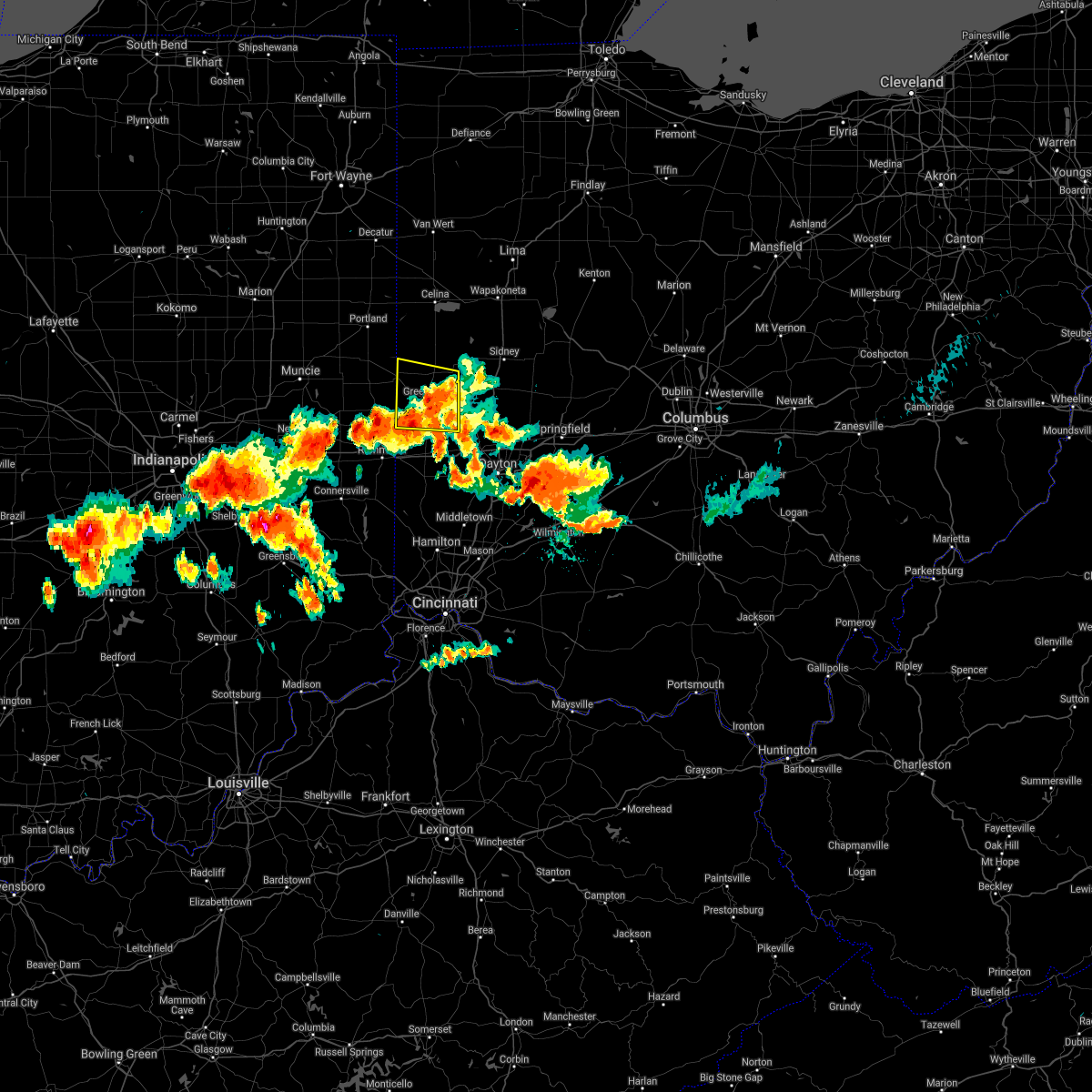 The severe thunderstorm warning for darke county will expire at 745 pm edt, the storm which prompted the warning has weakened below severe limits, and no longer poses an immediate threat to life or property. therefore, the warning will be allowed to expire. however heavy rain is still possible with this thunderstorm. a tornado watch remains in effect until 1100 pm edt for west central ohio. please report previous wind damage or hail to the national weather service by going to our website at weather.gov/iln and submitting your report via social media. The severe thunderstorm warning for darke county will expire at 745 pm edt, the storm which prompted the warning has weakened below severe limits, and no longer poses an immediate threat to life or property. therefore, the warning will be allowed to expire. however heavy rain is still possible with this thunderstorm. a tornado watch remains in effect until 1100 pm edt for west central ohio. please report previous wind damage or hail to the national weather service by going to our website at weather.gov/iln and submitting your report via social media.
|
| 6/18/2021 7:13 PM EDT |
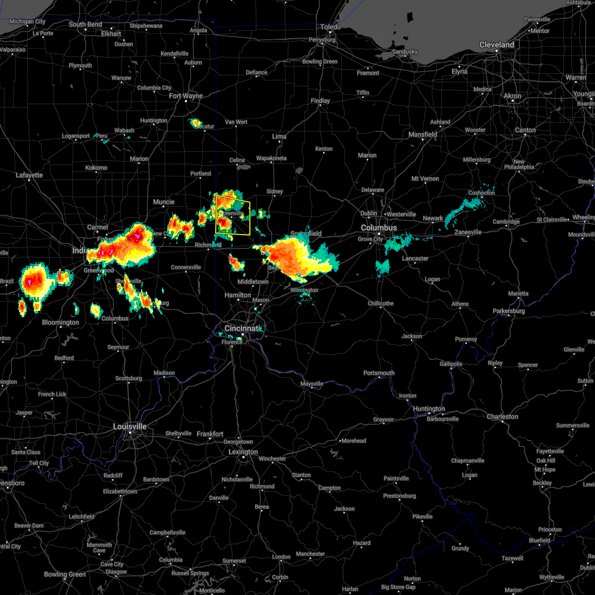 At 713 pm edt, a severe thunderstorm was located near greenville, moving east at 35 mph (trained weather spotters. at 711 pm dime size hail was reported in palestine). Hazards include 60 mph wind gusts and nickel size hail. expect damage to trees and power lines At 713 pm edt, a severe thunderstorm was located near greenville, moving east at 35 mph (trained weather spotters. at 711 pm dime size hail was reported in palestine). Hazards include 60 mph wind gusts and nickel size hail. expect damage to trees and power lines
|
| 6/18/2021 5:09 PM EDT |
 At 509 pm edt, a severe thunderstorm capable of producing a tornado was located near versailles, moving southeast at 30 mph (radar indicated rotation). Hazards include tornado. Flying debris will be dangerous to those caught without shelter. mobile homes will be damaged or destroyed. damage to roofs, windows, and vehicles will occur. Tree damage is likely. At 509 pm edt, a severe thunderstorm capable of producing a tornado was located near versailles, moving southeast at 30 mph (radar indicated rotation). Hazards include tornado. Flying debris will be dangerous to those caught without shelter. mobile homes will be damaged or destroyed. damage to roofs, windows, and vehicles will occur. Tree damage is likely.
|
| 6/18/2021 5:00 PM EDT |
 At 500 pm edt, a severe thunderstorm was located near versailles, moving southeast at 25 mph (radar indicated). Hazards include 60 mph wind gusts. Expect damage to trees and power lines. locations impacted include, piqua, versailles, covington, newport, bradford, webster, russia, osgood, north star, lockington, yorkshire, polo, bloomer, darke county airport, brock, eldora speedway, willowdell, horatio and houston. this includes i-75 in ohio between mile markers 83 and 87. A tornado watch remains in effect until 1100 pm edt for west central ohio. At 500 pm edt, a severe thunderstorm was located near versailles, moving southeast at 25 mph (radar indicated). Hazards include 60 mph wind gusts. Expect damage to trees and power lines. locations impacted include, piqua, versailles, covington, newport, bradford, webster, russia, osgood, north star, lockington, yorkshire, polo, bloomer, darke county airport, brock, eldora speedway, willowdell, horatio and houston. this includes i-75 in ohio between mile markers 83 and 87. A tornado watch remains in effect until 1100 pm edt for west central ohio.
|
| 6/18/2021 4:48 PM EDT |
 At 448 pm edt, a severe thunderstorm was located near versailles, moving southeast at 30 mph (radar indicated). Hazards include 60 mph wind gusts. expect damage to trees and power lines At 448 pm edt, a severe thunderstorm was located near versailles, moving southeast at 30 mph (radar indicated). Hazards include 60 mph wind gusts. expect damage to trees and power lines
|
| 6/12/2021 11:25 PM EDT |
 The severe thunderstorm warning for southwestern shelby, darke and northwestern miami counties will expire at 1130 pm edt, the storms which prompted the warning have weakened below severe limits, and no longer pose an immediate threat to life or property. therefore, the warning will be allowed to expire. however gusty winds are still possible with these thunderstorms. please report previous wind damage or hail to the national weather service by going to our website at weather.gov/iln and submitting your report via social media. The severe thunderstorm warning for southwestern shelby, darke and northwestern miami counties will expire at 1130 pm edt, the storms which prompted the warning have weakened below severe limits, and no longer pose an immediate threat to life or property. therefore, the warning will be allowed to expire. however gusty winds are still possible with these thunderstorms. please report previous wind damage or hail to the national weather service by going to our website at weather.gov/iln and submitting your report via social media.
|
| 6/12/2021 10:57 PM EDT |
 At 1056 pm edt, severe thunderstorms were located along a line extending from 6 miles south of st. henry to greenville to near new madison, moving east at 20 mph (radar indicated). Hazards include 60 mph wind gusts and quarter size hail. Minor hail damage to vehicles is possible. Expect wind damage to trees and power lines. At 1056 pm edt, severe thunderstorms were located along a line extending from 6 miles south of st. henry to greenville to near new madison, moving east at 20 mph (radar indicated). Hazards include 60 mph wind gusts and quarter size hail. Minor hail damage to vehicles is possible. Expect wind damage to trees and power lines.
|
| 8/10/2020 8:57 PM EDT |
 At 857 pm edt, a severe thunderstorm was located over versailles, moving east at 35 mph (radar indicated). Hazards include 60 mph wind gusts. Expect damage to trees and power lines. locations impacted include, piqua, greenville, versailles, covington, newport, bradford, fort loramie, ansonia, webster, russia, gettysburg, osgood, north star, rossburg, new weston, yorkshire, polo, darke county airport, state route 47 at us route 127 and eldora speedway. This includes i-75 in ohio between mile markers 80 and 83. At 857 pm edt, a severe thunderstorm was located over versailles, moving east at 35 mph (radar indicated). Hazards include 60 mph wind gusts. Expect damage to trees and power lines. locations impacted include, piqua, greenville, versailles, covington, newport, bradford, fort loramie, ansonia, webster, russia, gettysburg, osgood, north star, rossburg, new weston, yorkshire, polo, darke county airport, state route 47 at us route 127 and eldora speedway. This includes i-75 in ohio between mile markers 80 and 83.
|
| 8/10/2020 8:49 PM EDT |
 At 849 pm edt, a severe thunderstorm was located over versailles, moving southeast at 35 mph (radar indicated). Hazards include 60 mph wind gusts. Expect damage to trees and power lines. locations impacted include, piqua, greenville, versailles, covington, newport, bradford, union city, fort loramie, ansonia, webster, russia, gettysburg, osgood, north star, rossburg, new weston, yorkshire, polo, darke county airport and rose hill. This includes i-75 in ohio between mile markers 80 and 83. At 849 pm edt, a severe thunderstorm was located over versailles, moving southeast at 35 mph (radar indicated). Hazards include 60 mph wind gusts. Expect damage to trees and power lines. locations impacted include, piqua, greenville, versailles, covington, newport, bradford, union city, fort loramie, ansonia, webster, russia, gettysburg, osgood, north star, rossburg, new weston, yorkshire, polo, darke county airport and rose hill. This includes i-75 in ohio between mile markers 80 and 83.
|
| 8/10/2020 8:36 PM EDT |
 At 835 pm edt, a severe thunderstorm was located near st. henry, moving east at 35 mph (radar indicated). Hazards include 60 mph wind gusts. expect damage to trees and power lines At 835 pm edt, a severe thunderstorm was located near st. henry, moving east at 35 mph (radar indicated). Hazards include 60 mph wind gusts. expect damage to trees and power lines
|
| 7/21/2020 5:16 PM EDT |
 At 515 pm edt, a severe thunderstorm was located over versailles, moving east at 45 mph (radar indicated). Hazards include 60 mph wind gusts. Expect damage to trees and power lines. locations impacted include, sidney, piqua, greenville, versailles, covington, newport, bradford, hardin, webster, russia, gettysburg, fletcher, port jefferson, north star, lockington, yorkshire, polo, newbern, darke county airport and state route 47 at us route 127. This includes i-75 in ohio between mile markers 78 and 95. At 515 pm edt, a severe thunderstorm was located over versailles, moving east at 45 mph (radar indicated). Hazards include 60 mph wind gusts. Expect damage to trees and power lines. locations impacted include, sidney, piqua, greenville, versailles, covington, newport, bradford, hardin, webster, russia, gettysburg, fletcher, port jefferson, north star, lockington, yorkshire, polo, newbern, darke county airport and state route 47 at us route 127. This includes i-75 in ohio between mile markers 78 and 95.
|
| 7/21/2020 4:55 PM EDT |
 At 454 pm edt, a severe thunderstorm was located over union city, moving east at 45 mph (radar indicated). Hazards include 60 mph wind gusts. expect damage to trees and power lines At 454 pm edt, a severe thunderstorm was located over union city, moving east at 45 mph (radar indicated). Hazards include 60 mph wind gusts. expect damage to trees and power lines
|
| 7/19/2020 4:12 PM EDT |
 The severe thunderstorm warning for central shelby, southern darke and northwestern miami counties will expire at 415 pm edt, the storm which prompted the warning has moved out of the area. therefore, the warning will be allowed to expire. however gusty winds are still possible with this thunderstorm. please report previous wind damage or hail to the national weather service by going to our website at weather.gov/iln and submitting your report via social media. remember, a severe thunderstorm warning still remains in effect for eastern shelby and miami counties!. The severe thunderstorm warning for central shelby, southern darke and northwestern miami counties will expire at 415 pm edt, the storm which prompted the warning has moved out of the area. therefore, the warning will be allowed to expire. however gusty winds are still possible with this thunderstorm. please report previous wind damage or hail to the national weather service by going to our website at weather.gov/iln and submitting your report via social media. remember, a severe thunderstorm warning still remains in effect for eastern shelby and miami counties!.
|
| 7/19/2020 4:02 PM EDT |
 At 402 pm edt, a severe thunderstorm was located over bradford, moving east at 35 mph (radar indicated). Hazards include 60 mph wind gusts. Expect damage to trees and power lines. locations impacted include, sidney, piqua, greenville, versailles, covington, arcanum, newport, bradford, anna, jackson center, pleasant hill, hardin, webster, wayne lakes, russia, gettysburg, laura, pitsburg, potsdam and ludlow falls. This includes i-75 in ohio between mile markers 83 and 102. At 402 pm edt, a severe thunderstorm was located over bradford, moving east at 35 mph (radar indicated). Hazards include 60 mph wind gusts. Expect damage to trees and power lines. locations impacted include, sidney, piqua, greenville, versailles, covington, arcanum, newport, bradford, anna, jackson center, pleasant hill, hardin, webster, wayne lakes, russia, gettysburg, laura, pitsburg, potsdam and ludlow falls. This includes i-75 in ohio between mile markers 83 and 102.
|
| 7/19/2020 3:52 PM EDT |
 At 352 pm edt, a severe thunderstorm was located near versailles, moving east at 35 mph (radar indicated). Hazards include 60 mph wind gusts. Expect damage to trees and power lines. locations impacted include, sidney, piqua, greenville, versailles, covington, arcanum, newport, bradford, anna, fort loramie, jackson center, pleasant hill, ansonia, botkins, hardin, webster, wayne lakes, russia, gettysburg and laura. This includes i-75 in ohio between mile markers 83 and 104. At 352 pm edt, a severe thunderstorm was located near versailles, moving east at 35 mph (radar indicated). Hazards include 60 mph wind gusts. Expect damage to trees and power lines. locations impacted include, sidney, piqua, greenville, versailles, covington, arcanum, newport, bradford, anna, fort loramie, jackson center, pleasant hill, ansonia, botkins, hardin, webster, wayne lakes, russia, gettysburg and laura. This includes i-75 in ohio between mile markers 83 and 104.
|
| 7/19/2020 3:38 PM EDT |
 At 338 pm edt, a severe thunderstorm was located near ansonia, moving east at 35 mph (radar indicated). Hazards include 60 mph wind gusts. expect damage to trees and power lines At 338 pm edt, a severe thunderstorm was located near ansonia, moving east at 35 mph (radar indicated). Hazards include 60 mph wind gusts. expect damage to trees and power lines
|
| 6/10/2020 4:35 PM EDT |
 At 433 pm edt, a severe thunderstorm was located near versailles, moving northeast at 35 mph (radar indicated). Hazards include 60 mph wind gusts and penny size hail. Expect damage to trees and power lines. locations impacted include, wapakoneta, st. marys, fort shawnee, new bremen, minster, versailles, newport, cridersville, fort loramie, new knoxville, moulton, russia, osgood, chickasaw, north star, buckland, rossburg, kettlersville, montezuma and new weston. This includes i-75 in ohio between mile markers 108 and 118. At 433 pm edt, a severe thunderstorm was located near versailles, moving northeast at 35 mph (radar indicated). Hazards include 60 mph wind gusts and penny size hail. Expect damage to trees and power lines. locations impacted include, wapakoneta, st. marys, fort shawnee, new bremen, minster, versailles, newport, cridersville, fort loramie, new knoxville, moulton, russia, osgood, chickasaw, north star, buckland, rossburg, kettlersville, montezuma and new weston. This includes i-75 in ohio between mile markers 108 and 118.
|
| 6/10/2020 4:21 PM EDT |
 At 420 pm edt, a severe thunderstorm was located near greenville, moving northeast at 35 mph (radar indicated). Hazards include 60 mph wind gusts and penny size hail. expect damage to trees and power lines At 420 pm edt, a severe thunderstorm was located near greenville, moving northeast at 35 mph (radar indicated). Hazards include 60 mph wind gusts and penny size hail. expect damage to trees and power lines
|
| 5/14/2020 4:19 PM EDT | Several tree limbs downed in versailles. time estimated by rada in darke county OH, 0.3 miles NNW of Versailles, OH |
| 5/10/2020 3:04 PM EDT |
 At 303 pm edt, severe thunderstorms were located along a line extending from near bradford to near lewisburg, moving east at 50 mph. these storms have produced damage in southern darke county (radar indicated). Hazards include 60 mph wind gusts and penny size hail. Expect damage to trees and power lines. locations impacted include, dayton, huber heights, troy, trotwood, sidney, piqua, vandalia, englewood, greenville, tipp city, west milton, versailles, covington, arcanum, newport, bradford, lewisburg, pleasant hill, brown and hardin. this includes the following interstates, i-70 in ohio between mile markers 10 and 40. I-75 in ohio between mile markers 56 and 95. At 303 pm edt, severe thunderstorms were located along a line extending from near bradford to near lewisburg, moving east at 50 mph. these storms have produced damage in southern darke county (radar indicated). Hazards include 60 mph wind gusts and penny size hail. Expect damage to trees and power lines. locations impacted include, dayton, huber heights, troy, trotwood, sidney, piqua, vandalia, englewood, greenville, tipp city, west milton, versailles, covington, arcanum, newport, bradford, lewisburg, pleasant hill, brown and hardin. this includes the following interstates, i-70 in ohio between mile markers 10 and 40. I-75 in ohio between mile markers 56 and 95.
|
| 5/10/2020 2:56 PM EDT |
 The severe thunderstorm warning for eastern wayne, southwestern shelby, northern preble, darke and northwestern miami counties will expire at 300 pm edt, an additional severe thunderstorm warning has been issued for portions of darke, preble, shelby, and miami counties until 345 pm. please report previous wind damage or hail to the national weather service by going to our website at weather.gov/iln and submitting your report via social media. The severe thunderstorm warning for eastern wayne, southwestern shelby, northern preble, darke and northwestern miami counties will expire at 300 pm edt, an additional severe thunderstorm warning has been issued for portions of darke, preble, shelby, and miami counties until 345 pm. please report previous wind damage or hail to the national weather service by going to our website at weather.gov/iln and submitting your report via social media.
|
| 5/10/2020 2:54 PM EDT |
 At 253 pm edt, severe thunderstorms were located along a line extending from near versailles to near new paris, moving east at 45 mph (radar indicated). Hazards include 60 mph wind gusts and penny size hail. expect damage to trees and power lines At 253 pm edt, severe thunderstorms were located along a line extending from near versailles to near new paris, moving east at 45 mph (radar indicated). Hazards include 60 mph wind gusts and penny size hail. expect damage to trees and power lines
|
| 5/10/2020 2:49 PM EDT |
 At 249 pm edt, severe thunderstorms were located along a line extending from near ansonia to richmond, moving east at 45 mph (radar indicated). Hazards include 60 mph wind gusts and penny size hail. Expect damage to trees and power lines. locations impacted include, richmond, greenville, centerville, versailles, covington, arcanum, newport, bradford, lewisburg, new paris, ansonia, new madison, fountain city, webster, wayne lakes, russia, gettysburg, eldorado, verona and west manchester. this includes the following interstates, i-70 in indiana between mile markers 144 and 156. I-70 in ohio between mile markers 0 and 15. At 249 pm edt, severe thunderstorms were located along a line extending from near ansonia to richmond, moving east at 45 mph (radar indicated). Hazards include 60 mph wind gusts and penny size hail. Expect damage to trees and power lines. locations impacted include, richmond, greenville, centerville, versailles, covington, arcanum, newport, bradford, lewisburg, new paris, ansonia, new madison, fountain city, webster, wayne lakes, russia, gettysburg, eldorado, verona and west manchester. this includes the following interstates, i-70 in indiana between mile markers 144 and 156. I-70 in ohio between mile markers 0 and 15.
|
| 5/10/2020 2:37 PM EDT |
 At 236 pm edt, severe thunderstorms were located along a line extending from near union city to near cambridge city, moving northeast at 65 mph (radar indicated). Hazards include 60 mph wind gusts and penny size hail. expect damage to trees and power lines At 236 pm edt, severe thunderstorms were located along a line extending from near union city to near cambridge city, moving northeast at 65 mph (radar indicated). Hazards include 60 mph wind gusts and penny size hail. expect damage to trees and power lines
|
| 4/8/2020 2:21 AM EDT |
 The severe thunderstorm warning for shelby, northern darke and northern miami counties will expire at 230 am edt, the storm which prompted the warning has weakened below severe limits, and no longer poses an immediate threat to life or property. therefore, the warning will be allowed to expire. these storms may still produce gusty winds and small hail. a severe thunderstorm watch remains in effect until 300 am edt for west central ohio. a severe thunderstorm watch also remains in effect until 600 am edt for west central ohio. please report previous wind damage or hail to the national weather service by going to our website at weather.gov/iln and submitting your report via social media. The severe thunderstorm warning for shelby, northern darke and northern miami counties will expire at 230 am edt, the storm which prompted the warning has weakened below severe limits, and no longer poses an immediate threat to life or property. therefore, the warning will be allowed to expire. these storms may still produce gusty winds and small hail. a severe thunderstorm watch remains in effect until 300 am edt for west central ohio. a severe thunderstorm watch also remains in effect until 600 am edt for west central ohio. please report previous wind damage or hail to the national weather service by going to our website at weather.gov/iln and submitting your report via social media.
|
| 4/8/2020 2:03 AM EDT |
 At 203 am edt, a severe thunderstorm was located over versailles, moving southeast at 40 mph (radar indicated). Hazards include 60 mph wind gusts and penny size hail. Expect damage to trees and power lines. locations impacted include, troy, sidney, piqua, greenville, versailles, covington, newport, bradford, union city, fort loramie, ansonia, hardin, webster, russia, gettysburg, fletcher, port jefferson, osgood, casstown and north star. This includes i-75 in ohio between mile markers 75 and 97. At 203 am edt, a severe thunderstorm was located over versailles, moving southeast at 40 mph (radar indicated). Hazards include 60 mph wind gusts and penny size hail. Expect damage to trees and power lines. locations impacted include, troy, sidney, piqua, greenville, versailles, covington, newport, bradford, union city, fort loramie, ansonia, hardin, webster, russia, gettysburg, fletcher, port jefferson, osgood, casstown and north star. This includes i-75 in ohio between mile markers 75 and 97.
|
| 4/8/2020 1:47 AM EDT |
 At 147 am edt, a severe thunderstorm was located 7 miles north of ansonia, moving east at 55 mph (radar indicated). Hazards include 60 mph wind gusts and penny size hail. expect damage to trees and power lines At 147 am edt, a severe thunderstorm was located 7 miles north of ansonia, moving east at 55 mph (radar indicated). Hazards include 60 mph wind gusts and penny size hail. expect damage to trees and power lines
|
| 8/8/2019 10:26 PM EDT | Trees and power lines reported down. barn destroyed. damage to grain silos. time estimated from rada in darke county OH, 5.3 miles E of Versailles, OH |
| 8/8/2019 7:50 PM EDT |
 At 749 pm edt, a severe thunderstorm was located near st. henry, moving southeast at 30 mph (radar indicated). Hazards include 60 mph wind gusts and quarter size hail. Minor hail damage to vehicles is possible. Expect wind damage to trees and power lines. At 749 pm edt, a severe thunderstorm was located near st. henry, moving southeast at 30 mph (radar indicated). Hazards include 60 mph wind gusts and quarter size hail. Minor hail damage to vehicles is possible. Expect wind damage to trees and power lines.
|
| 7/18/2019 3:58 PM EDT |
 At 357 pm edt, a severe thunderstorm was located near newport, moving southeast at 30 mph (radar indicated). Hazards include 60 mph wind gusts. Expect damage to trees and power lines. locations impacted include, sidney, piqua, versailles, covington, newport, bradford, fort loramie, hardin, webster, russia, lockington, polo, newbern, bloomer, lake loramie state park, plattsville, brock, farrington, willowdell and horatio. This includes i-75 in ohio between mile markers 79 and 92. At 357 pm edt, a severe thunderstorm was located near newport, moving southeast at 30 mph (radar indicated). Hazards include 60 mph wind gusts. Expect damage to trees and power lines. locations impacted include, sidney, piqua, versailles, covington, newport, bradford, fort loramie, hardin, webster, russia, lockington, polo, newbern, bloomer, lake loramie state park, plattsville, brock, farrington, willowdell and horatio. This includes i-75 in ohio between mile markers 79 and 92.
|
| 7/18/2019 3:48 PM EDT |
 At 348 pm edt, a severe thunderstorm was located over newport, moving southeast at 30 mph (radar indicated). Hazards include 60 mph wind gusts. expect damage to trees and power lines At 348 pm edt, a severe thunderstorm was located over newport, moving southeast at 30 mph (radar indicated). Hazards include 60 mph wind gusts. expect damage to trees and power lines
|
| 5/27/2019 10:55 PM EDT |
 The severe thunderstorm warning for western shelby, darke, southwestern auglaize, southern mercer and northwestern miami counties will expire at 1100 pm edt, the storm which prompted the warning has moved out of the area. therefore, the warning will be allowed to expire. however gusty winds are still possible with this thunderstorm. a tornado watch remains in effect until 200 am edt for west central ohio. please report previous wind damage or hail to the national weather service by going to our website at weather.gov/iln and submitting your report via social media. The severe thunderstorm warning for western shelby, darke, southwestern auglaize, southern mercer and northwestern miami counties will expire at 1100 pm edt, the storm which prompted the warning has moved out of the area. therefore, the warning will be allowed to expire. however gusty winds are still possible with this thunderstorm. a tornado watch remains in effect until 200 am edt for west central ohio. please report previous wind damage or hail to the national weather service by going to our website at weather.gov/iln and submitting your report via social media.
|
| 5/27/2019 10:21 PM EDT |
 At 1021 pm edt, a severe thunderstorm was located near ansonia, moving east at 35 mph (radar indicated). Hazards include 60 mph wind gusts and quarter size hail. Minor hail damage to vehicles is possible. expect wind damage to trees and power lines. locations impacted include, greenville, new bremen, minster, versailles, covington, st. henry, newport, bradford, union city, fort loramie, fort recovery, ansonia, webster, russia, gettysburg, osgood, chickasaw, burkettsville, north star and rossburg. A tornado watch remains in effect until 200 am edt for west central ohio. At 1021 pm edt, a severe thunderstorm was located near ansonia, moving east at 35 mph (radar indicated). Hazards include 60 mph wind gusts and quarter size hail. Minor hail damage to vehicles is possible. expect wind damage to trees and power lines. locations impacted include, greenville, new bremen, minster, versailles, covington, st. henry, newport, bradford, union city, fort loramie, fort recovery, ansonia, webster, russia, gettysburg, osgood, chickasaw, burkettsville, north star and rossburg. A tornado watch remains in effect until 200 am edt for west central ohio.
|
| 5/27/2019 10:11 PM EDT |
 At 1010 pm edt, a severe thunderstorm was located near union city, moving east at 35 mph (radar indicated). Hazards include 60 mph wind gusts and quarter size hail. Minor hail damage to vehicles is possible. Expect wind damage to trees and power lines. At 1010 pm edt, a severe thunderstorm was located near union city, moving east at 35 mph (radar indicated). Hazards include 60 mph wind gusts and quarter size hail. Minor hail damage to vehicles is possible. Expect wind damage to trees and power lines.
|
| 5/26/2019 6:22 AM EDT |
 At 621 am edt, severe thunderstorms were located along a line extending from near bradford to near new madison, moving east at 35 mph (radar indicated). Hazards include 60 mph wind gusts. Expect damage to trees and power lines. Locations impacted include, greenville, versailles, arcanum, bradford, new madison, webster, wayne lakes, gettysburg, pitsburg, gordon, palestine, ithaca, castine, union corners, darke county airport, abbottsville, willowdell, horatio and pikeville. At 621 am edt, severe thunderstorms were located along a line extending from near bradford to near new madison, moving east at 35 mph (radar indicated). Hazards include 60 mph wind gusts. Expect damage to trees and power lines. Locations impacted include, greenville, versailles, arcanum, bradford, new madison, webster, wayne lakes, gettysburg, pitsburg, gordon, palestine, ithaca, castine, union corners, darke county airport, abbottsville, willowdell, horatio and pikeville.
|
| 5/26/2019 5:53 AM EDT |
 At 553 am edt, severe thunderstorms were located along a line extending from 6 miles northwest of ansonia to near new madison, moving east at 40 mph (radar indicated). Hazards include 60 mph wind gusts. expect damage to trees and power lines At 553 am edt, severe thunderstorms were located along a line extending from 6 miles northwest of ansonia to near new madison, moving east at 40 mph (radar indicated). Hazards include 60 mph wind gusts. expect damage to trees and power lines
|
| 4/14/2019 4:25 PM EDT |
 At 424 pm edt, a severe thunderstorm was located over bradford, moving northeast at 50 mph (radar indicated). Hazards include 60 mph wind gusts and quarter size hail. Minor hail damage to vehicles is possible. Expect wind damage to trees and power lines. At 424 pm edt, a severe thunderstorm was located over bradford, moving northeast at 50 mph (radar indicated). Hazards include 60 mph wind gusts and quarter size hail. Minor hail damage to vehicles is possible. Expect wind damage to trees and power lines.
|
| 5/21/2018 5:16 PM EDT |
 At 516 pm edt, a severe thunderstorm was located near ansonia, moving northeast at 30 mph (radar indicated). Hazards include 60 mph wind gusts and penny size hail. Expect damage to trees and power lines. locations impacted include, greenville, coldwater, versailles, st. Henry, ansonia, osgood, chickasaw, burkettsville, north star, rossburg, new weston, yorkshire, darke county airport, rose hill, maria stein, brock, state route 47 at us route 127, eldora speedway, carthagena and willowdell. At 516 pm edt, a severe thunderstorm was located near ansonia, moving northeast at 30 mph (radar indicated). Hazards include 60 mph wind gusts and penny size hail. Expect damage to trees and power lines. locations impacted include, greenville, coldwater, versailles, st. Henry, ansonia, osgood, chickasaw, burkettsville, north star, rossburg, new weston, yorkshire, darke county airport, rose hill, maria stein, brock, state route 47 at us route 127, eldora speedway, carthagena and willowdell.
|
| 5/21/2018 5:05 PM EDT |
 At 505 pm edt, a severe thunderstorm was located near union city, moving northeast at 30 mph (radar indicated). Hazards include 60 mph wind gusts and quarter size hail. Minor hail damage to vehicles is possible. Expect wind damage to trees and power lines. At 505 pm edt, a severe thunderstorm was located near union city, moving northeast at 30 mph (radar indicated). Hazards include 60 mph wind gusts and quarter size hail. Minor hail damage to vehicles is possible. Expect wind damage to trees and power lines.
|
| 11/5/2017 5:01 PM EDT |
 At 401 pm est, a severe thunderstorm was located over ansonia, moving east at 55 mph (radar indicated). Hazards include 60 mph wind gusts and penny size hail. Expect damage to trees and power lines. locations impacted include, greenville, versailles, union city, ansonia, osgood, north star, rossburg, new weston, yorkshire, north dayton, darke county airport, rose hill, cosmos, sharpeye, brock, state route 47 at us route 127, eldora speedway, willowdell, sharps crossing and pikeville. A tornado watch remains in effect until 700 pm est for west central ohio. At 401 pm est, a severe thunderstorm was located over ansonia, moving east at 55 mph (radar indicated). Hazards include 60 mph wind gusts and penny size hail. Expect damage to trees and power lines. locations impacted include, greenville, versailles, union city, ansonia, osgood, north star, rossburg, new weston, yorkshire, north dayton, darke county airport, rose hill, cosmos, sharpeye, brock, state route 47 at us route 127, eldora speedway, willowdell, sharps crossing and pikeville. A tornado watch remains in effect until 700 pm est for west central ohio.
|
| 11/5/2017 4:45 PM EDT |
 At 345 pm est, a severe thunderstorm was located near winchester, moving east at 55 mph (radar indicated). Hazards include 60 mph wind gusts and penny size hail. expect damage to trees and power lines At 345 pm est, a severe thunderstorm was located near winchester, moving east at 55 mph (radar indicated). Hazards include 60 mph wind gusts and penny size hail. expect damage to trees and power lines
|
| 7/21/2017 7:28 AM EDT |
 At 728 am edt, severe thunderstorms were located along a line extending from 6 miles west of minster to near carlisle, moving east at 55 mph (radar indicated). Hazards include 60 mph wind gusts. expect damage to trees and power lines At 728 am edt, severe thunderstorms were located along a line extending from 6 miles west of minster to near carlisle, moving east at 55 mph (radar indicated). Hazards include 60 mph wind gusts. expect damage to trees and power lines
|
| 7/16/2017 9:21 PM EDT |
 At 921 pm edt, a severe thunderstorm was located near greenville, moving southeast at 15 mph (radar indicated). Hazards include 60 mph wind gusts and quarter size hail. Minor hail damage to vehicles is possible. Expect wind damage to trees and power lines. At 921 pm edt, a severe thunderstorm was located near greenville, moving southeast at 15 mph (radar indicated). Hazards include 60 mph wind gusts and quarter size hail. Minor hail damage to vehicles is possible. Expect wind damage to trees and power lines.
|
| 6/5/2017 5:11 PM EDT |
 The severe thunderstorm warning for southwestern shelby. northeastern darke and northwestern miami counties will expire at 515 pm edt. the storm which prompted the warning has weakened below severe limits, and no longer poses an immediate threat to life or property. therefore, the warning will be allowed to expire. However small hail. The severe thunderstorm warning for southwestern shelby. northeastern darke and northwestern miami counties will expire at 515 pm edt. the storm which prompted the warning has weakened below severe limits, and no longer poses an immediate threat to life or property. therefore, the warning will be allowed to expire. However small hail.
|
| 6/5/2017 5:00 PM EDT |
 At 500 pm edt, a severe thunderstorm was located over versailles, moving south at 25 mph (radar indicated). Hazards include 60 mph wind gusts and quarter size hail. Hail damage to vehicles is expected. expect wind damage to roofs, siding, and trees. locations impacted include, troy, piqua, greenville, versailles, covington, newport, bradford, pleasant hill, webster, russia, gettysburg, lockington, union corners, polo, newbern, bloomer, darke county airport, abbottsville, farrington and circle hill. This includes i-75 in ohio between mile markers 76 and 85. At 500 pm edt, a severe thunderstorm was located over versailles, moving south at 25 mph (radar indicated). Hazards include 60 mph wind gusts and quarter size hail. Hail damage to vehicles is expected. expect wind damage to roofs, siding, and trees. locations impacted include, troy, piqua, greenville, versailles, covington, newport, bradford, pleasant hill, webster, russia, gettysburg, lockington, union corners, polo, newbern, bloomer, darke county airport, abbottsville, farrington and circle hill. This includes i-75 in ohio between mile markers 76 and 85.
|
| 6/5/2017 4:49 PM EDT |
 At 449 pm edt, a severe thunderstorm was located near versailles, moving south at 25 mph (radar indicated). Hazards include 60 mph wind gusts and quarter size hail. Hail damage to vehicles is expected. expect wind damage to roofs, siding, and trees. locations impacted include, troy, piqua, greenville, versailles, covington, newport, bradford, fort loramie, pleasant hill, ansonia, hardin, webster, russia, gettysburg, osgood, north star, rossburg, lockington, new weston and yorkshire. This includes i-75 in ohio between mile markers 76 and 85. At 449 pm edt, a severe thunderstorm was located near versailles, moving south at 25 mph (radar indicated). Hazards include 60 mph wind gusts and quarter size hail. Hail damage to vehicles is expected. expect wind damage to roofs, siding, and trees. locations impacted include, troy, piqua, greenville, versailles, covington, newport, bradford, fort loramie, pleasant hill, ansonia, hardin, webster, russia, gettysburg, osgood, north star, rossburg, lockington, new weston and yorkshire. This includes i-75 in ohio between mile markers 76 and 85.
|
| 6/5/2017 4:33 PM EDT |
 At 433 pm edt, a severe thunderstorm was located near st. henry, moving south at 25 mph (radar indicated). Hazards include 60 mph wind gusts and quarter size hail. Hail damage to vehicles is expected. Expect wind damage to roofs, siding, and trees. At 433 pm edt, a severe thunderstorm was located near st. henry, moving south at 25 mph (radar indicated). Hazards include 60 mph wind gusts and quarter size hail. Hail damage to vehicles is expected. Expect wind damage to roofs, siding, and trees.
|
| 5/19/2017 4:05 PM EDT |
 The severe thunderstorm warning for southeastern darke county will expire at 415 pm edt, the storm which prompted the warning has moved out of the area. therefore, the warning will be allowed to expire. a severe thunderstorm watch remains in effect until 1100 pm edt for west central ohio. please report previous wind damage or hail to the national weather service by going to our website at weather.gov/iln and submitting your report via social media. The severe thunderstorm warning for southeastern darke county will expire at 415 pm edt, the storm which prompted the warning has moved out of the area. therefore, the warning will be allowed to expire. a severe thunderstorm watch remains in effect until 1100 pm edt for west central ohio. please report previous wind damage or hail to the national weather service by going to our website at weather.gov/iln and submitting your report via social media.
|
| 5/19/2017 3:58 PM EDT |
 At 357 pm edt, a severe thunderstorm was located over bradford, moving east at 35 mph (radar indicated). Hazards include 60 mph wind gusts and penny size hail. Expect damage to roofs, siding, and trees. Locations impacted include, greenville, versailles, arcanum, bradford, webster, gettysburg, union corners, abbottsville, darke county airport and horatio. At 357 pm edt, a severe thunderstorm was located over bradford, moving east at 35 mph (radar indicated). Hazards include 60 mph wind gusts and penny size hail. Expect damage to roofs, siding, and trees. Locations impacted include, greenville, versailles, arcanum, bradford, webster, gettysburg, union corners, abbottsville, darke county airport and horatio.
|
| 5/19/2017 3:50 PM EDT |
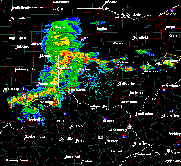 At 350 pm edt, a severe thunderstorm was located near greenville, moving east at 35 mph (radar indicated). Hazards include 60 mph wind gusts and penny size hail. Expect damage to roofs, siding, and trees. Locations impacted include, greenville, versailles, arcanum, bradford, ansonia, webster, wayne lakes, gettysburg, union corners, darke county airport, state route 47 at us route 127, abbottsville, horatio and pikeville. At 350 pm edt, a severe thunderstorm was located near greenville, moving east at 35 mph (radar indicated). Hazards include 60 mph wind gusts and penny size hail. Expect damage to roofs, siding, and trees. Locations impacted include, greenville, versailles, arcanum, bradford, ansonia, webster, wayne lakes, gettysburg, union corners, darke county airport, state route 47 at us route 127, abbottsville, horatio and pikeville.
|
| 5/19/2017 3:36 PM EDT |
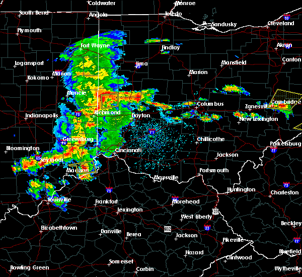 At 336 pm edt, a severe thunderstorm was located near greenville, moving east at 35 mph (radar indicated). Hazards include 60 mph wind gusts and penny size hail. expect damage to roofs, siding, and trees At 336 pm edt, a severe thunderstorm was located near greenville, moving east at 35 mph (radar indicated). Hazards include 60 mph wind gusts and penny size hail. expect damage to roofs, siding, and trees
|
| 8/20/2016 6:15 PM EDT |
 At 615 pm edt, a severe thunderstorm capable of producing a tornado was located over ansonia, moving northeast at 35 mph (radar indicated rotation). Hazards include tornado. Flying debris will be dangerous to those caught without shelter. mobile homes will be damaged or destroyed. damage to roofs, windows, and vehicles will occur. Tree damage is likely. At 615 pm edt, a severe thunderstorm capable of producing a tornado was located over ansonia, moving northeast at 35 mph (radar indicated rotation). Hazards include tornado. Flying debris will be dangerous to those caught without shelter. mobile homes will be damaged or destroyed. damage to roofs, windows, and vehicles will occur. Tree damage is likely.
|
| 8/20/2016 5:59 PM EDT |
 At 558 pm edt, a severe thunderstorm was located near union city, moving east at 45 mph (radar indicated). Hazards include 60 mph wind gusts. Expect damage to roofs. siding. And trees. At 558 pm edt, a severe thunderstorm was located near union city, moving east at 45 mph (radar indicated). Hazards include 60 mph wind gusts. Expect damage to roofs. siding. And trees.
|
| 7/13/2016 6:46 PM EDT |
 At 646 pm edt, severe thunderstorms were located along a line extending from near celina to near minster to near bradford, moving northeast at 50 mph (radar indicated). Hazards include 60 mph wind gusts. Expect damage to roofs. siding. and trees. locations impacted include, sidney, celina, wapakoneta, st. Marys, coldwater, fort shawnee, new bremen, minster, versailles, cridersville, anna, fort loramie, botkins, new knoxville, hardin, moulton, webster, mendon, russia and port jefferson. At 646 pm edt, severe thunderstorms were located along a line extending from near celina to near minster to near bradford, moving northeast at 50 mph (radar indicated). Hazards include 60 mph wind gusts. Expect damage to roofs. siding. and trees. locations impacted include, sidney, celina, wapakoneta, st. Marys, coldwater, fort shawnee, new bremen, minster, versailles, cridersville, anna, fort loramie, botkins, new knoxville, hardin, moulton, webster, mendon, russia and port jefferson.
|
| 7/13/2016 6:33 PM EDT |
 At 633 pm edt, severe thunderstorms were located along a line extending from 7 miles northwest of coldwater to near st. henry to near greenville, moving northeast at 50 mph (radar indicated). Hazards include 60 mph wind gusts. Expect damage to roofs. siding. And trees. At 633 pm edt, severe thunderstorms were located along a line extending from 7 miles northwest of coldwater to near st. henry to near greenville, moving northeast at 50 mph (radar indicated). Hazards include 60 mph wind gusts. Expect damage to roofs. siding. And trees.
|
| 3/14/2016 3:25 PM EDT | The tornado warning for northeastern darke and southwestern shelby counties will expire at 330 pm edt, the storm which prompted the warning has weakened below severe limits. therefore the warning will be allowed to expire. please report previous tornadoes, wind damage or hail to the national weather service by going to our website at weather.gov/iln and submit your report via social media. |
| 3/14/2016 3:19 PM EDT |
 At 319 pm edt, radar indicated a severe thunderstorm capable of producing a tornado located over versailles, moving north at 25 mph. locations impacted include, versailles, fort loramie, russia, osgood, yorkshire, newport in shelby county, houston and willowdell. At 319 pm edt, radar indicated a severe thunderstorm capable of producing a tornado located over versailles, moving north at 25 mph. locations impacted include, versailles, fort loramie, russia, osgood, yorkshire, newport in shelby county, houston and willowdell.
|
| 3/14/2016 3:12 PM EDT |
 At 312 pm edt, radar indicated a severe thunderstorm with strong rotation located over versailles, moving north at 30 mph. a tornado is occurring or imminent. locations impacted include, versailles, fort loramie, webster, russia, osgood, yorkshire, newport in shelby county, bloomer, horatio, houston, willowdell and darke county airport. At 312 pm edt, radar indicated a severe thunderstorm with strong rotation located over versailles, moving north at 30 mph. a tornado is occurring or imminent. locations impacted include, versailles, fort loramie, webster, russia, osgood, yorkshire, newport in shelby county, bloomer, horatio, houston, willowdell and darke county airport.
|
| 3/14/2016 3:04 PM EDT |
 At 304 pm edt, radar indicated a severe thunderstorm capable of producing a tornado over bradford, moving north at 30 mph. At 304 pm edt, radar indicated a severe thunderstorm capable of producing a tornado over bradford, moving north at 30 mph.
|
| 12/23/2015 5:17 PM EST | At 517 pm est, radar indicated a severe thunderstorm capable of producing a tornado located near arcanum, moving east at 50 mph. another area of rotation that may produce a tornado was northeast of greenville. locations impacted include, greenville, versailles, covington, arcanum, bradford, webster, gettysburg, laura, pitsburg, horatio, union corners, bloomer, circle hill and abbottsville. |
| 12/23/2015 5:06 PM EST | At 506 pm est, radar indicated severe thunderstorms located along a line extending from 7 miles north of union city to near lewisburg, moving east at 55 mph. storm hazards include, damaging winds to 70 mph, very heavy rain which may cause minor flooding, locations impacted include, richmond, greenville, versailles, arcanum, hagerstown, union city, new paris, ansonia, new madison, fountain city, franklin, webster, wayne lakes, gettysburg, eldorado, verona, west manchester, greens fork, pitsburg and spring grove. this includes i-70 in indiana between mile markers 134 and 154. |
| 12/23/2015 5:06 PM EST | At 506 pm est, radar indicated severe thunderstorms located along a line extending from 7 miles north of union city to near lewisburg, moving east at 55 mph. storm hazards include, damaging winds to 70 mph, very heavy rain which may cause minor flooding, locations impacted include, richmond, greenville, versailles, arcanum, hagerstown, union city, new paris, ansonia, new madison, fountain city, franklin, webster, wayne lakes, gettysburg, eldorado, verona, west manchester, greens fork, pitsburg and spring grove. this includes i-70 in indiana between mile markers 134 and 154. |
| 12/23/2015 4:27 PM EST | At 427 pm est, radar indicated severe thunderstorms located along a line extending from near muncie to dublin, moving east at 60 mph. storm hazards include, winds to 60 mph, very heavy rain which may cause minor flooding,. |
| 12/23/2015 4:27 PM EST | At 427 pm est, radar indicated severe thunderstorms located along a line extending from near muncie to dublin, moving east at 60 mph. storm hazards include, winds to 60 mph, very heavy rain which may cause minor flooding,. |
| 5/11/2015 3:27 PM EDT | At 326 pm edt, radar continued to indicate severe thunderstorms located along a line extending from union city to west florence, moving northeast at 60 mph. storm hazards include, winds to 60 mph, penny size hail, locations impacted include, greenville, ansonia, lewisburg, arcanum and versailles. in addition, west florence, palestine, sharpeye, new hope, sharps crossing, new madison, eldorado and rossburg are near the path of these storms. this includes the following interstate, i-70 between mile markers 0 and 21 in ohio, , 0.75in. |
| 5/11/2015 3:27 PM EDT | At 326 pm edt, radar continued to indicate severe thunderstorms located along a line extending from union city to west florence, moving northeast at 60 mph. storm hazards include, winds to 60 mph, penny size hail, locations impacted include, greenville, ansonia, lewisburg, arcanum and versailles. in addition, west florence, palestine, sharpeye, new hope, sharps crossing, new madison, eldorado and rossburg are near the path of these storms. this includes the following interstate, i-70 between mile markers 0 and 21 in ohio, , 0.75in. |
| 5/11/2015 3:09 PM EDT | At 307 pm edt, radar continued to indicate severe thunderstorms located along a line extending from 7 miles northeast of economy to clifton, moving northeast at 60 mph. storm hazards include, winds to 60 mph, penny size hail, locations impacted include, richmond, new paris, greenville, ansonia, arcanum, lewisburg and versailles. in addition, boston, spring grove, witts station, richmond municipal airport, whitewater, middleboro, bethel and west florence are near the path of these storms. this includes the following interstate, i-70 between mile markers 136 and 156 in indiana and between mile markers 0 and 21 in ohio, , 0.75in. |
| 5/11/2015 3:09 PM EDT | At 307 pm edt, radar continued to indicate severe thunderstorms located along a line extending from 7 miles northeast of economy to clifton, moving northeast at 60 mph. storm hazards include, winds to 60 mph, penny size hail, locations impacted include, richmond, new paris, greenville, ansonia, arcanum, lewisburg and versailles. in addition, boston, spring grove, witts station, richmond municipal airport, whitewater, middleboro, bethel and west florence are near the path of these storms. this includes the following interstate, i-70 between mile markers 136 and 156 in indiana and between mile markers 0 and 21 in ohio, , 0.75in. |
| 5/11/2015 2:54 PM EDT | At 251 pm edt, radar indicated severe thunderstorms located along a line extending from franklin to columbia, moving northeast at 60 mph. storm hazards include, winds to 60 mph, penny size hail,. |
| 5/11/2015 2:54 PM EDT | At 251 pm edt, radar indicated severe thunderstorms located along a line extending from franklin to columbia, moving northeast at 60 mph. storm hazards include, winds to 60 mph, penny size hail,. |
| 12/21/2013 9:47 PM EST | Storm damage reported in darke county OH, 3 miles NE of Versailles, OH |
| 11/17/2013 5:55 PM EST | Storm damage reported in darke county OH, 3 miles NE of Versailles, OH |
| 4/10/2013 6:42 PM EDT | Trees downed in darke county OH, 4.1 miles E of Versailles, OH |
| 6/29/2012 3:32 PM EDT | Storm damage reported in darke county OH, 0.3 miles NNW of Versailles, OH |
| 1/1/0001 12:00 AM | Multiple trees down across the count in darke county OH, 2.4 miles N of Versailles, OH |
| 1/1/0001 12:00 AM | Multiple reports of trees down in the versailles area in darke county OH, 0.3 miles NNW of Versailles, OH |
| 1/1/0001 12:00 AM | Storm damage reported in darke county OH, 3 miles NE of Versailles, OH |
Hail Maps for Versailles, OH
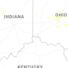


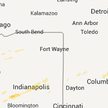
Connect with Interactive Hail Maps