

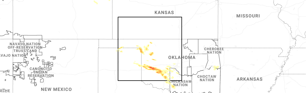
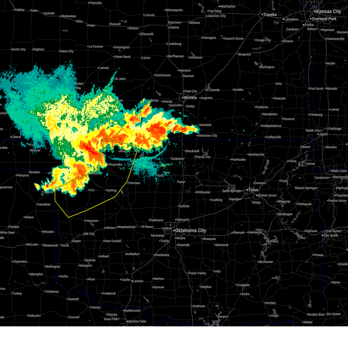
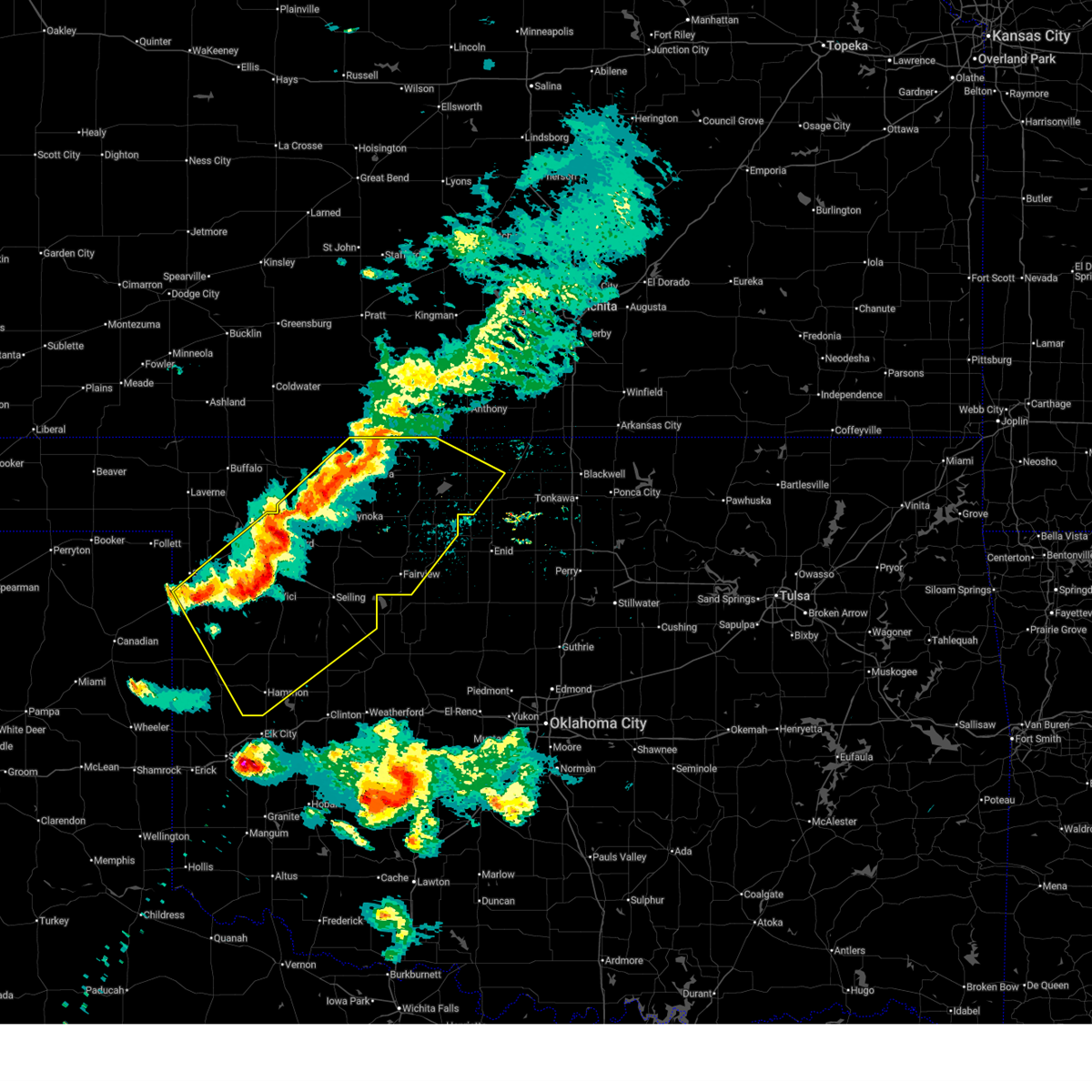
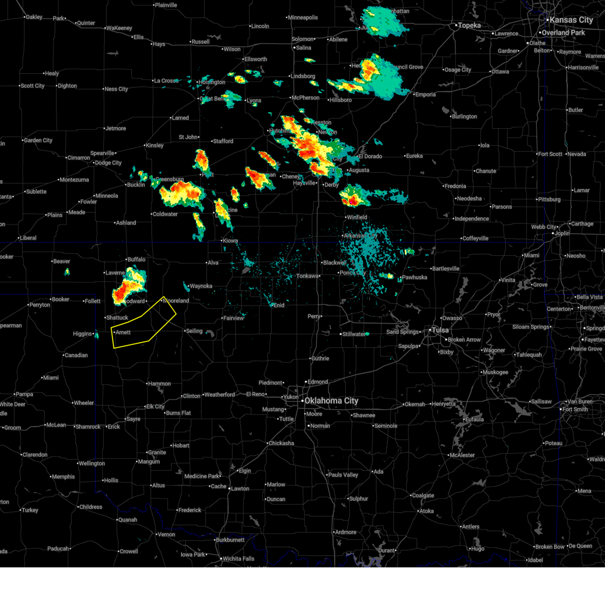
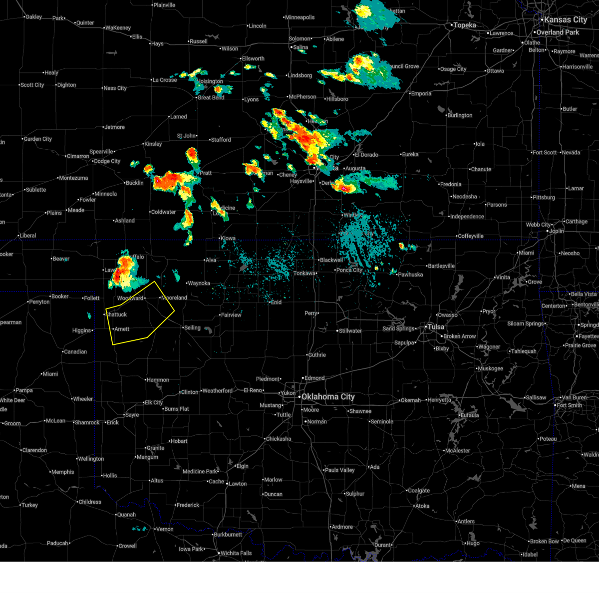
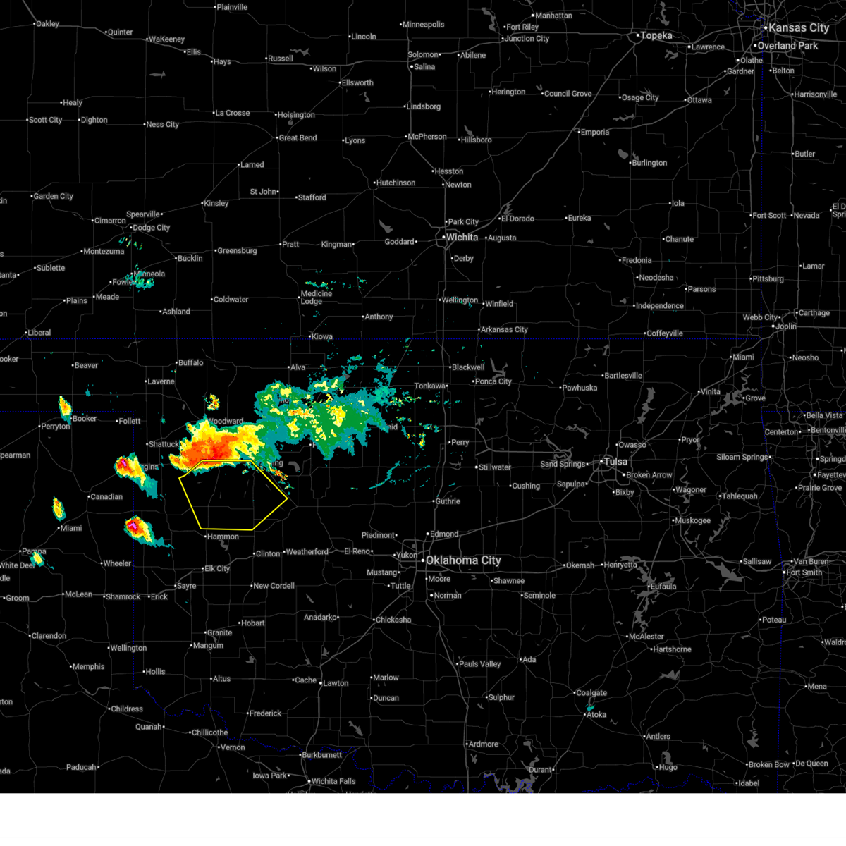
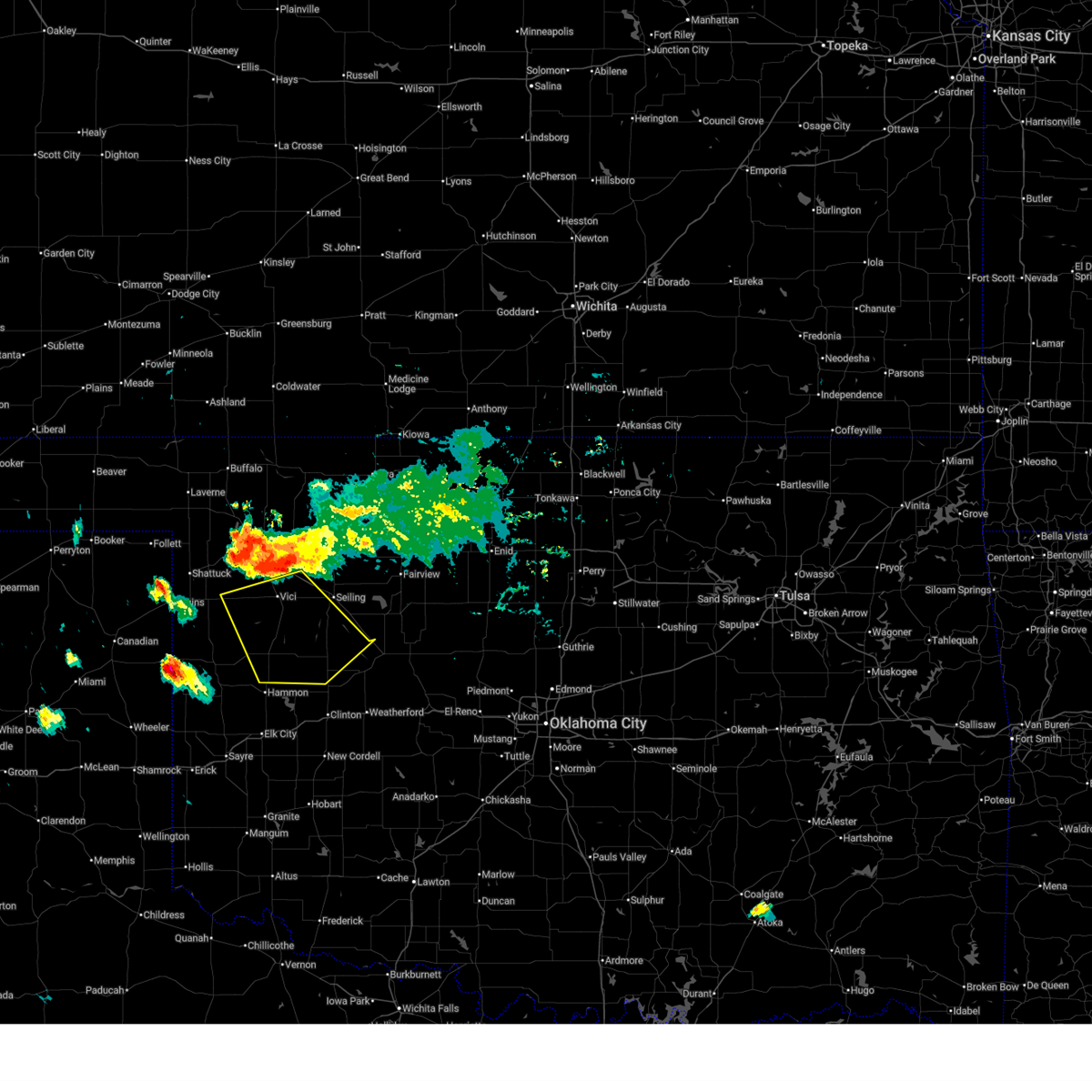
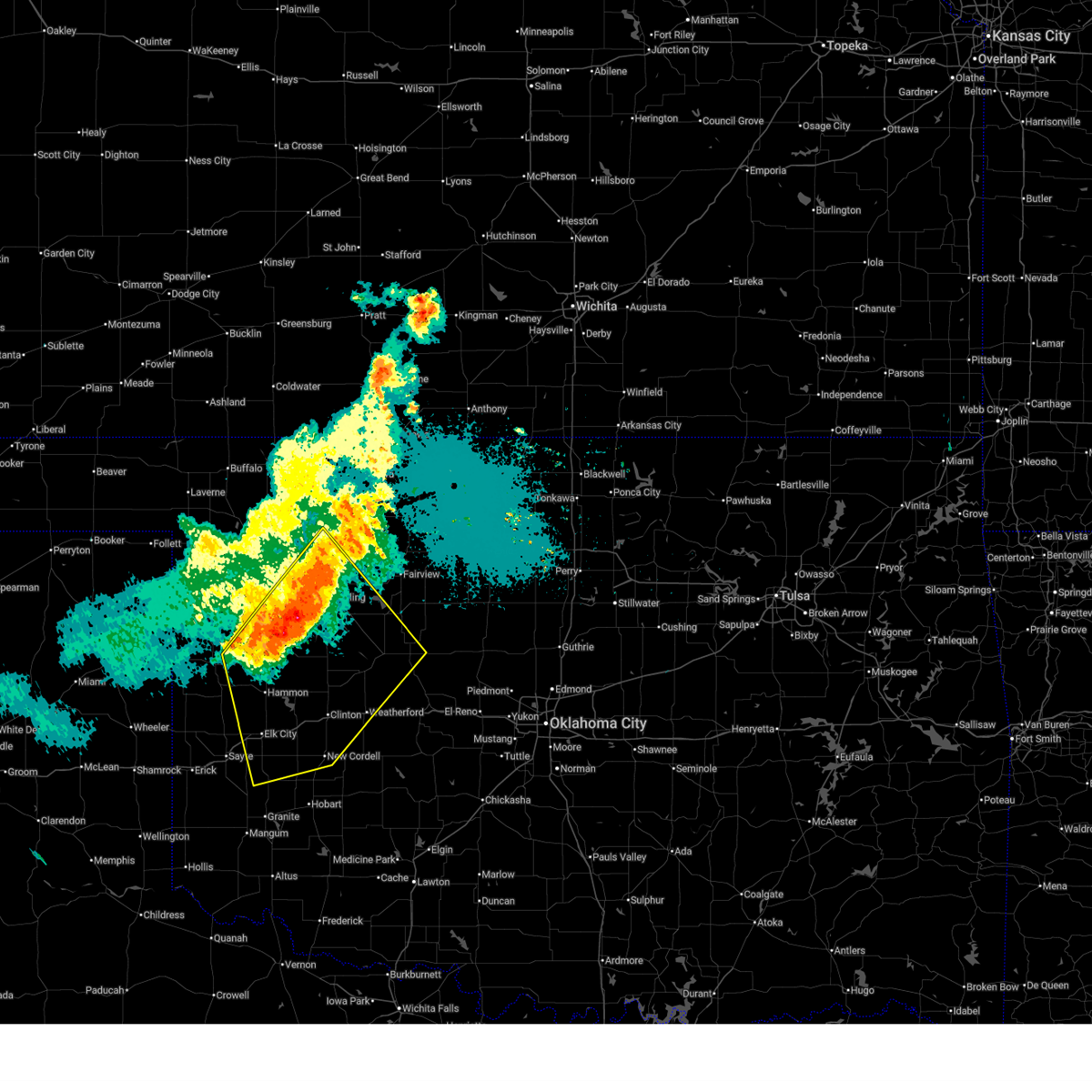
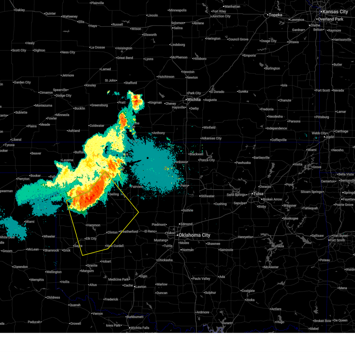
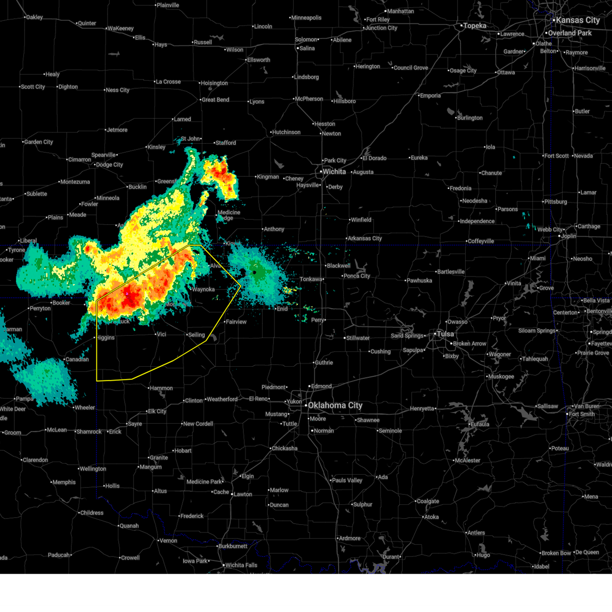
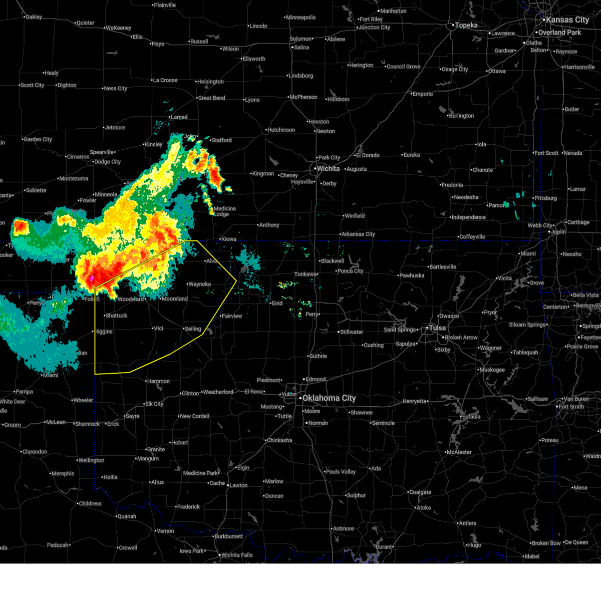
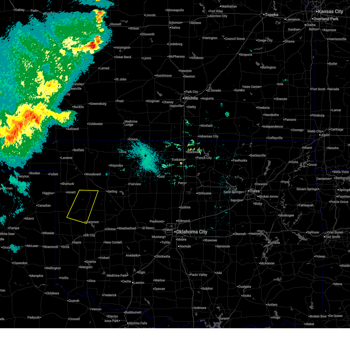
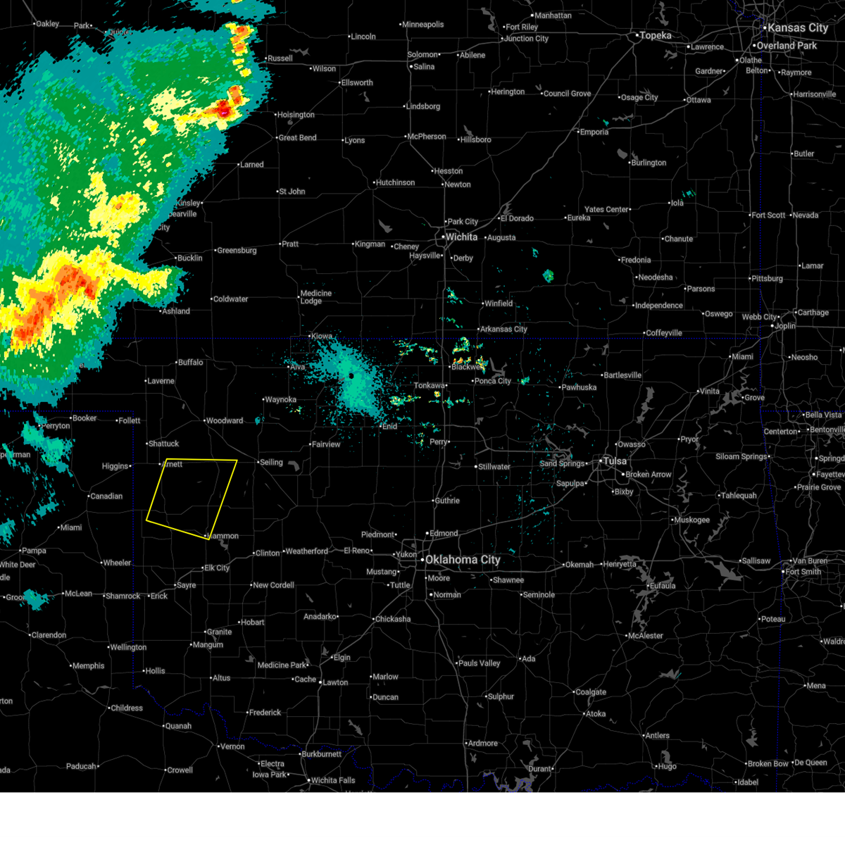
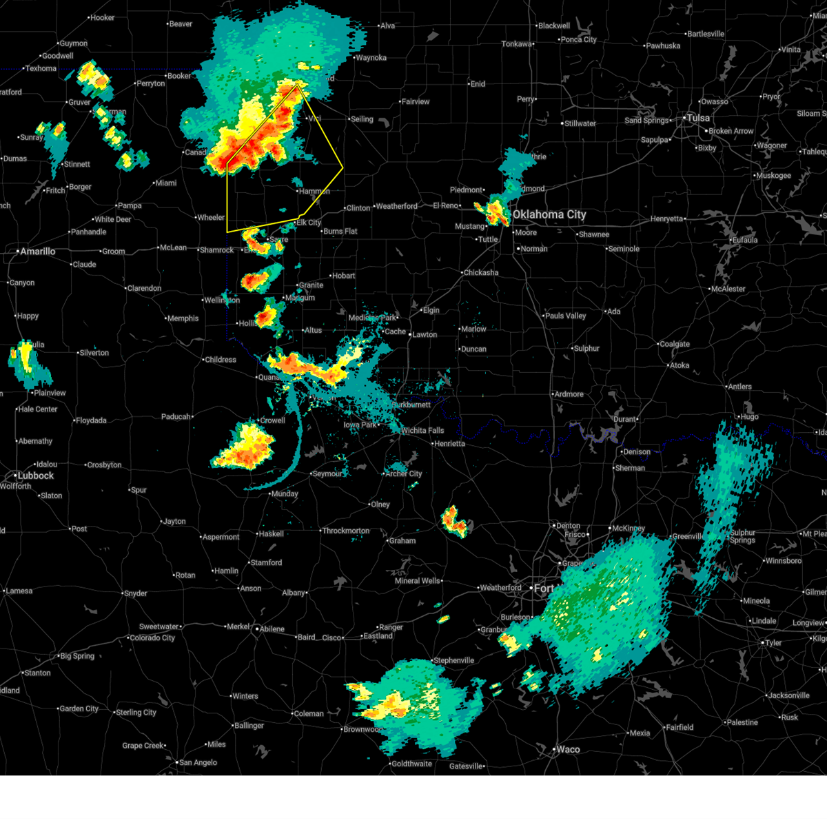
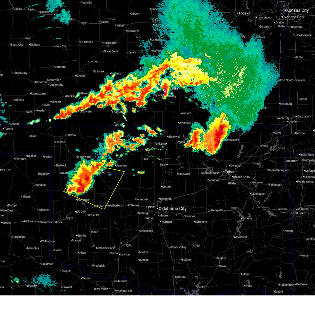
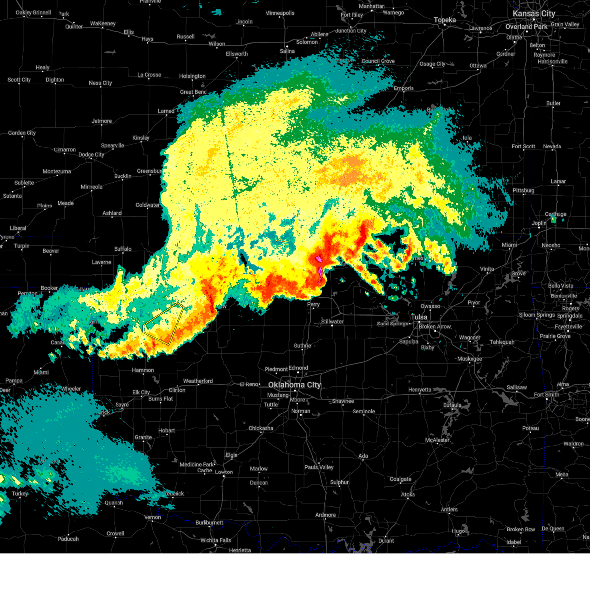
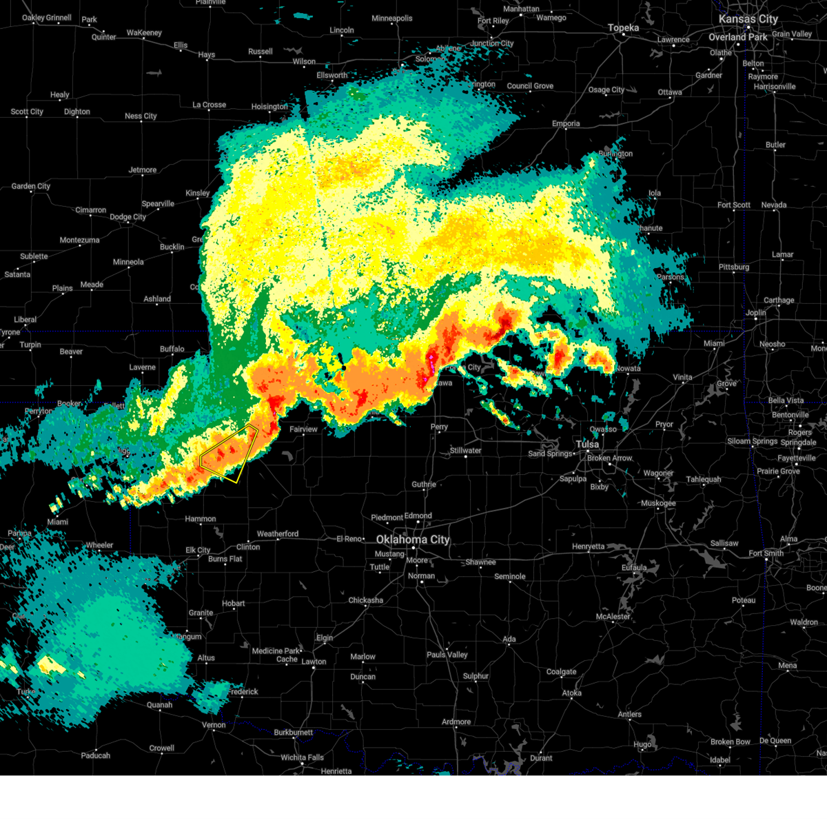
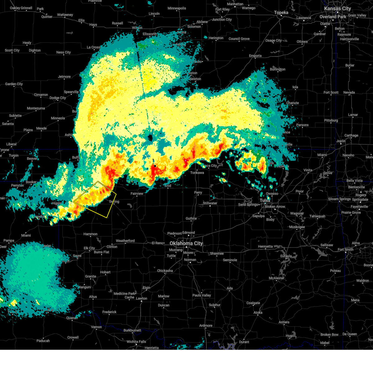
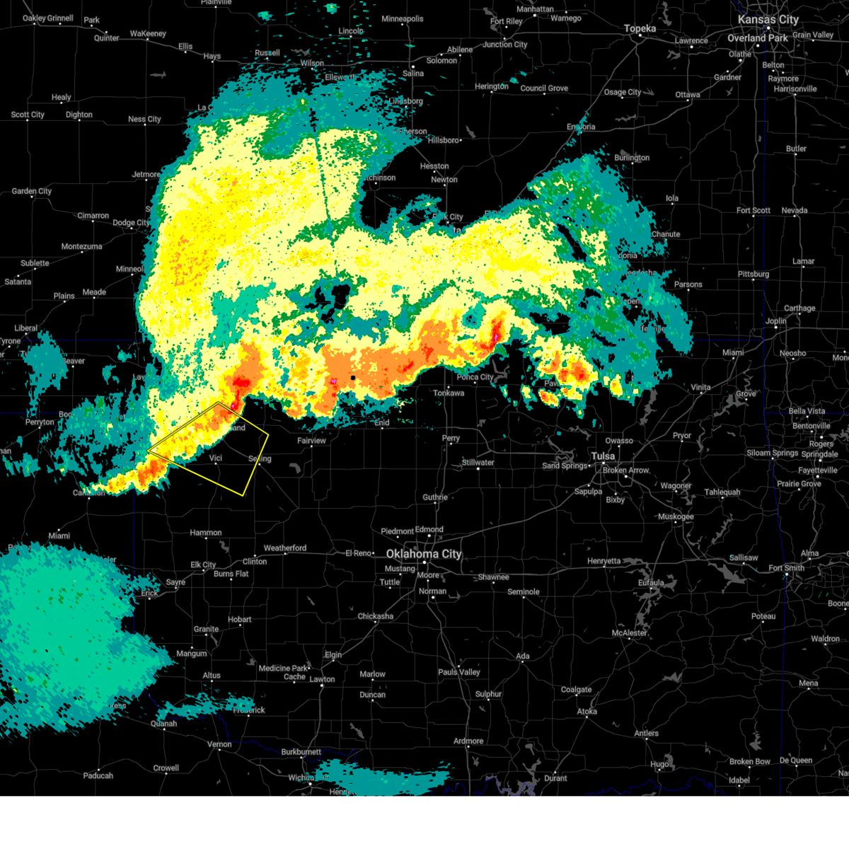
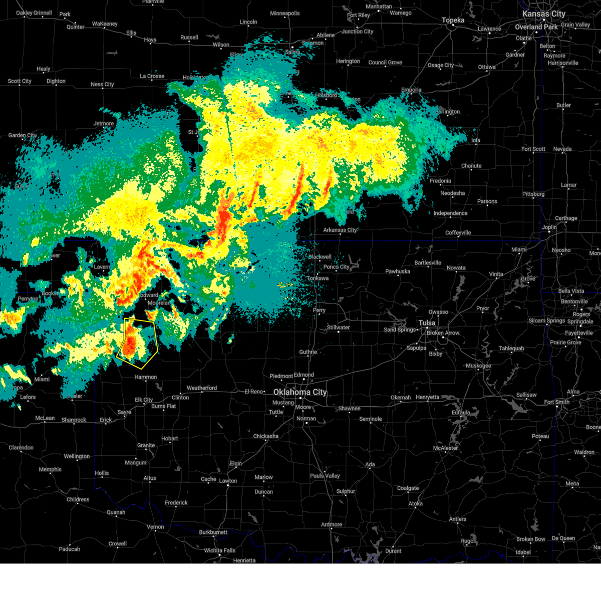
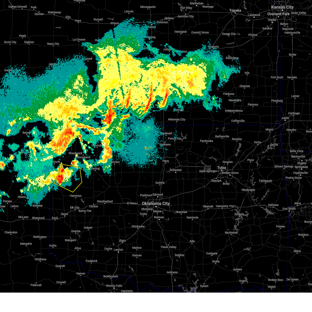
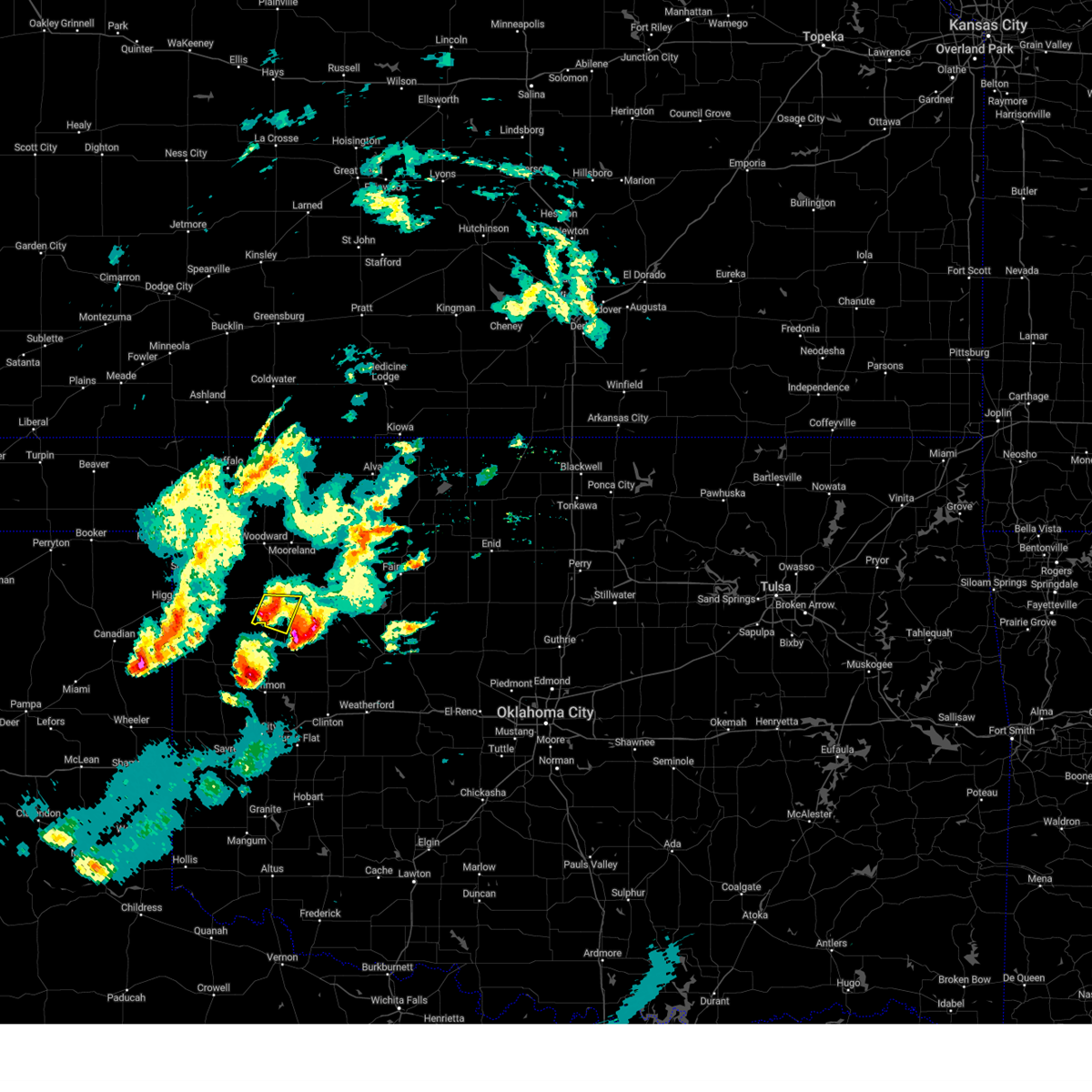
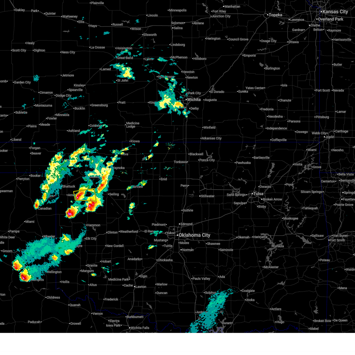
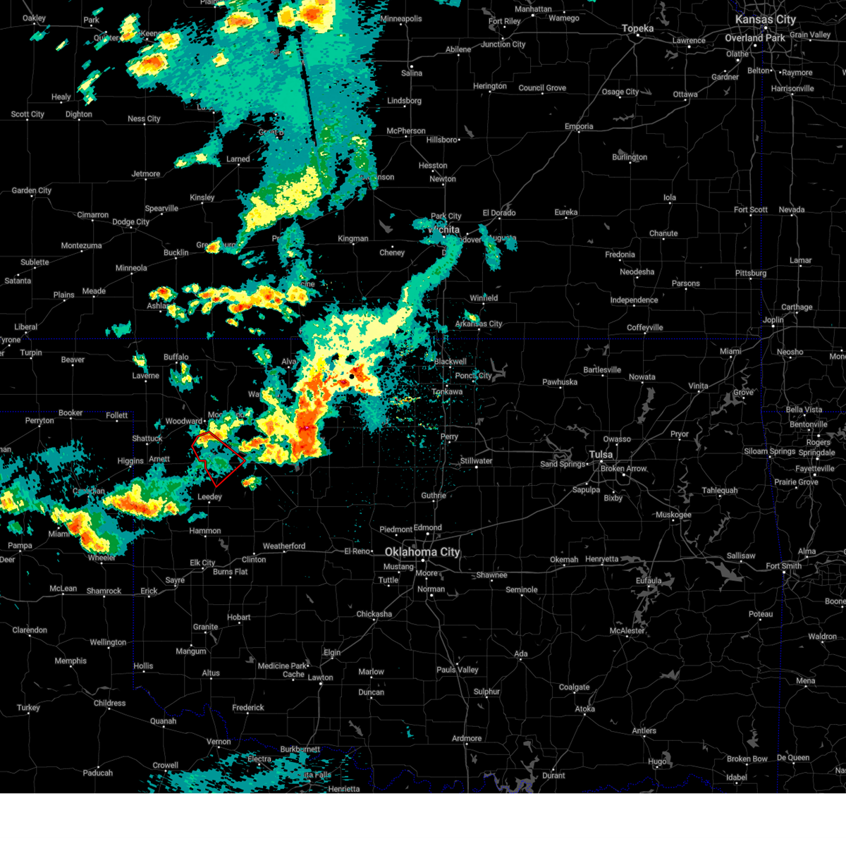
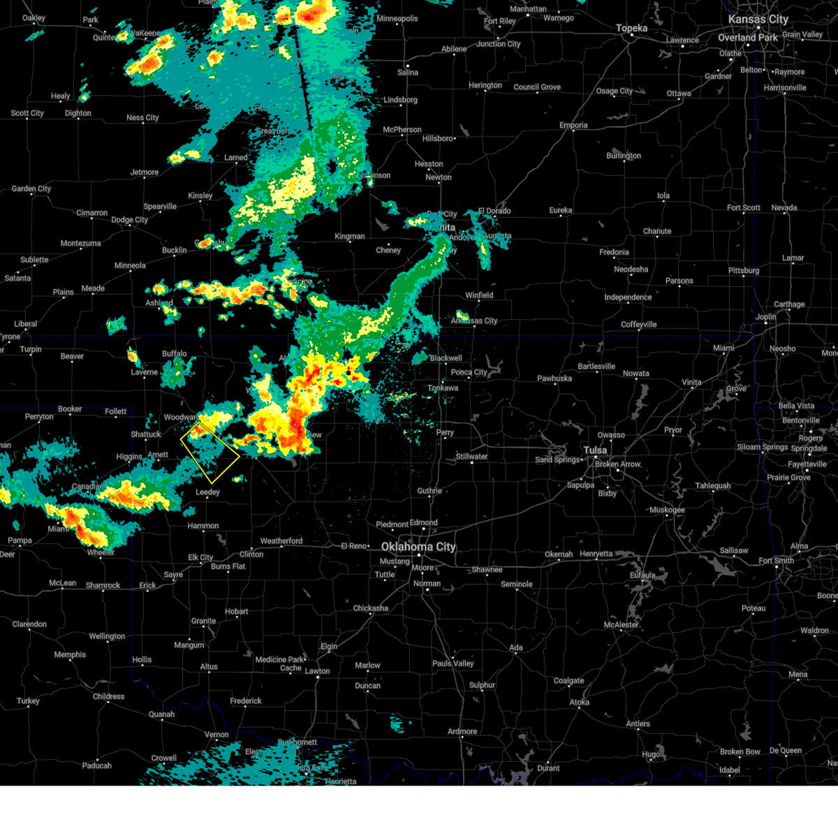
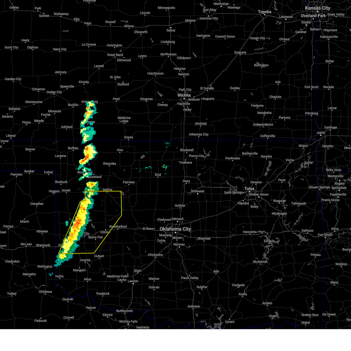
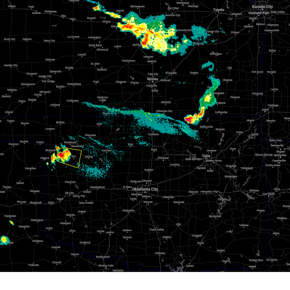
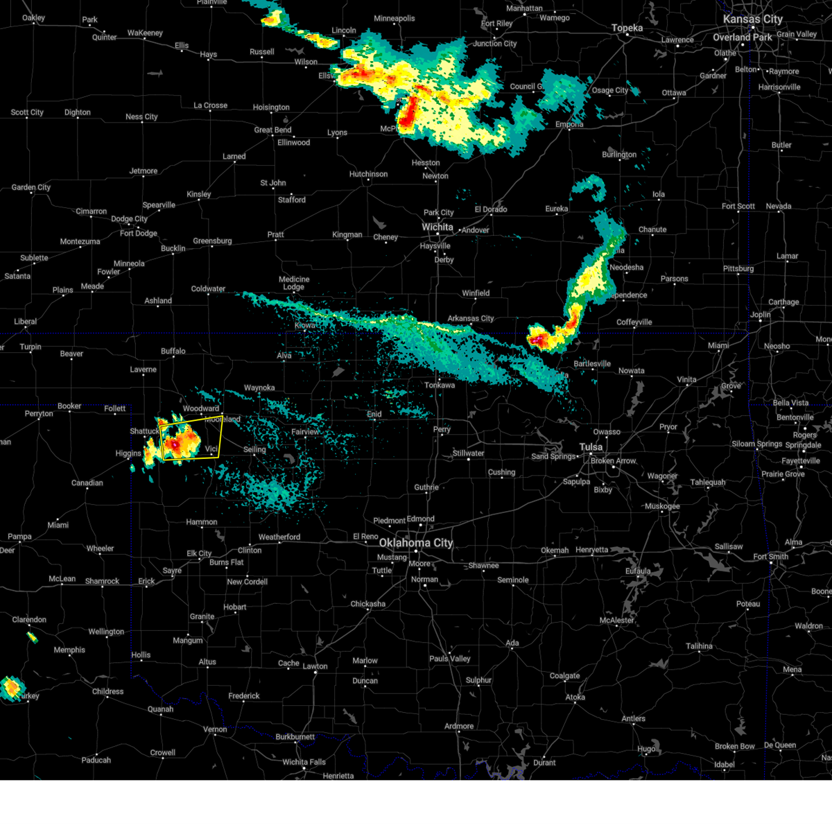
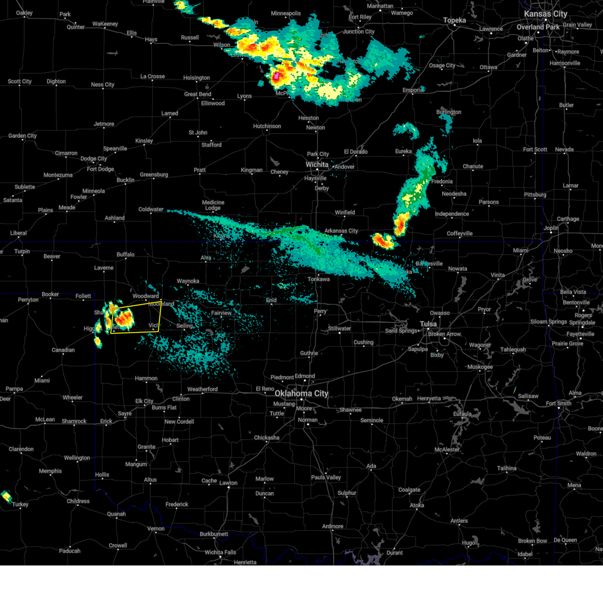
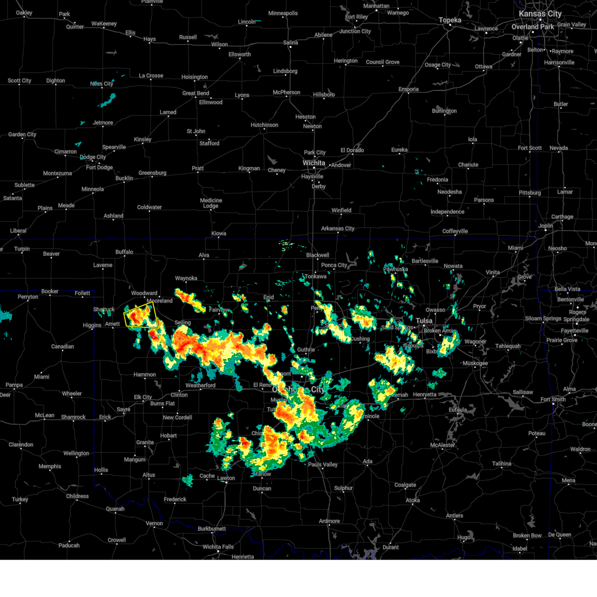
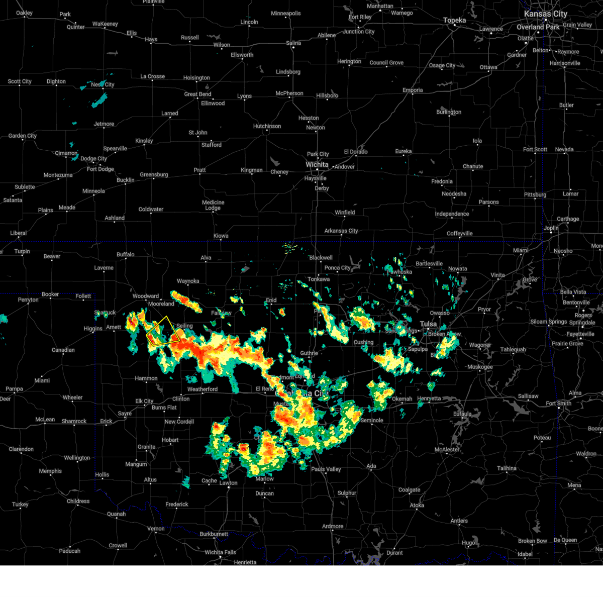
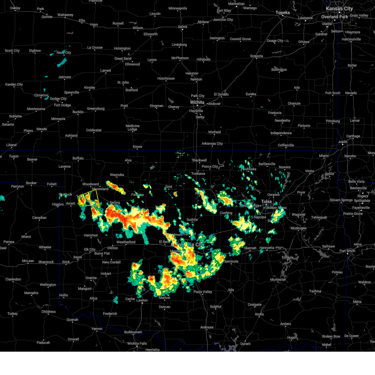
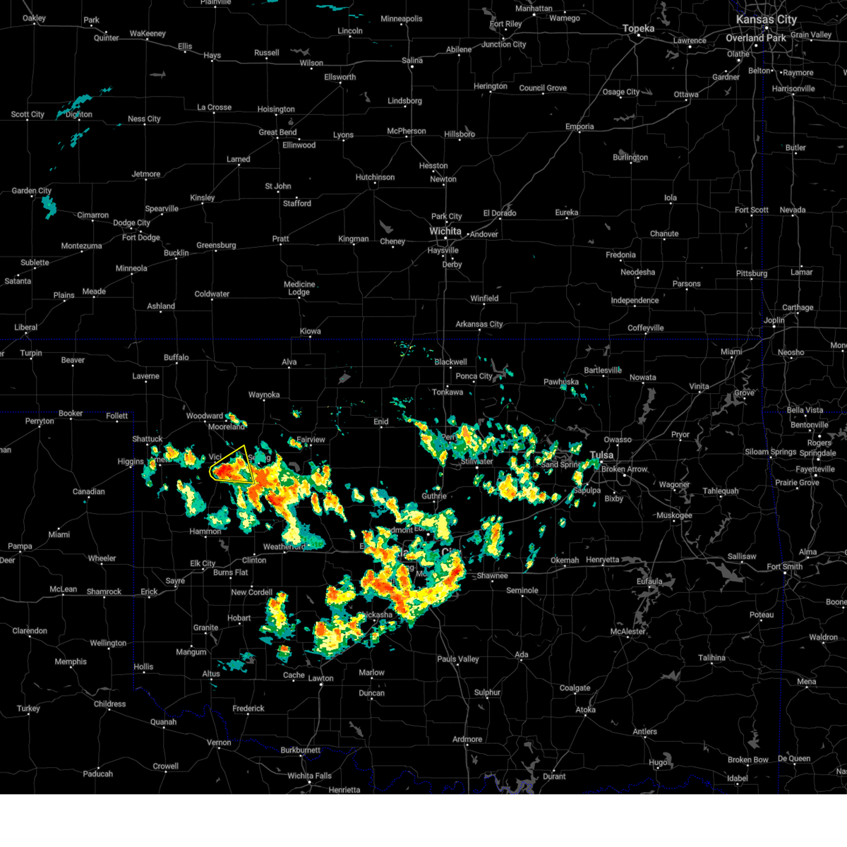
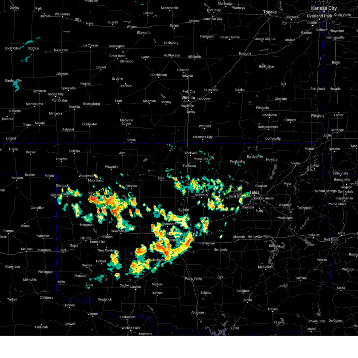
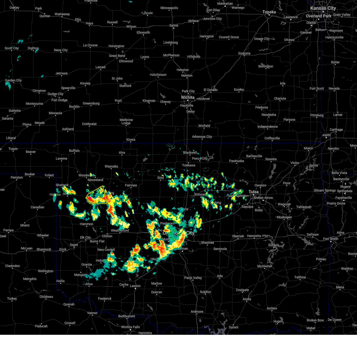
Hail Map for Vici, OK
The Vici, OK area has had 12 reports of on-the-ground hail by trained spotters, and has been under severe weather warnings 29 times during the past 12 months. Doppler radar has detected hail at or near Vici, OK on 86 occasions, including 4 occasions during the past year.
| Name: | Vici, OK |
| Where Located: | 20.4 miles SSE of Woodward, OK |
| Map: | Google Map for Vici, OK |
| Population: | 699 |
| Housing Units: | 336 |
| More Info: | Search Google for Vici, OK |
2
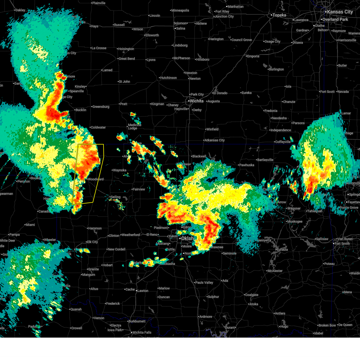
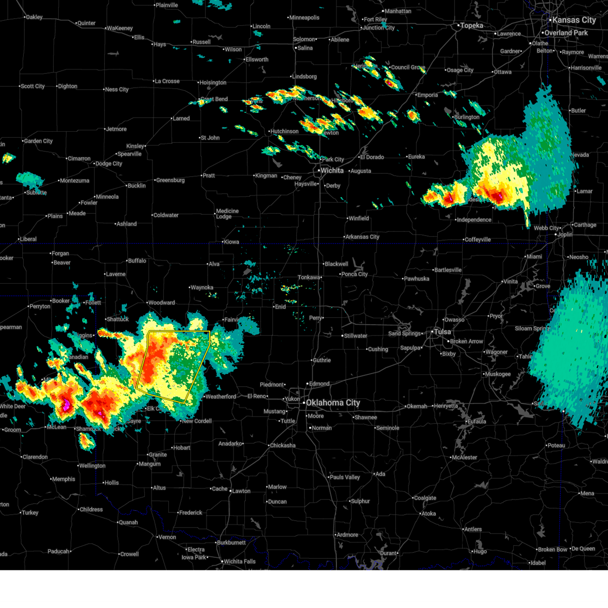
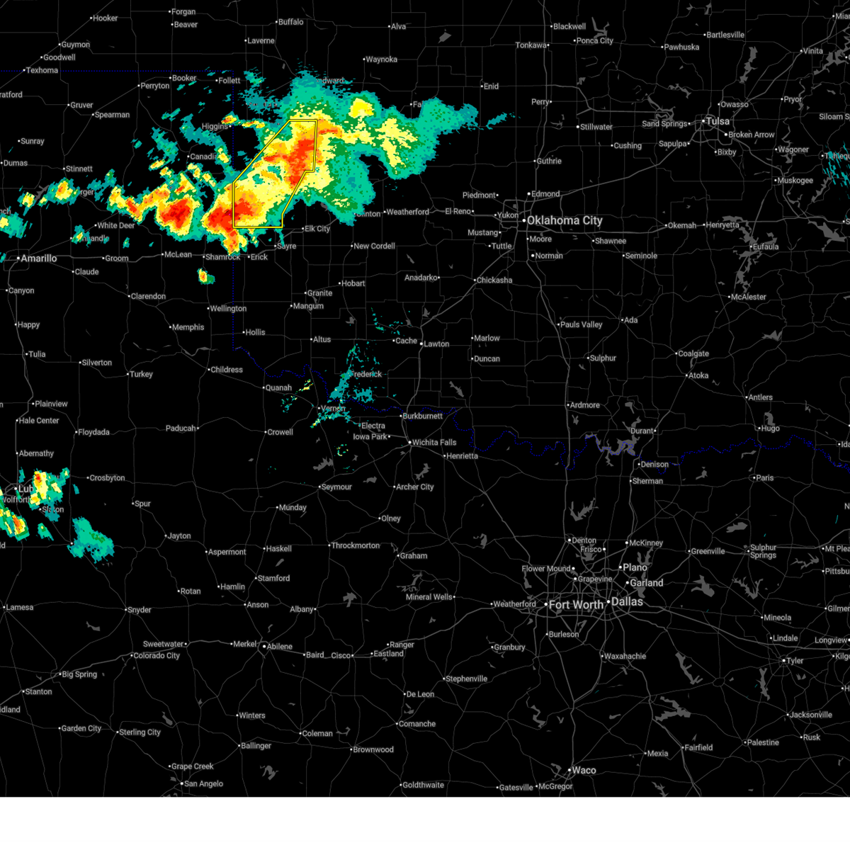
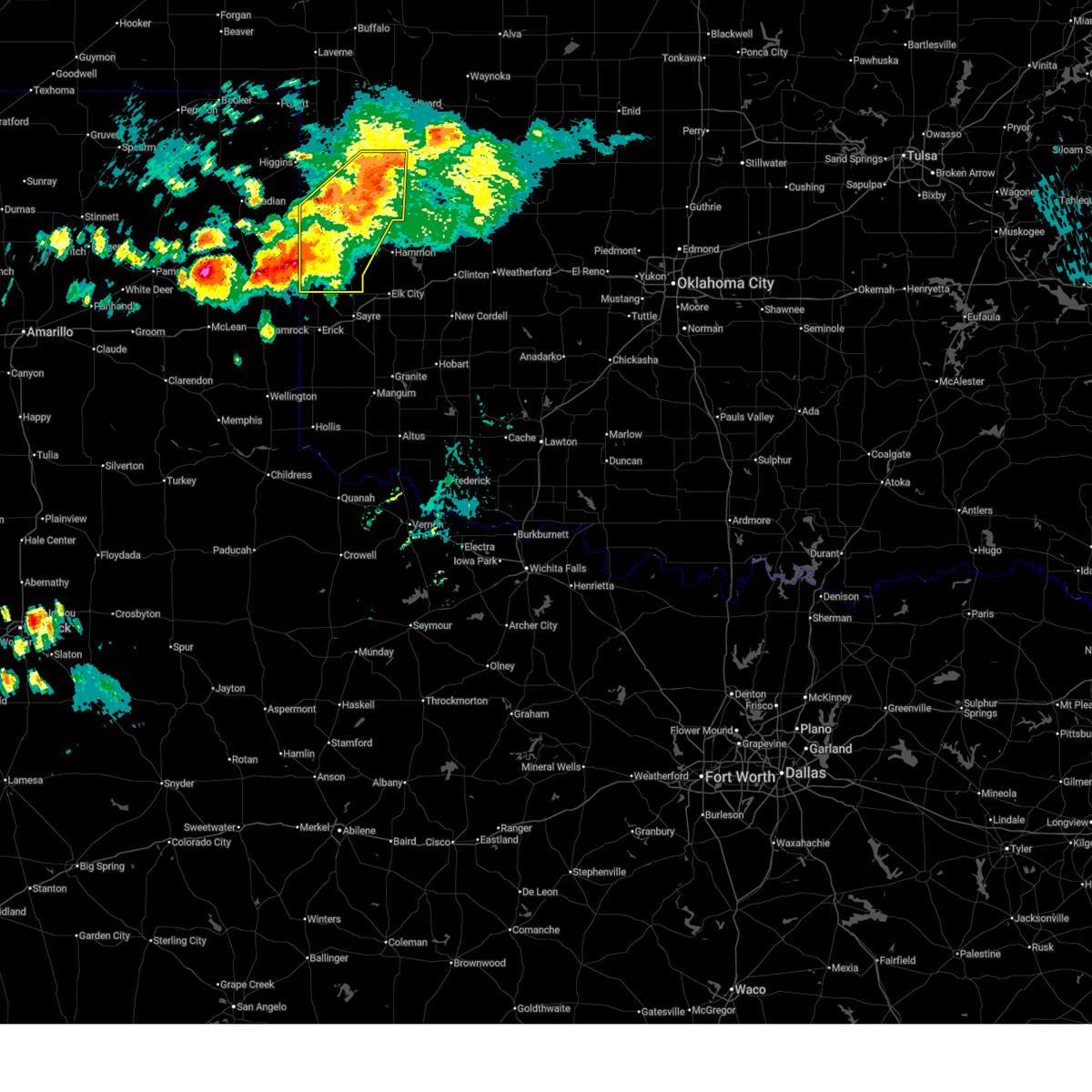
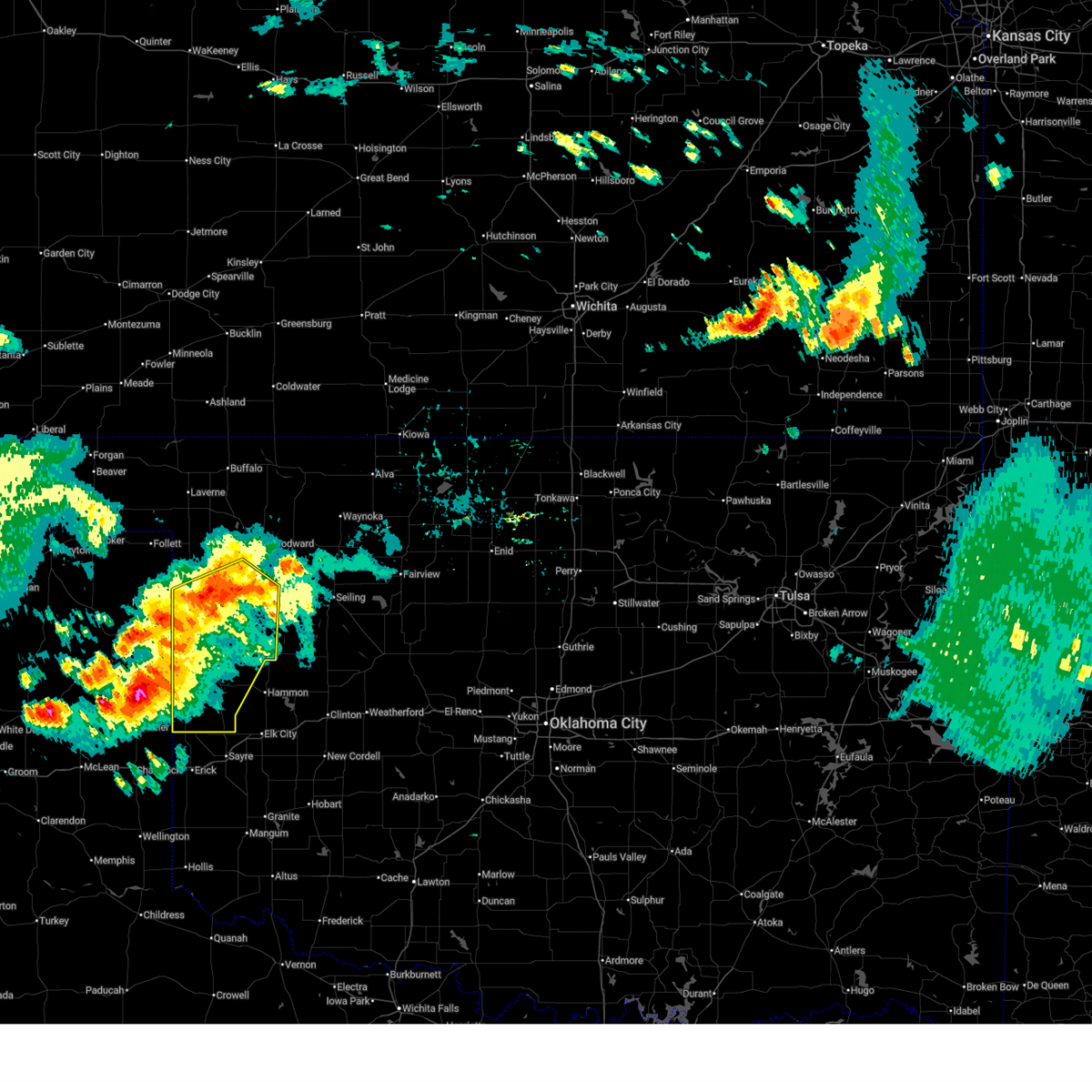
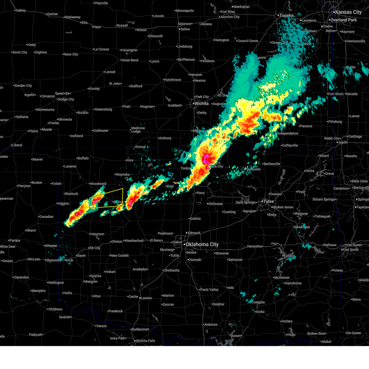
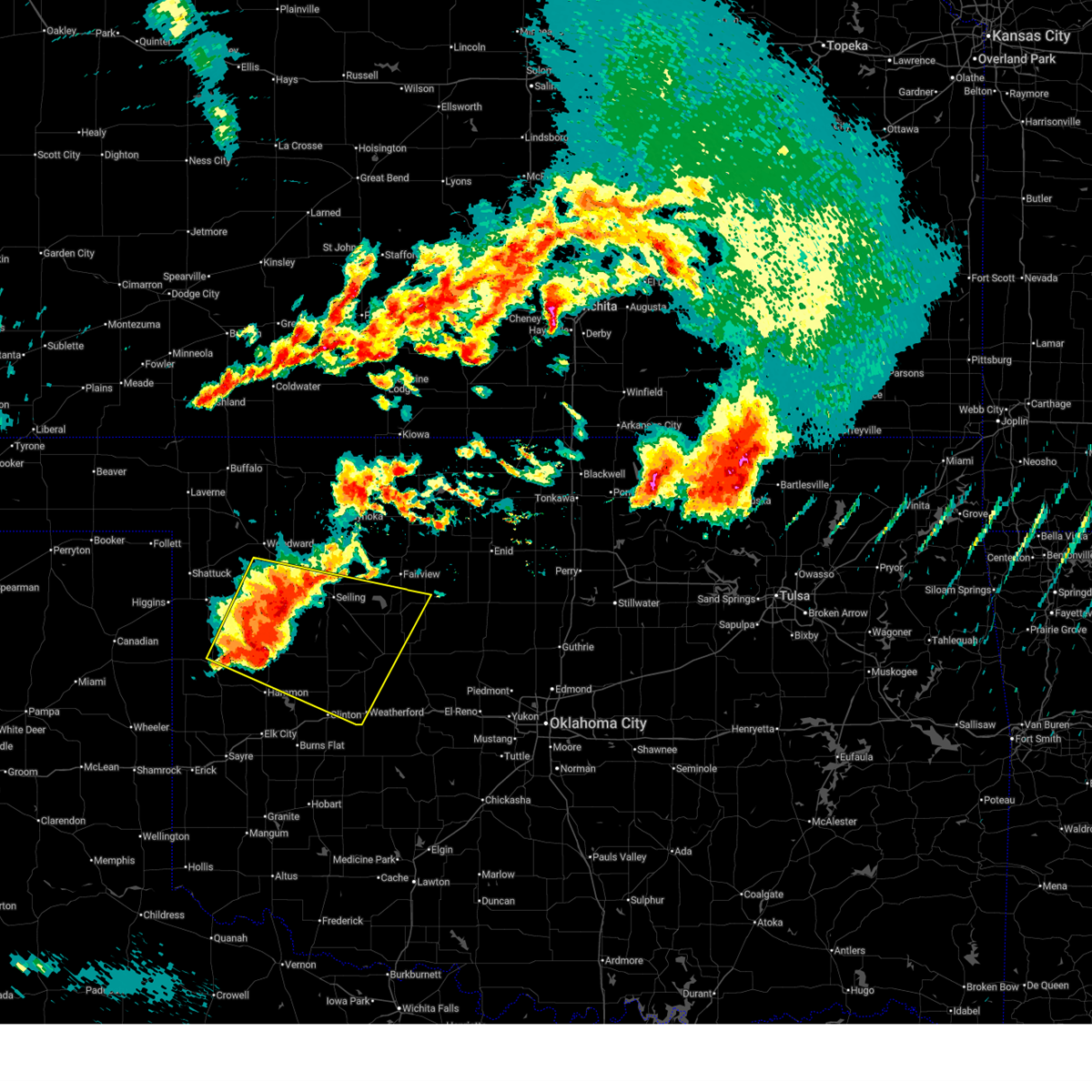
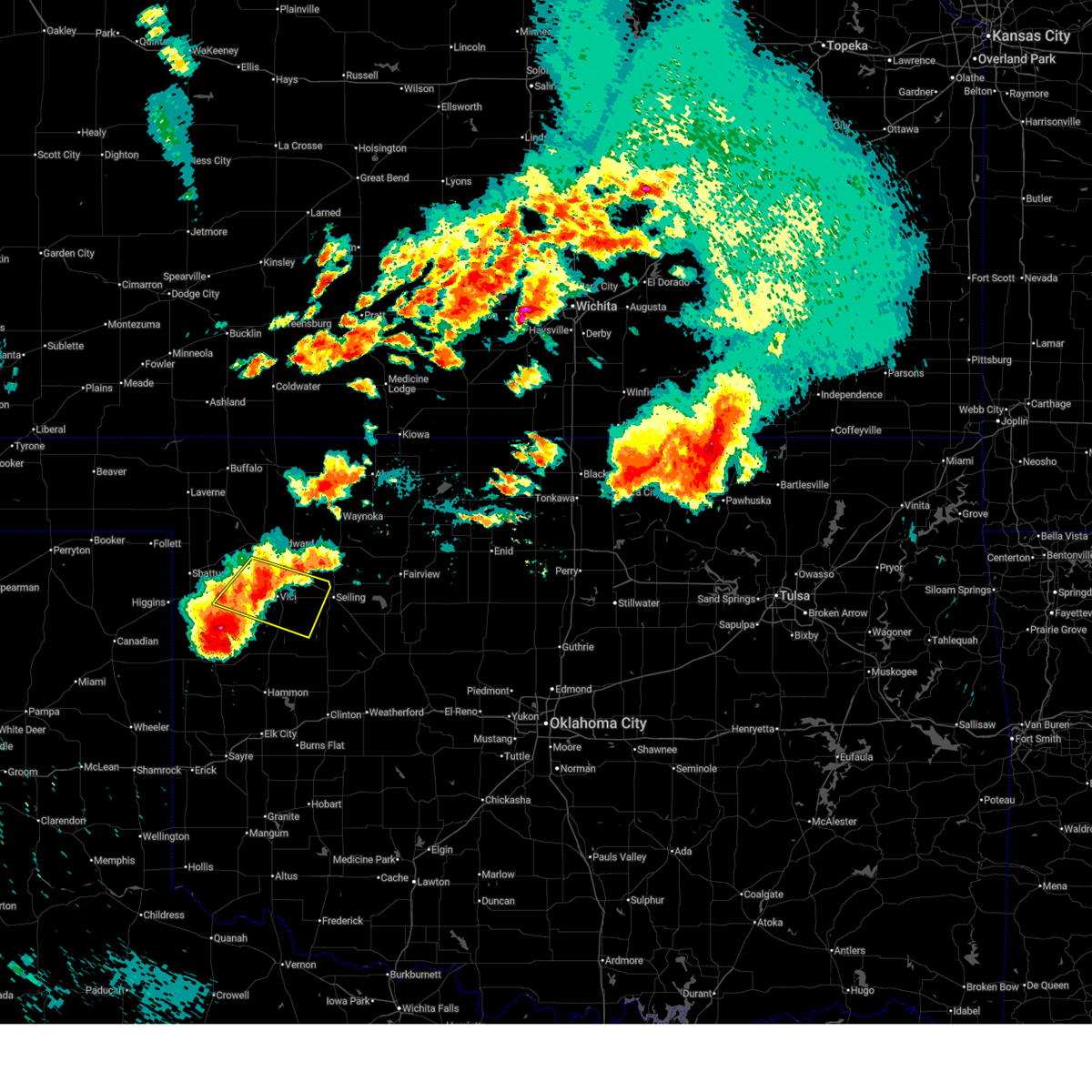
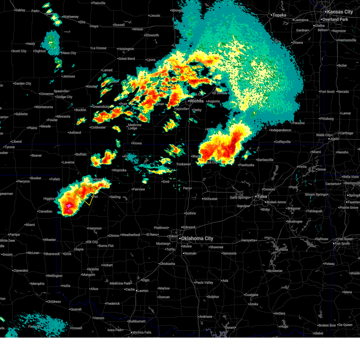
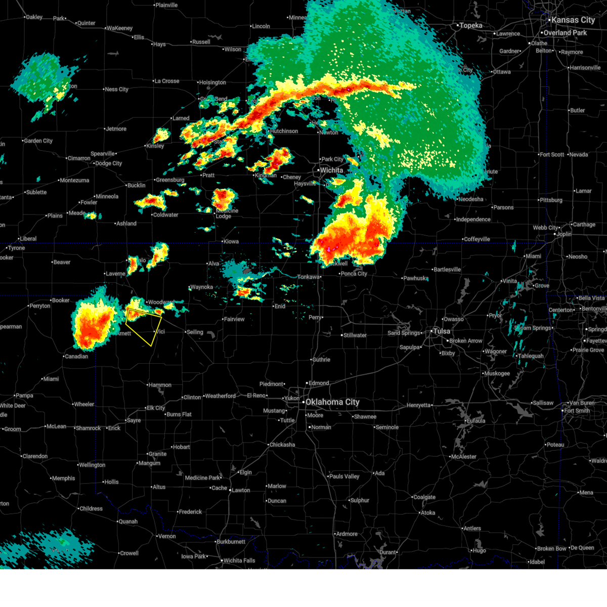
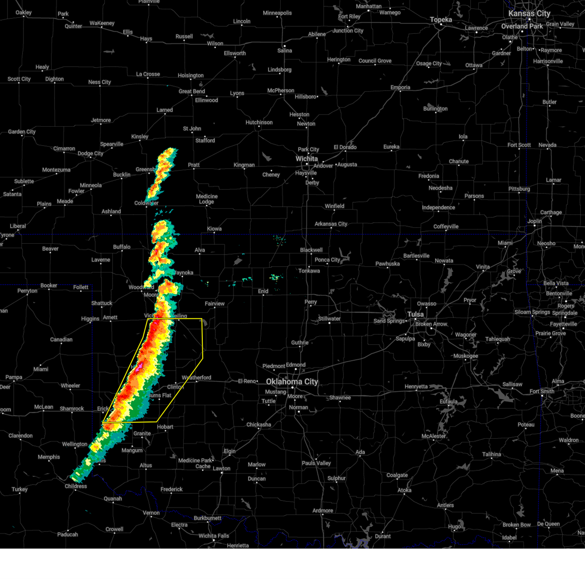
The Top Recent Hail Date for Vici, OK is Saturday, May 9, 2026 (4th out of 86)
Hail and Wind Damage Spotted near Vici, OK
| Date / Time | Report Details |
|---|---|
| 6/27/2026 1:46 AM CDT |
 At 146 am cdt, severe thunderstorms were located along a line extending from 12 miles northwest of freedom to near alabaster caverns state park to near woodward to 7 miles southeast of harmon, moving east at 45 mph (radar indicated). Hazards include 60 mph wind gusts. Expect damage to roofs, siding, and trees. Locations impacted include, woodward, mooreland, vici, fargo, fort supply, freedom, sharon, alabaster caverns state park, selman, harmon, tangier, and camp houston. At 146 am cdt, severe thunderstorms were located along a line extending from 12 miles northwest of freedom to near alabaster caverns state park to near woodward to 7 miles southeast of harmon, moving east at 45 mph (radar indicated). Hazards include 60 mph wind gusts. Expect damage to roofs, siding, and trees. Locations impacted include, woodward, mooreland, vici, fargo, fort supply, freedom, sharon, alabaster caverns state park, selman, harmon, tangier, and camp houston.
|
| 6/27/2026 1:09 AM CDT |
 Svroun the national weather service in norman has issued a * severe thunderstorm warning for, ellis county in northwestern oklahoma, northwestern woods county in northwestern oklahoma, harper county in northwestern oklahoma, northwestern dewey county in northwestern oklahoma, woodward county in northwestern oklahoma, * until 200 am cdt. * at 108 am cdt, severe thunderstorms were located along a line extending from 4 miles northwest of buffalo to 5 miles northeast of may to 6 miles northwest of gage to 8 miles southwest of arnett, moving east at 45 mph (radar indicated). Hazards include 70 mph wind gusts. Expect considerable tree damage. Damage is likely to mobile homes, roofs, and outbuildings. Svroun the national weather service in norman has issued a * severe thunderstorm warning for, ellis county in northwestern oklahoma, northwestern woods county in northwestern oklahoma, harper county in northwestern oklahoma, northwestern dewey county in northwestern oklahoma, woodward county in northwestern oklahoma, * until 200 am cdt. * at 108 am cdt, severe thunderstorms were located along a line extending from 4 miles northwest of buffalo to 5 miles northeast of may to 6 miles northwest of gage to 8 miles southwest of arnett, moving east at 45 mph (radar indicated). Hazards include 70 mph wind gusts. Expect considerable tree damage. Damage is likely to mobile homes, roofs, and outbuildings.
|
| 6/25/2026 8:01 PM CDT |
 At 800 pm cdt, severe thunderstorms were located along a line extending from near cestos to near hammon, moving east at 35 mph (radar indicated). Hazards include 60 mph wind gusts and penny size hail. Expect damage to roofs, siding, and trees. Locations impacted include, clinton, taloga, seiling, arapaho, vici, hammon, leedey, custer city, butler, camargo, oakwood, putnam, foss reservoir, moorewood, cestos, northwestern canton lake, hucmac, and stafford. At 800 pm cdt, severe thunderstorms were located along a line extending from near cestos to near hammon, moving east at 35 mph (radar indicated). Hazards include 60 mph wind gusts and penny size hail. Expect damage to roofs, siding, and trees. Locations impacted include, clinton, taloga, seiling, arapaho, vici, hammon, leedey, custer city, butler, camargo, oakwood, putnam, foss reservoir, moorewood, cestos, northwestern canton lake, hucmac, and stafford.
|
| 6/25/2026 7:43 PM CDT |
 At 742 pm cdt, severe thunderstorms were located along a line extending from near vici to 4 miles northwest of moorewood to 6 miles southeast of allison, moving southeast at 15 mph (radar indicated). Hazards include golf ball size hail and 70 mph wind gusts. People and animals outdoors will be injured. expect hail damage to roofs, siding, windows, and vehicles. expect considerable tree damage. wind damage is also likely to mobile homes, roofs, and outbuildings. Locations impacted include, cheyenne, vici, leedey, reydon, sweetwater, strong city, crawford, roll, angora, berlin, and dempsey. At 742 pm cdt, severe thunderstorms were located along a line extending from near vici to 4 miles northwest of moorewood to 6 miles southeast of allison, moving southeast at 15 mph (radar indicated). Hazards include golf ball size hail and 70 mph wind gusts. People and animals outdoors will be injured. expect hail damage to roofs, siding, windows, and vehicles. expect considerable tree damage. wind damage is also likely to mobile homes, roofs, and outbuildings. Locations impacted include, cheyenne, vici, leedey, reydon, sweetwater, strong city, crawford, roll, angora, berlin, and dempsey.
|
| 6/25/2026 7:41 PM CDT |
 Svroun the national weather service in norman has issued a * severe thunderstorm warning for, southeastern ellis county in northwestern oklahoma, northeastern roger mills county in western oklahoma, custer county in western oklahoma, dewey county in northwestern oklahoma, * until 830 pm cdt. * at 741 pm cdt, severe thunderstorms were located along a line extending from near vici to 7 miles northeast of strong city, moving east at 35 mph (radar indicated). Hazards include 70 mph wind gusts and penny size hail. Expect considerable tree damage. Damage is likely to mobile homes, roofs, and outbuildings. Svroun the national weather service in norman has issued a * severe thunderstorm warning for, southeastern ellis county in northwestern oklahoma, northeastern roger mills county in western oklahoma, custer county in western oklahoma, dewey county in northwestern oklahoma, * until 830 pm cdt. * at 741 pm cdt, severe thunderstorms were located along a line extending from near vici to 7 miles northeast of strong city, moving east at 35 mph (radar indicated). Hazards include 70 mph wind gusts and penny size hail. Expect considerable tree damage. Damage is likely to mobile homes, roofs, and outbuildings.
|
| 6/25/2026 7:27 PM CDT |
 At 727 pm cdt, severe thunderstorms were located along a line extending from 4 miles northwest of vici to 3 miles northwest of angora to 4 miles south of allison, moving southeast at 30 mph (radar indicated). Hazards include 70 mph wind gusts and half dollar size hail. Hail damage to vehicles is expected. expect considerable tree damage. wind damage is also likely to mobile homes, roofs, and outbuildings. Locations impacted include, cheyenne, vici, leedey, reydon, sweetwater, strong city, angora, crawford, harmon, roll, durham, berlin, and dempsey. At 727 pm cdt, severe thunderstorms were located along a line extending from 4 miles northwest of vici to 3 miles northwest of angora to 4 miles south of allison, moving southeast at 30 mph (radar indicated). Hazards include 70 mph wind gusts and half dollar size hail. Hail damage to vehicles is expected. expect considerable tree damage. wind damage is also likely to mobile homes, roofs, and outbuildings. Locations impacted include, cheyenne, vici, leedey, reydon, sweetwater, strong city, angora, crawford, harmon, roll, durham, berlin, and dempsey.
|
| 6/25/2026 7:17 PM CDT |
 At 717 pm cdt, severe thunderstorms were located along a line extending from 5 miles northwest of vici to 10 miles northwest of angora to 4 miles south of allison, moving east at 20 mph (radar indicated). Hazards include 70 mph wind gusts and half dollar size hail. Hail damage to vehicles is expected. expect considerable tree damage. wind damage is also likely to mobile homes, roofs, and outbuildings. Locations impacted include, cheyenne, arnett, vici, leedey, reydon, sweetwater, strong city, angora, crawford, harmon, roll, durham, berlin, and dempsey. At 717 pm cdt, severe thunderstorms were located along a line extending from 5 miles northwest of vici to 10 miles northwest of angora to 4 miles south of allison, moving east at 20 mph (radar indicated). Hazards include 70 mph wind gusts and half dollar size hail. Hail damage to vehicles is expected. expect considerable tree damage. wind damage is also likely to mobile homes, roofs, and outbuildings. Locations impacted include, cheyenne, arnett, vici, leedey, reydon, sweetwater, strong city, angora, crawford, harmon, roll, durham, berlin, and dempsey.
|
| 6/25/2026 6:57 PM CDT |
 Svroun the national weather service in norman has issued a * severe thunderstorm warning for, southern ellis county in northwestern oklahoma, roger mills county in western oklahoma, western dewey county in northwestern oklahoma, southwestern woodward county in northwestern oklahoma, * until 800 pm cdt. * at 657 pm cdt, severe thunderstorms were located along a line extending from 6 miles northeast of harmon to 3 miles southwest of arnett to near briscoe, moving east at 15 mph (radar indicated). Hazards include 70 mph wind gusts and half dollar size hail. Hail damage to vehicles is expected. expect considerable tree damage. Wind damage is also likely to mobile homes, roofs, and outbuildings. Svroun the national weather service in norman has issued a * severe thunderstorm warning for, southern ellis county in northwestern oklahoma, roger mills county in western oklahoma, western dewey county in northwestern oklahoma, southwestern woodward county in northwestern oklahoma, * until 800 pm cdt. * at 657 pm cdt, severe thunderstorms were located along a line extending from 6 miles northeast of harmon to 3 miles southwest of arnett to near briscoe, moving east at 15 mph (radar indicated). Hazards include 70 mph wind gusts and half dollar size hail. Hail damage to vehicles is expected. expect considerable tree damage. Wind damage is also likely to mobile homes, roofs, and outbuildings.
|
| 6/21/2026 11:48 PM CDT |
 Svroun the national weather service in norman has issued a * severe thunderstorm warning for, southern ellis county in northwestern oklahoma, woods county in northwestern oklahoma, northern roger mills county in western oklahoma, western alfalfa county in northwestern oklahoma, dewey county in northwestern oklahoma, western major county in northwestern oklahoma, southern woodward county in northwestern oklahoma, * until 1245 am cdt. * at 1148 pm cdt, severe thunderstorms were located along a line extending from 11 miles northwest of avard to near waynoka to near mutual to 9 miles southwest of arnett, moving southeast at 35 mph (radar indicated). Hazards include 70 mph wind gusts and quarter size hail. Hail damage to vehicles is expected. expect considerable tree damage. Wind damage is also likely to mobile homes, roofs, and outbuildings. Svroun the national weather service in norman has issued a * severe thunderstorm warning for, southern ellis county in northwestern oklahoma, woods county in northwestern oklahoma, northern roger mills county in western oklahoma, western alfalfa county in northwestern oklahoma, dewey county in northwestern oklahoma, western major county in northwestern oklahoma, southern woodward county in northwestern oklahoma, * until 1245 am cdt. * at 1148 pm cdt, severe thunderstorms were located along a line extending from 11 miles northwest of avard to near waynoka to near mutual to 9 miles southwest of arnett, moving southeast at 35 mph (radar indicated). Hazards include 70 mph wind gusts and quarter size hail. Hail damage to vehicles is expected. expect considerable tree damage. Wind damage is also likely to mobile homes, roofs, and outbuildings.
|
| 6/3/2026 6:55 PM CDT |
 Svroun the national weather service in norman has issued a * severe thunderstorm warning for, western dewey county in northwestern oklahoma, southeastern woodward county in northwestern oklahoma, * until 730 pm cdt. * at 655 pm cdt, a severe thunderstorm was located near camargo, moving northeast at 25 mph (radar indicated). Hazards include 60 mph wind gusts and quarter size hail. Hail damage to vehicles is expected. Expect wind damage to roofs, siding, and trees. Svroun the national weather service in norman has issued a * severe thunderstorm warning for, western dewey county in northwestern oklahoma, southeastern woodward county in northwestern oklahoma, * until 730 pm cdt. * at 655 pm cdt, a severe thunderstorm was located near camargo, moving northeast at 25 mph (radar indicated). Hazards include 60 mph wind gusts and quarter size hail. Hail damage to vehicles is expected. Expect wind damage to roofs, siding, and trees.
|
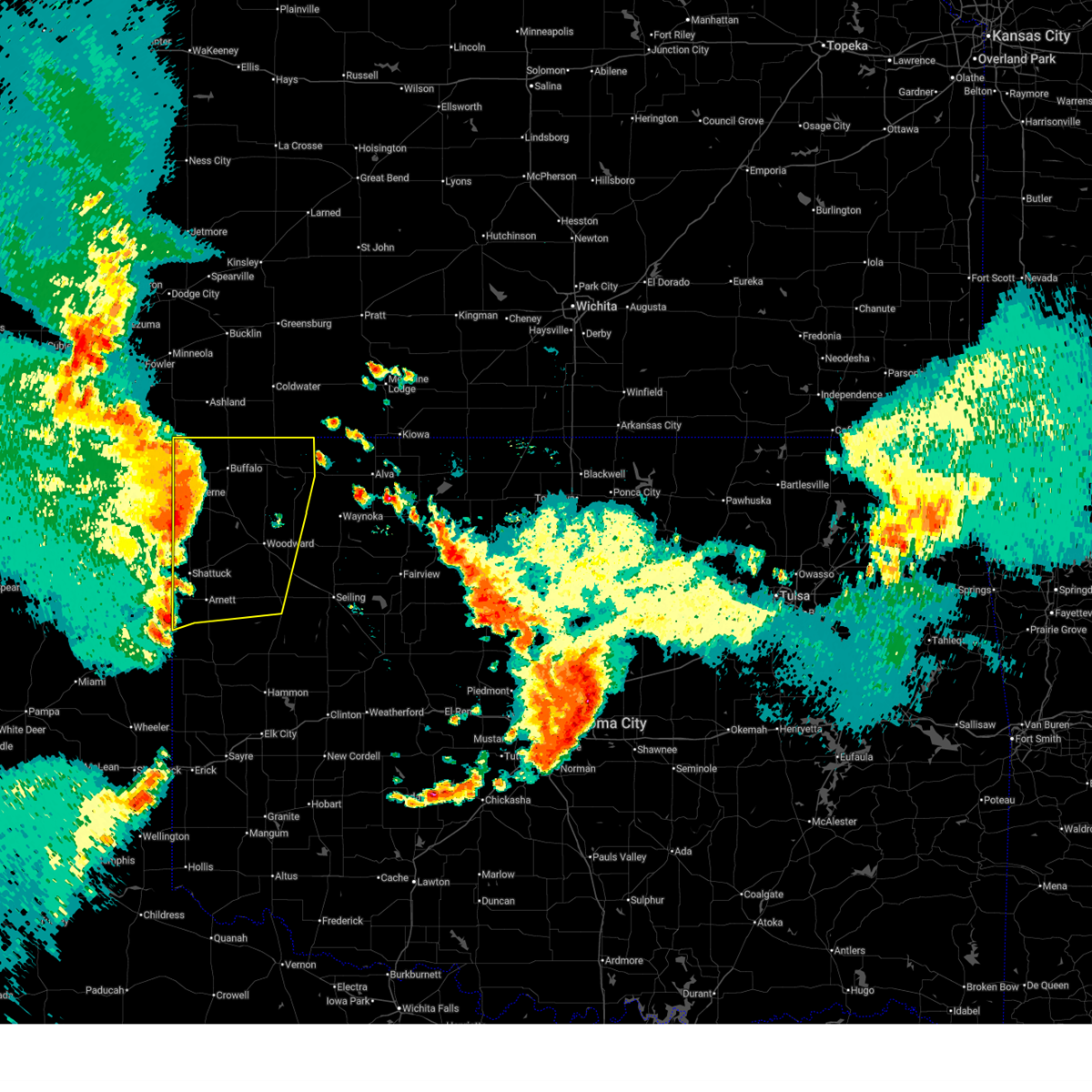
| 5/9/2026 8:47 PM CDT |
 At 847 pm cdt, severe thunderstorms were located along a line extending from 6 miles east of amorita to 5 miles northwest of orion to 8 miles northeast of roll, moving southeast at 35 mph (mesonet). Hazards include 70 mph wind gusts and quarter size hail. Hail damage to vehicles is expected. expect considerable tree damage. wind damage is also likely to mobile homes, roofs, and outbuildings. Locations impacted include, woodward, alva, fairview, cherokee, arnett, taloga, helena, mooreland, waynoka, seiling, vici, hammon, ringwood, leedey, carmen, cleo springs, butler, goltry, jet, and aline. At 847 pm cdt, severe thunderstorms were located along a line extending from 6 miles east of amorita to 5 miles northwest of orion to 8 miles northeast of roll, moving southeast at 35 mph (mesonet). Hazards include 70 mph wind gusts and quarter size hail. Hail damage to vehicles is expected. expect considerable tree damage. wind damage is also likely to mobile homes, roofs, and outbuildings. Locations impacted include, woodward, alva, fairview, cherokee, arnett, taloga, helena, mooreland, waynoka, seiling, vici, hammon, ringwood, leedey, carmen, cleo springs, butler, goltry, jet, and aline.
|
| 5/9/2026 8:27 PM CDT |
 Svroun the national weather service in norman has issued a * severe thunderstorm warning for, ellis county in northwestern oklahoma, woods county in northwestern oklahoma, eastern roger mills county in western oklahoma, alfalfa county in northwestern oklahoma, northwestern custer county in western oklahoma, southwestern grant county in northern oklahoma, dewey county in northwestern oklahoma, major county in northwestern oklahoma, woodward county in northwestern oklahoma, * until 915 pm cdt. * at 827 pm cdt, severe thunderstorms were located along a line extending from 4 miles northwest of burlington to 3 miles southeast of quinlan to 10 miles northeast of crawford, moving southeast at 30 mph (radar indicated). Hazards include 60 mph wind gusts and quarter size hail. Hail damage to vehicles is expected. Expect wind damage to roofs, siding, and trees. Svroun the national weather service in norman has issued a * severe thunderstorm warning for, ellis county in northwestern oklahoma, woods county in northwestern oklahoma, eastern roger mills county in western oklahoma, alfalfa county in northwestern oklahoma, northwestern custer county in western oklahoma, southwestern grant county in northern oklahoma, dewey county in northwestern oklahoma, major county in northwestern oklahoma, woodward county in northwestern oklahoma, * until 915 pm cdt. * at 827 pm cdt, severe thunderstorms were located along a line extending from 4 miles northwest of burlington to 3 miles southeast of quinlan to 10 miles northeast of crawford, moving southeast at 30 mph (radar indicated). Hazards include 60 mph wind gusts and quarter size hail. Hail damage to vehicles is expected. Expect wind damage to roofs, siding, and trees.
|
| 4/17/2026 7:08 PM CDT |
 Svroun the national weather service in norman has issued a * severe thunderstorm warning for, northern dewey county in northwestern oklahoma, southwestern major county in northwestern oklahoma, southeastern woodward county in northwestern oklahoma, * until 800 pm cdt. * at 707 pm cdt, a severe thunderstorm was located near vici, moving east at 40 mph (radar indicated). Hazards include 60 mph wind gusts and quarter size hail. Hail damage to vehicles is expected. Expect wind damage to roofs, siding, and trees. Svroun the national weather service in norman has issued a * severe thunderstorm warning for, northern dewey county in northwestern oklahoma, southwestern major county in northwestern oklahoma, southeastern woodward county in northwestern oklahoma, * until 800 pm cdt. * at 707 pm cdt, a severe thunderstorm was located near vici, moving east at 40 mph (radar indicated). Hazards include 60 mph wind gusts and quarter size hail. Hail damage to vehicles is expected. Expect wind damage to roofs, siding, and trees.
|
| 9/1/2025 6:21 PM CDT |
 the severe thunderstorm warning has been cancelled and is no longer in effect the severe thunderstorm warning has been cancelled and is no longer in effect
|
| 9/1/2025 6:21 PM CDT |
 At 621 pm cdt, severe thunderstorms were located along a line extending from 7 miles northeast of roll to 5 miles southwest of camargo to 3 miles southwest of cestos, moving southeast at 30 mph (radar indicated). Hazards include 70 mph wind gusts and ping pong ball size hail. People and animals outdoors will be injured. expect hail damage to roofs, siding, windows, and vehicles. expect considerable tree damage. wind damage is also likely to mobile homes, roofs, and outbuildings. Locations impacted include, taloga, leedey, camargo, roll, angora, and cestos. At 621 pm cdt, severe thunderstorms were located along a line extending from 7 miles northeast of roll to 5 miles southwest of camargo to 3 miles southwest of cestos, moving southeast at 30 mph (radar indicated). Hazards include 70 mph wind gusts and ping pong ball size hail. People and animals outdoors will be injured. expect hail damage to roofs, siding, windows, and vehicles. expect considerable tree damage. wind damage is also likely to mobile homes, roofs, and outbuildings. Locations impacted include, taloga, leedey, camargo, roll, angora, and cestos.
|
| 9/1/2025 6:00 PM CDT |
 Svroun the national weather service in norman has issued a * severe thunderstorm warning for, southeastern ellis county in northwestern oklahoma, northeastern roger mills county in western oklahoma, western dewey county in northwestern oklahoma, southeastern woodward county in northwestern oklahoma, * until 645 pm cdt. * at 600 pm cdt, severe thunderstorms were located along a line extending from 8 miles southeast of arnett to 4 miles west of vici to 6 miles north of mutual, moving southeast at 30 mph (radar indicated). Hazards include 70 mph wind gusts and quarter size hail. Hail damage to vehicles is expected. expect considerable tree damage. Wind damage is also likely to mobile homes, roofs, and outbuildings. Svroun the national weather service in norman has issued a * severe thunderstorm warning for, southeastern ellis county in northwestern oklahoma, northeastern roger mills county in western oklahoma, western dewey county in northwestern oklahoma, southeastern woodward county in northwestern oklahoma, * until 645 pm cdt. * at 600 pm cdt, severe thunderstorms were located along a line extending from 8 miles southeast of arnett to 4 miles west of vici to 6 miles north of mutual, moving southeast at 30 mph (radar indicated). Hazards include 70 mph wind gusts and quarter size hail. Hail damage to vehicles is expected. expect considerable tree damage. Wind damage is also likely to mobile homes, roofs, and outbuildings.
|
| 9/1/2025 5:51 PM CDT |
 At 550 pm cdt, severe thunderstorms were located along a line extending from near arnett to 6 miles west of sharon to near mooreland, moving south at 25 mph (broadcast media estimated wind gusts between 65 to 70 mph near arnett). Hazards include 70 mph wind gusts and quarter size hail. Hail damage to vehicles is expected. expect considerable tree damage. wind damage is also likely to mobile homes, roofs, and outbuildings. Locations impacted include, arnett, mooreland, vici, sharon, mutual, and harmon. At 550 pm cdt, severe thunderstorms were located along a line extending from near arnett to 6 miles west of sharon to near mooreland, moving south at 25 mph (broadcast media estimated wind gusts between 65 to 70 mph near arnett). Hazards include 70 mph wind gusts and quarter size hail. Hail damage to vehicles is expected. expect considerable tree damage. wind damage is also likely to mobile homes, roofs, and outbuildings. Locations impacted include, arnett, mooreland, vici, sharon, mutual, and harmon.
|
| 9/1/2025 5:34 PM CDT |
 At 533 pm cdt, severe thunderstorms were located along a line extending from 6 miles south of gage to 7 miles west of sharon to 4 miles north of mooreland, moving south at 25 mph (the gage asos measured a 69 mph wind gust). Hazards include 70 mph wind gusts and quarter size hail. Hail damage to vehicles is expected. expect considerable tree damage. wind damage is also likely to mobile homes, roofs, and outbuildings. Locations impacted include, woodward, arnett, mooreland, vici, gage, fargo, sharon, mutual, and harmon. At 533 pm cdt, severe thunderstorms were located along a line extending from 6 miles south of gage to 7 miles west of sharon to 4 miles north of mooreland, moving south at 25 mph (the gage asos measured a 69 mph wind gust). Hazards include 70 mph wind gusts and quarter size hail. Hail damage to vehicles is expected. expect considerable tree damage. wind damage is also likely to mobile homes, roofs, and outbuildings. Locations impacted include, woodward, arnett, mooreland, vici, gage, fargo, sharon, mutual, and harmon.
|
| 9/1/2025 5:28 PM CDT |
 Svroun the national weather service in norman has issued a * severe thunderstorm warning for, central ellis county in northwestern oklahoma, northwestern dewey county in northwestern oklahoma, southern woodward county in northwestern oklahoma, * until 615 pm cdt. * at 528 pm cdt, severe thunderstorms were located along a line extending from 5 miles south of gage to 7 miles southwest of woodward to 5 miles north of mooreland, moving south at 20 mph (radar indicated). Hazards include 60 mph wind gusts and quarter size hail. Hail damage to vehicles is expected. Expect wind damage to roofs, siding, and trees. Svroun the national weather service in norman has issued a * severe thunderstorm warning for, central ellis county in northwestern oklahoma, northwestern dewey county in northwestern oklahoma, southern woodward county in northwestern oklahoma, * until 615 pm cdt. * at 528 pm cdt, severe thunderstorms were located along a line extending from 5 miles south of gage to 7 miles southwest of woodward to 5 miles north of mooreland, moving south at 20 mph (radar indicated). Hazards include 60 mph wind gusts and quarter size hail. Hail damage to vehicles is expected. Expect wind damage to roofs, siding, and trees.
|
| 8/24/2025 6:39 PM CDT |
 At 638 pm cdt, severe thunderstorms were located along a line extending from 9 miles north of angora to 4 miles southeast of camargo to near cestos, moving southeast at 20 mph (the camargo mesonet measured a 61 mph wind gust). Hazards include 60 mph wind gusts and quarter size hail. Hail damage to vehicles is expected. expect wind damage to roofs, siding, and trees. Locations impacted include, taloga, vici, leedey, camargo, putnam, moorewood, angora, and cestos. At 638 pm cdt, severe thunderstorms were located along a line extending from 9 miles north of angora to 4 miles southeast of camargo to near cestos, moving southeast at 20 mph (the camargo mesonet measured a 61 mph wind gust). Hazards include 60 mph wind gusts and quarter size hail. Hail damage to vehicles is expected. expect wind damage to roofs, siding, and trees. Locations impacted include, taloga, vici, leedey, camargo, putnam, moorewood, angora, and cestos.
|
| 8/24/2025 6:39 PM CDT |
 the severe thunderstorm warning has been cancelled and is no longer in effect the severe thunderstorm warning has been cancelled and is no longer in effect
|
| 8/24/2025 6:29 PM CDT |
 Svroun the national weather service in norman has issued a * severe thunderstorm warning for, southeastern ellis county in northwestern oklahoma, northeastern roger mills county in western oklahoma, northwestern custer county in western oklahoma, dewey county in northwestern oklahoma, southwestern woodward county in northwestern oklahoma, * until 715 pm cdt. * at 629 pm cdt, severe thunderstorms were located along a line extending from 9 miles south of harmon to near camargo to 3 miles north of cestos, moving southeast at 25 mph (radar indicated). Hazards include 60 mph wind gusts and quarter size hail. Hail damage to vehicles is expected. Expect wind damage to roofs, siding, and trees. Svroun the national weather service in norman has issued a * severe thunderstorm warning for, southeastern ellis county in northwestern oklahoma, northeastern roger mills county in western oklahoma, northwestern custer county in western oklahoma, dewey county in northwestern oklahoma, southwestern woodward county in northwestern oklahoma, * until 715 pm cdt. * at 629 pm cdt, severe thunderstorms were located along a line extending from 9 miles south of harmon to near camargo to 3 miles north of cestos, moving southeast at 25 mph (radar indicated). Hazards include 60 mph wind gusts and quarter size hail. Hail damage to vehicles is expected. Expect wind damage to roofs, siding, and trees.
|
| 8/3/2025 10:25 PM CDT |
 At 1024 pm cdt, severe thunderstorms were located along a line extending from near orion to 8 miles northeast of butler to 4 miles west of hammon, moving southeast at 50 mph (radar indicated). Hazards include 60 mph wind gusts and quarter size hail. Hail damage to vehicles is expected. expect wind damage to roofs, siding, and trees. Locations impacted include, elk city, weatherford, clinton, watonga, cordell, taloga, burns flat, thomas, seiling, arapaho, vici, canton, hammon, dill city, canute, leedey, custer city, butler, bessie, and camargo. At 1024 pm cdt, severe thunderstorms were located along a line extending from near orion to 8 miles northeast of butler to 4 miles west of hammon, moving southeast at 50 mph (radar indicated). Hazards include 60 mph wind gusts and quarter size hail. Hail damage to vehicles is expected. expect wind damage to roofs, siding, and trees. Locations impacted include, elk city, weatherford, clinton, watonga, cordell, taloga, burns flat, thomas, seiling, arapaho, vici, canton, hammon, dill city, canute, leedey, custer city, butler, bessie, and camargo.
|
| 8/3/2025 10:13 PM CDT |
 Svroun the national weather service in norman has issued a * severe thunderstorm warning for, northern washita county in western oklahoma, southeastern ellis county in northwestern oklahoma, eastern roger mills county in western oklahoma, custer county in western oklahoma, western blaine county in northwestern oklahoma, dewey county in northwestern oklahoma, northeastern beckham county in western oklahoma, southwestern major county in northwestern oklahoma, southeastern woodward county in northwestern oklahoma, * until 1100 pm cdt. * at 1012 pm cdt, severe thunderstorms were located along a line extending from 3 miles northeast of chester to 6 miles east of leedey to 7 miles east of roll, moving south at 50 mph. at 1000 pm cdt, the oklahoma mesonet at 4 wnw of camargo gusted to 62 mph (mesonet). Hazards include 60 mph wind gusts. expect damage to roofs, siding, and trees Svroun the national weather service in norman has issued a * severe thunderstorm warning for, northern washita county in western oklahoma, southeastern ellis county in northwestern oklahoma, eastern roger mills county in western oklahoma, custer county in western oklahoma, western blaine county in northwestern oklahoma, dewey county in northwestern oklahoma, northeastern beckham county in western oklahoma, southwestern major county in northwestern oklahoma, southeastern woodward county in northwestern oklahoma, * until 1100 pm cdt. * at 1012 pm cdt, severe thunderstorms were located along a line extending from 3 miles northeast of chester to 6 miles east of leedey to 7 miles east of roll, moving south at 50 mph. at 1000 pm cdt, the oklahoma mesonet at 4 wnw of camargo gusted to 62 mph (mesonet). Hazards include 60 mph wind gusts. expect damage to roofs, siding, and trees
|
| 8/3/2025 9:45 PM CDT |
 At 945 pm cdt, severe thunderstorms were located along a line extending from near alva to 4 miles southeast of quinlan to near sharon to near arnett to 8 miles north of higgins, moving southeast at 35 mph (radar indicated). Hazards include 60 mph wind gusts and penny size hail. Expect damage to roofs, siding, and trees. Locations impacted include, woodward, alva, shattuck, arnett, taloga, mooreland, waynoka, seiling, vici, gage, leedey, fargo, carmen, fort supply, freedom, aline, camargo, sharon, dacoma, and mutual. At 945 pm cdt, severe thunderstorms were located along a line extending from near alva to 4 miles southeast of quinlan to near sharon to near arnett to 8 miles north of higgins, moving southeast at 35 mph (radar indicated). Hazards include 60 mph wind gusts and penny size hail. Expect damage to roofs, siding, and trees. Locations impacted include, woodward, alva, shattuck, arnett, taloga, mooreland, waynoka, seiling, vici, gage, leedey, fargo, carmen, fort supply, freedom, aline, camargo, sharon, dacoma, and mutual.
|
| 8/3/2025 9:19 PM CDT |
 Svroun the national weather service in norman has issued a * severe thunderstorm warning for, ellis county in northwestern oklahoma, woods county in northwestern oklahoma, northern roger mills county in western oklahoma, southeastern harper county in northwestern oklahoma, southwestern alfalfa county in northwestern oklahoma, dewey county in northwestern oklahoma, western major county in northwestern oklahoma, woodward county in northwestern oklahoma, * until 1000 pm cdt. * at 918 pm cdt, severe thunderstorms were located along a line extending from 11 miles southeast of aetna to 7 miles south of alabaster caverns state park to 5 miles west of woodward to 5 miles north of shattuck to 4 miles southwest of follett, moving southeast at 35 mph (radar indicated). Hazards include 60 mph wind gusts and half dollar size hail. Hail damage to vehicles is expected. Expect wind damage to roofs, siding, and trees. Svroun the national weather service in norman has issued a * severe thunderstorm warning for, ellis county in northwestern oklahoma, woods county in northwestern oklahoma, northern roger mills county in western oklahoma, southeastern harper county in northwestern oklahoma, southwestern alfalfa county in northwestern oklahoma, dewey county in northwestern oklahoma, western major county in northwestern oklahoma, woodward county in northwestern oklahoma, * until 1000 pm cdt. * at 918 pm cdt, severe thunderstorms were located along a line extending from 11 miles southeast of aetna to 7 miles south of alabaster caverns state park to 5 miles west of woodward to 5 miles north of shattuck to 4 miles southwest of follett, moving southeast at 35 mph (radar indicated). Hazards include 60 mph wind gusts and half dollar size hail. Hail damage to vehicles is expected. Expect wind damage to roofs, siding, and trees.
|
| 8/3/2025 4:05 AM CDT |
 The storms which prompted the warning are weakening, therefore the warning will be allowed to expire. however, gusty winds and heavy rain are still possible with these thunderstorms. The storms which prompted the warning are weakening, therefore the warning will be allowed to expire. however, gusty winds and heavy rain are still possible with these thunderstorms.
|
| 8/3/2025 3:50 AM CDT |
 At 350 am cdt, severe thunderstorms were located along a line extending from near camargo to 6 miles east of strong city, moving east at 45 mph (radar indicated). Hazards include 60 mph wind gusts. Expect damage to roofs, siding, and trees. Locations impacted include, vici, hammon, leedey, camargo, strong city, moorewood, roll, and angora. At 350 am cdt, severe thunderstorms were located along a line extending from near camargo to 6 miles east of strong city, moving east at 45 mph (radar indicated). Hazards include 60 mph wind gusts. Expect damage to roofs, siding, and trees. Locations impacted include, vici, hammon, leedey, camargo, strong city, moorewood, roll, and angora.
|
| 8/3/2025 3:23 AM CDT |
 Svroun the national weather service in norman has issued a * severe thunderstorm warning for, southeastern ellis county in northwestern oklahoma, northern roger mills county in western oklahoma, northwestern custer county in western oklahoma, western dewey county in northwestern oklahoma, * until 415 am cdt. * at 323 am cdt, severe thunderstorms were located along a line extending from 4 miles west of harmon to near crawford, moving east-southeast at 35 mph (radar indicated). Hazards include 60 mph wind gusts and quarter size hail. Hail damage to vehicles is expected. Expect wind damage to roofs, siding, and trees. Svroun the national weather service in norman has issued a * severe thunderstorm warning for, southeastern ellis county in northwestern oklahoma, northern roger mills county in western oklahoma, northwestern custer county in western oklahoma, western dewey county in northwestern oklahoma, * until 415 am cdt. * at 323 am cdt, severe thunderstorms were located along a line extending from 4 miles west of harmon to near crawford, moving east-southeast at 35 mph (radar indicated). Hazards include 60 mph wind gusts and quarter size hail. Hail damage to vehicles is expected. Expect wind damage to roofs, siding, and trees.
|
| 7/8/2025 10:28 PM CDT |
 Svroun the national weather service in norman has issued a * severe thunderstorm warning for, southeastern ellis county in northwestern oklahoma, roger mills county in western oklahoma, western custer county in western oklahoma, western dewey county in northwestern oklahoma, northern beckham county in western oklahoma, southwestern woodward county in northwestern oklahoma, * until 1115 pm cdt. * at 1028 pm cdt, severe thunderstorms were located along a line extending from 5 miles southwest of sharon to 5 miles southwest of durham, moving southeast at 35 mph (radar indicated). Hazards include 70 mph wind gusts. Expect considerable tree damage. Damage is likely to mobile homes, roofs, and outbuildings. Svroun the national weather service in norman has issued a * severe thunderstorm warning for, southeastern ellis county in northwestern oklahoma, roger mills county in western oklahoma, western custer county in western oklahoma, western dewey county in northwestern oklahoma, northern beckham county in western oklahoma, southwestern woodward county in northwestern oklahoma, * until 1115 pm cdt. * at 1028 pm cdt, severe thunderstorms were located along a line extending from 5 miles southwest of sharon to 5 miles southwest of durham, moving southeast at 35 mph (radar indicated). Hazards include 70 mph wind gusts. Expect considerable tree damage. Damage is likely to mobile homes, roofs, and outbuildings.
|
| 6/17/2025 9:10 PM CDT |
 At 910 pm cdt, severe thunderstorms were located along a line extending from 3 miles northeast of chester to 3 miles southeast of moorewood, moving east at 40 mph (at 8:55 pm, a 63 mph wind gust occurred at the putnam mesonet site). Hazards include 70 mph wind gusts and half dollar size hail. Hail damage to vehicles is expected. expect considerable tree damage. wind damage is also likely to mobile homes, roofs, and outbuildings. Locations impacted include, weatherford, clinton, taloga, okeene, thomas, seiling, arapaho, vici, canton, leedey, custer city, butler, longdale, camargo, oakwood, mutual, putnam, canton lake, angora, and moorewood. At 910 pm cdt, severe thunderstorms were located along a line extending from 3 miles northeast of chester to 3 miles southeast of moorewood, moving east at 40 mph (at 8:55 pm, a 63 mph wind gust occurred at the putnam mesonet site). Hazards include 70 mph wind gusts and half dollar size hail. Hail damage to vehicles is expected. expect considerable tree damage. wind damage is also likely to mobile homes, roofs, and outbuildings. Locations impacted include, weatherford, clinton, taloga, okeene, thomas, seiling, arapaho, vici, canton, leedey, custer city, butler, longdale, camargo, oakwood, mutual, putnam, canton lake, angora, and moorewood.
|
| 6/17/2025 8:58 PM CDT |
 Svroun the national weather service in norman has issued a * severe thunderstorm warning for, southeastern ellis county in northwestern oklahoma, northeastern roger mills county in western oklahoma, custer county in western oklahoma, northwestern blaine county in northwestern oklahoma, dewey county in northwestern oklahoma, southwestern major county in northwestern oklahoma, southern woodward county in northwestern oklahoma, * until 945 pm cdt. * at 858 pm cdt, severe thunderstorms were located along a line extending from 5 miles west of chester to 4 miles west of moorewood, moving southeast at 40 mph (radar indicated). Hazards include 70 mph wind gusts and half dollar size hail. Hail damage to vehicles is expected. expect considerable tree damage. Wind damage is also likely to mobile homes, roofs, and outbuildings. Svroun the national weather service in norman has issued a * severe thunderstorm warning for, southeastern ellis county in northwestern oklahoma, northeastern roger mills county in western oklahoma, custer county in western oklahoma, northwestern blaine county in northwestern oklahoma, dewey county in northwestern oklahoma, southwestern major county in northwestern oklahoma, southern woodward county in northwestern oklahoma, * until 945 pm cdt. * at 858 pm cdt, severe thunderstorms were located along a line extending from 5 miles west of chester to 4 miles west of moorewood, moving southeast at 40 mph (radar indicated). Hazards include 70 mph wind gusts and half dollar size hail. Hail damage to vehicles is expected. expect considerable tree damage. Wind damage is also likely to mobile homes, roofs, and outbuildings.
|
| 6/17/2025 8:36 PM CDT |
 Svroun the national weather service in norman has issued a * severe thunderstorm warning for, east central ellis county in northwestern oklahoma, northwestern dewey county in northwestern oklahoma, southern woodward county in northwestern oklahoma, * until 915 pm cdt. * at 836 pm cdt, a severe thunderstorm was located 5 miles west of vici, moving southeast at 25 mph (radar indicated). Hazards include 60 mph wind gusts and quarter size hail. Hail damage to vehicles is expected. Expect wind damage to roofs, siding, and trees. Svroun the national weather service in norman has issued a * severe thunderstorm warning for, east central ellis county in northwestern oklahoma, northwestern dewey county in northwestern oklahoma, southern woodward county in northwestern oklahoma, * until 915 pm cdt. * at 836 pm cdt, a severe thunderstorm was located 5 miles west of vici, moving southeast at 25 mph (radar indicated). Hazards include 60 mph wind gusts and quarter size hail. Hail damage to vehicles is expected. Expect wind damage to roofs, siding, and trees.
|
| 6/17/2025 8:30 PM CDT |
 At 830 pm cdt, a severe thunderstorm was located 6 miles southwest of sharon, moving east at 20 mph (radar indicated). Hazards include 60 mph wind gusts and quarter size hail. Hail damage to vehicles is expected. expect wind damage to roofs, siding, and trees. Locations impacted include, vici and sharon. At 830 pm cdt, a severe thunderstorm was located 6 miles southwest of sharon, moving east at 20 mph (radar indicated). Hazards include 60 mph wind gusts and quarter size hail. Hail damage to vehicles is expected. expect wind damage to roofs, siding, and trees. Locations impacted include, vici and sharon.
|
| 6/17/2025 8:04 PM CDT |
 Svroun the national weather service in norman has issued a * severe thunderstorm warning for, east central ellis county in northwestern oklahoma, northwestern dewey county in northwestern oklahoma, southwestern woodward county in northwestern oklahoma, * until 845 pm cdt. * at 804 pm cdt, a severe thunderstorm was located 7 miles south of fargo, moving east at 20 mph (radar indicated). Hazards include 60 mph wind gusts and quarter size hail. Hail damage to vehicles is expected. Expect wind damage to roofs, siding, and trees. Svroun the national weather service in norman has issued a * severe thunderstorm warning for, east central ellis county in northwestern oklahoma, northwestern dewey county in northwestern oklahoma, southwestern woodward county in northwestern oklahoma, * until 845 pm cdt. * at 804 pm cdt, a severe thunderstorm was located 7 miles south of fargo, moving east at 20 mph (radar indicated). Hazards include 60 mph wind gusts and quarter size hail. Hail damage to vehicles is expected. Expect wind damage to roofs, siding, and trees.
|
| 6/6/2025 2:51 AM CDT |
 The storms which prompted the warning have weakened below severe limits. therefore the warning will be allowed to expire. however small hail and gusty winds are still possible with these thunderstorms. a severe thunderstorm watch remains in effect until 800 am cdt for northwestern oklahoma. The storms which prompted the warning have weakened below severe limits. therefore the warning will be allowed to expire. however small hail and gusty winds are still possible with these thunderstorms. a severe thunderstorm watch remains in effect until 800 am cdt for northwestern oklahoma.
|
| 6/6/2025 2:36 AM CDT |
 At 236 am cdt, severe thunderstorms were located along a line extending from orion to near camargo, moving southeast at 40 mph (radar indicated). Hazards include 60 mph wind gusts and quarter size hail. Hail damage to vehicles is expected. expect wind damage to roofs, siding, and trees. Locations impacted include, mutual, vici, camargo, and cestos. At 236 am cdt, severe thunderstorms were located along a line extending from orion to near camargo, moving southeast at 40 mph (radar indicated). Hazards include 60 mph wind gusts and quarter size hail. Hail damage to vehicles is expected. expect wind damage to roofs, siding, and trees. Locations impacted include, mutual, vici, camargo, and cestos.
|
| 6/6/2025 2:36 AM CDT |
 the severe thunderstorm warning has been cancelled and is no longer in effect the severe thunderstorm warning has been cancelled and is no longer in effect
|
| 6/6/2025 2:15 AM CDT |
 At 215 am cdt, severe thunderstorms were located along a line extending from near quinlan to near harmon, moving southeast at 40 mph (radar indicated). Hazards include 60 mph wind gusts and quarter size hail. Hail damage to vehicles is expected. expect wind damage to roofs, siding, and trees. Locations impacted include, vici, mutual, harmon, sharon, camargo, mooreland, cestos, and woodward. At 215 am cdt, severe thunderstorms were located along a line extending from near quinlan to near harmon, moving southeast at 40 mph (radar indicated). Hazards include 60 mph wind gusts and quarter size hail. Hail damage to vehicles is expected. expect wind damage to roofs, siding, and trees. Locations impacted include, vici, mutual, harmon, sharon, camargo, mooreland, cestos, and woodward.
|
| 6/6/2025 1:57 AM CDT |
 Svroun the national weather service in norman has issued a * severe thunderstorm warning for, central ellis county in northwestern oklahoma, northwestern dewey county in northwestern oklahoma, southwestern major county in northwestern oklahoma, woodward county in northwestern oklahoma, * until 300 am cdt. * at 157 am cdt, severe thunderstorms were located along a line extending from near mooreland to arnett, moving southeast at 35 mph (radar indicated. at 137 am cdt...a wind gust of 70 mph was measured at the gage airport with these storms). Hazards include 60 mph wind gusts and quarter size hail. Hail damage to vehicles is expected. Expect wind damage to roofs, siding, and trees. Svroun the national weather service in norman has issued a * severe thunderstorm warning for, central ellis county in northwestern oklahoma, northwestern dewey county in northwestern oklahoma, southwestern major county in northwestern oklahoma, woodward county in northwestern oklahoma, * until 300 am cdt. * at 157 am cdt, severe thunderstorms were located along a line extending from near mooreland to arnett, moving southeast at 35 mph (radar indicated. at 137 am cdt...a wind gust of 70 mph was measured at the gage airport with these storms). Hazards include 60 mph wind gusts and quarter size hail. Hail damage to vehicles is expected. Expect wind damage to roofs, siding, and trees.
|
| 5/28/2025 10:48 PM CDT |
 At 1047 pm cdt, severe thunderstorms were located along a line extending from 3 miles northeast of harmon to 10 miles northwest of leedey to 6 miles west of angora, moving east at 40 mph (radar indicated). Hazards include 60 mph wind gusts and nickel size hail. Expect damage to roofs, siding, and trees. Locations impacted include, vici, leedey, camargo, harmon, and angora. At 1047 pm cdt, severe thunderstorms were located along a line extending from 3 miles northeast of harmon to 10 miles northwest of leedey to 6 miles west of angora, moving east at 40 mph (radar indicated). Hazards include 60 mph wind gusts and nickel size hail. Expect damage to roofs, siding, and trees. Locations impacted include, vici, leedey, camargo, harmon, and angora.
|
| 5/28/2025 10:35 PM CDT |
 Svroun the national weather service in norman has issued a * severe thunderstorm warning for, southeastern ellis county in northwestern oklahoma, northeastern roger mills county in western oklahoma, western dewey county in northwestern oklahoma, southwestern woodward county in northwestern oklahoma, * until 1100 pm cdt. * at 1035 pm cdt, severe thunderstorms were located along a line extending from 7 miles southeast of gage to 9 miles south of harmon to 6 miles northeast of crawford, moving east at 35 mph (radar indicated). Hazards include 60 mph wind gusts and quarter size hail. Hail damage to vehicles is expected. Expect wind damage to roofs, siding, and trees. Svroun the national weather service in norman has issued a * severe thunderstorm warning for, southeastern ellis county in northwestern oklahoma, northeastern roger mills county in western oklahoma, western dewey county in northwestern oklahoma, southwestern woodward county in northwestern oklahoma, * until 1100 pm cdt. * at 1035 pm cdt, severe thunderstorms were located along a line extending from 7 miles southeast of gage to 9 miles south of harmon to 6 miles northeast of crawford, moving east at 35 mph (radar indicated). Hazards include 60 mph wind gusts and quarter size hail. Hail damage to vehicles is expected. Expect wind damage to roofs, siding, and trees.
|
| 5/26/2025 9:08 PM CDT |
 Svroun the national weather service in norman has issued a * severe thunderstorm warning for, east central ellis county in northwestern oklahoma, northwestern dewey county in northwestern oklahoma, * until 945 pm cdt. * at 908 pm cdt, a severe thunderstorm was located near camargo, moving east at 20 mph (radar indicated). Hazards include 60 mph wind gusts and quarter size hail. Hail damage to vehicles is expected. Expect wind damage to roofs, siding, and trees. Svroun the national weather service in norman has issued a * severe thunderstorm warning for, east central ellis county in northwestern oklahoma, northwestern dewey county in northwestern oklahoma, * until 945 pm cdt. * at 908 pm cdt, a severe thunderstorm was located near camargo, moving east at 20 mph (radar indicated). Hazards include 60 mph wind gusts and quarter size hail. Hail damage to vehicles is expected. Expect wind damage to roofs, siding, and trees.
|
| 5/26/2025 8:32 PM CDT |
 Svroun the national weather service in norman has issued a * severe thunderstorm warning for, east central ellis county in northwestern oklahoma, northwestern dewey county in northwestern oklahoma, southwestern woodward county in northwestern oklahoma, * until 915 pm cdt. * at 832 pm cdt, a severe thunderstorm was located near harmon, moving east at 25 mph (radar indicated). Hazards include 60 mph wind gusts and half dollar size hail. Hail damage to vehicles is expected. Expect wind damage to roofs, siding, and trees. Svroun the national weather service in norman has issued a * severe thunderstorm warning for, east central ellis county in northwestern oklahoma, northwestern dewey county in northwestern oklahoma, southwestern woodward county in northwestern oklahoma, * until 915 pm cdt. * at 832 pm cdt, a severe thunderstorm was located near harmon, moving east at 25 mph (radar indicated). Hazards include 60 mph wind gusts and half dollar size hail. Hail damage to vehicles is expected. Expect wind damage to roofs, siding, and trees.
|
| 4/24/2025 10:29 PM CDT |
 Toroun the national weather service in norman has issued a * tornado warning for, northwestern dewey county in northwestern oklahoma, southwestern woodward county in northwestern oklahoma, * until 1100 pm cdt. * at 1029 pm cdt, a severe thunderstorm capable of producing a tornado was located near sharon, moving southeast at 20 mph (radar indicated rotation). Hazards include tornado. Flying debris will be dangerous to those caught without shelter. mobile homes will be damaged or destroyed. damage to roofs, windows, and vehicles will occur. Tree damage is likely. Toroun the national weather service in norman has issued a * tornado warning for, northwestern dewey county in northwestern oklahoma, southwestern woodward county in northwestern oklahoma, * until 1100 pm cdt. * at 1029 pm cdt, a severe thunderstorm capable of producing a tornado was located near sharon, moving southeast at 20 mph (radar indicated rotation). Hazards include tornado. Flying debris will be dangerous to those caught without shelter. mobile homes will be damaged or destroyed. damage to roofs, windows, and vehicles will occur. Tree damage is likely.
|
| 4/24/2025 10:18 PM CDT |
 Svroun the national weather service in norman has issued a * severe thunderstorm warning for, east central ellis county in northwestern oklahoma, northwestern dewey county in northwestern oklahoma, southwestern woodward county in northwestern oklahoma, * until 1100 pm cdt. * at 1018 pm cdt, a severe thunderstorm was located 6 miles west of sharon, moving southeast at 20 mph (radar indicated). Hazards include 60 mph wind gusts and penny size hail. expect damage to roofs, siding, and trees Svroun the national weather service in norman has issued a * severe thunderstorm warning for, east central ellis county in northwestern oklahoma, northwestern dewey county in northwestern oklahoma, southwestern woodward county in northwestern oklahoma, * until 1100 pm cdt. * at 1018 pm cdt, a severe thunderstorm was located 6 miles west of sharon, moving southeast at 20 mph (radar indicated). Hazards include 60 mph wind gusts and penny size hail. expect damage to roofs, siding, and trees
|
| 3/3/2025 9:40 PM CST |
 At 939 pm cst, severe thunderstorms were located along a line extending from near cestos to 5 miles west of butler to 3 miles southwest of delhi, moving east at 40 mph (radar indicated). Hazards include 60 mph wind gusts and quarter size hail. Hail damage to vehicles is expected. expect wind damage to roofs, siding, and trees. Locations impacted include, retrop, delhi, sayre, leedey, hucmac, stafford, foss reservoir, taloga, oakwood, carter, angora, vici, seiling, moorewood, burns flat, butler, cestos, arapaho, thomas, and putnam. At 939 pm cst, severe thunderstorms were located along a line extending from near cestos to 5 miles west of butler to 3 miles southwest of delhi, moving east at 40 mph (radar indicated). Hazards include 60 mph wind gusts and quarter size hail. Hail damage to vehicles is expected. expect wind damage to roofs, siding, and trees. Locations impacted include, retrop, delhi, sayre, leedey, hucmac, stafford, foss reservoir, taloga, oakwood, carter, angora, vici, seiling, moorewood, burns flat, butler, cestos, arapaho, thomas, and putnam.
|
| 3/3/2025 9:23 PM CST |
 Svroun the national weather service in norman has issued a * severe thunderstorm warning for, western washita county in western oklahoma, eastern roger mills county in western oklahoma, custer county in western oklahoma, dewey county in northwestern oklahoma, beckham county in western oklahoma, * until 1015 pm cst. * at 923 pm cst, severe thunderstorms were located along a line extending from near camargo to 3 miles southwest of hammon to 4 miles northwest of delhi, moving east at 55 mph (radar indicated). Hazards include 60 mph wind gusts and quarter size hail. Hail damage to vehicles is expected. Expect wind damage to roofs, siding, and trees. Svroun the national weather service in norman has issued a * severe thunderstorm warning for, western washita county in western oklahoma, eastern roger mills county in western oklahoma, custer county in western oklahoma, dewey county in northwestern oklahoma, beckham county in western oklahoma, * until 1015 pm cst. * at 923 pm cst, severe thunderstorms were located along a line extending from near camargo to 3 miles southwest of hammon to 4 miles northwest of delhi, moving east at 55 mph (radar indicated). Hazards include 60 mph wind gusts and quarter size hail. Hail damage to vehicles is expected. Expect wind damage to roofs, siding, and trees.
|
| 8/16/2024 5:01 PM CDT |
 At 459 pm cdt, a severe thunderstorm was located near angora, moving southeast at 20 mph (radar indicated). Hazards include 70 mph wind gusts and ping pong ball size hail. People and animals outdoors will be injured. expect hail damage to roofs, siding, windows, and vehicles. expect considerable tree damage. wind damage is also likely to mobile homes, roofs, and outbuildings. Locations impacted include, vici, hammon, leedey, camargo, moorewood, harmon, roll, angora, and cestos. At 459 pm cdt, a severe thunderstorm was located near angora, moving southeast at 20 mph (radar indicated). Hazards include 70 mph wind gusts and ping pong ball size hail. People and animals outdoors will be injured. expect hail damage to roofs, siding, windows, and vehicles. expect considerable tree damage. wind damage is also likely to mobile homes, roofs, and outbuildings. Locations impacted include, vici, hammon, leedey, camargo, moorewood, harmon, roll, angora, and cestos.
|
| 8/16/2024 5:01 PM CDT |
 the severe thunderstorm warning has been cancelled and is no longer in effect the severe thunderstorm warning has been cancelled and is no longer in effect
|
| 8/16/2024 4:25 PM CDT |
 Svroun the national weather service in norman has issued a * severe thunderstorm warning for, southeastern ellis county in northwestern oklahoma, northeastern roger mills county in western oklahoma, northwestern custer county in western oklahoma, western dewey county in northwestern oklahoma, northwestern major county in northwestern oklahoma, southeastern woodward county in northwestern oklahoma, * until 515 pm cdt. * at 425 pm cdt, a severe thunderstorm was located 8 miles northwest of camargo, moving east at 20 mph (radar indicated). Hazards include 70 mph wind gusts and ping pong ball size hail. People and animals outdoors will be injured. expect hail damage to roofs, siding, windows, and vehicles. expect considerable tree damage. Wind damage is also likely to mobile homes, roofs, and outbuildings. Svroun the national weather service in norman has issued a * severe thunderstorm warning for, southeastern ellis county in northwestern oklahoma, northeastern roger mills county in western oklahoma, northwestern custer county in western oklahoma, western dewey county in northwestern oklahoma, northwestern major county in northwestern oklahoma, southeastern woodward county in northwestern oklahoma, * until 515 pm cdt. * at 425 pm cdt, a severe thunderstorm was located 8 miles northwest of camargo, moving east at 20 mph (radar indicated). Hazards include 70 mph wind gusts and ping pong ball size hail. People and animals outdoors will be injured. expect hail damage to roofs, siding, windows, and vehicles. expect considerable tree damage. Wind damage is also likely to mobile homes, roofs, and outbuildings.
|
| 8/16/2024 3:43 PM CDT |
 Svroun the national weather service in norman has issued a * severe thunderstorm warning for, east central ellis county in northwestern oklahoma, northwestern dewey county in northwestern oklahoma, southern woodward county in northwestern oklahoma, * until 430 pm cdt. * at 343 pm cdt, a severe thunderstorm was located 4 miles northeast of harmon, moving east at 25 mph (radar indicated). Hazards include 70 mph wind gusts and ping pong ball size hail. People and animals outdoors will be injured. expect hail damage to roofs, siding, windows, and vehicles. expect considerable tree damage. Wind damage is also likely to mobile homes, roofs, and outbuildings. Svroun the national weather service in norman has issued a * severe thunderstorm warning for, east central ellis county in northwestern oklahoma, northwestern dewey county in northwestern oklahoma, southern woodward county in northwestern oklahoma, * until 430 pm cdt. * at 343 pm cdt, a severe thunderstorm was located 4 miles northeast of harmon, moving east at 25 mph (radar indicated). Hazards include 70 mph wind gusts and ping pong ball size hail. People and animals outdoors will be injured. expect hail damage to roofs, siding, windows, and vehicles. expect considerable tree damage. Wind damage is also likely to mobile homes, roofs, and outbuildings.
|
| 8/16/2024 3:34 PM CDT |
 At 334 pm cdt, a severe thunderstorm was located 5 miles north of harmon, moving east at 25 mph (radar indicated). Hazards include 70 mph wind gusts and ping pong ball size hail. People and animals outdoors will be injured. expect hail damage to roofs, siding, windows, and vehicles. expect considerable tree damage. wind damage is also likely to mobile homes, roofs, and outbuildings. Locations impacted include, woodward, vici, sharon, and harmon. At 334 pm cdt, a severe thunderstorm was located 5 miles north of harmon, moving east at 25 mph (radar indicated). Hazards include 70 mph wind gusts and ping pong ball size hail. People and animals outdoors will be injured. expect hail damage to roofs, siding, windows, and vehicles. expect considerable tree damage. wind damage is also likely to mobile homes, roofs, and outbuildings. Locations impacted include, woodward, vici, sharon, and harmon.
|
| 8/16/2024 3:18 PM CDT |
 Svroun the national weather service in norman has issued a * severe thunderstorm warning for, central ellis county in northwestern oklahoma, northwestern dewey county in northwestern oklahoma, southwestern woodward county in northwestern oklahoma, * until 345 pm cdt. * at 318 pm cdt, a severe thunderstorm was located 7 miles southeast of gage, moving east at 40 mph (radar indicated). Hazards include 60 mph wind gusts and quarter size hail. Hail damage to vehicles is expected. Expect wind damage to roofs, siding, and trees. Svroun the national weather service in norman has issued a * severe thunderstorm warning for, central ellis county in northwestern oklahoma, northwestern dewey county in northwestern oklahoma, southwestern woodward county in northwestern oklahoma, * until 345 pm cdt. * at 318 pm cdt, a severe thunderstorm was located 7 miles southeast of gage, moving east at 40 mph (radar indicated). Hazards include 60 mph wind gusts and quarter size hail. Hail damage to vehicles is expected. Expect wind damage to roofs, siding, and trees.
|
| 8/11/2024 2:45 AM CDT |
 the severe thunderstorm warning has been cancelled and is no longer in effect the severe thunderstorm warning has been cancelled and is no longer in effect
|
| 8/11/2024 2:44 AM CDT |
 At 244 am cdt, a severe thunderstorm was located near camargo, moving northeast at 20 mph (radar indicated). Hazards include ping pong ball size hail and 60 mph wind gusts. People and animals outdoors will be injured. expect hail damage to roofs, siding, windows, and vehicles. expect wind damage to roofs, siding, and trees. Locations impacted include, vici, camargo, mutual, and cestos. At 244 am cdt, a severe thunderstorm was located near camargo, moving northeast at 20 mph (radar indicated). Hazards include ping pong ball size hail and 60 mph wind gusts. People and animals outdoors will be injured. expect hail damage to roofs, siding, windows, and vehicles. expect wind damage to roofs, siding, and trees. Locations impacted include, vici, camargo, mutual, and cestos.
|
| 8/11/2024 2:38 AM CDT |
 Svroun the national weather service in norman has issued a * severe thunderstorm warning for, northwestern dewey county in northwestern oklahoma, south central woodward county in northwestern oklahoma, * until 300 am cdt. * at 238 am cdt, a severe thunderstorm was located near camargo, moving northeast at 20 mph (radar indicated). Hazards include half dollar size hail. damage to vehicles is expected Svroun the national weather service in norman has issued a * severe thunderstorm warning for, northwestern dewey county in northwestern oklahoma, south central woodward county in northwestern oklahoma, * until 300 am cdt. * at 238 am cdt, a severe thunderstorm was located near camargo, moving northeast at 20 mph (radar indicated). Hazards include half dollar size hail. damage to vehicles is expected
|
| 8/11/2024 2:36 AM CDT |
 Svroun the national weather service in norman has issued a * severe thunderstorm warning for, east central ellis county in northwestern oklahoma, northwestern dewey county in northwestern oklahoma, southwestern woodward county in northwestern oklahoma, * until 300 am cdt. * at 236 am cdt, a severe thunderstorm was located 5 miles north of harmon, moving east at 20 mph (radar indicated). Hazards include quarter size hail. damage to vehicles is expected Svroun the national weather service in norman has issued a * severe thunderstorm warning for, east central ellis county in northwestern oklahoma, northwestern dewey county in northwestern oklahoma, southwestern woodward county in northwestern oklahoma, * until 300 am cdt. * at 236 am cdt, a severe thunderstorm was located 5 miles north of harmon, moving east at 20 mph (radar indicated). Hazards include quarter size hail. damage to vehicles is expected
|
| 8/11/2024 1:52 AM CDT |
 The storm which prompted the warning has weakened below severe limits, therefore the warning will be allowed to expire. however, small hail and gusty winds are still possible with this thunderstorm. The storm which prompted the warning has weakened below severe limits, therefore the warning will be allowed to expire. however, small hail and gusty winds are still possible with this thunderstorm.
|
| 8/11/2024 1:48 AM CDT |
 At 147 am cdt, a severe thunderstorm was located 4 miles southeast of vici, moving east at 15 mph (radar indicated). Hazards include 60 mph wind gusts and quarter size hail. dual-pol radar data indicates accumulating hail possible with this storm. Hail damage to vehicles is expected. expect wind damage to roofs, siding, and trees. Locations impacted include, vici and cestos. At 147 am cdt, a severe thunderstorm was located 4 miles southeast of vici, moving east at 15 mph (radar indicated). Hazards include 60 mph wind gusts and quarter size hail. dual-pol radar data indicates accumulating hail possible with this storm. Hail damage to vehicles is expected. expect wind damage to roofs, siding, and trees. Locations impacted include, vici and cestos.
|
| 8/11/2024 1:40 AM CDT |
 At 140 am cdt, a severe thunderstorm was located near vici, moving east at 15 mph (radar indicated). Hazards include ping pong ball size hail and 60 mph wind gusts. People and animals outdoors will be injured. expect hail damage to roofs, siding, windows, and vehicles. expect wind damage to roofs, siding, and trees. Locations impacted include, vici, mutual, and cestos. At 140 am cdt, a severe thunderstorm was located near vici, moving east at 15 mph (radar indicated). Hazards include ping pong ball size hail and 60 mph wind gusts. People and animals outdoors will be injured. expect hail damage to roofs, siding, windows, and vehicles. expect wind damage to roofs, siding, and trees. Locations impacted include, vici, mutual, and cestos.
|
| 8/11/2024 1:35 AM CDT |
 Svroun the national weather service in norman has issued a * severe thunderstorm warning for, northwestern dewey county in northwestern oklahoma, southeastern woodward county in northwestern oklahoma, * until 200 am cdt. * at 135 am cdt, a severe thunderstorm was located near vici, moving east at 20 mph (radar indicated). Hazards include 60 mph wind gusts and quarter size hail. Hail damage to vehicles is expected. Expect wind damage to roofs, siding, and trees. Svroun the national weather service in norman has issued a * severe thunderstorm warning for, northwestern dewey county in northwestern oklahoma, southeastern woodward county in northwestern oklahoma, * until 200 am cdt. * at 135 am cdt, a severe thunderstorm was located near vici, moving east at 20 mph (radar indicated). Hazards include 60 mph wind gusts and quarter size hail. Hail damage to vehicles is expected. Expect wind damage to roofs, siding, and trees.
|
| 7/16/2024 9:34 PM CDT |
 At 931 pm cdt, a severe thunderstorm was between mutual and sharon, moving southeast at 10 to 20 mph. another severe storm was located near quinlan (radar indicated). Hazards include 60 mph wind gusts and half dollar size hail. Hail damage to vehicles is expected. expect wind damage to roofs, siding, and trees. Locations impacted include, mooreland, vici, sharon, mutual, quinlan, and cestos. At 931 pm cdt, a severe thunderstorm was between mutual and sharon, moving southeast at 10 to 20 mph. another severe storm was located near quinlan (radar indicated). Hazards include 60 mph wind gusts and half dollar size hail. Hail damage to vehicles is expected. expect wind damage to roofs, siding, and trees. Locations impacted include, mooreland, vici, sharon, mutual, quinlan, and cestos.
|
| 7/16/2024 9:19 PM CDT |
 Svroun the national weather service in norman has issued a * severe thunderstorm warning for, northwestern dewey county in northwestern oklahoma, southeastern woodward county in northwestern oklahoma, * until 945 pm cdt. * at 917 pm cdt, a severe thunderstorm was located near sharon, and is nearly stationary. other severe storms were located near mutual and quinlan (radar indicated). Hazards include 60 mph wind gusts and half dollar size hail. Hail damage to vehicles is expected. Expect wind damage to roofs, siding, and trees. Svroun the national weather service in norman has issued a * severe thunderstorm warning for, northwestern dewey county in northwestern oklahoma, southeastern woodward county in northwestern oklahoma, * until 945 pm cdt. * at 917 pm cdt, a severe thunderstorm was located near sharon, and is nearly stationary. other severe storms were located near mutual and quinlan (radar indicated). Hazards include 60 mph wind gusts and half dollar size hail. Hail damage to vehicles is expected. Expect wind damage to roofs, siding, and trees.
|
| 7/2/2024 9:05 PM CDT |
 At 905 pm cdt, a severe thunderstorm was located near mutual, moving northeast at 40 mph (radar indicated). Hazards include 70 mph wind gusts and ping pong ball size hail. People and animals outdoors will be injured. expect hail damage to roofs, siding, windows, and vehicles. expect considerable tree damage. wind damage is also likely to mobile homes, roofs, and outbuildings. Locations impacted include, vici, mutual, and cestos. At 905 pm cdt, a severe thunderstorm was located near mutual, moving northeast at 40 mph (radar indicated). Hazards include 70 mph wind gusts and ping pong ball size hail. People and animals outdoors will be injured. expect hail damage to roofs, siding, windows, and vehicles. expect considerable tree damage. wind damage is also likely to mobile homes, roofs, and outbuildings. Locations impacted include, vici, mutual, and cestos.
|
| 7/2/2024 8:43 PM CDT |
 Svroun the national weather service in norman has issued a * severe thunderstorm warning for, east central ellis county in northwestern oklahoma, northwestern dewey county in northwestern oklahoma, southeastern woodward county in northwestern oklahoma, * until 915 pm cdt. * at 843 pm cdt, a severe thunderstorm was located near vici, moving northeast at 40 mph (radar indicated). Hazards include 60 mph wind gusts and quarter size hail. Hail damage to vehicles is expected. Expect wind damage to roofs, siding, and trees. Svroun the national weather service in norman has issued a * severe thunderstorm warning for, east central ellis county in northwestern oklahoma, northwestern dewey county in northwestern oklahoma, southeastern woodward county in northwestern oklahoma, * until 915 pm cdt. * at 843 pm cdt, a severe thunderstorm was located near vici, moving northeast at 40 mph (radar indicated). Hazards include 60 mph wind gusts and quarter size hail. Hail damage to vehicles is expected. Expect wind damage to roofs, siding, and trees.
|
| 6/25/2024 9:20 PM CDT |
 At 920 pm cdt, a severe thunderstorm was located 6 miles southwest of sharon, moving south at 10 mph (radar indicated). Hazards include ping pong ball size hail and 60 mph wind gusts. People and animals outdoors will be injured. expect hail damage to roofs, siding, windows, and vehicles. expect wind damage to roofs, siding, and trees. Locations impacted include, vici, camargo, sharon, and harmon. At 920 pm cdt, a severe thunderstorm was located 6 miles southwest of sharon, moving south at 10 mph (radar indicated). Hazards include ping pong ball size hail and 60 mph wind gusts. People and animals outdoors will be injured. expect hail damage to roofs, siding, windows, and vehicles. expect wind damage to roofs, siding, and trees. Locations impacted include, vici, camargo, sharon, and harmon.
|
| 6/25/2024 8:54 PM CDT |
 Svroun the national weather service in norman has issued a * severe thunderstorm warning for, southeastern ellis county in northwestern oklahoma, northeastern roger mills county in western oklahoma, northwestern dewey county in northwestern oklahoma, southwestern woodward county in northwestern oklahoma, * until 945 pm cdt. * at 854 pm cdt, a severe thunderstorm was located 6 miles west of sharon, moving south at 20 mph (radar indicated). Hazards include 60 mph wind gusts and half dollar size hail. Hail damage to vehicles is expected. Expect wind damage to roofs, siding, and trees. Svroun the national weather service in norman has issued a * severe thunderstorm warning for, southeastern ellis county in northwestern oklahoma, northeastern roger mills county in western oklahoma, northwestern dewey county in northwestern oklahoma, southwestern woodward county in northwestern oklahoma, * until 945 pm cdt. * at 854 pm cdt, a severe thunderstorm was located 6 miles west of sharon, moving south at 20 mph (radar indicated). Hazards include 60 mph wind gusts and half dollar size hail. Hail damage to vehicles is expected. Expect wind damage to roofs, siding, and trees.
|
| 6/6/2024 7:18 PM CDT |
 Svroun the national weather service in norman has issued a * severe thunderstorm warning for, east central ellis county in northwestern oklahoma, northwestern dewey county in northwestern oklahoma, southwestern woodward county in northwestern oklahoma, * until 800 pm cdt. * at 717 pm cdt, a severe thunderstorm was located 5 miles east of arnett, moving east at 15 mph (radar indicated). Hazards include 60 mph wind gusts and half dollar size hail. Hail damage to vehicles is expected. Expect wind damage to roofs, siding, and trees. Svroun the national weather service in norman has issued a * severe thunderstorm warning for, east central ellis county in northwestern oklahoma, northwestern dewey county in northwestern oklahoma, southwestern woodward county in northwestern oklahoma, * until 800 pm cdt. * at 717 pm cdt, a severe thunderstorm was located 5 miles east of arnett, moving east at 15 mph (radar indicated). Hazards include 60 mph wind gusts and half dollar size hail. Hail damage to vehicles is expected. Expect wind damage to roofs, siding, and trees.
|
| 5/28/2024 11:29 AM CDT |
 the severe thunderstorm warning has been cancelled and is no longer in effect the severe thunderstorm warning has been cancelled and is no longer in effect
|
| 5/28/2024 11:29 AM CDT |
 At 1129 am cdt, severe thunderstorms were located along a line extending from 5 miles west of camargo to 10 miles west of putnam to 5 miles west of oakwood, moving southeast at 25 mph (radar indicated). Hazards include ping pong ball size hail and 60 mph wind gusts. People and animals outdoors will be injured. expect hail damage to roofs, siding, windows, and vehicles. expect wind damage to roofs, siding, and trees. Locations impacted include, taloga, vici, leedey, butler, camargo, oakwood, and putnam. At 1129 am cdt, severe thunderstorms were located along a line extending from 5 miles west of camargo to 10 miles west of putnam to 5 miles west of oakwood, moving southeast at 25 mph (radar indicated). Hazards include ping pong ball size hail and 60 mph wind gusts. People and animals outdoors will be injured. expect hail damage to roofs, siding, windows, and vehicles. expect wind damage to roofs, siding, and trees. Locations impacted include, taloga, vici, leedey, butler, camargo, oakwood, and putnam.
|
| 5/28/2024 11:10 AM CDT |
 Svroun the national weather service in norman has issued a * severe thunderstorm warning for, east central ellis county in northwestern oklahoma, northeastern roger mills county in western oklahoma, northwestern custer county in western oklahoma, dewey county in northwestern oklahoma, south central woodward county in northwestern oklahoma, * until noon cdt. * at 1109 am cdt, severe thunderstorms were located along a line extending from 4 miles southeast of harmon to 10 miles southeast of camargo to 7 miles east of taloga, moving southeast at 25 mph (radar indicated). Hazards include golf ball size hail and 60 mph wind gusts. People and animals outdoors will be injured. expect hail damage to roofs, siding, windows, and vehicles. Expect wind damage to roofs, siding, and trees. Svroun the national weather service in norman has issued a * severe thunderstorm warning for, east central ellis county in northwestern oklahoma, northeastern roger mills county in western oklahoma, northwestern custer county in western oklahoma, dewey county in northwestern oklahoma, south central woodward county in northwestern oklahoma, * until noon cdt. * at 1109 am cdt, severe thunderstorms were located along a line extending from 4 miles southeast of harmon to 10 miles southeast of camargo to 7 miles east of taloga, moving southeast at 25 mph (radar indicated). Hazards include golf ball size hail and 60 mph wind gusts. People and animals outdoors will be injured. expect hail damage to roofs, siding, windows, and vehicles. Expect wind damage to roofs, siding, and trees.
|
| 5/28/2024 10:43 AM CDT |
 Svroun the national weather service in norman has issued a * severe thunderstorm warning for, northern dewey county in northwestern oklahoma, southwestern major county in northwestern oklahoma, southeastern woodward county in northwestern oklahoma, * until 1130 am cdt. * at 1042 am cdt, severe thunderstorms were located along a line extending from 5 miles southwest of vici to 4 miles northeast of cestos, moving southeast at 15 mph (radar indicated). Hazards include golf ball size hail and 60 mph wind gusts. People and animals outdoors will be injured. expect hail damage to roofs, siding, windows, and vehicles. Expect wind damage to roofs, siding, and trees. Svroun the national weather service in norman has issued a * severe thunderstorm warning for, northern dewey county in northwestern oklahoma, southwestern major county in northwestern oklahoma, southeastern woodward county in northwestern oklahoma, * until 1130 am cdt. * at 1042 am cdt, severe thunderstorms were located along a line extending from 5 miles southwest of vici to 4 miles northeast of cestos, moving southeast at 15 mph (radar indicated). Hazards include golf ball size hail and 60 mph wind gusts. People and animals outdoors will be injured. expect hail damage to roofs, siding, windows, and vehicles. Expect wind damage to roofs, siding, and trees.
|
| 5/28/2024 10:32 AM CDT |
 At 1032 am cdt, a severe thunderstorm was located 5 miles west of vici, moving east at 20 mph (radar indicated). Hazards include two inch hail and 60 mph wind gusts. People and animals outdoors will be injured. expect hail damage to roofs, siding, windows, and vehicles. expect wind damage to roofs, siding, and trees. Locations impacted include, vici, sharon, mutual, and cestos. At 1032 am cdt, a severe thunderstorm was located 5 miles west of vici, moving east at 20 mph (radar indicated). Hazards include two inch hail and 60 mph wind gusts. People and animals outdoors will be injured. expect hail damage to roofs, siding, windows, and vehicles. expect wind damage to roofs, siding, and trees. Locations impacted include, vici, sharon, mutual, and cestos.
|
| 5/28/2024 10:24 AM CDT |
 Svroun the national weather service in norman has issued a * severe thunderstorm warning for, east central ellis county in northwestern oklahoma, northwestern dewey county in northwestern oklahoma, southern woodward county in northwestern oklahoma, * until 1115 am cdt. * at 1024 am cdt, a severe thunderstorm was located 7 miles west of vici, moving east at 25 mph (radar indicated). Hazards include ping pong ball size hail. People and animals outdoors will be injured. Expect damage to roofs, siding, windows, and vehicles. Svroun the national weather service in norman has issued a * severe thunderstorm warning for, east central ellis county in northwestern oklahoma, northwestern dewey county in northwestern oklahoma, southern woodward county in northwestern oklahoma, * until 1115 am cdt. * at 1024 am cdt, a severe thunderstorm was located 7 miles west of vici, moving east at 25 mph (radar indicated). Hazards include ping pong ball size hail. People and animals outdoors will be injured. Expect damage to roofs, siding, windows, and vehicles.
|
| 5/25/2024 5:47 PM CDT |
 At 547 pm cdt, a severe thunderstorm was located 6 miles southwest of sharon, moving northeast at 45 mph (radar indicated). Hazards include golf ball size hail and 60 mph wind gusts. People and animals outdoors will be injured. expect hail damage to roofs, siding, windows, and vehicles. expect wind damage to roofs, siding, and trees. Locations impacted include, mooreland, vici, sharon, mutual, harmon, and cestos. At 547 pm cdt, a severe thunderstorm was located 6 miles southwest of sharon, moving northeast at 45 mph (radar indicated). Hazards include golf ball size hail and 60 mph wind gusts. People and animals outdoors will be injured. expect hail damage to roofs, siding, windows, and vehicles. expect wind damage to roofs, siding, and trees. Locations impacted include, mooreland, vici, sharon, mutual, harmon, and cestos.
|
| 5/25/2024 5:29 PM CDT |
 At 528 pm cdt, a severe thunderstorm was located 5 miles east of arnett, moving northeast at 45 mph (radar indicated). Hazards include 60 mph wind gusts and half dollar size hail. Hail damage to vehicles is expected. expect wind damage to roofs, siding, and trees. Locations impacted include, arnett, mooreland, vici, sharon, mutual, harmon, and cestos. At 528 pm cdt, a severe thunderstorm was located 5 miles east of arnett, moving northeast at 45 mph (radar indicated). Hazards include 60 mph wind gusts and half dollar size hail. Hail damage to vehicles is expected. expect wind damage to roofs, siding, and trees. Locations impacted include, arnett, mooreland, vici, sharon, mutual, harmon, and cestos.
|
| 5/25/2024 5:20 PM CDT |
 Svroun the national weather service in norman has issued a * severe thunderstorm warning for, southern ellis county in northwestern oklahoma, northwestern dewey county in northwestern oklahoma, southwestern woodward county in northwestern oklahoma, * until 600 pm cdt. * at 520 pm cdt, a severe thunderstorm was located near arnett, moving northeast at 45 mph (radar indicated). Hazards include golf ball size hail and 60 mph wind gusts. People and animals outdoors will be injured. expect hail damage to roofs, siding, windows, and vehicles. Expect wind damage to roofs, siding, and trees. Svroun the national weather service in norman has issued a * severe thunderstorm warning for, southern ellis county in northwestern oklahoma, northwestern dewey county in northwestern oklahoma, southwestern woodward county in northwestern oklahoma, * until 600 pm cdt. * at 520 pm cdt, a severe thunderstorm was located near arnett, moving northeast at 45 mph (radar indicated). Hazards include golf ball size hail and 60 mph wind gusts. People and animals outdoors will be injured. expect hail damage to roofs, siding, windows, and vehicles. Expect wind damage to roofs, siding, and trees.
|
| 5/19/2024 6:41 PM CDT |
 the severe thunderstorm warning has been cancelled and is no longer in effect the severe thunderstorm warning has been cancelled and is no longer in effect
|
| 5/19/2024 6:41 PM CDT |
 At 640 pm cdt, a severe thunderstorm was located 7 miles southeast of harmon, moving east at 15 mph (radar indicated). Hazards include 60 mph wind gusts and quarter size hail. Hail damage to vehicles is expected. expect wind damage to roofs, siding, and trees. Locations impacted include, vici, camargo, and harmon. At 640 pm cdt, a severe thunderstorm was located 7 miles southeast of harmon, moving east at 15 mph (radar indicated). Hazards include 60 mph wind gusts and quarter size hail. Hail damage to vehicles is expected. expect wind damage to roofs, siding, and trees. Locations impacted include, vici, camargo, and harmon.
|
| 5/19/2024 6:19 PM CDT |
 Svroun the national weather service in norman has issued a * severe thunderstorm warning for, southeastern ellis county in northwestern oklahoma, northeastern roger mills county in western oklahoma, northwestern dewey county in northwestern oklahoma, southwestern woodward county in northwestern oklahoma, * until 700 pm cdt. * at 618 pm cdt, a severe thunderstorm was located 6 miles south of harmon, moving east at 15 mph (radar indicated). Hazards include 60 mph wind gusts and quarter size hail. Hail damage to vehicles is expected. Expect wind damage to roofs, siding, and trees. Svroun the national weather service in norman has issued a * severe thunderstorm warning for, southeastern ellis county in northwestern oklahoma, northeastern roger mills county in western oklahoma, northwestern dewey county in northwestern oklahoma, southwestern woodward county in northwestern oklahoma, * until 700 pm cdt. * at 618 pm cdt, a severe thunderstorm was located 6 miles south of harmon, moving east at 15 mph (radar indicated). Hazards include 60 mph wind gusts and quarter size hail. Hail damage to vehicles is expected. Expect wind damage to roofs, siding, and trees.
|
| 5/6/2024 4:07 PM CDT |
 Svroun the national weather service in norman has issued a * severe thunderstorm warning for, southeastern ellis county in northwestern oklahoma, northeastern roger mills county in western oklahoma, northwestern dewey county in northwestern oklahoma, south central woodward county in northwestern oklahoma, * until 445 pm cdt. * at 407 pm cdt, a severe thunderstorm was located 4 miles northeast of crawford, moving northeast at 45 mph (radar indicated). Hazards include 60 mph wind gusts and half dollar size hail. Hail damage to vehicles is expected. Expect wind damage to roofs, siding, and trees. Svroun the national weather service in norman has issued a * severe thunderstorm warning for, southeastern ellis county in northwestern oklahoma, northeastern roger mills county in western oklahoma, northwestern dewey county in northwestern oklahoma, south central woodward county in northwestern oklahoma, * until 445 pm cdt. * at 407 pm cdt, a severe thunderstorm was located 4 miles northeast of crawford, moving northeast at 45 mph (radar indicated). Hazards include 60 mph wind gusts and half dollar size hail. Hail damage to vehicles is expected. Expect wind damage to roofs, siding, and trees.
|
| 5/3/2024 10:44 PM CDT |
 At 1043 pm cdt, a severe thunderstorm was located near vici, moving east at 25 mph (radar indicated). Hazards include 60 mph wind gusts and penny size hail. Expect damage to roofs, siding, and trees. Locations impacted include, taloga, mooreland, vici, camargo, sharon, mutual, and cestos. At 1043 pm cdt, a severe thunderstorm was located near vici, moving east at 25 mph (radar indicated). Hazards include 60 mph wind gusts and penny size hail. Expect damage to roofs, siding, and trees. Locations impacted include, taloga, mooreland, vici, camargo, sharon, mutual, and cestos.
|
| 5/3/2024 10:44 PM CDT |
 the severe thunderstorm warning has been cancelled and is no longer in effect the severe thunderstorm warning has been cancelled and is no longer in effect
|
| 5/3/2024 10:21 PM CDT |
 At 1020 pm cdt, the leading edge of a severe thunderstorm was located 5 miles northeast of harmon, moving east at 35 mph. the strongest portion of the storm is heading toward the sharon and vici areas (radar indicated). Hazards include 70 mph wind gusts and penny size hail. Expect considerable tree damage. damage is likely to mobile homes, roofs, and outbuildings. Locations impacted include, taloga, mooreland, vici, camargo, sharon, mutual, harmon, and cestos. At 1020 pm cdt, the leading edge of a severe thunderstorm was located 5 miles northeast of harmon, moving east at 35 mph. the strongest portion of the storm is heading toward the sharon and vici areas (radar indicated). Hazards include 70 mph wind gusts and penny size hail. Expect considerable tree damage. damage is likely to mobile homes, roofs, and outbuildings. Locations impacted include, taloga, mooreland, vici, camargo, sharon, mutual, harmon, and cestos.
|
| 5/3/2024 10:05 PM CDT |
 Svroun the national weather service in norman has issued a * severe thunderstorm warning for, southeastern ellis county in northwestern oklahoma, northeastern roger mills county in western oklahoma, northwestern dewey county in northwestern oklahoma, southern woodward county in northwestern oklahoma, * until 1100 pm cdt. * at 1005 pm cdt, a severe thunderstorm was located near harmon, moving east at 35 mph (radar indicated). Hazards include 70 mph wind gusts and nickel size hail. Expect considerable tree damage. Damage is likely to mobile homes, roofs, and outbuildings. Svroun the national weather service in norman has issued a * severe thunderstorm warning for, southeastern ellis county in northwestern oklahoma, northeastern roger mills county in western oklahoma, northwestern dewey county in northwestern oklahoma, southern woodward county in northwestern oklahoma, * until 1100 pm cdt. * at 1005 pm cdt, a severe thunderstorm was located near harmon, moving east at 35 mph (radar indicated). Hazards include 70 mph wind gusts and nickel size hail. Expect considerable tree damage. Damage is likely to mobile homes, roofs, and outbuildings.
|
| 4/27/2024 7:17 PM CDT |
 Svroun the national weather service in norman has issued a * severe thunderstorm warning for, east central ellis county in northwestern oklahoma, northwestern dewey county in northwestern oklahoma, southwestern woodward county in northwestern oklahoma, * until 745 pm cdt. * at 717 pm cdt, a severe thunderstorm was located near harmon, moving northeast at 30 mph (radar indicated). Hazards include 60 mph wind gusts and quarter size hail. Hail damage to vehicles is expected. Expect wind damage to roofs, siding, and trees. Svroun the national weather service in norman has issued a * severe thunderstorm warning for, east central ellis county in northwestern oklahoma, northwestern dewey county in northwestern oklahoma, southwestern woodward county in northwestern oklahoma, * until 745 pm cdt. * at 717 pm cdt, a severe thunderstorm was located near harmon, moving northeast at 30 mph (radar indicated). Hazards include 60 mph wind gusts and quarter size hail. Hail damage to vehicles is expected. Expect wind damage to roofs, siding, and trees.
|
| 4/27/2024 12:21 PM CDT |
 At 1220 pm cdt, severe thunderstorms were located along a line extending from 4 miles east of vici to 6 miles northwest of leedey, moving northeast at 60 mph (radar indicated). Hazards include 60 mph wind gusts and quarter size hail. Hail damage to vehicles is expected. expect wind damage to roofs, siding, and trees. Locations impacted include, taloga, seiling, vici, leedey, camargo, mutual, chester, angora, cestos, and hucmac. At 1220 pm cdt, severe thunderstorms were located along a line extending from 4 miles east of vici to 6 miles northwest of leedey, moving northeast at 60 mph (radar indicated). Hazards include 60 mph wind gusts and quarter size hail. Hail damage to vehicles is expected. expect wind damage to roofs, siding, and trees. Locations impacted include, taloga, seiling, vici, leedey, camargo, mutual, chester, angora, cestos, and hucmac.
|
| 4/27/2024 12:21 PM CDT |
 the severe thunderstorm warning has been cancelled and is no longer in effect the severe thunderstorm warning has been cancelled and is no longer in effect
|
| 4/27/2024 11:59 AM CDT |
 Svroun the national weather service in norman has issued a * severe thunderstorm warning for, southeastern ellis county in northwestern oklahoma, northeastern roger mills county in western oklahoma, northwestern custer county in western oklahoma, dewey county in northwestern oklahoma, southwestern major county in northwestern oklahoma, southeastern woodward county in northwestern oklahoma, * until 1245 pm cdt. * at 1159 am cdt, a severe thunderstorm was located near angora, moving northeast at 60 mph (radar indicated). Hazards include 60 mph wind gusts and quarter size hail. Hail damage to vehicles is expected. Expect wind damage to roofs, siding, and trees. Svroun the national weather service in norman has issued a * severe thunderstorm warning for, southeastern ellis county in northwestern oklahoma, northeastern roger mills county in western oklahoma, northwestern custer county in western oklahoma, dewey county in northwestern oklahoma, southwestern major county in northwestern oklahoma, southeastern woodward county in northwestern oklahoma, * until 1245 pm cdt. * at 1159 am cdt, a severe thunderstorm was located near angora, moving northeast at 60 mph (radar indicated). Hazards include 60 mph wind gusts and quarter size hail. Hail damage to vehicles is expected. Expect wind damage to roofs, siding, and trees.
|
| 8/8/2023 2:42 AM CDT |
 At 242 am cdt, severe thunderstorms were located along a line extending from near longdale to 3 miles south of taloga to 6 miles north of leedey, moving south at 45 mph (radar indicated). Hazards include 60 mph wind gusts. expect damage to roofs, siding, and trees At 242 am cdt, severe thunderstorms were located along a line extending from near longdale to 3 miles south of taloga to 6 miles north of leedey, moving south at 45 mph (radar indicated). Hazards include 60 mph wind gusts. expect damage to roofs, siding, and trees
|
| 7/14/2023 8:51 PM CDT |
 At 851 pm cdt, severe thunderstorms were located along a line extending from 3 miles northeast of taloga to 4 miles northeast of camargo, moving southeast at 35 mph (radar indicated). Hazards include golf ball size hail and 70 mph wind gusts. People and animals outdoors will be injured. expect hail damage to roofs, siding, windows, and vehicles. expect considerable tree damage. wind damage is also likely to mobile homes, roofs, and outbuildings. locations impacted include, taloga, seiling, vici, canton, camargo, oakwood, cestos, and hucmac. thunderstorm damage threat, considerable hail threat, radar indicated max hail size, 1. 75 in wind threat, radar indicated max wind gust, 70 mph. At 851 pm cdt, severe thunderstorms were located along a line extending from 3 miles northeast of taloga to 4 miles northeast of camargo, moving southeast at 35 mph (radar indicated). Hazards include golf ball size hail and 70 mph wind gusts. People and animals outdoors will be injured. expect hail damage to roofs, siding, windows, and vehicles. expect considerable tree damage. wind damage is also likely to mobile homes, roofs, and outbuildings. locations impacted include, taloga, seiling, vici, canton, camargo, oakwood, cestos, and hucmac. thunderstorm damage threat, considerable hail threat, radar indicated max hail size, 1. 75 in wind threat, radar indicated max wind gust, 70 mph.
|
| 7/14/2023 8:33 PM CDT |
 At 833 pm cdt, severe thunderstorms were located along a line extending from near seiling to near cestos to 5 miles west of vici, moving southeast at 20 mph (radar indicated). Hazards include golf ball size hail and 70 mph wind gusts. People and animals outdoors will be injured. expect hail damage to roofs, siding, windows, and vehicles. expect considerable tree damage. Wind damage is also likely to mobile homes, roofs, and outbuildings. At 833 pm cdt, severe thunderstorms were located along a line extending from near seiling to near cestos to 5 miles west of vici, moving southeast at 20 mph (radar indicated). Hazards include golf ball size hail and 70 mph wind gusts. People and animals outdoors will be injured. expect hail damage to roofs, siding, windows, and vehicles. expect considerable tree damage. Wind damage is also likely to mobile homes, roofs, and outbuildings.
|
| 7/14/2023 8:29 PM CDT |
 At 829 pm cdt, a severe thunderstorm was located near sharon, moving southeast at 30 mph (radar indicated). Hazards include golf ball size hail and 70 mph wind gusts. People and animals outdoors will be injured. expect hail damage to roofs, siding, windows, and vehicles. expect considerable tree damage. wind damage is also likely to mobile homes, roofs, and outbuildings. locations impacted include, vici and sharon. thunderstorm damage threat, considerable hail threat, radar indicated max hail size, 1. 75 in wind threat, radar indicated max wind gust, 70 mph. At 829 pm cdt, a severe thunderstorm was located near sharon, moving southeast at 30 mph (radar indicated). Hazards include golf ball size hail and 70 mph wind gusts. People and animals outdoors will be injured. expect hail damage to roofs, siding, windows, and vehicles. expect considerable tree damage. wind damage is also likely to mobile homes, roofs, and outbuildings. locations impacted include, vici and sharon. thunderstorm damage threat, considerable hail threat, radar indicated max hail size, 1. 75 in wind threat, radar indicated max wind gust, 70 mph.
|
| 7/14/2023 8:18 PM CDT |
 At 818 pm cdt, a severe thunderstorm was located 6 miles west of sharon, moving southeast at 30 mph (radar indicated). Hazards include 60 mph wind gusts and quarter size hail. Hail damage to vehicles is expected. Expect wind damage to roofs, siding, and trees. At 818 pm cdt, a severe thunderstorm was located 6 miles west of sharon, moving southeast at 30 mph (radar indicated). Hazards include 60 mph wind gusts and quarter size hail. Hail damage to vehicles is expected. Expect wind damage to roofs, siding, and trees.
|
| 7/7/2023 9:14 PM CDT |
 At 912 pm cdt, severe thunderstorms were located along a line extending from 4 miles east of mutual to near custer city to 3 miles north of rocky, moving east at 30 mph (automated station. at 850 pm, a 74 mph wind gust was measured in elk city). Hazards include 70 mph wind gusts and penny size hail. Expect considerable tree damage. damage is likely to mobile homes, roofs, and outbuildings. locations impacted include, elk city, weatherford, clinton, cordell, taloga, burns flat, thomas, sentinel, seiling, arapaho, mountain view, vici, dill city, canute, corn, leedey, custer city, butler, gotebo, and bessie. thunderstorm damage threat, considerable hail threat, radar indicated max hail size, 0. 75 in wind threat, observed max wind gust, 70 mph. At 912 pm cdt, severe thunderstorms were located along a line extending from 4 miles east of mutual to near custer city to 3 miles north of rocky, moving east at 30 mph (automated station. at 850 pm, a 74 mph wind gust was measured in elk city). Hazards include 70 mph wind gusts and penny size hail. Expect considerable tree damage. damage is likely to mobile homes, roofs, and outbuildings. locations impacted include, elk city, weatherford, clinton, cordell, taloga, burns flat, thomas, sentinel, seiling, arapaho, mountain view, vici, dill city, canute, corn, leedey, custer city, butler, gotebo, and bessie. thunderstorm damage threat, considerable hail threat, radar indicated max hail size, 0. 75 in wind threat, observed max wind gust, 70 mph.
|
| 7/7/2023 8:54 PM CDT |
 At 854 pm cdt, severe thunderstorms were located along a line extending from 4 miles east of sharon to 7 miles northwest of arapaho to 4 miles north of sentinel, moving east at 30 mph (oklahoma mesonet. at 845 pm, the elk city mesonet measured a 68 mph wind gust). Hazards include 70 mph wind gusts and penny size hail. Expect considerable tree damage. Damage is likely to mobile homes, roofs, and outbuildings. At 854 pm cdt, severe thunderstorms were located along a line extending from 4 miles east of sharon to 7 miles northwest of arapaho to 4 miles north of sentinel, moving east at 30 mph (oklahoma mesonet. at 845 pm, the elk city mesonet measured a 68 mph wind gust). Hazards include 70 mph wind gusts and penny size hail. Expect considerable tree damage. Damage is likely to mobile homes, roofs, and outbuildings.
|
| 7/7/2023 8:41 PM CDT |
 At 841 pm cdt, severe thunderstorms were located along a line extending from 5 miles east of fargo to 3 miles northwest of vici to 4 miles northeast of leedey to 3 miles south of canute, moving east at 45 mph (radar indicated). Hazards include 70 mph wind gusts and penny size hail. Expect considerable tree damage. damage is likely to mobile homes, roofs, and outbuildings. locations impacted include, woodward, elk city, cheyenne, burns flat, mooreland, vici, hammon, canute, gage, leedey, fargo, butler, camargo, foss, sharon, mutual, strong city, foss reservoir, angora, and moorewood. thunderstorm damage threat, considerable hail threat, radar indicated max hail size, 0. 75 in wind threat, radar indicated max wind gust, 70 mph. At 841 pm cdt, severe thunderstorms were located along a line extending from 5 miles east of fargo to 3 miles northwest of vici to 4 miles northeast of leedey to 3 miles south of canute, moving east at 45 mph (radar indicated). Hazards include 70 mph wind gusts and penny size hail. Expect considerable tree damage. damage is likely to mobile homes, roofs, and outbuildings. locations impacted include, woodward, elk city, cheyenne, burns flat, mooreland, vici, hammon, canute, gage, leedey, fargo, butler, camargo, foss, sharon, mutual, strong city, foss reservoir, angora, and moorewood. thunderstorm damage threat, considerable hail threat, radar indicated max hail size, 0. 75 in wind threat, radar indicated max wind gust, 70 mph.
|
| 7/7/2023 8:25 PM CDT |
 At 824 pm cdt, severe thunderstorms were located along a line extending from 6 miles north of fargo to 9 miles south of harmon to 10 miles northwest of elk city, moving east at 45 mph (radar indicated). Hazards include 70 mph wind gusts and penny size hail. Expect considerable tree damage. damage is likely to mobile homes, roofs, and outbuildings. locations impacted include, woodward, elk city, cheyenne, arnett, burns flat, mooreland, vici, hammon, canute, gage, leedey, fargo, butler, camargo, foss, sharon, mutual, strong city, foss reservoir, and angora. thunderstorm damage threat, considerable hail threat, radar indicated max hail size, 0. 75 in wind threat, radar indicated max wind gust, 70 mph. At 824 pm cdt, severe thunderstorms were located along a line extending from 6 miles north of fargo to 9 miles south of harmon to 10 miles northwest of elk city, moving east at 45 mph (radar indicated). Hazards include 70 mph wind gusts and penny size hail. Expect considerable tree damage. damage is likely to mobile homes, roofs, and outbuildings. locations impacted include, woodward, elk city, cheyenne, arnett, burns flat, mooreland, vici, hammon, canute, gage, leedey, fargo, butler, camargo, foss, sharon, mutual, strong city, foss reservoir, and angora. thunderstorm damage threat, considerable hail threat, radar indicated max hail size, 0. 75 in wind threat, radar indicated max wind gust, 70 mph.
|
| 7/7/2023 8:13 PM CDT |
 At 813 pm cdt, severe thunderstorms were located along a line extending from 7 miles northwest of fargo to 11 miles southeast of arnett to 5 miles south of cheyenne, moving east at 45 mph (radar indicated). Hazards include 60 mph wind gusts and penny size hail. expect damage to roofs, siding, and trees At 813 pm cdt, severe thunderstorms were located along a line extending from 7 miles northwest of fargo to 11 miles southeast of arnett to 5 miles south of cheyenne, moving east at 45 mph (radar indicated). Hazards include 60 mph wind gusts and penny size hail. expect damage to roofs, siding, and trees
|
| 7/7/2023 5:09 AM CDT |
 At 509 am cdt, severe thunderstorms were located along a line extending from near quinlan to 4 miles west of taloga to 5 miles east of roll, moving southeast at 45 mph (radar indicated). Hazards include 70 mph wind gusts and quarter size hail. Hail damage to vehicles is expected. expect considerable tree damage. Wind damage is also likely to mobile homes, roofs, and outbuildings. At 509 am cdt, severe thunderstorms were located along a line extending from near quinlan to 4 miles west of taloga to 5 miles east of roll, moving southeast at 45 mph (radar indicated). Hazards include 70 mph wind gusts and quarter size hail. Hail damage to vehicles is expected. expect considerable tree damage. Wind damage is also likely to mobile homes, roofs, and outbuildings.
|
| 7/7/2023 4:53 AM CDT |
 At 452 am cdt, severe thunderstorms were located along a line extending from 4 miles southeast of mooreland to 5 miles east of vici to 8 miles north of crawford, moving southeast at 45 mph (woodward mesonet reported a 68 mph wind gust). Hazards include 70 mph wind gusts and ping pong ball size hail. People and animals outdoors will be injured. expect hail damage to roofs, siding, windows, and vehicles. expect considerable tree damage. wind damage is also likely to mobile homes, roofs, and outbuildings. Locations impacted include, woodward, shattuck, arnett, taloga, mooreland, seiling, vici, gage, leedey, fargo, fort supply, camargo, sharon, mutual, strong city, putnam, angora, moorewood, harmon, and cestos. At 452 am cdt, severe thunderstorms were located along a line extending from 4 miles southeast of mooreland to 5 miles east of vici to 8 miles north of crawford, moving southeast at 45 mph (woodward mesonet reported a 68 mph wind gust). Hazards include 70 mph wind gusts and ping pong ball size hail. People and animals outdoors will be injured. expect hail damage to roofs, siding, windows, and vehicles. expect considerable tree damage. wind damage is also likely to mobile homes, roofs, and outbuildings. Locations impacted include, woodward, shattuck, arnett, taloga, mooreland, seiling, vici, gage, leedey, fargo, fort supply, camargo, sharon, mutual, strong city, putnam, angora, moorewood, harmon, and cestos.
|
| 7/7/2023 4:36 AM CDT |
 At 436 am cdt, severe thunderstorms were located along a line extending from 7 miles northwest of mooreland to 5 miles southwest of sharon to 8 miles southeast of higgins, moving southeast at 45 mph (radar indicated). Hazards include 70 mph wind gusts and ping pong ball size hail. People and animals outdoors will be injured. expect hail damage to roofs, siding, windows, and vehicles. expect considerable tree damage. Wind damage is also likely to mobile homes, roofs, and outbuildings. At 436 am cdt, severe thunderstorms were located along a line extending from 7 miles northwest of mooreland to 5 miles southwest of sharon to 8 miles southeast of higgins, moving southeast at 45 mph (radar indicated). Hazards include 70 mph wind gusts and ping pong ball size hail. People and animals outdoors will be injured. expect hail damage to roofs, siding, windows, and vehicles. expect considerable tree damage. Wind damage is also likely to mobile homes, roofs, and outbuildings.
|
| 6/17/2023 9:17 PM CDT |
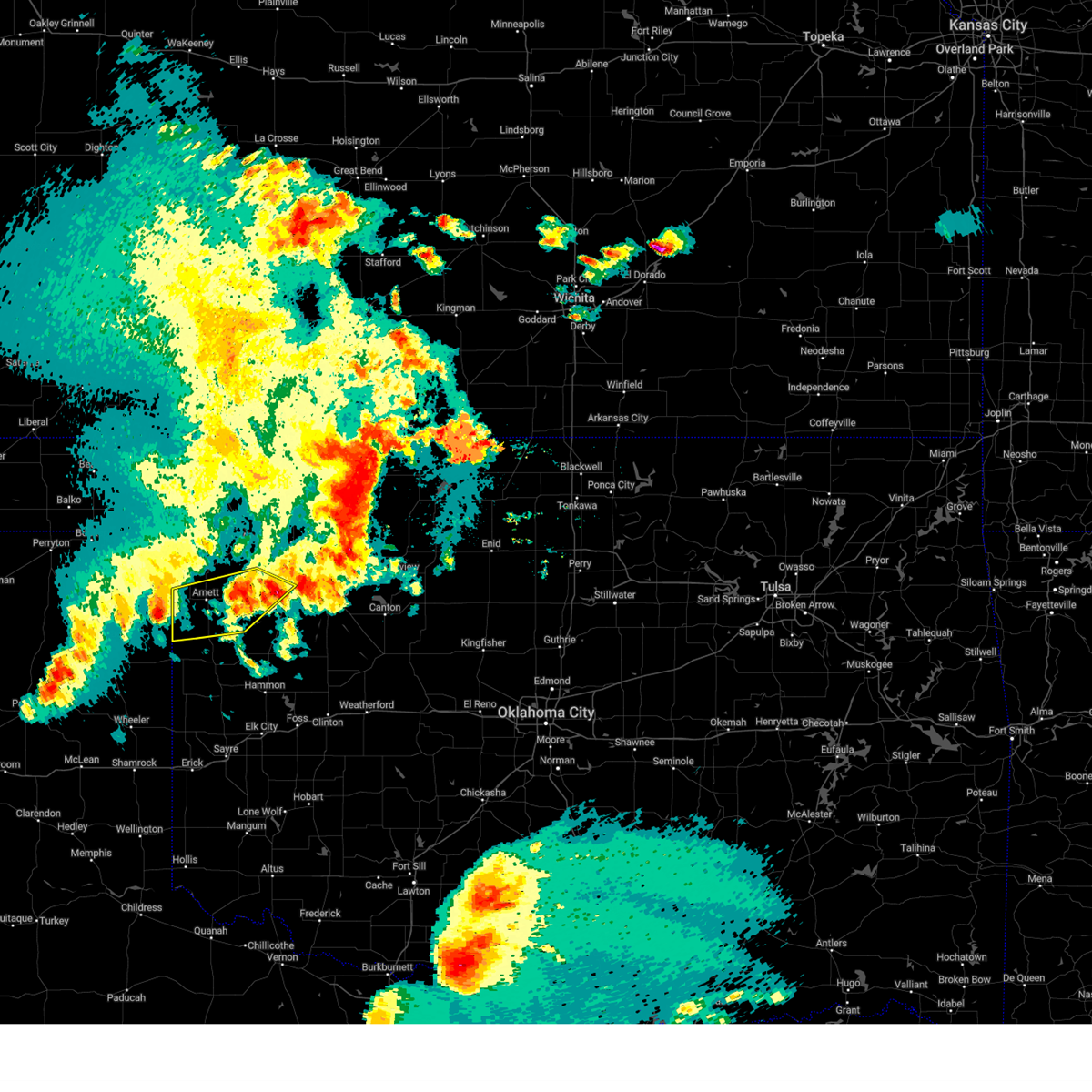 At 917 pm cdt, a severe thunderstorm was located 4 miles south of higgins, moving east at 35 mph (radar indicated). Hazards include 60 mph wind gusts and quarter size hail. Hail damage to vehicles is expected. Expect wind damage to roofs, siding, and trees. At 917 pm cdt, a severe thunderstorm was located 4 miles south of higgins, moving east at 35 mph (radar indicated). Hazards include 60 mph wind gusts and quarter size hail. Hail damage to vehicles is expected. Expect wind damage to roofs, siding, and trees.
|
| 6/17/2023 9:11 PM CDT |
 At 911 pm cdt, severe thunderstorms were located along a line extending from 3 miles northeast of vici to 6 miles west of durham, moving east at 70 mph (radar indicated). Hazards include 70 mph wind gusts and quarter size hail. Hail damage to vehicles is expected. expect considerable tree damage. Wind damage is also likely to mobile homes, roofs, and outbuildings. At 911 pm cdt, severe thunderstorms were located along a line extending from 3 miles northeast of vici to 6 miles west of durham, moving east at 70 mph (radar indicated). Hazards include 70 mph wind gusts and quarter size hail. Hail damage to vehicles is expected. expect considerable tree damage. Wind damage is also likely to mobile homes, roofs, and outbuildings.
|
| 6/15/2023 7:47 PM CDT |
 At 746 pm cdt, severe thunderstorms were located along a line extending from 8 miles west of orienta to 5 miles east of foss reservoir to near delhi, moving southeast at 60 mph (radar indicated). Hazards include tennis ball size hail and 70 mph wind gusts. People and animals outdoors will be injured. expect hail damage to roofs, siding, windows, and vehicles. expect considerable tree damage. wind damage is also likely to mobile homes, roofs, and outbuildings. Locations impacted include, elk city, weatherford, clinton, sayre, cordell, fairview, taloga, burns flat, thomas, erick, sentinel, seiling, arapaho, vici, canton, hammon, dill city, canute, leedey, and custer city. At 746 pm cdt, severe thunderstorms were located along a line extending from 8 miles west of orienta to 5 miles east of foss reservoir to near delhi, moving southeast at 60 mph (radar indicated). Hazards include tennis ball size hail and 70 mph wind gusts. People and animals outdoors will be injured. expect hail damage to roofs, siding, windows, and vehicles. expect considerable tree damage. wind damage is also likely to mobile homes, roofs, and outbuildings. Locations impacted include, elk city, weatherford, clinton, sayre, cordell, fairview, taloga, burns flat, thomas, erick, sentinel, seiling, arapaho, vici, canton, hammon, dill city, canute, leedey, and custer city.
|
| 6/15/2023 7:27 PM CDT |
 At 726 pm cdt, severe thunderstorms were located along a line extending from 9 miles south of waynoka to 3 miles east of hammon to 6 miles north of erick, moving southeast at 40 mph (radar indicated). Hazards include tennis ball size hail and 70 mph wind gusts. People and animals outdoors will be injured. expect hail damage to roofs, siding, windows, and vehicles. expect considerable tree damage. Wind damage is also likely to mobile homes, roofs, and outbuildings. At 726 pm cdt, severe thunderstorms were located along a line extending from 9 miles south of waynoka to 3 miles east of hammon to 6 miles north of erick, moving southeast at 40 mph (radar indicated). Hazards include tennis ball size hail and 70 mph wind gusts. People and animals outdoors will be injured. expect hail damage to roofs, siding, windows, and vehicles. expect considerable tree damage. Wind damage is also likely to mobile homes, roofs, and outbuildings.
|
| 6/15/2023 7:02 PM CDT |
 At 701 pm cdt, severe thunderstorms were located along a line extending from near mooreland to 7 miles north of angora to 6 miles south of reydon, moving southeast at 50 mph (radar indicated). Hazards include tennis ball size hail and 70 mph wind gusts. People and animals outdoors will be injured. expect hail damage to roofs, siding, windows, and vehicles. expect considerable tree damage. wind damage is also likely to mobile homes, roofs, and outbuildings. Locations impacted include, woodward, cheyenne, arnett, taloga, mooreland, seiling, vici, hammon, gage, leedey, fargo, reydon, camargo, sharon, mutual, strong city, angora, moorewood, harmon, and cestos. At 701 pm cdt, severe thunderstorms were located along a line extending from near mooreland to 7 miles north of angora to 6 miles south of reydon, moving southeast at 50 mph (radar indicated). Hazards include tennis ball size hail and 70 mph wind gusts. People and animals outdoors will be injured. expect hail damage to roofs, siding, windows, and vehicles. expect considerable tree damage. wind damage is also likely to mobile homes, roofs, and outbuildings. Locations impacted include, woodward, cheyenne, arnett, taloga, mooreland, seiling, vici, hammon, gage, leedey, fargo, reydon, camargo, sharon, mutual, strong city, angora, moorewood, harmon, and cestos.
|
| 6/15/2023 6:40 PM CDT |
 At 640 pm cdt, severe thunderstorms were located along a line extending from 4 miles south of fort supply to 6 miles southeast of arnett to 7 miles northwest of reydon, moving east at 50 mph (radar indicated). Hazards include two inch hail and 70 mph wind gusts. People and animals outdoors will be injured. expect hail damage to roofs, siding, windows, and vehicles. expect considerable tree damage. Wind damage is also likely to mobile homes, roofs, and outbuildings. At 640 pm cdt, severe thunderstorms were located along a line extending from 4 miles south of fort supply to 6 miles southeast of arnett to 7 miles northwest of reydon, moving east at 50 mph (radar indicated). Hazards include two inch hail and 70 mph wind gusts. People and animals outdoors will be injured. expect hail damage to roofs, siding, windows, and vehicles. expect considerable tree damage. Wind damage is also likely to mobile homes, roofs, and outbuildings.
|
| 5/31/2023 2:10 AM CDT |
 At 210 am cdt, a severe thunderstorm was located 8 miles northwest of camargo, moving east at 40 mph (radar indicated). Hazards include 60 mph wind gusts. Expect damage to roofs, siding, and trees. locations impacted include, vici, camargo, and harmon. hail threat, radar indicated max hail size, <. 75 in wind threat, radar indicated max wind gust, 60 mph. At 210 am cdt, a severe thunderstorm was located 8 miles northwest of camargo, moving east at 40 mph (radar indicated). Hazards include 60 mph wind gusts. Expect damage to roofs, siding, and trees. locations impacted include, vici, camargo, and harmon. hail threat, radar indicated max hail size, <. 75 in wind threat, radar indicated max wind gust, 60 mph.
|
| 5/31/2023 1:44 AM CDT |
 At 144 am cdt, a severe thunderstorm was located near arnett, moving east at 40 mph (radar indicated). Hazards include 60 mph wind gusts. expect damage to roofs, siding, and trees At 144 am cdt, a severe thunderstorm was located near arnett, moving east at 40 mph (radar indicated). Hazards include 60 mph wind gusts. expect damage to roofs, siding, and trees
|
| 2/26/2023 7:43 PM CST |
 At 743 pm cst, a severe thunderstorm was located 4 miles northeast of leedey, moving northeast at 60 mph (radar indicated). Hazards include 70 mph wind gusts and nickel size hail. Expect considerable tree damage. Damage is likely to mobile homes, roofs, and outbuildings. At 743 pm cst, a severe thunderstorm was located 4 miles northeast of leedey, moving northeast at 60 mph (radar indicated). Hazards include 70 mph wind gusts and nickel size hail. Expect considerable tree damage. Damage is likely to mobile homes, roofs, and outbuildings.
|
| 2/26/2023 7:28 PM CST |
 At 728 pm cst, a confirmed tornado was located near angora, moving northeast at 70 mph (radar confirmed tornado). Hazards include damaging tornado and quarter size hail. Flying debris will be dangerous to those caught without shelter. mobile homes will be damaged or destroyed. damage to roofs, windows, and vehicles will occur. tree damage is likely. Locations impacted include, taloga, seiling, vici, leedey, camargo, sharon, mutual, strong city, putnam, angora, moorewood, cestos and hucmac. At 728 pm cst, a confirmed tornado was located near angora, moving northeast at 70 mph (radar confirmed tornado). Hazards include damaging tornado and quarter size hail. Flying debris will be dangerous to those caught without shelter. mobile homes will be damaged or destroyed. damage to roofs, windows, and vehicles will occur. tree damage is likely. Locations impacted include, taloga, seiling, vici, leedey, camargo, sharon, mutual, strong city, putnam, angora, moorewood, cestos and hucmac.
|
| 2/26/2023 7:18 PM CST |
 At 717 pm cst, a severe thunderstorm capable of producing a tornado was located 4 miles west of strong city, moving northeast at 50 mph (radar indicated rotation). Hazards include tornado and quarter size hail. Flying debris will be dangerous to those caught without shelter. mobile homes will be damaged or destroyed. damage to roofs, windows, and vehicles will occur. tree damage is likely. Locations impacted include, cheyenne, taloga, seiling, vici, leedey, camargo, sharon, mutual, strong city, putnam, angora, moorewood, roll, cestos and hucmac. At 717 pm cst, a severe thunderstorm capable of producing a tornado was located 4 miles west of strong city, moving northeast at 50 mph (radar indicated rotation). Hazards include tornado and quarter size hail. Flying debris will be dangerous to those caught without shelter. mobile homes will be damaged or destroyed. damage to roofs, windows, and vehicles will occur. tree damage is likely. Locations impacted include, cheyenne, taloga, seiling, vici, leedey, camargo, sharon, mutual, strong city, putnam, angora, moorewood, roll, cestos and hucmac.
|
| 2/26/2023 7:03 PM CST |
 At 703 pm cst, a severe thunderstorm capable of producing a tornado was located 6 miles southeast of reydon, moving northeast at 85 mph (radar indicated rotation). Hazards include tornado and ping pong ball size hail. Flying debris will be dangerous to those caught without shelter. mobile homes will be damaged or destroyed. damage to roofs, windows, and vehicles will occur. Tree damage is likely. At 703 pm cst, a severe thunderstorm capable of producing a tornado was located 6 miles southeast of reydon, moving northeast at 85 mph (radar indicated rotation). Hazards include tornado and ping pong ball size hail. Flying debris will be dangerous to those caught without shelter. mobile homes will be damaged or destroyed. damage to roofs, windows, and vehicles will occur. Tree damage is likely.
|
| 10/15/2022 7:06 PM CDT |
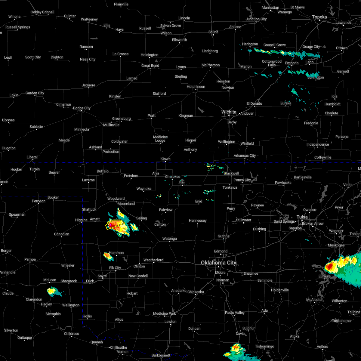 At 706 pm cdt, a severe thunderstorm was located 7 miles southeast of harmon, moving east at 15 mph (radar indicated). Hazards include golf ball size hail and 60 mph wind gusts. People and animals outdoors will be injured. expect hail damage to roofs, siding, windows, and vehicles. expect wind damage to roofs, siding, and trees. locations impacted include, vici. thunderstorm damage threat, considerable hail threat, radar indicated max hail size, 1. 75 in wind threat, radar indicated max wind gust, 60 mph. At 706 pm cdt, a severe thunderstorm was located 7 miles southeast of harmon, moving east at 15 mph (radar indicated). Hazards include golf ball size hail and 60 mph wind gusts. People and animals outdoors will be injured. expect hail damage to roofs, siding, windows, and vehicles. expect wind damage to roofs, siding, and trees. locations impacted include, vici. thunderstorm damage threat, considerable hail threat, radar indicated max hail size, 1. 75 in wind threat, radar indicated max wind gust, 60 mph.
|
| 10/15/2022 7:05 PM CDT |
 At 705 pm cdt, a severe thunderstorm was located 8 miles southeast of harmon, moving east at 15 mph (radar indicated). Hazards include golf ball size hail and 60 mph wind gusts. People and animals outdoors will be injured. expect hail damage to roofs, siding, windows, and vehicles. expect wind damage to roofs, siding, and trees. locations impacted include, vici and camargo. thunderstorm damage threat, considerable hail threat, radar indicated max hail size, 1. 75 in wind threat, radar indicated max wind gust, 60 mph. At 705 pm cdt, a severe thunderstorm was located 8 miles southeast of harmon, moving east at 15 mph (radar indicated). Hazards include golf ball size hail and 60 mph wind gusts. People and animals outdoors will be injured. expect hail damage to roofs, siding, windows, and vehicles. expect wind damage to roofs, siding, and trees. locations impacted include, vici and camargo. thunderstorm damage threat, considerable hail threat, radar indicated max hail size, 1. 75 in wind threat, radar indicated max wind gust, 60 mph.
|
| 10/15/2022 7:02 PM CDT |
 At 702 pm cdt, a severe thunderstorm was located 7 miles southeast of harmon, moving east at 15 mph (radar indicated). Hazards include 60 mph wind gusts and half dollar size hail. Hail damage to vehicles is expected. Expect wind damage to roofs, siding, and trees. At 702 pm cdt, a severe thunderstorm was located 7 miles southeast of harmon, moving east at 15 mph (radar indicated). Hazards include 60 mph wind gusts and half dollar size hail. Hail damage to vehicles is expected. Expect wind damage to roofs, siding, and trees.
|
| 10/15/2022 7:01 PM CDT |
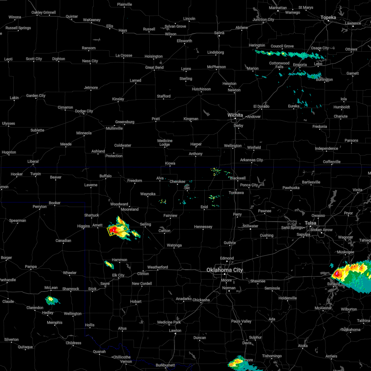 At 701 pm cdt, a severe thunderstorm was located 6 miles southeast of harmon, moving east at 15 mph (radar indicated). Hazards include 60 mph wind gusts and half dollar size hail. Hail damage to vehicles is expected. expect wind damage to roofs, siding, and trees. locations impacted include, vici. hail threat, radar indicated max hail size, 1. 25 in wind threat, radar indicated max wind gust, 60 mph. At 701 pm cdt, a severe thunderstorm was located 6 miles southeast of harmon, moving east at 15 mph (radar indicated). Hazards include 60 mph wind gusts and half dollar size hail. Hail damage to vehicles is expected. expect wind damage to roofs, siding, and trees. locations impacted include, vici. hail threat, radar indicated max hail size, 1. 25 in wind threat, radar indicated max wind gust, 60 mph.
|
| 10/15/2022 6:53 PM CDT |
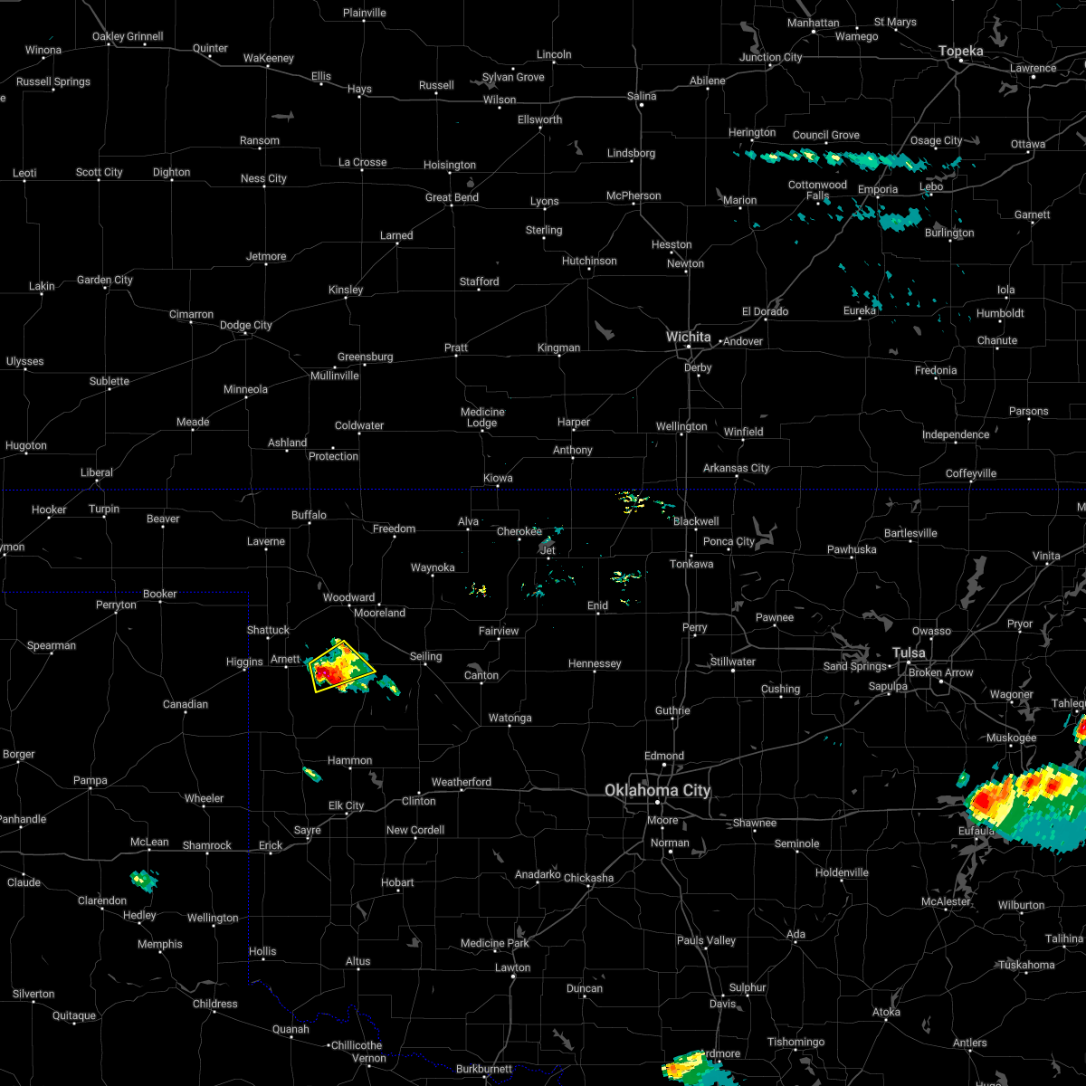 At 653 pm cdt, a severe thunderstorm was located 4 miles southeast of harmon, moving east at 15 mph (radar indicated). Hazards include ping pong ball size hail and 60 mph wind gusts. People and animals outdoors will be injured. expect hail damage to roofs, siding, windows, and vehicles. expect wind damage to roofs, siding, and trees. locations impacted include, vici and harmon. hail threat, radar indicated max hail size, 1. 50 in wind threat, radar indicated max wind gust, 60 mph. At 653 pm cdt, a severe thunderstorm was located 4 miles southeast of harmon, moving east at 15 mph (radar indicated). Hazards include ping pong ball size hail and 60 mph wind gusts. People and animals outdoors will be injured. expect hail damage to roofs, siding, windows, and vehicles. expect wind damage to roofs, siding, and trees. locations impacted include, vici and harmon. hail threat, radar indicated max hail size, 1. 50 in wind threat, radar indicated max wind gust, 60 mph.
|
| 10/15/2022 6:38 PM CDT |
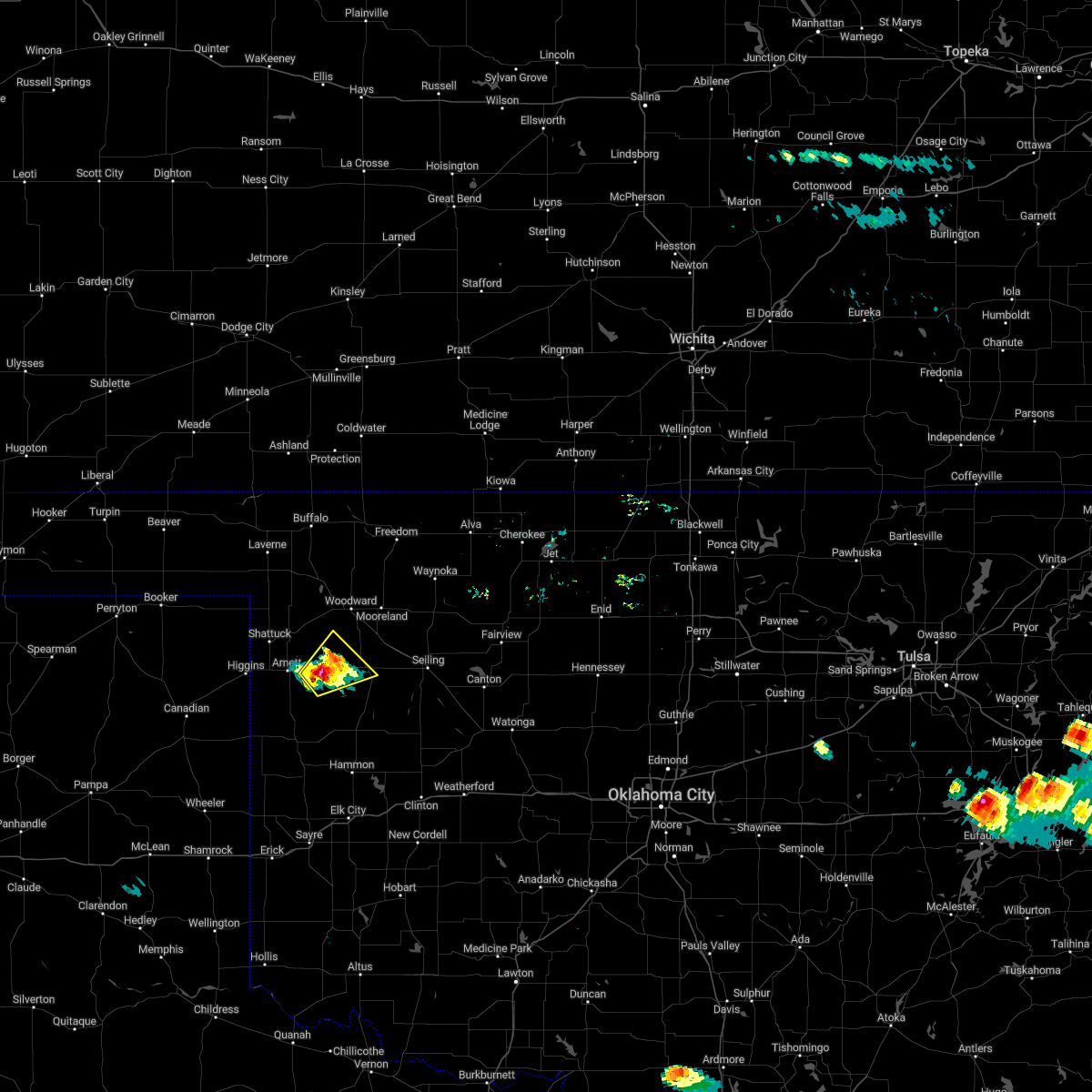 At 638 pm cdt, a severe thunderstorm was located near harmon, moving northeast at 10 mph (radar indicated). Hazards include ping pong ball size hail and 60 mph wind gusts. People and animals outdoors will be injured. expect hail damage to roofs, siding, windows, and vehicles. expect wind damage to roofs, siding, and trees. locations impacted include, vici and harmon. hail threat, radar indicated max hail size, 1. 50 in wind threat, radar indicated max wind gust, 60 mph. At 638 pm cdt, a severe thunderstorm was located near harmon, moving northeast at 10 mph (radar indicated). Hazards include ping pong ball size hail and 60 mph wind gusts. People and animals outdoors will be injured. expect hail damage to roofs, siding, windows, and vehicles. expect wind damage to roofs, siding, and trees. locations impacted include, vici and harmon. hail threat, radar indicated max hail size, 1. 50 in wind threat, radar indicated max wind gust, 60 mph.
|
| 10/15/2022 6:30 PM CDT |
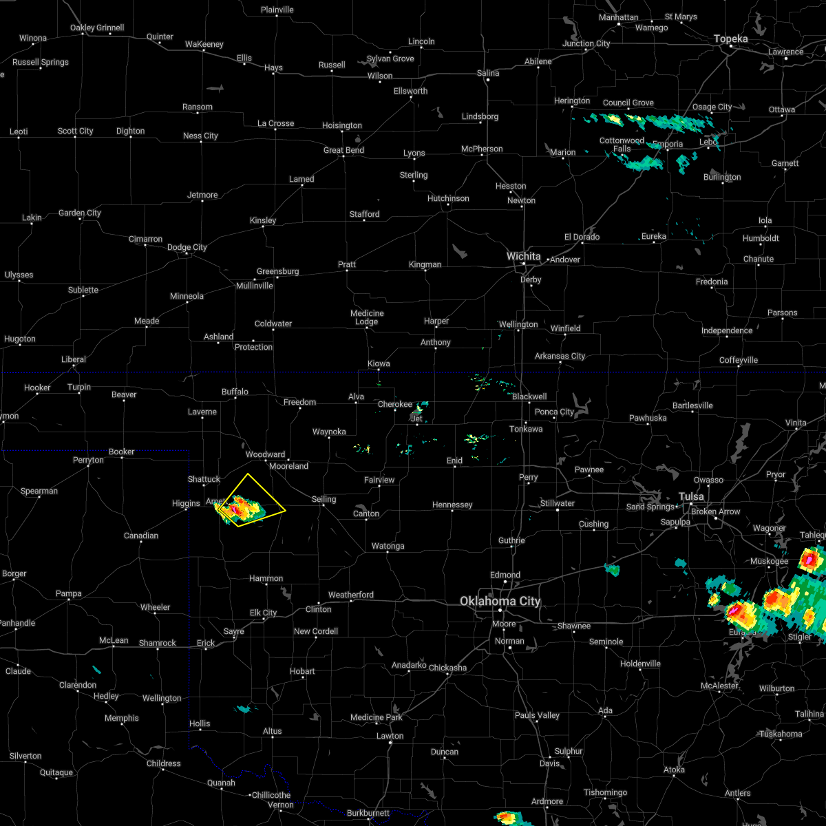 At 629 pm cdt, a severe thunderstorm was located near harmon, moving northeast at 10 mph (radar indicated). Hazards include 60 mph wind gusts and quarter size hail. Hail damage to vehicles is expected. Expect wind damage to roofs, siding, and trees. At 629 pm cdt, a severe thunderstorm was located near harmon, moving northeast at 10 mph (radar indicated). Hazards include 60 mph wind gusts and quarter size hail. Hail damage to vehicles is expected. Expect wind damage to roofs, siding, and trees.
|
| 5/31/2022 6:40 PM CDT |
 At 639 pm cdt, a severe thunderstorm was located near roll, moving northeast at 50 mph. golf ball sized hail was reported in reydon (emergency management). Hazards include golf ball size hail and 60 mph wind gusts. People and animals outdoors will be injured. expect hail damage to roofs, siding, windows, and vehicles. Expect wind damage to roofs, siding, and trees. At 639 pm cdt, a severe thunderstorm was located near roll, moving northeast at 50 mph. golf ball sized hail was reported in reydon (emergency management). Hazards include golf ball size hail and 60 mph wind gusts. People and animals outdoors will be injured. expect hail damage to roofs, siding, windows, and vehicles. Expect wind damage to roofs, siding, and trees.
|
| 5/19/2022 1:12 AM CDT |
 At 110 am cdt, severe thunderstorms were located along a line extending from near cestos to 4 miles west of moorewood to 5 miles south of cheyenne, moving east at 45 mph. these are destructive storms for the camargo, cestos, and taloga areas! (an 80 mph wind gust was measured by the camargo mesonet weather station at 100 am!). Hazards include 80 mph wind gusts and quarter size hail. Flying debris will be dangerous to those caught without shelter. mobile homes will be heavily damaged. expect considerable damage to roofs, windows, and vehicles. extensive tree damage and power outages are likely. locations impacted include, elk city, cheyenne, taloga, seiling, arapaho, vici, hammon, canute, leedey, custer city, butler, camargo, foss, oakwood, strong city, putnam, foss reservoir, angora, moorewood and cestos. thunderstorm damage threat, destructive hail threat, radar indicated max hail size, 1. 00 in wind threat, observed max wind gust, 80 mph. At 110 am cdt, severe thunderstorms were located along a line extending from near cestos to 4 miles west of moorewood to 5 miles south of cheyenne, moving east at 45 mph. these are destructive storms for the camargo, cestos, and taloga areas! (an 80 mph wind gust was measured by the camargo mesonet weather station at 100 am!). Hazards include 80 mph wind gusts and quarter size hail. Flying debris will be dangerous to those caught without shelter. mobile homes will be heavily damaged. expect considerable damage to roofs, windows, and vehicles. extensive tree damage and power outages are likely. locations impacted include, elk city, cheyenne, taloga, seiling, arapaho, vici, hammon, canute, leedey, custer city, butler, camargo, foss, oakwood, strong city, putnam, foss reservoir, angora, moorewood and cestos. thunderstorm damage threat, destructive hail threat, radar indicated max hail size, 1. 00 in wind threat, observed max wind gust, 80 mph.
|
| 5/19/2022 1:09 AM CDT |
 At 107 am cdt, severe thunderstorms were located along a line extending from 12 miles southwest of aetna to near alabaster caverns state park to 5 miles northeast of mooreland to 3 miles west of mutual to near camargo, moving east at 45 mph. these are destructive storms for the camargo, vici, and mutual areas! (an 80 mph wind gust was measured by the camargo mesonet weather station at 100 am!). Hazards include 80 mph wind gusts and quarter size hail. Flying debris will be dangerous to those caught without shelter. mobile homes will be heavily damaged. expect considerable damage to roofs, windows, and vehicles. extensive tree damage and power outages are likely. locations impacted include, woodward, alva, taloga, mooreland, waynoka, seiling, vici, freedom, camargo, sharon, mutual, alabaster caverns state park, quinlan, chester, avard, harmon, cestos, hopeton, bouse junction and camp houston. thunderstorm damage threat, destructive hail threat, radar indicated max hail size, 1. 00 in wind threat, observed max wind gust, 80 mph. At 107 am cdt, severe thunderstorms were located along a line extending from 12 miles southwest of aetna to near alabaster caverns state park to 5 miles northeast of mooreland to 3 miles west of mutual to near camargo, moving east at 45 mph. these are destructive storms for the camargo, vici, and mutual areas! (an 80 mph wind gust was measured by the camargo mesonet weather station at 100 am!). Hazards include 80 mph wind gusts and quarter size hail. Flying debris will be dangerous to those caught without shelter. mobile homes will be heavily damaged. expect considerable damage to roofs, windows, and vehicles. extensive tree damage and power outages are likely. locations impacted include, woodward, alva, taloga, mooreland, waynoka, seiling, vici, freedom, camargo, sharon, mutual, alabaster caverns state park, quinlan, chester, avard, harmon, cestos, hopeton, bouse junction and camp houston. thunderstorm damage threat, destructive hail threat, radar indicated max hail size, 1. 00 in wind threat, observed max wind gust, 80 mph.
|
| 5/19/2022 1:05 AM CDT |
 At 105 am cdt, severe thunderstorms were located along a line extending from 3 miles southeast of vici to 4 miles southwest of angora to 6 miles southwest of cheyenne, moving east at 45 mph (radar indicated). Hazards include 60 mph wind gusts and quarter size hail. Hail damage to vehicles is expected. Expect wind damage to roofs, siding, and trees. At 105 am cdt, severe thunderstorms were located along a line extending from 3 miles southeast of vici to 4 miles southwest of angora to 6 miles southwest of cheyenne, moving east at 45 mph (radar indicated). Hazards include 60 mph wind gusts and quarter size hail. Hail damage to vehicles is expected. Expect wind damage to roofs, siding, and trees.
|
| 5/19/2022 12:52 AM CDT |
 At 1252 am cdt, severe thunderstorms were located along a line extending from 8 miles south of buttermilk to 9 miles east of selman to 10 miles east of fort supply to 4 miles east of harmon, moving east at 45 mph (radar indicated). Hazards include 70 mph wind gusts and quarter size hail. Hail damage to vehicles is expected. expect considerable tree damage. Wind damage is also likely to mobile homes, roofs, and outbuildings. At 1252 am cdt, severe thunderstorms were located along a line extending from 8 miles south of buttermilk to 9 miles east of selman to 10 miles east of fort supply to 4 miles east of harmon, moving east at 45 mph (radar indicated). Hazards include 70 mph wind gusts and quarter size hail. Hail damage to vehicles is expected. expect considerable tree damage. Wind damage is also likely to mobile homes, roofs, and outbuildings.
|
| 5/19/2022 12:48 AM CDT |
 At 1247 am cdt, severe thunderstorms were located along a line extending from 3 miles southeast of harmon to 5 miles southwest of roll to 5 miles south of reydon, moving east at 50 mph (trained weather spotters reported damage to a power pole 1 mile east of arnett). Hazards include 70 mph wind gusts and quarter size hail. Hail damage to vehicles is expected. expect considerable tree damage. wind damage is also likely to mobile homes, roofs, and outbuildings. locations impacted include, cheyenne, arnett, vici, leedey, reydon, camargo, strong city, crawford, harmon, roll, durham and angora. thunderstorm damage threat, considerable hail threat, radar indicated max hail size, 1. 00 in wind threat, observed max wind gust, 70 mph. At 1247 am cdt, severe thunderstorms were located along a line extending from 3 miles southeast of harmon to 5 miles southwest of roll to 5 miles south of reydon, moving east at 50 mph (trained weather spotters reported damage to a power pole 1 mile east of arnett). Hazards include 70 mph wind gusts and quarter size hail. Hail damage to vehicles is expected. expect considerable tree damage. wind damage is also likely to mobile homes, roofs, and outbuildings. locations impacted include, cheyenne, arnett, vici, leedey, reydon, camargo, strong city, crawford, harmon, roll, durham and angora. thunderstorm damage threat, considerable hail threat, radar indicated max hail size, 1. 00 in wind threat, observed max wind gust, 70 mph.
|
| 5/19/2022 12:29 AM CDT |
 At 1229 am cdt, severe thunderstorms were located along a line extending from 6 miles southwest of arnett to 6 miles east of lake marvin to 8 miles northeast of briscoe, moving east at 50 mph (radar indicated). Hazards include 70 mph wind gusts and quarter size hail. Hail damage to vehicles is expected. expect considerable tree damage. Wind damage is also likely to mobile homes, roofs, and outbuildings. At 1229 am cdt, severe thunderstorms were located along a line extending from 6 miles southwest of arnett to 6 miles east of lake marvin to 8 miles northeast of briscoe, moving east at 50 mph (radar indicated). Hazards include 70 mph wind gusts and quarter size hail. Hail damage to vehicles is expected. expect considerable tree damage. Wind damage is also likely to mobile homes, roofs, and outbuildings.
|
| 5/10/2022 10:38 PM CDT |
 The severe thunderstorm warning for western washita, southern ellis, roger mills, western custer, western dewey, northern harmon, northwestern greer and beckham counties will expire at 1045 pm cdt, the storms which prompted the warning have weakened below severe limits, therefore the warning will be allowed to expire. however gusty winds are still possible with these thunderstorms. The severe thunderstorm warning for western washita, southern ellis, roger mills, western custer, western dewey, northern harmon, northwestern greer and beckham counties will expire at 1045 pm cdt, the storms which prompted the warning have weakened below severe limits, therefore the warning will be allowed to expire. however gusty winds are still possible with these thunderstorms.
|
| 5/10/2022 10:13 PM CDT |
 At 1013 pm cdt, severe thunderstorms were located along a line extending from 9 miles north of roll to 9 miles southeast of cheyenne to near delhi to 10 miles west of vinson, moving east at 35 mph (radar indicated). Hazards include 60 mph wind gusts. Expect damage to roofs, siding, and trees. locations impacted include, elk city, sayre, cheyenne, arnett, burns flat, erick, vici, hammon, canute, leedey, butler, carter, reydon, camargo, foss, willow, sweetwater, strong city, texola and retrop. hail threat, radar indicated max hail size, <. 75 in wind threat, radar indicated max wind gust, 60 mph. At 1013 pm cdt, severe thunderstorms were located along a line extending from 9 miles north of roll to 9 miles southeast of cheyenne to near delhi to 10 miles west of vinson, moving east at 35 mph (radar indicated). Hazards include 60 mph wind gusts. Expect damage to roofs, siding, and trees. locations impacted include, elk city, sayre, cheyenne, arnett, burns flat, erick, vici, hammon, canute, leedey, butler, carter, reydon, camargo, foss, willow, sweetwater, strong city, texola and retrop. hail threat, radar indicated max hail size, <. 75 in wind threat, radar indicated max wind gust, 60 mph.
|
| 5/10/2022 9:53 PM CDT |
 At 953 pm cdt, severe thunderstorms were located along a line extending from 6 miles northwest of crawford to 7 miles southwest of cheyenne to 5 miles south of erick to 5 miles north of wellington, moving east at 35 mph (radar indicated). Hazards include 70 mph wind gusts and penny size hail. Expect considerable tree damage. Damage is likely to mobile homes, roofs, and outbuildings. At 953 pm cdt, severe thunderstorms were located along a line extending from 6 miles northwest of crawford to 7 miles southwest of cheyenne to 5 miles south of erick to 5 miles north of wellington, moving east at 35 mph (radar indicated). Hazards include 70 mph wind gusts and penny size hail. Expect considerable tree damage. Damage is likely to mobile homes, roofs, and outbuildings.
|
| 5/4/2022 7:26 PM CDT |
 At 726 pm cdt, a severe thunderstorm was located near vici, moving northeast at 45 mph (radar indicated). Hazards include quarter size hail. damage to vehicles is expected At 726 pm cdt, a severe thunderstorm was located near vici, moving northeast at 45 mph (radar indicated). Hazards include quarter size hail. damage to vehicles is expected
|
| 10/26/2021 9:31 PM CDT |
 At 930 pm cdt, severe thunderstorms were located along a line extending from 8 miles northwest of alva to 3 miles north of avard to 5 miles southeast of waynoka to 3 miles south of mutual, moving northeast at 45 mph (radar indicated). Hazards include 70 mph wind gusts and half dollar size hail. Hail damage to vehicles is expected. expect considerable tree damage. Wind damage is also likely to mobile homes, roofs, and outbuildings. At 930 pm cdt, severe thunderstorms were located along a line extending from 8 miles northwest of alva to 3 miles north of avard to 5 miles southeast of waynoka to 3 miles south of mutual, moving northeast at 45 mph (radar indicated). Hazards include 70 mph wind gusts and half dollar size hail. Hail damage to vehicles is expected. expect considerable tree damage. Wind damage is also likely to mobile homes, roofs, and outbuildings.
|
| 10/26/2021 9:23 PM CDT | Quarter sized hail reported 1.2 miles W of Vici, OK, spotternetwork report. |
| 10/26/2021 9:04 PM CDT |
 At 902 pm cdt, severe thunderstorms were located along a line extending from 5 miles south of aetna to 3 miles north of mutual to 7 miles north of angora, moving northeast at 25 mph. these are destructive storms for dewey and woodward counties (radar indicated). Hazards include 80 mph wind gusts and ping pong ball size hail. Flying debris will be dangerous to those caught without shelter. mobile homes will be heavily damaged. expect considerable damage to roofs, windows, and vehicles. extensive tree damage and power outages are likely. Locations impacted include, woodward, alva, taloga, mooreland, waynoka, seiling, vici, freedom, camargo, sharon, mutual, putnam, alabaster caverns state park, quinlan, chester, avard, cestos, hopeton, bouse junction and camp houston. At 902 pm cdt, severe thunderstorms were located along a line extending from 5 miles south of aetna to 3 miles north of mutual to 7 miles north of angora, moving northeast at 25 mph. these are destructive storms for dewey and woodward counties (radar indicated). Hazards include 80 mph wind gusts and ping pong ball size hail. Flying debris will be dangerous to those caught without shelter. mobile homes will be heavily damaged. expect considerable damage to roofs, windows, and vehicles. extensive tree damage and power outages are likely. Locations impacted include, woodward, alva, taloga, mooreland, waynoka, seiling, vici, freedom, camargo, sharon, mutual, putnam, alabaster caverns state park, quinlan, chester, avard, cestos, hopeton, bouse junction and camp houston.
|
| 10/26/2021 8:53 PM CDT |
 At 852 pm cdt, severe thunderstorms were located along a line extending from 10 miles south of aetna to near mutual to 3 miles north of angora, moving northeast at 40 mph. these are destructive storms for southern woodward county (radar indicated). Hazards include 80 mph wind gusts and half dollar size hail. Flying debris will be dangerous to those caught without shelter. mobile homes will be heavily damaged. expect considerable damage to roofs, windows, and vehicles. extensive tree damage and power outages are likely. Locations impacted include, woodward, alva, taloga, mooreland, waynoka, seiling, vici, leedey, freedom, camargo, sharon, mutual, putnam, alabaster caverns state park, quinlan, angora, chester, avard, moorewood and cestos. At 852 pm cdt, severe thunderstorms were located along a line extending from 10 miles south of aetna to near mutual to 3 miles north of angora, moving northeast at 40 mph. these are destructive storms for southern woodward county (radar indicated). Hazards include 80 mph wind gusts and half dollar size hail. Flying debris will be dangerous to those caught without shelter. mobile homes will be heavily damaged. expect considerable damage to roofs, windows, and vehicles. extensive tree damage and power outages are likely. Locations impacted include, woodward, alva, taloga, mooreland, waynoka, seiling, vici, leedey, freedom, camargo, sharon, mutual, putnam, alabaster caverns state park, quinlan, angora, chester, avard, moorewood and cestos.
|
| 10/26/2021 8:41 PM CDT |
 At 841 pm cdt, severe thunderstorms were located along a line extending from 9 miles north of freedom to near vici to 7 miles northeast of roll, moving northeast at 35 mph (radar indicated). Hazards include 70 mph wind gusts and half dollar size hail. Hail damage to vehicles is expected. expect considerable tree damage. Wind damage is also likely to mobile homes, roofs, and outbuildings. At 841 pm cdt, severe thunderstorms were located along a line extending from 9 miles north of freedom to near vici to 7 miles northeast of roll, moving northeast at 35 mph (radar indicated). Hazards include 70 mph wind gusts and half dollar size hail. Hail damage to vehicles is expected. expect considerable tree damage. Wind damage is also likely to mobile homes, roofs, and outbuildings.
|
| 10/26/2021 8:05 PM CDT |
 At 805 pm cdt, severe thunderstorms were located along a line extending from 3 miles south of harmon to 12 miles north of roll, moving northeast at 60 mph (radar indicated). Hazards include 60 mph wind gusts and quarter size hail. Hail damage to vehicles is expected. Expect wind damage to roofs, siding, and trees. At 805 pm cdt, severe thunderstorms were located along a line extending from 3 miles south of harmon to 12 miles north of roll, moving northeast at 60 mph (radar indicated). Hazards include 60 mph wind gusts and quarter size hail. Hail damage to vehicles is expected. Expect wind damage to roofs, siding, and trees.
|
| 8/21/2021 4:00 PM CDT | Golf Ball sized hail reported 10.9 miles ENE of Vici, OK, on county road ns 1950. |
| 7/25/2021 8:12 PM CDT |
 At 811 pm cdt, a severe thunderstorm was located near moorewood, moving north at 25 mph (radar indicated). Hazards include 60 mph wind gusts and quarter size hail. Hail damage to vehicles is expected. Expect wind damage to roofs, siding, and trees. At 811 pm cdt, a severe thunderstorm was located near moorewood, moving north at 25 mph (radar indicated). Hazards include 60 mph wind gusts and quarter size hail. Hail damage to vehicles is expected. Expect wind damage to roofs, siding, and trees.
|
| 7/25/2021 9:12 AM CDT |
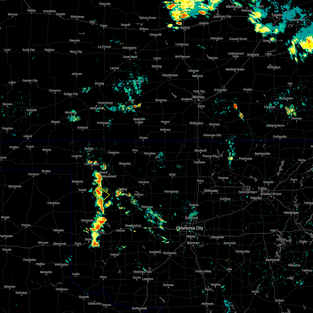 At 912 am cdt, a severe thunderstorm was located 6 miles west of vici, moving southeast at 5 mph (radar indicated). Hazards include 60 mph wind gusts and quarter size hail. Hail damage to vehicles is expected. Expect wind damage to roofs, siding, and trees. At 912 am cdt, a severe thunderstorm was located 6 miles west of vici, moving southeast at 5 mph (radar indicated). Hazards include 60 mph wind gusts and quarter size hail. Hail damage to vehicles is expected. Expect wind damage to roofs, siding, and trees.
|
| 3/16/2021 10:45 PM CDT |
 At 1045 pm cdt, a severe thunderstorm was located 6 miles east of harmon, moving east at 30 mph (radar indicated). Hazards include ping pong ball size hail and 60 mph wind gusts. People and animals outdoors will be injured. expect hail damage to roofs, siding, windows, and vehicles. Expect wind damage to roofs, siding, and trees. At 1045 pm cdt, a severe thunderstorm was located 6 miles east of harmon, moving east at 30 mph (radar indicated). Hazards include ping pong ball size hail and 60 mph wind gusts. People and animals outdoors will be injured. expect hail damage to roofs, siding, windows, and vehicles. Expect wind damage to roofs, siding, and trees.
|
| 9/2/2020 2:48 PM CDT |
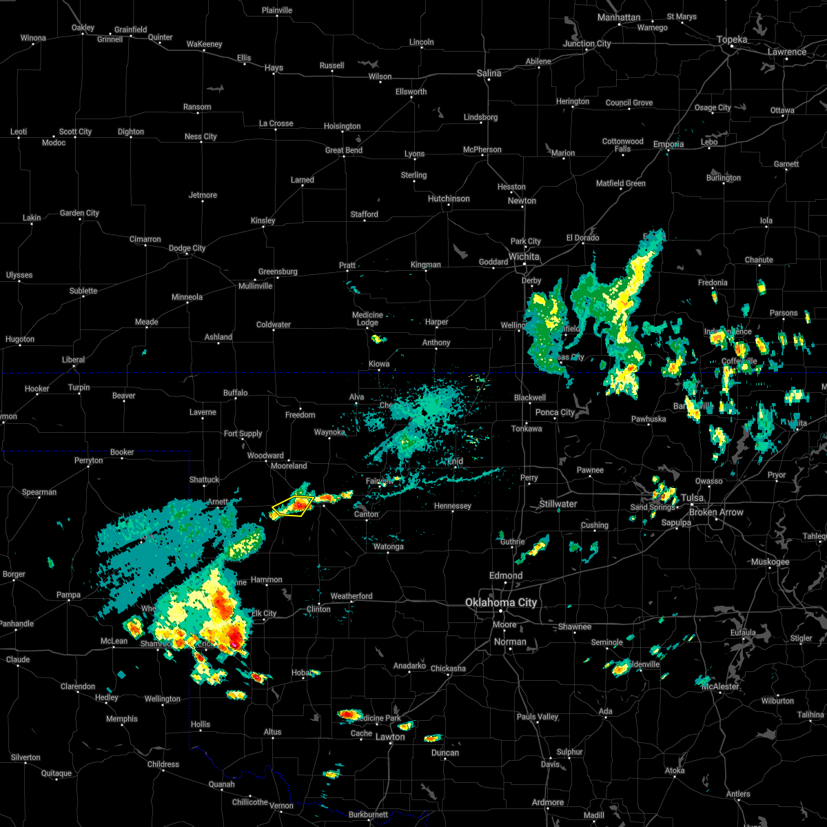 At 248 pm cdt, a severe thunderstorm was located near cestos, moving southwest at 15 mph (radar indicated). Hazards include 60 mph wind gusts and penny size hail. Expect damage to roofs, siding, and trees. Locations impacted include, vici and cestos. At 248 pm cdt, a severe thunderstorm was located near cestos, moving southwest at 15 mph (radar indicated). Hazards include 60 mph wind gusts and penny size hail. Expect damage to roofs, siding, and trees. Locations impacted include, vici and cestos.
|
| 9/2/2020 2:22 PM CDT |
 At 222 pm cdt, a severe thunderstorm was located near mutual, moving southwest at 20 mph (radar indicated). Hazards include 60 mph wind gusts and quarter size hail. Hail damage to vehicles is expected. Expect wind damage to roofs, siding, and trees. At 222 pm cdt, a severe thunderstorm was located near mutual, moving southwest at 20 mph (radar indicated). Hazards include 60 mph wind gusts and quarter size hail. Hail damage to vehicles is expected. Expect wind damage to roofs, siding, and trees.
|
| 8/10/2020 9:20 PM CDT |
 At 920 pm cdt, severe thunderstorms were located along a line extending from 3 miles east of mooreland to near cestos to 3 miles east of leedey, moving east at 25 mph (radar indicated). Hazards include 70 mph wind gusts and nickel size hail. Expect considerable tree damage. damage is likely to mobile homes, roofs, and outbuildings. Locations impacted include, mooreland, vici, leedey, camargo, mutual, quinlan and cestos. At 920 pm cdt, severe thunderstorms were located along a line extending from 3 miles east of mooreland to near cestos to 3 miles east of leedey, moving east at 25 mph (radar indicated). Hazards include 70 mph wind gusts and nickel size hail. Expect considerable tree damage. damage is likely to mobile homes, roofs, and outbuildings. Locations impacted include, mooreland, vici, leedey, camargo, mutual, quinlan and cestos.
|
| 8/10/2020 9:07 PM CDT |
 At 906 pm cdt, severe thunderstorms were located along a line extending from 10 miles north of woodward to 3 miles southwest of mutual to near angora, moving east at 30 mph (the camargo mesonet measured a 72 mph wind gust). Hazards include 70 mph wind gusts and quarter size hail. Hail damage to vehicles is expected. expect considerable tree damage. wind damage is also likely to mobile homes, roofs, and outbuildings. Locations impacted include, woodward, mooreland, vici, leedey, camargo, sharon, mutual, quinlan, angora and cestos. At 906 pm cdt, severe thunderstorms were located along a line extending from 10 miles north of woodward to 3 miles southwest of mutual to near angora, moving east at 30 mph (the camargo mesonet measured a 72 mph wind gust). Hazards include 70 mph wind gusts and quarter size hail. Hail damage to vehicles is expected. expect considerable tree damage. wind damage is also likely to mobile homes, roofs, and outbuildings. Locations impacted include, woodward, mooreland, vici, leedey, camargo, sharon, mutual, quinlan, angora and cestos.
|
| 8/10/2020 8:47 PM CDT |
 At 847 pm cdt, severe thunderstorms were located along a line extending from 5 miles east of fort supply to 4 miles east of harmon to 7 miles northeast of roll, moving east at 25 mph (radar indicated). Hazards include 70 mph wind gusts and quarter size hail. Hail damage to vehicles is expected. expect considerable tree damage. wind damage is also likely to mobile homes, roofs, and outbuildings. Locations impacted include, woodward, mooreland, vici, leedey, camargo, sharon, mutual, quinlan, angora, cestos and harmon. At 847 pm cdt, severe thunderstorms were located along a line extending from 5 miles east of fort supply to 4 miles east of harmon to 7 miles northeast of roll, moving east at 25 mph (radar indicated). Hazards include 70 mph wind gusts and quarter size hail. Hail damage to vehicles is expected. expect considerable tree damage. wind damage is also likely to mobile homes, roofs, and outbuildings. Locations impacted include, woodward, mooreland, vici, leedey, camargo, sharon, mutual, quinlan, angora, cestos and harmon.
|
| 8/10/2020 8:44 PM CDT |
 At 843 pm cdt, severe thunderstorms were located along a line extending from 4 miles east of fort supply to 3 miles east of harmon to 6 miles northeast of roll, moving east at 25 mph (radar indicated). Hazards include 70 mph wind gusts and quarter size hail. Hail damage to vehicles is expected. expect considerable tree damage. Wind damage is also likely to mobile homes, roofs, and outbuildings. At 843 pm cdt, severe thunderstorms were located along a line extending from 4 miles east of fort supply to 3 miles east of harmon to 6 miles northeast of roll, moving east at 25 mph (radar indicated). Hazards include 70 mph wind gusts and quarter size hail. Hail damage to vehicles is expected. expect considerable tree damage. Wind damage is also likely to mobile homes, roofs, and outbuildings.
|
| 7/13/2020 3:33 AM CDT |
 At 332 am cdt, a severe thunderstorm was located 5 miles west of vici, moving east at 40 mph (radar indicated). Hazards include 70 mph wind gusts and quarter size hail. Hail damage to vehicles is expected. expect considerable tree damage. Wind damage is also likely to mobile homes, roofs, and outbuildings. At 332 am cdt, a severe thunderstorm was located 5 miles west of vici, moving east at 40 mph (radar indicated). Hazards include 70 mph wind gusts and quarter size hail. Hail damage to vehicles is expected. expect considerable tree damage. Wind damage is also likely to mobile homes, roofs, and outbuildings.
|
| 6/21/2020 9:55 PM CDT |
 At 955 pm cdt, a severe thunderstorm was located 5 miles east of camargo, moving southeast at 30 mph (radar indicated). Hazards include 60 mph wind gusts and quarter size hail. Hail damage to vehicles is expected. Expect wind damage to roofs, siding, and trees. At 955 pm cdt, a severe thunderstorm was located 5 miles east of camargo, moving southeast at 30 mph (radar indicated). Hazards include 60 mph wind gusts and quarter size hail. Hail damage to vehicles is expected. Expect wind damage to roofs, siding, and trees.
|
| 6/21/2020 9:04 PM CDT |
 At 904 pm cdt, severe thunderstorms were located along a line extending from 11 miles south of aetna to 4 miles south of waynoka to 5 miles northeast of mutual to 5 miles northeast of harmon, moving southeast at 45 mph (radar indicated). Hazards include 70 mph wind gusts and quarter size hail. Hail damage to vehicles is expected. expect considerable tree damage. wind damage is also likely to mobile homes, roofs, and outbuildings. Locations impacted include, woodward, alva, fairview, cherokee, taloga, mooreland, waynoka, seiling, vici, canton, carmen, cleo springs, freedom, longdale, aline, camargo, burlington, sharon, dacoma and mutual. At 904 pm cdt, severe thunderstorms were located along a line extending from 11 miles south of aetna to 4 miles south of waynoka to 5 miles northeast of mutual to 5 miles northeast of harmon, moving southeast at 45 mph (radar indicated). Hazards include 70 mph wind gusts and quarter size hail. Hail damage to vehicles is expected. expect considerable tree damage. wind damage is also likely to mobile homes, roofs, and outbuildings. Locations impacted include, woodward, alva, fairview, cherokee, taloga, mooreland, waynoka, seiling, vici, canton, carmen, cleo springs, freedom, longdale, aline, camargo, burlington, sharon, dacoma and mutual.
|
| 6/21/2020 8:46 PM CDT |
 At 846 pm cdt, severe thunderstorms were located along a line extending from 11 miles north of freedom to 3 miles northeast of mooreland to 4 miles south of gage, moving southeast at 50 mph. these are very dangerous storms (radar indicated). Hazards include 80 mph wind gusts and quarter size hail. Flying debris will be dangerous to those caught without shelter. mobile homes will be heavily damaged. expect considerable damage to roofs, windows, and vehicles. Extensive tree damage and power outages are likely. At 846 pm cdt, severe thunderstorms were located along a line extending from 11 miles north of freedom to 3 miles northeast of mooreland to 4 miles south of gage, moving southeast at 50 mph. these are very dangerous storms (radar indicated). Hazards include 80 mph wind gusts and quarter size hail. Flying debris will be dangerous to those caught without shelter. mobile homes will be heavily damaged. expect considerable damage to roofs, windows, and vehicles. Extensive tree damage and power outages are likely.
|
| 6/4/2020 6:09 PM CDT |
 At 607 pm cdt, severe thunderstorms were located along a line extending from 5 miles southwest of camargo to near strong city to near reydon, moving southeast at 40 mph. these are very dangerous storms (trained weather spotters measured 80 mph winds in cheyenne. wind damage has been reported in roger mills county). Hazards include 80 mph wind gusts. Flying debris will be dangerous to those caught without shelter. mobile homes will be heavily damaged. expect considerable damage to roofs, windows, and vehicles. extensive tree damage and power outages are likely. Locations impacted include, elk city, weatherford, clinton, sayre, cordell, cheyenne, taloga, burns flat, thomas, erick, sentinel, seiling, arapaho, vici, hammon, dill city, canute, corn, leedey and custer city. At 607 pm cdt, severe thunderstorms were located along a line extending from 5 miles southwest of camargo to near strong city to near reydon, moving southeast at 40 mph. these are very dangerous storms (trained weather spotters measured 80 mph winds in cheyenne. wind damage has been reported in roger mills county). Hazards include 80 mph wind gusts. Flying debris will be dangerous to those caught without shelter. mobile homes will be heavily damaged. expect considerable damage to roofs, windows, and vehicles. extensive tree damage and power outages are likely. Locations impacted include, elk city, weatherford, clinton, sayre, cordell, cheyenne, taloga, burns flat, thomas, erick, sentinel, seiling, arapaho, vici, hammon, dill city, canute, corn, leedey and custer city.
|
| 6/4/2020 6:06 PM CDT |
 At 605 pm cdt, severe thunderstorms were located along a line extending from 5 miles southwest of camargo to near strong city to 3 miles southeast of reydon, moving southeast at 40 mph (emergency management reported 65 mph winds and trees down in roger mills county). Hazards include 70 mph wind gusts and nickel size hail. Expect considerable tree damage. Damage is likely to mobile homes, roofs, and outbuildings. At 605 pm cdt, severe thunderstorms were located along a line extending from 5 miles southwest of camargo to near strong city to 3 miles southeast of reydon, moving southeast at 40 mph (emergency management reported 65 mph winds and trees down in roger mills county). Hazards include 70 mph wind gusts and nickel size hail. Expect considerable tree damage. Damage is likely to mobile homes, roofs, and outbuildings.
|
| 6/4/2020 5:45 PM CDT |
 At 545 pm cdt, a severe thunderstorm was located 4 miles north of vici, moving east at 30 mph (radar indicated). Hazards include 60 mph wind gusts and up to quarter size hail. Hail damage to vehicles is possible. expect wind damage to roofs, siding, and trees. Locations impacted include, vici, camargo, sharon, mutual and cestos. At 545 pm cdt, a severe thunderstorm was located 4 miles north of vici, moving east at 30 mph (radar indicated). Hazards include 60 mph wind gusts and up to quarter size hail. Hail damage to vehicles is possible. expect wind damage to roofs, siding, and trees. Locations impacted include, vici, camargo, sharon, mutual and cestos.
|
| 6/4/2020 5:35 PM CDT |
 At 535 pm cdt, severe thunderstorms were located along a line extending from 10 miles east of fort supply to 5 miles east of harmon, moving east at 20 mph (radar indicated). Hazards include 60 mph wind gusts and up to quarter size hail. Hail damage to vehicles is possible. expect wind damage to roofs, siding, and trees. Locations impacted include, woodward, mooreland, vici, camargo, sharon, mutual, quinlan and cestos. At 535 pm cdt, severe thunderstorms were located along a line extending from 10 miles east of fort supply to 5 miles east of harmon, moving east at 20 mph (radar indicated). Hazards include 60 mph wind gusts and up to quarter size hail. Hail damage to vehicles is possible. expect wind damage to roofs, siding, and trees. Locations impacted include, woodward, mooreland, vici, camargo, sharon, mutual, quinlan and cestos.
|
| 6/4/2020 5:15 PM CDT |
 At 514 pm cdt, severe thunderstorms were located along a line extending from 6 miles northeast of fort supply to near harmon, moving east at 20 mph (radar indicated). Hazards include 60 mph wind gusts and quarter size hail. Hail damage to vehicles is expected. Expect wind damage to roofs, siding, and trees. At 514 pm cdt, severe thunderstorms were located along a line extending from 6 miles northeast of fort supply to near harmon, moving east at 20 mph (radar indicated). Hazards include 60 mph wind gusts and quarter size hail. Hail damage to vehicles is expected. Expect wind damage to roofs, siding, and trees.
|
| 5/24/2020 9:49 PM CDT |
 At 949 pm cdt, severe thunderstorms were located along a line extending from 8 miles south of buttermilk to 4 miles north of camargo, moving east at 30 mph (radar indicated). Hazards include 60 mph wind gusts and quarter size hail. Hail damage to vehicles is expected. expect wind damage to roofs, siding, and trees. Locations impacted include, woodward, mooreland, waynoka, seiling, vici, freedom, sharon, mutual, alabaster caverns state park, selman, quinlan, chester, cestos, bouse junction and camp houston. At 949 pm cdt, severe thunderstorms were located along a line extending from 8 miles south of buttermilk to 4 miles north of camargo, moving east at 30 mph (radar indicated). Hazards include 60 mph wind gusts and quarter size hail. Hail damage to vehicles is expected. expect wind damage to roofs, siding, and trees. Locations impacted include, woodward, mooreland, waynoka, seiling, vici, freedom, sharon, mutual, alabaster caverns state park, selman, quinlan, chester, cestos, bouse junction and camp houston.
|
| 5/24/2020 9:27 PM CDT |
 At 927 pm cdt, severe thunderstorms were located along a line extending from 11 miles southwest of buttermilk to 7 miles southeast of harmon, moving east at 30 mph (radar indicated). Hazards include 60 mph wind gusts and quarter size hail. Hail damage to vehicles is expected. Expect wind damage to roofs, siding, and trees. At 927 pm cdt, severe thunderstorms were located along a line extending from 11 miles southwest of buttermilk to 7 miles southeast of harmon, moving east at 30 mph (radar indicated). Hazards include 60 mph wind gusts and quarter size hail. Hail damage to vehicles is expected. Expect wind damage to roofs, siding, and trees.
|
| 4/22/2020 5:09 AM CDT |
 At 509 am cdt, severe thunderstorms were located along a line extending from 6 miles west of sharon to 7 miles southeast of harmon, moving northeast at 40 mph (radar indicated). Hazards include 60 mph wind gusts and quarter size hail. Hail damage to vehicles is expected. Expect wind damage to roofs, siding, and trees. At 509 am cdt, severe thunderstorms were located along a line extending from 6 miles west of sharon to 7 miles southeast of harmon, moving northeast at 40 mph (radar indicated). Hazards include 60 mph wind gusts and quarter size hail. Hail damage to vehicles is expected. Expect wind damage to roofs, siding, and trees.
|
| 1/10/2020 8:14 AM CST |
 At 814 am cst, a severe thunderstorm was located 4 miles east of vici, moving northeast at 50 mph (radar indicated). Hazards include quarter size hail. Damage to vehicles is expected. Locations impacted include, vici, mutual and cestos. At 814 am cst, a severe thunderstorm was located 4 miles east of vici, moving northeast at 50 mph (radar indicated). Hazards include quarter size hail. Damage to vehicles is expected. Locations impacted include, vici, mutual and cestos.
|
| 1/10/2020 8:10 AM CST | Quarter sized hail reported 4.8 miles NW of Vici, OK |
| 1/10/2020 8:04 AM CST |
 At 804 am cst, a severe thunderstorm was located near camargo, moving northeast at 50 mph (radar indicated). Hazards include quarter size hail. Damage to vehicles is expected. Locations impacted include, vici, camargo, mutual and cestos. At 804 am cst, a severe thunderstorm was located near camargo, moving northeast at 50 mph (radar indicated). Hazards include quarter size hail. Damage to vehicles is expected. Locations impacted include, vici, camargo, mutual and cestos.
|
| 1/10/2020 7:57 AM CST |
 At 757 am cst, a severe thunderstorm was located 5 miles southwest of camargo, moving northeast at 50 mph (radar indicated). Hazards include ping pong ball size hail. People and animals outdoors will be injured. Expect damage to roofs, siding, windows, and vehicles. At 757 am cst, a severe thunderstorm was located 5 miles southwest of camargo, moving northeast at 50 mph (radar indicated). Hazards include ping pong ball size hail. People and animals outdoors will be injured. Expect damage to roofs, siding, windows, and vehicles.
|
| 9/12/2019 3:30 PM CDT |
 At 330 pm cdt, severe thunderstorms were located along a line extending from 4 miles east of aline to 5 miles southeast of vici, moving east at 20 mph (radar indicated). Hazards include 60 mph wind gusts and nickel size hail. Expect damage to roofs, siding, and trees. Locations impacted include, fairview, helena, seiling, vici, cleo springs, aline, mutual, chester, orienta, orion and cestos. At 330 pm cdt, severe thunderstorms were located along a line extending from 4 miles east of aline to 5 miles southeast of vici, moving east at 20 mph (radar indicated). Hazards include 60 mph wind gusts and nickel size hail. Expect damage to roofs, siding, and trees. Locations impacted include, fairview, helena, seiling, vici, cleo springs, aline, mutual, chester, orienta, orion and cestos.
|
| 9/12/2019 3:07 PM CDT |
 At 305 pm cdt, severe thunderstorms were located along a line extending from near aline to 5 miles southeast of vici, moving northeast at 25 to 35 mph (radar indicated). Hazards include 60 to 65 mph wind gusts and nickel size hail. expect damage to roofs, siding, and trees At 305 pm cdt, severe thunderstorms were located along a line extending from near aline to 5 miles southeast of vici, moving northeast at 25 to 35 mph (radar indicated). Hazards include 60 to 65 mph wind gusts and nickel size hail. expect damage to roofs, siding, and trees
|
| 8/13/2019 9:45 PM CDT |
 At 945 pm cdt, severe thunderstorms were located along a line extending from 7 miles northeast of aetna to 8 miles east of selman to 4 miles south of gate, moving southeast at 45 mph (radar indicated). Hazards include 60 mph wind gusts and nickel size hail. expect damage to roofs, siding, and trees At 945 pm cdt, severe thunderstorms were located along a line extending from 7 miles northeast of aetna to 8 miles east of selman to 4 miles south of gate, moving southeast at 45 mph (radar indicated). Hazards include 60 mph wind gusts and nickel size hail. expect damage to roofs, siding, and trees
|
| 8/12/2019 5:21 PM CDT |
 The severe thunderstorm warning for northwestern dewey county will expire at 530 pm cdt, the storm which prompted the warning has weakened below severe limits, and no longer poses an immediate threat to life or property. therefore, the warning will be allowed to expire. however gusty winds and heavy rain are still possible with this thunderstorm. The severe thunderstorm warning for northwestern dewey county will expire at 530 pm cdt, the storm which prompted the warning has weakened below severe limits, and no longer poses an immediate threat to life or property. therefore, the warning will be allowed to expire. however gusty winds and heavy rain are still possible with this thunderstorm.
|
| 8/12/2019 4:52 PM CDT |
 At 452 pm cdt, a severe thunderstorm was located near camargo, moving northeast at 30 mph (radar indicated). Hazards include 60 mph wind gusts and penny size hail. Expect damage to roofs, siding, and trees. Locations impacted include, taloga, vici, leedey, camargo and cestos. At 452 pm cdt, a severe thunderstorm was located near camargo, moving northeast at 30 mph (radar indicated). Hazards include 60 mph wind gusts and penny size hail. Expect damage to roofs, siding, and trees. Locations impacted include, taloga, vici, leedey, camargo and cestos.
|
| 8/12/2019 4:43 PM CDT |
 At 443 pm cdt, a severe thunderstorm was located near camargo, moving northeast at 20 mph (radar indicated). Hazards include 70 mph wind gusts and penny size hail. Expect considerable tree damage. Damage is likely to mobile homes, roofs, and outbuildings. At 443 pm cdt, a severe thunderstorm was located near camargo, moving northeast at 20 mph (radar indicated). Hazards include 70 mph wind gusts and penny size hail. Expect considerable tree damage. Damage is likely to mobile homes, roofs, and outbuildings.
|
| 6/19/2019 9:09 PM CDT |
 The national weather service in norman has issued a * severe thunderstorm warning for. northwestern custer county in western oklahoma. western dewey county in northwestern oklahoma. until 1000 pm cdt. At 909 pm cdt, a severe thunderstorm was located 4 miles north of. The national weather service in norman has issued a * severe thunderstorm warning for. northwestern custer county in western oklahoma. western dewey county in northwestern oklahoma. until 1000 pm cdt. At 909 pm cdt, a severe thunderstorm was located 4 miles north of.
|
| 6/19/2019 9:00 PM CDT | Golf Ball sized hail reported 2.7 miles E of Vici, OK |
| 6/19/2019 8:49 PM CDT |
 At 849 pm cdt, a severe thunderstorm was located near sharon, moving south at 30 mph. this is a very dangerous storm (trained weather spotters reported baseball size hail in sharon). Hazards include baseball size hail and 60 mph wind gusts. People and animals outdoors will be severely injured. expect shattered windows, extensive damage to roofs, siding, and vehicles. Locations impacted include, vici, camargo and sharon. At 849 pm cdt, a severe thunderstorm was located near sharon, moving south at 30 mph. this is a very dangerous storm (trained weather spotters reported baseball size hail in sharon). Hazards include baseball size hail and 60 mph wind gusts. People and animals outdoors will be severely injured. expect shattered windows, extensive damage to roofs, siding, and vehicles. Locations impacted include, vici, camargo and sharon.
|
| 6/19/2019 8:28 PM CDT |
 At 827 pm cdt, a severe thunderstorm was located near woodward, moving south at 30 mph (emergency management reported tennis ball size hail in woodward at 826 pm cdt). Hazards include tennis ball size hail and 60 mph wind gusts. People and animals outdoors will be injured. expect hail damage to roofs, siding, windows, and vehicles. expect wind damage to roofs, siding, and trees. Locations impacted include, woodward, vici, camargo, sharon, mutual, cestos and tangier. At 827 pm cdt, a severe thunderstorm was located near woodward, moving south at 30 mph (emergency management reported tennis ball size hail in woodward at 826 pm cdt). Hazards include tennis ball size hail and 60 mph wind gusts. People and animals outdoors will be injured. expect hail damage to roofs, siding, windows, and vehicles. expect wind damage to roofs, siding, and trees. Locations impacted include, woodward, vici, camargo, sharon, mutual, cestos and tangier.
|
| 6/19/2019 8:21 PM CDT |
 At 821 pm cdt, a severe thunderstorm was located near woodward, moving south at 30 mph (trained weather spotters. emergency management reported golf ball size hail with this storm). Hazards include two inch hail and 60 mph wind gusts. People and animals outdoors will be injured. expect hail damage to roofs, siding, windows, and vehicles. Expect wind damage to roofs, siding, and trees. At 821 pm cdt, a severe thunderstorm was located near woodward, moving south at 30 mph (trained weather spotters. emergency management reported golf ball size hail with this storm). Hazards include two inch hail and 60 mph wind gusts. People and animals outdoors will be injured. expect hail damage to roofs, siding, windows, and vehicles. Expect wind damage to roofs, siding, and trees.
|
| 5/20/2019 2:52 PM CDT |
 At 252 pm cdt, a severe thunderstorm was located near angora, moving northeast at 45 mph (radar indicated). Hazards include two inch hail and 60 mph wind gusts. People and animals outdoors will be injured. expect hail damage to roofs, siding, windows, and vehicles. Expect wind damage to roofs, siding, and trees. At 252 pm cdt, a severe thunderstorm was located near angora, moving northeast at 45 mph (radar indicated). Hazards include two inch hail and 60 mph wind gusts. People and animals outdoors will be injured. expect hail damage to roofs, siding, windows, and vehicles. Expect wind damage to roofs, siding, and trees.
|
| 5/13/2019 5:27 PM CDT |
 At 526 pm cdt, a severe thunderstorm was located over vici, moving southeast at 15 mph. storm intensity has decreased over the past 10 minutes, but strong winds to 60 mph still may occur (radar indicated). Hazards include 60 mph wind gusts and penny size hail. Expect damage to roofs, siding, and trees. Locations impacted include, vici, camargo, sharon, mutual and cestos. At 526 pm cdt, a severe thunderstorm was located over vici, moving southeast at 15 mph. storm intensity has decreased over the past 10 minutes, but strong winds to 60 mph still may occur (radar indicated). Hazards include 60 mph wind gusts and penny size hail. Expect damage to roofs, siding, and trees. Locations impacted include, vici, camargo, sharon, mutual and cestos.
|
| 5/13/2019 5:11 PM CDT |
 At 510 pm cdt, a severe thunderstorm was located near vici, moving southeast at 20 mph. another strong storm was located 3 miles northwest of sharon (radar indicated). Hazards include 60 mph wind gusts and quarter to half dollar size hail. Hail damage to vehicles is expected. Expect wind damage to roofs, siding, and trees. At 510 pm cdt, a severe thunderstorm was located near vici, moving southeast at 20 mph. another strong storm was located 3 miles northwest of sharon (radar indicated). Hazards include 60 mph wind gusts and quarter to half dollar size hail. Hail damage to vehicles is expected. Expect wind damage to roofs, siding, and trees.
|
| 5/13/2019 4:59 PM CDT |
 At 437 pm cdt, a severe thunderstorm was located 4 miles northwest of vici, moving southeast at 15 mph (radar indicated). Hazards include 60 mph wind gusts and quarter to half dollar size hail. Hail damage to vehicles is expected. expect wind damage to roofs, siding, and trees. Locations impacted include, vici. At 437 pm cdt, a severe thunderstorm was located 4 miles northwest of vici, moving southeast at 15 mph (radar indicated). Hazards include 60 mph wind gusts and quarter to half dollar size hail. Hail damage to vehicles is expected. expect wind damage to roofs, siding, and trees. Locations impacted include, vici.
|
| 5/13/2019 4:38 PM CDT |
 At 437 pm cdt, a severe thunderstorm was located 4 miles northwest of vici, moving southeast at 15 mph (radar indicated). Hazards include 60 mph wind gusts and quarter to half dollar size hail. Hail damage to vehicles is expected. expect wind damage to roofs, siding, and trees. Locations impacted include, vici. At 437 pm cdt, a severe thunderstorm was located 4 miles northwest of vici, moving southeast at 15 mph (radar indicated). Hazards include 60 mph wind gusts and quarter to half dollar size hail. Hail damage to vehicles is expected. expect wind damage to roofs, siding, and trees. Locations impacted include, vici.
|
| 5/13/2019 4:26 PM CDT |
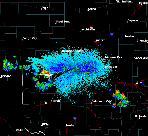 At 426 pm cdt, a severe thunderstorm was located 6 miles northwest of vici, moving southeast at 15 mph (radar indicated). Hazards include 60 mph wind gusts and quarter size hail. Hail damage to vehicles is expected. Expect wind damage to roofs, siding, and trees. At 426 pm cdt, a severe thunderstorm was located 6 miles northwest of vici, moving southeast at 15 mph (radar indicated). Hazards include 60 mph wind gusts and quarter size hail. Hail damage to vehicles is expected. Expect wind damage to roofs, siding, and trees.
|
| 5/7/2019 9:12 PM CDT |
 At 911 pm cdt, a severe thunderstorm was located 4 miles north of leedey, moving north at 15 mph (radar indicated). Hazards include 60 mph wind gusts and quarter size hail. Hail damage to vehicles is expected. expect wind damage to roofs, siding, and trees. Locations impacted include, vici, leedey, camargo, sharon, mutual and cestos. At 911 pm cdt, a severe thunderstorm was located 4 miles north of leedey, moving north at 15 mph (radar indicated). Hazards include 60 mph wind gusts and quarter size hail. Hail damage to vehicles is expected. expect wind damage to roofs, siding, and trees. Locations impacted include, vici, leedey, camargo, sharon, mutual and cestos.
|
| 5/7/2019 9:00 PM CDT |
 The national weather service in norman has issued a * severe thunderstorm warning for. east central ellis county in northwestern oklahoma. northeastern roger mills county in western oklahoma. western dewey county in northwestern oklahoma. Southeastern woodward county in northwestern oklahoma. The national weather service in norman has issued a * severe thunderstorm warning for. east central ellis county in northwestern oklahoma. northeastern roger mills county in western oklahoma. western dewey county in northwestern oklahoma. Southeastern woodward county in northwestern oklahoma.
|
| 5/7/2019 8:26 PM CDT |
 At 825 pm cdt, a severe thunderstorm was located 4 miles east of harmon, moving northeast at 25 mph (radar indicated). Hazards include ping pong ball size hail and 60 mph wind gusts. People and animals outdoors will be injured. expect hail damage to roofs, siding, windows, and vehicles. expect wind damage to roofs, siding, and trees. Locations impacted include, vici, sharon, mutual and harmon. At 825 pm cdt, a severe thunderstorm was located 4 miles east of harmon, moving northeast at 25 mph (radar indicated). Hazards include ping pong ball size hail and 60 mph wind gusts. People and animals outdoors will be injured. expect hail damage to roofs, siding, windows, and vehicles. expect wind damage to roofs, siding, and trees. Locations impacted include, vici, sharon, mutual and harmon.
|
| 5/7/2019 8:13 PM CDT |
 At 812 pm cdt, a severe thunderstorm was located 5 miles south of harmon, moving northeast at 25 mph (radar indicated). Hazards include ping pong ball size hail and 60 mph wind gusts. People and animals outdoors will be injured. expect hail damage to roofs, siding, windows, and vehicles. Expect wind damage to roofs, siding, and trees. At 812 pm cdt, a severe thunderstorm was located 5 miles south of harmon, moving northeast at 25 mph (radar indicated). Hazards include ping pong ball size hail and 60 mph wind gusts. People and animals outdoors will be injured. expect hail damage to roofs, siding, windows, and vehicles. Expect wind damage to roofs, siding, and trees.
|
| 8/28/2018 7:17 PM CDT |
 At 717 pm cdt, a severe thunderstorm was located 9 miles south of harmon, moving northeast at 10 mph (radar indicated). Hazards include ping pong ball size hail and 60 mph wind gusts. People and animals outdoors will be injured. expect hail damage to roofs, siding, windows, and vehicles. expect wind damage to roofs, siding, and trees. Locations impacted include, vici and harmon. At 717 pm cdt, a severe thunderstorm was located 9 miles south of harmon, moving northeast at 10 mph (radar indicated). Hazards include ping pong ball size hail and 60 mph wind gusts. People and animals outdoors will be injured. expect hail damage to roofs, siding, windows, and vehicles. expect wind damage to roofs, siding, and trees. Locations impacted include, vici and harmon.
|
| 8/28/2018 7:00 PM CDT |
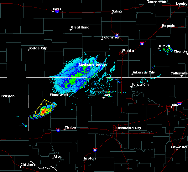 At 700 pm cdt, a severe thunderstorm was located 10 miles south of harmon, moving northeast at 15 mph (radar indicated). Hazards include 70 mph wind gusts and ping pong ball size hail. People and animals outdoors will be injured. expect hail damage to roofs, siding, windows, and vehicles. expect considerable tree damage. wind damage is also likely to mobile homes, roofs, and outbuildings. Locations impacted include, vici and harmon. At 700 pm cdt, a severe thunderstorm was located 10 miles south of harmon, moving northeast at 15 mph (radar indicated). Hazards include 70 mph wind gusts and ping pong ball size hail. People and animals outdoors will be injured. expect hail damage to roofs, siding, windows, and vehicles. expect considerable tree damage. wind damage is also likely to mobile homes, roofs, and outbuildings. Locations impacted include, vici and harmon.
|
| 8/28/2018 6:42 PM CDT |
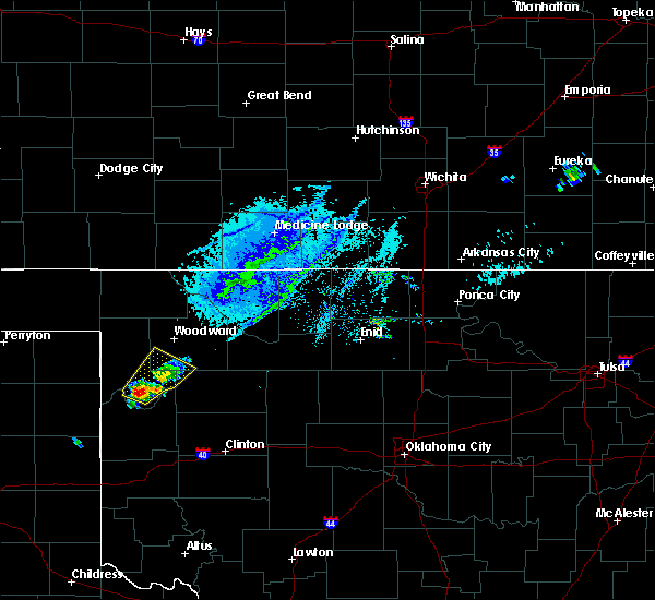 At 642 pm cdt, a severe thunderstorm was located 10 miles south of arnett, moving northeast at 15 mph (radar indicated). Hazards include 70 mph wind gusts and ping pong ball size hail. People and animals outdoors will be injured. expect hail damage to roofs, siding, windows, and vehicles. expect considerable tree damage. Wind damage is also likely to mobile homes, roofs, and outbuildings. At 642 pm cdt, a severe thunderstorm was located 10 miles south of arnett, moving northeast at 15 mph (radar indicated). Hazards include 70 mph wind gusts and ping pong ball size hail. People and animals outdoors will be injured. expect hail damage to roofs, siding, windows, and vehicles. expect considerable tree damage. Wind damage is also likely to mobile homes, roofs, and outbuildings.
|
| 6/25/2018 12:34 AM CDT |
 At 1234 am cdt, severe thunderstorms were located along a line extending from near amorita to 9 miles southwest of dacoma to 7 miles east of taloga to 9 miles southwest of putnam, moving southeast at 45 mph. these are very dangerous storms (radar indicated). Hazards include 80 mph wind gusts and ping pong ball size hail. Flying debris will be dangerous to those caught without shelter. mobile homes will be heavily damaged. expect considerable damage to roofs, windows, and vehicles. extensive tree damage and power outages are likely. Locations impacted include, woodward, alva, cherokee, arnett, taloga, mooreland, waynoka, seiling, vici, leedey, carmen, freedom, aline, camargo, burlington, sharon, dacoma, mutual, amorita and byron. At 1234 am cdt, severe thunderstorms were located along a line extending from near amorita to 9 miles southwest of dacoma to 7 miles east of taloga to 9 miles southwest of putnam, moving southeast at 45 mph. these are very dangerous storms (radar indicated). Hazards include 80 mph wind gusts and ping pong ball size hail. Flying debris will be dangerous to those caught without shelter. mobile homes will be heavily damaged. expect considerable damage to roofs, windows, and vehicles. extensive tree damage and power outages are likely. Locations impacted include, woodward, alva, cherokee, arnett, taloga, mooreland, waynoka, seiling, vici, leedey, carmen, freedom, aline, camargo, burlington, sharon, dacoma, mutual, amorita and byron.
|
| 6/25/2018 12:25 AM CDT |
 At 1224 am cdt, severe thunderstorms were located along a line extending from near burlington to 8 miles east of quinlan to 9 miles east of leedey, moving east at 35 mph. these are very dangerous storms (radar indicated). Hazards include 80 mph wind gusts and two inch hail. Flying debris will be dangerous to those caught without shelter. mobile homes will be heavily damaged. expect considerable damage to roofs, windows, and vehicles. extensive tree damage and power outages are likely. Locations impacted include, woodward, alva, cherokee, arnett, taloga, mooreland, waynoka, seiling, vici, leedey, carmen, freedom, aline, camargo, burlington, sharon, dacoma, mutual, amorita and byron. At 1224 am cdt, severe thunderstorms were located along a line extending from near burlington to 8 miles east of quinlan to 9 miles east of leedey, moving east at 35 mph. these are very dangerous storms (radar indicated). Hazards include 80 mph wind gusts and two inch hail. Flying debris will be dangerous to those caught without shelter. mobile homes will be heavily damaged. expect considerable damage to roofs, windows, and vehicles. extensive tree damage and power outages are likely. Locations impacted include, woodward, alva, cherokee, arnett, taloga, mooreland, waynoka, seiling, vici, leedey, carmen, freedom, aline, camargo, burlington, sharon, dacoma, mutual, amorita and byron.
|
| 6/25/2018 12:07 AM CDT |
 At 1207 am cdt, severe thunderstorms were located along a line extending from 3 miles northwest of capron to near quinlan to near leedey, moving east at 45 mph. these are very dangerous storms (radar indicated). Hazards include 80 mph wind gusts and tennis ball size hail. Flying debris will be dangerous to those caught without shelter. mobile homes will be heavily damaged. expect considerable damage to roofs, windows, and vehicles. extensive tree damage and power outages are likely. Locations impacted include, woodward, alva, cherokee, arnett, taloga, mooreland, waynoka, seiling, vici, gage, leedey, fargo, carmen, fort supply, freedom, aline, camargo, burlington, sharon and dacoma. At 1207 am cdt, severe thunderstorms were located along a line extending from 3 miles northwest of capron to near quinlan to near leedey, moving east at 45 mph. these are very dangerous storms (radar indicated). Hazards include 80 mph wind gusts and tennis ball size hail. Flying debris will be dangerous to those caught without shelter. mobile homes will be heavily damaged. expect considerable damage to roofs, windows, and vehicles. extensive tree damage and power outages are likely. Locations impacted include, woodward, alva, cherokee, arnett, taloga, mooreland, waynoka, seiling, vici, gage, leedey, fargo, carmen, fort supply, freedom, aline, camargo, burlington, sharon and dacoma.
|
| 6/24/2018 11:54 PM CDT |
 At 1153 pm cdt, severe thunderstorms were located along a line extending from 10 miles southeast of aetna to 6 miles northwest of mooreland to 10 miles northeast of roll, moving east at 40 mph. these are very dangerous storms (radar indicated). Hazards include 80 mph wind gusts and two inch hail. Flying debris will be dangerous to those caught without shelter. mobile homes will be heavily damaged. expect considerable damage to roofs, windows, and vehicles. Extensive tree damage and power outages are likely. At 1153 pm cdt, severe thunderstorms were located along a line extending from 10 miles southeast of aetna to 6 miles northwest of mooreland to 10 miles northeast of roll, moving east at 40 mph. these are very dangerous storms (radar indicated). Hazards include 80 mph wind gusts and two inch hail. Flying debris will be dangerous to those caught without shelter. mobile homes will be heavily damaged. expect considerable damage to roofs, windows, and vehicles. Extensive tree damage and power outages are likely.
|
| 6/22/2018 9:11 PM CDT |
 At 911 pm cdt, severe thunderstorms were located along a line extending from near seiling to 5 miles southwest of sweetwater, moving east at 60 mph (radar indicated). Hazards include 70 mph wind gusts and penny size hail. Expect considerable tree damage. Damage is likely to mobile homes, roofs, and outbuildings. At 911 pm cdt, severe thunderstorms were located along a line extending from near seiling to 5 miles southwest of sweetwater, moving east at 60 mph (radar indicated). Hazards include 70 mph wind gusts and penny size hail. Expect considerable tree damage. Damage is likely to mobile homes, roofs, and outbuildings.
|
| 6/22/2018 8:51 PM CDT |
 At 850 pm cdt, severe thunderstorms were located along a line extending from 3 miles southeast of hardtner to 4 miles south of alabaster caverns state park to 10 miles south of harmon, moving east at 40 mph. these are very dangerous storms. the strongest wind gusts are east of woodward, approaching quinlan (radar indicated). Hazards include 80 mph wind gusts and quarter size hail. Flying debris will be dangerous to those caught without shelter. mobile homes will be heavily damaged. expect considerable damage to roofs, windows, and vehicles. extensive tree damage and power outages are likely. Locations impacted include, woodward, alva, cherokee, arnett, mooreland, waynoka, vici, gage, fargo, fort supply, freedom, camargo, burlington, sharon, dacoma, mutual, amorita, byron, alabaster caverns state park and avard. At 850 pm cdt, severe thunderstorms were located along a line extending from 3 miles southeast of hardtner to 4 miles south of alabaster caverns state park to 10 miles south of harmon, moving east at 40 mph. these are very dangerous storms. the strongest wind gusts are east of woodward, approaching quinlan (radar indicated). Hazards include 80 mph wind gusts and quarter size hail. Flying debris will be dangerous to those caught without shelter. mobile homes will be heavily damaged. expect considerable damage to roofs, windows, and vehicles. extensive tree damage and power outages are likely. Locations impacted include, woodward, alva, cherokee, arnett, mooreland, waynoka, vici, gage, fargo, fort supply, freedom, camargo, burlington, sharon, dacoma, mutual, amorita, byron, alabaster caverns state park and avard.
|
| 6/22/2018 8:38 PM CDT |
 At 837 pm cdt, severe thunderstorms were located along a line extending from 6 miles west of hardtner to 9 miles west of alabaster caverns state park to 9 miles north of crawford, moving southeast at 50 mph (radar indicated). Hazards include 70 mph wind gusts and quarter size hail. Hail damage to vehicles is expected. expect considerable tree damage. wind damage is also likely to mobile homes, roofs, and outbuildings. Locations impacted include, woodward, alva, cherokee, shattuck, buffalo, arnett, mooreland, waynoka, vici, gage, fargo, fort supply, freedom, camargo, burlington, sharon, dacoma, mutual, may and amorita. At 837 pm cdt, severe thunderstorms were located along a line extending from 6 miles west of hardtner to 9 miles west of alabaster caverns state park to 9 miles north of crawford, moving southeast at 50 mph (radar indicated). Hazards include 70 mph wind gusts and quarter size hail. Hail damage to vehicles is expected. expect considerable tree damage. wind damage is also likely to mobile homes, roofs, and outbuildings. Locations impacted include, woodward, alva, cherokee, shattuck, buffalo, arnett, mooreland, waynoka, vici, gage, fargo, fort supply, freedom, camargo, burlington, sharon, dacoma, mutual, may and amorita.
|
| 6/22/2018 8:26 PM CDT |
 At 826 pm cdt, severe thunderstorms were located along a line extending from 5 miles east of aetna to 8 miles southeast of selman to 10 miles southeast of higgins, moving southeast at 50 mph (radar indicated). Hazards include 70 mph wind gusts and quarter size hail. Hail damage to vehicles is expected. expect considerable tree damage. wind damage is also likely to mobile homes, roofs, and outbuildings. Locations impacted include, woodward, alva, cherokee, shattuck, laverne, buffalo, arnett, mooreland, waynoka, vici, gage, fargo, fort supply, freedom, camargo, burlington, sharon, dacoma, mutual and may. At 826 pm cdt, severe thunderstorms were located along a line extending from 5 miles east of aetna to 8 miles southeast of selman to 10 miles southeast of higgins, moving southeast at 50 mph (radar indicated). Hazards include 70 mph wind gusts and quarter size hail. Hail damage to vehicles is expected. expect considerable tree damage. wind damage is also likely to mobile homes, roofs, and outbuildings. Locations impacted include, woodward, alva, cherokee, shattuck, laverne, buffalo, arnett, mooreland, waynoka, vici, gage, fargo, fort supply, freedom, camargo, burlington, sharon, dacoma, mutual and may.
|
| 6/22/2018 8:12 PM CDT |
 At 811 pm cdt, severe thunderstorms were located along a line extending from 3 miles northwest of aetna to 4 miles southwest of selman to 3 miles south of higgins, moving southeast at 50 mph (radar indicated). Hazards include 70 mph wind gusts and quarter size hail. Hail damage to vehicles is expected. expect considerable tree damage. Wind damage is also likely to mobile homes, roofs, and outbuildings. At 811 pm cdt, severe thunderstorms were located along a line extending from 3 miles northwest of aetna to 4 miles southwest of selman to 3 miles south of higgins, moving southeast at 50 mph (radar indicated). Hazards include 70 mph wind gusts and quarter size hail. Hail damage to vehicles is expected. expect considerable tree damage. Wind damage is also likely to mobile homes, roofs, and outbuildings.
|
| 6/22/2018 5:11 AM CDT |
 At 511 am cdt, a severe thunderstorm was located near sharon, moving east at 35 mph (radar indicated). Hazards include 60 mph wind gusts and quarter size hail. Hail damage to vehicles is expected. Expect wind damage to roofs, siding, and trees. At 511 am cdt, a severe thunderstorm was located near sharon, moving east at 35 mph (radar indicated). Hazards include 60 mph wind gusts and quarter size hail. Hail damage to vehicles is expected. Expect wind damage to roofs, siding, and trees.
|
| 5/30/2018 11:37 PM CDT |
 At 1135 pm cdt, severe thunderstorms were located along a line extending from 5 miles southwest of dacoma to 3 miles northeast of chester to 4 miles northeast of leedey to 7 miles northwest of durham, moving east at 45 mph. these are very dangerous storms (radar indicated). Hazards include 80 mph wind gusts and tennis ball size hail. the largest hail is over southern ellis county. Flying debris will be dangerous to those caught without shelter. mobile homes will be heavily damaged. expect considerable damage to roofs, windows, and vehicles. extensive tree damage and power outages are likely. Locations impacted include, fairview, arnett, taloga, helena, okeene, thomas, waynoka, seiling, vici, canton, ringwood, leedey, custer city, carmen, cleo springs, longdale, goltry, ames, meno and jet. At 1135 pm cdt, severe thunderstorms were located along a line extending from 5 miles southwest of dacoma to 3 miles northeast of chester to 4 miles northeast of leedey to 7 miles northwest of durham, moving east at 45 mph. these are very dangerous storms (radar indicated). Hazards include 80 mph wind gusts and tennis ball size hail. the largest hail is over southern ellis county. Flying debris will be dangerous to those caught without shelter. mobile homes will be heavily damaged. expect considerable damage to roofs, windows, and vehicles. extensive tree damage and power outages are likely. Locations impacted include, fairview, arnett, taloga, helena, okeene, thomas, waynoka, seiling, vici, canton, ringwood, leedey, custer city, carmen, cleo springs, longdale, goltry, ames, meno and jet.
|
| 5/30/2018 11:22 PM CDT |
 At 1121 pm cdt, severe thunderstorms were located along a line extending from near waynoka to 4 miles north of chester to 4 miles northwest of moorewood, moving east at 45 mph. these are very dangerous storms (radar indicated). Hazards include 90 mph wind gusts and tennis ball size hail. You are in a life-threatening situation. flying debris may be deadly to those caught without shelter. mobile homes will be heavily damaged or destroyed. homes and businesses will have substantial roof and window damage. Expect extensive tree damage and power outages. At 1121 pm cdt, severe thunderstorms were located along a line extending from near waynoka to 4 miles north of chester to 4 miles northwest of moorewood, moving east at 45 mph. these are very dangerous storms (radar indicated). Hazards include 90 mph wind gusts and tennis ball size hail. You are in a life-threatening situation. flying debris may be deadly to those caught without shelter. mobile homes will be heavily damaged or destroyed. homes and businesses will have substantial roof and window damage. Expect extensive tree damage and power outages.
|
| 5/30/2018 11:14 PM CDT | Storm damage reported in dewey county OK, 0.1 miles SW of Vici, OK |
| 5/30/2018 11:11 PM CDT |
 At 1110 pm cdt, severe thunderstorms were located along a line extending from 7 miles west of alabaster caverns state park to 3 miles east of mooreland to 10 miles northwest of angora, moving east at 50 mph. these are very dangerous storms (radar indicated). Hazards include 90 mph wind gusts and tennis ball size hail. the strongest wind is approaching quinlan. the largest hail is between haromn and the canadian river. You are in a life-threatening situation. flying debris may be deadly to those caught without shelter. mobile homes will be heavily damaged or destroyed. homes and businesses will have substantial roof and window damage. expect extensive tree damage and power outages. Locations impacted include, woodward, arnett, mooreland, seiling, vici, leedey, camargo, sharon, mutual, alabaster caverns state park, quinlan, angora, chester, moorewood, harmon, cestos and tangier. At 1110 pm cdt, severe thunderstorms were located along a line extending from 7 miles west of alabaster caverns state park to 3 miles east of mooreland to 10 miles northwest of angora, moving east at 50 mph. these are very dangerous storms (radar indicated). Hazards include 90 mph wind gusts and tennis ball size hail. the strongest wind is approaching quinlan. the largest hail is between haromn and the canadian river. You are in a life-threatening situation. flying debris may be deadly to those caught without shelter. mobile homes will be heavily damaged or destroyed. homes and businesses will have substantial roof and window damage. expect extensive tree damage and power outages. Locations impacted include, woodward, arnett, mooreland, seiling, vici, leedey, camargo, sharon, mutual, alabaster caverns state park, quinlan, angora, chester, moorewood, harmon, cestos and tangier.
|
| 5/30/2018 11:04 PM CDT |
 At 1103 pm cdt, severe thunderstorms were located along a line extending from 10 miles southeast of selman to 3 miles west of mooreland to 10 miles northeast of crawford, moving east at 50 mph. these are very dangerous storms (radar indicated). Hazards include 90 mph wind gusts and two inch hail. the strongest winds are approaching mooreland. the largest hail is between harmon and the canadian river. You are in a life-threatening situation. flying debris may be deadly to those caught without shelter. mobile homes will be heavily damaged or destroyed. homes and businesses will have substantial roof and window damage. expect extensive tree damage and power outages. Locations impacted include, woodward, arnett, mooreland, seiling, vici, leedey, fargo, fort supply, camargo, sharon, mutual, alabaster caverns state park, quinlan, angora, chester, moorewood, harmon, cestos and tangier. At 1103 pm cdt, severe thunderstorms were located along a line extending from 10 miles southeast of selman to 3 miles west of mooreland to 10 miles northeast of crawford, moving east at 50 mph. these are very dangerous storms (radar indicated). Hazards include 90 mph wind gusts and two inch hail. the strongest winds are approaching mooreland. the largest hail is between harmon and the canadian river. You are in a life-threatening situation. flying debris may be deadly to those caught without shelter. mobile homes will be heavily damaged or destroyed. homes and businesses will have substantial roof and window damage. expect extensive tree damage and power outages. Locations impacted include, woodward, arnett, mooreland, seiling, vici, leedey, fargo, fort supply, camargo, sharon, mutual, alabaster caverns state park, quinlan, angora, chester, moorewood, harmon, cestos and tangier.
|
| 5/30/2018 10:54 PM CDT |
 At 1052 pm cdt, severe thunderstorms were located along a line extending from 7 miles south of selman to 5 miles west of woodward to 10 miles south of arnett, moving east at 45 mph. these are very dangerous storms (radar indicated). Hazards include 90 mph wind gusts and tennis ball size hail. the strongest wind is moving through areas north of woodward and mooreland. the largest hail is approaching the canadian river south of arnett. You are in a life-threatening situation. flying debris may be deadly to those caught without shelter. mobile homes will be heavily damaged or destroyed. homes and businesses will have substantial roof and window damage. expect extensive tree damage and power outages. Locations impacted include, woodward, arnett, mooreland, seiling, vici, gage, leedey, fargo, fort supply, camargo, sharon, mutual, alabaster caverns state park, quinlan, angora, chester, moorewood, harmon, cestos and tangier. At 1052 pm cdt, severe thunderstorms were located along a line extending from 7 miles south of selman to 5 miles west of woodward to 10 miles south of arnett, moving east at 45 mph. these are very dangerous storms (radar indicated). Hazards include 90 mph wind gusts and tennis ball size hail. the strongest wind is moving through areas north of woodward and mooreland. the largest hail is approaching the canadian river south of arnett. You are in a life-threatening situation. flying debris may be deadly to those caught without shelter. mobile homes will be heavily damaged or destroyed. homes and businesses will have substantial roof and window damage. expect extensive tree damage and power outages. Locations impacted include, woodward, arnett, mooreland, seiling, vici, gage, leedey, fargo, fort supply, camargo, sharon, mutual, alabaster caverns state park, quinlan, angora, chester, moorewood, harmon, cestos and tangier.
|
| 5/30/2018 10:48 PM CDT |
 At 1047 pm cdt, severe thunderstorms were located along a line extending from 7 miles southwest of selman to 6 miles northeast of fargo to 10 miles southwest of arnett, moving east at 45 mph. these are very dangerous storms (radar indicated). Hazards include 80 mph wind gusts and tennis ball size hail. the strongest wind is approaching woodward and mooreland. the largest hail is approaching areas near and south of arnett. Flying debris will be dangerous to those caught without shelter. mobile homes will be heavily damaged. expect considerable damage to roofs, windows, and vehicles. extensive tree damage and power outages are likely. Locations impacted include, woodward, arnett, mooreland, seiling, vici, gage, leedey, fargo, fort supply, camargo, sharon, mutual, alabaster caverns state park, quinlan, angora, chester, moorewood, harmon, cestos and tangier. At 1047 pm cdt, severe thunderstorms were located along a line extending from 7 miles southwest of selman to 6 miles northeast of fargo to 10 miles southwest of arnett, moving east at 45 mph. these are very dangerous storms (radar indicated). Hazards include 80 mph wind gusts and tennis ball size hail. the strongest wind is approaching woodward and mooreland. the largest hail is approaching areas near and south of arnett. Flying debris will be dangerous to those caught without shelter. mobile homes will be heavily damaged. expect considerable damage to roofs, windows, and vehicles. extensive tree damage and power outages are likely. Locations impacted include, woodward, arnett, mooreland, seiling, vici, gage, leedey, fargo, fort supply, camargo, sharon, mutual, alabaster caverns state park, quinlan, angora, chester, moorewood, harmon, cestos and tangier.
|
| 5/30/2018 10:40 PM CDT |
 At 1039 pm cdt, severe thunderstorms were located along a line extending from 7 miles south of buffalo to 6 miles north of fargo to 8 miles southeast of higgins, moving southeast at 45 mph. these are very dangerous storms (radar indicated). Hazards include 80 mph wind gusts and tennis ball size hail. strongest wind approaching fort supply and woodward. largest hail approaching arnett and harmon. Flying debris will be dangerous to those caught without shelter. mobile homes will be heavily damaged. expect considerable damage to roofs, windows, and vehicles. Extensive tree damage and power outages are likely. At 1039 pm cdt, severe thunderstorms were located along a line extending from 7 miles south of buffalo to 6 miles north of fargo to 8 miles southeast of higgins, moving southeast at 45 mph. these are very dangerous storms (radar indicated). Hazards include 80 mph wind gusts and tennis ball size hail. strongest wind approaching fort supply and woodward. largest hail approaching arnett and harmon. Flying debris will be dangerous to those caught without shelter. mobile homes will be heavily damaged. expect considerable damage to roofs, windows, and vehicles. Extensive tree damage and power outages are likely.
|
| 5/29/2018 2:06 AM CDT |
 At 206 am cdt, a severe thunderstorm was located 4 miles southeast of vici, moving east at 25 mph. this is a very dangerous storm (radar indicated). Hazards include 80 mph wind gusts and three inch hail. Flying debris will be dangerous to those caught without shelter. mobile homes will be heavily damaged. expect considerable damage to roofs, windows, and vehicles. extensive tree damage and power outages are likely. Locations impacted include, vici, camargo, mutual and cestos. At 206 am cdt, a severe thunderstorm was located 4 miles southeast of vici, moving east at 25 mph. this is a very dangerous storm (radar indicated). Hazards include 80 mph wind gusts and three inch hail. Flying debris will be dangerous to those caught without shelter. mobile homes will be heavily damaged. expect considerable damage to roofs, windows, and vehicles. extensive tree damage and power outages are likely. Locations impacted include, vici, camargo, mutual and cestos.
|
| 5/29/2018 1:55 AM CDT |
 At 155 am cdt, a severe thunderstorm was located near vici, moving east at 25 mph. this is a very dangerous storm (radar indicated). Hazards include 80 mph wind gusts and baseball size hail. Flying debris will be dangerous to those caught without shelter. mobile homes will be heavily damaged. expect considerable damage to roofs, windows, and vehicles. extensive tree damage and power outages are likely. Locations impacted include, vici, camargo, mutual and cestos. At 155 am cdt, a severe thunderstorm was located near vici, moving east at 25 mph. this is a very dangerous storm (radar indicated). Hazards include 80 mph wind gusts and baseball size hail. Flying debris will be dangerous to those caught without shelter. mobile homes will be heavily damaged. expect considerable damage to roofs, windows, and vehicles. extensive tree damage and power outages are likely. Locations impacted include, vici, camargo, mutual and cestos.
|
| 5/29/2018 1:44 AM CDT |
 At 143 am cdt, a severe thunderstorm was located 6 miles west of vici, moving southeast at 25 mph. this is a very dangerous storm (radar indicated). Hazards include baseball size hail and 70 mph wind gusts. People and animals outdoors will be severely injured. Expect shattered windows, extensive damage to roofs, siding, and vehicles. At 143 am cdt, a severe thunderstorm was located 6 miles west of vici, moving southeast at 25 mph. this is a very dangerous storm (radar indicated). Hazards include baseball size hail and 70 mph wind gusts. People and animals outdoors will be severely injured. Expect shattered windows, extensive damage to roofs, siding, and vehicles.
|
| 5/14/2018 6:34 PM CDT |
 At 634 pm cdt, a severe thunderstorm was located near harmon, moving northeast at 20 mph (radar indicated). Hazards include ping pong ball size hail and 60 mph wind gusts. People and animals outdoors will be injured. expect hail damage to roofs, siding, windows, and vehicles. expect wind damage to roofs, siding, and trees. Locations impacted include, vici, sharon and harmon. At 634 pm cdt, a severe thunderstorm was located near harmon, moving northeast at 20 mph (radar indicated). Hazards include ping pong ball size hail and 60 mph wind gusts. People and animals outdoors will be injured. expect hail damage to roofs, siding, windows, and vehicles. expect wind damage to roofs, siding, and trees. Locations impacted include, vici, sharon and harmon.
|
| 5/14/2018 6:18 PM CDT |
 At 617 pm cdt, severe thunderstorms were located along a line extending from 5 miles southeast of arnett to near harmon, moving northeast at 35 mph (radar indicated). Hazards include hail up to ping pong ball size and 60 mph wind gusts. People and animals outdoors will be injured. expect hail damage to roofs, siding, windows, and vehicles. expect wind damage to roofs, siding, and trees. Locations impacted include, arnett, vici, sharon and harmon. At 617 pm cdt, severe thunderstorms were located along a line extending from 5 miles southeast of arnett to near harmon, moving northeast at 35 mph (radar indicated). Hazards include hail up to ping pong ball size and 60 mph wind gusts. People and animals outdoors will be injured. expect hail damage to roofs, siding, windows, and vehicles. expect wind damage to roofs, siding, and trees. Locations impacted include, arnett, vici, sharon and harmon.
|
| 5/14/2018 6:09 PM CDT |
 At 609 pm cdt, a severe thunderstorm was located near arnett, moving northeast at 35 mph (radar indicated). Hazards include ping pong ball size hail and 60 mph wind gusts. People and animals outdoors will be injured. expect hail damage to roofs, siding, windows, and vehicles. Expect wind damage to roofs, siding, and trees. At 609 pm cdt, a severe thunderstorm was located near arnett, moving northeast at 35 mph (radar indicated). Hazards include ping pong ball size hail and 60 mph wind gusts. People and animals outdoors will be injured. expect hail damage to roofs, siding, windows, and vehicles. Expect wind damage to roofs, siding, and trees.
|
| 10/21/2017 4:53 PM CDT |
 At 452 pm cdt, severe thunderstorms were located along a line extending from 3 miles southwest of camargo to near leedey, moving northeast at 35 mph (radar indicated). Hazards include 60 mph wind gusts and quarter size hail. Hail damage to vehicles is expected. expect wind damage to roofs, siding, and trees. Locations impacted include, vici, leedey and camargo. At 452 pm cdt, severe thunderstorms were located along a line extending from 3 miles southwest of camargo to near leedey, moving northeast at 35 mph (radar indicated). Hazards include 60 mph wind gusts and quarter size hail. Hail damage to vehicles is expected. expect wind damage to roofs, siding, and trees. Locations impacted include, vici, leedey and camargo.
|
| 10/21/2017 4:31 PM CDT |
 At 431 pm cdt, a severe thunderstorm was located near angora, moving northeast at 30 mph (radar indicated). Hazards include 60 mph wind gusts and quarter size hail. Hail damage to vehicles is expected. Expect wind damage to roofs, siding, and trees. At 431 pm cdt, a severe thunderstorm was located near angora, moving northeast at 30 mph (radar indicated). Hazards include 60 mph wind gusts and quarter size hail. Hail damage to vehicles is expected. Expect wind damage to roofs, siding, and trees.
|
| 10/6/2017 11:07 PM CDT |
 At 1106 pm cdt, severe thunderstorms were located along a line extending from near mutual to 4 miles northwest of angora to 5 miles west of sweetwater to 6 miles north of quail, moving east at 40 mph (radar indicated). Hazards include 60 mph wind gusts and penny size hail. expect damage to roofs, siding, and trees At 1106 pm cdt, severe thunderstorms were located along a line extending from near mutual to 4 miles northwest of angora to 5 miles west of sweetwater to 6 miles north of quail, moving east at 40 mph (radar indicated). Hazards include 60 mph wind gusts and penny size hail. expect damage to roofs, siding, and trees
|
| 10/6/2017 10:30 PM CDT |
 At 1030 pm cdt, severe thunderstorms were located along a line extending from 3 miles northwest of burlington to 8 miles southeast of alabaster caverns state park to near fargo to 4 miles southwest of durham, moving northeast at 60 mph (radar indicated). Hazards include 60 mph wind gusts and quarter size hail. Hail damage to vehicles is expected. Expect wind damage to roofs, siding, and trees. At 1030 pm cdt, severe thunderstorms were located along a line extending from 3 miles northwest of burlington to 8 miles southeast of alabaster caverns state park to near fargo to 4 miles southwest of durham, moving northeast at 60 mph (radar indicated). Hazards include 60 mph wind gusts and quarter size hail. Hail damage to vehicles is expected. Expect wind damage to roofs, siding, and trees.
|
| 7/3/2017 6:17 PM CDT |
 At 616 pm cdt, a severe thunderstorm was located near cleo springs, moving northeast at 30 mph. an outflow boundary with damaging wind gusts was also moving southeast into northern dewey and southwestern major counties. wind damage may occur well before any rain reaches your location (radar indicated). Hazards include 70 mph wind gusts and quarter size hail. Hail damage to vehicles is expected. expect considerable tree damage. Wind damage is also likely to mobile homes, roofs, and outbuildings. At 616 pm cdt, a severe thunderstorm was located near cleo springs, moving northeast at 30 mph. an outflow boundary with damaging wind gusts was also moving southeast into northern dewey and southwestern major counties. wind damage may occur well before any rain reaches your location (radar indicated). Hazards include 70 mph wind gusts and quarter size hail. Hail damage to vehicles is expected. expect considerable tree damage. Wind damage is also likely to mobile homes, roofs, and outbuildings.
|
| 7/3/2017 6:09 PM CDT | Storm damage reported in dewey county OK, 9.6 miles W of Vici, OK |
| 5/27/2017 10:48 PM CDT |
 At 1047 pm cdt, a severe thunderstorm was located 5 miles south of woodward, moving east at 60 mph (radar indicated). Hazards include tennis ball size hail and 70 mph wind gusts. People and animals outdoors will be injured. expect hail damage to roofs, siding, windows, and vehicles. expect considerable tree damage. wind damage is also likely to mobile homes, roofs, and outbuildings. Locations impacted include, woodward, mooreland, vici, fargo, fort supply, sharon, mutual, chester, quinlan, cestos, tangier and bouse junction. At 1047 pm cdt, a severe thunderstorm was located 5 miles south of woodward, moving east at 60 mph (radar indicated). Hazards include tennis ball size hail and 70 mph wind gusts. People and animals outdoors will be injured. expect hail damage to roofs, siding, windows, and vehicles. expect considerable tree damage. wind damage is also likely to mobile homes, roofs, and outbuildings. Locations impacted include, woodward, mooreland, vici, fargo, fort supply, sharon, mutual, chester, quinlan, cestos, tangier and bouse junction.
|
| 5/27/2017 10:26 PM CDT |
 At 1026 pm cdt, a severe thunderstorm was located 6 miles northwest of fargo, moving east at 60 mph (radar indicated). Hazards include tennis ball size hail and 70 mph wind gusts. People and animals outdoors will be injured. expect hail damage to roofs, siding, windows, and vehicles. expect considerable tree damage. Wind damage is also likely to mobile homes, roofs, and outbuildings. At 1026 pm cdt, a severe thunderstorm was located 6 miles northwest of fargo, moving east at 60 mph (radar indicated). Hazards include tennis ball size hail and 70 mph wind gusts. People and animals outdoors will be injured. expect hail damage to roofs, siding, windows, and vehicles. expect considerable tree damage. Wind damage is also likely to mobile homes, roofs, and outbuildings.
|
| 5/18/2017 6:21 PM CDT |
 At 620 pm cdt, a severe thunderstorm was located near camargo, moving northeast at 25 mph (radar indicated). Hazards include ping pong ball size hail and 60 mph wind gusts. People and animals outdoors will be injured. expect hail damage to roofs, siding, windows, and vehicles. expect wind damage to roofs, siding, and trees. Locations impacted include, vici and camargo. At 620 pm cdt, a severe thunderstorm was located near camargo, moving northeast at 25 mph (radar indicated). Hazards include ping pong ball size hail and 60 mph wind gusts. People and animals outdoors will be injured. expect hail damage to roofs, siding, windows, and vehicles. expect wind damage to roofs, siding, and trees. Locations impacted include, vici and camargo.
|
| 5/18/2017 6:13 PM CDT |
 At 613 pm cdt, a severe thunderstorm was located over camargo, moving northeast at 30 mph (radar indicated). Hazards include golf ball size hail and 60 mph wind gusts. People and animals outdoors will be injured. expect hail damage to roofs, siding, windows, and vehicles. expect wind damage to roofs, siding, and trees. Locations impacted include, vici, leedey and camargo. At 613 pm cdt, a severe thunderstorm was located over camargo, moving northeast at 30 mph (radar indicated). Hazards include golf ball size hail and 60 mph wind gusts. People and animals outdoors will be injured. expect hail damage to roofs, siding, windows, and vehicles. expect wind damage to roofs, siding, and trees. Locations impacted include, vici, leedey and camargo.
|
| 5/18/2017 5:57 PM CDT |
 At 556 pm cdt, a severe thunderstorm was located 7 miles northwest of leedey, moving northeast at 25 mph (radar indicated). Hazards include two inch hail and 60 mph wind gusts. People and animals outdoors will be injured. expect hail damage to roofs, siding, windows, and vehicles. expect wind damage to roofs, siding, and trees. Locations impacted include, vici, leedey and camargo. At 556 pm cdt, a severe thunderstorm was located 7 miles northwest of leedey, moving northeast at 25 mph (radar indicated). Hazards include two inch hail and 60 mph wind gusts. People and animals outdoors will be injured. expect hail damage to roofs, siding, windows, and vehicles. expect wind damage to roofs, siding, and trees. Locations impacted include, vici, leedey and camargo.
|
| 5/18/2017 5:51 PM CDT |
 At 550 pm cdt, a severe thunderstorm was located 6 miles north of angora, moving northeast at 30 mph (radar indicated). Hazards include two inch hail and 60 mph wind gusts. People and animals outdoors will be injured. expect hail damage to roofs, siding, windows, and vehicles. expect wind damage to roofs, siding, and trees. Locations impacted include, vici, leedey, camargo and angora. At 550 pm cdt, a severe thunderstorm was located 6 miles north of angora, moving northeast at 30 mph (radar indicated). Hazards include two inch hail and 60 mph wind gusts. People and animals outdoors will be injured. expect hail damage to roofs, siding, windows, and vehicles. expect wind damage to roofs, siding, and trees. Locations impacted include, vici, leedey, camargo and angora.
|
| 5/18/2017 5:42 PM CDT |
 At 542 pm cdt, a severe thunderstorm was located 6 miles northwest of angora, moving northeast at 25 mph (radar indicated). Hazards include golf ball size hail and 60 mph wind gusts. People and animals outdoors will be injured. expect hail damage to roofs, siding, windows, and vehicles. Expect wind damage to roofs, siding, and trees. At 542 pm cdt, a severe thunderstorm was located 6 miles northwest of angora, moving northeast at 25 mph (radar indicated). Hazards include golf ball size hail and 60 mph wind gusts. People and animals outdoors will be injured. expect hail damage to roofs, siding, windows, and vehicles. Expect wind damage to roofs, siding, and trees.
|
| 5/18/2017 3:20 PM CDT |
 At 320 pm cdt, a severe thunderstorm was located near leedey, moving northeast at 35 mph (radar indicated). Hazards include golf ball size hail and 60 mph wind gusts. People and animals outdoors will be injured. expect hail damage to roofs, siding, windows, and vehicles. expect wind damage to roofs, siding, and trees. Locations impacted include, taloga, vici, leedey, camargo, moorewood, angora and cestos. At 320 pm cdt, a severe thunderstorm was located near leedey, moving northeast at 35 mph (radar indicated). Hazards include golf ball size hail and 60 mph wind gusts. People and animals outdoors will be injured. expect hail damage to roofs, siding, windows, and vehicles. expect wind damage to roofs, siding, and trees. Locations impacted include, taloga, vici, leedey, camargo, moorewood, angora and cestos.
|
| 5/18/2017 2:55 PM CDT |
 At 255 pm cdt, severe thunderstorms were located along a line extending from 6 miles east of strong city to near hammon, moving northeast at 45 mph (radar indicated). Hazards include ping pong ball size hail and 60 mph wind gusts. People and animals outdoors will be injured. expect hail damage to roofs, siding, windows, and vehicles. Expect wind damage to roofs, siding, and trees. At 255 pm cdt, severe thunderstorms were located along a line extending from 6 miles east of strong city to near hammon, moving northeast at 45 mph (radar indicated). Hazards include ping pong ball size hail and 60 mph wind gusts. People and animals outdoors will be injured. expect hail damage to roofs, siding, windows, and vehicles. Expect wind damage to roofs, siding, and trees.
|
| 5/16/2017 10:53 PM CDT |
 At 1053 pm cdt, severe thunderstorms were located along a line extending from near vici to 4 miles southeast of leedey, moving northeast at 30 mph (radar indicated). Hazards include 60 mph wind gusts and quarter size hail. Hail damage to vehicles is expected. expect wind damage to roofs, siding, and trees. Locations impacted include, vici, leedey, camargo, mutual, angora and cestos. At 1053 pm cdt, severe thunderstorms were located along a line extending from near vici to 4 miles southeast of leedey, moving northeast at 30 mph (radar indicated). Hazards include 60 mph wind gusts and quarter size hail. Hail damage to vehicles is expected. expect wind damage to roofs, siding, and trees. Locations impacted include, vici, leedey, camargo, mutual, angora and cestos.
|
| 5/16/2017 10:27 PM CDT |
 At 1026 pm cdt, severe thunderstorms were located along a line extending from 4 miles west of camargo to 6 miles west of hammon, moving northeast at 30 mph (radar indicated). Hazards include 70 mph wind gusts and half dollar size hail. Hail damage to vehicles is expected. expect considerable tree damage. Wind damage is also likely to mobile homes, roofs, and outbuildings. At 1026 pm cdt, severe thunderstorms were located along a line extending from 4 miles west of camargo to 6 miles west of hammon, moving northeast at 30 mph (radar indicated). Hazards include 70 mph wind gusts and half dollar size hail. Hail damage to vehicles is expected. expect considerable tree damage. Wind damage is also likely to mobile homes, roofs, and outbuildings.
|
| 5/16/2017 9:51 PM CDT |
 At 950 pm cdt, severe thunderstorms were located along a line extending from 4 miles north of angora to 3 miles southwest of sweetwater, moving northeast at 35 mph (radar indicated). Hazards include 70 mph wind gusts and quarter size hail. Hail damage to vehicles is expected. expect considerable tree damage. Wind damage is also likely to mobile homes, roofs, and outbuildings. At 950 pm cdt, severe thunderstorms were located along a line extending from 4 miles north of angora to 3 miles southwest of sweetwater, moving northeast at 35 mph (radar indicated). Hazards include 70 mph wind gusts and quarter size hail. Hail damage to vehicles is expected. expect considerable tree damage. Wind damage is also likely to mobile homes, roofs, and outbuildings.
|
| 5/16/2017 8:31 PM CDT |
 At 831 pm cdt, a severe thunderstorm was located near camargo, moving northeast at 40 mph (radar indicated). Hazards include golf ball size hail and 60 mph wind gusts. People and animals outdoors will be injured. expect hail damage to roofs, siding, windows, and vehicles. expect wind damage to roofs, siding, and trees. Locations impacted include, vici, leedey, camargo, mutual and cestos. At 831 pm cdt, a severe thunderstorm was located near camargo, moving northeast at 40 mph (radar indicated). Hazards include golf ball size hail and 60 mph wind gusts. People and animals outdoors will be injured. expect hail damage to roofs, siding, windows, and vehicles. expect wind damage to roofs, siding, and trees. Locations impacted include, vici, leedey, camargo, mutual and cestos.
|
| 5/16/2017 8:13 PM CDT |
 At 813 pm cdt, a severe thunderstorm was located 5 miles north of angora, moving northeast at 35 mph (radar indicated). Hazards include ping pong ball size hail and 60 mph wind gusts. People and animals outdoors will be injured. expect hail damage to roofs, siding, windows, and vehicles. Expect wind damage to roofs, siding, and trees. At 813 pm cdt, a severe thunderstorm was located 5 miles north of angora, moving northeast at 35 mph (radar indicated). Hazards include ping pong ball size hail and 60 mph wind gusts. People and animals outdoors will be injured. expect hail damage to roofs, siding, windows, and vehicles. Expect wind damage to roofs, siding, and trees.
|
| 5/16/2017 7:31 PM CDT |
 At 731 pm cdt, a severe thunderstorm was located near camargo, moving northeast at 50 mph (radar indicated). Hazards include golf ball size hail and 60 mph wind gusts. People and animals outdoors will be injured. expect hail damage to roofs, siding, windows, and vehicles. expect wind damage to roofs, siding, and trees. Locations impacted include, taloga, vici, camargo and cestos. At 731 pm cdt, a severe thunderstorm was located near camargo, moving northeast at 50 mph (radar indicated). Hazards include golf ball size hail and 60 mph wind gusts. People and animals outdoors will be injured. expect hail damage to roofs, siding, windows, and vehicles. expect wind damage to roofs, siding, and trees. Locations impacted include, taloga, vici, camargo and cestos.
|
| 5/16/2017 7:21 PM CDT |
 At 720 pm cdt, a severe thunderstorm was located 4 miles north of leedey, moving northeast at 40 mph. this is a very dangerous storm (radar indicated). Hazards include baseball size hail and 70 mph wind gusts. People and animals outdoors will be severely injured. expect shattered windows, extensive damage to roofs, siding, and vehicles. Locations impacted include, taloga, vici, leedey, camargo and cestos. At 720 pm cdt, a severe thunderstorm was located 4 miles north of leedey, moving northeast at 40 mph. this is a very dangerous storm (radar indicated). Hazards include baseball size hail and 70 mph wind gusts. People and animals outdoors will be severely injured. expect shattered windows, extensive damage to roofs, siding, and vehicles. Locations impacted include, taloga, vici, leedey, camargo and cestos.
|
| 5/16/2017 7:05 PM CDT |
 At 705 pm cdt, a severe thunderstorm was located near angora, moving northeast at 40 mph (radar indicated). Hazards include golf ball size hail and 70 mph wind gusts. People and animals outdoors will be injured. expect hail damage to roofs, siding, windows, and vehicles. expect considerable tree damage. wind damage is also likely to mobile homes, roofs, and outbuildings. Locations impacted include, taloga, vici, leedey, camargo, angora and cestos. At 705 pm cdt, a severe thunderstorm was located near angora, moving northeast at 40 mph (radar indicated). Hazards include golf ball size hail and 70 mph wind gusts. People and animals outdoors will be injured. expect hail damage to roofs, siding, windows, and vehicles. expect considerable tree damage. wind damage is also likely to mobile homes, roofs, and outbuildings. Locations impacted include, taloga, vici, leedey, camargo, angora and cestos.
|
| 5/16/2017 6:54 PM CDT |
 At 654 pm cdt, a severe thunderstorm was located 5 miles west of angora, moving northeast at 45 mph (radar indicated). Hazards include golf ball size hail and 70 mph wind gusts. People and animals outdoors will be injured. expect hail damage to roofs, siding, windows, and vehicles. expect considerable tree damage. wind damage is also likely to mobile homes, roofs, and outbuildings. Locations impacted include, cheyenne, taloga, vici, leedey, camargo, strong city, putnam, moorewood, roll, angora and cestos. At 654 pm cdt, a severe thunderstorm was located 5 miles west of angora, moving northeast at 45 mph (radar indicated). Hazards include golf ball size hail and 70 mph wind gusts. People and animals outdoors will be injured. expect hail damage to roofs, siding, windows, and vehicles. expect considerable tree damage. wind damage is also likely to mobile homes, roofs, and outbuildings. Locations impacted include, cheyenne, taloga, vici, leedey, camargo, strong city, putnam, moorewood, roll, angora and cestos.
|
| 5/16/2017 6:39 PM CDT |
 At 639 pm cdt, a severe thunderstorm was located near roll, moving northeast at 45 mph (radar indicated). Hazards include two inch hail and 70 mph wind gusts. People and animals outdoors will be injured. expect hail damage to roofs, siding, windows, and vehicles. expect considerable tree damage. Wind damage is also likely to mobile homes, roofs, and outbuildings. At 639 pm cdt, a severe thunderstorm was located near roll, moving northeast at 45 mph (radar indicated). Hazards include two inch hail and 70 mph wind gusts. People and animals outdoors will be injured. expect hail damage to roofs, siding, windows, and vehicles. expect considerable tree damage. Wind damage is also likely to mobile homes, roofs, and outbuildings.
|
| 4/16/2017 10:31 PM CDT |
 At 1031 pm cdt, a severe thunderstorm was located 6 miles west of camargo, moving west at 10 mph (radar indicated). Hazards include 60 mph wind gusts and half dollar size hail. Hail damage to vehicles is expected. expect wind damage to roofs, siding, and trees. Locations impacted include, vici and camargo. At 1031 pm cdt, a severe thunderstorm was located 6 miles west of camargo, moving west at 10 mph (radar indicated). Hazards include 60 mph wind gusts and half dollar size hail. Hail damage to vehicles is expected. expect wind damage to roofs, siding, and trees. Locations impacted include, vici and camargo.
|
| 4/16/2017 10:11 PM CDT |
 At 1011 pm cdt, severe thunderstorms were located along a line extending from 5 miles west of camargo to 4 miles southeast of vici to near taloga, moving east at 15 mph (radar indicated). Hazards include 60 mph wind gusts and half dollar size hail. Hail damage to vehicles is expected. Expect wind damage to roofs, siding, and trees. At 1011 pm cdt, severe thunderstorms were located along a line extending from 5 miles west of camargo to 4 miles southeast of vici to near taloga, moving east at 15 mph (radar indicated). Hazards include 60 mph wind gusts and half dollar size hail. Hail damage to vehicles is expected. Expect wind damage to roofs, siding, and trees.
|
| 10/6/2016 7:10 PM CDT |
 The severe thunderstorm warning for northeastern roger mills, western dewey and southeastern ellis counties will expire at 715 pm cdt, the storms which prompted the warning have weakened below severe limits, and no longer pose an immediate threat to life or property. therefore the warning will be allowed to expire. however gusty winds and heavy rain are still possible with these thunderstorms. The severe thunderstorm warning for northeastern roger mills, western dewey and southeastern ellis counties will expire at 715 pm cdt, the storms which prompted the warning have weakened below severe limits, and no longer pose an immediate threat to life or property. therefore the warning will be allowed to expire. however gusty winds and heavy rain are still possible with these thunderstorms.
|
| 10/6/2016 6:41 PM CDT |
 At 641 pm cdt, severe thunderstorms were located along a line extending from 3 miles east of vici to 5 miles northwest of angora, moving southeast at 15 mph (radar indicated). Hazards include 60 mph wind gusts and half dollar size hail. Hail damage to vehicles is expected. Expect wind damage to roofs, siding, and trees. At 641 pm cdt, severe thunderstorms were located along a line extending from 3 miles east of vici to 5 miles northwest of angora, moving southeast at 15 mph (radar indicated). Hazards include 60 mph wind gusts and half dollar size hail. Hail damage to vehicles is expected. Expect wind damage to roofs, siding, and trees.
|
| 9/9/2016 7:59 PM CDT |
 At 759 pm cdt, severe thunderstorms were located along a line extending from 8 miles northwest of waynoka to 3 miles northeast of sharon, moving southeast at 30 mph (radar indicated). Hazards include 60 mph wind gusts and quarter size hail. Hail damage to vehicles is expected. Expect wind damage to roofs, siding, and trees. At 759 pm cdt, severe thunderstorms were located along a line extending from 8 miles northwest of waynoka to 3 miles northeast of sharon, moving southeast at 30 mph (radar indicated). Hazards include 60 mph wind gusts and quarter size hail. Hail damage to vehicles is expected. Expect wind damage to roofs, siding, and trees.
|
| 7/15/2016 9:58 PM CDT |
 At 957 pm cdt, severe thunderstorms were located along a line extending from 4 miles northeast of cestos to near moorewood to 5 miles south of sweetwater, moving east at 35 mph (radar indicated). Hazards include 70 mph wind gusts and nickel size hail. Expect considerable tree damage. Damage is likely to mobile homes, roofs, and outbuildings. At 957 pm cdt, severe thunderstorms were located along a line extending from 4 miles northeast of cestos to near moorewood to 5 miles south of sweetwater, moving east at 35 mph (radar indicated). Hazards include 70 mph wind gusts and nickel size hail. Expect considerable tree damage. Damage is likely to mobile homes, roofs, and outbuildings.
|
| 7/15/2016 9:19 PM CDT |
 At 918 pm cdt, severe thunderstorms were located along a line extending from 6 miles west of vici to 10 miles west-southwest of reydon, moving southeast at 25 mph (radar indicated). Hazards include 70 mph wind gusts and quarter size hail. Hail damage to vehicles is expected. expect considerable tree damage. Wind damage is also likely to mobile homes, roofs, and outbuildings. At 918 pm cdt, severe thunderstorms were located along a line extending from 6 miles west of vici to 10 miles west-southwest of reydon, moving southeast at 25 mph (radar indicated). Hazards include 70 mph wind gusts and quarter size hail. Hail damage to vehicles is expected. expect considerable tree damage. Wind damage is also likely to mobile homes, roofs, and outbuildings.
|
| 6/28/2016 6:23 PM CDT |
 At 622 pm cdt, severe thunderstorms were located along a line extending from 6 miles northeast of harmon to 4 miles north of isabella, moving south at 30 mph (radar indicated. at 615 pm...a 68 mph wind gust was measured by oklahoma mesonet 1 mile west of fairview). Hazards include golf ball size hail and 70 mph wind gusts. People and animals outdoors will be injured. expect hail damage to roofs, siding, windows, and vehicles. expect considerable tree damage. Wind damage is also likely to mobile homes, roofs, and outbuildings. At 622 pm cdt, severe thunderstorms were located along a line extending from 6 miles northeast of harmon to 4 miles north of isabella, moving south at 30 mph (radar indicated. at 615 pm...a 68 mph wind gust was measured by oklahoma mesonet 1 mile west of fairview). Hazards include golf ball size hail and 70 mph wind gusts. People and animals outdoors will be injured. expect hail damage to roofs, siding, windows, and vehicles. expect considerable tree damage. Wind damage is also likely to mobile homes, roofs, and outbuildings.
|
| 6/28/2016 6:18 PM CDT |
 At 617 pm cdt, severe thunderstorms were located along a line extending from near sharon to 6 miles south of gage, moving south at 20 mph (radar indicated). Hazards include 70 mph wind gusts and half dollar size hail. Hail damage to vehicles is expected. expect considerable tree damage. wind damage is also likely to mobile homes, roofs, and outbuildings. Locations impacted include, arnett, vici, sharon and harmon. At 617 pm cdt, severe thunderstorms were located along a line extending from near sharon to 6 miles south of gage, moving south at 20 mph (radar indicated). Hazards include 70 mph wind gusts and half dollar size hail. Hail damage to vehicles is expected. expect considerable tree damage. wind damage is also likely to mobile homes, roofs, and outbuildings. Locations impacted include, arnett, vici, sharon and harmon.
|
| 6/28/2016 6:16 PM CDT |
 At 613 pm cdt, severe thunderstorms were located along a line extending from 3 miles southwest of sharon to near orienta, moving south at 30 mph (radar indicated). Hazards include golf ball size hail and 70 mph wind gusts. People and animals outdoors will be injured. expect hail damage to roofs, siding, windows, and vehicles. expect considerable tree damage. wind damage is also likely to mobile homes, roofs, and outbuildings. Locations impacted include, fairview, okeene, seiling, vici, ringwood, cleo springs, longdale, sharon, mutual, orienta, isabella, canton lake, chester, cestos, orion and homestead. At 613 pm cdt, severe thunderstorms were located along a line extending from 3 miles southwest of sharon to near orienta, moving south at 30 mph (radar indicated). Hazards include golf ball size hail and 70 mph wind gusts. People and animals outdoors will be injured. expect hail damage to roofs, siding, windows, and vehicles. expect considerable tree damage. wind damage is also likely to mobile homes, roofs, and outbuildings. Locations impacted include, fairview, okeene, seiling, vici, ringwood, cleo springs, longdale, sharon, mutual, orienta, isabella, canton lake, chester, cestos, orion and homestead.
|
| 6/28/2016 6:03 PM CDT |
 At 602 pm cdt, severe thunderstorms were located along a line extending from 4 miles north of sharon to near gage, moving south at 20 mph (radar indicated). Hazards include 70 mph wind gusts and ping pong ball size hail. People and animals outdoors will be injured. expect hail damage to roofs, siding, windows, and vehicles. expect considerable tree damage. wind damage is also likely to mobile homes, roofs, and outbuildings. Locations impacted include, woodward, arnett, vici, fargo, sharon, harmon and tangier. At 602 pm cdt, severe thunderstorms were located along a line extending from 4 miles north of sharon to near gage, moving south at 20 mph (radar indicated). Hazards include 70 mph wind gusts and ping pong ball size hail. People and animals outdoors will be injured. expect hail damage to roofs, siding, windows, and vehicles. expect considerable tree damage. wind damage is also likely to mobile homes, roofs, and outbuildings. Locations impacted include, woodward, arnett, vici, fargo, sharon, harmon and tangier.
|
| 6/28/2016 5:59 PM CDT |
 At 558 pm cdt, severe thunderstorms were located along a line extending from 4 miles north of sharon to 3 miles northeast of cleo springs, moving south at 30 mph (radar indicated). Hazards include 70 mph wind gusts and ping pong ball size hail. People and animals outdoors will be injured. expect hail damage to roofs, siding, windows, and vehicles. expect considerable tree damage. wind damage is also likely to mobile homes, roofs, and outbuildings. Locations impacted include, woodward, fairview, helena, okeene, mooreland, seiling, vici, ringwood, cleo springs, longdale, aline, sharon, mutual, orienta, isabella, quinlan, canton lake, chester, cestos and orion. At 558 pm cdt, severe thunderstorms were located along a line extending from 4 miles north of sharon to 3 miles northeast of cleo springs, moving south at 30 mph (radar indicated). Hazards include 70 mph wind gusts and ping pong ball size hail. People and animals outdoors will be injured. expect hail damage to roofs, siding, windows, and vehicles. expect considerable tree damage. wind damage is also likely to mobile homes, roofs, and outbuildings. Locations impacted include, woodward, fairview, helena, okeene, mooreland, seiling, vici, ringwood, cleo springs, longdale, aline, sharon, mutual, orienta, isabella, quinlan, canton lake, chester, cestos and orion.
|
| 6/28/2016 5:51 PM CDT |
 At 550 pm cdt, severe thunderstorms were located along a line extending from 3 miles southeast of aline to 6 miles southwest of woodward, moving south at 30 mph (radar indicated). Hazards include 70 mph wind gusts and ping pong ball size hail. People and animals outdoors will be injured. expect hail damage to roofs, siding, windows, and vehicles. expect considerable tree damage. Wind damage is also likely to mobile homes, roofs, and outbuildings. At 550 pm cdt, severe thunderstorms were located along a line extending from 3 miles southeast of aline to 6 miles southwest of woodward, moving south at 30 mph (radar indicated). Hazards include 70 mph wind gusts and ping pong ball size hail. People and animals outdoors will be injured. expect hail damage to roofs, siding, windows, and vehicles. expect considerable tree damage. Wind damage is also likely to mobile homes, roofs, and outbuildings.
|
| 6/28/2016 5:46 PM CDT |
 At 545 pm cdt, severe thunderstorms were located along a line extending from 3 miles east of woodward to 3 miles northeast of aline, moving south at 25 mph (radar indicated). Hazards include 70 mph wind gusts and ping pong ball size hail. People and animals outdoors will be injured. expect hail damage to roofs, siding, windows, and vehicles. expect considerable tree damage. wind damage is also likely to mobile homes, roofs, and outbuildings. Locations impacted include, woodward, fairview, cherokee, helena, okeene, mooreland, waynoka, seiling, vici, ringwood, carmen, cleo springs, longdale, aline, sharon, dacoma, mutual, lambert, orienta and isabella. At 545 pm cdt, severe thunderstorms were located along a line extending from 3 miles east of woodward to 3 miles northeast of aline, moving south at 25 mph (radar indicated). Hazards include 70 mph wind gusts and ping pong ball size hail. People and animals outdoors will be injured. expect hail damage to roofs, siding, windows, and vehicles. expect considerable tree damage. wind damage is also likely to mobile homes, roofs, and outbuildings. Locations impacted include, woodward, fairview, cherokee, helena, okeene, mooreland, waynoka, seiling, vici, ringwood, carmen, cleo springs, longdale, aline, sharon, dacoma, mutual, lambert, orienta and isabella.
|
| 6/28/2016 5:39 PM CDT |
 At 538 pm cdt, severe thunderstorms were located along a line extending from near woodward to 6 miles northwest of gage, moving south at 20 mph (radar indicated). Hazards include golf ball size hail and 70 mph wind gusts. People and animals outdoors will be injured. expect hail damage to roofs, siding, windows, and vehicles. expect considerable tree damage. Wind damage is also likely to mobile homes, roofs, and outbuildings. At 538 pm cdt, severe thunderstorms were located along a line extending from near woodward to 6 miles northwest of gage, moving south at 20 mph (radar indicated). Hazards include golf ball size hail and 70 mph wind gusts. People and animals outdoors will be injured. expect hail damage to roofs, siding, windows, and vehicles. expect considerable tree damage. Wind damage is also likely to mobile homes, roofs, and outbuildings.
|
| 6/28/2016 5:24 PM CDT |
 At 524 pm cdt, severe thunderstorms were located along a line extending from 10 miles northwest of mooreland to 4 miles west of helena, moving south at 30 mph (radar indicated). Hazards include golf ball size hail and 70 mph wind gusts. People and animals outdoors will be injured. expect hail damage to roofs, siding, windows, and vehicles. expect considerable tree damage. Wind damage is also likely to mobile homes, roofs, and outbuildings. At 524 pm cdt, severe thunderstorms were located along a line extending from 10 miles northwest of mooreland to 4 miles west of helena, moving south at 30 mph (radar indicated). Hazards include golf ball size hail and 70 mph wind gusts. People and animals outdoors will be injured. expect hail damage to roofs, siding, windows, and vehicles. expect considerable tree damage. Wind damage is also likely to mobile homes, roofs, and outbuildings.
|
| 6/14/2016 12:36 AM CDT |
 The severe thunderstorm warning for northwestern dewey and southern woodward counties will expire at 1245 am cdt, the storm which prompted the warning has weakened below severe limits, and no longer pose an immediate threat to life or property. therefore the warning will be allowed to expire. however gusty winds and heavy rain are still possible with this thunderstorm. The severe thunderstorm warning for northwestern dewey and southern woodward counties will expire at 1245 am cdt, the storm which prompted the warning has weakened below severe limits, and no longer pose an immediate threat to life or property. therefore the warning will be allowed to expire. however gusty winds and heavy rain are still possible with this thunderstorm.
|
| 6/14/2016 12:28 AM CDT |
 At 1228 am cdt, a severe thunderstorm was located near camargo, moving east at 35 mph (radar indicated). Hazards include 60 mph wind gusts and quarter size hail. Hail damage to vehicles is expected. expect wind damage to roofs, siding, and trees. Locations impacted include, taloga, vici, camargo and cestos. At 1228 am cdt, a severe thunderstorm was located near camargo, moving east at 35 mph (radar indicated). Hazards include 60 mph wind gusts and quarter size hail. Hail damage to vehicles is expected. expect wind damage to roofs, siding, and trees. Locations impacted include, taloga, vici, camargo and cestos.
|
| 6/14/2016 12:11 AM CDT |
 At 1211 am cdt, a severe thunderstorm was located 7 miles west of camargo, moving east at 35 mph (radar indicated). Hazards include 60 mph wind gusts and quarter size hail. Hail damage to vehicles is expected. expect wind damage to roofs, siding, and trees. Locations impacted include, taloga, vici, camargo and cestos. At 1211 am cdt, a severe thunderstorm was located 7 miles west of camargo, moving east at 35 mph (radar indicated). Hazards include 60 mph wind gusts and quarter size hail. Hail damage to vehicles is expected. expect wind damage to roofs, siding, and trees. Locations impacted include, taloga, vici, camargo and cestos.
|
| 6/13/2016 11:59 PM CDT |
 At 1158 pm cdt, a severe thunderstorm was located 11 miles south of harmon, moving east at 35 mph (radar indicated). Hazards include 60 mph wind gusts and quarter size hail. Hail damage to vehicles is expected. Expect wind damage to roofs, siding, and trees. At 1158 pm cdt, a severe thunderstorm was located 11 miles south of harmon, moving east at 35 mph (radar indicated). Hazards include 60 mph wind gusts and quarter size hail. Hail damage to vehicles is expected. Expect wind damage to roofs, siding, and trees.
|
| 6/13/2016 6:23 AM CDT |
 At 623 am cdt, severe thunderstorms were located along a line extending from 5 miles south of mooreland to 5 miles southwest of camargo, moving east at 20 mph (radar indicated). Hazards include 60 mph wind gusts and quarter size hail. Hail damage to vehicles is expected. Expect wind damage to roofs, siding, and trees. At 623 am cdt, severe thunderstorms were located along a line extending from 5 miles south of mooreland to 5 miles southwest of camargo, moving east at 20 mph (radar indicated). Hazards include 60 mph wind gusts and quarter size hail. Hail damage to vehicles is expected. Expect wind damage to roofs, siding, and trees.
|
| 5/26/2016 10:56 PM CDT |
 At 1056 pm cdt, severe thunderstorms were located along a line extending from 4 miles northeast of cleo springs to 3 miles west of canton lake to 5 miles northeast of camargo, moving northeast at 40 mph (radar indicated). Hazards include 60 mph wind gusts and quarter size hail. Hail damage to vehicles is expected. expect wind damage to roofs, siding, and trees. Locations impacted include, fairview, taloga, seiling, vici, canton, cleo springs, longdale, camargo, sharon, mutual, orienta, isabella, canton lake, chester, cestos, orion, southard, hucmac and homestead. At 1056 pm cdt, severe thunderstorms were located along a line extending from 4 miles northeast of cleo springs to 3 miles west of canton lake to 5 miles northeast of camargo, moving northeast at 40 mph (radar indicated). Hazards include 60 mph wind gusts and quarter size hail. Hail damage to vehicles is expected. expect wind damage to roofs, siding, and trees. Locations impacted include, fairview, taloga, seiling, vici, canton, cleo springs, longdale, camargo, sharon, mutual, orienta, isabella, canton lake, chester, cestos, orion, southard, hucmac and homestead.
|
| 5/26/2016 10:29 PM CDT |
 At 1029 pm cdt, severe thunderstorms were located along a line extending from 7 miles west of fairview to near cestos to 6 miles west of camargo, moving northeast at 40 mph (radar indicated). Hazards include 60 mph wind gusts and quarter size hail. Hail damage to vehicles is expected. Expect wind damage to roofs, siding, and trees. At 1029 pm cdt, severe thunderstorms were located along a line extending from 7 miles west of fairview to near cestos to 6 miles west of camargo, moving northeast at 40 mph (radar indicated). Hazards include 60 mph wind gusts and quarter size hail. Hail damage to vehicles is expected. Expect wind damage to roofs, siding, and trees.
|
| 5/26/2016 9:45 PM CDT |
 At 945 pm cdt, severe thunderstorms were located along a line extending from 4 miles southeast of cestos to 8 miles northeast of roll, moving northeast at 40 mph (radar indicated). Hazards include 60 mph wind gusts and half dollar size hail. Hail damage to vehicles is expected. Expect wind damage to roofs, siding, and trees. At 945 pm cdt, severe thunderstorms were located along a line extending from 4 miles southeast of cestos to 8 miles northeast of roll, moving northeast at 40 mph (radar indicated). Hazards include 60 mph wind gusts and half dollar size hail. Hail damage to vehicles is expected. Expect wind damage to roofs, siding, and trees.
|
| 5/26/2016 8:58 PM CDT |
 At 858 pm cdt, severe thunderstorms were located along a line extending from 3 miles northeast of angora to near reydon, moving northeast at 25 mph (radar indicated). Hazards include 60 mph wind gusts and half dollar size hail. Hail damage to vehicles is expected. Expect wind damage to roofs, siding, and trees. At 858 pm cdt, severe thunderstorms were located along a line extending from 3 miles northeast of angora to near reydon, moving northeast at 25 mph (radar indicated). Hazards include 60 mph wind gusts and half dollar size hail. Hail damage to vehicles is expected. Expect wind damage to roofs, siding, and trees.
|
| 5/26/2016 8:15 PM CDT |
 At 815 pm cdt, severe thunderstorms were located along a line extending from 7 miles southeast of harmon to 3 miles east of strong city, moving northeast at 40 mph (radar indicated). Hazards include 60 mph wind gusts and half dollar size hail. Hail damage to vehicles is expected. Expect wind damage to roofs, siding, and trees. At 815 pm cdt, severe thunderstorms were located along a line extending from 7 miles southeast of harmon to 3 miles east of strong city, moving northeast at 40 mph (radar indicated). Hazards include 60 mph wind gusts and half dollar size hail. Hail damage to vehicles is expected. Expect wind damage to roofs, siding, and trees.
|
| 4/26/2016 5:43 PM CDT |
 At 543 pm cdt, a severe thunderstorm was located near harmon, moving northeast at 45 mph (radar indicated). Hazards include 60 mph wind gusts and half dollar size hail. Hail damage to vehicles is expected. Expect wind damage to roofs, siding, and trees. At 543 pm cdt, a severe thunderstorm was located near harmon, moving northeast at 45 mph (radar indicated). Hazards include 60 mph wind gusts and half dollar size hail. Hail damage to vehicles is expected. Expect wind damage to roofs, siding, and trees.
|
| 7/3/2015 4:35 PM CDT |
 At 434 pm cdt, severe thunderstorms were located along a line extending from near camargo to 6 miles northwest of angora, moving southeast at 30 mph (radar indicated). Hazards include 60 mph wind gusts and quarter size hail. Hail damage to vehicles is expected. expect wind damage to roofs, siding and trees. Locations impacted include, vici, leedey, camargo and angora. At 434 pm cdt, severe thunderstorms were located along a line extending from near camargo to 6 miles northwest of angora, moving southeast at 30 mph (radar indicated). Hazards include 60 mph wind gusts and quarter size hail. Hail damage to vehicles is expected. expect wind damage to roofs, siding and trees. Locations impacted include, vici, leedey, camargo and angora.
|
| 7/3/2015 4:16 PM CDT |
 At 416 pm cdt, a severe thunderstorm was located near camargo, moving southeast at 15 mph. other strong thunderstorms were located from near harmon to about 8 miles southwest of harmon that could also become severe (radar indicated). Hazards include 60 mph wind gusts and quarter size hail. Hail damage to vehicles is expected. Expect wind damage to roofs, siding and trees. At 416 pm cdt, a severe thunderstorm was located near camargo, moving southeast at 15 mph. other strong thunderstorms were located from near harmon to about 8 miles southwest of harmon that could also become severe (radar indicated). Hazards include 60 mph wind gusts and quarter size hail. Hail damage to vehicles is expected. Expect wind damage to roofs, siding and trees.
|
| 6/12/2015 3:49 PM CDT |
 At 349 pm cdt, a severe thunderstorm was located near camargo, moving east at 25 mph (radar indicated). Hazards include 60 mph wind gusts and half dollar size hail. Hail damage to vehicles is expected. Expect wind damage to roofs, siding and trees. At 349 pm cdt, a severe thunderstorm was located near camargo, moving east at 25 mph (radar indicated). Hazards include 60 mph wind gusts and half dollar size hail. Hail damage to vehicles is expected. Expect wind damage to roofs, siding and trees.
|
| 6/7/2015 8:40 PM CDT | The severe thunderstorm warning for roger mills, western dewey, woodward and ellis counties will expire at 845 pm cdt, the storms which prompted the warning have weakened below severe limits, and no longer pose an immediate threat to life or property. therefore the warning will be allowed to expire. however wind gusts to near 50 mph and heavy rain are still possible with these thunderstorms. |
| 6/7/2015 7:48 PM CDT | At 747 pm cdt, severe thunderstorms were located along a line extending from 4 miles east of fort supply to 9 miles west of shattuck to 9 miles northwest of lora, moving east at 45 mph (radar indicated). Hazards include 70 mph wind gusts. Expect considerable tree damage. Damage is likely to mobile homes, roofs and outbuildings. |
| 5/27/2015 9:30 PM CDT | At 930 pm cdt, severe thunderstorms were located along a line extending from 5 miles south of harmon to near roll to 4 miles north of allison, moving east at 25 mph (radar indicated). Hazards include tennis ball size hail and 70 mph wind gusts. People and animals outdoors will be injured. expect hail damage to roofs, siding, windows and vehicles. expect considerable tree damage. Wind damage is also likely to mobile homes, roofs and outbuildings. |
| 5/16/2015 5:25 PM CDT | At 524 pm cdt, severe thunderstorms were located along a line extending from near cestos to 3 miles southwest of taloga to 6 miles northeast of sayre, moving northeast at 55 mph (radar indicated). Hazards include golf ball size hail and 70 mph wind gusts. People and animals outdoors will be injured. expect hail damage to roofs, siding, windows and vehicles. expect considerable tree damage. wind damage is also likely to mobile homes, roofs and outbuildings. locations impacted include, elk city, sayre, taloga, seiling, vici, hammon, leedey, butler, carter, camargo, foss reservoir, cestos, moorewood, angora and berlin. 1. 75in. |
| 5/16/2015 4:58 PM CDT | At 457 pm cdt, severe thunderstorms were located along a line extending from 8 miles west of camargo to 4 miles south of leedey to near erick, moving northeast at 50 mph (radar indicated). Hazards include tennis ball size hail and 70 mph wind gusts. People and animals outdoors will be injured. expect hail damage to roofs, siding, windows and vehicles. expect considerable tree damage. Wind damage is also likely to mobile homes, roofs and outbuildings. |
| 5/16/2015 4:42 PM CDT | At 441 pm cdt, a severe thunderstorm was located 4 miles east of strong city, moving northeast at 55 mph. other strong to severe storms were located just south of harmon and near texola (radar indicated). Hazards include tennis ball size hail and 70 mph wind gusts. People and animals outdoors will be injured. expect hail damage to roofs, siding, windows and vehicles. expect considerable tree damage. wind damage is also likely to mobile homes, roofs and outbuildings. locations impacted include, sayre, cheyenne, erick, vici, hammon, leedey, reydon, camargo, sweetwater, strong city, texola, angora, harmon, roll, moorewood, berlin and dempsey. 2. 50in. |
| 5/16/2015 4:15 PM CDT | At 415 pm cdt, severe thunderstorms were located along a line extending from near crawford to near cheyenne to near texola, moving northeast at 50 mph (radar indicated). Hazards include 70 mph wind gusts and ping pong ball size hail. People and animals outdoors will be injured. expect hail damage to roofs, siding, windows and vehicles. expect considerable tree damage. Wind damage is also likely to mobile homes, roofs and outbuildings. |
| 4/18/2015 7:10 PM CDT | At 709 pm cdt, severe thunderstorms were located along a line extending from 6 miles northeast of roll to 4 miles northeast of sweetwater, moving northeast at 25 mph. another severe storm was located near vici (radar indicated). Hazards include 60 mph wind gusts and half dollar size hail. Hail damage to vehicles is expected. Expect wind damage to roofs, siding and trees. |
| 4/8/2015 6:22 PM CDT | A tornado warning remains in effect until 645 pm cdt for northwestern dewey and southeastern woodward counties. at 622 pm cdt. a severe thunderstorm capable of producing a tornado was located near camargo. moving northeast at 25 mph. hazard. tornado and two inch hail. source. Radar indicated rotation. |
| 4/8/2015 6:20 PM CDT | Quarter sized hail reported 7 miles NW of Vici, OK |
| 4/8/2015 6:12 PM CDT | A tornado warning remains in effect until 645 pm cdt for northeastern roger mills. northwestern dewey. southeastern woodward and southeastern ellis counties. at 611 pm cdt. a severe thunderstorm capable of producing a tornado was located near camargo. moving east at 30 mph. hazard. Tornado and tennis ball size hail. |
| 4/8/2015 5:55 PM CDT | A severe thunderstorm warning remains in effect until 615 pm cdt for northeastern roger mills. western dewey. south central woodward and southeastern ellis counties. at 554 pm cdt. a severe thunderstorm was located 7 miles southeast of harmon. moving east at 40 mph. hazard. Tennis ball size hail and 60 mph wind gusts. |
| 4/8/2015 5:55 PM CDT | The national weather service in norman has issued a * tornado warning for. northeastern roger mills county in western oklahoma. northwestern dewey county in northwestern oklahoma. southeastern woodward county in northwestern oklahoma. Southeastern ellis county in northwestern oklahoma. |
| 4/8/2015 5:24 PM CDT | The national weather service in norman has issued a * severe thunderstorm warning for. northeastern roger mills county in western oklahoma. western dewey county in northwestern oklahoma. south central woodward county in northwestern oklahoma. Southern ellis county in northwestern oklahoma. |
| 4/1/2015 8:29 PM CDT | A severe thunderstorm warning remains in effect until 845 pm cdt for northwestern dewey and south central woodward counties. at 828 pm cdt. a severe thunderstorm was located near vici. moving northeast at 35 mph. this is a very dangerous storm. hazard. Baseball size hail and 70 mph wind gusts. |
| 4/1/2015 8:22 PM CDT | A severe thunderstorm warning remains in effect until 845 pm cdt for northwestern dewey and south central woodward counties. at 822 pm cdt. a severe thunderstorm was located 5 miles northwest of camargo. moving northeast at 35 mph. hazard. tennis ball size hail and 70 mph wind gusts. source. Trained weather spotters. |
| 4/1/2015 8:16 PM CDT | A severe thunderstorm warning remains in effect until 845 pm cdt for northwestern dewey. south central woodward and east central ellis counties. at 816 pm cdt. a severe thunderstorm was located 5 miles northwest of camargo. moving northeast at 30 mph. hazard. Tennis ball size hail and 60 mph wind gusts. |
| 4/1/2015 8:11 PM CDT | A severe thunderstorm warning remains in effect until 845 pm cdt for northeastern roger mills. northwestern dewey. south central woodward and east central ellis counties. at 811 pm cdt. a severe thunderstorm was located 6 miles northwest of camargo. moving northeast at 30 mph. hazard. Golf ball size hail and 60 mph wind gusts. |
| 4/1/2015 8:01 PM CDT | The national weather service in norman has issued a * severe thunderstorm warning for. northeastern roger mills county in western oklahoma. northwestern dewey county in northwestern oklahoma. south central woodward county in northwestern oklahoma. East central ellis county in northwestern oklahoma. |
| 4/9/2013 8:23 PM CDT | Quarter sized hail reported 0.1 miles SW of Vici, OK, also freezing rain. |
| 4/9/2013 8:21 PM CDT | Golf Ball sized hail reported 0.1 miles SW of Vici, OK |
| 4/14/2012 6:13 PM CDT | Golf Ball sized hail reported 0.1 miles SW of Vici, OK |
| 4/9/2012 7:05 PM CDT | Ping Pong Ball sized hail reported 0.1 miles SW of Vici, OK |
| 4/9/2012 7:01 PM CDT | Tennis Ball sized hail reported 1.1 miles E of Vici, OK, the back windshield of a car was shattered. |
| 1/1/0001 12:00 AM | Power poles down in dewey county OK, 4 miles W of Vici, OK |
| 1/1/0001 12:00 AM | Quarter sized hail reported 4 miles W of Vici, OK |
| 1/1/0001 12:00 AM | Quarter sized hail reported 1.2 miles W of Vici, OK |
Hail Maps for Vici, OK
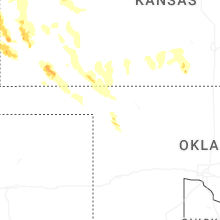
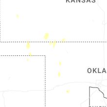
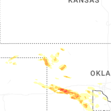

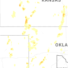

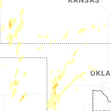
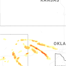
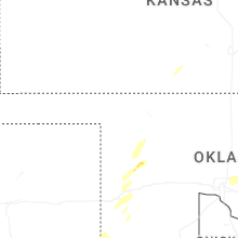
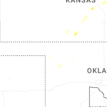


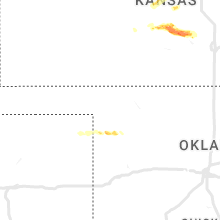


Connect with Interactive Hail Maps