

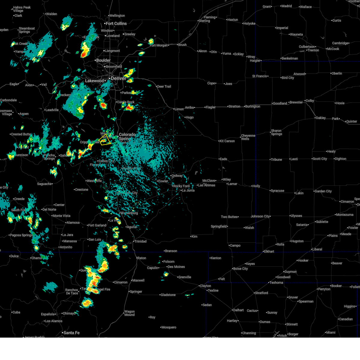
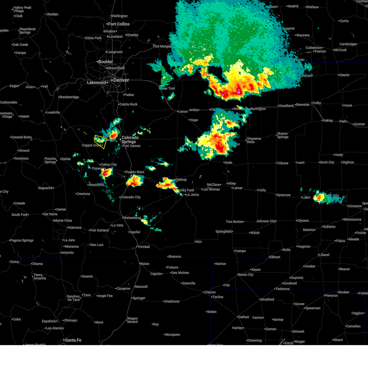
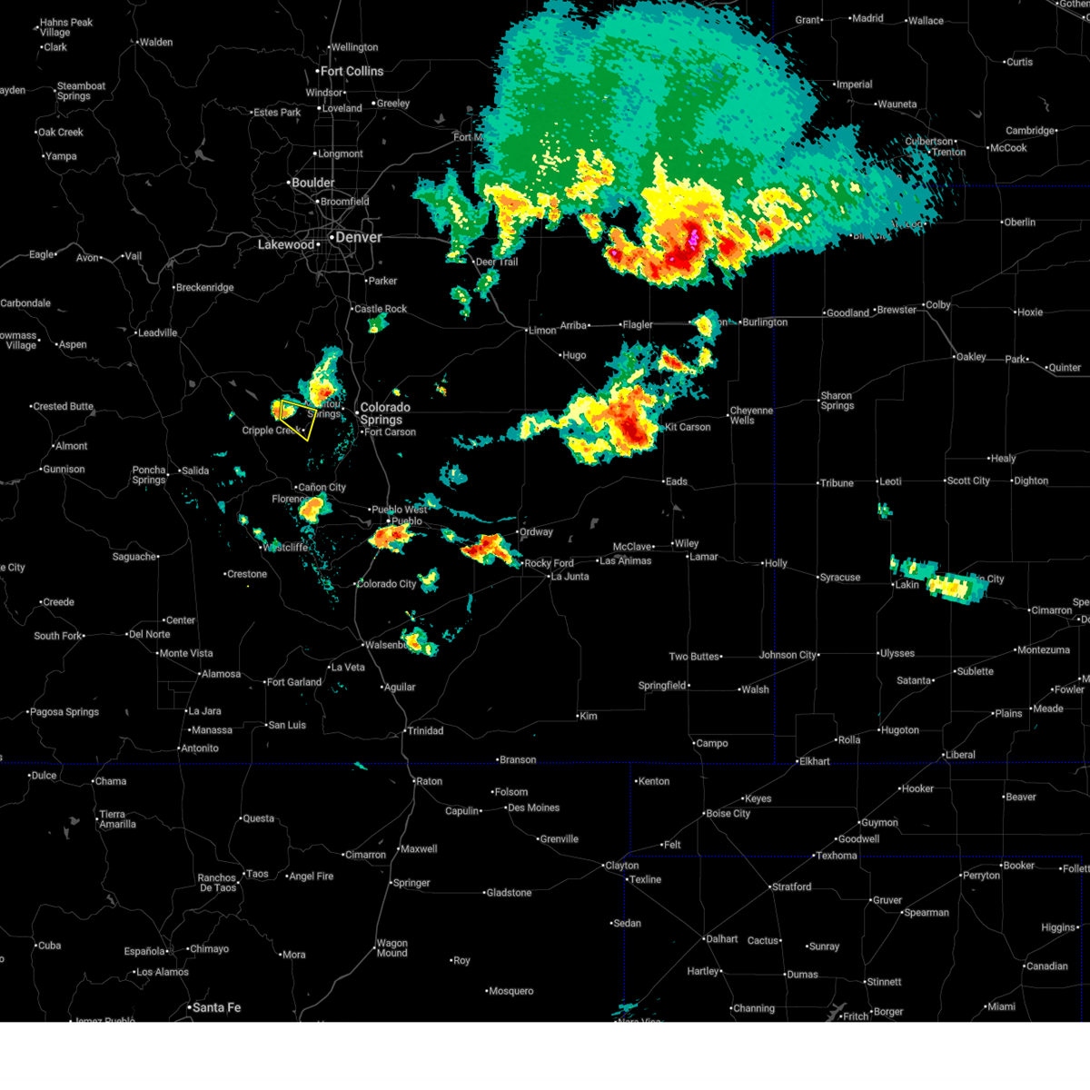
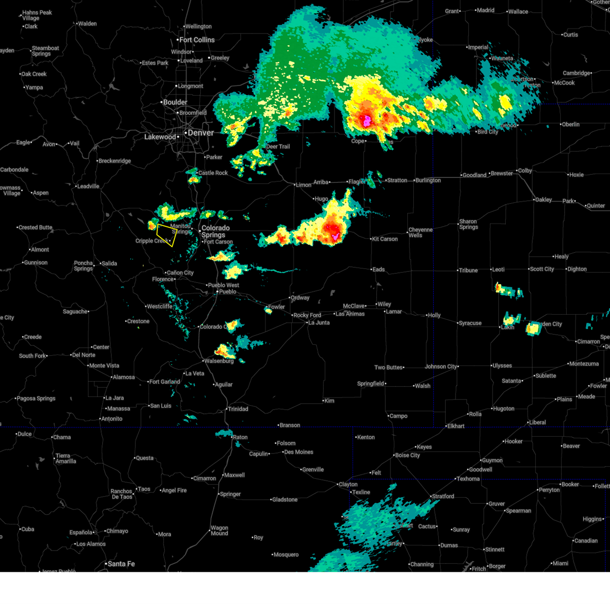
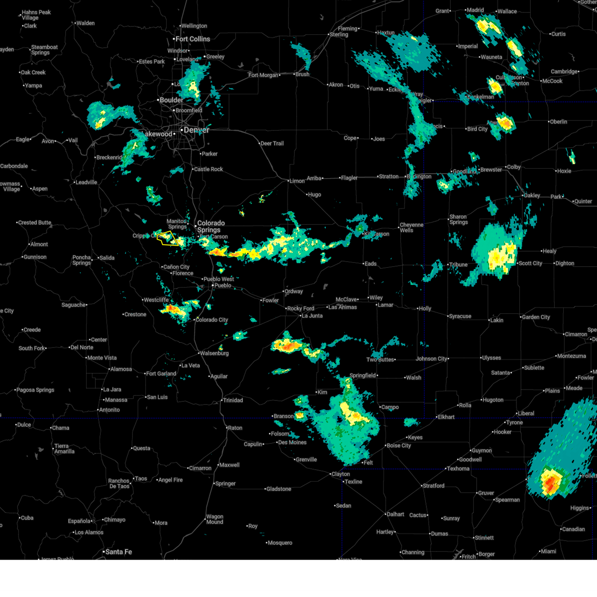
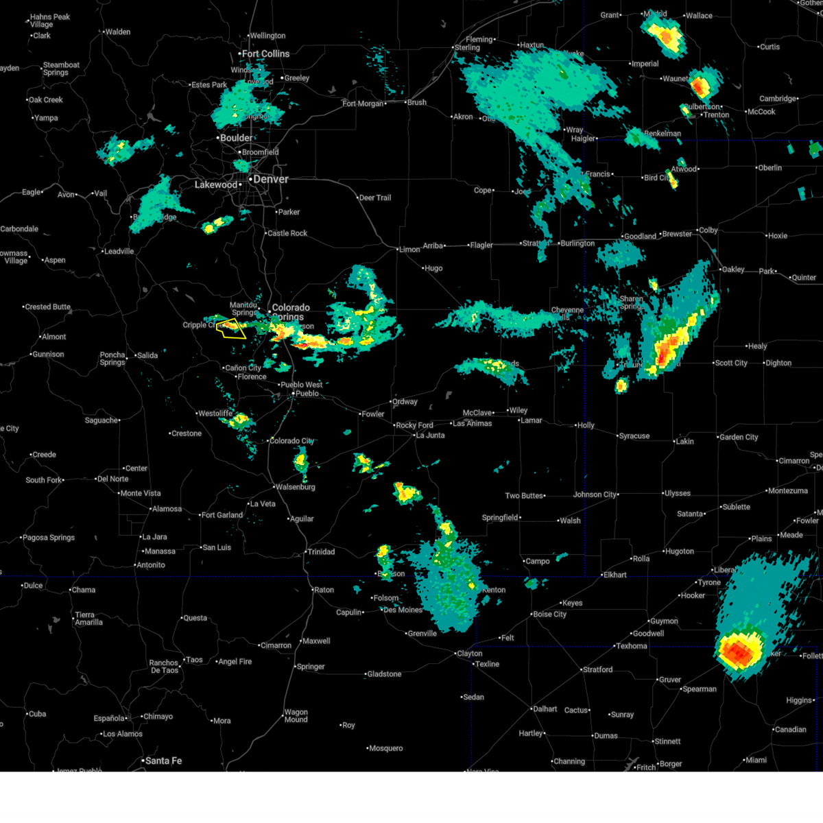
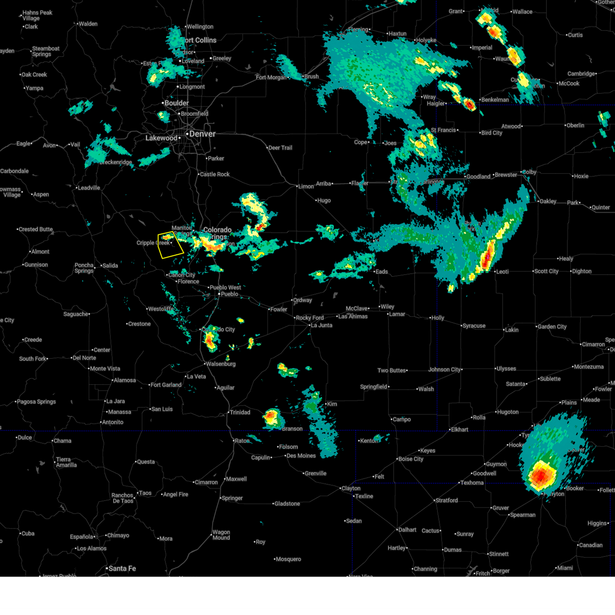
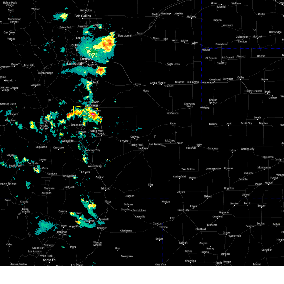
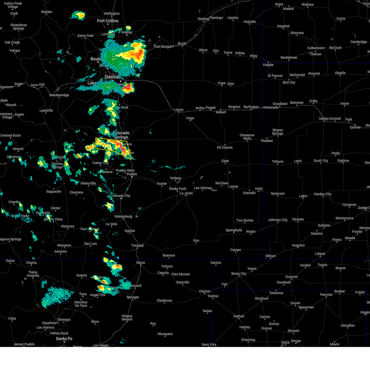
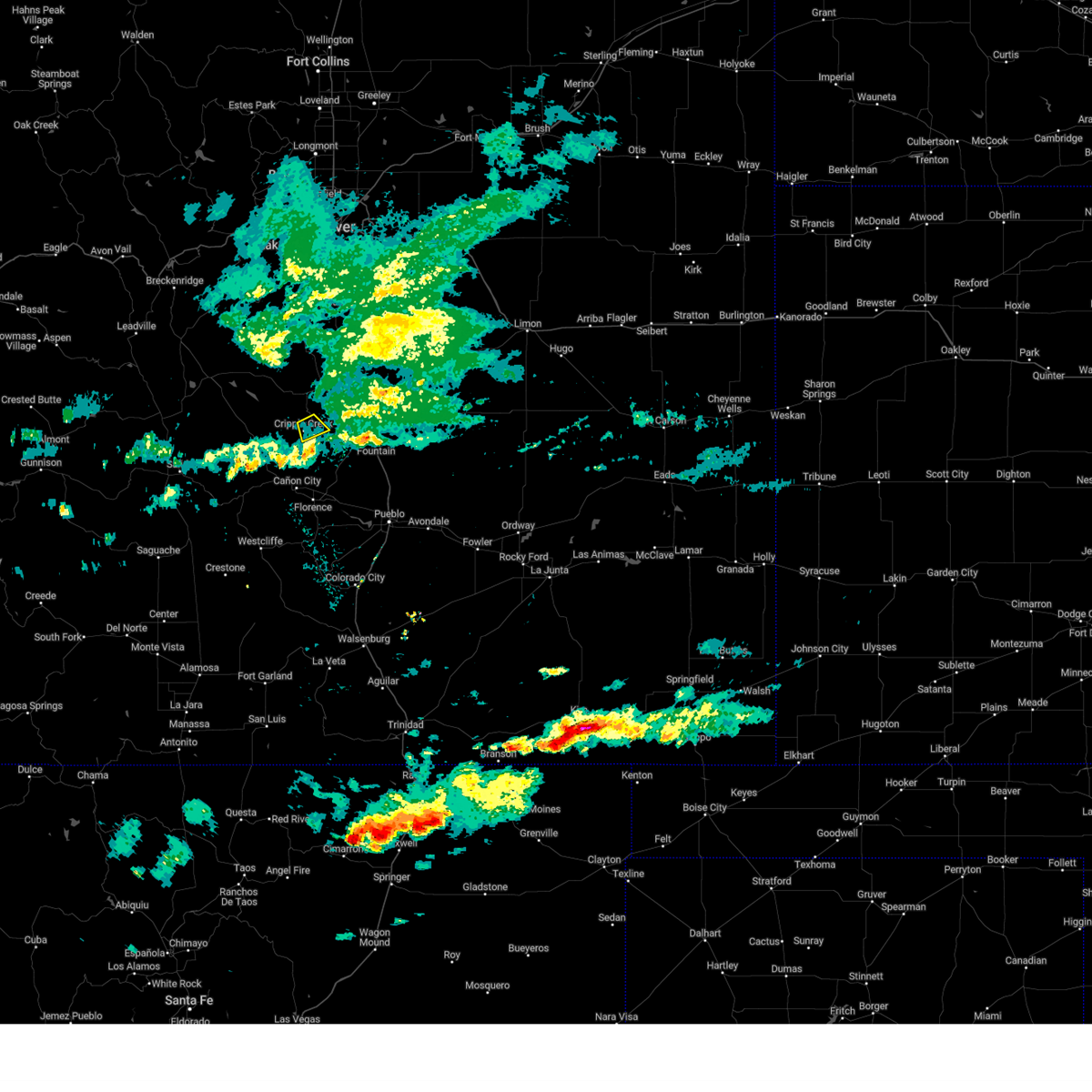
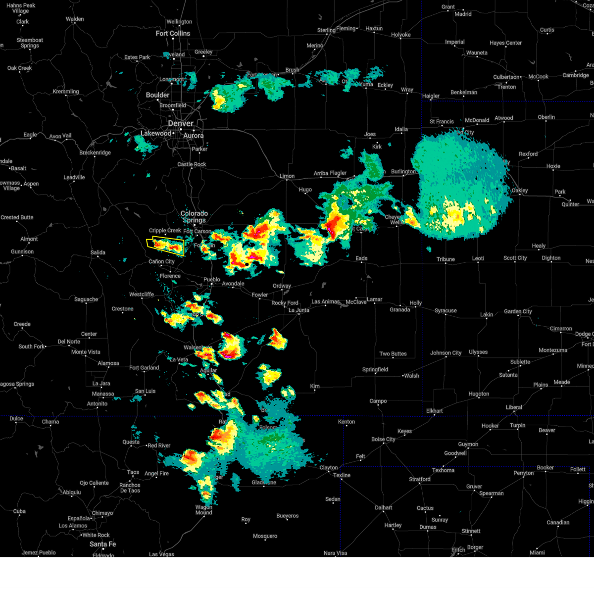
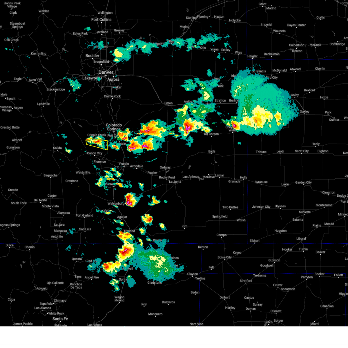
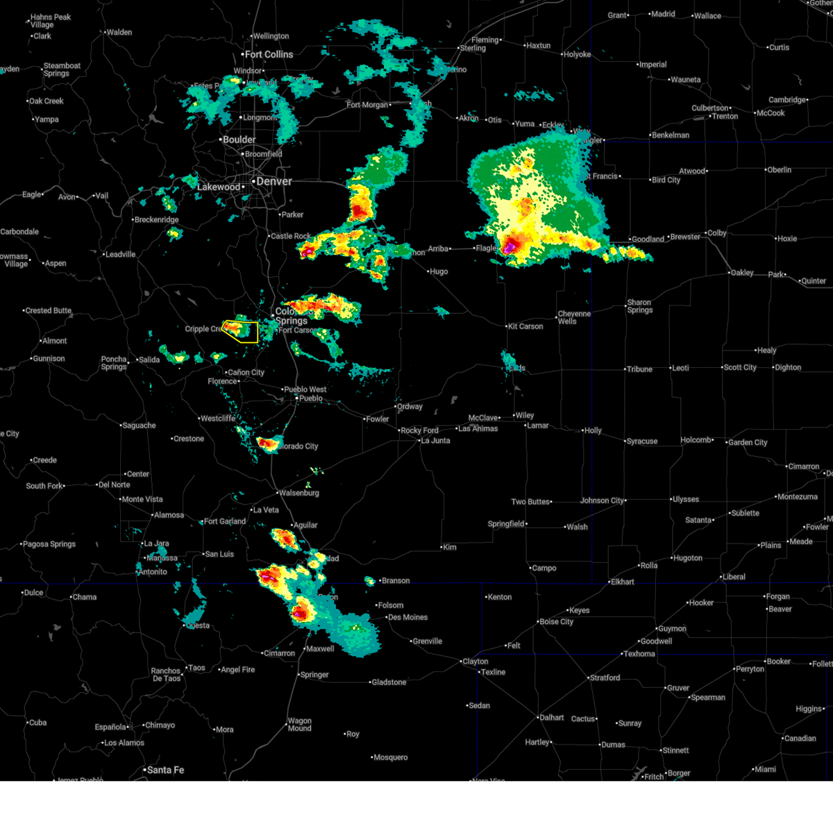
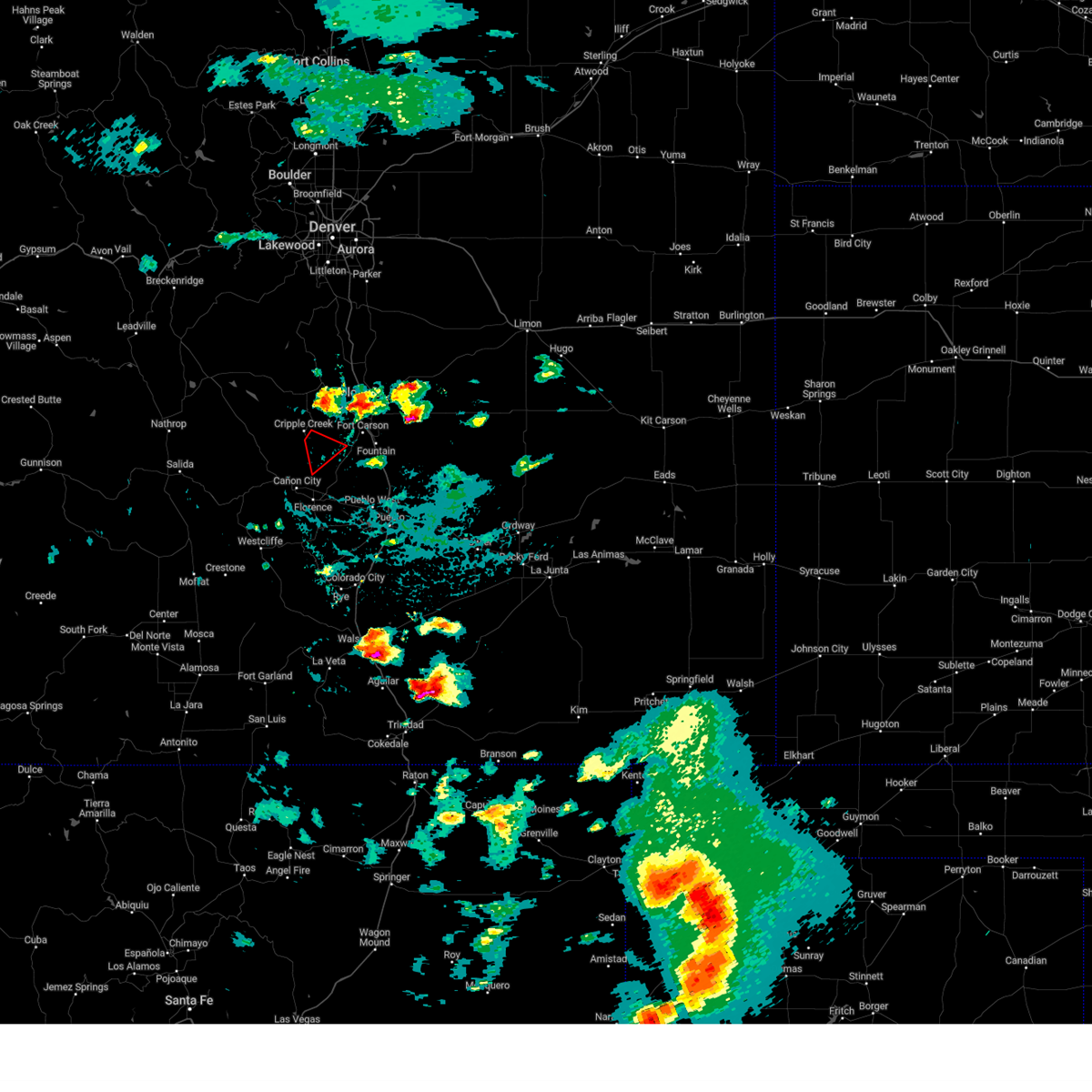
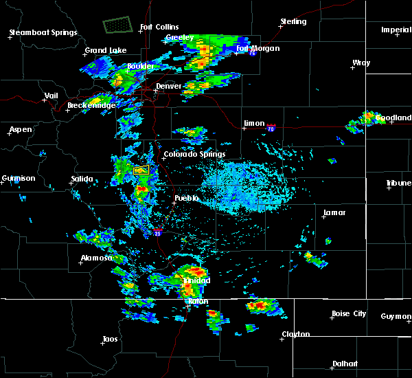
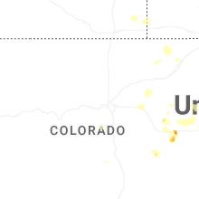
Hail Map for Victor, CO
The Victor, CO area has had 2 reports of on-the-ground hail by trained spotters, and has been under severe weather warnings 13 times during the past 12 months. Doppler radar has detected hail at or near Victor, CO on 39 occasions, including 3 occasions during the past year.
| Name: | Victor, CO |
| Where Located: | 42.1 miles NW of Pueblo, CO |
| Map: | Google Map for Victor, CO |
| Population: | 397 |
| Housing Units: | 337 |
| More Info: | Search Google for Victor, CO |
0
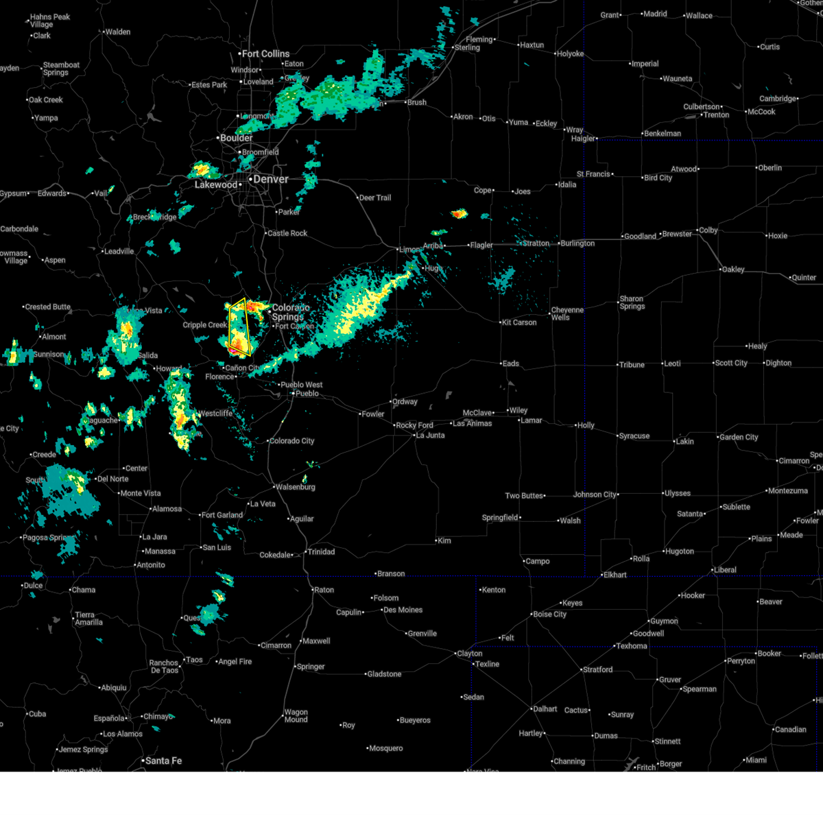
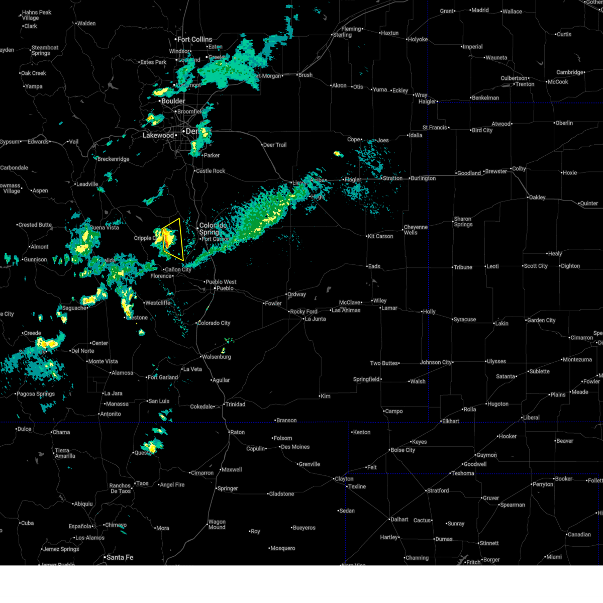
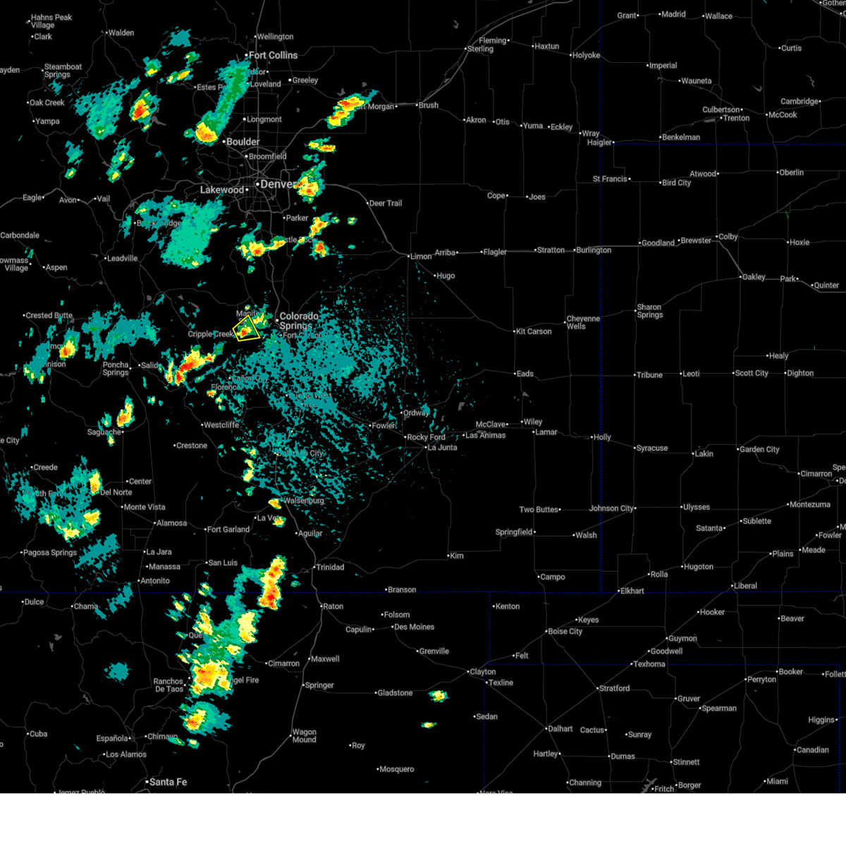
The Top Recent Hail Date for Victor, CO is Wednesday, September 17, 2025 (26th out of 39)
Hail and Wind Damage Spotted near Victor, CO
| Date / Time | Report Details |
|---|---|
| 9/17/2025 8:55 PM MDT | The storm which prompted the warning has weakened below severe limits, and no longer poses an immediate threat to life or property. therefore, the warning will be allowed to expire. however, small hail, gusty winds and heavy rain are still possible with this thunderstorm. a severe thunderstorm watch remains in effect until 1000 pm mdt for central colorado. |
| 9/17/2025 8:36 PM MDT | Svrpub the national weather service in pueblo has issued a * severe thunderstorm warning for, northeastern fremont county in central colorado, southeastern teller county in central colorado, * until 900 pm mdt. * at 836 pm mdt, a severe thunderstorm was located near victor, or 17 miles southwest of colorado springs, moving southeast at 5 mph (radar indicated). Hazards include 60 mph wind gusts and quarter size hail. Hail damage to vehicles is expected. Expect wind damage to roofs, siding, and trees. |
| 9/17/2025 8:13 PM MDT | The storm which prompted the warning has weakened below severe limits, and no longer poses an immediate threat to life or property. therefore, the warning will be allowed to expire. however, small hail and gusty winds are still possible with this thunderstorm. a severe thunderstorm watch remains in effect until 1000 pm mdt for central and east central colorado. |
| 9/17/2025 7:38 PM MDT | Svrpub the national weather service in pueblo has issued a * severe thunderstorm warning for, northeastern fremont county in central colorado, southeastern teller county in central colorado, west central el paso county in east central colorado, * until 815 pm mdt. * at 738 pm mdt, a severe thunderstorm was located over cripple creek, or 18 miles west of colorado springs, moving southeast at 15 mph (radar indicated). Hazards include 60 mph wind gusts and quarter size hail. Hail damage to vehicles is expected. Expect wind damage to roofs, siding, and trees. |
| 9/17/2025 5:10 PM MDT | The storm which prompted the warning has weakened below severe limits, and no longer poses an immediate threat to life or property. therefore, the warning will be allowed to expire. however, gusty winds and heavy rain are still possible with this thunderstorm. a severe thunderstorm watch remains in effect until 1000 pm mdt for central colorado. to report severe weather, contact your nearest law enforcement agency. they will relay your report to the national weather service pueblo. |
| 9/17/2025 4:33 PM MDT | Svrpub the national weather service in pueblo has issued a * severe thunderstorm warning for, southwestern teller county in central colorado, * until 515 pm mdt. * at 433 pm mdt, a severe thunderstorm was located 8 miles south of florissant, or 27 miles west of colorado springs, moving east at 15 mph (radar indicated). Hazards include ping pong ball size hail and 60 mph wind gusts. People and animals outdoors will be injured. expect hail damage to roofs, siding, windows, and vehicles. Expect wind damage to roofs, siding, and trees. |
| 8/22/2025 3:32 PM MDT |
 At 332 pm mdt, a severe thunderstorm was located 9 miles south of victor, or 22 miles southwest of colorado springs, moving southeast at 20 mph (radar indicated). Hazards include quarter size hail. Damage to vehicles is expected. Locations impacted include, cripple creek, victor, and pikes peak. At 332 pm mdt, a severe thunderstorm was located 9 miles south of victor, or 22 miles southwest of colorado springs, moving southeast at 20 mph (radar indicated). Hazards include quarter size hail. Damage to vehicles is expected. Locations impacted include, cripple creek, victor, and pikes peak.
|
| 8/22/2025 3:10 PM MDT |
 Svrpub the national weather service in pueblo has issued a * severe thunderstorm warning for, northeastern fremont county in central colorado, southern teller county in central colorado, west central el paso county in east central colorado, * until 345 pm mdt. * at 310 pm mdt, a severe thunderstorm was located over victor, or 19 miles southwest of colorado springs, moving east at 30 mph (radar indicated). Hazards include quarter size hail. damage to vehicles is expected Svrpub the national weather service in pueblo has issued a * severe thunderstorm warning for, northeastern fremont county in central colorado, southern teller county in central colorado, west central el paso county in east central colorado, * until 345 pm mdt. * at 310 pm mdt, a severe thunderstorm was located over victor, or 19 miles southwest of colorado springs, moving east at 30 mph (radar indicated). Hazards include quarter size hail. damage to vehicles is expected
|
| 7/14/2025 2:29 PM MDT |
 The storm which prompted the warning has weakened below severe limits, and no longer poses an immediate threat to life or property. therefore, the warning will be allowed to expire. however, small hail and gusty winds are still possible with this thunderstorm. The storm which prompted the warning has weakened below severe limits, and no longer poses an immediate threat to life or property. therefore, the warning will be allowed to expire. however, small hail and gusty winds are still possible with this thunderstorm.
|
| 7/14/2025 1:57 PM MDT |
 Svrpub the national weather service in pueblo has issued a * severe thunderstorm warning for, southeastern teller county in central colorado, west central el paso county in east central colorado, * until 230 pm mdt. * at 157 pm mdt, a severe thunderstorm was located near pikes peak, or 14 miles west of colorado springs, moving northeast at 10 mph (radar indicated). Hazards include 60 mph wind gusts and quarter size hail. Hail damage to vehicles is expected. Expect wind damage to roofs, siding, and trees. Svrpub the national weather service in pueblo has issued a * severe thunderstorm warning for, southeastern teller county in central colorado, west central el paso county in east central colorado, * until 230 pm mdt. * at 157 pm mdt, a severe thunderstorm was located near pikes peak, or 14 miles west of colorado springs, moving northeast at 10 mph (radar indicated). Hazards include 60 mph wind gusts and quarter size hail. Hail damage to vehicles is expected. Expect wind damage to roofs, siding, and trees.
|
| 7/6/2025 8:35 PM MDT |
 The storm which prompted the warning has weakened below severe limits, and no longer poses an immediate threat to life or property. therefore, the warning will be allowed to expire. The storm which prompted the warning has weakened below severe limits, and no longer poses an immediate threat to life or property. therefore, the warning will be allowed to expire.
|
| 7/6/2025 8:16 PM MDT |
 At 816 pm mdt, a severe thunderstorm was located 7 miles northwest of cripple creek, or 24 miles west of colorado springs, moving east at 25 mph (radar indicated). Hazards include quarter size hail. Damage to vehicles is expected. Locations impacted include, cripple creek and victor. At 816 pm mdt, a severe thunderstorm was located 7 miles northwest of cripple creek, or 24 miles west of colorado springs, moving east at 25 mph (radar indicated). Hazards include quarter size hail. Damage to vehicles is expected. Locations impacted include, cripple creek and victor.
|
| 7/6/2025 7:53 PM MDT |
 Svrpub the national weather service in pueblo has issued a * severe thunderstorm warning for, southwestern teller county in central colorado, * until 845 pm mdt. * at 753 pm mdt, a severe thunderstorm was located 7 miles south of florissant, or 27 miles west of colorado springs, moving southeast at 25 mph (radar indicated). Hazards include quarter size hail. damage to vehicles is expected Svrpub the national weather service in pueblo has issued a * severe thunderstorm warning for, southwestern teller county in central colorado, * until 845 pm mdt. * at 753 pm mdt, a severe thunderstorm was located 7 miles south of florissant, or 27 miles west of colorado springs, moving southeast at 25 mph (radar indicated). Hazards include quarter size hail. damage to vehicles is expected
|
| 6/17/2025 6:08 PM MDT |
 The storm which prompted the warning has weakened below severe limits, and no longer poses an immediate threat to life or property. therefore, the warning will be allowed to expire. however, small hail and gusty winds are still possible with this thunderstorm. a severe thunderstorm watch remains in effect until 700 pm mdt for central colorado. The storm which prompted the warning has weakened below severe limits, and no longer poses an immediate threat to life or property. therefore, the warning will be allowed to expire. however, small hail and gusty winds are still possible with this thunderstorm. a severe thunderstorm watch remains in effect until 700 pm mdt for central colorado.
|
| 6/17/2025 5:47 PM MDT |
 At 547 pm mdt, a severe thunderstorm was located near victor, or 22 miles southwest of colorado springs, moving south at 20 mph (radar indicated). Hazards include quarter size hail. Damage to vehicles is expected. Locations impacted include, cripple creek and victor. At 547 pm mdt, a severe thunderstorm was located near victor, or 22 miles southwest of colorado springs, moving south at 20 mph (radar indicated). Hazards include quarter size hail. Damage to vehicles is expected. Locations impacted include, cripple creek and victor.
|
| 6/17/2025 5:29 PM MDT |
 Svrpub the national weather service in pueblo has issued a * severe thunderstorm warning for, northeastern fremont county in central colorado, southwestern teller county in central colorado, * until 615 pm mdt. * at 528 pm mdt, a severe thunderstorm was located near cripple creek, or 22 miles west of colorado springs, moving south at 20 mph (radar indicated). Hazards include 60 mph wind gusts and quarter size hail. Hail damage to vehicles is expected. Expect wind damage to roofs, siding, and trees. Svrpub the national weather service in pueblo has issued a * severe thunderstorm warning for, northeastern fremont county in central colorado, southwestern teller county in central colorado, * until 615 pm mdt. * at 528 pm mdt, a severe thunderstorm was located near cripple creek, or 22 miles west of colorado springs, moving south at 20 mph (radar indicated). Hazards include 60 mph wind gusts and quarter size hail. Hail damage to vehicles is expected. Expect wind damage to roofs, siding, and trees.
|
| 5/30/2025 5:55 PM MDT |
 At 553 pm mdt, a severe thunderstorm were located across southern teller and southwestern el paso. hail was covering the ground in cripple creek. the storms are nearly nearly stationary. the most intense storms were over ft carson (radar indicated). Hazards include 60 mph wind gusts and quarter size hail. Hail damage to vehicles is expected. expect wind damage to roofs, siding, and trees. Locations impacted include, victor, pikes peak, stratmoor, fountain, cripple creek, fort carson, security, security-widefield, colorado springs, and peterson space force base. At 553 pm mdt, a severe thunderstorm were located across southern teller and southwestern el paso. hail was covering the ground in cripple creek. the storms are nearly nearly stationary. the most intense storms were over ft carson (radar indicated). Hazards include 60 mph wind gusts and quarter size hail. Hail damage to vehicles is expected. expect wind damage to roofs, siding, and trees. Locations impacted include, victor, pikes peak, stratmoor, fountain, cripple creek, fort carson, security, security-widefield, colorado springs, and peterson space force base.
|
| 5/30/2025 5:42 PM MDT |
 Svrpub the national weather service in pueblo has issued a * severe thunderstorm warning for, southern teller county in central colorado, southwestern el paso county in east central colorado, * until 630 pm mdt. * at 541 pm mdt, a severe thunderstorm was located over southern teller and southwestern el paso county. the storms showed little movement (radar indicated). Hazards include 60 mph wind gusts and quarter size hail. Hail damage to vehicles is expected. Expect wind damage to roofs, siding, and trees. Svrpub the national weather service in pueblo has issued a * severe thunderstorm warning for, southern teller county in central colorado, southwestern el paso county in east central colorado, * until 630 pm mdt. * at 541 pm mdt, a severe thunderstorm was located over southern teller and southwestern el paso county. the storms showed little movement (radar indicated). Hazards include 60 mph wind gusts and quarter size hail. Hail damage to vehicles is expected. Expect wind damage to roofs, siding, and trees.
|
| 8/9/2024 3:41 PM MDT |
 The storm which prompted the warning has weakened below severe limits, and has exited the warned area. therefore, the warning will be allowed to expire. The storm which prompted the warning has weakened below severe limits, and has exited the warned area. therefore, the warning will be allowed to expire.
|
| 8/9/2024 3:18 PM MDT |
 Svrpub the national weather service in pueblo has issued a * severe thunderstorm warning for, southeastern teller county in central colorado, western el paso county in east central colorado, * until 345 pm mdt. * at 317 pm mdt, a severe thunderstorm was located near cripple creek, or 18 miles west of colorado springs, moving southeast at 10 mph (radar indicated). Hazards include 60 mph wind gusts and quarter size hail. Hail damage to vehicles is expected. Expect wind damage to roofs, siding, and trees. Svrpub the national weather service in pueblo has issued a * severe thunderstorm warning for, southeastern teller county in central colorado, western el paso county in east central colorado, * until 345 pm mdt. * at 317 pm mdt, a severe thunderstorm was located near cripple creek, or 18 miles west of colorado springs, moving southeast at 10 mph (radar indicated). Hazards include 60 mph wind gusts and quarter size hail. Hail damage to vehicles is expected. Expect wind damage to roofs, siding, and trees.
|
| 7/7/2024 7:07 PM MDT |
 The storms which prompted the warning have weakened below severe limits, and no longer pose an immediate threat to life or property. therefore, the warning will be allowed to expire. however, small hail, gusty winds and heavy rain are still possible with these thunderstorms. The storms which prompted the warning have weakened below severe limits, and no longer pose an immediate threat to life or property. therefore, the warning will be allowed to expire. however, small hail, gusty winds and heavy rain are still possible with these thunderstorms.
|
| 7/7/2024 6:39 PM MDT |
 Svrpub the national weather service in pueblo has issued a * severe thunderstorm warning for, northeastern fremont county in central colorado, southern teller county in central colorado, * until 715 pm mdt. * at 639 pm mdt, severe thunderstorms were located along a line extending from 9 miles east of guffey to near victor, moving southeast at 20 mph (radar indicated). Hazards include 60 mph wind gusts and half dollar size hail. Hail damage to vehicles is expected. Expect wind damage to roofs, siding, and trees. Svrpub the national weather service in pueblo has issued a * severe thunderstorm warning for, northeastern fremont county in central colorado, southern teller county in central colorado, * until 715 pm mdt. * at 639 pm mdt, severe thunderstorms were located along a line extending from 9 miles east of guffey to near victor, moving southeast at 20 mph (radar indicated). Hazards include 60 mph wind gusts and half dollar size hail. Hail damage to vehicles is expected. Expect wind damage to roofs, siding, and trees.
|
| 7/7/2024 6:17 PM MDT |
 Svrpub the national weather service in pueblo has issued a * severe thunderstorm warning for, northeastern fremont county in central colorado, southern teller county in central colorado, southwestern el paso county in east central colorado, * until 645 pm mdt. * at 616 pm mdt, severe thunderstorms were located along a line extending from cripple creek to 11 miles southwest of fort carson, moving southeast at 40 mph (radar indicated). Hazards include 60 mph wind gusts and quarter size hail. Hail damage to vehicles is expected. Expect wind damage to roofs, siding, and trees. Svrpub the national weather service in pueblo has issued a * severe thunderstorm warning for, northeastern fremont county in central colorado, southern teller county in central colorado, southwestern el paso county in east central colorado, * until 645 pm mdt. * at 616 pm mdt, severe thunderstorms were located along a line extending from cripple creek to 11 miles southwest of fort carson, moving southeast at 40 mph (radar indicated). Hazards include 60 mph wind gusts and quarter size hail. Hail damage to vehicles is expected. Expect wind damage to roofs, siding, and trees.
|
| 7/7/2024 6:00 PM MDT |
 At 559 pm mdt, a severe thunderstorm was located over victor, or 16 miles southwest of colorado springs, moving southeast at 15 mph (radar indicated). Hazards include ping pong ball size hail and 60 mph wind gusts. People and animals outdoors will be injured. expect hail damage to roofs, siding, windows, and vehicles. expect wind damage to roofs, siding, and trees. Locations impacted include, cripple creek and victor. At 559 pm mdt, a severe thunderstorm was located over victor, or 16 miles southwest of colorado springs, moving southeast at 15 mph (radar indicated). Hazards include ping pong ball size hail and 60 mph wind gusts. People and animals outdoors will be injured. expect hail damage to roofs, siding, windows, and vehicles. expect wind damage to roofs, siding, and trees. Locations impacted include, cripple creek and victor.
|
| 7/7/2024 5:47 PM MDT |
 Svrpub the national weather service in pueblo has issued a * severe thunderstorm warning for, southern teller county in central colorado, * until 615 pm mdt. * at 546 pm mdt, a severe thunderstorm was located over cripple creek, or 19 miles west of colorado springs, moving southeast at 15 mph (radar indicated). Hazards include 60 mph wind gusts and quarter size hail. Hail damage to vehicles is expected. Expect wind damage to roofs, siding, and trees. Svrpub the national weather service in pueblo has issued a * severe thunderstorm warning for, southern teller county in central colorado, * until 615 pm mdt. * at 546 pm mdt, a severe thunderstorm was located over cripple creek, or 19 miles west of colorado springs, moving southeast at 15 mph (radar indicated). Hazards include 60 mph wind gusts and quarter size hail. Hail damage to vehicles is expected. Expect wind damage to roofs, siding, and trees.
|
| 7/7/2024 5:22 PM MDT |
 the severe thunderstorm warning has been cancelled and is no longer in effect the severe thunderstorm warning has been cancelled and is no longer in effect
|
| 7/7/2024 5:22 PM MDT |
 At 521 pm mdt, a severe thunderstorm was located near victor, or 15 miles west of colorado springs, moving east at 25 mph (radar indicated). Hazards include 60 mph wind gusts and half dollar size hail. Hail damage to vehicles is expected. expect wind damage to roofs, siding, and trees. Locations impacted include, cripple creek and victor. At 521 pm mdt, a severe thunderstorm was located near victor, or 15 miles west of colorado springs, moving east at 25 mph (radar indicated). Hazards include 60 mph wind gusts and half dollar size hail. Hail damage to vehicles is expected. expect wind damage to roofs, siding, and trees. Locations impacted include, cripple creek and victor.
|
| 7/7/2024 5:09 PM MDT |
 At 509 pm mdt, a severe thunderstorm was located near cripple creek, or 19 miles west of colorado springs, moving east at 20 mph (radar indicated). Hazards include ping pong ball size hail and 60 mph wind gusts. People and animals outdoors will be injured. expect hail damage to roofs, siding, windows, and vehicles. expect wind damage to roofs, siding, and trees. Locations impacted include, cripple creek and victor. At 509 pm mdt, a severe thunderstorm was located near cripple creek, or 19 miles west of colorado springs, moving east at 20 mph (radar indicated). Hazards include ping pong ball size hail and 60 mph wind gusts. People and animals outdoors will be injured. expect hail damage to roofs, siding, windows, and vehicles. expect wind damage to roofs, siding, and trees. Locations impacted include, cripple creek and victor.
|
| 7/7/2024 5:03 PM MDT |
 Svrpub the national weather service in pueblo has issued a * severe thunderstorm warning for, southern teller county in central colorado, western el paso county in east central colorado, * until 530 pm mdt. * at 502 pm mdt, a severe thunderstorm was located near cripple creek, or 21 miles west of colorado springs, moving east at 25 mph (radar indicated). Hazards include 60 mph wind gusts and quarter size hail. Hail damage to vehicles is expected. Expect wind damage to roofs, siding, and trees. Svrpub the national weather service in pueblo has issued a * severe thunderstorm warning for, southern teller county in central colorado, western el paso county in east central colorado, * until 530 pm mdt. * at 502 pm mdt, a severe thunderstorm was located near cripple creek, or 21 miles west of colorado springs, moving east at 25 mph (radar indicated). Hazards include 60 mph wind gusts and quarter size hail. Hail damage to vehicles is expected. Expect wind damage to roofs, siding, and trees.
|
| 7/31/2023 9:03 PM MDT |
 At 902 pm mdt, a severe thunderstorm was located near victor, or 23 miles southwest of colorado springs, moving north at 25 mph (radar indicated). Hazards include ping pong ball size hail and 60 mph wind gusts. People and animals outdoors will be injured. expect hail damage to roofs, siding, windows, and vehicles. expect wind damage to roofs, siding, and trees. this severe storm will be near, victor around 915 pm mdt. other locations in the path of this severe thunderstorm include cripple creek. hail threat, radar indicated max hail size, 1. 50 in wind threat, radar indicated max wind gust, 60 mph. At 902 pm mdt, a severe thunderstorm was located near victor, or 23 miles southwest of colorado springs, moving north at 25 mph (radar indicated). Hazards include ping pong ball size hail and 60 mph wind gusts. People and animals outdoors will be injured. expect hail damage to roofs, siding, windows, and vehicles. expect wind damage to roofs, siding, and trees. this severe storm will be near, victor around 915 pm mdt. other locations in the path of this severe thunderstorm include cripple creek. hail threat, radar indicated max hail size, 1. 50 in wind threat, radar indicated max wind gust, 60 mph.
|
| 7/31/2023 8:56 PM MDT |
 At 855 pm mdt, a severe thunderstorm was located 7 miles south of victor, or 25 miles southwest of colorado springs, moving north at 25 mph (radar indicated). Hazards include 60 mph wind gusts and quarter size hail. Hail damage to vehicles is expected. expect wind damage to roofs, siding, and trees. this severe thunderstorm will be near, victor around 915 pm mdt. other locations in the path of this severe thunderstorm include cripple creek. hail threat, radar indicated max hail size, 1. 00 in wind threat, radar indicated max wind gust, 60 mph. At 855 pm mdt, a severe thunderstorm was located 7 miles south of victor, or 25 miles southwest of colorado springs, moving north at 25 mph (radar indicated). Hazards include 60 mph wind gusts and quarter size hail. Hail damage to vehicles is expected. expect wind damage to roofs, siding, and trees. this severe thunderstorm will be near, victor around 915 pm mdt. other locations in the path of this severe thunderstorm include cripple creek. hail threat, radar indicated max hail size, 1. 00 in wind threat, radar indicated max wind gust, 60 mph.
|
| 7/31/2023 8:26 PM MDT |
 At 826 pm mdt, a severe thunderstorm was located near victor, or 22 miles southwest of colorado springs, moving north at 15 mph (radar indicated). Hazards include 60 mph wind gusts and quarter size hail. Hail damage to vehicles is expected. expect wind damage to roofs, siding, and trees. this severe thunderstorm will be near, victor around 845 pm mdt. Other locations in the path of this severe thunderstorm include cripple creek. At 826 pm mdt, a severe thunderstorm was located near victor, or 22 miles southwest of colorado springs, moving north at 15 mph (radar indicated). Hazards include 60 mph wind gusts and quarter size hail. Hail damage to vehicles is expected. expect wind damage to roofs, siding, and trees. this severe thunderstorm will be near, victor around 845 pm mdt. Other locations in the path of this severe thunderstorm include cripple creek.
|
| 7/31/2023 8:16 PM MDT |
 At 816 pm mdt, a severe thunderstorm was located near cripple creek, or 22 miles west of colorado springs, moving north at 20 mph (radar indicated). Hazards include 60 mph wind gusts and quarter size hail. Hail damage to vehicles is expected. expect wind damage to roofs, siding, and trees. this severe thunderstorm will remain over mainly rural areas of northeastern fremont and southwestern teller counties. hail threat, radar indicated max hail size, 1. 00 in wind threat, radar indicated max wind gust, 60 mph. At 816 pm mdt, a severe thunderstorm was located near cripple creek, or 22 miles west of colorado springs, moving north at 20 mph (radar indicated). Hazards include 60 mph wind gusts and quarter size hail. Hail damage to vehicles is expected. expect wind damage to roofs, siding, and trees. this severe thunderstorm will remain over mainly rural areas of northeastern fremont and southwestern teller counties. hail threat, radar indicated max hail size, 1. 00 in wind threat, radar indicated max wind gust, 60 mph.
|
| 7/31/2023 8:05 PM MDT |
 At 805 pm mdt, a severe thunderstorm was located near cripple creek, or 24 miles west of colorado springs, moving north at 20 mph (radar indicated). Hazards include 60 mph wind gusts and quarter size hail. Hail damage to vehicles is expected. expect wind damage to roofs, siding, and trees. this severe thunderstorm will be near, cripple creek around 810 pm mdt. hail threat, radar indicated max hail size, 1. 00 in wind threat, radar indicated max wind gust, 60 mph. At 805 pm mdt, a severe thunderstorm was located near cripple creek, or 24 miles west of colorado springs, moving north at 20 mph (radar indicated). Hazards include 60 mph wind gusts and quarter size hail. Hail damage to vehicles is expected. expect wind damage to roofs, siding, and trees. this severe thunderstorm will be near, cripple creek around 810 pm mdt. hail threat, radar indicated max hail size, 1. 00 in wind threat, radar indicated max wind gust, 60 mph.
|
| 7/15/2023 3:58 PM MDT |
 The severe thunderstorm warning for northeastern fremont and southern teller counties will expire at 400 pm mdt, the storm which prompted the warning has weakened below severe limits, and no longer poses an immediate threat to life or property. therefore, the warning will be allowed to expire. The severe thunderstorm warning for northeastern fremont and southern teller counties will expire at 400 pm mdt, the storm which prompted the warning has weakened below severe limits, and no longer poses an immediate threat to life or property. therefore, the warning will be allowed to expire.
|
| 7/15/2023 3:37 PM MDT |
 At 337 pm mdt, a severe thunderstorm was located near cripple creek, or 23 miles west of colorado springs, moving southeast at 20 mph (radar indicated). Hazards include 60 mph wind gusts and quarter size hail. Hail damage to vehicles is expected. expect wind damage to roofs, siding, and trees. this severe thunderstorm will be near, cripple creek around 345 pm mdt. victor around 350 pm mdt. hail threat, radar indicated max hail size, 1. 00 in wind threat, radar indicated max wind gust, 60 mph. At 337 pm mdt, a severe thunderstorm was located near cripple creek, or 23 miles west of colorado springs, moving southeast at 20 mph (radar indicated). Hazards include 60 mph wind gusts and quarter size hail. Hail damage to vehicles is expected. expect wind damage to roofs, siding, and trees. this severe thunderstorm will be near, cripple creek around 345 pm mdt. victor around 350 pm mdt. hail threat, radar indicated max hail size, 1. 00 in wind threat, radar indicated max wind gust, 60 mph.
|
| 7/7/2023 5:42 PM MDT |
 At 542 pm mdt, a severe thunderstorm capable of producing a tornado was located near victor, or 19 miles southwest of colorado springs, moving southeast at 20 mph (radar indicated rotation). Hazards include tornado. Flying debris will be dangerous to those caught without shelter. mobile homes will be damaged or destroyed. damage to roofs, windows, and vehicles will occur. tree damage is likely. Locations impacted include, victor. At 542 pm mdt, a severe thunderstorm capable of producing a tornado was located near victor, or 19 miles southwest of colorado springs, moving southeast at 20 mph (radar indicated rotation). Hazards include tornado. Flying debris will be dangerous to those caught without shelter. mobile homes will be damaged or destroyed. damage to roofs, windows, and vehicles will occur. tree damage is likely. Locations impacted include, victor.
|
| 7/7/2023 5:40 PM MDT |
 At 539 pm mdt, a severe thunderstorm was located over victor, or 17 miles southwest of colorado springs, moving southeast at 15 mph (radar indicated. public reported severe hail damage to windshields in cripple creek). Hazards include tennis ball size hail and 60 mph wind gusts. People and animals outdoors will be injured. expect hail damage to roofs, siding, windows, and vehicles. expect wind damage to roofs, siding, and trees. This severe thunderstorm will remain over mainly rural areas of northeastern fremont and southeastern teller counties. At 539 pm mdt, a severe thunderstorm was located over victor, or 17 miles southwest of colorado springs, moving southeast at 15 mph (radar indicated. public reported severe hail damage to windshields in cripple creek). Hazards include tennis ball size hail and 60 mph wind gusts. People and animals outdoors will be injured. expect hail damage to roofs, siding, windows, and vehicles. expect wind damage to roofs, siding, and trees. This severe thunderstorm will remain over mainly rural areas of northeastern fremont and southeastern teller counties.
|
| 7/7/2023 5:38 PM MDT |
 At 538 pm mdt, a severe thunderstorm capable of producing a tornado was located over victor, or 20 miles southwest of colorado springs, moving southeast at 20 mph (radar indicated rotation). Hazards include tornado. Flying debris will be dangerous to those caught without shelter. mobile homes will be damaged or destroyed. damage to roofs, windows, and vehicles will occur. tree damage is likely. This tornadic thunderstorm will remain over mainly rural areas of northeastern fremont, southeastern teller and western el paso counties. At 538 pm mdt, a severe thunderstorm capable of producing a tornado was located over victor, or 20 miles southwest of colorado springs, moving southeast at 20 mph (radar indicated rotation). Hazards include tornado. Flying debris will be dangerous to those caught without shelter. mobile homes will be damaged or destroyed. damage to roofs, windows, and vehicles will occur. tree damage is likely. This tornadic thunderstorm will remain over mainly rural areas of northeastern fremont, southeastern teller and western el paso counties.
|
| 7/7/2023 5:35 PM MDT | Ping Pong Ball sized hail reported 0.1 miles NNW of Victor, CO, damage to windshields and skylights. time estimated from radar. |
| 7/7/2023 5:31 PM MDT |
 At 531 pm mdt, a severe thunderstorm was located over cripple creek, or 18 miles west of colorado springs, moving southeast at 15 mph (radar indicated). Hazards include tennis ball size hail and 60 mph wind gusts. People and animals outdoors will be injured. expect hail damage to roofs, siding, windows, and vehicles. expect wind damage to roofs, siding, and trees. This severe storm will be near, victor around 535 pm mdt. At 531 pm mdt, a severe thunderstorm was located over cripple creek, or 18 miles west of colorado springs, moving southeast at 15 mph (radar indicated). Hazards include tennis ball size hail and 60 mph wind gusts. People and animals outdoors will be injured. expect hail damage to roofs, siding, windows, and vehicles. expect wind damage to roofs, siding, and trees. This severe storm will be near, victor around 535 pm mdt.
|
| 7/7/2023 5:27 PM MDT |
 At 527 pm mdt, a severe thunderstorm capable of producing a tornado was located near cripple creek, or 22 miles southwest of colorado springs, moving southeast at 20 mph (radar indicated rotation). Hazards include tornado. Flying debris will be dangerous to those caught without shelter. mobile homes will be damaged or destroyed. damage to roofs, windows, and vehicles will occur. tree damage is likely. This dangerous storm will be near, victor around 535 pm mdt. At 527 pm mdt, a severe thunderstorm capable of producing a tornado was located near cripple creek, or 22 miles southwest of colorado springs, moving southeast at 20 mph (radar indicated rotation). Hazards include tornado. Flying debris will be dangerous to those caught without shelter. mobile homes will be damaged or destroyed. damage to roofs, windows, and vehicles will occur. tree damage is likely. This dangerous storm will be near, victor around 535 pm mdt.
|
| 7/7/2023 5:24 PM MDT |
 At 524 pm mdt, a severe thunderstorm was located over cripple creek, or 19 miles west of colorado springs, moving southeast at 20 mph (radar indicated). Hazards include golf ball size hail and 60 mph wind gusts. People and animals outdoors will be injured. expect hail damage to roofs, siding, windows, and vehicles. expect wind damage to roofs, siding, and trees. This severe thunderstorm will be near, victor around 535 pm mdt. At 524 pm mdt, a severe thunderstorm was located over cripple creek, or 19 miles west of colorado springs, moving southeast at 20 mph (radar indicated). Hazards include golf ball size hail and 60 mph wind gusts. People and animals outdoors will be injured. expect hail damage to roofs, siding, windows, and vehicles. expect wind damage to roofs, siding, and trees. This severe thunderstorm will be near, victor around 535 pm mdt.
|
| 8/4/2022 7:25 PM MDT |
 At 724 pm mdt, a severe thunderstorm was located over cripple creek, or 20 miles west of colorado springs, moving south at 20 mph (radar indicated). Hazards include 60 mph wind gusts and quarter size hail. Hail damage to vehicles is expected. Expect wind damage to roofs, siding, and trees. At 724 pm mdt, a severe thunderstorm was located over cripple creek, or 20 miles west of colorado springs, moving south at 20 mph (radar indicated). Hazards include 60 mph wind gusts and quarter size hail. Hail damage to vehicles is expected. Expect wind damage to roofs, siding, and trees.
|
| 7/12/2022 2:51 PM MDT |
 At 251 pm mdt, a severe thunderstorm was located over victor, or 20 miles southwest of colorado springs, moving southeast at 5 mph (radar indicated). Hazards include 60 mph wind gusts and half dollar size hail. Hail damage to vehicles is expected. expect wind damage to roofs, siding, and trees. locations impacted include, victor and penrose. hail threat, radar indicated max hail size, 1. 25 in wind threat, radar indicated max wind gust, 60 mph. At 251 pm mdt, a severe thunderstorm was located over victor, or 20 miles southwest of colorado springs, moving southeast at 5 mph (radar indicated). Hazards include 60 mph wind gusts and half dollar size hail. Hail damage to vehicles is expected. expect wind damage to roofs, siding, and trees. locations impacted include, victor and penrose. hail threat, radar indicated max hail size, 1. 25 in wind threat, radar indicated max wind gust, 60 mph.
|
| 7/12/2022 2:43 PM MDT |
 At 243 pm mdt, a severe thunderstorm was located over victor, or 21 miles southwest of colorado springs, moving southeast at 5 mph (public confirmed report of 1 inch hail). Hazards include 70 mph wind gusts and half dollar size hail. Hail damage to vehicles is expected. expect considerable tree damage. wind damage is also likely to mobile homes, roofs, and outbuildings. locations impacted include, cripple creek, victor and penrose. thunderstorm damage threat, considerable hail threat, radar indicated max hail size, 1. 25 in wind threat, radar indicated max wind gust, 70 mph. At 243 pm mdt, a severe thunderstorm was located over victor, or 21 miles southwest of colorado springs, moving southeast at 5 mph (public confirmed report of 1 inch hail). Hazards include 70 mph wind gusts and half dollar size hail. Hail damage to vehicles is expected. expect considerable tree damage. wind damage is also likely to mobile homes, roofs, and outbuildings. locations impacted include, cripple creek, victor and penrose. thunderstorm damage threat, considerable hail threat, radar indicated max hail size, 1. 25 in wind threat, radar indicated max wind gust, 70 mph.
|
| 7/12/2022 2:39 PM MDT |
 At 239 pm mdt, a severe thunderstorm was located over victor, or 21 miles southwest of colorado springs, moving southeast at 5 mph (public). Hazards include 70 mph wind gusts and half dollar size hail. Hail damage to vehicles is expected. expect considerable tree damage. wind damage is also likely to mobile homes, roofs, and outbuildings. locations impacted include, cripple creek, victor and penrose. thunderstorm damage threat, considerable hail threat, radar indicated max hail size, 1. 25 in wind threat, radar indicated max wind gust, 70 mph. At 239 pm mdt, a severe thunderstorm was located over victor, or 21 miles southwest of colorado springs, moving southeast at 5 mph (public). Hazards include 70 mph wind gusts and half dollar size hail. Hail damage to vehicles is expected. expect considerable tree damage. wind damage is also likely to mobile homes, roofs, and outbuildings. locations impacted include, cripple creek, victor and penrose. thunderstorm damage threat, considerable hail threat, radar indicated max hail size, 1. 25 in wind threat, radar indicated max wind gust, 70 mph.
|
| 7/12/2022 2:30 PM MDT | Quarter sized hail reported 0.1 miles NNW of Victor, CO, report of quarter-size hail in victor. |
| 7/12/2022 2:28 PM MDT |
 At 228 pm mdt, a severe thunderstorm was located near cripple creek, or 22 miles west of colorado springs, moving southeast at 5 mph (radar indicated). Hazards include two inch hail and 70 mph wind gusts. People and animals outdoors will be injured. expect hail damage to roofs, siding, windows, and vehicles. expect considerable tree damage. wind damage is also likely to mobile homes, roofs, and outbuildings. locations impacted include, cripple creek, victor and penrose. thunderstorm damage threat, considerable hail threat, radar indicated max hail size, 2. 00 in wind threat, radar indicated max wind gust, 70 mph. At 228 pm mdt, a severe thunderstorm was located near cripple creek, or 22 miles west of colorado springs, moving southeast at 5 mph (radar indicated). Hazards include two inch hail and 70 mph wind gusts. People and animals outdoors will be injured. expect hail damage to roofs, siding, windows, and vehicles. expect considerable tree damage. wind damage is also likely to mobile homes, roofs, and outbuildings. locations impacted include, cripple creek, victor and penrose. thunderstorm damage threat, considerable hail threat, radar indicated max hail size, 2. 00 in wind threat, radar indicated max wind gust, 70 mph.
|
| 7/12/2022 2:24 PM MDT |
 At 224 pm mdt, a severe thunderstorm was located near cripple creek, or 22 miles southwest of colorado springs, moving southeast at 5 mph (radar indicated). Hazards include golf ball size hail and 70 mph wind gusts. People and animals outdoors will be injured. expect hail damage to roofs, siding, windows, and vehicles. expect considerable tree damage. wind damage is also likely to mobile homes, roofs, and outbuildings. locations impacted include, cripple creek, victor and penrose. thunderstorm damage threat, considerable hail threat, radar indicated max hail size, 1. 75 in wind threat, radar indicated max wind gust, 70 mph. At 224 pm mdt, a severe thunderstorm was located near cripple creek, or 22 miles southwest of colorado springs, moving southeast at 5 mph (radar indicated). Hazards include golf ball size hail and 70 mph wind gusts. People and animals outdoors will be injured. expect hail damage to roofs, siding, windows, and vehicles. expect considerable tree damage. wind damage is also likely to mobile homes, roofs, and outbuildings. locations impacted include, cripple creek, victor and penrose. thunderstorm damage threat, considerable hail threat, radar indicated max hail size, 1. 75 in wind threat, radar indicated max wind gust, 70 mph.
|
| 7/12/2022 2:19 PM MDT |
 At 219 pm mdt, a severe thunderstorm was located near cripple creek, or 23 miles west of colorado springs, moving southeast at 5 mph (radar indicated). Hazards include 60 mph wind gusts and quarter size hail. Hail damage to vehicles is expected. Expect wind damage to roofs, siding, and trees. At 219 pm mdt, a severe thunderstorm was located near cripple creek, or 23 miles west of colorado springs, moving southeast at 5 mph (radar indicated). Hazards include 60 mph wind gusts and quarter size hail. Hail damage to vehicles is expected. Expect wind damage to roofs, siding, and trees.
|
| 6/27/2022 3:42 PM MDT |
 At 341 pm mdt, a severe thunderstorm was located over victor, or 16 miles southwest of colorado springs, moving southeast at 5 mph (radar indicated). Hazards include 60 mph wind gusts and half dollar size hail. Hail damage to vehicles is expected. expect wind damage to roofs, siding, and trees. this severe thunderstorm will remain over mainly rural areas of northeastern fremont and southeastern teller counties. hail threat, radar indicated max hail size, 1. 25 in wind threat, radar indicated max wind gust, 60 mph. At 341 pm mdt, a severe thunderstorm was located over victor, or 16 miles southwest of colorado springs, moving southeast at 5 mph (radar indicated). Hazards include 60 mph wind gusts and half dollar size hail. Hail damage to vehicles is expected. expect wind damage to roofs, siding, and trees. this severe thunderstorm will remain over mainly rural areas of northeastern fremont and southeastern teller counties. hail threat, radar indicated max hail size, 1. 25 in wind threat, radar indicated max wind gust, 60 mph.
|
| 6/20/2021 9:15 PM MDT |
 At 915 pm mdt, a severe thunderstorm was located near victor, or 15 miles southwest of colorado springs, moving east at 20 mph (radar indicated). Hazards include ping pong ball size hail and 60 mph wind gusts. People and animals outdoors will be injured. expect hail damage to roofs, siding, windows, and vehicles. Expect wind damage to roofs, siding, and trees. At 915 pm mdt, a severe thunderstorm was located near victor, or 15 miles southwest of colorado springs, moving east at 20 mph (radar indicated). Hazards include ping pong ball size hail and 60 mph wind gusts. People and animals outdoors will be injured. expect hail damage to roofs, siding, windows, and vehicles. Expect wind damage to roofs, siding, and trees.
|
| 6/23/2020 3:42 PM MDT |
 The severe thunderstorm warning for northeastern fremont, southern teller and western el paso counties will expire at 345 pm mdt, the storm which prompted the warning has weakened below severe limits, and no longer poses an immediate threat to life or property. therefore, the warning will be allowed to expire. however small hail, gusty winds and heavy rain are still possible with this thunderstorm. The severe thunderstorm warning for northeastern fremont, southern teller and western el paso counties will expire at 345 pm mdt, the storm which prompted the warning has weakened below severe limits, and no longer poses an immediate threat to life or property. therefore, the warning will be allowed to expire. however small hail, gusty winds and heavy rain are still possible with this thunderstorm.
|
| 6/23/2020 3:19 PM MDT |
 At 319 pm mdt, a severe thunderstorm was located over cripple creek, or 17 miles west of colorado springs, moving southeast at 5 mph (radar indicated). Hazards include 60 mph wind gusts and quarter size hail. Hail damage to vehicles is expected. expect wind damage to roofs, siding, and trees. Locations impacted include, cripple creek and victor. At 319 pm mdt, a severe thunderstorm was located over cripple creek, or 17 miles west of colorado springs, moving southeast at 5 mph (radar indicated). Hazards include 60 mph wind gusts and quarter size hail. Hail damage to vehicles is expected. expect wind damage to roofs, siding, and trees. Locations impacted include, cripple creek and victor.
|
| 6/23/2020 3:04 PM MDT |
 At 304 pm mdt, a severe thunderstorm was located near cripple creek, or 17 miles west of colorado springs, moving southeast at 10 mph (radar indicated). Hazards include 60 mph wind gusts and quarter size hail. Hail damage to vehicles is expected. Expect wind damage to roofs, siding, and trees. At 304 pm mdt, a severe thunderstorm was located near cripple creek, or 17 miles west of colorado springs, moving southeast at 10 mph (radar indicated). Hazards include 60 mph wind gusts and quarter size hail. Hail damage to vehicles is expected. Expect wind damage to roofs, siding, and trees.
|
| 8/17/2018 4:42 PM MDT |
 At 441 pm mdt, a severe thunderstorm was located near victor, or 23 miles southwest of colorado springs, moving southeast at 5 mph (radar indicated). Hazards include 60 mph wind gusts and quarter size hail. Hail damage to vehicles is expected. expect wind damage to roofs, siding, and trees. Locations impacted include, rural areas of southern teller county and northeast fremont county. At 441 pm mdt, a severe thunderstorm was located near victor, or 23 miles southwest of colorado springs, moving southeast at 5 mph (radar indicated). Hazards include 60 mph wind gusts and quarter size hail. Hail damage to vehicles is expected. expect wind damage to roofs, siding, and trees. Locations impacted include, rural areas of southern teller county and northeast fremont county.
|
| 8/17/2018 4:34 PM MDT |
 At 434 pm mdt, a severe thunderstorm was located near victor, or 23 miles southwest of colorado springs, moving southeast at 5 mph (radar indicated). Hazards include 60 mph wind gusts and quarter size hail. Hail damage to vehicles is expected. Expect wind damage to roofs, siding, and trees. At 434 pm mdt, a severe thunderstorm was located near victor, or 23 miles southwest of colorado springs, moving southeast at 5 mph (radar indicated). Hazards include 60 mph wind gusts and quarter size hail. Hail damage to vehicles is expected. Expect wind damage to roofs, siding, and trees.
|
| 8/14/2018 4:18 PM MDT |
 At 418 pm mdt, a severe thunderstorm was located over victor, or 19 miles southwest of colorado springs, moving southeast at 25 mph (radar indicated). Hazards include 60 mph wind gusts and quarter size hail. Hail damage to vehicles is expected. expect wind damage to roofs, siding, and trees. Locations impacted include, cripple creek and victor. At 418 pm mdt, a severe thunderstorm was located over victor, or 19 miles southwest of colorado springs, moving southeast at 25 mph (radar indicated). Hazards include 60 mph wind gusts and quarter size hail. Hail damage to vehicles is expected. expect wind damage to roofs, siding, and trees. Locations impacted include, cripple creek and victor.
|
| 8/14/2018 3:58 PM MDT |
 At 348 pm mdt, a severe thunderstorm was located near cripple creek, or 19 miles west of colorado springs, moving south at 25 mph (radar indicated). Hazards include 60 mph wind gusts and half dollar size hail. Hail damage to vehicles is expected. Expect wind damage to roofs, siding, and trees. At 348 pm mdt, a severe thunderstorm was located near cripple creek, or 19 miles west of colorado springs, moving south at 25 mph (radar indicated). Hazards include 60 mph wind gusts and half dollar size hail. Hail damage to vehicles is expected. Expect wind damage to roofs, siding, and trees.
|
| 8/14/2018 3:48 PM MDT |
 At 348 pm mdt, a severe thunderstorm was located near cripple creek, or 19 miles west of colorado springs, moving south at 25 mph (radar indicated). Hazards include 60 mph wind gusts and half dollar size hail. Hail damage to vehicles is expected. Expect wind damage to roofs, siding, and trees. At 348 pm mdt, a severe thunderstorm was located near cripple creek, or 19 miles west of colorado springs, moving south at 25 mph (radar indicated). Hazards include 60 mph wind gusts and half dollar size hail. Hail damage to vehicles is expected. Expect wind damage to roofs, siding, and trees.
|
| 8/6/2018 5:46 PM MDT |
 At 545 pm mdt, a severe thunderstorm was located over cripple creek, or 19 miles west of colorado springs, moving east at 25 mph (radar indicated). Hazards include quarter size hail. damage to vehicles is expected At 545 pm mdt, a severe thunderstorm was located over cripple creek, or 19 miles west of colorado springs, moving east at 25 mph (radar indicated). Hazards include quarter size hail. damage to vehicles is expected
|
| 7/26/2018 4:25 PM MDT |
 At 425 pm mdt, a severe thunderstorm was located near cripple creek, or 22 miles west of colorado springs, moving southeast at 20 mph (radar indicated). Hazards include quarter size hail. Damage to vehicles is expected. Locations impacted include, cripple creek and victor. At 425 pm mdt, a severe thunderstorm was located near cripple creek, or 22 miles west of colorado springs, moving southeast at 20 mph (radar indicated). Hazards include quarter size hail. Damage to vehicles is expected. Locations impacted include, cripple creek and victor.
|
| 7/26/2018 4:15 PM MDT |
 At 414 pm mdt, a severe thunderstorm was located near cripple creek, or 23 miles west of colorado springs, moving southeast at 10 mph (radar indicated). Hazards include quarter size hail. damage to vehicles is expected At 414 pm mdt, a severe thunderstorm was located near cripple creek, or 23 miles west of colorado springs, moving southeast at 10 mph (radar indicated). Hazards include quarter size hail. damage to vehicles is expected
|
| 7/24/2018 5:24 PM MDT |
 The severe thunderstorm warning for southern teller and west central el paso counties will expire at 530 pm mdt, the severe thunderstorm which prompted the warning has weakened. therefore, the warning will be allowed to expire. The severe thunderstorm warning for southern teller and west central el paso counties will expire at 530 pm mdt, the severe thunderstorm which prompted the warning has weakened. therefore, the warning will be allowed to expire.
|
| 7/24/2018 5:03 PM MDT |
 At 502 pm mdt, a severe thunderstorm was located 7 miles south of florissant, or 25 miles west of colorado springs, moving southeast at 10 mph (radar indicated). Hazards include 60 mph wind gusts and half dollar size hail. Hail damage to vehicles is expected. expect wind damage to roofs, siding, and trees. Locations impacted include, cripple creek and victor. At 502 pm mdt, a severe thunderstorm was located 7 miles south of florissant, or 25 miles west of colorado springs, moving southeast at 10 mph (radar indicated). Hazards include 60 mph wind gusts and half dollar size hail. Hail damage to vehicles is expected. expect wind damage to roofs, siding, and trees. Locations impacted include, cripple creek and victor.
|
| 7/24/2018 4:52 PM MDT |
 At 451 pm mdt, a severe thunderstorm was located near florissant, or 24 miles west of colorado springs, moving southeast at 10 mph (radar indicated). Hazards include 60 mph wind gusts and quarter size hail. Hail damage to vehicles is expected. Expect wind damage to roofs, siding, and trees. At 451 pm mdt, a severe thunderstorm was located near florissant, or 24 miles west of colorado springs, moving southeast at 10 mph (radar indicated). Hazards include 60 mph wind gusts and quarter size hail. Hail damage to vehicles is expected. Expect wind damage to roofs, siding, and trees.
|
| 7/29/2016 3:45 PM MDT |
 At 344 pm mdt, a severe thunderstorm was located near victor, or 14 miles southwest of colorado springs, moving southeast at 15 mph (radar indicated). Hazards include 60 mph wind gusts and quarter size hail. Hail damage to vehicles is expected. expect wind damage to roofs, siding, and trees. Locations impacted include, cripple creek and victor. At 344 pm mdt, a severe thunderstorm was located near victor, or 14 miles southwest of colorado springs, moving southeast at 15 mph (radar indicated). Hazards include 60 mph wind gusts and quarter size hail. Hail damage to vehicles is expected. expect wind damage to roofs, siding, and trees. Locations impacted include, cripple creek and victor.
|
| 7/29/2016 3:35 PM MDT |
 At 335 pm mdt, a severe thunderstorm was located near victor, or 15 miles southwest of colorado springs, moving southeast at 15 mph (radar indicated). Hazards include 60 mph wind gusts and quarter size hail. Hail damage to vehicles is expected. expect wind damage to roofs, siding, and trees. Locations impacted include, cripple creek and victor. At 335 pm mdt, a severe thunderstorm was located near victor, or 15 miles southwest of colorado springs, moving southeast at 15 mph (radar indicated). Hazards include 60 mph wind gusts and quarter size hail. Hail damage to vehicles is expected. expect wind damage to roofs, siding, and trees. Locations impacted include, cripple creek and victor.
|
| 7/29/2016 3:25 PM MDT |
 At 325 pm mdt, a severe thunderstorm was located near cripple creek, or 17 miles west of colorado springs, moving southeast at 15 mph (radar indicated). Hazards include 60 mph wind gusts and quarter size hail. Hail damage to vehicles is expected. Expect wind damage to roofs, siding, and trees. At 325 pm mdt, a severe thunderstorm was located near cripple creek, or 17 miles west of colorado springs, moving southeast at 15 mph (radar indicated). Hazards include 60 mph wind gusts and quarter size hail. Hail damage to vehicles is expected. Expect wind damage to roofs, siding, and trees.
|
| 7/29/2016 3:07 PM MDT |
 The severe thunderstorm warning for eastern fremont, southeastern teller and southwestern el paso counties will expire at 315 pm mdt, the severe thunderstorm which prompted the warning has weakened. therefore the warning will be allowed to expire. a severe thunderstorm watch remains in effect until 1000 pm mdt for east central colorado. The severe thunderstorm warning for eastern fremont, southeastern teller and southwestern el paso counties will expire at 315 pm mdt, the severe thunderstorm which prompted the warning has weakened. therefore the warning will be allowed to expire. a severe thunderstorm watch remains in effect until 1000 pm mdt for east central colorado.
|
| 7/29/2016 3:00 PM MDT |
 At 300 pm mdt, a severe thunderstorm was located near victor, or 12 miles southwest of colorado springs, moving southeast at 15 mph (radar indicated). Hazards include 60 mph wind gusts and quarter size hail. Hail damage to vehicles is expected. expect wind damage to roofs, siding, and trees. Locations impacted include, southwestern colorado springs, cripple creek, victor, pikes peak. At 300 pm mdt, a severe thunderstorm was located near victor, or 12 miles southwest of colorado springs, moving southeast at 15 mph (radar indicated). Hazards include 60 mph wind gusts and quarter size hail. Hail damage to vehicles is expected. expect wind damage to roofs, siding, and trees. Locations impacted include, southwestern colorado springs, cripple creek, victor, pikes peak.
|
| 7/29/2016 2:53 PM MDT |
 At 252 pm mdt, a severe thunderstorm was located near victor, or 13 miles southwest of colorado springs, moving southeast at 15 mph (radar indicated). Hazards include 60 mph wind gusts and quarter size hail. Hail damage to vehicles is expected. expect wind damage to roofs, siding, and trees. Locations impacted include, southwestern colorado springs, cripple creek, victor, pikes peak and fort carson. At 252 pm mdt, a severe thunderstorm was located near victor, or 13 miles southwest of colorado springs, moving southeast at 15 mph (radar indicated). Hazards include 60 mph wind gusts and quarter size hail. Hail damage to vehicles is expected. expect wind damage to roofs, siding, and trees. Locations impacted include, southwestern colorado springs, cripple creek, victor, pikes peak and fort carson.
|
| 7/29/2016 2:41 PM MDT |
 At 241 pm mdt, a severe thunderstorm was located near cripple creek, or 15 miles west of colorado springs, moving southeast at 15 mph (radar indicated). Hazards include 60 mph wind gusts and half dollar size hail. Hail damage to vehicles is expected. Expect wind damage to roofs, siding, and trees. At 241 pm mdt, a severe thunderstorm was located near cripple creek, or 15 miles west of colorado springs, moving southeast at 15 mph (radar indicated). Hazards include 60 mph wind gusts and half dollar size hail. Hail damage to vehicles is expected. Expect wind damage to roofs, siding, and trees.
|
| 6/5/2016 8:54 PM MDT |
 At 853 pm mdt, a severe thunderstorm was located near pikes peak, or 15 miles west of colorado springs, moving east at 20 mph (radar indicated). Hazards include 60 mph wind gusts and quarter size hail. Hail damage to vehicles is expected. expect wind damage to roofs, siding, and trees. Locations impacted include, cripple creek, victor and pikes peak. At 853 pm mdt, a severe thunderstorm was located near pikes peak, or 15 miles west of colorado springs, moving east at 20 mph (radar indicated). Hazards include 60 mph wind gusts and quarter size hail. Hail damage to vehicles is expected. expect wind damage to roofs, siding, and trees. Locations impacted include, cripple creek, victor and pikes peak.
|
| 6/5/2016 8:41 PM MDT |
 At 841 pm mdt, a severe thunderstorm was located near cripple creek, or 20 miles west of colorado springs, moving southeast at 20 mph (radar indicated). Hazards include 60 mph wind gusts and quarter size hail. Hail damage to vehicles is expected. Expect wind damage to roofs, siding, and trees. At 841 pm mdt, a severe thunderstorm was located near cripple creek, or 20 miles west of colorado springs, moving southeast at 20 mph (radar indicated). Hazards include 60 mph wind gusts and quarter size hail. Hail damage to vehicles is expected. Expect wind damage to roofs, siding, and trees.
|
| 8/16/2015 4:57 PM MDT | The severe thunderstorm warning for southeastern teller county will expire at 500 pm mdt, the storm which prompted the warning has weakened below severe limits, and no longer pose an immediate threat to life or property. therefore the warning will be allowed to expire. however gusty winds and heavy rain are still possible with this thunderstorm. |
| 8/16/2015 4:45 PM MDT |
 At 445 pm mdt, a severe thunderstorm was located near victor, or 15 miles southwest of colorado springs, moving east at 15 mph (radar indicated). Hazards include 60 mph wind gusts and quarter size hail. Hail damage to vehicles is expected. expect wind damage to roofs, siding and trees. Locations impacted include, victor. At 445 pm mdt, a severe thunderstorm was located near victor, or 15 miles southwest of colorado springs, moving east at 15 mph (radar indicated). Hazards include 60 mph wind gusts and quarter size hail. Hail damage to vehicles is expected. expect wind damage to roofs, siding and trees. Locations impacted include, victor.
|
| 8/16/2015 4:32 PM MDT |
 At 432 pm mdt, a severe thunderstorm was located over victor, or 17 miles southwest of colorado springs, moving east at 15 mph (radar indicated). Hazards include 60 mph wind gusts and quarter size hail. Hail damage to vehicles is expected. Expect wind damage to roofs, siding and trees. At 432 pm mdt, a severe thunderstorm was located over victor, or 17 miles southwest of colorado springs, moving east at 15 mph (radar indicated). Hazards include 60 mph wind gusts and quarter size hail. Hail damage to vehicles is expected. Expect wind damage to roofs, siding and trees.
|
| 6/26/2015 3:13 PM MDT | At 313 pm mdt, a severe thunderstorm was located near cripple creek, or 24 miles west of colorado springs, moving southeast at 20 mph (radar indicated). Hazards include 60 mph wind gusts and half dollar size hail. Hail damage to vehicles is expected. Expect wind damage to roofs, siding and trees. |
| 5/9/2015 1:26 PM MDT | The severe thunderstorm warning for southwestern teller and northeastern fremont counties will expire at 130 pm mdt, the storm which prompted the warning has weakened below severe limits, and no longer pose an immediate threat to life or property. therefore the warning will be allowed to expire. however small hail is still possible with this thunderstorm. |
| 5/9/2015 1:02 PM MDT | At 102 pm mdt, a severe thunderstorm was located 7 miles south of victor, or 23 miles southwest of colorado springs, moving northwest at 15 mph (radar indicated). Hazards include quarter size hail. Damage to vehicles is expected. locations impacted include, cripple creek and victor. 1. 00in. |
| 5/9/2015 12:52 PM MDT | At 1252 pm mdt, a severe thunderstorm was located 10 miles south of victor, or 23 miles southwest of colorado springs, moving northwest at 15 mph (radar indicated). Hazards include quarter size hail. damage to vehicles is expected |
Hail Maps for Victor, CO
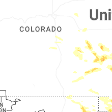

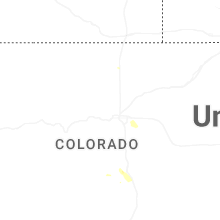
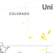


Connect with Interactive Hail Maps