

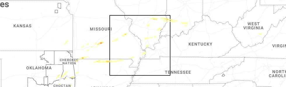
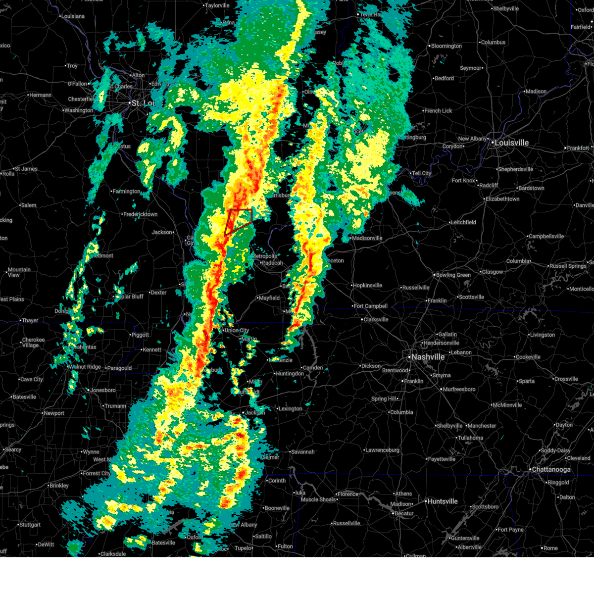
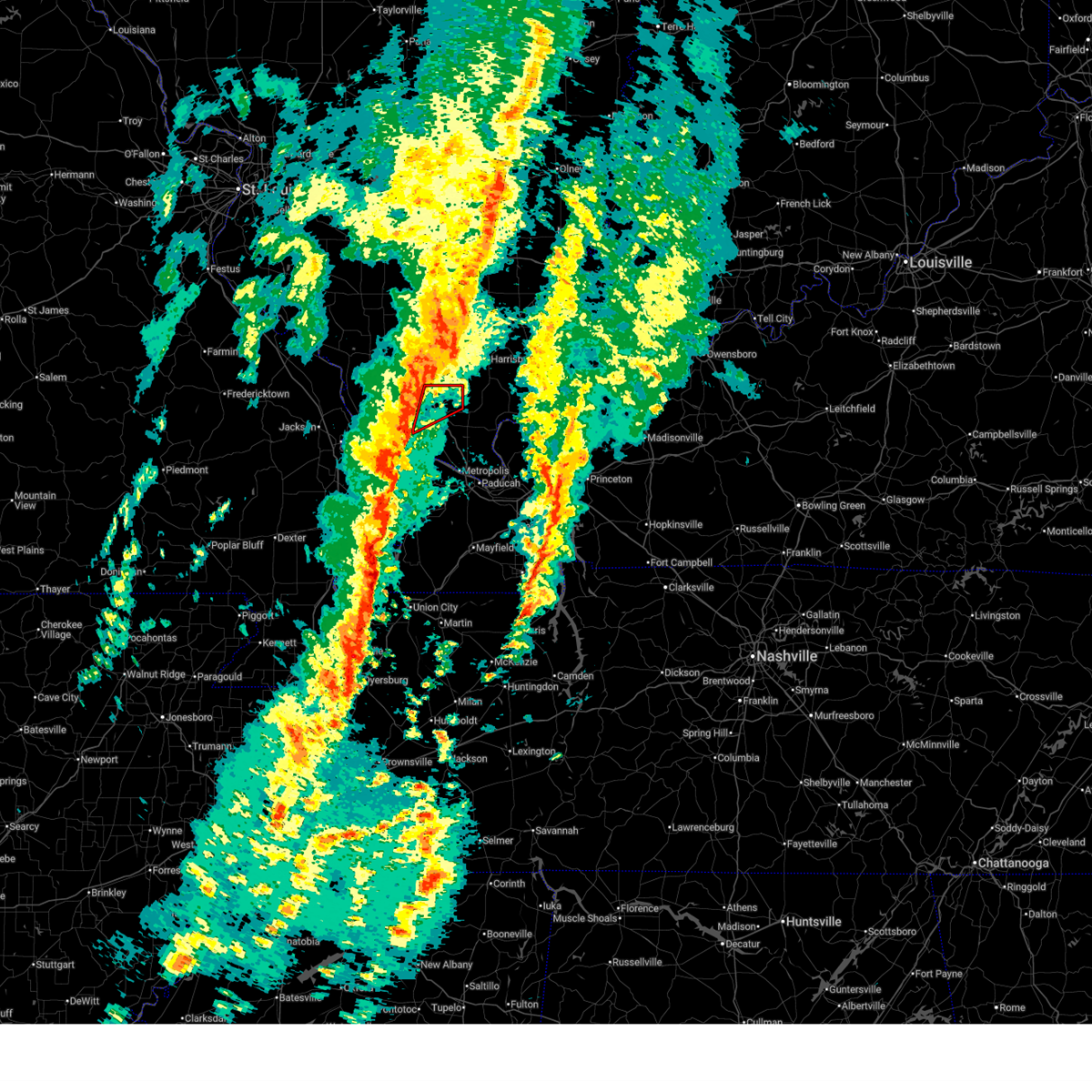
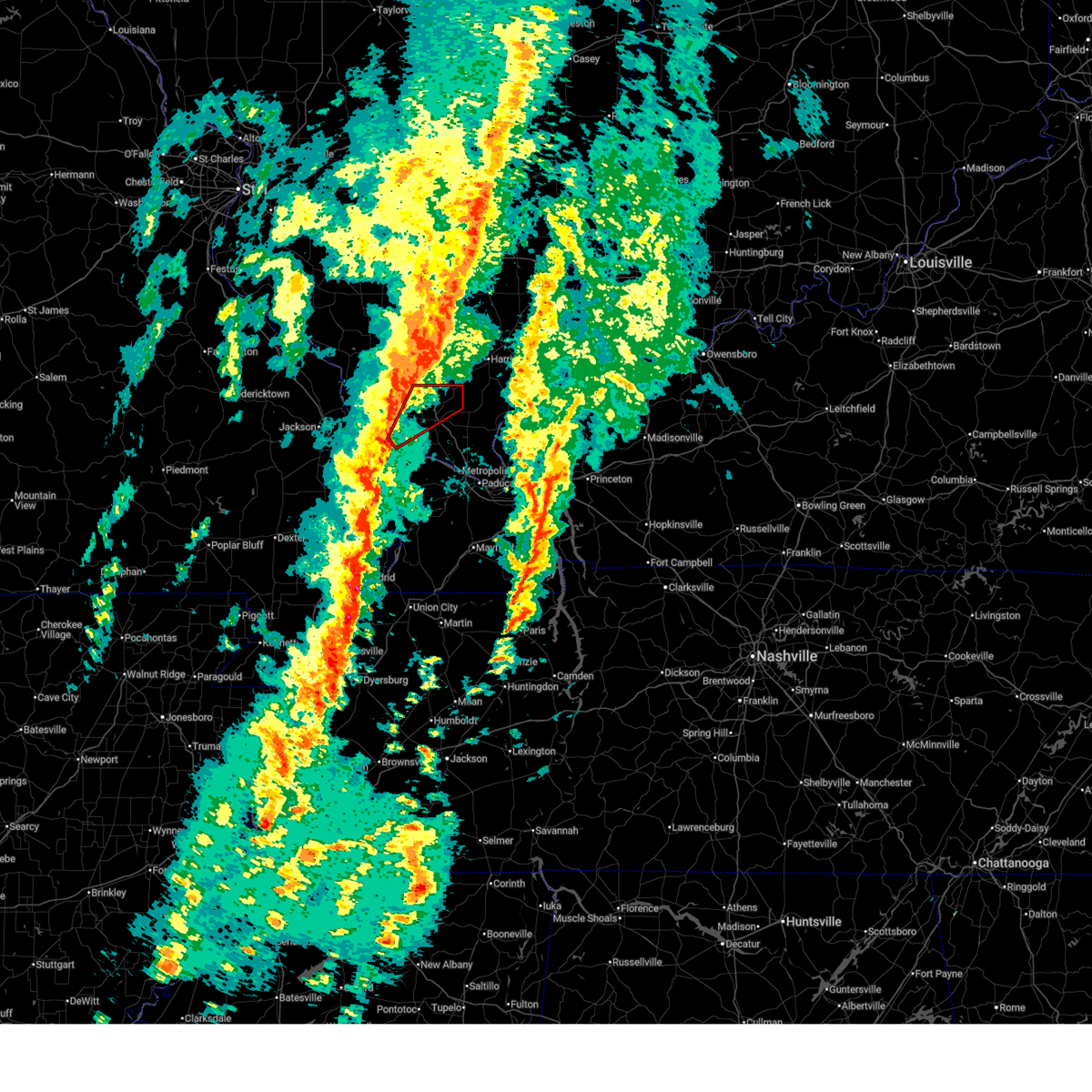
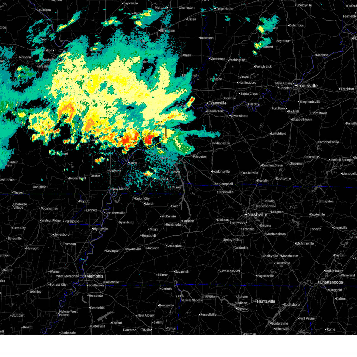
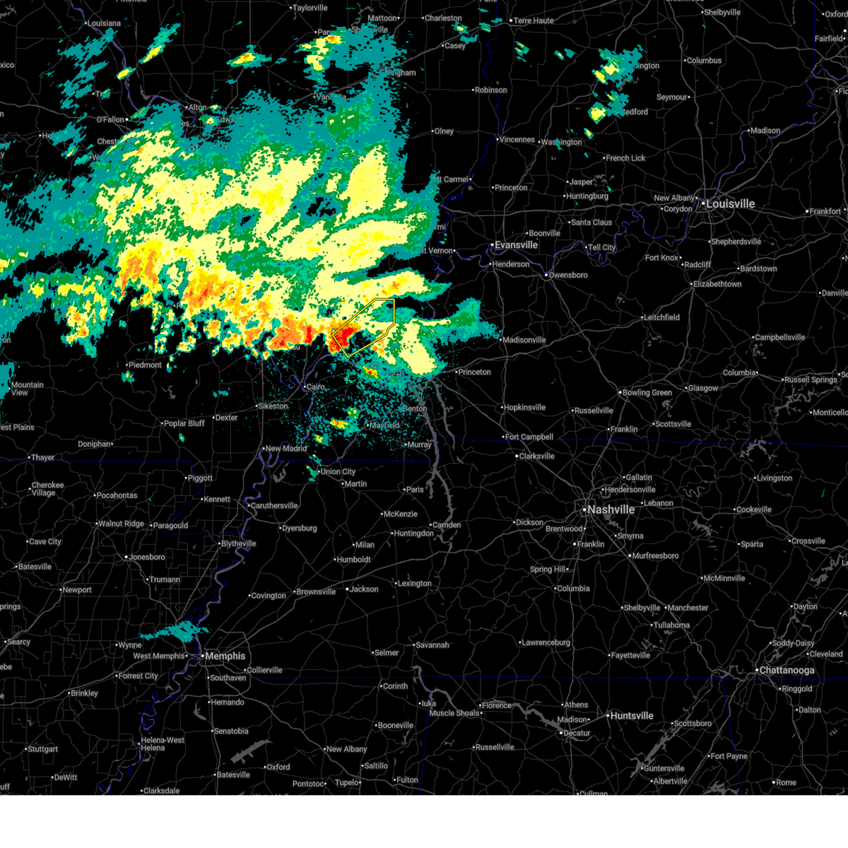
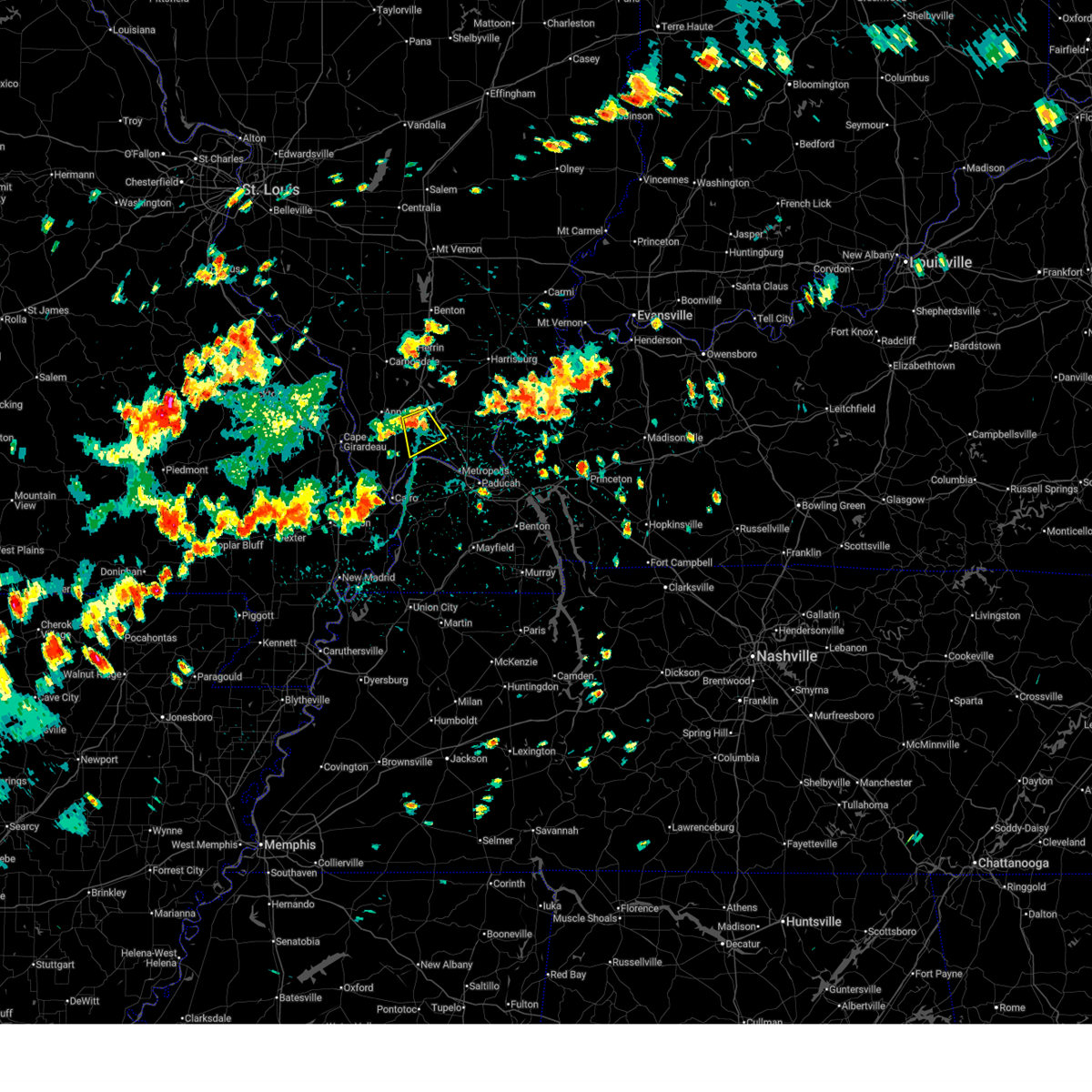
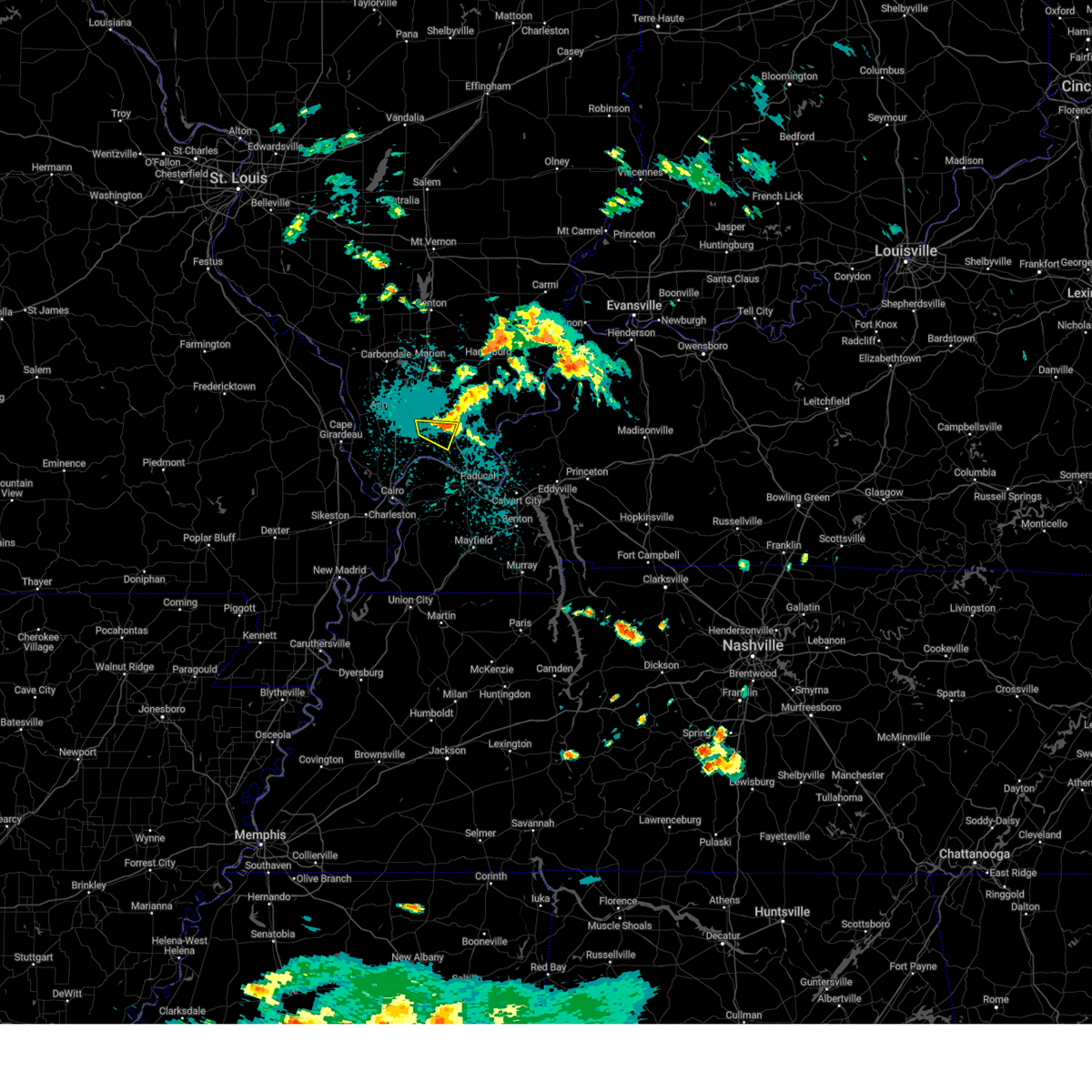
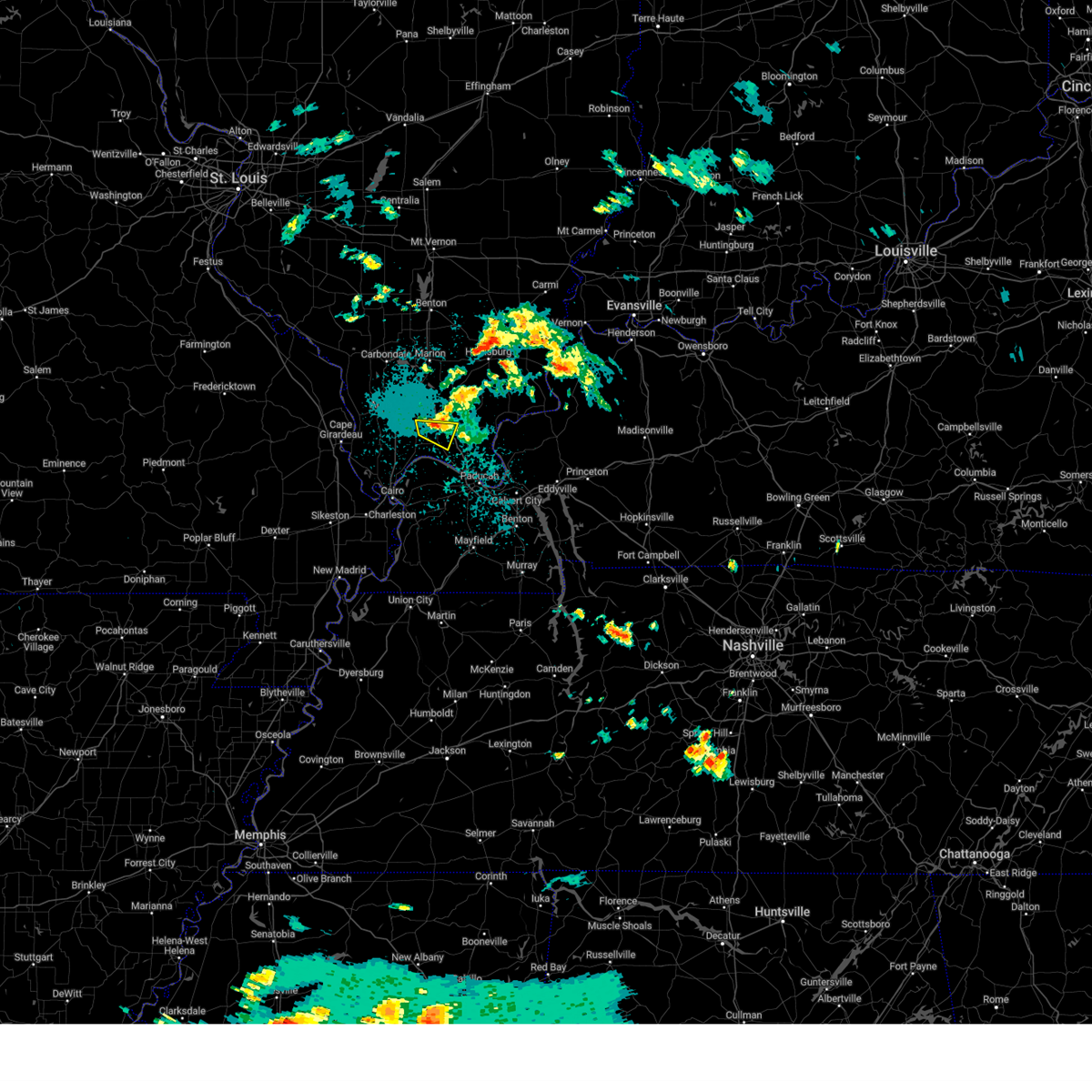
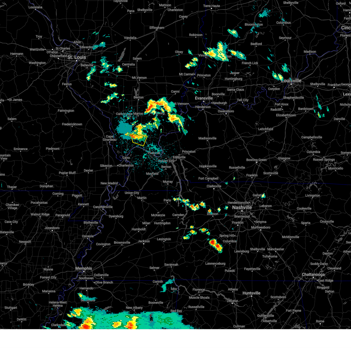
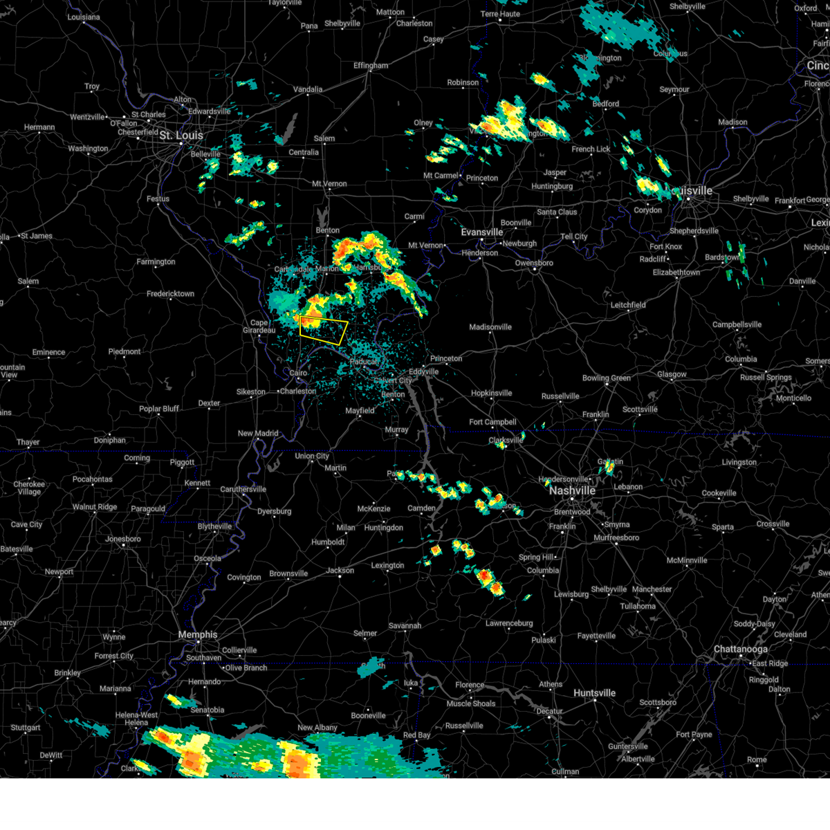
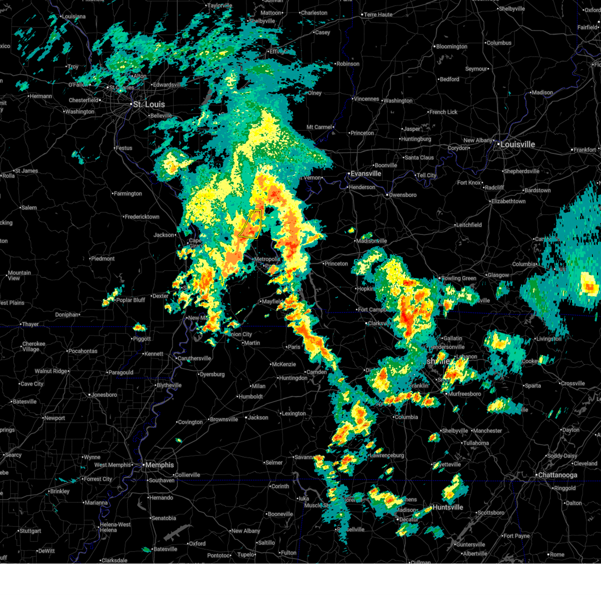
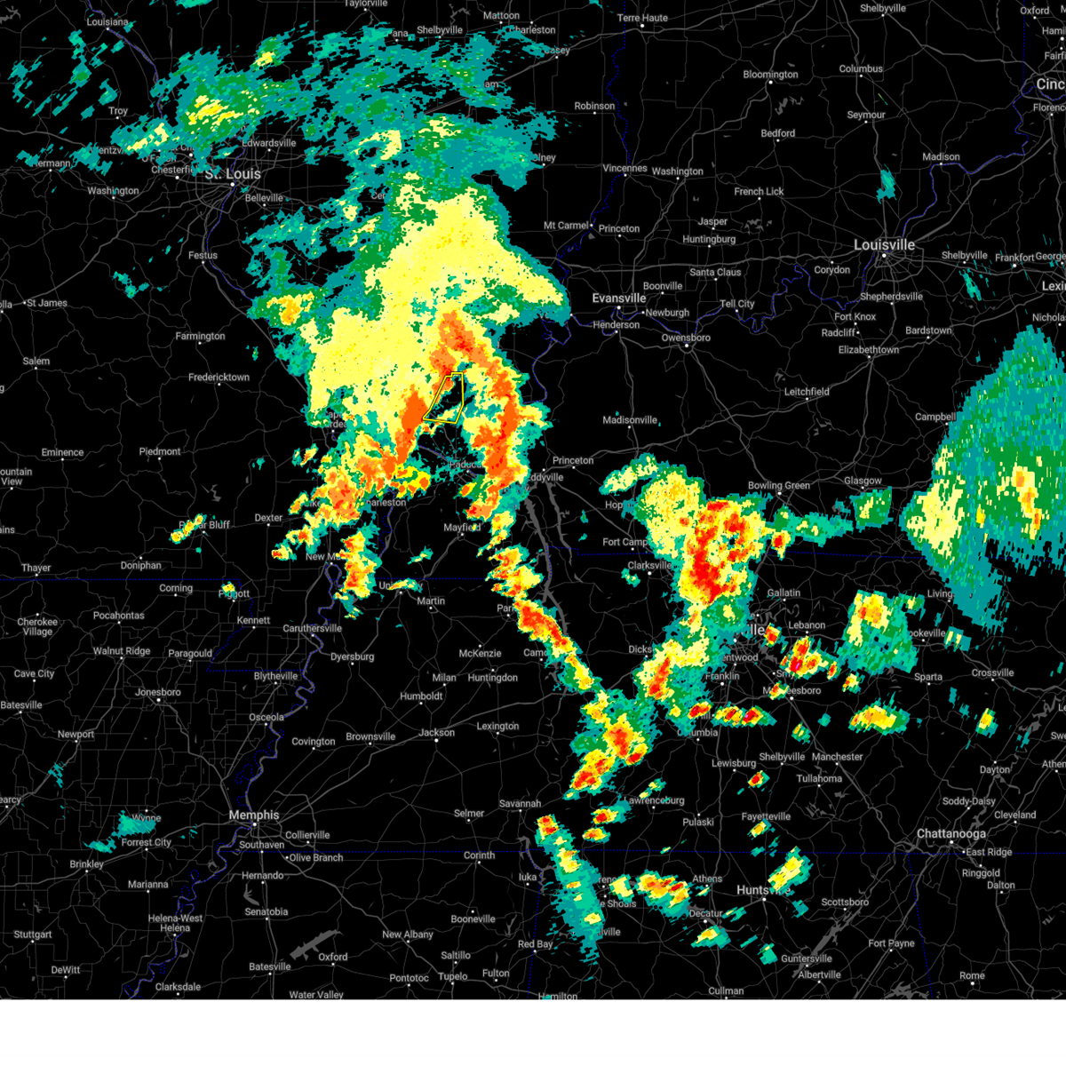
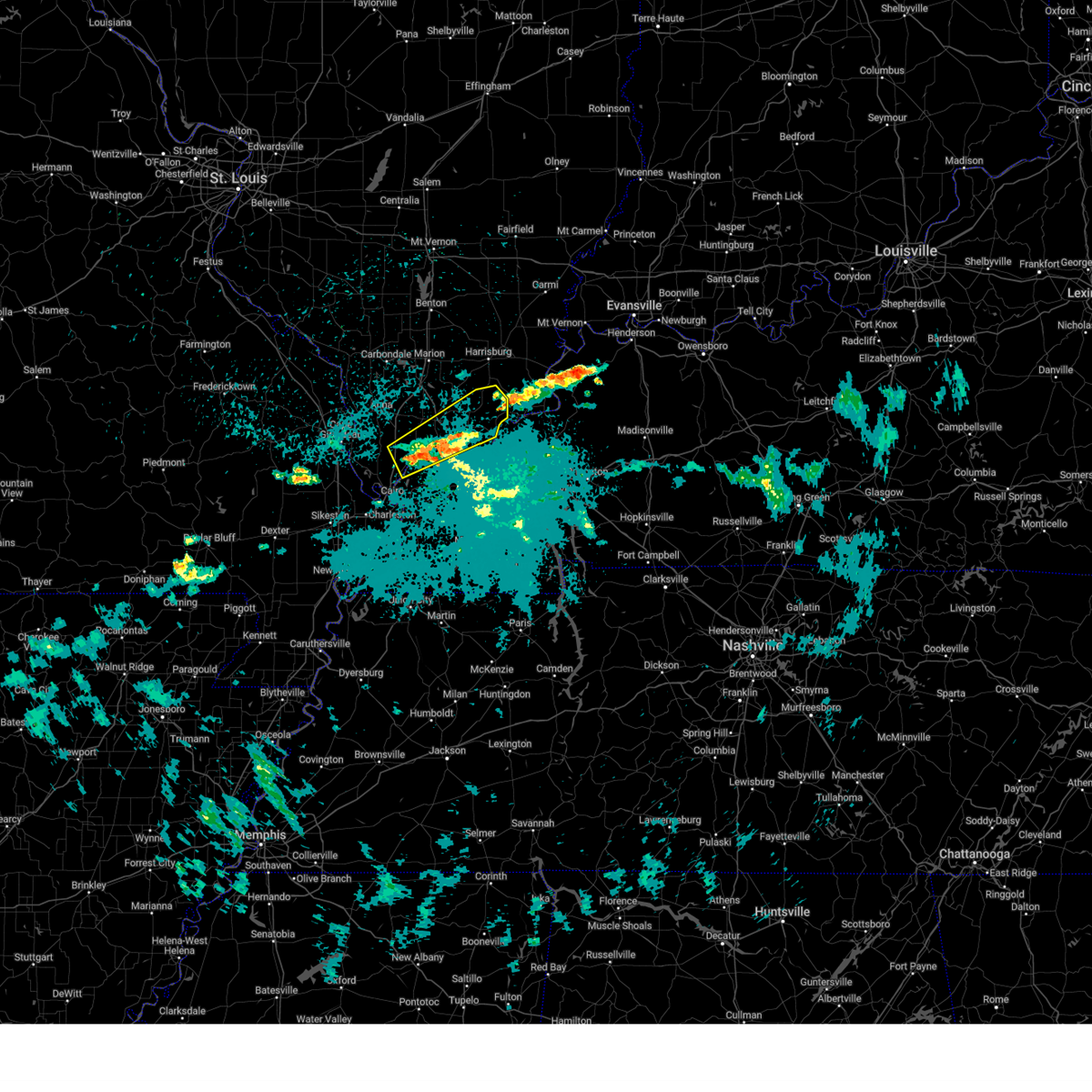
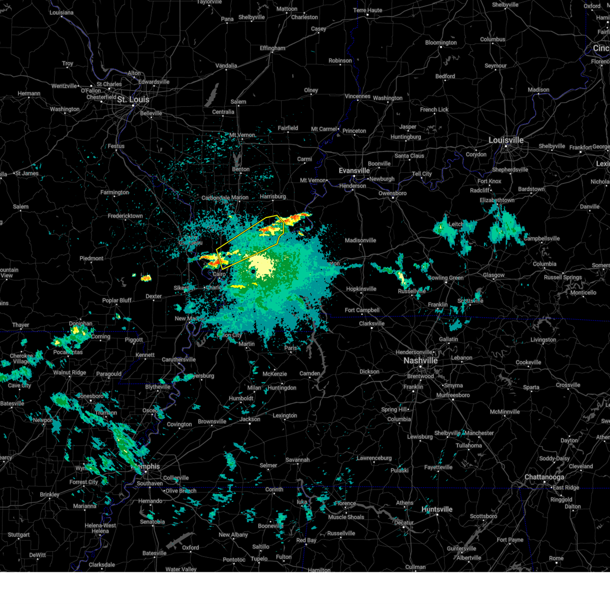
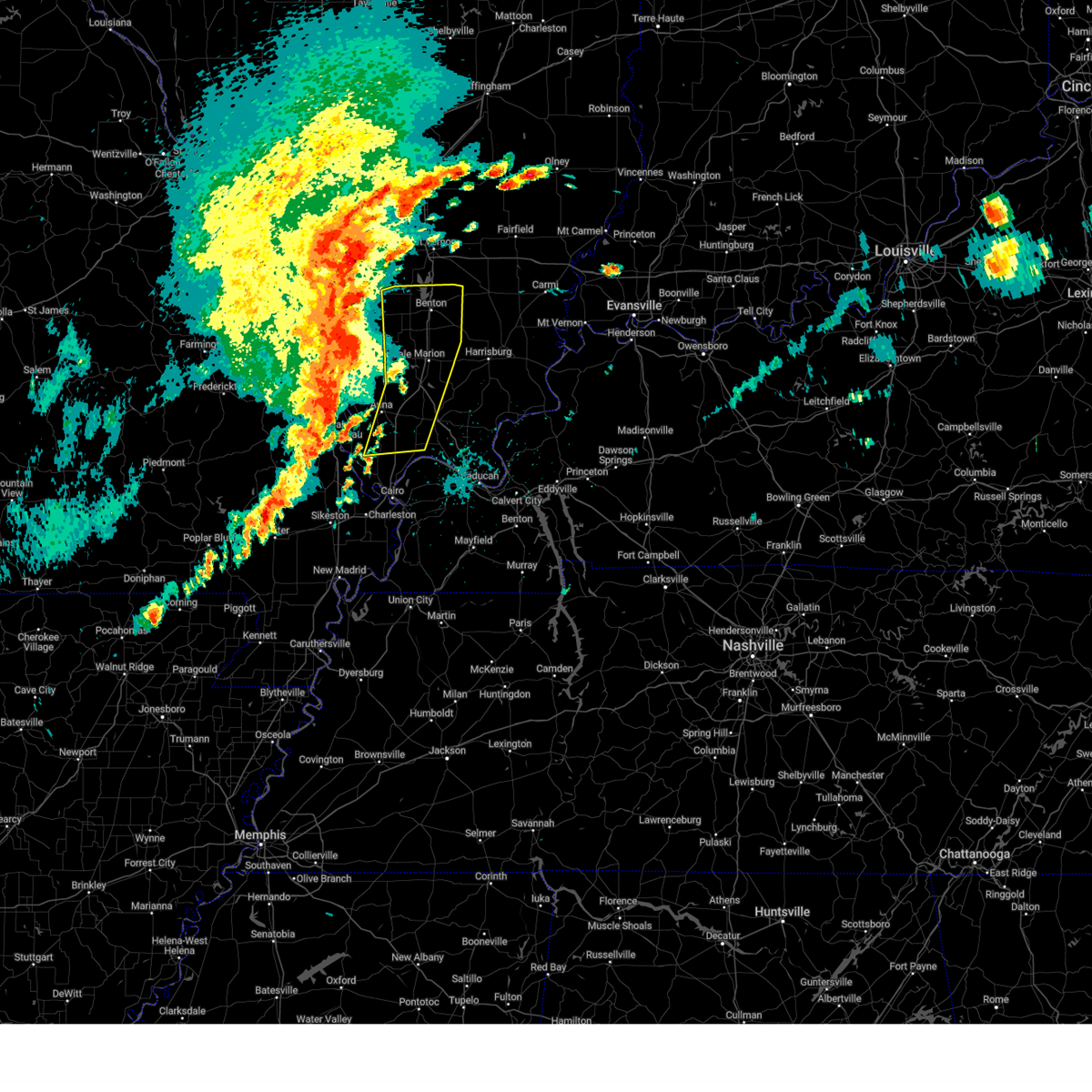
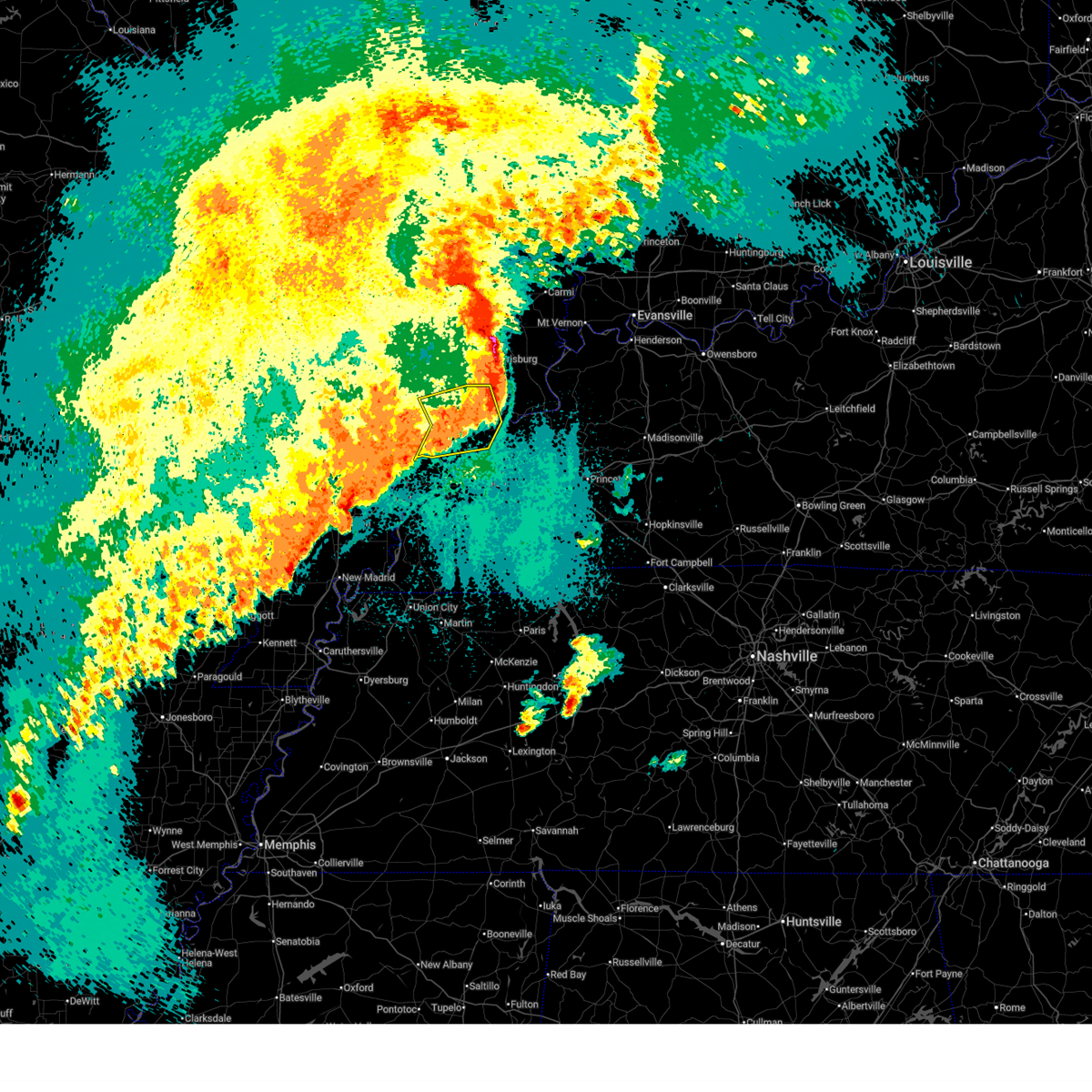
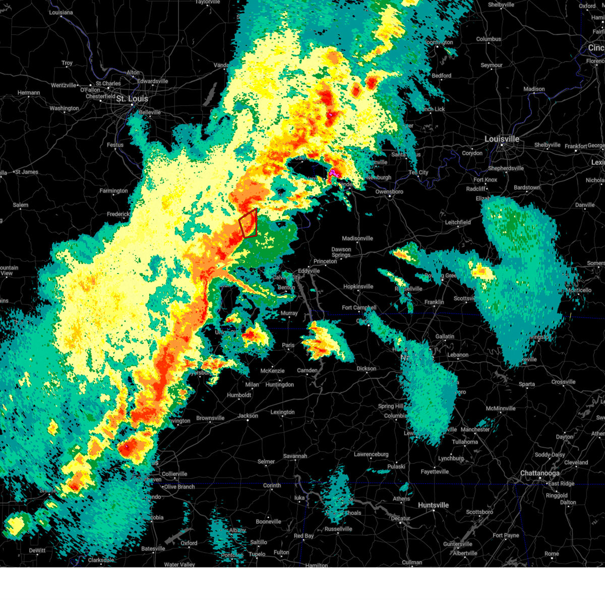
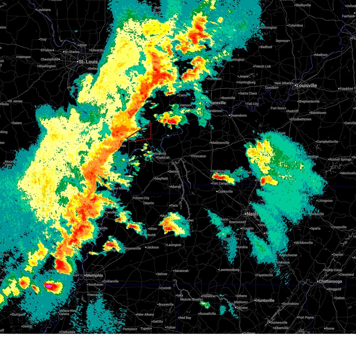
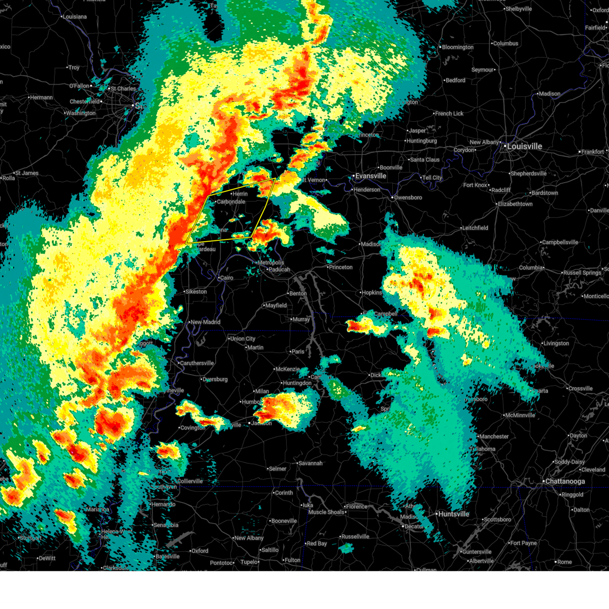
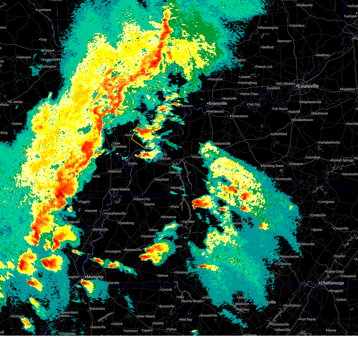
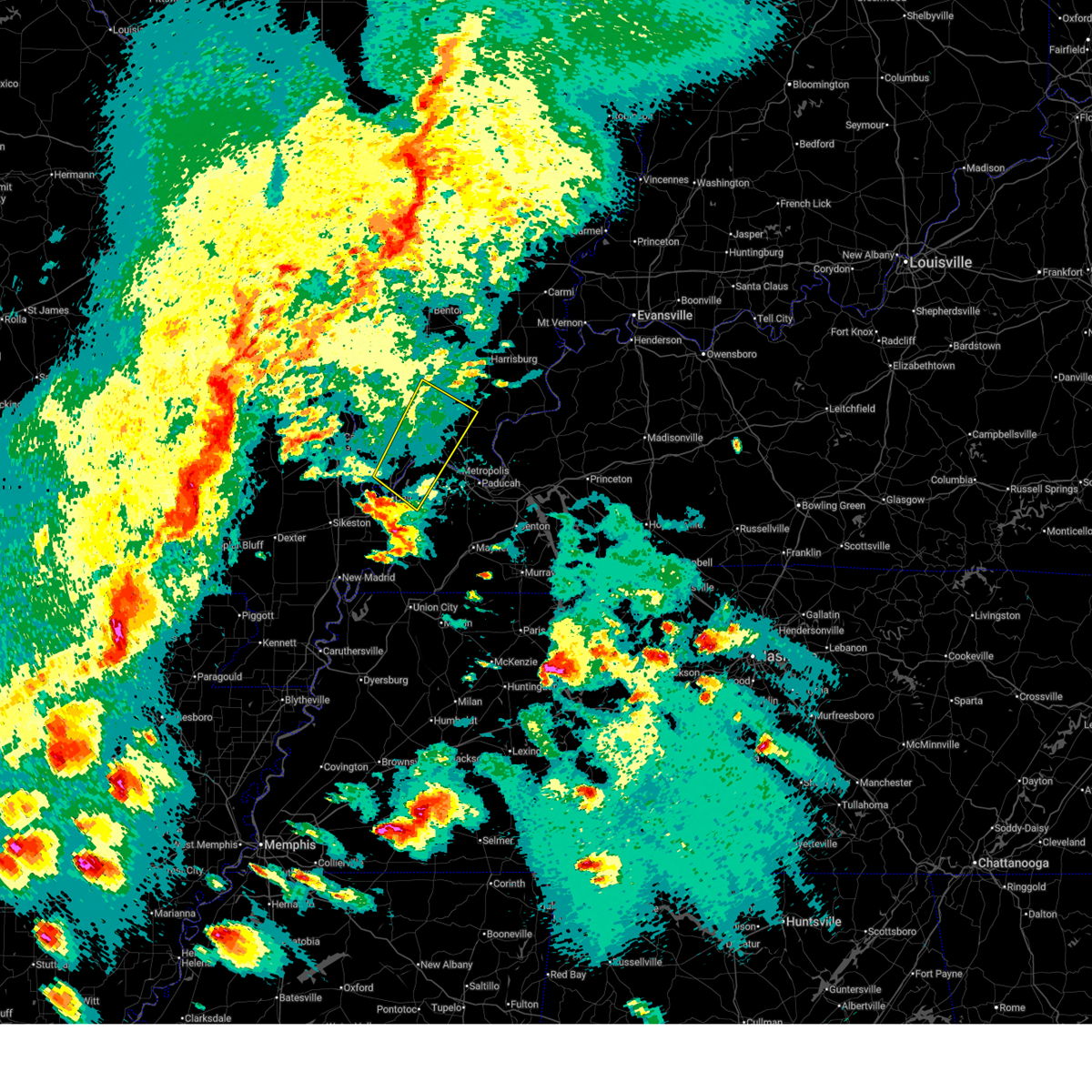
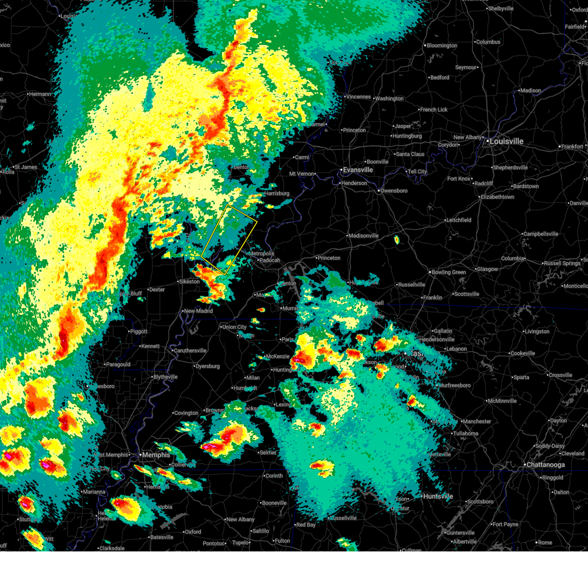
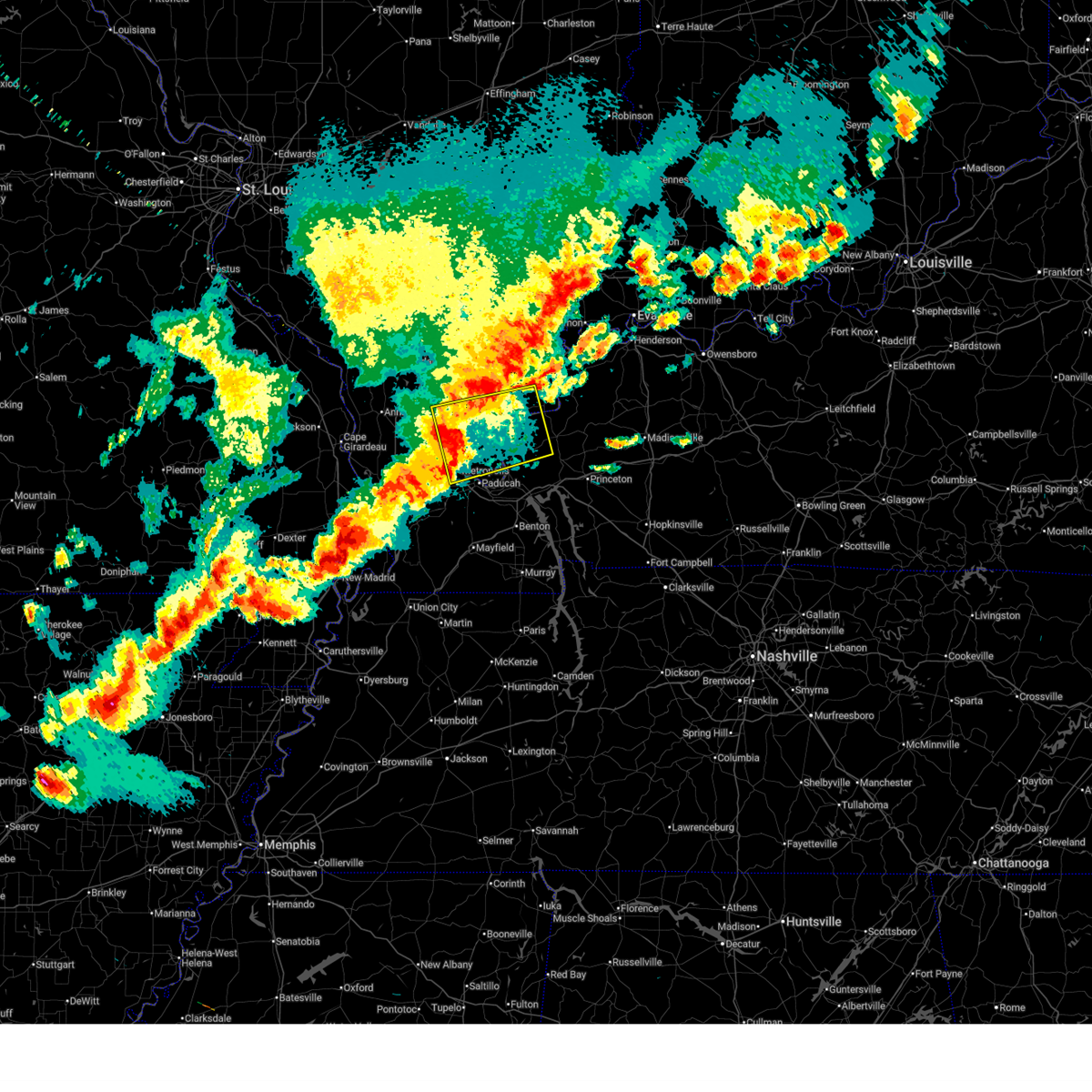
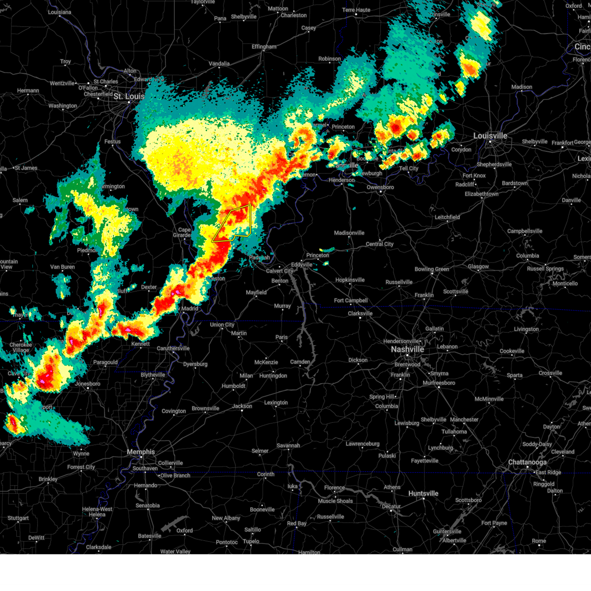
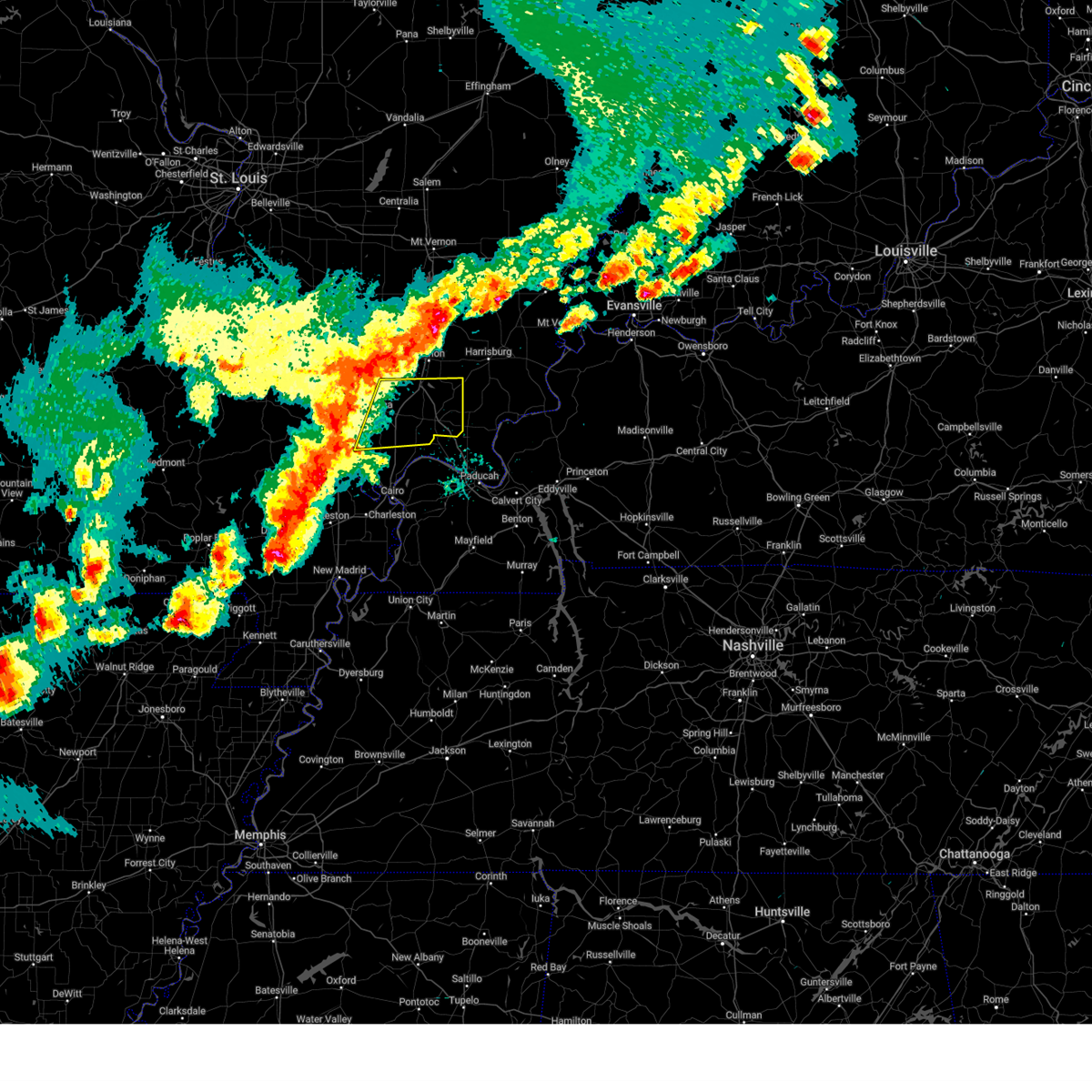
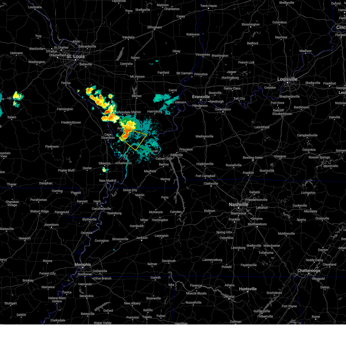
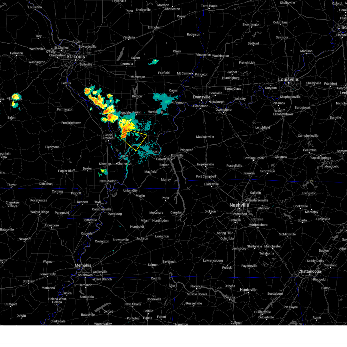
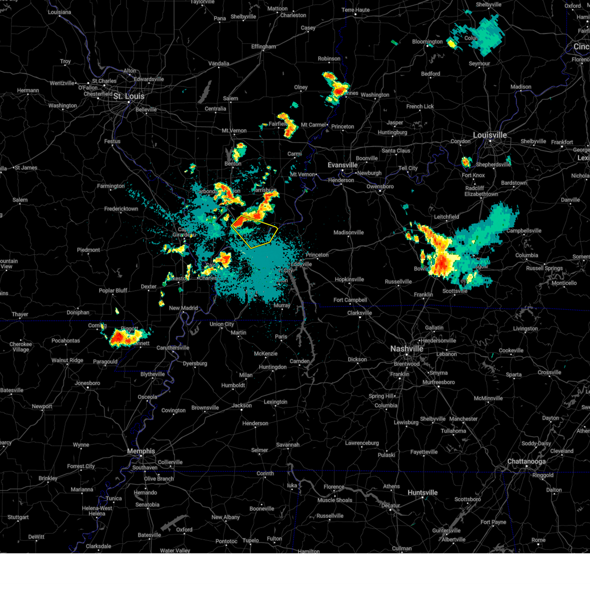
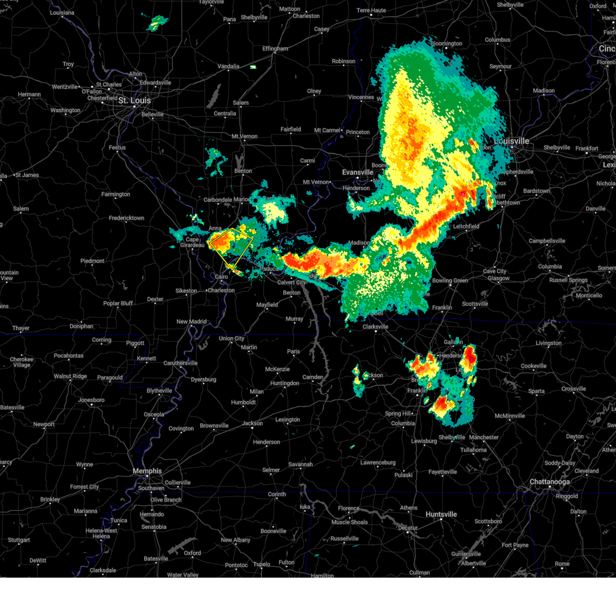
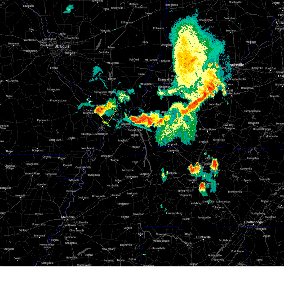
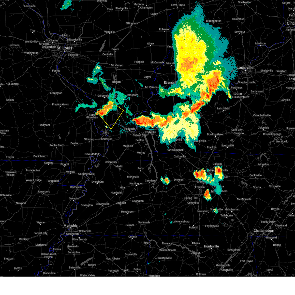
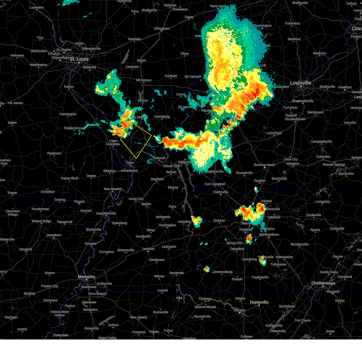
Hail Map for Vienna, IL
The Vienna, IL area has had 7 reports of on-the-ground hail by trained spotters, and has been under severe weather warnings 10 times during the past 12 months. Doppler radar has detected hail at or near Vienna, IL on 83 occasions, including 5 occasions during the past year.
| Name: | Vienna, IL |
| Where Located: | 37 miles ENE of Cape Girardeau, MO |
| Map: | Google Map for Vienna, IL |
| Population: | 1434 |
| Housing Units: | 738 |
| More Info: | Search Google for Vienna, IL |
1
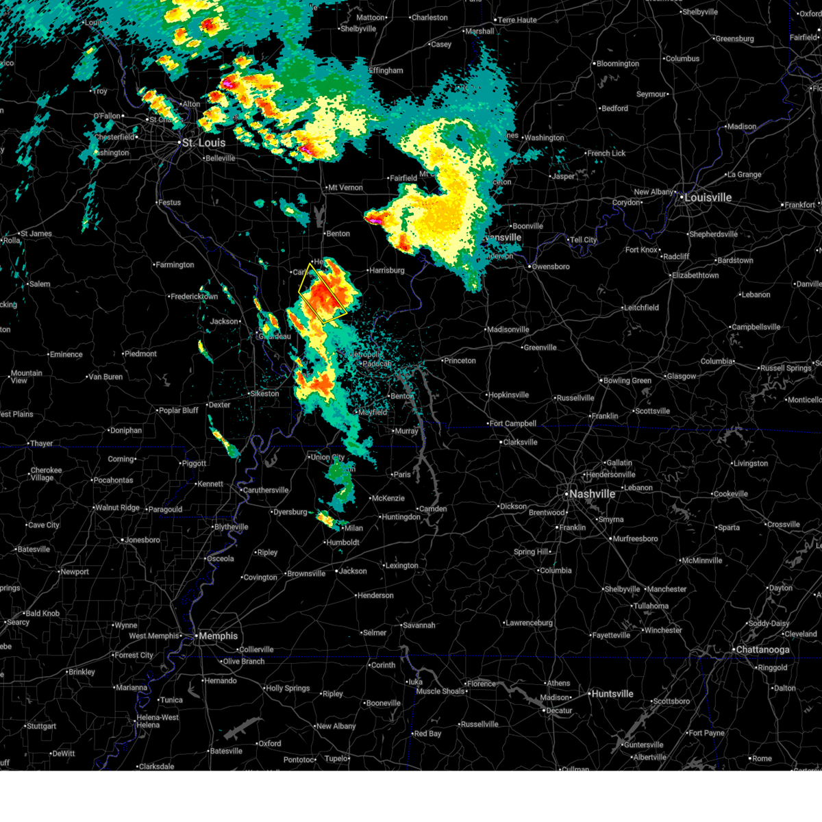
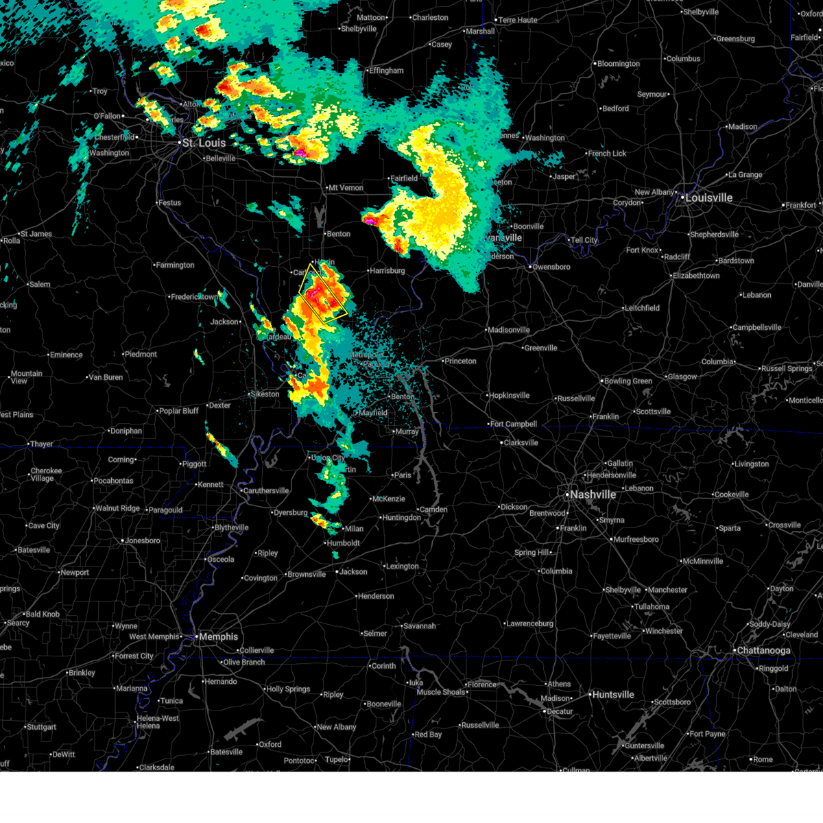
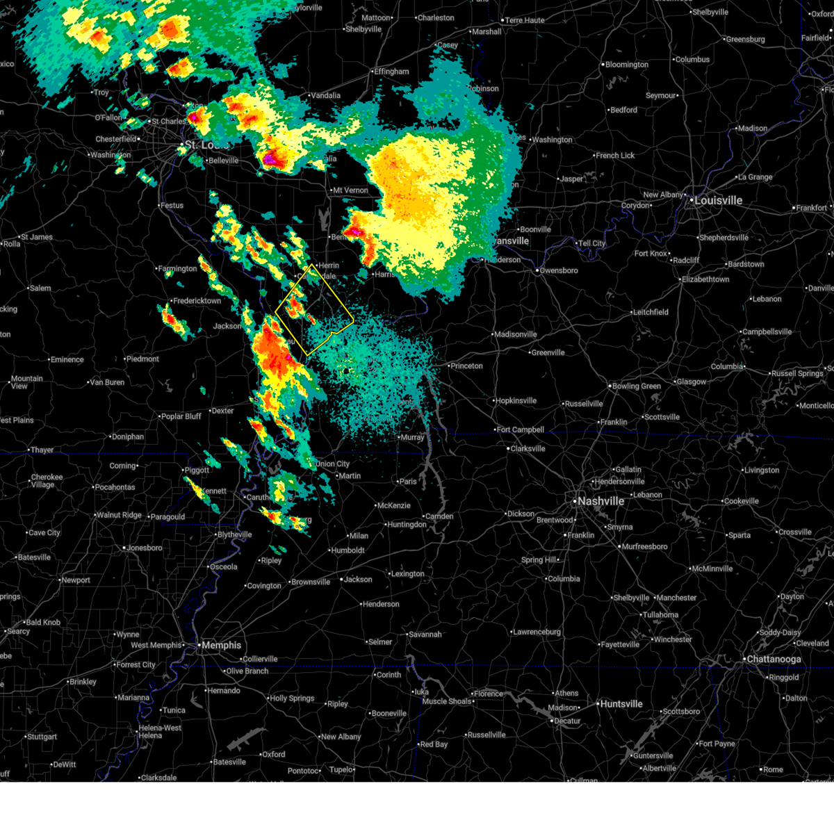
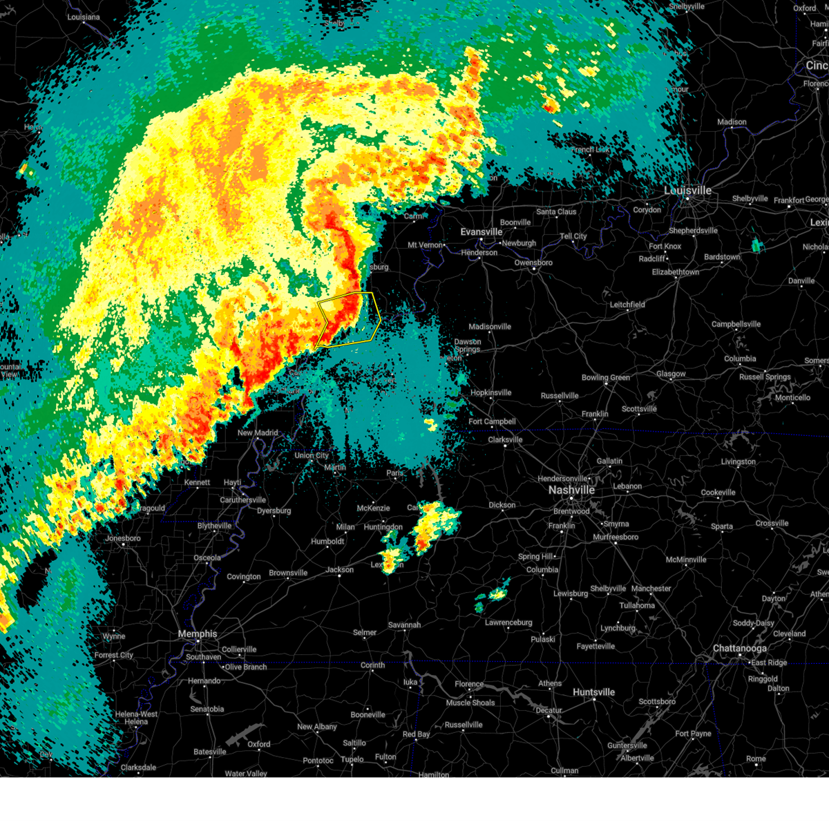
The Top Recent Hail Date for Vienna, IL is Wednesday, March 4, 2026 (29th out of 83)
Hail and Wind Damage Spotted near Vienna, IL
| Date / Time | Report Details |
|---|---|
| 4/27/2026 7:36 AM CDT |
 The storms which prompted the warning have moved out of the area. therefore, the warning will be allowed to expire. a severe thunderstorm watch remains in effect until 1000 am cdt for southern illinois. The storms which prompted the warning have moved out of the area. therefore, the warning will be allowed to expire. a severe thunderstorm watch remains in effect until 1000 am cdt for southern illinois.
|
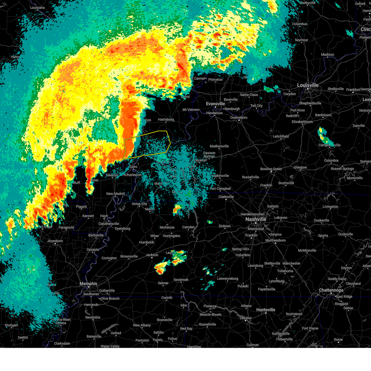
| 4/27/2026 7:22 AM CDT |
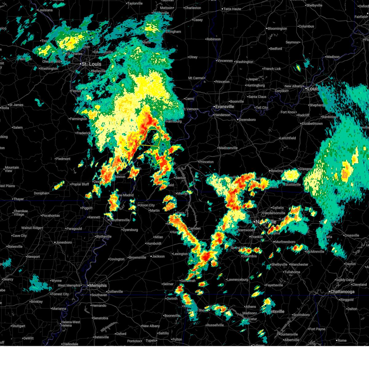
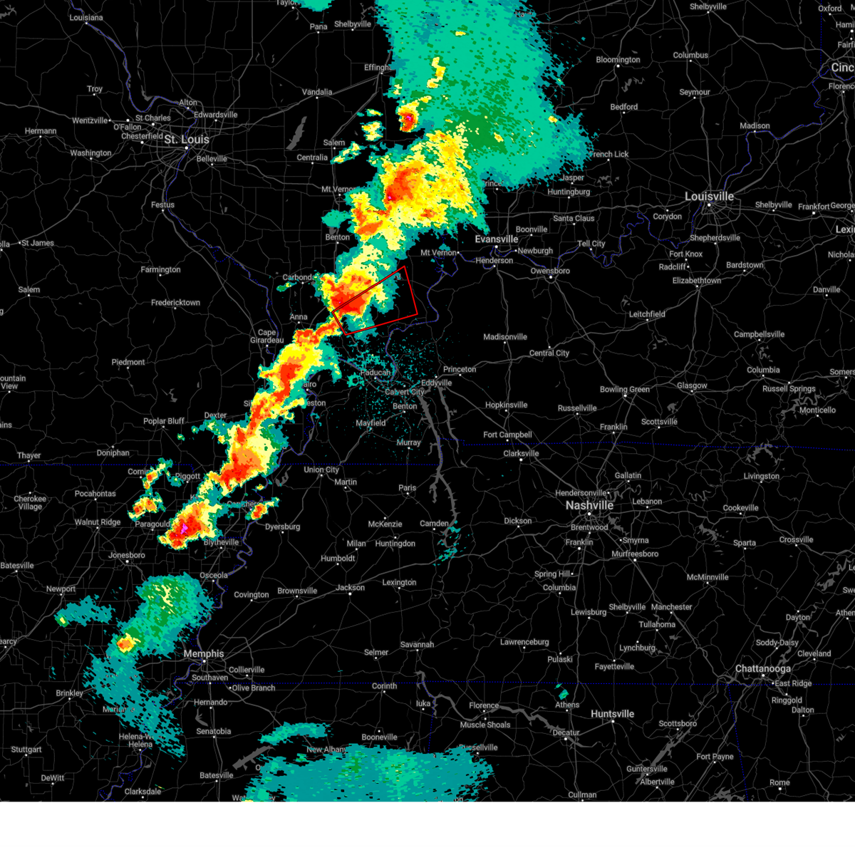
 At 722 am cdt, severe thunderstorms were located along a line extending from 6 miles south of crainville to vienna, moving northeast at 45 mph (radar indicated). Hazards include quarter size hail. Damage to vehicles is expected. locations impacted include, carterville, vienna, crainville, energy, goreville, lake of egypt area, buncombe, and simpson. this includes the following highways, interstate 24 in illinois between mile markers 1 and 17. Interstate 57 in illinois between mile markers 37 and 50. At 722 am cdt, severe thunderstorms were located along a line extending from 6 miles south of crainville to vienna, moving northeast at 45 mph (radar indicated). Hazards include quarter size hail. Damage to vehicles is expected. locations impacted include, carterville, vienna, crainville, energy, goreville, lake of egypt area, buncombe, and simpson. this includes the following highways, interstate 24 in illinois between mile markers 1 and 17. Interstate 57 in illinois between mile markers 37 and 50.
|
| 4/27/2026 6:53 AM CDT |
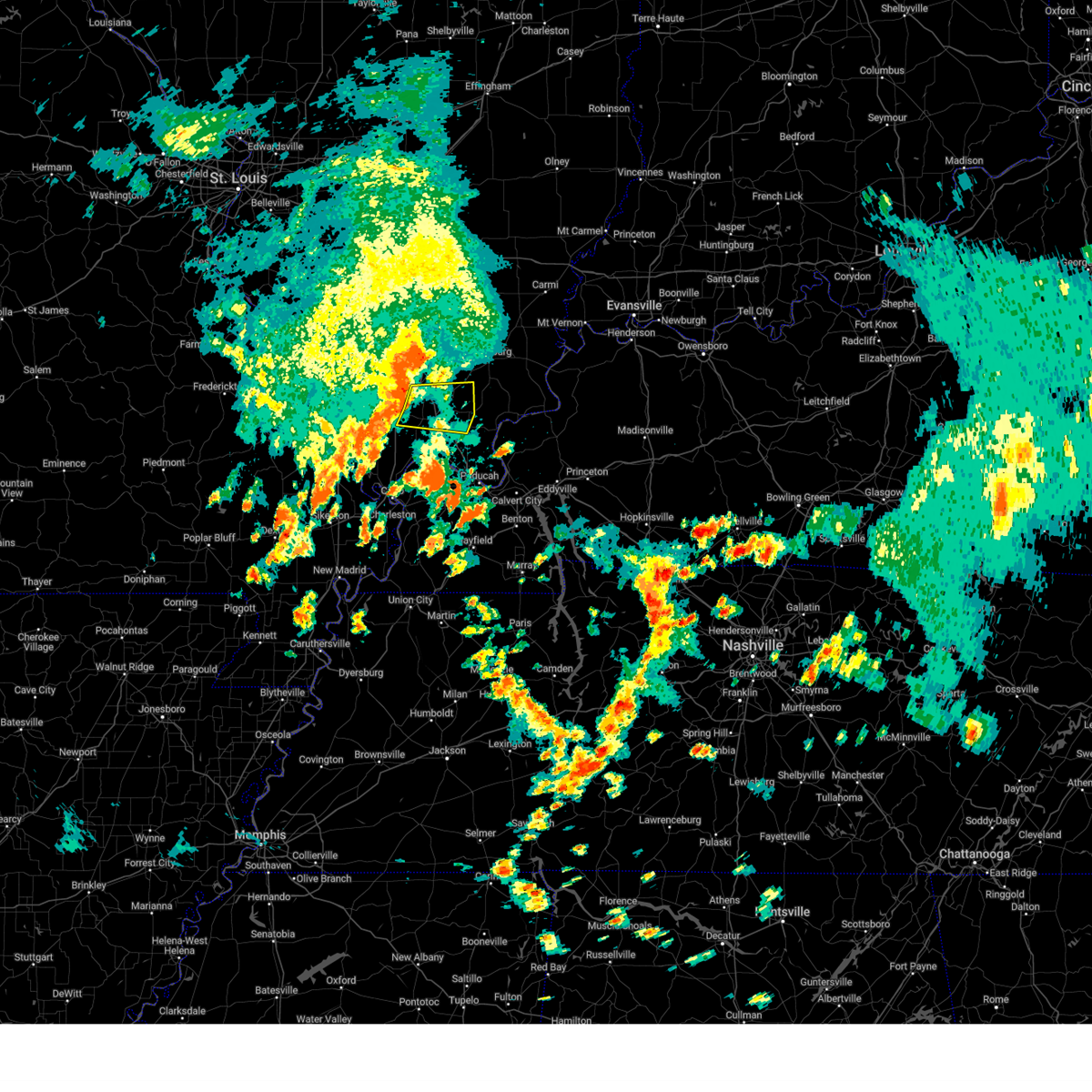
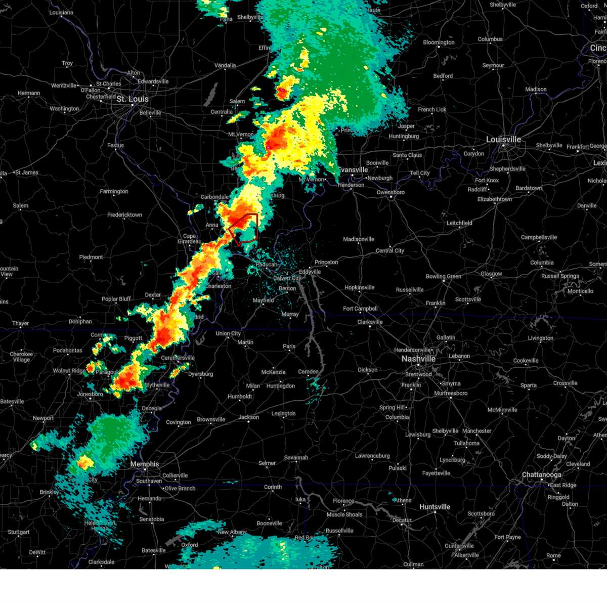
 Svrpah the national weather service in paducah has issued a * severe thunderstorm warning for, union county in southern illinois, northeastern pulaski county in southern illinois, johnson county in southern illinois, southwestern williamson county in southern illinois, southeastern jackson county in southern illinois, northern alexander county in southern illinois, * until 745 am cdt. * at 652 am cdt, severe thunderstorms were located along a line extending from near ware to near mounds, moving northeast at 45 mph (radar indicated). Hazards include quarter size hail. damage to vehicles is expected Svrpah the national weather service in paducah has issued a * severe thunderstorm warning for, union county in southern illinois, northeastern pulaski county in southern illinois, johnson county in southern illinois, southwestern williamson county in southern illinois, southeastern jackson county in southern illinois, northern alexander county in southern illinois, * until 745 am cdt. * at 652 am cdt, severe thunderstorms were located along a line extending from near ware to near mounds, moving northeast at 45 mph (radar indicated). Hazards include quarter size hail. damage to vehicles is expected
|
| 3/15/2026 7:49 PM CDT |
 the tornado warning has been cancelled and is no longer in effect the tornado warning has been cancelled and is no longer in effect
|
| 3/15/2026 7:41 PM CDT |
 the tornado warning has been cancelled and is no longer in effect the tornado warning has been cancelled and is no longer in effect
|
| 3/15/2026 7:41 PM CDT |
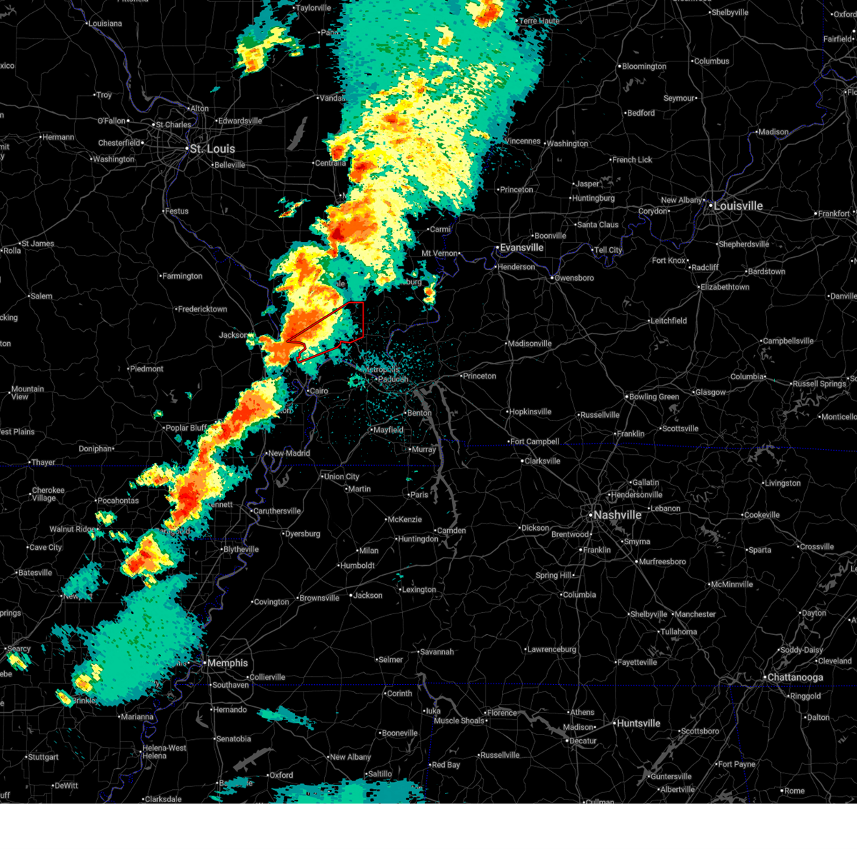
 At 741 pm cdt, a severe thunderstorm capable of producing a tornado was located near vienna, moving northeast at 60 mph (radar indicated rotation). Hazards include tornado. Flying debris will be dangerous to those caught without shelter. mobile homes will be damaged or destroyed. damage to roofs, windows, and vehicles will occur. tree damage is likely. this dangerous storm will be near, vienna and goreville around 745 pm cdt. lake of egypt area around 750 pm cdt. other locations impacted by this tornadic thunderstorm include new burnside, buncombe, cypress, and simpson. This includes interstate 24 in illinois between mile markers 4 and 15. At 741 pm cdt, a severe thunderstorm capable of producing a tornado was located near vienna, moving northeast at 60 mph (radar indicated rotation). Hazards include tornado. Flying debris will be dangerous to those caught without shelter. mobile homes will be damaged or destroyed. damage to roofs, windows, and vehicles will occur. tree damage is likely. this dangerous storm will be near, vienna and goreville around 745 pm cdt. lake of egypt area around 750 pm cdt. other locations impacted by this tornadic thunderstorm include new burnside, buncombe, cypress, and simpson. This includes interstate 24 in illinois between mile markers 4 and 15.
|
| 3/15/2026 7:34 PM CDT |
 Torpah the national weather service in paducah has issued a * tornado warning for, southeastern union county in southern illinois, north central pulaski county in southern illinois, johnson county in southern illinois, * until 800 pm cdt. * at 734 pm cdt, a severe thunderstorm capable of producing a tornado was located near dongola, or 11 miles southeast of anna, moving northeast at 60 mph (radar indicated rotation). Hazards include tornado. Flying debris will be dangerous to those caught without shelter. mobile homes will be damaged or destroyed. damage to roofs, windows, and vehicles will occur. tree damage is likely. this dangerous storm will be near, vienna around 740 pm cdt. goreville and lake of egypt area around 745 pm cdt. other locations impacted by this tornadic thunderstorm include new burnside, buncombe, cypress, and simpson. this includes the following highways, interstate 24 in illinois between mile markers 2 and 16. Interstate 57 in illinois between mile markers 18 and 27, and between mile markers 36 and 43. Torpah the national weather service in paducah has issued a * tornado warning for, southeastern union county in southern illinois, north central pulaski county in southern illinois, johnson county in southern illinois, * until 800 pm cdt. * at 734 pm cdt, a severe thunderstorm capable of producing a tornado was located near dongola, or 11 miles southeast of anna, moving northeast at 60 mph (radar indicated rotation). Hazards include tornado. Flying debris will be dangerous to those caught without shelter. mobile homes will be damaged or destroyed. damage to roofs, windows, and vehicles will occur. tree damage is likely. this dangerous storm will be near, vienna around 740 pm cdt. goreville and lake of egypt area around 745 pm cdt. other locations impacted by this tornadic thunderstorm include new burnside, buncombe, cypress, and simpson. this includes the following highways, interstate 24 in illinois between mile markers 2 and 16. Interstate 57 in illinois between mile markers 18 and 27, and between mile markers 36 and 43.
|
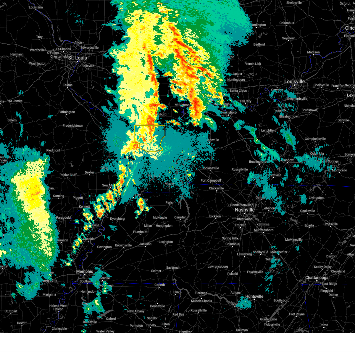
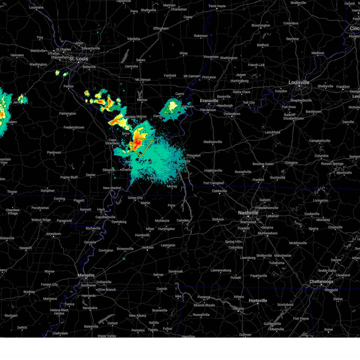
| 3/4/2026 10:38 PM CST |
 At 1038 pm cst, a severe thunderstorm was located over dixon springs, or 12 miles east of vienna, moving northeast at 35 mph (radar indicated). Hazards include 60 mph wind gusts and quarter size hail. Hail damage to vehicles is expected. expect wind damage to roofs, siding, and trees. locations impacted include, golconda, new columbia, dixon springs, eddyville, and simpson. This includes interstate 24 in illinois between mile markers 17 and 30. At 1038 pm cst, a severe thunderstorm was located over dixon springs, or 12 miles east of vienna, moving northeast at 35 mph (radar indicated). Hazards include 60 mph wind gusts and quarter size hail. Hail damage to vehicles is expected. expect wind damage to roofs, siding, and trees. locations impacted include, golconda, new columbia, dixon springs, eddyville, and simpson. This includes interstate 24 in illinois between mile markers 17 and 30.
|
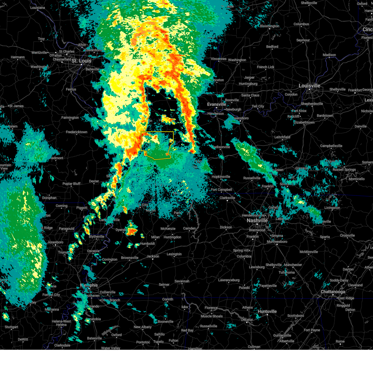
| 3/4/2026 10:22 PM CST |
 Svrpah the national weather service in paducah has issued a * severe thunderstorm warning for, northwestern massac county in southern illinois, pope county in southern illinois, southeastern johnson county in southern illinois, * until 1115 pm cst. * at 1022 pm cst, a severe thunderstorm was located over new columbia, or 7 miles southeast of vienna, moving northeast at 35 mph (radar indicated). Hazards include 60 mph wind gusts and quarter size hail. Hail damage to vehicles is expected. Expect wind damage to roofs, siding, and trees. Svrpah the national weather service in paducah has issued a * severe thunderstorm warning for, northwestern massac county in southern illinois, pope county in southern illinois, southeastern johnson county in southern illinois, * until 1115 pm cst. * at 1022 pm cst, a severe thunderstorm was located over new columbia, or 7 miles southeast of vienna, moving northeast at 35 mph (radar indicated). Hazards include 60 mph wind gusts and quarter size hail. Hail damage to vehicles is expected. Expect wind damage to roofs, siding, and trees.
|
| 8/19/2025 3:14 PM CDT |
 Svrpah the national weather service in paducah has issued a * severe thunderstorm warning for, southeastern union county in southern illinois, northeastern pulaski county in southern illinois, northwestern massac county in southern illinois, southwestern johnson county in southern illinois, * until 400 pm cdt. * at 314 pm cdt, a severe thunderstorm was located near karnak, or near vienna, moving southeast at 10 mph (radar indicated). Hazards include 60 mph wind gusts. expect damage to roofs, siding, and trees Svrpah the national weather service in paducah has issued a * severe thunderstorm warning for, southeastern union county in southern illinois, northeastern pulaski county in southern illinois, northwestern massac county in southern illinois, southwestern johnson county in southern illinois, * until 400 pm cdt. * at 314 pm cdt, a severe thunderstorm was located near karnak, or near vienna, moving southeast at 10 mph (radar indicated). Hazards include 60 mph wind gusts. expect damage to roofs, siding, and trees
|
| 6/8/2025 12:00 AM CDT |
 the severe thunderstorm warning has been cancelled and is no longer in effect the severe thunderstorm warning has been cancelled and is no longer in effect
|
| 6/7/2025 11:48 PM CDT |
 At 1148 pm cdt, a severe thunderstorm was located near vienna, moving east at 35 mph (radar indicated). Hazards include 60 mph wind gusts. Expect damage to roofs, siding, and trees. locations impacted include, vienna and belknap. This includes interstate 24 in illinois between mile markers 17 and 23. At 1148 pm cdt, a severe thunderstorm was located near vienna, moving east at 35 mph (radar indicated). Hazards include 60 mph wind gusts. Expect damage to roofs, siding, and trees. locations impacted include, vienna and belknap. This includes interstate 24 in illinois between mile markers 17 and 23.
|
| 6/7/2025 11:48 PM CDT |
 the severe thunderstorm warning has been cancelled and is no longer in effect the severe thunderstorm warning has been cancelled and is no longer in effect
|
| 6/7/2025 11:34 PM CDT |
 At 1134 pm cdt, a severe thunderstorm was located near karnak, or 8 miles southwest of vienna, moving east at 30 mph (radar indicated). Hazards include 60 mph wind gusts. Expect damage to roofs, siding, and trees. locations impacted include, vienna, karnak, cypress, and belknap. This includes interstate 24 in illinois between mile markers 17 and 23. At 1134 pm cdt, a severe thunderstorm was located near karnak, or 8 miles southwest of vienna, moving east at 30 mph (radar indicated). Hazards include 60 mph wind gusts. Expect damage to roofs, siding, and trees. locations impacted include, vienna, karnak, cypress, and belknap. This includes interstate 24 in illinois between mile markers 17 and 23.
|
| 6/7/2025 11:23 PM CDT |
 Svrpah the national weather service in paducah has issued a * severe thunderstorm warning for, southeastern union county in southern illinois, northeastern pulaski county in southern illinois, northwestern massac county in southern illinois, southern johnson county in southern illinois, * until 1215 am cdt. * at 1123 pm cdt, a severe thunderstorm was located near dongola, or 9 miles southeast of anna, moving east at 25 mph (radar indicated). Hazards include 60 mph wind gusts. expect damage to roofs, siding, and trees Svrpah the national weather service in paducah has issued a * severe thunderstorm warning for, southeastern union county in southern illinois, northeastern pulaski county in southern illinois, northwestern massac county in southern illinois, southern johnson county in southern illinois, * until 1215 am cdt. * at 1123 pm cdt, a severe thunderstorm was located near dongola, or 9 miles southeast of anna, moving east at 25 mph (radar indicated). Hazards include 60 mph wind gusts. expect damage to roofs, siding, and trees
|
| 6/6/2025 2:43 PM CDT |
 The storms which prompted the warning have weakened below severe limits, and no longer pose an immediate threat to life or property. therefore, the warning will be allowed to expire. however, gusty winds are still possible with these thunderstorms. a tornado watch remains in effect until 800 pm cdt for southern illinois. The storms which prompted the warning have weakened below severe limits, and no longer pose an immediate threat to life or property. therefore, the warning will be allowed to expire. however, gusty winds are still possible with these thunderstorms. a tornado watch remains in effect until 800 pm cdt for southern illinois.
|
| 6/6/2025 2:35 PM CDT |
 the severe thunderstorm warning has been cancelled and is no longer in effect the severe thunderstorm warning has been cancelled and is no longer in effect
|
| 6/6/2025 2:35 PM CDT |
 At 235 pm cdt, severe thunderstorms were located along a line extending from 7 miles southeast of creal springs to near dixon springs to near new columbia, moving east at 30 mph (radar indicated). Hazards include 60 mph wind gusts. Expect damage to roofs, siding, and trees. locations impacted include, dixon springs, stonefort, and simpson. This includes interstate 24 in illinois between mile markers 17 and 21. At 235 pm cdt, severe thunderstorms were located along a line extending from 7 miles southeast of creal springs to near dixon springs to near new columbia, moving east at 30 mph (radar indicated). Hazards include 60 mph wind gusts. Expect damage to roofs, siding, and trees. locations impacted include, dixon springs, stonefort, and simpson. This includes interstate 24 in illinois between mile markers 17 and 21.
|
| 6/6/2025 2:17 PM CDT |
 At 217 pm cdt, severe thunderstorms were located along a line extending from lake of egypt area to near vienna to 6 miles north of karnak, moving east at 30 mph (radar indicated). Hazards include 60 mph wind gusts and quarter size hail. Hail damage to vehicles is expected. expect wind damage to roofs, siding, and trees. locations impacted include, vienna, dixon springs, lake of egypt area, stonefort, new burnside, buncombe, and simpson. This includes interstate 24 in illinois between mile markers 6 and 21. At 217 pm cdt, severe thunderstorms were located along a line extending from lake of egypt area to near vienna to 6 miles north of karnak, moving east at 30 mph (radar indicated). Hazards include 60 mph wind gusts and quarter size hail. Hail damage to vehicles is expected. expect wind damage to roofs, siding, and trees. locations impacted include, vienna, dixon springs, lake of egypt area, stonefort, new burnside, buncombe, and simpson. This includes interstate 24 in illinois between mile markers 6 and 21.
|
| 6/6/2025 1:58 PM CDT |
 Svrpah the national weather service in paducah has issued a * severe thunderstorm warning for, east central union county in southern illinois, northwestern pope county in southern illinois, johnson county in southern illinois, southeastern williamson county in southern illinois, southwestern saline county in southern illinois, * until 245 pm cdt. * at 157 pm cdt, severe thunderstorms were located along a line extending from 6 miles northwest of goreville to 9 miles east of anna to near dongola, moving east at 30 mph (radar indicated). Hazards include 60 mph wind gusts and quarter size hail. Hail damage to vehicles is expected. Expect wind damage to roofs, siding, and trees. Svrpah the national weather service in paducah has issued a * severe thunderstorm warning for, east central union county in southern illinois, northwestern pope county in southern illinois, johnson county in southern illinois, southeastern williamson county in southern illinois, southwestern saline county in southern illinois, * until 245 pm cdt. * at 157 pm cdt, severe thunderstorms were located along a line extending from 6 miles northwest of goreville to 9 miles east of anna to near dongola, moving east at 30 mph (radar indicated). Hazards include 60 mph wind gusts and quarter size hail. Hail damage to vehicles is expected. Expect wind damage to roofs, siding, and trees.
|
| 5/20/2025 2:26 AM CDT |
 the severe thunderstorm warning has been cancelled and is no longer in effect the severe thunderstorm warning has been cancelled and is no longer in effect
|
| 5/20/2025 1:54 AM CDT |
 Svrpah the national weather service in paducah has issued a * severe thunderstorm warning for, massac county in southern illinois, pope county in southern illinois, johnson county in southern illinois, * until 245 am cdt. * at 154 am cdt, severe thunderstorms were located along a line extending from near lake of egypt area to 8 miles east of tamms, moving east at 40 mph (radar indicated). Hazards include 60 mph wind gusts. expect damage to roofs, siding, and trees Svrpah the national weather service in paducah has issued a * severe thunderstorm warning for, massac county in southern illinois, pope county in southern illinois, johnson county in southern illinois, * until 245 am cdt. * at 154 am cdt, severe thunderstorms were located along a line extending from near lake of egypt area to 8 miles east of tamms, moving east at 40 mph (radar indicated). Hazards include 60 mph wind gusts. expect damage to roofs, siding, and trees
|
| 5/16/2025 2:11 AM CDT |
 At 211 am cdt, a severe thunderstorm was located near karnak, or 10 miles north of la center, moving northeast at 50 mph (radar indicated). Hazards include 60 mph wind gusts and half dollar size hail. Hail damage to vehicles is expected. expect wind damage to roofs, siding, and trees. locations impacted include, vienna, golconda, karnak, dixon springs, new columbia, ullin, joppa, olmsted, cypress, new grand chain, belknap, eddyville, and simpson. this includes the following highways, interstate 24 in illinois between mile markers 14 and 30. Interstate 57 in illinois between mile markers 13 and 20. At 211 am cdt, a severe thunderstorm was located near karnak, or 10 miles north of la center, moving northeast at 50 mph (radar indicated). Hazards include 60 mph wind gusts and half dollar size hail. Hail damage to vehicles is expected. expect wind damage to roofs, siding, and trees. locations impacted include, vienna, golconda, karnak, dixon springs, new columbia, ullin, joppa, olmsted, cypress, new grand chain, belknap, eddyville, and simpson. this includes the following highways, interstate 24 in illinois between mile markers 14 and 30. Interstate 57 in illinois between mile markers 13 and 20.
|
| 5/16/2025 1:55 AM CDT |
 Svrpah the national weather service in paducah has issued a * severe thunderstorm warning for, southeastern union county in southern illinois, pulaski county in southern illinois, northwestern massac county in southern illinois, pope county in southern illinois, southern johnson county in southern illinois, northwestern ballard county in western kentucky, northwestern mccracken county in western kentucky, * until 245 am cdt. * at 155 am cdt, a severe thunderstorm was located near mounds, or 10 miles north of cairo, moving northeast at 55 mph (radar indicated). Hazards include 60 mph wind gusts and half dollar size hail. Hail damage to vehicles is expected. Expect wind damage to roofs, siding, and trees. Svrpah the national weather service in paducah has issued a * severe thunderstorm warning for, southeastern union county in southern illinois, pulaski county in southern illinois, northwestern massac county in southern illinois, pope county in southern illinois, southern johnson county in southern illinois, northwestern ballard county in western kentucky, northwestern mccracken county in western kentucky, * until 245 am cdt. * at 155 am cdt, a severe thunderstorm was located near mounds, or 10 miles north of cairo, moving northeast at 55 mph (radar indicated). Hazards include 60 mph wind gusts and half dollar size hail. Hail damage to vehicles is expected. Expect wind damage to roofs, siding, and trees.
|
| 4/29/2025 2:03 PM CDT |
 Svrpah the national weather service in paducah has issued a * severe thunderstorm warning for, southeastern perry county in south central illinois, eastern union county in southern illinois, northern pulaski county in southern illinois, western johnson county in southern illinois, williamson county in southern illinois, eastern jackson county in southern illinois, north central alexander county in southern illinois, franklin county in south central illinois, * until 245 pm cdt. * at 202 pm cdt, severe thunderstorms were located along a line extending from du quoin to near carbondale to near scott city, moving east at 40 mph (radar indicated). Hazards include 60 mph wind gusts. expect damage to roofs, siding, and trees Svrpah the national weather service in paducah has issued a * severe thunderstorm warning for, southeastern perry county in south central illinois, eastern union county in southern illinois, northern pulaski county in southern illinois, western johnson county in southern illinois, williamson county in southern illinois, eastern jackson county in southern illinois, north central alexander county in southern illinois, franklin county in south central illinois, * until 245 pm cdt. * at 202 pm cdt, severe thunderstorms were located along a line extending from du quoin to near carbondale to near scott city, moving east at 40 mph (radar indicated). Hazards include 60 mph wind gusts. expect damage to roofs, siding, and trees
|
| 4/4/2025 9:48 PM CDT |
 the severe thunderstorm warning has been cancelled and is no longer in effect the severe thunderstorm warning has been cancelled and is no longer in effect
|
| 4/4/2025 9:30 PM CDT |
 the severe thunderstorm warning has been cancelled and is no longer in effect the severe thunderstorm warning has been cancelled and is no longer in effect
|
| 4/4/2025 9:30 PM CDT |
 At 930 pm cdt, severe thunderstorms were located along a line extending from 7 miles east of creal springs to near dixon springs to 6 miles southeast of karnak, moving east at 45 mph (radar indicated). Hazards include 60 mph wind gusts and penny size hail. Expect damage to roofs, siding, and trees. locations impacted include, golconda, belknap, dixon springs, vienna, new burnside, karnak, eddyville, new columbia, and simpson. This includes interstate 24 in illinois between mile markers 7 and 30. At 930 pm cdt, severe thunderstorms were located along a line extending from 7 miles east of creal springs to near dixon springs to 6 miles southeast of karnak, moving east at 45 mph (radar indicated). Hazards include 60 mph wind gusts and penny size hail. Expect damage to roofs, siding, and trees. locations impacted include, golconda, belknap, dixon springs, vienna, new burnside, karnak, eddyville, new columbia, and simpson. This includes interstate 24 in illinois between mile markers 7 and 30.
|
| 4/4/2025 8:54 PM CDT |
 Svrpah the national weather service in paducah has issued a * severe thunderstorm warning for, southeastern union county in southern illinois, pulaski county in southern illinois, northwestern massac county in southern illinois, pope county in southern illinois, johnson county in southern illinois, north central alexander county in southern illinois, * until 1000 pm cdt. * at 853 pm cdt, severe thunderstorms were located along a line extending from near anna to near dongola to near tamms, moving east at 40 mph (radar indicated). Hazards include 70 mph wind gusts and nickel size hail. Expect considerable tree damage. Damage is likely to mobile homes, roofs, and outbuildings. Svrpah the national weather service in paducah has issued a * severe thunderstorm warning for, southeastern union county in southern illinois, pulaski county in southern illinois, northwestern massac county in southern illinois, pope county in southern illinois, johnson county in southern illinois, north central alexander county in southern illinois, * until 1000 pm cdt. * at 853 pm cdt, severe thunderstorms were located along a line extending from near anna to near dongola to near tamms, moving east at 40 mph (radar indicated). Hazards include 70 mph wind gusts and nickel size hail. Expect considerable tree damage. Damage is likely to mobile homes, roofs, and outbuildings.
|
| 4/2/2025 8:42 PM CDT |
 The storms which prompted the warning have moved out of the area. therefore, the warning will be allowed to expire. however, gusty winds and heavy rain are still possible with these thunderstorms. a tornado watch remains in effect until midnight cdt for southern illinois, western kentucky, and southeastern missouri. The storms which prompted the warning have moved out of the area. therefore, the warning will be allowed to expire. however, gusty winds and heavy rain are still possible with these thunderstorms. a tornado watch remains in effect until midnight cdt for southern illinois, western kentucky, and southeastern missouri.
|
| 4/2/2025 8:16 PM CDT |
 the severe thunderstorm warning has been cancelled and is no longer in effect the severe thunderstorm warning has been cancelled and is no longer in effect
|
| 4/2/2025 8:16 PM CDT |
 At 815 pm cdt, severe thunderstorms were located along a line extending from near carrier mills to 12 miles south of harrisburg to dixon springs to la center to hickman, moving east at 45 mph (radar indicated). Hazards include 70 mph wind gusts and quarter size hail. Hail damage to vehicles is expected. expect considerable tree damage. wind damage is also likely to mobile homes, roofs, and outbuildings. locations impacted include, karbers ridge, barkley regional airport, cayce, mound city, kevil, bardwell, fulgham, joppa, lovelaceville, olmsted, arlington, new columbia, simpson, la center, hickman, dixon springs, blandville, clinton, barlow, and wickliffe. this includes the following highways, interstate 24 in kentucky between mile markers 1 and 3. interstate 24 in illinois between mile markers 16 and 38. Interstate 69 in kentucky between mile markers 1 and 5. At 815 pm cdt, severe thunderstorms were located along a line extending from near carrier mills to 12 miles south of harrisburg to dixon springs to la center to hickman, moving east at 45 mph (radar indicated). Hazards include 70 mph wind gusts and quarter size hail. Hail damage to vehicles is expected. expect considerable tree damage. wind damage is also likely to mobile homes, roofs, and outbuildings. locations impacted include, karbers ridge, barkley regional airport, cayce, mound city, kevil, bardwell, fulgham, joppa, lovelaceville, olmsted, arlington, new columbia, simpson, la center, hickman, dixon springs, blandville, clinton, barlow, and wickliffe. this includes the following highways, interstate 24 in kentucky between mile markers 1 and 3. interstate 24 in illinois between mile markers 16 and 38. Interstate 69 in kentucky between mile markers 1 and 5.
|
| 4/2/2025 8:06 PM CDT |
 The storm which prompted the warning has moved out of the area. therefore, the warning will be allowed to expire. a tornado watch remains in effect until midnight cdt for southern illinois. The storm which prompted the warning has moved out of the area. therefore, the warning will be allowed to expire. a tornado watch remains in effect until midnight cdt for southern illinois.
|
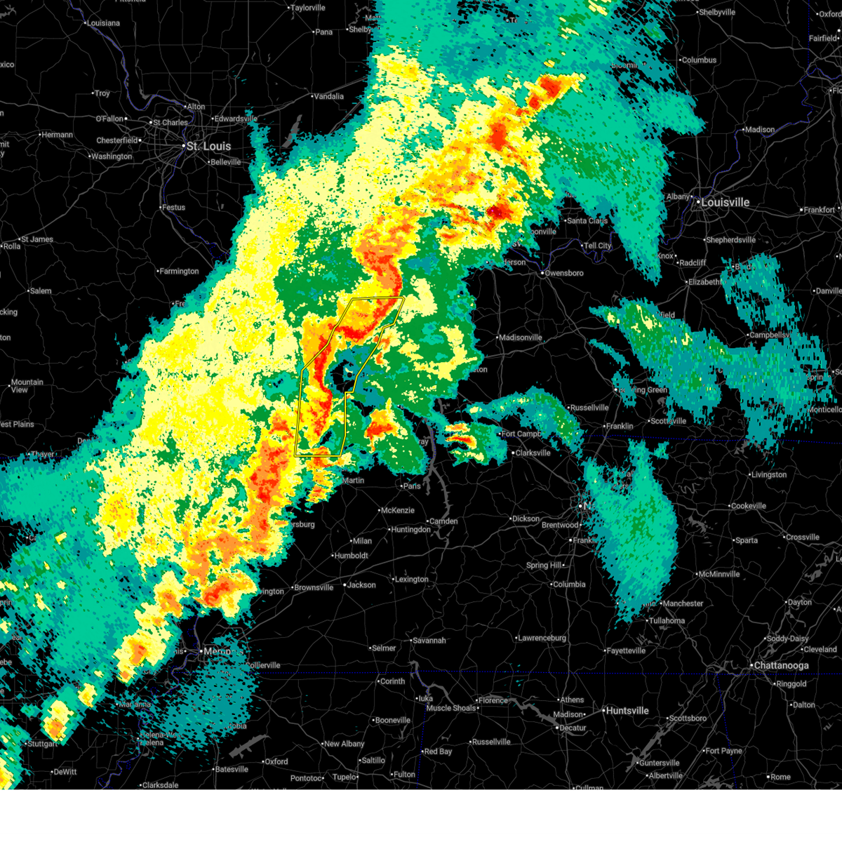
| 4/2/2025 7:54 PM CDT |
 Torpah the national weather service in paducah has issued a * tornado warning for, northwestern hardin county in southern illinois, northern pope county in southern illinois, northeastern johnson county in southern illinois, southeastern williamson county in southern illinois, saline county in southern illinois, gallatin county in southern illinois, * until 845 pm cdt. * at 753 pm cdt, tornado producing storms were located along a line extending from marion to 6 miles southeast of creal springs to near vienna, moving northeast at 45 mph (radar confirmed tornado. this line of storms has a history of producing tornadoes! take shelter immediately!). Hazards include damaging tornado and quarter size hail. Flying debris will be dangerous to those caught without shelter. mobile homes will be damaged or destroyed. damage to roofs, windows, and vehicles will occur. tree damage is likely. these tornadic storms will be near, carrier mills and harrisburg around 800 pm cdt. galatia around 810 pm cdt. eldorado around 815 pm cdt. equality around 820 pm cdt. ridgway around 825 pm cdt. shawneetown around 830 pm cdt. other locations impacted by these tornadic storms include old shawneetown, stonefort, omaha, karbers ridge, muddy, raleigh, new burnside, junction, eddyville, and simpson. This includes interstate 24 in illinois near mile marker 15. Torpah the national weather service in paducah has issued a * tornado warning for, northwestern hardin county in southern illinois, northern pope county in southern illinois, northeastern johnson county in southern illinois, southeastern williamson county in southern illinois, saline county in southern illinois, gallatin county in southern illinois, * until 845 pm cdt. * at 753 pm cdt, tornado producing storms were located along a line extending from marion to 6 miles southeast of creal springs to near vienna, moving northeast at 45 mph (radar confirmed tornado. this line of storms has a history of producing tornadoes! take shelter immediately!). Hazards include damaging tornado and quarter size hail. Flying debris will be dangerous to those caught without shelter. mobile homes will be damaged or destroyed. damage to roofs, windows, and vehicles will occur. tree damage is likely. these tornadic storms will be near, carrier mills and harrisburg around 800 pm cdt. galatia around 810 pm cdt. eldorado around 815 pm cdt. equality around 820 pm cdt. ridgway around 825 pm cdt. shawneetown around 830 pm cdt. other locations impacted by these tornadic storms include old shawneetown, stonefort, omaha, karbers ridge, muddy, raleigh, new burnside, junction, eddyville, and simpson. This includes interstate 24 in illinois near mile marker 15.
|
| 4/2/2025 7:53 PM CDT |
 Svrpah the national weather service in paducah has issued a * severe thunderstorm warning for, central pulaski county in southern illinois, pope county in southern illinois, eastern johnson county in southern illinois, southeastern alexander county in southern illinois, northwestern hardin county in southern illinois, massac county in southern illinois, ballard county in western kentucky, western mccracken county in western kentucky, fulton county in western kentucky, carlisle county in western kentucky, hickman county in western kentucky, mississippi county in southeastern missouri, east central new madrid county in southeastern missouri, * until 845 pm cdt. * at 753 pm cdt, severe thunderstorms were located along a line extending from near lake of egypt area to near vienna to karnak to near cairo to 8 miles north of tiptonville, moving east at 45 mph (radar indicated). Hazards include 70 mph wind gusts and quarter size hail. Hail damage to vehicles is expected. expect considerable tree damage. Wind damage is also likely to mobile homes, roofs, and outbuildings. Svrpah the national weather service in paducah has issued a * severe thunderstorm warning for, central pulaski county in southern illinois, pope county in southern illinois, eastern johnson county in southern illinois, southeastern alexander county in southern illinois, northwestern hardin county in southern illinois, massac county in southern illinois, ballard county in western kentucky, western mccracken county in western kentucky, fulton county in western kentucky, carlisle county in western kentucky, hickman county in western kentucky, mississippi county in southeastern missouri, east central new madrid county in southeastern missouri, * until 845 pm cdt. * at 753 pm cdt, severe thunderstorms were located along a line extending from near lake of egypt area to near vienna to karnak to near cairo to 8 miles north of tiptonville, moving east at 45 mph (radar indicated). Hazards include 70 mph wind gusts and quarter size hail. Hail damage to vehicles is expected. expect considerable tree damage. Wind damage is also likely to mobile homes, roofs, and outbuildings.
|
| 4/2/2025 7:47 PM CDT |
 the tornado warning has been cancelled and is no longer in effect the tornado warning has been cancelled and is no longer in effect
|
| 4/2/2025 7:47 PM CDT |
 At 747 pm cdt, a severe squall line capable of producing both tornadoes and extensive straight line wind damage was located near creal springs, or 10 miles northeast of vienna, moving northeast at 70 mph (radar indicated rotation). Hazards include tornado. Flying debris will be dangerous to those caught without shelter. mobile homes will be damaged or destroyed. damage to roofs, windows, and vehicles will occur. tree damage is likely. this tornadic thunderstorm will remain over mainly rural areas of northeastern johnson and southeastern williamson counties, including the following locations, new burnside, simpson, and stonefort. This includes interstate 24 in illinois between mile markers 9 and 12, and between mile markers 17 and 20. At 747 pm cdt, a severe squall line capable of producing both tornadoes and extensive straight line wind damage was located near creal springs, or 10 miles northeast of vienna, moving northeast at 70 mph (radar indicated rotation). Hazards include tornado. Flying debris will be dangerous to those caught without shelter. mobile homes will be damaged or destroyed. damage to roofs, windows, and vehicles will occur. tree damage is likely. this tornadic thunderstorm will remain over mainly rural areas of northeastern johnson and southeastern williamson counties, including the following locations, new burnside, simpson, and stonefort. This includes interstate 24 in illinois between mile markers 9 and 12, and between mile markers 17 and 20.
|
| 4/2/2025 7:35 PM CDT |
 At 735 pm cdt, severe thunderstorms were located along a line extending from thompsonville to near lake of egypt area to near dongola, moving east at 40 mph (radar indicated). Hazards include 70 mph wind gusts and quarter size hail. Hail damage to vehicles is expected. expect considerable tree damage. wind damage is also likely to mobile homes, roofs, and outbuildings. locations impacted include, whiteash, lake of egypt area, spillertown, pittsburg, buncombe, crainville, johnston city, stonefort, carrier mills, creal springs, energy, jonesboro, williamson county regional airport, vienna, new burnside, goreville, marion, carterville, galatia, and simpson. this includes the following highways, interstate 24 in illinois between mile markers 1 and 18. Interstate 57 in illinois between mile markers 25 and 59. At 735 pm cdt, severe thunderstorms were located along a line extending from thompsonville to near lake of egypt area to near dongola, moving east at 40 mph (radar indicated). Hazards include 70 mph wind gusts and quarter size hail. Hail damage to vehicles is expected. expect considerable tree damage. wind damage is also likely to mobile homes, roofs, and outbuildings. locations impacted include, whiteash, lake of egypt area, spillertown, pittsburg, buncombe, crainville, johnston city, stonefort, carrier mills, creal springs, energy, jonesboro, williamson county regional airport, vienna, new burnside, goreville, marion, carterville, galatia, and simpson. this includes the following highways, interstate 24 in illinois between mile markers 1 and 18. Interstate 57 in illinois between mile markers 25 and 59.
|
| 4/2/2025 7:35 PM CDT |
 the severe thunderstorm warning has been cancelled and is no longer in effect the severe thunderstorm warning has been cancelled and is no longer in effect
|
| 4/2/2025 7:28 PM CDT |
 Torpah the national weather service in paducah has issued a * tornado warning for, southeastern union county in southern illinois, johnson county in southern illinois, southeastern williamson county in southern illinois, * until 815 pm cdt. * at 727 pm cdt, severe thunderstorms capable of producing both tornadoes and extensive straight line wind damage were located near dongola, or 10 miles southeast of anna, moving northeast at 45 mph (radar indicated rotation). Hazards include tornado. Flying debris will be dangerous to those caught without shelter. mobile homes will be damaged or destroyed. damage to roofs, windows, and vehicles will occur. tree damage is likely. these dangerous storms will be near, vienna around 735 pm cdt. other locations impacted by this tornadic thunderstorm include new burnside, buncombe, cypress, simpson, and stonefort. this includes the following highways, interstate 24 in illinois between mile markers 7 and 19. Interstate 57 in illinois between mile markers 23 and 27. Torpah the national weather service in paducah has issued a * tornado warning for, southeastern union county in southern illinois, johnson county in southern illinois, southeastern williamson county in southern illinois, * until 815 pm cdt. * at 727 pm cdt, severe thunderstorms capable of producing both tornadoes and extensive straight line wind damage were located near dongola, or 10 miles southeast of anna, moving northeast at 45 mph (radar indicated rotation). Hazards include tornado. Flying debris will be dangerous to those caught without shelter. mobile homes will be damaged or destroyed. damage to roofs, windows, and vehicles will occur. tree damage is likely. these dangerous storms will be near, vienna around 735 pm cdt. other locations impacted by this tornadic thunderstorm include new burnside, buncombe, cypress, simpson, and stonefort. this includes the following highways, interstate 24 in illinois between mile markers 7 and 19. Interstate 57 in illinois between mile markers 23 and 27.
|
| 4/2/2025 6:54 PM CDT |
 Svrpah the national weather service in paducah has issued a * severe thunderstorm warning for, union county in southern illinois, northwestern pope county in southern illinois, johnson county in southern illinois, williamson county in southern illinois, western saline county in southern illinois, southeastern jackson county in southern illinois, south central hamilton county in south central illinois, southeastern franklin county in south central illinois, east central cape girardeau county in southeastern missouri, * until 745 pm cdt. * at 654 pm cdt, severe thunderstorms were located along a line extending from near elkville to 6 miles southwest of cedar lake area to cape girardeau, moving east at 40 mph (radar indicated). Hazards include 60 mph wind gusts and quarter size hail. Hail damage to vehicles is expected. Expect wind damage to roofs, siding, and trees. Svrpah the national weather service in paducah has issued a * severe thunderstorm warning for, union county in southern illinois, northwestern pope county in southern illinois, johnson county in southern illinois, williamson county in southern illinois, western saline county in southern illinois, southeastern jackson county in southern illinois, south central hamilton county in south central illinois, southeastern franklin county in south central illinois, east central cape girardeau county in southeastern missouri, * until 745 pm cdt. * at 654 pm cdt, severe thunderstorms were located along a line extending from near elkville to 6 miles southwest of cedar lake area to cape girardeau, moving east at 40 mph (radar indicated). Hazards include 60 mph wind gusts and quarter size hail. Hail damage to vehicles is expected. Expect wind damage to roofs, siding, and trees.
|
| 4/2/2025 6:25 PM CDT |
 At 624 pm cdt, a severe thunderstorm was located over vienna, moving northeast at 70 mph (emergency management). Hazards include 60 mph wind gusts and quarter size hail. Hail damage to vehicles is expected. expect wind damage to roofs, siding, and trees. locations impacted include, lake of egypt area, belknap, cypress, vienna, goreville, buncombe, new columbia, and simpson. this includes the following highways, interstate 24 in illinois between mile markers 1 and 25. Interstate 57 in illinois between mile markers 41 and 43. At 624 pm cdt, a severe thunderstorm was located over vienna, moving northeast at 70 mph (emergency management). Hazards include 60 mph wind gusts and quarter size hail. Hail damage to vehicles is expected. expect wind damage to roofs, siding, and trees. locations impacted include, lake of egypt area, belknap, cypress, vienna, goreville, buncombe, new columbia, and simpson. this includes the following highways, interstate 24 in illinois between mile markers 1 and 25. Interstate 57 in illinois between mile markers 41 and 43.
|
| 4/2/2025 6:25 PM CDT |
 the severe thunderstorm warning has been cancelled and is no longer in effect the severe thunderstorm warning has been cancelled and is no longer in effect
|
| 4/2/2025 6:09 PM CDT |
 At 609 pm cdt, a severe thunderstorm was located 7 miles northeast of mound city, or 9 miles northwest of la center, moving northeast at 70 mph (emergency management). Hazards include 60 mph wind gusts and quarter size hail. Hail damage to vehicles is expected. expect wind damage to roofs, siding, and trees. locations impacted include, lake of egypt area, la center, belknap, mound city, dixon springs, buncombe, barlow, pulaski, mounds, cypress, vienna, new grand chain, goreville, joppa, ullin, karnak, olmsted, new columbia, simpson, and cairo. this includes the following highways, interstate 24 in illinois between mile markers 1 and 27. Interstate 57 in illinois between mile markers 3 and 23, and between mile markers 41 and 43. At 609 pm cdt, a severe thunderstorm was located 7 miles northeast of mound city, or 9 miles northwest of la center, moving northeast at 70 mph (emergency management). Hazards include 60 mph wind gusts and quarter size hail. Hail damage to vehicles is expected. expect wind damage to roofs, siding, and trees. locations impacted include, lake of egypt area, la center, belknap, mound city, dixon springs, buncombe, barlow, pulaski, mounds, cypress, vienna, new grand chain, goreville, joppa, ullin, karnak, olmsted, new columbia, simpson, and cairo. this includes the following highways, interstate 24 in illinois between mile markers 1 and 27. Interstate 57 in illinois between mile markers 3 and 23, and between mile markers 41 and 43.
|
| 4/2/2025 6:09 PM CDT |
 the severe thunderstorm warning has been cancelled and is no longer in effect the severe thunderstorm warning has been cancelled and is no longer in effect
|
| 4/2/2025 5:58 PM CDT |
 Svrpah the national weather service in paducah has issued a * severe thunderstorm warning for, southeastern union county in southern illinois, pulaski county in southern illinois, northwestern massac county in southern illinois, west central pope county in southern illinois, johnson county in southern illinois, south central williamson county in southern illinois, southeastern alexander county in southern illinois, northwestern carlisle county in western kentucky, ballard county in western kentucky, northwestern mccracken county in western kentucky, northeastern mississippi county in southeastern missouri, east central scott county in southeastern missouri, * until 645 pm cdt. * at 558 pm cdt, a severe thunderstorm was located over cairo, moving northeast at 75 mph (radar indicated). Hazards include 60 mph wind gusts and quarter size hail. Hail damage to vehicles is expected. Expect wind damage to roofs, siding, and trees. Svrpah the national weather service in paducah has issued a * severe thunderstorm warning for, southeastern union county in southern illinois, pulaski county in southern illinois, northwestern massac county in southern illinois, west central pope county in southern illinois, johnson county in southern illinois, south central williamson county in southern illinois, southeastern alexander county in southern illinois, northwestern carlisle county in western kentucky, ballard county in western kentucky, northwestern mccracken county in western kentucky, northeastern mississippi county in southeastern missouri, east central scott county in southeastern missouri, * until 645 pm cdt. * at 558 pm cdt, a severe thunderstorm was located over cairo, moving northeast at 75 mph (radar indicated). Hazards include 60 mph wind gusts and quarter size hail. Hail damage to vehicles is expected. Expect wind damage to roofs, siding, and trees.
|
| 3/30/2025 6:48 PM CDT |
 Svrpah the national weather service in paducah has issued a * severe thunderstorm warning for, hardin county in southern illinois, massac county in southern illinois, pope county in southern illinois, southeastern johnson county in southern illinois, western crittenden county in western kentucky, northern livingston county in western kentucky, central mccracken county in western kentucky, * until 730 pm cdt. * at 648 pm cdt, severe thunderstorms were located along a line extending from near vienna to near metropolis, moving east at 60 mph (radar indicated). Hazards include 60 mph wind gusts. expect damage to roofs, siding, and trees Svrpah the national weather service in paducah has issued a * severe thunderstorm warning for, hardin county in southern illinois, massac county in southern illinois, pope county in southern illinois, southeastern johnson county in southern illinois, western crittenden county in western kentucky, northern livingston county in western kentucky, central mccracken county in western kentucky, * until 730 pm cdt. * at 648 pm cdt, severe thunderstorms were located along a line extending from near vienna to near metropolis, moving east at 60 mph (radar indicated). Hazards include 60 mph wind gusts. expect damage to roofs, siding, and trees
|
| 3/30/2025 6:37 PM CDT |
 the severe thunderstorm warning has been cancelled and is no longer in effect the severe thunderstorm warning has been cancelled and is no longer in effect
|
| 3/30/2025 6:37 PM CDT |
 At 637 pm cdt, severe thunderstorms were located along a line extending from 7 miles southeast of creal springs to near karnak, moving east at 55 mph (radar indicated). Hazards include 60 mph wind gusts and quarter size hail. Hail damage to vehicles is expected. expect wind damage to roofs, siding, and trees. locations impacted include, belknap, cypress, vienna, new burnside, karnak, buncombe, simpson, stonefort, goreville, ullin, and lake of egypt area. this includes the following highways, interstate 24 in illinois between mile markers 4 and 23. Interstate 57 in illinois between mile markers 19 and 20. At 637 pm cdt, severe thunderstorms were located along a line extending from 7 miles southeast of creal springs to near karnak, moving east at 55 mph (radar indicated). Hazards include 60 mph wind gusts and quarter size hail. Hail damage to vehicles is expected. expect wind damage to roofs, siding, and trees. locations impacted include, belknap, cypress, vienna, new burnside, karnak, buncombe, simpson, stonefort, goreville, ullin, and lake of egypt area. this includes the following highways, interstate 24 in illinois between mile markers 4 and 23. Interstate 57 in illinois between mile markers 19 and 20.
|
| 3/30/2025 6:10 PM CDT |
 Svrpah the national weather service in paducah has issued a * severe thunderstorm warning for, union county in southern illinois, northern pulaski county in southern illinois, johnson county in southern illinois, southern williamson county in southern illinois, southeastern jackson county in southern illinois, north central alexander county in southern illinois, * until 700 pm cdt. * at 610 pm cdt, severe thunderstorms were located along a line extending from near cobden to near tamms, moving east at 55 mph (radar indicated). Hazards include 60 mph wind gusts and quarter size hail. Hail damage to vehicles is expected. Expect wind damage to roofs, siding, and trees. Svrpah the national weather service in paducah has issued a * severe thunderstorm warning for, union county in southern illinois, northern pulaski county in southern illinois, johnson county in southern illinois, southern williamson county in southern illinois, southeastern jackson county in southern illinois, north central alexander county in southern illinois, * until 700 pm cdt. * at 610 pm cdt, severe thunderstorms were located along a line extending from near cobden to near tamms, moving east at 55 mph (radar indicated). Hazards include 60 mph wind gusts and quarter size hail. Hail damage to vehicles is expected. Expect wind damage to roofs, siding, and trees.
|
| 3/15/2025 1:26 AM CDT |
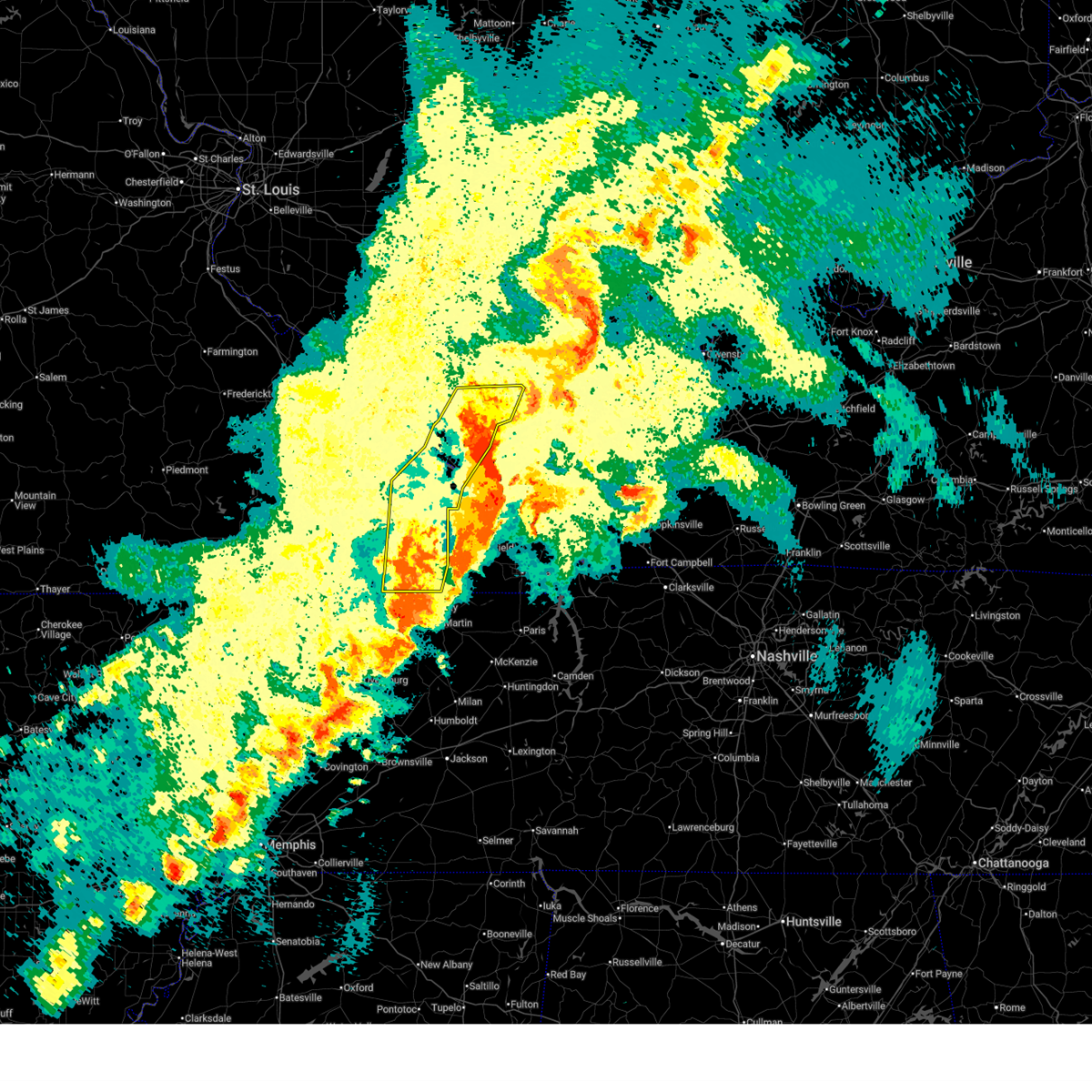
 Torpah the national weather service in paducah has issued a * tornado warning for, northwestern hardin county in southern illinois, northern pope county in southern illinois, northeastern johnson county in southern illinois, southeastern williamson county in southern illinois, southern saline county in southern illinois, southwestern gallatin county in southern illinois, * until 215 am cdt. * at 126 am cdt, a large and extremely dangerous tornado was located near vienna, moving northeast at 65 mph. this is a particularly dangerous situation. take cover now! (radar indicated rotation). Hazards include damaging tornado. You are in a life-threatening situation. flying debris may be deadly to those caught without shelter. mobile homes will be destroyed. considerable damage to homes, businesses, and vehicles is likely and complete destruction is possible. the tornado will be near, carrier mills and harrisburg around 135 am cdt. equality around 145 am cdt. eldorado around 150 am cdt. other locations impacted by this tornadic thunderstorm include stonefort, new burnside, karbers ridge, gross, eddyville, and simpson. This includes interstate 24 in illinois between mile markers 7 and 19. Torpah the national weather service in paducah has issued a * tornado warning for, northwestern hardin county in southern illinois, northern pope county in southern illinois, northeastern johnson county in southern illinois, southeastern williamson county in southern illinois, southern saline county in southern illinois, southwestern gallatin county in southern illinois, * until 215 am cdt. * at 126 am cdt, a large and extremely dangerous tornado was located near vienna, moving northeast at 65 mph. this is a particularly dangerous situation. take cover now! (radar indicated rotation). Hazards include damaging tornado. You are in a life-threatening situation. flying debris may be deadly to those caught without shelter. mobile homes will be destroyed. considerable damage to homes, businesses, and vehicles is likely and complete destruction is possible. the tornado will be near, carrier mills and harrisburg around 135 am cdt. equality around 145 am cdt. eldorado around 150 am cdt. other locations impacted by this tornadic thunderstorm include stonefort, new burnside, karbers ridge, gross, eddyville, and simpson. This includes interstate 24 in illinois between mile markers 7 and 19.
|
| 3/15/2025 1:20 AM CDT |
 At 120 am cdt, a severe thunderstorm capable of producing a tornado was located over vienna, moving northeast at 55 mph (radar indicated rotation). Hazards include tornado. Flying debris will be dangerous to those caught without shelter. mobile homes will be damaged or destroyed. damage to roofs, windows, and vehicles will occur. tree damage is likely. this tornadic thunderstorm will remain over mainly rural areas of johnson county, including the following locations, new burnside, belknap, buncombe, and simpson. This includes interstate 24 in illinois between mile markers 7 and 22. At 120 am cdt, a severe thunderstorm capable of producing a tornado was located over vienna, moving northeast at 55 mph (radar indicated rotation). Hazards include tornado. Flying debris will be dangerous to those caught without shelter. mobile homes will be damaged or destroyed. damage to roofs, windows, and vehicles will occur. tree damage is likely. this tornadic thunderstorm will remain over mainly rural areas of johnson county, including the following locations, new burnside, belknap, buncombe, and simpson. This includes interstate 24 in illinois between mile markers 7 and 22.
|
| 3/15/2025 1:20 AM CDT |
 the tornado warning has been cancelled and is no longer in effect the tornado warning has been cancelled and is no longer in effect
|
| 3/15/2025 12:58 AM CDT |
 Torpah the national weather service in paducah has issued a * tornado warning for, southeastern union county in southern illinois, northern pulaski county in southern illinois, johnson county in southern illinois, * until 130 am cdt. * at 1258 am cdt, a severe thunderstorm capable of producing a tornado was located near tamms, or 11 miles south of jonesboro, moving northeast at 55 mph (radar indicated rotation). Hazards include tornado. Flying debris will be dangerous to those caught without shelter. mobile homes will be damaged or destroyed. damage to roofs, windows, and vehicles will occur. tree damage is likely. this dangerous storm will be near, dongola around 105 am cdt. karnak around 110 am cdt. vienna around 115 am cdt. other locations impacted by this tornadic thunderstorm include mill creek, belknap, cypress, new burnside, ullin, buncombe, pulaski, and simpson. this includes the following highways, interstate 24 in illinois between mile markers 6 and 22. Interstate 57 in illinois between mile markers 15 and 29. Torpah the national weather service in paducah has issued a * tornado warning for, southeastern union county in southern illinois, northern pulaski county in southern illinois, johnson county in southern illinois, * until 130 am cdt. * at 1258 am cdt, a severe thunderstorm capable of producing a tornado was located near tamms, or 11 miles south of jonesboro, moving northeast at 55 mph (radar indicated rotation). Hazards include tornado. Flying debris will be dangerous to those caught without shelter. mobile homes will be damaged or destroyed. damage to roofs, windows, and vehicles will occur. tree damage is likely. this dangerous storm will be near, dongola around 105 am cdt. karnak around 110 am cdt. vienna around 115 am cdt. other locations impacted by this tornadic thunderstorm include mill creek, belknap, cypress, new burnside, ullin, buncombe, pulaski, and simpson. this includes the following highways, interstate 24 in illinois between mile markers 6 and 22. Interstate 57 in illinois between mile markers 15 and 29.
|
| 8/15/2024 8:14 PM CDT |
 At 814 pm cdt, a severe thunderstorm was located over karnak, or 9 miles southwest of vienna, moving southeast at 25 mph (radar indicated). Hazards include 70 mph wind gusts and quarter size hail. Hail damage to vehicles is expected. expect considerable tree damage. wind damage is also likely to mobile homes, roofs, and outbuildings. locations impacted include, vienna, karnak, cypress, new grand chain, and belknap. This includes interstate 24 in illinois between mile markers 17 and 24. At 814 pm cdt, a severe thunderstorm was located over karnak, or 9 miles southwest of vienna, moving southeast at 25 mph (radar indicated). Hazards include 70 mph wind gusts and quarter size hail. Hail damage to vehicles is expected. expect considerable tree damage. wind damage is also likely to mobile homes, roofs, and outbuildings. locations impacted include, vienna, karnak, cypress, new grand chain, and belknap. This includes interstate 24 in illinois between mile markers 17 and 24.
|
| 8/15/2024 8:01 PM CDT |
 At 801 pm cdt, a severe thunderstorm was located near dongola, or 9 miles southwest of vienna, moving southeast at 25 mph (radar indicated). Hazards include 70 mph wind gusts and quarter size hail. Hail damage to vehicles is expected. expect considerable tree damage. wind damage is also likely to mobile homes, roofs, and outbuildings. locations impacted include, vienna, dongola, karnak, cypress, new grand chain, and belknap. this includes the following highways, interstate 24 in illinois between mile markers 15 and 24. Interstate 57 in illinois between mile markers 19 and 32. At 801 pm cdt, a severe thunderstorm was located near dongola, or 9 miles southwest of vienna, moving southeast at 25 mph (radar indicated). Hazards include 70 mph wind gusts and quarter size hail. Hail damage to vehicles is expected. expect considerable tree damage. wind damage is also likely to mobile homes, roofs, and outbuildings. locations impacted include, vienna, dongola, karnak, cypress, new grand chain, and belknap. this includes the following highways, interstate 24 in illinois between mile markers 15 and 24. Interstate 57 in illinois between mile markers 19 and 32.
|
| 8/15/2024 8:00 PM CDT | Tree down on highway 3 in johnson county IL, 7 miles ENE of Vienna, IL |
| 8/15/2024 7:52 PM CDT |
 Svrpah the national weather service in paducah has issued a * severe thunderstorm warning for, southeastern union county in southern illinois, northeastern pulaski county in southern illinois, northwestern massac county in southern illinois, southern johnson county in southern illinois, north central ballard county in western kentucky, northwestern mccracken county in western kentucky, * until 830 pm cdt. * at 752 pm cdt, a severe thunderstorm was located over dongola, or 8 miles southeast of anna, moving southeast at 25 mph (radar indicated). Hazards include 60 mph wind gusts and quarter size hail. Hail damage to vehicles is expected. Expect wind damage to roofs, siding, and trees. Svrpah the national weather service in paducah has issued a * severe thunderstorm warning for, southeastern union county in southern illinois, northeastern pulaski county in southern illinois, northwestern massac county in southern illinois, southern johnson county in southern illinois, north central ballard county in western kentucky, northwestern mccracken county in western kentucky, * until 830 pm cdt. * at 752 pm cdt, a severe thunderstorm was located over dongola, or 8 miles southeast of anna, moving southeast at 25 mph (radar indicated). Hazards include 60 mph wind gusts and quarter size hail. Hail damage to vehicles is expected. Expect wind damage to roofs, siding, and trees.
|
| 8/2/2024 1:38 AM CDT |
 Svrpah the national weather service in paducah has issued a * severe thunderstorm warning for, north central massac county in southern illinois, central pope county in southern illinois, southeastern johnson county in southern illinois, northwestern livingston county in western kentucky, * until 215 am cdt. * at 136 am cdt, a severe thunderstorm was located near vienna, moving southeast at 30 mph (radar indicated). Hazards include 60 mph wind gusts. expect damage to roofs, siding, and trees Svrpah the national weather service in paducah has issued a * severe thunderstorm warning for, north central massac county in southern illinois, central pope county in southern illinois, southeastern johnson county in southern illinois, northwestern livingston county in western kentucky, * until 215 am cdt. * at 136 am cdt, a severe thunderstorm was located near vienna, moving southeast at 30 mph (radar indicated). Hazards include 60 mph wind gusts. expect damage to roofs, siding, and trees
|
| 7/30/2024 7:58 PM CDT |
 The storms which prompted the warning have weakened below severe limits, and no longer pose an immediate threat to life or property. therefore, the warning will be allowed to expire. however, gusty winds are still possible with these thunderstorms. a severe thunderstorm watch remains in effect until 1000 pm cdt for southern illinois, and western kentucky. The storms which prompted the warning have weakened below severe limits, and no longer pose an immediate threat to life or property. therefore, the warning will be allowed to expire. however, gusty winds are still possible with these thunderstorms. a severe thunderstorm watch remains in effect until 1000 pm cdt for southern illinois, and western kentucky.
|
| 7/30/2024 7:46 PM CDT |
 At 746 pm cdt, severe thunderstorms were located along a line extending from near goreville to 6 miles east of tamms, moving southeast at 35 mph (radar indicated). Hazards include 60 mph wind gusts and quarter size hail. Hail damage to vehicles is expected. expect wind damage to roofs, siding, and trees. locations impacted include, vienna, dongola, karnak, ullin, olmsted, cypress, new grand chain, belknap, and mill creek. this includes the following highways, interstate 24 in illinois between mile markers 15 and 19. Interstate 57 in illinois between mile markers 14 and 30. At 746 pm cdt, severe thunderstorms were located along a line extending from near goreville to 6 miles east of tamms, moving southeast at 35 mph (radar indicated). Hazards include 60 mph wind gusts and quarter size hail. Hail damage to vehicles is expected. expect wind damage to roofs, siding, and trees. locations impacted include, vienna, dongola, karnak, ullin, olmsted, cypress, new grand chain, belknap, and mill creek. this includes the following highways, interstate 24 in illinois between mile markers 15 and 19. Interstate 57 in illinois between mile markers 14 and 30.
|
| 7/30/2024 7:35 PM CDT |
 the severe thunderstorm warning has been cancelled and is no longer in effect the severe thunderstorm warning has been cancelled and is no longer in effect
|
| 7/30/2024 7:35 PM CDT |
 At 735 pm cdt, severe thunderstorms were located along a line extending from near goreville to near dongola, moving southeast at 35 mph (radar indicated). Hazards include 60 mph wind gusts and quarter size hail. Hail damage to vehicles is expected. expect wind damage to roofs, siding, and trees. locations impacted include, anna, jonesboro, vienna, goreville, dongola, karnak, ullin, olmsted, cypress, new grand chain, buncombe, belknap, and mill creek. this includes the following highways, interstate 24 in illinois between mile markers 2 and 19. Interstate 57 in illinois between mile markers 14 and 43. At 735 pm cdt, severe thunderstorms were located along a line extending from near goreville to near dongola, moving southeast at 35 mph (radar indicated). Hazards include 60 mph wind gusts and quarter size hail. Hail damage to vehicles is expected. expect wind damage to roofs, siding, and trees. locations impacted include, anna, jonesboro, vienna, goreville, dongola, karnak, ullin, olmsted, cypress, new grand chain, buncombe, belknap, and mill creek. this includes the following highways, interstate 24 in illinois between mile markers 2 and 19. Interstate 57 in illinois between mile markers 14 and 43.
|
| 7/30/2024 7:18 PM CDT |
 Svrpah the national weather service in paducah has issued a * severe thunderstorm warning for, union county in southern illinois, northern pulaski county in southern illinois, northwestern massac county in southern illinois, johnson county in southern illinois, southwestern williamson county in southern illinois, southeastern jackson county in southern illinois, north central alexander county in southern illinois, north central ballard county in western kentucky, * until 800 pm cdt. * at 718 pm cdt, severe thunderstorms were located along a line extending from 6 miles southwest of crainville to near ware, moving southeast at 35 mph (radar indicated). Hazards include 60 mph wind gusts and nickel size hail. expect damage to roofs, siding, and trees Svrpah the national weather service in paducah has issued a * severe thunderstorm warning for, union county in southern illinois, northern pulaski county in southern illinois, northwestern massac county in southern illinois, johnson county in southern illinois, southwestern williamson county in southern illinois, southeastern jackson county in southern illinois, north central alexander county in southern illinois, north central ballard county in western kentucky, * until 800 pm cdt. * at 718 pm cdt, severe thunderstorms were located along a line extending from 6 miles southwest of crainville to near ware, moving southeast at 35 mph (radar indicated). Hazards include 60 mph wind gusts and nickel size hail. expect damage to roofs, siding, and trees
|
| 5/26/2024 9:18 PM CDT |
 the severe thunderstorm warning has been cancelled and is no longer in effect the severe thunderstorm warning has been cancelled and is no longer in effect
|
| 5/26/2024 8:58 PM CDT |
 the severe thunderstorm warning has been cancelled and is no longer in effect the severe thunderstorm warning has been cancelled and is no longer in effect
|
| 5/26/2024 8:42 PM CDT | Roof blown of a she in johnson county IL, 0.6 miles NNE of Vienna, IL |
| 5/26/2024 8:29 PM CDT |
 Svrpah the national weather service in paducah has issued a * severe thunderstorm warning for, hardin county in southern illinois, east central pulaski county in southern illinois, massac county in southern illinois, pope county in southern illinois, eastern johnson county in southern illinois, saline county in southern illinois, gallatin county in southern illinois, * until 930 pm cdt. * at 828 pm cdt, severe thunderstorms were located along a line extending from near galatia to near carrier mills to near vienna to 6 miles east of tamms, moving east at 65 mph (radar indicated). Hazards include 60 mph wind gusts and quarter size hail. Hail damage to vehicles is expected. Expect wind damage to roofs, siding, and trees. Svrpah the national weather service in paducah has issued a * severe thunderstorm warning for, hardin county in southern illinois, east central pulaski county in southern illinois, massac county in southern illinois, pope county in southern illinois, eastern johnson county in southern illinois, saline county in southern illinois, gallatin county in southern illinois, * until 930 pm cdt. * at 828 pm cdt, severe thunderstorms were located along a line extending from near galatia to near carrier mills to near vienna to 6 miles east of tamms, moving east at 65 mph (radar indicated). Hazards include 60 mph wind gusts and quarter size hail. Hail damage to vehicles is expected. Expect wind damage to roofs, siding, and trees.
|
| 5/26/2024 8:21 PM CDT |
 Torpah the national weather service in paducah has issued a * tornado warning for, northern pope county in southern illinois, central johnson county in southern illinois, * until 845 pm cdt. * at 820 pm cdt, a severe thunderstorm capable of producing a tornado was located near vienna, moving east at 55 mph (radar indicated rotation). Hazards include tornado. Flying debris will be dangerous to those caught without shelter. mobile homes will be damaged or destroyed. damage to roofs, windows, and vehicles will occur. tree damage is likely. this dangerous storm will be near, vienna and lake of egypt area around 825 pm cdt. dixon springs around 830 pm cdt. other locations impacted by this tornadic thunderstorm include buncombe, simpson, and eddyville. This includes interstate 24 in illinois between mile markers 3 and 18. Torpah the national weather service in paducah has issued a * tornado warning for, northern pope county in southern illinois, central johnson county in southern illinois, * until 845 pm cdt. * at 820 pm cdt, a severe thunderstorm capable of producing a tornado was located near vienna, moving east at 55 mph (radar indicated rotation). Hazards include tornado. Flying debris will be dangerous to those caught without shelter. mobile homes will be damaged or destroyed. damage to roofs, windows, and vehicles will occur. tree damage is likely. this dangerous storm will be near, vienna and lake of egypt area around 825 pm cdt. dixon springs around 830 pm cdt. other locations impacted by this tornadic thunderstorm include buncombe, simpson, and eddyville. This includes interstate 24 in illinois between mile markers 3 and 18.
|
| 5/26/2024 8:15 PM CDT |
 Svrpah the national weather service in paducah has issued a * severe thunderstorm warning for, southeastern union county in southern illinois, pulaski county in southern illinois, johnson county in southern illinois, eastern williamson county in southern illinois, alexander county in southern illinois, northern scott county in southeastern missouri, southeastern cape girardeau county in southeastern missouri, * until 915 pm cdt. * at 814 pm cdt, severe thunderstorms were located along a line extending from herrin to near anna to oran, moving east at 55 mph (radar indicated). Hazards include 70 mph wind gusts and quarter size hail. Hail damage to vehicles is expected. expect considerable tree damage. Wind damage is also likely to mobile homes, roofs, and outbuildings. Svrpah the national weather service in paducah has issued a * severe thunderstorm warning for, southeastern union county in southern illinois, pulaski county in southern illinois, johnson county in southern illinois, eastern williamson county in southern illinois, alexander county in southern illinois, northern scott county in southeastern missouri, southeastern cape girardeau county in southeastern missouri, * until 915 pm cdt. * at 814 pm cdt, severe thunderstorms were located along a line extending from herrin to near anna to oran, moving east at 55 mph (radar indicated). Hazards include 70 mph wind gusts and quarter size hail. Hail damage to vehicles is expected. expect considerable tree damage. Wind damage is also likely to mobile homes, roofs, and outbuildings.
|
| 5/26/2024 8:31 AM CDT |
 the tornado warning has been cancelled and is no longer in effect the tornado warning has been cancelled and is no longer in effect
|
| 5/26/2024 8:28 AM CDT |
 Svrpah the national weather service in paducah has issued a * severe thunderstorm warning for, hardin county in southern illinois, northwestern massac county in southern illinois, pope county in southern illinois, eastern johnson county in southern illinois, southeastern williamson county in southern illinois, southern saline county in southern illinois, southwestern gallatin county in southern illinois, northwestern crittenden county in western kentucky, north central livingston county in western kentucky, southwestern union county in northwestern kentucky, * until 915 am cdt. * at 827 am cdt, a severe thunderstorm was located near vienna, moving northeast at 55 mph (radar indicated). Hazards include 60 mph wind gusts. expect damage to roofs, siding, and trees Svrpah the national weather service in paducah has issued a * severe thunderstorm warning for, hardin county in southern illinois, northwestern massac county in southern illinois, pope county in southern illinois, eastern johnson county in southern illinois, southeastern williamson county in southern illinois, southern saline county in southern illinois, southwestern gallatin county in southern illinois, northwestern crittenden county in western kentucky, north central livingston county in western kentucky, southwestern union county in northwestern kentucky, * until 915 am cdt. * at 827 am cdt, a severe thunderstorm was located near vienna, moving northeast at 55 mph (radar indicated). Hazards include 60 mph wind gusts. expect damage to roofs, siding, and trees
|
| 5/26/2024 8:12 AM CDT |
 Torpah the national weather service in paducah has issued a * tornado warning for, northeastern pulaski county in southern illinois, northwestern massac county in southern illinois, southern johnson county in southern illinois, * until 900 am cdt. * at 812 am cdt, a severe thunderstorm capable of producing a tornado was located near karnak, or 14 miles north of la center, moving northeast at 45 mph (radar indicated rotation). Hazards include tornado. Flying debris will be dangerous to those caught without shelter. mobile homes will be damaged or destroyed. damage to roofs, windows, and vehicles will occur. tree damage is likely. this dangerous storm will be near, karnak around 815 am cdt. vienna around 820 am cdt. new columbia around 825 am cdt. other locations impacted by this tornadic thunderstorm include new grand chain and belknap. This includes interstate 24 in illinois between mile markers 15 and 26. Torpah the national weather service in paducah has issued a * tornado warning for, northeastern pulaski county in southern illinois, northwestern massac county in southern illinois, southern johnson county in southern illinois, * until 900 am cdt. * at 812 am cdt, a severe thunderstorm capable of producing a tornado was located near karnak, or 14 miles north of la center, moving northeast at 45 mph (radar indicated rotation). Hazards include tornado. Flying debris will be dangerous to those caught without shelter. mobile homes will be damaged or destroyed. damage to roofs, windows, and vehicles will occur. tree damage is likely. this dangerous storm will be near, karnak around 815 am cdt. vienna around 820 am cdt. new columbia around 825 am cdt. other locations impacted by this tornadic thunderstorm include new grand chain and belknap. This includes interstate 24 in illinois between mile markers 15 and 26.
|
| 5/26/2024 8:02 AM CDT |
 the severe thunderstorm warning has been cancelled and is no longer in effect the severe thunderstorm warning has been cancelled and is no longer in effect
|
| 5/26/2024 8:02 AM CDT |
 At 802 am cdt, severe thunderstorms were located along a line extending from 6 miles east of anna to 6 miles northeast of la center to 6 miles south of bardwell to near hickman, moving northeast at 75 mph (radar indicated). Hazards include 70 mph wind gusts and penny size hail. Expect considerable tree damage. damage is likely to mobile homes, roofs, and outbuildings. locations impacted include, paducah, mayfield, metropolis, anna, fulton, hickman, jonesboro, vienna, clinton, la center, bardwell, wickliffe, lone oak, reidland, cobden, goreville, brookport, mounds, dongola, and barlow. this includes the following highways, interstate 24 in kentucky between mile markers 1 and 16. interstate 24 in illinois between mile markers 1 and 38. interstate 57 in illinois between mile markers 5 and 43. Interstate 69 in kentucky between mile markers 1 and 28. At 802 am cdt, severe thunderstorms were located along a line extending from 6 miles east of anna to 6 miles northeast of la center to 6 miles south of bardwell to near hickman, moving northeast at 75 mph (radar indicated). Hazards include 70 mph wind gusts and penny size hail. Expect considerable tree damage. damage is likely to mobile homes, roofs, and outbuildings. locations impacted include, paducah, mayfield, metropolis, anna, fulton, hickman, jonesboro, vienna, clinton, la center, bardwell, wickliffe, lone oak, reidland, cobden, goreville, brookport, mounds, dongola, and barlow. this includes the following highways, interstate 24 in kentucky between mile markers 1 and 16. interstate 24 in illinois between mile markers 1 and 38. interstate 57 in illinois between mile markers 5 and 43. Interstate 69 in kentucky between mile markers 1 and 28.
|
| 5/26/2024 7:42 AM CDT |
 Svrpah the national weather service in paducah has issued a * severe thunderstorm warning for, union county in southern illinois, pulaski county in southern illinois, southern pope county in southern illinois, johnson county in southern illinois, alexander county in southern illinois, massac county in southern illinois, south central williamson county in southern illinois, ballard county in western kentucky, mccracken county in western kentucky, fulton county in western kentucky, southwestern livingston county in western kentucky, carlisle county in western kentucky, hickman county in western kentucky, graves county in western kentucky, mississippi county in southeastern missouri, southeastern new madrid county in southeastern missouri, east central cape girardeau county in southeastern missouri, * until 830 am cdt. * at 741 am cdt, severe thunderstorms were located along a line extending from near cape girardeau to near cairo to near big oak tree state park to near tiptonville, moving northeast at 75 mph (radar indicated). Hazards include 70 mph wind gusts and penny size hail. Expect considerable tree damage. Damage is likely to mobile homes, roofs, and outbuildings. Svrpah the national weather service in paducah has issued a * severe thunderstorm warning for, union county in southern illinois, pulaski county in southern illinois, southern pope county in southern illinois, johnson county in southern illinois, alexander county in southern illinois, massac county in southern illinois, south central williamson county in southern illinois, ballard county in western kentucky, mccracken county in western kentucky, fulton county in western kentucky, southwestern livingston county in western kentucky, carlisle county in western kentucky, hickman county in western kentucky, graves county in western kentucky, mississippi county in southeastern missouri, southeastern new madrid county in southeastern missouri, east central cape girardeau county in southeastern missouri, * until 830 am cdt. * at 741 am cdt, severe thunderstorms were located along a line extending from near cape girardeau to near cairo to near big oak tree state park to near tiptonville, moving northeast at 75 mph (radar indicated). Hazards include 70 mph wind gusts and penny size hail. Expect considerable tree damage. Damage is likely to mobile homes, roofs, and outbuildings.
|
| 5/8/2024 10:45 PM CDT |
 At 1045 pm cdt, severe thunderstorms were located along a line extending from near creal springs to 6 miles northeast of mounds, moving east at 55 mph (radar indicated). Hazards include 60 mph wind gusts and half dollar size hail. Hail damage to vehicles is expected. expect wind damage to roofs, siding, and trees. locations impacted include, harrisburg, vienna, creal springs, karnak, dixon springs, carrier mills, new columbia, lake of egypt area, stonefort, cypress, new burnside, new grand chain, belknap, eddyville, muddy, and simpson. This includes interstate 24 in illinois between mile markers 7 and 28. At 1045 pm cdt, severe thunderstorms were located along a line extending from near creal springs to 6 miles northeast of mounds, moving east at 55 mph (radar indicated). Hazards include 60 mph wind gusts and half dollar size hail. Hail damage to vehicles is expected. expect wind damage to roofs, siding, and trees. locations impacted include, harrisburg, vienna, creal springs, karnak, dixon springs, carrier mills, new columbia, lake of egypt area, stonefort, cypress, new burnside, new grand chain, belknap, eddyville, muddy, and simpson. This includes interstate 24 in illinois between mile markers 7 and 28.
|
| 5/8/2024 10:45 PM CDT |
 the severe thunderstorm warning has been cancelled and is no longer in effect the severe thunderstorm warning has been cancelled and is no longer in effect
|
| 5/8/2024 10:30 PM CDT |
 Svrpah the national weather service in paducah has issued a * severe thunderstorm warning for, eastern union county in southern illinois, pulaski county in southern illinois, northwestern massac county in southern illinois, northwestern pope county in southern illinois, johnson county in southern illinois, southern williamson county in southern illinois, southern saline county in southern illinois, north central alexander county in southern illinois, west central gallatin county in southern illinois, * until 1115 pm cdt. * at 1030 pm cdt, severe thunderstorms were located along a line extending from 7 miles northwest of goreville to near olive branch, moving east at 55 mph (radar indicated). Hazards include 60 mph wind gusts. expect damage to roofs, siding, and trees Svrpah the national weather service in paducah has issued a * severe thunderstorm warning for, eastern union county in southern illinois, pulaski county in southern illinois, northwestern massac county in southern illinois, northwestern pope county in southern illinois, johnson county in southern illinois, southern williamson county in southern illinois, southern saline county in southern illinois, north central alexander county in southern illinois, west central gallatin county in southern illinois, * until 1115 pm cdt. * at 1030 pm cdt, severe thunderstorms were located along a line extending from 7 miles northwest of goreville to near olive branch, moving east at 55 mph (radar indicated). Hazards include 60 mph wind gusts. expect damage to roofs, siding, and trees
|
| 4/18/2024 6:08 PM CDT |
 The storm which prompted the warning has weakened below severe limits, and no longer poses an immediate threat to life or property. therefore, the warning will be allowed to expire. however, gusty winds are still possible with this thunderstorm. a severe thunderstorm watch remains in effect until 800 pm cdt for southern illinois. The storm which prompted the warning has weakened below severe limits, and no longer poses an immediate threat to life or property. therefore, the warning will be allowed to expire. however, gusty winds are still possible with this thunderstorm. a severe thunderstorm watch remains in effect until 800 pm cdt for southern illinois.
|
| 4/18/2024 5:52 PM CDT |
 Svrpah the national weather service in paducah has issued a * severe thunderstorm warning for, north central massac county in southern illinois, central pope county in southern illinois, southeastern johnson county in southern illinois, * until 615 pm cdt. * at 552 pm cdt, a severe thunderstorm was located over new columbia, or 9 miles southeast of vienna, moving northeast at 30 mph (radar indicated). Hazards include 60 mph wind gusts and quarter size hail. Hail damage to vehicles is expected. Expect wind damage to roofs, siding, and trees. Svrpah the national weather service in paducah has issued a * severe thunderstorm warning for, north central massac county in southern illinois, central pope county in southern illinois, southeastern johnson county in southern illinois, * until 615 pm cdt. * at 552 pm cdt, a severe thunderstorm was located over new columbia, or 9 miles southeast of vienna, moving northeast at 30 mph (radar indicated). Hazards include 60 mph wind gusts and quarter size hail. Hail damage to vehicles is expected. Expect wind damage to roofs, siding, and trees.
|
| 4/18/2024 5:11 PM CDT |
 Svrpah the national weather service in paducah has issued a * severe thunderstorm warning for, northwestern massac county in southern illinois, northern pope county in southern illinois, southeastern johnson county in southern illinois, * until 600 pm cdt. * at 511 pm cdt, a severe thunderstorm was located near new columbia, or near vienna, moving northeast at 25 mph (radar indicated). Hazards include 60 mph wind gusts and quarter size hail. Hail damage to vehicles is expected. Expect wind damage to roofs, siding, and trees. Svrpah the national weather service in paducah has issued a * severe thunderstorm warning for, northwestern massac county in southern illinois, northern pope county in southern illinois, southeastern johnson county in southern illinois, * until 600 pm cdt. * at 511 pm cdt, a severe thunderstorm was located near new columbia, or near vienna, moving northeast at 25 mph (radar indicated). Hazards include 60 mph wind gusts and quarter size hail. Hail damage to vehicles is expected. Expect wind damage to roofs, siding, and trees.
|
| 4/18/2024 5:03 PM CDT |
 At 503 pm cdt, a severe thunderstorm was located near karnak, or near vienna, moving northeast at 20 mph. this is a destructive storm for interstate 24 between vienna and new columbia (radar indicated). Hazards include baseball size hail and 70 mph wind gusts. People and animals outdoors will be severely injured. expect shattered windows, extensive damage to roofs, siding, and vehicles. locations impacted include, vienna, dixon springs, new columbia, cypress, belknap, and simpson. This includes interstate 24 in illinois between mile markers 12 and 28. At 503 pm cdt, a severe thunderstorm was located near karnak, or near vienna, moving northeast at 20 mph. this is a destructive storm for interstate 24 between vienna and new columbia (radar indicated). Hazards include baseball size hail and 70 mph wind gusts. People and animals outdoors will be severely injured. expect shattered windows, extensive damage to roofs, siding, and vehicles. locations impacted include, vienna, dixon springs, new columbia, cypress, belknap, and simpson. This includes interstate 24 in illinois between mile markers 12 and 28.
|
| 4/18/2024 5:03 PM CDT |
 the severe thunderstorm warning has been cancelled and is no longer in effect the severe thunderstorm warning has been cancelled and is no longer in effect
|
| 4/18/2024 4:46 PM CDT |
 At 445 pm cdt, a severe thunderstorm was located over karnak, or 9 miles southwest of vienna, moving northeast at 20 mph. this is a destructive storm for new columbia and interstate 24 in northern massac and southern johnson county! in addition to baseball sized hail, smaller hail may accumulate in amounts enough to cause dangerous travel conditions (radar indicated). Hazards include baseball size hail and 70 mph wind gusts. People and animals outdoors will be severely injured. expect shattered windows, extensive damage to roofs, siding, and vehicles. locations impacted include, vienna, karnak, dixon springs, new columbia, cypress, new grand chain, belknap, and simpson. This includes interstate 24 in illinois between mile markers 12 and 28. At 445 pm cdt, a severe thunderstorm was located over karnak, or 9 miles southwest of vienna, moving northeast at 20 mph. this is a destructive storm for new columbia and interstate 24 in northern massac and southern johnson county! in addition to baseball sized hail, smaller hail may accumulate in amounts enough to cause dangerous travel conditions (radar indicated). Hazards include baseball size hail and 70 mph wind gusts. People and animals outdoors will be severely injured. expect shattered windows, extensive damage to roofs, siding, and vehicles. locations impacted include, vienna, karnak, dixon springs, new columbia, cypress, new grand chain, belknap, and simpson. This includes interstate 24 in illinois between mile markers 12 and 28.
|
| 4/18/2024 4:33 PM CDT |
 the severe thunderstorm warning has been cancelled and is no longer in effect the severe thunderstorm warning has been cancelled and is no longer in effect
|
| 4/18/2024 4:33 PM CDT |
 At 433 pm cdt, a severe thunderstorm was located near dongola, or 12 miles southwest of vienna, moving northeast at 20 mph (radar indicated). Hazards include tennis ball size hail and 70 mph wind gusts. People and animals outdoors will be injured. expect hail damage to roofs, siding, windows, and vehicles. expect considerable tree damage. wind damage is also likely to mobile homes, roofs, and outbuildings. locations impacted include, vienna, dongola, karnak, lake of egypt area, cypress, new grand chain, buncombe, and belknap. this includes the following highways, interstate 24 in illinois between mile markers 6 and 19. Interstate 57 in illinois between mile markers 19 and 25. At 433 pm cdt, a severe thunderstorm was located near dongola, or 12 miles southwest of vienna, moving northeast at 20 mph (radar indicated). Hazards include tennis ball size hail and 70 mph wind gusts. People and animals outdoors will be injured. expect hail damage to roofs, siding, windows, and vehicles. expect considerable tree damage. wind damage is also likely to mobile homes, roofs, and outbuildings. locations impacted include, vienna, dongola, karnak, lake of egypt area, cypress, new grand chain, buncombe, and belknap. this includes the following highways, interstate 24 in illinois between mile markers 6 and 19. Interstate 57 in illinois between mile markers 19 and 25.
|
| 4/18/2024 4:31 PM CDT |
 Svrpah the national weather service in paducah has issued a * severe thunderstorm warning for, northeastern pulaski county in southern illinois, northwestern massac county in southern illinois, west central pope county in southern illinois, southeastern johnson county in southern illinois, * until 515 pm cdt. * at 431 pm cdt, a severe thunderstorm was located near karnak, or 13 miles north of la center, moving northeast at 20 mph (radar indicated). Hazards include tennis ball size hail and 70 mph wind gusts. People and animals outdoors will be injured. expect hail damage to roofs, siding, windows, and vehicles. expect considerable tree damage. Wind damage is also likely to mobile homes, roofs, and outbuildings. Svrpah the national weather service in paducah has issued a * severe thunderstorm warning for, northeastern pulaski county in southern illinois, northwestern massac county in southern illinois, west central pope county in southern illinois, southeastern johnson county in southern illinois, * until 515 pm cdt. * at 431 pm cdt, a severe thunderstorm was located near karnak, or 13 miles north of la center, moving northeast at 20 mph (radar indicated). Hazards include tennis ball size hail and 70 mph wind gusts. People and animals outdoors will be injured. expect hail damage to roofs, siding, windows, and vehicles. expect considerable tree damage. Wind damage is also likely to mobile homes, roofs, and outbuildings.
|
| 4/18/2024 4:26 PM CDT |
 At 426 pm cdt, a severe thunderstorm was located near dongola, or 13 miles southeast of anna, moving northeast at 20 mph (radar indicated). Hazards include golf ball size hail and 60 mph wind gusts. People and animals outdoors will be injured. expect hail damage to roofs, siding, windows, and vehicles. expect wind damage to roofs, siding, and trees. locations impacted include, vienna, goreville, dongola, karnak, lake of egypt area, ullin, cypress, new burnside, new grand chain, buncombe, belknap, mill creek, and simpson. this includes the following highways, interstate 24 in illinois between mile markers 2 and 19. Interstate 57 in illinois between mile markers 13 and 43. At 426 pm cdt, a severe thunderstorm was located near dongola, or 13 miles southeast of anna, moving northeast at 20 mph (radar indicated). Hazards include golf ball size hail and 60 mph wind gusts. People and animals outdoors will be injured. expect hail damage to roofs, siding, windows, and vehicles. expect wind damage to roofs, siding, and trees. locations impacted include, vienna, goreville, dongola, karnak, lake of egypt area, ullin, cypress, new burnside, new grand chain, buncombe, belknap, mill creek, and simpson. this includes the following highways, interstate 24 in illinois between mile markers 2 and 19. Interstate 57 in illinois between mile markers 13 and 43.
|
| 4/18/2024 4:24 PM CDT |
 At 424 pm cdt, a severe thunderstorm was located near dongola, or 13 miles southeast of anna, moving northeast at 20 mph (radar indicated). Hazards include ping pong ball size hail and 60 mph wind gusts. People and animals outdoors will be injured. expect hail damage to roofs, siding, windows, and vehicles. expect wind damage to roofs, siding, and trees. locations impacted include, vienna, goreville, dongola, karnak, lake of egypt area, ullin, cypress, new burnside, new grand chain, buncombe, belknap, mill creek, and simpson. this includes the following highways, interstate 24 in illinois between mile markers 2 and 19. Interstate 57 in illinois between mile markers 13 and 43. At 424 pm cdt, a severe thunderstorm was located near dongola, or 13 miles southeast of anna, moving northeast at 20 mph (radar indicated). Hazards include ping pong ball size hail and 60 mph wind gusts. People and animals outdoors will be injured. expect hail damage to roofs, siding, windows, and vehicles. expect wind damage to roofs, siding, and trees. locations impacted include, vienna, goreville, dongola, karnak, lake of egypt area, ullin, cypress, new burnside, new grand chain, buncombe, belknap, mill creek, and simpson. this includes the following highways, interstate 24 in illinois between mile markers 2 and 19. Interstate 57 in illinois between mile markers 13 and 43.
|
| 4/18/2024 4:17 PM CDT |
 Svrpah the national weather service in paducah has issued a * severe thunderstorm warning for, southeastern union county in southern illinois, northern pulaski county in southern illinois, johnson county in southern illinois, north central alexander county in southern illinois, * until 445 pm cdt. * at 417 pm cdt, a severe thunderstorm was located near dongola, or 13 miles south of anna, moving northeast at 20 mph (radar indicated). Hazards include 60 mph wind gusts and quarter size hail. Hail damage to vehicles is expected. Expect wind damage to roofs, siding, and trees. Svrpah the national weather service in paducah has issued a * severe thunderstorm warning for, southeastern union county in southern illinois, northern pulaski county in southern illinois, johnson county in southern illinois, north central alexander county in southern illinois, * until 445 pm cdt. * at 417 pm cdt, a severe thunderstorm was located near dongola, or 13 miles south of anna, moving northeast at 20 mph (radar indicated). Hazards include 60 mph wind gusts and quarter size hail. Hail damage to vehicles is expected. Expect wind damage to roofs, siding, and trees.
|
| 4/2/2024 4:59 AM CDT |
 Torpah the national weather service in paducah has issued a * tornado warning for, northeastern pulaski county in southern illinois, northwestern massac county in southern illinois, central pope county in southern illinois, southern johnson county in southern illinois, * until 545 am cdt. * at 459 am cdt, a severe thunderstorm capable of producing a tornado was located near karnak, or 7 miles south of vienna, moving east at 45 mph (radar indicated rotation). Hazards include tornado. Flying debris will be dangerous to those caught without shelter. mobile homes will be damaged or destroyed. damage to roofs, windows, and vehicles will occur. tree damage is likely. this dangerous storm will be near, vienna and new columbia around 505 am cdt. dixon springs around 510 am cdt. golconda around 520 am cdt. other locations impacted by this tornadic thunderstorm include cypress, belknap, and joppa. This includes interstate 24 in illinois between mile markers 16 and 32. Torpah the national weather service in paducah has issued a * tornado warning for, northeastern pulaski county in southern illinois, northwestern massac county in southern illinois, central pope county in southern illinois, southern johnson county in southern illinois, * until 545 am cdt. * at 459 am cdt, a severe thunderstorm capable of producing a tornado was located near karnak, or 7 miles south of vienna, moving east at 45 mph (radar indicated rotation). Hazards include tornado. Flying debris will be dangerous to those caught without shelter. mobile homes will be damaged or destroyed. damage to roofs, windows, and vehicles will occur. tree damage is likely. this dangerous storm will be near, vienna and new columbia around 505 am cdt. dixon springs around 510 am cdt. golconda around 520 am cdt. other locations impacted by this tornadic thunderstorm include cypress, belknap, and joppa. This includes interstate 24 in illinois between mile markers 16 and 32.
|
| 4/2/2024 4:56 AM CDT |
 At 456 am cdt, severe thunderstorms were located along a line extending from near pittsburg to near la center, moving east at 55 mph (trained weather spotters). Hazards include 70 mph wind gusts. Expect considerable tree damage. damage is likely to mobile homes, roofs, and outbuildings. locations impacted include, paducah, marion, herrin, harrisburg, west frankfort, metropolis, eldorado, johnston city, vienna, la center, reidland, lone oak, energy, goreville, brookport, galatia, barlow, golconda, mound city, and pittsburg. this includes the following highways, interstate 24 in kentucky between mile markers 1 and 13. interstate 24 in illinois between mile markers 1 and 38. Interstate 57 in illinois between mile markers 37 and 64. At 456 am cdt, severe thunderstorms were located along a line extending from near pittsburg to near la center, moving east at 55 mph (trained weather spotters). Hazards include 70 mph wind gusts. Expect considerable tree damage. damage is likely to mobile homes, roofs, and outbuildings. locations impacted include, paducah, marion, herrin, harrisburg, west frankfort, metropolis, eldorado, johnston city, vienna, la center, reidland, lone oak, energy, goreville, brookport, galatia, barlow, golconda, mound city, and pittsburg. this includes the following highways, interstate 24 in kentucky between mile markers 1 and 13. interstate 24 in illinois between mile markers 1 and 38. Interstate 57 in illinois between mile markers 37 and 64.
|
| 4/2/2024 4:56 AM CDT |
 the severe thunderstorm warning has been cancelled and is no longer in effect the severe thunderstorm warning has been cancelled and is no longer in effect
|
| 4/2/2024 4:35 AM CDT |
 Svrpah the national weather service in paducah has issued a * severe thunderstorm warning for, union county in southern illinois, pulaski county in southern illinois, pope county in southern illinois, johnson county in southern illinois, saline county in southern illinois, alexander county in southern illinois, southeastern franklin county in south central illinois, massac county in southern illinois, williamson county in southern illinois, southeastern jackson county in southern illinois, ballard county in western kentucky, mccracken county in western kentucky, western livingston county in western kentucky, north central mississippi county in southeastern missouri, east central scott county in southeastern missouri, * until 515 am cdt. * at 435 am cdt, severe thunderstorms were located along a line extending from near hurst to near olive branch, moving east at 55 mph (trained weather spotters. cape girardeau airport reported gusts to 66 mph). Hazards include 70 mph wind gusts. Expect considerable tree damage. Damage is likely to mobile homes, roofs, and outbuildings. Svrpah the national weather service in paducah has issued a * severe thunderstorm warning for, union county in southern illinois, pulaski county in southern illinois, pope county in southern illinois, johnson county in southern illinois, saline county in southern illinois, alexander county in southern illinois, southeastern franklin county in south central illinois, massac county in southern illinois, williamson county in southern illinois, southeastern jackson county in southern illinois, ballard county in western kentucky, mccracken county in western kentucky, western livingston county in western kentucky, north central mississippi county in southeastern missouri, east central scott county in southeastern missouri, * until 515 am cdt. * at 435 am cdt, severe thunderstorms were located along a line extending from near hurst to near olive branch, moving east at 55 mph (trained weather spotters. cape girardeau airport reported gusts to 66 mph). Hazards include 70 mph wind gusts. Expect considerable tree damage. Damage is likely to mobile homes, roofs, and outbuildings.
|
| 4/2/2024 4:24 AM CDT |
 the severe thunderstorm warning has been cancelled and is no longer in effect the severe thunderstorm warning has been cancelled and is no longer in effect
|
| 4/2/2024 4:24 AM CDT |
 At 423 am cdt, severe thunderstorms were located along a line extending from near grand tower to near kelso, moving east at 65 mph (emergency management. damage was reported in jackson, mo). Hazards include 70 mph wind gusts. Expect considerable tree damage. damage is likely to mobile homes, roofs, and outbuildings. locations impacted include, cape girardeau, jackson, scott city, anna, chaffee, jonesboro, vienna, oran, benton, trail of tears state park, cobden, goreville, mounds, dongola, tamms, mound city, kelso, karnak, delta, and gordonville. this includes the following highways, interstate 24 in illinois between mile markers 2 and 11. interstate 57 in illinois between mile markers 5 and 43. Interstate 55 between mile markers 80 and 113. At 423 am cdt, severe thunderstorms were located along a line extending from near grand tower to near kelso, moving east at 65 mph (emergency management. damage was reported in jackson, mo). Hazards include 70 mph wind gusts. Expect considerable tree damage. damage is likely to mobile homes, roofs, and outbuildings. locations impacted include, cape girardeau, jackson, scott city, anna, chaffee, jonesboro, vienna, oran, benton, trail of tears state park, cobden, goreville, mounds, dongola, tamms, mound city, kelso, karnak, delta, and gordonville. this includes the following highways, interstate 24 in illinois between mile markers 2 and 11. interstate 57 in illinois between mile markers 5 and 43. Interstate 55 between mile markers 80 and 113.
|
| 4/2/2024 3:59 AM CDT |
 Svrpah the national weather service in paducah has issued a * severe thunderstorm warning for, union county in southern illinois, pulaski county in southern illinois, western johnson county in southern illinois, alexander county in southern illinois, eastern bollinger county in southeastern missouri, northern scott county in southeastern missouri, south central perry county in southeastern missouri, cape girardeau county in southeastern missouri, north central stoddard county in southeastern missouri, * until 445 am cdt. * at 358 am cdt, severe thunderstorms were located along a line extending from near perryville to near leopold, moving east at 65 mph (radar indicated). Hazards include 70 mph wind gusts. Expect considerable tree damage. Damage is likely to mobile homes, roofs, and outbuildings. Svrpah the national weather service in paducah has issued a * severe thunderstorm warning for, union county in southern illinois, pulaski county in southern illinois, western johnson county in southern illinois, alexander county in southern illinois, eastern bollinger county in southeastern missouri, northern scott county in southeastern missouri, south central perry county in southeastern missouri, cape girardeau county in southeastern missouri, north central stoddard county in southeastern missouri, * until 445 am cdt. * at 358 am cdt, severe thunderstorms were located along a line extending from near perryville to near leopold, moving east at 65 mph (radar indicated). Hazards include 70 mph wind gusts. Expect considerable tree damage. Damage is likely to mobile homes, roofs, and outbuildings.
|
| 3/14/2024 8:19 PM CDT |
 the severe thunderstorm warning has been cancelled and is no longer in effect the severe thunderstorm warning has been cancelled and is no longer in effect
|
| 3/14/2024 8:19 PM CDT |
 At 819 pm cdt, severe thunderstorms were located along a line extending from near goreville to near barlow to near farrenburg, moving east at 50 mph (radar indicated). Hazards include 70 mph wind gusts. Expect considerable tree damage. damage is likely to mobile homes, roofs, and outbuildings. locations impacted include, charleston, east prairie, cairo, vienna, la center, bardwell, wickliffe, towosahgy state historic site, big oak tree state park, goreville, bertrand, mounds, dongola, barlow, tamms, mound city, karnak, wyatt, anniston, and dorena. this includes the following highways, interstate 24 in illinois between mile markers 2 and 23. interstate 57 in illinois between mile markers 1 and 25, and between mile markers 38 and 42. Interstate 57 in missouri between mile markers 3 and 21. At 819 pm cdt, severe thunderstorms were located along a line extending from near goreville to near barlow to near farrenburg, moving east at 50 mph (radar indicated). Hazards include 70 mph wind gusts. Expect considerable tree damage. damage is likely to mobile homes, roofs, and outbuildings. locations impacted include, charleston, east prairie, cairo, vienna, la center, bardwell, wickliffe, towosahgy state historic site, big oak tree state park, goreville, bertrand, mounds, dongola, barlow, tamms, mound city, karnak, wyatt, anniston, and dorena. this includes the following highways, interstate 24 in illinois between mile markers 2 and 23. interstate 57 in illinois between mile markers 1 and 25, and between mile markers 38 and 42. Interstate 57 in missouri between mile markers 3 and 21.
|
| 3/14/2024 7:56 PM CDT |
 Svrpah the national weather service in paducah has issued a * severe thunderstorm warning for, southeastern union county in southern illinois, pulaski county in southern illinois, northwestern massac county in southern illinois, johnson county in southern illinois, eastern alexander county in southern illinois, western carlisle county in western kentucky, northwestern hickman county in western kentucky, ballard county in western kentucky, northwestern mccracken county in western kentucky, mississippi county in southeastern missouri, northern new madrid county in southeastern missouri, southeastern stoddard county in southeastern missouri, * until 845 pm cdt. * at 756 pm cdt, severe thunderstorms were located along a line extending from near ware to 8 miles north of bertrand to near parma, moving east at 50 mph (radar indicated). Hazards include 70 mph wind gusts. Expect considerable tree damage. Damage is likely to mobile homes, roofs, and outbuildings. Svrpah the national weather service in paducah has issued a * severe thunderstorm warning for, southeastern union county in southern illinois, pulaski county in southern illinois, northwestern massac county in southern illinois, johnson county in southern illinois, eastern alexander county in southern illinois, western carlisle county in western kentucky, northwestern hickman county in western kentucky, ballard county in western kentucky, northwestern mccracken county in western kentucky, mississippi county in southeastern missouri, northern new madrid county in southeastern missouri, southeastern stoddard county in southeastern missouri, * until 845 pm cdt. * at 756 pm cdt, severe thunderstorms were located along a line extending from near ware to 8 miles north of bertrand to near parma, moving east at 50 mph (radar indicated). Hazards include 70 mph wind gusts. Expect considerable tree damage. Damage is likely to mobile homes, roofs, and outbuildings.
|
| 8/3/2023 1:06 AM CDT |
 The severe thunderstorm warning for eastern union, pulaski, northwestern massac, johnson, eastern alexander, northwestern carlisle, ballard, western mccracken, northeastern mississippi and east central scott counties will expire at 115 am cdt, the storms which prompted the warning have weakened below severe limits, and no longer pose an immediate threat to life or property. therefore, the warning will be allowed to expire. however gusty winds are still possible with these thunderstorms. a severe thunderstorm watch remains in effect until 300 am cdt for southern illinois, western kentucky, and southeastern missouri. The severe thunderstorm warning for eastern union, pulaski, northwestern massac, johnson, eastern alexander, northwestern carlisle, ballard, western mccracken, northeastern mississippi and east central scott counties will expire at 115 am cdt, the storms which prompted the warning have weakened below severe limits, and no longer pose an immediate threat to life or property. therefore, the warning will be allowed to expire. however gusty winds are still possible with these thunderstorms. a severe thunderstorm watch remains in effect until 300 am cdt for southern illinois, western kentucky, and southeastern missouri.
|
| 8/3/2023 12:47 AM CDT |
 At 1247 am cdt, severe thunderstorms were located along a line extending from goreville to 6 miles south of karnak to near charleston, moving southeast at 50 mph (radar indicated). Hazards include 60 mph wind gusts. Expect damage to roofs, siding, and trees. locations impacted include, paducah, metropolis, cairo, vienna, la center, wickliffe, goreville, mounds, dongola, barlow, mound city, karnak, lake of egypt area, barkley regional airport, horseshoe lake conservation area, new columbia, olive branch, west paducah, ullin and kevil. this includes the following highways, interstate 24 in illinois between mile markers 2 and 32. interstate 57 in illinois between mile markers 1 and 43. interstate 57 in missouri between mile markers 16 and 21. interstate 55 between mile markers 79 and 80. hail threat, radar indicated max hail size, <. 75 in wind threat, radar indicated max wind gust, 60 mph. At 1247 am cdt, severe thunderstorms were located along a line extending from goreville to 6 miles south of karnak to near charleston, moving southeast at 50 mph (radar indicated). Hazards include 60 mph wind gusts. Expect damage to roofs, siding, and trees. locations impacted include, paducah, metropolis, cairo, vienna, la center, wickliffe, goreville, mounds, dongola, barlow, mound city, karnak, lake of egypt area, barkley regional airport, horseshoe lake conservation area, new columbia, olive branch, west paducah, ullin and kevil. this includes the following highways, interstate 24 in illinois between mile markers 2 and 32. interstate 57 in illinois between mile markers 1 and 43. interstate 57 in missouri between mile markers 16 and 21. interstate 55 between mile markers 79 and 80. hail threat, radar indicated max hail size, <. 75 in wind threat, radar indicated max wind gust, 60 mph.
|
| 8/3/2023 12:29 AM CDT |
 At 1229 am cdt, severe thunderstorms were located along a line extending from near cedar lake area to near tamms to near oran, moving southeast at 45 mph (radar indicated). Hazards include 60 mph wind gusts. expect damage to roofs, siding, and trees At 1229 am cdt, severe thunderstorms were located along a line extending from near cedar lake area to near tamms to near oran, moving southeast at 45 mph (radar indicated). Hazards include 60 mph wind gusts. expect damage to roofs, siding, and trees
|
| 7/29/2023 6:31 PM CDT |
 At 630 pm cdt, severe thunderstorms were located along a line extending from 11 miles southeast of carrier mills to near new columbia to near mounds, moving southeast at 35 mph (radar indicated). Hazards include 60 mph wind gusts. Expect damage to roofs, siding, and trees. locations impacted include, scott city, vienna, dongola, tamms, kelso, karnak, cape girardeau airport, horseshoe lake conservation area, new columbia, dixon springs, olive branch, ullin, thebes, olmsted, stonefort, cypress, new burnside, new grand chain, pulaski and buncombe. this includes the following highways, interstate 24 in illinois between mile markers 8 and 25. interstate 57 in illinois between mile markers 9 and 25. interstate 55 between mile markers 88 and 92. hail threat, radar indicated max hail size, <. 75 in wind threat, observed max wind gust, 60 mph. At 630 pm cdt, severe thunderstorms were located along a line extending from 11 miles southeast of carrier mills to near new columbia to near mounds, moving southeast at 35 mph (radar indicated). Hazards include 60 mph wind gusts. Expect damage to roofs, siding, and trees. locations impacted include, scott city, vienna, dongola, tamms, kelso, karnak, cape girardeau airport, horseshoe lake conservation area, new columbia, dixon springs, olive branch, ullin, thebes, olmsted, stonefort, cypress, new burnside, new grand chain, pulaski and buncombe. this includes the following highways, interstate 24 in illinois between mile markers 8 and 25. interstate 57 in illinois between mile markers 9 and 25. interstate 55 between mile markers 88 and 92. hail threat, radar indicated max hail size, <. 75 in wind threat, observed max wind gust, 60 mph.
|
| 7/29/2023 6:28 PM CDT |
 At 627 pm cdt, severe thunderstorms were located along a line extending from near carrier mills to near vienna to olive branch, moving southeast at 35 mph (radar indicated). Hazards include 60 mph wind gusts. expect damage to roofs, siding, and trees At 627 pm cdt, severe thunderstorms were located along a line extending from near carrier mills to near vienna to olive branch, moving southeast at 35 mph (radar indicated). Hazards include 60 mph wind gusts. expect damage to roofs, siding, and trees
|
| 7/29/2023 6:01 PM CDT |
 At 600 pm cdt, severe thunderstorms were located along a line extending from near creal springs to near dongola to near cape girardeau, moving southeast at 35 mph (radar indicated). Hazards include 60 mph wind gusts and quarter size hail. Hail damage to vehicles is expected. Expect wind damage to roofs, siding, and trees. At 600 pm cdt, severe thunderstorms were located along a line extending from near creal springs to near dongola to near cape girardeau, moving southeast at 35 mph (radar indicated). Hazards include 60 mph wind gusts and quarter size hail. Hail damage to vehicles is expected. Expect wind damage to roofs, siding, and trees.
|
| 7/19/2023 7:30 AM CDT |
 At 729 am cdt, severe thunderstorms were located along a line extending from near vienna to near dongola to near jonesboro, moving east at 45 mph (radar indicated). Hazards include 60 mph wind gusts. expect damage to roofs, siding, and trees At 729 am cdt, severe thunderstorms were located along a line extending from near vienna to near dongola to near jonesboro, moving east at 45 mph (radar indicated). Hazards include 60 mph wind gusts. expect damage to roofs, siding, and trees
|
| 7/19/2023 4:55 AM CDT |
 The severe thunderstorm warning for northwestern pope and johnson counties will expire at 500 am cdt, the storm which prompted the warning has weakened below severe limits, and no longer poses an immediate threat to life or property. therefore, the warning will be allowed to expire. a severe thunderstorm watch remains in effect until 1000 am cdt for southern illinois. The severe thunderstorm warning for northwestern pope and johnson counties will expire at 500 am cdt, the storm which prompted the warning has weakened below severe limits, and no longer poses an immediate threat to life or property. therefore, the warning will be allowed to expire. a severe thunderstorm watch remains in effect until 1000 am cdt for southern illinois.
|
| 7/19/2023 4:48 AM CDT |
 At 448 am cdt, a severe thunderstorm was located near vienna, moving southeast at 20 mph (radar indicated). Hazards include 60 mph wind gusts and quarter size hail. Hail damage to vehicles is expected. expect wind damage to roofs, siding, and trees. locations impacted include, vienna, goreville, lake of egypt area, dixon springs, new burnside and simpson. this includes the following highways, interstate 24 in illinois between mile markers 2 and 22. interstate 57 in illinois between mile markers 42 and 43. hail threat, radar indicated max hail size, 1. 00 in wind threat, radar indicated max wind gust, 60 mph. At 448 am cdt, a severe thunderstorm was located near vienna, moving southeast at 20 mph (radar indicated). Hazards include 60 mph wind gusts and quarter size hail. Hail damage to vehicles is expected. expect wind damage to roofs, siding, and trees. locations impacted include, vienna, goreville, lake of egypt area, dixon springs, new burnside and simpson. this includes the following highways, interstate 24 in illinois between mile markers 2 and 22. interstate 57 in illinois between mile markers 42 and 43. hail threat, radar indicated max hail size, 1. 00 in wind threat, radar indicated max wind gust, 60 mph.
|
| 7/19/2023 4:33 AM CDT |
 At 433 am cdt, a severe thunderstorm was located over lake of egypt area, or 9 miles north of vienna, moving southeast at 20 mph (radar indicated). Hazards include 60 mph wind gusts and quarter size hail. Hail damage to vehicles is expected. expect wind damage to roofs, siding, and trees. locations impacted include, vienna, goreville, creal springs, lake of egypt area, dixon springs, cypress, new burnside, buncombe and simpson. this includes the following highways, interstate 24 in illinois between mile markers 1 and 23. interstate 57 in illinois between mile markers 40 and 45. hail threat, radar indicated max hail size, 1. 00 in wind threat, radar indicated max wind gust, 60 mph. At 433 am cdt, a severe thunderstorm was located over lake of egypt area, or 9 miles north of vienna, moving southeast at 20 mph (radar indicated). Hazards include 60 mph wind gusts and quarter size hail. Hail damage to vehicles is expected. expect wind damage to roofs, siding, and trees. locations impacted include, vienna, goreville, creal springs, lake of egypt area, dixon springs, cypress, new burnside, buncombe and simpson. this includes the following highways, interstate 24 in illinois between mile markers 1 and 23. interstate 57 in illinois between mile markers 40 and 45. hail threat, radar indicated max hail size, 1. 00 in wind threat, radar indicated max wind gust, 60 mph.
|
| 7/19/2023 4:15 AM CDT |
 At 415 am cdt, a severe thunderstorm was located near goreville, or 8 miles southwest of marion, moving southeast at 20 mph (radar indicated). Hazards include 60 mph wind gusts and quarter size hail. Hail damage to vehicles is expected. Expect wind damage to roofs, siding, and trees. At 415 am cdt, a severe thunderstorm was located near goreville, or 8 miles southwest of marion, moving southeast at 20 mph (radar indicated). Hazards include 60 mph wind gusts and quarter size hail. Hail damage to vehicles is expected. Expect wind damage to roofs, siding, and trees.
|
| 7/18/2023 1:00 PM CDT |
 At 100 pm cdt, severe thunderstorms were located along a line extending from near lake of egypt area to near karnak, moving east at 50 mph (radar indicated). Hazards include 60 mph wind gusts and penny size hail. expect damage to roofs, siding, and trees At 100 pm cdt, severe thunderstorms were located along a line extending from near lake of egypt area to near karnak, moving east at 50 mph (radar indicated). Hazards include 60 mph wind gusts and penny size hail. expect damage to roofs, siding, and trees
|
| 7/18/2023 12:42 PM CDT |
 At 1241 pm cdt, severe thunderstorms were located along a line extending from near goreville to near mound city to near east prairie, moving east at 50 mph (radar indicated). Hazards include 70 mph wind gusts and penny size hail. Expect considerable tree damage. damage is likely to mobile homes, roofs, and outbuildings. locations impacted include, sikeston, charleston, anna, cairo, jonesboro, vienna, la center, miner, wickliffe, cobden, goreville, bertrand, mounds, dongola, barlow, tamms, mound city, karnak, wyatt and lake of egypt area. this includes the following highways, interstate 24 in illinois between mile markers 2 and 16. interstate 57 in illinois between mile markers 1 and 43. interstate 57 in missouri between mile markers 1 and 21. Interstate 55 between mile markers 66 and 76. At 1241 pm cdt, severe thunderstorms were located along a line extending from near goreville to near mound city to near east prairie, moving east at 50 mph (radar indicated). Hazards include 70 mph wind gusts and penny size hail. Expect considerable tree damage. damage is likely to mobile homes, roofs, and outbuildings. locations impacted include, sikeston, charleston, anna, cairo, jonesboro, vienna, la center, miner, wickliffe, cobden, goreville, bertrand, mounds, dongola, barlow, tamms, mound city, karnak, wyatt and lake of egypt area. this includes the following highways, interstate 24 in illinois between mile markers 2 and 16. interstate 57 in illinois between mile markers 1 and 43. interstate 57 in missouri between mile markers 1 and 21. Interstate 55 between mile markers 66 and 76.
|
| 7/18/2023 12:41 PM CDT |
 At 1240 pm cdt, severe thunderstorms were located along a line extending from 7 miles east of cobden to 6 miles east of tamms to cairo to near anniston, moving east at 50 mph (radar indicated). Hazards include 70 mph wind gusts and penny size hail. Expect considerable tree damage. Damage is likely to mobile homes, roofs, and outbuildings. At 1240 pm cdt, severe thunderstorms were located along a line extending from 7 miles east of cobden to 6 miles east of tamms to cairo to near anniston, moving east at 50 mph (radar indicated). Hazards include 70 mph wind gusts and penny size hail. Expect considerable tree damage. Damage is likely to mobile homes, roofs, and outbuildings.
|
| 7/18/2023 12:17 PM CDT |
 At 1217 pm cdt, severe thunderstorms were located along a line extending from 6 miles southwest of murphysboro to near scott city to near essex, moving east, southeast at 55 mph (radar indicated). Hazards include 70 mph wind gusts and penny size hail. Expect considerable tree damage. Damage is likely to mobile homes, roofs, and outbuildings. At 1217 pm cdt, severe thunderstorms were located along a line extending from 6 miles southwest of murphysboro to near scott city to near essex, moving east, southeast at 55 mph (radar indicated). Hazards include 70 mph wind gusts and penny size hail. Expect considerable tree damage. Damage is likely to mobile homes, roofs, and outbuildings.
|
| 7/2/2023 3:19 PM CDT |
 At 319 pm cdt, severe thunderstorms were located along a line extending from near karnak to 6 miles north of la center, moving east at 45 mph (radar indicated). Hazards include 60 mph wind gusts. Expect damage to roofs, siding, and trees. locations impacted include, paducah, metropolis, vienna, brookport, karnak, dixon springs, new columbia, joppa, cypress, new grand chain, belknap, eddyville and simpson. this includes the following highways, interstate 24 in kentucky between mile markers 1 and 3. interstate 24 in illinois between mile markers 12 and 38. hail threat, radar indicated max hail size, <. 75 in wind threat, radar indicated max wind gust, 60 mph. At 319 pm cdt, severe thunderstorms were located along a line extending from near karnak to 6 miles north of la center, moving east at 45 mph (radar indicated). Hazards include 60 mph wind gusts. Expect damage to roofs, siding, and trees. locations impacted include, paducah, metropolis, vienna, brookport, karnak, dixon springs, new columbia, joppa, cypress, new grand chain, belknap, eddyville and simpson. this includes the following highways, interstate 24 in kentucky between mile markers 1 and 3. interstate 24 in illinois between mile markers 12 and 38. hail threat, radar indicated max hail size, <. 75 in wind threat, radar indicated max wind gust, 60 mph.
|
| 7/2/2023 3:10 PM CDT |
 At 309 pm cdt, severe thunderstorms were located along a line extending from near dongola to near mound city, moving east at 45 mph (radar indicated). Hazards include 60 mph wind gusts. Expect damage to roofs, siding, and trees. locations impacted include, paducah, metropolis, vienna, brookport, mounds, dongola, tamms, mound city, karnak, dixon springs, new columbia, ullin, joppa, olmsted, cypress, new grand chain, pulaski, belknap, eddyville and mill creek. this includes the following highways, interstate 24 in kentucky between mile markers 1 and 2. interstate 24 in illinois between mile markers 12 and 38. interstate 57 in illinois between mile markers 5 and 29. hail threat, radar indicated max hail size, <. 75 in wind threat, radar indicated max wind gust, 60 mph. At 309 pm cdt, severe thunderstorms were located along a line extending from near dongola to near mound city, moving east at 45 mph (radar indicated). Hazards include 60 mph wind gusts. Expect damage to roofs, siding, and trees. locations impacted include, paducah, metropolis, vienna, brookport, mounds, dongola, tamms, mound city, karnak, dixon springs, new columbia, ullin, joppa, olmsted, cypress, new grand chain, pulaski, belknap, eddyville and mill creek. this includes the following highways, interstate 24 in kentucky between mile markers 1 and 2. interstate 24 in illinois between mile markers 12 and 38. interstate 57 in illinois between mile markers 5 and 29. hail threat, radar indicated max hail size, <. 75 in wind threat, radar indicated max wind gust, 60 mph.
|
| 7/2/2023 3:00 PM CDT |
 At 300 pm cdt, severe thunderstorms were located along a line extending from near dongola to near mounds, moving east at 45 mph (radar indicated). Hazards include 70 mph wind gusts. Expect considerable tree damage. Damage is likely to mobile homes, roofs, and outbuildings. At 300 pm cdt, severe thunderstorms were located along a line extending from near dongola to near mounds, moving east at 45 mph (radar indicated). Hazards include 70 mph wind gusts. Expect considerable tree damage. Damage is likely to mobile homes, roofs, and outbuildings.
|
| 7/1/2023 5:14 PM CDT |
 At 514 pm cdt, severe thunderstorms were located along a line extending from near cobden to near mounds, moving northeast at 55 mph (radar indicated). Hazards include 60 mph wind gusts and penny size hail. expect damage to roofs, siding, and trees At 514 pm cdt, severe thunderstorms were located along a line extending from near cobden to near mounds, moving northeast at 55 mph (radar indicated). Hazards include 60 mph wind gusts and penny size hail. expect damage to roofs, siding, and trees
|
| 6/30/2023 6:20 PM CDT |
 The severe thunderstorm warning for northwestern massac and southern johnson counties will expire at 630 pm cdt, the storm which prompted the warning has weakened below severe limits, and no longer poses an immediate threat to life or property. therefore, the warning will be allowed to expire. a severe thunderstorm watch remains in effect until 1100 pm cdt for southern illinois. The severe thunderstorm warning for northwestern massac and southern johnson counties will expire at 630 pm cdt, the storm which prompted the warning has weakened below severe limits, and no longer poses an immediate threat to life or property. therefore, the warning will be allowed to expire. a severe thunderstorm watch remains in effect until 1100 pm cdt for southern illinois.
|
| 6/30/2023 6:14 PM CDT |
 At 613 pm cdt, a severe thunderstorm was located just south of vienna, moving east at 20 mph (trained weather spotters. half dollar size hail was reported in cypress illinois). Hazards include 60 mph wind gusts and half dollar size hail. Hail damage to vehicles is expected. expect wind damage to roofs, siding, and trees. locations impacted include, vienna and cypress. this includes interstate 24 in illinois between mile markers 16 and 22. hail threat, observed max hail size, 1. 25 in wind threat, radar indicated max wind gust, 60 mph. At 613 pm cdt, a severe thunderstorm was located just south of vienna, moving east at 20 mph (trained weather spotters. half dollar size hail was reported in cypress illinois). Hazards include 60 mph wind gusts and half dollar size hail. Hail damage to vehicles is expected. expect wind damage to roofs, siding, and trees. locations impacted include, vienna and cypress. this includes interstate 24 in illinois between mile markers 16 and 22. hail threat, observed max hail size, 1. 25 in wind threat, radar indicated max wind gust, 60 mph.
|
| 6/30/2023 6:04 PM CDT |
 At 603 pm cdt, a severe thunderstorm was located near vienna, moving east, southeast at 25 mph. this is a destructive storm for interstate 24 just south of vienna between mile markers 16 and 22 (radar indicated). Hazards include three inch hail and 60 mph wind gusts. People and animals outdoors will be severely injured. Expect shattered windows, extensive damage to roofs, siding, and vehicles. At 603 pm cdt, a severe thunderstorm was located near vienna, moving east, southeast at 25 mph. this is a destructive storm for interstate 24 just south of vienna between mile markers 16 and 22 (radar indicated). Hazards include three inch hail and 60 mph wind gusts. People and animals outdoors will be severely injured. Expect shattered windows, extensive damage to roofs, siding, and vehicles.
|
| 6/30/2023 6:03 PM CDT | Golf Ball sized hail reported 4 miles E of Vienna, IL |
| 6/30/2023 5:47 PM CDT |
 At 547 pm cdt, a severe thunderstorm was located 7 miles west of vienna, moving east at 20 mph (trained weather spotters). Hazards include ping pong ball size hail and 60 mph wind gusts. People and animals outdoors will be injured. expect hail damage to roofs, siding, windows, and vehicles. Expect wind damage to roofs, siding, and trees. At 547 pm cdt, a severe thunderstorm was located 7 miles west of vienna, moving east at 20 mph (trained weather spotters). Hazards include ping pong ball size hail and 60 mph wind gusts. People and animals outdoors will be injured. expect hail damage to roofs, siding, windows, and vehicles. Expect wind damage to roofs, siding, and trees.
|
| 5/7/2023 2:26 PM CDT |
 At 225 pm cdt, severe thunderstorms were located along a line extending from royalton to 9 miles south of creal springs to near vienna, moving northeast at 35 mph (trained weather spotters. reports of quarter sized hail have been recieved). Hazards include 60 mph wind gusts and quarter size hail. Hail damage to vehicles is expected. Expect wind damage to roofs, siding, and trees. At 225 pm cdt, severe thunderstorms were located along a line extending from royalton to 9 miles south of creal springs to near vienna, moving northeast at 35 mph (trained weather spotters. reports of quarter sized hail have been recieved). Hazards include 60 mph wind gusts and quarter size hail. Hail damage to vehicles is expected. Expect wind damage to roofs, siding, and trees.
|
| 5/7/2023 2:16 PM CDT |
 At 215 pm cdt, severe thunderstorms were located along a line extending from near du quoin to 7 miles southeast of creal springs to near dixon springs, moving northeast at 50 mph (radar indicated). Hazards include 60 mph wind gusts and quarter size hail. Hail damage to vehicles is expected. expect wind damage to roofs, siding, and trees. locations impacted include, carbondale, marion, herrin, harrisburg, west frankfort, murphysboro, benton, carterville, johnston city, christopher, vienna, zeigler, de soto, crainville, cambria, royalton, energy, goreville, elkville and hurst. this includes the following highways, interstate 24 in illinois between mile markers 1 and 22. interstate 57 in illinois between mile markers 33 and 73. hail threat, radar indicated max hail size, 1. 00 in wind threat, radar indicated max wind gust, 60 mph. At 215 pm cdt, severe thunderstorms were located along a line extending from near du quoin to 7 miles southeast of creal springs to near dixon springs, moving northeast at 50 mph (radar indicated). Hazards include 60 mph wind gusts and quarter size hail. Hail damage to vehicles is expected. expect wind damage to roofs, siding, and trees. locations impacted include, carbondale, marion, herrin, harrisburg, west frankfort, murphysboro, benton, carterville, johnston city, christopher, vienna, zeigler, de soto, crainville, cambria, royalton, energy, goreville, elkville and hurst. this includes the following highways, interstate 24 in illinois between mile markers 1 and 22. interstate 57 in illinois between mile markers 33 and 73. hail threat, radar indicated max hail size, 1. 00 in wind threat, radar indicated max wind gust, 60 mph.
|
| 5/7/2023 2:01 PM CDT |
 At 200 pm cdt, severe thunderstorms were located along a line extending from near ava to 6 miles southeast of goreville to near vienna, moving northeast at 50 mph (radar indicated). Hazards include 60 mph wind gusts and quarter size hail. Hail damage to vehicles is expected. expect wind damage to roofs, siding, and trees. locations impacted include, carbondale, marion, herrin, harrisburg, west frankfort, murphysboro, benton, carterville, anna, johnston city, christopher, jonesboro, vienna, zeigler, de soto, crainville, cambria, cobden, royalton and energy. this includes the following highways, interstate 24 in illinois between mile markers 1 and 22. interstate 57 in illinois between mile markers 24 and 73. hail threat, radar indicated max hail size, 1. 00 in wind threat, radar indicated max wind gust, 60 mph. At 200 pm cdt, severe thunderstorms were located along a line extending from near ava to 6 miles southeast of goreville to near vienna, moving northeast at 50 mph (radar indicated). Hazards include 60 mph wind gusts and quarter size hail. Hail damage to vehicles is expected. expect wind damage to roofs, siding, and trees. locations impacted include, carbondale, marion, herrin, harrisburg, west frankfort, murphysboro, benton, carterville, anna, johnston city, christopher, jonesboro, vienna, zeigler, de soto, crainville, cambria, cobden, royalton and energy. this includes the following highways, interstate 24 in illinois between mile markers 1 and 22. interstate 57 in illinois between mile markers 24 and 73. hail threat, radar indicated max hail size, 1. 00 in wind threat, radar indicated max wind gust, 60 mph.
|
| 5/7/2023 1:47 PM CDT |
 At 146 pm cdt, severe thunderstorms were located along a line extending from 6 miles west of ava to 8 miles northeast of dongola to near karnak, moving east at 50 mph (radar indicated). Hazards include 60 mph wind gusts and quarter size hail. Hail damage to vehicles is expected. Expect wind damage to roofs, siding, and trees. At 146 pm cdt, severe thunderstorms were located along a line extending from 6 miles west of ava to 8 miles northeast of dongola to near karnak, moving east at 50 mph (radar indicated). Hazards include 60 mph wind gusts and quarter size hail. Hail damage to vehicles is expected. Expect wind damage to roofs, siding, and trees.
|
| 4/15/2023 9:51 PM CDT |
 At 951 pm cdt, a severe thunderstorm was located 8 miles southeast of creal springs, or 9 miles northeast of vienna, moving east at 35 mph (radar indicated). Hazards include 60 mph wind gusts and penny size hail. Expect damage to roofs, siding, and trees. locations impacted include, golconda, dixon springs, lake of egypt area, stonefort, new burnside, eddyville and simpson. this includes interstate 24 in illinois between mile markers 17 and 21. hail threat, radar indicated max hail size, 0. 75 in wind threat, radar indicated max wind gust, 60 mph. At 951 pm cdt, a severe thunderstorm was located 8 miles southeast of creal springs, or 9 miles northeast of vienna, moving east at 35 mph (radar indicated). Hazards include 60 mph wind gusts and penny size hail. Expect damage to roofs, siding, and trees. locations impacted include, golconda, dixon springs, lake of egypt area, stonefort, new burnside, eddyville and simpson. this includes interstate 24 in illinois between mile markers 17 and 21. hail threat, radar indicated max hail size, 0. 75 in wind threat, radar indicated max wind gust, 60 mph.
|
| 4/15/2023 9:38 PM CDT |
 At 938 pm cdt, a severe thunderstorm was located near vienna, moving east at 35 mph (radar indicated). Hazards include 60 mph wind gusts and penny size hail. Expect damage to roofs, siding, and trees. locations impacted include, vienna, goreville, golconda, lake of egypt area, dixon springs, stonefort, cypress, new burnside, buncombe, eddyville and simpson. this includes the following highways, interstate 24 in illinois between mile markers 2 and 21. interstate 57 in illinois between mile markers 40 and 43. hail threat, radar indicated max hail size, 0. 75 in wind threat, radar indicated max wind gust, 60 mph. At 938 pm cdt, a severe thunderstorm was located near vienna, moving east at 35 mph (radar indicated). Hazards include 60 mph wind gusts and penny size hail. Expect damage to roofs, siding, and trees. locations impacted include, vienna, goreville, golconda, lake of egypt area, dixon springs, stonefort, cypress, new burnside, buncombe, eddyville and simpson. this includes the following highways, interstate 24 in illinois between mile markers 2 and 21. interstate 57 in illinois between mile markers 40 and 43. hail threat, radar indicated max hail size, 0. 75 in wind threat, radar indicated max wind gust, 60 mph.
|
| 4/15/2023 9:23 PM CDT |
 At 922 pm cdt, a severe thunderstorm was located near vienna, moving east at 40 mph (radar indicated). Hazards include 60 mph wind gusts and quarter size hail. Hail damage to vehicles is expected. Expect wind damage to roofs, siding, and trees. At 922 pm cdt, a severe thunderstorm was located near vienna, moving east at 40 mph (radar indicated). Hazards include 60 mph wind gusts and quarter size hail. Hail damage to vehicles is expected. Expect wind damage to roofs, siding, and trees.
|
| 4/15/2023 2:20 PM CDT |
 At 220 pm cdt, a severe thunderstorm was located over karnak, or 10 miles southwest of vienna, moving east at 30 mph (radar indicated). Hazards include 60 mph wind gusts and half dollar size hail. Hail damage to vehicles is expected. Expect wind damage to roofs, siding, and trees. At 220 pm cdt, a severe thunderstorm was located over karnak, or 10 miles southwest of vienna, moving east at 30 mph (radar indicated). Hazards include 60 mph wind gusts and half dollar size hail. Hail damage to vehicles is expected. Expect wind damage to roofs, siding, and trees.
|
| 3/3/2023 11:20 AM CST |
 At 1120 am cst, severe thunderstorms were located along a line extending from near vienna to near new columbia, moving northeast at 50 mph (radar indicated). Hazards include 60 mph wind gusts. Expect damage to roofs, siding, and trees. locations impacted include, vienna, dixon springs, new columbia, joppa, new burnside, eddyville and simpson. this includes interstate 24 in illinois between mile markers 9 and 33. hail threat, radar indicated max hail size, <. 75 in wind threat, radar indicated max wind gust, 60 mph. At 1120 am cst, severe thunderstorms were located along a line extending from near vienna to near new columbia, moving northeast at 50 mph (radar indicated). Hazards include 60 mph wind gusts. Expect damage to roofs, siding, and trees. locations impacted include, vienna, dixon springs, new columbia, joppa, new burnside, eddyville and simpson. this includes interstate 24 in illinois between mile markers 9 and 33. hail threat, radar indicated max hail size, <. 75 in wind threat, radar indicated max wind gust, 60 mph.
|
| 3/3/2023 10:55 AM CST |
 At 1055 am cst, severe thunderstorms were located along a line extending from 6 miles south of dongola to barlow, moving northeast at 50 mph (radar indicated). Hazards include 60 mph wind gusts. expect damage to roofs, siding, and trees At 1055 am cst, severe thunderstorms were located along a line extending from 6 miles south of dongola to barlow, moving northeast at 50 mph (radar indicated). Hazards include 60 mph wind gusts. expect damage to roofs, siding, and trees
|
| 2/22/2023 3:41 PM CST |
 The severe thunderstorm warning for western johnson, carlisle, and ballard counties will expire at 345 pm cst, the storms which prompted the warning are moving out of the area. therefore, the warning will be allowed to expire. a tornado watch remains in effect until 600 pm cst for portions of southern illinois, and western kentucky. The severe thunderstorm warning for western johnson, carlisle, and ballard counties will expire at 345 pm cst, the storms which prompted the warning are moving out of the area. therefore, the warning will be allowed to expire. a tornado watch remains in effect until 600 pm cst for portions of southern illinois, and western kentucky.
|
| 2/22/2023 3:32 PM CST |
 At 331 pm cst, severe thunderstorms were located along a line extending from goreville to near karnak to 7 miles southeast of bardwell, moving east at 50 mph (radar indicated). Hazards include 60 mph wind gusts. Expect damage to roofs, siding, and trees. locations impacted include, lake of egypt area. this includes the following highways, interstate 24 in illinois between mile markers 2 and 17. interstate 57 in illinois between mile markers 40 and 42. hail threat, radar indicated max hail size, <. 75 in wind threat, radar indicated max wind gust, 60 mph. At 331 pm cst, severe thunderstorms were located along a line extending from goreville to near karnak to 7 miles southeast of bardwell, moving east at 50 mph (radar indicated). Hazards include 60 mph wind gusts. Expect damage to roofs, siding, and trees. locations impacted include, lake of egypt area. this includes the following highways, interstate 24 in illinois between mile markers 2 and 17. interstate 57 in illinois between mile markers 40 and 42. hail threat, radar indicated max hail size, <. 75 in wind threat, radar indicated max wind gust, 60 mph.
|
| 2/22/2023 3:05 PM CST |
 At 303 pm cst, severe thunderstorms were located along a line extending from near cedar lake area to near tamms to near anniston, moving east at 50 mph. these storms downed numerous large trees and caused power outages as they moved through cape girardeau (radar indicated). Hazards include 60 mph wind gusts. Expect damage to roofs, siding, and trees. severe thunderstorms will be near, cobden around 310 pm cst. dongola around 315 pm cst. other locations in the path of these severe thunderstorms include bardwell, wickliffe, karnak, vienna and lovelaceville. this includes the following highways, interstate 24 in illinois between mile markers 2 and 17. interstate 57 in illinois between mile markers 1 and 43. interstate 57 in missouri between mile markers 11 and 21. hail threat, radar indicated max hail size, <. 75 in wind threat, radar indicated max wind gust, 60 mph. At 303 pm cst, severe thunderstorms were located along a line extending from near cedar lake area to near tamms to near anniston, moving east at 50 mph. these storms downed numerous large trees and caused power outages as they moved through cape girardeau (radar indicated). Hazards include 60 mph wind gusts. Expect damage to roofs, siding, and trees. severe thunderstorms will be near, cobden around 310 pm cst. dongola around 315 pm cst. other locations in the path of these severe thunderstorms include bardwell, wickliffe, karnak, vienna and lovelaceville. this includes the following highways, interstate 24 in illinois between mile markers 2 and 17. interstate 57 in illinois between mile markers 1 and 43. interstate 57 in missouri between mile markers 11 and 21. hail threat, radar indicated max hail size, <. 75 in wind threat, radar indicated max wind gust, 60 mph.
|
| 2/9/2023 3:10 AM CST | Public report of damage to siding on a home in vienna. winds associated with passing line of showers. time estimated from radar. report relayed by wsil t in johnson county IL, 0.6 miles NNE of Vienna, IL |
| 7/17/2022 10:11 PM CDT |
 The severe thunderstorm warning for eastern union and johnson counties will expire at 1015 pm cdt, the storms which prompted the warning have weakened below severe limits, and no longer pose an immediate threat to life or property. therefore, the warning will be allowed to expire. however gusty winds and heavy rain are still possible with these thunderstorms. to report severe weather, contact your nearest law enforcement agency. they will relay your report to the national weather service paducah. The severe thunderstorm warning for eastern union and johnson counties will expire at 1015 pm cdt, the storms which prompted the warning have weakened below severe limits, and no longer pose an immediate threat to life or property. therefore, the warning will be allowed to expire. however gusty winds and heavy rain are still possible with these thunderstorms. to report severe weather, contact your nearest law enforcement agency. they will relay your report to the national weather service paducah.
|
| 7/17/2022 9:53 PM CDT |
 At 953 pm cdt, severe thunderstorms were located along a line extending from near lake of egypt area to near goreville to near vienna to near karnak, moving east at 40 mph (radar indicated). Hazards include 60 mph wind gusts. Expect damage to roofs, siding, and trees. locations impacted include, vienna, cobden, goreville, lake of egypt area, cypress, new burnside, buncombe, belknap and simpson. this includes the following highways, interstate 24 in illinois between mile markers 2 and 23. Interstate 57 in illinois between mile markers 29 and 43. At 953 pm cdt, severe thunderstorms were located along a line extending from near lake of egypt area to near goreville to near vienna to near karnak, moving east at 40 mph (radar indicated). Hazards include 60 mph wind gusts. Expect damage to roofs, siding, and trees. locations impacted include, vienna, cobden, goreville, lake of egypt area, cypress, new burnside, buncombe, belknap and simpson. this includes the following highways, interstate 24 in illinois between mile markers 2 and 23. Interstate 57 in illinois between mile markers 29 and 43.
|
| 7/17/2022 9:34 PM CDT |
 At 934 pm cdt, severe thunderstorms were located along a line extending from 9 miles southeast of cedar lake area to near cobden to 6 miles east of anna to dongola, moving east at 30 mph (radar indicated). Hazards include 60 mph wind gusts. expect damage to roofs, siding, and trees At 934 pm cdt, severe thunderstorms were located along a line extending from 9 miles southeast of cedar lake area to near cobden to 6 miles east of anna to dongola, moving east at 30 mph (radar indicated). Hazards include 60 mph wind gusts. expect damage to roofs, siding, and trees
|
| 6/17/2022 7:43 AM CDT | Public report via mping - 1 inch tree limbs broken... shingles blown of in johnson county IL, 1.3 miles E of Vienna, IL |
| 6/17/2022 7:35 AM CDT | Numerous trees are dow in johnson county IL, 1.7 miles SSE of Vienna, IL |
| 6/17/2022 7:32 AM CDT |
 At 731 am cdt, severe thunderstorms were located along a line extending from equality to 8 miles north of dixon springs to near karnak, moving southeast at 50 mph (radar indicated). Hazards include 60 mph wind gusts and penny size hail. Expect damage to roofs, siding, and trees. severe thunderstorms will be near, ridgway and equality around 735 am cdt. shawneetown around 740 am cdt. golconda and new columbia around 750 am cdt. other locations in the path of these severe thunderstorms include metropolis, rosiclare and brookport. this includes interstate 24 in illinois between mile markers 12 and 38. hail threat, radar indicated max hail size, 0. 75 in wind threat, radar indicated max wind gust, 60 mph. At 731 am cdt, severe thunderstorms were located along a line extending from equality to 8 miles north of dixon springs to near karnak, moving southeast at 50 mph (radar indicated). Hazards include 60 mph wind gusts and penny size hail. Expect damage to roofs, siding, and trees. severe thunderstorms will be near, ridgway and equality around 735 am cdt. shawneetown around 740 am cdt. golconda and new columbia around 750 am cdt. other locations in the path of these severe thunderstorms include metropolis, rosiclare and brookport. this includes interstate 24 in illinois between mile markers 12 and 38. hail threat, radar indicated max hail size, 0. 75 in wind threat, radar indicated max wind gust, 60 mph.
|
| 3/30/2022 5:10 PM CDT |
 At 509 pm cdt, severe thunderstorms were located along a line extending from near west city to near karnak, moving east at 30 mph (radar indicated). Hazards include 70 mph wind gusts. Expect considerable tree damage. Damage is likely to mobile homes, roofs, and outbuildings. At 509 pm cdt, severe thunderstorms were located along a line extending from near west city to near karnak, moving east at 30 mph (radar indicated). Hazards include 70 mph wind gusts. Expect considerable tree damage. Damage is likely to mobile homes, roofs, and outbuildings.
|
| 12/5/2021 11:12 PM CST |
 At 1112 pm cst, severe thunderstorms were located along a line extending from near galatia to near carrier mills to near vienna, moving east at 55 mph (radar indicated). Hazards include 60 mph wind gusts. Expect damage to roofs, siding, and trees. locations impacted include, harrisburg, galatia and eldorado. this includes interstate 24 in illinois between mile markers 6 and 16. hail threat, radar indicated max hail size, <. 75 in wind threat, radar indicated max wind gust, 60 mph. At 1112 pm cst, severe thunderstorms were located along a line extending from near galatia to near carrier mills to near vienna, moving east at 55 mph (radar indicated). Hazards include 60 mph wind gusts. Expect damage to roofs, siding, and trees. locations impacted include, harrisburg, galatia and eldorado. this includes interstate 24 in illinois between mile markers 6 and 16. hail threat, radar indicated max hail size, <. 75 in wind threat, radar indicated max wind gust, 60 mph.
|
| 12/5/2021 10:50 PM CST |
 At 1049 pm cst, severe thunderstorms were located along a line extending from johnston city to near lake of egypt area to near anna, moving east at 55 mph (radar indicated). Hazards include 60 mph wind gusts. Expect damage to roofs, siding, and trees. severe thunderstorms will be near, marion, johnston city, pittsburg, creal springs and lake of egypt area around 1055 pm cst. goreville around 1105 pm cst. other locations in the path of these severe thunderstorms include vienna, galatia, carrier mills, harrisburg and eldorado. this includes the following highways, interstate 24 in illinois between mile markers 1 and 16. interstate 57 in illinois between mile markers 27 and 60. hail threat, radar indicated max hail size, <. 75 in wind threat, radar indicated max wind gust, 60 mph. At 1049 pm cst, severe thunderstorms were located along a line extending from johnston city to near lake of egypt area to near anna, moving east at 55 mph (radar indicated). Hazards include 60 mph wind gusts. Expect damage to roofs, siding, and trees. severe thunderstorms will be near, marion, johnston city, pittsburg, creal springs and lake of egypt area around 1055 pm cst. goreville around 1105 pm cst. other locations in the path of these severe thunderstorms include vienna, galatia, carrier mills, harrisburg and eldorado. this includes the following highways, interstate 24 in illinois between mile markers 1 and 16. interstate 57 in illinois between mile markers 27 and 60. hail threat, radar indicated max hail size, <. 75 in wind threat, radar indicated max wind gust, 60 mph.
|
| 5/27/2021 4:30 PM CDT | Broadcast media reports underpinning of a mobile home and a trampoline were blown away. time estimate in johnson county IL, 4 miles N of Vienna, IL |
| 5/6/2021 6:15 PM CDT |
 At 614 pm cdt, a severe thunderstorm was located over vienna, moving south at 30 mph (radar indicated). Hazards include 60 mph wind gusts and quarter size hail. Hail damage to vehicles is expected. expect wind damage to roofs, siding, and trees. Locations impacted include, vienna and new columbia. At 614 pm cdt, a severe thunderstorm was located over vienna, moving south at 30 mph (radar indicated). Hazards include 60 mph wind gusts and quarter size hail. Hail damage to vehicles is expected. expect wind damage to roofs, siding, and trees. Locations impacted include, vienna and new columbia.
|
| 5/6/2021 6:10 PM CDT | Quarter sized hail reported 1.3 miles E of Vienna, IL, nickel to quarter size hail. time estimated from radar. |
| 5/6/2021 5:57 PM CDT |
 The national weather service in paducah has issued a * severe thunderstorm warning for. northwestern massac county in southern illinois. central johnson county in southern illinois. until 630 pm cdt. At 557 pm cdt, a severe thunderstorm was located near vienna,. The national weather service in paducah has issued a * severe thunderstorm warning for. northwestern massac county in southern illinois. central johnson county in southern illinois. until 630 pm cdt. At 557 pm cdt, a severe thunderstorm was located near vienna,.
|
| 5/25/2020 6:34 PM CDT | Public report of trees... tree limbs... and power lines down. some power poles were leaning. approximate location near hound dog ridge roa in johnson county IL, 5.7 miles E of Vienna, IL |
| 4/8/2020 7:28 PM CDT |
 At 728 pm cdt, severe thunderstorms were located along a line extending from herrin to near lake of egypt area to 6 miles southwest of goreville, moving southeast at 40 mph (radar indicated). Hazards include 60 mph wind gusts and nickel size hail. expect damage to roofs, siding, and trees At 728 pm cdt, severe thunderstorms were located along a line extending from herrin to near lake of egypt area to 6 miles southwest of goreville, moving southeast at 40 mph (radar indicated). Hazards include 60 mph wind gusts and nickel size hail. expect damage to roofs, siding, and trees
|
| 1/11/2020 3:20 AM CST |
 At 319 am cst, a severe thunderstorm was located near new columbia, or 8 miles south of vienna, moving northeast at 50 mph (radar indicated). Hazards include 60 mph wind gusts. Expect damage to roofs, siding, and trees. Locations impacted include, metropolis, vienna, la center, karnak, new columbia, kevil, joppa and belknap. At 319 am cst, a severe thunderstorm was located near new columbia, or 8 miles south of vienna, moving northeast at 50 mph (radar indicated). Hazards include 60 mph wind gusts. Expect damage to roofs, siding, and trees. Locations impacted include, metropolis, vienna, la center, karnak, new columbia, kevil, joppa and belknap.
|
| 1/11/2020 3:20 AM CST |
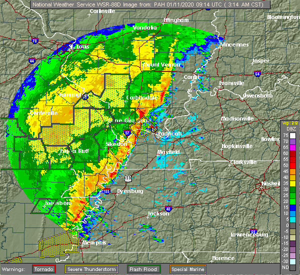 At 319 am cst, a severe thunderstorm was located near new columbia, or 8 miles south of vienna, moving northeast at 50 mph (radar indicated). Hazards include 60 mph wind gusts. Expect damage to roofs, siding, and trees. Locations impacted include, metropolis, vienna, la center, karnak, new columbia, kevil, joppa and belknap. At 319 am cst, a severe thunderstorm was located near new columbia, or 8 miles south of vienna, moving northeast at 50 mph (radar indicated). Hazards include 60 mph wind gusts. Expect damage to roofs, siding, and trees. Locations impacted include, metropolis, vienna, la center, karnak, new columbia, kevil, joppa and belknap.
|
| 1/11/2020 2:57 AM CST |
 The national weather service in paducah has issued a * severe thunderstorm warning for. northeastern pulaski county in southern illinois. northwestern massac county in southern illinois. southwestern johnson county in southern illinois. Northwestern mccracken county in western kentucky. The national weather service in paducah has issued a * severe thunderstorm warning for. northeastern pulaski county in southern illinois. northwestern massac county in southern illinois. southwestern johnson county in southern illinois. Northwestern mccracken county in western kentucky.
|
| 10/21/2019 5:40 AM CDT |
 At 540 am cdt, a severe thunderstorm was located near goreville, or near vienna, moving northeast at 55 mph (radar indicated). Hazards include 60 mph wind gusts. expect damage to roofs, siding, and trees At 540 am cdt, a severe thunderstorm was located near goreville, or near vienna, moving northeast at 55 mph (radar indicated). Hazards include 60 mph wind gusts. expect damage to roofs, siding, and trees
|
| 6/23/2019 4:51 PM CDT |
 At 450 pm cdt, severe thunderstorms were located along a line extending from 6 miles northeast of vienna to near metropolis to near lone oak to near mayfield to near fulgham, moving east at 40 mph (radar indicated). Hazards include 70 mph wind gusts and quarter size hail. Hail damage to vehicles is expected. expect considerable tree damage. wind damage is also likely to mobile homes, roofs, and outbuildings. Locations impacted include, paducah, murray, mayfield, metropolis, benton, calvert city, vienna, reidland, lone oak, rosiclare, brookport, salem, golconda, barkley regional airport, burna, ledbetter, sedalia, new columbia, dixon springs and joy. At 450 pm cdt, severe thunderstorms were located along a line extending from 6 miles northeast of vienna to near metropolis to near lone oak to near mayfield to near fulgham, moving east at 40 mph (radar indicated). Hazards include 70 mph wind gusts and quarter size hail. Hail damage to vehicles is expected. expect considerable tree damage. wind damage is also likely to mobile homes, roofs, and outbuildings. Locations impacted include, paducah, murray, mayfield, metropolis, benton, calvert city, vienna, reidland, lone oak, rosiclare, brookport, salem, golconda, barkley regional airport, burna, ledbetter, sedalia, new columbia, dixon springs and joy.
|
| 6/23/2019 4:37 PM CDT |
 At 436 pm cdt, severe thunderstorms were located along a line extending from near vienna to 7 miles west of metropolis to near lovelaceville to near fulgham, moving east at 40 mph (radar indicated). Hazards include 60 mph wind gusts and half dollar size hail. Hail damage to vehicles is expected. Expect wind damage to roofs, siding, and trees. At 436 pm cdt, severe thunderstorms were located along a line extending from near vienna to 7 miles west of metropolis to near lovelaceville to near fulgham, moving east at 40 mph (radar indicated). Hazards include 60 mph wind gusts and half dollar size hail. Hail damage to vehicles is expected. Expect wind damage to roofs, siding, and trees.
|
| 6/21/2019 5:22 PM CDT |
 The severe thunderstorm warning for pulaski, northwestern massac, west central pope, johnson and williamson counties will expire at 530 pm cdt, the storms which prompted the warning have moved out of the area. therefore, the warning will be allowed to expire. these storms produced widespread wind damage. there is still a lot of lightning. if power lines are down in your area, do not try to pick them up or move them. a severe thunderstorm watch remains in effect until 700 pm cdt for southern illinois. a severe thunderstorm watch also remains in effect until 1000 pm cdt for southern illinois, and western kentucky. The severe thunderstorm warning for pulaski, northwestern massac, west central pope, johnson and williamson counties will expire at 530 pm cdt, the storms which prompted the warning have moved out of the area. therefore, the warning will be allowed to expire. these storms produced widespread wind damage. there is still a lot of lightning. if power lines are down in your area, do not try to pick them up or move them. a severe thunderstorm watch remains in effect until 700 pm cdt for southern illinois. a severe thunderstorm watch also remains in effect until 1000 pm cdt for southern illinois, and western kentucky.
|
| 6/21/2019 4:58 PM CDT | Numerous trees down around the county. roads blocked by fallen trees. at least one power pole knocked down. time estimate in johnson county IL, 0.7 miles E of Vienna, IL |
| 6/21/2019 4:43 PM CDT |
 At 441 pm cdt, severe thunderstorms were located along a line extending from cambria to near tamms, moving southeast at 50 mph (trained weather spotters). Hazards include 70 mph wind gusts. a 72 mph wind gust was reported in cape girardeau as these storms moved through. Expect considerable tree damage. Damage is likely to mobile homes, roofs, and outbuildings. At 441 pm cdt, severe thunderstorms were located along a line extending from cambria to near tamms, moving southeast at 50 mph (trained weather spotters). Hazards include 70 mph wind gusts. a 72 mph wind gust was reported in cape girardeau as these storms moved through. Expect considerable tree damage. Damage is likely to mobile homes, roofs, and outbuildings.
|
| 3/9/2019 12:24 PM CST |
 The severe thunderstorm warning for southeastern union and western johnson counties will expire at 1230 pm cst, the storm which prompted the warning has weakened below severe limits, and has exited the warned area. therefore, the warning will be allowed to expire. The severe thunderstorm warning for southeastern union and western johnson counties will expire at 1230 pm cst, the storm which prompted the warning has weakened below severe limits, and has exited the warned area. therefore, the warning will be allowed to expire.
|
| 3/9/2019 12:14 PM CST |
 At 1214 pm cst, a severe thunderstorm was located near dongola, or 10 miles southeast of anna, moving northeast at 60 mph (radar indicated). Hazards include 60 mph wind gusts. Expect damage to roofs, siding, and trees. Locations impacted include, vienna, dongola, cypress and buncombe. At 1214 pm cst, a severe thunderstorm was located near dongola, or 10 miles southeast of anna, moving northeast at 60 mph (radar indicated). Hazards include 60 mph wind gusts. Expect damage to roofs, siding, and trees. Locations impacted include, vienna, dongola, cypress and buncombe.
|
| 3/9/2019 12:00 PM CST |
 At 1200 pm cst, a severe thunderstorm was located over tamms, or 12 miles east of scott city, moving northeast at 60 mph (radar indicated). Hazards include 60 mph wind gusts. expect damage to roofs, siding, and trees At 1200 pm cst, a severe thunderstorm was located over tamms, or 12 miles east of scott city, moving northeast at 60 mph (radar indicated). Hazards include 60 mph wind gusts. expect damage to roofs, siding, and trees
|
| 6/28/2018 7:50 PM CDT | Widespread trees and power lines down across the county in johnson county IL, 0.6 miles NNE of Vienna, IL |
| 6/28/2018 7:44 PM CDT |
 At 744 pm cdt, severe thunderstorms were located along a line extending from near equality to 8 miles north of golconda to 6 miles northeast of vienna to near cobden, moving southeast at 65 mph (trained weather spotters). Hazards include 70 mph wind gusts and half dollar size hail. Hail damage to vehicles is expected. expect considerable tree damage. wind damage is also likely to mobile homes, roofs, and outbuildings. Locations impacted include, carbondale, marion, herrin, harrisburg, murphysboro, carterville, anna, eldorado, johnston city, jonesboro, vienna, crainville, cambria, cobden, energy, goreville, galatia, ridgway, hurst and dongola. At 744 pm cdt, severe thunderstorms were located along a line extending from near equality to 8 miles north of golconda to 6 miles northeast of vienna to near cobden, moving southeast at 65 mph (trained weather spotters). Hazards include 70 mph wind gusts and half dollar size hail. Hail damage to vehicles is expected. expect considerable tree damage. wind damage is also likely to mobile homes, roofs, and outbuildings. Locations impacted include, carbondale, marion, herrin, harrisburg, murphysboro, carterville, anna, eldorado, johnston city, jonesboro, vienna, crainville, cambria, cobden, energy, goreville, galatia, ridgway, hurst and dongola.
|
| 6/28/2018 7:00 PM CDT |
 At 659 pm cdt, severe thunderstorms were located along a line extending from near bluford to near christopher to percy, moving southeast at 50 mph (radar indicated). Hazards include 70 mph wind gusts and half dollar size hail. Hail damage to vehicles is expected. expect considerable tree damage. Wind damage is also likely to mobile homes, roofs, and outbuildings. At 659 pm cdt, severe thunderstorms were located along a line extending from near bluford to near christopher to percy, moving southeast at 50 mph (radar indicated). Hazards include 70 mph wind gusts and half dollar size hail. Hail damage to vehicles is expected. expect considerable tree damage. Wind damage is also likely to mobile homes, roofs, and outbuildings.
|
| 6/26/2018 7:53 PM CDT |
 At 752 pm cdt, severe thunderstorms were located along a line extending from 6 miles west of carrier mills to 9 miles southeast of creal springs to near new columbia to 6 miles northwest of west paducah, moving east at 60 mph (radar indicated). Hazards include 60 mph wind gusts and nickel size hail. Expect damage to roofs, siding, and trees. Locations impacted include, vienna, creal springs, new columbia, joppa, new burnside, belknap and simpson. At 752 pm cdt, severe thunderstorms were located along a line extending from 6 miles west of carrier mills to 9 miles southeast of creal springs to near new columbia to 6 miles northwest of west paducah, moving east at 60 mph (radar indicated). Hazards include 60 mph wind gusts and nickel size hail. Expect damage to roofs, siding, and trees. Locations impacted include, vienna, creal springs, new columbia, joppa, new burnside, belknap and simpson.
|
| 6/26/2018 7:30 PM CDT |
 At 730 pm cdt, severe thunderstorms were located along a line extending from near carterville to near goreville to near karnak to near mounds, moving east at 60 mph (radar indicated). Hazards include 60 mph wind gusts and nickel size hail. expect damage to roofs, siding, and trees At 730 pm cdt, severe thunderstorms were located along a line extending from near carterville to near goreville to near karnak to near mounds, moving east at 60 mph (radar indicated). Hazards include 60 mph wind gusts and nickel size hail. expect damage to roofs, siding, and trees
|
| 5/19/2018 5:43 PM CDT |
 At 543 pm cdt, a severe thunderstorm was located over karnak, or 8 miles south of vienna, moving east at 30 mph (radar indicated). Hazards include 60 mph wind gusts and quarter size hail. Hail damage to vehicles is expected. expect wind damage to roofs, siding, and trees. Locations impacted include, vienna, karnak, new columbia, joppa, cypress, new grand chain and belknap. At 543 pm cdt, a severe thunderstorm was located over karnak, or 8 miles south of vienna, moving east at 30 mph (radar indicated). Hazards include 60 mph wind gusts and quarter size hail. Hail damage to vehicles is expected. expect wind damage to roofs, siding, and trees. Locations impacted include, vienna, karnak, new columbia, joppa, cypress, new grand chain and belknap.
|
| 5/19/2018 5:23 PM CDT |
 At 522 pm cdt, a severe thunderstorm was located over dongola, or 9 miles southeast of anna, moving east at 35 mph (radar indicated). Hazards include 60 mph wind gusts and quarter size hail. Hail damage to vehicles is expected. Expect wind damage to roofs, siding, and trees. At 522 pm cdt, a severe thunderstorm was located over dongola, or 9 miles southeast of anna, moving east at 35 mph (radar indicated). Hazards include 60 mph wind gusts and quarter size hail. Hail damage to vehicles is expected. Expect wind damage to roofs, siding, and trees.
|
| 4/3/2018 6:25 PM CDT |
 The tornado warning for johnson county will expire at 630 pm cdt, the tornadic thunderstorm which prompted the warning has moved out of the warned area. therefore, the warning will be allowed to expire. however, a separate tornado warning continues for the southeast part of the county until 7 pm. a tornado watch remains in effect until 800 pm cdt for southern illinois. The tornado warning for johnson county will expire at 630 pm cdt, the tornadic thunderstorm which prompted the warning has moved out of the warned area. therefore, the warning will be allowed to expire. however, a separate tornado warning continues for the southeast part of the county until 7 pm. a tornado watch remains in effect until 800 pm cdt for southern illinois.
|
| 4/3/2018 5:57 PM CDT |
 At 556 pm cdt, a severe thunderstorm capable of producing a tornado was located near vienna, moving east at 40 mph (radar indicated rotation). Hazards include tornado and quarter size hail. Flying debris will be dangerous to those caught without shelter. mobile homes will be damaged or destroyed. damage to roofs, windows, and vehicles will occur. Tree damage is likely. At 556 pm cdt, a severe thunderstorm capable of producing a tornado was located near vienna, moving east at 40 mph (radar indicated rotation). Hazards include tornado and quarter size hail. Flying debris will be dangerous to those caught without shelter. mobile homes will be damaged or destroyed. damage to roofs, windows, and vehicles will occur. Tree damage is likely.
|
| 2/24/2018 4:41 PM CST |
 At 441 pm cst, severe thunderstorms were located along a line extending from near goreville to 10 miles northwest of vienna to near dongola, moving northeast at 35 mph (radar indicated). Hazards include 60 mph wind gusts. expect damage to roofs, siding, and trees At 441 pm cst, severe thunderstorms were located along a line extending from near goreville to 10 miles northwest of vienna to near dongola, moving northeast at 35 mph (radar indicated). Hazards include 60 mph wind gusts. expect damage to roofs, siding, and trees
|
| 11/5/2017 8:07 PM CST |
 At 806 pm cst, severe thunderstorms were located along a line extending from 9 miles east of anna to near dongola, moving east at 45 mph (radar indicated). Hazards include quarter size hail. Damage to vehicles is expected. locations impacted include, vienna, dongola, karnak, ullin, cypress, new grand chain and belknap. A tornado watch remains in effect until 1000 pm cst for southern illinois. At 806 pm cst, severe thunderstorms were located along a line extending from 9 miles east of anna to near dongola, moving east at 45 mph (radar indicated). Hazards include quarter size hail. Damage to vehicles is expected. locations impacted include, vienna, dongola, karnak, ullin, cypress, new grand chain and belknap. A tornado watch remains in effect until 1000 pm cst for southern illinois.
|
| 11/5/2017 7:54 PM CST |
 At 754 pm cst, severe thunderstorms were located along a line extending from near anna to near tamms, moving east at 45 mph (radar indicated). Hazards include 60 mph wind gusts and quarter size hail. Hail damage to vehicles is expected. Expect wind damage to roofs, siding, and trees. At 754 pm cst, severe thunderstorms were located along a line extending from near anna to near tamms, moving east at 45 mph (radar indicated). Hazards include 60 mph wind gusts and quarter size hail. Hail damage to vehicles is expected. Expect wind damage to roofs, siding, and trees.
|
| 10/10/2017 6:39 PM CDT |
 The severe thunderstorm warning for johnson county will expire at 645 pm cdt, the severe thunderstorm which prompted the warning has weakened. therefore, the warning will be allowed to expire. however gusty winds are still possible with this thunderstorm. The severe thunderstorm warning for johnson county will expire at 645 pm cdt, the severe thunderstorm which prompted the warning has weakened. therefore, the warning will be allowed to expire. however gusty winds are still possible with this thunderstorm.
|
| 10/10/2017 6:25 PM CDT | Limbs and powerlines down just west of the city in johnson county IL, 0.6 miles NNE of Vienna, IL |
| 10/10/2017 6:07 PM CDT |
 At 607 pm cdt, a severe thunderstorm was located near dongola, or 9 miles east of anna, moving east at 30 mph (radar indicated). Hazards include 60 mph wind gusts and quarter size hail. Hail damage to vehicles is expected. Expect wind damage to roofs, siding, and trees. At 607 pm cdt, a severe thunderstorm was located near dongola, or 9 miles east of anna, moving east at 30 mph (radar indicated). Hazards include 60 mph wind gusts and quarter size hail. Hail damage to vehicles is expected. Expect wind damage to roofs, siding, and trees.
|
| 5/27/2017 6:10 PM CDT |
 At 608 pm cdt, severe thunderstorms were located along a line extending from goreville to near barlow to near east prairie, moving east at 65 mph. these are very dangerous storms (law enforcement. structural damage has been reported in stoddard county with 80 mph winds reported near sikeston missouri). Hazards include 80 mph wind gusts and nickel size hail. Flying debris will be dangerous to those caught without shelter. mobile homes will be heavily damaged. expect considerable damage to roofs, windows, and vehicles. Extensive tree damage and power outages are likely. At 608 pm cdt, severe thunderstorms were located along a line extending from goreville to near barlow to near east prairie, moving east at 65 mph. these are very dangerous storms (law enforcement. structural damage has been reported in stoddard county with 80 mph winds reported near sikeston missouri). Hazards include 80 mph wind gusts and nickel size hail. Flying debris will be dangerous to those caught without shelter. mobile homes will be heavily damaged. expect considerable damage to roofs, windows, and vehicles. Extensive tree damage and power outages are likely.
|
| 5/27/2017 4:20 PM CDT | Numerous trees down across the count in johnson county IL, 1.9 miles N of Vienna, IL |
| 5/27/2017 4:17 PM CDT |
 At 415 pm cdt, severe thunderstorms were located along a line extending from near carrier mills to near vienna, moving east at 55 mph (trained weather spotters. law enforcement officials reported trees down on the western side of johnson county). Hazards include 60 mph wind gusts and half dollar size hail. Hail damage to vehicles is expected. expect wind damage to roofs, siding, and trees. Locations impacted include, marion, harrisburg, vienna, carrier mills, goreville, creal springs, lake of egypt area, dixon springs, carriers mills, stonefort, cypress, new burnside, buncombe, eddyville, muddy and simpson. At 415 pm cdt, severe thunderstorms were located along a line extending from near carrier mills to near vienna, moving east at 55 mph (trained weather spotters. law enforcement officials reported trees down on the western side of johnson county). Hazards include 60 mph wind gusts and half dollar size hail. Hail damage to vehicles is expected. expect wind damage to roofs, siding, and trees. Locations impacted include, marion, harrisburg, vienna, carrier mills, goreville, creal springs, lake of egypt area, dixon springs, carriers mills, stonefort, cypress, new burnside, buncombe, eddyville, muddy and simpson.
|
| 5/27/2017 4:15 PM CDT | Several trees down on route 45... one completely blocking the road for a time. large tree limbs down in residence yard... 10-15 shingles blown off house. neighbors had in johnson county IL, 0.6 miles NNE of Vienna, IL |
| 5/27/2017 4:09 PM CDT | Trees over roadway in johnson county IL, 3.5 miles E of Vienna, IL |
| 5/27/2017 4:01 PM CDT |
 At 400 pm cdt, severe thunderstorms were located along a line extending from near pittsburg to dongola, moving east at 45 mph (trained weather spotters. trees were downed by these storms as they moved through carbondale. other spotters reported winds to at least 50 mph near anna-jonesboro). Hazards include 60 mph wind gusts and half dollar size hail. Hail damage to vehicles is expected. Expect wind damage to roofs, siding, and trees. At 400 pm cdt, severe thunderstorms were located along a line extending from near pittsburg to dongola, moving east at 45 mph (trained weather spotters. trees were downed by these storms as they moved through carbondale. other spotters reported winds to at least 50 mph near anna-jonesboro). Hazards include 60 mph wind gusts and half dollar size hail. Hail damage to vehicles is expected. Expect wind damage to roofs, siding, and trees.
|
| 4/28/2017 11:29 PM CDT |
 At 1128 pm cdt, a severe thunderstorm was located near creal springs, or 8 miles northeast of vienna, moving northeast at 55 mph (radar indicated). Hazards include quarter size hail. damage to vehicles is expected At 1128 pm cdt, a severe thunderstorm was located near creal springs, or 8 miles northeast of vienna, moving northeast at 55 mph (radar indicated). Hazards include quarter size hail. damage to vehicles is expected
|
| 4/28/2017 10:30 PM CDT |
 At 1030 pm cdt, a severe thunderstorm was located near karnak, or 8 miles west of vienna, moving east at 35 mph (radar indicated). Hazards include 70 mph wind gusts. Expect considerable tree damage. Damage is likely to mobile homes, roofs, and outbuildings. At 1030 pm cdt, a severe thunderstorm was located near karnak, or 8 miles west of vienna, moving east at 35 mph (radar indicated). Hazards include 70 mph wind gusts. Expect considerable tree damage. Damage is likely to mobile homes, roofs, and outbuildings.
|
| 3/1/2017 4:21 AM CST |
 At 421 am cst, severe thunderstorms were located along a line extending from 6 miles southeast of grand tower to near ware to near cape girardeau, moving east at 75 mph (radar indicated). Hazards include 60 mph wind gusts and nickel size hail. expect damage to roofs, siding, and trees At 421 am cst, severe thunderstorms were located along a line extending from 6 miles southeast of grand tower to near ware to near cape girardeau, moving east at 75 mph (radar indicated). Hazards include 60 mph wind gusts and nickel size hail. expect damage to roofs, siding, and trees
|
| 7/27/2016 6:05 PM CDT | Spotter reports one large tree down... ditches becomming full of water but no flooding... only light rain at the time. said looks like it will be clearing soo in johnson county IL, 0.6 miles NNE of Vienna, IL |
| 7/27/2016 5:08 PM CDT |
 At 507 pm cdt, a severe thunderstorm was located near vienna, moving northwest at less than 10 mph (radar indicated). Hazards include 60 mph wind gusts and quarter size hail. Hail damage to vehicles is expected. Expect wind damage to roofs, siding, and trees. At 507 pm cdt, a severe thunderstorm was located near vienna, moving northwest at less than 10 mph (radar indicated). Hazards include 60 mph wind gusts and quarter size hail. Hail damage to vehicles is expected. Expect wind damage to roofs, siding, and trees.
|
| 7/7/2016 12:44 PM CDT |
 At 1243 pm cdt, a severe thunderstorm was located near new columbia, or 8 miles south of vienna, moving east at 55 mph (radar indicated). Hazards include 60 mph wind gusts. Expect damage to roofs. siding. and trees. Locations impacted include, vienna, karnak, new columbia, new grand chain and belknap. At 1243 pm cdt, a severe thunderstorm was located near new columbia, or 8 miles south of vienna, moving east at 55 mph (radar indicated). Hazards include 60 mph wind gusts. Expect damage to roofs. siding. and trees. Locations impacted include, vienna, karnak, new columbia, new grand chain and belknap.
|
| 7/7/2016 12:30 PM CDT |
 At 1230 pm cdt, a severe thunderstorm was located near dongola, or 12 miles southwest of vienna, moving east at 55 mph (radar indicated). Hazards include 60 mph wind gusts. Expect damage to roofs. siding. And trees. At 1230 pm cdt, a severe thunderstorm was located near dongola, or 12 miles southwest of vienna, moving east at 55 mph (radar indicated). Hazards include 60 mph wind gusts. Expect damage to roofs. siding. And trees.
|
| 7/6/2016 1:23 PM CDT |
 At 122 pm cdt, severe thunderstorms were located along a line extending from near vienna to near barlow to near clayton, moving east at 60 mph (trained weather spotters). Hazards include 60 mph wind gusts and nickel size hail. Expect damage to roofs. siding. and trees. Locations impacted include, charleston, anna, east prairie, cairo, hickman, vienna, clinton, la center, bardwell, wickliffe, mounds, dongola, barlow, mound city, karnak, wyatt, anniston, pinhook, cayce and dorena. At 122 pm cdt, severe thunderstorms were located along a line extending from near vienna to near barlow to near clayton, moving east at 60 mph (trained weather spotters). Hazards include 60 mph wind gusts and nickel size hail. Expect damage to roofs. siding. and trees. Locations impacted include, charleston, anna, east prairie, cairo, hickman, vienna, clinton, la center, bardwell, wickliffe, mounds, dongola, barlow, mound city, karnak, wyatt, anniston, pinhook, cayce and dorena.
|
| 7/6/2016 1:03 PM CDT |
 At 103 pm cdt, severe thunderstorms were located along a line extending from near jonesboro to near horseshoe lake conservation area to near risco, moving east at 50 mph (radar indicated). Hazards include 60 mph wind gusts. Expect damage to roofs. siding. And trees. At 103 pm cdt, severe thunderstorms were located along a line extending from near jonesboro to near horseshoe lake conservation area to near risco, moving east at 50 mph (radar indicated). Hazards include 60 mph wind gusts. Expect damage to roofs. siding. And trees.
|
| 7/3/2016 5:04 PM CDT |
 At 503 pm cdt, a severe thunderstorm capable of producing a tornado was located near vienna, moving east at 30 mph (radar indicated rotation). Hazards include tornado and quarter size hail. Flying debris will be dangerous to those caught without shelter. mobile homes will be damaged or destroyed. damage to roofs, windows, and vehicles will occur. tree damage is likely. Locations impacted include, vienna and simpson. At 503 pm cdt, a severe thunderstorm capable of producing a tornado was located near vienna, moving east at 30 mph (radar indicated rotation). Hazards include tornado and quarter size hail. Flying debris will be dangerous to those caught without shelter. mobile homes will be damaged or destroyed. damage to roofs, windows, and vehicles will occur. tree damage is likely. Locations impacted include, vienna and simpson.
|
| 7/3/2016 4:48 PM CDT |
 At 448 pm cdt, a severe thunderstorm capable of producing a tornado was located near vienna, moving east at 35 mph (radar indicated rotation). Hazards include tornado and quarter size hail. Flying debris will be dangerous to those caught without shelter. mobile homes will be damaged or destroyed. damage to roofs, windows, and vehicles will occur. tree damage is likely. This tornadic thunderstorm will remain over mainly rural areas of central johnson county, including the following locations: cypress and simpson. At 448 pm cdt, a severe thunderstorm capable of producing a tornado was located near vienna, moving east at 35 mph (radar indicated rotation). Hazards include tornado and quarter size hail. Flying debris will be dangerous to those caught without shelter. mobile homes will be damaged or destroyed. damage to roofs, windows, and vehicles will occur. tree damage is likely. This tornadic thunderstorm will remain over mainly rural areas of central johnson county, including the following locations: cypress and simpson.
|
| 6/15/2016 12:03 PM CDT |
 At 1202 pm cdt, a severe thunderstorm was located near dongola, or 10 miles southeast of anna, moving east at 25 mph (radar indicated). Hazards include 60 mph wind gusts and quarter size hail. Hail damage to vehicles is expected. Expect wind damage to roofs, siding, and trees. At 1202 pm cdt, a severe thunderstorm was located near dongola, or 10 miles southeast of anna, moving east at 25 mph (radar indicated). Hazards include 60 mph wind gusts and quarter size hail. Hail damage to vehicles is expected. Expect wind damage to roofs, siding, and trees.
|
| 5/11/2016 7:51 PM CDT |
 At 751 pm cdt, severe thunderstorms were located along a line extending from near creal springs to near dongola, moving southeast at 35 mph (radar indicated). Hazards include 60 mph wind gusts and quarter size hail. Hail damage to vehicles is expected. Expect wind damage to roofs, siding, and trees. At 751 pm cdt, severe thunderstorms were located along a line extending from near creal springs to near dongola, moving southeast at 35 mph (radar indicated). Hazards include 60 mph wind gusts and quarter size hail. Hail damage to vehicles is expected. Expect wind damage to roofs, siding, and trees.
|
| 4/26/2016 4:47 PM CDT | Quarter sized hail reported 0.6 miles NNE of Vienna, IL, dime to quarter size |
| 4/26/2016 4:45 PM CDT | Quarter sized hail reported 0.6 miles NNE of Vienna, IL |
| 12/23/2015 2:56 PM CST | At 255 pm cst, a severe thunderstorm capable of producing a tornado was located near dixon springs, or 8 miles east of vienna, moving northeast at 60 mph (radar indicated rotation). Hazards include tornado. Flying debris will be dangerous to those caught without shelter. mobile homes will be damaged or destroyed. damage to roofs, windows and vehicles will occur. tree damage is likely. This tornadic thunderstorm will remain over mainly rural areas of northern pope and southeastern johnson counties, including the following locations, eddyville and simpson. |
| 12/23/2015 2:43 PM CST | At 243 pm cst, a severe thunderstorm was located over karnak, or 9 miles south of vienna, moving northeast at 80 mph (emergency management. power was out near mound city illinois). Hazards include 60 mph wind gusts and penny size hail. Expect damage to roofs. Siding and trees. |
| 12/23/2015 12:04 PM CST | At 1203 pm cst, severe thunderstorms were located along a line extending from near wayne city to 8 miles north of galatia to 7 miles southeast of creal springs, moving northeast at 110 mph (radar indicated). Hazards include 60 mph wind gusts. Expect damage to roofs. siding and trees. locations impacted include, marion, vienna, creal springs, stonefort, new burnside, belknap and simpson. A tornado watch remains in effect until 500 pm cst for southern illinois. |
| 12/23/2015 12:03 PM CST | Winds estimated 50 to 60 mph. reported by off duty nws employe in johnson county IL, 1.1 miles WNW of Vienna, IL |
| 12/23/2015 12:02 PM CST | At 1153 am cst, a severe thunderstorm capable of producing a tornado was located over vienna, moving northeast at 55 mph (radar indicated rotation). Hazards include tornado. Flying debris will be dangerous to those caught without shelter. mobile homes will be damaged or destroyed. damage to roofs, windows and vehicles will occur. tree damage is likely. This tornadic thunderstorm will remain over mainly rural areas of southeastern johnson county, including the following locations, simpson and belknap. |
| 12/23/2015 11:56 AM CST | At 1155 am cst, severe thunderstorms were located along a line extending from 10 miles northeast of rend lake area to near pittsburg to near new columbia, moving east at 60 mph (radar indicated. there have been a few reports of 60 mph wind gusts with this line). Hazards include 60 mph wind gusts. Expect damage to roofs. siding and trees. locations impacted include, marion, mount vernon, west frankfort, benton, johnston city, vienna, goreville, bluford, pittsburg, creal springs, thompsonville, lake of egypt area, ina, belle rive, hanaford, ewing, stonefort, cypress, new burnside and buncombe. A tornado watch remains in effect until 500 pm cst for southern illinois. |
| 12/23/2015 11:53 AM CST | At 1153 am cst, a severe thunderstorm capable of producing a tornado was located over vienna, moving northeast at 55 mph (radar indicated rotation). Hazards include tornado. Flying debris will be dangerous to those caught without shelter. mobile homes will be damaged or destroyed. damage to roofs, windows and vehicles will occur. tree damage is likely. This tornadic thunderstorm will remain over mainly rural areas of southeastern johnson county, including the following locations, simpson and belknap. |
| 12/23/2015 11:28 AM CST | At 1127 am cst, severe thunderstorms were located along a line extending from near du quoin to near cobden to near olive branch, moving east at 60 mph (radar indicated). Hazards include 60 mph wind gusts. Expect damage to roofs. Siding and trees. |
| 7/20/2015 8:33 PM CDT |
 At 833 pm cdt, a severe thunderstorm was located near dixon springs, or 10 miles southeast of vienna, moving east at 40 mph (radar indicated). Hazards include 60 mph wind gusts. Expect damage to roofs. siding and trees. Locations impacted include, vienna, karnak, new columbia, joppa, new grand chain, belknap and simpson. At 833 pm cdt, a severe thunderstorm was located near dixon springs, or 10 miles southeast of vienna, moving east at 40 mph (radar indicated). Hazards include 60 mph wind gusts. Expect damage to roofs. siding and trees. Locations impacted include, vienna, karnak, new columbia, joppa, new grand chain, belknap and simpson.
|
| 7/20/2015 8:02 PM CDT |
 At 801 pm cdt, a severe thunderstorm was located near dongola, or 10 miles west of vienna, moving east at 40 mph (radar indicated). Hazards include 60 mph wind gusts. Expect damage to roofs. Siding and trees. At 801 pm cdt, a severe thunderstorm was located near dongola, or 10 miles west of vienna, moving east at 40 mph (radar indicated). Hazards include 60 mph wind gusts. Expect damage to roofs. Siding and trees.
|
| 4/9/2015 10:47 PM CDT | The national weather service in paducah has issued a * severe thunderstorm warning for. northwestern pope county in southern illinois. eastern johnson county in southern illinois. until 1115 pm cdt * at 1046 pm cdt. A severe thunderstorm was located 8 miles. |
| 4/3/2015 12:12 PM CDT | A severe thunderstorm warning remains in effect until 1245 pm cdt for southeastern saline. northern pope and northeastern johnson counties. at 1211 pm cdt. a severe thunderstorm was located 9 miles south of carriers mills. or 13 miles south of harrisburg. Moving northeast at 60 mph. |
| 4/3/2015 11:58 AM CDT | The national weather service in paducah has issued a * severe thunderstorm warning for. southeastern saline county in southern illinois. northern pope county in southern illinois. northeastern johnson county in southern illinois. Until 1245 pm cdt. |
| 3/25/2015 8:28 PM CDT | The national weather service in paducah has issued a * severe thunderstorm warning for. southeastern saline county in southern illinois. pope county in southern illinois. northwestern hardin county in southern illinois. Southeastern johnson county in southern illinois. |
| 10/3/2012 8:19 PM CDT | Quarter sized hail reported 4.6 miles E of Vienna, IL, winds to 45 mph also reported at the same location. |
| 1/1/0001 12:00 AM | Downed trees with standing water on roadways along dutchman lake roa in johnson county IL, 0.6 miles NNE of Vienna, IL |
| 11/20/2011 11:29 PM CST | Quarter sized hail reported 0.6 miles NNE of Vienna, IL, approximately 1/2 mile east of vienna |
| 11/14/2011 6:01 PM CST | Quarter sized hail reported 3.3 miles NW of Vienna, IL, quater size hail reported along interstate 24 near mile marker 22. |
| 1/1/0001 12:00 AM | Late report...destoryed shed with multiple trees down with some uprooted and snappe in johnson county IL, 2.7 miles WNW of Vienna, IL |
| 1/1/0001 12:00 AM | Several trees down west of the city limits and dime size hail in johnson county IL, 0.6 miles NNE of Vienna, IL |
| 1/1/0001 12:00 AM | Late repor in johnson county IL, 2.4 miles ENE of Vienna, IL |
Hail Maps for Vienna, IL
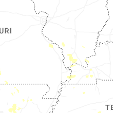

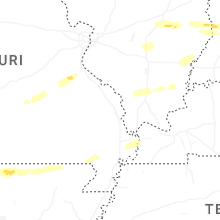
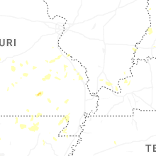


Connect with Interactive Hail Maps