

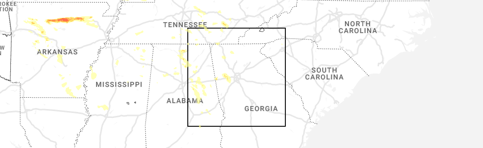
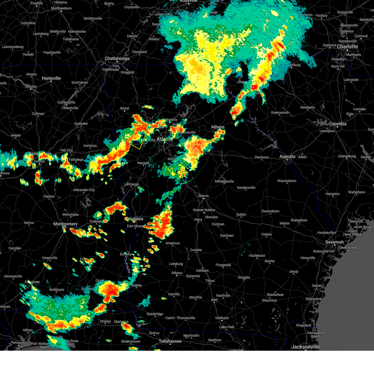
Hail Map for Villa Rica, GA
The Villa Rica, GA area has had 1 report of on-the-ground hail by trained spotters, and has been under severe weather warnings 35 times during the past 12 months. Doppler radar has detected hail at or near Villa Rica, GA on 44 occasions, including 4 occasions during the past year.
| Name: | Villa Rica, GA |
| Where Located: | 30.8 miles W of Atlanta, GA |
| Map: | Google Map for Villa Rica, GA |
| Population: | 13956 |
| Housing Units: | 5810 |
| More Info: | Search Google for Villa Rica, GA |
1
The Top Recent Hail Date for Villa Rica, GA is Sunday, June 25, 2023 (7th out of 44)
Hail and Wind Damage Spotted near Villa Rica, GA
| Date / Time | Report Details |
|---|---|
| 2/28/2024 2:58 PM EST |
 Svrffc the national weather service in peachtree city has issued a * severe thunderstorm warning for, southeastern paulding county in northwestern georgia, northwestern dekalb county in north central georgia, central cobb county in north central georgia, douglas county in north central georgia, west central gwinnett county in north central georgia, fulton county in north central georgia, * until 330 pm est. * at 258 pm est, severe thunderstorms were located along a line extending from near roswell to smyrna to winston, moving southeast at 35 mph (radar indicated). Hazards include 60 mph wind gusts and penny size hail. expect damage to roofs, siding, and trees Svrffc the national weather service in peachtree city has issued a * severe thunderstorm warning for, southeastern paulding county in northwestern georgia, northwestern dekalb county in north central georgia, central cobb county in north central georgia, douglas county in north central georgia, west central gwinnett county in north central georgia, fulton county in north central georgia, * until 330 pm est. * at 258 pm est, severe thunderstorms were located along a line extending from near roswell to smyrna to winston, moving southeast at 35 mph (radar indicated). Hazards include 60 mph wind gusts and penny size hail. expect damage to roofs, siding, and trees
|
| 2/28/2024 2:35 PM EST |
 Svrffc the national weather service in peachtree city has issued a * severe thunderstorm warning for, paulding county in northwestern georgia, east central haralson county in northwestern georgia, northeastern carroll county in northwestern georgia, cobb county in north central georgia, douglas county in north central georgia, * until 300 pm est. * at 235 pm est, severe thunderstorms were located along a line extending from near acworth to dallas to near draketown, moving east at 35 mph (radar indicated). Hazards include 60 mph wind gusts and penny size hail. expect damage to roofs, siding, and trees Svrffc the national weather service in peachtree city has issued a * severe thunderstorm warning for, paulding county in northwestern georgia, east central haralson county in northwestern georgia, northeastern carroll county in northwestern georgia, cobb county in north central georgia, douglas county in north central georgia, * until 300 pm est. * at 235 pm est, severe thunderstorms were located along a line extending from near acworth to dallas to near draketown, moving east at 35 mph (radar indicated). Hazards include 60 mph wind gusts and penny size hail. expect damage to roofs, siding, and trees
|
| 8/28/2023 5:50 PM EDT |
 At 550 pm edt, severe thunderstorms were located along a line extending from near campbellton to hannah, moving north at 20 mph (radar indicated). Hazards include 60 mph wind gusts and nickel size hail. expect damage to roofs, siding, and trees At 550 pm edt, severe thunderstorms were located along a line extending from near campbellton to hannah, moving north at 20 mph (radar indicated). Hazards include 60 mph wind gusts and nickel size hail. expect damage to roofs, siding, and trees
|
| 8/28/2023 4:55 PM EDT |
 The severe thunderstorm warning for western paulding, eastern haralson, north central carroll and southeastern polk counties will expire at 500 pm edt, the storm which prompted the warning has weakened below severe limits, and no longer poses an immediate threat to life or property. therefore, the warning will be allowed to expire. The severe thunderstorm warning for western paulding, eastern haralson, north central carroll and southeastern polk counties will expire at 500 pm edt, the storm which prompted the warning has weakened below severe limits, and no longer poses an immediate threat to life or property. therefore, the warning will be allowed to expire.
|
| 8/28/2023 4:15 PM EDT |
 At 415 pm edt, a severe thunderstorm was located near bremen, or near buchanan, moving north at 15 mph (radar indicated). Hazards include 60 mph wind gusts and nickel size hail. expect damage to roofs, siding, and trees At 415 pm edt, a severe thunderstorm was located near bremen, or near buchanan, moving north at 15 mph (radar indicated). Hazards include 60 mph wind gusts and nickel size hail. expect damage to roofs, siding, and trees
|
| 8/12/2023 6:03 PM EDT |
 At 603 pm edt, a severe thunderstorm was located over new georgia, or 8 miles southwest of dallas, moving southeast at 15 mph (radar indicated). Hazards include 60 mph wind gusts and quarter size hail. Hail damage to vehicles is expected. expect wind damage to roofs, siding, and trees. locations impacted include, dallas, villa rica, temple, hiram, braswell, cross roads, burnt hickory ridge, draketown, lake val-do-mar, new hope, new georgia, and winston. hail threat, radar indicated max hail size, 1. 00 in wind threat, radar indicated max wind gust, 60 mph. At 603 pm edt, a severe thunderstorm was located over new georgia, or 8 miles southwest of dallas, moving southeast at 15 mph (radar indicated). Hazards include 60 mph wind gusts and quarter size hail. Hail damage to vehicles is expected. expect wind damage to roofs, siding, and trees. locations impacted include, dallas, villa rica, temple, hiram, braswell, cross roads, burnt hickory ridge, draketown, lake val-do-mar, new hope, new georgia, and winston. hail threat, radar indicated max hail size, 1. 00 in wind threat, radar indicated max wind gust, 60 mph.
|
| 8/12/2023 6:02 PM EDT |
 At 601 pm edt, a severe thunderstorm was located over new georgia, or 8 miles southwest of dallas, moving southeast at 15 mph (radar indicated). Hazards include 60 mph wind gusts and quarter size hail. Hail damage to vehicles is expected. expect wind damage to roofs, siding, and trees. locations impacted include, dallas, villa rica, temple, hiram, braswell, taylorsville, burnt hickory ridge, cross roads, draketown, lake val-do-mar, new hope, new georgia, and winston. hail threat, radar indicated max hail size, 1. 00 in wind threat, radar indicated max wind gust, 60 mph. At 601 pm edt, a severe thunderstorm was located over new georgia, or 8 miles southwest of dallas, moving southeast at 15 mph (radar indicated). Hazards include 60 mph wind gusts and quarter size hail. Hail damage to vehicles is expected. expect wind damage to roofs, siding, and trees. locations impacted include, dallas, villa rica, temple, hiram, braswell, taylorsville, burnt hickory ridge, cross roads, draketown, lake val-do-mar, new hope, new georgia, and winston. hail threat, radar indicated max hail size, 1. 00 in wind threat, radar indicated max wind gust, 60 mph.
|
| 8/12/2023 5:34 PM EDT |
 At 534 pm edt, a severe thunderstorm was located over draketown, or 9 miles northeast of buchanan, moving southeast at 15 mph (radar indicated). Hazards include 60 mph wind gusts and quarter size hail. Hail damage to vehicles is expected. Expect wind damage to roofs, siding, and trees. At 534 pm edt, a severe thunderstorm was located over draketown, or 9 miles northeast of buchanan, moving southeast at 15 mph (radar indicated). Hazards include 60 mph wind gusts and quarter size hail. Hail damage to vehicles is expected. Expect wind damage to roofs, siding, and trees.
|
| 8/7/2023 5:41 PM EDT |
 The severe thunderstorm warning for east central carroll, douglas and southwestern fulton counties will expire at 545 pm edt, the storms which prompted the warning have moved out of the area. therefore, the warning will be allowed to expire. however, gusty winds are still possible with these thunderstorms. a severe thunderstorm watch remains in effect until 800 pm edt for north central and northwestern georgia. remember, a severe thunderstorm warning still remains in effect for southern douglas, fulton and carroll counties. The severe thunderstorm warning for east central carroll, douglas and southwestern fulton counties will expire at 545 pm edt, the storms which prompted the warning have moved out of the area. therefore, the warning will be allowed to expire. however, gusty winds are still possible with these thunderstorms. a severe thunderstorm watch remains in effect until 800 pm edt for north central and northwestern georgia. remember, a severe thunderstorm warning still remains in effect for southern douglas, fulton and carroll counties.
|
| 8/7/2023 5:40 PM EDT |
 The severe thunderstorm warning for paulding, southwestern cherokee, western cobb, northeastern carroll, northern douglas and southeastern bartow counties will expire at 545 pm edt, the storm which prompted the warning has moved out of the area. therefore, the warning will be allowed to expire. however, gusty winds are still possible with this thunderstorm. a severe thunderstorm watch remains in effect until 800 pm edt for north central and northwestern georgia. remember, a severe thunderstorm warning still remains in effect for douglas and cobb counties. The severe thunderstorm warning for paulding, southwestern cherokee, western cobb, northeastern carroll, northern douglas and southeastern bartow counties will expire at 545 pm edt, the storm which prompted the warning has moved out of the area. therefore, the warning will be allowed to expire. however, gusty winds are still possible with this thunderstorm. a severe thunderstorm watch remains in effect until 800 pm edt for north central and northwestern georgia. remember, a severe thunderstorm warning still remains in effect for douglas and cobb counties.
|
| 8/7/2023 5:16 PM EDT |
 At 516 pm edt, severe thunderstorms were located along a line extending from near abilene to bowdon, moving east at 45 mph (radar indicated). Hazards include 70 mph wind gusts. Expect considerable tree damage. Damage is likely to mobile homes, roofs, and outbuildings. At 516 pm edt, severe thunderstorms were located along a line extending from near abilene to bowdon, moving east at 45 mph (radar indicated). Hazards include 70 mph wind gusts. Expect considerable tree damage. Damage is likely to mobile homes, roofs, and outbuildings.
|
| 8/7/2023 5:00 PM EDT |
 At 500 pm edt, a severe thunderstorm was located over braswell, or near dallas, moving east at 35 mph (radar indicated). Hazards include 60 mph wind gusts and penny size hail. expect damage to roofs, siding, and trees At 500 pm edt, a severe thunderstorm was located over braswell, or near dallas, moving east at 35 mph (radar indicated). Hazards include 60 mph wind gusts and penny size hail. expect damage to roofs, siding, and trees
|
| 8/6/2023 6:42 PM EDT |
 The severe thunderstorm warning for paulding, northeastern haralson, northeastern carroll and northwestern douglas counties will expire at 645 pm edt, the storm which prompted the warning has weakened below severe limits, and no longer poses an immediate threat to life or property. therefore, the warning will be allowed to expire. however, gusty winds are still possible with this thunderstorm. a severe thunderstorm watch remains in effect until 900 pm edt for north central and northwestern georgia. The severe thunderstorm warning for paulding, northeastern haralson, northeastern carroll and northwestern douglas counties will expire at 645 pm edt, the storm which prompted the warning has weakened below severe limits, and no longer poses an immediate threat to life or property. therefore, the warning will be allowed to expire. however, gusty winds are still possible with this thunderstorm. a severe thunderstorm watch remains in effect until 900 pm edt for north central and northwestern georgia.
|
| 8/6/2023 6:28 PM EDT |
 At 628 pm edt, a severe thunderstorm was located over hiram, or near dallas, moving east at 35 mph (radar indicated). Hazards include 60 mph wind gusts and penny size hail. Expect damage to roofs, siding, and trees. locations impacted include, douglasville, dallas, villa rica, powder springs, temple, hiram, braswell, yorkville, burnt hickory ridge, eubank lake, brownsville, draketown, winston, lake val-do-mar, new hope, and new georgia. hail threat, radar indicated max hail size, 0. 75 in wind threat, radar indicated max wind gust, 60 mph. At 628 pm edt, a severe thunderstorm was located over hiram, or near dallas, moving east at 35 mph (radar indicated). Hazards include 60 mph wind gusts and penny size hail. Expect damage to roofs, siding, and trees. locations impacted include, douglasville, dallas, villa rica, powder springs, temple, hiram, braswell, yorkville, burnt hickory ridge, eubank lake, brownsville, draketown, winston, lake val-do-mar, new hope, and new georgia. hail threat, radar indicated max hail size, 0. 75 in wind threat, radar indicated max wind gust, 60 mph.
|
| 8/6/2023 6:00 PM EDT |
 At 600 pm edt, a severe thunderstorm was located over draketown, or near buchanan, moving east at 35 mph (radar indicated). Hazards include 60 mph wind gusts and penny size hail. expect damage to roofs, siding, and trees At 600 pm edt, a severe thunderstorm was located over draketown, or near buchanan, moving east at 35 mph (radar indicated). Hazards include 60 mph wind gusts and penny size hail. expect damage to roofs, siding, and trees
|
| 8/6/2023 3:39 PM EDT |
 At 339 pm edt, a severe thunderstorm was located near braswell, or 10 miles northwest of dallas, moving east at 20 mph (radar indicated). Hazards include 60 mph wind gusts and penny size hail. expect damage to roofs, siding, and trees At 339 pm edt, a severe thunderstorm was located near braswell, or 10 miles northwest of dallas, moving east at 20 mph (radar indicated). Hazards include 60 mph wind gusts and penny size hail. expect damage to roofs, siding, and trees
|
| 8/3/2023 5:06 PM EDT |
 At 506 pm edt, a severe thunderstorm was located over clem, or near carrollton, moving southeast at 40 mph (radar indicated). Hazards include 70 mph wind gusts. Expect considerable tree damage. damage is likely to mobile homes, roofs, and outbuildings. locations impacted include, newnan, carrollton, franklin, city of south fulton, tyrone, palmetto, grantville, luthersville, whitesburg, centralhatchee, moreland, sharpsburg, roopville, chattahoochee hills, east newnan, corinth, plant yates, bill arp, seaton lake, and fairplay. thunderstorm damage threat, considerable hail threat, radar indicated max hail size, <. 75 in wind threat, radar indicated max wind gust, 70 mph. At 506 pm edt, a severe thunderstorm was located over clem, or near carrollton, moving southeast at 40 mph (radar indicated). Hazards include 70 mph wind gusts. Expect considerable tree damage. damage is likely to mobile homes, roofs, and outbuildings. locations impacted include, newnan, carrollton, franklin, city of south fulton, tyrone, palmetto, grantville, luthersville, whitesburg, centralhatchee, moreland, sharpsburg, roopville, chattahoochee hills, east newnan, corinth, plant yates, bill arp, seaton lake, and fairplay. thunderstorm damage threat, considerable hail threat, radar indicated max hail size, <. 75 in wind threat, radar indicated max wind gust, 70 mph.
|
| 8/3/2023 5:01 PM EDT |
 At 501 pm edt, a severe thunderstorm was located over lowell, or near carrollton, moving east at 40 mph (radar indicated). Hazards include 60 mph wind gusts. expect damage to roofs, siding, and trees At 501 pm edt, a severe thunderstorm was located over lowell, or near carrollton, moving east at 40 mph (radar indicated). Hazards include 60 mph wind gusts. expect damage to roofs, siding, and trees
|
| 8/3/2023 4:59 PM EDT |
 At 458 pm edt, a severe thunderstorm was located over carrollton, moving east at 40 mph (radar indicated). Hazards include 60 mph wind gusts. Expect damage to roofs, siding, and trees. locations impacted include, carrollton, villa rica, bremen, temple, bowdon, mount zion, whitesburg, ephesus, roopville, bowdon junction, hannah, tyus, roosterville, seaton lake, fairplay, clem, frolona, abilene, john tanner state park, and lowell. hail threat, radar indicated max hail size, <. 75 in wind threat, radar indicated max wind gust, 60 mph. At 458 pm edt, a severe thunderstorm was located over carrollton, moving east at 40 mph (radar indicated). Hazards include 60 mph wind gusts. Expect damage to roofs, siding, and trees. locations impacted include, carrollton, villa rica, bremen, temple, bowdon, mount zion, whitesburg, ephesus, roopville, bowdon junction, hannah, tyus, roosterville, seaton lake, fairplay, clem, frolona, abilene, john tanner state park, and lowell. hail threat, radar indicated max hail size, <. 75 in wind threat, radar indicated max wind gust, 60 mph.
|
| 8/3/2023 4:33 PM EDT |
 At 433 pm edt, a severe thunderstorm was located over i 20 welcome center, or 11 miles east of heflin, moving southeast at 25 mph (radar indicated). Hazards include 60 mph wind gusts. expect damage to roofs, siding, and trees At 433 pm edt, a severe thunderstorm was located over i 20 welcome center, or 11 miles east of heflin, moving southeast at 25 mph (radar indicated). Hazards include 60 mph wind gusts. expect damage to roofs, siding, and trees
|
| 8/3/2023 4:30 PM EDT |
 At 430 pm edt, a severe thunderstorm was located over brownsville, or near douglasville, moving southeast at 25 mph (radar indicated). Hazards include 60 mph wind gusts. expect damage to roofs, siding, and trees At 430 pm edt, a severe thunderstorm was located over brownsville, or near douglasville, moving southeast at 25 mph (radar indicated). Hazards include 60 mph wind gusts. expect damage to roofs, siding, and trees
|
| 6/30/2023 2:15 PM EDT |
 At 214 pm edt, severe thunderstorms were located along a line extending from near bremen to near abilene to hannah, moving south at 15 mph (radar indicated). Hazards include 60 mph wind gusts and quarter size hail. Hail damage to vehicles is expected. Expect wind damage to roofs, siding, and trees. At 214 pm edt, severe thunderstorms were located along a line extending from near bremen to near abilene to hannah, moving south at 15 mph (radar indicated). Hazards include 60 mph wind gusts and quarter size hail. Hail damage to vehicles is expected. Expect wind damage to roofs, siding, and trees.
|
| 6/30/2023 2:04 PM EDT |
 At 204 pm edt, a severe thunderstorm was located over temple, or 8 miles southeast of buchanan, moving south at 15 mph (radar indicated). Hazards include 60 mph wind gusts and quarter size hail. Hail damage to vehicles is expected. expect wind damage to roofs, siding, and trees. locations impacted include, carrollton, buchanan, villa rica, bremen, temple, mount zion, waco, abilene, treasure lake, bowdon junction and fairplay. hail threat, radar indicated max hail size, 1. 00 in wind threat, radar indicated max wind gust, 60 mph. At 204 pm edt, a severe thunderstorm was located over temple, or 8 miles southeast of buchanan, moving south at 15 mph (radar indicated). Hazards include 60 mph wind gusts and quarter size hail. Hail damage to vehicles is expected. expect wind damage to roofs, siding, and trees. locations impacted include, carrollton, buchanan, villa rica, bremen, temple, mount zion, waco, abilene, treasure lake, bowdon junction and fairplay. hail threat, radar indicated max hail size, 1. 00 in wind threat, radar indicated max wind gust, 60 mph.
|
| 6/30/2023 1:42 PM EDT |
 At 142 pm edt, a severe thunderstorm was located over draketown, or near buchanan, moving south at 15 mph (radar indicated). Hazards include 60 mph wind gusts and quarter size hail. Hail damage to vehicles is expected. Expect wind damage to roofs, siding, and trees. At 142 pm edt, a severe thunderstorm was located over draketown, or near buchanan, moving south at 15 mph (radar indicated). Hazards include 60 mph wind gusts and quarter size hail. Hail damage to vehicles is expected. Expect wind damage to roofs, siding, and trees.
|
| 6/30/2023 1:10 PM EDT |
 At 110 pm edt, a severe thunderstorm was located over yorkville, or 11 miles west of dallas, moving south at 20 mph (radar indicated). Hazards include 60 mph wind gusts and quarter size hail. Hail damage to vehicles is expected. Expect wind damage to roofs, siding, and trees. At 110 pm edt, a severe thunderstorm was located over yorkville, or 11 miles west of dallas, moving south at 20 mph (radar indicated). Hazards include 60 mph wind gusts and quarter size hail. Hail damage to vehicles is expected. Expect wind damage to roofs, siding, and trees.
|
| 6/25/2023 6:57 PM EDT |
 At 657 pm edt, a severe thunderstorm was located over carrollton, moving southeast at 10 mph (radar indicated). Hazards include 60 mph wind gusts. expect damage to roofs, siding, and trees At 657 pm edt, a severe thunderstorm was located over carrollton, moving southeast at 10 mph (radar indicated). Hazards include 60 mph wind gusts. expect damage to roofs, siding, and trees
|
| 6/25/2023 6:56 PM EDT |
 At 655 pm edt, a severe thunderstorm was located over the area (radar indicated). Hazards include 60 mph wind gusts. expect damage to roofs, siding, and trees At 655 pm edt, a severe thunderstorm was located over the area (radar indicated). Hazards include 60 mph wind gusts. expect damage to roofs, siding, and trees
|
| 6/25/2023 6:24 PM EDT |
 At 623 pm edt, severe thunderstorms were located along a line extending from near lilburn to hiram to winston to near arnco-sargent, moving southeast at 45 mph (radar indicated). Hazards include 60 mph wind gusts and penny size hail. Expect damage to roofs, siding, and trees. locations impacted include, atlanta, marietta, douglasville, lawrenceville, decatur, fayetteville, conyers, covington, dallas, jonesboro, peachtree corners, city of south fulton, sandy springs, roswell, smyrna, dunwoody, east point, kennesaw, duluth and stockbridge. hail threat, radar indicated max hail size, 0. 75 in wind threat, radar indicated max wind gust, 60 mph. At 623 pm edt, severe thunderstorms were located along a line extending from near lilburn to hiram to winston to near arnco-sargent, moving southeast at 45 mph (radar indicated). Hazards include 60 mph wind gusts and penny size hail. Expect damage to roofs, siding, and trees. locations impacted include, atlanta, marietta, douglasville, lawrenceville, decatur, fayetteville, conyers, covington, dallas, jonesboro, peachtree corners, city of south fulton, sandy springs, roswell, smyrna, dunwoody, east point, kennesaw, duluth and stockbridge. hail threat, radar indicated max hail size, 0. 75 in wind threat, radar indicated max wind gust, 60 mph.
|
| 6/25/2023 6:00 PM EDT |
 At 600 pm edt, severe thunderstorms were located along a line extending from near alpharetta to near taylorsville to near yorkville to near clem, moving southeast at 45 mph (radar indicated). Hazards include 60 mph wind gusts and penny size hail. expect damage to roofs, siding, and trees At 600 pm edt, severe thunderstorms were located along a line extending from near alpharetta to near taylorsville to near yorkville to near clem, moving southeast at 45 mph (radar indicated). Hazards include 60 mph wind gusts and penny size hail. expect damage to roofs, siding, and trees
|
| 6/14/2023 1:21 PM EDT |
 At 120 pm edt, a severe thunderstorm was located near carrollton, moving east at 35 mph (radar indicated). Hazards include 60 mph wind gusts and quarter size hail. Hail damage to vehicles is expected. expect wind damage to roofs, siding, and trees. locations impacted include, carrollton, villa rica, bremen, temple, mount zion, byers crossroads, abilene, john tanner state park, treasure lake, bowdon junction and seaton lake. hail threat, radar indicated max hail size, 1. 00 in wind threat, radar indicated max wind gust, 60 mph. At 120 pm edt, a severe thunderstorm was located near carrollton, moving east at 35 mph (radar indicated). Hazards include 60 mph wind gusts and quarter size hail. Hail damage to vehicles is expected. expect wind damage to roofs, siding, and trees. locations impacted include, carrollton, villa rica, bremen, temple, mount zion, byers crossroads, abilene, john tanner state park, treasure lake, bowdon junction and seaton lake. hail threat, radar indicated max hail size, 1. 00 in wind threat, radar indicated max wind gust, 60 mph.
|
| 6/14/2023 1:02 PM EDT |
 At 102 pm edt, a severe thunderstorm was located over waco, or 8 miles south of buchanan, moving east at 40 mph (radar indicated). Hazards include 60 mph wind gusts and quarter size hail. Hail damage to vehicles is expected. Expect wind damage to roofs, siding, and trees. At 102 pm edt, a severe thunderstorm was located over waco, or 8 miles south of buchanan, moving east at 40 mph (radar indicated). Hazards include 60 mph wind gusts and quarter size hail. Hail damage to vehicles is expected. Expect wind damage to roofs, siding, and trees.
|
| 5/16/2023 5:26 PM EDT |
 At 526 pm edt, a severe thunderstorm was located over brownsville, or near douglasville, moving east at 15 mph (radar indicated). Hazards include 60 mph wind gusts and quarter size hail. Hail damage to vehicles is expected. Expect wind damage to roofs, siding, and trees. At 526 pm edt, a severe thunderstorm was located over brownsville, or near douglasville, moving east at 15 mph (radar indicated). Hazards include 60 mph wind gusts and quarter size hail. Hail damage to vehicles is expected. Expect wind damage to roofs, siding, and trees.
|
| 5/16/2023 5:06 PM EDT |
 The severe thunderstorm warning for southwestern paulding, eastern haralson and north central carroll counties will expire at 515 pm edt, the storm which prompted the warning has weakened below severe limits, and no longer poses an immediate threat to life or property. therefore, the warning will be allowed to expire. however gusty winds and heavy rain are still possible with this thunderstorm. The severe thunderstorm warning for southwestern paulding, eastern haralson and north central carroll counties will expire at 515 pm edt, the storm which prompted the warning has weakened below severe limits, and no longer poses an immediate threat to life or property. therefore, the warning will be allowed to expire. however gusty winds and heavy rain are still possible with this thunderstorm.
|
| 5/16/2023 5:00 PM EDT |
 At 459 pm edt, a severe thunderstorm was located near buchanan, moving east at 10 mph (radar indicated). Hazards include 60 mph wind gusts and quarter size hail. Hail damage to vehicles is expected. expect wind damage to roofs, siding, and trees. locations impacted include, bremen, temple, mount zion, waco, abilene, draketown, eubank lake and bowdon junction. hail threat, radar indicated max hail size, 1. 00 in wind threat, radar indicated max wind gust, 60 mph. At 459 pm edt, a severe thunderstorm was located near buchanan, moving east at 10 mph (radar indicated). Hazards include 60 mph wind gusts and quarter size hail. Hail damage to vehicles is expected. expect wind damage to roofs, siding, and trees. locations impacted include, bremen, temple, mount zion, waco, abilene, draketown, eubank lake and bowdon junction. hail threat, radar indicated max hail size, 1. 00 in wind threat, radar indicated max wind gust, 60 mph.
|
| 5/16/2023 4:45 PM EDT |
 At 445 pm edt, a severe thunderstorm was located near buchanan, moving east at 10 mph (radar indicated). Hazards include 60 mph wind gusts and quarter size hail. Hail damage to vehicles is expected. Expect wind damage to roofs, siding, and trees. At 445 pm edt, a severe thunderstorm was located near buchanan, moving east at 10 mph (radar indicated). Hazards include 60 mph wind gusts and quarter size hail. Hail damage to vehicles is expected. Expect wind damage to roofs, siding, and trees.
|
| 3/3/2023 4:31 PM EST |
 At 431 pm est, severe thunderstorms were located along a line extending from kennesaw to abilene, moving east at 40 mph (radar indicated). Hazards include 60 mph wind gusts. expect damage to roofs, siding, and trees At 431 pm est, severe thunderstorms were located along a line extending from kennesaw to abilene, moving east at 40 mph (radar indicated). Hazards include 60 mph wind gusts. expect damage to roofs, siding, and trees
|
| 3/3/2023 4:24 PM EST |
 At 424 pm est, severe thunderstorms were located along a line extending from marblehill to near lebanon to near new georgia, moving east at 45 mph (radar indicated). Hazards include 60 mph wind gusts. Expect damage to roofs, siding, and trees. locations impacted include, marietta, canton, dallas, kennesaw, woodstock, acworth, villa rica, holly springs, temple, hiram, emerson, ball ground, nelson, waleska, buffington, hickory flat, burnt hickory ridge, kellogg creek, red top mountain state park and lost mountain park. hail threat, radar indicated max hail size, <. 75 in wind threat, radar indicated max wind gust, 60 mph. At 424 pm est, severe thunderstorms were located along a line extending from marblehill to near lebanon to near new georgia, moving east at 45 mph (radar indicated). Hazards include 60 mph wind gusts. Expect damage to roofs, siding, and trees. locations impacted include, marietta, canton, dallas, kennesaw, woodstock, acworth, villa rica, holly springs, temple, hiram, emerson, ball ground, nelson, waleska, buffington, hickory flat, burnt hickory ridge, kellogg creek, red top mountain state park and lost mountain park. hail threat, radar indicated max hail size, <. 75 in wind threat, radar indicated max wind gust, 60 mph.
|
| 3/3/2023 4:06 PM EST |
 At 406 pm est, severe thunderstorms were located along a line extending from bremen to near ofelia, moving east at 50 mph (radar indicated). Hazards include 60 mph wind gusts. expect damage to roofs, siding, and trees At 406 pm est, severe thunderstorms were located along a line extending from bremen to near ofelia, moving east at 50 mph (radar indicated). Hazards include 60 mph wind gusts. expect damage to roofs, siding, and trees
|
| 3/3/2023 3:45 PM EST |
 At 344 pm est, severe thunderstorms were located along a line extending from funkhouser to near stilesboro to muscadine, moving east at 40 mph (radar indicated). Hazards include 60 mph wind gusts. expect damage to roofs, siding, and trees At 344 pm est, severe thunderstorms were located along a line extending from funkhouser to near stilesboro to muscadine, moving east at 40 mph (radar indicated). Hazards include 60 mph wind gusts. expect damage to roofs, siding, and trees
|
| 1/12/2023 2:44 PM EST |
 At 244 pm est, severe thunderstorms were located along a line extending from near i 20 welcome center to ranburne to near newell, moving east at 55 mph (radar indicated). Hazards include 60 mph wind gusts. expect damage to roofs, siding, and trees At 244 pm est, severe thunderstorms were located along a line extending from near i 20 welcome center to ranburne to near newell, moving east at 55 mph (radar indicated). Hazards include 60 mph wind gusts. expect damage to roofs, siding, and trees
|
| 1/3/2023 5:27 PM EST |
 At 527 pm est, severe thunderstorms were located along a line extending from lake val-do-mar to near byers crossroads to plant yates, moving east at 45 mph (radar indicated). Hazards include 60 mph wind gusts. Expect damage to roofs, siding, and trees. Locations impacted include, douglasville, city of south fulton, villa rica, palmetto, whitesburg, chattahoochee hills, lithia springs, plant yates, byers crossroads, hannah, chapel hill, bill arp, seaton lake, fairplay, dunaway gardens, winston, lake val-do-mar, treasure lake, campbellton and roscoe. At 527 pm est, severe thunderstorms were located along a line extending from lake val-do-mar to near byers crossroads to plant yates, moving east at 45 mph (radar indicated). Hazards include 60 mph wind gusts. Expect damage to roofs, siding, and trees. Locations impacted include, douglasville, city of south fulton, villa rica, palmetto, whitesburg, chattahoochee hills, lithia springs, plant yates, byers crossroads, hannah, chapel hill, bill arp, seaton lake, fairplay, dunaway gardens, winston, lake val-do-mar, treasure lake, campbellton and roscoe.
|
| 1/3/2023 5:12 PM EST |
 At 512 pm est, severe thunderstorms were located along a line extending from near temple to near clem to near lowell, moving east at 45 mph (radar indicated). Hazards include 60 mph wind gusts. expect damage to roofs, siding, and trees At 512 pm est, severe thunderstorms were located along a line extending from near temple to near clem to near lowell, moving east at 45 mph (radar indicated). Hazards include 60 mph wind gusts. expect damage to roofs, siding, and trees
|
| 1/3/2023 4:28 PM EST |
 At 425 pm est, severe thunderstorms were located along a line extending from near liberty hill to r.l. harris dam, moving east at 35 mph (radar indicated). Hazards include 60 mph wind gusts. expect damage to roofs, siding, and trees At 425 pm est, severe thunderstorms were located along a line extending from near liberty hill to r.l. harris dam, moving east at 35 mph (radar indicated). Hazards include 60 mph wind gusts. expect damage to roofs, siding, and trees
|
| 11/30/2022 3:48 AM EST |
 At 348 am est, severe thunderstorms were located along a line extending from near winston to fairplay to plant wansley, moving east at 65 mph (radar indicated). Hazards include 60 mph wind gusts. Expect damage to roofs, siding, and trees. locations impacted include, newnan, douglasville, city of south fulton, villa rica, fairburn, palmetto, whitesburg, centralhatchee, roopville, lithia springs, chattahoochee hills, east newnan, plant yates, bill arp, seaton lake, fairplay, dunaway gardens, clem, winston and lake val-do-mar. hail threat, radar indicated max hail size, <. 75 in wind threat, radar indicated max wind gust, 60 mph. At 348 am est, severe thunderstorms were located along a line extending from near winston to fairplay to plant wansley, moving east at 65 mph (radar indicated). Hazards include 60 mph wind gusts. Expect damage to roofs, siding, and trees. locations impacted include, newnan, douglasville, city of south fulton, villa rica, fairburn, palmetto, whitesburg, centralhatchee, roopville, lithia springs, chattahoochee hills, east newnan, plant yates, bill arp, seaton lake, fairplay, dunaway gardens, clem, winston and lake val-do-mar. hail threat, radar indicated max hail size, <. 75 in wind threat, radar indicated max wind gust, 60 mph.
|
| 11/30/2022 3:37 AM EST |
 At 337 am est, severe thunderstorms were located along a line extending from near temple to abilene to ephesus, moving east at 60 mph (radar indicated). Hazards include 60 mph wind gusts. Expect damage to roofs, siding, and trees. locations impacted include, newnan, douglasville, carrollton, city of south fulton, villa rica, fairburn, palmetto, temple, whitesburg, ephesus, centralhatchee, roopville, lithia springs, chattahoochee hills, east newnan, plant yates, bill arp, seaton lake, fairplay and dunaway gardens. hail threat, radar indicated max hail size, <. 75 in wind threat, radar indicated max wind gust, 60 mph. At 337 am est, severe thunderstorms were located along a line extending from near temple to abilene to ephesus, moving east at 60 mph (radar indicated). Hazards include 60 mph wind gusts. Expect damage to roofs, siding, and trees. locations impacted include, newnan, douglasville, carrollton, city of south fulton, villa rica, fairburn, palmetto, temple, whitesburg, ephesus, centralhatchee, roopville, lithia springs, chattahoochee hills, east newnan, plant yates, bill arp, seaton lake, fairplay and dunaway gardens. hail threat, radar indicated max hail size, <. 75 in wind threat, radar indicated max wind gust, 60 mph.
|
| 11/30/2022 3:28 AM EST |
 At 328 am est, severe thunderstorms were located along a line extending from near buchanan to mount zion to near graham, moving east at 65 mph (radar indicated). Hazards include 60 mph wind gusts. expect damage to roofs, siding, and trees At 328 am est, severe thunderstorms were located along a line extending from near buchanan to mount zion to near graham, moving east at 65 mph (radar indicated). Hazards include 60 mph wind gusts. expect damage to roofs, siding, and trees
|
| 7/21/2022 11:43 AM EDT |
 At 1143 am edt, severe thunderstorms were located along a line extending from near abilene to near treasure lake to winston to brownsville, moving southeast at 15 mph (radar indicated). Hazards include 60 mph wind gusts and penny size hail. Expect damage to roofs, siding, and trees. locations impacted include, douglasville, carrollton, villa rica, bremen, temple, mount zion, bowdon junction, hannah, bill arp, chapel hill, fairplay, abilene, winston, lake val-do-mar and treasure lake. hail threat, radar indicated max hail size, 0. 75 in wind threat, radar indicated max wind gust, 60 mph. At 1143 am edt, severe thunderstorms were located along a line extending from near abilene to near treasure lake to winston to brownsville, moving southeast at 15 mph (radar indicated). Hazards include 60 mph wind gusts and penny size hail. Expect damage to roofs, siding, and trees. locations impacted include, douglasville, carrollton, villa rica, bremen, temple, mount zion, bowdon junction, hannah, bill arp, chapel hill, fairplay, abilene, winston, lake val-do-mar and treasure lake. hail threat, radar indicated max hail size, 0. 75 in wind threat, radar indicated max wind gust, 60 mph.
|
| 7/21/2022 11:25 AM EDT |
 At 1125 am edt, severe thunderstorms were located along a line extending from bremen to near temple to lake val-do-mar to near hiram, moving southeast at 15 mph (radar indicated). Hazards include 60 mph wind gusts and penny size hail. expect damage to roofs, siding, and trees At 1125 am edt, severe thunderstorms were located along a line extending from bremen to near temple to lake val-do-mar to near hiram, moving southeast at 15 mph (radar indicated). Hazards include 60 mph wind gusts and penny size hail. expect damage to roofs, siding, and trees
|
| 7/21/2022 11:21 AM EDT | Tree on house near intersection of vandenburg dr and inverness d in carroll county GA, 2 miles S of Villa Rica, GA |
| 7/19/2022 4:12 PM EDT |
 At 411 pm edt, severe thunderstorms were located along a line extending from near new hope to near douglasville to near fairplay, moving east at 20 mph (radar indicated). Hazards include 60 mph wind gusts and penny size hail. expect damage to roofs, siding, and trees At 411 pm edt, severe thunderstorms were located along a line extending from near new hope to near douglasville to near fairplay, moving east at 20 mph (radar indicated). Hazards include 60 mph wind gusts and penny size hail. expect damage to roofs, siding, and trees
|
| 6/29/2022 8:45 PM EDT | Tree down north helton and liberty rd in douglas county GA, 4.9 miles NNW of Villa Rica, GA |
| 6/28/2022 4:08 PM EDT |
 At 408 pm edt, a severe thunderstorm was located near bremen, or near buchanan, and is nearly stationary (radar indicated). Hazards include 60 mph wind gusts and half dollar size hail. Hail damage to vehicles is expected. expect wind damage to roofs, siding, and trees. locations impacted include, buchanan, bremen, temple, waco and draketown. hail threat, radar indicated max hail size, 1. 25 in wind threat, radar indicated max wind gust, 60 mph. At 408 pm edt, a severe thunderstorm was located near bremen, or near buchanan, and is nearly stationary (radar indicated). Hazards include 60 mph wind gusts and half dollar size hail. Hail damage to vehicles is expected. expect wind damage to roofs, siding, and trees. locations impacted include, buchanan, bremen, temple, waco and draketown. hail threat, radar indicated max hail size, 1. 25 in wind threat, radar indicated max wind gust, 60 mph.
|
| 6/28/2022 4:03 PM EDT |
 At 402 pm edt, a severe thunderstorm was located near bremen, or near buchanan, moving east at 5 mph (radar indicated). Hazards include 60 mph wind gusts and quarter size hail. Hail damage to vehicles is expected. Expect wind damage to roofs, siding, and trees. At 402 pm edt, a severe thunderstorm was located near bremen, or near buchanan, moving east at 5 mph (radar indicated). Hazards include 60 mph wind gusts and quarter size hail. Hail damage to vehicles is expected. Expect wind damage to roofs, siding, and trees.
|
| 6/17/2022 12:07 AM EDT |
 The severe thunderstorm warning for southern paulding, northeastern carroll and northwestern douglas counties will expire at 1215 am edt, the storm which prompted the warning has moved out of the area. therefore, the warning will be allowed to expire. however gusty winds are still possible with this thunderstorm. remember, a severe thunderstorm warning still remains in effect for portions of douglas, paulding, carroll, haralson, and polk counties. The severe thunderstorm warning for southern paulding, northeastern carroll and northwestern douglas counties will expire at 1215 am edt, the storm which prompted the warning has moved out of the area. therefore, the warning will be allowed to expire. however gusty winds are still possible with this thunderstorm. remember, a severe thunderstorm warning still remains in effect for portions of douglas, paulding, carroll, haralson, and polk counties.
|
| 6/16/2022 11:45 PM EDT |
 At 1145 pm edt, a severe thunderstorm was located over new georgia, or 8 miles southwest of dallas, moving west at 15 mph (radar indicated). Hazards include 60 mph wind gusts and half dollar size hail. Hail damage to vehicles is expected. expect wind damage to roofs, siding, and trees. locations impacted include, douglasville, dallas, villa rica, temple, hiram, winston, lake val-do-mar, brownsville and new georgia. hail threat, radar indicated max hail size, 1. 25 in wind threat, radar indicated max wind gust, 60 mph. At 1145 pm edt, a severe thunderstorm was located over new georgia, or 8 miles southwest of dallas, moving west at 15 mph (radar indicated). Hazards include 60 mph wind gusts and half dollar size hail. Hail damage to vehicles is expected. expect wind damage to roofs, siding, and trees. locations impacted include, douglasville, dallas, villa rica, temple, hiram, winston, lake val-do-mar, brownsville and new georgia. hail threat, radar indicated max hail size, 1. 25 in wind threat, radar indicated max wind gust, 60 mph.
|
| 6/16/2022 11:41 PM EDT |
 At 1140 pm edt, a severe thunderstorm was located near new georgia, or 8 miles southwest of dallas, moving northwest at 25 mph (radar indicated). Hazards include 60 mph wind gusts and half dollar size hail. Hail damage to vehicles is expected. Expect wind damage to roofs, siding, and trees. At 1140 pm edt, a severe thunderstorm was located near new georgia, or 8 miles southwest of dallas, moving northwest at 25 mph (radar indicated). Hazards include 60 mph wind gusts and half dollar size hail. Hail damage to vehicles is expected. Expect wind damage to roofs, siding, and trees.
|
| 6/16/2022 11:28 PM EDT |
 At 1127 pm edt, a severe thunderstorm was located near new georgia, or near douglasville, moving west at 15 mph (radar indicated). Hazards include 60 mph wind gusts and half dollar size hail. Hail damage to vehicles is expected. Expect wind damage to roofs, siding, and trees. At 1127 pm edt, a severe thunderstorm was located near new georgia, or near douglasville, moving west at 15 mph (radar indicated). Hazards include 60 mph wind gusts and half dollar size hail. Hail damage to vehicles is expected. Expect wind damage to roofs, siding, and trees.
|
| 6/16/2022 10:49 PM EDT |
 At 1048 pm edt, a severe thunderstorm was located over lithia springs, or near douglasville, moving west at 10 mph (radar indicated). Hazards include 60 mph wind gusts and quarter size hail. Hail damage to vehicles is expected. Expect wind damage to roofs, siding, and trees. At 1048 pm edt, a severe thunderstorm was located over lithia springs, or near douglasville, moving west at 10 mph (radar indicated). Hazards include 60 mph wind gusts and quarter size hail. Hail damage to vehicles is expected. Expect wind damage to roofs, siding, and trees.
|
| 6/15/2022 9:01 PM EDT |
 At 901 pm edt, severe thunderstorms were located along a line extending from near braswell to john tanner state park, moving northwest at 10 mph (radar indicated). Hazards include 60 mph wind gusts and quarter size hail. Hail damage to vehicles is expected. Expect wind damage to roofs, siding, and trees. At 901 pm edt, severe thunderstorms were located along a line extending from near braswell to john tanner state park, moving northwest at 10 mph (radar indicated). Hazards include 60 mph wind gusts and quarter size hail. Hail damage to vehicles is expected. Expect wind damage to roofs, siding, and trees.
|
| 12/29/2021 11:51 PM EST |
 The severe thunderstorm warning for southern paulding, central haralson, central cobb, northern carroll and douglas counties will expire at midnight est, the storms which prompted the warning have weakened below severe limits, and no longer pose an immediate threat to life or property. therefore, the warning will be allowed to expire. however lightning and very heavy rain are still possible with these thunderstorms. a tornado watch remains in effect until 500 am est for north central and northwestern georgia. The severe thunderstorm warning for southern paulding, central haralson, central cobb, northern carroll and douglas counties will expire at midnight est, the storms which prompted the warning have weakened below severe limits, and no longer pose an immediate threat to life or property. therefore, the warning will be allowed to expire. however lightning and very heavy rain are still possible with these thunderstorms. a tornado watch remains in effect until 500 am est for north central and northwestern georgia.
|
| 12/29/2021 11:31 PM EST |
 At 1131 pm est, severe thunderstorms were located along a line extending from near due west to near draketown to near i 20 welcome center, moving south at 25 mph (radar indicated). Hazards include 60 mph wind gusts. Expect damage to roofs, siding, and trees. locations impacted include, marietta, douglasville, dallas, buchanan, smyrna, villa rica, powder springs, austell, bremen, temple, hiram, tallapoosa, mount zion, waco, lithia springs, fair oaks, mount bethel, lost mountain park, vinings and brownsville. hail threat, radar indicated max hail size, <. 75 in wind threat, radar indicated max wind gust, 60 mph. At 1131 pm est, severe thunderstorms were located along a line extending from near due west to near draketown to near i 20 welcome center, moving south at 25 mph (radar indicated). Hazards include 60 mph wind gusts. Expect damage to roofs, siding, and trees. locations impacted include, marietta, douglasville, dallas, buchanan, smyrna, villa rica, powder springs, austell, bremen, temple, hiram, tallapoosa, mount zion, waco, lithia springs, fair oaks, mount bethel, lost mountain park, vinings and brownsville. hail threat, radar indicated max hail size, <. 75 in wind threat, radar indicated max wind gust, 60 mph.
|
| 12/29/2021 11:12 PM EST |
 At 1112 pm est, severe thunderstorms were located along a line extending from near braswell to yorkville to near eubank lake to near tallapoosa, moving east at 50 mph (radar indicated). Hazards include 60 mph wind gusts. expect damage to roofs, siding, and trees At 1112 pm est, severe thunderstorms were located along a line extending from near braswell to yorkville to near eubank lake to near tallapoosa, moving east at 50 mph (radar indicated). Hazards include 60 mph wind gusts. expect damage to roofs, siding, and trees
|
| 8/25/2021 7:16 PM EDT |
 At 716 pm edt, a severe thunderstorm was located over hannah, or 9 miles east of carrollton, moving southwest at 15 mph (radar indicated). Hazards include 60 mph wind gusts and penny size hail. Expect damage to roofs, siding, and trees. locations impacted include, carrollton, villa rica, mount zion, whitesburg, plant yates, byers crossroads, hannah, powers crossroads, seaton lake, fairplay, handy, clem, abilene, john tanner state park, lowell and treasure lake. hail threat, radar indicated max hail size, 0. 75 in wind threat, radar indicated max wind gust, 60 mph. At 716 pm edt, a severe thunderstorm was located over hannah, or 9 miles east of carrollton, moving southwest at 15 mph (radar indicated). Hazards include 60 mph wind gusts and penny size hail. Expect damage to roofs, siding, and trees. locations impacted include, carrollton, villa rica, mount zion, whitesburg, plant yates, byers crossroads, hannah, powers crossroads, seaton lake, fairplay, handy, clem, abilene, john tanner state park, lowell and treasure lake. hail threat, radar indicated max hail size, 0. 75 in wind threat, radar indicated max wind gust, 60 mph.
|
| 8/25/2021 7:05 PM EDT | Tree down across north helton rd near liberty roa in douglas county GA, 4.9 miles NNW of Villa Rica, GA |
| 8/25/2021 7:02 PM EDT |
 At 702 pm edt, a severe thunderstorm was located over fairplay, or 11 miles southwest of douglasville, moving southwest at 15 mph (radar indicated). Hazards include 60 mph wind gusts and quarter size hail. Hail damage to vehicles is expected. Expect wind damage to roofs, siding, and trees. At 702 pm edt, a severe thunderstorm was located over fairplay, or 11 miles southwest of douglasville, moving southwest at 15 mph (radar indicated). Hazards include 60 mph wind gusts and quarter size hail. Hail damage to vehicles is expected. Expect wind damage to roofs, siding, and trees.
|
| 5/4/2021 2:57 PM EDT |
 The national weather service in peachtree city has issued a * severe thunderstorm warning for. paulding county in northwestern georgia. southwestern cherokee county in north central georgia. haralson county in northwestern georgia. Cobb county in north central georgia. The national weather service in peachtree city has issued a * severe thunderstorm warning for. paulding county in northwestern georgia. southwestern cherokee county in north central georgia. haralson county in northwestern georgia. Cobb county in north central georgia.
|
| 5/4/2021 2:31 PM EDT |
 At 216 pm edt, severe thunderstorms were located along a line extending from near coloma to near heflin, moving east at 50 mph (radar indicated). Hazards include 60 mph wind gusts. expect damage to roofs, siding, and trees At 216 pm edt, severe thunderstorms were located along a line extending from near coloma to near heflin, moving east at 50 mph (radar indicated). Hazards include 60 mph wind gusts. expect damage to roofs, siding, and trees
|
| 5/4/2021 2:16 PM EDT |
 At 216 pm edt, severe thunderstorms were located along a line extending from near coloma to near heflin, moving east at 50 mph (radar indicated). Hazards include 60 mph wind gusts. expect damage to roofs, siding, and trees At 216 pm edt, severe thunderstorms were located along a line extending from near coloma to near heflin, moving east at 50 mph (radar indicated). Hazards include 60 mph wind gusts. expect damage to roofs, siding, and trees
|
| 5/4/2021 1:52 PM EDT |
 At 152 pm edt, severe thunderstorms were located along a line extending from near mount bethel to near lithia springs, moving east at 50 mph (trained weather spotters). Hazards include 60 mph wind gusts. Expect damage to roofs, siding, and trees. Locations impacted include, marietta, douglasville, smyrna, kennesaw, villa rica, powder springs, austell, hiram, lithia springs, fair oaks, mount bethel, sweetwater creek state park, white water park, vinings, brownsville, jim r miller park, winston, lake val-do-mar, sandy plains and dobbins air reserve base. At 152 pm edt, severe thunderstorms were located along a line extending from near mount bethel to near lithia springs, moving east at 50 mph (trained weather spotters). Hazards include 60 mph wind gusts. Expect damage to roofs, siding, and trees. Locations impacted include, marietta, douglasville, smyrna, kennesaw, villa rica, powder springs, austell, hiram, lithia springs, fair oaks, mount bethel, sweetwater creek state park, white water park, vinings, brownsville, jim r miller park, winston, lake val-do-mar, sandy plains and dobbins air reserve base.
|
| 5/4/2021 1:28 PM EDT |
 At 128 pm edt, severe thunderstorms were located along a line extending from new hope to temple, moving east at 50 mph (trained weather spotters). Hazards include 60 mph wind gusts. expect damage to roofs, siding, and trees At 128 pm edt, severe thunderstorms were located along a line extending from new hope to temple, moving east at 50 mph (trained weather spotters). Hazards include 60 mph wind gusts. expect damage to roofs, siding, and trees
|
| 4/24/2021 8:52 PM EDT |
 The severe thunderstorm warning for southeastern paulding, northwestern dekalb, northwestern fayette, cobb, douglas, west central gwinnett, northern heard, northern coweta, fulton and northwestern clayton counties will expire at 900 pm edt, the storms which prompted the warning have moved out of the area. therefore, the warning will be allowed to expire. a severe thunderstorm watch remains in effect until 1000 pm edt for north central, northwestern and west central georgia. The severe thunderstorm warning for southeastern paulding, northwestern dekalb, northwestern fayette, cobb, douglas, west central gwinnett, northern heard, northern coweta, fulton and northwestern clayton counties will expire at 900 pm edt, the storms which prompted the warning have moved out of the area. therefore, the warning will be allowed to expire. a severe thunderstorm watch remains in effect until 1000 pm edt for north central, northwestern and west central georgia.
|
| 4/24/2021 8:19 PM EDT |
 At 818 pm edt, severe thunderstorms were located along a line extending from due west to near lithia springs to plant wansley, moving northeast at 70 mph (radar indicated). Hazards include 70 mph wind gusts and quarter size hail. Hail damage to vehicles is expected. expect considerable tree damage. wind damage is also likely to mobile homes, roofs, and outbuildings. Locations impacted include, atlanta, marietta, newnan, douglasville, decatur, fayetteville, dallas, sandy springs, roswell, johns creek, alpharetta, smyrna, dunwoody, peachtree city, east point, kennesaw, duluth, union city, forest park and riverdale. At 818 pm edt, severe thunderstorms were located along a line extending from due west to near lithia springs to plant wansley, moving northeast at 70 mph (radar indicated). Hazards include 70 mph wind gusts and quarter size hail. Hail damage to vehicles is expected. expect considerable tree damage. wind damage is also likely to mobile homes, roofs, and outbuildings. Locations impacted include, atlanta, marietta, newnan, douglasville, decatur, fayetteville, dallas, sandy springs, roswell, johns creek, alpharetta, smyrna, dunwoody, peachtree city, east point, kennesaw, duluth, union city, forest park and riverdale.
|
| 4/24/2021 8:10 PM EDT | A power line was downed on liberty rd at tyree r in douglas county GA, 5.6 miles NNW of Villa Rica, GA |
| 4/24/2021 8:10 PM EDT | A power line was downed on libetry rd at banks mill r in douglas county GA, 6.7 miles NNW of Villa Rica, GA |
| 4/24/2021 8:07 PM EDT |
 At 807 pm edt, severe thunderstorms were located along a line extending from near new hope to near douglasville to centralhatchee, moving east at 70 mph (radar indicated). Hazards include 60 mph wind gusts and quarter size hail. Hail damage to vehicles is expected. Expect wind damage to roofs, siding, and trees. At 807 pm edt, severe thunderstorms were located along a line extending from near new hope to near douglasville to centralhatchee, moving east at 70 mph (radar indicated). Hazards include 60 mph wind gusts and quarter size hail. Hail damage to vehicles is expected. Expect wind damage to roofs, siding, and trees.
|
| 4/24/2021 7:23 PM EDT |
 At 723 pm edt, a severe thunderstorm was located over i 20 welcome center, or 12 miles east of heflin, moving east at 35 mph (radar indicated). Hazards include 60 mph wind gusts and quarter size hail. Hail damage to vehicles is expected. Expect wind damage to roofs, siding, and trees. At 723 pm edt, a severe thunderstorm was located over i 20 welcome center, or 12 miles east of heflin, moving east at 35 mph (radar indicated). Hazards include 60 mph wind gusts and quarter size hail. Hail damage to vehicles is expected. Expect wind damage to roofs, siding, and trees.
|
| 10/10/2020 6:53 PM EDT |
 At 652 pm edt, a severe thunderstorm capable of producing a tornado was located over winston, or near douglasville, moving north at 35 mph (radar indicated rotation). Hazards include tornado. Flying debris will be dangerous to those caught without shelter. mobile homes will be damaged or destroyed. damage to roofs, windows, and vehicles will occur. tree damage is likely. Locations impacted include, douglasville, villa rica and winston. At 652 pm edt, a severe thunderstorm capable of producing a tornado was located over winston, or near douglasville, moving north at 35 mph (radar indicated rotation). Hazards include tornado. Flying debris will be dangerous to those caught without shelter. mobile homes will be damaged or destroyed. damage to roofs, windows, and vehicles will occur. tree damage is likely. Locations impacted include, douglasville, villa rica and winston.
|
| 10/10/2020 6:33 PM EDT |
 At 633 pm edt, a severe thunderstorm capable of producing a tornado was located over chattahoochee hills, or 12 miles north of newnan, moving north at 40 mph (radar indicated rotation). Hazards include tornado. Flying debris will be dangerous to those caught without shelter. mobile homes will be damaged or destroyed. damage to roofs, windows, and vehicles will occur. Tree damage is likely. At 633 pm edt, a severe thunderstorm capable of producing a tornado was located over chattahoochee hills, or 12 miles north of newnan, moving north at 40 mph (radar indicated rotation). Hazards include tornado. Flying debris will be dangerous to those caught without shelter. mobile homes will be damaged or destroyed. damage to roofs, windows, and vehicles will occur. Tree damage is likely.
|
| 6/30/2020 3:45 PM EDT | Tree reported down at the 200 block of legion lake cir. falling tree caused damage to a pontoon boat on the propert in carroll county GA, 4.9 miles SSE of Villa Rica, GA |
| 4/13/2020 2:10 AM EDT |
 At 210 am edt, a severe thunderstorm was located over chapel hill, or near douglasville, moving east at 60 mph (radar indicated). Hazards include 60 mph wind gusts. Expect damage to roofs, siding, and trees. Locations impacted include, newnan, douglasville, villa rica, palmetto, hiram, whitesburg, centralhatchee, chattahoochee hills, plant yates, brownsville, bill arp, seaton lake, fairplay, dunaway gardens, clem, winston, madras, byers crossroads, hannah and arnco-sargent. At 210 am edt, a severe thunderstorm was located over chapel hill, or near douglasville, moving east at 60 mph (radar indicated). Hazards include 60 mph wind gusts. Expect damage to roofs, siding, and trees. Locations impacted include, newnan, douglasville, villa rica, palmetto, hiram, whitesburg, centralhatchee, chattahoochee hills, plant yates, brownsville, bill arp, seaton lake, fairplay, dunaway gardens, clem, winston, madras, byers crossroads, hannah and arnco-sargent.
|
| 4/13/2020 2:03 AM EDT |
 At 203 am edt, a severe thunderstorm was located over fairplay, or 9 miles southwest of douglasville, moving east at 60 mph (radar indicated). Hazards include 60 mph wind gusts. Expect damage to roofs, siding, and trees. Locations impacted include, newnan, douglasville, carrollton, villa rica, palmetto, temple, hiram, whitesburg, centralhatchee, roopville, chattahoochee hills, plant yates, brownsville, bill arp, seaton lake, fairplay, dunaway gardens, clem, winston and lake val-do-mar. At 203 am edt, a severe thunderstorm was located over fairplay, or 9 miles southwest of douglasville, moving east at 60 mph (radar indicated). Hazards include 60 mph wind gusts. Expect damage to roofs, siding, and trees. Locations impacted include, newnan, douglasville, carrollton, villa rica, palmetto, temple, hiram, whitesburg, centralhatchee, roopville, chattahoochee hills, plant yates, brownsville, bill arp, seaton lake, fairplay, dunaway gardens, clem, winston and lake val-do-mar.
|
| 4/13/2020 1:42 AM EDT |
 At 142 am edt, a severe thunderstorm was located near john tanner state park, or near carrollton, moving east at 60 mph (radar indicated). Hazards include 60 mph wind gusts. expect damage to roofs, siding, and trees At 142 am edt, a severe thunderstorm was located near john tanner state park, or near carrollton, moving east at 60 mph (radar indicated). Hazards include 60 mph wind gusts. expect damage to roofs, siding, and trees
|
| 4/9/2020 5:07 AM EDT |
 The severe thunderstorm warning for southeastern paulding, southern cobb, northeastern carroll and douglas counties will expire at 515 am edt, the storms which prompted the warning have weakened below severe limits, and no longer pose an immediate threat to life or property. therefore, the warning will be allowed to expire. however gusty winds are still possible with these thunderstorms. The severe thunderstorm warning for southeastern paulding, southern cobb, northeastern carroll and douglas counties will expire at 515 am edt, the storms which prompted the warning have weakened below severe limits, and no longer pose an immediate threat to life or property. therefore, the warning will be allowed to expire. however gusty winds are still possible with these thunderstorms.
|
| 4/9/2020 4:54 AM EDT |
 At 454 am edt, severe thunderstorms were located along a line extending from near dallas to near new georgia to near temple, moving east at 50 mph (radar indicated). Hazards include 60 mph wind gusts and penny size hail. Expect damage to roofs, siding, and trees. Locations impacted include, douglasville, dallas, smyrna, villa rica, powder springs, austell, temple, hiram, lithia springs, sweetwater creek state park, vinings, brownsville, chapel hill, bill arp, six flags over georgia, winston, lake val-do-mar, new georgia and mableton. At 454 am edt, severe thunderstorms were located along a line extending from near dallas to near new georgia to near temple, moving east at 50 mph (radar indicated). Hazards include 60 mph wind gusts and penny size hail. Expect damage to roofs, siding, and trees. Locations impacted include, douglasville, dallas, smyrna, villa rica, powder springs, austell, temple, hiram, lithia springs, sweetwater creek state park, vinings, brownsville, chapel hill, bill arp, six flags over georgia, winston, lake val-do-mar, new georgia and mableton.
|
| 4/9/2020 4:40 AM EDT |
 At 440 am edt, severe thunderstorms were located along a line extending from eubank lake to near draketown to buchanan, moving east at 50 mph (radar indicated). Hazards include 60 mph wind gusts and penny size hail. expect damage to roofs, siding, and trees At 440 am edt, severe thunderstorms were located along a line extending from eubank lake to near draketown to buchanan, moving east at 50 mph (radar indicated). Hazards include 60 mph wind gusts and penny size hail. expect damage to roofs, siding, and trees
|
| 1/11/2020 4:16 PM EST |
 At 415 pm est, severe thunderstorms were located along a line extending from near ranburne to near napoleon to near sparkling springs, moving east at 45 mph (radar indicated). Hazards include 60 mph wind gusts. expect damage to roofs, siding, and trees At 415 pm est, severe thunderstorms were located along a line extending from near ranburne to near napoleon to near sparkling springs, moving east at 45 mph (radar indicated). Hazards include 60 mph wind gusts. expect damage to roofs, siding, and trees
|
| 9/10/2019 7:33 PM EDT |
 At 733 pm edt, a severe thunderstorm was located over eubank lake, or 9 miles northeast of buchanan, moving west at 15 mph (radar indicated). Hazards include 60 mph wind gusts and quarter size hail. Hail damage to vehicles is expected. Expect wind damage to roofs, siding, and trees. At 733 pm edt, a severe thunderstorm was located over eubank lake, or 9 miles northeast of buchanan, moving west at 15 mph (radar indicated). Hazards include 60 mph wind gusts and quarter size hail. Hail damage to vehicles is expected. Expect wind damage to roofs, siding, and trees.
|
| 8/3/2019 6:01 PM EDT |
 At 601 pm edt, a severe thunderstorm was located over winston, or near douglasville, moving west at 10 mph (radar indicated). Hazards include 60 mph wind gusts and quarter size hail. Hail damage to vehicles is expected. Expect wind damage to roofs, siding, and trees. At 601 pm edt, a severe thunderstorm was located over winston, or near douglasville, moving west at 10 mph (radar indicated). Hazards include 60 mph wind gusts and quarter size hail. Hail damage to vehicles is expected. Expect wind damage to roofs, siding, and trees.
|
| 6/24/2019 6:39 PM EDT |
 At 639 pm edt, a severe thunderstorm was located near seaton lake, or 7 miles east of carrollton, moving east at 30 mph (radar indicated). Hazards include 60 mph wind gusts and quarter size hail. Hail damage to vehicles is expected. expect wind damage to roofs, siding, and trees. Locations impacted include, carrollton, villa rica, whitesburg, roopville, plant yates, byers crossroads, hannah, seaton lake, fairplay, clem, winston, lowell and treasure lake. At 639 pm edt, a severe thunderstorm was located near seaton lake, or 7 miles east of carrollton, moving east at 30 mph (radar indicated). Hazards include 60 mph wind gusts and quarter size hail. Hail damage to vehicles is expected. expect wind damage to roofs, siding, and trees. Locations impacted include, carrollton, villa rica, whitesburg, roopville, plant yates, byers crossroads, hannah, seaton lake, fairplay, clem, winston, lowell and treasure lake.
|
| 6/24/2019 6:36 PM EDT | A tree was reported down near the intersection of post road and jenkins roa in douglas county GA, 5.6 miles NW of Villa Rica, GA |
| 6/24/2019 6:35 PM EDT |
 At 634 pm edt, a severe thunderstorm was located over hannah, or 10 miles east of carrollton, moving east at 35 mph (radar indicated). Hazards include 60 mph wind gusts and penny size hail. expect damage to roofs, siding, and trees At 634 pm edt, a severe thunderstorm was located over hannah, or 10 miles east of carrollton, moving east at 35 mph (radar indicated). Hazards include 60 mph wind gusts and penny size hail. expect damage to roofs, siding, and trees
|
| 6/24/2019 6:28 PM EDT |
 At 628 pm edt, a severe thunderstorm was located over carrollton, moving east at 30 mph (radar indicated). Hazards include 60 mph wind gusts and quarter size hail. Hail damage to vehicles is expected. expect wind damage to roofs, siding, and trees. Locations impacted include, carrollton, villa rica, temple, bowdon, mount zion, whitesburg, roopville, plant yates, byers crossroads, bowdon junction, hannah, tyus, seaton lake, fairplay, clem, abilene, winston, lake val-do-mar, john tanner state park and lowell. At 628 pm edt, a severe thunderstorm was located over carrollton, moving east at 30 mph (radar indicated). Hazards include 60 mph wind gusts and quarter size hail. Hail damage to vehicles is expected. expect wind damage to roofs, siding, and trees. Locations impacted include, carrollton, villa rica, temple, bowdon, mount zion, whitesburg, roopville, plant yates, byers crossroads, bowdon junction, hannah, tyus, seaton lake, fairplay, clem, abilene, winston, lake val-do-mar, john tanner state park and lowell.
|
| 6/24/2019 5:58 PM EDT |
 The national weather service in peachtree city has issued a * severe thunderstorm warning for. southern haralson county in northwestern georgia. carroll county in northwestern georgia. southwestern douglas county in north central georgia. Northwestern coweta county in west central georgia. The national weather service in peachtree city has issued a * severe thunderstorm warning for. southern haralson county in northwestern georgia. carroll county in northwestern georgia. southwestern douglas county in north central georgia. Northwestern coweta county in west central georgia.
|
| 7/21/2018 6:20 PM EDT |
 At 618 pm edt, a severe thunderstorm was located over hannah, or 11 miles south of douglasville, moving southeast at 25 mph (radar indicated). Hazards include 60 mph wind gusts and quarter size hail. Hail damage to vehicles is expected. expect wind damage to roofs, siding, and trees. Locations impacted include, villa rica, chattahoochee hill country, chapel hill, bill arp, fairplay and hannah. At 618 pm edt, a severe thunderstorm was located over hannah, or 11 miles south of douglasville, moving southeast at 25 mph (radar indicated). Hazards include 60 mph wind gusts and quarter size hail. Hail damage to vehicles is expected. expect wind damage to roofs, siding, and trees. Locations impacted include, villa rica, chattahoochee hill country, chapel hill, bill arp, fairplay and hannah.
|
| 7/21/2018 6:00 PM EDT |
 At 600 pm edt, a severe thunderstorm was located over treasure lake, or 9 miles northeast of carrollton, moving southeast at 25 mph (radar indicated). Hazards include 60 mph wind gusts and half dollar size hail. Hail damage to vehicles is expected. Expect wind damage to roofs, siding, and trees. At 600 pm edt, a severe thunderstorm was located over treasure lake, or 9 miles northeast of carrollton, moving southeast at 25 mph (radar indicated). Hazards include 60 mph wind gusts and half dollar size hail. Hail damage to vehicles is expected. Expect wind damage to roofs, siding, and trees.
|
| 7/6/2018 6:53 PM EDT |
 The severe thunderstorm warning for southern carroll county will expire at 700 pm edt, the storm which prompted the warning in carroll county has weakened below severe limits, and no longer poses an immediate threat to life or property. therefore, the warning will be allowed to expire. gusty winds and heavy rain are still possible with this thunderstorm through 7:30 pm. to report severe weather, contact your nearest law enforcement agency. they will relay your report to the national weather service peachtree city. The severe thunderstorm warning for southern carroll county will expire at 700 pm edt, the storm which prompted the warning in carroll county has weakened below severe limits, and no longer poses an immediate threat to life or property. therefore, the warning will be allowed to expire. gusty winds and heavy rain are still possible with this thunderstorm through 7:30 pm. to report severe weather, contact your nearest law enforcement agency. they will relay your report to the national weather service peachtree city.
|
| 7/6/2018 6:18 PM EDT |
 At 618 pm edt, a severe thunderstorm was located near seaton lake, or near carrollton, moving southwest at 15 mph (radar indicated). Hazards include 60 mph wind gusts and quarter size hail. Hail damage to vehicles is expected. Expect wind damage to roofs, siding, and trees. At 618 pm edt, a severe thunderstorm was located near seaton lake, or near carrollton, moving southwest at 15 mph (radar indicated). Hazards include 60 mph wind gusts and quarter size hail. Hail damage to vehicles is expected. Expect wind damage to roofs, siding, and trees.
|
| 6/1/2018 3:51 PM EDT |
 At 351 pm edt, severe thunderstorms were located along a line extending from near sandy plains to douglasville to near clem, moving east at 45 mph (radar indicated). Hazards include 60 mph wind gusts and quarter size hail. Hail damage to vehicles is expected. Expect wind damage to roofs, siding, and trees. At 351 pm edt, severe thunderstorms were located along a line extending from near sandy plains to douglasville to near clem, moving east at 45 mph (radar indicated). Hazards include 60 mph wind gusts and quarter size hail. Hail damage to vehicles is expected. Expect wind damage to roofs, siding, and trees.
|
| 6/1/2018 3:32 PM EDT |
 At 331 pm edt, a severe thunderstorm was located near draketown, or near buchanan, moving east at 30 mph (radar indicated). Hazards include 60 mph wind gusts. Expect damage to roofs, siding, and trees. Locations impacted include, dallas, buchanan, villa rica, bremen, temple, tallapoosa, waco, yorkville, draketown, eubank lake and new georgia. At 331 pm edt, a severe thunderstorm was located near draketown, or near buchanan, moving east at 30 mph (radar indicated). Hazards include 60 mph wind gusts. Expect damage to roofs, siding, and trees. Locations impacted include, dallas, buchanan, villa rica, bremen, temple, tallapoosa, waco, yorkville, draketown, eubank lake and new georgia.
|
| 6/1/2018 3:17 PM EDT |
 At 317 pm edt, a severe thunderstorm was located near buchanan, moving east at 35 mph (radar indicated). Hazards include 60 mph wind gusts. expect damage to roofs, siding, and trees At 317 pm edt, a severe thunderstorm was located near buchanan, moving east at 35 mph (radar indicated). Hazards include 60 mph wind gusts. expect damage to roofs, siding, and trees
|
| 3/19/2018 10:53 PM EDT |
 At 1053 pm edt, a severe thunderstorm was located over treasure lake, or 10 miles southwest of douglasville, moving east at 55 mph (radar indicated). Hazards include 70 mph wind gusts and quarter size hail. Hail damage to vehicles is expected. expect considerable tree damage. Wind damage is also likely to mobile homes, roofs, and outbuildings. At 1053 pm edt, a severe thunderstorm was located over treasure lake, or 10 miles southwest of douglasville, moving east at 55 mph (radar indicated). Hazards include 70 mph wind gusts and quarter size hail. Hail damage to vehicles is expected. expect considerable tree damage. Wind damage is also likely to mobile homes, roofs, and outbuildings.
|
| 3/19/2018 10:52 PM EDT | Multiple pine trees were blown down on towne creek drive. minor porch damage also occurre in carroll county GA, 2.4 miles SW of Villa Rica, GA |
| 3/19/2018 10:52 PM EDT | A tree was blown down on north helton roa in douglas county GA, 4.7 miles NW of Villa Rica, GA |
| 3/19/2018 10:32 PM EDT |
 At 1032 pm edt, a severe thunderstorm was located over tallapoosa, or near buchanan, moving east at 45 mph (radar indicated). Hazards include 60 mph wind gusts and quarter size hail. Hail damage to vehicles is expected. Expect wind damage to roofs, siding, and trees. At 1032 pm edt, a severe thunderstorm was located over tallapoosa, or near buchanan, moving east at 45 mph (radar indicated). Hazards include 60 mph wind gusts and quarter size hail. Hail damage to vehicles is expected. Expect wind damage to roofs, siding, and trees.
|
| 2/7/2018 8:10 AM EST |
 The tornado warning for south central paulding and northeastern carroll counties will expire at 815 am est, the storm which prompted the warning has weakened below severe limits, and has exited the warned area. therefore, the warning will be allowed to expire. The tornado warning for south central paulding and northeastern carroll counties will expire at 815 am est, the storm which prompted the warning has weakened below severe limits, and has exited the warned area. therefore, the warning will be allowed to expire.
|
| 2/7/2018 8:03 AM EST |
 At 802 am est, a severe thunderstorm capable of producing a tornado was located over new georgia, or 9 miles west of douglasville, moving northeast at 35 mph (radar indicated rotation). Hazards include tornado. Flying debris will be dangerous to those caught without shelter. mobile homes will be damaged or destroyed. damage to roofs, windows, and vehicles will occur. tree damage is likely. Locations impacted include, villa rica and new georgia. At 802 am est, a severe thunderstorm capable of producing a tornado was located over new georgia, or 9 miles west of douglasville, moving northeast at 35 mph (radar indicated rotation). Hazards include tornado. Flying debris will be dangerous to those caught without shelter. mobile homes will be damaged or destroyed. damage to roofs, windows, and vehicles will occur. tree damage is likely. Locations impacted include, villa rica and new georgia.
|
| 2/7/2018 7:53 AM EST |
 At 752 am est, a severe thunderstorm capable of producing a tornado was located over temple, or 11 miles east of buchanan, moving east at 50 mph (radar indicated rotation). Hazards include tornado. Flying debris will be dangerous to those caught without shelter. mobile homes will be damaged or destroyed. damage to roofs, windows, and vehicles will occur. tree damage is likely. Locations impacted include, villa rica, temple, abilene, draketown and new georgia. At 752 am est, a severe thunderstorm capable of producing a tornado was located over temple, or 11 miles east of buchanan, moving east at 50 mph (radar indicated rotation). Hazards include tornado. Flying debris will be dangerous to those caught without shelter. mobile homes will be damaged or destroyed. damage to roofs, windows, and vehicles will occur. tree damage is likely. Locations impacted include, villa rica, temple, abilene, draketown and new georgia.
|
| 2/7/2018 7:40 AM EST |
 At 740 am est, a severe thunderstorm capable of producing a tornado was located near tallapoosa, or 8 miles southwest of buchanan, moving northeast at 40 mph (radar indicated rotation). Hazards include tornado. Flying debris will be dangerous to those caught without shelter. mobile homes will be damaged or destroyed. damage to roofs, windows, and vehicles will occur. Tree damage is likely. At 740 am est, a severe thunderstorm capable of producing a tornado was located near tallapoosa, or 8 miles southwest of buchanan, moving northeast at 40 mph (radar indicated rotation). Hazards include tornado. Flying debris will be dangerous to those caught without shelter. mobile homes will be damaged or destroyed. damage to roofs, windows, and vehicles will occur. Tree damage is likely.
|
| 11/18/2017 10:07 PM EST |
 At 1006 pm est, severe thunderstorms were located along a line extending from lake val-do-mar to tyus, moving east at 40 mph (radar indicated). Hazards include 60 mph wind gusts. expect damage to roofs, siding, and trees At 1006 pm est, severe thunderstorms were located along a line extending from lake val-do-mar to tyus, moving east at 40 mph (radar indicated). Hazards include 60 mph wind gusts. expect damage to roofs, siding, and trees
|
| 7/25/2017 7:25 PM EDT |
 The severe thunderstorm warning for southeastern carroll, southwestern douglas, north central coweta and southwestern fulton counties will expire at 730 pm edt, the storm which prompted the warning is weakening below severe limits, and therefore the warning will be allowed to expire. however, small hail, gusty winds and heavy rain are still possible with this thunderstorm. to report severe weather, contact your nearest law enforcement agency. they will relay your report to the national weather service peachtree city. The severe thunderstorm warning for southeastern carroll, southwestern douglas, north central coweta and southwestern fulton counties will expire at 730 pm edt, the storm which prompted the warning is weakening below severe limits, and therefore the warning will be allowed to expire. however, small hail, gusty winds and heavy rain are still possible with this thunderstorm. to report severe weather, contact your nearest law enforcement agency. they will relay your report to the national weather service peachtree city.
|
| 7/25/2017 6:47 PM EDT |
 At 646 pm edt, a severe thunderstorm was located over bill arp, moving southwest at 10 mph (radar indicated). Hazards include 60 mph wind gusts and quarter size hail. Hail damage to vehicles is expected. Expect wind damage to roofs, siding, and trees. At 646 pm edt, a severe thunderstorm was located over bill arp, moving southwest at 10 mph (radar indicated). Hazards include 60 mph wind gusts and quarter size hail. Hail damage to vehicles is expected. Expect wind damage to roofs, siding, and trees.
|
| 7/11/2017 5:34 PM EDT |
 At 534 pm edt, a severe thunderstorm was located over winston, or near douglasville, moving southeast at 5 mph (radar indicated). Hazards include 60 mph wind gusts and quarter size hail. Hail damage to vehicles is expected. Expect wind damage to roofs, siding, and trees. At 534 pm edt, a severe thunderstorm was located over winston, or near douglasville, moving southeast at 5 mph (radar indicated). Hazards include 60 mph wind gusts and quarter size hail. Hail damage to vehicles is expected. Expect wind damage to roofs, siding, and trees.
|
| 7/4/2017 5:22 PM EDT |
 The severe thunderstorm warning for southeastern paulding, southern cobb, douglas and south central fulton counties will expire at 530 pm edt, the storms that prompted the warning have weakened below severe limits, and no longer poses an immediate threat to life or property. therefore the warning will be allowed to expire. however small hail, gusty winds over 40 mph and heavy rain are still likely with these thunderstorms. to report severe weather, contact your nearest law enforcement agency. they will relay your report to the national weather service peachtree city. The severe thunderstorm warning for southeastern paulding, southern cobb, douglas and south central fulton counties will expire at 530 pm edt, the storms that prompted the warning have weakened below severe limits, and no longer poses an immediate threat to life or property. therefore the warning will be allowed to expire. however small hail, gusty winds over 40 mph and heavy rain are still likely with these thunderstorms. to report severe weather, contact your nearest law enforcement agency. they will relay your report to the national weather service peachtree city.
|
| 7/4/2017 4:52 PM EDT |
 At 451 pm edt, a severe thunderstorm was located near douglasville, moving east at 35 mph (radar indicated). Hazards include 60 mph wind gusts and penny size hail. expect damage to roofs, siding, and trees At 451 pm edt, a severe thunderstorm was located near douglasville, moving east at 35 mph (radar indicated). Hazards include 60 mph wind gusts and penny size hail. expect damage to roofs, siding, and trees
|
| 6/15/2017 6:00 PM EDT | An eight inch diameter pine tree was snapped 4 inches above the groun in douglas county GA, 4.4 miles NW of Villa Rica, GA |
| 6/15/2017 5:50 PM EDT |
 At 549 pm edt, severe thunderstorms were located along a line extending from near powder springs to near treasure lake to graham, moving southeast at 35 mph (radar indicated). Hazards include 60 mph wind gusts. expect damage to roofs, siding, and trees At 549 pm edt, severe thunderstorms were located along a line extending from near powder springs to near treasure lake to graham, moving southeast at 35 mph (radar indicated). Hazards include 60 mph wind gusts. expect damage to roofs, siding, and trees
|
| 5/28/2017 6:08 AM EDT |
 The severe thunderstorm warning for southeastern paulding, carroll, cobb and douglas counties will expire at 615 am edt, the storms which prompted the warning have moved out of the area. therefore the warning will be allowed to expire. a severe thunderstorm watch remains in effect until 1100 am edt for north central and west central georgia. The severe thunderstorm warning for southeastern paulding, carroll, cobb and douglas counties will expire at 615 am edt, the storms which prompted the warning have moved out of the area. therefore the warning will be allowed to expire. a severe thunderstorm watch remains in effect until 1100 am edt for north central and west central georgia.
|
| 5/28/2017 5:48 AM EDT |
 At 548 am edt, severe thunderstorms were located along a line extending from near mableton to hannah to near lowell, moving east at 45 mph (radar indicated). Hazards include 60 mph wind gusts. Expect damage to roofs, siding, and trees. Locations impacted include, marietta, douglasville, carrollton, dallas, smyrna, kennesaw, acworth, villa rica, powder springs, austell, hiram, bowdon, whitesburg, roopville, lithia springs, fair oaks, lost mountain park, vinings, brownsville and bill arp. At 548 am edt, severe thunderstorms were located along a line extending from near mableton to hannah to near lowell, moving east at 45 mph (radar indicated). Hazards include 60 mph wind gusts. Expect damage to roofs, siding, and trees. Locations impacted include, marietta, douglasville, carrollton, dallas, smyrna, kennesaw, acworth, villa rica, powder springs, austell, hiram, bowdon, whitesburg, roopville, lithia springs, fair oaks, lost mountain park, vinings, brownsville and bill arp.
|
| 5/28/2017 5:24 AM EDT |
 At 524 am edt, severe thunderstorms were located along a line extending from draketown to near ranburne to micaville, moving east at 50 mph (radar indicated). Hazards include 60 mph wind gusts. expect damage to roofs, siding, and trees At 524 am edt, severe thunderstorms were located along a line extending from draketown to near ranburne to micaville, moving east at 50 mph (radar indicated). Hazards include 60 mph wind gusts. expect damage to roofs, siding, and trees
|
| 4/5/2017 5:38 PM EDT |
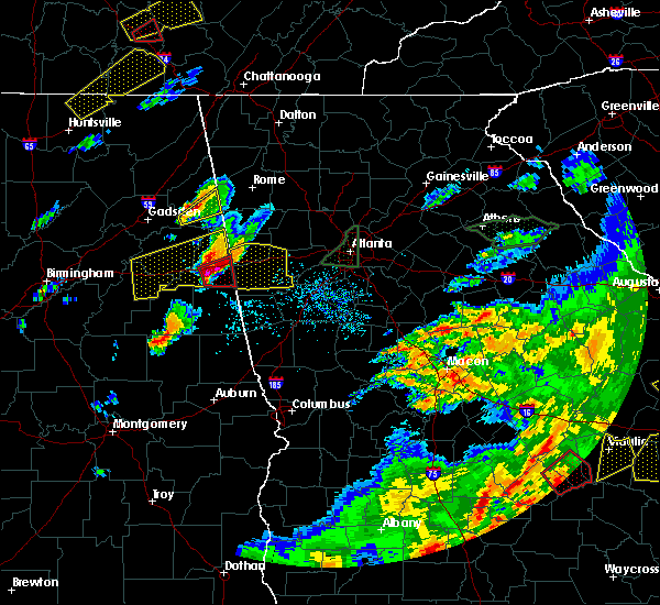 At 537 pm edt, a severe thunderstorm was located over trickem, or 11 miles southeast of heflin, moving east at 45 mph (radar indicated). Hazards include two inch hail and 60 mph wind gusts. People and animals outdoors will be injured. expect hail damage to roofs, siding, windows, and vehicles. Expect wind damage to roofs, siding, and trees. At 537 pm edt, a severe thunderstorm was located over trickem, or 11 miles southeast of heflin, moving east at 45 mph (radar indicated). Hazards include two inch hail and 60 mph wind gusts. People and animals outdoors will be injured. expect hail damage to roofs, siding, windows, and vehicles. Expect wind damage to roofs, siding, and trees.
|
| 4/5/2017 3:45 PM EDT |
 At 345 pm edt, a severe thunderstorm was located over ranburne, or 14 miles west of carrollton, moving east at 25 mph (radar indicated). Hazards include 60 mph wind gusts and penny size hail. expect damage to roofs, siding, and trees At 345 pm edt, a severe thunderstorm was located over ranburne, or 14 miles west of carrollton, moving east at 25 mph (radar indicated). Hazards include 60 mph wind gusts and penny size hail. expect damage to roofs, siding, and trees
|
| 4/5/2017 10:32 AM EDT |
 At 1032 am edt, severe thunderstorms were located along a line extending from felton to near mount zion, moving northeast at 55 mph (radar indicated). Hazards include 60 mph wind gusts and quarter size hail. Hail damage to vehicles is expected. Expect wind damage to roofs, siding, and trees. At 1032 am edt, severe thunderstorms were located along a line extending from felton to near mount zion, moving northeast at 55 mph (radar indicated). Hazards include 60 mph wind gusts and quarter size hail. Hail damage to vehicles is expected. Expect wind damage to roofs, siding, and trees.
|
| 4/5/2017 7:31 AM EDT |
 At 731 am edt, severe thunderstorms were located along a line extending from micaville to r.l. harris dam, moving northeast at 50 mph (radar indicated). Hazards include ping pong ball size hail and 60 mph wind gusts. People and animals outdoors will be injured. expect hail damage to roofs, siding, windows, and vehicles. Expect wind damage to roofs, siding, and trees. At 731 am edt, severe thunderstorms were located along a line extending from micaville to r.l. harris dam, moving northeast at 50 mph (radar indicated). Hazards include ping pong ball size hail and 60 mph wind gusts. People and animals outdoors will be injured. expect hail damage to roofs, siding, windows, and vehicles. Expect wind damage to roofs, siding, and trees.
|
| 4/3/2017 11:23 AM EDT |
 At 1123 am edt, a severe thunderstorm was located over winston, or near douglasville, moving northeast at 35 mph (radar indicated). Hazards include 60 mph wind gusts. Expect damage to roofs, siding, and trees. Locations impacted include, douglasville, villa rica, winston, lake val-do-mar, chapel hill and bill arp. At 1123 am edt, a severe thunderstorm was located over winston, or near douglasville, moving northeast at 35 mph (radar indicated). Hazards include 60 mph wind gusts. Expect damage to roofs, siding, and trees. Locations impacted include, douglasville, villa rica, winston, lake val-do-mar, chapel hill and bill arp.
|
| 4/3/2017 11:13 AM EDT |
 At 1112 am edt, a severe thunderstorm was located over treasure lake, or 10 miles southwest of douglasville, moving northeast at 35 mph (radar indicated, however this storm may have produced a brief tornado near carrollton earlier). Hazards include 60 mph wind gusts. expect damage to roofs, siding, and trees At 1112 am edt, a severe thunderstorm was located over treasure lake, or 10 miles southwest of douglasville, moving northeast at 35 mph (radar indicated, however this storm may have produced a brief tornado near carrollton earlier). Hazards include 60 mph wind gusts. expect damage to roofs, siding, and trees
|
| 4/3/2017 11:08 AM EDT |
 At 1108 am edt, a severe squall line capable of producing both tornadoes and extensive straight line wind damage was located near bill arp, or 8 miles southwest of douglasville, moving northeast at 65 mph (radar indicated rotation). Hazards include tornado. Flying debris will be dangerous to those caught without shelter. mobile homes will be damaged or destroyed. damage to roofs, windows, and vehicles will occur. tree damage is likely. Locations impacted include, villa rica and treasure lake. At 1108 am edt, a severe squall line capable of producing both tornadoes and extensive straight line wind damage was located near bill arp, or 8 miles southwest of douglasville, moving northeast at 65 mph (radar indicated rotation). Hazards include tornado. Flying debris will be dangerous to those caught without shelter. mobile homes will be damaged or destroyed. damage to roofs, windows, and vehicles will occur. tree damage is likely. Locations impacted include, villa rica and treasure lake.
|
| 4/3/2017 10:57 AM EDT |
 At 1056 am edt, a severe thunderstorm capable of producing a tornado was located over carrollton, moving northeast at 45 mph (radar indicated rotation). Hazards include tornado. Flying debris will be dangerous to those caught without shelter. mobile homes will be damaged or destroyed. damage to roofs, windows, and vehicles will occur. Tree damage is likely. At 1056 am edt, a severe thunderstorm capable of producing a tornado was located over carrollton, moving northeast at 45 mph (radar indicated rotation). Hazards include tornado. Flying debris will be dangerous to those caught without shelter. mobile homes will be damaged or destroyed. damage to roofs, windows, and vehicles will occur. Tree damage is likely.
|
| 3/21/2017 8:40 PM EDT |
 At 838 pm edt, severe thunderstorms were located extending from near milton to sandy plains to near eubank lake to near piedmont, moving southeast at 40 mph (radar indicated, plus multiple reports of downed trees and powerlines due to the very strong winds). Hazards include 60 mph wind gusts and penny size hail. expect damage to roofs, siding, and trees At 838 pm edt, severe thunderstorms were located extending from near milton to sandy plains to near eubank lake to near piedmont, moving southeast at 40 mph (radar indicated, plus multiple reports of downed trees and powerlines due to the very strong winds). Hazards include 60 mph wind gusts and penny size hail. expect damage to roofs, siding, and trees
|
| 3/1/2017 6:50 PM EST |
 At 650 pm est, severe thunderstorms were located extending from hiram to villa rica to near john tanner state park, moving east at 55 mph (radar indicated). Hazards include 60 mph wind gusts and quarter size hail. Hail damage to vehicles is expected. expect wind damage to roofs, siding, and trees. Locations impacted include, douglasville, carrollton, dallas, villa rica, temple, hiram, mount zion, brownsville, abilene, winston, lake val-do-mar, treasure lake and new georgia. At 650 pm est, severe thunderstorms were located extending from hiram to villa rica to near john tanner state park, moving east at 55 mph (radar indicated). Hazards include 60 mph wind gusts and quarter size hail. Hail damage to vehicles is expected. expect wind damage to roofs, siding, and trees. Locations impacted include, douglasville, carrollton, dallas, villa rica, temple, hiram, mount zion, brownsville, abilene, winston, lake val-do-mar, treasure lake and new georgia.
|
| 3/1/2017 6:20 PM EST |
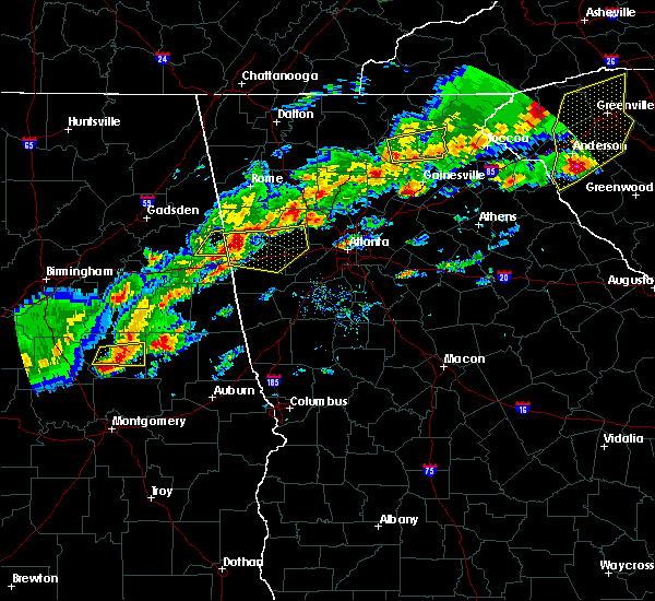 At 617 pm est, severe thunderstorms were located extending from 7 miles west of buchanan to edwardsville alabama, moving east at 55 mph (radar indicated). Hazards include 60 mph wind gusts and quarter size hail. Hail damage to vehicles is expected. Expect wind damage to roofs, siding, and trees. At 617 pm est, severe thunderstorms were located extending from 7 miles west of buchanan to edwardsville alabama, moving east at 55 mph (radar indicated). Hazards include 60 mph wind gusts and quarter size hail. Hail damage to vehicles is expected. Expect wind damage to roofs, siding, and trees.
|
| 11/30/2016 1:15 PM EST |
 At 115 pm est, severe thunderstorms were located along a line extending from new georgia to near douglasville to hannah, moving northeast at 60 mph (radar indicated). Hazards include 60 mph wind gusts. Expect damage to roofs. siding. And trees. At 115 pm est, severe thunderstorms were located along a line extending from new georgia to near douglasville to hannah, moving northeast at 60 mph (radar indicated). Hazards include 60 mph wind gusts. Expect damage to roofs. siding. And trees.
|
| 11/30/2016 1:04 PM EST |
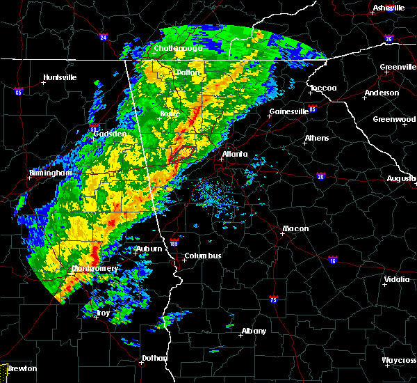 At 104 pm est, a severe thunderstorm capable of producing a tornado was located over temple, or 11 miles east of buchanan, moving northeast at 50 mph (radar indicated rotation). Hazards include tornado. Flying debris will be dangerous to those caught without shelter. mobile homes will be damaged or destroyed. damage to roofs, windows, and vehicles will occur. tree damage is likely. Locations impacted include, dallas, villa rica, temple, hiram and new georgia. At 104 pm est, a severe thunderstorm capable of producing a tornado was located over temple, or 11 miles east of buchanan, moving northeast at 50 mph (radar indicated rotation). Hazards include tornado. Flying debris will be dangerous to those caught without shelter. mobile homes will be damaged or destroyed. damage to roofs, windows, and vehicles will occur. tree damage is likely. Locations impacted include, dallas, villa rica, temple, hiram and new georgia.
|
| 11/30/2016 12:52 PM EST |
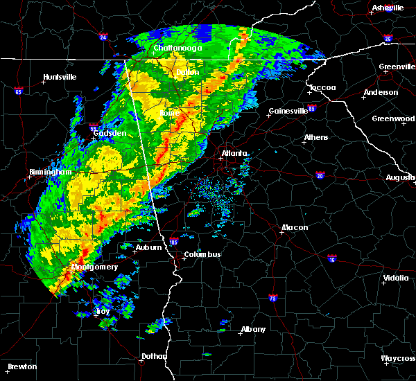 At 1252 pm est, a tornado producing storm was located over bowdon junction, or 8 miles northwest of carrollton, moving northeast at 45 mph (radar confirmed tornado). Hazards include damaging tornado. Flying debris will be dangerous to those caught without shelter. mobile homes will be damaged or destroyed. damage to roofs, windows, and vehicles will occur. Tree damage is likely. At 1252 pm est, a tornado producing storm was located over bowdon junction, or 8 miles northwest of carrollton, moving northeast at 45 mph (radar confirmed tornado). Hazards include damaging tornado. Flying debris will be dangerous to those caught without shelter. mobile homes will be damaged or destroyed. damage to roofs, windows, and vehicles will occur. Tree damage is likely.
|
| 7/21/2016 2:51 PM EDT |
 At 251 pm edt, a severe thunderstorm was located near chattahoochee hill country, or 10 miles southwest of douglasville, moving south at 10 mph (radar indicated). Hazards include 60 mph wind gusts and penny size hail. Expect damage to roofs. siding. and trees. Other locations in the warning include but are not limited to douglasville, villa rica, chattahoochee hill country, byers crossroads, bill arp, fairplay, winston and hannah. At 251 pm edt, a severe thunderstorm was located near chattahoochee hill country, or 10 miles southwest of douglasville, moving south at 10 mph (radar indicated). Hazards include 60 mph wind gusts and penny size hail. Expect damage to roofs. siding. and trees. Other locations in the warning include but are not limited to douglasville, villa rica, chattahoochee hill country, byers crossroads, bill arp, fairplay, winston and hannah.
|
| 6/17/2016 2:45 PM EDT |
 At 244 pm edt, severe thunderstorms were located along a line extending from villa rica to 6 miles southeast of douglasville, moving southeast at 35 mph (radar indicated). Hazards include 60 mph wind gusts and quarter size hail. Hail damage to vehicles is expected. expect wind damage to roofs, siding, and trees. Other locations in the warning include but are not limited to douglasville, carrollton, union city, villa rica, fairburn, palmetto, temple, chattahoochee hill country, lithia springs, fairplay, treasure lake, winston, campbellton, abilene, chapel hill, byers crossroads and hannah. At 244 pm edt, severe thunderstorms were located along a line extending from villa rica to 6 miles southeast of douglasville, moving southeast at 35 mph (radar indicated). Hazards include 60 mph wind gusts and quarter size hail. Hail damage to vehicles is expected. expect wind damage to roofs, siding, and trees. Other locations in the warning include but are not limited to douglasville, carrollton, union city, villa rica, fairburn, palmetto, temple, chattahoochee hill country, lithia springs, fairplay, treasure lake, winston, campbellton, abilene, chapel hill, byers crossroads and hannah.
|
| 6/1/2016 4:06 PM EDT |
 At 405 pm edt, a severe thunderstorm was located near carrollton, moving northeast at 30 mph (radar indicated). Hazards include 60 mph wind gusts and quarter size hail. Hail damage to vehicles is expected. expect wind damage to roofs, siding, and trees. Other locations in the warning include but are not limited to carrollton, villa rica, temple, mount zion, byers crossroads, clem, john tanner state park, treasure lake, seaton lake, bowdon junction and abilene. At 405 pm edt, a severe thunderstorm was located near carrollton, moving northeast at 30 mph (radar indicated). Hazards include 60 mph wind gusts and quarter size hail. Hail damage to vehicles is expected. expect wind damage to roofs, siding, and trees. Other locations in the warning include but are not limited to carrollton, villa rica, temple, mount zion, byers crossroads, clem, john tanner state park, treasure lake, seaton lake, bowdon junction and abilene.
|
| 6/1/2016 3:54 PM EDT |
 At 354 pm edt, a severe thunderstorm was located over carrollton, moving east at 35 mph (radar indicated). Hazards include 60 mph wind gusts and quarter size hail. Hail damage to vehicles is expected. expect wind damage to roofs, siding, and trees. Other locations in the warning include but are not limited to douglasville, carrollton, villa rica, bremen, temple, mount zion, lithia springs, sweetwater creek state park, fairplay, treasure lake, winston, bowdon junction, abilene, chapel hill, byers crossroads, lake val-do- mar, clem, john tanner state park, bill arp and seaton lake. At 354 pm edt, a severe thunderstorm was located over carrollton, moving east at 35 mph (radar indicated). Hazards include 60 mph wind gusts and quarter size hail. Hail damage to vehicles is expected. expect wind damage to roofs, siding, and trees. Other locations in the warning include but are not limited to douglasville, carrollton, villa rica, bremen, temple, mount zion, lithia springs, sweetwater creek state park, fairplay, treasure lake, winston, bowdon junction, abilene, chapel hill, byers crossroads, lake val-do- mar, clem, john tanner state park, bill arp and seaton lake.
|
| 3/1/2016 8:08 PM EST |
 At 807 pm est, severe thunderstorms were located along a line extending from 6 miles southeast of villa rica to near carrollton to near ephesus, moving southeast at 45 mph (radar indicated). Hazards include 60 mph wind gusts and penny size hail. Expect damage to roofs. siding. and trees. Other locations in the warning include but are not limited to newnan, carrollton, franklin, fairburn, tyrone, palmetto, grantville, whitesburg, ephesus, centralhatchee, moreland, sharpsburg, roopville, east newnan, chattahoochee hill country, corinth, thomas crossroads, handy, madras and dunaway gardens. At 807 pm est, severe thunderstorms were located along a line extending from 6 miles southeast of villa rica to near carrollton to near ephesus, moving southeast at 45 mph (radar indicated). Hazards include 60 mph wind gusts and penny size hail. Expect damage to roofs. siding. and trees. Other locations in the warning include but are not limited to newnan, carrollton, franklin, fairburn, tyrone, palmetto, grantville, whitesburg, ephesus, centralhatchee, moreland, sharpsburg, roopville, east newnan, chattahoochee hill country, corinth, thomas crossroads, handy, madras and dunaway gardens.
|
| 7/21/2015 3:13 PM EDT |
 At 312 pm edt, severe thunderstorms were located extending from near lithia springs to near douglasville to near villa rica, moving southeast at 25 mph (radar indicated). Hazards include 60 mph wind gusts and penny size hail. Expect damage to roofs. siding and trees. Other locations in the warning include but are not limited to atlanta, douglasville, smyrna, east point, union city, villa rica, college park, powder springs, fairburn, austell, palmetto, hiram, chattahoochee hills, lithia springs, sweetwater creek state park, turner field, new georgia, campbellton, lake val-do-mar and hannah. At 312 pm edt, severe thunderstorms were located extending from near lithia springs to near douglasville to near villa rica, moving southeast at 25 mph (radar indicated). Hazards include 60 mph wind gusts and penny size hail. Expect damage to roofs. siding and trees. Other locations in the warning include but are not limited to atlanta, douglasville, smyrna, east point, union city, villa rica, college park, powder springs, fairburn, austell, palmetto, hiram, chattahoochee hills, lithia springs, sweetwater creek state park, turner field, new georgia, campbellton, lake val-do-mar and hannah.
|
| 7/14/2015 9:06 PM EDT |
 At 905 pm edt, severe thunderstorms were located extending from near milton to sandy springs, austell, douglasville and dallas, moving southeast at 45 mph (radar indicated). Hazards include 60 mph wind gusts and quarter size hail. Hail damage to vehicles is expected. expect wind damage to roofs, siding and trees. Other locations in the warning include but are not limited to atlanta, marietta, douglasville, lawrenceville, canton, cartersville, decatur, dallas, sandy springs, roswell, johns creek, alpharetta, smyrna, dunwoody, east point, milton, kennesaw, duluth, woodstock and acworth. At 905 pm edt, severe thunderstorms were located extending from near milton to sandy springs, austell, douglasville and dallas, moving southeast at 45 mph (radar indicated). Hazards include 60 mph wind gusts and quarter size hail. Hail damage to vehicles is expected. expect wind damage to roofs, siding and trees. Other locations in the warning include but are not limited to atlanta, marietta, douglasville, lawrenceville, canton, cartersville, decatur, dallas, sandy springs, roswell, johns creek, alpharetta, smyrna, dunwoody, east point, milton, kennesaw, duluth, woodstock and acworth.
|
| 7/14/2015 8:44 PM EDT |
 At 843 pm edt, severe thunderstorms were located extending from near waleska to woodstock to southwest of kennesaw to near dallas to aragon, moving southeast at 55 mph (radar indicated). Hazards include 70 mph wind gusts and quarter size hail. Hail damage to vehicles is expected. expect considerable tree damage. wind damage is also likely to mobile homes, roofs and outbuildings. Other locations in the warning include but are not limited to atlanta, marietta, douglasville, lawrenceville, canton, cartersville, decatur, dallas, buchanan, sandy springs, roswell, johns creek, alpharetta, smyrna, dunwoody, east point, milton, kennesaw, duluth and woodstock. At 843 pm edt, severe thunderstorms were located extending from near waleska to woodstock to southwest of kennesaw to near dallas to aragon, moving southeast at 55 mph (radar indicated). Hazards include 70 mph wind gusts and quarter size hail. Hail damage to vehicles is expected. expect considerable tree damage. wind damage is also likely to mobile homes, roofs and outbuildings. Other locations in the warning include but are not limited to atlanta, marietta, douglasville, lawrenceville, canton, cartersville, decatur, dallas, buchanan, sandy springs, roswell, johns creek, alpharetta, smyrna, dunwoody, east point, milton, kennesaw, duluth and woodstock.
|
| 6/18/2015 3:10 PM EDT | At 309 pm edt, a severe thunderstorm was located over temple, or 7 miles southeast of buchanan, moving northeast at 15 mph (radar indicated). Hazards include 60 mph wind gusts and quarter size hail. Hail damage to vehicles is expected. expect wind damage to roofs, siding and trees. Other locations in the warning include but are not limited to villa rica, bremen and temple. |
| 5/31/2015 5:09 PM EDT | At 509 pm edt, severe thunderstorms were located along a line extending from 7 miles north of villa rica to waco, moving north at 10 mph (radar indicated). Hazards include 60 mph wind gusts and quarter size hail. Hail damage to vehicles is expected. expect wind damage to roofs, siding and trees. Other locations in the warning include but are not limited to dallas, buchanan, villa rica, bremen, temple, hiram, mount zion, waco, braswell, yorkville, bowdon junction, new georgia, eubank lake, felton and draketown. |
| 4/19/2015 9:11 AM EDT | The tornado warning for northeastern heard. northwestern coweta and southeastern carroll counties will expire at 915 am edt. the tornadic thunderstorm which prompted the warning has weakened. therefore the warning will be allowed to expire. A tornado watch remains in effect until 300 pm edt for northwestern georgia. |
| 4/19/2015 8:49 AM EDT | The national weather service in peachtree city has issued a * tornado warning for. northeastern heard county in west central georgia. northwestern coweta county in west central georgia. southeastern carroll county in northwestern georgia. Until 915 am edt. |
| 5/19/2013 11:40 AM EDT | A couple of trees and pea sized hail were reported in northern carroll count in carroll county GA, 3.5 miles ESE of Villa Rica, GA |
| 6/15/2011 6:50 PM EDT | Quarter sized hail reported 1.2 miles NE of Villa Rica, GA |
Hail Maps for Villa Rica, GA


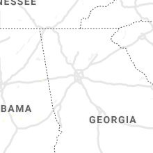


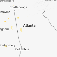


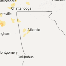


Connect with Interactive Hail Maps