

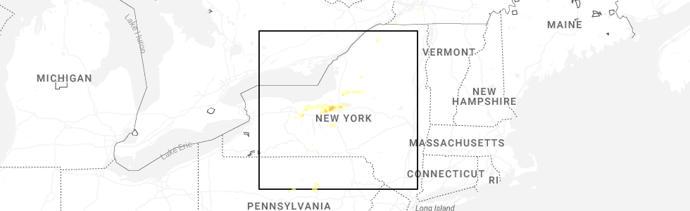
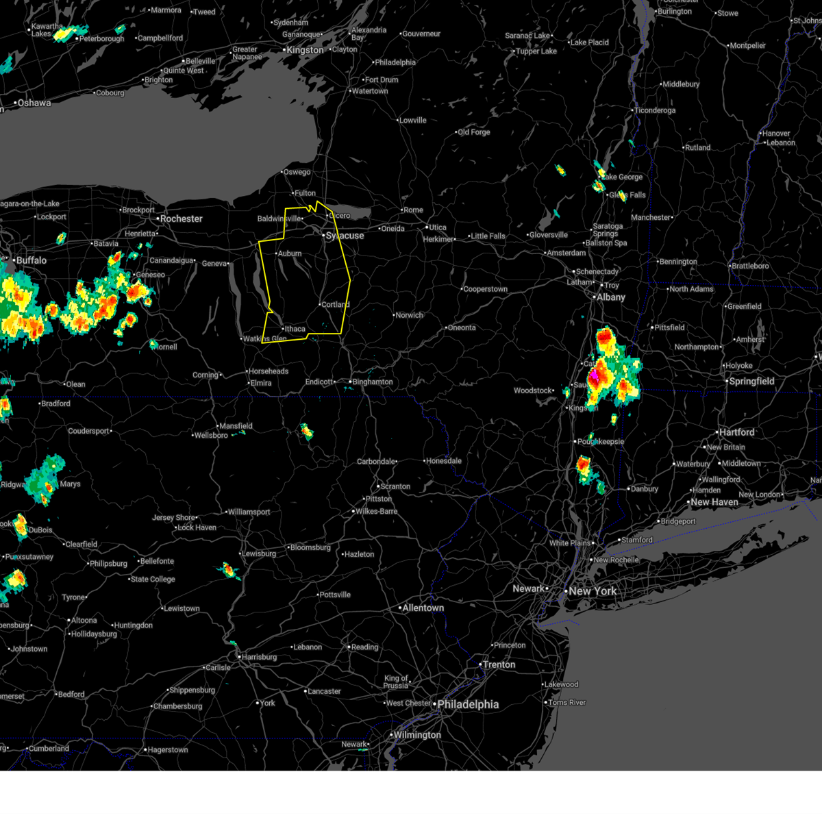
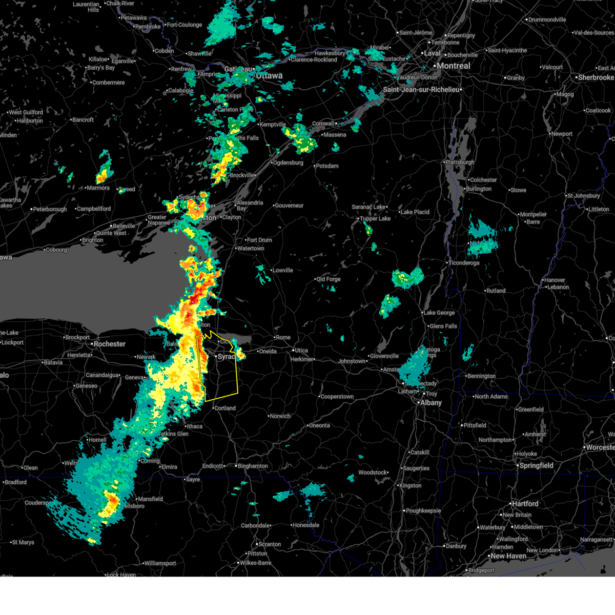
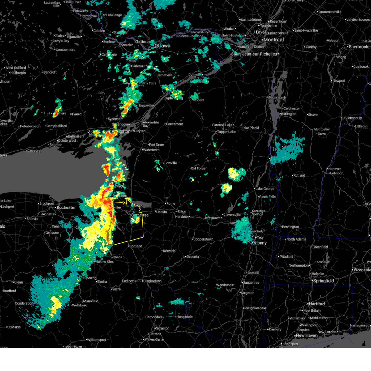
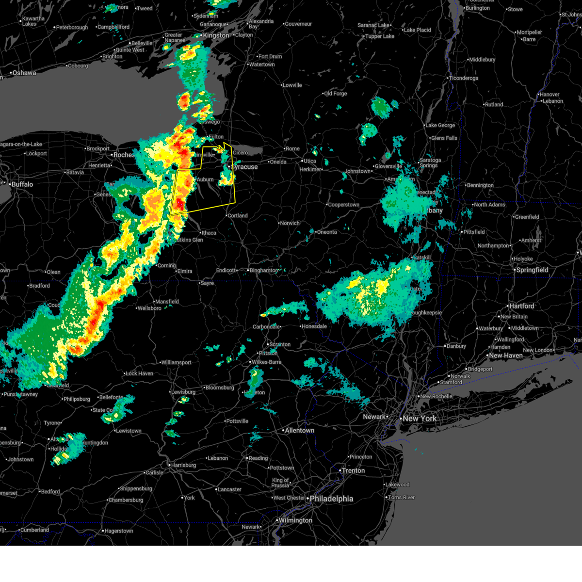
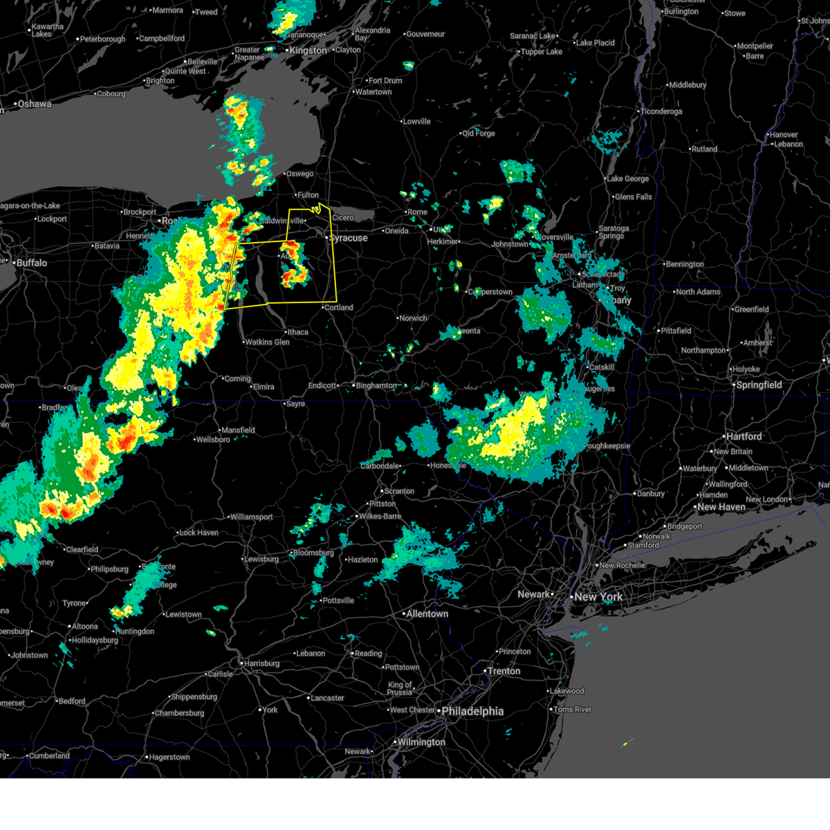
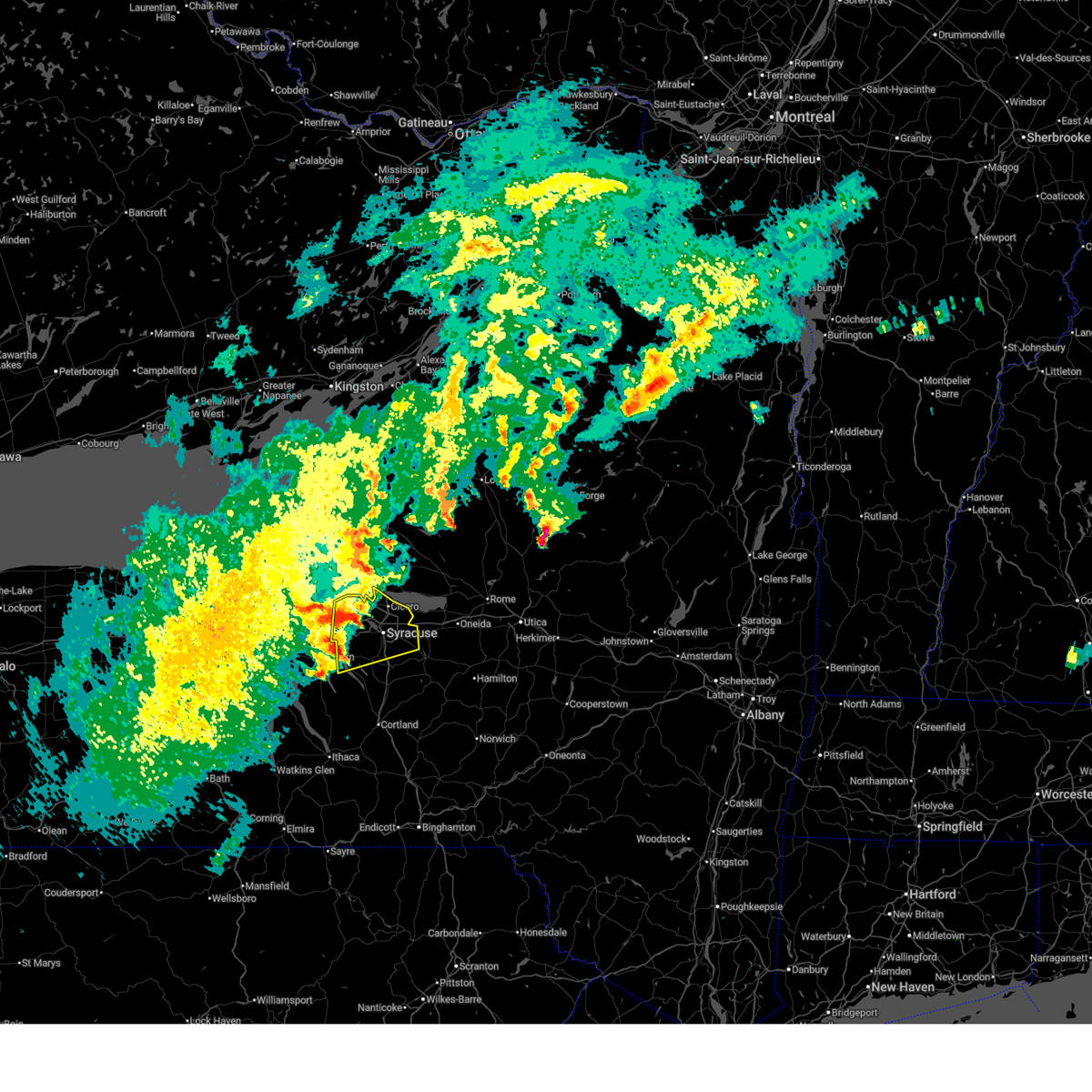
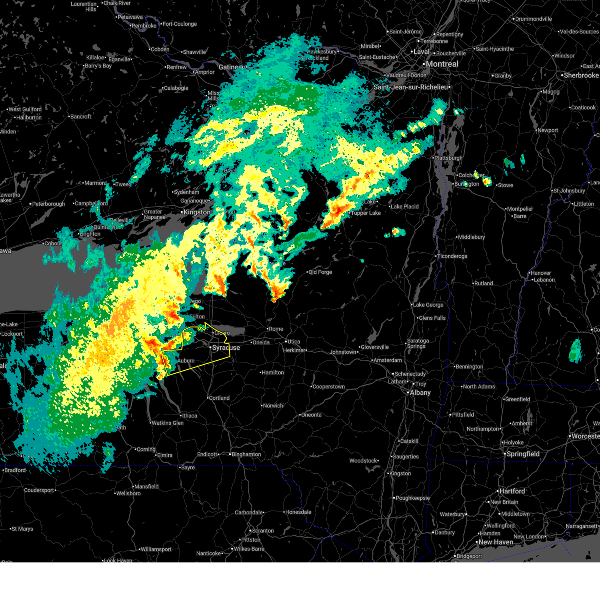
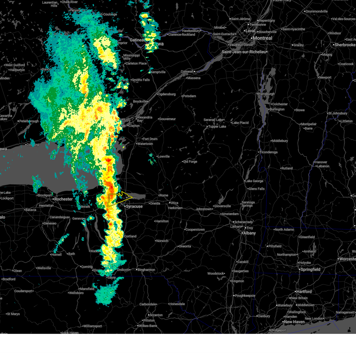
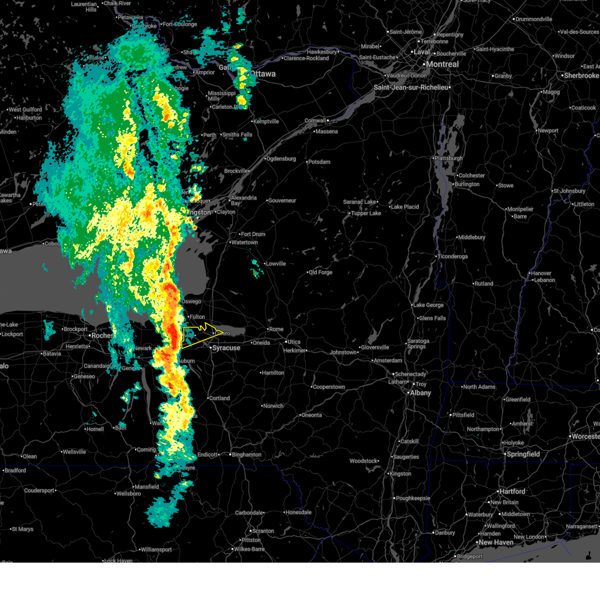
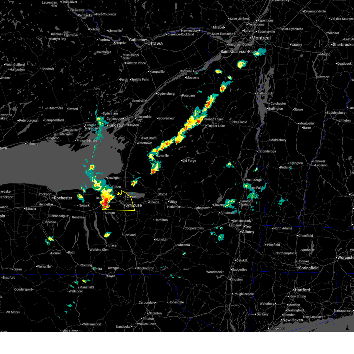
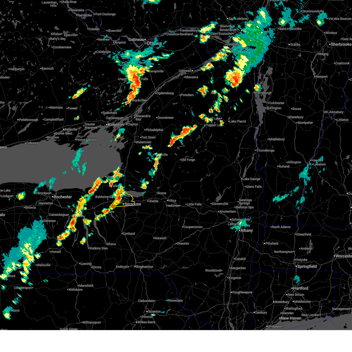
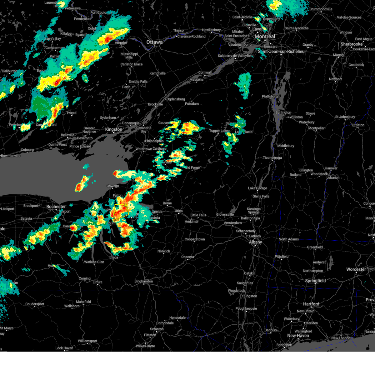
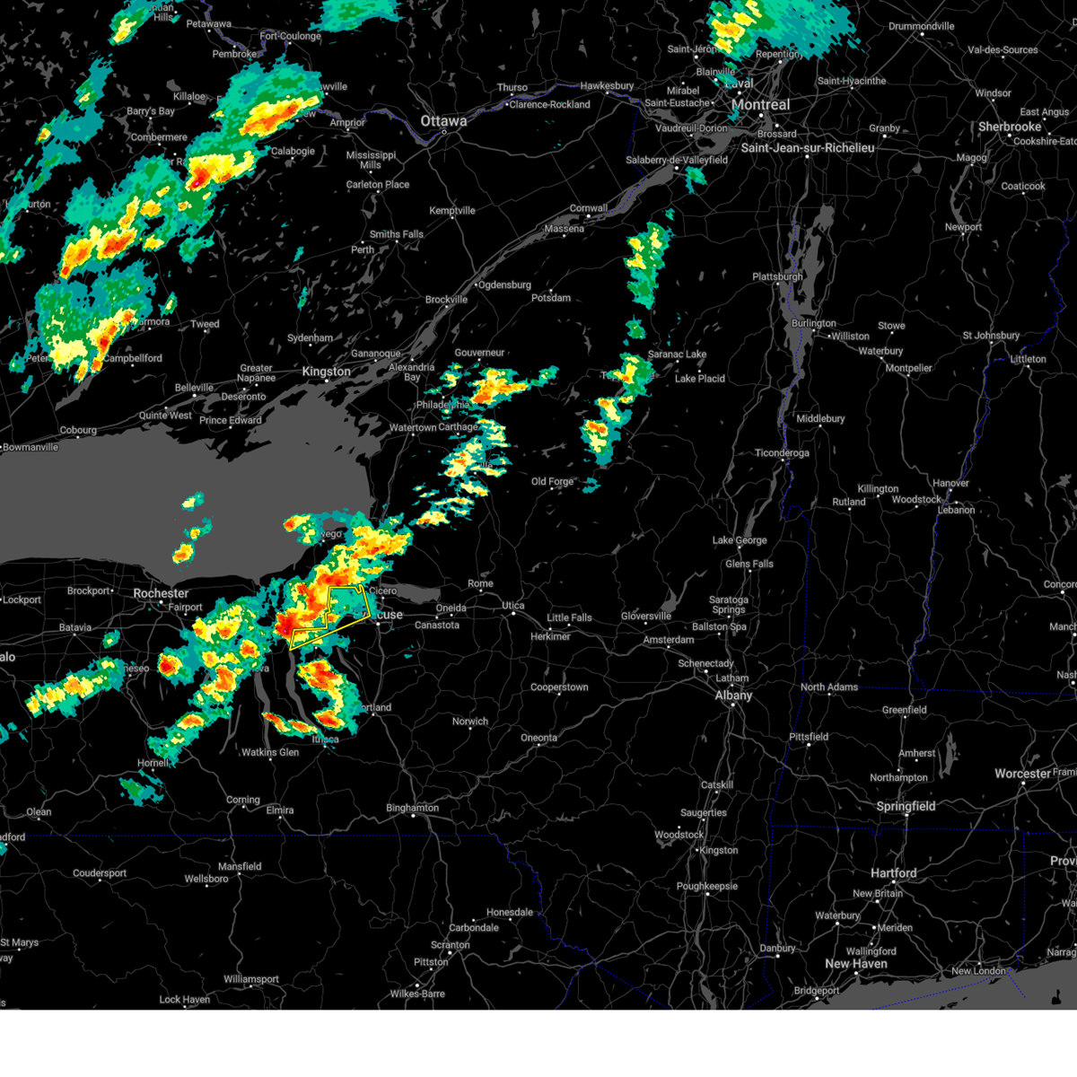
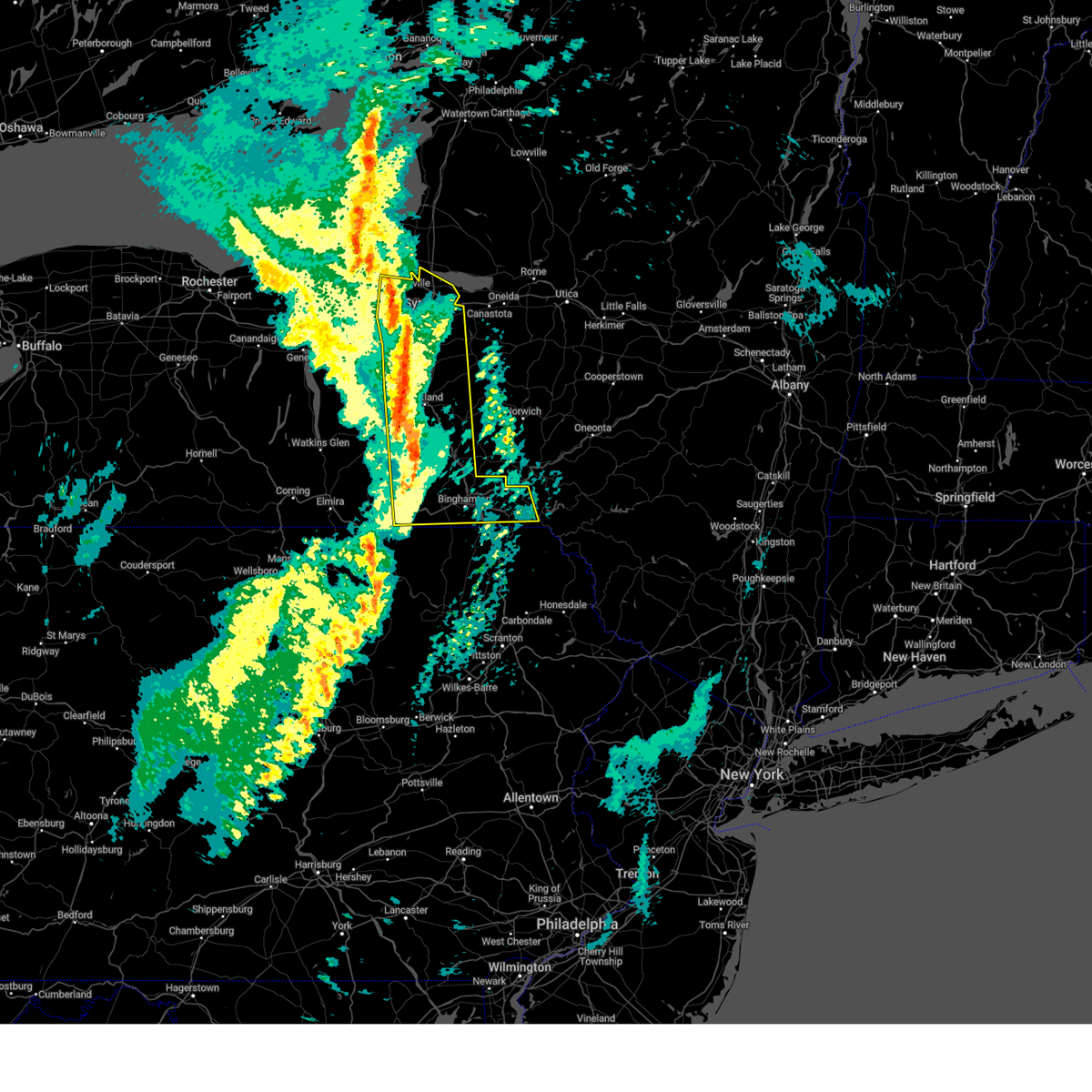
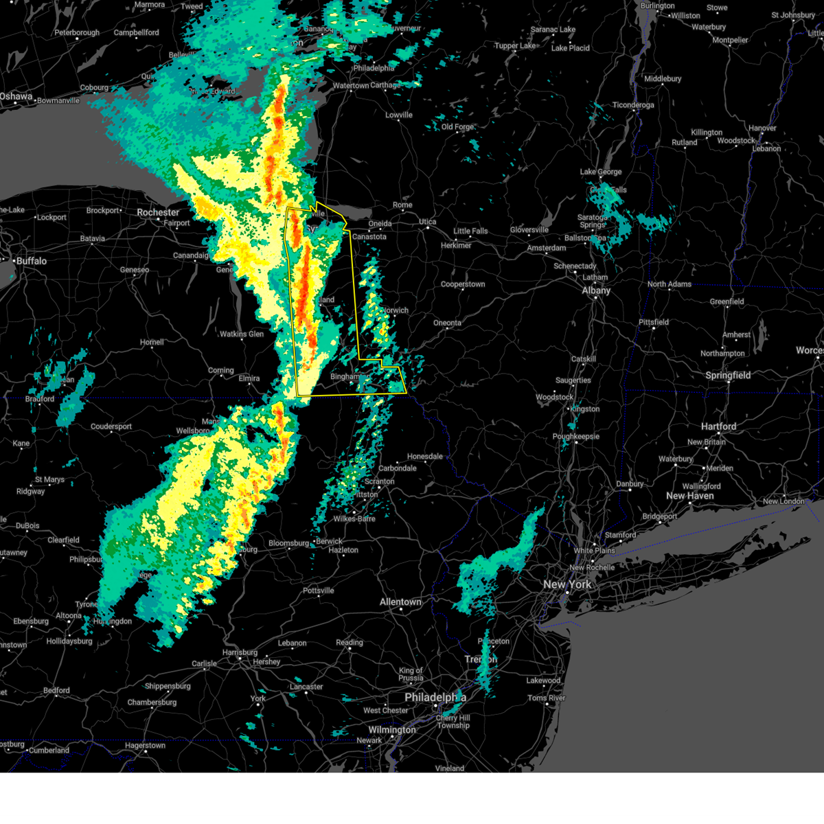
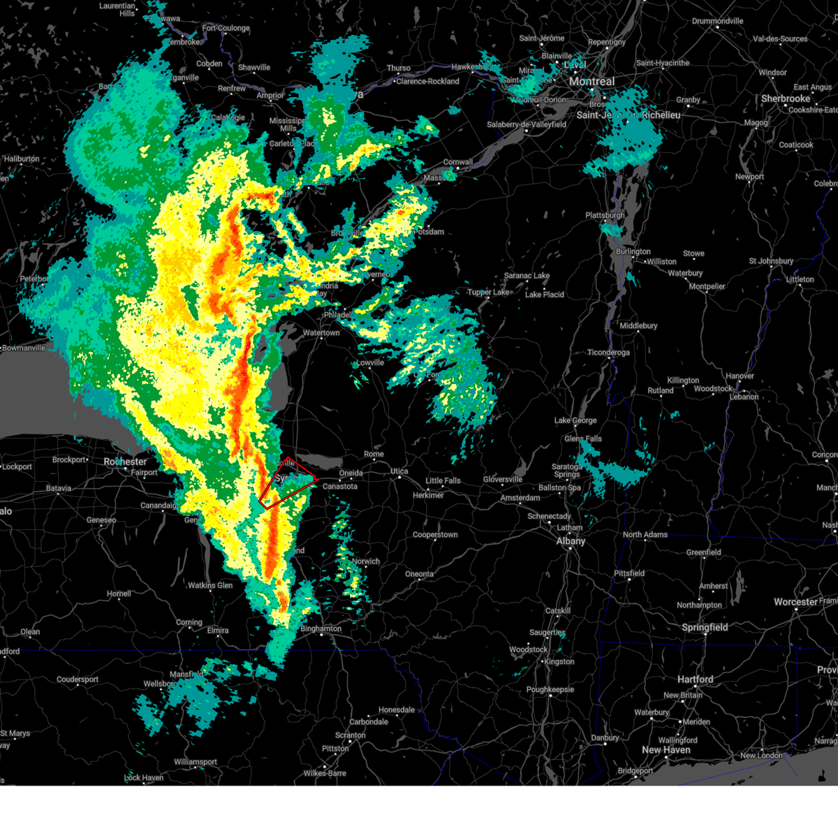
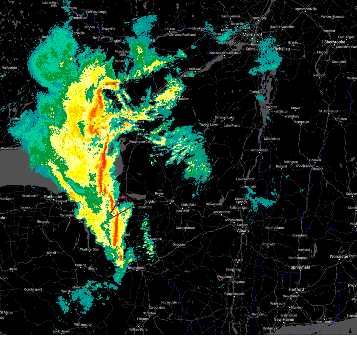
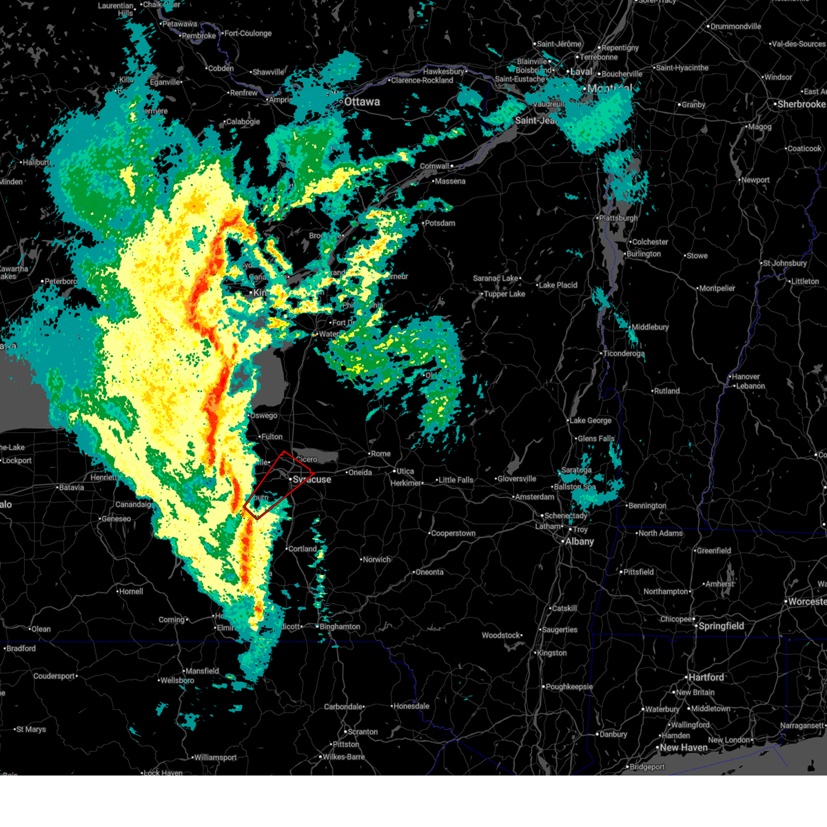
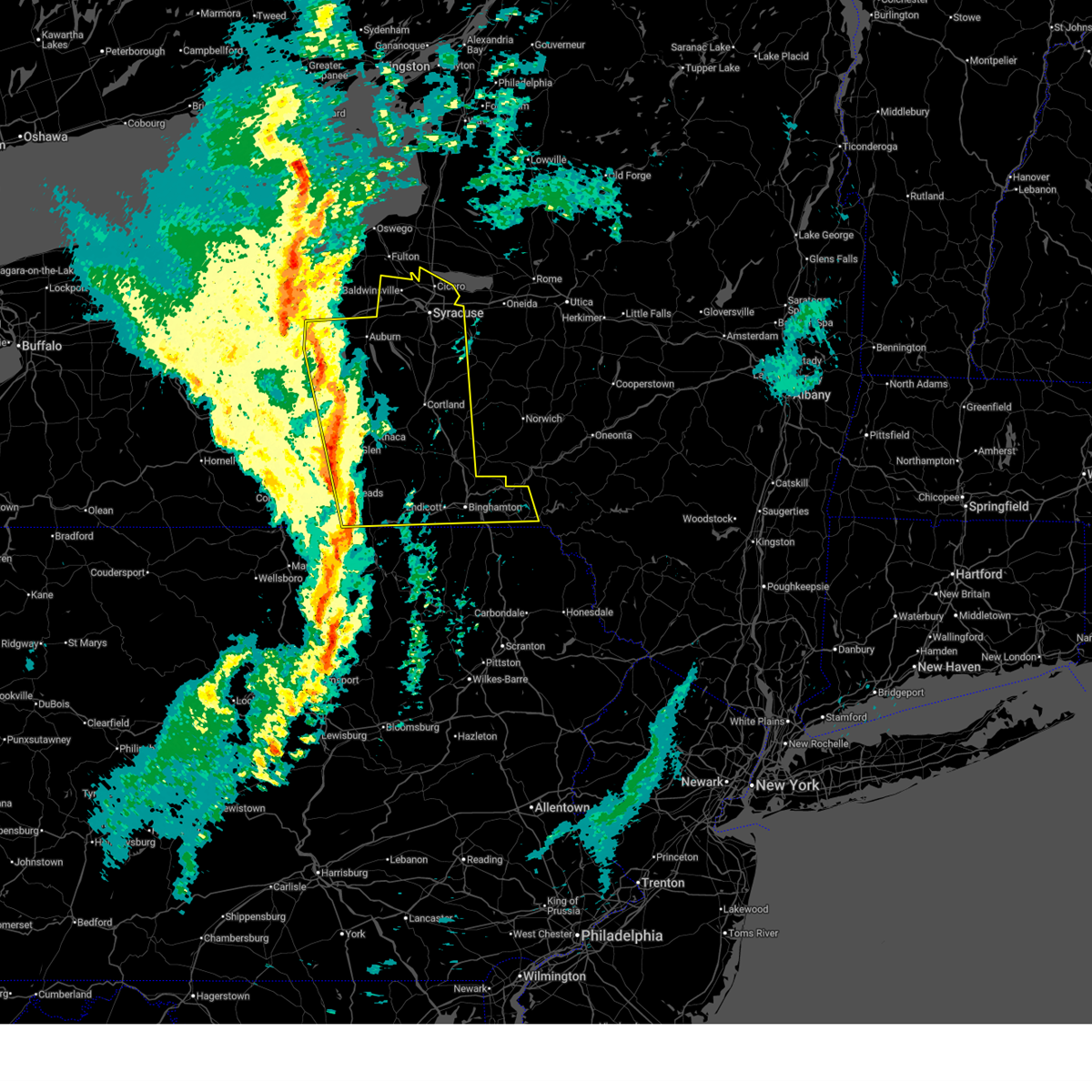
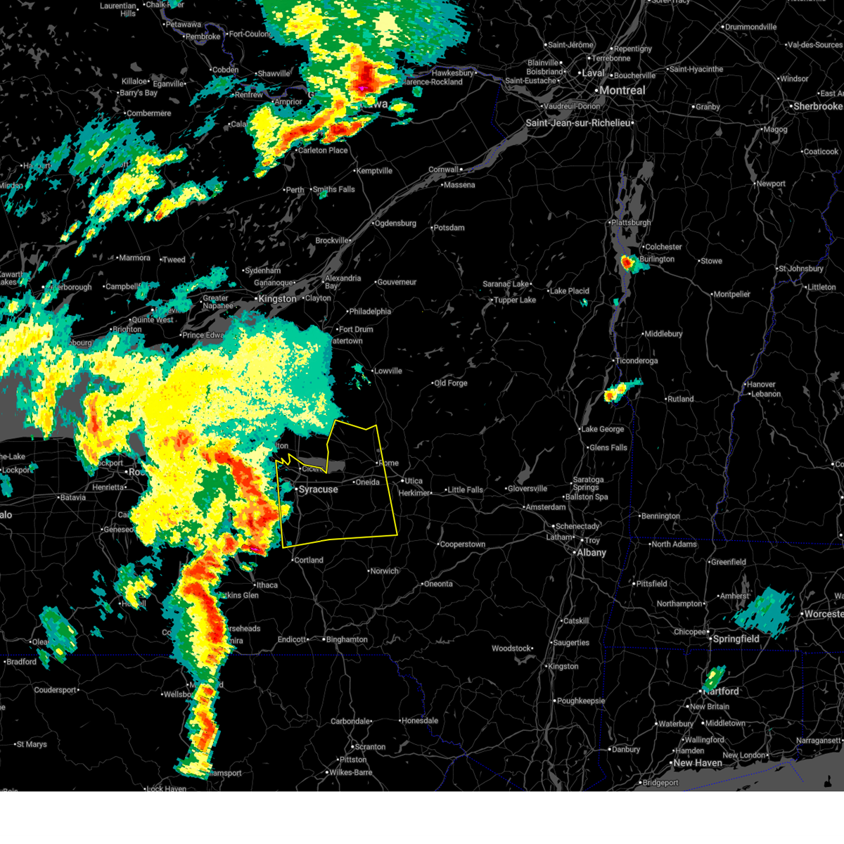
Hail Map for Village Green, NY
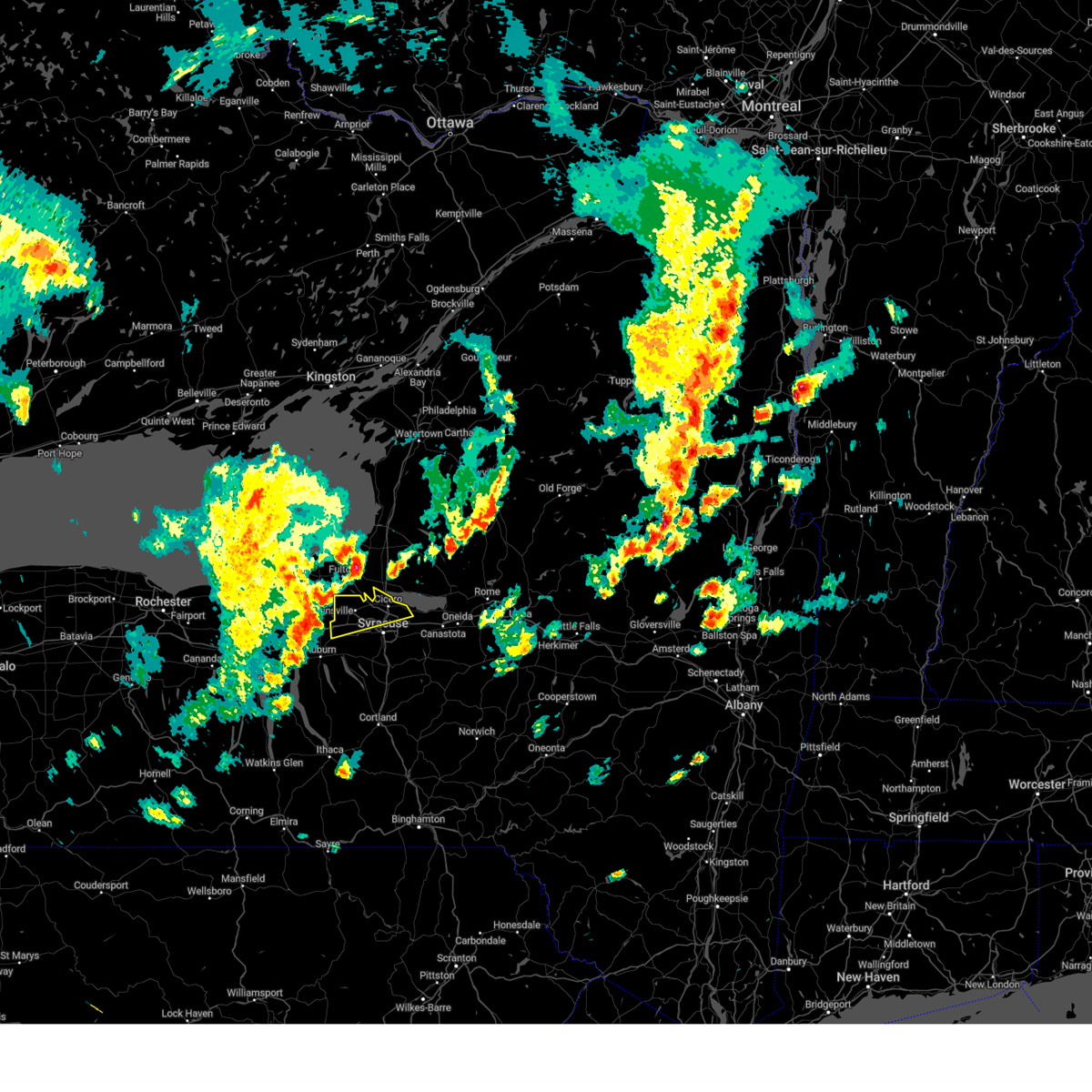
The Village Green, NY area has had 0 reports of on-the-ground hail by trained spotters, and has been under severe weather warnings 24 times during the past 12 months. Doppler radar has detected hail at or near Village Green, NY on 23 occasions, including 1 occasion during the past year.
| Name: | Village Green, NY |
| Where Located: | 10 miles NW of Syracuse, NY |
| Map: | Google Map for Village Green, NY |
| Population: | 3891 |
| Housing Units: | 2086 |
| More Info: | Search Google for Village Green, NY |
5
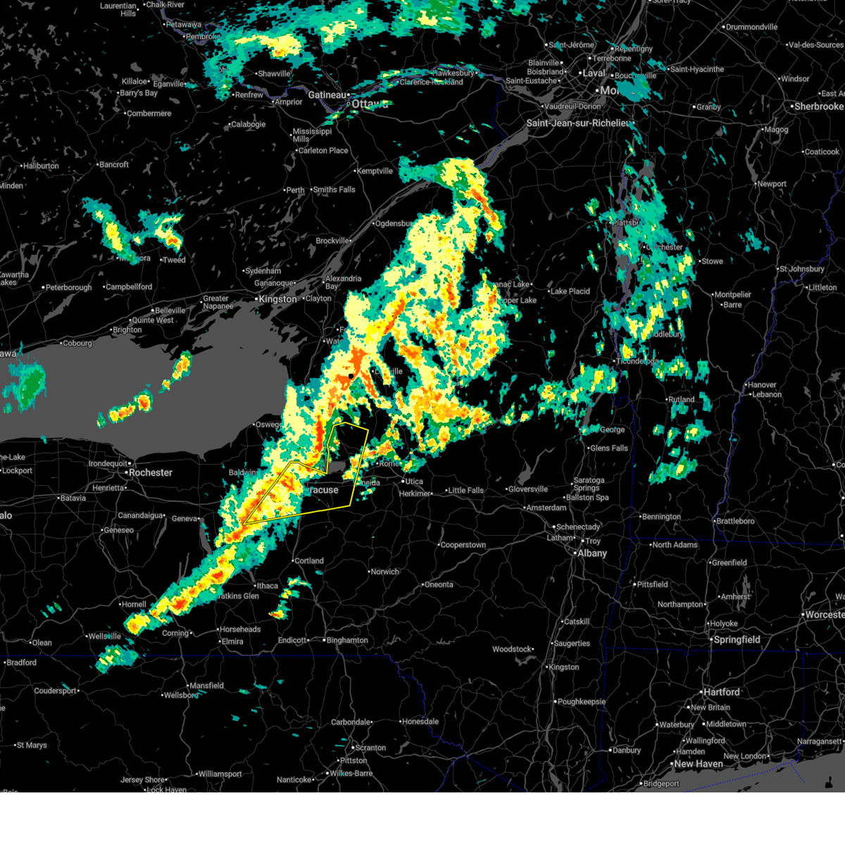
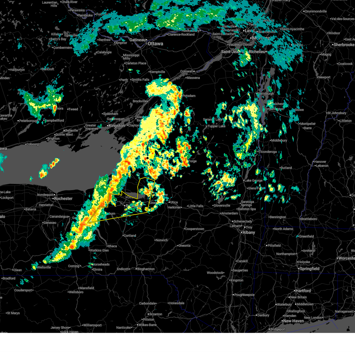
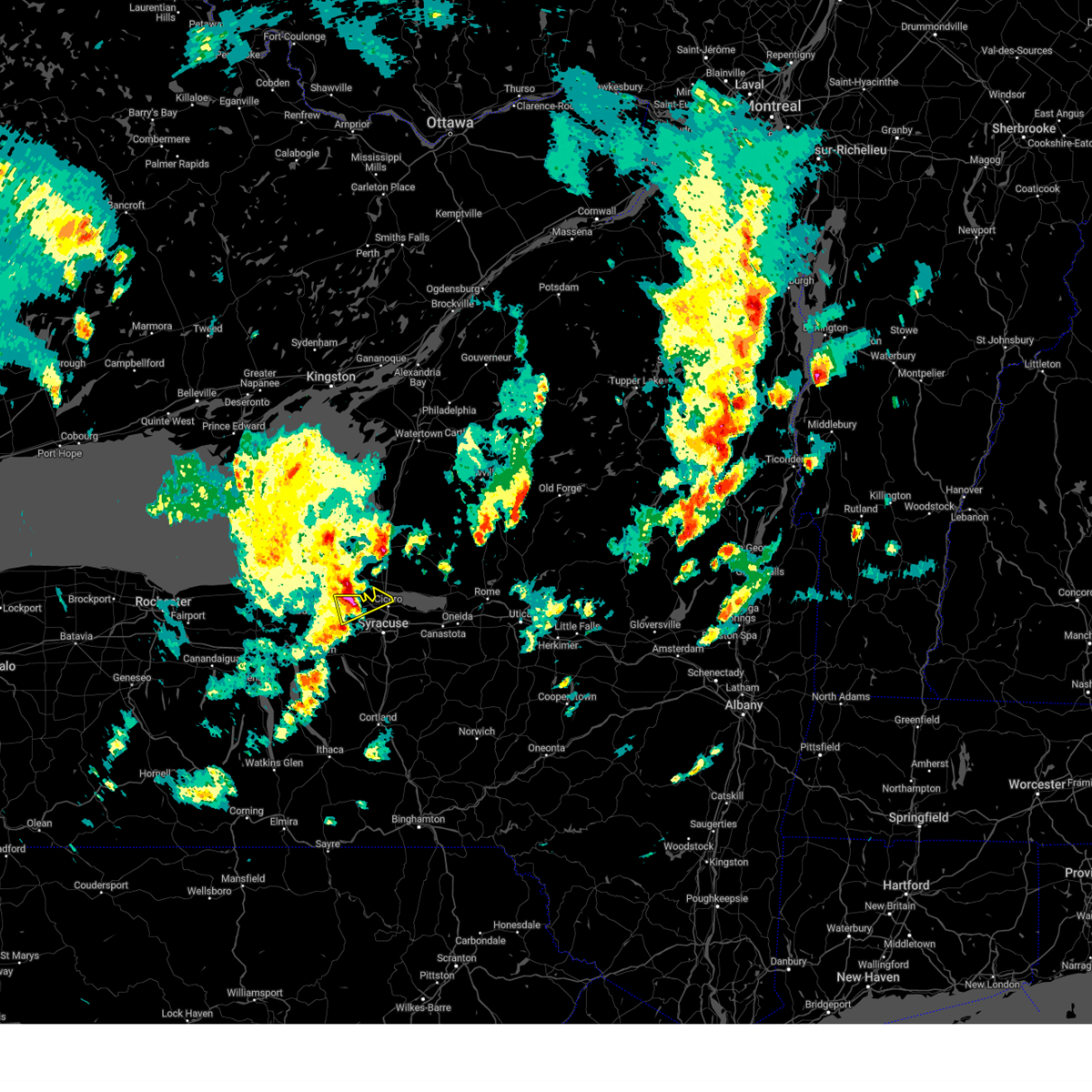
The Top Recent Hail Date for Village Green, NY is Sunday, August 24, 2025 (1st out of 23)
Hail and Wind Damage Spotted near Village Green, NY
| Date / Time | Report Details |
|---|---|
| 6/18/2026 11:02 AM EDT |
 At 1101 am edt, severe thunderstorms were located along a line extending from near camden to near syracuse, moving east at 50 mph (radar indicated). Hazards include 60 mph wind gusts. Expect damage to roofs, siding, and trees. Locations impacted include, onondaga, syracuse, clay, rome, cicero, de witt, sullivan, oneida, lenox, and north syracuse. At 1101 am edt, severe thunderstorms were located along a line extending from near camden to near syracuse, moving east at 50 mph (radar indicated). Hazards include 60 mph wind gusts. Expect damage to roofs, siding, and trees. Locations impacted include, onondaga, syracuse, clay, rome, cicero, de witt, sullivan, oneida, lenox, and north syracuse.
|
| 6/18/2026 10:27 AM EDT |
 Svrbgm the national weather service in binghamton has issued a * severe thunderstorm warning for, central seneca county in central new york, northwestern oneida county in central new york, northwestern madison county in central new york, northwestern cayuga county in central new york, onondaga county in central new york, * until 1130 am edt. * at 1027 am edt, severe thunderstorms were located along a line extending from near fulton to canoga, moving east at 50 mph (radar indicated). Hazards include 60 mph wind gusts. expect damage to roofs, siding, and trees Svrbgm the national weather service in binghamton has issued a * severe thunderstorm warning for, central seneca county in central new york, northwestern oneida county in central new york, northwestern madison county in central new york, northwestern cayuga county in central new york, onondaga county in central new york, * until 1130 am edt. * at 1027 am edt, severe thunderstorms were located along a line extending from near fulton to canoga, moving east at 50 mph (radar indicated). Hazards include 60 mph wind gusts. expect damage to roofs, siding, and trees
|
| 6/11/2026 6:06 PM EDT |
 At 605 pm edt, a severe thunderstorm was located over lyndon, or near syracuse, moving east at 30 mph (radar indicated). Hazards include 60 mph wind gusts and penny size hail. Expect damage to roofs, siding, and trees. Locations impacted include, onondaga, syracuse, clay, rome, cicero, de witt, sullivan, van buren, oneida, and lenox. At 605 pm edt, a severe thunderstorm was located over lyndon, or near syracuse, moving east at 30 mph (radar indicated). Hazards include 60 mph wind gusts and penny size hail. Expect damage to roofs, siding, and trees. Locations impacted include, onondaga, syracuse, clay, rome, cicero, de witt, sullivan, van buren, oneida, and lenox.
|
| 6/11/2026 4:57 PM EDT |
 Svrbgm the national weather service in binghamton has issued a * severe thunderstorm warning for, cayuga county in central new york, cortland county in central new york, onondaga county in central new york, tompkins county in central new york, * until 600 pm edt. * at 456 pm edt, severe thunderstorms were located along a line extending from near montezuma to near king ferry to near enfield, moving east at 30 mph (radar indicated). Hazards include 60 mph wind gusts and quarter size hail. Hail damage to vehicles is expected. Expect wind damage to roofs, siding, and trees. Svrbgm the national weather service in binghamton has issued a * severe thunderstorm warning for, cayuga county in central new york, cortland county in central new york, onondaga county in central new york, tompkins county in central new york, * until 600 pm edt. * at 456 pm edt, severe thunderstorms were located along a line extending from near montezuma to near king ferry to near enfield, moving east at 30 mph (radar indicated). Hazards include 60 mph wind gusts and quarter size hail. Hail damage to vehicles is expected. Expect wind damage to roofs, siding, and trees.
|
| 5/13/2026 5:03 PM EDT |
 At 502 pm edt, severe thunderstorms were located along a line extending from 6 miles northeast of fulton to liverpool to near otisco to scott, moving east at 35 mph (radar indicated). Hazards include 60 mph wind gusts and nickel size hail. Expect damage to roofs, siding, and trees. Locations impacted include, onondaga, syracuse, clay, cicero, de witt, van buren, baldwinsville, pompey, north syracuse, and solvay. At 502 pm edt, severe thunderstorms were located along a line extending from 6 miles northeast of fulton to liverpool to near otisco to scott, moving east at 35 mph (radar indicated). Hazards include 60 mph wind gusts and nickel size hail. Expect damage to roofs, siding, and trees. Locations impacted include, onondaga, syracuse, clay, cicero, de witt, van buren, baldwinsville, pompey, north syracuse, and solvay.
|
| 5/13/2026 5:03 PM EDT |
 the severe thunderstorm warning has been cancelled and is no longer in effect the severe thunderstorm warning has been cancelled and is no longer in effect
|
| 5/13/2026 4:40 PM EDT |
 Svrbgm the national weather service in binghamton has issued a * severe thunderstorm warning for, eastern cayuga county in central new york, northern cortland county in central new york, onondaga county in central new york, * until 545 pm edt. * at 438 pm edt, severe thunderstorms were located along a line extending from near fulton to near jordan to near casowasco to near genoa, moving east at 40 mph (radar indicated). Hazards include 60 mph wind gusts and nickel size hail. expect damage to roofs, siding, and trees Svrbgm the national weather service in binghamton has issued a * severe thunderstorm warning for, eastern cayuga county in central new york, northern cortland county in central new york, onondaga county in central new york, * until 545 pm edt. * at 438 pm edt, severe thunderstorms were located along a line extending from near fulton to near jordan to near casowasco to near genoa, moving east at 40 mph (radar indicated). Hazards include 60 mph wind gusts and nickel size hail. expect damage to roofs, siding, and trees
|
| 5/13/2026 4:26 PM EDT |
 At 424 pm edt, severe thunderstorms were located along a line extending from cato to sheldrake, moving northeast at 40 mph (radar indicated). Hazards include 60 mph wind gusts and nickel size hail. Expect damage to roofs, siding, and trees. Locations impacted include, onondaga, syracuse, clay, cicero, auburn, lysander, van buren, baldwinsville, north syracuse, and seneca falls. At 424 pm edt, severe thunderstorms were located along a line extending from cato to sheldrake, moving northeast at 40 mph (radar indicated). Hazards include 60 mph wind gusts and nickel size hail. Expect damage to roofs, siding, and trees. Locations impacted include, onondaga, syracuse, clay, cicero, auburn, lysander, van buren, baldwinsville, north syracuse, and seneca falls.
|
| 5/13/2026 4:02 PM EDT |
 Svrbgm the national weather service in binghamton has issued a * severe thunderstorm warning for, seneca county in central new york, northeastern yates county in central new york, cayuga county in central new york, northwestern cortland county in central new york, onondaga county in central new york, * until 445 pm edt. * at 401 pm edt, severe thunderstorms were located along a line extending from near clyde to mays mills, moving east at 50 mph (radar indicated). Hazards include 60 mph wind gusts and penny size hail. expect damage to roofs, siding, and trees Svrbgm the national weather service in binghamton has issued a * severe thunderstorm warning for, seneca county in central new york, northeastern yates county in central new york, cayuga county in central new york, northwestern cortland county in central new york, onondaga county in central new york, * until 445 pm edt. * at 401 pm edt, severe thunderstorms were located along a line extending from near clyde to mays mills, moving east at 50 mph (radar indicated). Hazards include 60 mph wind gusts and penny size hail. expect damage to roofs, siding, and trees
|
| 4/16/2026 7:12 PM EDT |
 the severe thunderstorm warning has been cancelled and is no longer in effect the severe thunderstorm warning has been cancelled and is no longer in effect
|
| 4/16/2026 7:12 PM EDT |
 At 711 pm edt, a severe thunderstorm was located over camillus, or 8 miles south of baldwinsville, moving northeast at 45 mph (radar indicated). Hazards include 60 mph wind gusts and quarter size hail. Hail damage to vehicles is expected. expect wind damage to roofs, siding, and trees. Locations impacted include, onondaga, syracuse, clay, cicero, de witt, van buren, baldwinsville, north syracuse, solvay, and manlius. At 711 pm edt, a severe thunderstorm was located over camillus, or 8 miles south of baldwinsville, moving northeast at 45 mph (radar indicated). Hazards include 60 mph wind gusts and quarter size hail. Hail damage to vehicles is expected. expect wind damage to roofs, siding, and trees. Locations impacted include, onondaga, syracuse, clay, cicero, de witt, van buren, baldwinsville, north syracuse, solvay, and manlius.
|
| 4/16/2026 6:50 PM EDT |
 Svrbgm the national weather service in binghamton has issued a * severe thunderstorm warning for, northwestern cayuga county in central new york, onondaga county in central new york, * until 745 pm edt. * at 649 pm edt, a severe thunderstorm was located over auburn, moving northeast at 45 mph (radar indicated). Hazards include 60 mph wind gusts and quarter size hail. Hail damage to vehicles is expected. Expect wind damage to roofs, siding, and trees. Svrbgm the national weather service in binghamton has issued a * severe thunderstorm warning for, northwestern cayuga county in central new york, onondaga county in central new york, * until 745 pm edt. * at 649 pm edt, a severe thunderstorm was located over auburn, moving northeast at 45 mph (radar indicated). Hazards include 60 mph wind gusts and quarter size hail. Hail damage to vehicles is expected. Expect wind damage to roofs, siding, and trees.
|
| 9/4/2025 1:51 PM EDT |
 The storm which prompted the warning has weakened below severe limits, and has exited the warned area. therefore, the warning will be allowed to expire. to report severe weather, contact your nearest law enforcement agency. they will relay your report to the national weather service binghamton. The storm which prompted the warning has weakened below severe limits, and has exited the warned area. therefore, the warning will be allowed to expire. to report severe weather, contact your nearest law enforcement agency. they will relay your report to the national weather service binghamton.
|
| 9/4/2025 1:11 PM EDT |
 Svrbgm the national weather service in binghamton has issued a * severe thunderstorm warning for, northern onondaga county in central new york, * until 200 pm edt. * at 110 pm edt, a severe thunderstorm was located over cato, or 13 miles west of baldwinsville, moving northeast at 45 mph (radar indicated). Hazards include 60 mph wind gusts. expect damage to roofs, siding, and trees Svrbgm the national weather service in binghamton has issued a * severe thunderstorm warning for, northern onondaga county in central new york, * until 200 pm edt. * at 110 pm edt, a severe thunderstorm was located over cato, or 13 miles west of baldwinsville, moving northeast at 45 mph (radar indicated). Hazards include 60 mph wind gusts. expect damage to roofs, siding, and trees
|
| 8/24/2025 4:08 PM EDT |
 The storm which prompted the warning has moved out of the area. therefore, the warning will be allowed to expire. however, small hail, gusty winds and heavy rain are still possible with this thunderstorm. The storm which prompted the warning has moved out of the area. therefore, the warning will be allowed to expire. however, small hail, gusty winds and heavy rain are still possible with this thunderstorm.
|
| 8/24/2025 3:59 PM EDT |
 At 359 pm edt, a severe thunderstorm was located over galeville, or near syracuse, moving east at 35 mph. this is a destructive storm for liverpool to north syracuse (radar indicated). Hazards include 80 mph wind gusts and quarter size hail. Flying debris will be dangerous to those caught without shelter. mobile homes will be heavily damaged. expect considerable damage to roofs, windows, and vehicles. extensive tree damage and power outages are likely. Locations impacted include, syracuse, van buren, north syracuse, solvay, east syracuse, liverpool, amboy, new york state fairgrounds, galeville, and bayberry. At 359 pm edt, a severe thunderstorm was located over galeville, or near syracuse, moving east at 35 mph. this is a destructive storm for liverpool to north syracuse (radar indicated). Hazards include 80 mph wind gusts and quarter size hail. Flying debris will be dangerous to those caught without shelter. mobile homes will be heavily damaged. expect considerable damage to roofs, windows, and vehicles. extensive tree damage and power outages are likely. Locations impacted include, syracuse, van buren, north syracuse, solvay, east syracuse, liverpool, amboy, new york state fairgrounds, galeville, and bayberry.
|
| 8/24/2025 3:42 PM EDT |
 Svrbgm the national weather service in binghamton has issued a * severe thunderstorm warning for, central onondaga county in central new york, * until 415 pm edt. * at 341 pm edt, a severe thunderstorm was located near camillus, or near baldwinsville, moving east at 40 mph. this is a destructive storm for warners, lakeland, amboy, ny state fairgrounds (radar indicated). Hazards include 80 mph wind gusts and golf ball size hail. Flying debris will be dangerous to those caught without shelter. mobile homes will be heavily damaged. expect considerable damage to roofs, windows, and vehicles. Extensive tree damage and power outages are likely. Svrbgm the national weather service in binghamton has issued a * severe thunderstorm warning for, central onondaga county in central new york, * until 415 pm edt. * at 341 pm edt, a severe thunderstorm was located near camillus, or near baldwinsville, moving east at 40 mph. this is a destructive storm for warners, lakeland, amboy, ny state fairgrounds (radar indicated). Hazards include 80 mph wind gusts and golf ball size hail. Flying debris will be dangerous to those caught without shelter. mobile homes will be heavily damaged. expect considerable damage to roofs, windows, and vehicles. Extensive tree damage and power outages are likely.
|
| 8/24/2025 3:32 PM EDT |
 At 332 pm edt, a severe thunderstorm was located over jordan, or 10 miles north of auburn, moving east at 35 mph (radar indicated). Hazards include 70 mph wind gusts and ping pong ball size hail. People and animals outdoors will be injured. expect hail damage to roofs, siding, windows, and vehicles. expect considerable tree damage. wind damage is also likely to mobile homes, roofs, and outbuildings. Locations impacted include, onondaga, syracuse, clay, cicero, de witt, lysander, van buren, baldwinsville, north syracuse, ny state fair, and solvay. At 332 pm edt, a severe thunderstorm was located over jordan, or 10 miles north of auburn, moving east at 35 mph (radar indicated). Hazards include 70 mph wind gusts and ping pong ball size hail. People and animals outdoors will be injured. expect hail damage to roofs, siding, windows, and vehicles. expect considerable tree damage. wind damage is also likely to mobile homes, roofs, and outbuildings. Locations impacted include, onondaga, syracuse, clay, cicero, de witt, lysander, van buren, baldwinsville, north syracuse, ny state fair, and solvay.
|
| 8/24/2025 3:24 PM EDT |
 Svrbgm the national weather service in binghamton has issued a * severe thunderstorm warning for, northwestern cayuga county in central new york, central onondaga county in central new york, * until 400 pm edt. * at 324 pm edt, a severe thunderstorm was located over weedsport, or 9 miles north of auburn, moving east at 35 mph (radar indicated). Hazards include 60 mph wind gusts and half dollar size hail. Hail damage to vehicles is expected. Expect wind damage to roofs, siding, and trees. Svrbgm the national weather service in binghamton has issued a * severe thunderstorm warning for, northwestern cayuga county in central new york, central onondaga county in central new york, * until 400 pm edt. * at 324 pm edt, a severe thunderstorm was located over weedsport, or 9 miles north of auburn, moving east at 35 mph (radar indicated). Hazards include 60 mph wind gusts and half dollar size hail. Hail damage to vehicles is expected. Expect wind damage to roofs, siding, and trees.
|
| 8/24/2025 3:17 PM EDT |
 Svrbgm the national weather service in binghamton has issued a * severe thunderstorm warning for, northwestern cayuga county in central new york, central onondaga county in central new york, * until 400 pm edt. * at 316 pm edt, a severe thunderstorm was located near weedsport, or 9 miles north of auburn, moving east at 35 mph (radar indicated). Hazards include 60 mph wind gusts and penny size hail. expect damage to roofs, siding, and trees Svrbgm the national weather service in binghamton has issued a * severe thunderstorm warning for, northwestern cayuga county in central new york, central onondaga county in central new york, * until 400 pm edt. * at 316 pm edt, a severe thunderstorm was located near weedsport, or 9 miles north of auburn, moving east at 35 mph (radar indicated). Hazards include 60 mph wind gusts and penny size hail. expect damage to roofs, siding, and trees
|
| 8/24/2025 2:05 PM EDT |
 Svrbgm the national weather service in binghamton has issued a * severe thunderstorm warning for, northwestern onondaga county in central new york, * until 245 pm edt. * at 205 pm edt, a severe thunderstorm was located over cato, or 12 miles west of baldwinsville, moving east at 25 mph (radar indicated). Hazards include 60 mph wind gusts and quarter size hail. Hail damage to vehicles is expected. Expect wind damage to roofs, siding, and trees. Svrbgm the national weather service in binghamton has issued a * severe thunderstorm warning for, northwestern onondaga county in central new york, * until 245 pm edt. * at 205 pm edt, a severe thunderstorm was located over cato, or 12 miles west of baldwinsville, moving east at 25 mph (radar indicated). Hazards include 60 mph wind gusts and quarter size hail. Hail damage to vehicles is expected. Expect wind damage to roofs, siding, and trees.
|
| 7/7/2025 3:28 PM EDT |
 At 328 pm edt, a severe thunderstorm was located near cicero, or near syracuse, moving east at 35 mph (radar indicated). Hazards include 60 mph wind gusts. Expect damage to roofs, siding, and trees. Locations impacted include, syracuse, clay, cicero, de witt, van buren, north syracuse, solvay, fayetteville, minoa, and east syracuse. At 328 pm edt, a severe thunderstorm was located near cicero, or near syracuse, moving east at 35 mph (radar indicated). Hazards include 60 mph wind gusts. Expect damage to roofs, siding, and trees. Locations impacted include, syracuse, clay, cicero, de witt, van buren, north syracuse, solvay, fayetteville, minoa, and east syracuse.
|
| 7/7/2025 3:13 PM EDT |
 At 312 pm edt, a severe thunderstorm was located near baldwinsville, moving east at 35 mph (trained weather spotters reported nickle sized hail as well as tree down on roadway near jordan). Hazards include 60 mph wind gusts and nickel size hail. Expect damage to roofs, siding, and trees. Locations impacted include, syracuse, clay, cicero, de witt, van buren, baldwinsville, north syracuse, solvay, fayetteville, and minoa. At 312 pm edt, a severe thunderstorm was located near baldwinsville, moving east at 35 mph (trained weather spotters reported nickle sized hail as well as tree down on roadway near jordan). Hazards include 60 mph wind gusts and nickel size hail. Expect damage to roofs, siding, and trees. Locations impacted include, syracuse, clay, cicero, de witt, van buren, baldwinsville, north syracuse, solvay, fayetteville, and minoa.
|
| 7/7/2025 3:01 PM EDT |
 Svrbgm the national weather service in binghamton has issued a * severe thunderstorm warning for, northern onondaga county in central new york, * until 345 pm edt. * at 301 pm edt, a severe thunderstorm was located over jordan, or 7 miles southwest of baldwinsville, moving east at 35 mph (radar indicated). Hazards include 60 mph wind gusts and penny size hail. expect damage to roofs, siding, and trees Svrbgm the national weather service in binghamton has issued a * severe thunderstorm warning for, northern onondaga county in central new york, * until 345 pm edt. * at 301 pm edt, a severe thunderstorm was located over jordan, or 7 miles southwest of baldwinsville, moving east at 35 mph (radar indicated). Hazards include 60 mph wind gusts and penny size hail. expect damage to roofs, siding, and trees
|
| 5/17/2025 2:57 PM EDT |
 The storm which prompted the warning is moving out of the area. therefore, the warning will be allowed to expire. a severe thunderstorm watch remains in effect until 800 pm edt for central new york. The storm which prompted the warning is moving out of the area. therefore, the warning will be allowed to expire. a severe thunderstorm watch remains in effect until 800 pm edt for central new york.
|
| 5/17/2025 2:40 PM EDT |
 At 240 pm edt, a severe thunderstorm was located near baldwinsville, moving northeast at 45 mph (radar indicated). Hazards include 60 mph wind gusts and quarter size hail. Hail damage to vehicles is expected. expect wind damage to roofs, siding, and trees. Locations impacted include, clay, baldwinsville, brewerton, euclid, and village green. At 240 pm edt, a severe thunderstorm was located near baldwinsville, moving northeast at 45 mph (radar indicated). Hazards include 60 mph wind gusts and quarter size hail. Hail damage to vehicles is expected. expect wind damage to roofs, siding, and trees. Locations impacted include, clay, baldwinsville, brewerton, euclid, and village green.
|
| 5/17/2025 2:22 PM EDT |
 Svrbgm the national weather service in binghamton has issued a * severe thunderstorm warning for, northern onondaga county in central new york, * until 300 pm edt. * at 221 pm edt, a severe thunderstorm was located near jordan, or 9 miles west of baldwinsville, moving northeast at 45 mph (radar indicated). Hazards include 60 mph wind gusts and quarter size hail. Hail damage to vehicles is expected. Expect wind damage to roofs, siding, and trees. Svrbgm the national weather service in binghamton has issued a * severe thunderstorm warning for, northern onondaga county in central new york, * until 300 pm edt. * at 221 pm edt, a severe thunderstorm was located near jordan, or 9 miles west of baldwinsville, moving northeast at 45 mph (radar indicated). Hazards include 60 mph wind gusts and quarter size hail. Hail damage to vehicles is expected. Expect wind damage to roofs, siding, and trees.
|
| 4/29/2025 7:08 PM EDT |
 The storms which prompted the warning have weakened below severe limits, and no longer pose an immediate threat to life or property. therefore, the warning will be allowed to expire. a severe thunderstorm watch remains in effect until 1000 pm edt for central new york. The storms which prompted the warning have weakened below severe limits, and no longer pose an immediate threat to life or property. therefore, the warning will be allowed to expire. a severe thunderstorm watch remains in effect until 1000 pm edt for central new york.
|
| 4/29/2025 6:26 PM EDT |
 Svrbgm the national weather service in binghamton has issued a * severe thunderstorm warning for, seneca county in central new york, northeastern yates county in central new york, cayuga county in central new york, onondaga county in central new york, * until 715 pm edt. * at 626 pm edt, severe thunderstorms were located along a line extending from near camillus to melrose park to union springs to near romulus, moving east at 40 mph (radar indicated). Hazards include 60 mph wind gusts and penny size hail. expect damage to roofs, siding, and trees Svrbgm the national weather service in binghamton has issued a * severe thunderstorm warning for, seneca county in central new york, northeastern yates county in central new york, cayuga county in central new york, onondaga county in central new york, * until 715 pm edt. * at 626 pm edt, severe thunderstorms were located along a line extending from near camillus to melrose park to union springs to near romulus, moving east at 40 mph (radar indicated). Hazards include 60 mph wind gusts and penny size hail. expect damage to roofs, siding, and trees
|
| 4/29/2025 5:15 PM EDT |
 At 515 pm edt, a severe thunderstorm was located near jordan, or 7 miles southwest of baldwinsville, moving east at 60 mph (radar indicated). Hazards include 60 mph wind gusts and quarter size hail. Hail damage to vehicles is expected. expect wind damage to roofs, siding, and trees. Locations impacted include, village green, liverpool, amboy, baldwinsville, lysander, elbridge, lakeland, ionia, memphis, and van buren. At 515 pm edt, a severe thunderstorm was located near jordan, or 7 miles southwest of baldwinsville, moving east at 60 mph (radar indicated). Hazards include 60 mph wind gusts and quarter size hail. Hail damage to vehicles is expected. expect wind damage to roofs, siding, and trees. Locations impacted include, village green, liverpool, amboy, baldwinsville, lysander, elbridge, lakeland, ionia, memphis, and van buren.
|
| 4/29/2025 5:15 PM EDT |
 the severe thunderstorm warning has been cancelled and is no longer in effect the severe thunderstorm warning has been cancelled and is no longer in effect
|
| 4/29/2025 4:56 PM EDT |
 Svrbgm the national weather service in binghamton has issued a * severe thunderstorm warning for, northwestern cayuga county in central new york, northwestern onondaga county in central new york, * until 545 pm edt. * at 456 pm edt, a severe thunderstorm was located near montezuma, or 7 miles north of seneca falls, moving east at 60 mph (radar indicated). Hazards include 60 mph wind gusts and quarter size hail. Hail damage to vehicles is expected. Expect wind damage to roofs, siding, and trees. Svrbgm the national weather service in binghamton has issued a * severe thunderstorm warning for, northwestern cayuga county in central new york, northwestern onondaga county in central new york, * until 545 pm edt. * at 456 pm edt, a severe thunderstorm was located near montezuma, or 7 miles north of seneca falls, moving east at 60 mph (radar indicated). Hazards include 60 mph wind gusts and quarter size hail. Hail damage to vehicles is expected. Expect wind damage to roofs, siding, and trees.
|
| 3/16/2025 4:45 PM EDT |
 the severe thunderstorm warning has been cancelled and is no longer in effect the severe thunderstorm warning has been cancelled and is no longer in effect
|
| 3/16/2025 4:45 PM EDT |
 At 444 pm edt, severe thunderstorms were located along a line extending from lysander to near newark valley, moving northeast at 60 mph (radar indicated). Hazards include 60 mph wind gusts. Expect damage to roofs, siding, and trees. Locations impacted include, south cortland, hunts corners, chenango valley state park, preble, tioga terrace, bennetts corners, bayberry, cedarvale, harford, and clark reservation state park. At 444 pm edt, severe thunderstorms were located along a line extending from lysander to near newark valley, moving northeast at 60 mph (radar indicated). Hazards include 60 mph wind gusts. Expect damage to roofs, siding, and trees. Locations impacted include, south cortland, hunts corners, chenango valley state park, preble, tioga terrace, bennetts corners, bayberry, cedarvale, harford, and clark reservation state park.
|
| 3/16/2025 4:42 PM EDT |
 At 442 pm edt, a severe thunderstorm capable of producing a tornado was located over marcellus, or 10 miles southwest of syracuse, moving northeast at 70 mph (radar indicated rotation). Hazards include tornado. Flying debris will be dangerous to those caught without shelter. mobile homes will be damaged or destroyed. damage to roofs, windows, and vehicles will occur. tree damage is likely. this dangerous storm will be near, new york state fairgrounds, marcellus, and camillus around 445 pm edt. liverpool and galeville around 450 pm edt. Cicero around 455 pm edt. At 442 pm edt, a severe thunderstorm capable of producing a tornado was located over marcellus, or 10 miles southwest of syracuse, moving northeast at 70 mph (radar indicated rotation). Hazards include tornado. Flying debris will be dangerous to those caught without shelter. mobile homes will be damaged or destroyed. damage to roofs, windows, and vehicles will occur. tree damage is likely. this dangerous storm will be near, new york state fairgrounds, marcellus, and camillus around 445 pm edt. liverpool and galeville around 450 pm edt. Cicero around 455 pm edt.
|
| 3/16/2025 4:42 PM EDT |
 the tornado warning has been cancelled and is no longer in effect the tornado warning has been cancelled and is no longer in effect
|
| 3/16/2025 4:35 PM EDT |
 Torbgm the national weather service in binghamton has issued a * tornado warning for, central cayuga county in central new york, central onondaga county in central new york, * until 500 pm edt. * at 435 pm edt, a severe thunderstorm capable of producing a tornado was located over owasco, or 7 miles southeast of auburn, moving northeast at 70 mph (radar indicated rotation). Hazards include tornado. Flying debris will be dangerous to those caught without shelter. mobile homes will be damaged or destroyed. damage to roofs, windows, and vehicles will occur. tree damage is likely. this dangerous storm will be near, skaneateles and marcellus around 440 pm edt. new york state fairgrounds, camillus, and syracuse around 445 pm edt. liverpool and galeville around 450 pm edt. Cicero around 455 pm edt. Torbgm the national weather service in binghamton has issued a * tornado warning for, central cayuga county in central new york, central onondaga county in central new york, * until 500 pm edt. * at 435 pm edt, a severe thunderstorm capable of producing a tornado was located over owasco, or 7 miles southeast of auburn, moving northeast at 70 mph (radar indicated rotation). Hazards include tornado. Flying debris will be dangerous to those caught without shelter. mobile homes will be damaged or destroyed. damage to roofs, windows, and vehicles will occur. tree damage is likely. this dangerous storm will be near, skaneateles and marcellus around 440 pm edt. new york state fairgrounds, camillus, and syracuse around 445 pm edt. liverpool and galeville around 450 pm edt. Cicero around 455 pm edt.
|
| 3/16/2025 4:17 PM EDT |
 Svrbgm the national weather service in binghamton has issued a * severe thunderstorm warning for, seneca county in central new york, eastern schuyler county in central new york, broome county in central new york, cayuga county in central new york, cortland county in central new york, eastern chemung county in central new york, tioga county in central new york, onondaga county in central new york, tompkins county in central new york, * until 515 pm edt. * at 417 pm edt, severe thunderstorms were located along a line extending from 6 miles southeast of lyons to lowman, moving northeast at 60 mph (radar indicated). Hazards include 60 mph wind gusts. expect damage to roofs, siding, and trees Svrbgm the national weather service in binghamton has issued a * severe thunderstorm warning for, seneca county in central new york, eastern schuyler county in central new york, broome county in central new york, cayuga county in central new york, cortland county in central new york, eastern chemung county in central new york, tioga county in central new york, onondaga county in central new york, tompkins county in central new york, * until 515 pm edt. * at 417 pm edt, severe thunderstorms were located along a line extending from 6 miles southeast of lyons to lowman, moving northeast at 60 mph (radar indicated). Hazards include 60 mph wind gusts. expect damage to roofs, siding, and trees
|
| 7/16/2024 2:30 PM EDT |
 At 230 pm edt, a severe thunderstorm was located over liverpool, or near syracuse, moving east at 45 mph (radar indicated). Hazards include 70 mph wind gusts and quarter size hail. Hail damage to vehicles is expected. expect considerable tree damage. wind damage is also likely to mobile homes, roofs, and outbuildings. Locations impacted include, syracuse, clay, cicero, van buren, baldwinsville, north syracuse, solvay, minoa, east syracuse, and liverpool. At 230 pm edt, a severe thunderstorm was located over liverpool, or near syracuse, moving east at 45 mph (radar indicated). Hazards include 70 mph wind gusts and quarter size hail. Hail damage to vehicles is expected. expect considerable tree damage. wind damage is also likely to mobile homes, roofs, and outbuildings. Locations impacted include, syracuse, clay, cicero, van buren, baldwinsville, north syracuse, solvay, minoa, east syracuse, and liverpool.
|
| 7/16/2024 2:06 PM EDT |
 Torbgm the national weather service in binghamton has issued a * tornado warning for, northwestern onondaga county in central new york, * until 230 pm edt. * at 206 pm edt, a severe thunderstorm capable of producing a tornado was located near jordan, or 8 miles west of baldwinsville, moving east at 40 mph (radar indicated rotation). Hazards include tornado and quarter size hail. Flying debris will be dangerous to those caught without shelter. mobile homes will be damaged or destroyed. damage to roofs, windows, and vehicles will occur. tree damage is likely. This dangerous storm will be near, baldwinsville and plainville around 210 pm edt. Torbgm the national weather service in binghamton has issued a * tornado warning for, northwestern onondaga county in central new york, * until 230 pm edt. * at 206 pm edt, a severe thunderstorm capable of producing a tornado was located near jordan, or 8 miles west of baldwinsville, moving east at 40 mph (radar indicated rotation). Hazards include tornado and quarter size hail. Flying debris will be dangerous to those caught without shelter. mobile homes will be damaged or destroyed. damage to roofs, windows, and vehicles will occur. tree damage is likely. This dangerous storm will be near, baldwinsville and plainville around 210 pm edt.
|
| 7/16/2024 2:00 PM EDT |
 Svrbgm the national weather service in binghamton has issued a * severe thunderstorm warning for, west central oneida county in central new york, northwestern madison county in central new york, northern onondaga county in central new york, * until 245 pm edt. * at 200 pm edt, a severe thunderstorm was located near cato, or 14 miles south of fair haven beach state park, moving east at 45 mph (radar indicated). Hazards include 60 mph wind gusts and nickel size hail. expect damage to roofs, siding, and trees Svrbgm the national weather service in binghamton has issued a * severe thunderstorm warning for, west central oneida county in central new york, northwestern madison county in central new york, northern onondaga county in central new york, * until 245 pm edt. * at 200 pm edt, a severe thunderstorm was located near cato, or 14 miles south of fair haven beach state park, moving east at 45 mph (radar indicated). Hazards include 60 mph wind gusts and nickel size hail. expect damage to roofs, siding, and trees
|
| 7/15/2024 6:27 PM EDT |
 Svrbgm the national weather service in binghamton has issued a * severe thunderstorm warning for, western oneida county in central new york, madison county in central new york, northern cortland county in central new york, onondaga county in central new york, * until 730 pm edt. * at 626 pm edt, severe thunderstorms were located along a line extending from near brewerton to near syracuse to tully, moving northeast at 35 mph (radar indicated). Hazards include 60 mph wind gusts and quarter size hail. Hail damage to vehicles is expected. Expect wind damage to roofs, siding, and trees. Svrbgm the national weather service in binghamton has issued a * severe thunderstorm warning for, western oneida county in central new york, madison county in central new york, northern cortland county in central new york, onondaga county in central new york, * until 730 pm edt. * at 626 pm edt, severe thunderstorms were located along a line extending from near brewerton to near syracuse to tully, moving northeast at 35 mph (radar indicated). Hazards include 60 mph wind gusts and quarter size hail. Hail damage to vehicles is expected. Expect wind damage to roofs, siding, and trees.
|
| 7/15/2024 5:41 PM EDT |
 Svrbgm the national weather service in binghamton has issued a * severe thunderstorm warning for, north central seneca county in central new york, cayuga county in central new york, onondaga county in central new york, * until 630 pm edt. * at 541 pm edt, a severe thunderstorm was located over owasco, or 7 miles southeast of auburn, moving northeast at 40 mph (radar indicated). Hazards include 60 mph wind gusts and quarter size hail. Hail damage to vehicles is expected. Expect wind damage to roofs, siding, and trees. Svrbgm the national weather service in binghamton has issued a * severe thunderstorm warning for, north central seneca county in central new york, cayuga county in central new york, onondaga county in central new york, * until 630 pm edt. * at 541 pm edt, a severe thunderstorm was located over owasco, or 7 miles southeast of auburn, moving northeast at 40 mph (radar indicated). Hazards include 60 mph wind gusts and quarter size hail. Hail damage to vehicles is expected. Expect wind damage to roofs, siding, and trees.
|
| 7/10/2024 4:05 PM EDT |
 Torbgm the national weather service in binghamton has issued a * tornado warning for, northwestern madison county in central new york, northern onondaga county in central new york, * until 430 pm edt. * at 404 pm edt, a severe thunderstorm capable of producing a tornado was located over liverpool, or near baldwinsville, moving northeast at 40 mph (radar indicated rotation). Hazards include tornado. Flying debris will be dangerous to those caught without shelter. mobile homes will be damaged or destroyed. damage to roofs, windows, and vehicles will occur. tree damage is likely. this dangerous storm will be near, syracuse, liverpool, and galeville around 410 pm edt. cicero around 415 pm edt. Bridgeport around 420 pm edt. Torbgm the national weather service in binghamton has issued a * tornado warning for, northwestern madison county in central new york, northern onondaga county in central new york, * until 430 pm edt. * at 404 pm edt, a severe thunderstorm capable of producing a tornado was located over liverpool, or near baldwinsville, moving northeast at 40 mph (radar indicated rotation). Hazards include tornado. Flying debris will be dangerous to those caught without shelter. mobile homes will be damaged or destroyed. damage to roofs, windows, and vehicles will occur. tree damage is likely. this dangerous storm will be near, syracuse, liverpool, and galeville around 410 pm edt. cicero around 415 pm edt. Bridgeport around 420 pm edt.
|
| 7/10/2024 3:55 PM EDT |
 At 355 pm edt, a severe thunderstorm capable of producing a tornado was located near camillus, or near baldwinsville, moving east at 40 mph (radar indicated rotation). Hazards include tornado. Flying debris will be dangerous to those caught without shelter. mobile homes will be damaged or destroyed. damage to roofs, windows, and vehicles will occur. tree damage is likely. this dangerous storm will be near, liverpool, camillus, and new york state fairgrounds around 400 pm edt. Syracuse around 405 pm edt. At 355 pm edt, a severe thunderstorm capable of producing a tornado was located near camillus, or near baldwinsville, moving east at 40 mph (radar indicated rotation). Hazards include tornado. Flying debris will be dangerous to those caught without shelter. mobile homes will be damaged or destroyed. damage to roofs, windows, and vehicles will occur. tree damage is likely. this dangerous storm will be near, liverpool, camillus, and new york state fairgrounds around 400 pm edt. Syracuse around 405 pm edt.
|
| 7/10/2024 3:55 PM EDT |
 the tornado warning has been cancelled and is no longer in effect the tornado warning has been cancelled and is no longer in effect
|
| 7/10/2024 3:41 PM EDT |
 Torbgm the national weather service in binghamton has issued a * tornado warning for, north central cayuga county in central new york, northwestern onondaga county in central new york, * until 415 pm edt. * at 341 pm edt, a severe thunderstorm capable of producing a tornado was located over sennett, or near auburn, moving east at 35 mph (radar indicated rotation). Hazards include tornado. Flying debris will be dangerous to those caught without shelter. mobile homes will be damaged or destroyed. damage to roofs, windows, and vehicles will occur. tree damage is likely. this dangerous storm will be near, jordan around 345 pm edt. camillus around 350 pm edt. liverpool, new york state fairgrounds, and galeville around 400 pm edt. Syracuse around 405 pm edt. Torbgm the national weather service in binghamton has issued a * tornado warning for, north central cayuga county in central new york, northwestern onondaga county in central new york, * until 415 pm edt. * at 341 pm edt, a severe thunderstorm capable of producing a tornado was located over sennett, or near auburn, moving east at 35 mph (radar indicated rotation). Hazards include tornado. Flying debris will be dangerous to those caught without shelter. mobile homes will be damaged or destroyed. damage to roofs, windows, and vehicles will occur. tree damage is likely. this dangerous storm will be near, jordan around 345 pm edt. camillus around 350 pm edt. liverpool, new york state fairgrounds, and galeville around 400 pm edt. Syracuse around 405 pm edt.
|
| 6/22/2024 8:48 PM EDT |
 At 848 pm edt, a severe thunderstorm was located over baldwinsville, moving northeast at 30 mph (radar indicated). Hazards include 60 mph wind gusts and nickel size hail. Expect damage to roofs, siding, and trees. Locations impacted include, clay, cicero, lysander, van buren, baldwinsville, north syracuse, liverpool, brewerton, plainville, and bayberry. At 848 pm edt, a severe thunderstorm was located over baldwinsville, moving northeast at 30 mph (radar indicated). Hazards include 60 mph wind gusts and nickel size hail. Expect damage to roofs, siding, and trees. Locations impacted include, clay, cicero, lysander, van buren, baldwinsville, north syracuse, liverpool, brewerton, plainville, and bayberry.
|
| 6/22/2024 8:23 PM EDT |
 Svrbgm the national weather service in binghamton has issued a * severe thunderstorm warning for, northern onondaga county in central new york, * until 915 pm edt. * at 823 pm edt, a severe thunderstorm was located near jordan, or 10 miles west of baldwinsville, moving northeast at 30 mph (radar indicated). Hazards include 60 mph wind gusts and quarter size hail. Hail damage to vehicles is expected. Expect wind damage to roofs, siding, and trees. Svrbgm the national weather service in binghamton has issued a * severe thunderstorm warning for, northern onondaga county in central new york, * until 915 pm edt. * at 823 pm edt, a severe thunderstorm was located near jordan, or 10 miles west of baldwinsville, moving northeast at 30 mph (radar indicated). Hazards include 60 mph wind gusts and quarter size hail. Hail damage to vehicles is expected. Expect wind damage to roofs, siding, and trees.
|
| 5/22/2024 5:09 PM EDT |
 At 509 pm edt, severe thunderstorms were located along a line extending from 7 miles southeast of mexico point state park to near new york state fairgrounds to near niles to near moravia, moving northeast at 65 mph (radar indicated). Hazards include 60 mph wind gusts and quarter size hail. Hail damage to vehicles is expected. expect wind damage to roofs, siding, and trees. Locations impacted include, onondaga, syracuse, clay, cicero, de witt, van buren, baldwinsville, north syracuse, solvay, and fayetteville. At 509 pm edt, severe thunderstorms were located along a line extending from 7 miles southeast of mexico point state park to near new york state fairgrounds to near niles to near moravia, moving northeast at 65 mph (radar indicated). Hazards include 60 mph wind gusts and quarter size hail. Hail damage to vehicles is expected. expect wind damage to roofs, siding, and trees. Locations impacted include, onondaga, syracuse, clay, cicero, de witt, van buren, baldwinsville, north syracuse, solvay, and fayetteville.
|
| 5/22/2024 4:58 PM EDT |
 the severe thunderstorm warning has been cancelled and is no longer in effect the severe thunderstorm warning has been cancelled and is no longer in effect
|
| 5/22/2024 4:58 PM EDT |
 At 457 pm edt, severe thunderstorms were located along a line extending from near fulton to near marcellus to casowasco to near king ferry, moving northeast at 65 mph (radar indicated). Hazards include 60 mph wind gusts and quarter size hail. Hail damage to vehicles is expected. expect wind damage to roofs, siding, and trees. Locations impacted include, onondaga, syracuse, clay, cicero, auburn, de witt, lysander, van buren, baldwinsville, and north syracuse. At 457 pm edt, severe thunderstorms were located along a line extending from near fulton to near marcellus to casowasco to near king ferry, moving northeast at 65 mph (radar indicated). Hazards include 60 mph wind gusts and quarter size hail. Hail damage to vehicles is expected. expect wind damage to roofs, siding, and trees. Locations impacted include, onondaga, syracuse, clay, cicero, auburn, de witt, lysander, van buren, baldwinsville, and north syracuse.
|
| 5/22/2024 4:44 PM EDT |
 Svrbgm the national weather service in binghamton has issued a * severe thunderstorm warning for, southeastern seneca county in central new york, northeastern schuyler county in central new york, cayuga county in central new york, northwestern cortland county in central new york, onondaga county in central new york, northern tompkins county in central new york, * until 530 pm edt. * at 443 pm edt, severe thunderstorms were located along a line extending from lysander to melrose park to king ferry to searsburg, moving northeast at 65 mph (radar indicated). Hazards include 60 mph wind gusts and quarter size hail. Hail damage to vehicles is expected. Expect wind damage to roofs, siding, and trees. Svrbgm the national weather service in binghamton has issued a * severe thunderstorm warning for, southeastern seneca county in central new york, northeastern schuyler county in central new york, cayuga county in central new york, northwestern cortland county in central new york, onondaga county in central new york, northern tompkins county in central new york, * until 530 pm edt. * at 443 pm edt, severe thunderstorms were located along a line extending from lysander to melrose park to king ferry to searsburg, moving northeast at 65 mph (radar indicated). Hazards include 60 mph wind gusts and quarter size hail. Hail damage to vehicles is expected. Expect wind damage to roofs, siding, and trees.
|
| 9/7/2023 6:25 PM EDT |
 At 625 pm edt, a severe thunderstorm was located near jordan, or 9 miles southwest of baldwinsville, moving northeast at 35 mph (radar indicated). Hazards include 60 mph wind gusts. expect damage to roofs, siding, and trees At 625 pm edt, a severe thunderstorm was located near jordan, or 9 miles southwest of baldwinsville, moving northeast at 35 mph (radar indicated). Hazards include 60 mph wind gusts. expect damage to roofs, siding, and trees
|
| 8/7/2023 7:08 PM EDT |
 At 708 pm edt, severe thunderstorms were located along a line extending from near pulaski to near brewerton to near skaneateles, moving northeast at 30 mph (radar indicated). Hazards include 60 mph wind gusts and penny size hail. expect damage to roofs, siding, and trees At 708 pm edt, severe thunderstorms were located along a line extending from near pulaski to near brewerton to near skaneateles, moving northeast at 30 mph (radar indicated). Hazards include 60 mph wind gusts and penny size hail. expect damage to roofs, siding, and trees
|
| 8/7/2023 6:37 PM EDT |
 At 636 pm edt, severe thunderstorms were located along a line extending from near mexico point state park to baldwinsville to near levanna, moving east at 20 mph (radar indicated). Hazards include 60 mph wind gusts and penny size hail. Expect damage to roofs, siding, and trees. locations impacted include, auburn, van buren, baldwinsville, fayette, sennett, fleming, jordan, port byron, union springs and elbridge. hail threat, radar indicated max hail size, 0. 75 in wind threat, radar indicated max wind gust, 60 mph. At 636 pm edt, severe thunderstorms were located along a line extending from near mexico point state park to baldwinsville to near levanna, moving east at 20 mph (radar indicated). Hazards include 60 mph wind gusts and penny size hail. Expect damage to roofs, siding, and trees. locations impacted include, auburn, van buren, baldwinsville, fayette, sennett, fleming, jordan, port byron, union springs and elbridge. hail threat, radar indicated max hail size, 0. 75 in wind threat, radar indicated max wind gust, 60 mph.
|
| 8/7/2023 6:01 PM EDT |
 At 601 pm edt, severe thunderstorms were located along a line extending from 6 miles east of fair haven beach state park to near weedsport to near kendaia, moving northeast at 30 mph (radar indicated). Hazards include 60 mph wind gusts and penny size hail. expect damage to roofs, siding, and trees At 601 pm edt, severe thunderstorms were located along a line extending from 6 miles east of fair haven beach state park to near weedsport to near kendaia, moving northeast at 30 mph (radar indicated). Hazards include 60 mph wind gusts and penny size hail. expect damage to roofs, siding, and trees
|
| 7/13/2023 2:48 PM EDT |
 At 246 pm edt, severe thunderstorms were located along a line extending from near redfield to marcellus, moving northeast at 30 mph (radar indicated). Hazards include 60 mph wind gusts and nickel size hail. Expect damage to roofs, siding, and trees. locations impacted include, syracuse, clay, cicero, de witt, van buren, baldwinsville, north syracuse, solvay, fayetteville and minoa. hail threat, radar indicated max hail size, 0. 88 in wind threat, radar indicated max wind gust, 60 mph. At 246 pm edt, severe thunderstorms were located along a line extending from near redfield to marcellus, moving northeast at 30 mph (radar indicated). Hazards include 60 mph wind gusts and nickel size hail. Expect damage to roofs, siding, and trees. locations impacted include, syracuse, clay, cicero, de witt, van buren, baldwinsville, north syracuse, solvay, fayetteville and minoa. hail threat, radar indicated max hail size, 0. 88 in wind threat, radar indicated max wind gust, 60 mph.
|
| 7/13/2023 2:23 PM EDT |
 At 223 pm edt, severe thunderstorms were located along a line extending from 6 miles south of pulaski to melrose park, moving northeast at 35 mph (radar indicated). Hazards include 60 mph wind gusts and nickel size hail. expect damage to roofs, siding, and trees At 223 pm edt, severe thunderstorms were located along a line extending from 6 miles south of pulaski to melrose park, moving northeast at 35 mph (radar indicated). Hazards include 60 mph wind gusts and nickel size hail. expect damage to roofs, siding, and trees
|
| 7/13/2023 1:57 PM EDT |
 At 156 pm edt, severe thunderstorms were located along a line extending from near battle island state park to near lysander to near cato, moving east at 35 mph (radar indicated). Hazards include 60 mph wind gusts and penny size hail. expect damage to roofs, siding, and trees At 156 pm edt, severe thunderstorms were located along a line extending from near battle island state park to near lysander to near cato, moving east at 35 mph (radar indicated). Hazards include 60 mph wind gusts and penny size hail. expect damage to roofs, siding, and trees
|
| 8/21/2022 4:37 PM EDT |
 At 437 pm edt, a severe thunderstorm was located near brewerton, or near baldwinsville, moving northeast at 30 mph (radar indicated). Hazards include 60 mph wind gusts and penny size hail. Expect damage to roofs, siding, and trees. this severe thunderstorm will remain over mainly rural areas of northern onondaga county. hail threat, radar indicated max hail size, 0. 75 in wind threat, radar indicated max wind gust, 60 mph. At 437 pm edt, a severe thunderstorm was located near brewerton, or near baldwinsville, moving northeast at 30 mph (radar indicated). Hazards include 60 mph wind gusts and penny size hail. Expect damage to roofs, siding, and trees. this severe thunderstorm will remain over mainly rural areas of northern onondaga county. hail threat, radar indicated max hail size, 0. 75 in wind threat, radar indicated max wind gust, 60 mph.
|
| 8/21/2022 4:30 PM EDT | Trees and wires dow in onondaga county NY, 3.1 miles NNE of Village Green, NY |
| 8/21/2022 4:15 PM EDT |
 At 415 pm edt, a severe thunderstorm was located near camillus, or near baldwinsville, moving northeast at 30 mph (radar indicated). Hazards include 60 mph wind gusts and quarter size hail. Hail damage to vehicles is expected. expect wind damage to roofs, siding, and trees. this severe thunderstorm will be near, galeville and new york state fairgrounds around 425 pm edt. baldwinsville and liverpool around 430 pm edt. cicero around 440 pm edt. hail threat, radar indicated max hail size, 1. 00 in wind threat, radar indicated max wind gust, 60 mph. At 415 pm edt, a severe thunderstorm was located near camillus, or near baldwinsville, moving northeast at 30 mph (radar indicated). Hazards include 60 mph wind gusts and quarter size hail. Hail damage to vehicles is expected. expect wind damage to roofs, siding, and trees. this severe thunderstorm will be near, galeville and new york state fairgrounds around 425 pm edt. baldwinsville and liverpool around 430 pm edt. cicero around 440 pm edt. hail threat, radar indicated max hail size, 1. 00 in wind threat, radar indicated max wind gust, 60 mph.
|
| 6/16/2022 5:20 PM EDT |
 At 520 pm edt, severe thunderstorms were located along a line extending from cayuga to near kirkville, moving east at 15 mph (radar indicated). Hazards include 60 mph wind gusts and quarter size hail. Hail damage to vehicles is expected. expect wind damage to roofs, siding, and trees. Locations impacted include, onondaga, syracuse, auburn, de witt, van buren, north syracuse, seneca falls, solvay, waterloo and chittenango. At 520 pm edt, severe thunderstorms were located along a line extending from cayuga to near kirkville, moving east at 15 mph (radar indicated). Hazards include 60 mph wind gusts and quarter size hail. Hail damage to vehicles is expected. expect wind damage to roofs, siding, and trees. Locations impacted include, onondaga, syracuse, auburn, de witt, van buren, north syracuse, seneca falls, solvay, waterloo and chittenango.
|
| 6/16/2022 5:10 PM EDT |
 At 510 pm edt, a severe thunderstorm was located over plainville, or near baldwinsville, moving northeast at 55 mph (radar indicated). Hazards include 60 mph wind gusts and quarter size hail. Hail damage to vehicles is expected. Expect wind damage to roofs, siding, and trees. At 510 pm edt, a severe thunderstorm was located over plainville, or near baldwinsville, moving northeast at 55 mph (radar indicated). Hazards include 60 mph wind gusts and quarter size hail. Hail damage to vehicles is expected. Expect wind damage to roofs, siding, and trees.
|
| 6/16/2022 4:50 PM EDT |
 At 450 pm edt, severe thunderstorms were located along a line extending from near waterloo to near liverpool, moving east at 15 mph (radar indicated). Hazards include 60 mph wind gusts and quarter size hail. Hail damage to vehicles is expected. Expect wind damage to roofs, siding, and trees. At 450 pm edt, severe thunderstorms were located along a line extending from near waterloo to near liverpool, moving east at 15 mph (radar indicated). Hazards include 60 mph wind gusts and quarter size hail. Hail damage to vehicles is expected. Expect wind damage to roofs, siding, and trees.
|
| 6/16/2022 4:15 PM EDT |
 At 415 pm edt, a severe thunderstorm was located over plainville, or near baldwinsville, moving east at 40 mph (radar indicated). Hazards include 60 mph wind gusts and quarter size hail. Hail damage to vehicles is expected. expect wind damage to roofs, siding, and trees. Locations impacted include, syracuse, clay, cicero, lysander, van buren, baldwinsville, north syracuse, solvay, fayetteville and minoa. At 415 pm edt, a severe thunderstorm was located over plainville, or near baldwinsville, moving east at 40 mph (radar indicated). Hazards include 60 mph wind gusts and quarter size hail. Hail damage to vehicles is expected. expect wind damage to roofs, siding, and trees. Locations impacted include, syracuse, clay, cicero, lysander, van buren, baldwinsville, north syracuse, solvay, fayetteville and minoa.
|
| 6/16/2022 4:01 PM EDT |
 At 359 pm edt, a severe thunderstorm was located near cato, or 13 miles south of fair haven beach state park, moving east at 40 mph (radar indicated). Hazards include golf ball size hail and 60 mph wind gusts. People and animals outdoors will be injured. expect hail damage to roofs, siding, windows, and vehicles. Expect wind damage to roofs, siding, and trees. At 359 pm edt, a severe thunderstorm was located near cato, or 13 miles south of fair haven beach state park, moving east at 40 mph (radar indicated). Hazards include golf ball size hail and 60 mph wind gusts. People and animals outdoors will be injured. expect hail damage to roofs, siding, windows, and vehicles. Expect wind damage to roofs, siding, and trees.
|
| 5/16/2022 1:25 PM EDT |
 At 124 pm edt, severe thunderstorms were located along a line extending from near cato to near baldwinsville to watervale, moving north at 45 mph (radar indicated). Hazards include 60 mph wind gusts and quarter size hail. Hail damage to vehicles is expected. Expect wind damage to roofs, siding, and trees. At 124 pm edt, severe thunderstorms were located along a line extending from near cato to near baldwinsville to watervale, moving north at 45 mph (radar indicated). Hazards include 60 mph wind gusts and quarter size hail. Hail damage to vehicles is expected. Expect wind damage to roofs, siding, and trees.
|
| 5/16/2022 1:07 PM EDT |
 At 104 pm edt, severe thunderstorms were located along a line extending from near montezuma to throopsville to skaneateles to near otisco, moving north at 30 mph (law enforcement). Hazards include 60 mph wind gusts and quarter size hail. Hail damage to vehicles is expected. expect wind damage to roofs, siding, and trees. locations impacted include, onondaga, syracuse, clay, auburn, lysander, van buren, baldwinsville, north syracuse, solvay and owasco. hail threat, radar indicated max hail size, 1. 00 in wind threat, radar indicated max wind gust, 60 mph. At 104 pm edt, severe thunderstorms were located along a line extending from near montezuma to throopsville to skaneateles to near otisco, moving north at 30 mph (law enforcement). Hazards include 60 mph wind gusts and quarter size hail. Hail damage to vehicles is expected. expect wind damage to roofs, siding, and trees. locations impacted include, onondaga, syracuse, clay, auburn, lysander, van buren, baldwinsville, north syracuse, solvay and owasco. hail threat, radar indicated max hail size, 1. 00 in wind threat, radar indicated max wind gust, 60 mph.
|
| 5/16/2022 12:36 PM EDT |
 At 1235 pm edt, severe thunderstorms were located along a line extending from near canoga to levanna to king ferry to near locke, moving north at 35 mph (radar indicated). Hazards include 60 mph wind gusts and quarter size hail. Hail damage to vehicles is expected. Expect wind damage to roofs, siding, and trees. At 1235 pm edt, severe thunderstorms were located along a line extending from near canoga to levanna to king ferry to near locke, moving north at 35 mph (radar indicated). Hazards include 60 mph wind gusts and quarter size hail. Hail damage to vehicles is expected. Expect wind damage to roofs, siding, and trees.
|
| 7/13/2021 9:33 PM EDT |
 At 932 pm edt, severe thunderstorms were located along a line extending from plainville to near owasco to near ithaca, moving east at 30 mph (radar indicated). Hazards include 70 mph wind gusts and nickel size hail. Expect considerable tree damage. damage is likely to mobile homes, roofs, and outbuildings. Locations impacted include, onondaga, syracuse, clay, cicero, ithaca, auburn, de witt, lysander, cortland and van buren. At 932 pm edt, severe thunderstorms were located along a line extending from plainville to near owasco to near ithaca, moving east at 30 mph (radar indicated). Hazards include 70 mph wind gusts and nickel size hail. Expect considerable tree damage. damage is likely to mobile homes, roofs, and outbuildings. Locations impacted include, onondaga, syracuse, clay, cicero, ithaca, auburn, de witt, lysander, cortland and van buren.
|
| 7/13/2021 9:01 PM EDT |
 At 900 pm edt, severe thunderstorms were located along a line extending from montezuma to near sheldrake to near odessa, moving northeast at 30 mph (radar indicated). Hazards include 70 mph wind gusts and nickel size hail. Expect considerable tree damage. Damage is likely to mobile homes, roofs, and outbuildings. At 900 pm edt, severe thunderstorms were located along a line extending from montezuma to near sheldrake to near odessa, moving northeast at 30 mph (radar indicated). Hazards include 70 mph wind gusts and nickel size hail. Expect considerable tree damage. Damage is likely to mobile homes, roofs, and outbuildings.
|
| 7/8/2021 4:34 PM EDT |
 At 433 pm edt, a severe thunderstorm was located near brewerton, or 8 miles northeast of baldwinsville, moving northeast at 45 mph (reports of trees and wires down in plainville). Hazards include 60 mph wind gusts. Expect damage to roofs, siding, and trees. Locations impacted include, syracuse, clay, cicero, van buren, baldwinsville, north syracuse, solvay, liverpool, amboy and camillus. At 433 pm edt, a severe thunderstorm was located near brewerton, or 8 miles northeast of baldwinsville, moving northeast at 45 mph (reports of trees and wires down in plainville). Hazards include 60 mph wind gusts. Expect damage to roofs, siding, and trees. Locations impacted include, syracuse, clay, cicero, van buren, baldwinsville, north syracuse, solvay, liverpool, amboy and camillus.
|
| 7/8/2021 4:18 PM EDT |
 At 418 pm edt, a severe thunderstorm was located over plainville, or near baldwinsville, moving northeast at 45 mph (radar indicated). Hazards include 60 mph wind gusts. expect damage to roofs, siding, and trees At 418 pm edt, a severe thunderstorm was located over plainville, or near baldwinsville, moving northeast at 45 mph (radar indicated). Hazards include 60 mph wind gusts. expect damage to roofs, siding, and trees
|
| 7/6/2021 1:28 PM EDT |
 At 128 pm edt, a severe thunderstorm was located near cicero, or 7 miles east of baldwinsville, moving east at 25 mph (radar indicated). Hazards include 60 mph wind gusts and quarter size hail. Hail damage to vehicles is expected. Expect wind damage to roofs, siding, and trees. At 128 pm edt, a severe thunderstorm was located near cicero, or 7 miles east of baldwinsville, moving east at 25 mph (radar indicated). Hazards include 60 mph wind gusts and quarter size hail. Hail damage to vehicles is expected. Expect wind damage to roofs, siding, and trees.
|
| 6/30/2021 12:01 PM EDT |
 At 1200 pm edt, a severe thunderstorm was located near brewerton, or 7 miles northeast of baldwinsville, moving east at 25 mph (radar indicated). Hazards include 70 mph wind gusts and half dollar size hail. Hail damage to vehicles is expected. expect considerable tree damage. wind damage is also likely to mobile homes, roofs, and outbuildings. Locations impacted include, clay, cicero, baldwinsville, north syracuse, bridgeport, brewerton, bayberry, woodard, euclid and village green. At 1200 pm edt, a severe thunderstorm was located near brewerton, or 7 miles northeast of baldwinsville, moving east at 25 mph (radar indicated). Hazards include 70 mph wind gusts and half dollar size hail. Hail damage to vehicles is expected. expect considerable tree damage. wind damage is also likely to mobile homes, roofs, and outbuildings. Locations impacted include, clay, cicero, baldwinsville, north syracuse, bridgeport, brewerton, bayberry, woodard, euclid and village green.
|
| 6/30/2021 11:45 AM EDT |
 At 1145 am edt, a severe thunderstorm was located near lysander, or near baldwinsville, moving east at 25 mph (radar indicated). Hazards include 60 mph wind gusts and half dollar size hail. Hail damage to vehicles is expected. expect wind damage to roofs, siding, and trees. Locations impacted include, clay, cicero, lysander, baldwinsville, north syracuse, bridgeport, brewerton, plainville, bayberry and euclid. At 1145 am edt, a severe thunderstorm was located near lysander, or near baldwinsville, moving east at 25 mph (radar indicated). Hazards include 60 mph wind gusts and half dollar size hail. Hail damage to vehicles is expected. expect wind damage to roofs, siding, and trees. Locations impacted include, clay, cicero, lysander, baldwinsville, north syracuse, bridgeport, brewerton, plainville, bayberry and euclid.
|
| 6/30/2021 11:34 AM EDT |
 At 1134 am edt, a severe thunderstorm was located over lysander, or near fulton, moving east at 25 mph (radar indicated). Hazards include 60 mph wind gusts and quarter size hail. Hail damage to vehicles is expected. Expect wind damage to roofs, siding, and trees. At 1134 am edt, a severe thunderstorm was located over lysander, or near fulton, moving east at 25 mph (radar indicated). Hazards include 60 mph wind gusts and quarter size hail. Hail damage to vehicles is expected. Expect wind damage to roofs, siding, and trees.
|
| 6/29/2021 2:51 PM EDT |
 The severe thunderstorm warning for northwestern onondaga county will expire at 300 pm edt, the storm which prompted the warning has weakened below severe limits, and no longer poses an immediate threat to life or property. therefore, the warning will be allowed to expire. however small hail and gusty winds are still possible with this thunderstorm. to report severe weather, contact your nearest law enforcement agency. they will relay your report to the national weather service binghamton. The severe thunderstorm warning for northwestern onondaga county will expire at 300 pm edt, the storm which prompted the warning has weakened below severe limits, and no longer poses an immediate threat to life or property. therefore, the warning will be allowed to expire. however small hail and gusty winds are still possible with this thunderstorm. to report severe weather, contact your nearest law enforcement agency. they will relay your report to the national weather service binghamton.
|
| 6/29/2021 2:43 PM EDT |
 At 243 pm edt, a severe thunderstorm was located near baldwinsville, moving east at 20 mph (radar indicated). Hazards include 60 mph wind gusts and quarter size hail. Hail damage to vehicles is expected. expect wind damage to roofs, siding, and trees. Locations impacted include, syracuse, clay, cicero, de witt, lysander, van buren, baldwinsville, north syracuse, solvay and east syracuse. At 243 pm edt, a severe thunderstorm was located near baldwinsville, moving east at 20 mph (radar indicated). Hazards include 60 mph wind gusts and quarter size hail. Hail damage to vehicles is expected. expect wind damage to roofs, siding, and trees. Locations impacted include, syracuse, clay, cicero, de witt, lysander, van buren, baldwinsville, north syracuse, solvay and east syracuse.
|
| 6/29/2021 2:29 PM EDT |
 At 228 pm edt, a severe thunderstorm was located near jordan, or near baldwinsville, moving east at 20 mph (radar indicated). Hazards include 60 mph wind gusts and quarter size hail. Hail damage to vehicles is expected. Expect wind damage to roofs, siding, and trees. At 228 pm edt, a severe thunderstorm was located near jordan, or near baldwinsville, moving east at 20 mph (radar indicated). Hazards include 60 mph wind gusts and quarter size hail. Hail damage to vehicles is expected. Expect wind damage to roofs, siding, and trees.
|
| 6/21/2021 4:53 PM EDT |
 At 452 pm edt, a severe thunderstorm was located over cayuga, or near seneca falls, moving east at 40 mph (radar indicated). Hazards include 60 mph wind gusts and quarter size hail. Hail damage to vehicles is expected. Expect wind damage to roofs, siding, and trees. At 452 pm edt, a severe thunderstorm was located over cayuga, or near seneca falls, moving east at 40 mph (radar indicated). Hazards include 60 mph wind gusts and quarter size hail. Hail damage to vehicles is expected. Expect wind damage to roofs, siding, and trees.
|
| 6/14/2021 12:31 AM EDT |
 At 1231 am edt, a severe thunderstorm was located over new york state fairgrounds, or near syracuse, moving east at 30 mph (radar indicated). Hazards include 60 mph wind gusts and quarter size hail. Hail damage to vehicles is expected. expect wind damage to roofs, siding, and trees. this severe storm will be near, galeville around 1235 am edt. syracuse around 1240 am edt. cicero around 1245 am edt. lyndon around 1250 am edt. kirkville around 1255 am edt. Bridgeport around 100 am edt. At 1231 am edt, a severe thunderstorm was located over new york state fairgrounds, or near syracuse, moving east at 30 mph (radar indicated). Hazards include 60 mph wind gusts and quarter size hail. Hail damage to vehicles is expected. expect wind damage to roofs, siding, and trees. this severe storm will be near, galeville around 1235 am edt. syracuse around 1240 am edt. cicero around 1245 am edt. lyndon around 1250 am edt. kirkville around 1255 am edt. Bridgeport around 100 am edt.
|
| 6/14/2021 12:18 AM EDT |
 At 1218 am edt, a severe thunderstorm was located over camillus, or 7 miles south of baldwinsville, moving east at 30 mph (radar indicated). Hazards include 60 mph wind gusts and quarter size hail. Hail damage to vehicles is expected. expect wind damage to roofs, siding, and trees. this severe thunderstorm will be near, new york state fairgrounds around 1230 am edt. syracuse, liverpool and galeville around 1235 am edt. cicero around 1240 am edt. Manlius, lyndon and kirkville around 1245 am edt. At 1218 am edt, a severe thunderstorm was located over camillus, or 7 miles south of baldwinsville, moving east at 30 mph (radar indicated). Hazards include 60 mph wind gusts and quarter size hail. Hail damage to vehicles is expected. expect wind damage to roofs, siding, and trees. this severe thunderstorm will be near, new york state fairgrounds around 1230 am edt. syracuse, liverpool and galeville around 1235 am edt. cicero around 1240 am edt. Manlius, lyndon and kirkville around 1245 am edt.
|
| 5/26/2021 1:14 PM EDT |
 At 113 pm edt, severe thunderstorms were located along a line extending from bridgeport to near taughannock falls, moving east at 45 mph (trees and wires downed southwest of syracuse). Hazards include 60 mph wind gusts and penny size hail. Expect damage to roofs, siding, and trees. Locations impacted include, onondaga, syracuse, clay, cicero, de witt, pompey, north syracuse, solvay, vienna and manlius. At 113 pm edt, severe thunderstorms were located along a line extending from bridgeport to near taughannock falls, moving east at 45 mph (trees and wires downed southwest of syracuse). Hazards include 60 mph wind gusts and penny size hail. Expect damage to roofs, siding, and trees. Locations impacted include, onondaga, syracuse, clay, cicero, de witt, pompey, north syracuse, solvay, vienna and manlius.
|
| 5/26/2021 1:01 PM EDT |
 At 100 pm edt, severe thunderstorms were located along a line extending from cicero to townsendville, moving east at 45 mph (radar indicated). Hazards include 60 mph wind gusts and penny size hail. Expect damage to roofs, siding, and trees. Locations impacted include, onondaga, syracuse, clay, cicero, ithaca, auburn, de witt, van buren, baldwinsville and pompey. At 100 pm edt, severe thunderstorms were located along a line extending from cicero to townsendville, moving east at 45 mph (radar indicated). Hazards include 60 mph wind gusts and penny size hail. Expect damage to roofs, siding, and trees. Locations impacted include, onondaga, syracuse, clay, cicero, ithaca, auburn, de witt, van buren, baldwinsville and pompey.
|
| 5/26/2021 12:38 PM EDT |
 At 1238 pm edt, severe thunderstorms were located along a line extending from lysander to near keuka park, moving east at 45 mph (radar indicated). Hazards include 60 mph wind gusts and penny size hail. expect damage to roofs, siding, and trees At 1238 pm edt, severe thunderstorms were located along a line extending from lysander to near keuka park, moving east at 45 mph (radar indicated). Hazards include 60 mph wind gusts and penny size hail. expect damage to roofs, siding, and trees
|
| 10/7/2020 2:13 PM EDT |
 The national weather service in binghamton has issued a * severe thunderstorm warning for. southwestern madison county in central new york. cayuga county in central new york. cortland county in central new york. Onondaga county in central new york. The national weather service in binghamton has issued a * severe thunderstorm warning for. southwestern madison county in central new york. cayuga county in central new york. cortland county in central new york. Onondaga county in central new york.
|
| 7/29/2020 5:40 PM EDT |
 At 539 pm edt, a severe thunderstorm was located near baldwinsville, moving east at 30 mph (radar indicated). Hazards include 60 mph wind gusts. Expect damage to trees, powerlines and possibly siding. Locations impacted include, clay, cicero, van buren, baldwinsville, north syracuse, liverpool, brewerton, bayberry, euclid and lower south bay. At 539 pm edt, a severe thunderstorm was located near baldwinsville, moving east at 30 mph (radar indicated). Hazards include 60 mph wind gusts. Expect damage to trees, powerlines and possibly siding. Locations impacted include, clay, cicero, van buren, baldwinsville, north syracuse, liverpool, brewerton, bayberry, euclid and lower south bay.
|
| 7/29/2020 5:09 PM EDT |
 At 508 pm edt, a severe thunderstorm was located near weedsport, or 11 miles north of auburn, moving east at 45 mph (radar indicated). Hazards include 60 mph wind gusts. expect damage to roofs, siding, powerlines and trees At 508 pm edt, a severe thunderstorm was located near weedsport, or 11 miles north of auburn, moving east at 45 mph (radar indicated). Hazards include 60 mph wind gusts. expect damage to roofs, siding, powerlines and trees
|
| 5/15/2020 4:22 PM EDT |
 At 421 pm edt, a severe thunderstorm was located over plainville, or near baldwinsville, moving northeast at 45 mph (radar indicated). Hazards include 60 mph wind gusts and half dollar size hail. Hail damage to vehicles is expected. expect wind damage to roofs, siding, and trees. Locations impacted include, clay, cicero, van buren, baldwinsville, north syracuse, liverpool, jordan, port byron, montezuma and elbridge. At 421 pm edt, a severe thunderstorm was located over plainville, or near baldwinsville, moving northeast at 45 mph (radar indicated). Hazards include 60 mph wind gusts and half dollar size hail. Hail damage to vehicles is expected. expect wind damage to roofs, siding, and trees. Locations impacted include, clay, cicero, van buren, baldwinsville, north syracuse, liverpool, jordan, port byron, montezuma and elbridge.
|
| 5/15/2020 3:53 PM EDT |
 At 352 pm edt, a severe thunderstorm was located near clyde, or 9 miles north of waterloo, moving northeast at 45 mph (radar indicated). Hazards include 60 mph wind gusts and half dollar size hail. Hail damage to vehicles is expected. Expect wind damage to roofs, siding, and trees. At 352 pm edt, a severe thunderstorm was located near clyde, or 9 miles north of waterloo, moving northeast at 45 mph (radar indicated). Hazards include 60 mph wind gusts and half dollar size hail. Hail damage to vehicles is expected. Expect wind damage to roofs, siding, and trees.
|
| 10/31/2019 6:07 PM EDT |
 At 606 pm edt, severe thunderstorms were located along a line extending from near brewerton to near kidders, moving northeast at 60 mph. seek shelter if out trick or treating this evening (radar indicated). Hazards include 60 mph wind gusts. expect damage to roofs, siding, and trees At 606 pm edt, severe thunderstorms were located along a line extending from near brewerton to near kidders, moving northeast at 60 mph. seek shelter if out trick or treating this evening (radar indicated). Hazards include 60 mph wind gusts. expect damage to roofs, siding, and trees
|
| 8/18/2019 2:51 PM EDT |
 At 251 pm edt, a severe thunderstorm was located over skaneateles, or 8 miles east of auburn, moving northeast at 30 mph (radar indicated). Hazards include 60 mph wind gusts and quarter size hail. Hail damage to vehicles is expected. expect wind damage to roofs, siding, and trees. Locations impacted include, onondaga, syracuse, clay, cicero, de witt, van buren, north syracuse, solvay, manlius and fayetteville. At 251 pm edt, a severe thunderstorm was located over skaneateles, or 8 miles east of auburn, moving northeast at 30 mph (radar indicated). Hazards include 60 mph wind gusts and quarter size hail. Hail damage to vehicles is expected. expect wind damage to roofs, siding, and trees. Locations impacted include, onondaga, syracuse, clay, cicero, de witt, van buren, north syracuse, solvay, manlius and fayetteville.
|
| 8/18/2019 2:43 PM EDT |
 At 243 pm edt, a severe thunderstorm was located near skaneateles, or near auburn, moving northeast at 30 mph (radar indicated). Hazards include 60 mph wind gusts and quarter size hail. Hail damage to vehicles is expected. Expect wind damage to roofs, siding, and trees. At 243 pm edt, a severe thunderstorm was located near skaneateles, or near auburn, moving northeast at 30 mph (radar indicated). Hazards include 60 mph wind gusts and quarter size hail. Hail damage to vehicles is expected. Expect wind damage to roofs, siding, and trees.
|
| 8/17/2019 2:23 PM EDT |
 At 200 pm edt, a severe thunderstorm was located near baldwinsville, moving east at 25 mph (radar indicated). Hazards include 60 mph wind gusts. Expect damage to roofs, siding, and trees. Locations impacted include, syracuse, clay, van buren, baldwinsville, north syracuse, solvay, liverpool, amboy, camillus and galeville. At 200 pm edt, a severe thunderstorm was located near baldwinsville, moving east at 25 mph (radar indicated). Hazards include 60 mph wind gusts. Expect damage to roofs, siding, and trees. Locations impacted include, syracuse, clay, van buren, baldwinsville, north syracuse, solvay, liverpool, amboy, camillus and galeville.
|
| 8/17/2019 2:11 PM EDT |
 At 211 pm edt, a severe thunderstorm was located near baldwinsville, moving east at 25 mph (radar indicated). Hazards include 60 mph wind gusts and penny size hail. Expect damage to roofs, siding, and trees. Locations impacted include, syracuse, clay, van buren, baldwinsville, north syracuse, solvay, liverpool, amboy, camillus and new york state fairgrounds. At 211 pm edt, a severe thunderstorm was located near baldwinsville, moving east at 25 mph (radar indicated). Hazards include 60 mph wind gusts and penny size hail. Expect damage to roofs, siding, and trees. Locations impacted include, syracuse, clay, van buren, baldwinsville, north syracuse, solvay, liverpool, amboy, camillus and new york state fairgrounds.
|
| 8/17/2019 2:00 PM EDT |
 At 200 pm edt, a severe thunderstorm was located near baldwinsville, moving east at 25 mph (radar indicated). Hazards include 60 mph wind gusts. Expect damage to roofs, siding, and trees. Locations impacted include, syracuse, clay, van buren, baldwinsville, north syracuse, solvay, liverpool, amboy, camillus and galeville. At 200 pm edt, a severe thunderstorm was located near baldwinsville, moving east at 25 mph (radar indicated). Hazards include 60 mph wind gusts. Expect damage to roofs, siding, and trees. Locations impacted include, syracuse, clay, van buren, baldwinsville, north syracuse, solvay, liverpool, amboy, camillus and galeville.
|
| 8/17/2019 1:56 PM EDT |
 At 155 pm edt, a severe thunderstorm was located near plainville, or near baldwinsville, moving east at 25 mph (radar indicated). Hazards include 60 mph wind gusts and penny size hail. Expect damage to roofs, siding, and trees. Locations impacted include, syracuse, clay, van buren, baldwinsville, north syracuse, solvay, liverpool, jordan, amboy and camillus. At 155 pm edt, a severe thunderstorm was located near plainville, or near baldwinsville, moving east at 25 mph (radar indicated). Hazards include 60 mph wind gusts and penny size hail. Expect damage to roofs, siding, and trees. Locations impacted include, syracuse, clay, van buren, baldwinsville, north syracuse, solvay, liverpool, jordan, amboy and camillus.
|
| 8/17/2019 1:32 PM EDT |
 The national weather service in binghamton has issued a * severe thunderstorm warning for. northwestern onondaga county in central new york. until 230 pm edt. At 132 pm edt, a severe thunderstorm was located near cato, or 12 miles north of auburn, moving east at 25 mph. The national weather service in binghamton has issued a * severe thunderstorm warning for. northwestern onondaga county in central new york. until 230 pm edt. At 132 pm edt, a severe thunderstorm was located near cato, or 12 miles north of auburn, moving east at 25 mph.
|
| 8/8/2019 1:59 PM EDT |
 At 158 pm edt, severe thunderstorms were located along a line extending from near lysander to near scipio center to glenora, moving northeast at 45 mph (radar indicated). Hazards include 60 mph wind gusts and penny size hail. expect damage to roofs, siding, and trees At 158 pm edt, severe thunderstorms were located along a line extending from near lysander to near scipio center to glenora, moving northeast at 45 mph (radar indicated). Hazards include 60 mph wind gusts and penny size hail. expect damage to roofs, siding, and trees
|
| 5/25/2019 8:53 PM EDT |
 At 853 pm edt, severe thunderstorms were located along a line extending from near central square to near jordan, moving east at 45 mph (radar indicated). Hazards include 60 mph wind gusts. Expect damage to roofs, siding, and trees. Locations impacted include, onondaga, syracuse, clay, cicero, auburn, van buren, baldwinsville, north syracuse, solvay and owasco. At 853 pm edt, severe thunderstorms were located along a line extending from near central square to near jordan, moving east at 45 mph (radar indicated). Hazards include 60 mph wind gusts. Expect damage to roofs, siding, and trees. Locations impacted include, onondaga, syracuse, clay, cicero, auburn, van buren, baldwinsville, north syracuse, solvay and owasco.
|
| 5/25/2019 8:30 PM EDT |
 At 830 pm edt, severe thunderstorms were located along a line extending from near battle island state park to montezuma, moving east at 45 mph (radar indicated). Hazards include 60 mph wind gusts. expect damage to roofs, siding, and trees At 830 pm edt, severe thunderstorms were located along a line extending from near battle island state park to montezuma, moving east at 45 mph (radar indicated). Hazards include 60 mph wind gusts. expect damage to roofs, siding, and trees
|
| 5/23/2019 7:39 PM EDT |
 At 739 pm edt, a severe thunderstorm was located over baldwinsville, moving east at 60 mph (radar indicated). Hazards include 60 mph wind gusts and quarter size hail. Hail damage to vehicles is possible. expect wind damage to trees and wires. this severe storm will be near, liverpool and new york state fairgrounds around 745 pm edt. syracuse, cicero and galeville around 750 pm edt. lyndon and bridgeport around 755 pm edt. manlius and kirkville around 800 pm edt. Chittenango around 805 pm edt. At 739 pm edt, a severe thunderstorm was located over baldwinsville, moving east at 60 mph (radar indicated). Hazards include 60 mph wind gusts and quarter size hail. Hail damage to vehicles is possible. expect wind damage to trees and wires. this severe storm will be near, liverpool and new york state fairgrounds around 745 pm edt. syracuse, cicero and galeville around 750 pm edt. lyndon and bridgeport around 755 pm edt. manlius and kirkville around 800 pm edt. Chittenango around 805 pm edt.
|
| 5/23/2019 7:24 PM EDT |
 At 724 pm edt, a severe thunderstorm was located near cato, or 8 miles southeast of fair haven beach state park, moving east at 60 mph (radar indicated). Hazards include 60 mph wind gusts and quarter size hail. Hail damage to vehicles is possible. Expect wind damage mainly to trees and wires. At 724 pm edt, a severe thunderstorm was located near cato, or 8 miles southeast of fair haven beach state park, moving east at 60 mph (radar indicated). Hazards include 60 mph wind gusts and quarter size hail. Hail damage to vehicles is possible. Expect wind damage mainly to trees and wires.
|
| 5/19/2019 4:04 PM EDT |
 At 402 pm edt, a severe thunderstorm was located near camillus, or near baldwinsville, moving east at 45 mph (radar indicated). Hazards include 60 mph wind gusts and quarter size hail. Hail damage to vehicles is expected. Expect wind damage to roofs, siding, and trees. At 402 pm edt, a severe thunderstorm was located near camillus, or near baldwinsville, moving east at 45 mph (radar indicated). Hazards include 60 mph wind gusts and quarter size hail. Hail damage to vehicles is expected. Expect wind damage to roofs, siding, and trees.
|
| 5/19/2019 3:38 PM EDT |
 At 337 pm edt, a cluster of severe thunderstorms was located over montezuma, or 7 miles northwest of auburn, moving east at 45 mph (radar indicated). Hazards include 60 mph wind gusts and half dollar size hail. Hail damage to vehicles is expected. Expect wind damage to roofs, siding, and trees. At 337 pm edt, a cluster of severe thunderstorms was located over montezuma, or 7 miles northwest of auburn, moving east at 45 mph (radar indicated). Hazards include 60 mph wind gusts and half dollar size hail. Hail damage to vehicles is expected. Expect wind damage to roofs, siding, and trees.
|
| 10/15/2017 6:08 PM EDT |
 At 607 pm edt, severe thunderstorms were located along a line extending from 7 miles northwest of redfield to i-81 exit 33 to near phoenix to near camillus to sennett to cayuga, moving east at 45 mph (radar indicated). Hazards include 60 mph wind gusts. Expect damage to trees and power lines. severe thunderstorms will be near, brewerton around 615 pm edt. syracuse, cicero and galeville around 620 pm edt. owasco around 625 pm edt. camden, manlius and niles around 630 pm edt. kirkville around 635 pm edt. sullivan, chittenango and taberg around 640 pm edt. pompey, vienna and canastota around 645 pm edt. Boonville, lenox and tully around 650 pm edt. At 607 pm edt, severe thunderstorms were located along a line extending from 7 miles northwest of redfield to i-81 exit 33 to near phoenix to near camillus to sennett to cayuga, moving east at 45 mph (radar indicated). Hazards include 60 mph wind gusts. Expect damage to trees and power lines. severe thunderstorms will be near, brewerton around 615 pm edt. syracuse, cicero and galeville around 620 pm edt. owasco around 625 pm edt. camden, manlius and niles around 630 pm edt. kirkville around 635 pm edt. sullivan, chittenango and taberg around 640 pm edt. pompey, vienna and canastota around 645 pm edt. Boonville, lenox and tully around 650 pm edt.
|
| 10/15/2017 5:35 PM EDT |
 At 534 pm severe thunderstorms were located along a line extending from 7 miles northeast of lyons to near clyde to new york thruway exit 42, moving east at 60 mph (radar indicated). Hazards include 60 mph wind gusts. Expect damage to trees and power lines. severe thunderstorms will be near, lehigh vly jct around 545 pm edt. montezuma around 550 pm edt. auburn, lysander and throopsville around 555 pm edt. sennett, skaneateles and jordan around 600 pm edt. baldwinsville around 605 pm edt. marcellus and camillus around 610 pm edt. Syracuse, cicero and liverpool around 615 pm edt. At 534 pm severe thunderstorms were located along a line extending from 7 miles northeast of lyons to near clyde to new york thruway exit 42, moving east at 60 mph (radar indicated). Hazards include 60 mph wind gusts. Expect damage to trees and power lines. severe thunderstorms will be near, lehigh vly jct around 545 pm edt. montezuma around 550 pm edt. auburn, lysander and throopsville around 555 pm edt. sennett, skaneateles and jordan around 600 pm edt. baldwinsville around 605 pm edt. marcellus and camillus around 610 pm edt. Syracuse, cicero and liverpool around 615 pm edt.
|
| 8/22/2017 3:16 PM EDT |
 At 315 pm edt, severe thunderstorms were located along a line extending from near i-81 exit 32 to marcellus, moving east at 45 mph (radar indicated). Hazards include 60 mph wind gusts. Expect damage to trees, and power lines. these severe storms will be near, bridgeport around 320 pm edt. vienna, sylvan beach and lyndon around 330 pm edt. A tornado watch remains in effect until 900 pm edt for central new york. At 315 pm edt, severe thunderstorms were located along a line extending from near i-81 exit 32 to marcellus, moving east at 45 mph (radar indicated). Hazards include 60 mph wind gusts. Expect damage to trees, and power lines. these severe storms will be near, bridgeport around 320 pm edt. vienna, sylvan beach and lyndon around 330 pm edt. A tornado watch remains in effect until 900 pm edt for central new york.
|
| 8/22/2017 2:55 PM EDT |
 At 255 pm edt, severe thunderstorms were located along a line extending from phoenix to throopsville, moving east at 50 mph (radar indicated). Hazards include 60 mph wind gusts. Expect damage to trees, and power lines. severe thunderstorms will be near, baldwinsville, liverpool and galeville around 300 pm edt. cicero around 305 pm edt. marcellus and bridgeport around 315 pm edt. vienna, sylvan beach and lyndon around 330 pm edt. A tornado watch remains in effect until 900 pm edt for central new york. At 255 pm edt, severe thunderstorms were located along a line extending from phoenix to throopsville, moving east at 50 mph (radar indicated). Hazards include 60 mph wind gusts. Expect damage to trees, and power lines. severe thunderstorms will be near, baldwinsville, liverpool and galeville around 300 pm edt. cicero around 305 pm edt. marcellus and bridgeport around 315 pm edt. vienna, sylvan beach and lyndon around 330 pm edt. A tornado watch remains in effect until 900 pm edt for central new york.
|
| 8/4/2017 7:45 PM EDT |
 At 745 pm edt, severe thunderstorms were located along a line extending from near new york thruway exit 40 to aurora, moving northeast at 30 mph (radar indicated). Hazards include 60 mph wind gusts. expect damage to trees, and power lines At 745 pm edt, severe thunderstorms were located along a line extending from near new york thruway exit 40 to aurora, moving northeast at 30 mph (radar indicated). Hazards include 60 mph wind gusts. expect damage to trees, and power lines
|
| 6/18/2017 6:38 PM EDT |
 At 637 pm edt, severe thunderstorms were located along a line extending from 6 miles west of cato to near kendaia, moving east at 35 mph (radar indicated). Hazards include 60 mph wind gusts and quarter size hail. Minor hail damage to vehicles is possible. expect wind to cause damage to trees, and power lines. severe thunderstorms will be near, seneca falls around 655 pm edt. lysander, union springs and cayuga around 700 pm edt. baldwinsville around 705 pm edt. auburn, fleming and scipio center around 710 pm edt. melrose park and casowasco around 715 pm edt. owasco and sennett around 720 pm edt. skaneateles, niles and brewerton around 725 pm edt. Marcellus around 730 pm edt. At 637 pm edt, severe thunderstorms were located along a line extending from 6 miles west of cato to near kendaia, moving east at 35 mph (radar indicated). Hazards include 60 mph wind gusts and quarter size hail. Minor hail damage to vehicles is possible. expect wind to cause damage to trees, and power lines. severe thunderstorms will be near, seneca falls around 655 pm edt. lysander, union springs and cayuga around 700 pm edt. baldwinsville around 705 pm edt. auburn, fleming and scipio center around 710 pm edt. melrose park and casowasco around 715 pm edt. owasco and sennett around 720 pm edt. skaneateles, niles and brewerton around 725 pm edt. Marcellus around 730 pm edt.
|
| 5/18/2017 5:52 PM EDT |
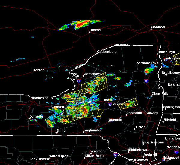 At 552 pm edt, a severe thunderstorm was located over phoenix, or near baldwinsville, moving east at 50 mph (radar indicated). Hazards include ping pong ball size hail and 60 mph wind gusts. People and animals outdoors will be injured. expect hail damage to roofs, siding, windows, and vehicles. expect wind damage to roofs, siding, and trees. this severe thunderstorm will be near, cicero and brewerton around 605 pm edt. Bridgeport around 615 pm edt. At 552 pm edt, a severe thunderstorm was located over phoenix, or near baldwinsville, moving east at 50 mph (radar indicated). Hazards include ping pong ball size hail and 60 mph wind gusts. People and animals outdoors will be injured. expect hail damage to roofs, siding, windows, and vehicles. expect wind damage to roofs, siding, and trees. this severe thunderstorm will be near, cicero and brewerton around 605 pm edt. Bridgeport around 615 pm edt.
|
| 5/1/2017 6:30 PM EDT |
 At 630 pm edt, a severe thunderstorm was located over marcellus, or 11 miles west of syracuse, moving northeast at 50 mph (radar indicated). Hazards include 60 mph wind gusts. Expect damage to roofs, siding, and trees. this severe thunderstorm will be near, liverpool, new york state fairgrounds and galeville around 640 pm edt. syracuse and lyndon around 645 pm edt. cicero and kirkville around 650 pm edt. bridgeport around 655 pm edt. camden, vienna and sylvan beach around 710 pm edt. blossvale, taberg and new london around 715 pm edt. lee around 720 pm edt. rome around 725 pm edt. A tornado watch remains in effect until 1000 pm edt for central new york. At 630 pm edt, a severe thunderstorm was located over marcellus, or 11 miles west of syracuse, moving northeast at 50 mph (radar indicated). Hazards include 60 mph wind gusts. Expect damage to roofs, siding, and trees. this severe thunderstorm will be near, liverpool, new york state fairgrounds and galeville around 640 pm edt. syracuse and lyndon around 645 pm edt. cicero and kirkville around 650 pm edt. bridgeport around 655 pm edt. camden, vienna and sylvan beach around 710 pm edt. blossvale, taberg and new london around 715 pm edt. lee around 720 pm edt. rome around 725 pm edt. A tornado watch remains in effect until 1000 pm edt for central new york.
|
| 9/11/2016 12:21 AM EDT |
 At 1220 am edt, a severe thunderstorm was located near jordan, or 7 miles southwest of baldwinsville, moving northeast at 45 mph (radar indicated). Hazards include 60 mph wind gusts and quarter size hail. Hail damage to vehicles is expected. expect wind damage to roofs, siding, and trees. this severe storm will be near, camillus around 1225 am edt. baldwinsville and new york state fairgrounds around 1230 am edt. syracuse, liverpool and galeville around 1235 am edt. cicero and brewerton around 1245 am edt. Bridgeport around 1250 am edt. At 1220 am edt, a severe thunderstorm was located near jordan, or 7 miles southwest of baldwinsville, moving northeast at 45 mph (radar indicated). Hazards include 60 mph wind gusts and quarter size hail. Hail damage to vehicles is expected. expect wind damage to roofs, siding, and trees. this severe storm will be near, camillus around 1225 am edt. baldwinsville and new york state fairgrounds around 1230 am edt. syracuse, liverpool and galeville around 1235 am edt. cicero and brewerton around 1245 am edt. Bridgeport around 1250 am edt.
|
| 9/11/2016 12:09 AM EDT |
 At 1209 am edt, a severe thunderstorm was located over sennett, or near new york thruway exit 40, moving northeast at 45 mph (radar indicated). Hazards include 60 mph wind gusts and quarter size hail. Hail damage to vehicles is expected. expect wind damage to roofs, siding, and trees. this severe thunderstorm will be near, skaneateles and jordan around 1215 am edt. marcellus around 1220 am edt. camillus around 1225 am edt. baldwinsville around 1230 am edt. syracuse, liverpool and galeville around 1235 am edt. cicero and brewerton around 1245 am edt. Bridgeport around 1250 am edt. At 1209 am edt, a severe thunderstorm was located over sennett, or near new york thruway exit 40, moving northeast at 45 mph (radar indicated). Hazards include 60 mph wind gusts and quarter size hail. Hail damage to vehicles is expected. expect wind damage to roofs, siding, and trees. this severe thunderstorm will be near, skaneateles and jordan around 1215 am edt. marcellus around 1220 am edt. camillus around 1225 am edt. baldwinsville around 1230 am edt. syracuse, liverpool and galeville around 1235 am edt. cicero and brewerton around 1245 am edt. Bridgeport around 1250 am edt.
|
| 7/18/2016 2:05 PM EDT |
 At 205 pm edt, severe thunderstorms were located along a line extending from near plainville to near sennett to auburn, moving east at 45 mph (radar indicated). Hazards include 60 mph wind gusts. Damage to roofs. siding. and trees is possible. severe thunderstorms will be near, baldwinsville, skaneateles and marcellus around 215 pm edt. camillus around 220 pm edt. liverpool, galeville and new york state fairgrounds around 225 pm edt. Syracuse, cicero and manlius around 230 pm edt. At 205 pm edt, severe thunderstorms were located along a line extending from near plainville to near sennett to auburn, moving east at 45 mph (radar indicated). Hazards include 60 mph wind gusts. Damage to roofs. siding. and trees is possible. severe thunderstorms will be near, baldwinsville, skaneateles and marcellus around 215 pm edt. camillus around 220 pm edt. liverpool, galeville and new york state fairgrounds around 225 pm edt. Syracuse, cicero and manlius around 230 pm edt.
|
| 7/18/2016 12:22 PM EDT |
 At 1222 pm edt, a severe thunderstorm was located 7 miles north of cato, or 10 miles west of fulton, moving east at 50 mph (radar indicated). Hazards include 60 mph wind gusts and quarter size hail. Hail damage to vehicles is possible. wind damage to roofs, siding, and trees is also possible. this severe thunderstorm will be near, lysander and plainville around 1235 pm edt. baldwinsville around 1240 pm edt. brewerton around 1250 pm edt. cicero around 1255 pm edt. Bridgeport around 105 pm edt. At 1222 pm edt, a severe thunderstorm was located 7 miles north of cato, or 10 miles west of fulton, moving east at 50 mph (radar indicated). Hazards include 60 mph wind gusts and quarter size hail. Hail damage to vehicles is possible. wind damage to roofs, siding, and trees is also possible. this severe thunderstorm will be near, lysander and plainville around 1235 pm edt. baldwinsville around 1240 pm edt. brewerton around 1250 pm edt. cicero around 1255 pm edt. Bridgeport around 105 pm edt.
|
| 6/20/2016 11:48 PM EDT |
 At 1147 pm edt, severe thunderstorms were located along a line extending from 8 miles southwest of boonville to near bridgeport to near jordan, moving southeast at 30 mph (radar indicated). Hazards include 60 mph wind gusts and penny size hail. Expect damage to roofs. siding. and trees. these severe storms will be near, boonville around 1155 pm edt. rome, sullivan and chittenango around 1200 am edt. canastota around 1205 am edt. oneida, lenox and wampsville around 1210 am edt. Lyndon around 1215 am edt. At 1147 pm edt, severe thunderstorms were located along a line extending from 8 miles southwest of boonville to near bridgeport to near jordan, moving southeast at 30 mph (radar indicated). Hazards include 60 mph wind gusts and penny size hail. Expect damage to roofs. siding. and trees. these severe storms will be near, boonville around 1155 pm edt. rome, sullivan and chittenango around 1200 am edt. canastota around 1205 am edt. oneida, lenox and wampsville around 1210 am edt. Lyndon around 1215 am edt.
|
| 6/20/2016 11:11 PM EDT |
 At 1111 pm edt, severe thunderstorms were located along a line extending from near redfield to near phoenix to near cato, moving southeast at 30 mph (radar indicated). Hazards include 60 mph wind gusts and quarter size hail. Hail damage to vehicles is expected. expect wind damage to roofs, siding, and trees. severe thunderstorms will be near, camden and cicero around 1130 pm edt. marcellus, camillus and bridgeport around 1140 pm edt. liverpool, new york state fairgrounds and galeville around 1145 pm edt. syracuse, lee and kirkville around 1150 pm edt. sullivan around 1155 pm edt. rome, chittenango and canastota around 1200 am edt. lyndon and wampsville around 1205 am edt. Oneida, lenox and manlius around 1210 am edt. At 1111 pm edt, severe thunderstorms were located along a line extending from near redfield to near phoenix to near cato, moving southeast at 30 mph (radar indicated). Hazards include 60 mph wind gusts and quarter size hail. Hail damage to vehicles is expected. expect wind damage to roofs, siding, and trees. severe thunderstorms will be near, camden and cicero around 1130 pm edt. marcellus, camillus and bridgeport around 1140 pm edt. liverpool, new york state fairgrounds and galeville around 1145 pm edt. syracuse, lee and kirkville around 1150 pm edt. sullivan around 1155 pm edt. rome, chittenango and canastota around 1200 am edt. lyndon and wampsville around 1205 am edt. Oneida, lenox and manlius around 1210 am edt.
|
| 6/8/2015 12:31 PM EDT |
 At 1230 pm edt, a severe thunderstorm was located near montezuma, or 9 miles north of seneca falls, moving northeast at 55 mph (radar indicated). Hazards include 60 mph wind gusts. Expect damage to roofs. siding and trees. this severe thunderstorm will be near, jordan around 1240 pm edt. Baldwinsville, lysander and plainville around 1245 pm edt. At 1230 pm edt, a severe thunderstorm was located near montezuma, or 9 miles north of seneca falls, moving northeast at 55 mph (radar indicated). Hazards include 60 mph wind gusts. Expect damage to roofs. siding and trees. this severe thunderstorm will be near, jordan around 1240 pm edt. Baldwinsville, lysander and plainville around 1245 pm edt.
|
| 7/23/2012 11:43 PM EDT | Trees down in onondaga county NY, 1 miles NNE of Village Green, NY |
Hail Maps for Village Green, NY


Connect with Interactive Hail Maps