

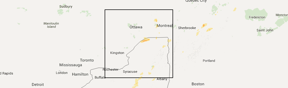
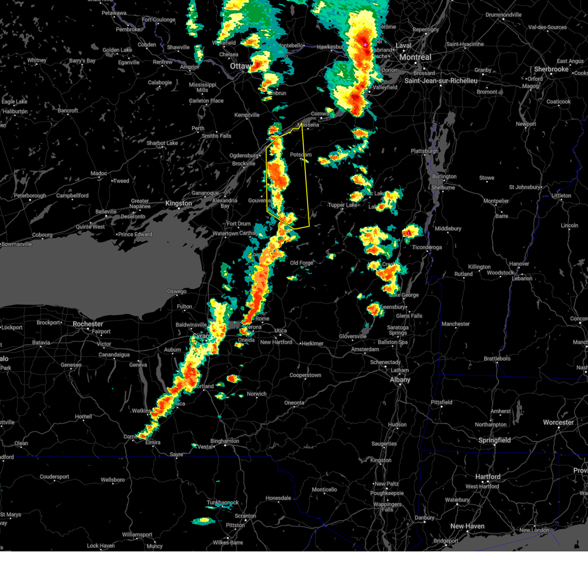
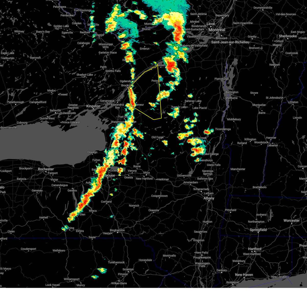
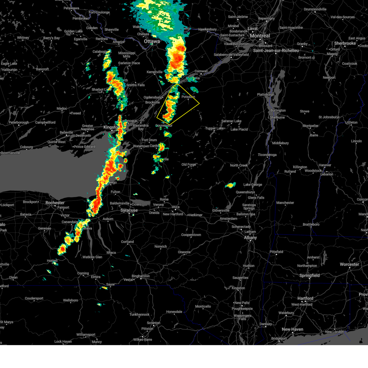
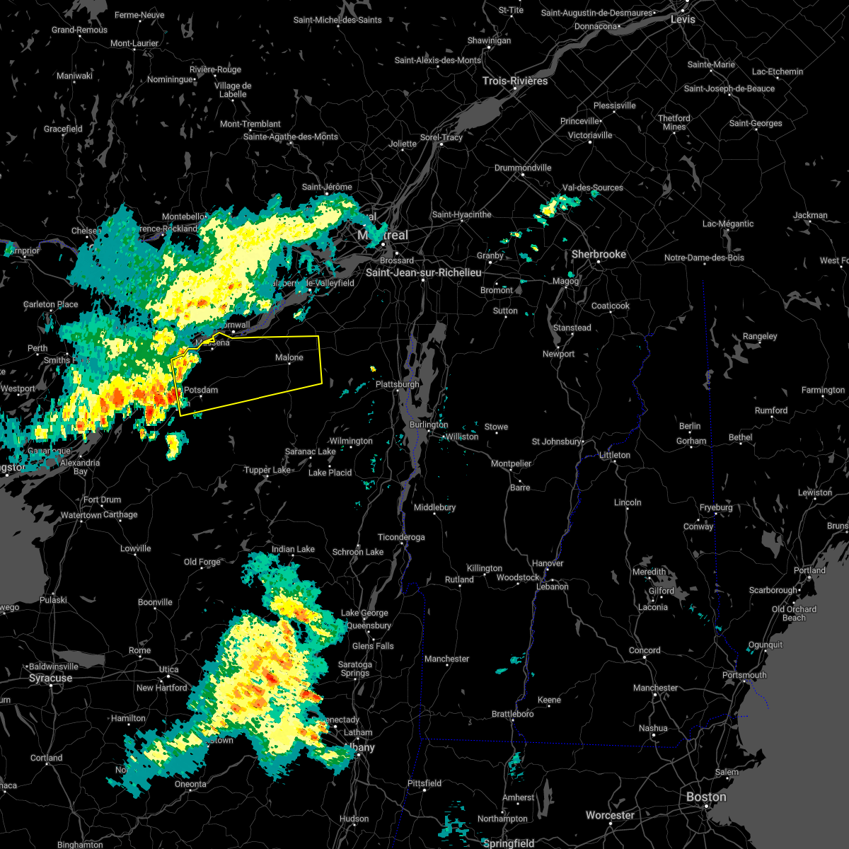
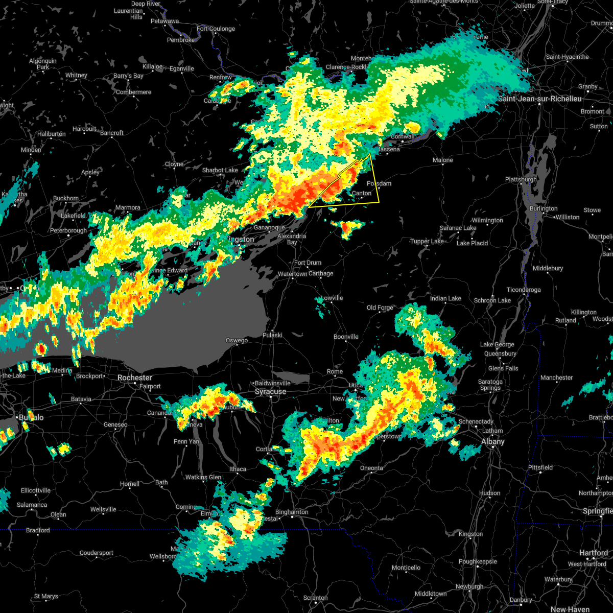
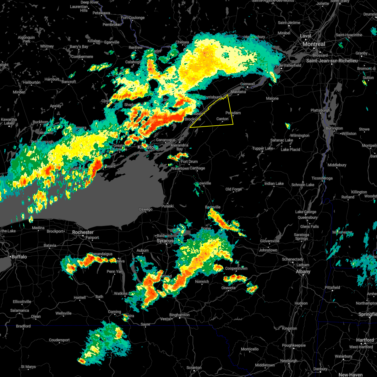
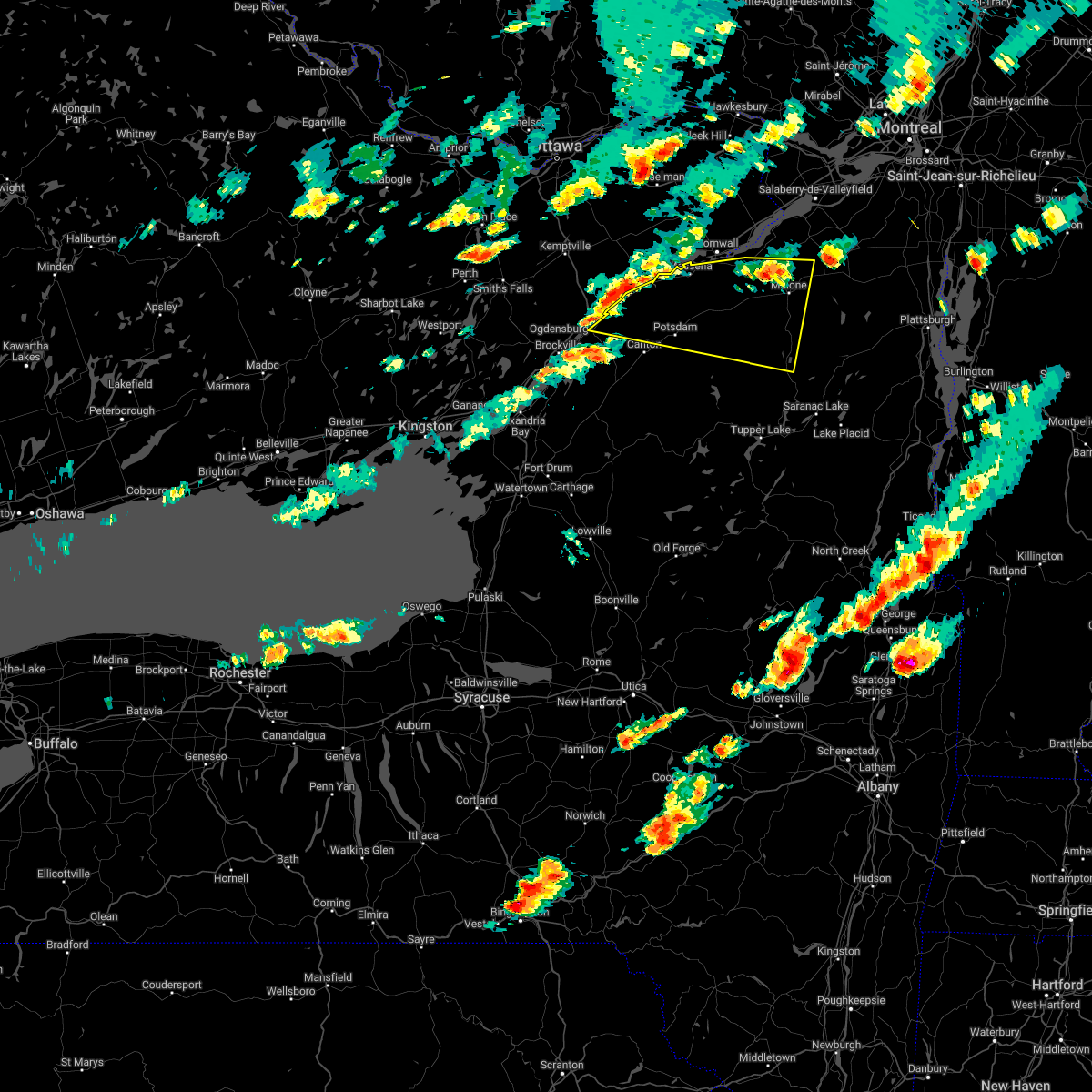
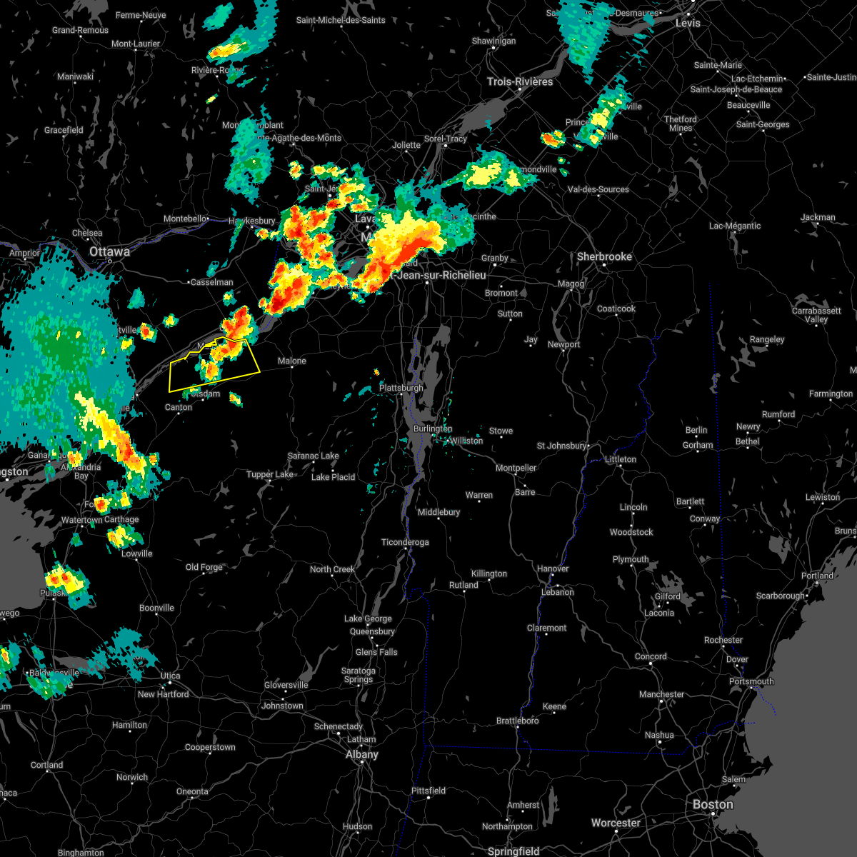
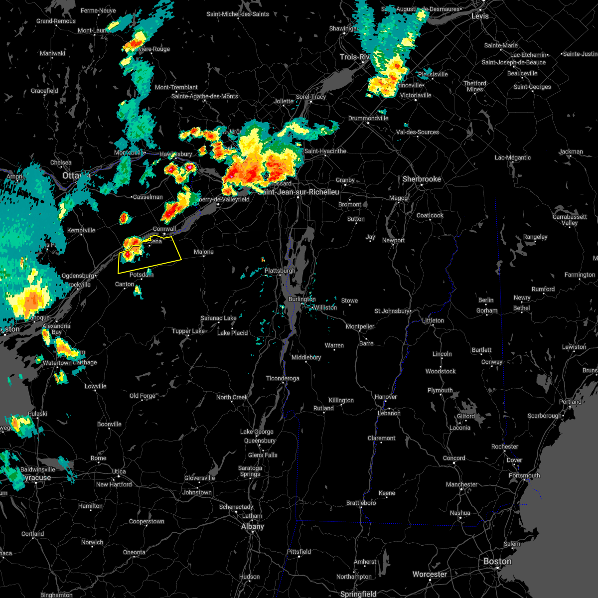
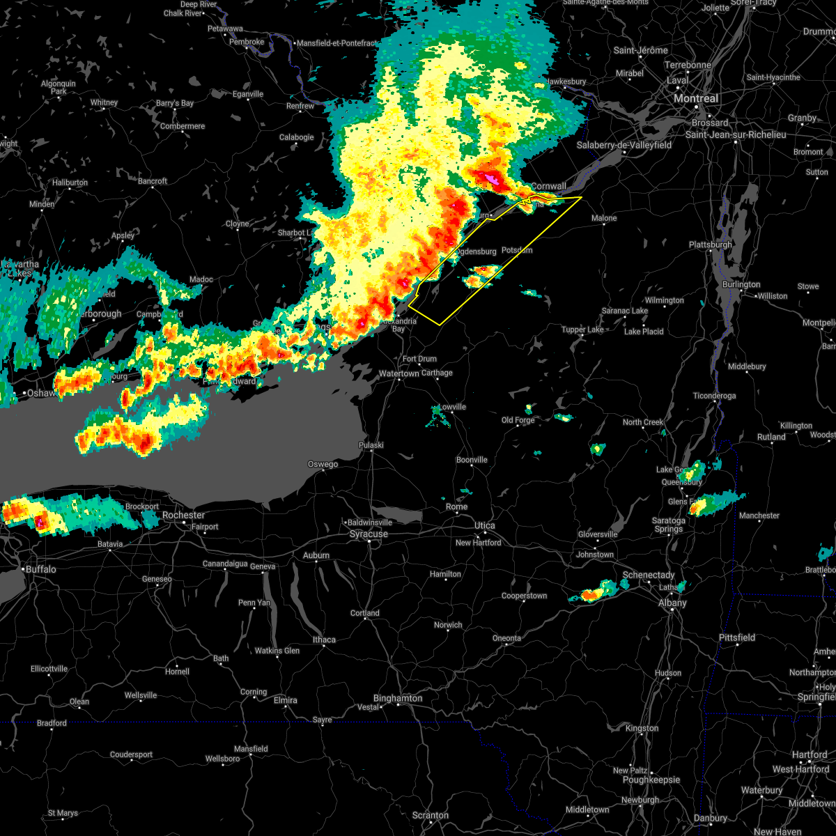
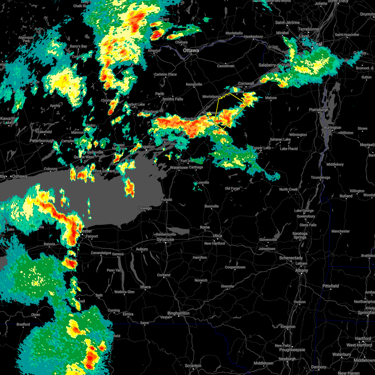
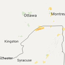
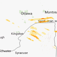
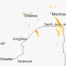
Hail Map for Waddington, NY
The Waddington, NY area has had 0 reports of on-the-ground hail by trained spotters, and has been under severe weather warnings 3 times during the past 12 months. Doppler radar has detected hail at or near Waddington, NY on 5 occasions.
| Name: | Waddington, NY |
| Where Located: | 18.7 miles NE of Ogdensburg, NY |
| Map: | Google Map for Waddington, NY |
| Population: | 972 |
| Housing Units: | 511 |
| More Info: | Search Google for Waddington, NY |
5
The Top Recent Hail Date for Waddington, NY is Tuesday, June 28, 2016 (1st out of 5)
Hail and Wind Damage Spotted near Waddington, NY
| Date / Time | Report Details |
|---|---|
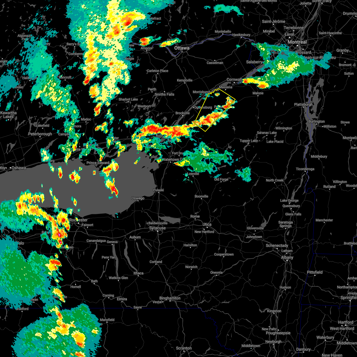
| 7/13/2023 3:14 PM EDT |
 At 314 pm edt, severe thunderstorms were located along a line extending from lisbon to edwards, moving northeast at 40 mph (radar indicated). Hazards include 60 mph wind gusts and quarter size hail. Minor hail damage to vehicles is possible. expect wind damage to trees and powerlines. locations impacted include, potsdam, canton, norfolk, oswegatchie, lisbon, louisville, de kalb, fowler, colton, rensselaer falls, morley, degrasse, norwood, hermon, chipman, heuvelton, waddington, richville, madrid, and star lake. hail threat, radar indicated max hail size, 1. 00 in wind threat, radar indicated max wind gust, 60 mph. At 314 pm edt, severe thunderstorms were located along a line extending from lisbon to edwards, moving northeast at 40 mph (radar indicated). Hazards include 60 mph wind gusts and quarter size hail. Minor hail damage to vehicles is possible. expect wind damage to trees and powerlines. locations impacted include, potsdam, canton, norfolk, oswegatchie, lisbon, louisville, de kalb, fowler, colton, rensselaer falls, morley, degrasse, norwood, hermon, chipman, heuvelton, waddington, richville, madrid, and star lake. hail threat, radar indicated max hail size, 1. 00 in wind threat, radar indicated max wind gust, 60 mph.
|
| 7/13/2023 2:46 PM EDT |
 At 245 pm edt, severe thunderstorms were located along a line extending from near edwardsville to 7 miles southwest of west fowler, moving northeast at 40 mph (radar indicated). Hazards include 60 mph wind gusts and quarter size hail. Minor hail damage to vehicles is possible. Expect wind damage to trees and powerlines. At 245 pm edt, severe thunderstorms were located along a line extending from near edwardsville to 7 miles southwest of west fowler, moving northeast at 40 mph (radar indicated). Hazards include 60 mph wind gusts and quarter size hail. Minor hail damage to vehicles is possible. Expect wind damage to trees and powerlines.
|
| 7/13/2023 1:37 PM EDT |
 At 136 pm edt, a severe thunderstorm was located over north gouverneur, moving northeast at 35 mph (radar indicated). Hazards include 60 mph wind gusts and penny size hail. expect damage to trees and powerlines At 136 pm edt, a severe thunderstorm was located over north gouverneur, moving northeast at 35 mph (radar indicated). Hazards include 60 mph wind gusts and penny size hail. expect damage to trees and powerlines
|
| 7/28/2022 1:38 PM EDT |
 At 137 pm edt, a cluster of severe thunderstorms was located 12 miles southwest of south hammond, moving northeast at 25 mph (radar indicated). Hazards include 60 mph wind gusts and quarter size hail. Minor hail damage to vehicles is possible. Expect wind damage to trees and powerlines. At 137 pm edt, a cluster of severe thunderstorms was located 12 miles southwest of south hammond, moving northeast at 25 mph (radar indicated). Hazards include 60 mph wind gusts and quarter size hail. Minor hail damage to vehicles is possible. Expect wind damage to trees and powerlines.
|
| 7/24/2022 11:18 PM EDT |
 At 1118 pm edt, a severe thunderstorm was located near raymondville, moving east at 50 mph (radar indicated). Hazards include 70 mph wind gusts. Expect considerable tree damage. Damage is likely to mobile homes, roofs, and outbuildings. At 1118 pm edt, a severe thunderstorm was located near raymondville, moving east at 50 mph (radar indicated). Hazards include 70 mph wind gusts. Expect considerable tree damage. Damage is likely to mobile homes, roofs, and outbuildings.
|
| 7/24/2022 11:09 PM EDT |
 At 1109 pm edt, a severe thunderstorm was located near heuvelton, moving east at 45 mph (radar indicated). Hazards include 70 mph wind gusts. Expect considerable tree damage. damage is likely to mobile homes, roofs, and outbuildings. locations impacted include, ogdensburg, canton, potsdam, lisbon, rensselaer falls, heuvelton, morley, waddington, madrid, morristown, chipman, de peyster, jacques cartier state park and west potsdam. thunderstorm damage threat, considerable hail threat, radar indicated max hail size, <. 75 in wind threat, radar indicated max wind gust, 70 mph. At 1109 pm edt, a severe thunderstorm was located near heuvelton, moving east at 45 mph (radar indicated). Hazards include 70 mph wind gusts. Expect considerable tree damage. damage is likely to mobile homes, roofs, and outbuildings. locations impacted include, ogdensburg, canton, potsdam, lisbon, rensselaer falls, heuvelton, morley, waddington, madrid, morristown, chipman, de peyster, jacques cartier state park and west potsdam. thunderstorm damage threat, considerable hail threat, radar indicated max hail size, <. 75 in wind threat, radar indicated max wind gust, 70 mph.
|
| 7/24/2022 10:27 PM EDT |
 At 1026 pm edt, a severe thunderstorm was located 9 miles northwest of jacques cartier state park, moving east at 40 mph (radar indicated). Hazards include 70 mph wind gusts. Expect considerable tree damage. Damage is likely to mobile homes, roofs, and outbuildings. At 1026 pm edt, a severe thunderstorm was located 9 miles northwest of jacques cartier state park, moving east at 40 mph (radar indicated). Hazards include 70 mph wind gusts. Expect considerable tree damage. Damage is likely to mobile homes, roofs, and outbuildings.
|
| 7/12/2022 2:43 PM EDT |
 At 243 pm edt, a severe thunderstorm was located over louisville, moving east at 50 mph (radar indicated). Hazards include 60 mph wind gusts and penny size hail. Expect damage to trees and powerlines. locations impacted include, potsdam, massena, norfolk, louisville, moira, bangor, parishville, fort covington, bombay, morley, massena international airport - richards field, helena, burke, waddington, madrid, brushton, lawrenceville, malone, norwood and chipman. hail threat, radar indicated max hail size, 0. 75 in wind threat, radar indicated max wind gust, 60 mph. At 243 pm edt, a severe thunderstorm was located over louisville, moving east at 50 mph (radar indicated). Hazards include 60 mph wind gusts and penny size hail. Expect damage to trees and powerlines. locations impacted include, potsdam, massena, norfolk, louisville, moira, bangor, parishville, fort covington, bombay, morley, massena international airport - richards field, helena, burke, waddington, madrid, brushton, lawrenceville, malone, norwood and chipman. hail threat, radar indicated max hail size, 0. 75 in wind threat, radar indicated max wind gust, 60 mph.
|
| 7/12/2022 2:35 PM EDT | Trees and wires down in waddington on james stree in st. lawrence county NY, 0.5 miles NNE of Waddington, NY |
| 7/12/2022 2:21 PM EDT |
 At 221 pm edt, a severe thunderstorm was located over waddington, moving east at 45 mph (radar indicated). Hazards include 60 mph wind gusts and quarter size hail. Minor hail damage to vehicles is possible. Expect wind damage to trees and powerlines. At 221 pm edt, a severe thunderstorm was located over waddington, moving east at 45 mph (radar indicated). Hazards include 60 mph wind gusts and quarter size hail. Minor hail damage to vehicles is possible. Expect wind damage to trees and powerlines.
|
| 6/16/2022 4:48 PM EDT |
 At 448 pm edt, a severe thunderstorm was located over raquette river, moving east at 30 mph (radar indicated). Hazards include 60 mph wind gusts and quarter size hail. Minor hail damage to vehicles is possible. expect wind damage to trees and powerlines. locations impacted include, massena, norfolk, louisville, moira, waddington, st. regis, massena international airport - richards field, madrid, helena, chipman, brasher falls, norwood, north stockholm, eisenhower lock, brasher center, hogansburg, st. lawrence state park, ironton, rooseveltown and coles creek state park. hail threat, radar indicated max hail size, 1. 00 in wind threat, radar indicated max wind gust, 60 mph. At 448 pm edt, a severe thunderstorm was located over raquette river, moving east at 30 mph (radar indicated). Hazards include 60 mph wind gusts and quarter size hail. Minor hail damage to vehicles is possible. expect wind damage to trees and powerlines. locations impacted include, massena, norfolk, louisville, moira, waddington, st. regis, massena international airport - richards field, madrid, helena, chipman, brasher falls, norwood, north stockholm, eisenhower lock, brasher center, hogansburg, st. lawrence state park, ironton, rooseveltown and coles creek state park. hail threat, radar indicated max hail size, 1. 00 in wind threat, radar indicated max wind gust, 60 mph.
|
| 6/16/2022 4:23 PM EDT |
 At 423 pm edt, a severe thunderstorm was located over coles creek state park, moving east at 15 mph (radar indicated). Hazards include 60 mph wind gusts and quarter size hail. Minor hail damage to vehicles is possible. Expect wind damage to trees and powerlines. At 423 pm edt, a severe thunderstorm was located over coles creek state park, moving east at 15 mph (radar indicated). Hazards include 60 mph wind gusts and quarter size hail. Minor hail damage to vehicles is possible. Expect wind damage to trees and powerlines.
|
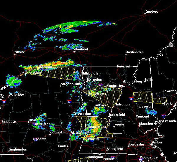
| 7/20/2021 4:25 PM EDT |
 At 422 pm edt, a line of severe thunderstorms were located along the saint lawrence river in new york extending from 17 miles north of st. regis to 22 miles southwest of cedar island state park, moving east at 45 mph (radar indicated). Hazards include 60 mph wind gusts and quarter size hail. Minor hail damage to vehicles is possible. expect wind damage to trees and powerlines. Locations impacted include, massena, canton, potsdam, ogdensburg, norfolk, lisbon, louisville, de kalb, fort covington, bombay, rensselaer falls, morley, norwood, edwardsville, massena international airport - richards field, helena, chipman, brasher falls, heuvelton and waddington. At 422 pm edt, a line of severe thunderstorms were located along the saint lawrence river in new york extending from 17 miles north of st. regis to 22 miles southwest of cedar island state park, moving east at 45 mph (radar indicated). Hazards include 60 mph wind gusts and quarter size hail. Minor hail damage to vehicles is possible. expect wind damage to trees and powerlines. Locations impacted include, massena, canton, potsdam, ogdensburg, norfolk, lisbon, louisville, de kalb, fort covington, bombay, rensselaer falls, morley, norwood, edwardsville, massena international airport - richards field, helena, chipman, brasher falls, heuvelton and waddington.
|
| 7/20/2021 3:53 PM EDT |
 At 351 pm edt, severe thunderstorms were located west of the saint lawrence river along a line extending from 23 miles northwest of st. lawrence state park to 47 miles west of cedar island state park, moving east at 45 mph (radar indicated). Hazards include 60 mph wind gusts and quarter size hail. Expect wind damage to trees and powerlines. Minor hail damage to vehicles is possible. At 351 pm edt, severe thunderstorms were located west of the saint lawrence river along a line extending from 23 miles northwest of st. lawrence state park to 47 miles west of cedar island state park, moving east at 45 mph (radar indicated). Hazards include 60 mph wind gusts and quarter size hail. Expect wind damage to trees and powerlines. Minor hail damage to vehicles is possible.
|
| 7/13/2021 7:33 PM EDT |
 At 733 pm edt, a severe thunderstorm was located over canton, moving northeast at 30 mph (radar indicated). Hazards include 60 mph wind gusts. Expect damage to trees and powerlines. Locations impacted include, potsdam, canton, norfolk, louisville, morley, waddington, norwood, madrid, chipman, brasher falls, north stockholm, pyrites, west stockholm, west potsdam, coles creek state park, stockholm center, raymondville, winthrop, north russell and hannawa falls. At 733 pm edt, a severe thunderstorm was located over canton, moving northeast at 30 mph (radar indicated). Hazards include 60 mph wind gusts. Expect damage to trees and powerlines. Locations impacted include, potsdam, canton, norfolk, louisville, morley, waddington, norwood, madrid, chipman, brasher falls, north stockholm, pyrites, west stockholm, west potsdam, coles creek state park, stockholm center, raymondville, winthrop, north russell and hannawa falls.
|
| 7/13/2021 7:10 PM EDT |
 At 710 pm edt, a severe thunderstorm was located over east de kalb, moving northeast at 30 mph (radar indicated). Hazards include 60 mph wind gusts. expect damage to trees and powerlines At 710 pm edt, a severe thunderstorm was located over east de kalb, moving northeast at 30 mph (radar indicated). Hazards include 60 mph wind gusts. expect damage to trees and powerlines
|
| 6/18/2018 4:37 PM EDT |
 At 436 pm edt, a severe thunderstorm was located 7 miles northwest of coles creek state park, moving east at 35 mph (radar indicated). Hazards include 60 mph wind gusts and penny size hail. expect damage to trees and powerlines At 436 pm edt, a severe thunderstorm was located 7 miles northwest of coles creek state park, moving east at 35 mph (radar indicated). Hazards include 60 mph wind gusts and penny size hail. expect damage to trees and powerlines
|
| 5/4/2018 4:22 PM EDT |
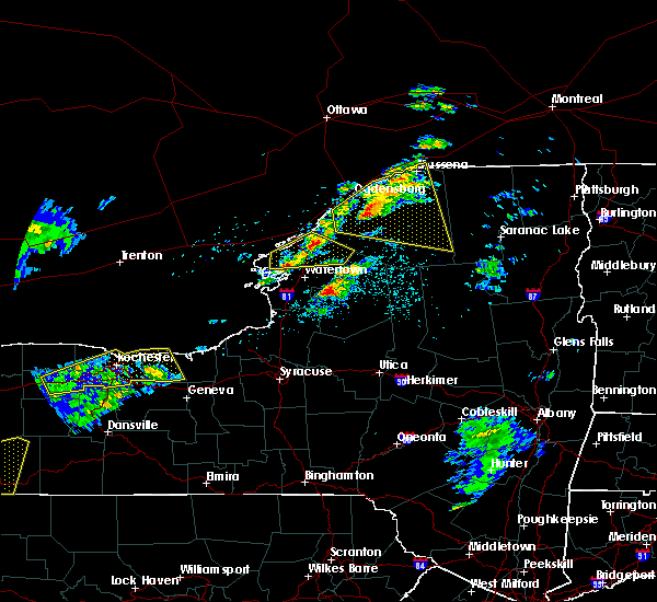 At 407 pm edt, a severe thunderstorm was located near north gouverneur, moving east at 45 mph (radar indicated). Hazards include 60 mph wind gusts and quarter size hail. Minor hail damage to vehicles is possible. Expect wind damage to trees and powerlines. At 407 pm edt, a severe thunderstorm was located near north gouverneur, moving east at 45 mph (radar indicated). Hazards include 60 mph wind gusts and quarter size hail. Minor hail damage to vehicles is possible. Expect wind damage to trees and powerlines.
|
| 5/4/2018 4:08 PM EDT |
 At 407 pm edt, a severe thunderstorm was located near north gouverneur, moving east at 45 mph (radar indicated). Hazards include 60 mph wind gusts and quarter size hail. Minor hail damage to vehicles is possible. Expect wind damage to trees and powerlines. At 407 pm edt, a severe thunderstorm was located near north gouverneur, moving east at 45 mph (radar indicated). Hazards include 60 mph wind gusts and quarter size hail. Minor hail damage to vehicles is possible. Expect wind damage to trees and powerlines.
|
| 8/22/2017 1:45 PM EDT |
 At 144 pm edt, severe thunderstorms were located along a line extending from jacques cartier state park to near hammond to nelson corner, moving east at 40 mph (radar indicated). Hazards include 60 mph wind gusts. expect damage to trees and powerlines At 144 pm edt, severe thunderstorms were located along a line extending from jacques cartier state park to near hammond to nelson corner, moving east at 40 mph (radar indicated). Hazards include 60 mph wind gusts. expect damage to trees and powerlines
|
| 6/24/2017 8:15 PM EDT | Trees and wires down from waddington... madrid... norfolk including on a hous in st. lawrence county NY, 0.5 miles NNE of Waddington, NY |
| 2/25/2017 12:58 PM EST |
 At 1258 pm est, severe thunderstorms were located along a line extending from near ogdensburg to rensselaer falls to near edwards, moving northeast at 60 mph (radar indicated). Hazards include 60 mph wind gusts. expect damage to roofs, siding, and trees At 1258 pm est, severe thunderstorms were located along a line extending from near ogdensburg to rensselaer falls to near edwards, moving northeast at 60 mph (radar indicated). Hazards include 60 mph wind gusts. expect damage to roofs, siding, and trees
|
| 9/11/2016 12:12 AM EDT |
 At 1211 am edt, severe thunderstorms were located along a line extending from near canton to fine, moving northeast at 50 mph (radar indicated). Hazards include 60 mph wind gusts. Expect damage to roofs. siding. And trees. At 1211 am edt, severe thunderstorms were located along a line extending from near canton to fine, moving northeast at 50 mph (radar indicated). Hazards include 60 mph wind gusts. Expect damage to roofs. siding. And trees.
|
| 9/10/2016 11:26 PM EDT |
 At 1124 pm edt, severe thunderstorms were located along a line extending from louisville to near norwood to fowler, moving northeast at 45 mph (radar indicated). Hazards include 60 mph wind gusts. Expect damage to roofs. siding. And trees. At 1124 pm edt, severe thunderstorms were located along a line extending from louisville to near norwood to fowler, moving northeast at 45 mph (radar indicated). Hazards include 60 mph wind gusts. Expect damage to roofs. siding. And trees.
|
| 6/28/2016 6:57 PM EDT |
 At 657 pm edt, a severe thunderstorm was located near chipman, moving east at 20 mph (radar indicated). Hazards include 60 mph wind gusts and quarter size hail. Hail damage to vehicles is expected. Expect wind damage to roofs, siding, and trees. At 657 pm edt, a severe thunderstorm was located near chipman, moving east at 20 mph (radar indicated). Hazards include 60 mph wind gusts and quarter size hail. Hail damage to vehicles is expected. Expect wind damage to roofs, siding, and trees.
|
| 6/28/2016 6:49 PM EDT | Trees and power lines dow in st. lawrence county NY, 0.5 miles NNE of Waddington, NY |
| 6/24/2013 7:25 PM EDT | St. lawrence cty em relayed multiple powerline wires hanging down and a stop sign blown onto a vehicle in the town of waddington. time estimated from rada in st. lawrence county NY, 0.5 miles NNE of Waddington, NY |
| 6/1/2013 7:30 PM EDT | Couple trees down in st. lawrence county NY, 0.5 miles NNE of Waddington, NY |
Hail Maps for Waddington, NY


Connect with Interactive Hail Maps