

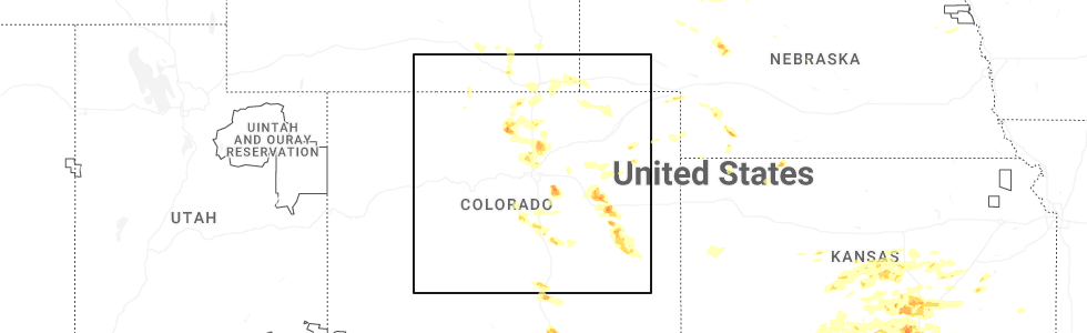
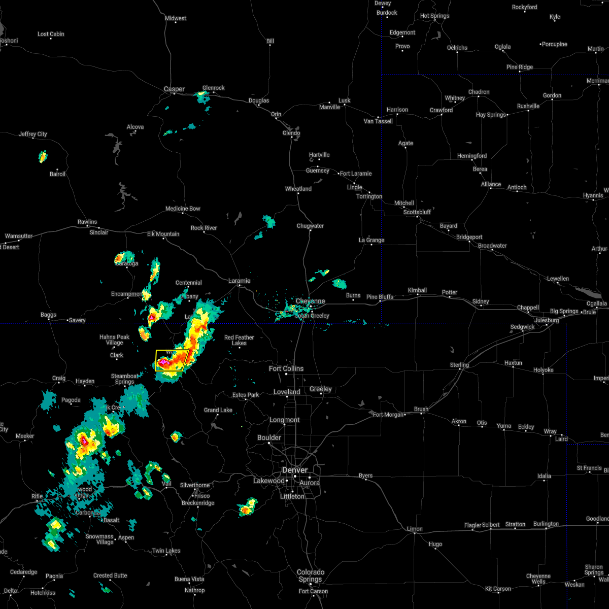
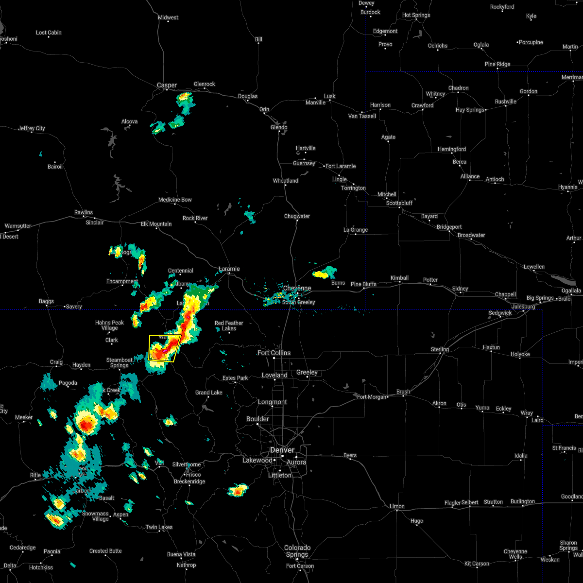
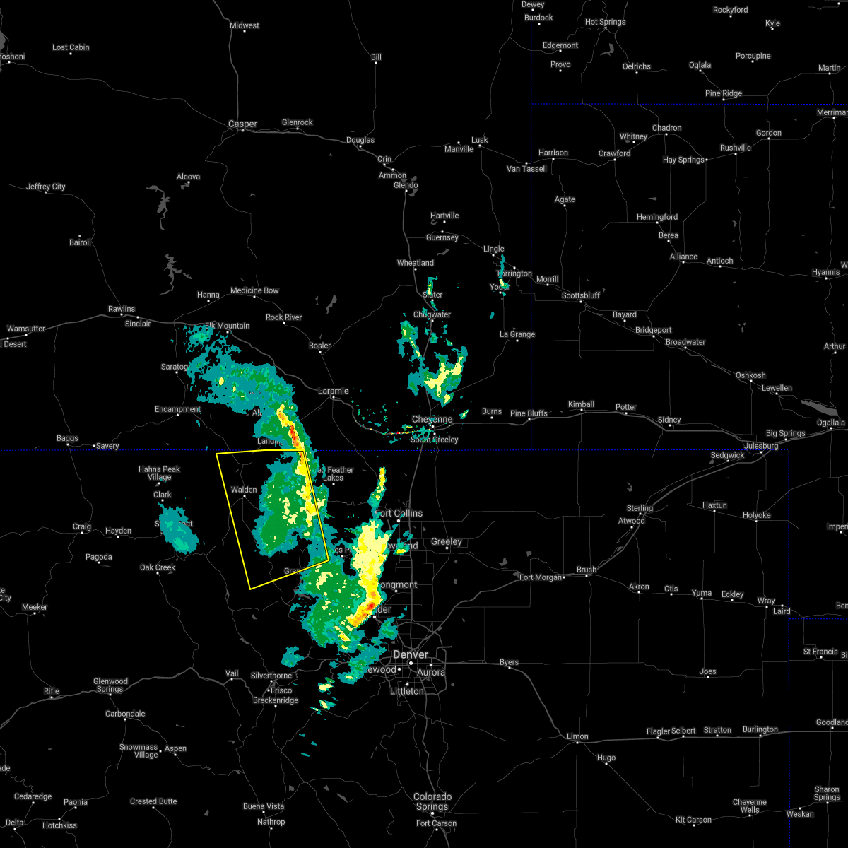
Hail Map for Walden, CO
The Walden, CO area has had 1 report of on-the-ground hail by trained spotters, and has been under severe weather warnings 0 times during the past 12 months. Doppler radar has detected hail at or near Walden, CO on 5 occasions.
| Name: | Walden, CO |
| Where Located: | 53.9 miles SW of Laramie, WY |
| Map: | Google Map for Walden, CO |
| Population: | 608 |
| Housing Units: | 377 |
| More Info: | Search Google for Walden, CO |
0
The Top Recent Hail Date for Walden, CO is Tuesday, June 17, 2025 (1st out of 5)
Hail and Wind Damage Spotted near Walden, CO
| Date / Time | Report Details |
|---|---|
| 7/29/2021 5:33 PM MDT |
 At 532 pm mdt, a severe thunderstorm was located 6 miles northeast of coalmont, or 61 miles southwest of laramie, moving north at 5 mph (radar indicated). Hazards include 60 mph wind gusts and quarter size hail. Expect damage to roofs, siding, and trees. hail damage to vehicles is expected. Locations impacted include, walden and lake john. At 532 pm mdt, a severe thunderstorm was located 6 miles northeast of coalmont, or 61 miles southwest of laramie, moving north at 5 mph (radar indicated). Hazards include 60 mph wind gusts and quarter size hail. Expect damage to roofs, siding, and trees. hail damage to vehicles is expected. Locations impacted include, walden and lake john.
|
| 7/29/2021 5:30 PM MDT | Quarter sized hail reported 6.1 miles ENE of Walden, CO |
| 7/29/2021 5:21 PM MDT |
 At 520 pm mdt, a severe thunderstorm was located 5 miles northeast of coalmont, or 62 miles southwest of laramie, moving north at 5 mph (radar indicated). Hazards include 60 mph wind gusts and quarter size hail. Expect damage to roofs, siding, and trees. Hail damage to vehicles is expected. At 520 pm mdt, a severe thunderstorm was located 5 miles northeast of coalmont, or 62 miles southwest of laramie, moving north at 5 mph (radar indicated). Hazards include 60 mph wind gusts and quarter size hail. Expect damage to roofs, siding, and trees. Hail damage to vehicles is expected.
|
| 7/13/2020 3:00 PM MDT |
 At 259 pm mdt, severe thunderstorms were located along a line extending from 3 miles southeast of six mile campground to 6 miles northwest of granby, or along a line extending from 45 miles southwest of laramie to 57 miles southwest of fort collins, moving east at 45 mph (radar indicated). Hazards include 60 mph wind gusts. expect damage to roofs, siding, and trees At 259 pm mdt, severe thunderstorms were located along a line extending from 3 miles southeast of six mile campground to 6 miles northwest of granby, or along a line extending from 45 miles southwest of laramie to 57 miles southwest of fort collins, moving east at 45 mph (radar indicated). Hazards include 60 mph wind gusts. expect damage to roofs, siding, and trees
|
| 7/13/2020 2:57 PM MDT | Storm damage reported in jackson county CO, 1.4 miles SSW of Walden, CO |
| 6/6/2020 2:33 PM MDT |
 At 232 pm mdt, severe thunderstorms were located along a line extending from near cowdrey to near berthoud pass to 10 miles northwest of guffey, or along a line extending from 51 miles southwest of laramie to 43 miles west of denver to 36 miles north of hayden pass burn scar, moving northeast at 65 mph. these are very dangerous storms (radar indicated). Hazards include 80 mph wind gusts. Flying debris will be dangerous to those caught without shelter. mobile homes will be heavily damaged. expect considerable damage to roofs, windows, and vehicles. Extensive tree damage and power outages are likely. At 232 pm mdt, severe thunderstorms were located along a line extending from near cowdrey to near berthoud pass to 10 miles northwest of guffey, or along a line extending from 51 miles southwest of laramie to 43 miles west of denver to 36 miles north of hayden pass burn scar, moving northeast at 65 mph. these are very dangerous storms (radar indicated). Hazards include 80 mph wind gusts. Flying debris will be dangerous to those caught without shelter. mobile homes will be heavily damaged. expect considerable damage to roofs, windows, and vehicles. Extensive tree damage and power outages are likely.
|
| 10/4/2018 1:27 PM MDT |
 The severe thunderstorm warning for eastern jackson, western larimer and northeastern grand counties will expire at 130 pm mdt, the storms which prompted the warning have moved out of the area. therefore, the warning will be allowed to expire. however gusty winds are still possible with these thunderstorms as they move over northern larimer county. The severe thunderstorm warning for eastern jackson, western larimer and northeastern grand counties will expire at 130 pm mdt, the storms which prompted the warning have moved out of the area. therefore, the warning will be allowed to expire. however gusty winds are still possible with these thunderstorms as they move over northern larimer county.
|
| 10/4/2018 12:52 PM MDT |
 At 1251 pm mdt, severe thunderstorms were located along a line extending from 6 miles southeast of pearl to 12 miles northwest of hot sulphur springs, or along a line extending from 51 miles southwest of laramie to 64 miles west of fort collins, moving northeast at 40 mph (radar indicated). Hazards include 60 mph wind gusts and nickel size hail. expect damage to roofs, siding, and trees At 1251 pm mdt, severe thunderstorms were located along a line extending from 6 miles southeast of pearl to 12 miles northwest of hot sulphur springs, or along a line extending from 51 miles southwest of laramie to 64 miles west of fort collins, moving northeast at 40 mph (radar indicated). Hazards include 60 mph wind gusts and nickel size hail. expect damage to roofs, siding, and trees
|
Hail Maps for Walden, CO


Connect with Interactive Hail Maps