

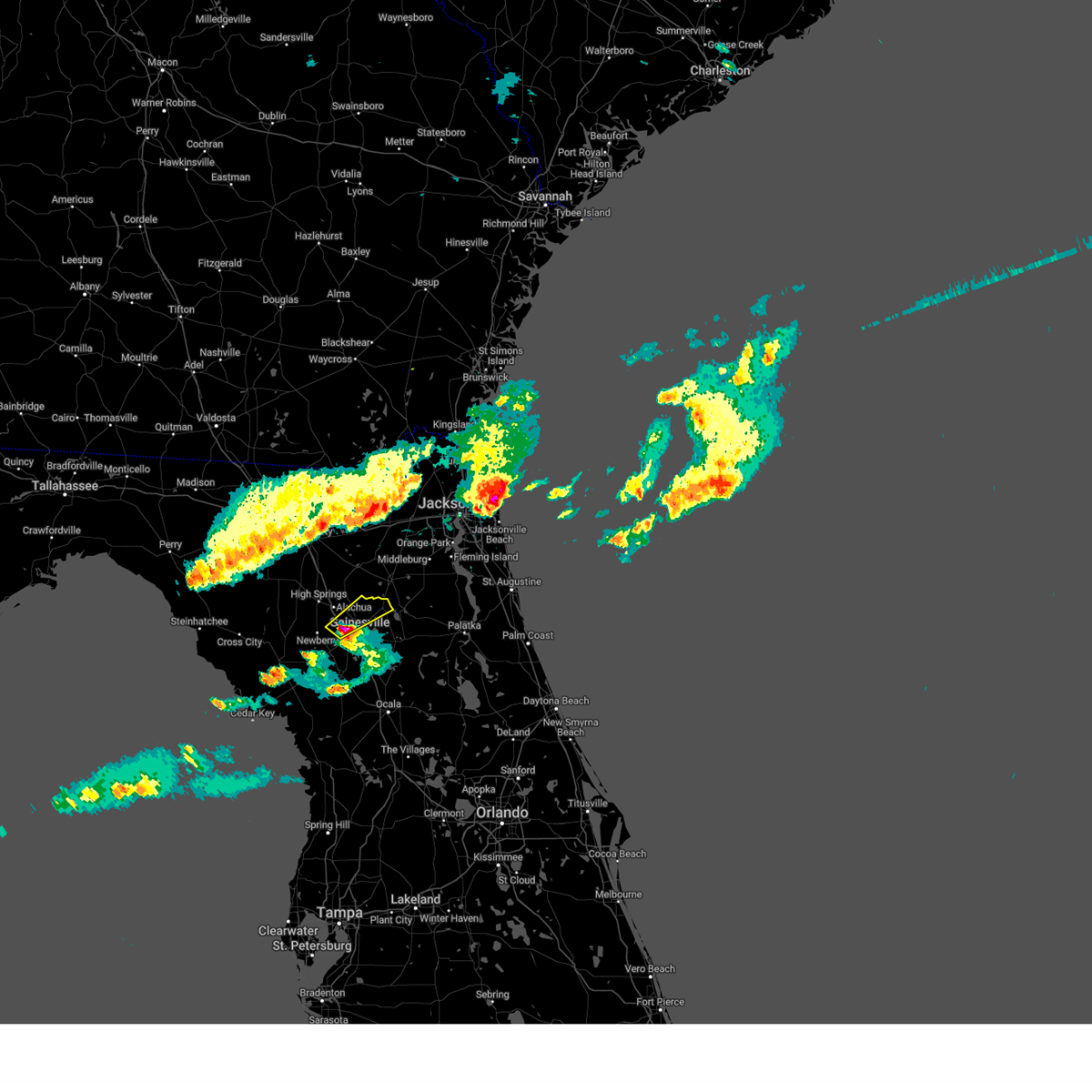
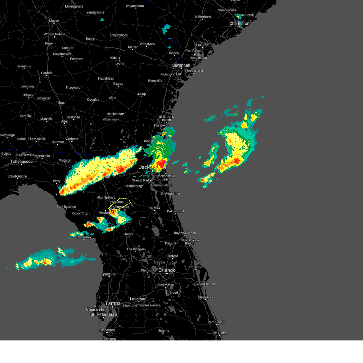
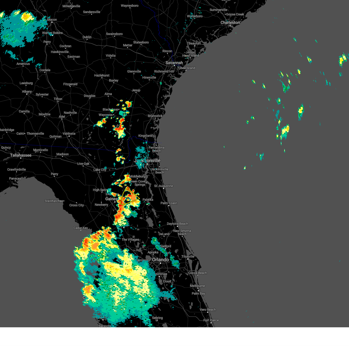
Hail Map for Waldo, FL
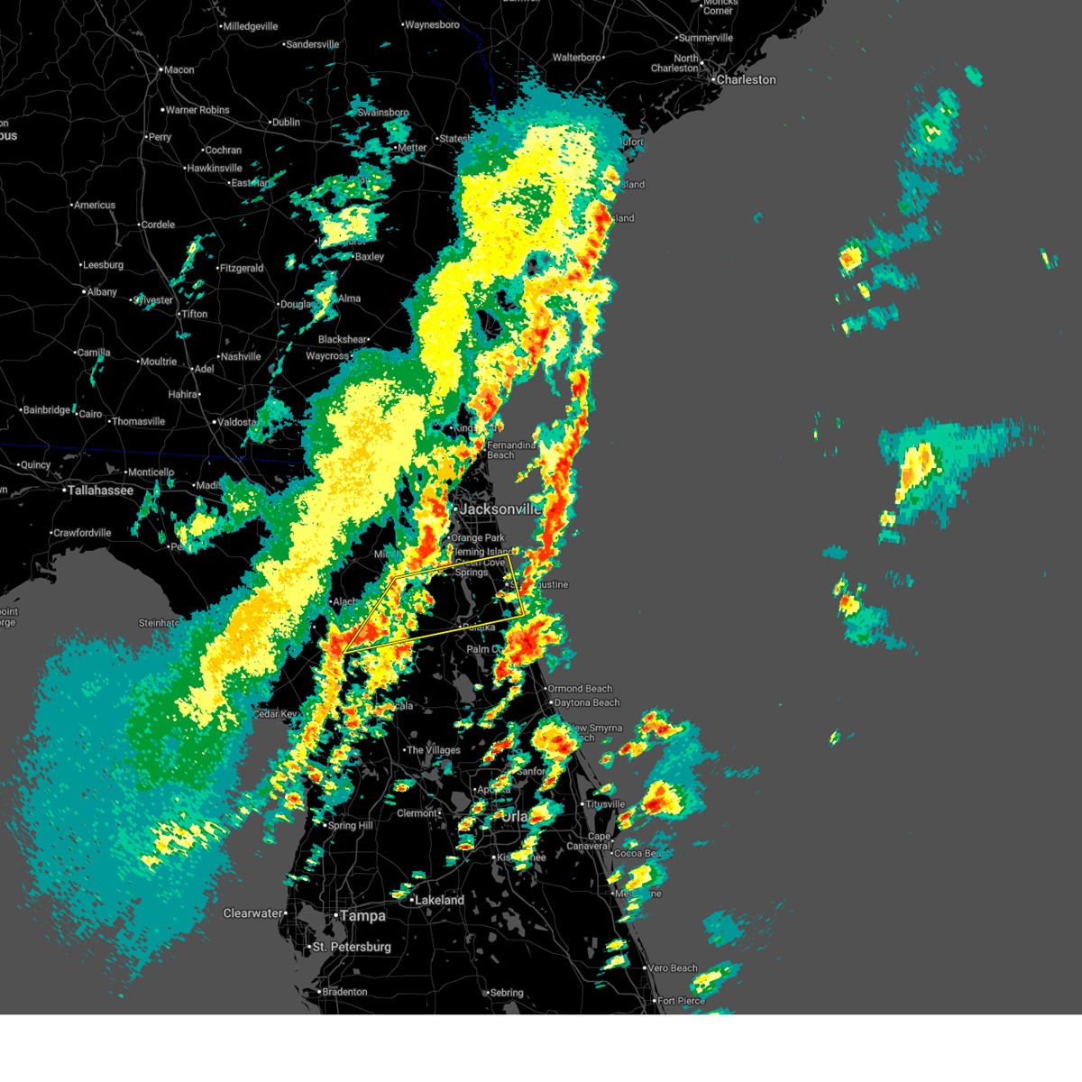
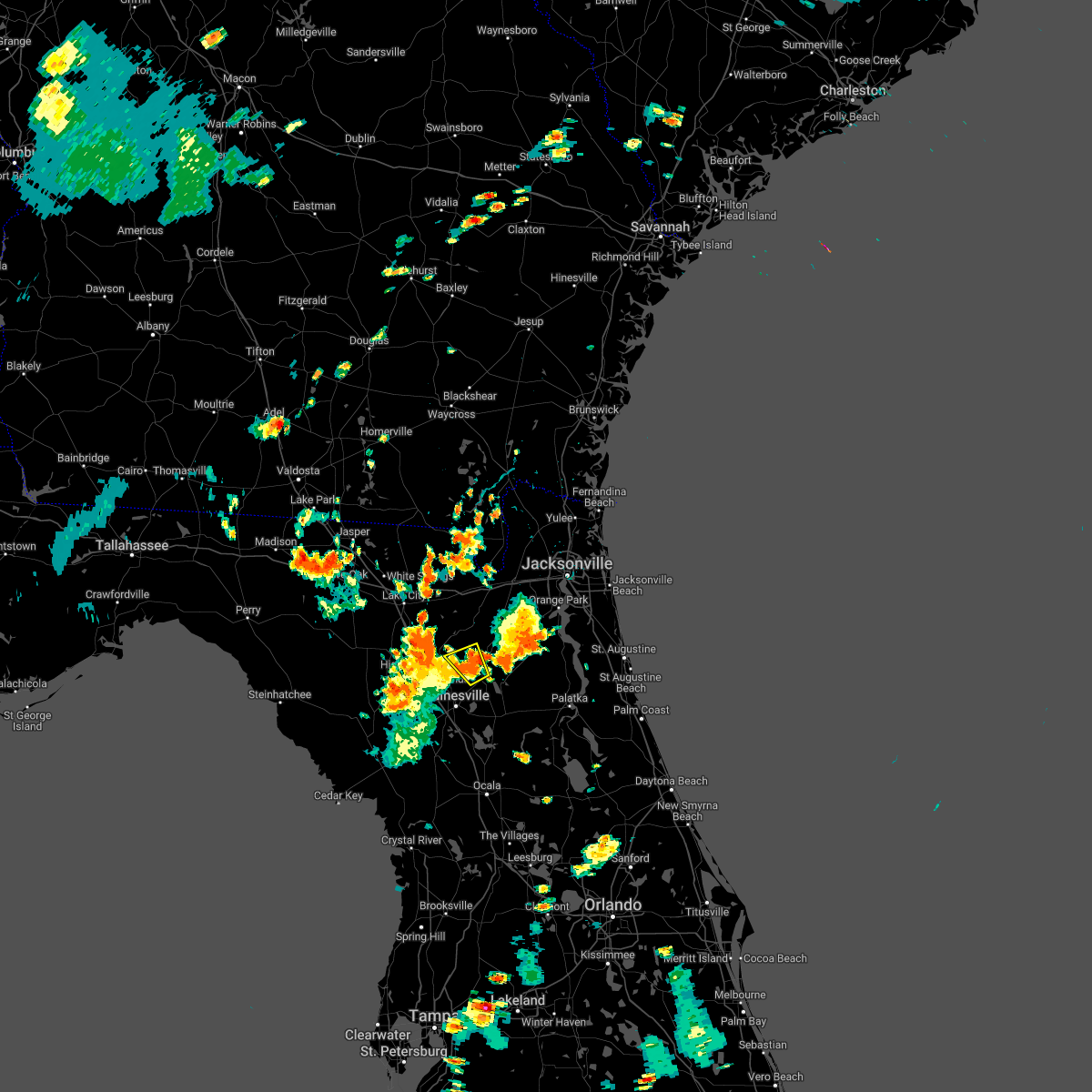
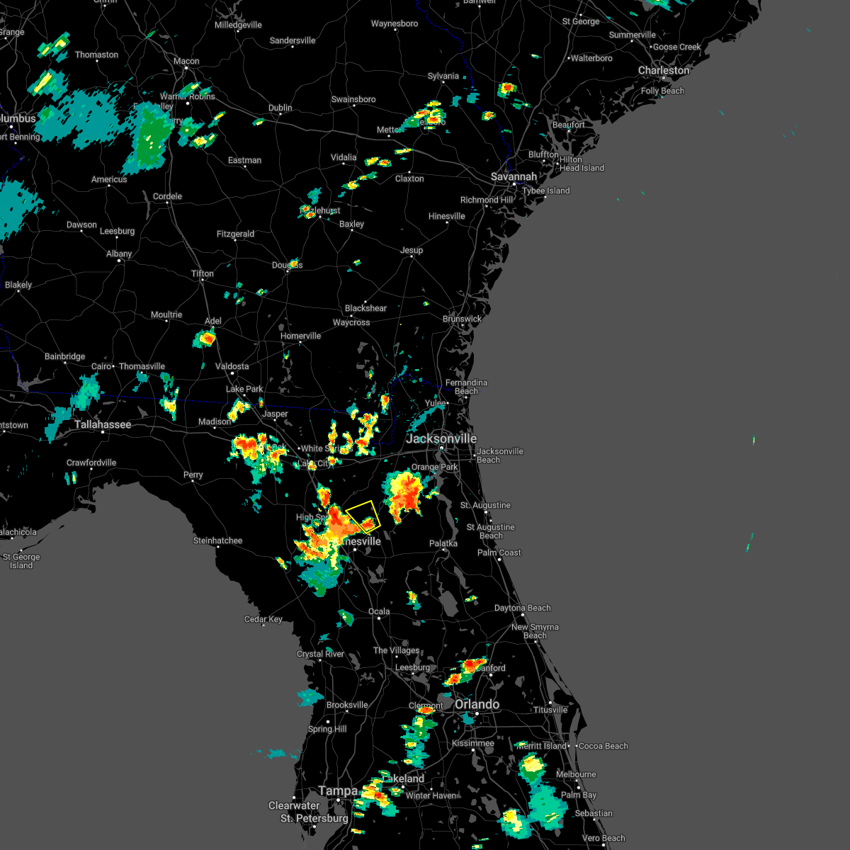
The Waldo, FL area has had 1 report of on-the-ground hail by trained spotters, and has been under severe weather warnings 1 time during the past 12 months. Doppler radar has detected hail at or near Waldo, FL on 44 occasions, including 1 occasion during the past year.
| Name: | Waldo, FL |
| Where Located: | 47.8 miles SW of Jacksonville, FL |
| Map: | Google Map for Waldo, FL |
| Population: | 1015 |
| Housing Units: | 489 |
| More Info: | Search Google for Waldo, FL |
0
The Top Recent Hail Date for Waldo, FL is Wednesday, July 9, 2025 (39th out of 44)

Hail and Wind Damage Spotted near Waldo, FL
| Date / Time | Report Details |
|---|---|
| 3/16/2026 2:47 PM EDT |
 Svrjax the national weather service in jacksonville has issued a * severe thunderstorm warning for, southeastern bradford county in northern florida, southeastern alachua county in northern florida, st. johns county in northeastern florida, northern putnam county in northeastern florida, southern clay county in northeastern florida, * until 345 pm edt. * at 247 pm edt, severe thunderstorms were located along a line extending from near kingsley to rochelle, moving east at 55 mph (radar indicated). Hazards include 60 mph wind gusts and penny size hail. expect damage to roofs, siding, and trees Svrjax the national weather service in jacksonville has issued a * severe thunderstorm warning for, southeastern bradford county in northern florida, southeastern alachua county in northern florida, st. johns county in northeastern florida, northern putnam county in northeastern florida, southern clay county in northeastern florida, * until 345 pm edt. * at 247 pm edt, severe thunderstorms were located along a line extending from near kingsley to rochelle, moving east at 55 mph (radar indicated). Hazards include 60 mph wind gusts and penny size hail. expect damage to roofs, siding, and trees
|
| 5/10/2025 6:19 PM EDT |
 Svrjax the national weather service in jacksonville has issued a * severe thunderstorm warning for, bradford county in northern florida, northeastern alachua county in northern florida, southern baker county in northeastern florida, northwestern putnam county in northeastern florida, union county in northern florida, western clay county in northeastern florida, east central columbia county in northern florida, * until 645 pm edt. * at 619 pm edt, severe thunderstorms were located along a line extending from lake geneva to groves, moving north at 20 mph (radar indicated). Hazards include 60 mph wind gusts and penny size hail. expect damage to roofs, siding, and trees Svrjax the national weather service in jacksonville has issued a * severe thunderstorm warning for, bradford county in northern florida, northeastern alachua county in northern florida, southern baker county in northeastern florida, northwestern putnam county in northeastern florida, union county in northern florida, western clay county in northeastern florida, east central columbia county in northern florida, * until 645 pm edt. * at 619 pm edt, severe thunderstorms were located along a line extending from lake geneva to groves, moving north at 20 mph (radar indicated). Hazards include 60 mph wind gusts and penny size hail. expect damage to roofs, siding, and trees
|
| 4/11/2025 7:12 PM EDT |
 The storm which prompted the warning has weakened below severe limits, and has exited the warned area. therefore, the warning will be allowed to expire. to report severe weather, contact your nearest law enforcement agency. they will relay your report to the national weather service jacksonville. The storm which prompted the warning has weakened below severe limits, and has exited the warned area. therefore, the warning will be allowed to expire. to report severe weather, contact your nearest law enforcement agency. they will relay your report to the national weather service jacksonville.
|
| 4/11/2025 6:54 PM EDT |
 At 654 pm edt, a severe thunderstorm was located 7 miles north of gainesville airport, or 8 miles north of gainesville, moving northeast at 40 mph (trained weather spotters). Hazards include golf ball size hail and 60 mph wind gusts. People and animals outdoors will be injured. expect hail damage to roofs, siding, windows, and vehicles. expect wind damage to roofs, siding, and trees. Locations impacted include, waldo. At 654 pm edt, a severe thunderstorm was located 7 miles north of gainesville airport, or 8 miles north of gainesville, moving northeast at 40 mph (trained weather spotters). Hazards include golf ball size hail and 60 mph wind gusts. People and animals outdoors will be injured. expect hail damage to roofs, siding, windows, and vehicles. expect wind damage to roofs, siding, and trees. Locations impacted include, waldo.
|
| 4/11/2025 6:43 PM EDT |
 At 643 pm edt, a severe thunderstorm was located near gainesville, moving northeast at 40 mph (trained weather spotters). Hazards include golf ball size hail and 60 mph wind gusts. People and animals outdoors will be injured. expect hail damage to roofs, siding, windows, and vehicles. expect wind damage to roofs, siding, and trees. Locations impacted include, waldo and gainesville. At 643 pm edt, a severe thunderstorm was located near gainesville, moving northeast at 40 mph (trained weather spotters). Hazards include golf ball size hail and 60 mph wind gusts. People and animals outdoors will be injured. expect hail damage to roofs, siding, windows, and vehicles. expect wind damage to roofs, siding, and trees. Locations impacted include, waldo and gainesville.
|
| 4/11/2025 6:37 PM EDT |
 Svrjax the national weather service in jacksonville has issued a * severe thunderstorm warning for, central alachua county in northern florida, * until 715 pm edt. * at 637 pm edt, a severe thunderstorm was located near alachua, or near gainesville, moving northeast at 40 mph (radar indicated). Hazards include 60 mph wind gusts and quarter size hail. Hail damage to vehicles is expected. Expect wind damage to roofs, siding, and trees. Svrjax the national weather service in jacksonville has issued a * severe thunderstorm warning for, central alachua county in northern florida, * until 715 pm edt. * at 637 pm edt, a severe thunderstorm was located near alachua, or near gainesville, moving northeast at 40 mph (radar indicated). Hazards include 60 mph wind gusts and quarter size hail. Hail damage to vehicles is expected. Expect wind damage to roofs, siding, and trees.
|
| 8/4/2024 6:49 PM EDT |
 the tornado warning has been cancelled and is no longer in effect the tornado warning has been cancelled and is no longer in effect
|
| 8/4/2024 6:37 PM EDT |
 Torjax the national weather service in jacksonville has issued a * tornado warning for, east central alachua county in northern florida, * until 700 pm edt. * at 637 pm edt, a severe thunderstorm capable of producing a tornado was located near hawthorne, or near melrose, moving northwest at 30 mph (radar indicated rotation). Hazards include tornado. Flying debris will be dangerous to those caught without shelter. mobile homes will be damaged or destroyed. damage to roofs, windows, and vehicles will occur. tree damage is likely. This dangerous storm will be near, orange heights around 650 pm edt. Torjax the national weather service in jacksonville has issued a * tornado warning for, east central alachua county in northern florida, * until 700 pm edt. * at 637 pm edt, a severe thunderstorm capable of producing a tornado was located near hawthorne, or near melrose, moving northwest at 30 mph (radar indicated rotation). Hazards include tornado. Flying debris will be dangerous to those caught without shelter. mobile homes will be damaged or destroyed. damage to roofs, windows, and vehicles will occur. tree damage is likely. This dangerous storm will be near, orange heights around 650 pm edt.
|
| 7/23/2024 8:40 PM EDT |
 The storm which prompted the warning has weakened below severe limits, and no longer poses an immediate threat to life or property. therefore, the warning will be allowed to expire. however, gusty winds are still possible with this thunderstorm. to report severe weather, contact your nearest law enforcement agency. they will relay your report to the national weather service jacksonville. The storm which prompted the warning has weakened below severe limits, and no longer poses an immediate threat to life or property. therefore, the warning will be allowed to expire. however, gusty winds are still possible with this thunderstorm. to report severe weather, contact your nearest law enforcement agency. they will relay your report to the national weather service jacksonville.
|
| 7/23/2024 8:32 PM EDT |
 At 832 pm edt, a severe thunderstorm was located over lake geneva, or near melrose, moving northwest at 20 mph. other storms were located near orange heights moving northwest at 15 mph (radar indicated). Hazards include 60 mph wind gusts. Expect damage to roofs, siding, and trees. Locations impacted include, keystone heights, melrose, melrose landing, orange heights, lake geneva, florahome, putnam hall, and grove park. At 832 pm edt, a severe thunderstorm was located over lake geneva, or near melrose, moving northwest at 20 mph. other storms were located near orange heights moving northwest at 15 mph (radar indicated). Hazards include 60 mph wind gusts. Expect damage to roofs, siding, and trees. Locations impacted include, keystone heights, melrose, melrose landing, orange heights, lake geneva, florahome, putnam hall, and grove park.
|
| 7/23/2024 8:20 PM EDT |
 At 820 pm edt, a severe thunderstorm was located just east of melrose, or near putnam hall, moving northwest at 20 mph (radar indicated). Hazards include 60 mph wind gusts. Expect damage to roofs, siding, and trees. Locations impacted include, keystone heights, melrose, hawthorne, melrose landing, orange heights, lake geneva, florahome, johnson, putnam hall, and lochloosa. At 820 pm edt, a severe thunderstorm was located just east of melrose, or near putnam hall, moving northwest at 20 mph (radar indicated). Hazards include 60 mph wind gusts. Expect damage to roofs, siding, and trees. Locations impacted include, keystone heights, melrose, hawthorne, melrose landing, orange heights, lake geneva, florahome, johnson, putnam hall, and lochloosa.
|
| 7/23/2024 8:06 PM EDT |
 Svrjax the national weather service in jacksonville has issued a * severe thunderstorm warning for, southeastern bradford county in northern florida, southeastern alachua county in northern florida, northwestern putnam county in northeastern florida, southwestern clay county in northeastern florida, * until 845 pm edt. * at 806 pm edt, a severe thunderstorm was located over melrose landing, or near interlachen, moving northwest at 20 mph. another storm was over southwest putnam county moving west at 20 mph (radar indicated). Hazards include 60 mph wind gusts and penny size hail. expect damage to roofs, siding, and trees Svrjax the national weather service in jacksonville has issued a * severe thunderstorm warning for, southeastern bradford county in northern florida, southeastern alachua county in northern florida, northwestern putnam county in northeastern florida, southwestern clay county in northeastern florida, * until 845 pm edt. * at 806 pm edt, a severe thunderstorm was located over melrose landing, or near interlachen, moving northwest at 20 mph. another storm was over southwest putnam county moving west at 20 mph (radar indicated). Hazards include 60 mph wind gusts and penny size hail. expect damage to roofs, siding, and trees
|
| 5/10/2024 8:44 AM EDT |
 Svrjax the national weather service in jacksonville has issued a * severe thunderstorm warning for, nassau county in northeastern florida, bradford county in northern florida, alachua county in northern florida, north central marion county in northern florida, baker county in northeastern florida, northwestern putnam county in northeastern florida, union county in northern florida, western clay county in northeastern florida, western duval county in northeastern florida, southwestern camden county in southeastern georgia, southeastern ware county in southeastern georgia, charlton county in southeastern georgia, * until 915 am edt. * at 843 am edt, severe thunderstorms were located along a line extending from 9 miles south of argyle to near lulu to 7 miles southeast of cross city, moving east at 70 mph. these are destructive storms for lake butler, starke, gainesville, macclenny, baldwin, and hilliard. (radar indicated). Hazards include 80 mph wind gusts and quarter size hail. Flying debris will be dangerous to those caught without shelter. mobile homes will be heavily damaged. expect considerable damage to roofs, windows, and vehicles. Extensive tree damage and power outages are likely. Svrjax the national weather service in jacksonville has issued a * severe thunderstorm warning for, nassau county in northeastern florida, bradford county in northern florida, alachua county in northern florida, north central marion county in northern florida, baker county in northeastern florida, northwestern putnam county in northeastern florida, union county in northern florida, western clay county in northeastern florida, western duval county in northeastern florida, southwestern camden county in southeastern georgia, southeastern ware county in southeastern georgia, charlton county in southeastern georgia, * until 915 am edt. * at 843 am edt, severe thunderstorms were located along a line extending from 9 miles south of argyle to near lulu to 7 miles southeast of cross city, moving east at 70 mph. these are destructive storms for lake butler, starke, gainesville, macclenny, baldwin, and hilliard. (radar indicated). Hazards include 80 mph wind gusts and quarter size hail. Flying debris will be dangerous to those caught without shelter. mobile homes will be heavily damaged. expect considerable damage to roofs, windows, and vehicles. Extensive tree damage and power outages are likely.
|
| 4/3/2024 11:44 AM EDT |
 The storms which prompted the warning have weakened below severe limits, and no longer pose an immediate threat to life or property. therefore, the warning will be allowed to expire. however, gusty winds and heavy rain are still possible with these thunderstorms. a tornado watch remains in effect until 500 pm edt for northern and northeastern florida. The storms which prompted the warning have weakened below severe limits, and no longer pose an immediate threat to life or property. therefore, the warning will be allowed to expire. however, gusty winds and heavy rain are still possible with these thunderstorms. a tornado watch remains in effect until 500 pm edt for northern and northeastern florida.
|
| 4/3/2024 11:21 AM EDT |
 the severe thunderstorm warning has been cancelled and is no longer in effect the severe thunderstorm warning has been cancelled and is no longer in effect
|
| 4/3/2024 11:21 AM EDT |
 At 1120 am edt, severe thunderstorms were located along a line extending from near normandy to near starke, moving east at 40 mph (radar indicated). Hazards include 60 mph wind gusts. Expect damage to roofs, siding, and trees. Locations impacted include, orange park, green cove springs, starke, keystone heights, unf, mandarin, fruit cove, middleburg, ponte vedra beach, and jacksonville beach. At 1120 am edt, severe thunderstorms were located along a line extending from near normandy to near starke, moving east at 40 mph (radar indicated). Hazards include 60 mph wind gusts. Expect damage to roofs, siding, and trees. Locations impacted include, orange park, green cove springs, starke, keystone heights, unf, mandarin, fruit cove, middleburg, ponte vedra beach, and jacksonville beach.
|
| 4/3/2024 11:04 AM EDT |
 Svrjax the national weather service in jacksonville has issued a * severe thunderstorm warning for, bradford county in northern florida, northeastern alachua county in northern florida, northwestern st. johns county in northeastern florida, southeastern baker county in northeastern florida, north central putnam county in northeastern florida, northeastern union county in northern florida, clay county in northeastern florida, southern duval county in northeastern florida, * until 1145 am edt. * at 1103 am edt, severe thunderstorms were located along a line extending from near maxville to sampson, moving east at 40 mph (radar indicated). Hazards include 60 mph wind gusts. expect damage to roofs, siding, and trees Svrjax the national weather service in jacksonville has issued a * severe thunderstorm warning for, bradford county in northern florida, northeastern alachua county in northern florida, northwestern st. johns county in northeastern florida, southeastern baker county in northeastern florida, north central putnam county in northeastern florida, northeastern union county in northern florida, clay county in northeastern florida, southern duval county in northeastern florida, * until 1145 am edt. * at 1103 am edt, severe thunderstorms were located along a line extending from near maxville to sampson, moving east at 40 mph (radar indicated). Hazards include 60 mph wind gusts. expect damage to roofs, siding, and trees
|
| 2/4/2024 3:32 PM EST |
 At 332 pm est, a severe thunderstorm was located near sampson, or 7 miles west of keystone heights, moving northeast at 25 mph (radar indicated). Hazards include 60 mph wind gusts and quarter size hail. Hail damage to vehicles is expected. expect wind damage to roofs, siding, and trees. Locations impacted include, starke, keystone heights, waldo, and hampton. At 332 pm est, a severe thunderstorm was located near sampson, or 7 miles west of keystone heights, moving northeast at 25 mph (radar indicated). Hazards include 60 mph wind gusts and quarter size hail. Hail damage to vehicles is expected. expect wind damage to roofs, siding, and trees. Locations impacted include, starke, keystone heights, waldo, and hampton.
|
| 2/4/2024 3:20 PM EST |
 At 320 pm est, a severe thunderstorm was located near orange heights, or 9 miles northeast of gainesville, moving northeast at 25 mph (radar indicated). Hazards include 60 mph wind gusts and quarter size hail. Hail damage to vehicles is expected. expect wind damage to roofs, siding, and trees. Locations impacted include, starke, keystone heights, waldo, and hampton. At 320 pm est, a severe thunderstorm was located near orange heights, or 9 miles northeast of gainesville, moving northeast at 25 mph (radar indicated). Hazards include 60 mph wind gusts and quarter size hail. Hail damage to vehicles is expected. expect wind damage to roofs, siding, and trees. Locations impacted include, starke, keystone heights, waldo, and hampton.
|
| 2/4/2024 3:09 PM EST |
 At 309 pm est, a severe thunderstorm was located near gainesville airport, or near gainesville, moving northeast at 25 mph (radar indicated). Hazards include 60 mph wind gusts and quarter size hail. Hail damage to vehicles is expected. Expect wind damage to roofs, siding, and trees. At 309 pm est, a severe thunderstorm was located near gainesville airport, or near gainesville, moving northeast at 25 mph (radar indicated). Hazards include 60 mph wind gusts and quarter size hail. Hail damage to vehicles is expected. Expect wind damage to roofs, siding, and trees.
|
| 1/9/2024 3:12 PM EST |
 At 311 pm est, severe thunderstorms were located along a line extending from near hilliard to near sampson, moving east at 35 mph (radar indicated). Hazards include 60 mph wind gusts. Expect damage to roofs, siding, and trees. locations impacted include, jacksonville, st. Marys, fernandina beach, orange park, green cove springs, starke, hilliard, keystone heights, callahan, and jacksonville international arpt. At 311 pm est, severe thunderstorms were located along a line extending from near hilliard to near sampson, moving east at 35 mph (radar indicated). Hazards include 60 mph wind gusts. Expect damage to roofs, siding, and trees. locations impacted include, jacksonville, st. Marys, fernandina beach, orange park, green cove springs, starke, hilliard, keystone heights, callahan, and jacksonville international arpt.
|
| 1/9/2024 3:12 PM EST |
 A severe thunderstorm warning remains in effect until 345 pm est for nassau. eastern bradford. northeastern alachua. west central st. johns. north central putnam. clay. duval and southeastern camden counties. At 311 pm est, severe thunderstorms were located along a line extending from near hilliard to near sampson, moving east at 35 mph. A severe thunderstorm warning remains in effect until 345 pm est for nassau. eastern bradford. northeastern alachua. west central st. johns. north central putnam. clay. duval and southeastern camden counties. At 311 pm est, severe thunderstorms were located along a line extending from near hilliard to near sampson, moving east at 35 mph.
|
| 1/9/2024 2:55 PM EST |
 At 255 pm est, a severe thunderstorm capable of producing a tornado was located 7 miles north of gainesville airport, or 9 miles northeast of gainesville, moving northeast at 80 mph (radar indicated rotation). Hazards include tornado. Flying debris will be dangerous to those caught without shelter. mobile homes will be damaged or destroyed. damage to roofs, windows, and vehicles will occur. tree damage is likely. This tornadic thunderstorm will remain over mainly rural areas of central alachua county, including the following locations, waldo. At 255 pm est, a severe thunderstorm capable of producing a tornado was located 7 miles north of gainesville airport, or 9 miles northeast of gainesville, moving northeast at 80 mph (radar indicated rotation). Hazards include tornado. Flying debris will be dangerous to those caught without shelter. mobile homes will be damaged or destroyed. damage to roofs, windows, and vehicles will occur. tree damage is likely. This tornadic thunderstorm will remain over mainly rural areas of central alachua county, including the following locations, waldo.
|
| 1/9/2024 2:44 PM EST |
 At 244 pm est, severe thunderstorms were located along a line extending from 11 miles northwest of st. george to near alachua, moving east at 35 mph (radar indicated). Hazards include 60 mph wind gusts. expect damage to roofs, siding, and trees At 244 pm est, severe thunderstorms were located along a line extending from 11 miles northwest of st. george to near alachua, moving east at 35 mph (radar indicated). Hazards include 60 mph wind gusts. expect damage to roofs, siding, and trees
|
| 1/9/2024 2:38 PM EST |
 At 238 pm est, a severe thunderstorm capable of producing a tornado was located over archer, or 9 miles northeast of bronson, moving northeast at 80 mph (radar indicated rotation). Hazards include tornado. Flying debris will be dangerous to those caught without shelter. mobile homes will be damaged or destroyed. damage to roofs, windows, and vehicles will occur. tree damage is likely. this dangerous storm will be near, gainesville, alachua, and university of florida around 245 pm est. Other locations impacted by this tornadic thunderstorm include newberry and waldo. At 238 pm est, a severe thunderstorm capable of producing a tornado was located over archer, or 9 miles northeast of bronson, moving northeast at 80 mph (radar indicated rotation). Hazards include tornado. Flying debris will be dangerous to those caught without shelter. mobile homes will be damaged or destroyed. damage to roofs, windows, and vehicles will occur. tree damage is likely. this dangerous storm will be near, gainesville, alachua, and university of florida around 245 pm est. Other locations impacted by this tornadic thunderstorm include newberry and waldo.
|
| 1/9/2024 2:02 PM EST |
 At 201 pm est, severe thunderstorms were located along a line extending from 7 miles north of taylor to near high springs, moving east at 40 mph (radar indicated). Hazards include 60 mph wind gusts. expect damage to roofs, siding, and trees At 201 pm est, severe thunderstorms were located along a line extending from 7 miles north of taylor to near high springs, moving east at 40 mph (radar indicated). Hazards include 60 mph wind gusts. expect damage to roofs, siding, and trees
|
| 7/30/2023 9:21 PM EDT |
 The severe thunderstorm warning for bradford, alachua, northeastern marion, western putnam, union and southwestern clay counties will expire at 930 pm edt, the storms which prompted the warning have weakened below severe limits, and no longer pose an immediate threat to life or property. therefore, the warning will be allowed to expire. however gusty winds and heavy rain are still possible with these thunderstorms. The severe thunderstorm warning for bradford, alachua, northeastern marion, western putnam, union and southwestern clay counties will expire at 930 pm edt, the storms which prompted the warning have weakened below severe limits, and no longer pose an immediate threat to life or property. therefore, the warning will be allowed to expire. however gusty winds and heavy rain are still possible with these thunderstorms.
|
| 7/30/2023 8:55 PM EDT |
 At 855 pm edt, severe thunderstorms were located along a line extending from near worthington spring to near lake delancy, moving southwest at 20 mph (radar indicated). Hazards include 60 mph wind gusts. expect damage to roofs, siding, and trees At 855 pm edt, severe thunderstorms were located along a line extending from near worthington spring to near lake delancy, moving southwest at 20 mph (radar indicated). Hazards include 60 mph wind gusts. expect damage to roofs, siding, and trees
|
| 7/30/2023 8:28 PM EDT |
 At 828 pm edt, severe thunderstorms were located along a line extending from near raiford to near florahome, moving southwest at 10 mph (radar indicated). Hazards include 60 mph wind gusts. expect damage to roofs, siding, and trees At 828 pm edt, severe thunderstorms were located along a line extending from near raiford to near florahome, moving southwest at 10 mph (radar indicated). Hazards include 60 mph wind gusts. expect damage to roofs, siding, and trees
|
| 7/30/2023 8:02 PM EDT |
 At 801 pm edt, a severe thunderstorm was located over starke, moving southwest at 15 mph (radar indicated). Hazards include 60 mph wind gusts and penny size hail. expect damage to roofs, siding, and trees At 801 pm edt, a severe thunderstorm was located over starke, moving southwest at 15 mph (radar indicated). Hazards include 60 mph wind gusts and penny size hail. expect damage to roofs, siding, and trees
|
| 6/14/2023 11:21 PM EDT |
 At 1121 pm edt, severe thunderstorms were located along a line extending from near worthington spring to near archer to 7 miles southeast of fowlers bluff, moving southeast at 40 mph (radar indicated). Hazards include 70 mph wind gusts. Expect considerable tree damage. damage is likely to mobile homes, roofs, and outbuildings. locations impacted include, gainesville, alachua, high springs, hawthorne, archer, university of florida, rochelle, cross creek, orange heights and gainesville airport. thunderstorm damage threat, considerable hail threat, radar indicated max hail size, <. 75 in wind threat, radar indicated max wind gust, 70 mph. At 1121 pm edt, severe thunderstorms were located along a line extending from near worthington spring to near archer to 7 miles southeast of fowlers bluff, moving southeast at 40 mph (radar indicated). Hazards include 70 mph wind gusts. Expect considerable tree damage. damage is likely to mobile homes, roofs, and outbuildings. locations impacted include, gainesville, alachua, high springs, hawthorne, archer, university of florida, rochelle, cross creek, orange heights and gainesville airport. thunderstorm damage threat, considerable hail threat, radar indicated max hail size, <. 75 in wind threat, radar indicated max wind gust, 70 mph.
|
| 6/14/2023 11:13 PM EDT |
 At 1113 pm edt, severe thunderstorms were located along a line extending from near worthington spring to 6 miles north of archer to near fowlers bluff, moving southeast at 40 mph (radar indicated). Hazards include 60 mph wind gusts. Expect damage to roofs, siding, and trees. locations impacted include, gainesville, trenton, alachua, high springs, hawthorne, archer, university of florida, rochelle, cross creek and orange heights. hail threat, radar indicated max hail size, <. 75 in wind threat, radar indicated max wind gust, 60 mph. At 1113 pm edt, severe thunderstorms were located along a line extending from near worthington spring to 6 miles north of archer to near fowlers bluff, moving southeast at 40 mph (radar indicated). Hazards include 60 mph wind gusts. Expect damage to roofs, siding, and trees. locations impacted include, gainesville, trenton, alachua, high springs, hawthorne, archer, university of florida, rochelle, cross creek and orange heights. hail threat, radar indicated max hail size, <. 75 in wind threat, radar indicated max wind gust, 60 mph.
|
| 6/14/2023 10:55 PM EDT |
 At 1054 pm edt, severe thunderstorms were located along a line extending from near watertown to 6 miles southwest of high springs to 8 miles south of cross city, moving southeast at 40 mph (radar indicated). Hazards include 60 mph wind gusts. expect damage to roofs, siding, and trees At 1054 pm edt, severe thunderstorms were located along a line extending from near watertown to 6 miles southwest of high springs to 8 miles south of cross city, moving southeast at 40 mph (radar indicated). Hazards include 60 mph wind gusts. expect damage to roofs, siding, and trees
|
| 4/27/2023 9:13 PM EDT |
 At 913 pm edt, severe thunderstorms were located along a line extending from near orange heights to near ocala, moving east at 45 mph (radar indicated). Hazards include 60 mph wind gusts. Expect damage to roofs, siding, and trees. locations impacted include, gainesville, interlachen, keystone heights, melrose, fort mccoy, citra, hawthorne, sparr, florahome and melrose landing. hail threat, radar indicated max hail size, <. 75 in wind threat, radar indicated max wind gust, 60 mph. At 913 pm edt, severe thunderstorms were located along a line extending from near orange heights to near ocala, moving east at 45 mph (radar indicated). Hazards include 60 mph wind gusts. Expect damage to roofs, siding, and trees. locations impacted include, gainesville, interlachen, keystone heights, melrose, fort mccoy, citra, hawthorne, sparr, florahome and melrose landing. hail threat, radar indicated max hail size, <. 75 in wind threat, radar indicated max wind gust, 60 mph.
|
| 4/27/2023 8:57 PM EDT |
 At 857 pm edt, severe thunderstorms were located along a line extending from gainesville to 8 miles southeast of williston, moving northeast at 40 mph (radar indicated). Hazards include 60 mph wind gusts. expect damage to roofs, siding, and trees At 857 pm edt, severe thunderstorms were located along a line extending from gainesville to 8 miles southeast of williston, moving northeast at 40 mph (radar indicated). Hazards include 60 mph wind gusts. expect damage to roofs, siding, and trees
|
| 3/13/2023 2:31 AM EDT |
 At 231 am edt, a severe thunderstorm was located near gainesville, moving east at 40 mph (radar indicated). Hazards include 60 mph wind gusts. Expect damage to roofs, siding, and trees. locations impacted include, gainesville, melrose, hawthorne, university of florida, orange heights, gainesville airport, newnans lake, rochelle, waldo and grove park. hail threat, radar indicated max hail size, <. 75 in wind threat, radar indicated max wind gust, 60 mph. At 231 am edt, a severe thunderstorm was located near gainesville, moving east at 40 mph (radar indicated). Hazards include 60 mph wind gusts. Expect damage to roofs, siding, and trees. locations impacted include, gainesville, melrose, hawthorne, university of florida, orange heights, gainesville airport, newnans lake, rochelle, waldo and grove park. hail threat, radar indicated max hail size, <. 75 in wind threat, radar indicated max wind gust, 60 mph.
|
| 3/13/2023 2:23 AM EDT |
 At 222 am edt, a severe thunderstorm was located over alachua, or 8 miles northwest of gainesville, moving east at 45 mph (radar indicated). Hazards include 60 mph wind gusts. expect damage to roofs, siding, and trees At 222 am edt, a severe thunderstorm was located over alachua, or 8 miles northwest of gainesville, moving east at 45 mph (radar indicated). Hazards include 60 mph wind gusts. expect damage to roofs, siding, and trees
|
| 1/4/2023 3:57 PM EST |
 At 357 pm est, severe thunderstorms were located along a line extending from near starke to near hawthorne to 9 miles southwest of cross creek, moving east at 55 mph (radar indicated). Hazards include 70 mph wind gusts. Expect considerable tree damage. Damage is likely to mobile homes, roofs, and outbuildings. At 357 pm est, severe thunderstorms were located along a line extending from near starke to near hawthorne to 9 miles southwest of cross creek, moving east at 55 mph (radar indicated). Hazards include 70 mph wind gusts. Expect considerable tree damage. Damage is likely to mobile homes, roofs, and outbuildings.
|
| 1/4/2023 3:47 PM EST |
 At 346 pm est, severe thunderstorms were located along a line extending from near sampson to rochelle to near williston, moving east at 35 mph (radar indicated). Hazards include 70 mph wind gusts and quarter size hail. Hail damage to vehicles is expected. expect considerable tree damage. wind damage is also likely to mobile homes, roofs, and outbuildings. locations impacted include, gainesville, keystone heights, melrose, citra, hawthorne, university of florida, sparr, rochelle, cross creek and orange heights. thunderstorm damage threat, considerable hail threat, radar indicated max hail size, 1. 00 in wind threat, radar indicated max wind gust, 70 mph. At 346 pm est, severe thunderstorms were located along a line extending from near sampson to rochelle to near williston, moving east at 35 mph (radar indicated). Hazards include 70 mph wind gusts and quarter size hail. Hail damage to vehicles is expected. expect considerable tree damage. wind damage is also likely to mobile homes, roofs, and outbuildings. locations impacted include, gainesville, keystone heights, melrose, citra, hawthorne, university of florida, sparr, rochelle, cross creek and orange heights. thunderstorm damage threat, considerable hail threat, radar indicated max hail size, 1. 00 in wind threat, radar indicated max wind gust, 70 mph.
|
| 1/4/2023 3:23 PM EST |
 At 322 pm est, a severe thunderstorm was located near gainesville, moving northeast at 40 mph (radar indicated). Hazards include 70 mph wind gusts and quarter size hail. possible tornado. Hail damage to vehicles is expected. expect considerable tree damage. wind damage is also likely to mobile homes, roofs, and outbuildings. Locations impacted include, gainesville, keystone heights, melrose, citra, alachua, hawthorne, archer, university of florida, sparr and rochelle. At 322 pm est, a severe thunderstorm was located near gainesville, moving northeast at 40 mph (radar indicated). Hazards include 70 mph wind gusts and quarter size hail. possible tornado. Hail damage to vehicles is expected. expect considerable tree damage. wind damage is also likely to mobile homes, roofs, and outbuildings. Locations impacted include, gainesville, keystone heights, melrose, citra, alachua, hawthorne, archer, university of florida, sparr and rochelle.
|
| 1/4/2023 3:14 PM EST |
 At 313 pm est, a severe thunderstorm was located 7 miles south of alachua, or 10 miles west of gainesville, moving northeast at 40 mph (radar indicated). Hazards include 70 mph wind gusts and quarter size hail. possible tornado. Hail damage to vehicles is expected. expect considerable tree damage. Wind damage is also likely to mobile homes, roofs, and outbuildings. At 313 pm est, a severe thunderstorm was located 7 miles south of alachua, or 10 miles west of gainesville, moving northeast at 40 mph (radar indicated). Hazards include 70 mph wind gusts and quarter size hail. possible tornado. Hail damage to vehicles is expected. expect considerable tree damage. Wind damage is also likely to mobile homes, roofs, and outbuildings.
|
| 9/9/2022 8:45 PM EDT |
 At 845 pm edt, a severe thunderstorm was located near sampson, or 8 miles southwest of starke, moving northeast at 25 mph (radar indicated). Hazards include 60 mph wind gusts. expect damage to roofs, siding, and trees At 845 pm edt, a severe thunderstorm was located near sampson, or 8 miles southwest of starke, moving northeast at 25 mph (radar indicated). Hazards include 60 mph wind gusts. expect damage to roofs, siding, and trees
|
| 8/18/2022 2:33 PM EDT |
 At 233 pm edt, severe thunderstorms were located along a line extending from near orange heights to interlachen, moving northeast at 30 mph (radar indicated). Hazards include 60 mph wind gusts. Expect damage to roofs, siding, and trees. locations impacted include, interlachen, keystone heights, melrose, george`s lake, lake geneva, florahome, melrose landing, orange heights, bardin and hollister. hail threat, radar indicated max hail size, <. 75 in wind threat, radar indicated max wind gust, 60 mph. At 233 pm edt, severe thunderstorms were located along a line extending from near orange heights to interlachen, moving northeast at 30 mph (radar indicated). Hazards include 60 mph wind gusts. Expect damage to roofs, siding, and trees. locations impacted include, interlachen, keystone heights, melrose, george`s lake, lake geneva, florahome, melrose landing, orange heights, bardin and hollister. hail threat, radar indicated max hail size, <. 75 in wind threat, radar indicated max wind gust, 60 mph.
|
| 8/18/2022 2:13 PM EDT |
 At 213 pm edt, severe thunderstorms were located along a line extending from newnans lake to near orange springs, moving northeast at 30 mph (radar indicated). Hazards include 60 mph wind gusts. expect damage to roofs, siding, and trees At 213 pm edt, severe thunderstorms were located along a line extending from newnans lake to near orange springs, moving northeast at 30 mph (radar indicated). Hazards include 60 mph wind gusts. expect damage to roofs, siding, and trees
|
| 8/3/2022 7:06 PM EDT |
 At 706 pm edt, a severe thunderstorm was located near orange heights, or 7 miles west of melrose, moving northwest at 10 mph (radar indicated). Hazards include 60 mph wind gusts and penny size hail. expect damage to roofs, siding, and trees At 706 pm edt, a severe thunderstorm was located near orange heights, or 7 miles west of melrose, moving northwest at 10 mph (radar indicated). Hazards include 60 mph wind gusts and penny size hail. expect damage to roofs, siding, and trees
|
| 7/22/2022 6:07 PM EDT |
 The severe thunderstorm warning for central bradford and northeastern alachua counties will expire at 615 pm edt, the storm which prompted the warning has weakened below severe limits, and no longer poses an immediate threat to life or property. therefore, the warning will be allowed to expire. however gusty winds and heavy rain are still possible with this thunderstorm. The severe thunderstorm warning for central bradford and northeastern alachua counties will expire at 615 pm edt, the storm which prompted the warning has weakened below severe limits, and no longer poses an immediate threat to life or property. therefore, the warning will be allowed to expire. however gusty winds and heavy rain are still possible with this thunderstorm.
|
| 7/22/2022 5:43 PM EDT |
 At 543 pm edt, a severe thunderstorm was located near sampson, or 11 miles west of keystone heights, moving northwest at 10 mph (radar indicated). Hazards include 60 mph wind gusts and penny size hail. expect damage to roofs, siding, and trees At 543 pm edt, a severe thunderstorm was located near sampson, or 11 miles west of keystone heights, moving northwest at 10 mph (radar indicated). Hazards include 60 mph wind gusts and penny size hail. expect damage to roofs, siding, and trees
|
| 6/24/2022 3:11 PM EDT |
 At 311 pm edt, a severe thunderstorm was located 7 miles southeast of worthington spring, moving west at 15 mph (radar indicated). Hazards include 60 mph wind gusts and quarter size hail. Hail damage to vehicles is expected. expect wind damage to roofs, siding, and trees. locations impacted include, lake butler, worthington spring, alachua, worthington springs, beasley, new river, sampson, waldo, la crosse and brooker. hail threat, radar indicated max hail size, 1. 00 in wind threat, radar indicated max wind gust, 60 mph. At 311 pm edt, a severe thunderstorm was located 7 miles southeast of worthington spring, moving west at 15 mph (radar indicated). Hazards include 60 mph wind gusts and quarter size hail. Hail damage to vehicles is expected. expect wind damage to roofs, siding, and trees. locations impacted include, lake butler, worthington spring, alachua, worthington springs, beasley, new river, sampson, waldo, la crosse and brooker. hail threat, radar indicated max hail size, 1. 00 in wind threat, radar indicated max wind gust, 60 mph.
|
| 6/24/2022 3:04 PM EDT |
 At 304 pm edt, a severe thunderstorm was located 8 miles southeast of worthington spring, moving west at 15 mph (radar indicated). Hazards include 60 mph wind gusts and quarter size hail. Hail damage to vehicles is expected. Expect wind damage to roofs, siding, and trees. At 304 pm edt, a severe thunderstorm was located 8 miles southeast of worthington spring, moving west at 15 mph (radar indicated). Hazards include 60 mph wind gusts and quarter size hail. Hail damage to vehicles is expected. Expect wind damage to roofs, siding, and trees.
|
| 4/2/2022 12:50 PM EDT |
 At 1249 pm edt, severe thunderstorms were located along a line extending from 6 miles northwest of orange heights to near melrose to near hawthorne, moving east at 50 mph (radar indicated). Hazards include 60 mph wind gusts and quarter size hail. Hail damage to vehicles is expected. expect wind damage to roofs, siding, and trees. locations impacted include, interlachen, melrose, hawthorne, melrose landing, orange heights, lake geneva, newnans lake, rochelle, johnson and putnam hall. hail threat, radar indicated max hail size, 1. 00 in wind threat, radar indicated max wind gust, 60 mph. At 1249 pm edt, severe thunderstorms were located along a line extending from 6 miles northwest of orange heights to near melrose to near hawthorne, moving east at 50 mph (radar indicated). Hazards include 60 mph wind gusts and quarter size hail. Hail damage to vehicles is expected. expect wind damage to roofs, siding, and trees. locations impacted include, interlachen, melrose, hawthorne, melrose landing, orange heights, lake geneva, newnans lake, rochelle, johnson and putnam hall. hail threat, radar indicated max hail size, 1. 00 in wind threat, radar indicated max wind gust, 60 mph.
|
| 4/2/2022 12:42 PM EDT |
 At 1242 pm edt, severe thunderstorms were located along a line extending from near gainesville airport to orange heights to near hawthorne, moving east at 50 mph (radar indicated). Hazards include 60 mph wind gusts and quarter size hail. Hail damage to vehicles is expected. expect wind damage to roofs, siding, and trees. locations impacted include, gainesville, interlachen, melrose, hawthorne, university of florida, lake geneva, rochelle, melrose landing, orange heights and gainesville airport. hail threat, radar indicated max hail size, 1. 00 in wind threat, radar indicated max wind gust, 60 mph. At 1242 pm edt, severe thunderstorms were located along a line extending from near gainesville airport to orange heights to near hawthorne, moving east at 50 mph (radar indicated). Hazards include 60 mph wind gusts and quarter size hail. Hail damage to vehicles is expected. expect wind damage to roofs, siding, and trees. locations impacted include, gainesville, interlachen, melrose, hawthorne, university of florida, lake geneva, rochelle, melrose landing, orange heights and gainesville airport. hail threat, radar indicated max hail size, 1. 00 in wind threat, radar indicated max wind gust, 60 mph.
|
| 4/2/2022 12:26 PM EDT |
 At 1225 pm edt, severe thunderstorms were located along a line extending from near alachua to gainesville to near university of florida, moving east at 50 mph (radar indicated). Hazards include 60 mph wind gusts and quarter size hail. Hail damage to vehicles is expected. Expect wind damage to roofs, siding, and trees. At 1225 pm edt, severe thunderstorms were located along a line extending from near alachua to gainesville to near university of florida, moving east at 50 mph (radar indicated). Hazards include 60 mph wind gusts and quarter size hail. Hail damage to vehicles is expected. Expect wind damage to roofs, siding, and trees.
|
| 3/11/2022 2:32 PM EST |
 At 232 pm est, a severe thunderstorm was located over orange heights, or near melrose, moving northeast at 55 mph (radar indicated). Hazards include 60 mph wind gusts and quarter size hail. Hail damage to vehicles is expected. Expect wind damage to roofs, siding, and trees. At 232 pm est, a severe thunderstorm was located over orange heights, or near melrose, moving northeast at 55 mph (radar indicated). Hazards include 60 mph wind gusts and quarter size hail. Hail damage to vehicles is expected. Expect wind damage to roofs, siding, and trees.
|
| 12/8/2021 5:29 PM EST |
 At 528 pm est, a severe thunderstorm was located near starke, moving east at 35 mph (radar indicated). Hazards include 60 mph wind gusts. Expect damage to roofs, siding, and trees. Locations impacted include, starke, keystone heights, kingsley, lake geneva, camp blanding, waldo and hampton. At 528 pm est, a severe thunderstorm was located near starke, moving east at 35 mph (radar indicated). Hazards include 60 mph wind gusts. Expect damage to roofs, siding, and trees. Locations impacted include, starke, keystone heights, kingsley, lake geneva, camp blanding, waldo and hampton.
|
| 12/8/2021 5:18 PM EST |
 At 518 pm est, a severe thunderstorm was located over sampson, or near starke, moving east at 35 mph (radar indicated). Hazards include 60 mph wind gusts. expect damage to roofs, siding, and trees At 518 pm est, a severe thunderstorm was located over sampson, or near starke, moving east at 35 mph (radar indicated). Hazards include 60 mph wind gusts. expect damage to roofs, siding, and trees
|
| 8/24/2021 2:35 PM EDT |
 The severe thunderstorm warning for southeastern bradford and northeastern alachua counties will expire at 245 pm edt, the storm which prompted the warning has weakened below severe limits, and no longer poses an immediate threat to life or property. therefore, the warning will be allowed to expire. however gusty winds and heavy rain are still possible with this thunderstorm. The severe thunderstorm warning for southeastern bradford and northeastern alachua counties will expire at 245 pm edt, the storm which prompted the warning has weakened below severe limits, and no longer poses an immediate threat to life or property. therefore, the warning will be allowed to expire. however gusty winds and heavy rain are still possible with this thunderstorm.
|
| 8/24/2021 2:09 PM EDT |
 At 209 pm edt, a severe thunderstorm was located near gainesville airport, or near gainesville, moving north at 15 mph (radar indicated). Hazards include 60 mph wind gusts and penny size hail. expect damage to roofs, siding, and trees At 209 pm edt, a severe thunderstorm was located near gainesville airport, or near gainesville, moving north at 15 mph (radar indicated). Hazards include 60 mph wind gusts and penny size hail. expect damage to roofs, siding, and trees
|
| 6/20/2021 10:56 AM EDT |
 At 1055 am edt, a severe thunderstorm was located near university of florida, or near gainesville, moving northeast at 20 mph (radar indicated). Hazards include 60 mph wind gusts. Expect damage to roofs, siding, and trees. Locations impacted include, gainesville, alachua, hawthorne, archer, university of florida, rochelle, cross creek, orange heights, gainesville airport and newnans lake. At 1055 am edt, a severe thunderstorm was located near university of florida, or near gainesville, moving northeast at 20 mph (radar indicated). Hazards include 60 mph wind gusts. Expect damage to roofs, siding, and trees. Locations impacted include, gainesville, alachua, hawthorne, archer, university of florida, rochelle, cross creek, orange heights, gainesville airport and newnans lake.
|
| 6/20/2021 10:36 AM EDT |
 At 1036 am edt, a severe thunderstorm was located over archer, or 12 miles northeast of bronson, moving northeast at 20 mph (radar indicated). Hazards include 60 mph wind gusts. expect damage to roofs, siding, and trees At 1036 am edt, a severe thunderstorm was located over archer, or 12 miles northeast of bronson, moving northeast at 20 mph (radar indicated). Hazards include 60 mph wind gusts. expect damage to roofs, siding, and trees
|
| 6/15/2021 5:35 PM EDT |
 At 535 pm edt, a severe thunderstorm was located near melrose, moving southeast at 20 mph (radar indicated). Hazards include 70 mph wind gusts and quarter size hail. Hail damage to vehicles is expected. expect considerable tree damage. Wind damage is also likely to mobile homes, roofs, and outbuildings. At 535 pm edt, a severe thunderstorm was located near melrose, moving southeast at 20 mph (radar indicated). Hazards include 70 mph wind gusts and quarter size hail. Hail damage to vehicles is expected. expect considerable tree damage. Wind damage is also likely to mobile homes, roofs, and outbuildings.
|
| 6/15/2021 5:15 PM EDT |
 At 515 pm edt, a severe thunderstorm was located near gainesville, moving east at 30 mph (radar indicated). Hazards include 60 mph wind gusts and quarter size hail. Hail damage to vehicles is expected. Expect wind damage to roofs, siding, and trees. At 515 pm edt, a severe thunderstorm was located near gainesville, moving east at 30 mph (radar indicated). Hazards include 60 mph wind gusts and quarter size hail. Hail damage to vehicles is expected. Expect wind damage to roofs, siding, and trees.
|
| 6/15/2021 4:45 PM EDT |
 At 445 pm edt, a severe thunderstorm was located over orange heights, or near melrose, moving east at 15 mph (radar indicated). Hazards include 60 mph wind gusts and quarter size hail. Hail damage to vehicles is expected. Expect wind damage to roofs, siding, and trees. At 445 pm edt, a severe thunderstorm was located over orange heights, or near melrose, moving east at 15 mph (radar indicated). Hazards include 60 mph wind gusts and quarter size hail. Hail damage to vehicles is expected. Expect wind damage to roofs, siding, and trees.
|
| 6/15/2021 4:34 PM EDT |
 At 434 pm edt, severe thunderstorms were located along a line extending from raiford to 7 miles southeast of worthington spring, moving east at 20 mph (radar indicated). Hazards include 60 mph wind gusts and quarter size hail. Hail damage to vehicles is expected. expect wind damage to roofs, siding, and trees. Locations impacted include, starke, lake butler, raiford, beasley, new river, sampson, hampton, la crosse, brooker and johnstown. At 434 pm edt, severe thunderstorms were located along a line extending from raiford to 7 miles southeast of worthington spring, moving east at 20 mph (radar indicated). Hazards include 60 mph wind gusts and quarter size hail. Hail damage to vehicles is expected. expect wind damage to roofs, siding, and trees. Locations impacted include, starke, lake butler, raiford, beasley, new river, sampson, hampton, la crosse, brooker and johnstown.
|
| 6/15/2021 4:19 PM EDT |
 At 419 pm edt, severe thunderstorms were located along a line extending from near raiford to 6 miles south of worthington spring, moving east at 20 mph (radar indicated). Hazards include 60 mph wind gusts and quarter size hail. Hail damage to vehicles is expected. Expect wind damage to roofs, siding, and trees. At 419 pm edt, severe thunderstorms were located along a line extending from near raiford to 6 miles south of worthington spring, moving east at 20 mph (radar indicated). Hazards include 60 mph wind gusts and quarter size hail. Hail damage to vehicles is expected. Expect wind damage to roofs, siding, and trees.
|
| 6/15/2021 3:59 PM EDT |
 At 358 pm edt, a severe thunderstorm was located 8 miles south of sampson, or 10 miles northeast of gainesville, moving east at 10 mph (radar indicated). Hazards include 60 mph wind gusts and quarter size hail. Hail damage to vehicles is expected. Expect wind damage to roofs, siding, and trees. At 358 pm edt, a severe thunderstorm was located 8 miles south of sampson, or 10 miles northeast of gainesville, moving east at 10 mph (radar indicated). Hazards include 60 mph wind gusts and quarter size hail. Hail damage to vehicles is expected. Expect wind damage to roofs, siding, and trees.
|
| 3/18/2021 2:58 PM EDT |
 At 258 pm edt, a severe thunderstorm was located over high springs, or 15 miles southwest of worthington spring, moving northeast at 40 mph (radar indicated). Hazards include 60 mph wind gusts. expect damage to roofs, siding, and trees At 258 pm edt, a severe thunderstorm was located over high springs, or 15 miles southwest of worthington spring, moving northeast at 40 mph (radar indicated). Hazards include 60 mph wind gusts. expect damage to roofs, siding, and trees
|
| 2/6/2021 5:43 PM EST |
 The severe thunderstorm warning for bradford, northern alachua and southern union counties will expire at 545 pm est, the storm which prompted the warning has weakened below severe limits, and no longer poses an immediate threat to life or property. therefore, the warning will be allowed to expire. however small hail and heavy rain are still possible with this thunderstorm. a tornado watch remains in effect until midnight est for northern florida. to report severe weather, contact your nearest law enforcement agency. they will relay your report to the national weather service jacksonville. The severe thunderstorm warning for bradford, northern alachua and southern union counties will expire at 545 pm est, the storm which prompted the warning has weakened below severe limits, and no longer poses an immediate threat to life or property. therefore, the warning will be allowed to expire. however small hail and heavy rain are still possible with this thunderstorm. a tornado watch remains in effect until midnight est for northern florida. to report severe weather, contact your nearest law enforcement agency. they will relay your report to the national weather service jacksonville.
|
| 2/6/2021 5:23 PM EST |
 At 523 pm est, a severe thunderstorm was located near worthington spring, moving northeast at 50 mph (radar indicated). Hazards include quarter size hail. Damage to vehicles is expected. Locations impacted include, starke, lake butler, raiford, worthington spring, alachua, high springs, worthington springs, groves, new river and beasley. At 523 pm est, a severe thunderstorm was located near worthington spring, moving northeast at 50 mph (radar indicated). Hazards include quarter size hail. Damage to vehicles is expected. Locations impacted include, starke, lake butler, raiford, worthington spring, alachua, high springs, worthington springs, groves, new river and beasley.
|
| 2/6/2021 5:08 PM EST |
 At 508 pm est, a severe thunderstorm was located near high springs, or 11 miles southwest of worthington spring, moving northeast at 55 mph (radar indicated). Hazards include quarter size hail. Damage to vehicles is expected. Locations impacted include, starke, trenton, lake butler, bell, raiford, worthington spring, alachua, high springs, worthington springs and groves. At 508 pm est, a severe thunderstorm was located near high springs, or 11 miles southwest of worthington spring, moving northeast at 55 mph (radar indicated). Hazards include quarter size hail. Damage to vehicles is expected. Locations impacted include, starke, trenton, lake butler, bell, raiford, worthington spring, alachua, high springs, worthington springs and groves.
|
| 2/6/2021 4:59 PM EST |
 At 459 pm est, a severe thunderstorm was located near high springs, or 13 miles east of bell, moving northeast at 55 mph (radar indicated). Hazards include 60 mph wind gusts and quarter size hail. Hail damage to vehicles is expected. Expect wind damage to roofs, siding, and trees. At 459 pm est, a severe thunderstorm was located near high springs, or 13 miles east of bell, moving northeast at 55 mph (radar indicated). Hazards include 60 mph wind gusts and quarter size hail. Hail damage to vehicles is expected. Expect wind damage to roofs, siding, and trees.
|
| 12/24/2020 6:03 PM EST |
 At 602 pm est, severe thunderstorms were located along a line extending from 10 miles southeast of stephen foster state park to near sanderson to alachua, moving east at 60 mph (radar indicated). Hazards include 60 mph wind gusts. Expect damage to roofs, siding, and trees. Locations impacted include, starke, hilliard, lake butler, keystone heights, callahan, raiford, worthington spring, taylor, alachua and macclenny. At 602 pm est, severe thunderstorms were located along a line extending from 10 miles southeast of stephen foster state park to near sanderson to alachua, moving east at 60 mph (radar indicated). Hazards include 60 mph wind gusts. Expect damage to roofs, siding, and trees. Locations impacted include, starke, hilliard, lake butler, keystone heights, callahan, raiford, worthington spring, taylor, alachua and macclenny.
|
| 12/24/2020 5:42 PM EST |
 At 542 pm est, severe thunderstorms were located along a line extending from 6 miles southeast of fargo to near watertown to 6 miles northeast of trenton, moving east at 55 mph (radar indicated). Hazards include 60 mph wind gusts. expect damage to roofs, siding, and trees At 542 pm est, severe thunderstorms were located along a line extending from 6 miles southeast of fargo to near watertown to 6 miles northeast of trenton, moving east at 55 mph (radar indicated). Hazards include 60 mph wind gusts. expect damage to roofs, siding, and trees
|
| 11/30/2020 5:29 AM EST |
 At 529 am est, a severe thunderstorm was located over orange heights, or 7 miles northwest of melrose, moving northeast at 35 mph (radar indicated). Hazards include 60 mph wind gusts. expect damage to roofs, siding, and trees At 529 am est, a severe thunderstorm was located over orange heights, or 7 miles northwest of melrose, moving northeast at 35 mph (radar indicated). Hazards include 60 mph wind gusts. expect damage to roofs, siding, and trees
|
| 11/30/2020 5:20 AM EST |
 At 520 am est, a severe thunderstorm was located near gainesville airport, or 7 miles east of gainesville, moving northeast at 35 mph (radar indicated). Hazards include 60 mph wind gusts. Expect damage to roofs, siding, and trees. Locations impacted include, orange heights, gainesville airport and waldo. At 520 am est, a severe thunderstorm was located near gainesville airport, or 7 miles east of gainesville, moving northeast at 35 mph (radar indicated). Hazards include 60 mph wind gusts. Expect damage to roofs, siding, and trees. Locations impacted include, orange heights, gainesville airport and waldo.
|
| 11/30/2020 5:06 AM EST |
 At 506 am est, a severe thunderstorm was located over university of florida, or over gainesville, moving northeast at 35 mph (radar indicated). Hazards include 60 mph wind gusts. expect damage to roofs, siding, and trees At 506 am est, a severe thunderstorm was located over university of florida, or over gainesville, moving northeast at 35 mph (radar indicated). Hazards include 60 mph wind gusts. expect damage to roofs, siding, and trees
|
| 4/24/2020 3:13 AM EDT |
 At 312 am edt, a severe thunderstorm was located over gainesville, moving east at 45 mph (radar indicated). Hazards include 60 mph wind gusts. expect damage to roofs, siding, and trees At 312 am edt, a severe thunderstorm was located over gainesville, moving east at 45 mph (radar indicated). Hazards include 60 mph wind gusts. expect damage to roofs, siding, and trees
|
| 4/23/2020 10:39 PM EDT |
 The tornado warning for bradford, northeastern alachua and west central clay counties will expire at 1045 pm edt, the storm which prompted the warning has weakened below severe limits, and no longer appears capable of producing a tornado. therefore, the warning will be allowed to expire. however gusty winds and heavy rain are still possible with this thunderstorm. a tornado watch remains in effect until midnight edt for northern and northeastern florida. The tornado warning for bradford, northeastern alachua and west central clay counties will expire at 1045 pm edt, the storm which prompted the warning has weakened below severe limits, and no longer appears capable of producing a tornado. therefore, the warning will be allowed to expire. however gusty winds and heavy rain are still possible with this thunderstorm. a tornado watch remains in effect until midnight edt for northern and northeastern florida.
|
| 4/23/2020 10:23 PM EDT |
 At 1022 pm edt, a severe thunderstorm capable of producing a tornado was located over sampson, or 8 miles southwest of starke, moving east at 45 mph (radar indicated rotation). Hazards include tornado. Flying debris will be dangerous to those caught without shelter. mobile homes will be damaged or destroyed. damage to roofs, windows, and vehicles will occur. tree damage is likely. this dangerous storm will be near, starke around 1035 pm edt. camp blanding and kingsley around 1045 pm edt. Other locations impacted by this tornadic thunderstorm include lawtey, la crosse, waldo, hampton and brooker. At 1022 pm edt, a severe thunderstorm capable of producing a tornado was located over sampson, or 8 miles southwest of starke, moving east at 45 mph (radar indicated rotation). Hazards include tornado. Flying debris will be dangerous to those caught without shelter. mobile homes will be damaged or destroyed. damage to roofs, windows, and vehicles will occur. tree damage is likely. this dangerous storm will be near, starke around 1035 pm edt. camp blanding and kingsley around 1045 pm edt. Other locations impacted by this tornadic thunderstorm include lawtey, la crosse, waldo, hampton and brooker.
|
| 4/23/2020 10:09 PM EDT |
 At 1008 pm edt, a severe thunderstorm capable of producing a tornado was located near worthington spring, moving east at 40 mph (radar indicated rotation). Hazards include tornado. Flying debris will be dangerous to those caught without shelter. mobile homes will be damaged or destroyed. damage to roofs, windows, and vehicles will occur. tree damage is likely. this dangerous storm will be near, new river and beasley around 1020 pm edt. sampson around 1025 pm edt. starke around 1040 pm edt. kingsley and camp blanding around 1045 pm edt. Other locations impacted by this tornadic thunderstorm include lawtey, la crosse, waldo, hampton and brooker. At 1008 pm edt, a severe thunderstorm capable of producing a tornado was located near worthington spring, moving east at 40 mph (radar indicated rotation). Hazards include tornado. Flying debris will be dangerous to those caught without shelter. mobile homes will be damaged or destroyed. damage to roofs, windows, and vehicles will occur. tree damage is likely. this dangerous storm will be near, new river and beasley around 1020 pm edt. sampson around 1025 pm edt. starke around 1040 pm edt. kingsley and camp blanding around 1045 pm edt. Other locations impacted by this tornadic thunderstorm include lawtey, la crosse, waldo, hampton and brooker.
|
| 4/15/2020 12:45 PM EDT |
 At 1244 pm edt, a severe thunderstorm was located near orange heights, or 7 miles southwest of melrose, moving east at 35 mph (radar indicated). Hazards include 60 mph wind gusts. expect damage to roofs, siding, and trees At 1244 pm edt, a severe thunderstorm was located near orange heights, or 7 miles southwest of melrose, moving east at 35 mph (radar indicated). Hazards include 60 mph wind gusts. expect damage to roofs, siding, and trees
|
| 4/13/2020 4:16 PM EDT |
 At 416 pm edt, a severe thunderstorm was located near starke, moving east at 35 mph (radar indicated). Hazards include 60 mph wind gusts and quarter size hail. Hail damage to vehicles is expected. expect wind damage to roofs, siding, and trees. Locations impacted include, waldo and hampton. At 416 pm edt, a severe thunderstorm was located near starke, moving east at 35 mph (radar indicated). Hazards include 60 mph wind gusts and quarter size hail. Hail damage to vehicles is expected. expect wind damage to roofs, siding, and trees. Locations impacted include, waldo and hampton.
|
| 4/13/2020 4:06 PM EDT |
 At 406 pm edt, a severe thunderstorm was located near sampson, or 8 miles southwest of starke, moving northeast at 40 mph (radar indicated). Hazards include 60 mph wind gusts and quarter size hail. Hail damage to vehicles is expected. expect wind damage to roofs, siding, and trees. Locations impacted include, starke, sampson, waldo and hampton. At 406 pm edt, a severe thunderstorm was located near sampson, or 8 miles southwest of starke, moving northeast at 40 mph (radar indicated). Hazards include 60 mph wind gusts and quarter size hail. Hail damage to vehicles is expected. expect wind damage to roofs, siding, and trees. Locations impacted include, starke, sampson, waldo and hampton.
|
| 4/13/2020 3:57 PM EDT |
 At 357 pm edt, a severe thunderstorm was located 8 miles north of gainesville airport, or 10 miles north of gainesville, moving northeast at 40 mph (radar indicated). Hazards include 60 mph wind gusts and quarter size hail. Hail damage to vehicles is expected. Expect wind damage to roofs, siding, and trees. At 357 pm edt, a severe thunderstorm was located 8 miles north of gainesville airport, or 10 miles north of gainesville, moving northeast at 40 mph (radar indicated). Hazards include 60 mph wind gusts and quarter size hail. Hail damage to vehicles is expected. Expect wind damage to roofs, siding, and trees.
|
| 2/6/2020 10:22 PM EST |
 At 1021 pm est, severe thunderstorms were located along a line extending from near yulee to near hawthorne, moving east at 45 mph (radar indicated. at 1012 pm, jacksonville international airport reported a gust to 58 mph). Hazards include 70 mph wind gusts. Expect considerable tree damage. damage is likely to mobile homes, roofs, and outbuildings. Locations impacted include, jacksonville, saint augustine, fernandina beach, palatka, orange park, green cove springs, starke, interlachen, keystone heights and callahan. At 1021 pm est, severe thunderstorms were located along a line extending from near yulee to near hawthorne, moving east at 45 mph (radar indicated. at 1012 pm, jacksonville international airport reported a gust to 58 mph). Hazards include 70 mph wind gusts. Expect considerable tree damage. damage is likely to mobile homes, roofs, and outbuildings. Locations impacted include, jacksonville, saint augustine, fernandina beach, palatka, orange park, green cove springs, starke, interlachen, keystone heights and callahan.
|
| 2/6/2020 9:56 PM EST |
 At 955 pm est, severe thunderstorms were located along a line extending from near callahan to rochelle, moving east at 50 mph (radar indicated). Hazards include 70 mph wind gusts. Expect considerable tree damage. Damage is likely to mobile homes, roofs, and outbuildings. At 955 pm est, severe thunderstorms were located along a line extending from near callahan to rochelle, moving east at 50 mph (radar indicated). Hazards include 70 mph wind gusts. Expect considerable tree damage. Damage is likely to mobile homes, roofs, and outbuildings.
|
| 2/6/2020 9:44 PM EST |
 At 944 pm est, severe thunderstorms were located along a line extending from near st. george to 6 miles northeast of archer, moving east at 35 mph. some storms could potentially produce brief tornadoes (radar indicated). Hazards include 70 mph wind gusts. Expect considerable tree damage. damage is likely to mobile homes, roofs, and outbuildings. Locations impacted include, gainesville, starke, lake butler, keystone heights, callahan, raiford, melrose, worthington spring, taylor and alachua. At 944 pm est, severe thunderstorms were located along a line extending from near st. george to 6 miles northeast of archer, moving east at 35 mph. some storms could potentially produce brief tornadoes (radar indicated). Hazards include 70 mph wind gusts. Expect considerable tree damage. damage is likely to mobile homes, roofs, and outbuildings. Locations impacted include, gainesville, starke, lake butler, keystone heights, callahan, raiford, melrose, worthington spring, taylor and alachua.
|
| 2/6/2020 9:22 PM EST |
 At 920 pm est, severe thunderstorms were located along a line extending from 10 miles northwest of taylor to near high springs, moving east at 45 mph. some storms could potentially produce brief tornadoes (radar indicated). Hazards include 70 mph wind gusts. Expect considerable tree damage. Damage is likely to mobile homes, roofs, and outbuildings. At 920 pm est, severe thunderstorms were located along a line extending from 10 miles northwest of taylor to near high springs, moving east at 45 mph. some storms could potentially produce brief tornadoes (radar indicated). Hazards include 70 mph wind gusts. Expect considerable tree damage. Damage is likely to mobile homes, roofs, and outbuildings.
|
| 7/19/2019 2:14 PM EDT |
 At 214 pm edt, a severe thunderstorm was located near gainesville airport, or 7 miles northeast of gainesville, moving west at 10 mph (radar indicated). Hazards include 60 mph wind gusts and quarter size hail. Hail damage to vehicles is expected. Expect wind damage to roofs, siding, and trees. At 214 pm edt, a severe thunderstorm was located near gainesville airport, or 7 miles northeast of gainesville, moving west at 10 mph (radar indicated). Hazards include 60 mph wind gusts and quarter size hail. Hail damage to vehicles is expected. Expect wind damage to roofs, siding, and trees.
|
| 4/19/2019 11:29 AM EDT |
 At 1129 am edt, severe thunderstorms were located along a line extending from near raybon to near raiford, moving northeast at 55 mph (radar indicated). Hazards include 70 mph wind gusts. Expect considerable tree damage. damage is likely to mobile homes, roofs, and outbuildings. Locations impacted include, gainesville, starke, folkston, lake butler, raiford, worthington spring, stephen foster state park, taylor, alachua and macclenny. At 1129 am edt, severe thunderstorms were located along a line extending from near raybon to near raiford, moving northeast at 55 mph (radar indicated). Hazards include 70 mph wind gusts. Expect considerable tree damage. damage is likely to mobile homes, roofs, and outbuildings. Locations impacted include, gainesville, starke, folkston, lake butler, raiford, worthington spring, stephen foster state park, taylor, alachua and macclenny.
|
| 4/19/2019 11:15 AM EDT |
 At 1114 am edt, severe thunderstorms were located along a line extending from near braganza to near alachua, moving northeast at 55 mph (radar indicated). Hazards include 70 mph wind gusts. Expect considerable tree damage. damage is likely to mobile homes, roofs, and outbuildings. Locations impacted include, gainesville, starke, folkston, lake butler, raiford, worthington spring, stephen foster state park, taylor, alachua and macclenny. At 1114 am edt, severe thunderstorms were located along a line extending from near braganza to near alachua, moving northeast at 55 mph (radar indicated). Hazards include 70 mph wind gusts. Expect considerable tree damage. damage is likely to mobile homes, roofs, and outbuildings. Locations impacted include, gainesville, starke, folkston, lake butler, raiford, worthington spring, stephen foster state park, taylor, alachua and macclenny.
|
| 4/19/2019 11:00 AM EDT |
 At 1100 am edt, severe thunderstorms were located along a line extending from 8 miles west of stephen foster state park to 7 miles north of bronson, moving northeast at 55 mph (radar indicated). Hazards include 70 mph wind gusts. Expect considerable tree damage. Damage is likely to mobile homes, roofs, and outbuildings. At 1100 am edt, severe thunderstorms were located along a line extending from 8 miles west of stephen foster state park to 7 miles north of bronson, moving northeast at 55 mph (radar indicated). Hazards include 70 mph wind gusts. Expect considerable tree damage. Damage is likely to mobile homes, roofs, and outbuildings.
|
| 3/2/2019 3:01 PM EST |
 At 300 pm est, a severe thunderstorm was located just east of the gainesville airport, or near gainesville, moving east at 20 mph (radar indicated). Hazards include 60 mph wind gusts and quarter size hail. Hail damage to vehicles is expected. expect wind damage to roofs, siding, and trees. Locations impacted include, orange heights and waldo. At 300 pm est, a severe thunderstorm was located just east of the gainesville airport, or near gainesville, moving east at 20 mph (radar indicated). Hazards include 60 mph wind gusts and quarter size hail. Hail damage to vehicles is expected. expect wind damage to roofs, siding, and trees. Locations impacted include, orange heights and waldo.
|
| 3/2/2019 2:46 PM EST |
 At 245 pm est, a severe thunderstorm was located over the gainesville airport, or near gainesville, moving east at 15 mph (radar indicated). Hazards include 60 mph wind gusts and quarter size hail. Hail damage to vehicles is expected. expect wind damage to roofs, siding, and trees. Locations impacted include, orange heights, gainesville airport and waldo. At 245 pm est, a severe thunderstorm was located over the gainesville airport, or near gainesville, moving east at 15 mph (radar indicated). Hazards include 60 mph wind gusts and quarter size hail. Hail damage to vehicles is expected. expect wind damage to roofs, siding, and trees. Locations impacted include, orange heights, gainesville airport and waldo.
|
| 3/2/2019 2:34 PM EST |
 At 234 pm est, a severe thunderstorm was located near gainesville, moving east at 15 mph (radar indicated). Hazards include 60 mph wind gusts and quarter size hail. Hail damage to vehicles is expected. Expect wind damage to roofs, siding, and trees. At 234 pm est, a severe thunderstorm was located near gainesville, moving east at 15 mph (radar indicated). Hazards include 60 mph wind gusts and quarter size hail. Hail damage to vehicles is expected. Expect wind damage to roofs, siding, and trees.
|
| 10/10/2018 4:25 PM EDT |
 At 424 pm edt, a severe thunderstorm capable of producing a tornado was located over orange heights, or near melrose, moving north at 35 mph (radar indicated rotation). Hazards include tornado. Flying debris will be dangerous to those caught without shelter. mobile homes will be damaged or destroyed. damage to roofs, windows, and vehicles will occur. tree damage is likely. this dangerous storm will be near, lake geneva around 435 pm edt. keystone heights around 440 pm edt. starke around 455 pm edt. Other locations impacted by this tornadic thunderstorm include hampton. At 424 pm edt, a severe thunderstorm capable of producing a tornado was located over orange heights, or near melrose, moving north at 35 mph (radar indicated rotation). Hazards include tornado. Flying debris will be dangerous to those caught without shelter. mobile homes will be damaged or destroyed. damage to roofs, windows, and vehicles will occur. tree damage is likely. this dangerous storm will be near, lake geneva around 435 pm edt. keystone heights around 440 pm edt. starke around 455 pm edt. Other locations impacted by this tornadic thunderstorm include hampton.
|
| 10/10/2018 4:10 PM EDT |
 At 409 pm edt, a severe thunderstorm capable of producing a tornado was located near cross creek, or 10 miles north of citra, moving north at 35 mph (radar indicated rotation). Hazards include tornado. Flying debris will be dangerous to those caught without shelter. mobile homes will be damaged or destroyed. damage to roofs, windows, and vehicles will occur. tree damage is likely. this dangerous storm will be near, hawthorne around 420 pm edt. melrose and orange heights around 430 pm edt. keystone heights and lake geneva around 440 pm edt. starke around 455 pm edt. Other locations impacted by this tornadic thunderstorm include hampton, grove park and waldo. At 409 pm edt, a severe thunderstorm capable of producing a tornado was located near cross creek, or 10 miles north of citra, moving north at 35 mph (radar indicated rotation). Hazards include tornado. Flying debris will be dangerous to those caught without shelter. mobile homes will be damaged or destroyed. damage to roofs, windows, and vehicles will occur. tree damage is likely. this dangerous storm will be near, hawthorne around 420 pm edt. melrose and orange heights around 430 pm edt. keystone heights and lake geneva around 440 pm edt. starke around 455 pm edt. Other locations impacted by this tornadic thunderstorm include hampton, grove park and waldo.
|
| 8/16/2018 5:21 PM EDT |
 The severe thunderstorm warning for northeastern alachua and northwestern putnam counties will expire at 530 pm edt, the storm which prompted the warning has weakened below severe limits, and no longer poses an immediate threat to life or property. therefore, the warning will be allowed to expire. however gusty winds and heavy rain are still possible with this thunderstorm. to report severe weather, contact your nearest law enforcement agency. they will relay your report to the national weather service jacksonville. The severe thunderstorm warning for northeastern alachua and northwestern putnam counties will expire at 530 pm edt, the storm which prompted the warning has weakened below severe limits, and no longer poses an immediate threat to life or property. therefore, the warning will be allowed to expire. however gusty winds and heavy rain are still possible with this thunderstorm. to report severe weather, contact your nearest law enforcement agency. they will relay your report to the national weather service jacksonville.
|
| 8/16/2018 5:01 PM EDT |
 At 501 pm edt, a severe thunderstorm was located over hawthorne, or 9 miles south of melrose, moving north at 5 mph (radar indicated). Hazards include 60 mph wind gusts and penny size hail. Expect damage to roofs, siding, and trees. Locations impacted include, melrose, hawthorne, melrose landing, orange heights, waldo, johnson, putnam hall and grove park. At 501 pm edt, a severe thunderstorm was located over hawthorne, or 9 miles south of melrose, moving north at 5 mph (radar indicated). Hazards include 60 mph wind gusts and penny size hail. Expect damage to roofs, siding, and trees. Locations impacted include, melrose, hawthorne, melrose landing, orange heights, waldo, johnson, putnam hall and grove park.
|
| 8/16/2018 4:43 PM EDT |
 At 443 pm edt, a severe thunderstorm was located over hawthorne, or 10 miles north of citra, moving north at 5 mph (radar indicated). Hazards include 60 mph wind gusts and penny size hail. expect damage to roofs, siding, and trees At 443 pm edt, a severe thunderstorm was located over hawthorne, or 10 miles north of citra, moving north at 5 mph (radar indicated). Hazards include 60 mph wind gusts and penny size hail. expect damage to roofs, siding, and trees
|
| 7/22/2018 1:20 PM EDT |
 At 119 pm edt, a severe thunderstorm was located over orange heights, or near melrose, moving east at 50 mph (radar indicated). Hazards include 60 mph wind gusts and quarter size hail. Hail damage to vehicles is expected. expect wind damage to roofs, siding, and trees. Locations impacted include, gainesville, alachua, hawthorne, orange heights, gainesville airport, waldo, hampton and la crosse. At 119 pm edt, a severe thunderstorm was located over orange heights, or near melrose, moving east at 50 mph (radar indicated). Hazards include 60 mph wind gusts and quarter size hail. Hail damage to vehicles is expected. expect wind damage to roofs, siding, and trees. Locations impacted include, gainesville, alachua, hawthorne, orange heights, gainesville airport, waldo, hampton and la crosse.
|
| 7/22/2018 12:58 PM EDT |
 At 1257 pm edt, a severe thunderstorm was located over alachua, or 8 miles south of worthington spring, moving east at 50 mph (radar indicated). Hazards include 60 mph wind gusts and quarter size hail. Hail damage to vehicles is expected. Expect wind damage to roofs, siding, and trees. At 1257 pm edt, a severe thunderstorm was located over alachua, or 8 miles south of worthington spring, moving east at 50 mph (radar indicated). Hazards include 60 mph wind gusts and quarter size hail. Hail damage to vehicles is expected. Expect wind damage to roofs, siding, and trees.
|
| 7/22/2018 11:49 AM EDT |
 A severe thunderstorm warning remains in effect until noon edt for alachua county. at 1149 am edt, a severe thunderstorm was located over gainesville airport, or near gainesville, moving east at 15 mph. hazard. 70 mph wind gusts. source. Radar indicated. A severe thunderstorm warning remains in effect until noon edt for alachua county. at 1149 am edt, a severe thunderstorm was located over gainesville airport, or near gainesville, moving east at 15 mph. hazard. 70 mph wind gusts. source. Radar indicated.
|
| 7/22/2018 11:42 AM EDT |
 At 1142 am edt, a severe thunderstorm was located over gainesville airport, or near gainesville, moving east at 15 mph (radar indicated). Hazards include 70 mph wind gusts. Expect considerable tree damage. damage is likely to mobile homes, roofs, and outbuildings. Locations impacted include, gainesville, alachua, hawthorne, university of florida, rochelle, cross creek, orange heights, gainesville airport, newnans lake and waldo. At 1142 am edt, a severe thunderstorm was located over gainesville airport, or near gainesville, moving east at 15 mph (radar indicated). Hazards include 70 mph wind gusts. Expect considerable tree damage. damage is likely to mobile homes, roofs, and outbuildings. Locations impacted include, gainesville, alachua, hawthorne, university of florida, rochelle, cross creek, orange heights, gainesville airport, newnans lake and waldo.
|
| 7/22/2018 11:29 AM EDT |
 At 1128 am edt, a severe thunderstorm was located near gainesville, moving east at 15 mph (radar indicated). Hazards include 70 mph wind gusts. Expect considerable tree damage. damage is likely to mobile homes, roofs, and outbuildings. Locations impacted include, gainesville, alachua, high springs, hawthorne, university of florida, rochelle, cross creek, orange heights, gainesville airport and newnans lake. At 1128 am edt, a severe thunderstorm was located near gainesville, moving east at 15 mph (radar indicated). Hazards include 70 mph wind gusts. Expect considerable tree damage. damage is likely to mobile homes, roofs, and outbuildings. Locations impacted include, gainesville, alachua, high springs, hawthorne, university of florida, rochelle, cross creek, orange heights, gainesville airport and newnans lake.
|
| 7/22/2018 11:21 AM EDT |
 At 1121 am edt, a severe thunderstorm was located near alachua, or near gainesville, moving east at 15 mph (radar indicated). Hazards include 70 mph wind gusts. Expect considerable tree damage. Damage is likely to mobile homes, roofs, and outbuildings. At 1121 am edt, a severe thunderstorm was located near alachua, or near gainesville, moving east at 15 mph (radar indicated). Hazards include 70 mph wind gusts. Expect considerable tree damage. Damage is likely to mobile homes, roofs, and outbuildings.
|
| 6/28/2018 5:55 PM EDT |
 At 555 pm edt, a severe thunderstorm was located near gainesville airport, or 8 miles northeast of gainesville, moving southwest at 5 mph (radar indicated). Hazards include 60 mph wind gusts and quarter size hail. Hail damage to vehicles is expected. Expect wind damage to roofs, siding, and trees. At 555 pm edt, a severe thunderstorm was located near gainesville airport, or 8 miles northeast of gainesville, moving southwest at 5 mph (radar indicated). Hazards include 60 mph wind gusts and quarter size hail. Hail damage to vehicles is expected. Expect wind damage to roofs, siding, and trees.
|
| 6/4/2018 3:54 PM EDT |
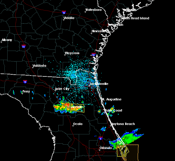 At 354 pm edt, a severe thunderstorm was located near orange heights, or 8 miles west of melrose, moving east at 15 mph (radar indicated). Hazards include 60 mph wind gusts and quarter size hail. Hail damage to vehicles is expected. Expect wind damage to roofs, siding, and trees. At 354 pm edt, a severe thunderstorm was located near orange heights, or 8 miles west of melrose, moving east at 15 mph (radar indicated). Hazards include 60 mph wind gusts and quarter size hail. Hail damage to vehicles is expected. Expect wind damage to roofs, siding, and trees.
|
| 6/4/2018 3:36 PM EDT |
 At 336 pm edt, a severe thunderstorm was located near gainesville, moving east at 15 mph (radar indicated). Hazards include 60 mph wind gusts and quarter size hail. Hail damage to vehicles is expected. expect wind damage to roofs, siding, and trees. Locations impacted include, gainesville, gainesville airport and newnans lake. At 336 pm edt, a severe thunderstorm was located near gainesville, moving east at 15 mph (radar indicated). Hazards include 60 mph wind gusts and quarter size hail. Hail damage to vehicles is expected. expect wind damage to roofs, siding, and trees. Locations impacted include, gainesville, gainesville airport and newnans lake.
|
| 6/4/2018 3:22 PM EDT |
 At 322 pm edt, a severe thunderstorm was located near gainesville, moving east at 15 mph (radar indicated). Hazards include 60 mph wind gusts and quarter size hail. Hail damage to vehicles is expected. Expect wind damage to roofs, siding, and trees. At 322 pm edt, a severe thunderstorm was located near gainesville, moving east at 15 mph (radar indicated). Hazards include 60 mph wind gusts and quarter size hail. Hail damage to vehicles is expected. Expect wind damage to roofs, siding, and trees.
|
| 5/15/2018 2:56 PM EDT |
 The severe thunderstorm warning for eastern alachua, southern bradford, northwestern putnam and southwestern clay counties will expire at 300 pm edt, the storm which prompted the warning has weakened below severe limits, and has exited the warned area. therefore, the warning will be allowed to expire. however gusty winds and heavy rain are still possible with this thunderstorm. to report severe weather, contact your nearest law enforcement agency. they will relay your report to the national weather service jacksonville. The severe thunderstorm warning for eastern alachua, southern bradford, northwestern putnam and southwestern clay counties will expire at 300 pm edt, the storm which prompted the warning has weakened below severe limits, and has exited the warned area. therefore, the warning will be allowed to expire. however gusty winds and heavy rain are still possible with this thunderstorm. to report severe weather, contact your nearest law enforcement agency. they will relay your report to the national weather service jacksonville.
|
| 5/15/2018 2:31 PM EDT |
 At 230 pm edt, a severe thunderstorm was located over rochelle, or 11 miles southeast of gainesville, moving north at 35 mph (radar indicated). Hazards include 60 mph wind gusts. Expect damage to roofs, siding, and trees. Locations impacted include, gainesville, interlachen, keystone heights, melrose, hawthorne, university of florida, george`s lake, lake geneva, rochelle and florahome. At 230 pm edt, a severe thunderstorm was located over rochelle, or 11 miles southeast of gainesville, moving north at 35 mph (radar indicated). Hazards include 60 mph wind gusts. Expect damage to roofs, siding, and trees. Locations impacted include, gainesville, interlachen, keystone heights, melrose, hawthorne, university of florida, george`s lake, lake geneva, rochelle and florahome.
|
| 5/15/2018 2:22 PM EDT |
 At 222 pm edt, a severe thunderstorm was located over cross creek, or 8 miles northwest of citra, moving north at 35 mph (radar indicated). Hazards include 60 mph wind gusts. Expect damage to roofs, siding, and trees. Locations impacted include, gainesville, interlachen, keystone heights, melrose, citra, hawthorne, university of florida, florahome, melrose landing and cross creek. At 222 pm edt, a severe thunderstorm was located over cross creek, or 8 miles northwest of citra, moving north at 35 mph (radar indicated). Hazards include 60 mph wind gusts. Expect damage to roofs, siding, and trees. Locations impacted include, gainesville, interlachen, keystone heights, melrose, citra, hawthorne, university of florida, florahome, melrose landing and cross creek.
|
| 5/15/2018 2:17 PM EDT |
 At 216 pm edt, a severe thunderstorm was located near cross creek, or near citra, moving north at 35 mph (radar indicated). Hazards include 60 mph wind gusts. expect damage to roofs, siding, and trees At 216 pm edt, a severe thunderstorm was located near cross creek, or near citra, moving north at 35 mph (radar indicated). Hazards include 60 mph wind gusts. expect damage to roofs, siding, and trees
|
| 4/15/2018 2:16 PM EDT |
 At 216 pm edt, a severe thunderstorm was located over sampson, or 7 miles southwest of starke, moving northeast at 45 mph (radar indicated). Hazards include 60 mph wind gusts. expect damage to roofs, siding, and trees At 216 pm edt, a severe thunderstorm was located over sampson, or 7 miles southwest of starke, moving northeast at 45 mph (radar indicated). Hazards include 60 mph wind gusts. expect damage to roofs, siding, and trees
|
| 3/20/2018 3:11 PM EDT |
 The severe thunderstorm warning for gilchrist, northern alachua, bradford, southern baker, union and southern columbia counties will expire at 315 pm edt, the storms which prompted the warning have weakened below severe limits, and have exited the warned area. therefore the warning will be allowed to expire. however small hail, gusty winds and heavy rain are still possible with these thunderstorms. a tornado watch remains in effect until 700 pm edt for northern and northeastern florida. The severe thunderstorm warning for gilchrist, northern alachua, bradford, southern baker, union and southern columbia counties will expire at 315 pm edt, the storms which prompted the warning have weakened below severe limits, and have exited the warned area. therefore the warning will be allowed to expire. however small hail, gusty winds and heavy rain are still possible with these thunderstorms. a tornado watch remains in effect until 700 pm edt for northern and northeastern florida.
|
| 3/20/2018 2:44 PM EDT |
 At 243 pm edt, severe thunderstorms were located along a line extending from 6 miles southeast of columbia to 9 miles northeast of trenton, moving northeast at 55 mph (radar indicated). Hazards include ping pong ball size hail and 60 mph wind gusts. People and animals outdoors will be injured. expect hail damage to roofs, siding, windows, and vehicles. expect wind damage to roofs, siding, and trees. locations impacted include, gainesville, starke, trenton, lake butler, bell, raiford, worthington spring, ichetucknee spring, columbia and alachua. A tornado watch remains in effect until 700 pm edt for northern and northeastern florida. At 243 pm edt, severe thunderstorms were located along a line extending from 6 miles southeast of columbia to 9 miles northeast of trenton, moving northeast at 55 mph (radar indicated). Hazards include ping pong ball size hail and 60 mph wind gusts. People and animals outdoors will be injured. expect hail damage to roofs, siding, windows, and vehicles. expect wind damage to roofs, siding, and trees. locations impacted include, gainesville, starke, trenton, lake butler, bell, raiford, worthington spring, ichetucknee spring, columbia and alachua. A tornado watch remains in effect until 700 pm edt for northern and northeastern florida.
|
| 3/20/2018 2:23 PM EDT |
 At 223 pm edt, severe thunderstorms were located along a line extending from 8 miles north of bell to near manattee road, moving northeast at 55 mph (radar indicated). Hazards include ping pong ball size hail and 60 mph wind gusts. People and animals outdoors will be injured. expect hail damage to roofs, siding, windows, and vehicles. Expect wind damage to roofs, siding, and trees. At 223 pm edt, severe thunderstorms were located along a line extending from 8 miles north of bell to near manattee road, moving northeast at 55 mph (radar indicated). Hazards include ping pong ball size hail and 60 mph wind gusts. People and animals outdoors will be injured. expect hail damage to roofs, siding, windows, and vehicles. Expect wind damage to roofs, siding, and trees.
|
| 3/20/2018 2:07 PM EDT |
 The severe thunderstorm warning for central alachua county will expire at 215 pm edt, the storm which prompted the warning has moved out of the area. therefore the warning will be allowed to expire. however small hail, gusty winds and heavy rain are still possible with this thunderstorm. a tornado watch remains in effect until 700 pm edt for northern florida. The severe thunderstorm warning for central alachua county will expire at 215 pm edt, the storm which prompted the warning has moved out of the area. therefore the warning will be allowed to expire. however small hail, gusty winds and heavy rain are still possible with this thunderstorm. a tornado watch remains in effect until 700 pm edt for northern florida.
|
| 3/20/2018 1:58 PM EDT |
 At 158 pm edt, a severe thunderstorm was located near gainesville, moving east at 50 mph (radar indicated). Hazards include ping pong ball size hail and 60 mph wind gusts. People and animals outdoors will be injured. expect hail damage to roofs, siding, windows, and vehicles. expect wind damage to roofs, siding, and trees. locations impacted include, gainesville, alachua and waldo. A tornado watch remains in effect until 700 pm edt for northern florida. At 158 pm edt, a severe thunderstorm was located near gainesville, moving east at 50 mph (radar indicated). Hazards include ping pong ball size hail and 60 mph wind gusts. People and animals outdoors will be injured. expect hail damage to roofs, siding, windows, and vehicles. expect wind damage to roofs, siding, and trees. locations impacted include, gainesville, alachua and waldo. A tornado watch remains in effect until 700 pm edt for northern florida.
|
| 3/20/2018 1:51 PM EDT |
 At 151 pm edt, a severe thunderstorm was located over alachua, or 12 miles southwest of worthington spring, moving northeast at 55 mph (radar indicated). Hazards include 60 mph wind gusts and quarter size hail. Hail damage to vehicles is expected. Expect wind damage to roofs, siding, and trees. At 151 pm edt, a severe thunderstorm was located over alachua, or 12 miles southwest of worthington spring, moving northeast at 55 mph (radar indicated). Hazards include 60 mph wind gusts and quarter size hail. Hail damage to vehicles is expected. Expect wind damage to roofs, siding, and trees.
|
| 3/20/2018 1:48 PM EDT |
 At 148 pm edt, a severe thunderstorm was located 8 miles south of alachua, or 10 miles west of gainesville, moving east at 50 mph (radar indicated). Hazards include 60 mph wind gusts and quarter size hail. Hail damage to vehicles is expected. expect wind damage to roofs, siding, and trees. locations impacted include, gainesville, alachua, archer, university of florida, orange heights, gainesville airport, newnans lake, rochelle, newberry and waldo. A tornado watch remains in effect until 700 pm edt for northern florida. At 148 pm edt, a severe thunderstorm was located 8 miles south of alachua, or 10 miles west of gainesville, moving east at 50 mph (radar indicated). Hazards include 60 mph wind gusts and quarter size hail. Hail damage to vehicles is expected. expect wind damage to roofs, siding, and trees. locations impacted include, gainesville, alachua, archer, university of florida, orange heights, gainesville airport, newnans lake, rochelle, newberry and waldo. A tornado watch remains in effect until 700 pm edt for northern florida.
|
| 3/20/2018 1:39 PM EDT |
 At 139 pm edt, a severe thunderstorm was located 8 miles northwest of archer, or 11 miles east of trenton, moving northeast at 50 mph (radar indicated). Hazards include 60 mph wind gusts and quarter size hail. Hail damage to vehicles is expected. expect wind damage to roofs, siding, and trees. locations impacted include, gainesville, citra, alachua, hawthorne, archer, university of florida, rochelle, cross creek, orange heights and gainesville airport. A tornado watch remains in effect until 700 pm edt for northern and northeastern florida. At 139 pm edt, a severe thunderstorm was located 8 miles northwest of archer, or 11 miles east of trenton, moving northeast at 50 mph (radar indicated). Hazards include 60 mph wind gusts and quarter size hail. Hail damage to vehicles is expected. expect wind damage to roofs, siding, and trees. locations impacted include, gainesville, citra, alachua, hawthorne, archer, university of florida, rochelle, cross creek, orange heights and gainesville airport. A tornado watch remains in effect until 700 pm edt for northern and northeastern florida.
|
| 3/20/2018 1:29 PM EDT |
 At 129 pm edt, a severe thunderstorm was located near chiefland, moving east at 50 mph (radar indicated). Hazards include 60 mph wind gusts and half dollar size hail. Hail damage to vehicles is expected. Expect wind damage to roofs, siding, and trees. At 129 pm edt, a severe thunderstorm was located near chiefland, moving east at 50 mph (radar indicated). Hazards include 60 mph wind gusts and half dollar size hail. Hail damage to vehicles is expected. Expect wind damage to roofs, siding, and trees.
|
| 3/19/2018 6:41 AM EDT |
 At 641 am edt, severe thunderstorms were located along a line extending from near alachua to near bronson, moving east at 55 mph (radar indicated). Hazards include 60 mph wind gusts and penny size hail. Expect damage to roofs, siding, and trees. Locations impacted include, gainesville, alachua, archer, university of florida, gainesville airport, newberry and waldo. At 641 am edt, severe thunderstorms were located along a line extending from near alachua to near bronson, moving east at 55 mph (radar indicated). Hazards include 60 mph wind gusts and penny size hail. Expect damage to roofs, siding, and trees. Locations impacted include, gainesville, alachua, archer, university of florida, gainesville airport, newberry and waldo.
|
| 3/19/2018 6:24 AM EDT |
 At 624 am edt, severe thunderstorms were located along a line extending from near high springs to near andrews, moving east at 55 mph. radar indicated weak rotation with this storm. tornadoes can quickly develop with little or no advanced warning (radar indicated). Hazards include 60 mph wind gusts and penny size hail. expect damage to roofs, siding, and trees At 624 am edt, severe thunderstorms were located along a line extending from near high springs to near andrews, moving east at 55 mph. radar indicated weak rotation with this storm. tornadoes can quickly develop with little or no advanced warning (radar indicated). Hazards include 60 mph wind gusts and penny size hail. expect damage to roofs, siding, and trees
|
| 8/9/2017 4:22 PM EDT |
 The severe thunderstorm warning for central alachua county will expire at 430 pm edt, the storms which prompted the warning have weakened below severe limits, and no longer pose an immediate threat to life or property. therefore the warning will be allowed to expire. however gusty winds and heavy rain are still possible with these thunderstorms. The severe thunderstorm warning for central alachua county will expire at 430 pm edt, the storms which prompted the warning have weakened below severe limits, and no longer pose an immediate threat to life or property. therefore the warning will be allowed to expire. however gusty winds and heavy rain are still possible with these thunderstorms.
|
| 8/9/2017 3:49 PM EDT |
 At 349 pm edt, severe thunderstorms were located along a line extending from gainesville to 6 miles south of sampson, and are nearly stationary (radar indicated). Hazards include 60 mph wind gusts. expect damage to roofs, siding, and trees At 349 pm edt, severe thunderstorms were located along a line extending from gainesville to 6 miles south of sampson, and are nearly stationary (radar indicated). Hazards include 60 mph wind gusts. expect damage to roofs, siding, and trees
|
| 7/17/2017 2:52 PM EDT |
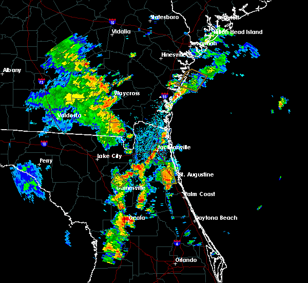 The severe thunderstorm warning for northeastern alachua and central bradford counties will expire at 300 pm edt, the storm which prompted the warning has moved out of the area. therefore the warning will be allowed to expire. to report severe weather, contact your nearest law enforcement agency. they will relay your report to the national weather service jacksonville. The severe thunderstorm warning for northeastern alachua and central bradford counties will expire at 300 pm edt, the storm which prompted the warning has moved out of the area. therefore the warning will be allowed to expire. to report severe weather, contact your nearest law enforcement agency. they will relay your report to the national weather service jacksonville.
|
| 7/17/2017 2:37 PM EDT |
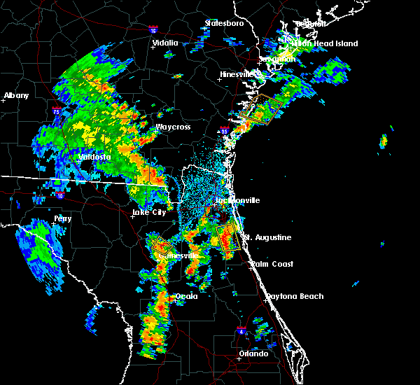 At 237 pm edt, a severe thunderstorm was located near sampson, or 11 miles southwest of starke, moving northeast at 15 mph (radar indicated). Hazards include 60 mph wind gusts and penny size hail. Expect damage to roofs, siding, and trees. Locations impacted include, brooker. At 237 pm edt, a severe thunderstorm was located near sampson, or 11 miles southwest of starke, moving northeast at 15 mph (radar indicated). Hazards include 60 mph wind gusts and penny size hail. Expect damage to roofs, siding, and trees. Locations impacted include, brooker.
|
| 7/17/2017 2:18 PM EDT |
 At 217 pm edt, a severe thunderstorm was located near gainesville airport, or near gainesville, moving northeast at 20 mph (radar indicated). Hazards include 60 mph wind gusts and penny size hail. expect damage to roofs, siding, and trees At 217 pm edt, a severe thunderstorm was located near gainesville airport, or near gainesville, moving northeast at 20 mph (radar indicated). Hazards include 60 mph wind gusts and penny size hail. expect damage to roofs, siding, and trees
|
| 4/4/2017 8:12 AM EDT |
 At 811 am edt, a severe thunderstorm was located over orange heights, or 7 miles west of melrose, moving east at 35 mph (radar indicated). Hazards include 60 mph wind gusts. Expect damage to roofs, siding, and trees. Locations impacted include, gainesville, orange heights, university of florida, gainesville airport and waldo. At 811 am edt, a severe thunderstorm was located over orange heights, or 7 miles west of melrose, moving east at 35 mph (radar indicated). Hazards include 60 mph wind gusts. Expect damage to roofs, siding, and trees. Locations impacted include, gainesville, orange heights, university of florida, gainesville airport and waldo.
|
| 4/4/2017 7:46 AM EDT |
 At 746 am edt, a severe thunderstorm was located near gainesville, moving northeast at 35 mph (radar indicated). Hazards include 60 mph wind gusts. expect damage to roofs, siding, and trees At 746 am edt, a severe thunderstorm was located near gainesville, moving northeast at 35 mph (radar indicated). Hazards include 60 mph wind gusts. expect damage to roofs, siding, and trees
|
| 4/4/2017 7:37 AM EDT |
 The severe thunderstorm warning for northeastern alachua, bradford, northern putnam and southern clay counties will expire at 745 am edt, the storm which prompted the warning has weakened below severe limits, and no longer poses an immediate threat to life or property. therefore the warning will be allowed to expire. however heavy rain is still possible with this thunderstorm. The severe thunderstorm warning for northeastern alachua, bradford, northern putnam and southern clay counties will expire at 745 am edt, the storm which prompted the warning has weakened below severe limits, and no longer poses an immediate threat to life or property. therefore the warning will be allowed to expire. however heavy rain is still possible with this thunderstorm.
|
| 4/4/2017 6:59 AM EDT |
 At 658 am edt, a severe thunderstorm was located near keystone heights, moving east at 45 mph (radar indicated). Hazards include 60 mph wind gusts. expect damage to roofs, siding, and trees At 658 am edt, a severe thunderstorm was located near keystone heights, moving east at 45 mph (radar indicated). Hazards include 60 mph wind gusts. expect damage to roofs, siding, and trees
|
| 2/7/2017 10:20 PM EST | Multiple trees down on sr24 in alachua county FL, 0.6 miles NNE of Waldo, FL |
| 1/22/2017 6:46 PM EST |
 At 646 pm est, severe thunderstorms were located along a line extending from near yulee to interlachen, moving northeast at 70 mph (radar indicated). Hazards include 60 mph wind gusts and quarter size hail. Hail damage to vehicles is expected. expect wind damage to roofs, siding, and trees. locations impacted include, jacksonville, saint augustine, fernandina beach, palatka, orange park, green cove springs, starke, interlachen, keystone heights and callahan. A tornado watch remains in effect until 800 pm est for northeastern and northern florida, and southeastern georgia. At 646 pm est, severe thunderstorms were located along a line extending from near yulee to interlachen, moving northeast at 70 mph (radar indicated). Hazards include 60 mph wind gusts and quarter size hail. Hail damage to vehicles is expected. expect wind damage to roofs, siding, and trees. locations impacted include, jacksonville, saint augustine, fernandina beach, palatka, orange park, green cove springs, starke, interlachen, keystone heights and callahan. A tornado watch remains in effect until 800 pm est for northeastern and northern florida, and southeastern georgia.
|
| 1/22/2017 6:32 PM EST |
 At 631 pm est, severe thunderstorms were located along a line extending from 6 miles west of ratliff to cross creek, moving northeast at 70 mph (radar indicated). Hazards include 60 mph wind gusts and quarter size hail. Hail damage to vehicles is expected. expect wind damage to roofs, siding, and trees. locations impacted include, jacksonville, gainesville, saint augustine, fernandina beach, palatka, orange park, green cove springs, starke, lake butler and interlachen. A tornado watch remains in effect until 800 pm est for northeastern and northern florida, and southeastern georgia. At 631 pm est, severe thunderstorms were located along a line extending from 6 miles west of ratliff to cross creek, moving northeast at 70 mph (radar indicated). Hazards include 60 mph wind gusts and quarter size hail. Hail damage to vehicles is expected. expect wind damage to roofs, siding, and trees. locations impacted include, jacksonville, gainesville, saint augustine, fernandina beach, palatka, orange park, green cove springs, starke, lake butler and interlachen. A tornado watch remains in effect until 800 pm est for northeastern and northern florida, and southeastern georgia.
|
| 1/22/2017 6:17 PM EST |
 At 617 pm est, severe thunderstorms were located along a line extending from 8 miles north of macclenny to near williston, moving northeast at 70 mph (radar indicated). Hazards include 60 mph wind gusts and quarter size hail. Hail damage to vehicles is expected. expect wind damage to roofs, siding, and trees. locations impacted include, jacksonville, gainesville, saint augustine, fernandina beach, palatka, orange park, green cove springs, starke, lake butler and interlachen. A tornado watch remains in effect until 800 pm est for northeastern and northern florida, and southeastern georgia. At 617 pm est, severe thunderstorms were located along a line extending from 8 miles north of macclenny to near williston, moving northeast at 70 mph (radar indicated). Hazards include 60 mph wind gusts and quarter size hail. Hail damage to vehicles is expected. expect wind damage to roofs, siding, and trees. locations impacted include, jacksonville, gainesville, saint augustine, fernandina beach, palatka, orange park, green cove springs, starke, lake butler and interlachen. A tornado watch remains in effect until 800 pm est for northeastern and northern florida, and southeastern georgia.
|
| 1/22/2017 6:06 PM EST |
 At 605 pm est, severe thunderstorms were located along a line extending from near sanderson to near williston highlands, moving northeast at 70 mph (radar indicated). Hazards include 60 mph wind gusts and quarter size hail. Hail damage to vehicles is expected. Expect wind damage to roofs, siding, and trees. At 605 pm est, severe thunderstorms were located along a line extending from near sanderson to near williston highlands, moving northeast at 70 mph (radar indicated). Hazards include 60 mph wind gusts and quarter size hail. Hail damage to vehicles is expected. Expect wind damage to roofs, siding, and trees.
|
| 6/10/2016 7:00 PM EDT |
 At 659 pm edt, severe thunderstorms were located along a line extending from near keystone heights to 8 miles northwest of archer, moving south at 15 mph (radar indicated). Hazards include 60 mph wind gusts and penny size hail. Expect damage to roofs. siding. and trees. Locations impacted include, gainesville, alachua, high springs, hawthorne, archer, cross creek, university of florida, orange heights, gainesville airport, newnans lake, rochelle, newberry, waldo, micanopy, grove park and lochloosa. At 659 pm edt, severe thunderstorms were located along a line extending from near keystone heights to 8 miles northwest of archer, moving south at 15 mph (radar indicated). Hazards include 60 mph wind gusts and penny size hail. Expect damage to roofs. siding. and trees. Locations impacted include, gainesville, alachua, high springs, hawthorne, archer, cross creek, university of florida, orange heights, gainesville airport, newnans lake, rochelle, newberry, waldo, micanopy, grove park and lochloosa.
|
| 6/10/2016 6:39 PM EDT |
 At 639 pm edt, severe thunderstorms were located along a line extending from 6 miles south of starke to 8 miles south of high springs, moving south at 15 mph (radar indicated). Hazards include 60 mph wind gusts and penny size hail. Expect damage to roofs. siding. And trees. At 639 pm edt, severe thunderstorms were located along a line extending from 6 miles south of starke to 8 miles south of high springs, moving south at 15 mph (radar indicated). Hazards include 60 mph wind gusts and penny size hail. Expect damage to roofs. siding. And trees.
|
| 6/10/2016 6:35 PM EDT | Citizen reported small trees downed by estimated 40-50 mph winds and pea sized hail along county road 147 in alachua county FL, 0.8 miles E of Waldo, FL |
| 6/6/2016 1:31 PM EDT |
 The national weather service in jacksonville has issued a * tornado warning for. northeastern alachua county in northern florida. bradford county in northern florida. northwestern clay county in northeastern florida. Until 200 pm edt. The national weather service in jacksonville has issued a * tornado warning for. northeastern alachua county in northern florida. bradford county in northern florida. northwestern clay county in northeastern florida. Until 200 pm edt.
|
| 6/6/2016 1:31 PM EDT |
 At 131 pm edt, a severe thunderstorm capable of producing a tornado was located 7 miles south of sampson, or 10 miles west of keystone heights, moving north at 45 mph (radar indicated rotation). Hazards include tornado. Flying debris will be dangerous to those caught without shelter. mobile homes will be damaged or destroyed. damage to roofs, windows, and vehicles will occur. tree damage is likely. this dangerous storm will be near, sampson around 140 pm edt. new river around 145 pm edt. starke around 150 pm edt. Other locations impacted by this tornadic thunderstorm include hampton, waldo and lawtey. At 131 pm edt, a severe thunderstorm capable of producing a tornado was located 7 miles south of sampson, or 10 miles west of keystone heights, moving north at 45 mph (radar indicated rotation). Hazards include tornado. Flying debris will be dangerous to those caught without shelter. mobile homes will be damaged or destroyed. damage to roofs, windows, and vehicles will occur. tree damage is likely. this dangerous storm will be near, sampson around 140 pm edt. new river around 145 pm edt. starke around 150 pm edt. Other locations impacted by this tornadic thunderstorm include hampton, waldo and lawtey.
|
| 5/31/2016 7:43 PM EDT |
 At 743 pm edt, severe thunderstorms were located along a line extending from near sampson to near newnans lake, moving south at 10 mph (radar indicated). Hazards include 60 mph wind gusts. Expect damage to roofs. siding. and trees. Locations impacted include, gainesville, starke, new river, sampson, gainesville airport, newnans lake, orange heights, waldo and hampton. At 743 pm edt, severe thunderstorms were located along a line extending from near sampson to near newnans lake, moving south at 10 mph (radar indicated). Hazards include 60 mph wind gusts. Expect damage to roofs. siding. and trees. Locations impacted include, gainesville, starke, new river, sampson, gainesville airport, newnans lake, orange heights, waldo and hampton.
|
| 5/31/2016 7:21 PM EDT |
 At 720 pm edt, severe thunderstorms were located along a line extending from near sampson to near orange heights, and are nearly stationary (radar indicated). Hazards include 60 mph wind gusts and penny size hail. Expect damage to roofs. siding. And trees. At 720 pm edt, severe thunderstorms were located along a line extending from near sampson to near orange heights, and are nearly stationary (radar indicated). Hazards include 60 mph wind gusts and penny size hail. Expect damage to roofs. siding. And trees.
|
| 5/17/2016 4:30 PM EDT |
 At 430 pm edt, a severe thunderstorm was located near hawthorne, or near melrose, moving northeast at 30 mph (radar indicated). Hazards include 60 mph wind gusts and quarter size hail. Hail damage to vehicles is expected. Expect wind damage to roofs, siding, and trees. At 430 pm edt, a severe thunderstorm was located near hawthorne, or near melrose, moving northeast at 30 mph (radar indicated). Hazards include 60 mph wind gusts and quarter size hail. Hail damage to vehicles is expected. Expect wind damage to roofs, siding, and trees.
|
| 5/17/2016 4:08 PM EDT |
 At 408 pm edt, severe thunderstorms were located along a line extending from near rochelle to near fort mccoy, moving northeast at 30 mph (radar indicated). Hazards include 60 mph wind gusts and quarter size hail. Hail damage to vehicles is expected. expect wind damage to roofs, siding, and trees. Locations impacted include, gainesville, fort mccoy, citra, hawthorne, orange springs, cross creek, orange heights, sparr, newnans lake, rochelle, waldo, micanopy, reddick, mcintosh, lowell, flemington, grove park, hog valley, lochloosa and burbank. At 408 pm edt, severe thunderstorms were located along a line extending from near rochelle to near fort mccoy, moving northeast at 30 mph (radar indicated). Hazards include 60 mph wind gusts and quarter size hail. Hail damage to vehicles is expected. expect wind damage to roofs, siding, and trees. Locations impacted include, gainesville, fort mccoy, citra, hawthorne, orange springs, cross creek, orange heights, sparr, newnans lake, rochelle, waldo, micanopy, reddick, mcintosh, lowell, flemington, grove park, hog valley, lochloosa and burbank.
|
| 5/17/2016 3:43 PM EDT |
 At 343 pm edt, severe thunderstorms were located along a line extending from 9 miles southwest of cross creek to near ocala, moving northeast at 30 mph (radar indicated). Hazards include 60 mph wind gusts and half dollar size hail. Hail damage to vehicles is expected. Expect wind damage to roofs, siding, and trees. At 343 pm edt, severe thunderstorms were located along a line extending from 9 miles southwest of cross creek to near ocala, moving northeast at 30 mph (radar indicated). Hazards include 60 mph wind gusts and half dollar size hail. Hail damage to vehicles is expected. Expect wind damage to roofs, siding, and trees.
|
| 5/13/2016 5:34 PM EDT |
 At 534 pm edt, a severe thunderstorm was located near gainesville, moving east at 20 mph (radar indicated). Hazards include 60 mph wind gusts and penny size hail. Expect damage to roofs. siding. and trees. Locations impacted include, gainesville, alachua, hawthorne, gainesville airport, newnans lake, university of florida, orange heights, rochelle, waldo, grove park and lochloosa. At 534 pm edt, a severe thunderstorm was located near gainesville, moving east at 20 mph (radar indicated). Hazards include 60 mph wind gusts and penny size hail. Expect damage to roofs. siding. and trees. Locations impacted include, gainesville, alachua, hawthorne, gainesville airport, newnans lake, university of florida, orange heights, rochelle, waldo, grove park and lochloosa.
|
| 5/13/2016 5:17 PM EDT |
 At 517 pm edt, a severe thunderstorm was located near alachua, or 8 miles northwest of gainesville, moving east at 20 mph (radar indicated). Hazards include 60 mph wind gusts and penny size hail. Expect damage to roofs. siding. And trees. At 517 pm edt, a severe thunderstorm was located near alachua, or 8 miles northwest of gainesville, moving east at 20 mph (radar indicated). Hazards include 60 mph wind gusts and penny size hail. Expect damage to roofs. siding. And trees.
|
| 8/17/2015 3:54 PM EDT |
 At 354 pm edt, doppler radar indicated a severe thunderstorm capable of producing damaging winds in excess of 60 mph. this storm was located over hawthorne, or 8 miles south of melrose, moving east at 20 mph. locations impacted include, gainesville, hawthorne, newnans lake, orange heights, rochelle, waldo and grove park. At 354 pm edt, doppler radar indicated a severe thunderstorm capable of producing damaging winds in excess of 60 mph. this storm was located over hawthorne, or 8 miles south of melrose, moving east at 20 mph. locations impacted include, gainesville, hawthorne, newnans lake, orange heights, rochelle, waldo and grove park.
|
| 8/17/2015 3:29 PM EDT |
 At 329 pm edt, doppler radar indicated a severe thunderstorm capable of producing damaging winds in excess of 60 mph. this storm was located over gainesville, and moving east at 10 mph. At 329 pm edt, doppler radar indicated a severe thunderstorm capable of producing damaging winds in excess of 60 mph. this storm was located over gainesville, and moving east at 10 mph.
|
| 8/7/2015 6:33 PM EDT |
 At 632 pm edt, doppler radar indicated a line of severe thunderstorms capable of producing damaging winds in excess of 60 mph. these storms were located along a line extending from near sampson to high springs, moving southeast at 25 mph. locations impacted include, gainesville, worthington spring, alachua, high springs, hawthorne, worthington springs, groves, university of florida, orange heights, upland pines, gainesville airport, newnans lake, rochelle, waldo, la crosse, brooker, grove park and dukes. At 632 pm edt, doppler radar indicated a line of severe thunderstorms capable of producing damaging winds in excess of 60 mph. these storms were located along a line extending from near sampson to high springs, moving southeast at 25 mph. locations impacted include, gainesville, worthington spring, alachua, high springs, hawthorne, worthington springs, groves, university of florida, orange heights, upland pines, gainesville airport, newnans lake, rochelle, waldo, la crosse, brooker, grove park and dukes.
|
| 8/7/2015 6:01 PM EDT |
 At 600 pm edt, doppler radar indicated a line of severe thunderstorms capable of producing damaging winds in excess of 60 mph. these storms were located along a line extending from near maxville to near alachua, moving southeast at 30 mph. locations impacted include, gainesville, starke, lake butler, keystone heights, raiford, middleburg, worthington spring, melrose, alachua, high springs, hawthorne, worthington springs, george`s lake, groves, lake geneva, upland pines, kingsley, university of florida, camp blanding and orange heights. At 600 pm edt, doppler radar indicated a line of severe thunderstorms capable of producing damaging winds in excess of 60 mph. these storms were located along a line extending from near maxville to near alachua, moving southeast at 30 mph. locations impacted include, gainesville, starke, lake butler, keystone heights, raiford, middleburg, worthington spring, melrose, alachua, high springs, hawthorne, worthington springs, george`s lake, groves, lake geneva, upland pines, kingsley, university of florida, camp blanding and orange heights.
|
| 8/7/2015 5:39 PM EDT |
 At 539 pm edt, doppler radar indicated a line of severe thunderstorms capable of producing damaging winds in excess of 60 mph. these storms were located along a line extending from near glen st. mary to near upland pines, and moving southeast at 30 mph. At 539 pm edt, doppler radar indicated a line of severe thunderstorms capable of producing damaging winds in excess of 60 mph. these storms were located along a line extending from near glen st. mary to near upland pines, and moving southeast at 30 mph.
|
| 7/11/2015 5:14 PM EDT |
 At 513 pm edt, doppler radar indicated a severe thunderstorm capable of producing damaging winds in excess of 60 mph. this storm was located near sampson, moving south at 5 mph. locations impacted include, orange heights, sampson, waldo and hampton. At 513 pm edt, doppler radar indicated a severe thunderstorm capable of producing damaging winds in excess of 60 mph. this storm was located near sampson, moving south at 5 mph. locations impacted include, orange heights, sampson, waldo and hampton.
|
| 7/11/2015 5:00 PM EDT |
 At 500 pm edt, doppler radar indicated a severe thunderstorm capable of producing damaging winds in excess of 60 mph. this storm was located near sampson, or near starke, and moving south at 5 mph. penny size hail may also accompany the damaging winds. At 500 pm edt, doppler radar indicated a severe thunderstorm capable of producing damaging winds in excess of 60 mph. this storm was located near sampson, or near starke, and moving south at 5 mph. penny size hail may also accompany the damaging winds.
|
| 6/24/2015 3:40 PM EDT |
 The severe thunderstorm warning for alachua county will expire at 345 pm edt, the storm which prompted the warning has weakened below severe limits, and no longer poses an immediate threat to life or property. therefore the warning will be allowed to expire. however small. The severe thunderstorm warning for alachua county will expire at 345 pm edt, the storm which prompted the warning has weakened below severe limits, and no longer poses an immediate threat to life or property. therefore the warning will be allowed to expire. however small.
|
| 6/24/2015 3:36 PM EDT |
 At 336 pm edt, doppler radar indicated a severe thunderstorm capable of producing quarter size hail and destructive winds in excess of 70 mph. this storm was located near gainesville, moving east at 15 mph. locations impacted include, gainesville, melrose, hawthorne, archer, university of florida, orange heights, gainesville airport, newnans lake, rochelle, waldo, micanopy, grove park and lochloosa. At 336 pm edt, doppler radar indicated a severe thunderstorm capable of producing quarter size hail and destructive winds in excess of 70 mph. this storm was located near gainesville, moving east at 15 mph. locations impacted include, gainesville, melrose, hawthorne, archer, university of florida, orange heights, gainesville airport, newnans lake, rochelle, waldo, micanopy, grove park and lochloosa.
|
| 6/24/2015 3:32 PM EDT |
 At 332 pm edt, doppler radar indicated a severe thunderstorm capable of producing quarter size hail and destructive winds in excess of 70 mph. this storm was located near gainesville, moving east at 15 mph. locations impacted include, gainesville, melrose, hawthorne, archer, university of florida, orange heights, gainesville airport, newnans lake, rochelle, waldo, micanopy, grove park and lochloosa. At 332 pm edt, doppler radar indicated a severe thunderstorm capable of producing quarter size hail and destructive winds in excess of 70 mph. this storm was located near gainesville, moving east at 15 mph. locations impacted include, gainesville, melrose, hawthorne, archer, university of florida, orange heights, gainesville airport, newnans lake, rochelle, waldo, micanopy, grove park and lochloosa.
|
| 6/24/2015 3:24 PM EDT |
 At 324 pm edt, doppler radar indicated a severe thunderstorm capable of producing quarter size hail and destructive winds in excess of 70 mph. this storm was located near university of florida, or near gainesville, moving east at 10 mph. locations impacted include, gainesville, melrose, hawthorne, archer, university of florida, orange heights, gainesville airport, newnans lake, rochelle, waldo, micanopy, grove park and lochloosa. At 324 pm edt, doppler radar indicated a severe thunderstorm capable of producing quarter size hail and destructive winds in excess of 70 mph. this storm was located near university of florida, or near gainesville, moving east at 10 mph. locations impacted include, gainesville, melrose, hawthorne, archer, university of florida, orange heights, gainesville airport, newnans lake, rochelle, waldo, micanopy, grove park and lochloosa.
|
| 6/24/2015 3:15 PM EDT |
 At 315 pm edt, doppler radar indicated a severe thunderstorm capable of producing quarter size hail and destructive winds in excess of 70 mph. this storm was located near university of florida, or near gainesville, and moving northeast at 15 mph. At 315 pm edt, doppler radar indicated a severe thunderstorm capable of producing quarter size hail and destructive winds in excess of 70 mph. this storm was located near university of florida, or near gainesville, and moving northeast at 15 mph.
|
| 6/9/2014 7:10 PM EDT | Quarter sized hail reported 3.9 miles WNW of Waldo, FL, wcjb tv-20 relayed a public report of quarter sized hail near little sante fe lake. |
| 8/21/2012 12:45 PM EDT | Ema reported a tree blocking state route 26. time estimated from rada in alachua county FL, 6.7 miles NNW of Waldo, FL |
| 8/21/2012 12:45 PM EDT | Ema reported a tree blocking state route 26. time estimated from rada in alachua county FL, 5.8 miles NNW of Waldo, FL |
Hail Maps for Waldo, FL


Connect with Interactive Hail Maps