

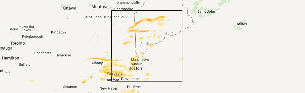
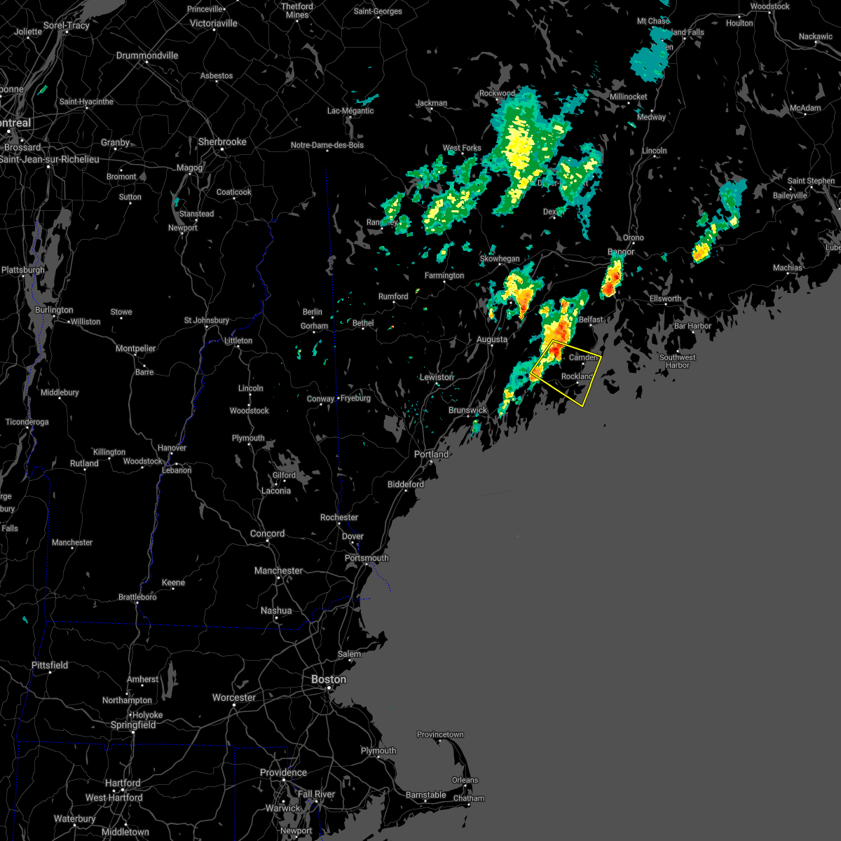
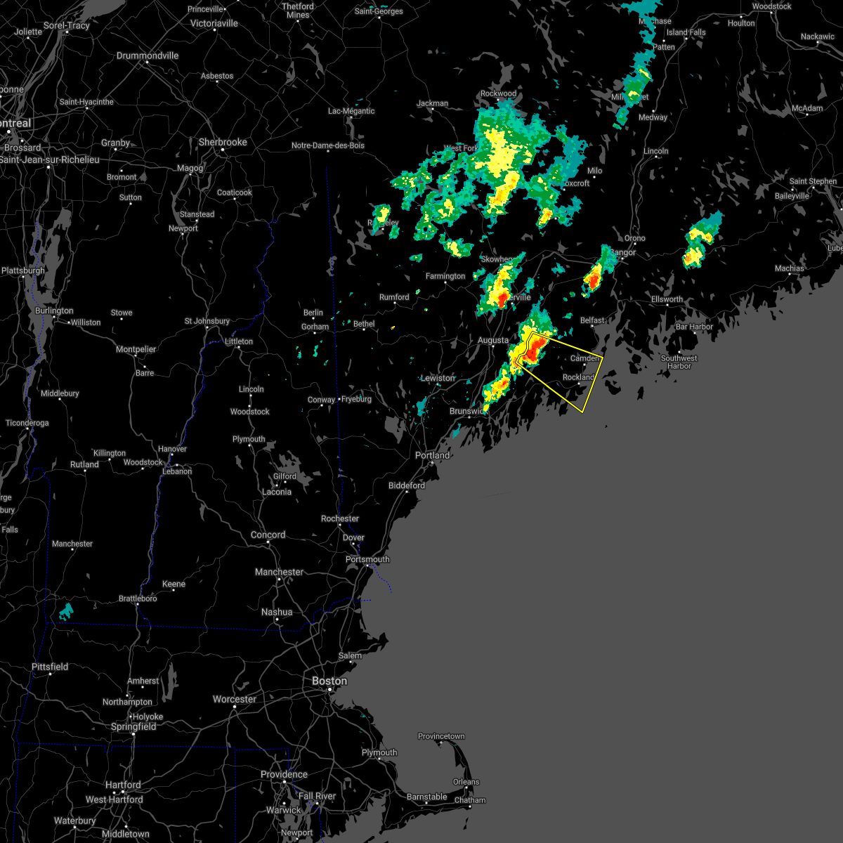
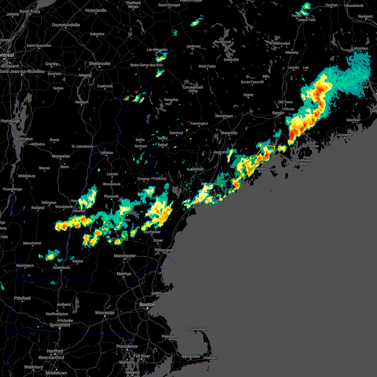
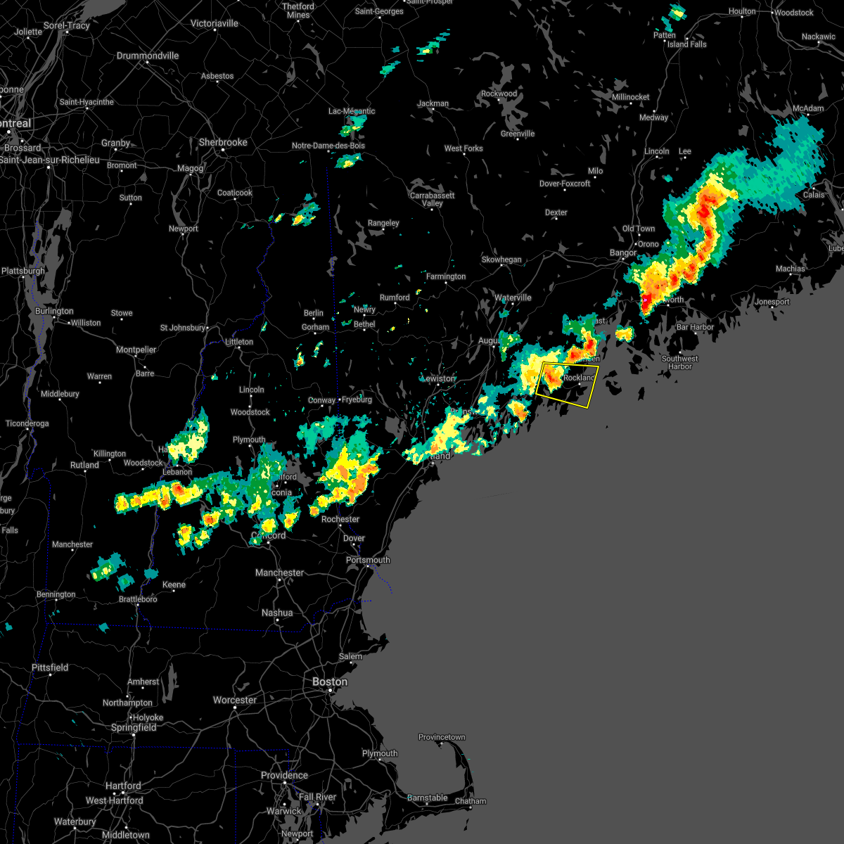
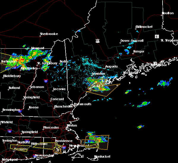
Hail Map for Waldoboro, ME
The Waldoboro, ME area has had 0 reports of on-the-ground hail by trained spotters, and has been under severe weather warnings 0 times during the past 12 months. Doppler radar has detected hail at or near Waldoboro, ME on 5 occasions.
| Name: | Waldoboro, ME |
| Where Located: | 53 miles NE of Portland, ME |
| Map: | Google Map for Waldoboro, ME |
| Population: | 1233 |
| Housing Units: | 716 |
| More Info: | Search Google for Waldoboro, ME |
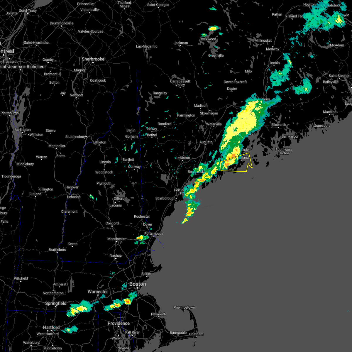
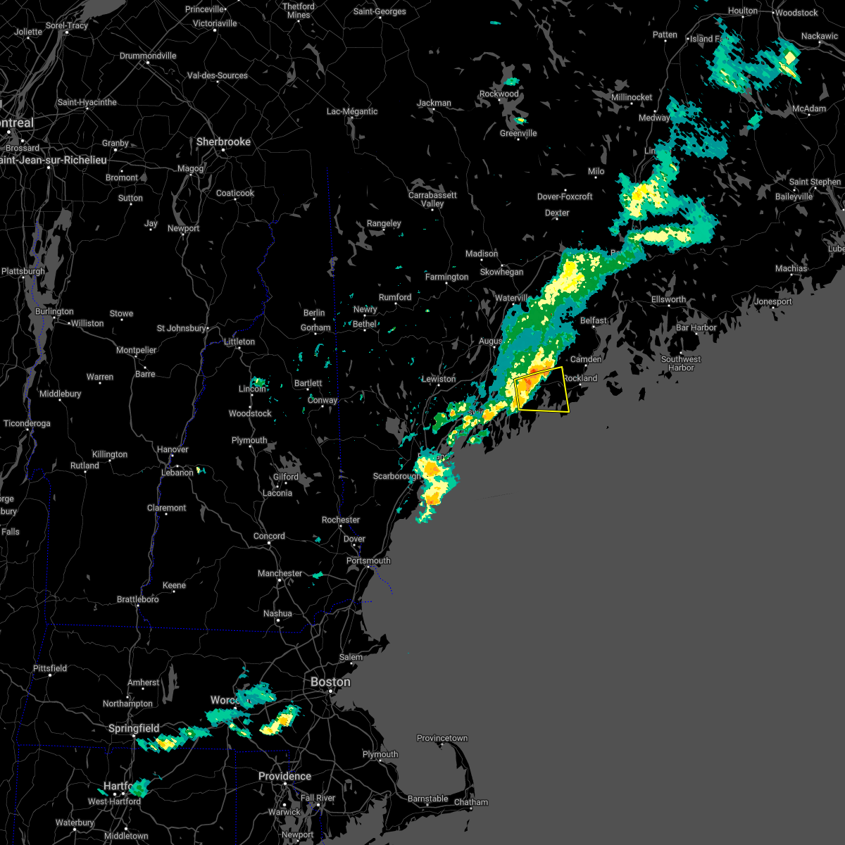
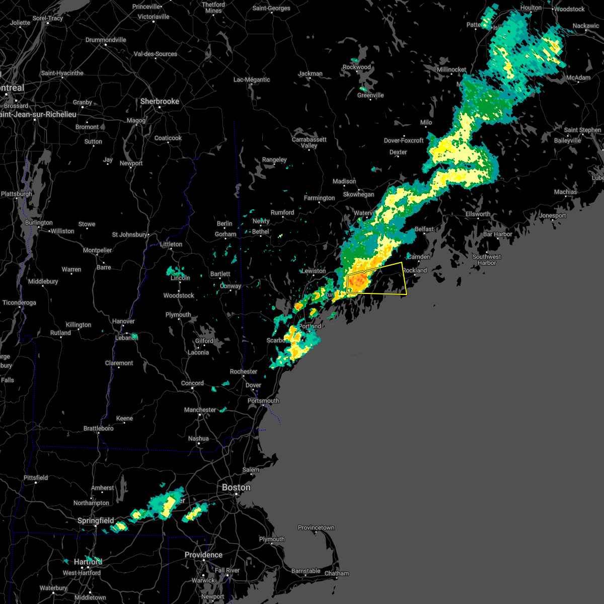
5
The Top Recent Hail Date for Waldoboro, ME is Wednesday, June 1, 2011 (1st out of 5)
Hail and Wind Damage Spotted near Waldoboro, ME
| Date / Time | Report Details |
|---|---|
| 6/17/2022 1:55 PM EDT |
 At 155 pm edt, a severe thunderstorm was located over bremen, or near damariscotta, moving east at 45 mph (radar indicated). Hazards include 60 mph wind gusts and quarter size hail. Hail damage to vehicles is expected. Expect wind damage to roofs, siding, and trees. At 155 pm edt, a severe thunderstorm was located over bremen, or near damariscotta, moving east at 45 mph (radar indicated). Hazards include 60 mph wind gusts and quarter size hail. Hail damage to vehicles is expected. Expect wind damage to roofs, siding, and trees.
|
| 6/17/2022 1:50 PM EDT | Wires dow in lincoln county ME, 5.8 miles NNE of Waldoboro, ME |
| 6/17/2022 1:46 PM EDT |
 At 145 pm edt, a severe thunderstorm was located near damariscotta, moving east at 55 mph (radar indicated). Hazards include 60 mph wind gusts and quarter size hail. Hail damage to vehicles is expected. expect wind damage to roofs, siding, and trees. locations impacted include, damariscotta, bristol, bremen, jefferson, cushing, edgecomb, friendship, alna, nobleboro, newcastle, waldoboro, saint george, union, whitefield and south bristol. hail threat, radar indicated max hail size, 1. 00 in wind threat, radar indicated max wind gust, 60 mph. At 145 pm edt, a severe thunderstorm was located near damariscotta, moving east at 55 mph (radar indicated). Hazards include 60 mph wind gusts and quarter size hail. Hail damage to vehicles is expected. expect wind damage to roofs, siding, and trees. locations impacted include, damariscotta, bristol, bremen, jefferson, cushing, edgecomb, friendship, alna, nobleboro, newcastle, waldoboro, saint george, union, whitefield and south bristol. hail threat, radar indicated max hail size, 1. 00 in wind threat, radar indicated max wind gust, 60 mph.
|
| 6/17/2022 1:32 PM EDT |
 At 132 pm edt, a severe thunderstorm was located near wiscasset, moving east at 55 mph (radar indicated). Hazards include 60 mph wind gusts and quarter size hail. Hail damage to vehicles is expected. Expect wind damage to roofs, siding, and trees. At 132 pm edt, a severe thunderstorm was located near wiscasset, moving east at 55 mph (radar indicated). Hazards include 60 mph wind gusts and quarter size hail. Hail damage to vehicles is expected. Expect wind damage to roofs, siding, and trees.
|
| 7/21/2021 5:53 PM EDT |
 At 553 pm edt, a severe thunderstorm was located 9 miles west of camden, moving southeast at 20 mph (radar indicated). Hazards include 60 mph wind gusts and quarter size hail. Hail damage to vehicles is expected. expect wind damage to roofs, siding, and trees. locations impacted include, rockland, camden, lincolnville, thomaston, rockport, islesboro, jefferson, hope, cushing, appleton, south thomaston, union, owls head, washington, saint george, waldoboro, searsmont and nobleboro. This also includes, birch point beach state park. At 553 pm edt, a severe thunderstorm was located 9 miles west of camden, moving southeast at 20 mph (radar indicated). Hazards include 60 mph wind gusts and quarter size hail. Hail damage to vehicles is expected. expect wind damage to roofs, siding, and trees. locations impacted include, rockland, camden, lincolnville, thomaston, rockport, islesboro, jefferson, hope, cushing, appleton, south thomaston, union, owls head, washington, saint george, waldoboro, searsmont and nobleboro. This also includes, birch point beach state park.
|
| 7/21/2021 5:26 PM EDT |
 At 526 pm edt, a severe thunderstorm was located 10 miles south of palermo, or 16 miles east of gardiner, moving southeast at 20 mph (radar indicated). Hazards include 60 mph wind gusts and quarter size hail. Hail damage to vehicles is expected. Expect wind damage to roofs, siding, and trees. At 526 pm edt, a severe thunderstorm was located 10 miles south of palermo, or 16 miles east of gardiner, moving southeast at 20 mph (radar indicated). Hazards include 60 mph wind gusts and quarter size hail. Hail damage to vehicles is expected. Expect wind damage to roofs, siding, and trees.
|
| 8/25/2020 4:12 PM EDT | Tree down and blocking roadway. reported at 396 beach hill rd... jefferson... m in lincoln county ME, 7.9 miles SSE of Waldoboro, ME |
| 8/25/2020 4:10 PM EDT |
 At 410 pm edt, a severe thunderstorm was located over lincolnville, moving east at 35 mph (radar indicated). Hazards include 60 mph wind gusts and penny size hail. Expect damage to roofs, siding, and trees. Locations impacted include, belfast, camden, lincolnville, bremen, islesboro, rockport, hope, northport, waldoboro, union, belmont and searsmont. At 410 pm edt, a severe thunderstorm was located over lincolnville, moving east at 35 mph (radar indicated). Hazards include 60 mph wind gusts and penny size hail. Expect damage to roofs, siding, and trees. Locations impacted include, belfast, camden, lincolnville, bremen, islesboro, rockport, hope, northport, waldoboro, union, belmont and searsmont.
|
| 8/25/2020 4:05 PM EDT |
 At 405 pm edt, a severe thunderstorm was located near waldoboro, or 10 miles west of rockland, moving east at 30 mph (radar indicated). Hazards include 60 mph wind gusts and penny size hail. expect damage to roofs, siding, and trees At 405 pm edt, a severe thunderstorm was located near waldoboro, or 10 miles west of rockland, moving east at 30 mph (radar indicated). Hazards include 60 mph wind gusts and penny size hail. expect damage to roofs, siding, and trees
|
| 8/25/2020 3:57 PM EDT |
 At 357 pm edt, severe thunderstorms were located along a line extending from 7 miles east of liberty to 8 miles northeast of damariscotta, moving east at 35 mph (radar indicated). Hazards include 60 mph wind gusts and penny size hail. Expect damage to roofs, siding, and trees. Locations impacted include, belfast, camden, damariscotta, lincolnville, bremen, islesboro, rockport, jefferson, hope, appleton, alna, nobleboro, northport, belmont, searsmont, washington, union, waldoboro, whitefield and morrill. At 357 pm edt, severe thunderstorms were located along a line extending from 7 miles east of liberty to 8 miles northeast of damariscotta, moving east at 35 mph (radar indicated). Hazards include 60 mph wind gusts and penny size hail. Expect damage to roofs, siding, and trees. Locations impacted include, belfast, camden, damariscotta, lincolnville, bremen, islesboro, rockport, jefferson, hope, appleton, alna, nobleboro, northport, belmont, searsmont, washington, union, waldoboro, whitefield and morrill.
|
| 8/25/2020 3:40 PM EDT |
 At 340 pm edt, severe thunderstorms were located along a line extending from liberty to 7 miles southeast of gardiner, moving east at 35 mph (radar indicated). Hazards include 60 mph wind gusts and penny size hail. expect damage to roofs, siding, and trees At 340 pm edt, severe thunderstorms were located along a line extending from liberty to 7 miles southeast of gardiner, moving east at 35 mph (radar indicated). Hazards include 60 mph wind gusts and penny size hail. expect damage to roofs, siding, and trees
|
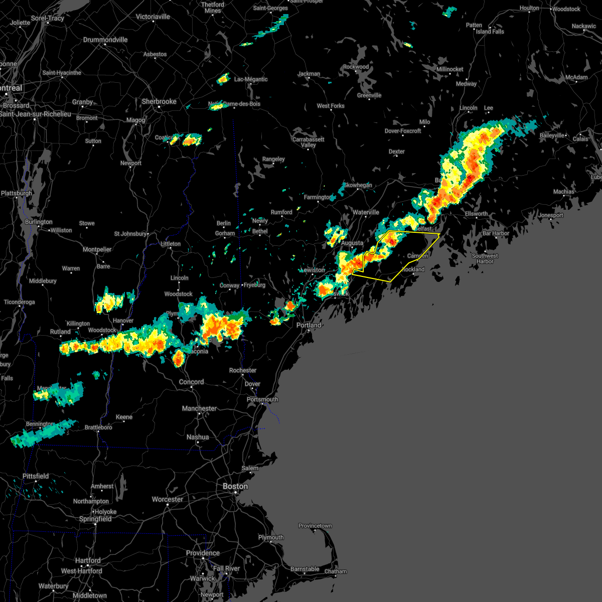
| 7/8/2020 6:39 PM EDT |
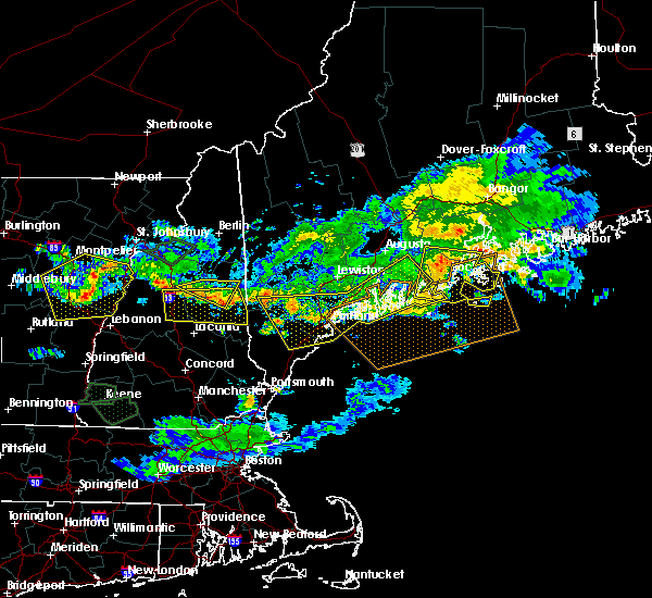 At 639 pm edt, severe thunderstorms were located along a line extending from near bristol to falmouth to 6 miles southeast of cornish, moving south at 30 mph (radar indicated). Hazards include 60 mph wind gusts and quarter size hail. Hail damage to vehicles is expected. expect wind damage to roofs, siding, and trees. locations impacted include, portland, south portland, biddeford, brunswick, westbrook, bath, damariscotta, wiscasset, topsham, naples, cumberland, saco, gorham, falmouth, kennebunk, cape elizabeth, buxton, freeport, gray and hollis. this also includes, sebago lake, higgins beach, crescent beach state park, scarborough beach state park, and reid state park. peaks island, long island, cushing island, cousins island, and bailey island. this includes the following highways, interstate 295 between mile markers 1 and 24. Interstate 95 between mile markers 29 and 62. At 639 pm edt, severe thunderstorms were located along a line extending from near bristol to falmouth to 6 miles southeast of cornish, moving south at 30 mph (radar indicated). Hazards include 60 mph wind gusts and quarter size hail. Hail damage to vehicles is expected. expect wind damage to roofs, siding, and trees. locations impacted include, portland, south portland, biddeford, brunswick, westbrook, bath, damariscotta, wiscasset, topsham, naples, cumberland, saco, gorham, falmouth, kennebunk, cape elizabeth, buxton, freeport, gray and hollis. this also includes, sebago lake, higgins beach, crescent beach state park, scarborough beach state park, and reid state park. peaks island, long island, cushing island, cousins island, and bailey island. this includes the following highways, interstate 295 between mile markers 1 and 24. Interstate 95 between mile markers 29 and 62.
|
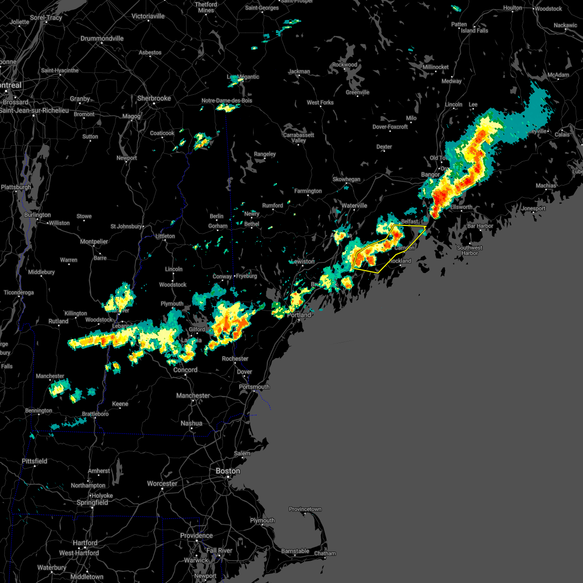
| 7/8/2020 6:26 PM EDT |
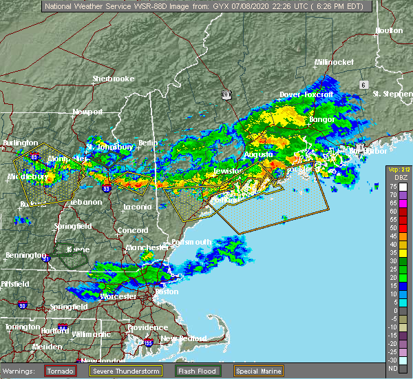 At 626 pm edt, a severe thunderstorm was located 9 miles northwest of thomaston, or 10 miles northwest of rockland, moving east at 40 mph. additional strong winds were moving east to the south of the main storm (radar indicated). Hazards include 60 mph wind gusts and quarter size hail. Hail damage to vehicles is expected. Expect wind damage to roofs, siding, and trees. At 626 pm edt, a severe thunderstorm was located 9 miles northwest of thomaston, or 10 miles northwest of rockland, moving east at 40 mph. additional strong winds were moving east to the south of the main storm (radar indicated). Hazards include 60 mph wind gusts and quarter size hail. Hail damage to vehicles is expected. Expect wind damage to roofs, siding, and trees.
|
| 7/8/2020 6:14 PM EDT |
 At 612 pm edt, severe thunderstorms were located along a line extending from 9 miles northeast of damariscotta to near brunswick to hiram, moving southeast at 50 mph. this line of storms has a history of damaging wind gusts. winds may arrive well before the rain arrives (radar indicated and spotter confirmed). Hazards include 60 mph wind gusts and quarter size hail. Hail damage to vehicles is expected. expect wind damage to roofs, siding, and trees. locations impacted include, portland, south portland, biddeford, brunswick, westbrook, bath, damariscotta, topsham, wiscasset, naples, cumberland, saco, gorham, falmouth, kennebunk, cape elizabeth, buxton, freeport, gray and hollis. this also includes, sebago lake, higgins beach, crescent beach state park, scarborough beach state park, and reid state park. peaks island, long island, cushing island, cousins island, and bailey island. this includes the following highways, interstate 295 between mile markers 1 and 41. Interstate 95 between mile markers 29 and 67. At 612 pm edt, severe thunderstorms were located along a line extending from 9 miles northeast of damariscotta to near brunswick to hiram, moving southeast at 50 mph. this line of storms has a history of damaging wind gusts. winds may arrive well before the rain arrives (radar indicated and spotter confirmed). Hazards include 60 mph wind gusts and quarter size hail. Hail damage to vehicles is expected. expect wind damage to roofs, siding, and trees. locations impacted include, portland, south portland, biddeford, brunswick, westbrook, bath, damariscotta, topsham, wiscasset, naples, cumberland, saco, gorham, falmouth, kennebunk, cape elizabeth, buxton, freeport, gray and hollis. this also includes, sebago lake, higgins beach, crescent beach state park, scarborough beach state park, and reid state park. peaks island, long island, cushing island, cousins island, and bailey island. this includes the following highways, interstate 295 between mile markers 1 and 41. Interstate 95 between mile markers 29 and 67.
|
| 7/8/2020 6:08 PM EDT |
 At 607 pm edt, severe thunderstorms were located along a line extending from 12 miles north of damariscotta to near woolwich, moving southeast at 45 mph (radar indicated). Hazards include 60 mph wind gusts and quarter size hail. Hail damage to vehicles is expected. expect wind damage to roofs, siding, and trees. locations impacted include, brunswick, augusta, bath, rockland, gardiner, damariscotta, lincolnville, topsham, wiscasset, china, litchfield, farmingdale, bristol, liberty, bremen, woolwich, thomaston, palermo, rockport and bowdoin. this includes the following highways, interstate 295 between mile markers 31 and 51. Interstate 95 between mile markers 91 and 105. At 607 pm edt, severe thunderstorms were located along a line extending from 12 miles north of damariscotta to near woolwich, moving southeast at 45 mph (radar indicated). Hazards include 60 mph wind gusts and quarter size hail. Hail damage to vehicles is expected. expect wind damage to roofs, siding, and trees. locations impacted include, brunswick, augusta, bath, rockland, gardiner, damariscotta, lincolnville, topsham, wiscasset, china, litchfield, farmingdale, bristol, liberty, bremen, woolwich, thomaston, palermo, rockport and bowdoin. this includes the following highways, interstate 295 between mile markers 31 and 51. Interstate 95 between mile markers 91 and 105.
|
| 7/8/2020 6:02 PM EDT |
 At 601 pm edt, severe thunderstorms were located along a line extending from 11 miles east of farmingdale to near topsham to near hiram, moving southeast at 45 mph (radar indicated). Hazards include 60 mph wind gusts and quarter size hail. Hail damage to vehicles is expected. Expect wind damage to roofs, siding, and trees. At 601 pm edt, severe thunderstorms were located along a line extending from 11 miles east of farmingdale to near topsham to near hiram, moving southeast at 45 mph (radar indicated). Hazards include 60 mph wind gusts and quarter size hail. Hail damage to vehicles is expected. Expect wind damage to roofs, siding, and trees.
|
| 7/8/2020 5:39 PM EDT |
 At 539 pm edt, severe thunderstorms were located along a line extending from near oakland to near belgrade to near turner, moving southeast at 45 mph (radar indicated). Hazards include 60 mph wind gusts and quarter size hail. Hail damage to vehicles is expected. Expect wind damage to roofs, siding, and trees. At 539 pm edt, severe thunderstorms were located along a line extending from near oakland to near belgrade to near turner, moving southeast at 45 mph (radar indicated). Hazards include 60 mph wind gusts and quarter size hail. Hail damage to vehicles is expected. Expect wind damage to roofs, siding, and trees.
|
| 7/31/2019 5:42 PM EDT | Numerous trees down in waldobor in lincoln county ME, 3.8 miles SSE of Waldoboro, ME |
| 7/31/2019 5:35 PM EDT |
 The national weather service in gray maine has issued a * severe thunderstorm warning for. northwestern knox county in south central maine. south central waldo county in south central maine. northeastern lincoln county in south central maine. Until 630 pm edt. The national weather service in gray maine has issued a * severe thunderstorm warning for. northwestern knox county in south central maine. south central waldo county in south central maine. northeastern lincoln county in south central maine. Until 630 pm edt.
|
| 7/2/2019 3:36 PM EDT |
 The severe thunderstorm warning for west central knox and east central lincoln counties will expire at 345 pm edt, the storm which prompted the warning has weakened below severe limits, and no longer poses an immediate threat to life or property. therefore, the warning will be allowed to expire. however gusty winds and heavy rain are still possible with this thunderstorm. The severe thunderstorm warning for west central knox and east central lincoln counties will expire at 345 pm edt, the storm which prompted the warning has weakened below severe limits, and no longer poses an immediate threat to life or property. therefore, the warning will be allowed to expire. however gusty winds and heavy rain are still possible with this thunderstorm.
|
| 7/2/2019 3:19 PM EDT |
 At 318 pm edt, a severe thunderstorm was located over thomaston, or near rockland, moving southeast at 20 mph (radar indicated). Hazards include 60 mph wind gusts and quarter size hail. Hail damage to vehicles is expected. expect wind damage to roofs, siding, and trees. locations impacted include, rockland, thomaston, rockport, cushing, friendship, south thomaston, owls head, saint george and waldoboro. This also includes, birch point beach state park. At 318 pm edt, a severe thunderstorm was located over thomaston, or near rockland, moving southeast at 20 mph (radar indicated). Hazards include 60 mph wind gusts and quarter size hail. Hail damage to vehicles is expected. expect wind damage to roofs, siding, and trees. locations impacted include, rockland, thomaston, rockport, cushing, friendship, south thomaston, owls head, saint george and waldoboro. This also includes, birch point beach state park.
|
| 7/2/2019 2:46 PM EDT |
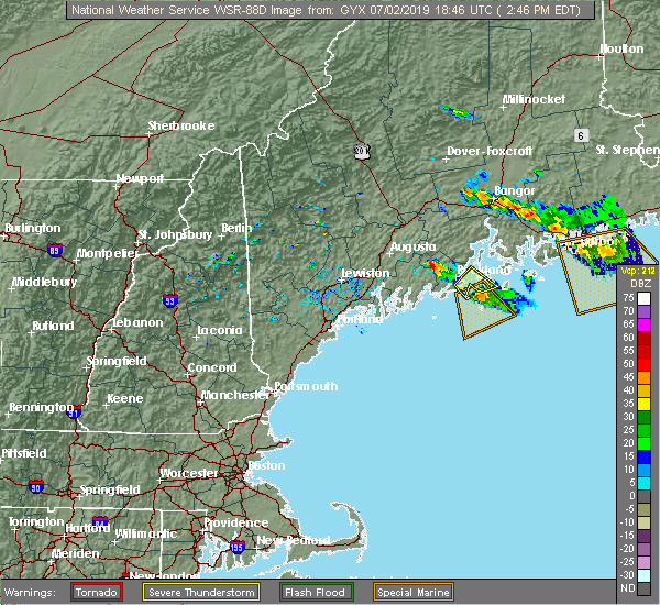 At 246 pm edt, a severe thunderstorm was located 11 miles northwest of thomaston, or 13 miles northwest of rockland, moving southeast at 20 mph (radar indicated). Hazards include 60 mph wind gusts and half dollar size hail. Hail damage to vehicles is expected. Expect wind damage to roofs, siding, and trees. At 246 pm edt, a severe thunderstorm was located 11 miles northwest of thomaston, or 13 miles northwest of rockland, moving southeast at 20 mph (radar indicated). Hazards include 60 mph wind gusts and half dollar size hail. Hail damage to vehicles is expected. Expect wind damage to roofs, siding, and trees.
|
| 6/28/2019 4:19 PM EDT |
 At 419 pm edt, a severe thunderstorm was located over bremen, or near damariscotta, moving southeast at 25 mph (radar indicated). Hazards include 60 mph wind gusts and penny size hail. Expect damage to roofs, siding, and trees. locations impacted include, damariscotta, bristol, bremen, cushing, edgecomb, friendship, alna, nobleboro, waldoboro, newcastle, south bristol and saint george. this also includes, pemaquid beach. Burnt island, friendship long island, cranberry island, otter island, and thompson island. At 419 pm edt, a severe thunderstorm was located over bremen, or near damariscotta, moving southeast at 25 mph (radar indicated). Hazards include 60 mph wind gusts and penny size hail. Expect damage to roofs, siding, and trees. locations impacted include, damariscotta, bristol, bremen, cushing, edgecomb, friendship, alna, nobleboro, waldoboro, newcastle, south bristol and saint george. this also includes, pemaquid beach. Burnt island, friendship long island, cranberry island, otter island, and thompson island.
|
| 6/28/2019 4:03 PM EDT |
 At 403 pm edt, a severe thunderstorm was located over damariscotta, moving southeast at 25 mph (radar indicated). Hazards include 60 mph wind gusts and quarter size hail. Hail damage to vehicles is expected. Expect wind damage to roofs, siding, and trees. At 403 pm edt, a severe thunderstorm was located over damariscotta, moving southeast at 25 mph (radar indicated). Hazards include 60 mph wind gusts and quarter size hail. Hail damage to vehicles is expected. Expect wind damage to roofs, siding, and trees.
|
| 10/30/2017 10:11 AM EDT | Trees down in lincoln county ME, 9.2 miles SSE of Waldoboro, ME |
| 8/6/2016 4:09 PM EDT |
 At 409 pm edt, a severe thunderstorm was located near thomaston, or 9 miles southwest of rockland, moving east at 35 mph (radar indicated). Hazards include 60 mph wind gusts and quarter size hail. Hail damage to vehicles is expected. expect wind damage to roofs, siding, and trees. Locations impacted include, rockland, bremen, thomaston, rockport, cushing, friendship, south thomaston, saint george, owls head and waldoboro. At 409 pm edt, a severe thunderstorm was located near thomaston, or 9 miles southwest of rockland, moving east at 35 mph (radar indicated). Hazards include 60 mph wind gusts and quarter size hail. Hail damage to vehicles is expected. expect wind damage to roofs, siding, and trees. Locations impacted include, rockland, bremen, thomaston, rockport, cushing, friendship, south thomaston, saint george, owls head and waldoboro.
|
| 8/6/2016 3:55 PM EDT |
 At 355 pm edt, a severe thunderstorm was located over bremen, or near damariscotta, moving east at 35 mph (radar indicated). Hazards include 60 mph wind gusts and quarter size hail. Hail damage to vehicles is expected. Expect wind damage to roofs, siding, and trees. At 355 pm edt, a severe thunderstorm was located over bremen, or near damariscotta, moving east at 35 mph (radar indicated). Hazards include 60 mph wind gusts and quarter size hail. Hail damage to vehicles is expected. Expect wind damage to roofs, siding, and trees.
|
| 7/22/2016 10:49 PM EDT |
 At 1048 pm edt, severe thunderstorms were located along a line extending from near damariscotta to near bristol to 15 miles southeast of georgetown, moving east at 40 mph (radar indicated). Hazards include 60 mph wind gusts. Expect damage to roofs. siding. and trees. Locations impacted include, damariscotta, bristol, bremen, boothbay, cushing, edgecomb, friendship, waldoboro, south bristol, southport, newcastle, saint george, south thomaston, nobleboro and owls head. At 1048 pm edt, severe thunderstorms were located along a line extending from near damariscotta to near bristol to 15 miles southeast of georgetown, moving east at 40 mph (radar indicated). Hazards include 60 mph wind gusts. Expect damage to roofs. siding. and trees. Locations impacted include, damariscotta, bristol, bremen, boothbay, cushing, edgecomb, friendship, waldoboro, south bristol, southport, newcastle, saint george, south thomaston, nobleboro and owls head.
|
| 7/22/2016 10:20 PM EDT |
 At 1020 pm edt, severe thunderstorms were located along a line extending from 6 miles northwest of woolwich to georgetown to 19 miles south of bath, moving east at 40 mph (radar indicated). Hazards include 60 mph wind gusts. Expect damage to roofs. siding. And trees. At 1020 pm edt, severe thunderstorms were located along a line extending from 6 miles northwest of woolwich to georgetown to 19 miles south of bath, moving east at 40 mph (radar indicated). Hazards include 60 mph wind gusts. Expect damage to roofs. siding. And trees.
|
| 8/12/2015 9:15 PM EDT |
 At 913 pm edt, doppler radar indicated a severe thunderstorm capable of producing damaging winds in excess of 60 mph. this storm was located 11 miles east of farmingdale, or 11 miles east of gardiner, moving northeast at 30 mph. penny size hail may also accompany the damaging winds. locations impacted include, augusta, gardiner, damariscotta, wiscasset, china, farmingdale, bremen, chelsea, jefferson, dresden, alna, somerville, pittston, nobleboro, waldoboro, windsor, whitefield, newcastle, hibberts gore and west gardiner. At 913 pm edt, doppler radar indicated a severe thunderstorm capable of producing damaging winds in excess of 60 mph. this storm was located 11 miles east of farmingdale, or 11 miles east of gardiner, moving northeast at 30 mph. penny size hail may also accompany the damaging winds. locations impacted include, augusta, gardiner, damariscotta, wiscasset, china, farmingdale, bremen, chelsea, jefferson, dresden, alna, somerville, pittston, nobleboro, waldoboro, windsor, whitefield, newcastle, hibberts gore and west gardiner.
|
| 8/12/2015 8:55 PM EDT |
 At 854 pm edt, doppler radar indicated a severe thunderstorm capable of producing quarter size hail and damaging winds in excess of 60 mph. this storm was located near gardiner, and moving northeast at 30 mph. At 854 pm edt, doppler radar indicated a severe thunderstorm capable of producing quarter size hail and damaging winds in excess of 60 mph. this storm was located near gardiner, and moving northeast at 30 mph.
|
| 9/11/2013 8:45 PM EDT | Trees down at the intersection of routes 126 and 215 in lincoln county ME, 9.2 miles SSE of Waldoboro, ME |
| 9/11/2013 8:25 PM EDT | Trees down at the intersection of routes 126 and 215 in lincoln county ME, 9.2 miles SSE of Waldoboro, ME |
| 7/24/2013 2:35 PM EDT | Large branch down on route 32 near the jefferson town lin in lincoln county ME, 8.4 miles SSE of Waldoboro, ME |
Hail Maps for Waldoboro, ME


Connect with Interactive Hail Maps